Index Maps for Electoral Division Maps (Portable Document Format)
This map links to Portable Document Format (PDF) files of individual Commonwealth electoral division maps for New South Wales and to an index map of Sydney electoral divisions.
The PDF files are between 1 and 3 MB in size and a PDF reader is needed to view them. If you do not have a PDF reader you can click on this button  to download the free Adobe Acrobat Reader.
 Please note that the PDF files are configured to open in a new window. If you have popups blocked, you may need to enable popups or hold down the Control key while clicking on the link to allow the PDF to be displayed.
This map links to PDF maps of the Dalley, East Sydney, Lang, North Sydney, Parkes, South Sydney, Wentworth and West Sydney electoral divisions.
Report and Schedules of the Federal Electoral Districts Commissioners
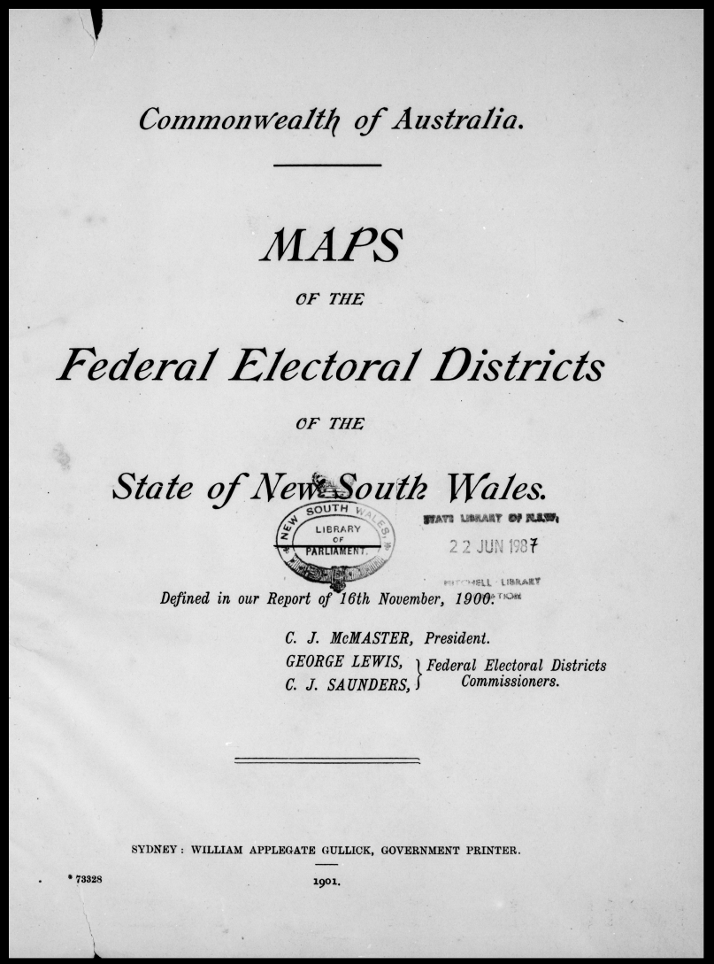
- Title page
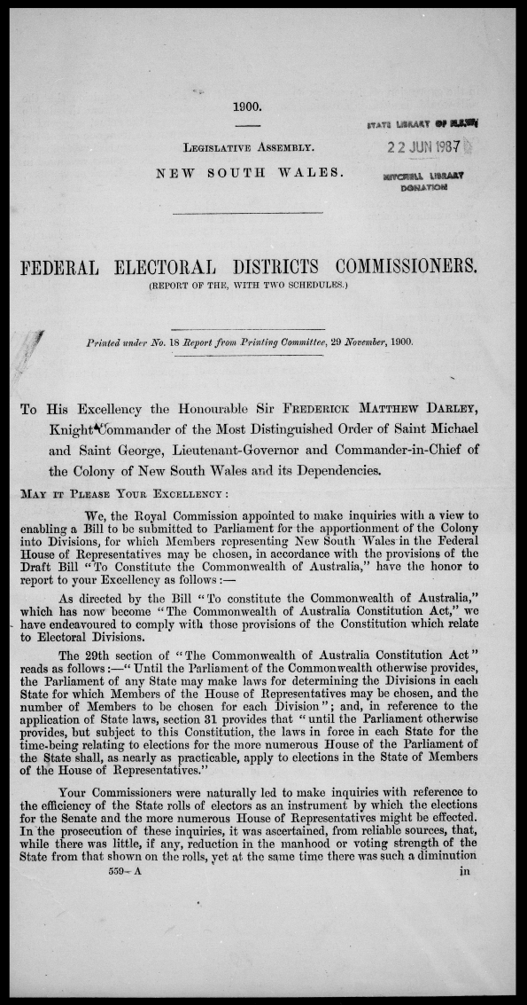
- Page 1: Report
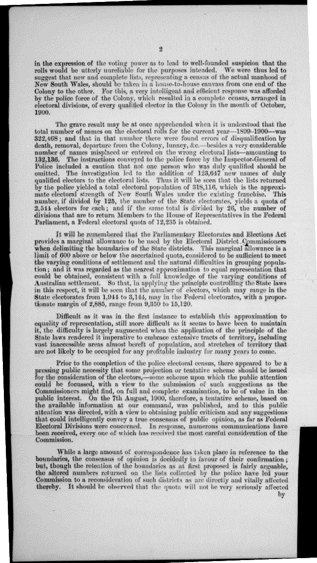
- Page 2: Report (cont.)
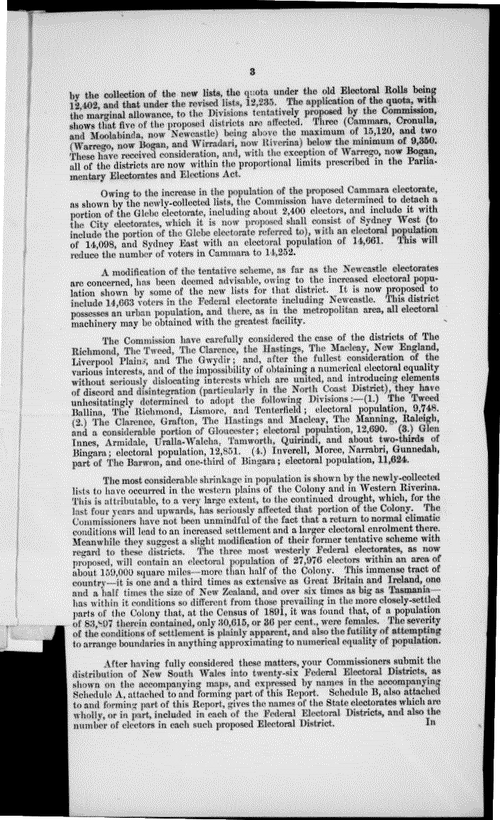
- Page 3: Report (cont.)
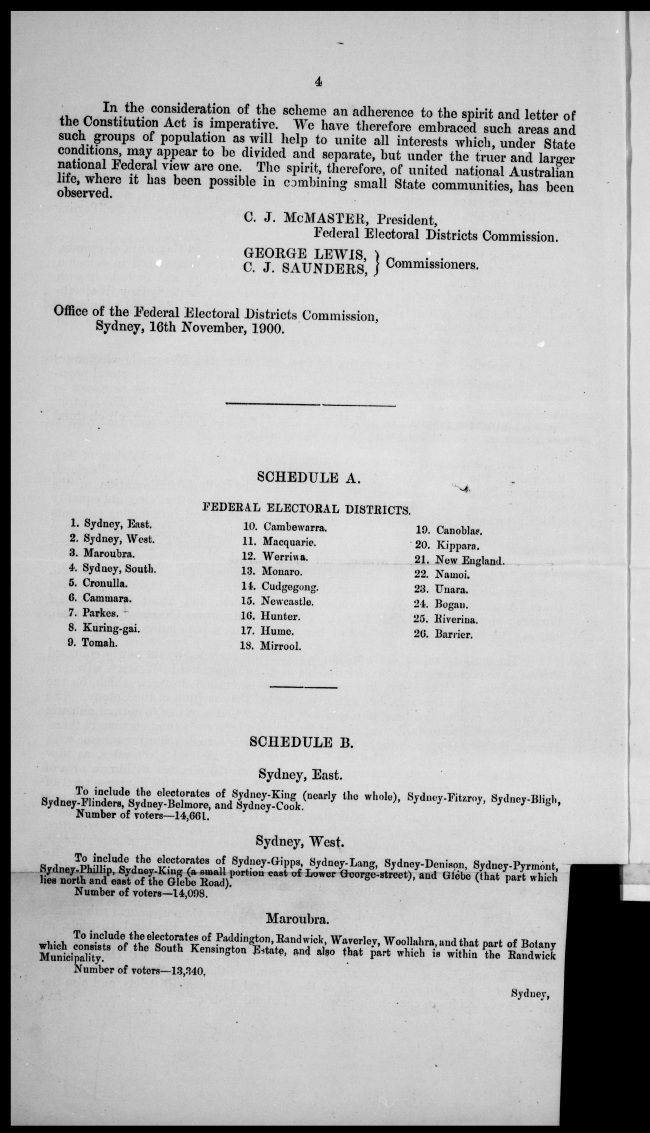
- Page 4: Report (cont.), Schedule A, Schedule B
- Page 5: Schedule B (cont.)
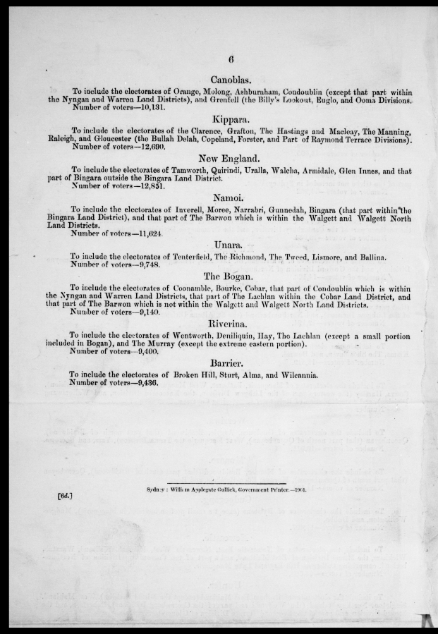
- Page 6: Schedule B (cont.)
- New South Wales Federal Elections Act 1900 page 1
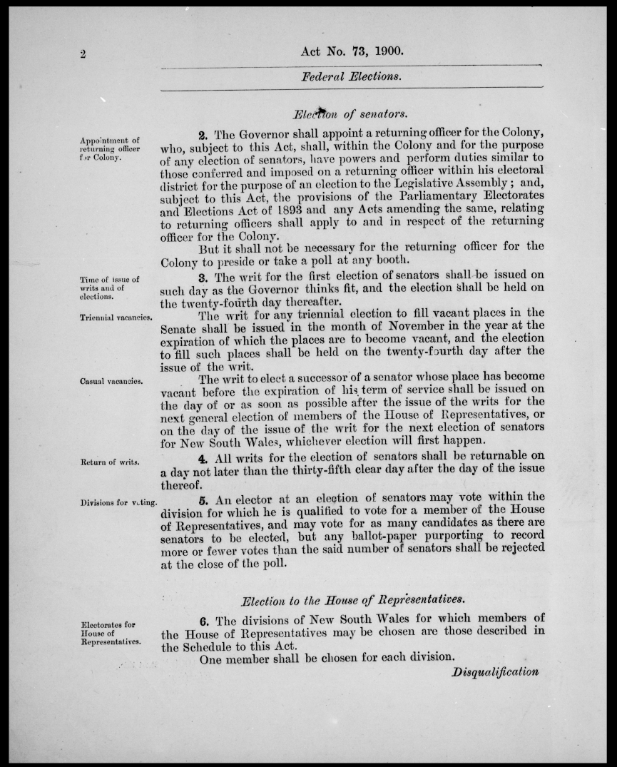
- Federal Elections Act 1900 page 2
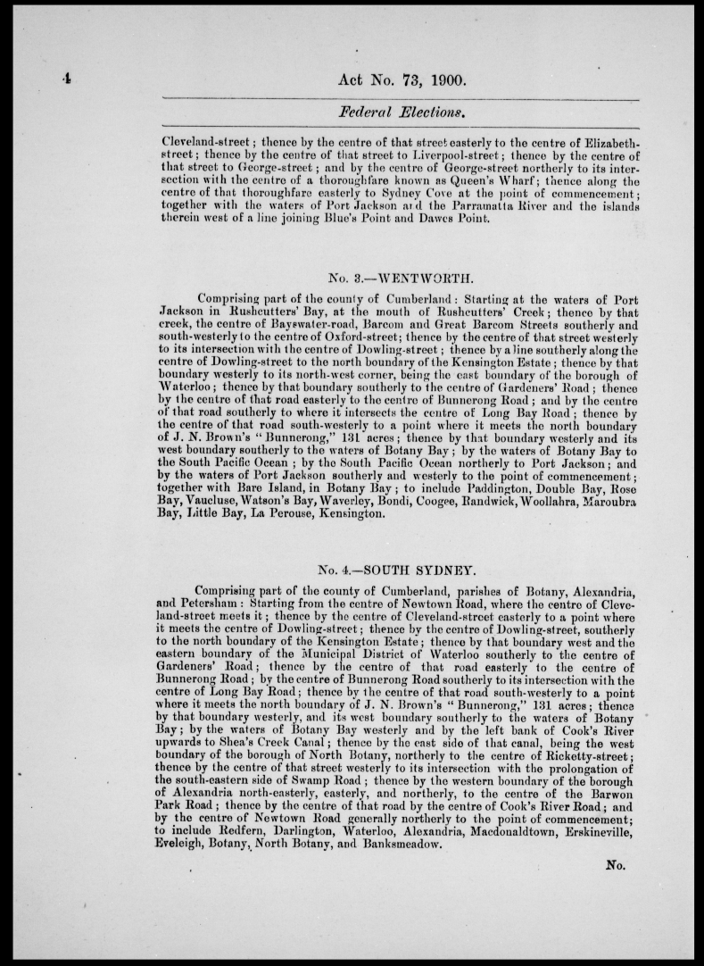
- New South Wales Federal Elections Act 1900 page 3, Schedule: East Sydney, West Sydney
- Schedule: West Sydney (cont.), Wentworth, South Sydney
- Schedule: Lang, Dalley, Parkes
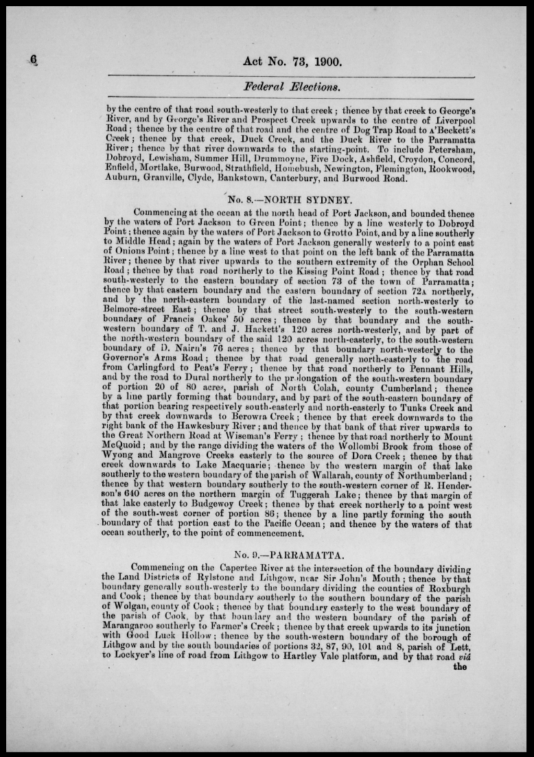
- Schedule: Parkes (cont.), North Sydney, Parramatta
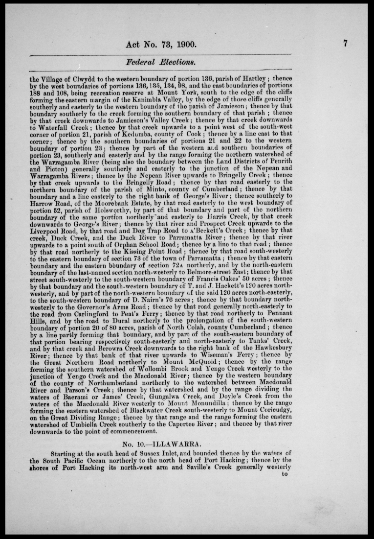
- Schedule: Parramatta (cont.), Illawarra
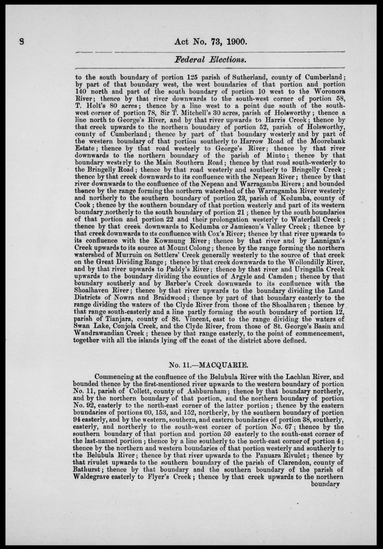
- Schedule: Illawarra (cont.), Macquarie
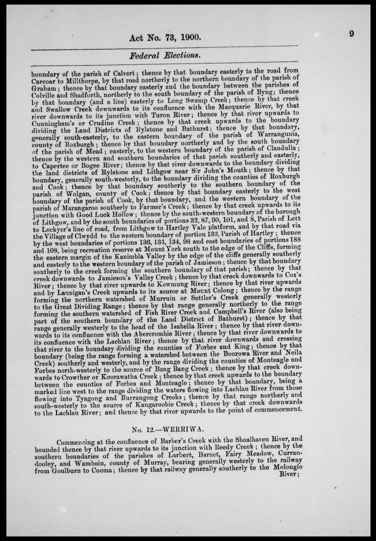
- Schedule: Macquarie (cont.), Werriwa
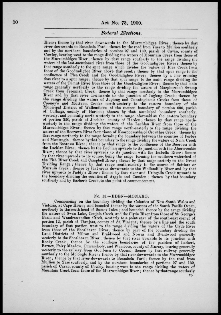
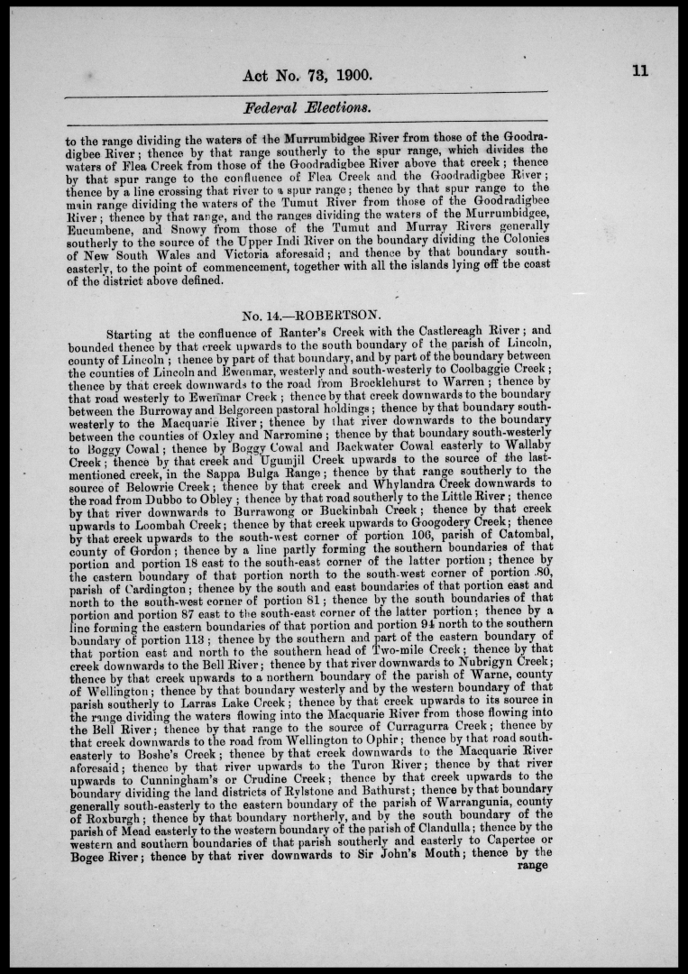
- Schedule: Werriwa (cont.), Eden-Monaro
- Schedule: Eden-Monaro (cont.), Robertson
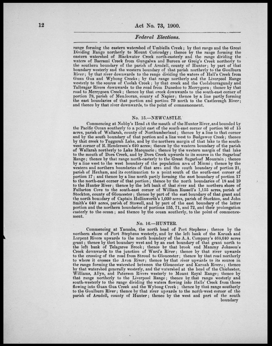
- Schedule: Robertson (cont.), Newcastle, Hunter
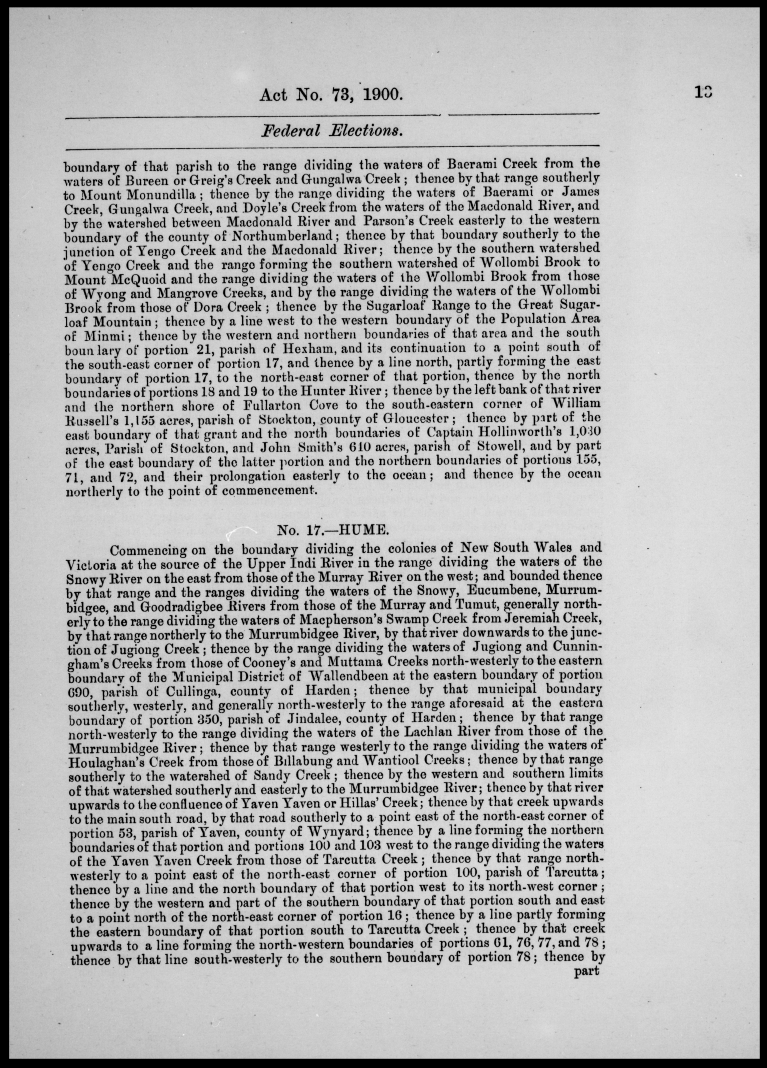
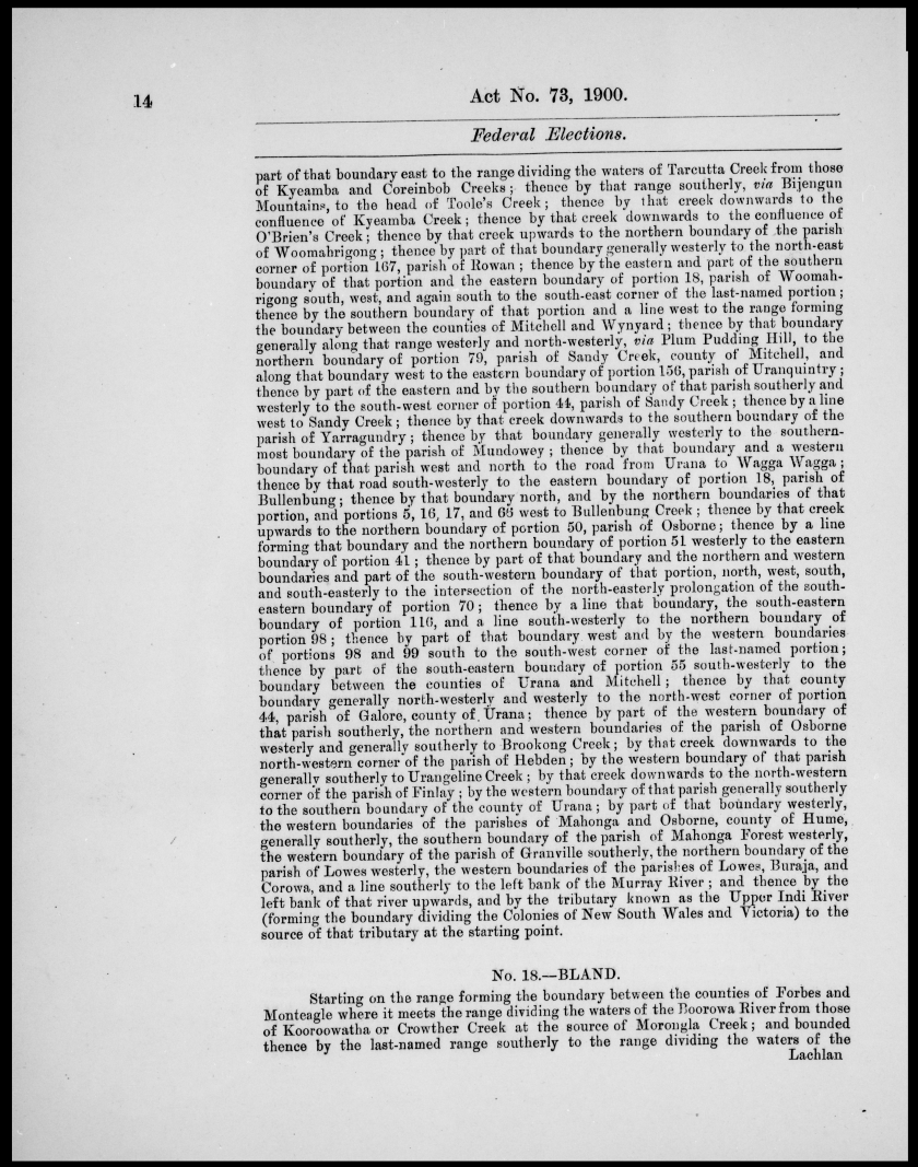
- Schedule: Hunter (cont.), Hume
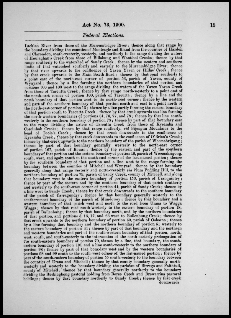
- Schedule: Hume (cont.), Bland
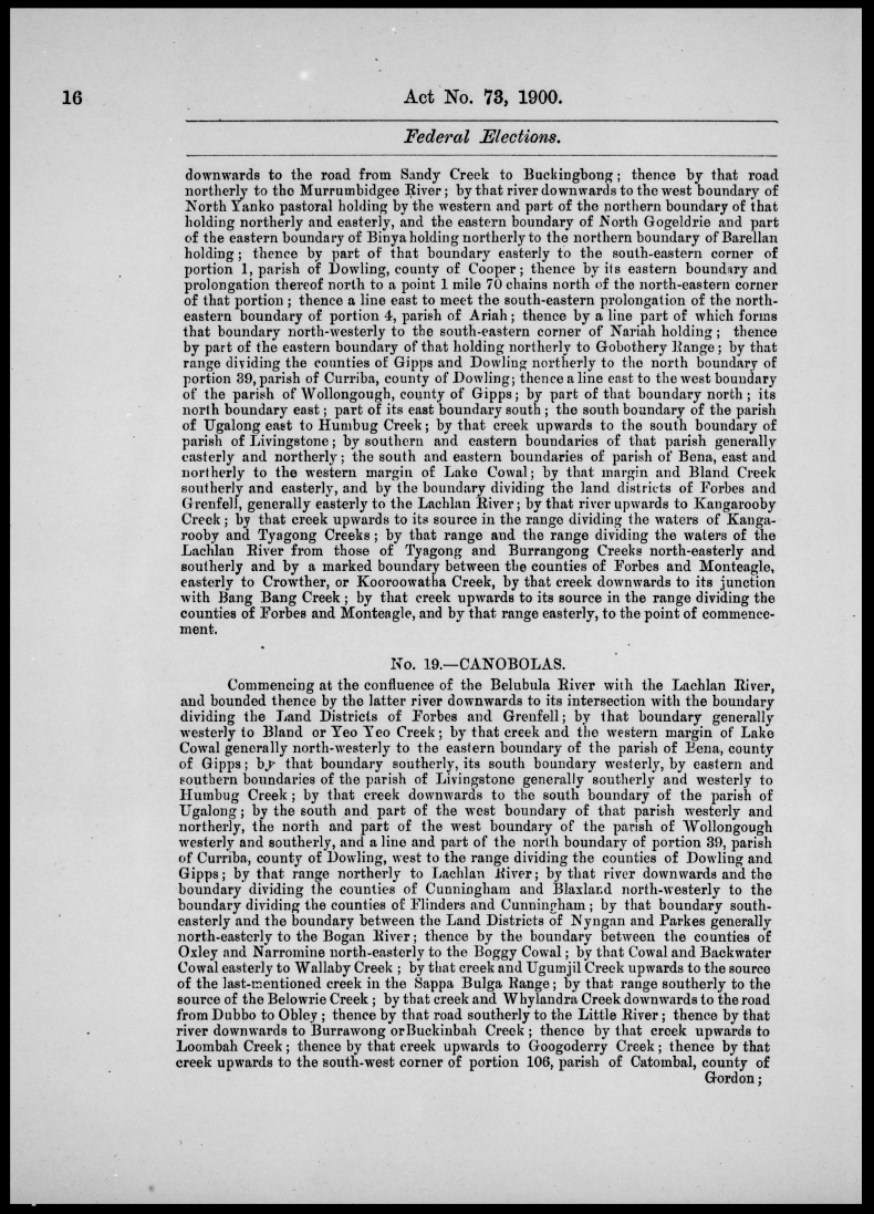
- Schedule: Bland (cont.)
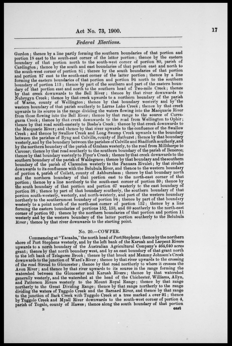
- Schedule: Bland (cont.), Canobolas
- Schedule: Canobolas (cont.), Cowper
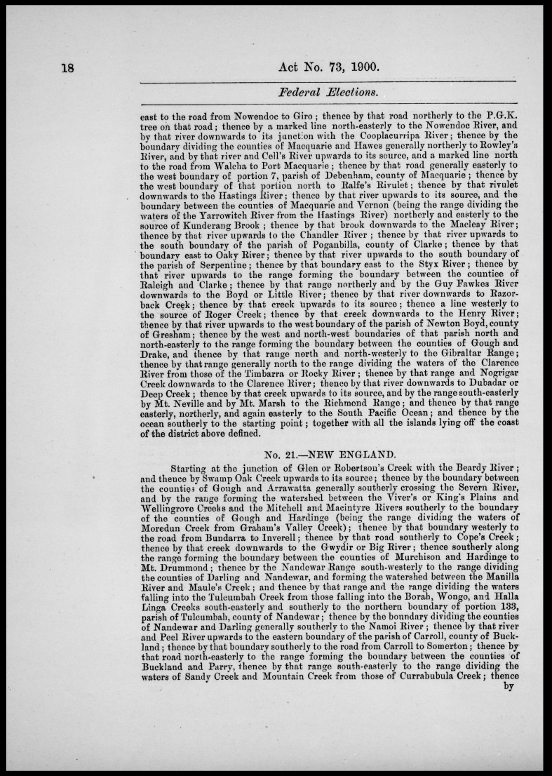
- Schedule: Cowper (cont.), New England
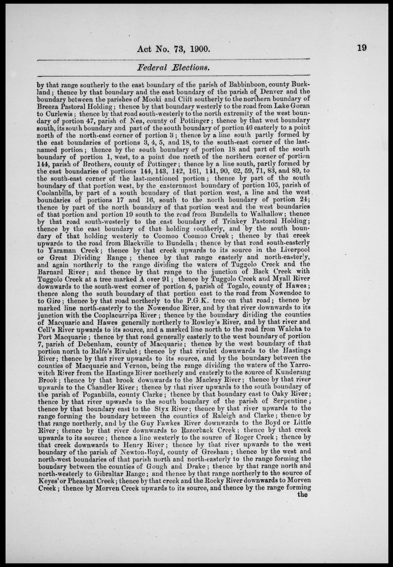
- Schedule: New England (cont.)
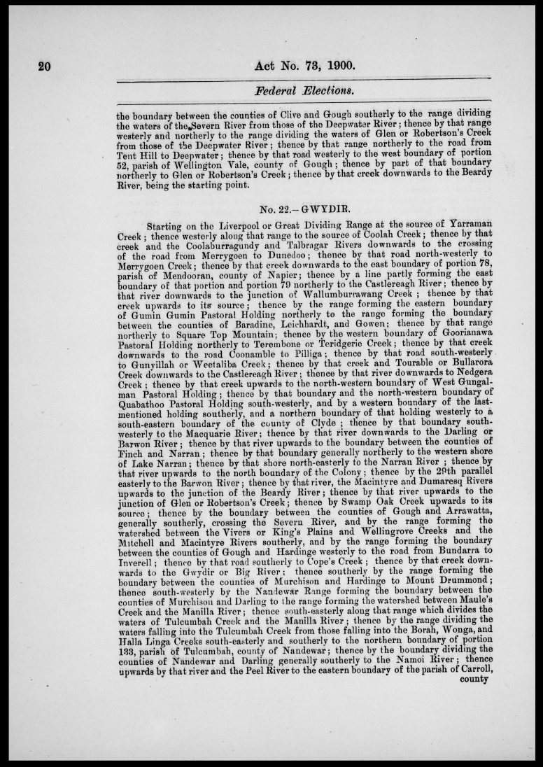
- Schedule: New England (cont.), Gwydir
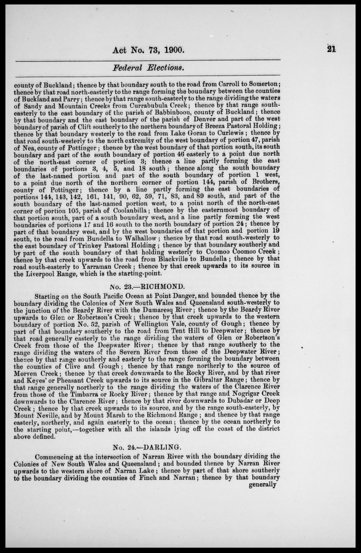
- Schedule: Gwydir (cont.), Richmond, Darling
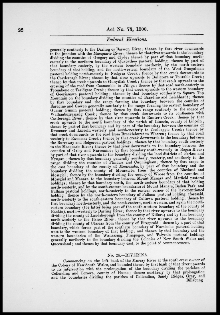
- Schedule: Darling (cont.), Riverina
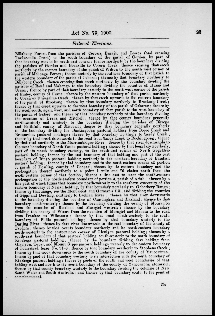
- Schedule: Riverina (cont.)
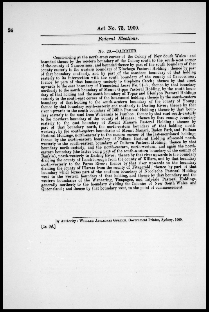
- Schedule: Barrier
Return to NSW Family History Documents front page
Contact admin@ihr.com.au
Copyright © Internet History Resources 2006
