IHR NSW Family History Documents
Electoral Rolls Index
Home | Directories | Electoral | Land | General | Mining | Pastoral | OccupationsNSW Electoral Rolls 1903 - Richmond Division
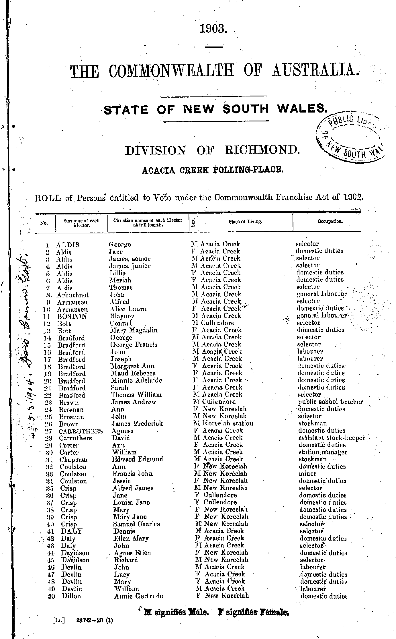
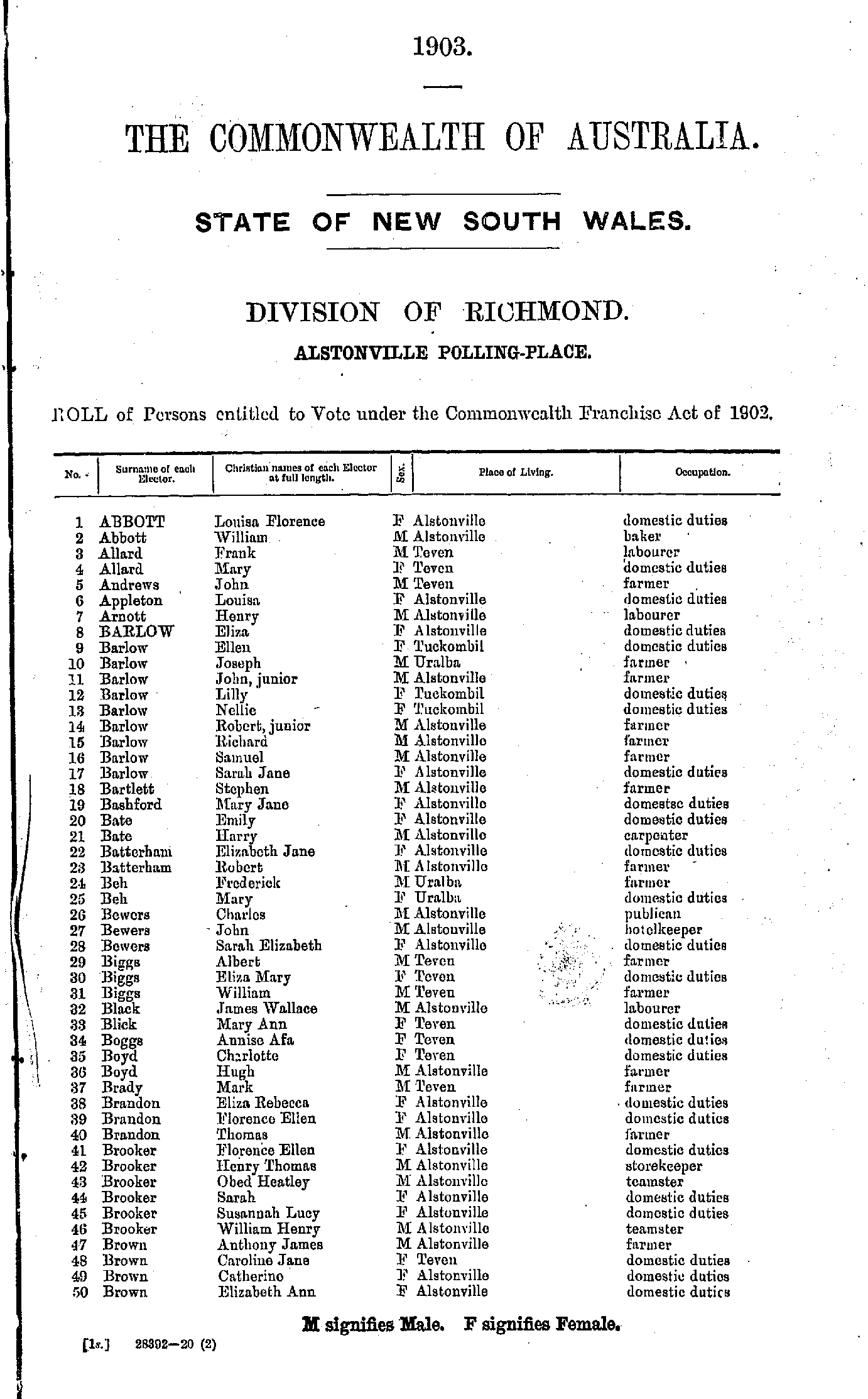
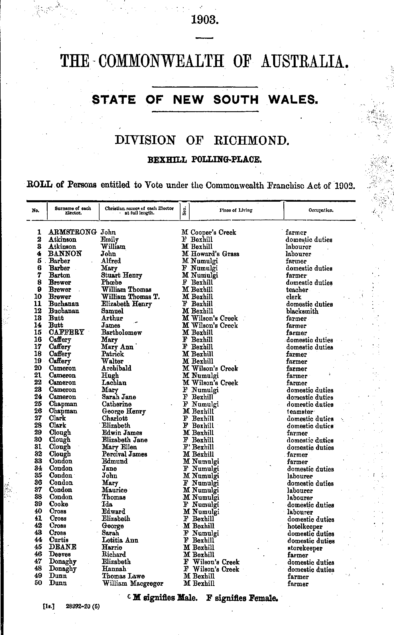
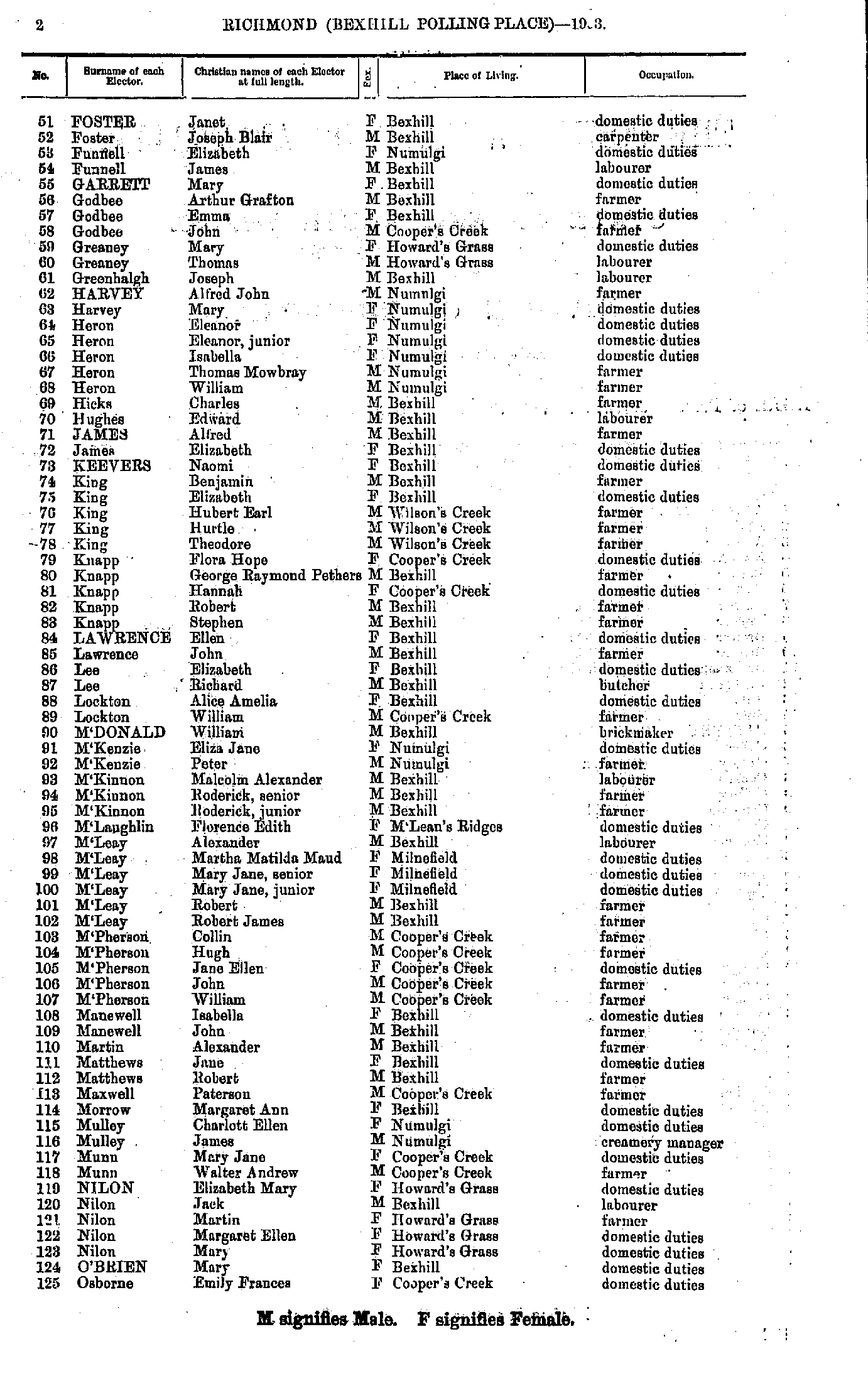
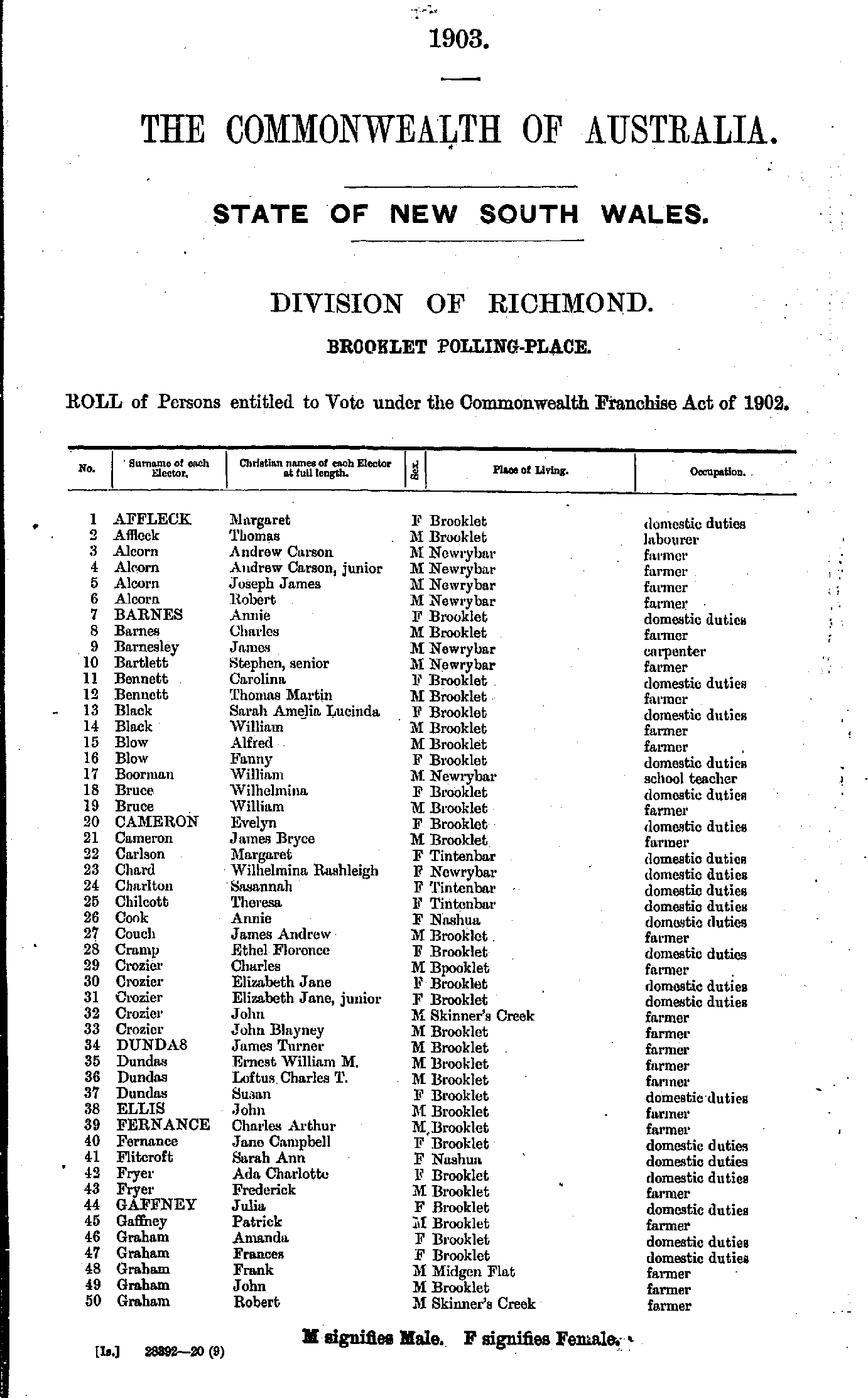
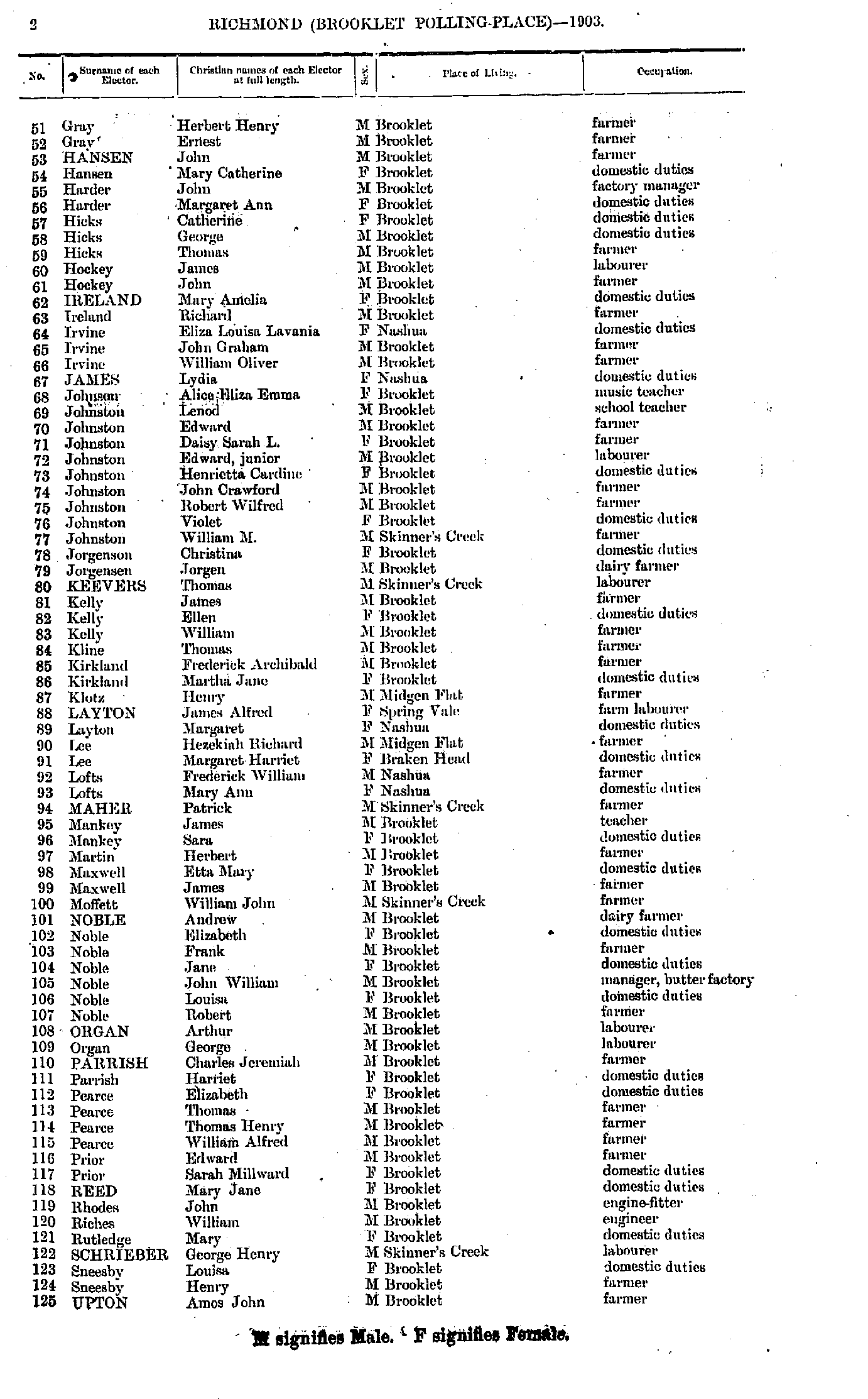
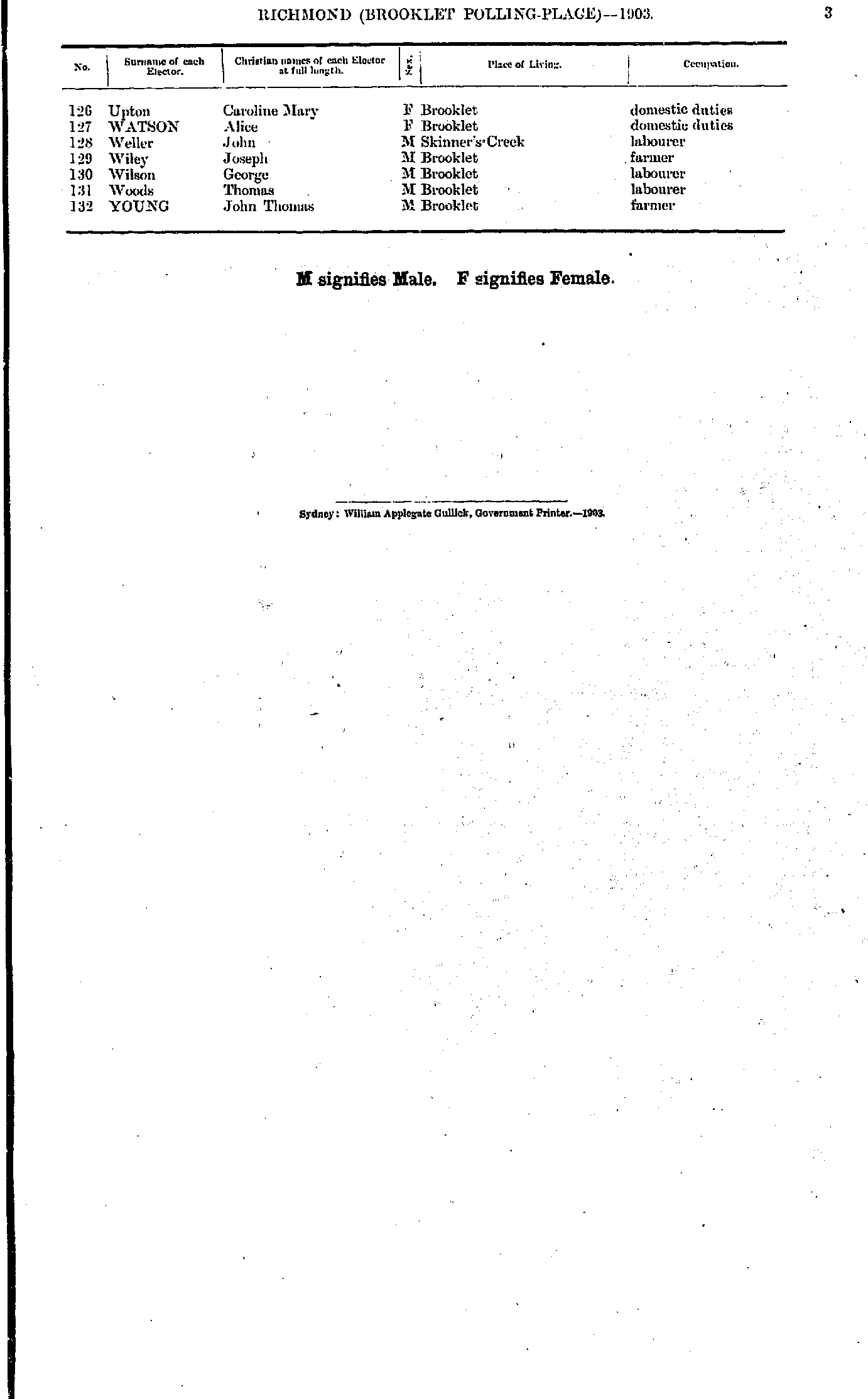
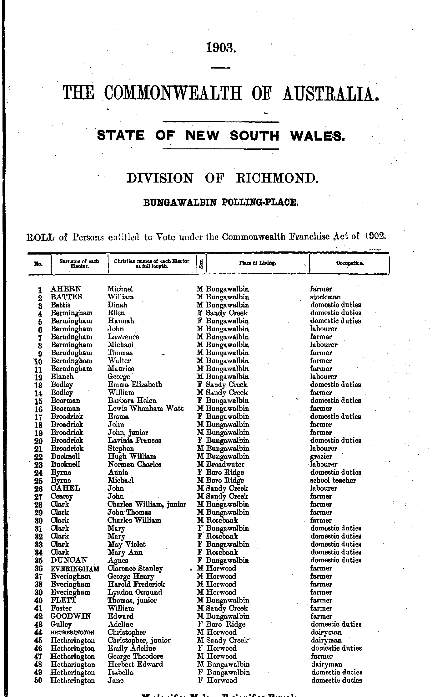
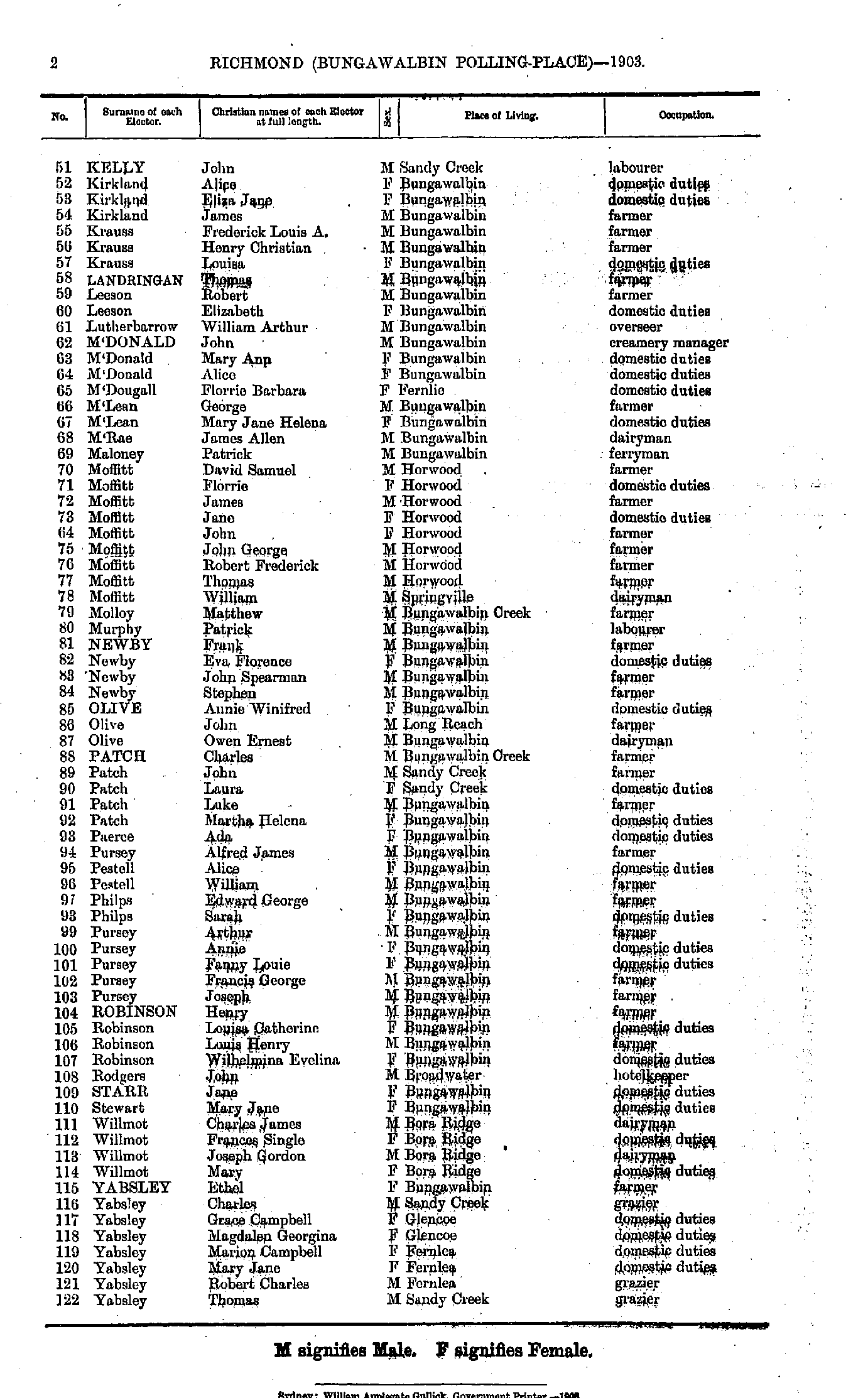
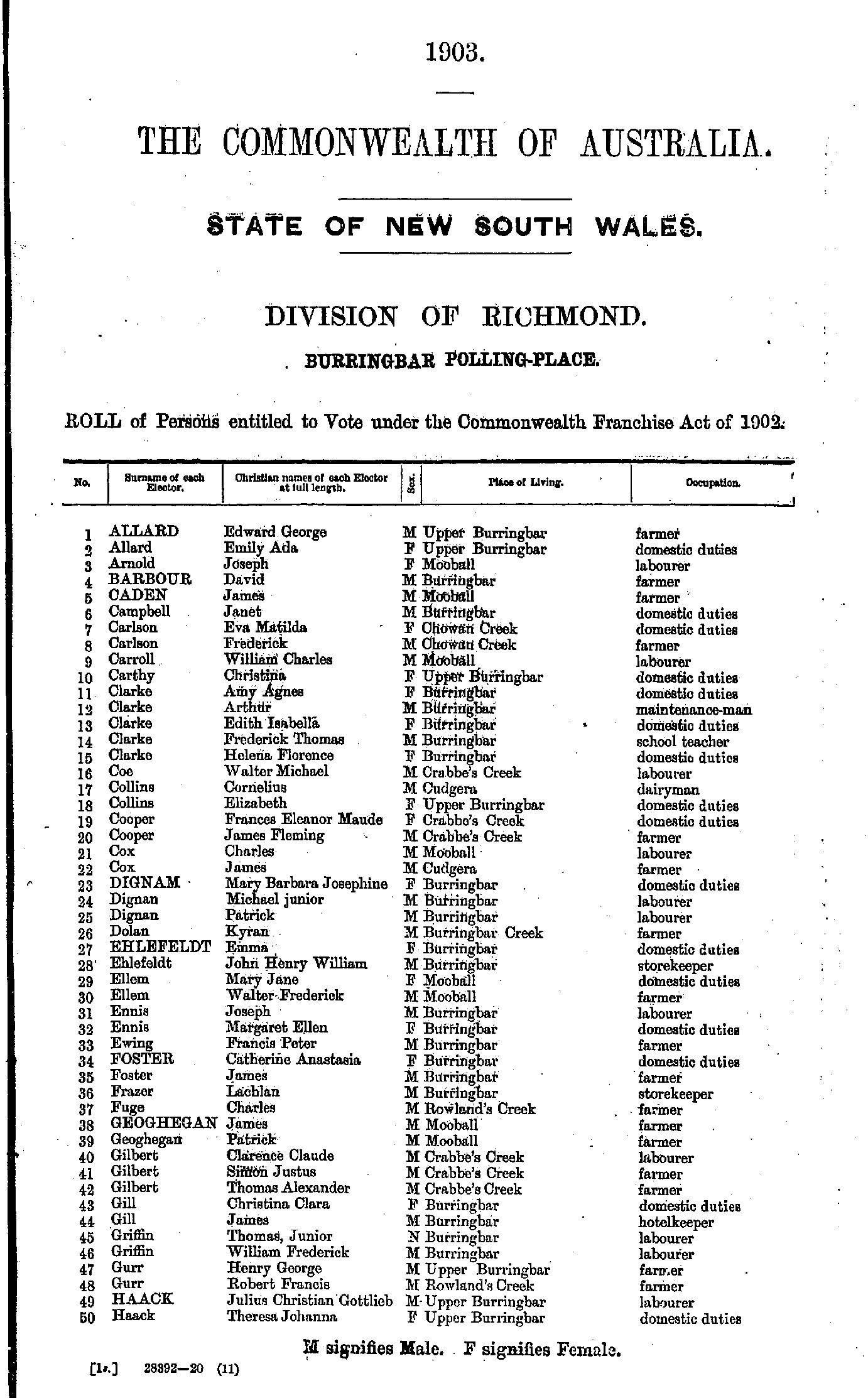
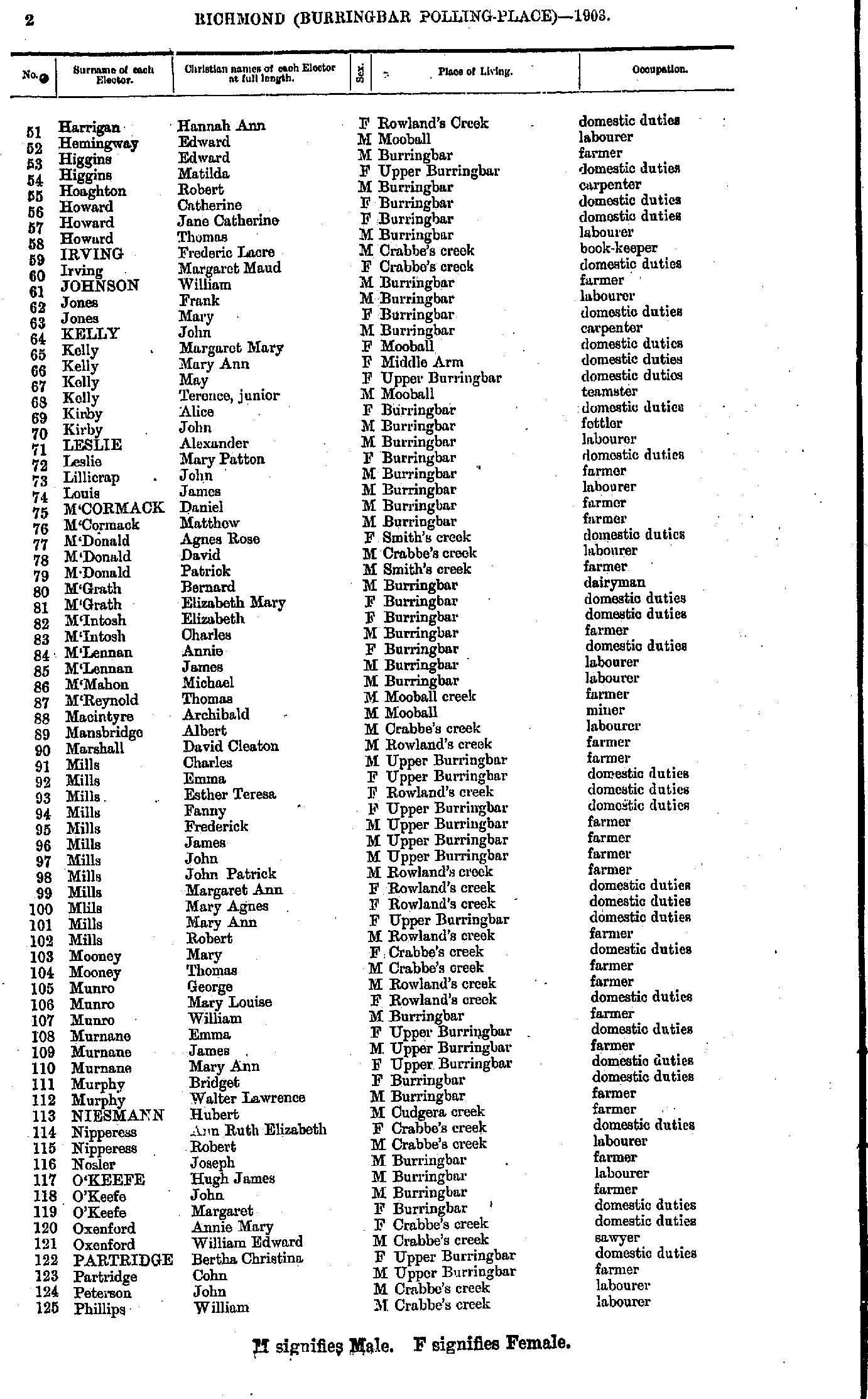
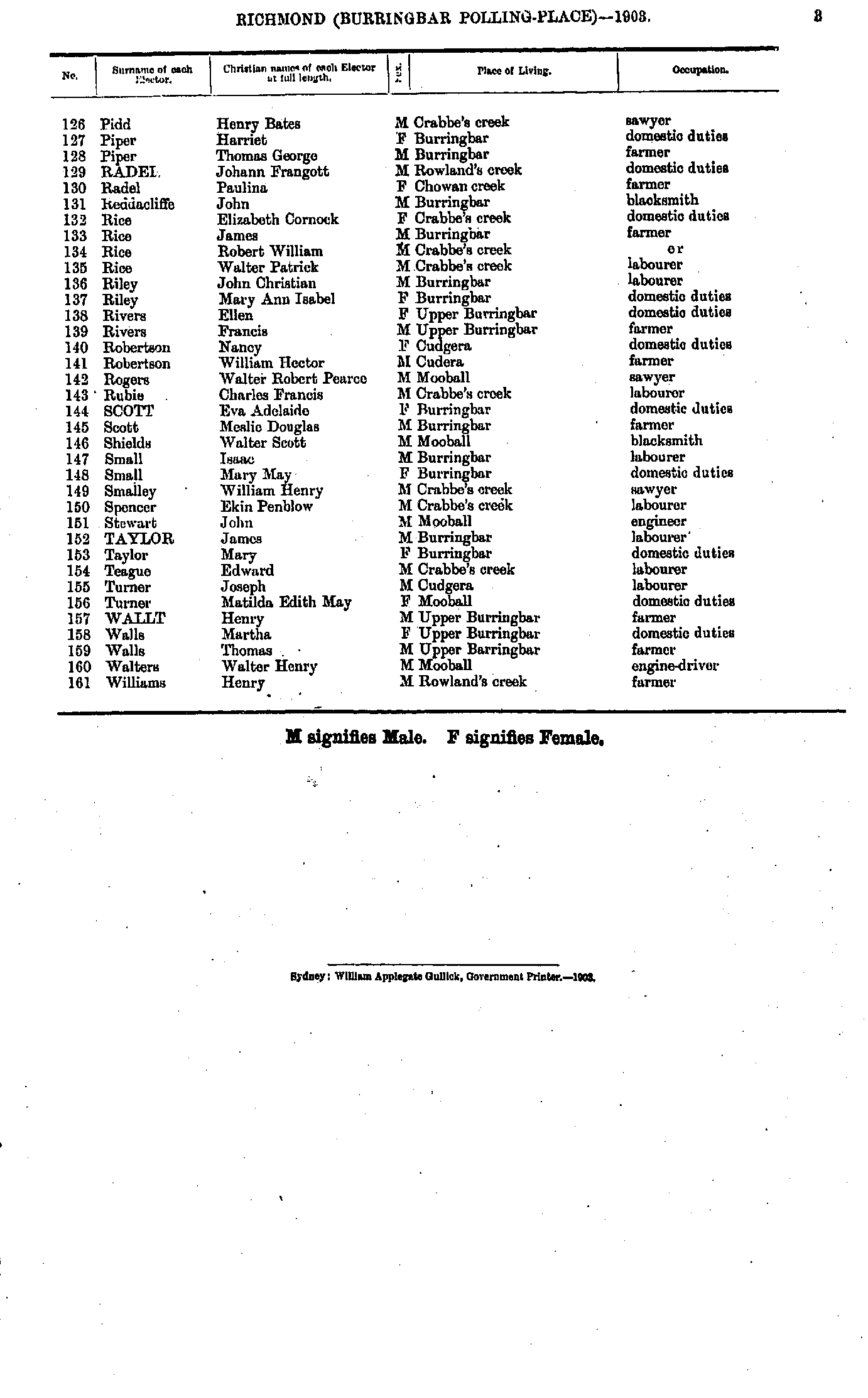
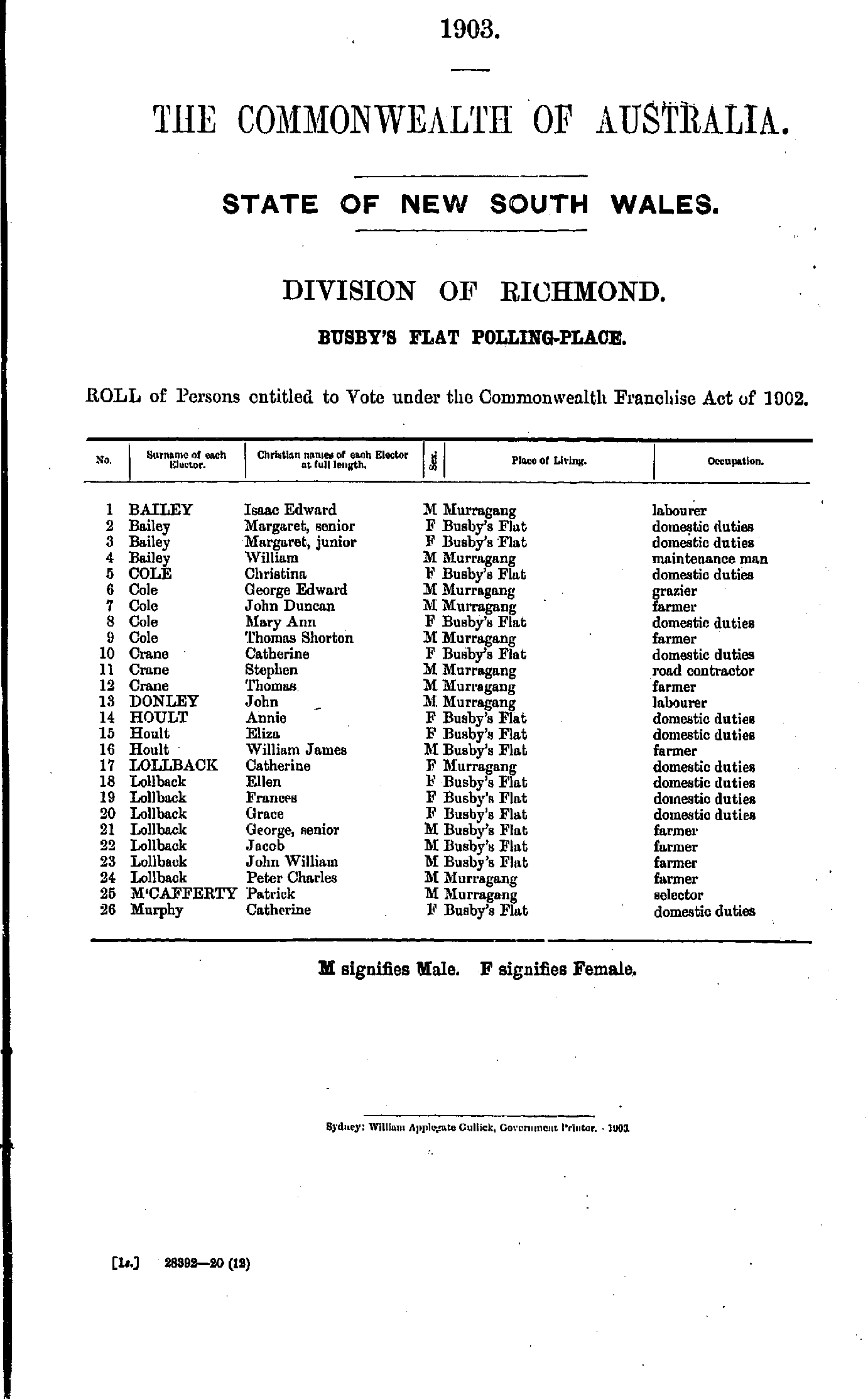
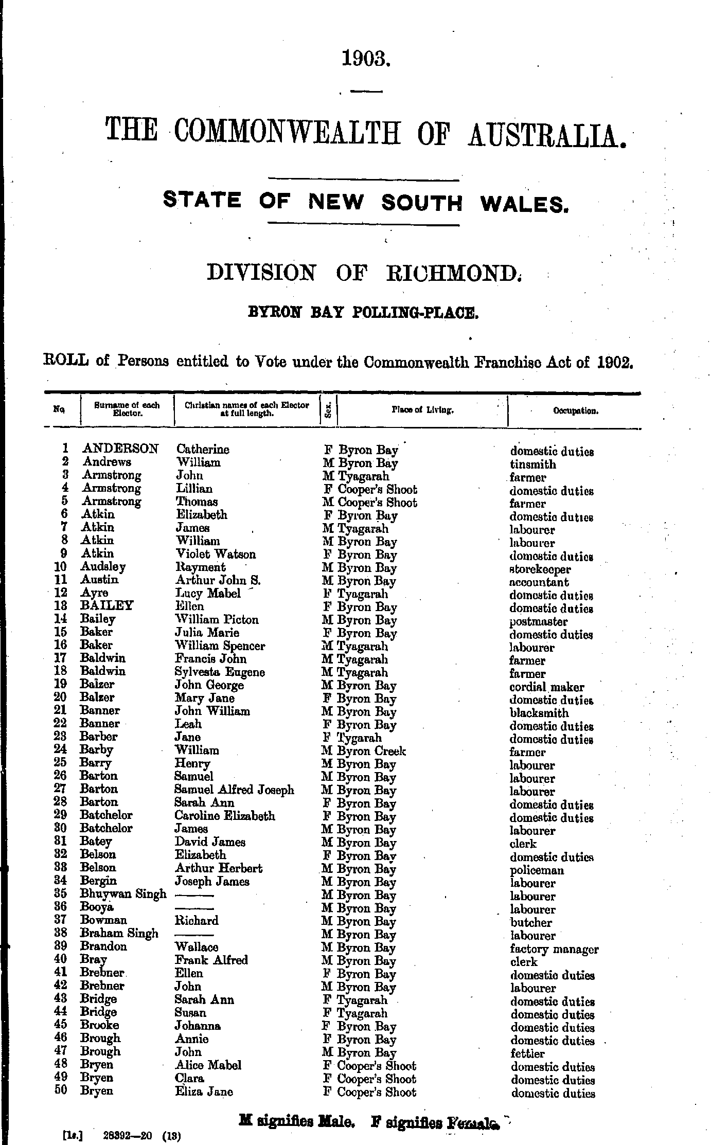
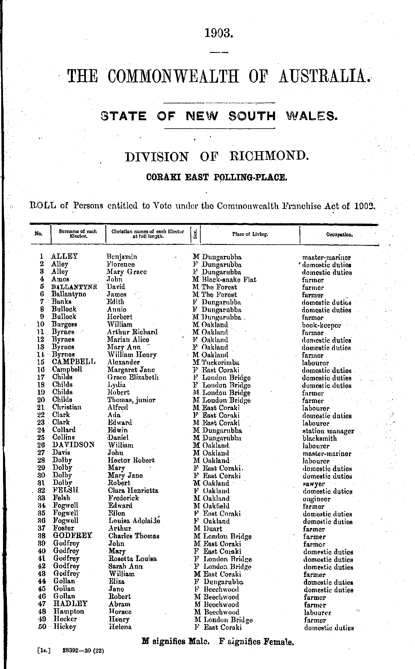
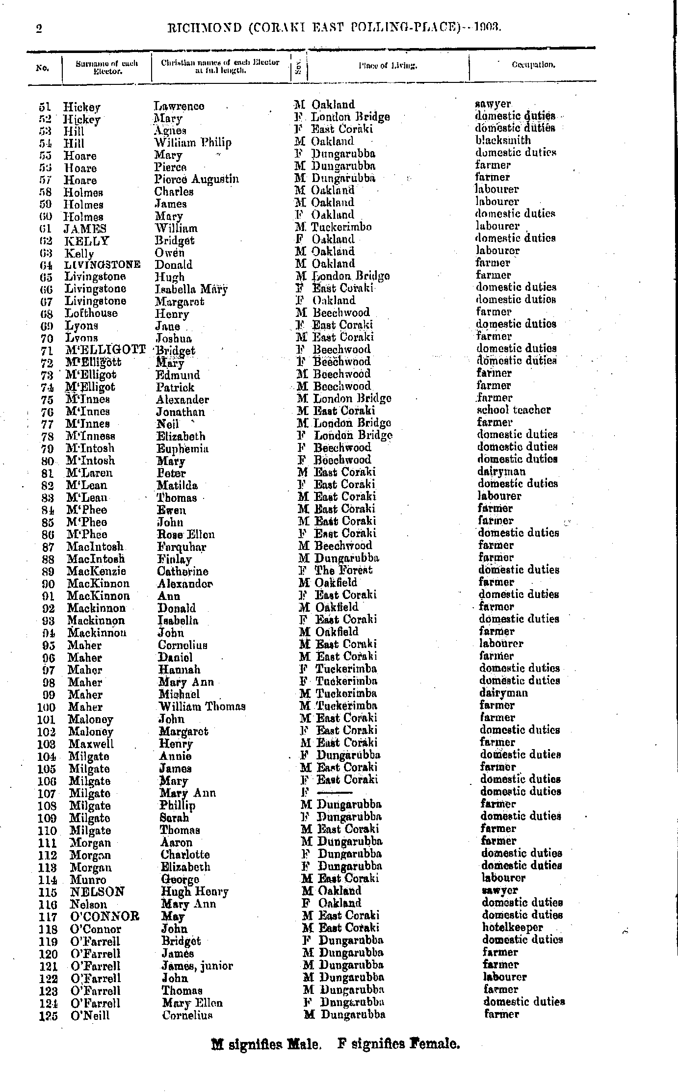
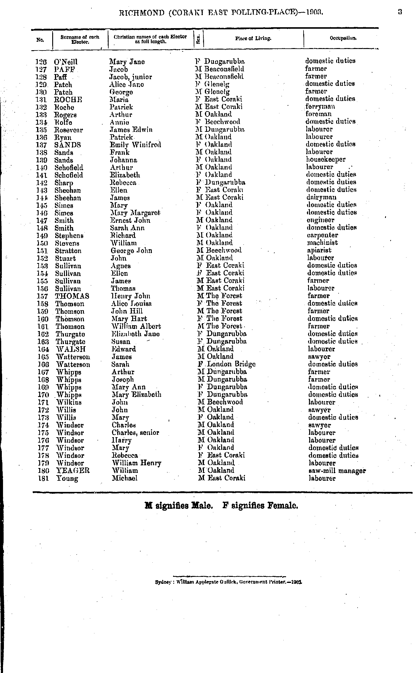
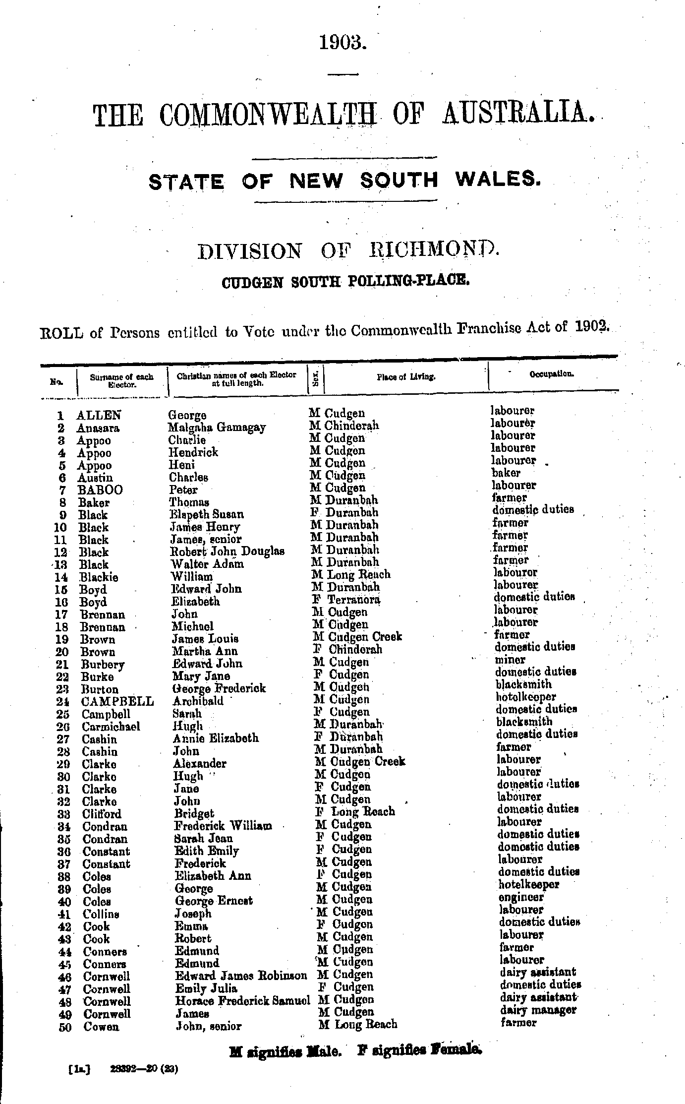
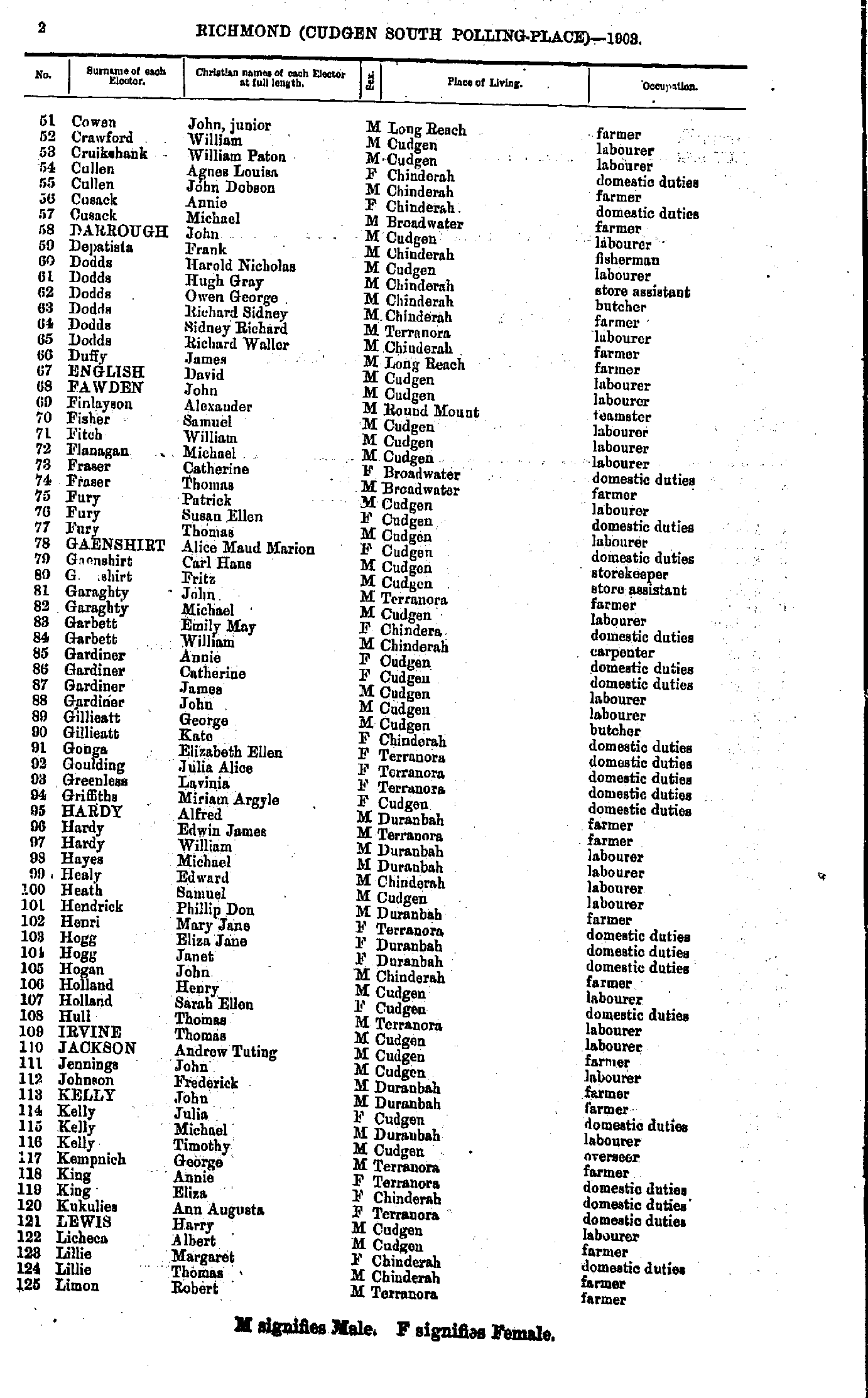
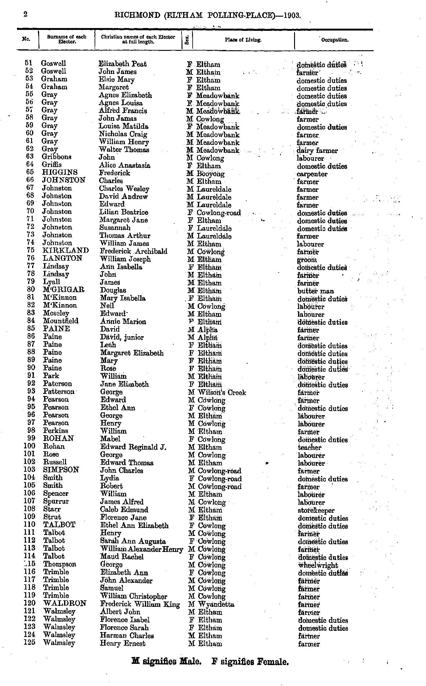
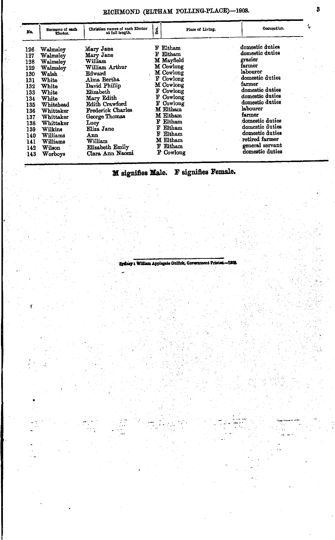
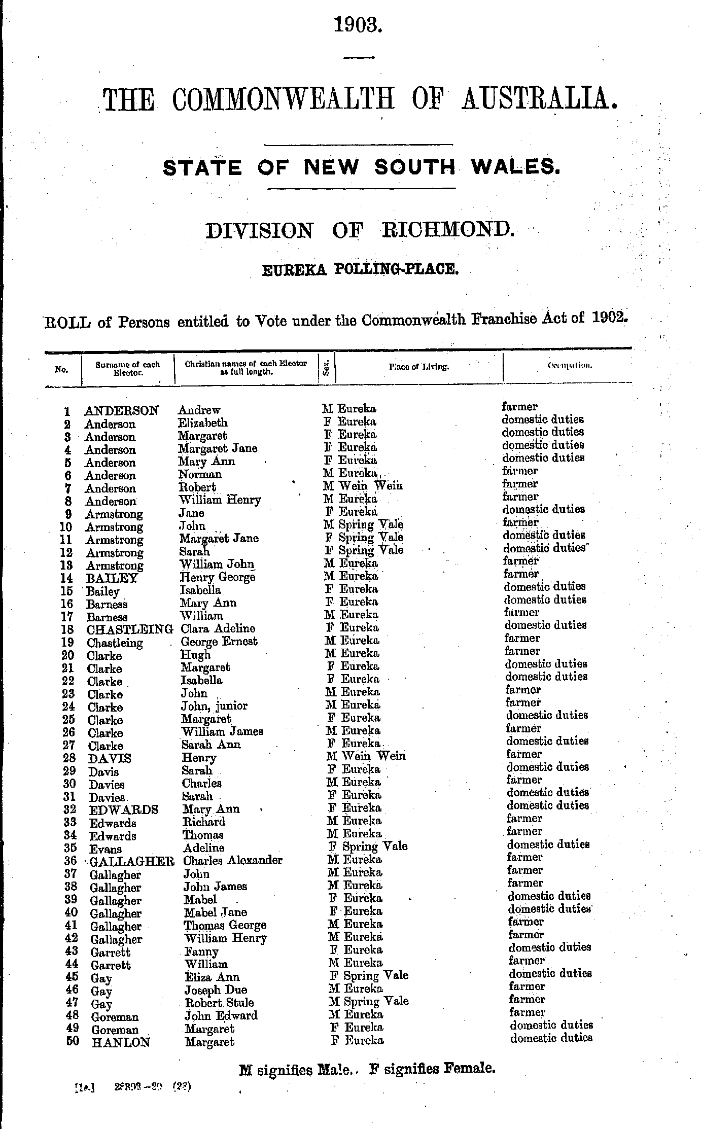
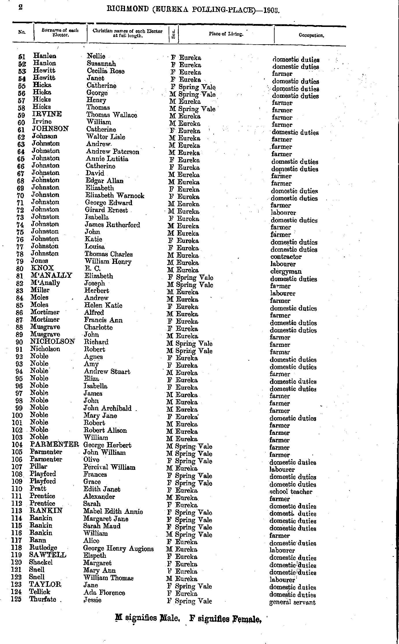
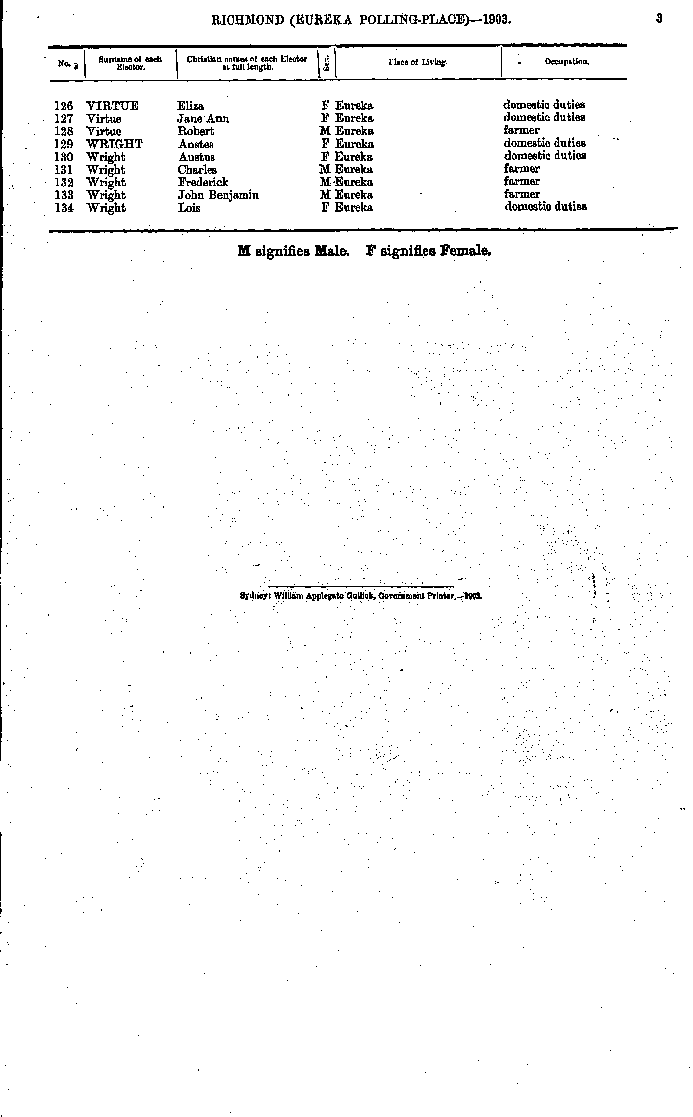
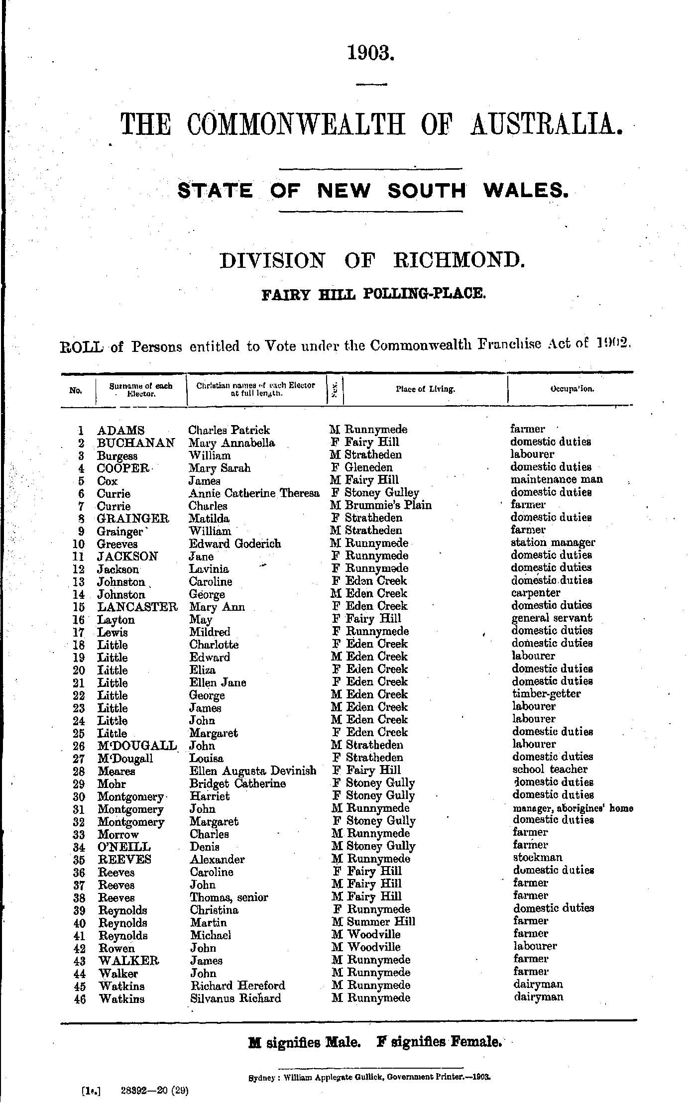
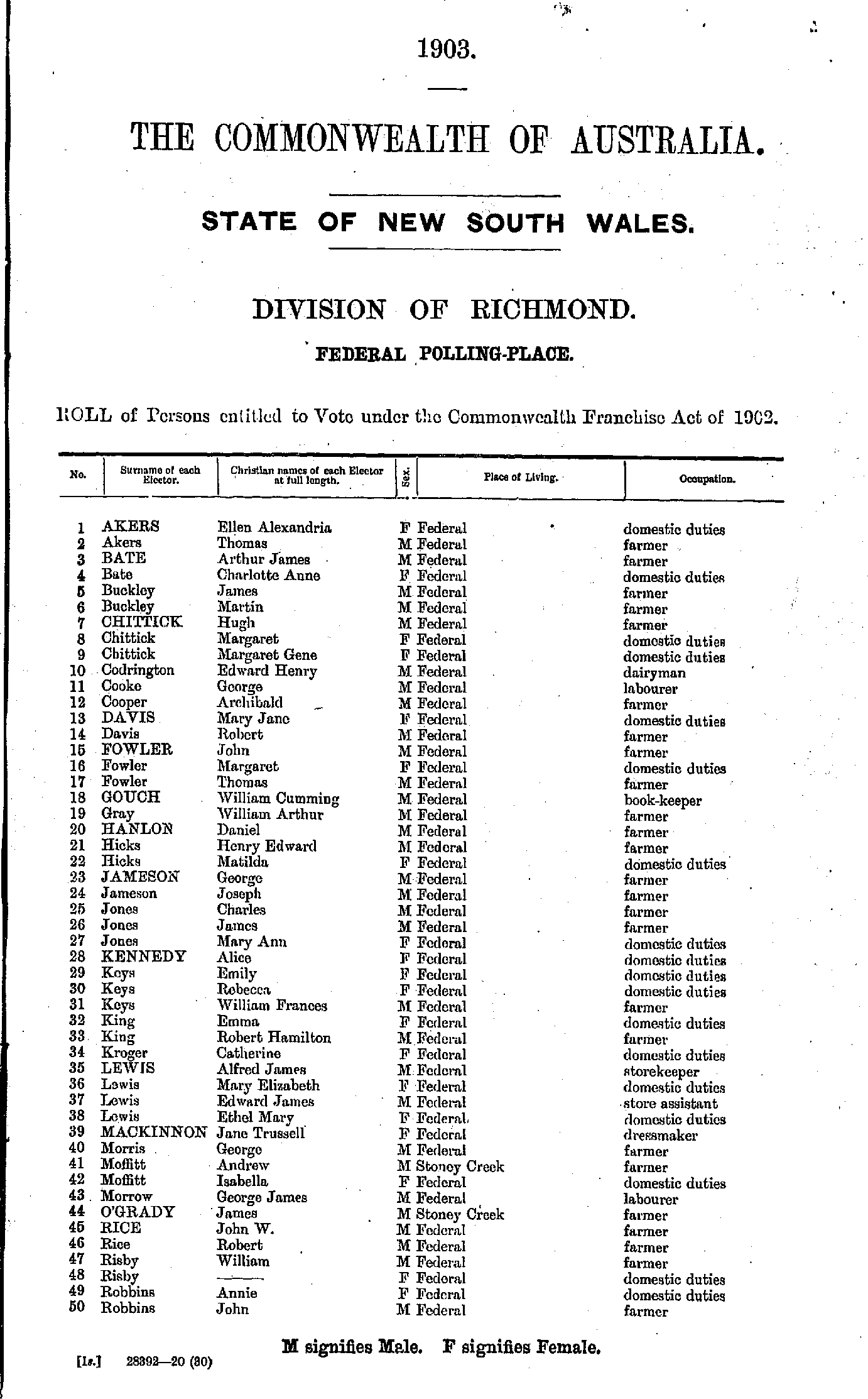
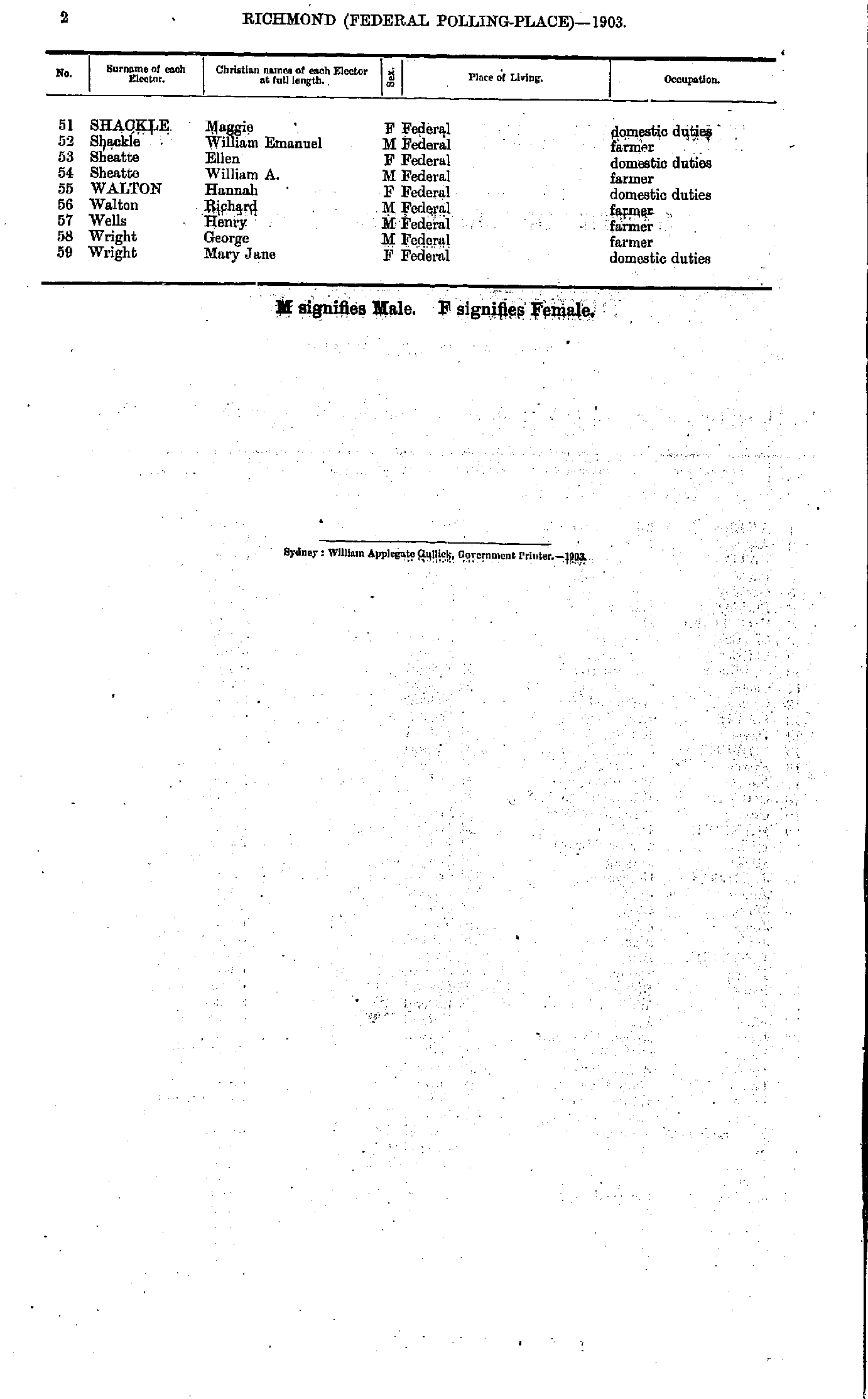
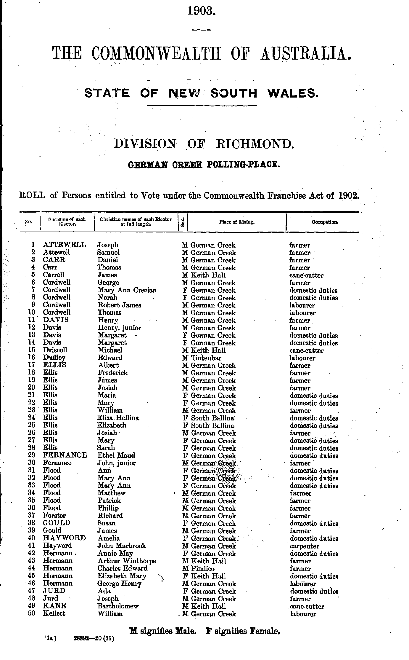
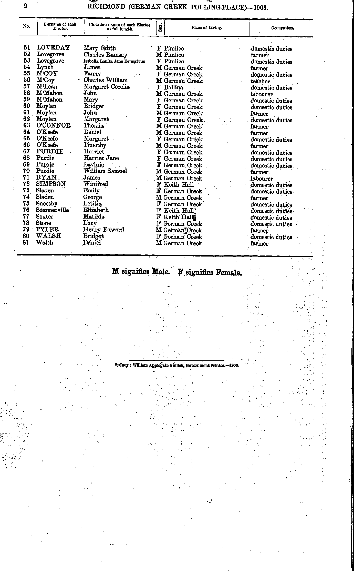
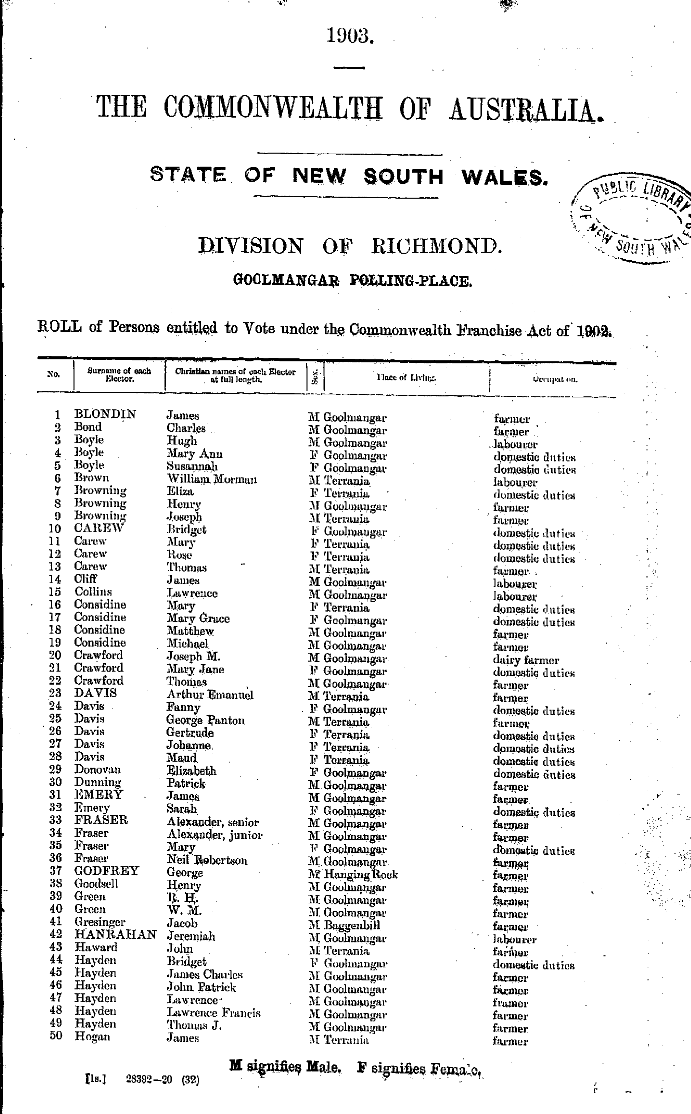
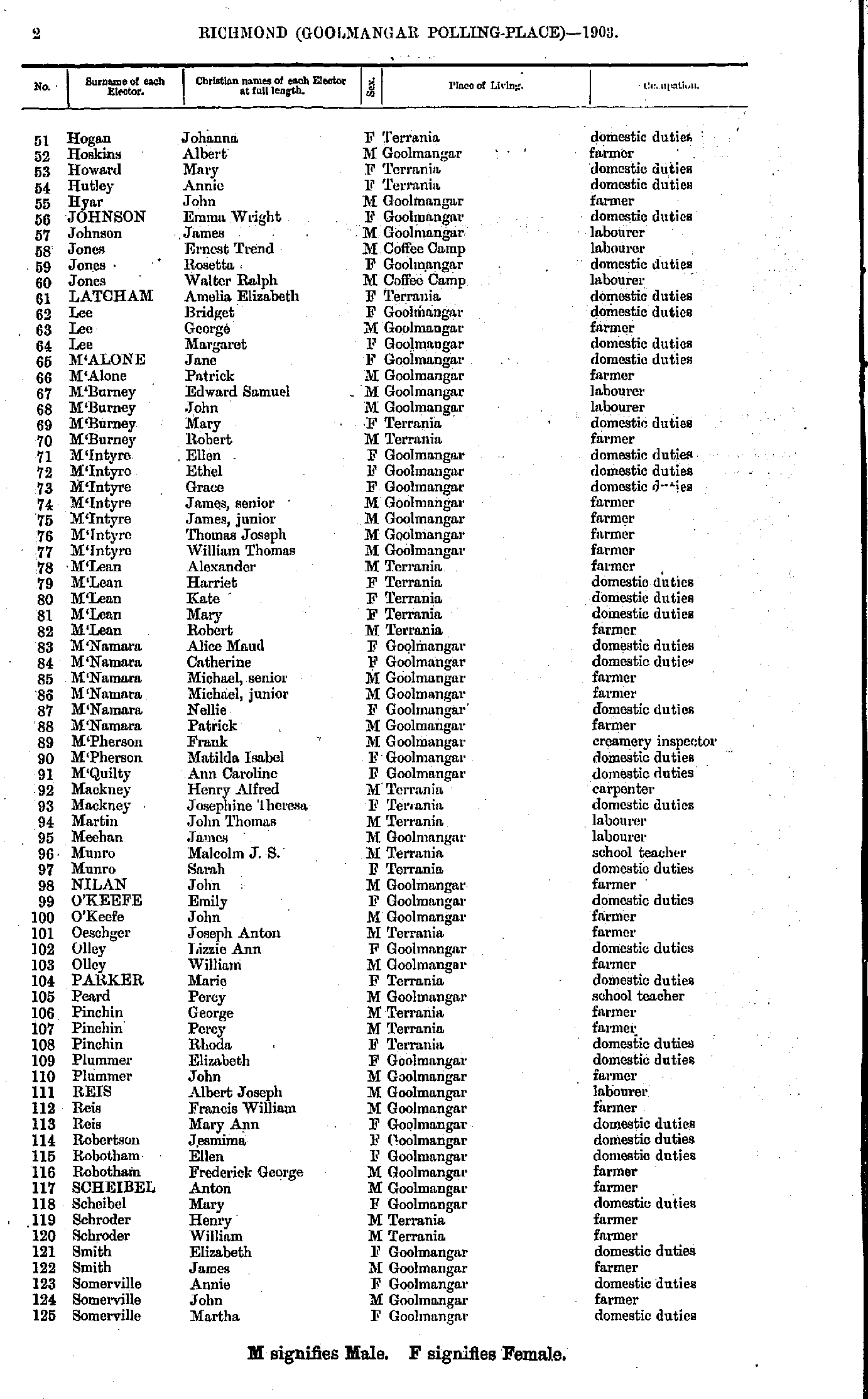
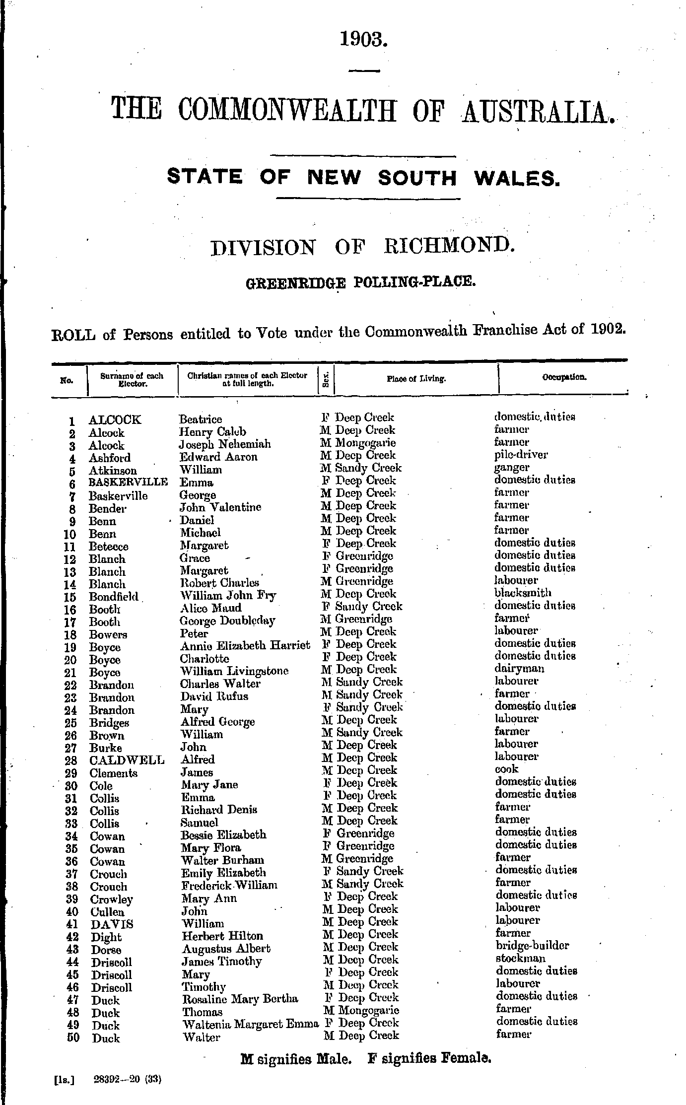
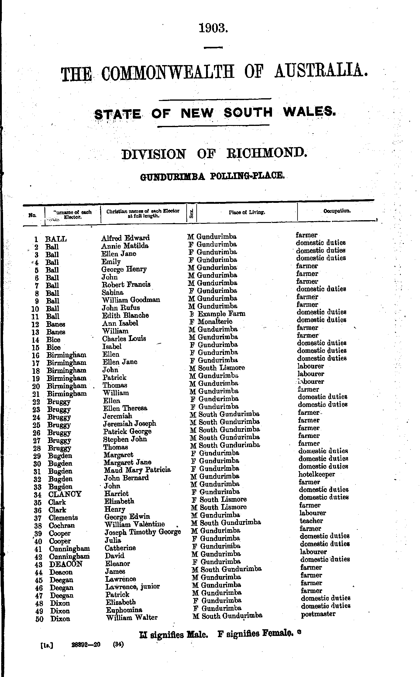
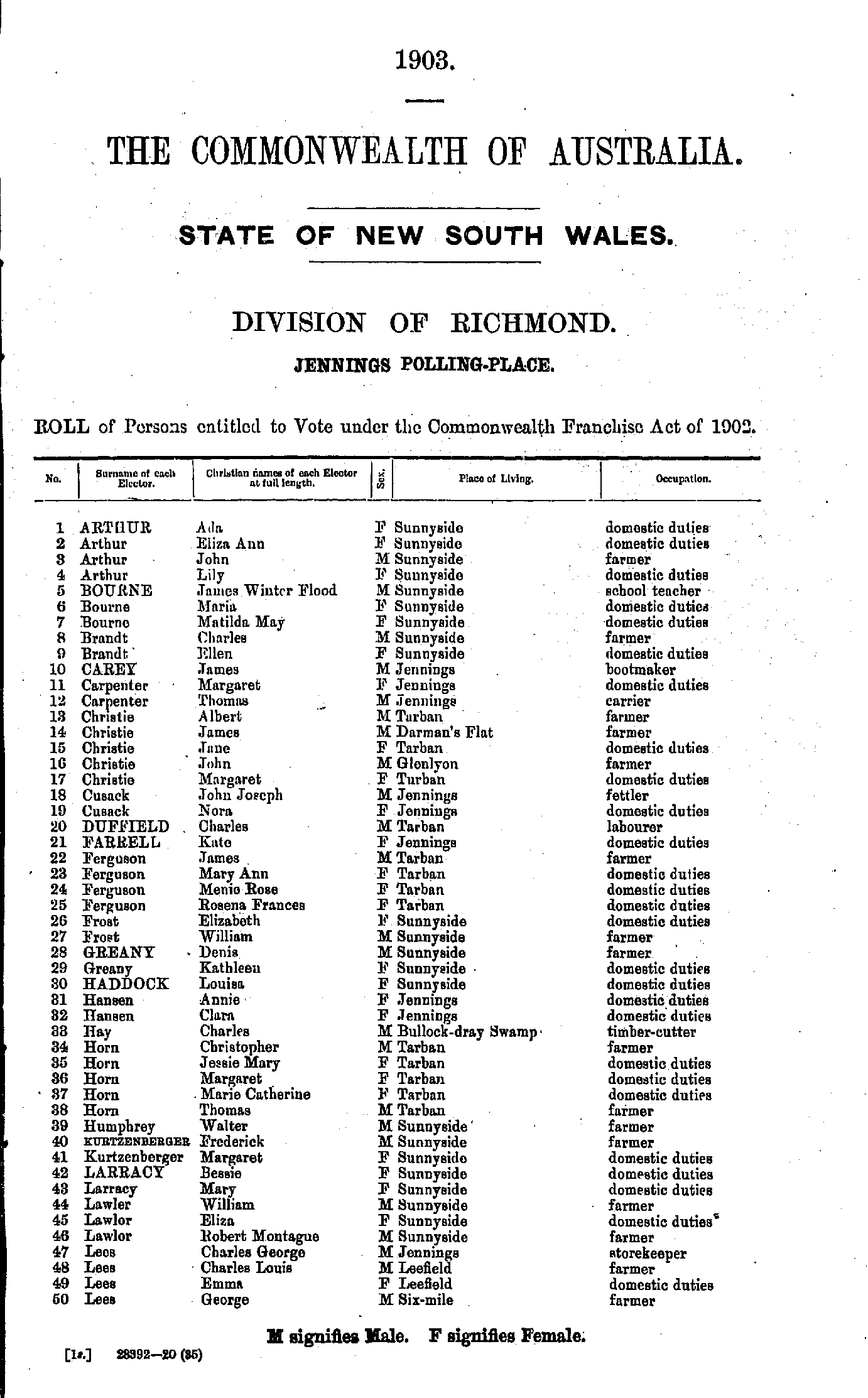
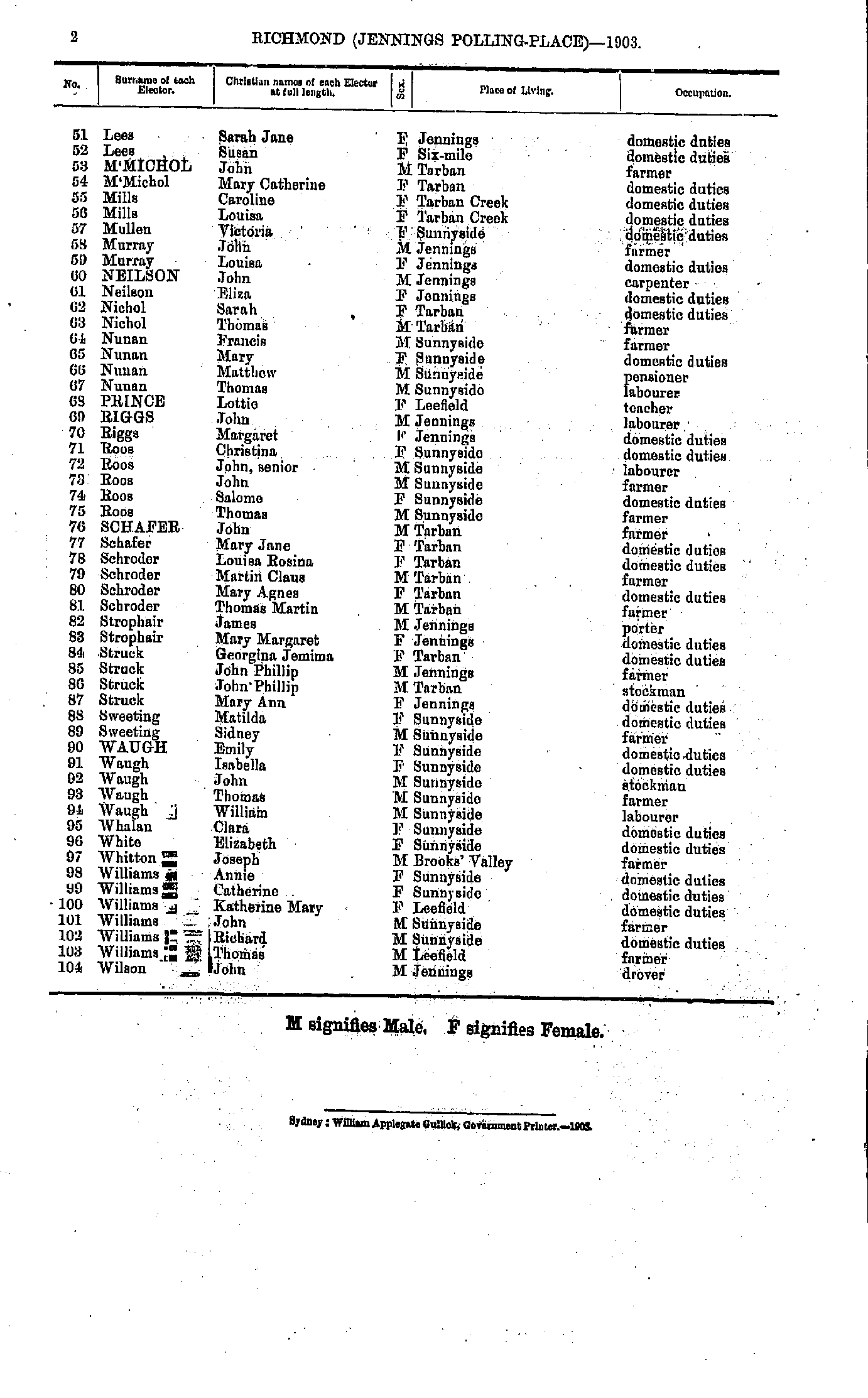
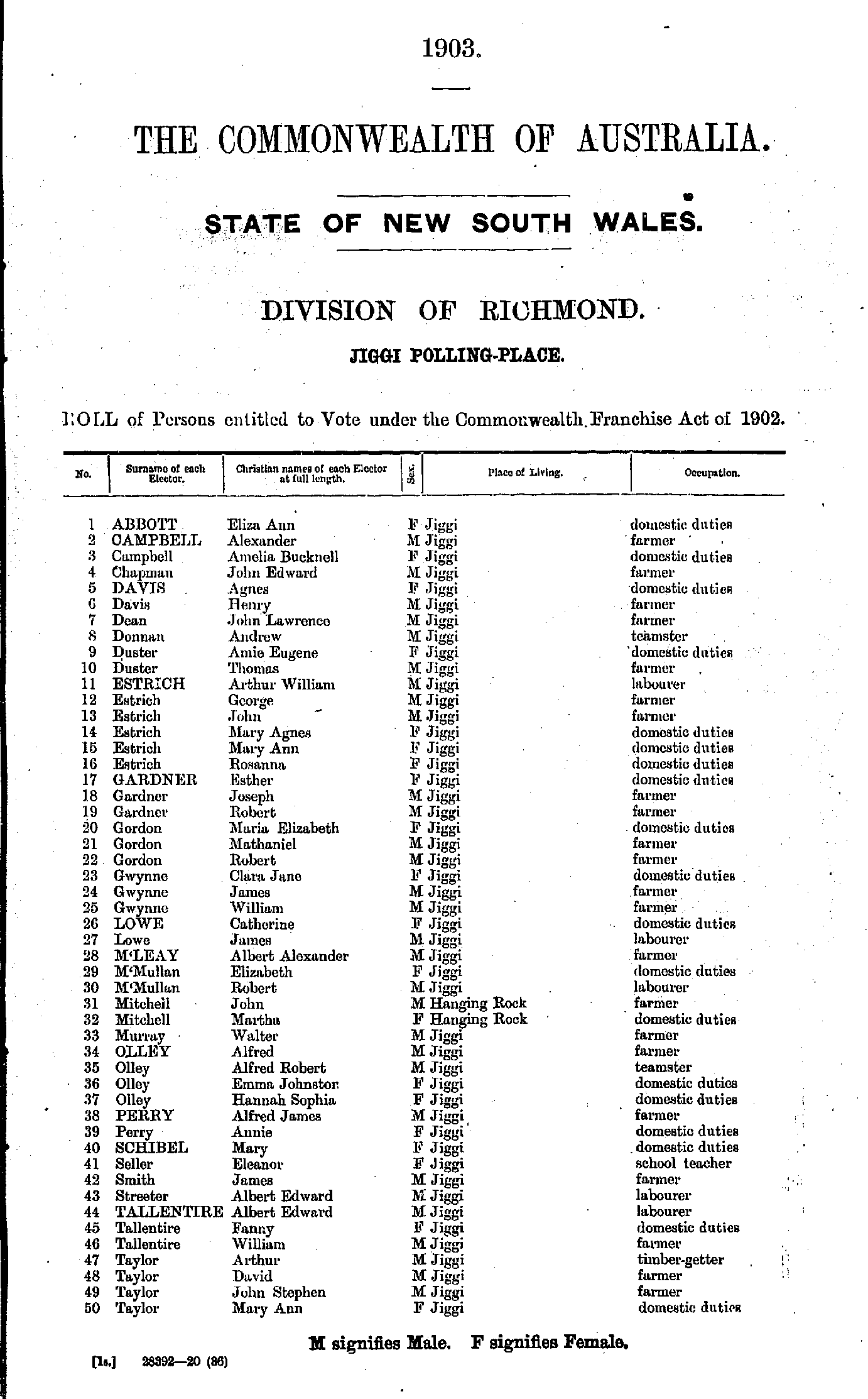
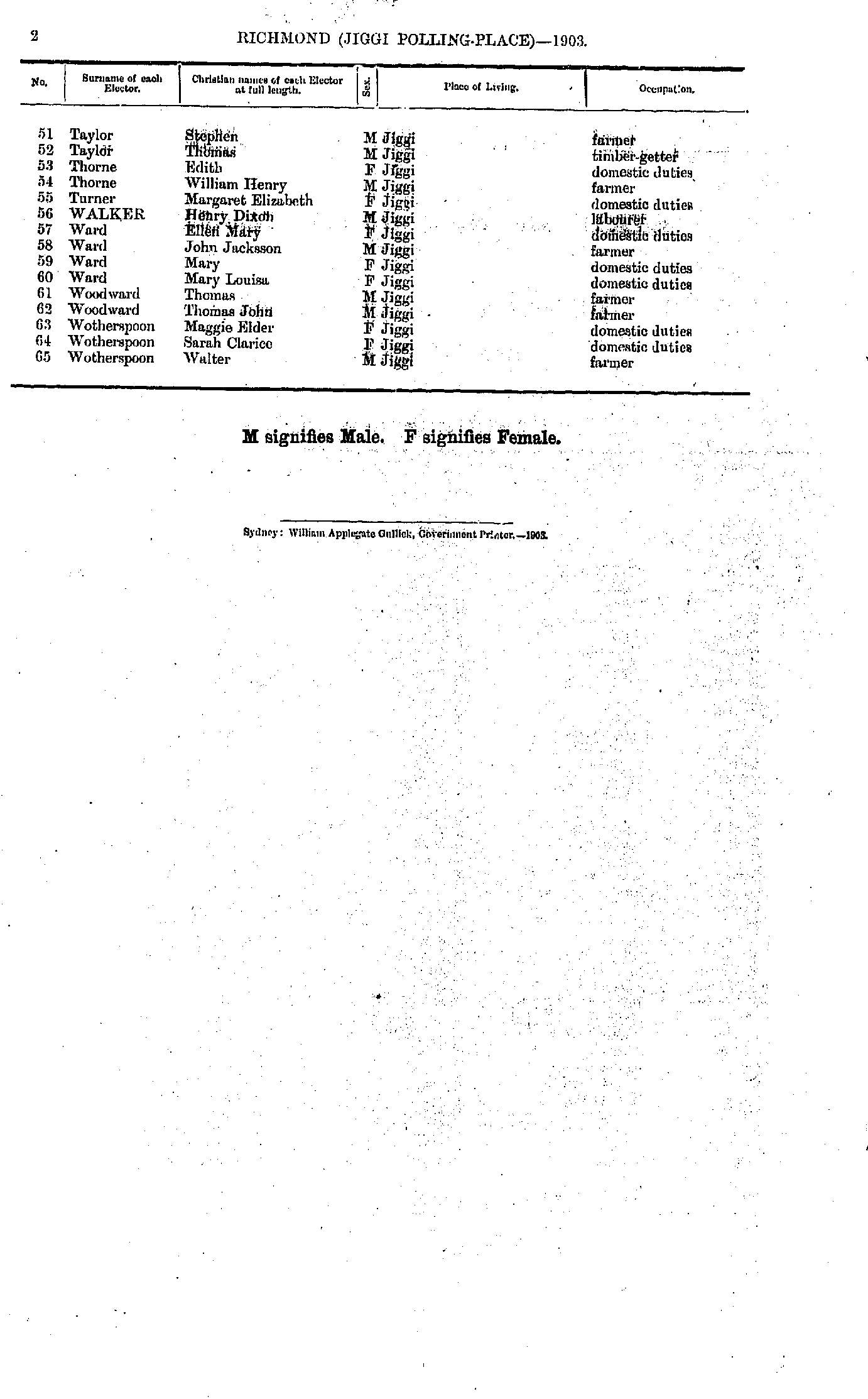
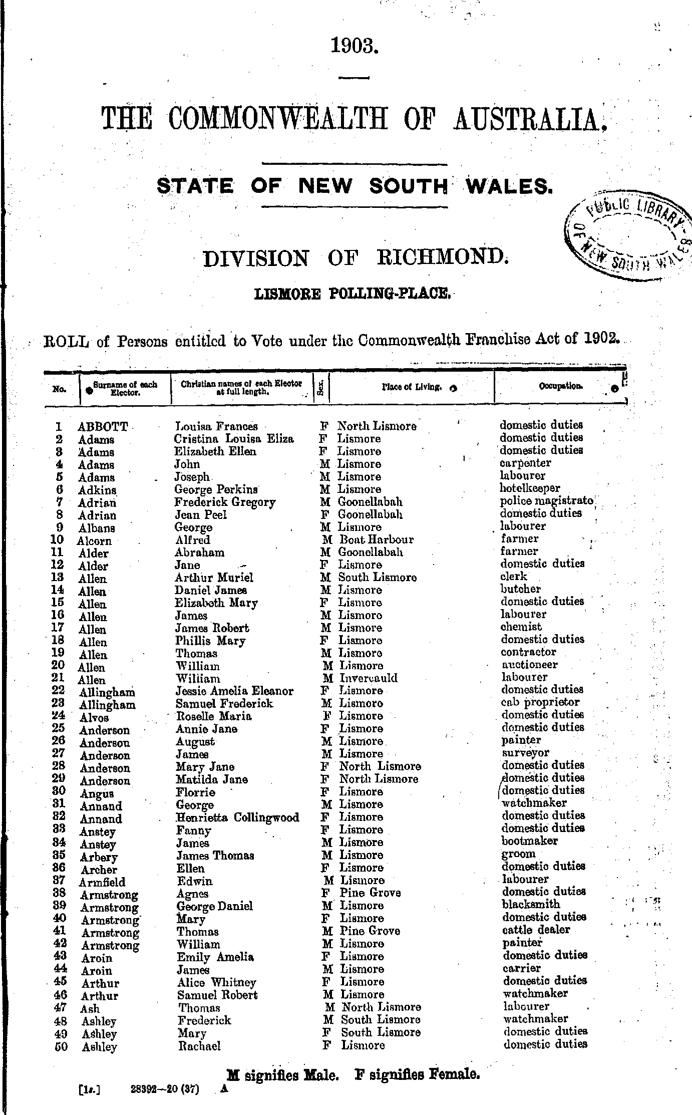
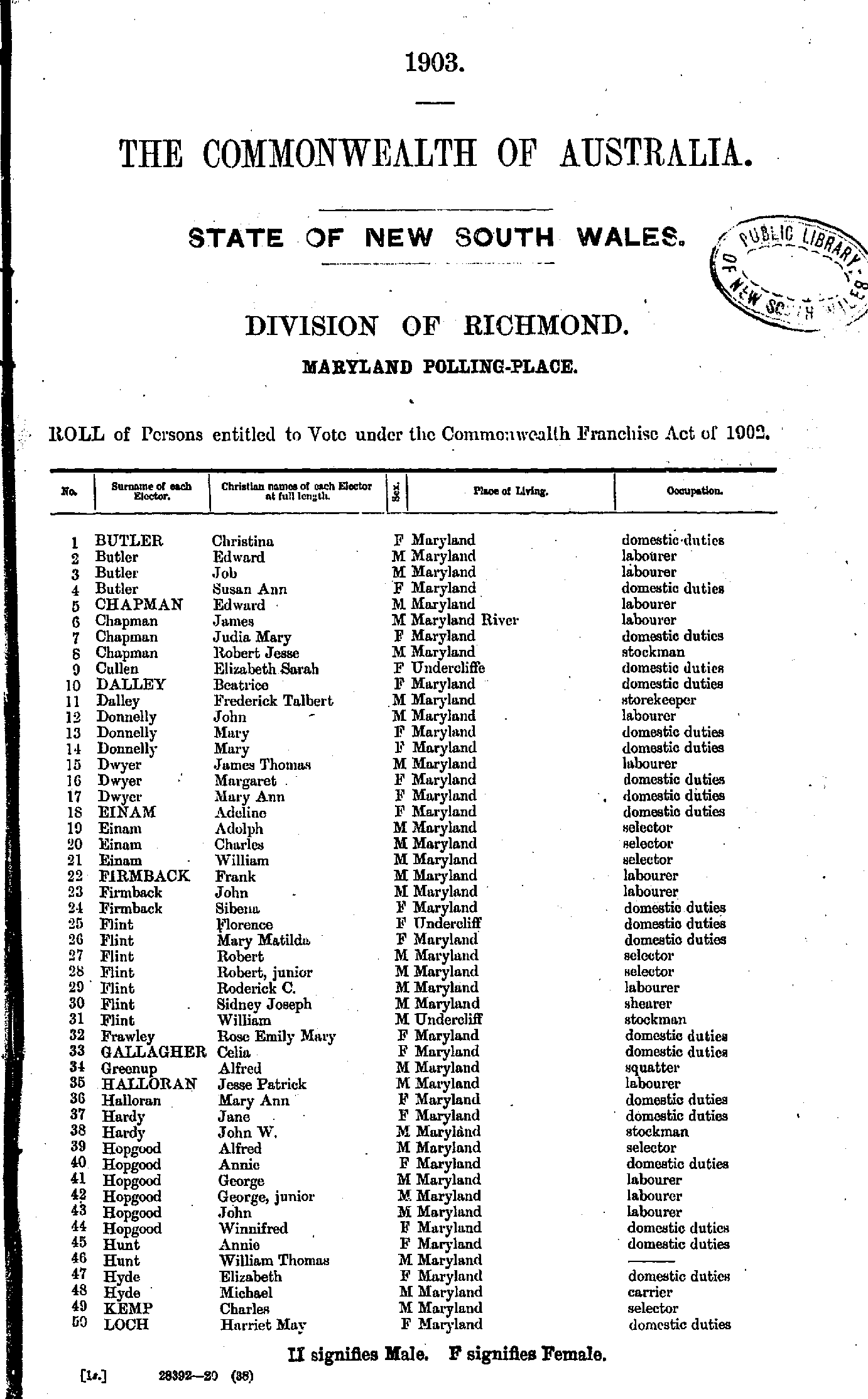
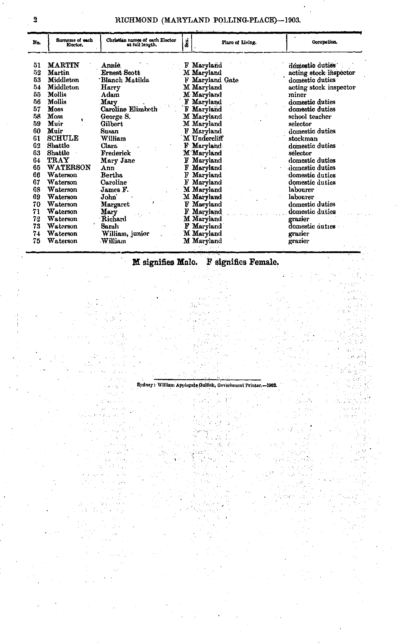
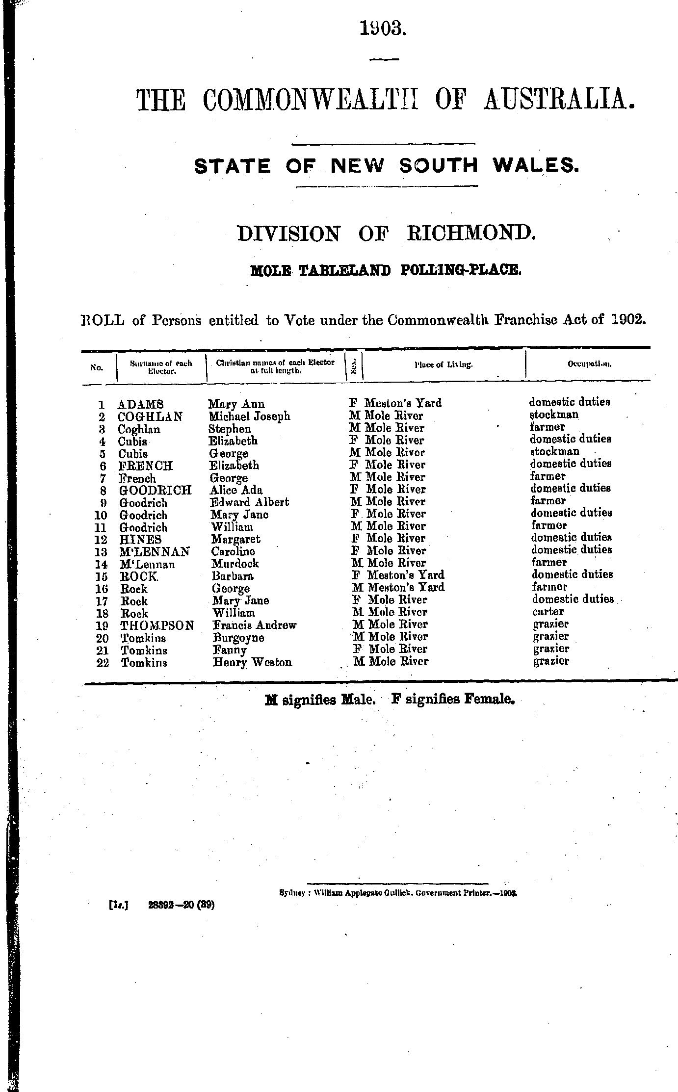
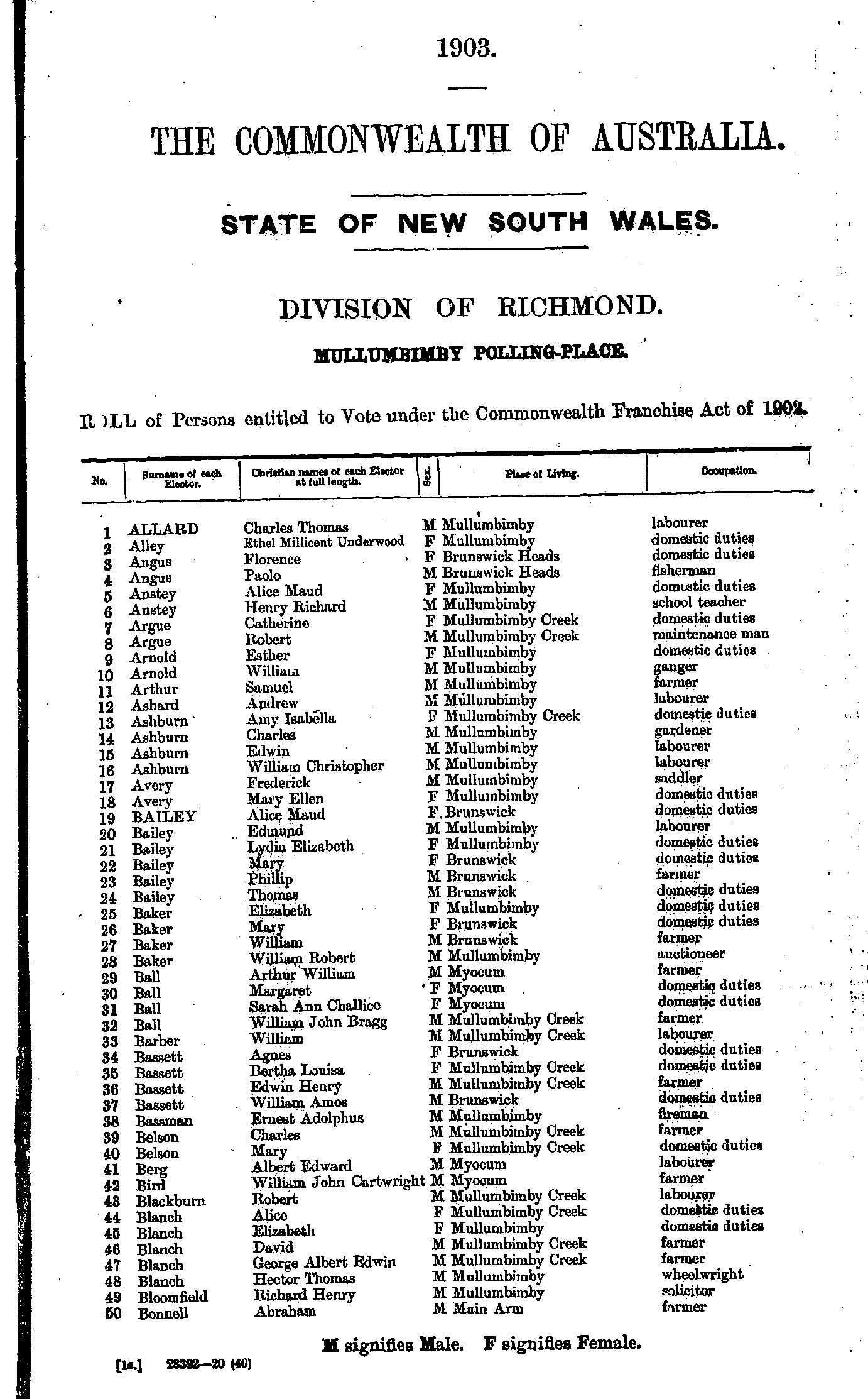
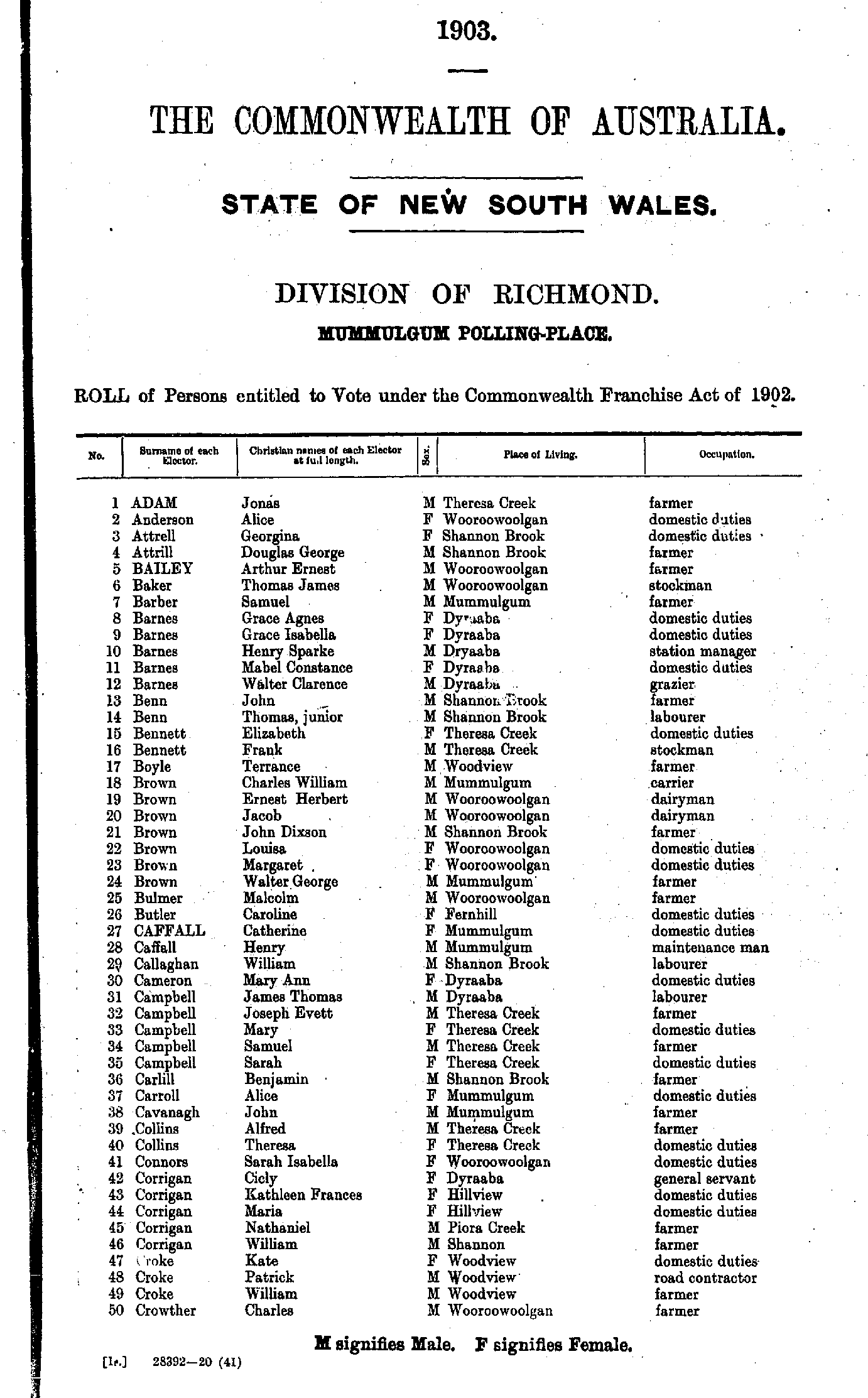
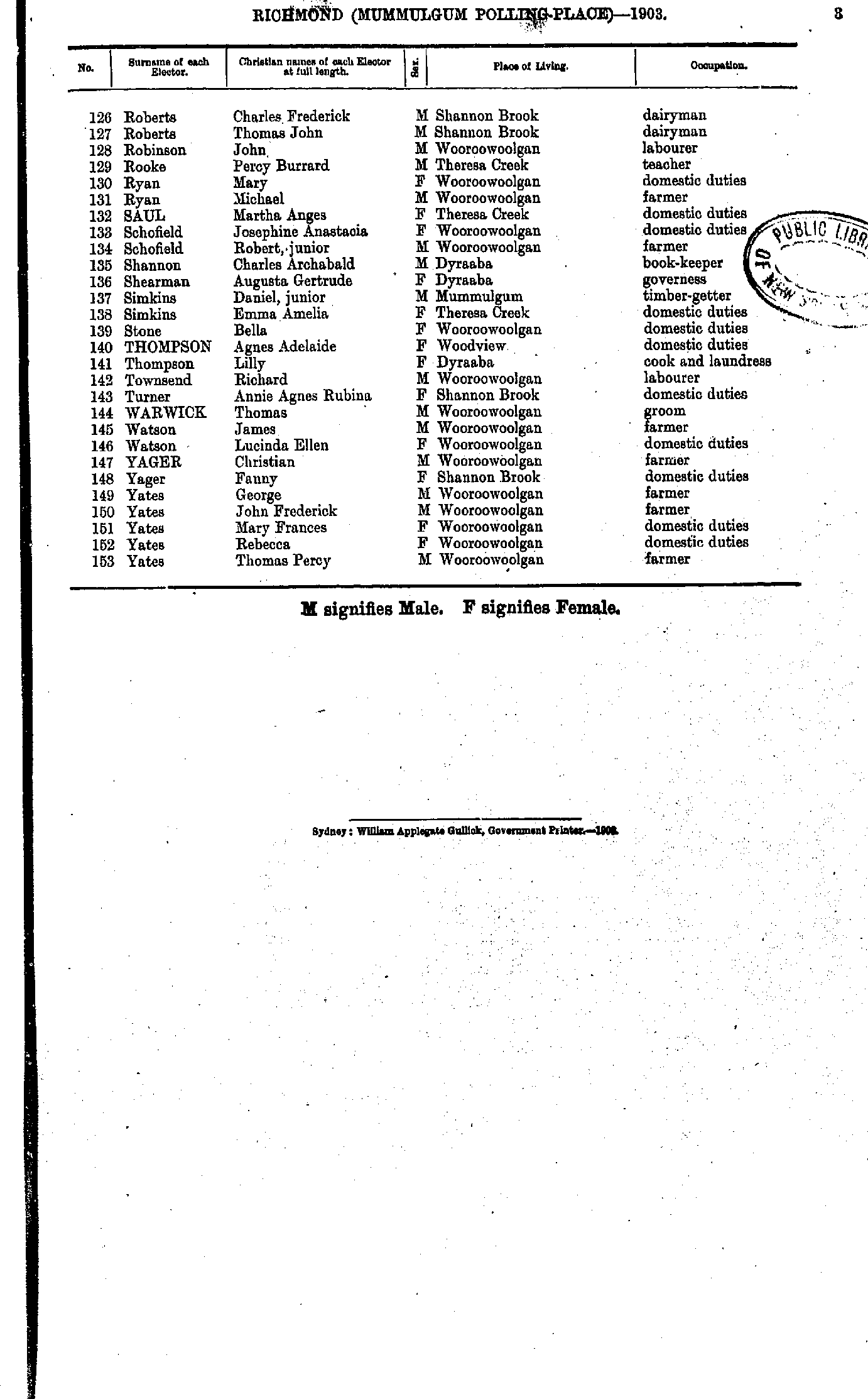
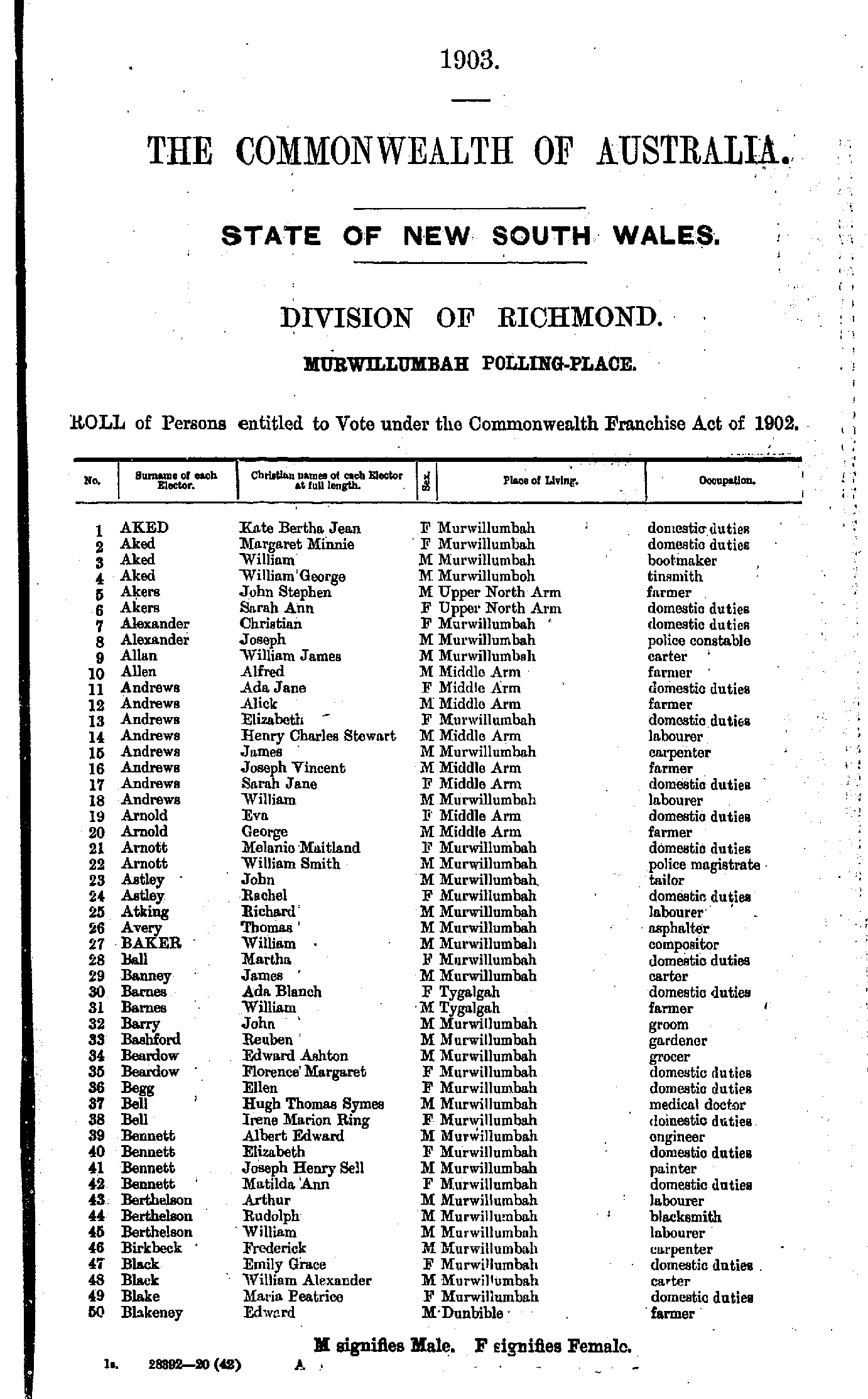
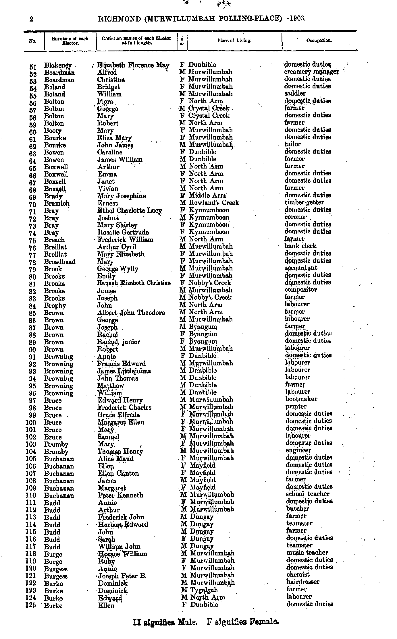
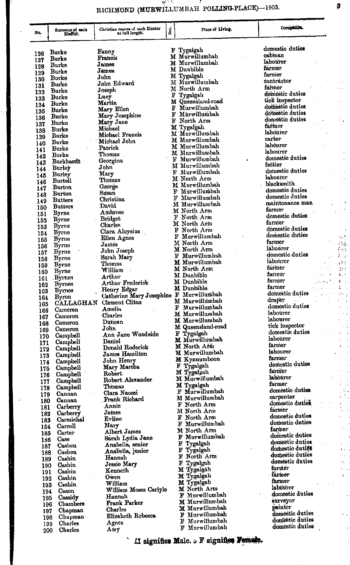
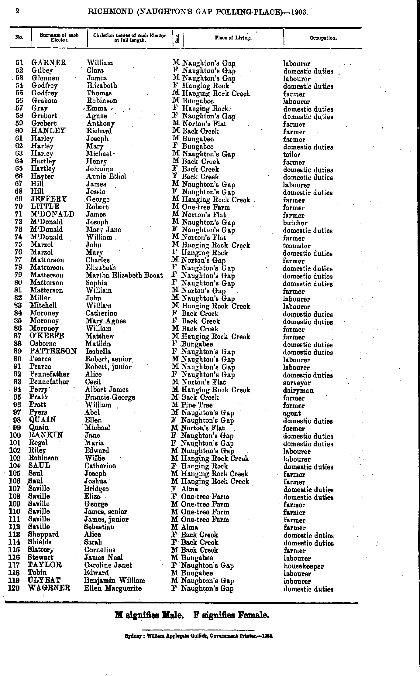
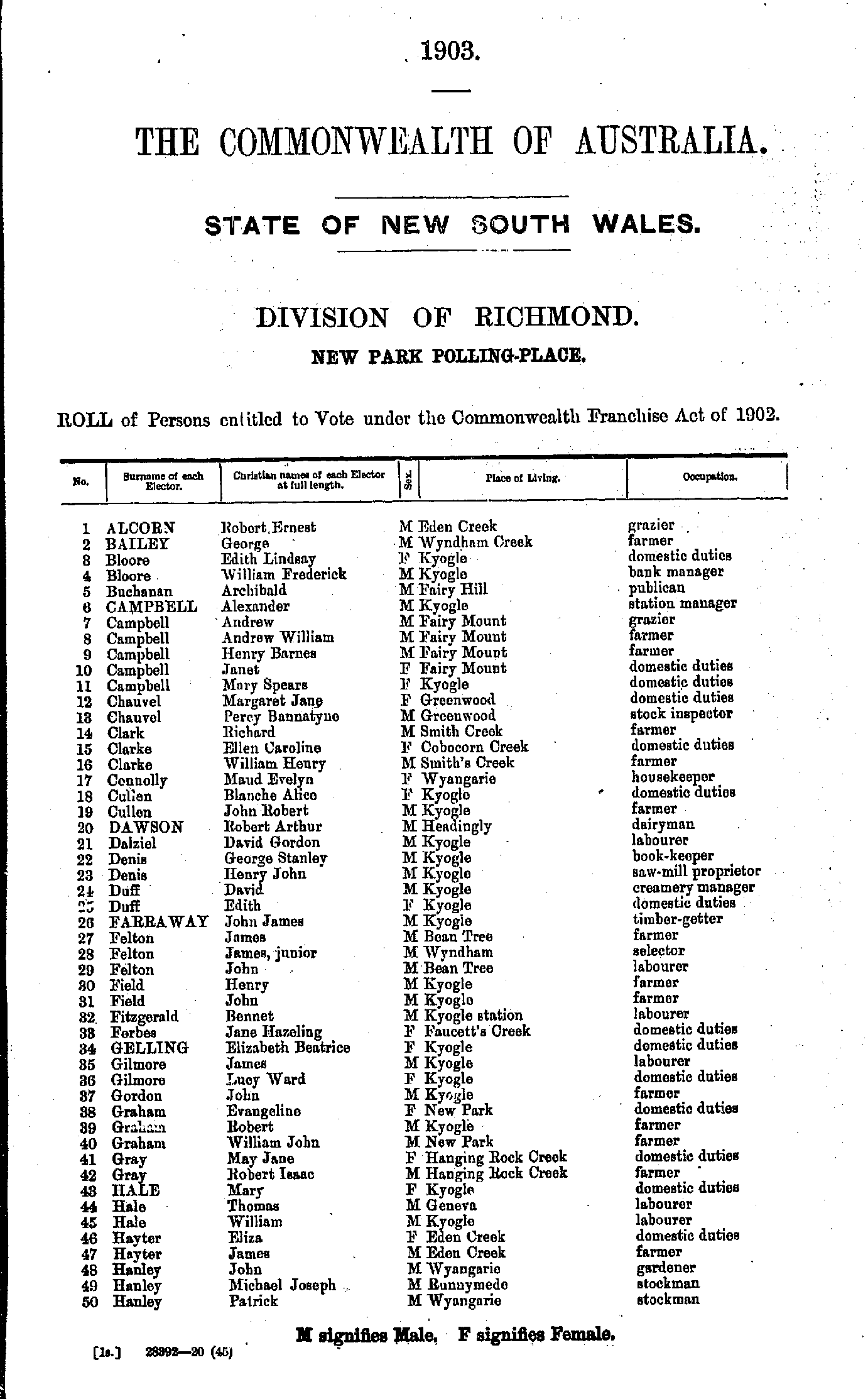
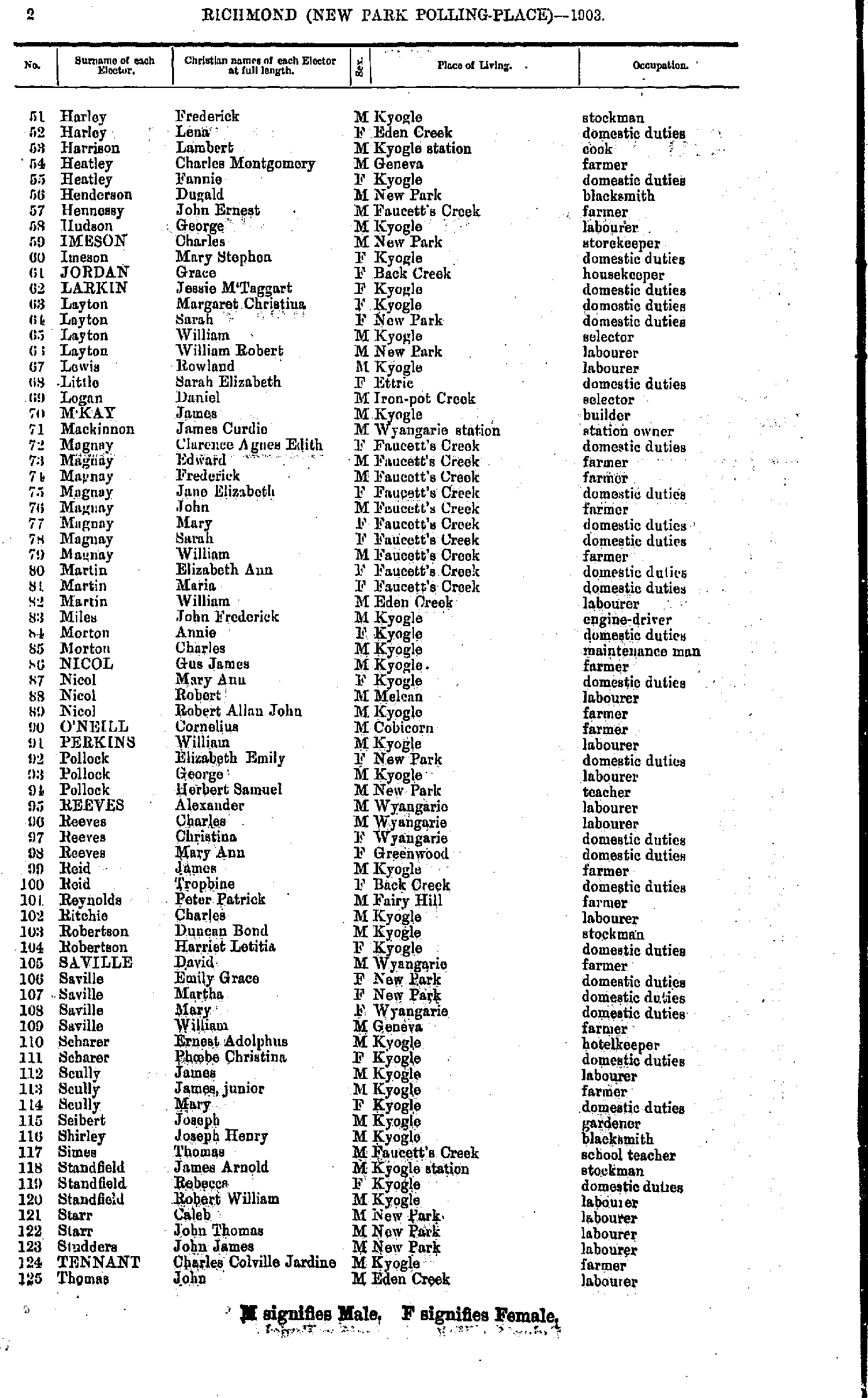
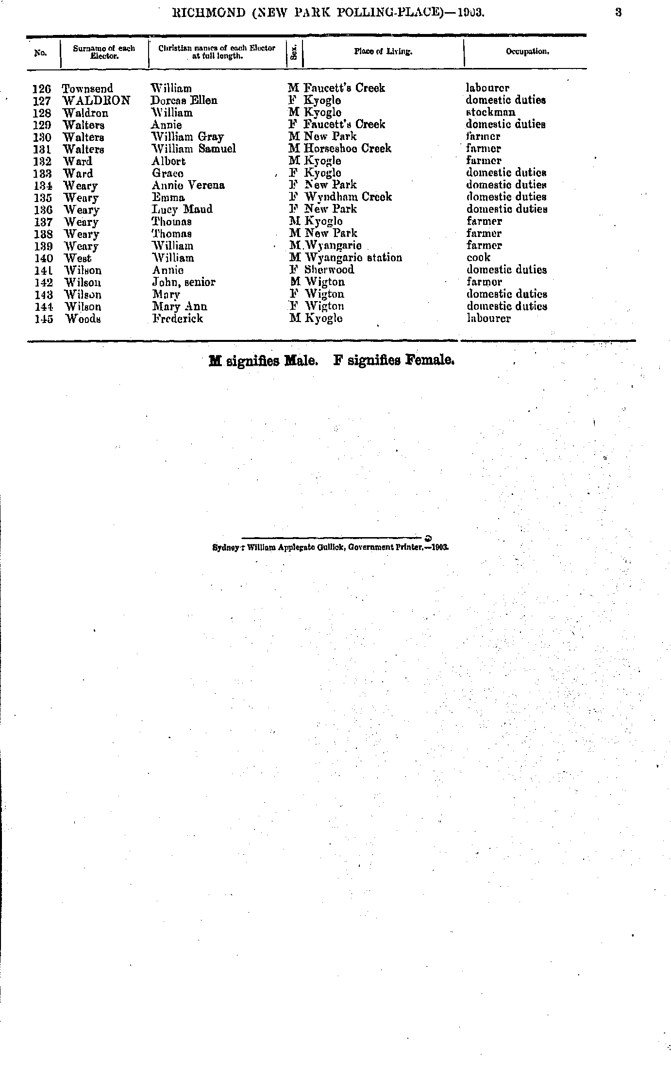
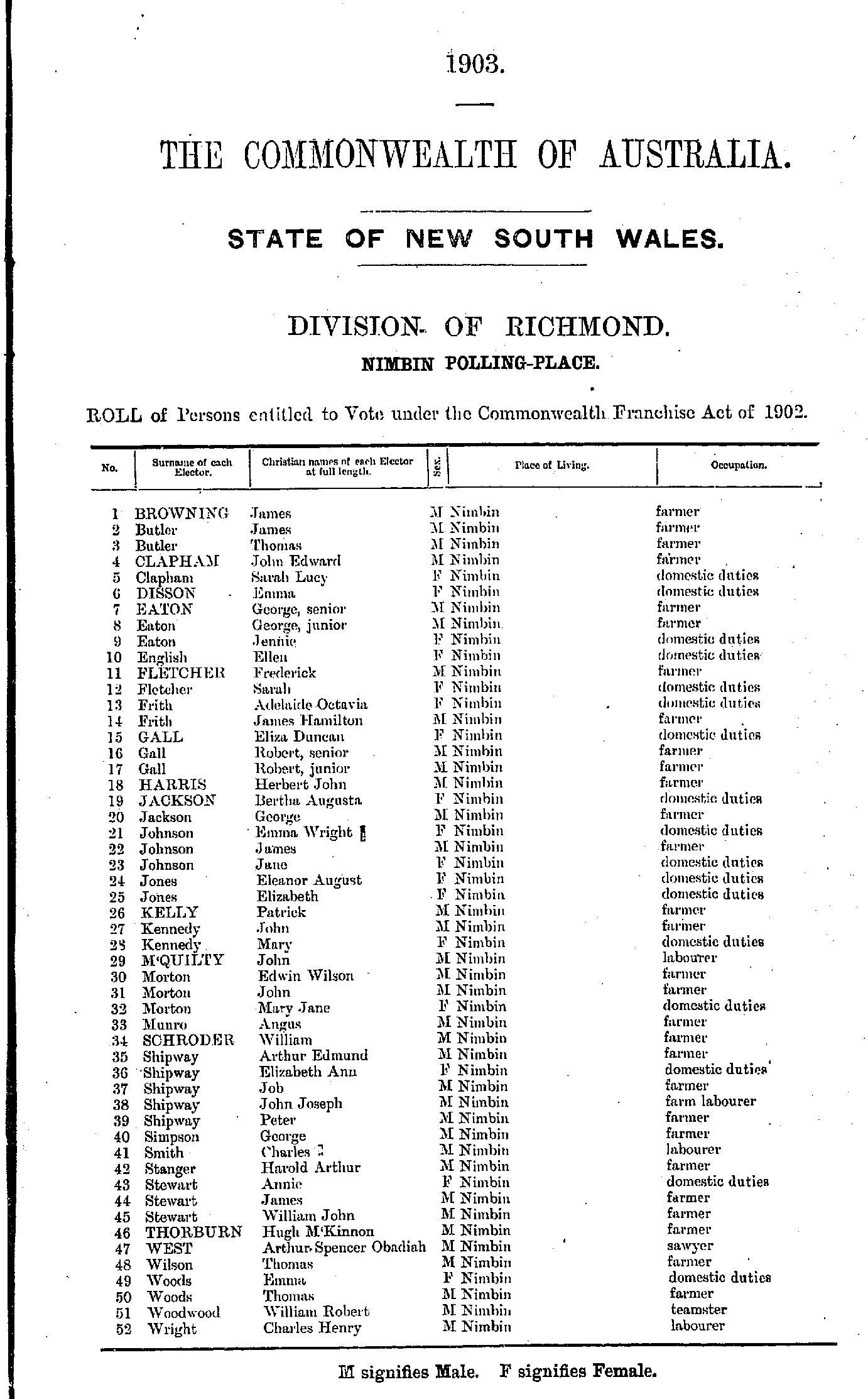
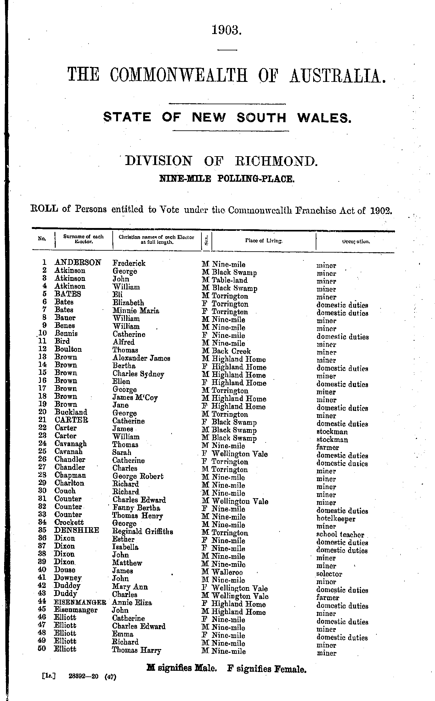
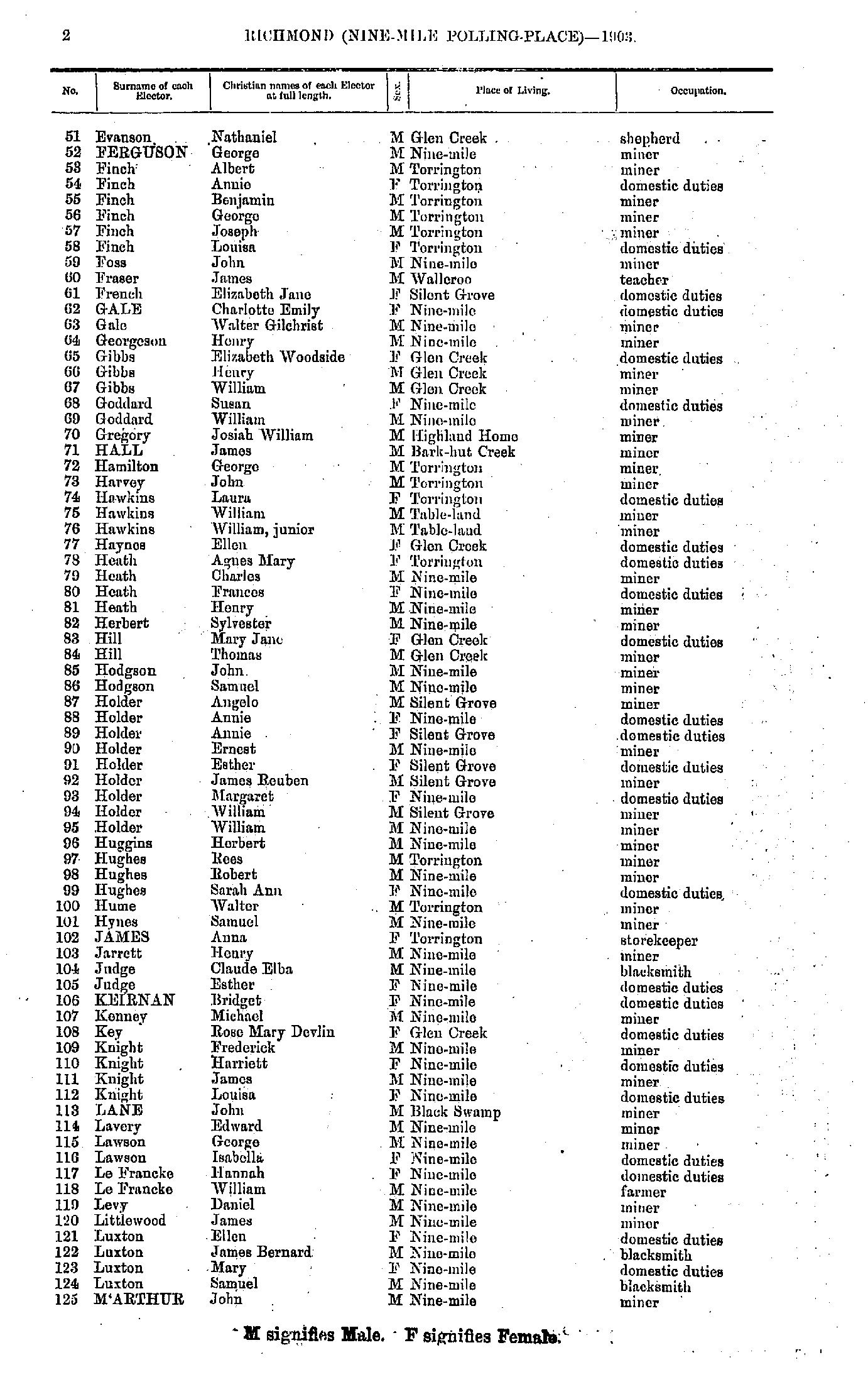
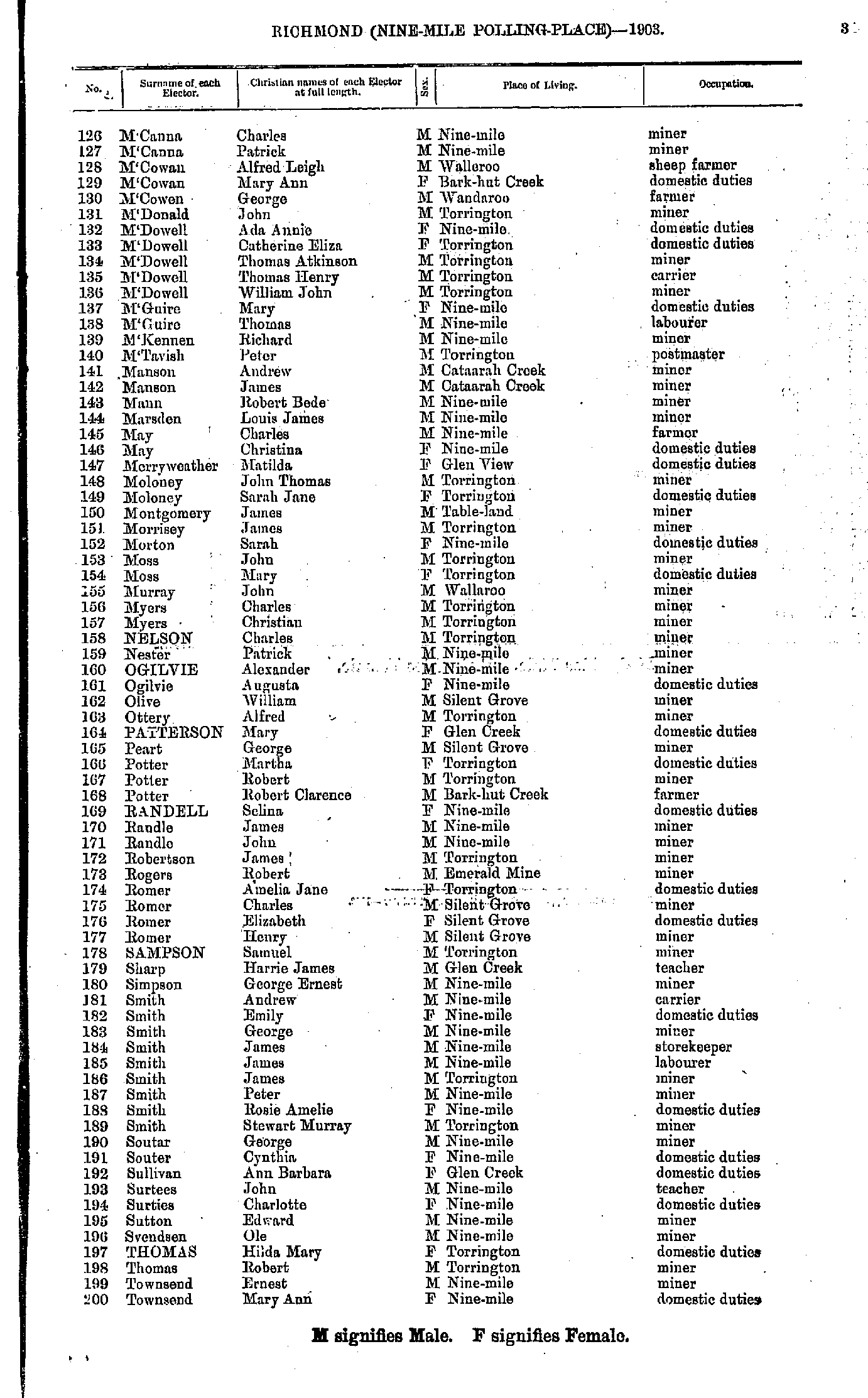
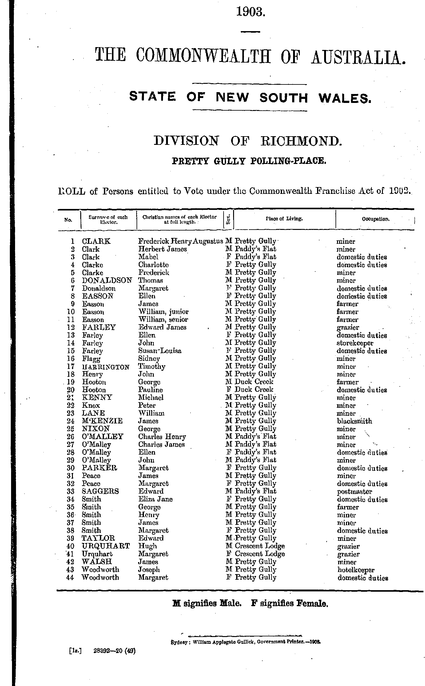
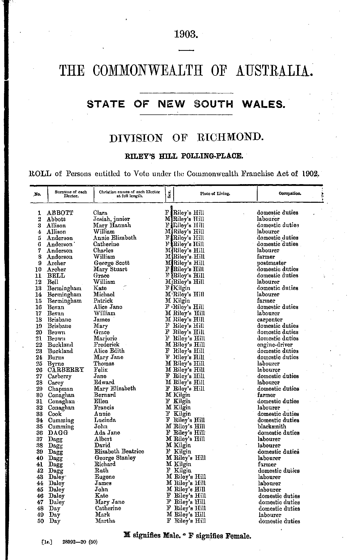
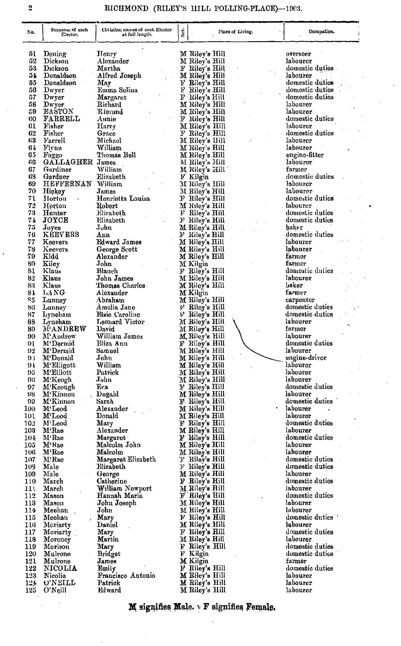
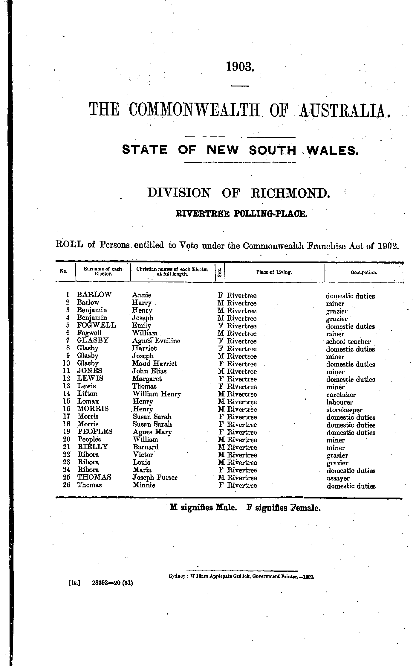
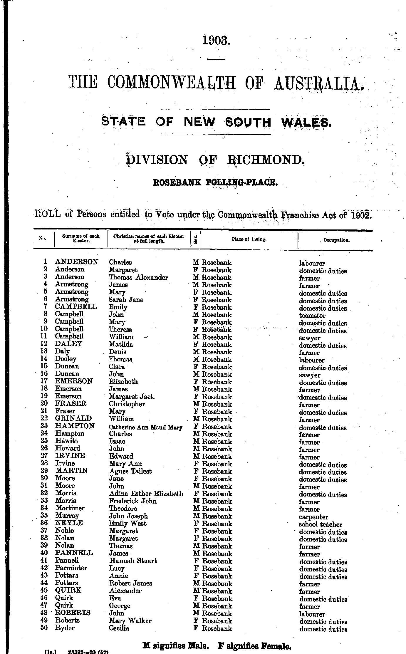
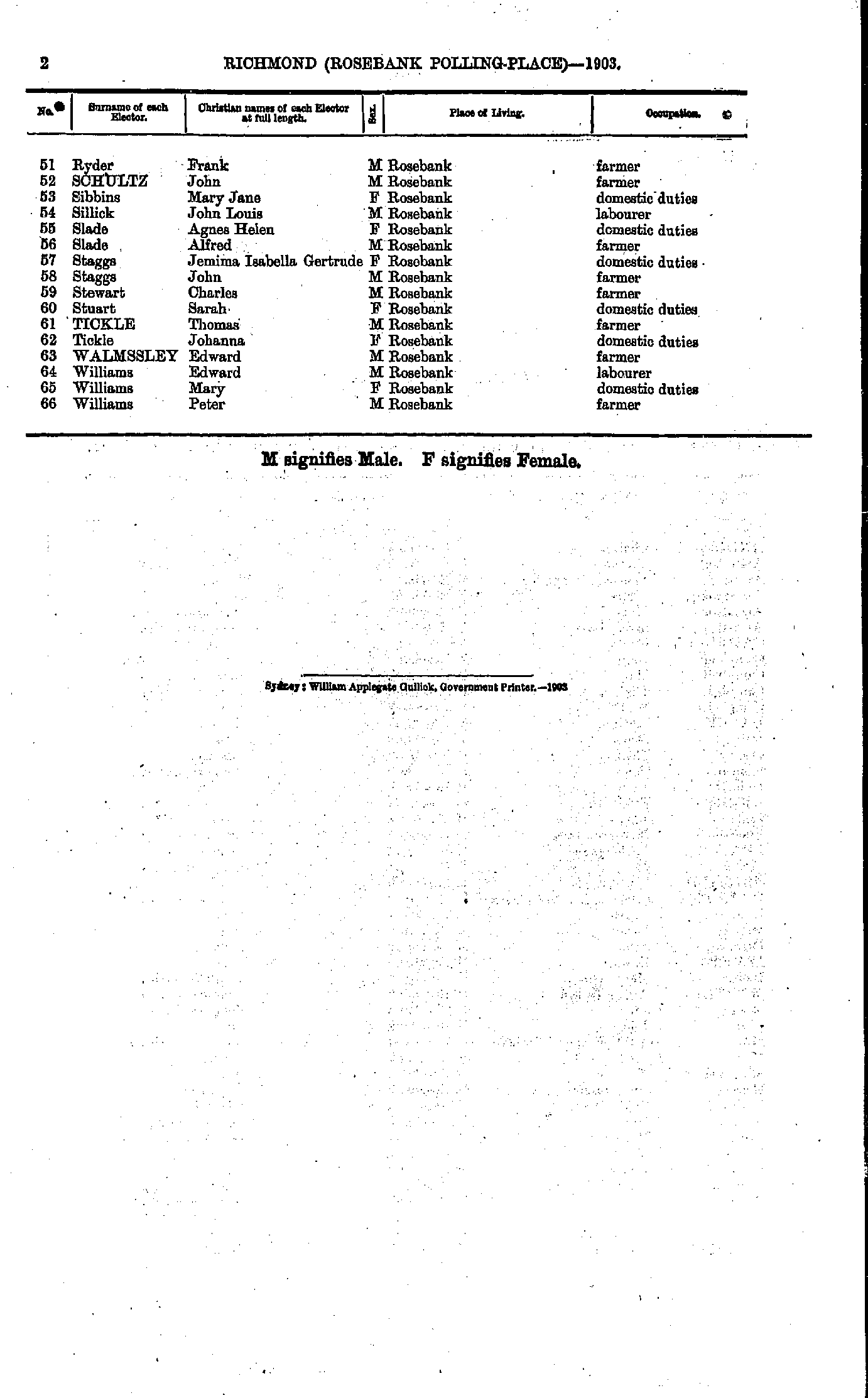
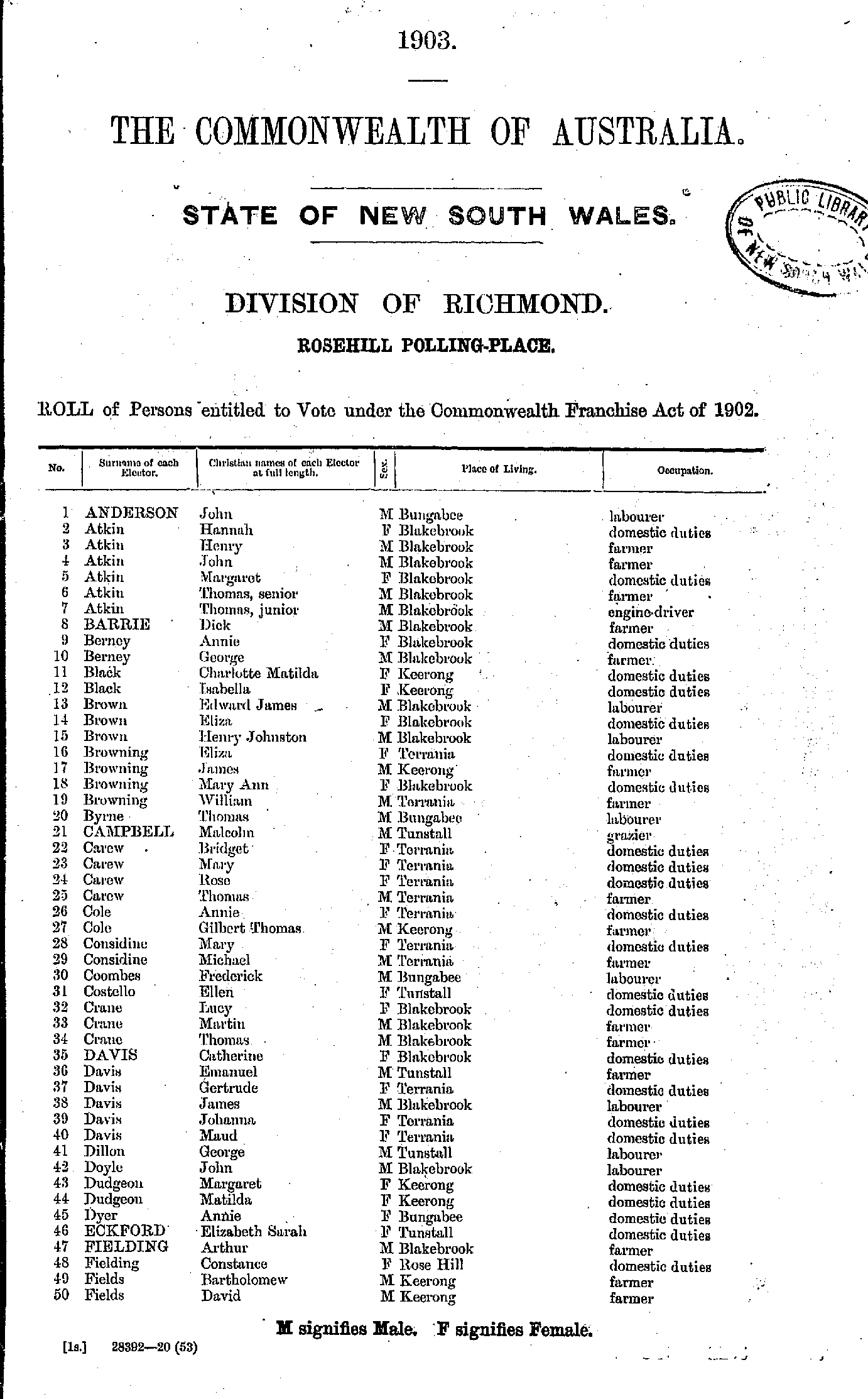
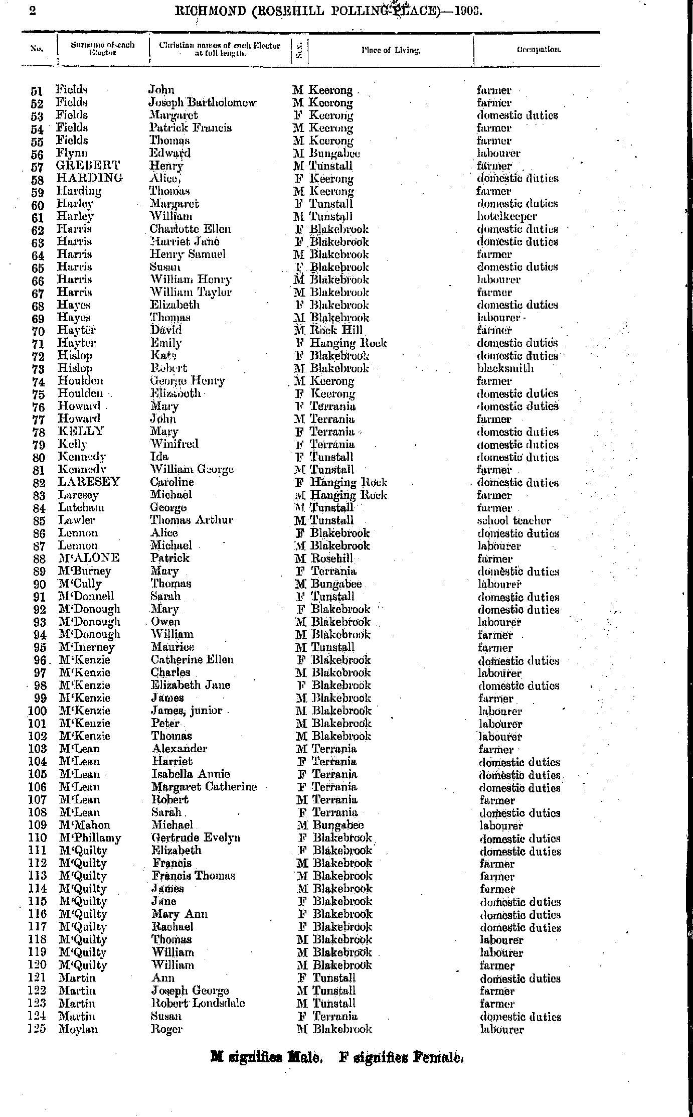
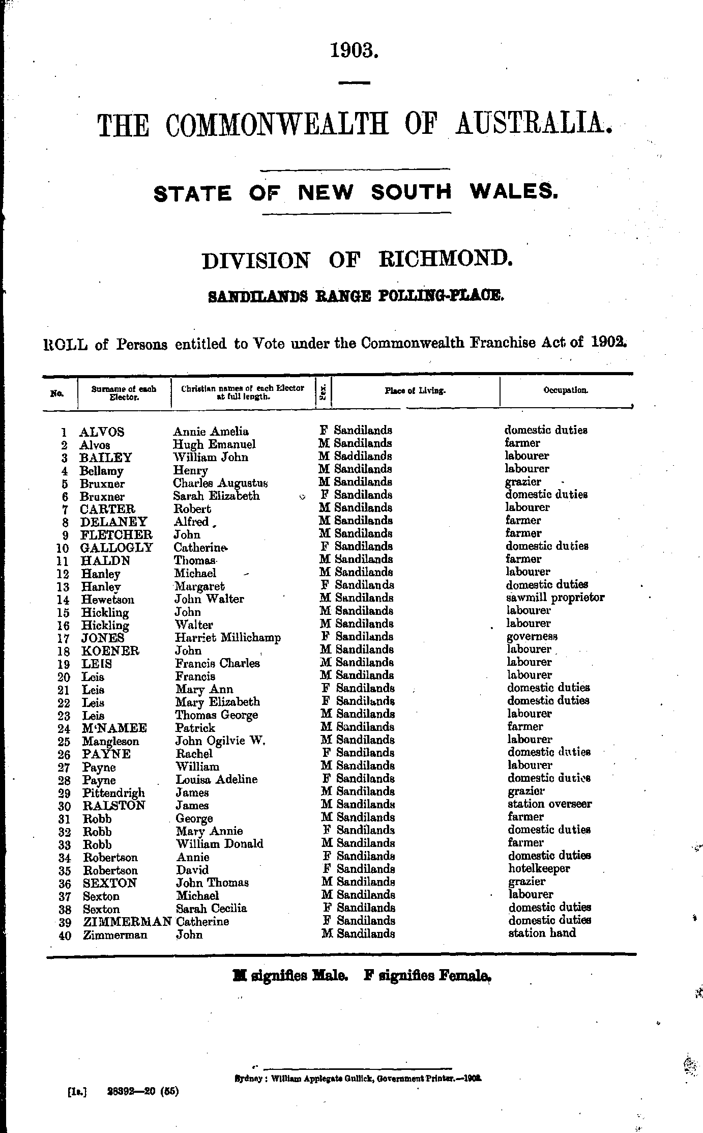
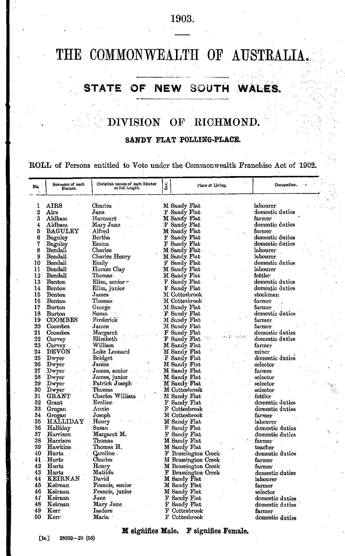
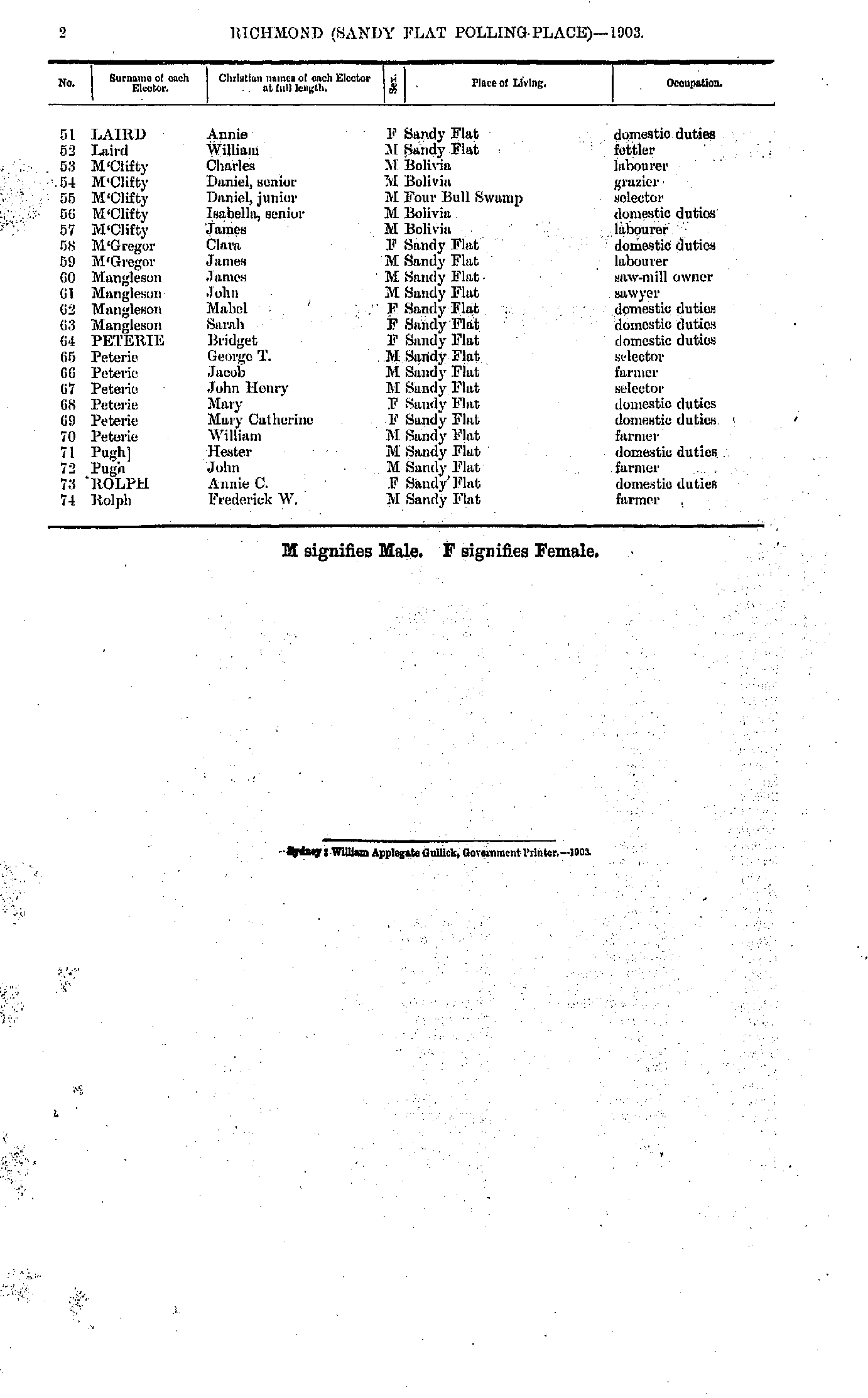
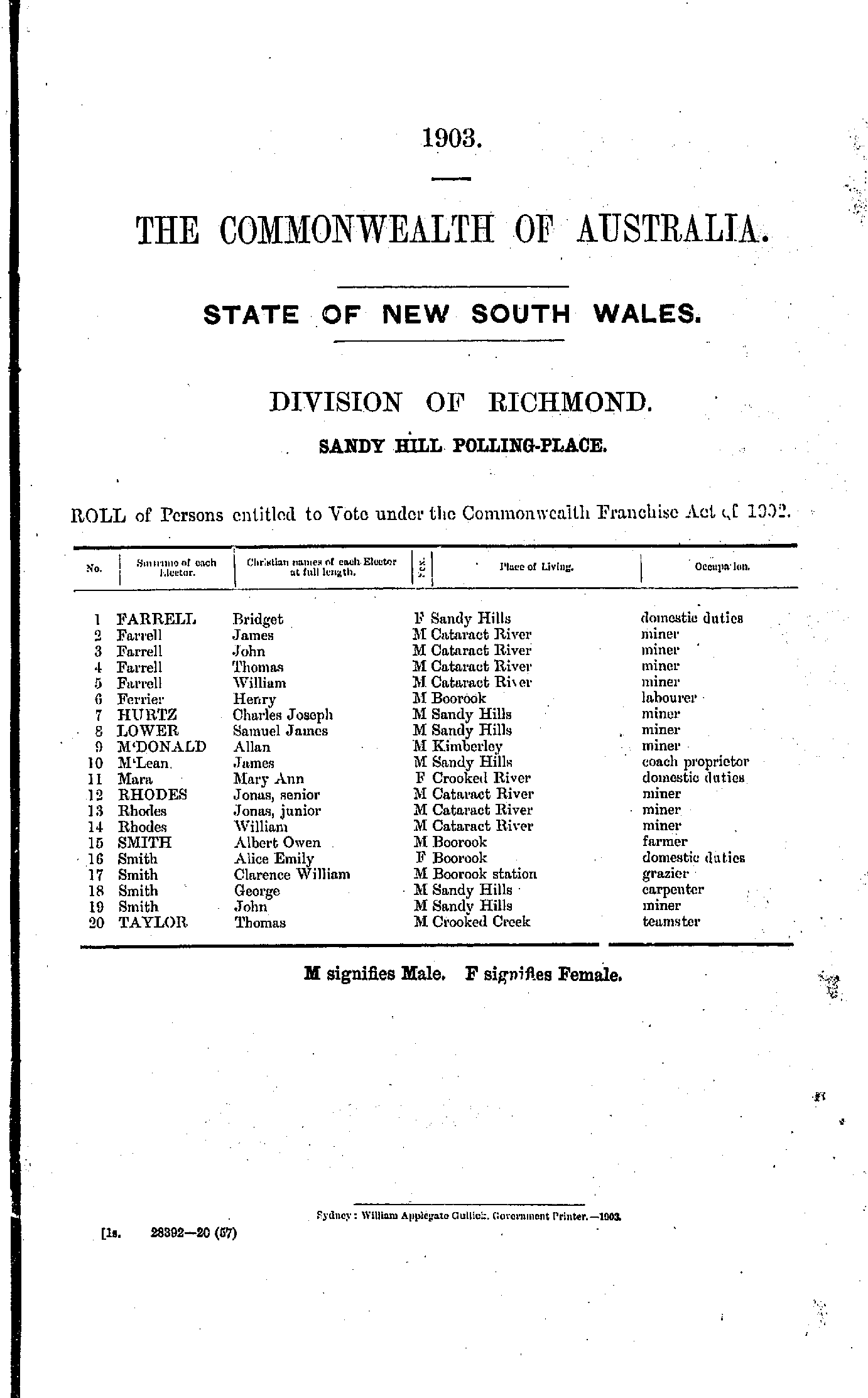
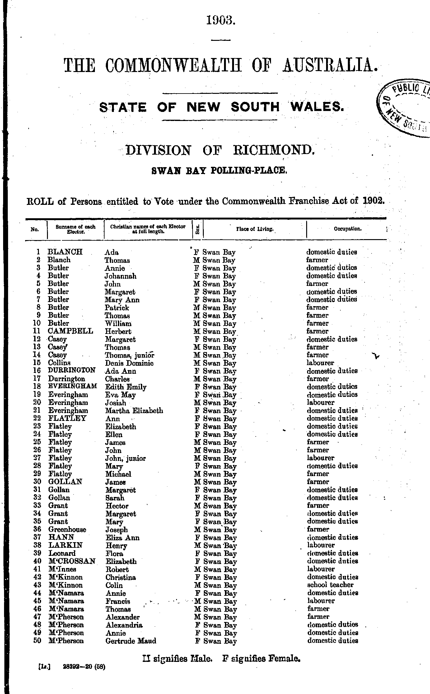
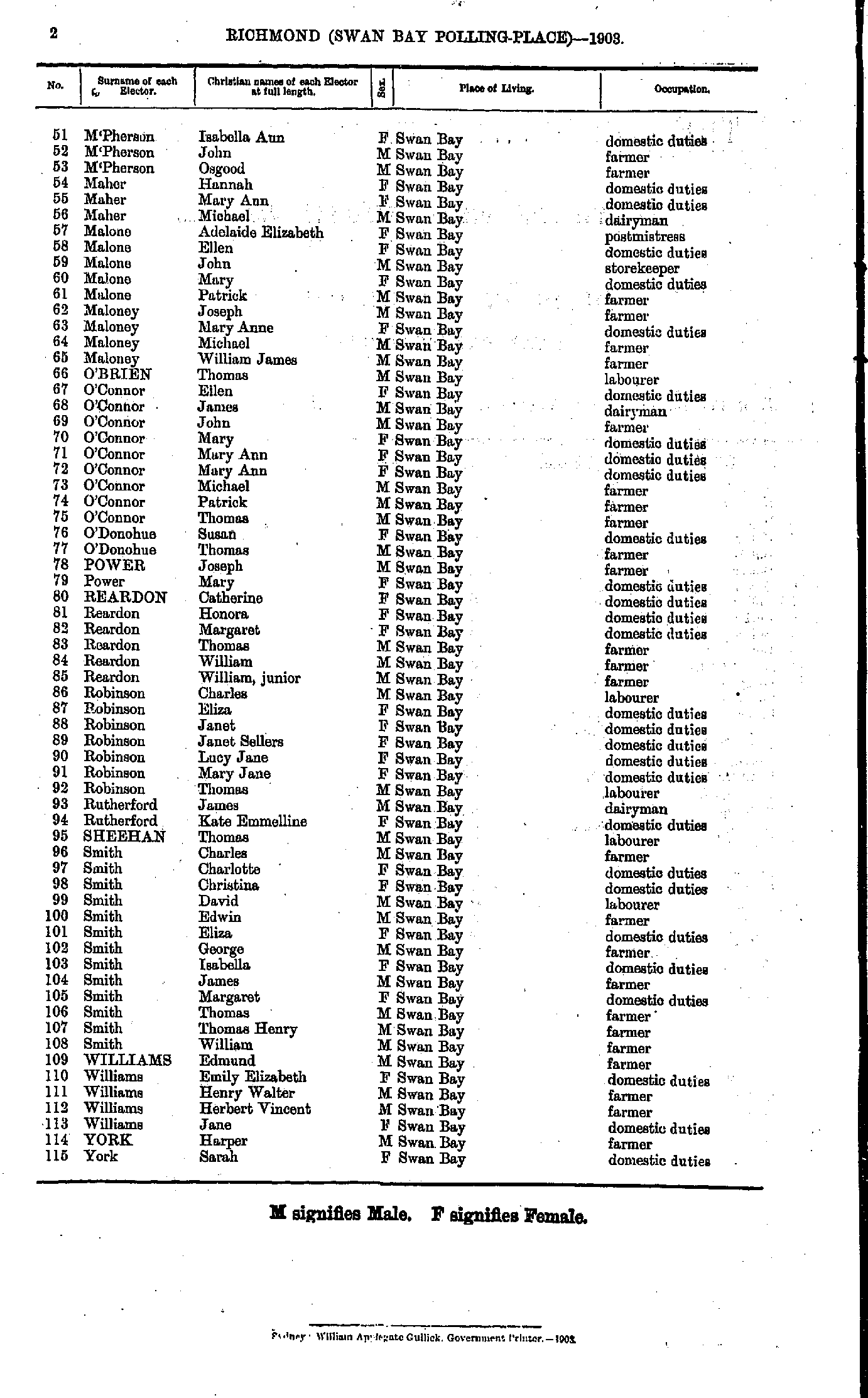
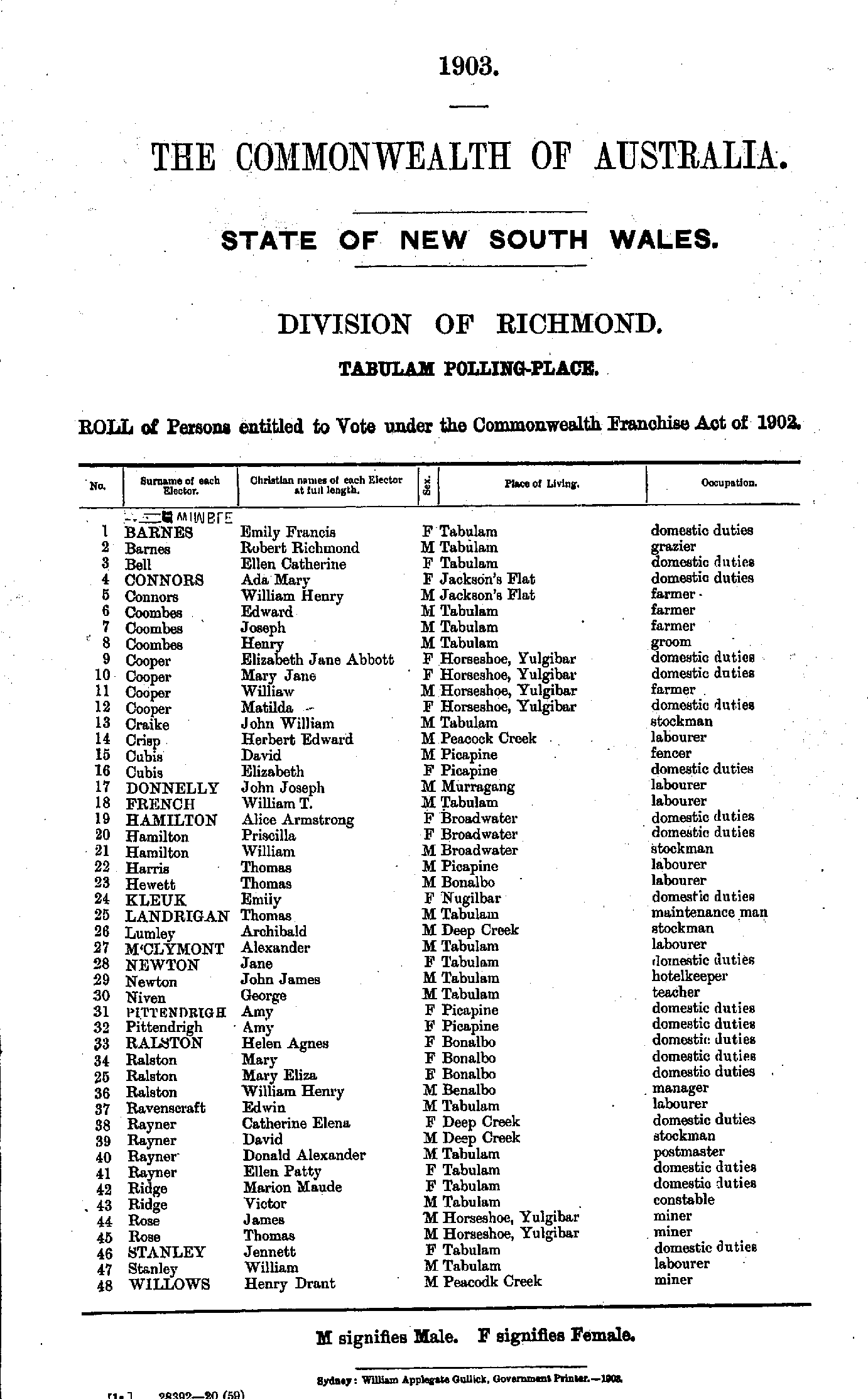
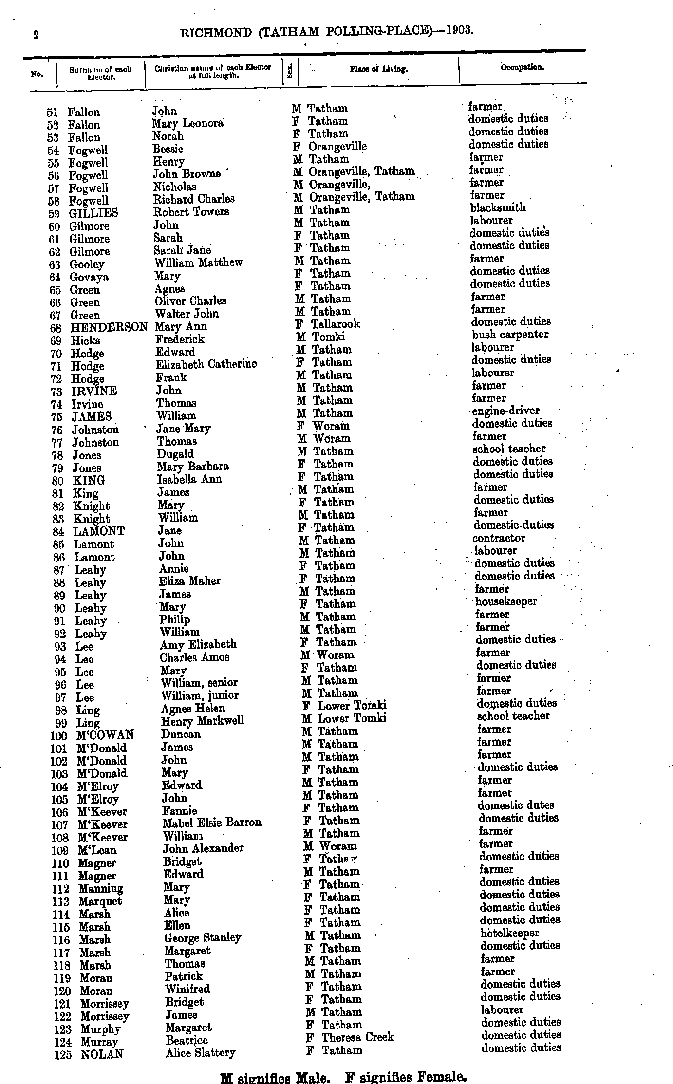
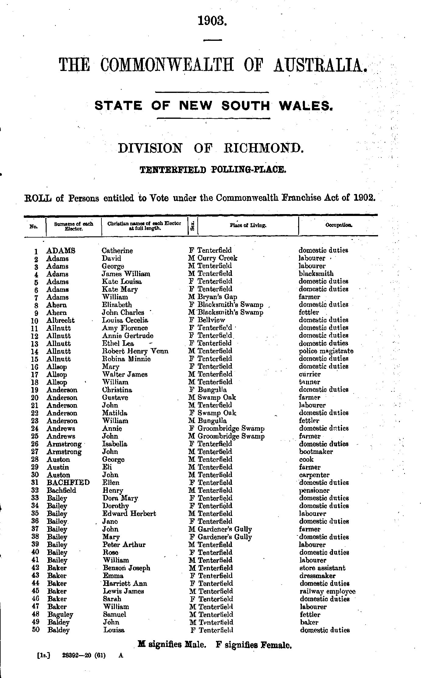
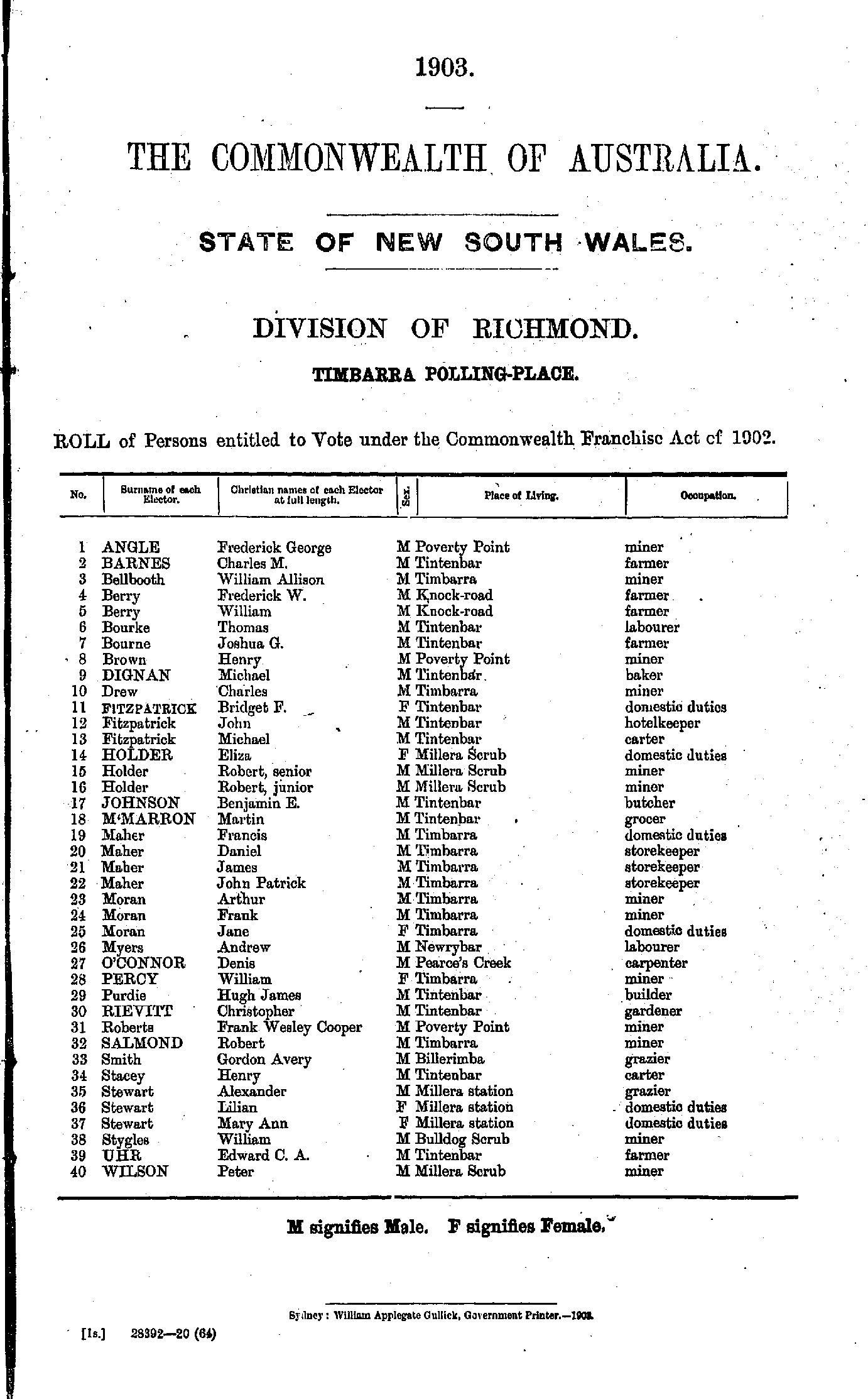
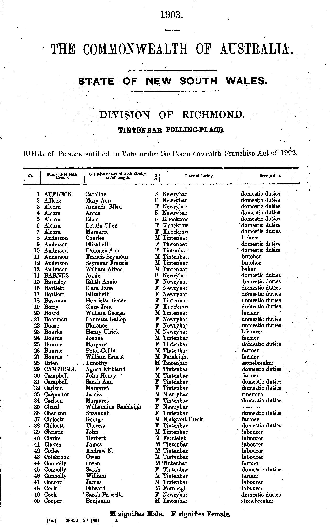
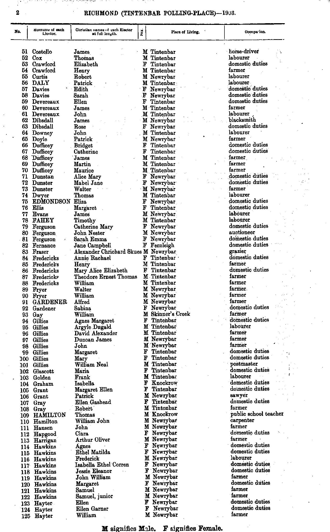
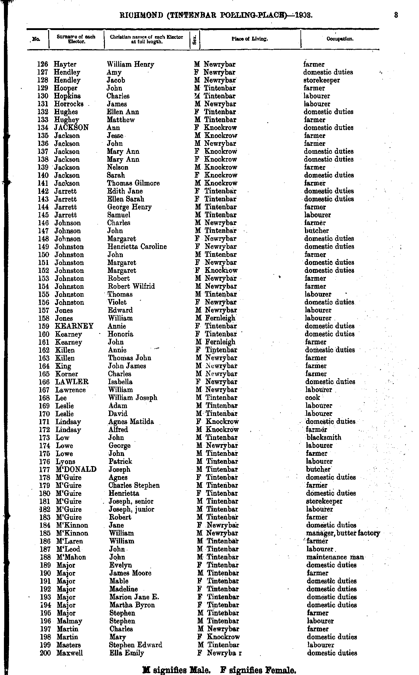
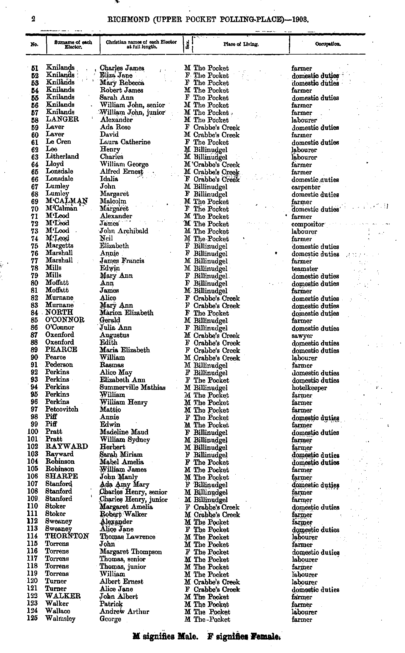
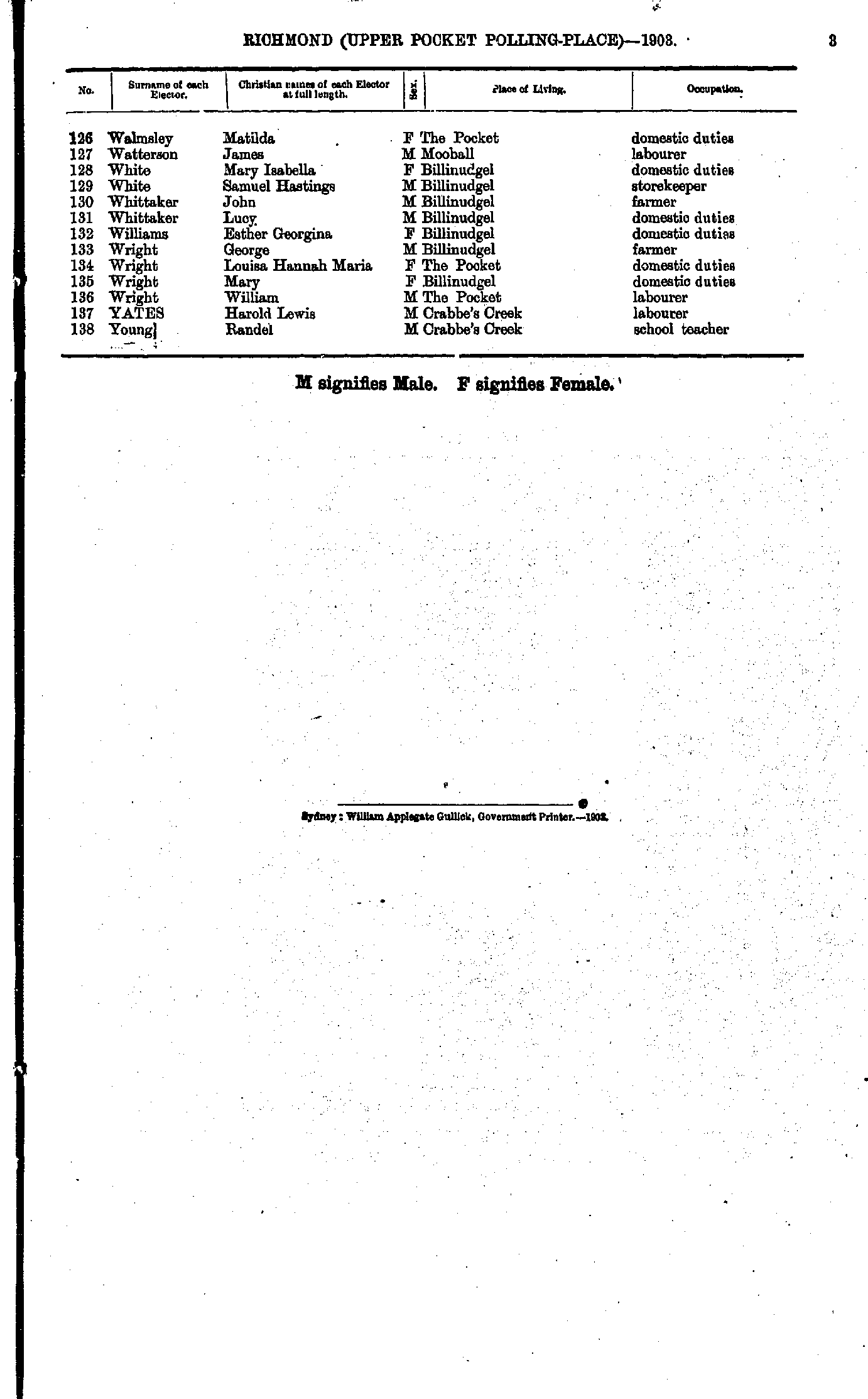
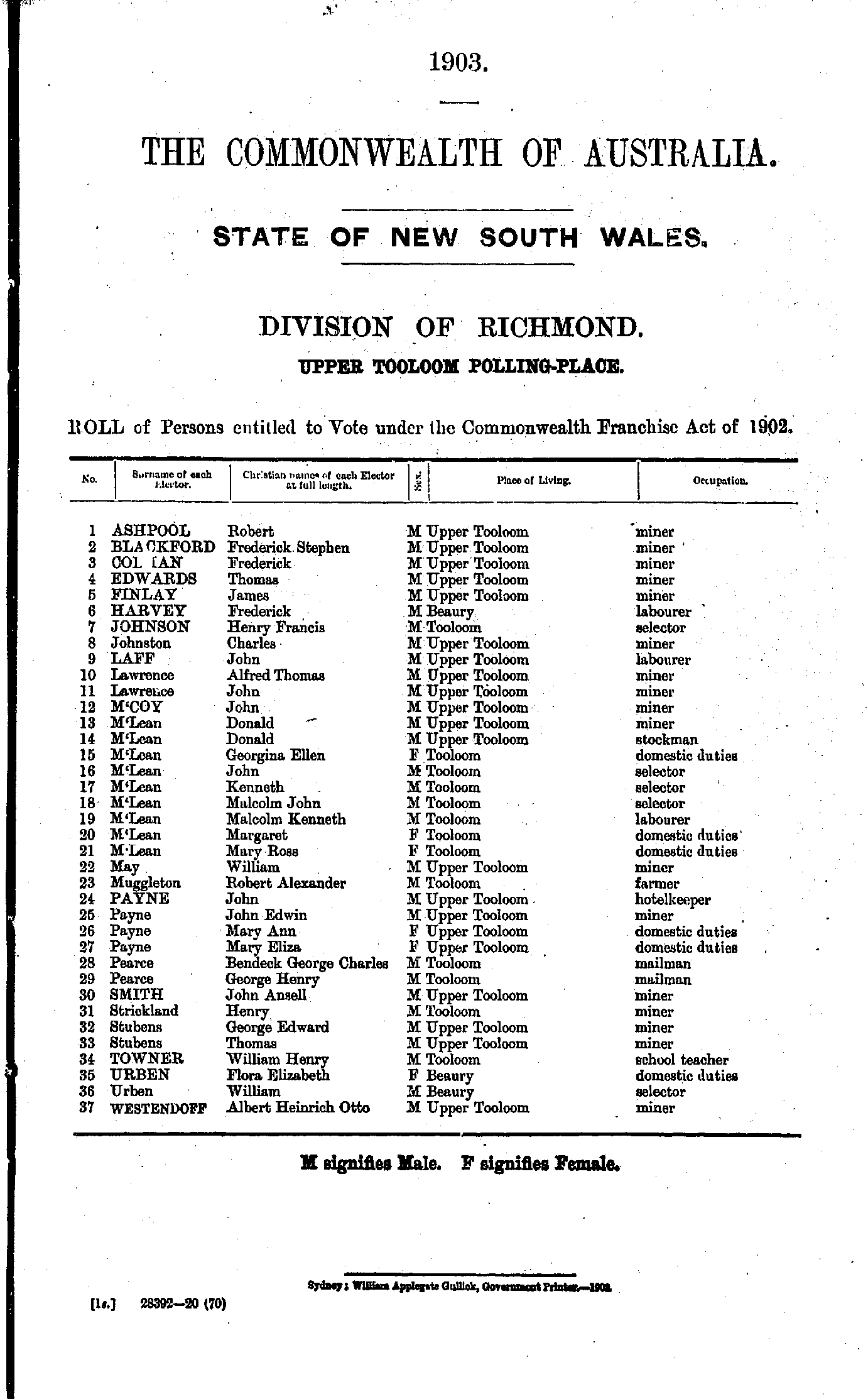
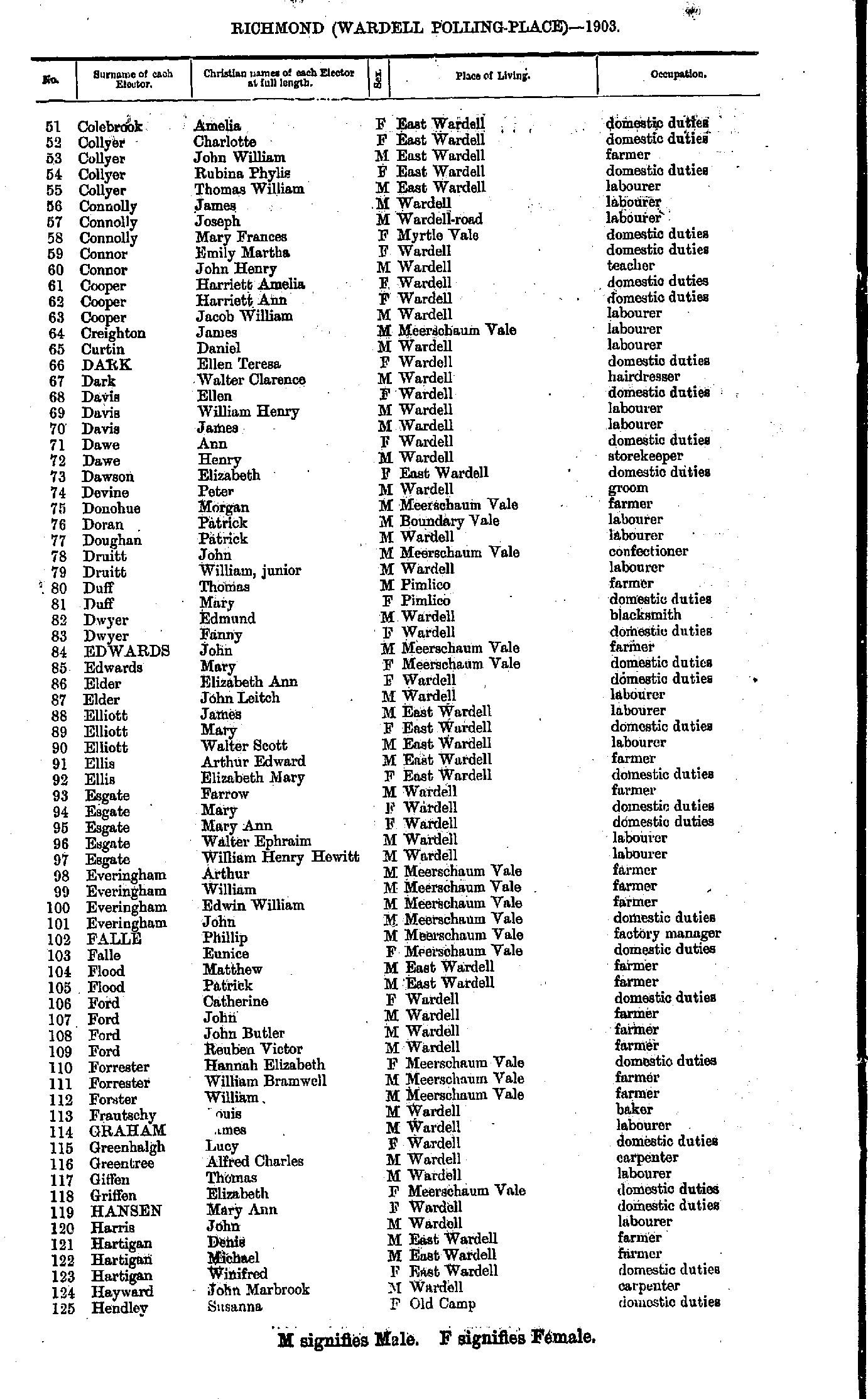
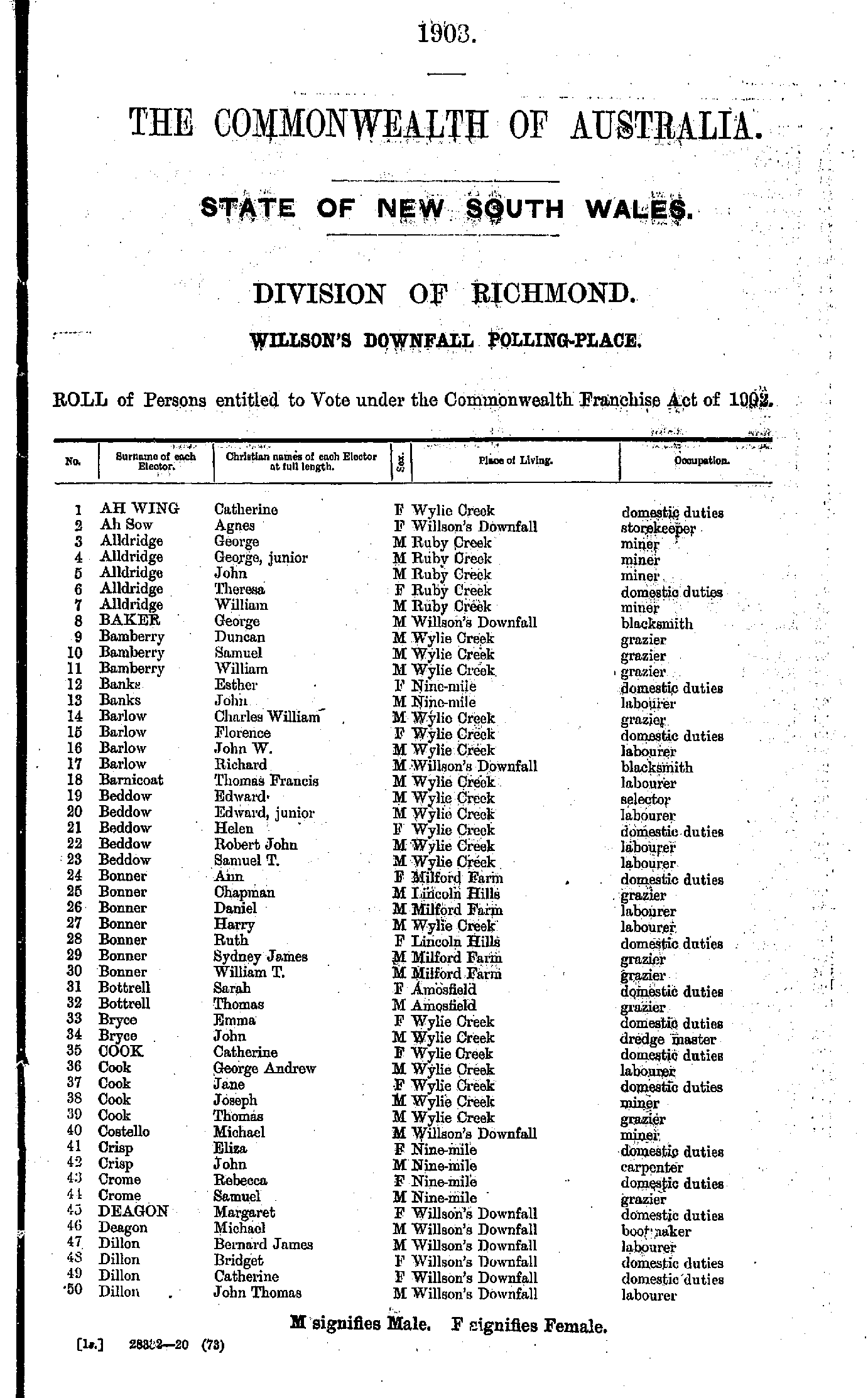
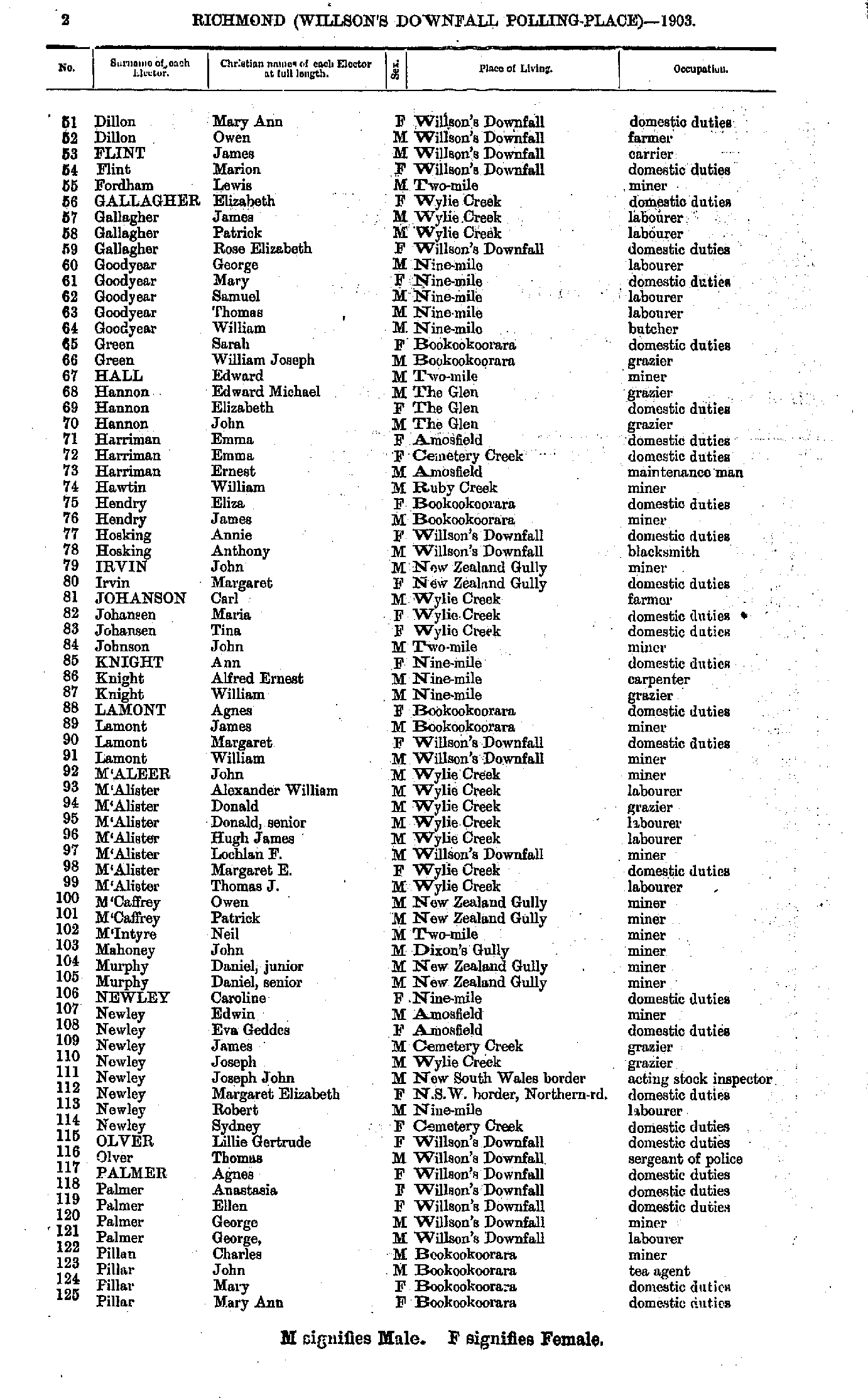
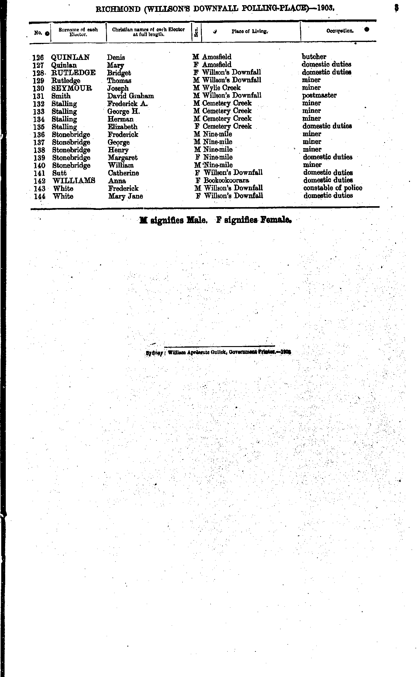
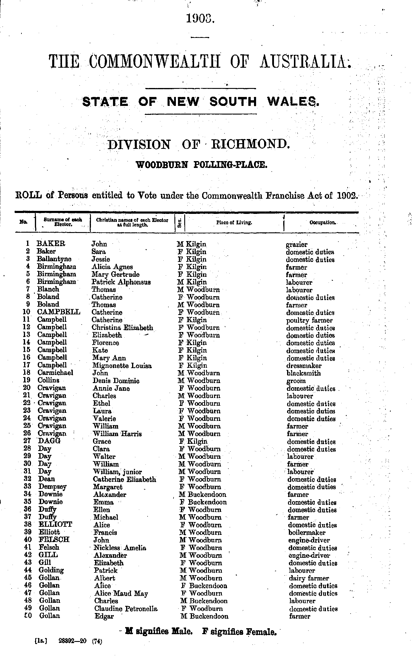
Roll of Persons entitled to Vote under the Commonwealth Franchise Act of 1902 Reproduced from microform copies of the originals in the Mitchell Library, State Library of New South Wales.
Index Copyright © Internet History Resources 2007
Electoral Maps of the Richmond Division, 1901
Polling Places:
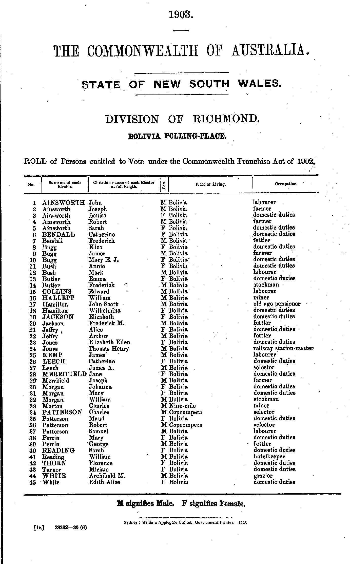
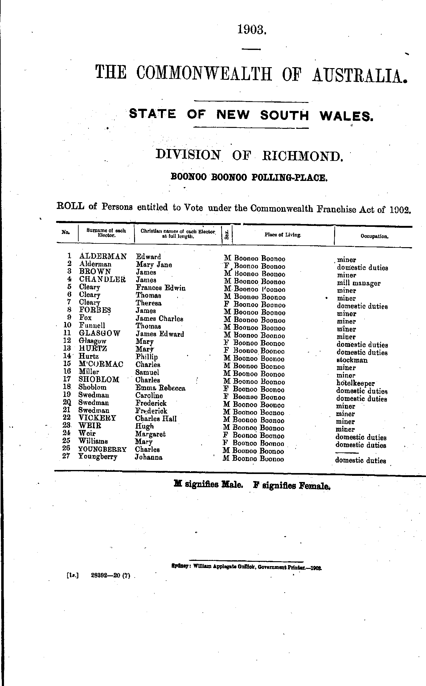
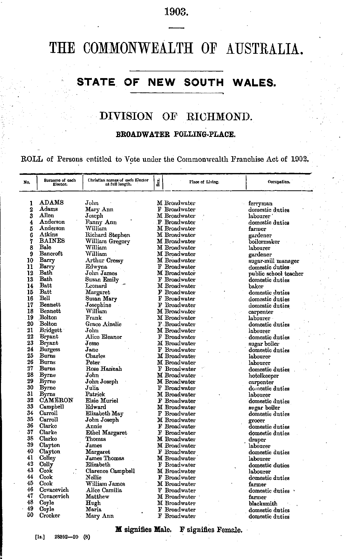
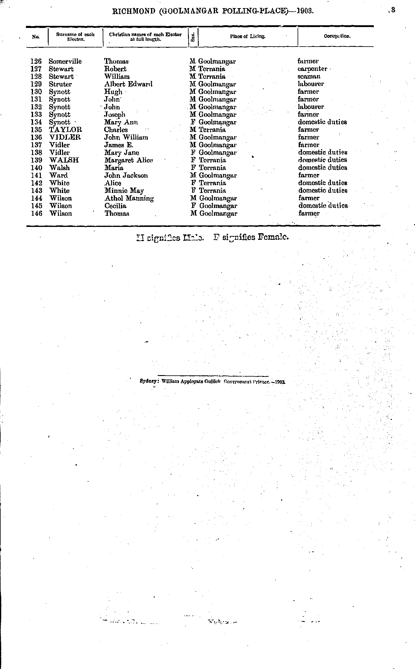
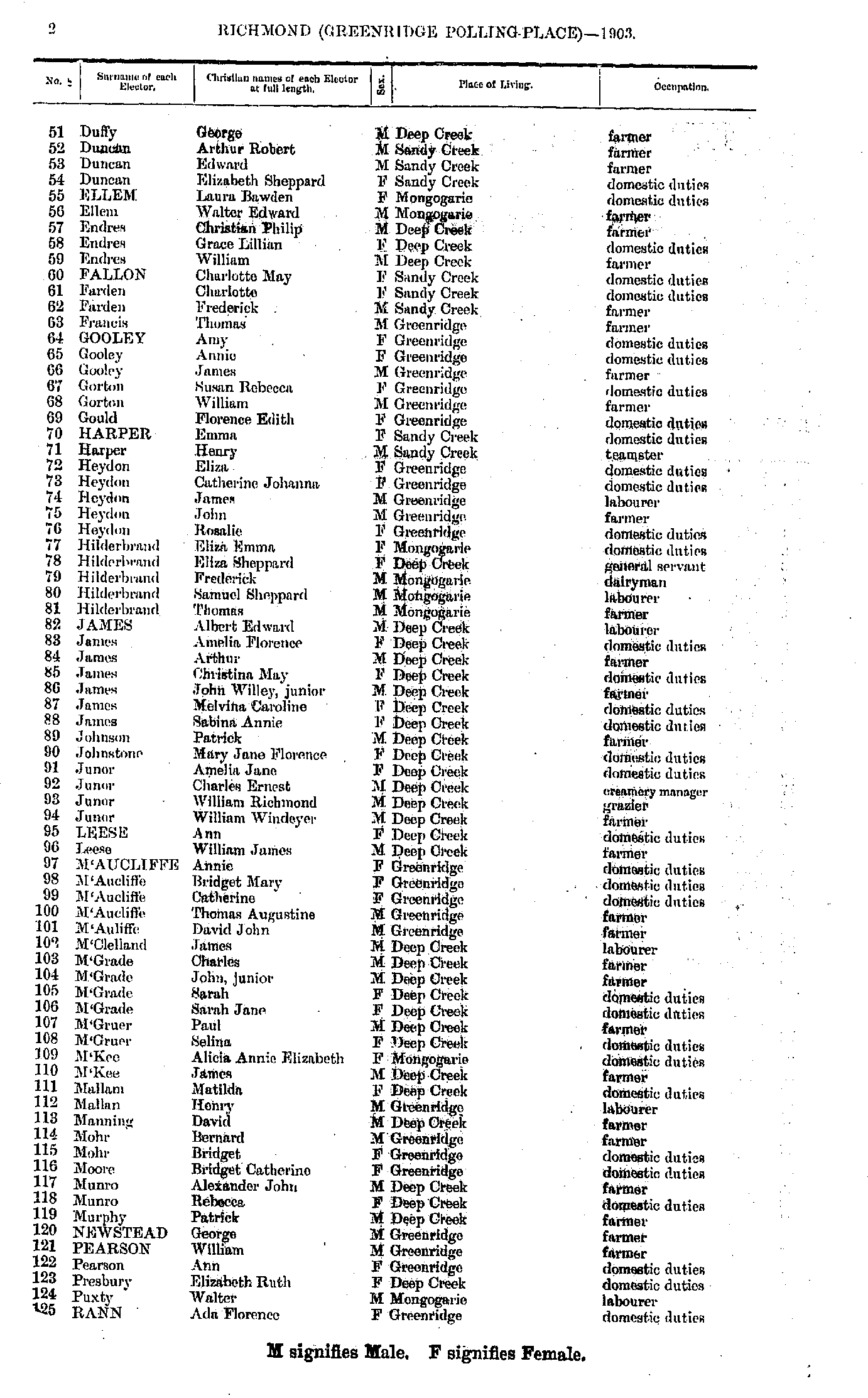
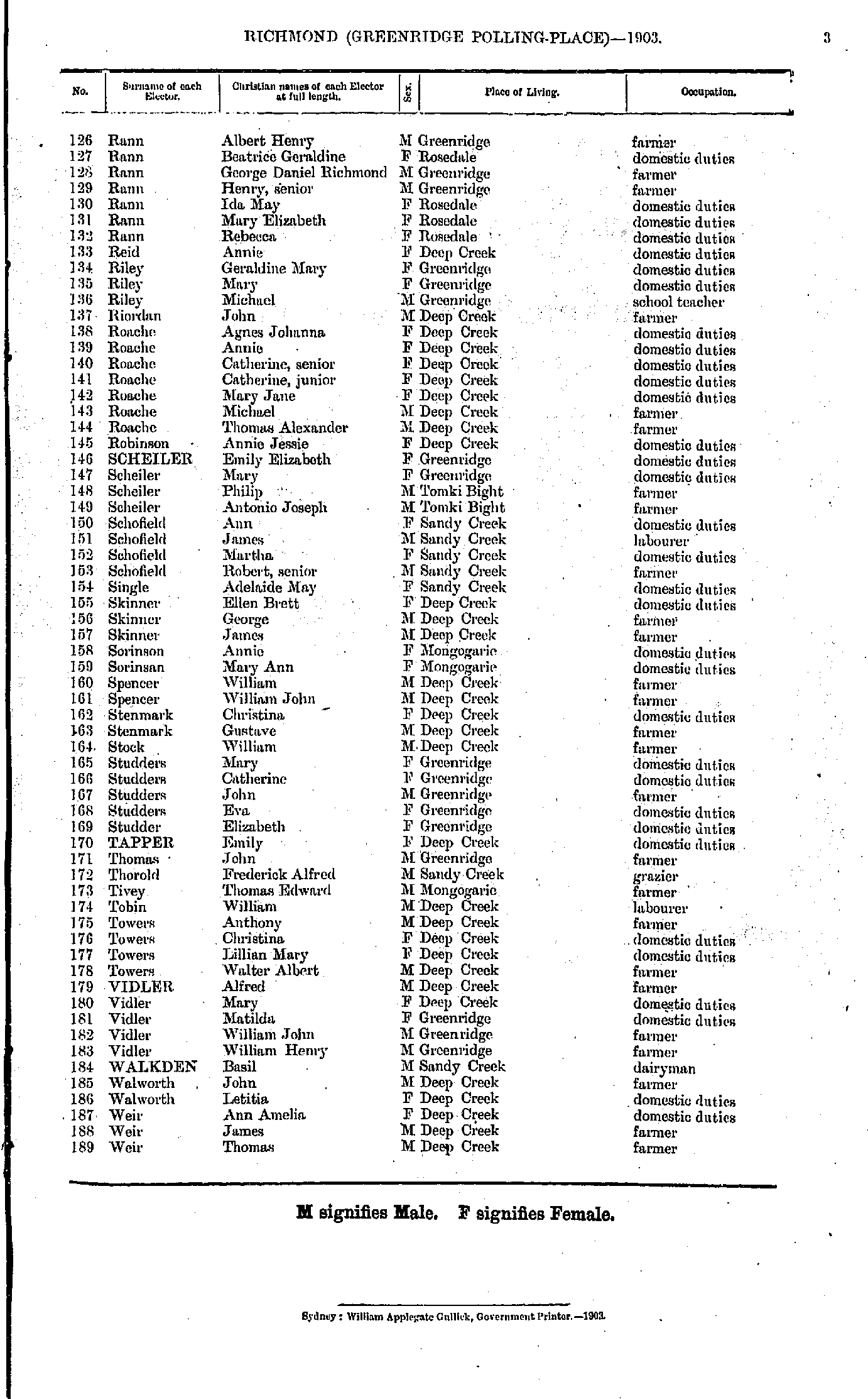
Acacia Creek | Alstonville | Ballina | Bangalow | Bexhill | Bolivia | Boonoo Boonoo | Broadwater | Brooklet | Bungawalbin | Burringbar | Busby's Flat | Byron Bay | Casino | Chilcott's Grass | Clifton Gate | Clunes | Codrington | Condong | Coorabell Creek | Coraki | Coraki East | Cudgen South | Deepwater | Drake | Dunoon | Eltham | Eureka | Fairy Hill | Federal | German Creek | Goolmangar | Greenridge | Gundurimba | Jennings | Jiggi | Lismore | Maryland | Mole Tableland | Mullumbimby | Mummulgum | Murwillumbah | Myrtle Creek | Naughton's Gap | New Park | Nimbin | Nine-Mile | Pearce's Creek | Pimlico | Pretty Gully | Riley's Hill | Rivertree | Rosebank | Rosehill | Rous | Sandilands Range | Sandy Flat | Sandy Hill | Swan Bay | Tabulam | Tatham | Tenterfield | The Gulf | The Risk | Timbarra | Tintenbar | Tooloom | Tumbulgum | Tweed Heads | Upper Pocket | Upper Tooloom | Wardell | White Swamp | Willson's Downfall | Woodburn | Woodburn South | Wyrallah
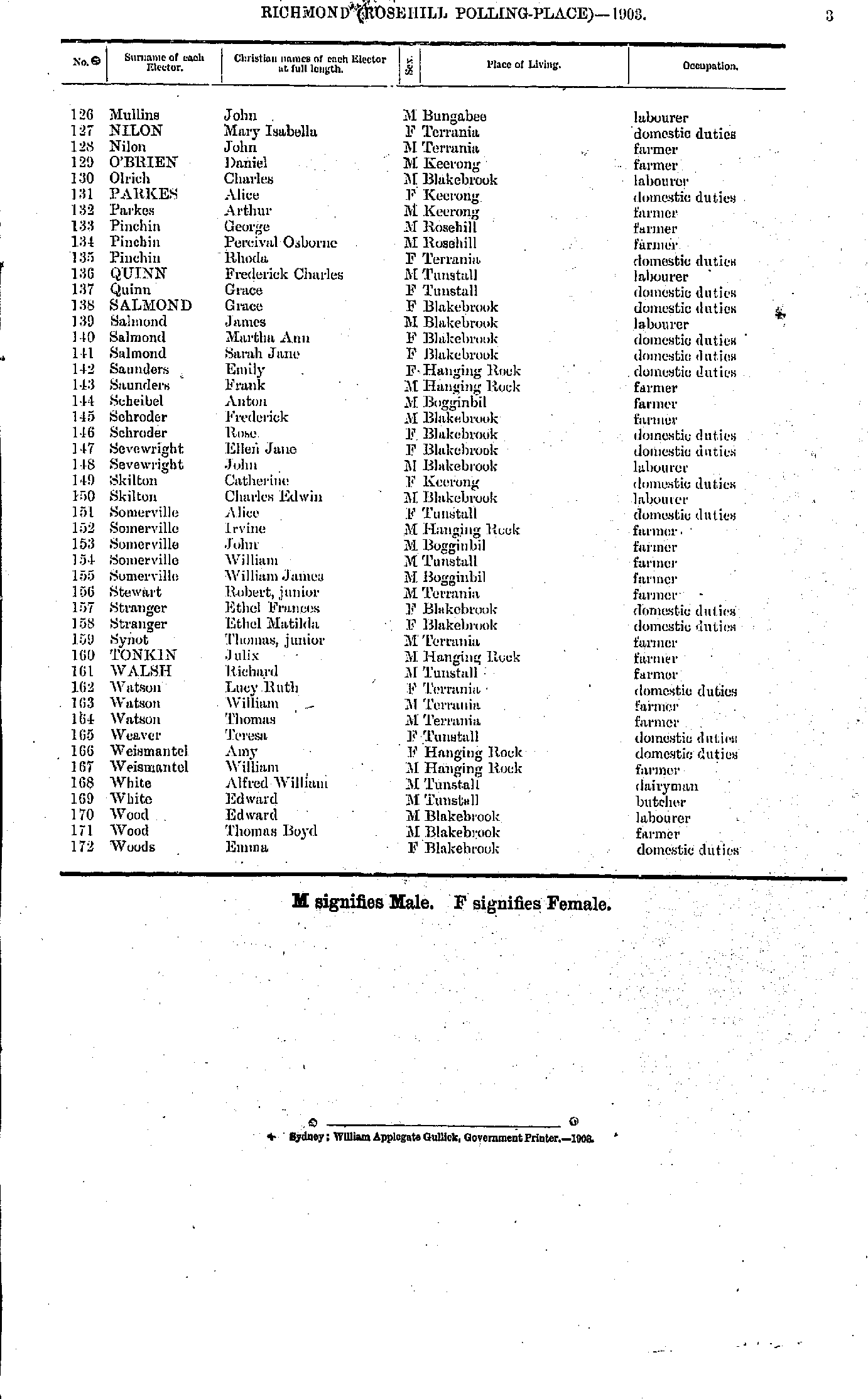
- Abbott Louisa - Brown Elizabeth
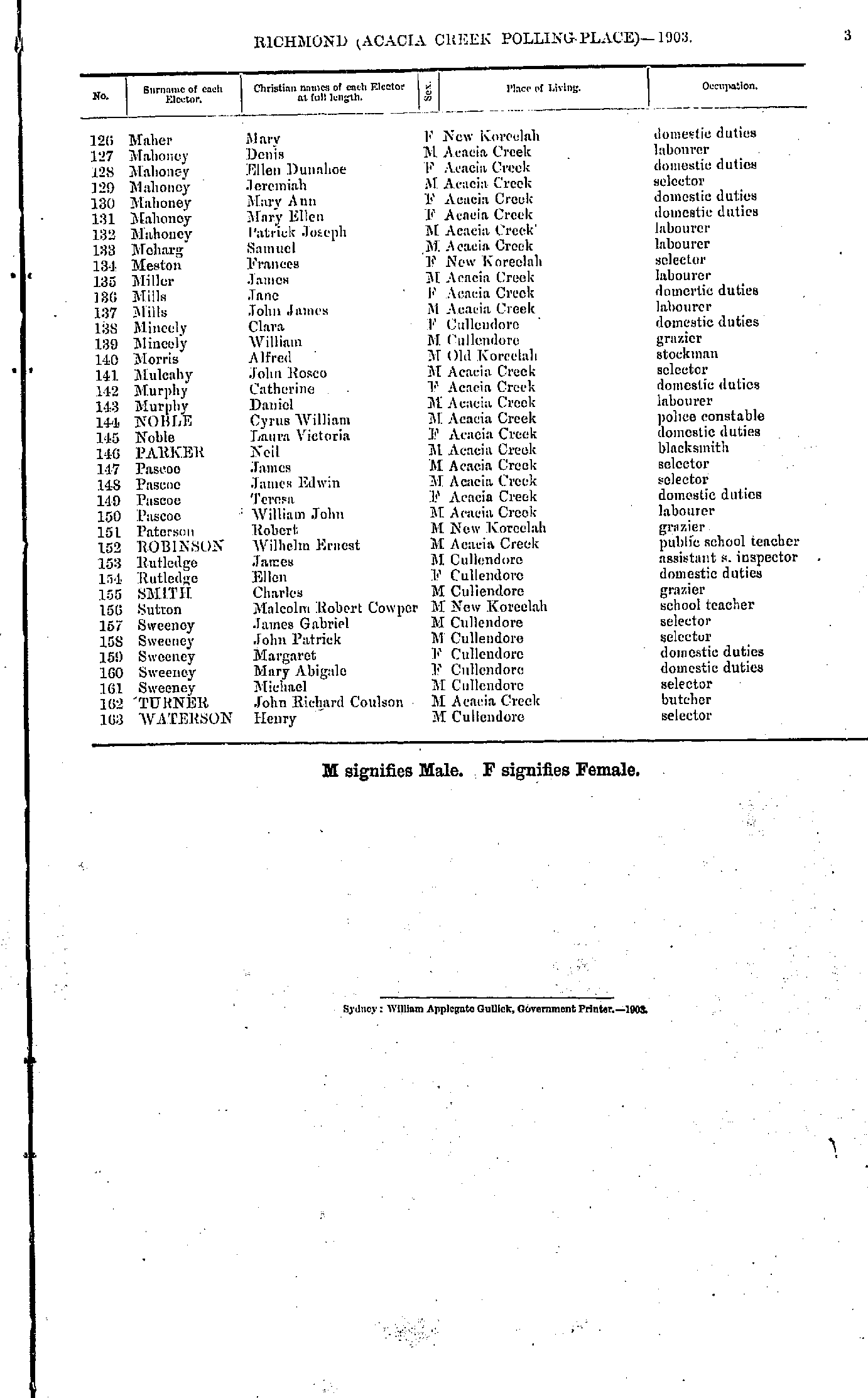
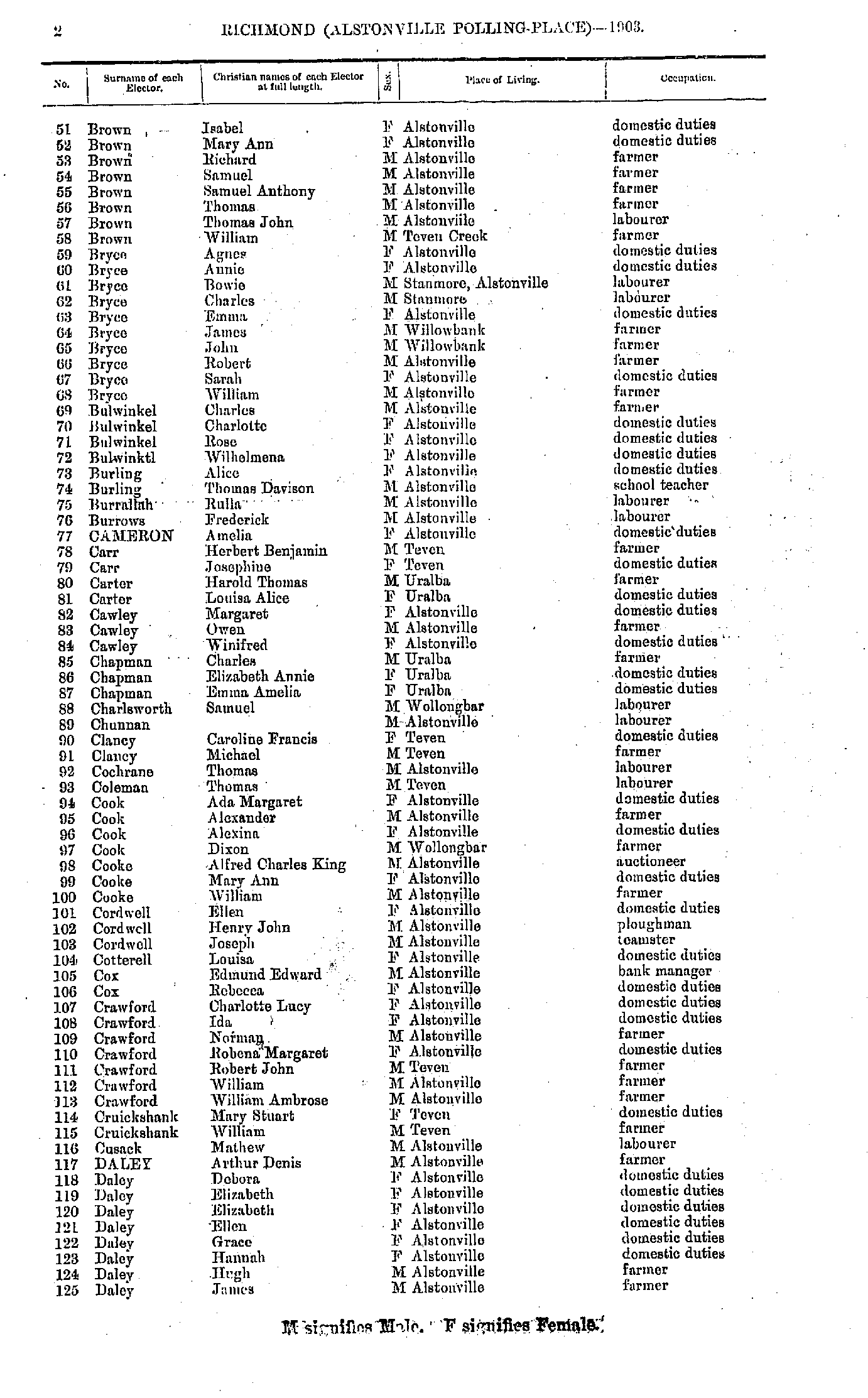
- Brown Isabel - Daley James
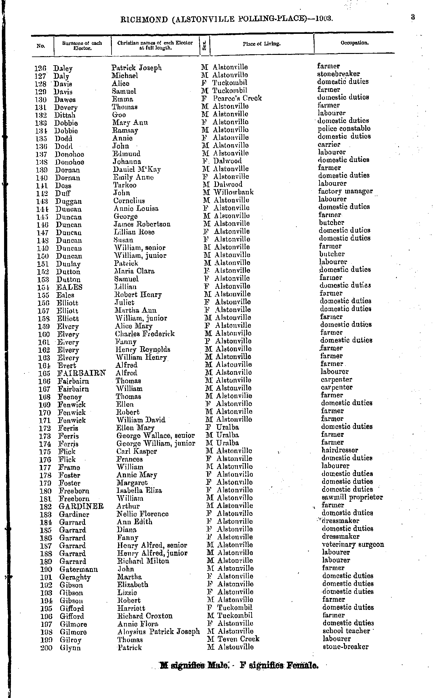
- Daley Patrick - Glynn Patrick
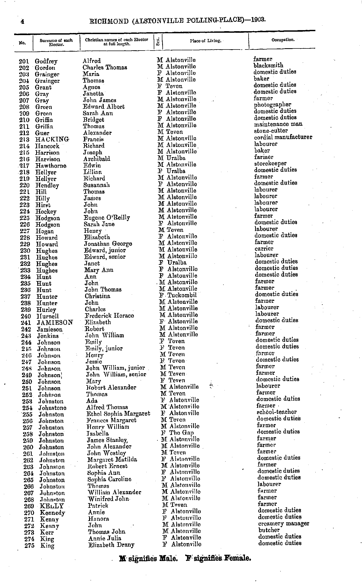
- Godfrey Alfred - King Elizabeth
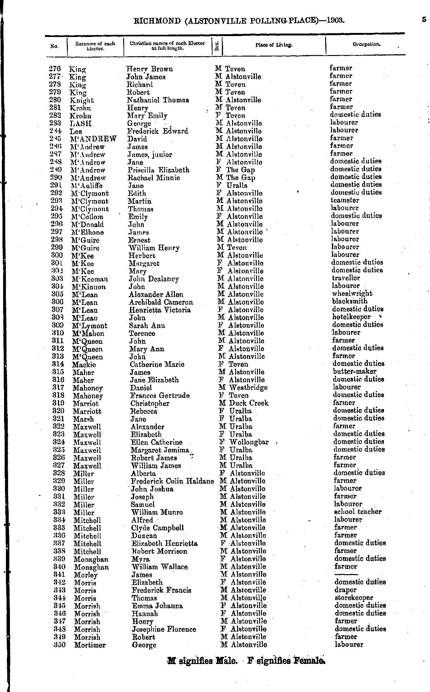
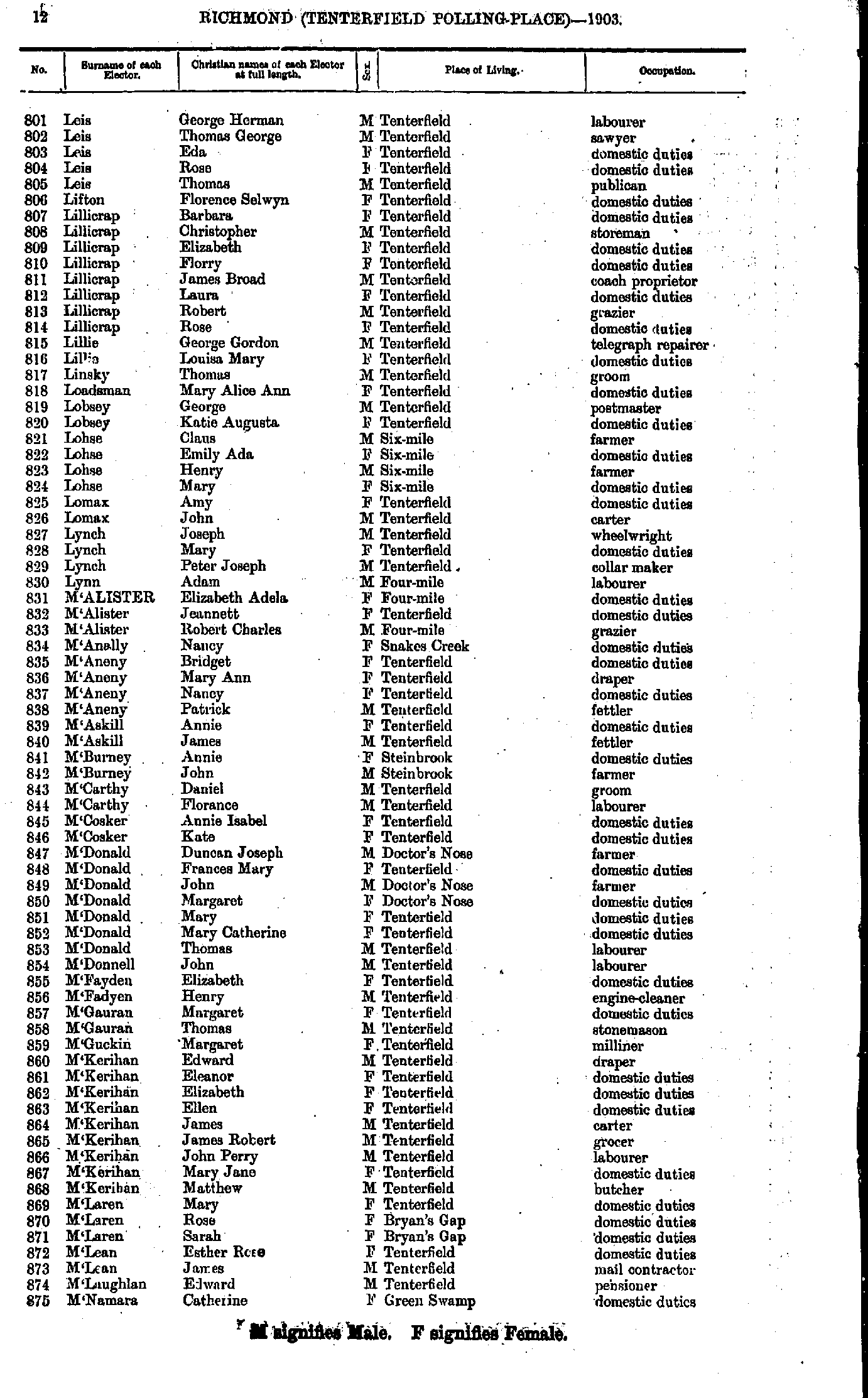
- King Henry - Mortimer George
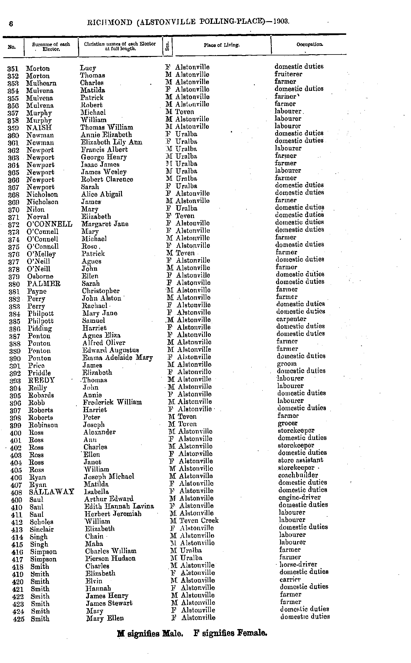
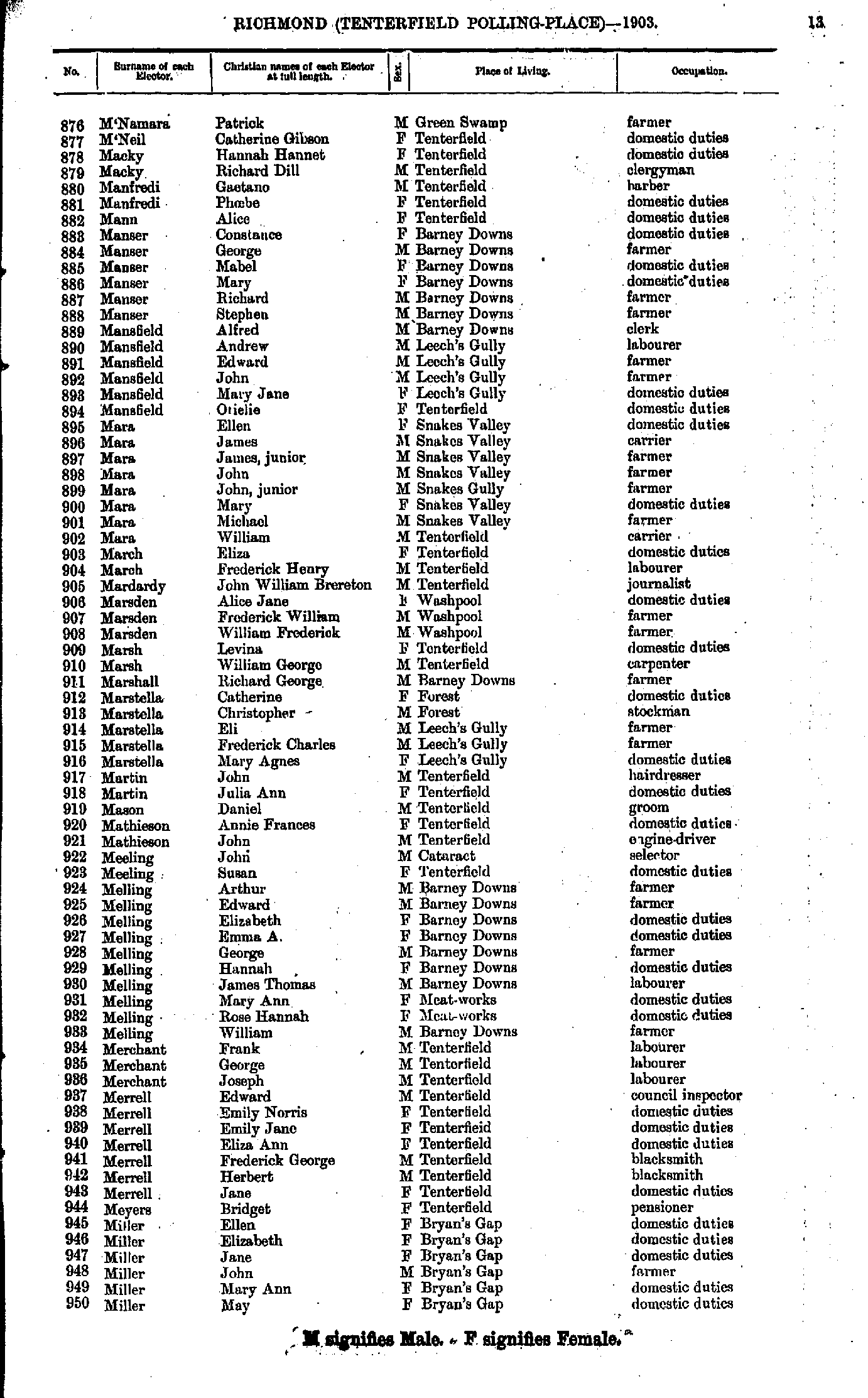
- Morton Lucy - Smith Mary
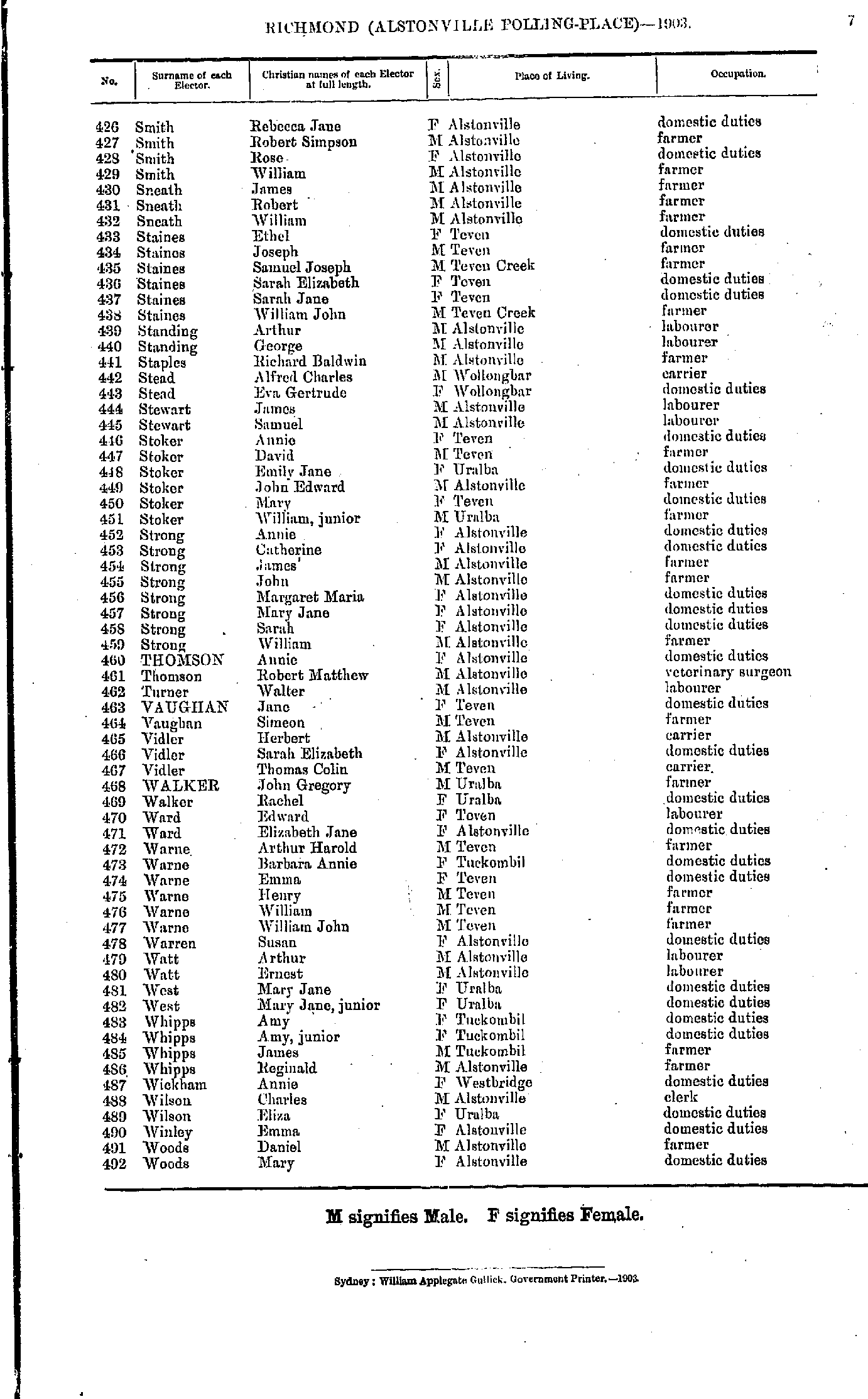
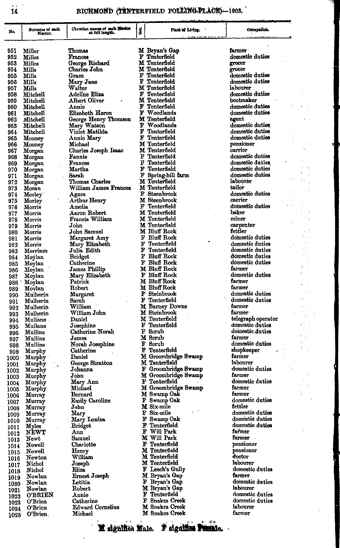
- Smith Rebecca - Woods Mary
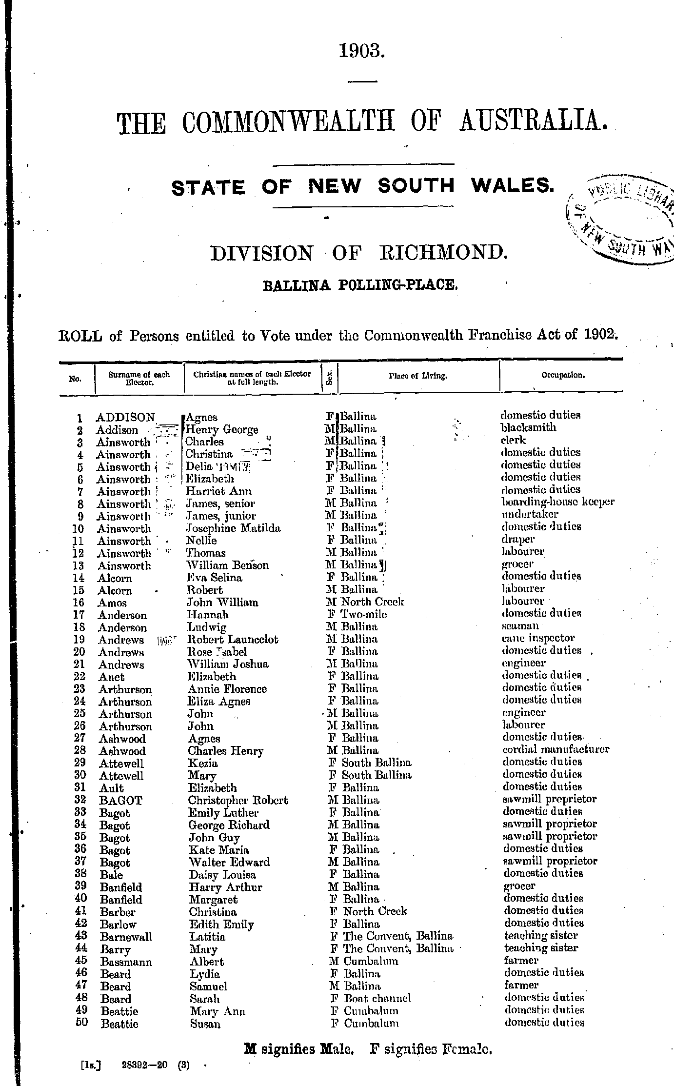
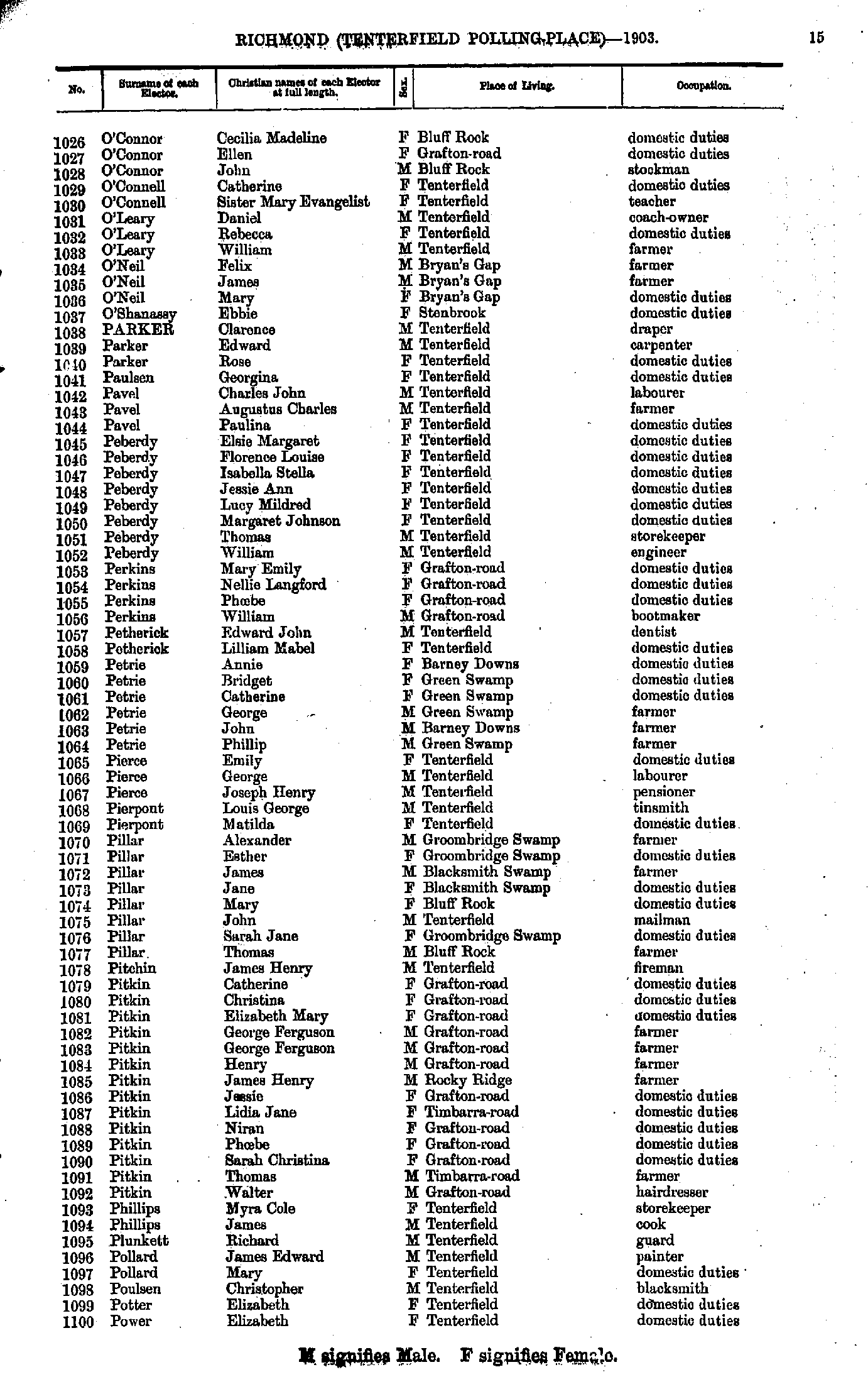
- Addison Agnes - Beattie Susan
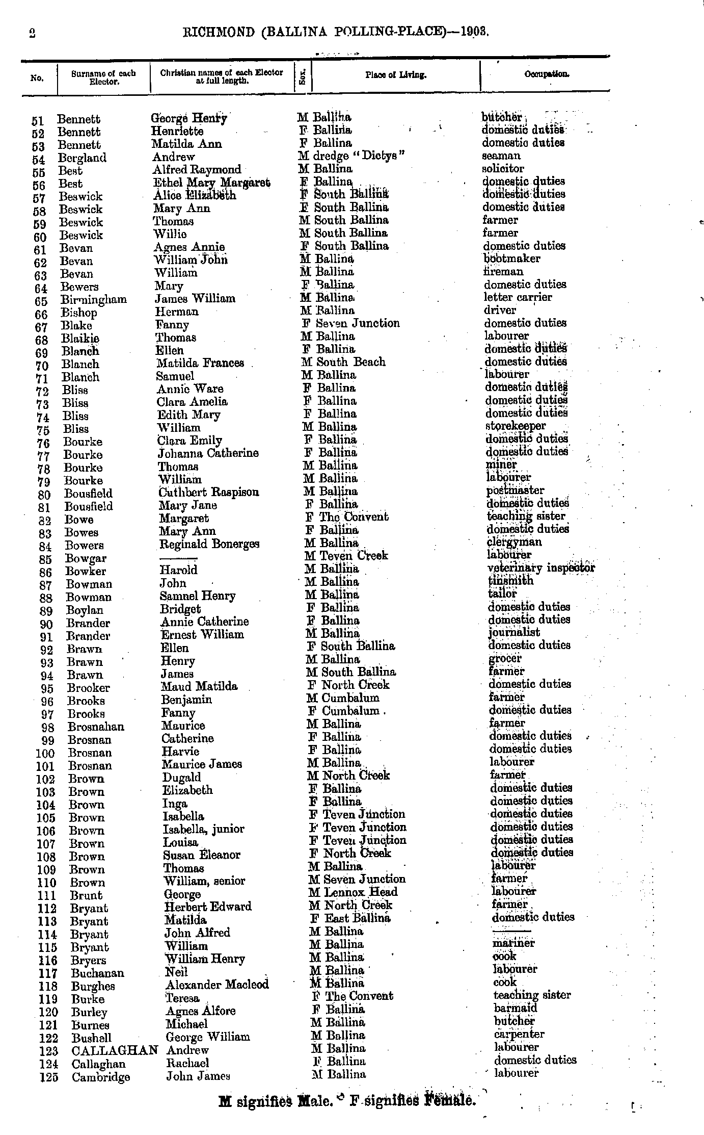
- Bennett George - Cambridge John
- Cambridge Mary - Crozier Bertha
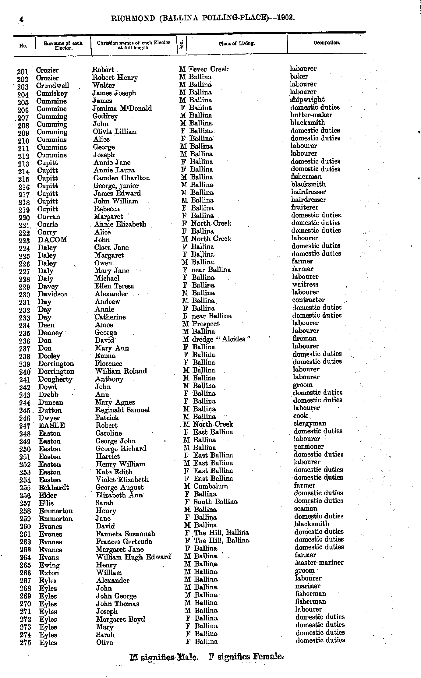
- Crozier Robert - Eyles Olive
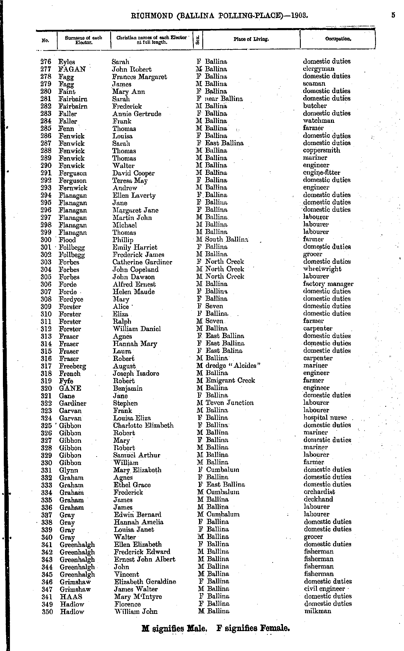
- Eyles Sarah - Hadlow William
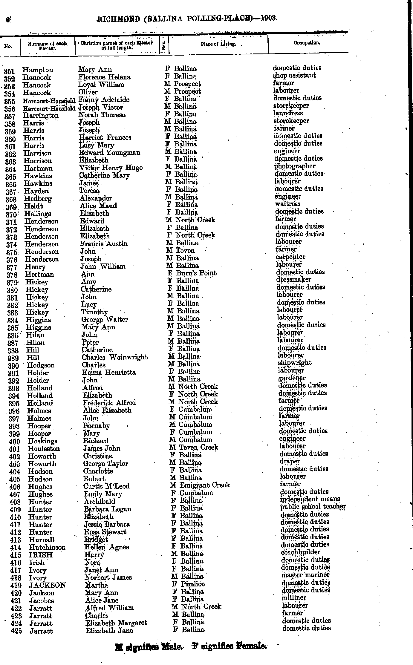
- Hampton Mary - Jarratt Elizabeth
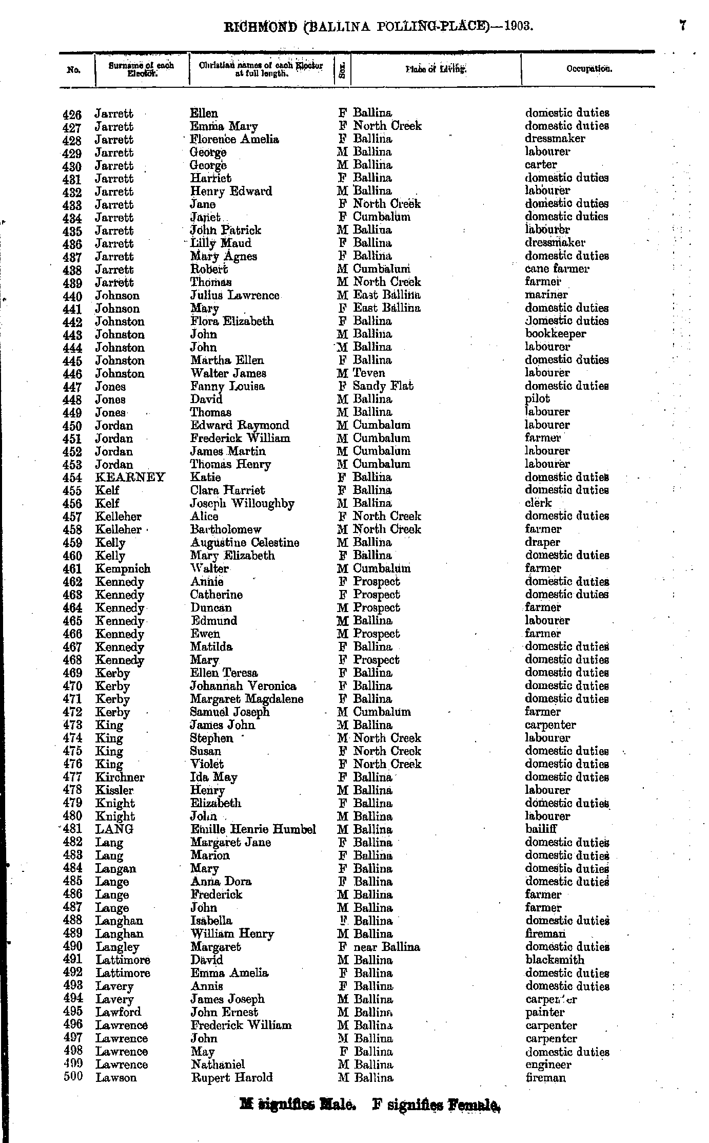
- Jarrett Ellen - Lawson Rupert
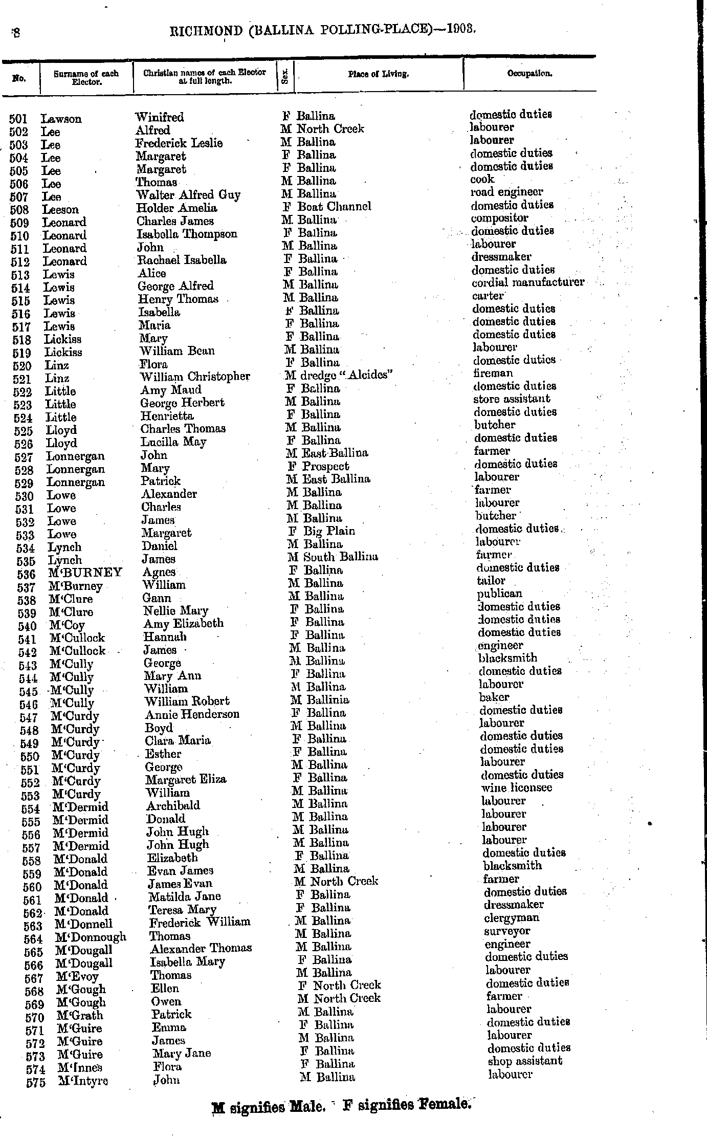
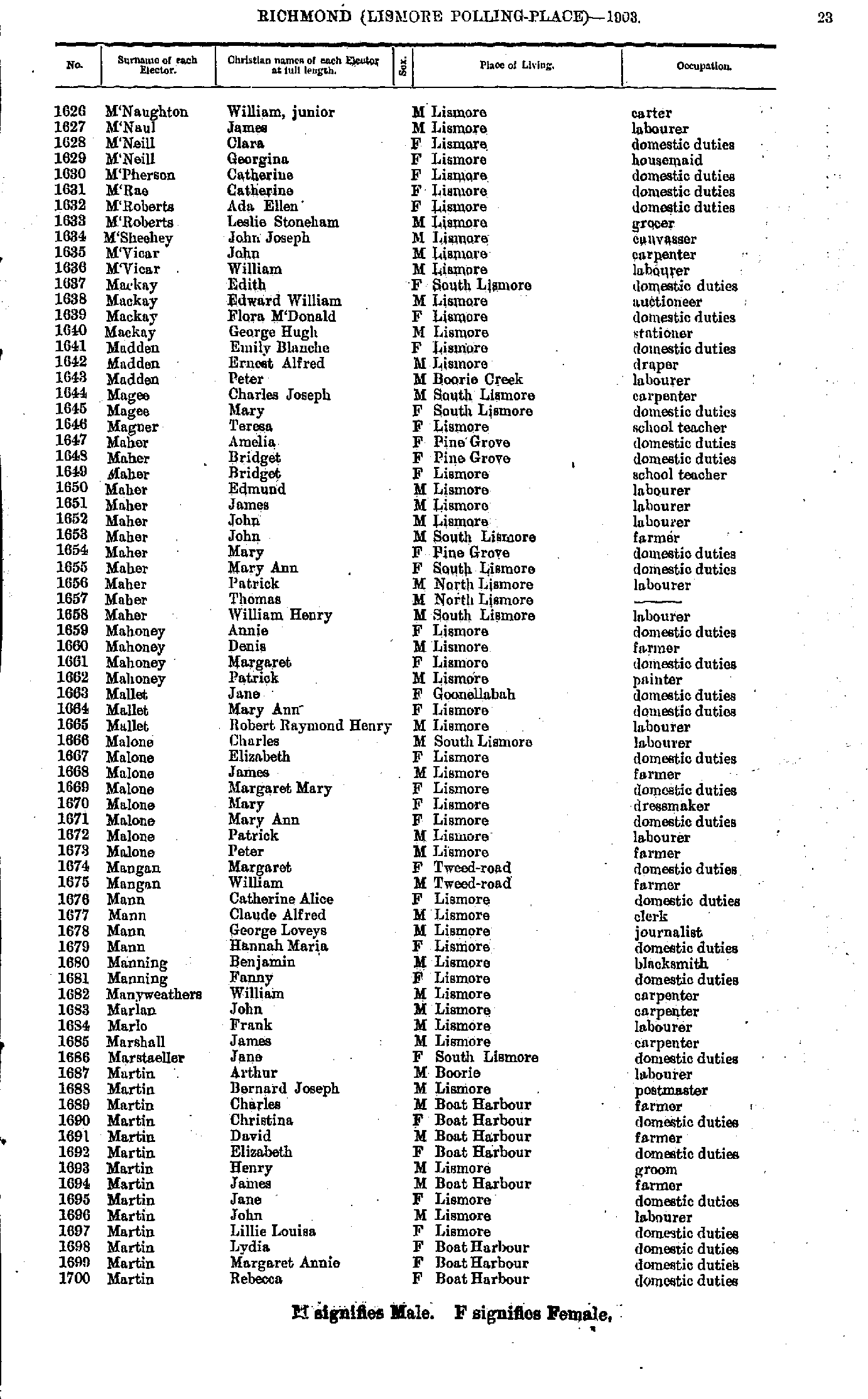
- Lawson Winifred - M'Intyre John
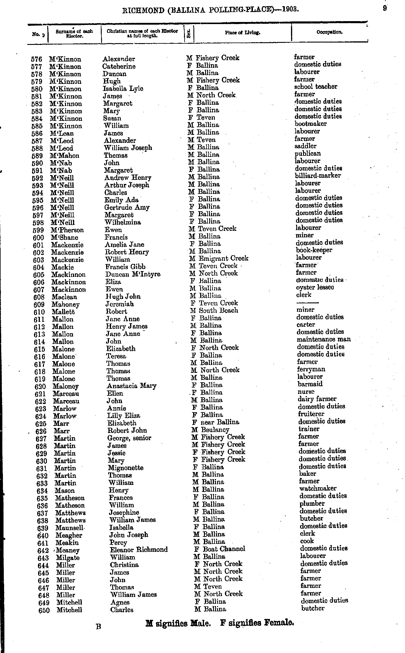
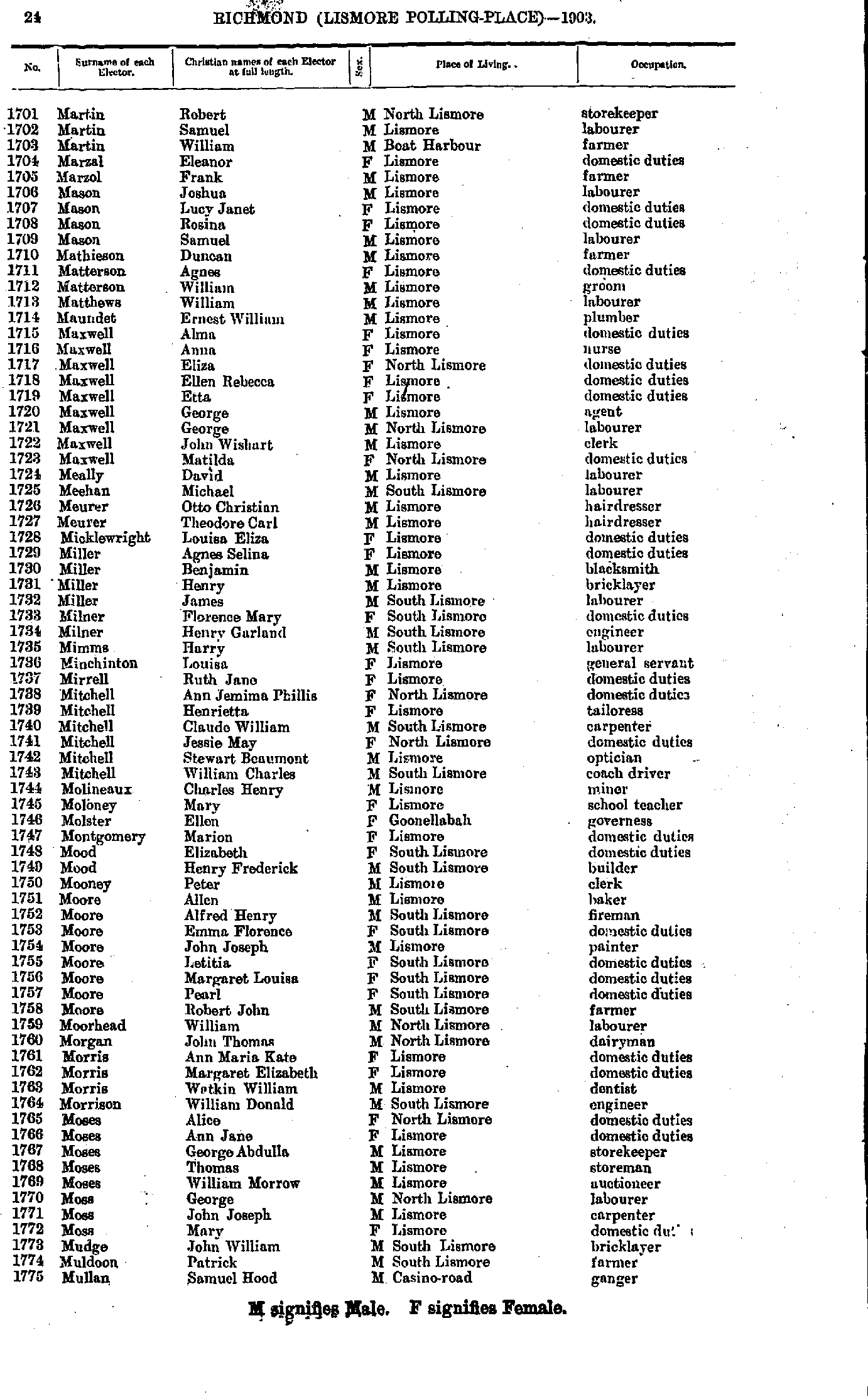
- M'Kinnon Alexander - Mitchell Charles
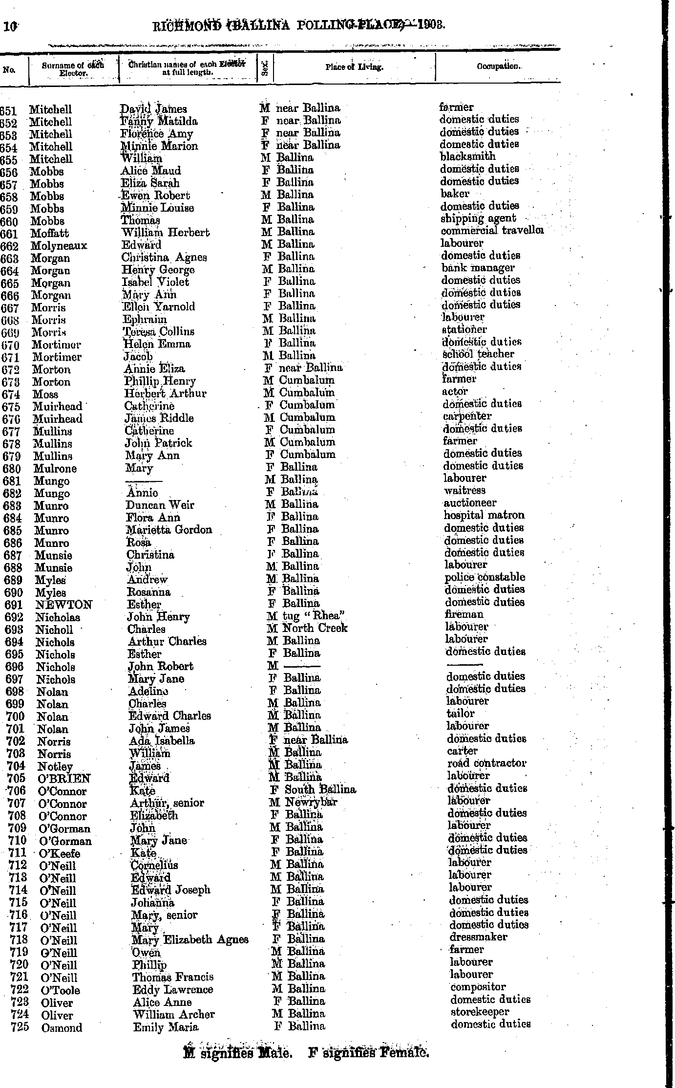
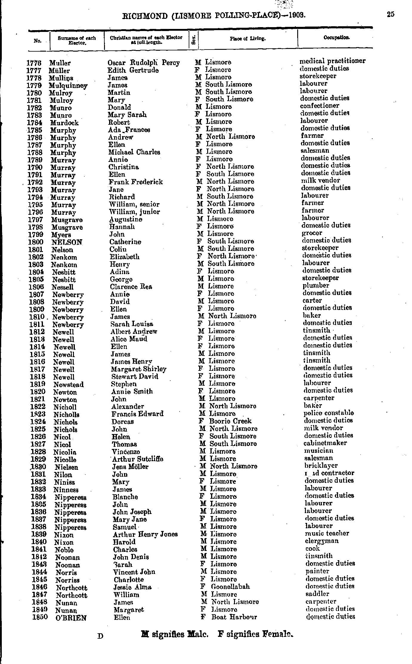
- Mitchell David - Osmond Emily
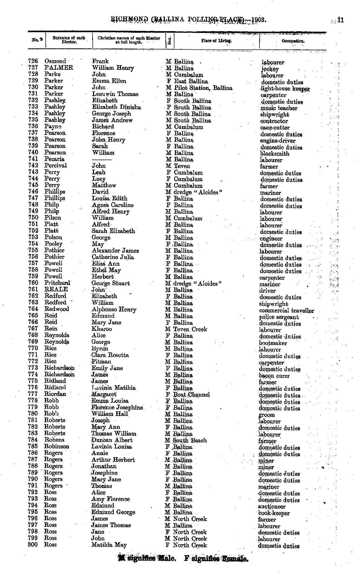
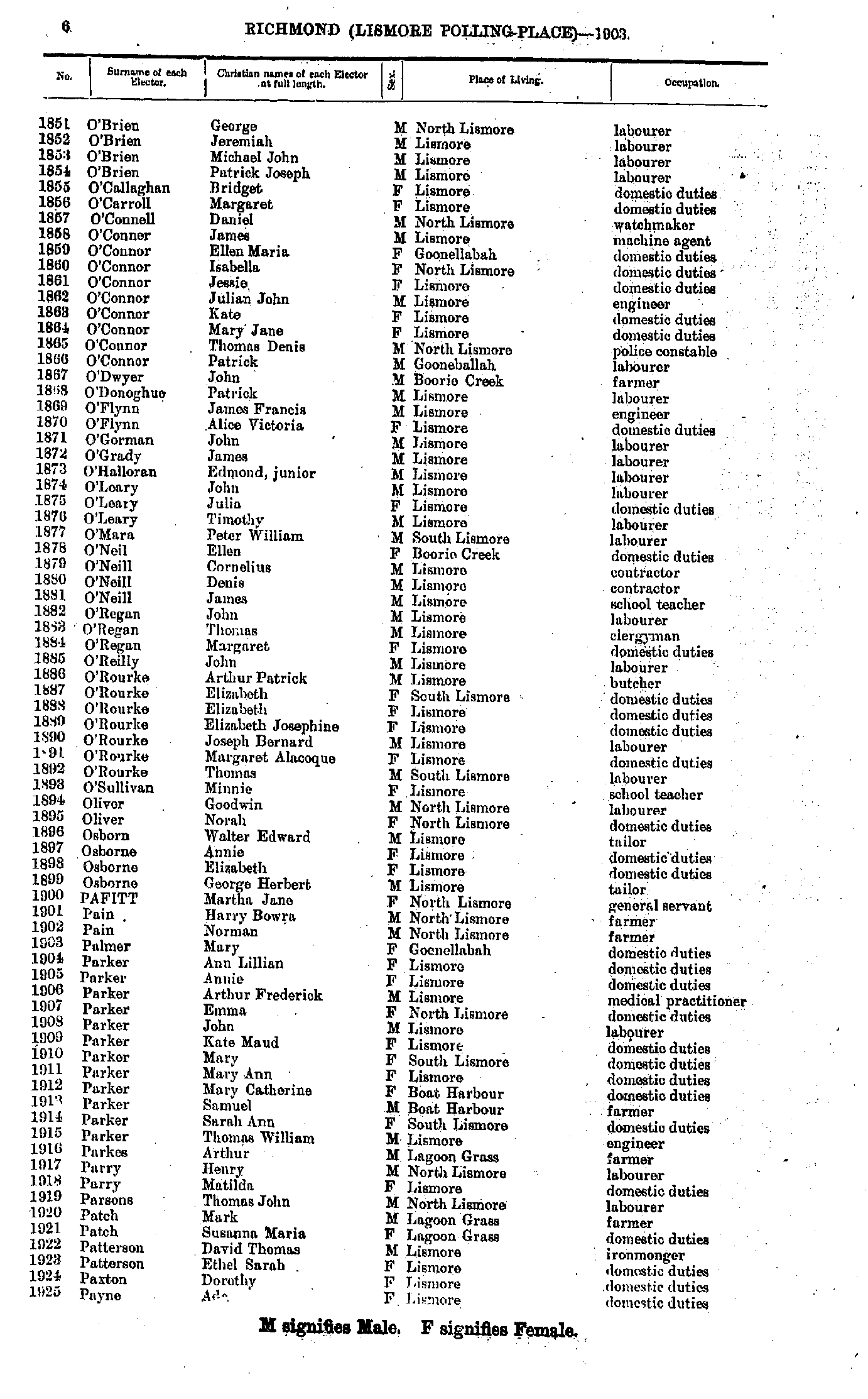
- Osmond Frank - Ross Matilda
- Rountree Elizabeth - Smythe Charles
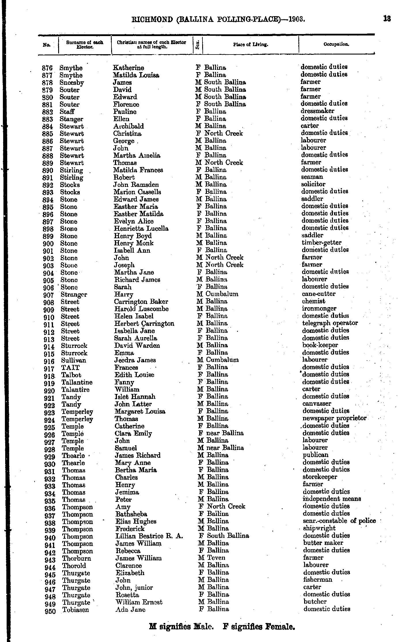
- Smythe Katherine - Tobiasen Ada
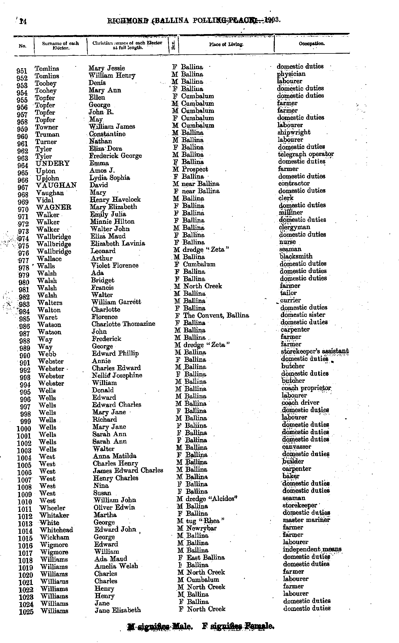
- Tomlins Mary - Williams Jane
- Williams Joseph - Young Unity
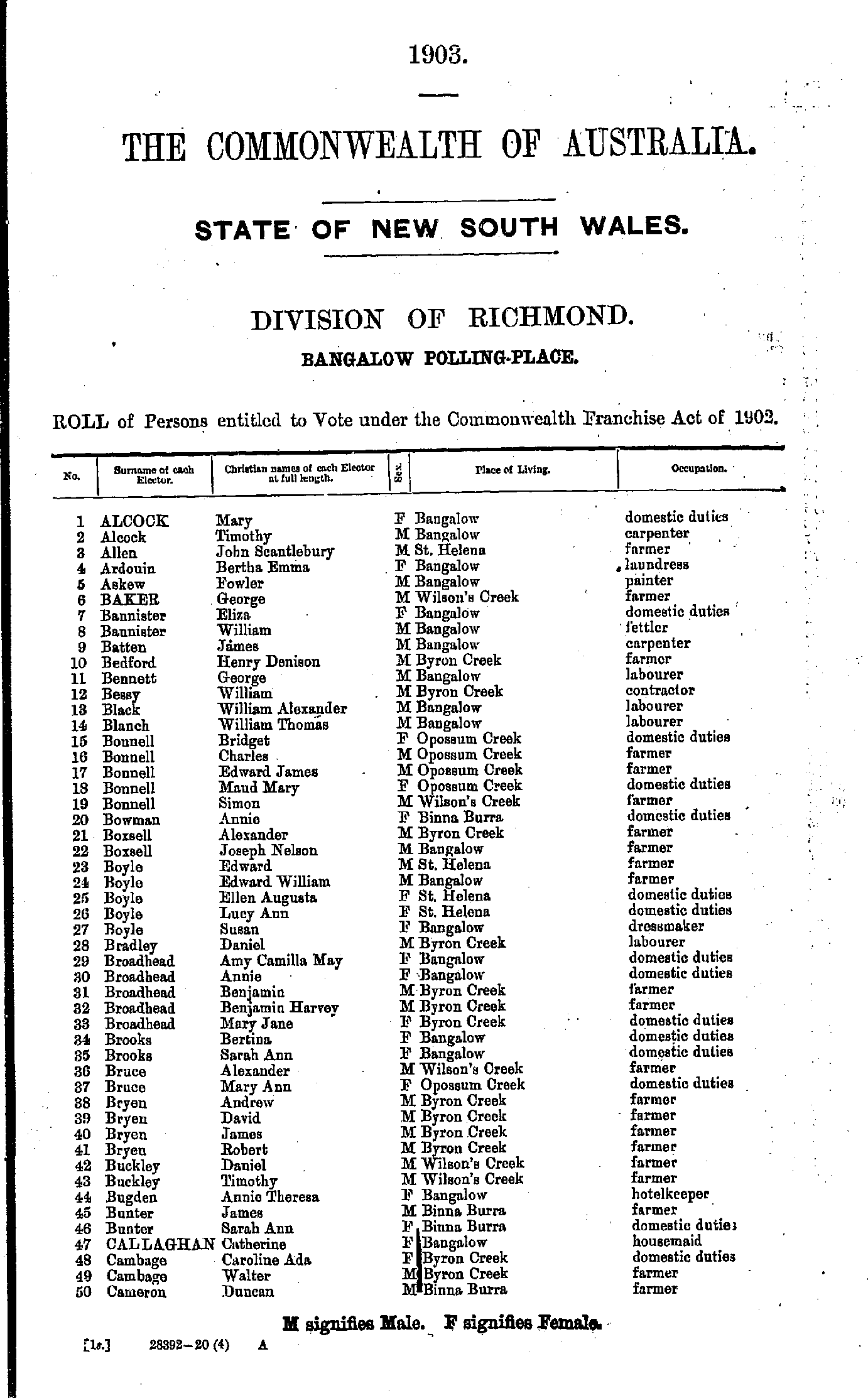
- Alcock Mary - Cameron Duncan
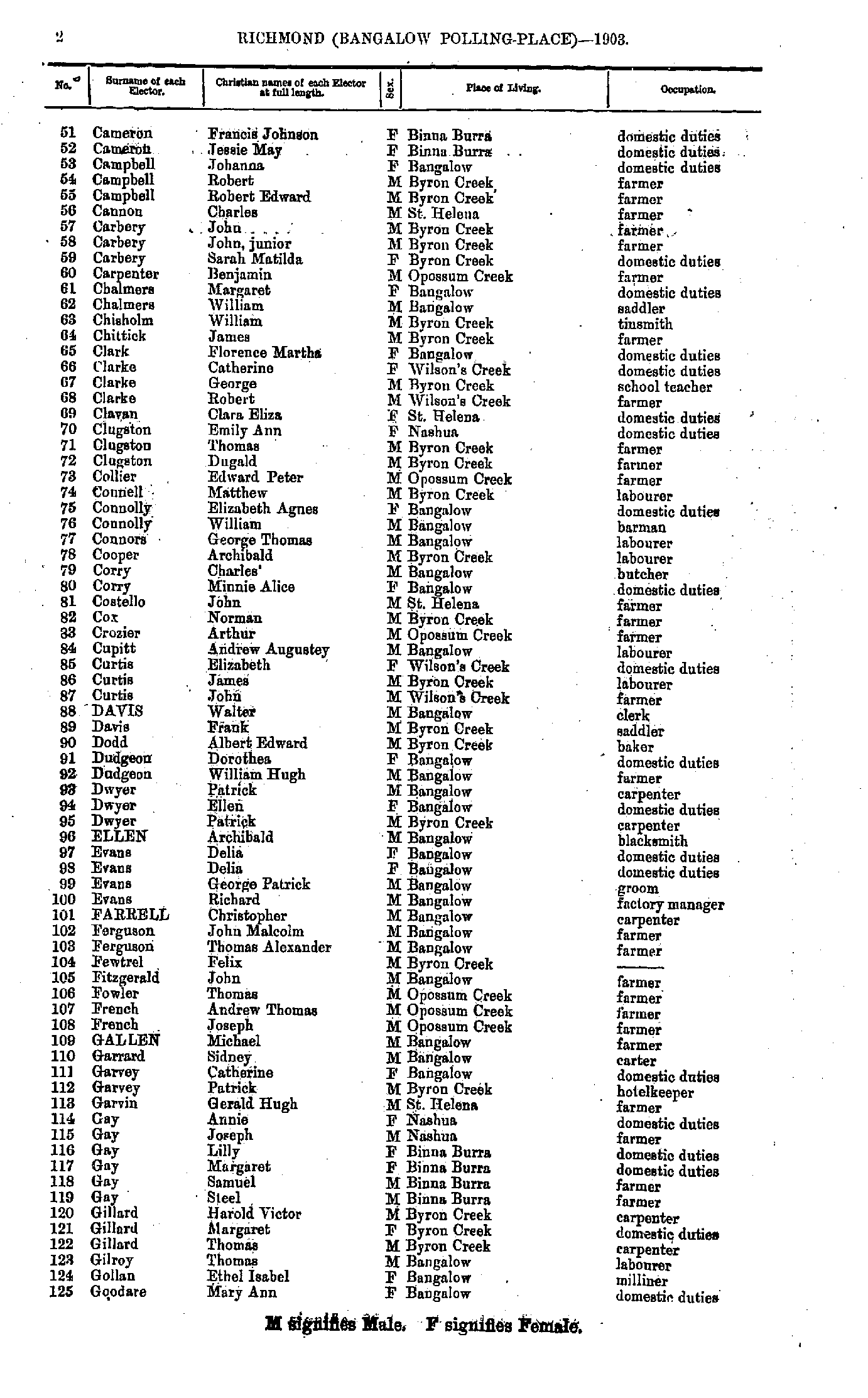
- Cameron Francis - Goodare Mary
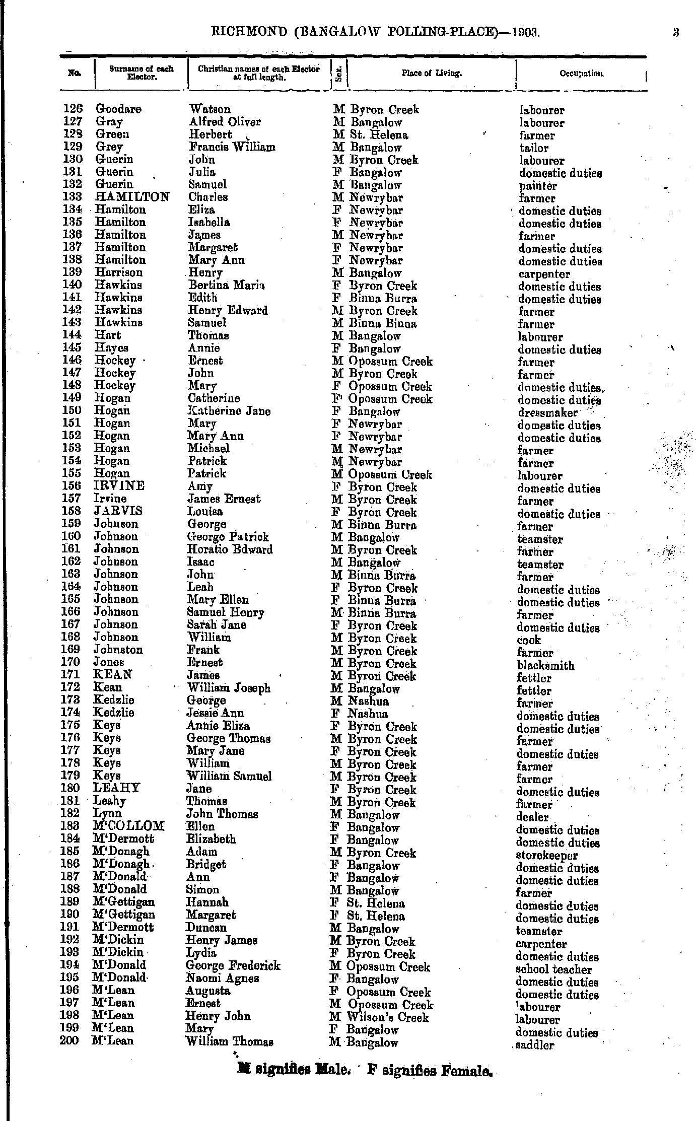
- Goodare Watson - M'Lean William
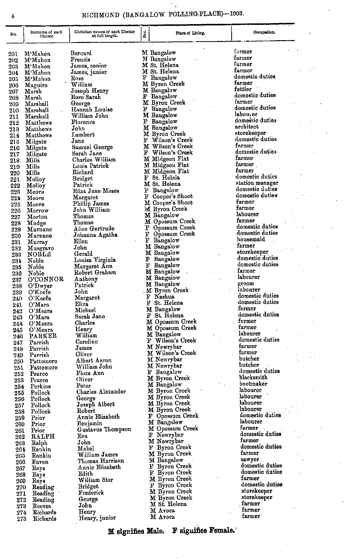
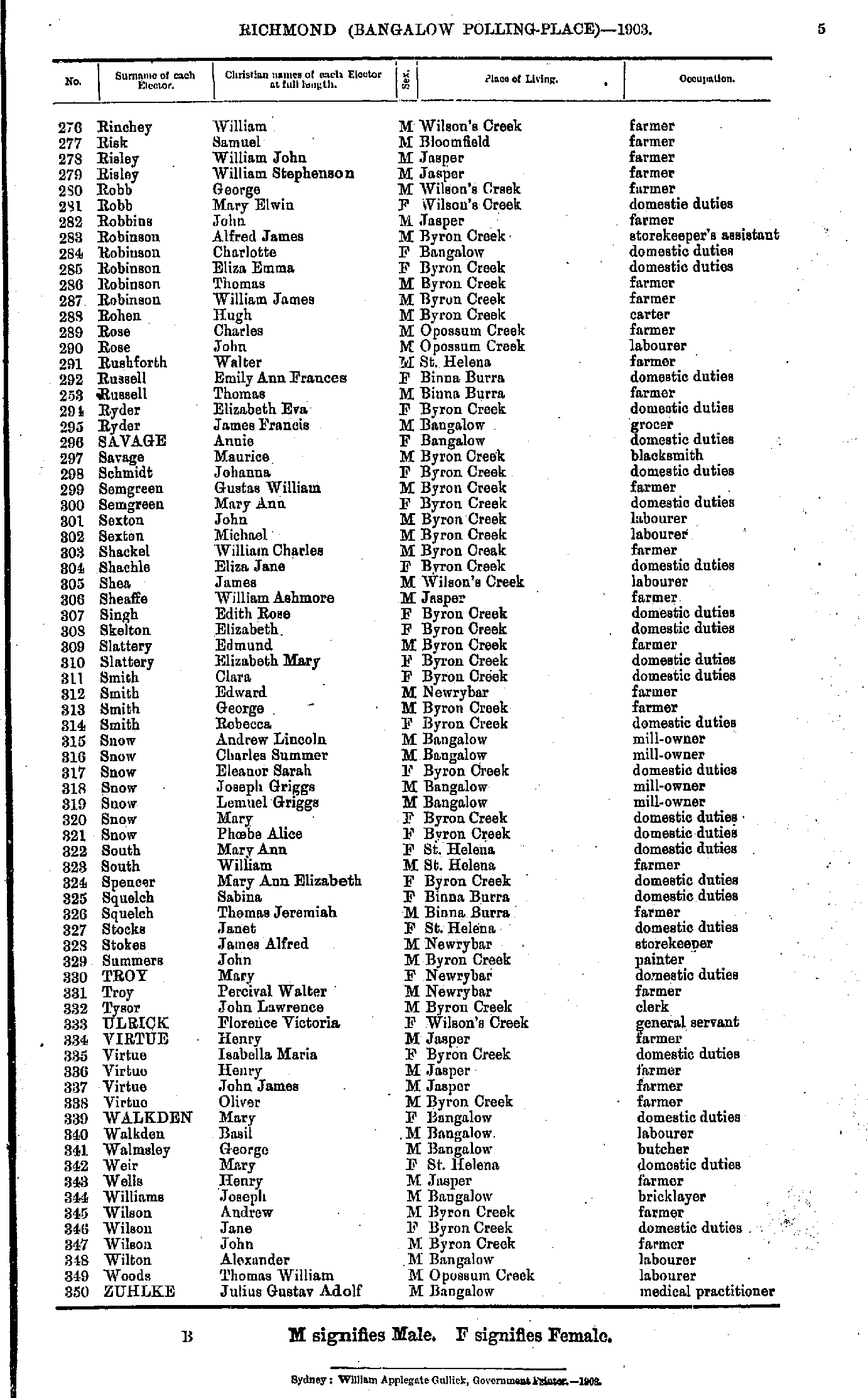
- M'Mahon Bernard - Richards Henry
- Rinchey William - Zuhlke Julius
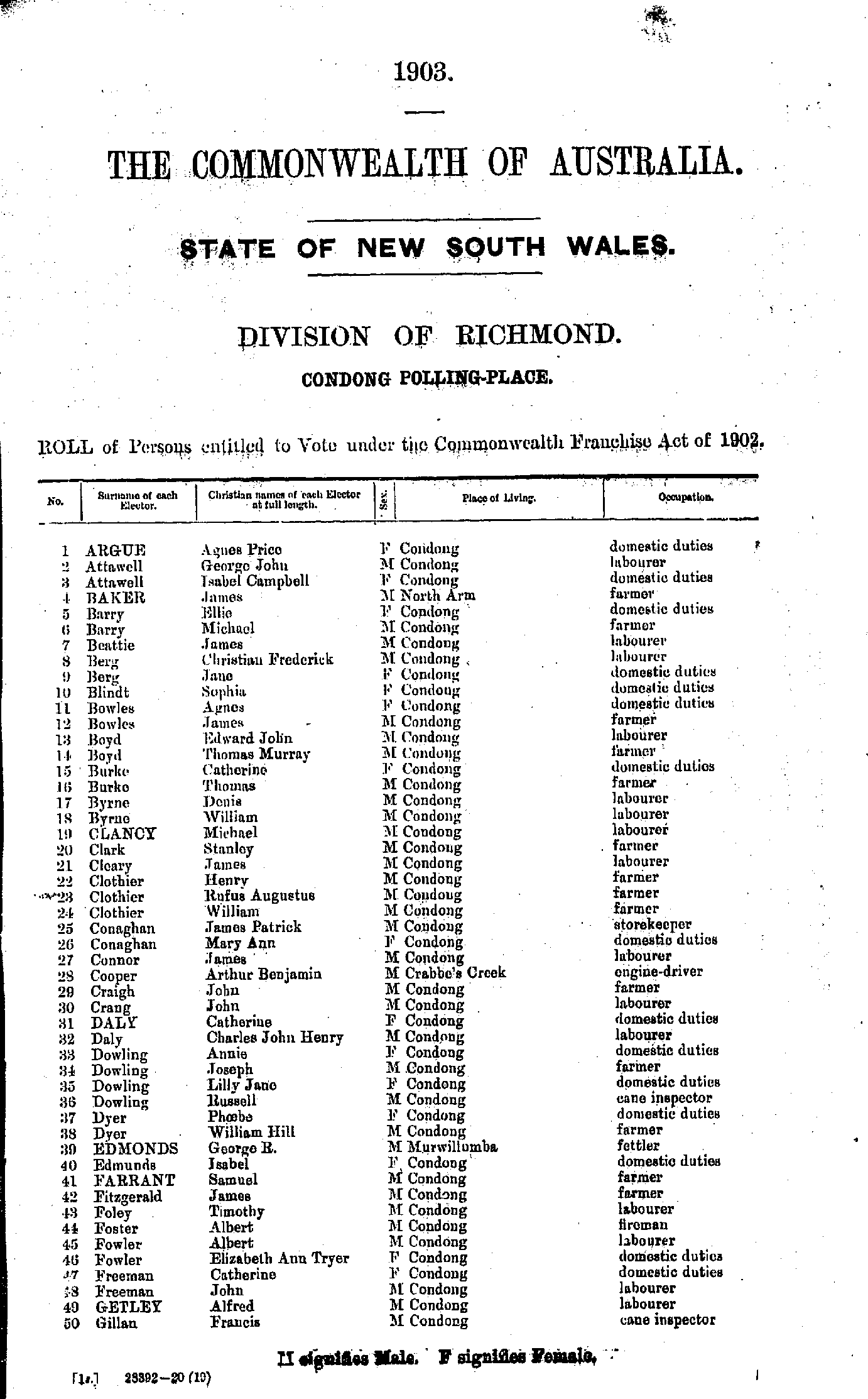
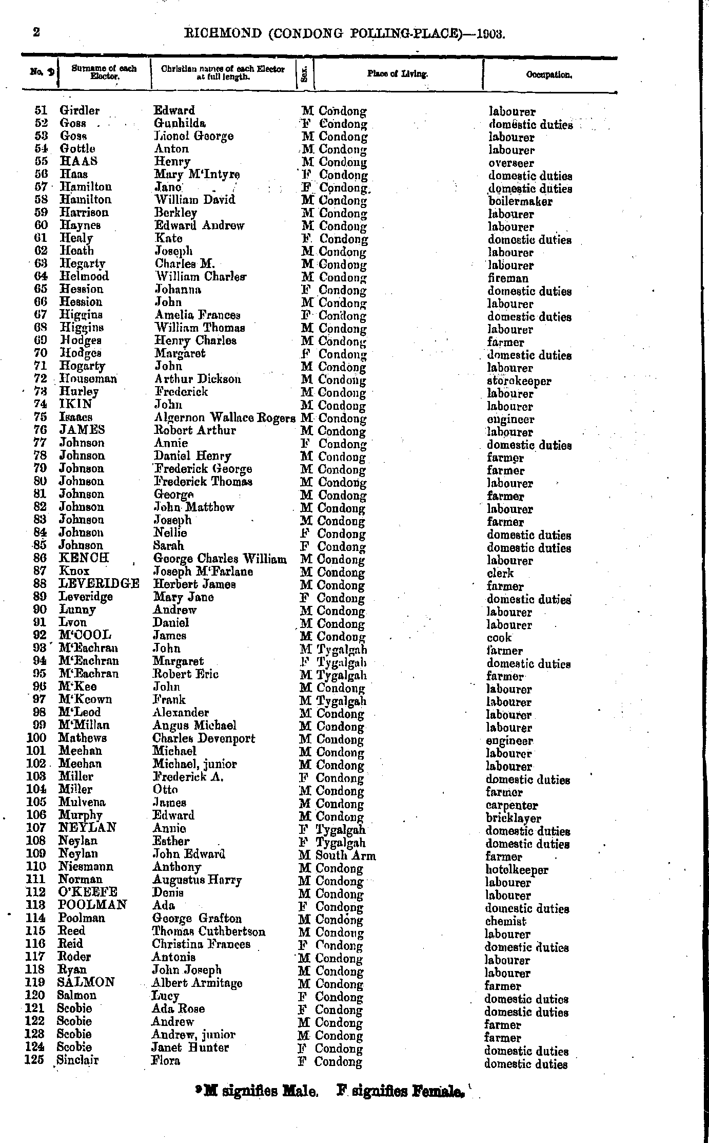
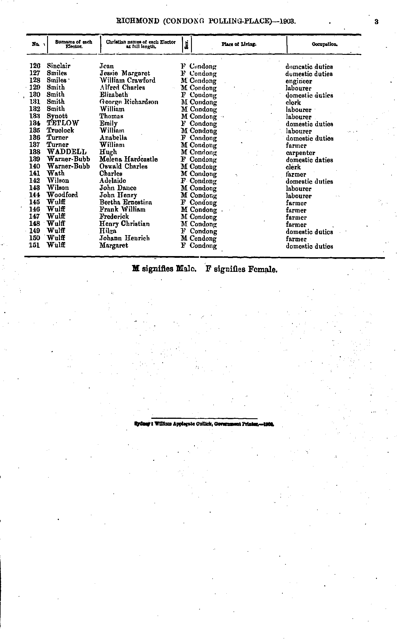
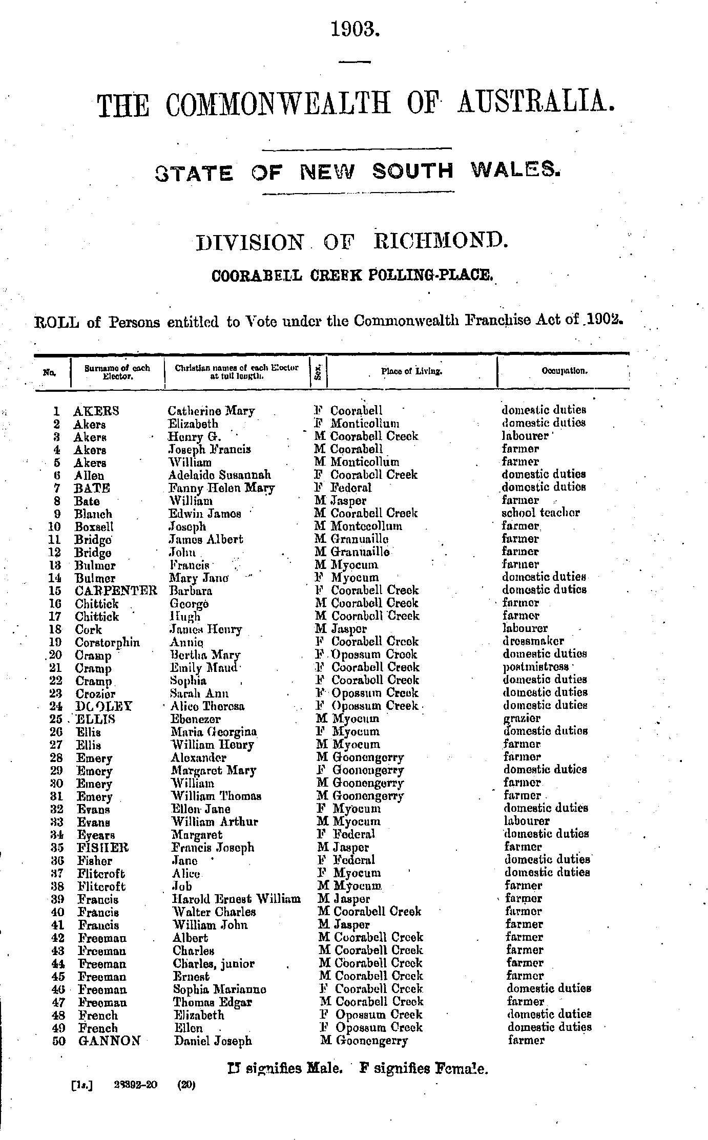
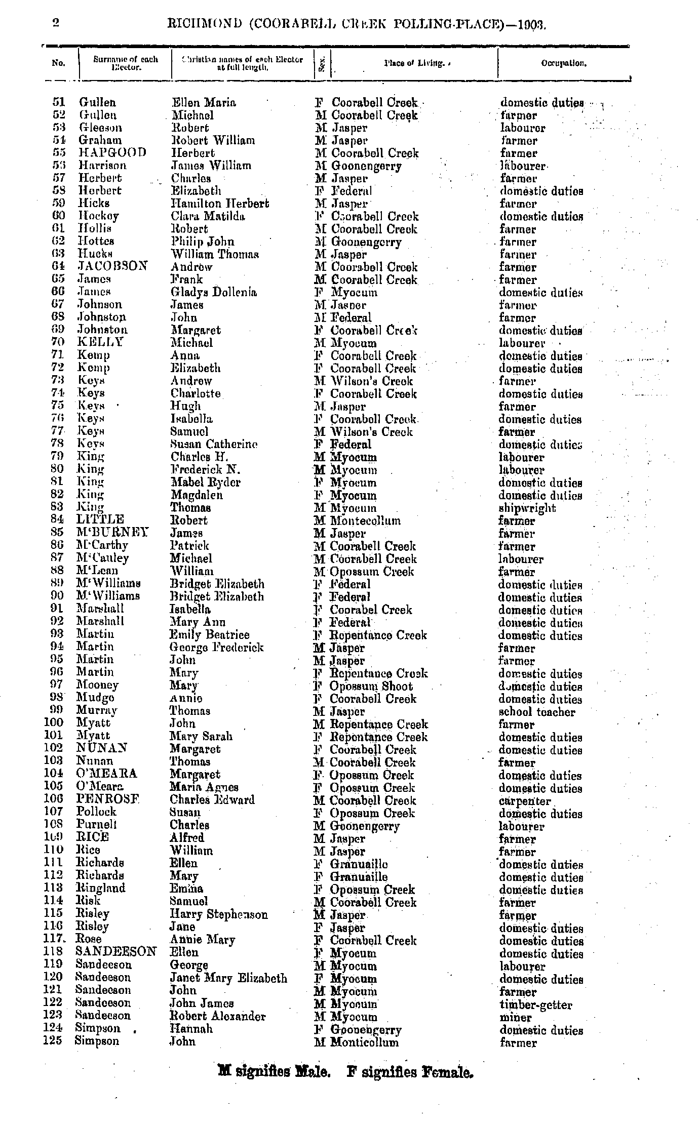
- Adams John - Crocker Mary
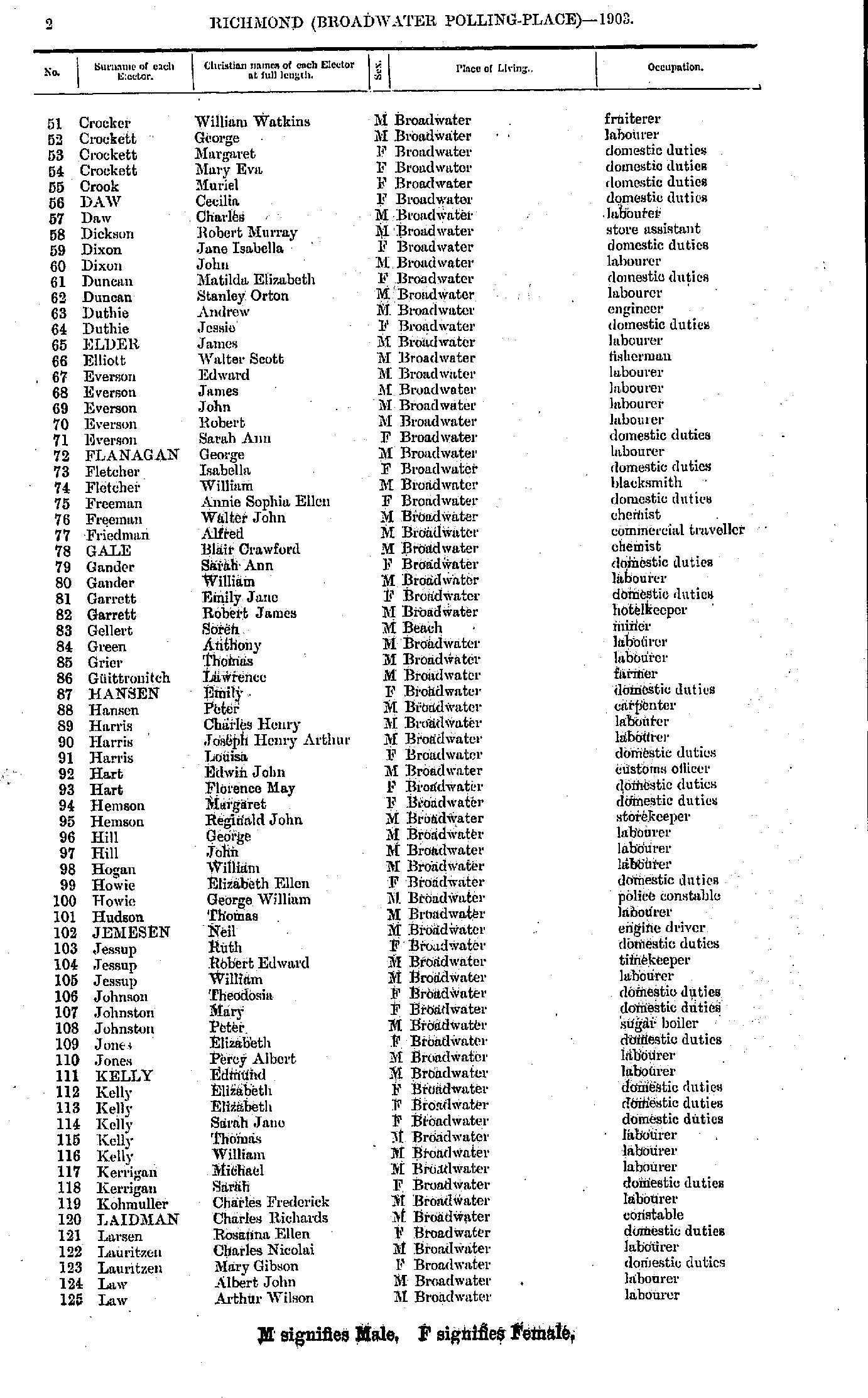
- Crocker William - Law Arthur
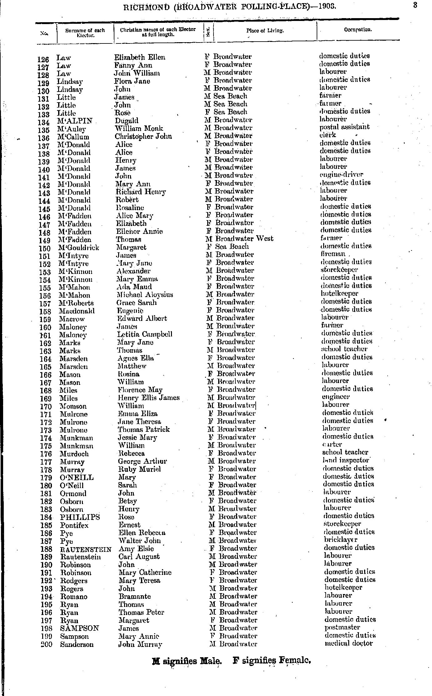
- Law Elizabeth - Sanderson John
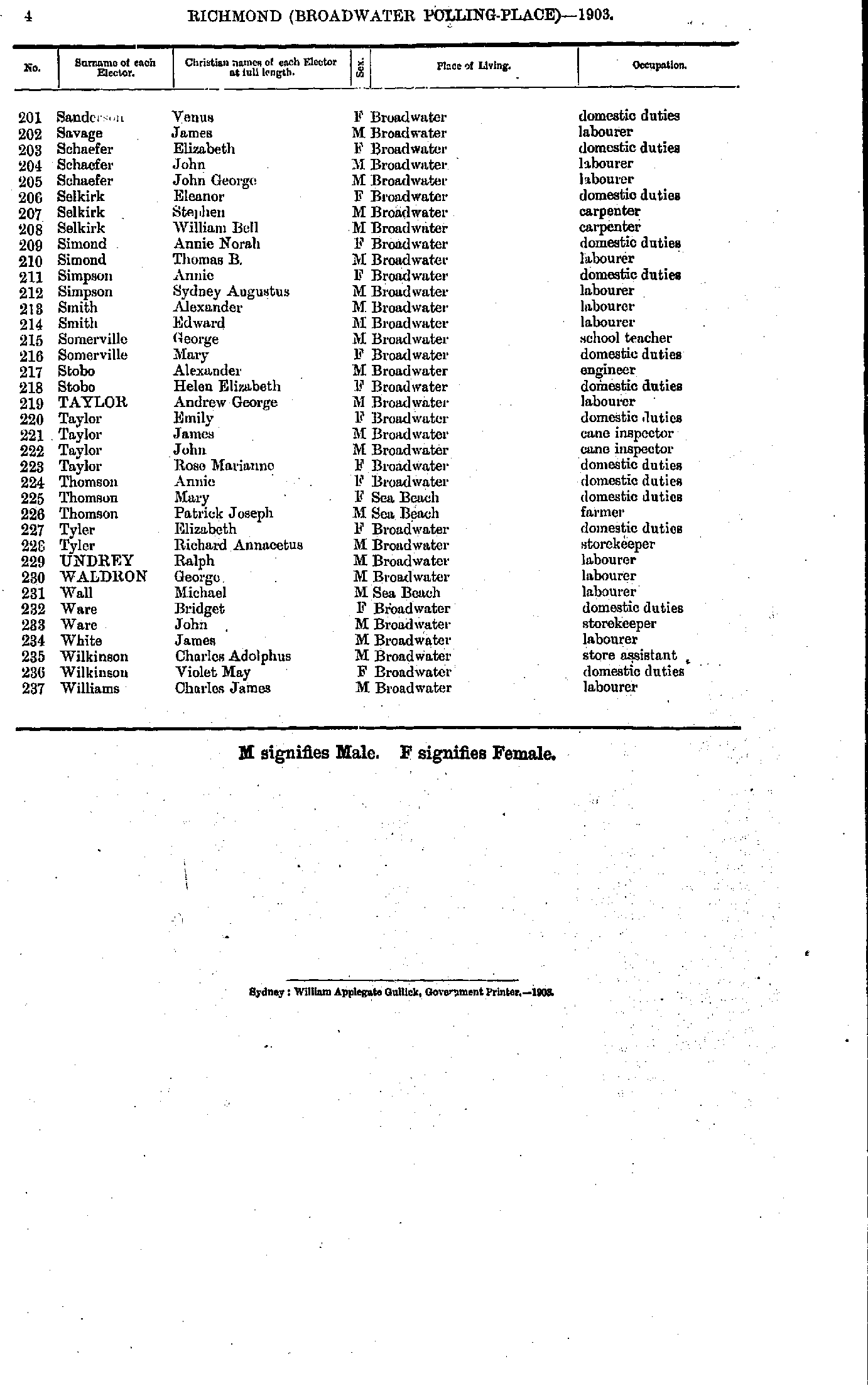
- Sanderson Venus - Williams Charles
- Anderson Catherine - Bryen Eliza
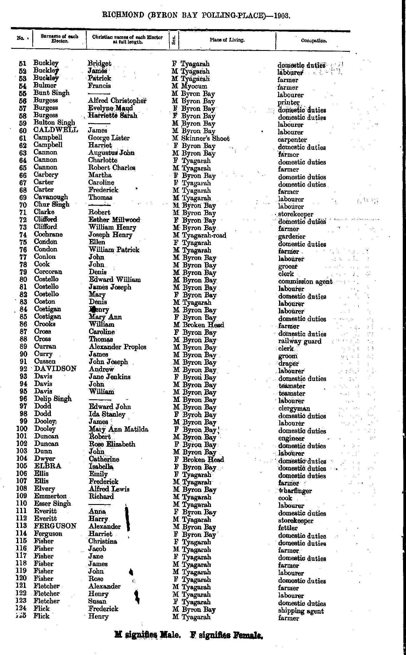
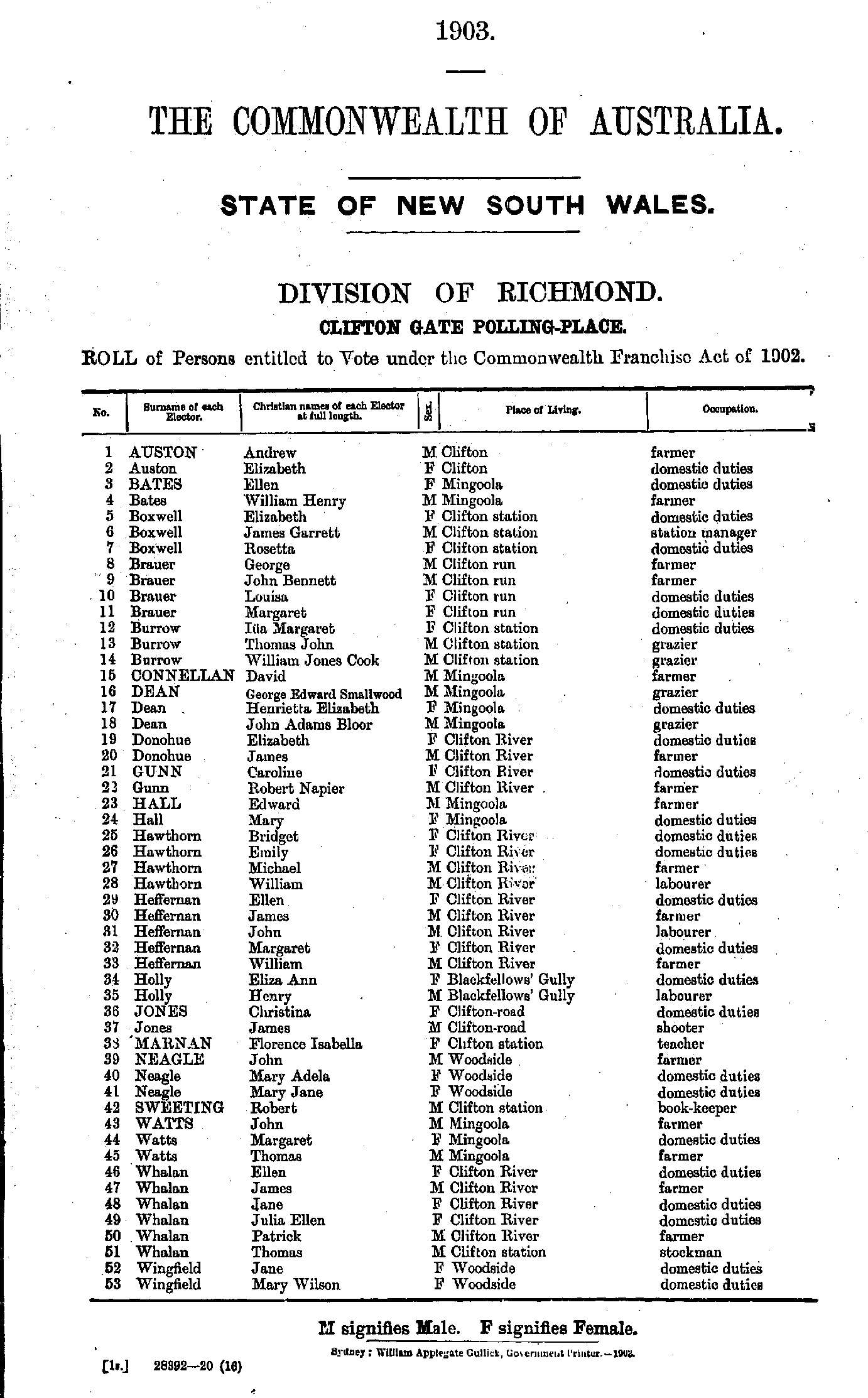
- Buckley Bridget - Flick Henry
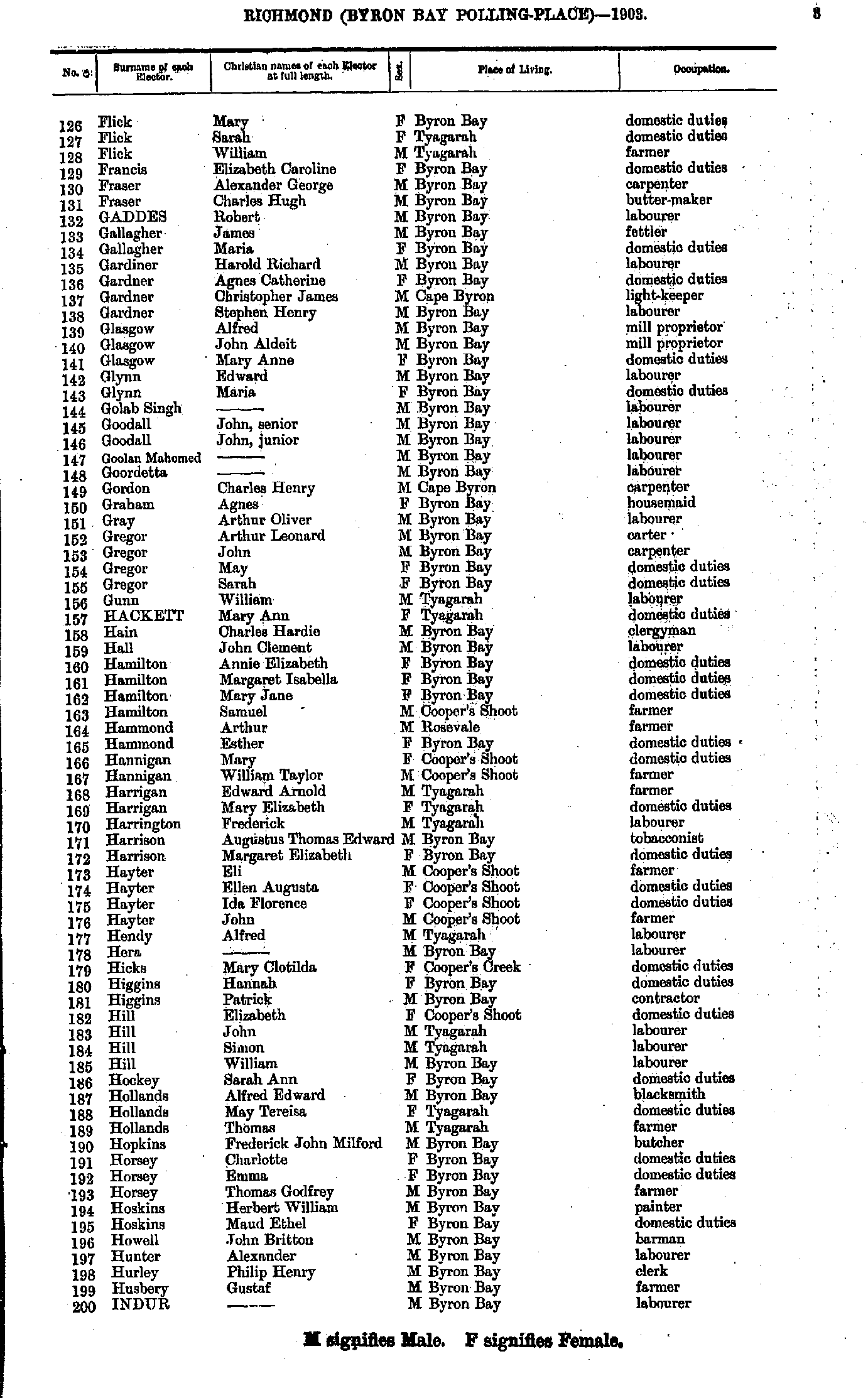
- Flick Mary - Indur --
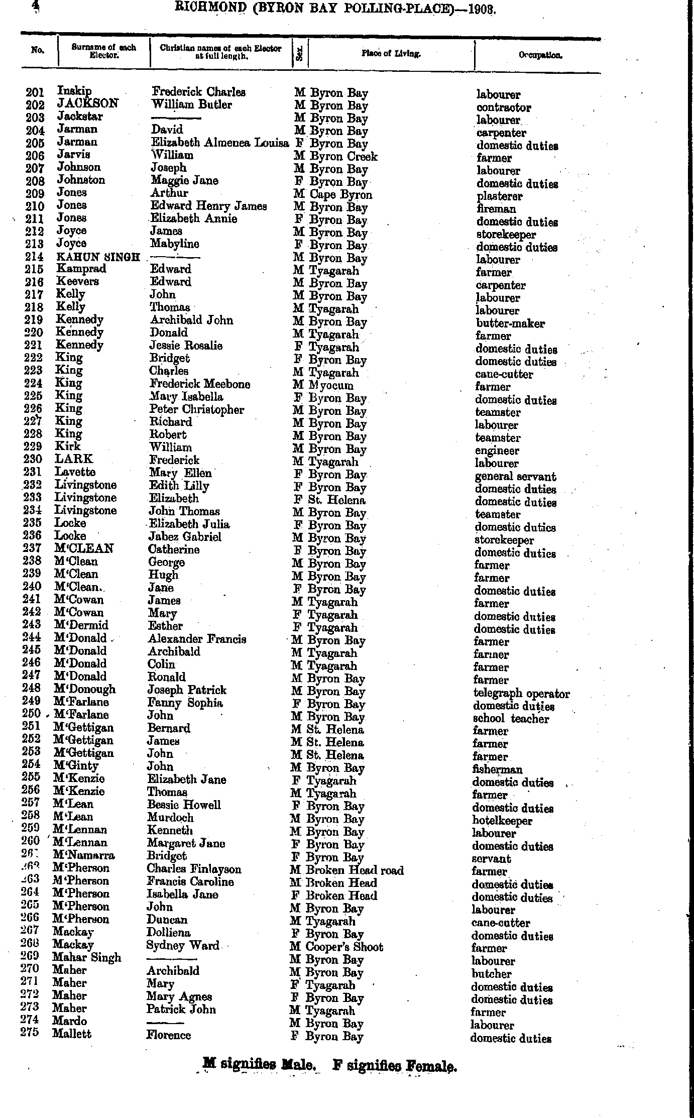
- Inskip Frederick - Mallett Florence
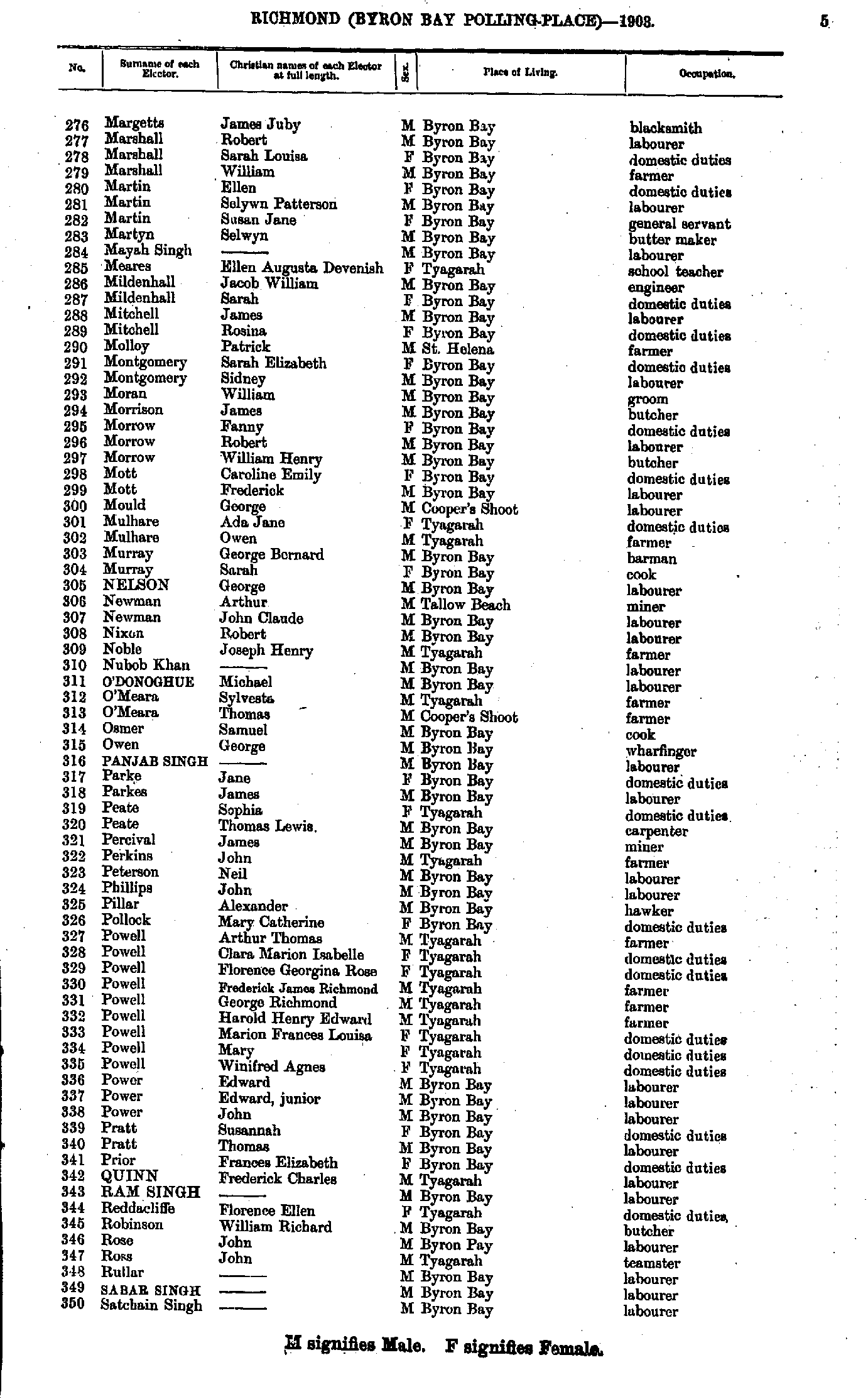
- Margetts James - Satchainsingh --
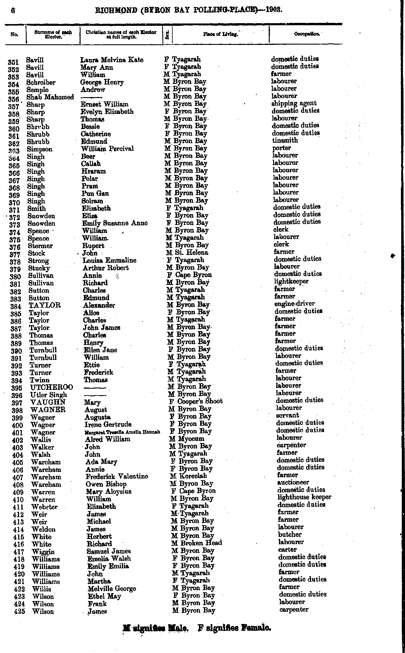
- Savill Laura - Wilson James
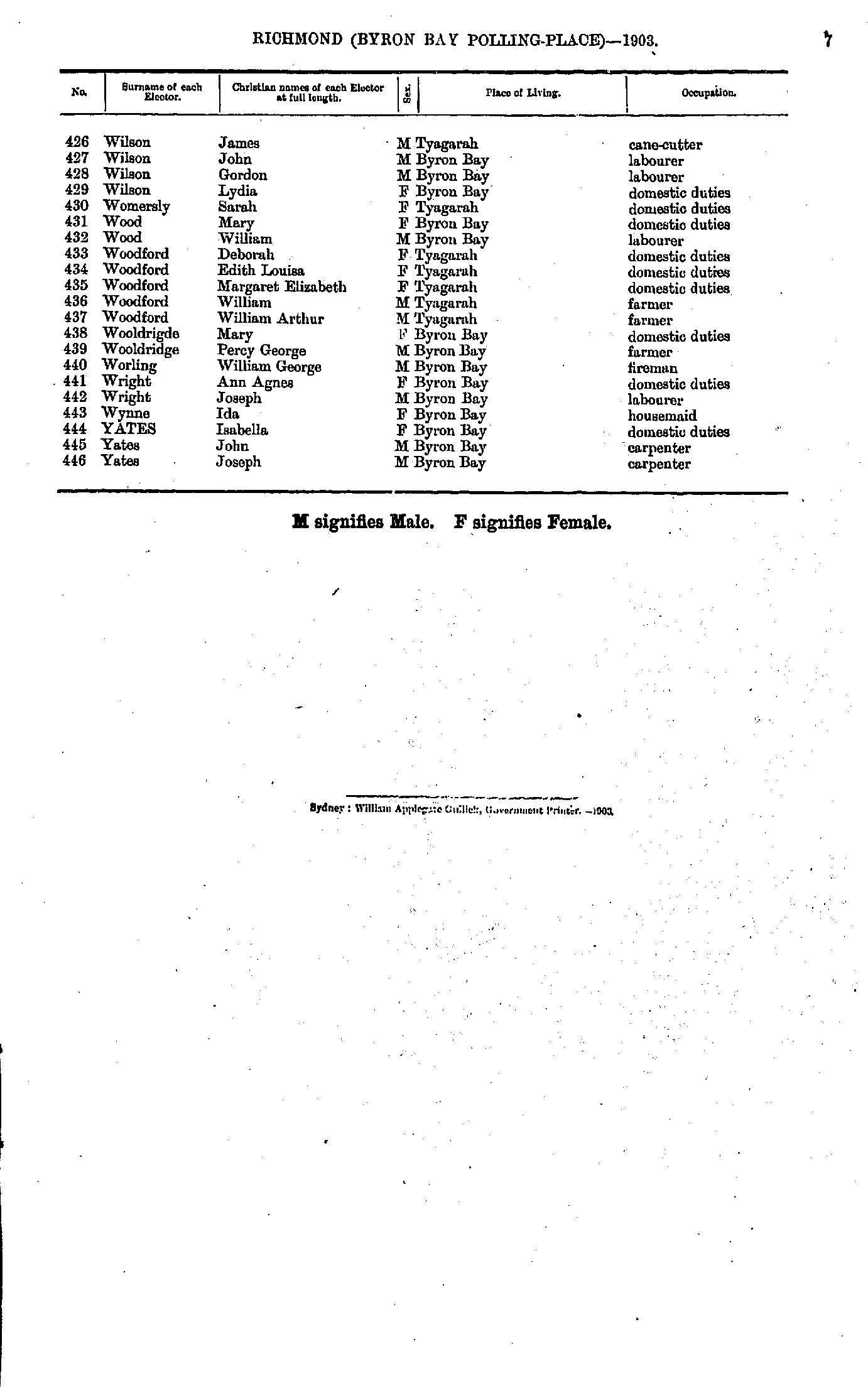
- Wilson James - Yates Joseph
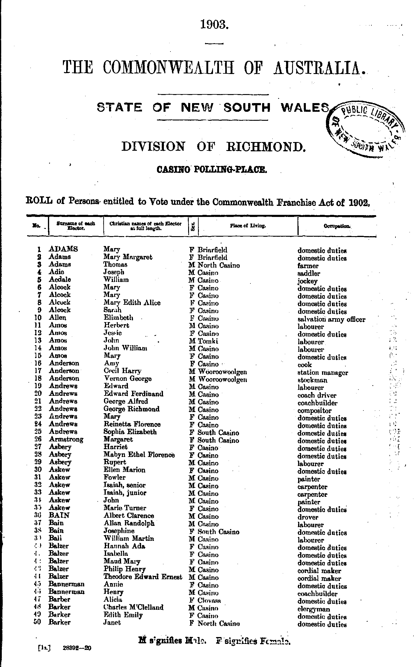
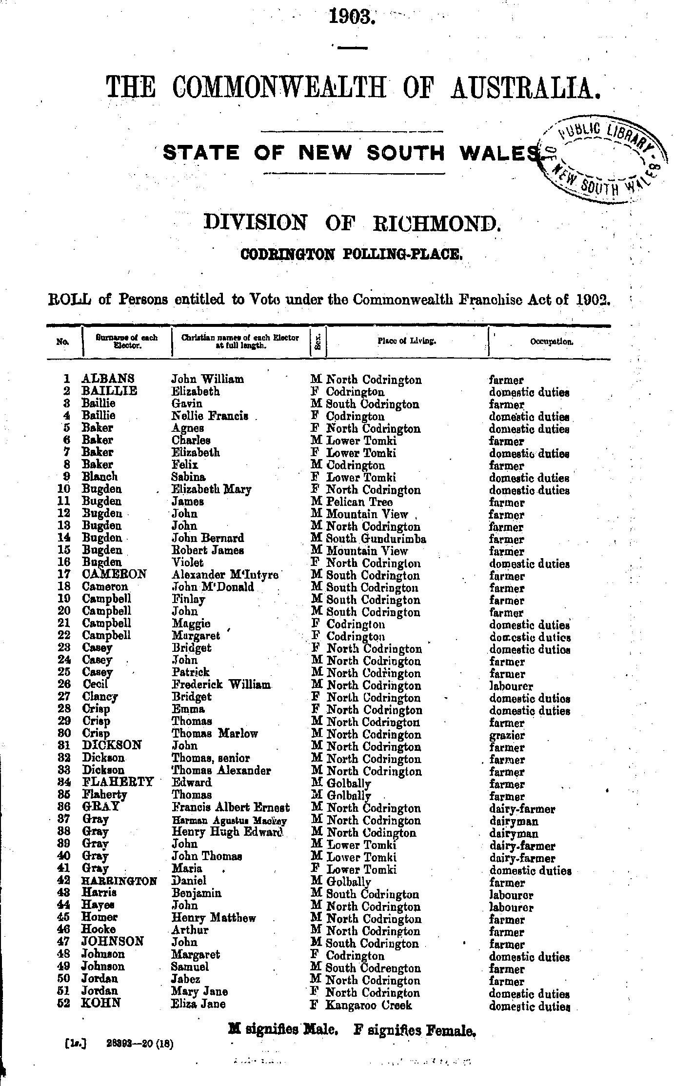
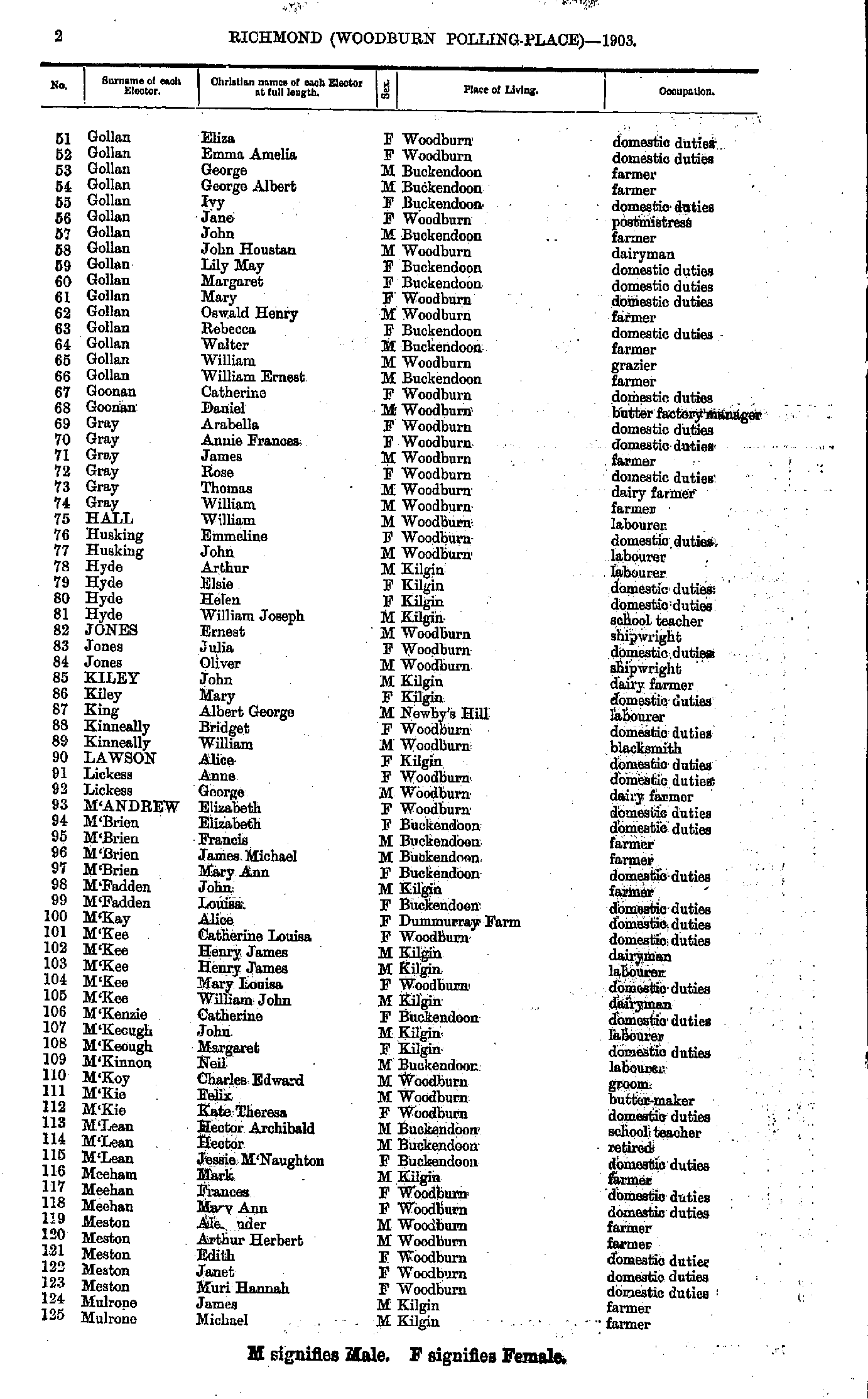
- Adams Mary - Barker Janet
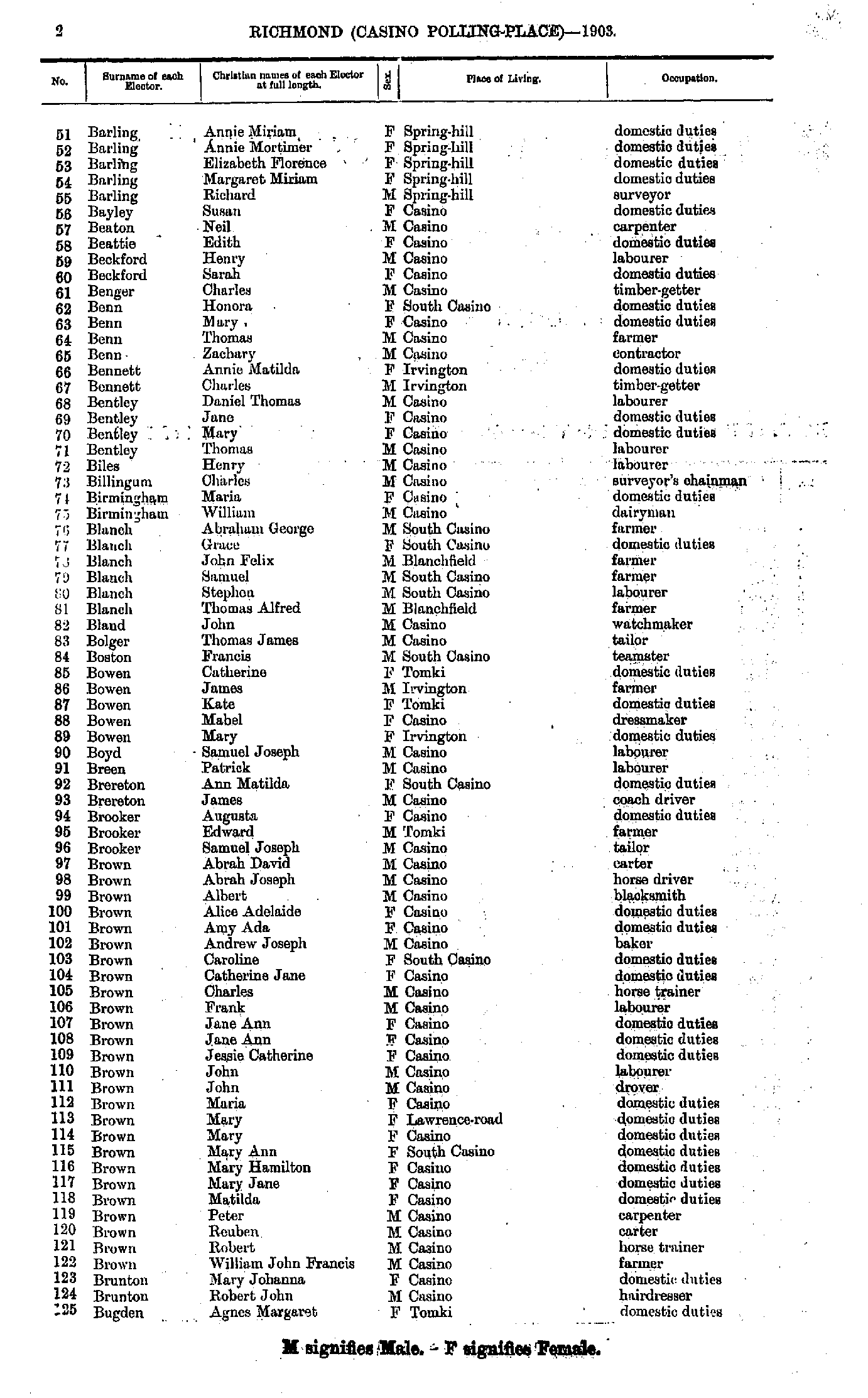
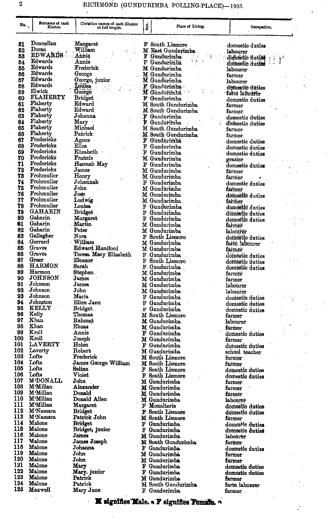
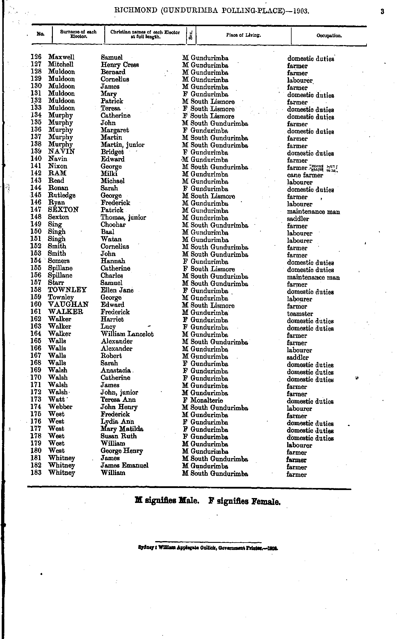
- Barling Annie - Bugden Agnes
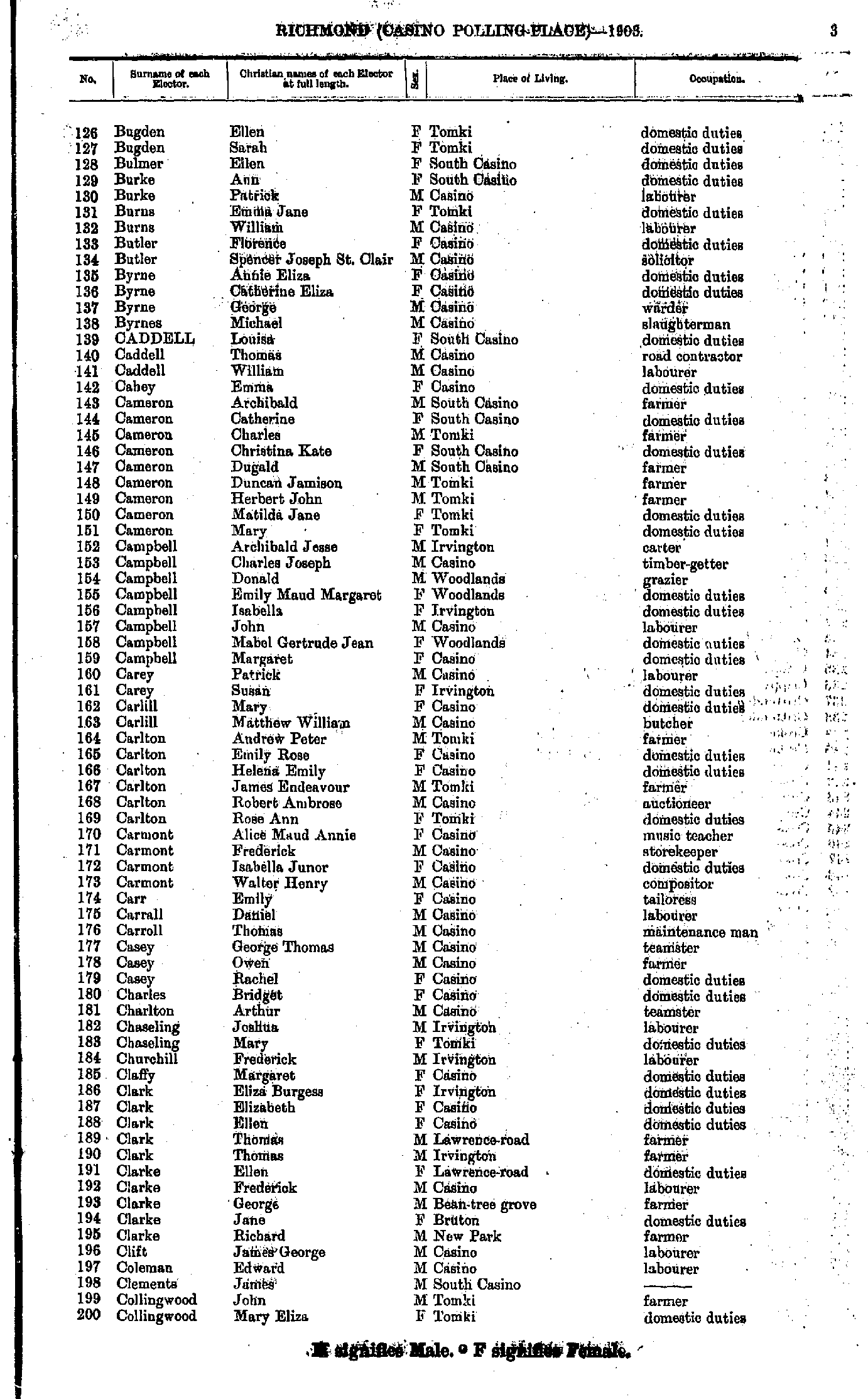
- Bugden Ellen - Collingwood Mary
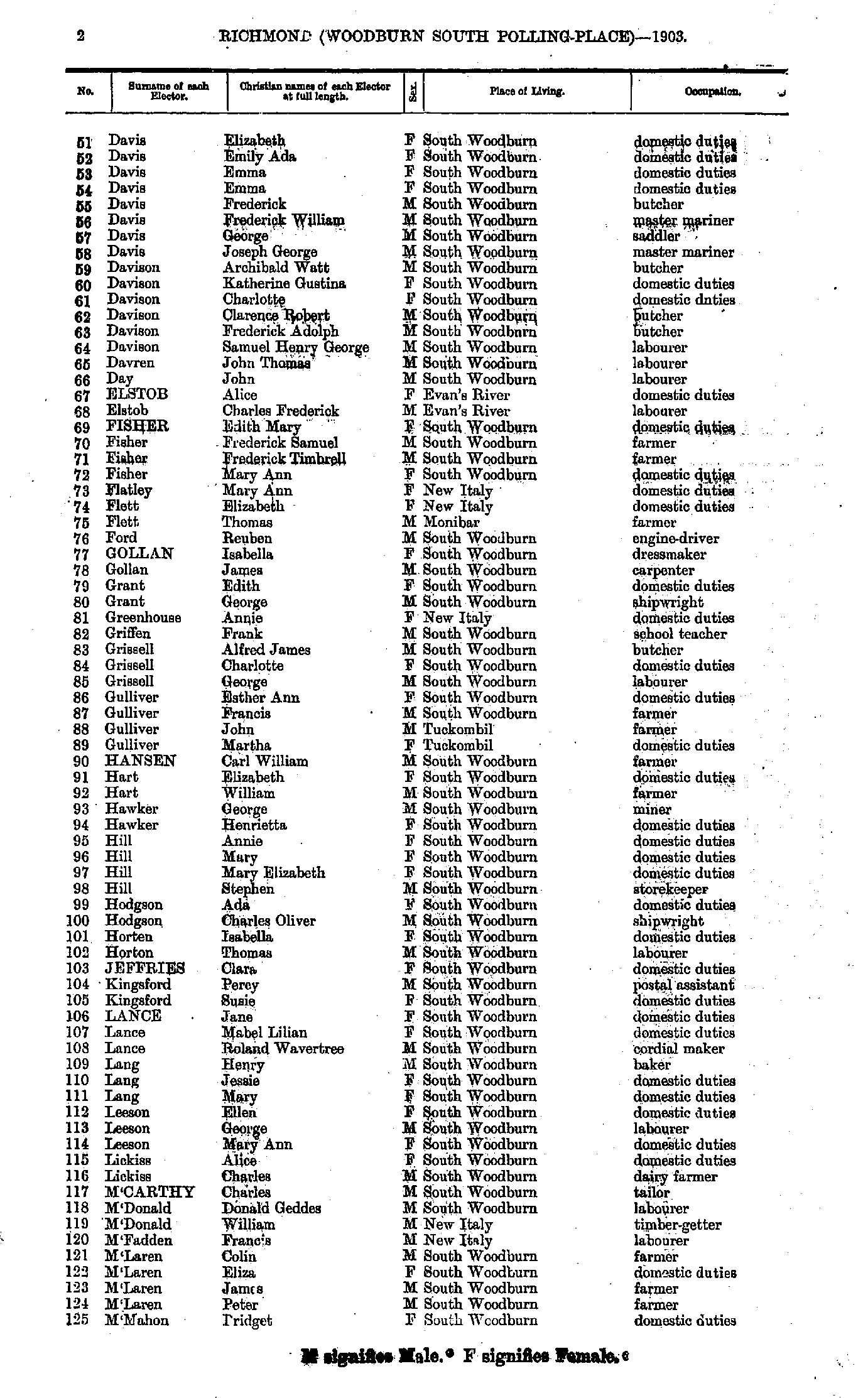
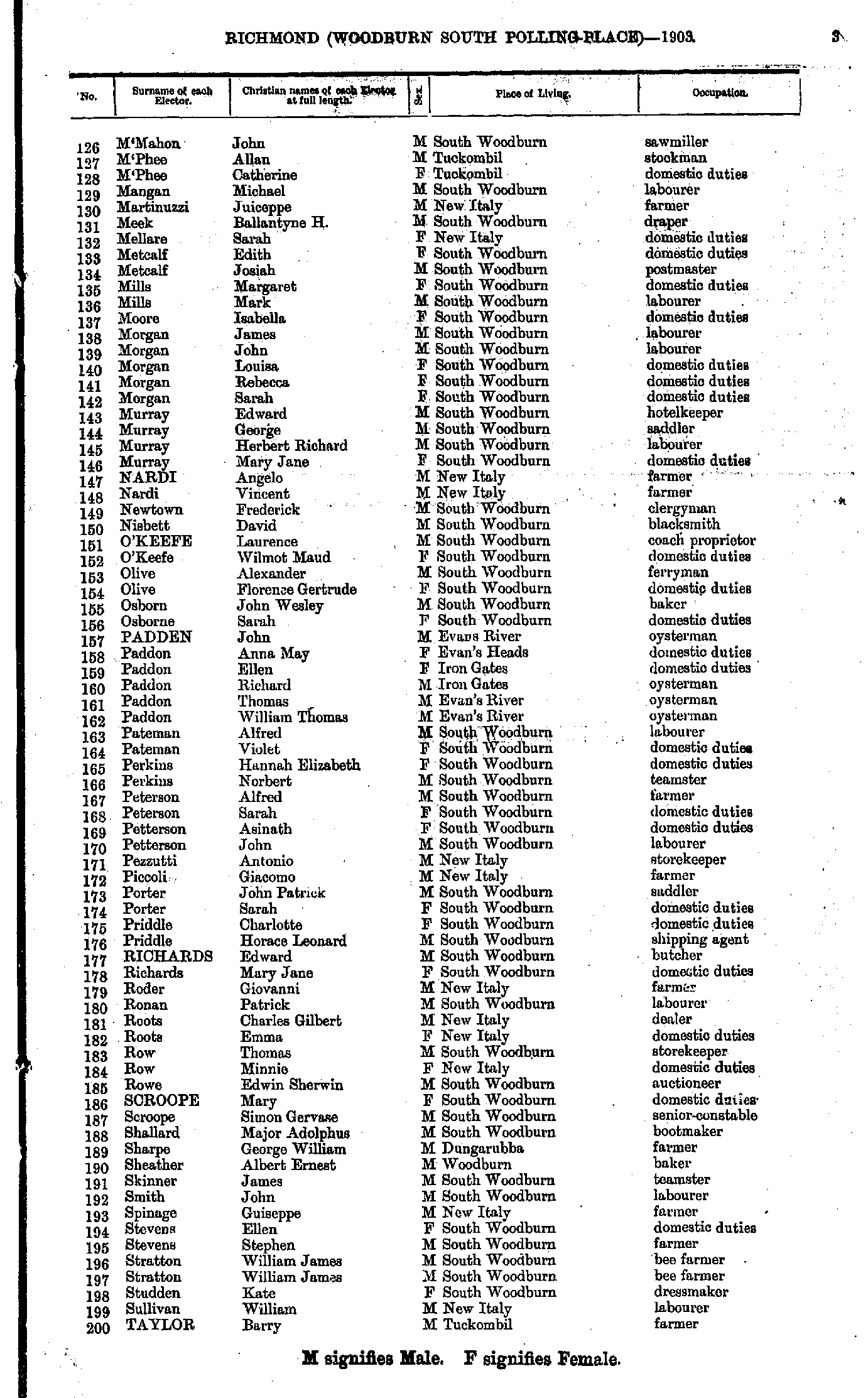
- Collins George - Davis William
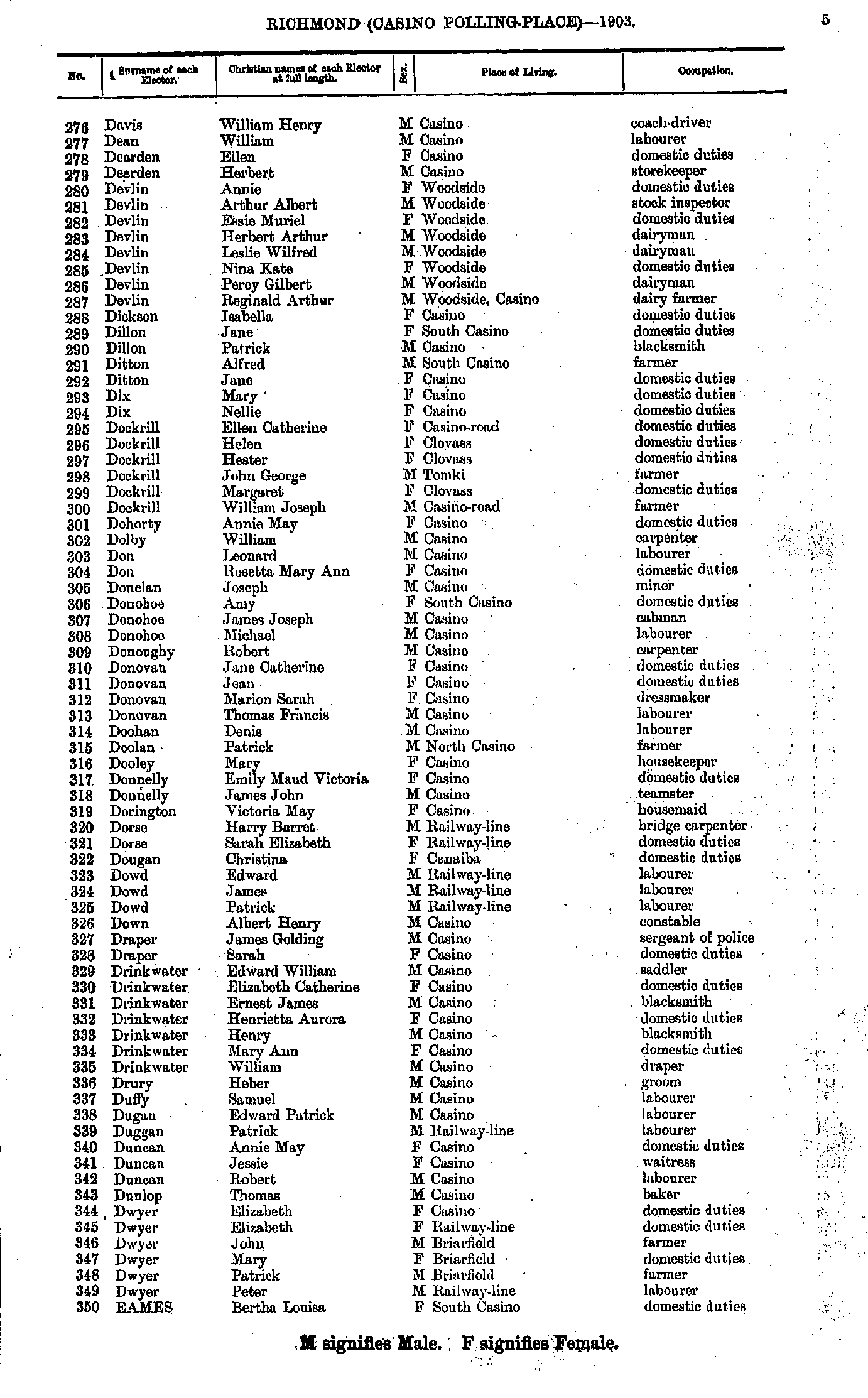
- Davis William - Eames Bertha
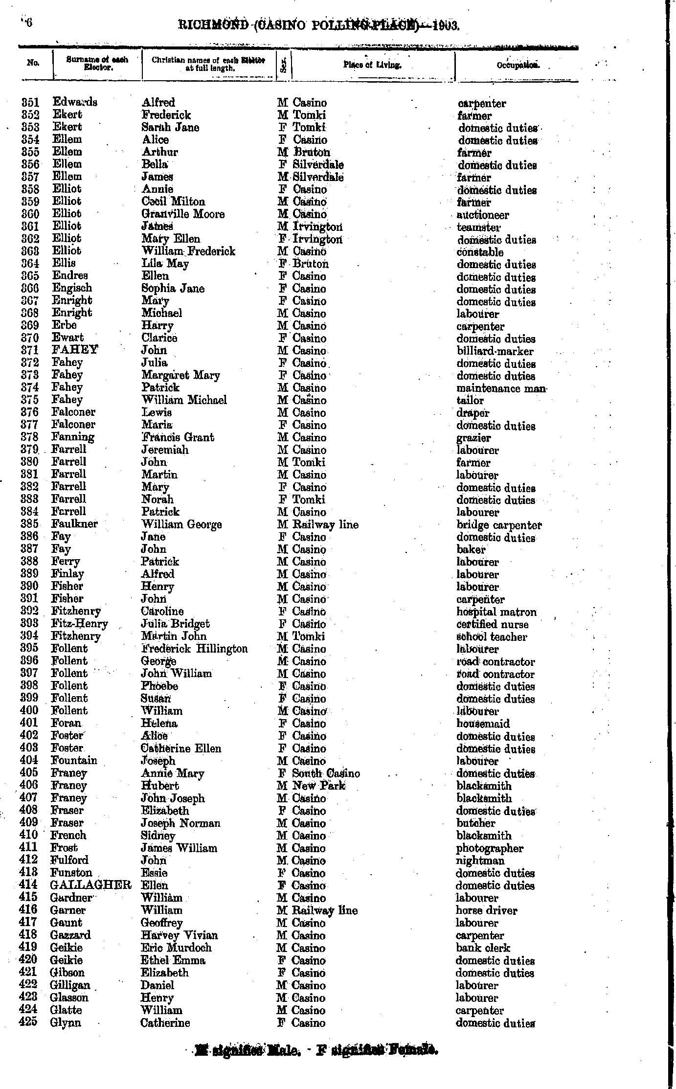
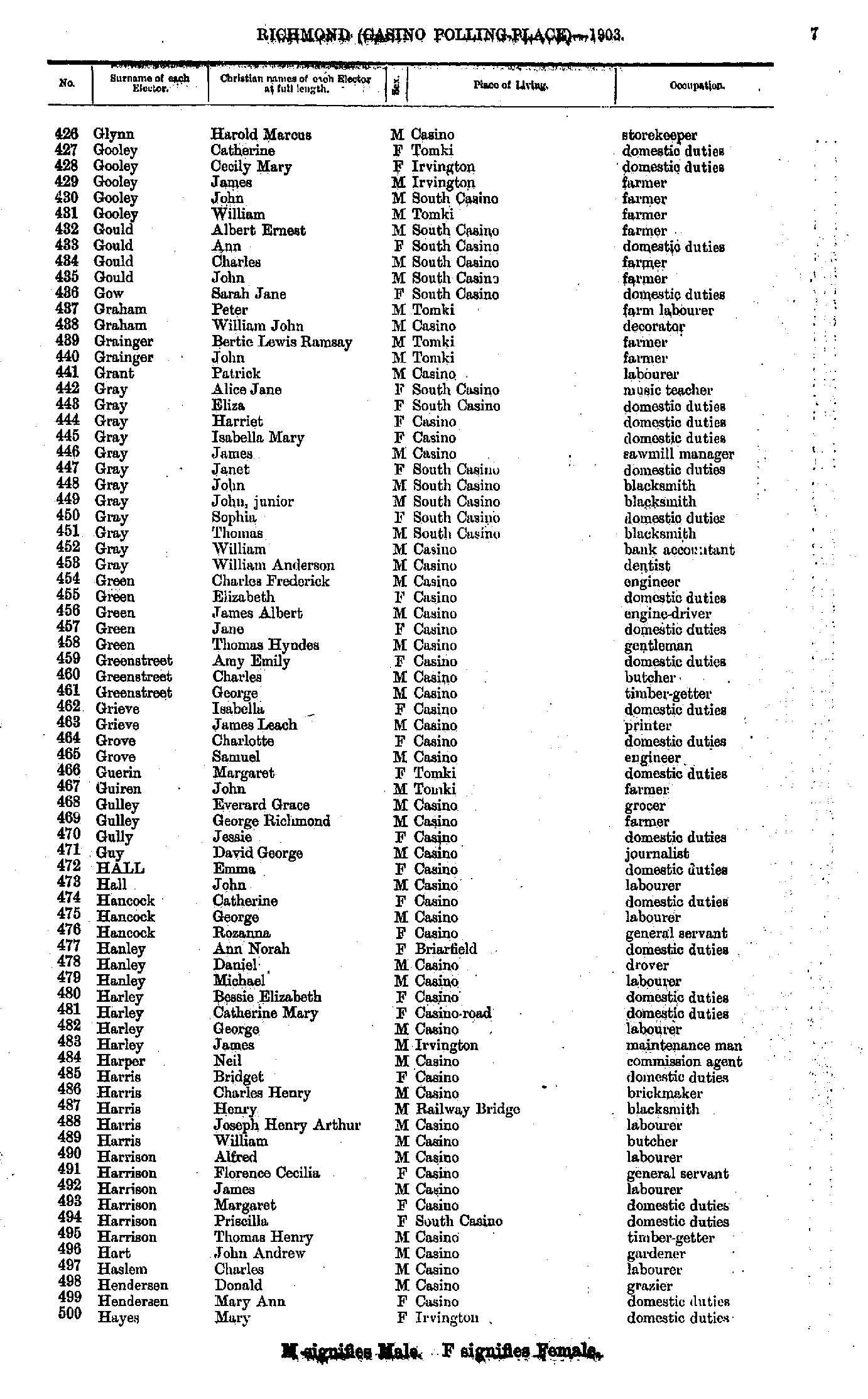
- Edwards Alfred - Glynn Catherine
- Glynn Harold - Hayes Mary
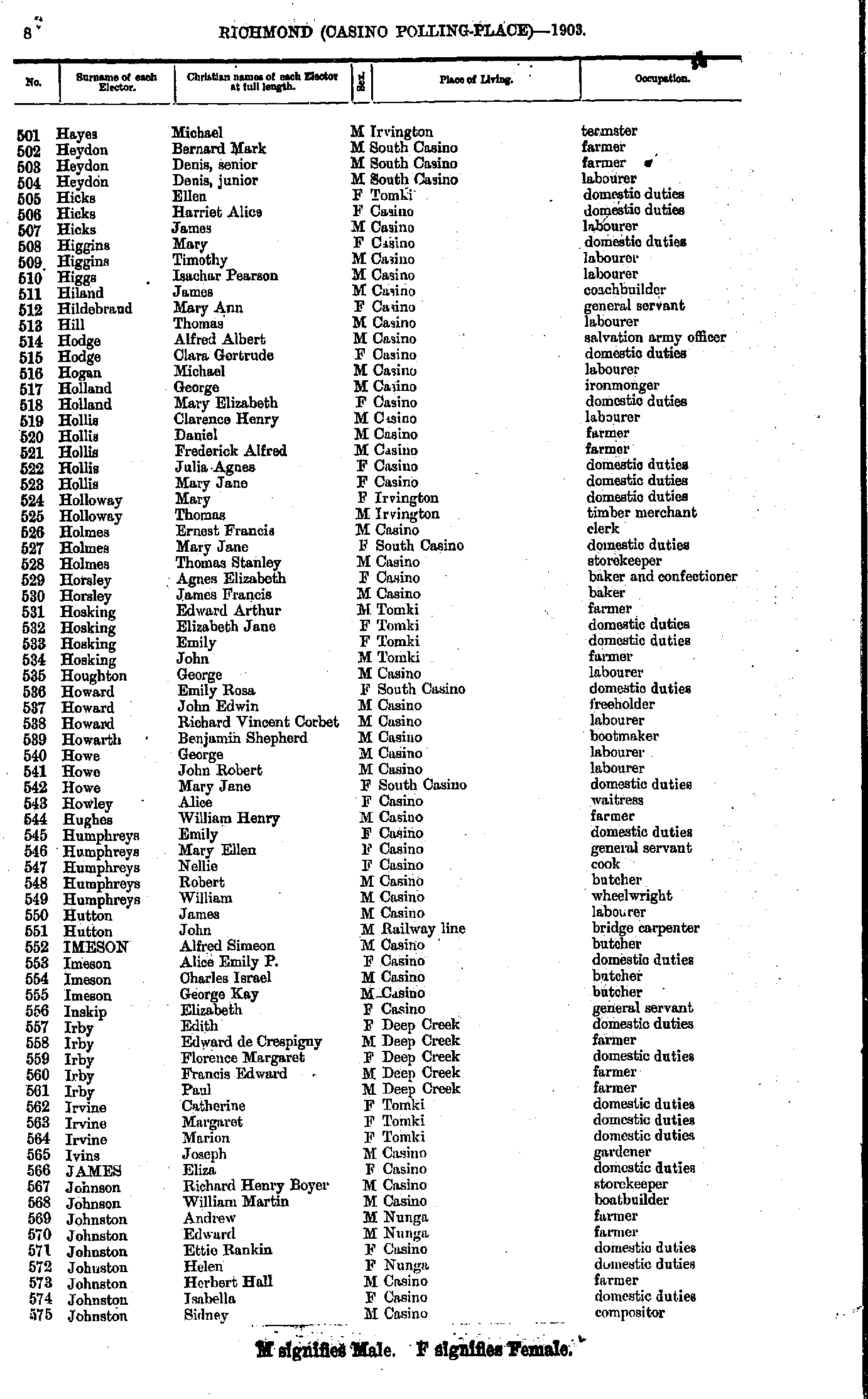
- Hayes Michael - Johnston Sidney
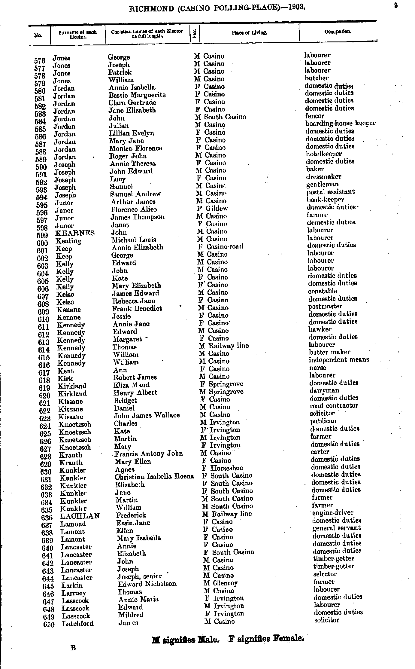
- Jones George - Latchford James
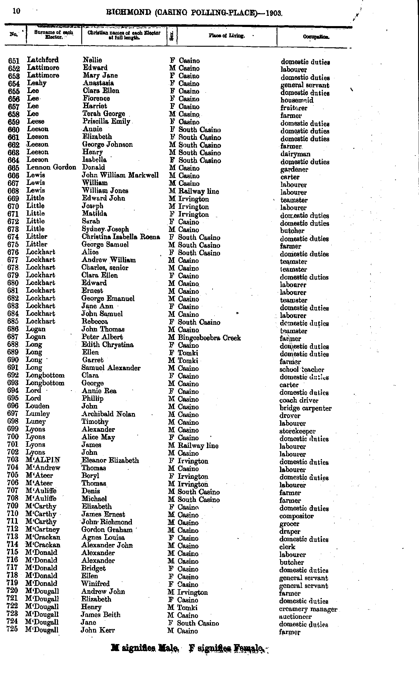
- Latchford Nellie - M'Dougall John
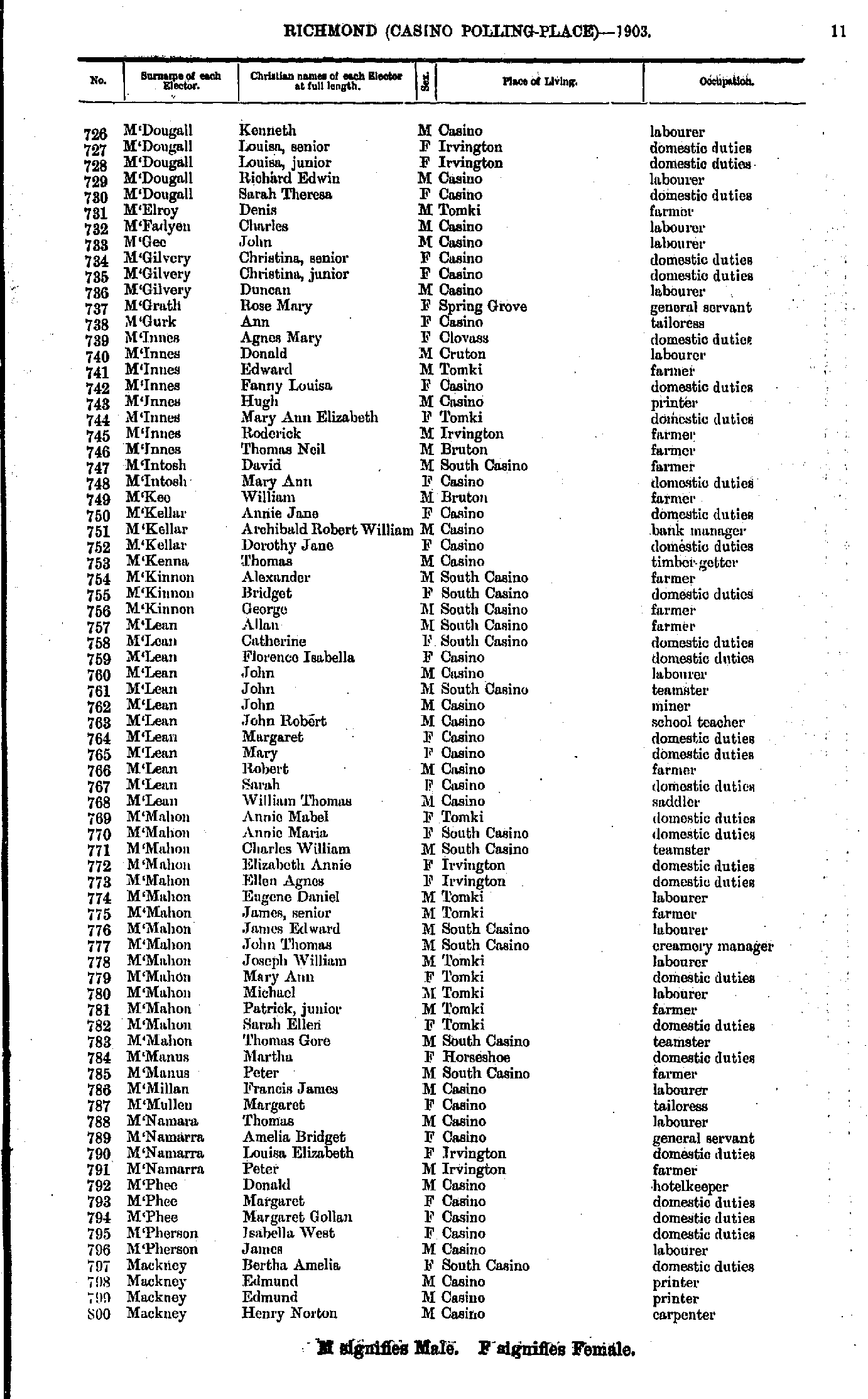
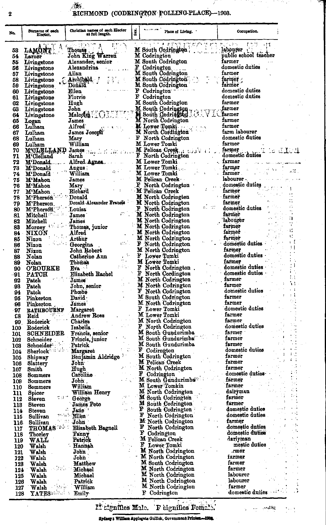
- M'Dougall Kenneth - Mackney Henry
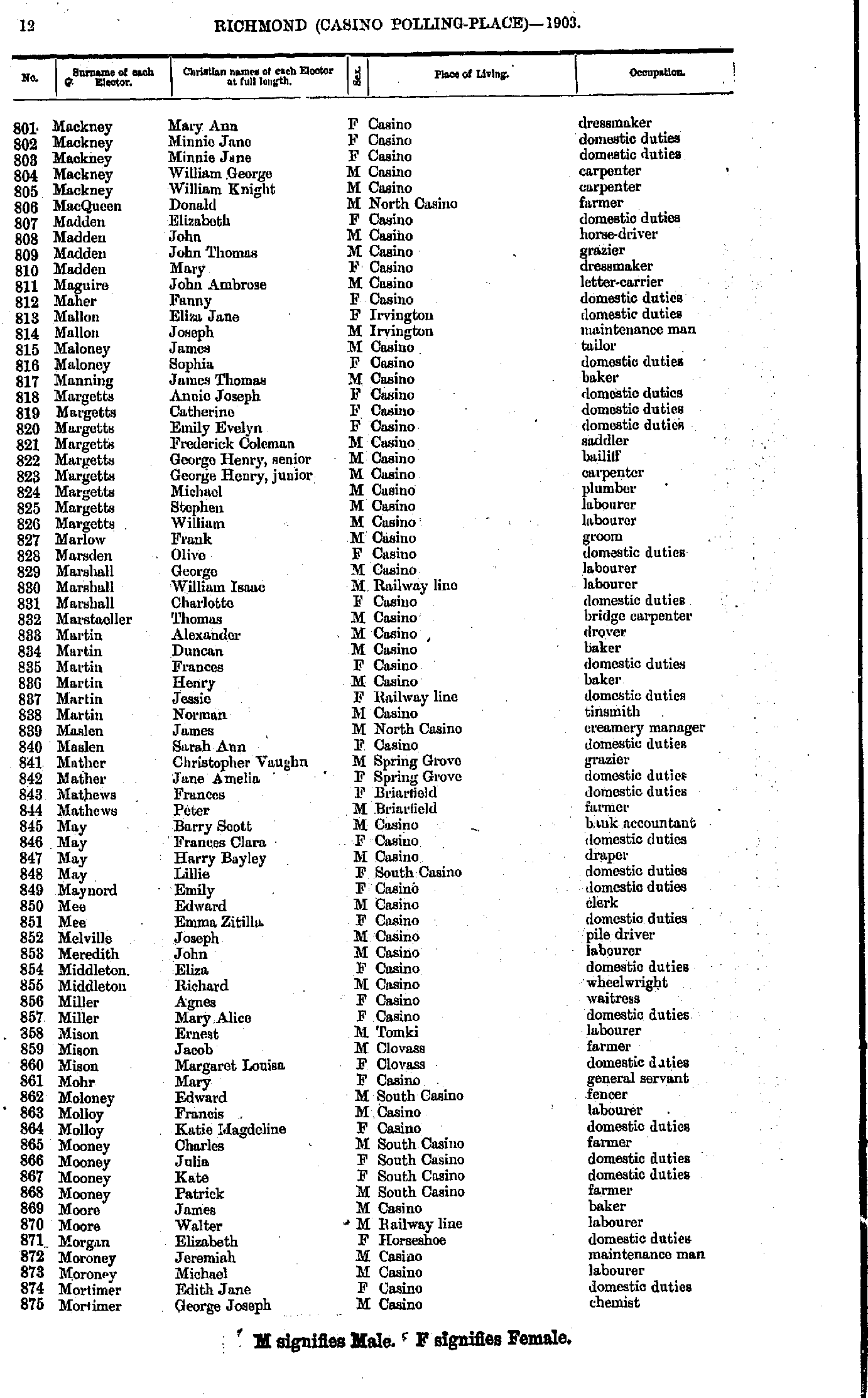
- Mackney Mary - Mortimer George
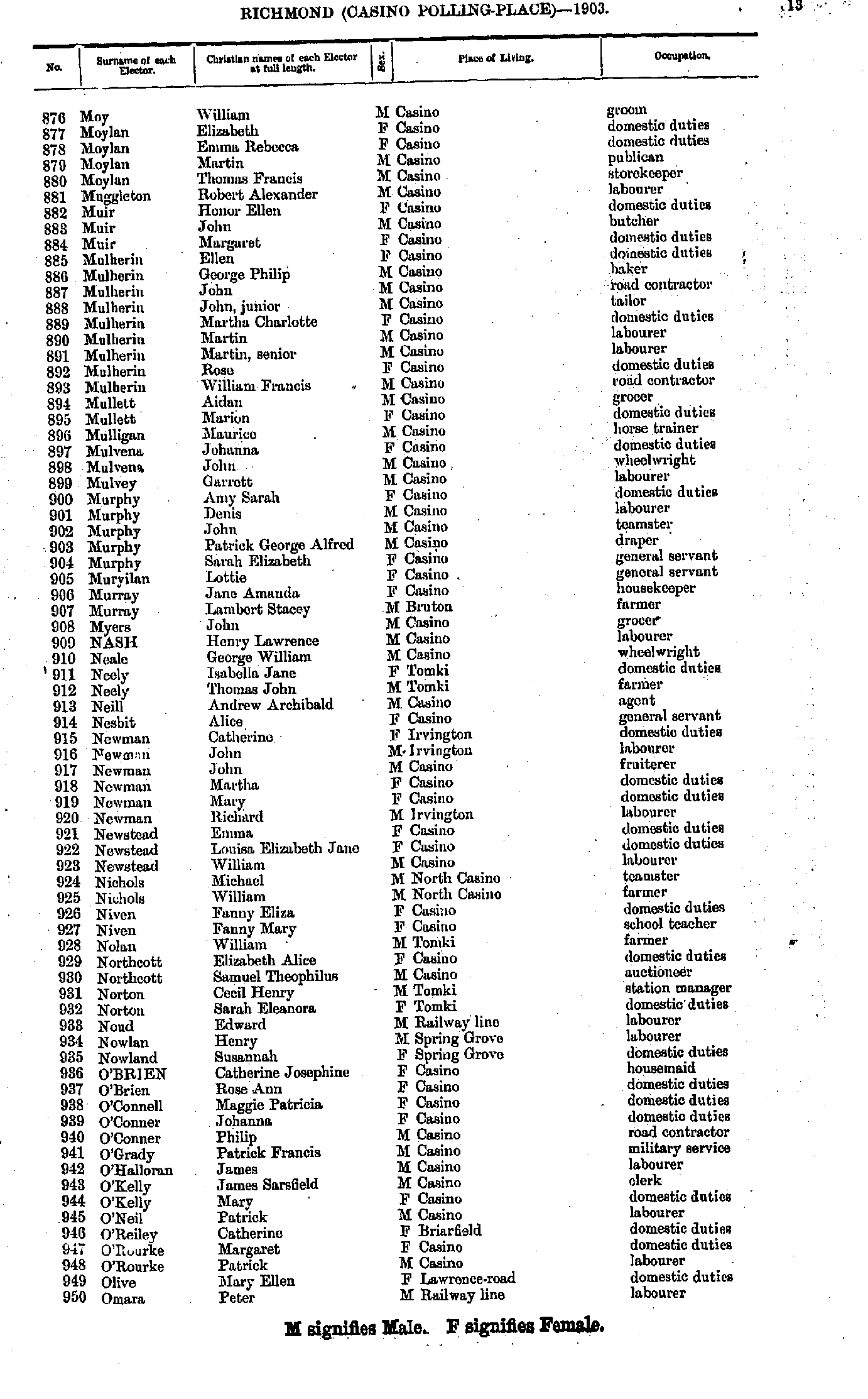
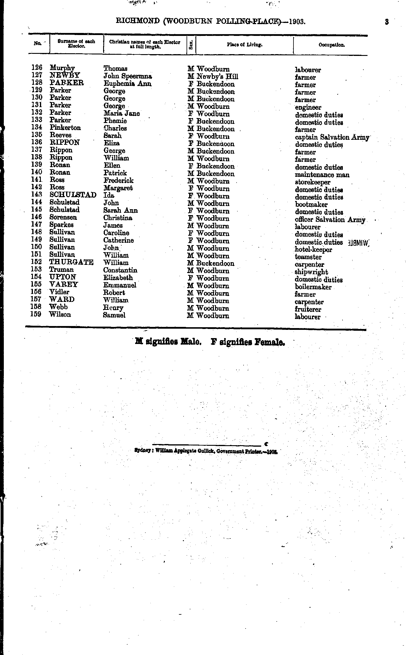
- Moy William - Omara Peter
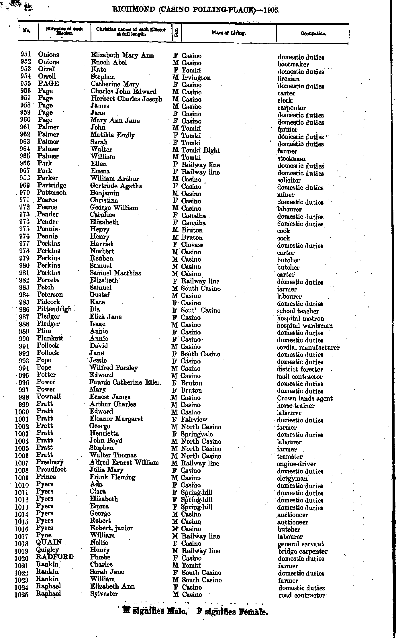
- Onions Elizabeth - Raphael Sylvester
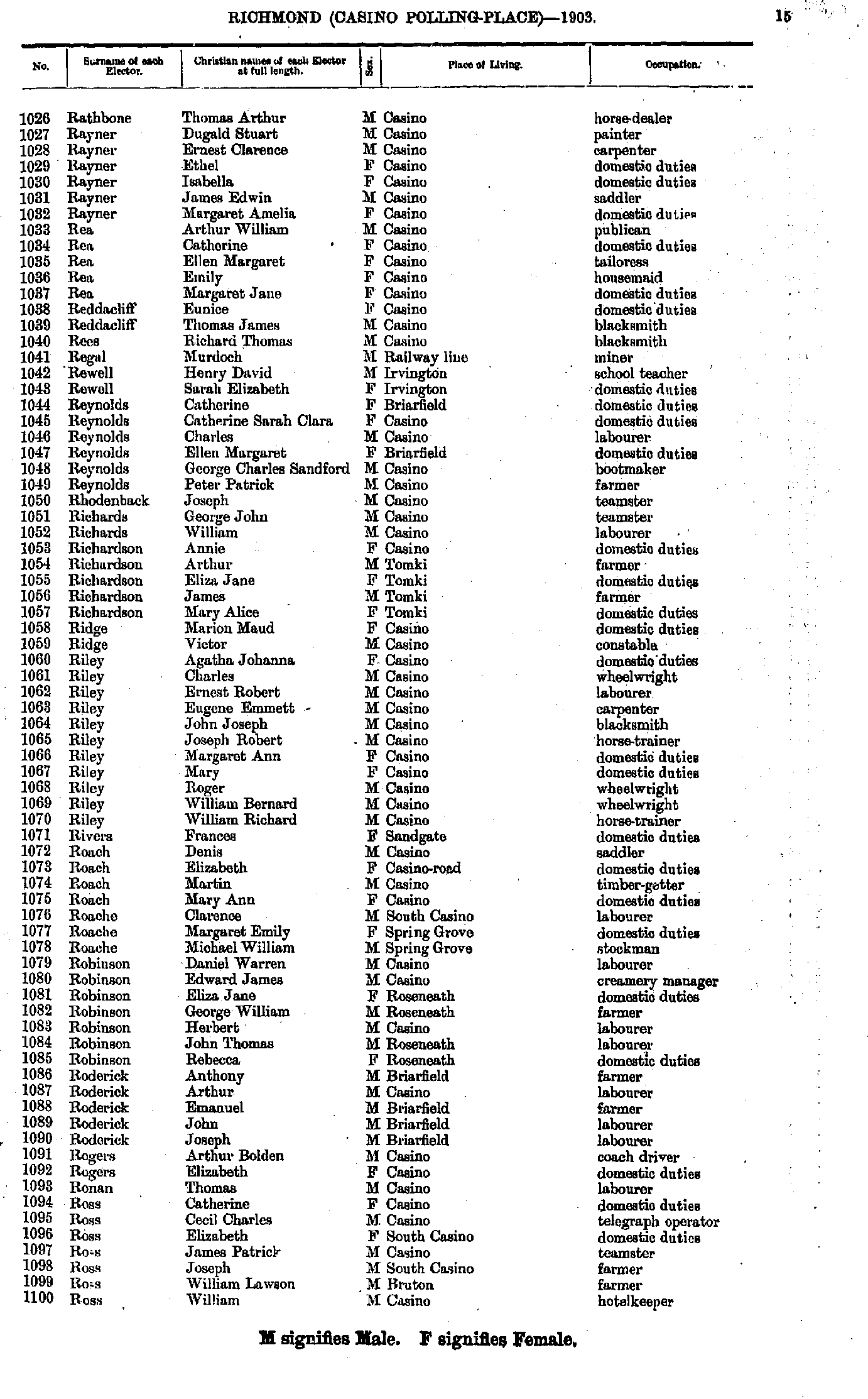
- Rathbone Thomas - Ross William
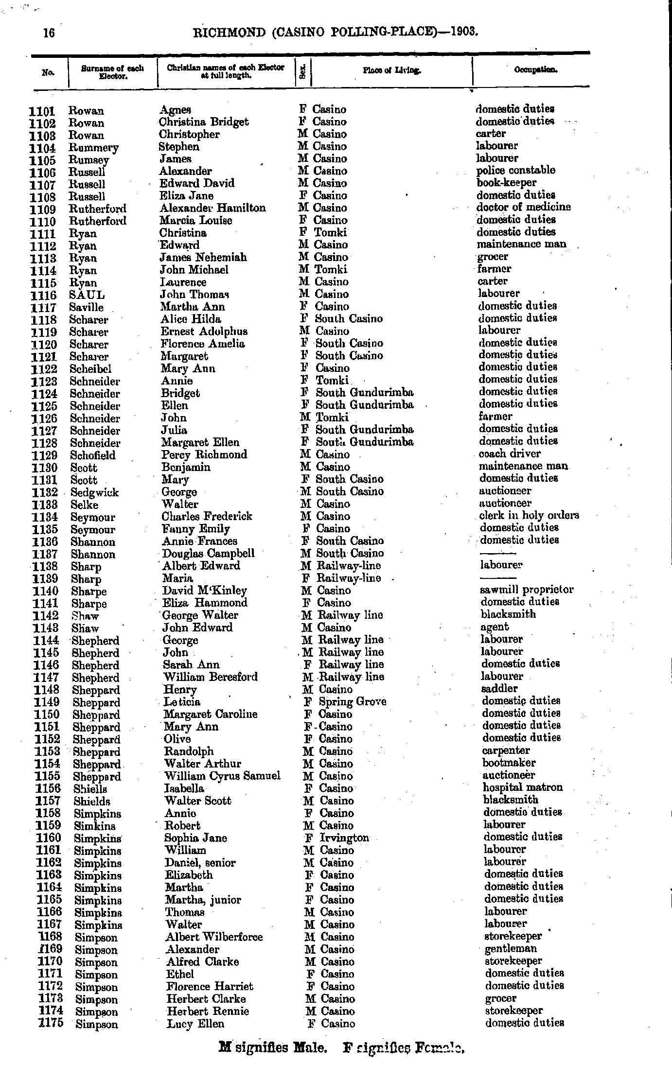
- Rowan Agnes - Simpson Lucy
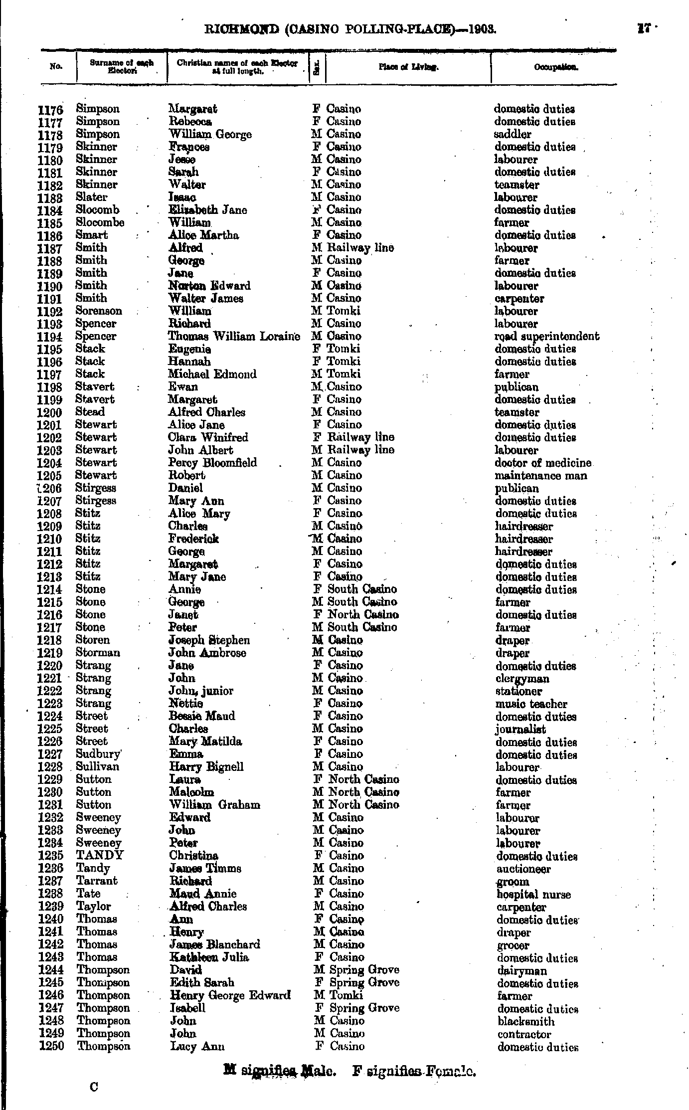
- Simpson Margaret - Thompson Lucy
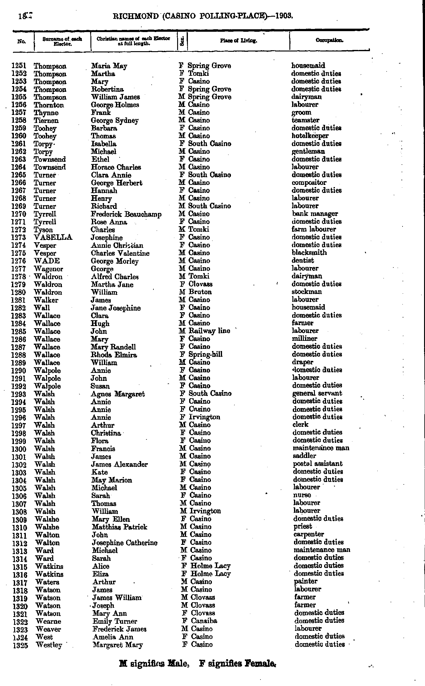
- Thompson Maria - Westley Margaret
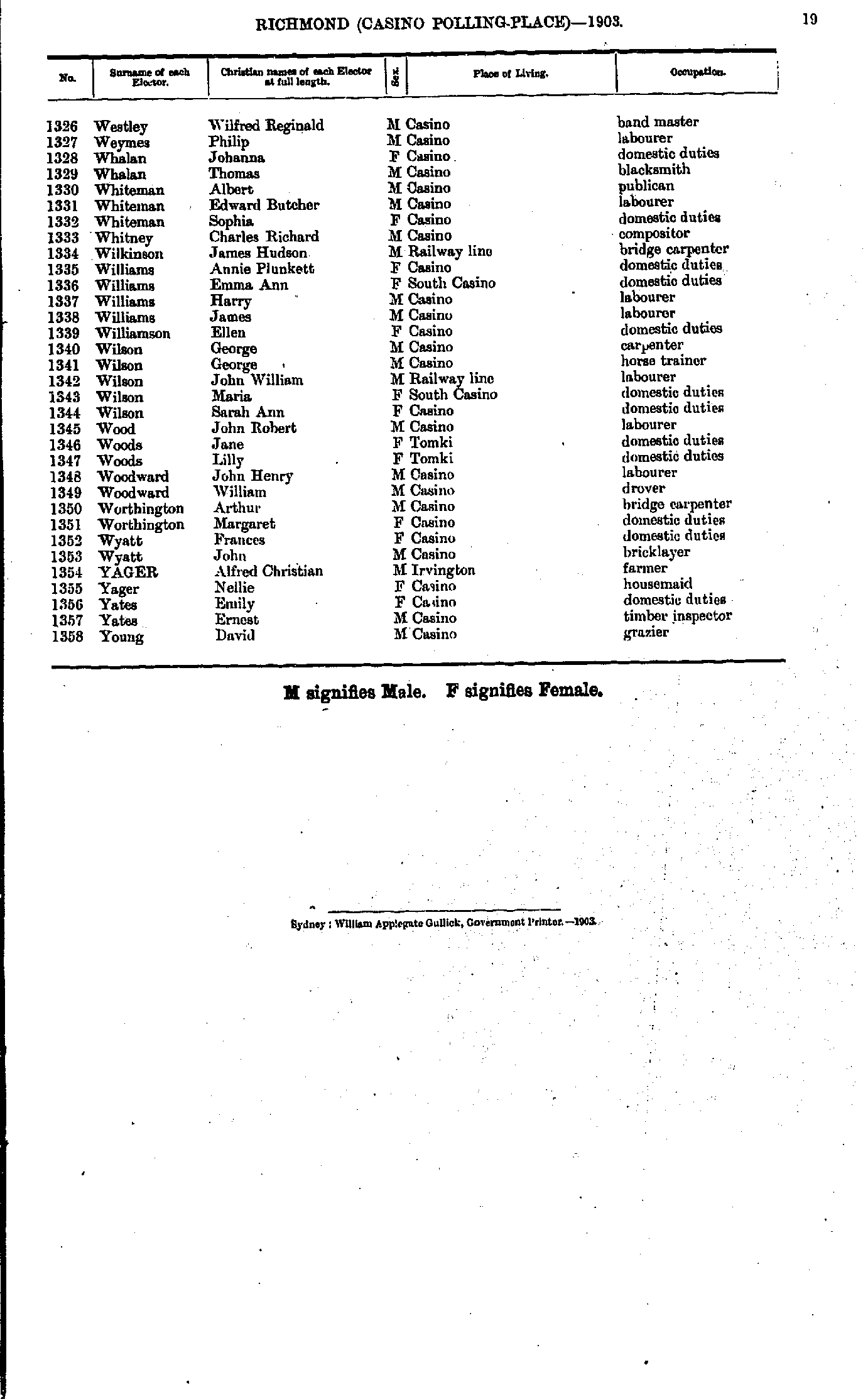
- Westley Wilfred - Young David
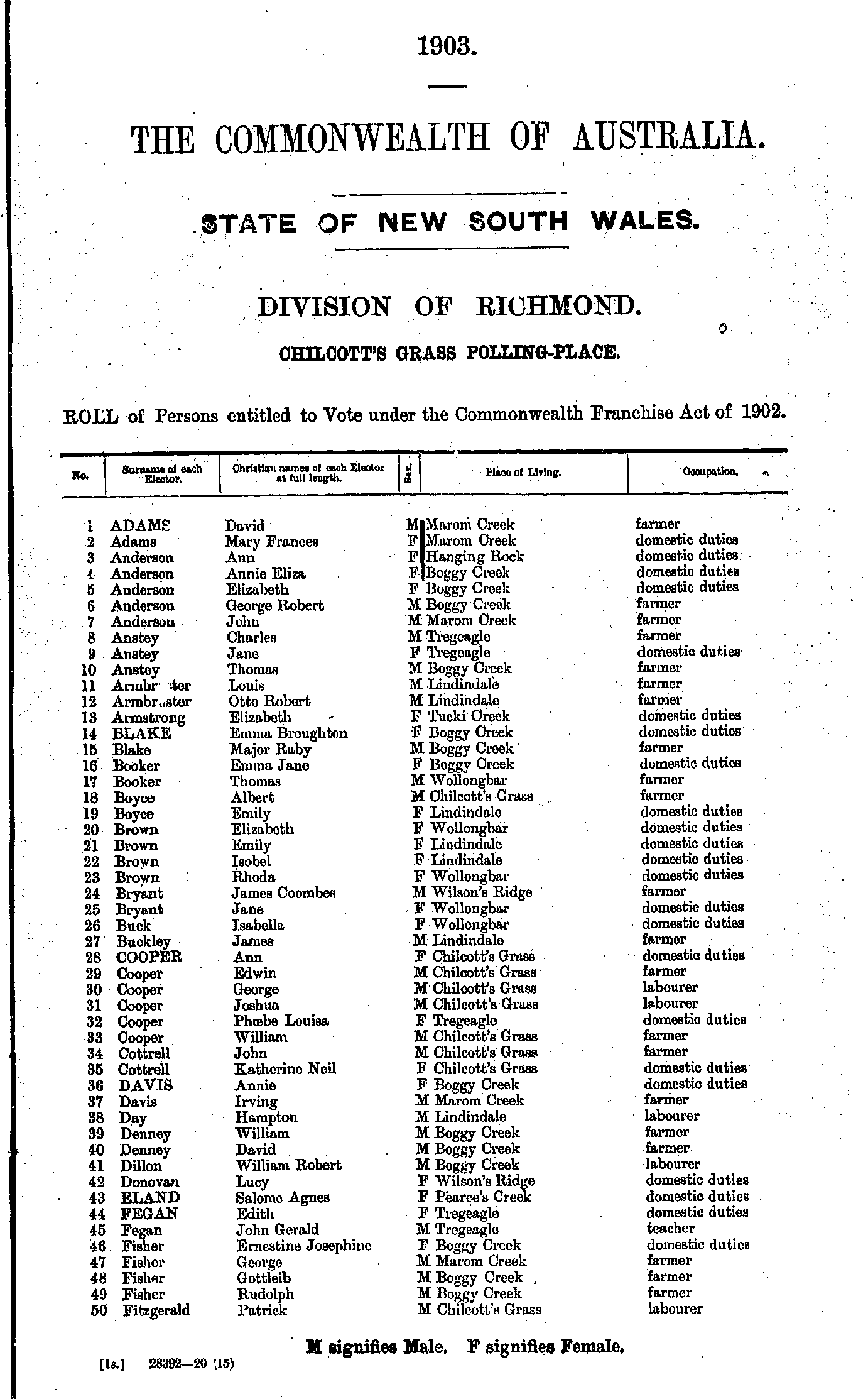
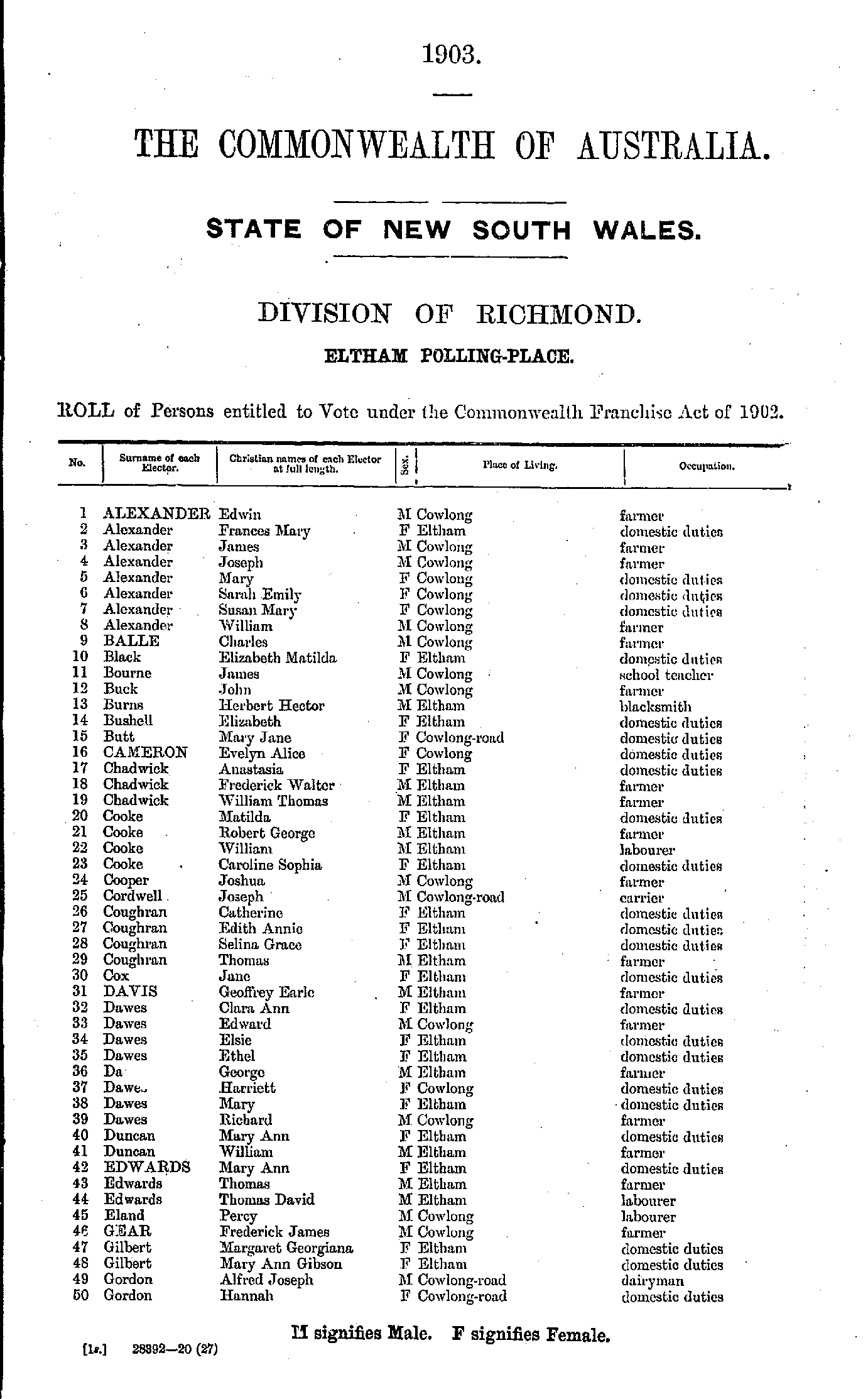
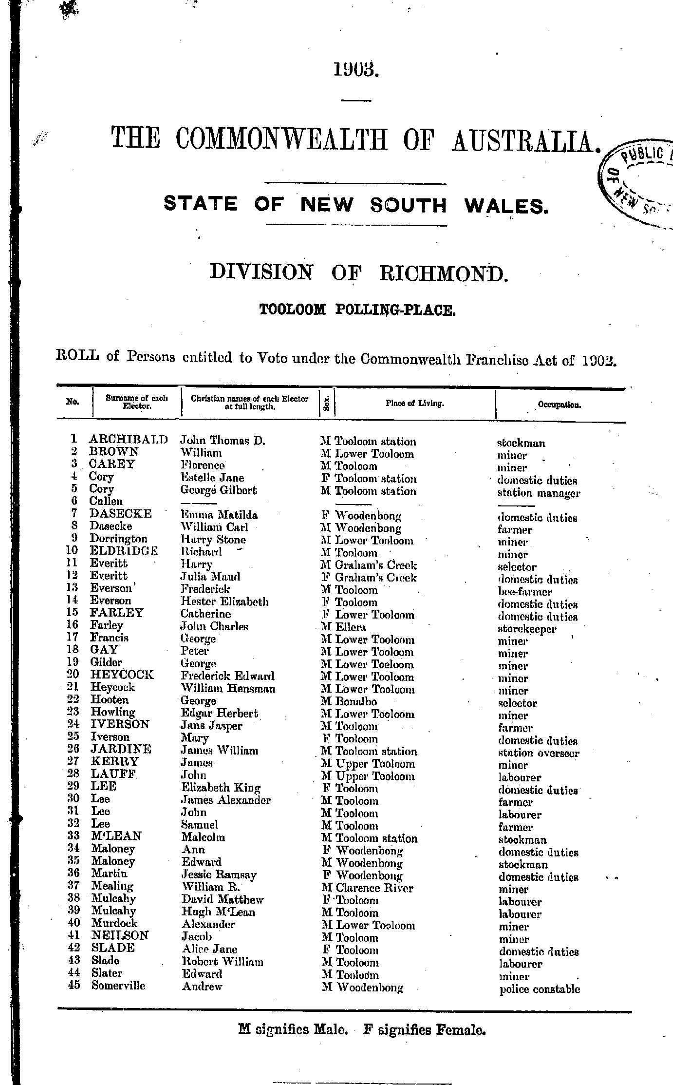
Chilcott's Grass Polling Place
- Adams David - Fitzgerald Patrick
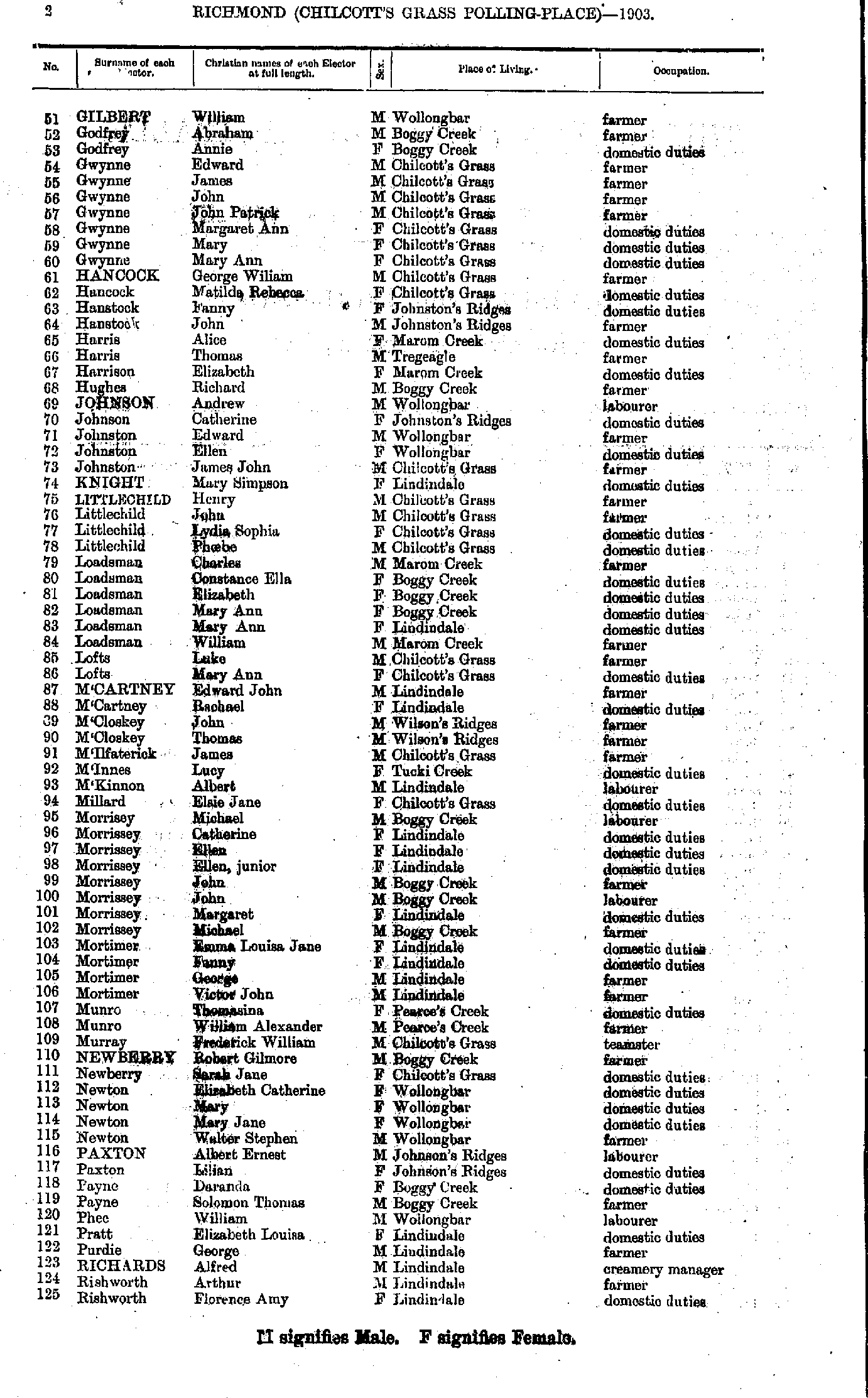
- Gilbert William - Rishworth Florence
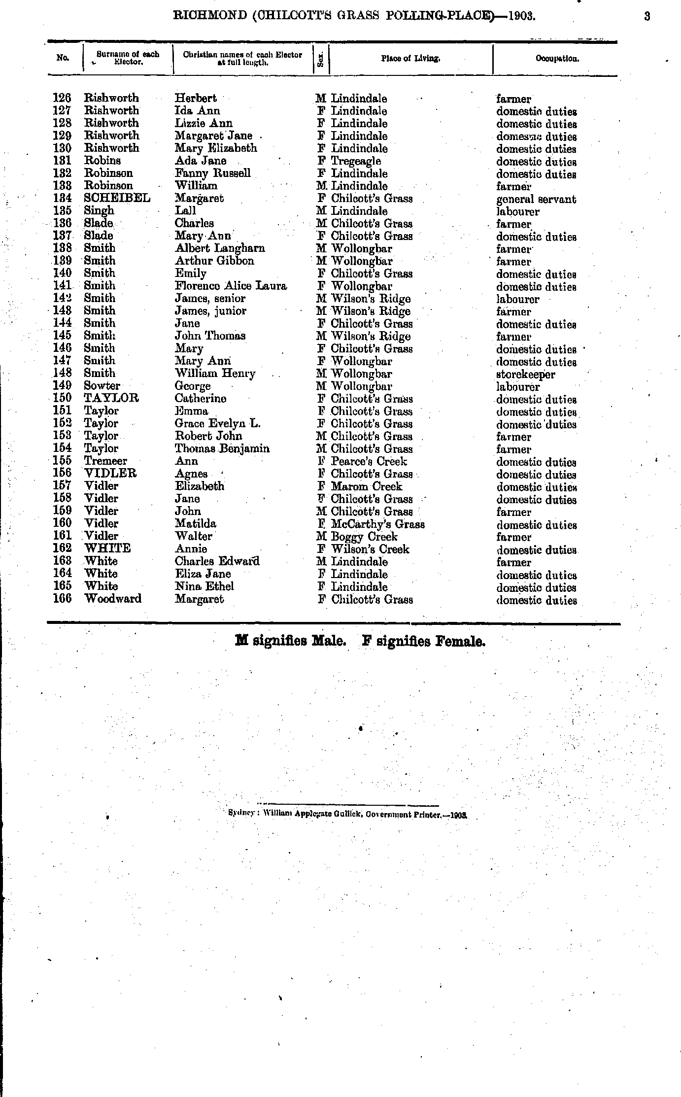
- Rishworth Herbert - Woodward Margaret
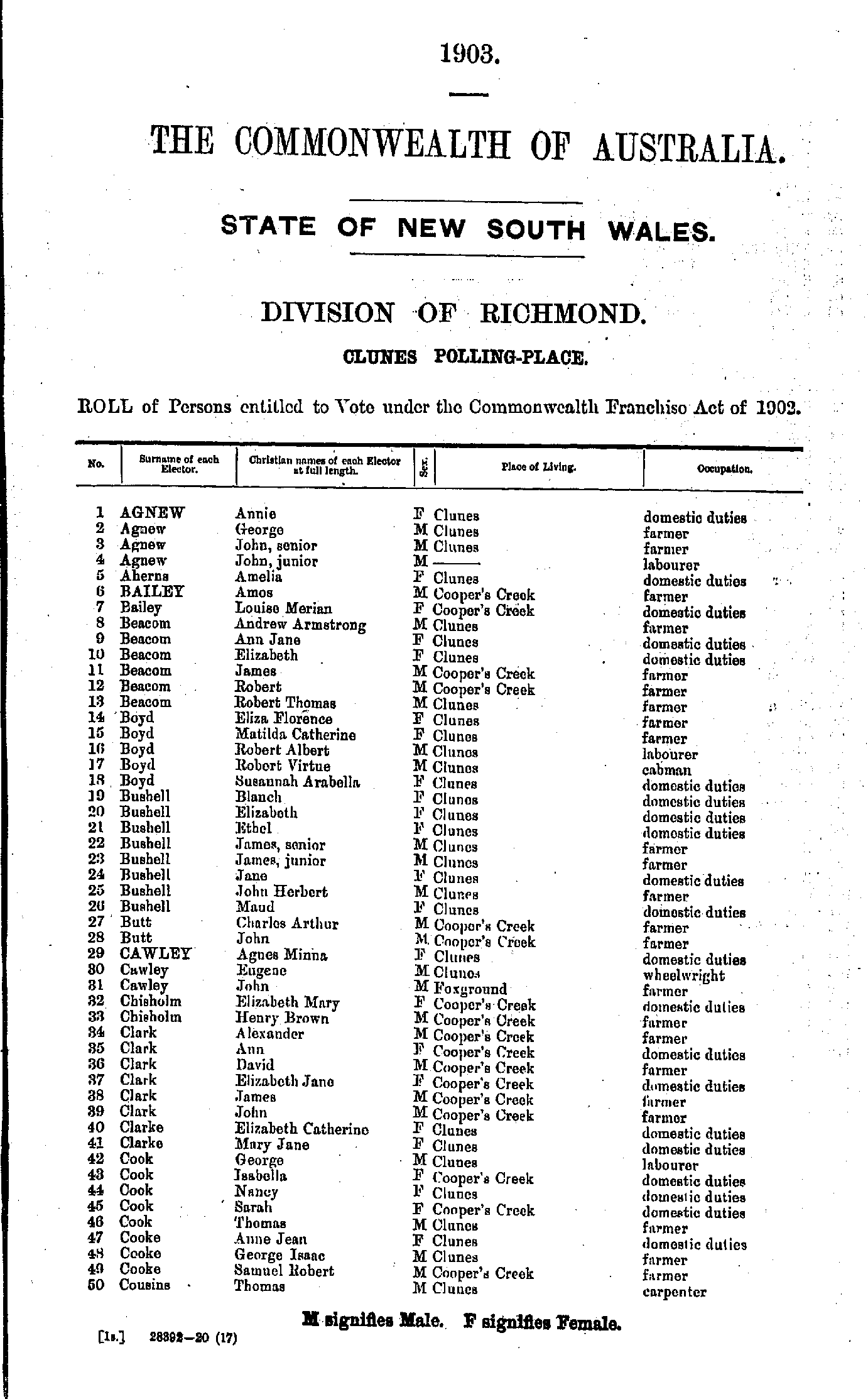
- Agnew Annie - Cousins Thomas
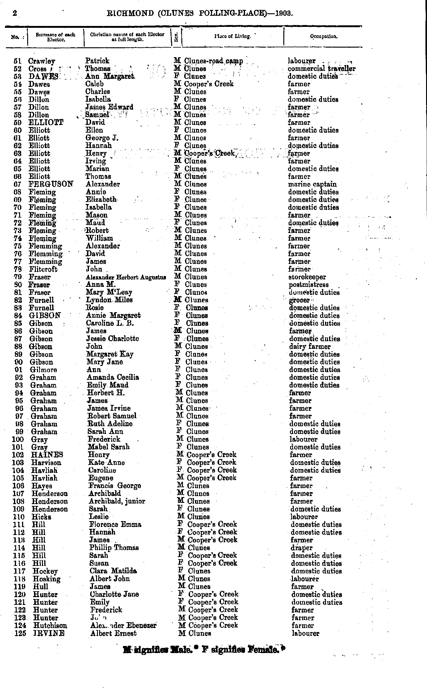
- Crawley Patrick - Irvine Albert
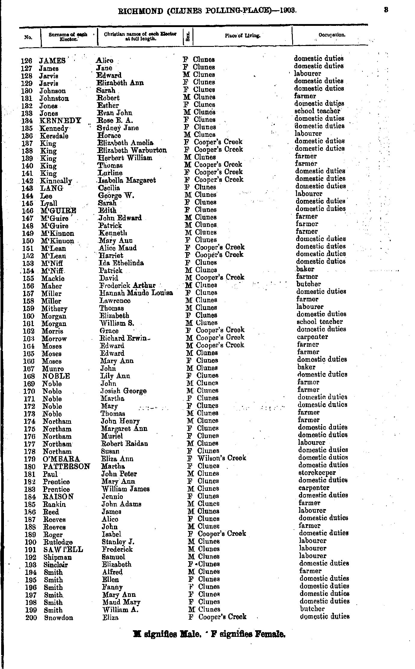
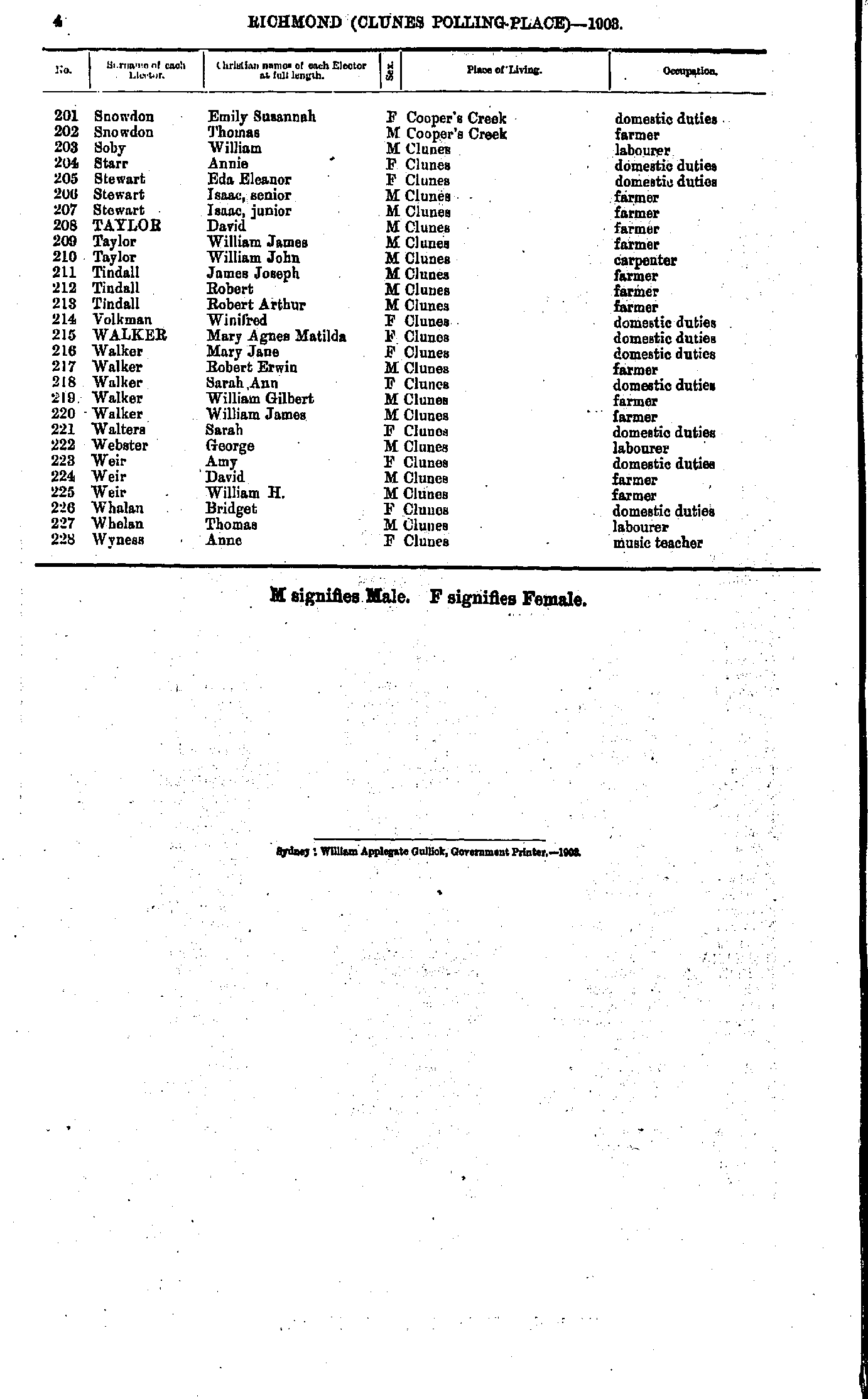
- James Alice - Snowdon Eliza
- Snowdon Emily - Wyness Anne
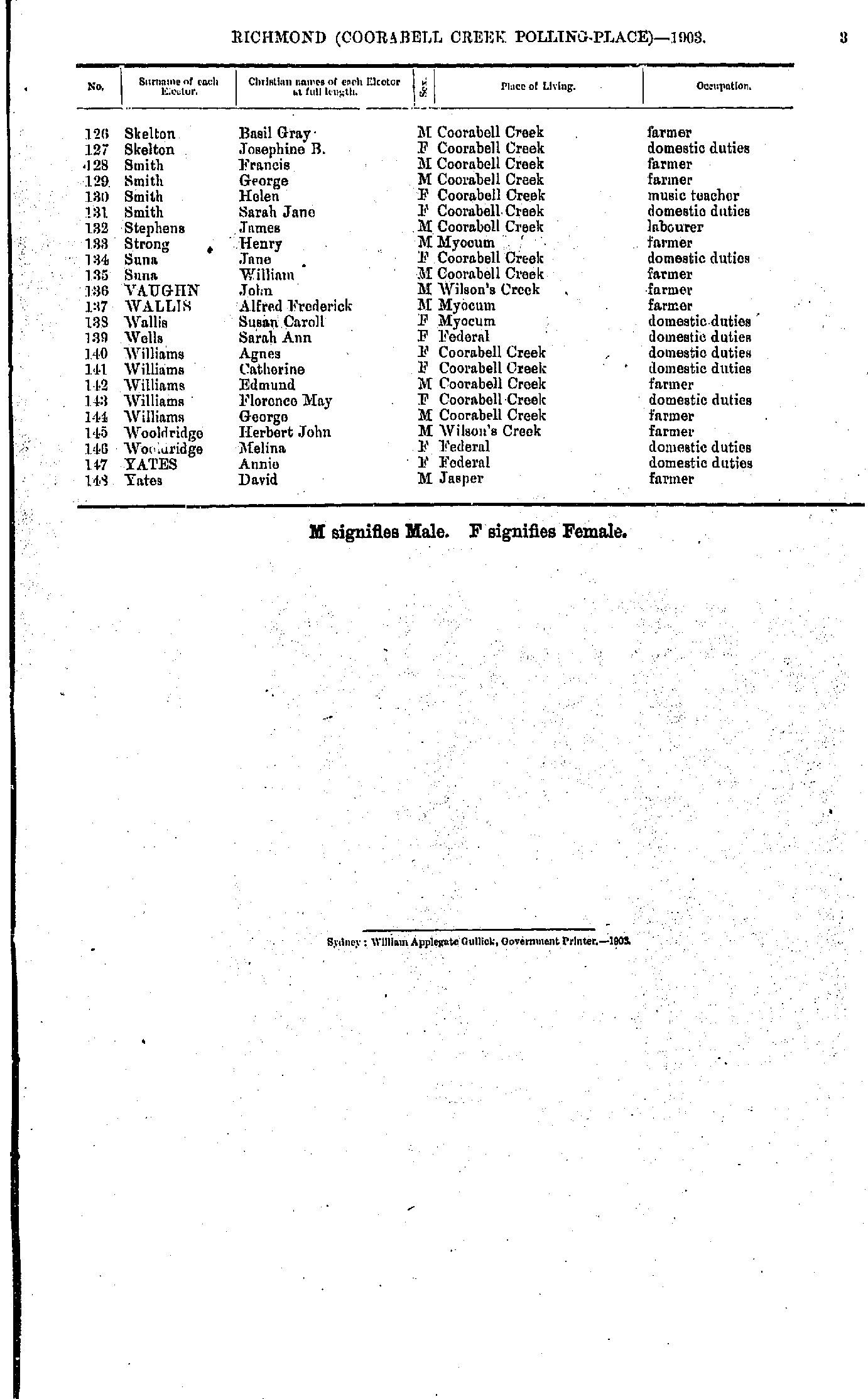
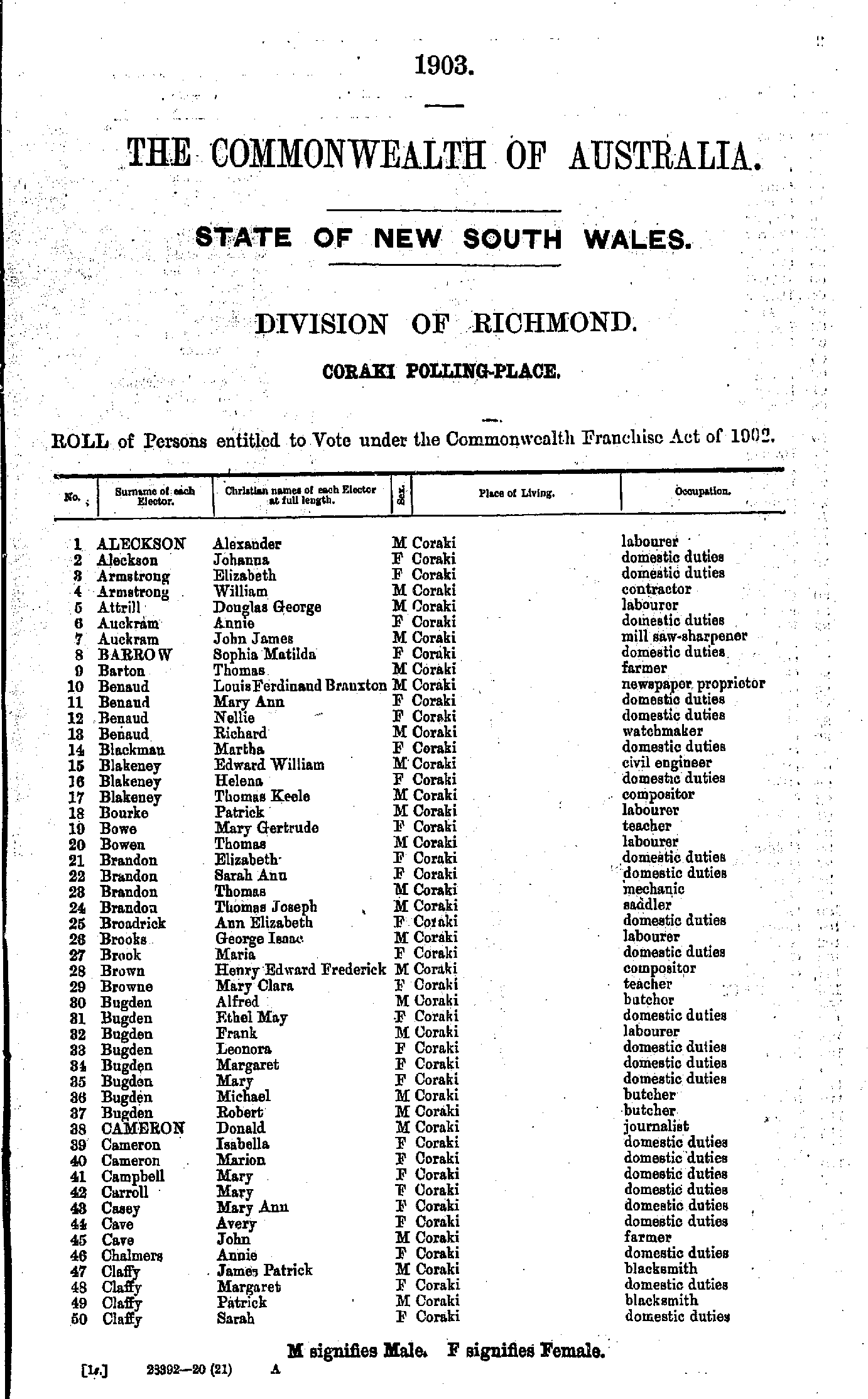
- Aleckson Alexander - Claffy Sarah
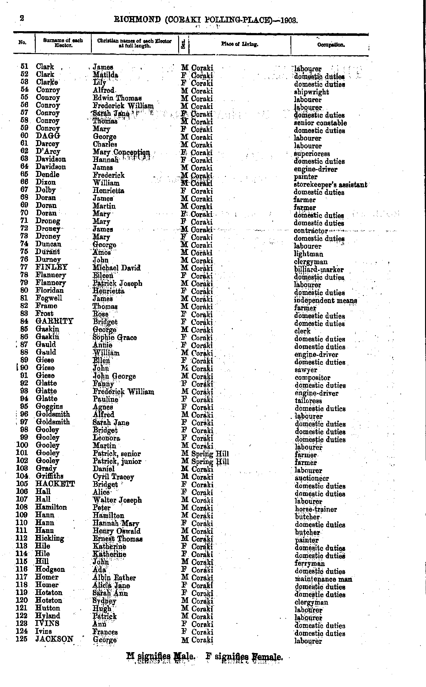
- Clark James - Jackson George
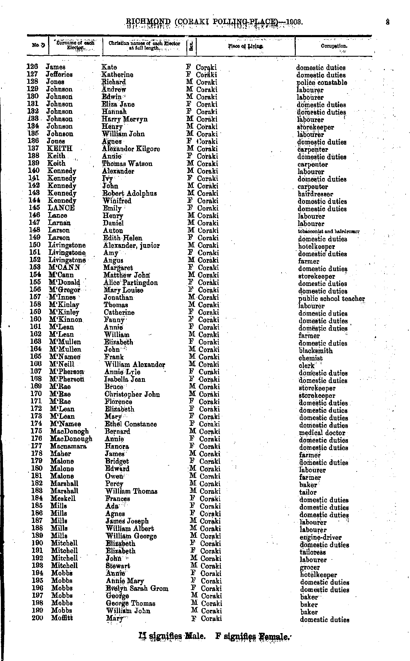
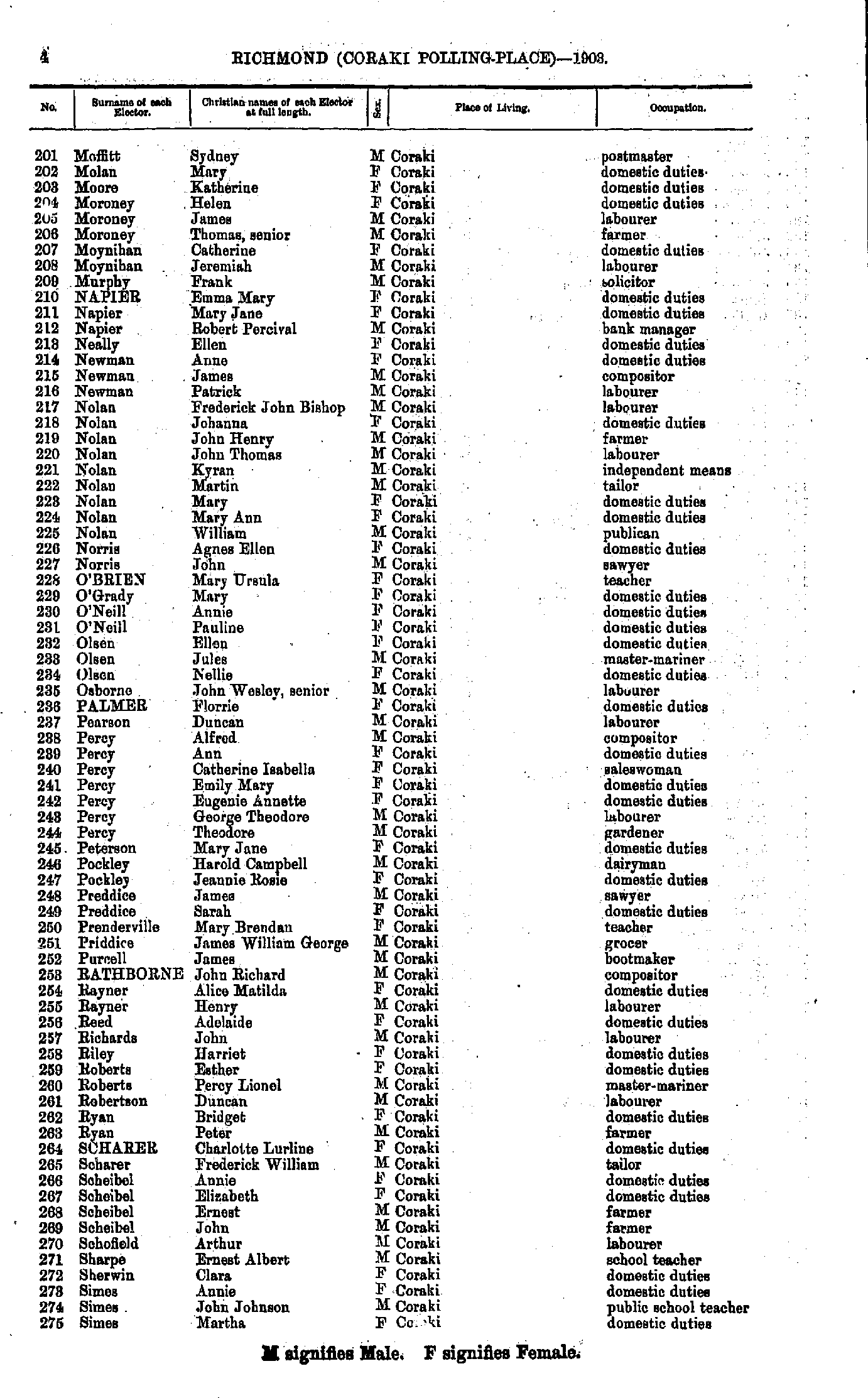
- James Kate - Moffitt Mary
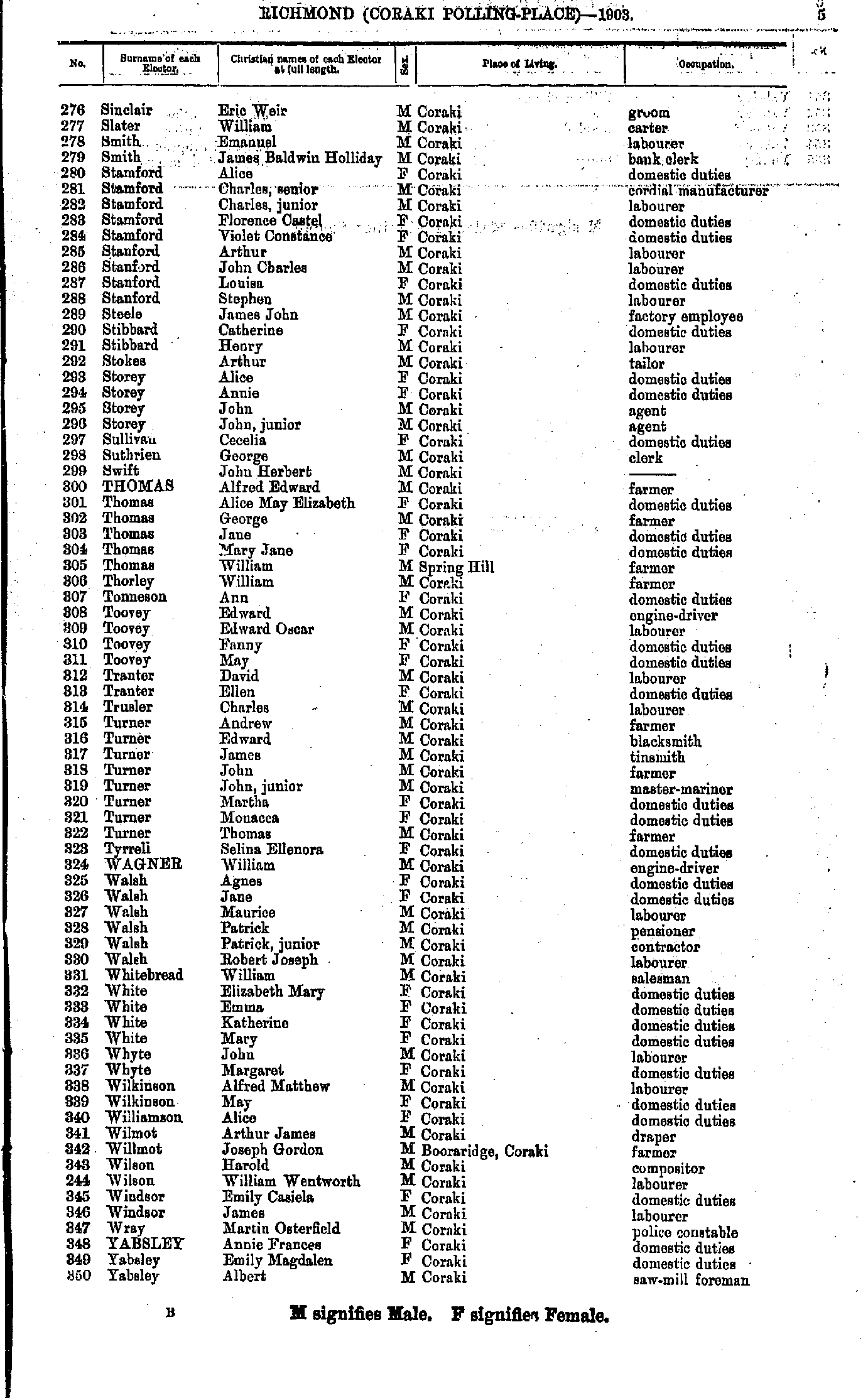
- Moffitt Sydney - Simes Martha
- Sinclair Eric - Yabsley Albert
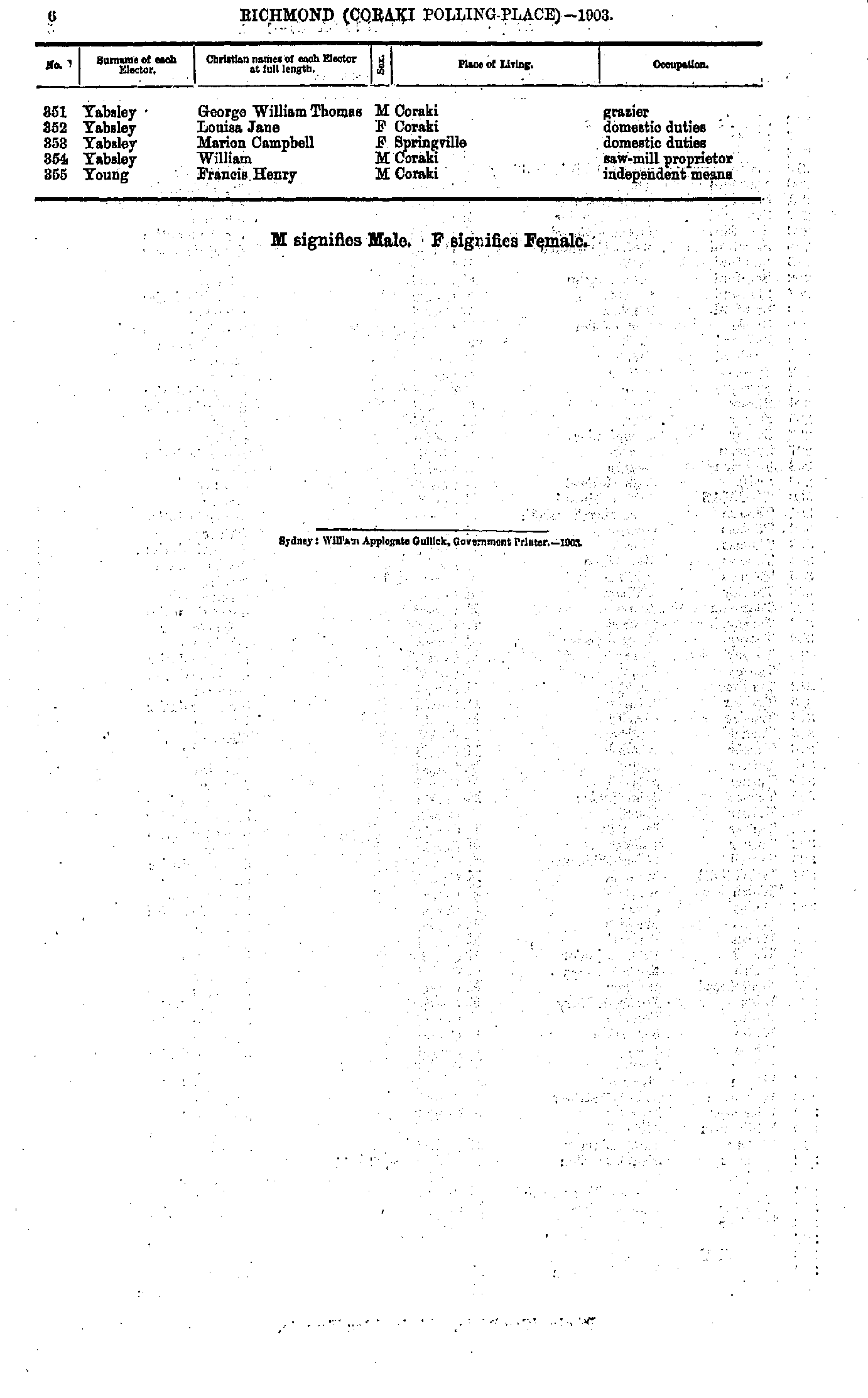
- Yabsley George - Young Francis
- Allen George - Cowen John
- Cowen John - Limon Robert
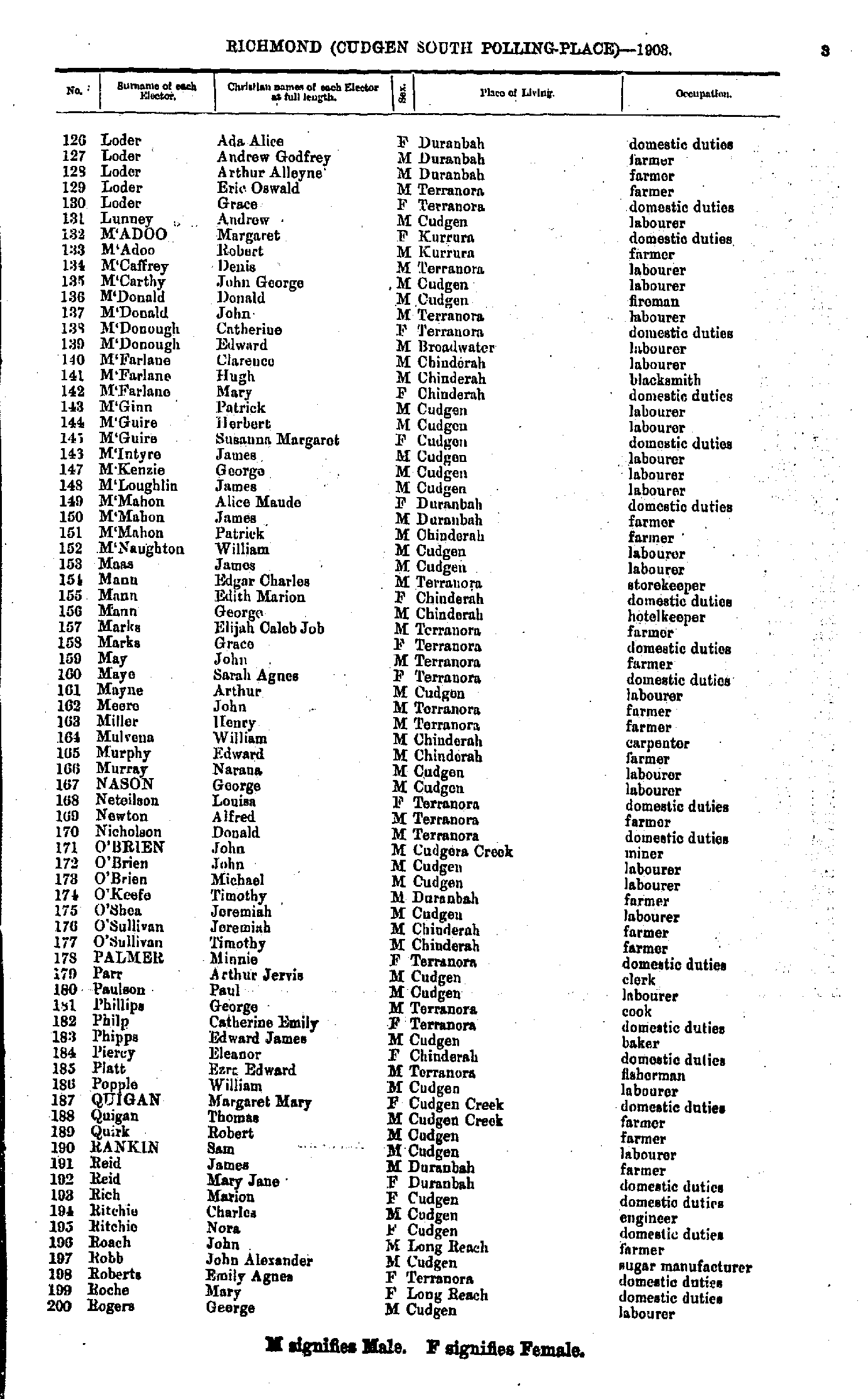
- Loder Ada - Rogers George
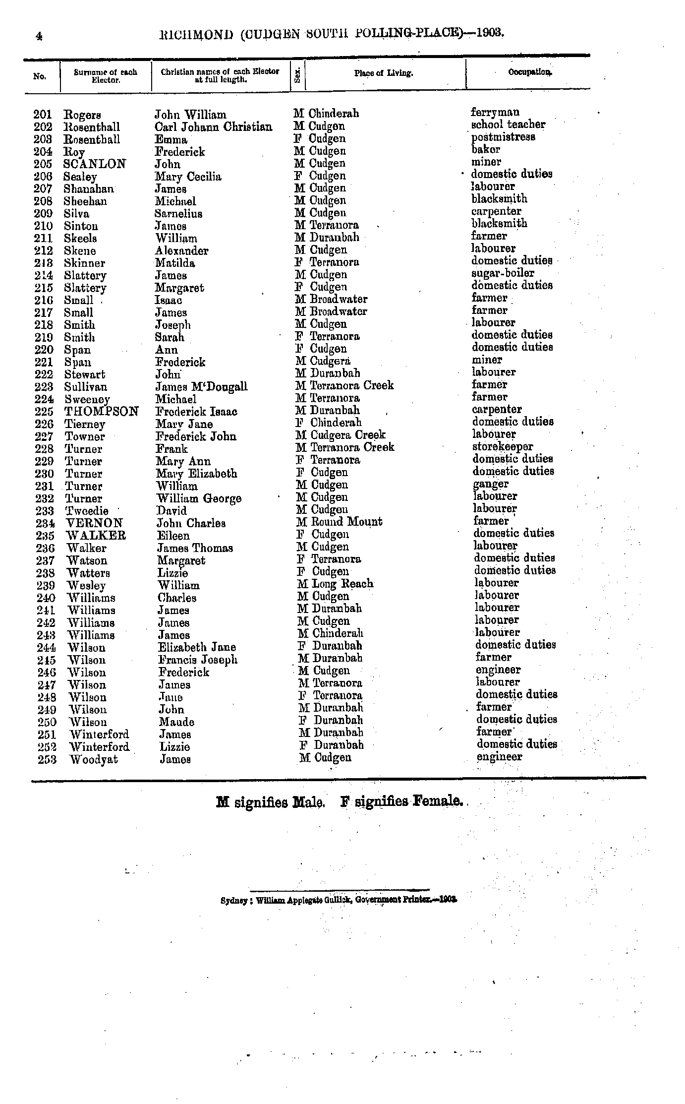
- Rogers John - Woodyat James
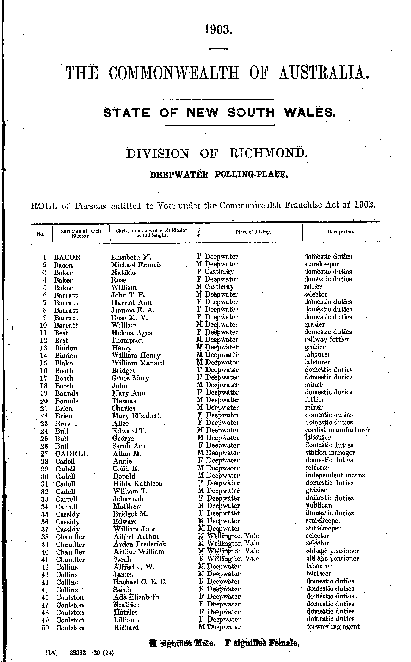
- Bacon Elizabeth - Coulston Richard
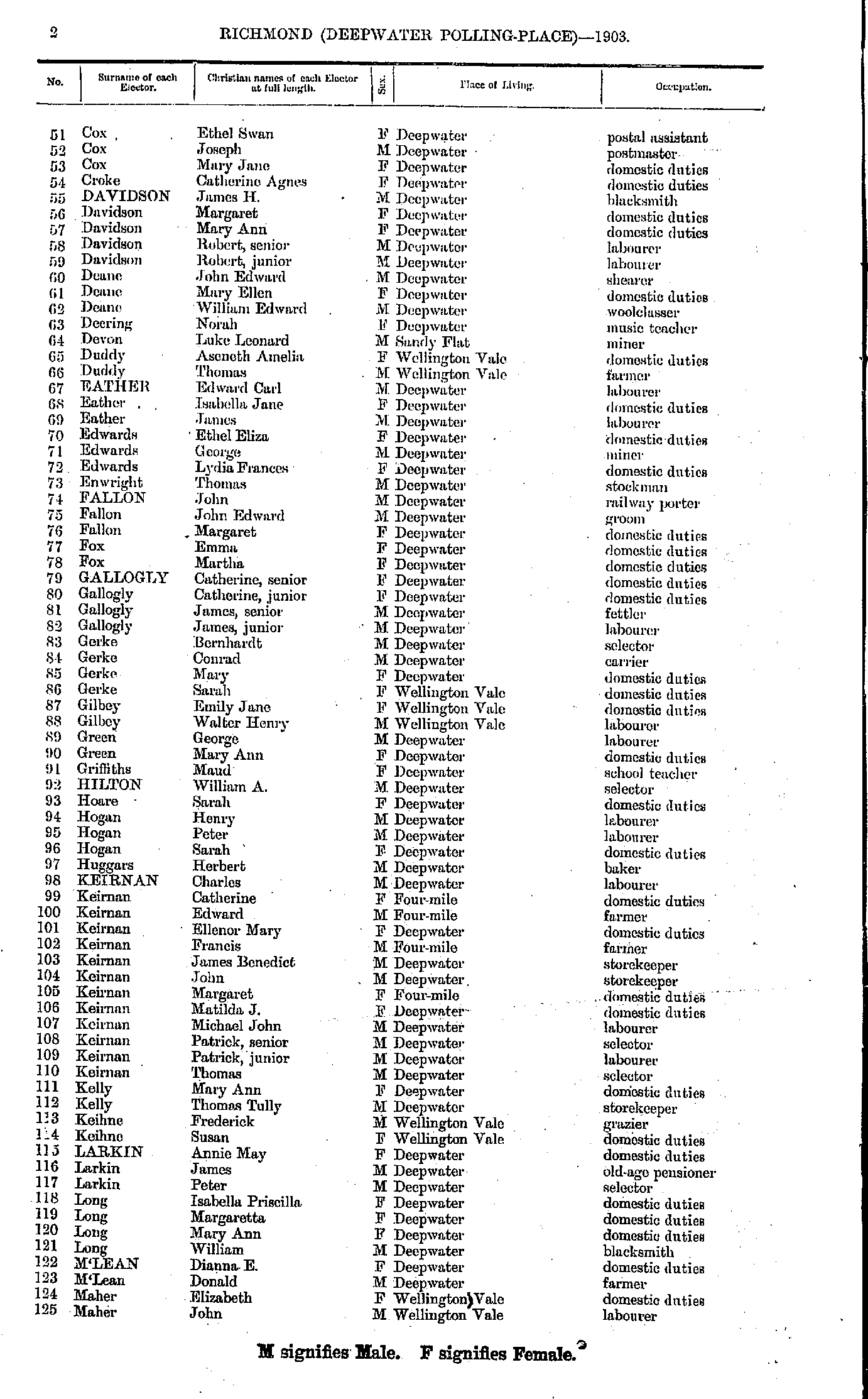
- Cox Ethel - Maher John
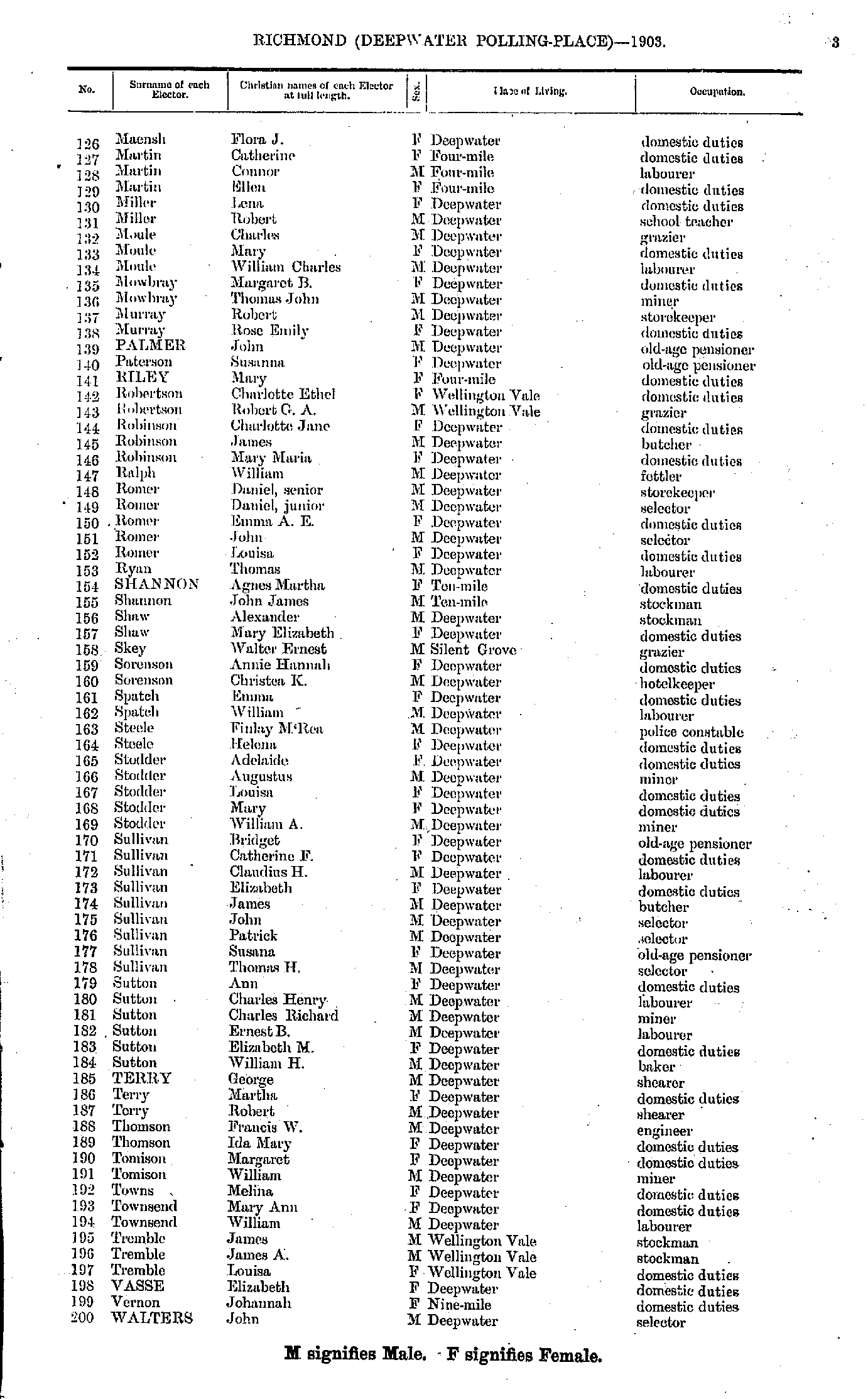
- Maensh Flora - Walters John
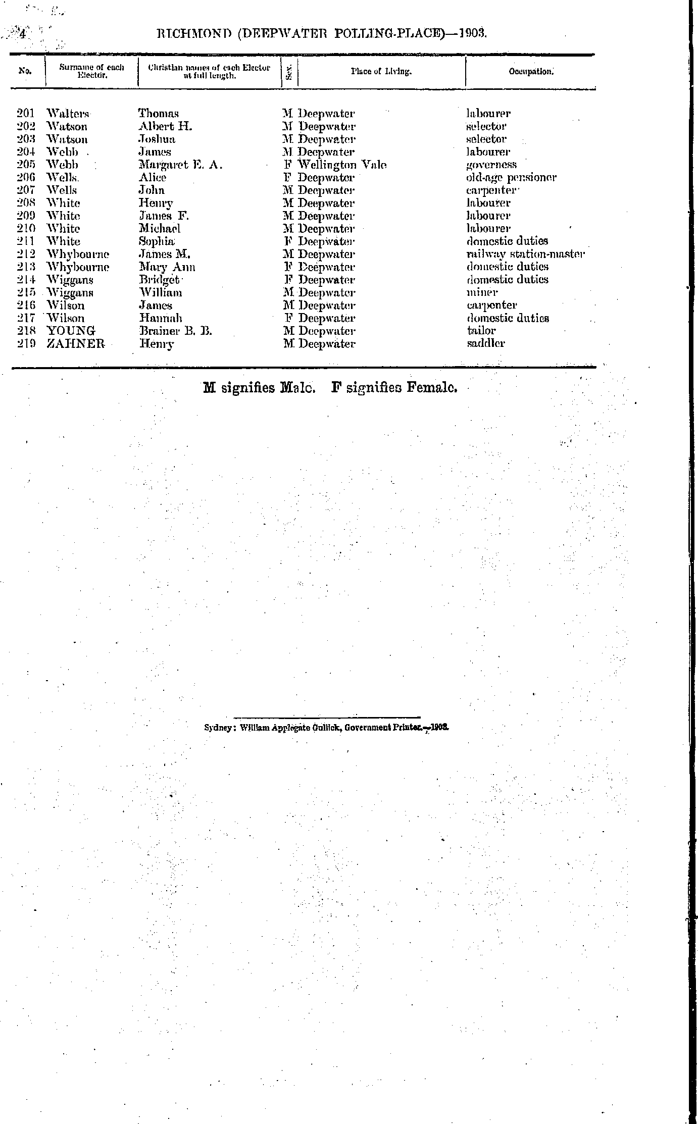
- Walters Thomas - Zahner Henry
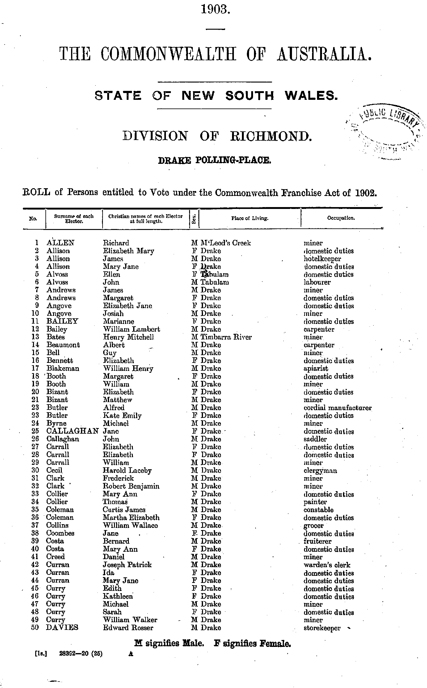
- Allen Richard - Davies Edward
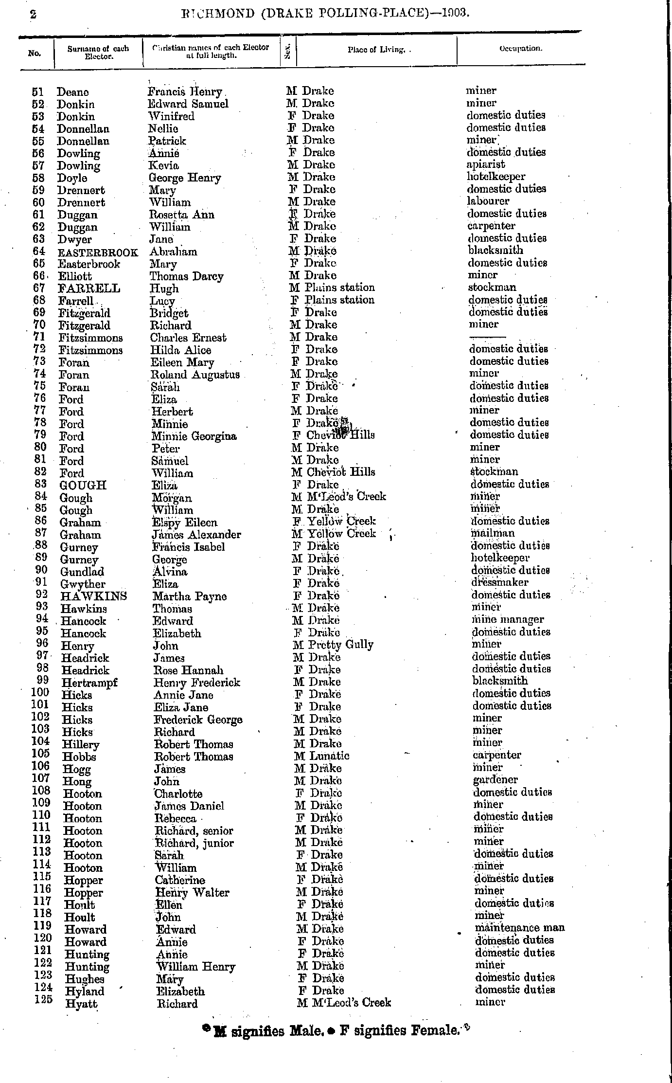
- Deane Francis - Hyatt Richard
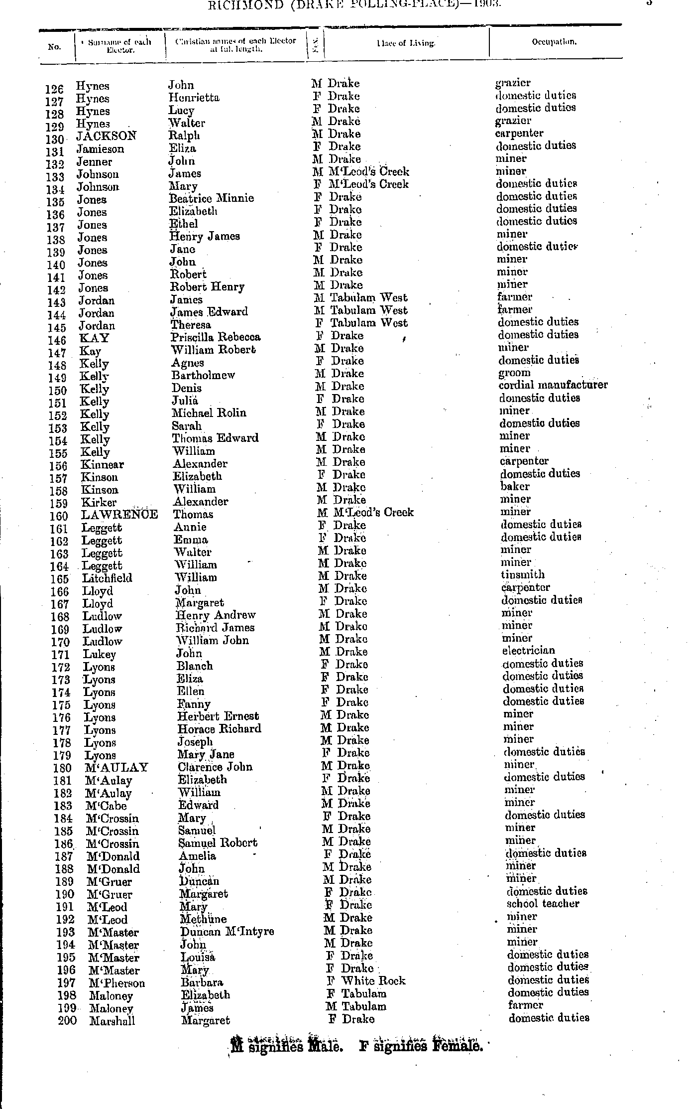
- Hynes John - Marshall Margaret
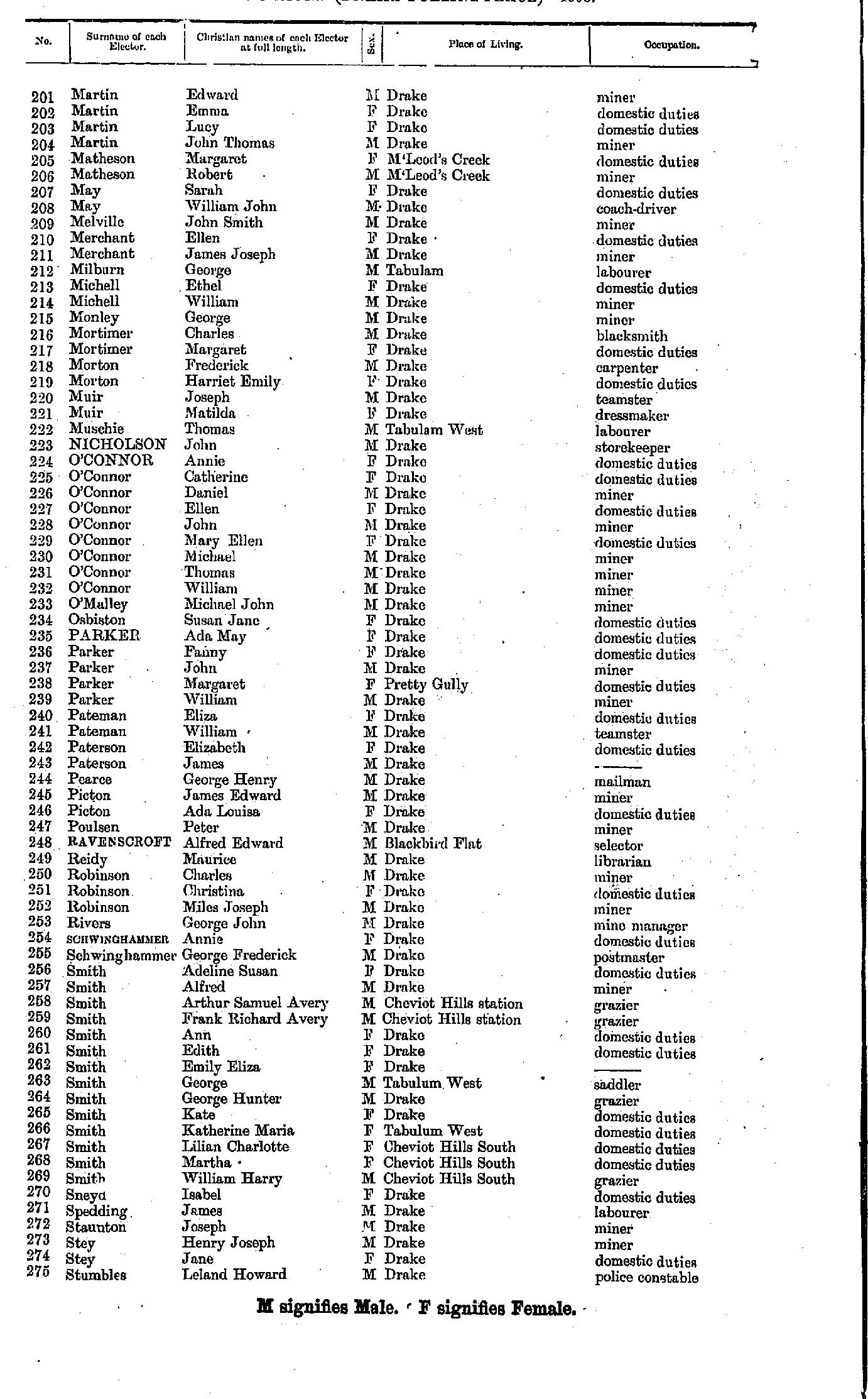
- Martin Edward - Stumbles Leland
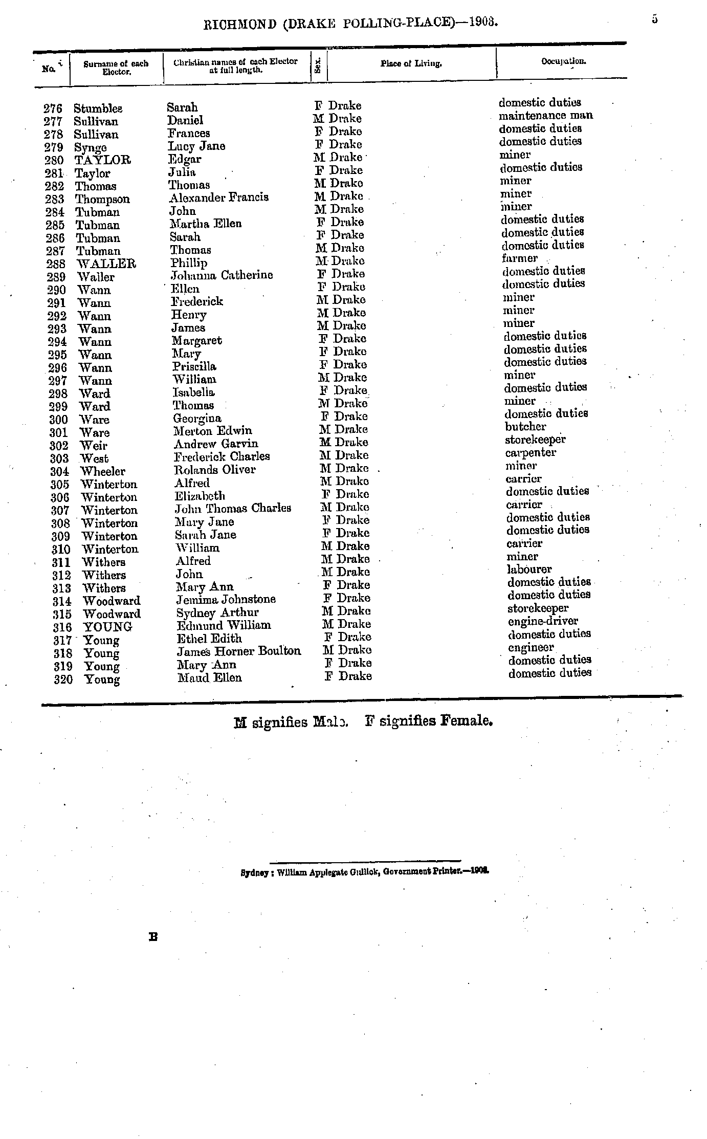
- Stumbles Sarah - Young Maud
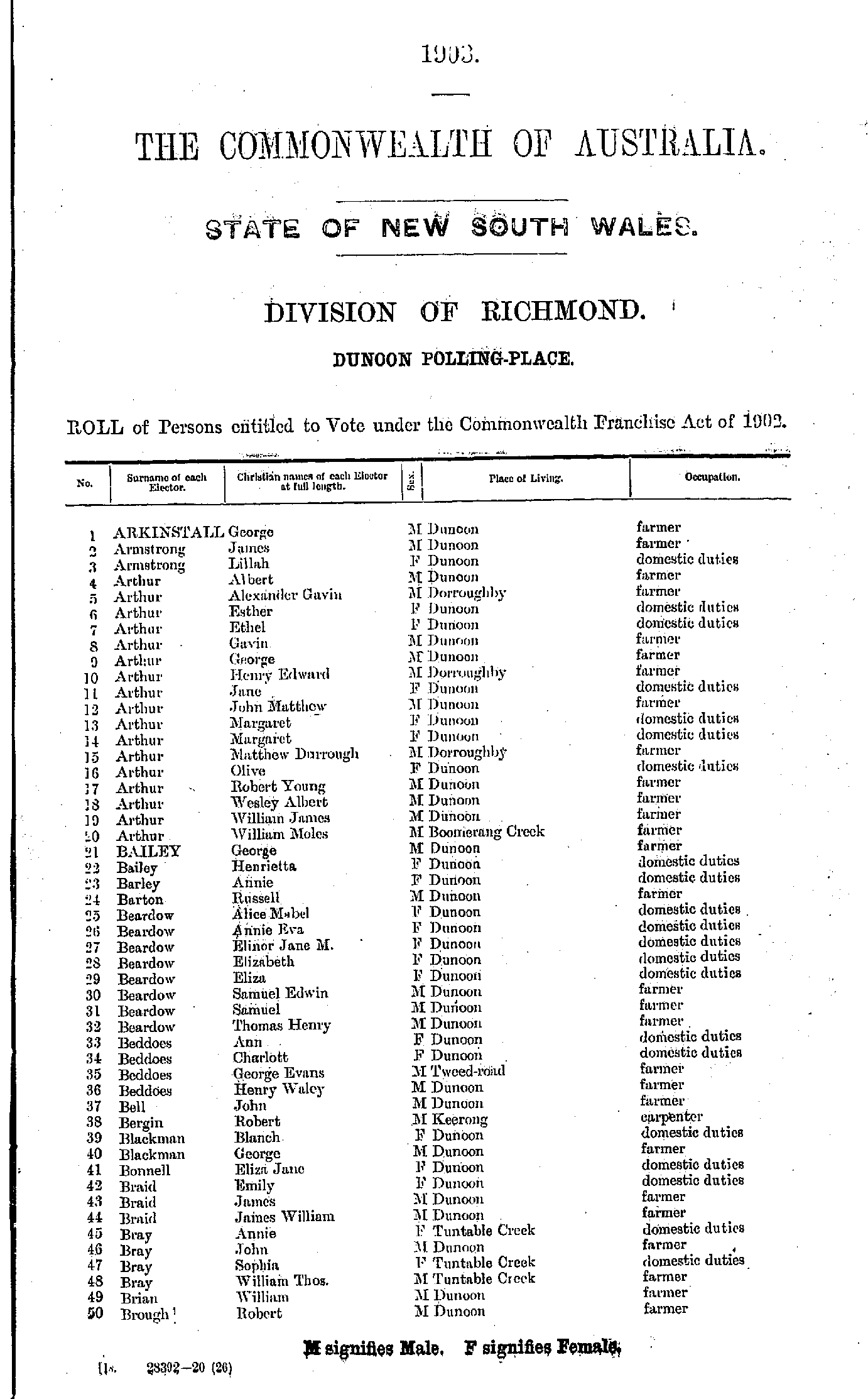
- Arkinstall George - Brough Robert
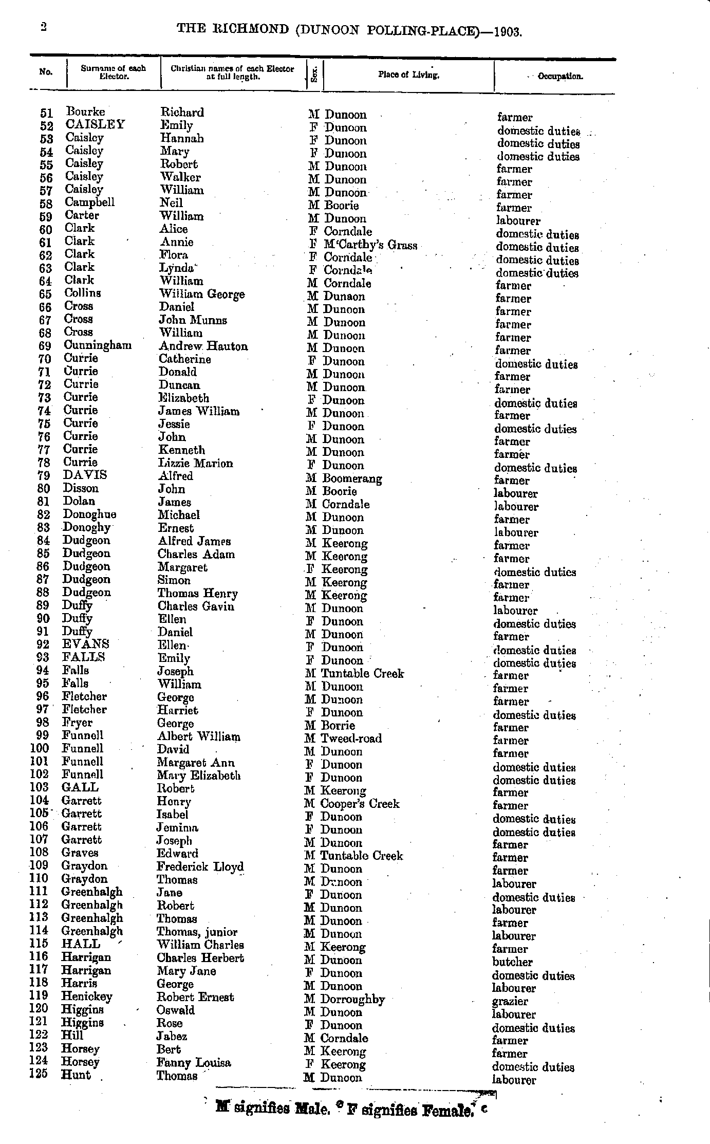
- Bourke Richard - Hunt Thomas
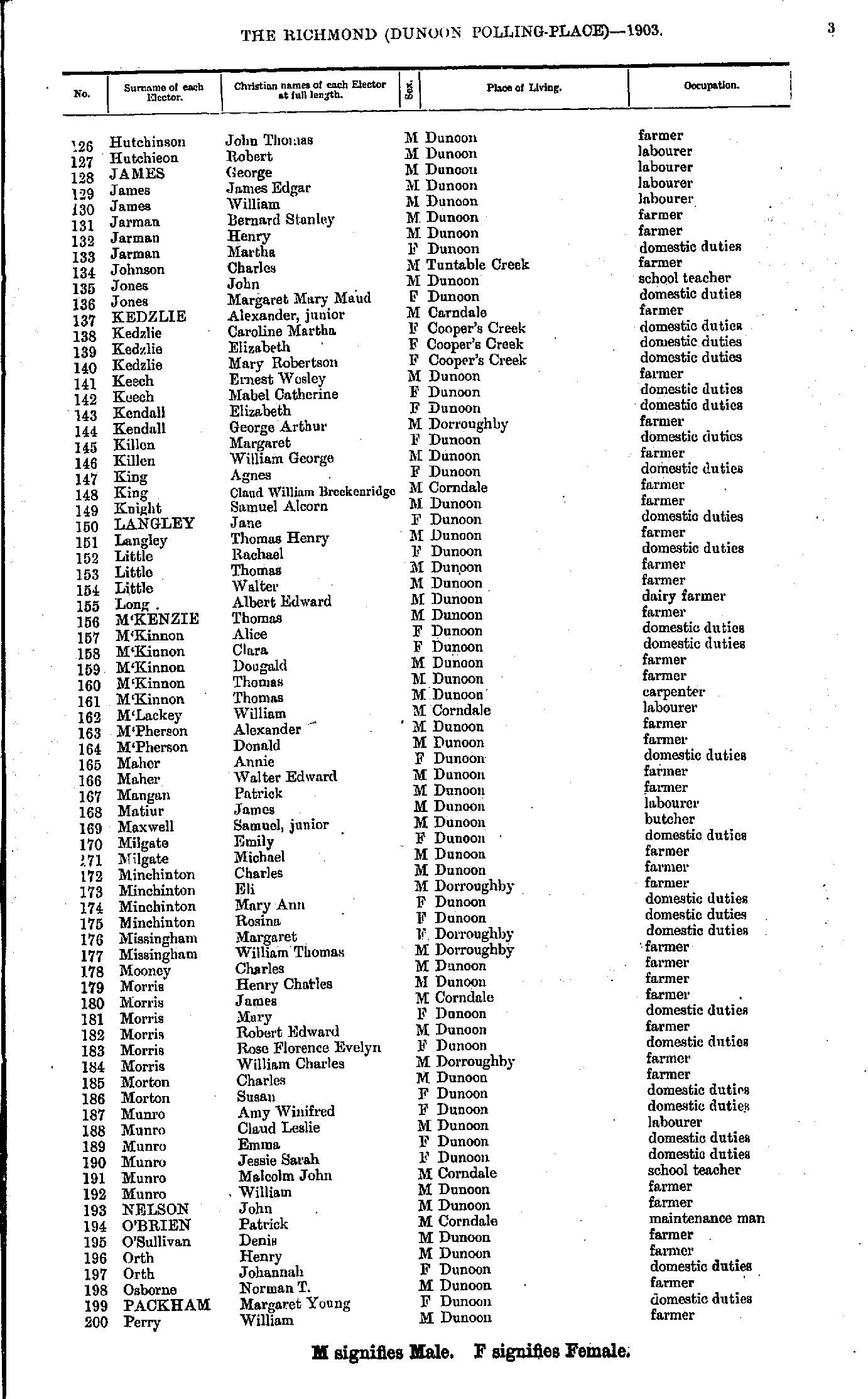
- Hutchinson John - Perry William
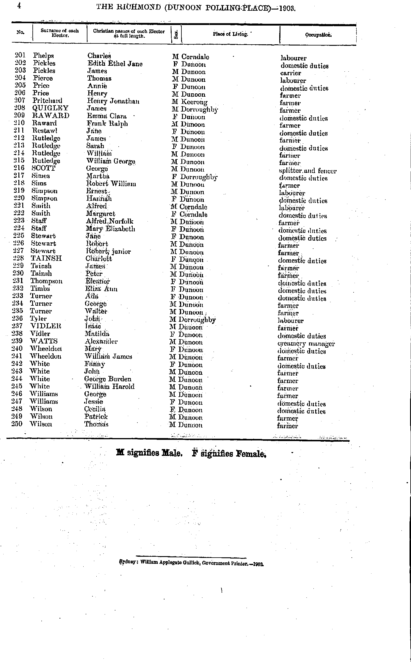
- Phelps Charles - Wilson Thomas
- Abbott Louisa - Ashley Rachael
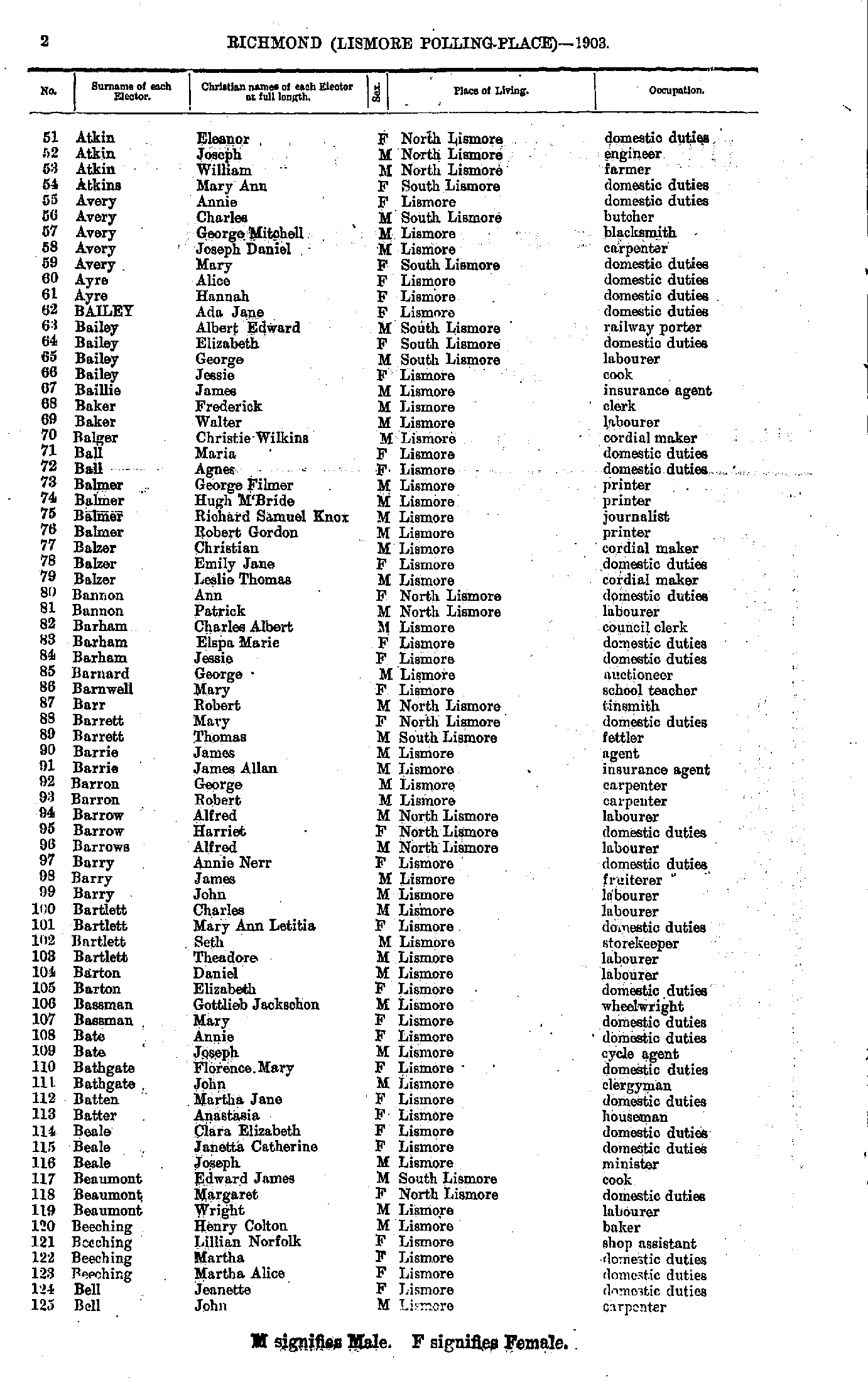
- Atkin Eleanor - Bell John
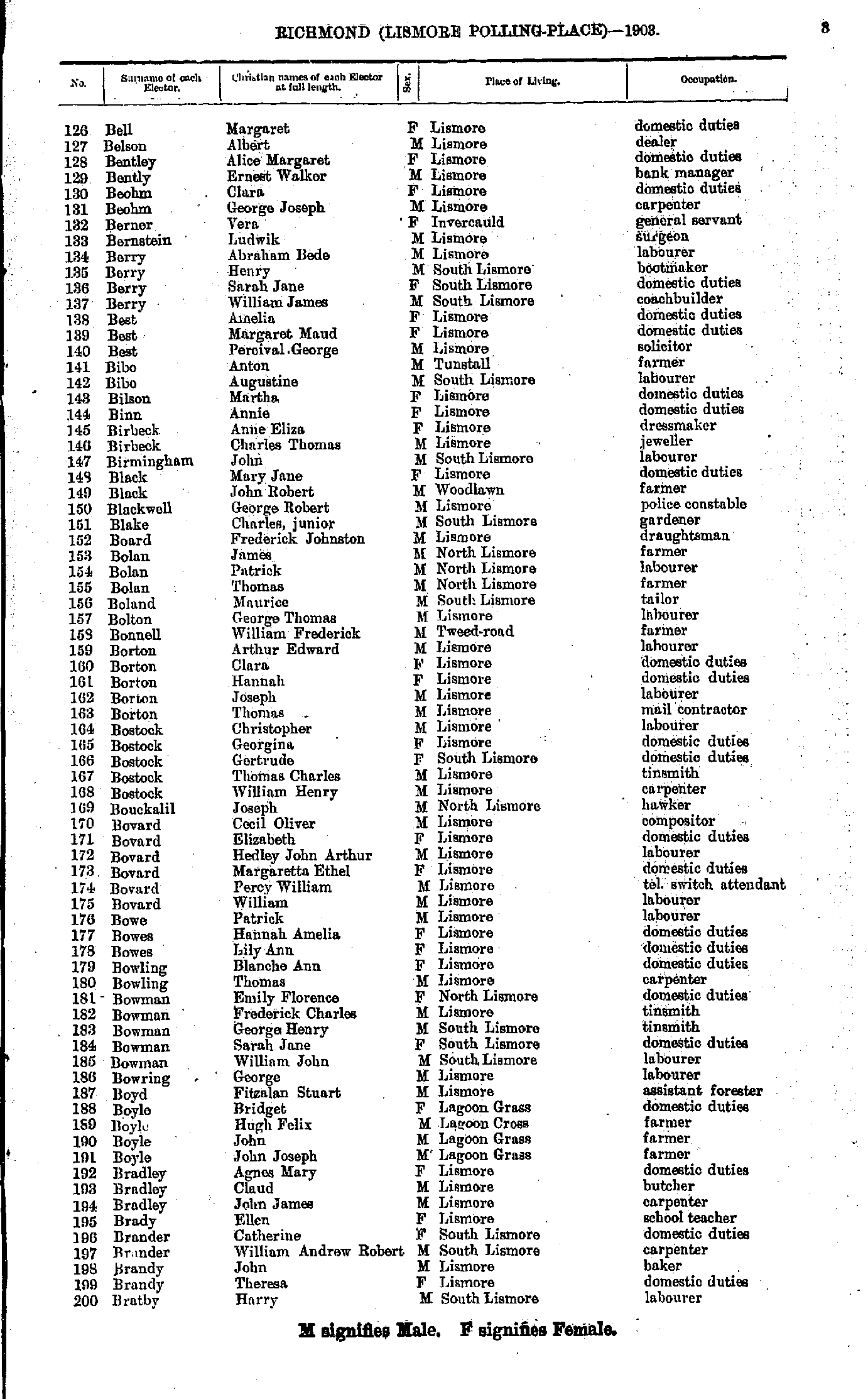
- Bell Margaret - Bratby Harry
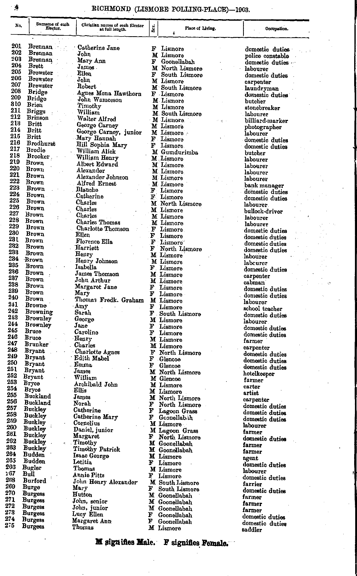
- Brennan Catherine - Burgess Thomas
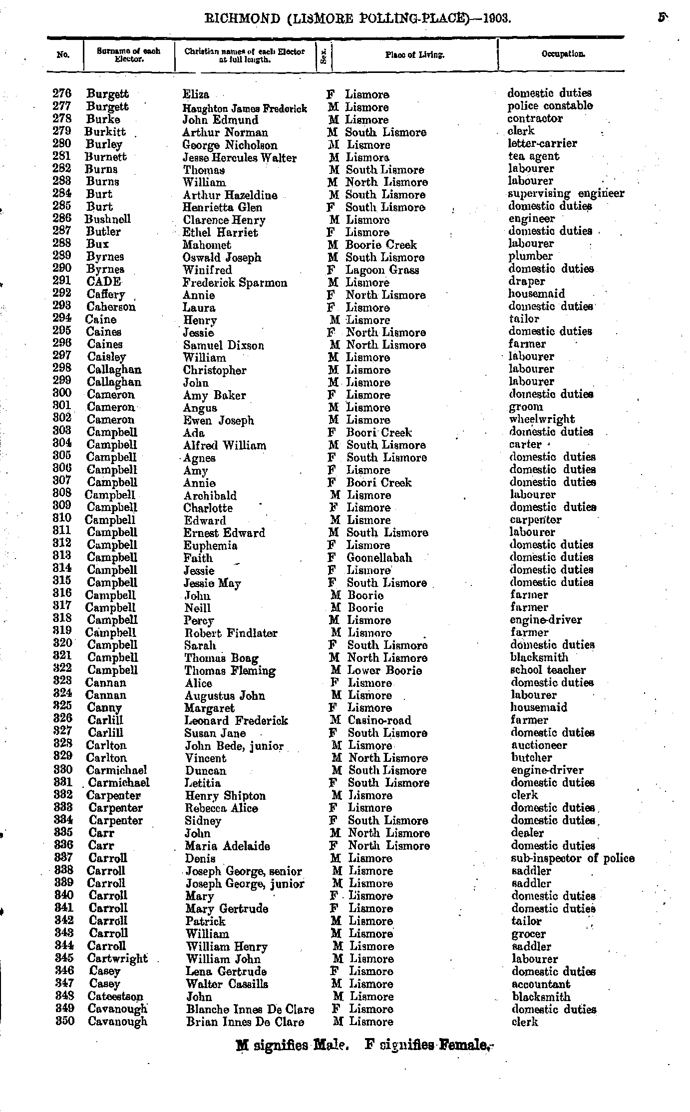
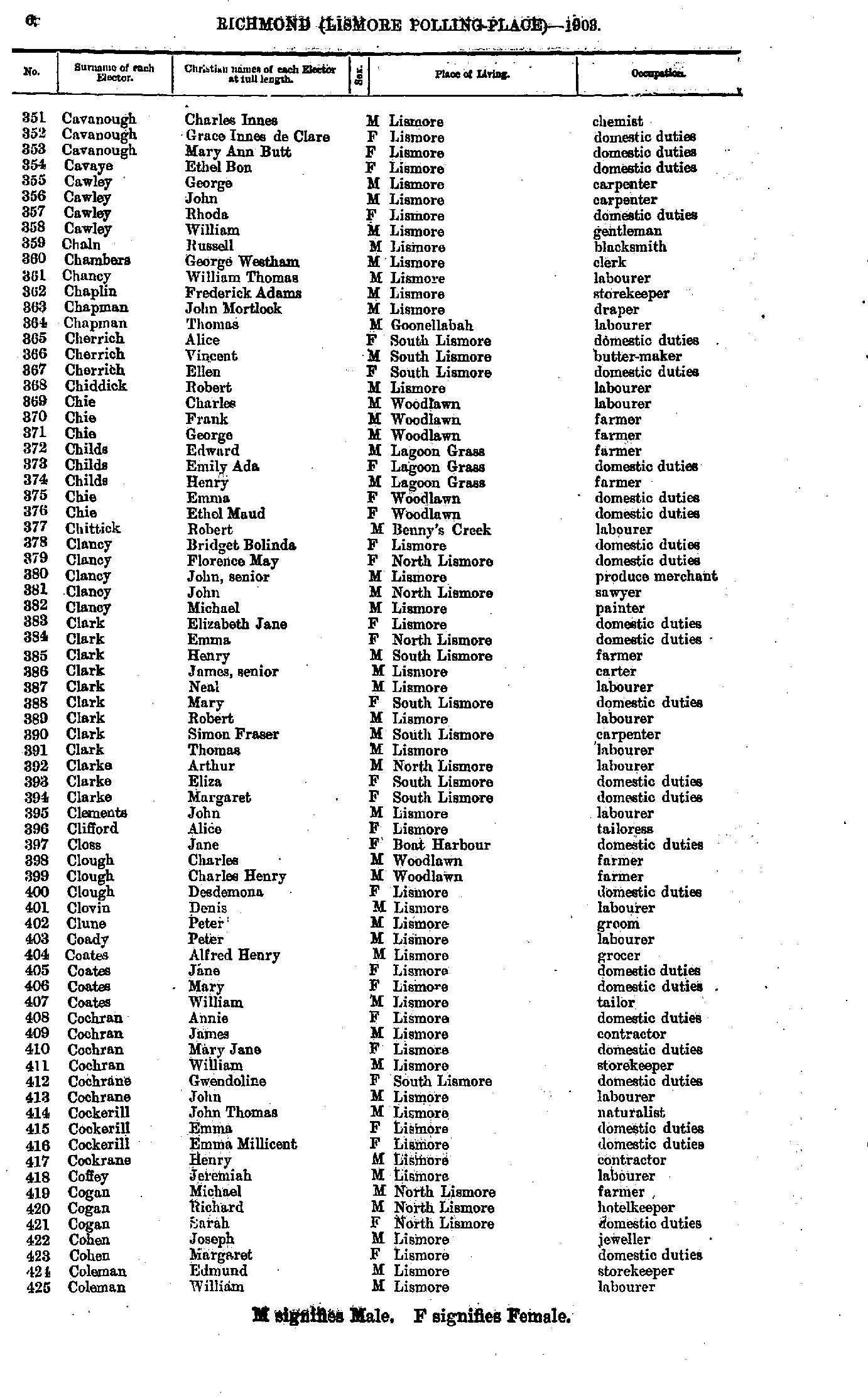
- Burgett Eliza - Cavanough Brian
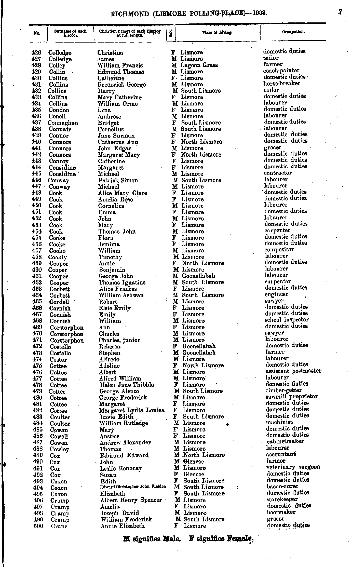
- Cavanough Charles - Coleman William
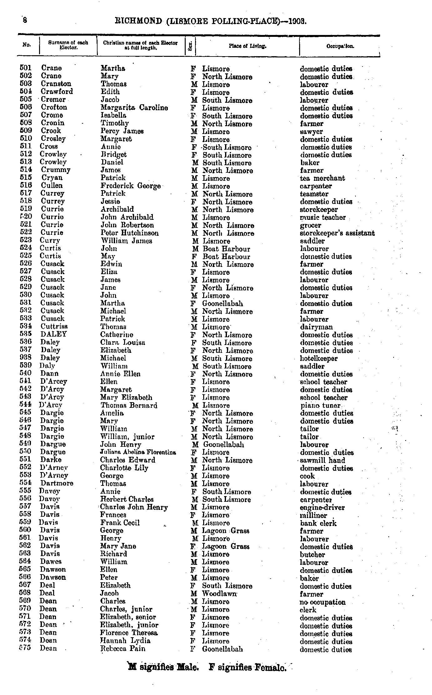
- Colledge Christina - Crane Annie
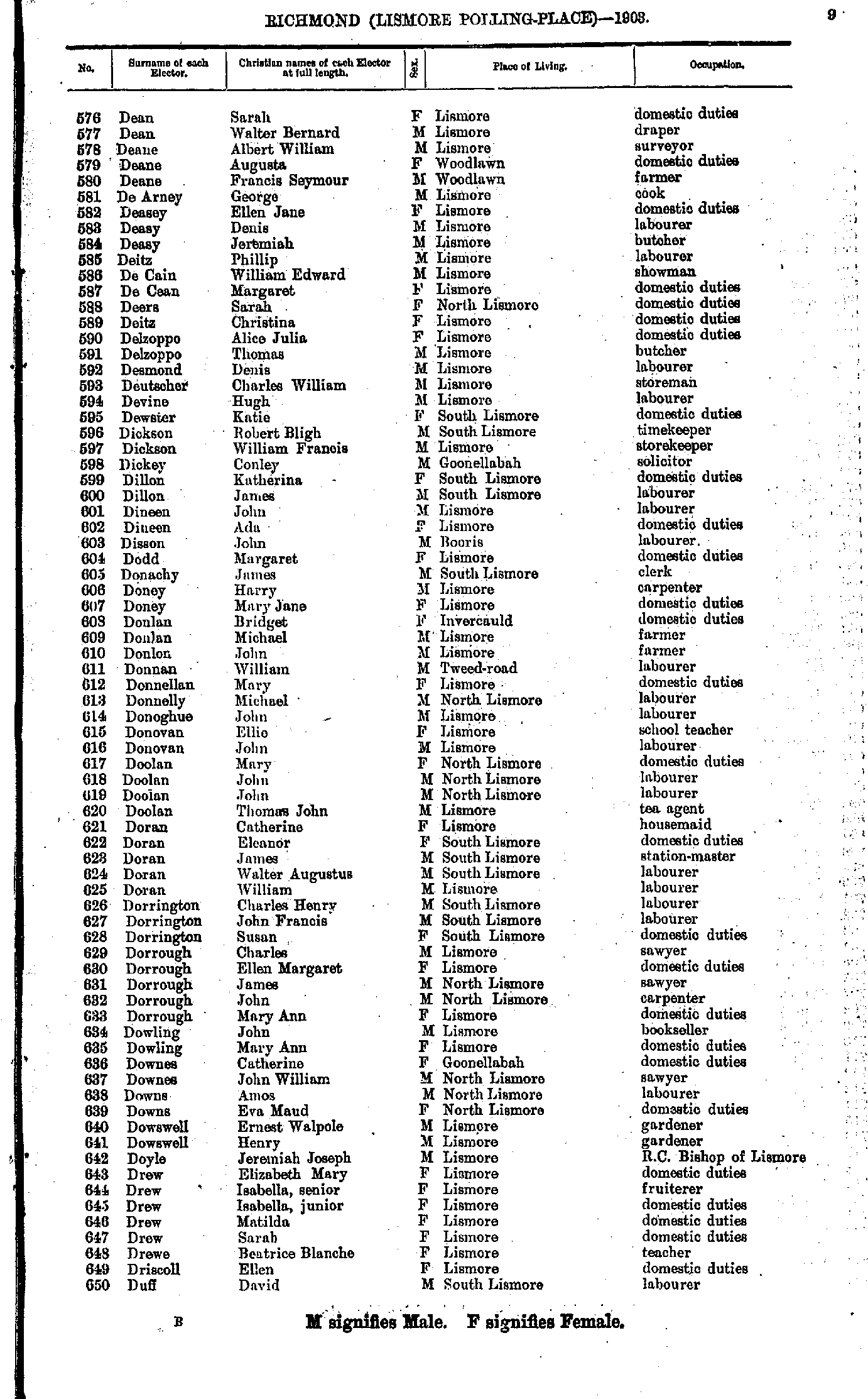
- Crane Martha - Dean Rebecca
- Dean Sarah - Duff David
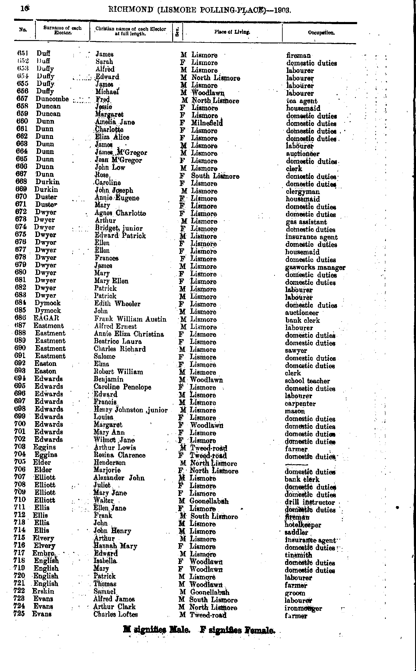
- Duff James - Evans Charles
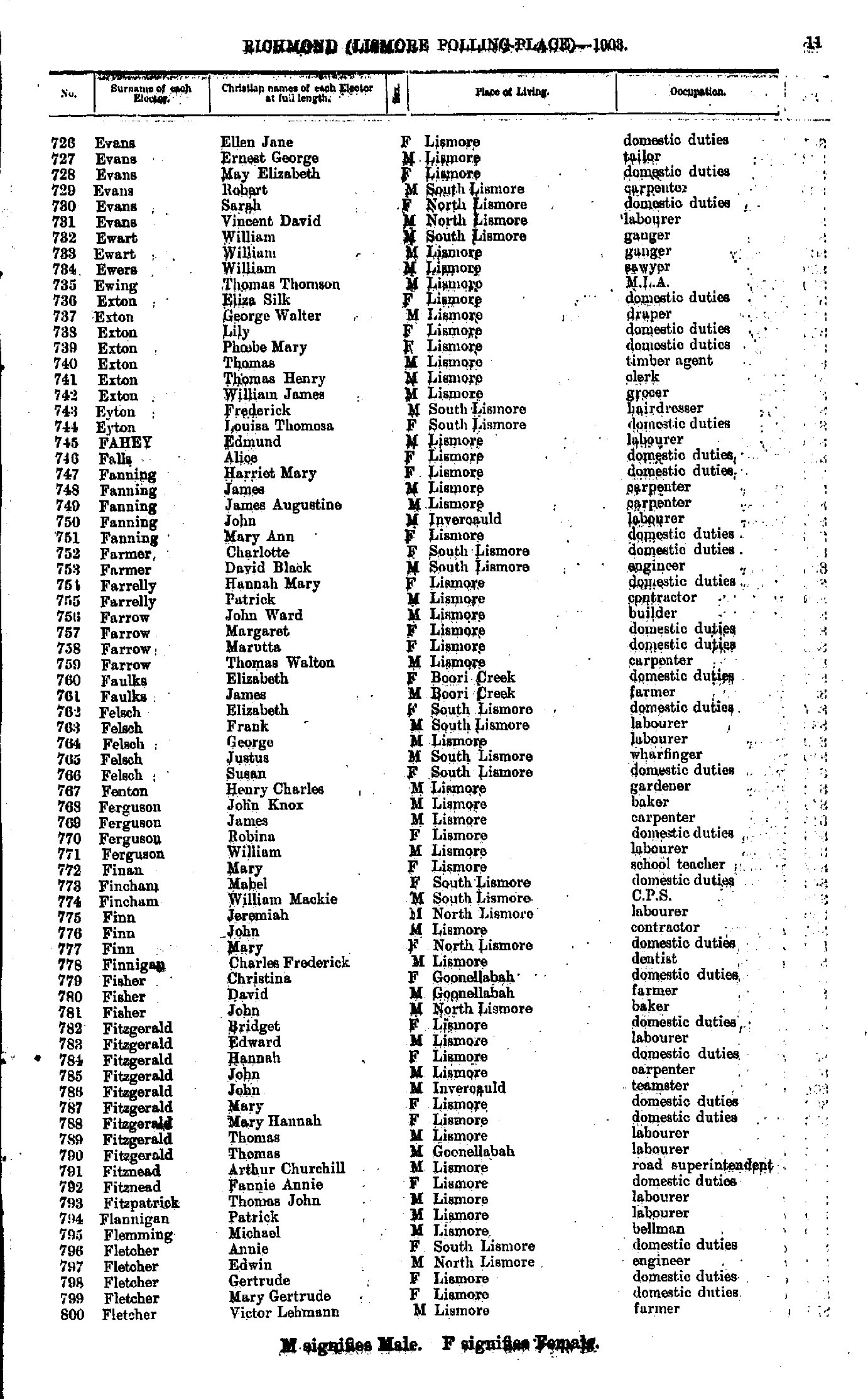
- Evans Ellen - Fletcher Victor
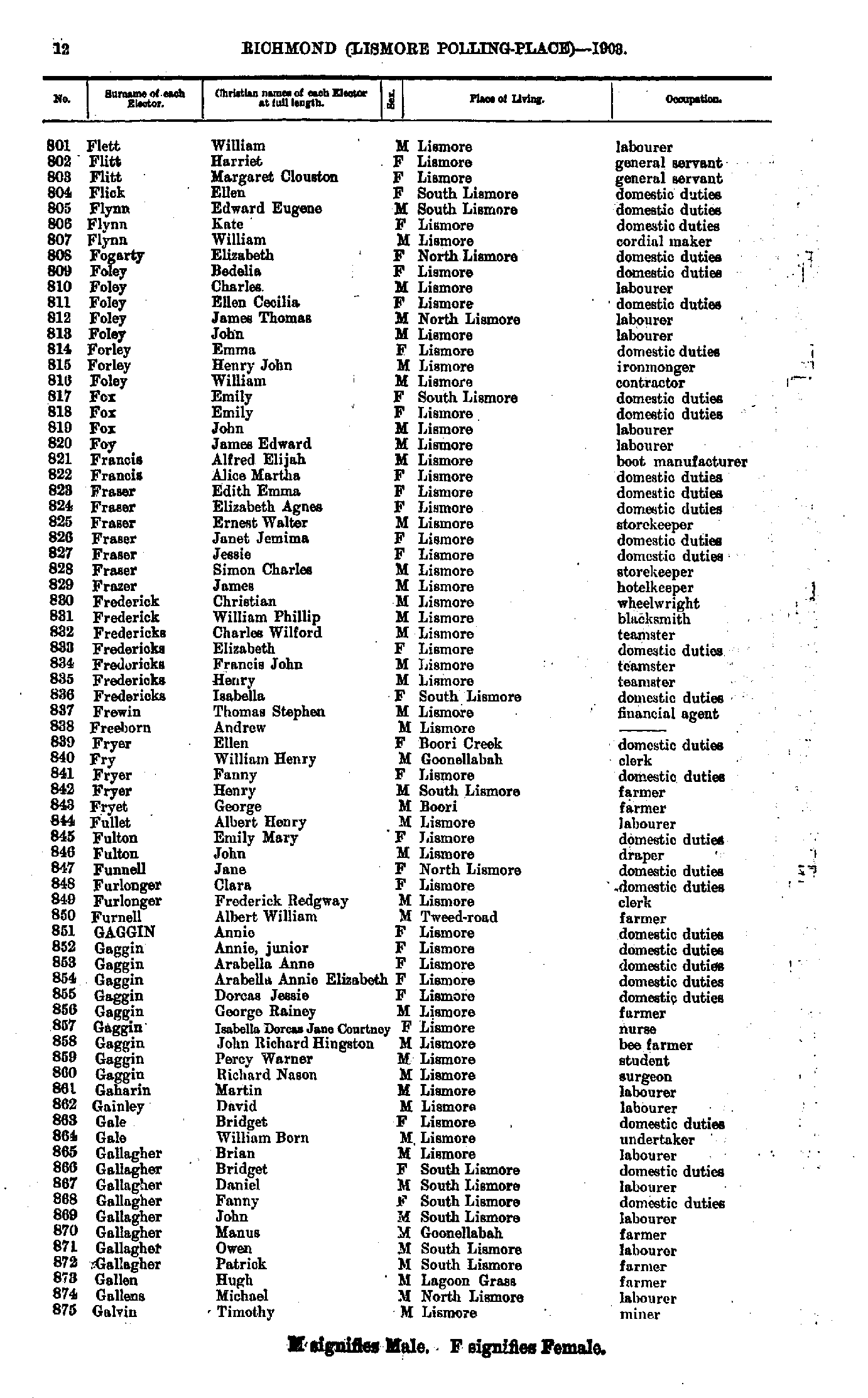
- Flett William - Galvin Timothy
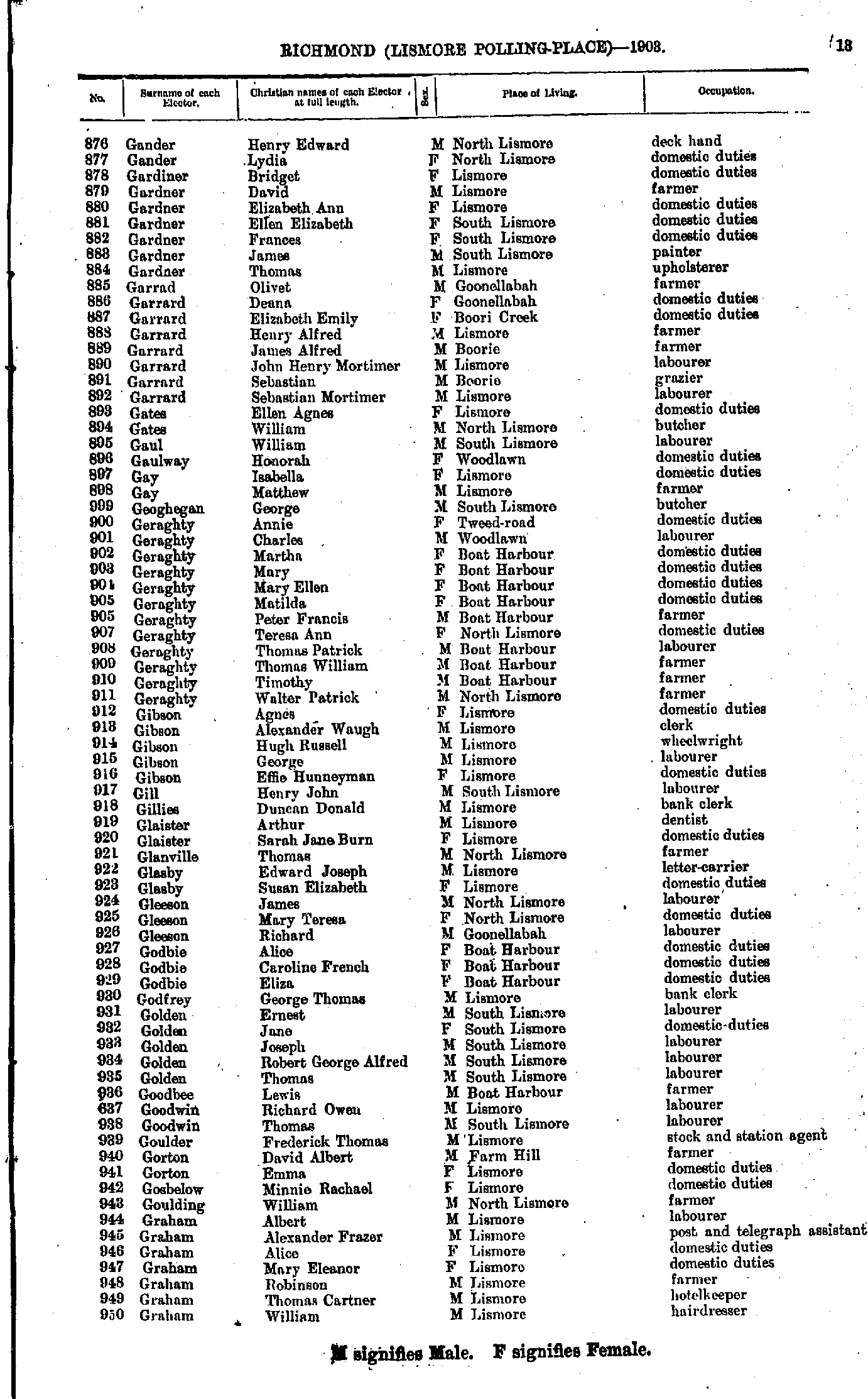
- Gander Henry - Graham William
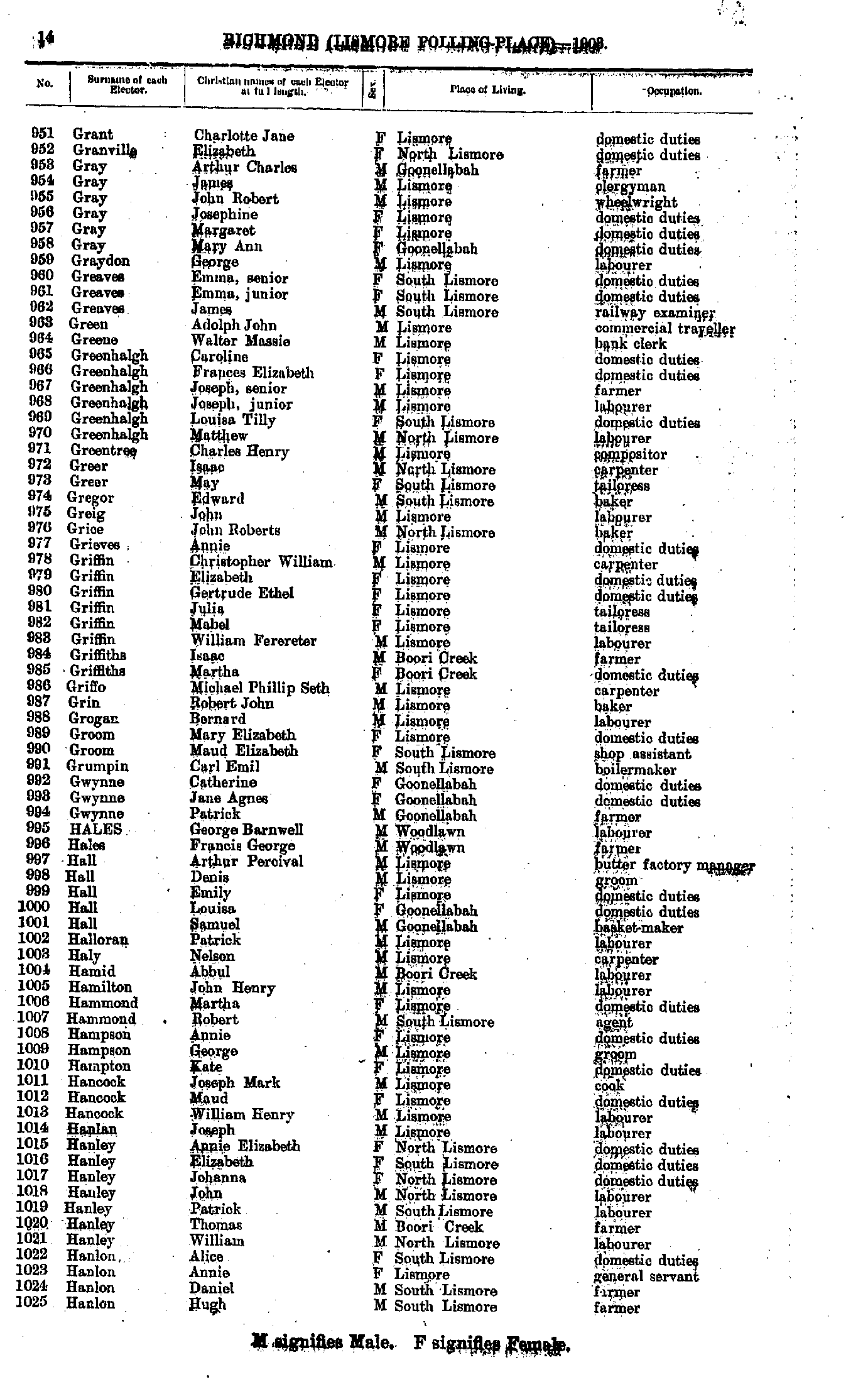
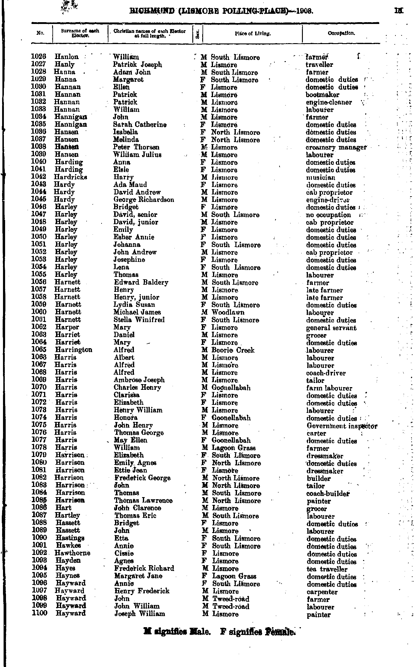
- Grant Charlotte - Hanlon Hugh
- Hanlon William - Hayward Joseph
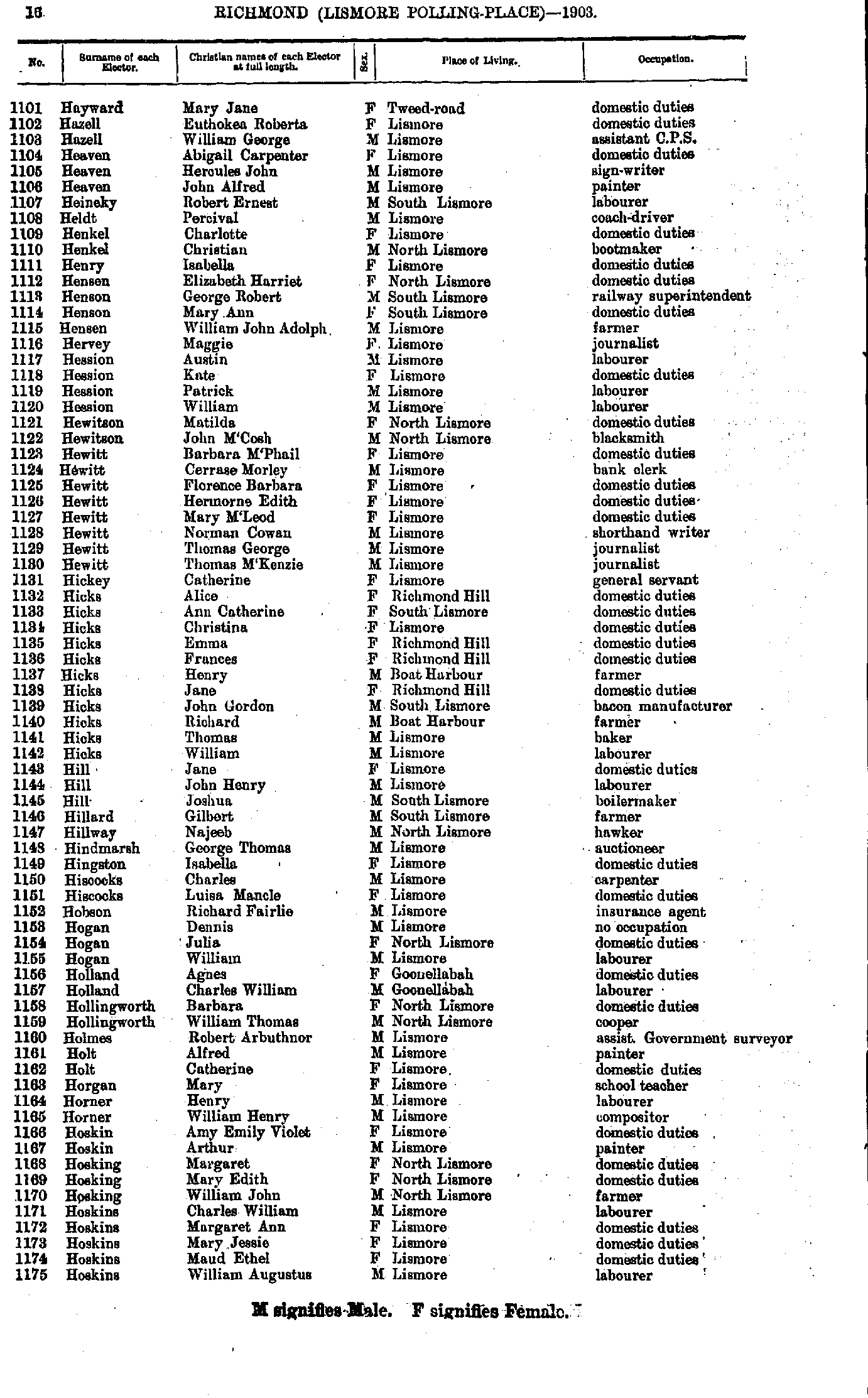
- Hayward Mary - Hoskins William
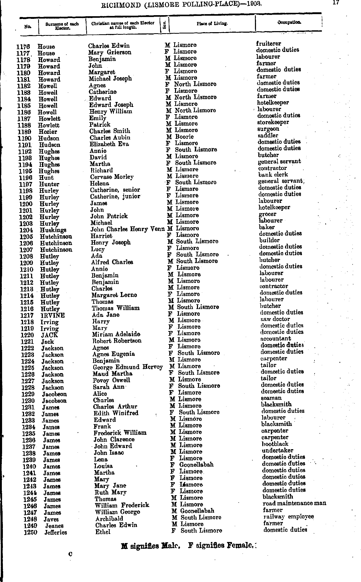
- House Charles - Jefferies Ethel
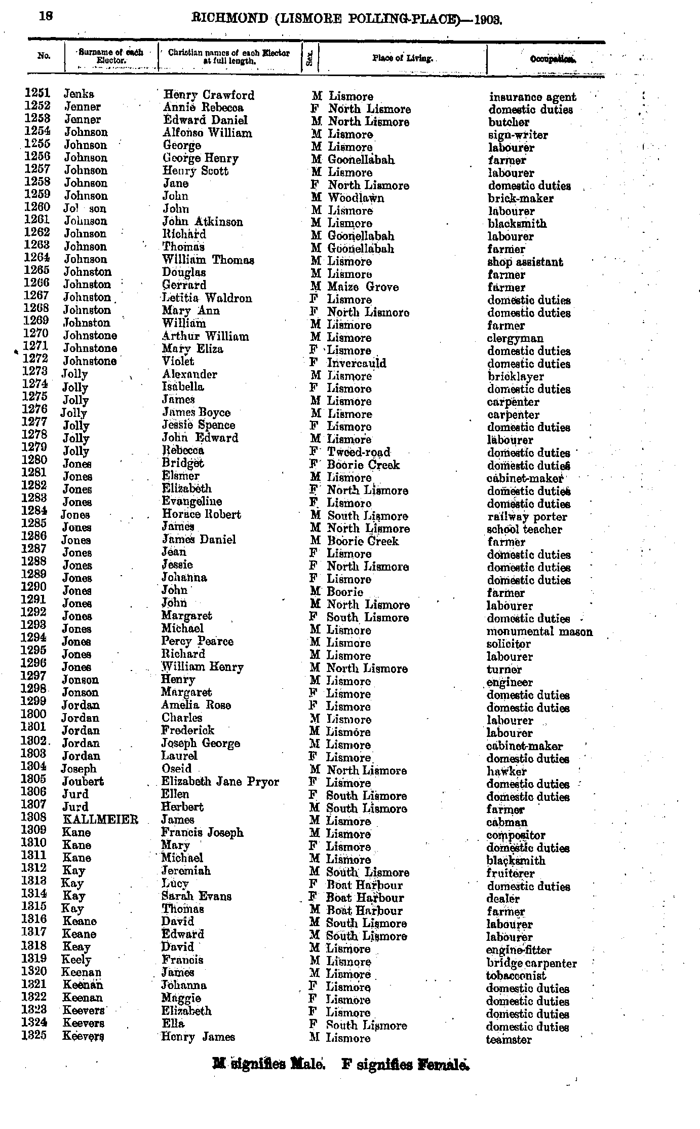
- Jenks Henry - Keevers Henry
- Keevers James - Laird Edith
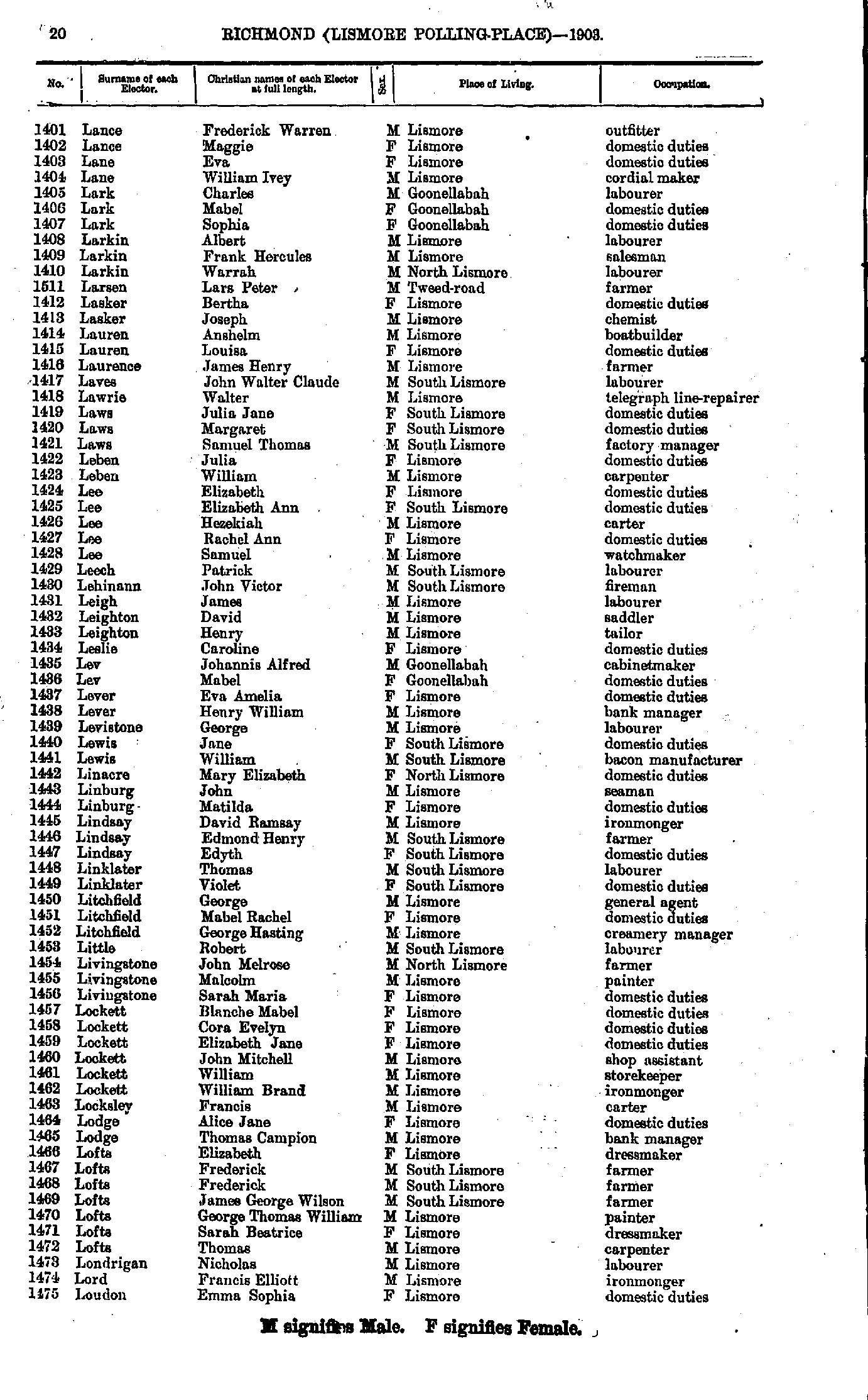
- Lance Frederick - Loudon Emma
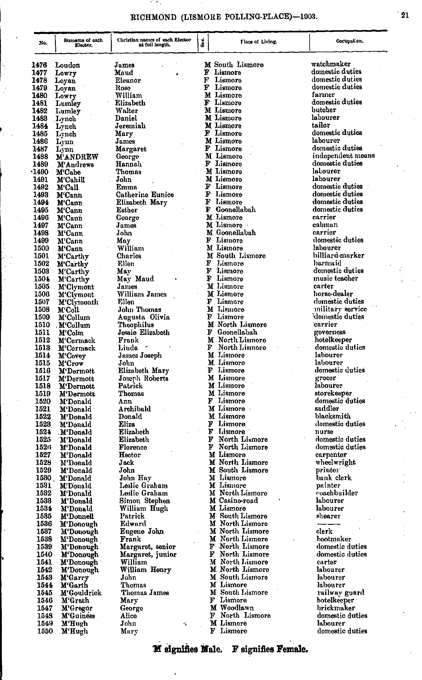
- Loudon James - M'Hugh Mary
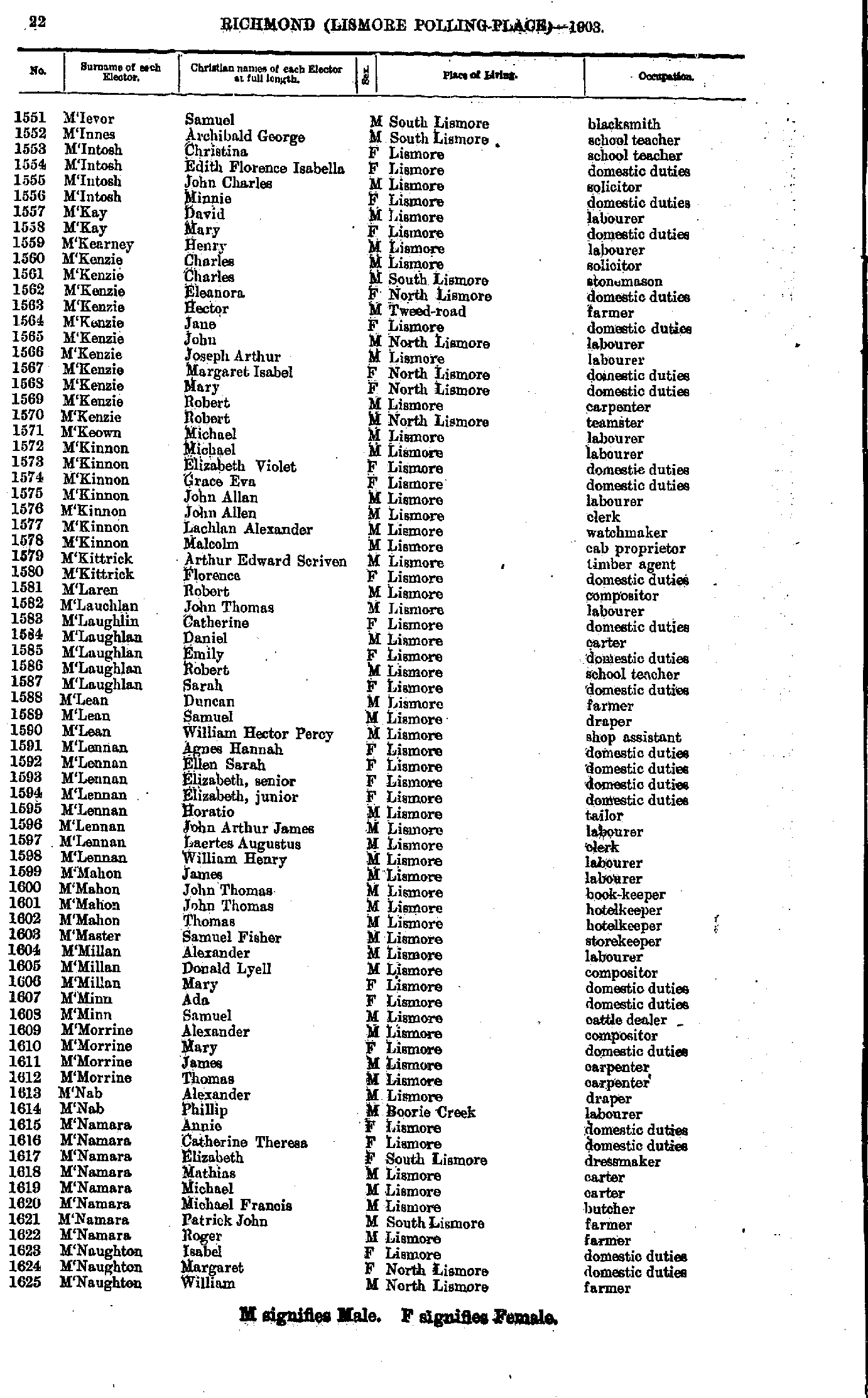
- M'Ievor Samuel - M'Naughton William
- M'Naughton William - Martin Rebecca
- Martin Robert - Mullan Samuel
- Muller Oscar - O'Brien Ellen
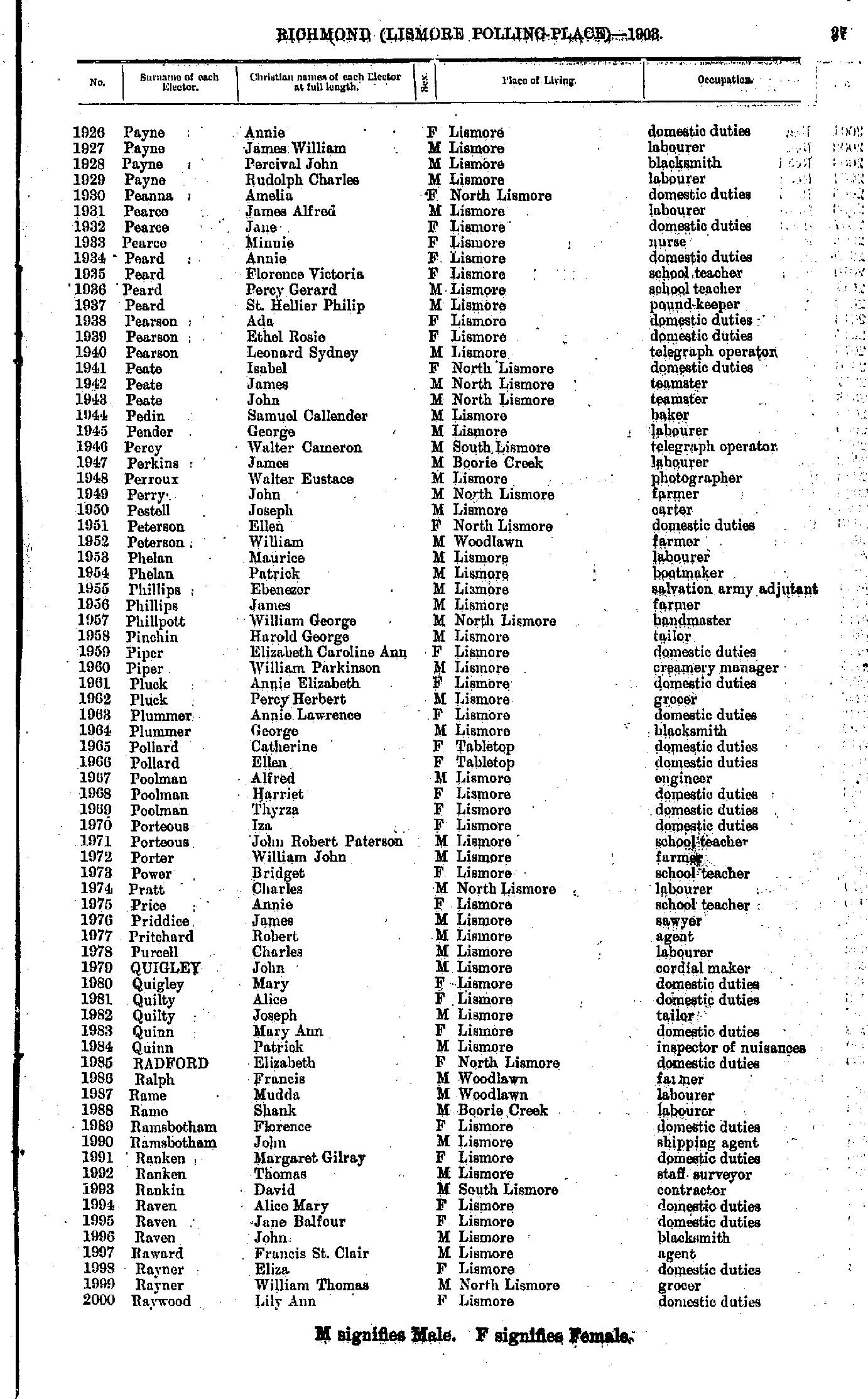
- O'Brien George - Payne Ada
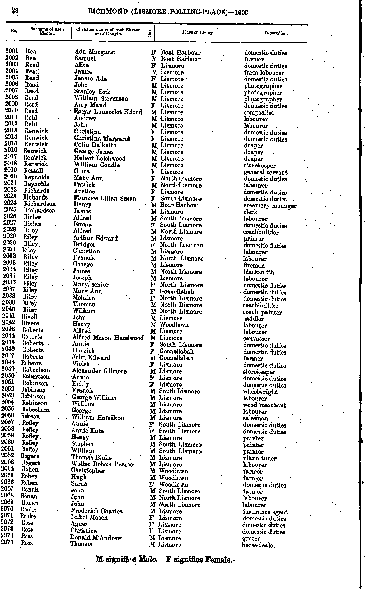
- Payne Annie - Raywood Lily
- Rea Ada - Ross Thomas
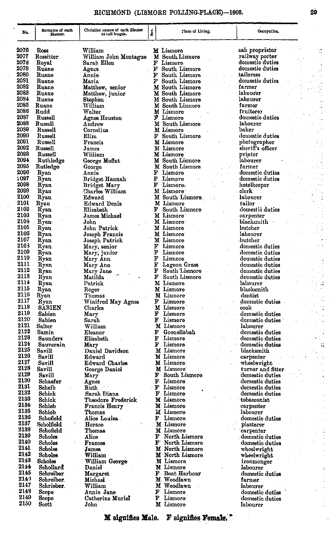
- Ross William - Scott John
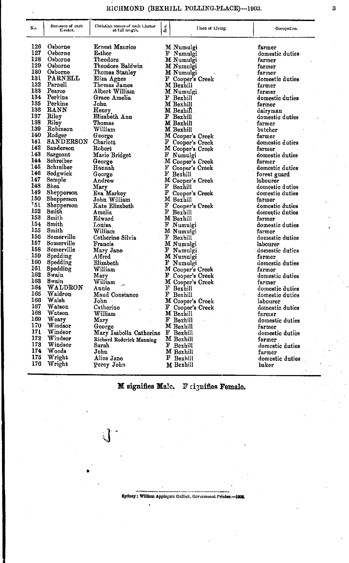
- Scott Matthew - Smith Mary
- Smith Maud - Stead Walter
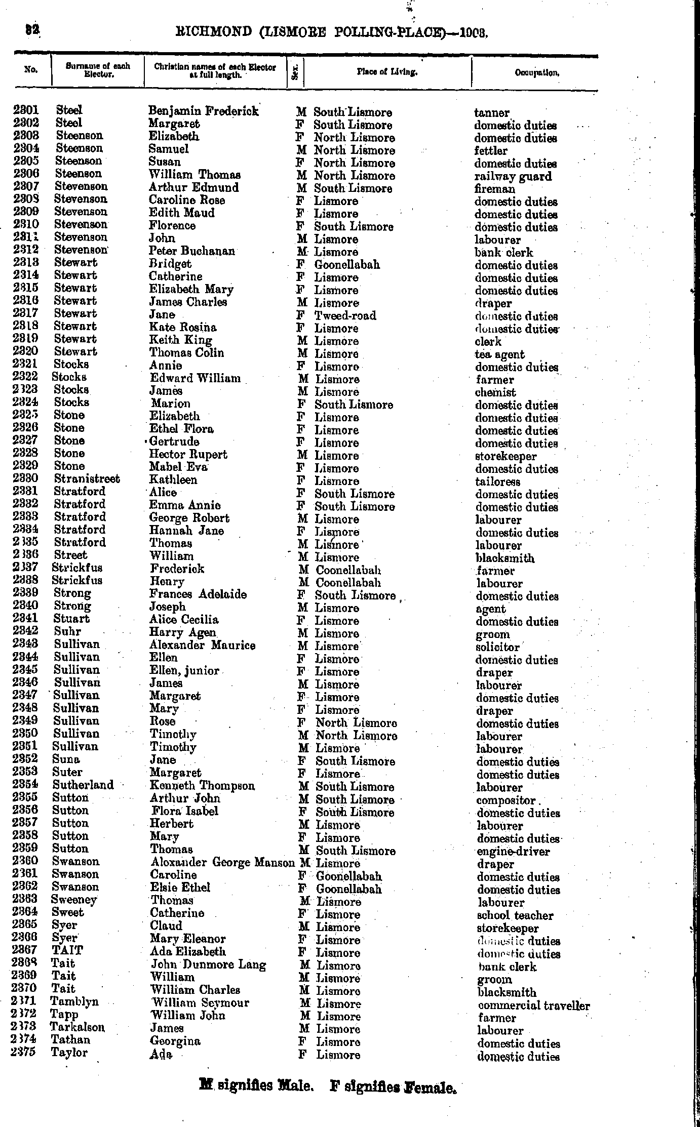
- Steel Benjamin - Taylor Ada
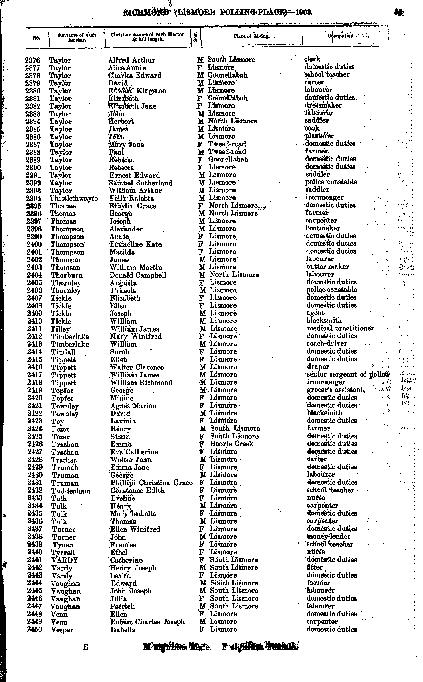
- Taylor Alfred - Vesper Isabella
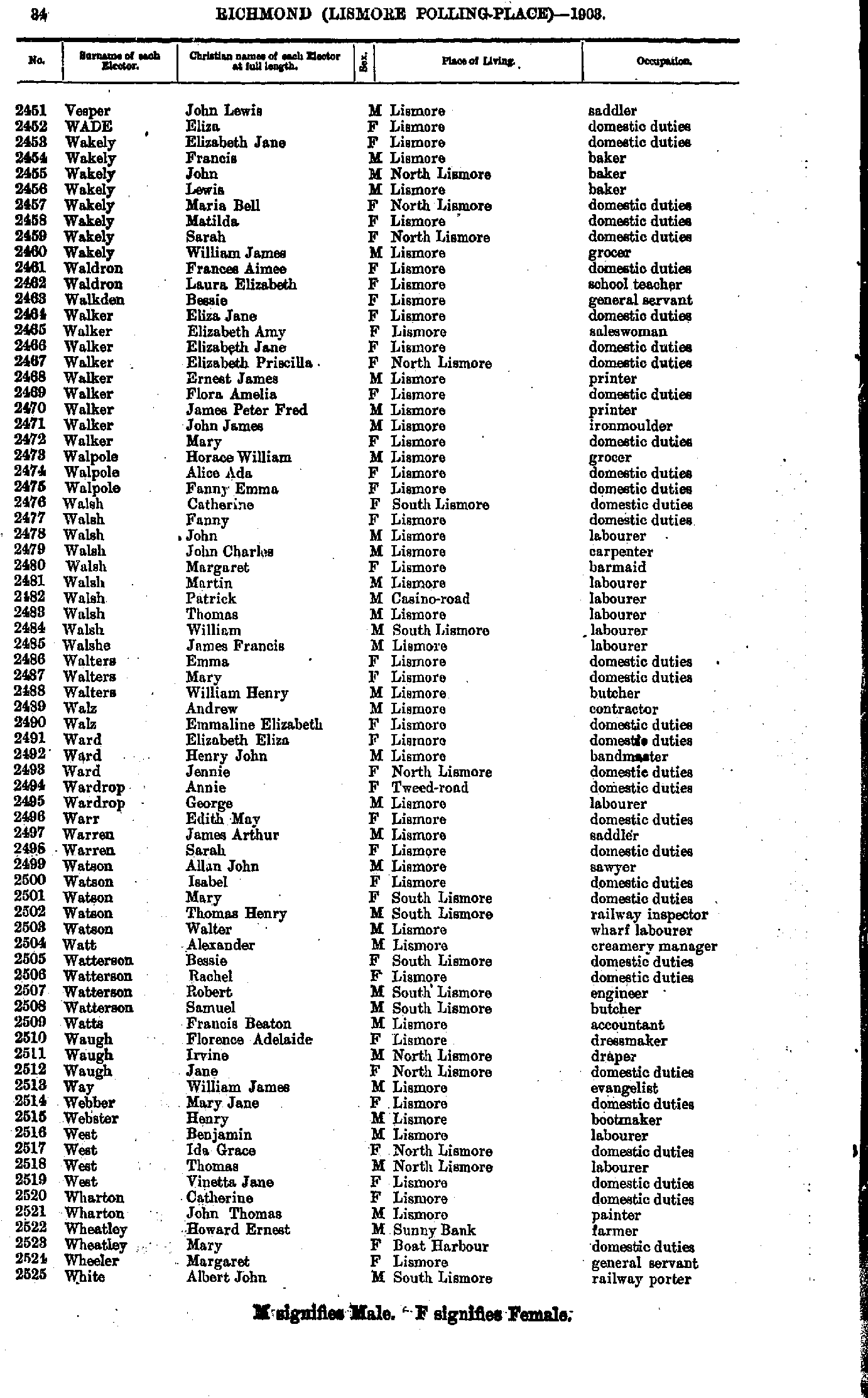
- Vesper John - White Albert
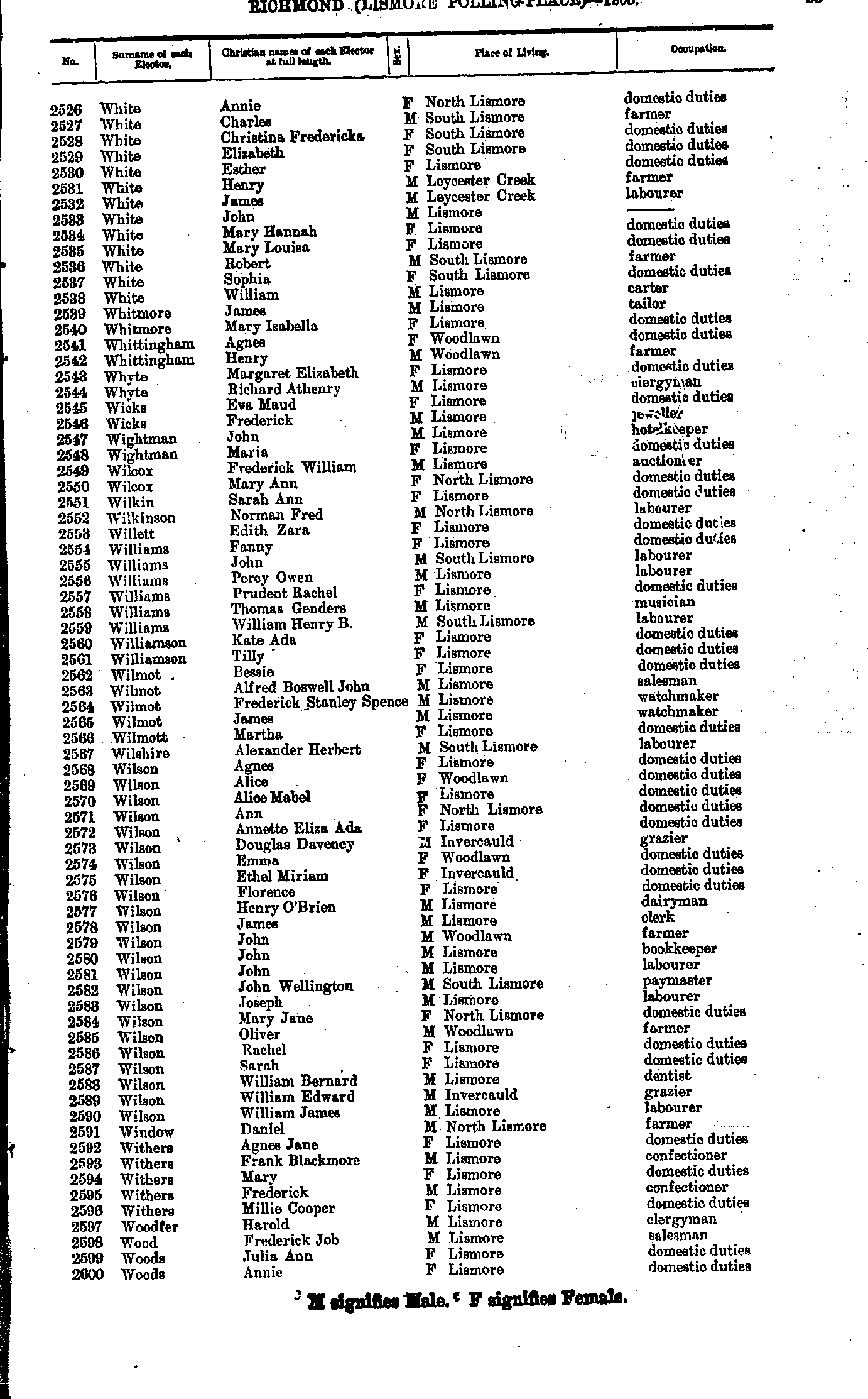
- White Annie - Woods Annie
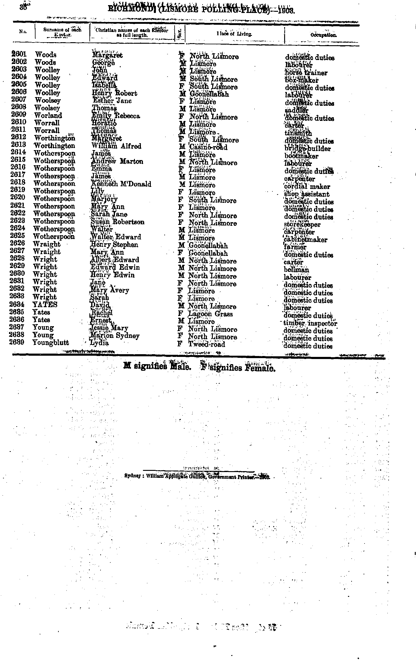
- Woods Margaret - Youngblutt Lydia
- Allard Charles - Bonnell Abraham
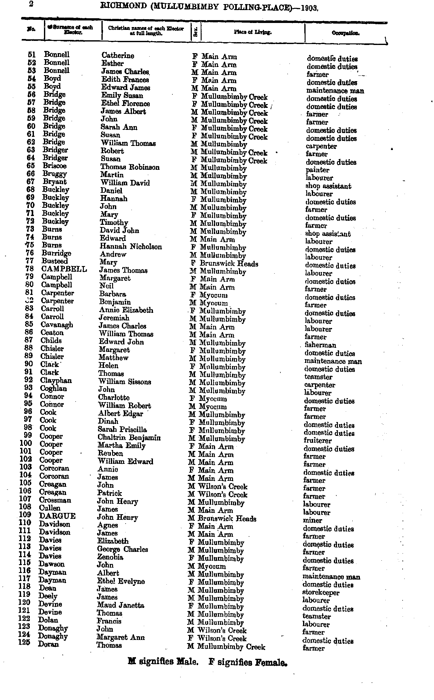
- Bonnell Catherine - Doran Thomas
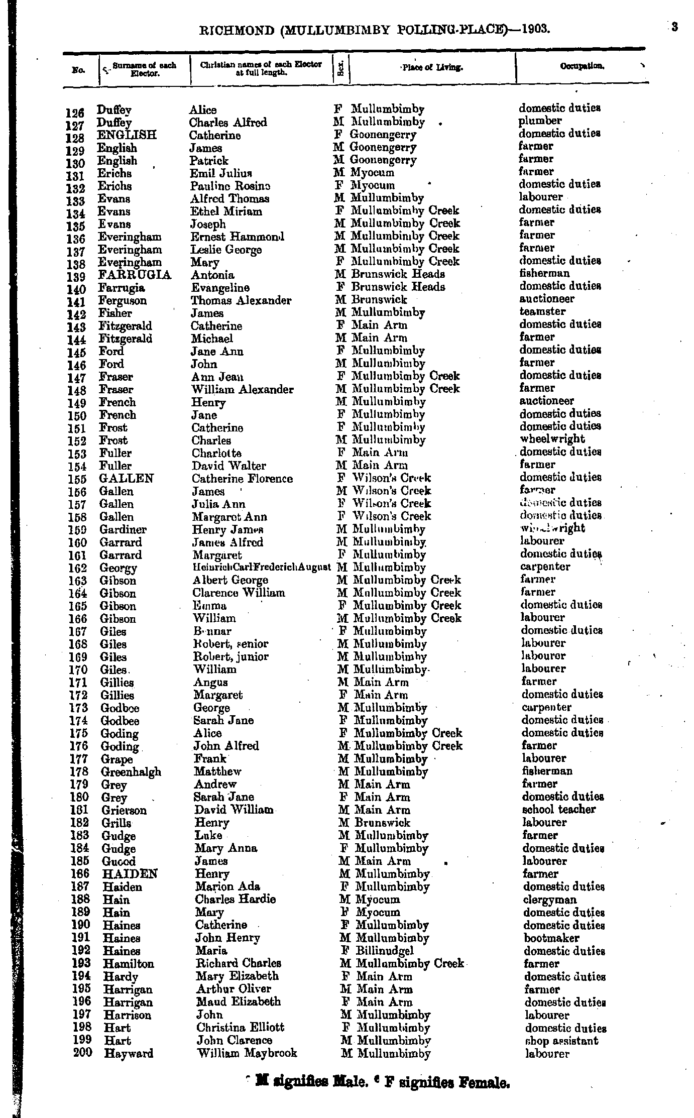
- Duffey Alice - Hayward William
- Healy Daniel - Locke Ada
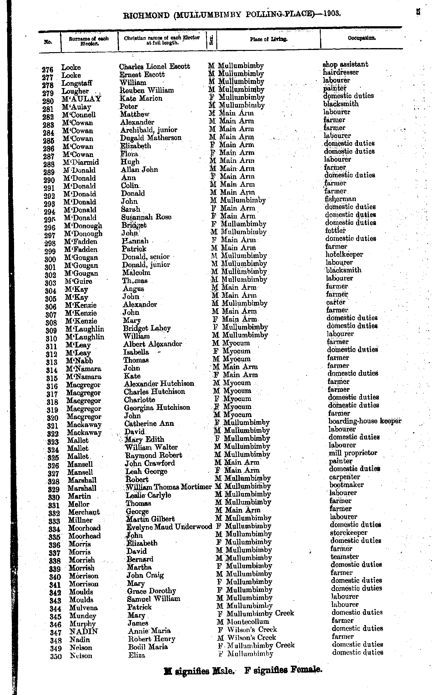
- Locke Charles - Nelson Eliza
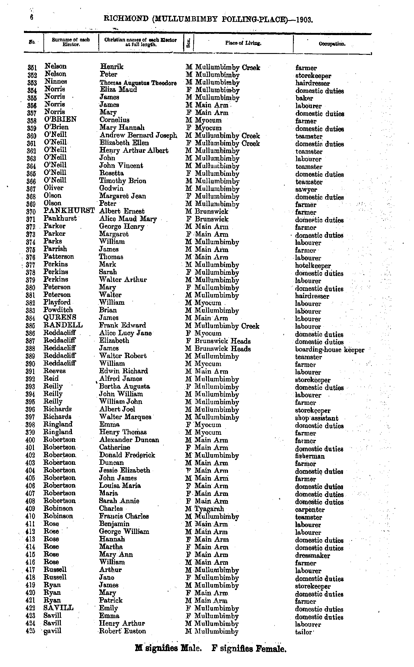
- Nelson Henrik - Savill Robert
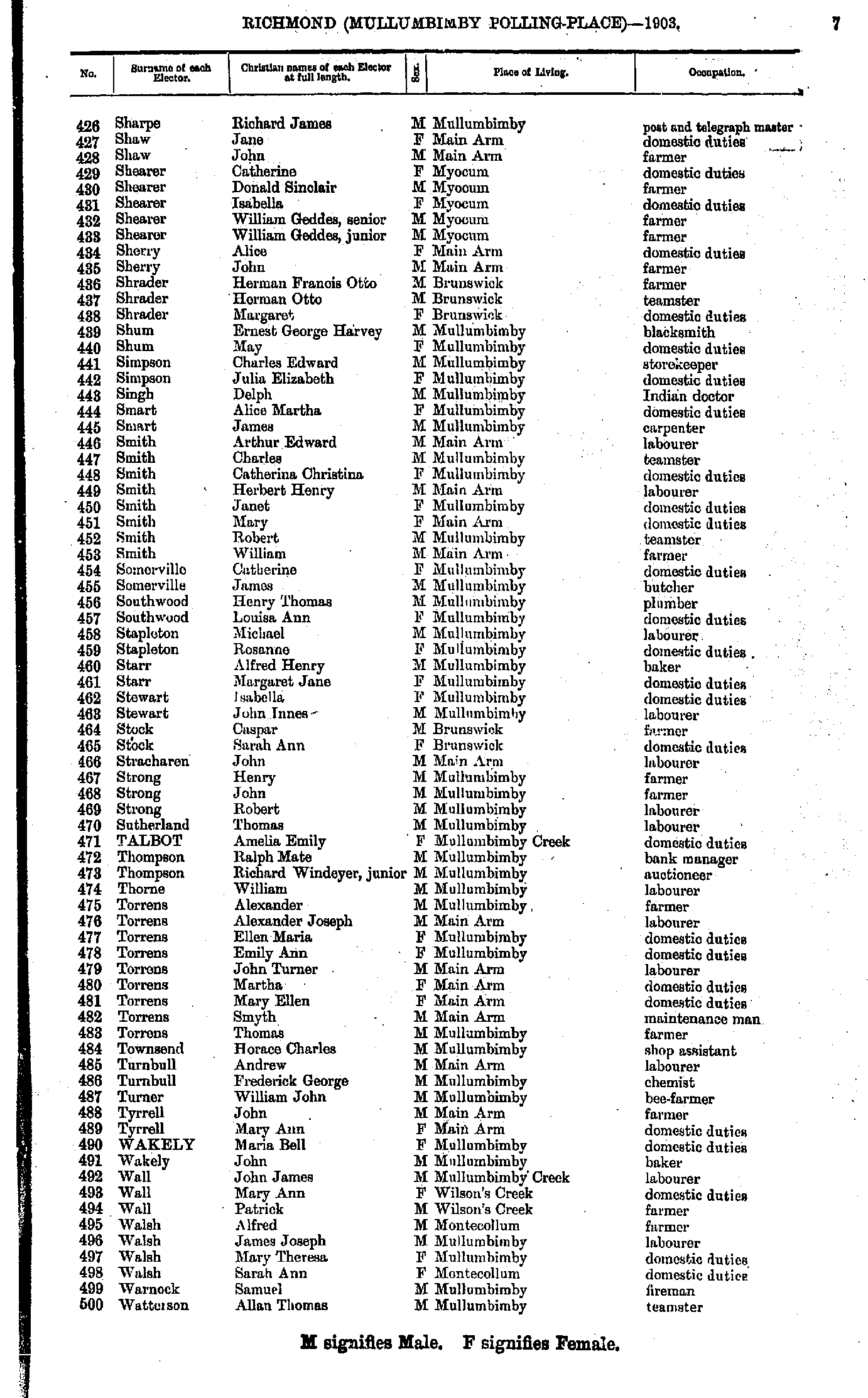
- Sharpe Richard - Watterson Allan
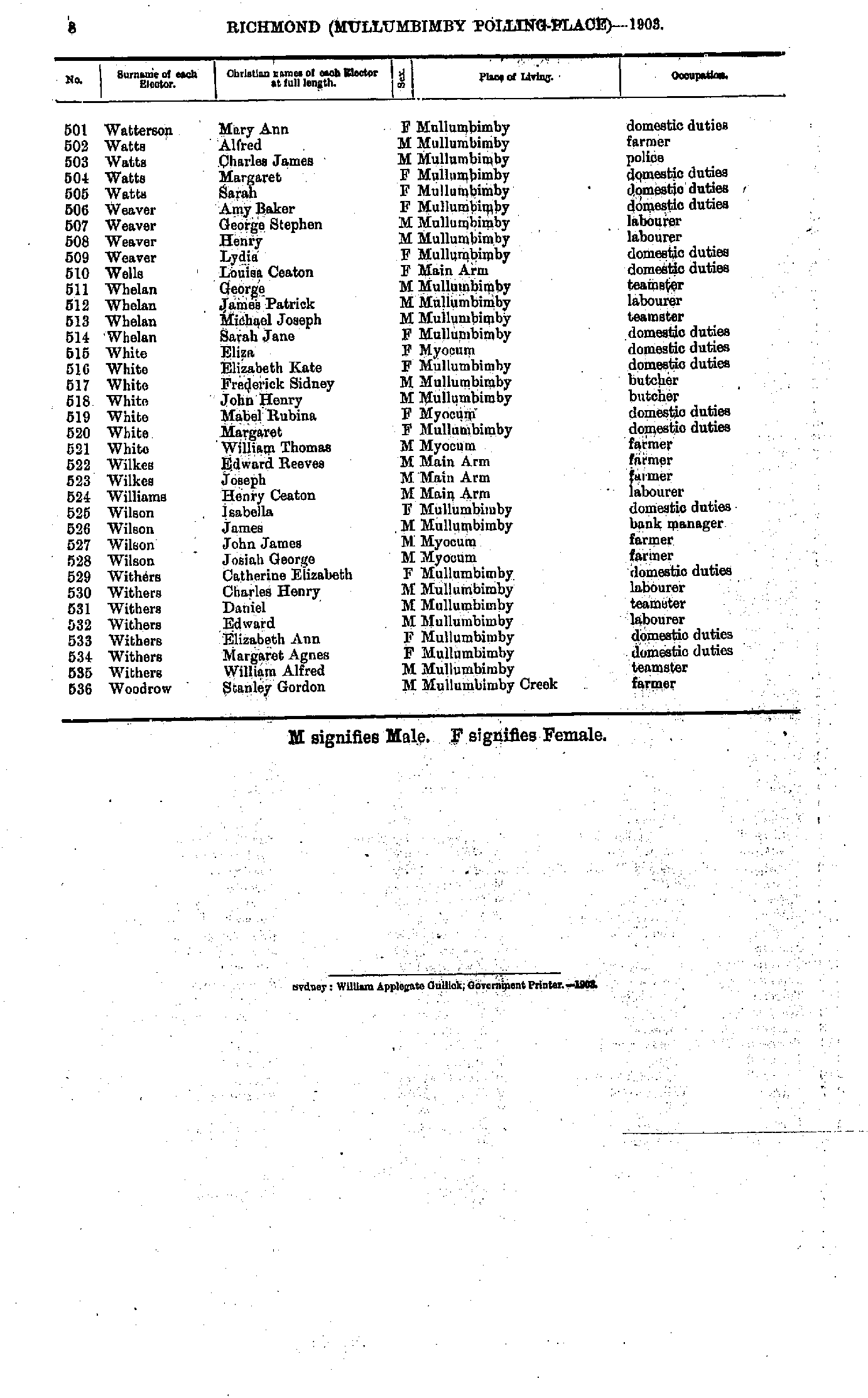
- Watterson Mary - Woodrow Stanley
- Aked Kate - Blakeney Edward
- Blakeney Elizabeth - Burke Ellen
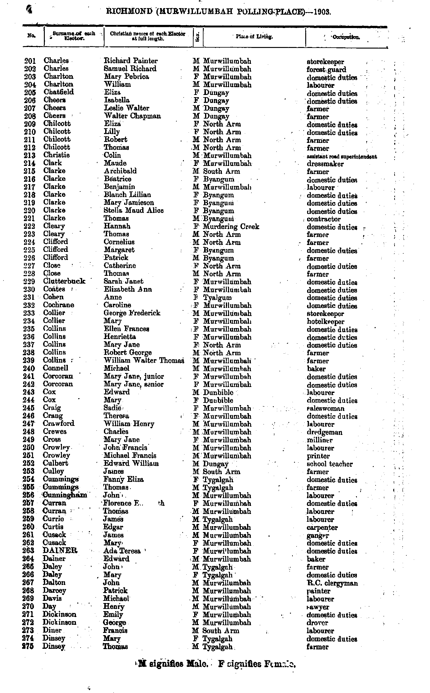
- Burke Fanny - Charles Amy
- Charles Richard - Dinsey Thomas
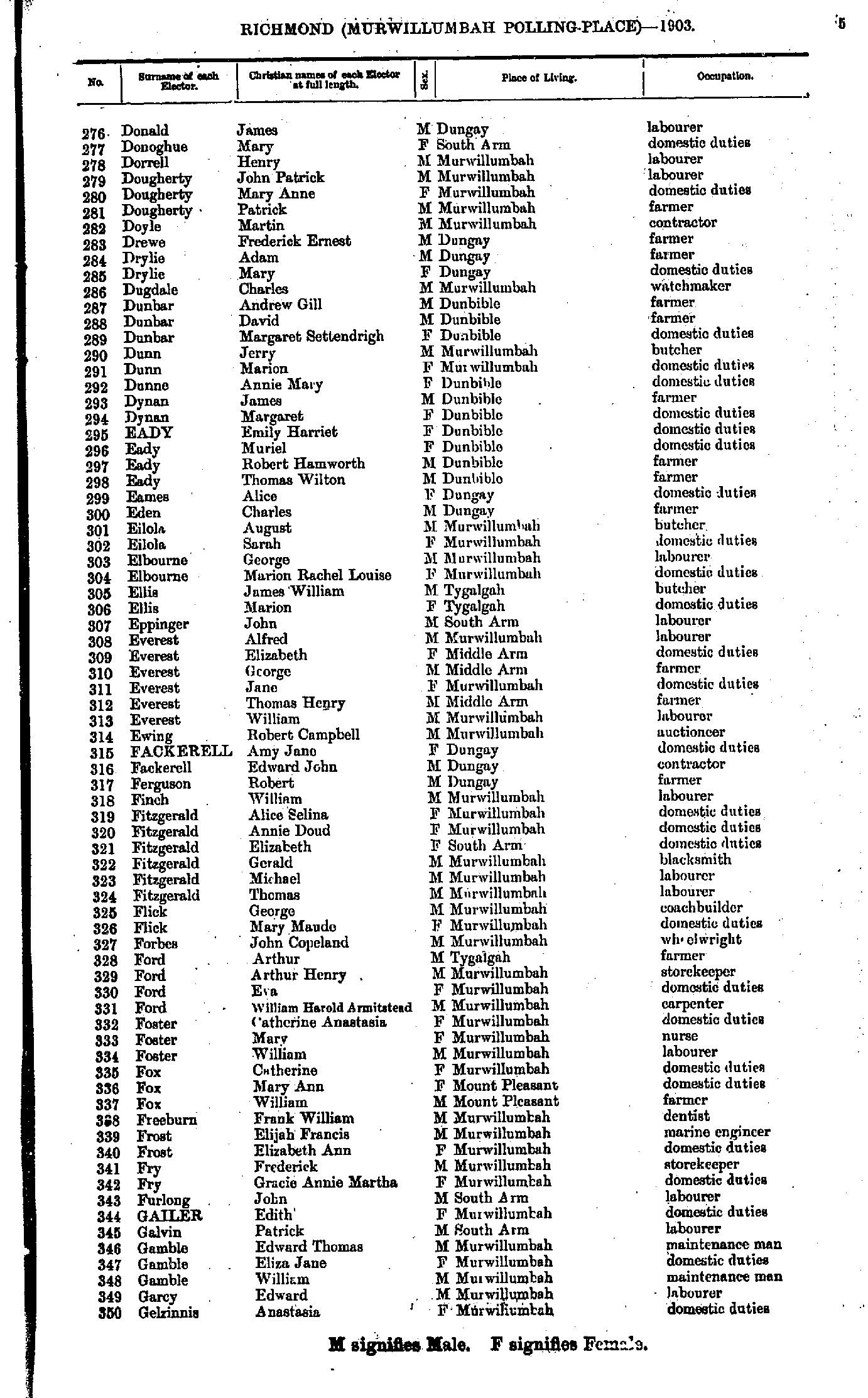
- Donald James - Gelzinnis Anastasia
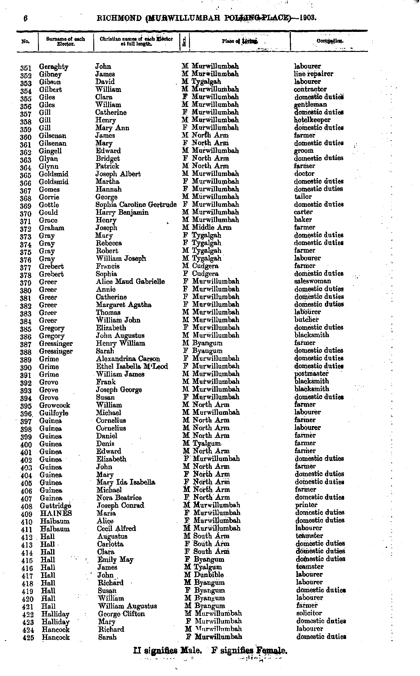
- Geraghty John - Hancock Sarah
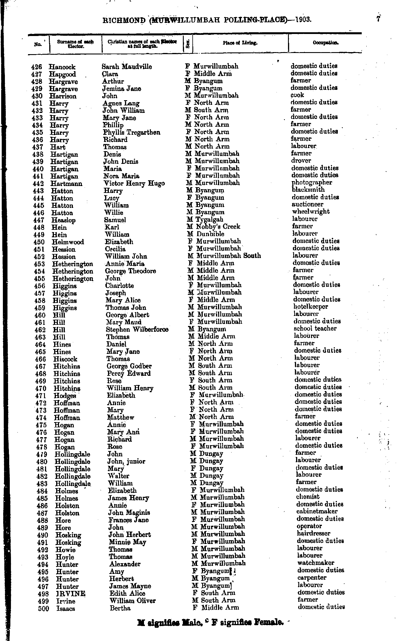
- Hancock Sarah - Isaacs Bertha
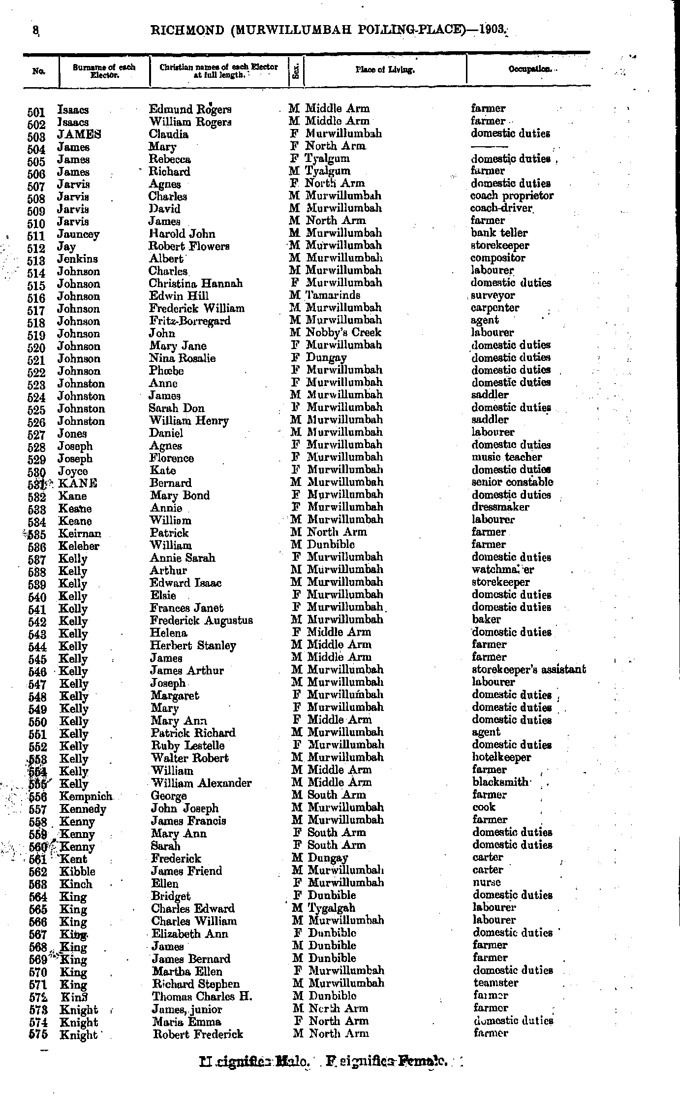
- Isaacs Edmund - Knight Robert
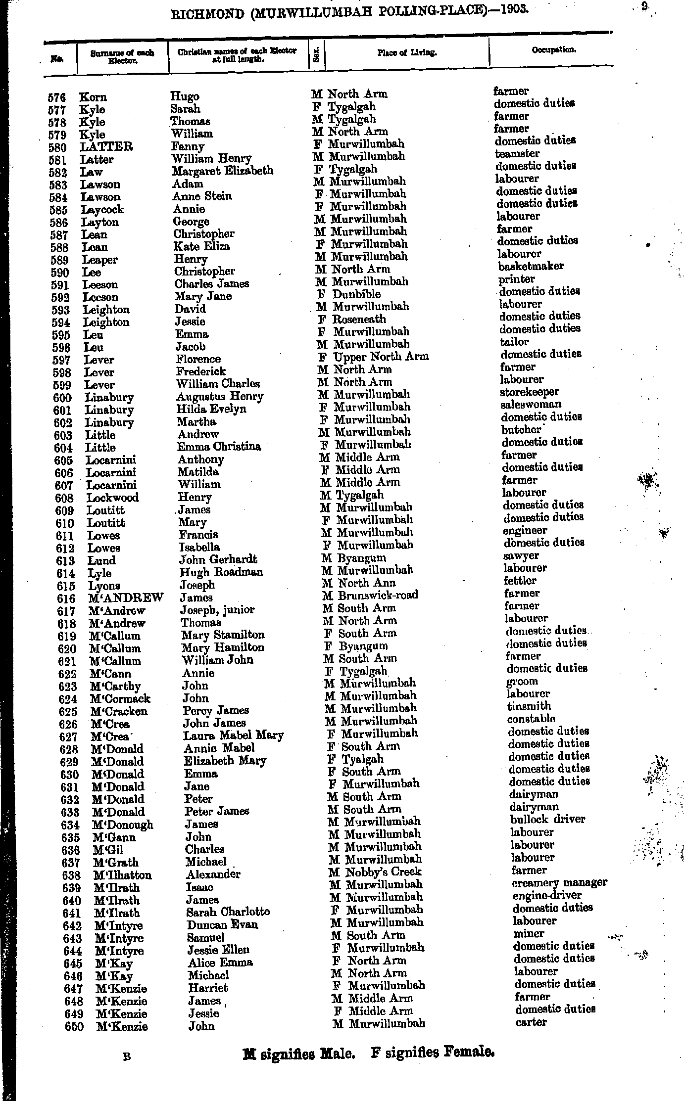
- Korn Hugo - M'Kenzie John
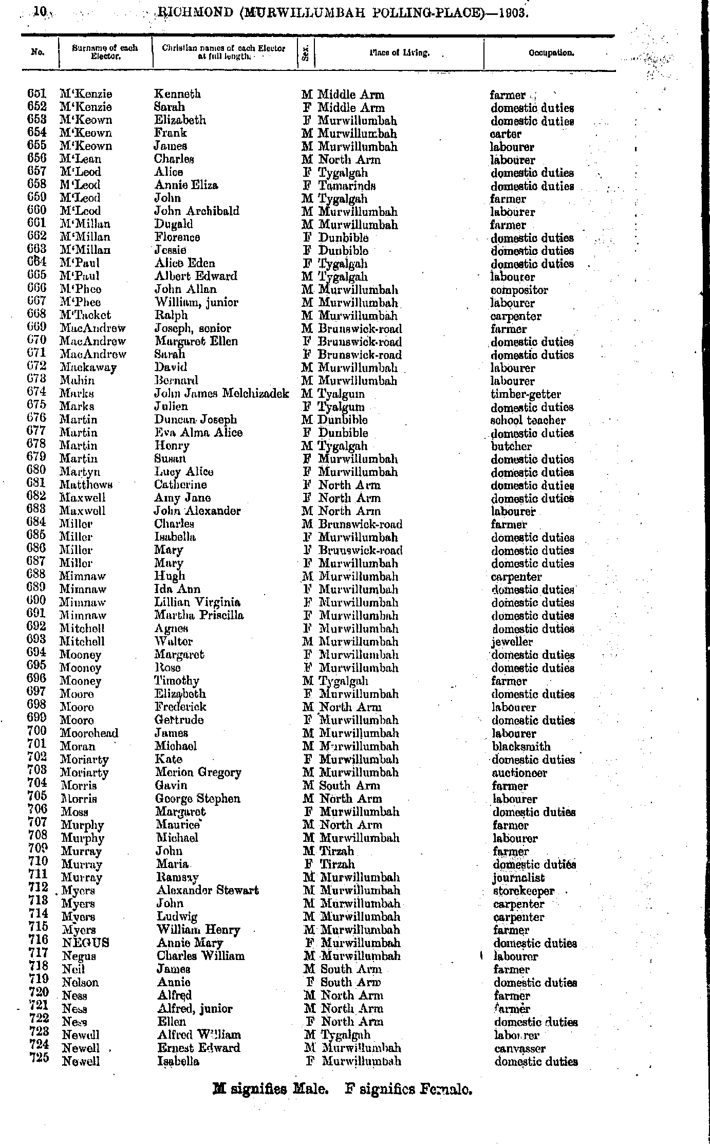
- M'Kenzie Kenneth - Newell Isabella
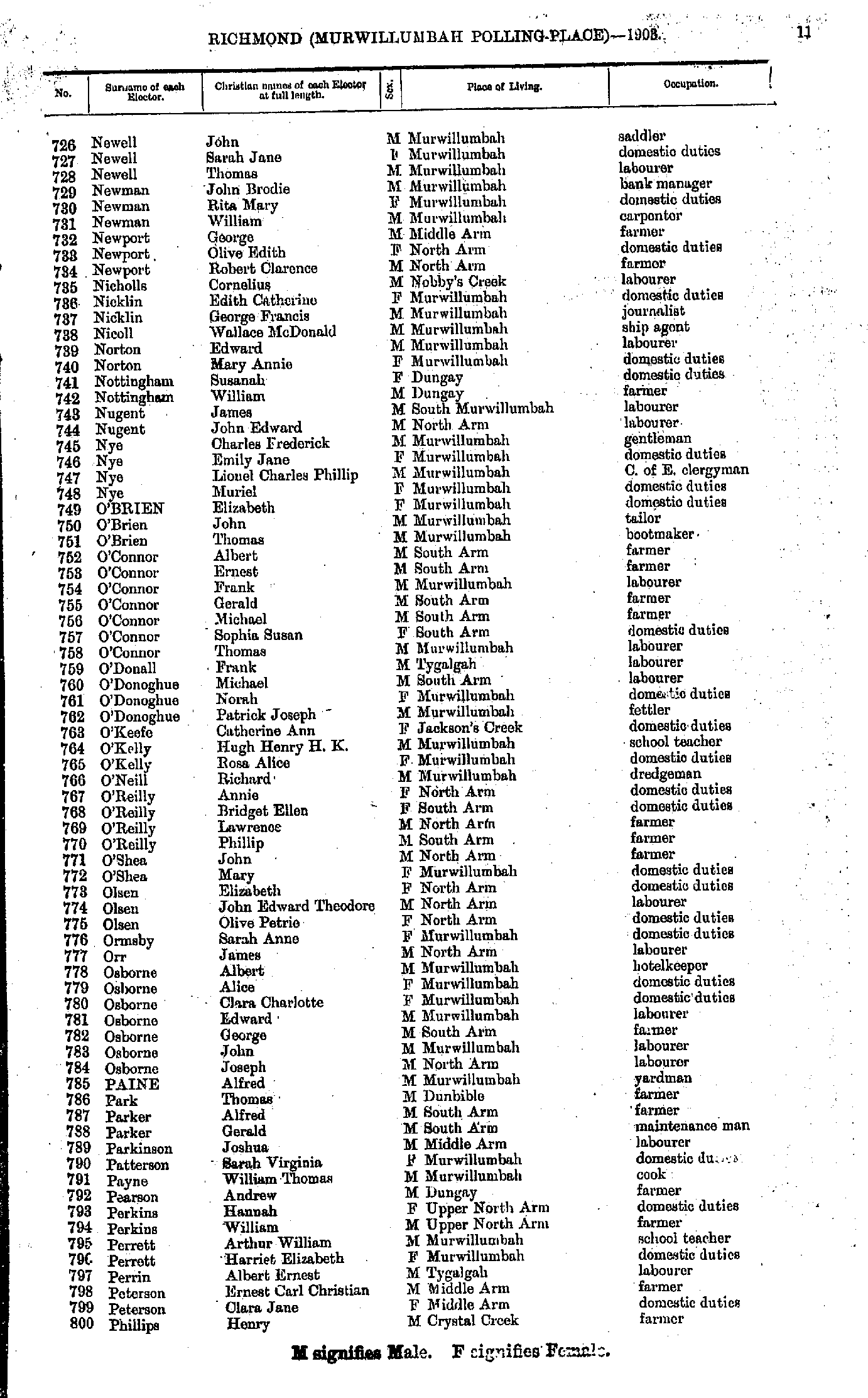
- Newell John - Phillips Henry
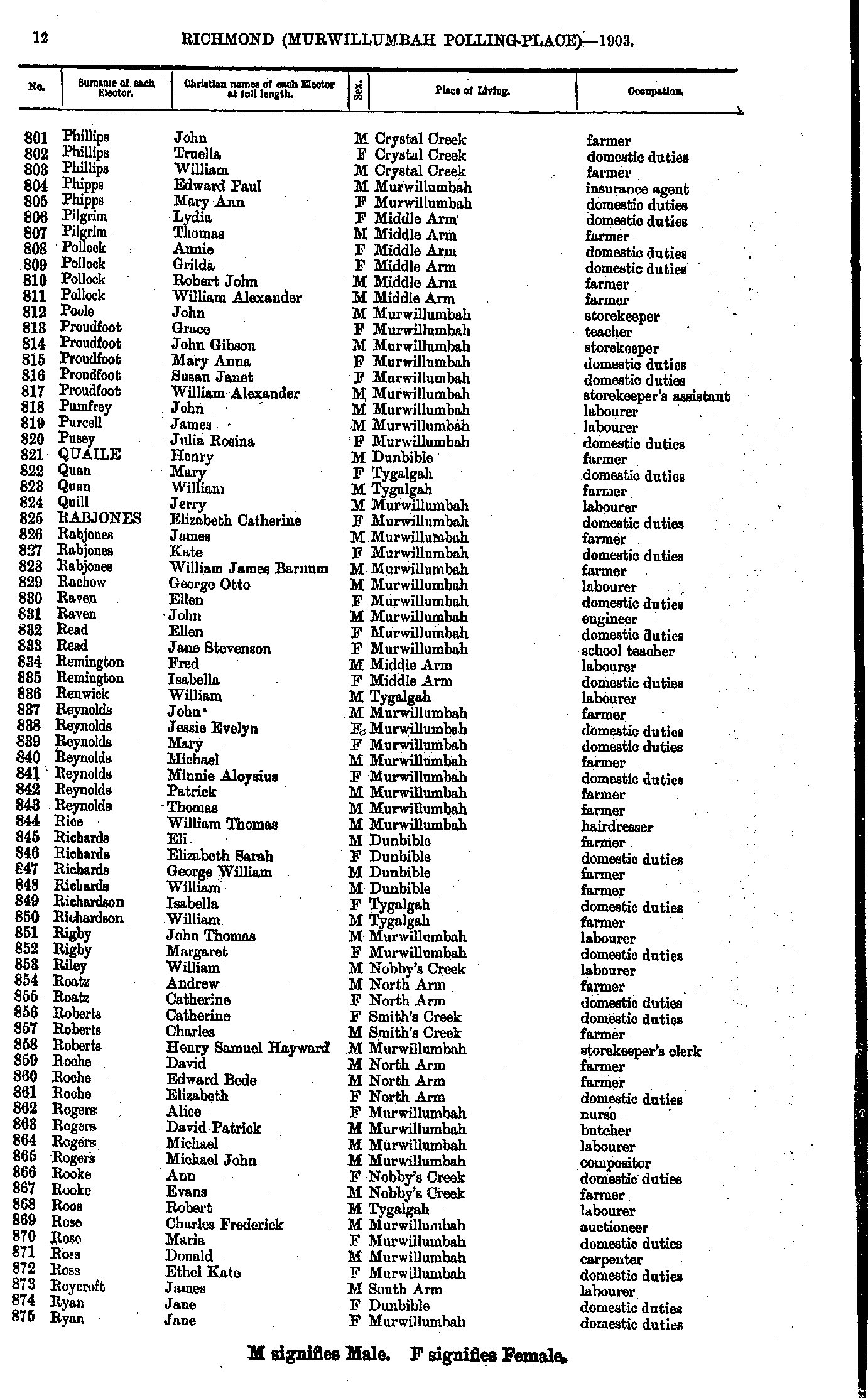
- Phillips John - Ryan Jane
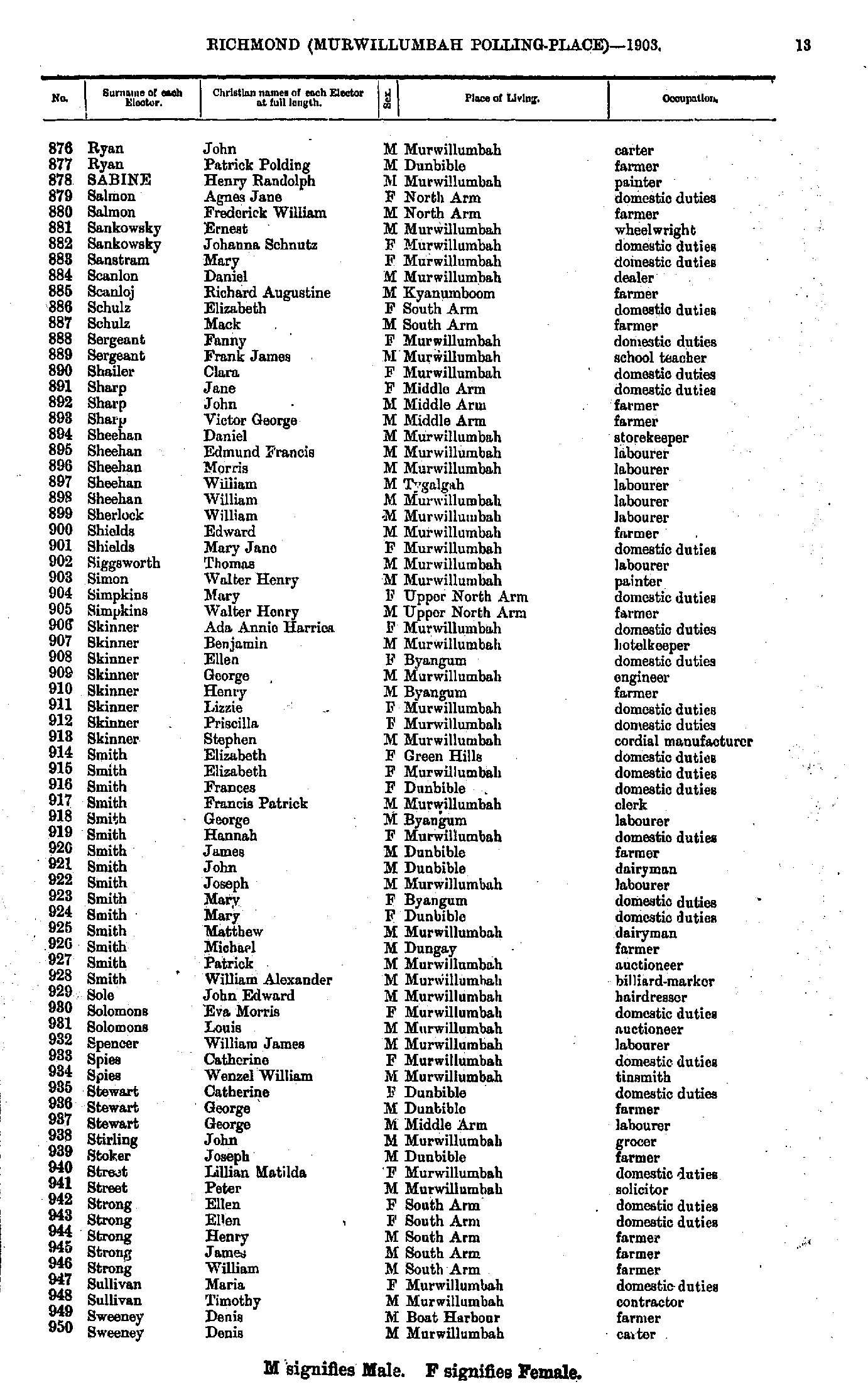
- Ryan John - Sweeney Denis
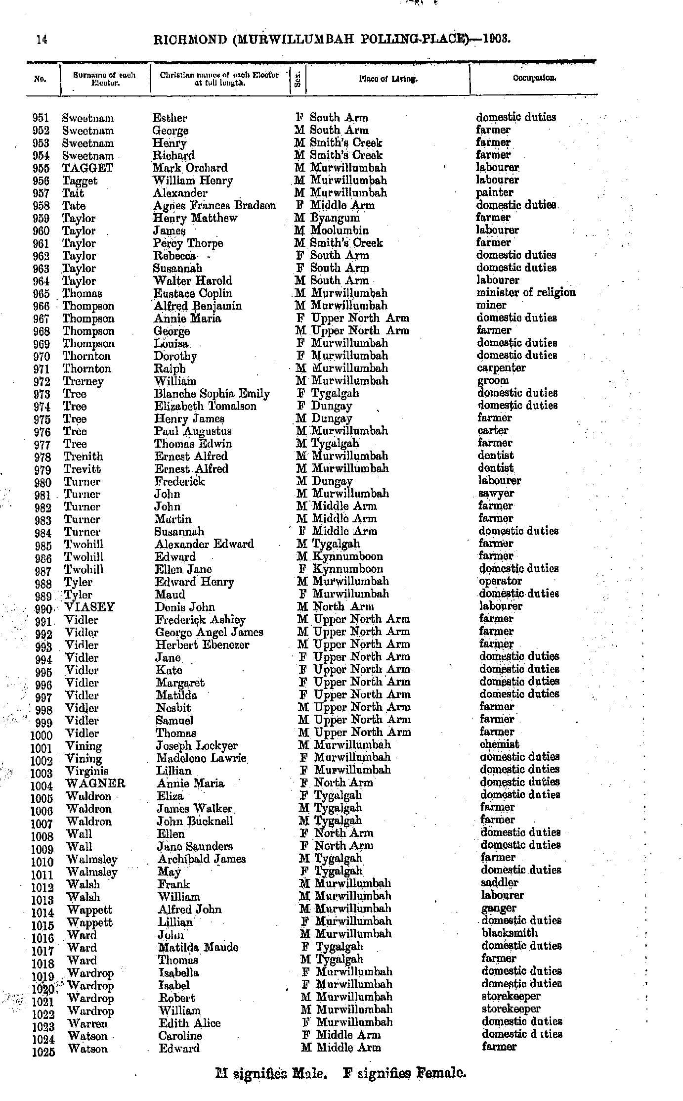
- Sweetnam Esther - Watson Edward
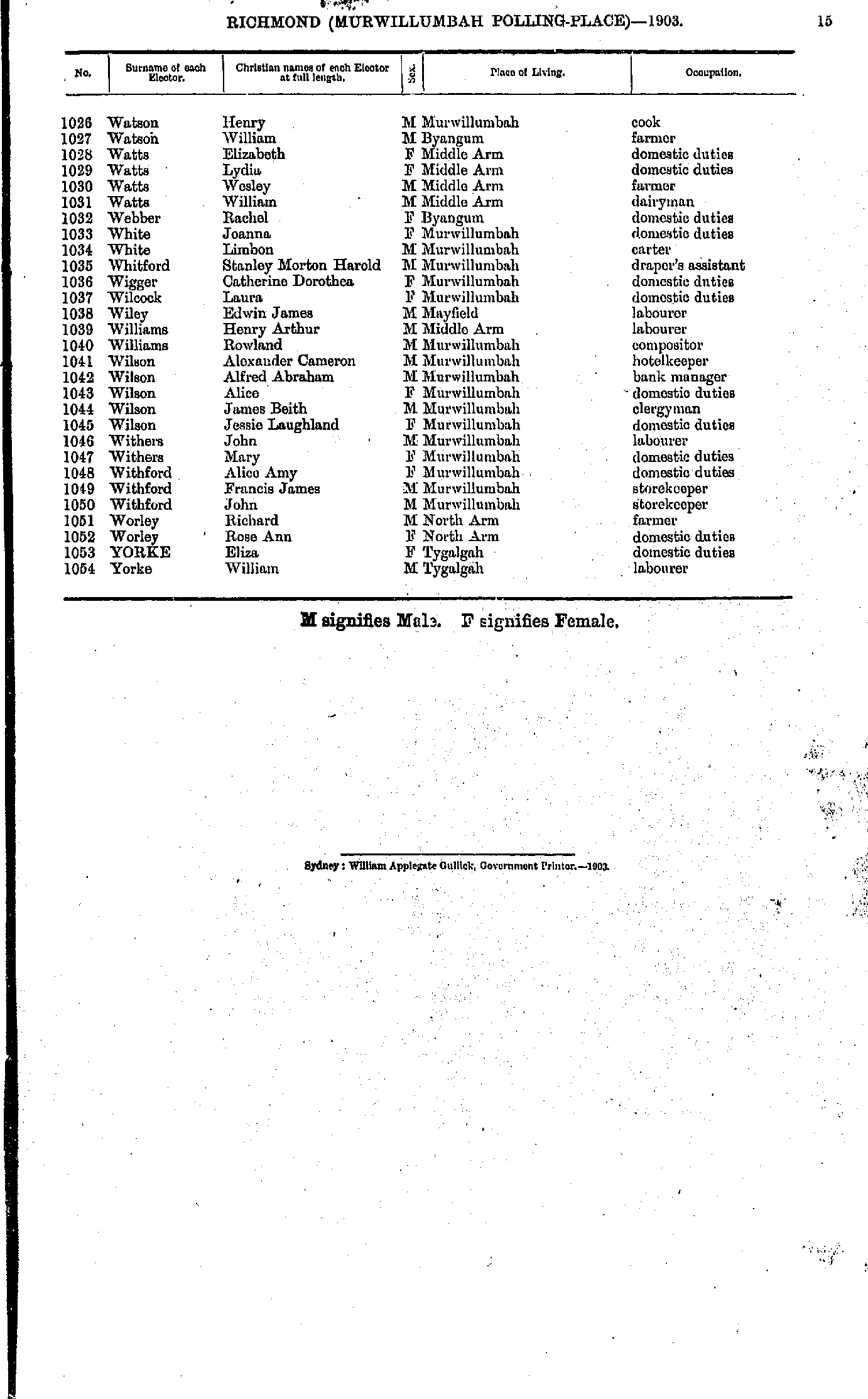
- Watson Henry - Yorke William
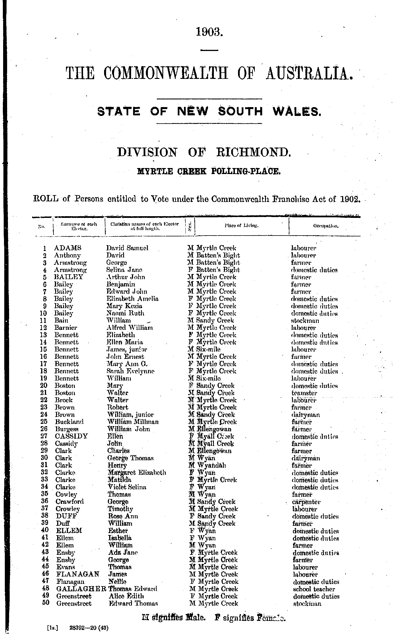
- Adams David - Greenstreet Edward
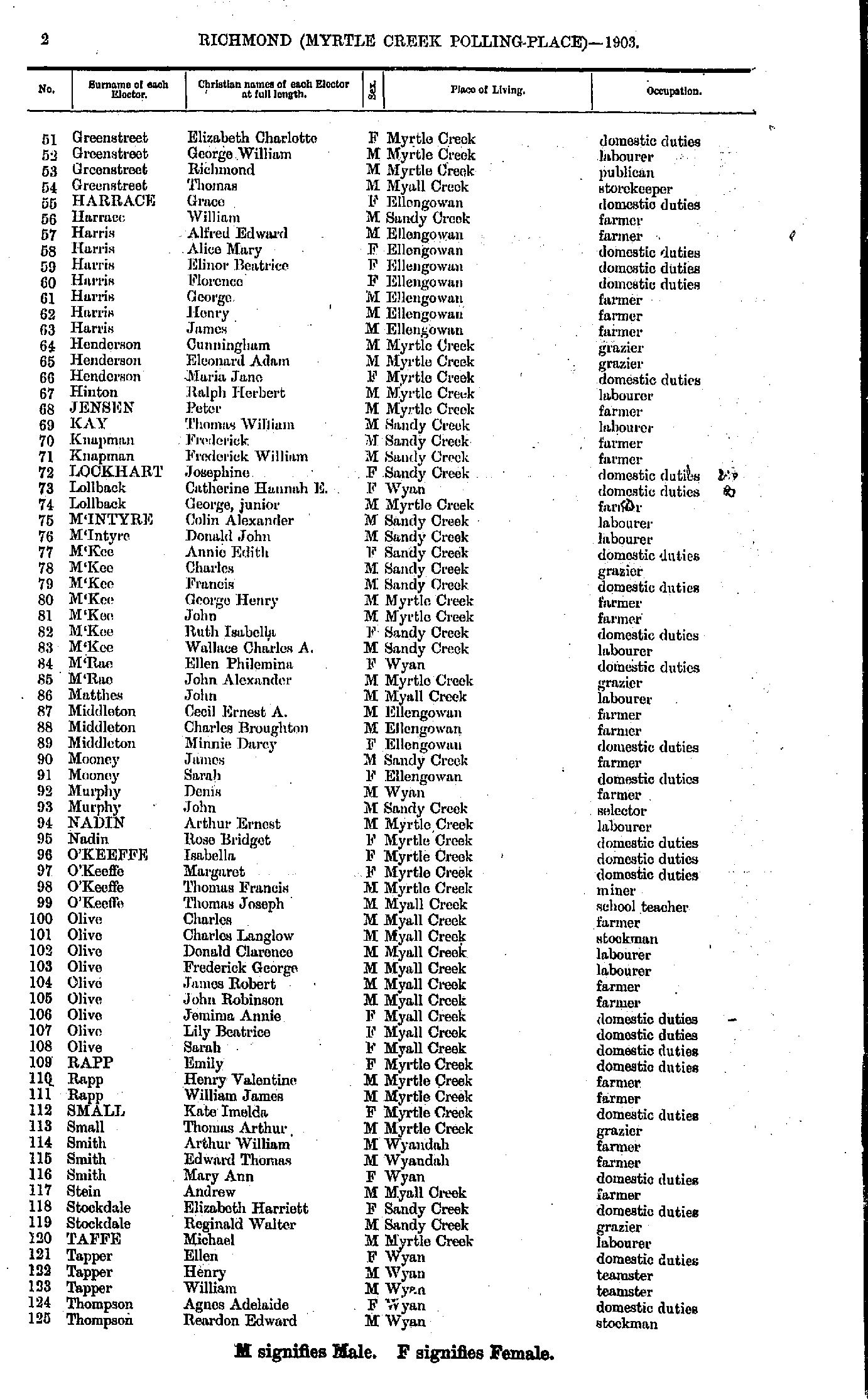
- Greenstreet Elizabeth - Thompson Reardon
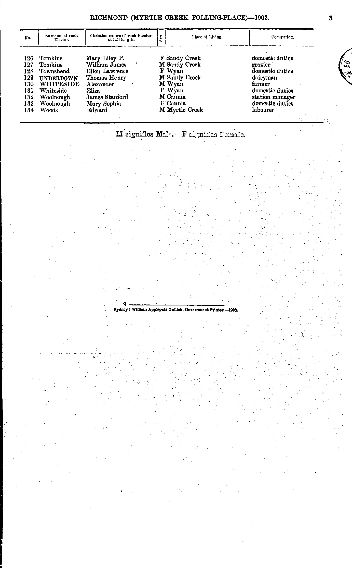
- Tomkins Mary - Woods Edward
- Anderson Frederick - Elliott Thomas
- Evanson Nathaniel - M'Arthur John
- M'Canna Charles - Townsend Mary
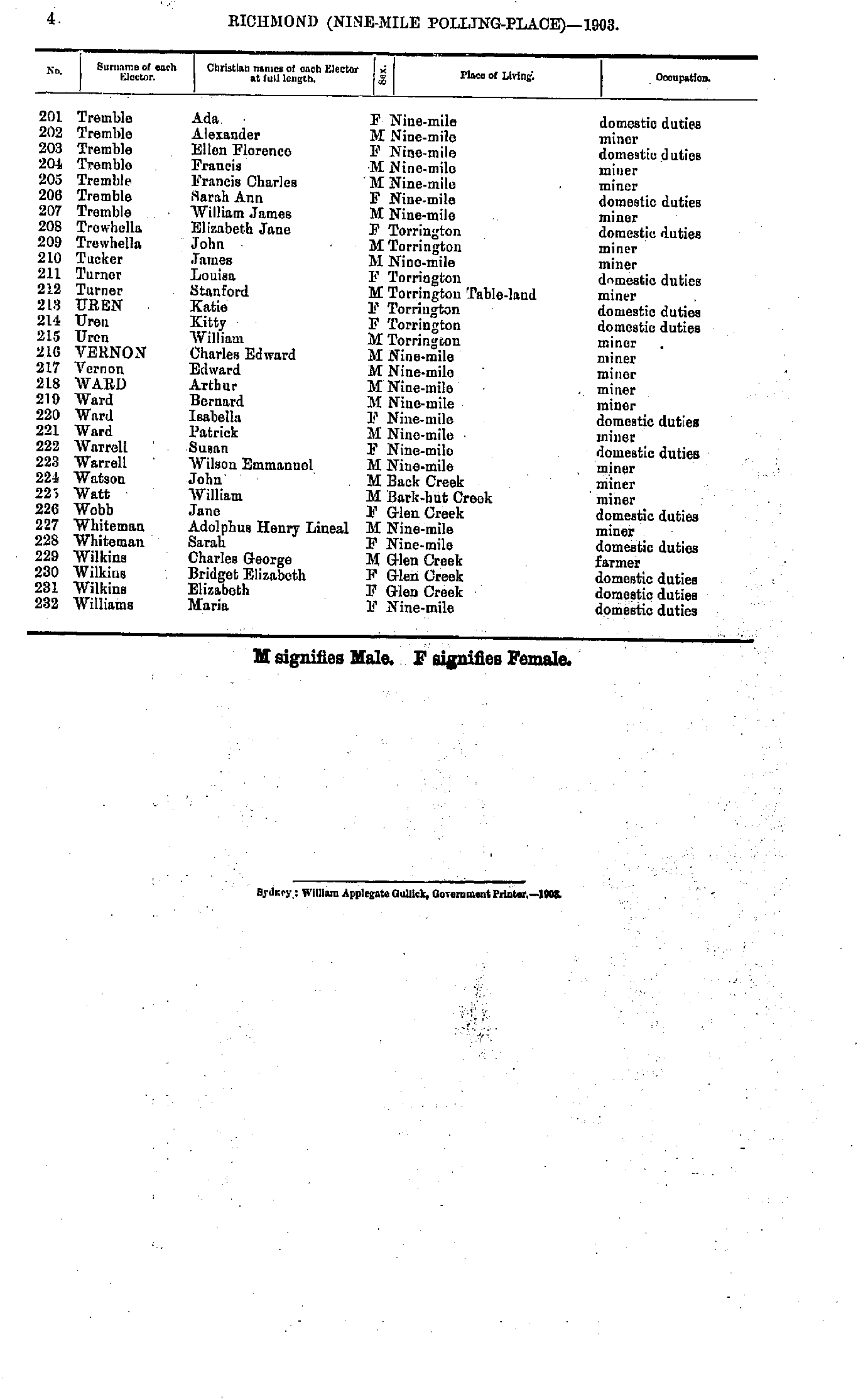
- Tremble Ada - Williams Maria
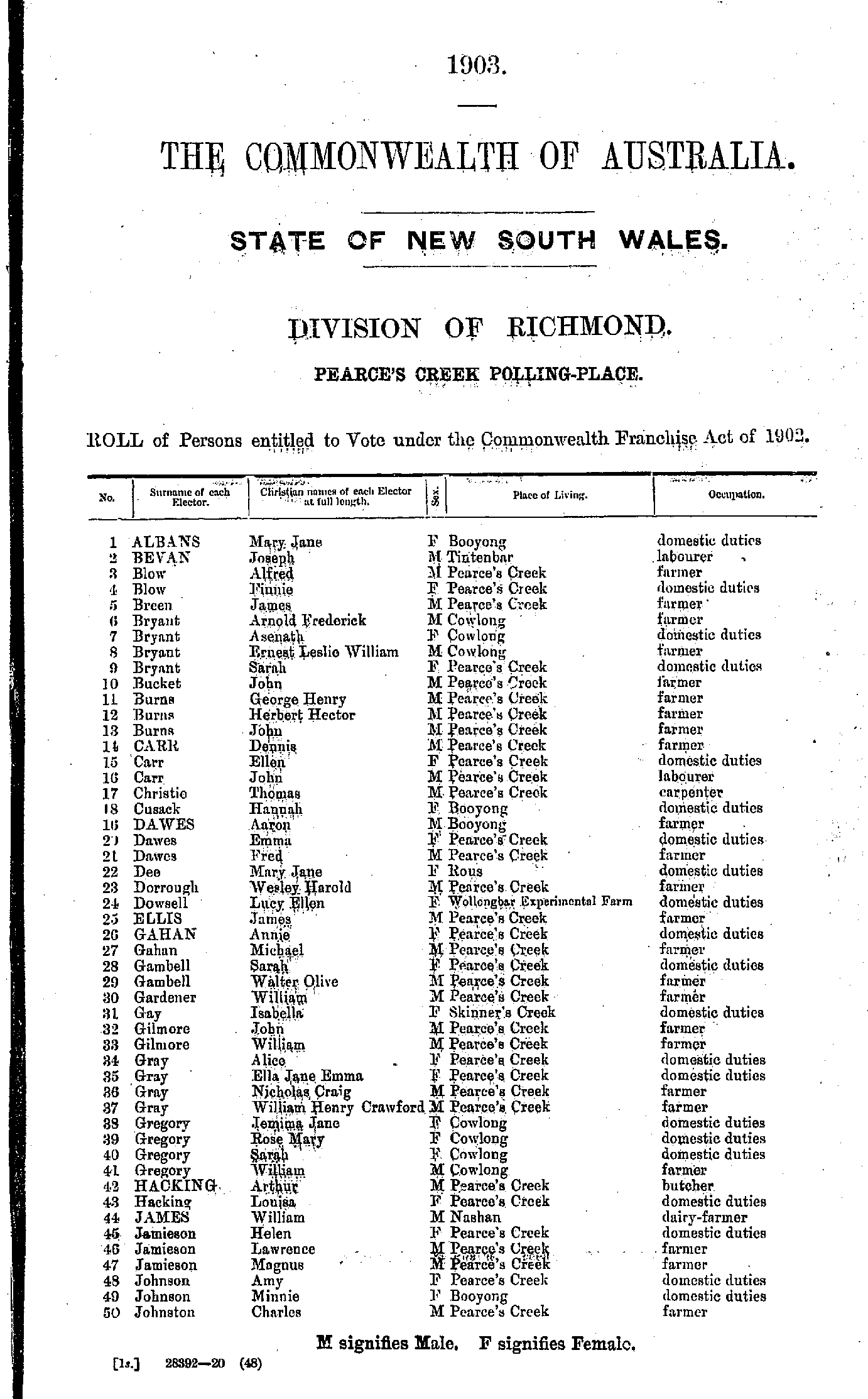
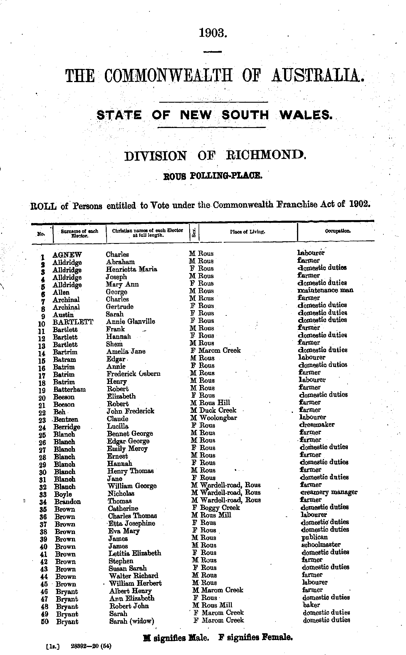
- Agnew Charles - Bryant Sarah
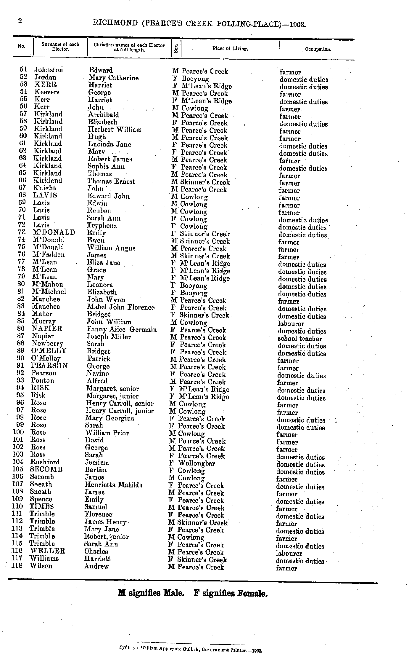
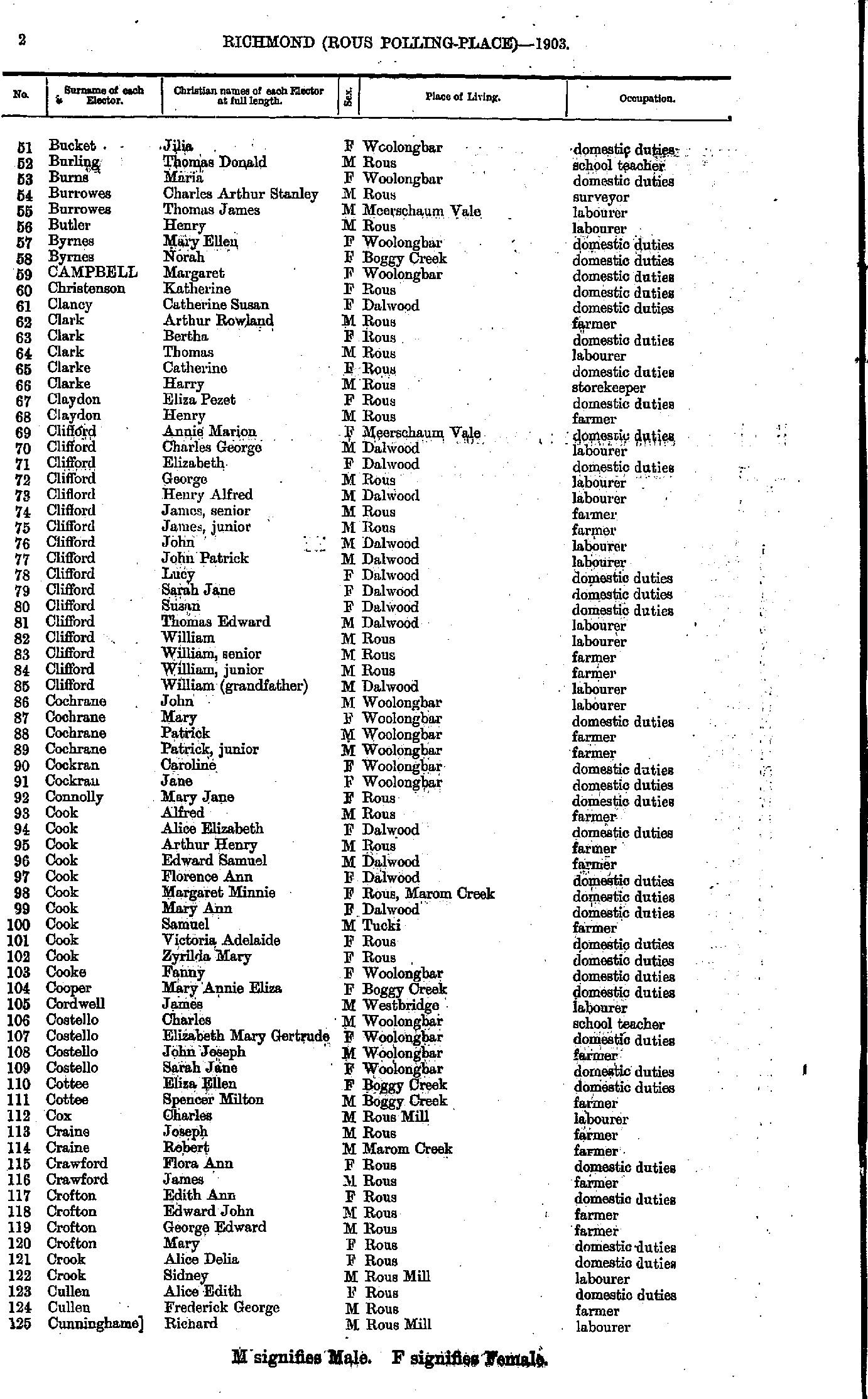
- Bucket Jilia - Cunninghame Richard
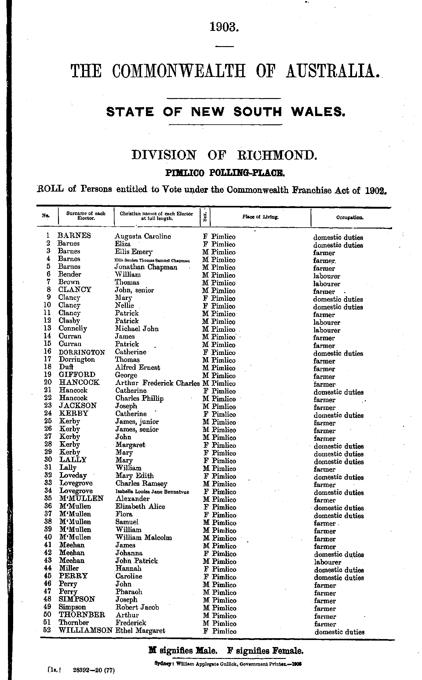
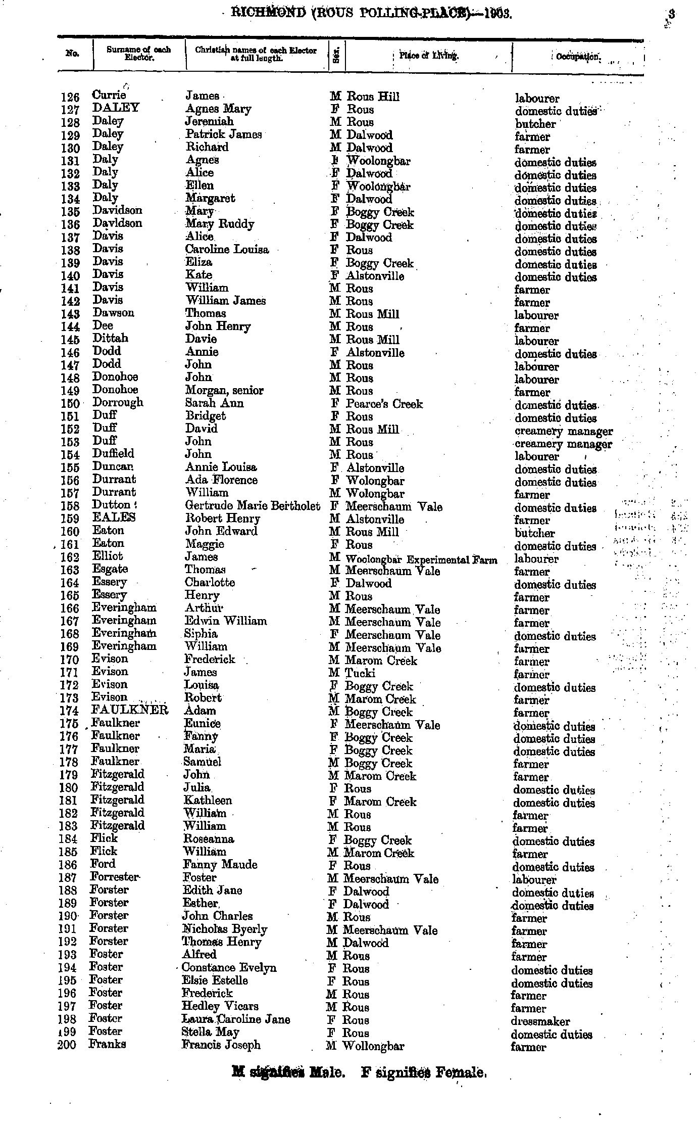
- Currie James - Franks Francis
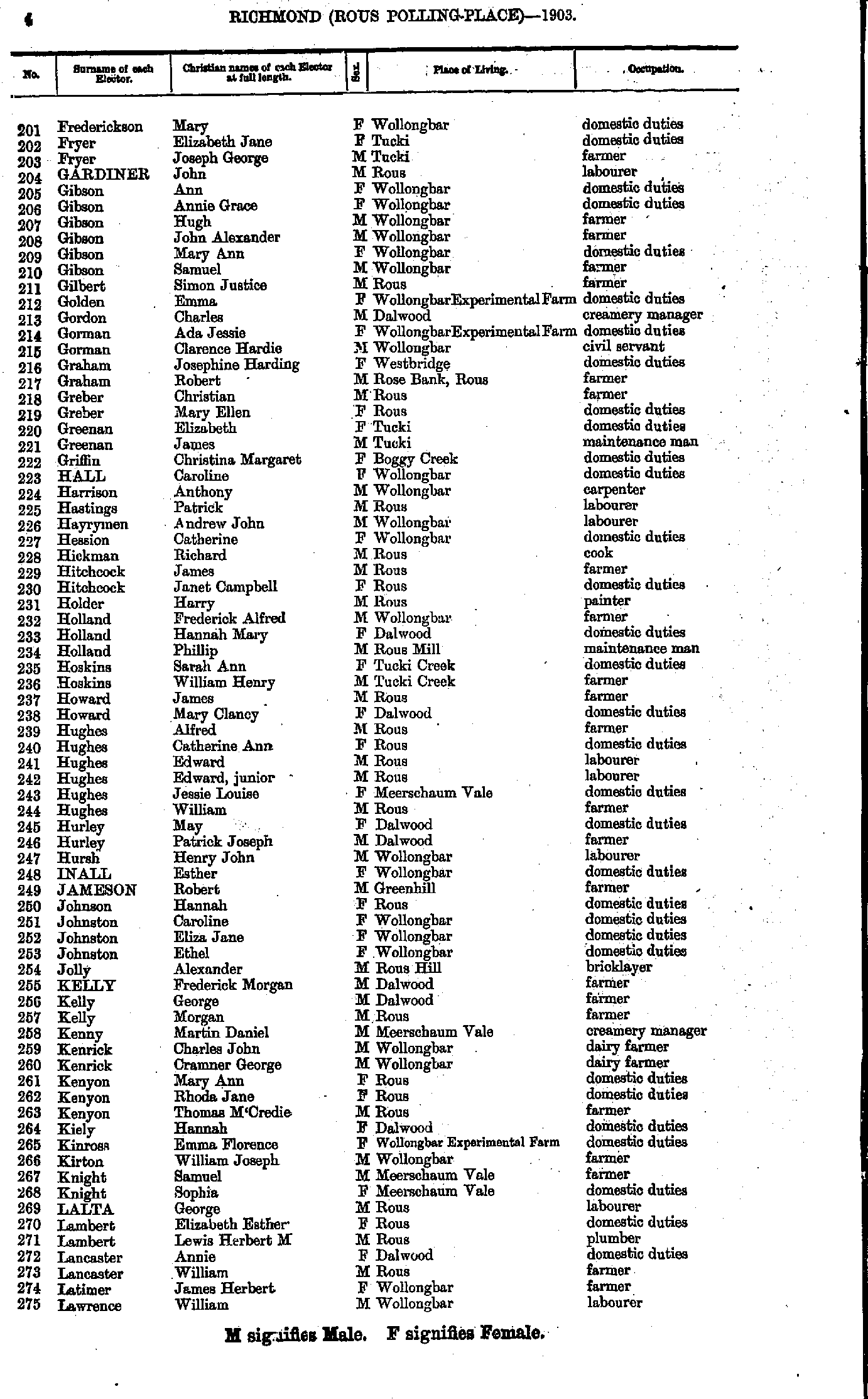
- Frederickson Mary - Lawrence William
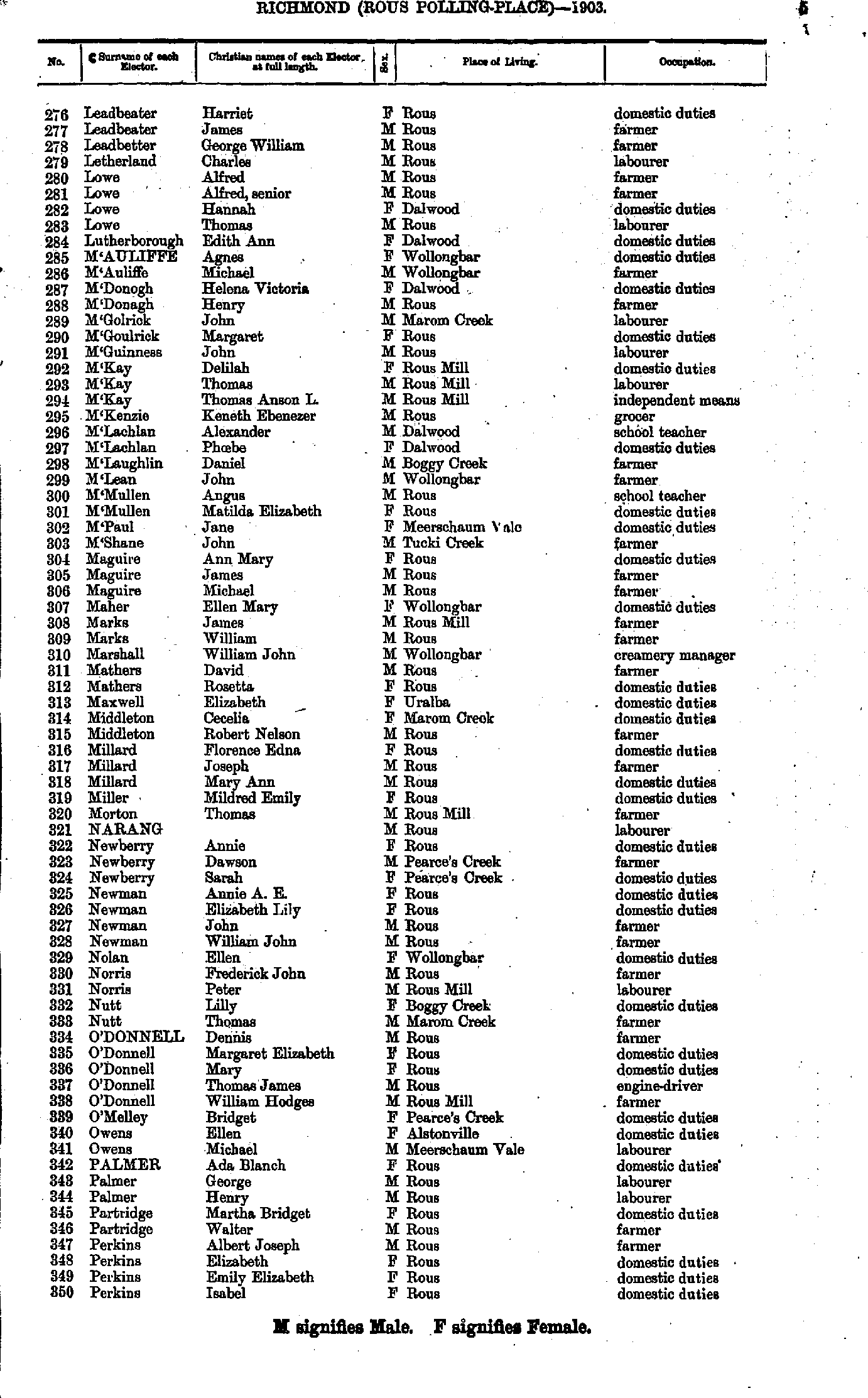
- Leadbeater Harriet - Perkins Isabel
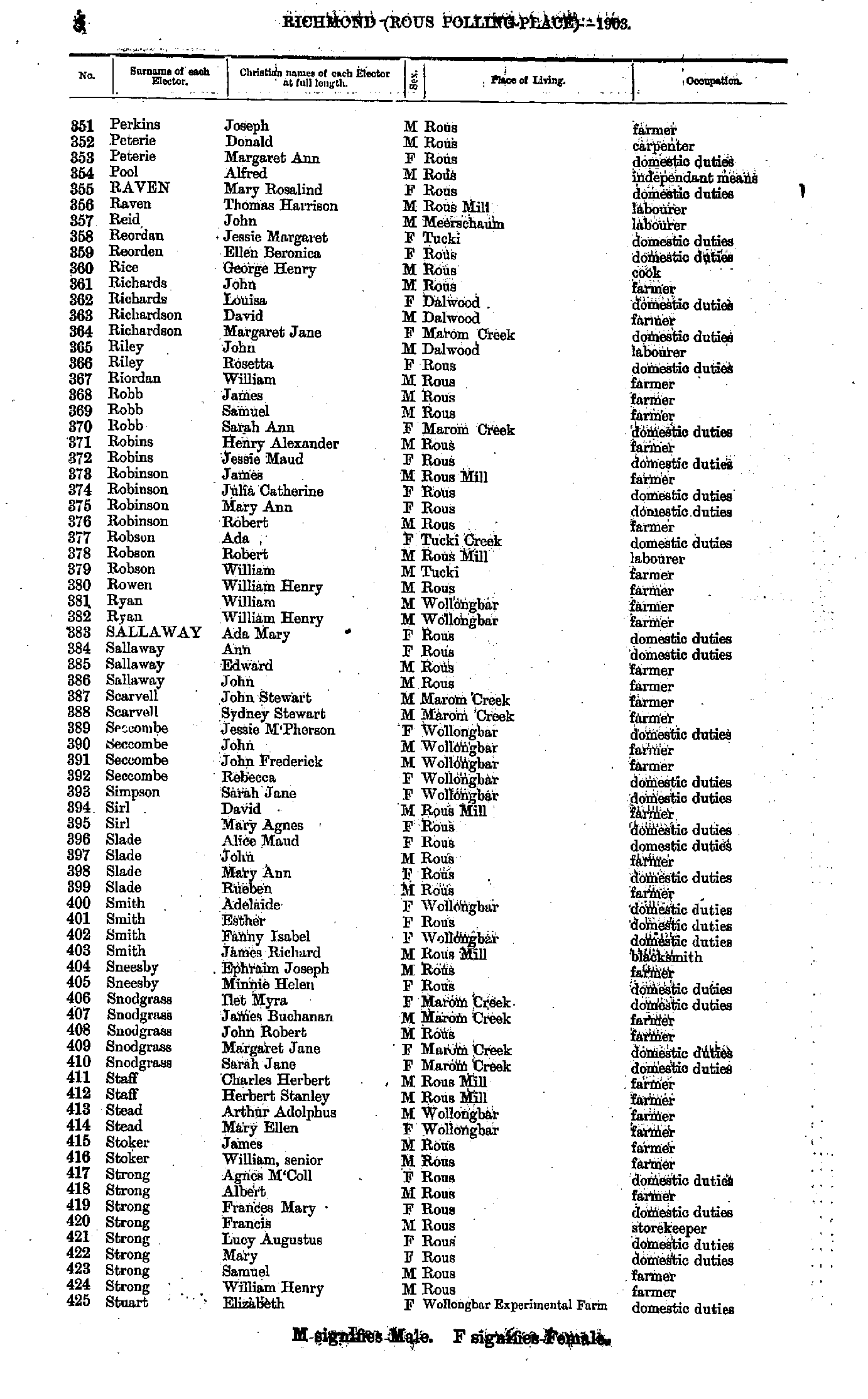
- Perkins Joseph - Stuart Elizabeth
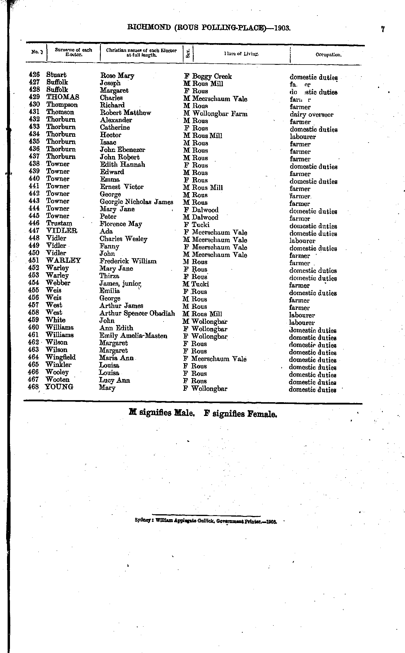
- Stuart Rose - Young Mary
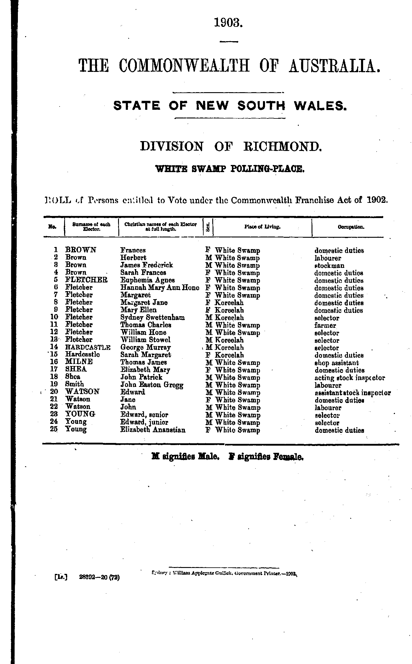
Sandilands Range Polling Place
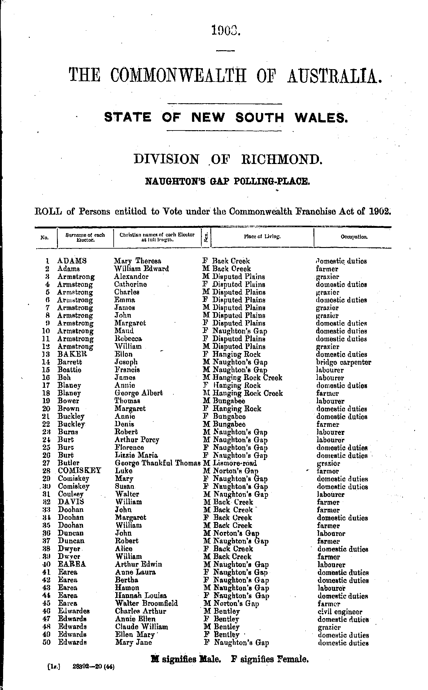
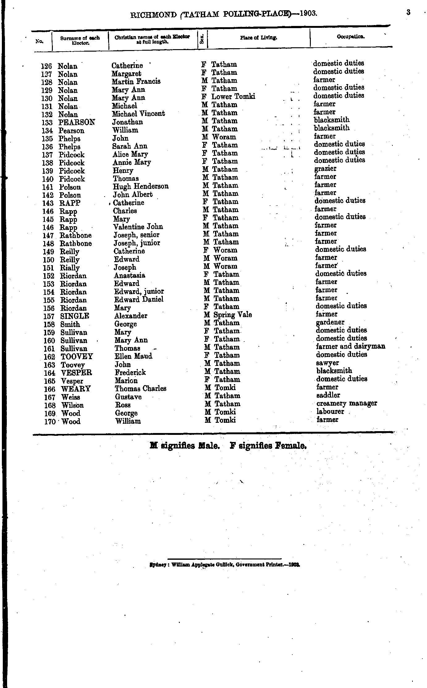
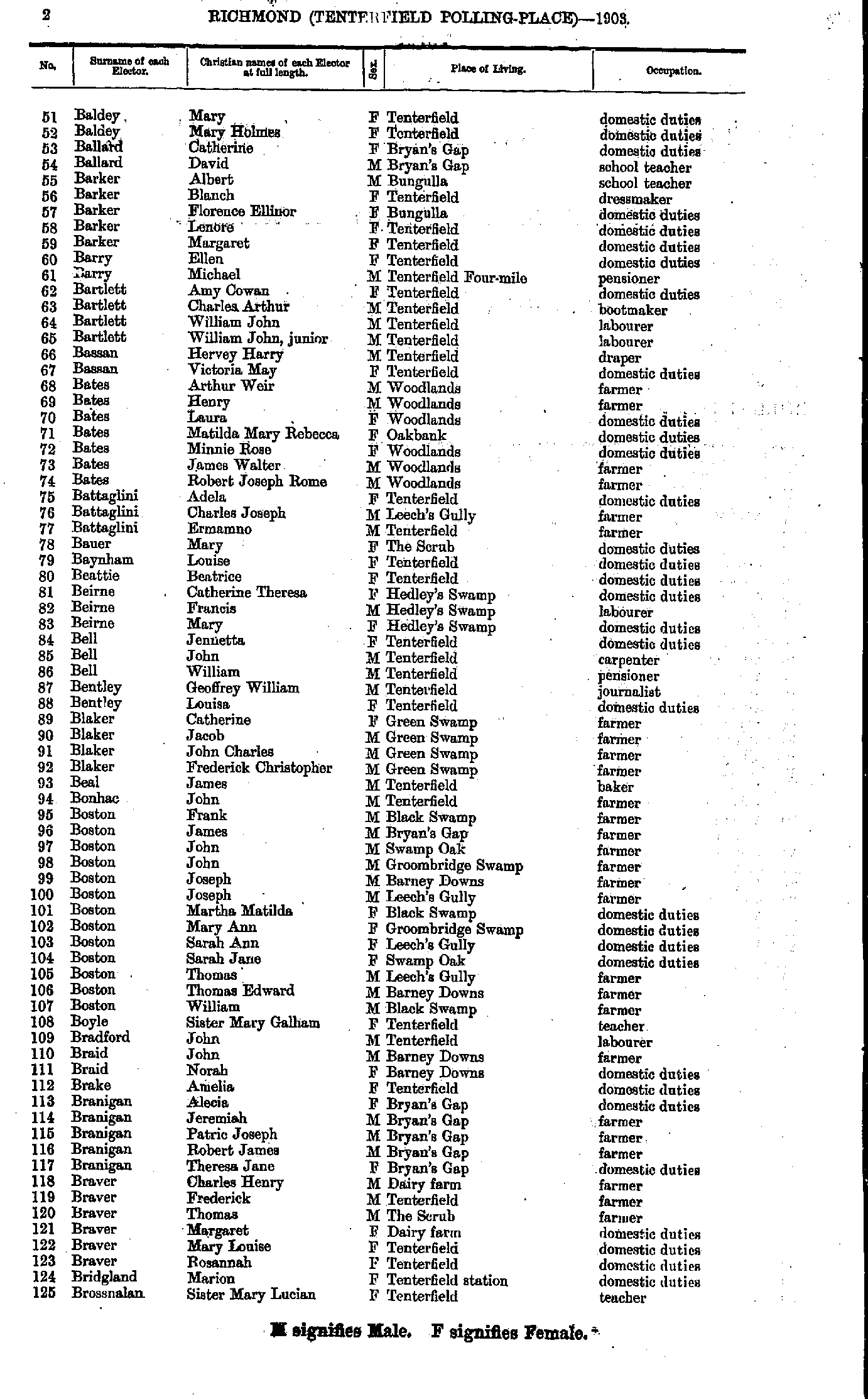
- Adams Catherine - Baldey Louisa
- Baldey Mary - Brossnalan Sister Mary
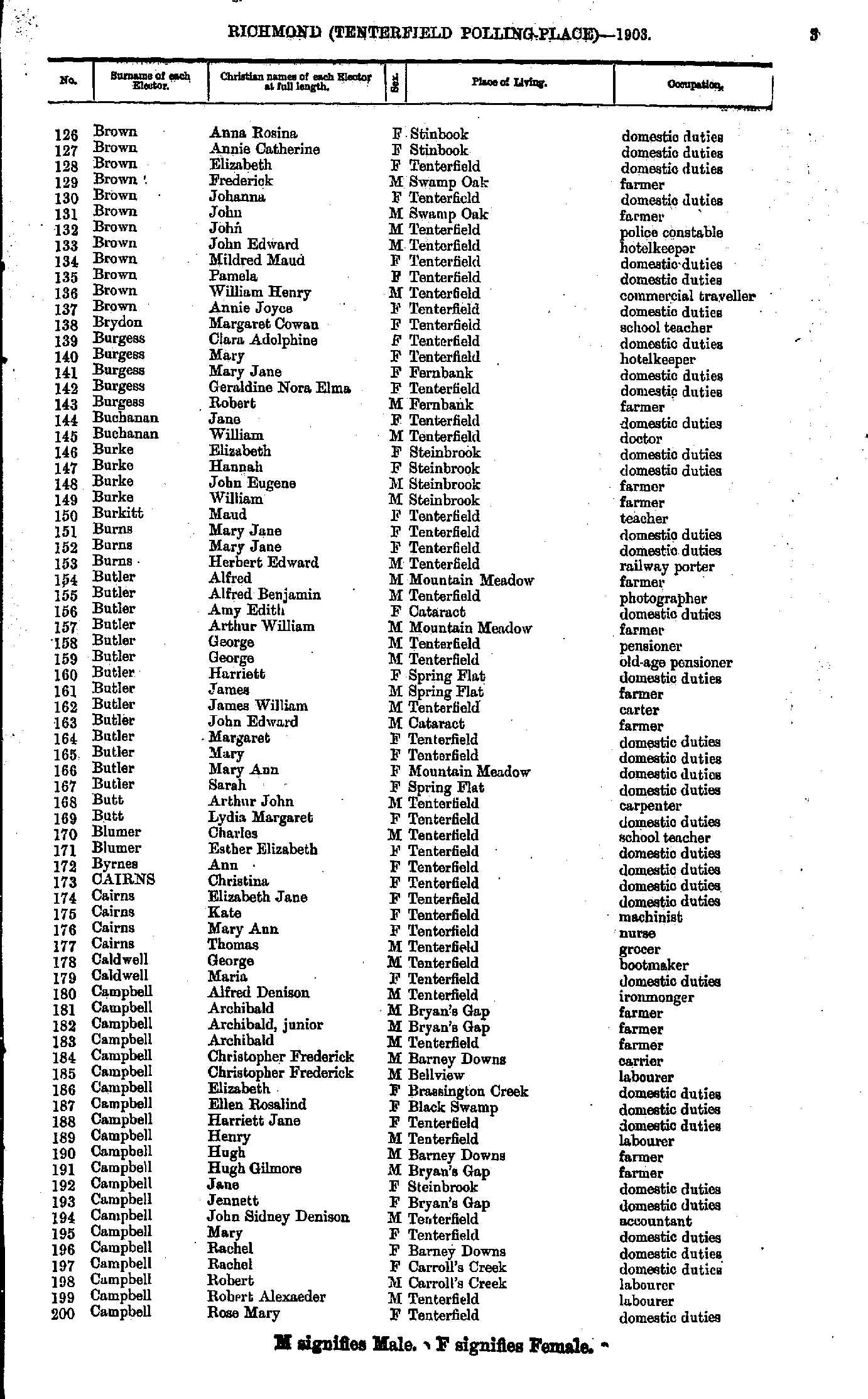
- Brown Anna - Campbell Rose
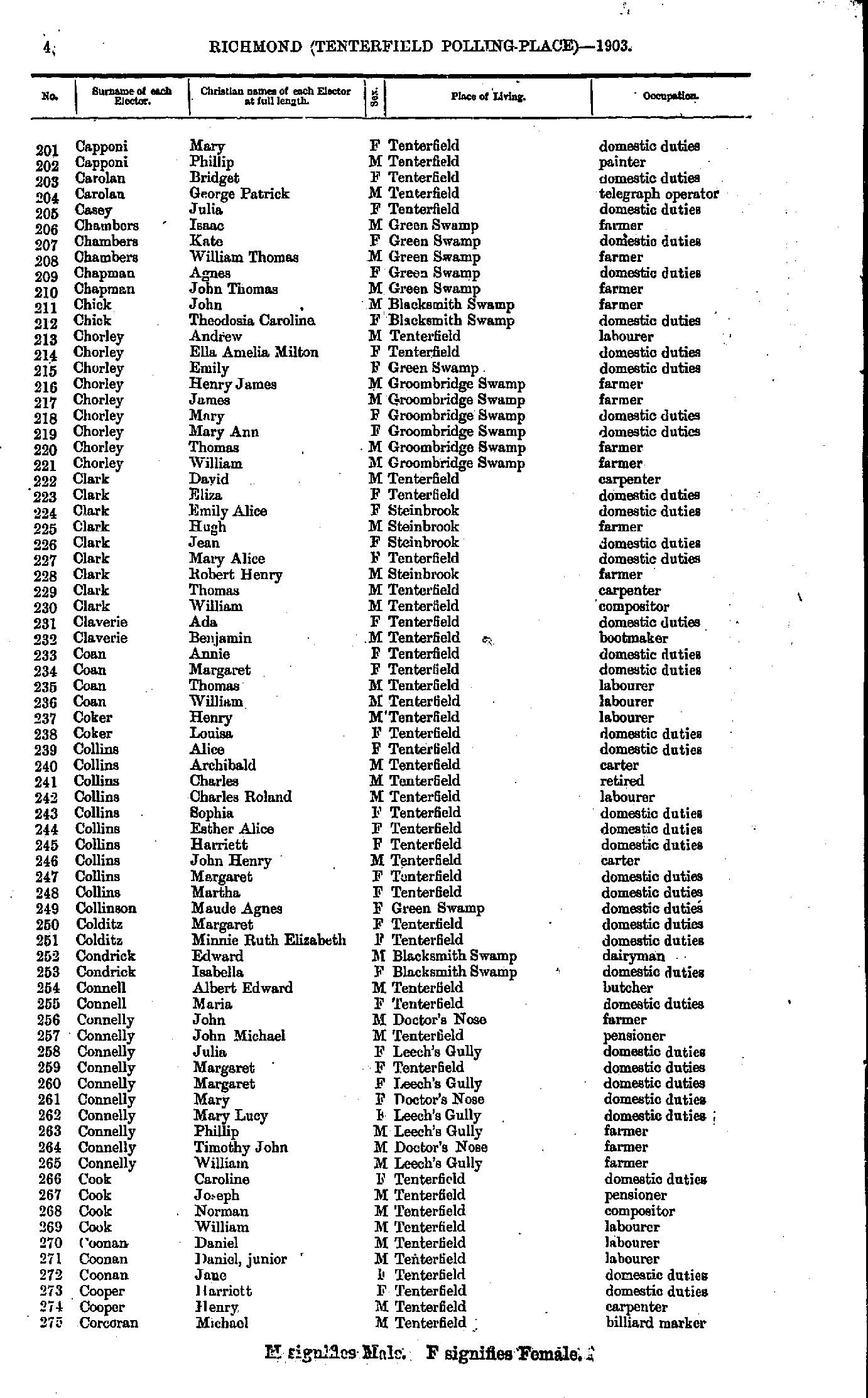
- Capponi Mary - Corcoran Michael
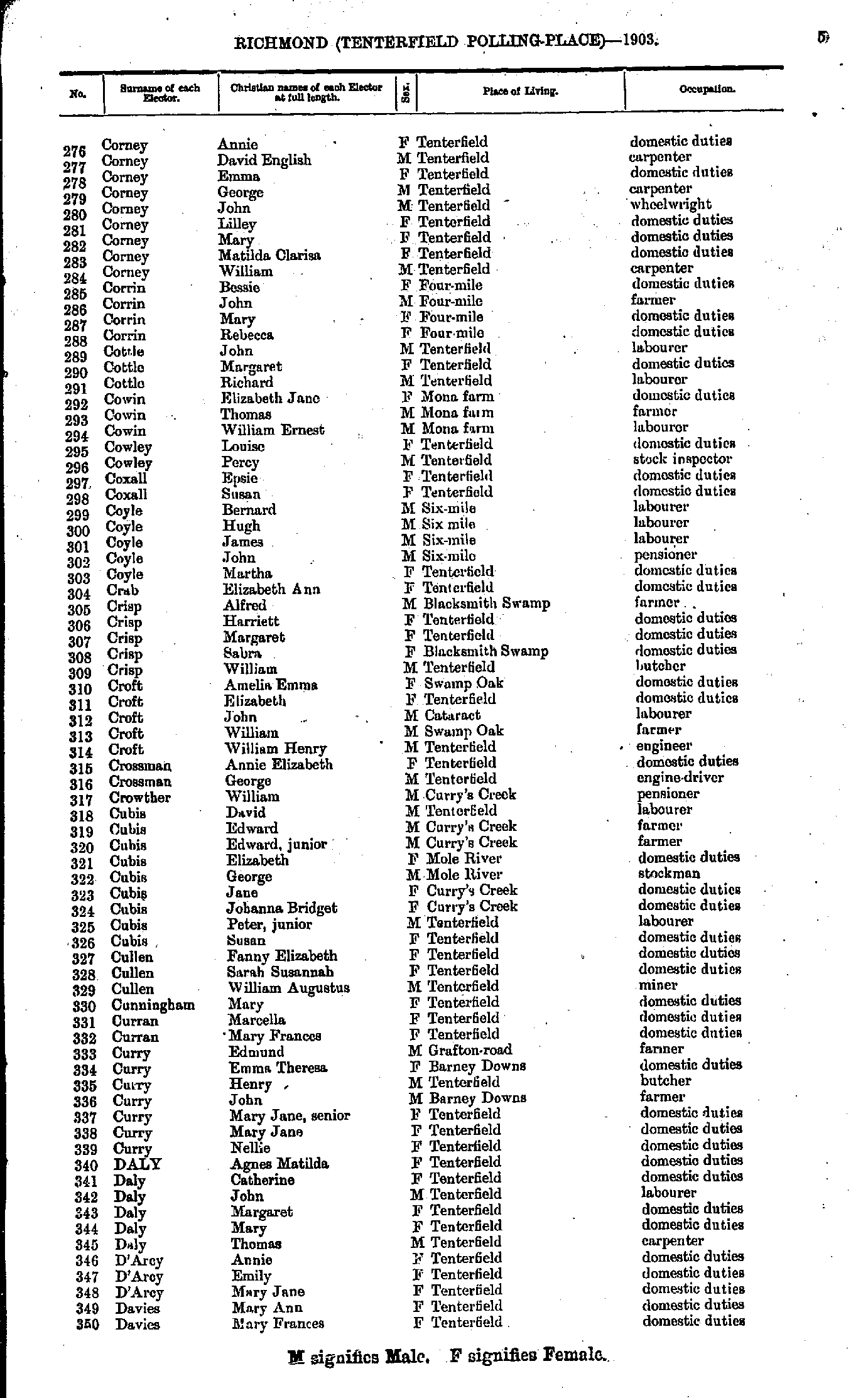
- Corney Annie - Davies Mary
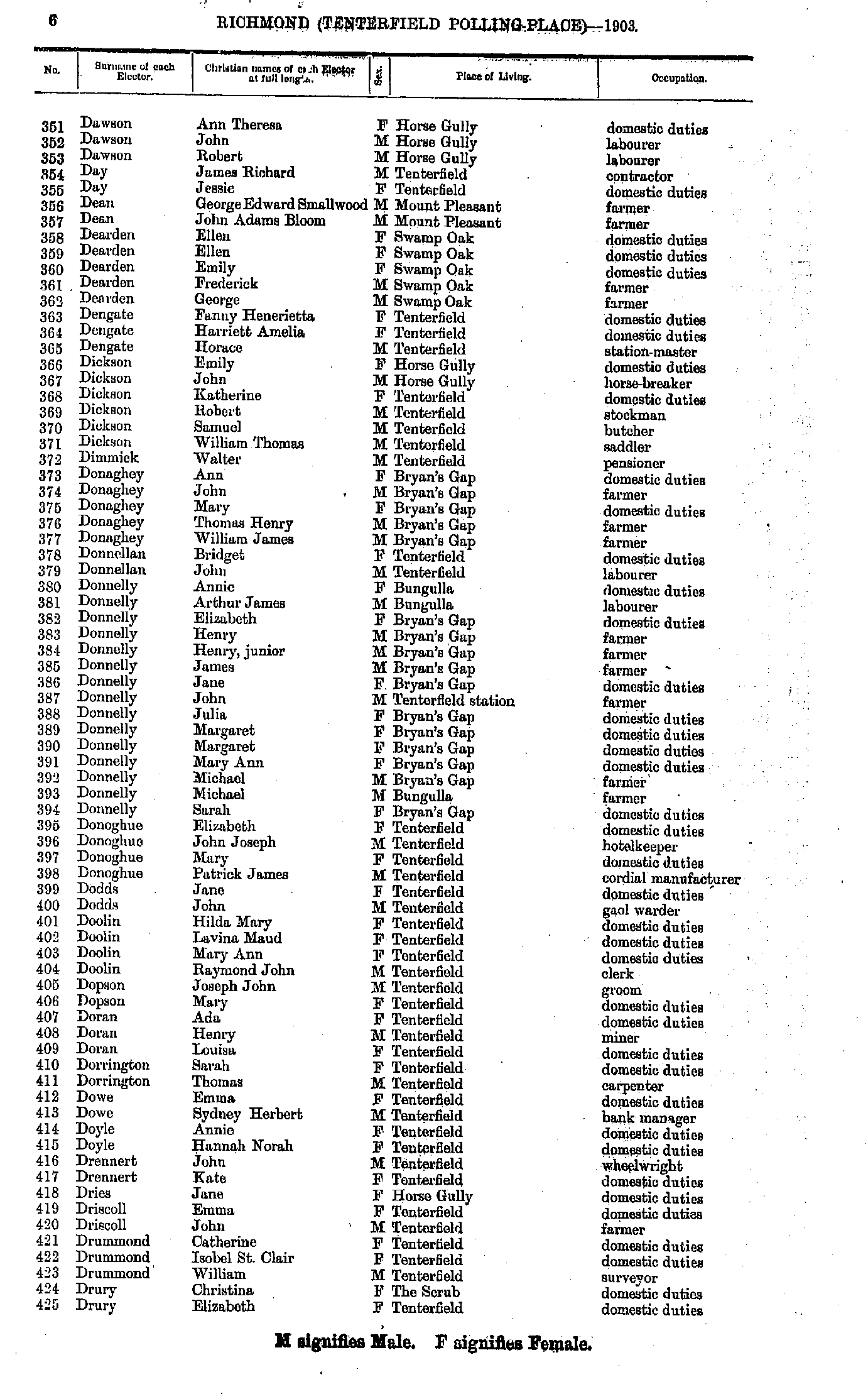
- Dawson Ann - Drury Elizabeth
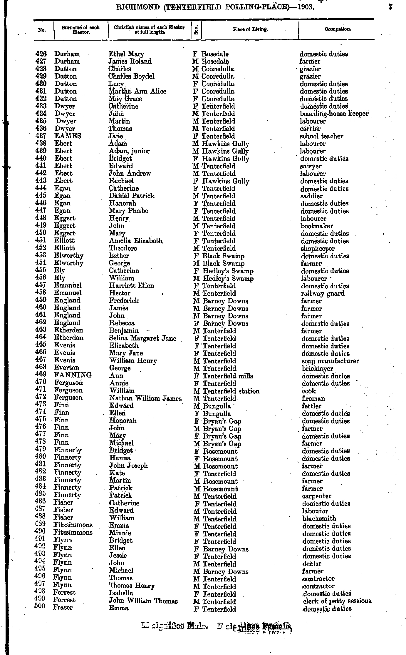
- Durham Ethel - Fraser Emma
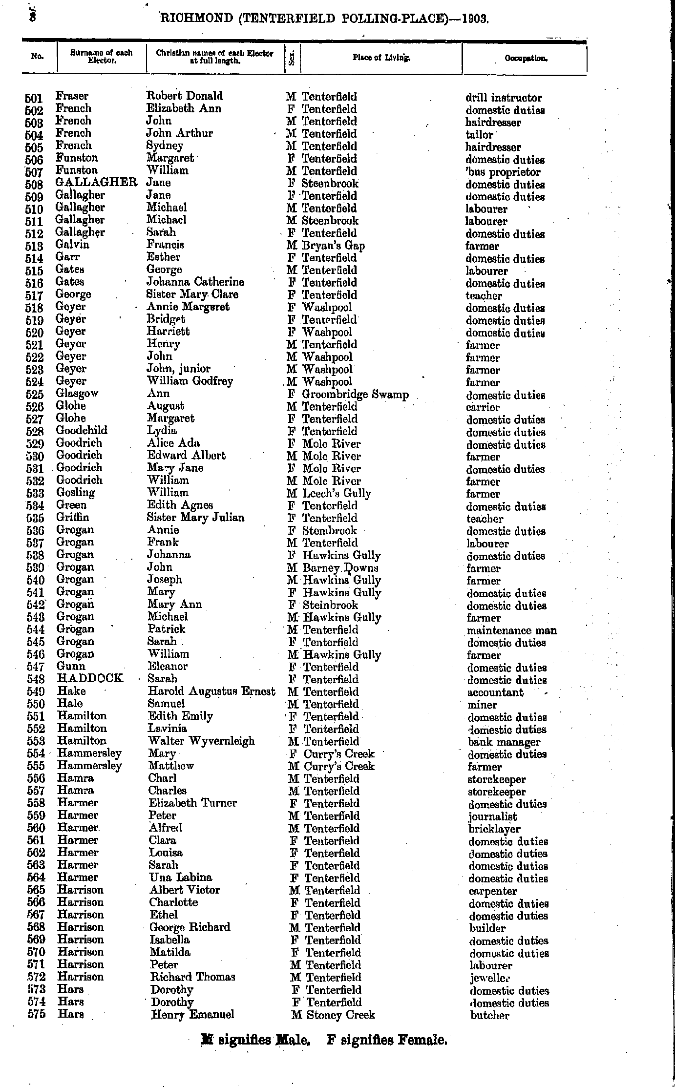
- Fraser Robert - Hars Henry
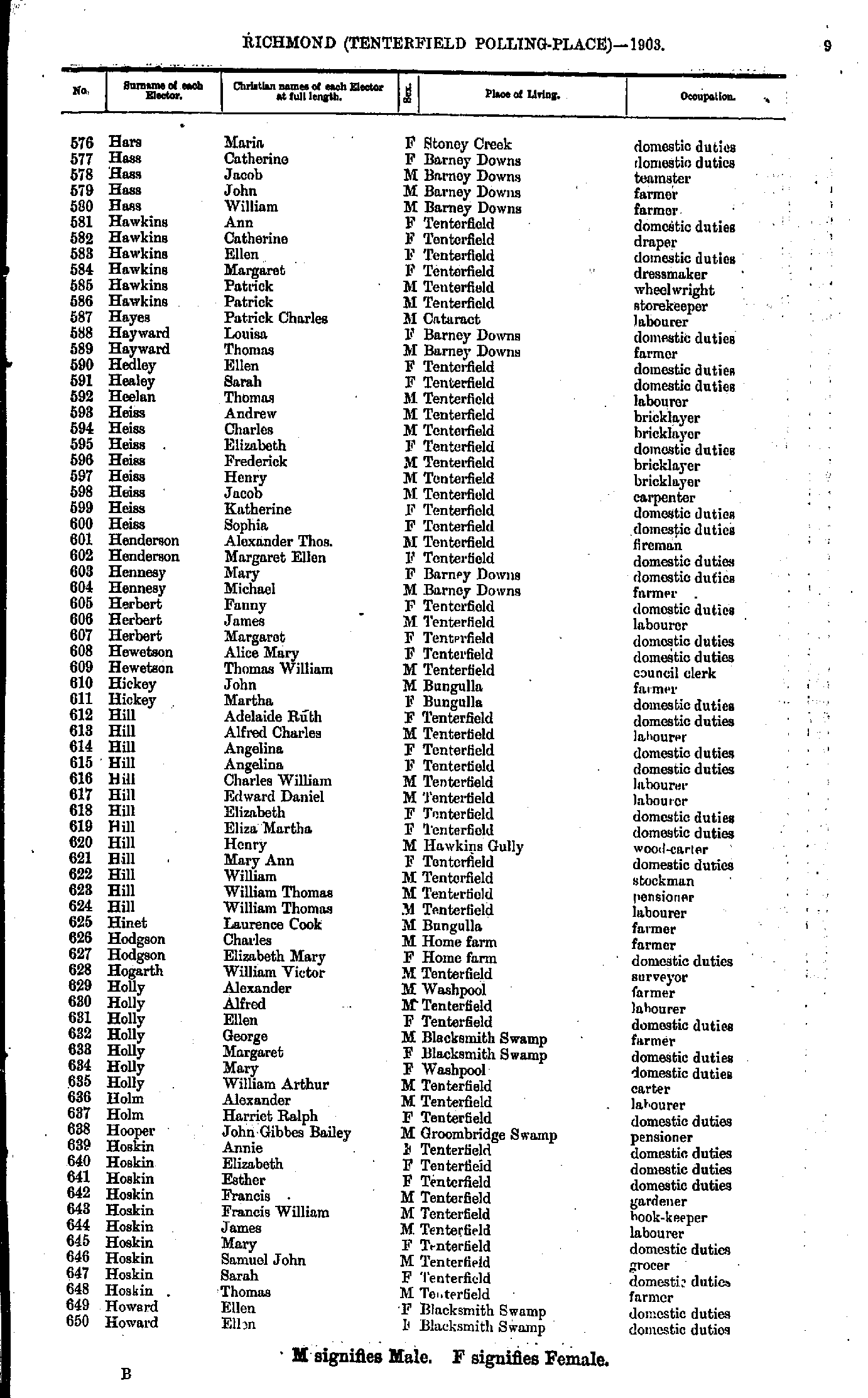
- Hars Maria - Howard Ellen
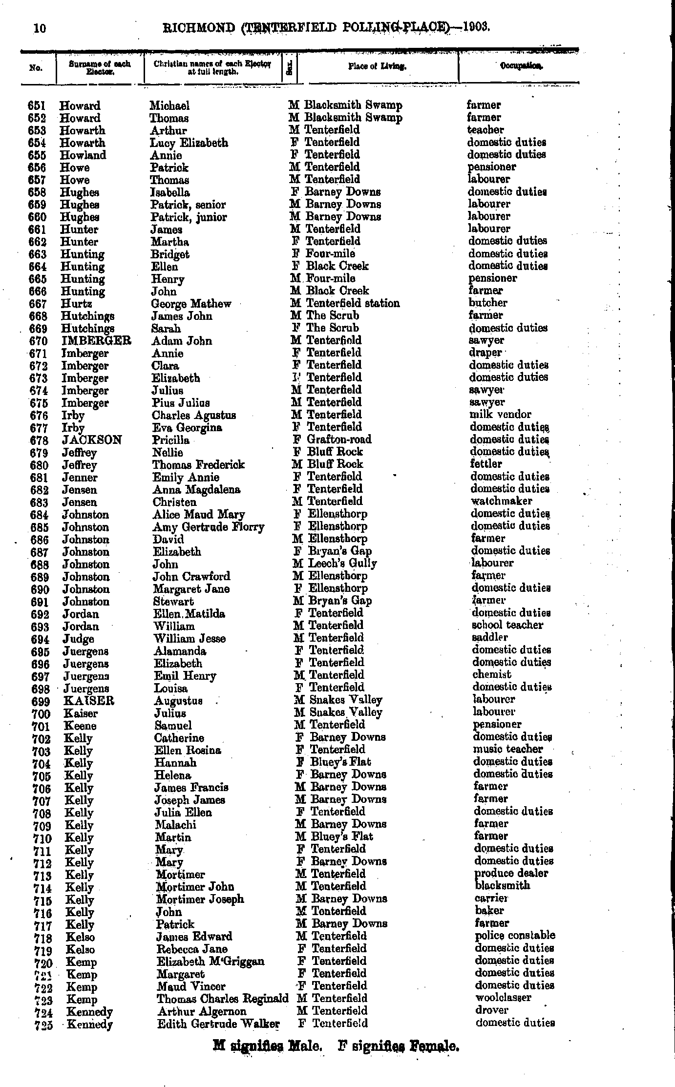
- Howard Michael - Kennedy Edith
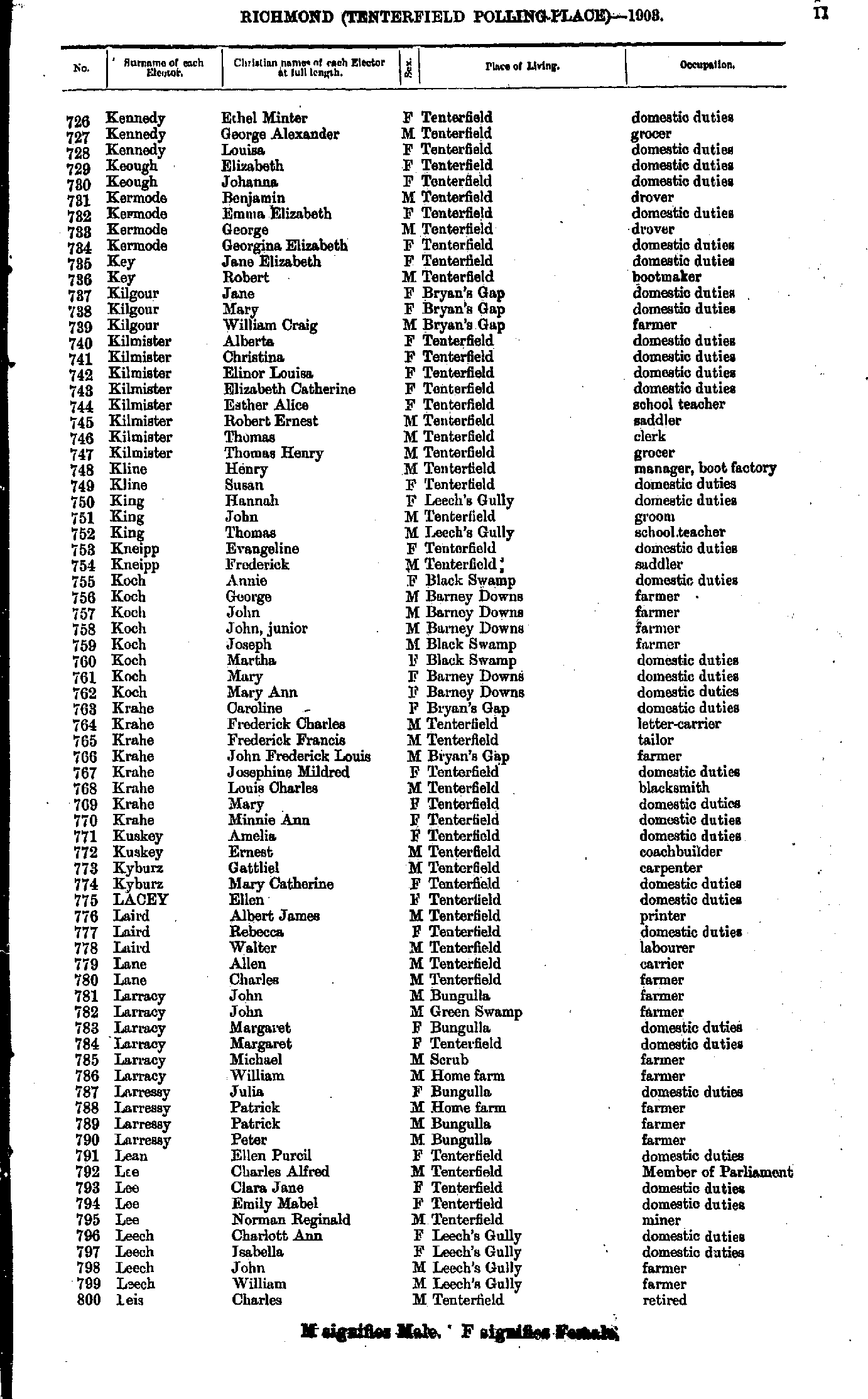
- Kennedy Ethel - Leis Charles
- Leis George - M'Namara Catherine
- M'Namara Patrick - Miller May
- Miller Thomas - O'Brien Michael
- O'Connor Cecilia - Power Elizabeth
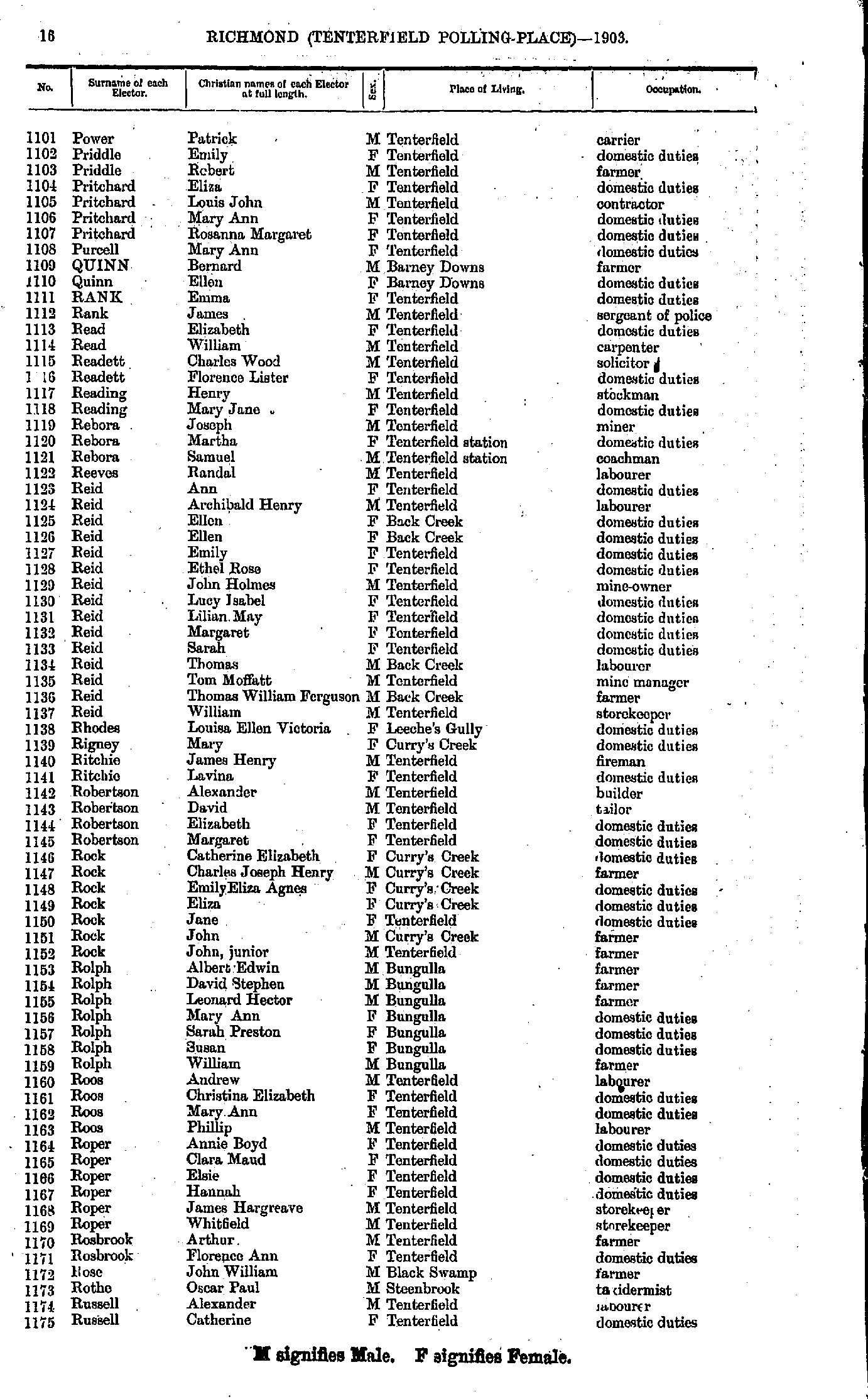
- Power Patrick - Russell Catherine
- Russell David - Smith Merton
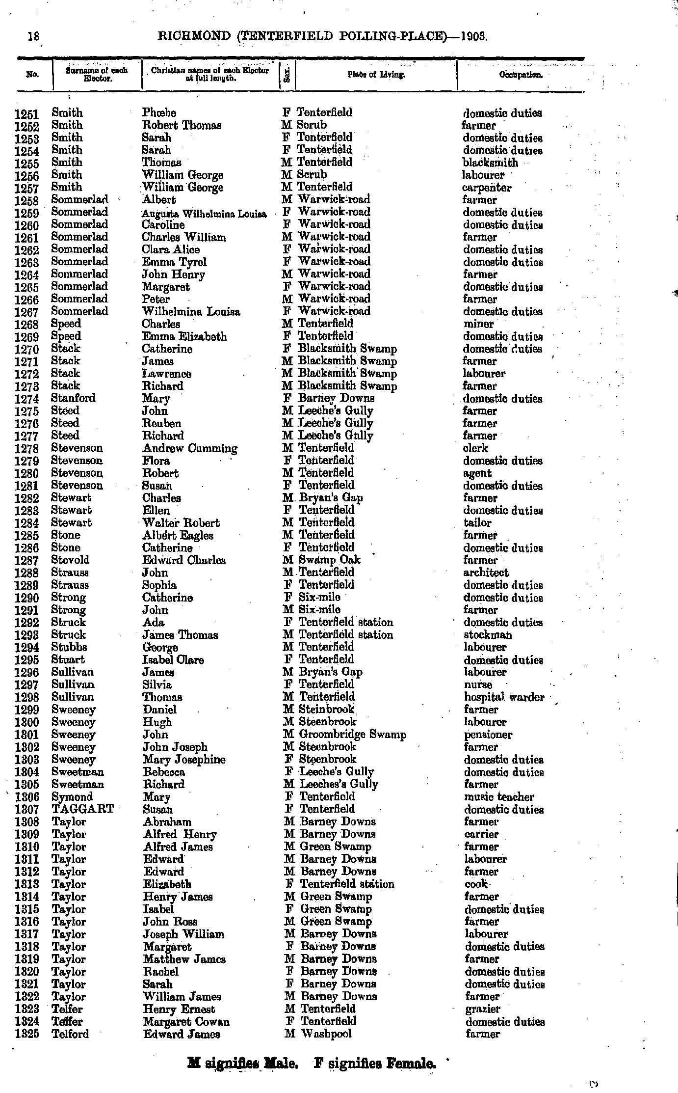
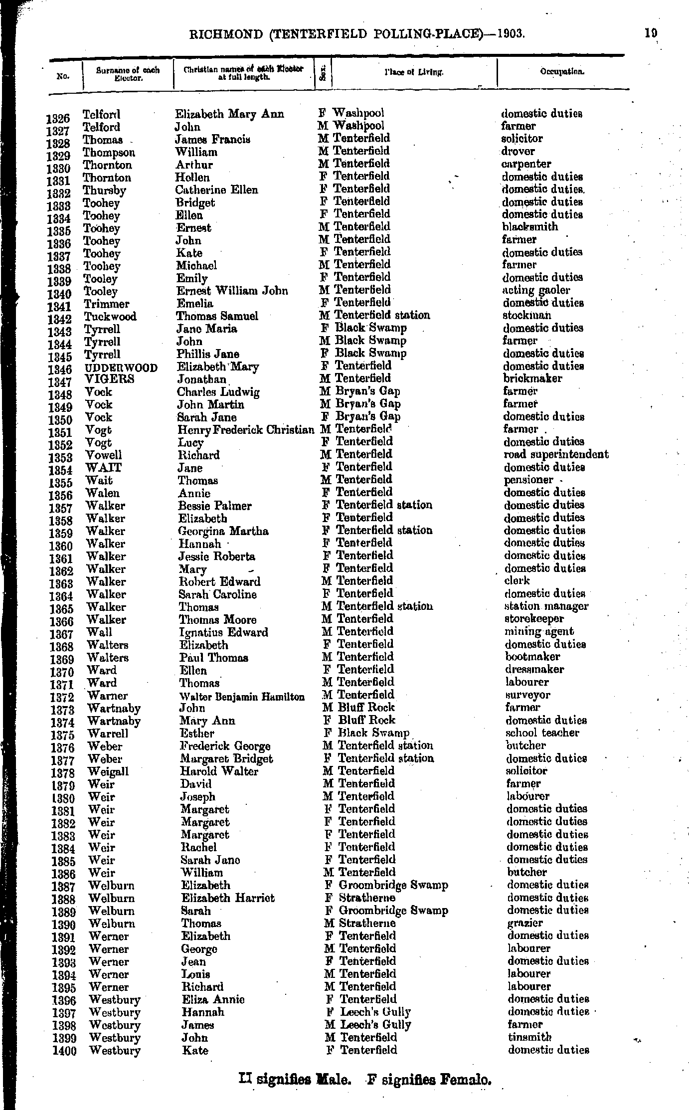
- Smith Phoebe - Telford Edward
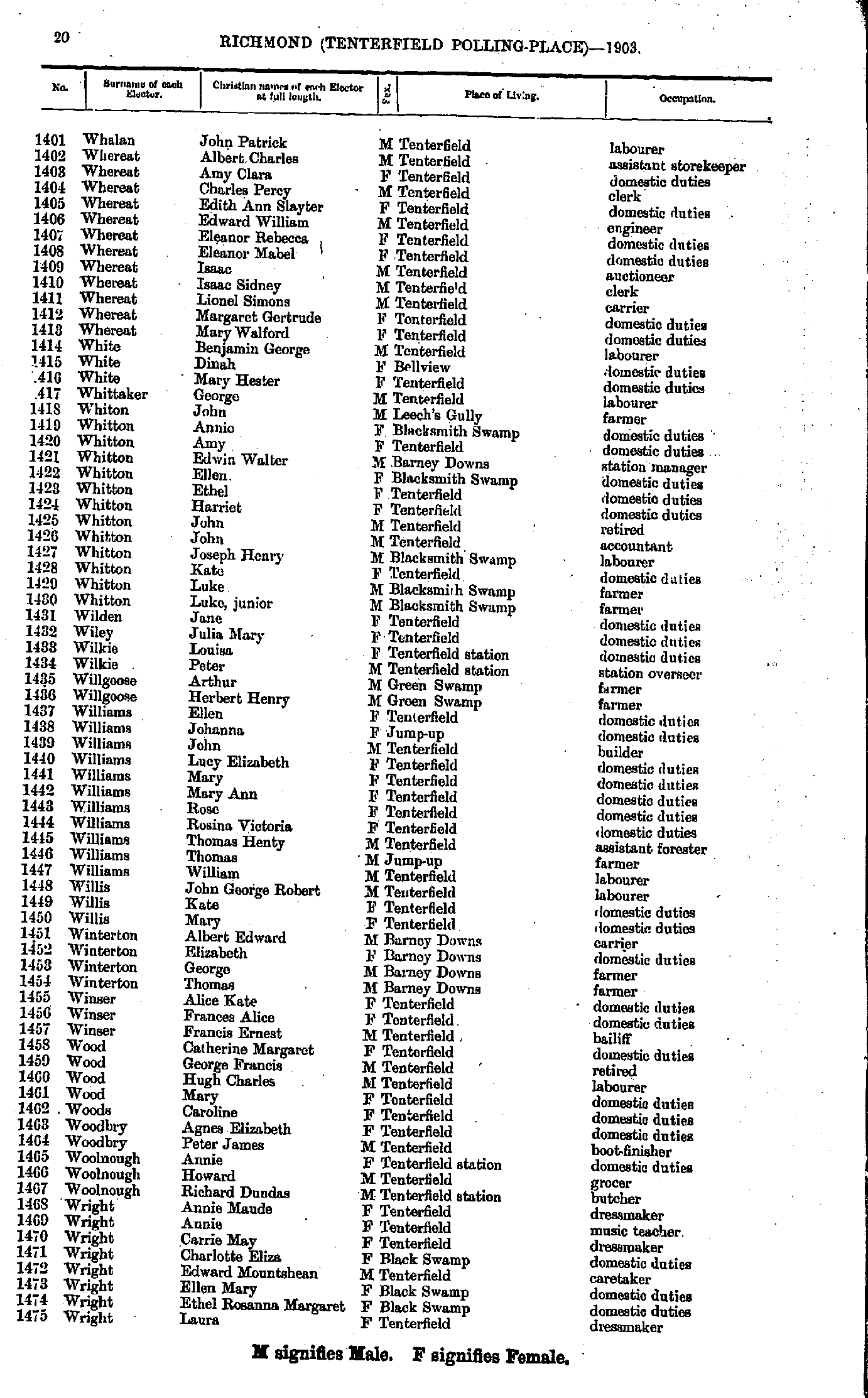
- Telford Elizabeth - Westbury Kate
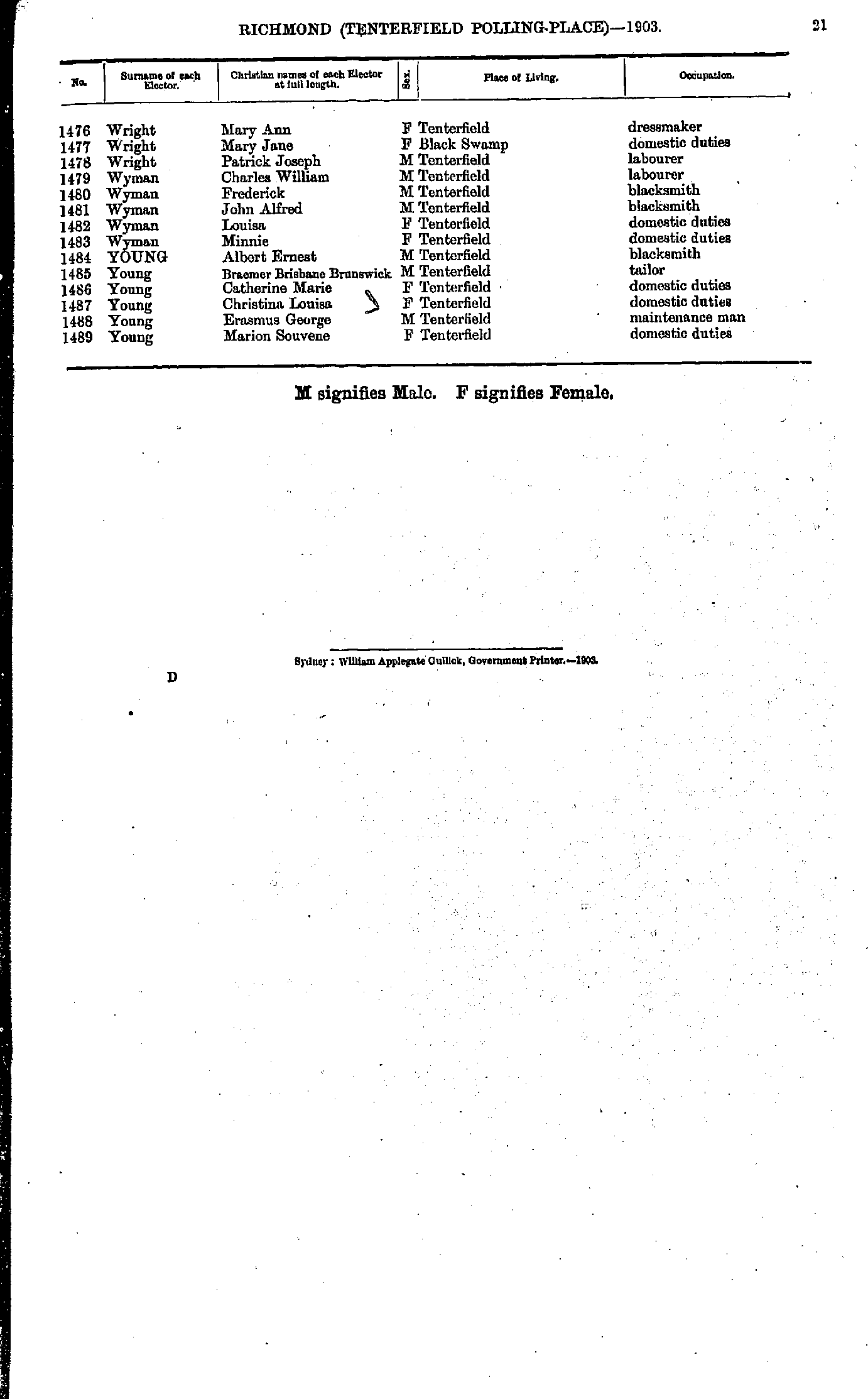
- Whalan John - Wright Laura
- Wright Mary - Young Marion
- Affleck Caroline - Cooper Benjamin
- Costello James - Hayter William
- Hayter William - Maxwell Ella
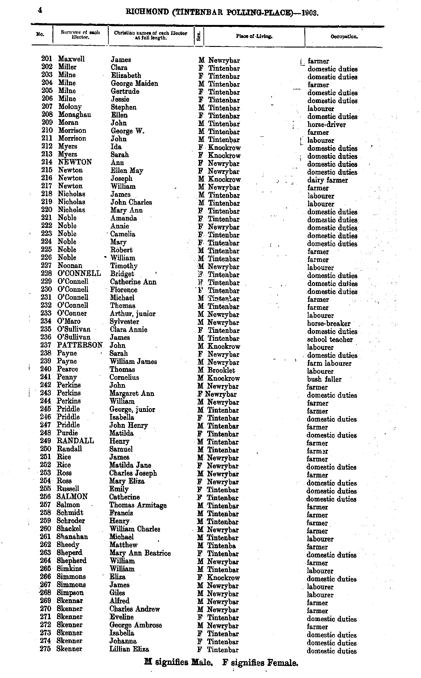
- Maxwell James - Skenner Lillian
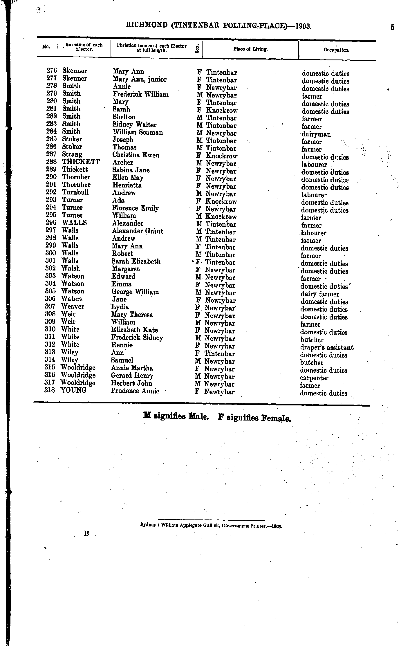
- Skenner Mary - Young Prudence
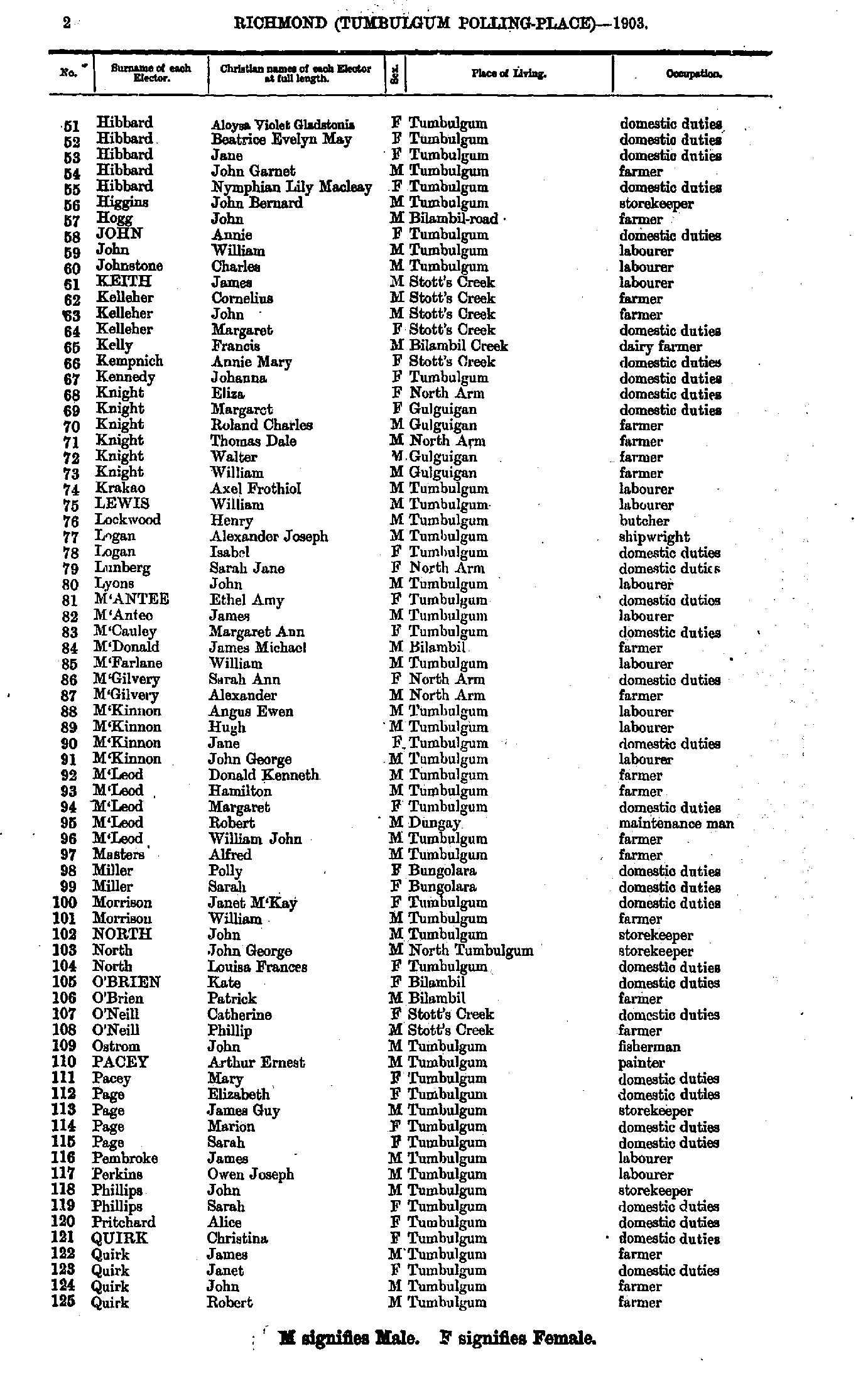
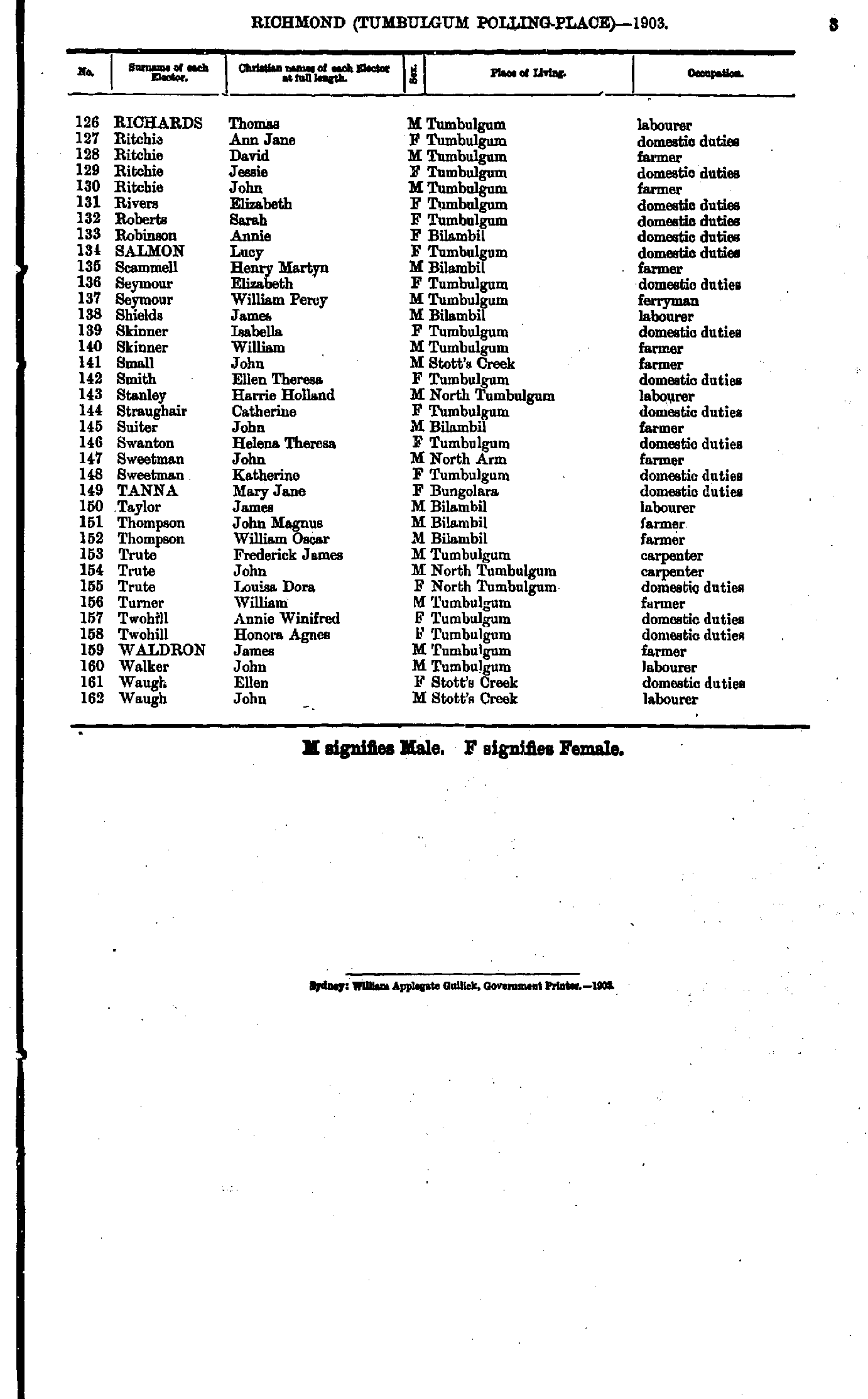
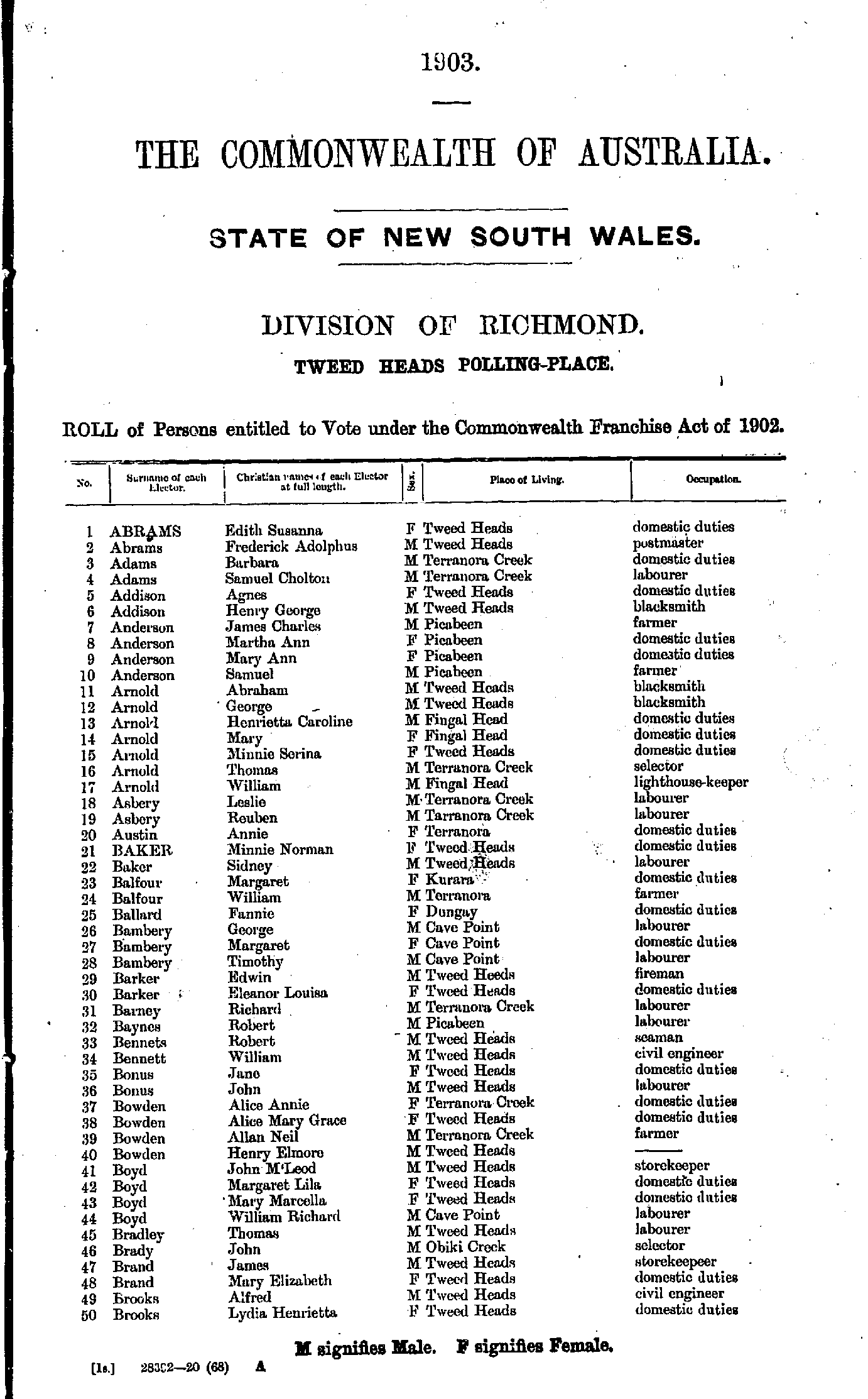
- Abrams Edith - Brooks Lydia
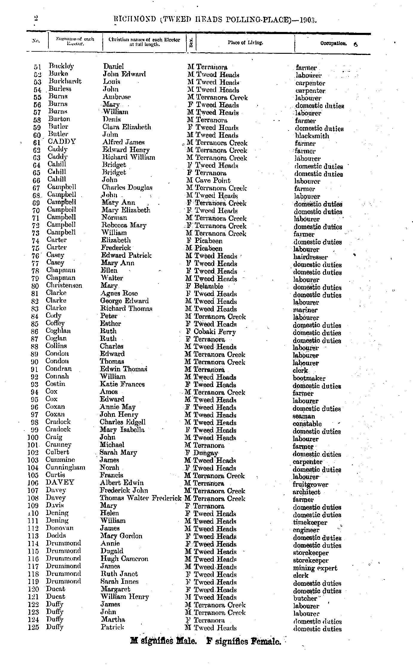
- Buckley Daniel - Duffy Patrick
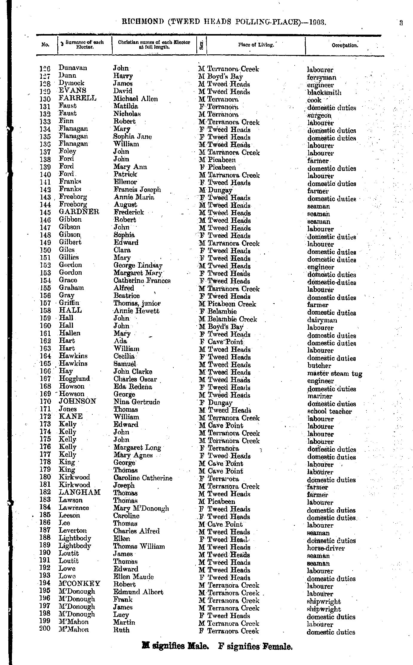
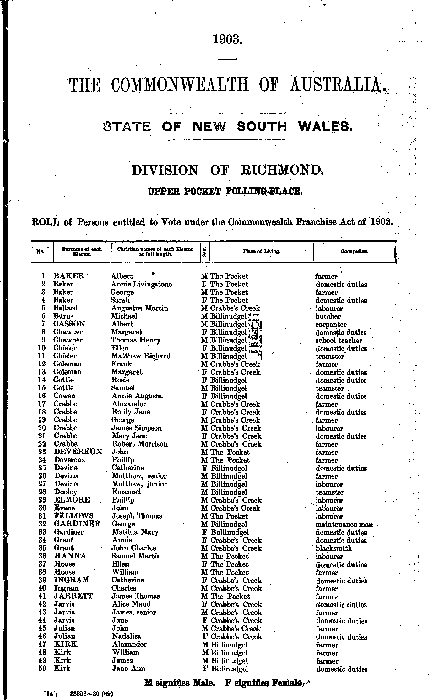
- Dunavan John - M'Mahon Ruth
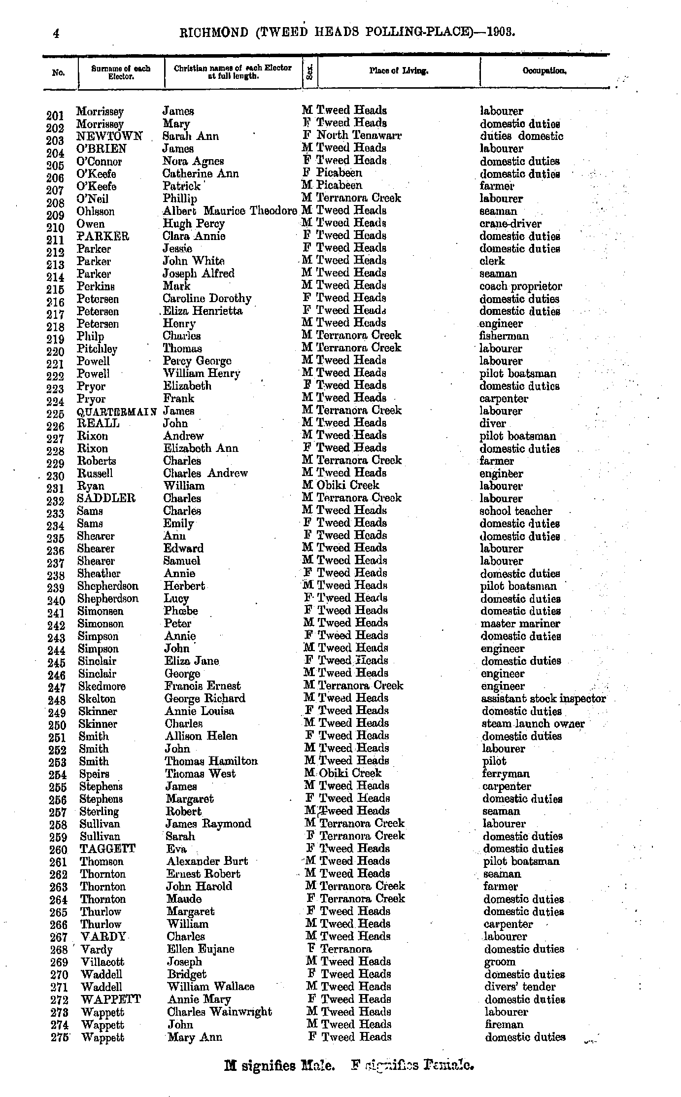
- Morrissey James - Wappett Mary
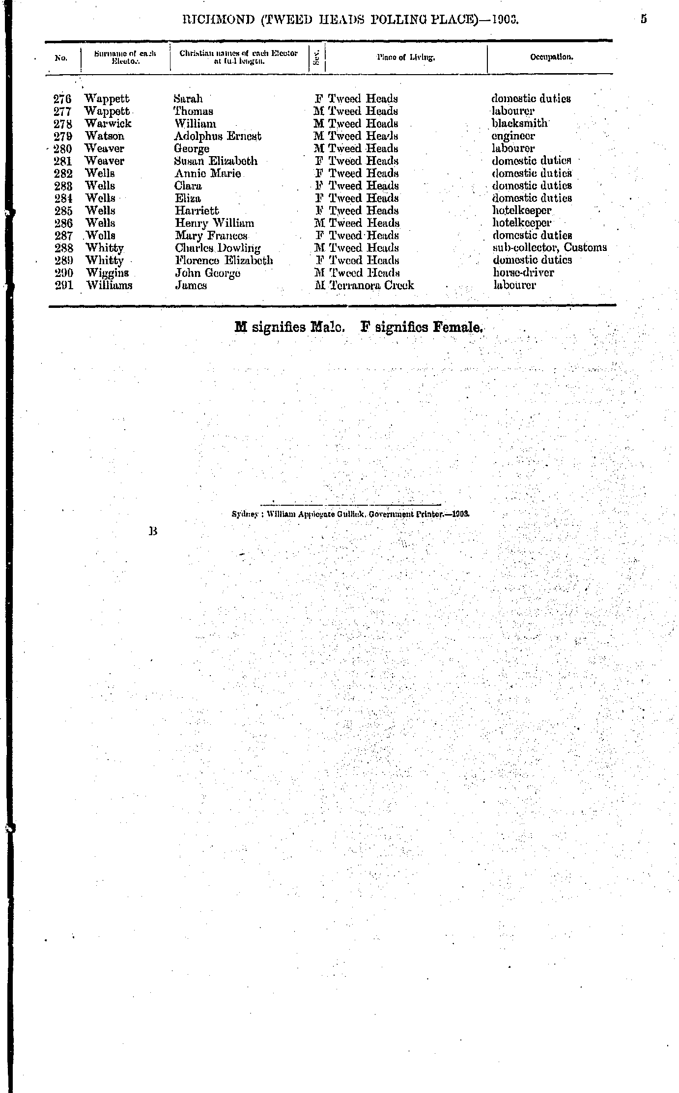
- Wappett Sarah - Williams James
- Anderson George - Clarke Lawrence
- Colebrook Amelia - Hendley Susanna
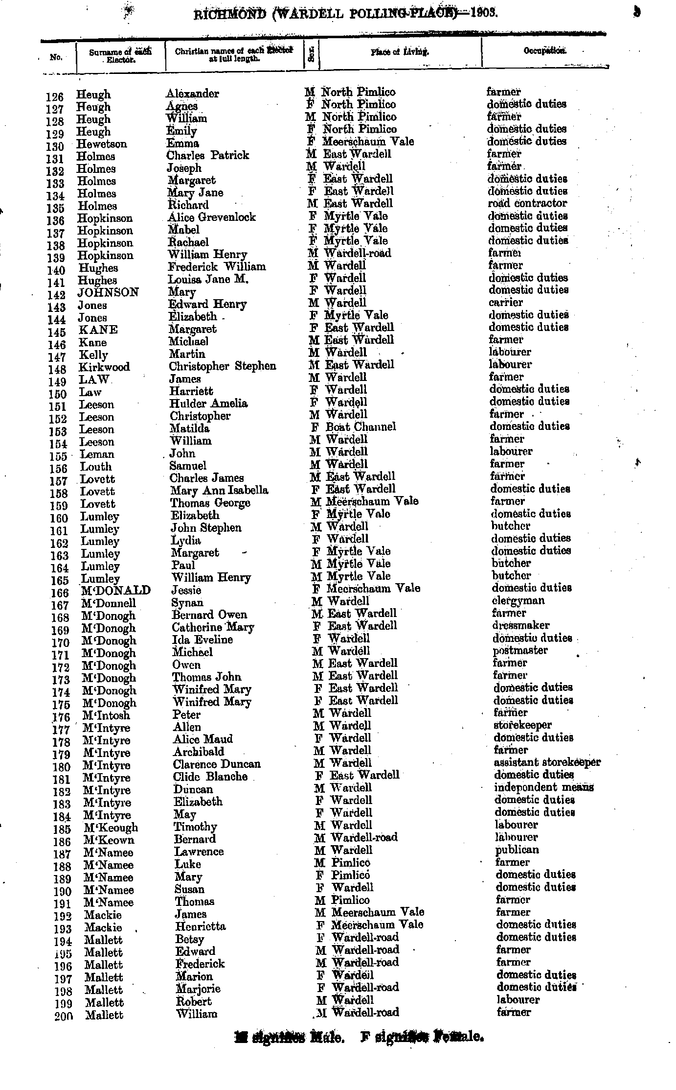
- Heugh Alexander - Mallett William
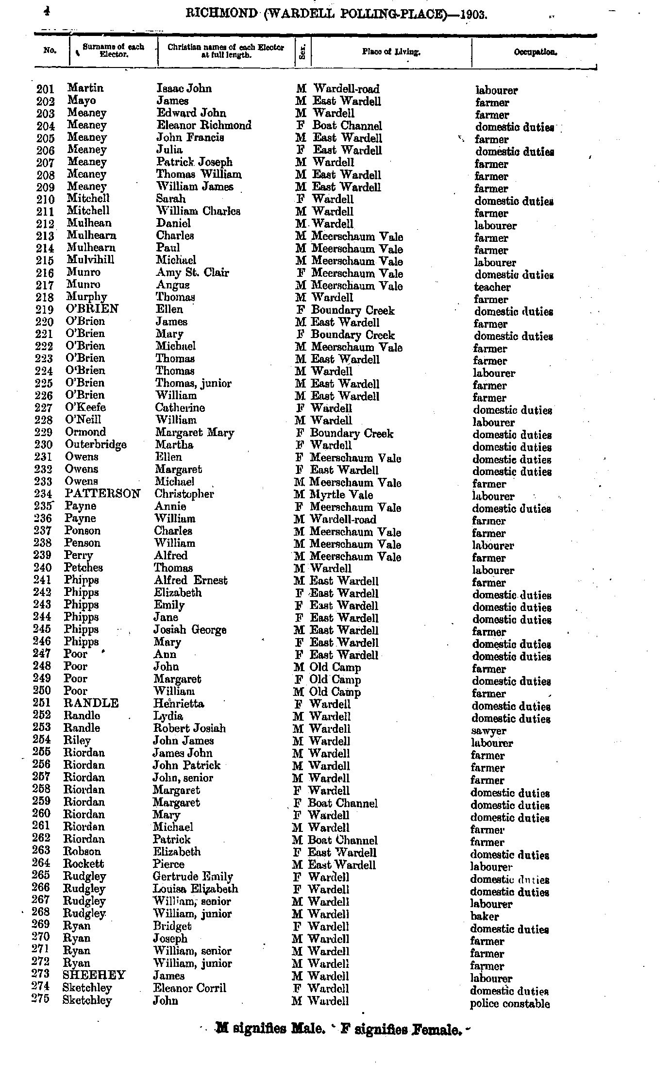
- Martin Isaac - Sketchley John
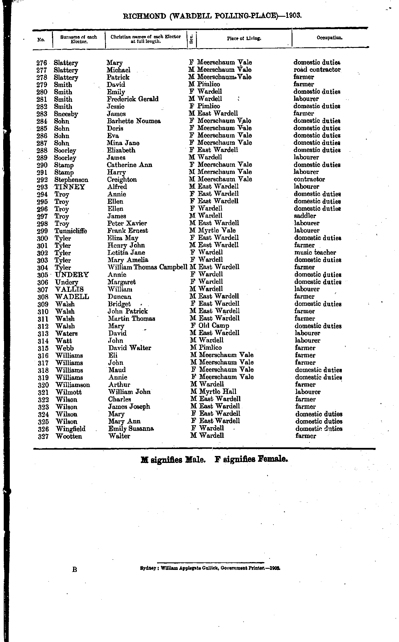
- Slattery Mary - Wootten Walter
Willson's Downfall Polling Place
- Bailey Emma - Davis Agnes
- Davis Elizabeth - M'Mahon Bridget
- M'Mahon John - Taylor Barry
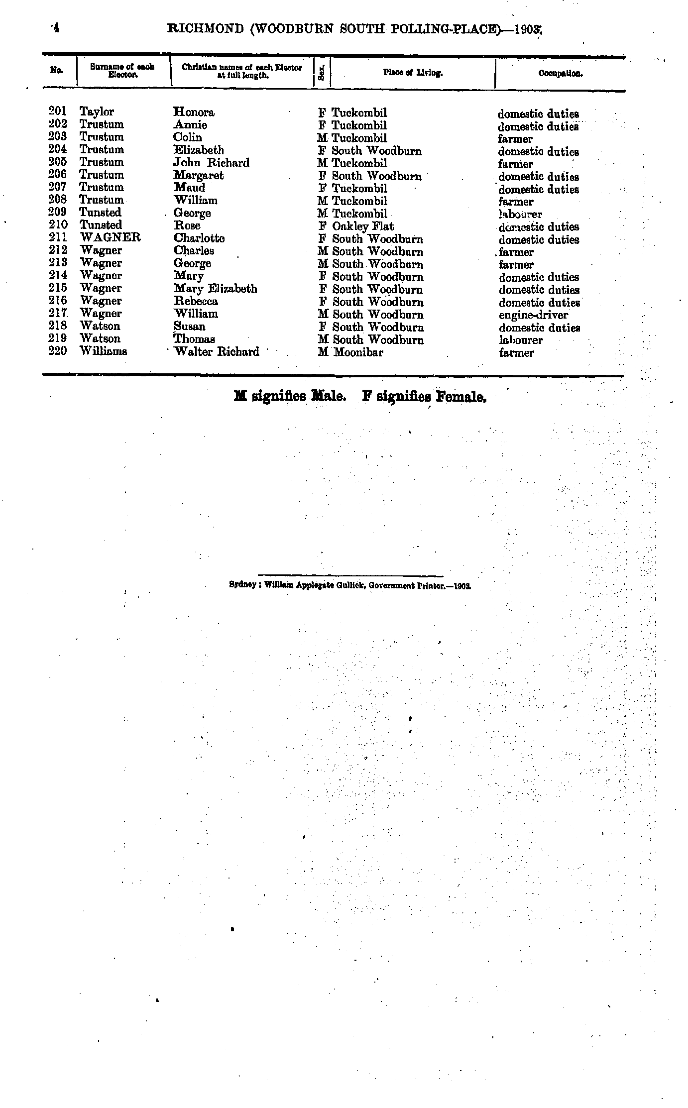
- Taylor Honora - Williams Walter
Maps of the Richmond Electoral Division
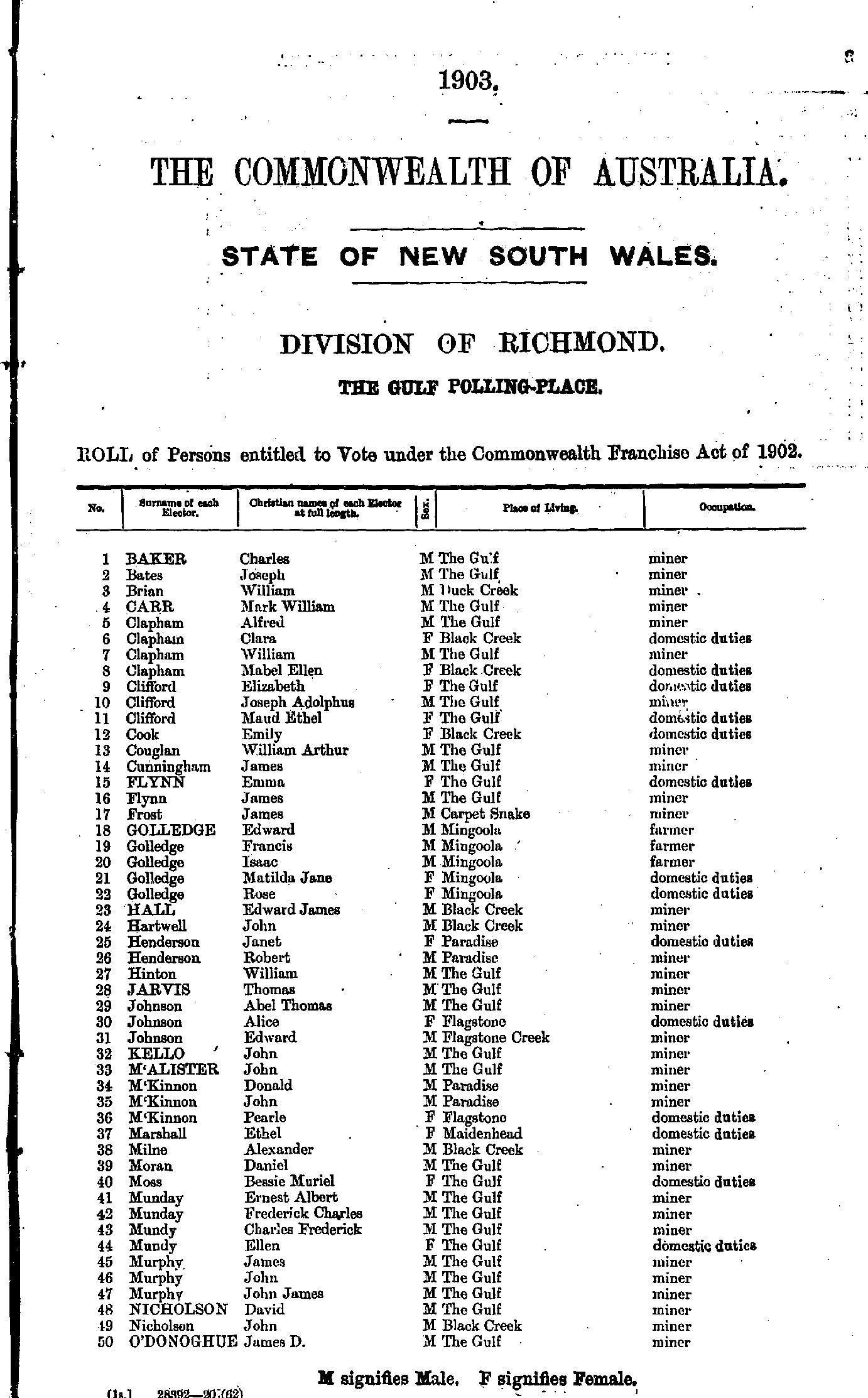
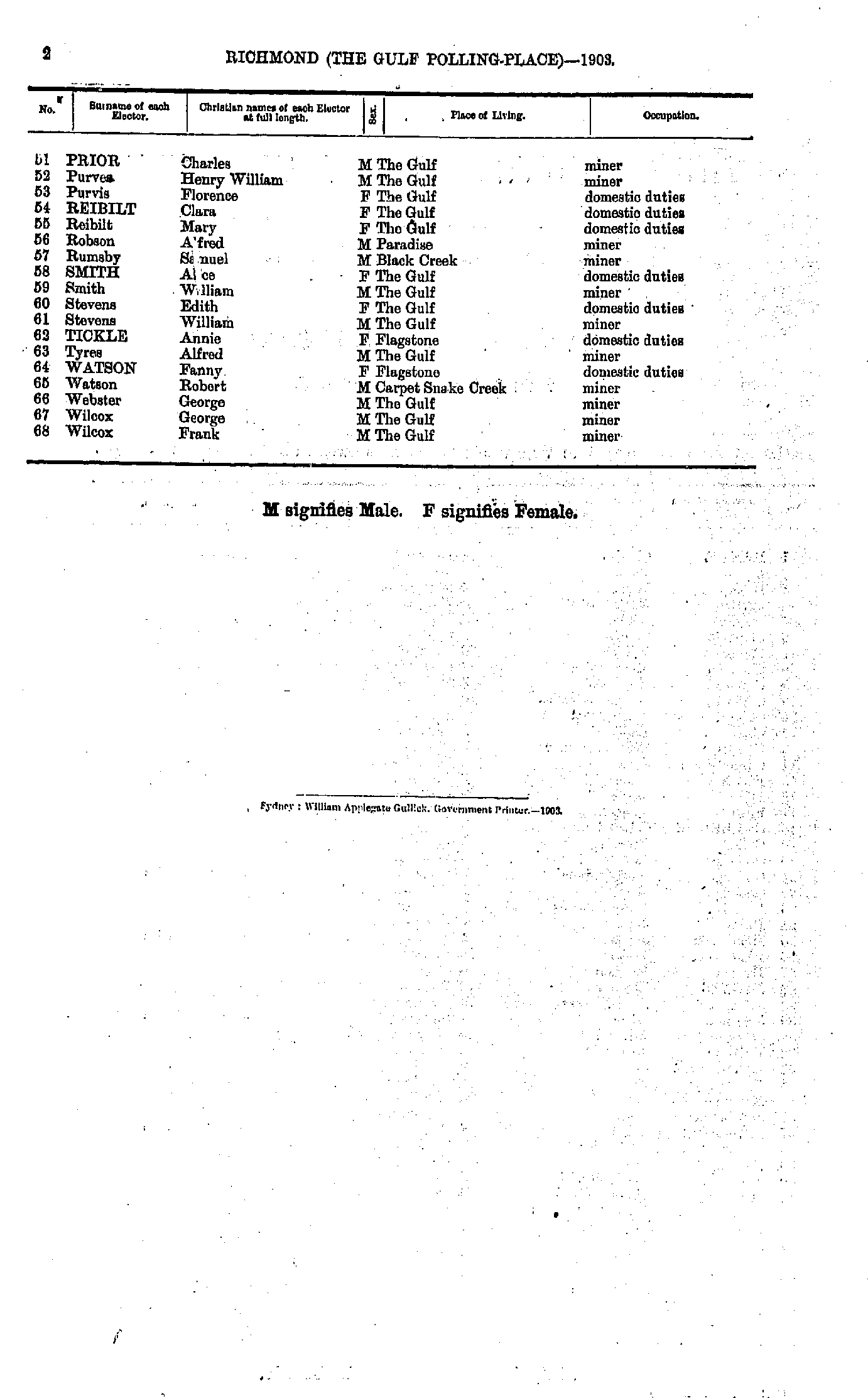
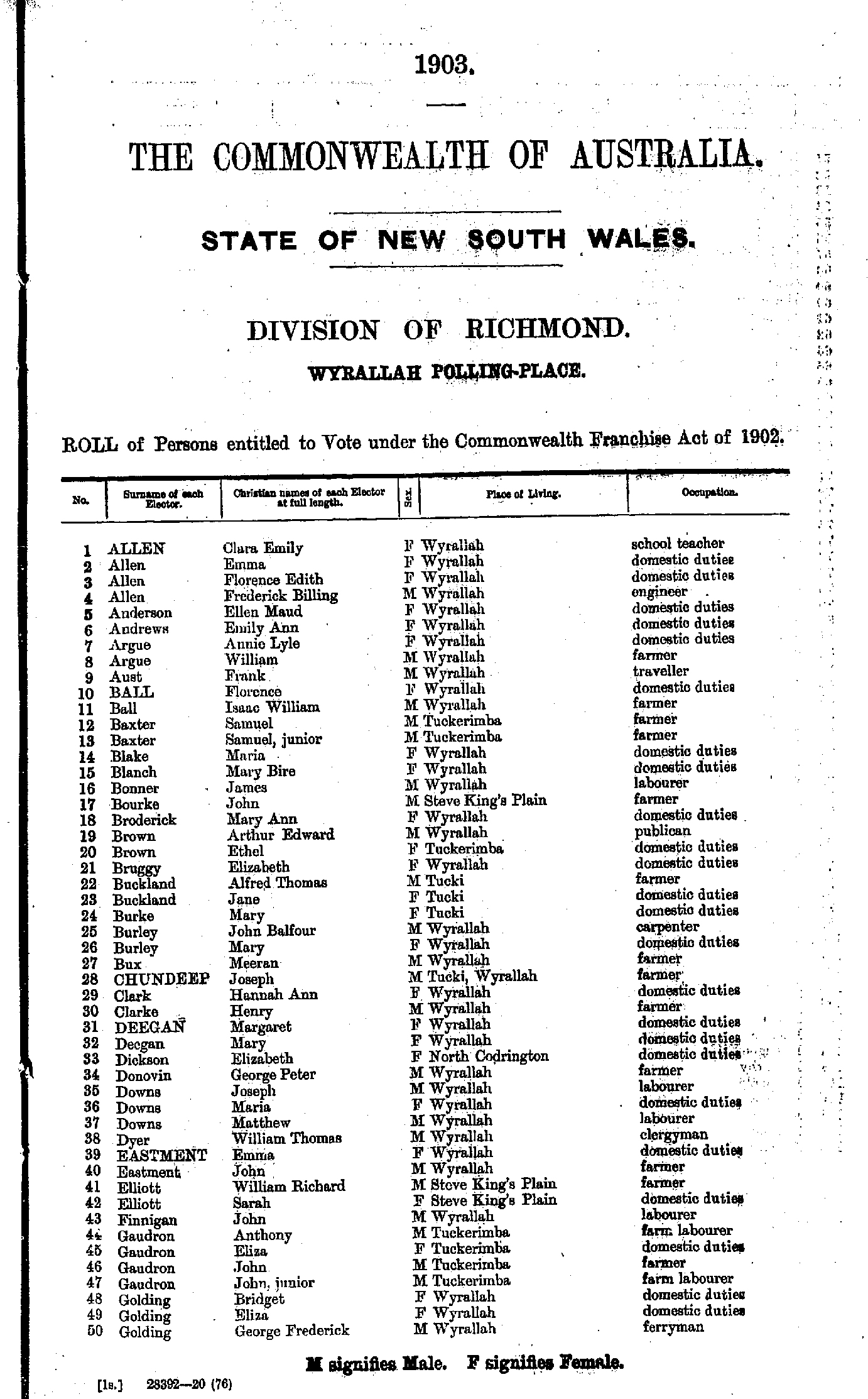
- Allen Clara - Golding George
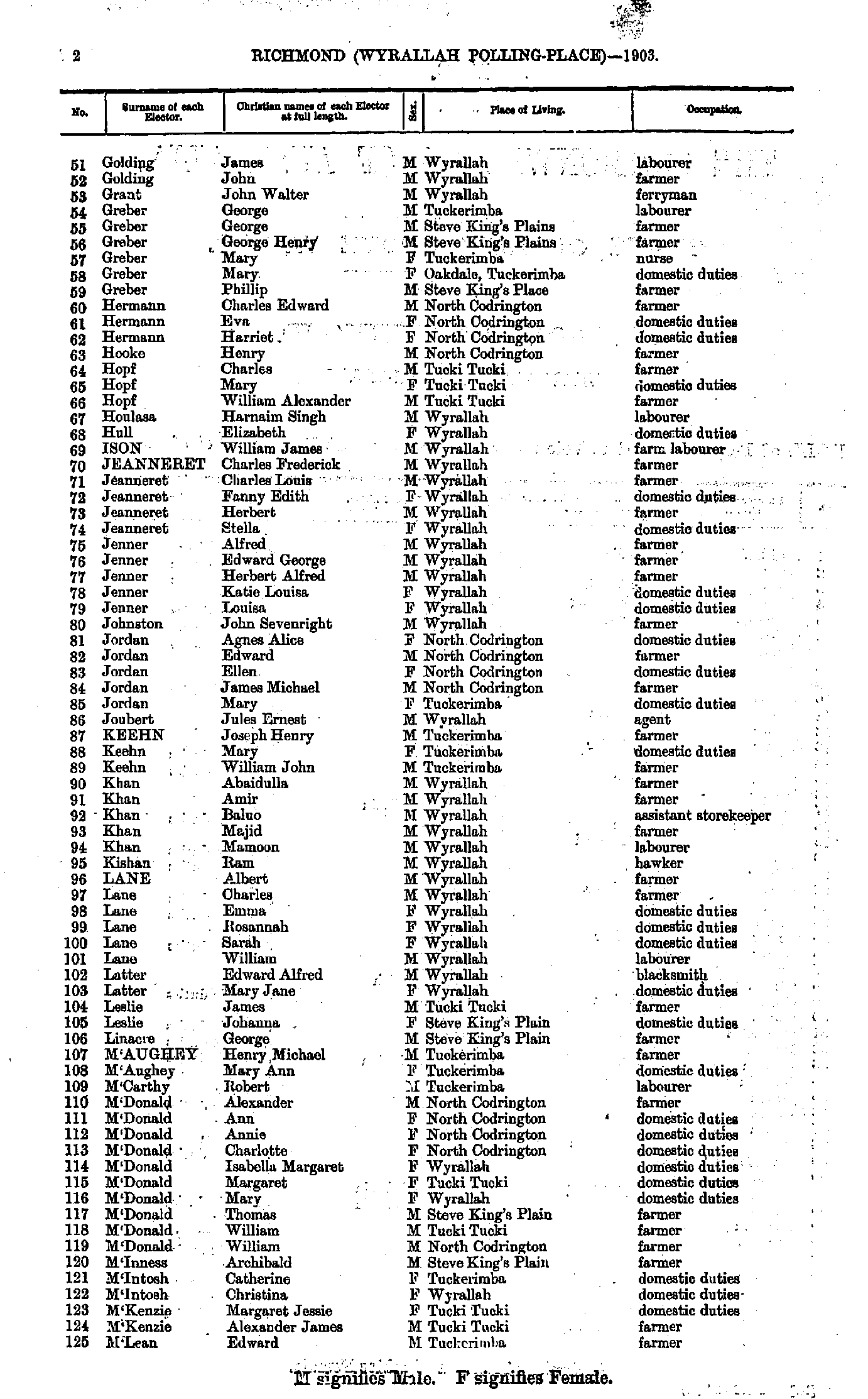
- Golding James - M'Lean Edward
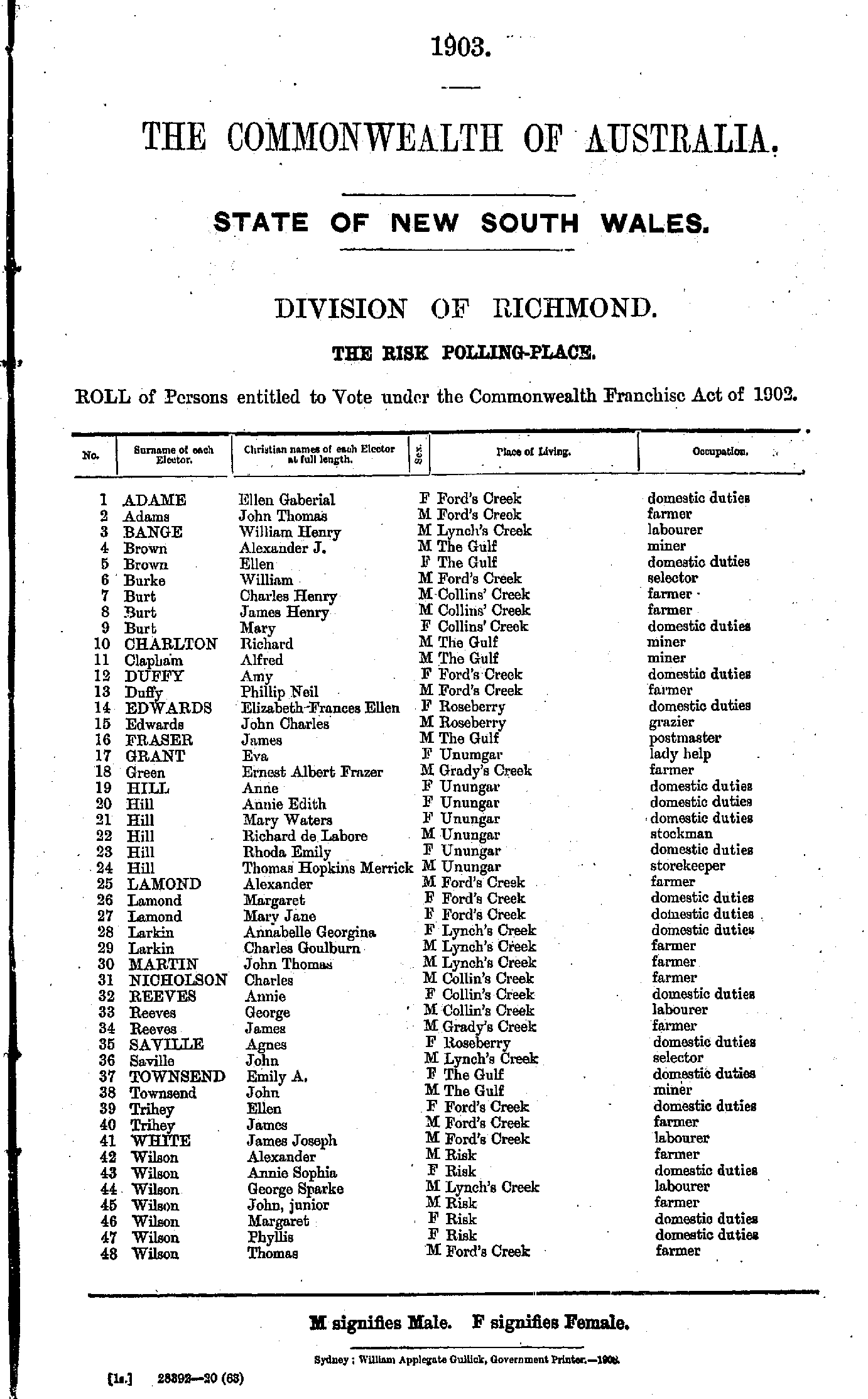
- M'Lean Eliza - Ramdayal Thomas
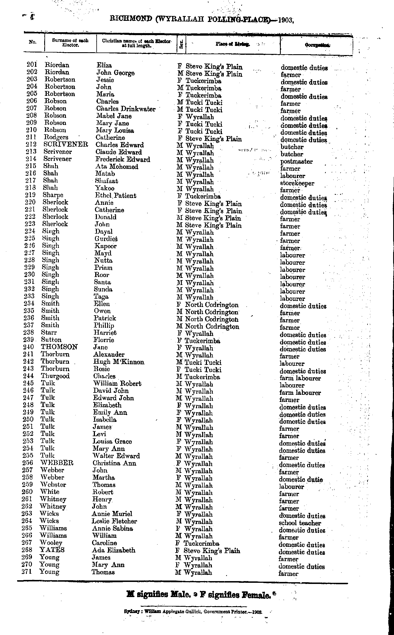
- Riordan Eliza - Young Thomas
From: Federal Electoral Districts Commissioners 1901, Maps of the Federal Electoral Districts of the State of New South Wales, William Applegate Gullick, Government Printer, Sydney.
JPEG file (213KB)
Portable Document Format(PDF) file (1.06MB)If you do not have a PDF reader you can click on the button to download the free Adobe Acrobat Reader
The documents in this site are arranged into seven major indexes. You are currently in the Electoral Rolls index. Use the Back button on your browser to move within this index, or use the links below to view another index:
- Directories
- Electoral Rolls
- Land Records
- General and Miscellaneous Records
- Mining Records
- Pastoral and Agricultural Records
- Other Occupations
Copyright © Internet History Resources 2007
