IHR NSW Family History Documents
Electoral Rolls Index
Home | Directories | Electoral | Land | General | Mining | Pastoral | OccupationsNSW Electoral Rolls 1903 - Parramatta Division
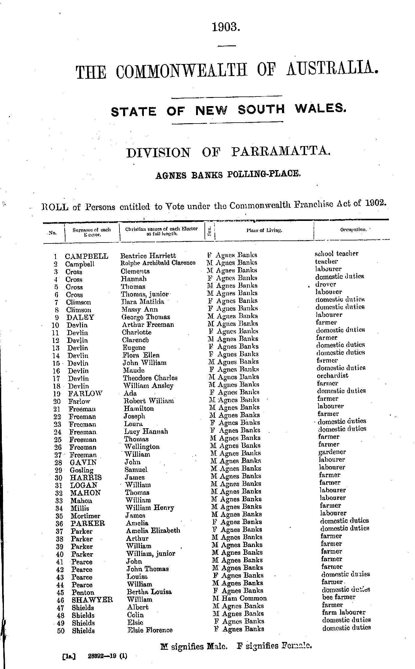
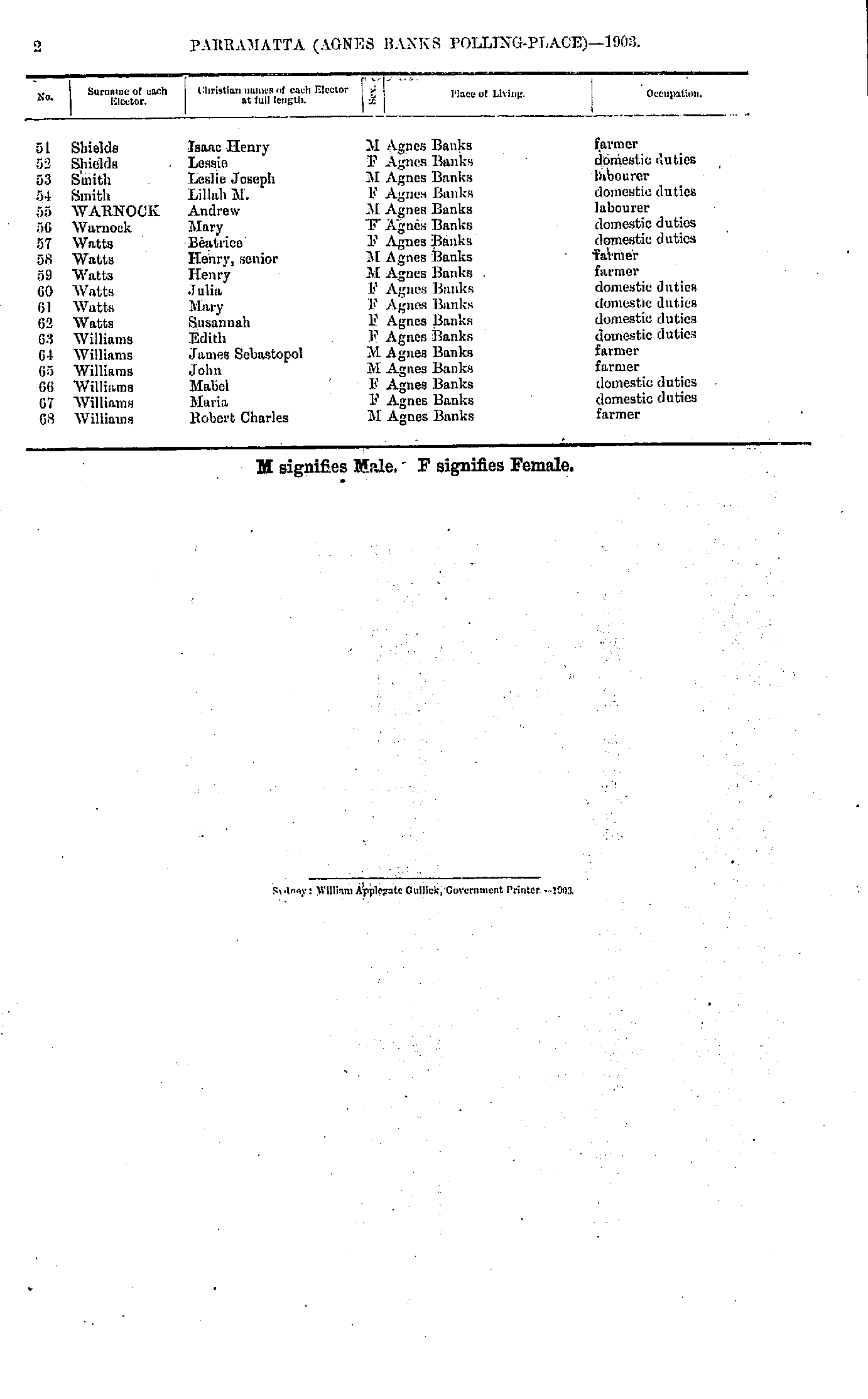
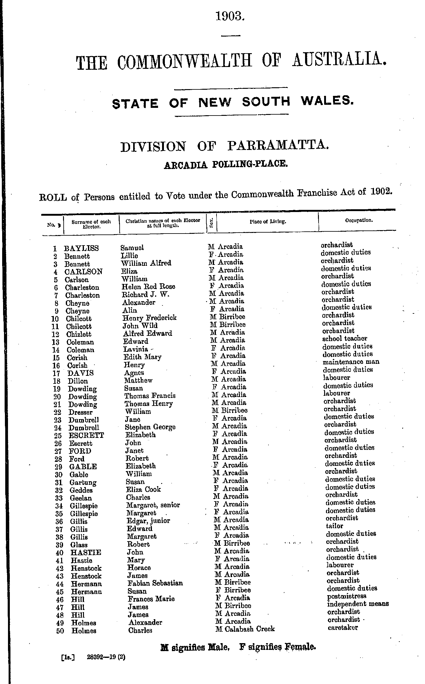
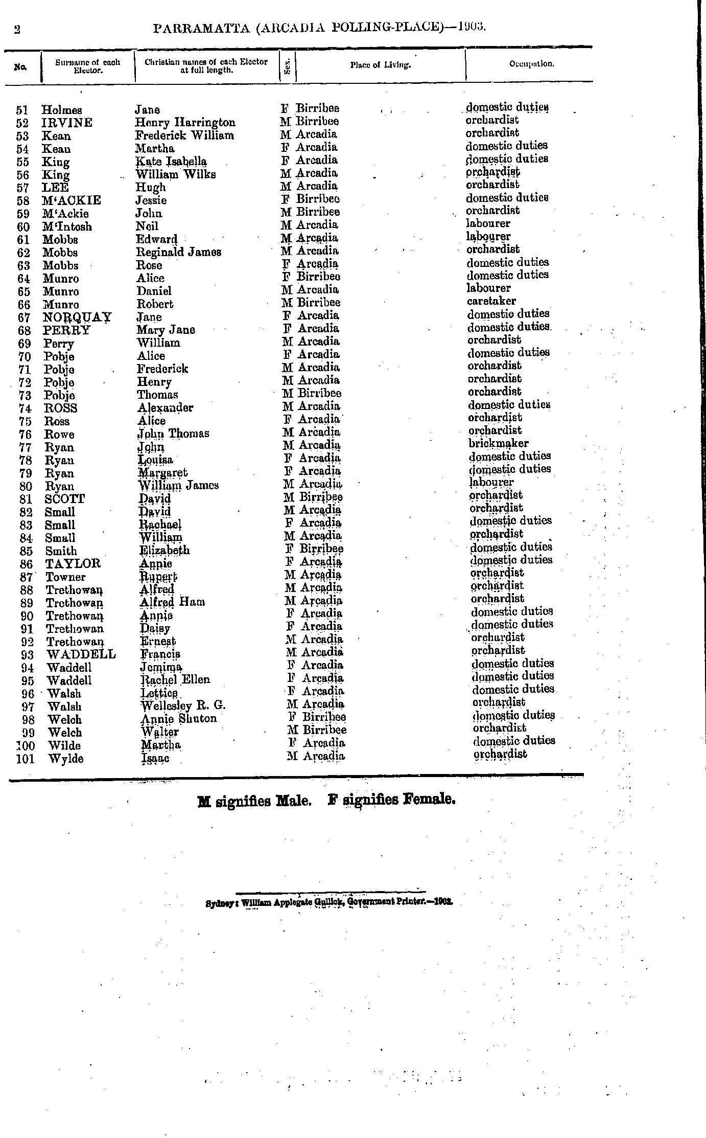
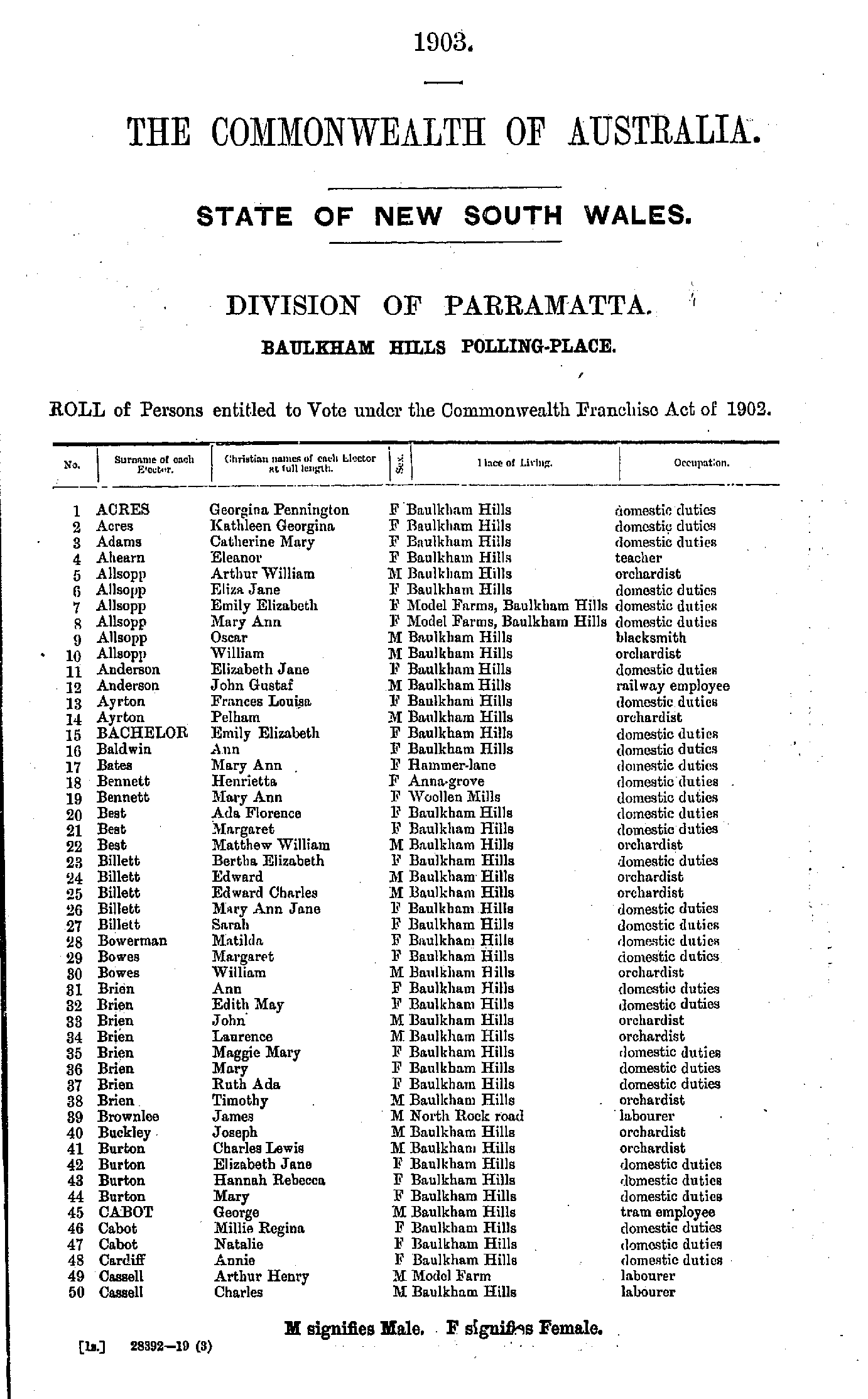
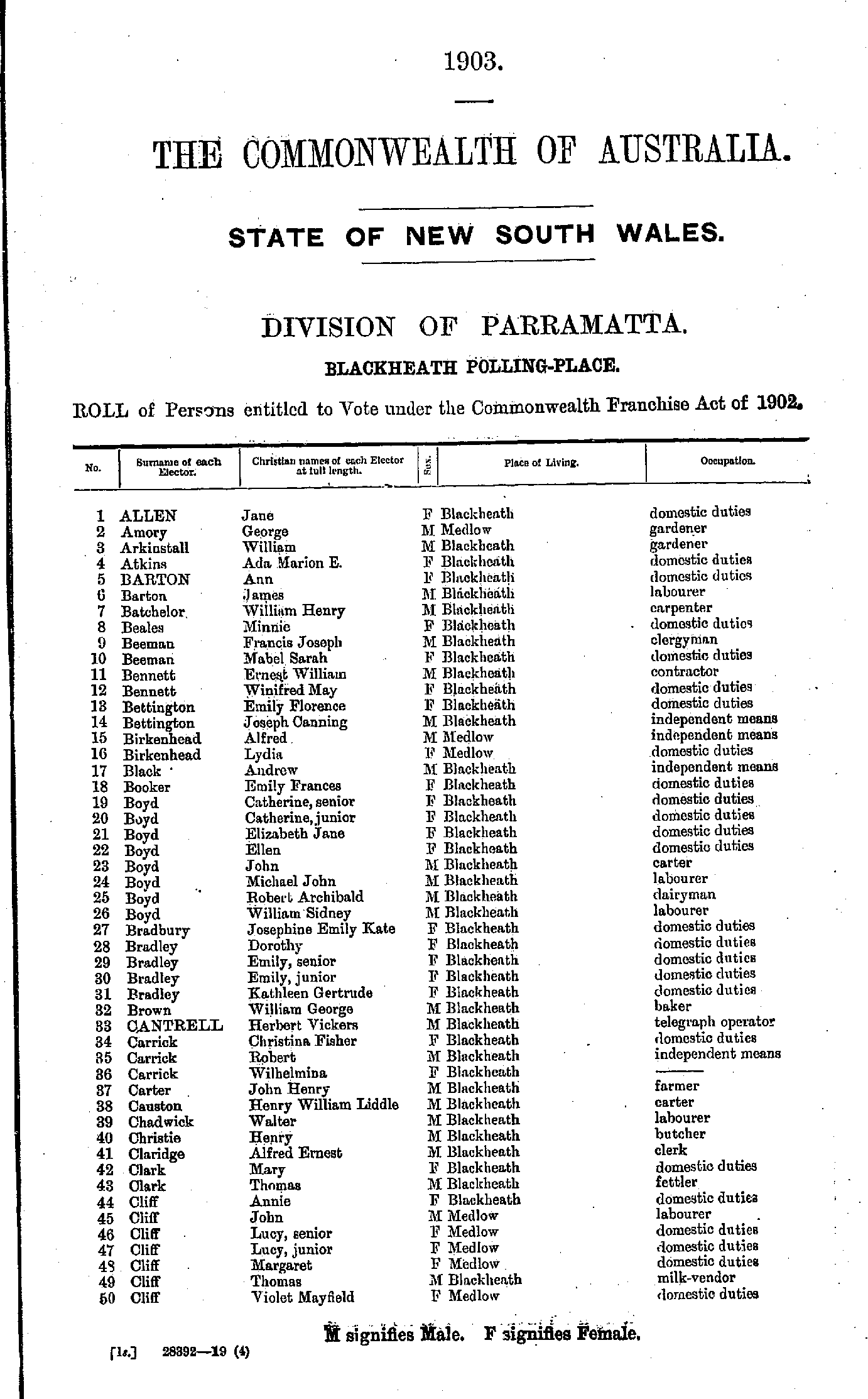
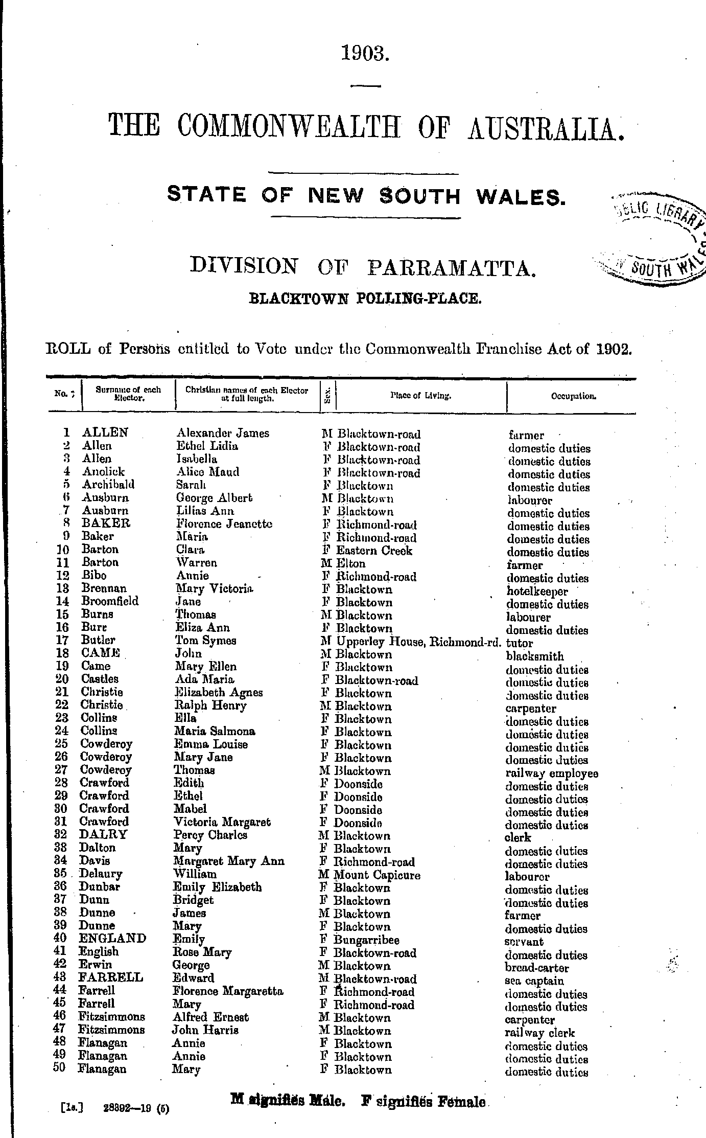
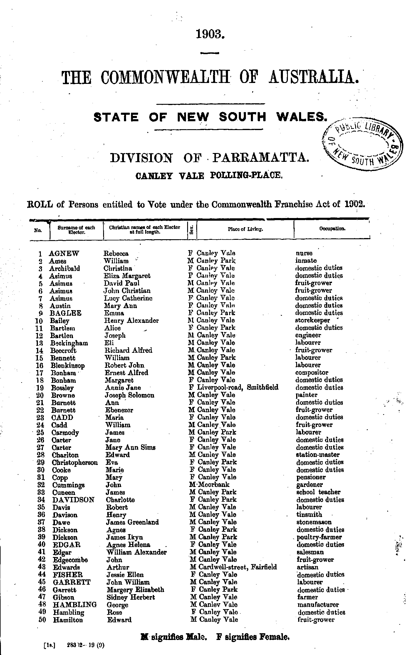
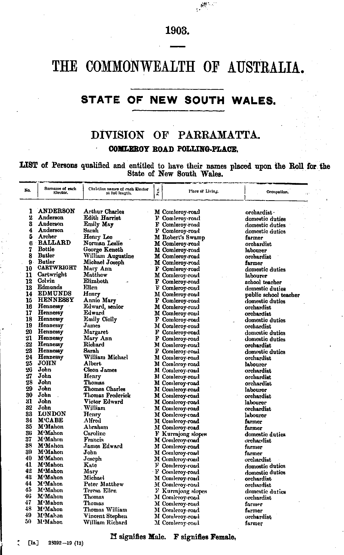
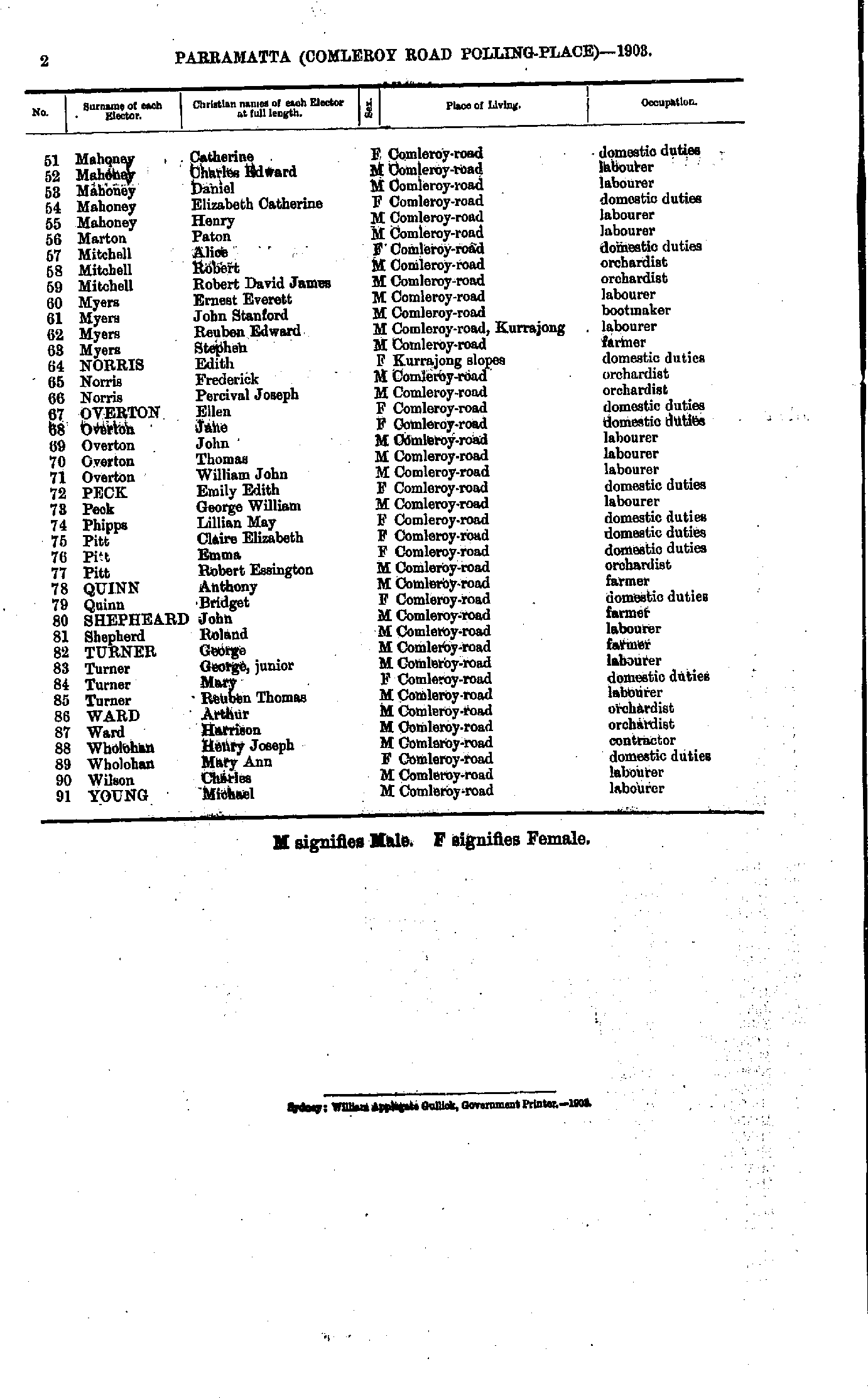
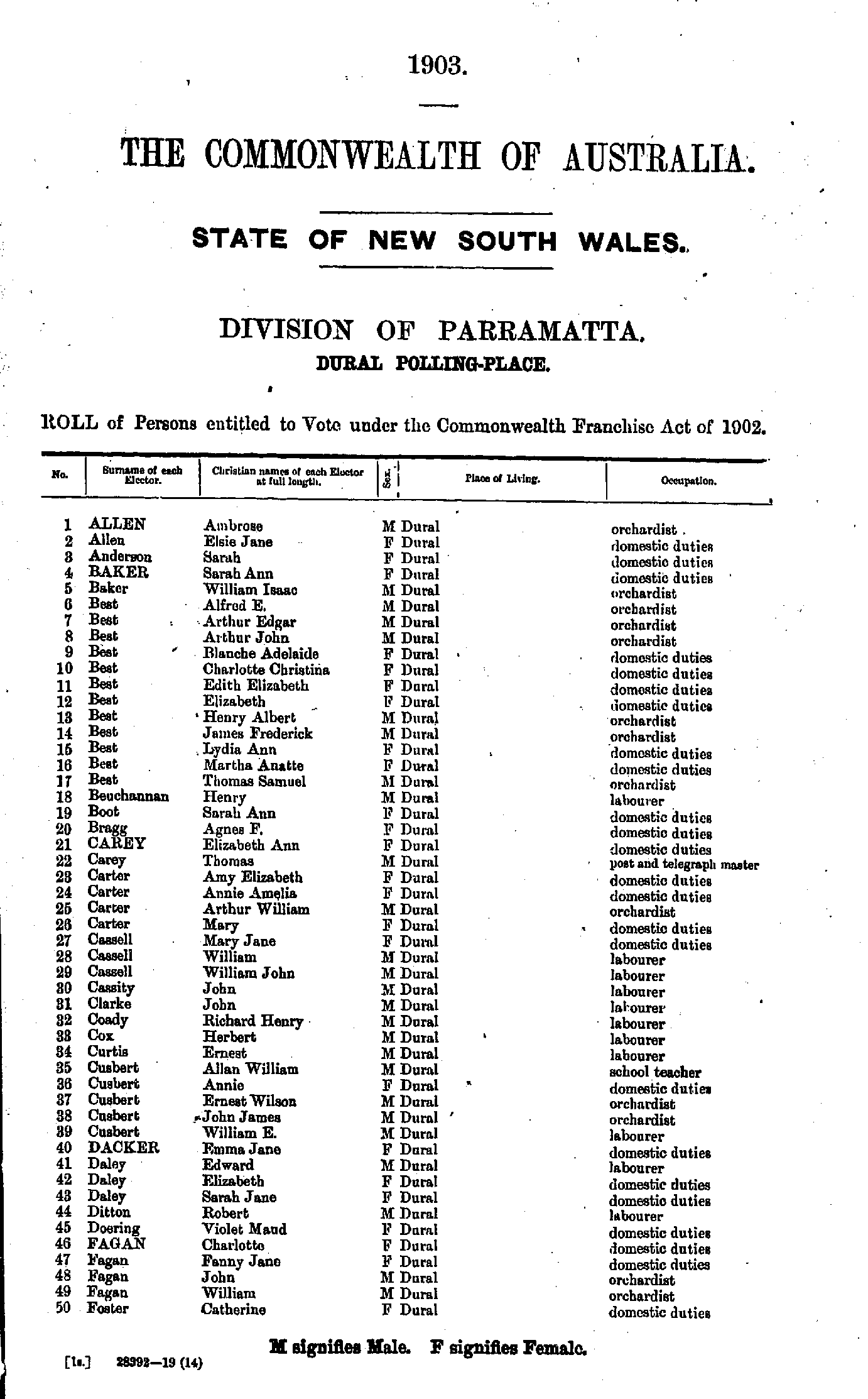
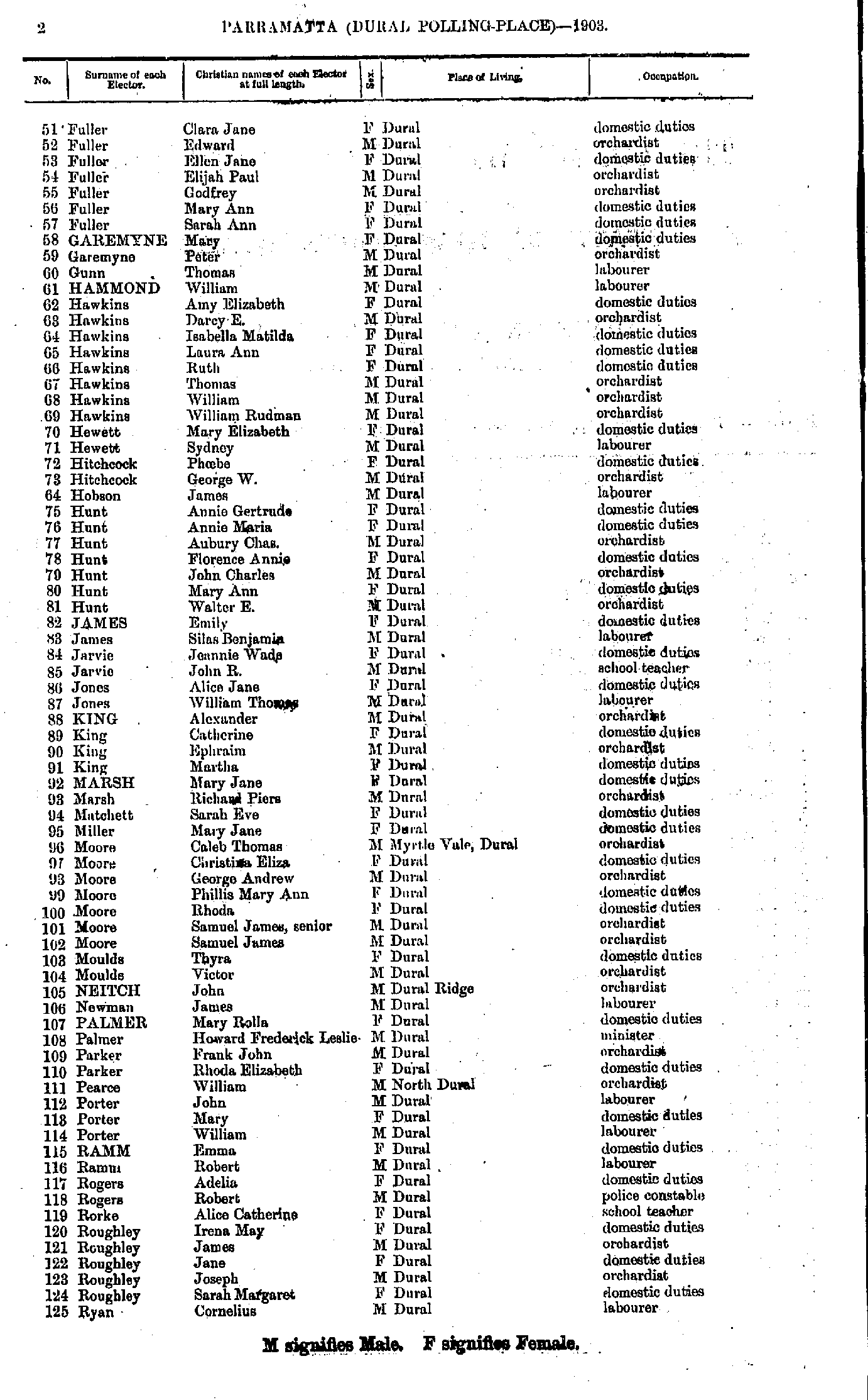
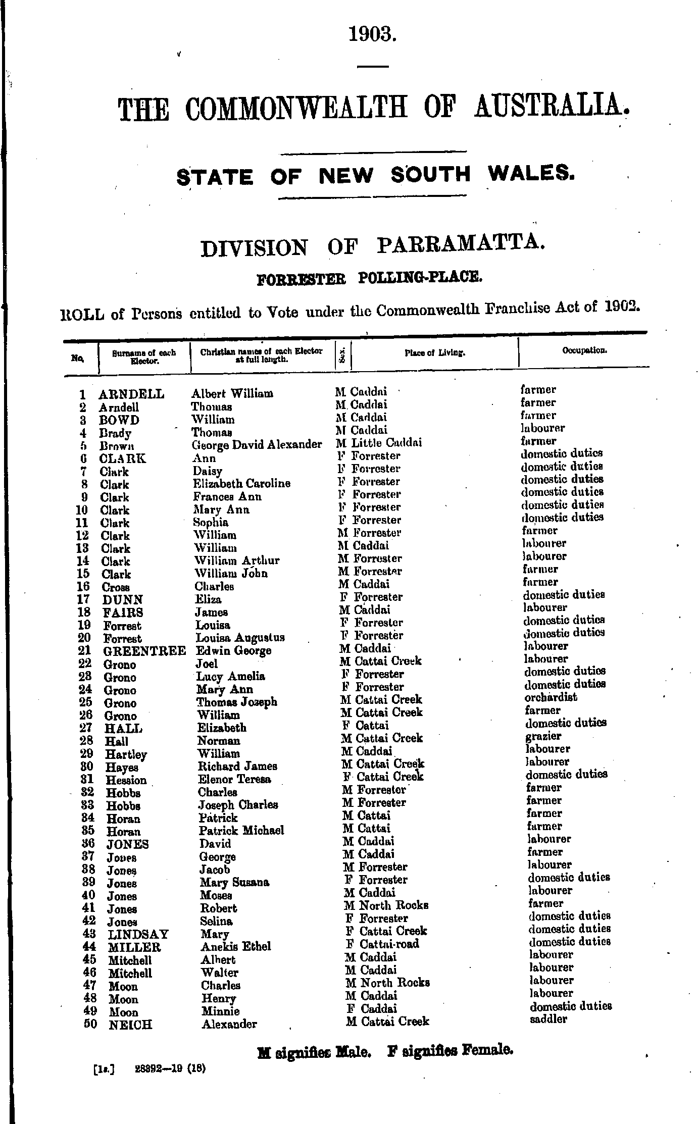
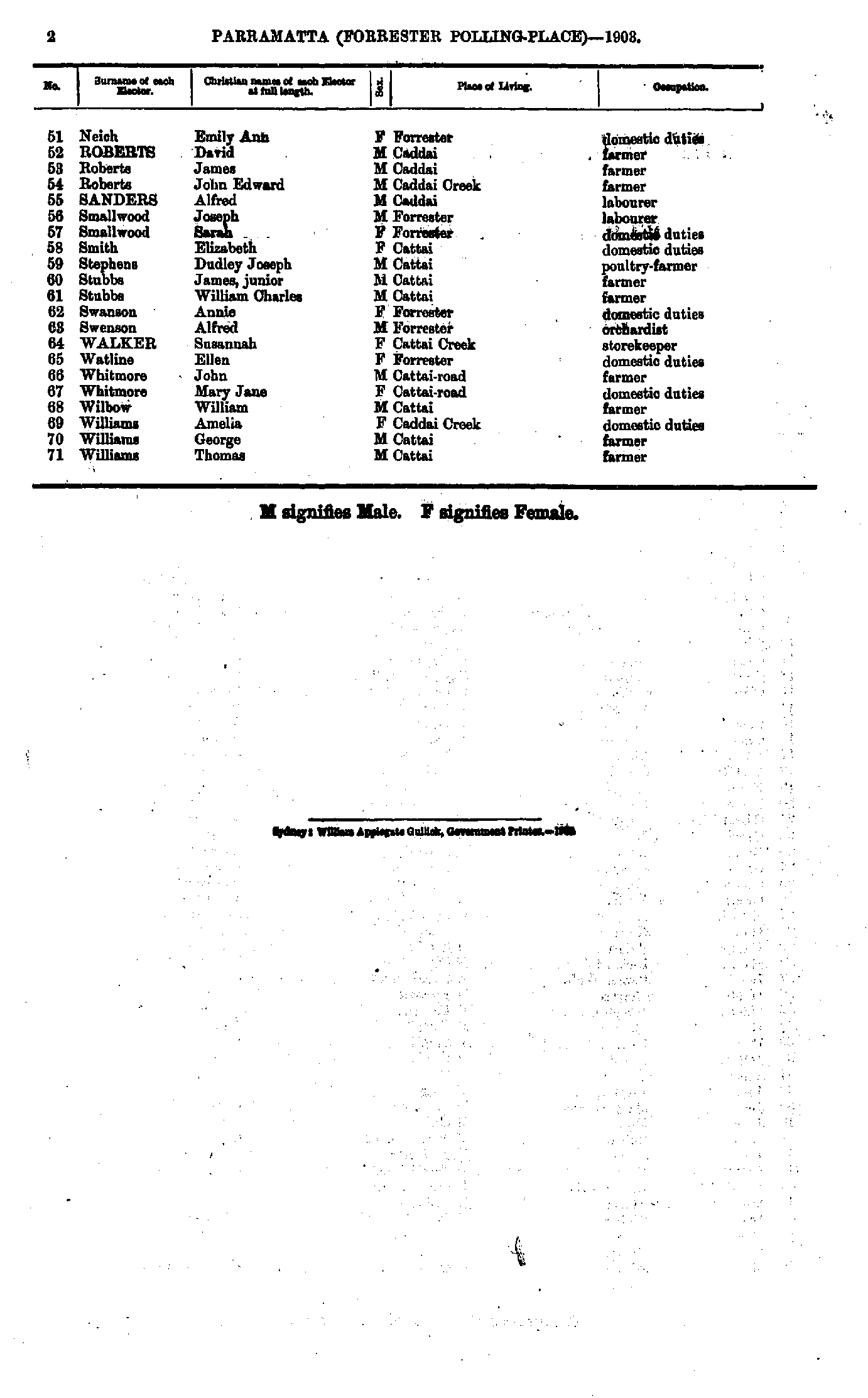
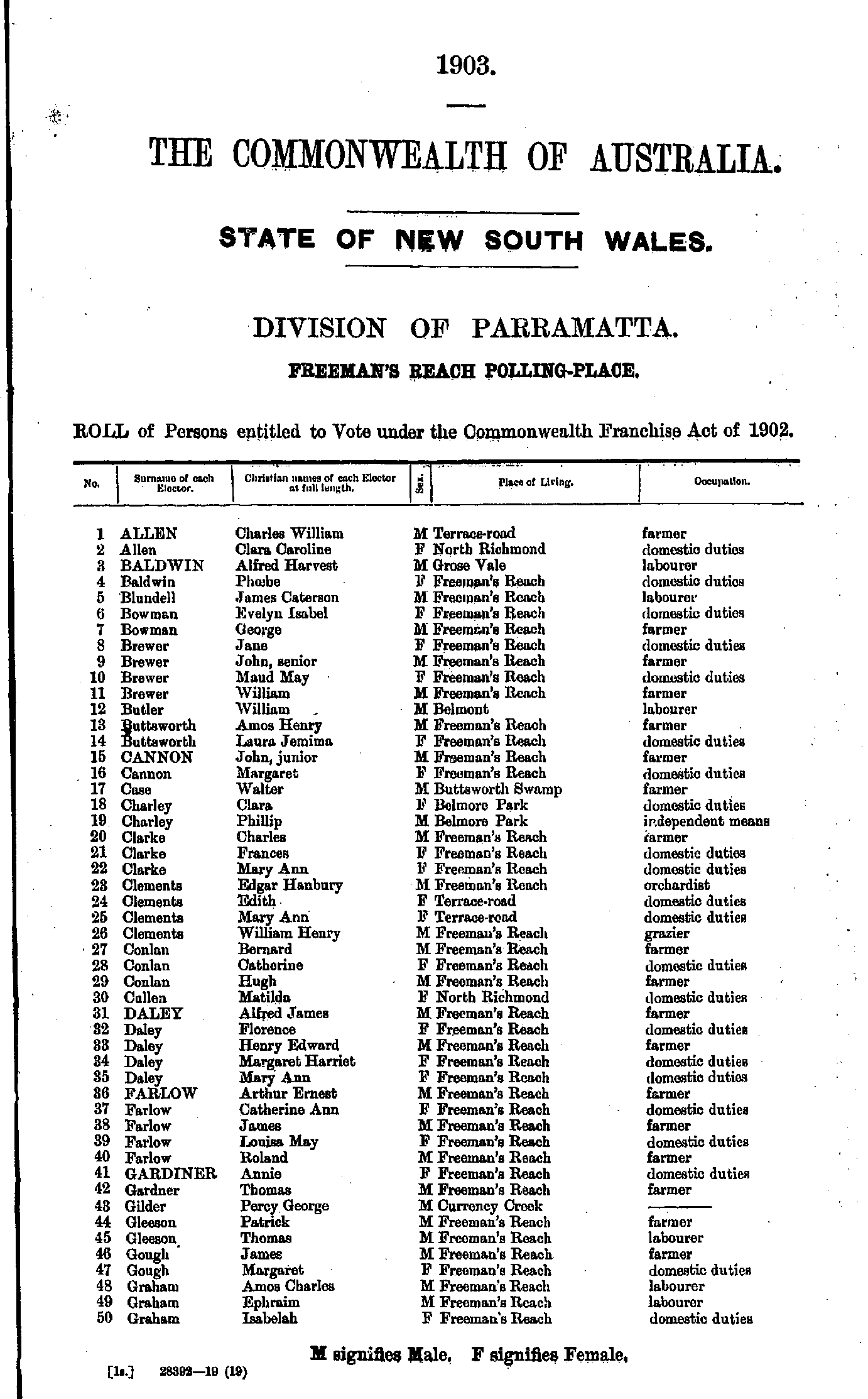
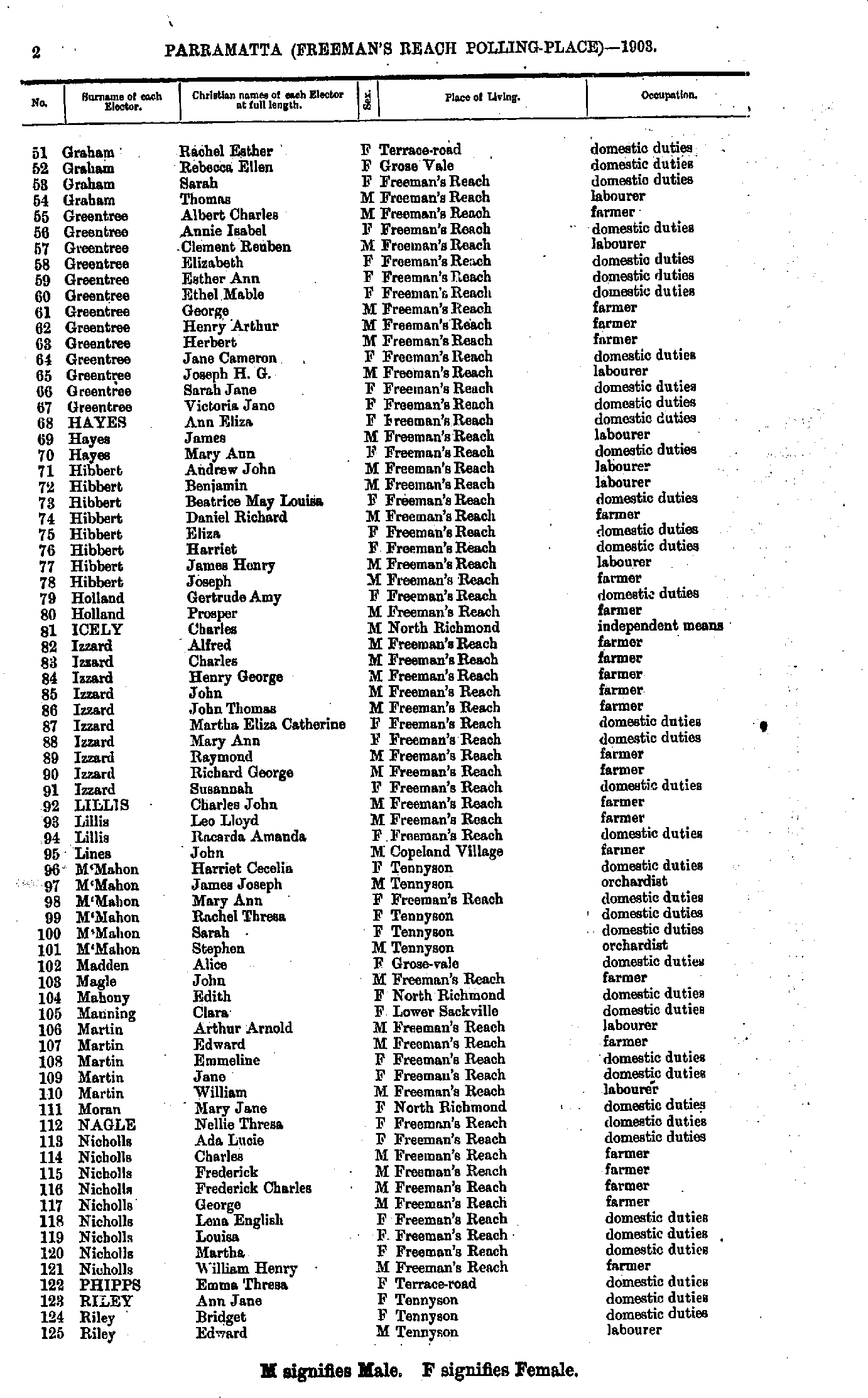
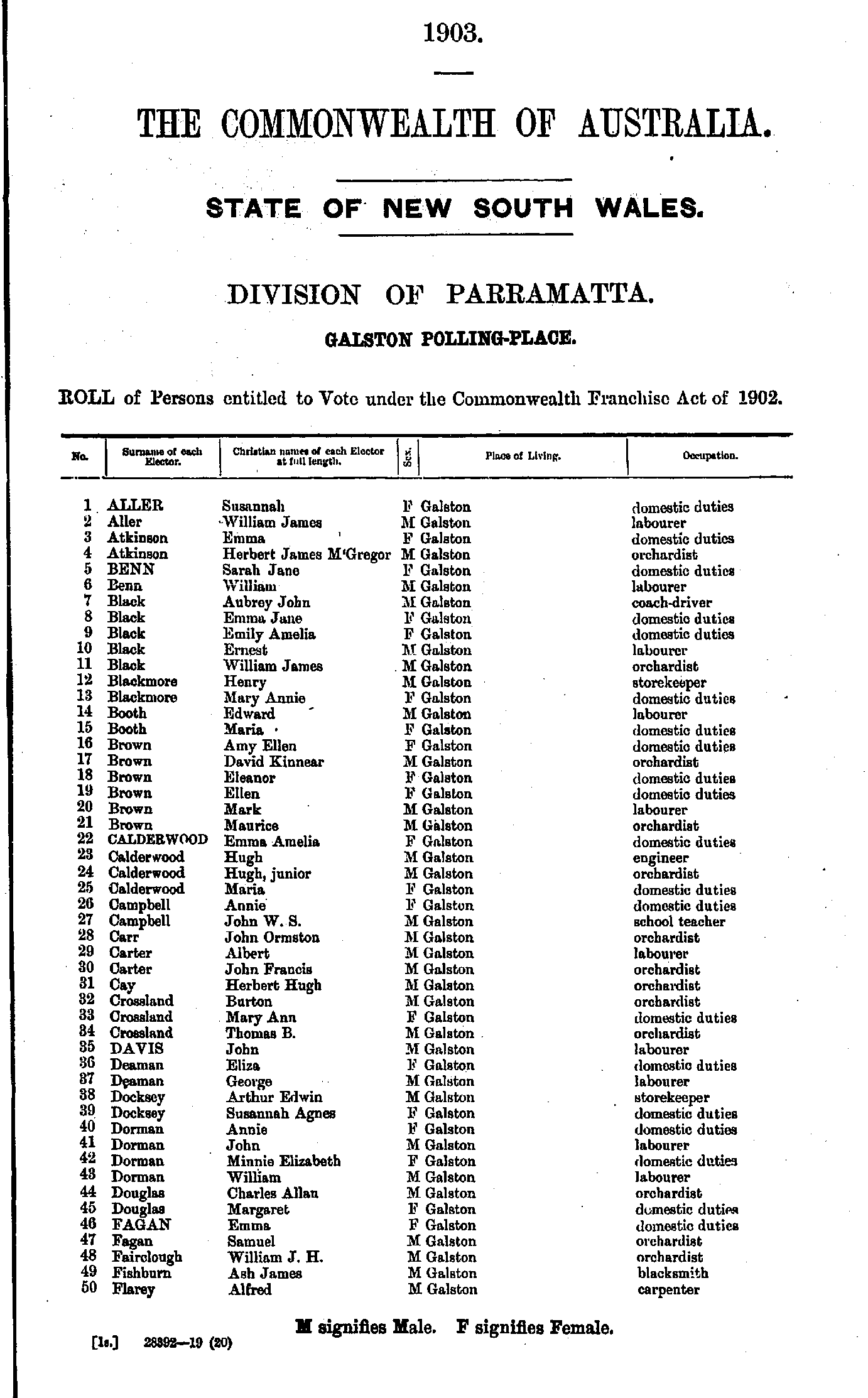
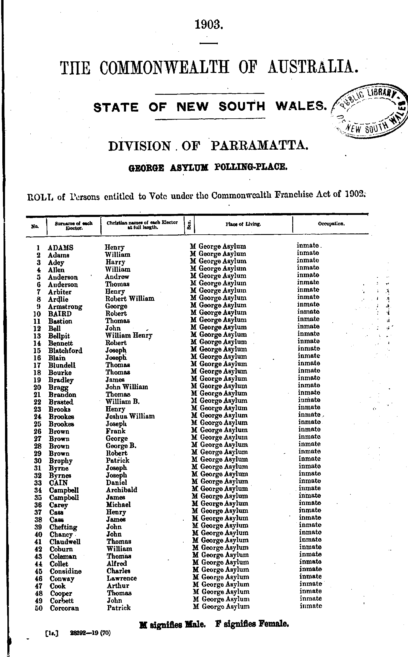
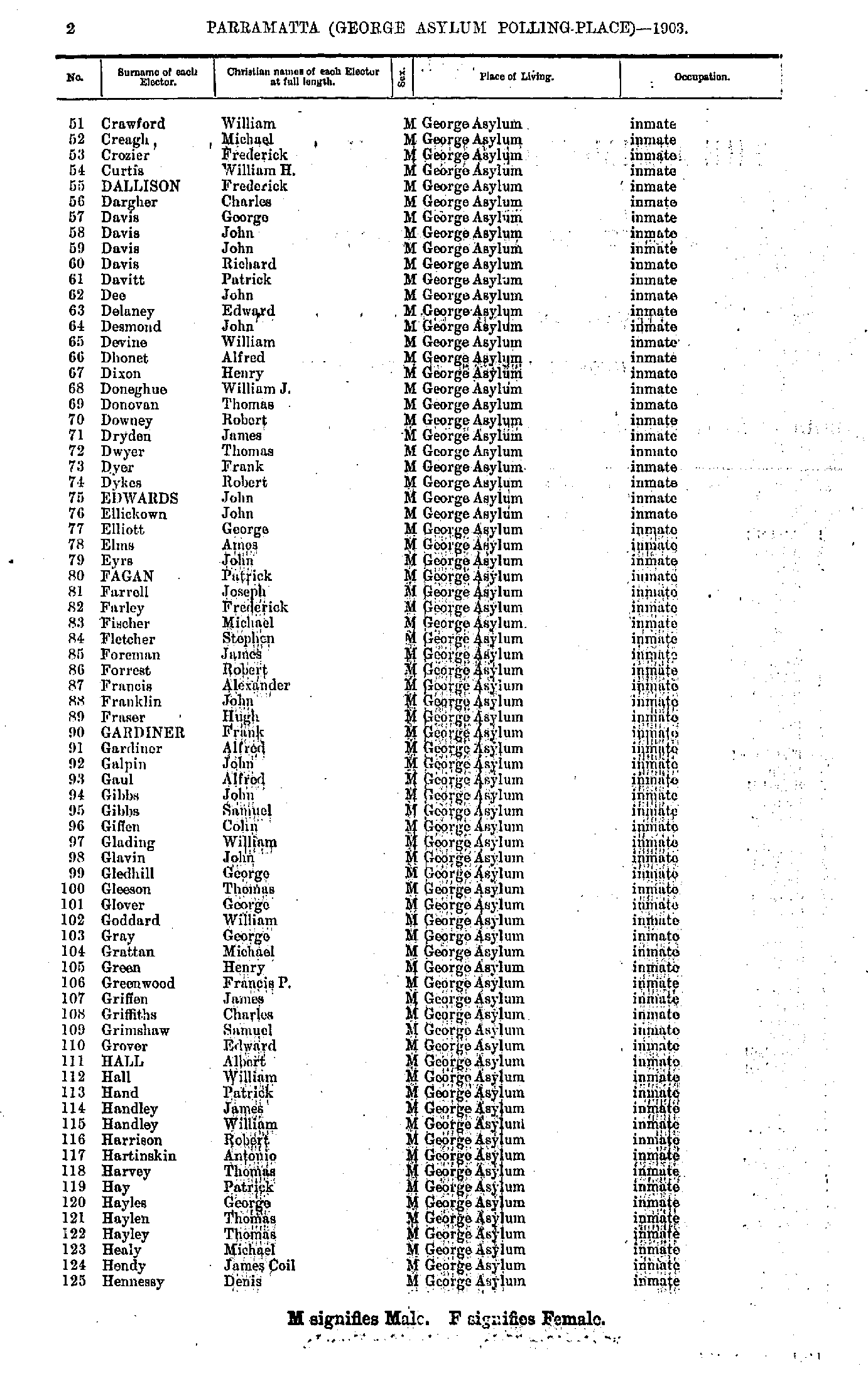
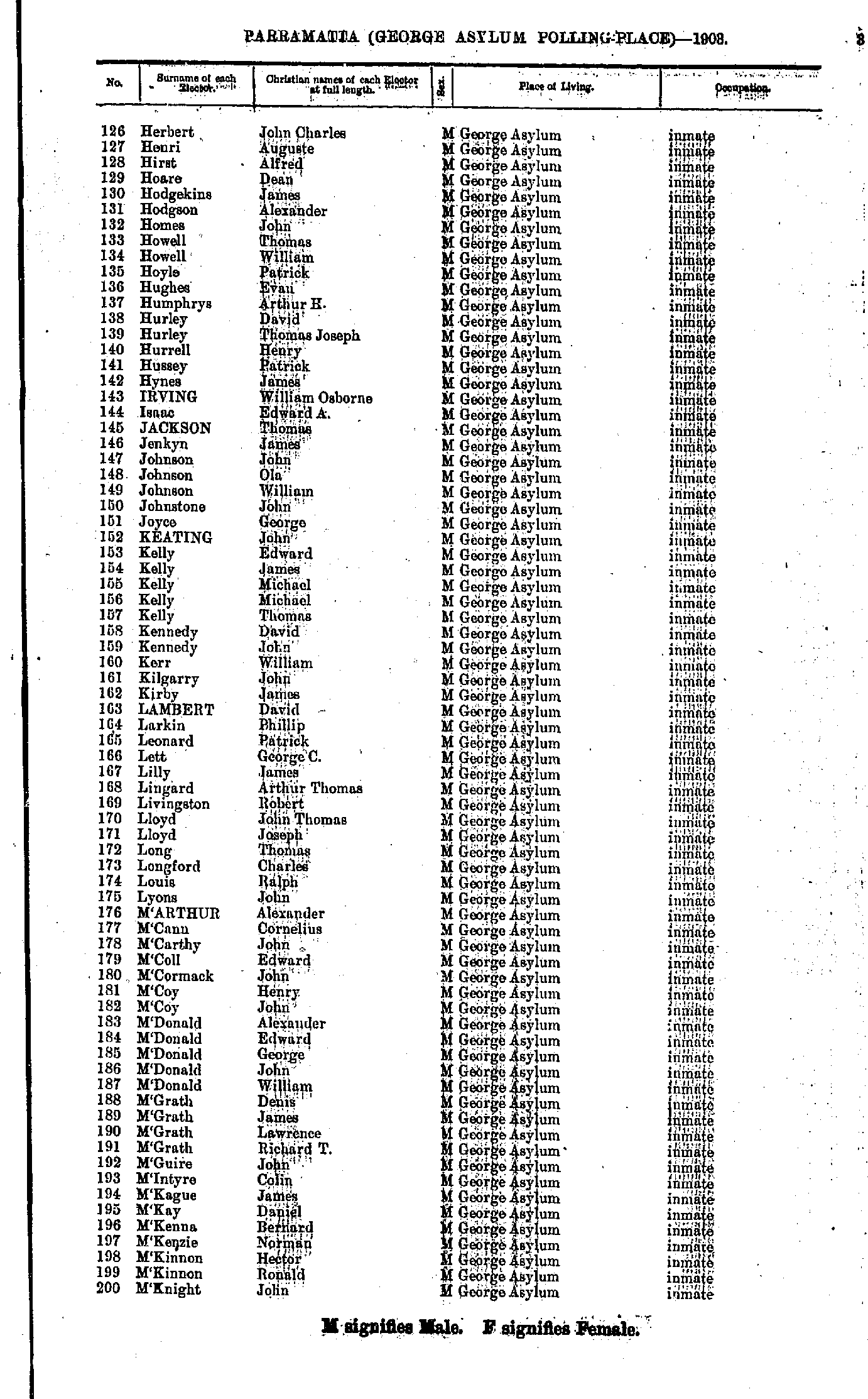
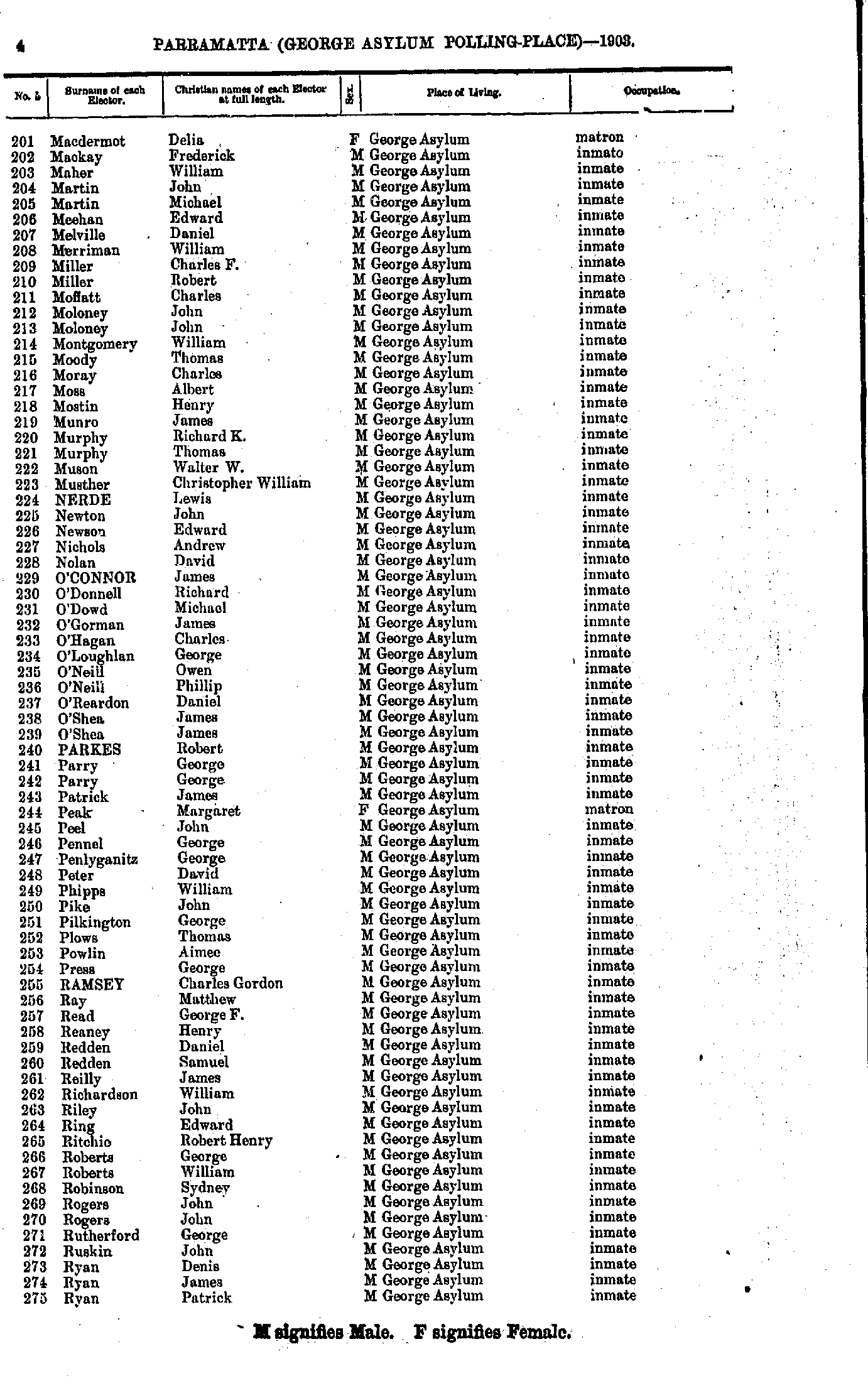
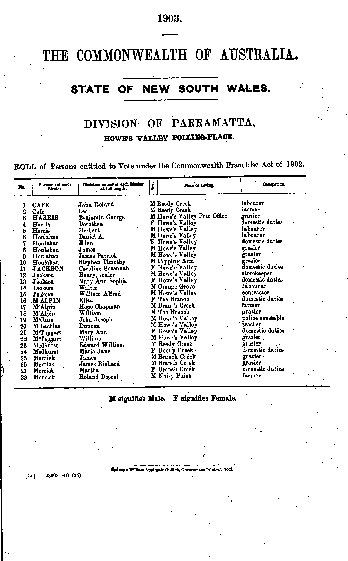
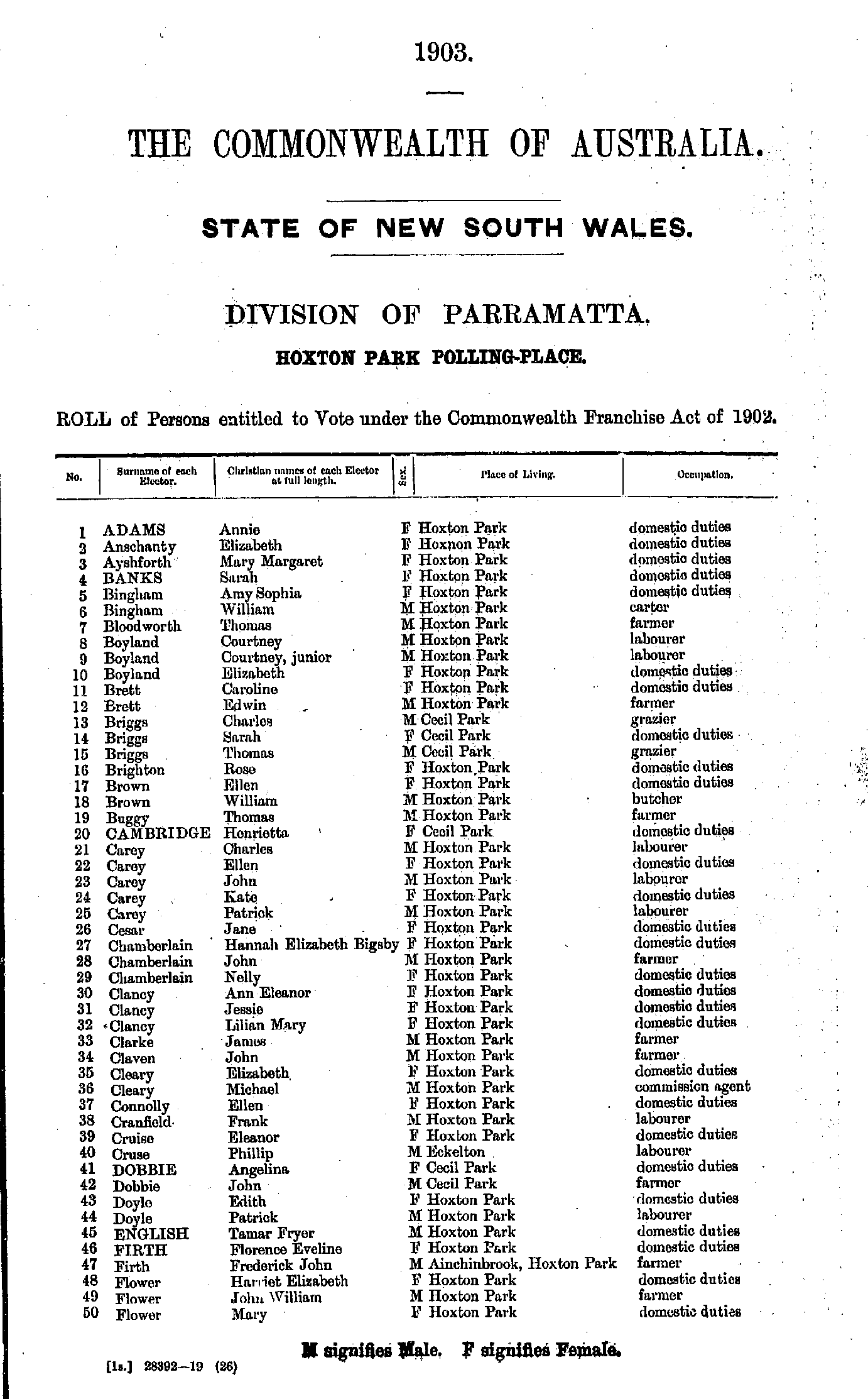
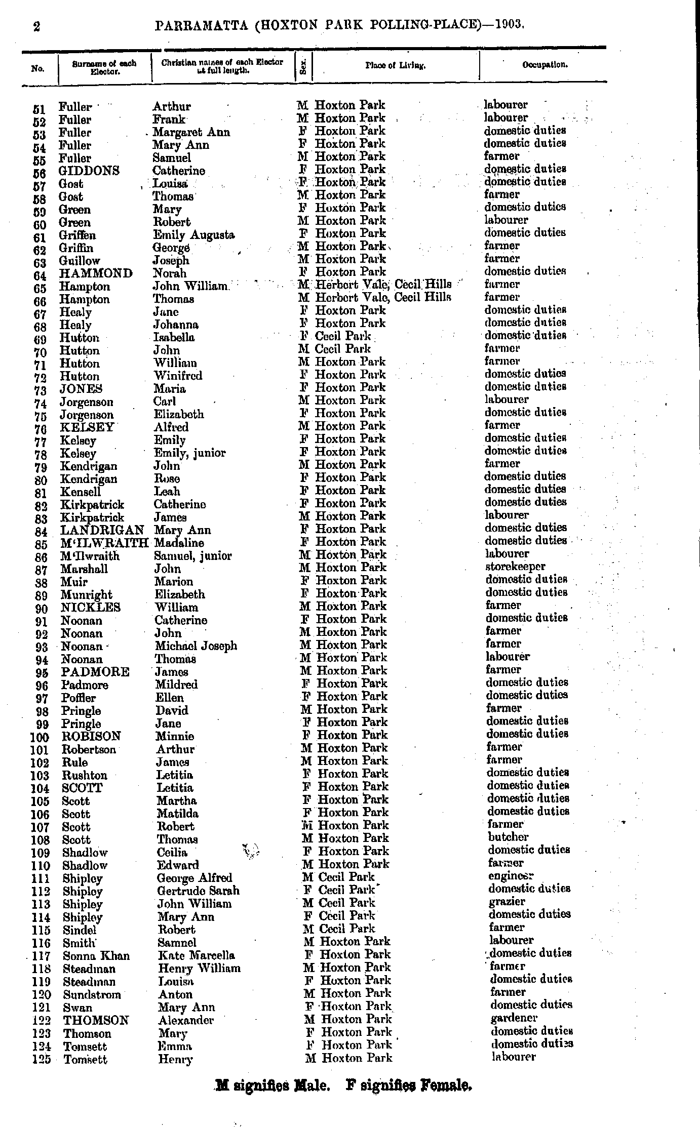
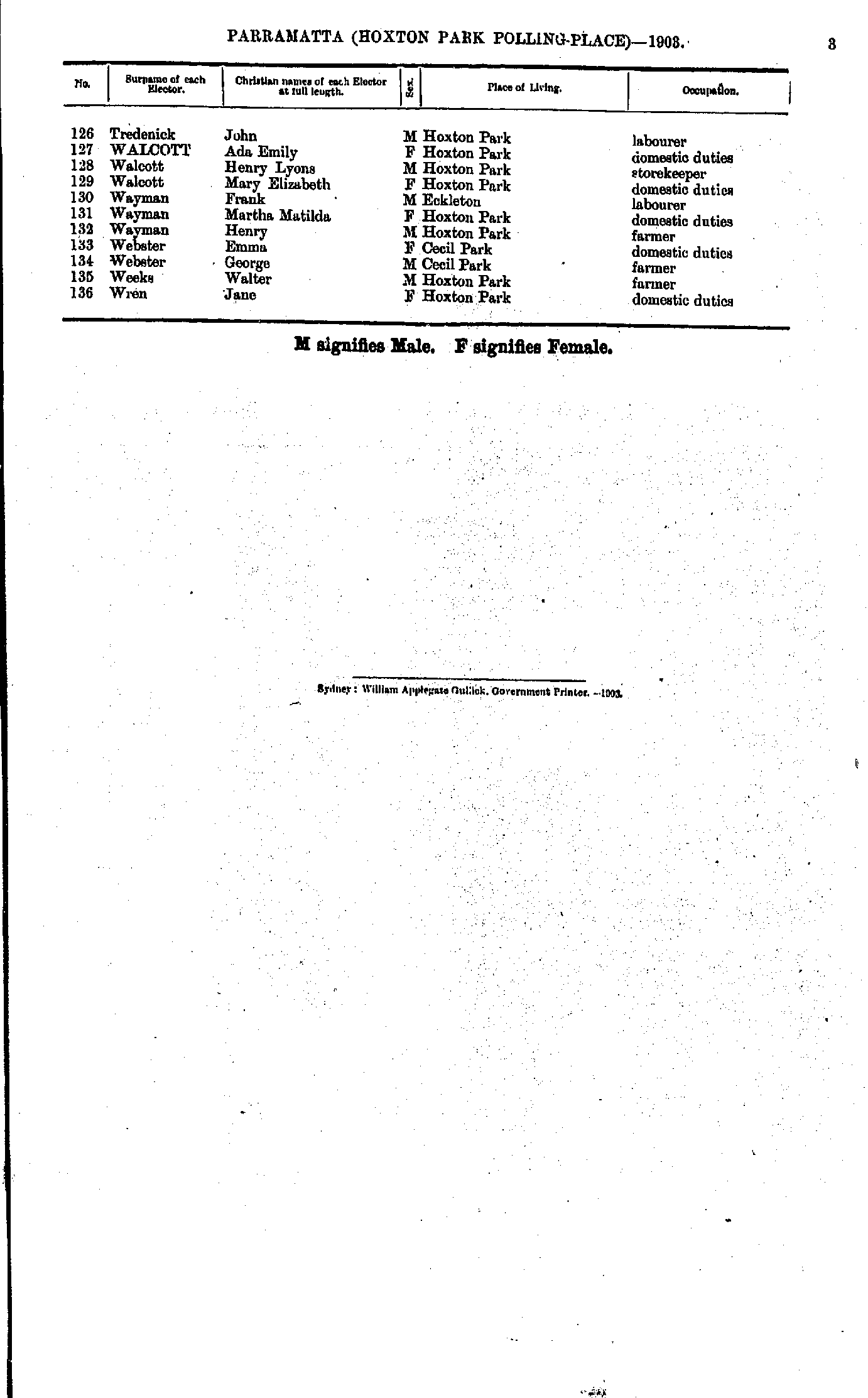
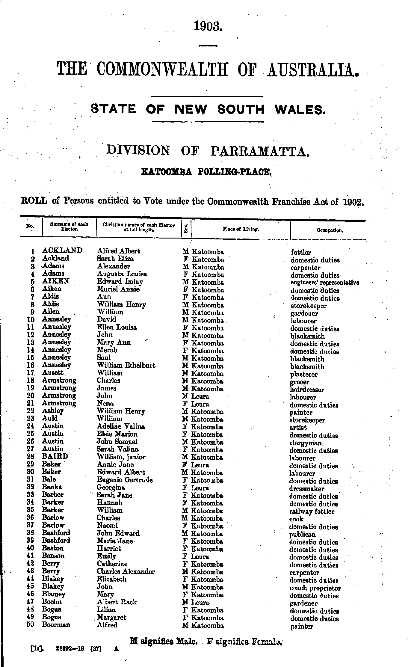
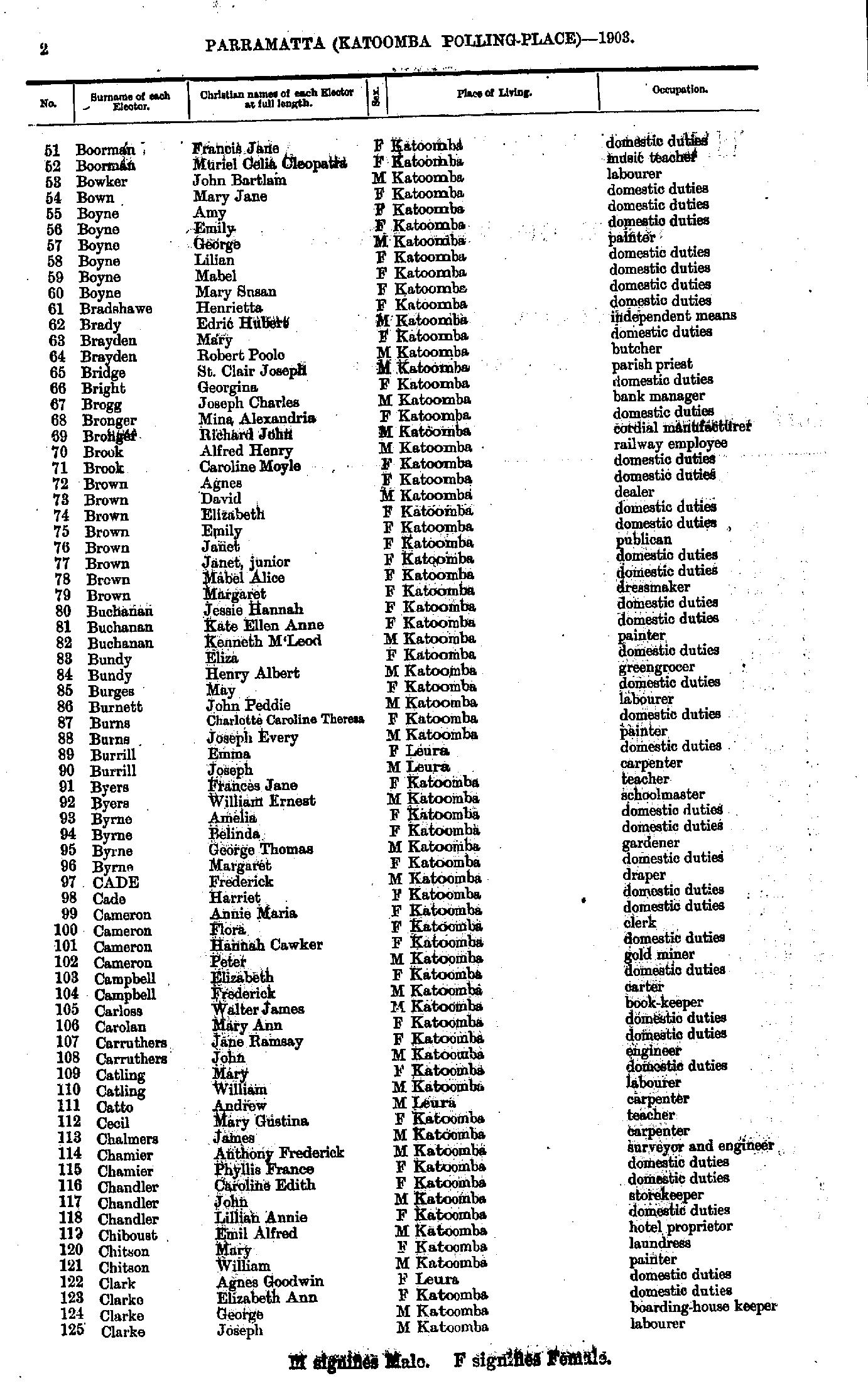
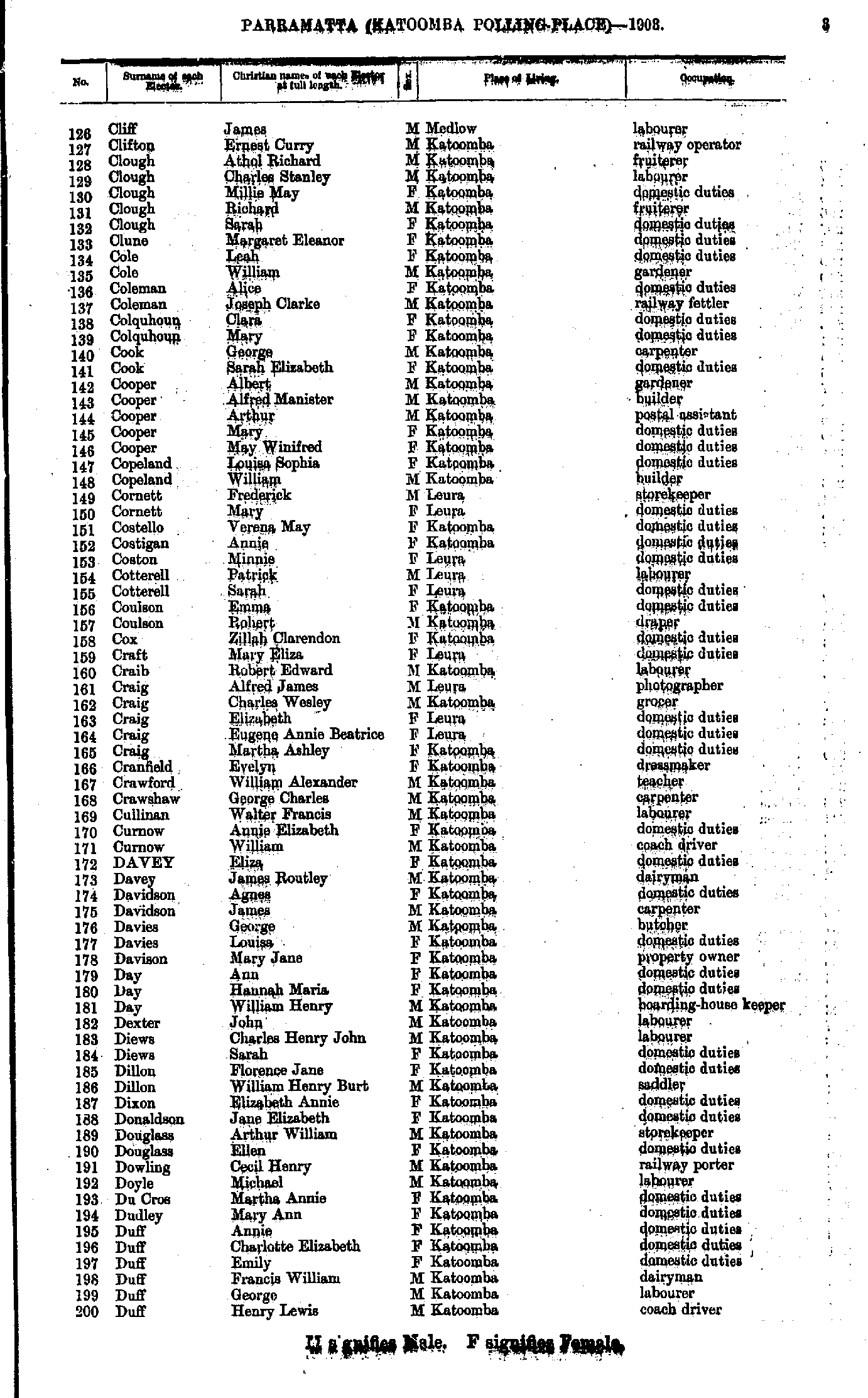
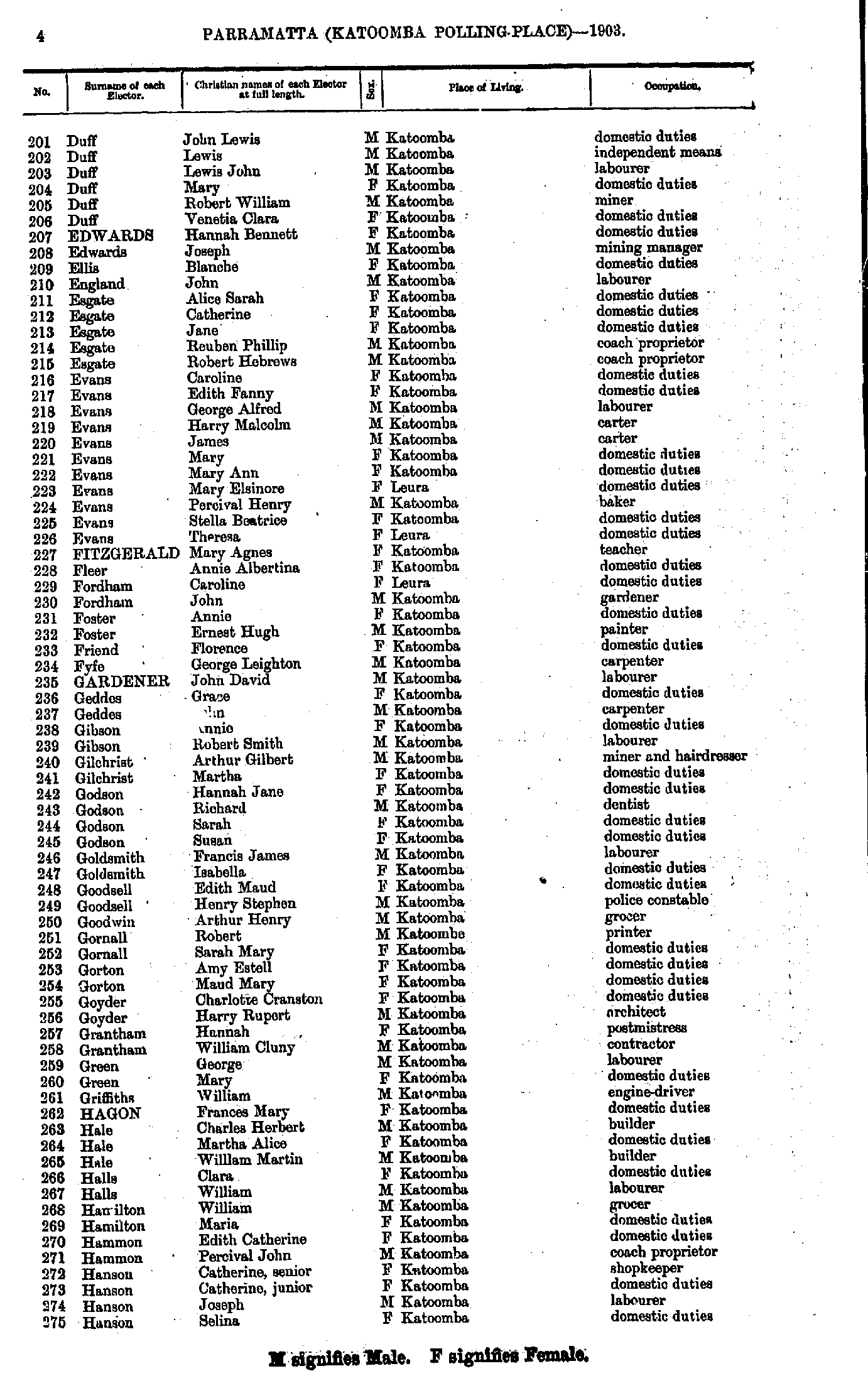
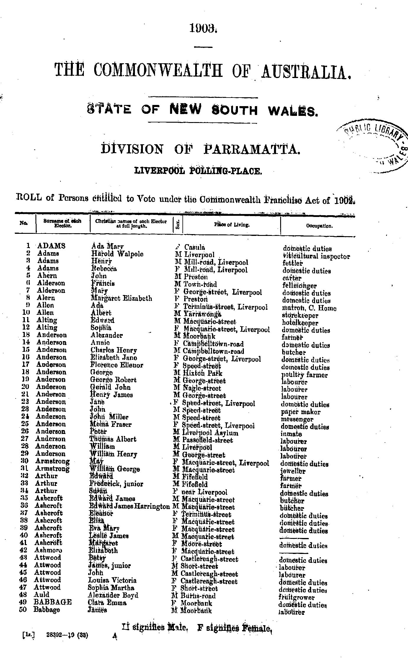
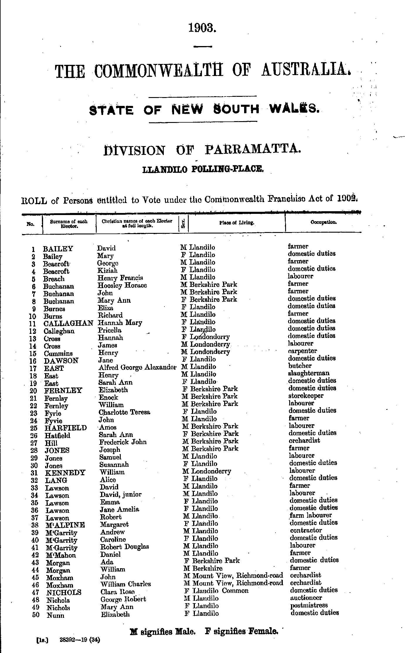
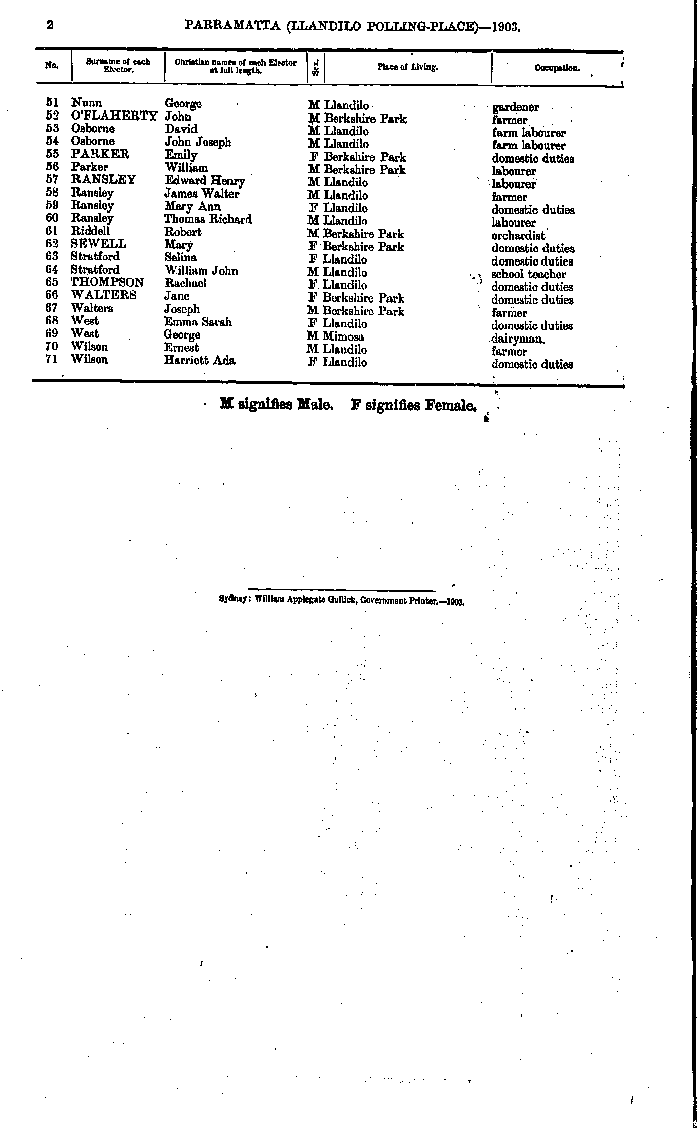
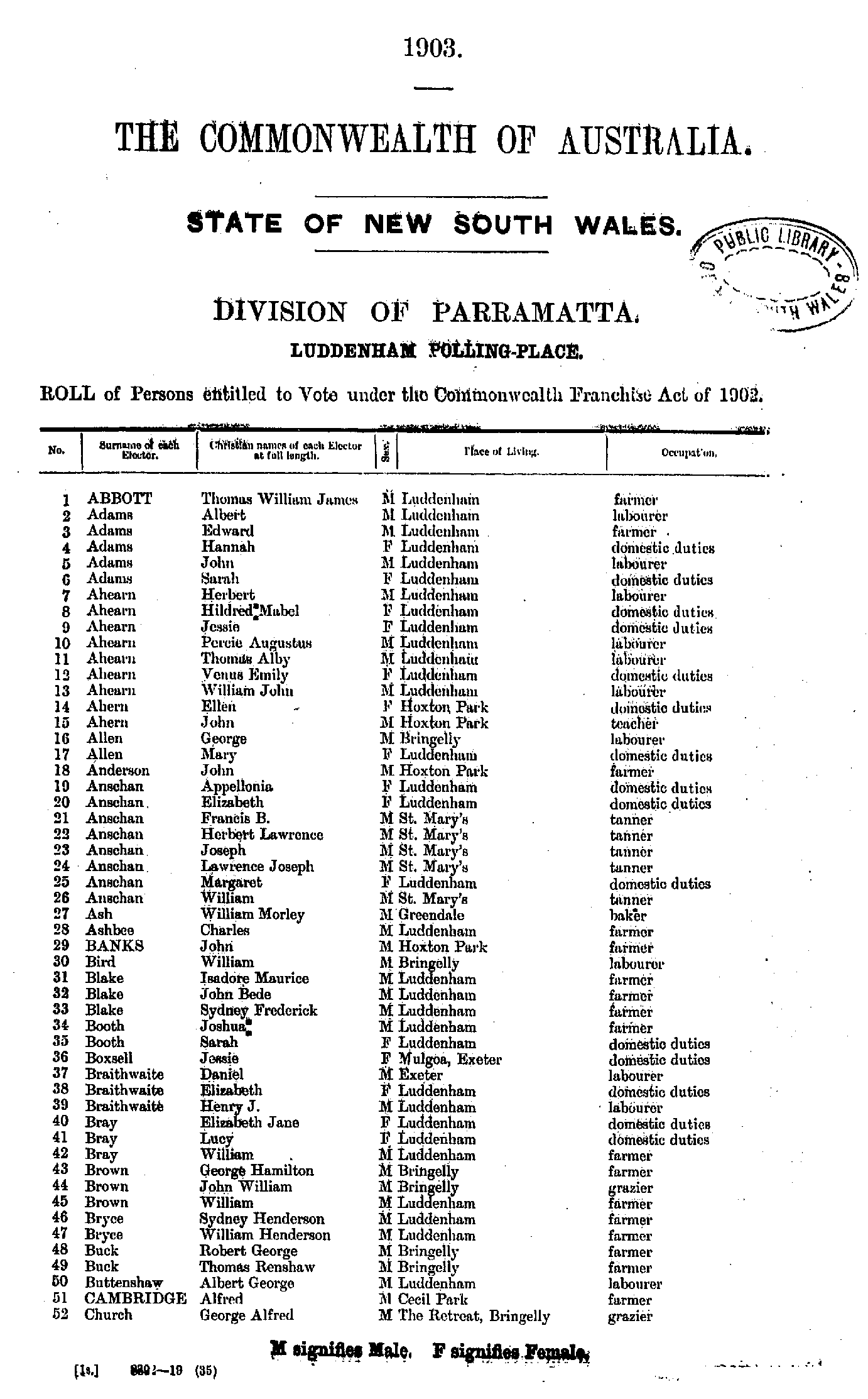
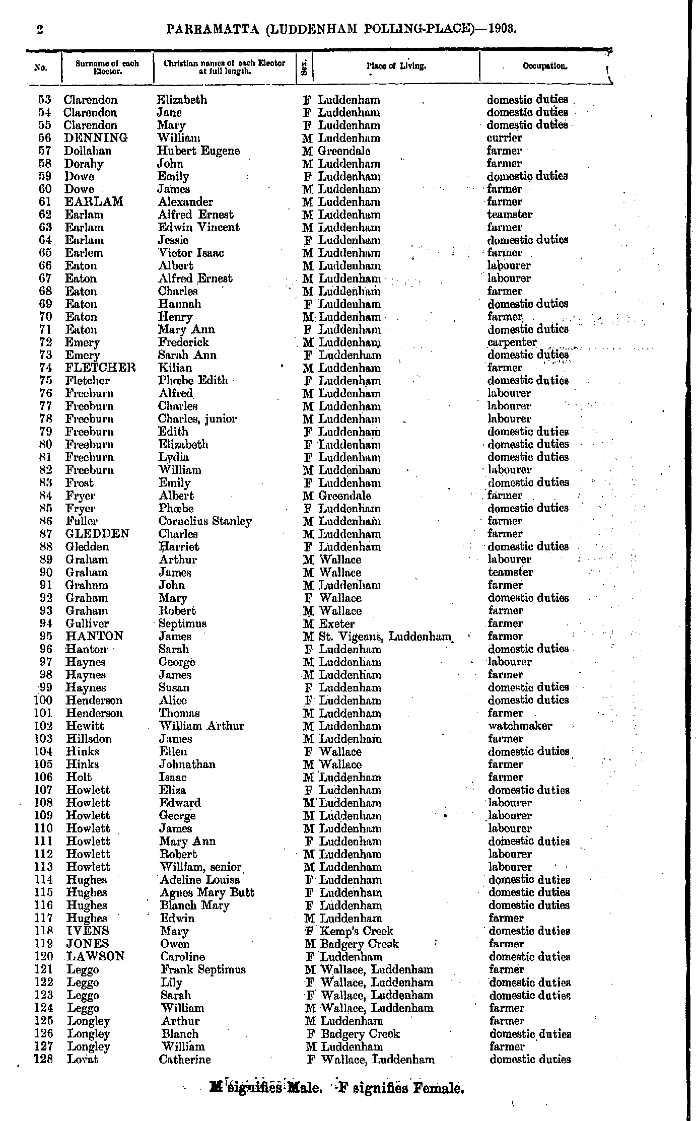
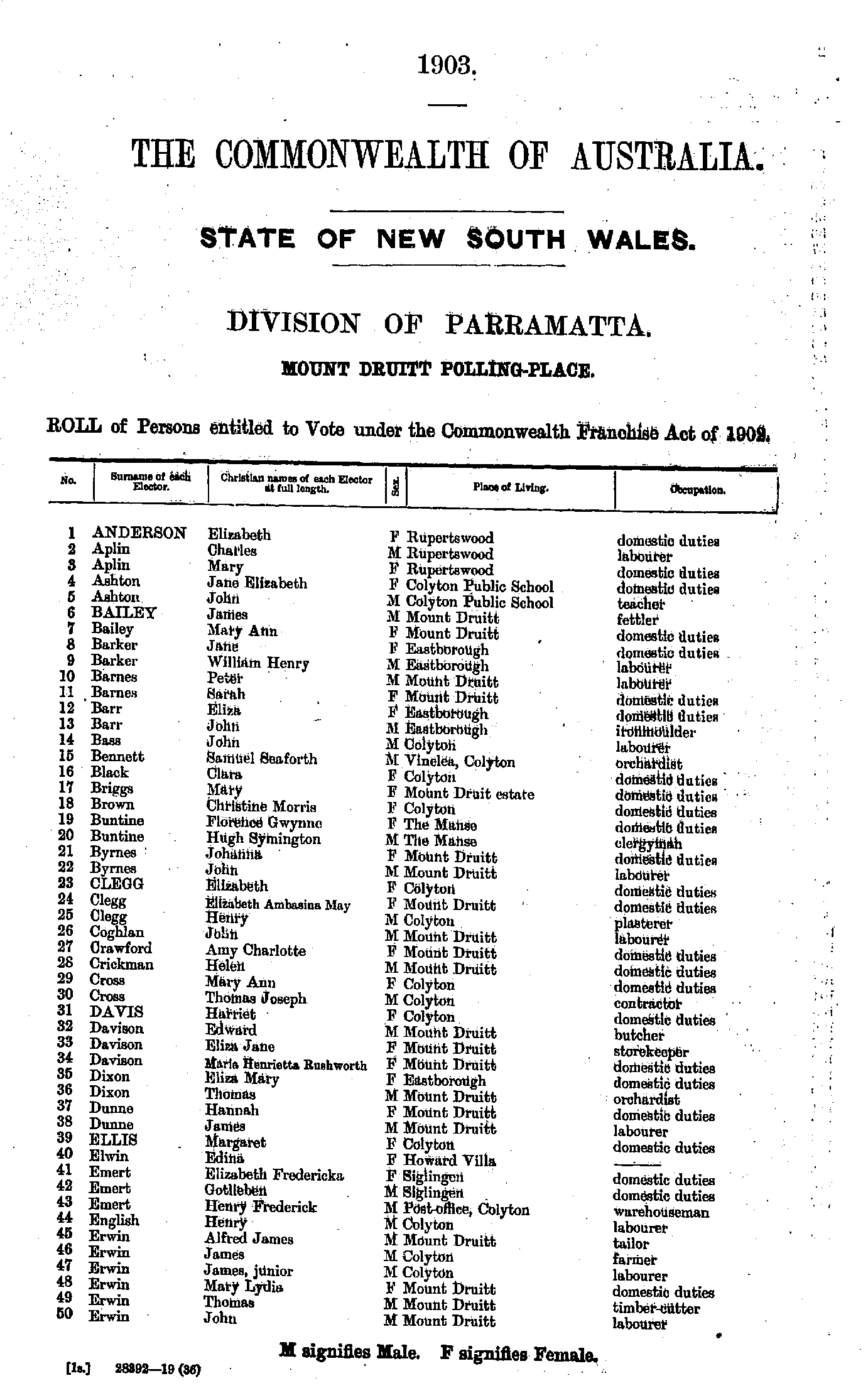
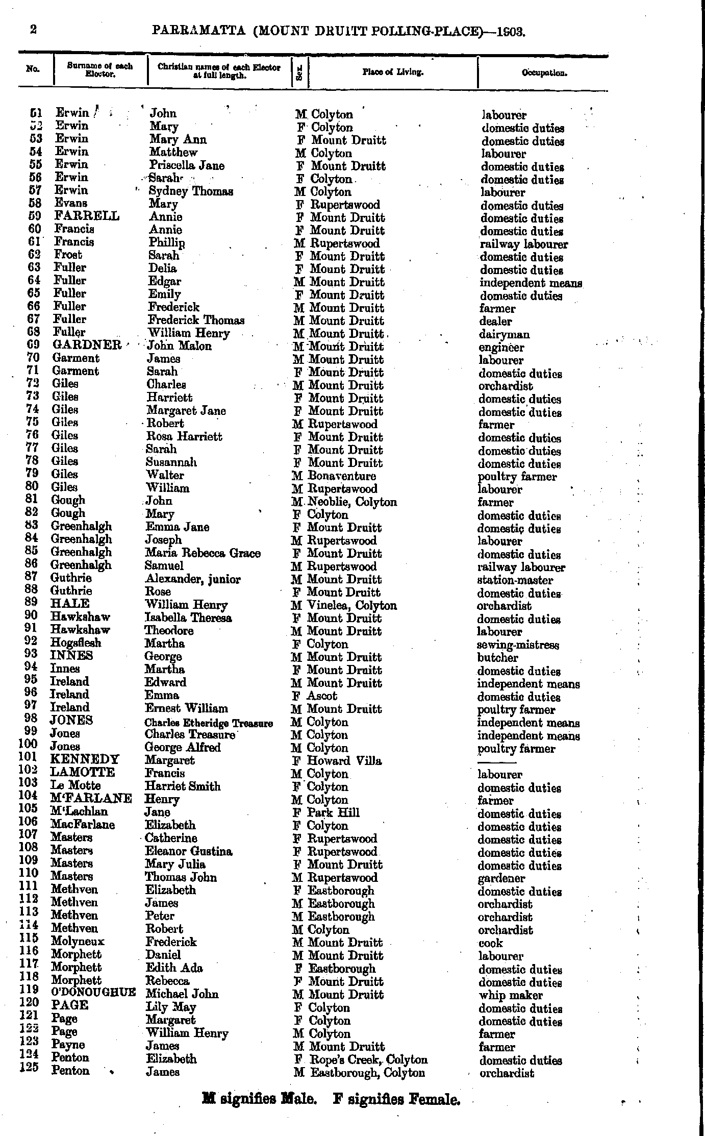
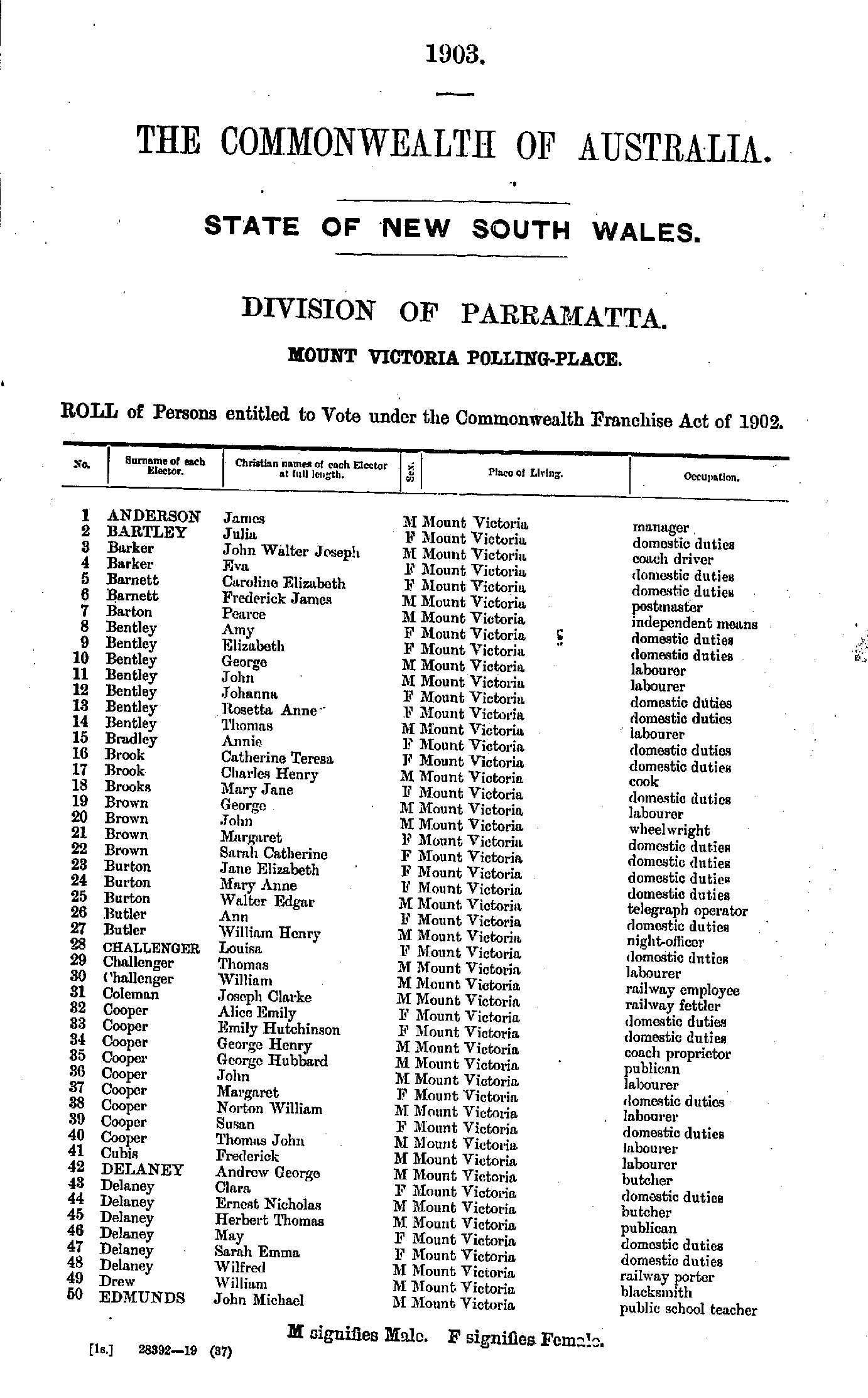
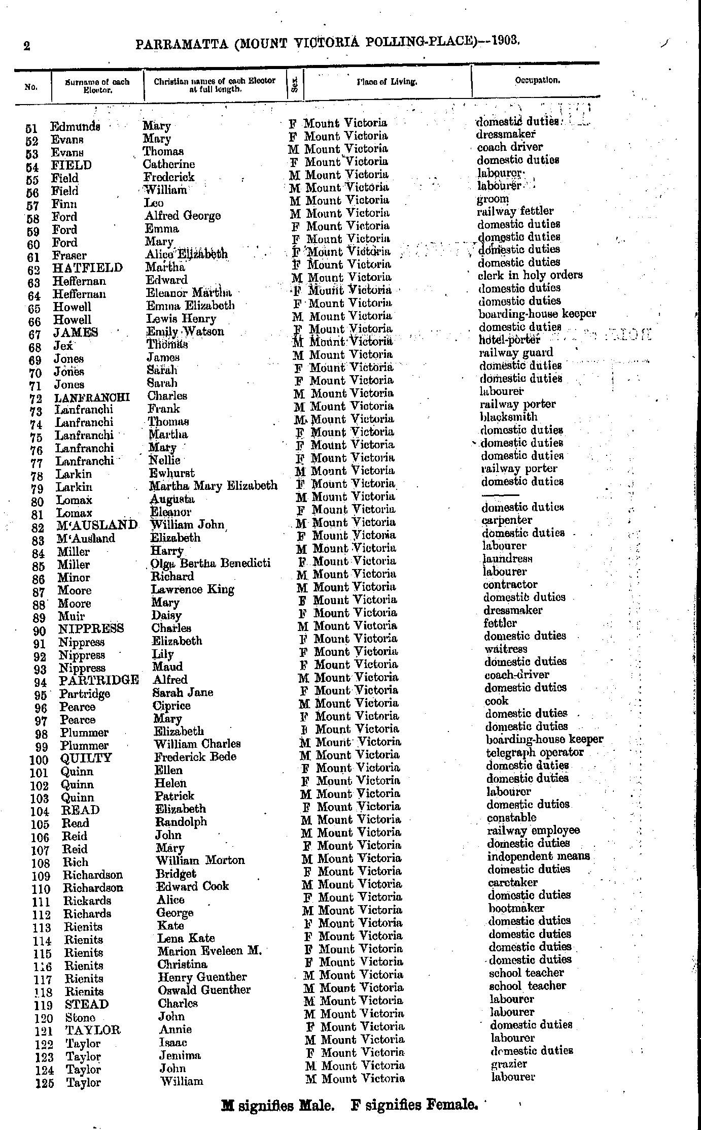
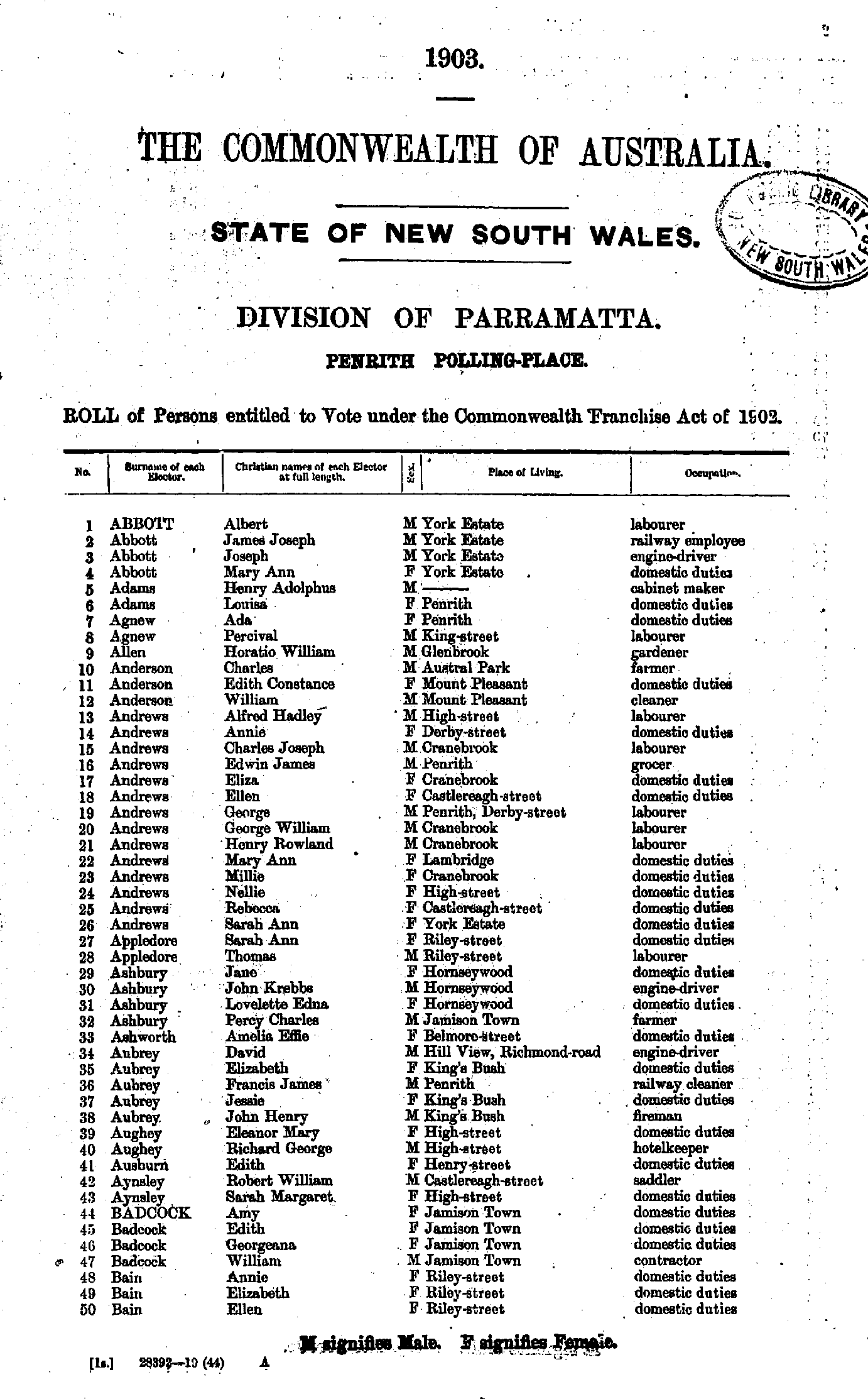
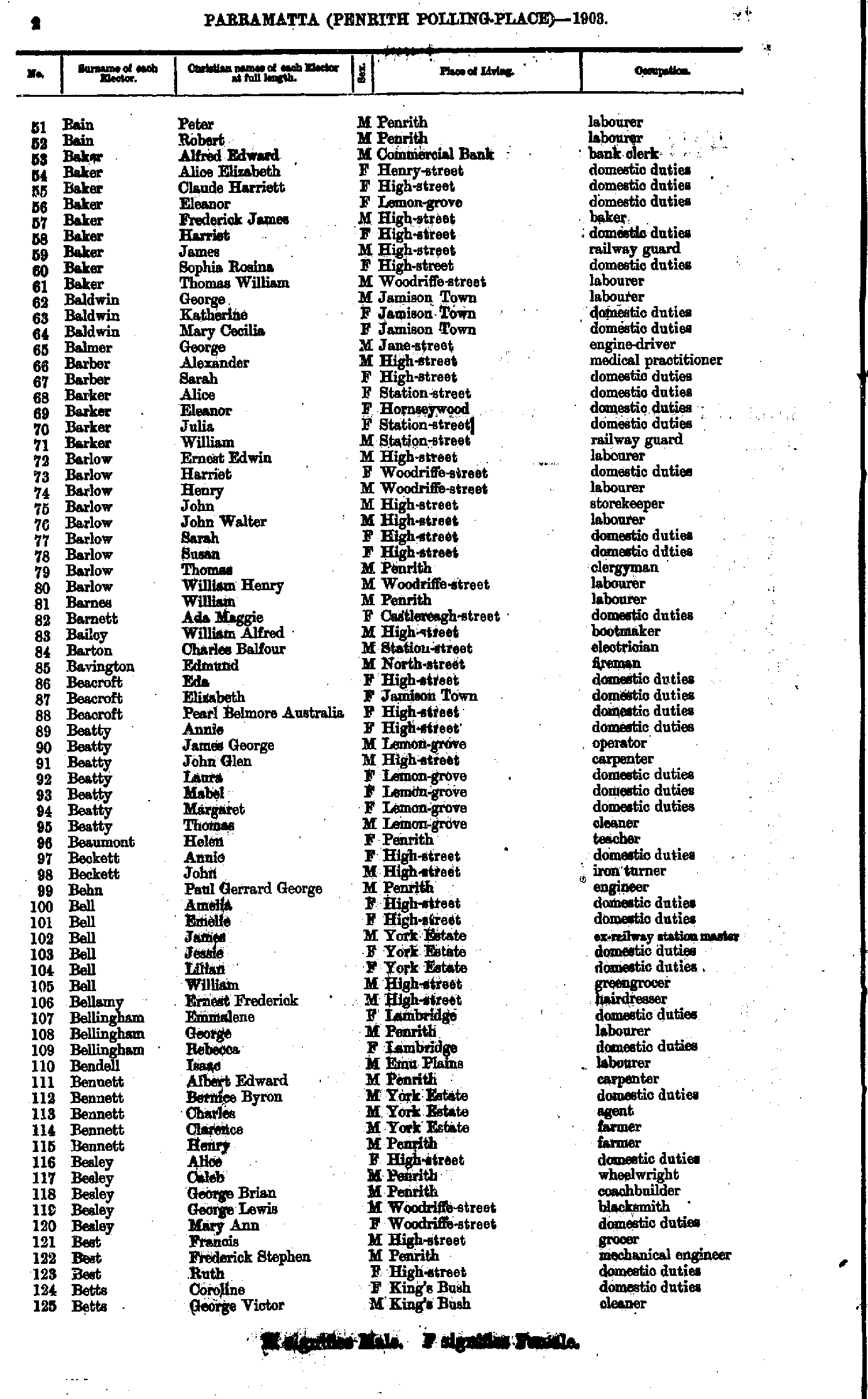
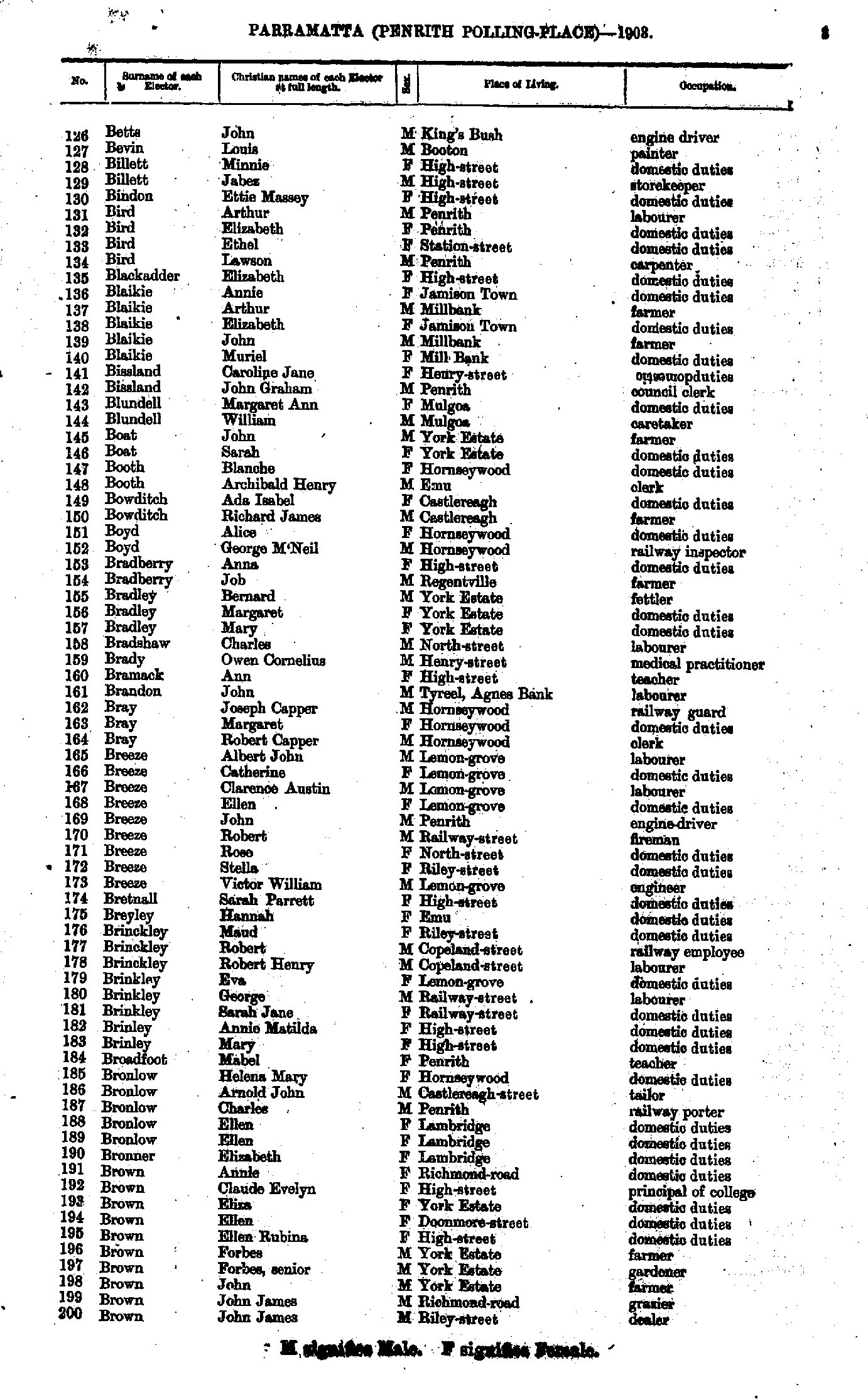
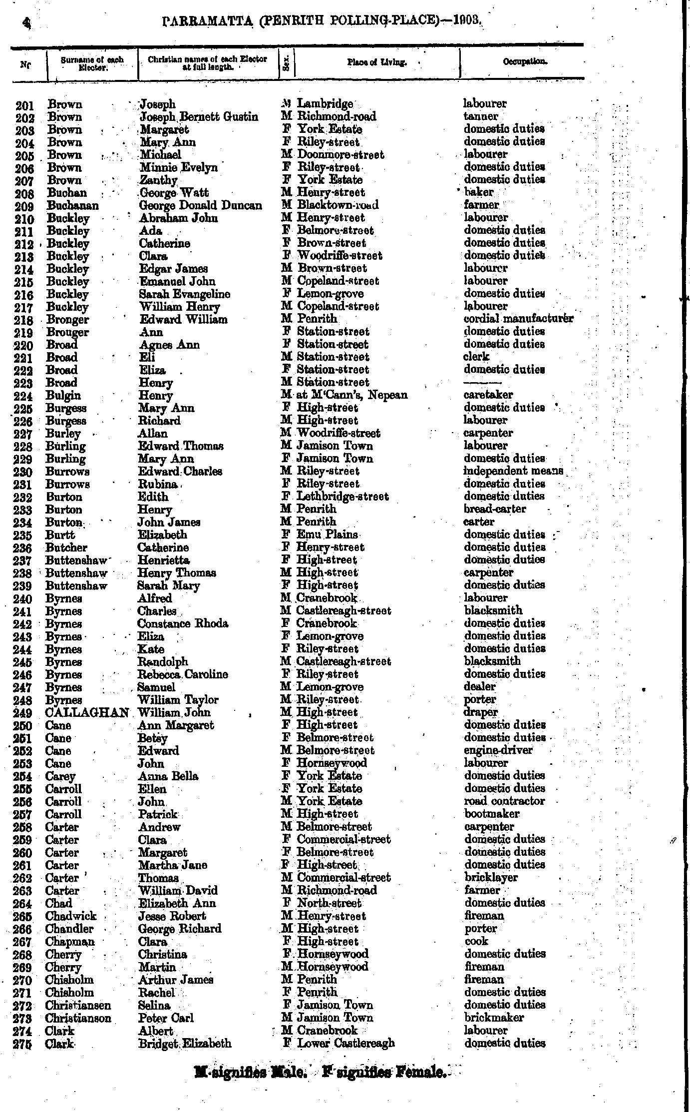
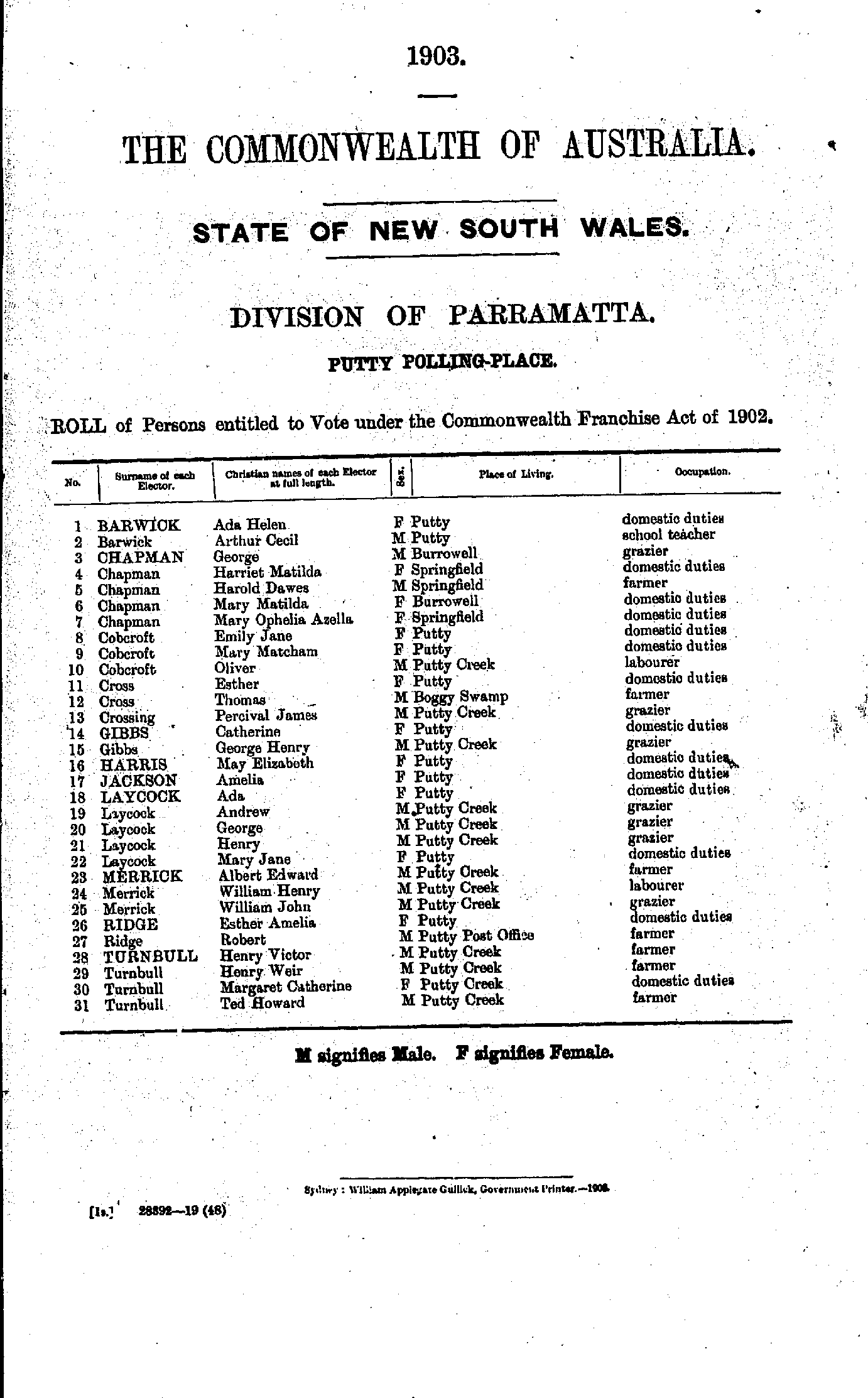
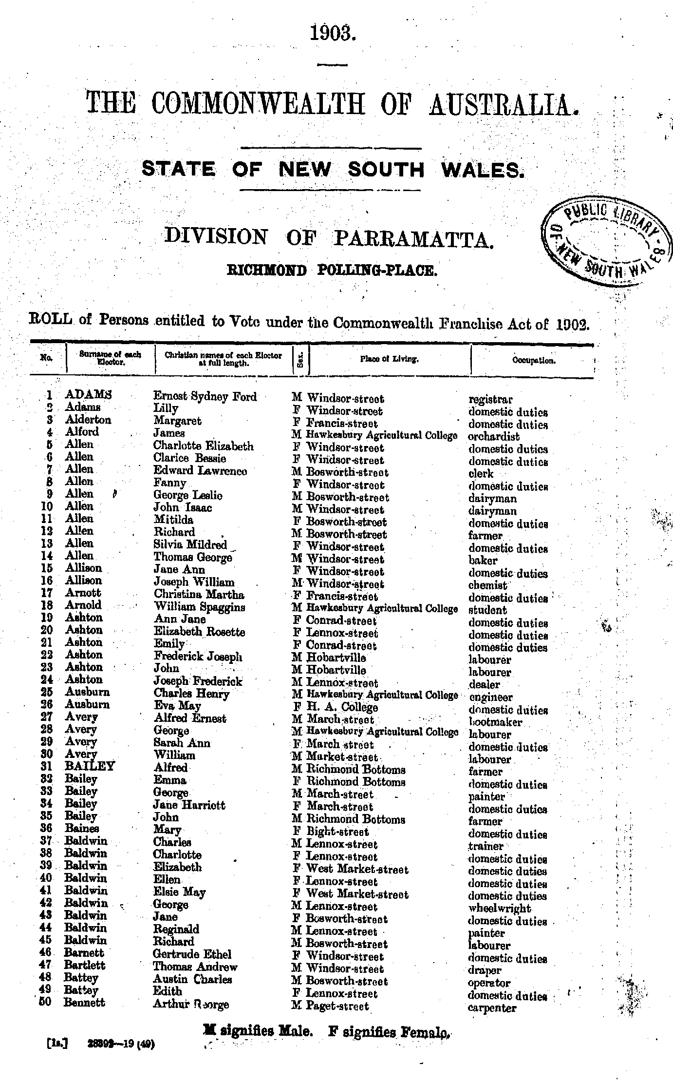
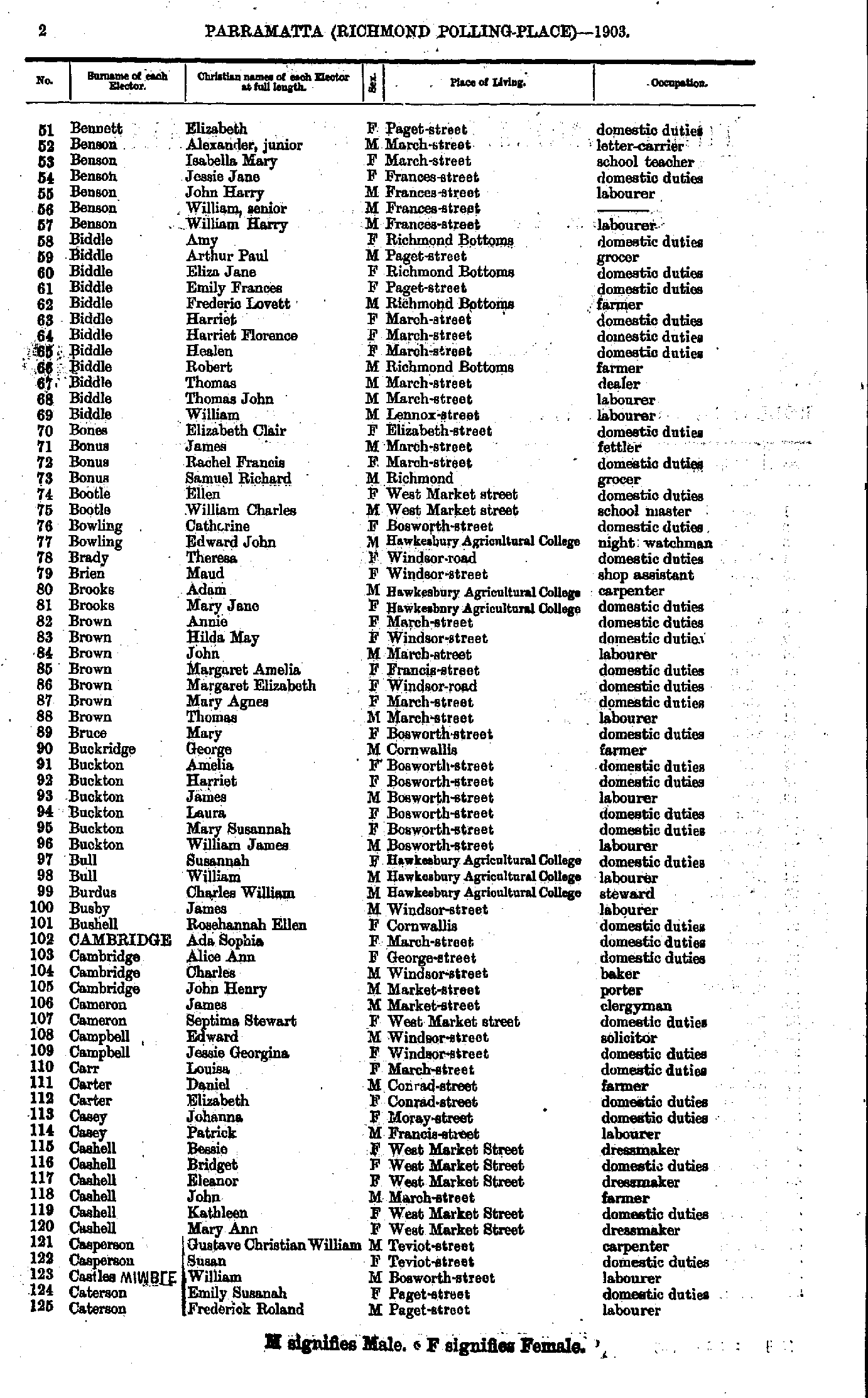
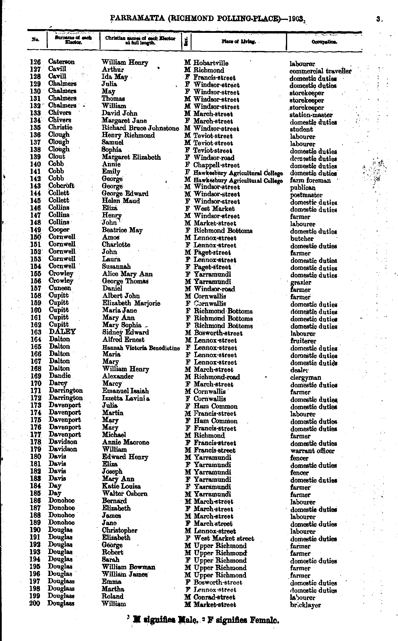
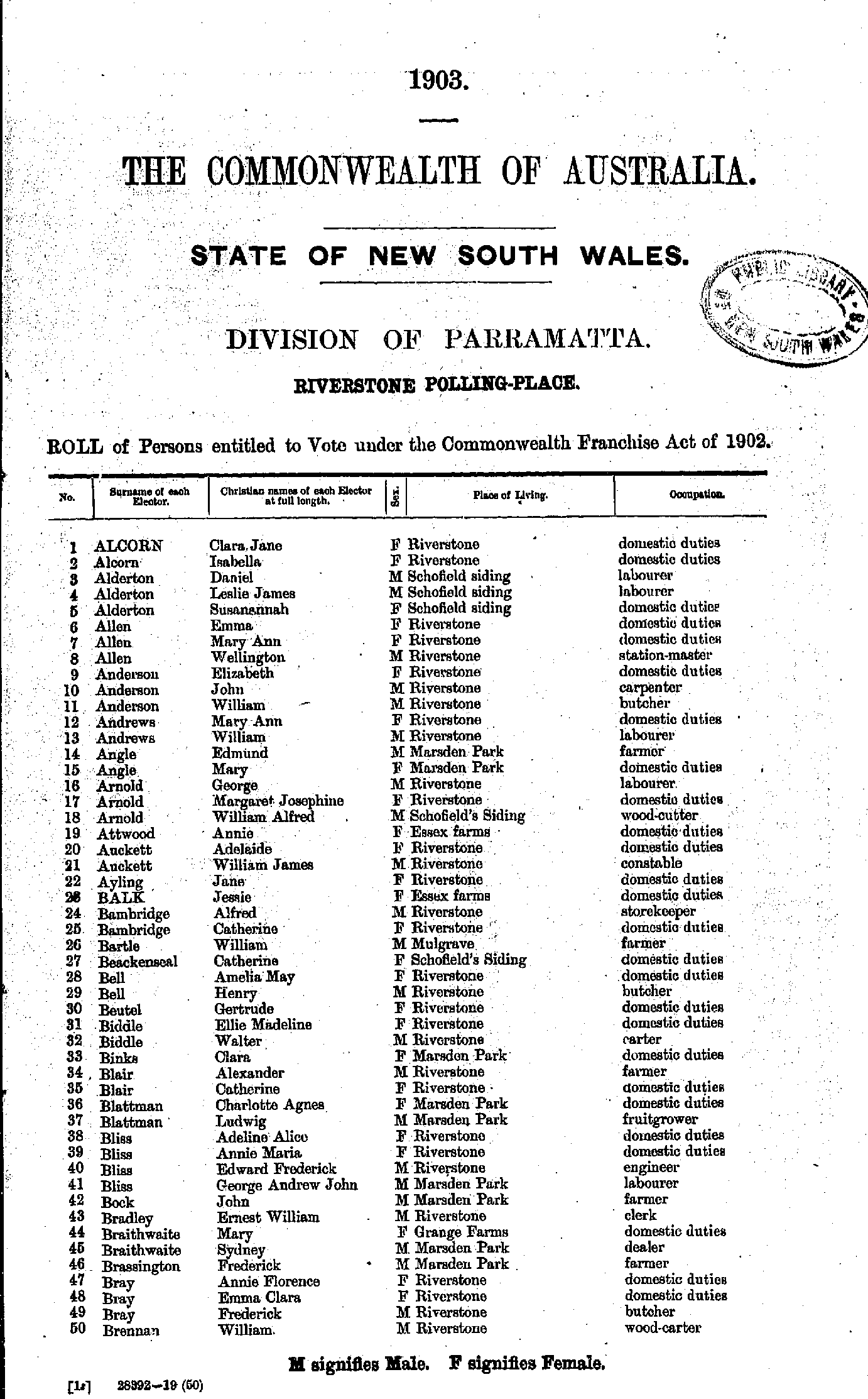
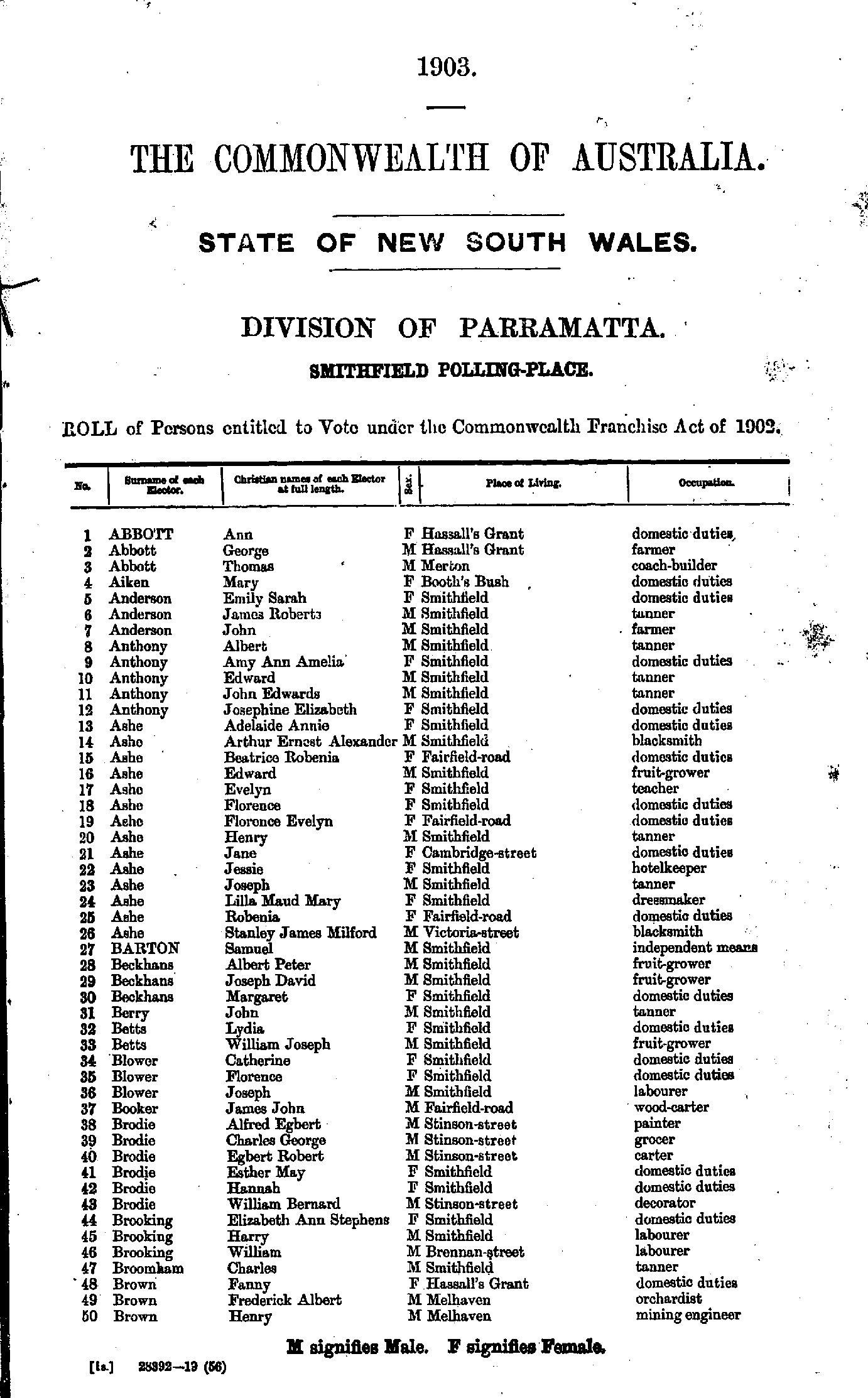
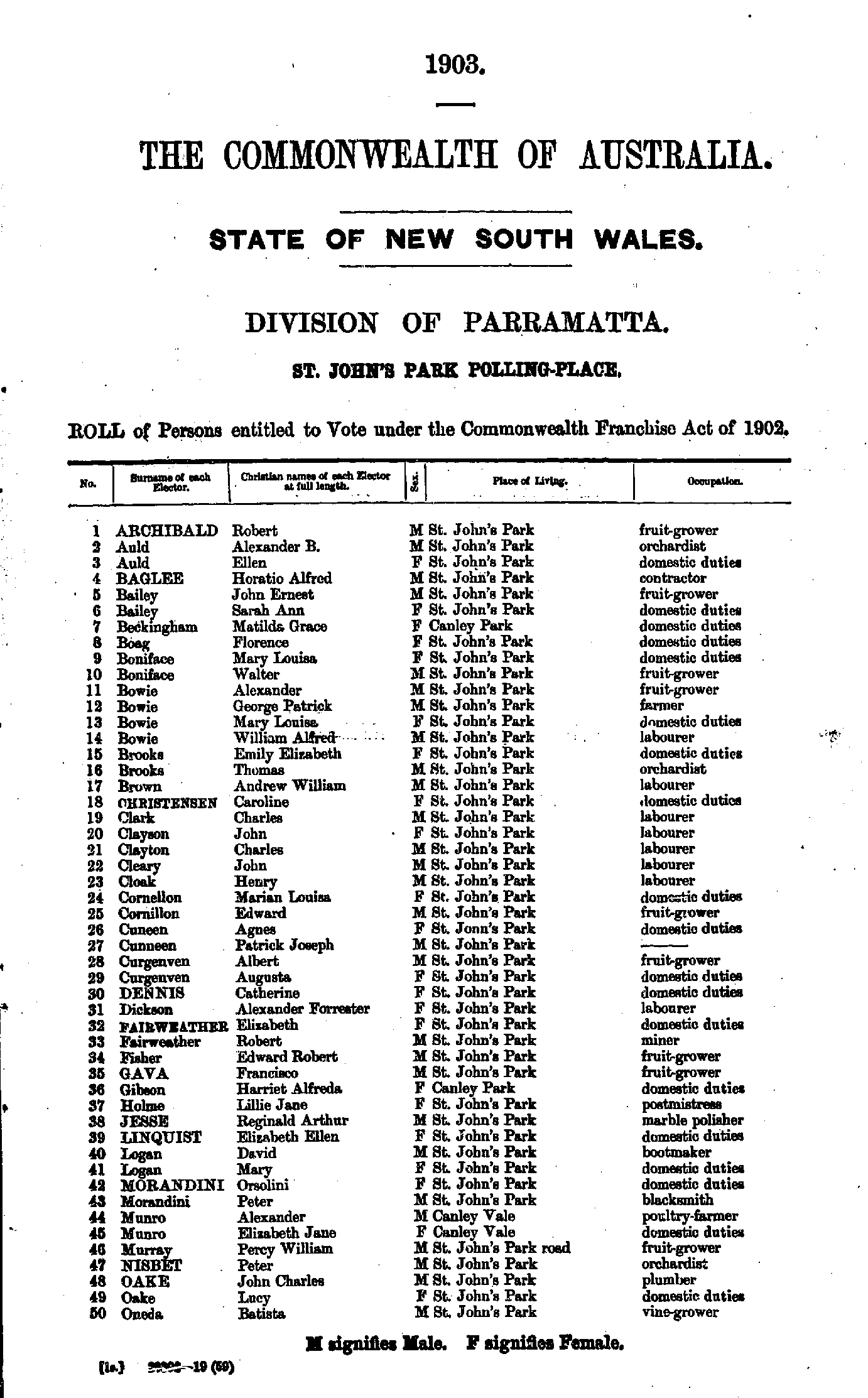
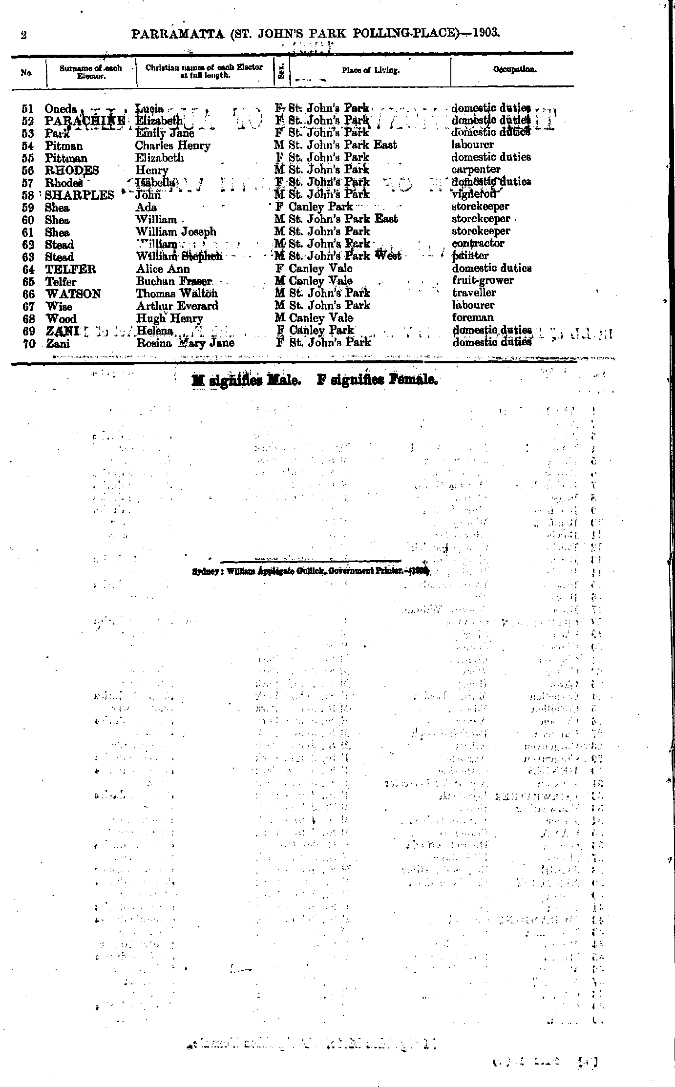
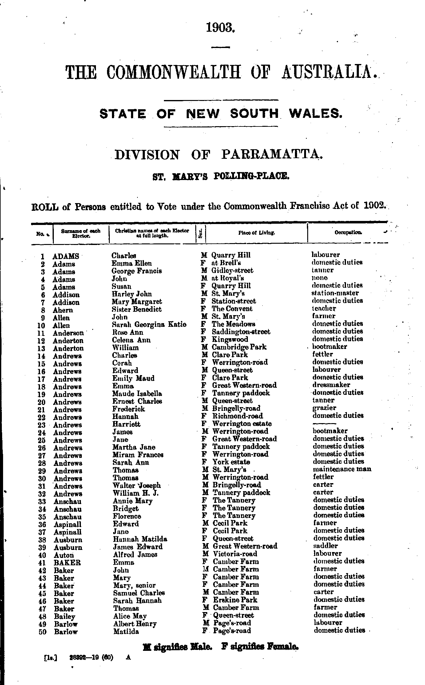
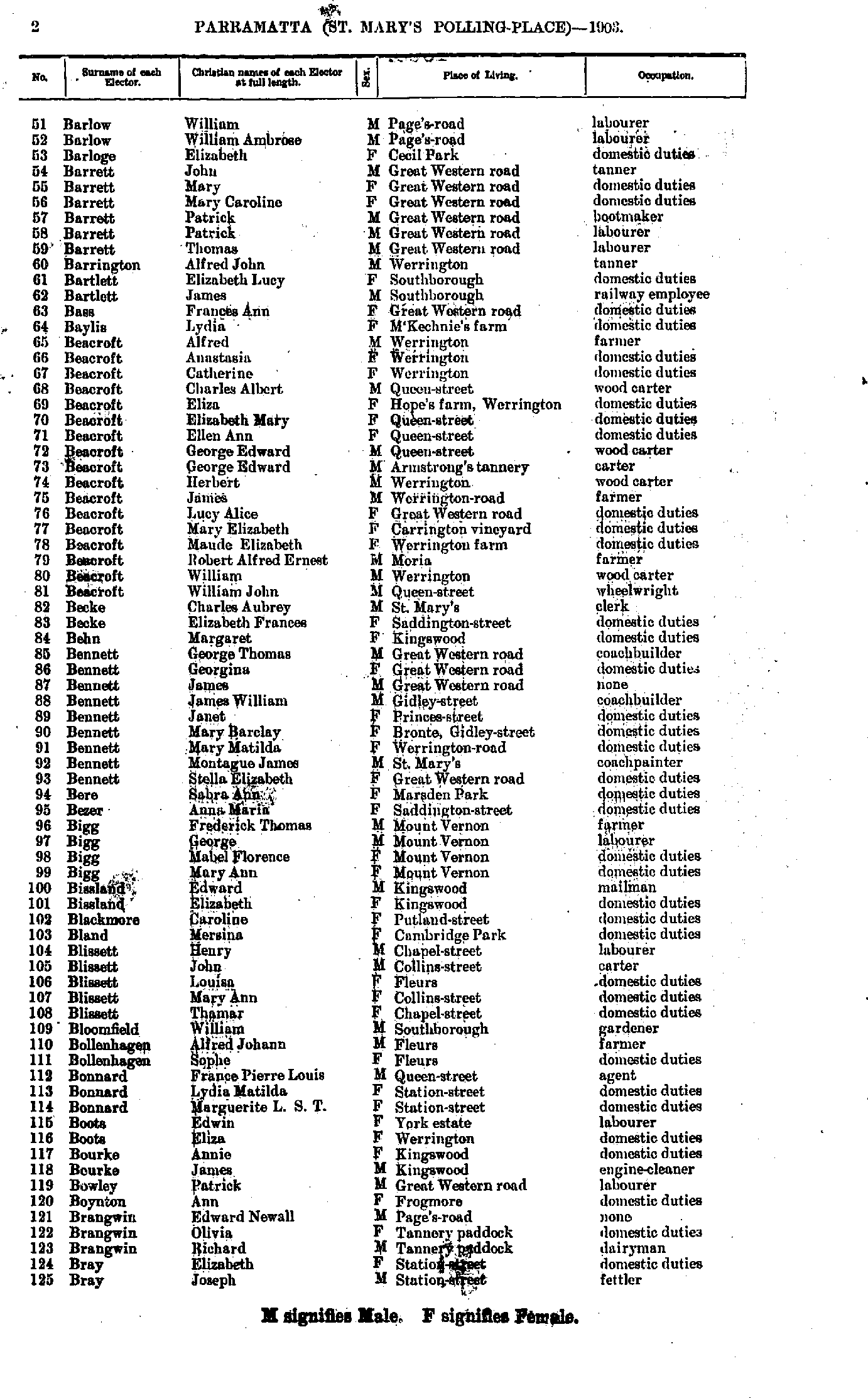
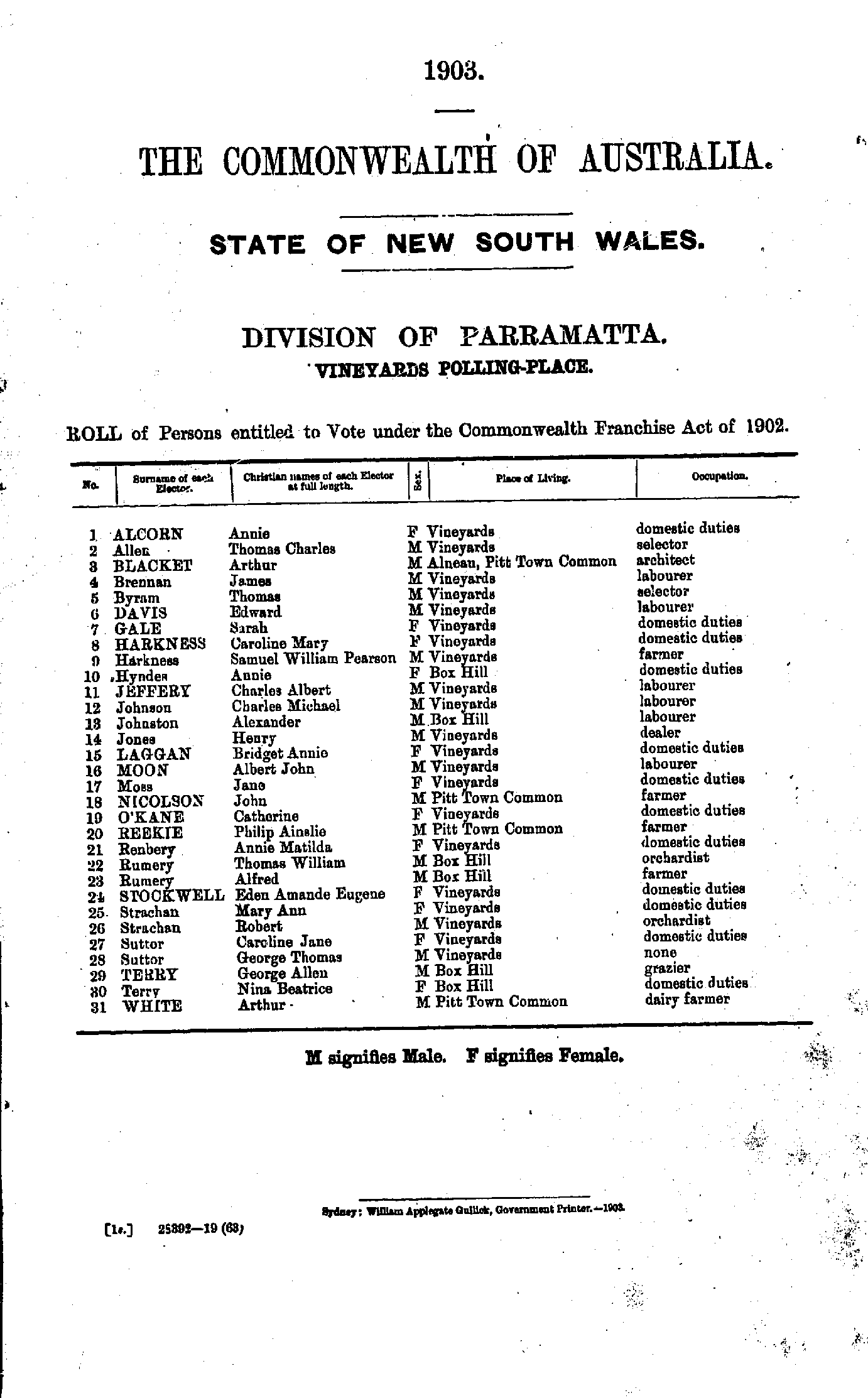
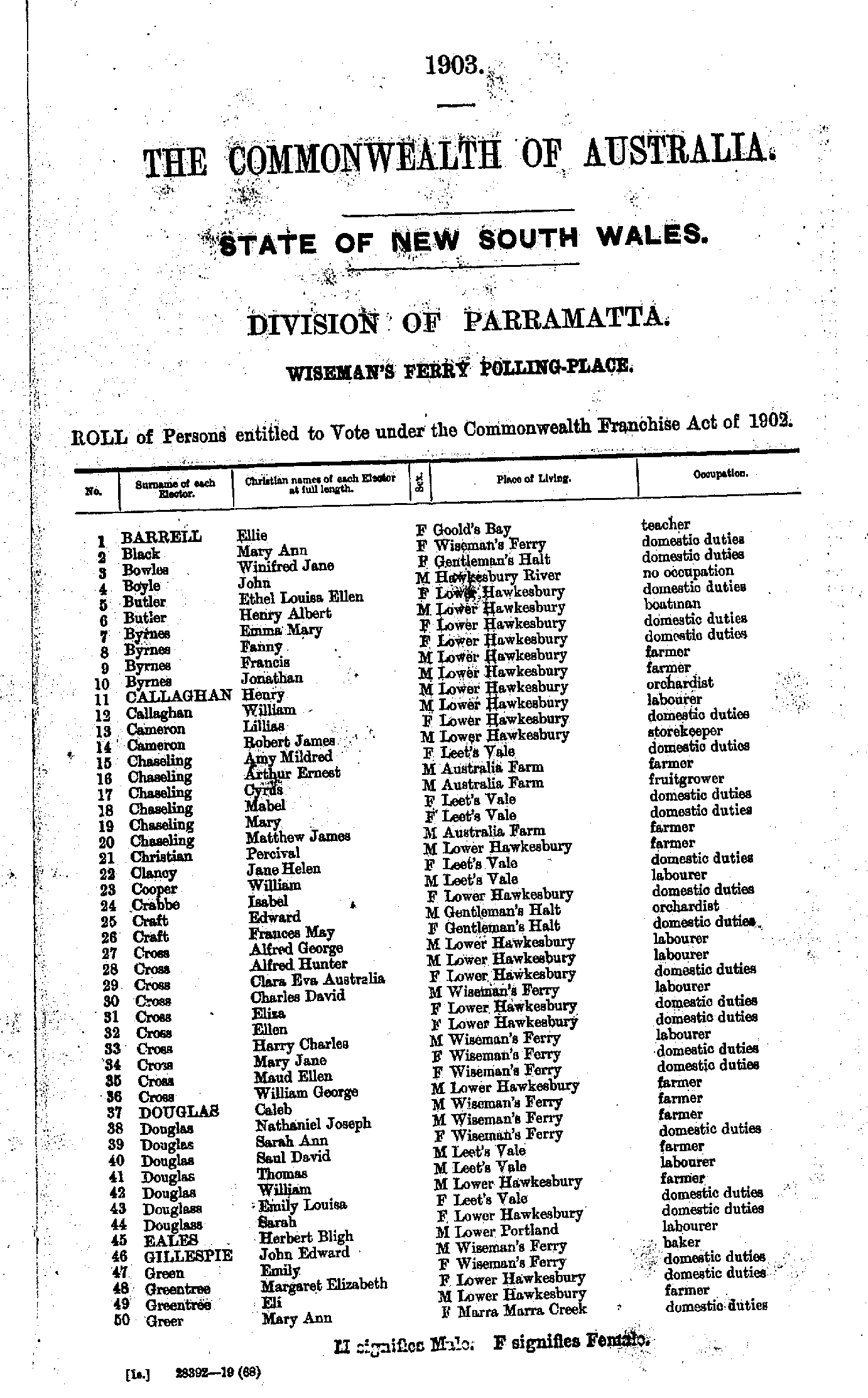
Roll of Persons entitled to Vote under the Commonwealth Franchise Act of 1902 Reproduced from microform copies of the originals in the Mitchell Library, State Library of New South Wales.
Index Copyright © Internet History Resources 2007
Electoral Maps of the Parramatta Division, 1901
Polling Places:
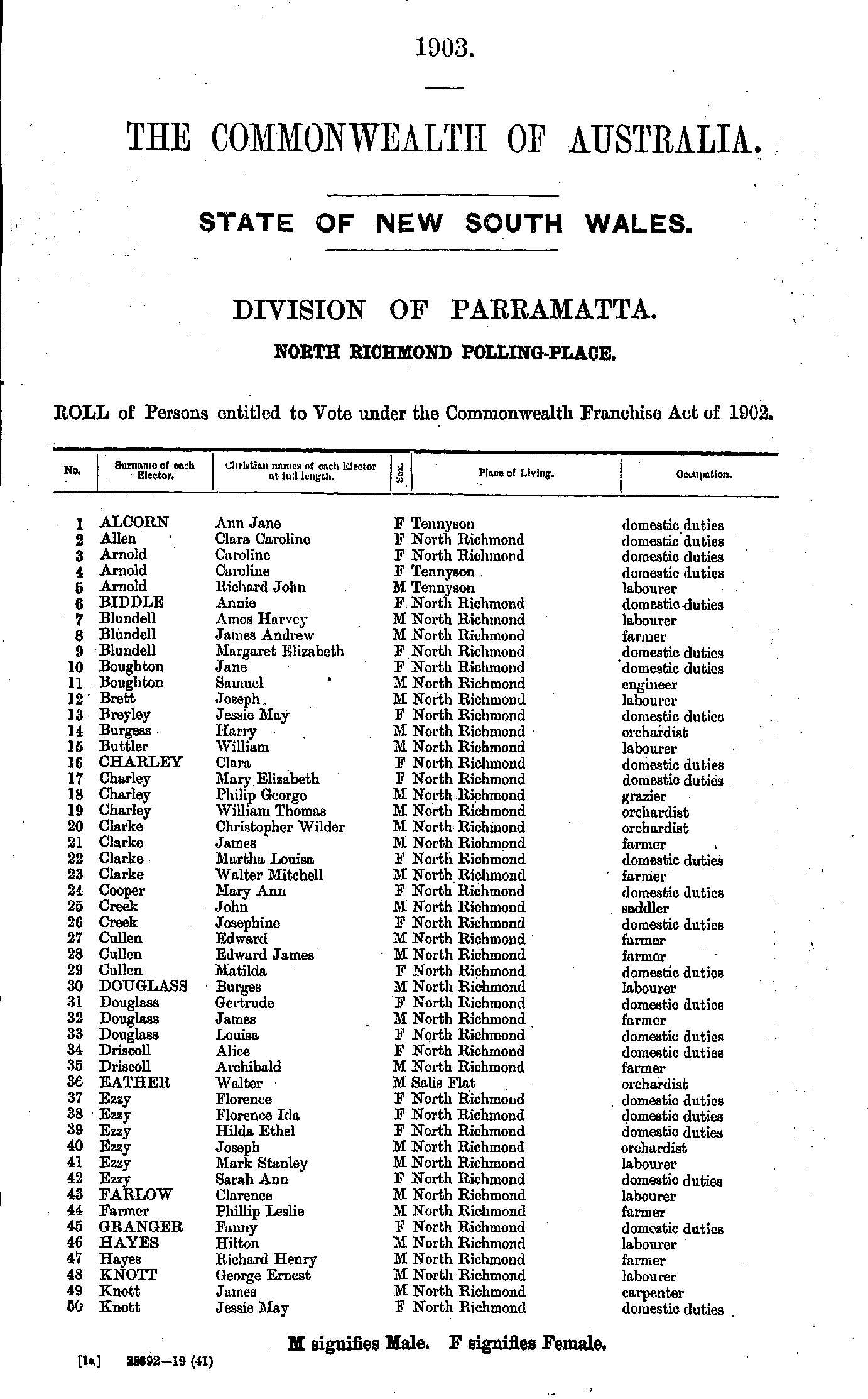
Agnes Bank | Arcadia | Baulkham Hills | Blackheath | Blacktown | Bringelly | Bull Ridge | Cabramatta | Canley Vale | Castle Hill | Castlereagh | Central Colo | Comleroy Road | Dural | Emu Plains | Exeter | Fairfield | Forrester | Freeman's Reach | Galston | George Asylum | Glenbrook | Glenorie | Gough Town | Hartley Vale | Howe's Valley | Hoxton Park | Katoomba | Kellyville | Kenthurst | Kurrajong Heights | Lawson | Lithgow | Liverpool | Liverpool Asylum | Llandilo | Luddenham | Macquarie Asylum | Mount Druitt | Mount Victoria | Mouth Of Colo | Mulgoa | North Kurrajong | North Richmond | Parramatta | Pennant Hills | Penrith | Pitt Town | Portland Head | Prospect | Putty | Richmond | Riverstone | Rooty Hill | Rouse Hill | Sackville Reach | Seven Hills | Sherwood | Smithfield | Springwood | St. Albans | St. John's Park | St. Mary's | Toongabbie | Upper Colo | Vineyards | Wentworth Falls | Wetherill Park | Wilberforce | Windsor | Wiseman's Ferry
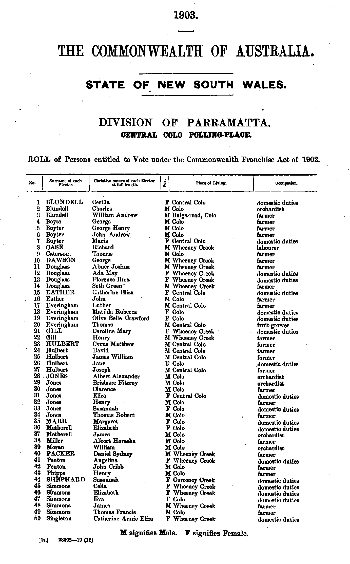
- Acres Georgina - Cassell Charles
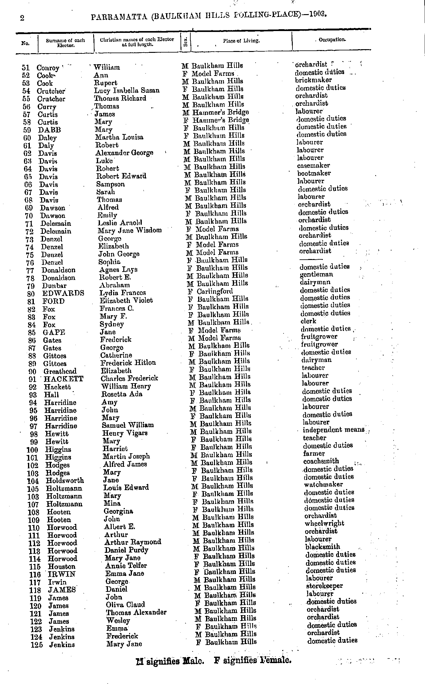
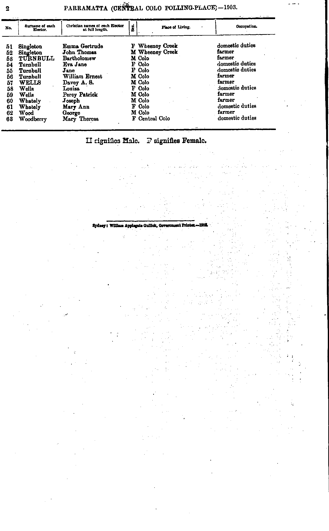
- Conroy William - Jenkins Mary
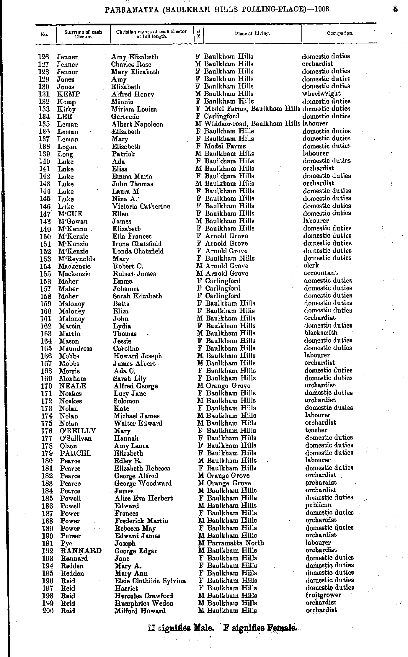
- Jenner Amy - Reid Milford
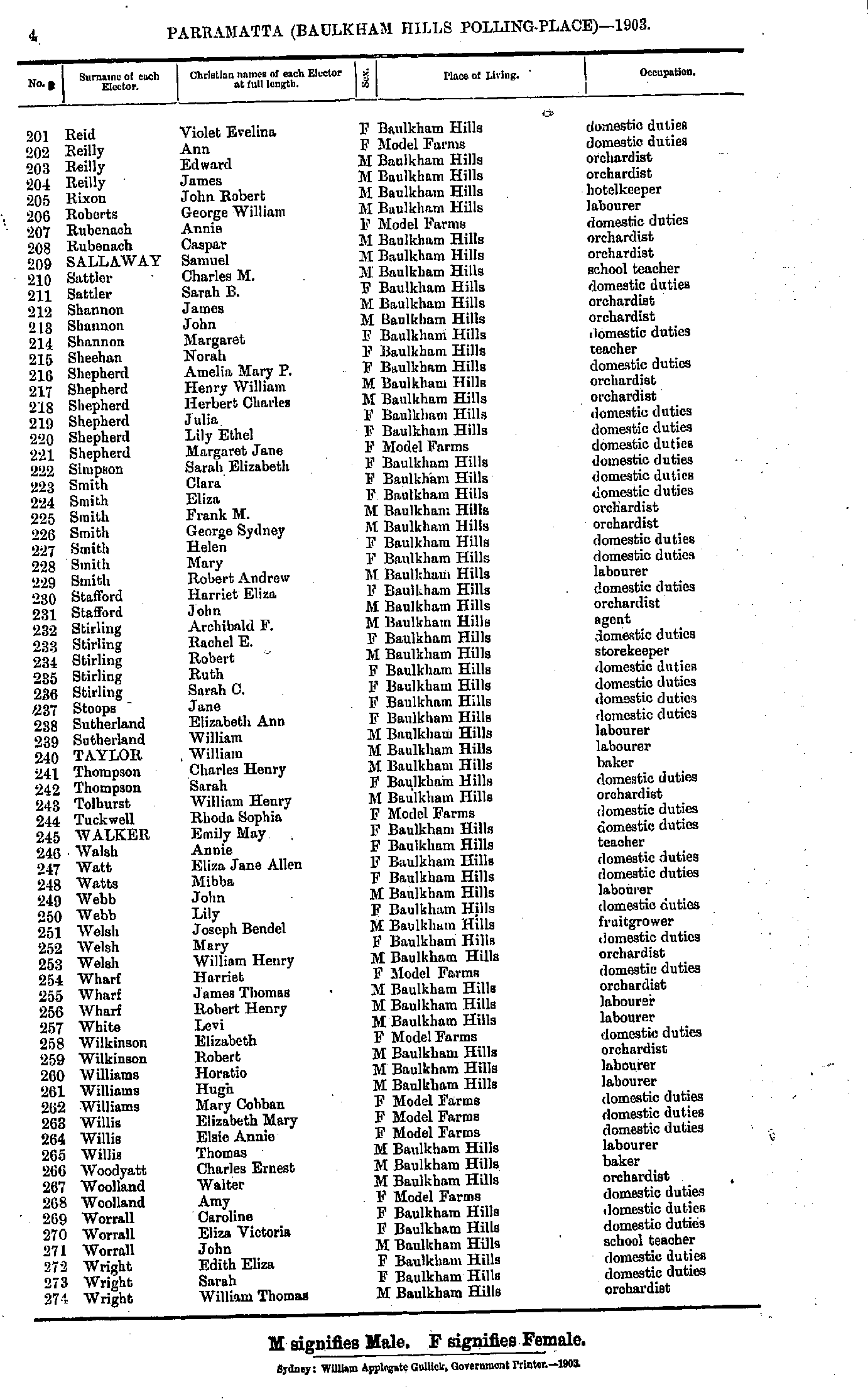
- Reid Violet - Wright William
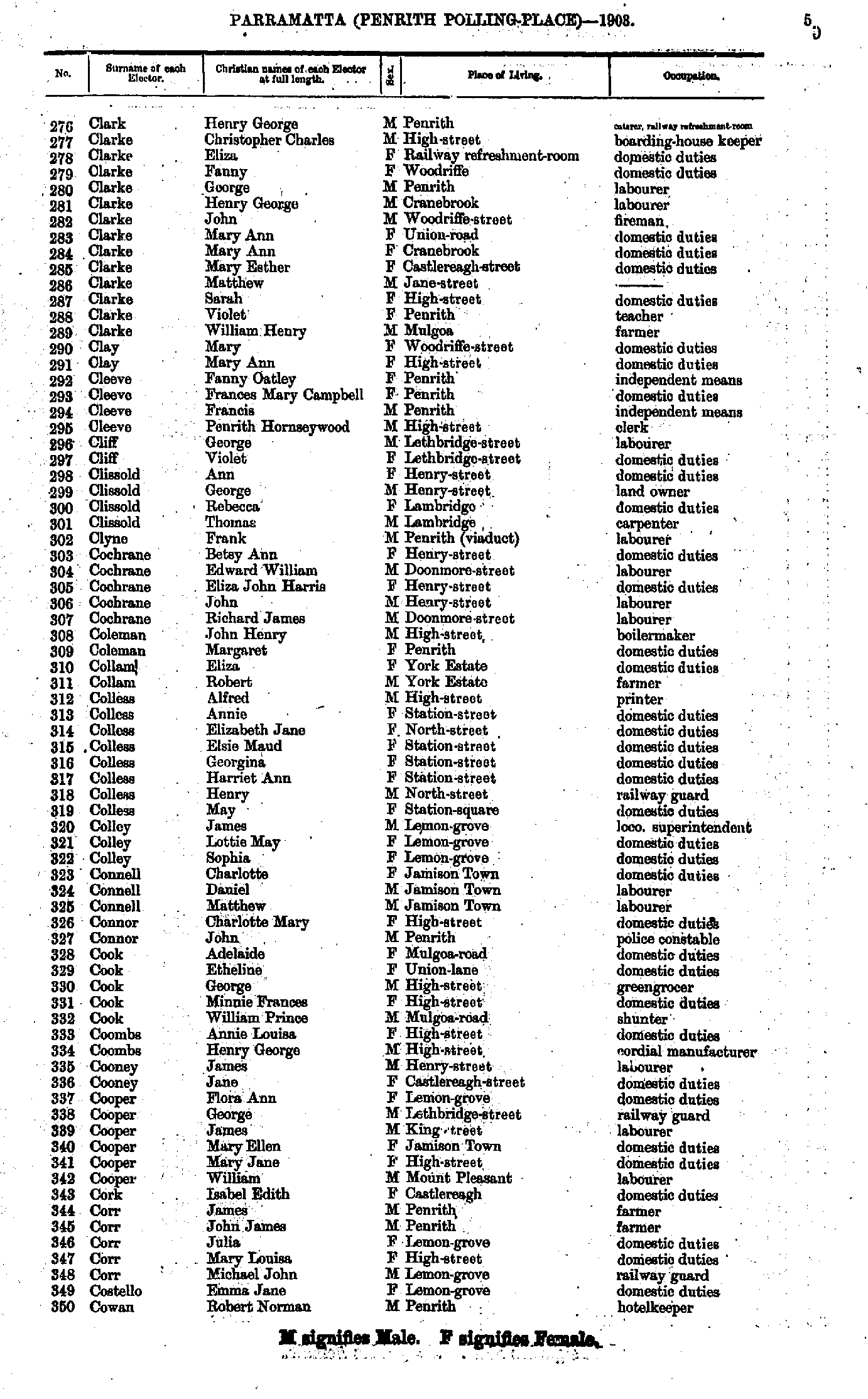
- Allen Jane - Cliff Violet
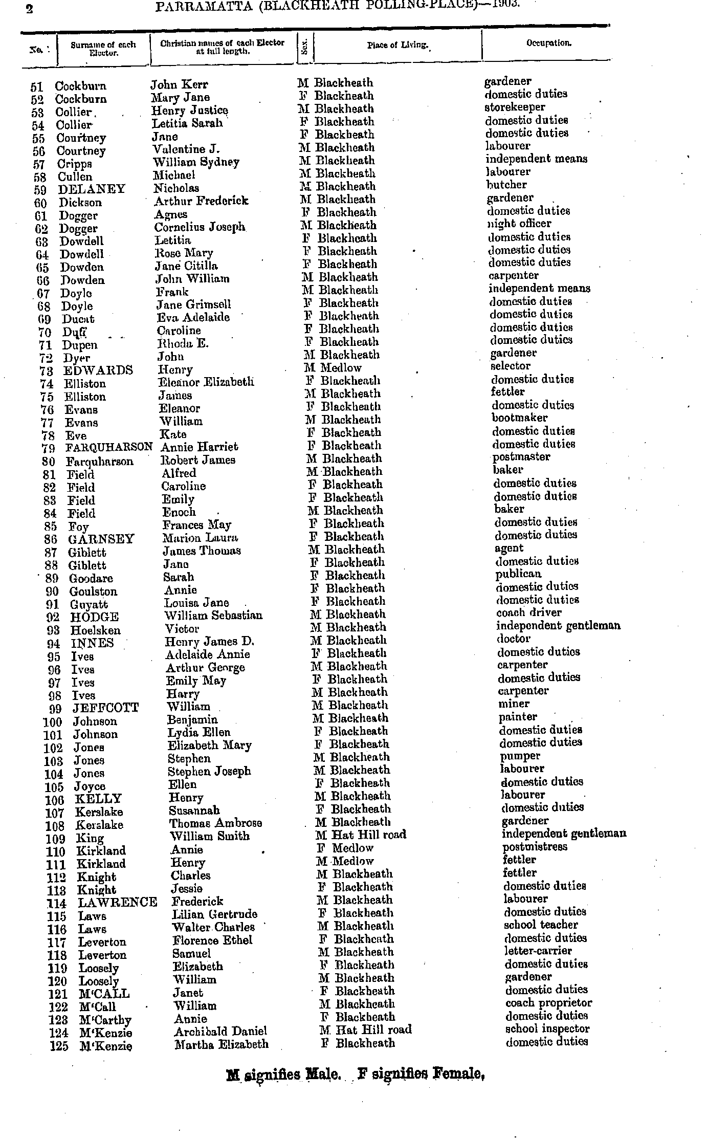
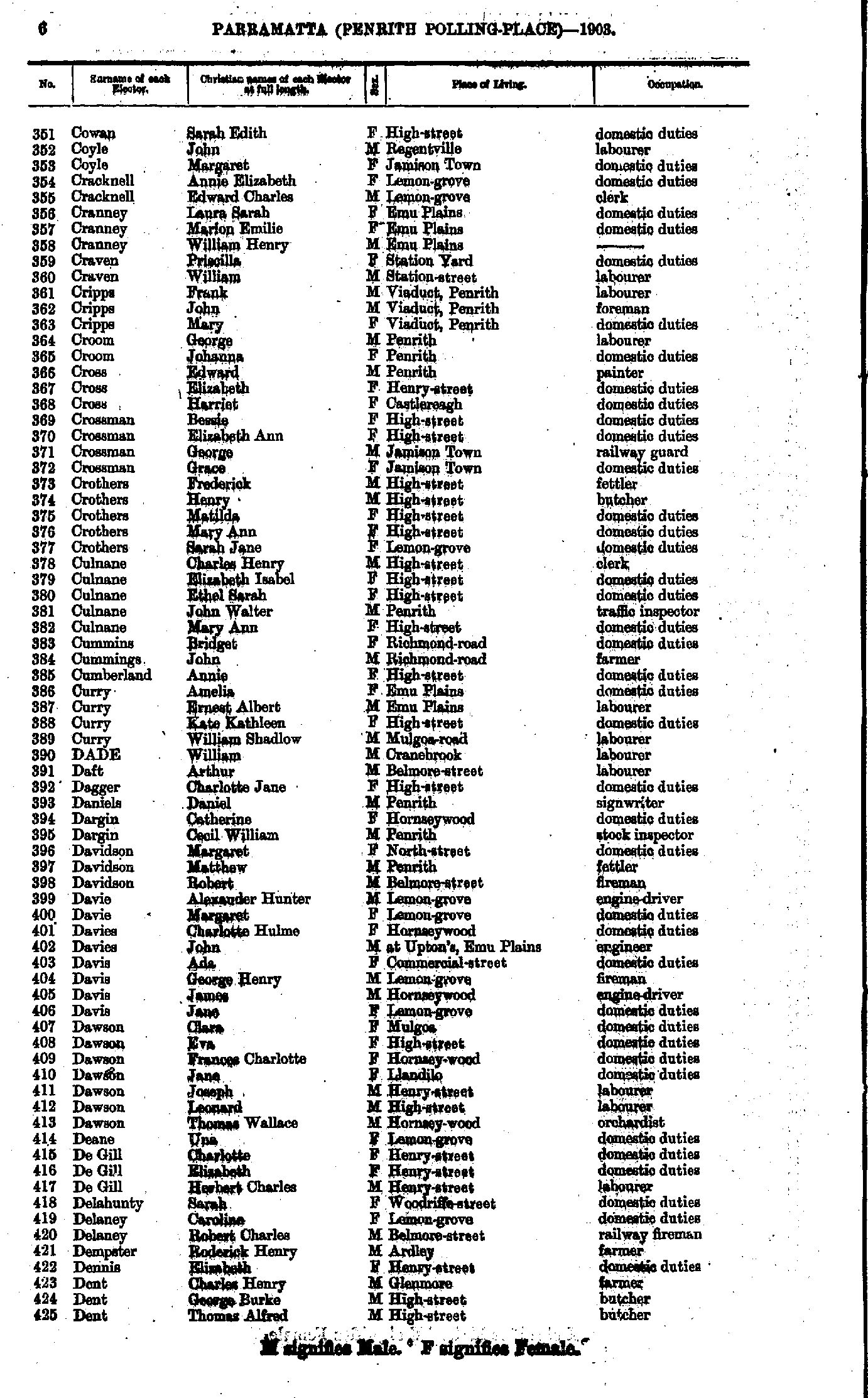
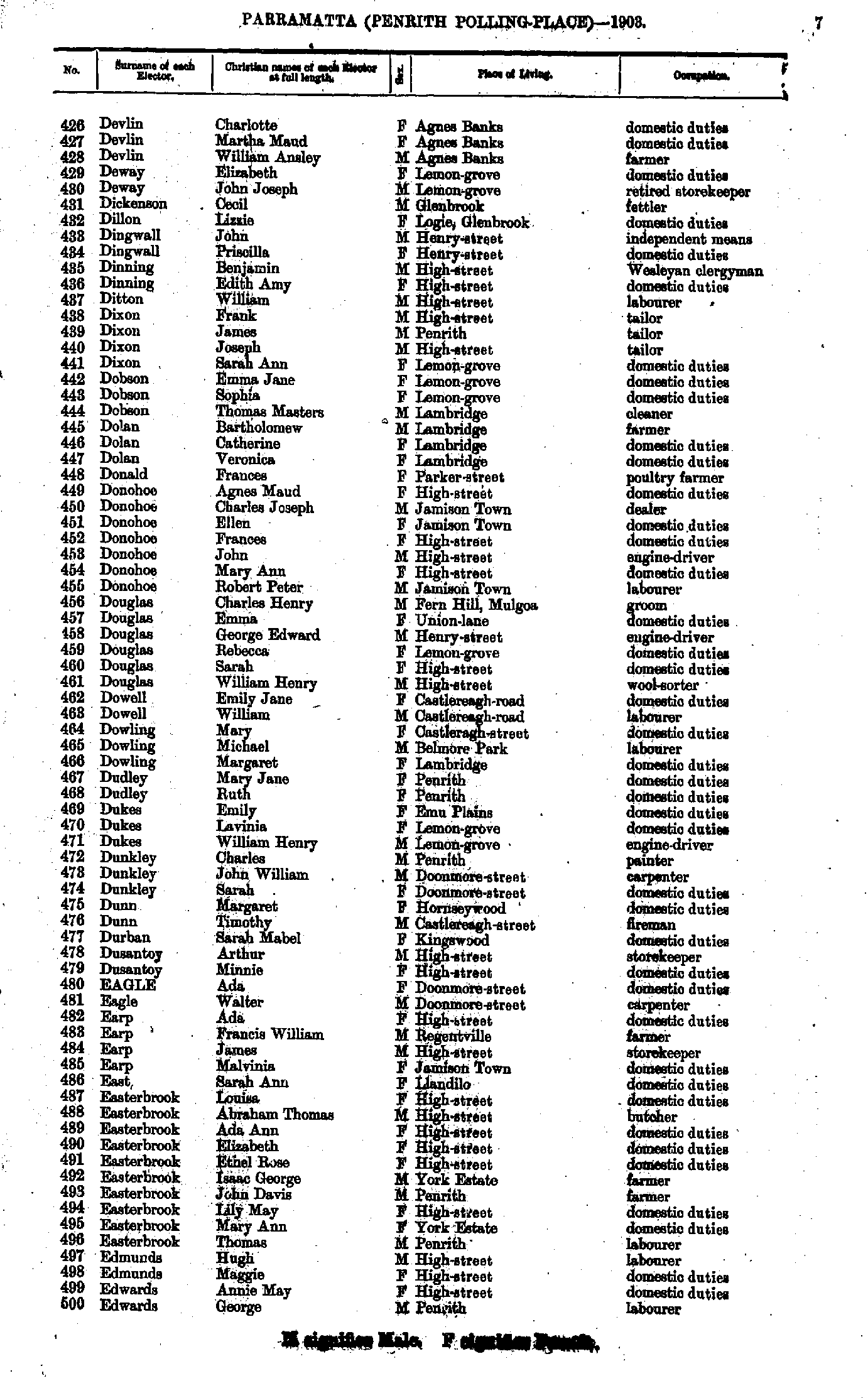
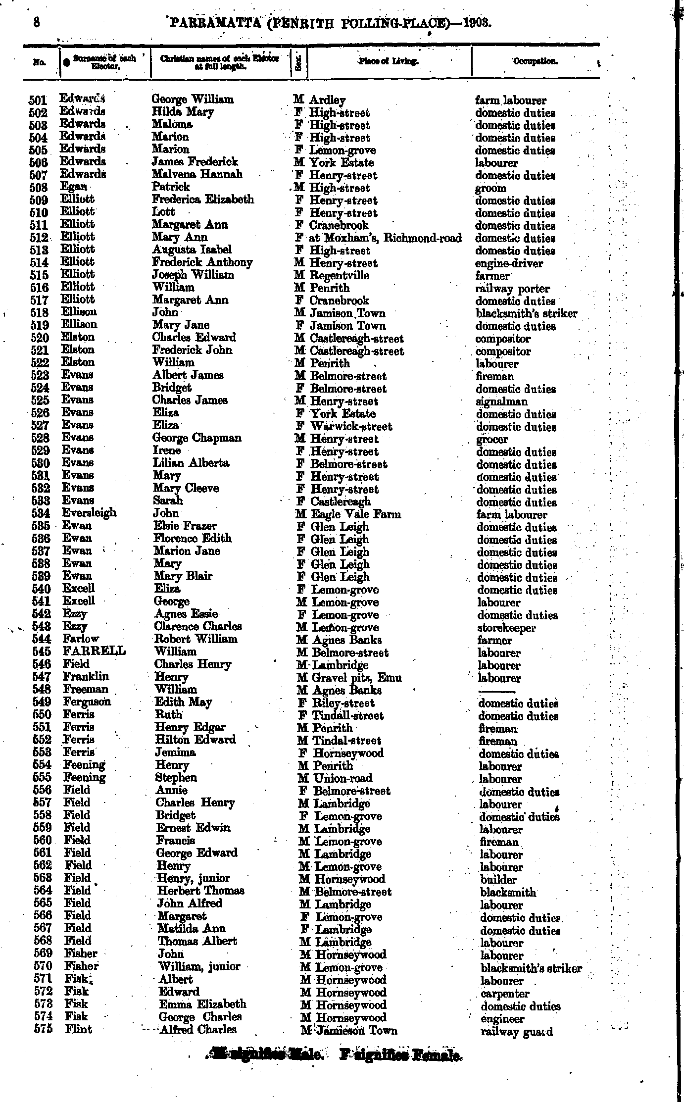
- Cockburn John - M'Kenzie Martha
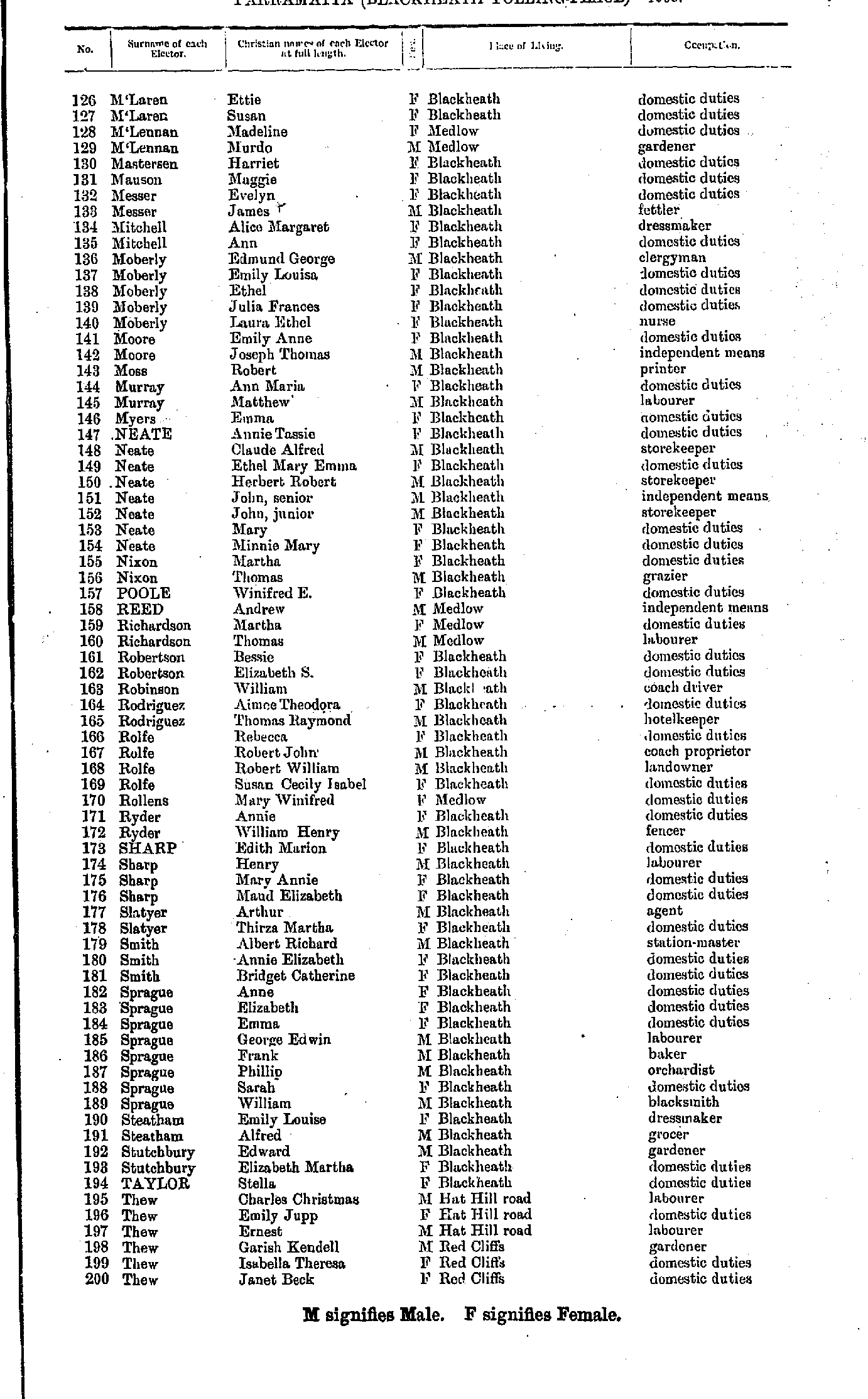
- M'Laren Ettie - Thew Janet
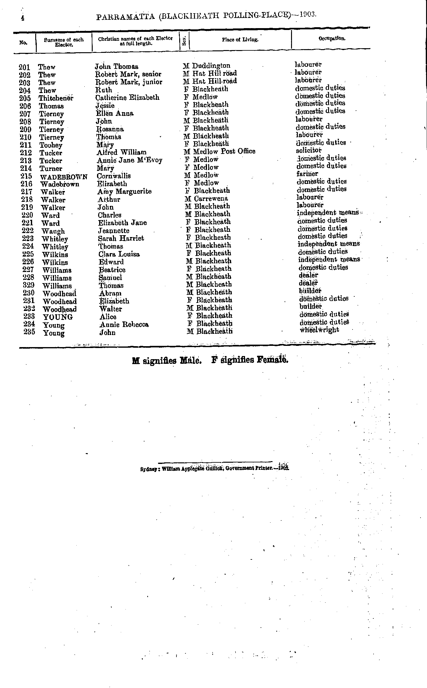
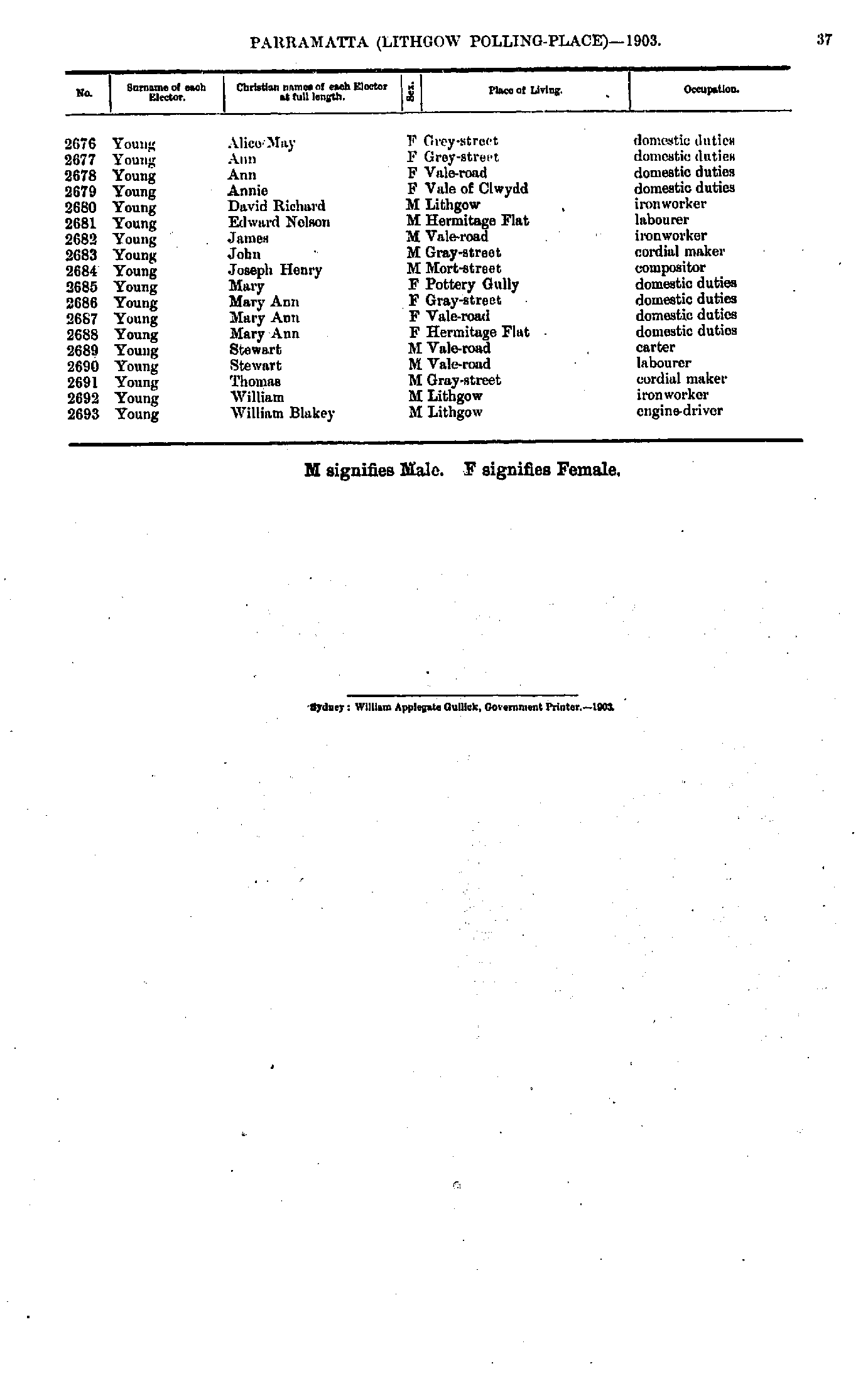
- Thew John - Young John
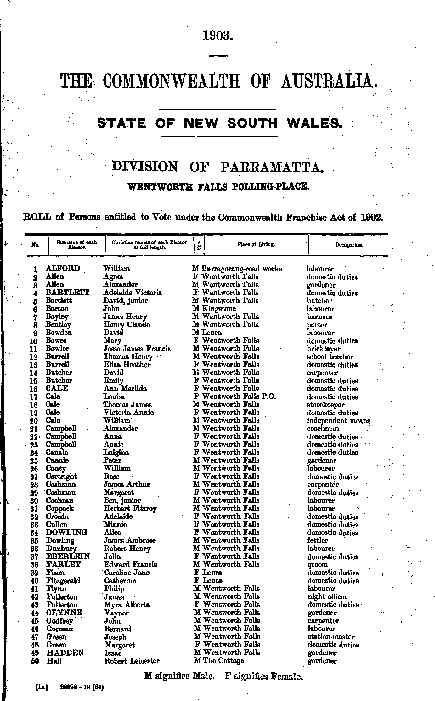
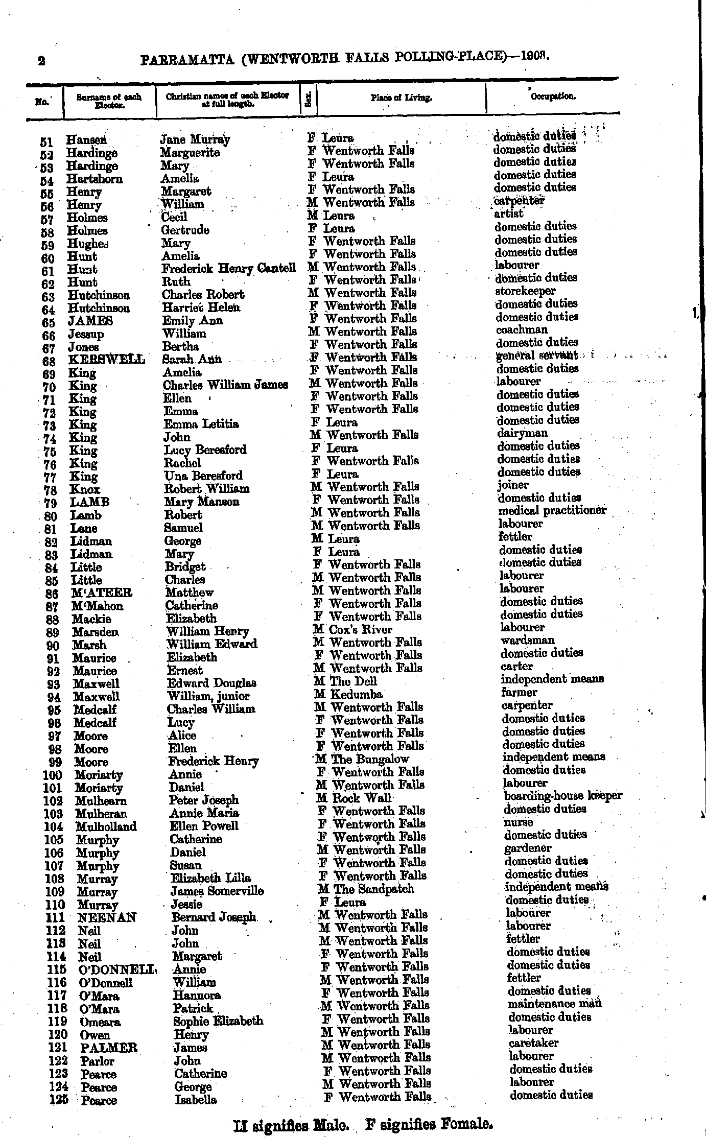
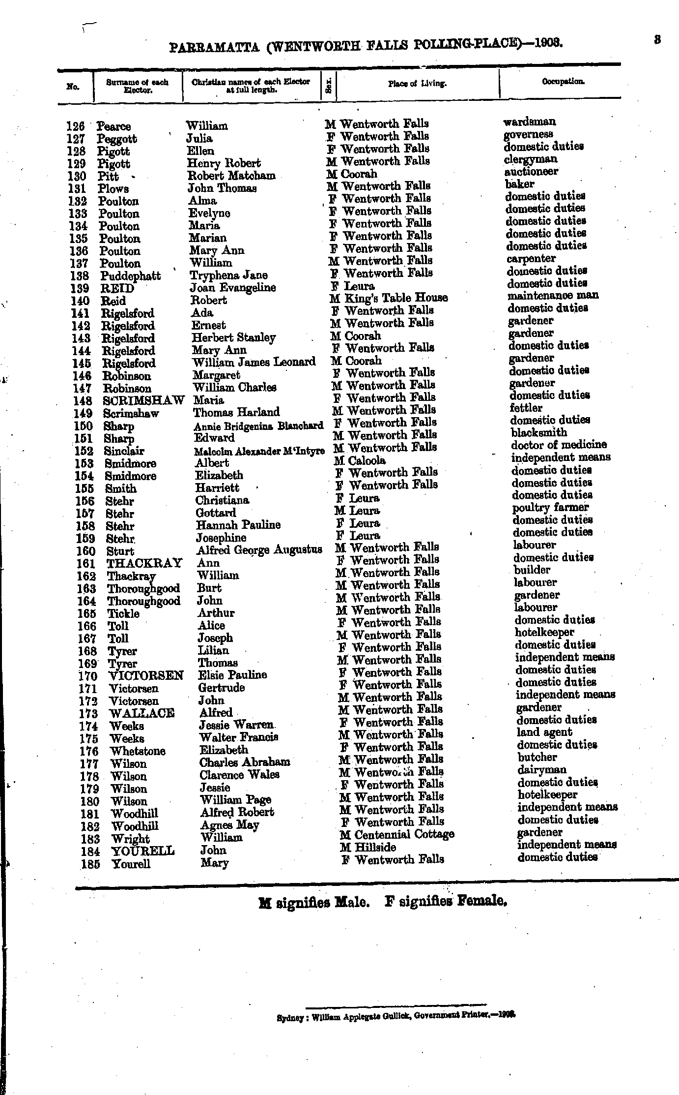
- Allen Alexander - Flanagan Mary
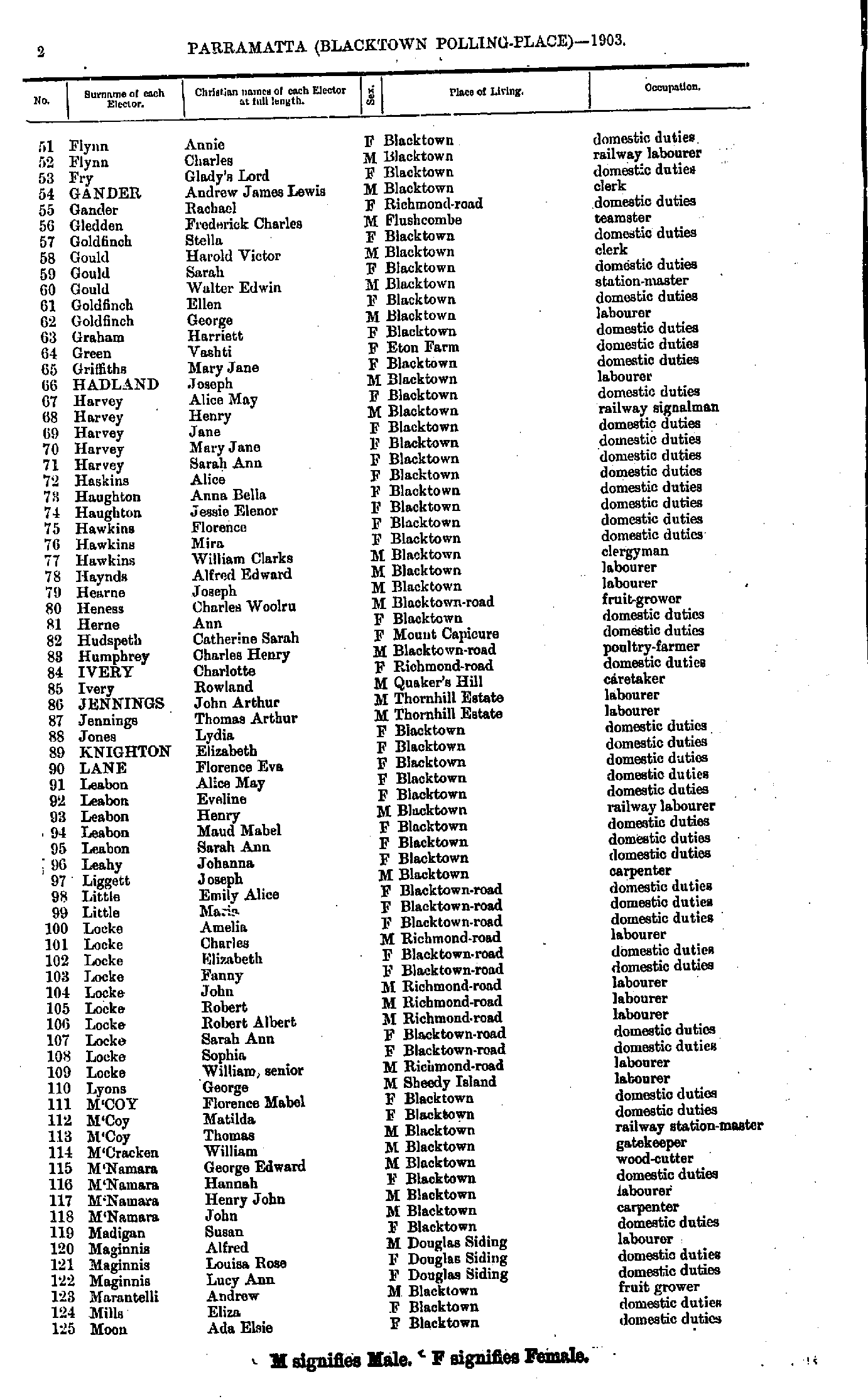
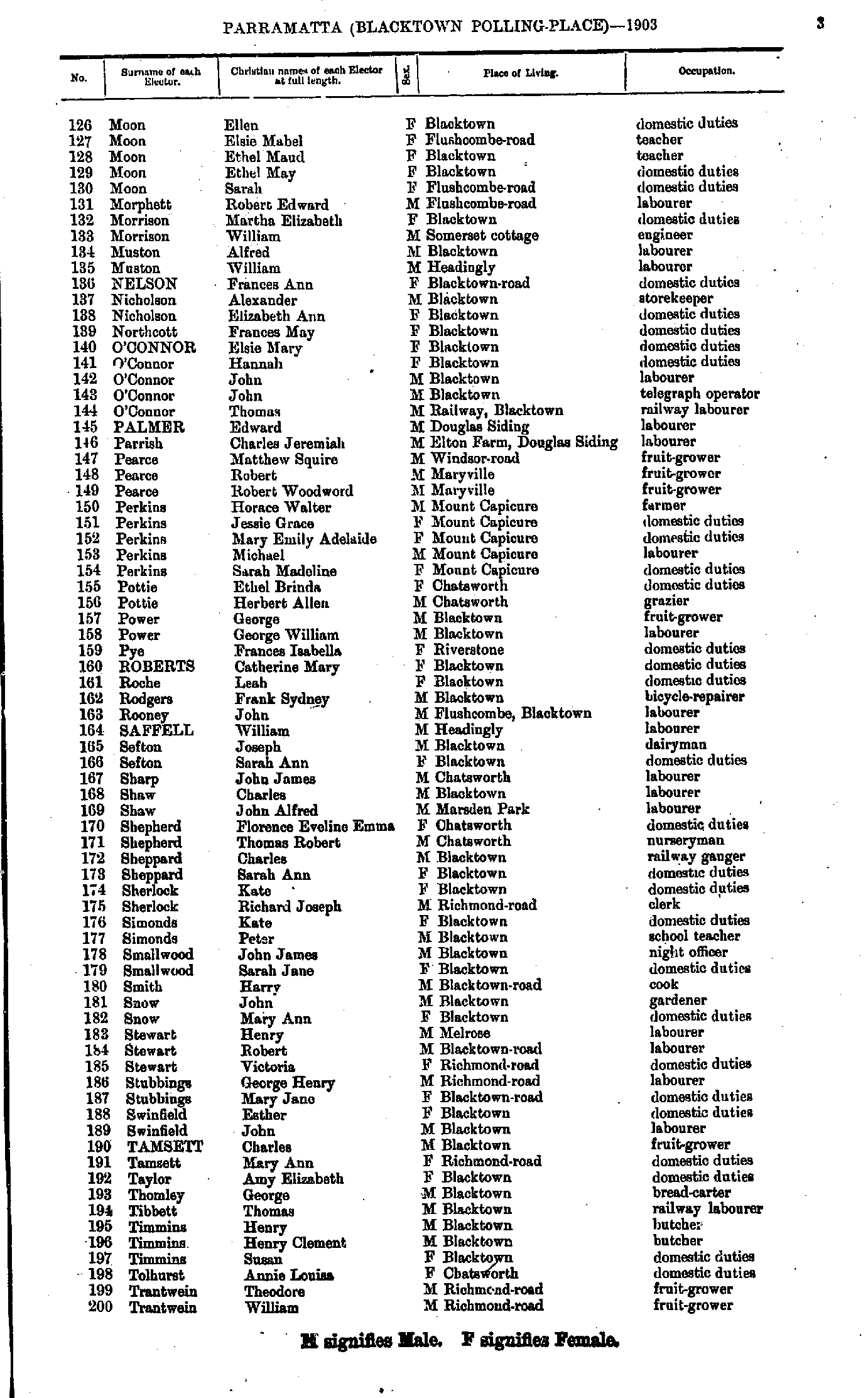
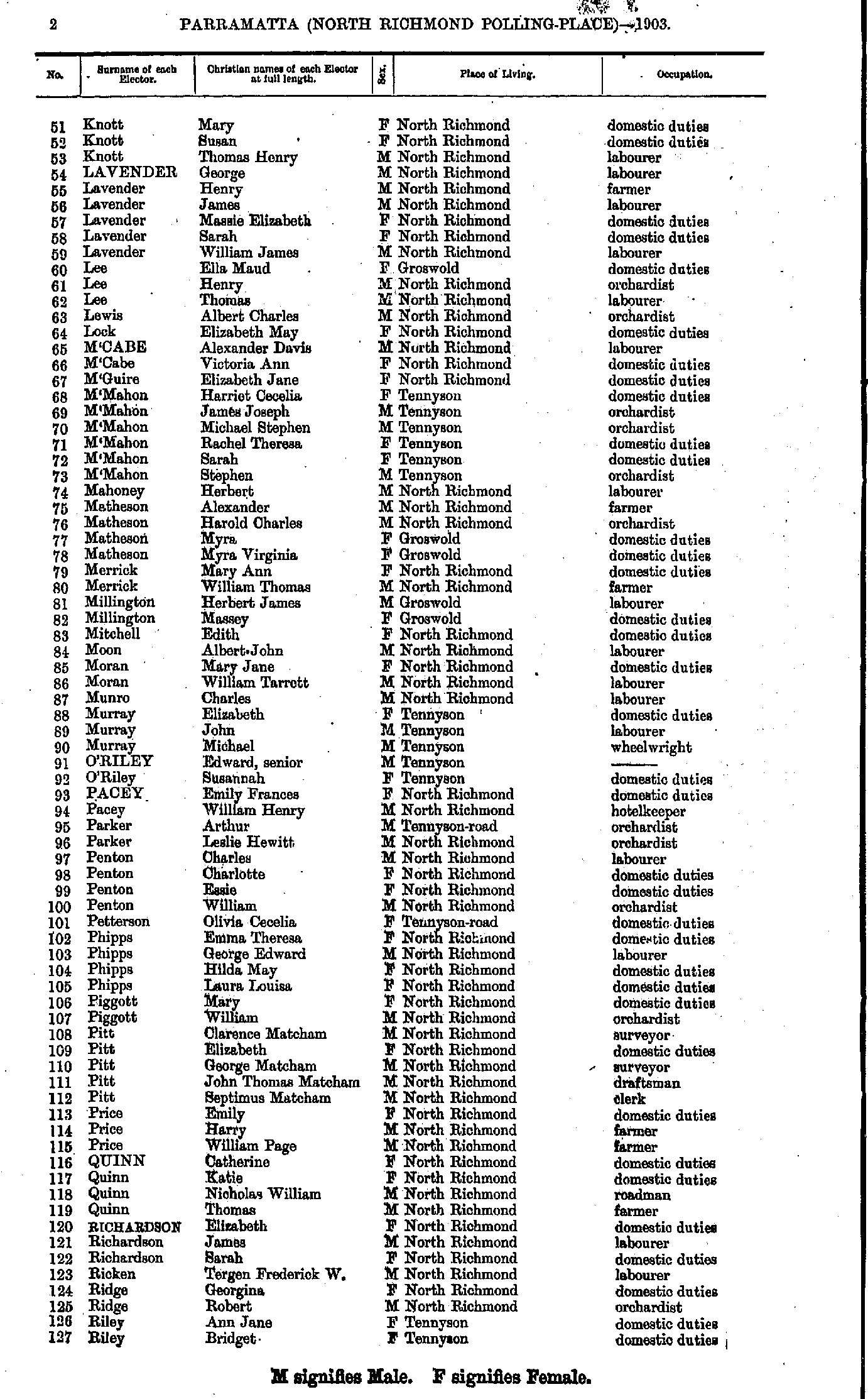
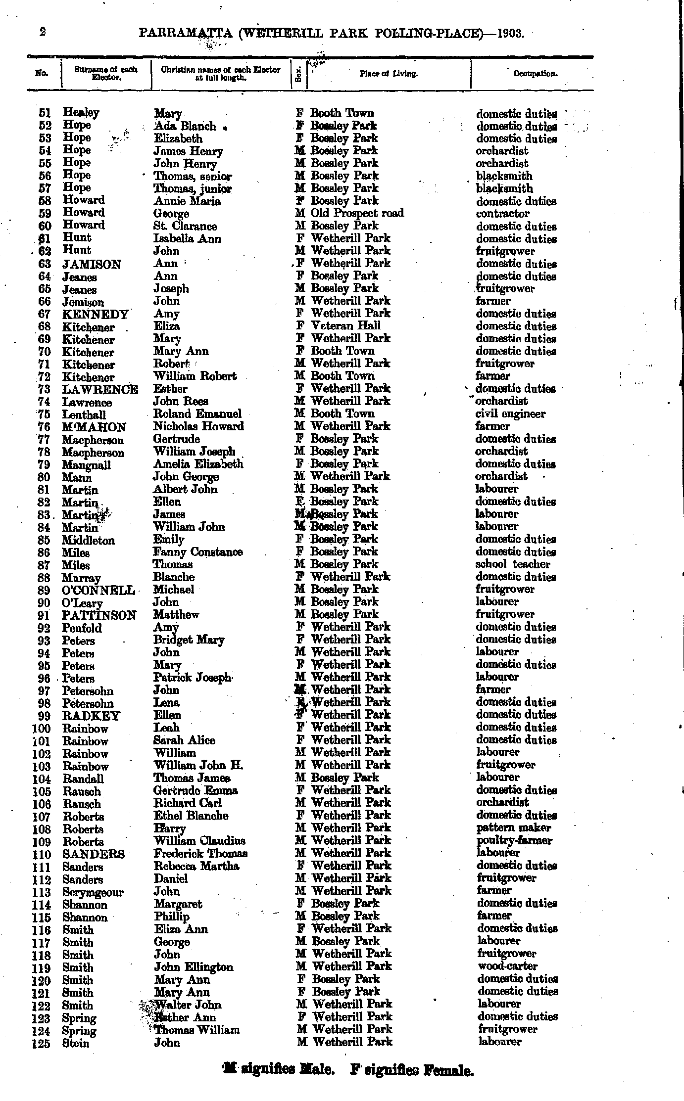
- Flynn Annie - Moon Ada
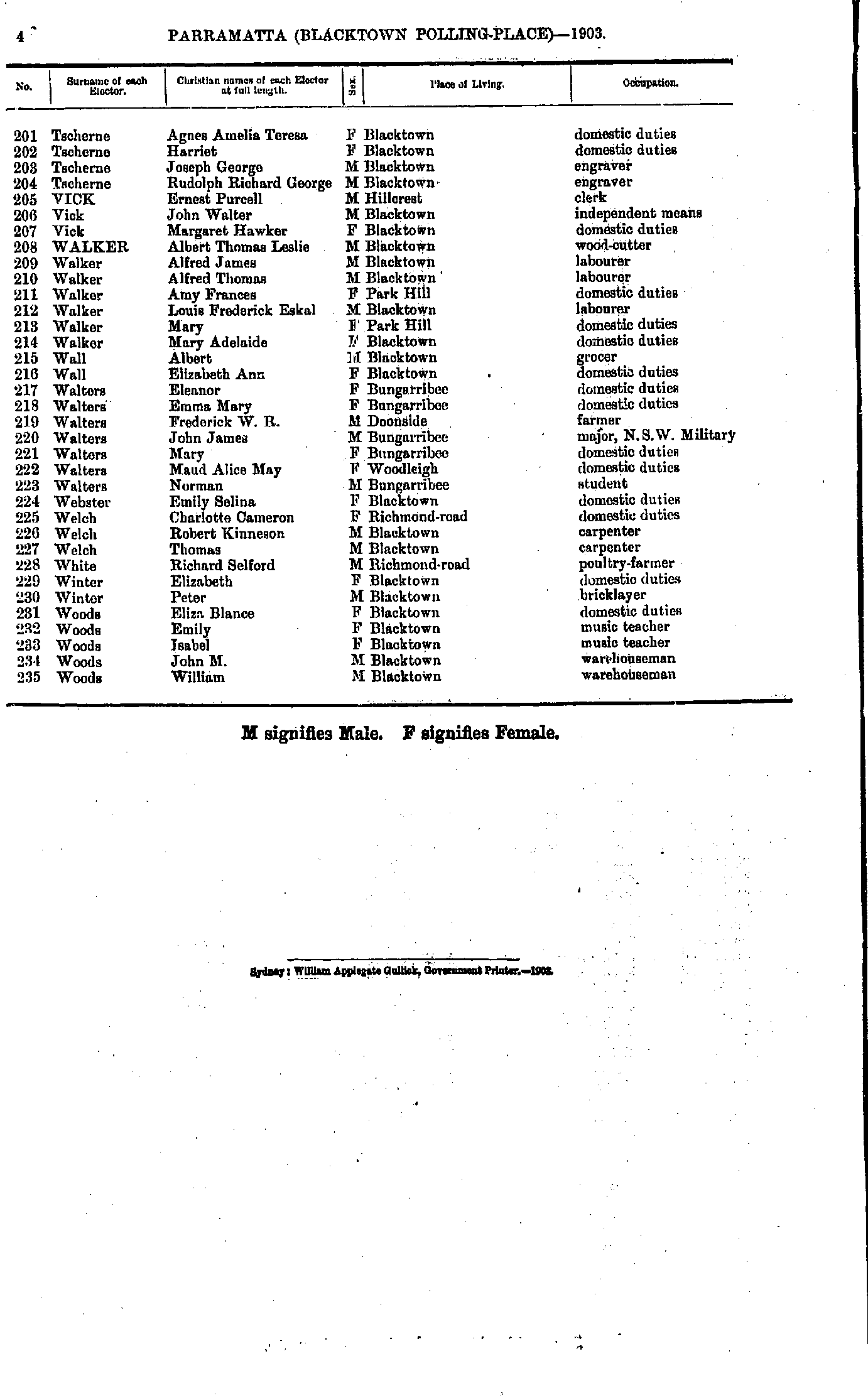
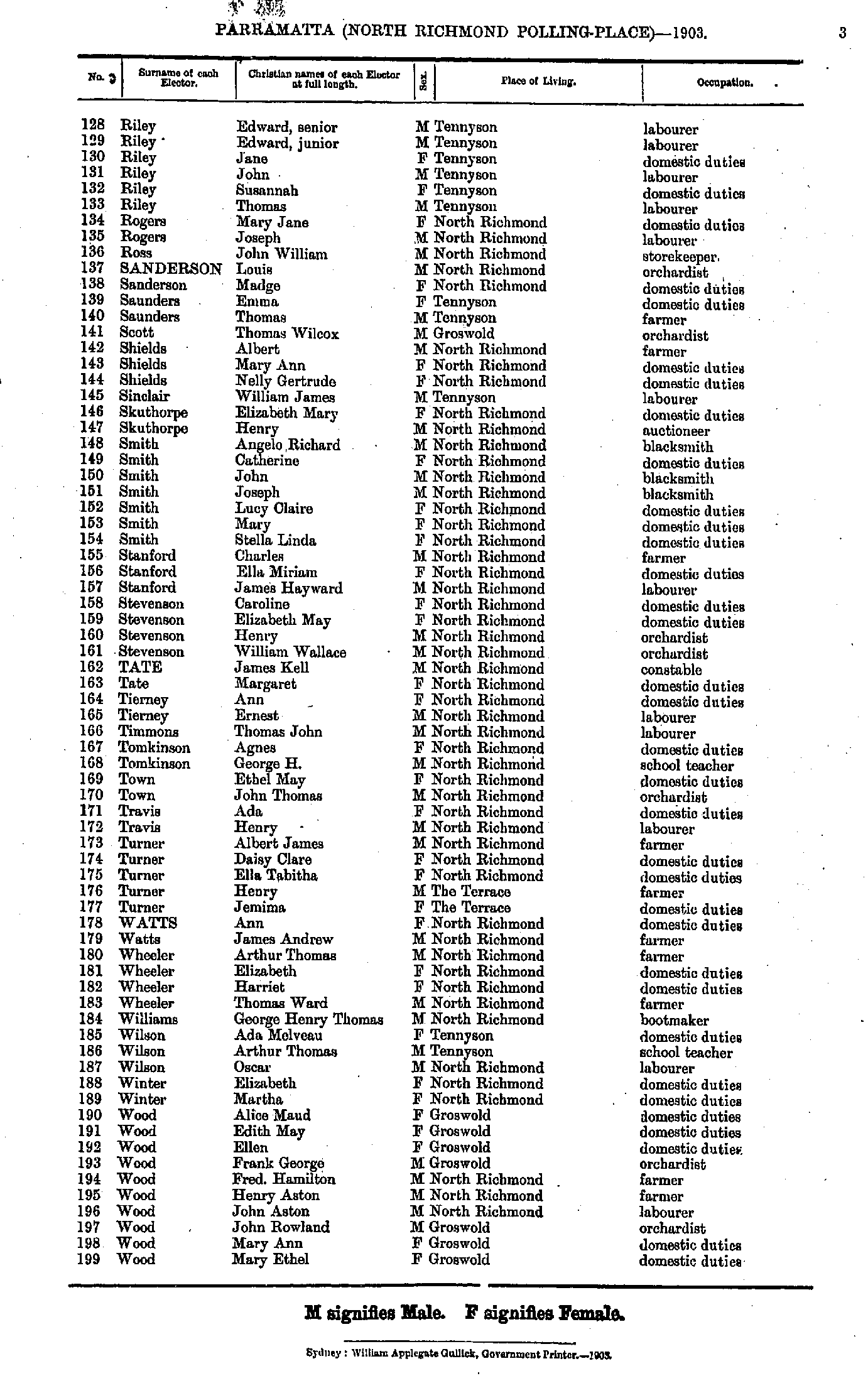
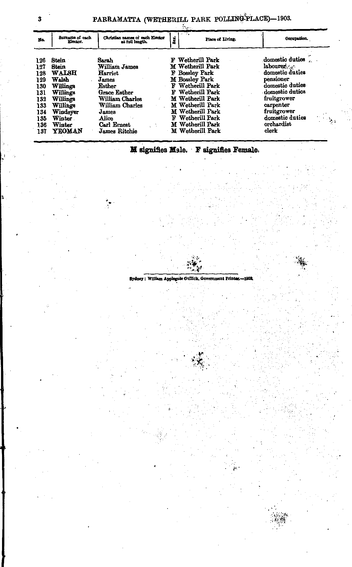
- Moon Ellen - Trantwein William
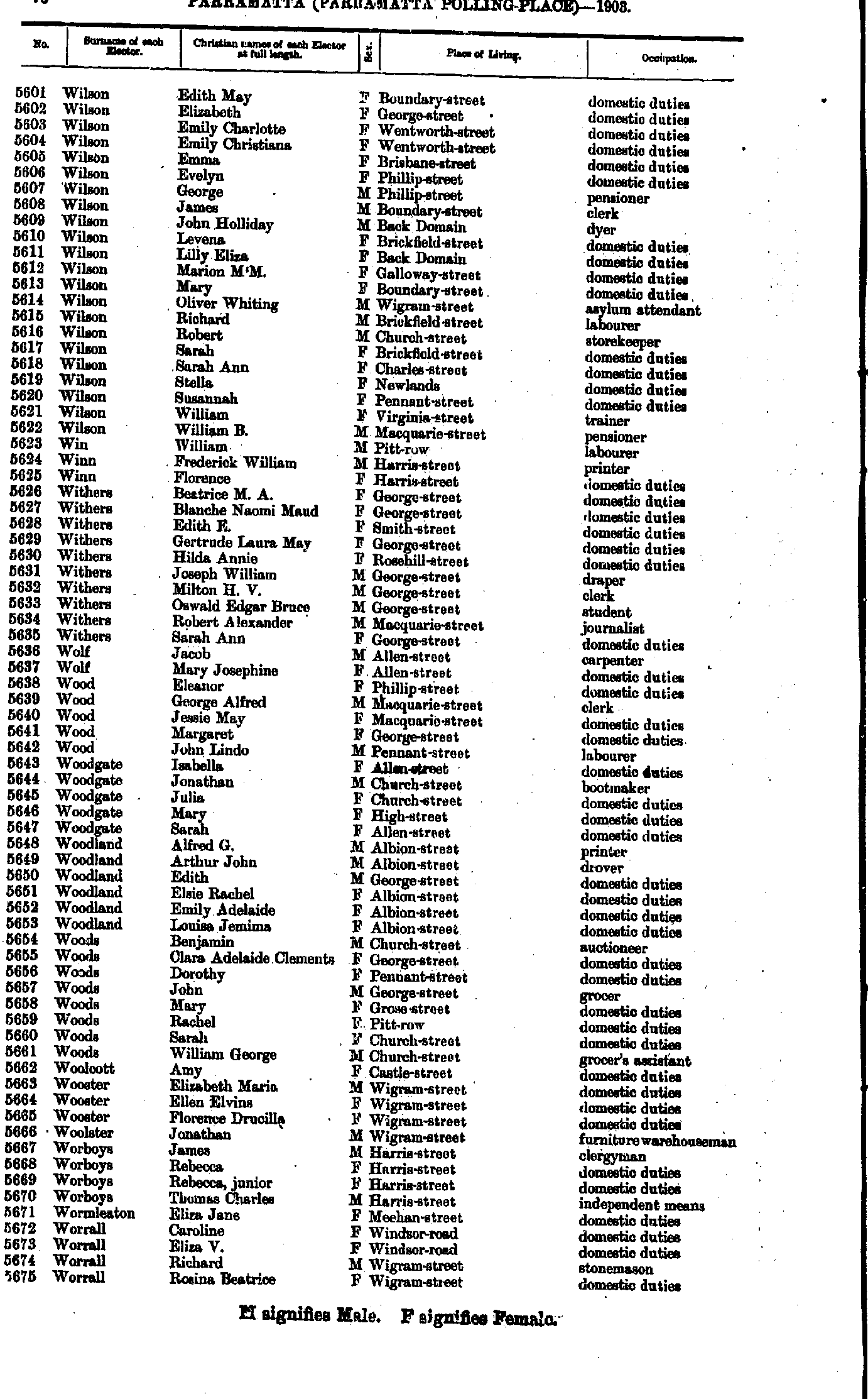
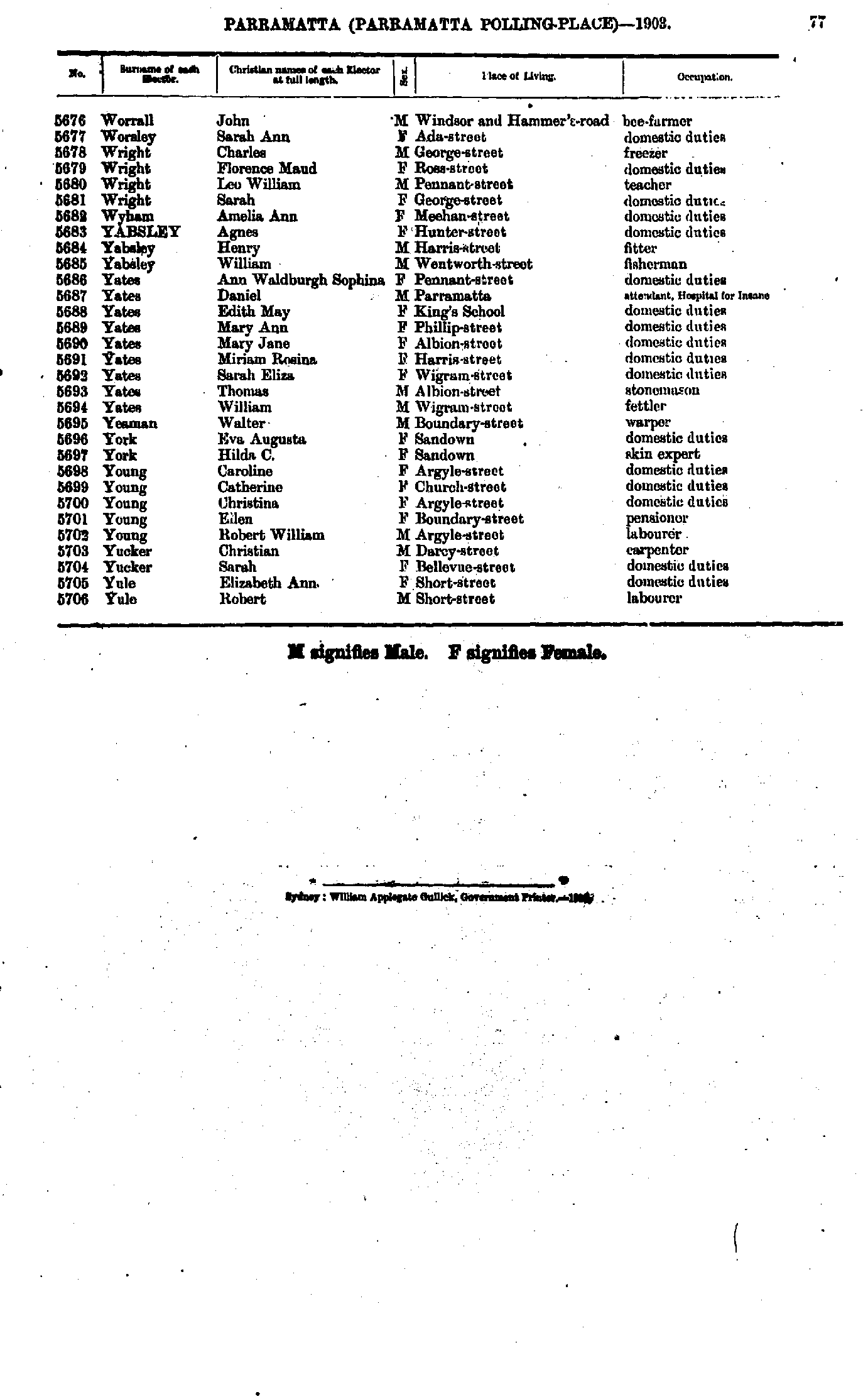
- Tscherne Agnes - Woods William
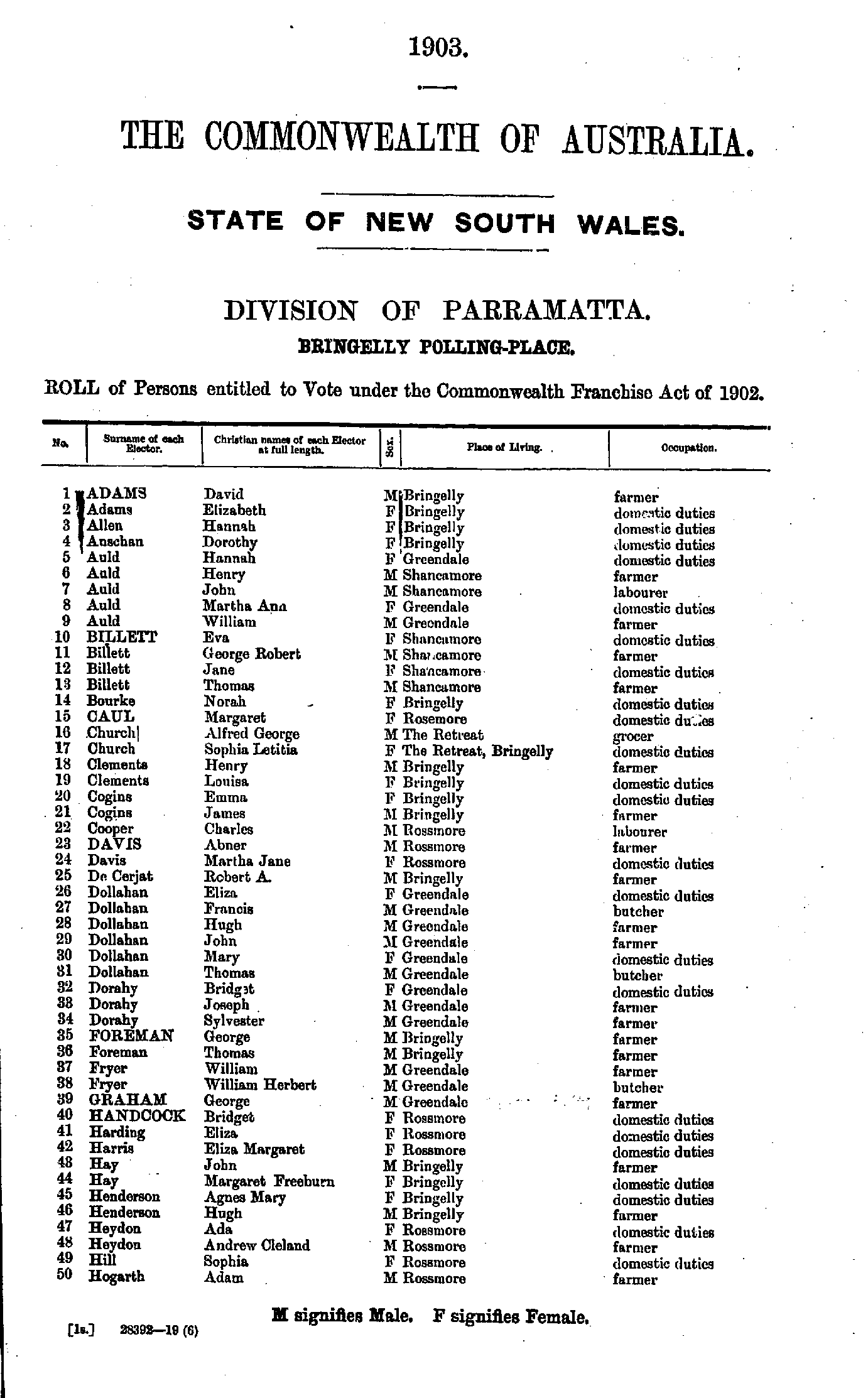
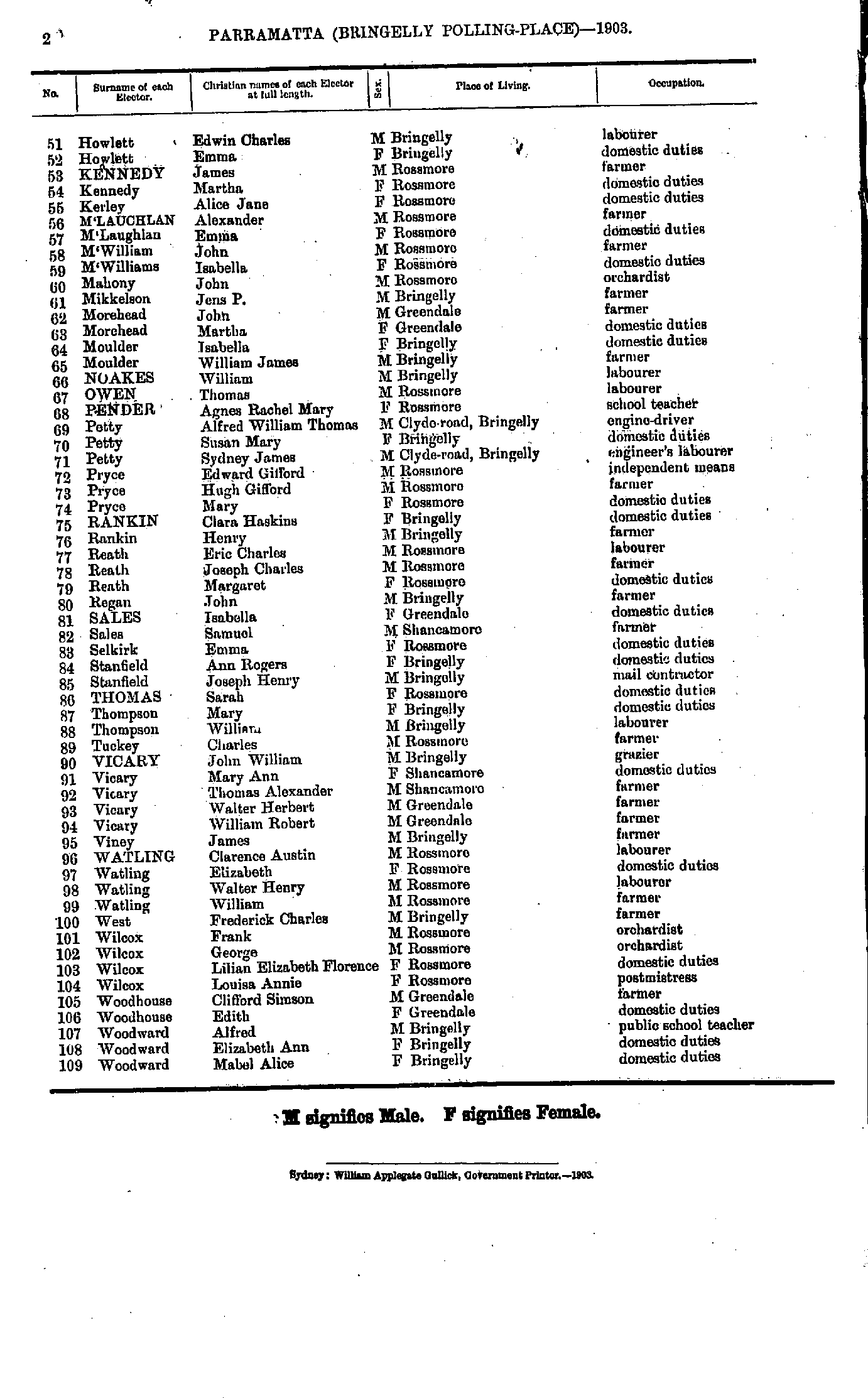
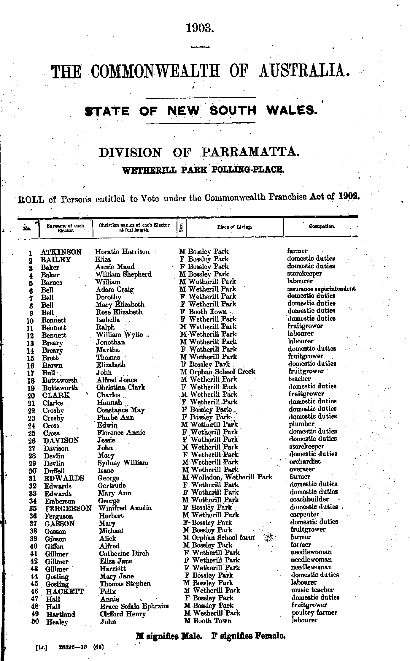
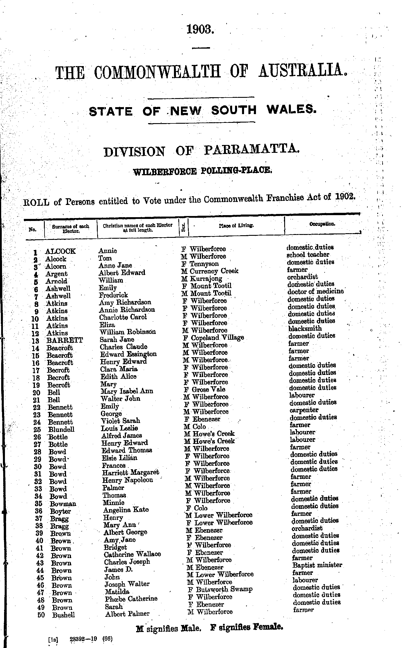
- Allen Albert - Fawsett Joseph
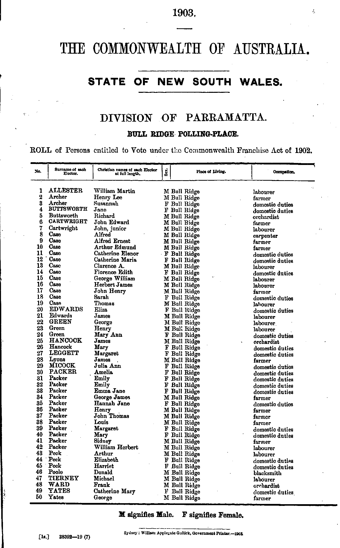
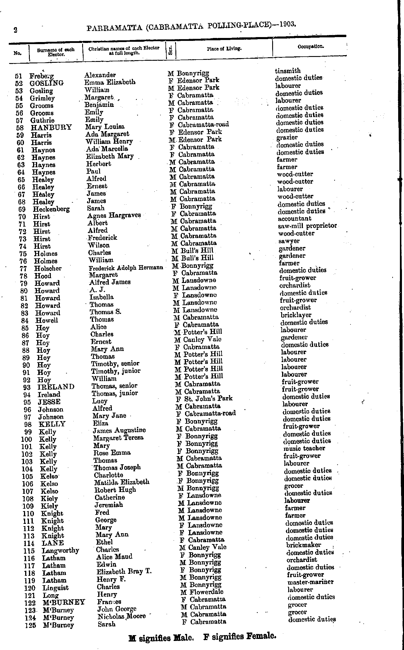
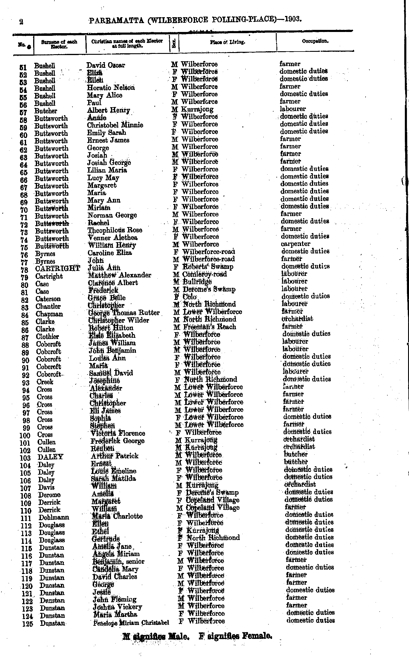
- Freberg Alexander - M'Burney Sarah
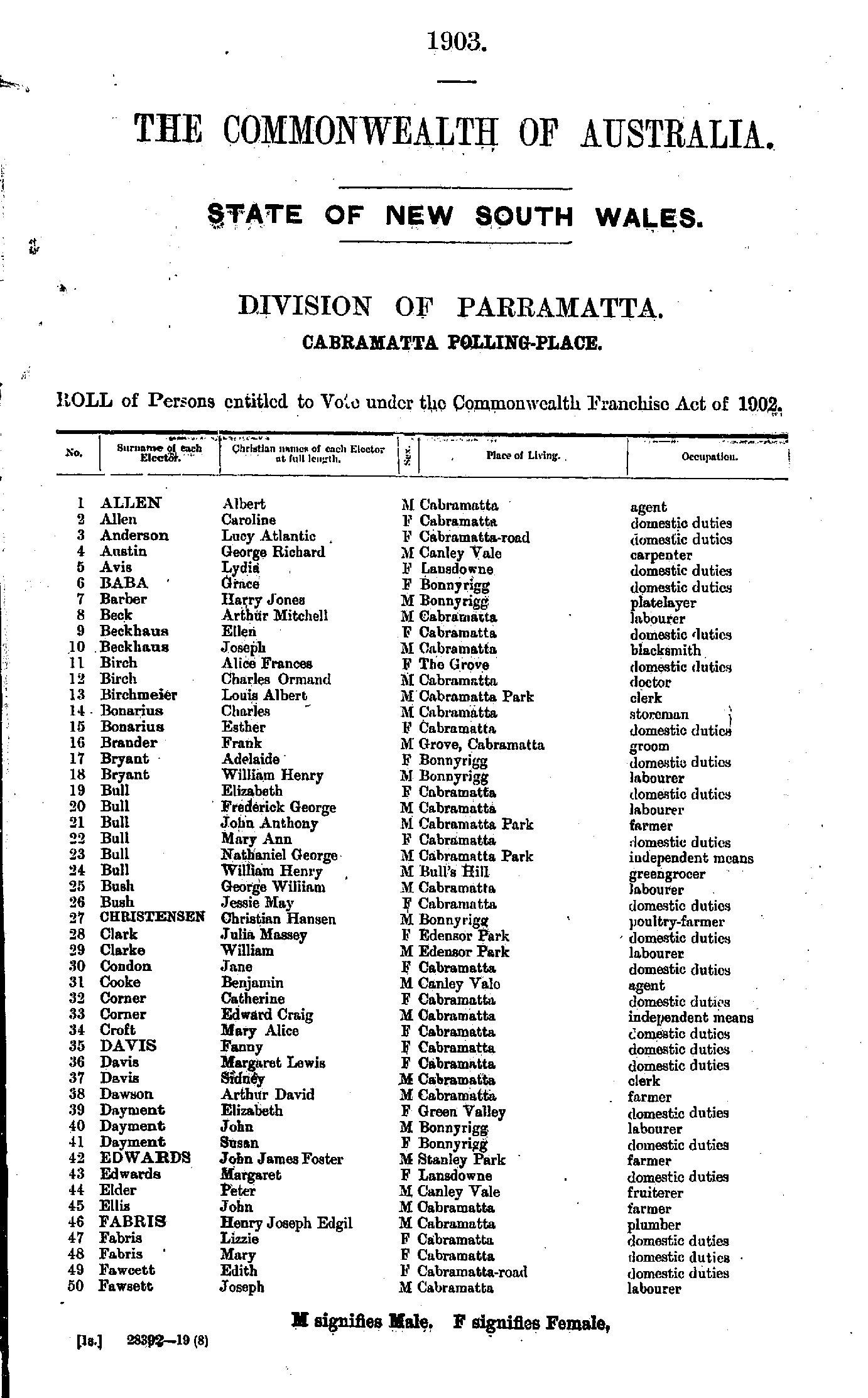
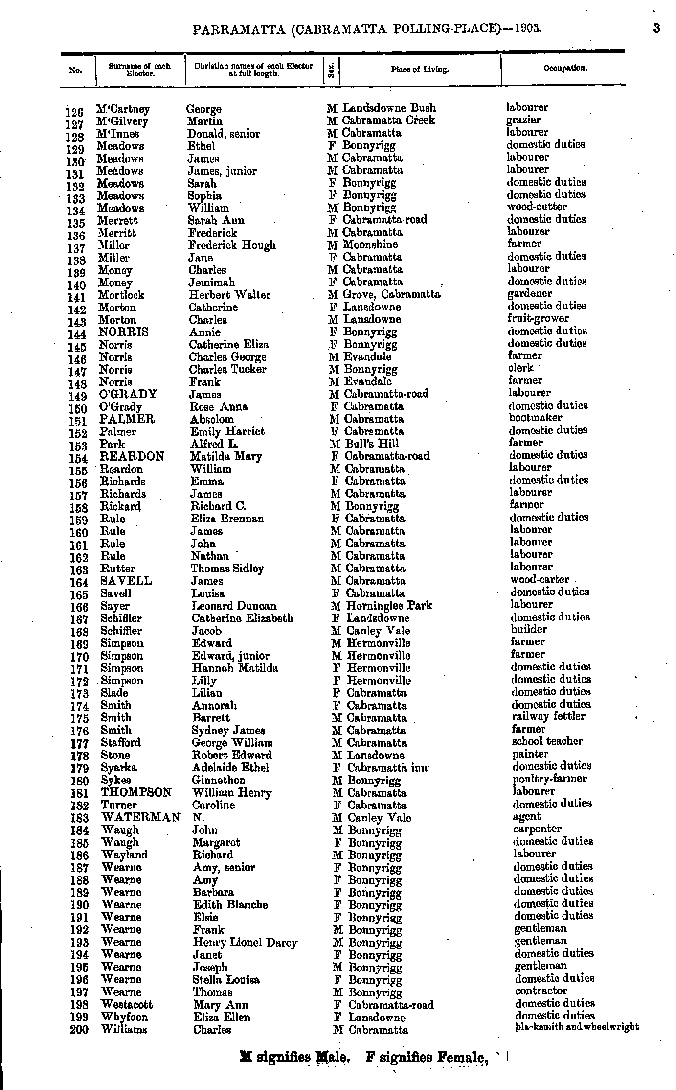
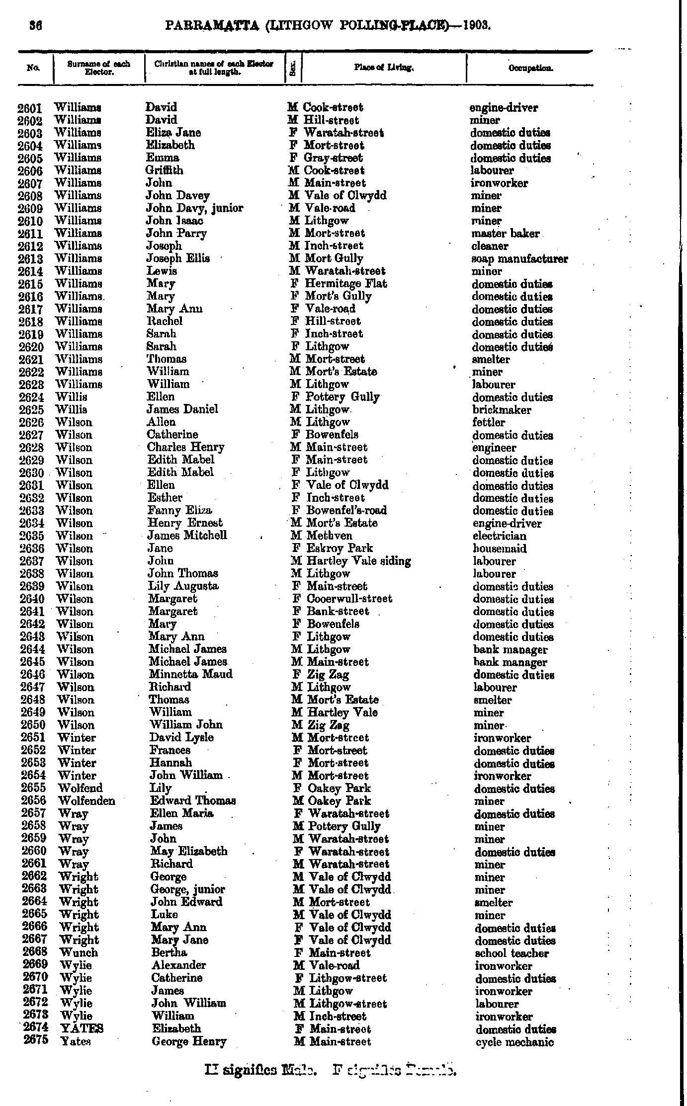
- M'Cartney George - Williams Charles
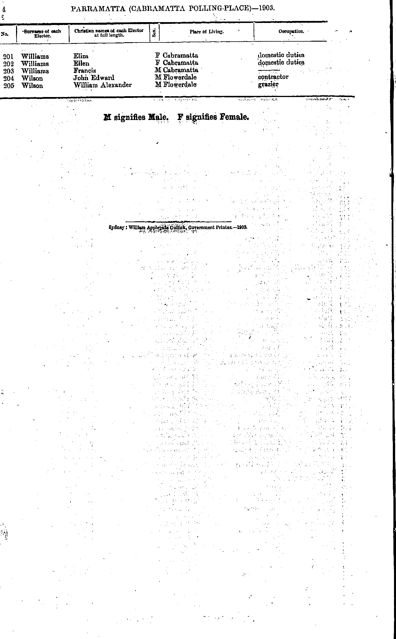
- Williams Eliza - Wilson William
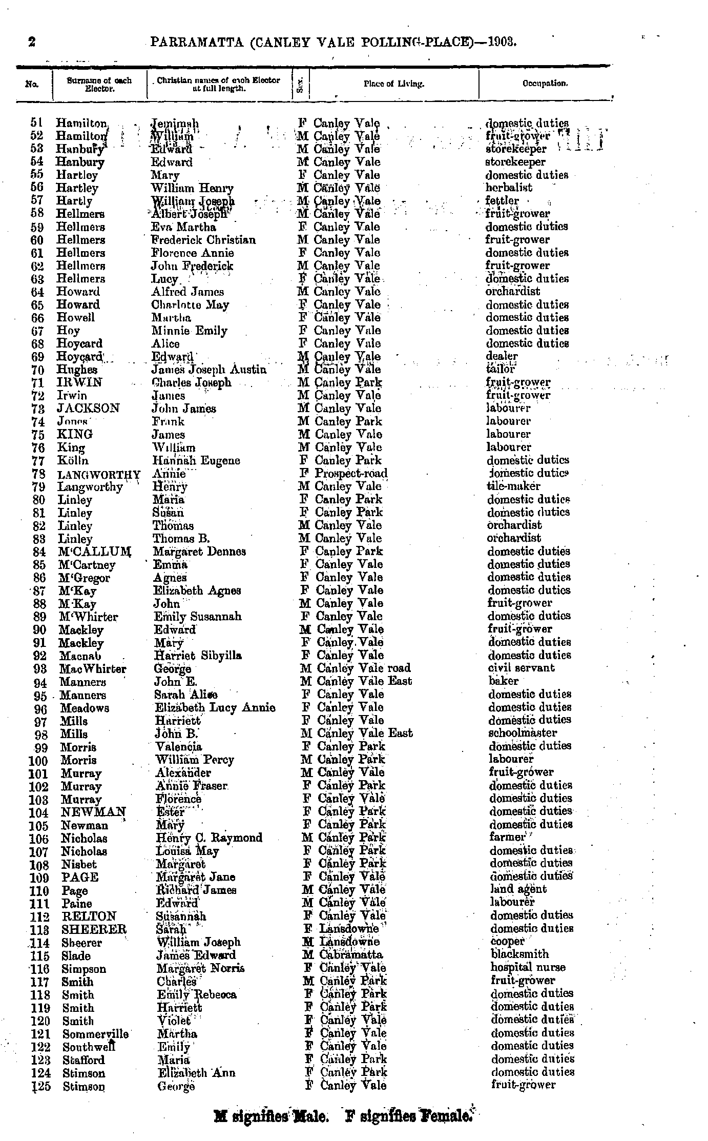
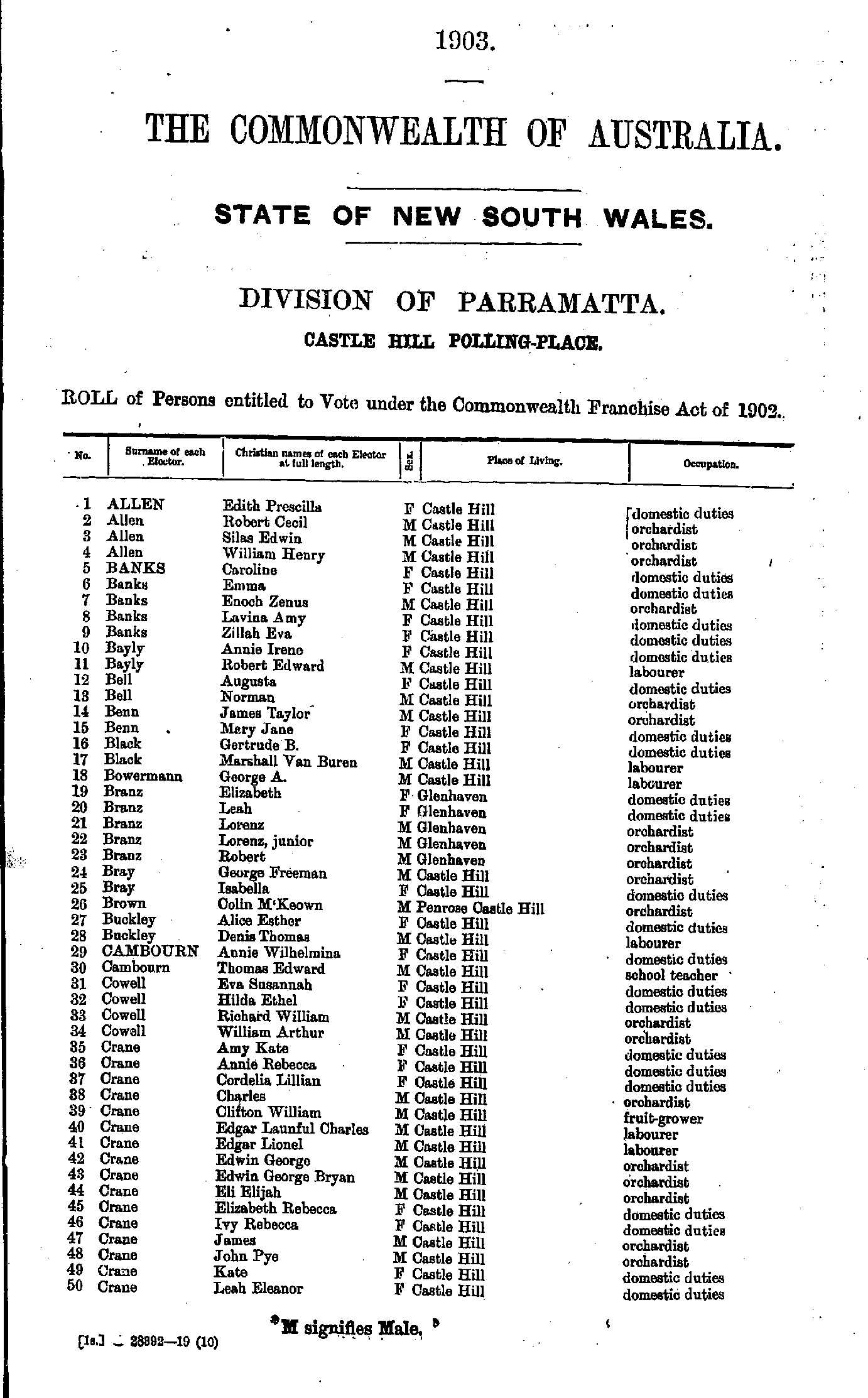
- Allen Edith - Crane Leah
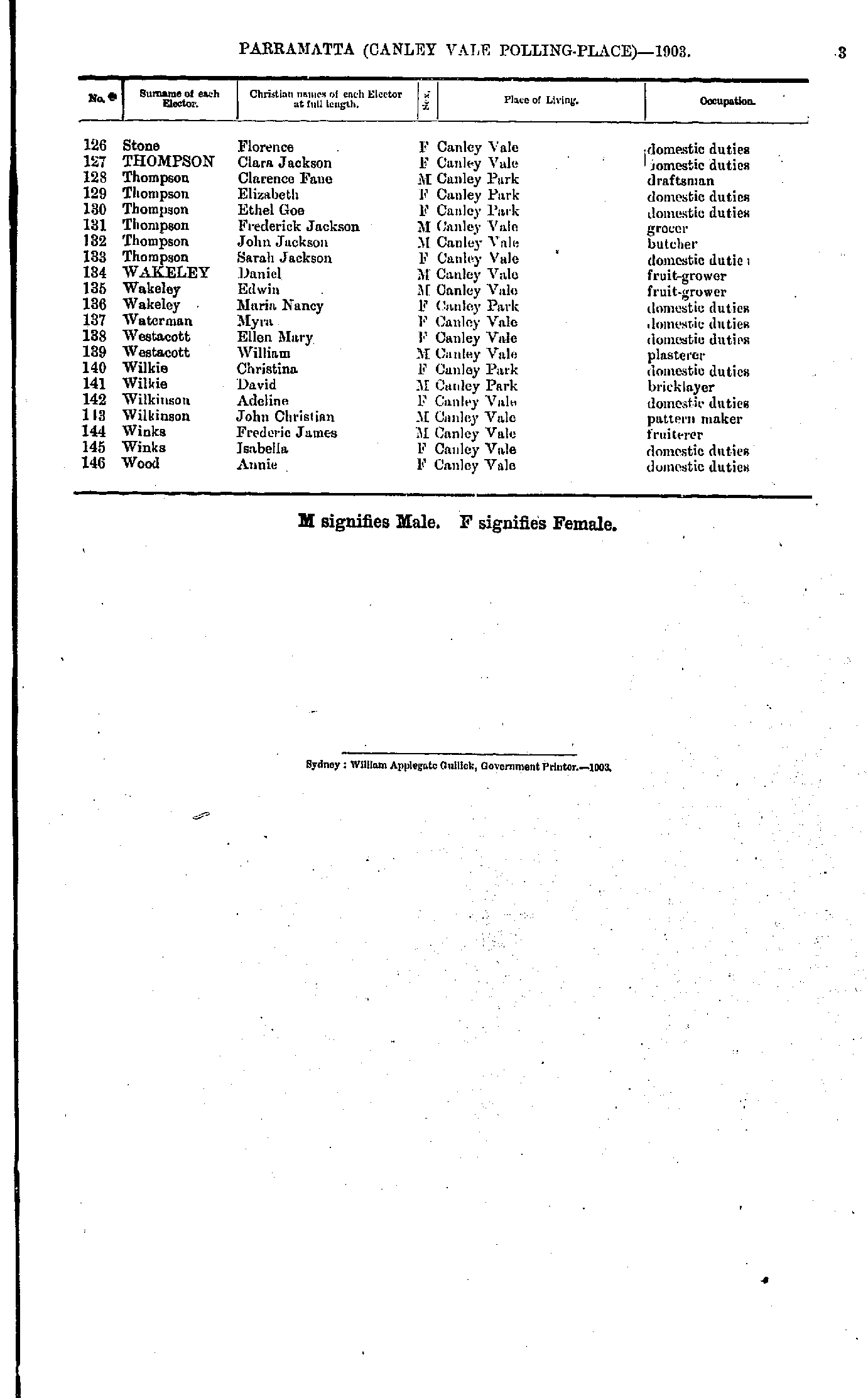
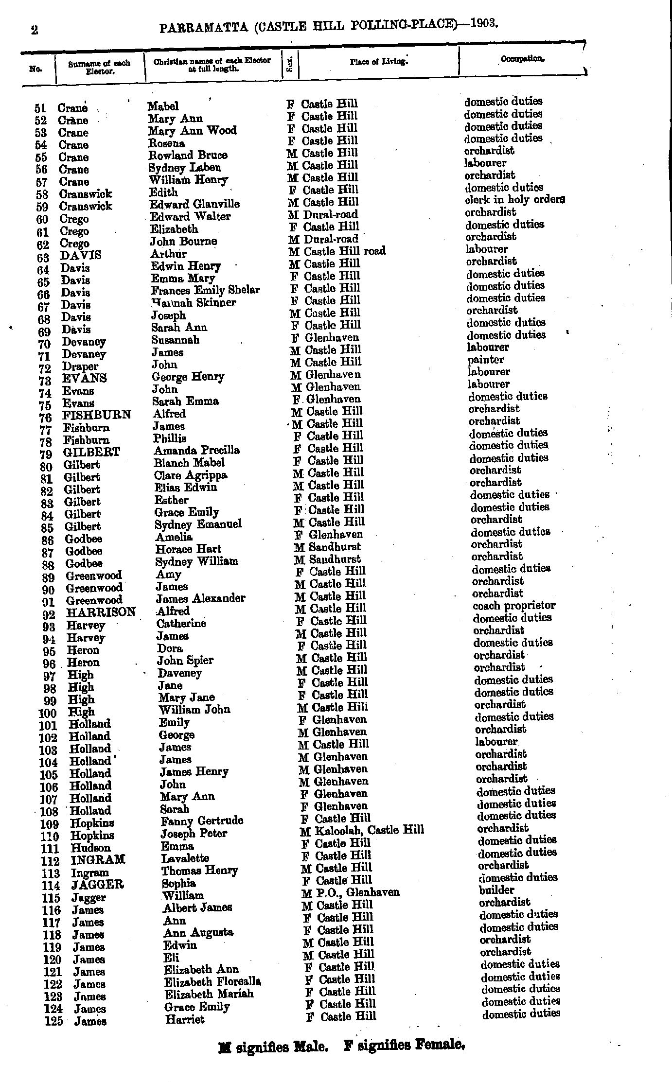
- Crane Mabel - James Harriet
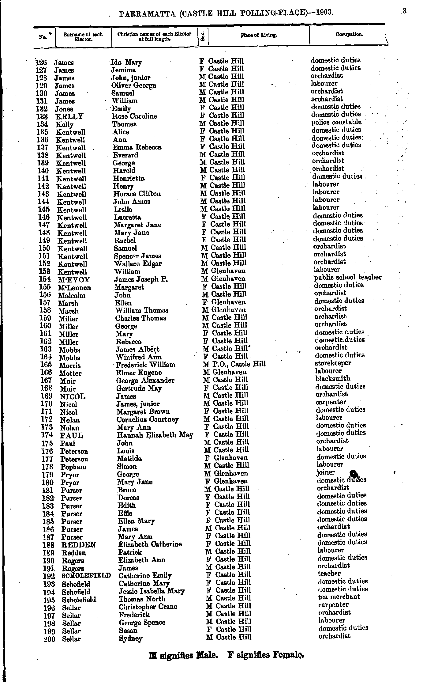
- James Ida - Sellar Sydney
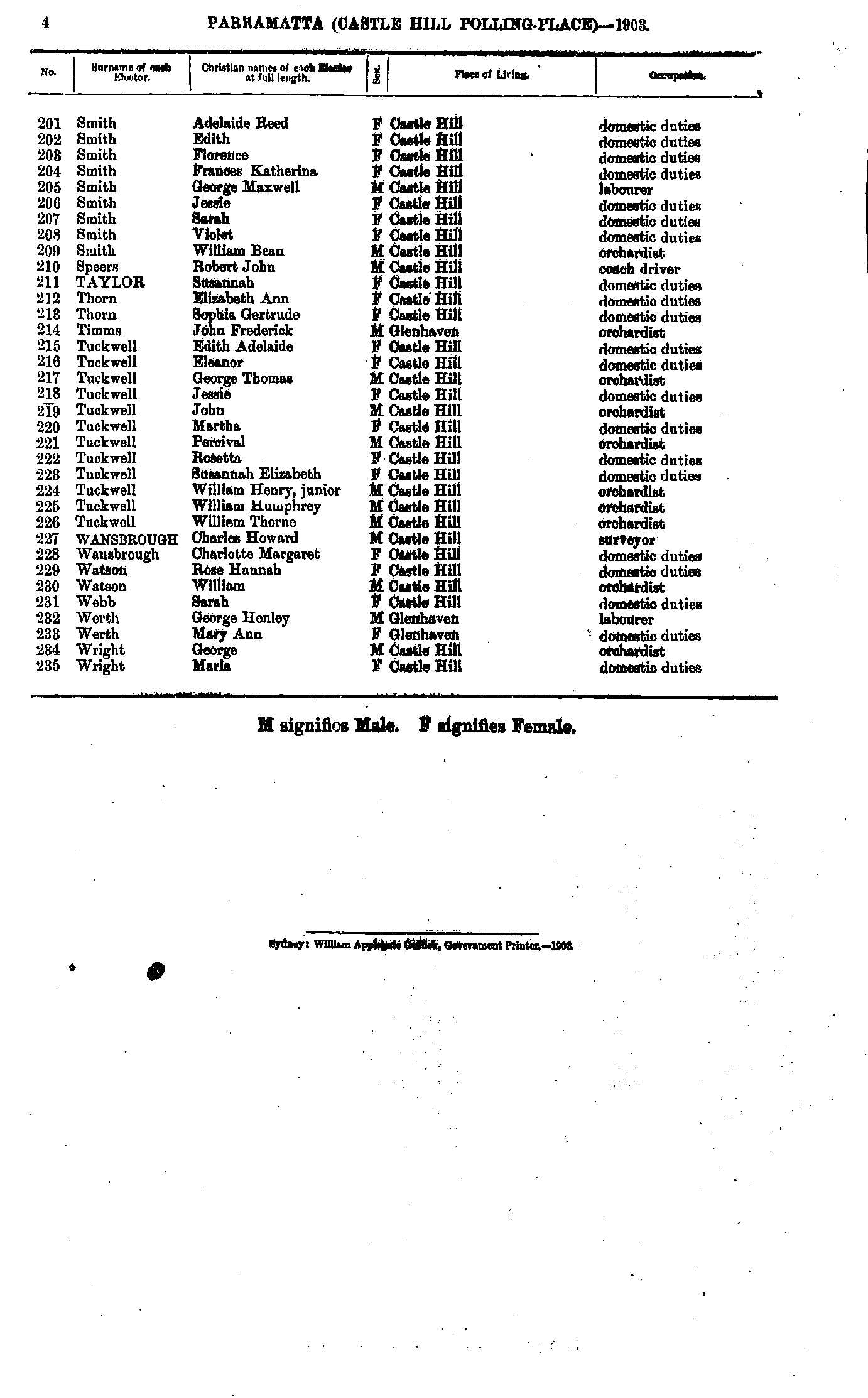
- Smith Adelaide - Wright Maria
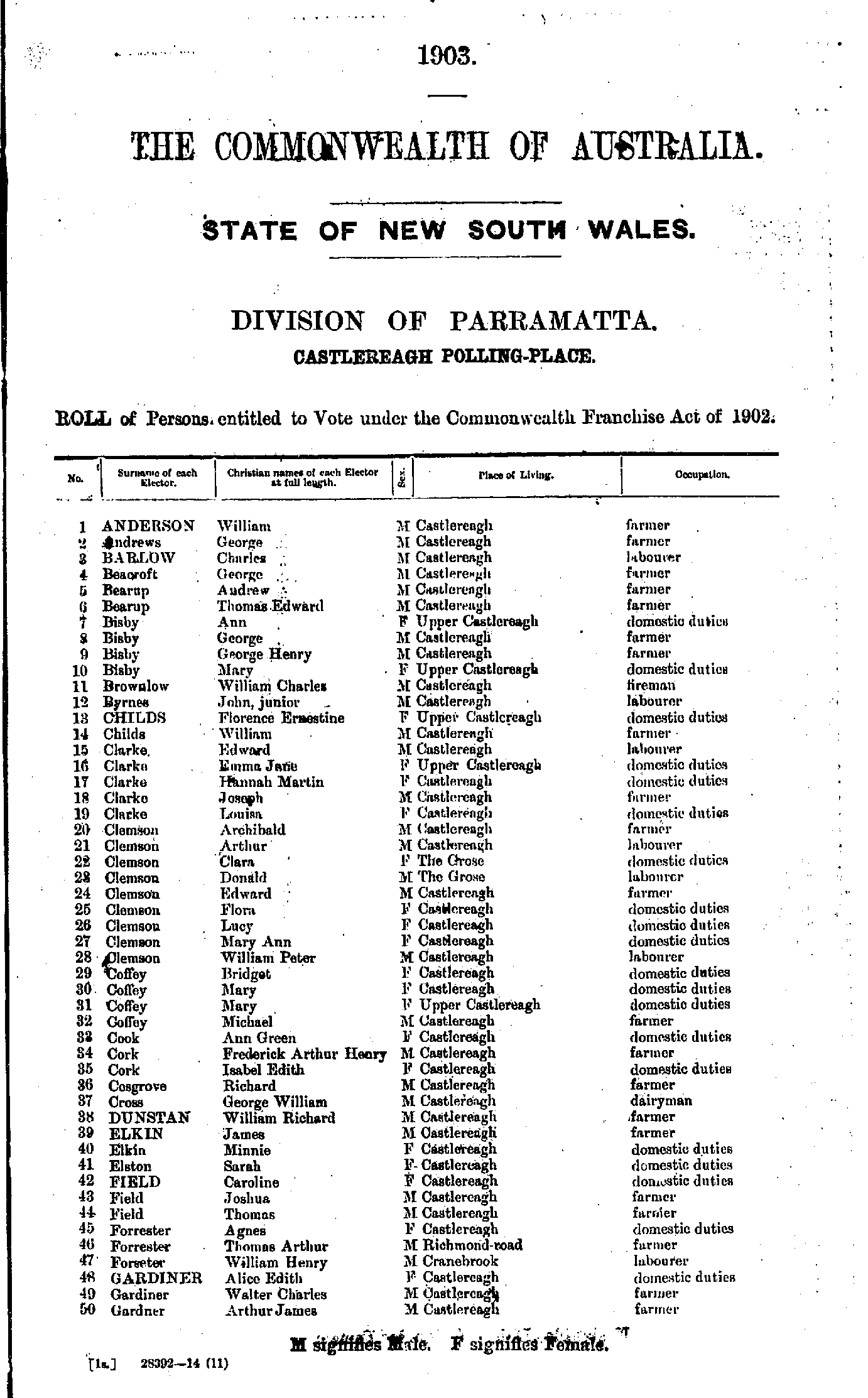
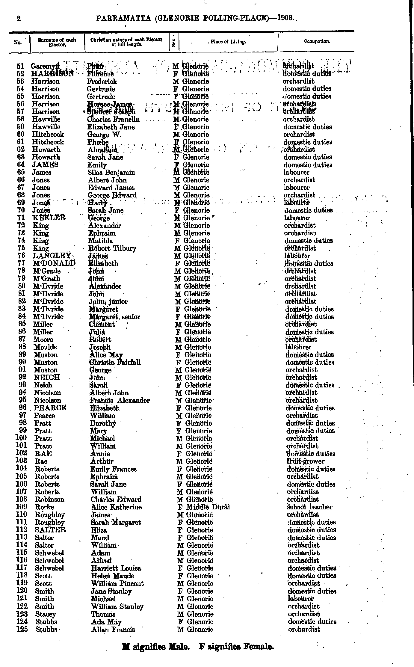
- Anderson William - Gardner Arthur
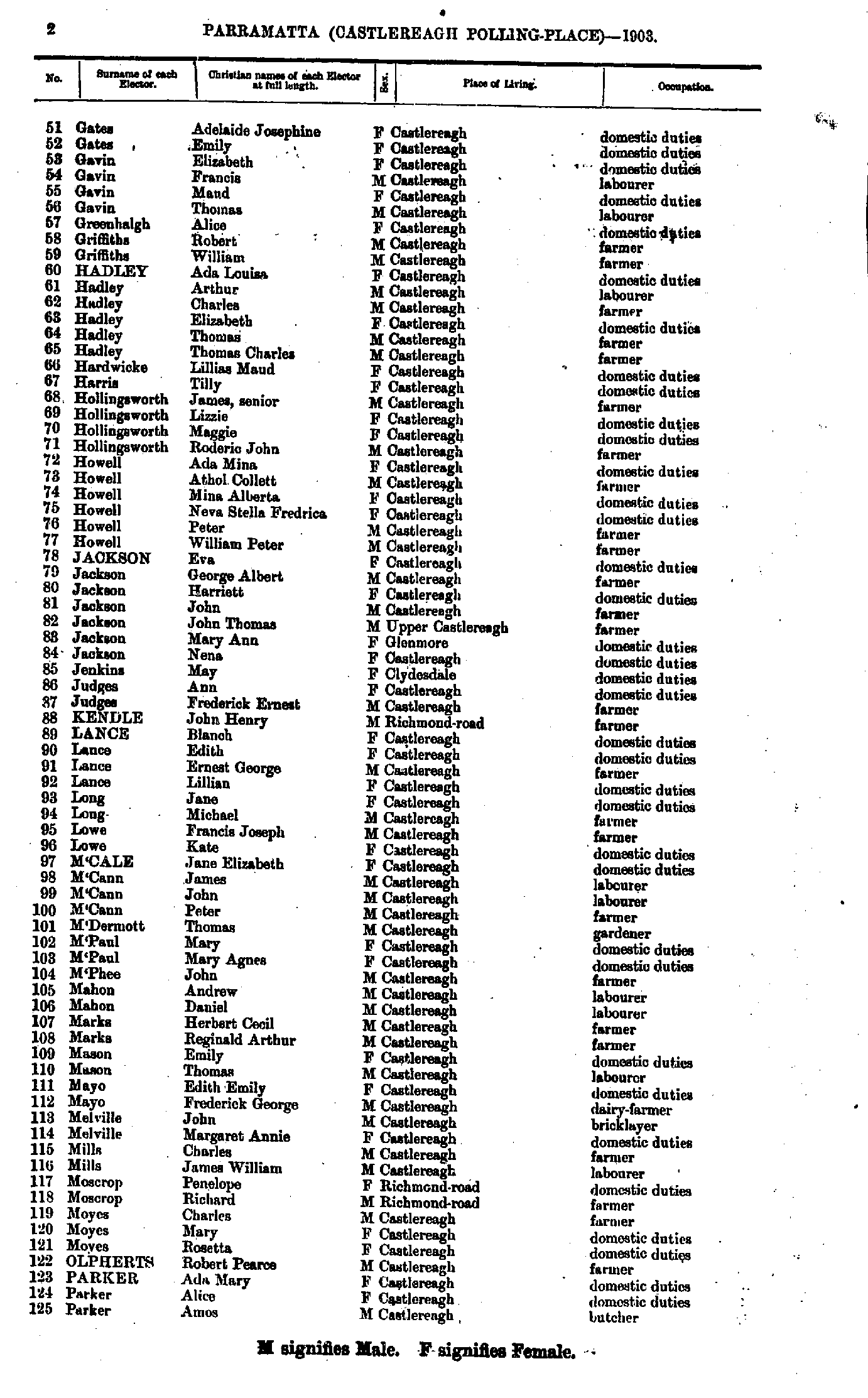
- Gates Adelaide - Parker Amos
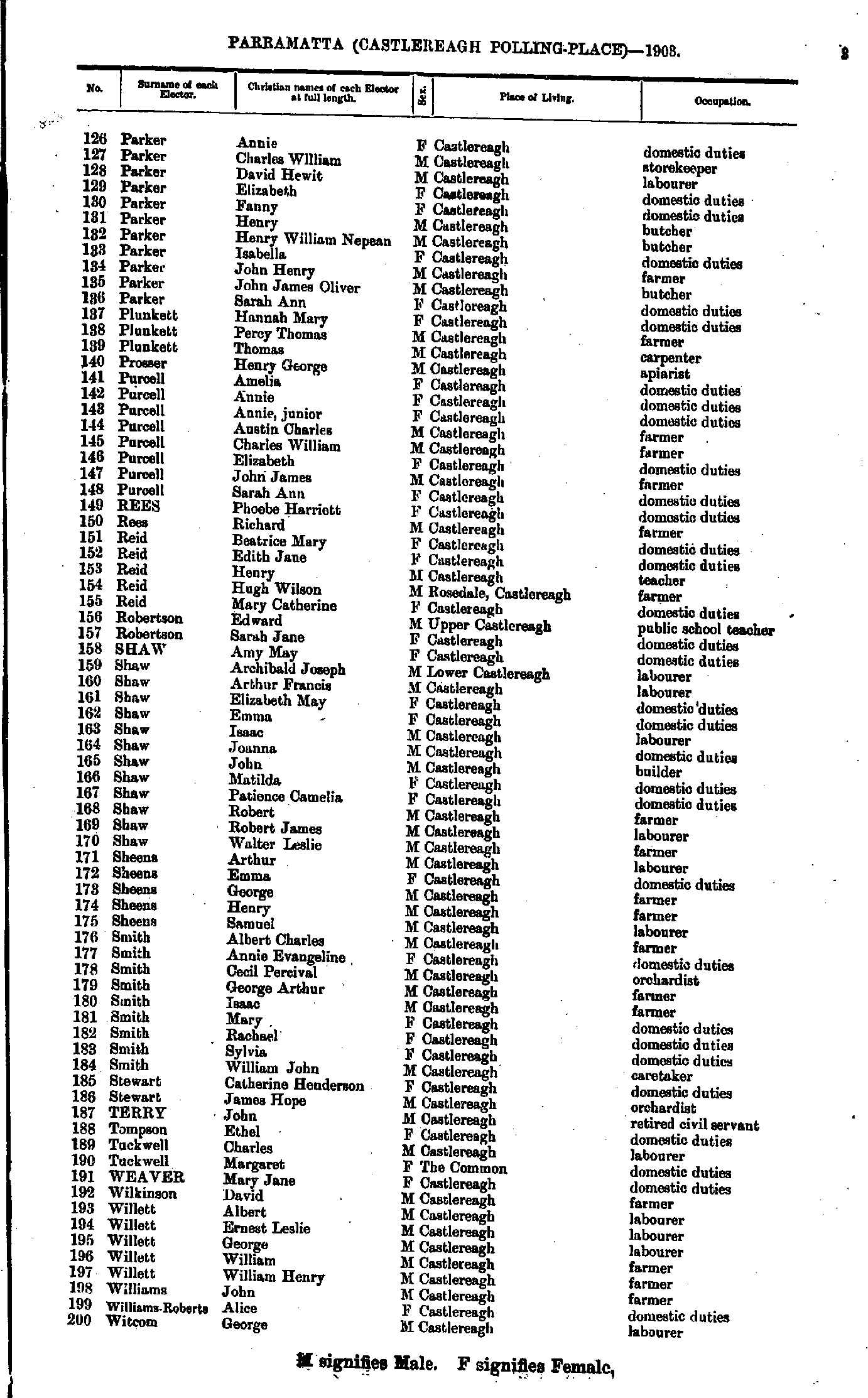
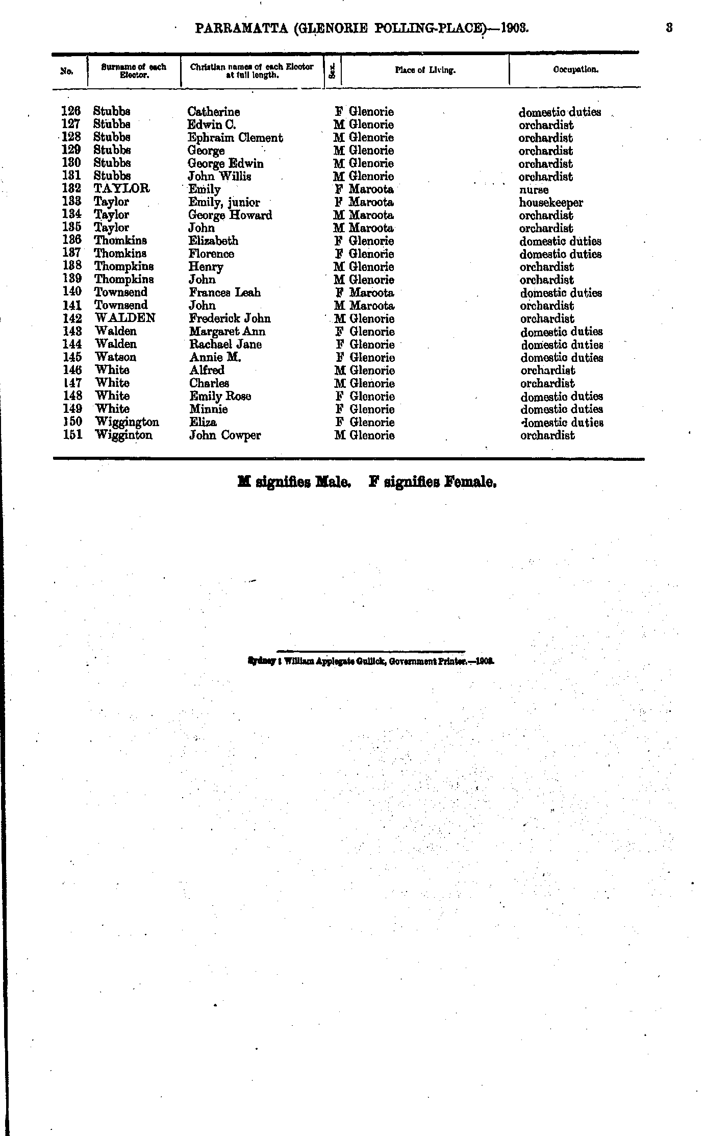
- Parker Annie - Witcom George
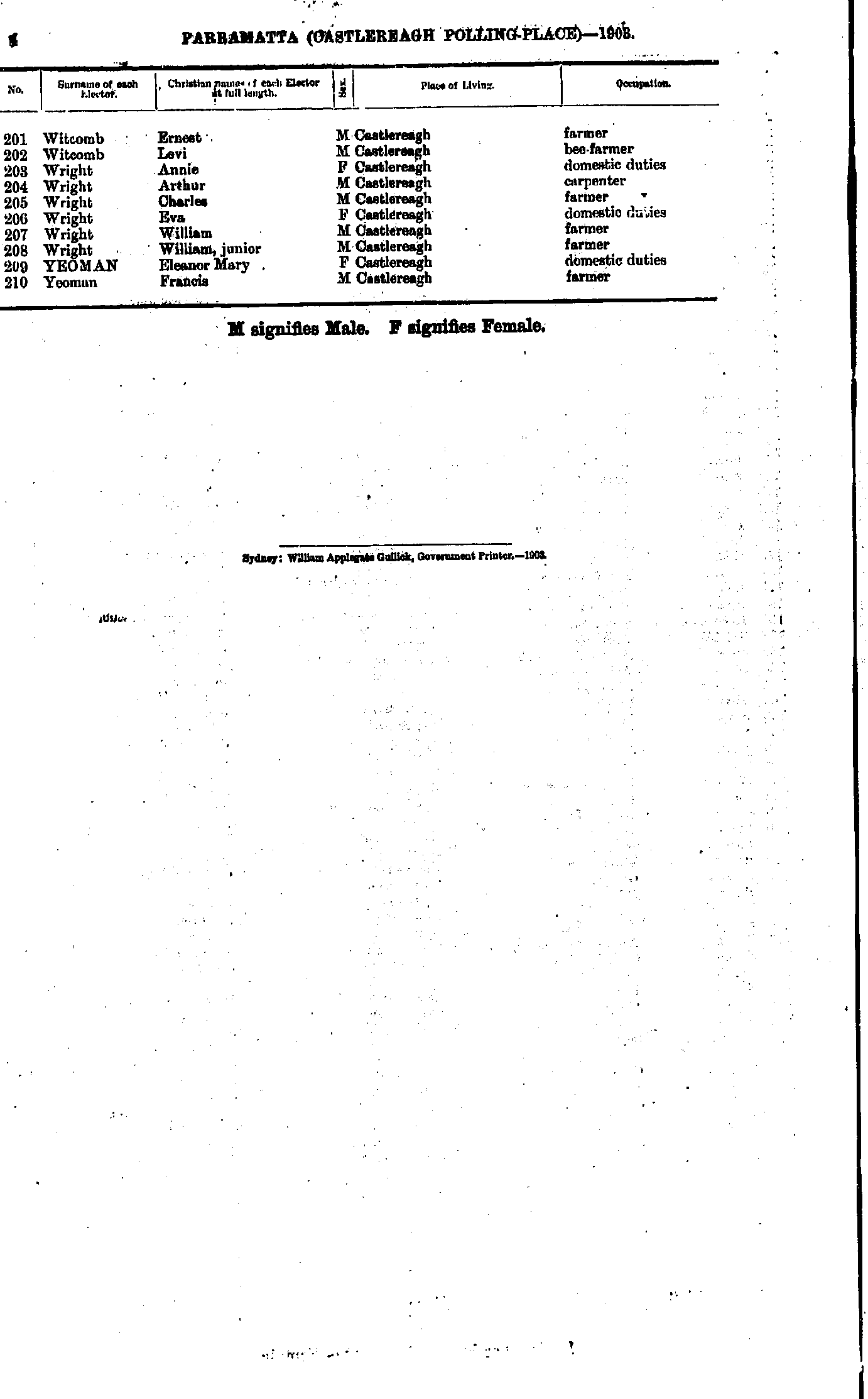
- Witcomb Ernest - Yeoman Francis
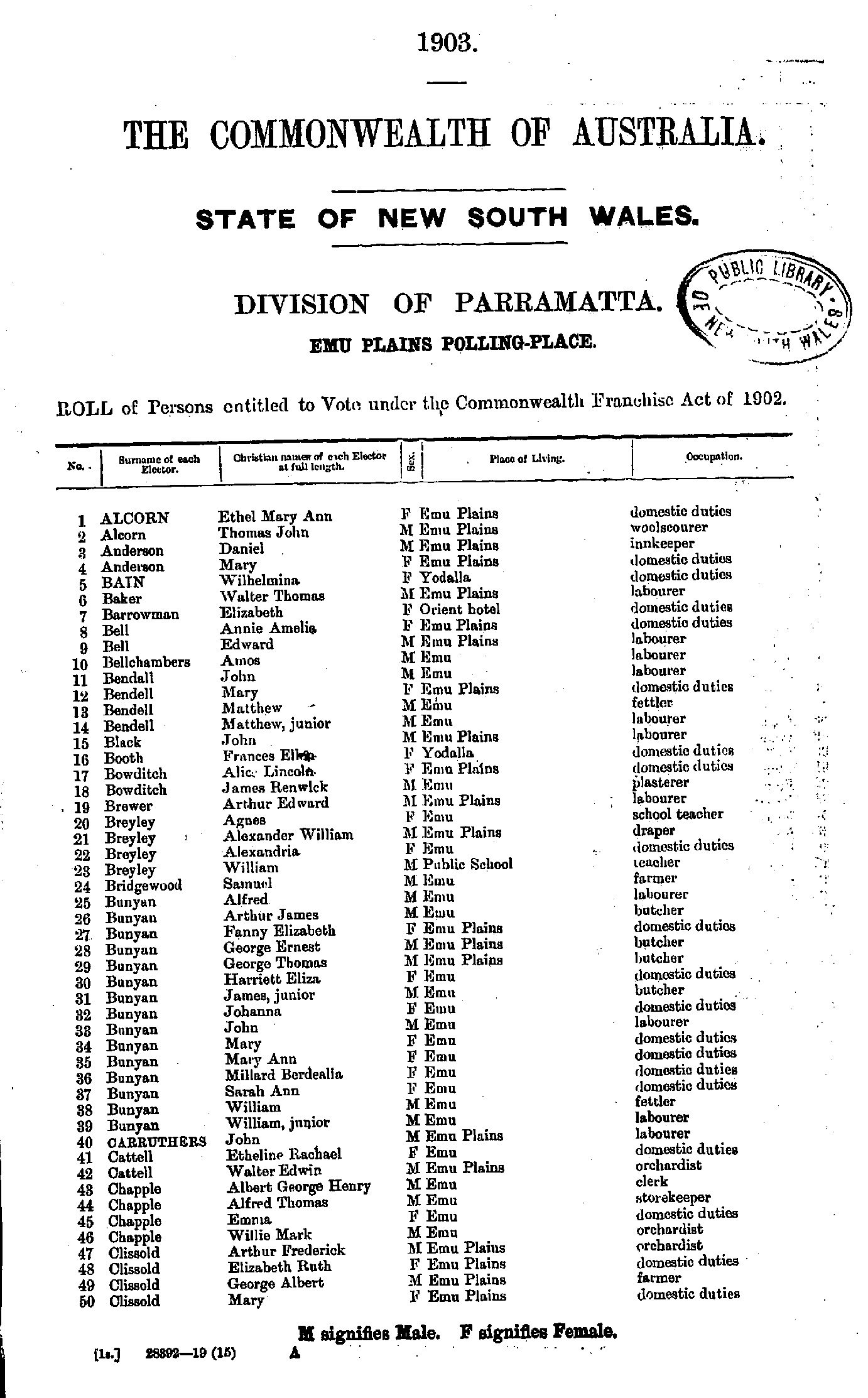
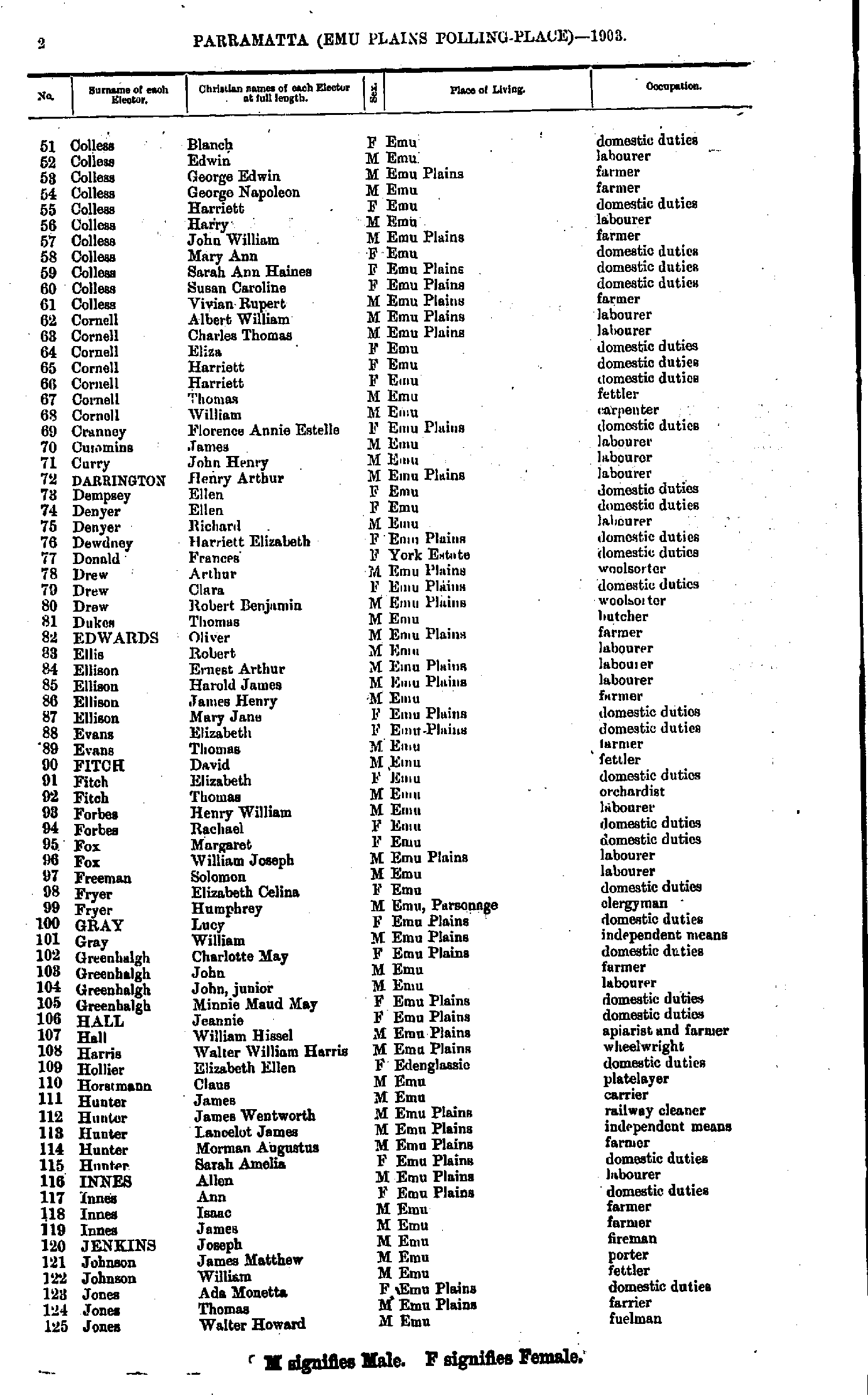
- Alcorn Ethel - Clissold Mary
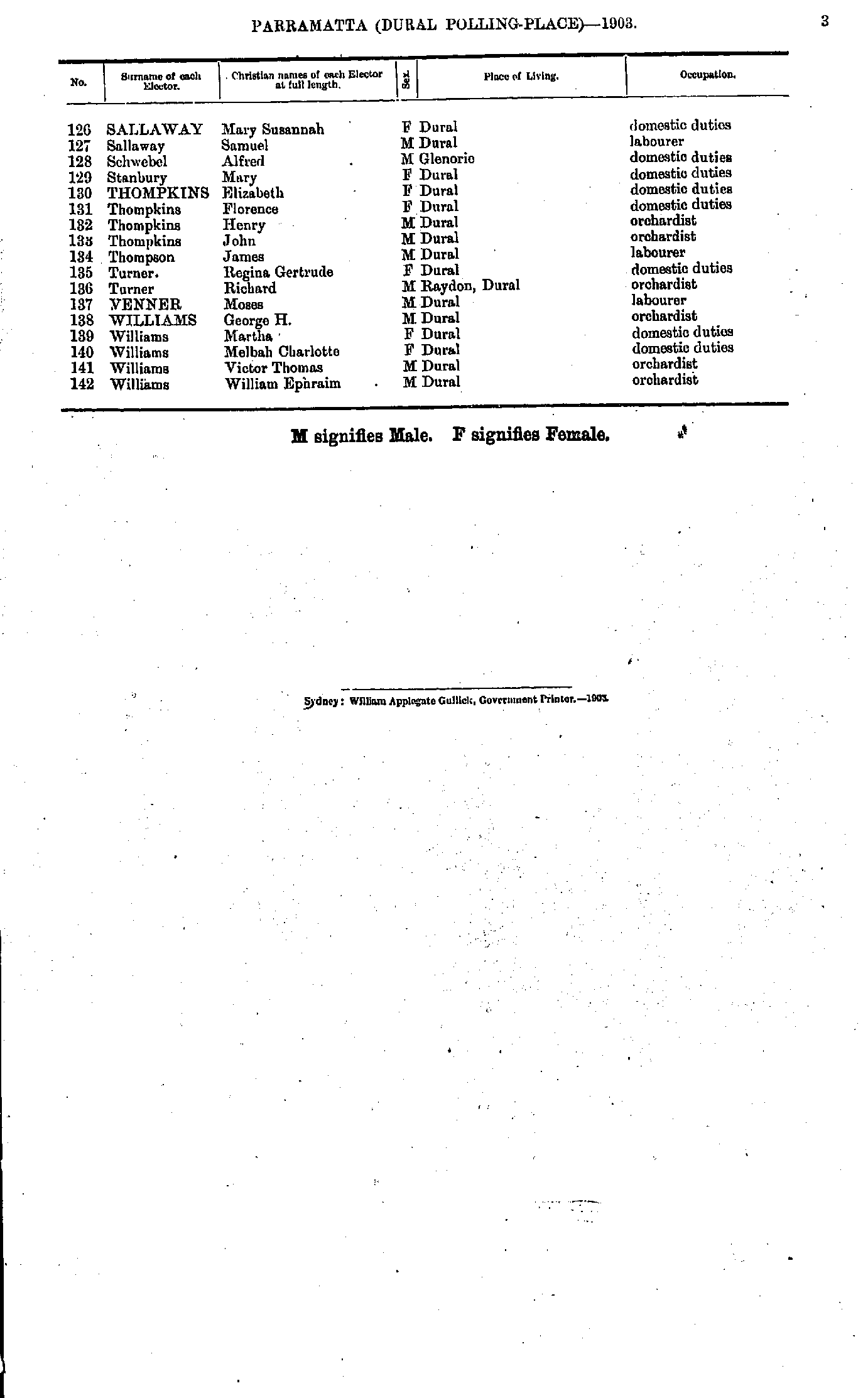
- Colless Blanch - Jones Walter
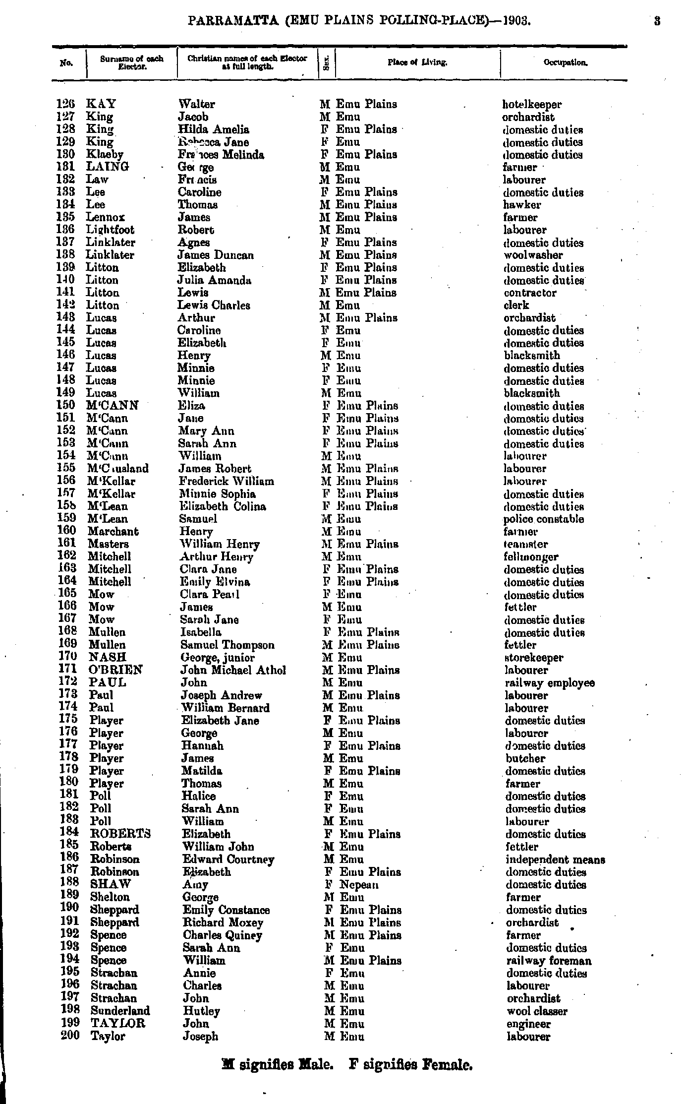
- Kay Walter - Taylor Joseph
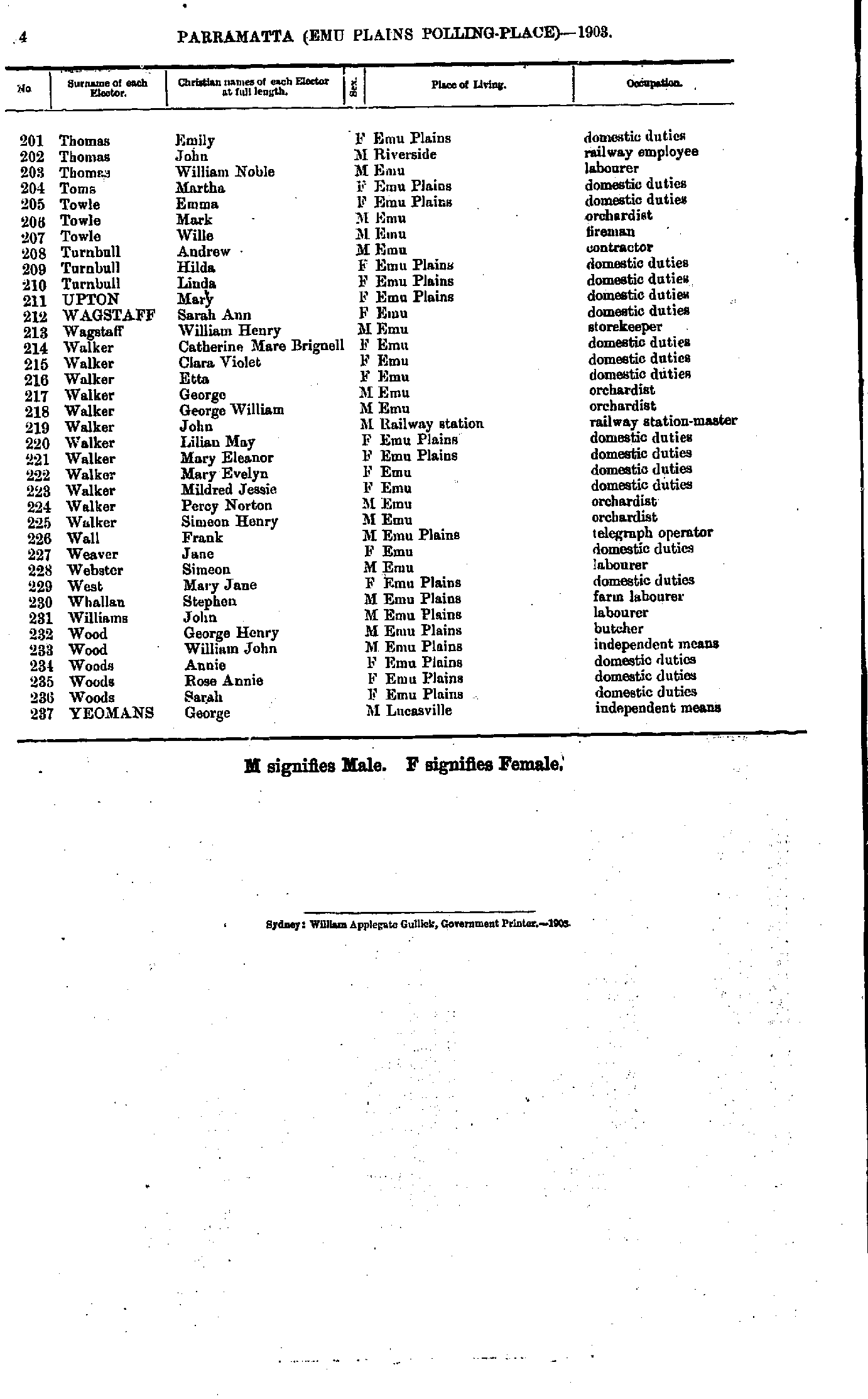
- Thomas Emily - Yeomans George
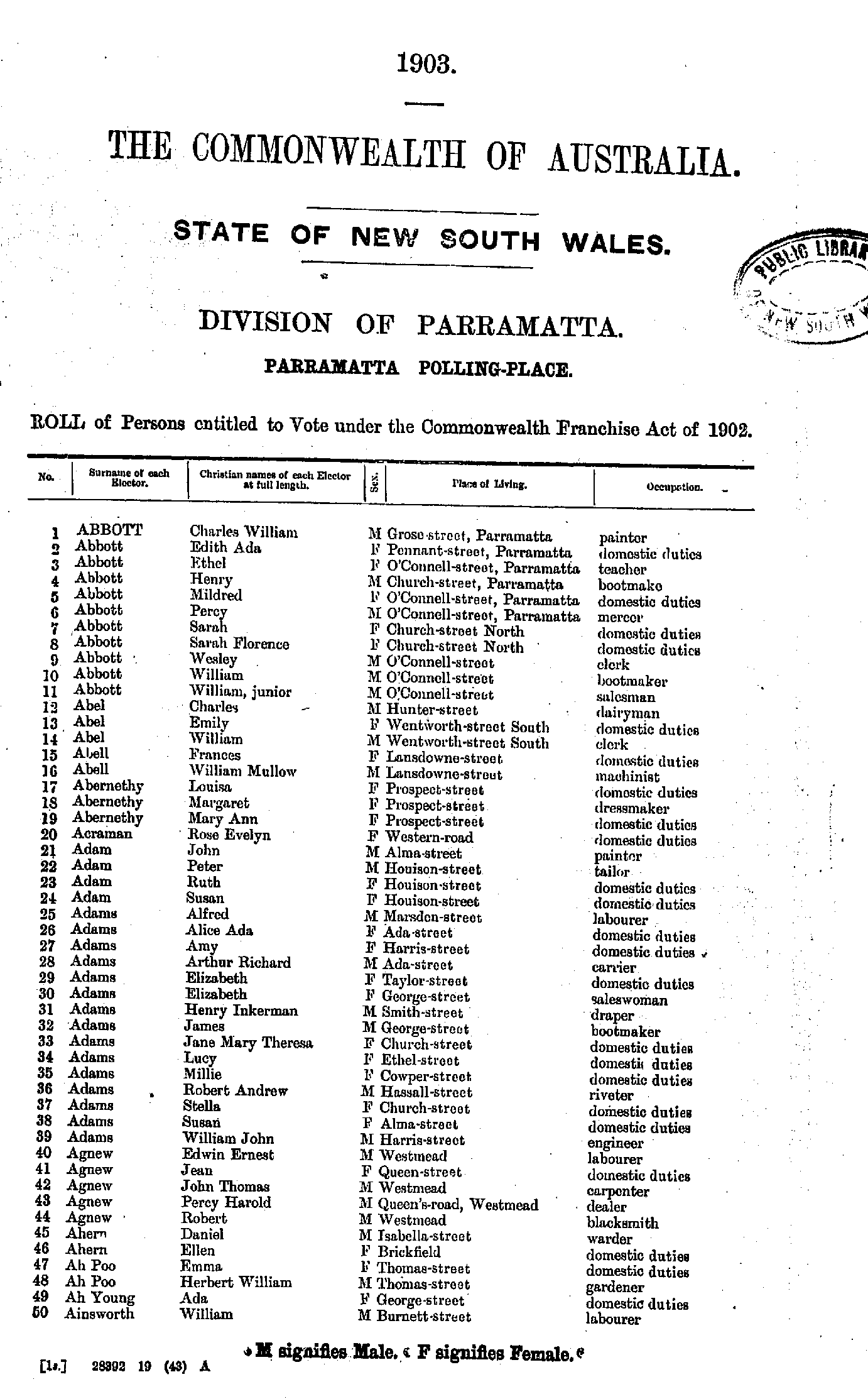
- Abbott Annie - Bull John
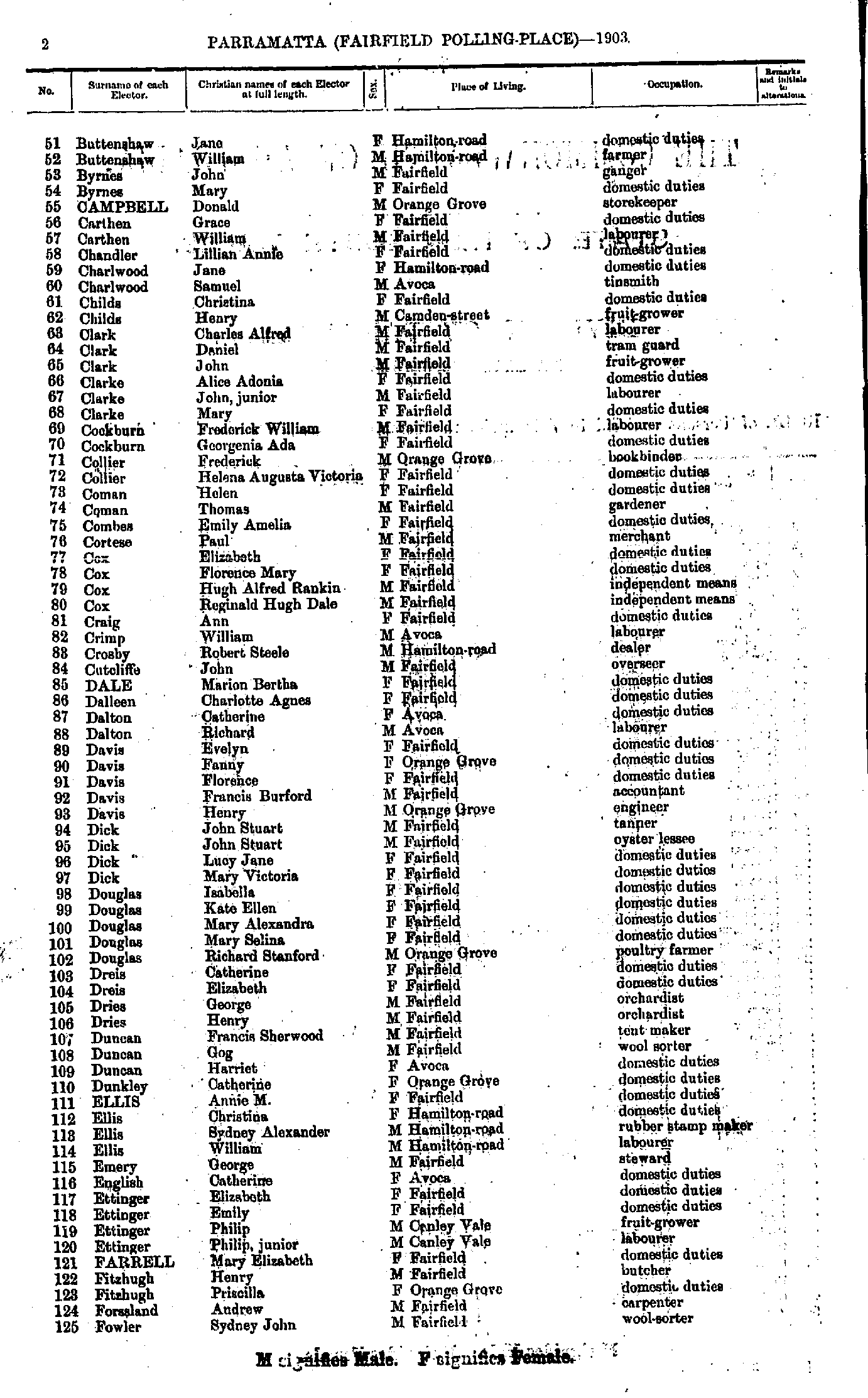
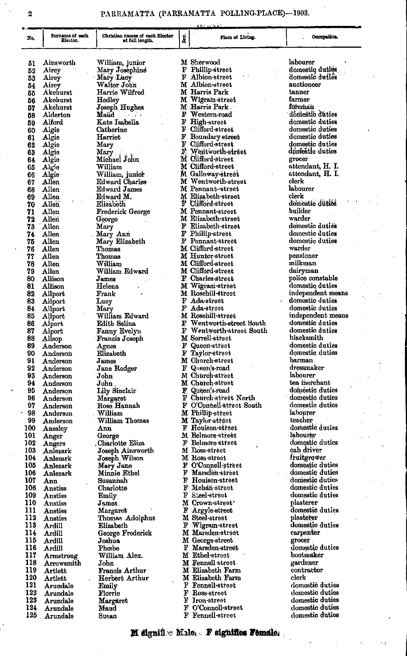
- Buttenshaw Jane - Fowler Sydney
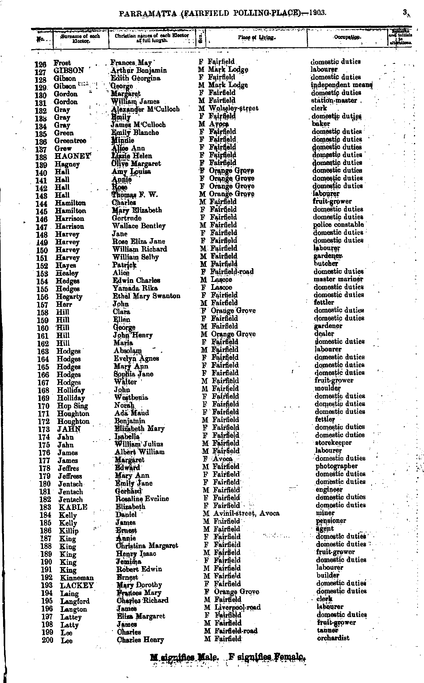
- Frost Frances - Lee Charles
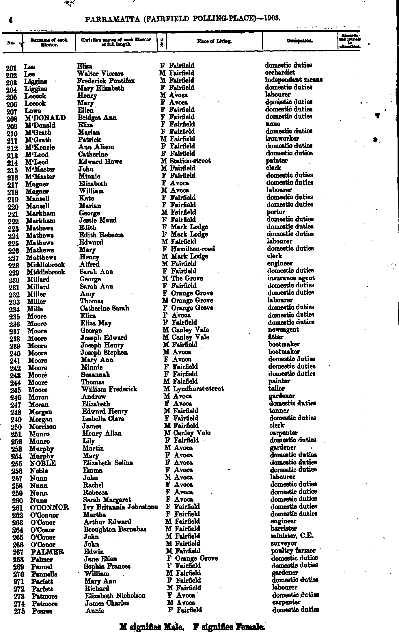
- Lee Eliza - Pearce Annie
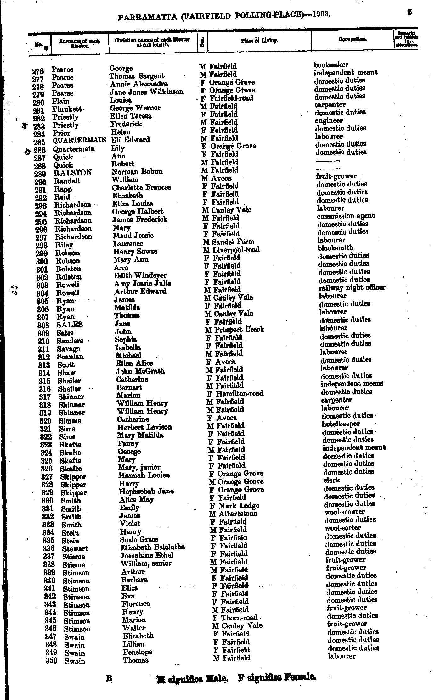
- Pearce George - Swain Thomas
- Symons Nina - Young Ann
- Adams Henry - Corcoran Patrick
- Crawford William - Hennessy Denis
- Herbert John - M'Knight John
- Macdermot Delia - Ryan Patrick
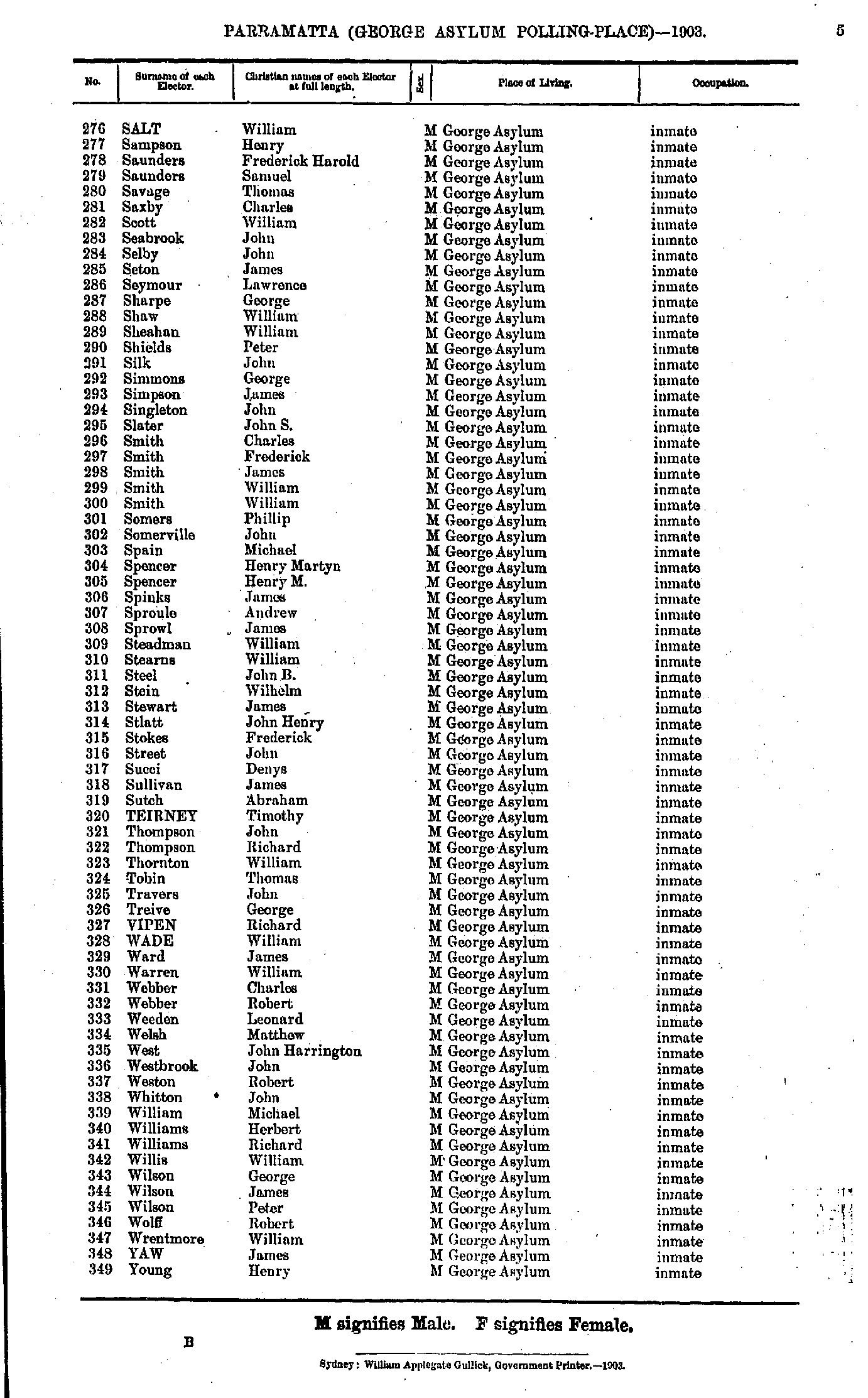
- Salt William - Young Henry
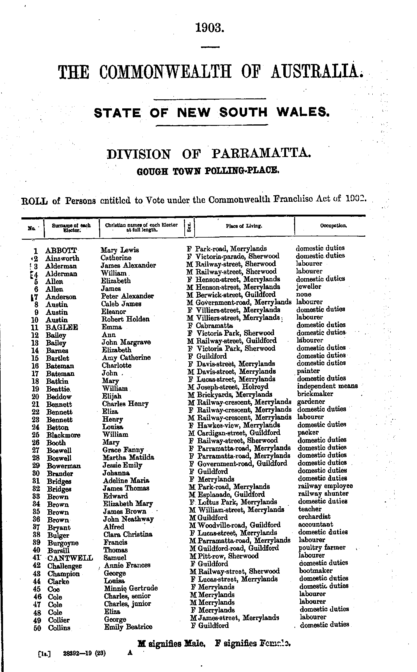
- Abbott Mary - Collins Emily
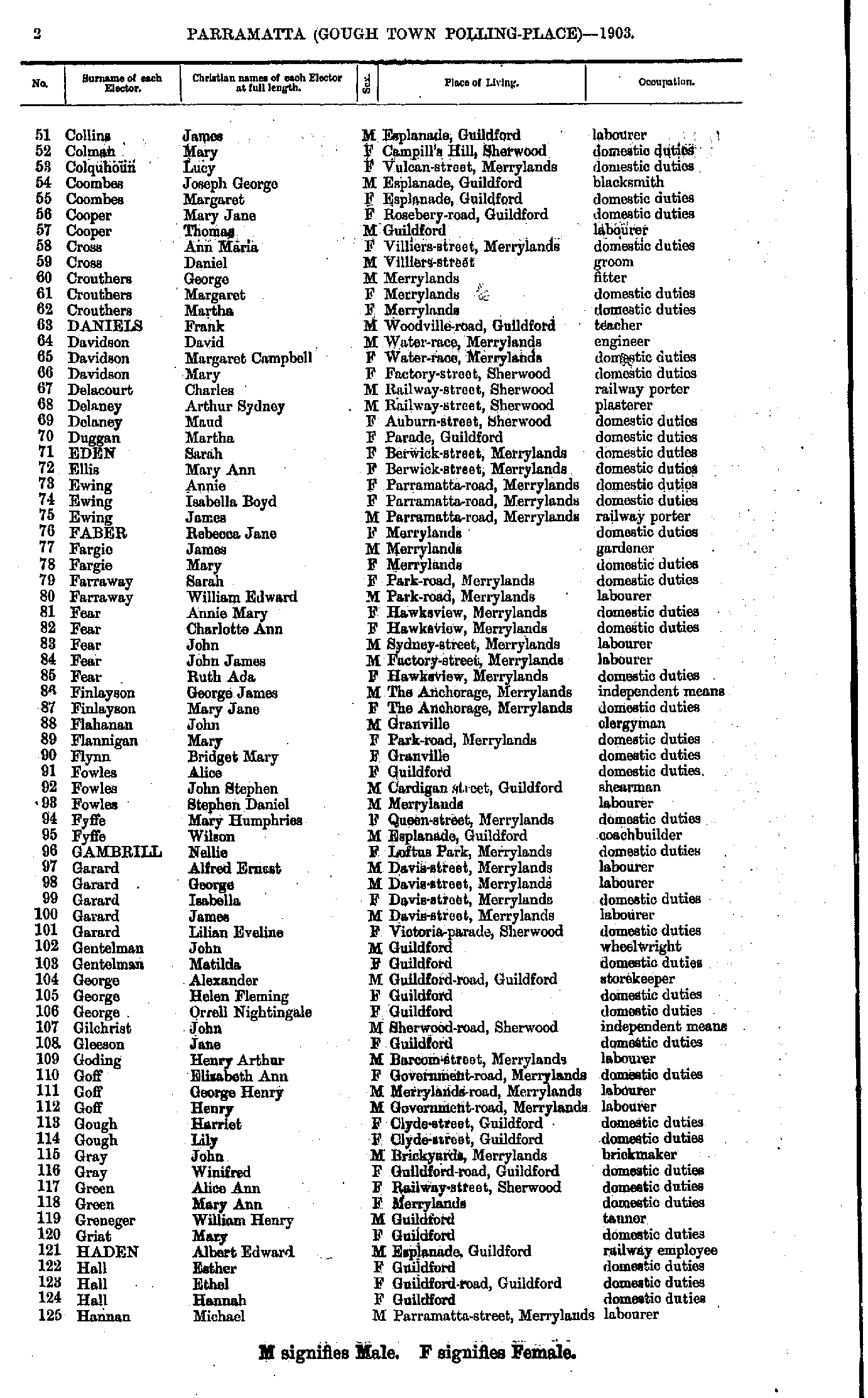
- Collins James - Hannan Michael
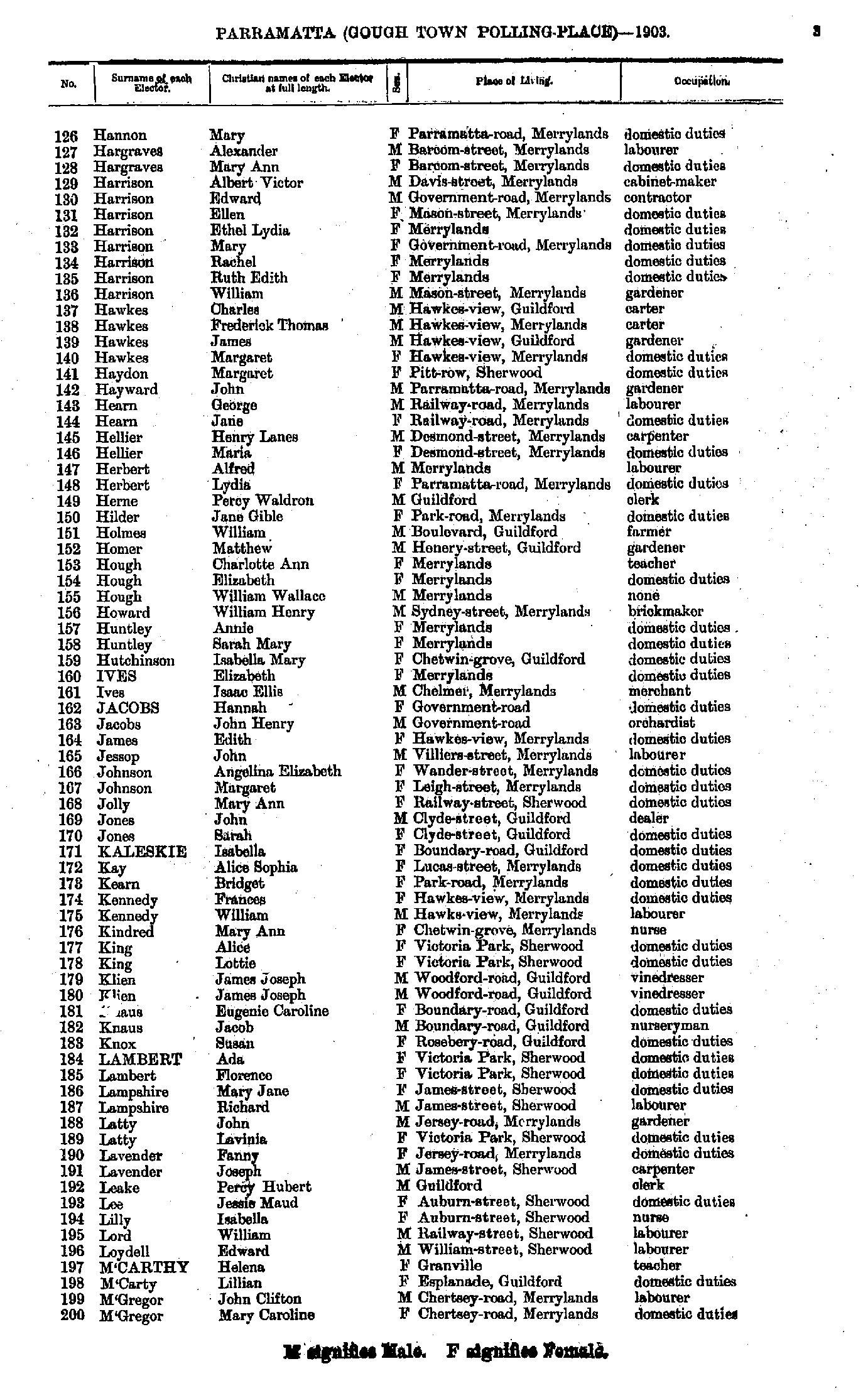
- Hannon Mary - M'Gregor Mary
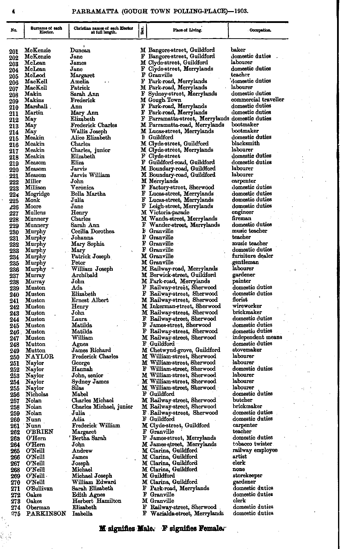
- McKenzie Duncan - Parkinson Isabella
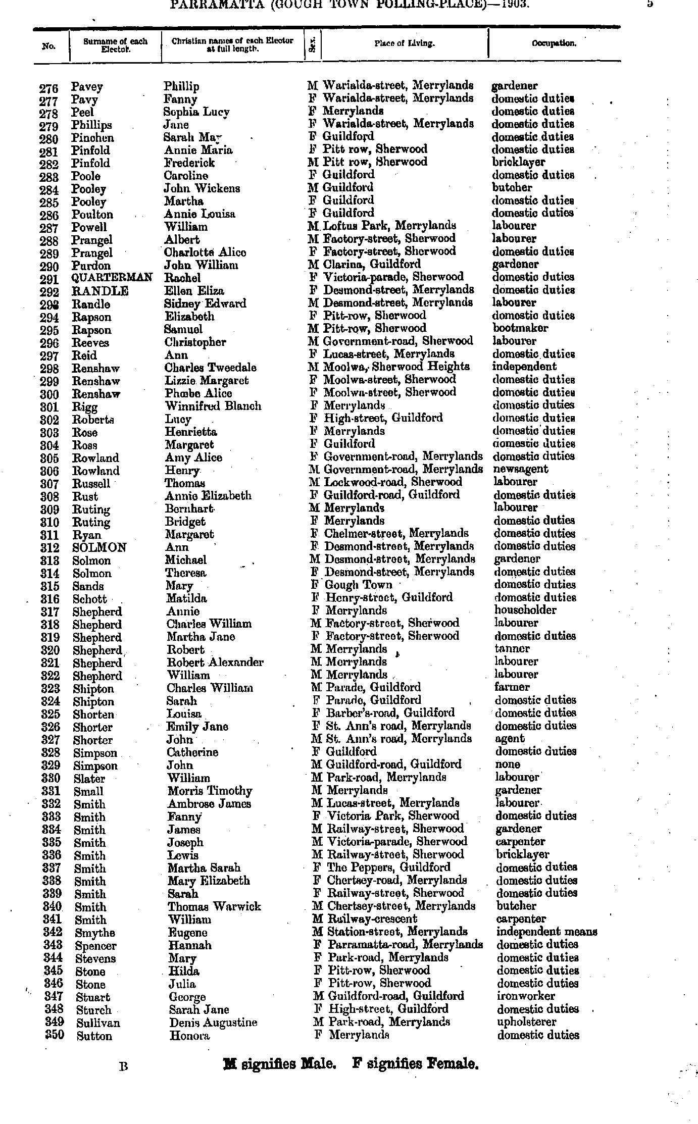
- Pavey Phillip - Sutton Honora
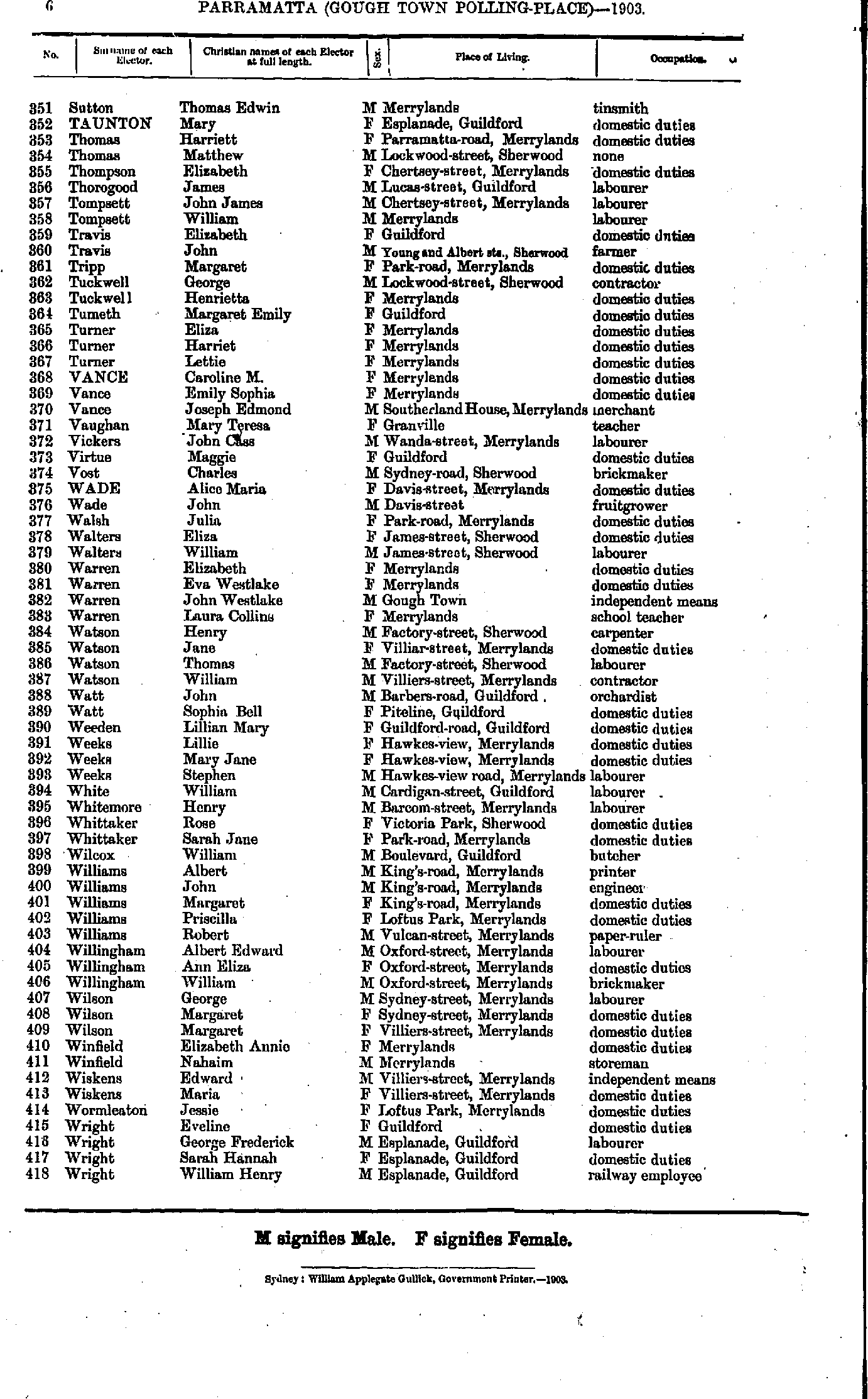
- Sutton Thomas - Wright William
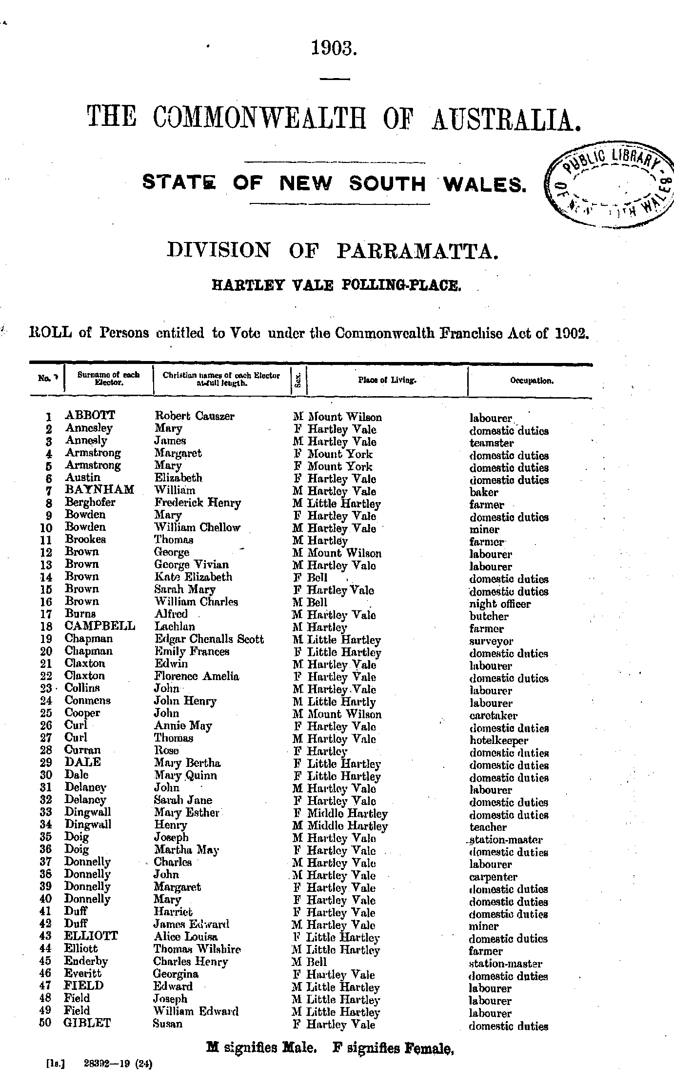
- Abbott Robert - Giblet Susan
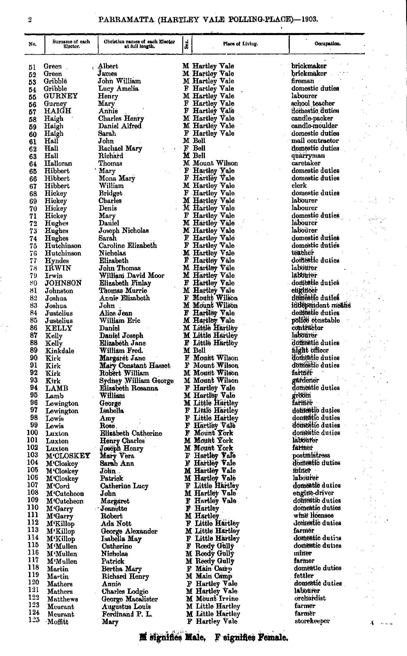
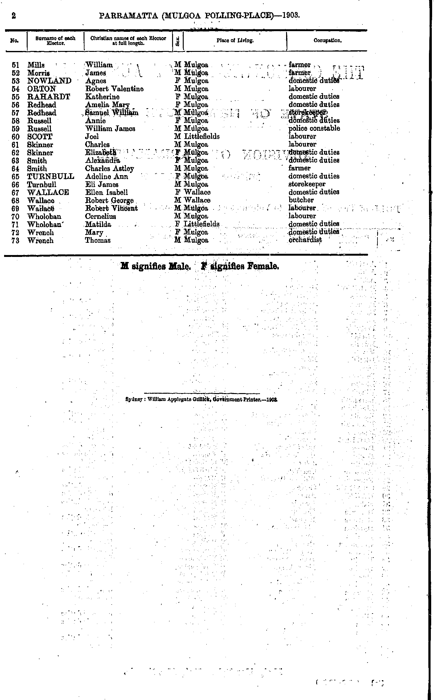
- Green Albert - Moffitt Mary
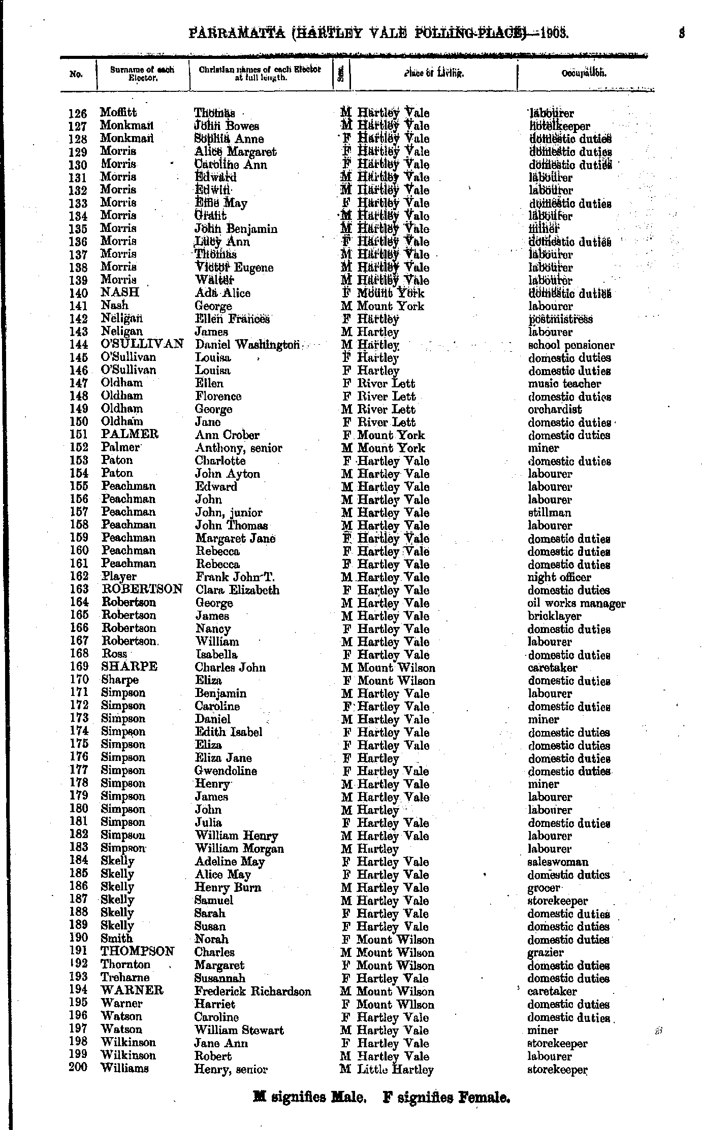
- Moffitt Thomas - Williams Henry
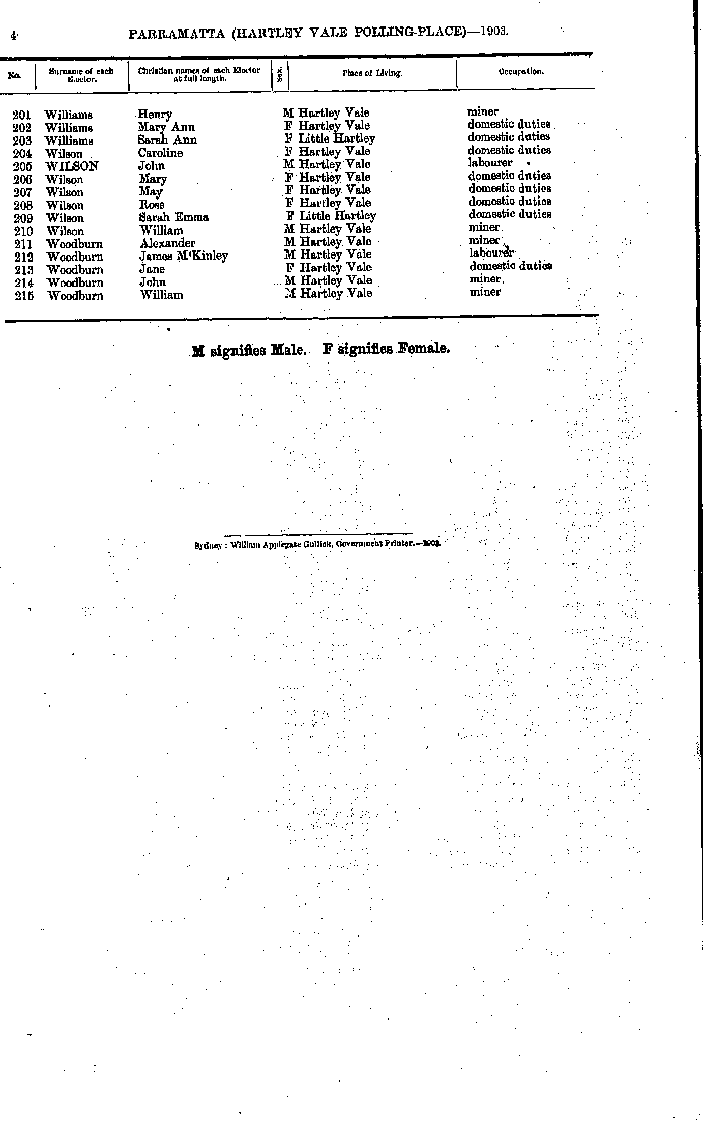
- Williams Henry - Woodburn William
- Ackland Alfred - Boorman Alfred
- Boorman Francis - Clarke Joseph
- Cliff James - Duff Henry
- Duff John - Hanson Selina
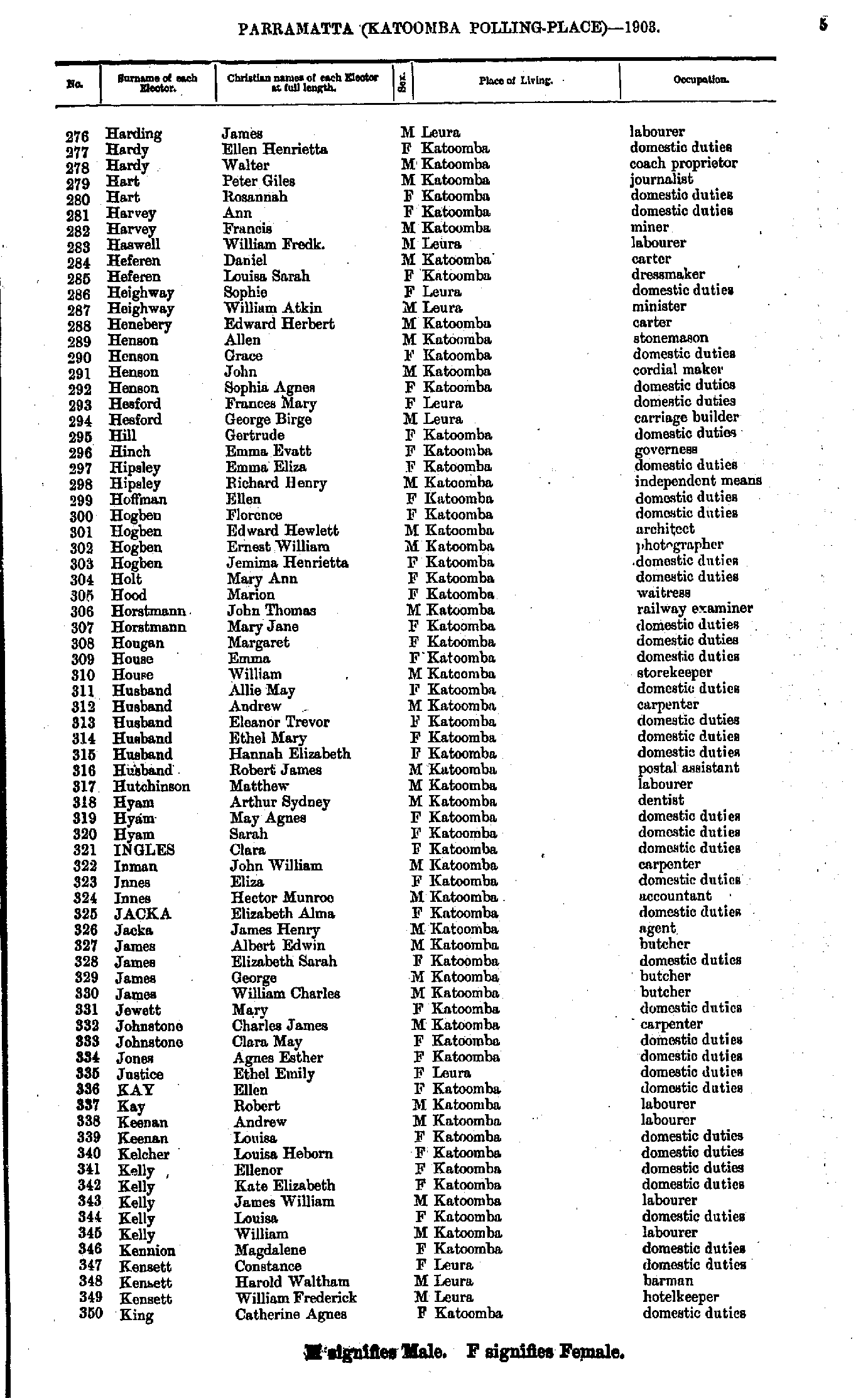
- Harding James - King Catherine
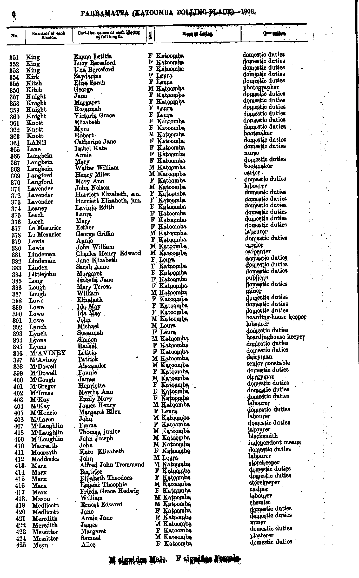
- King Emma - Meyn Alice
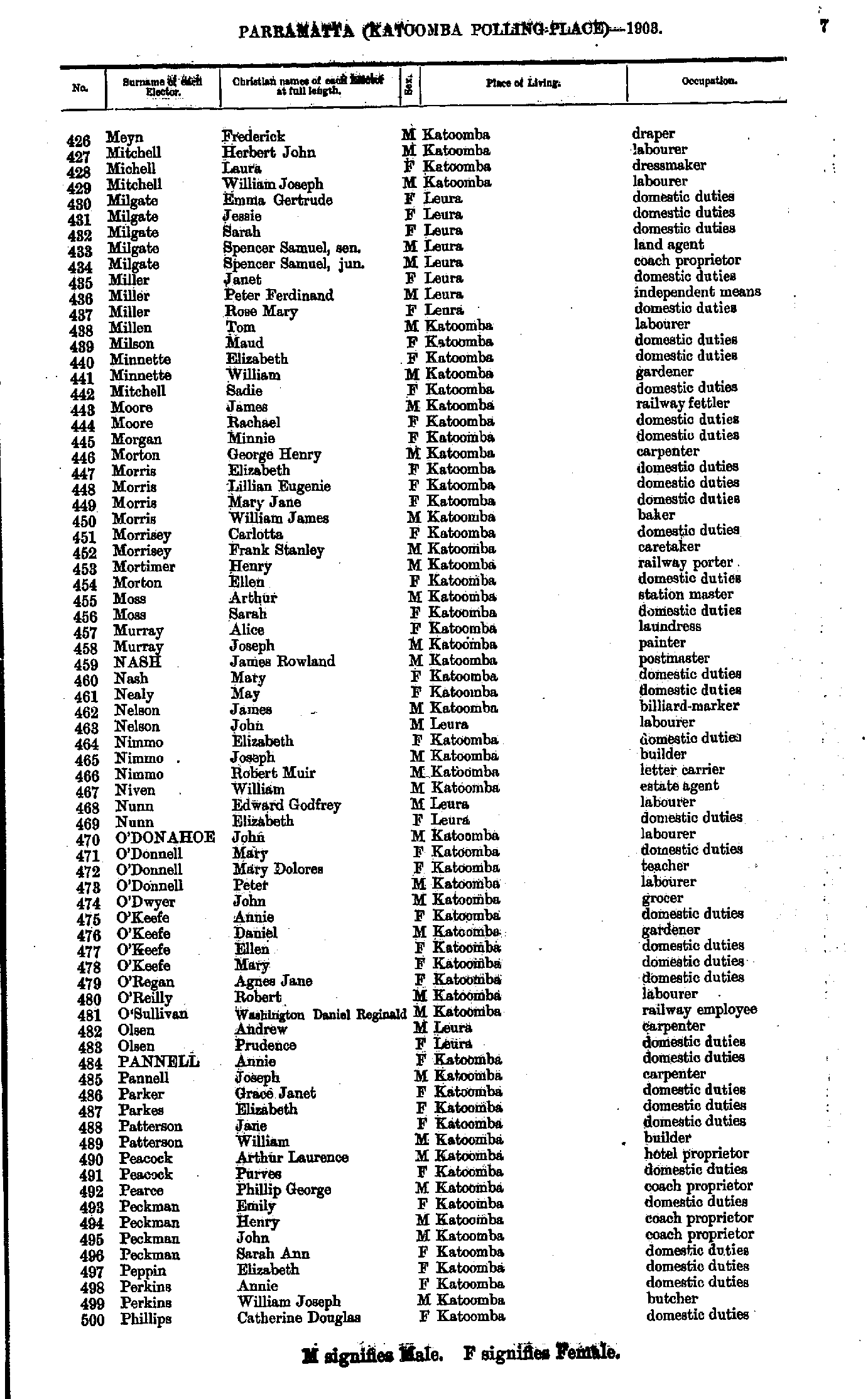
- Meyn Frederick - Phillips Catherine
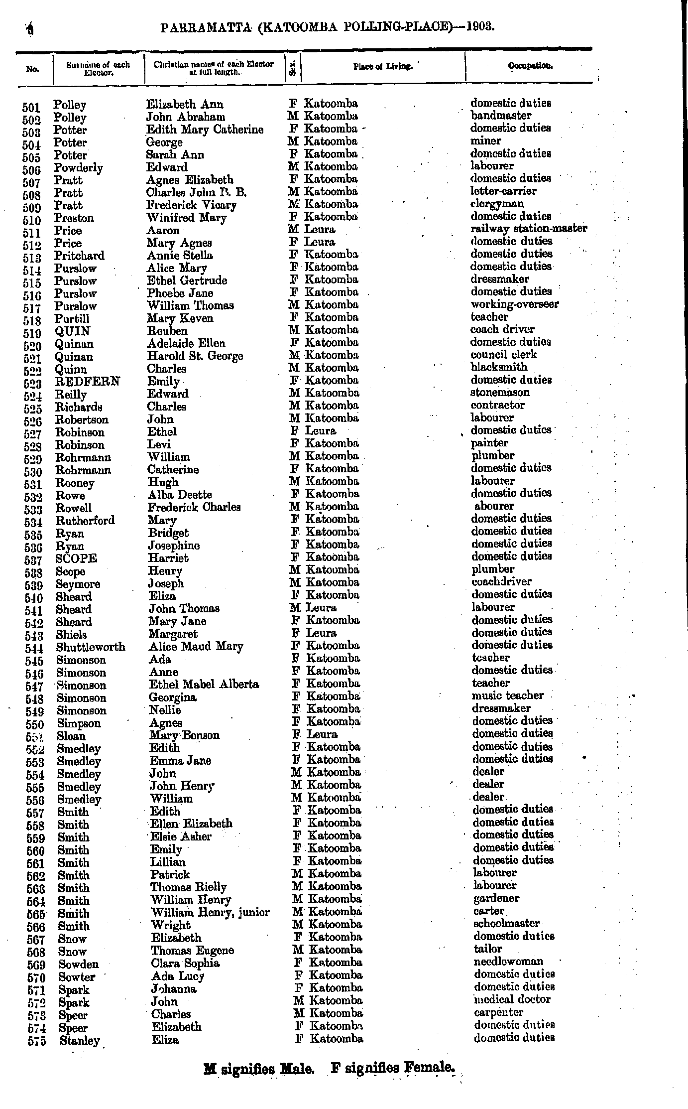
- Polley Elizabeth - Stanley Eliza
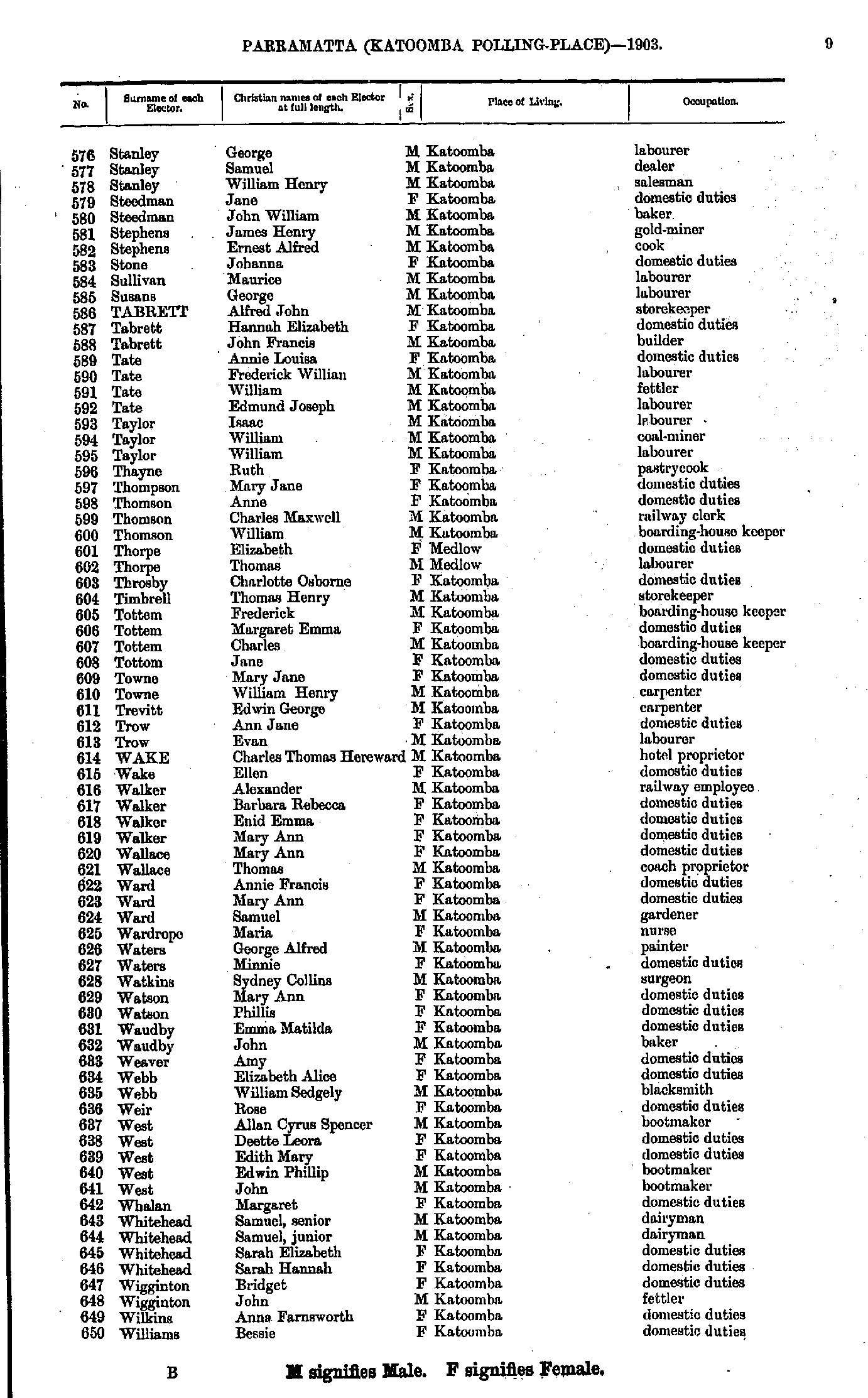
- Stanley George - Williams Bessie
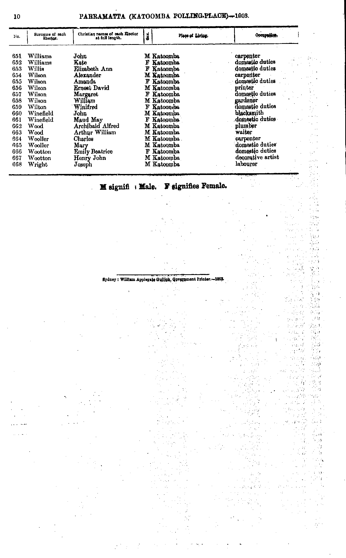
- Williams John - Wright Joseph
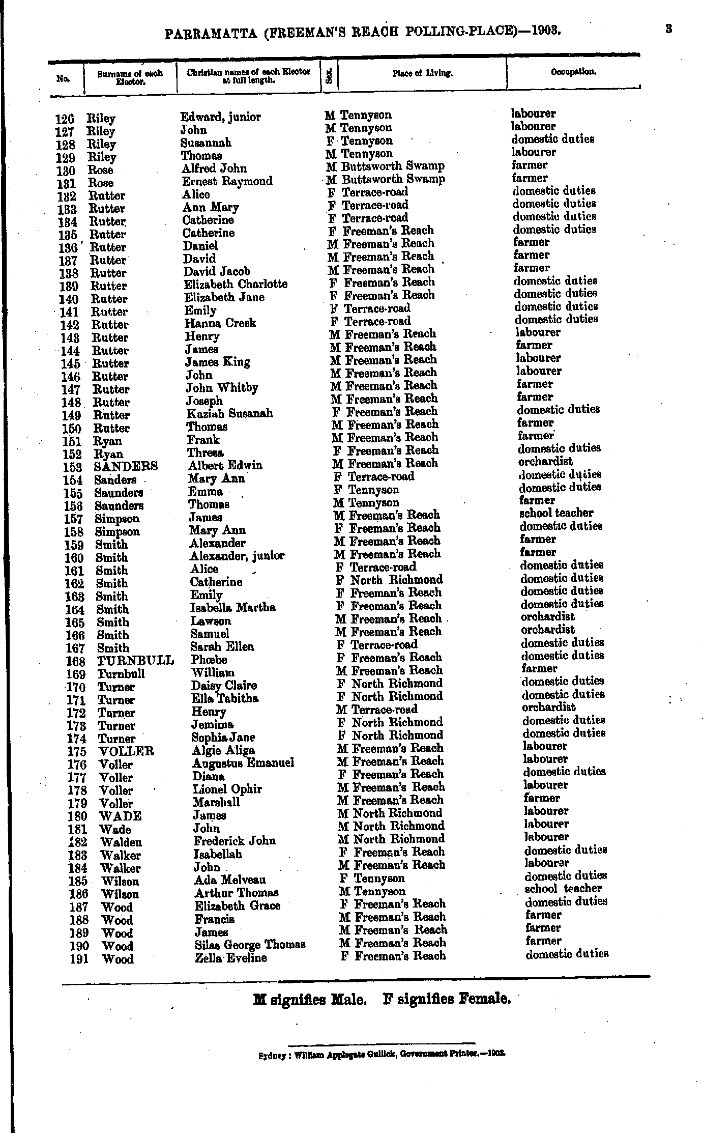
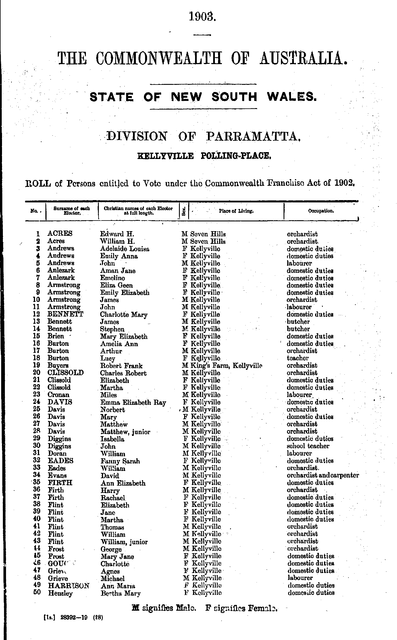
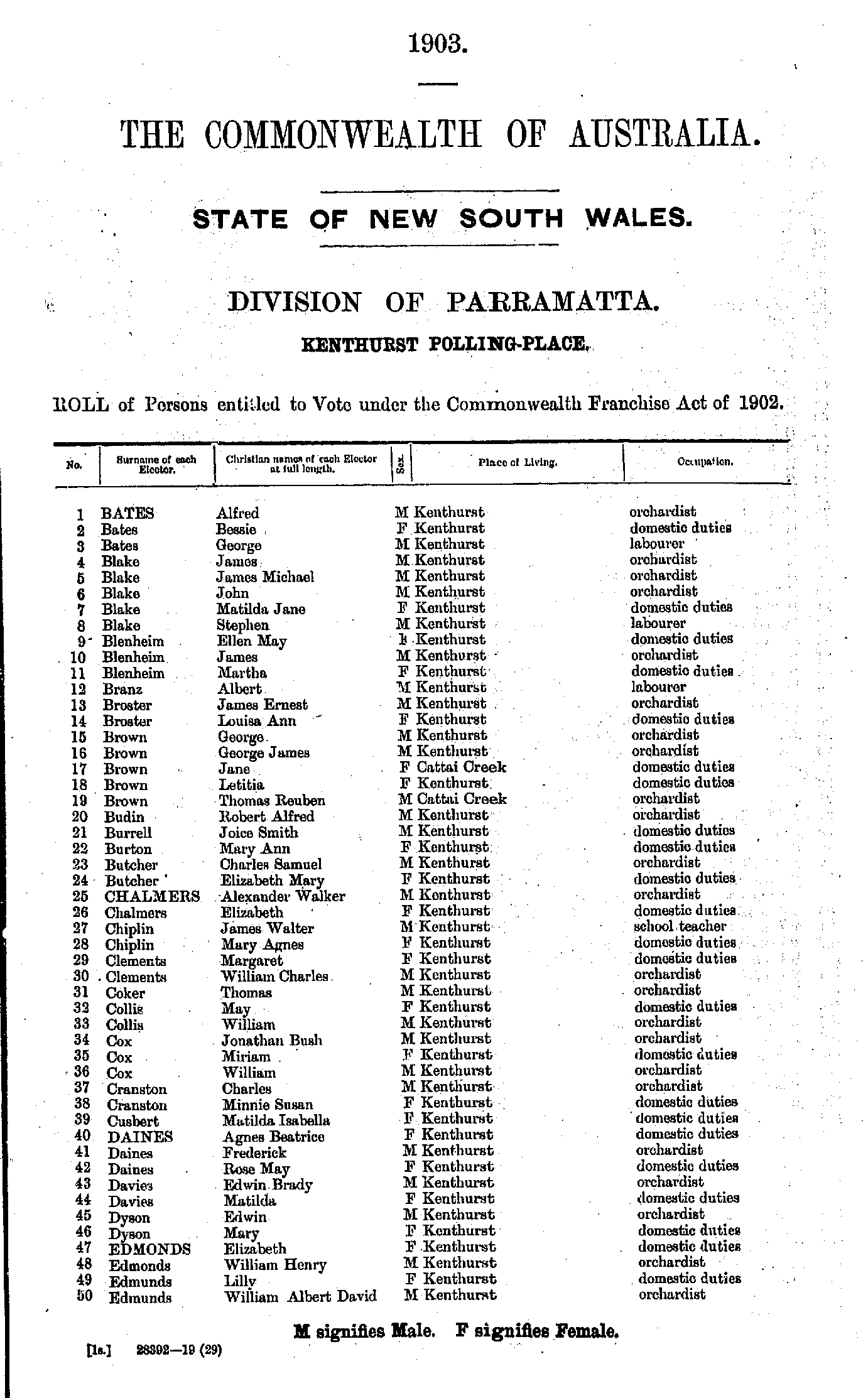
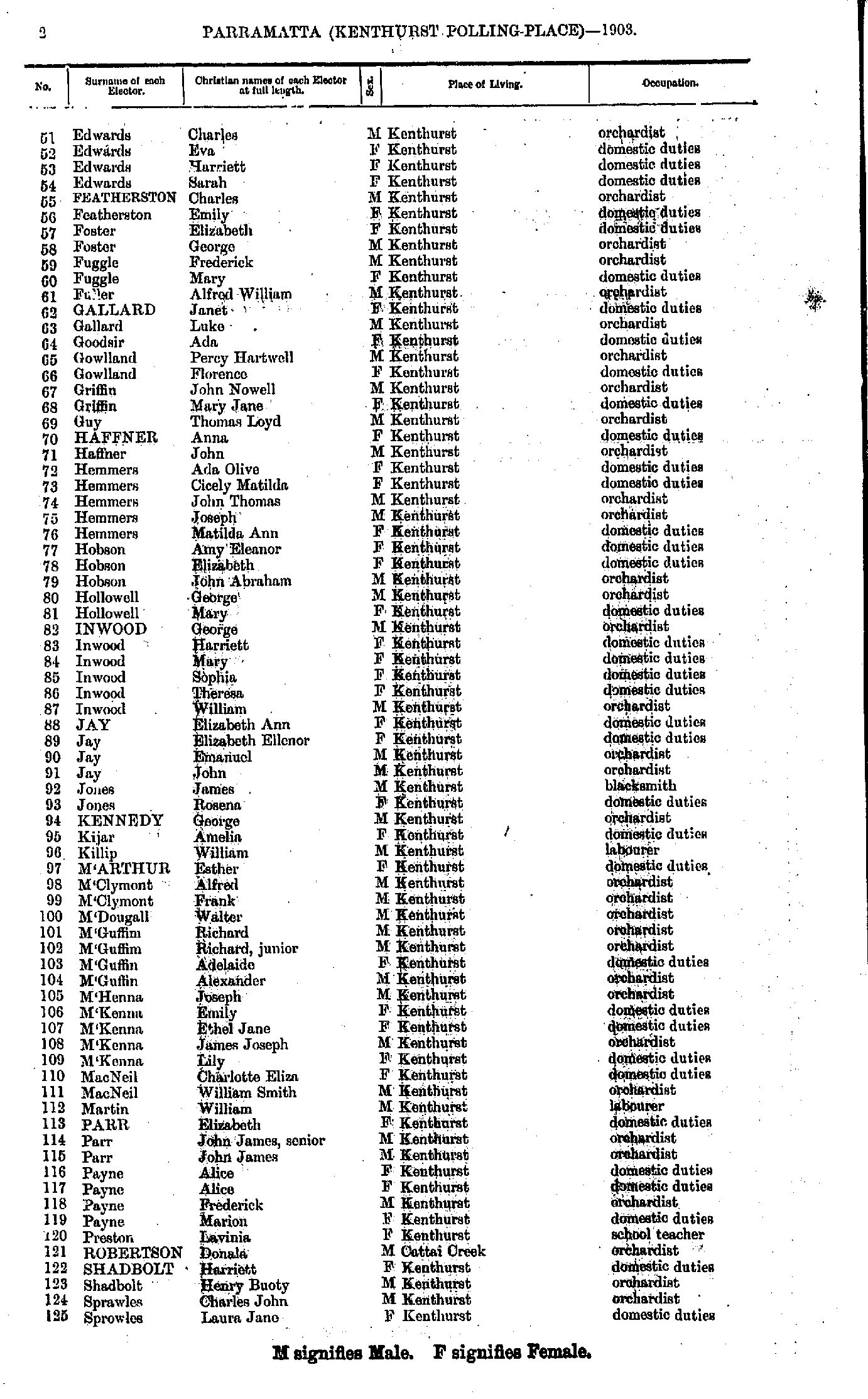
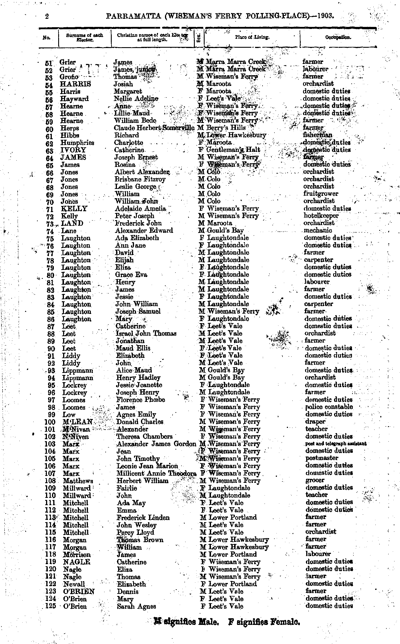
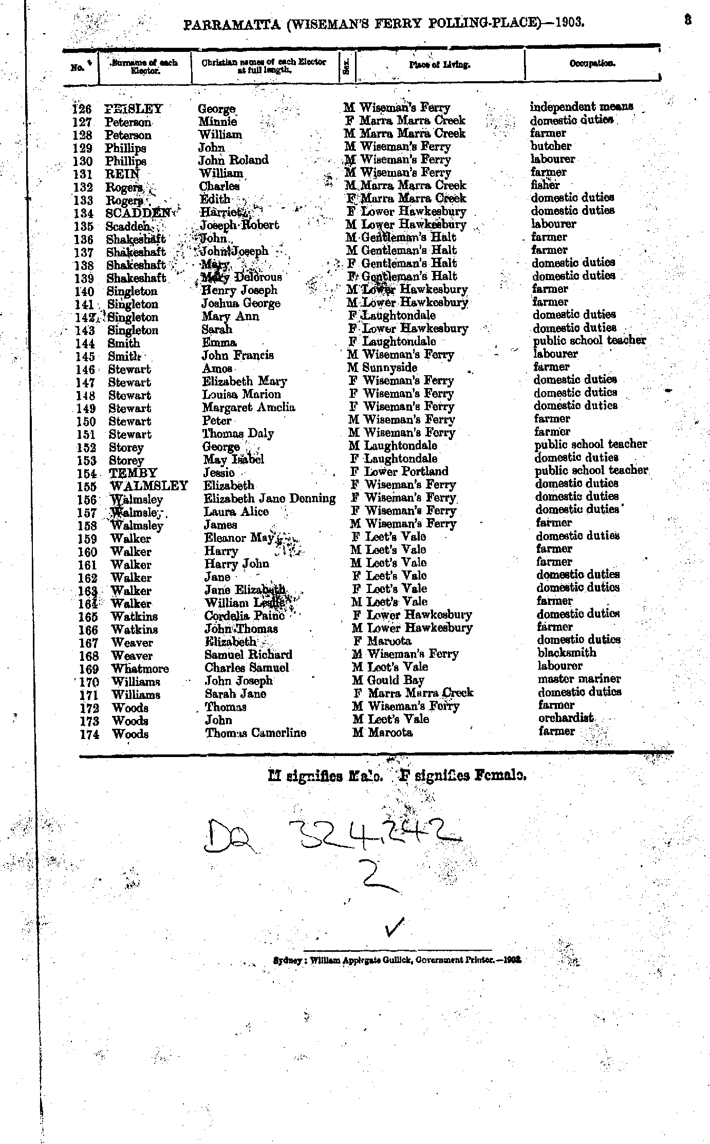
- Acres Edward - Hensley Bertha
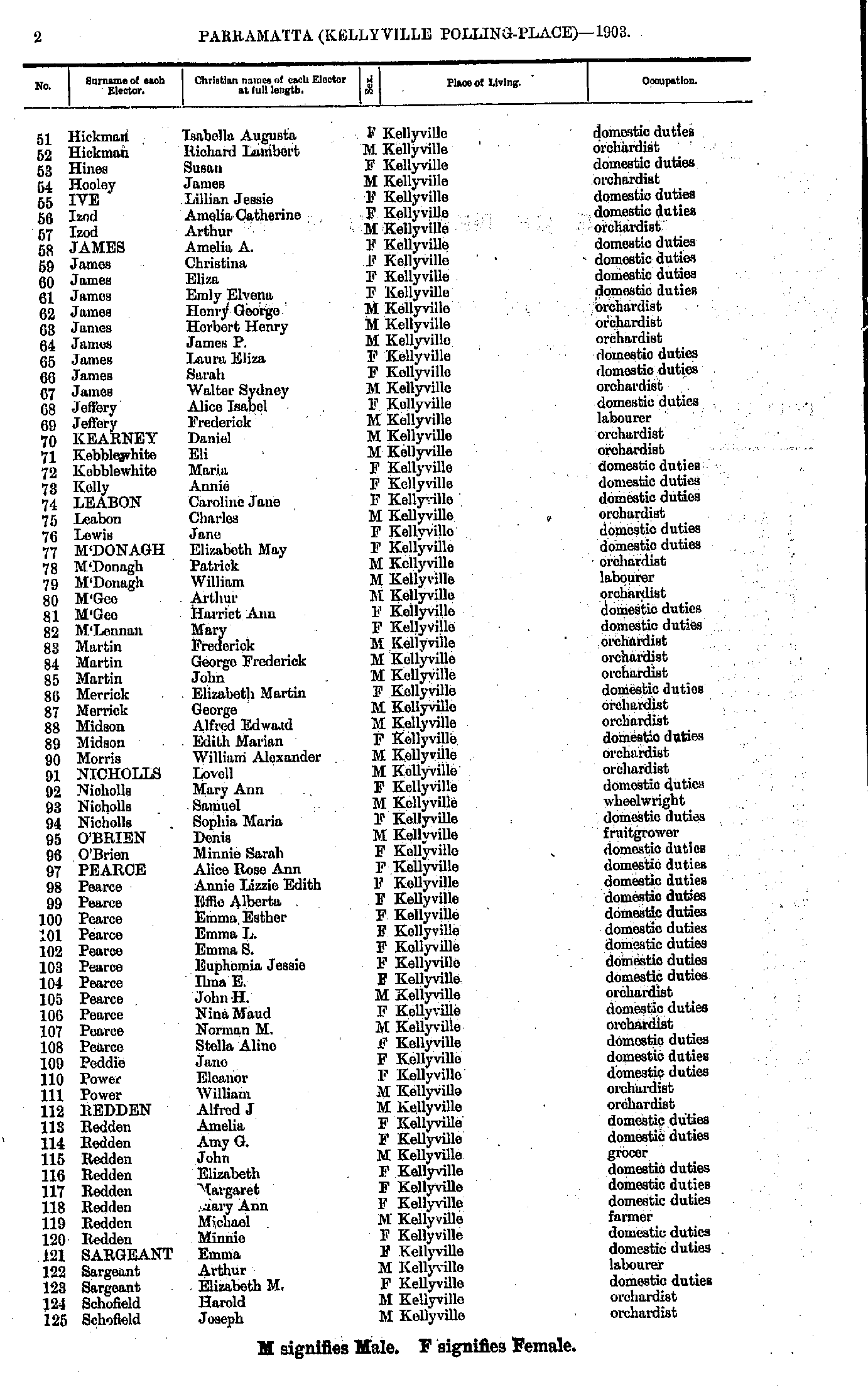
- Hickman Isabella - Schofield Joseph
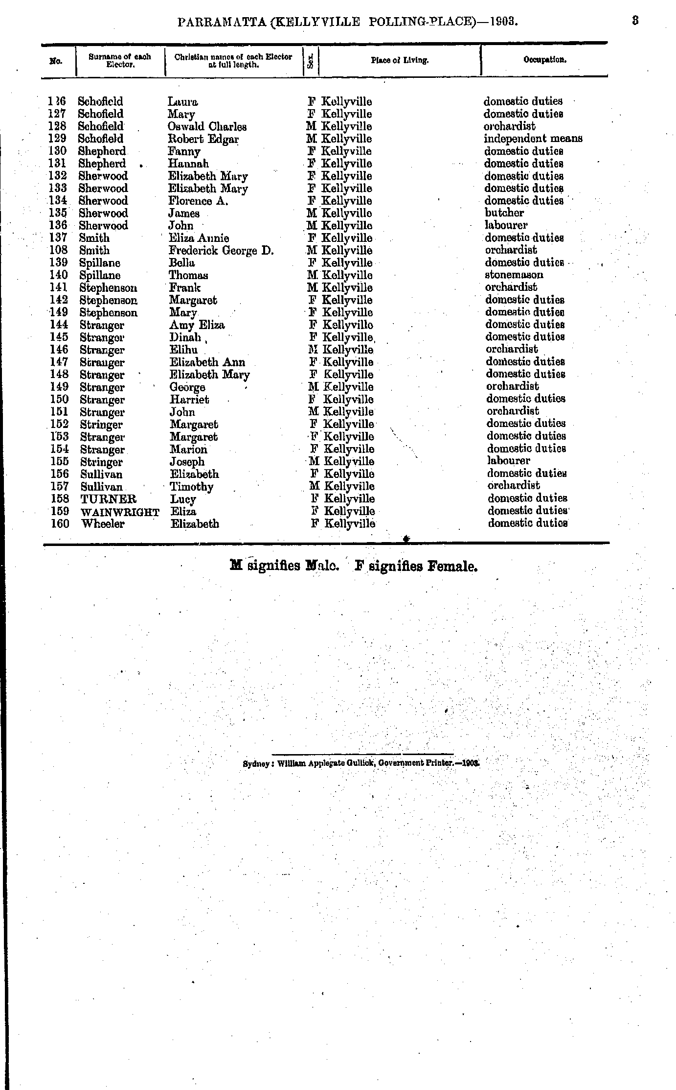
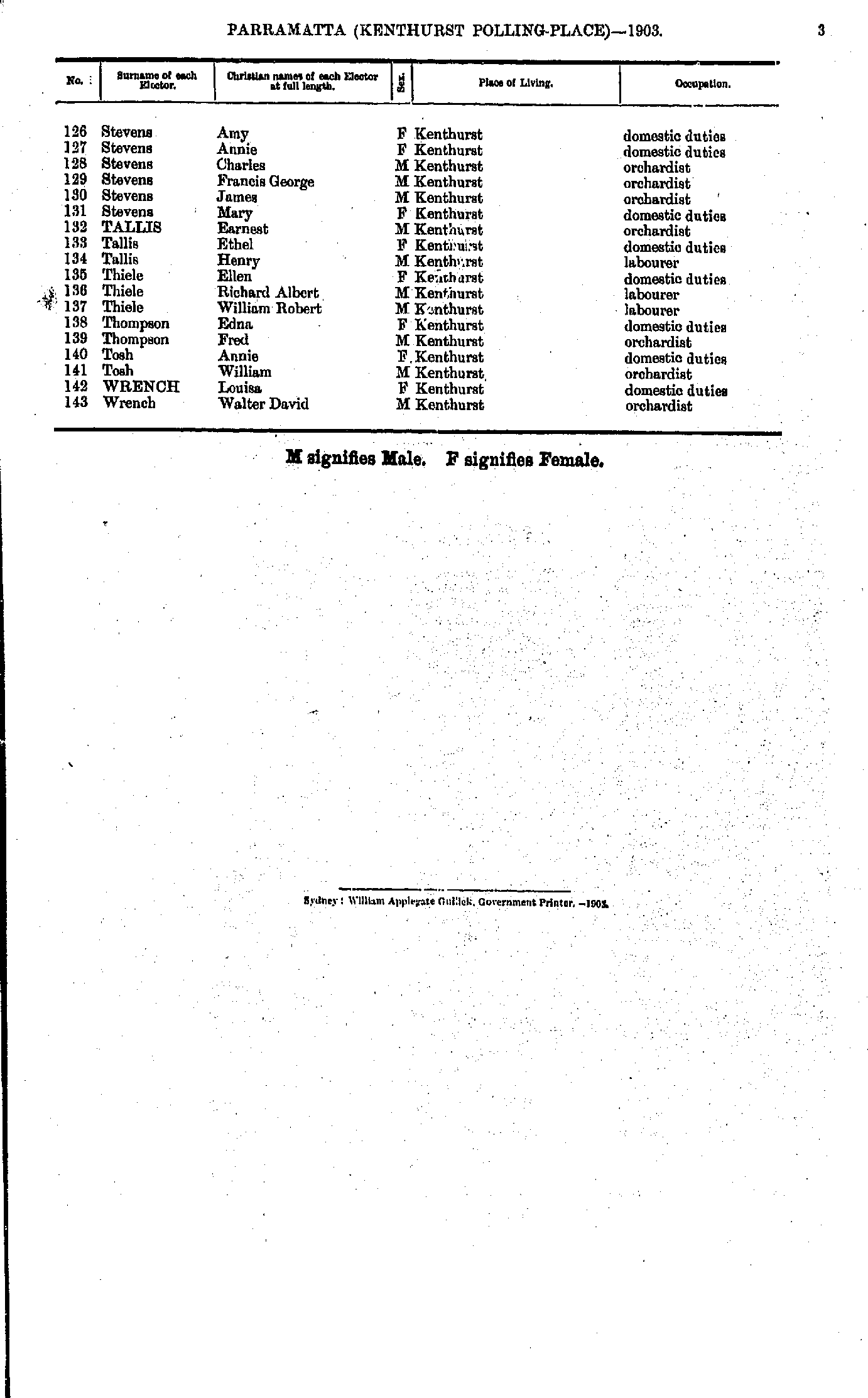
- Schofield Laura - Wheeler Elizabeth
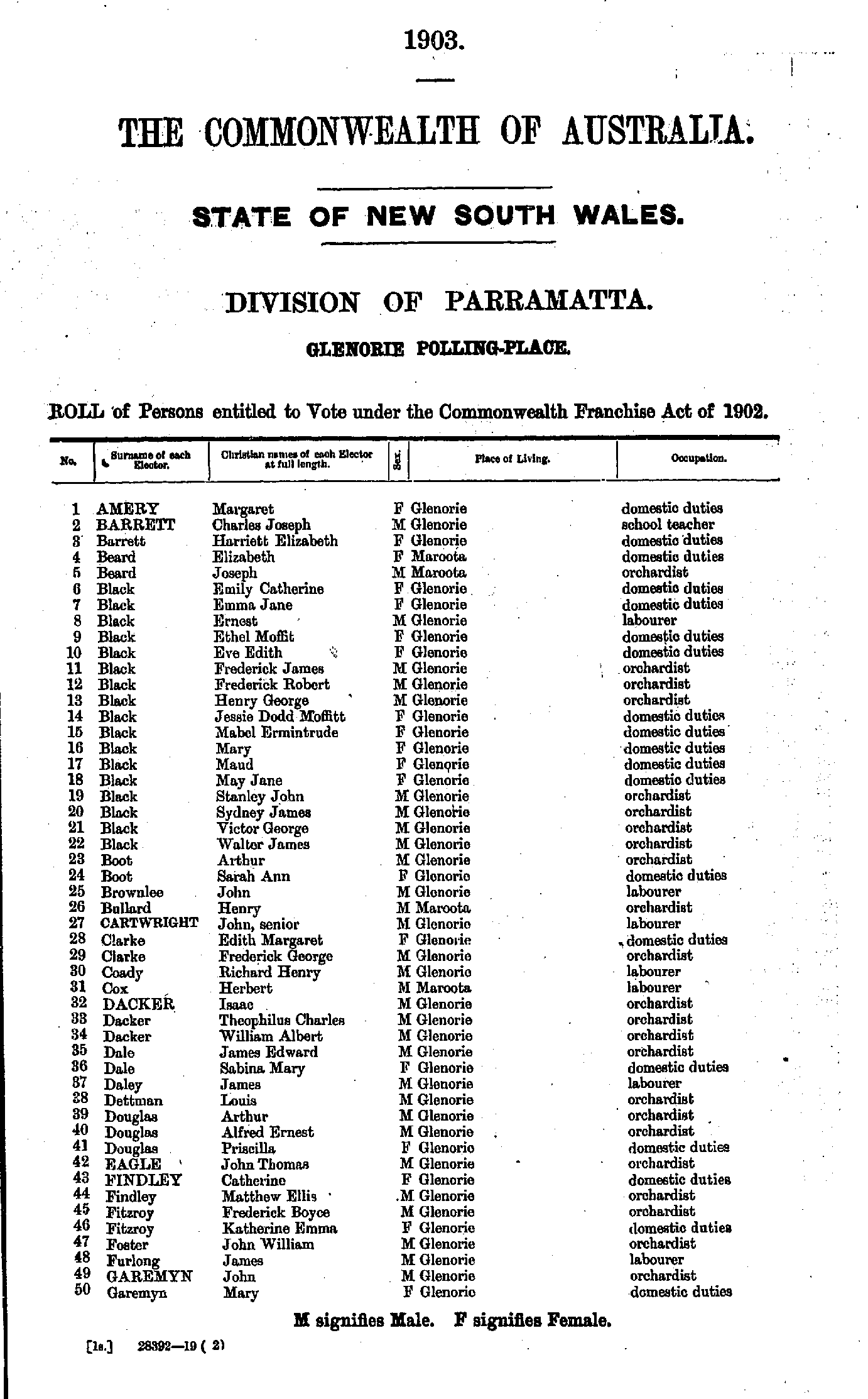
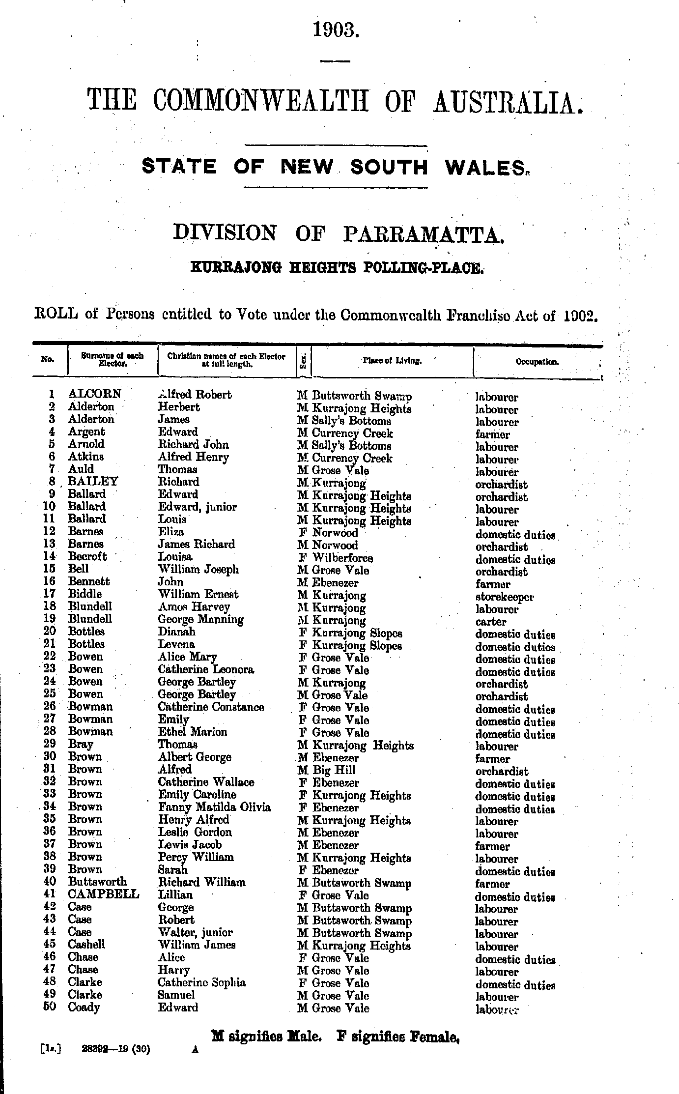
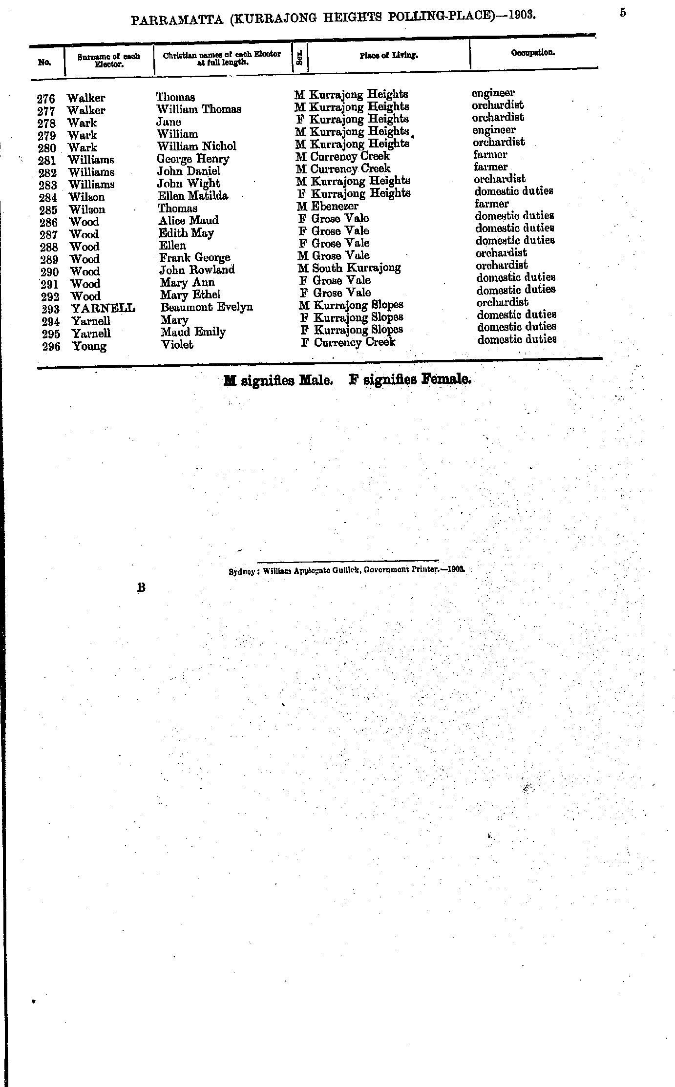
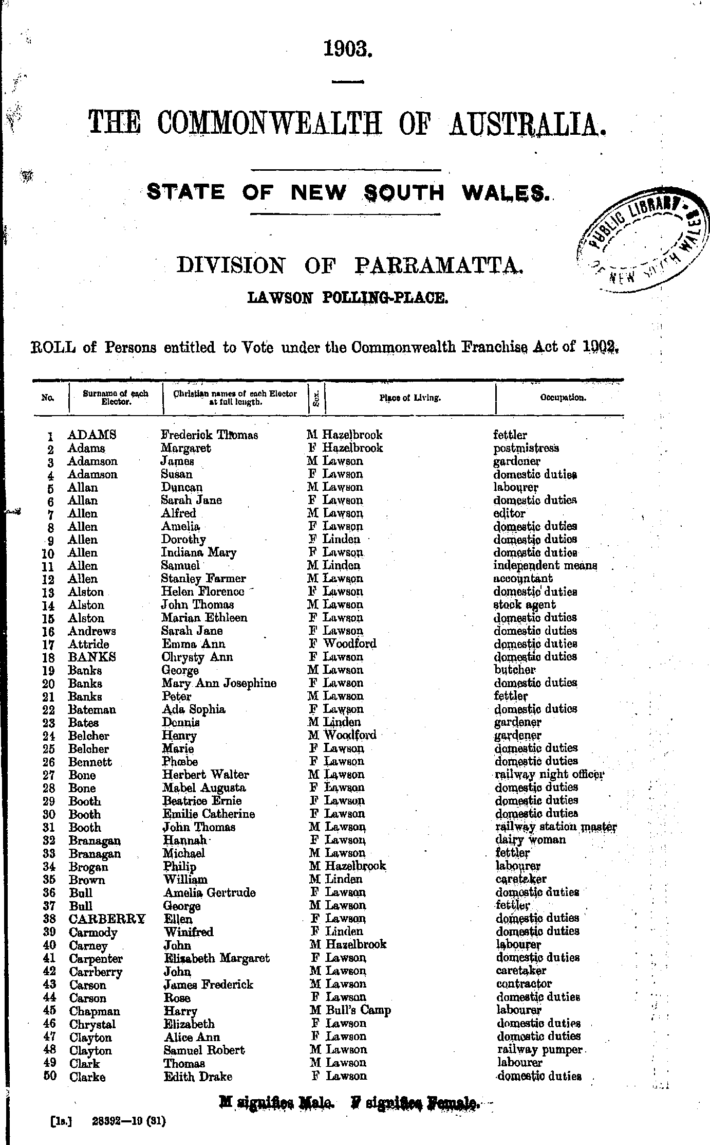
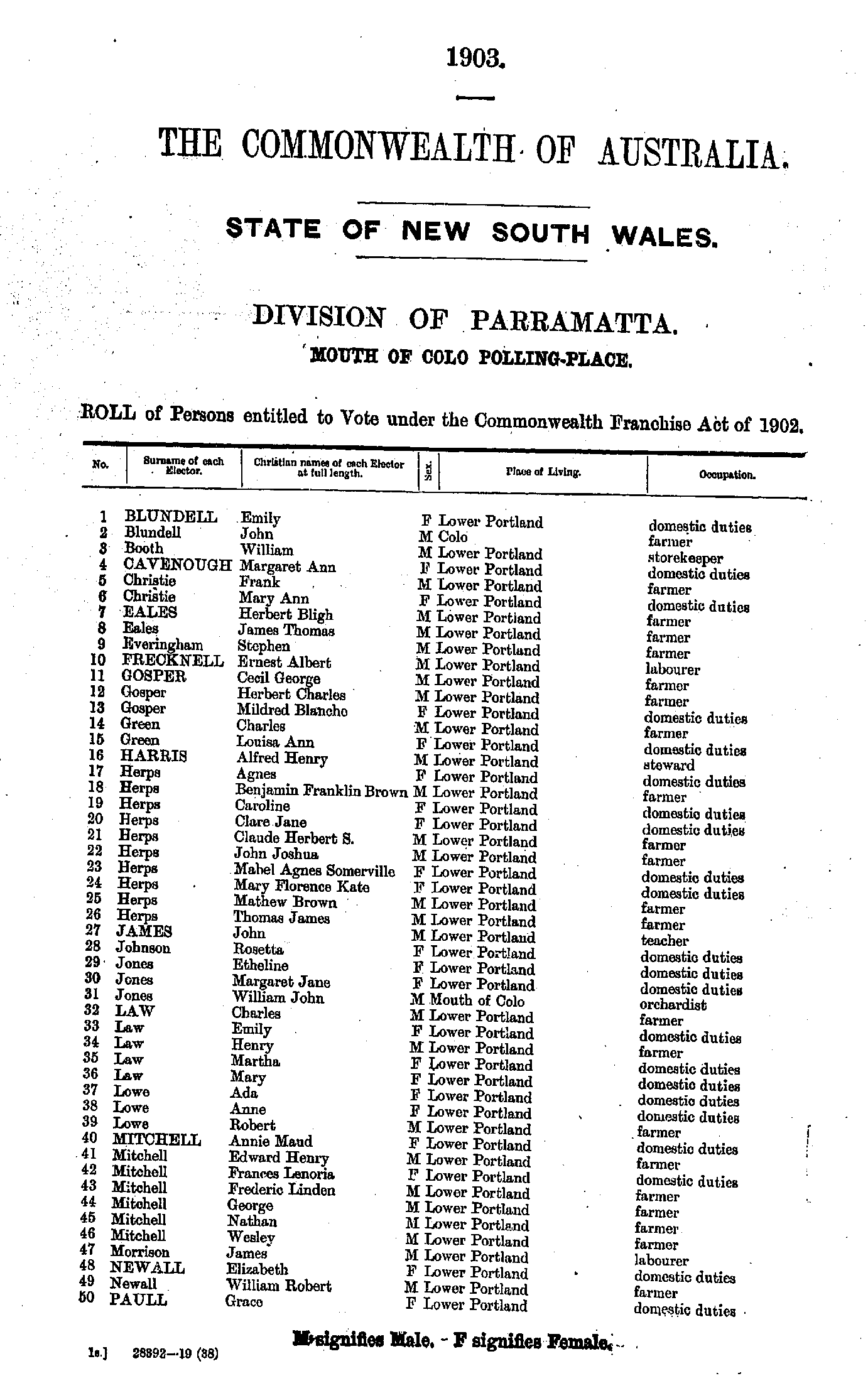
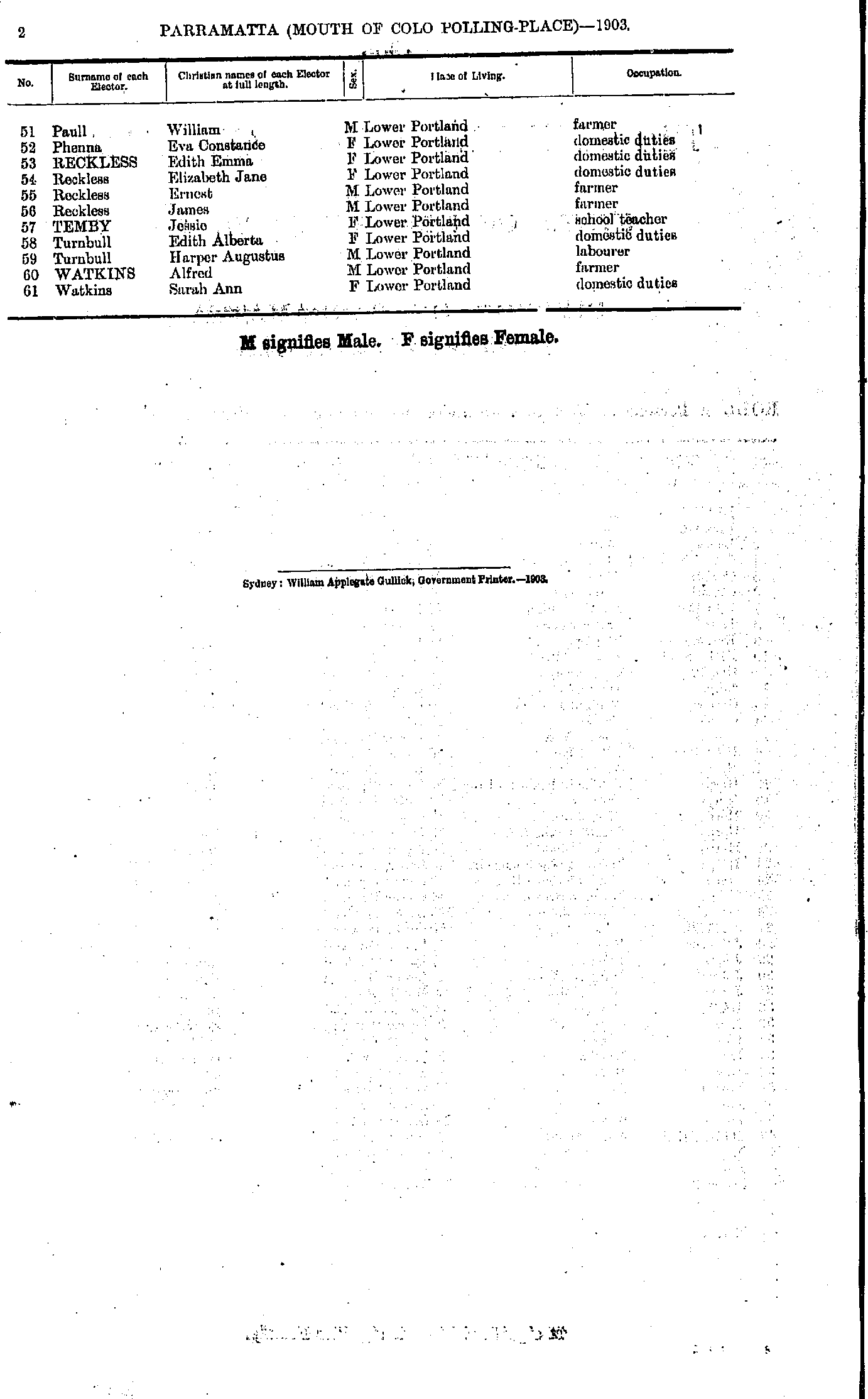
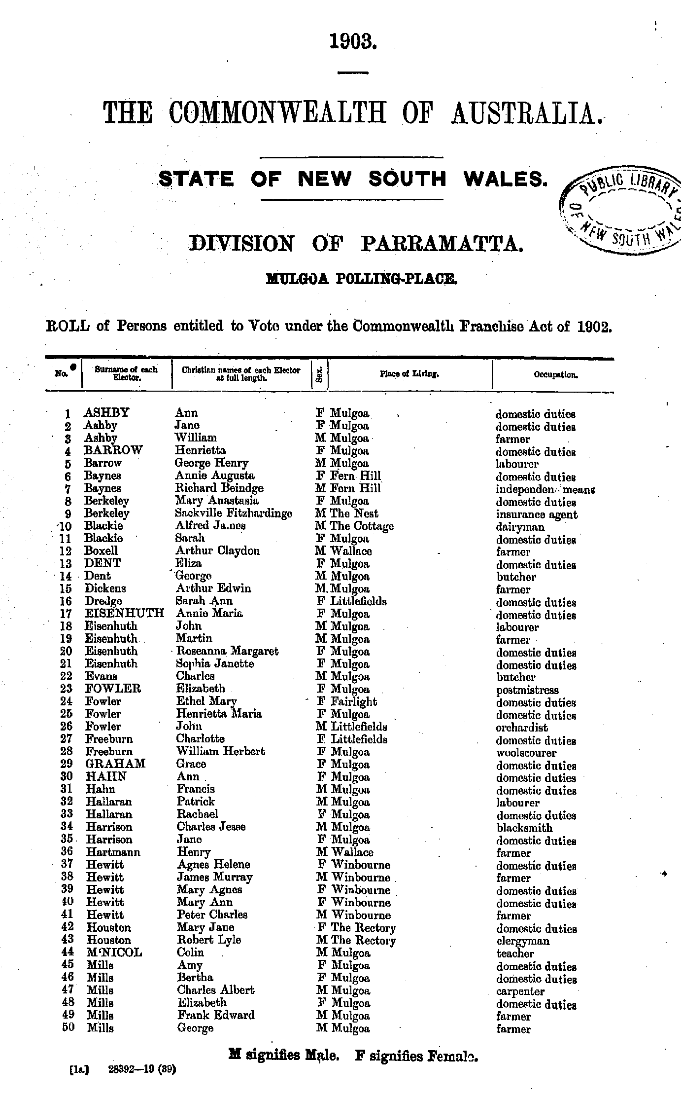
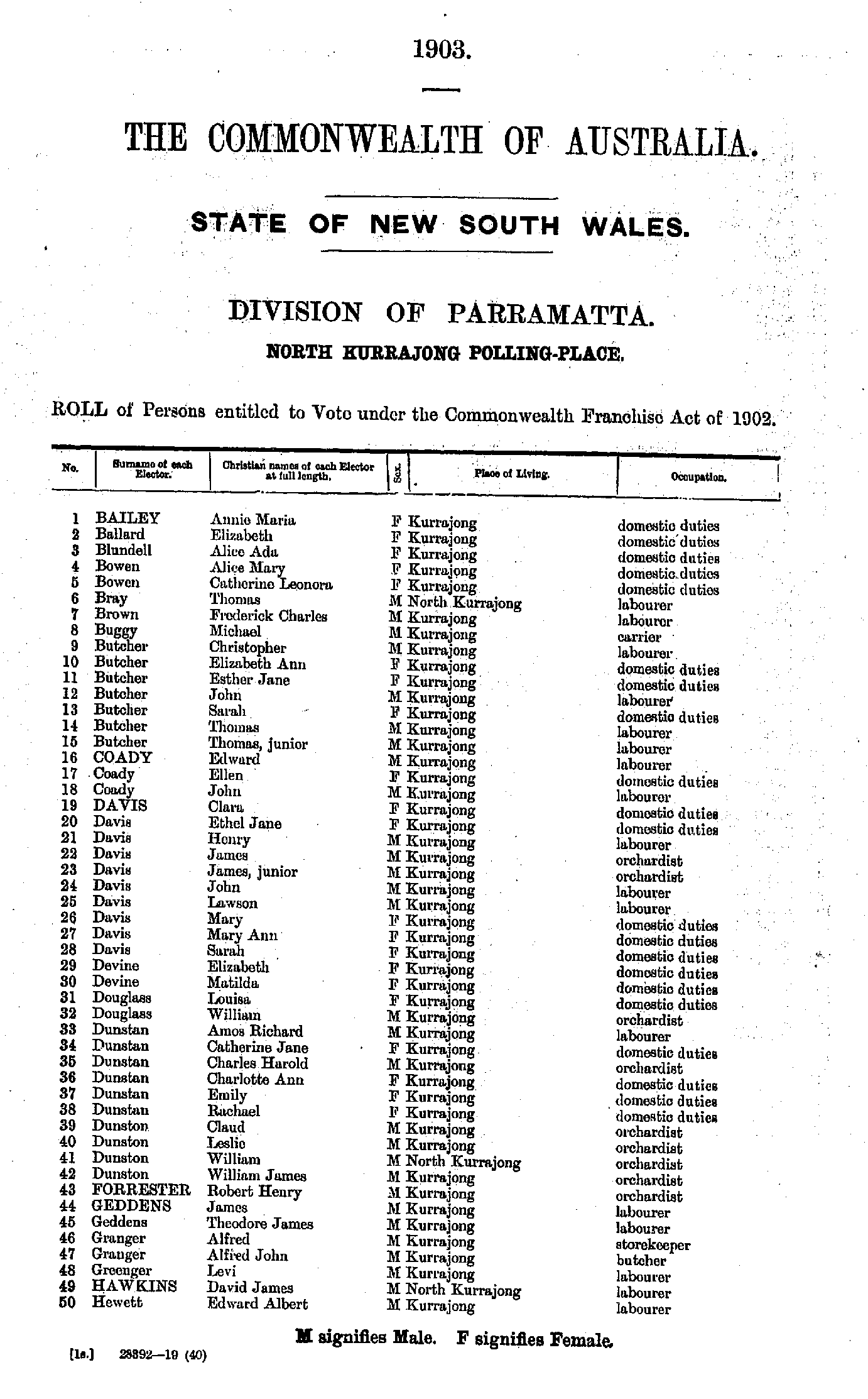
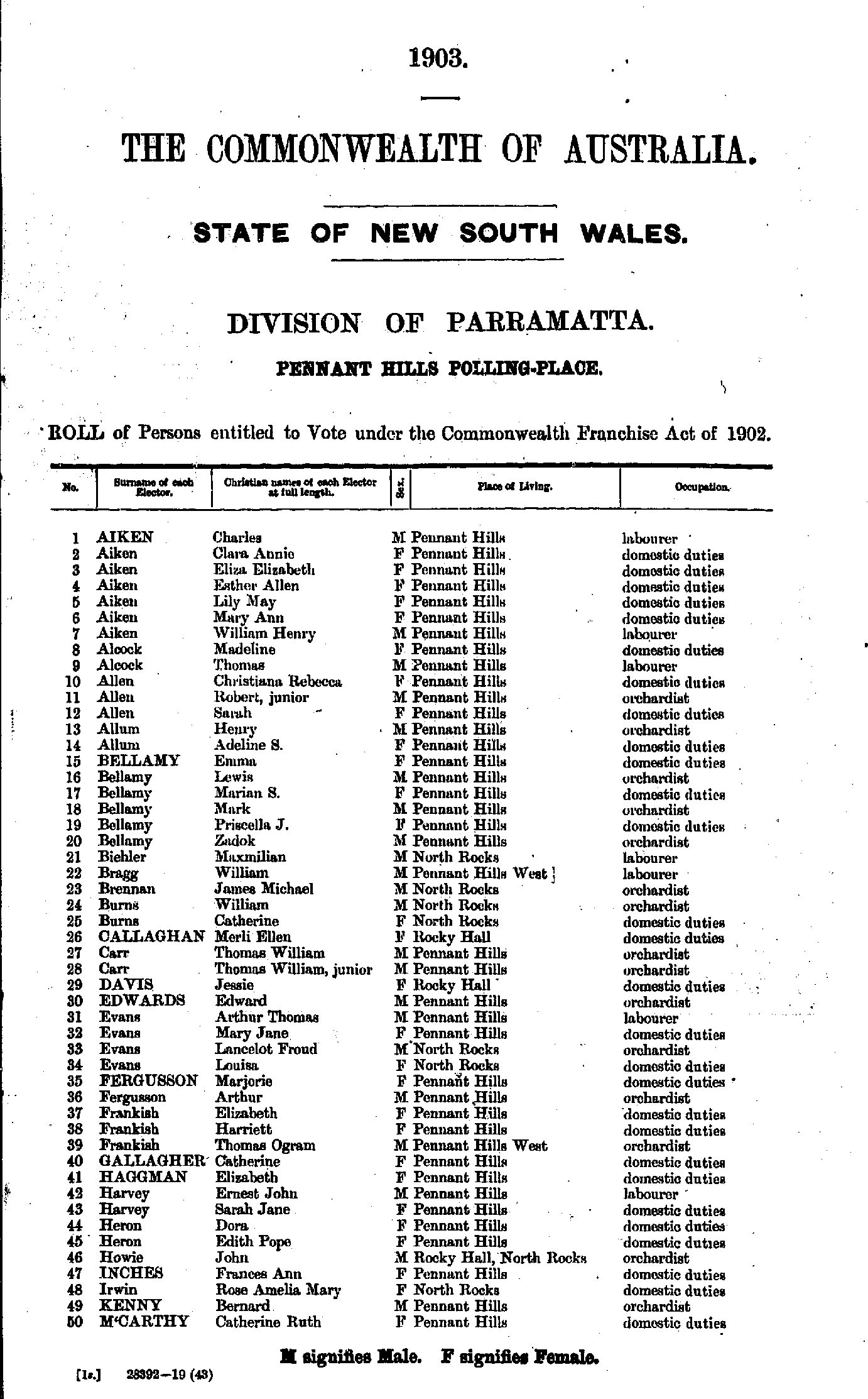
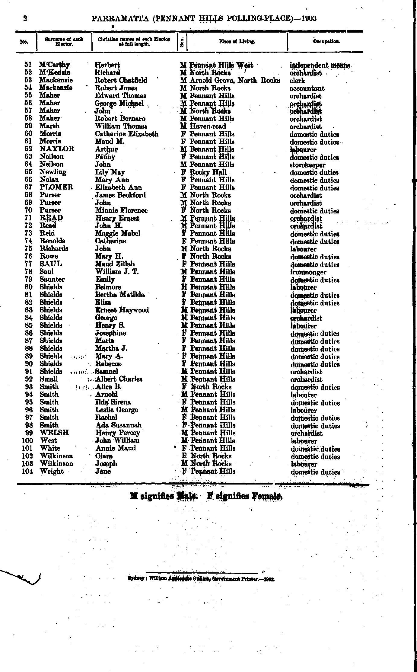
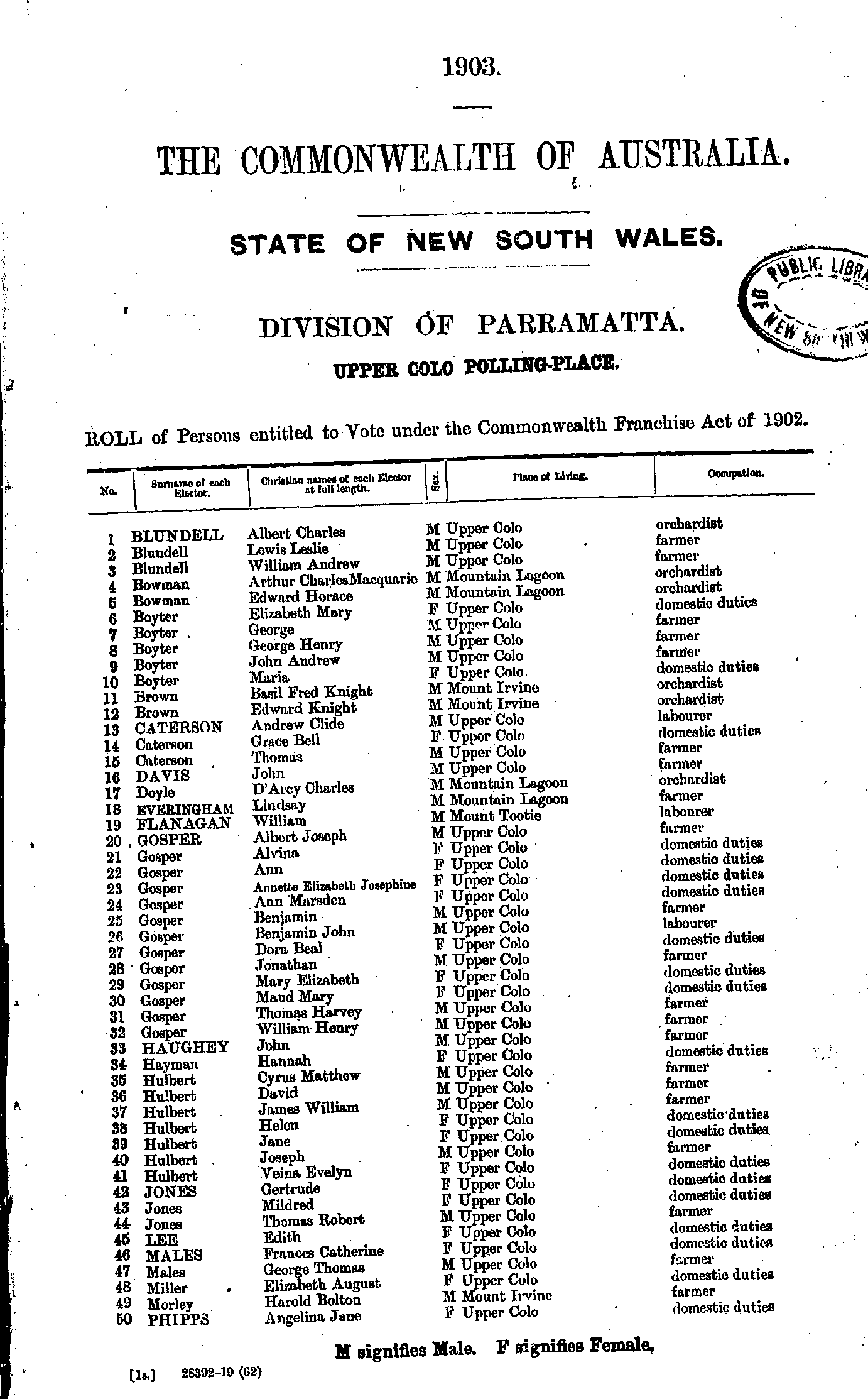
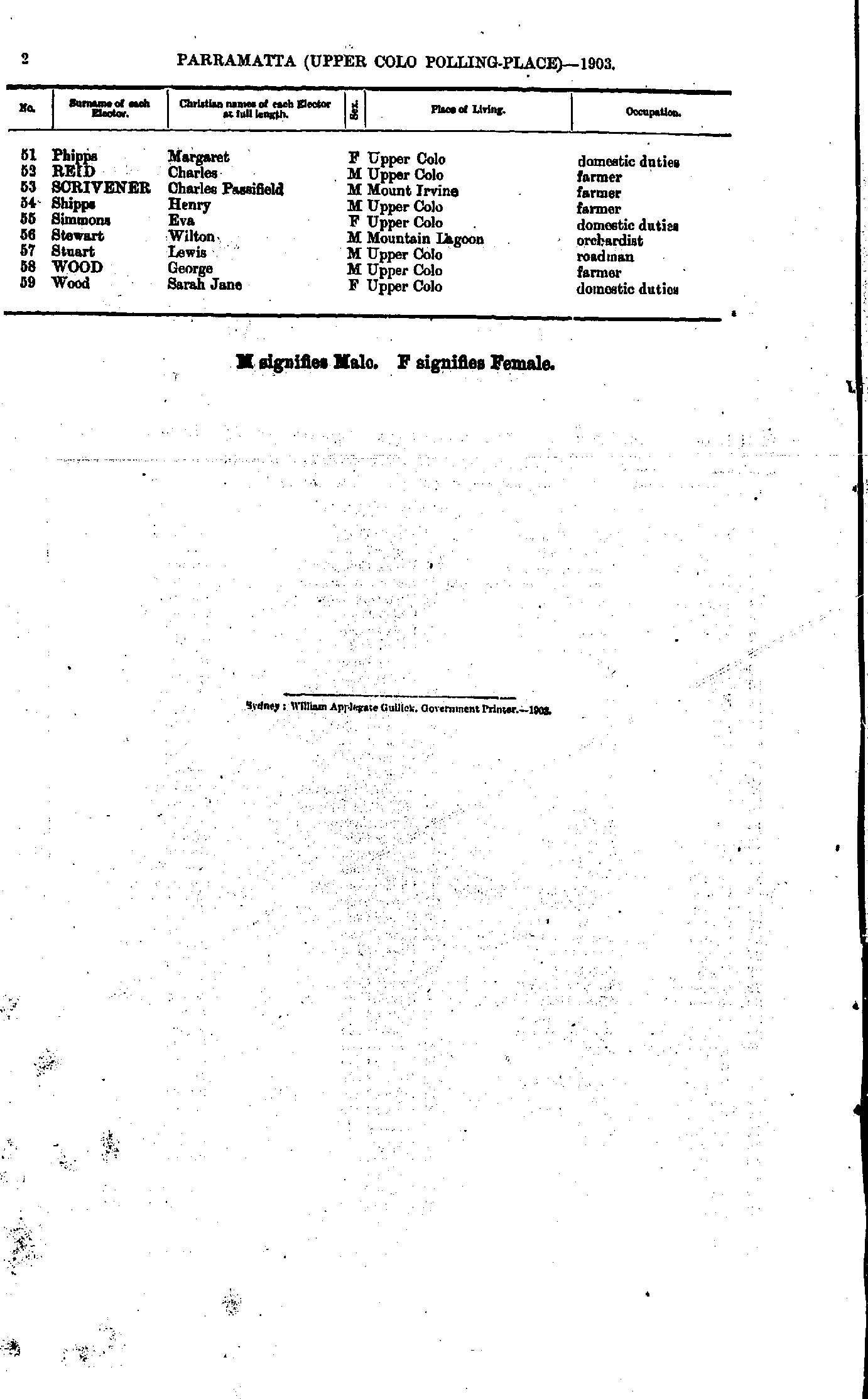
Kurrajong Heights Polling Place
- Alcorn Alfred - Coady Edward
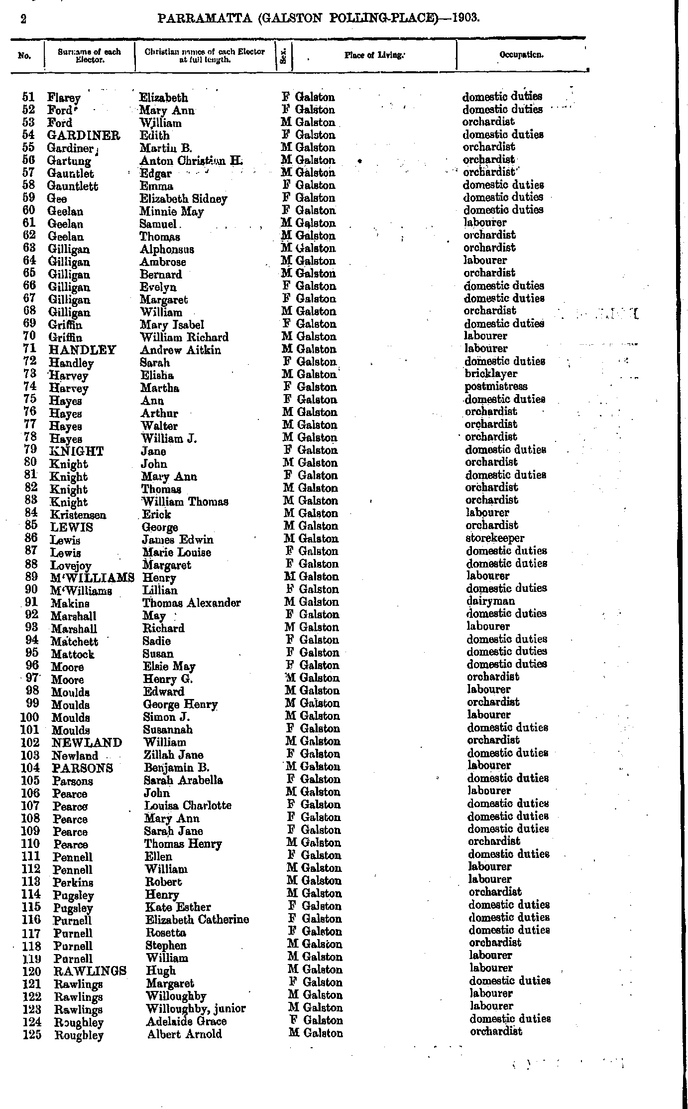
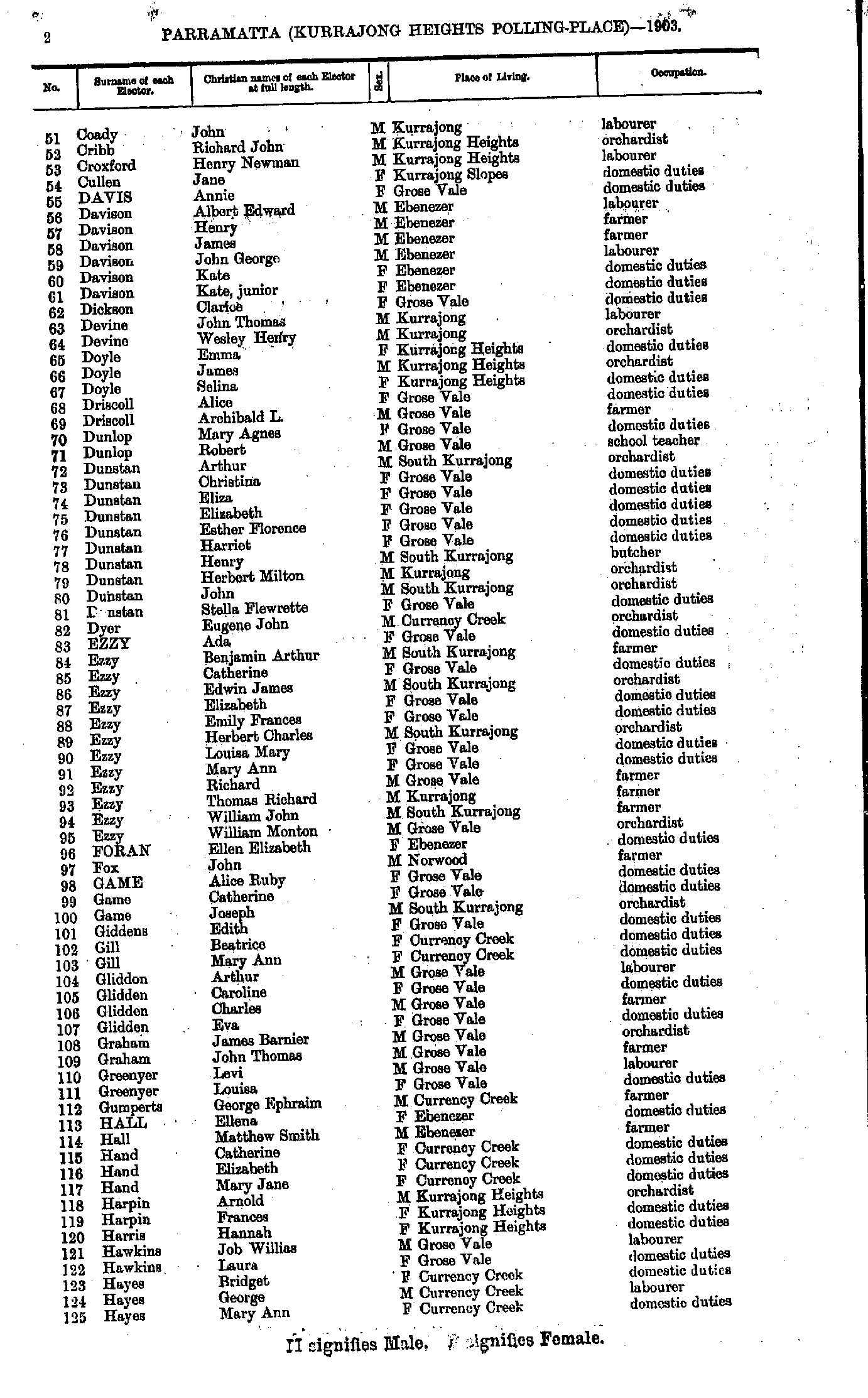
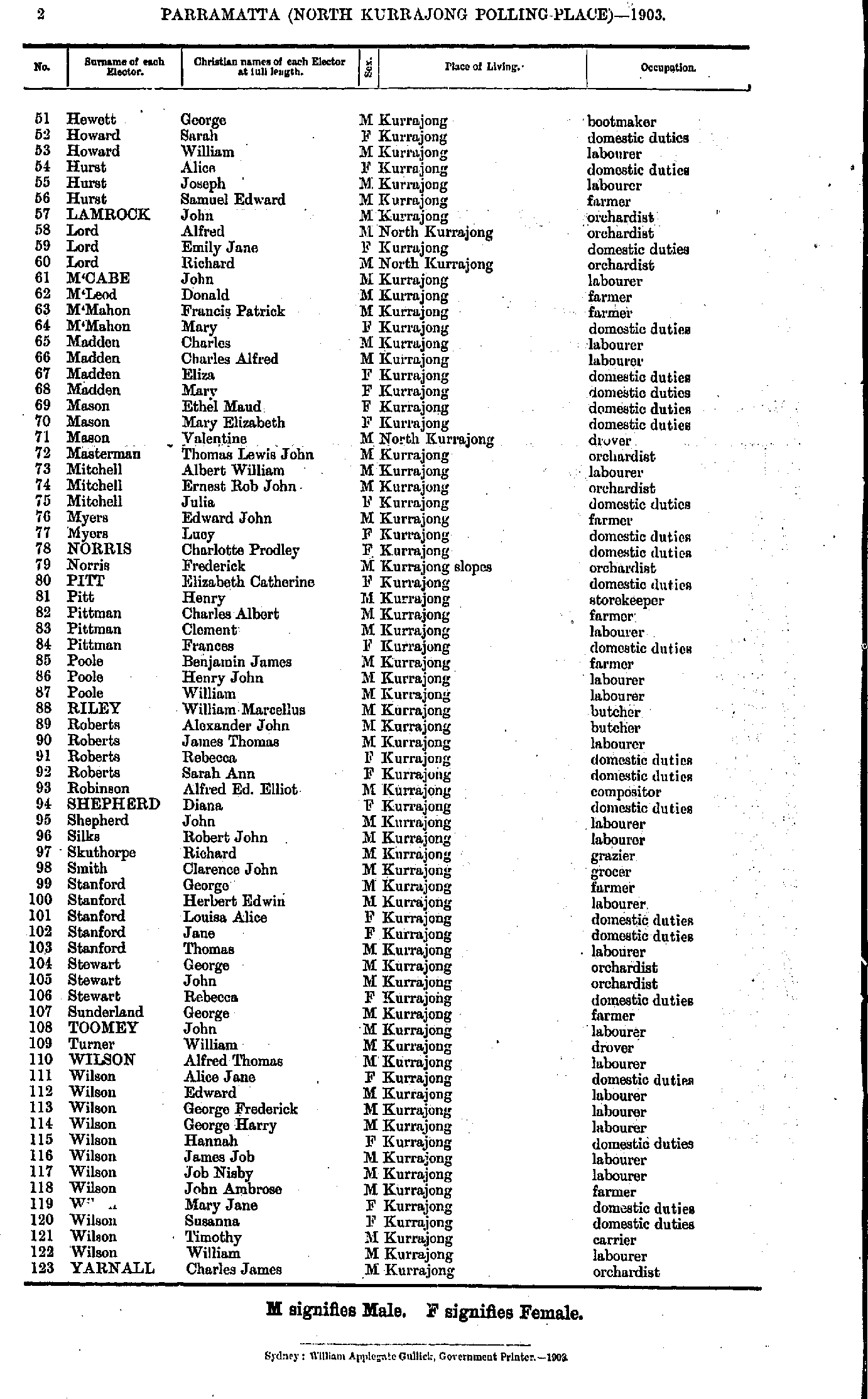
- Coady John - Hayes Mary
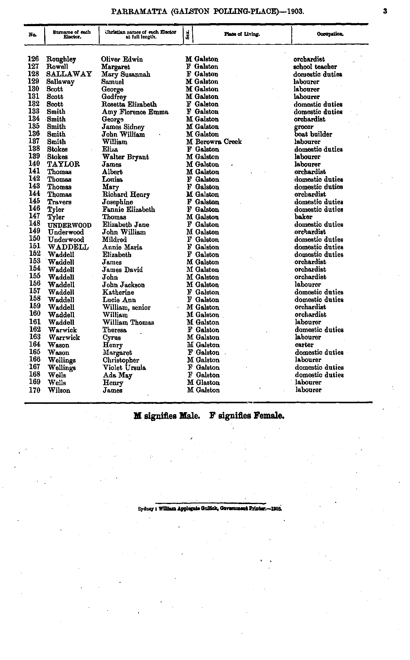
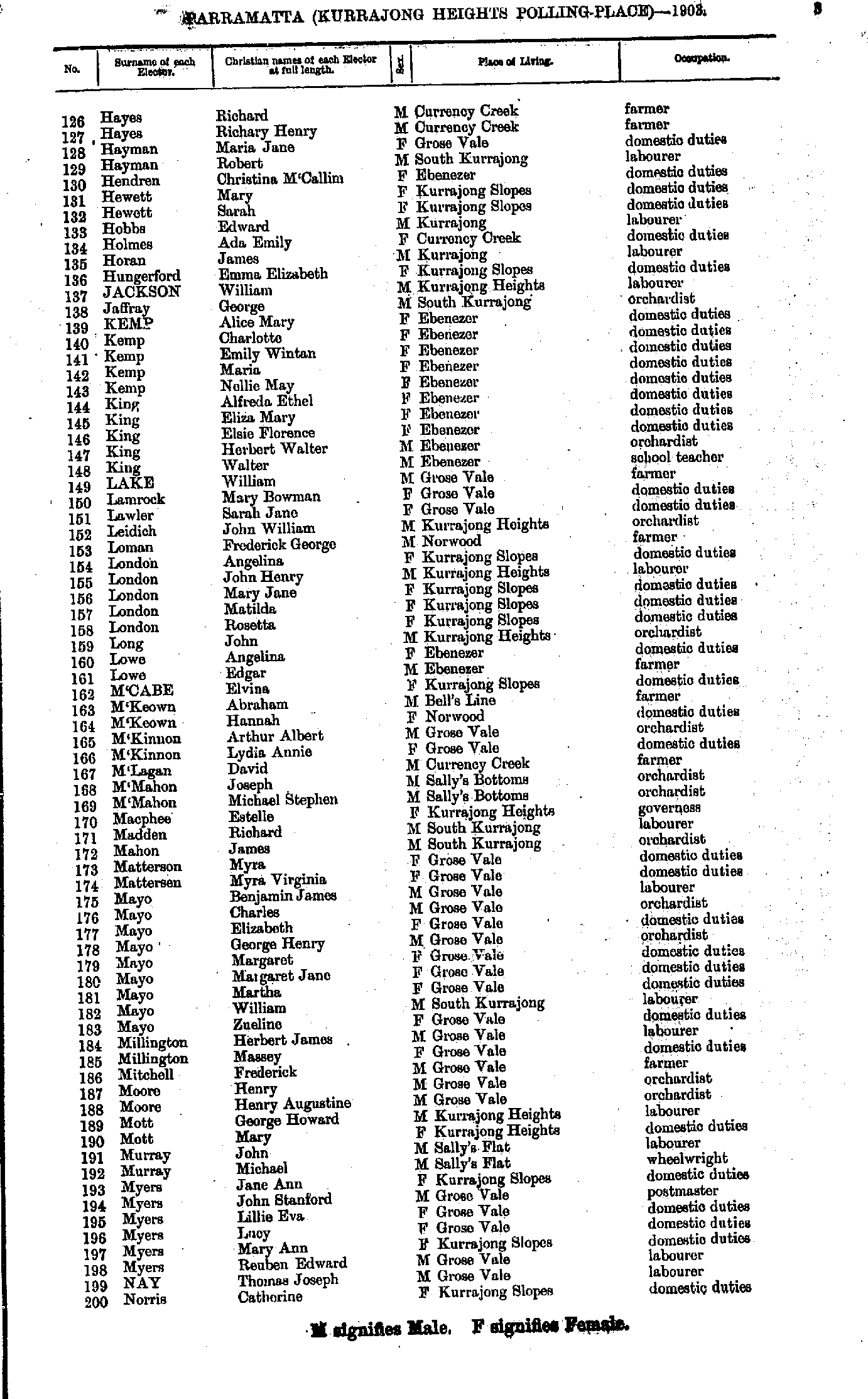
- Hayes Richard - Norris Catherine
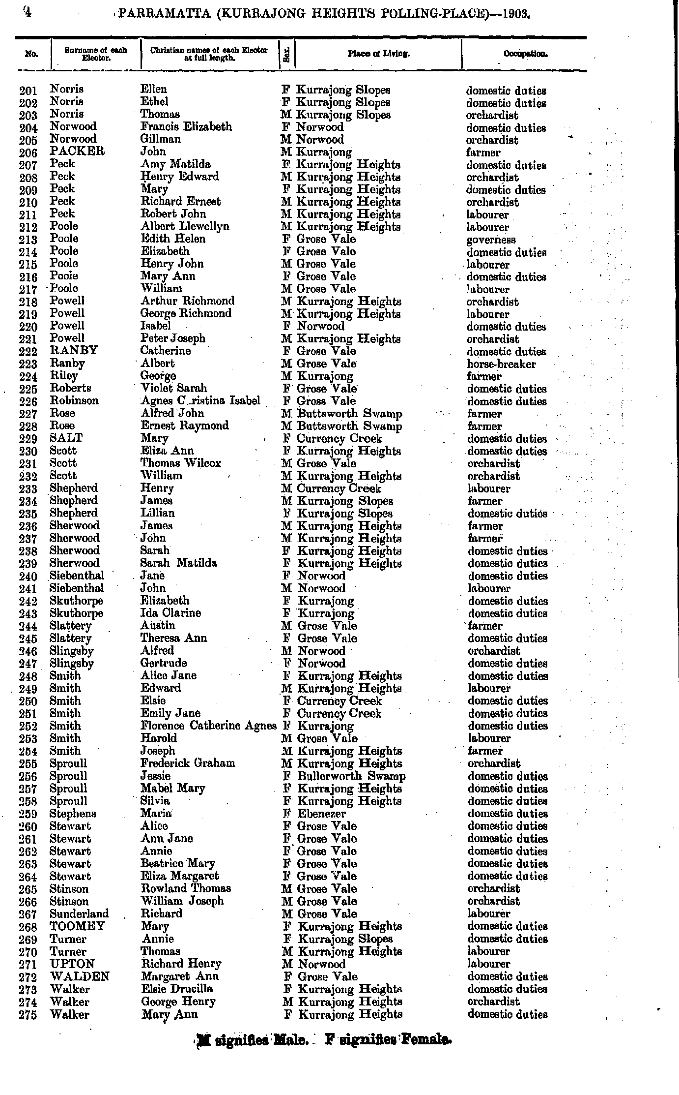
- Norris Ellen - Walker Mary
- Walker Thomas - Young Violet
- Adams Frederick - Clarke Edith
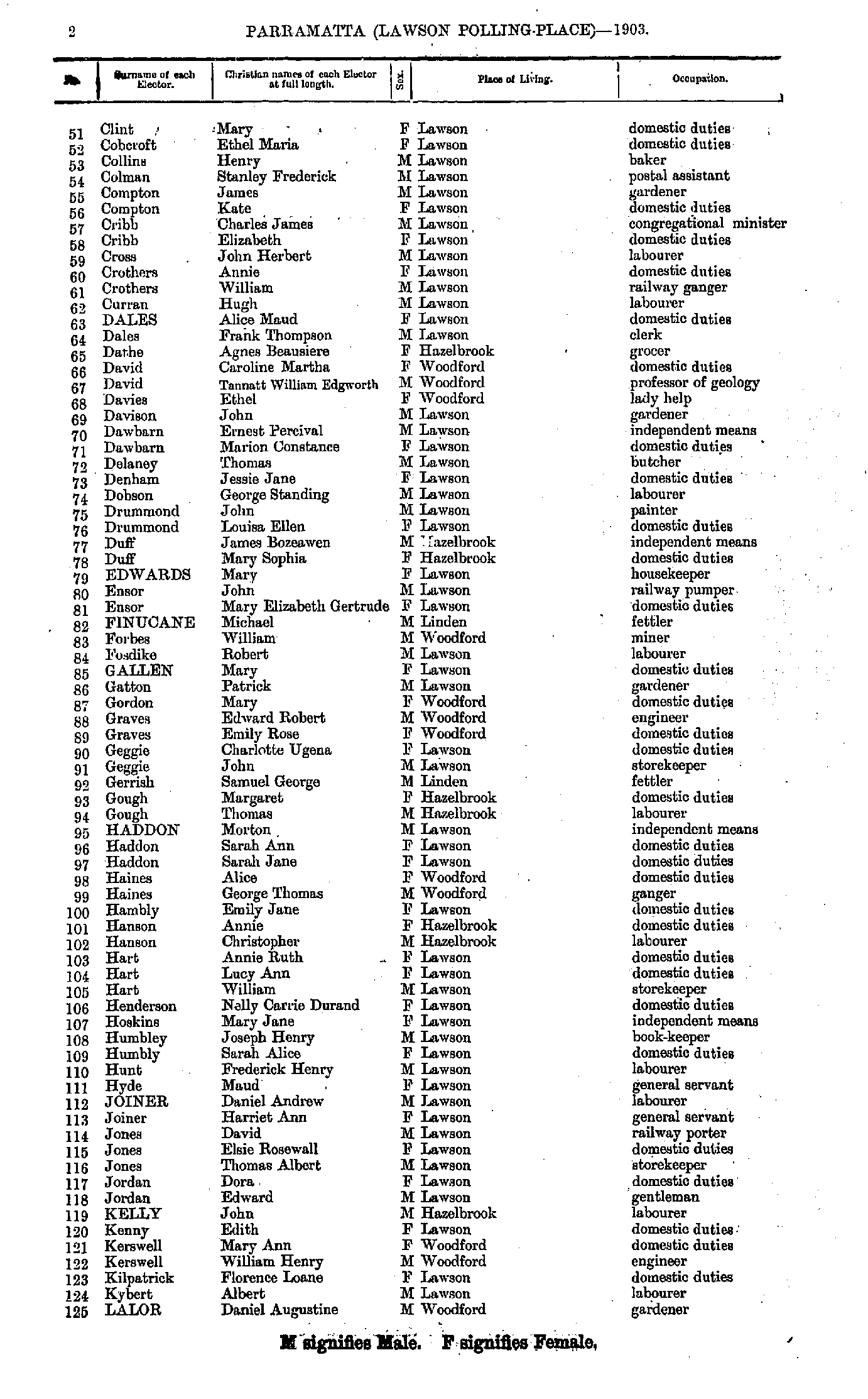
- Clint Mary - Lalor Daniel
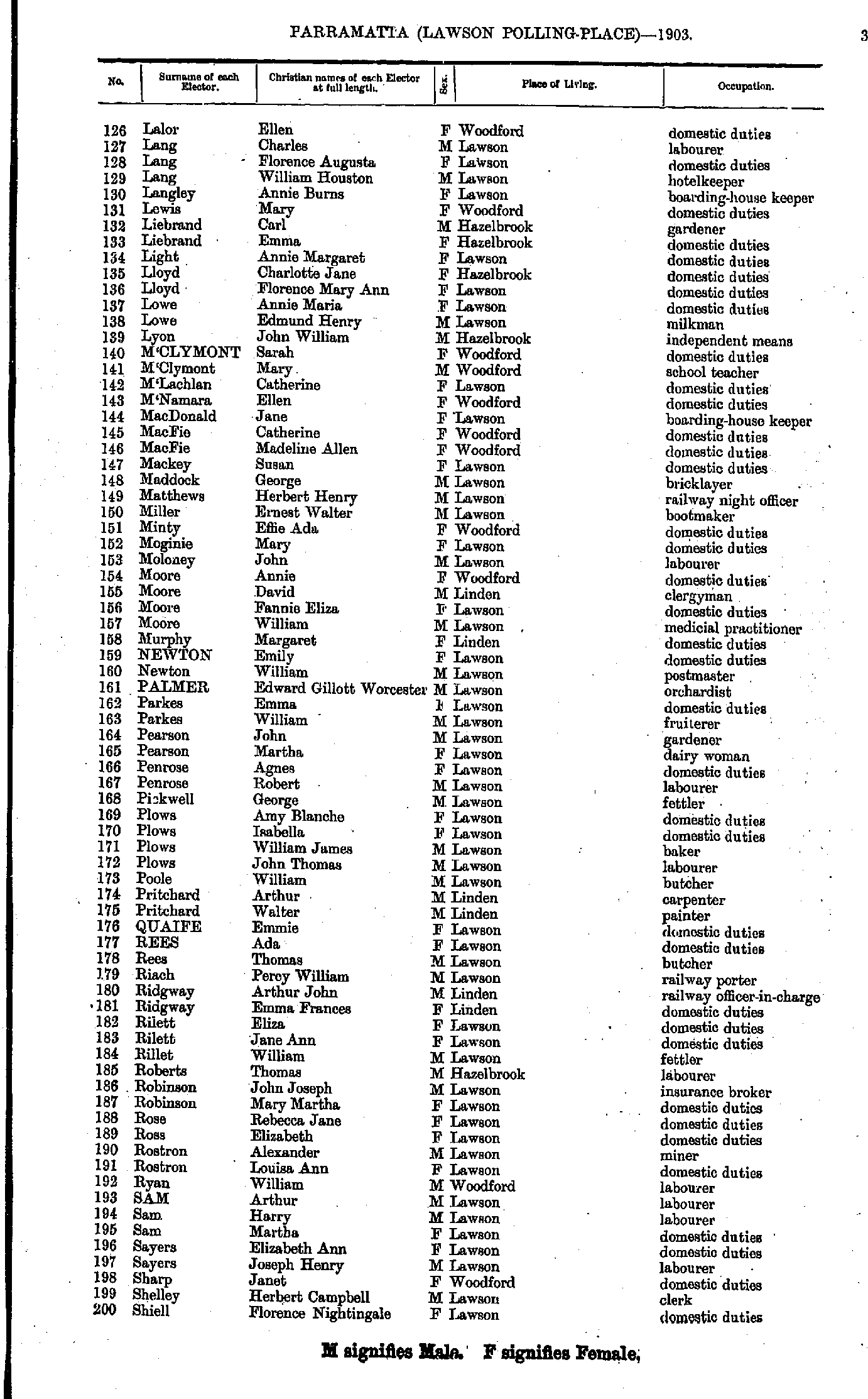
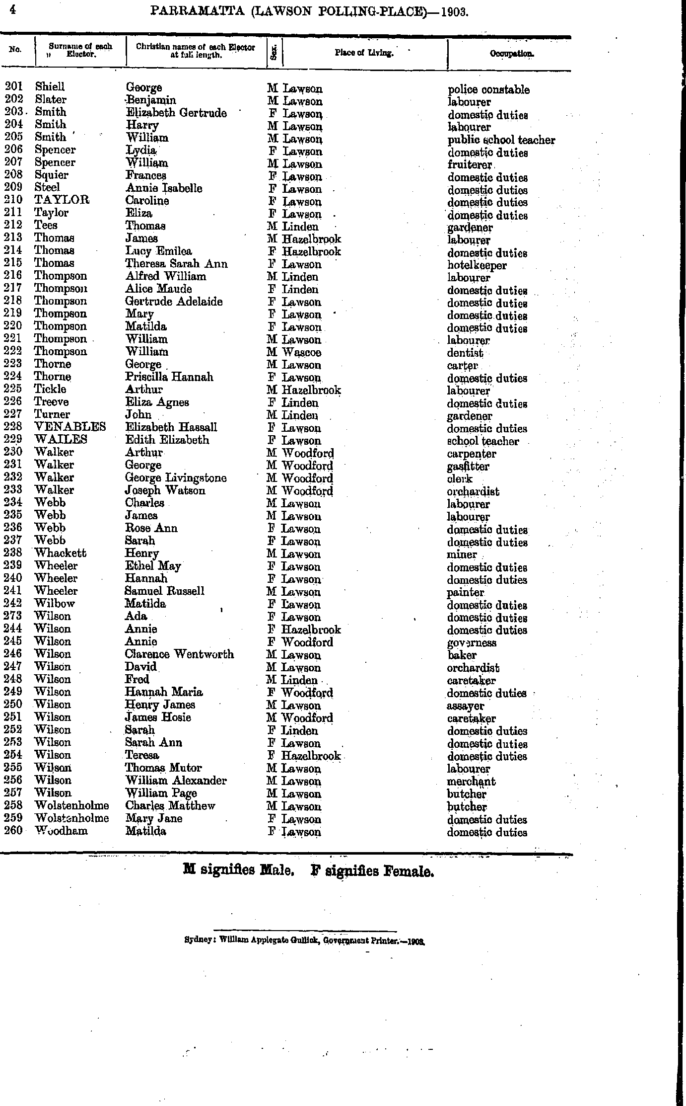
- Lalor Ellen - Shiell Florence
- Shiell George - Woodham Matilda
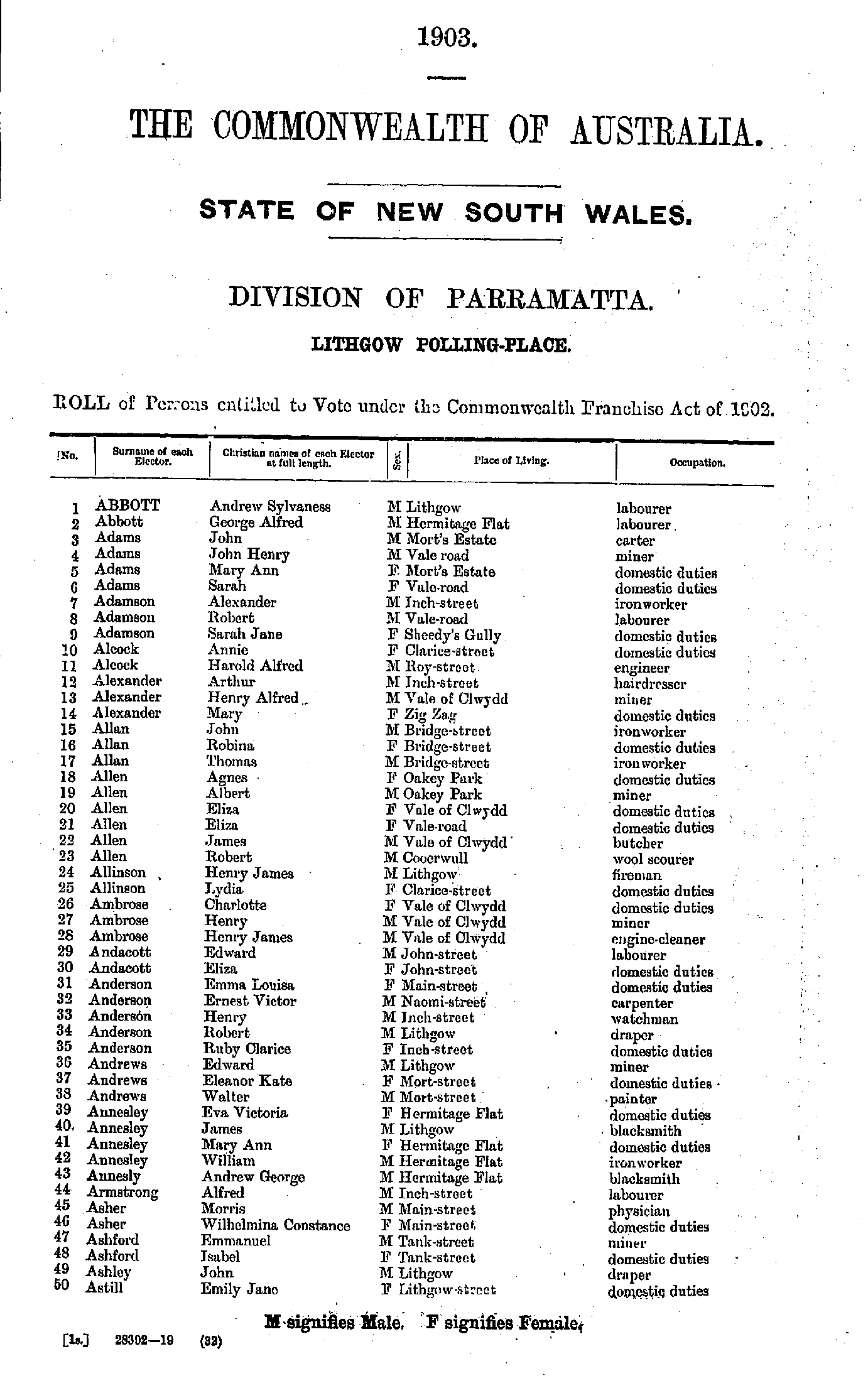
- Abbott Andrew - Astill Emily
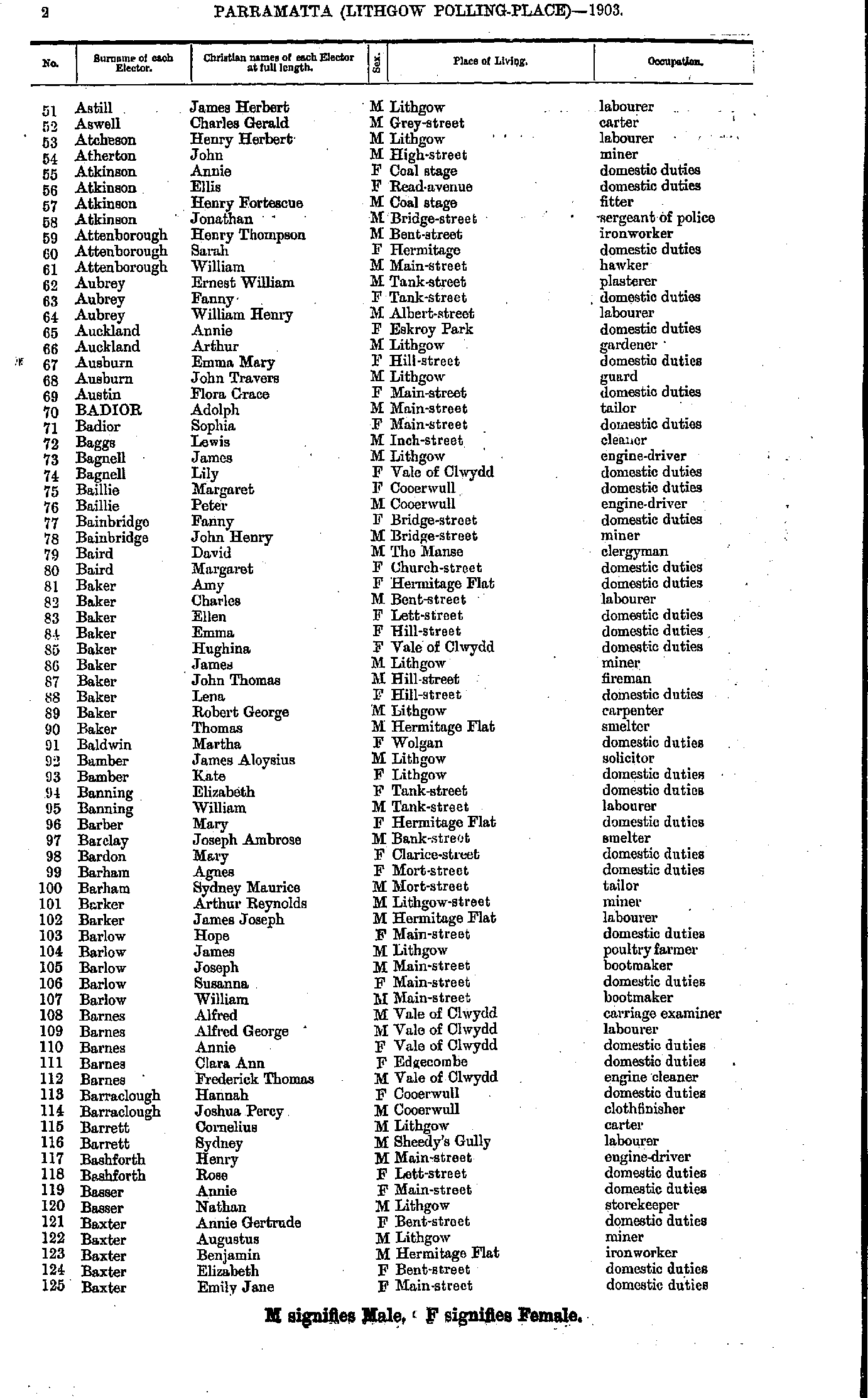
- Astill James - Baxter Emily
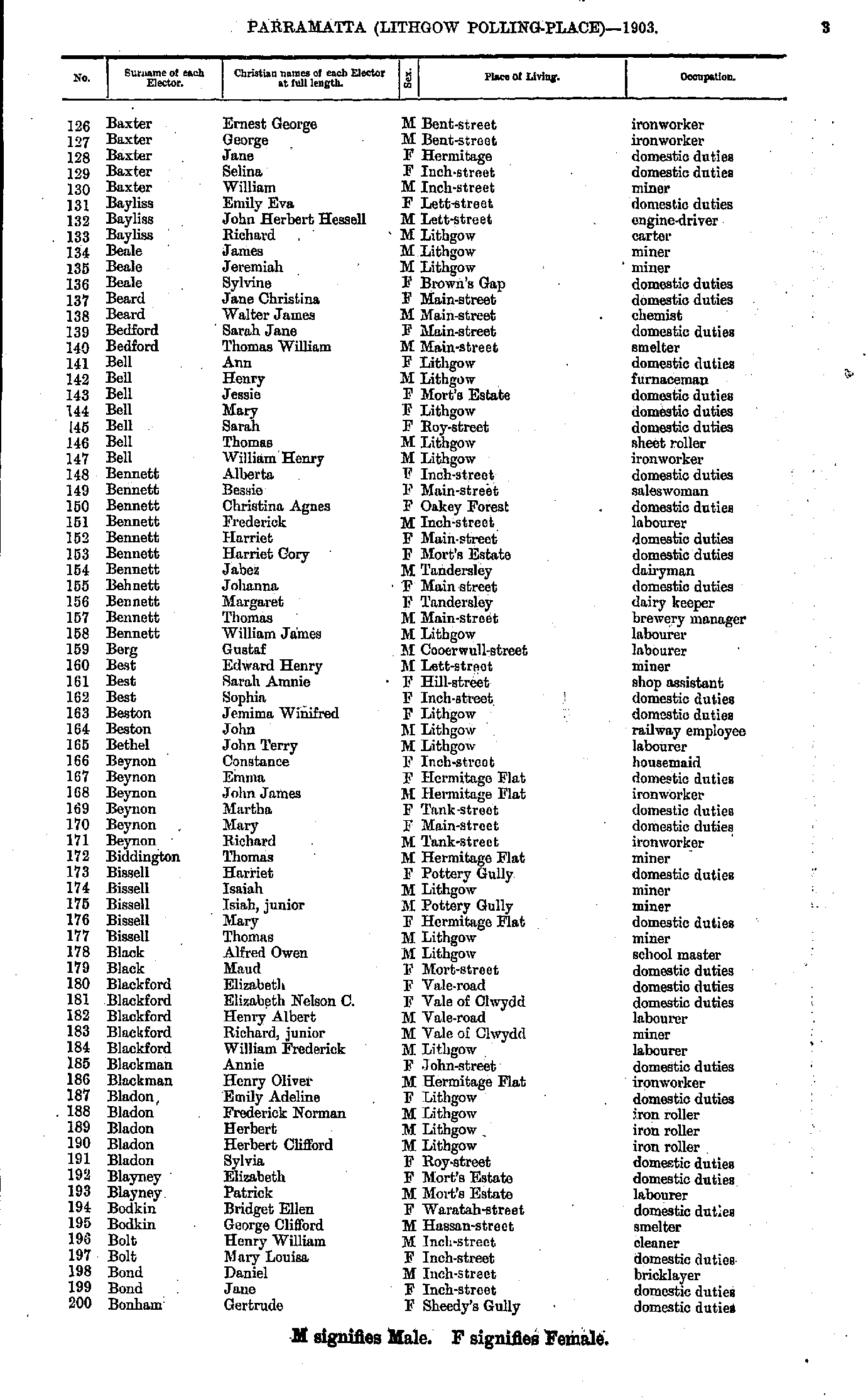
- Baxter Ernest - Bonham Gertrude
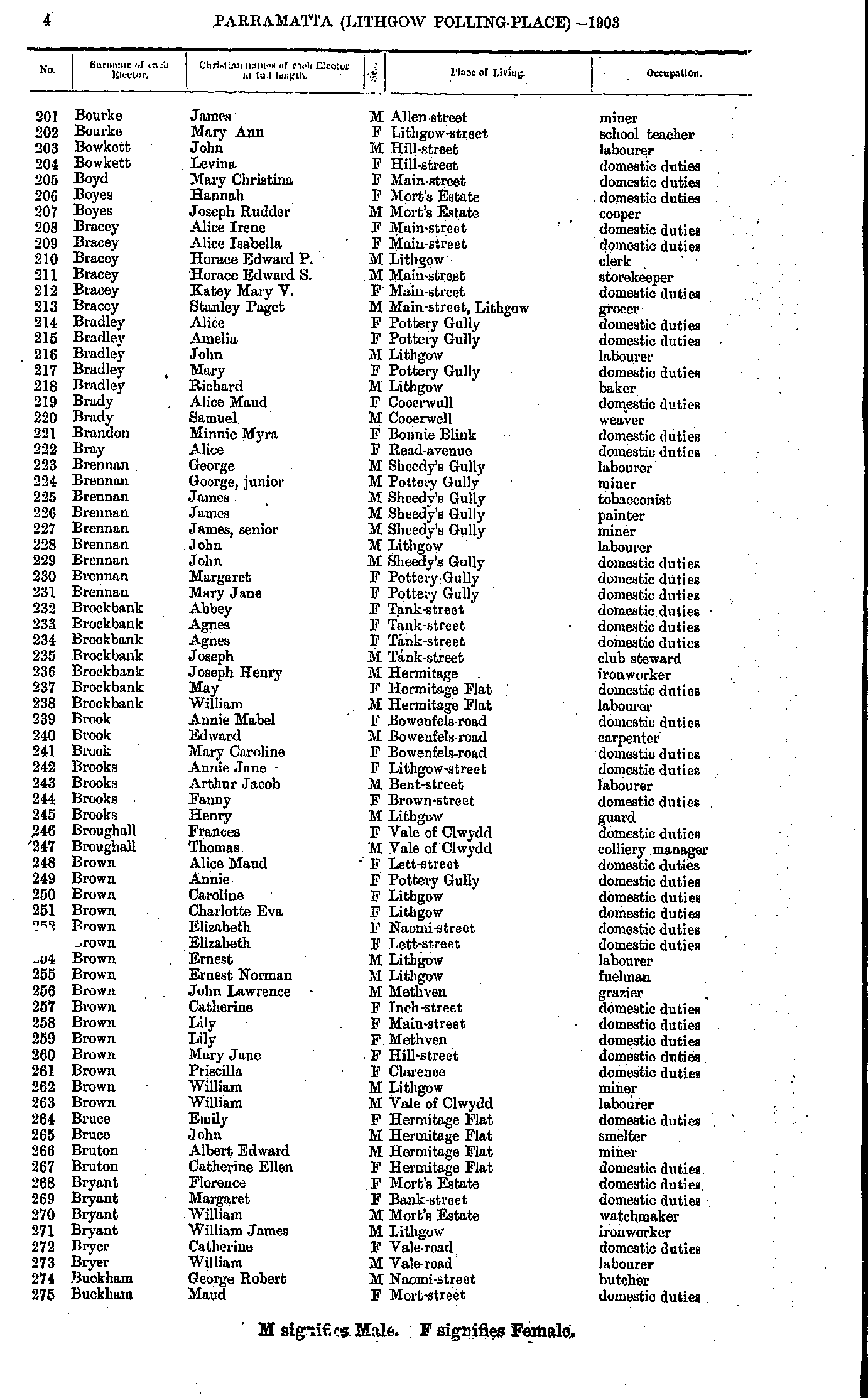
- Bourke James - Buckham Maud
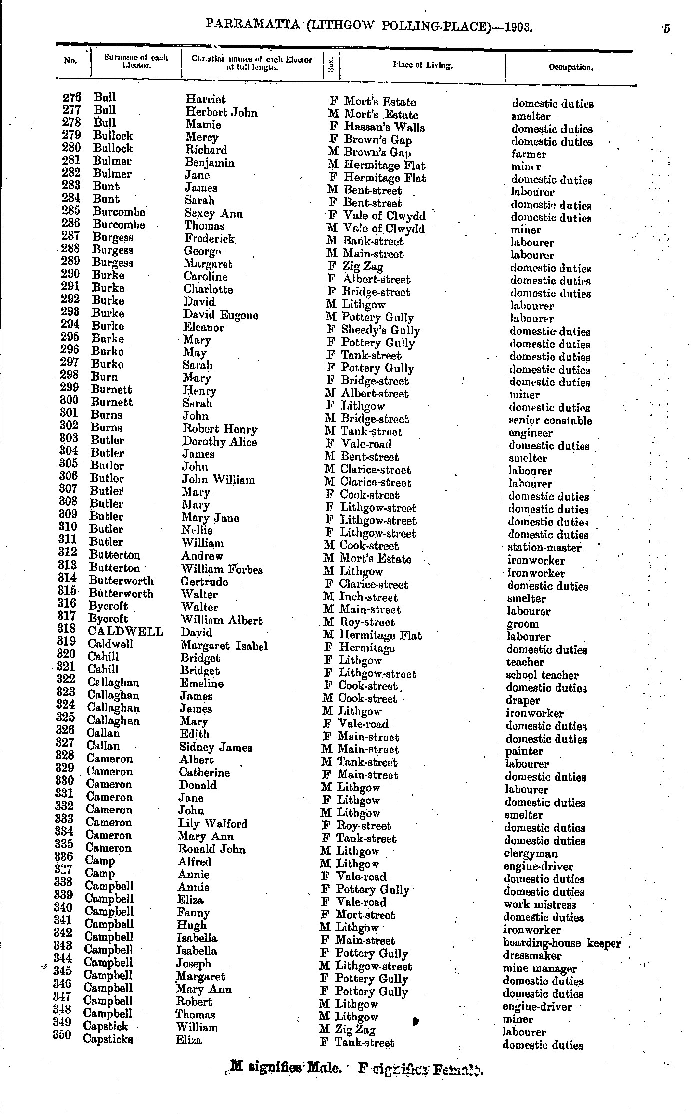
- Bull Harriet - Capsticks Eliza
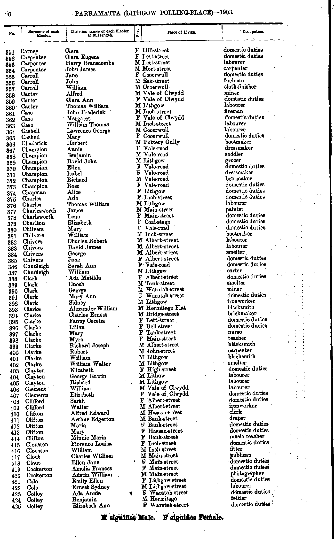
- Carney Clara - Colley Elizabeth
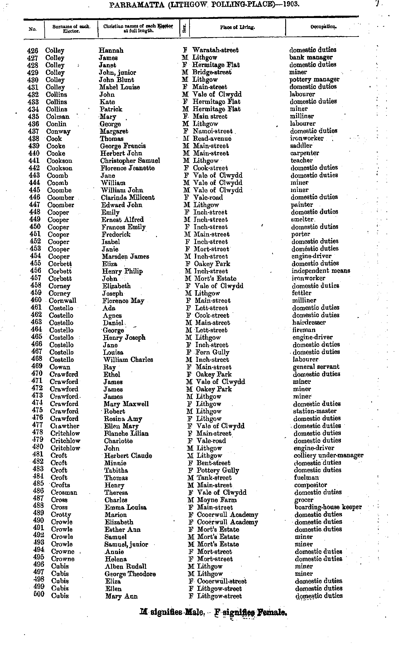
- Colley Hannah - Cubis Mary
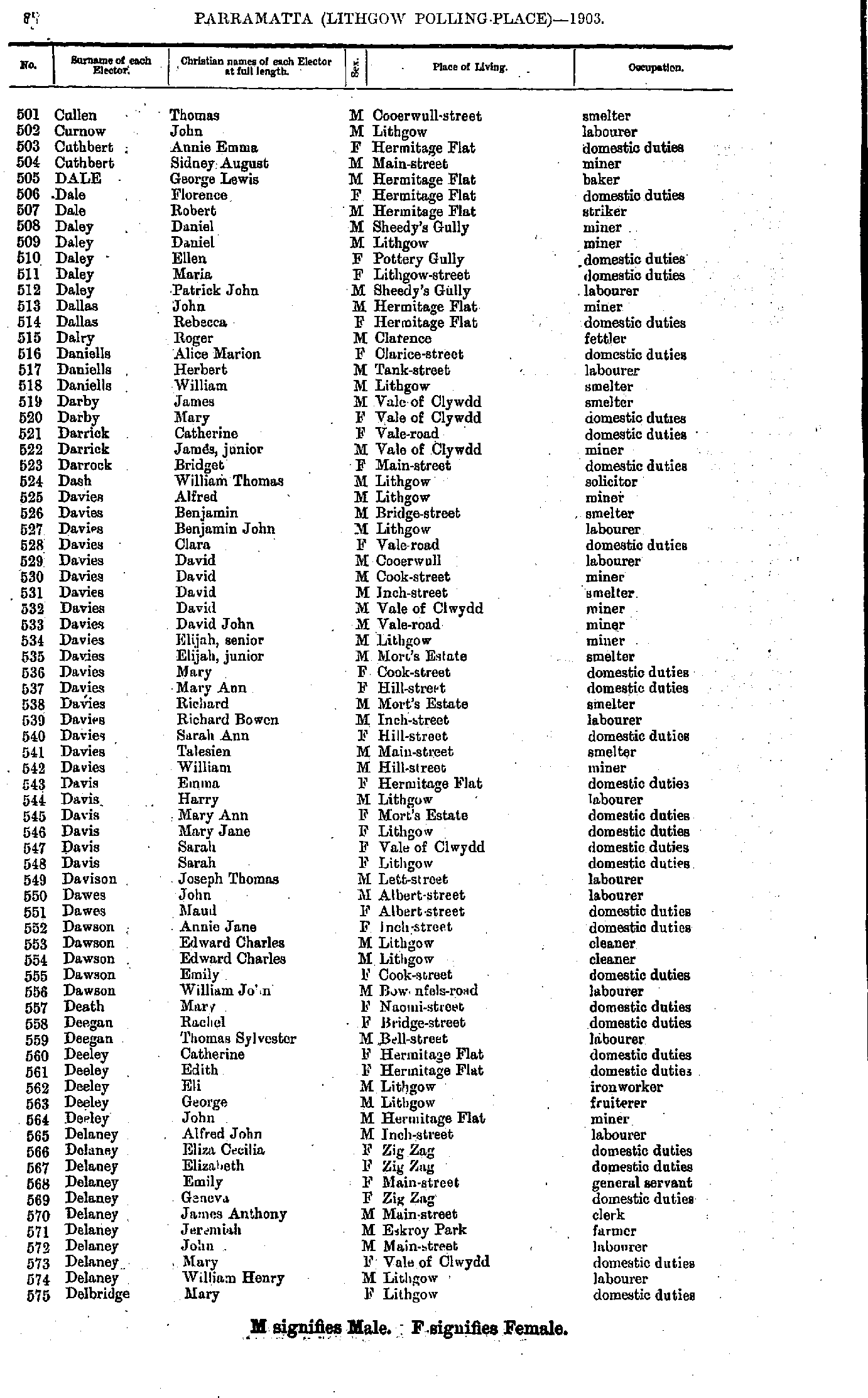
- Cullen Thomas - Delbridge Mary
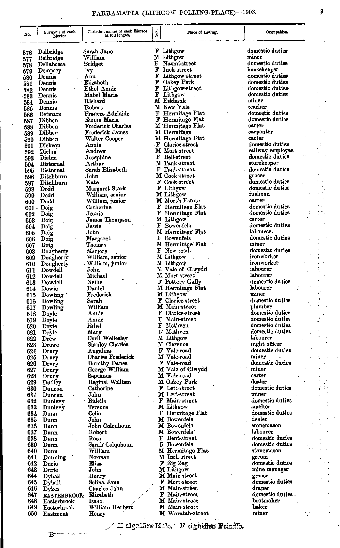
- Delbridge Sarah - Eastment Henry
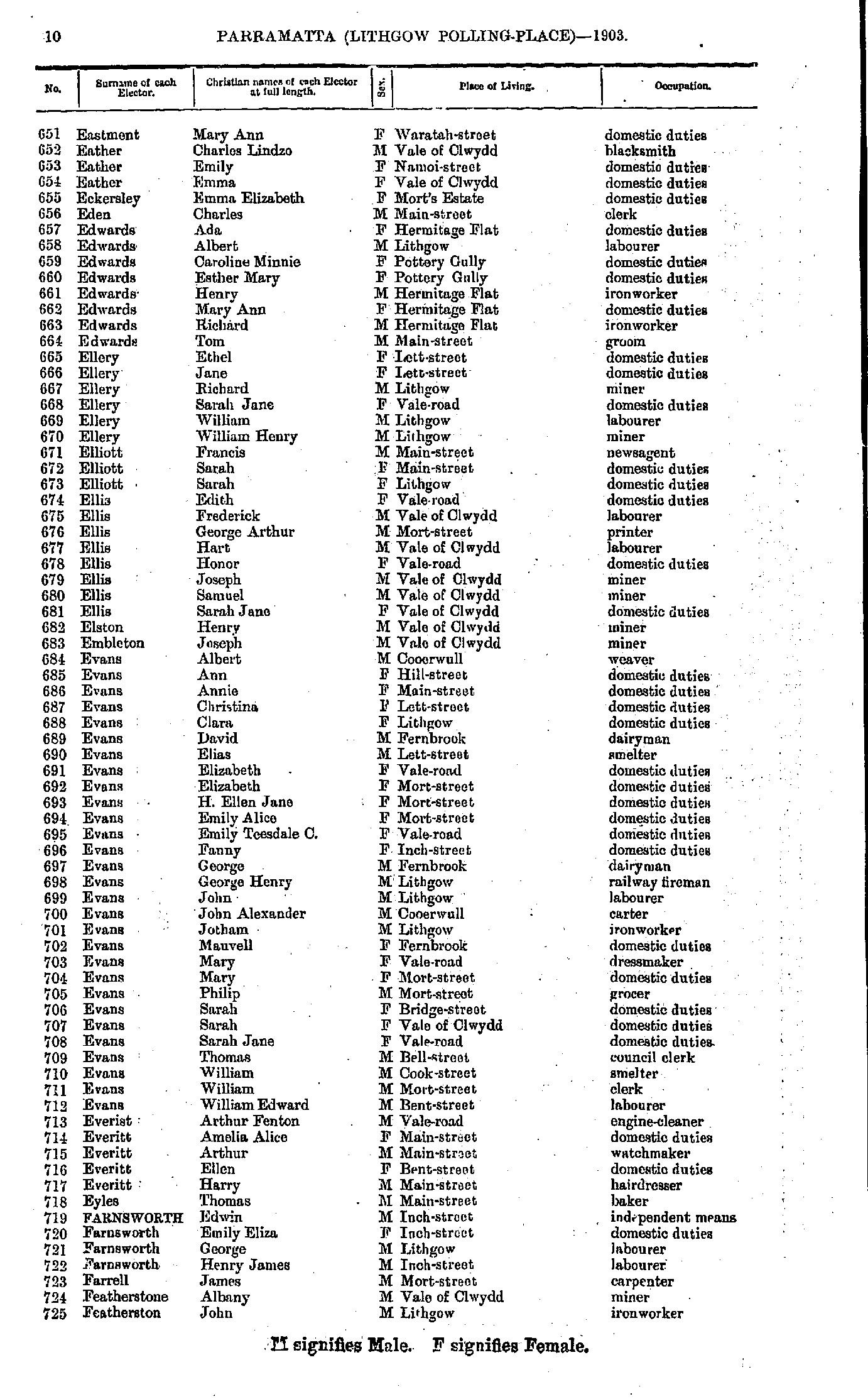
- Eastment Mary - Featherston John
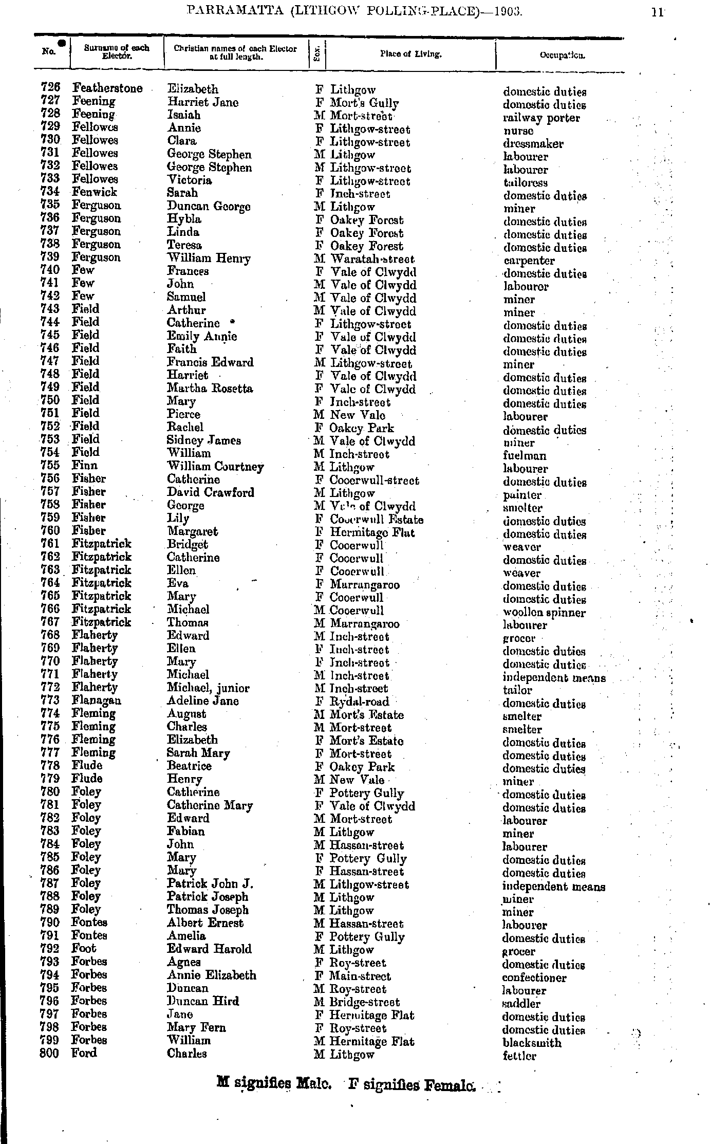
- Featherstone Elizabeth - Ford Charles
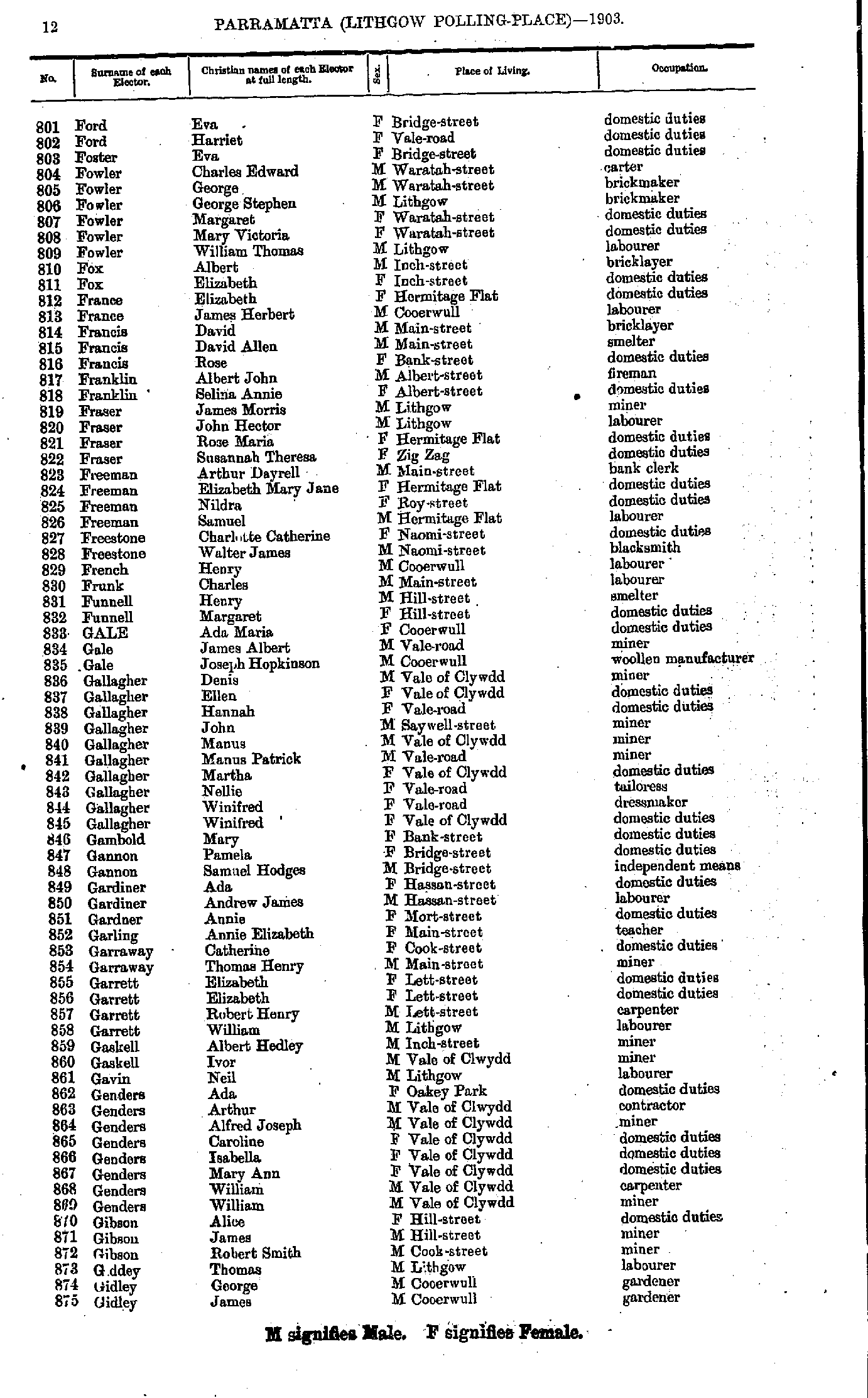
- Ford Eva - Gidley James
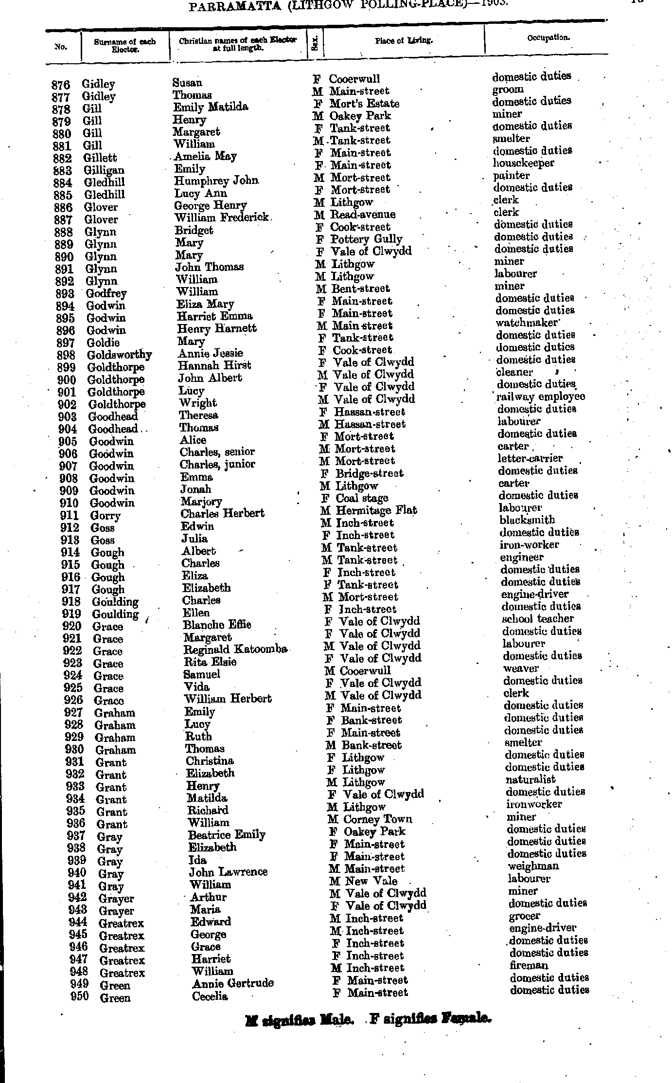
- Gidley Susan - Green Cecelia
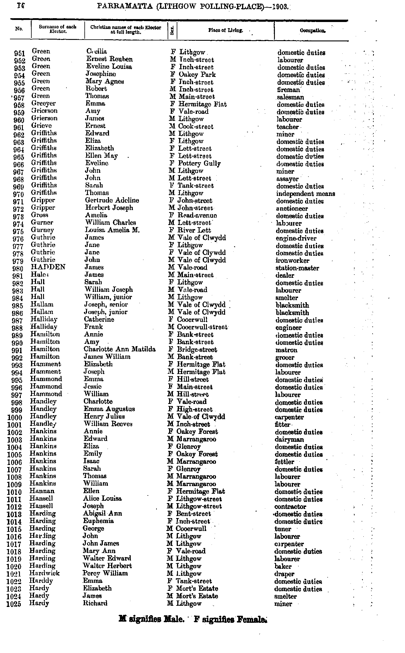
- Green Cecilia - Hardy Richard
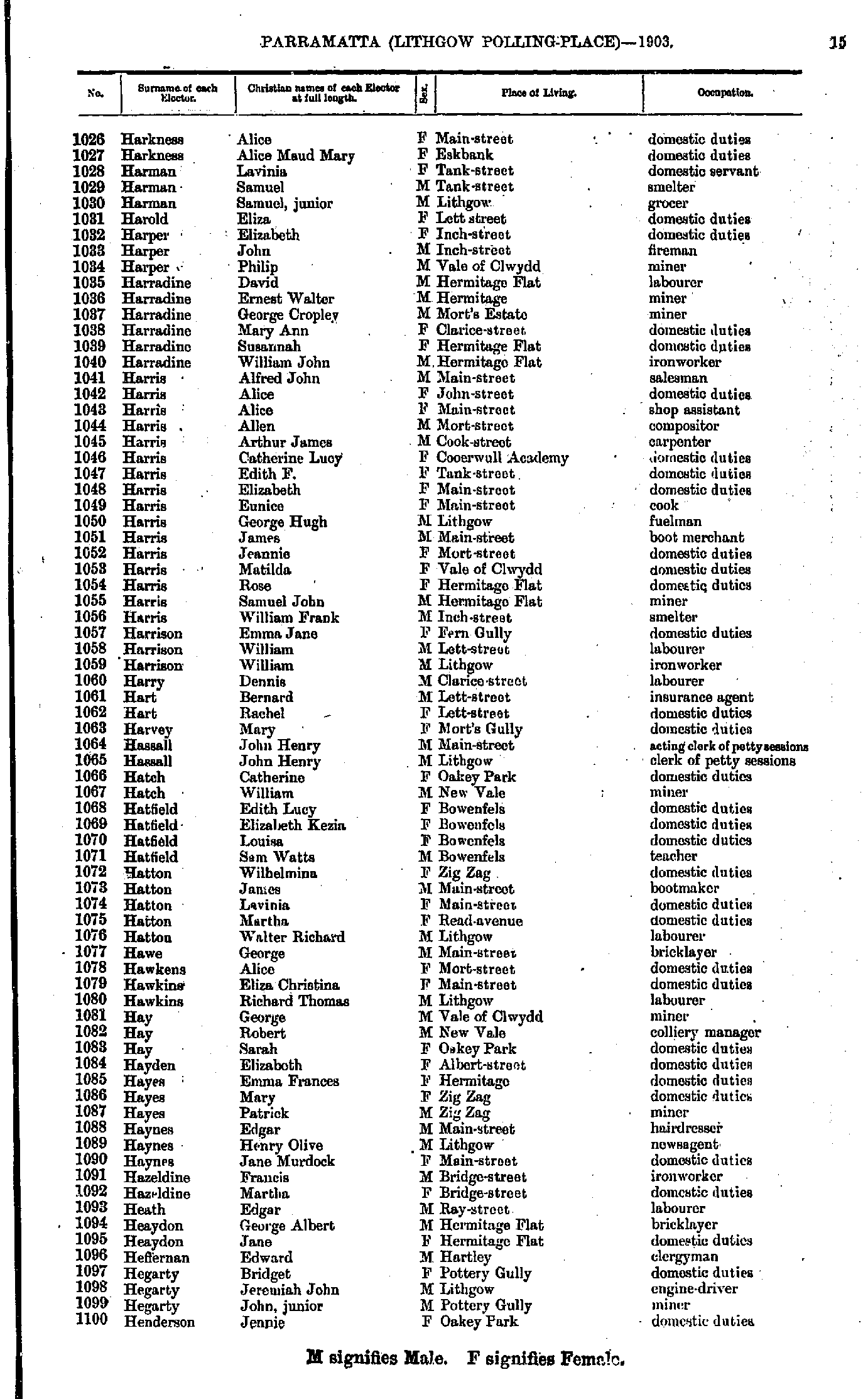
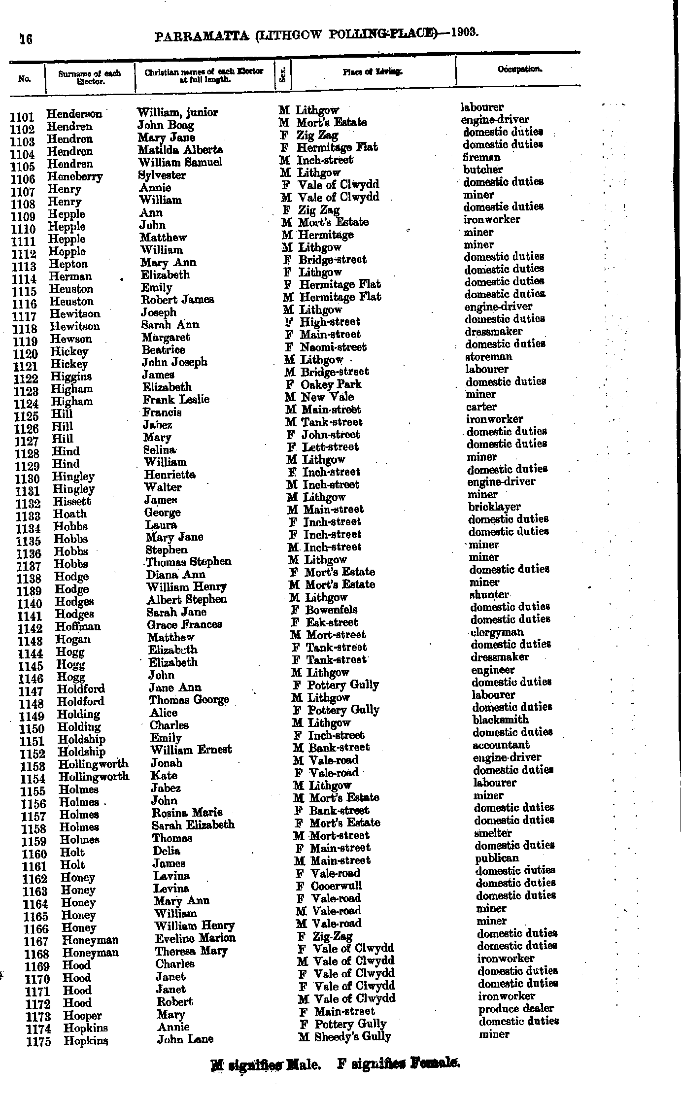
- Harkness Alice - Henderson Jennie
- Henderson William - Hopkins John
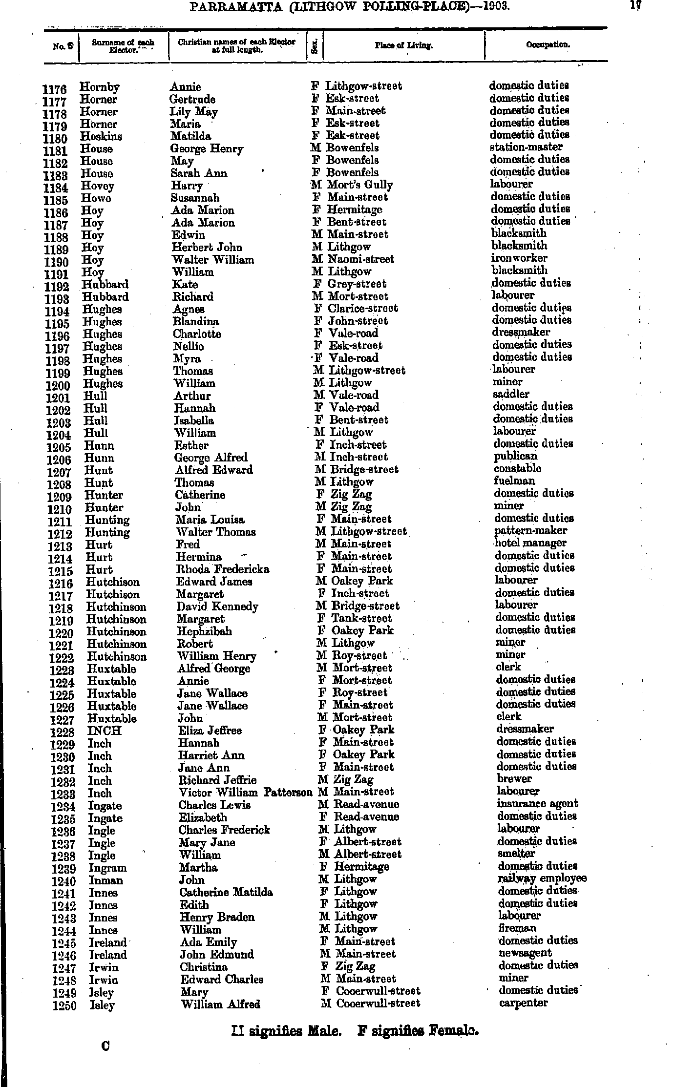
- Hornby Annie - Isley William
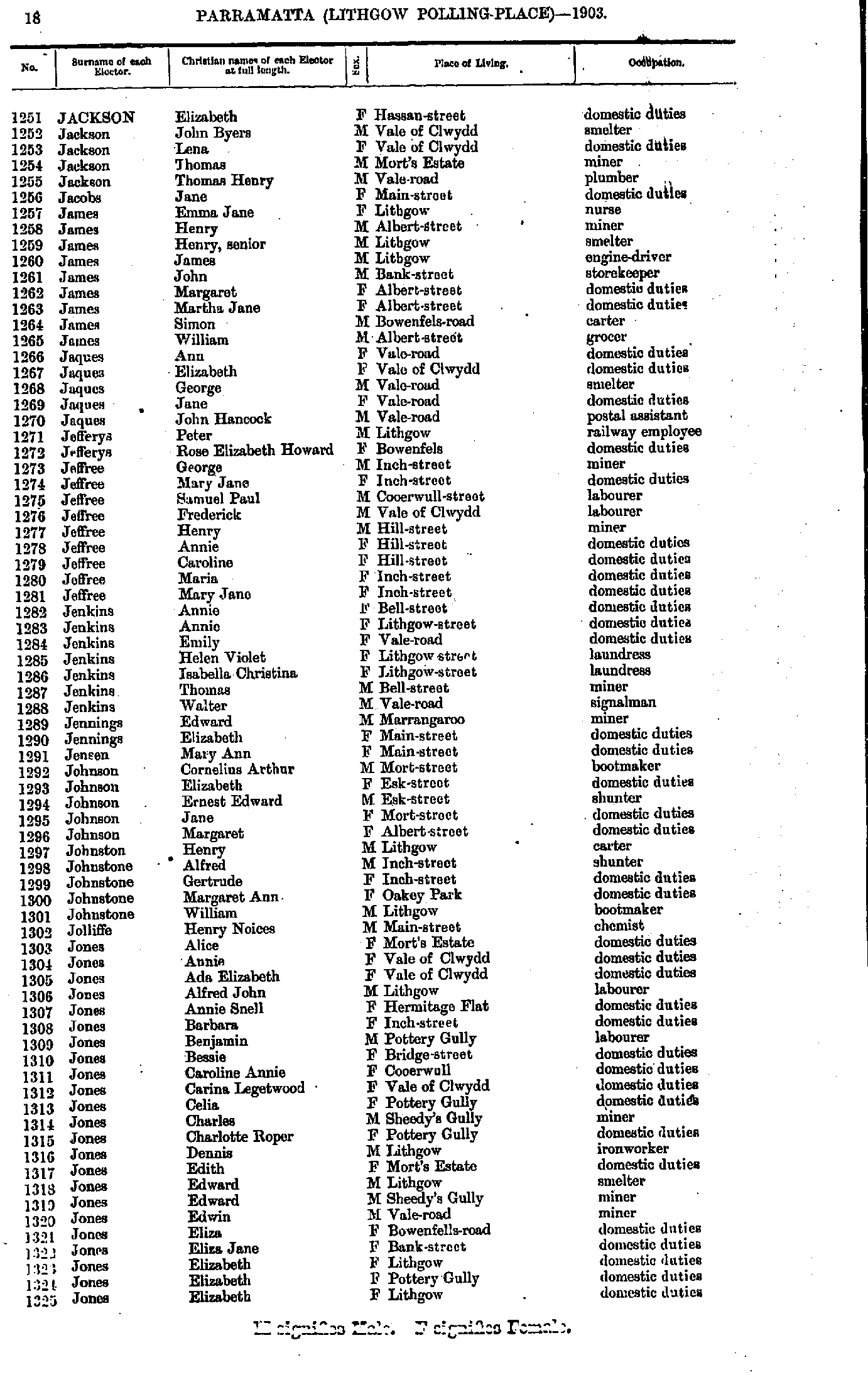
- Jackson Elizabeth - Jones Elizabeth
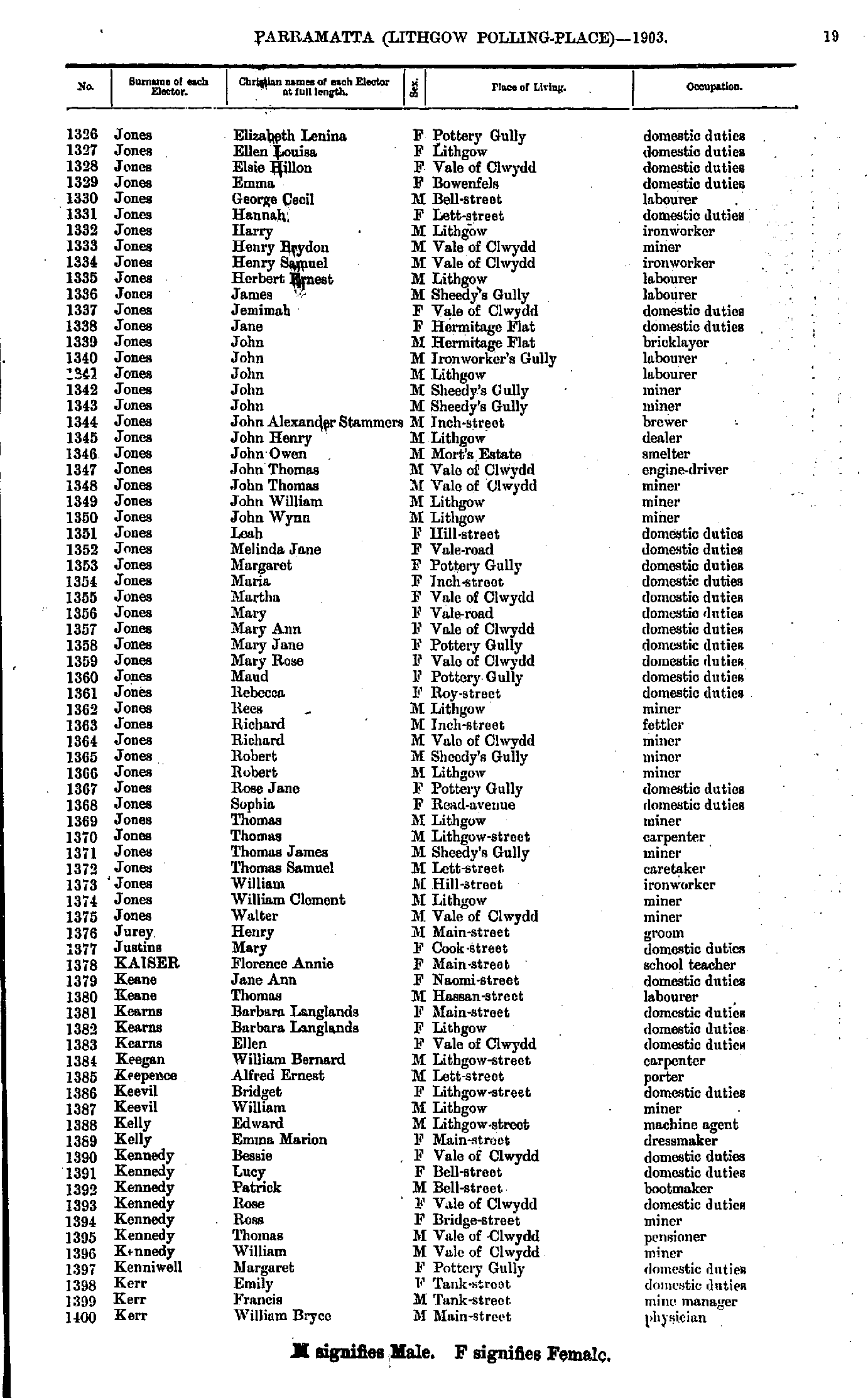
- Jones Elizabeth - Kerr William
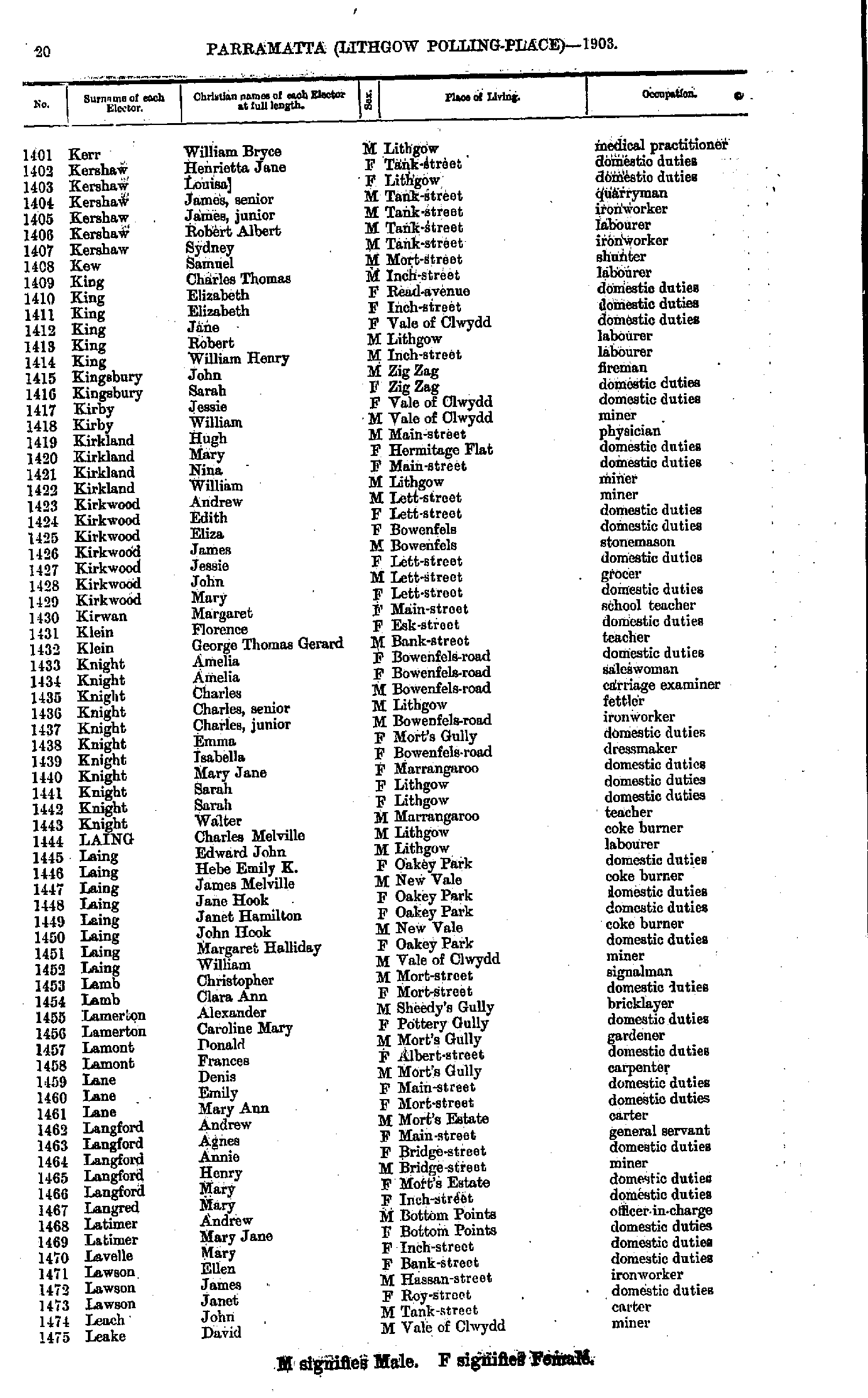
- Kerr William - Leake David
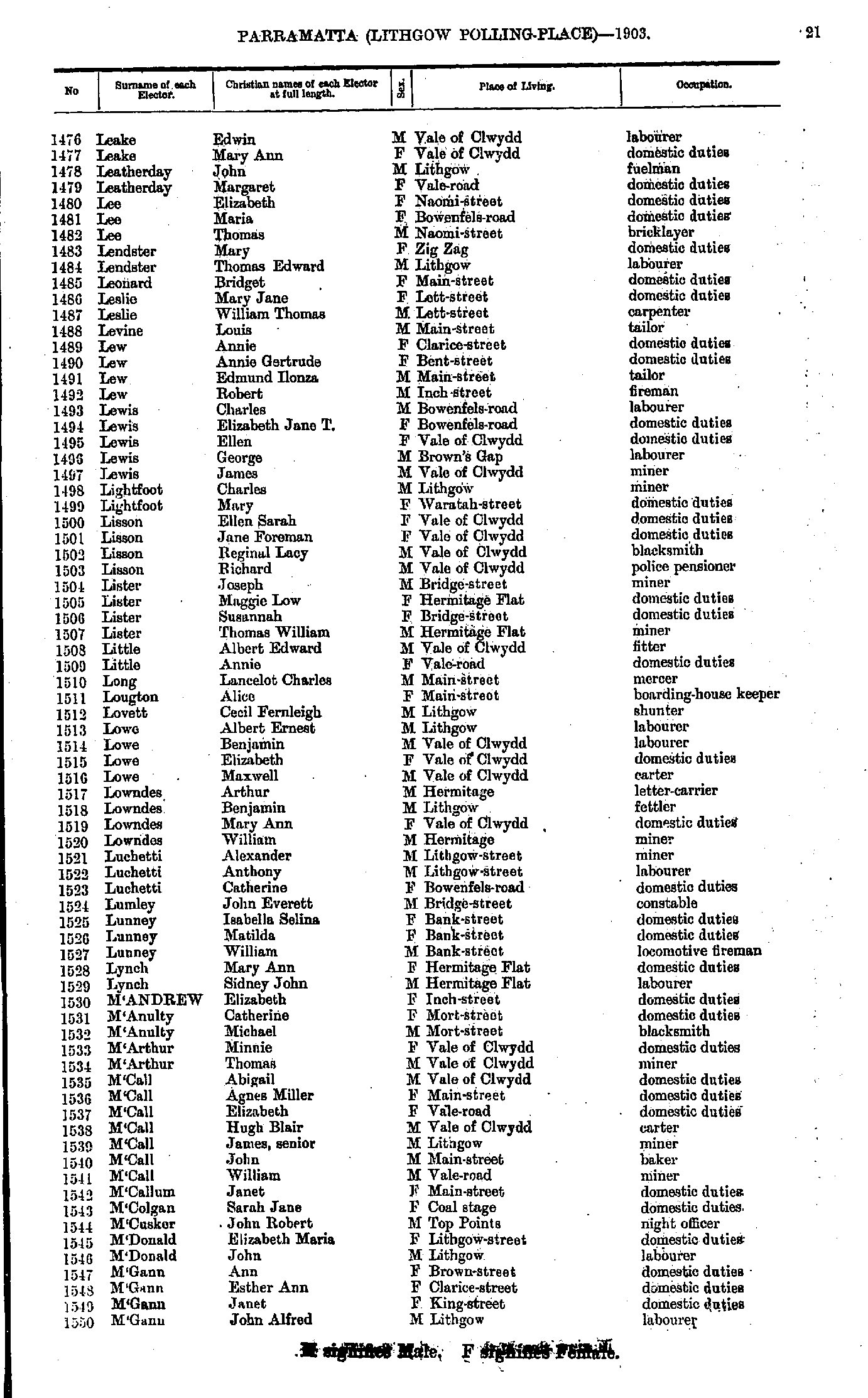
- Leake Edwin - M'Gann John
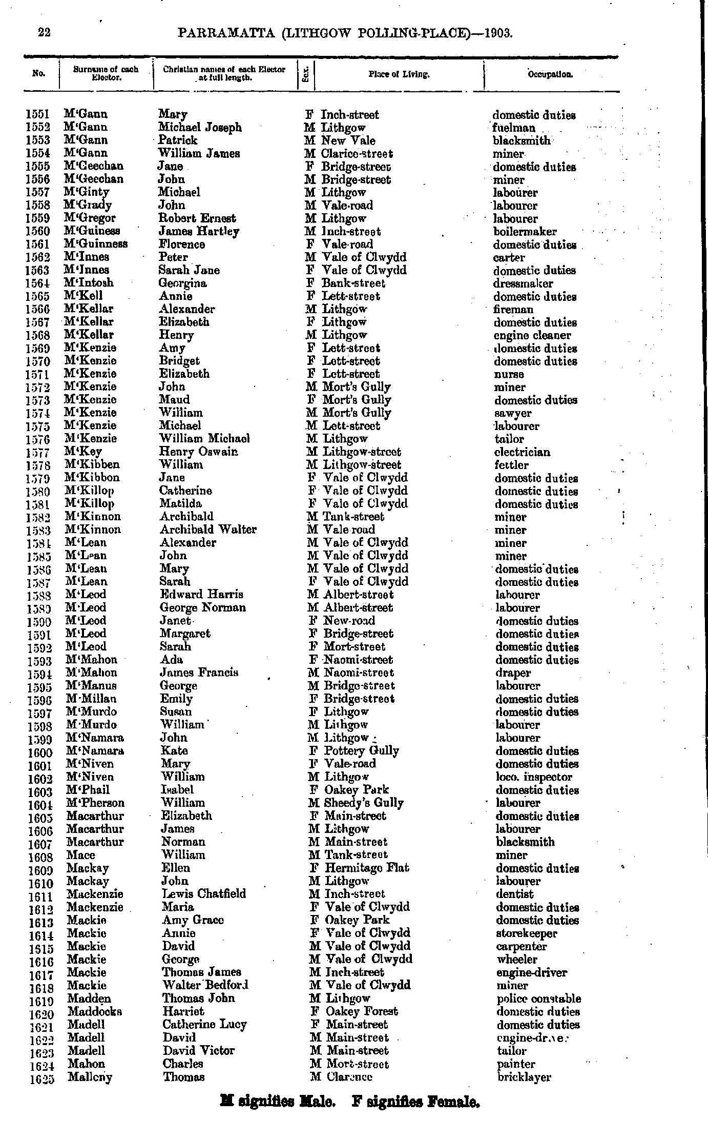
- M'Gann Mary - Malleny Thomas
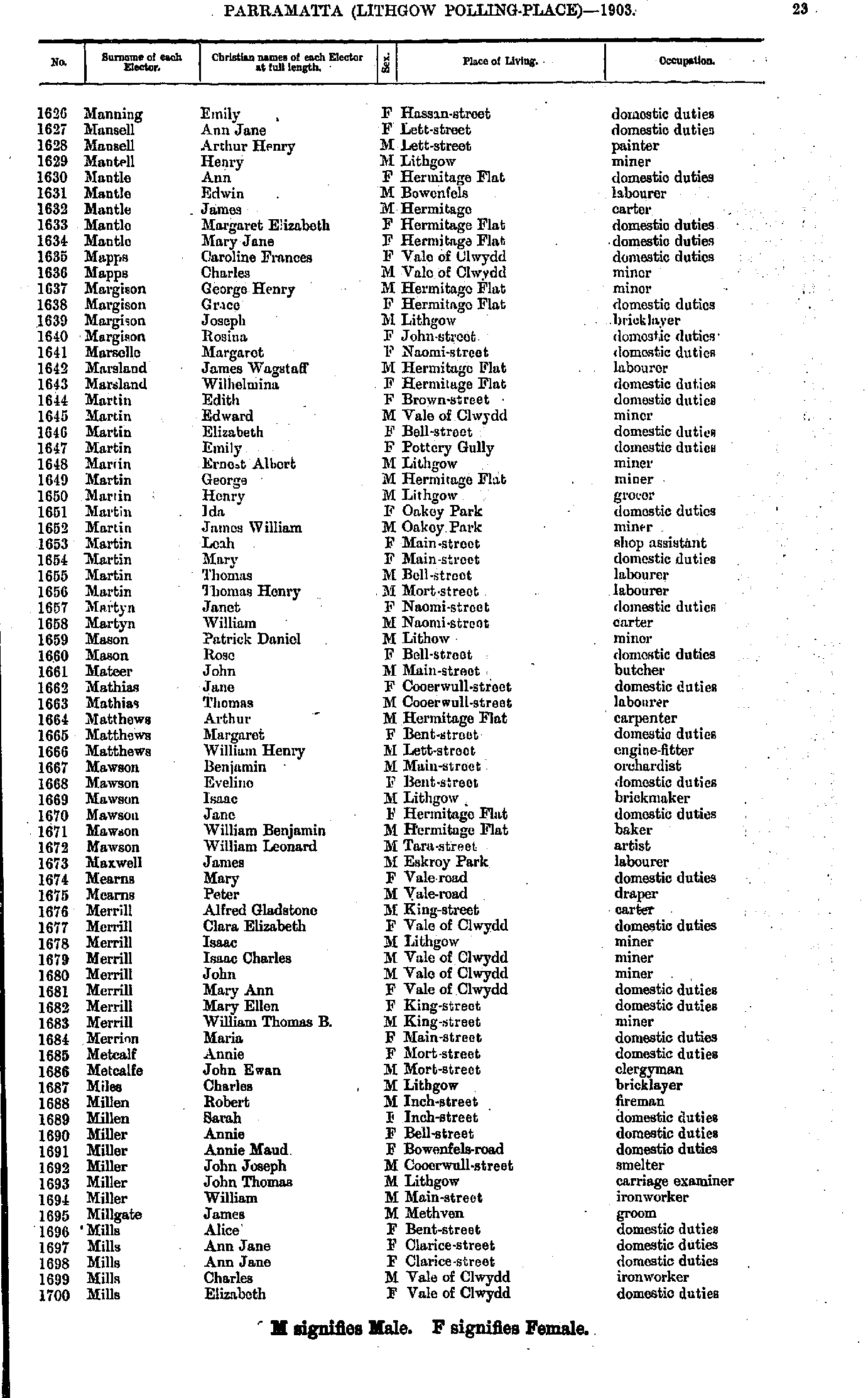
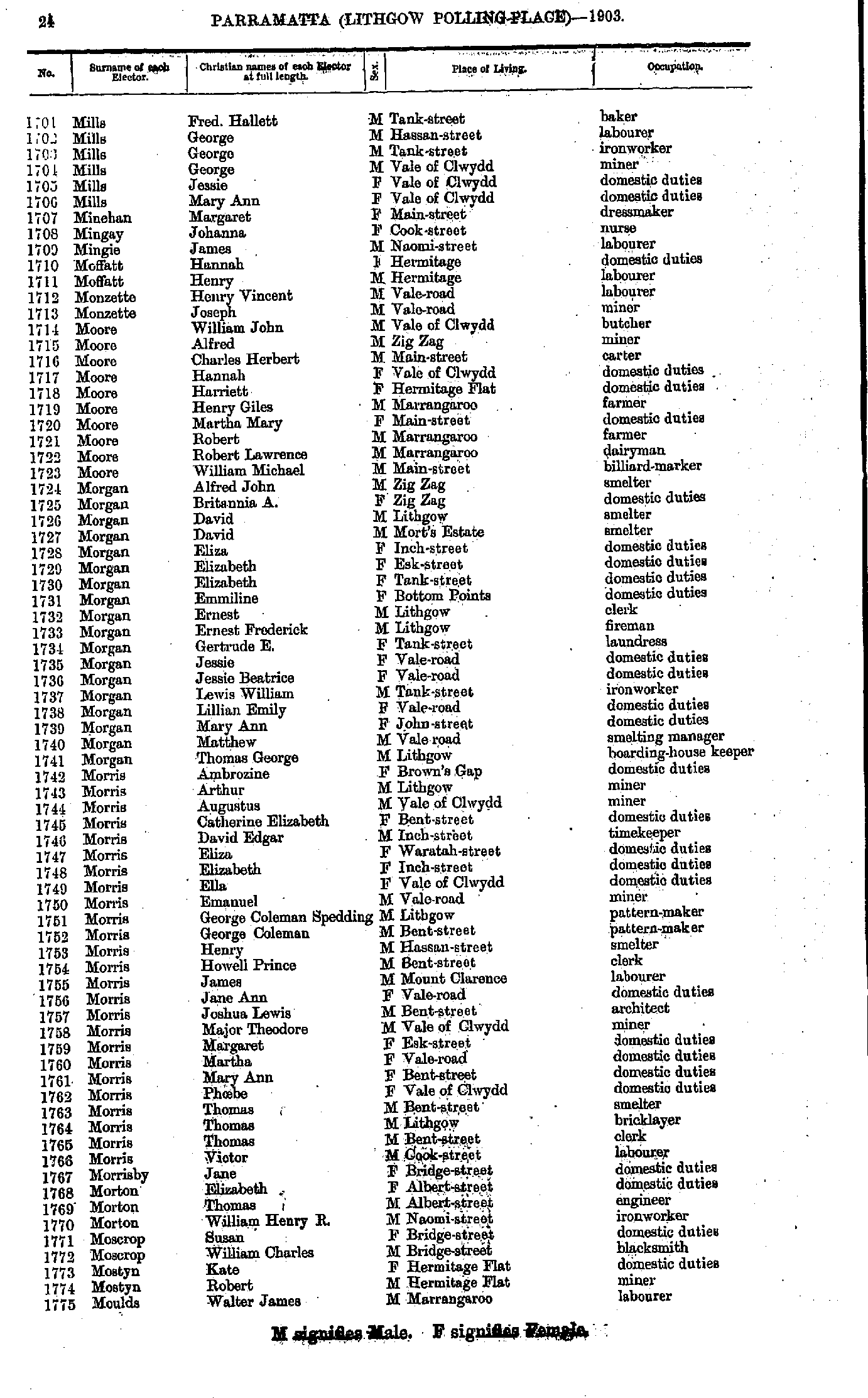
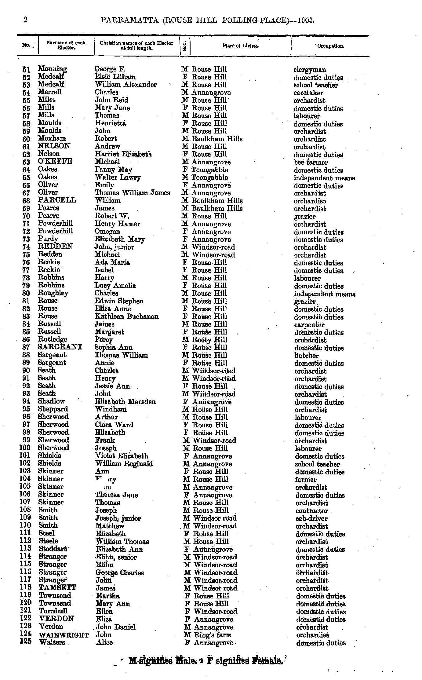
- Manning Emily - Mills Elizabeth
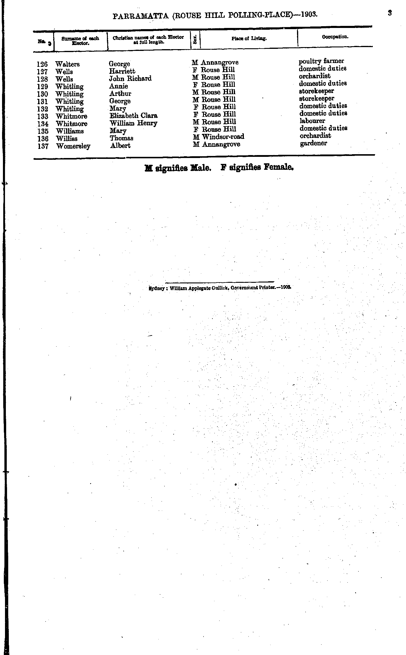
- Mills Fred - Moulds Walter
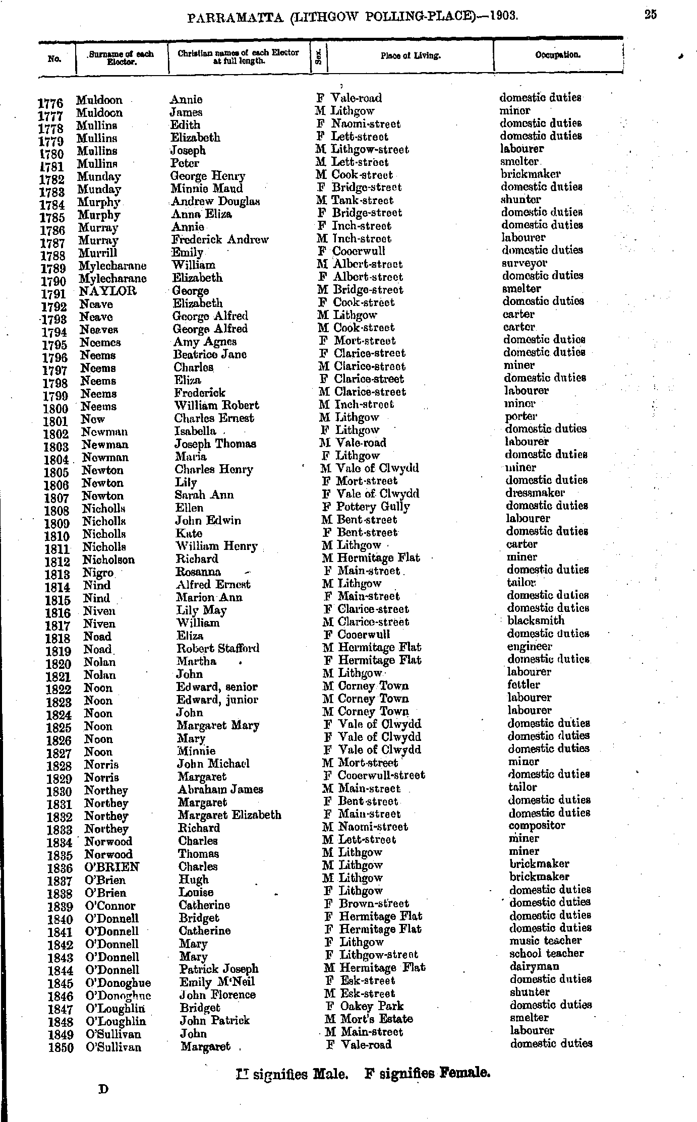
- Muldoon Annie - O'Sullivan Margaret
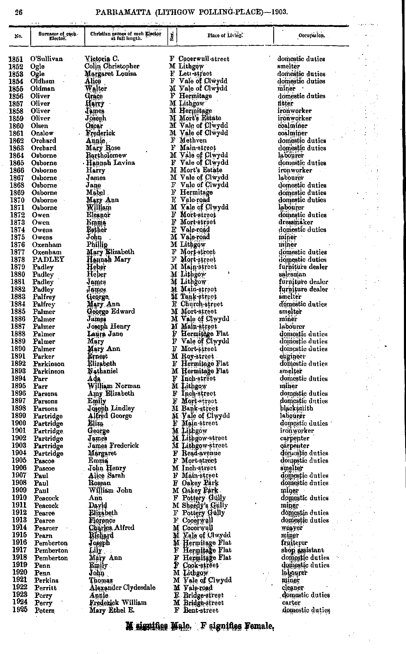
- O'Sullivan Victoria - Peters Mary
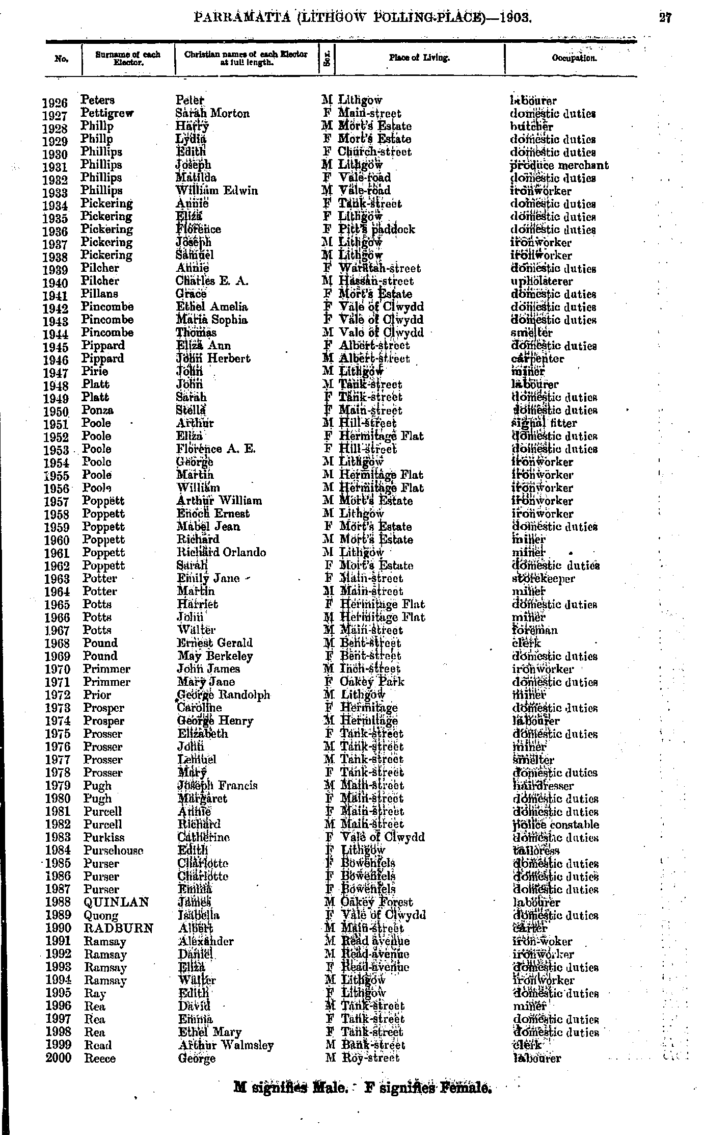
- Peters Peter - Reece George
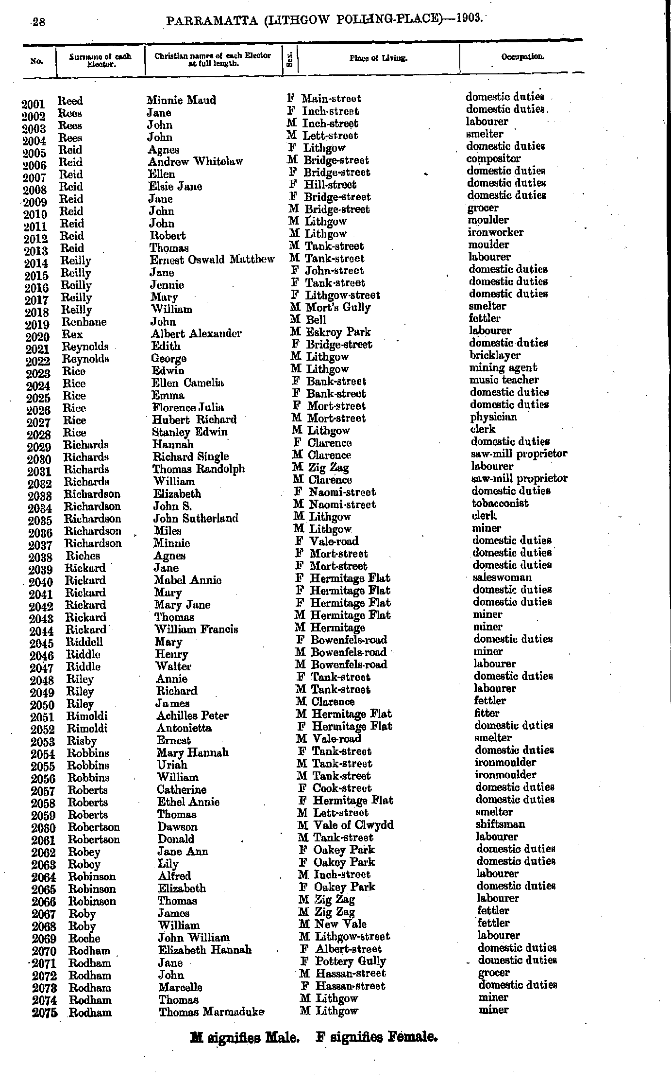
- Reed Minnie - Rodham Thomas
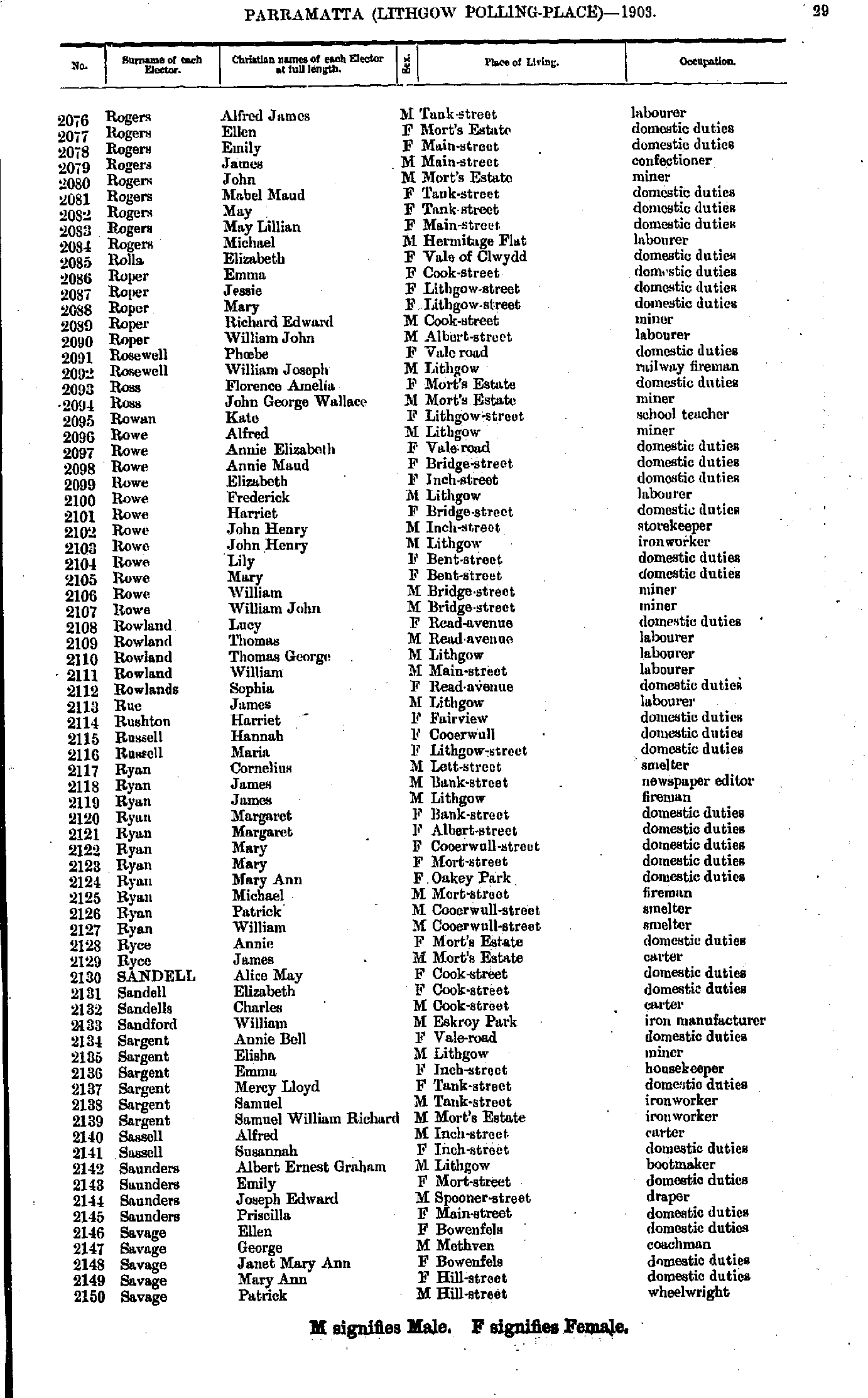
- Rogers Alfred - Savage Patrick
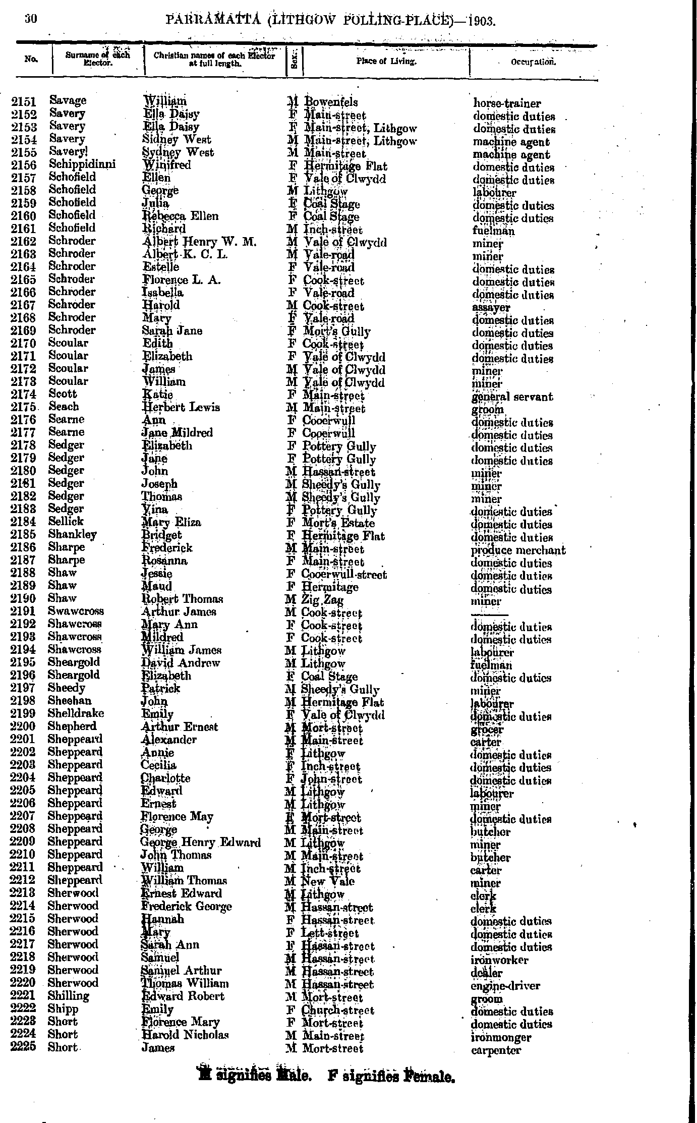
- Savage William - Short James
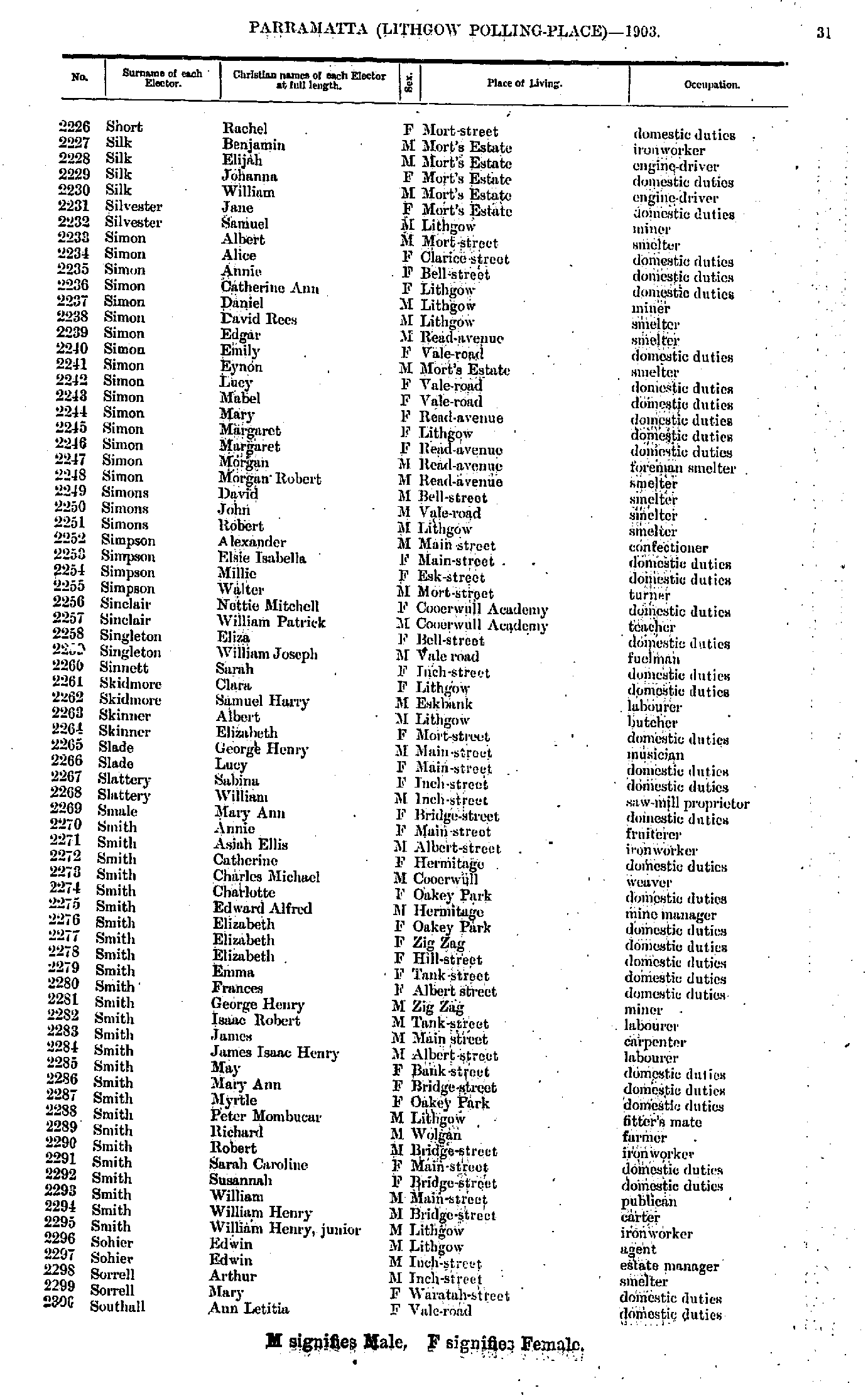
- Short Rachel - Southall Ann
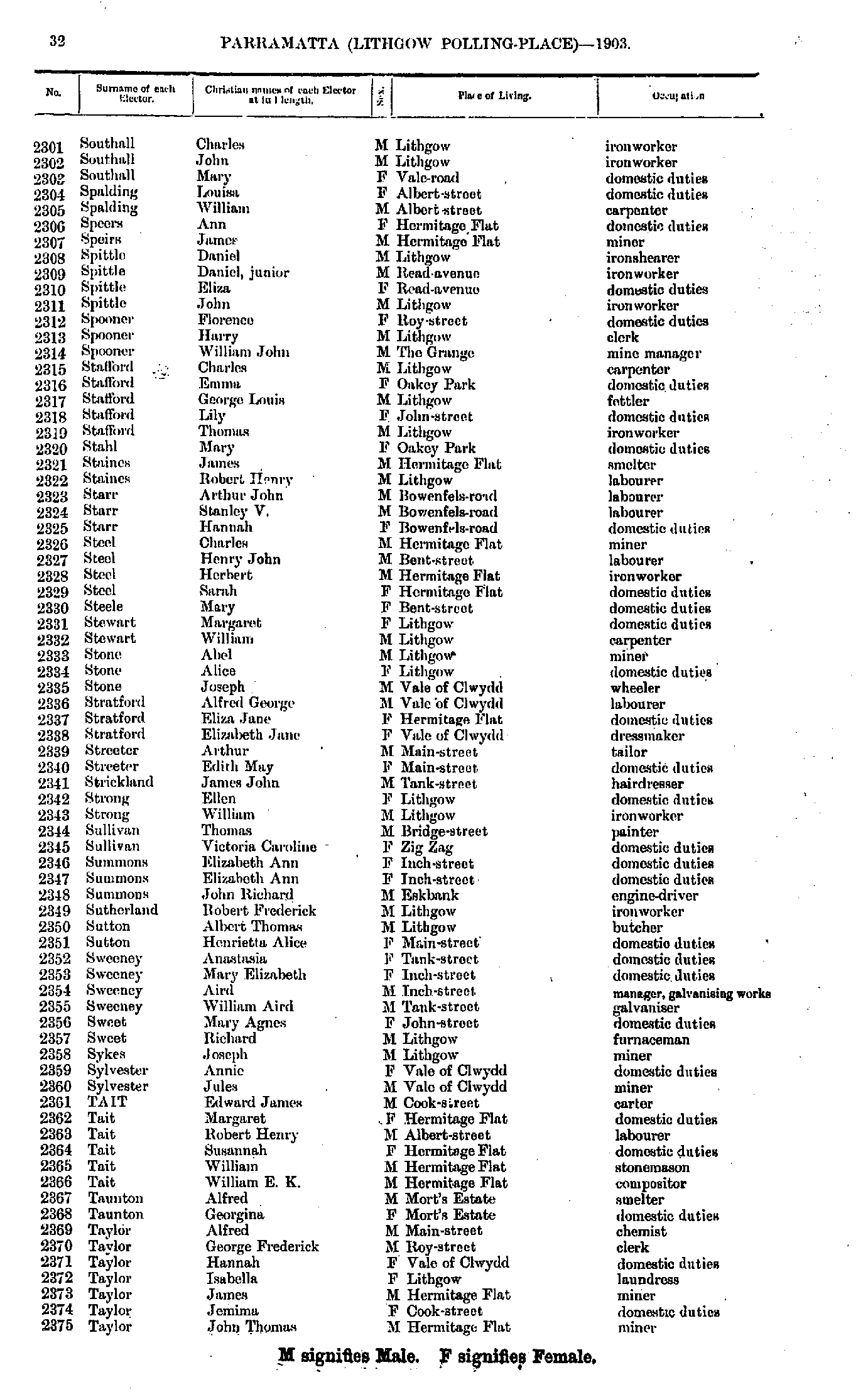
- Southall Charles - Taylor John
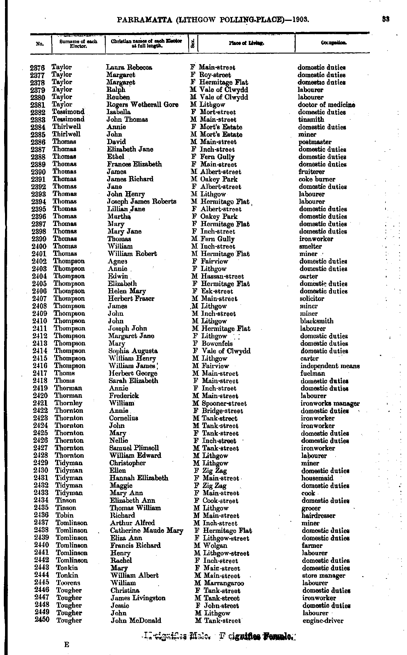
- Taylor Laura - Tougher John
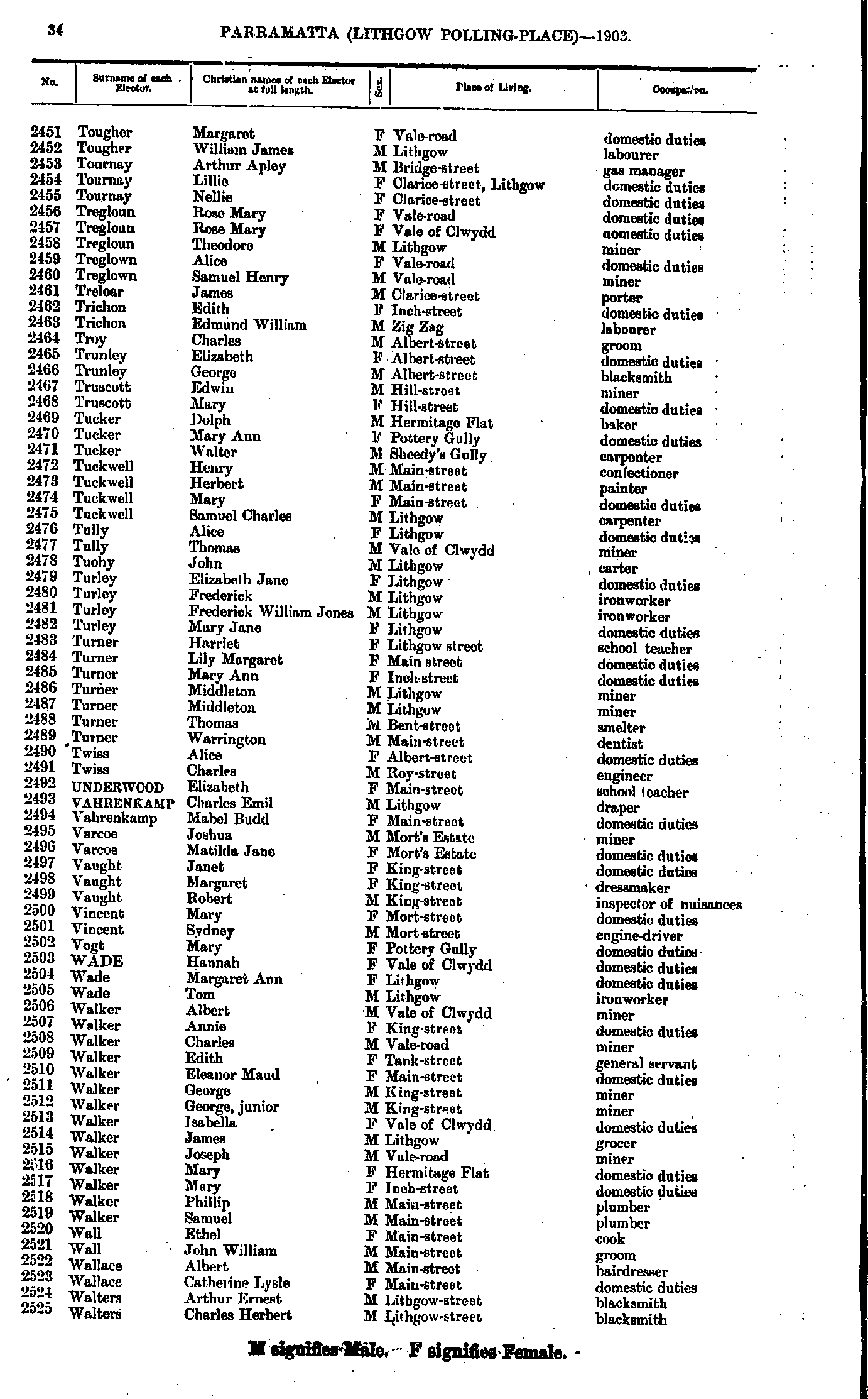
- Tougher Margaret - Walters Charles
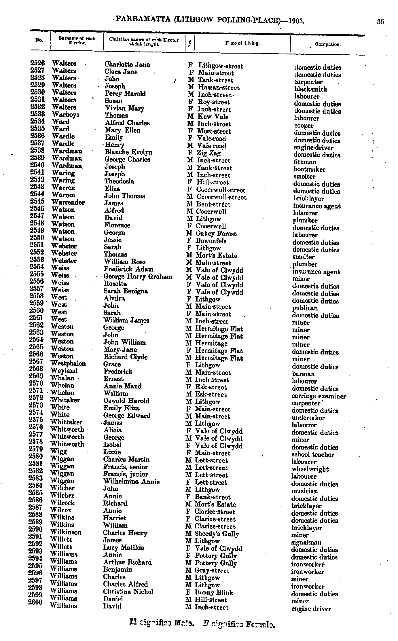
- Walters Charlotte - Williams David
- Williams David - Yates George
- Young Alice - Young William
- Adams Ada - Babbage James
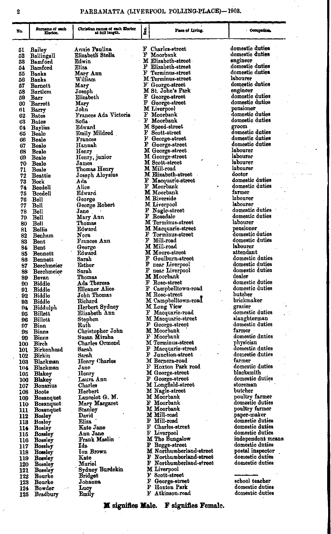
- Bailey Annie - Bradbury Emily
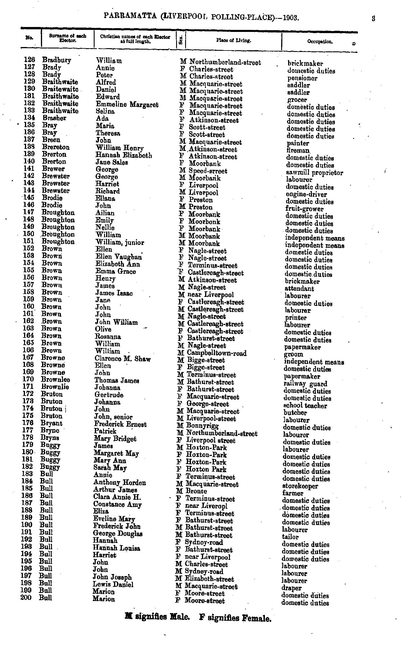
- Bradbury William - Bull Marion
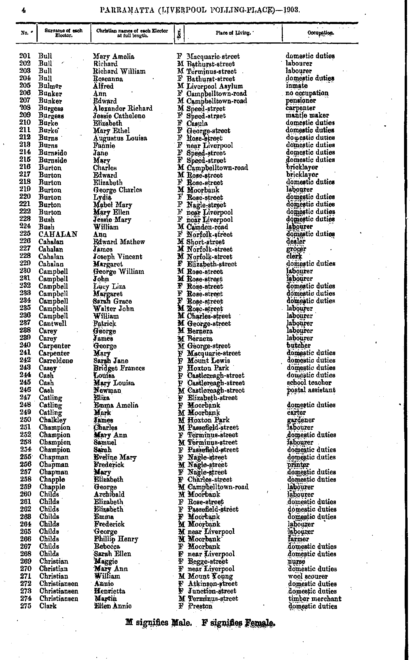
- Bull Mary - Clark Ellen
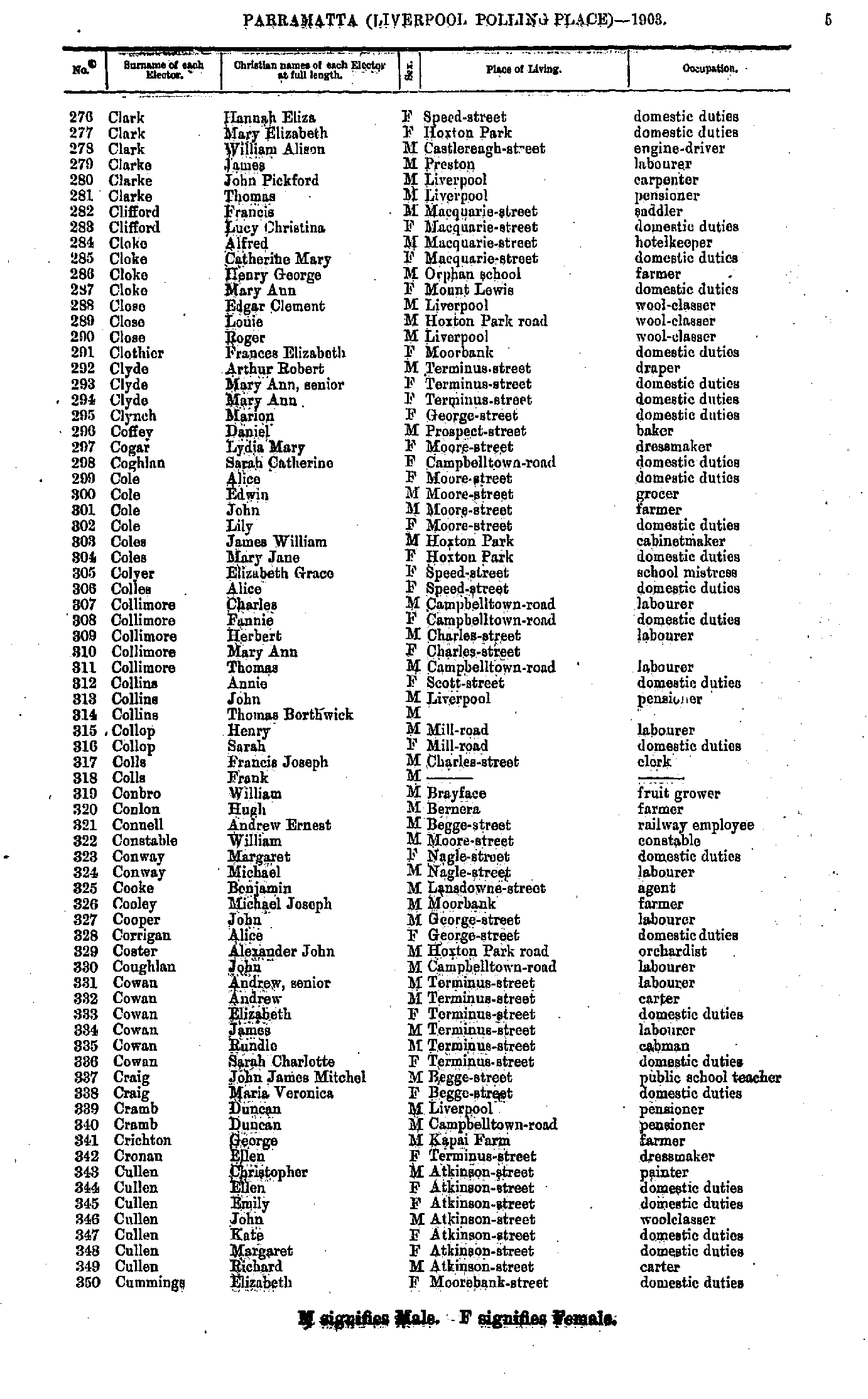
- Clark Hannah - Cummings Elizabeth
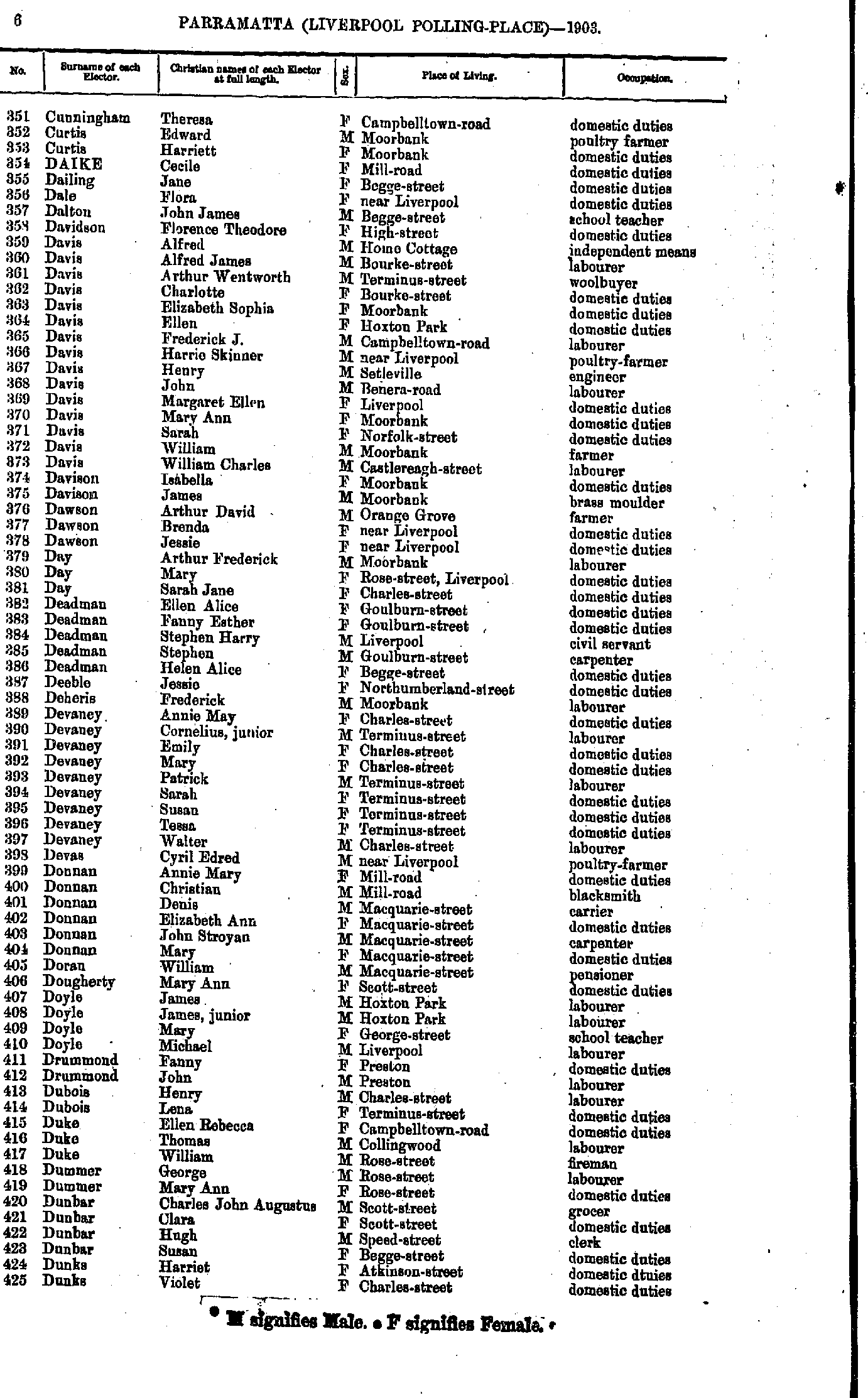
- Cunningham Theresa - Dunks Violet
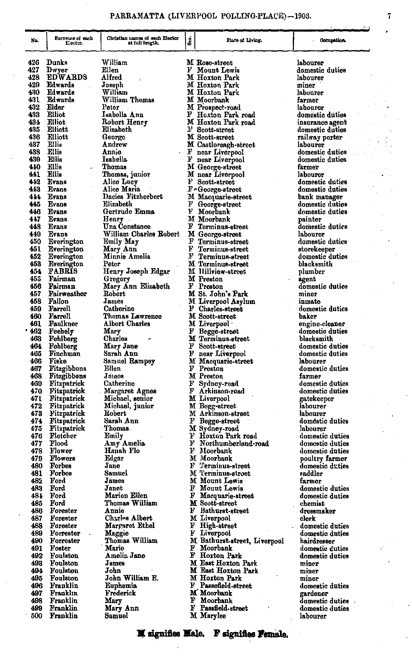
- Dunks William - Franklin Samuel
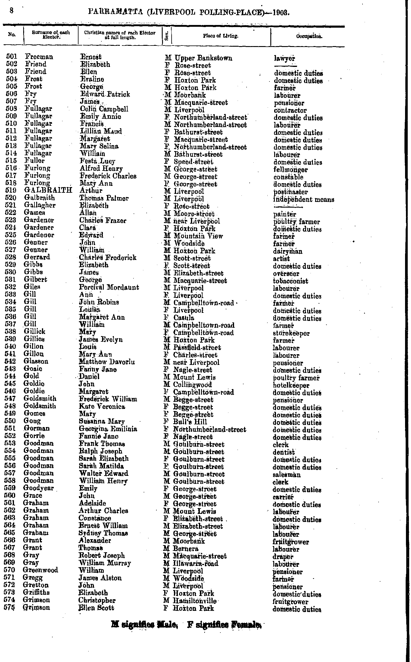
- Freeman Ernest - Grimson Ellen
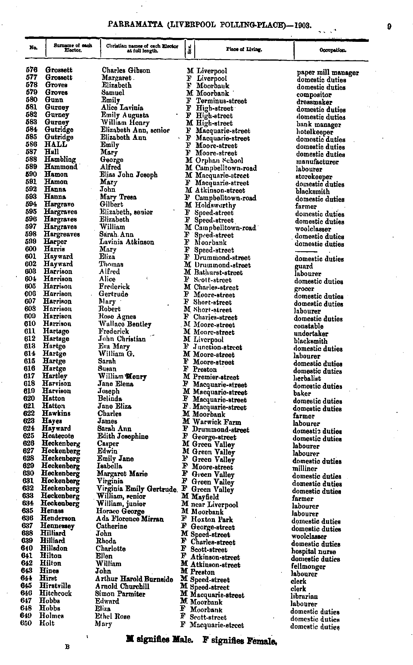
- Grossett Charles - Holt Mary
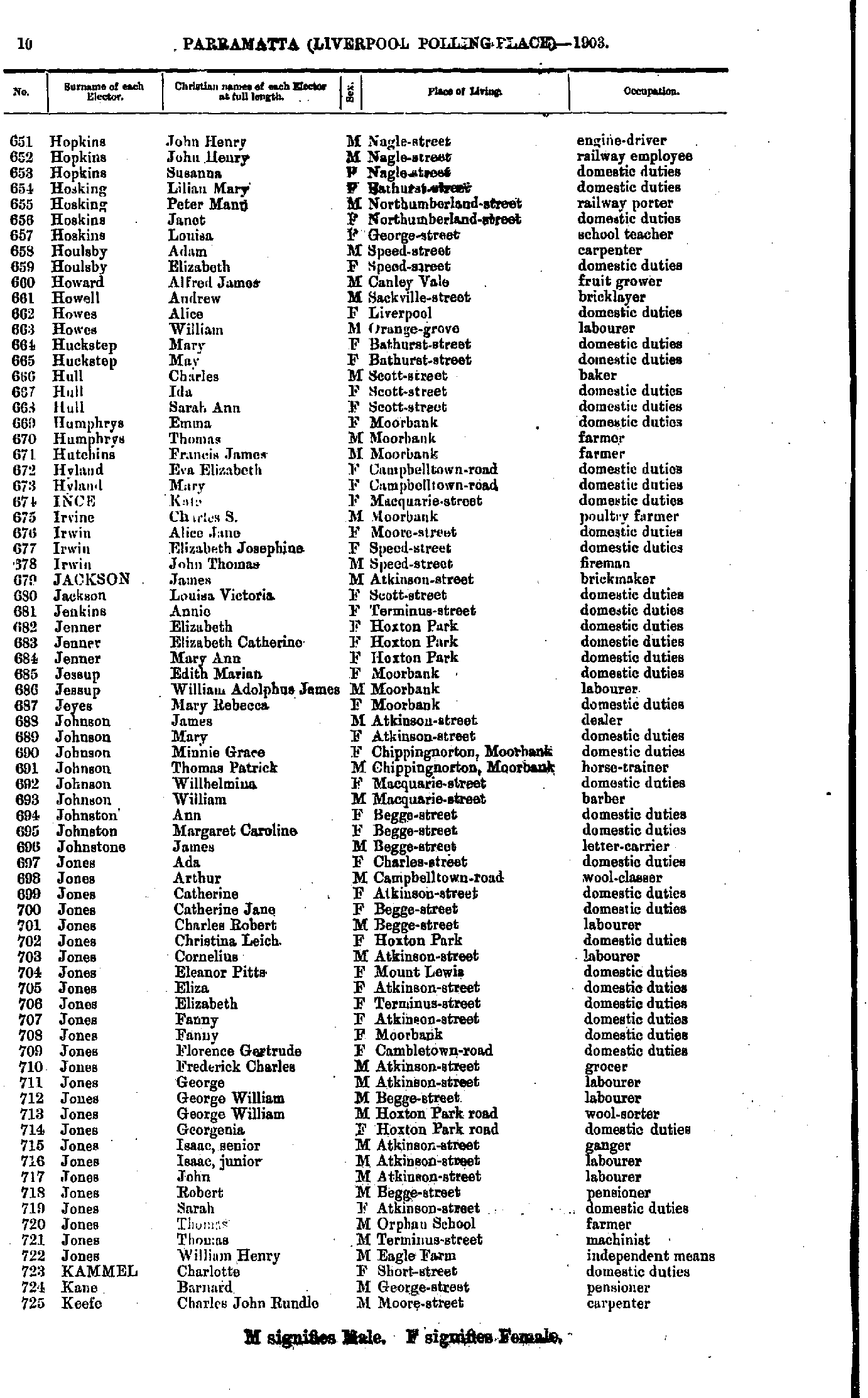
- Hopkins John - Keefe Charles
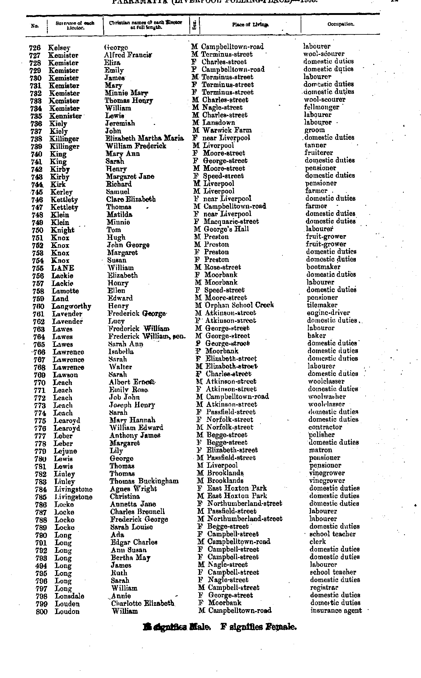
- Kelsey George - Loudon William
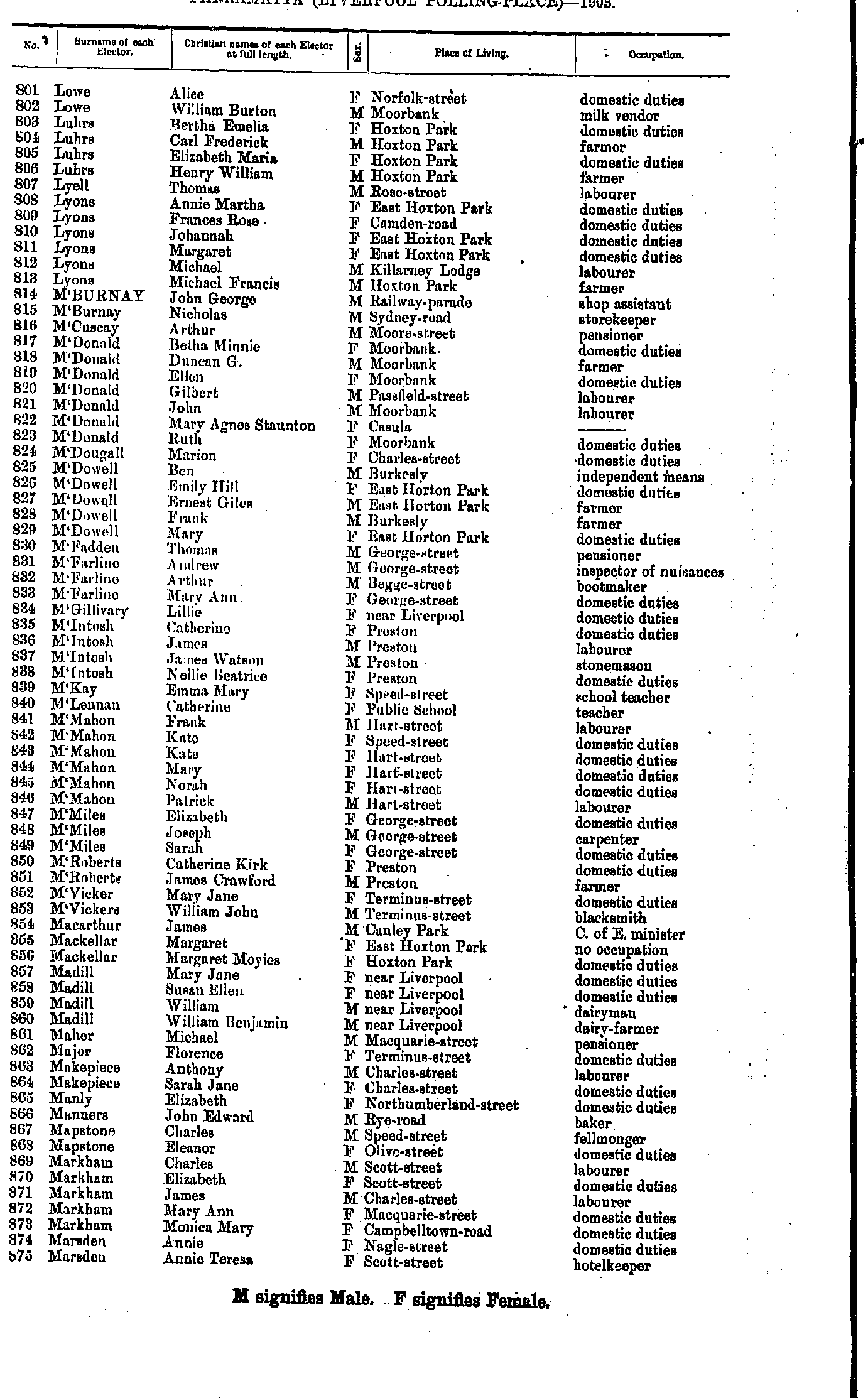
- Lowe Alice - Marsden Annie
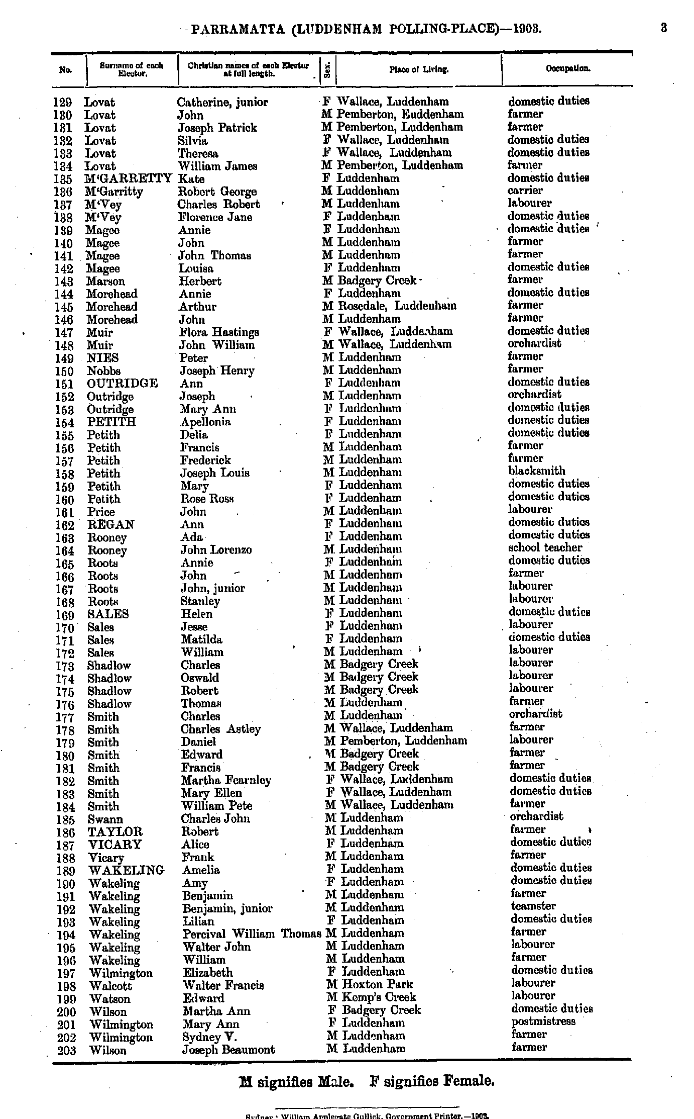
- Marsden Charles - Monson Sarah
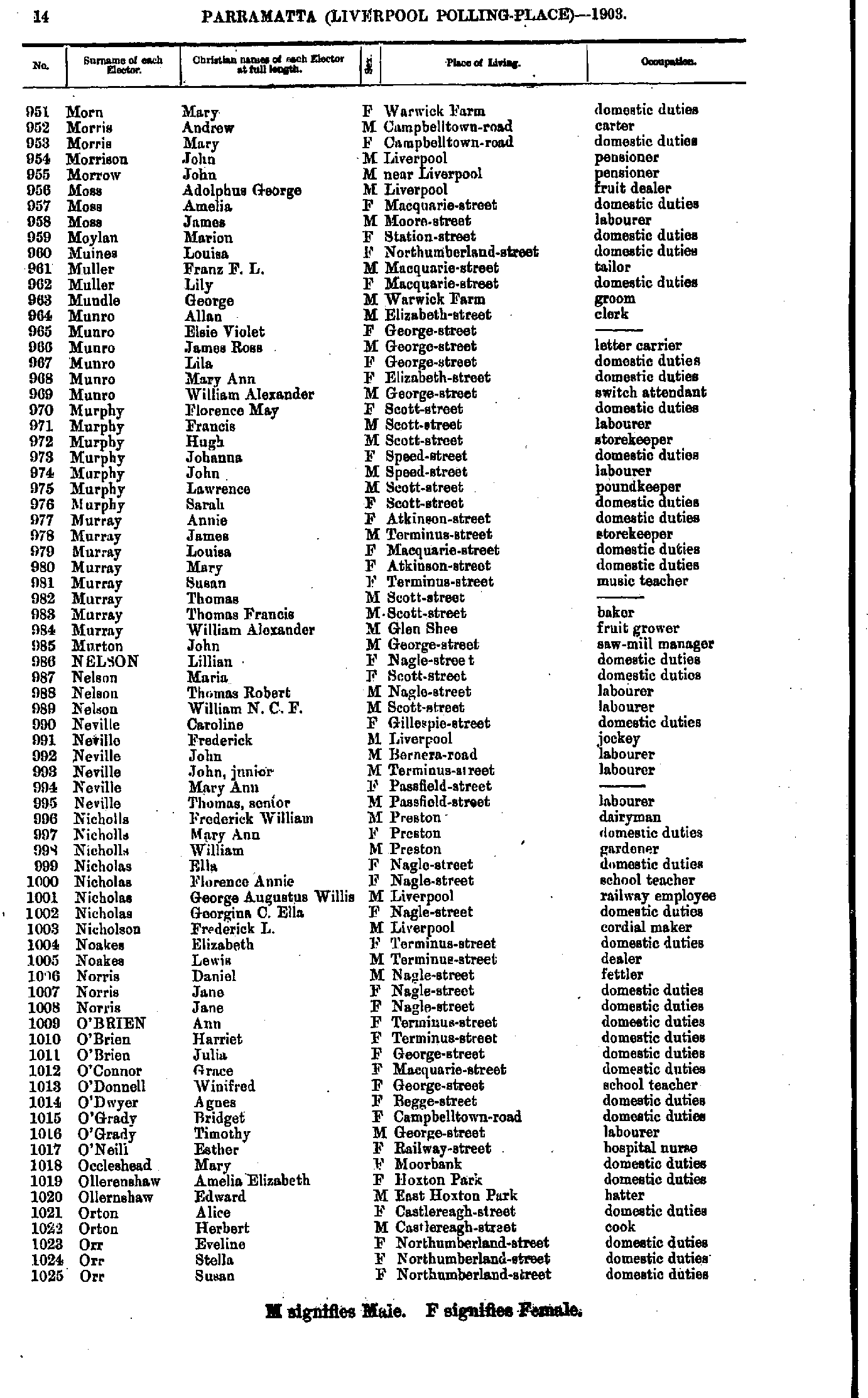
- Morn Mary - Orr Susan
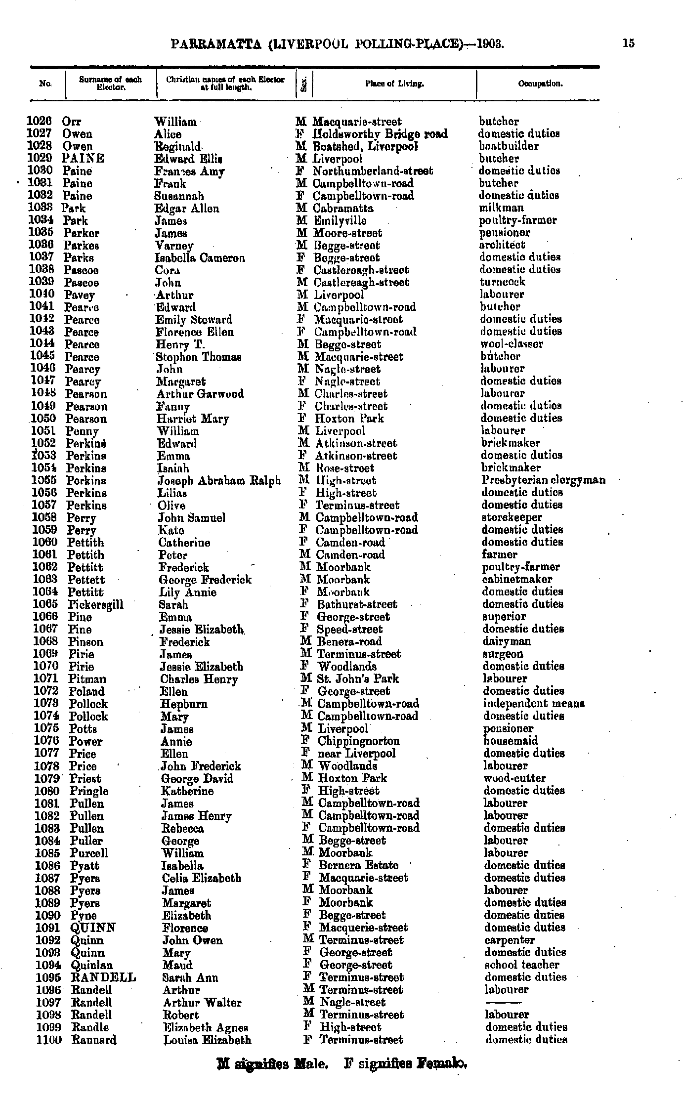
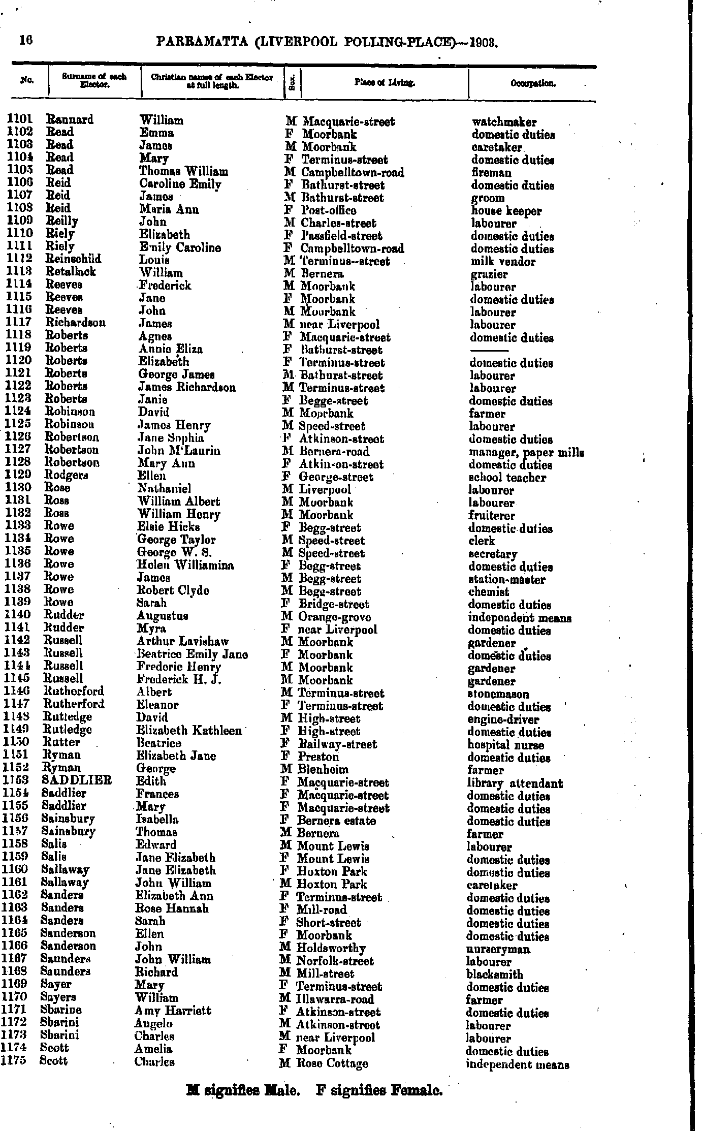
- Orr William - Rannard Louisa
- Rannard William - Scott Charles
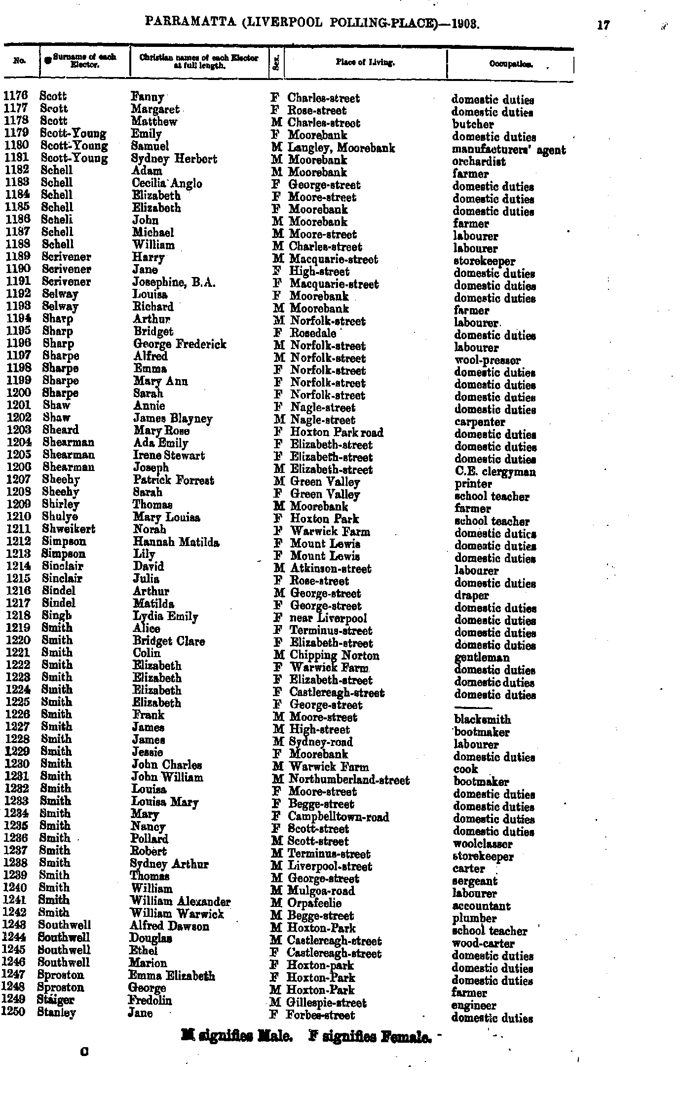
- Scott Fanny - Stanley Jane
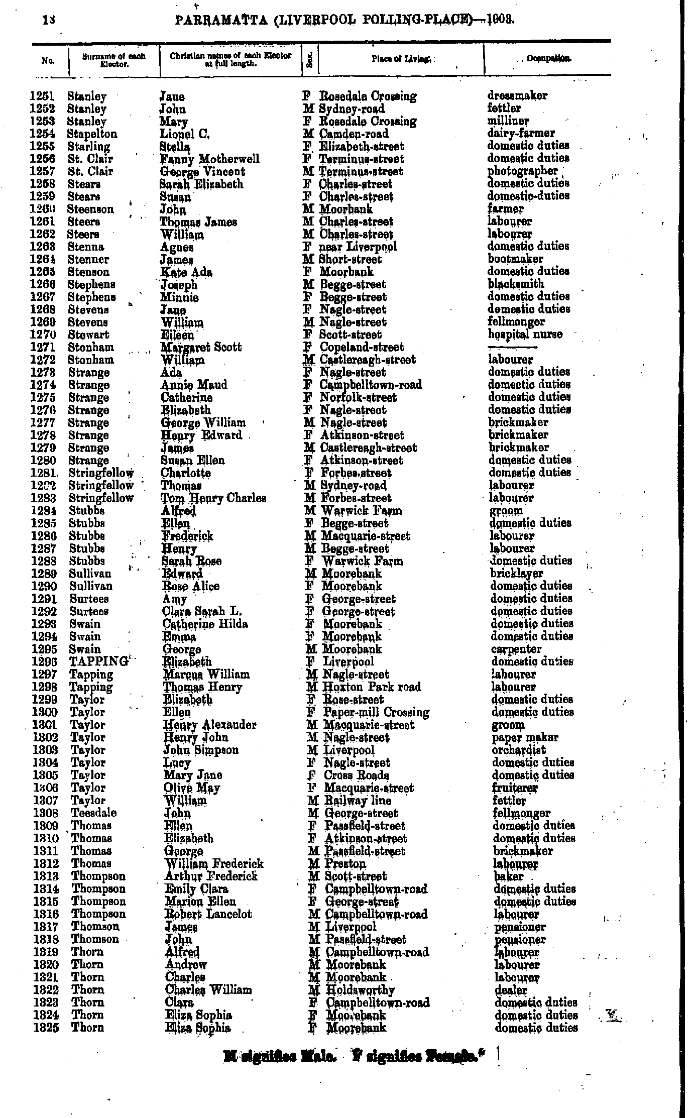
- Stanley Jane - Thorn Eliza
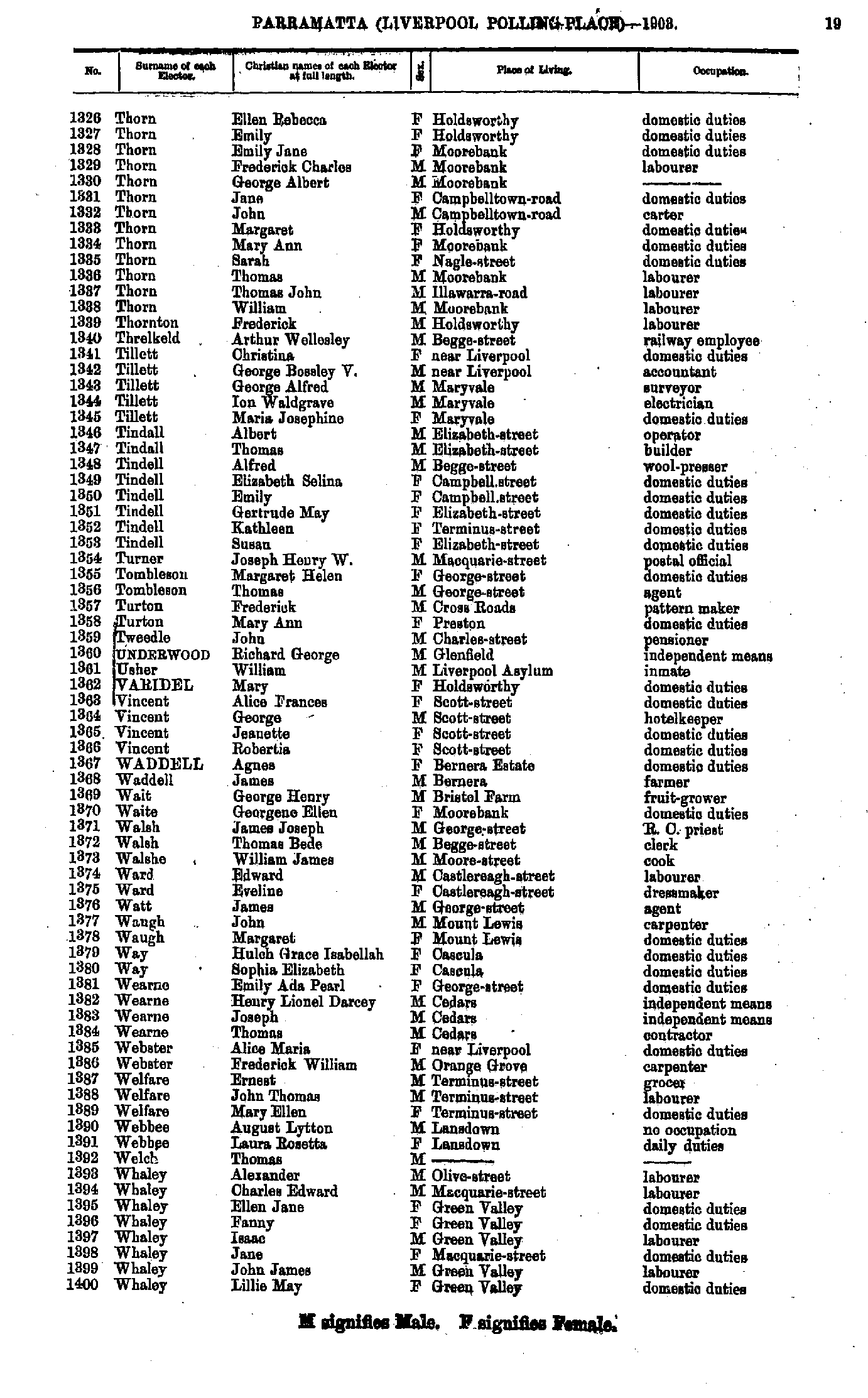
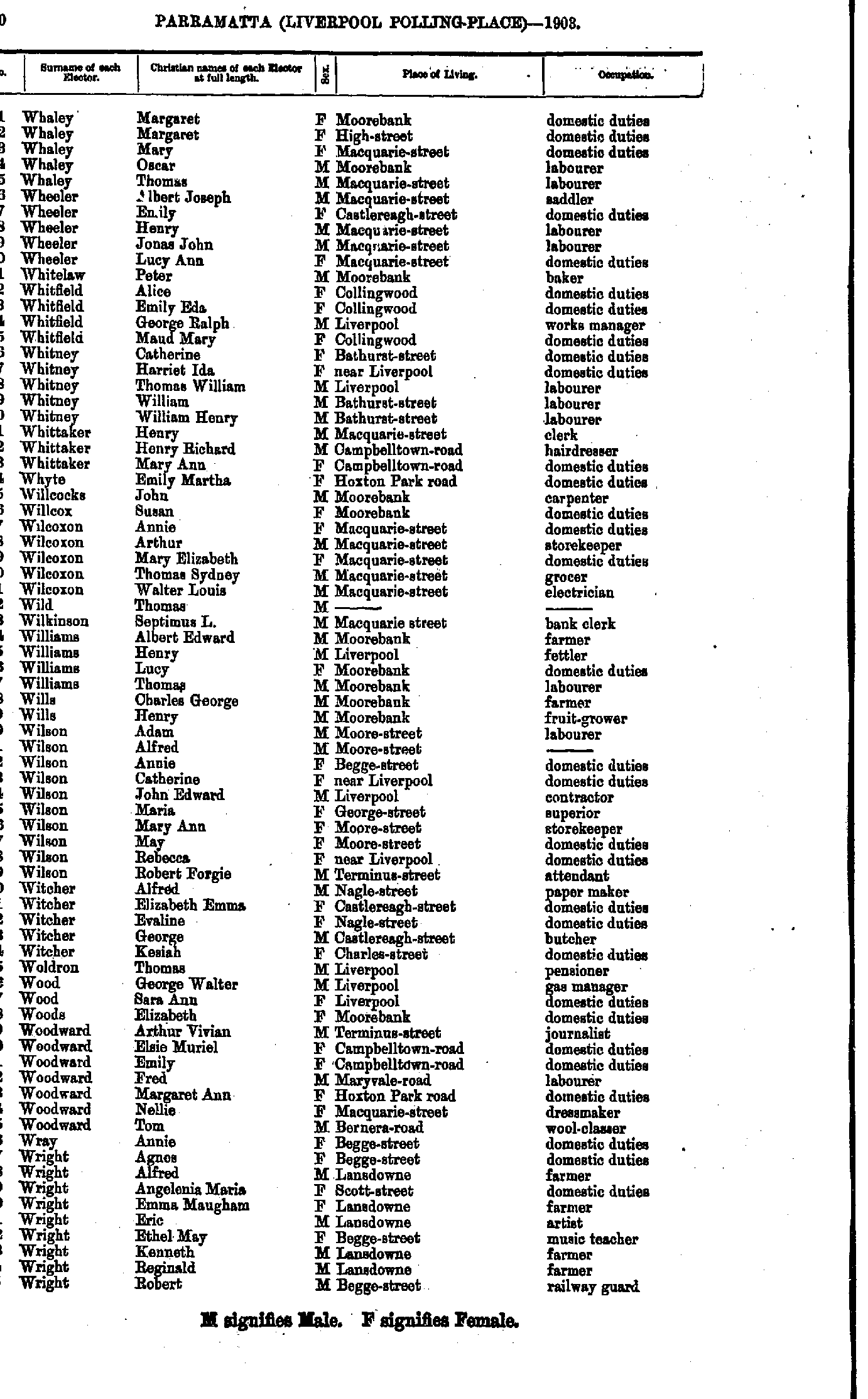
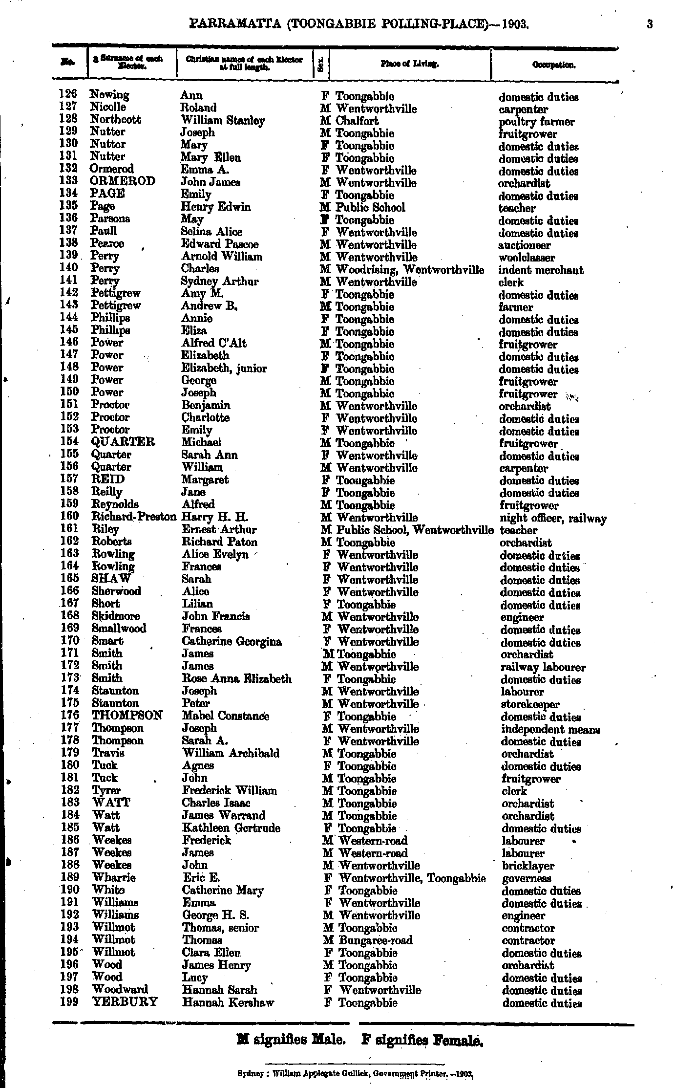
- Thorn Ellen - Whaley Lillie
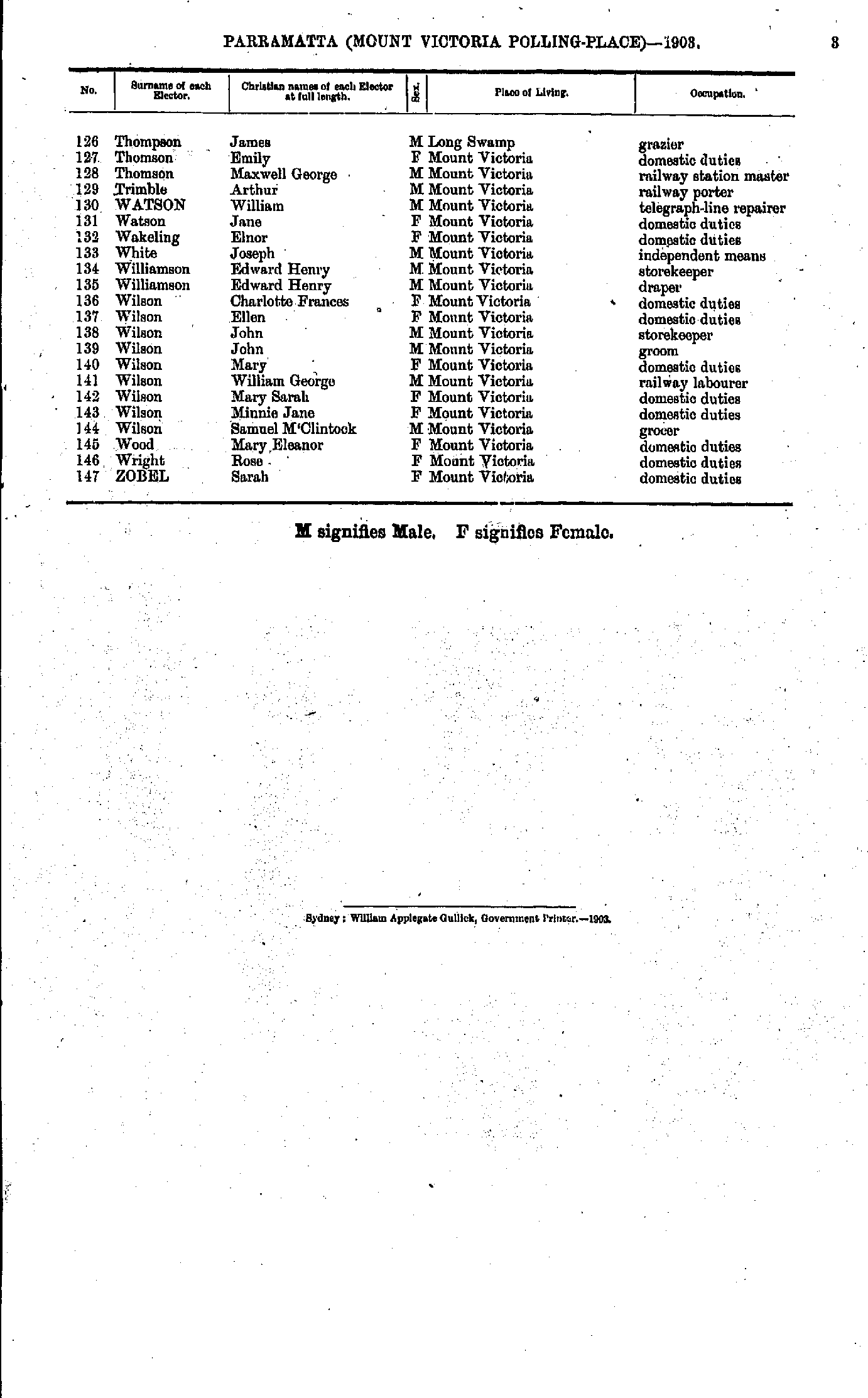
- Whaley Margaret - Wright Robert
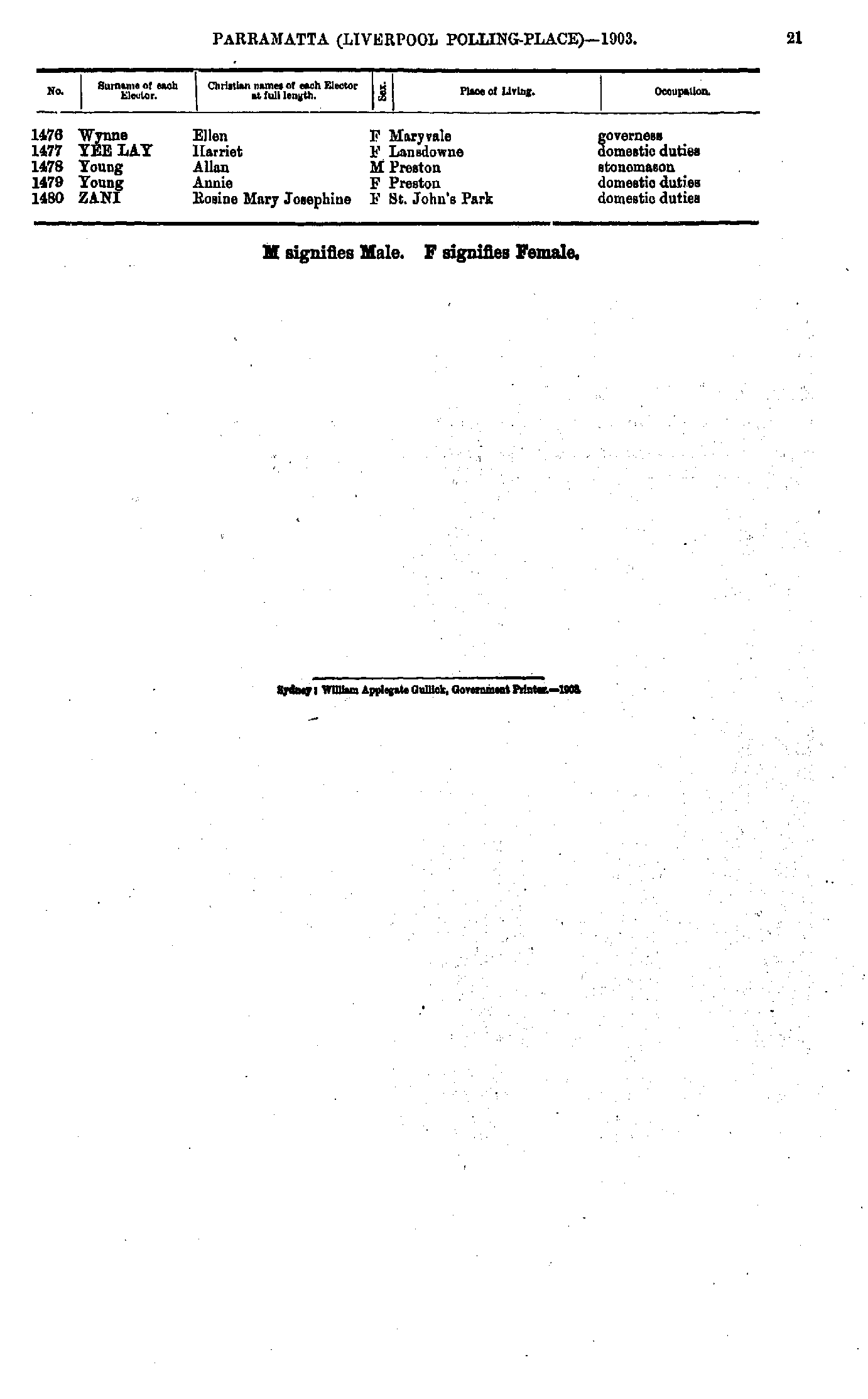
- Wynne Ellen - Zani Rosine
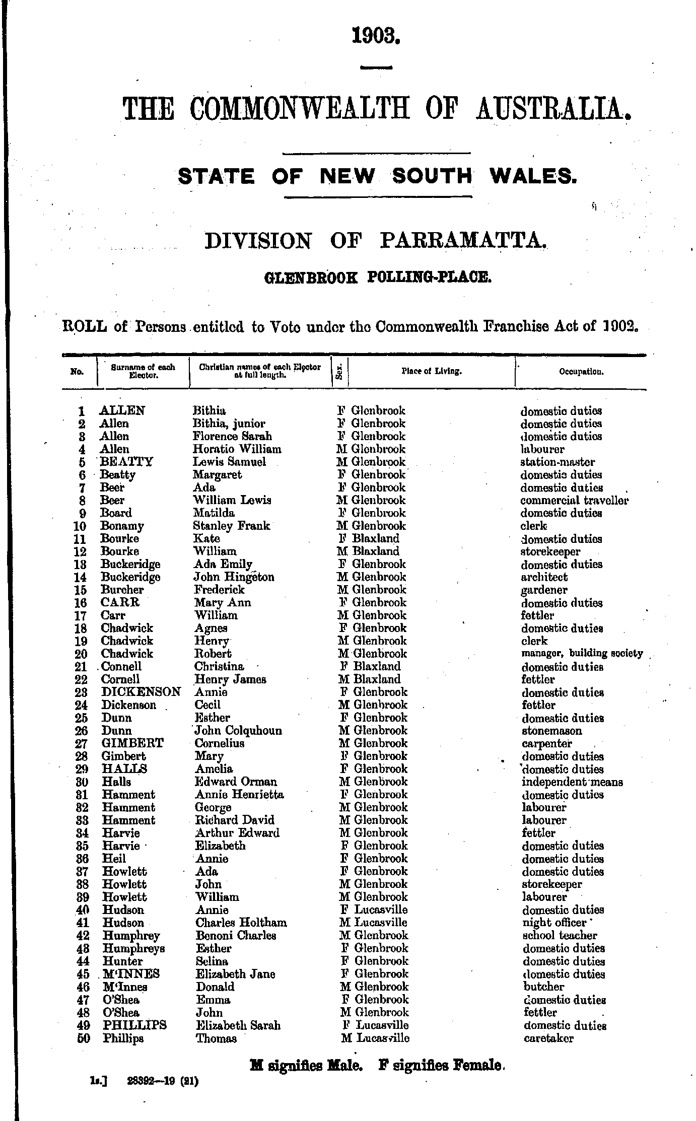
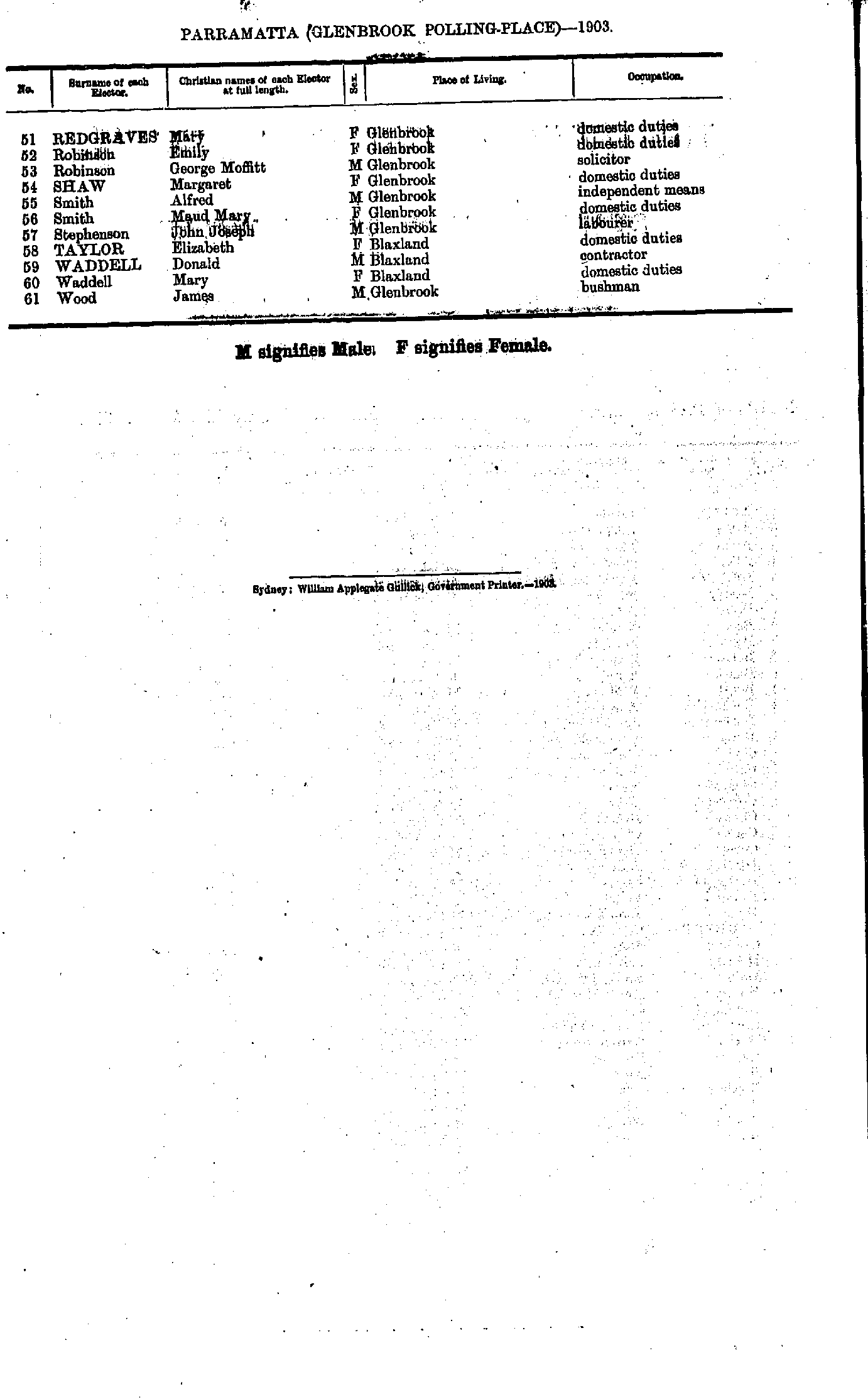
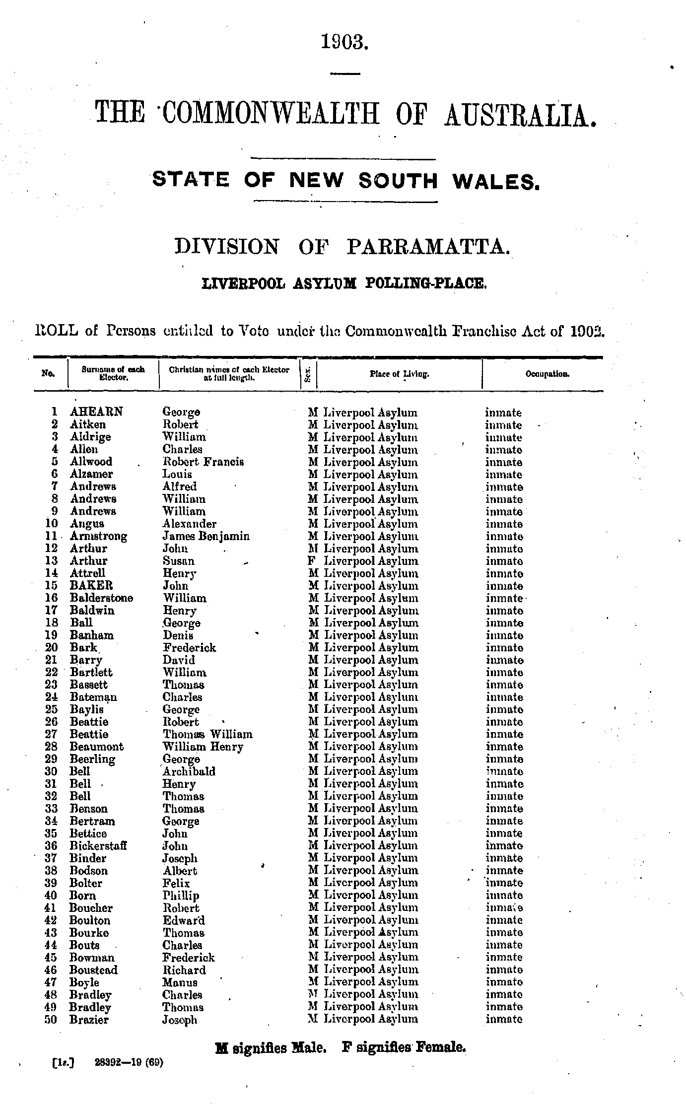
Liverpool Asylum Polling Place
- Ahearn George - Brazier Joseph
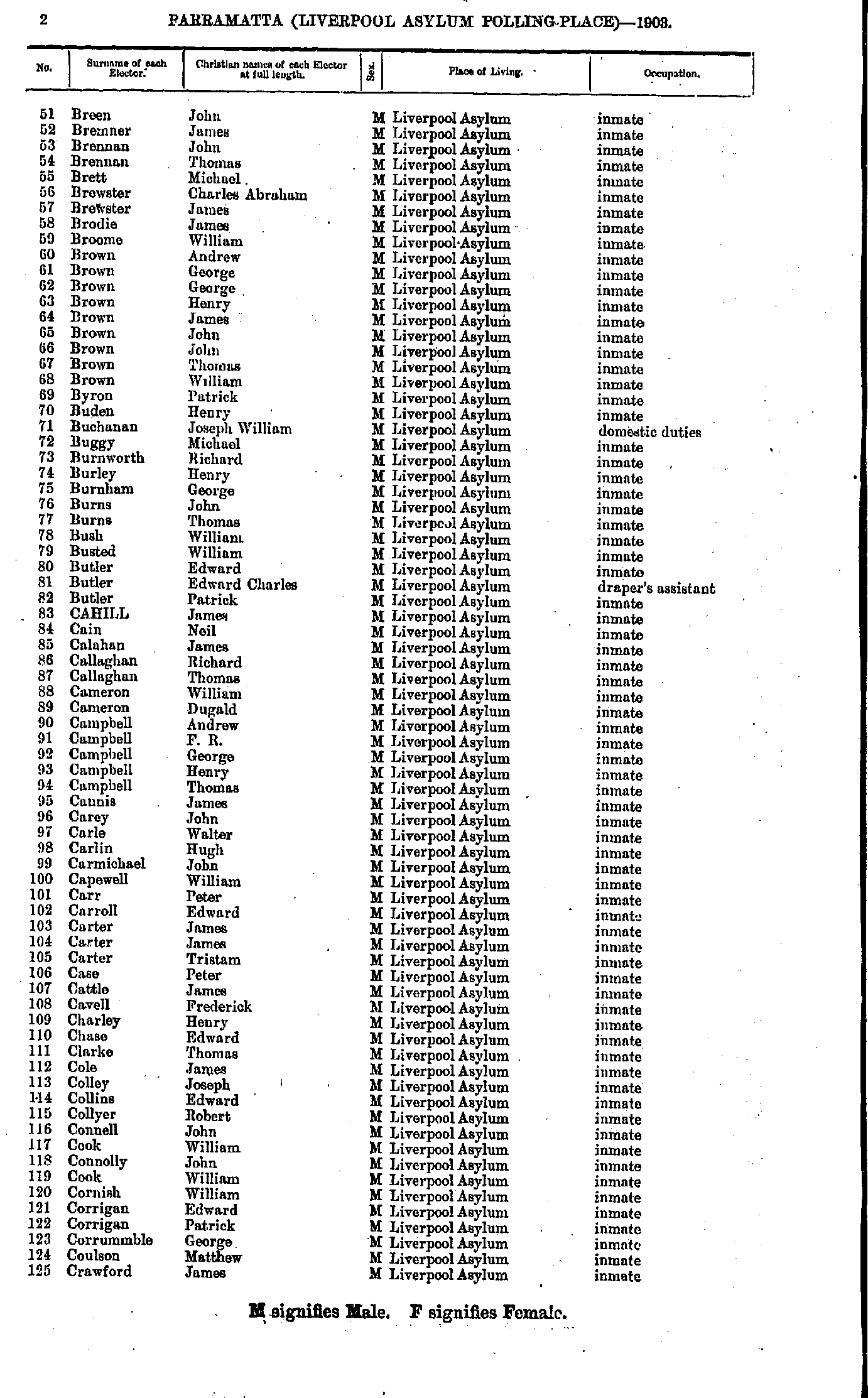
- Breen John - Crawford James
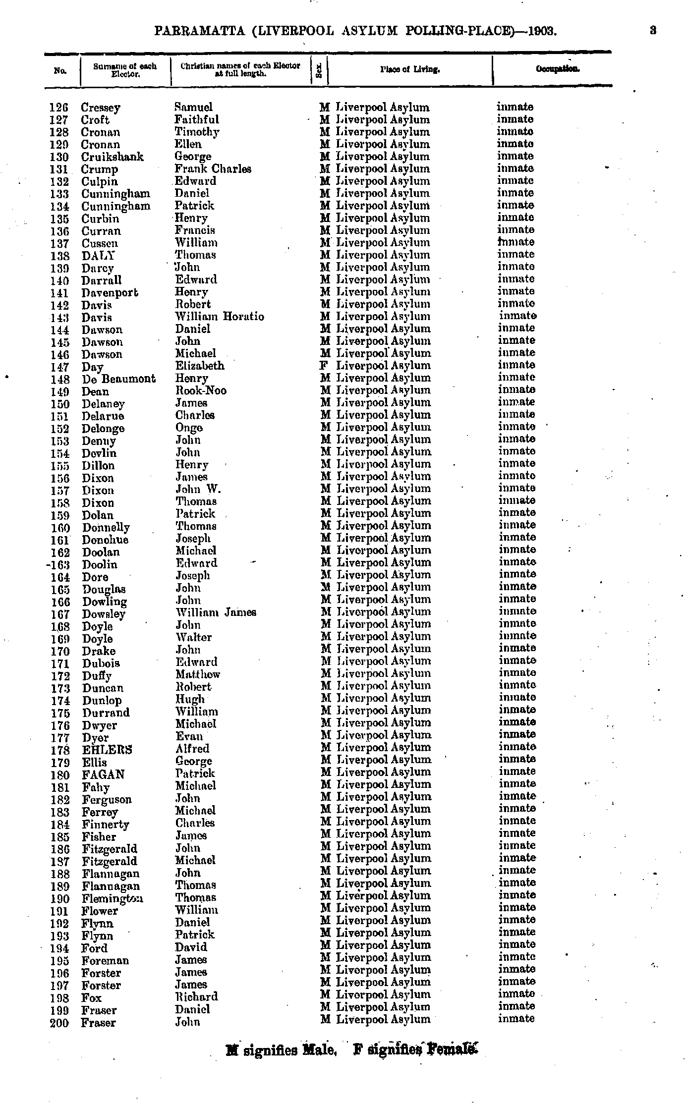
- Cressey Samuel - Fraser John
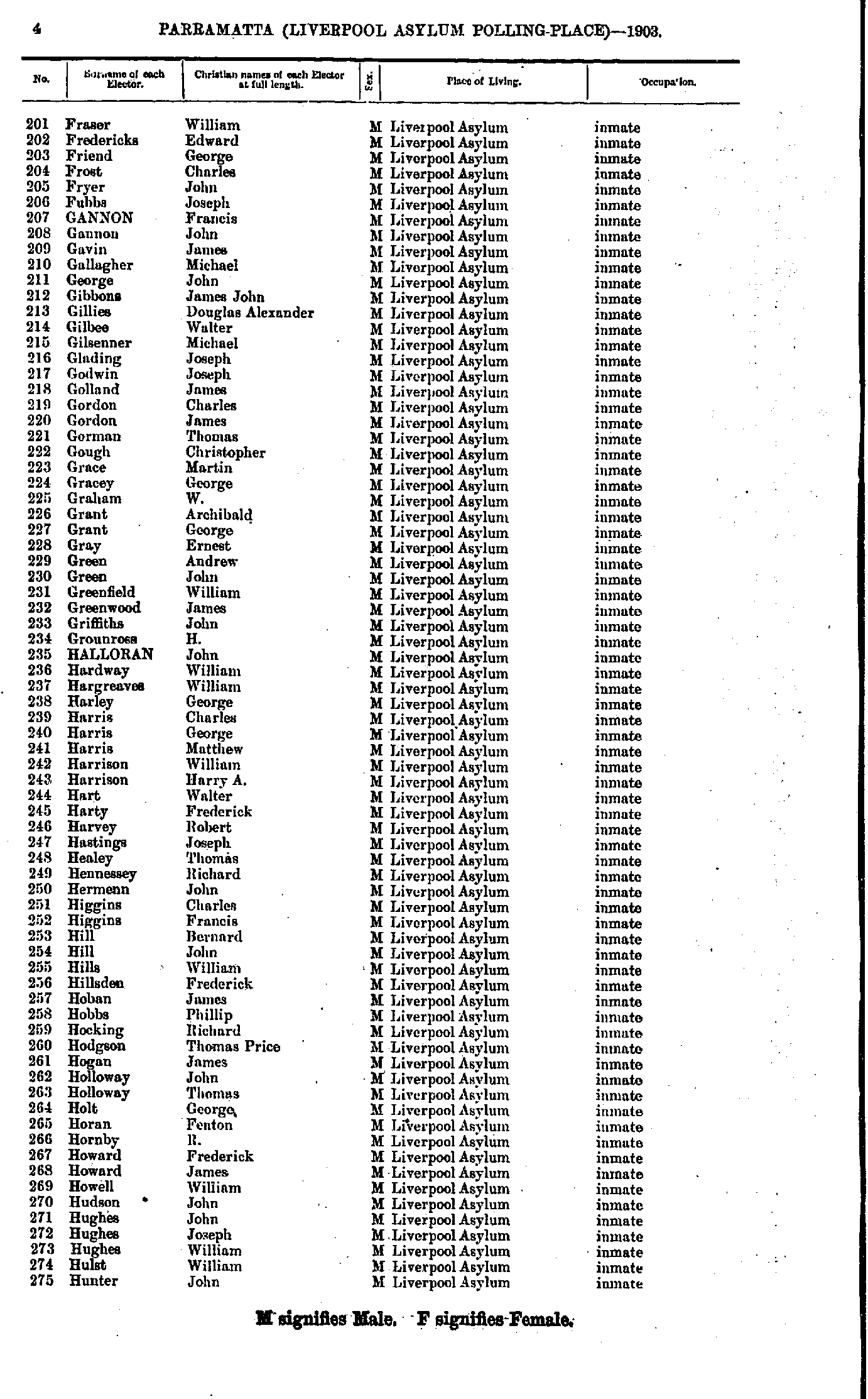
- Fraser William - Hunter John
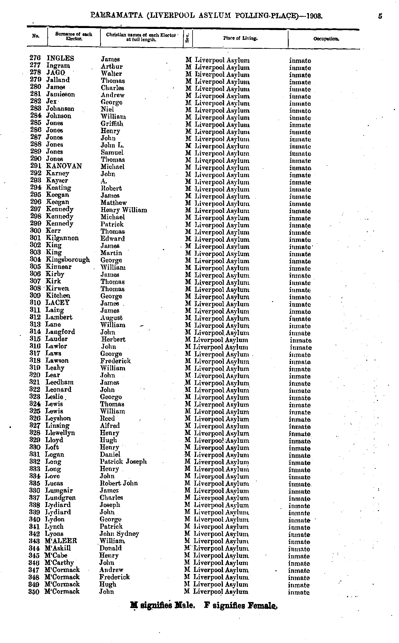
- Ingles James - M'Cormack John
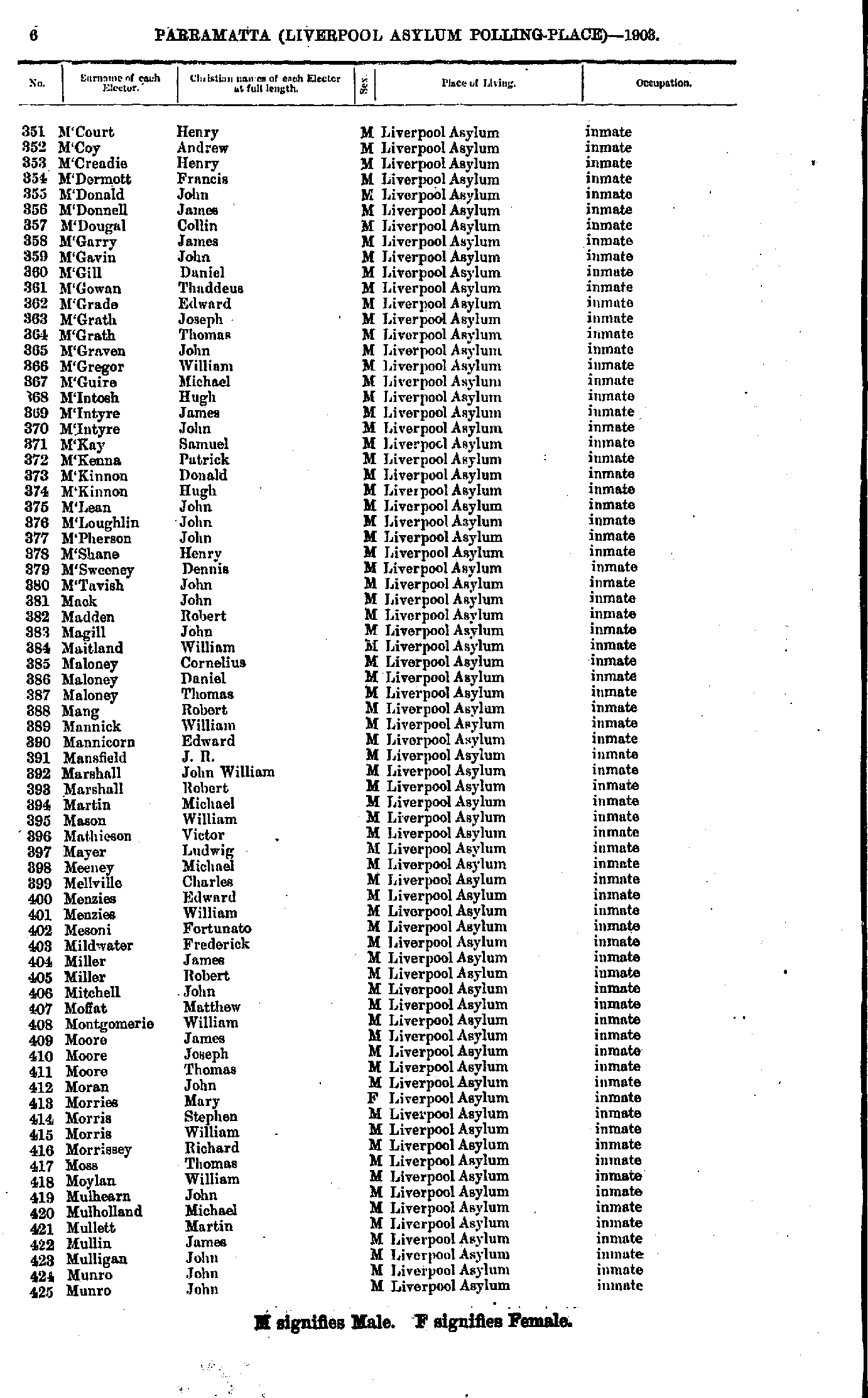
- M'Court Henry - Munro John
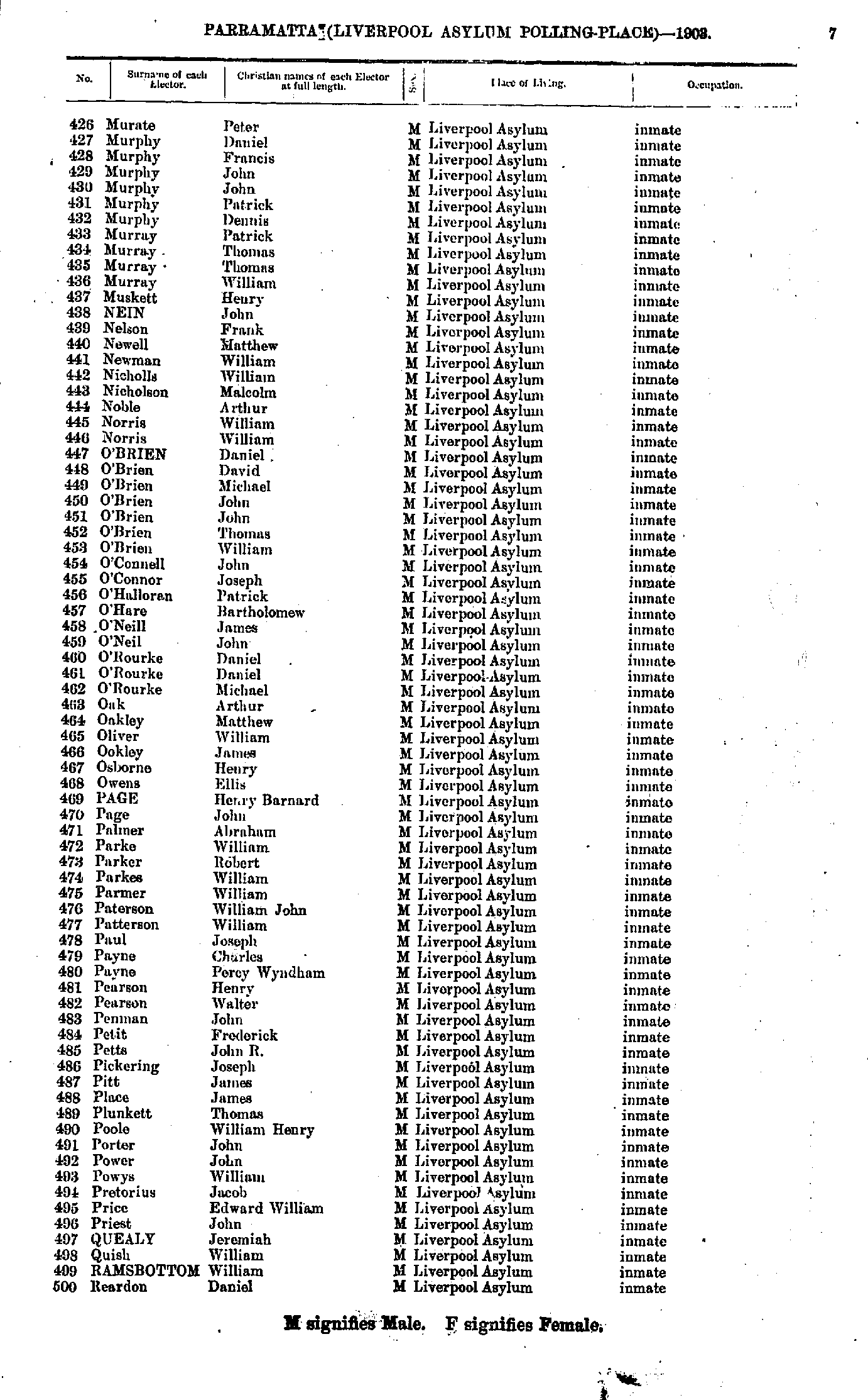
- Murate Peter - Reardon Daniel
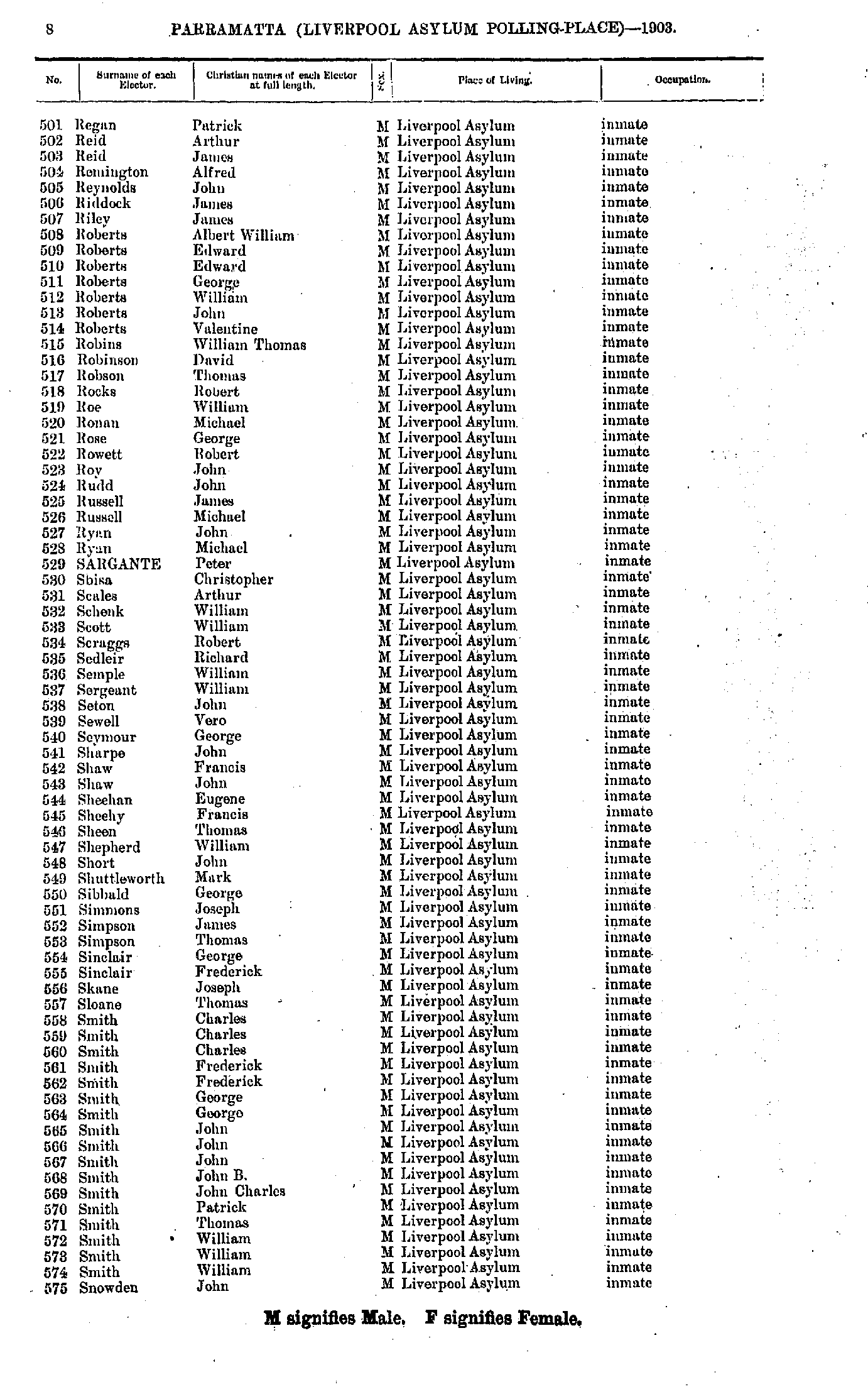
- Regan Patrick - Snowden John
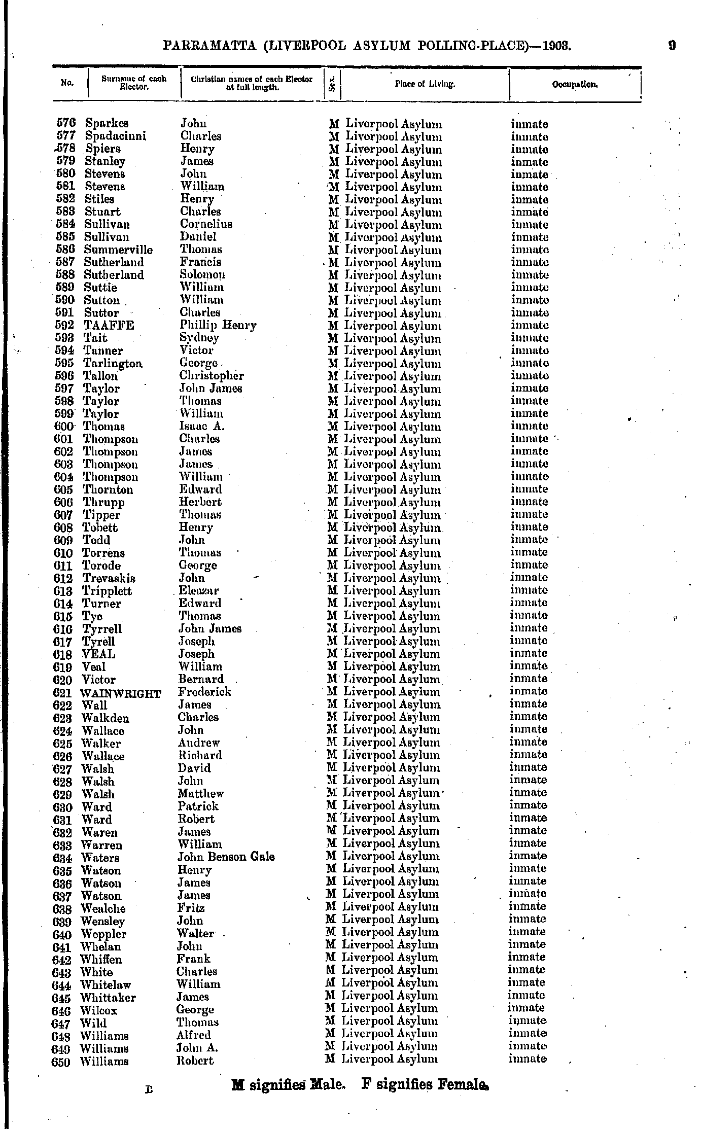
- Sparkes John - Williams Robert
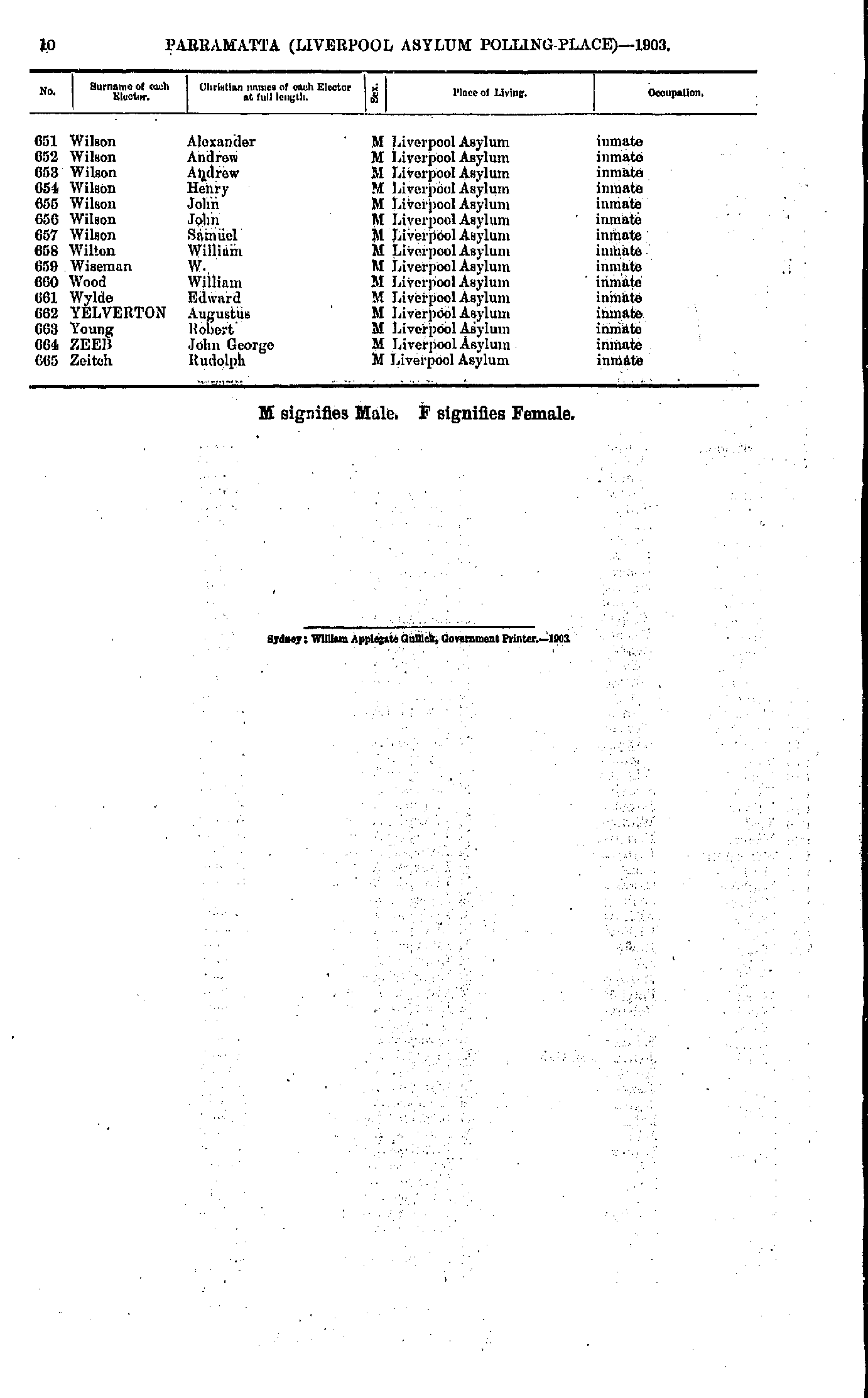
- Wilson Alexander - Zeitch Rudolph
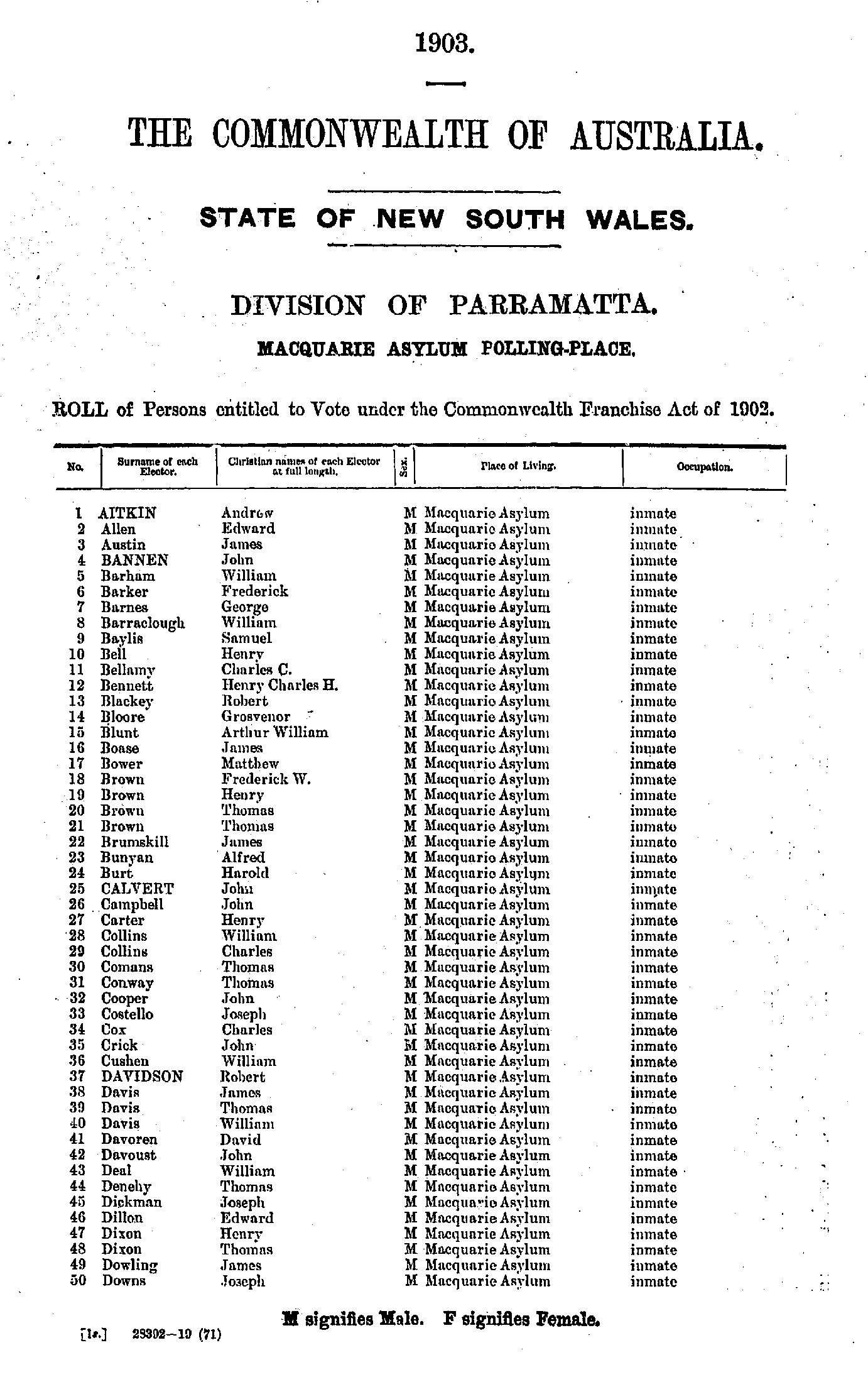
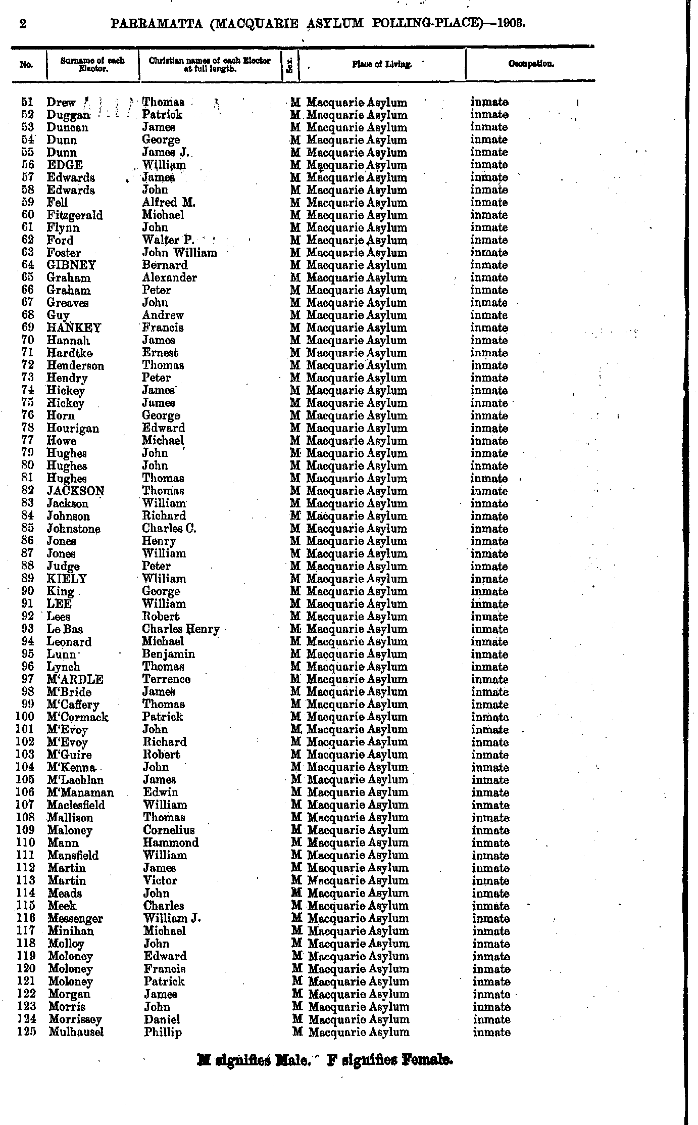
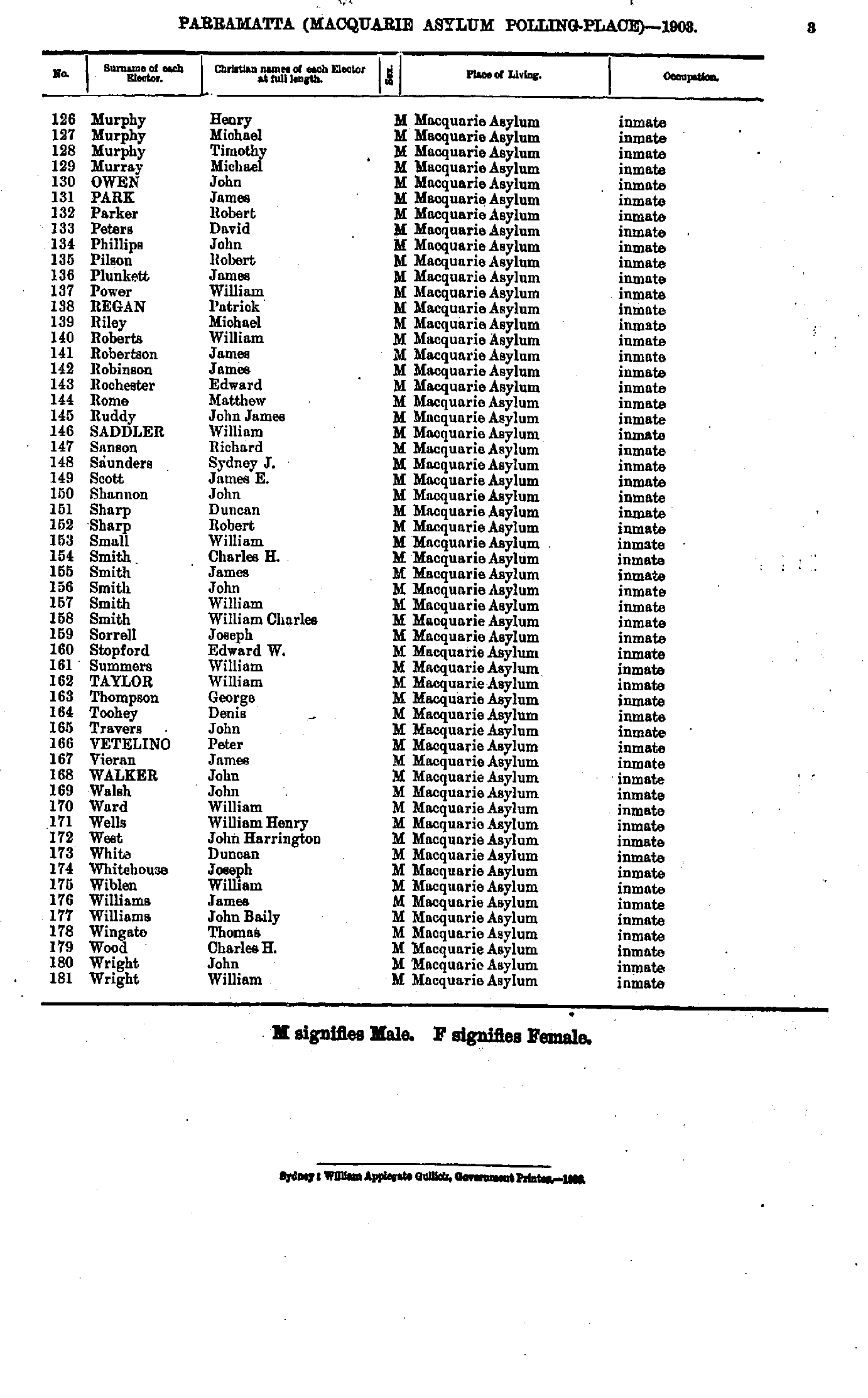
Macquarie Asylum Polling Place
- Abbott Charles - Ainsworth William
- Ainsworth William - Arundale Susan
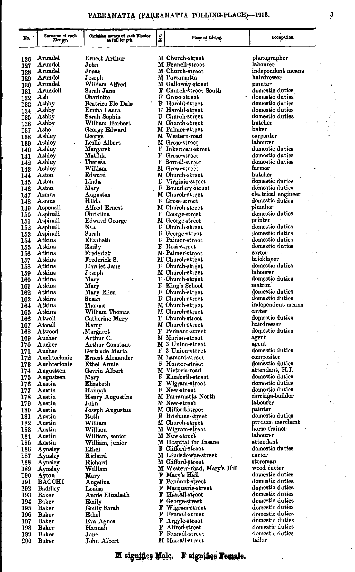
- Arundel Ernest - Baker John
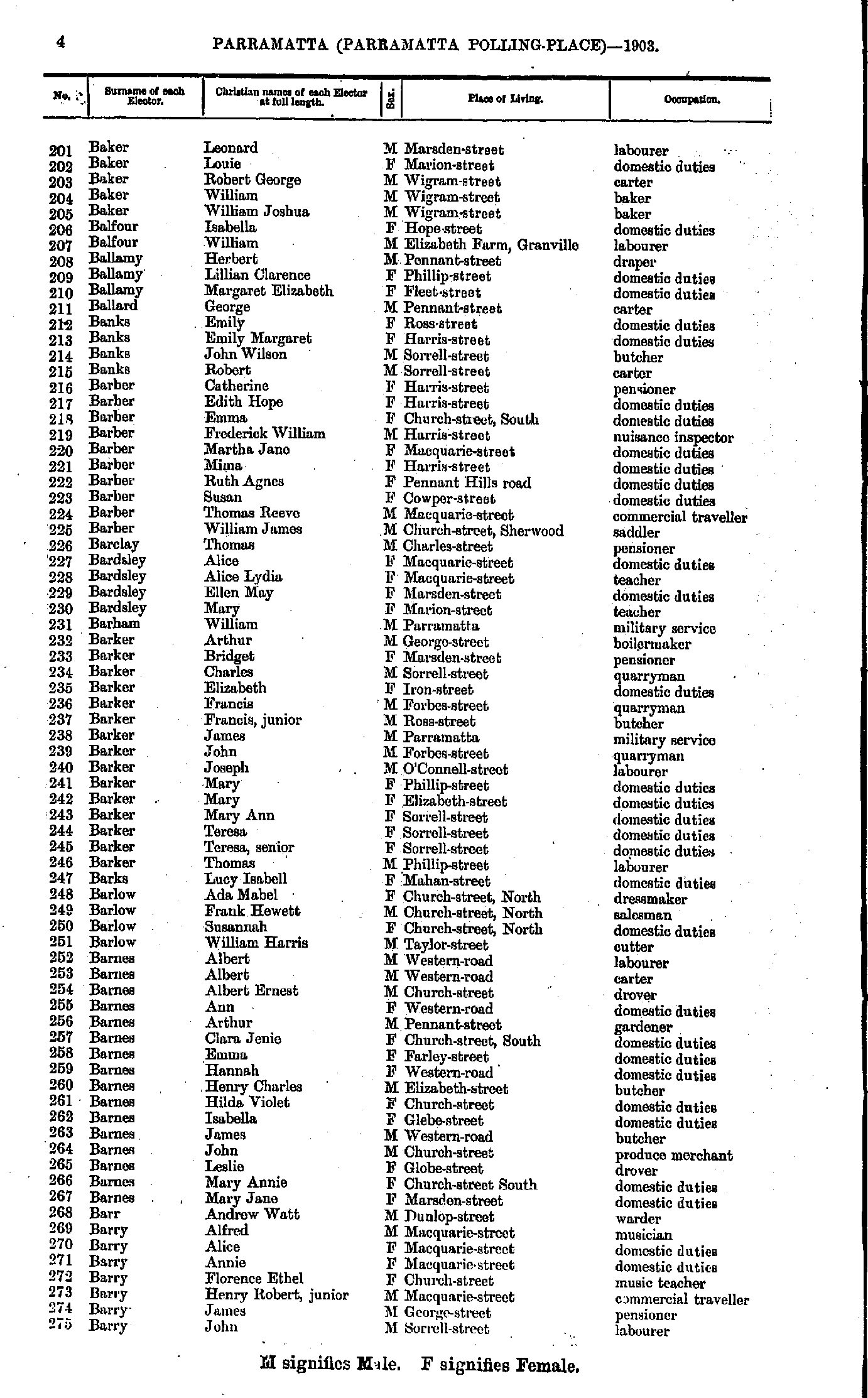
- Baker Leonard - Barry John
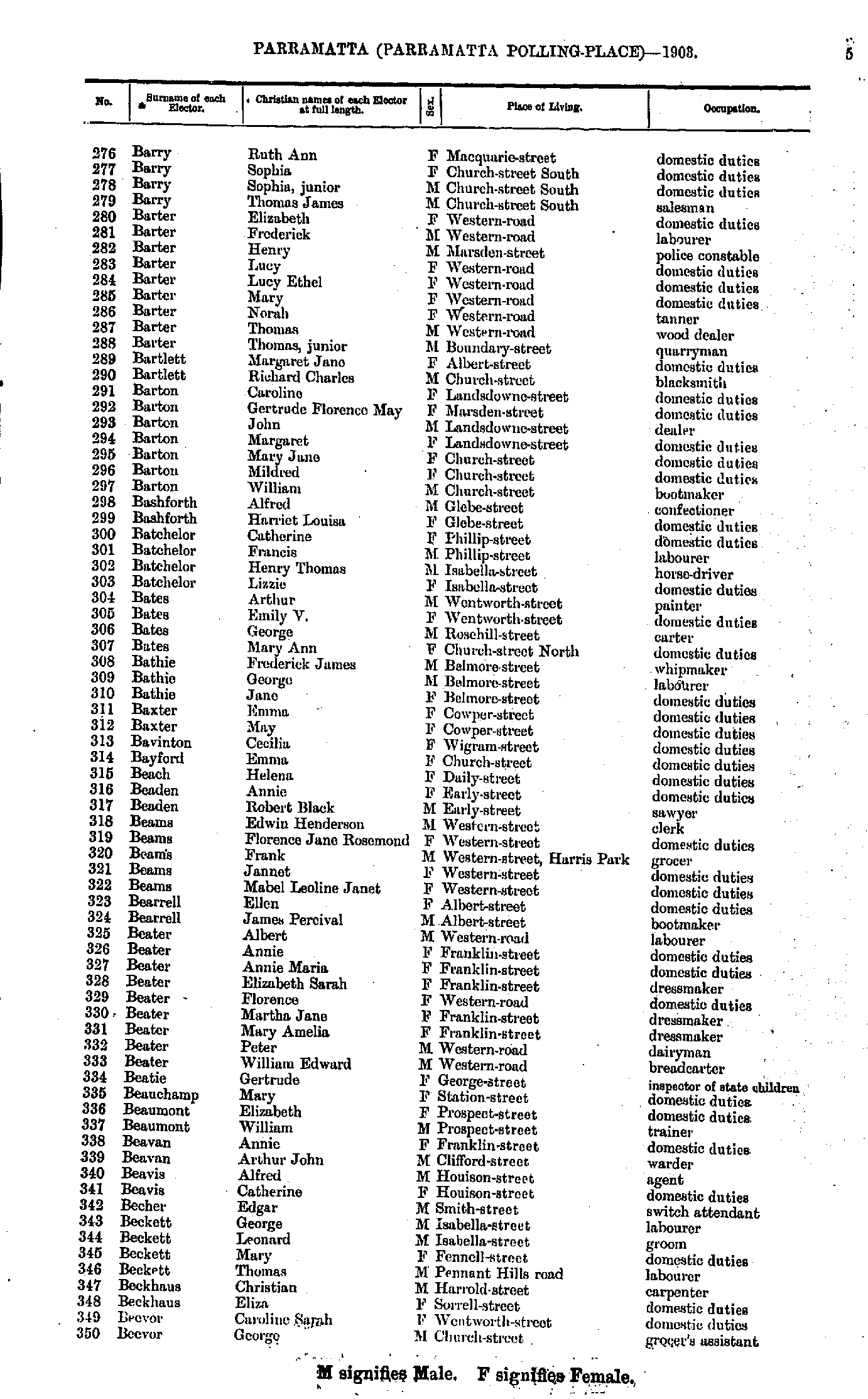
- Barry Ruth - Beevor George
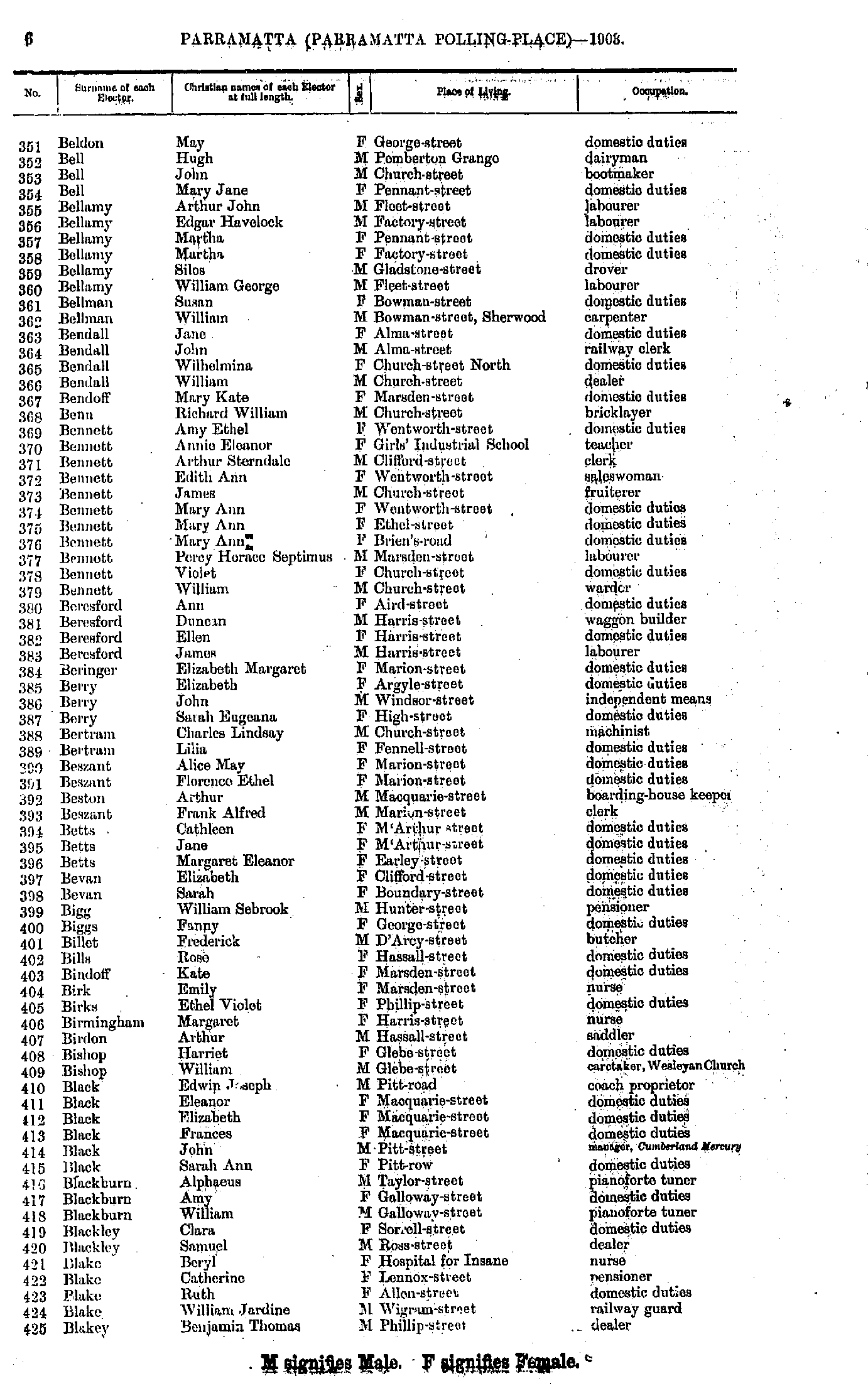
- Beldon May - Blakey Benjamin
- Blakey Jessie - Bowerman Alice
- Bowerman Frederick - Brooks Emily
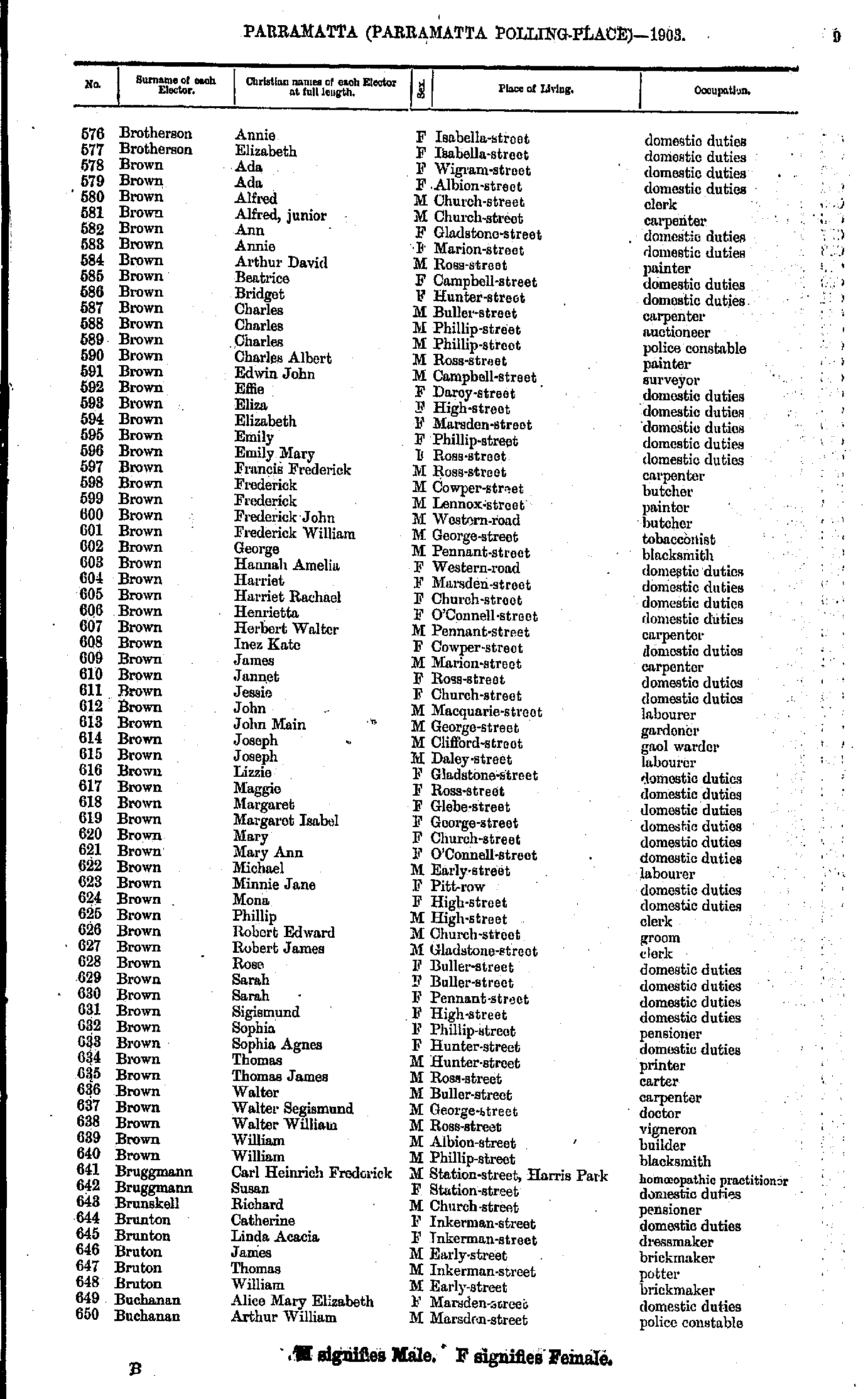
- Brotherson Annie - Buchanan Arthur
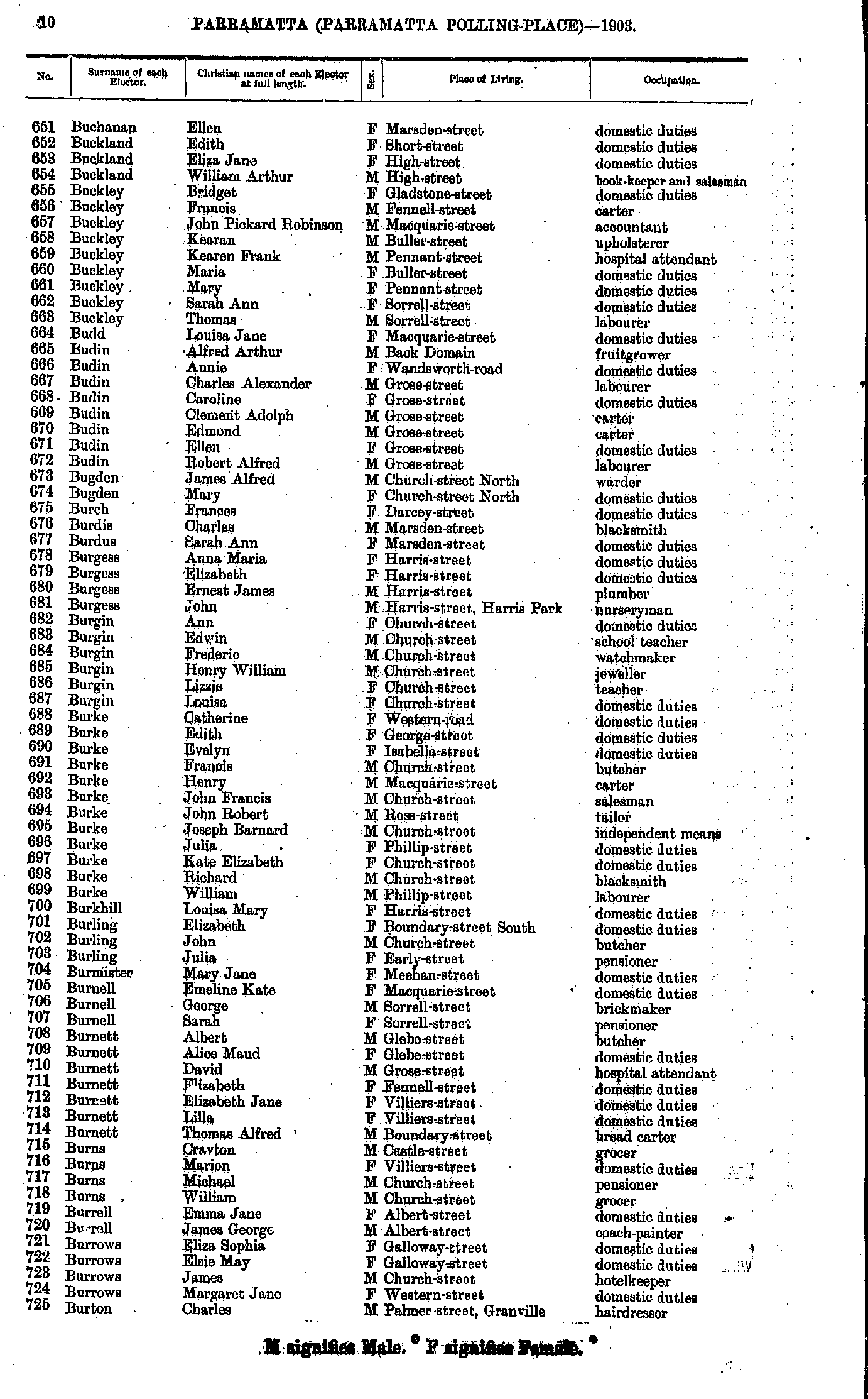
- Buchanan Ellen - Burton Charles
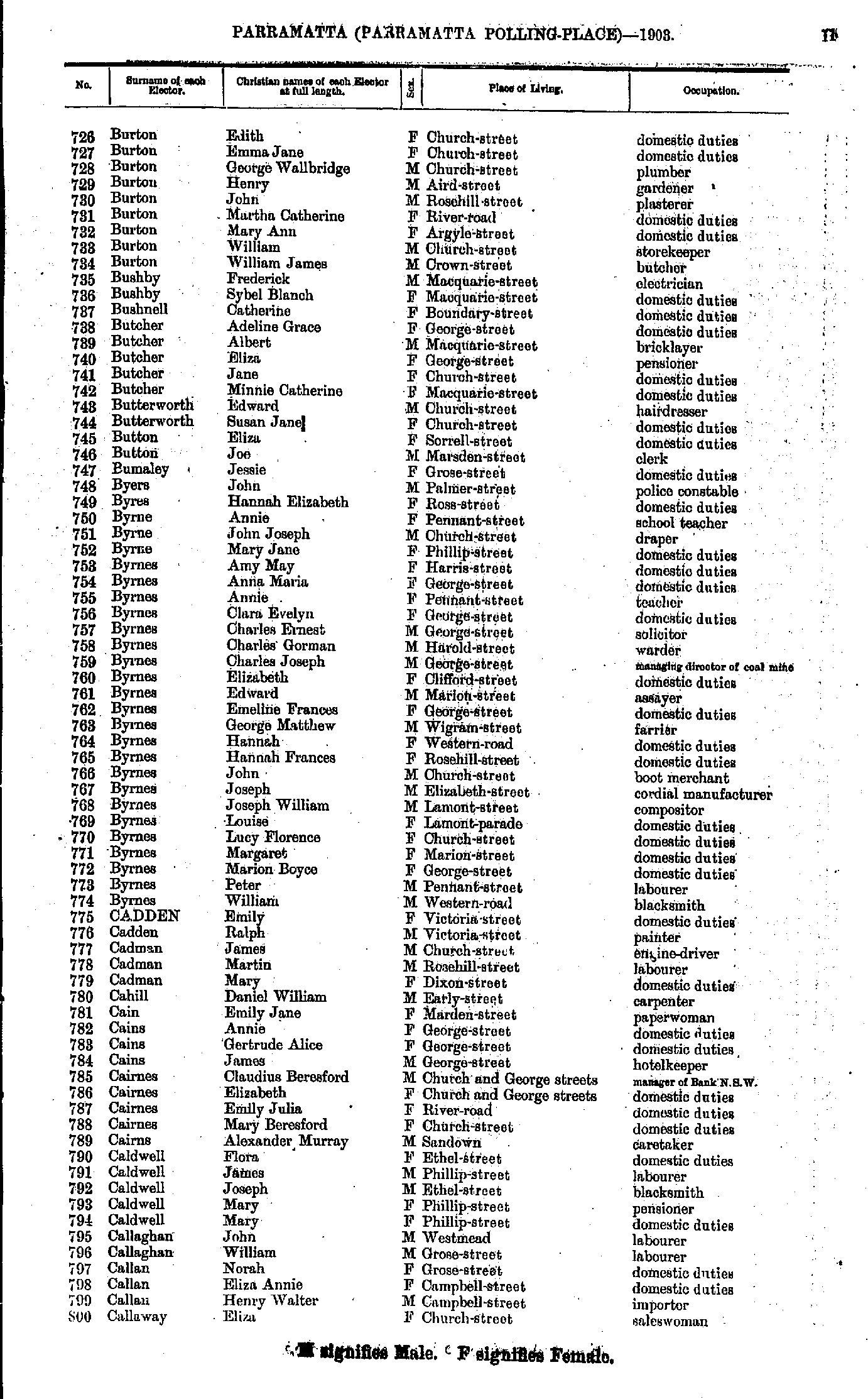
- Burton Edith - Callaway Eliza
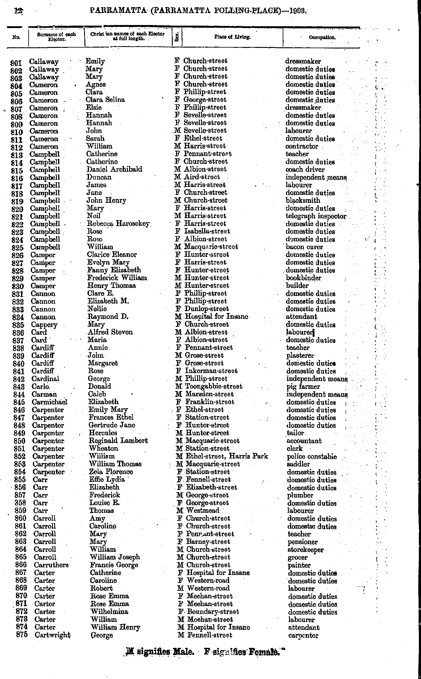
- Callaway Emily - Cartwright George
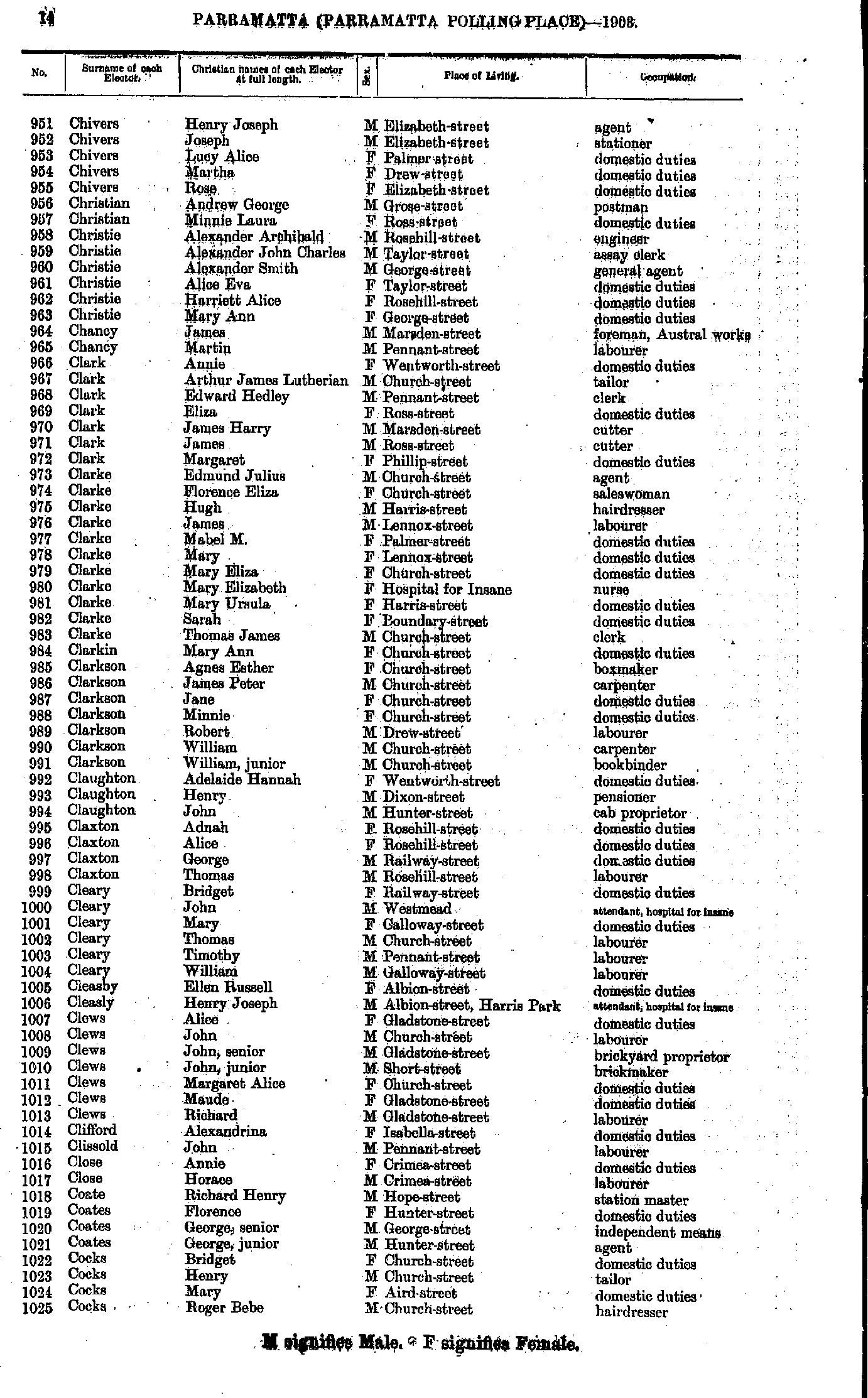
- Cartwright Georgina - Chivers Edith
- Chivers Henry - Cocks Roger
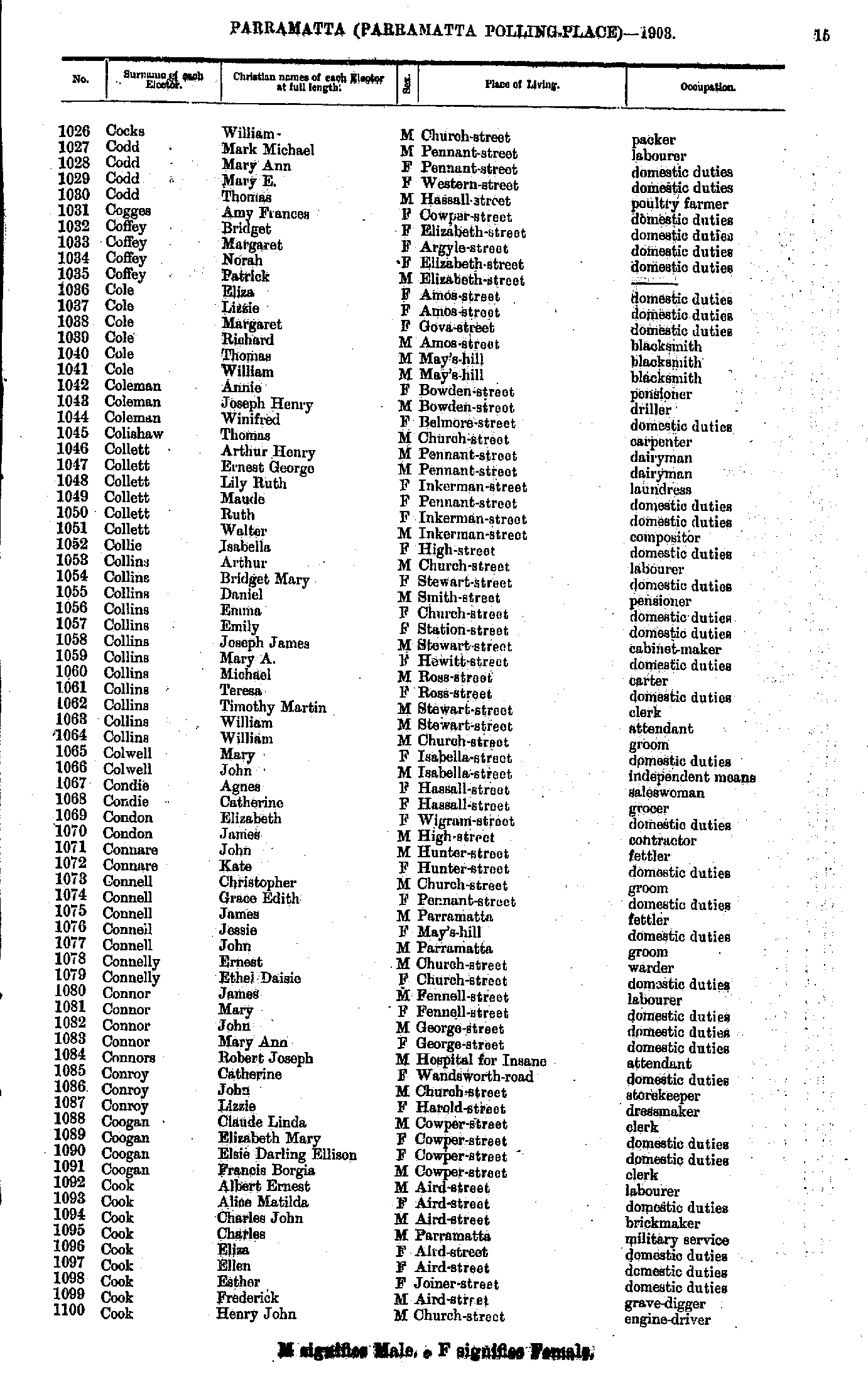
- Cocks William - Cook Henry
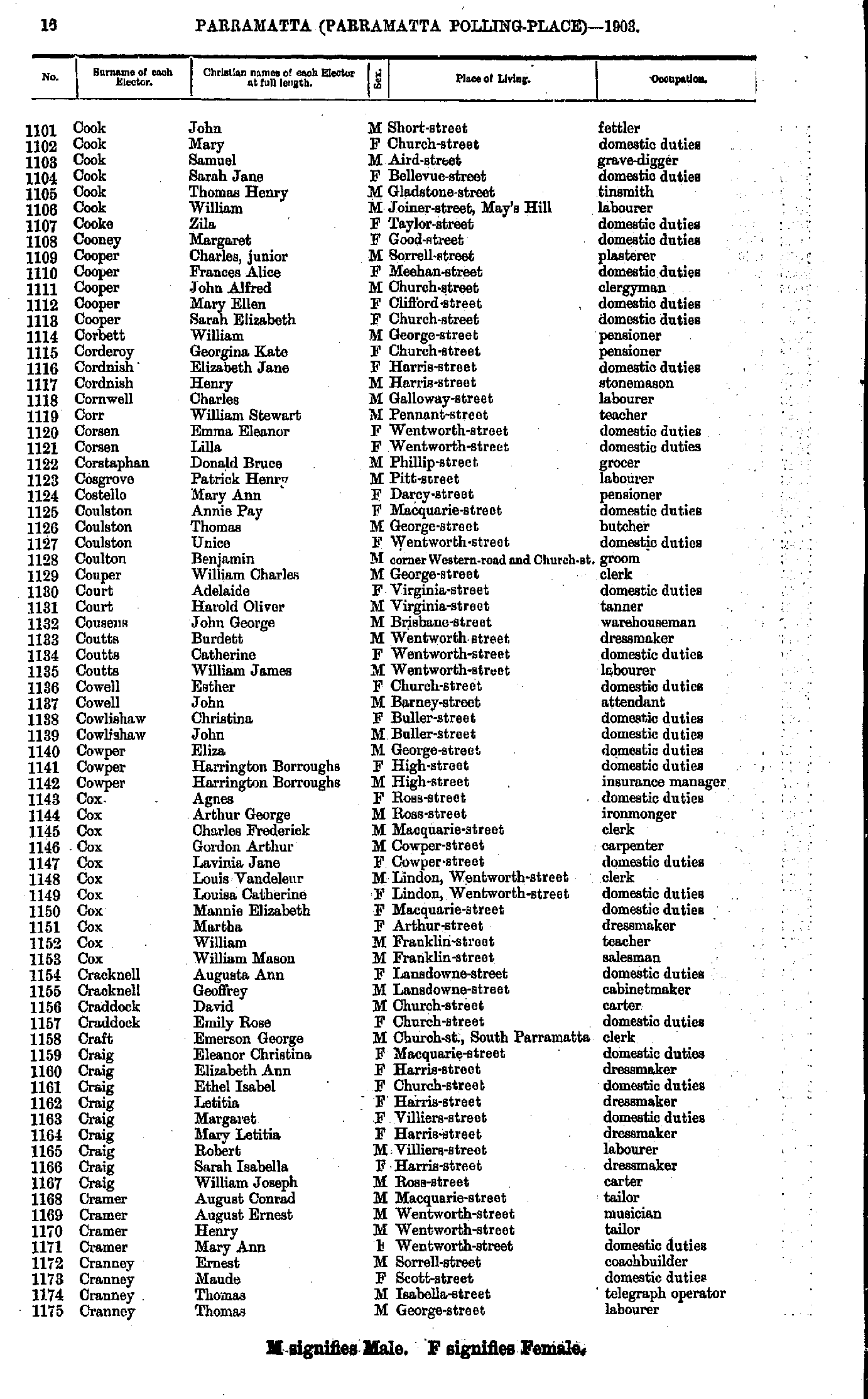
- Cook John - Cranney Thomas
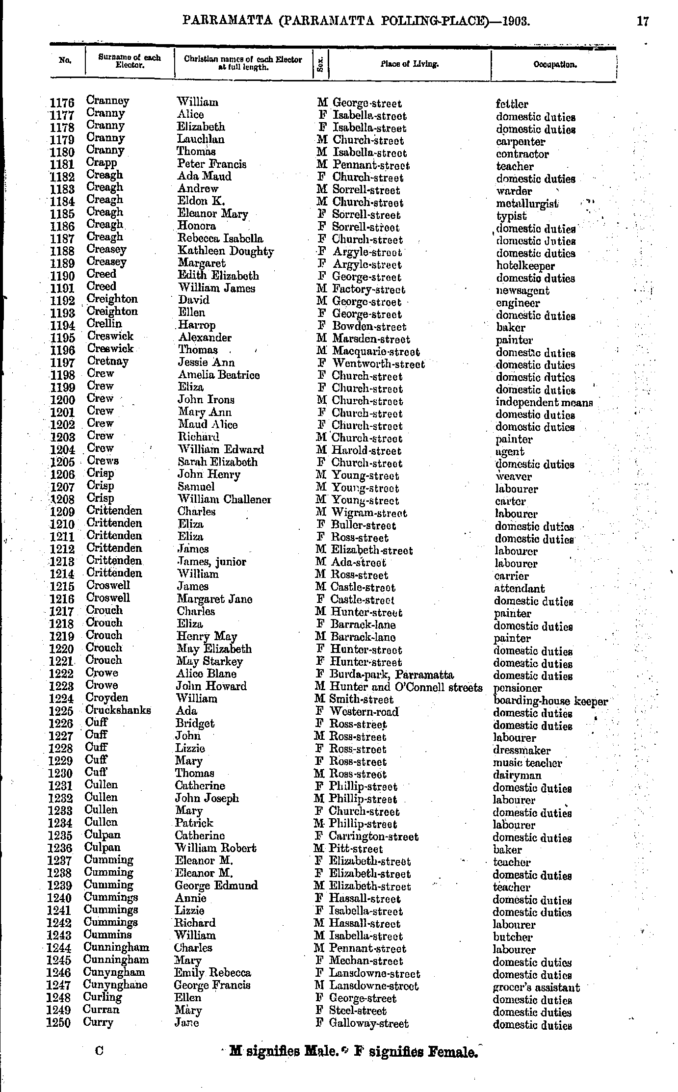
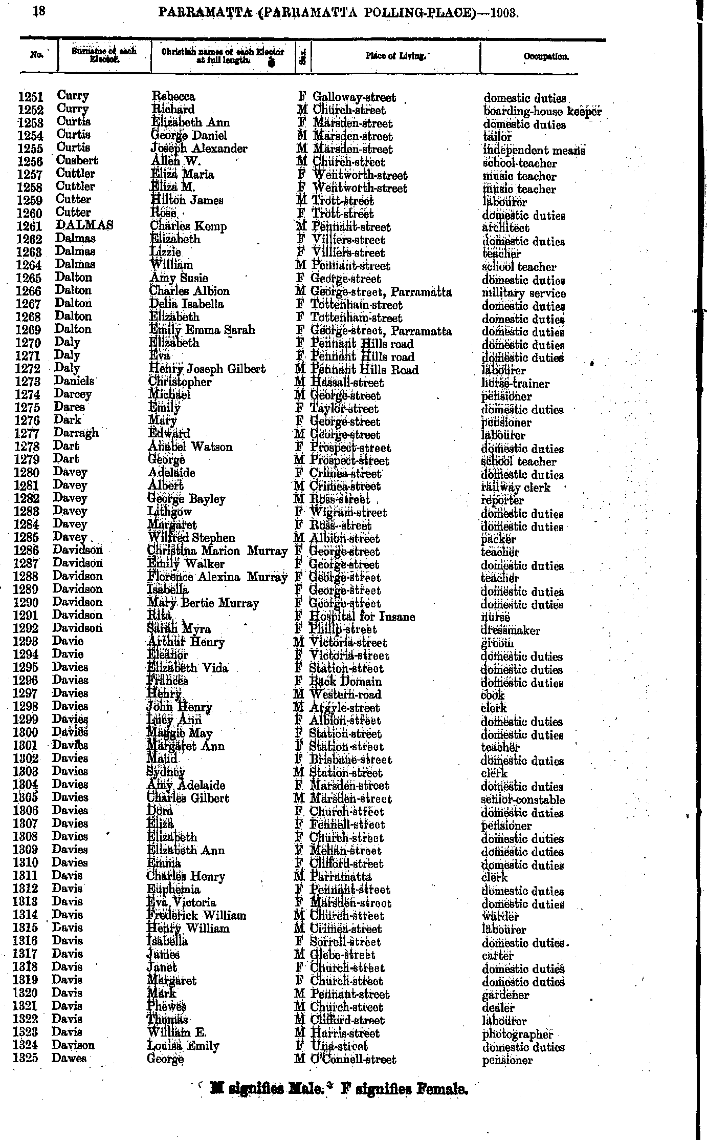
- Cranney William - Curry Jane
- Curry Rebecca - Dawes George
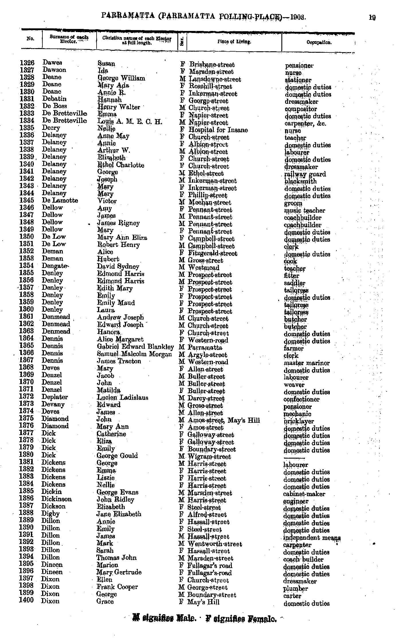
- Dawson Susan - Dixon Grace
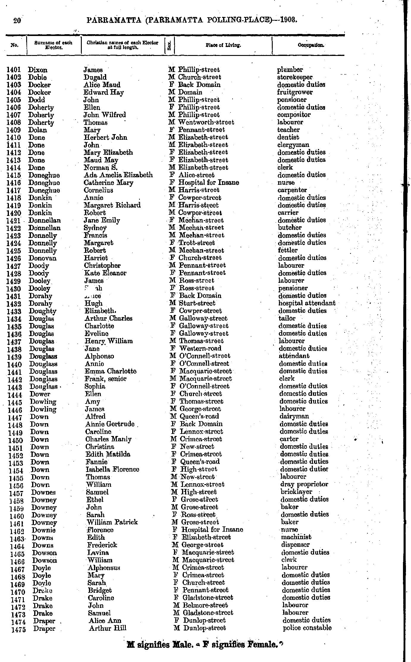
- Dixon James - Draper Arthur
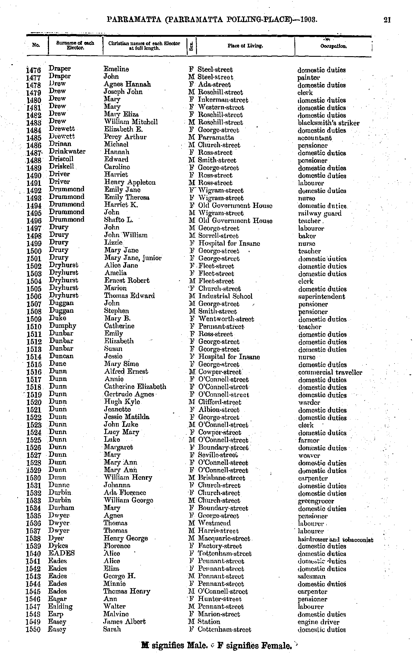
- Draper Emeline - Easey Sarah
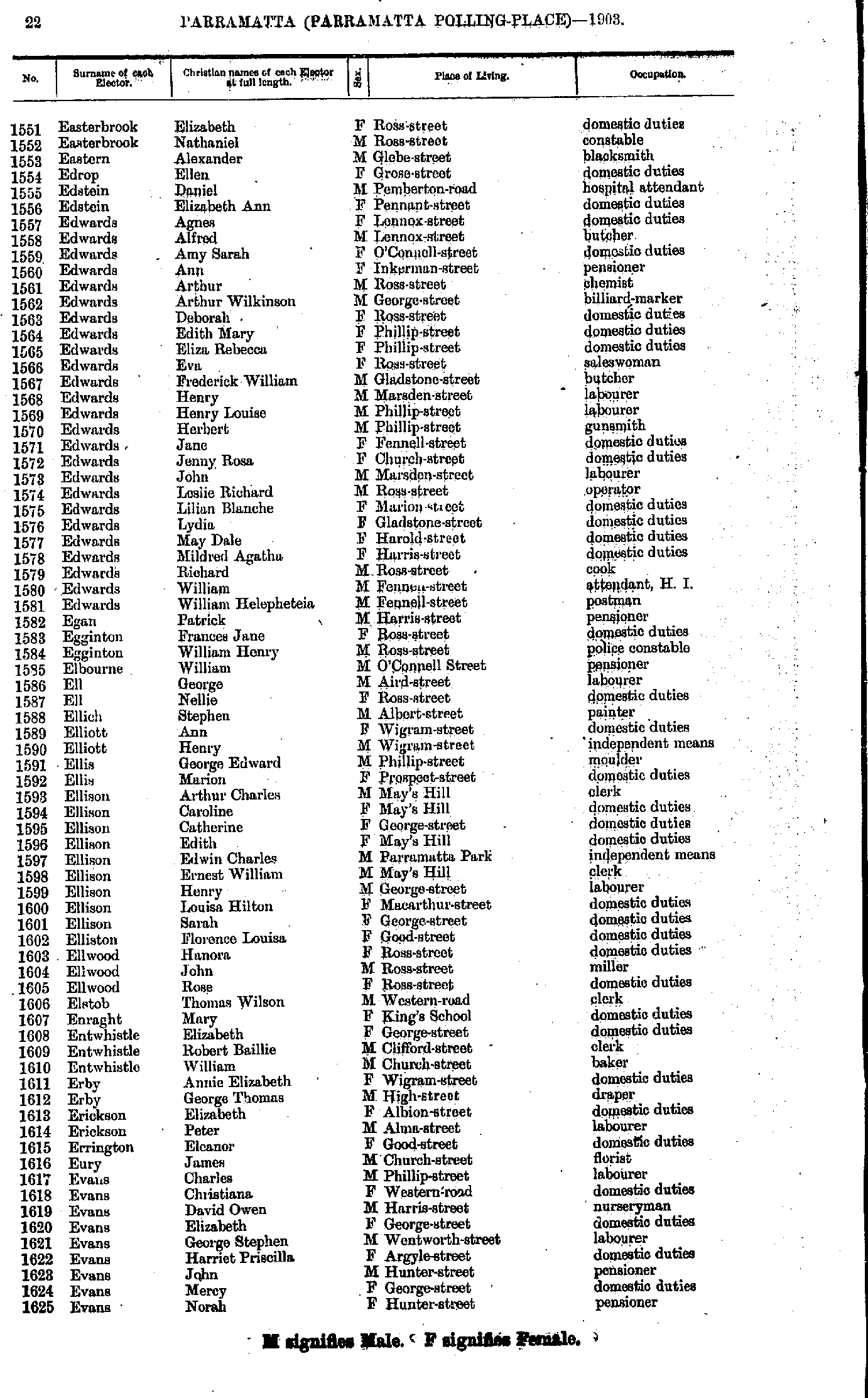
- Easterbrook Elizabeth - Evans Norah
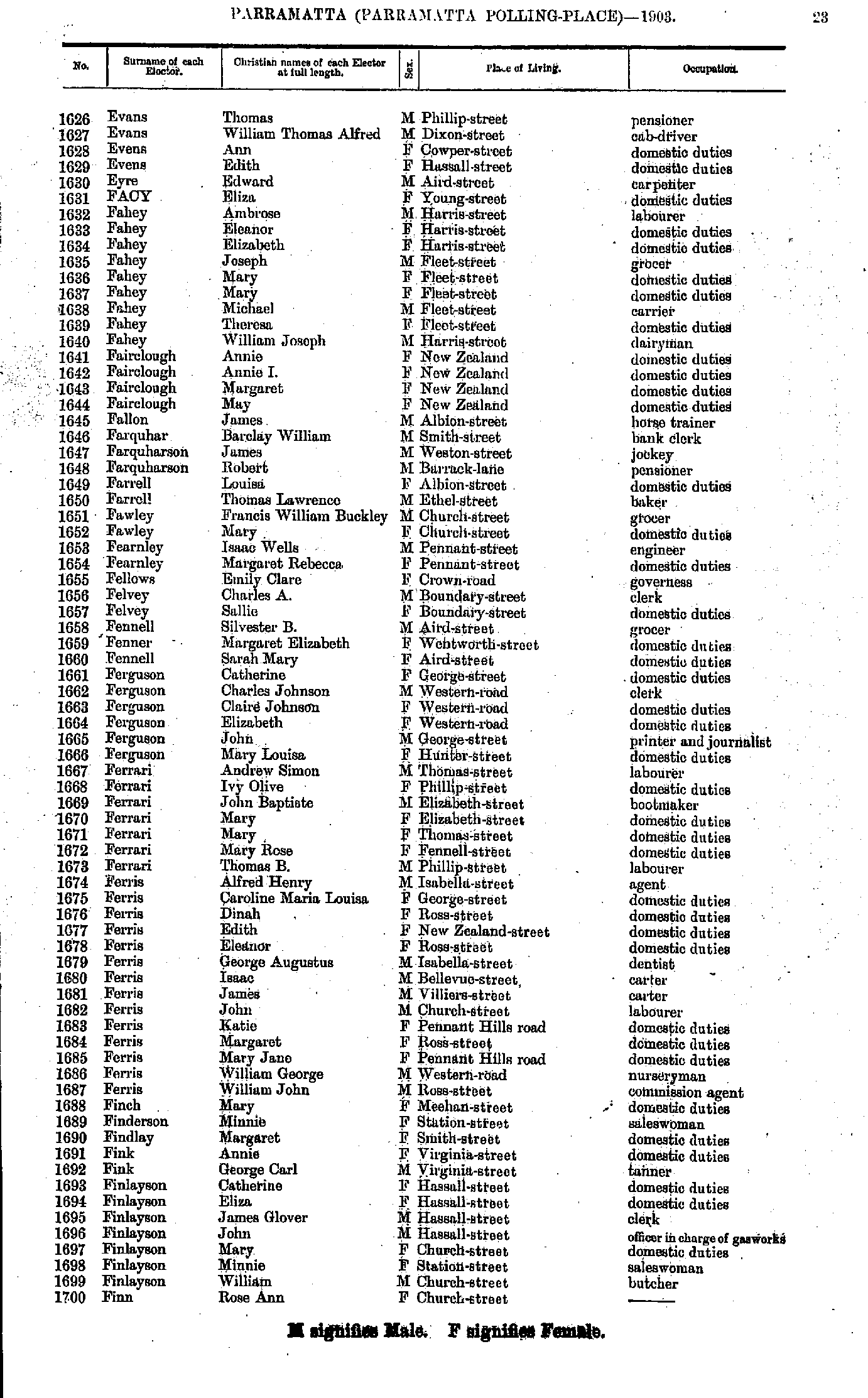
- Evans Thomas - Finn Rose
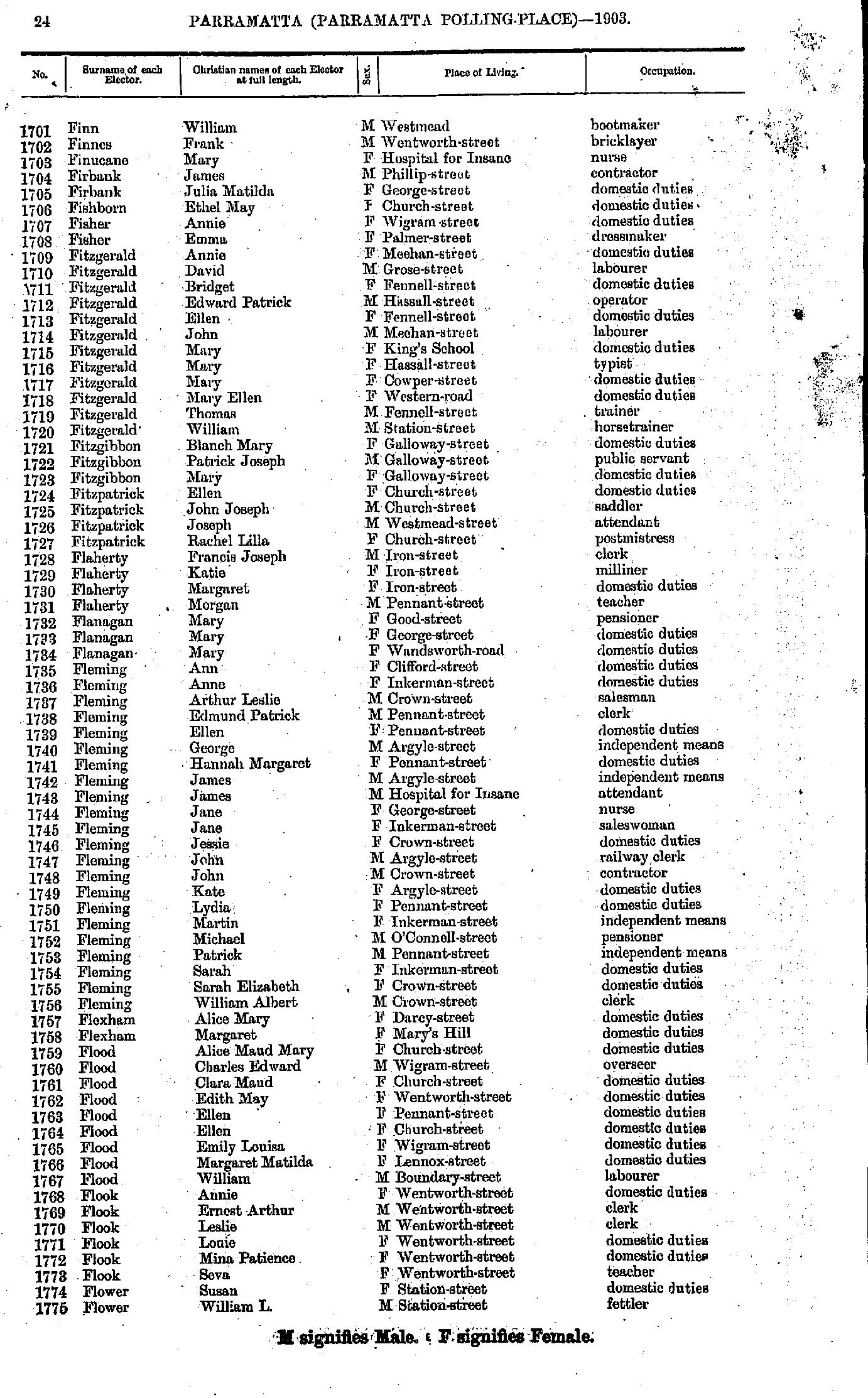
- Finn William - Flower William
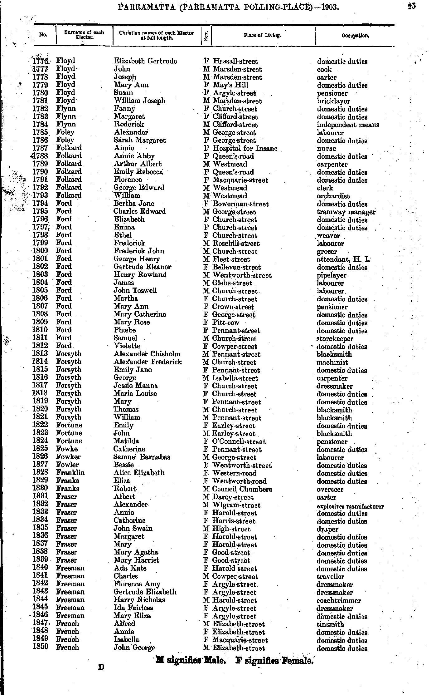
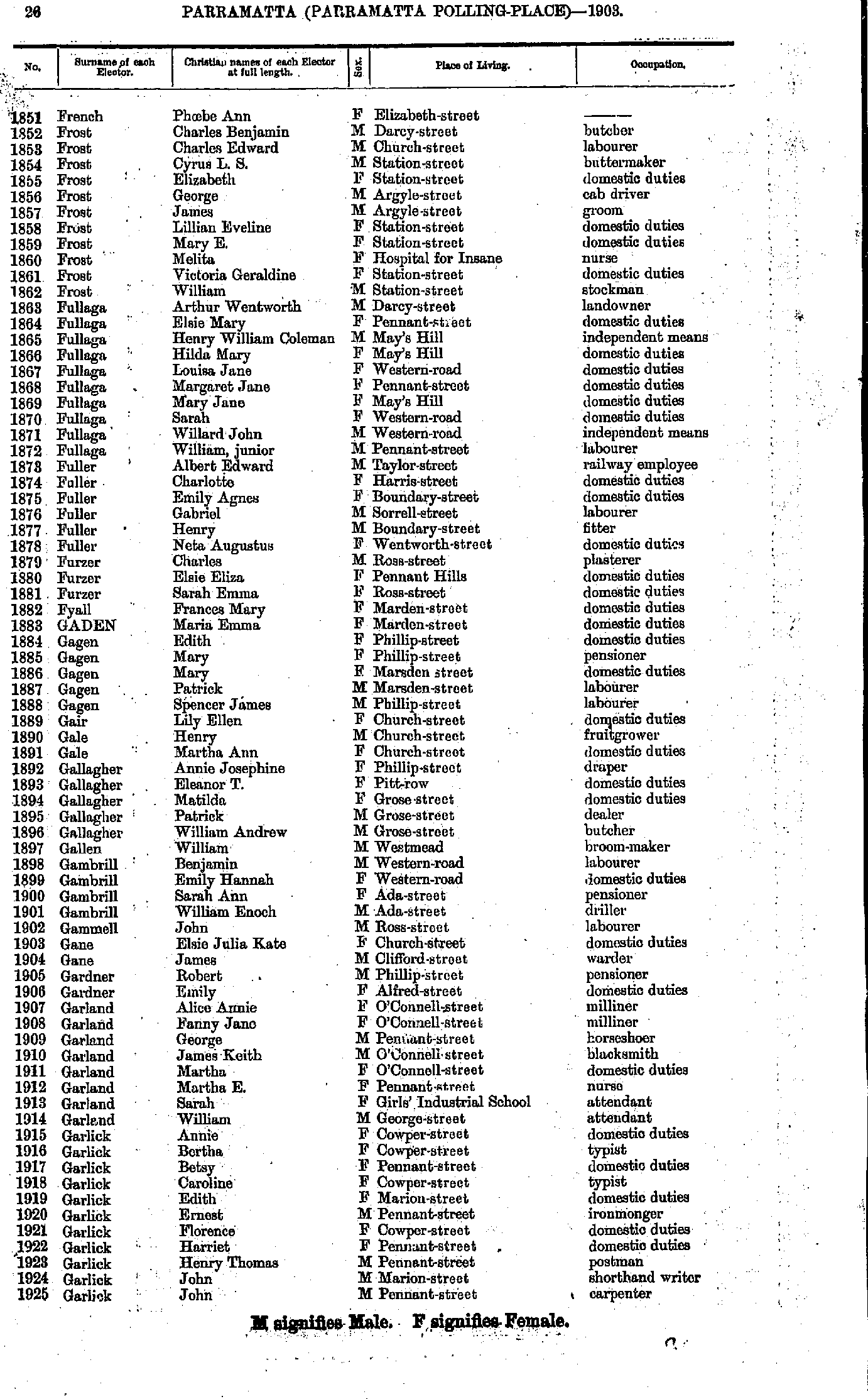
- Floyd Elizabeth - French John
- French Phoebe - Garlick John
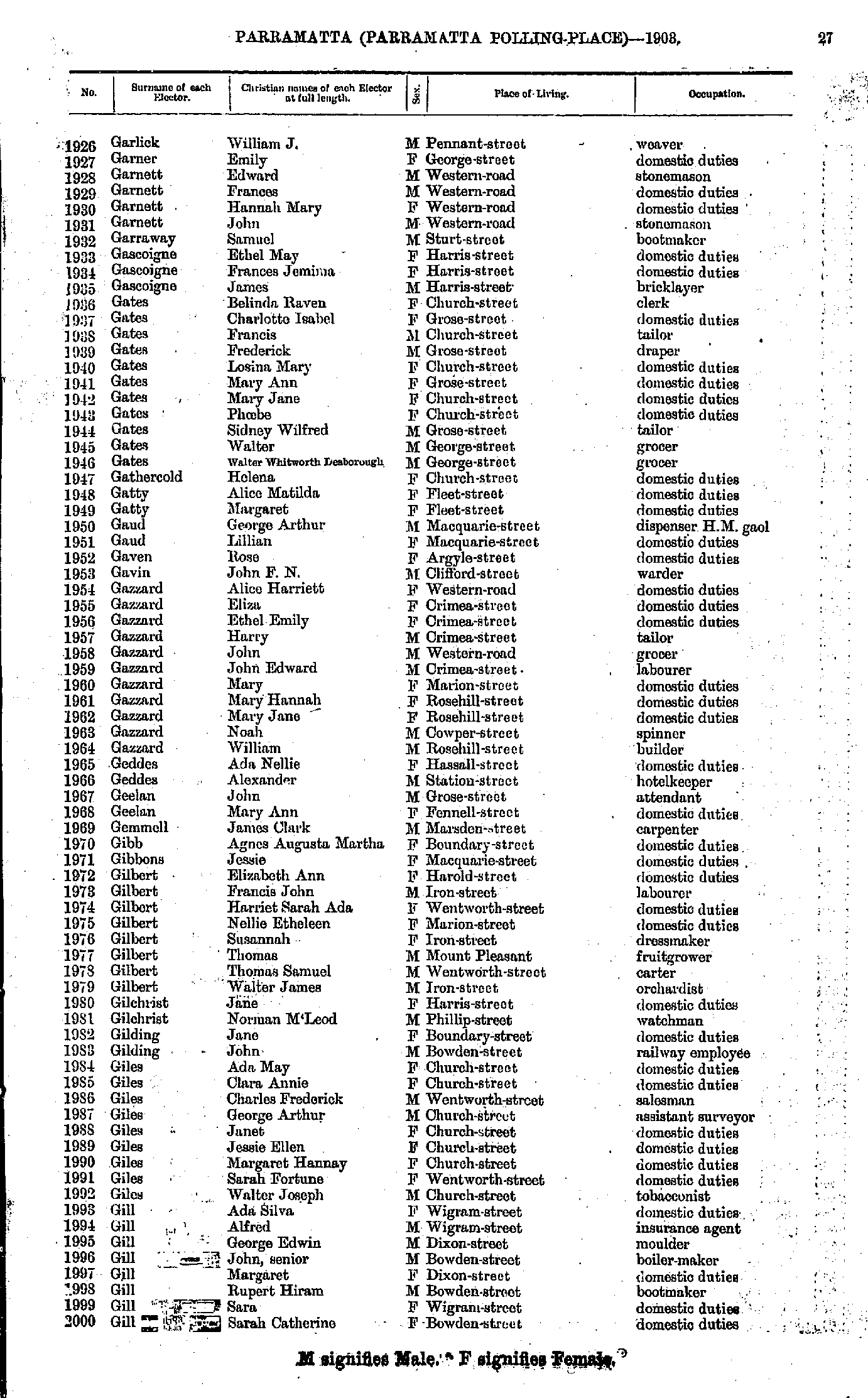
- Garlick William - Gill Sarah
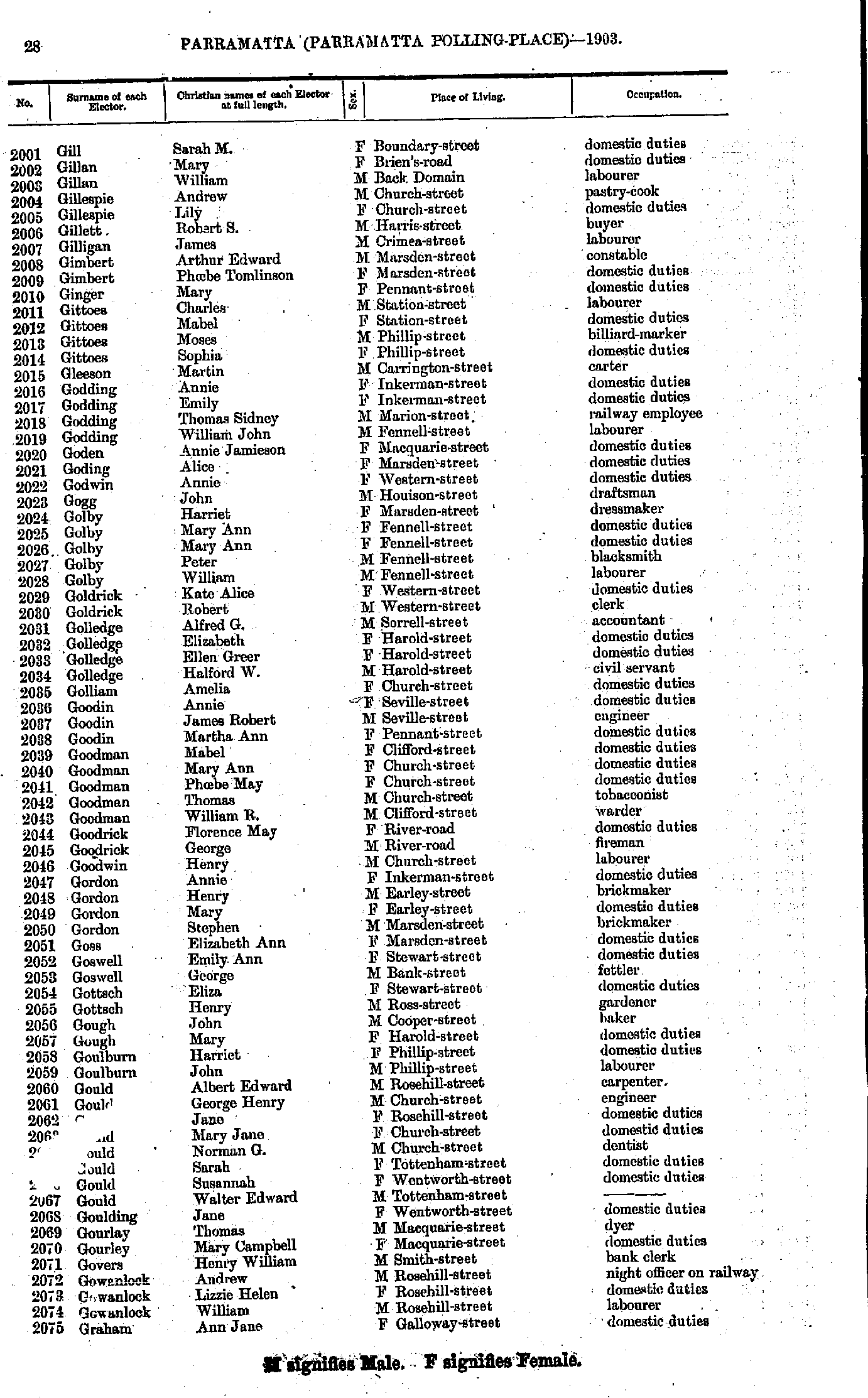
- Gill Sarah - Graham Ann
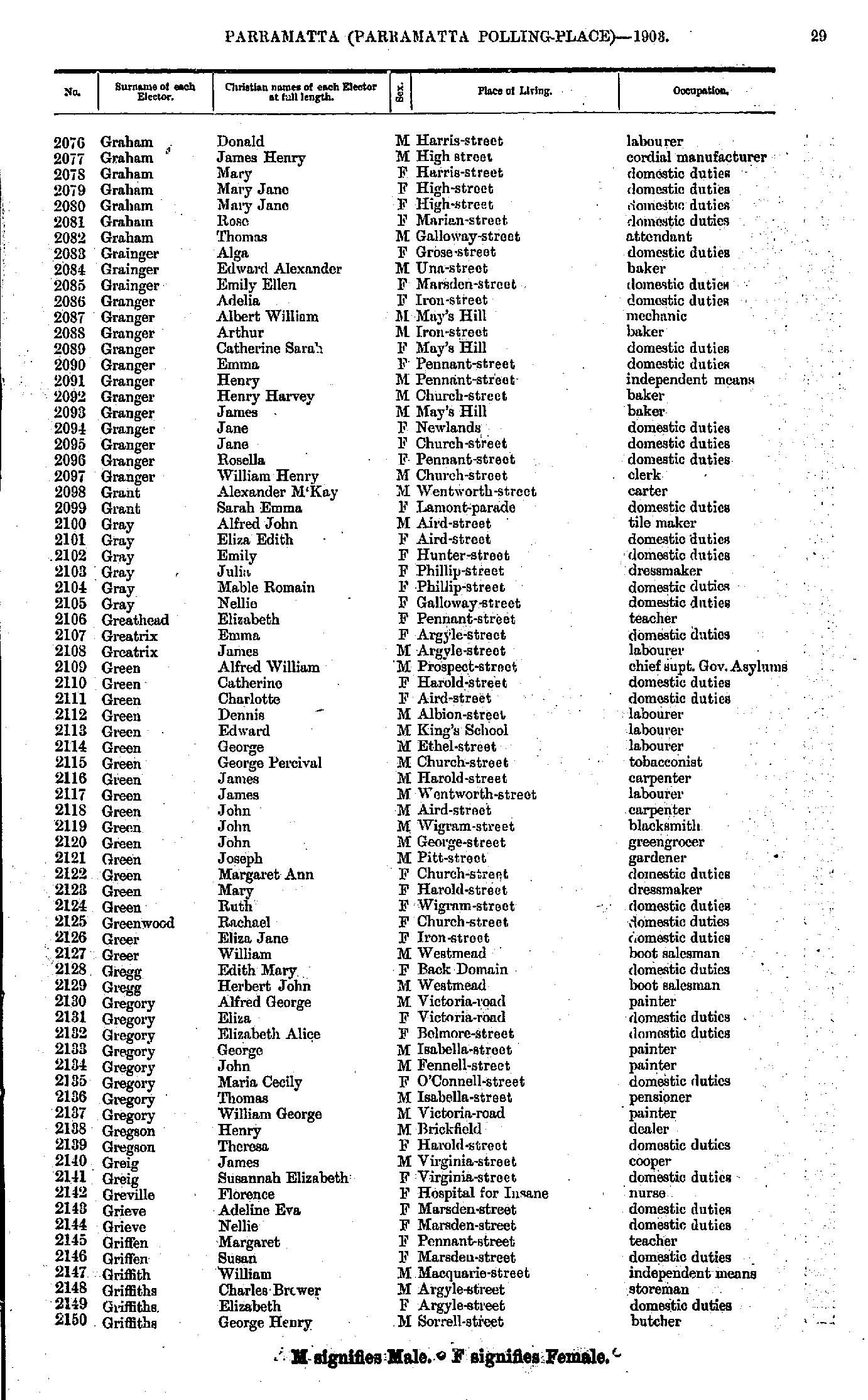
- Graham Donald - Griffiths George
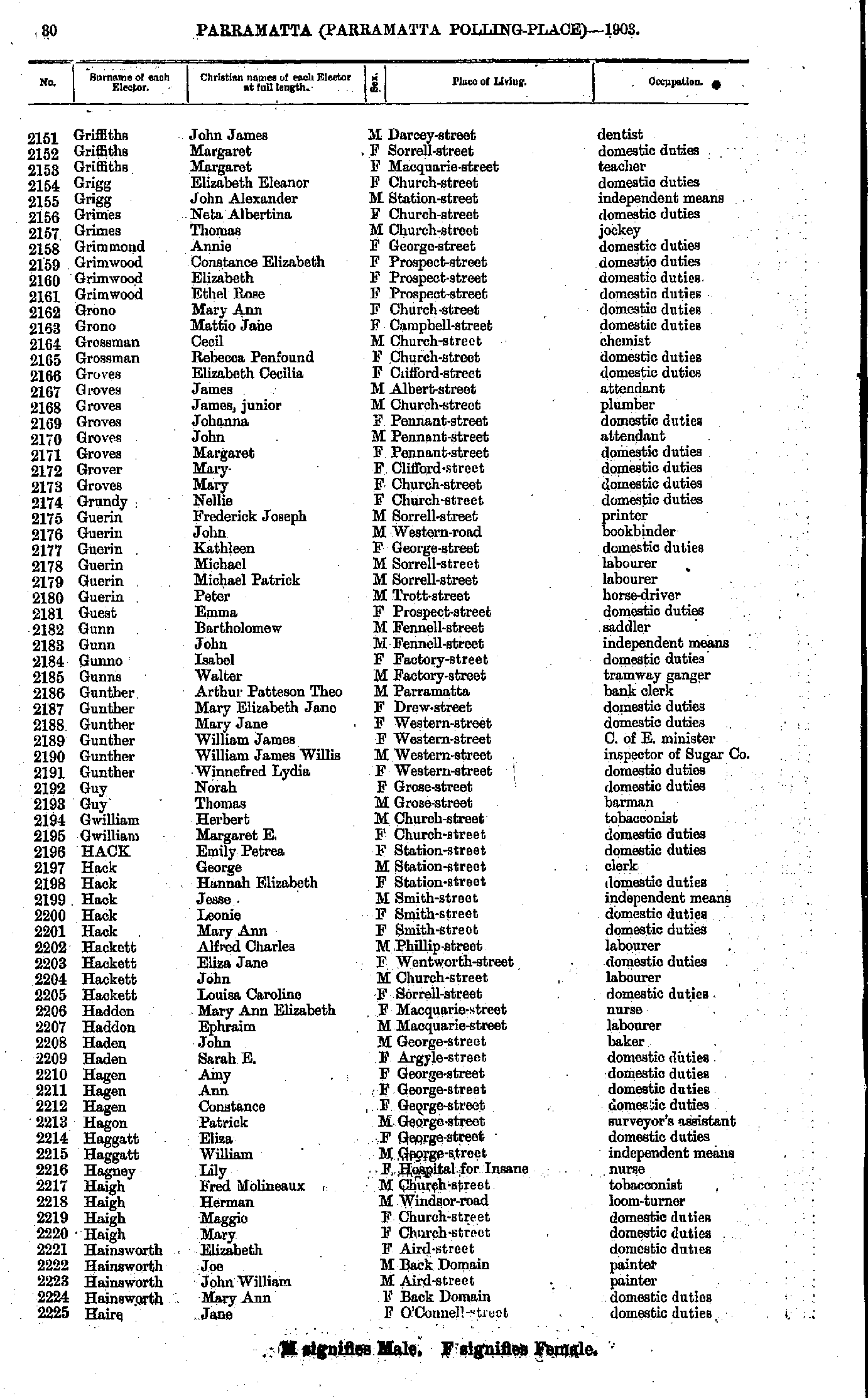
- Griffiths John - Haire Jane
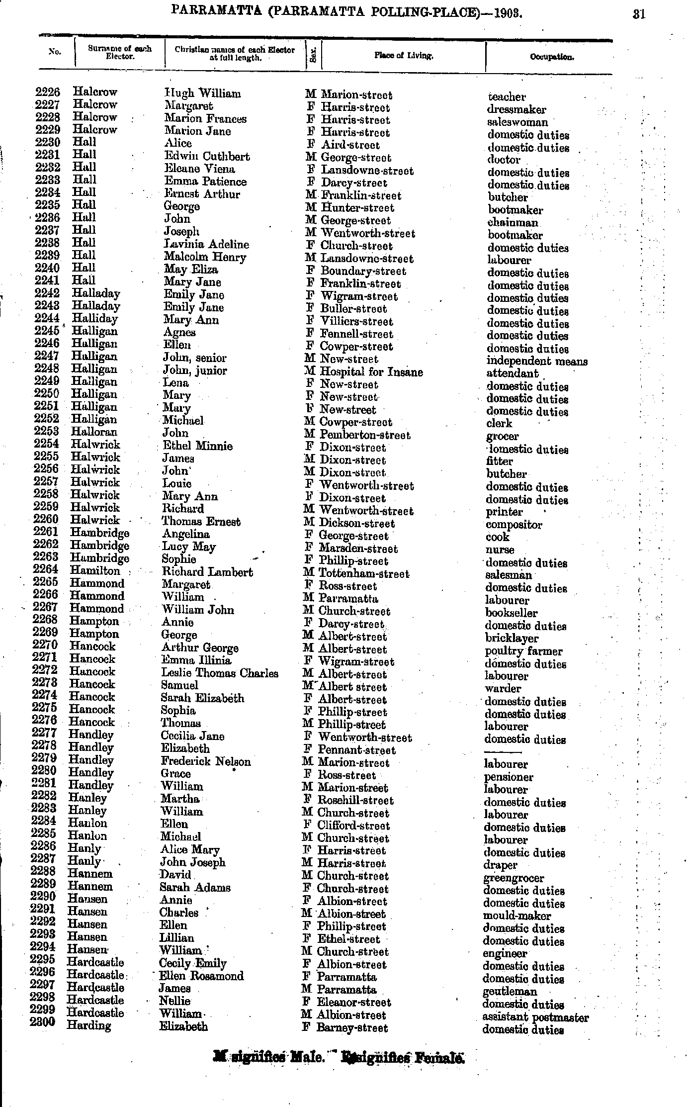
- Halcrow Hugh - Harding Elizabeth
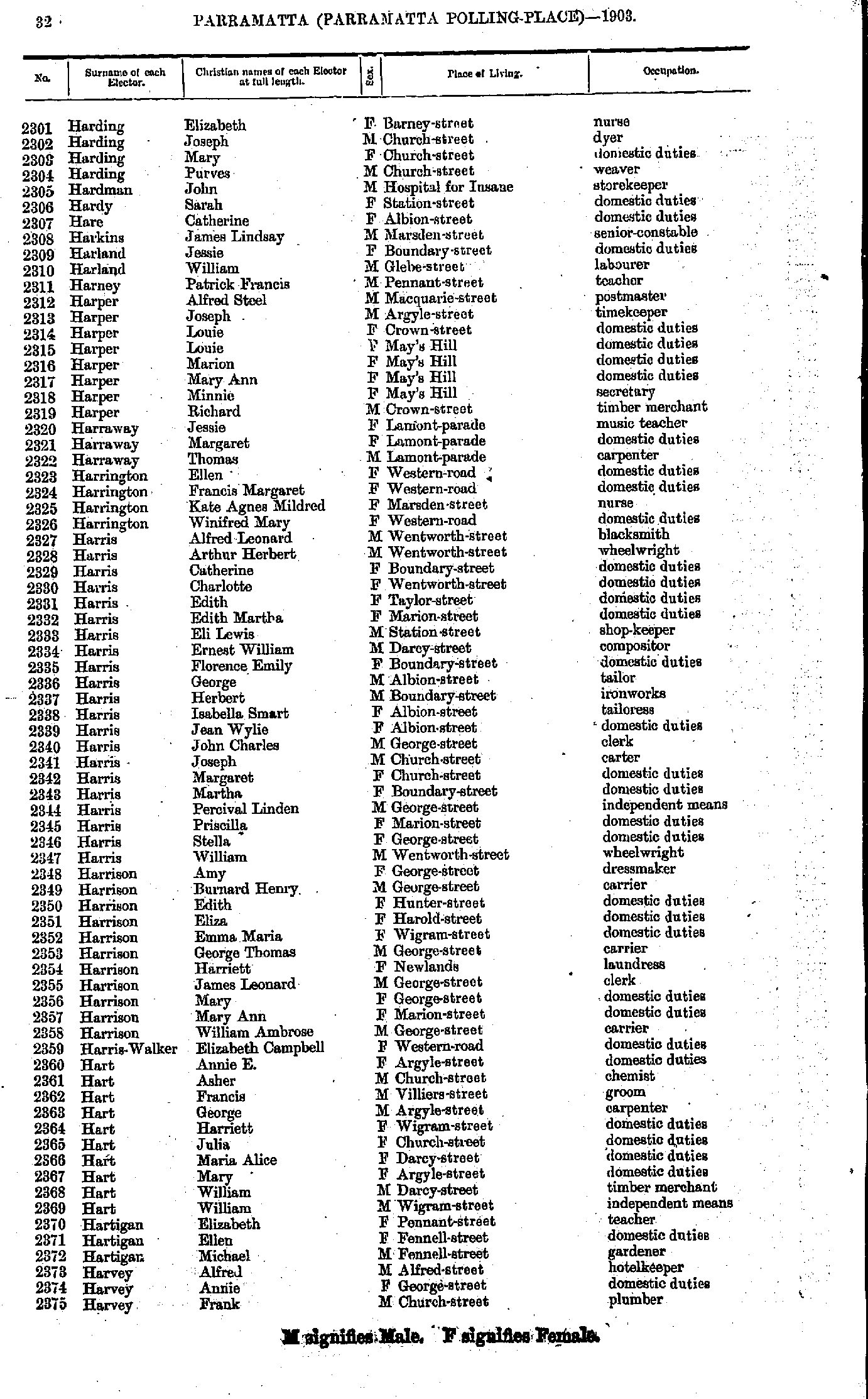
- Harding Elizabeth - Harvey Frank
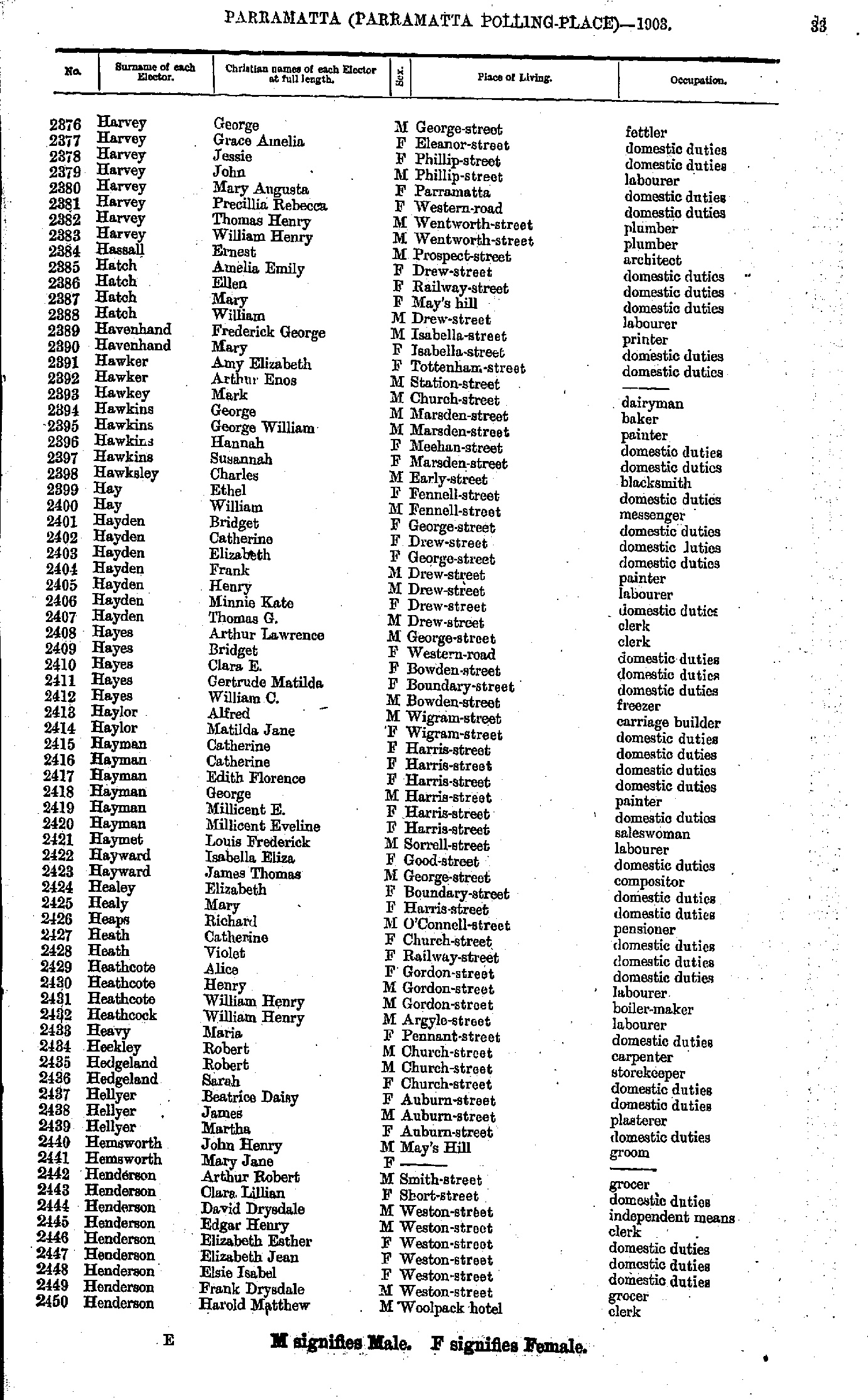
- Harvey George - Henderson Harold
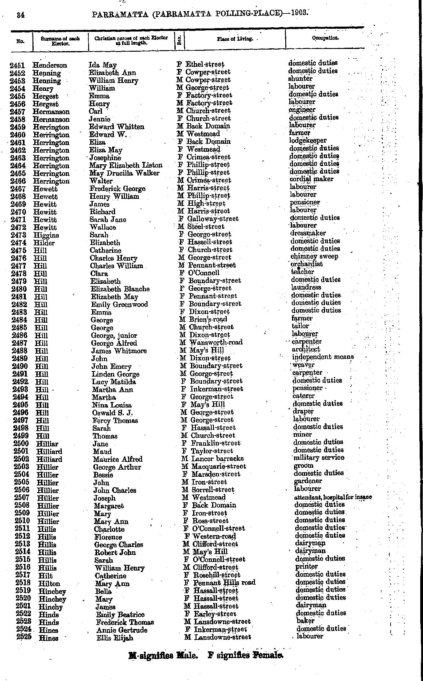
- Henderson Ida - Hines Ellis
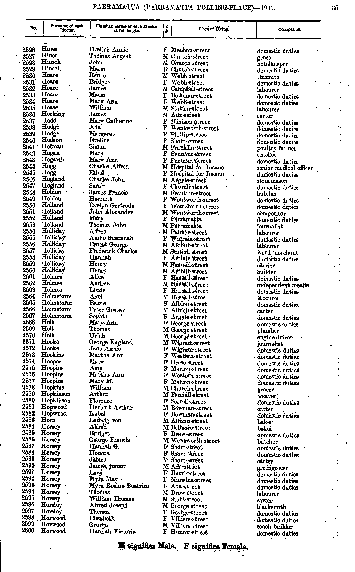
- Hines Eveline - Horwood Hannah
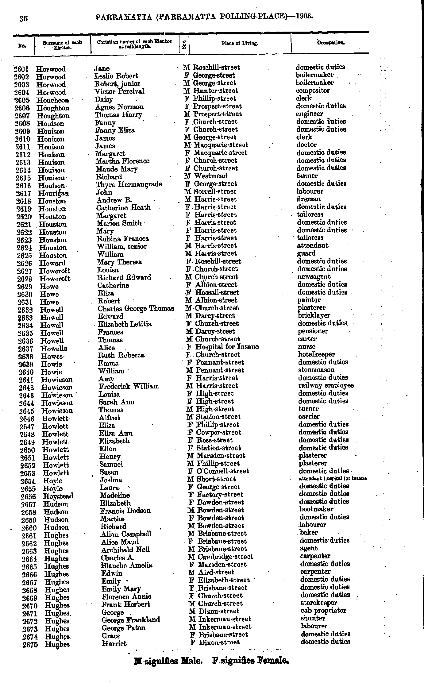
- Horwood Jane - Hughes Harriet
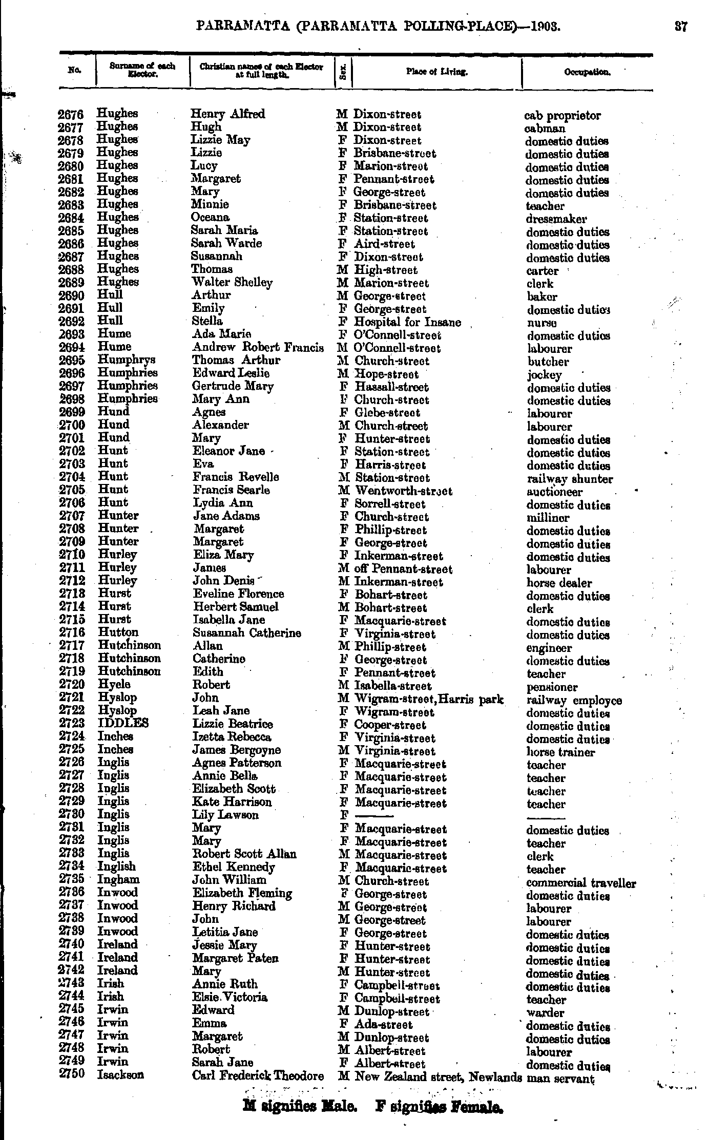
- Hughes Henry - Isackson Carl
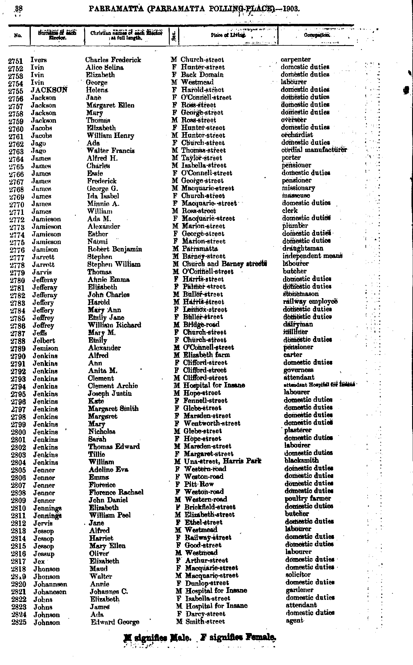
- Ivers Charles - Johnson Edward
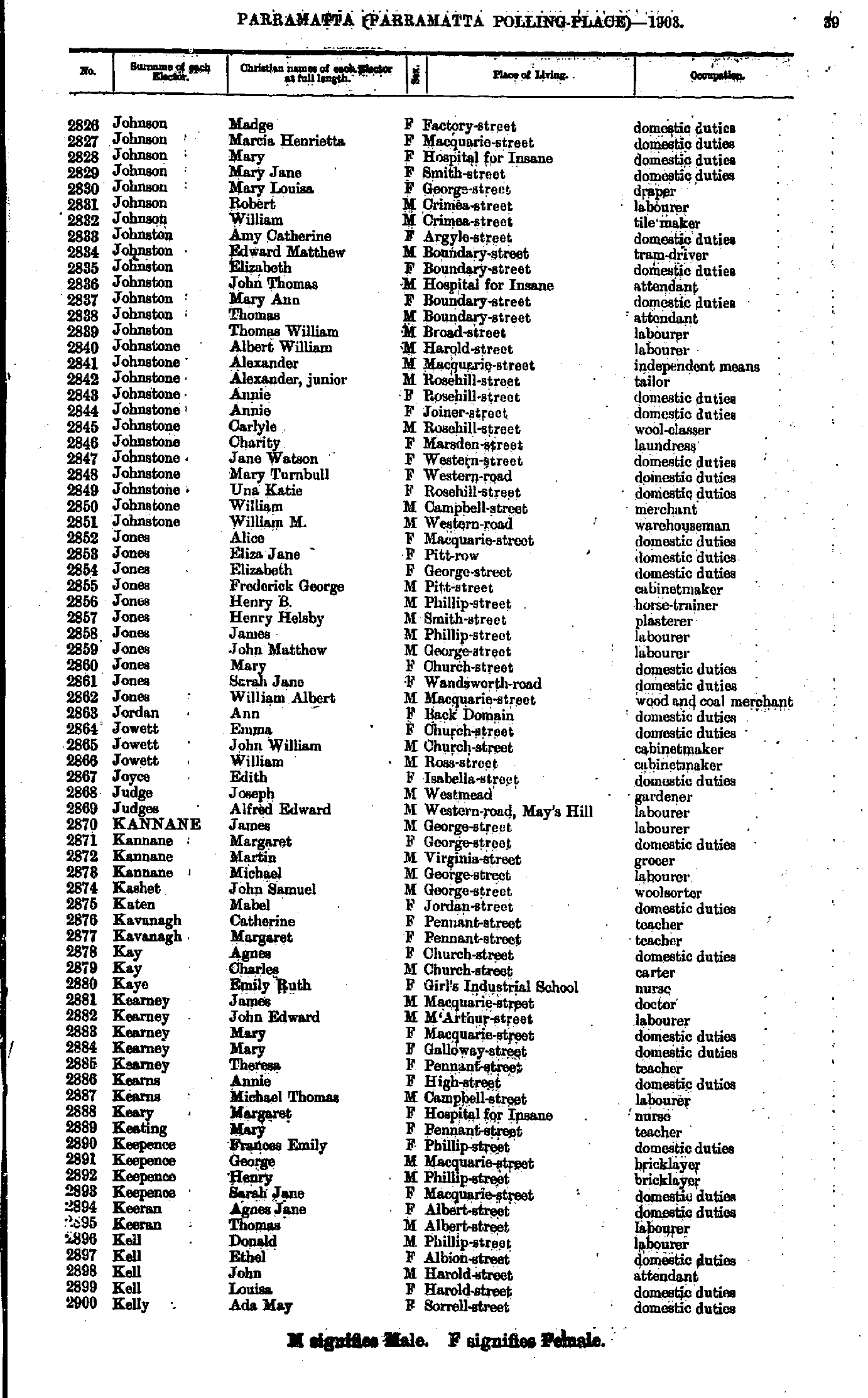
- Johnson Madge - Kelly Ada
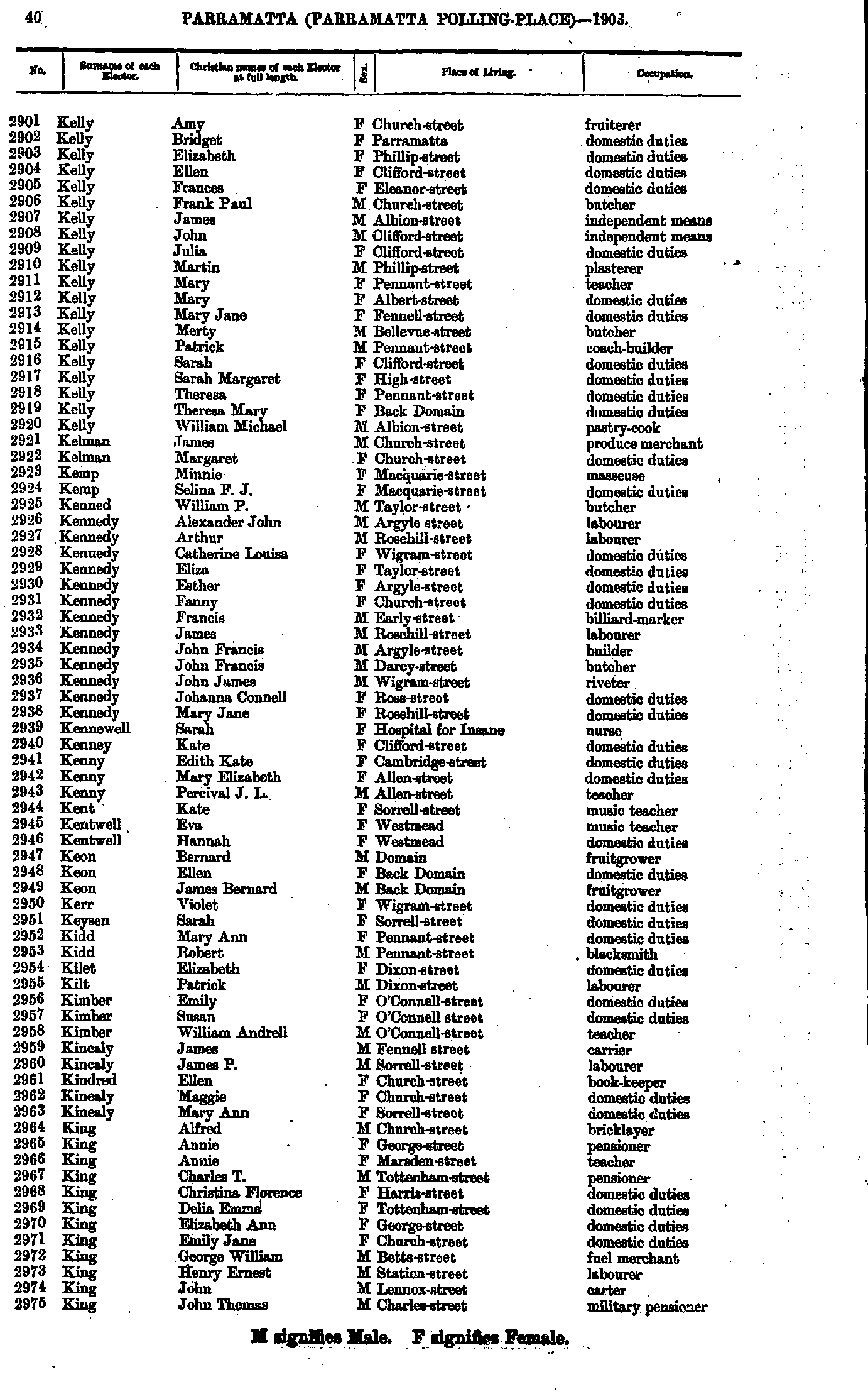
- Kelly Amy - King John
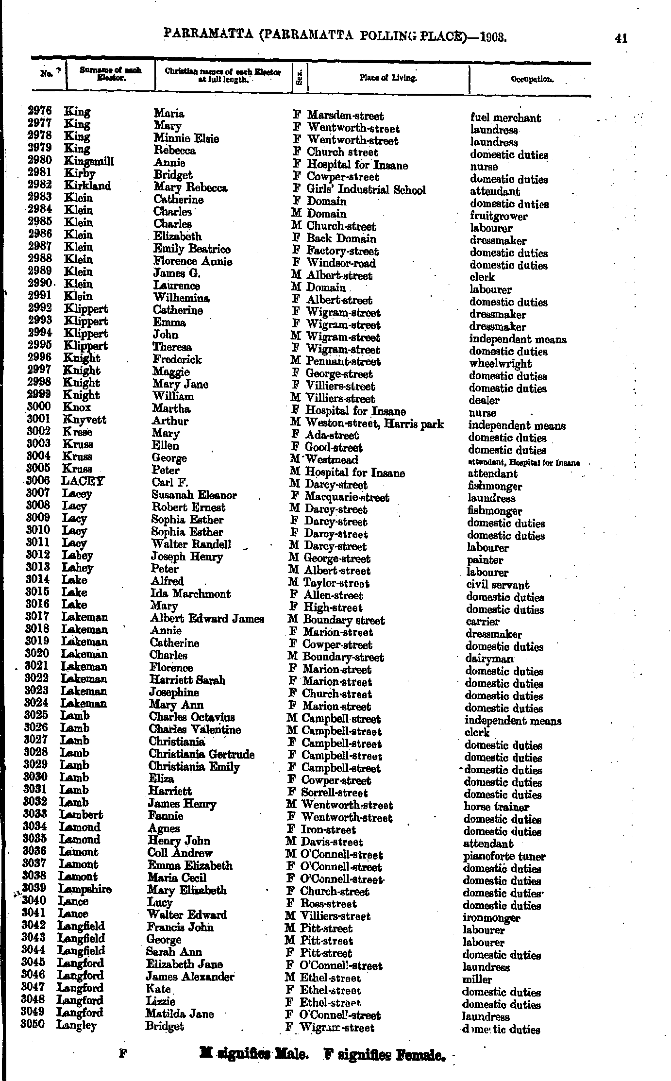
- King Maria - Langley Bridget
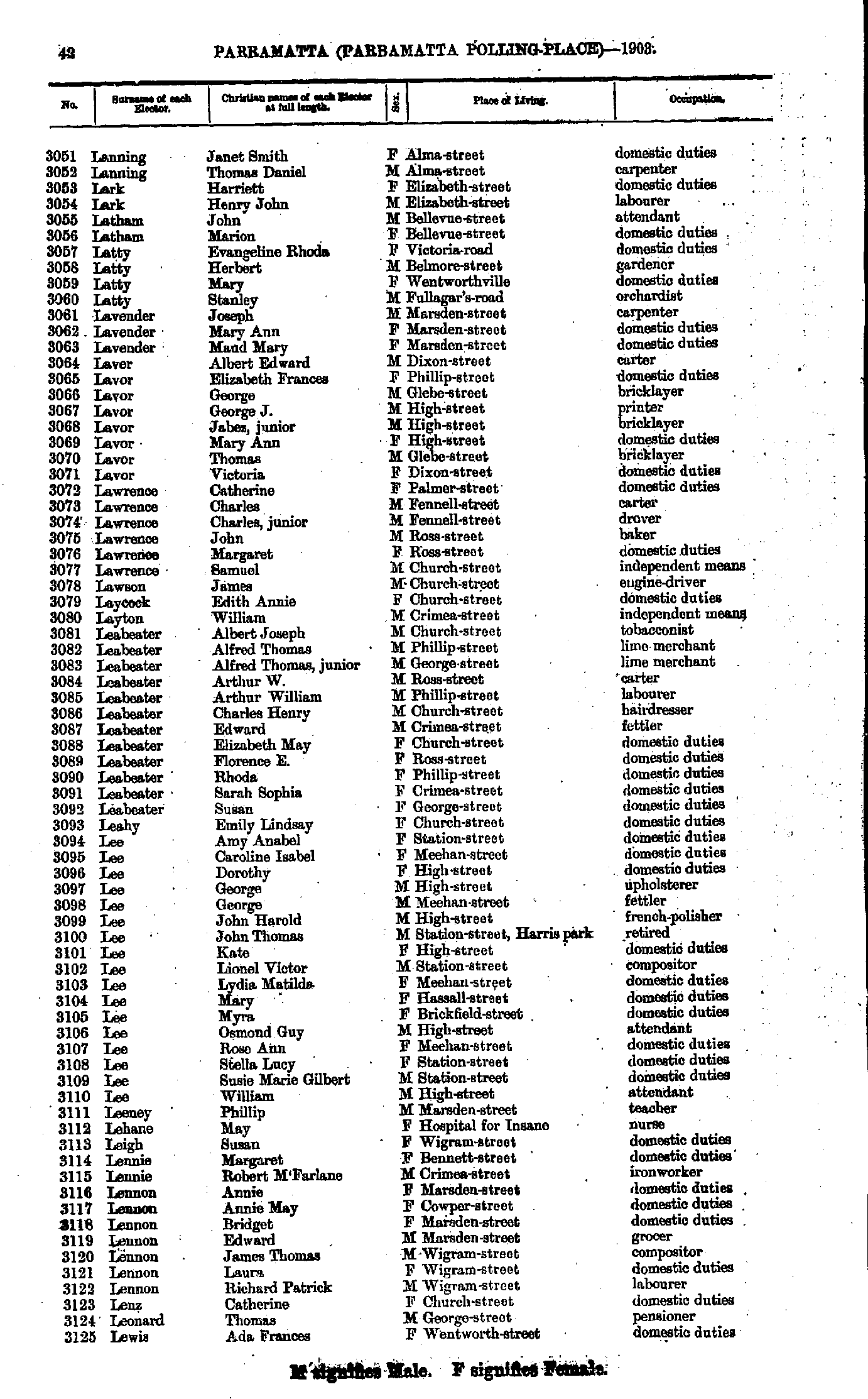
- Lanning Janet - Lewis Ada
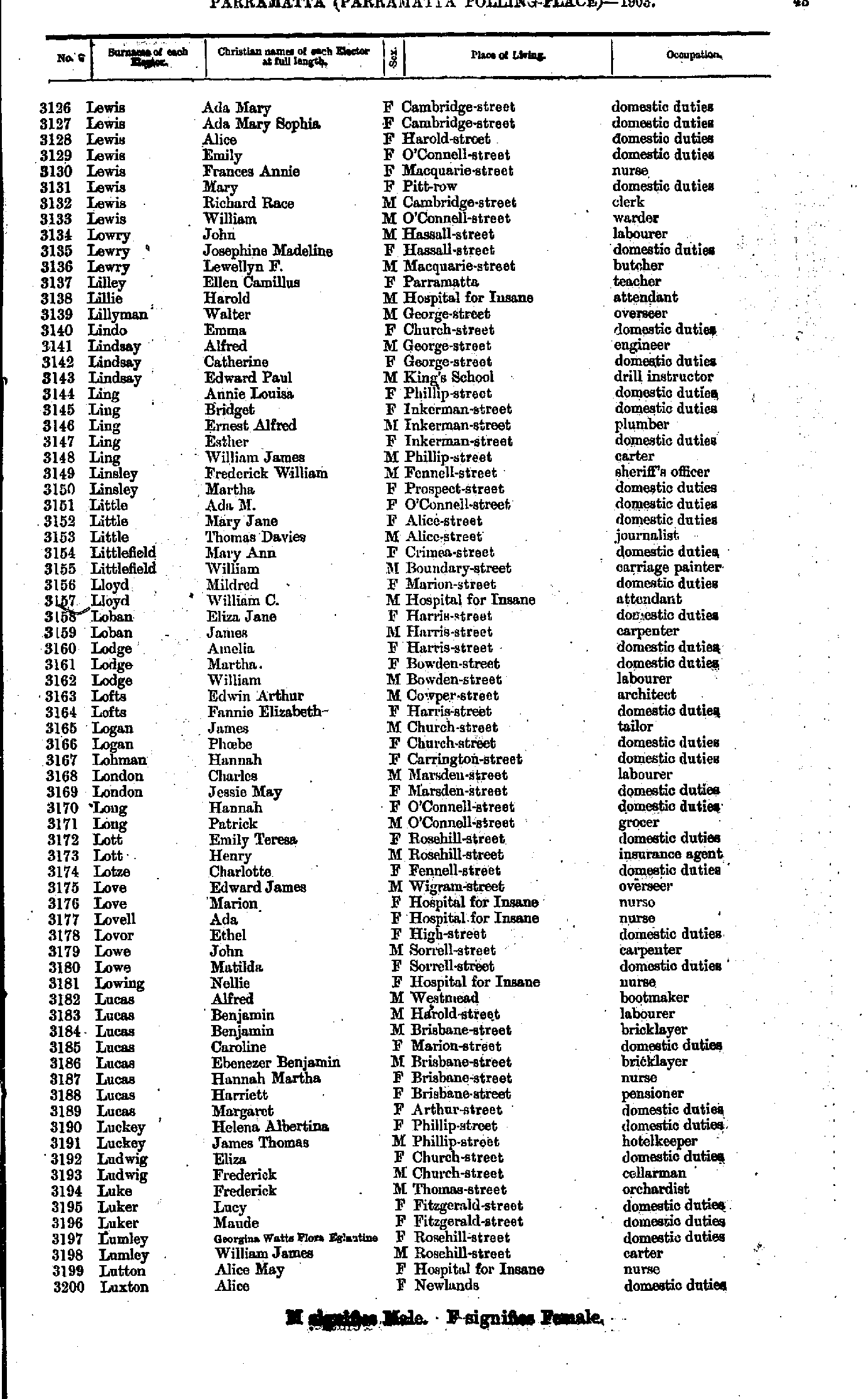
- Lewis Ada - Luxton Alice
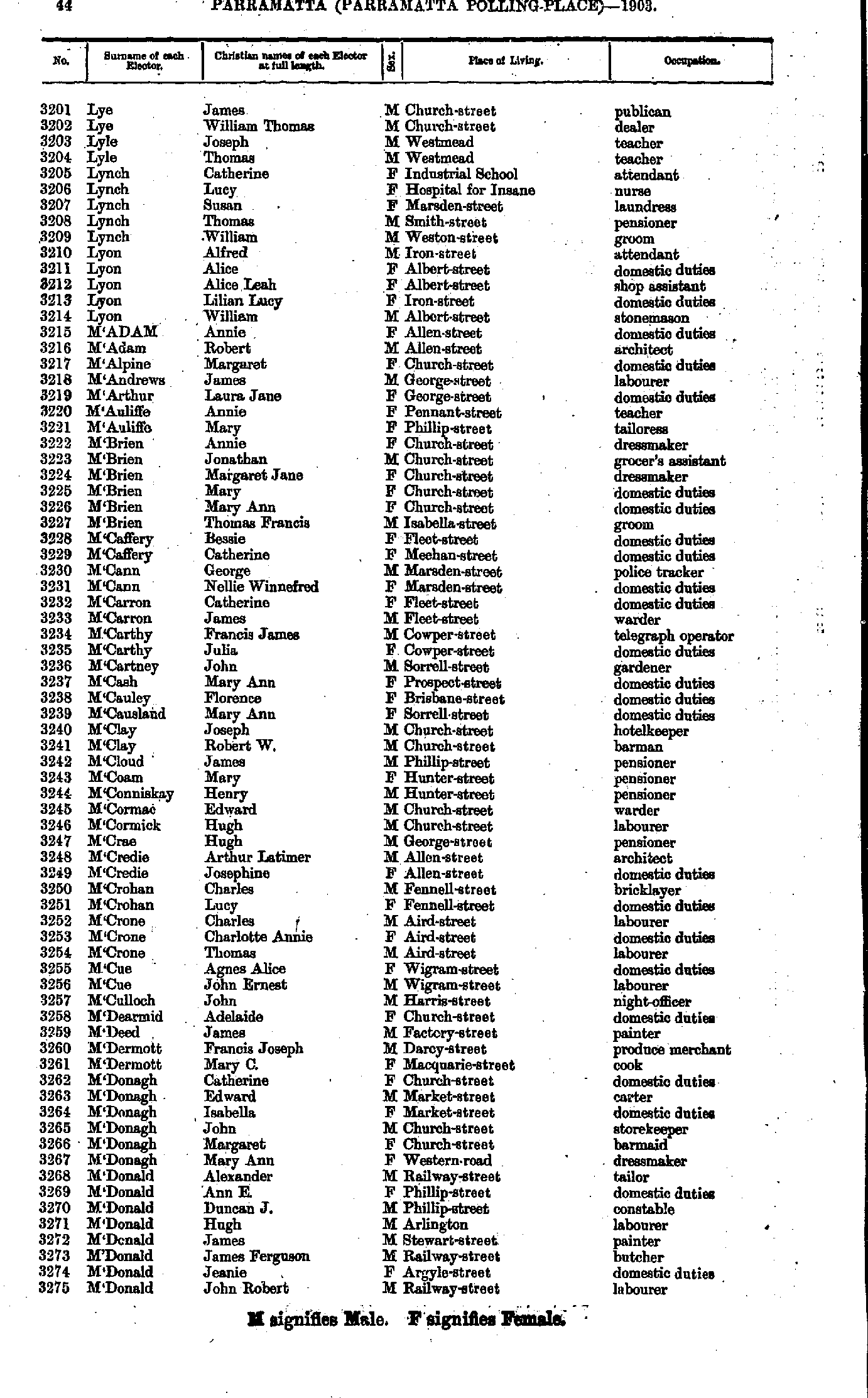
- Lye James - M'Donald John
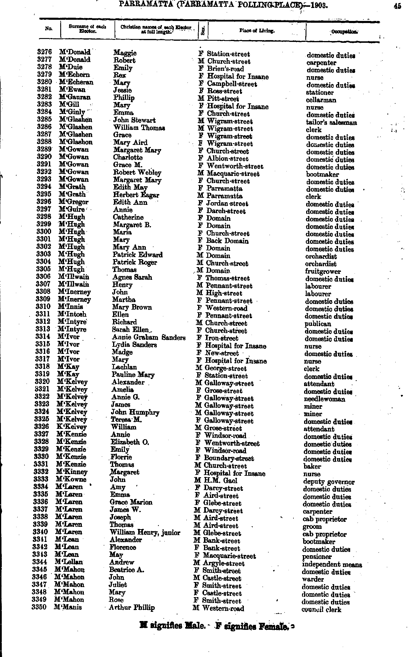
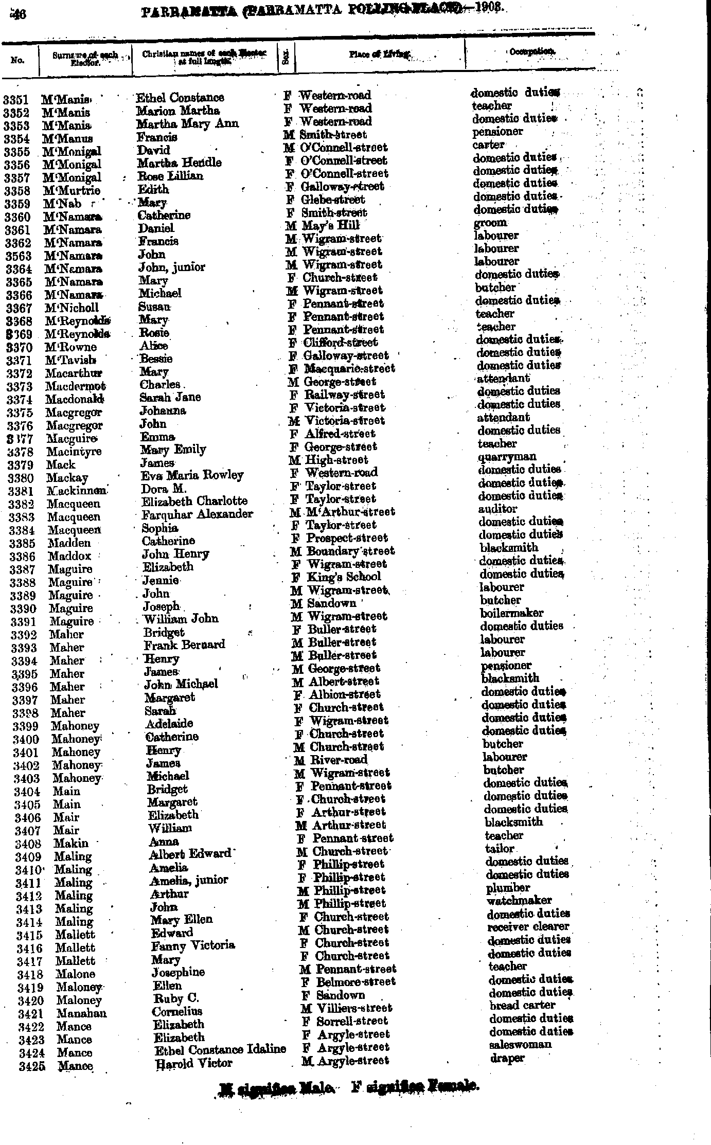
- M'Donald Maggie - M'Manis Arthur
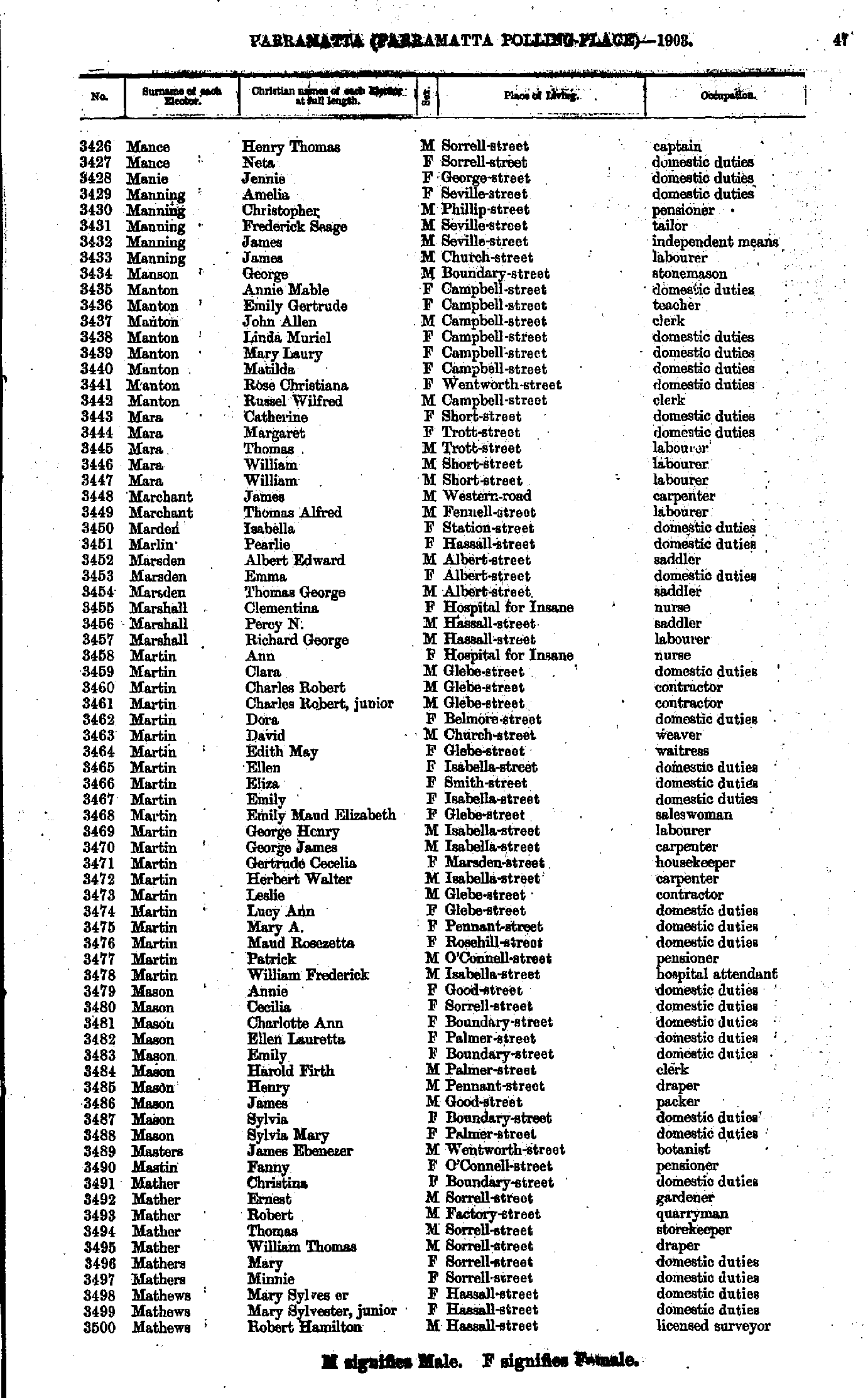
- M'Manis Ethel - Mance Harold
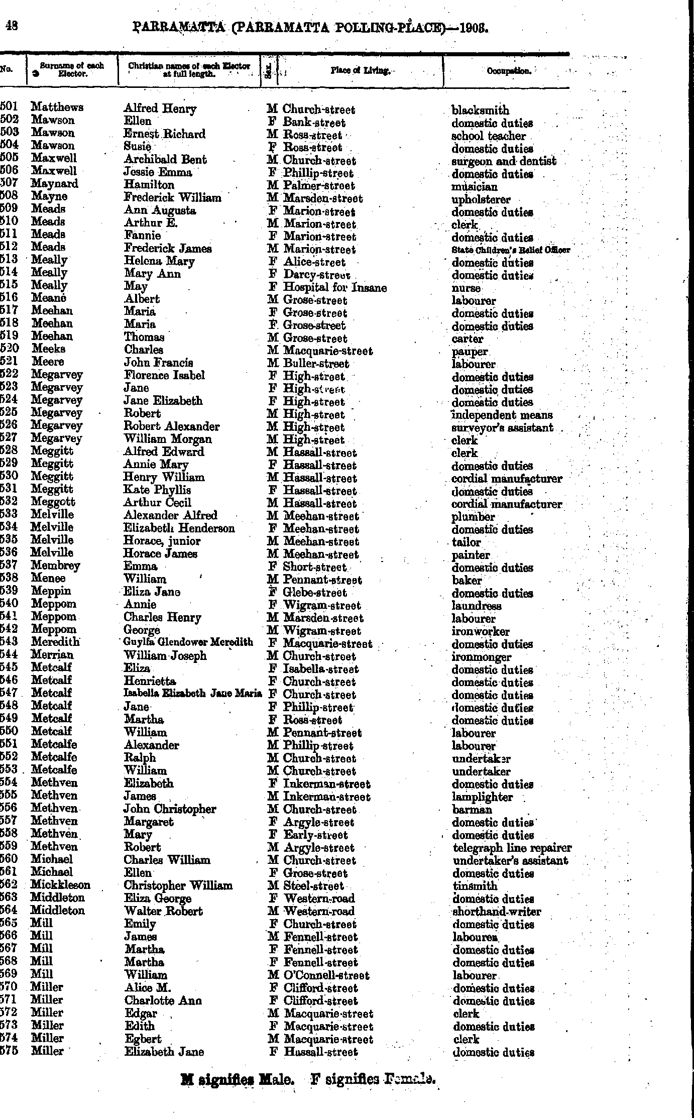
- Mance Henry - Mathews Robert
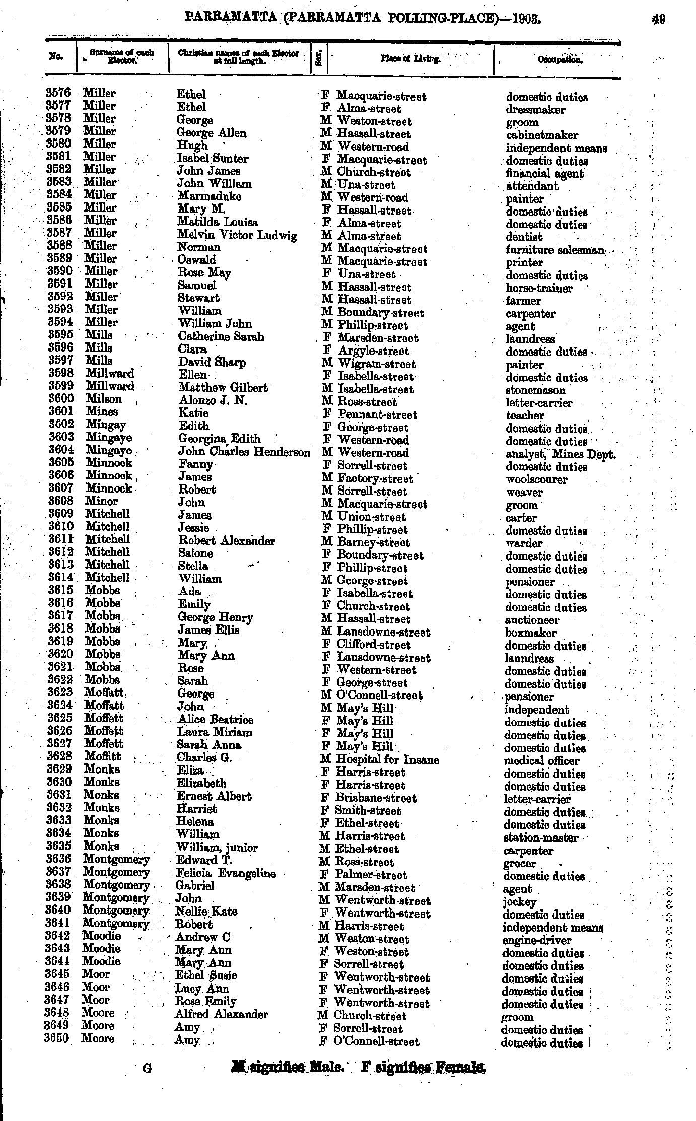
- Matthews Alfred - Miller Elizabeth
- Miller Ethel - Moore Amy
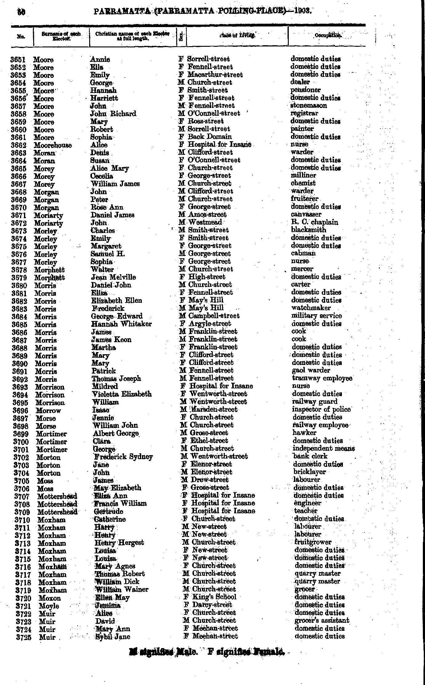
- Moore Annie - Muir Sybil
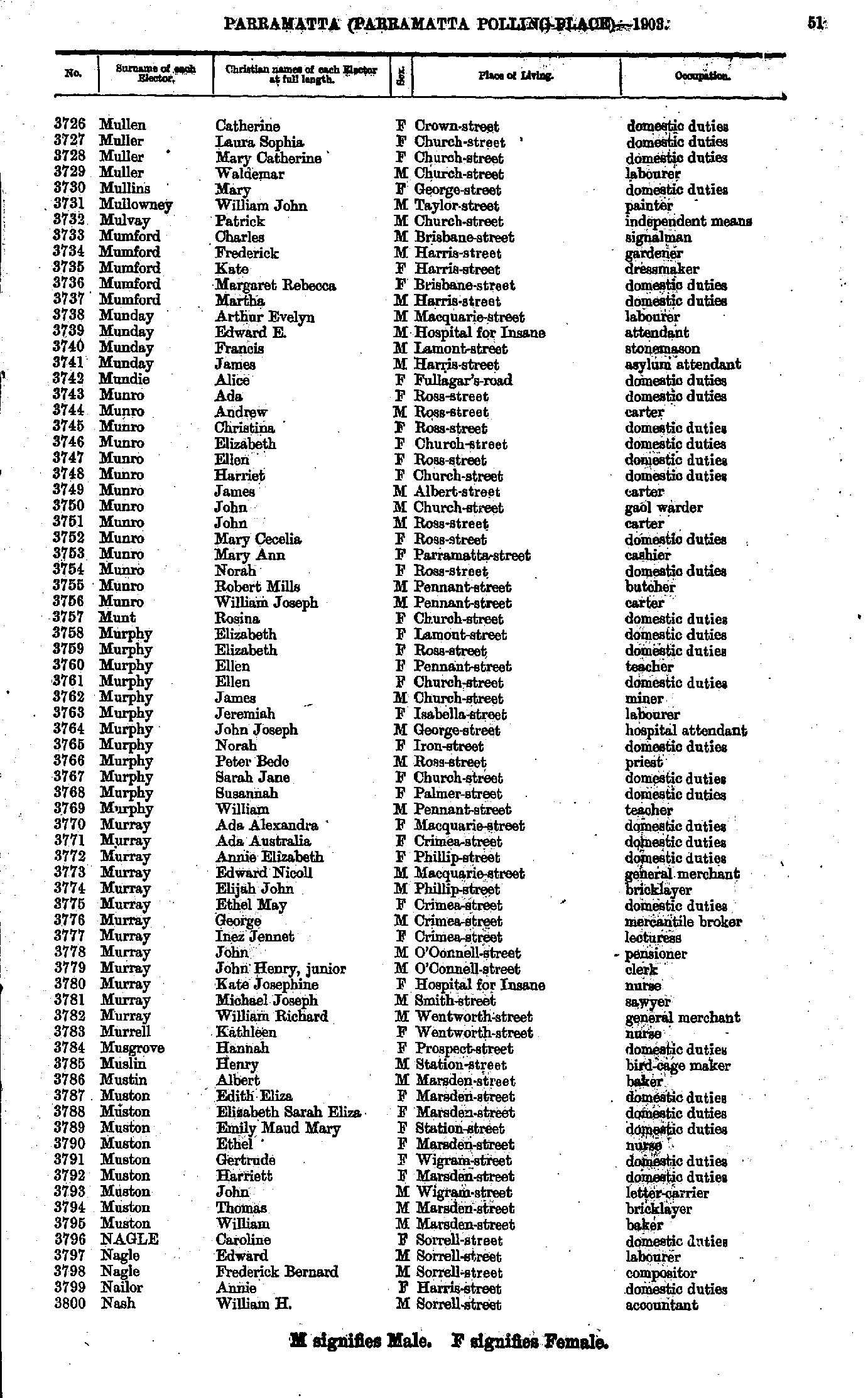
- Mullen Catherine - Nash William
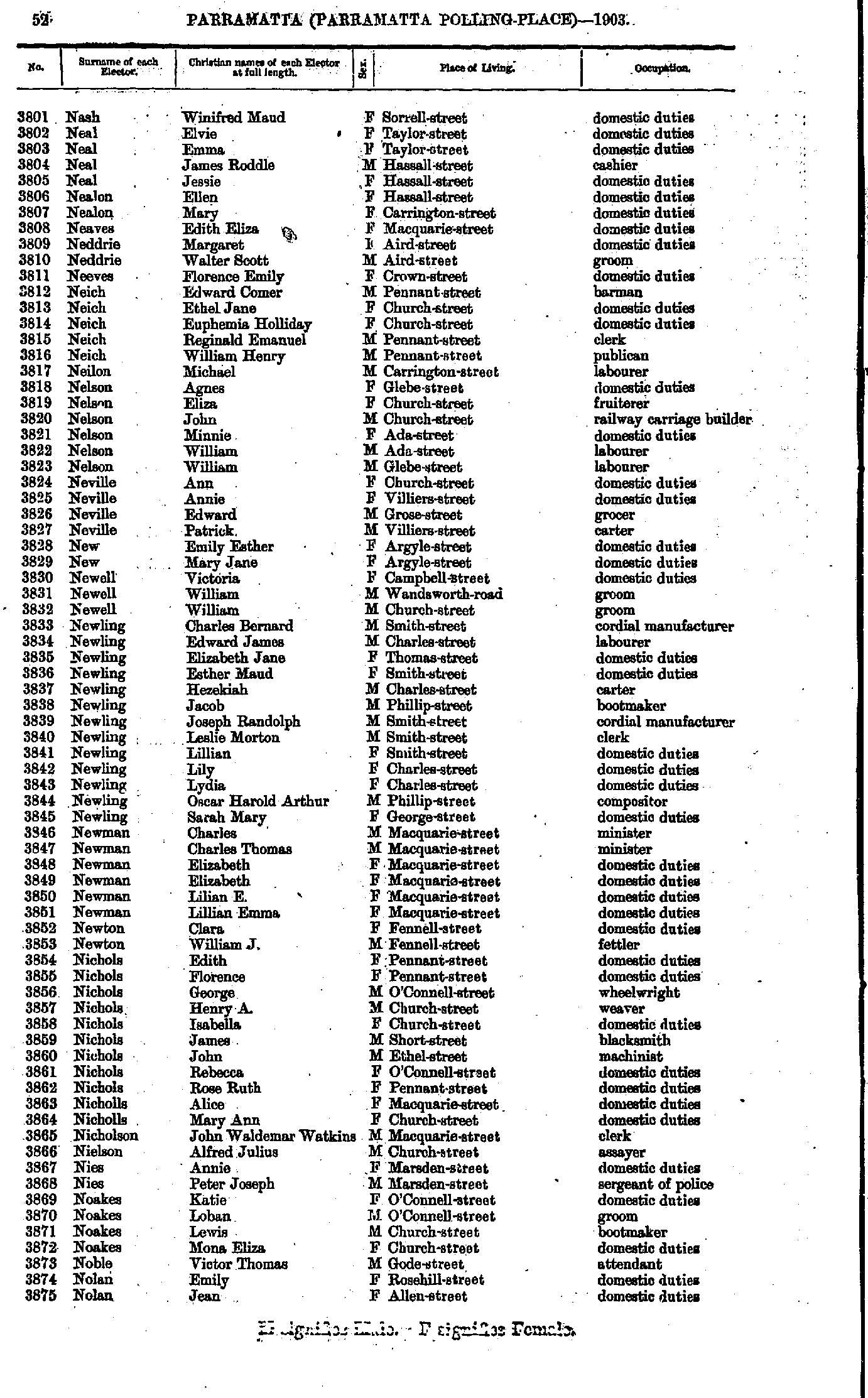
- Nash Winifred - Nolan Jean
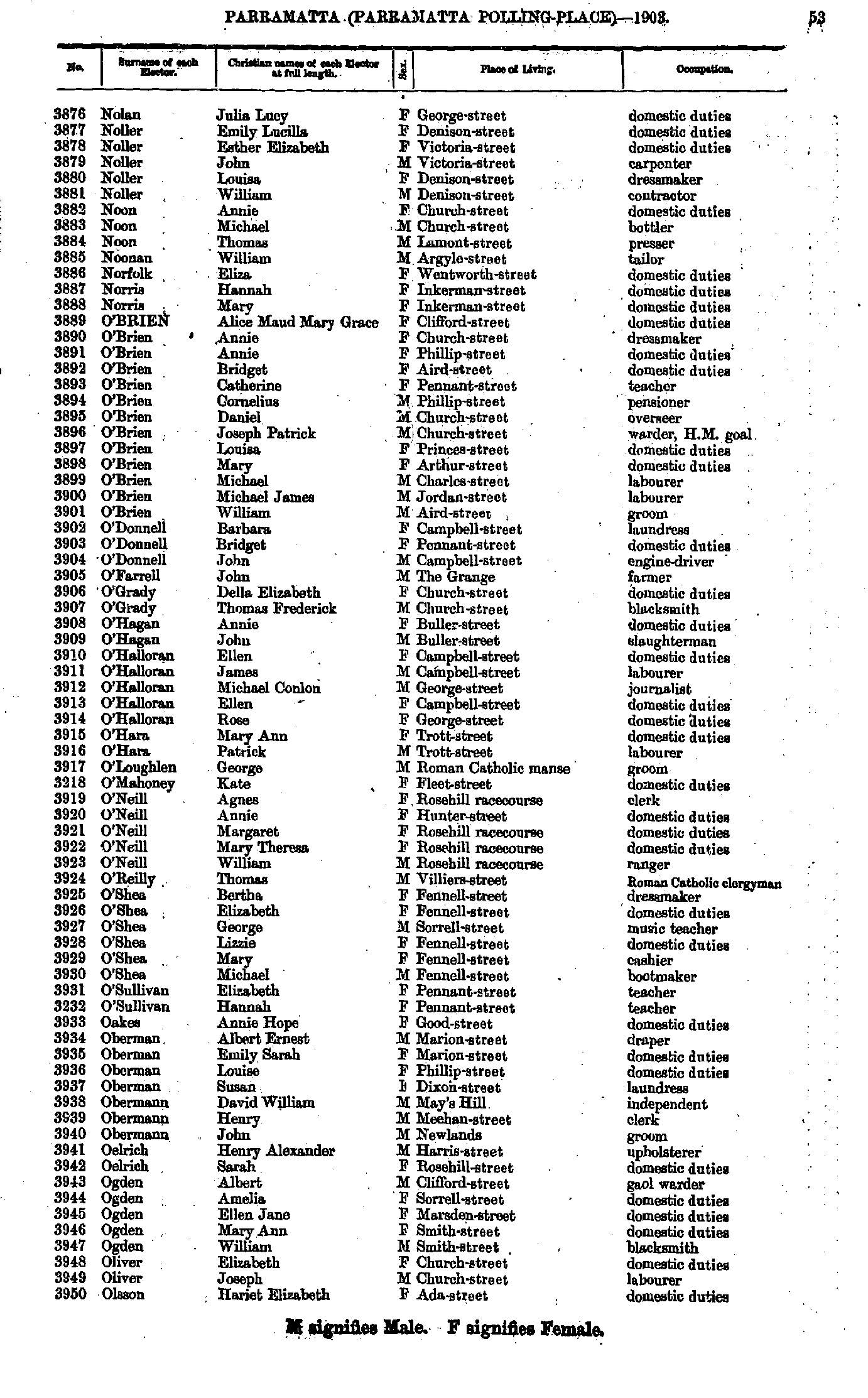
- Nolan Julia - Olsson Hariet
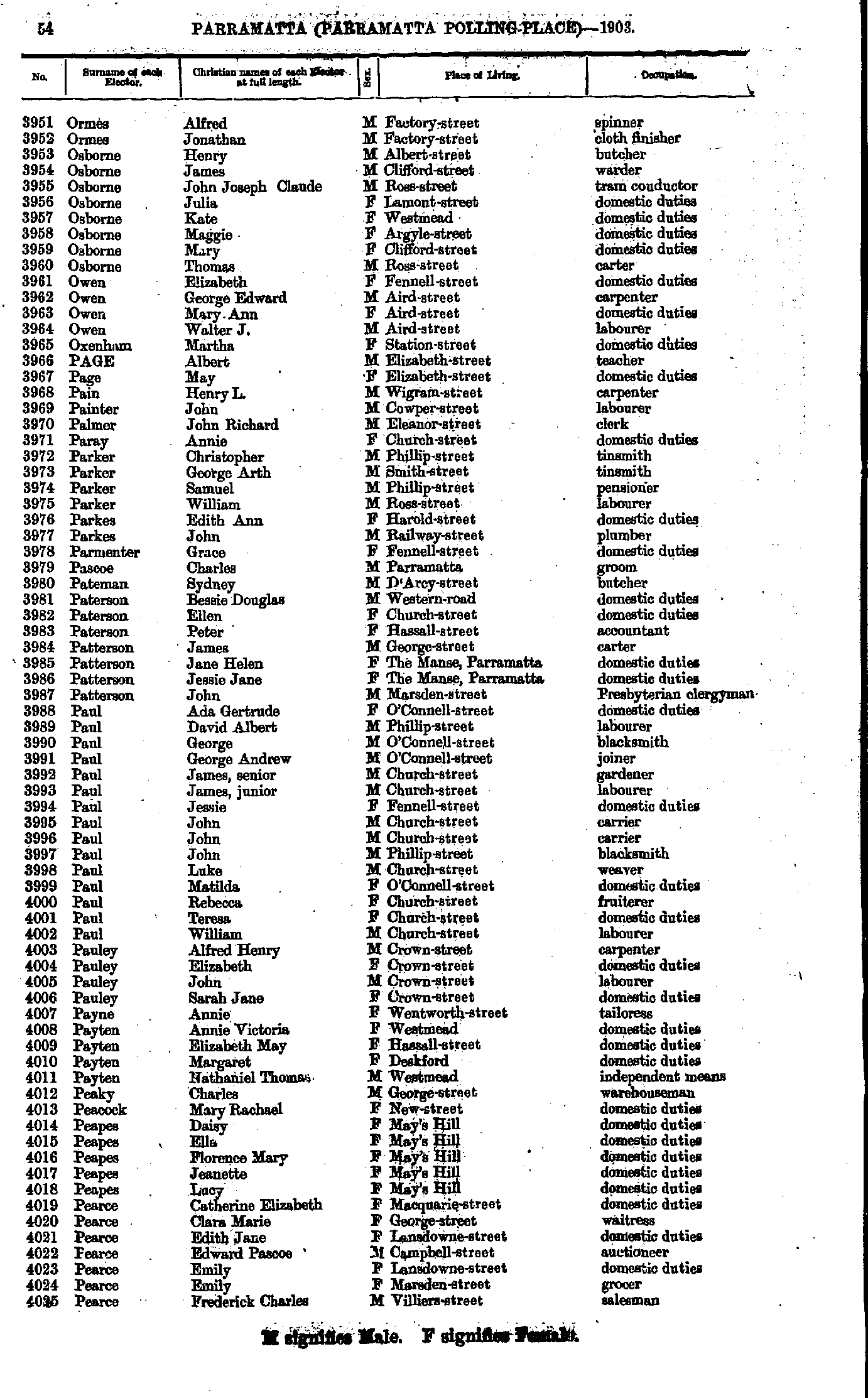
- Ormes Alfred - Pearce Frederick
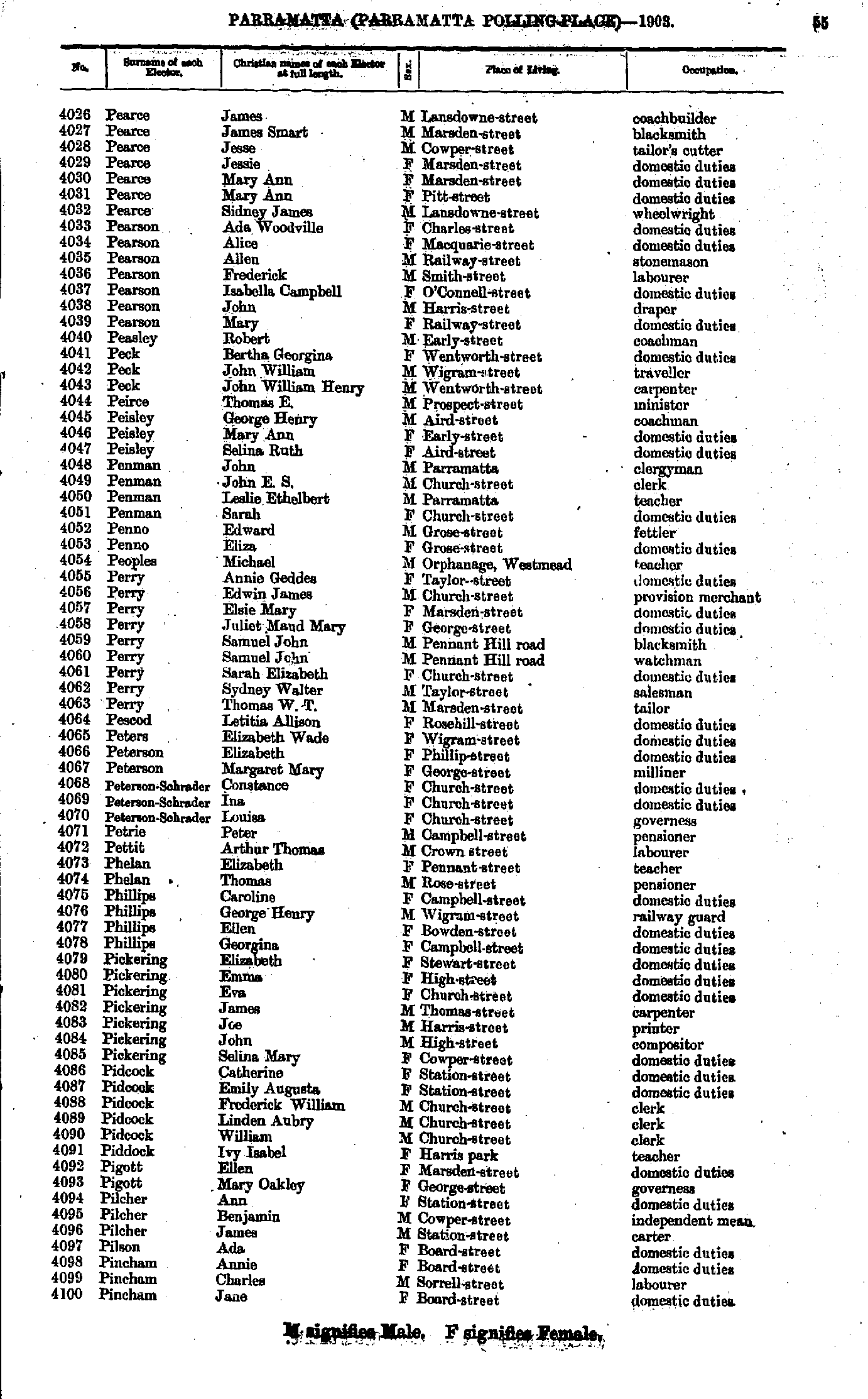
- Pearce James - Pincham Jane
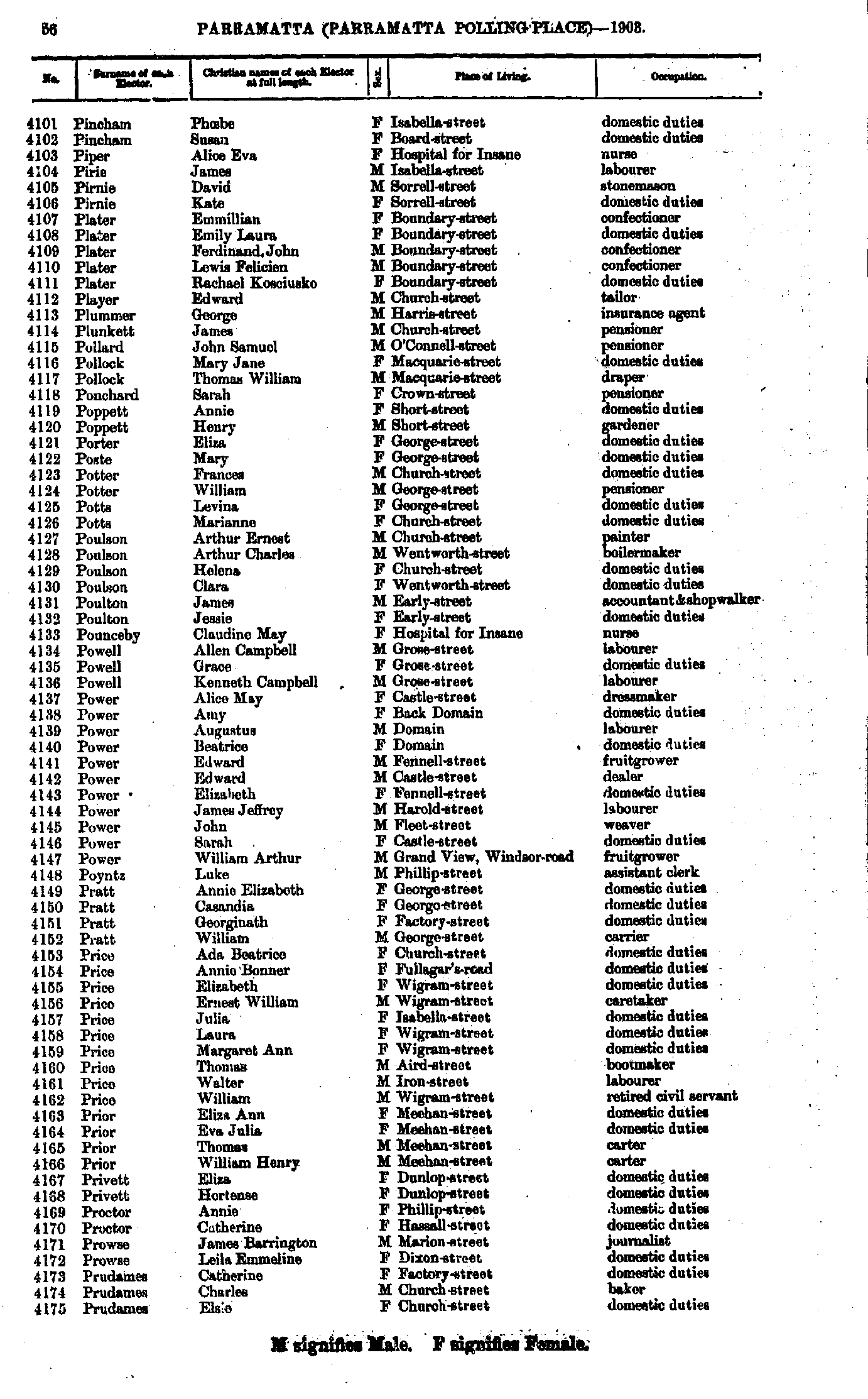
- Pincham Phoebe - Prudames Elsie
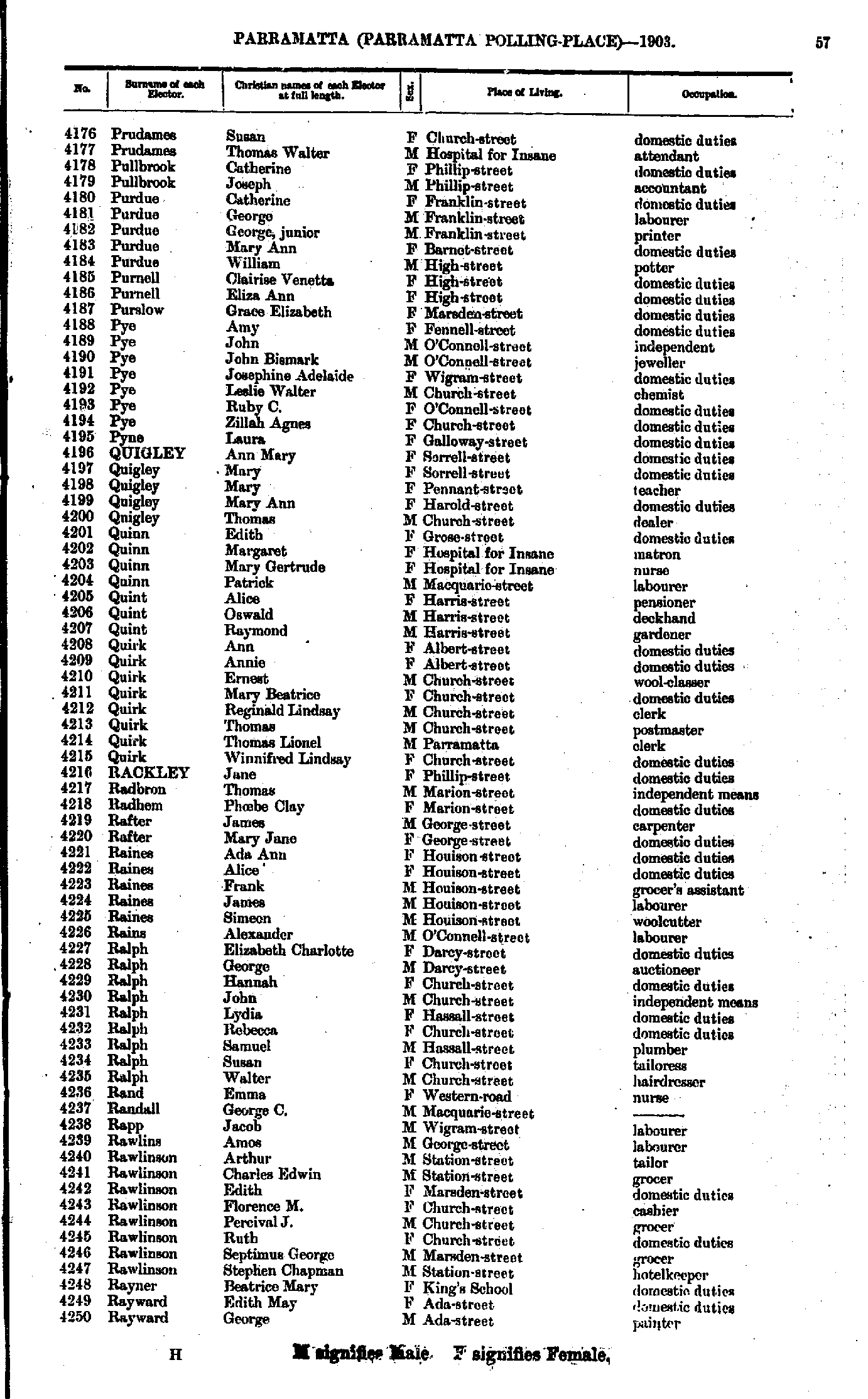
- Prudames Susan - Rayward George
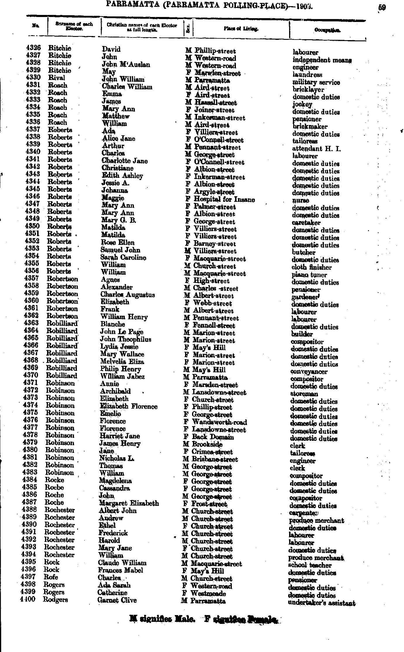
- Rea David - Ritchie Annie
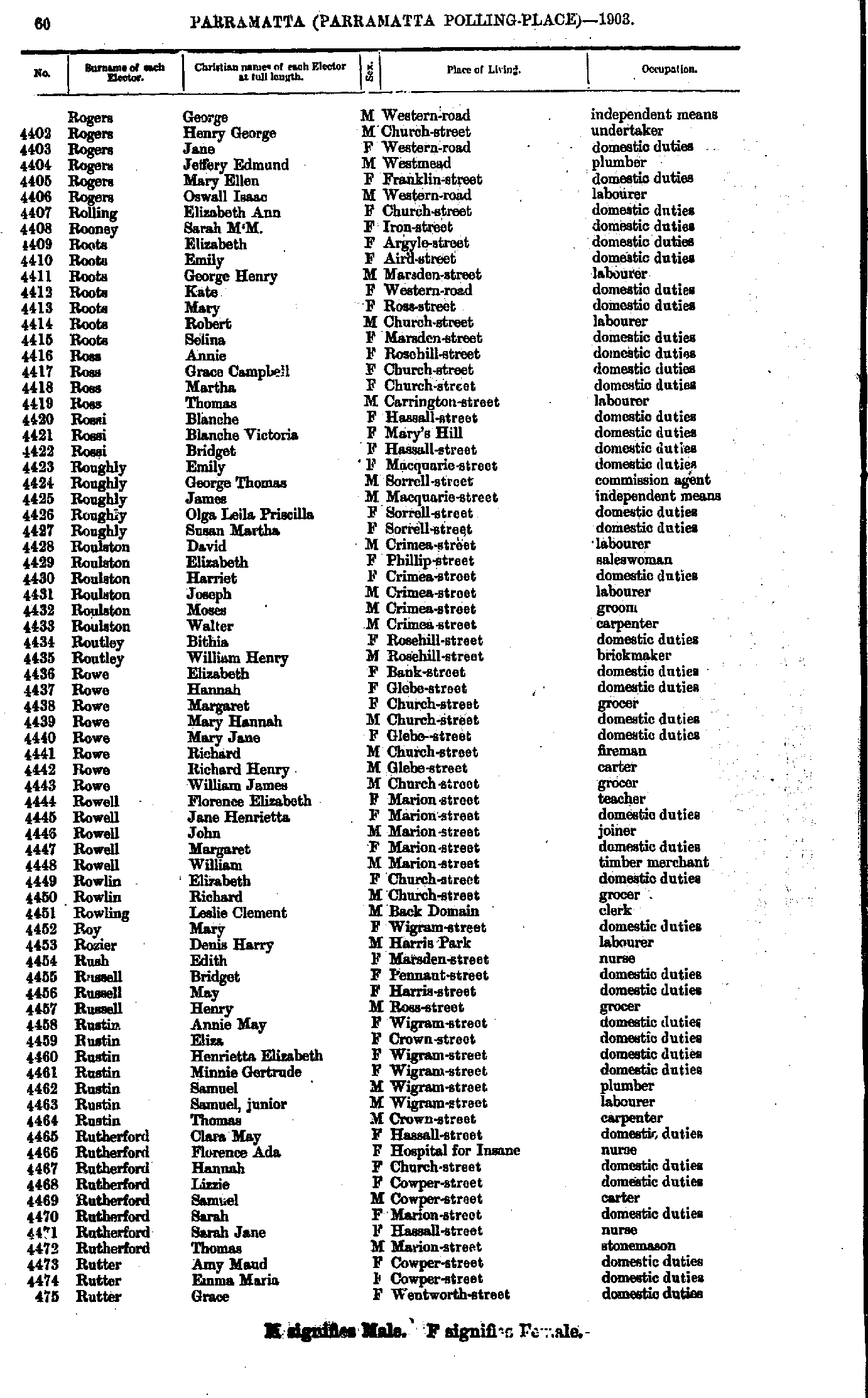
- Ritchie David - Rodgers Garnet
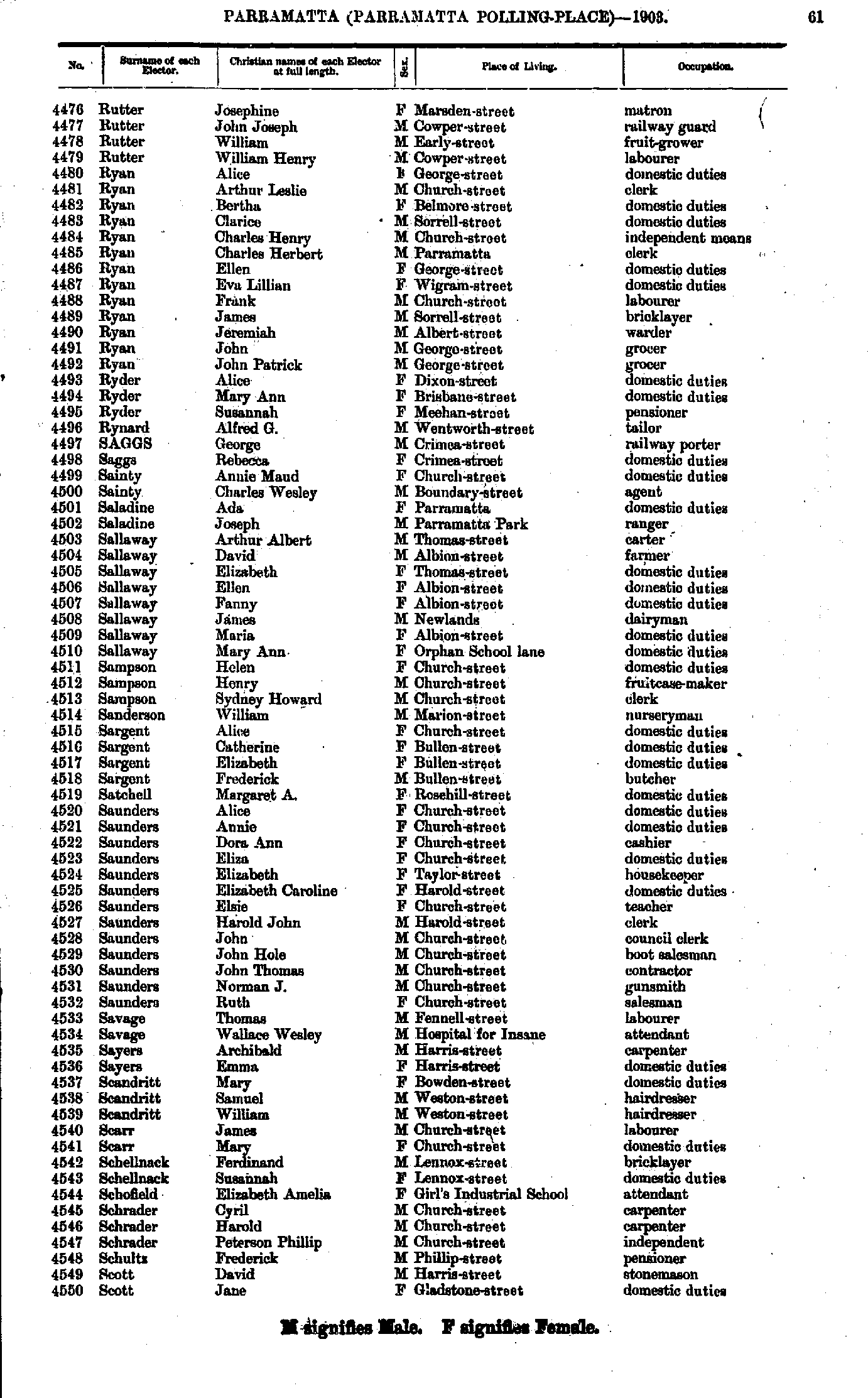
- Rogers George - Rutter Grace
- Rutter Josephine - Scott Jane
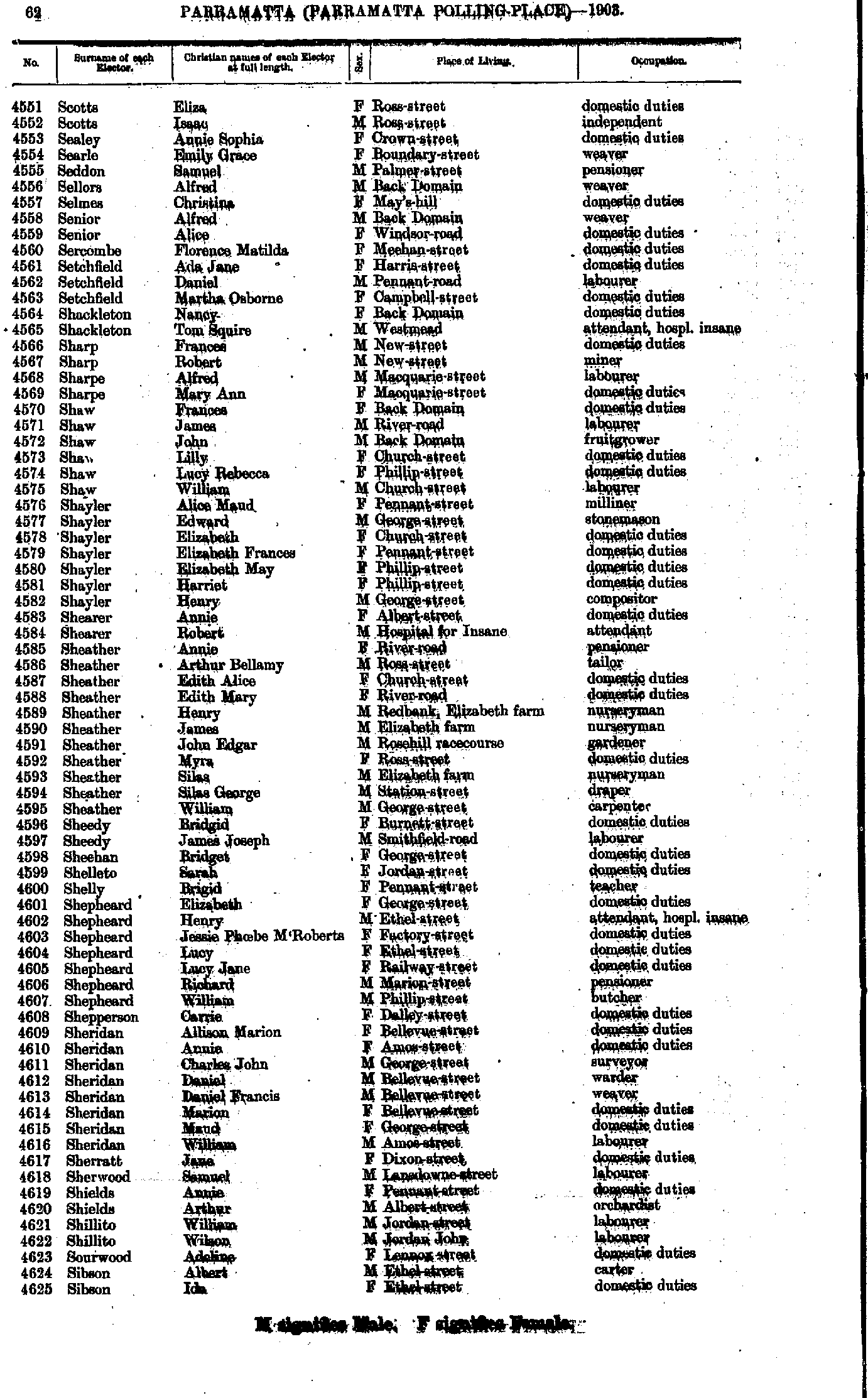
- Scotts Eliza - Sibson Ida
- Siely Elizabeth - Smith Elizabeth
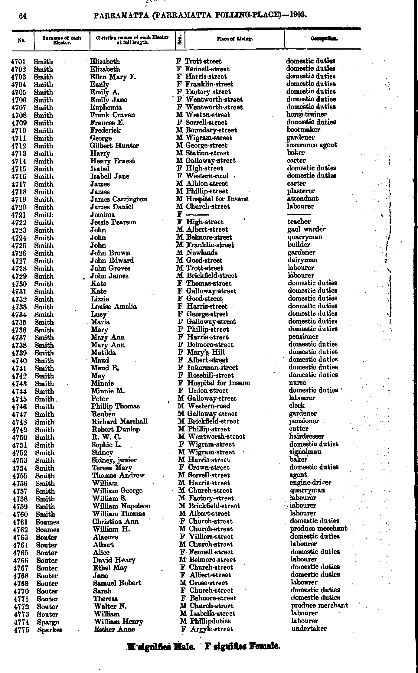
- Smith Elizabeth - Sparkes Esther
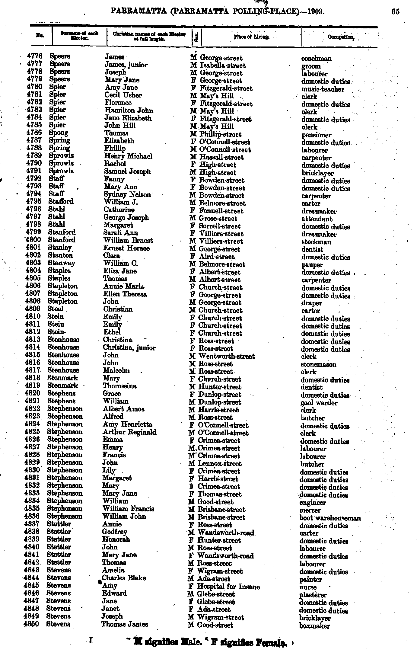
- Speers James - Stevens Thomas
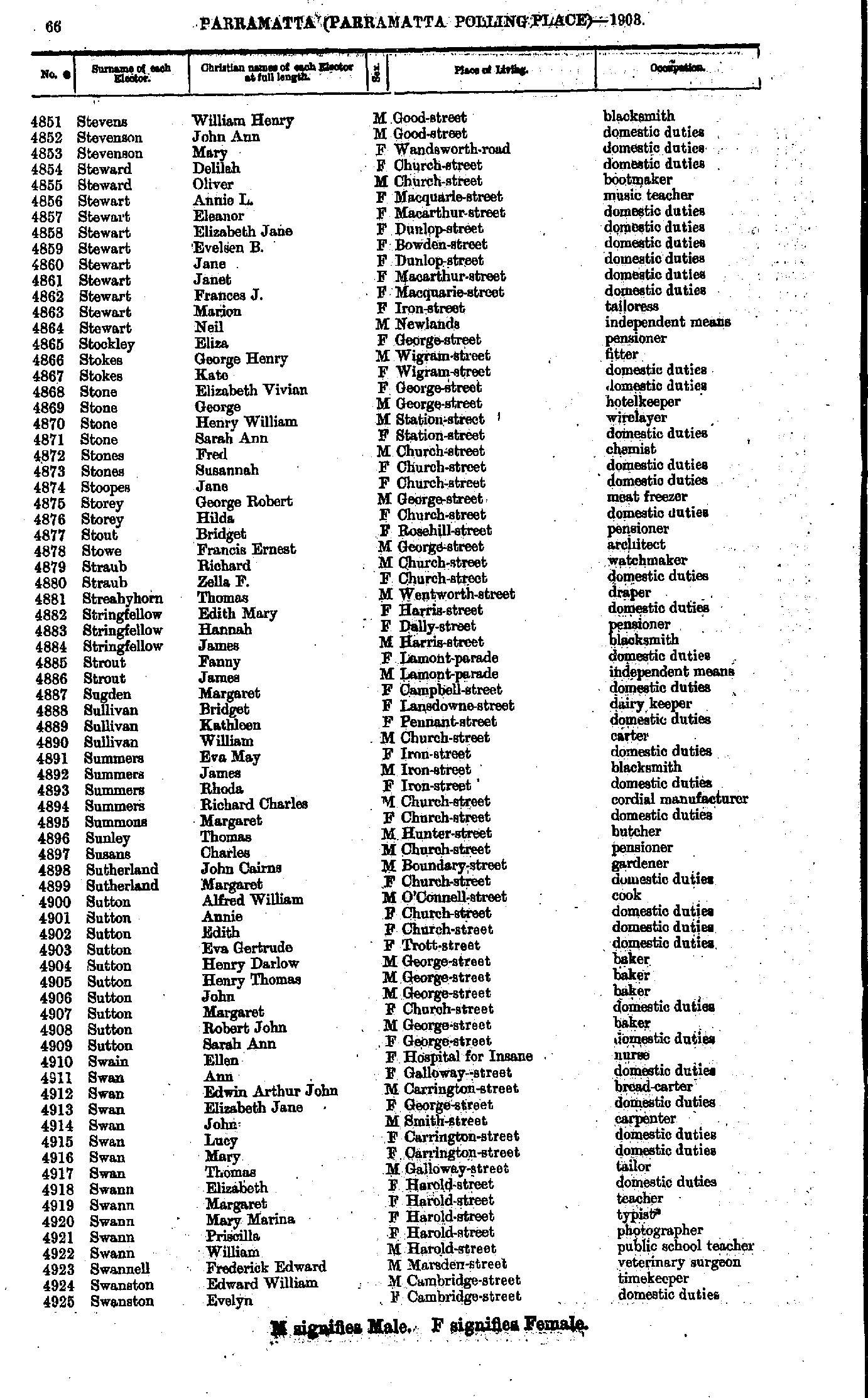
- Stevens William - Swanston Evelyn
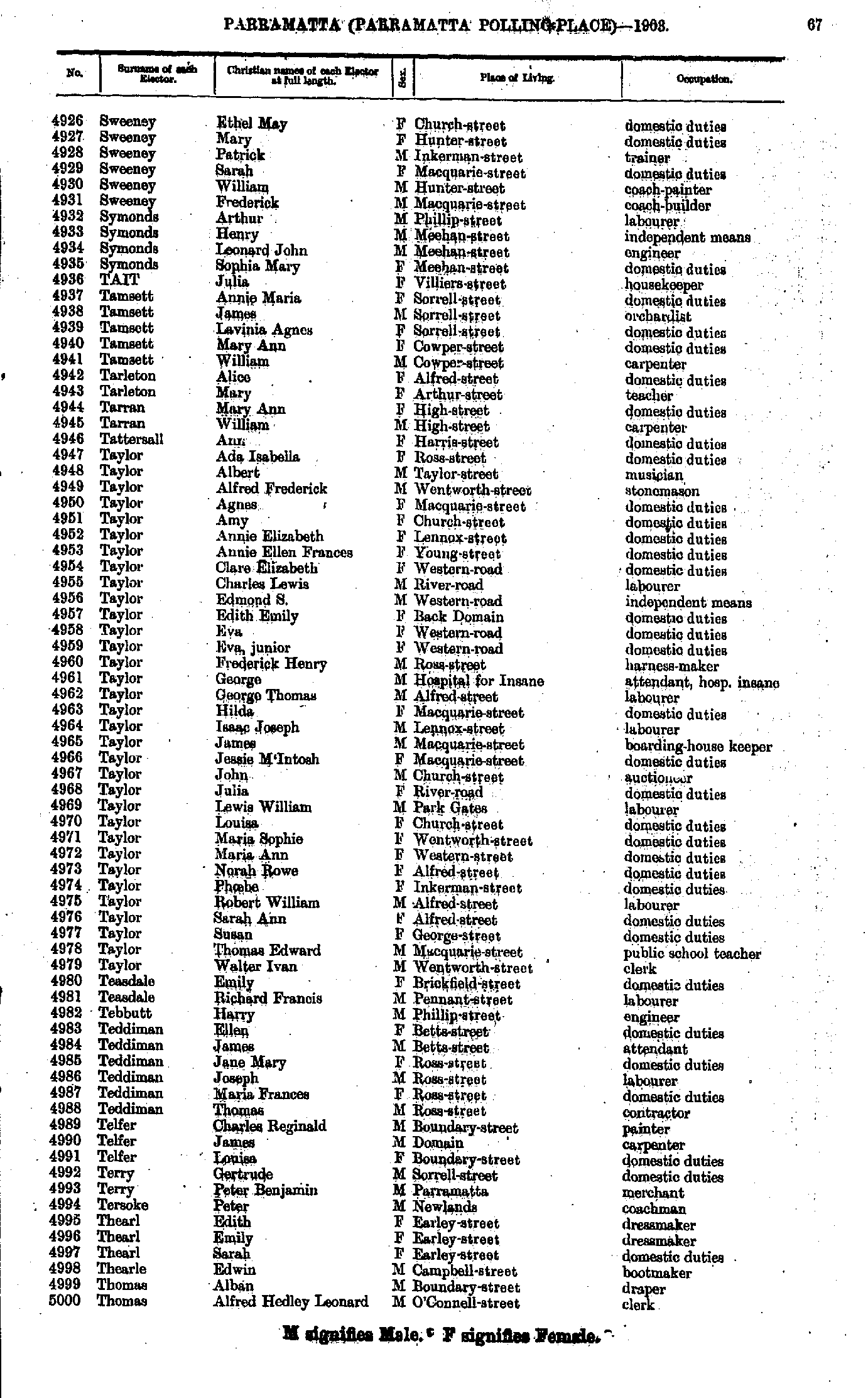
- Sweeney Ethel - Thomas Alfred
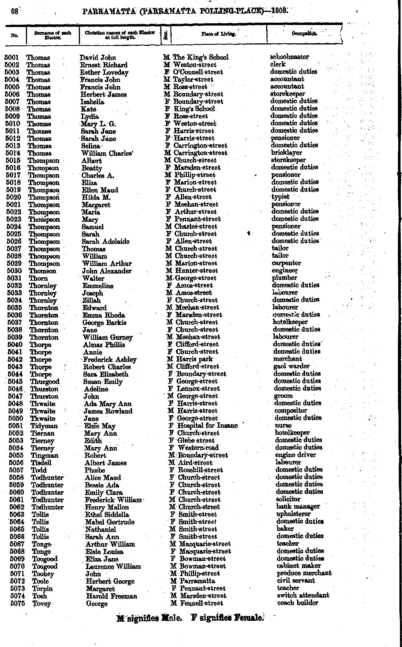
- Thomas David - Tovey George
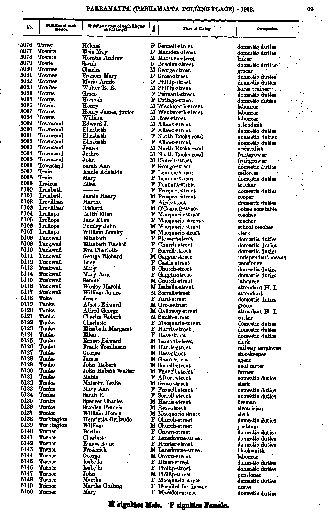
- Tovey Helena - Turner Mary
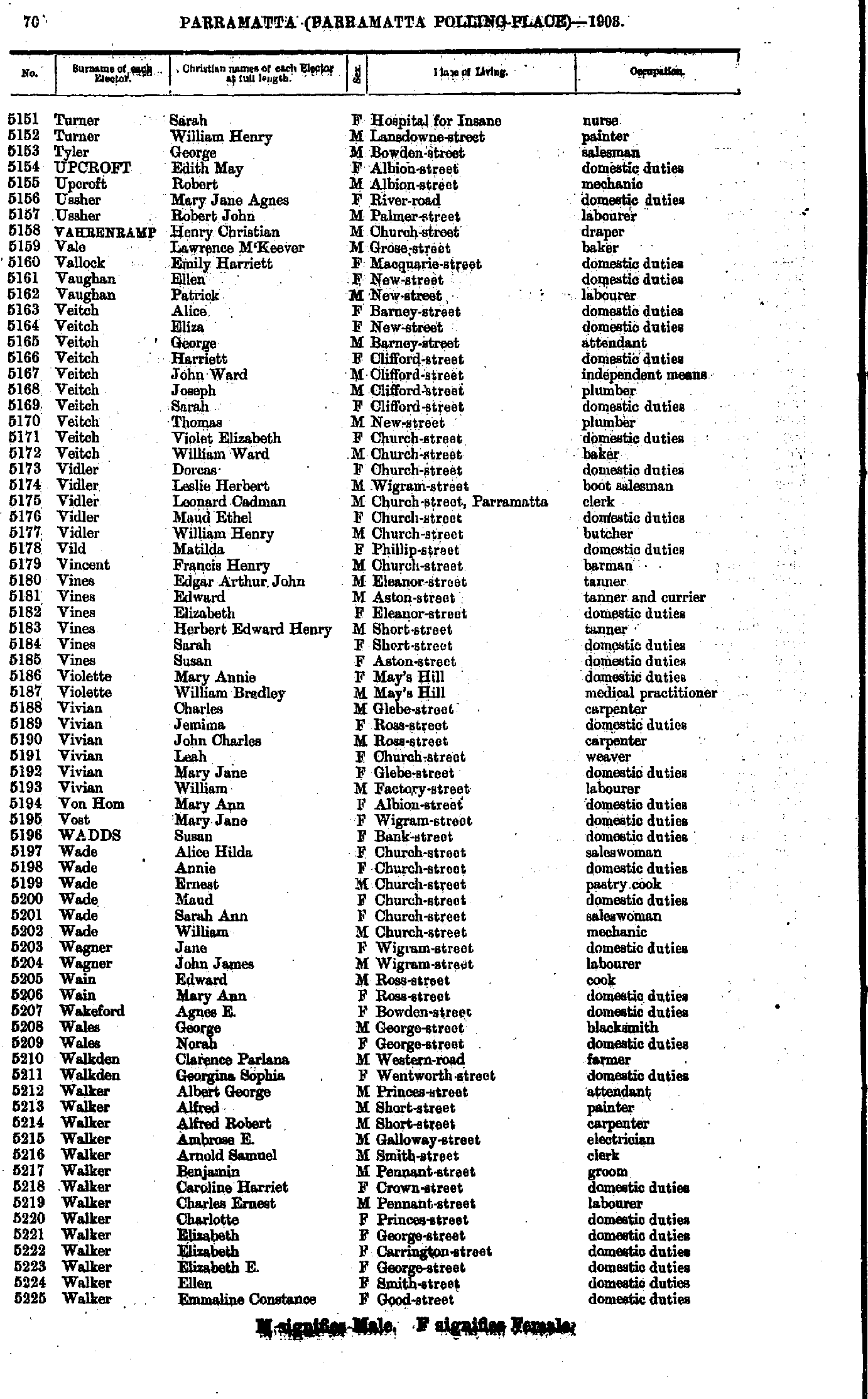
- Turner Sarah - Walker Emmaline
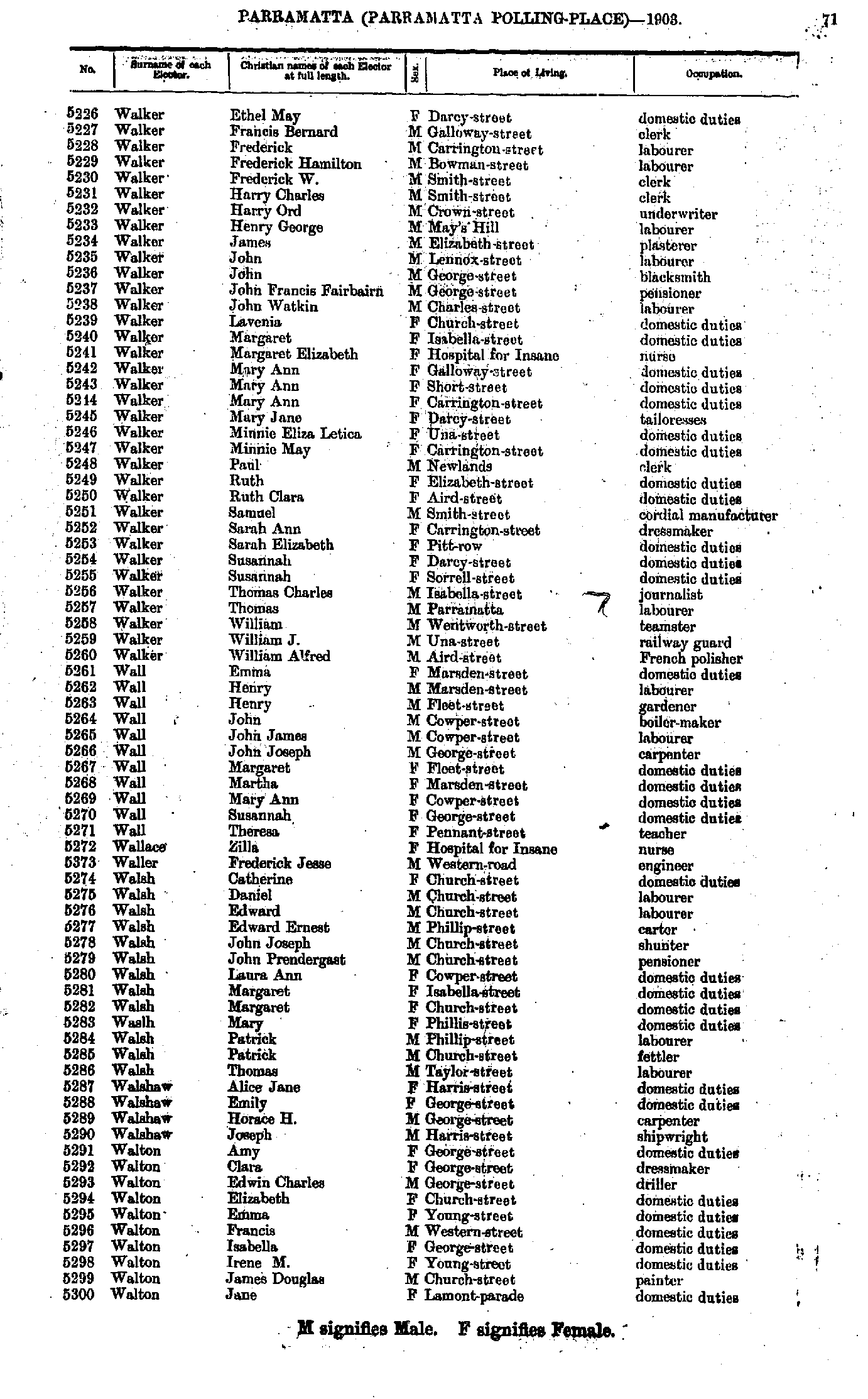
- Walker Ethel - Walton Jane
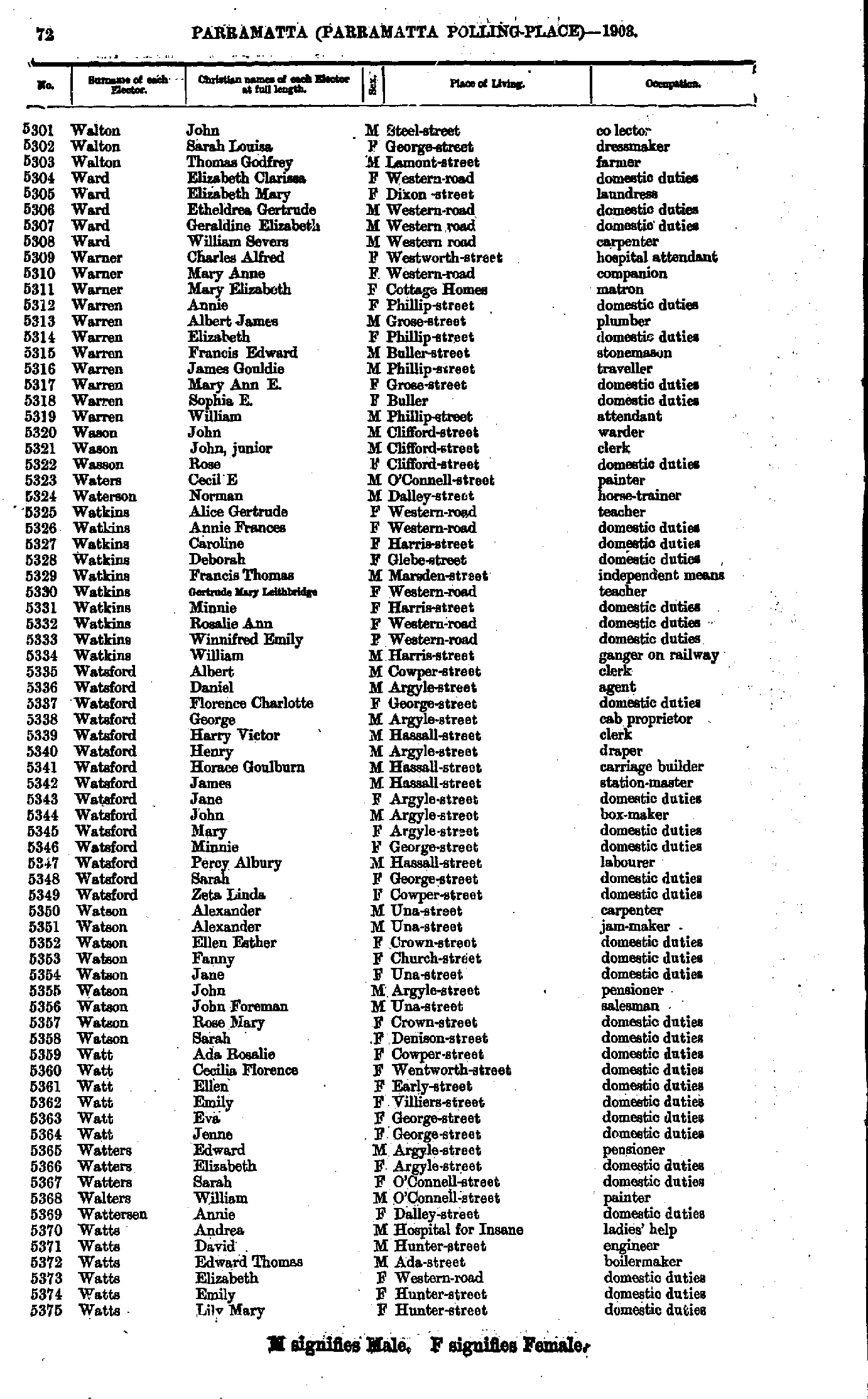
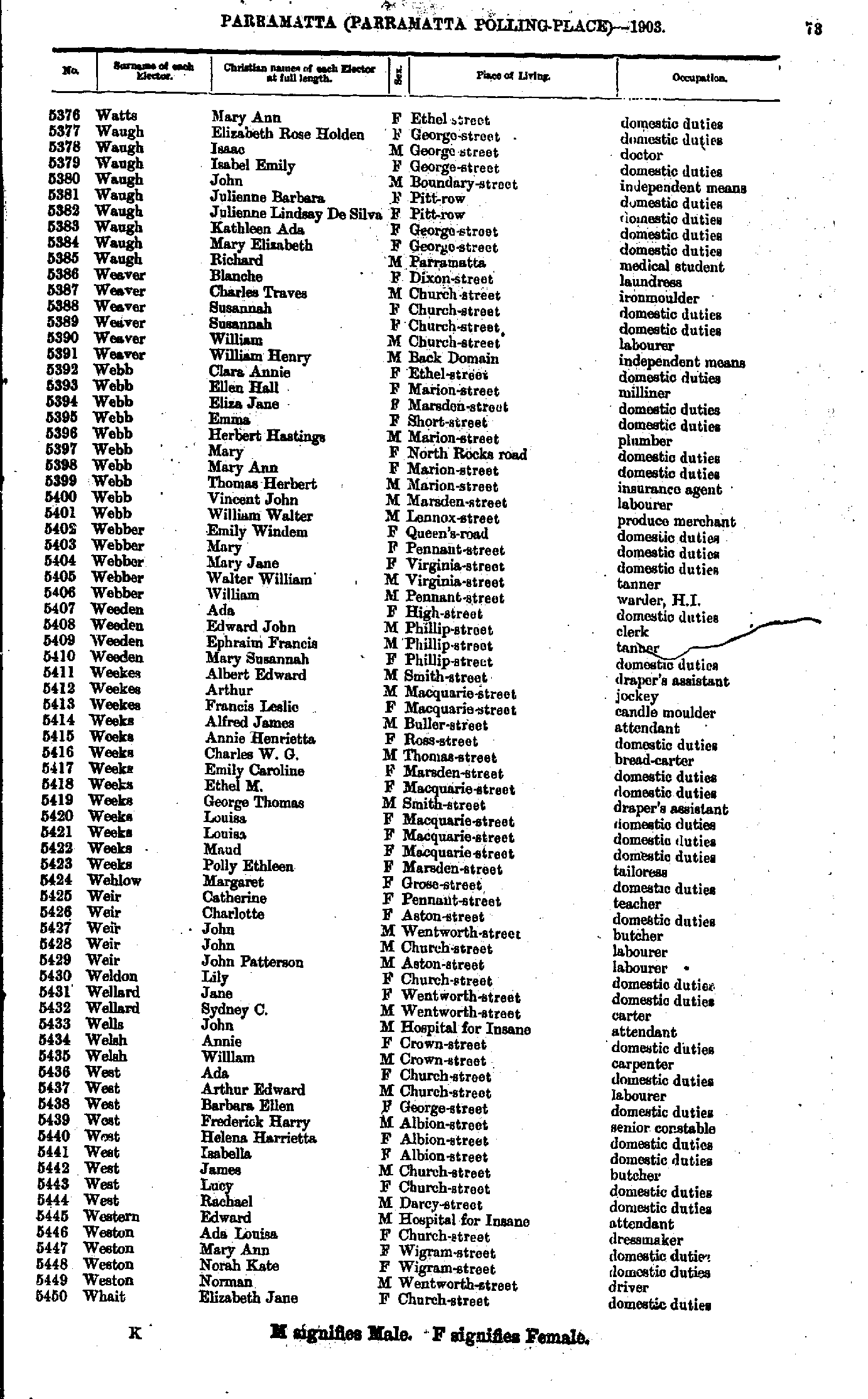
- Walton John - Watts Lily
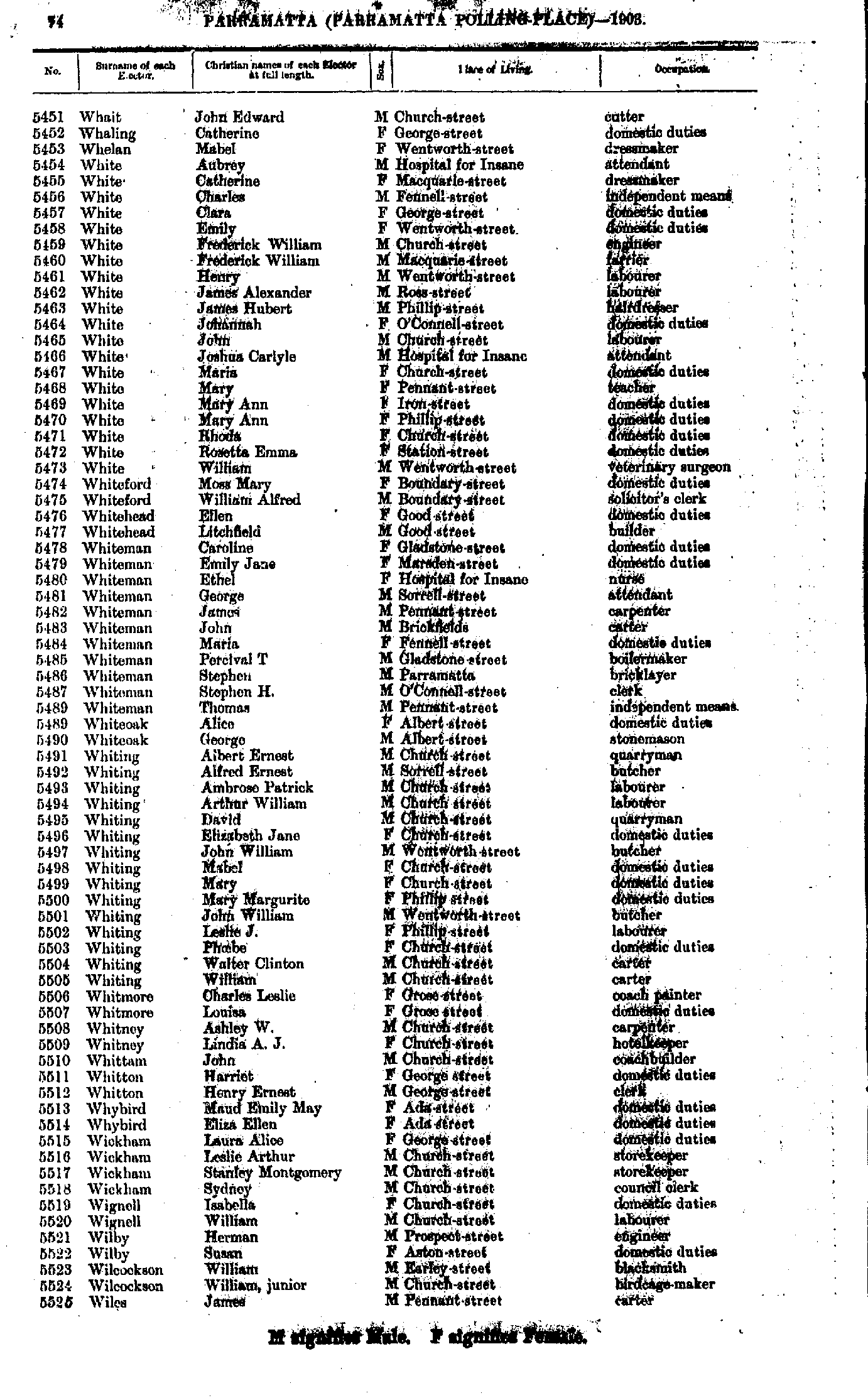
- Watts Mary - Whait Elizabeth
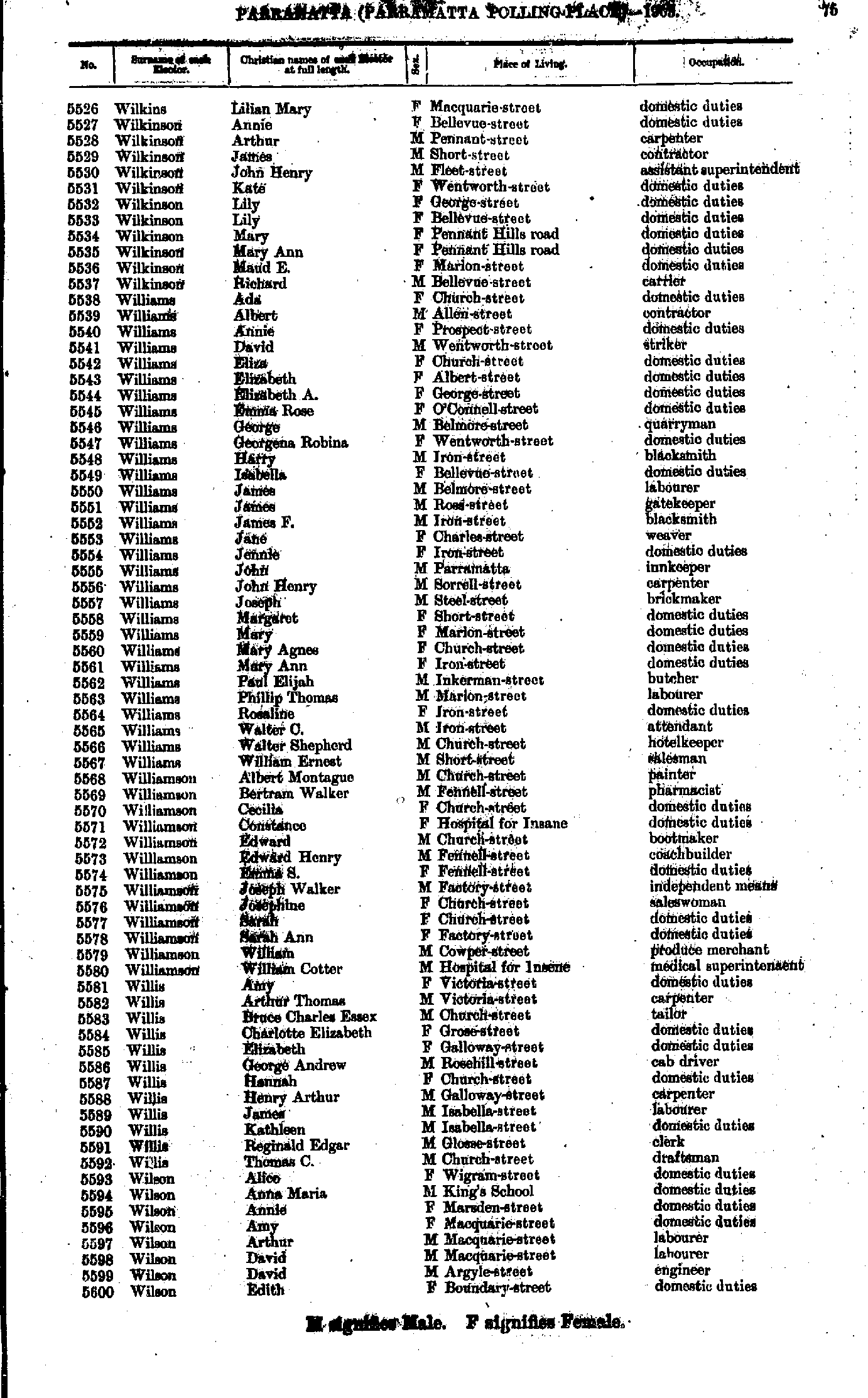
- Whait John - Wiles James
- Wilkins Lilian - Wilson Edith
- Wilson Edith - Worrall Rosina
- Worrall John - Yule Robert
- Abbott Albert - Bain Ellen
- Bain Peter - Betts George
- Betts John - Brown John
- Brown Joseph - Clark Bridget
- Clark Henry - Cowan Robert
- Cowan Sarah - Dent Thomas
- Devlin Charlotte - Edwards George
- Edwards George - Flint Alfred
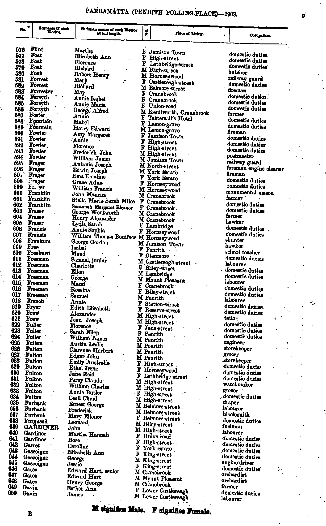
- Flint Martha - Gavin James
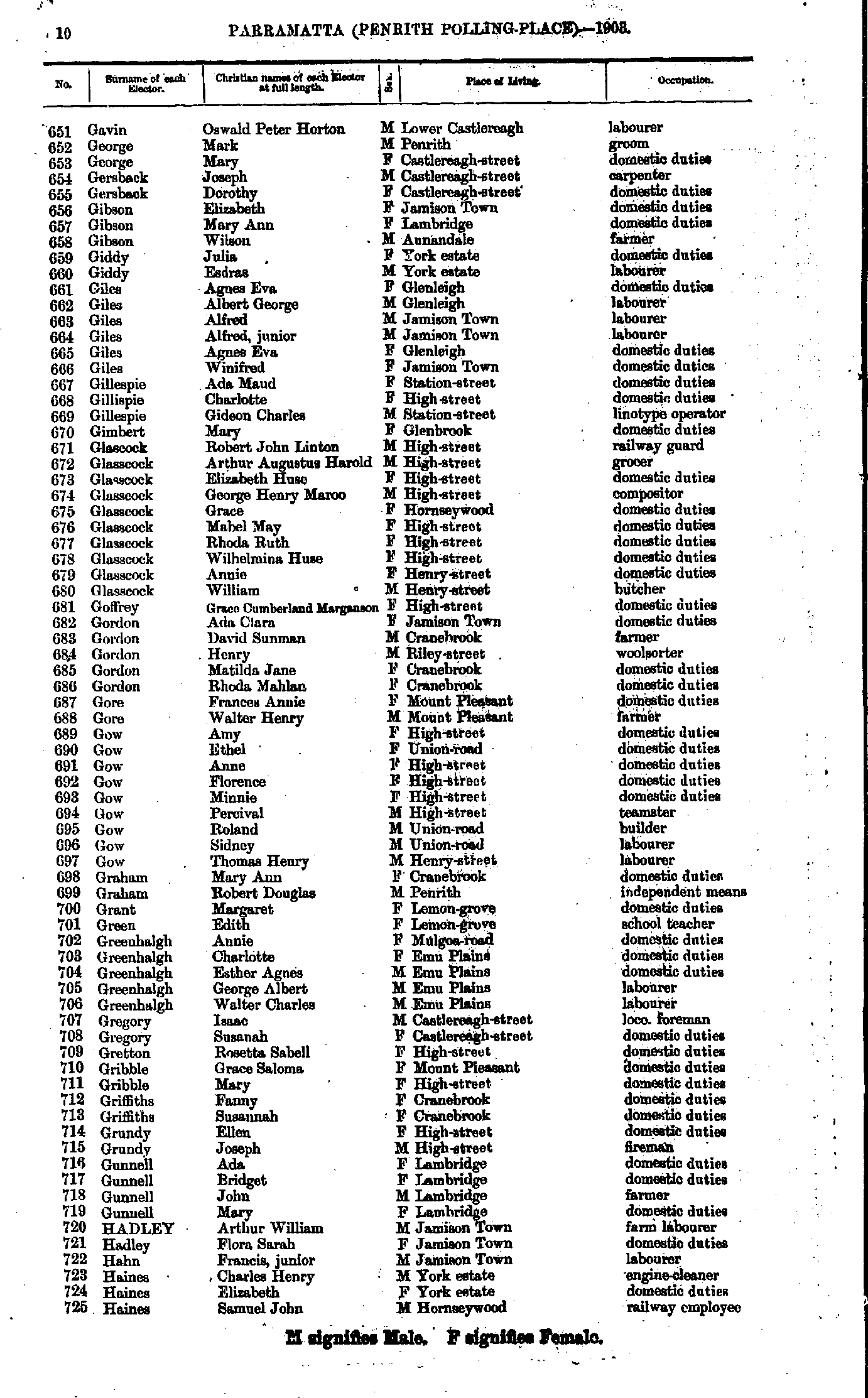
- Gavin Oswald - Haines Samuel
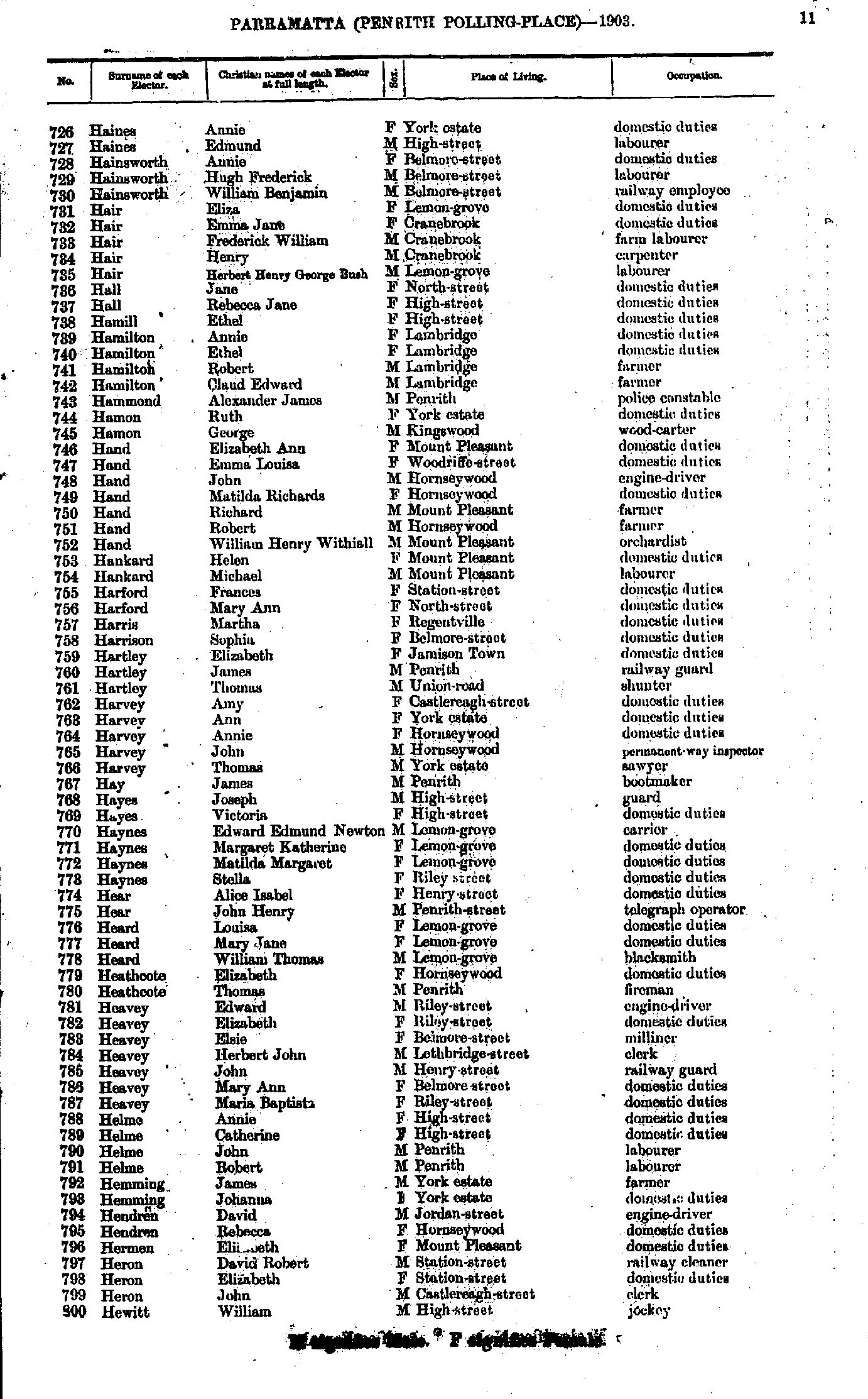
- Haines Annie - Hewitt William
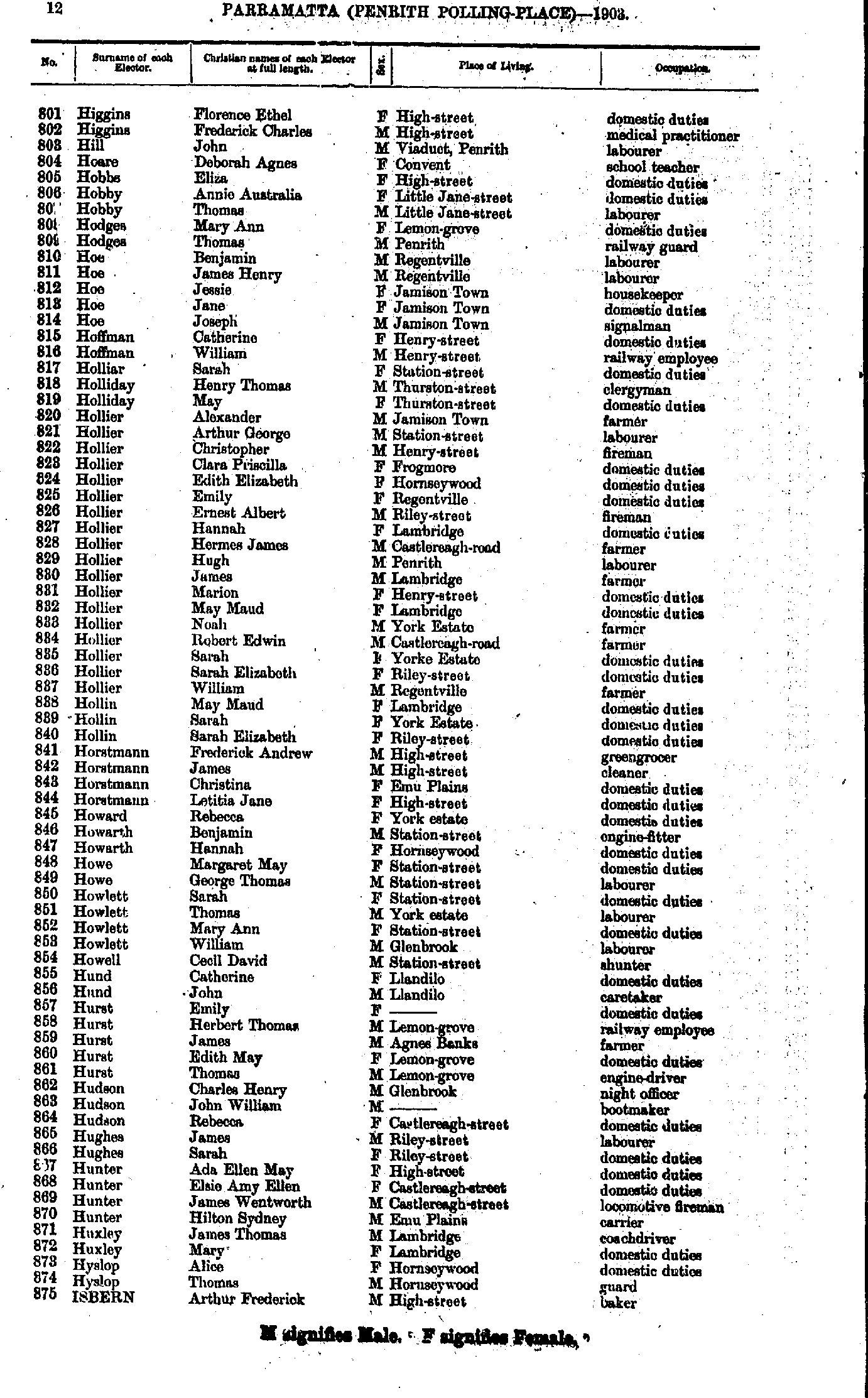
- Higgins Florence - Isbern Arthur
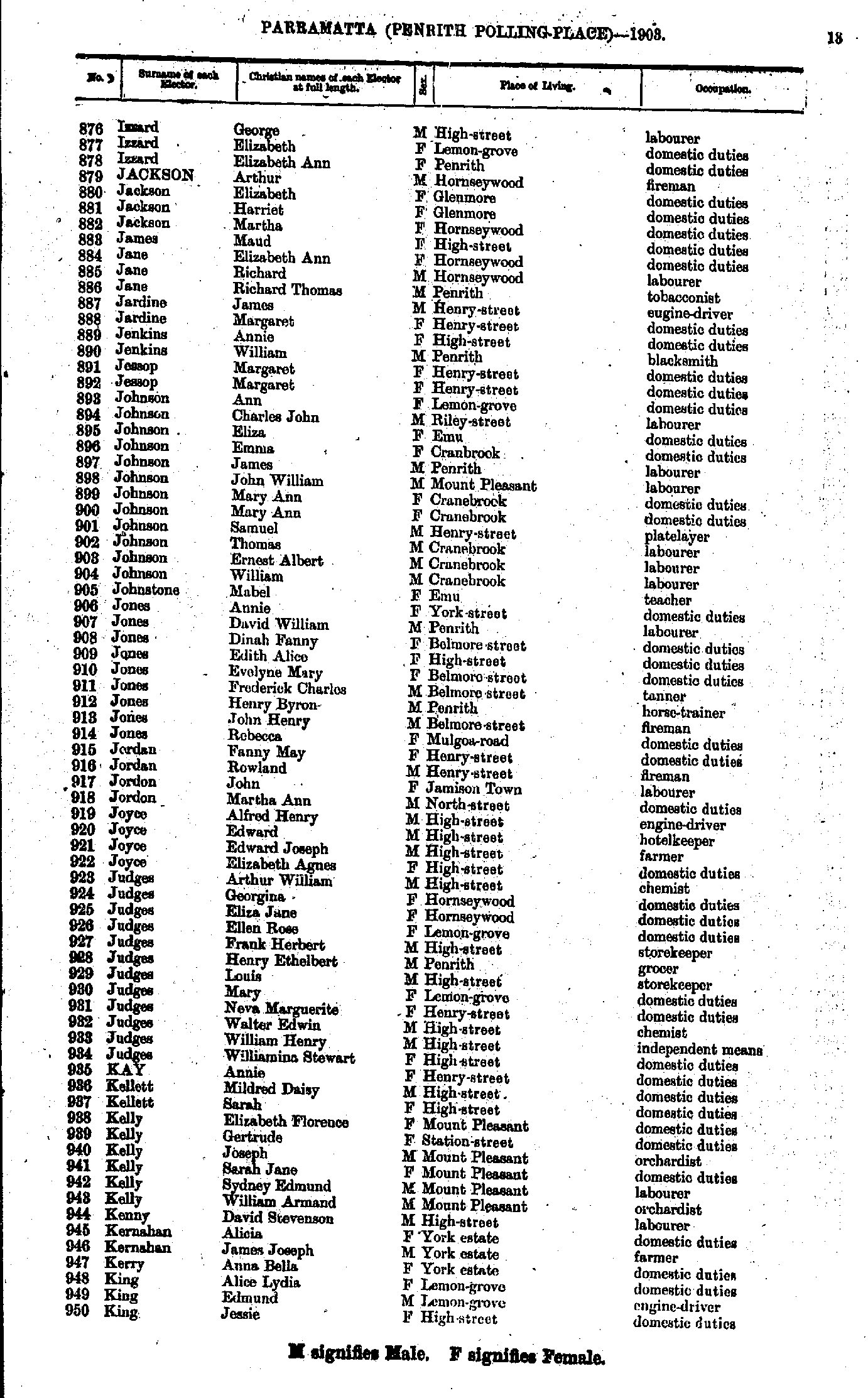
- Izzard George - King Jessie
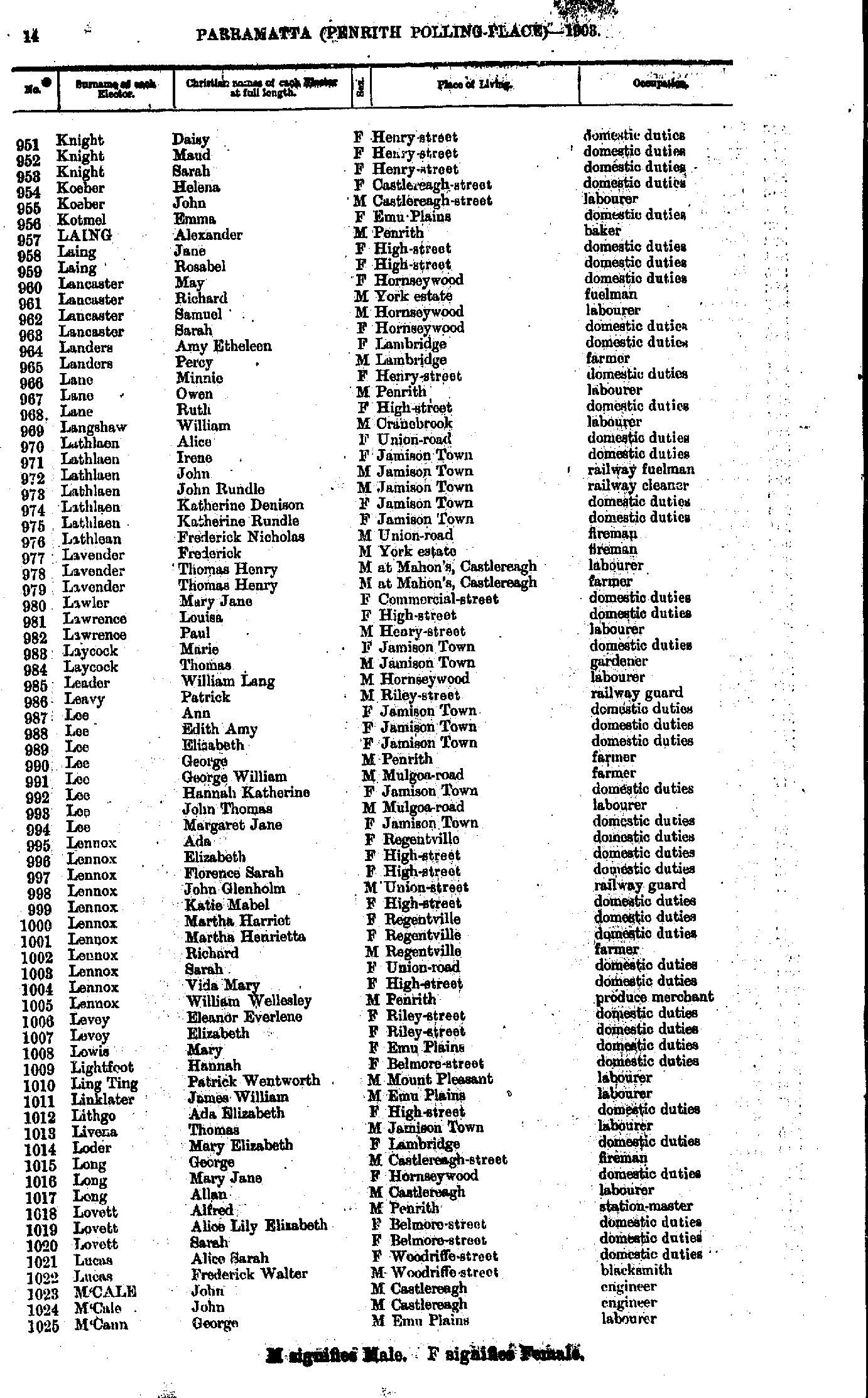
- Knight Daisy - M'Cann George
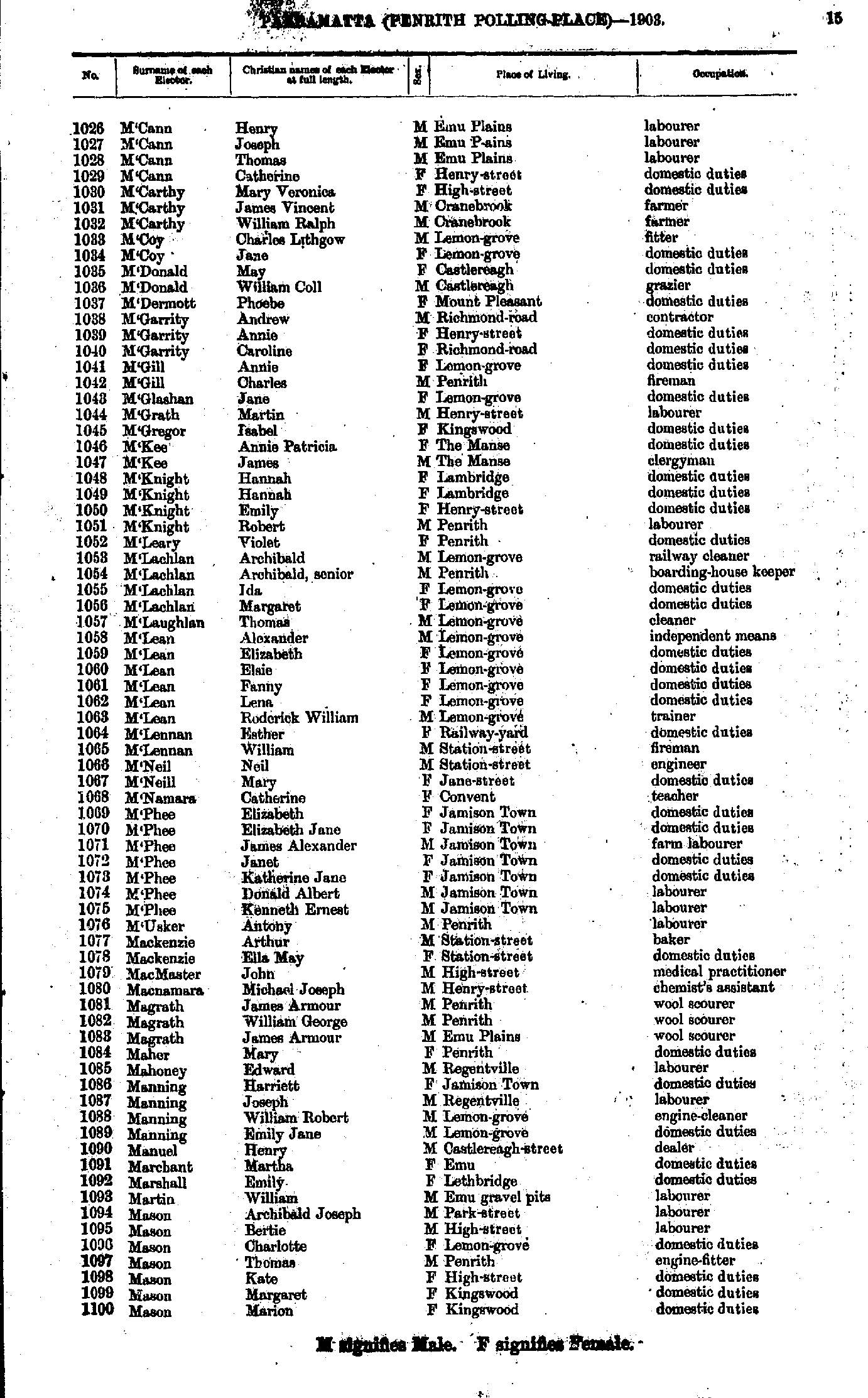
- M'Cann Henry - Mason Marion
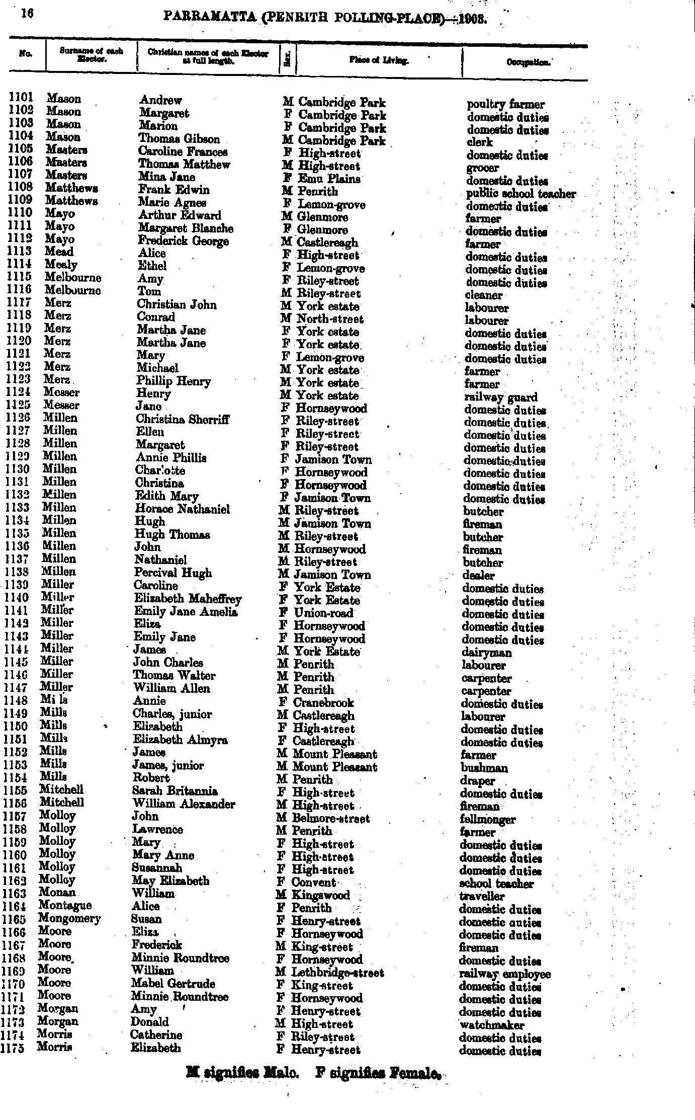
- Mason Andrew - Morris Elizabeth
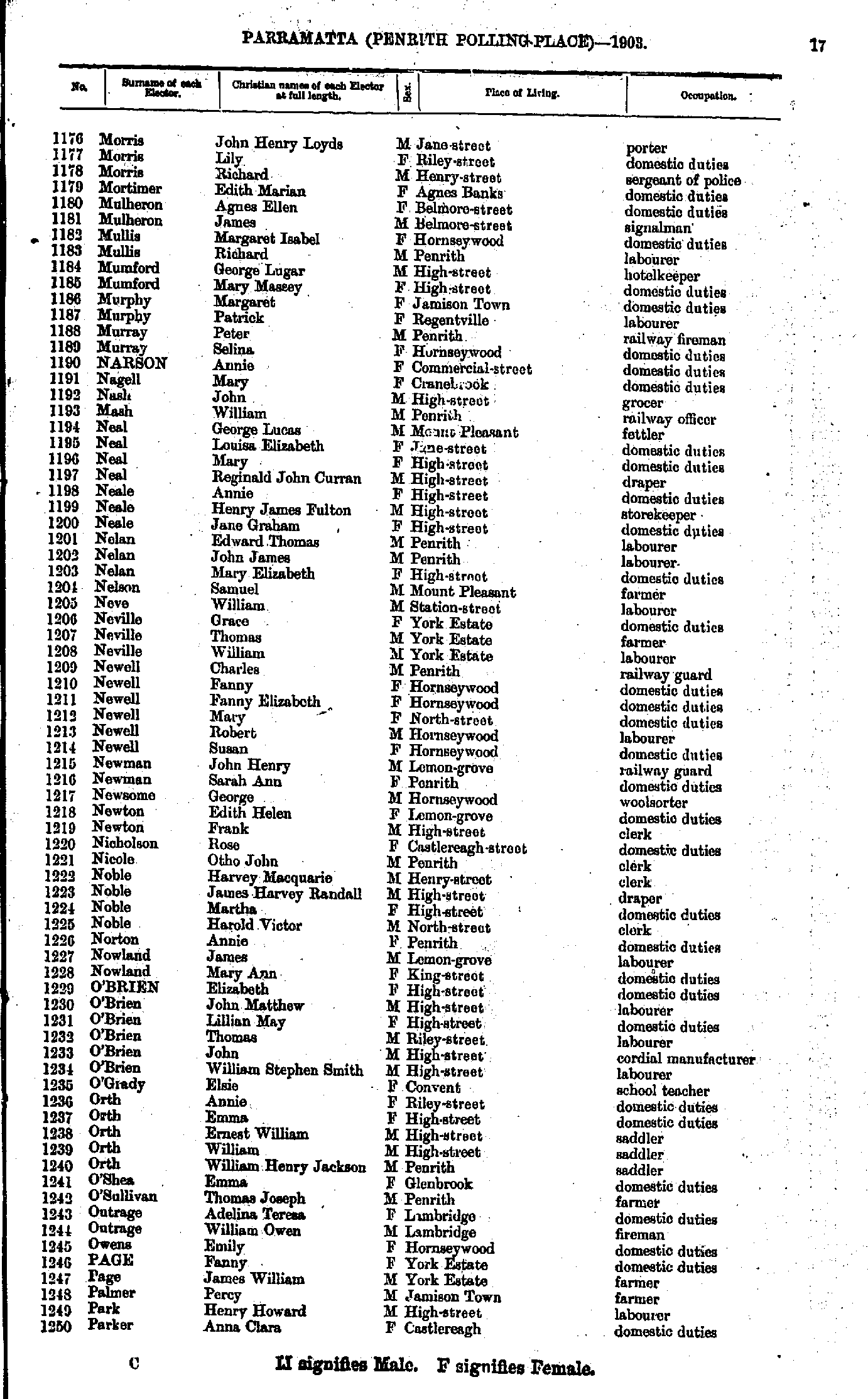
- Morris John - Parker Anna
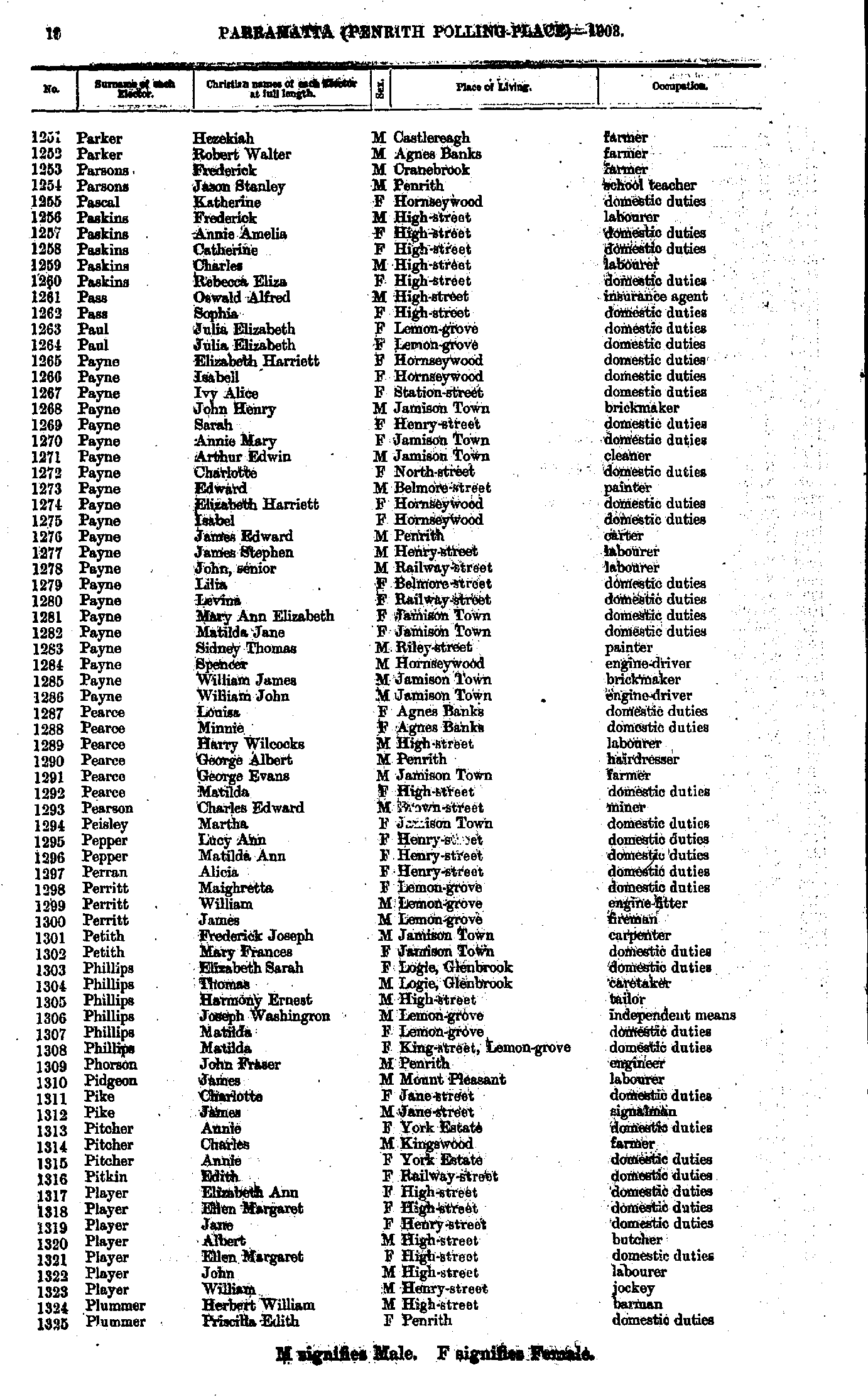
- Parker Hezekiah - Plummer Priscilla
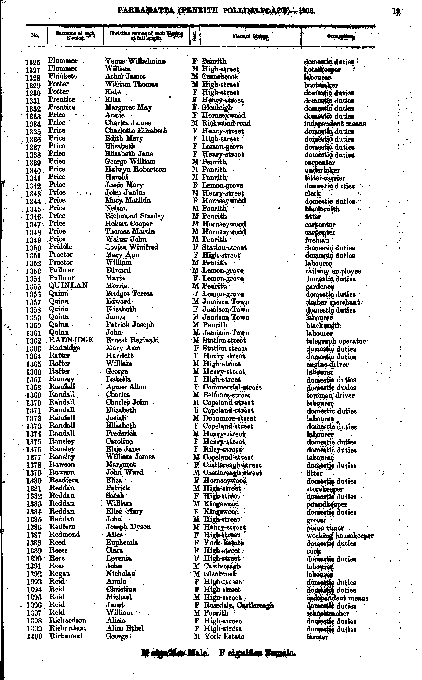
- Plummer Venus - Richmond George
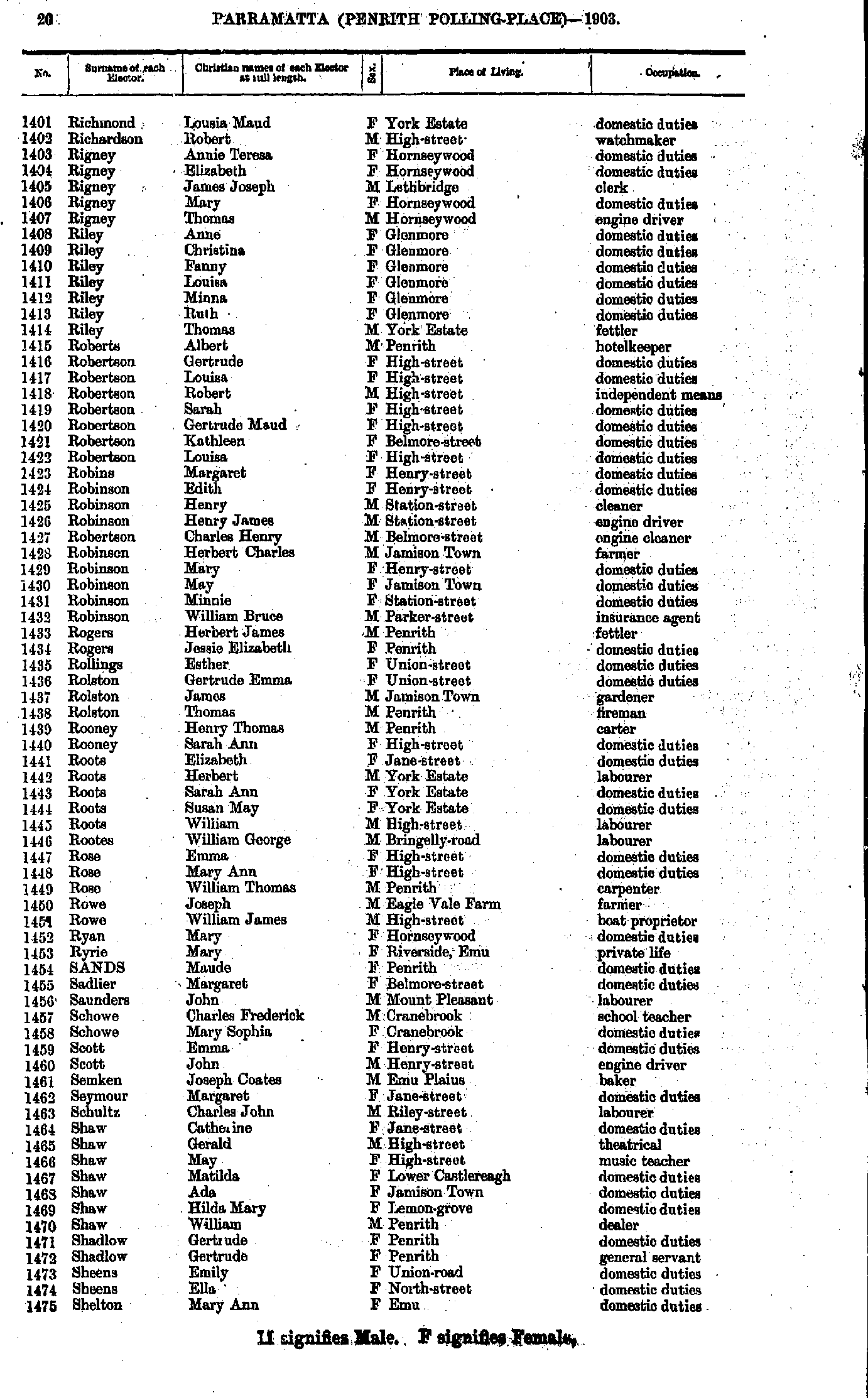
- Richmond Lousia - Shelton Mary
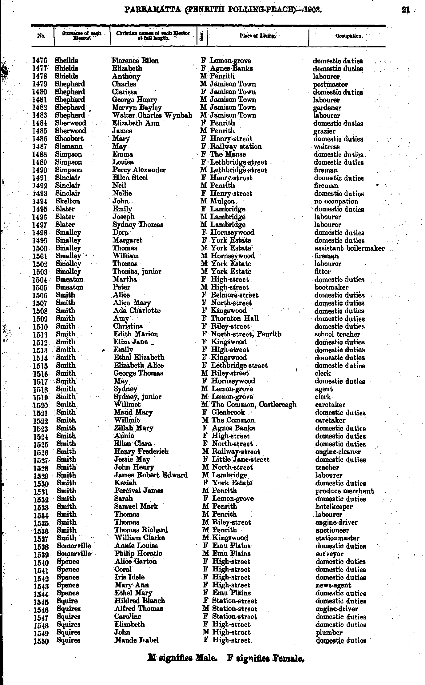
- Sheilds Florence - Squires Maude
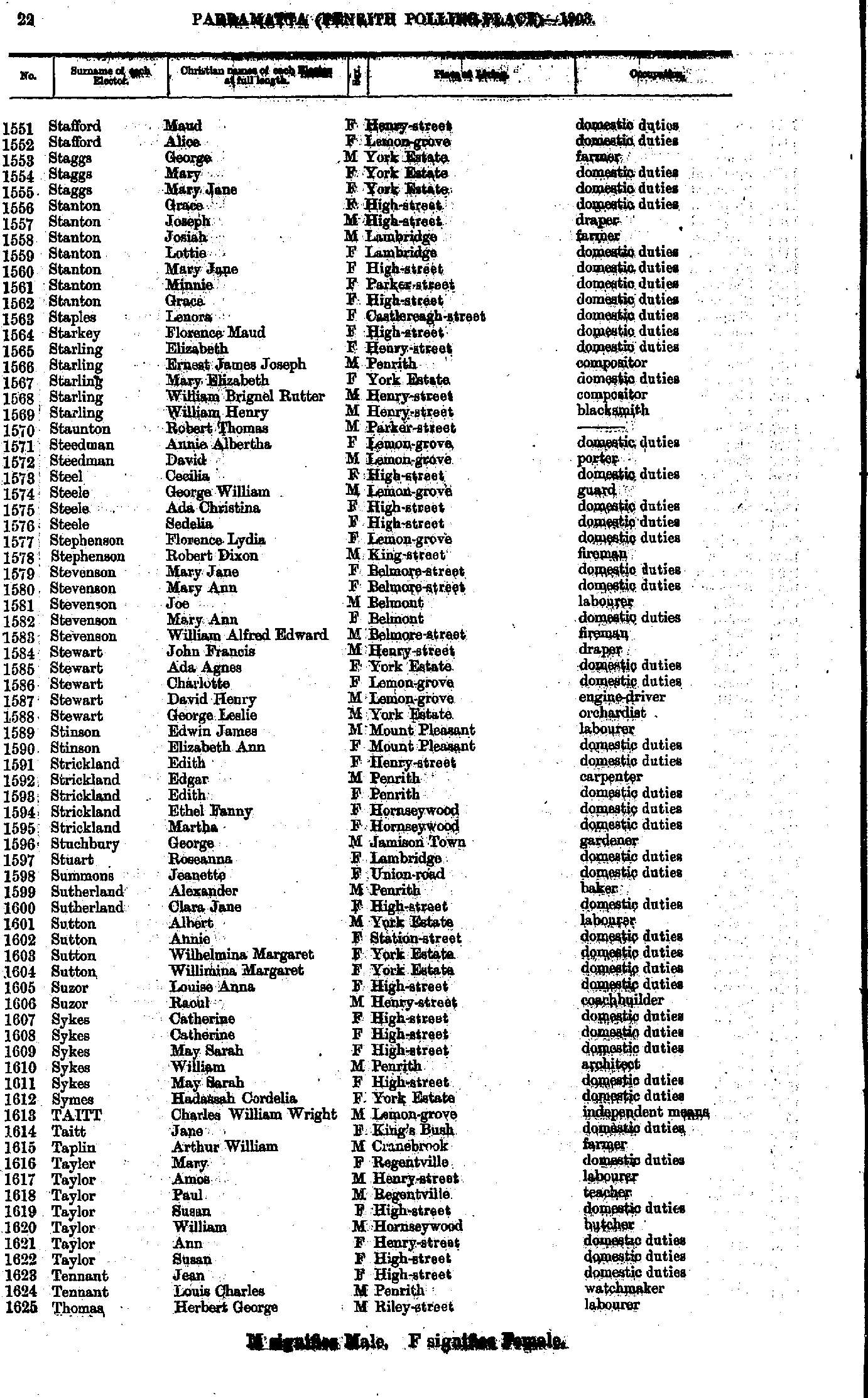
- Stafford Maud - Thomas Herbert
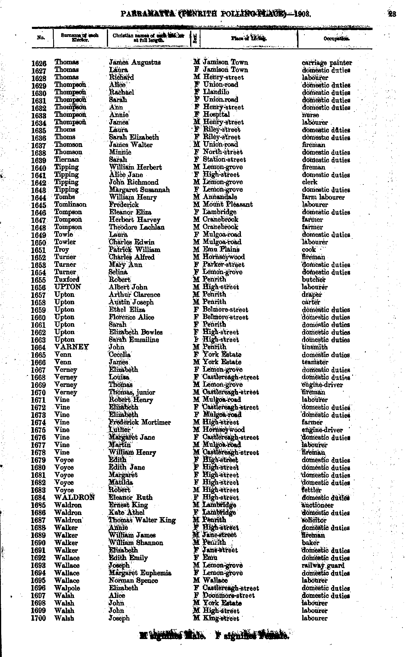
- Thomas James - Walsh Joseph
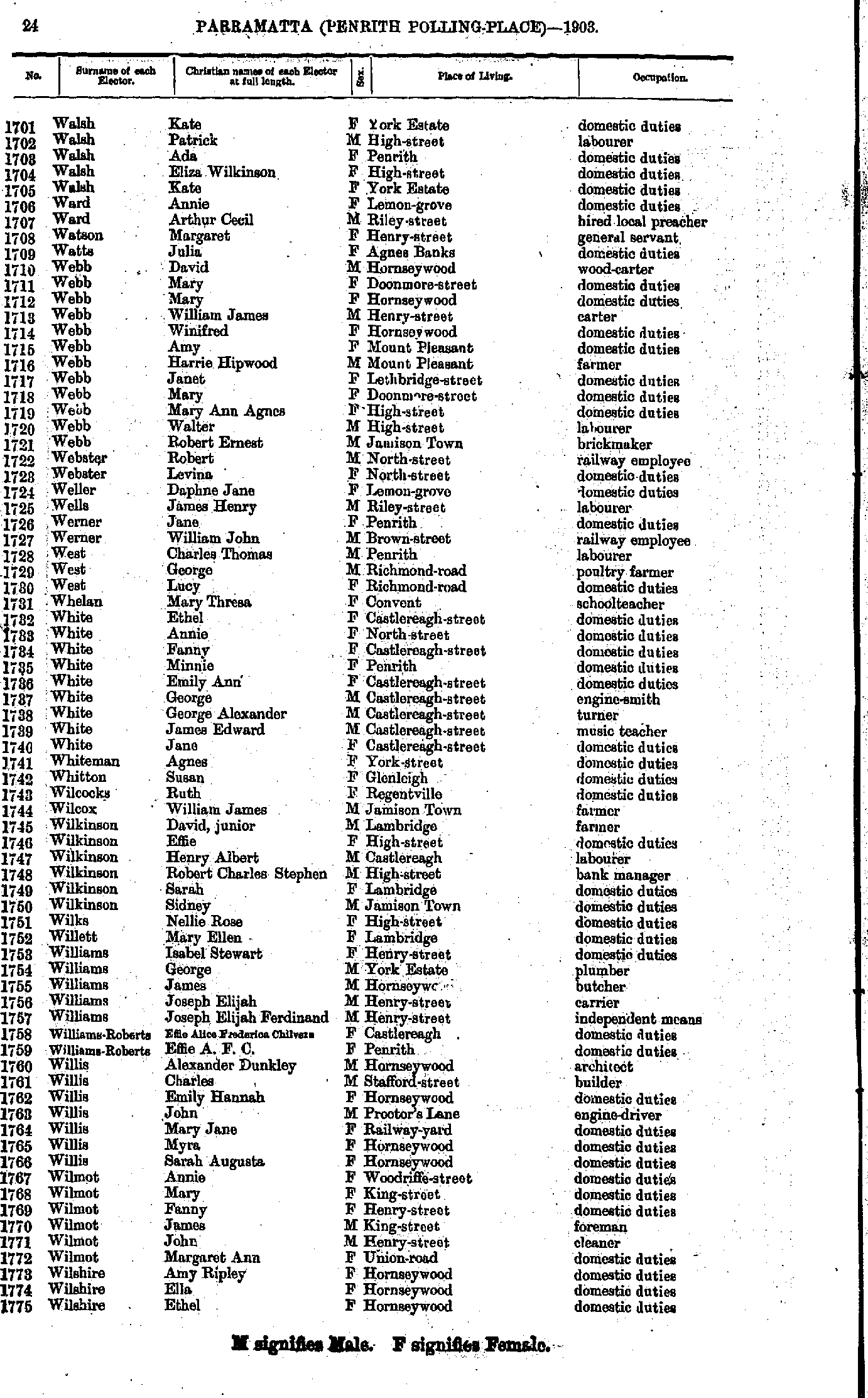
- Walsh Kate - Wilshire Ethel
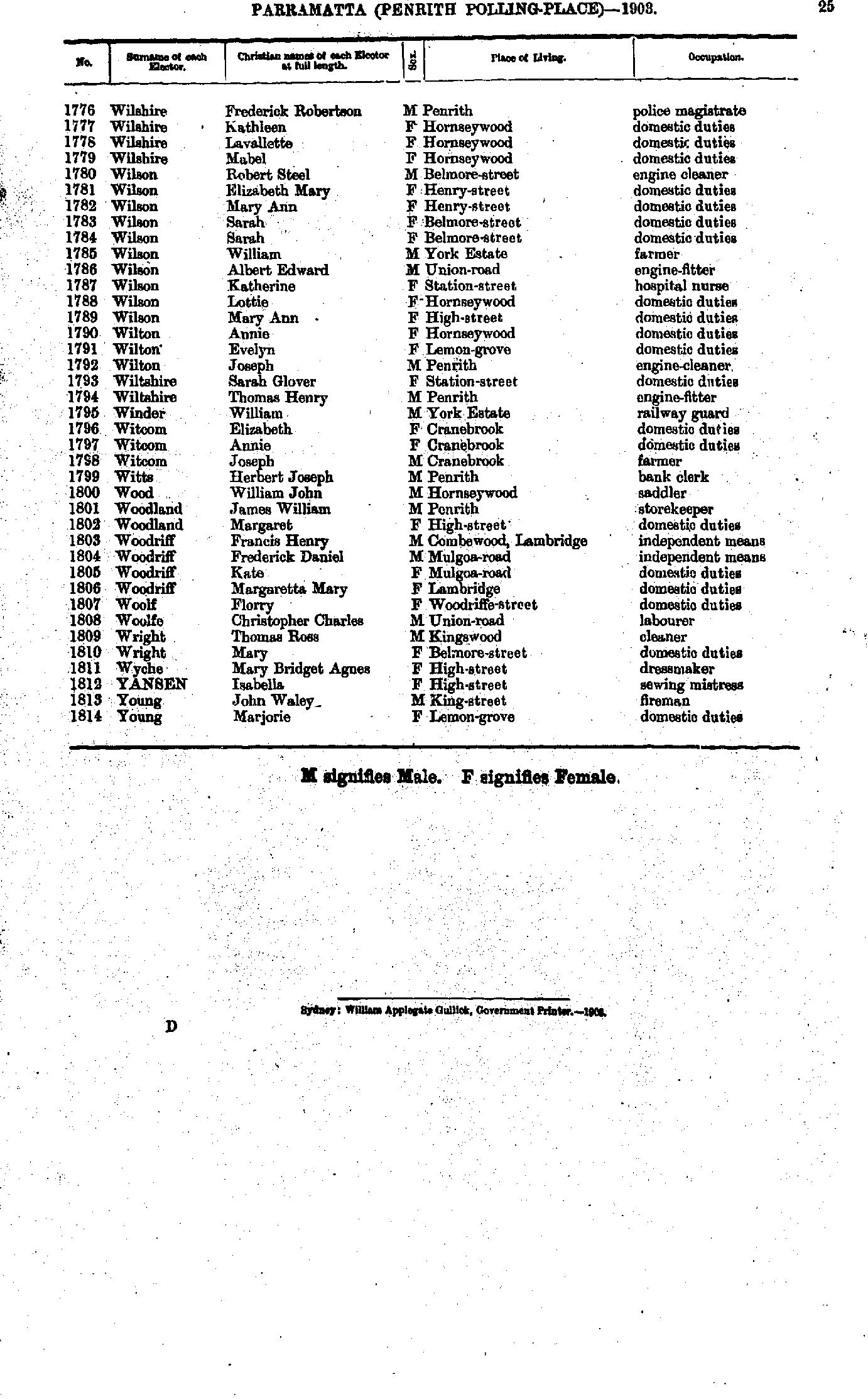
- Wilshire Frederick - Young Marjorie
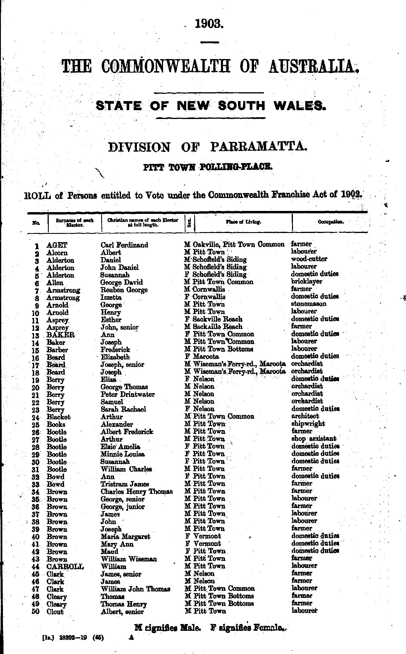
- Aget Carl - Clout Albert
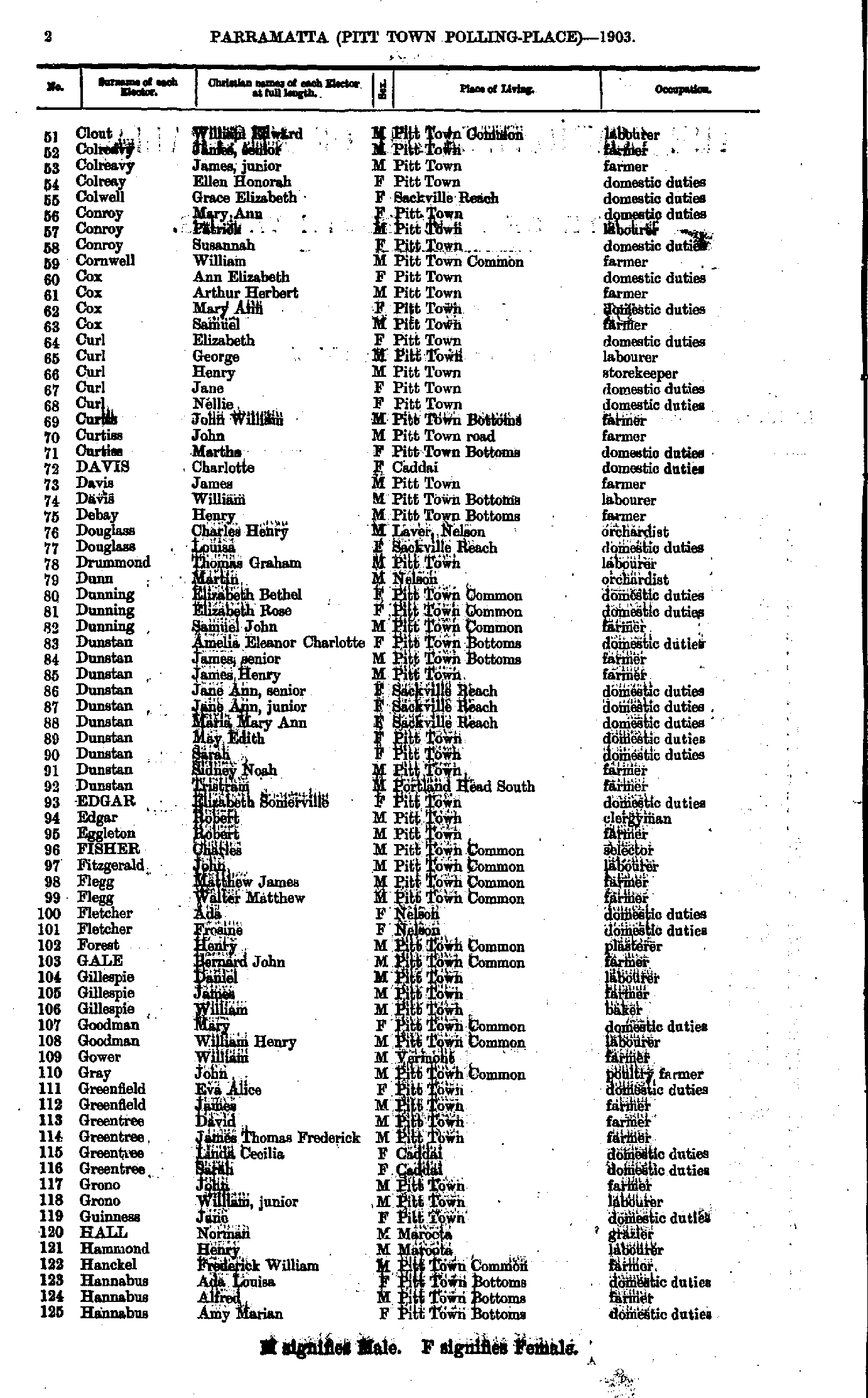
- Clout William - Hannabus Amy
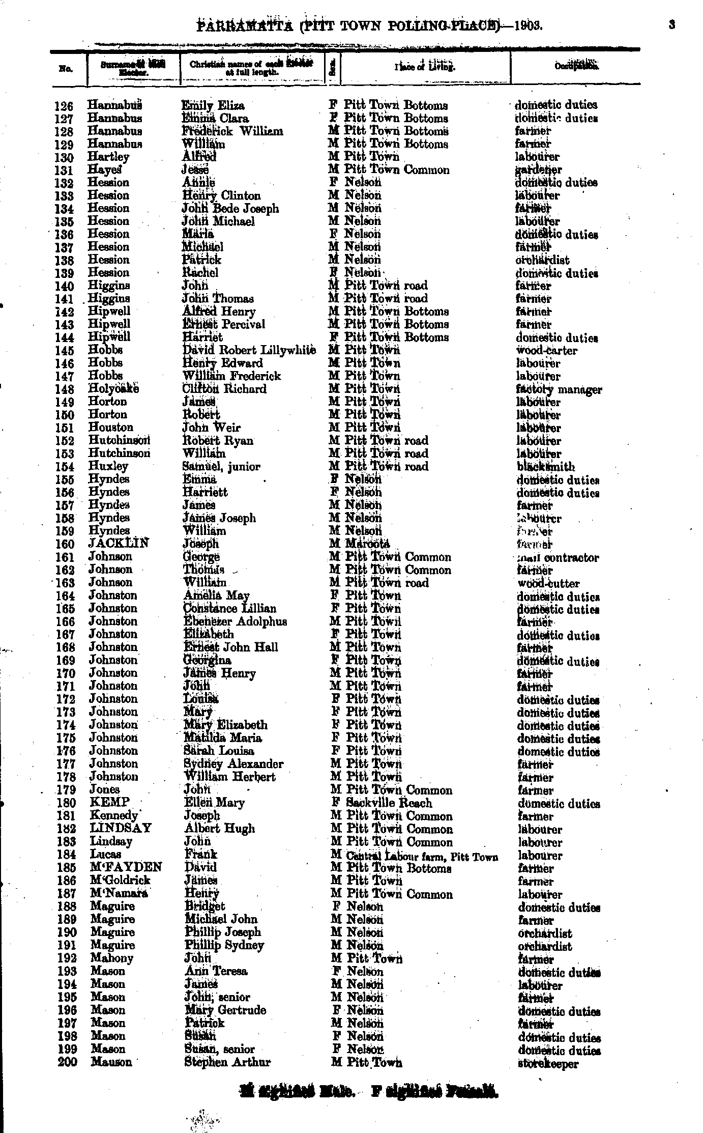
- Hannabus Emily - Mauson Stephen
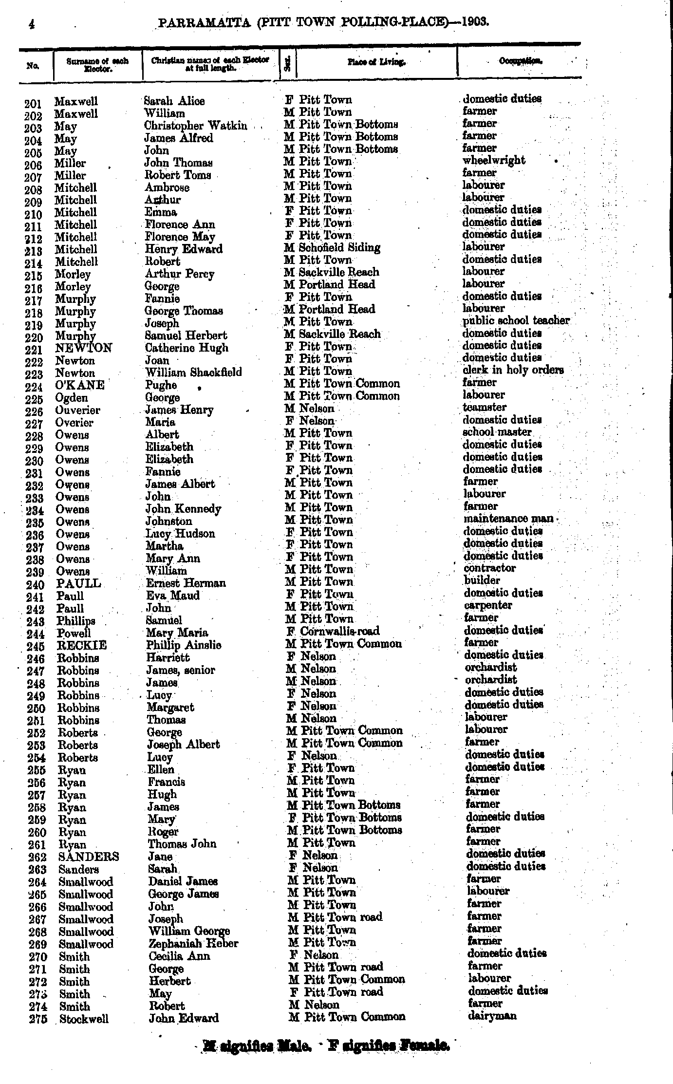
- Maxwell Sarah - Stockwell John
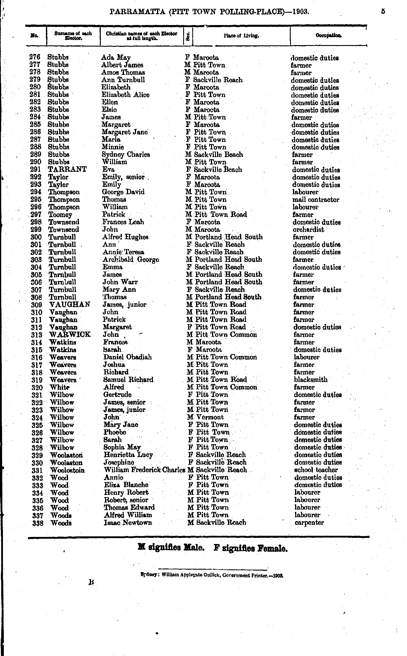
- Stubbs Ada - Woods Isaac
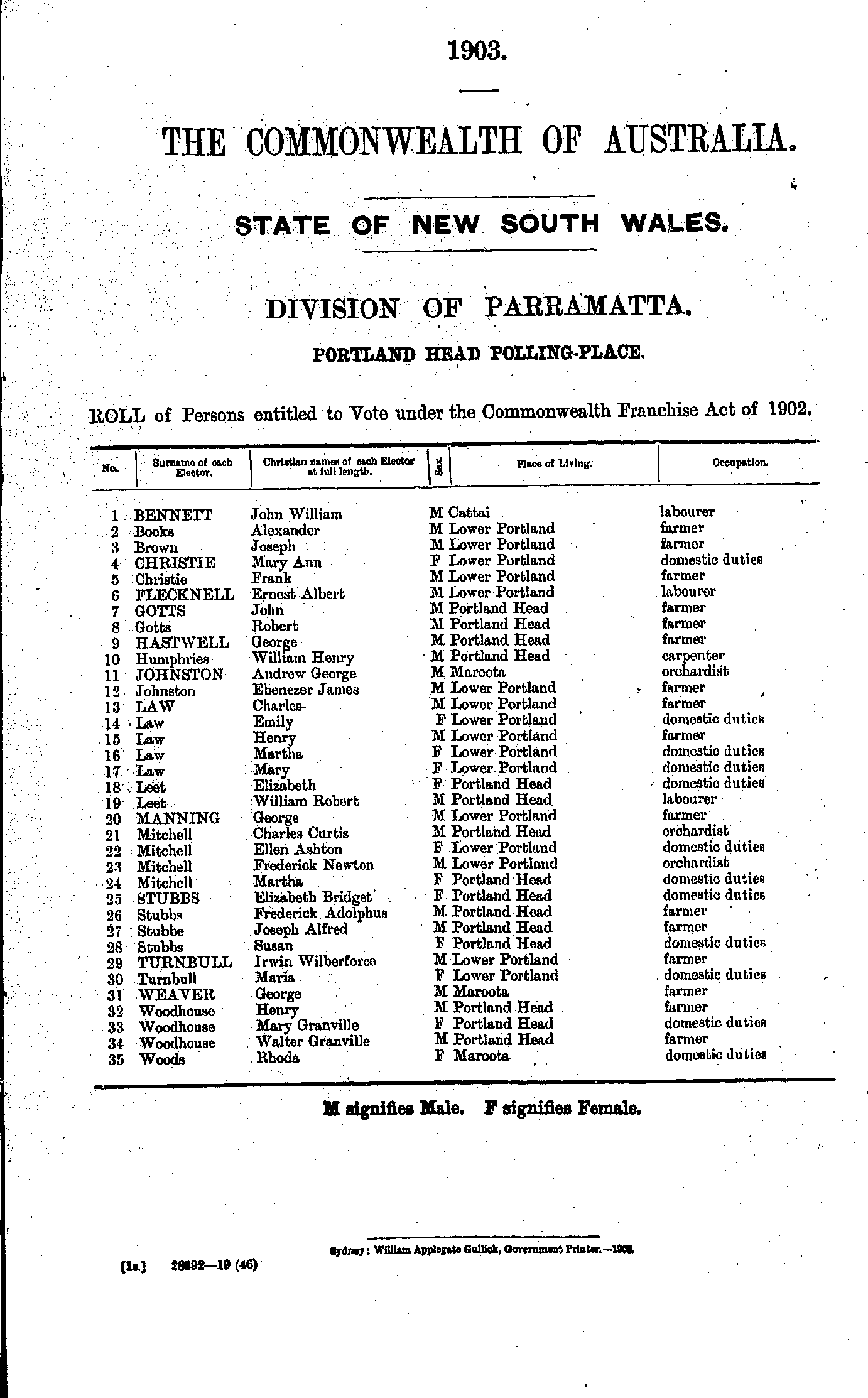
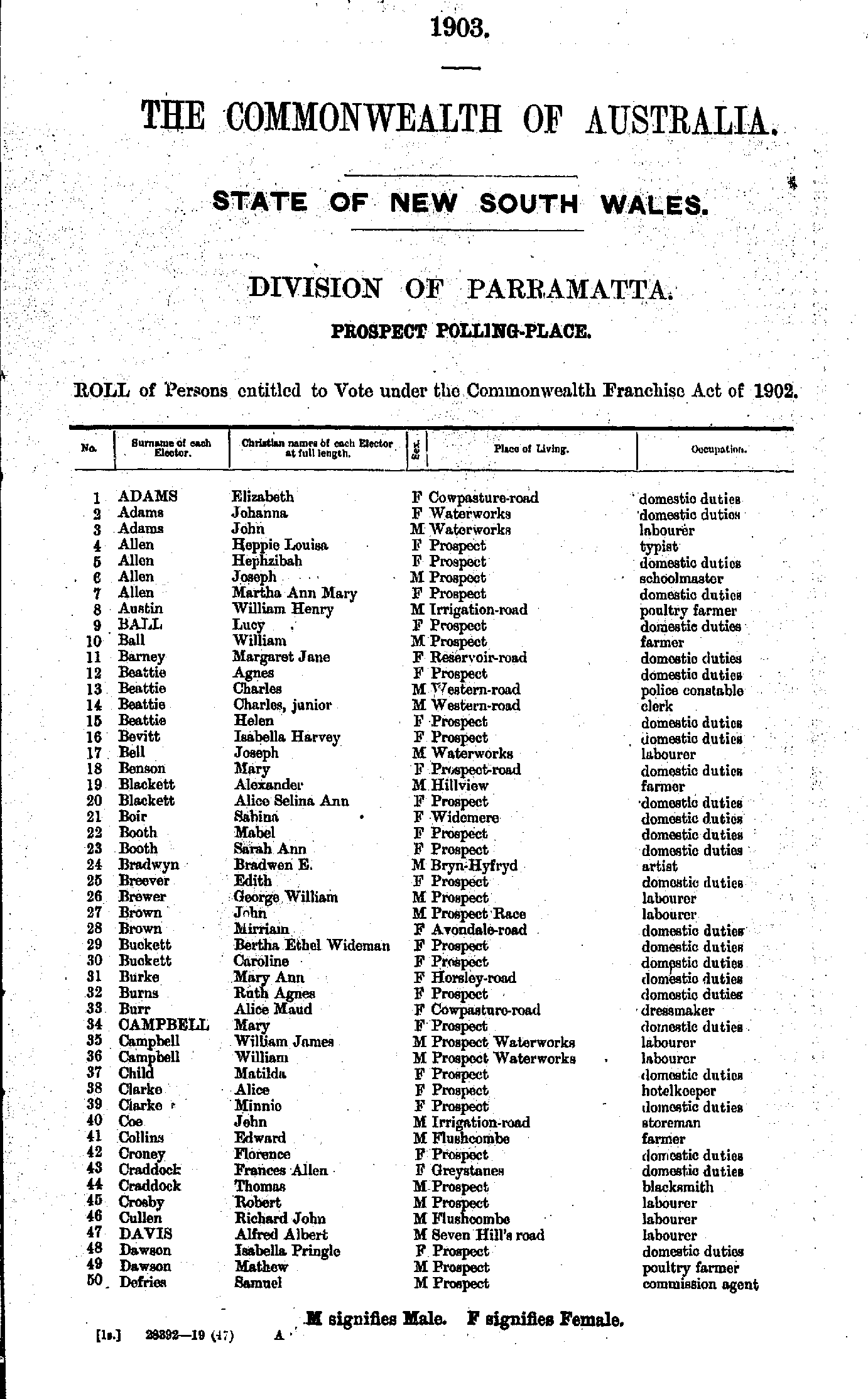
- Adams Elizabeth - Defries Samuel
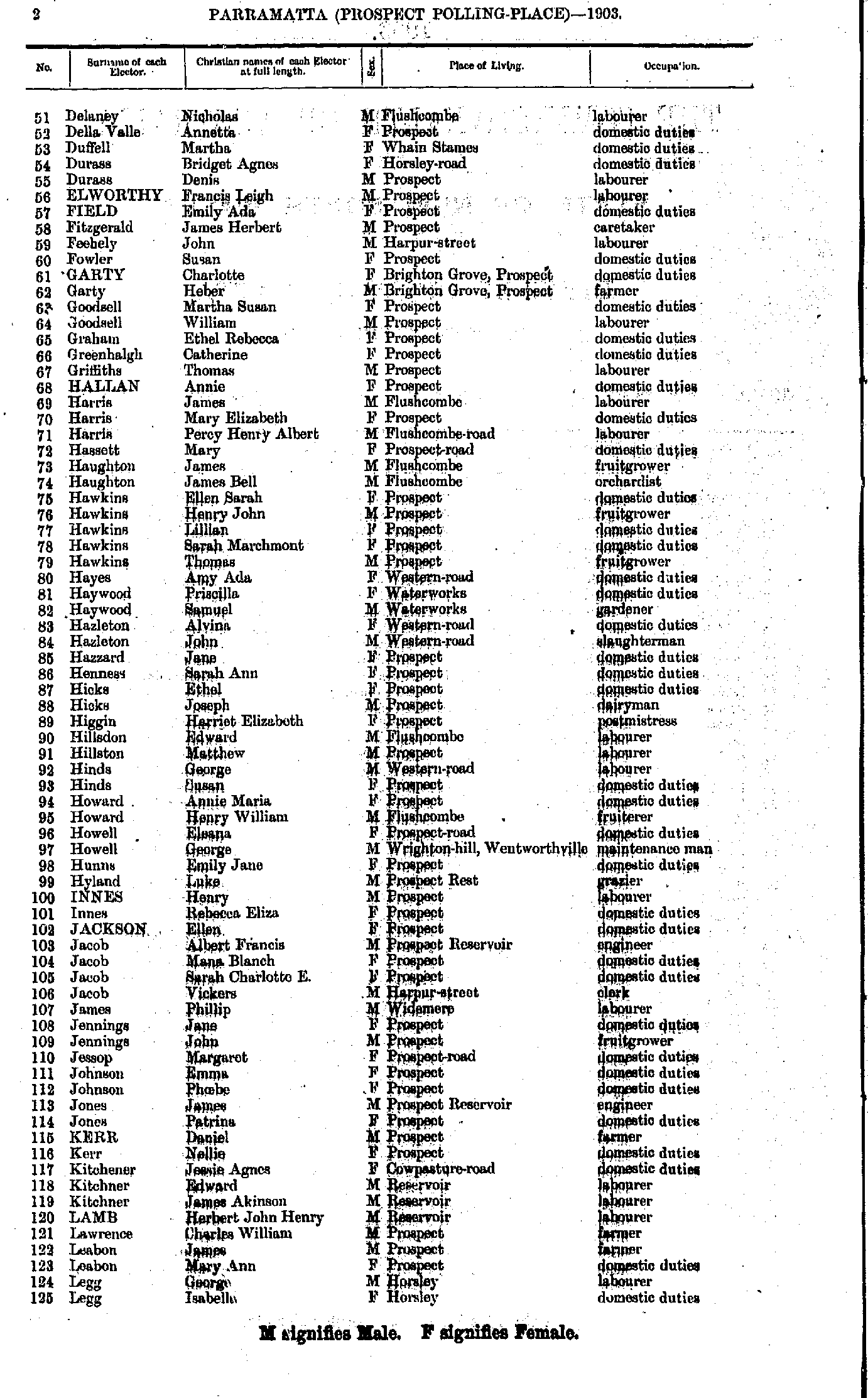
- Delaney Nicholas - Legg Isabella
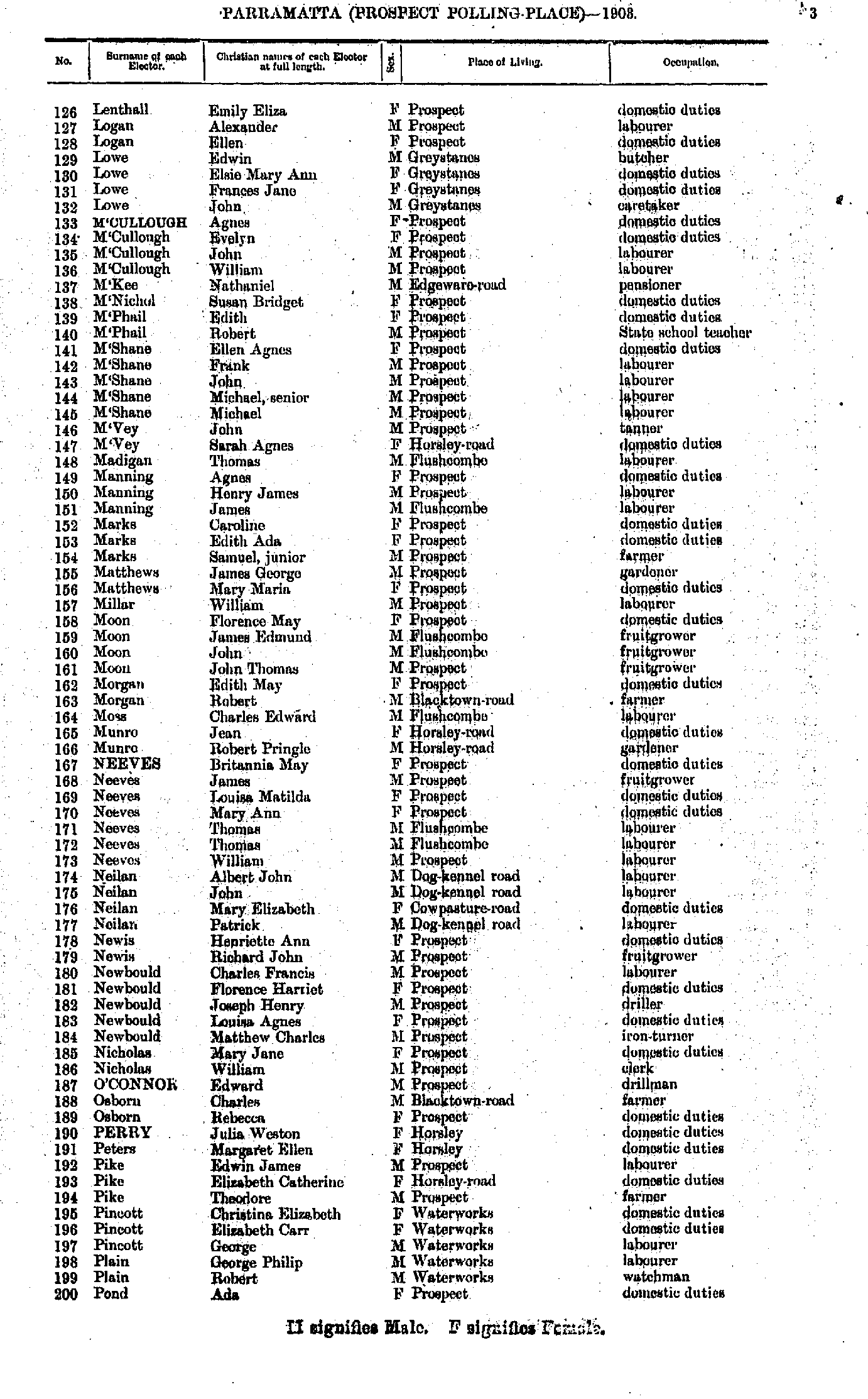
- Lenthall Emily - Pond Ada
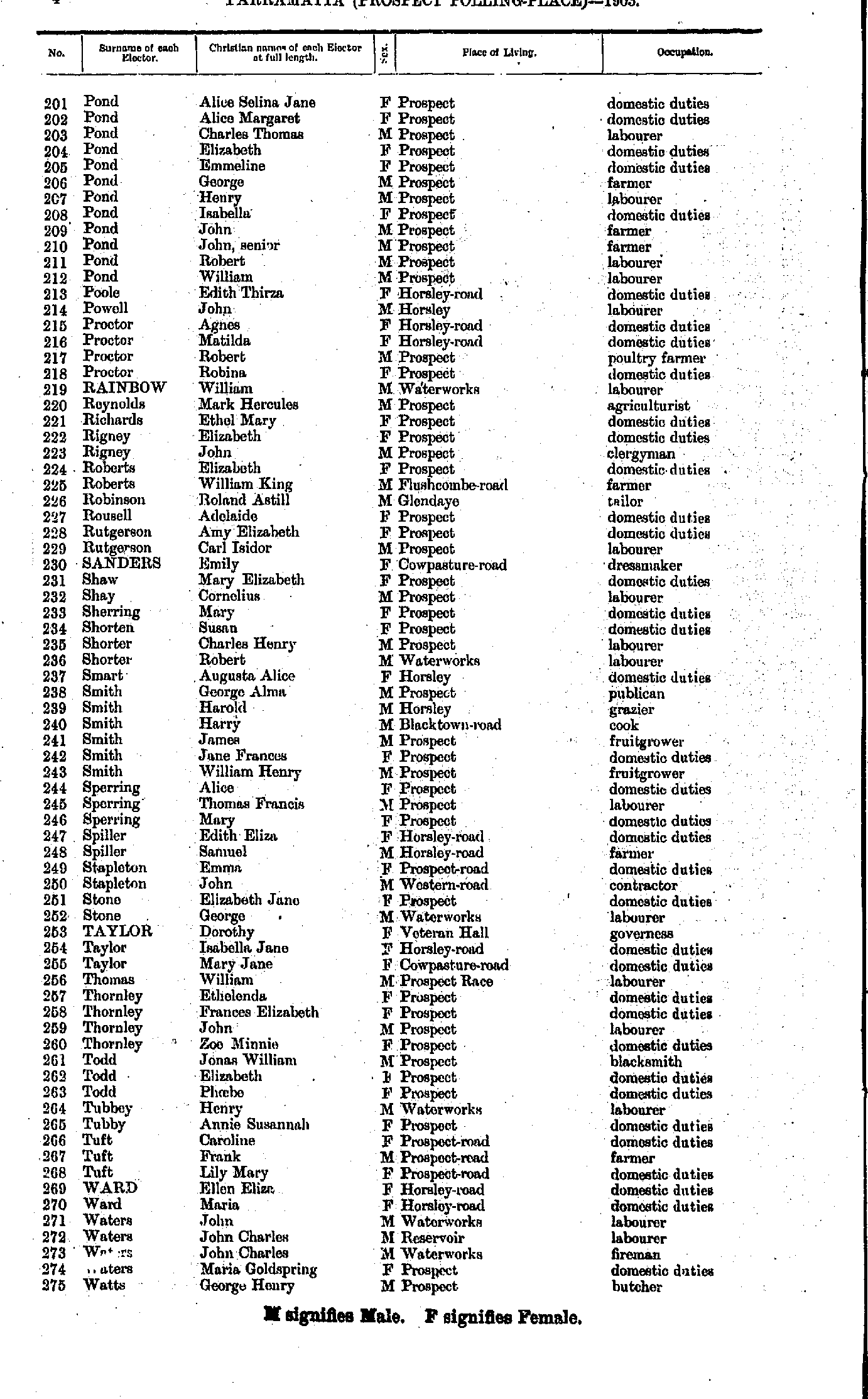
- Pond Alice - Watts George
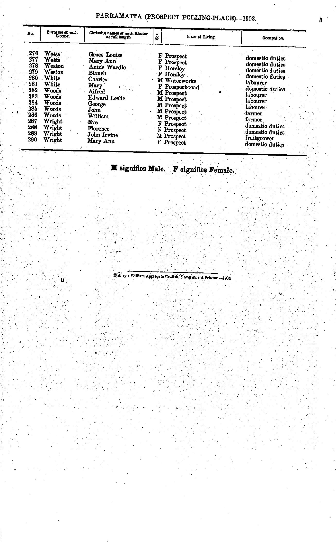
- Watts Grace - Wright Mary
- Adams Ernest - Bennett Arthur
- Bennett Elizabeth - Caterson Frederick
- Caterson William - Douglass William
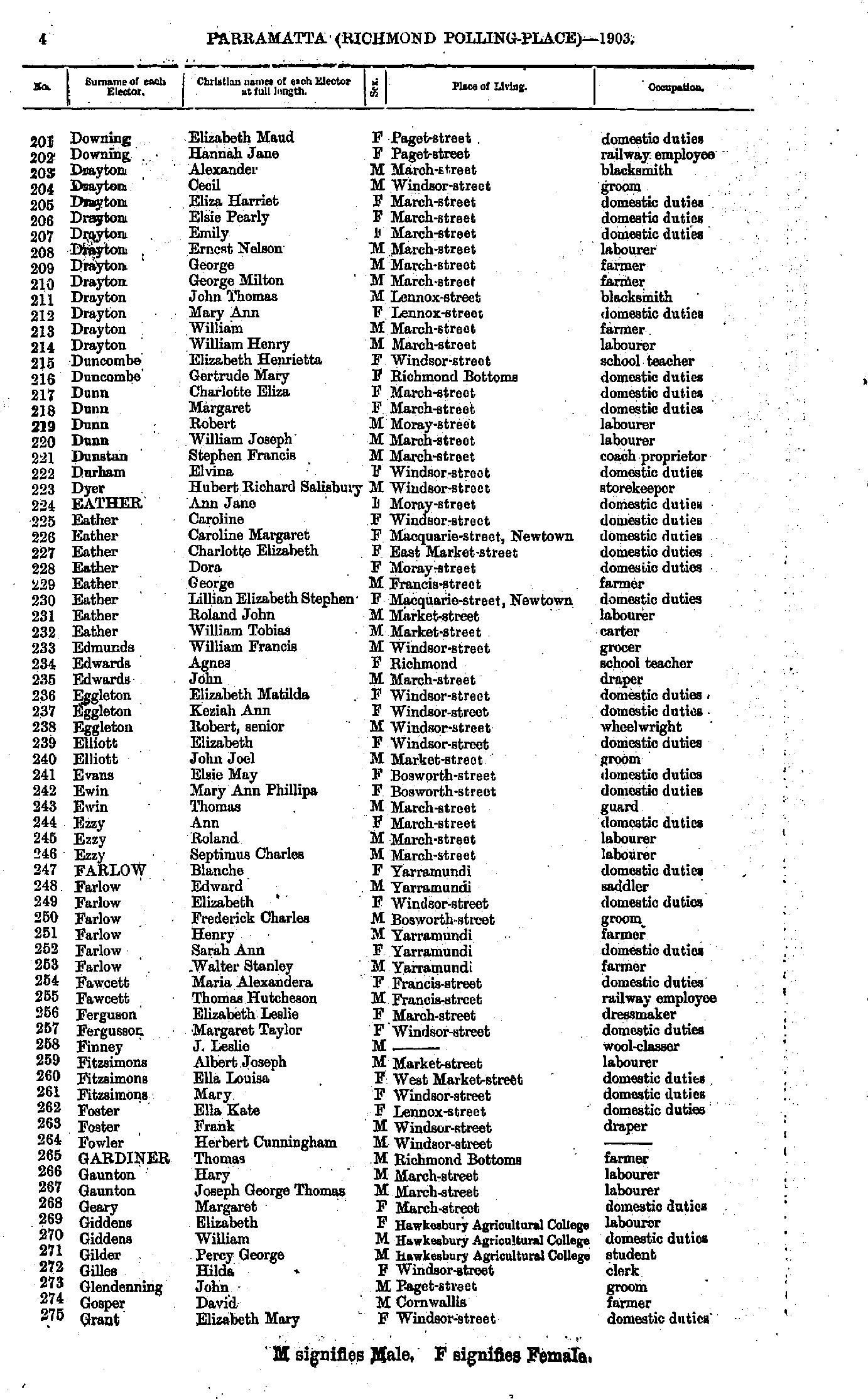
- Downing Elizabeth - Grant Elizbeth
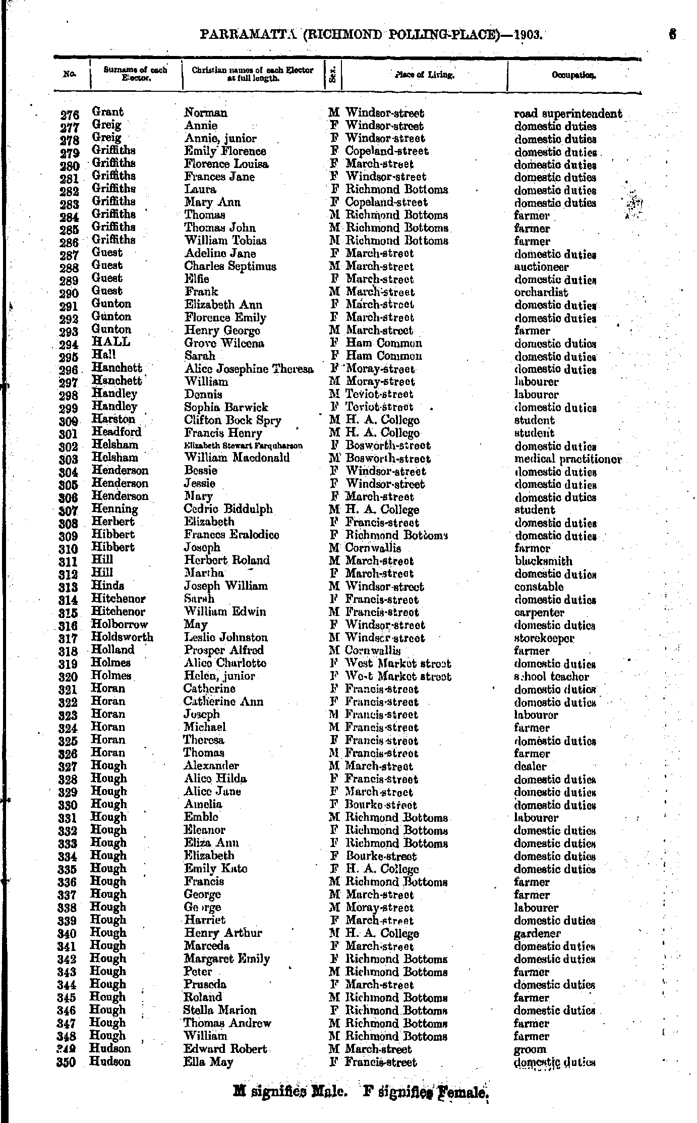
- Grant Norman - Hudson Ella
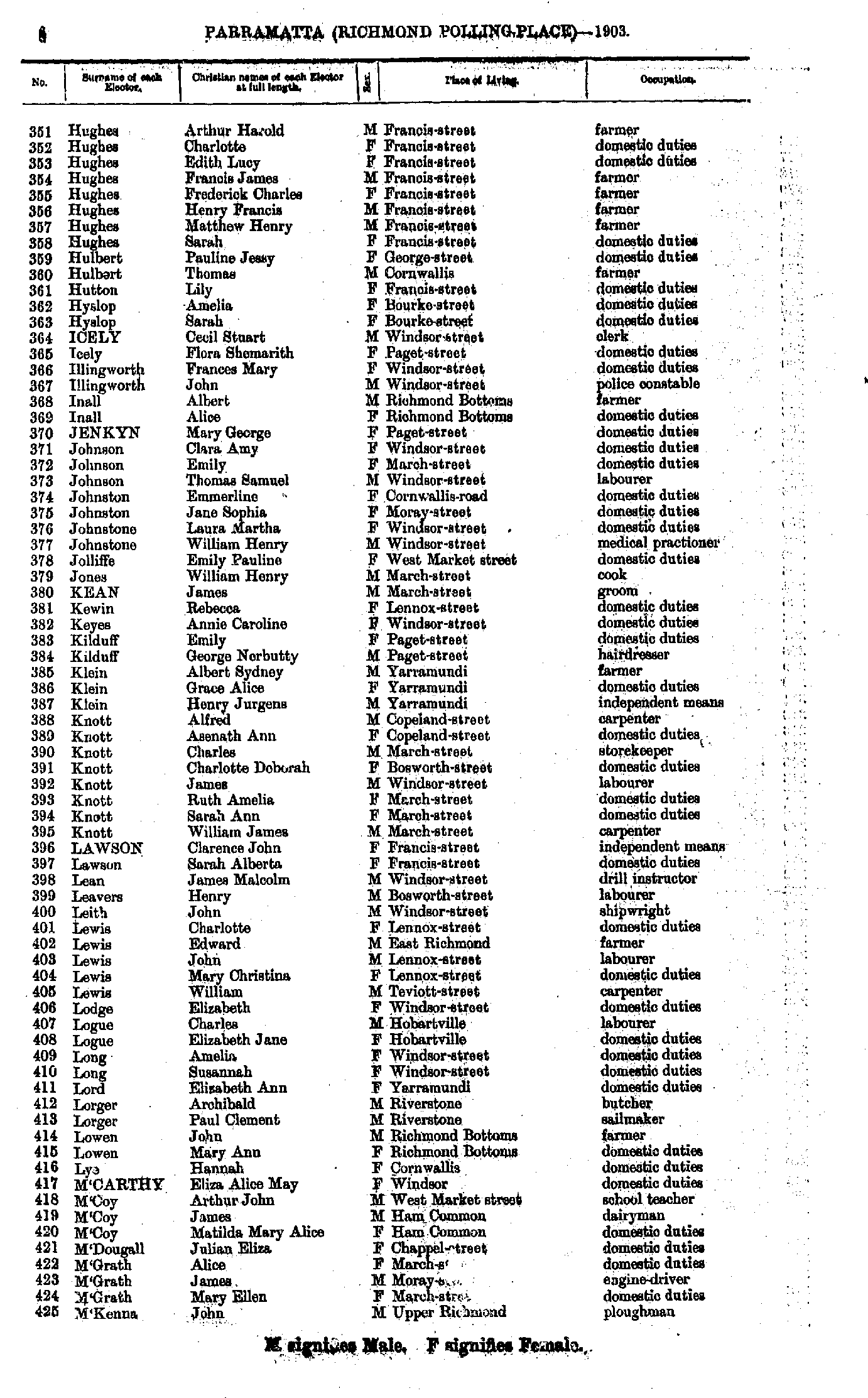
- Hughes Arthur - M'Kenna John
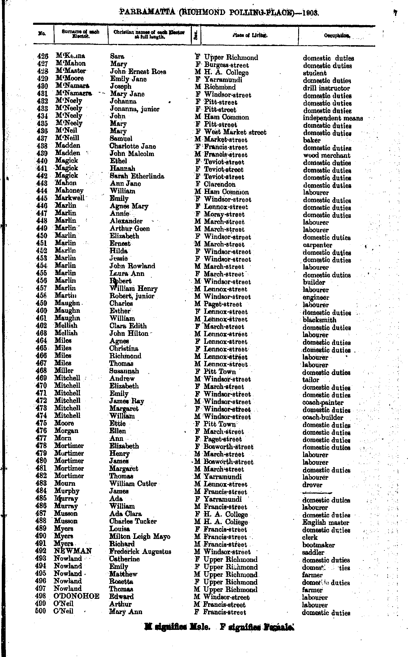
- M'Kenna Sara - O'Neil Mary
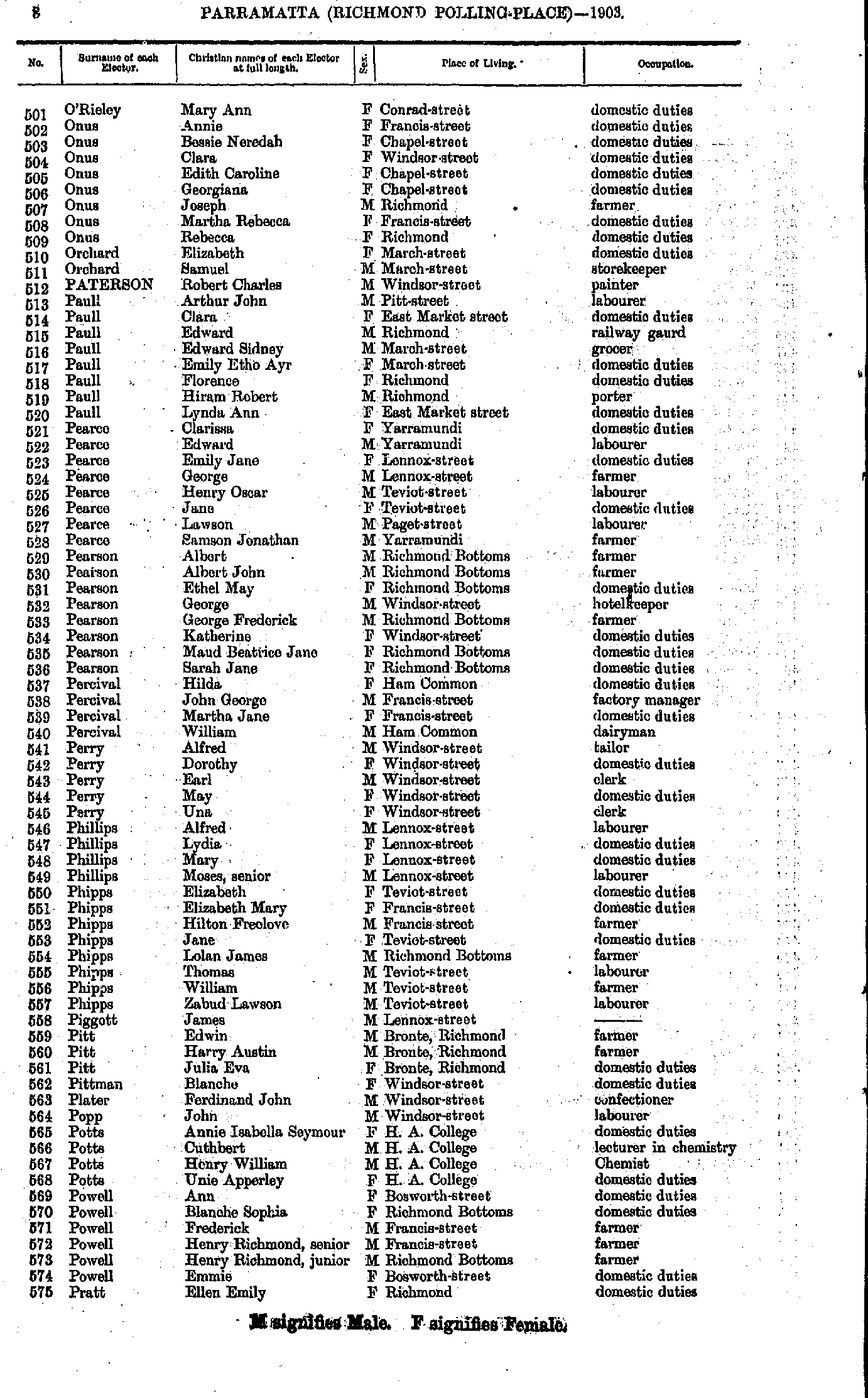
- O'Rieley Mary - Pratt Ellen
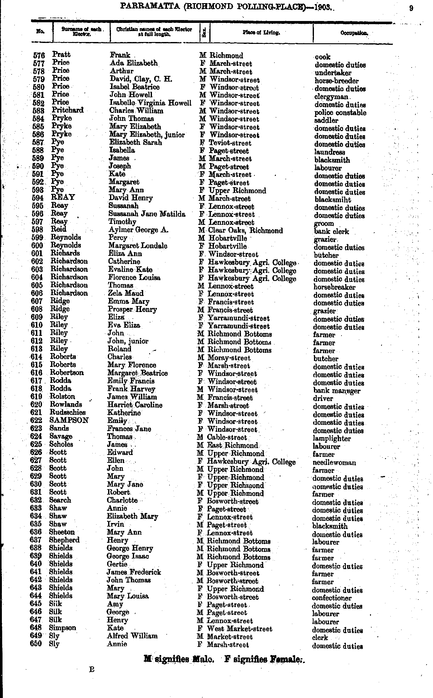
- Pratt Frank - Sly Annie
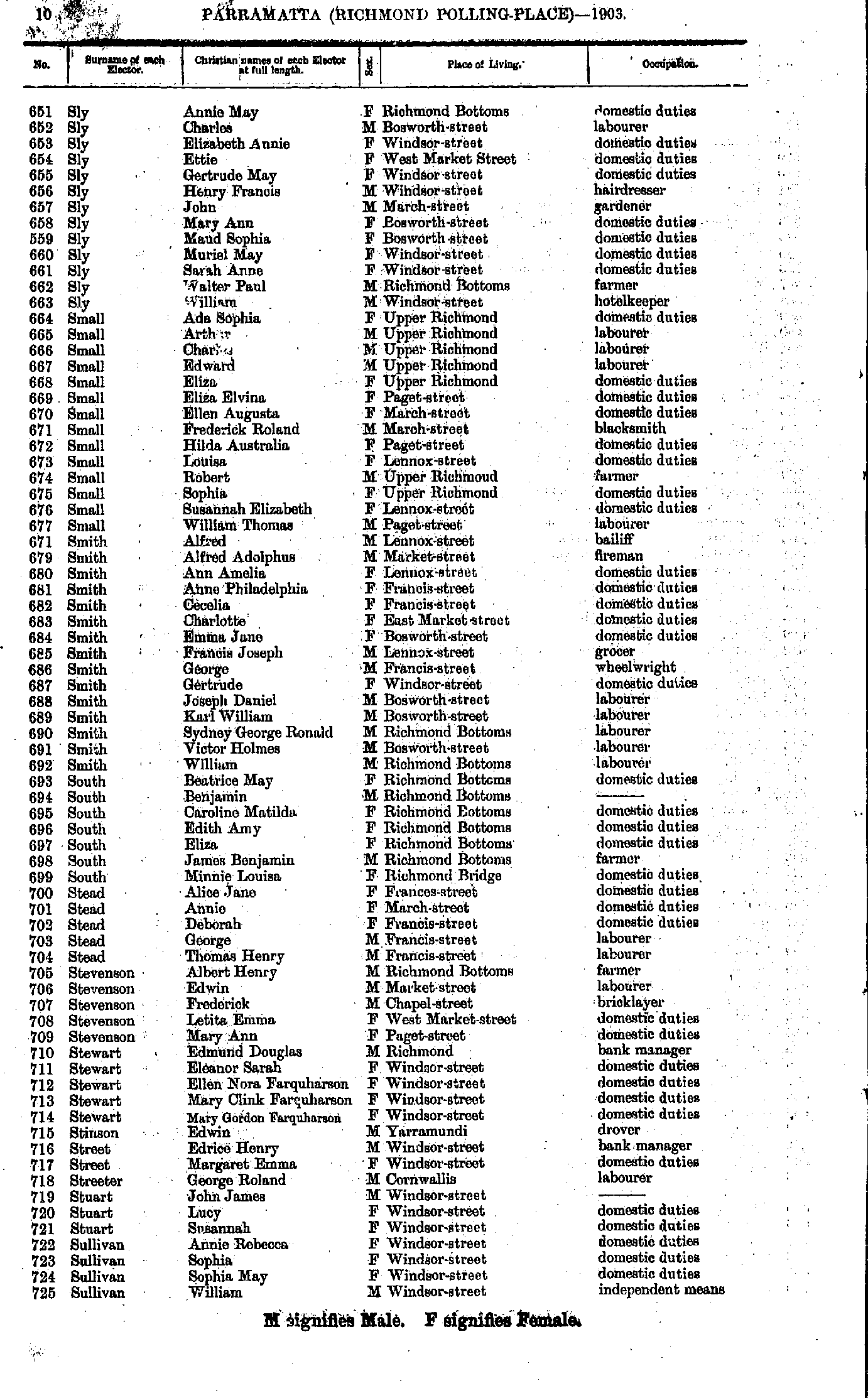
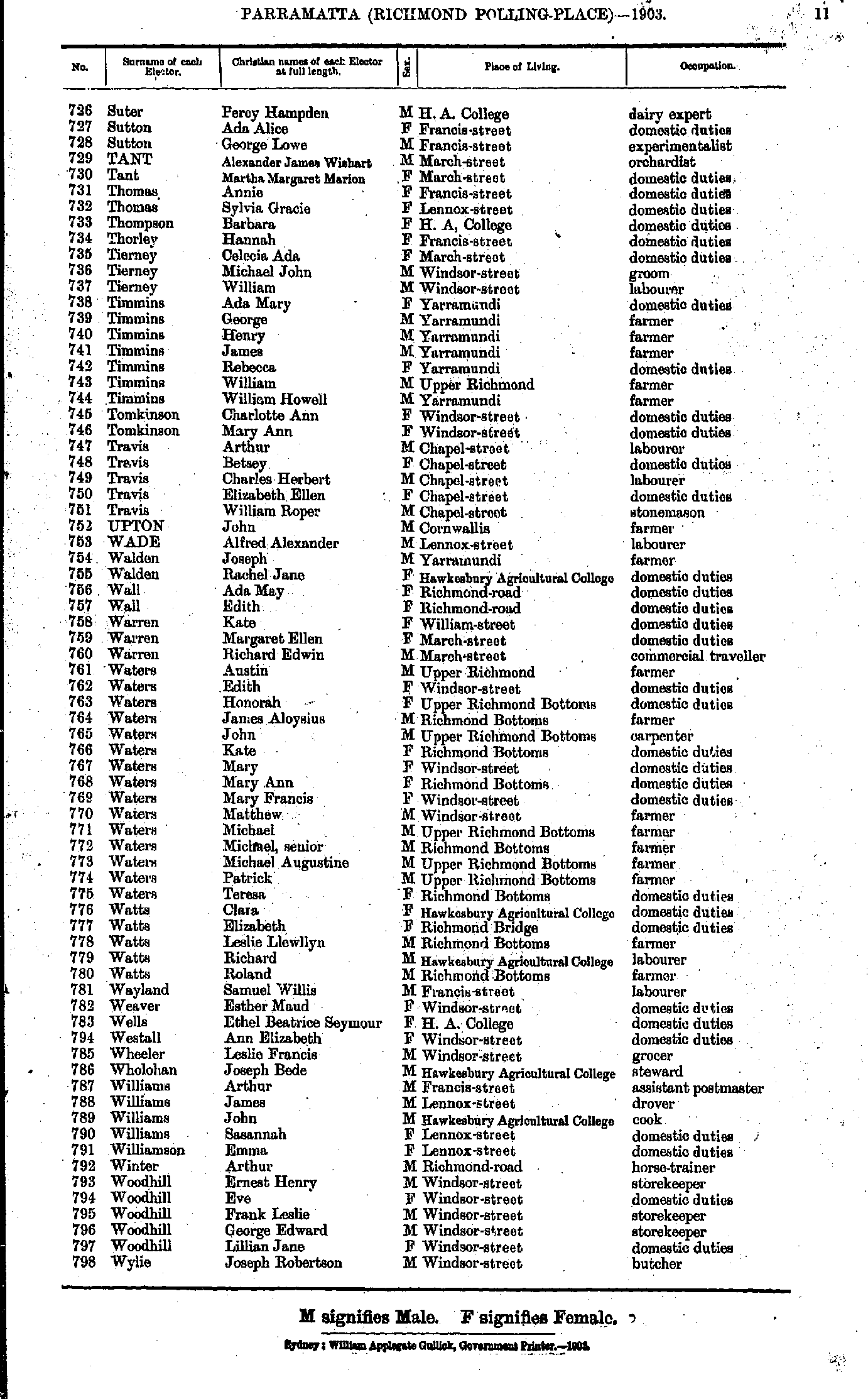
- Sly Annie - Sullivan William
- Suter Percy - Wylie Joseph
- Alcorn Clara - Brennan William
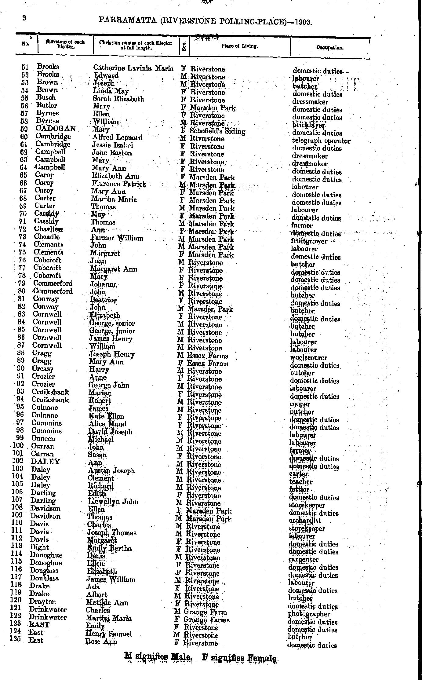
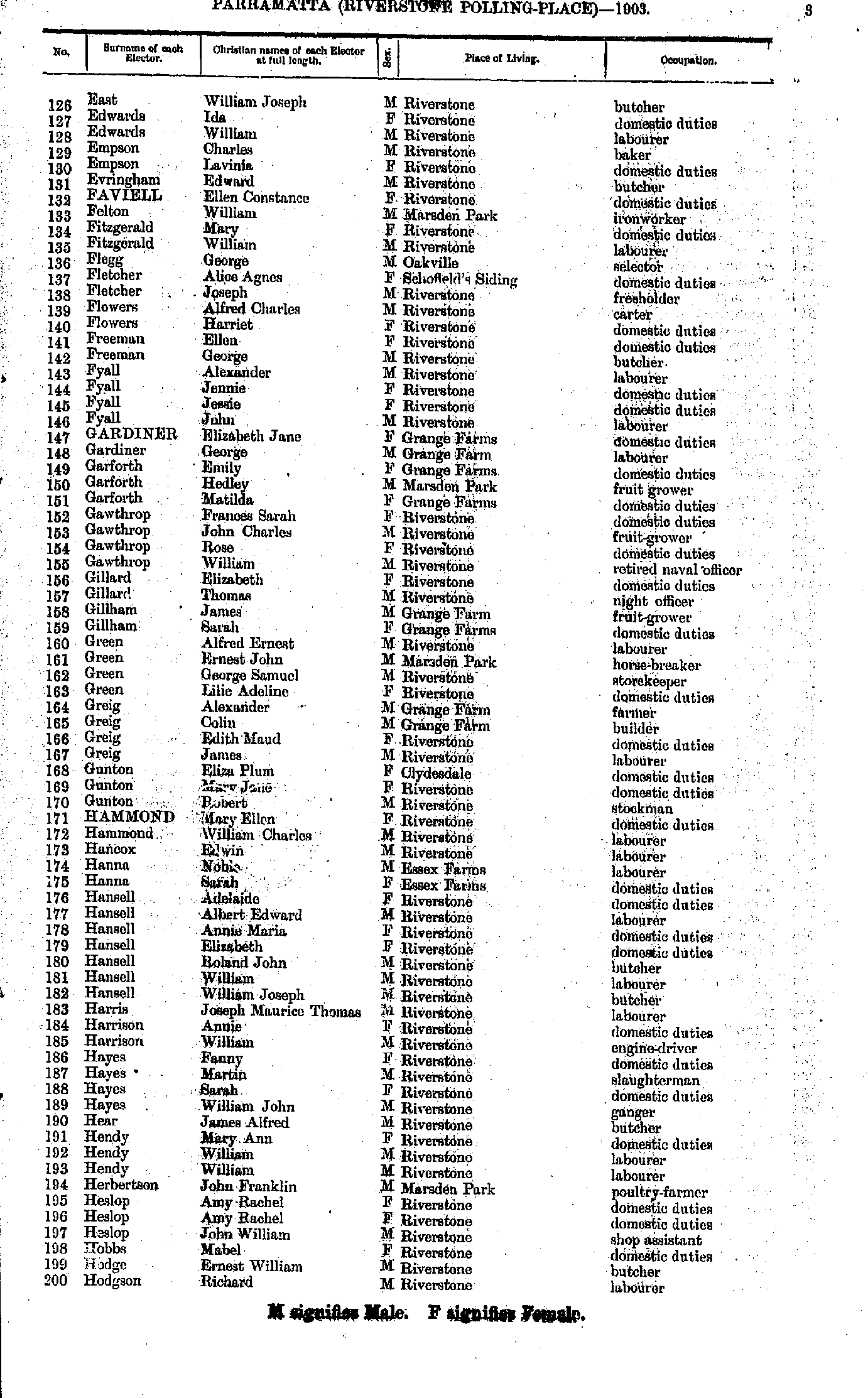
- Brooks Catherine - East Rose
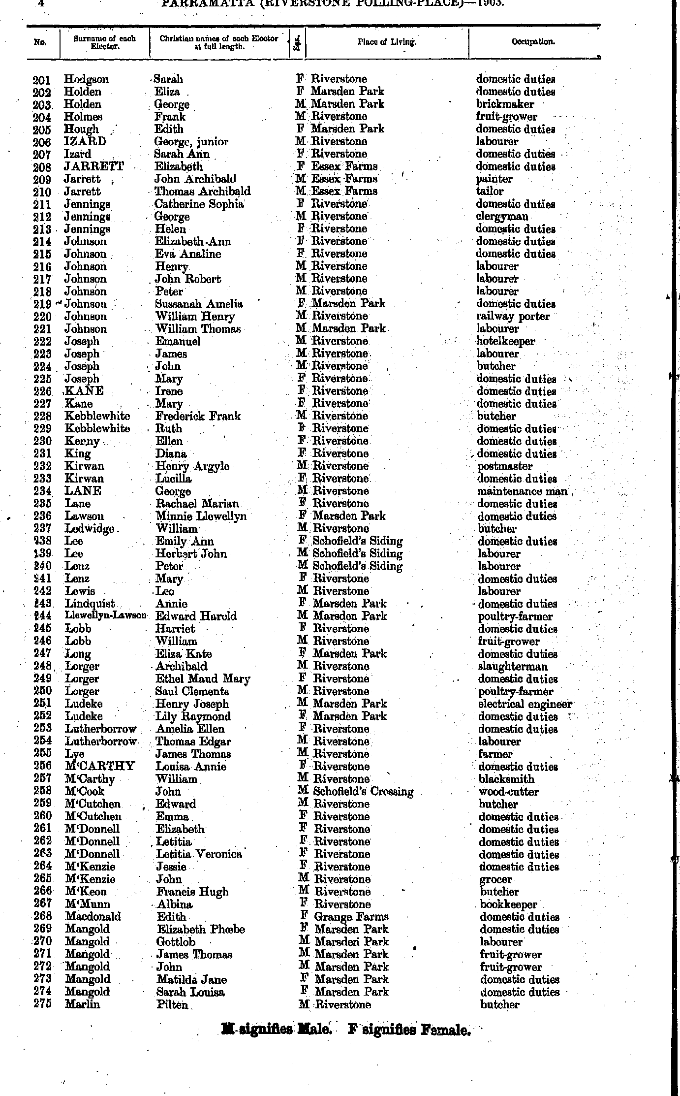
- East William - Hodgson Richard
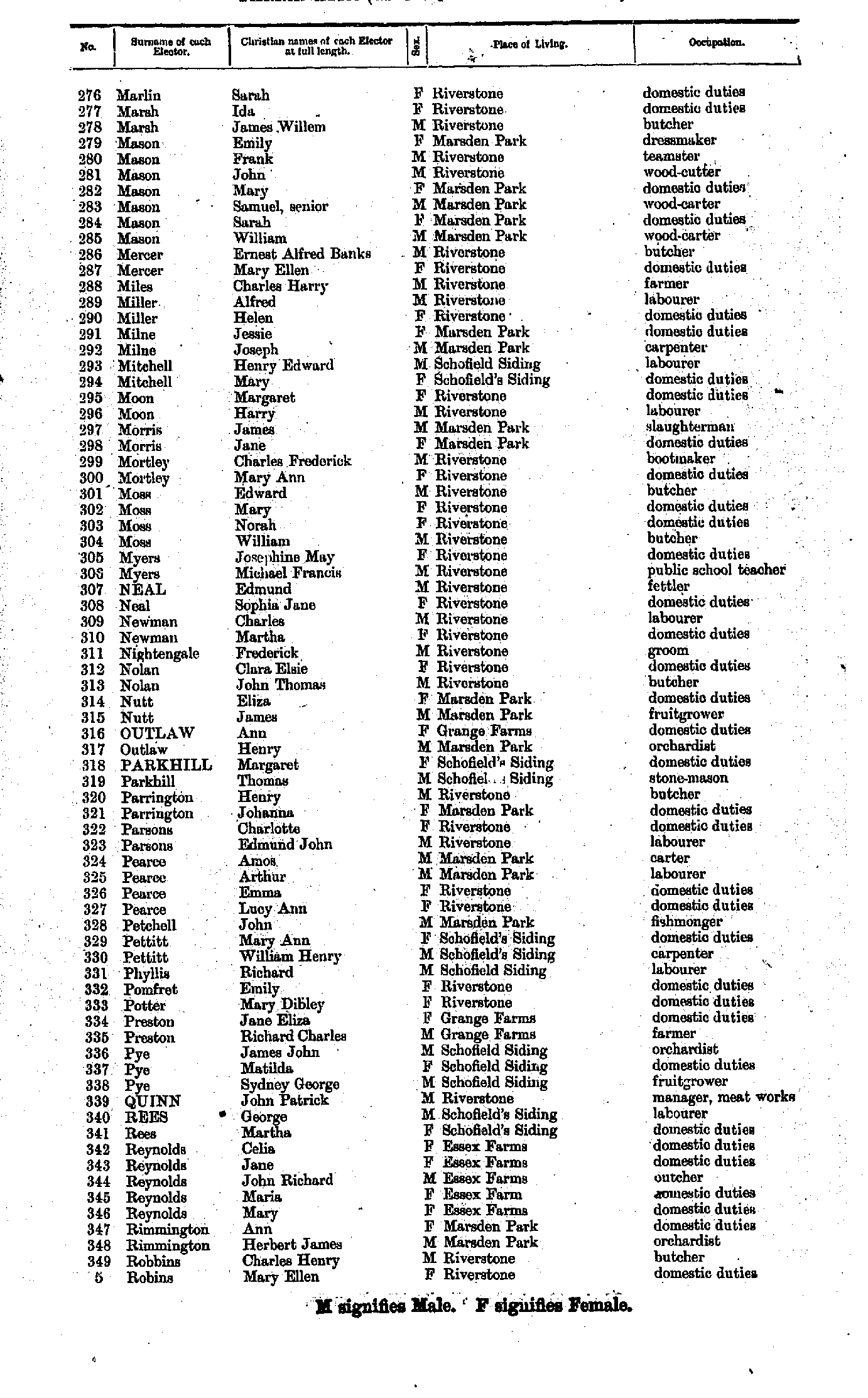
- Hodgson Sarah - Marlin Pilten
- Marlin Sarah - Robins Mary
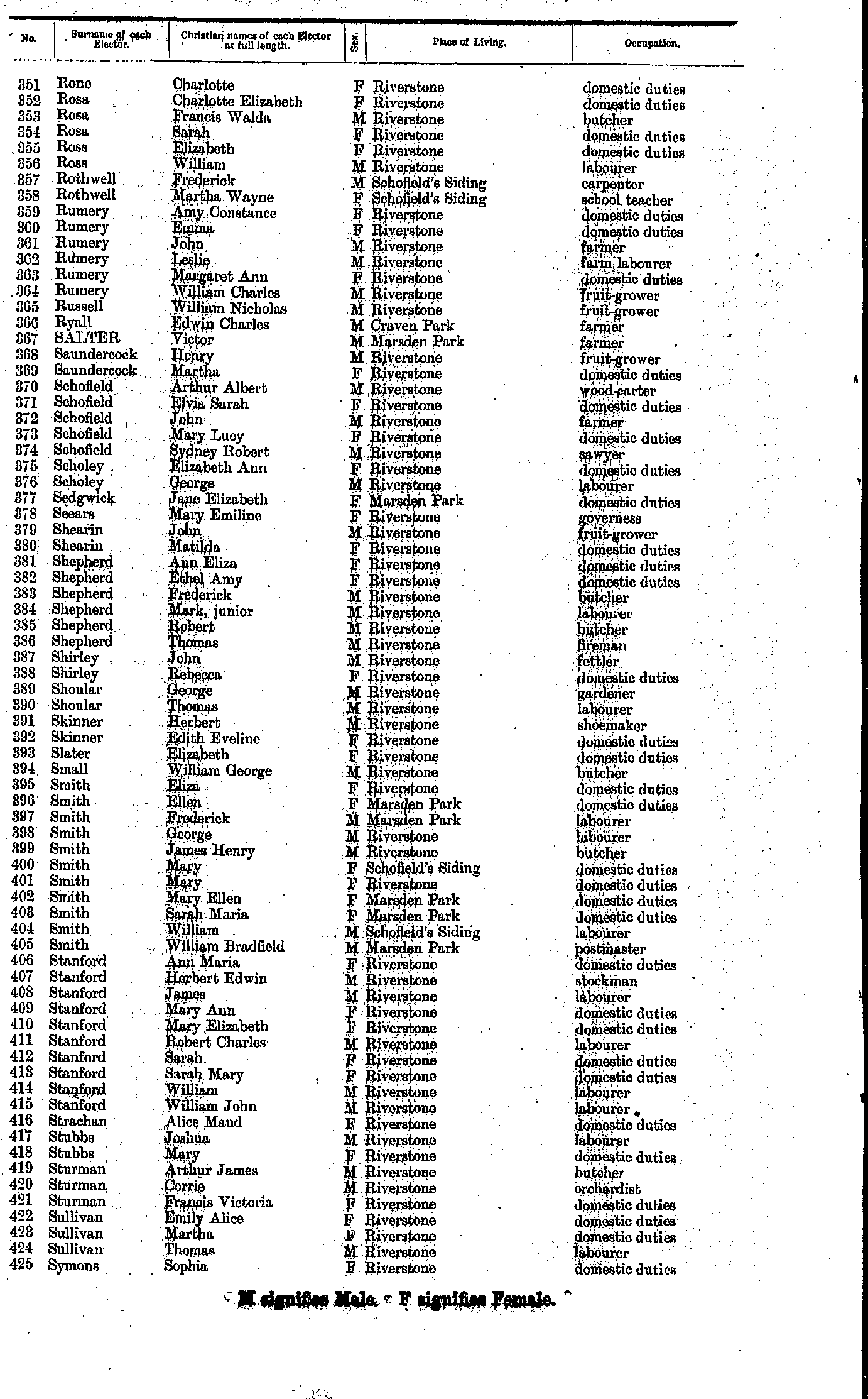
- Rone Charlotte - Symons Sophia
- Tancred Agnes - Woodbridge Eliza
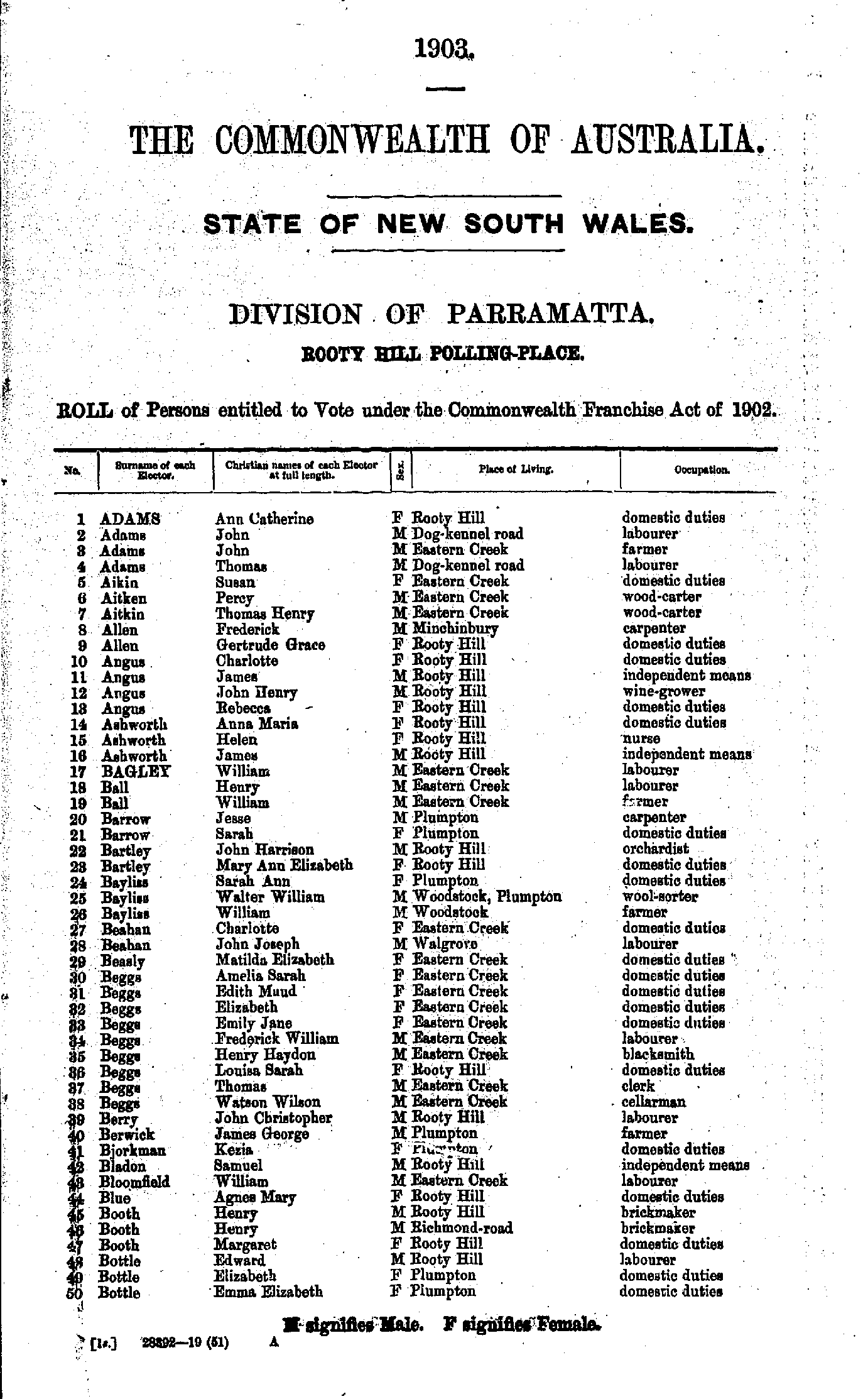
- Adams Ann - Bottle Emma
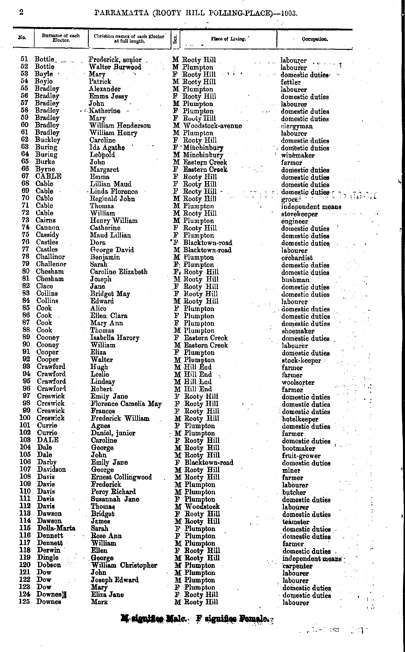
- Bottle Frederick - Downes Mark
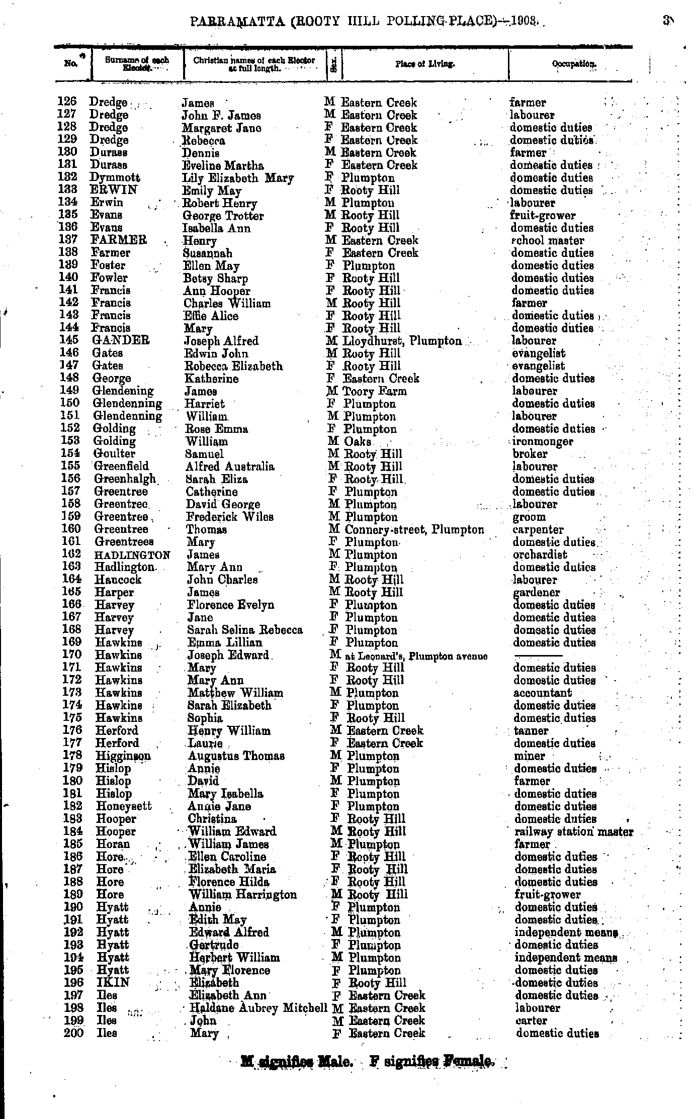
- Dredge James - Iles Mary
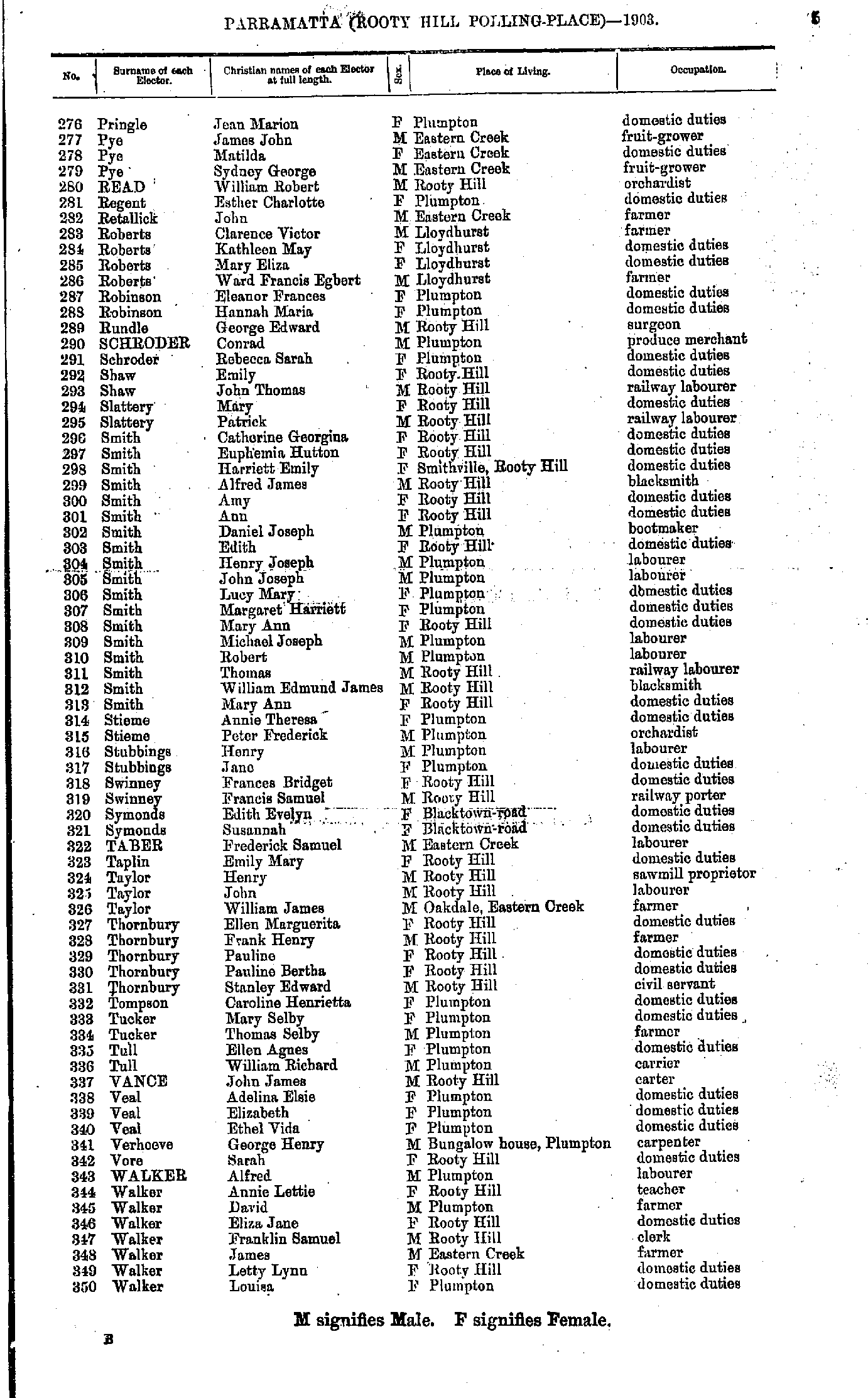
- James George - Pringle Hilda
- Pringle Jean - Walker Louisa
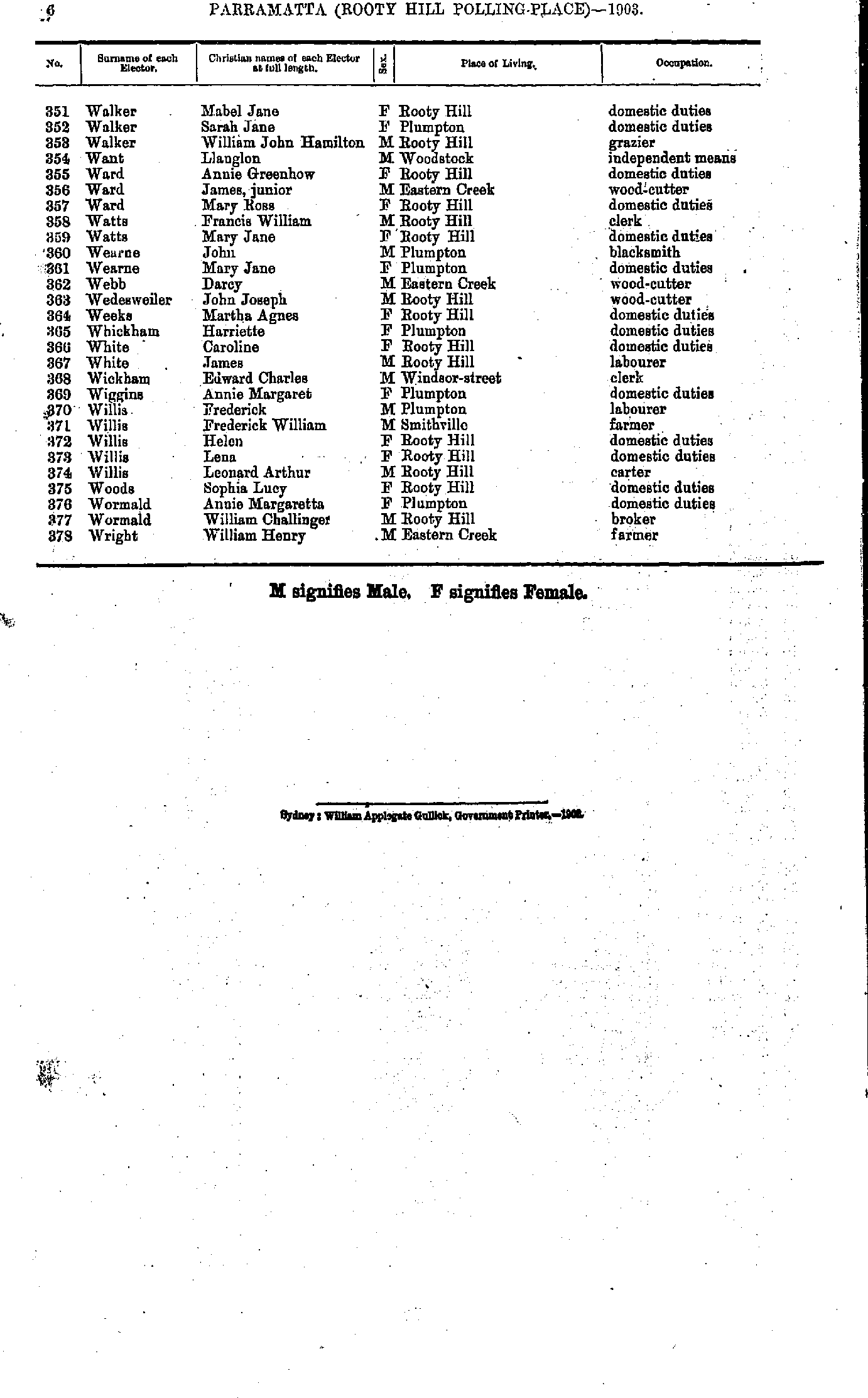
- Walker Mabel - Wright William
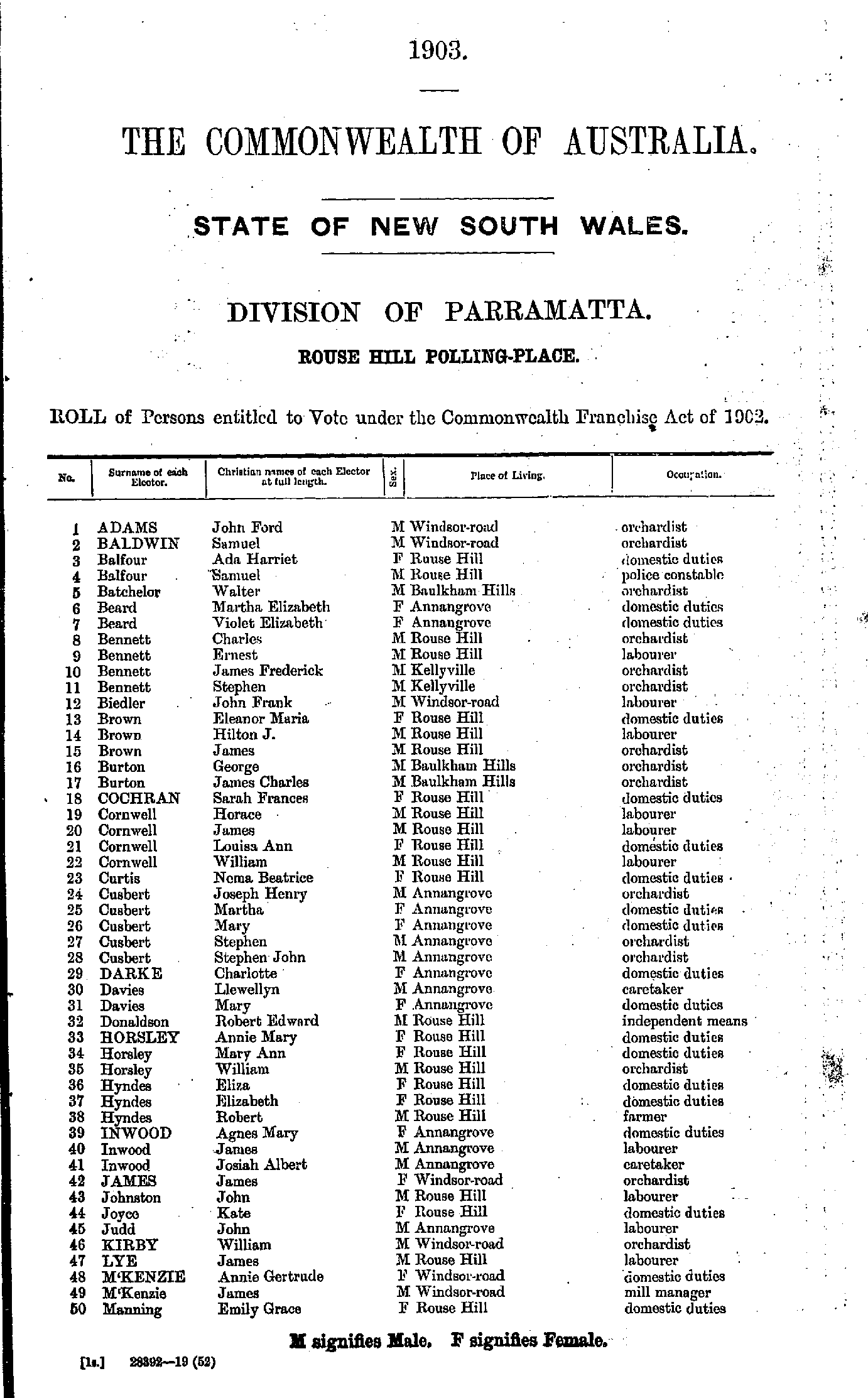
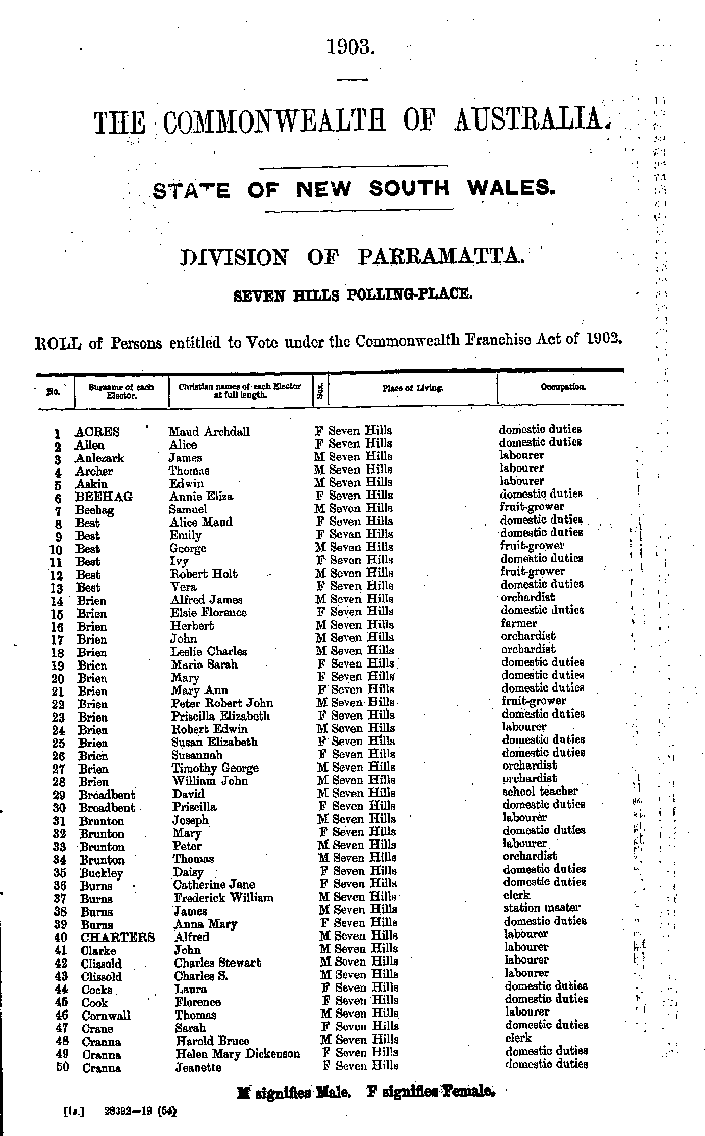
- Acres Maud - Cranna Jeanette
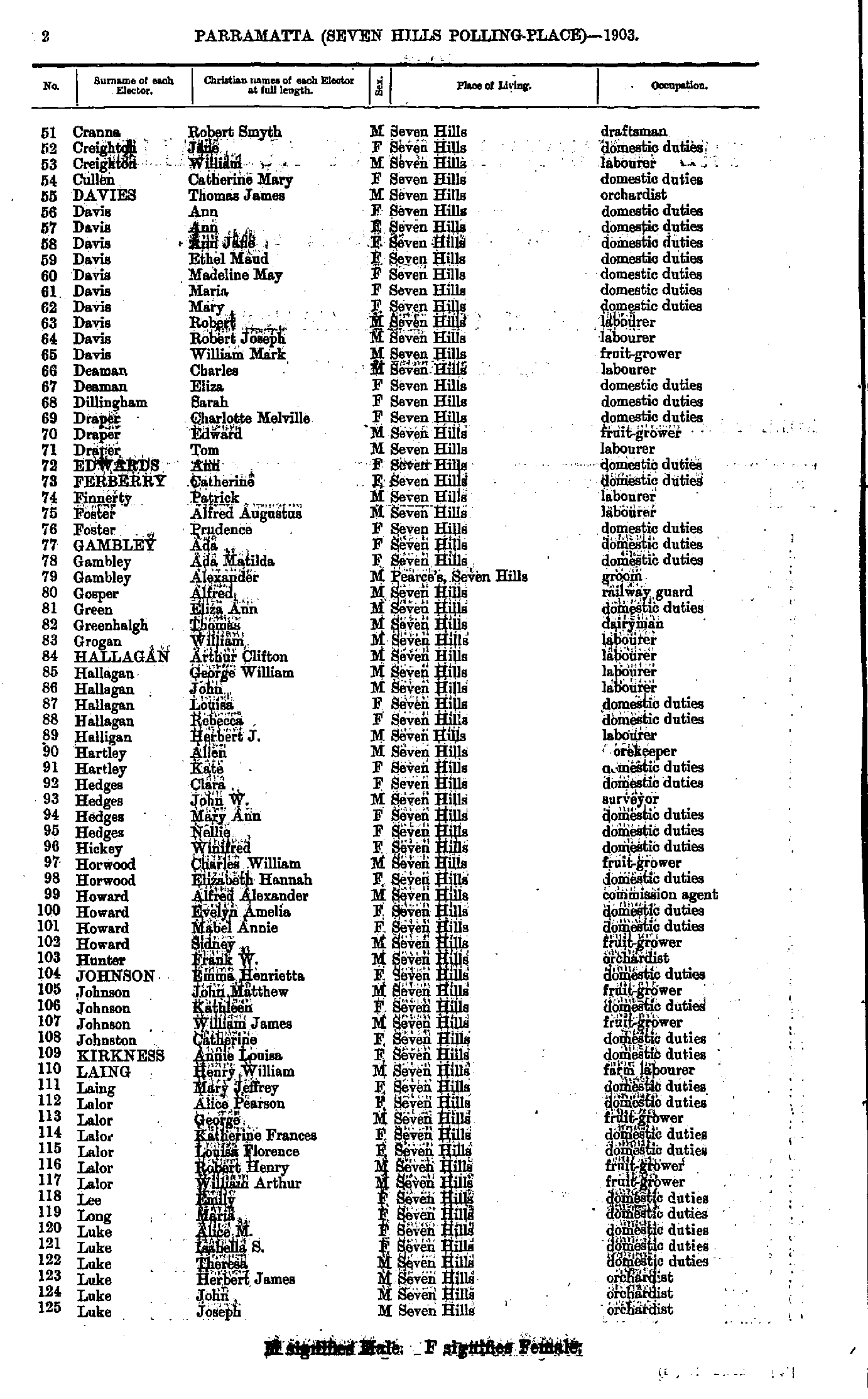
- Cranna Robert - Luke Joseph
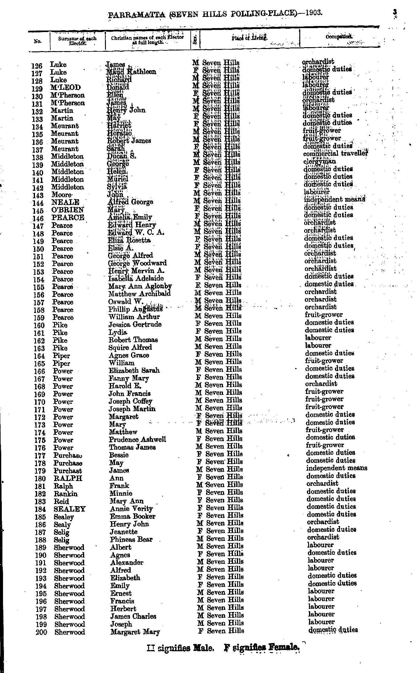
- Luke James - Sherwood Margaret
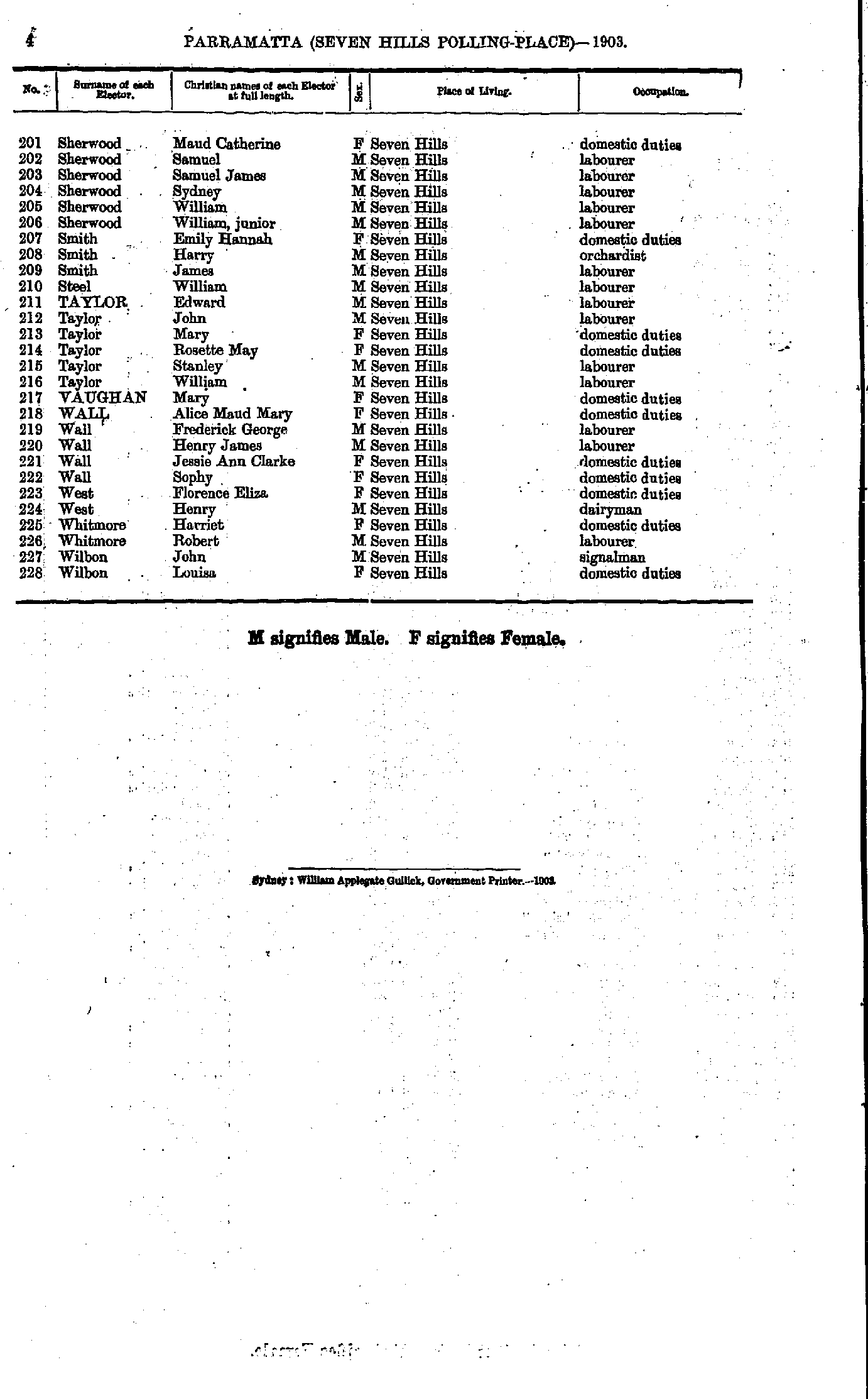
- Sherwood Maud - Wilbon Louisa
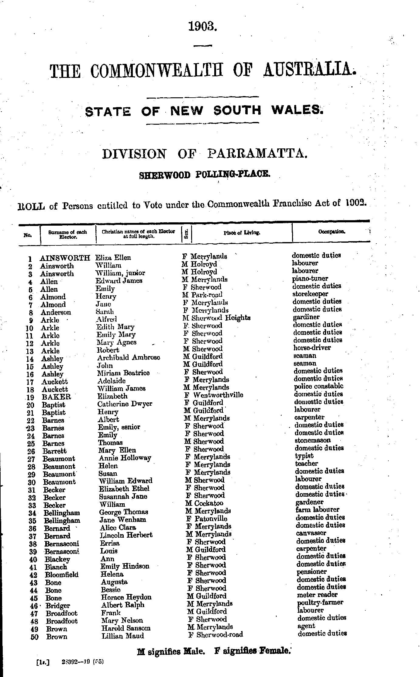
- Ainsworth Eliza - Brown Lillian
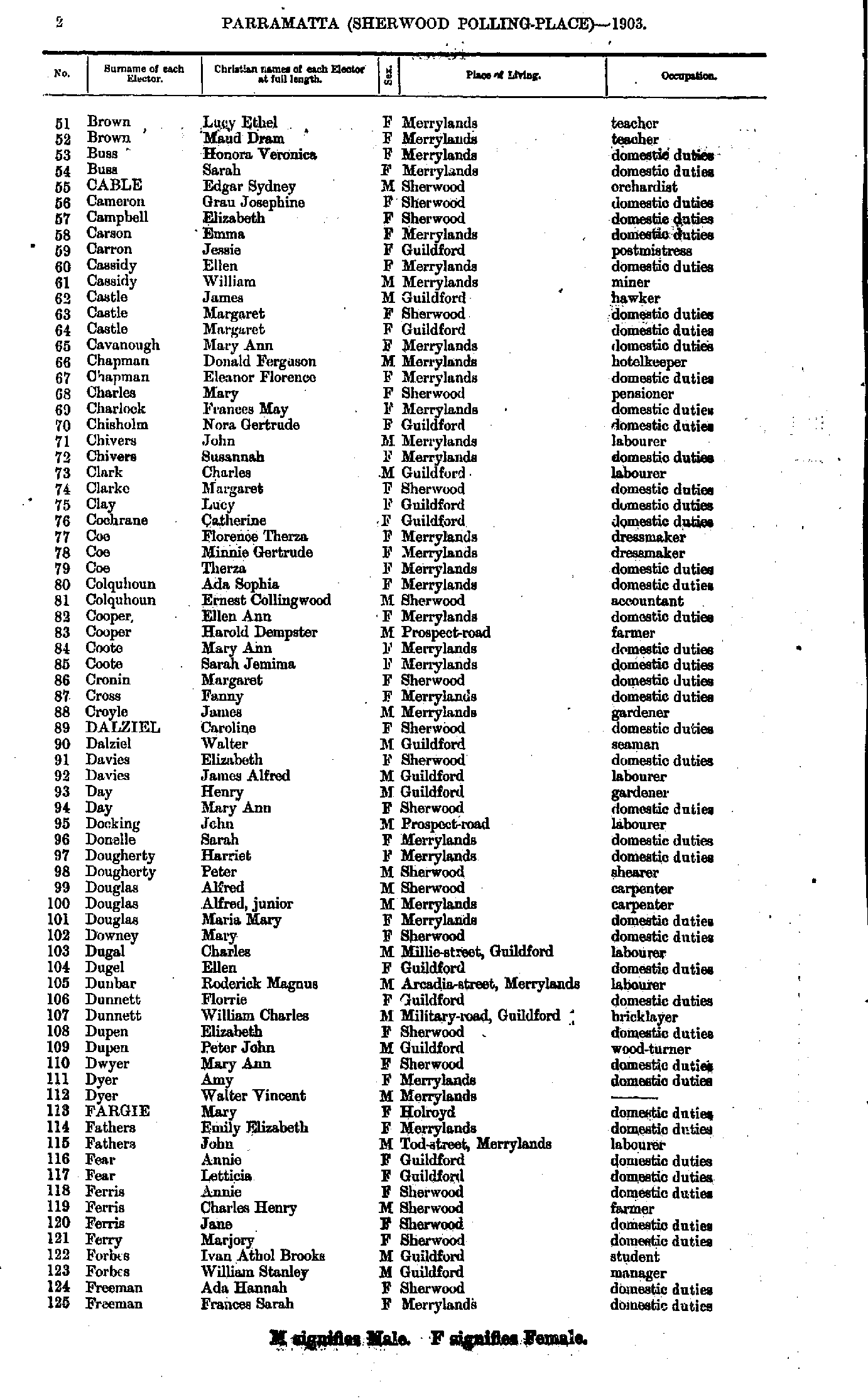
- Brown Lucy - Freeman Frances
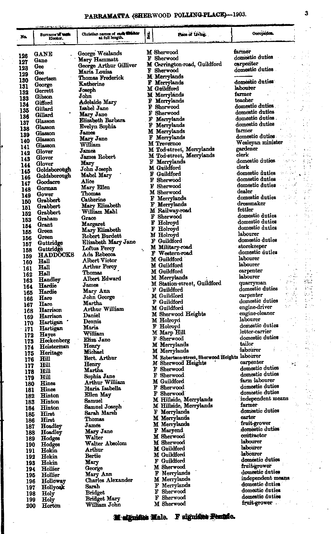
- Gane George - Horton William
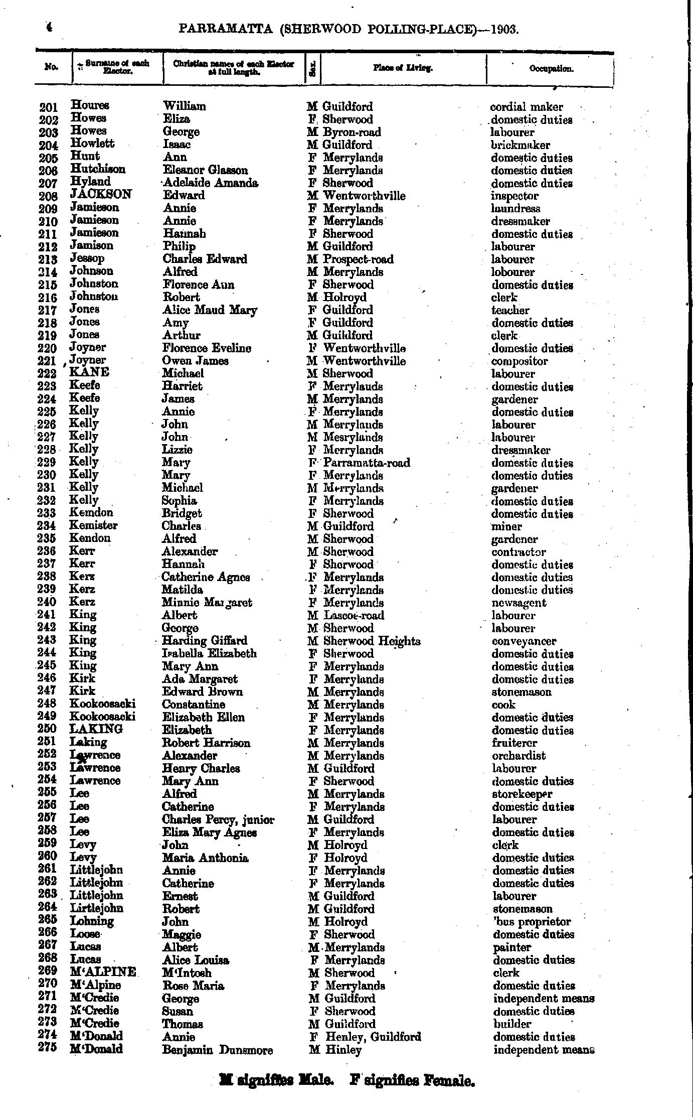
- Houres William - M'Donald Benjamin
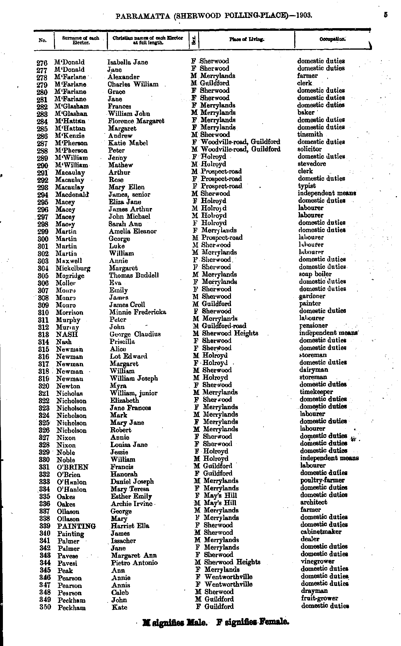
- M'Donald Isabella - Peckham Kate
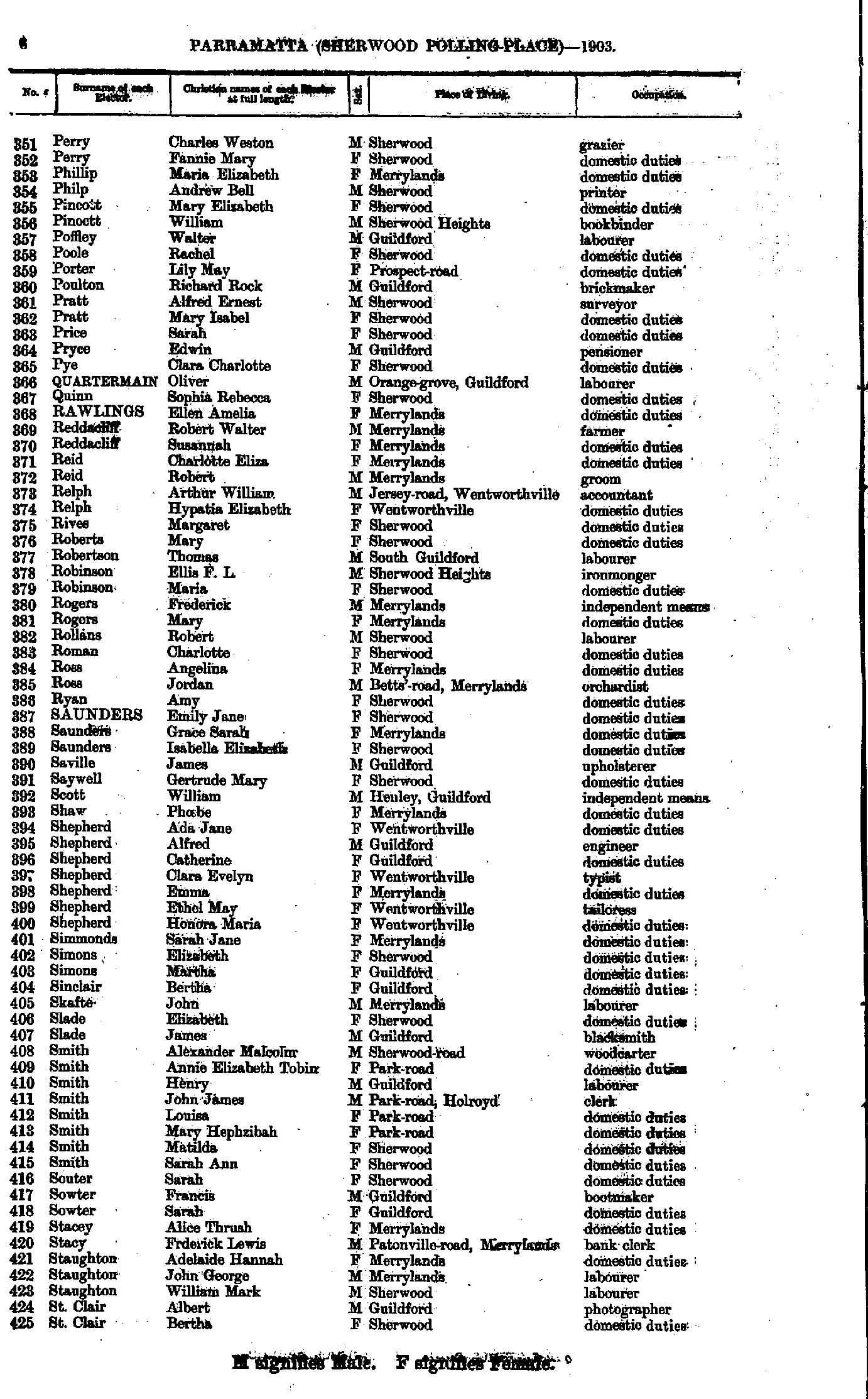
- Perry Charles - St.Clair Bertha
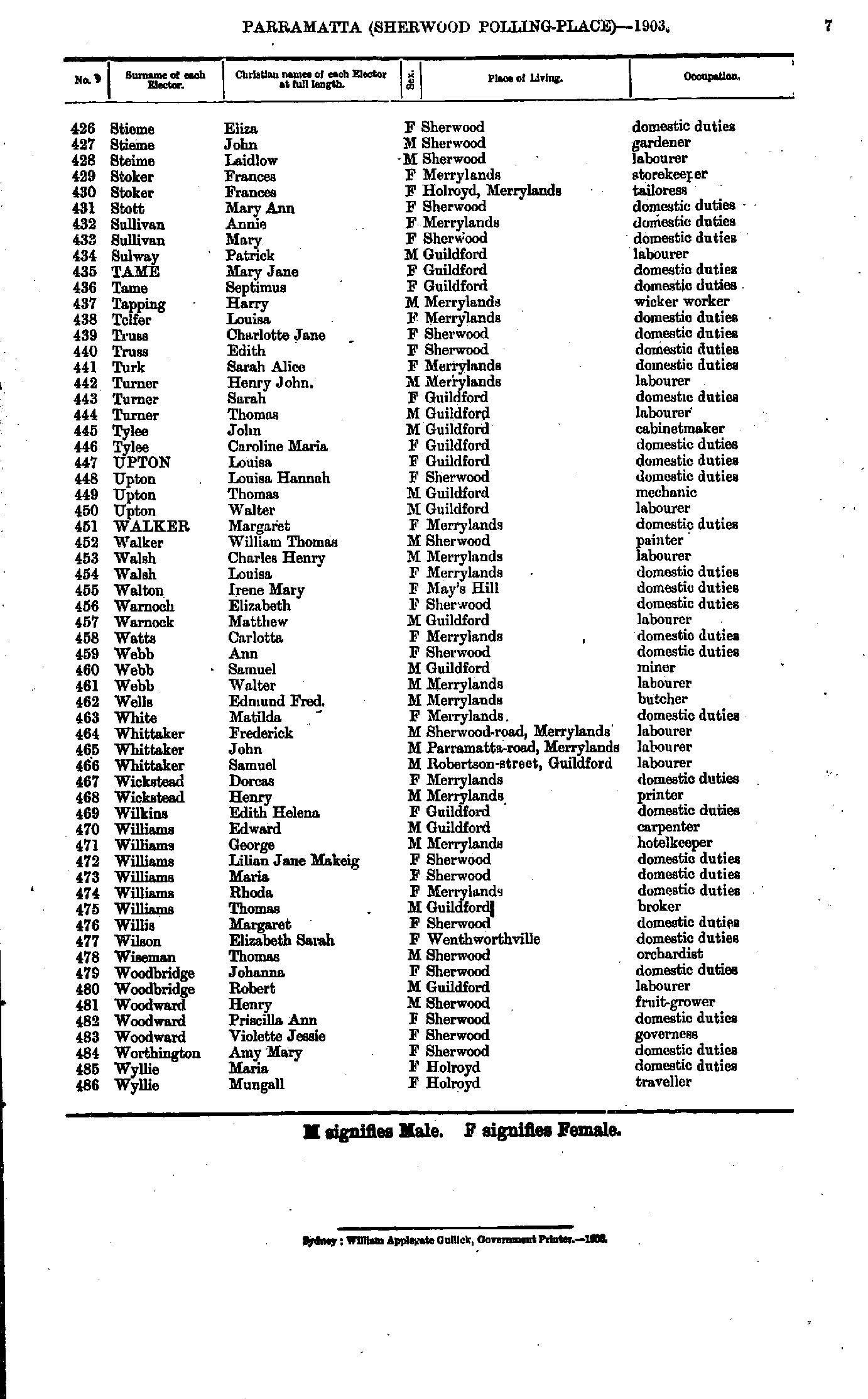
- Stieme Eliza - Wyllie Mungall
- Abbott Ann - Brown Henry
- Bull Elizabeth - Franklin John
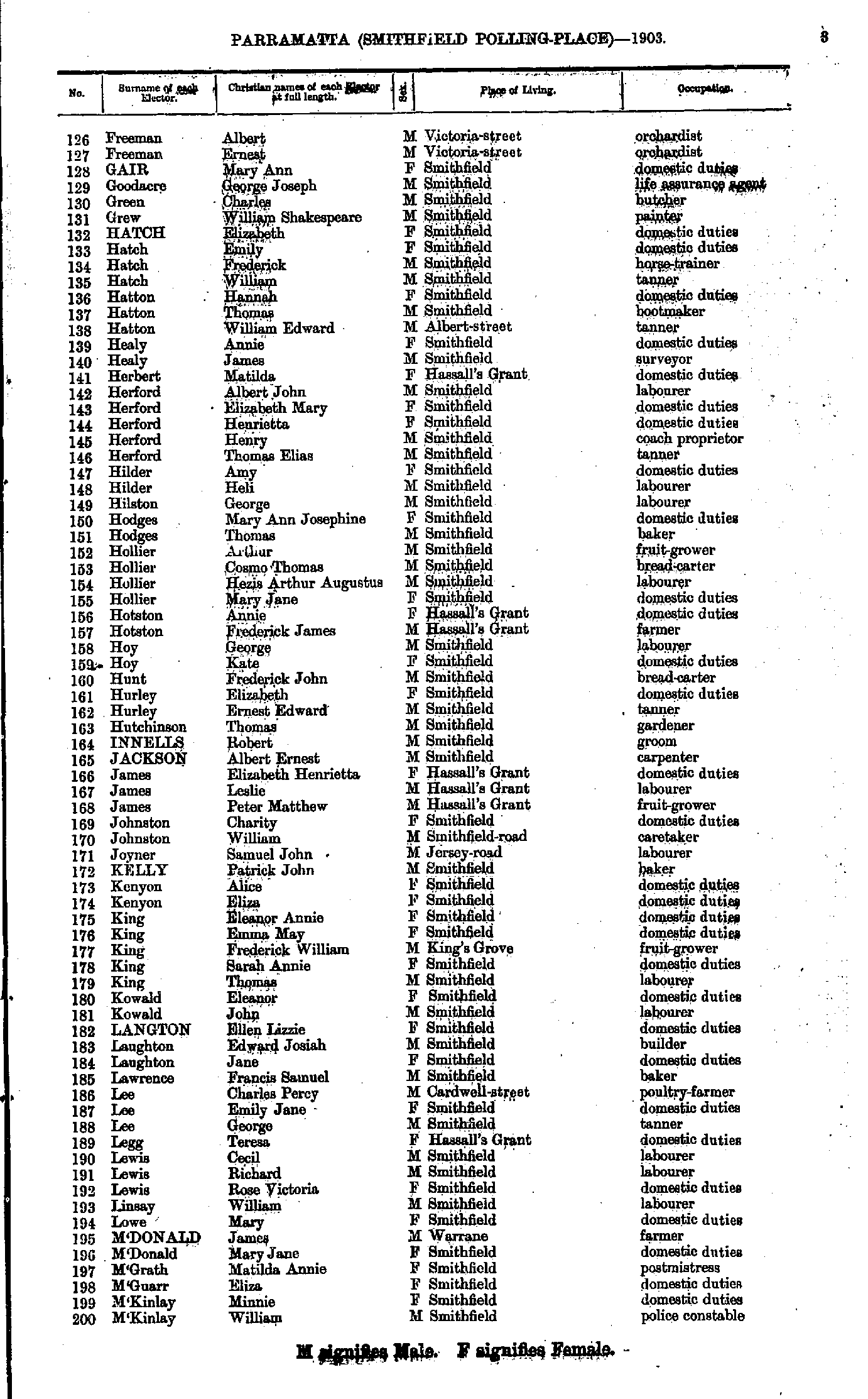
- Freeman Albert - M'Kinlay William
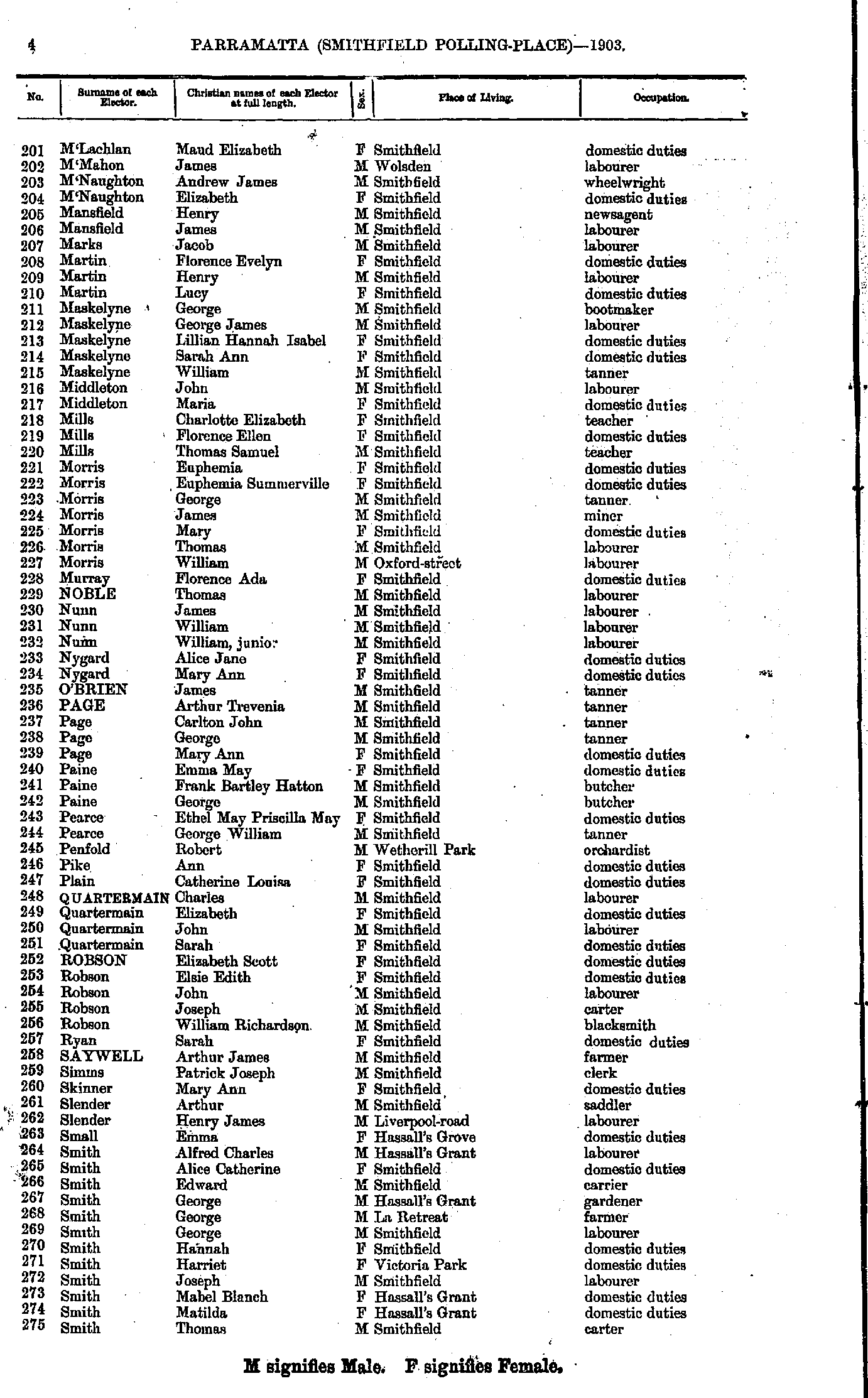
- M'Lachlan Maud - Smith Thomas
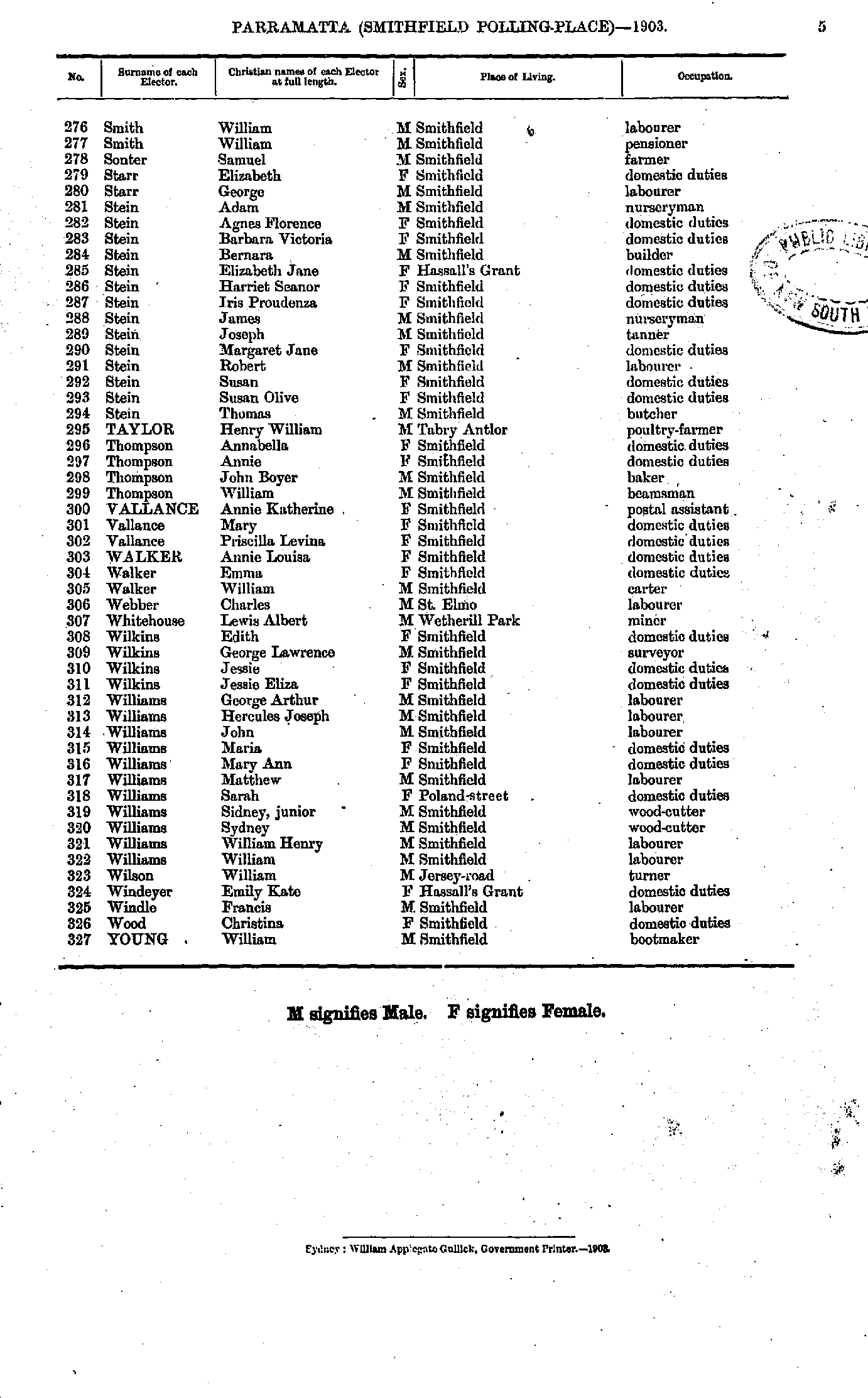
- Smith William - Young William
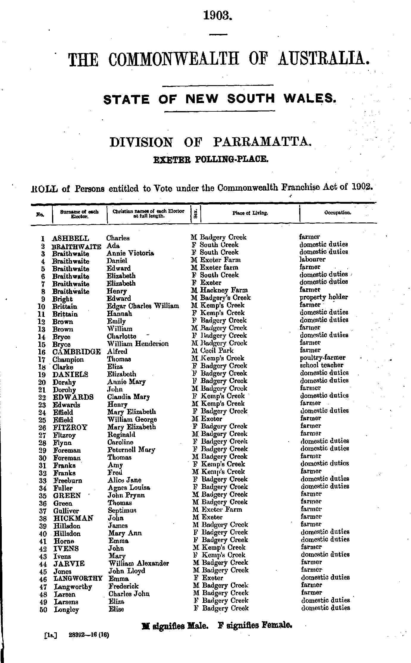
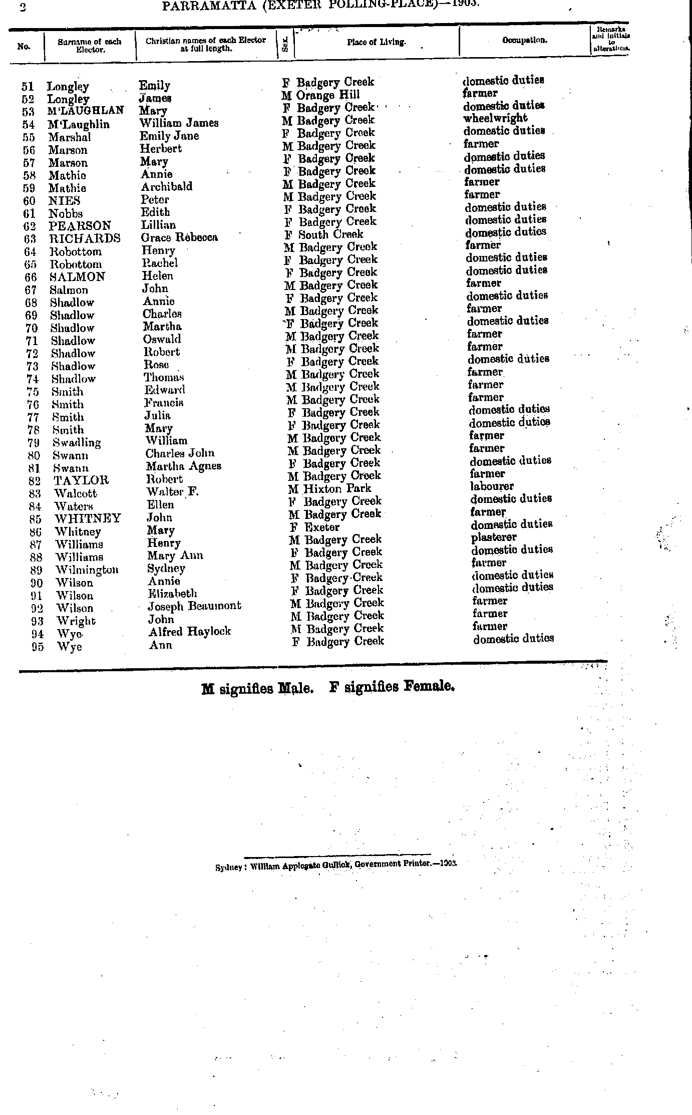
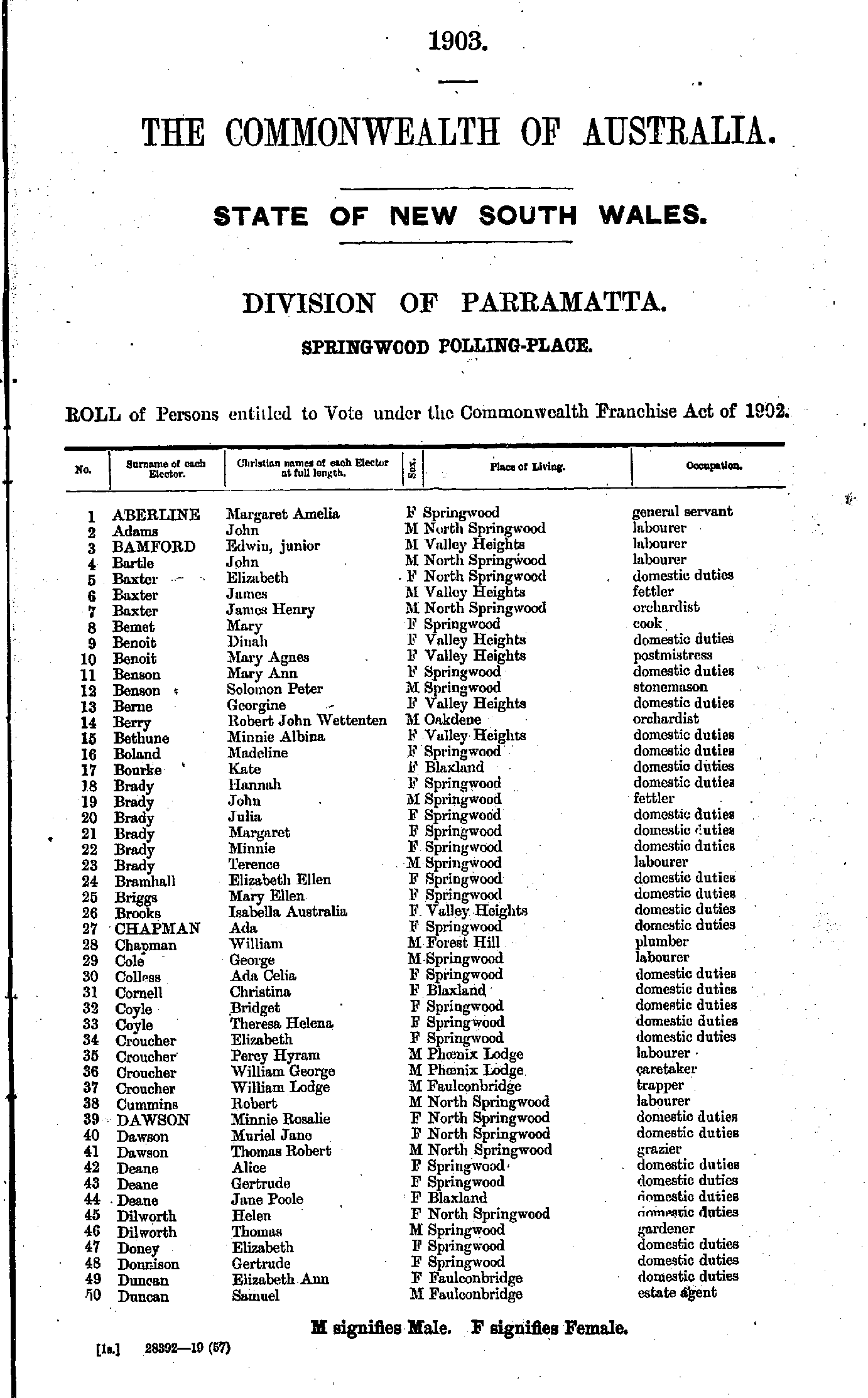
- Aberline Margaret - Duncan Samuel
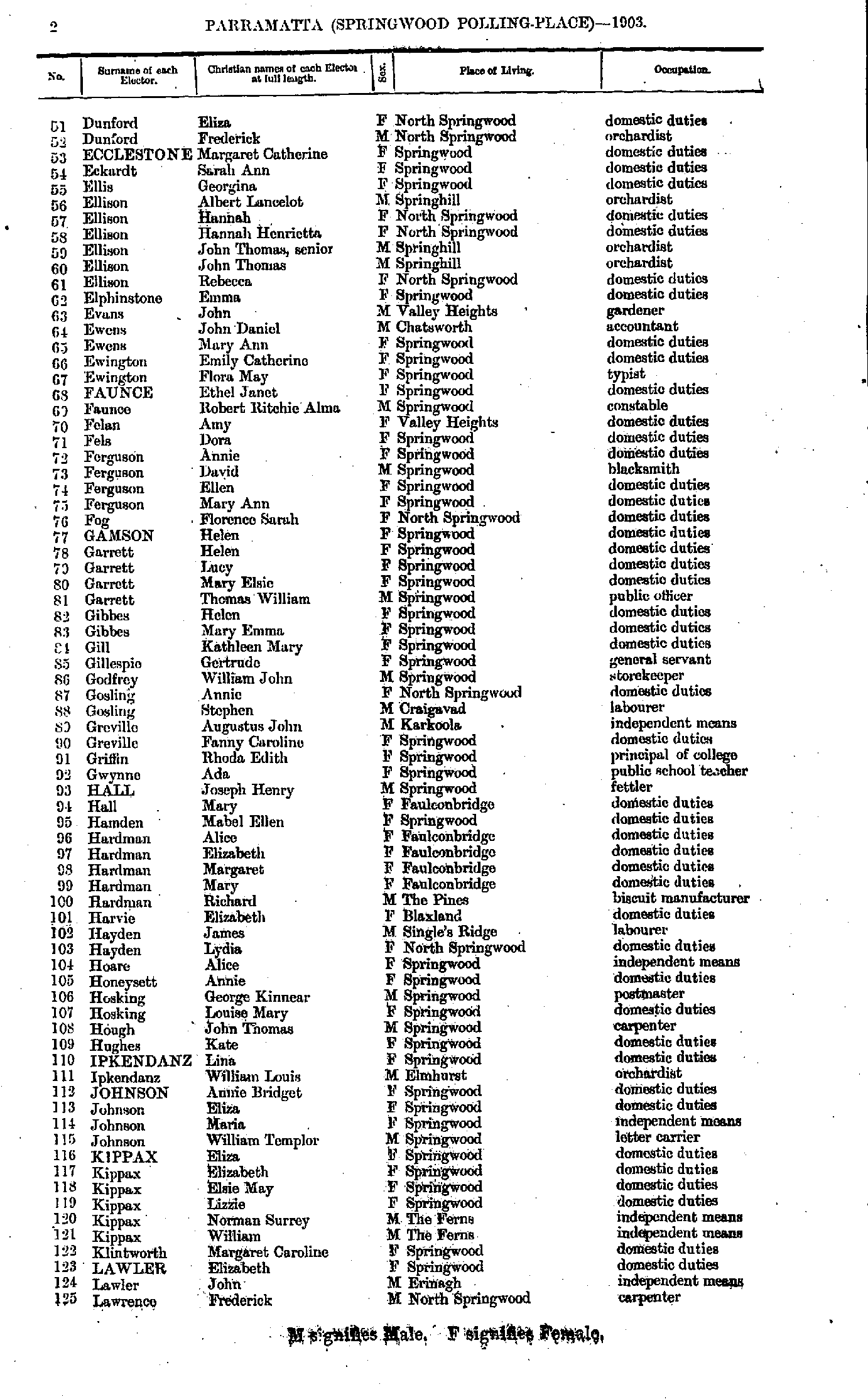
- Dunford Eliza - Lawrence Frederick
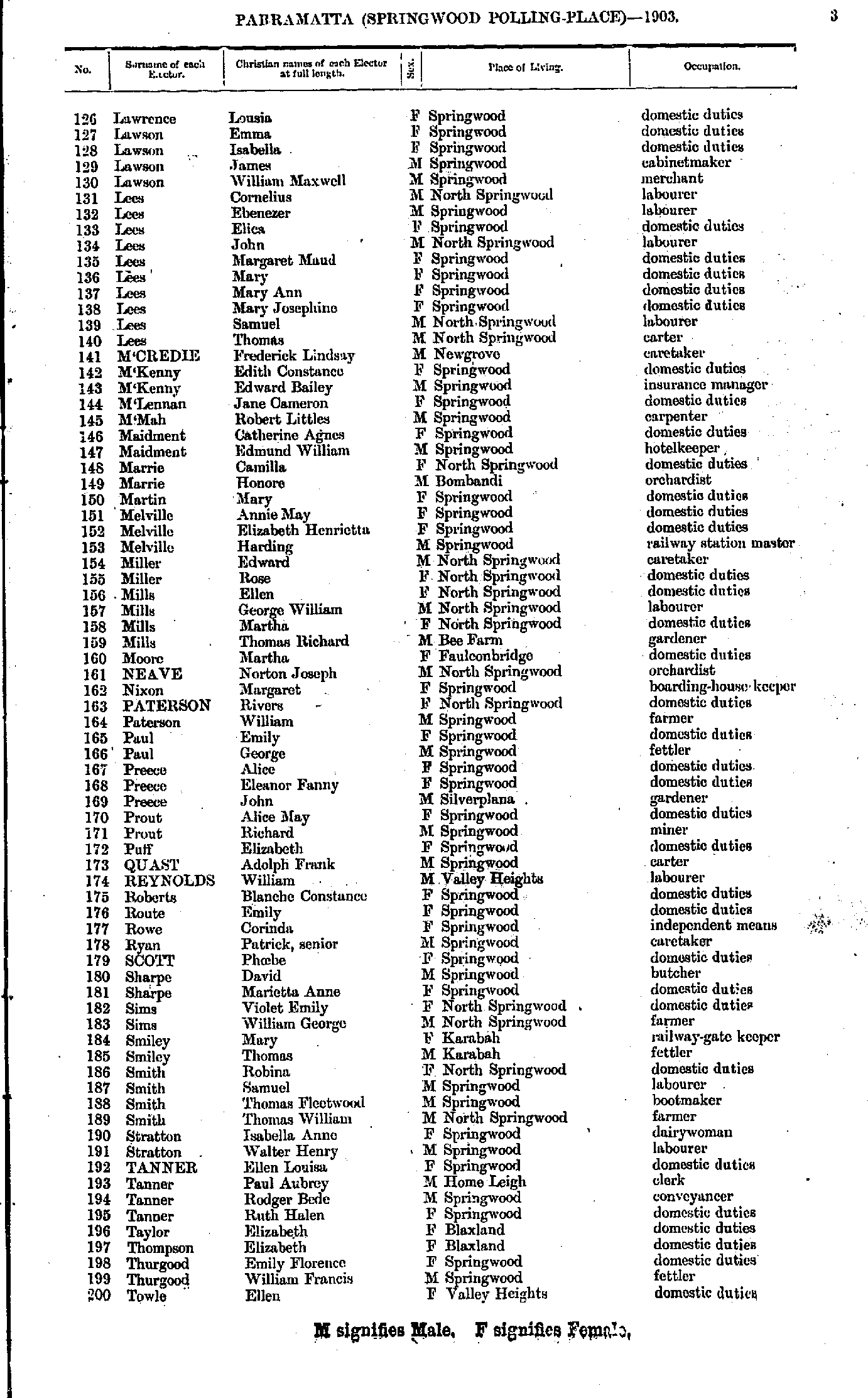
- Lawrence Lousia - Towle Ellen
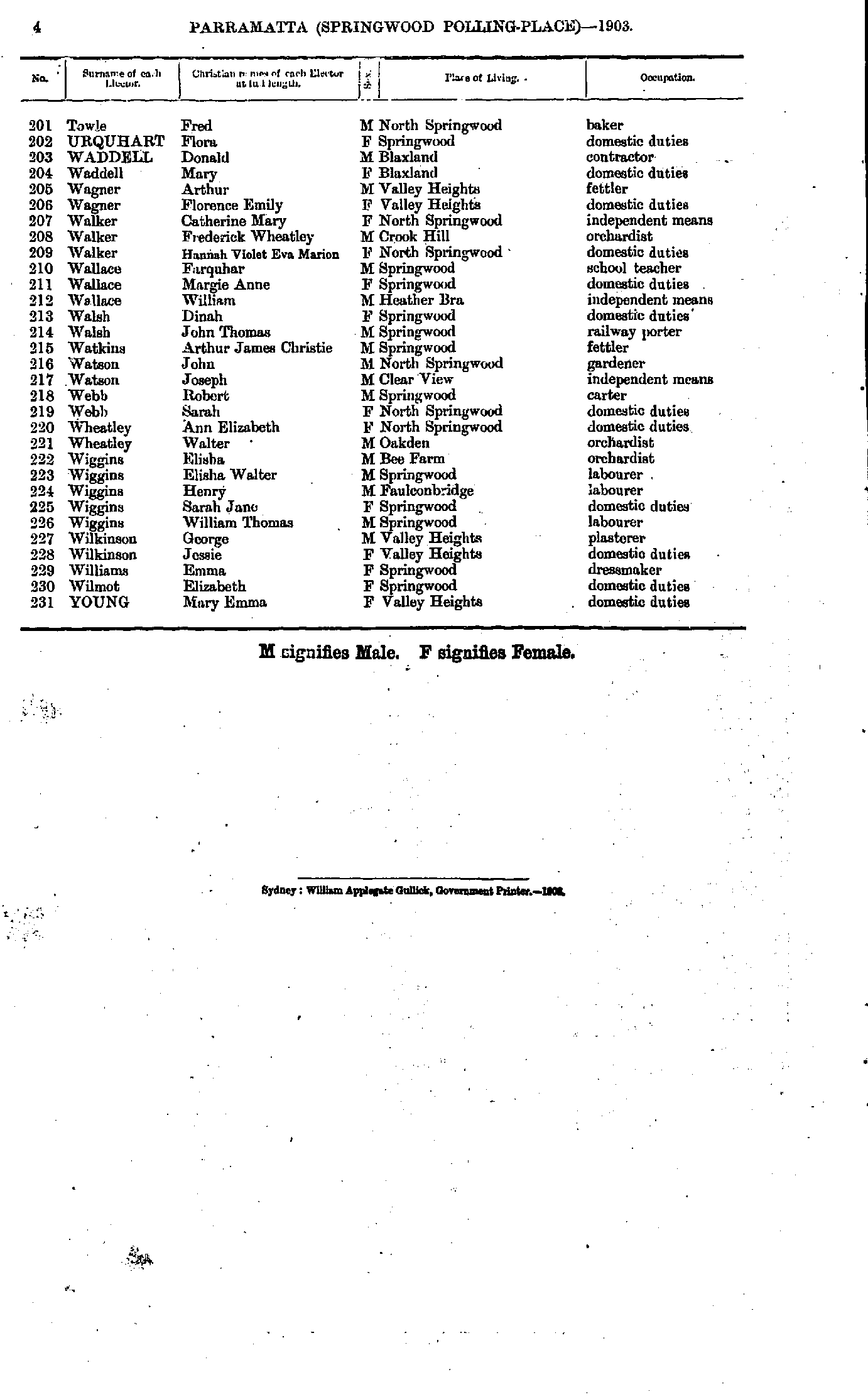
- Towle Fred - Young Mary
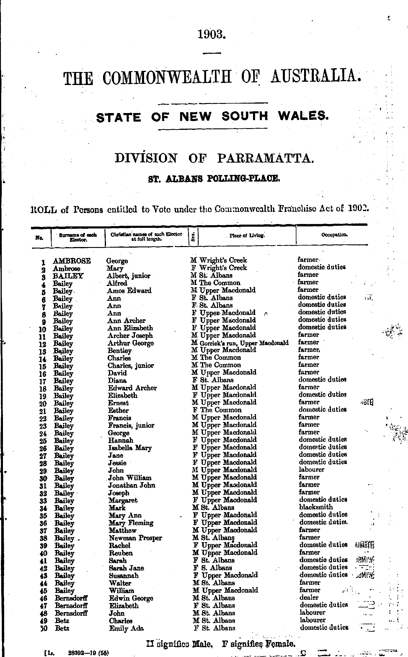
- Ambrose George - Betz Emily
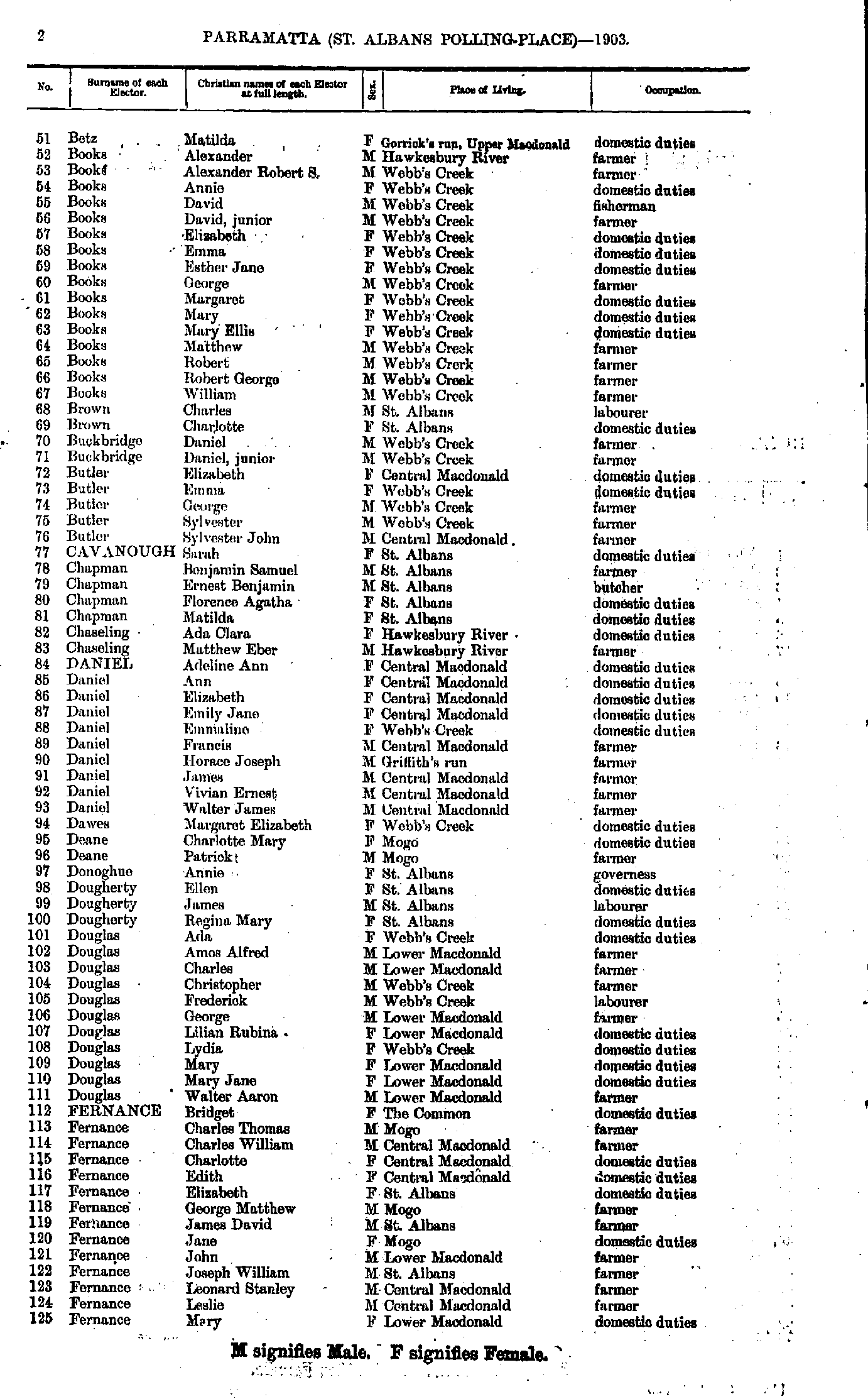
- Betz Matilda - Fernance Mary
- Fernance Maud - Jurd Oswald
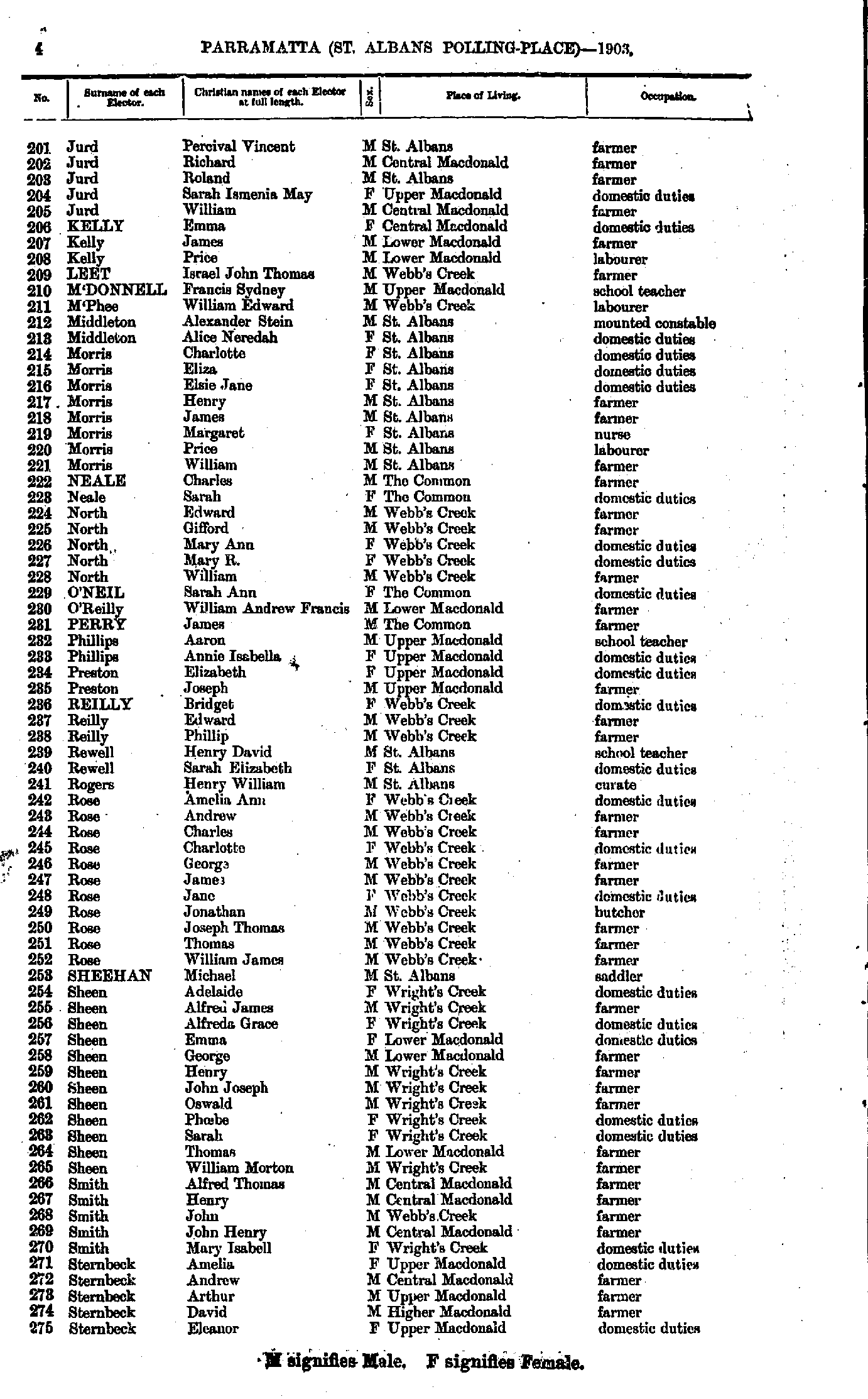
- Jurd Percival - Sternbeck Eleanor
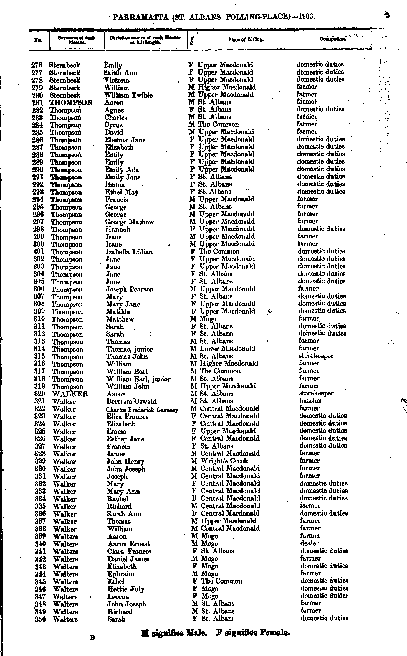
- Sternbeck Emily - Walters Sarah
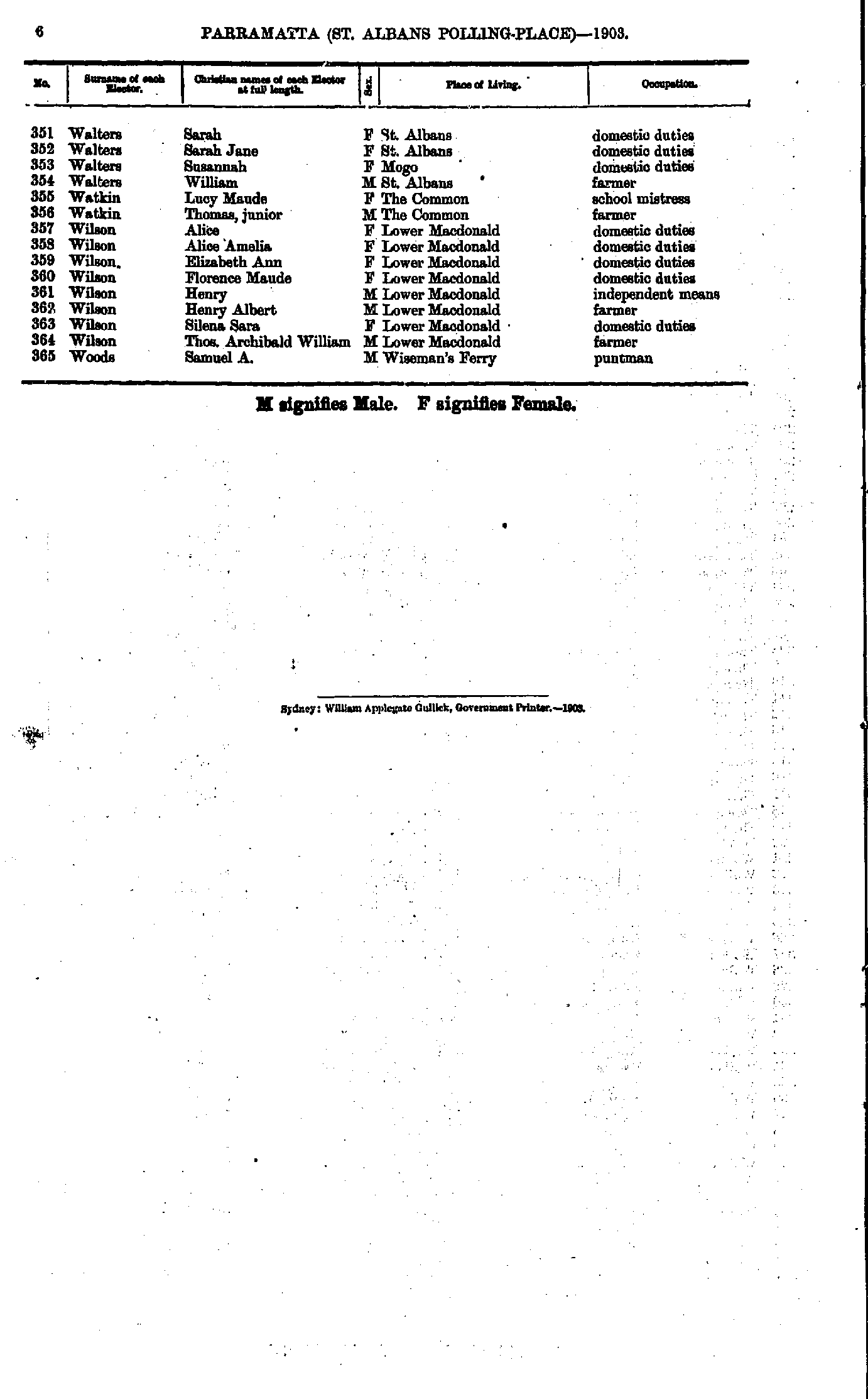
- Walters Sarah - Woods Samuel
- Adams Charles - Barlow Matilda
- Barlow William - Bray Joseph
- Brell Elizabeth - Chisholm Margaret
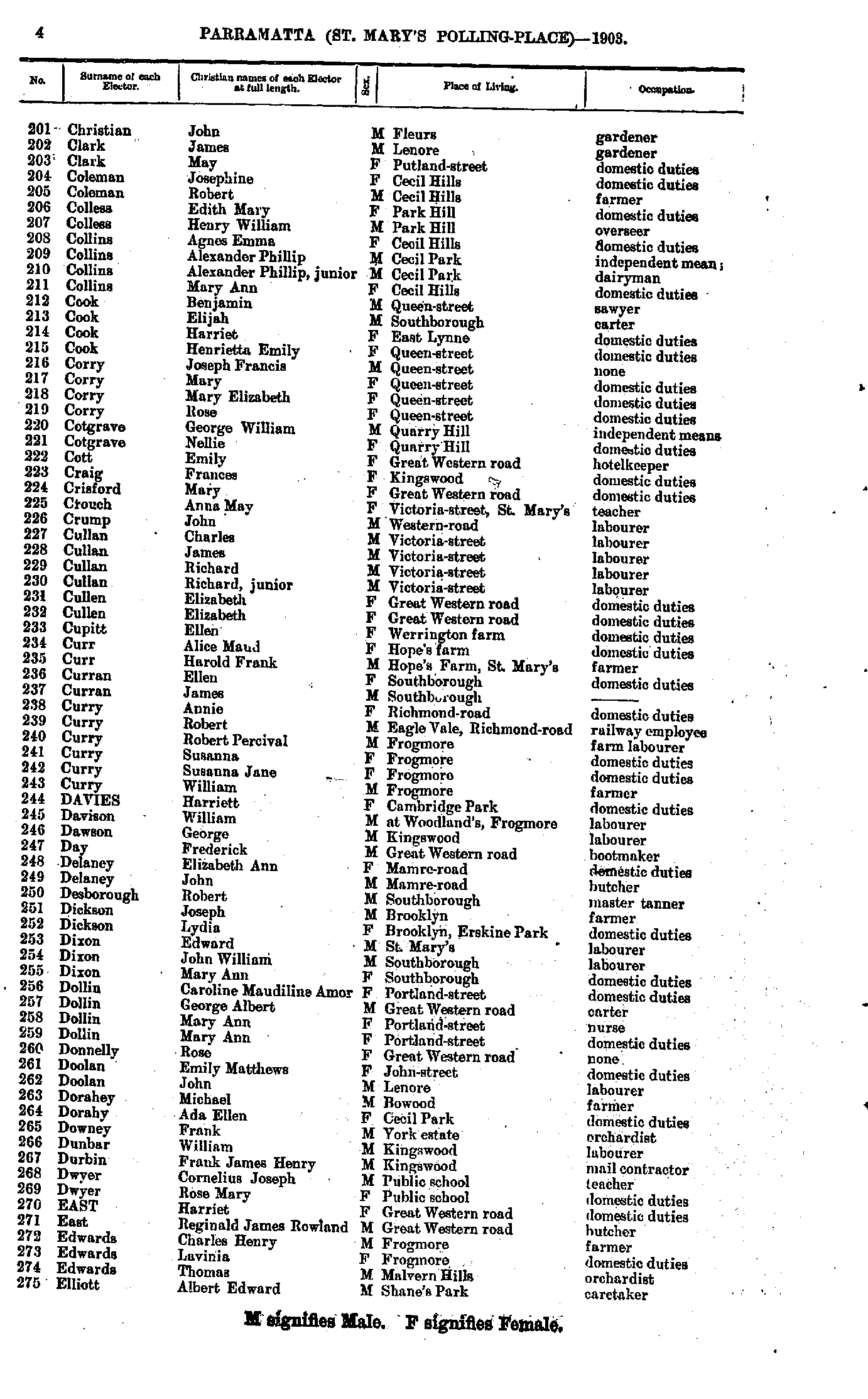
- Christian John - Elliot Albert
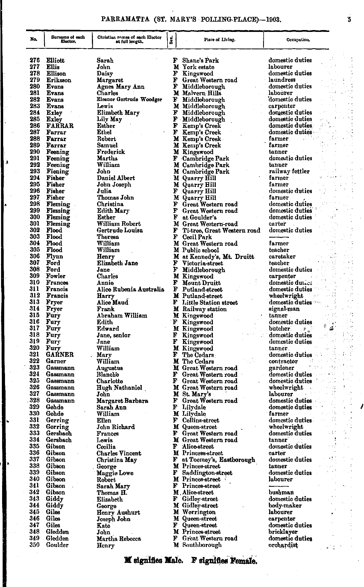
- Elliott Sarah - Goulder Henry
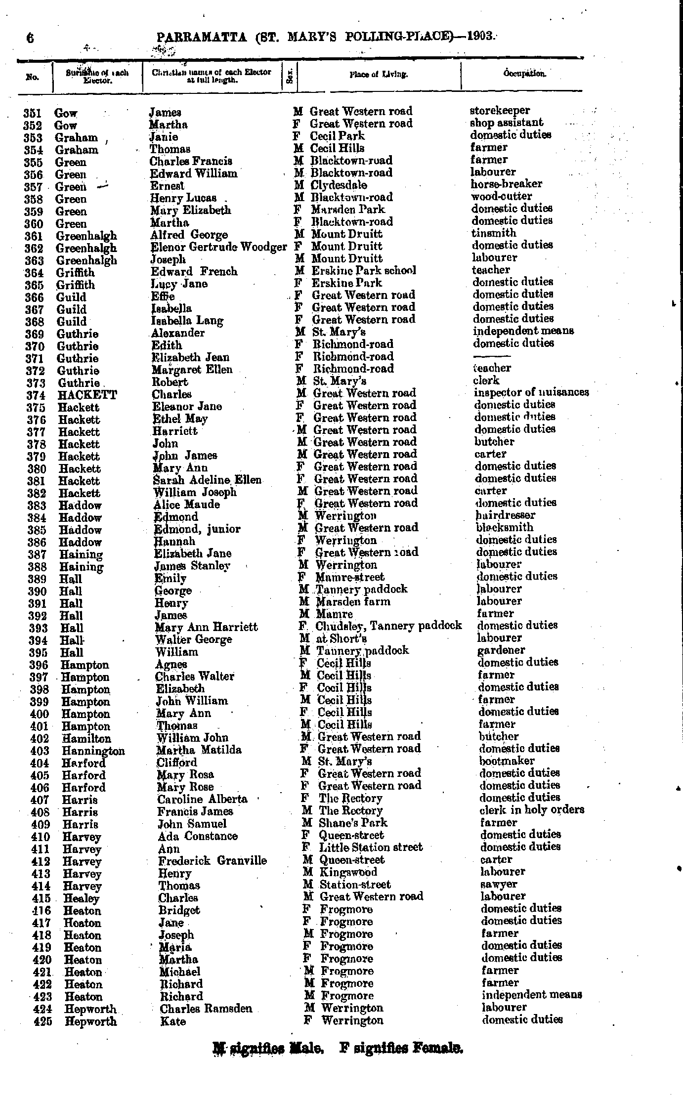
- Gow James - Hepworth Kate
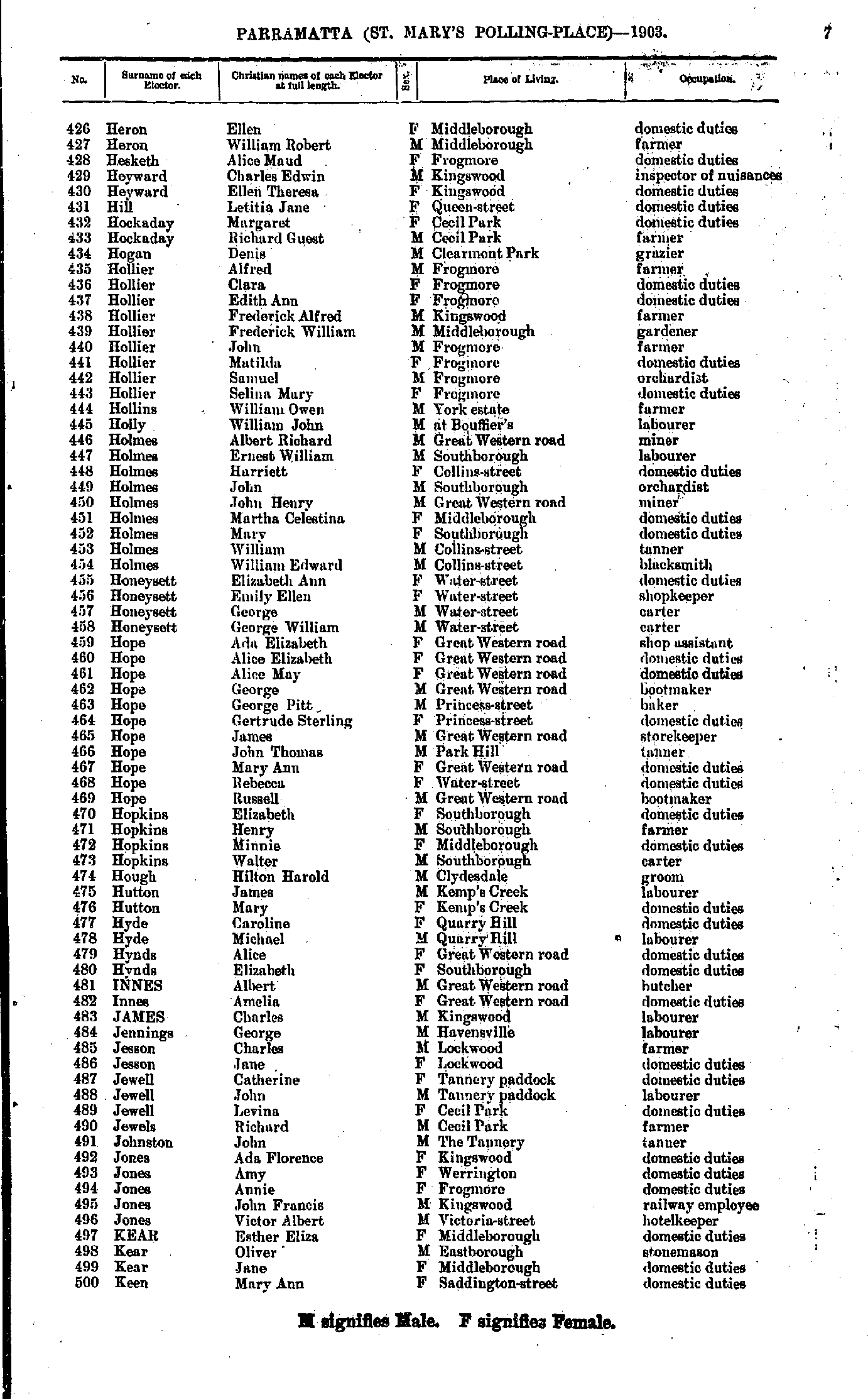
- Heron Ellen - Keen Mary
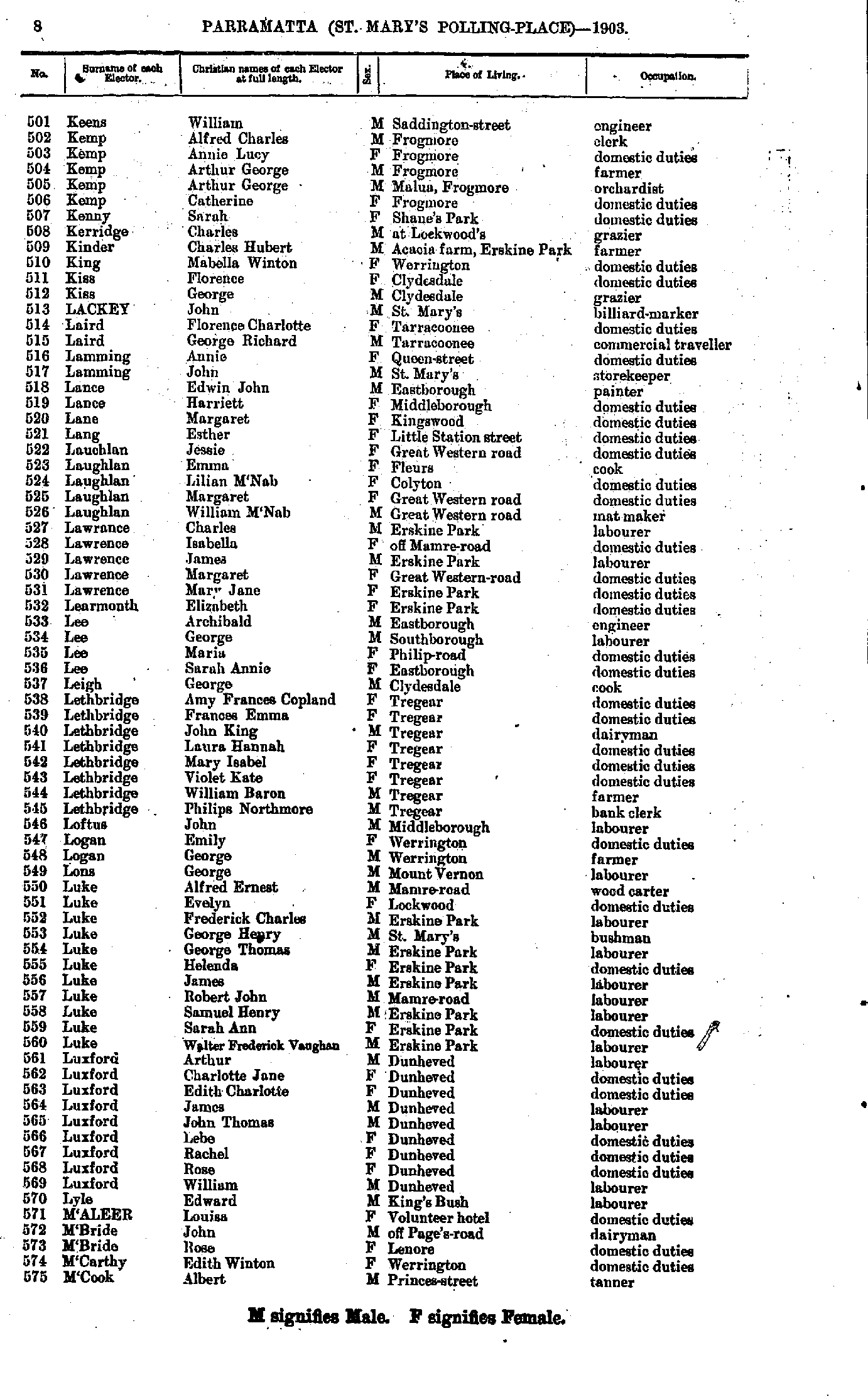
- Keens William - M'Cook Albert
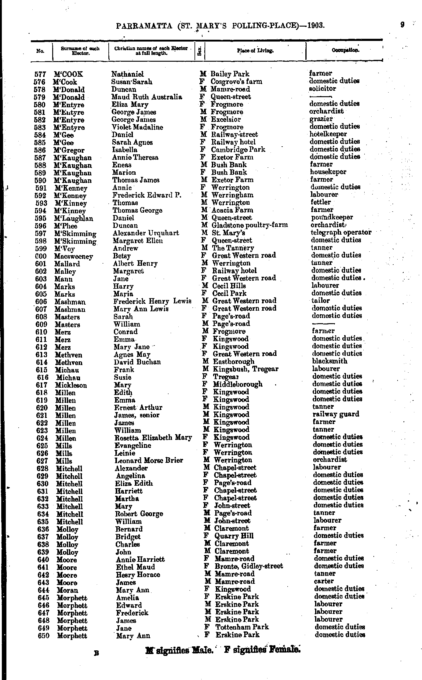
- M'Cook Nathaniel - Morphett Mary
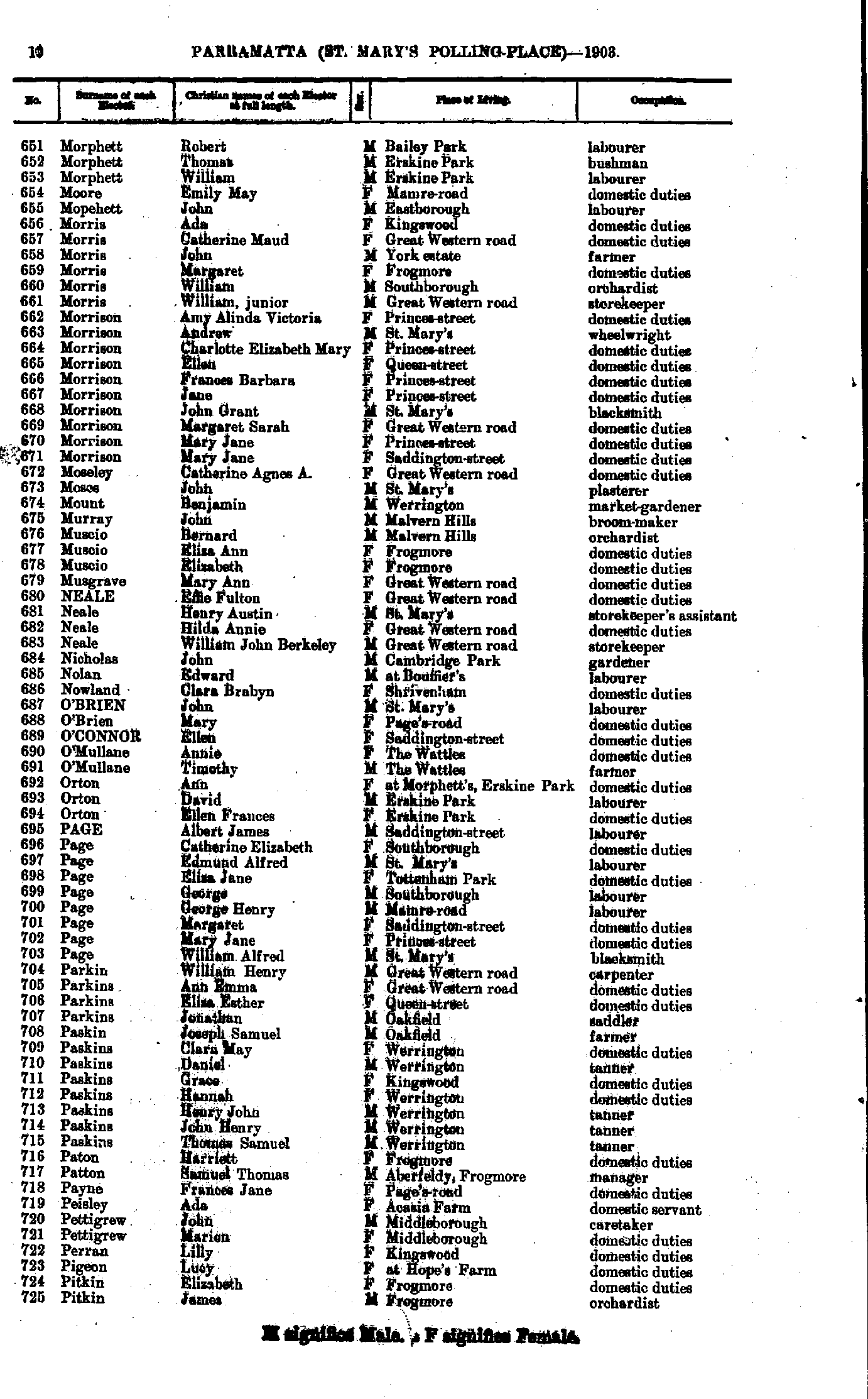
- Morphett Robert - Pitkin James
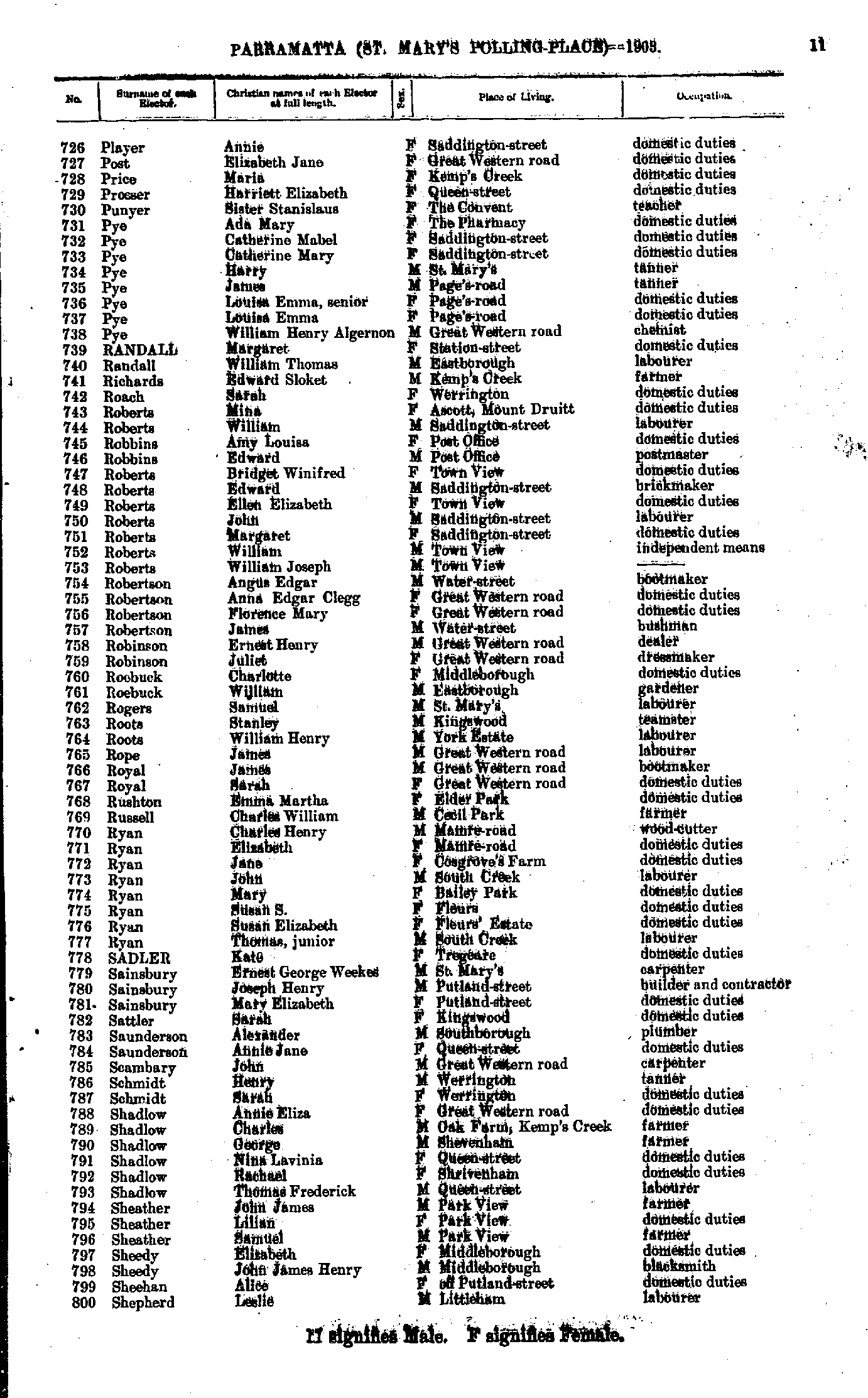
- Player Annie - Shepherd Leslie
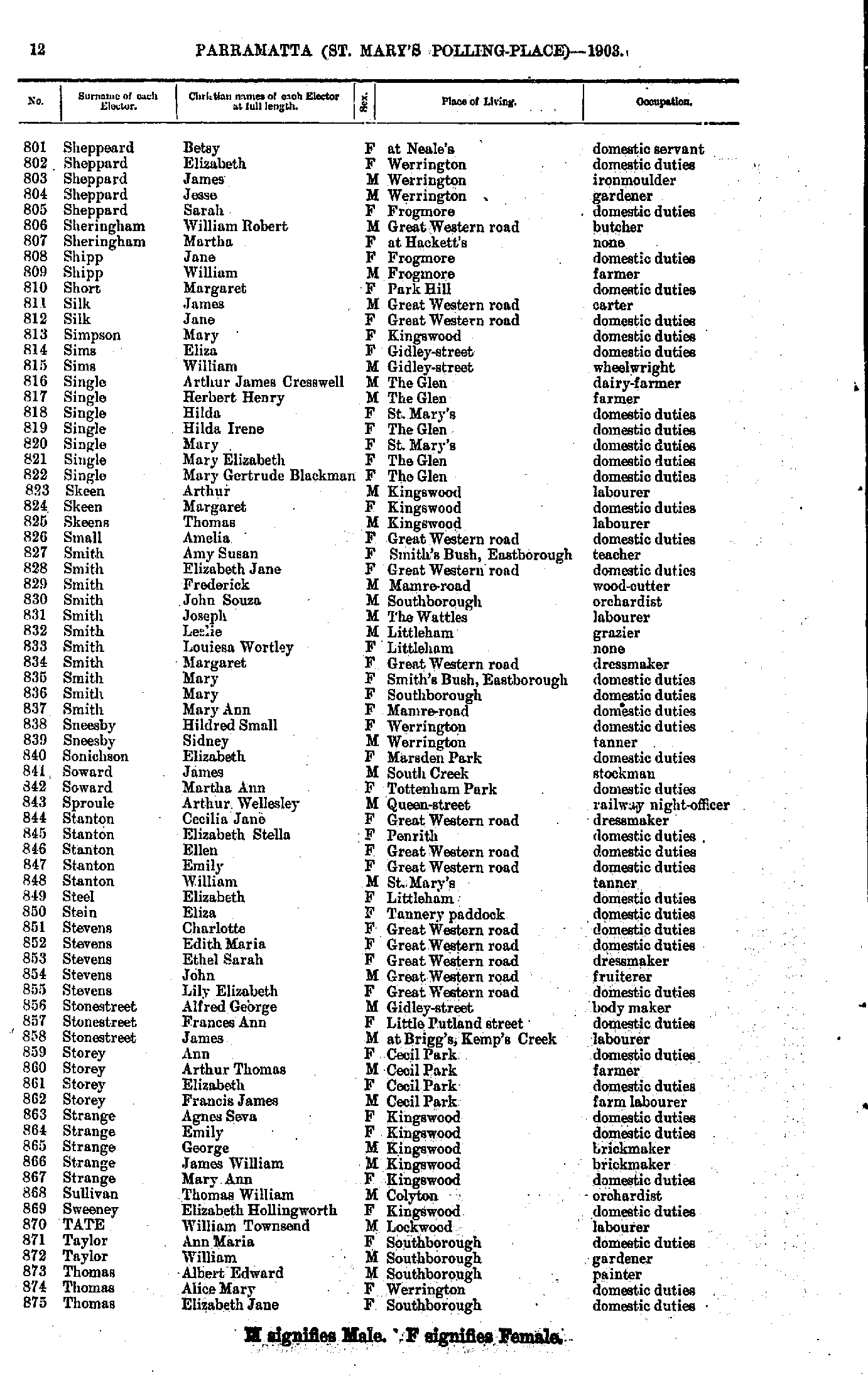
- Sheppeard Betsy - Thomas Elizabeth
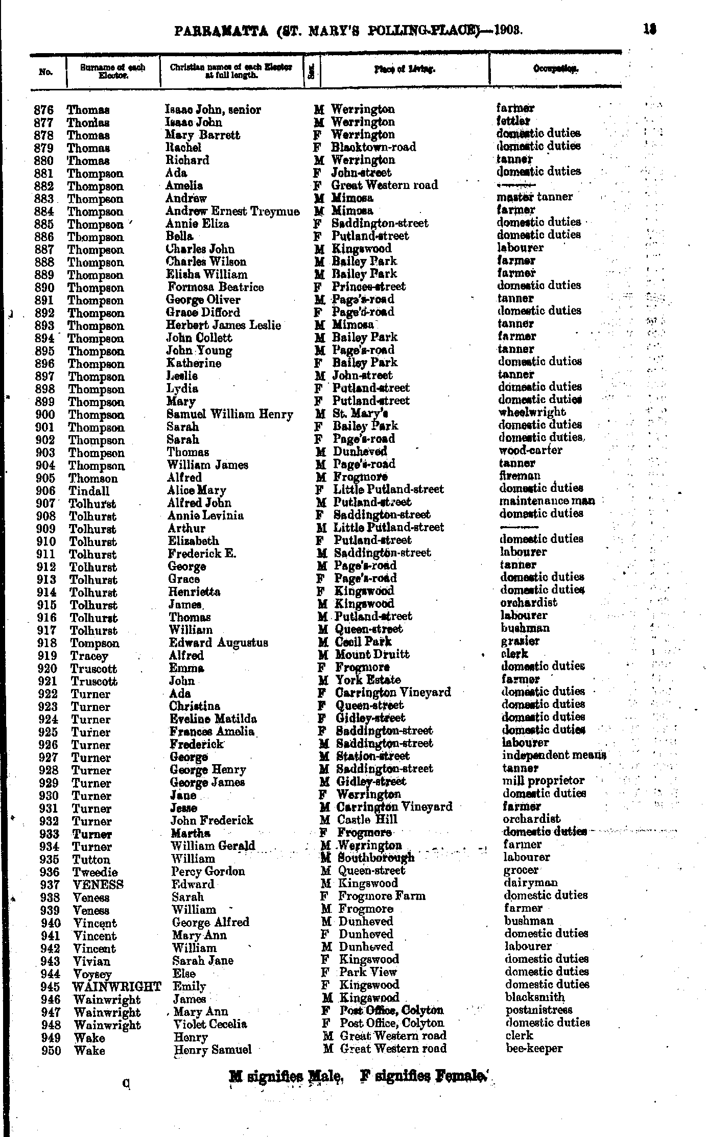
- Thomas Isaac - Wake Henry
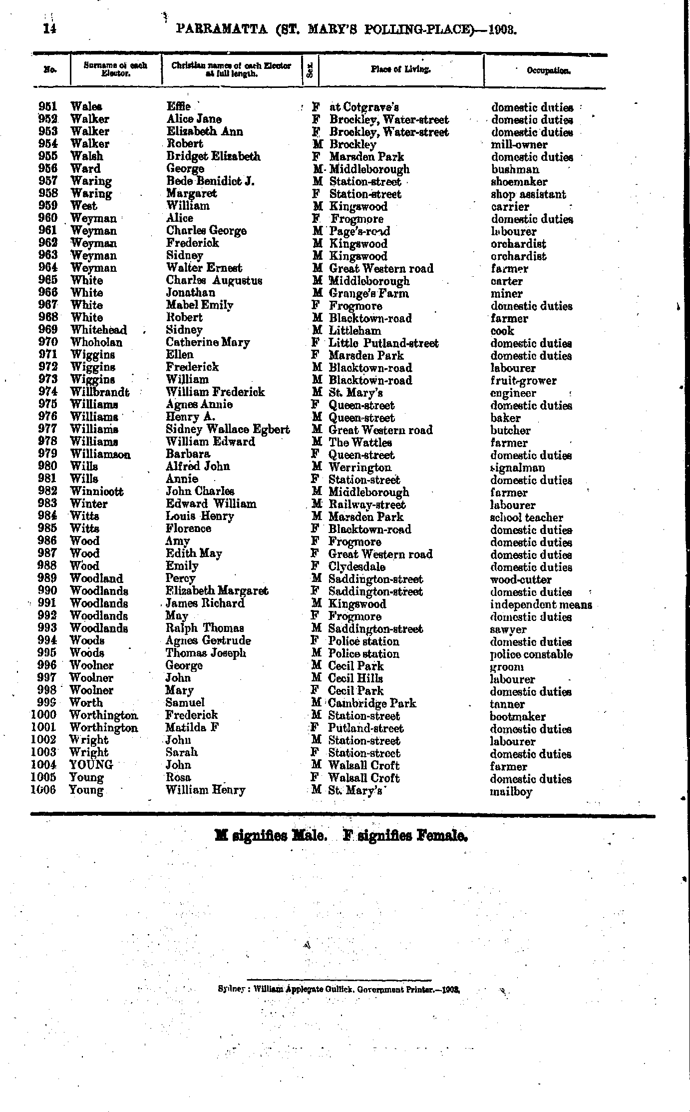
- Wales Effie - Young William
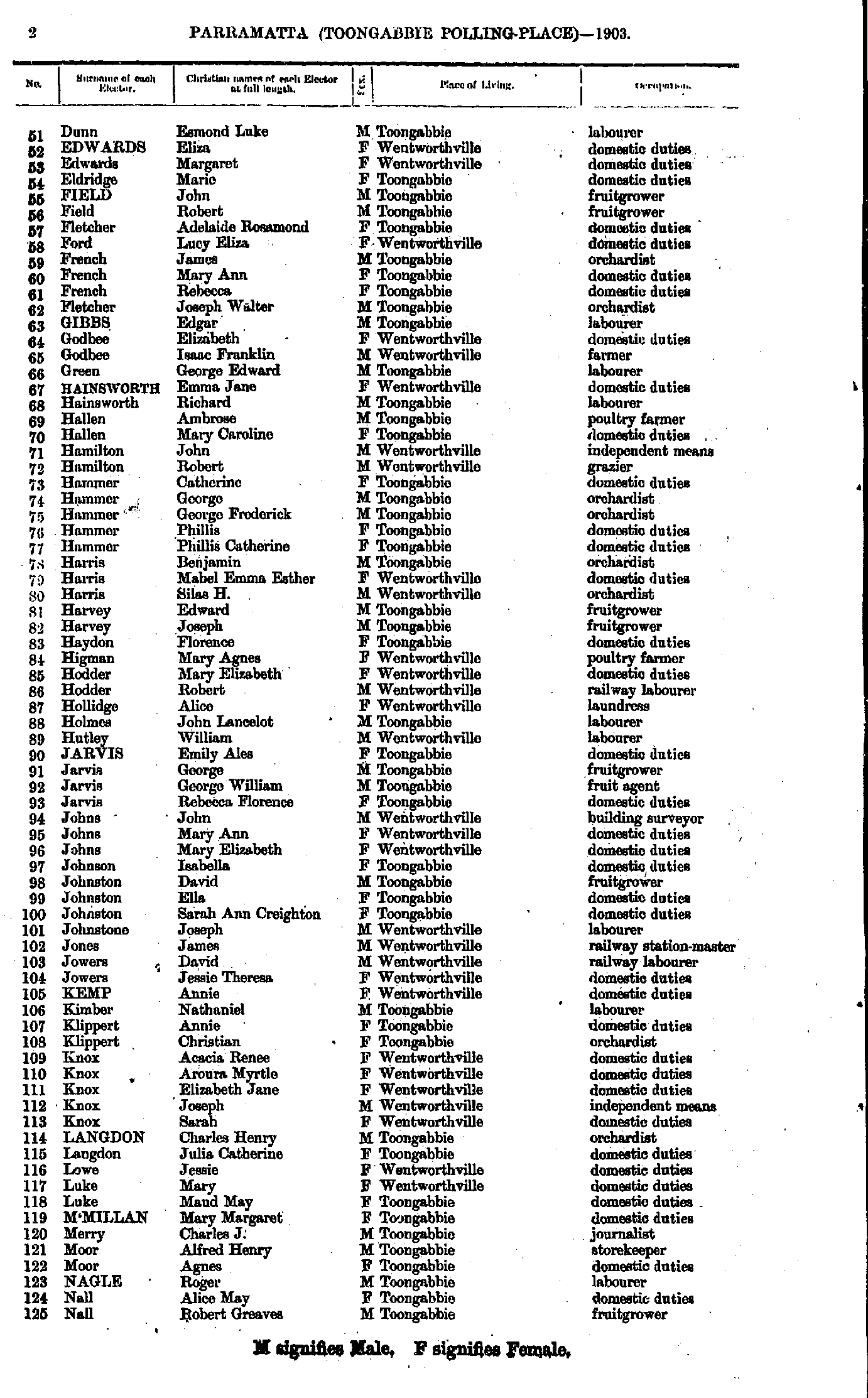
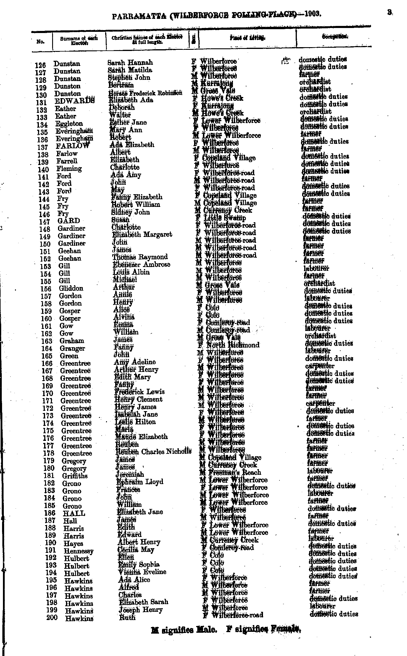
- Alcock Annie - Bushell Albert
- Bushell David - Dunstan Penelope
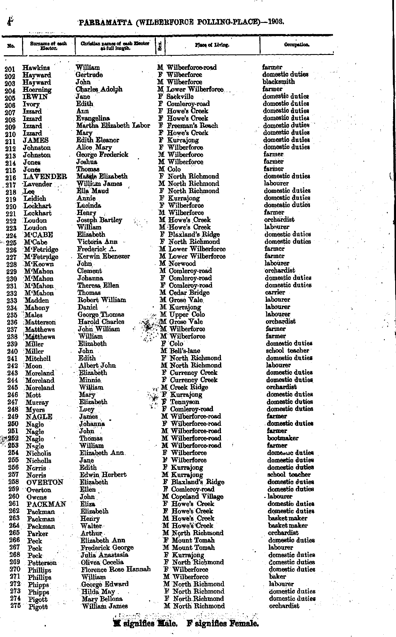
- Dunstan Sarah - Hawkins Ruth
- Hawkins William - Pigott William
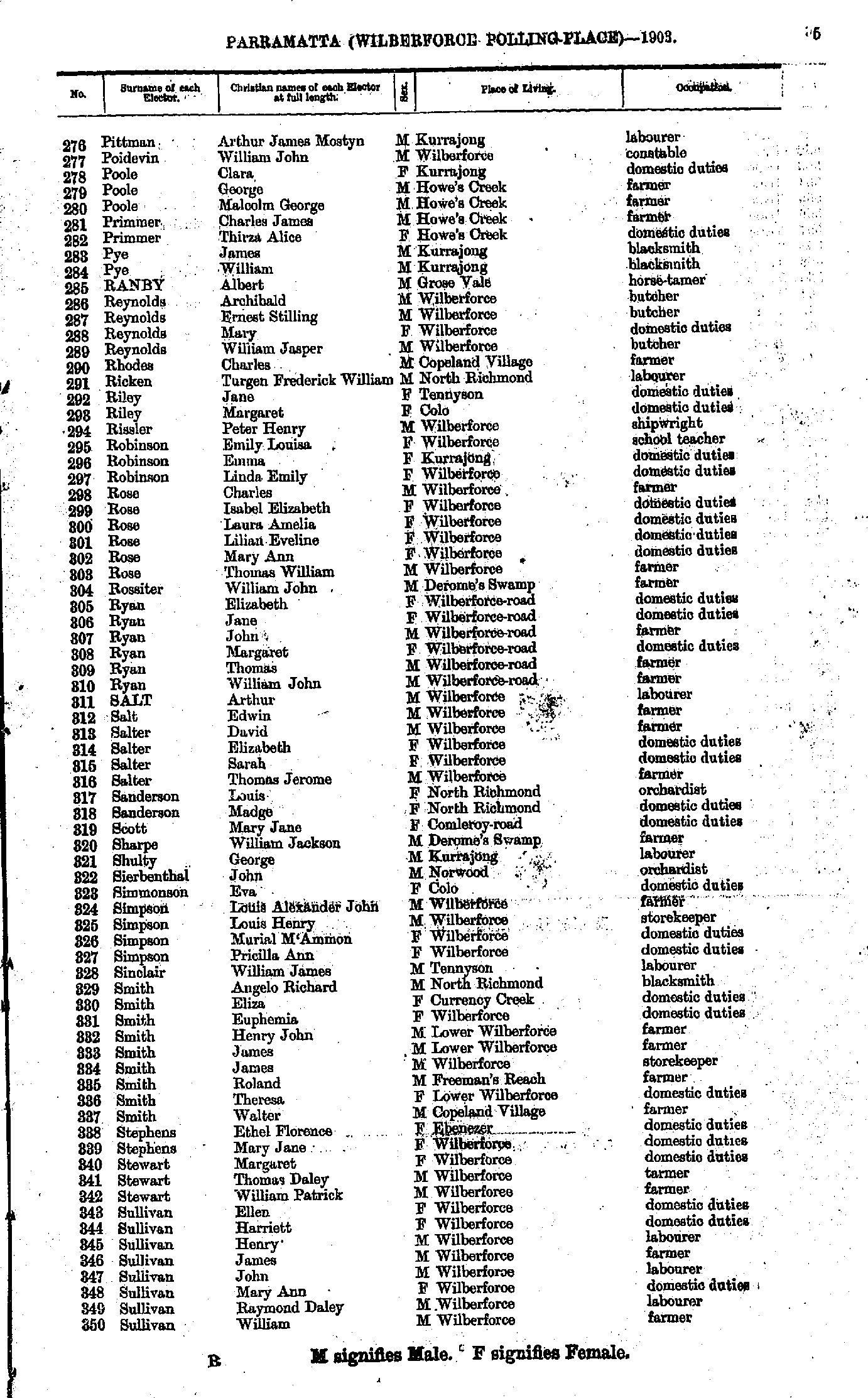
- Pittman Arthur - Sullivan William
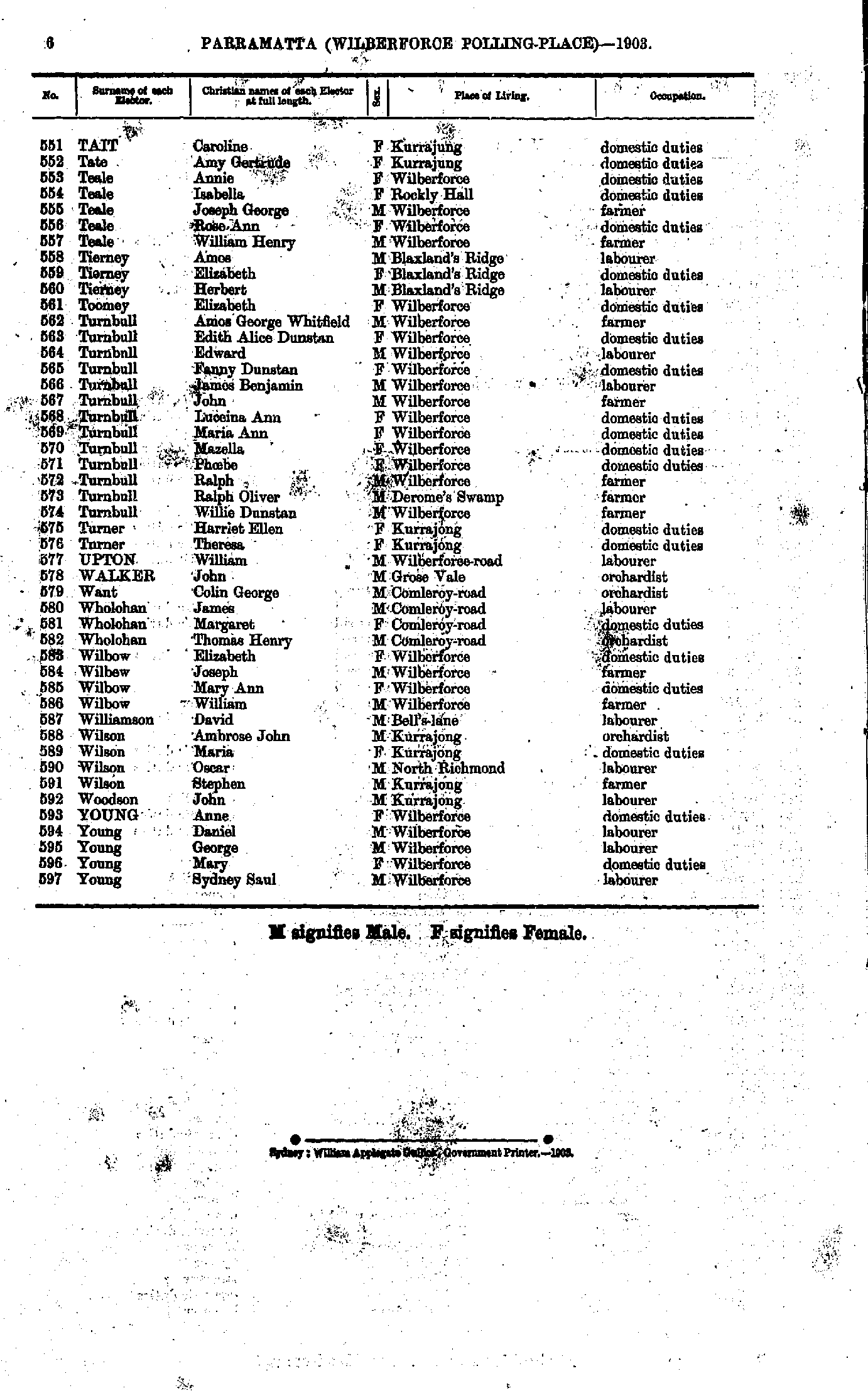
- Tait Caroline - Young Sydney
Maps of the Parramatta Electoral Division
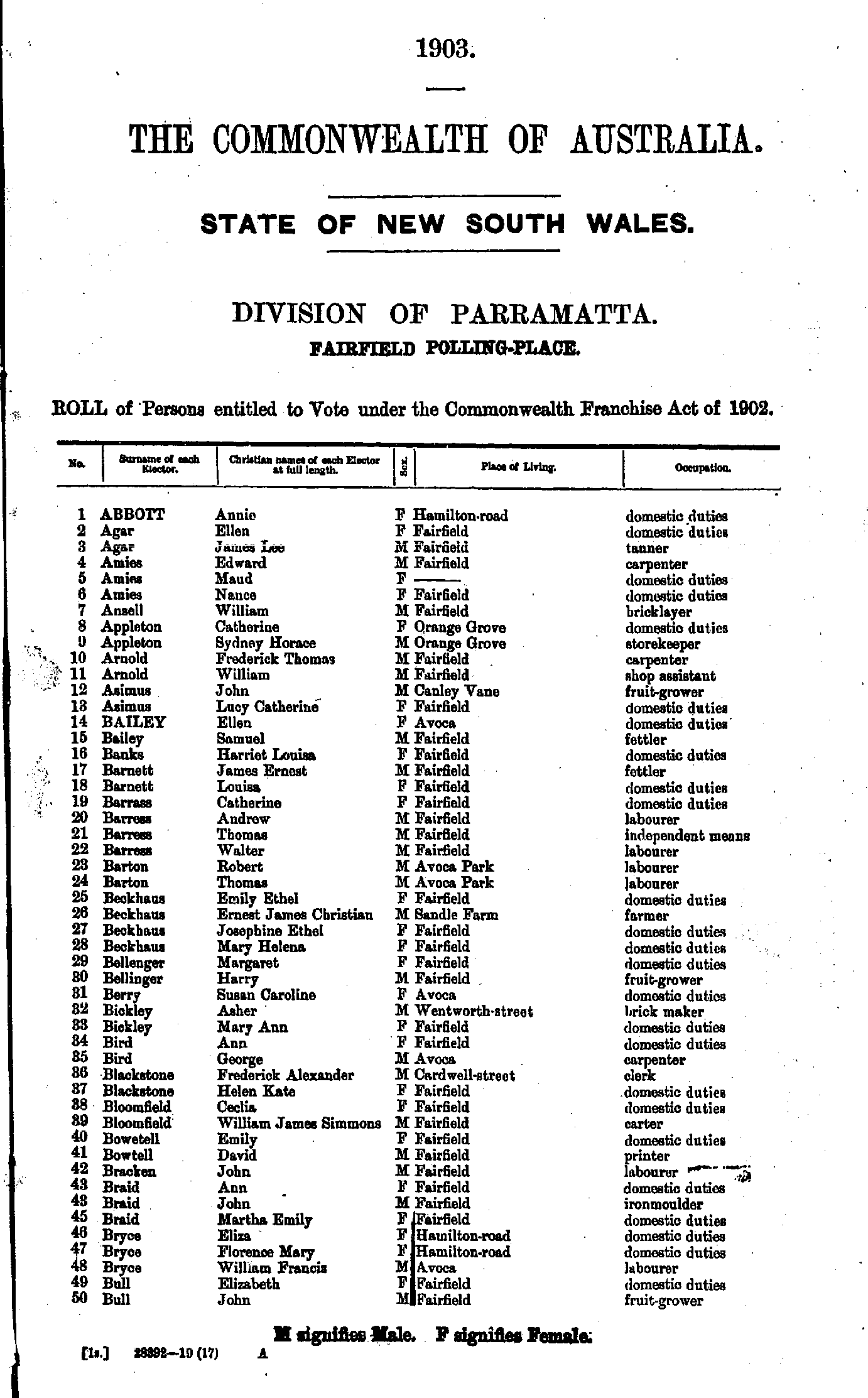
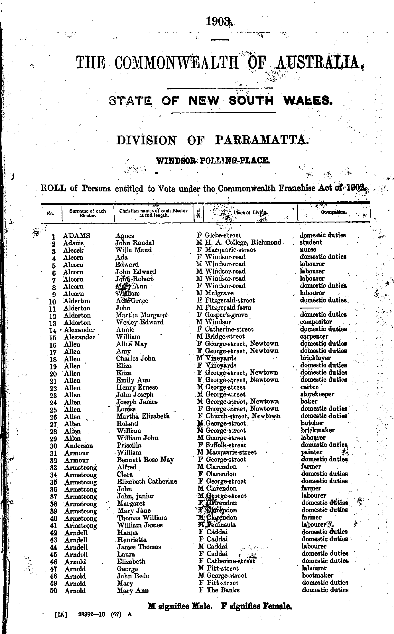
- Adams Agnes - Arnold Mary
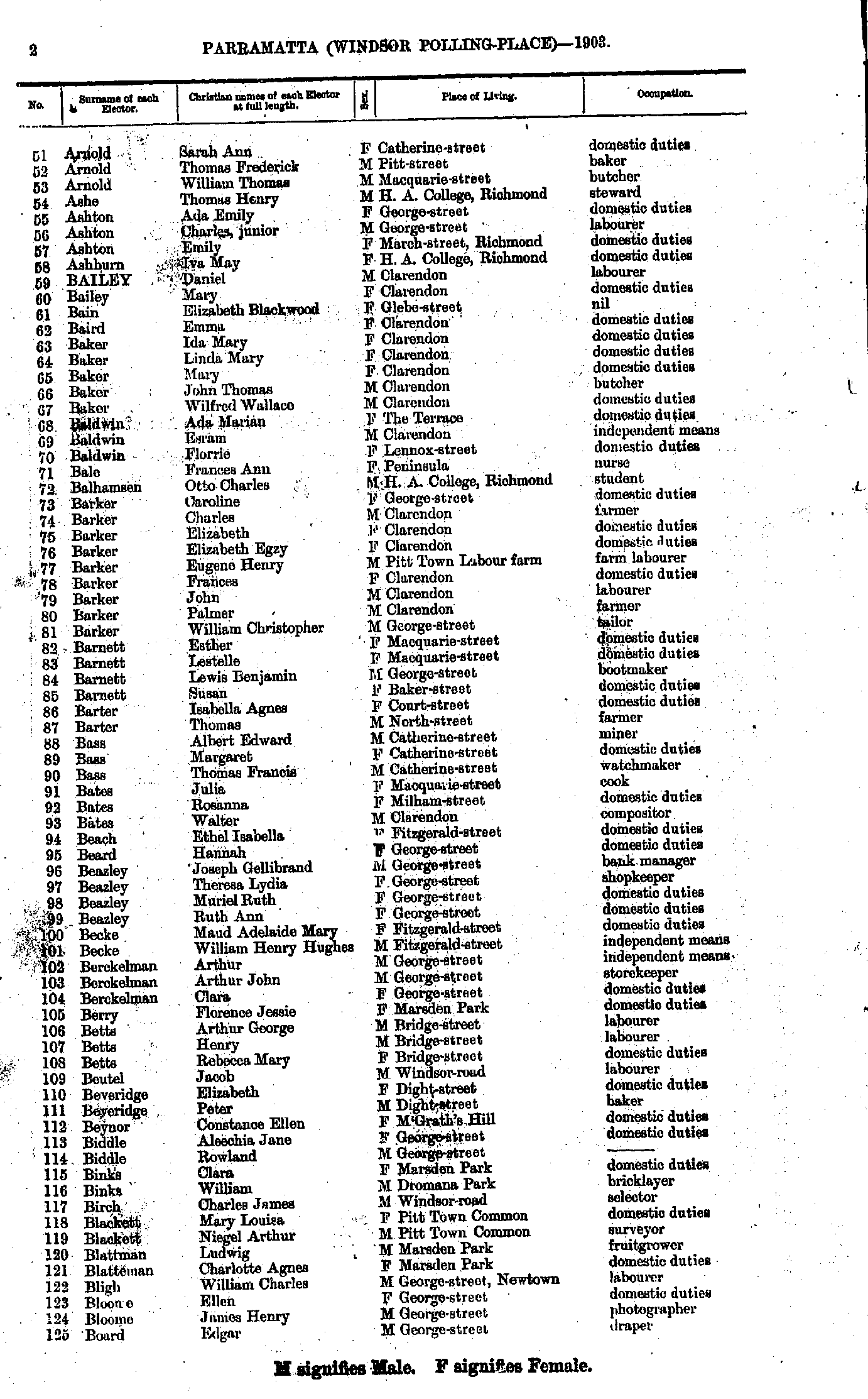
- Arnold Sarah - Board Edgar
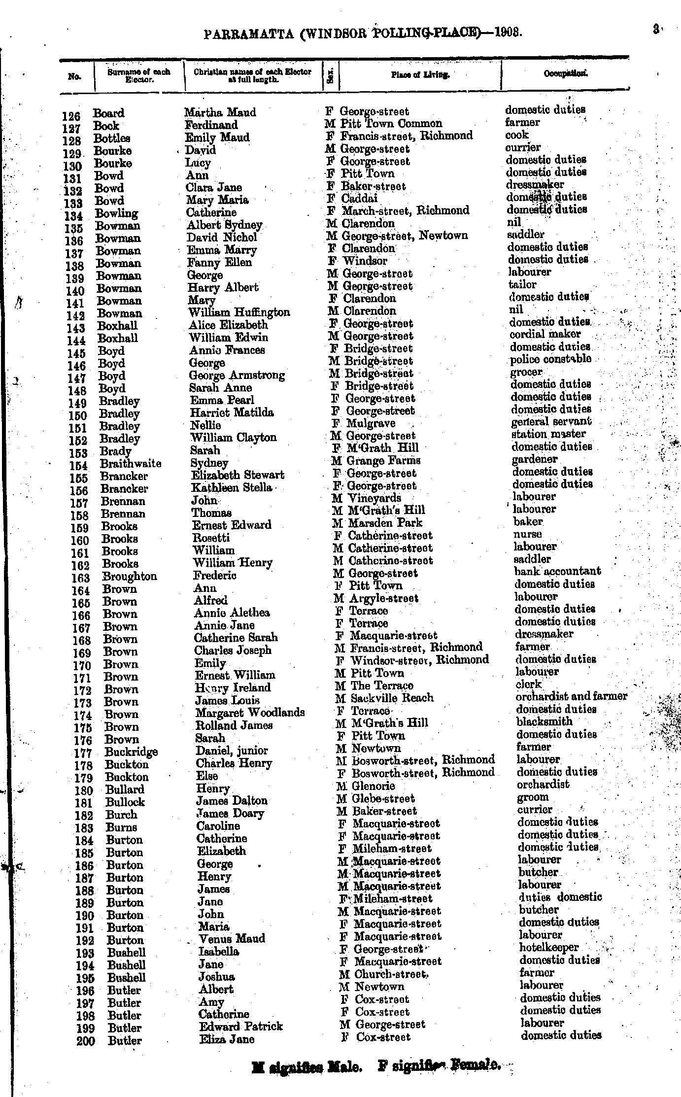
- Board Martha - Butler Eliza
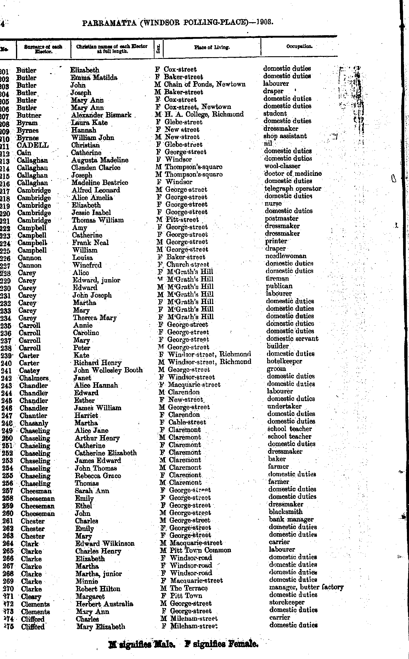
- Butler Elizabeth - Clifford Mary
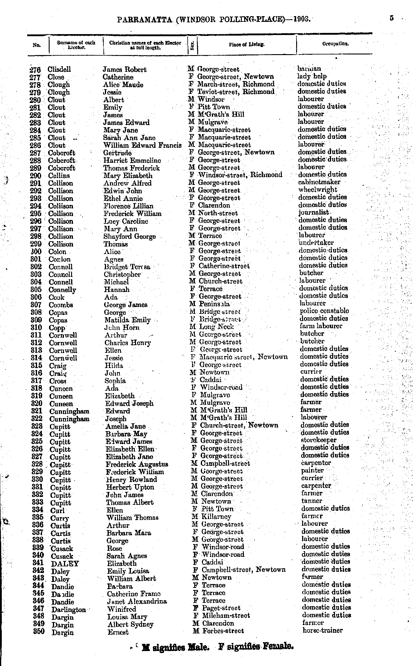
- Clisdell James - Dargin Ernest
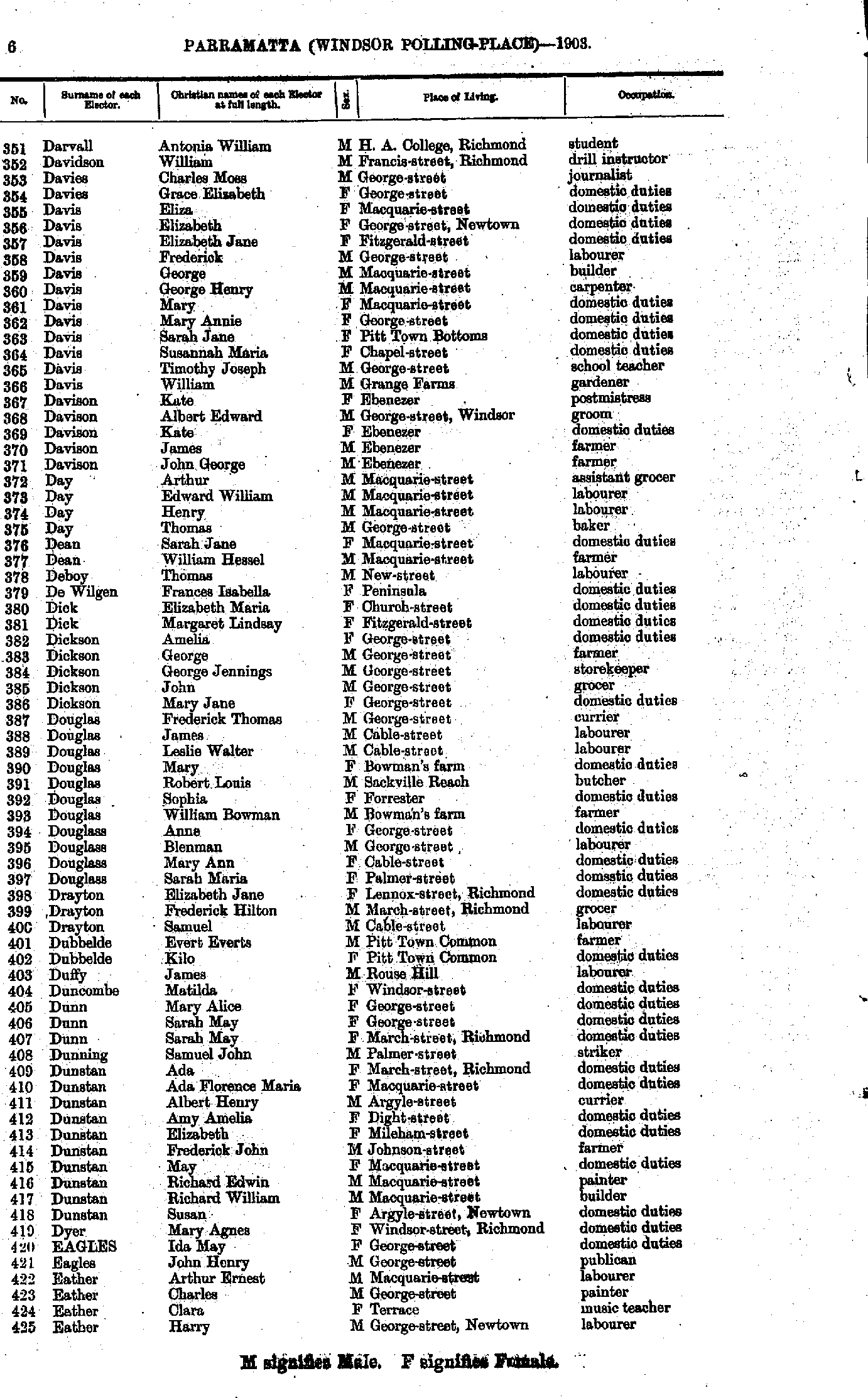
- Darvall Antonia - Eather Harry
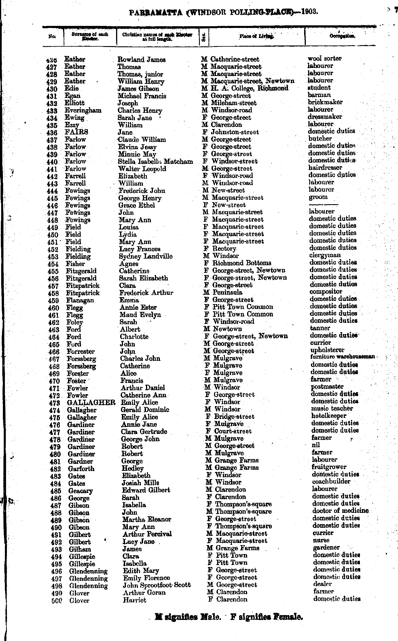
- Eather Rowland - Glover Harriet
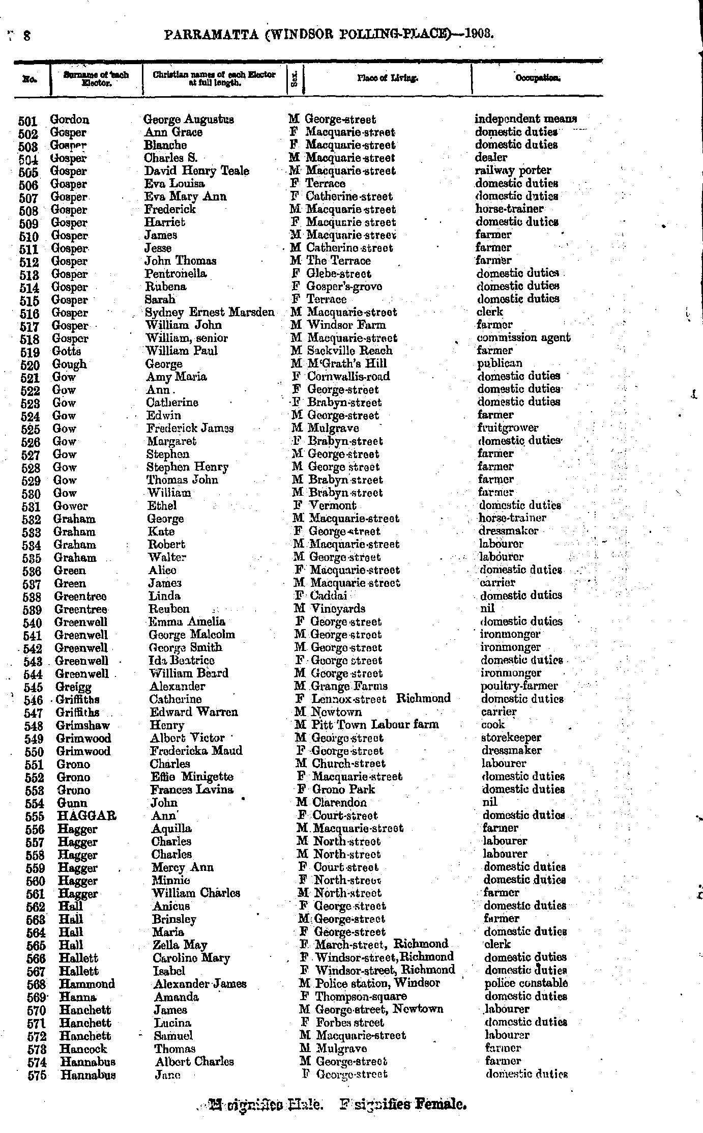
- Gordon George - Hannabus Jane
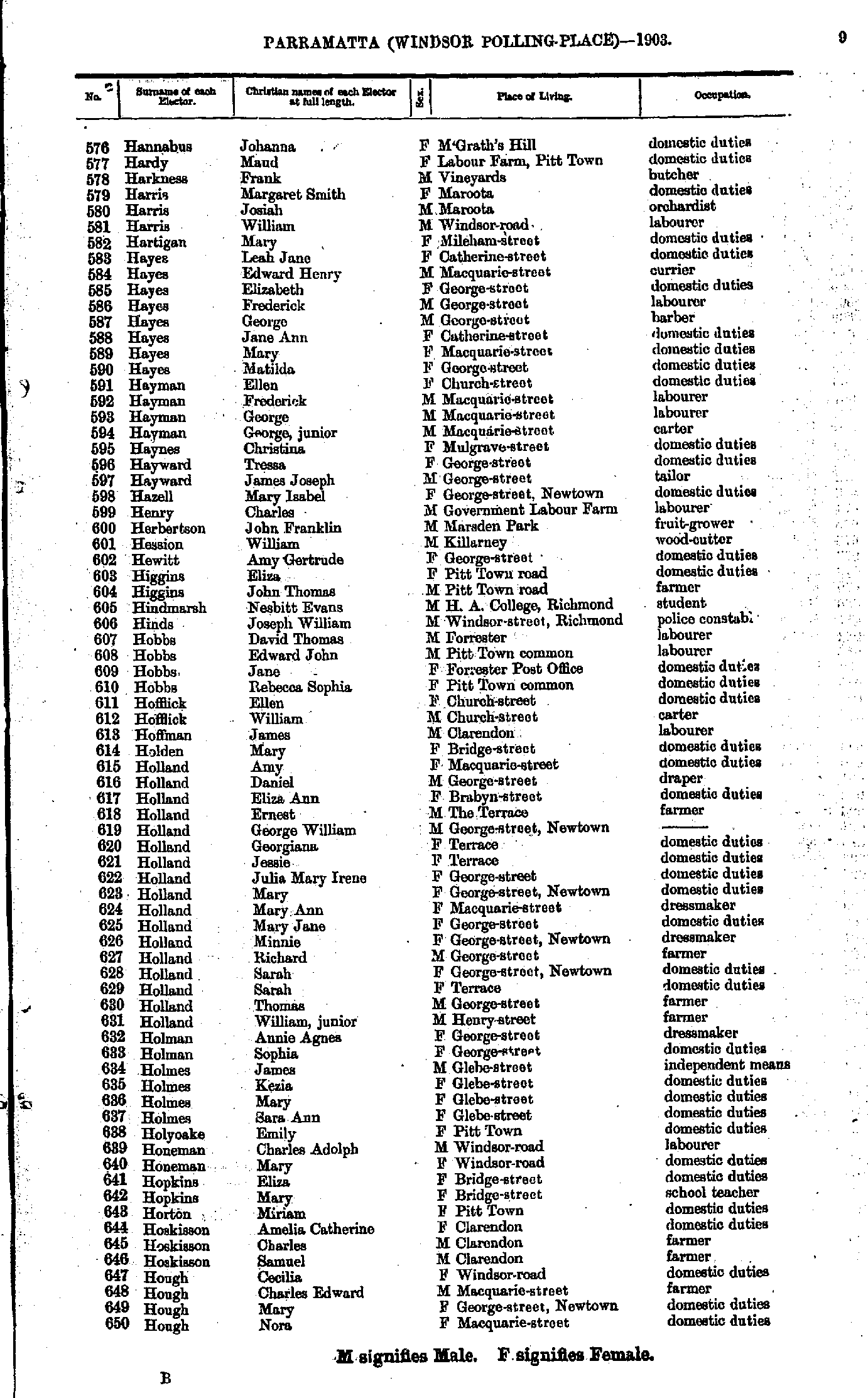
- Hannabus Johanna - Hough Nora
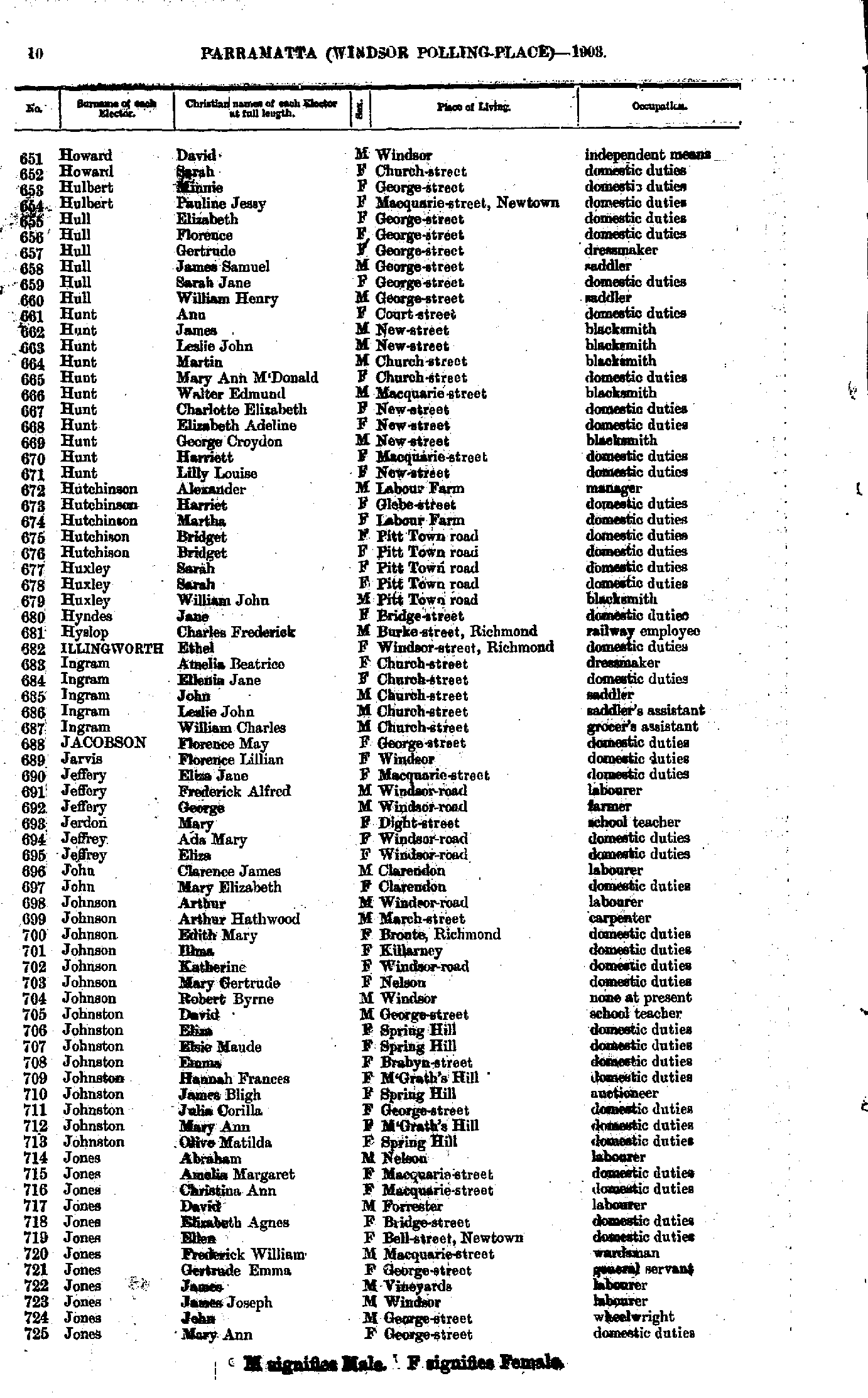
- Howard David - Jones Mary
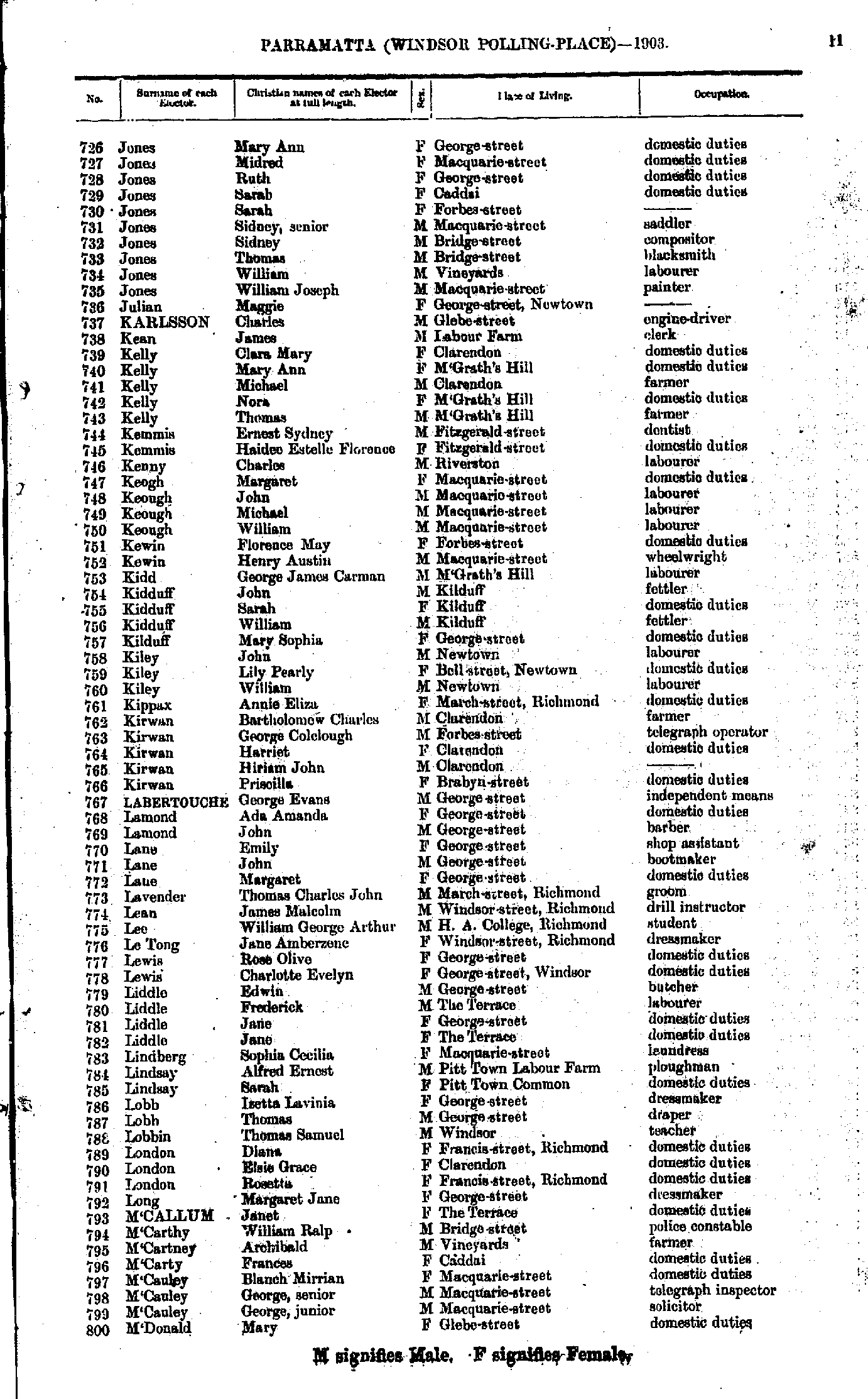
- Jones Mary - M'Donald Mary
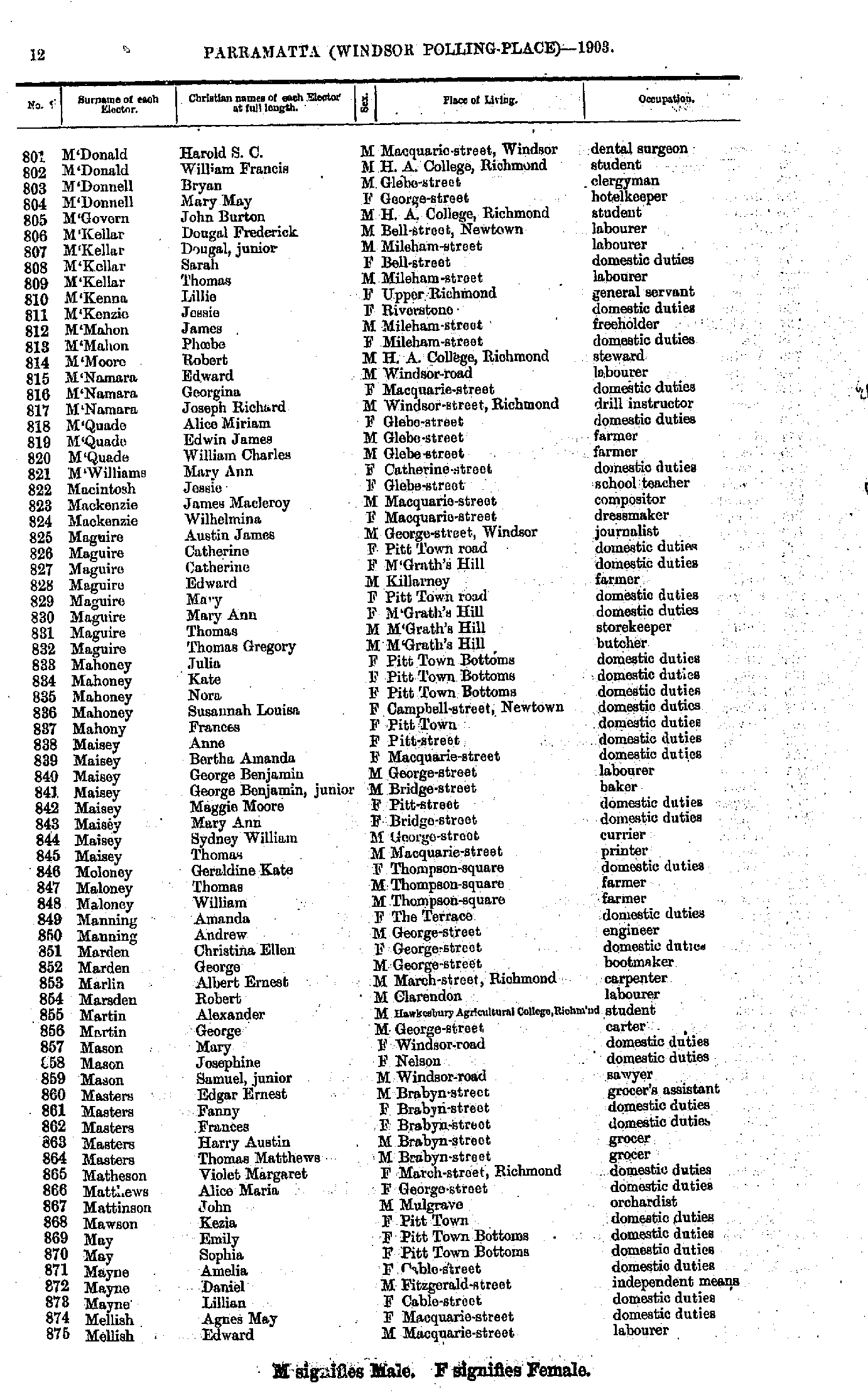
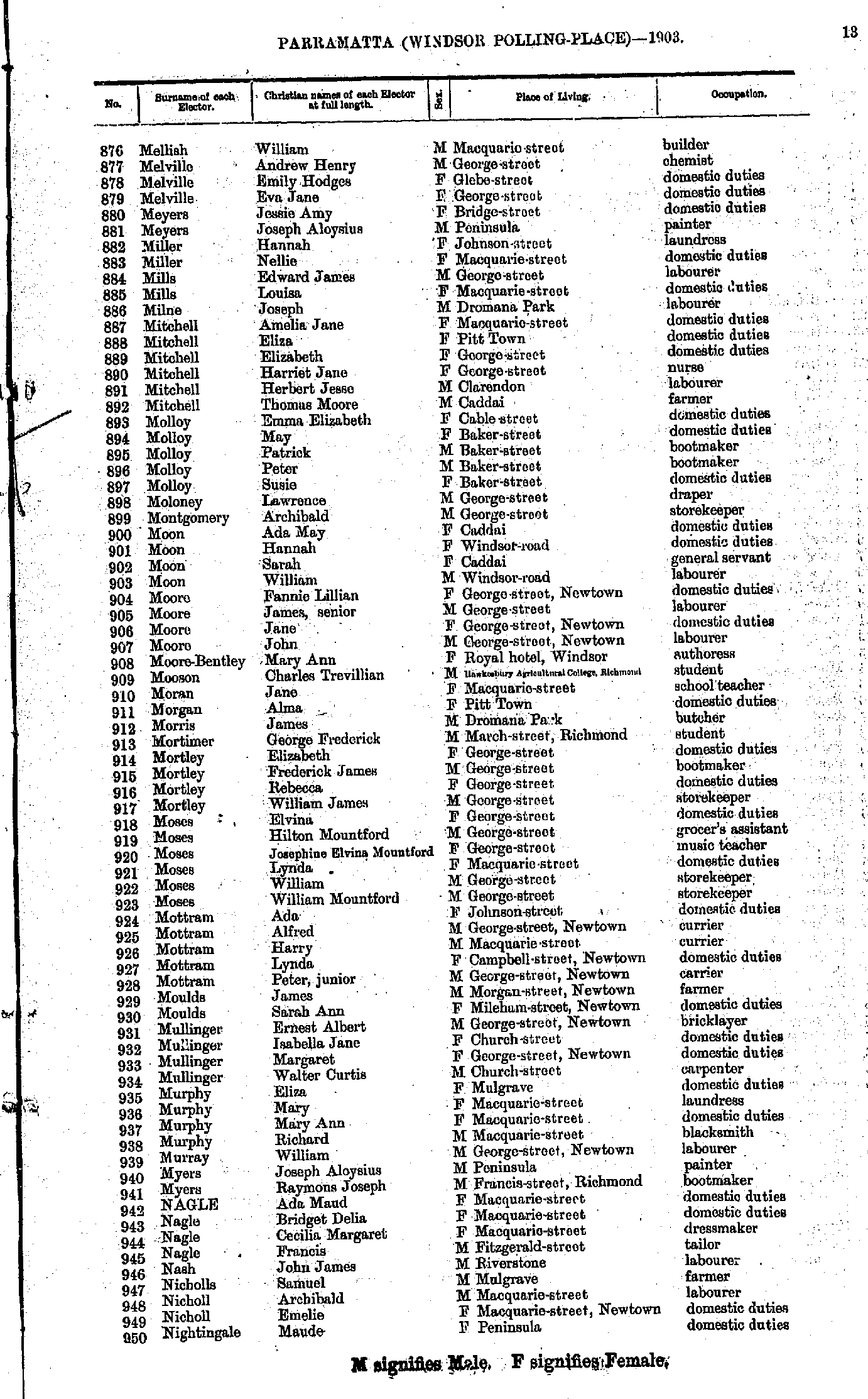
- M'Donald Harold - Mellish Edward
- Mellish William - Nightingale Maude
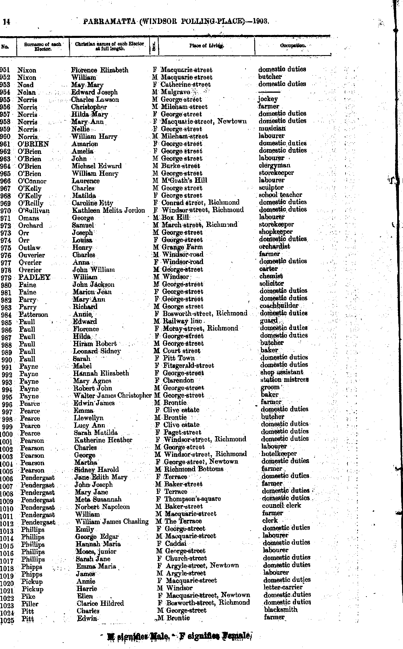
- Nixon Florence - Pitt Edwin
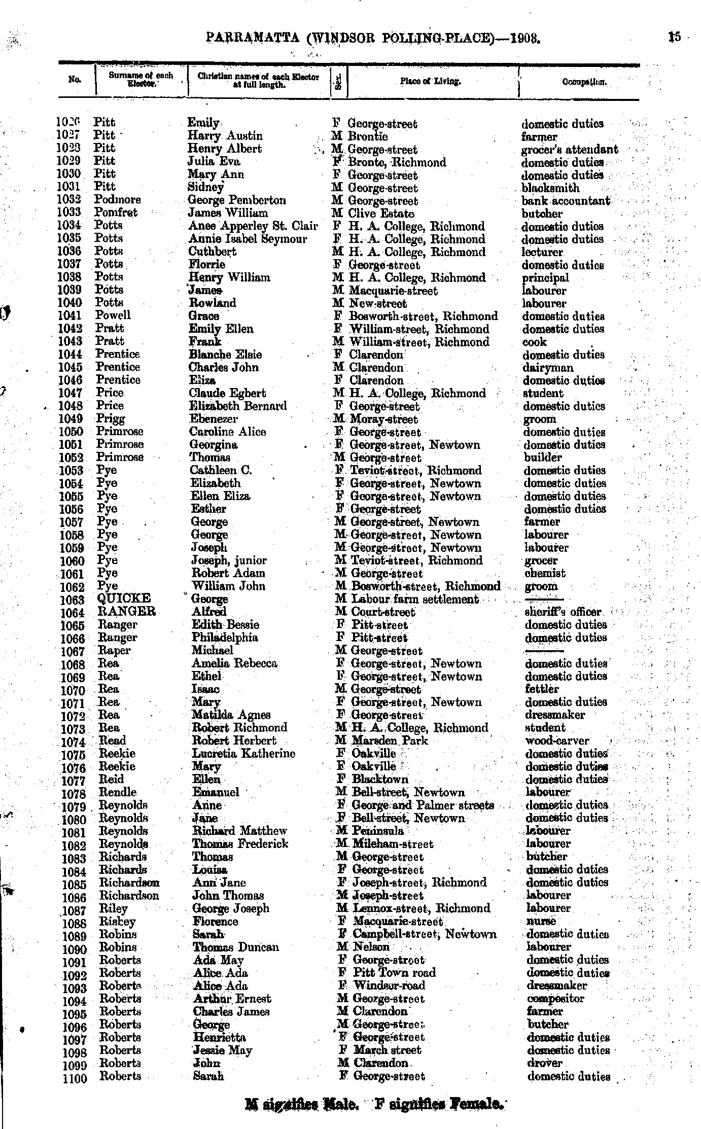
- Pitt Emily - Roberts Sarah
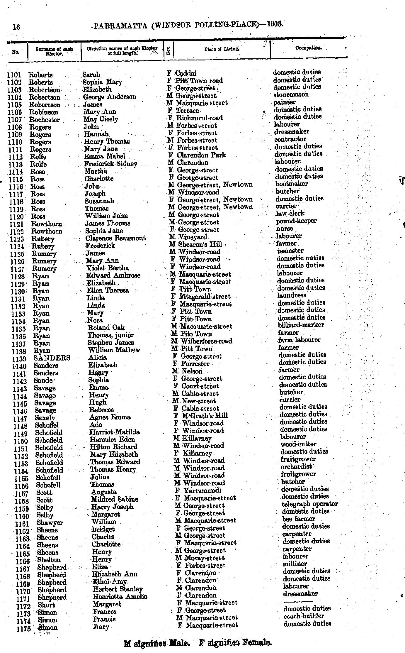
- Roberts Sarah - Simon Mary
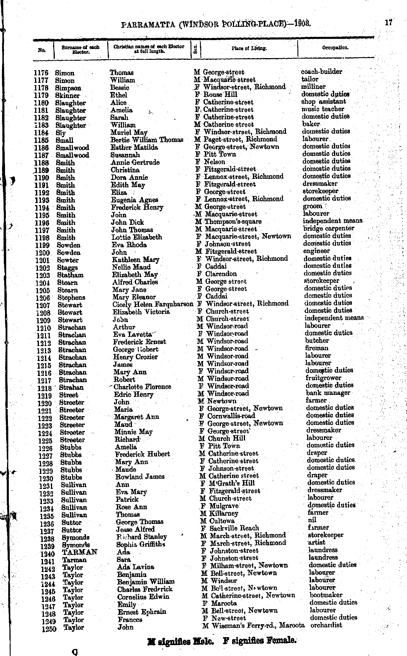
- Simon Thomas - Taylor John
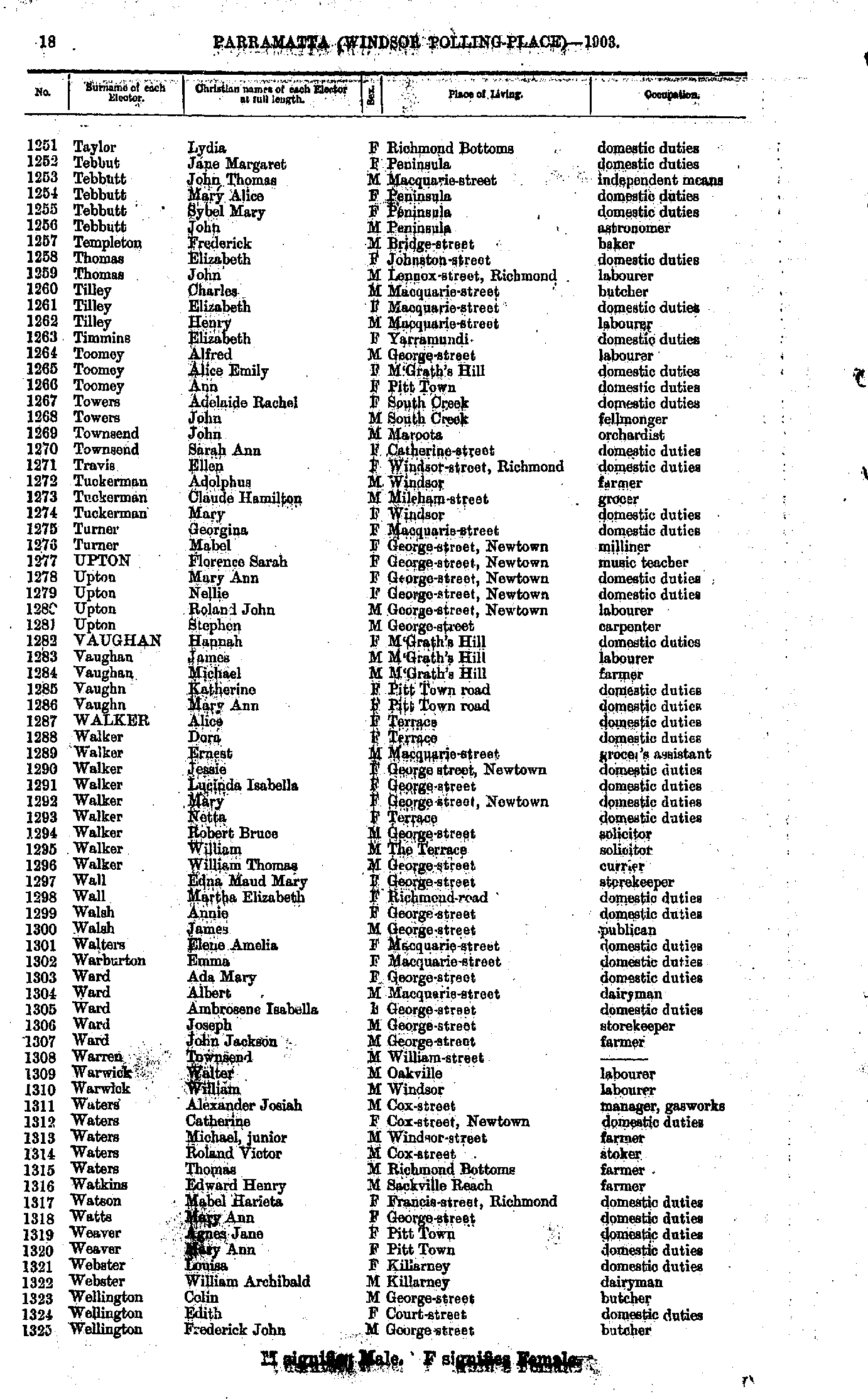
- Taylor Lydia - Wellington Frederick
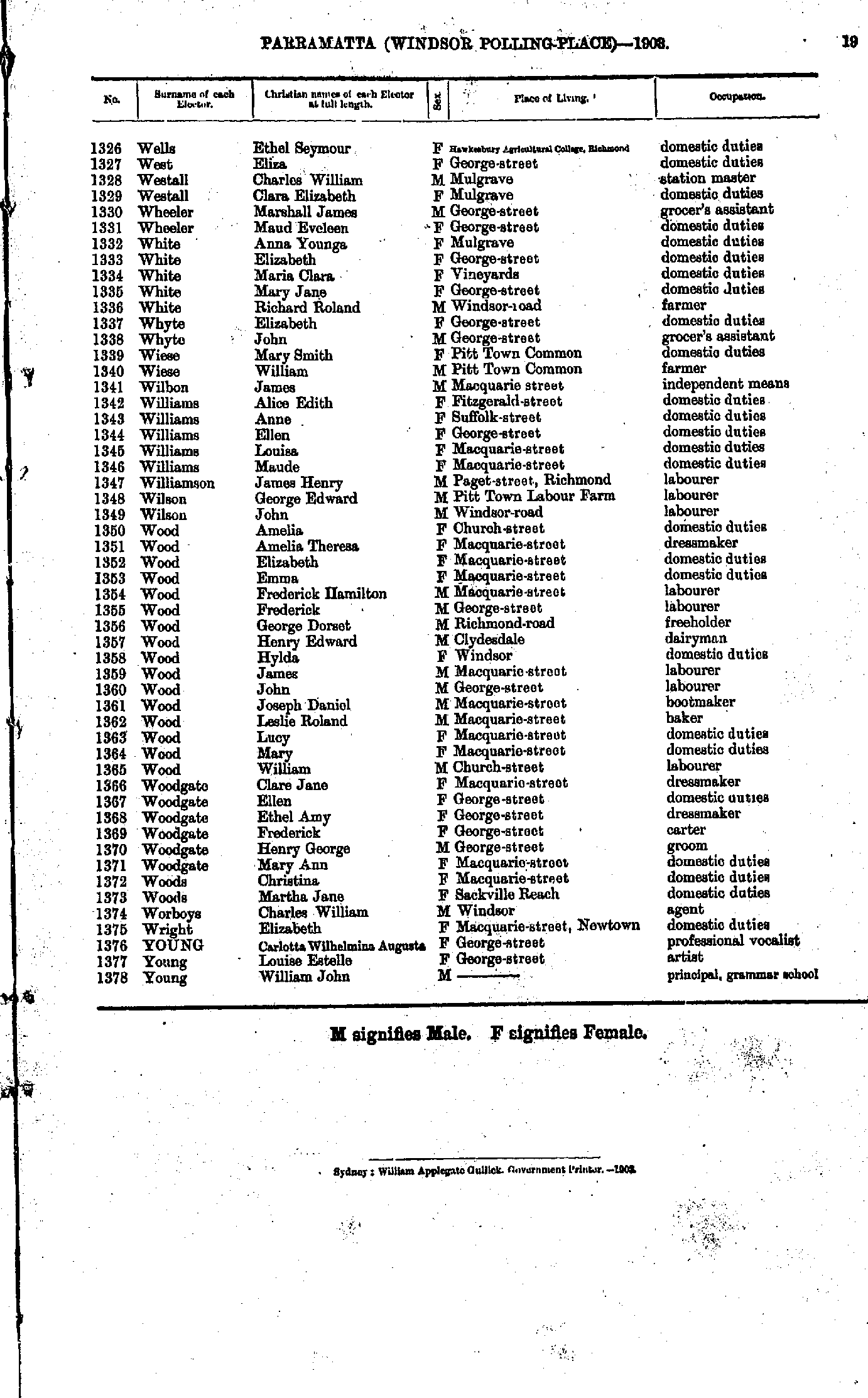
- Wells Ethel - Young William
From: Federal Electoral Districts Commissioners 1901, Maps of the Federal Electoral Districts of the State of New South Wales, William Applegate Gullick, Government Printer, Sydney.
JPEG file (254KB)
Portable Document Format(PDF) file (1.7MB)If you do not have a PDF reader you can click on the button to download the free Adobe Acrobat Reader
The documents in this site are arranged into seven major indexes. You are currently in the Electoral Rolls index. Use the Back button on your browser to move within this index, or use the links below to view another index:
- Directories
- Electoral Rolls
- Land Records
- General and Miscellaneous Records
- Mining Records
- Pastoral and Agricultural Records
- Other Occupations
Copyright © Internet History Resources 2007
