IHR NSW Family History Documents
Electoral Rolls Index
Home | Directories | Electoral | Land | General | Mining | Pastoral | OccupationsNSW Electoral Rolls 1903 - Newcastle Division
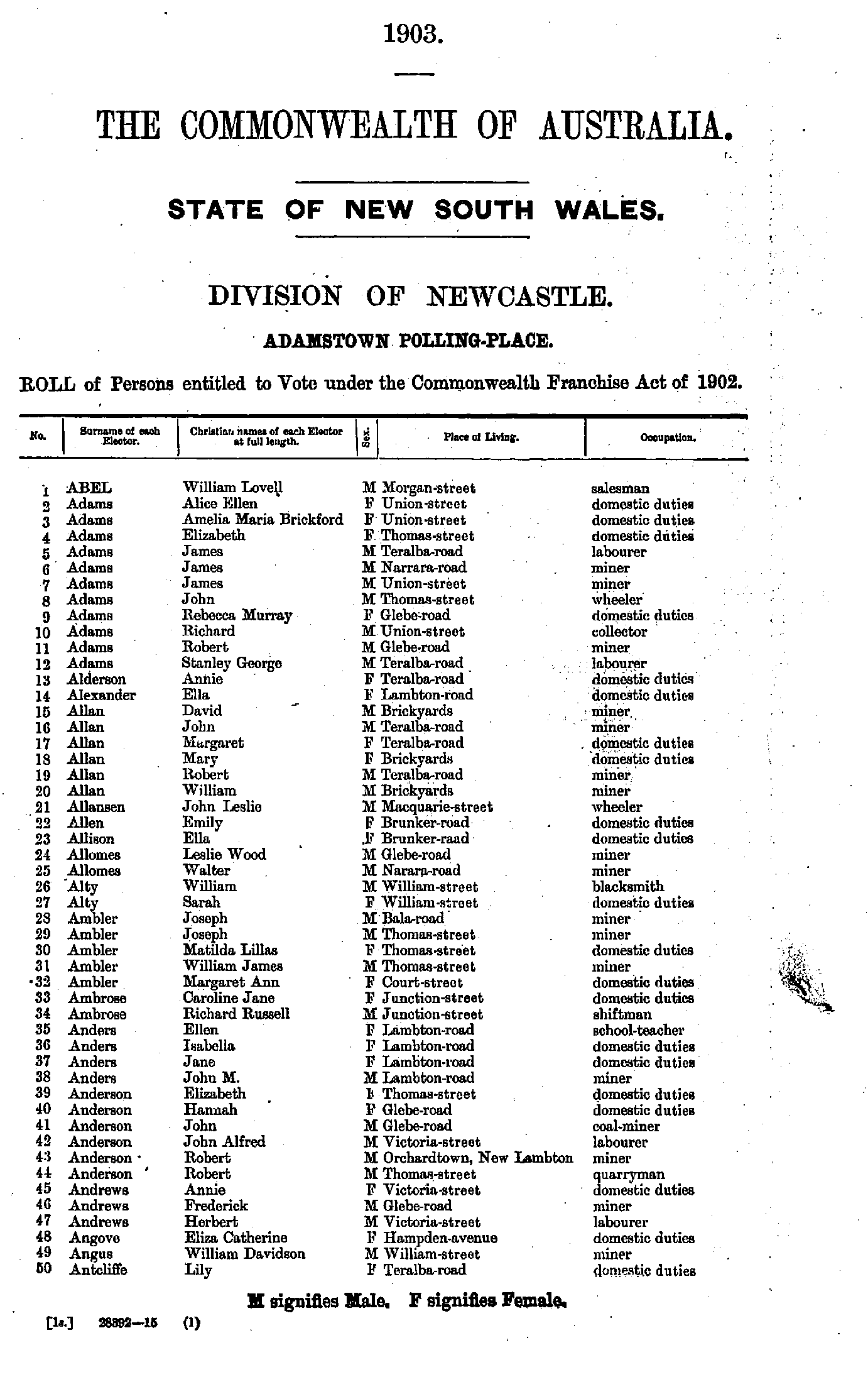
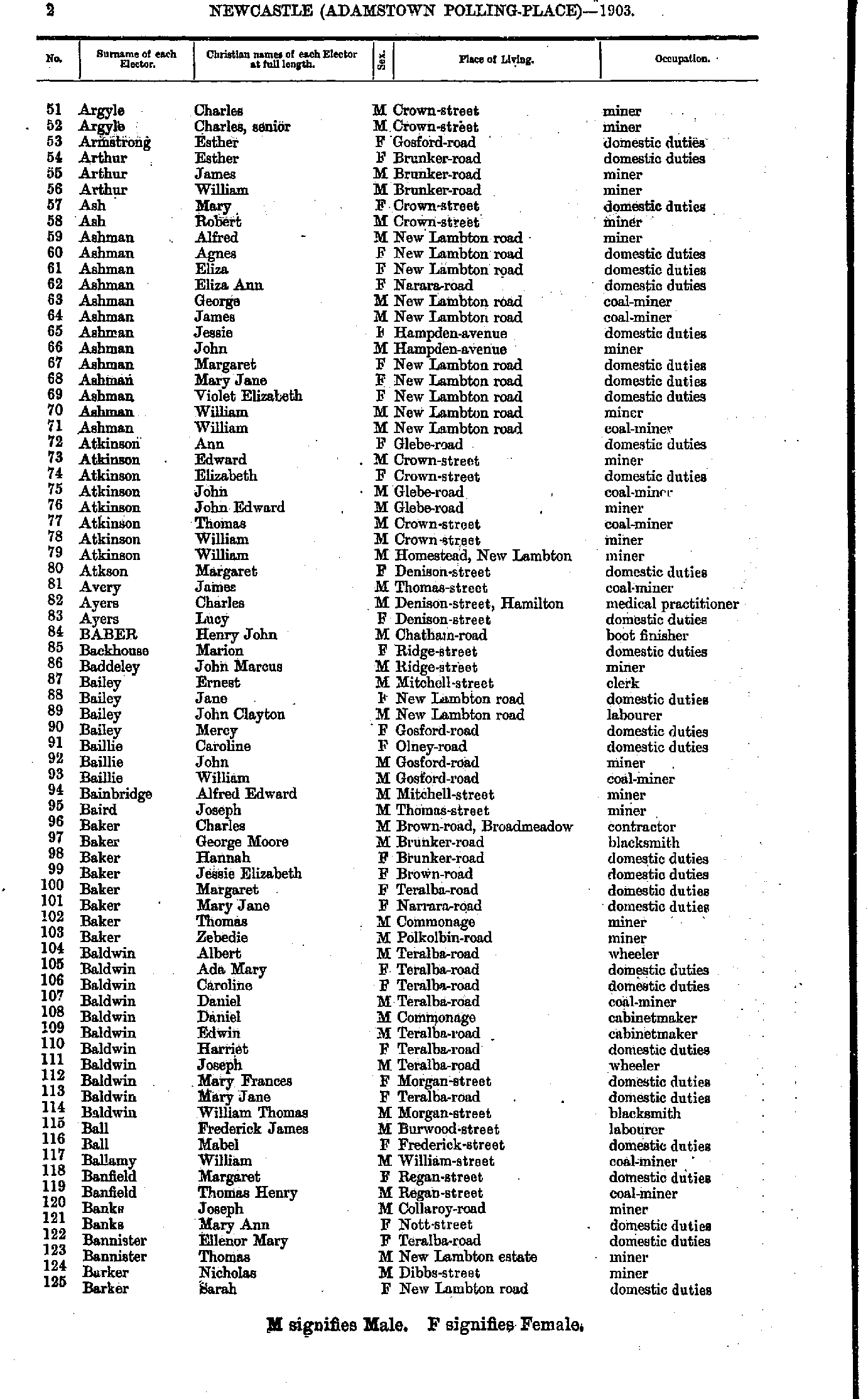
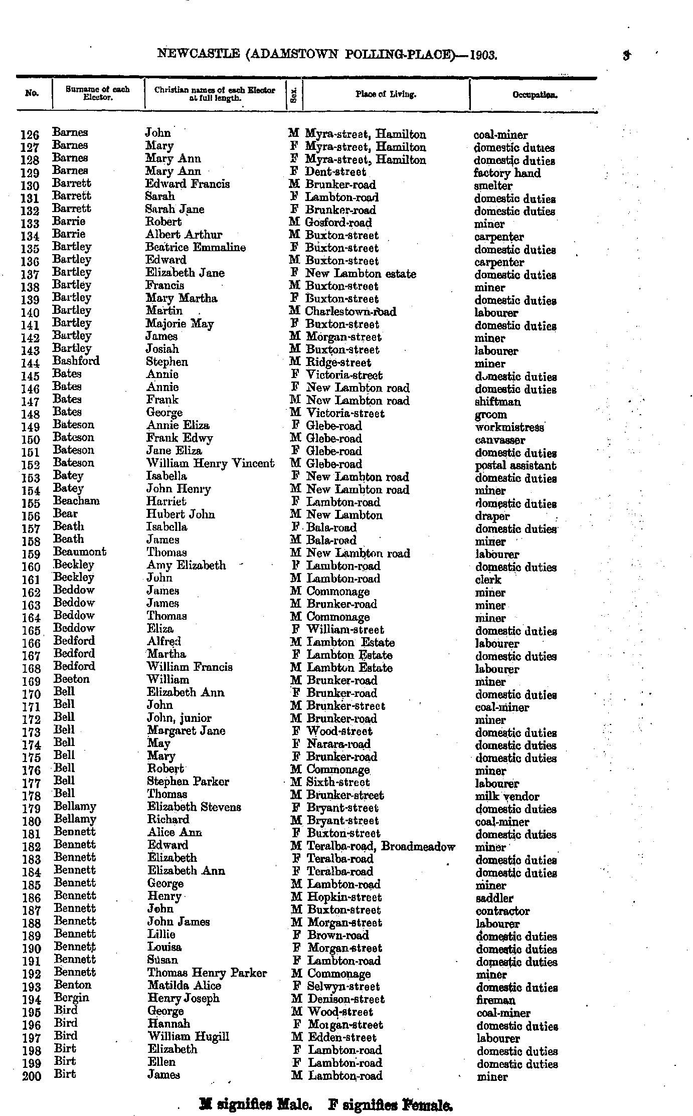
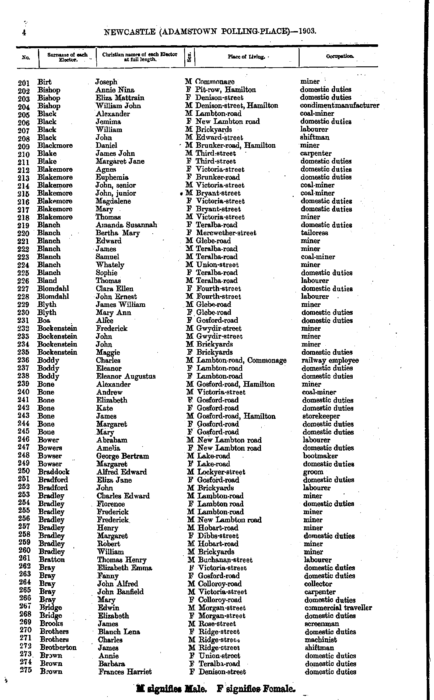
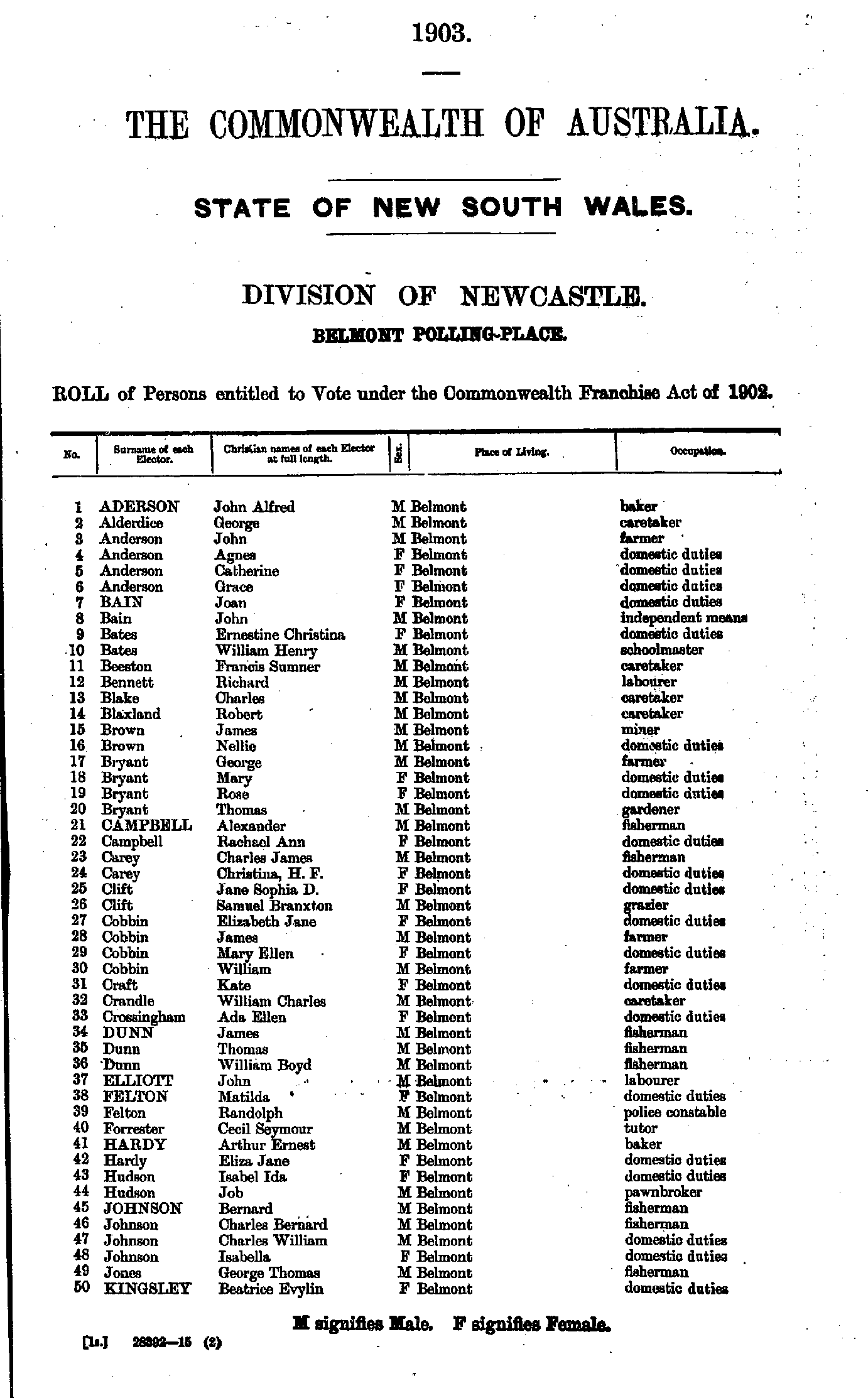
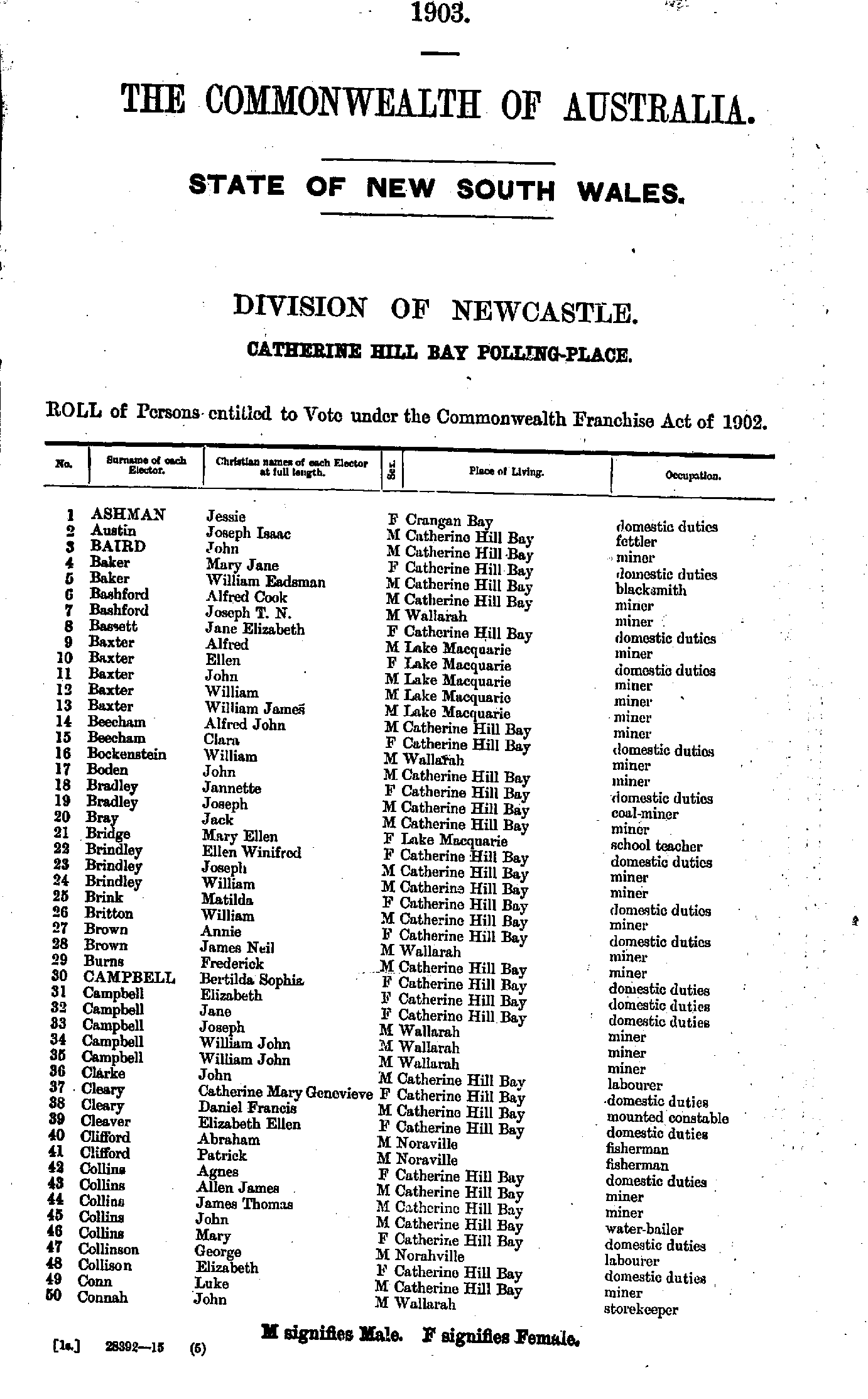
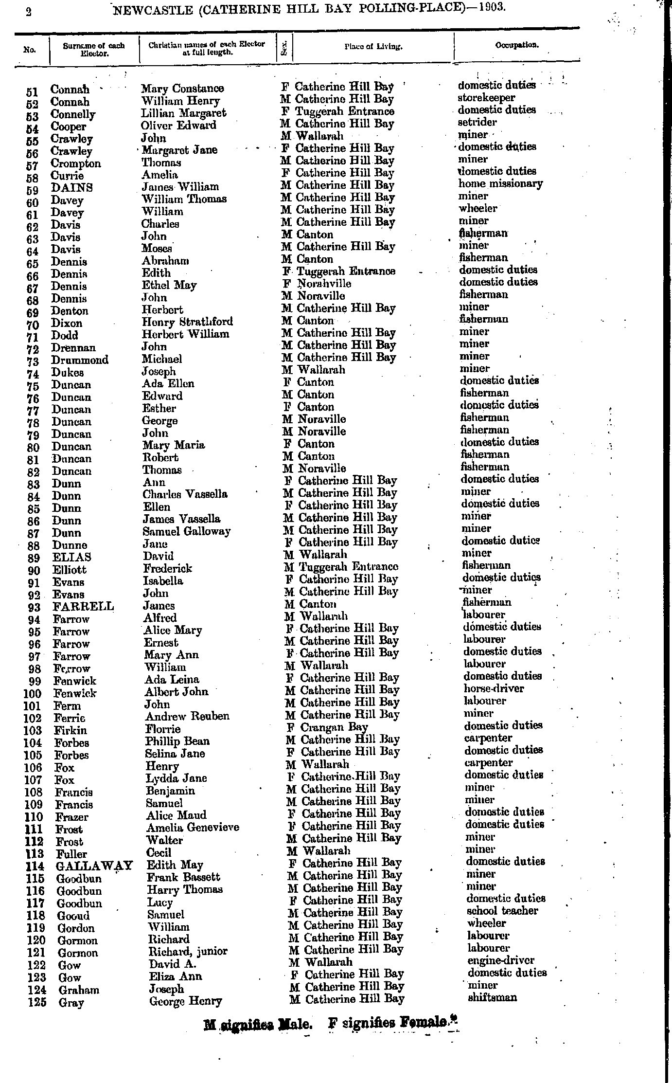
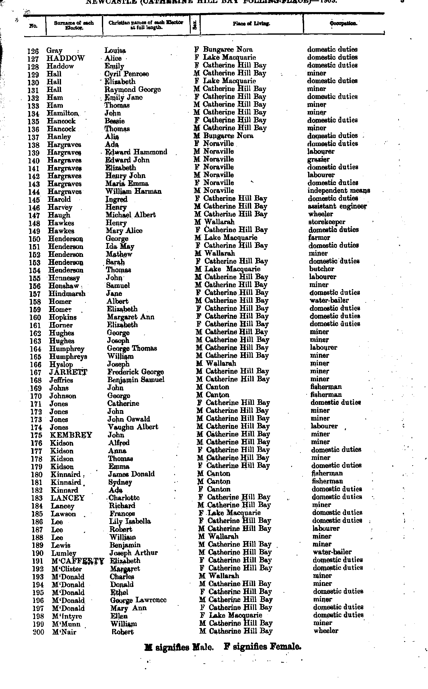
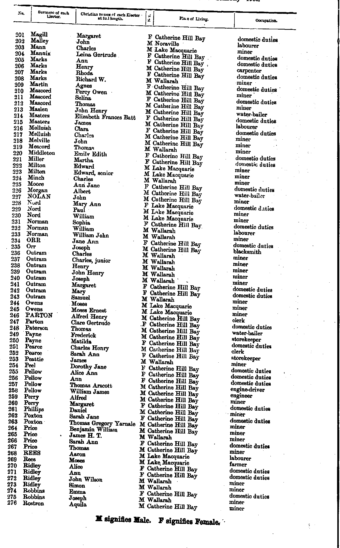
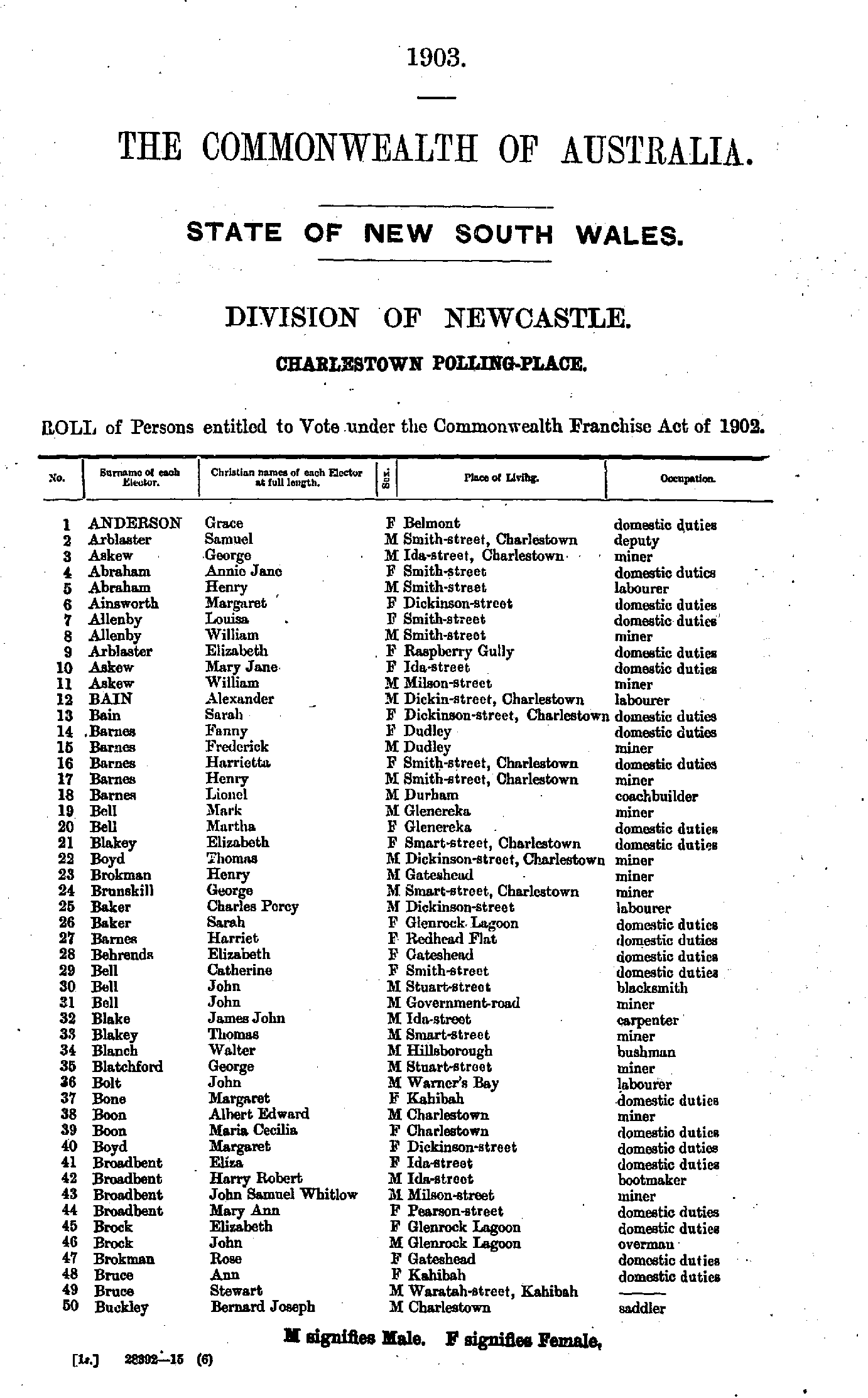
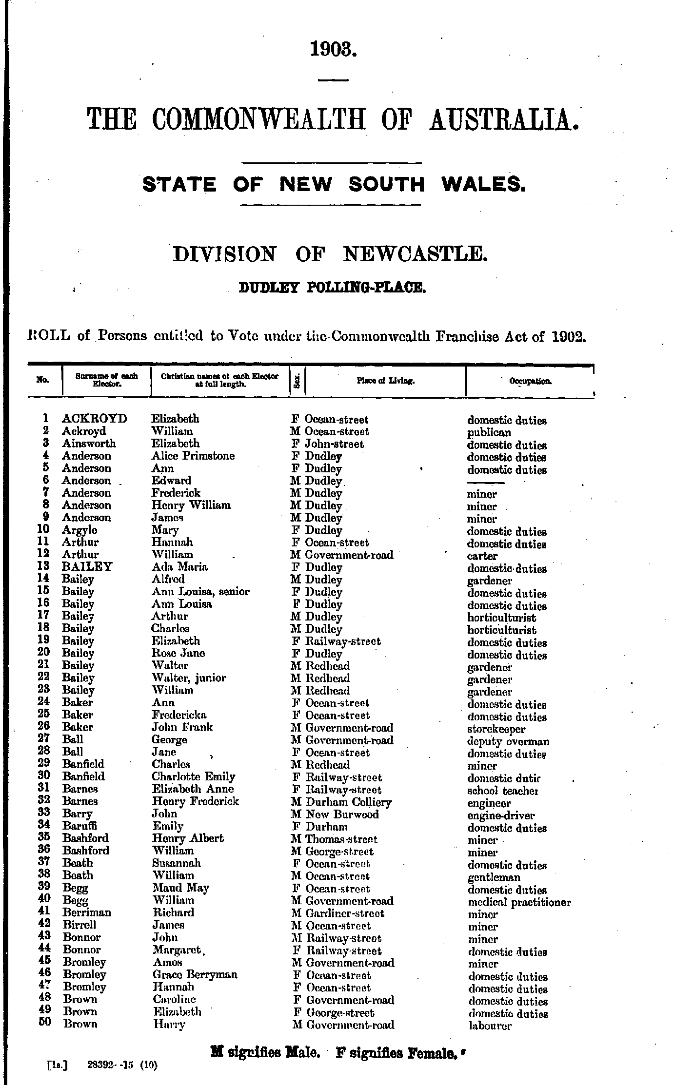
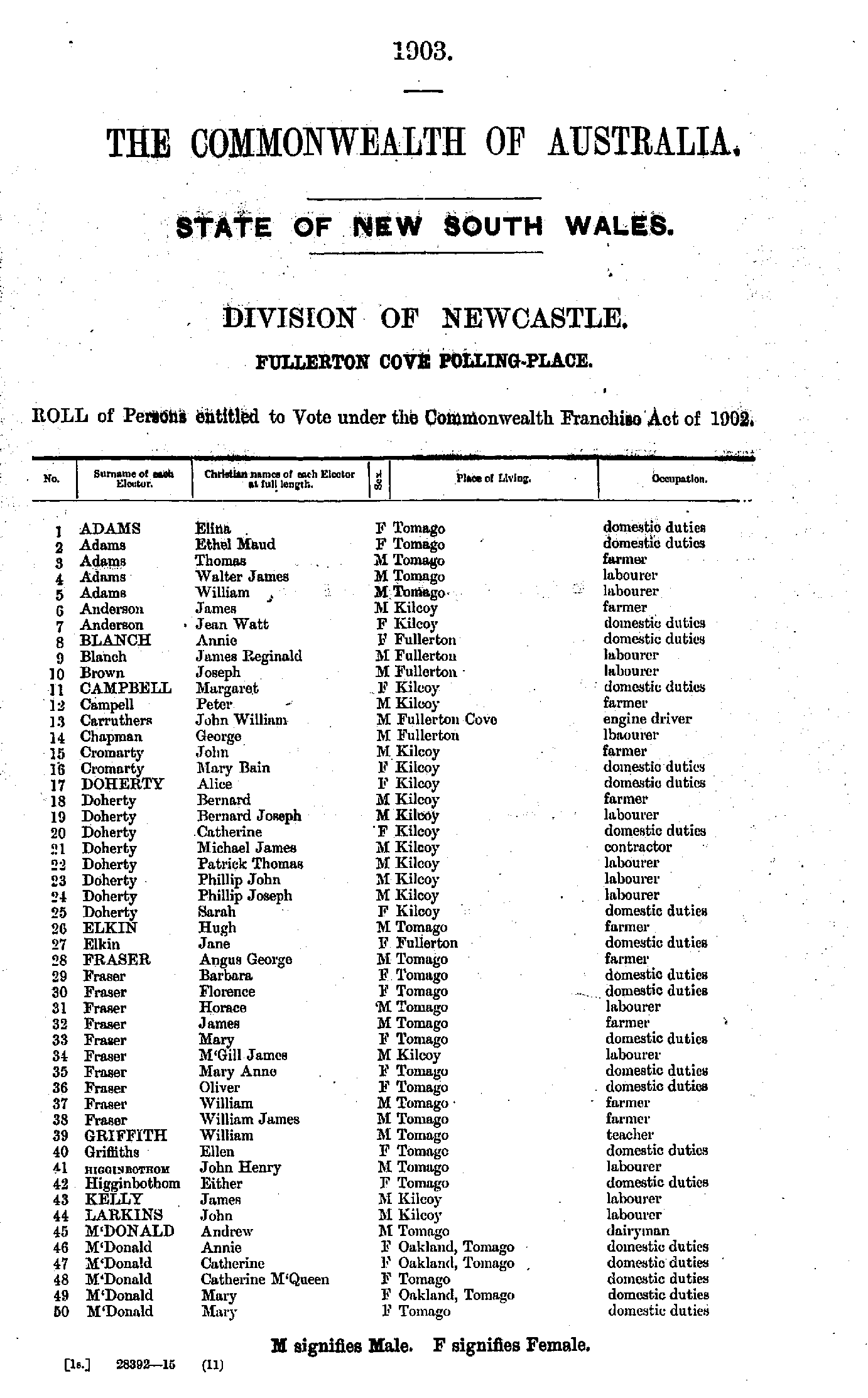
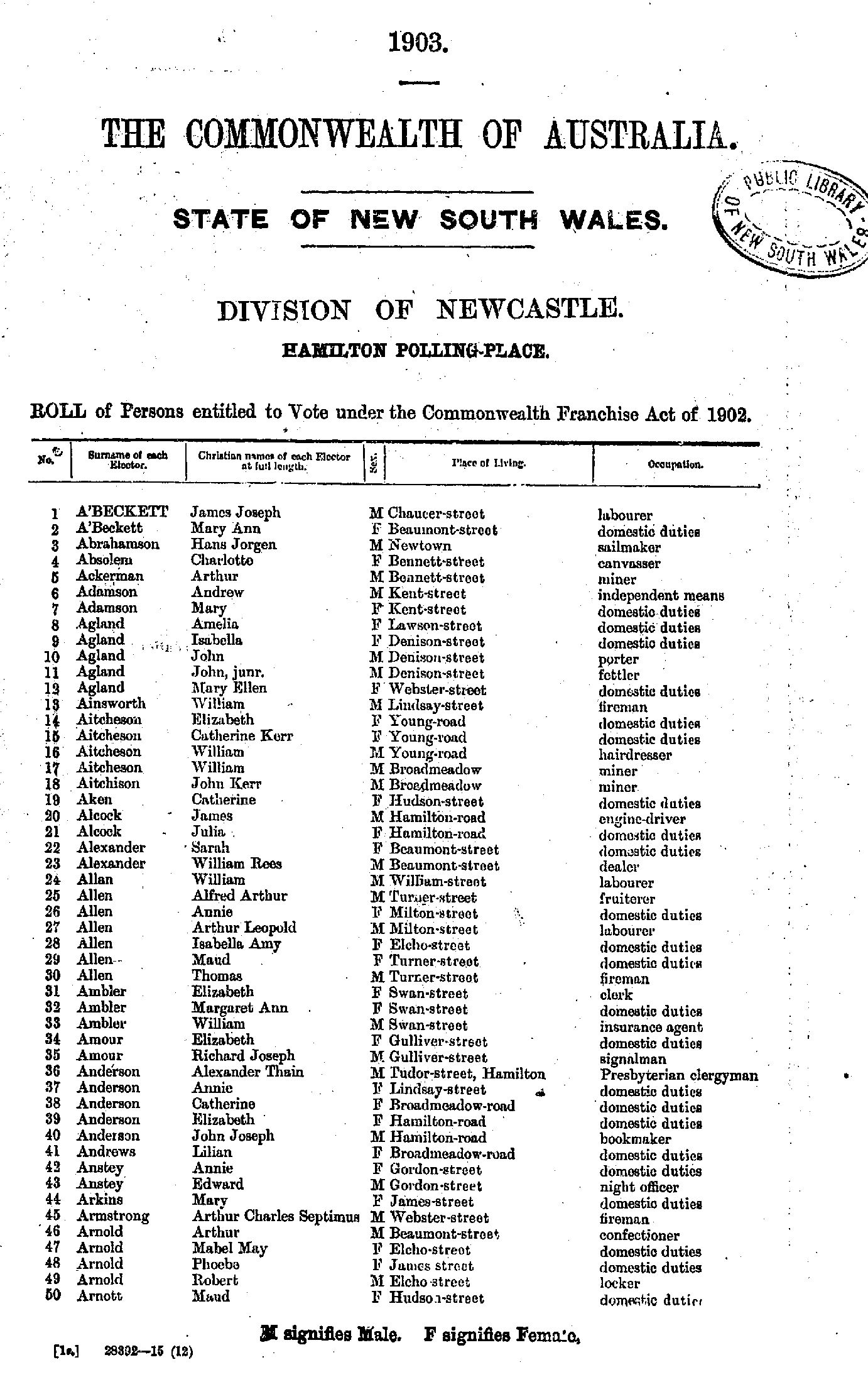
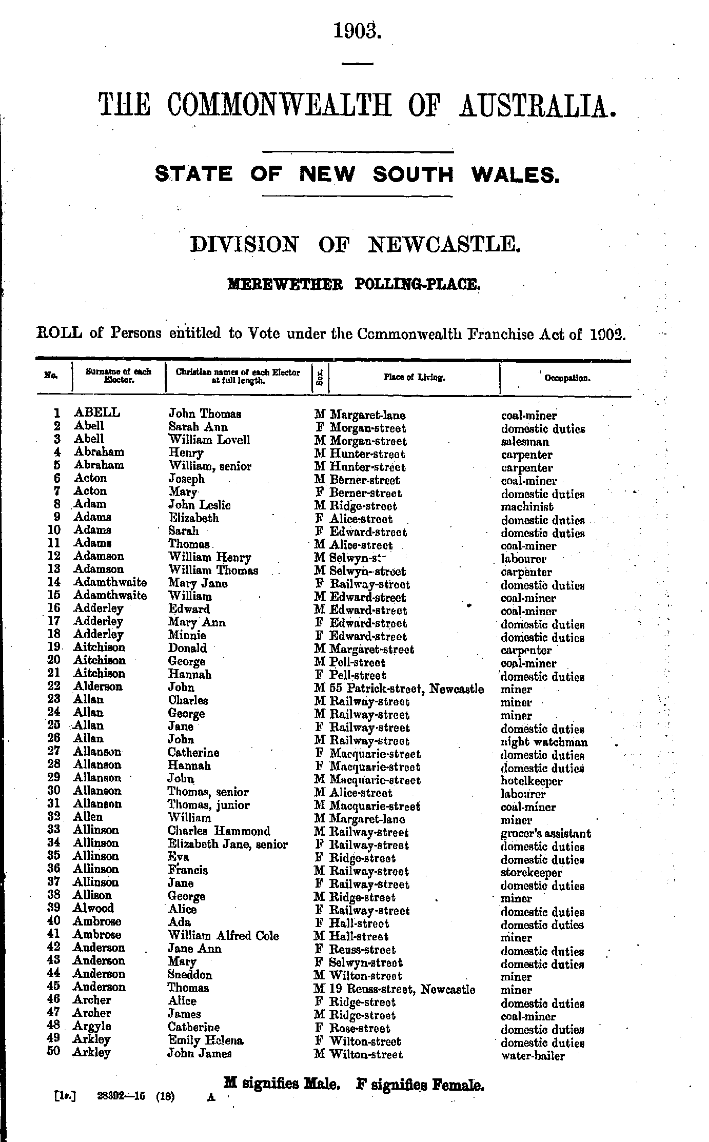
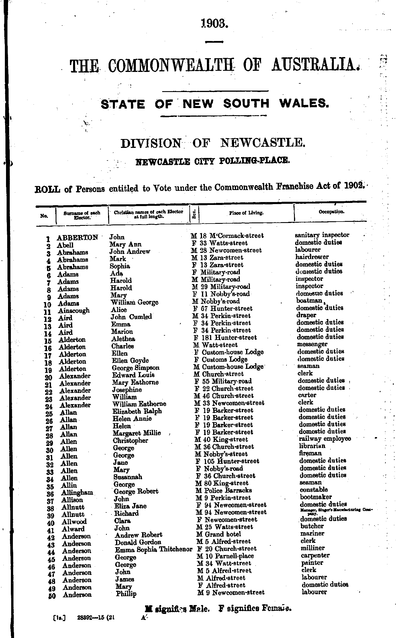
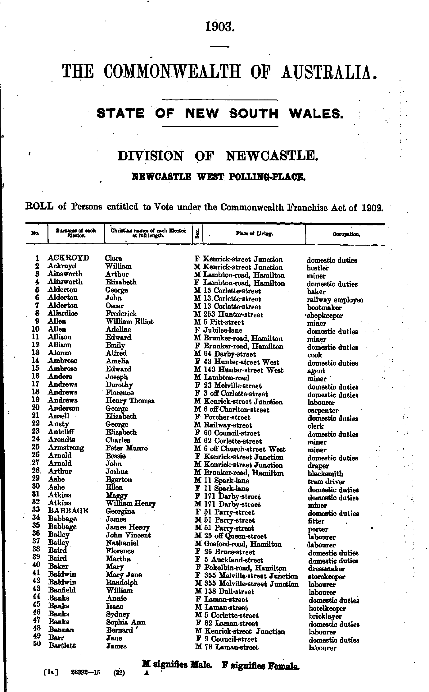
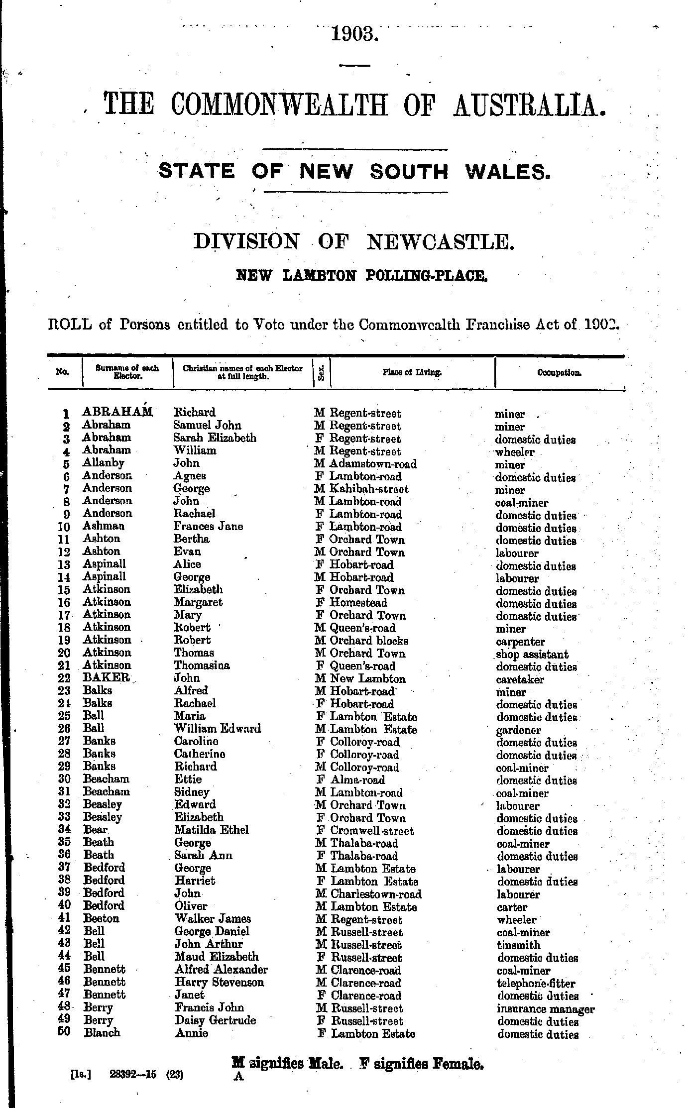
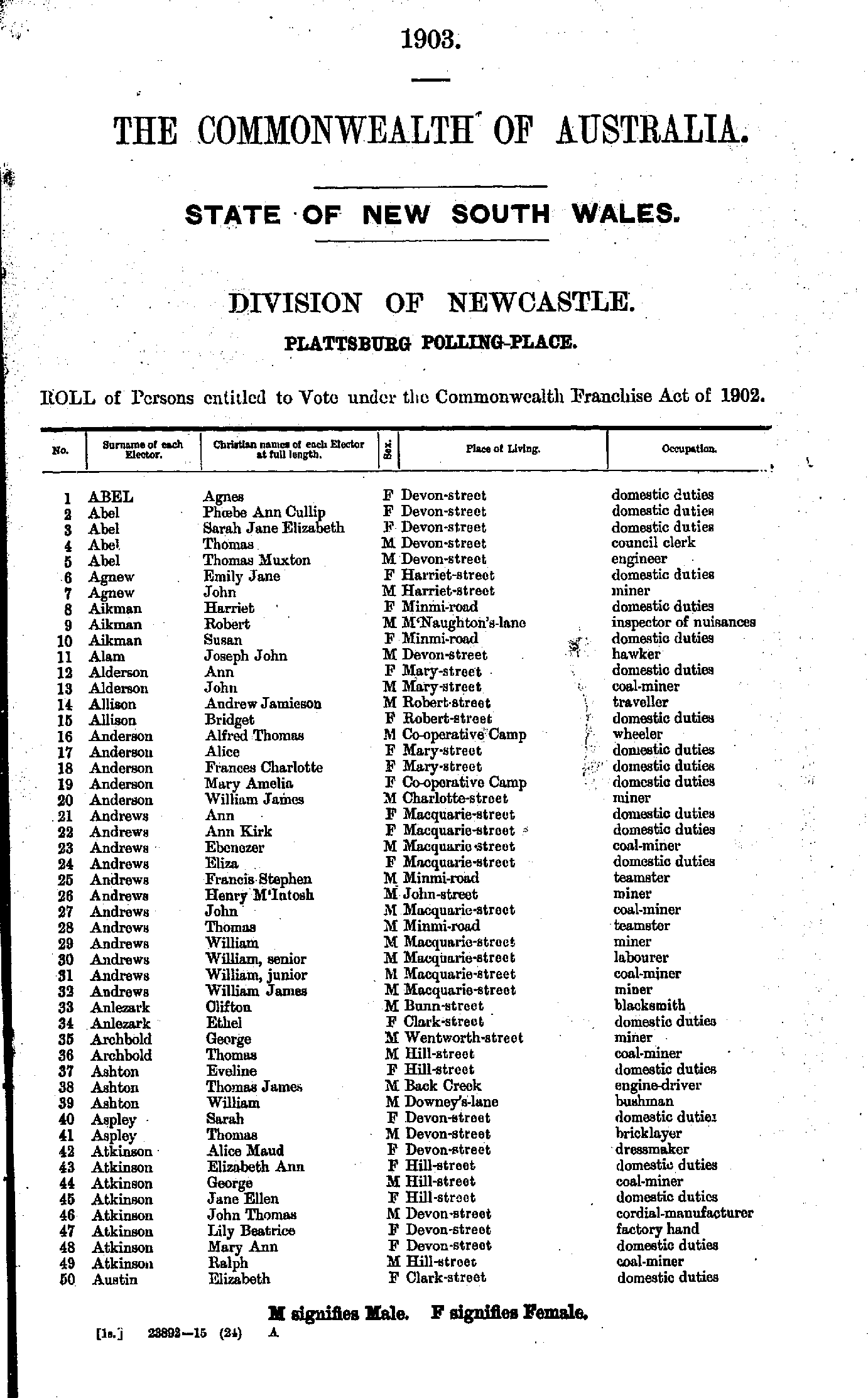
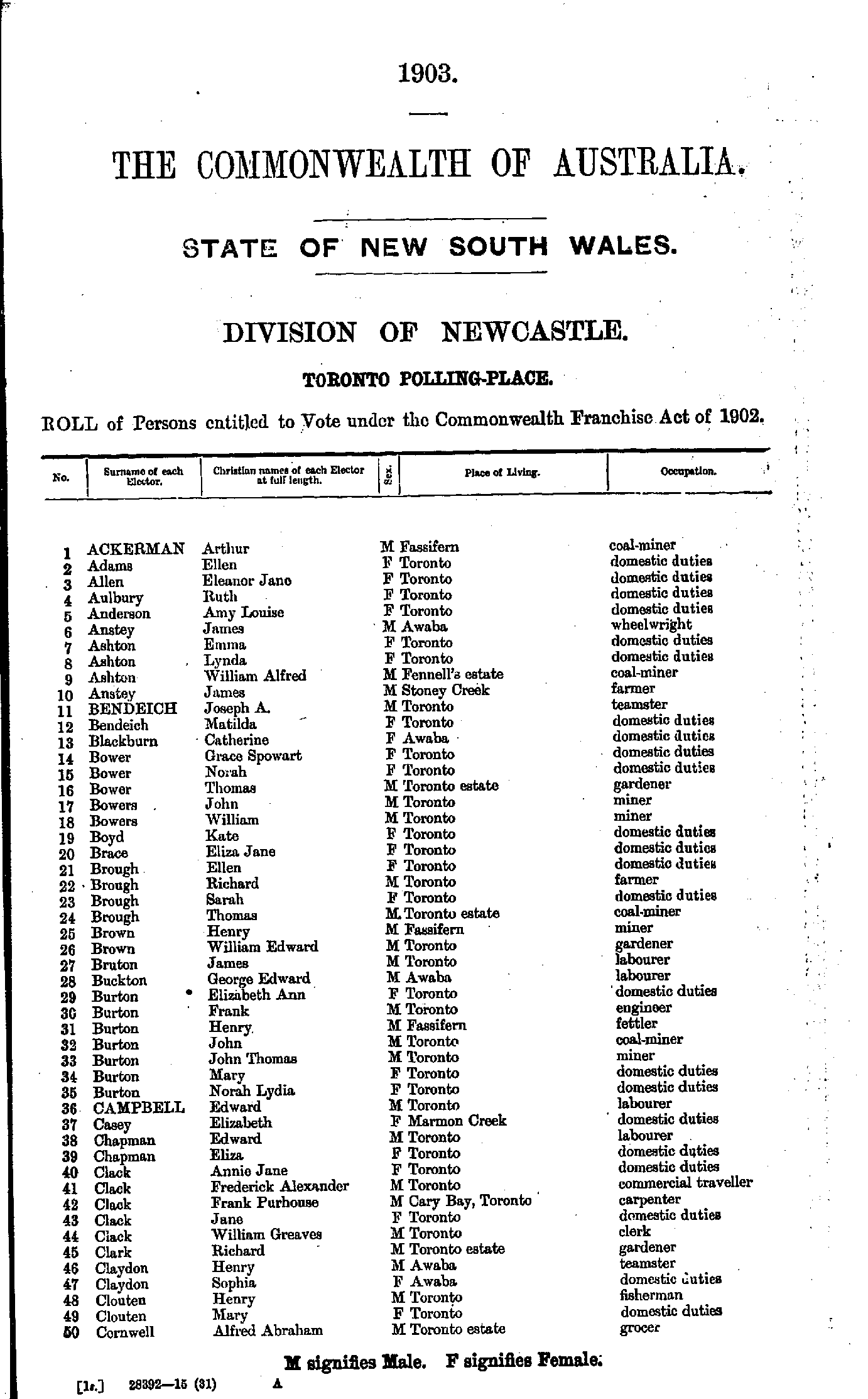
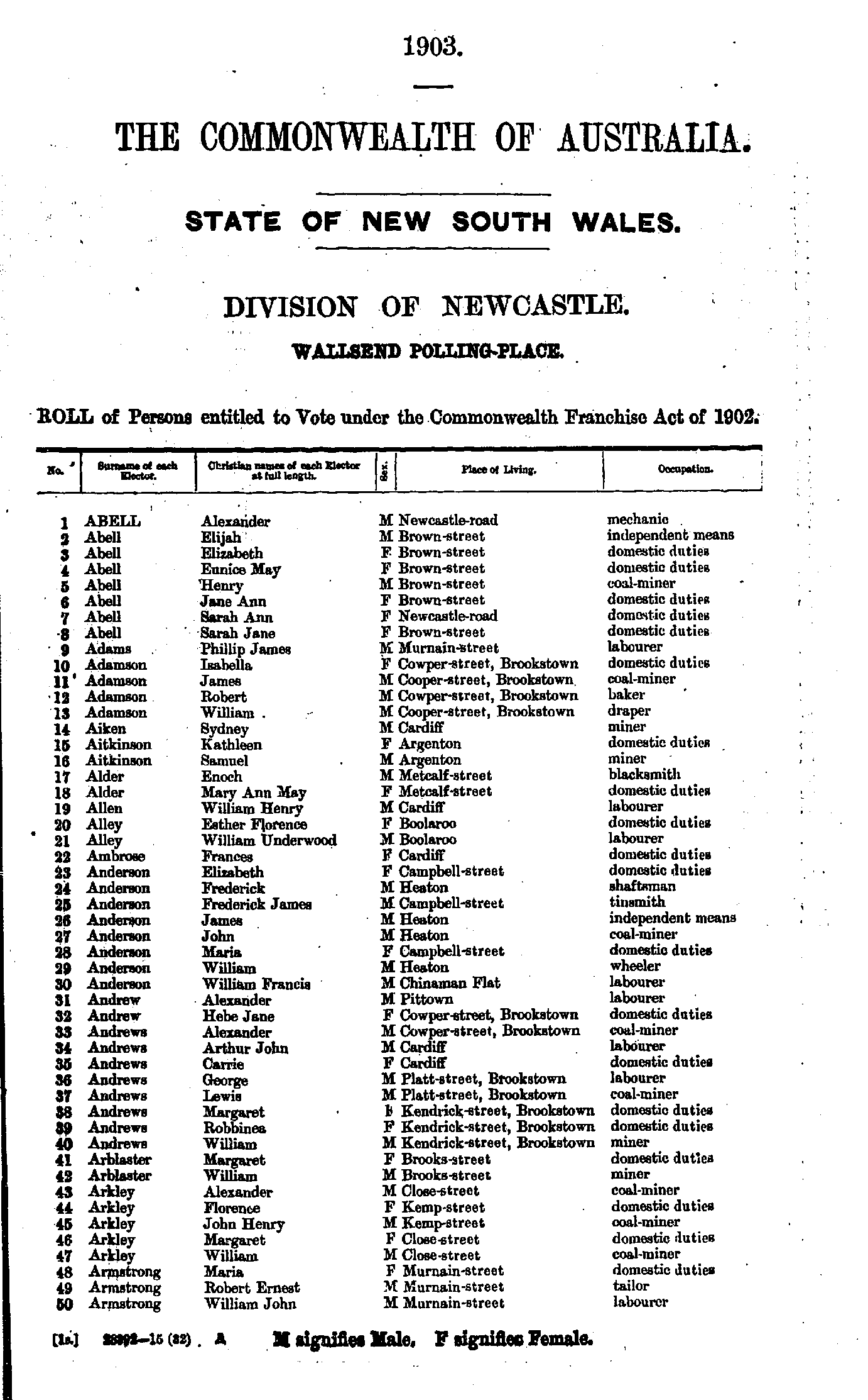
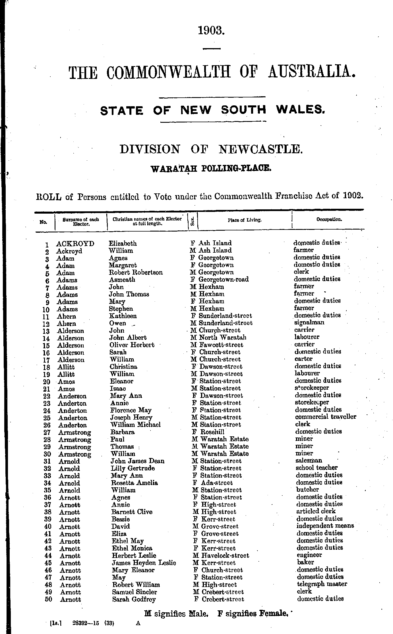
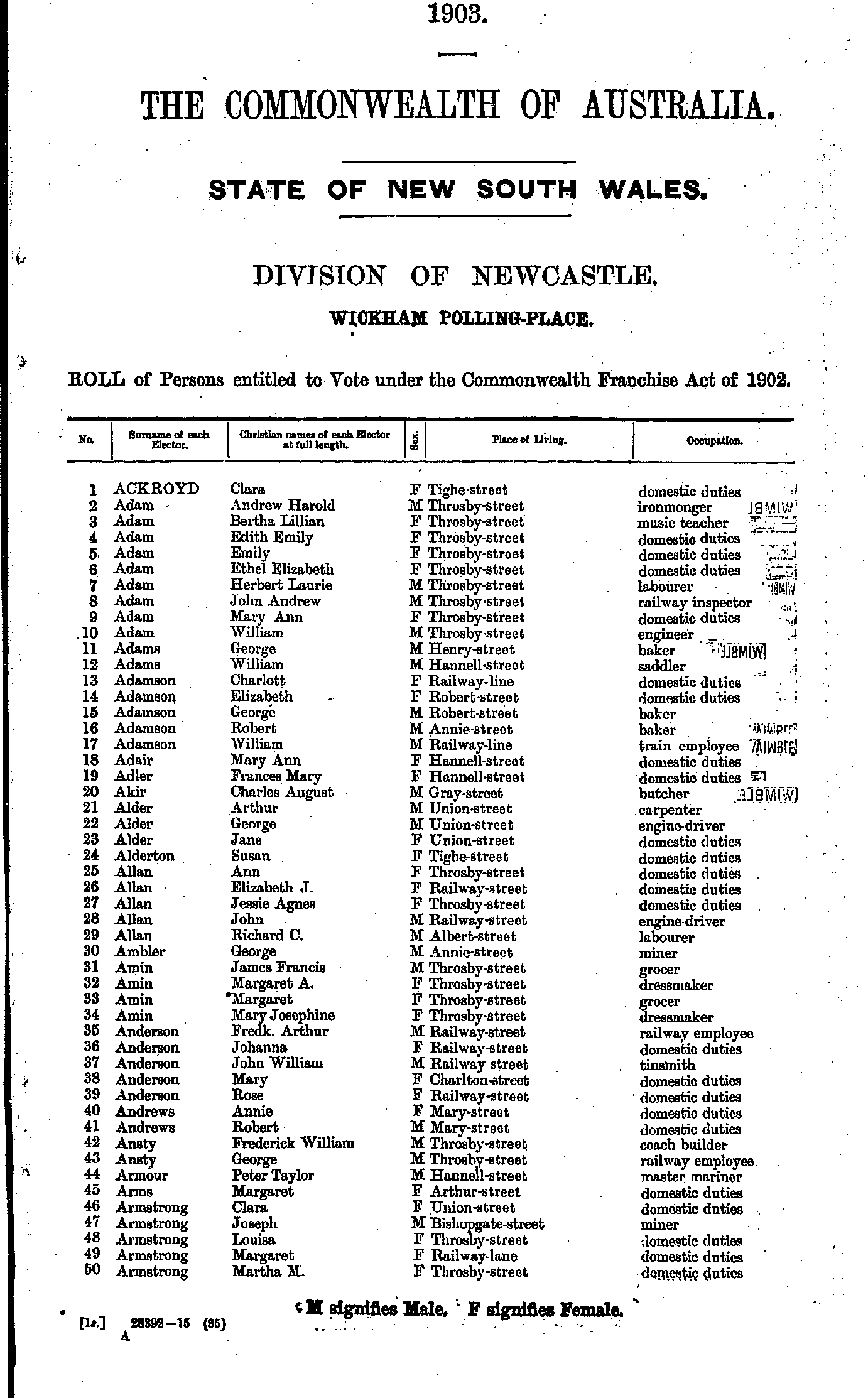
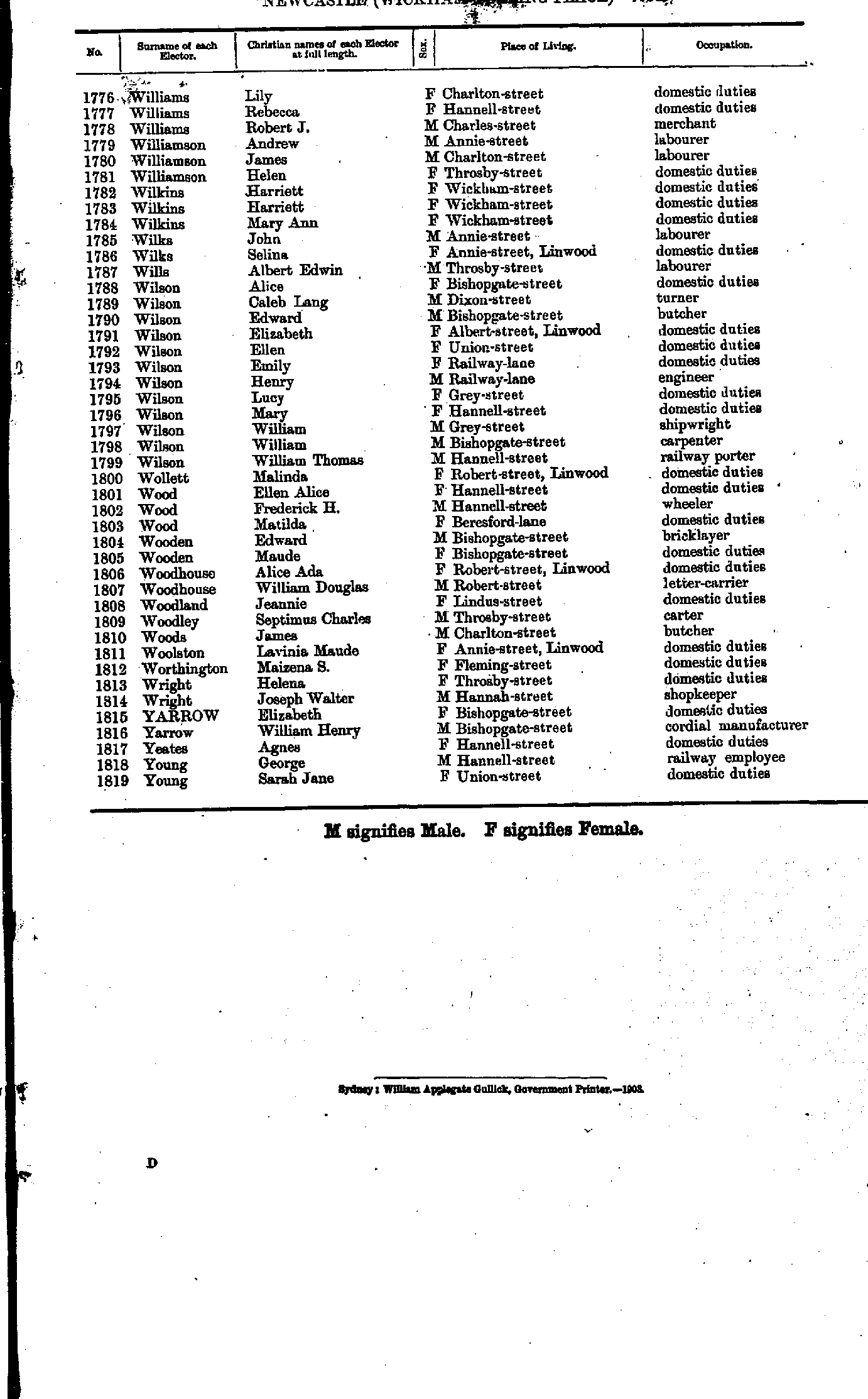
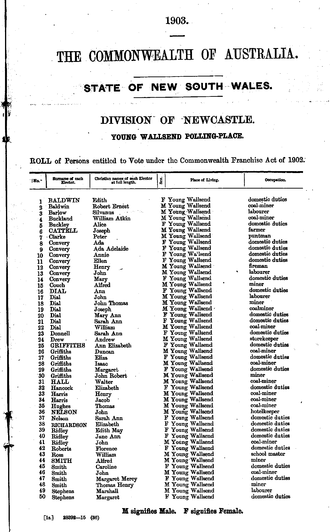
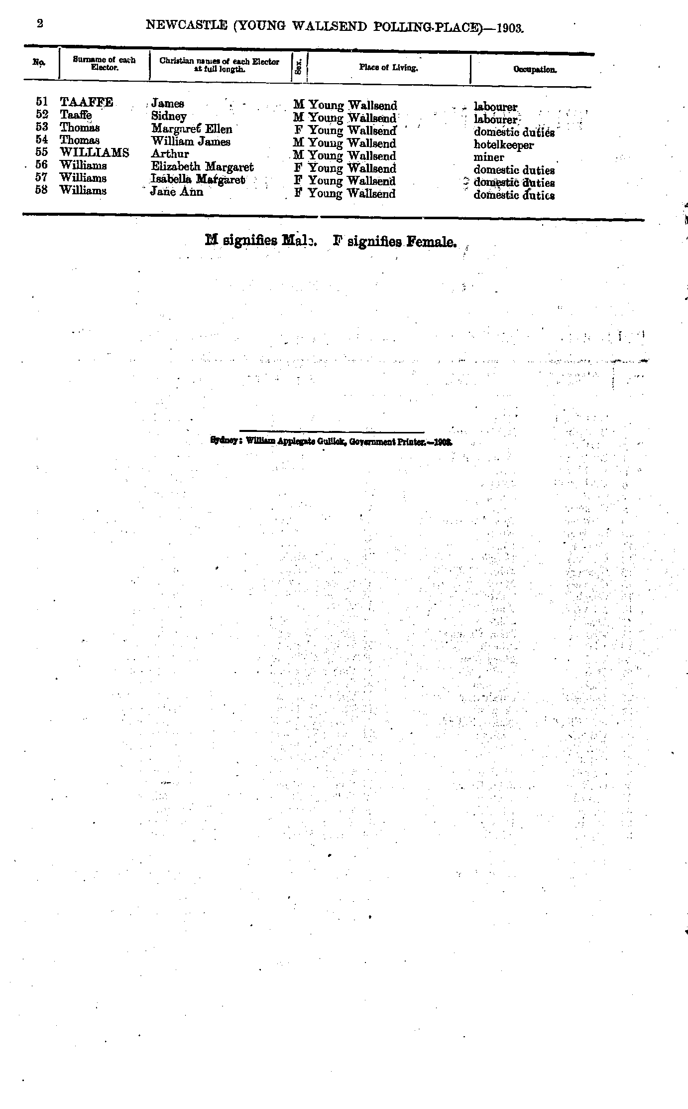
Roll of Persons entitled to Vote under the Commonwealth Franchise Act of 1902 Reproduced from microform copies of the originals in the Mitchell Library, State Library of New South Wales.
Index Copyright © Internet History Resources 2006
Electoral Maps of the Newcastle Division, 1901
Polling Places:
Adamstown | Belmont | Cardiff | Carrington | Catherine Hill Bay | Charlestown | Cockle Creek | Dora Creek | Dudley | Fullerton Cove | Hamilton | Hexham | Honeysuckle Point | Islington | Jesmond | Lambton | Merewether | Minmi | Mosquito Island | Newcastle City | Newcastle West | New Lambton | Plattsburg | Smedmore | Stockton | Swansea | Teralba | The Junction | Tighe’s Hill | Toronto | Wallsend | Waratah | West Wallsend | Wickham | Young Wallsend
- Abel William - Antcliffe Lily
- Argyle Charles - Barker Sarah
- Barnes John - Birt James
- Birt Joseph - Brown Frances
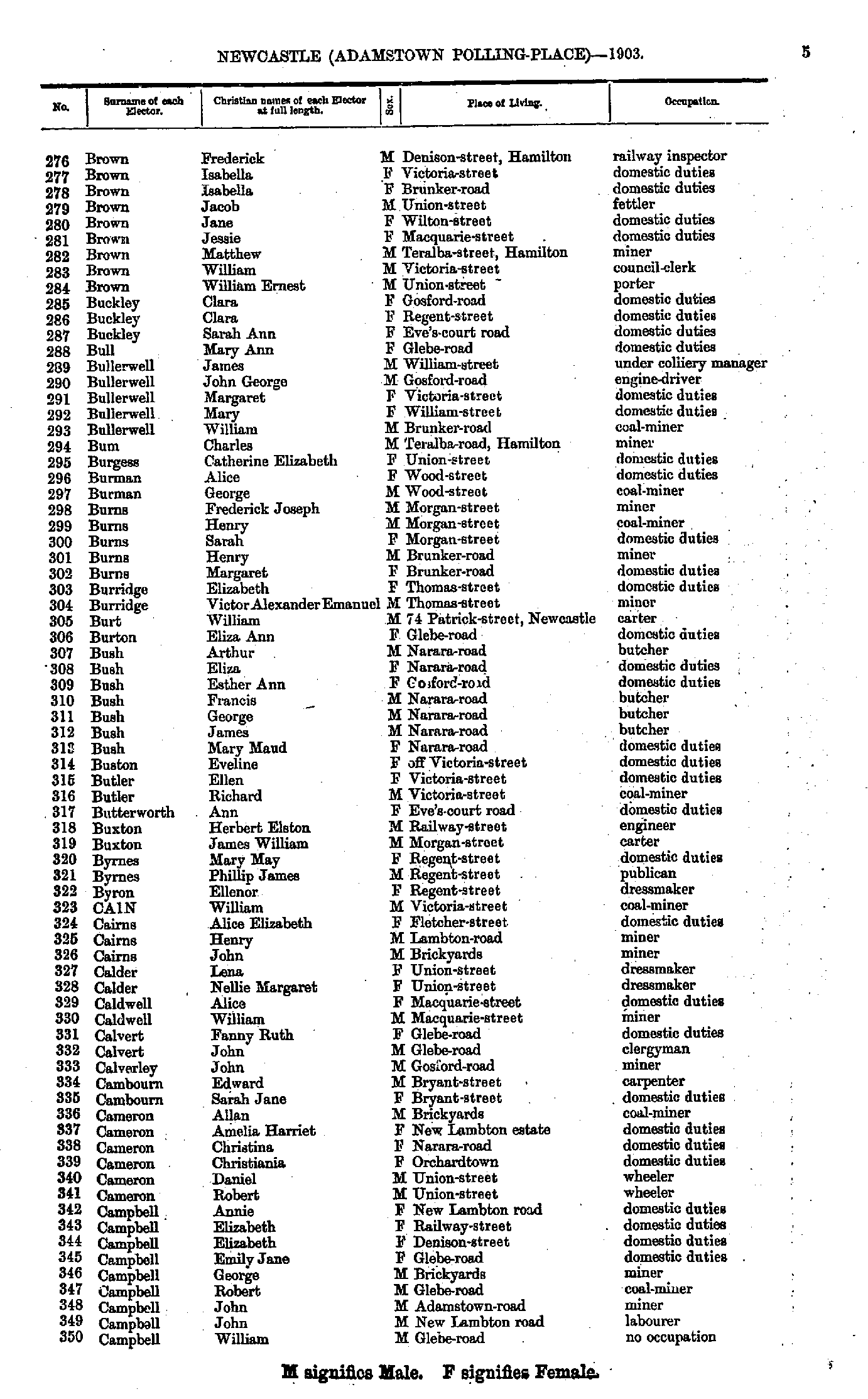
- Brown Frederick - Campbell William
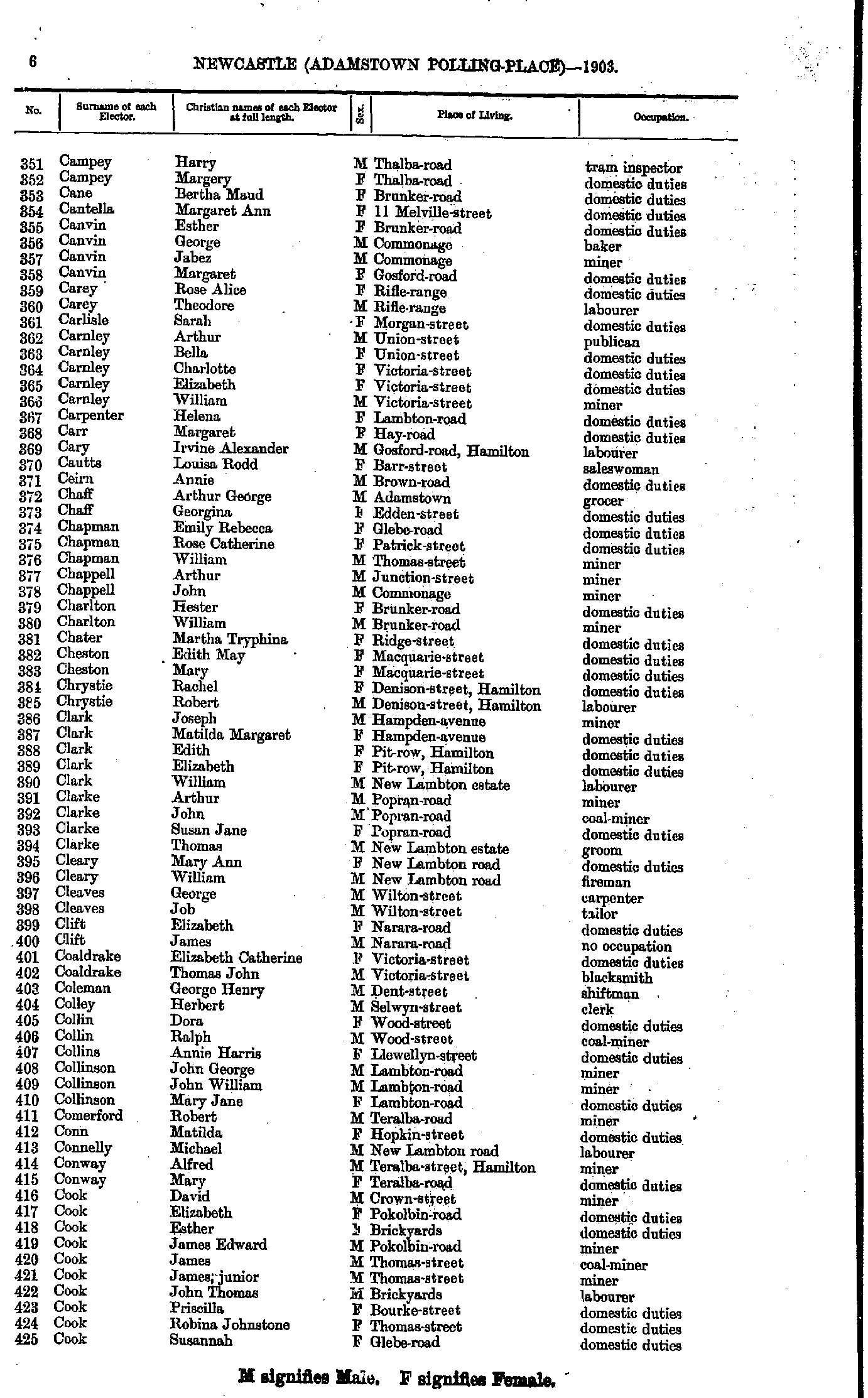
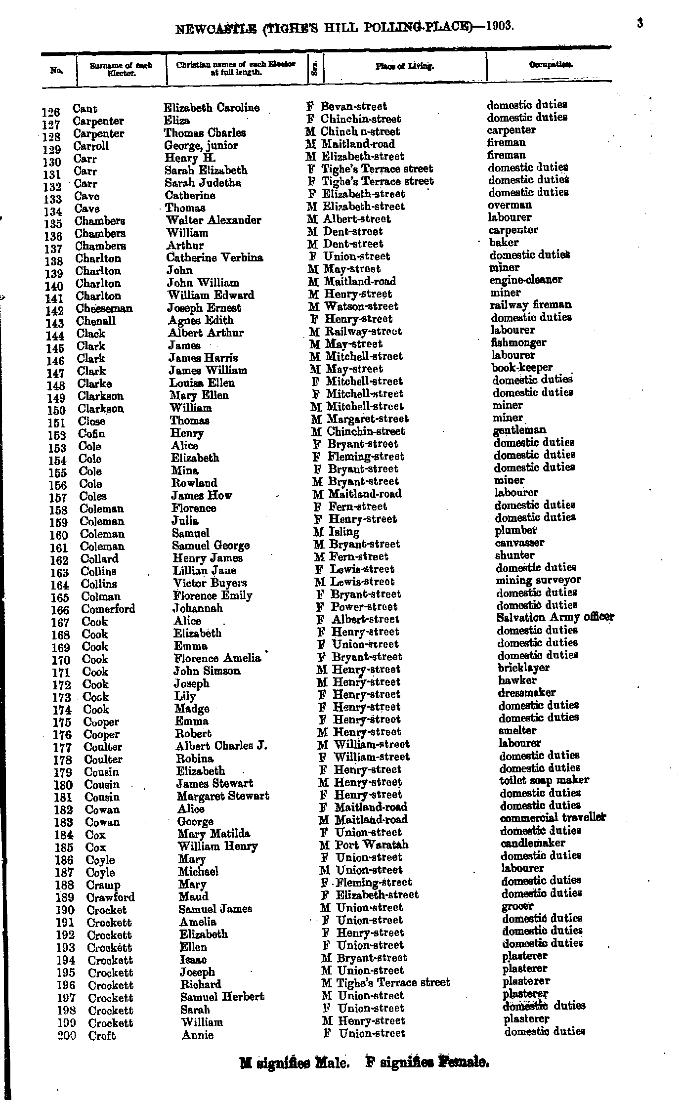
- Campey Harry - Cook Susannah
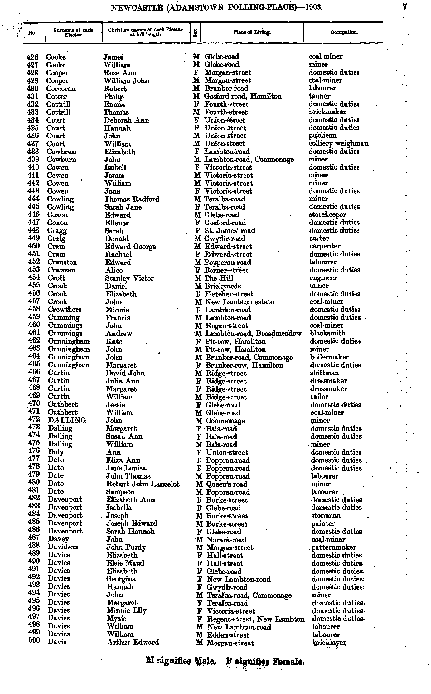
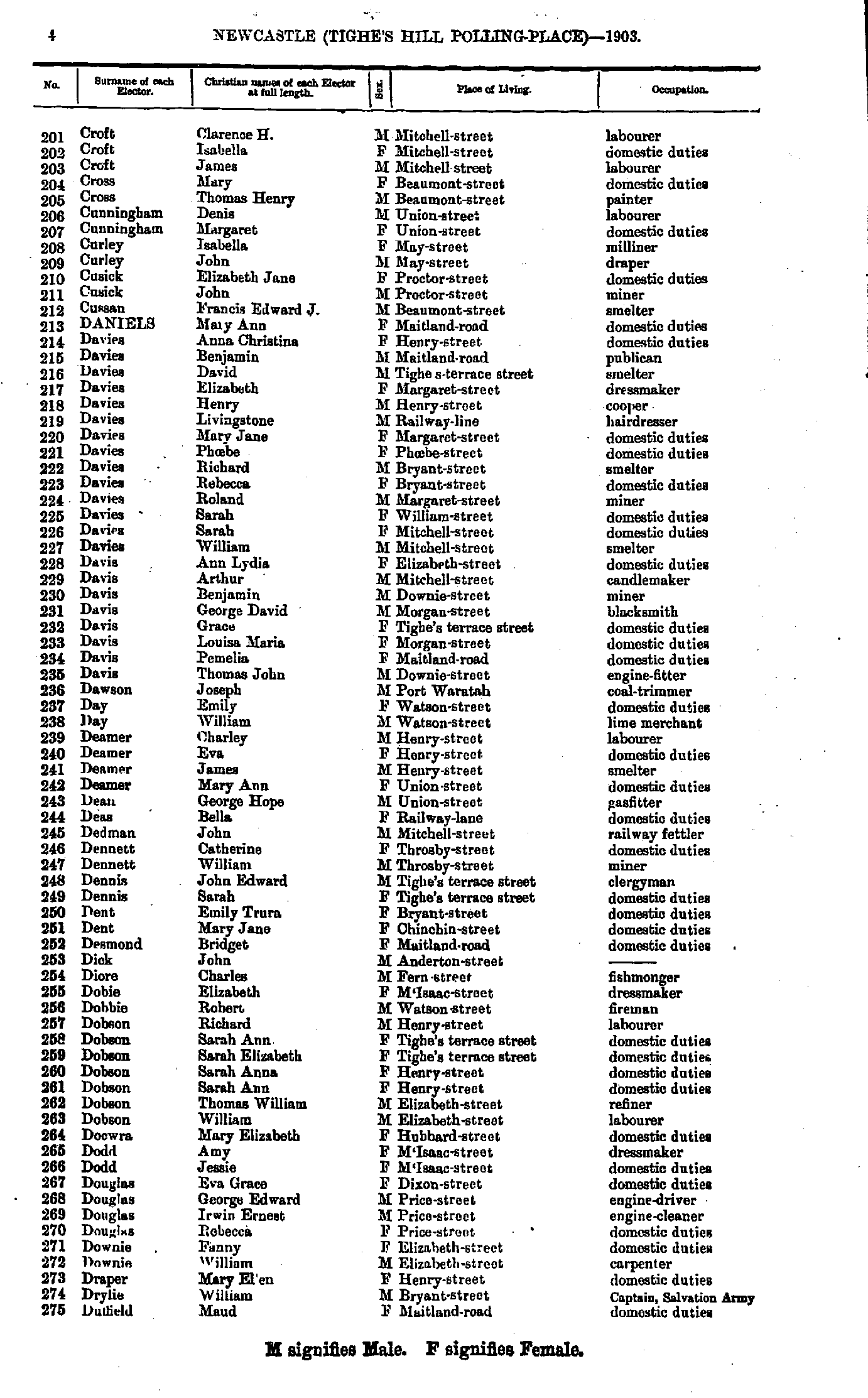
- Cooke James - Davis Arthur
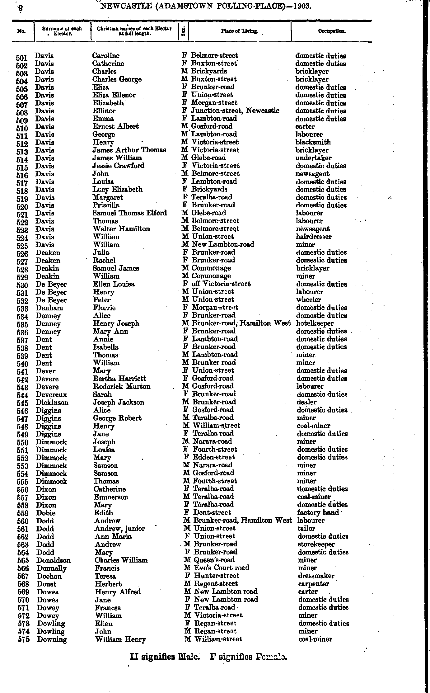
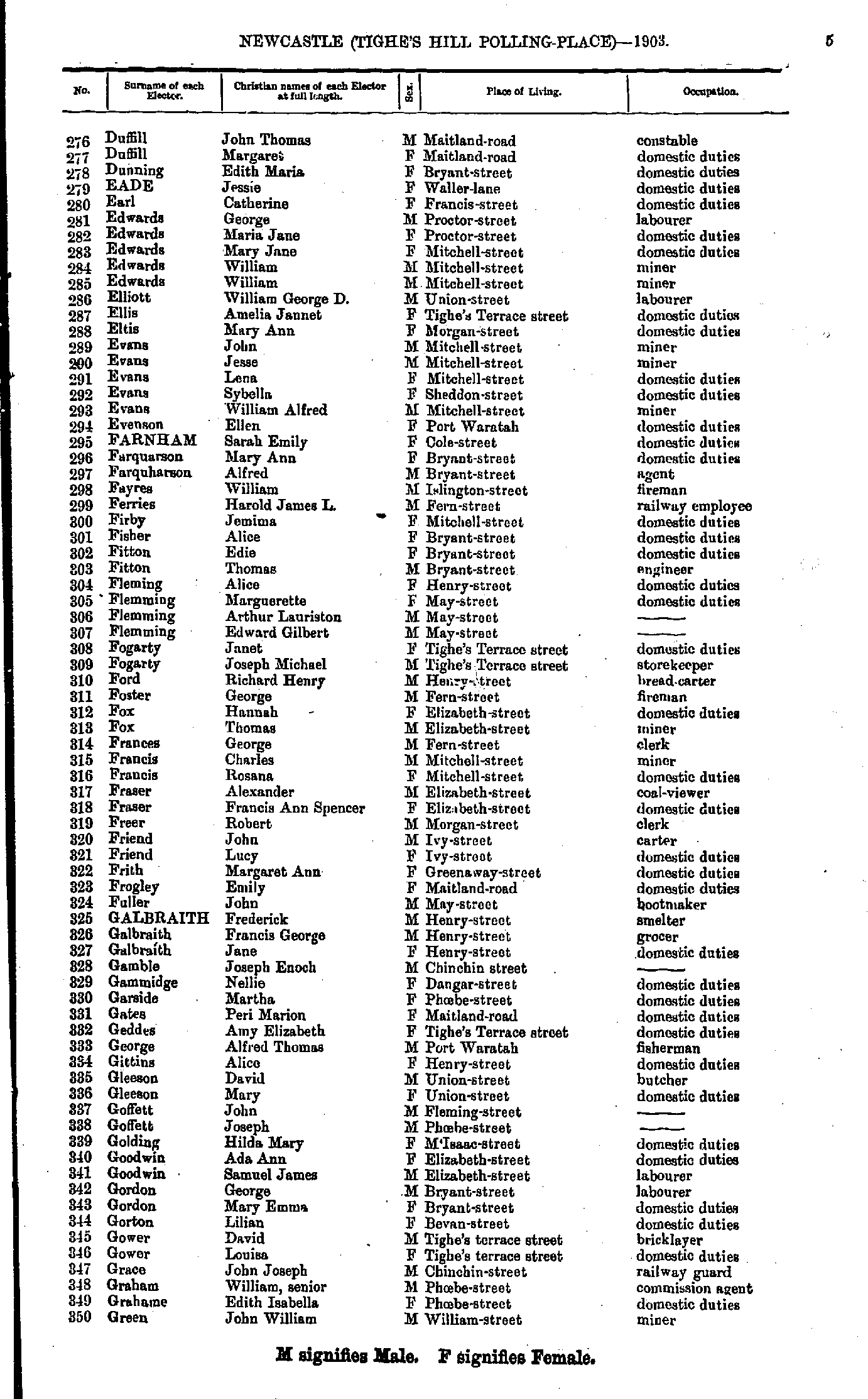
- Davis Caroline - Downing William
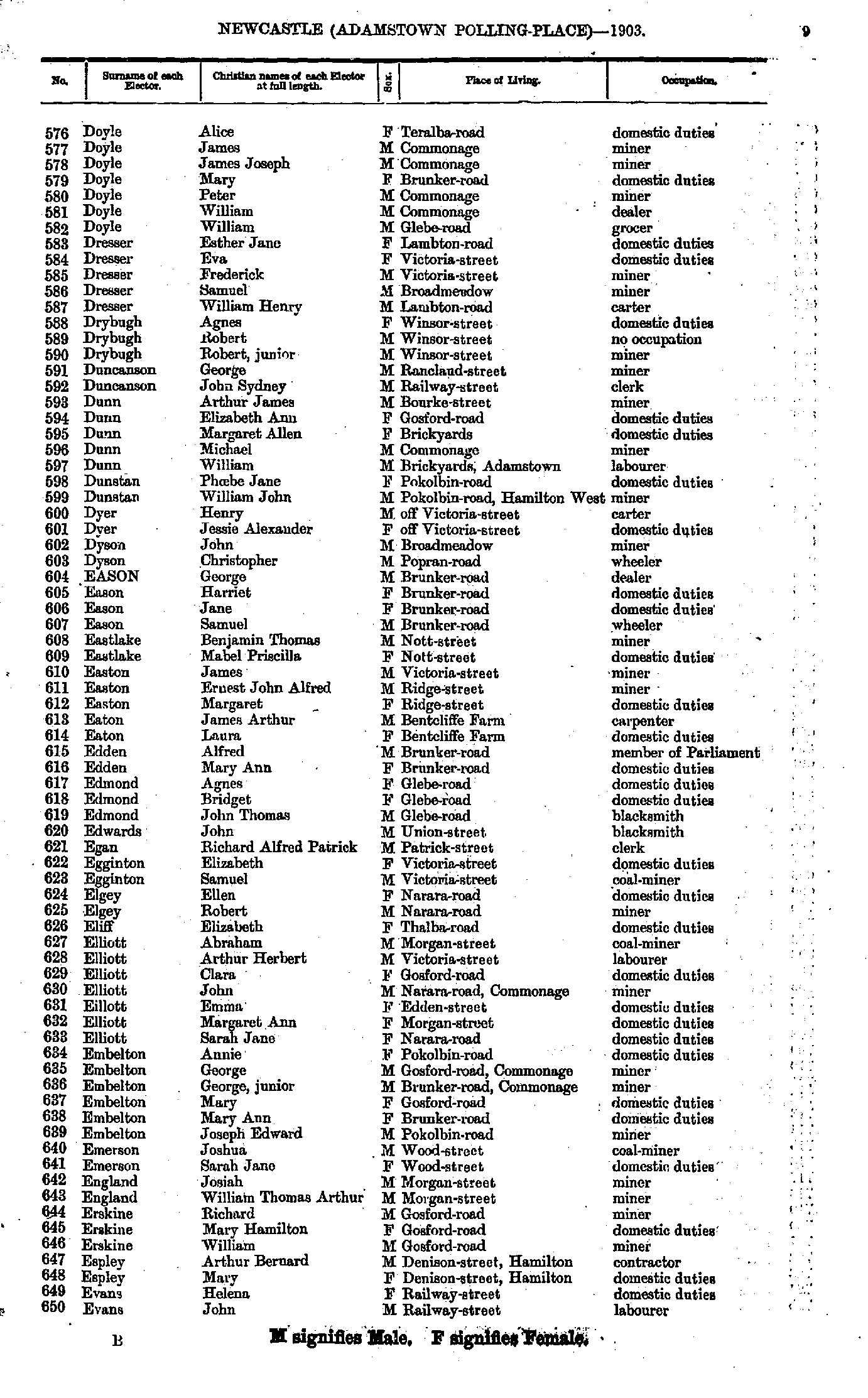
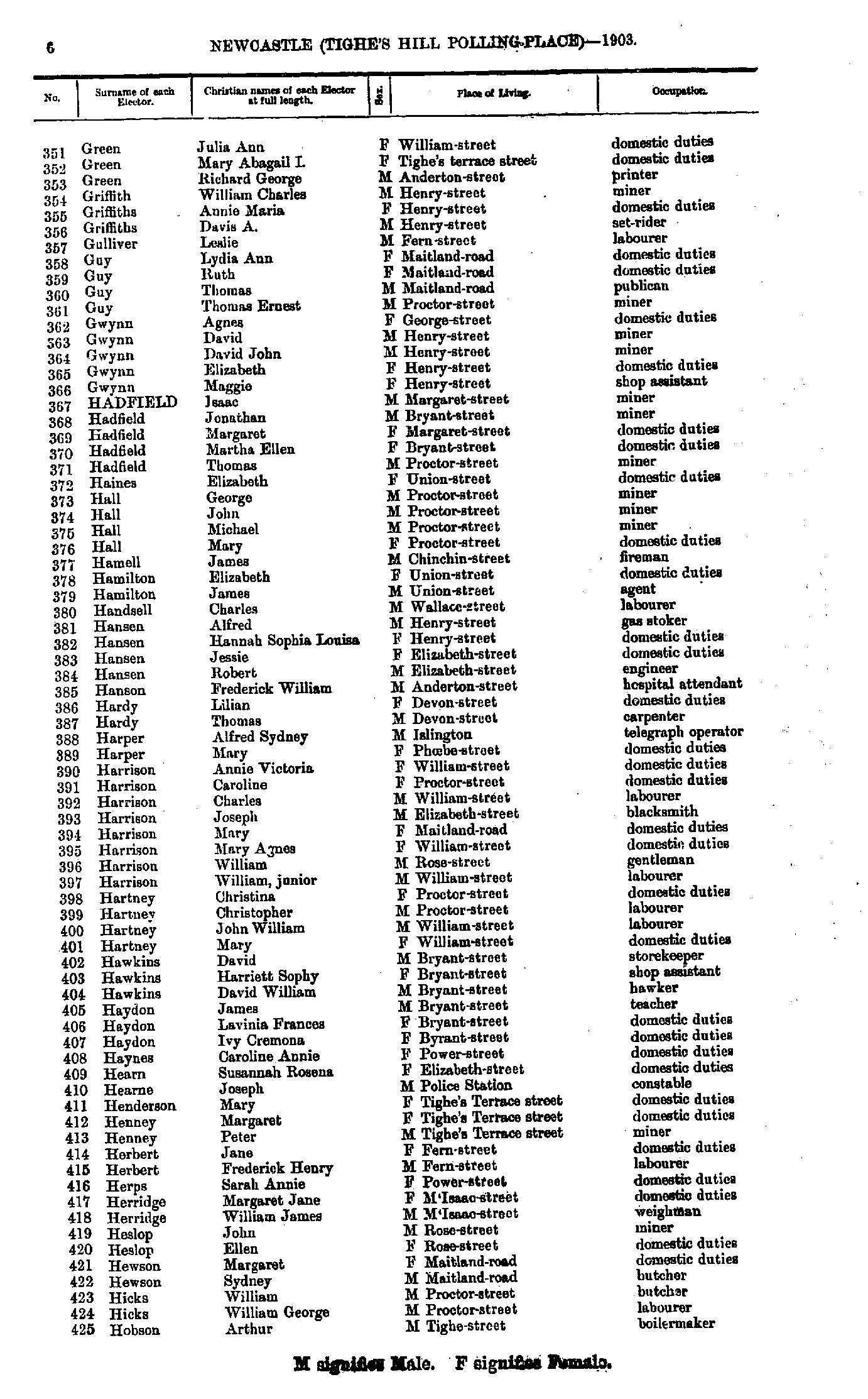
- Doyle Alice - Evans John
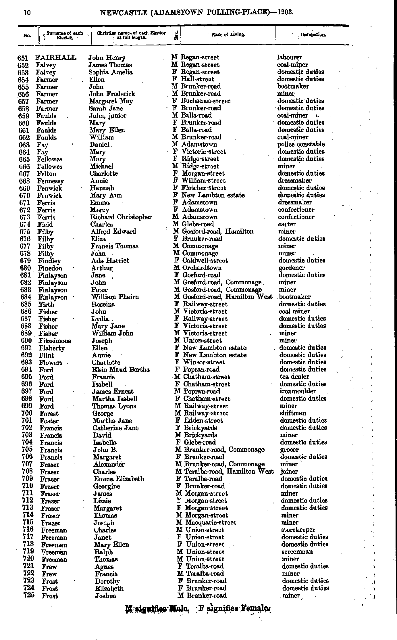
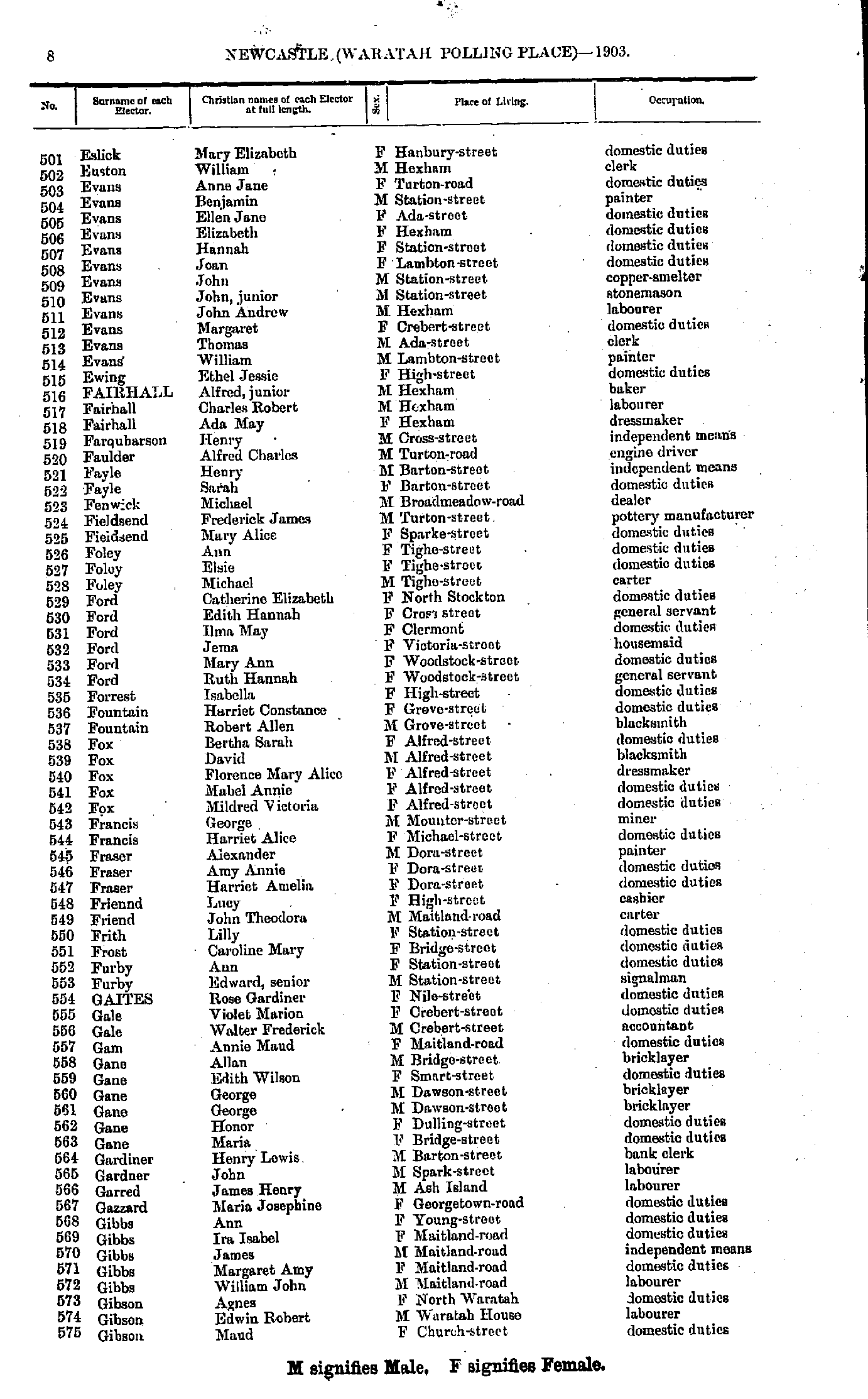
- Fairhall John - Frost Joshua
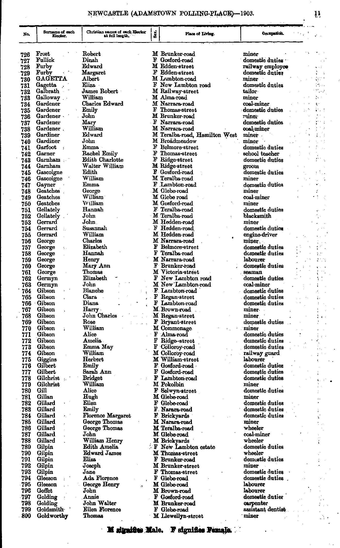
- Frost Robert - Goldworthy Thomas
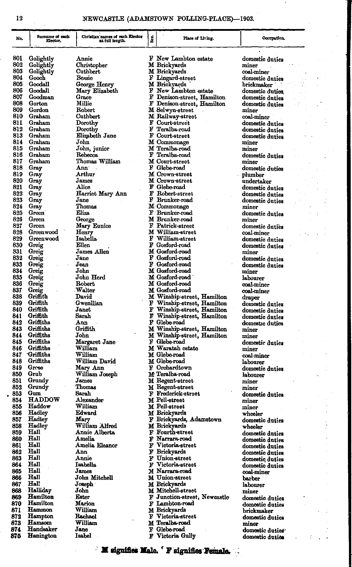
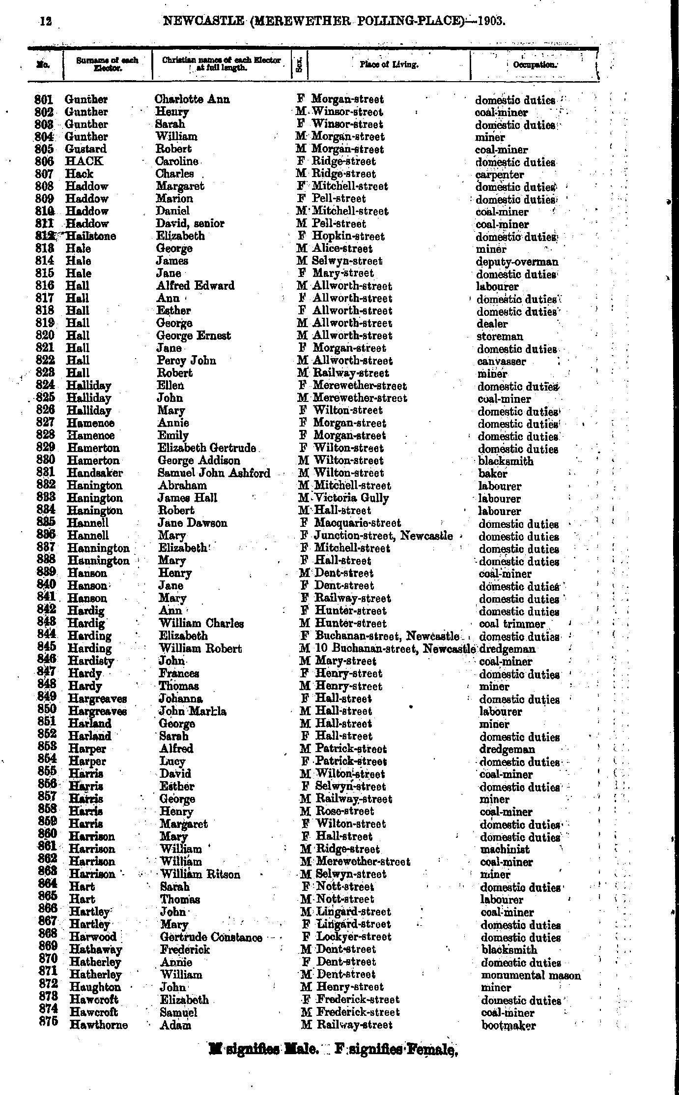
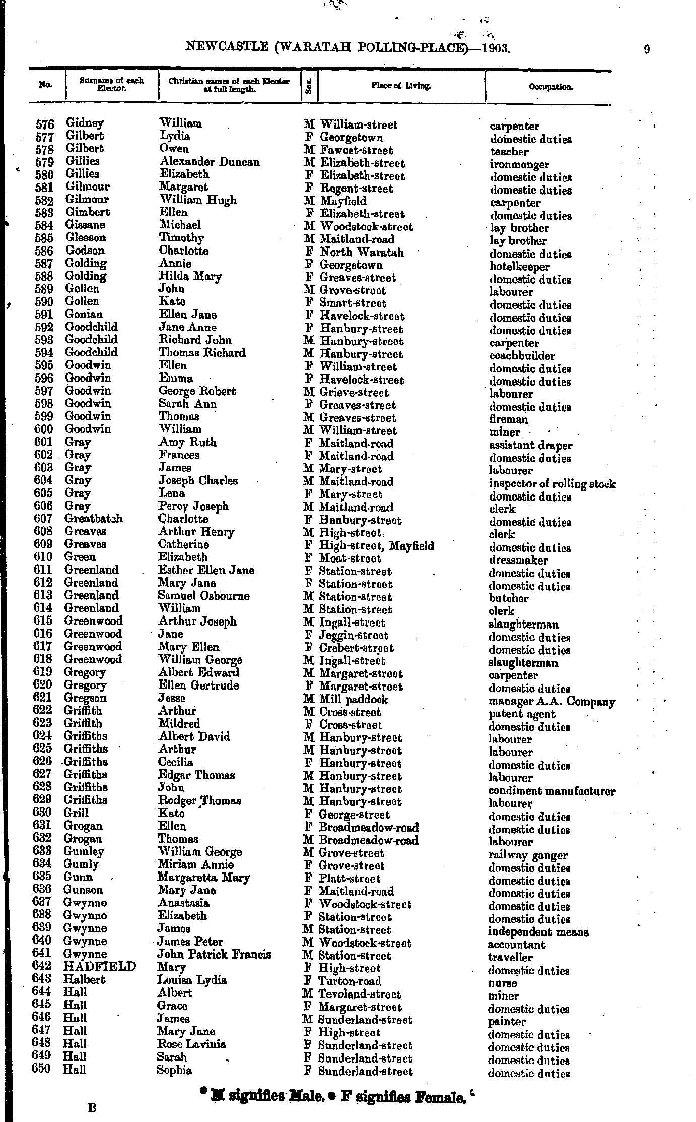
- Golightly Annie - Hanington Isabel
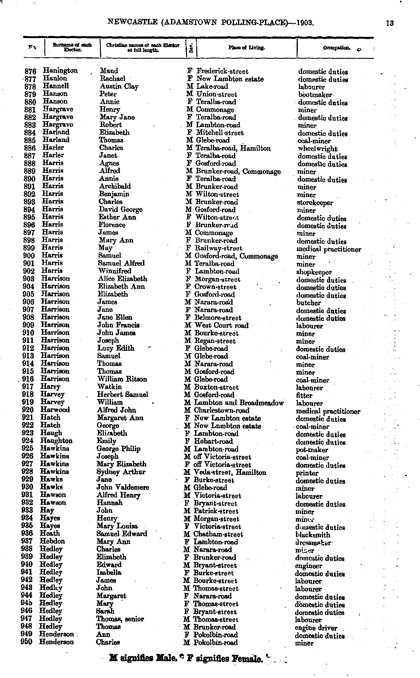
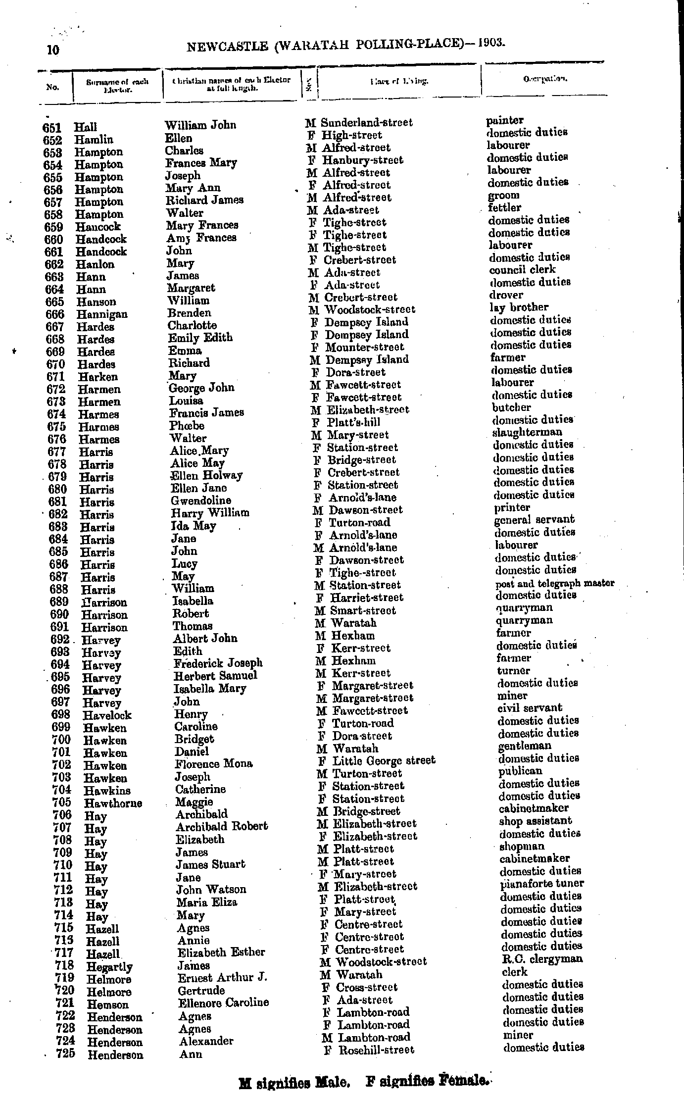
- Hanington Maud - Henderson Charles
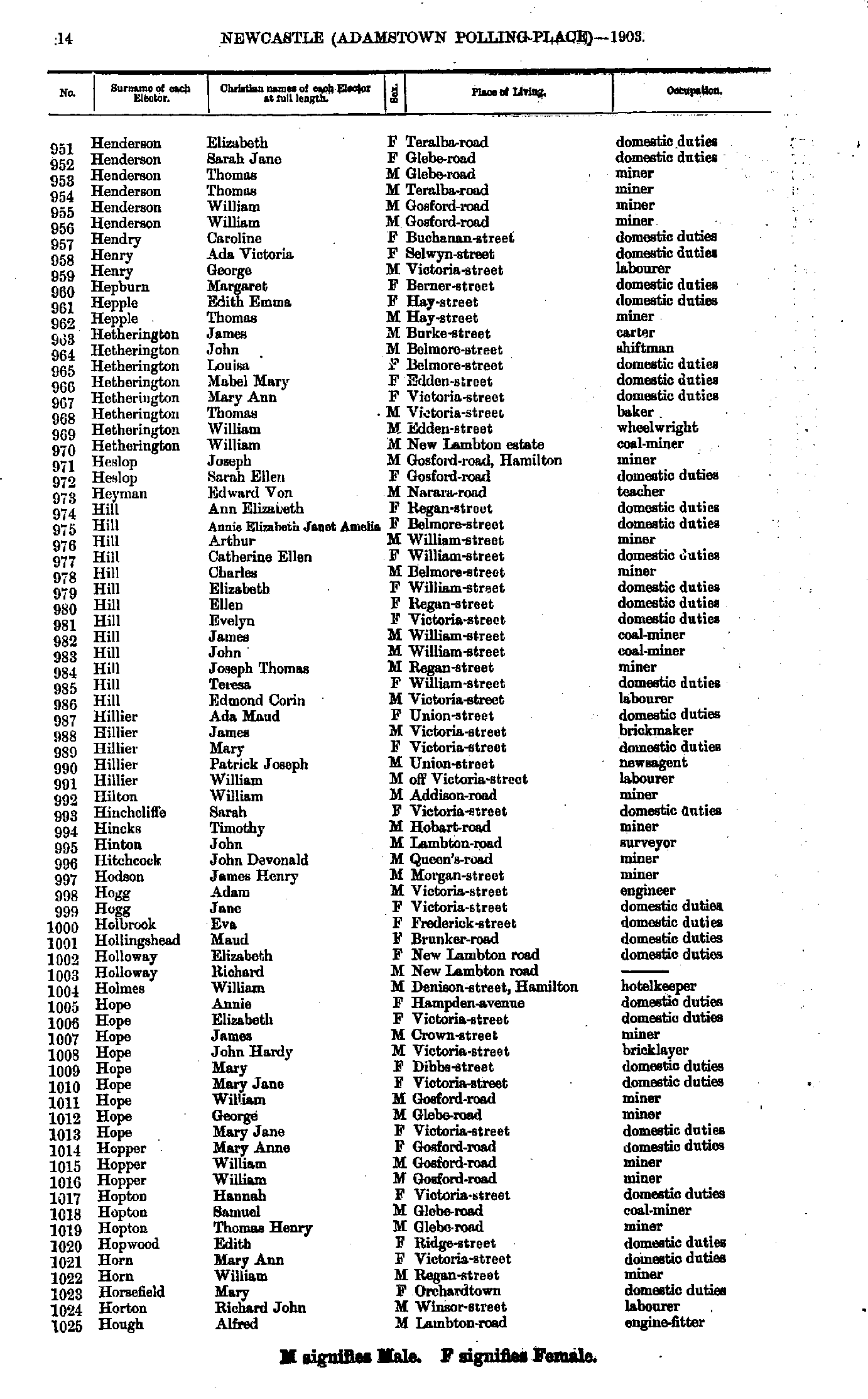
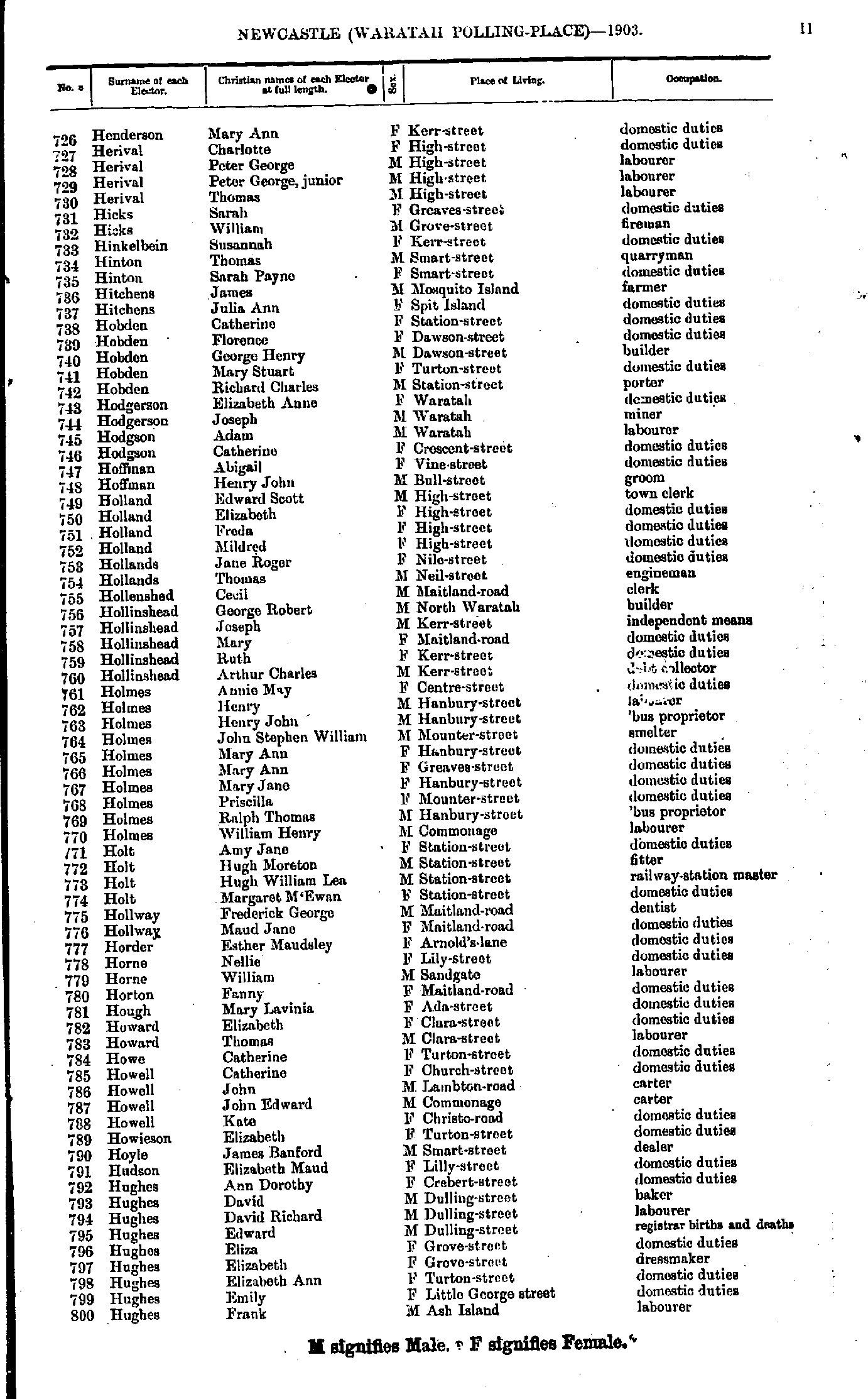
- Henderson Elizabeth - Hough Alfred
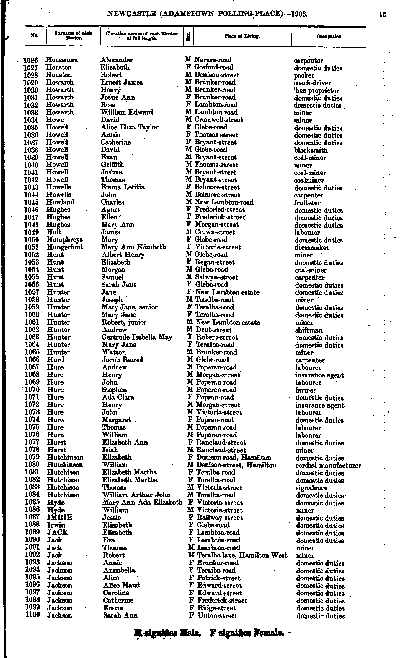
- Houseman Alexander - Jackson Sarah
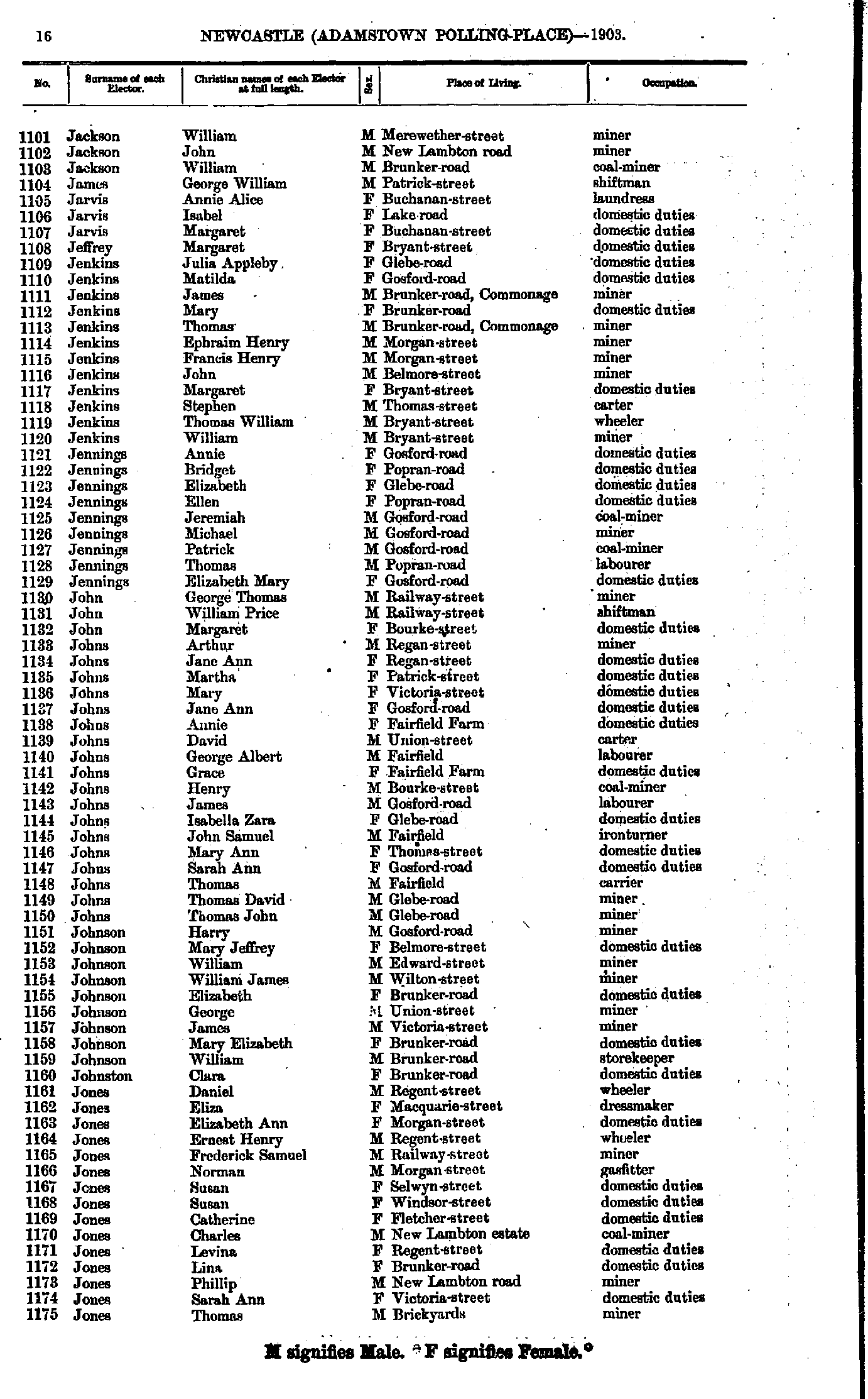
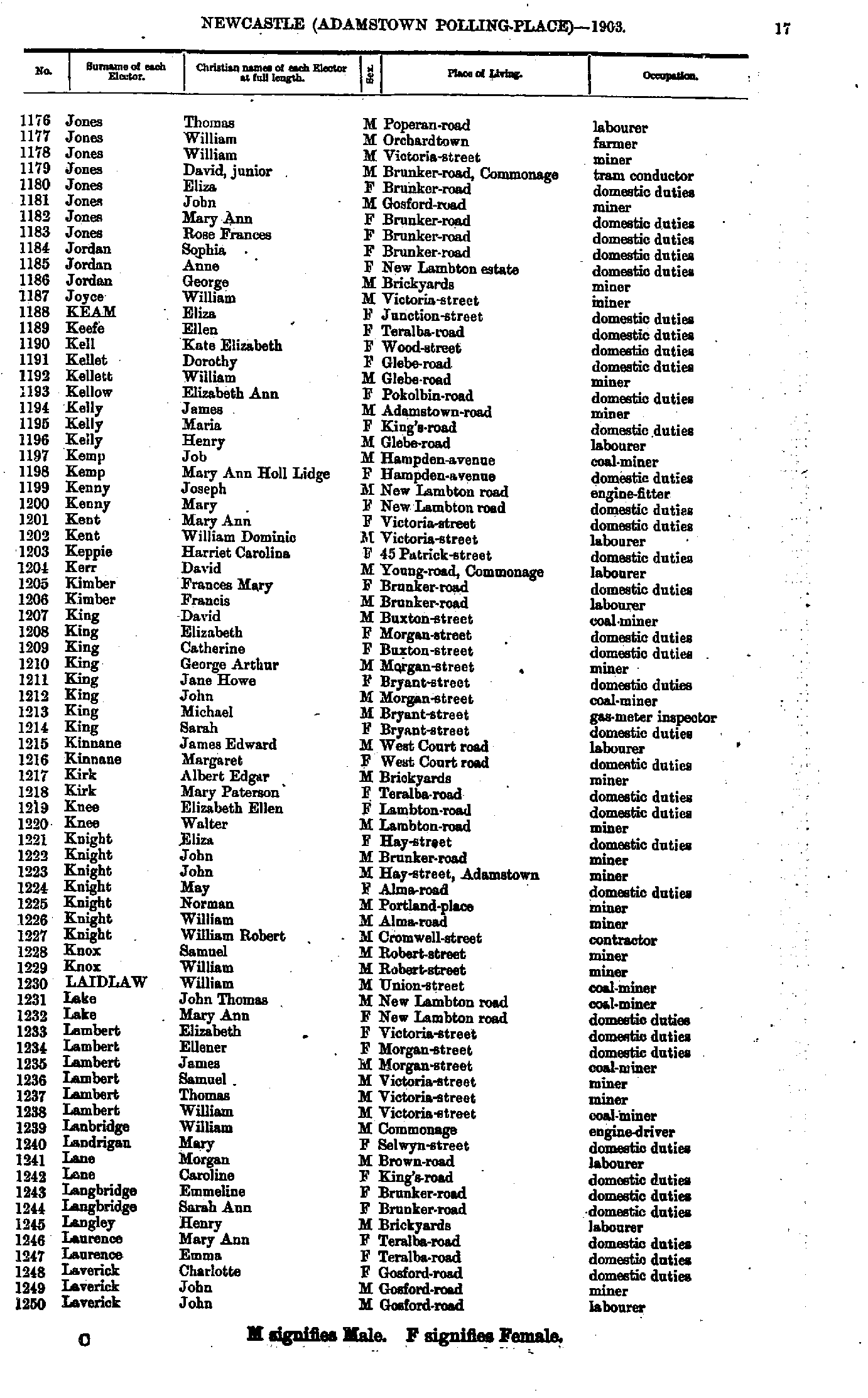
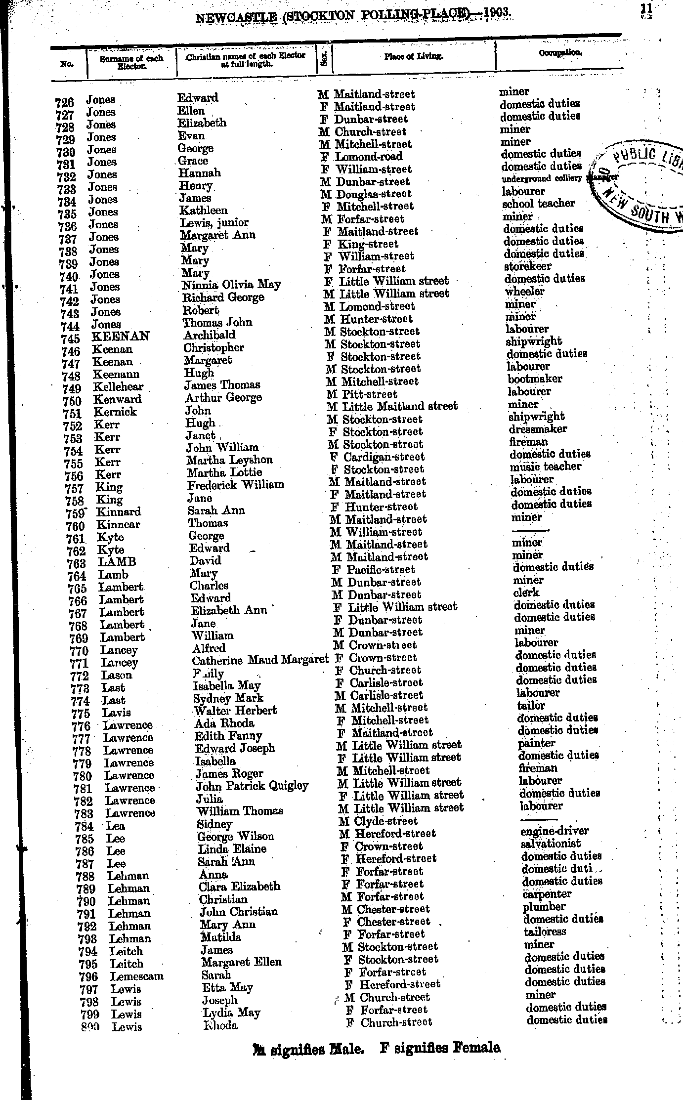
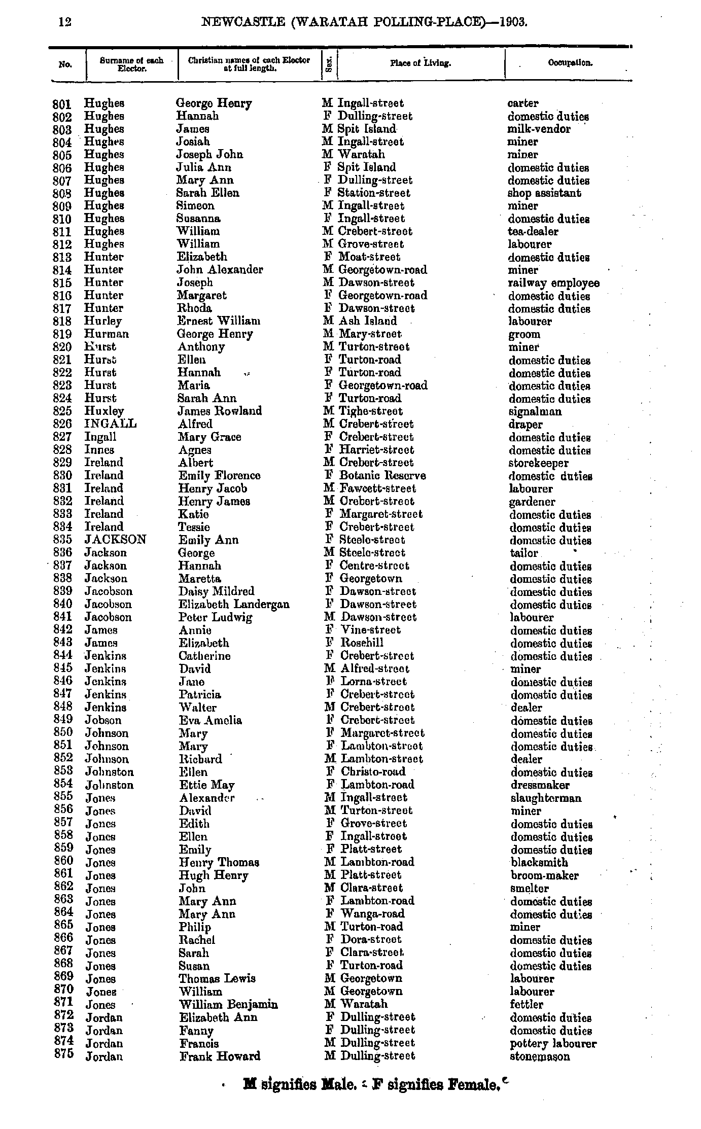
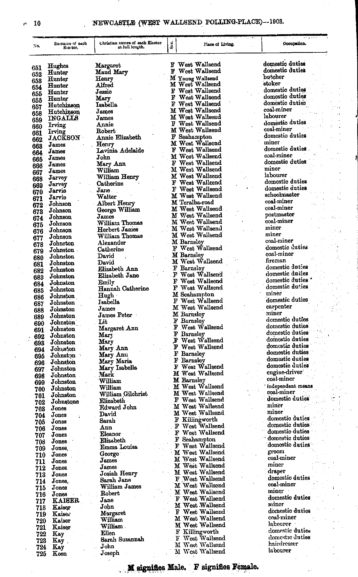
- Jackson William - Jones Thomas
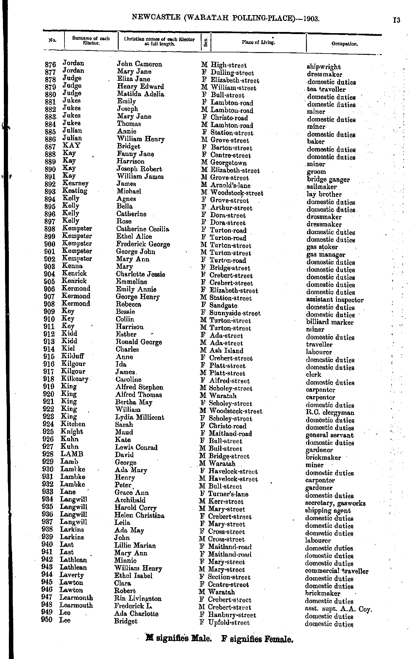
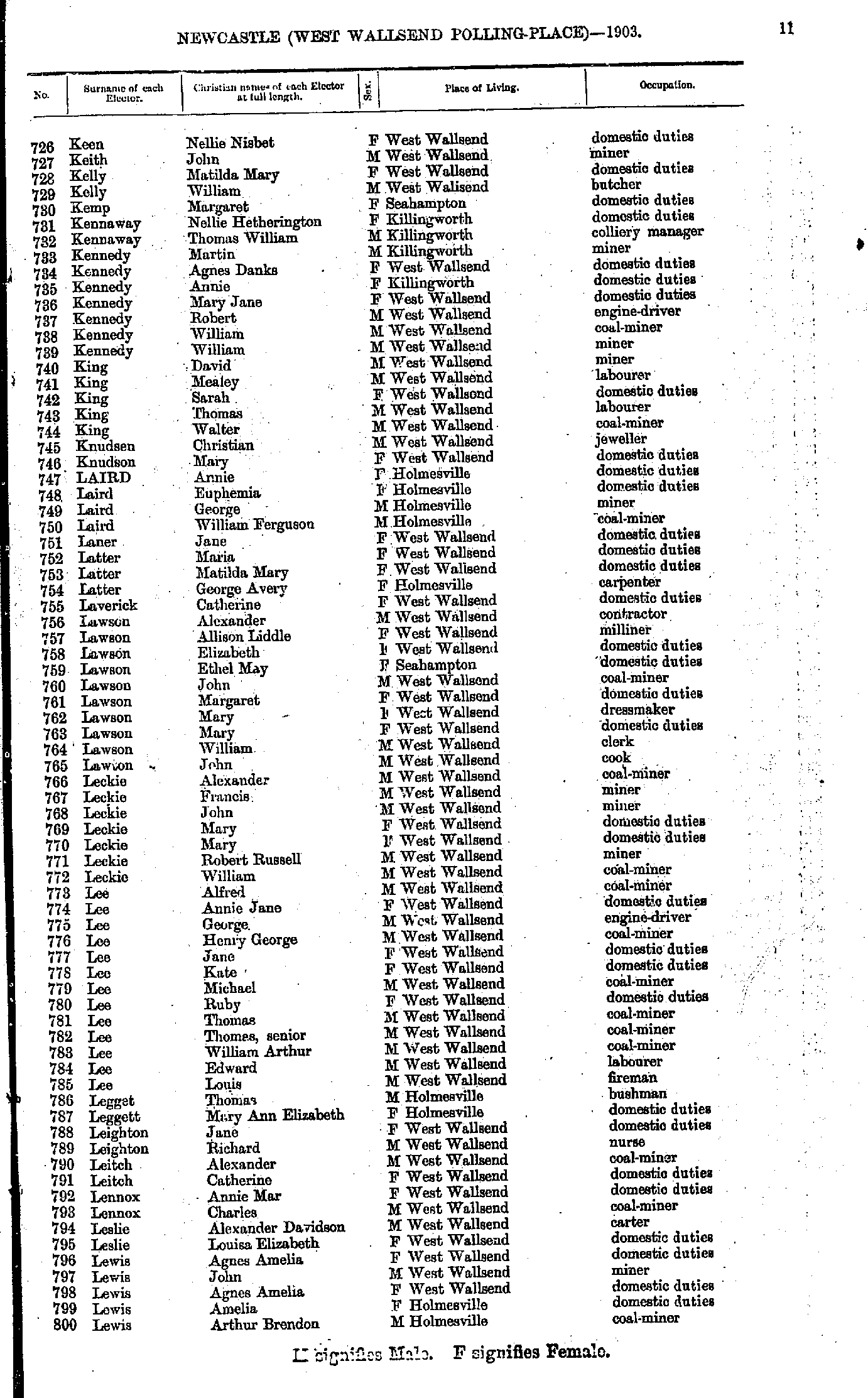
- Jones Thomas - Laverick John
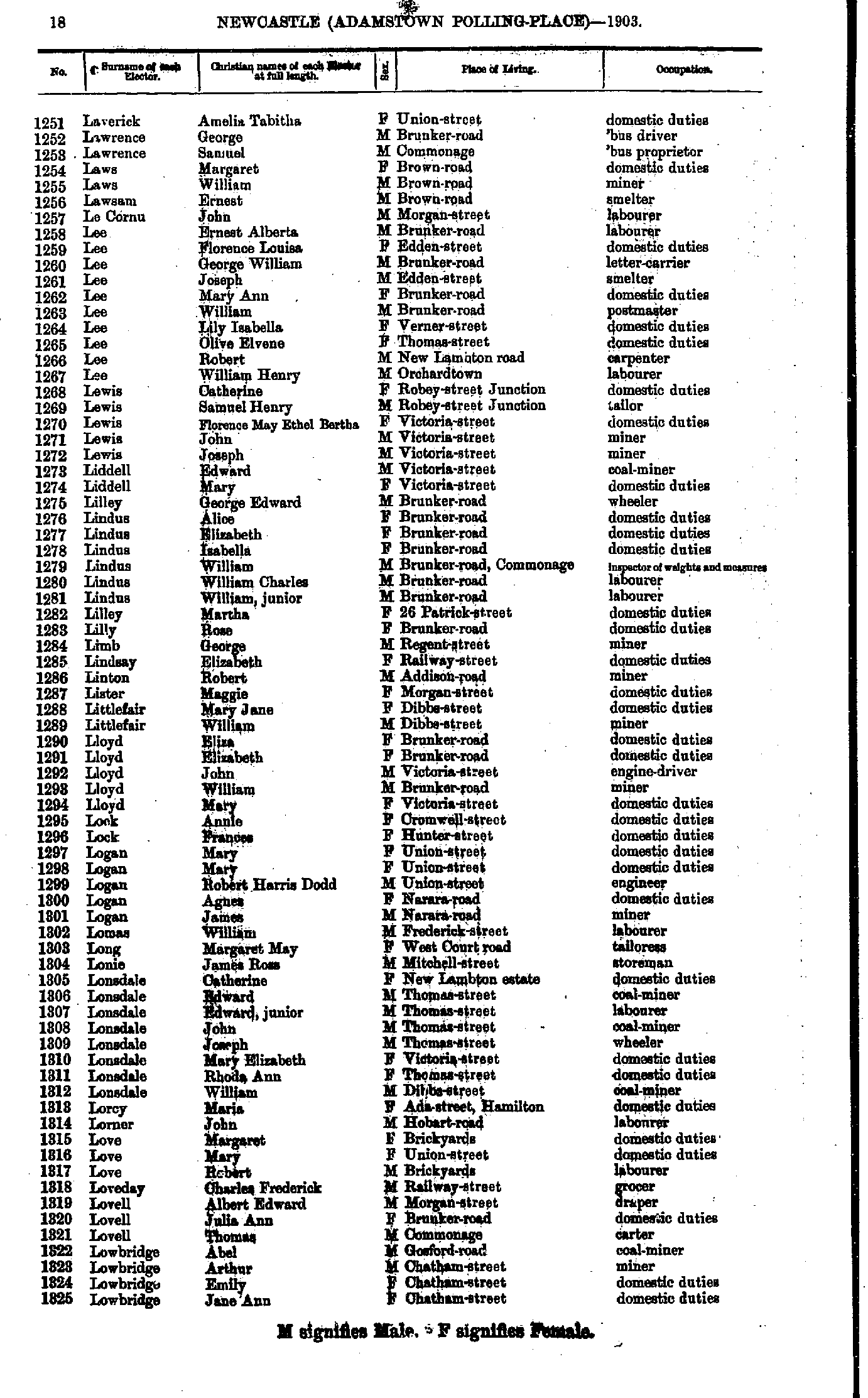
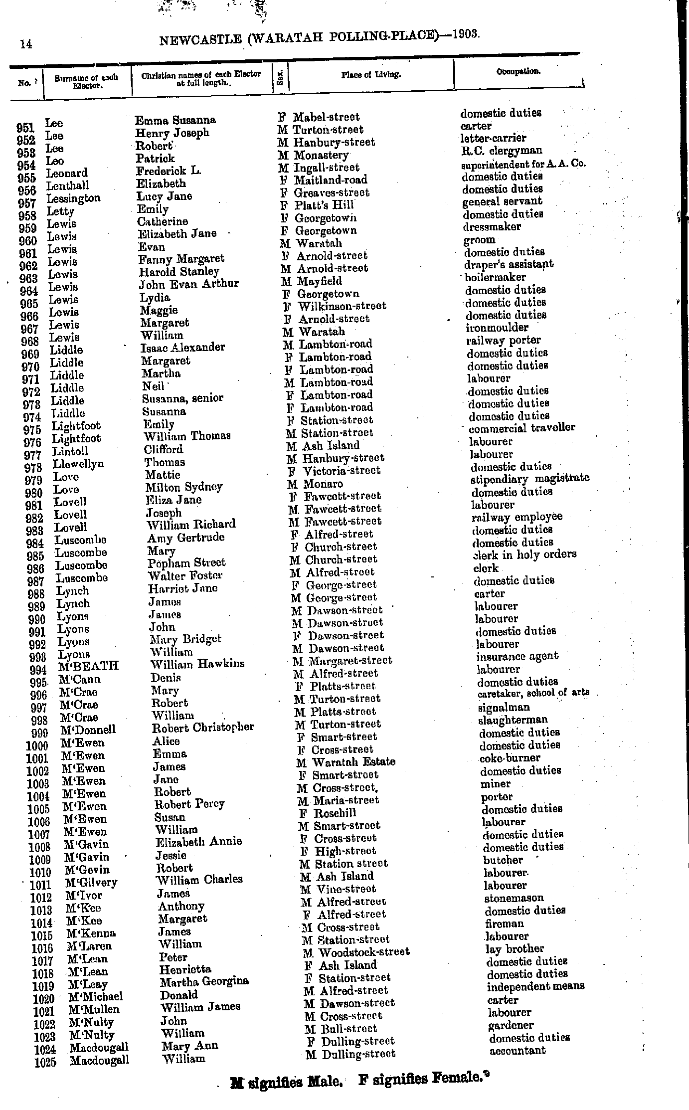
- Laverick Amelia - Lowbridge Jane
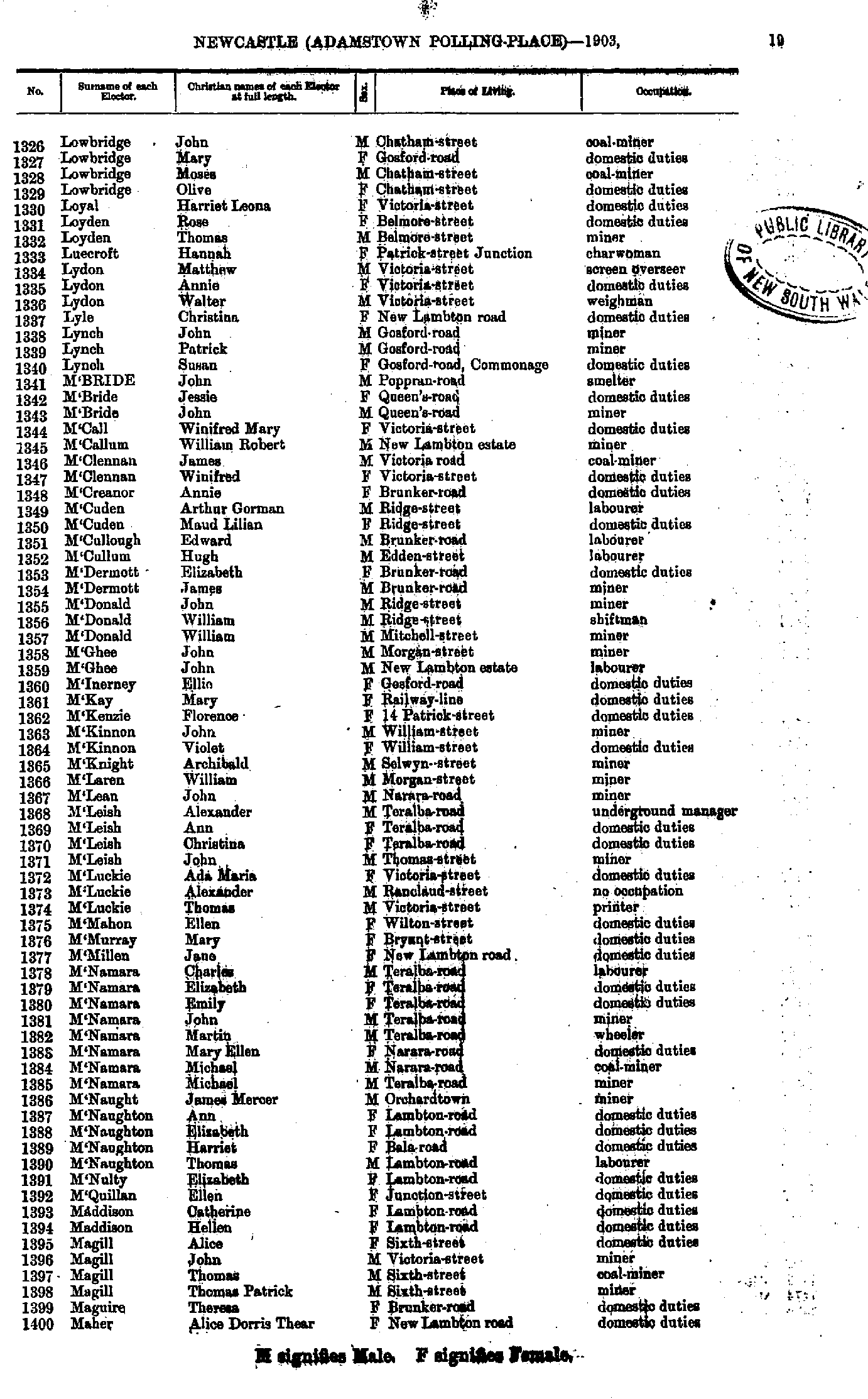
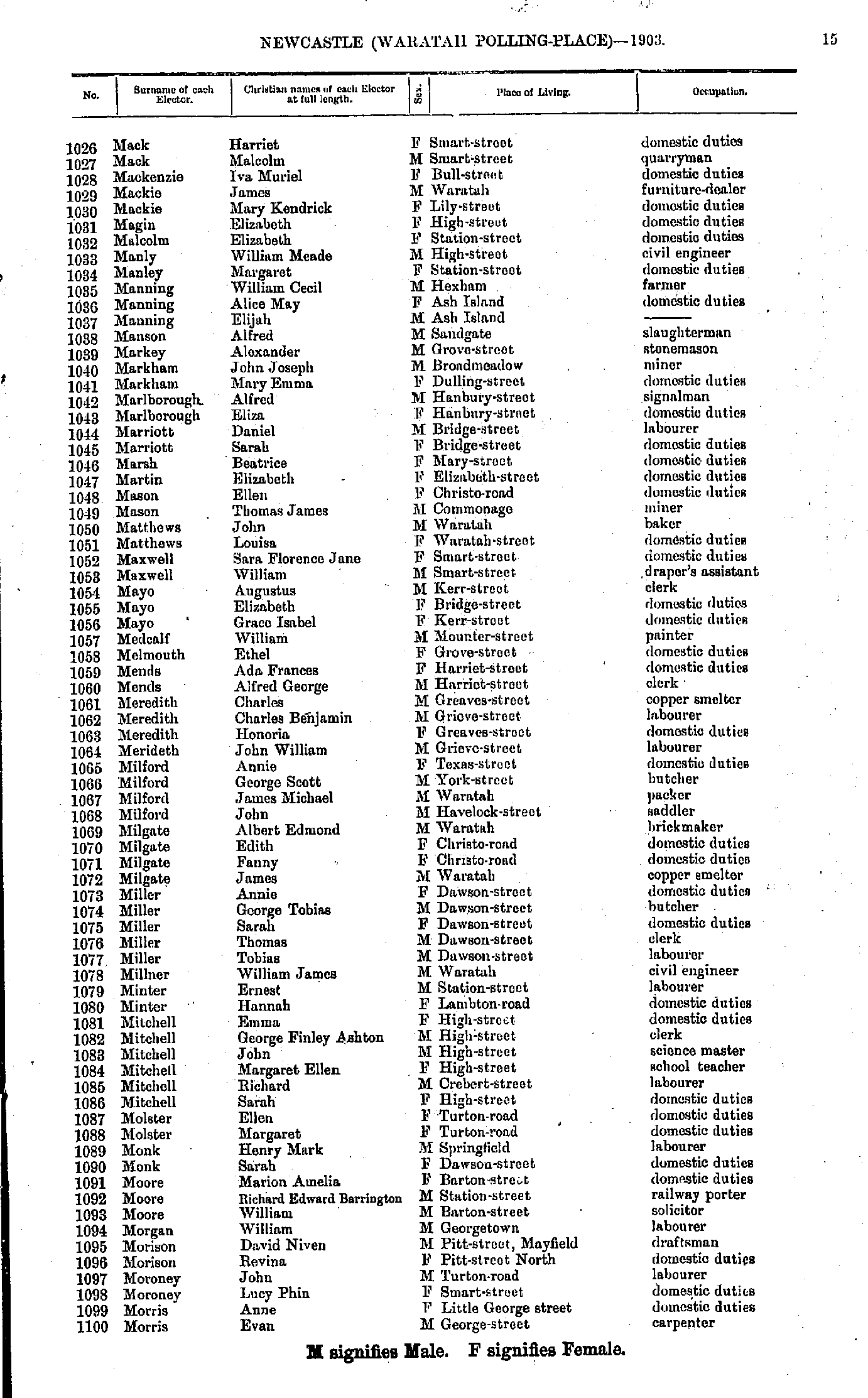
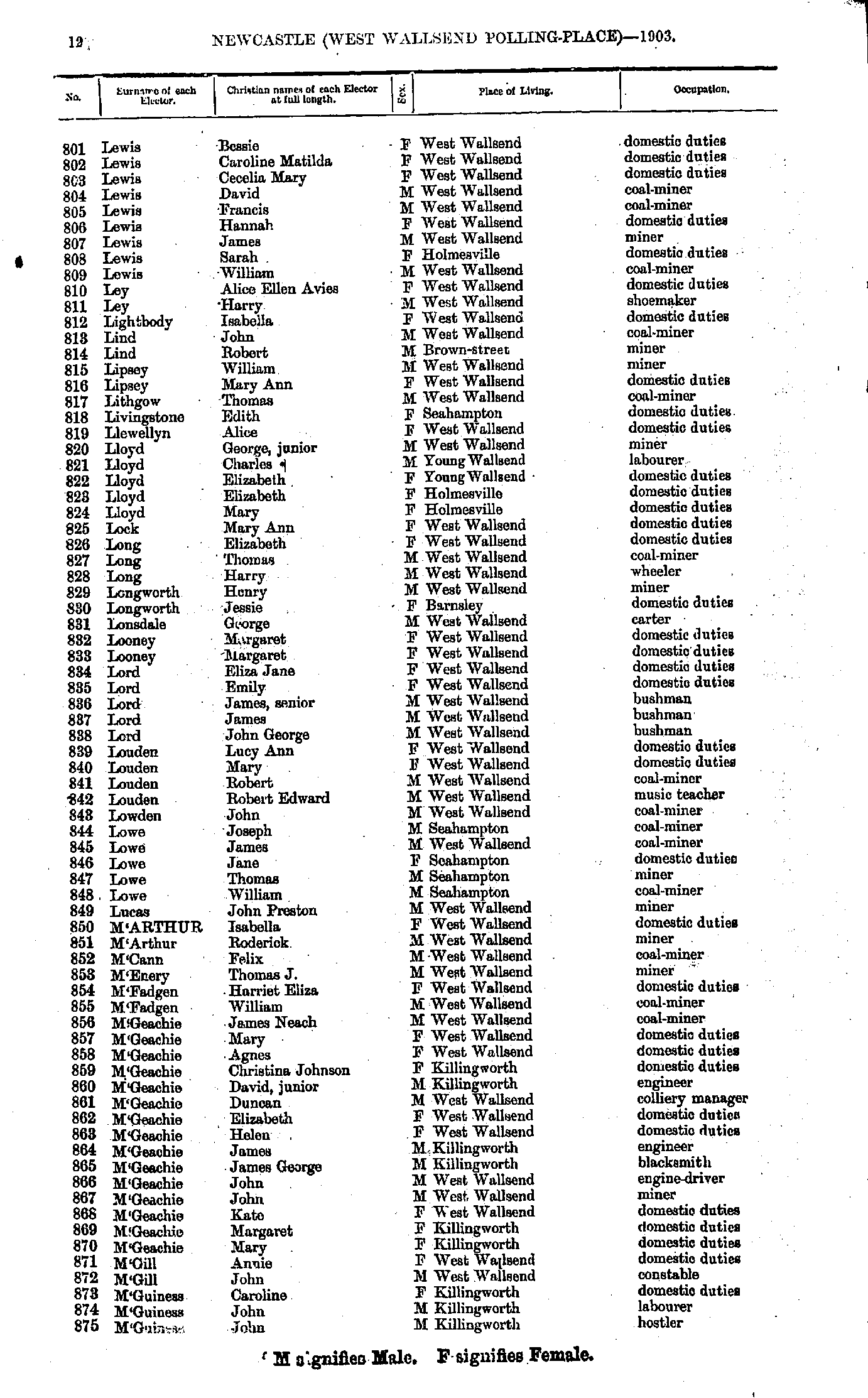
- Lowbridge John - Maher Alice
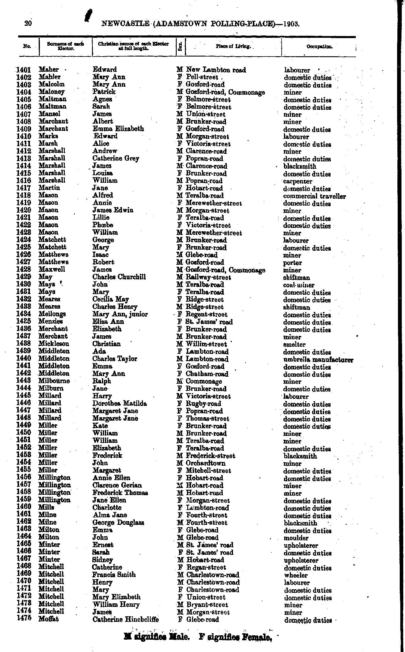
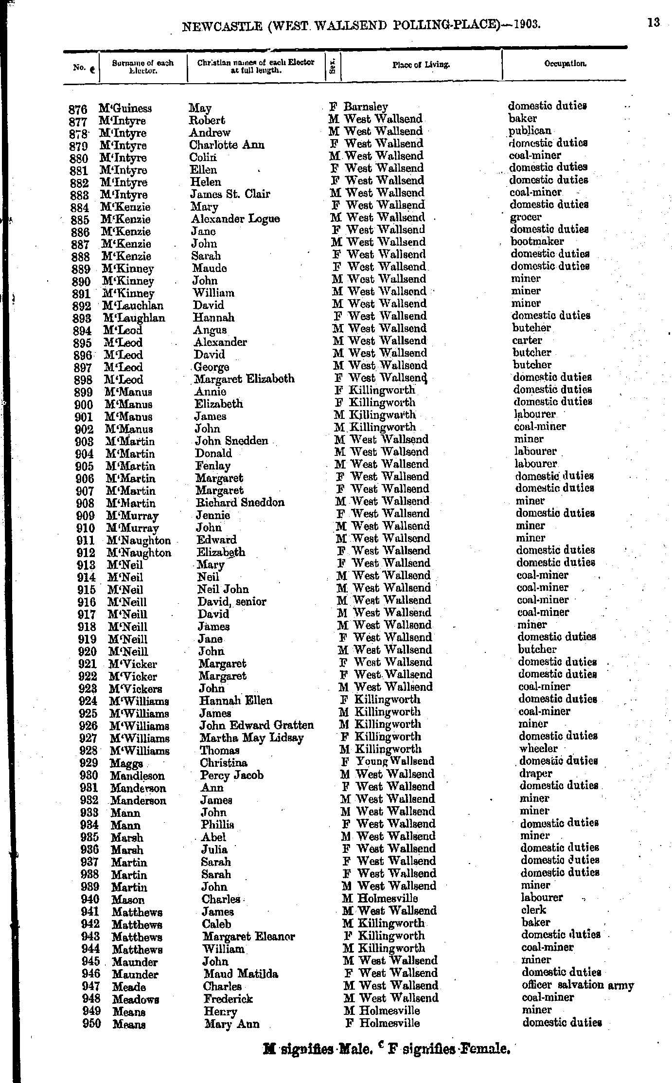
- Maher Edward - Moffat Catherine
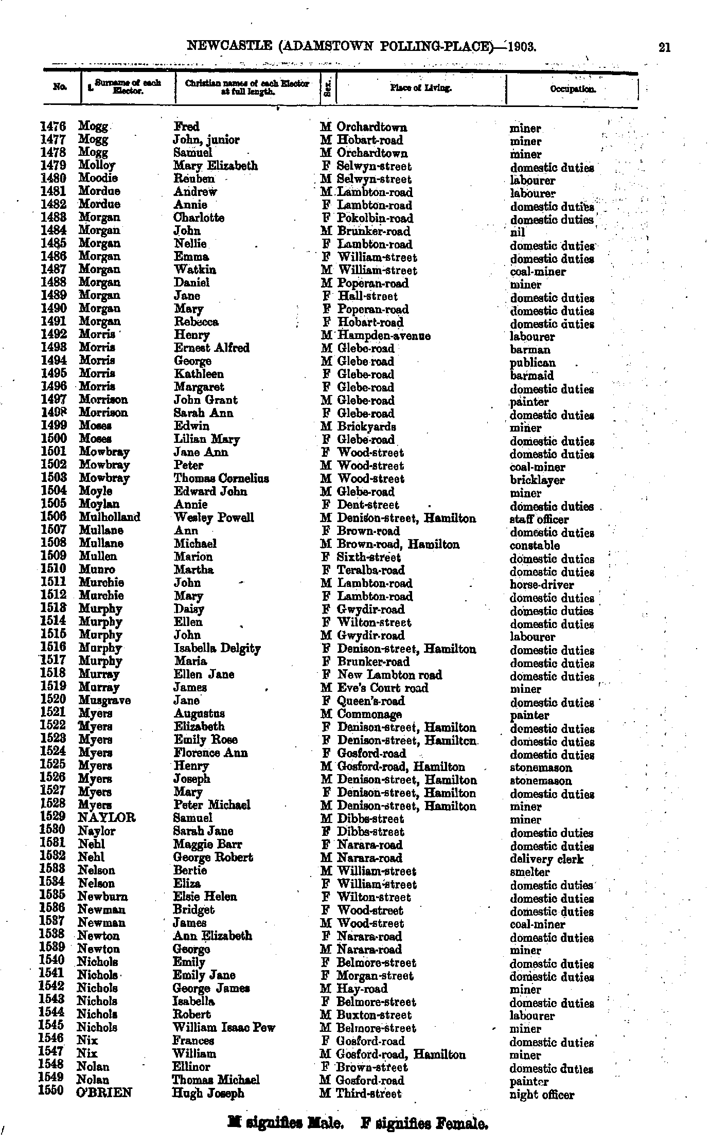
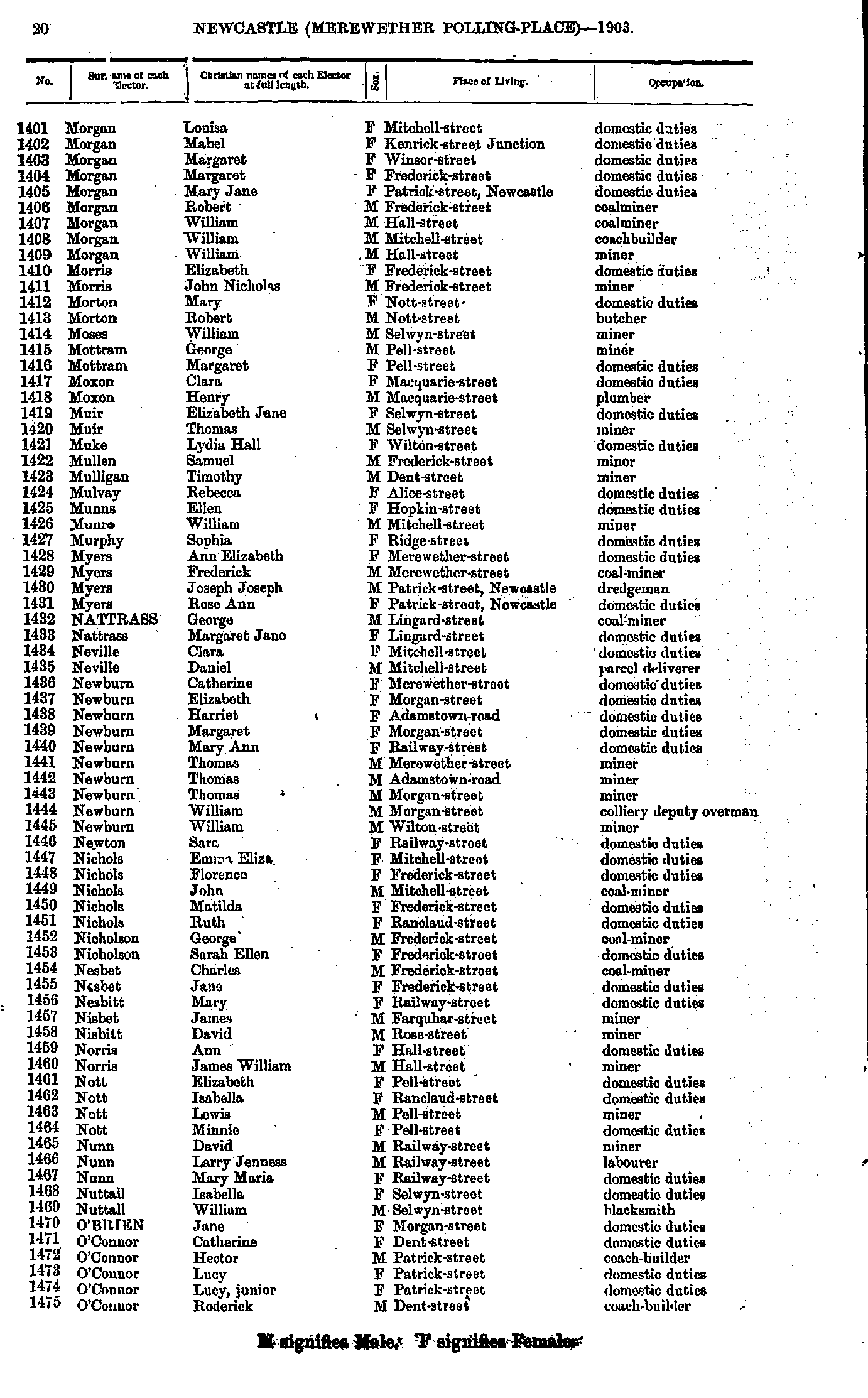
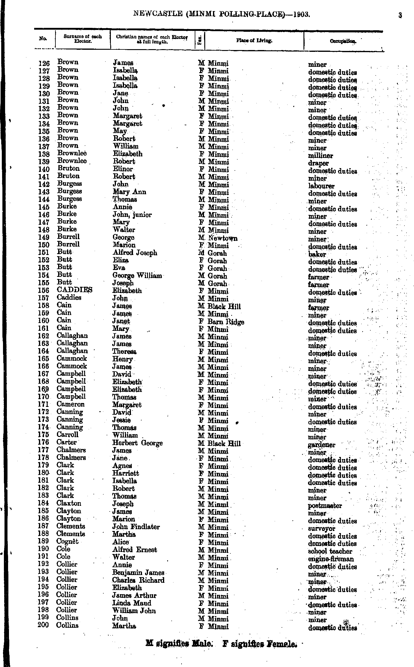
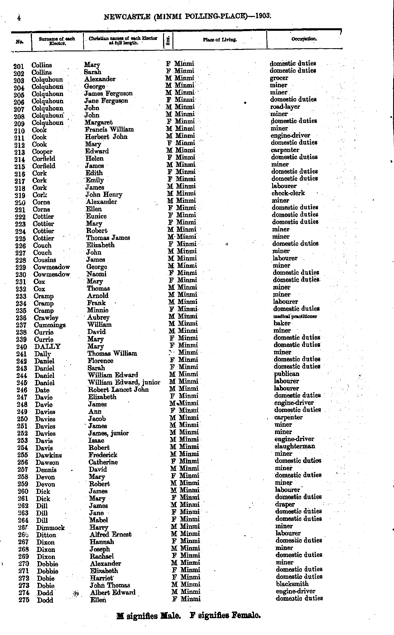
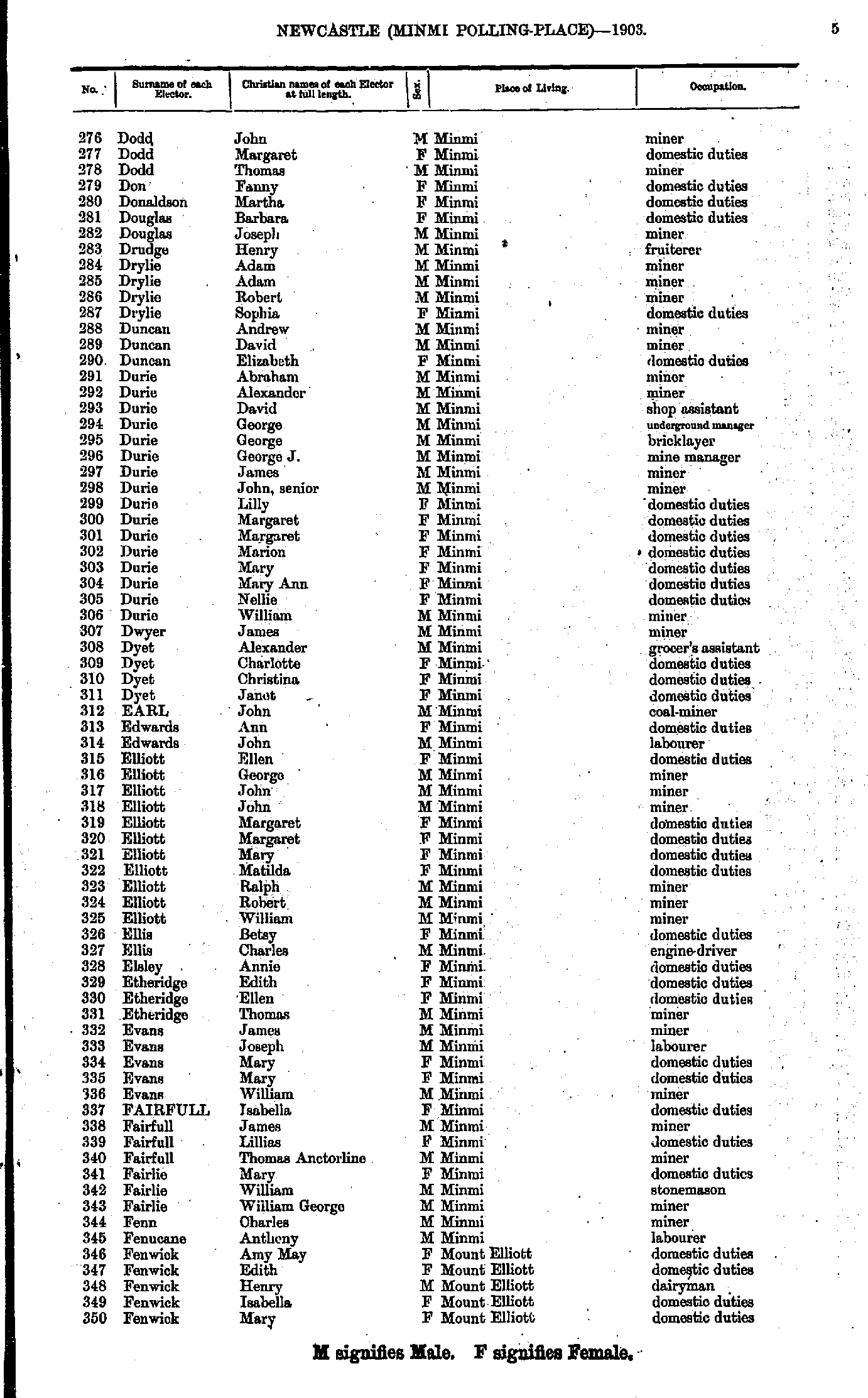
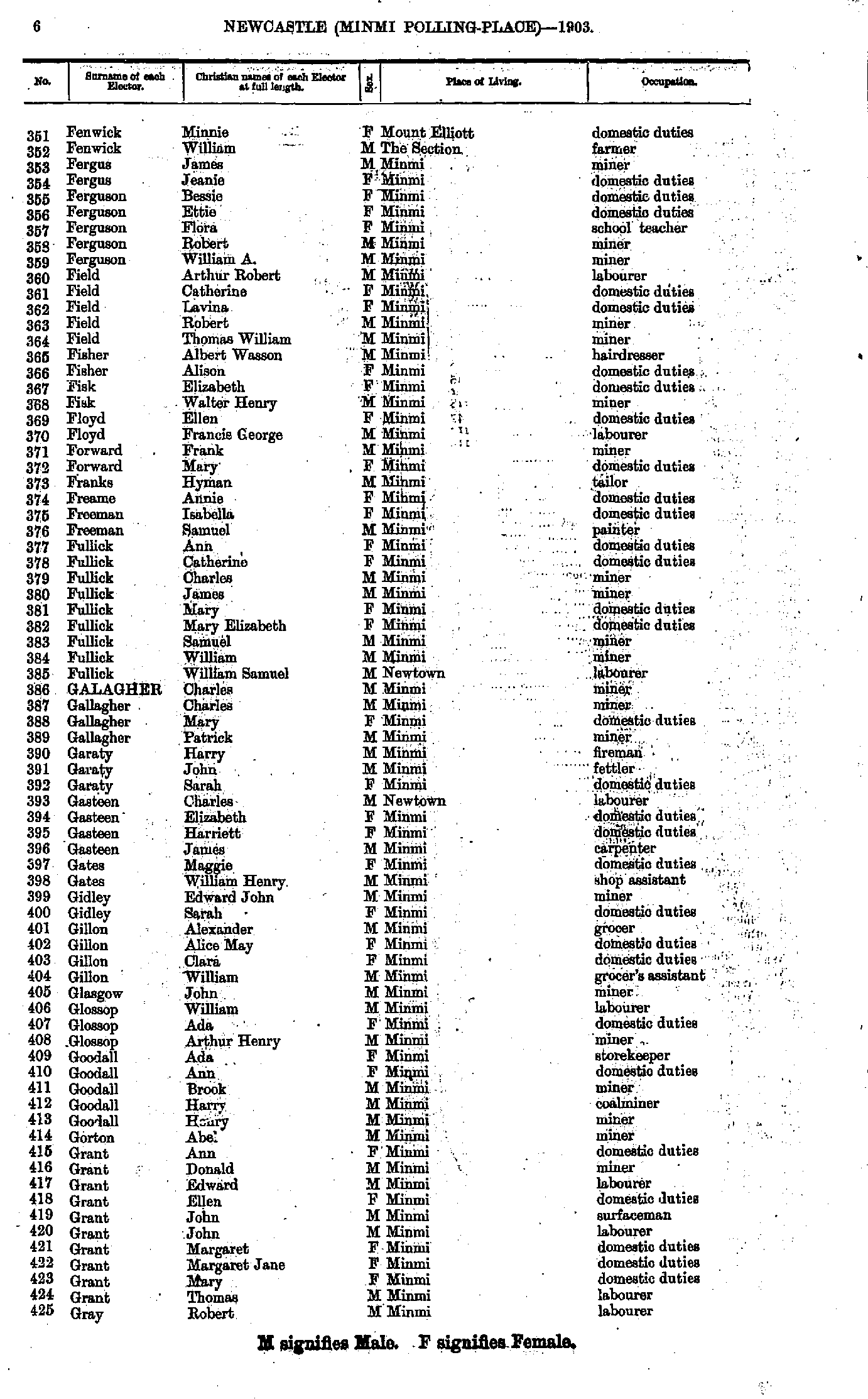
- Mogg Fred - O'Brien Hugh
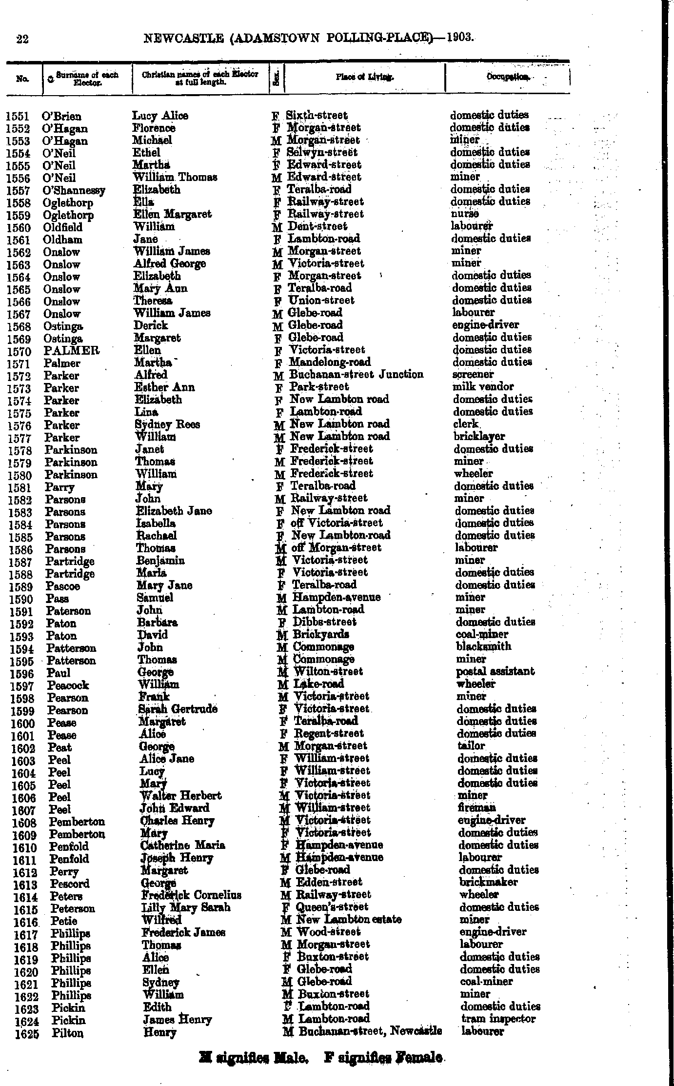
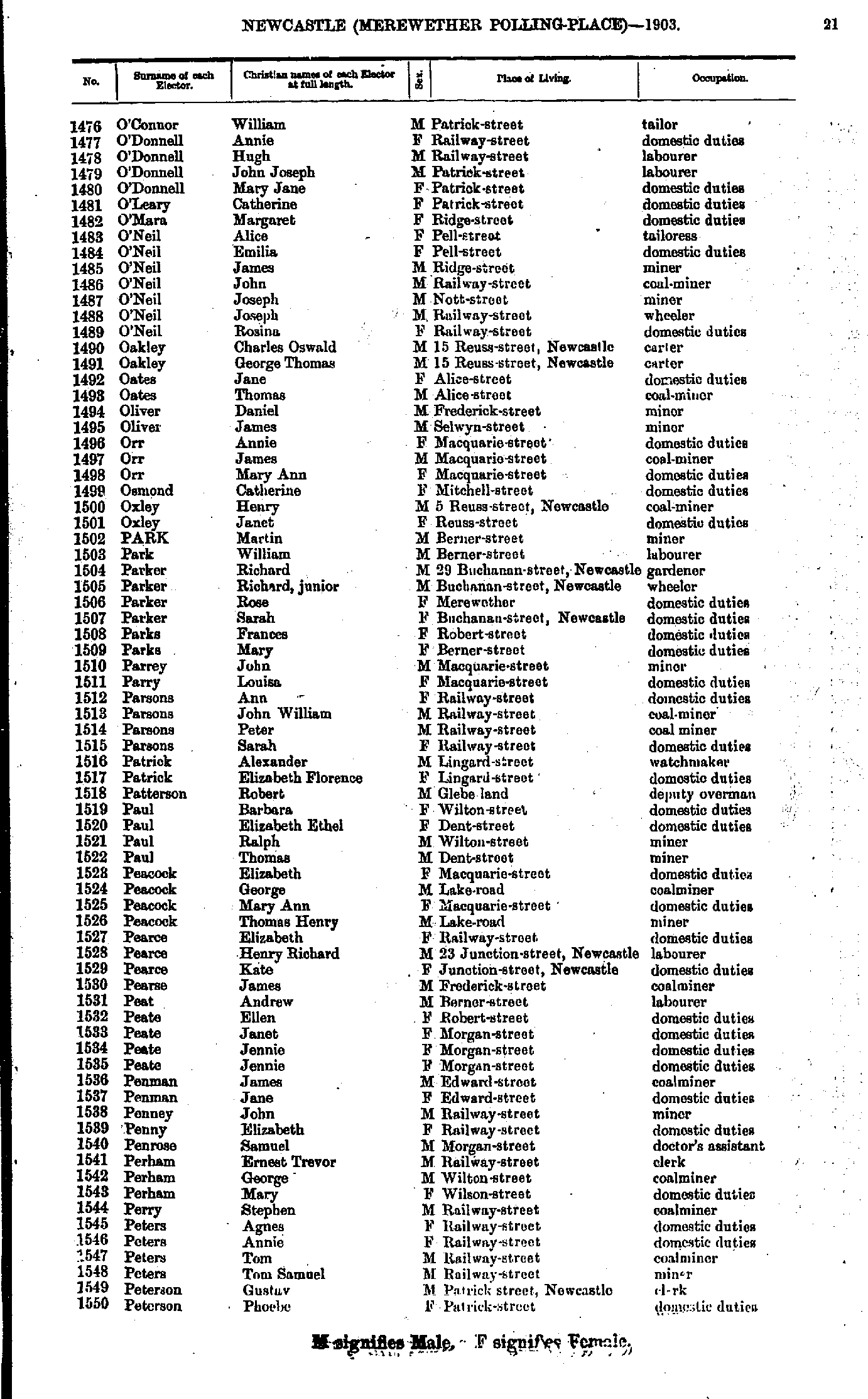
- O'Brien Lucy - Pilton Henry
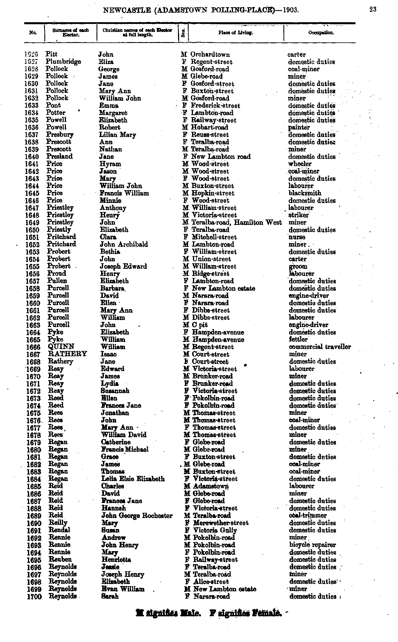
- Pitt John - Reynolds Sarah
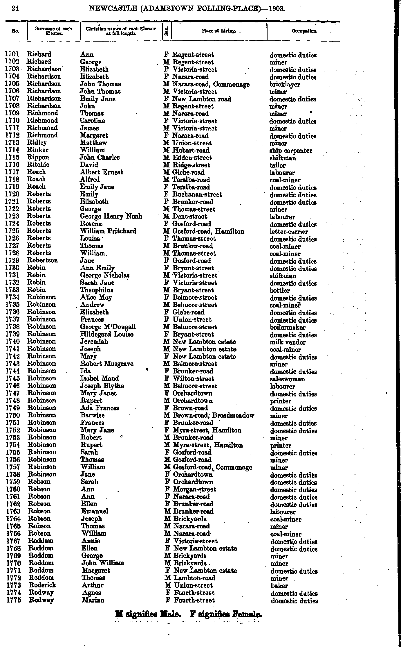
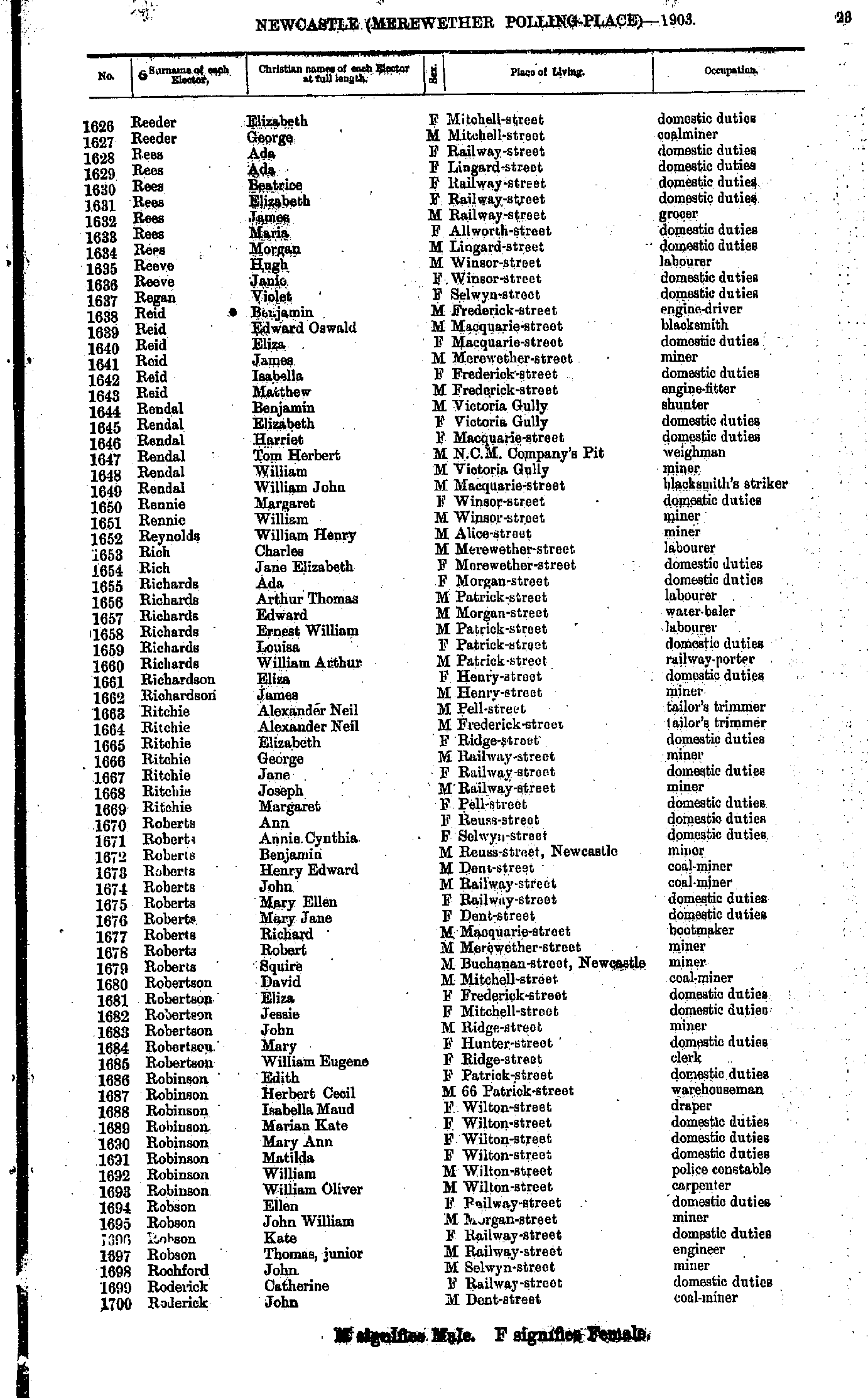
- Richard Ann - Rodway Marian
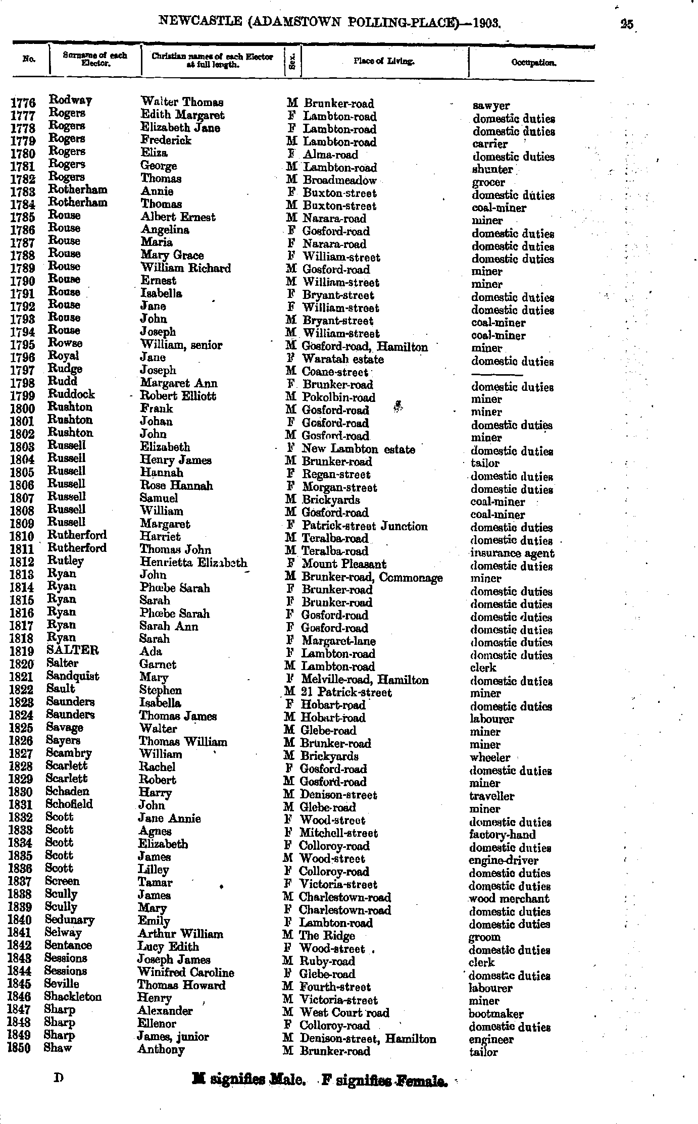
- Rodway Walter - Shaw Anthony
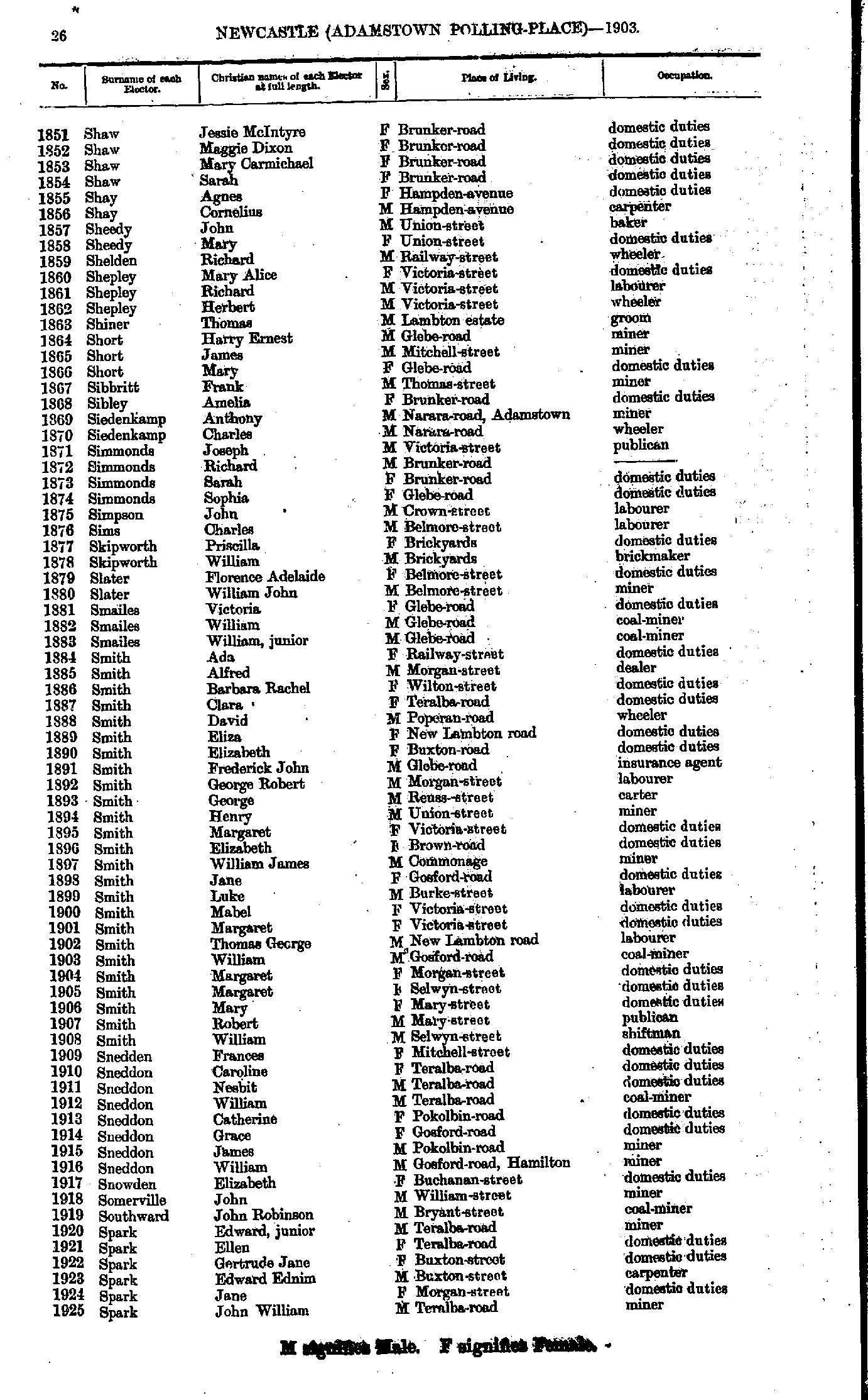
- Shaw Jessie - Spark John
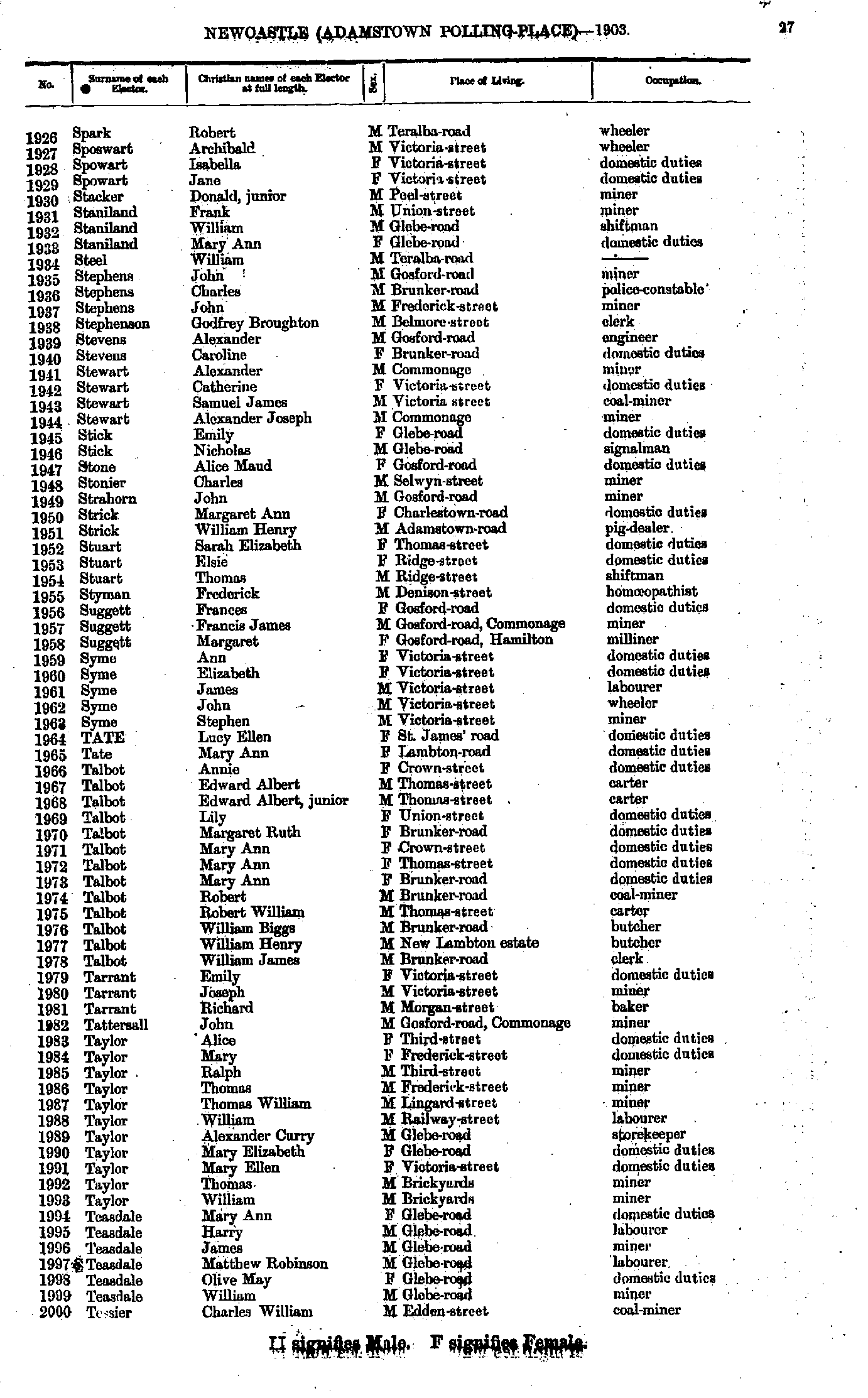
- Spark Robert - Tessier Charles
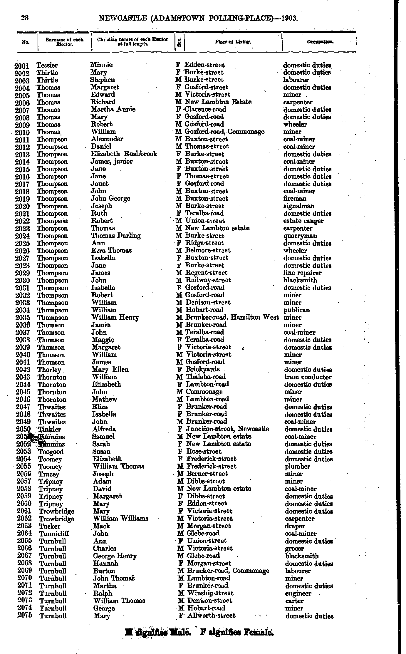
- Tessier Minnie - Turnbull Mary
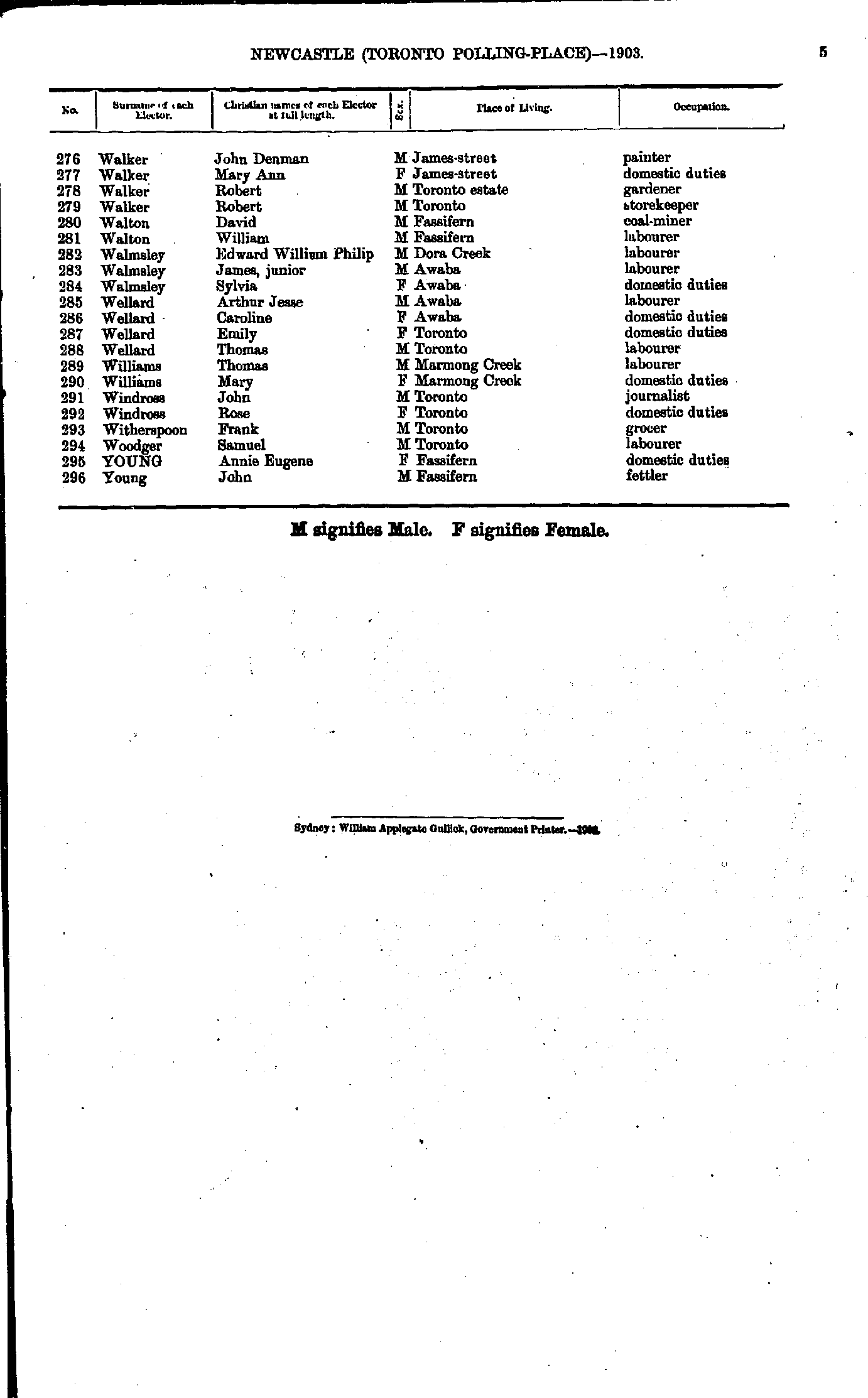
- Turnbull Mary - Walton Mary
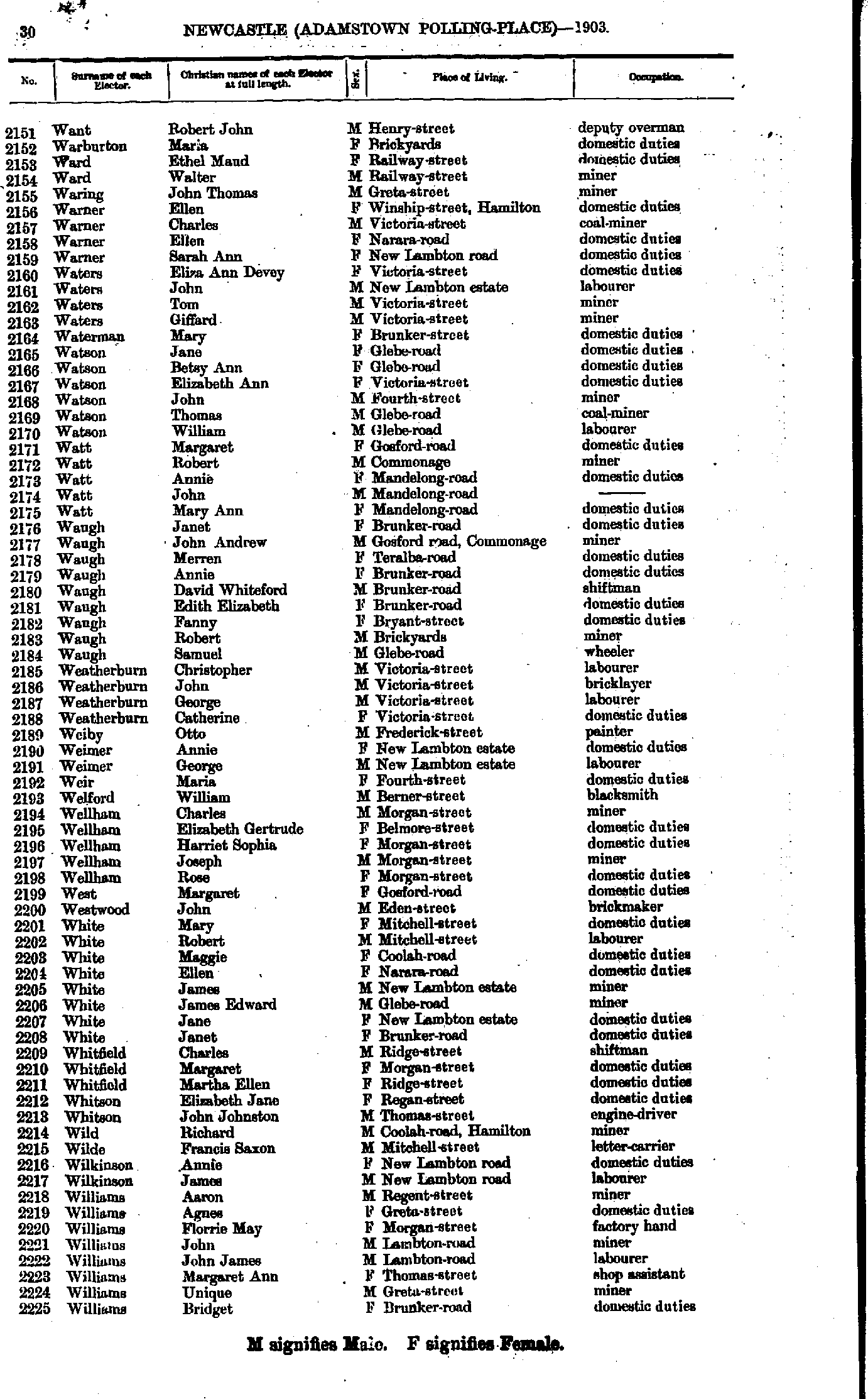
- Want Robert - Williams Bridget
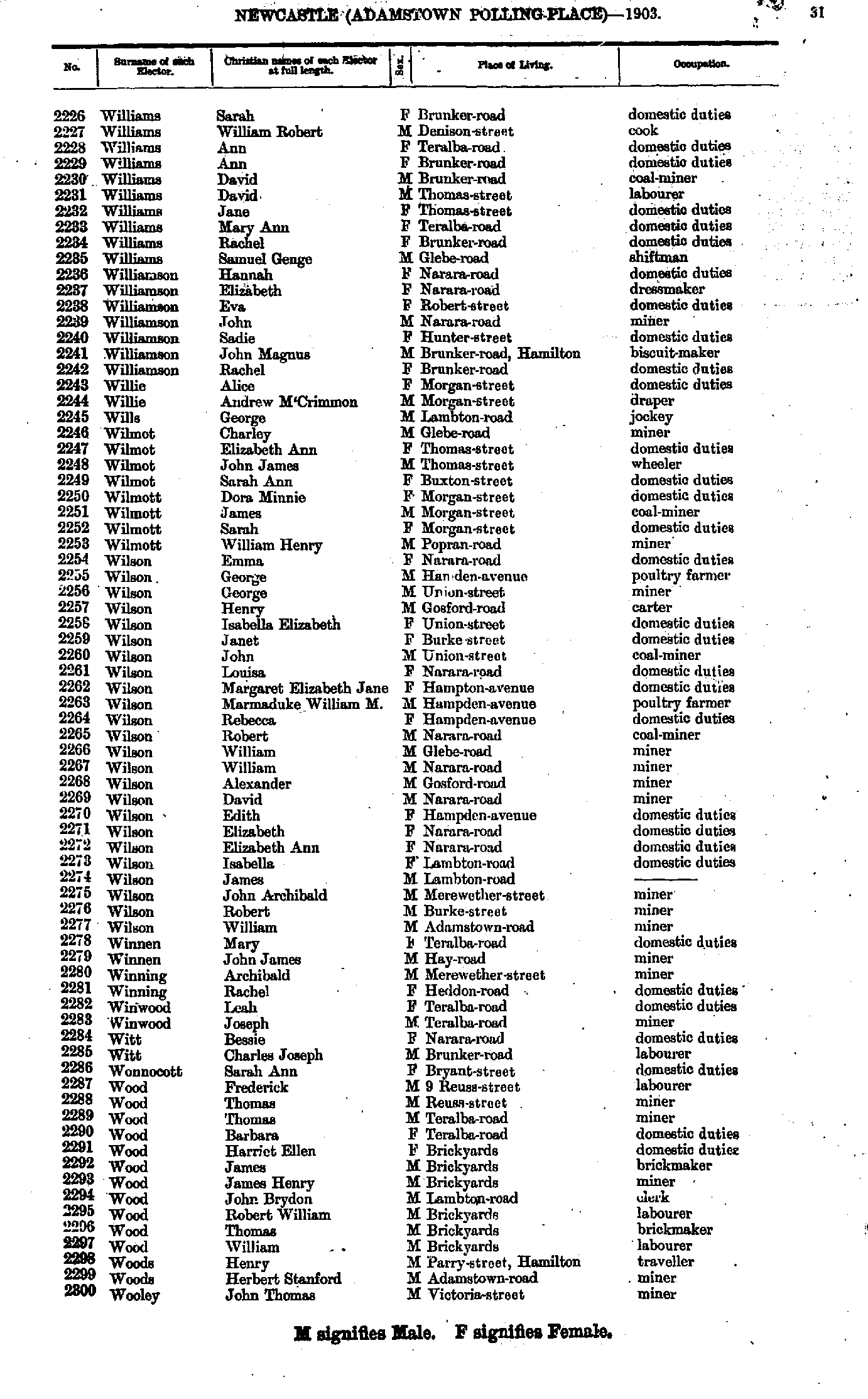
- Williams Sarah - Wooley John
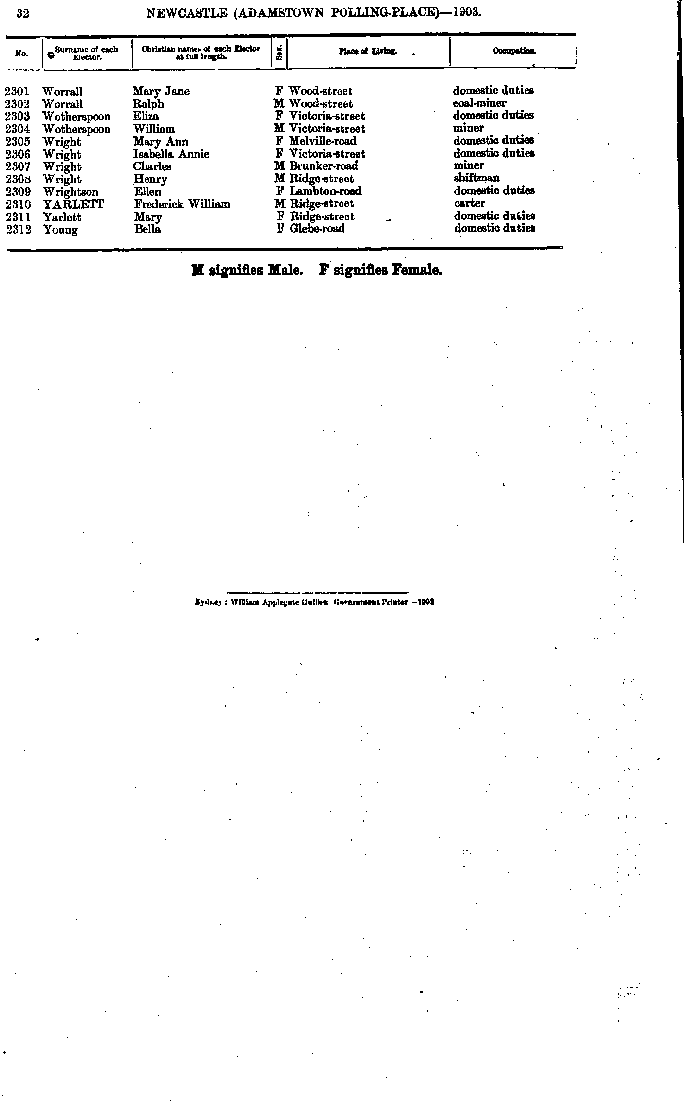
- Worrall Mary - Young Bella
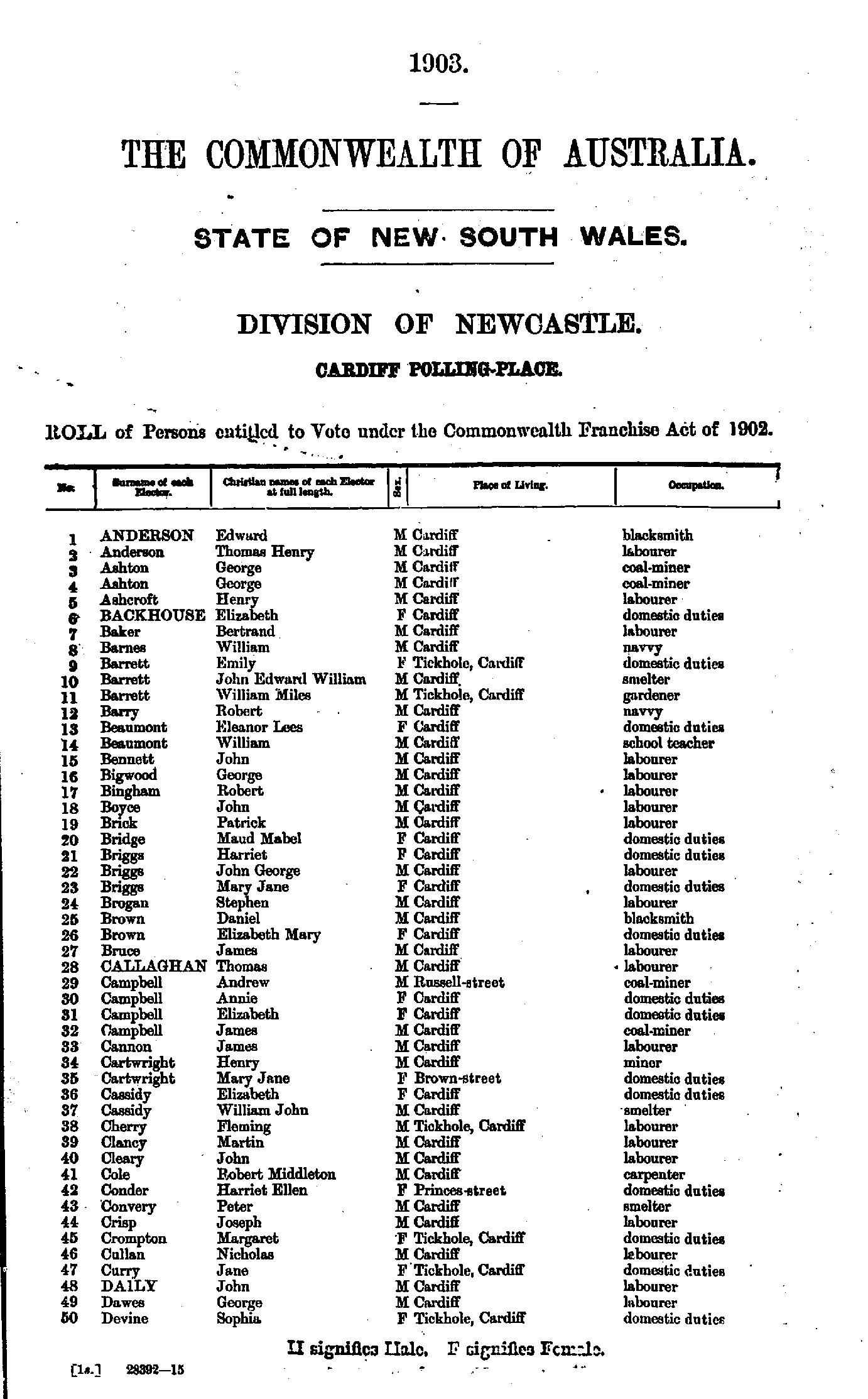
- Anderson Edward - Devine Sophia
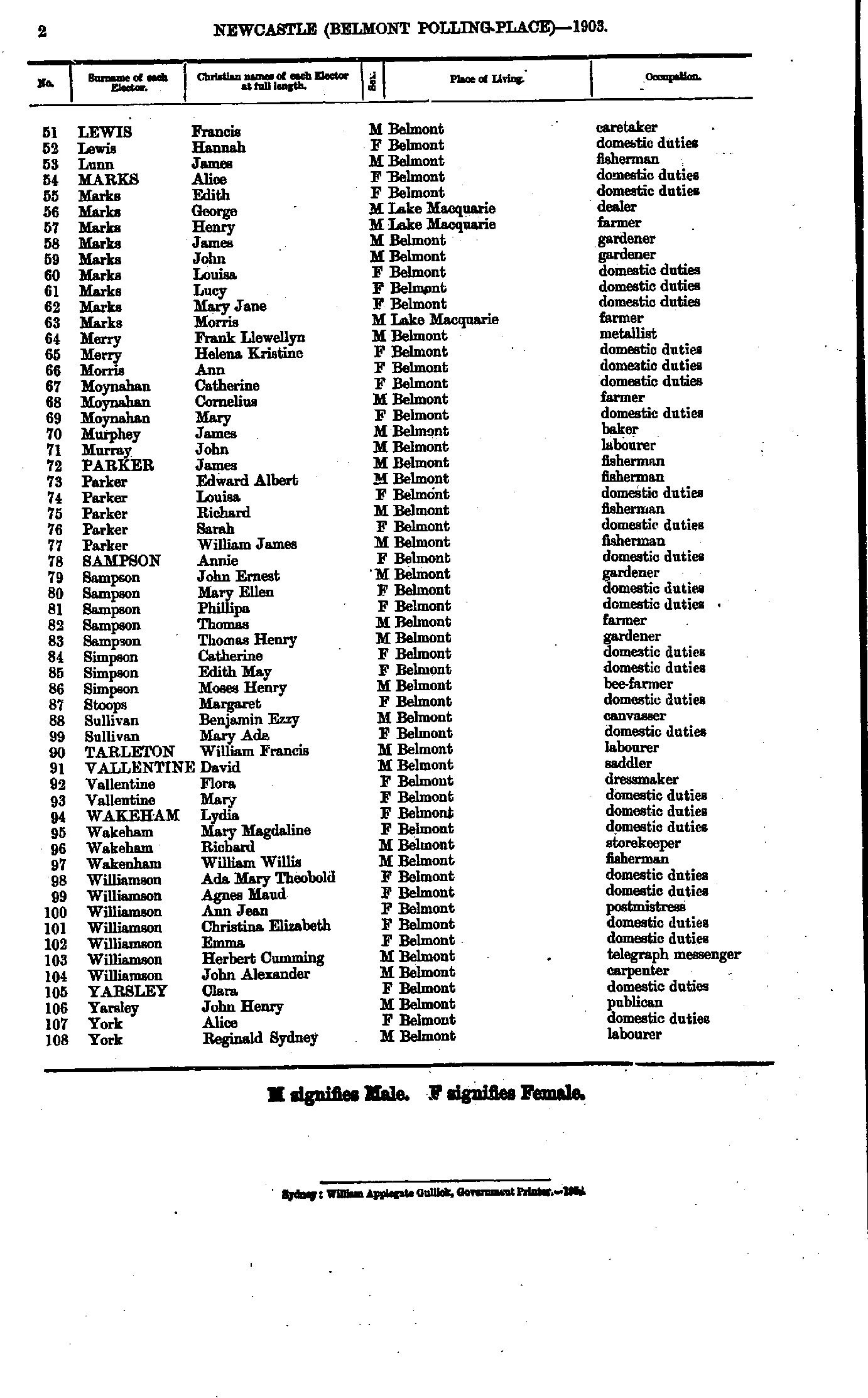
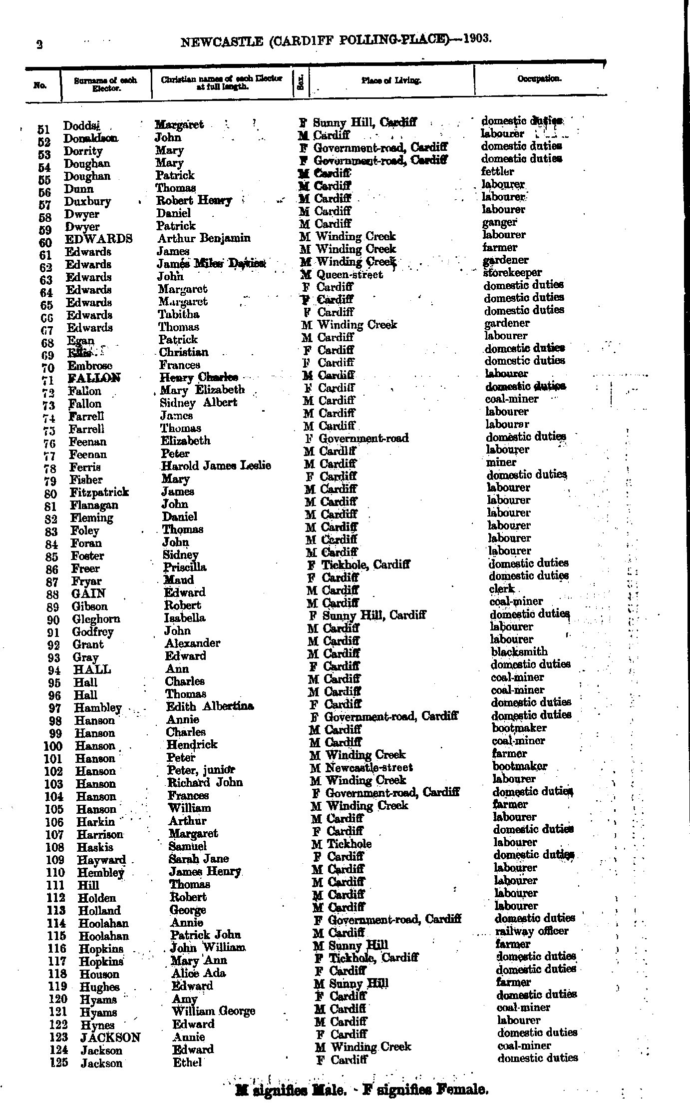
- Dodds Margaret - Jackson Ethel
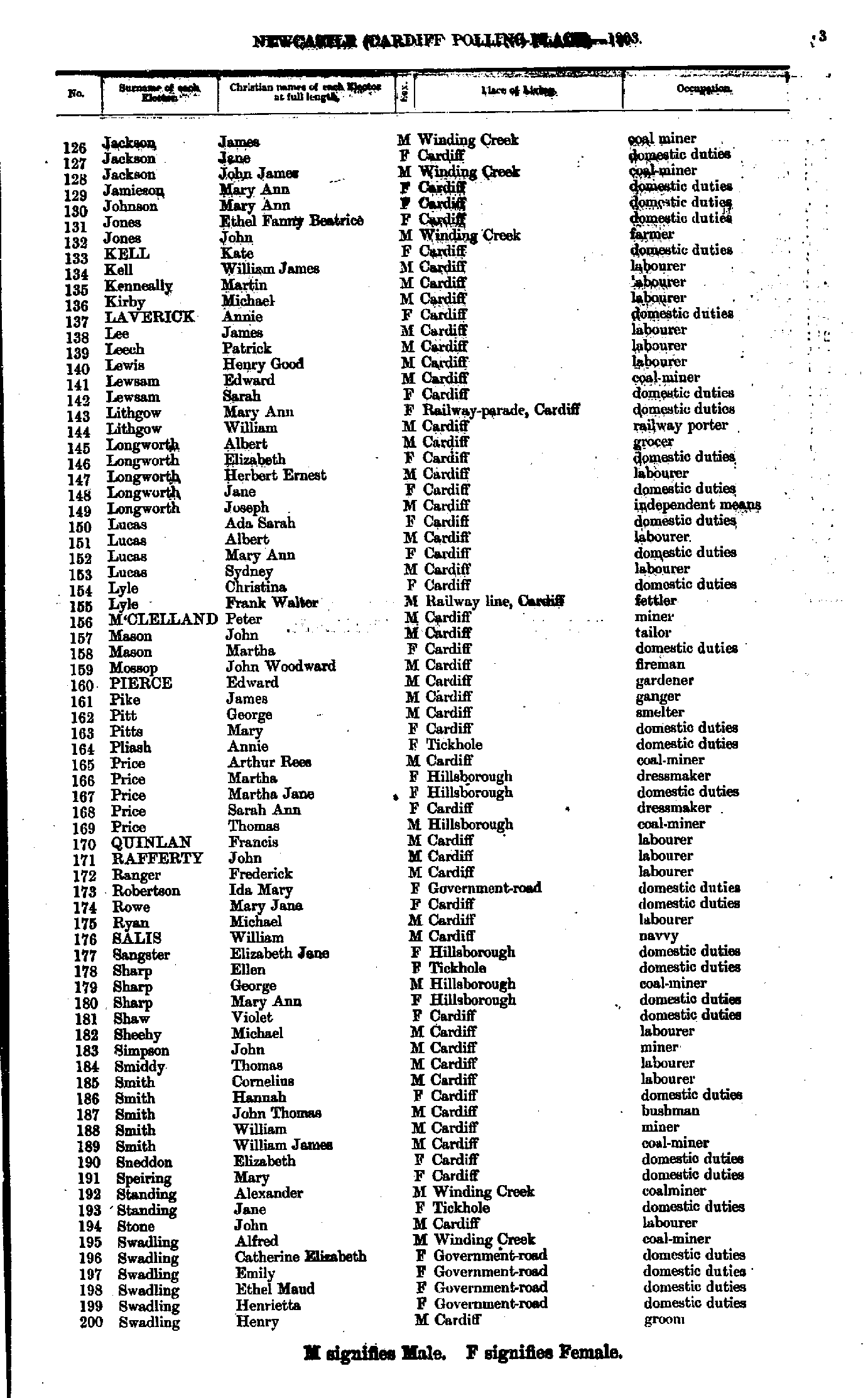
- Jackson James - Swadling Henry
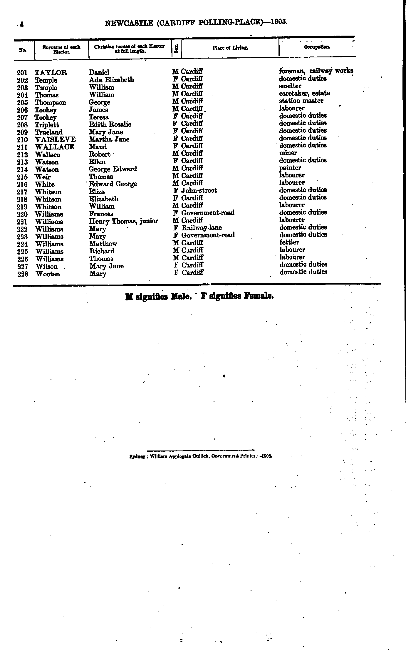
- Taylor Daniel - Wooten Mary
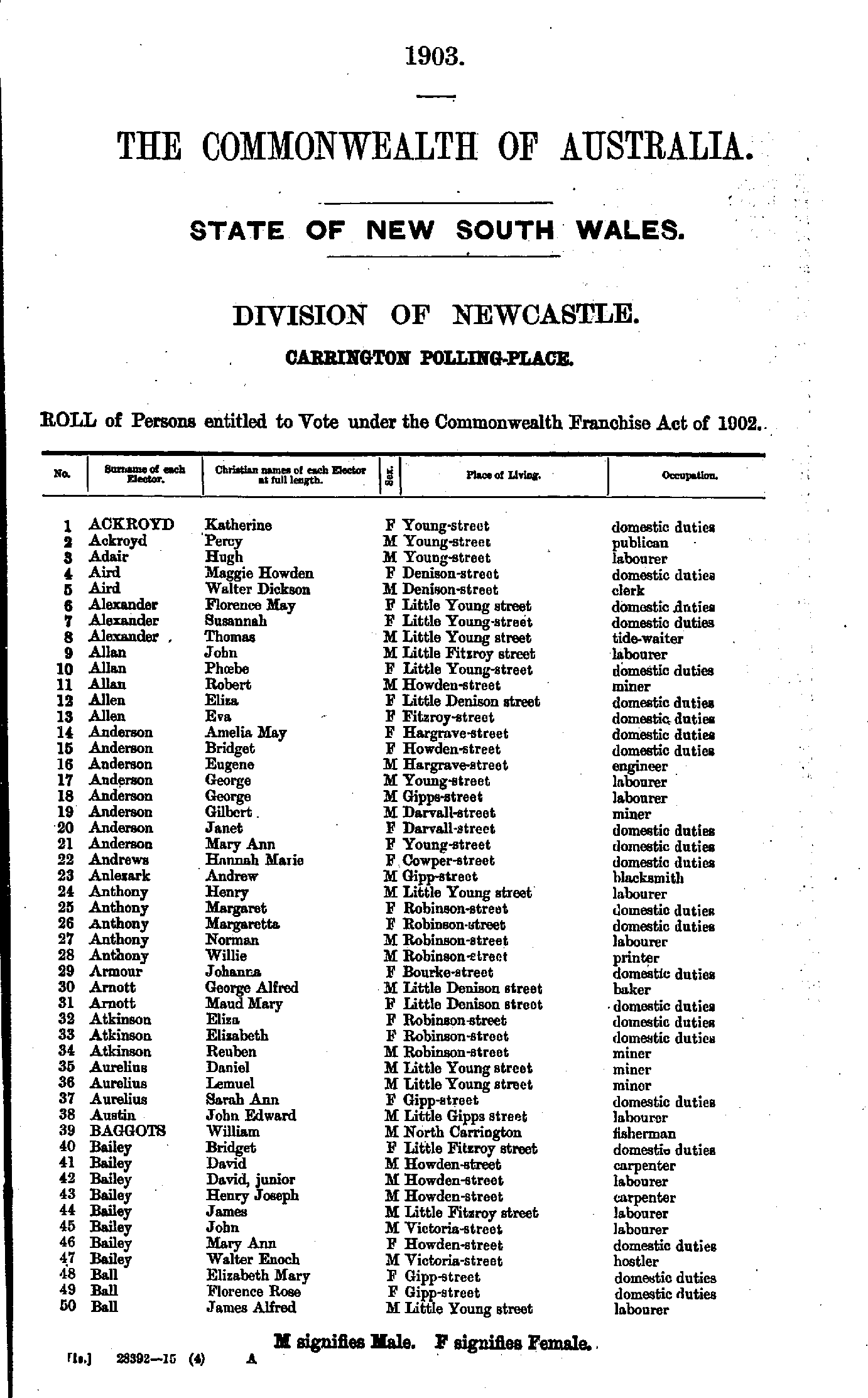
- Ackroyd Katherine - Ball James
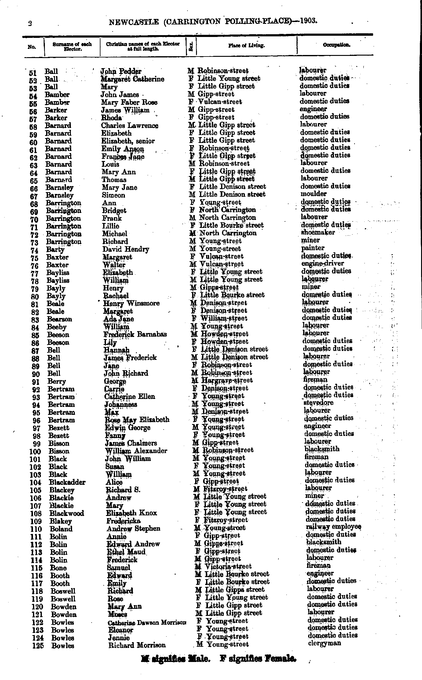
- Ball John - Bowles Richard
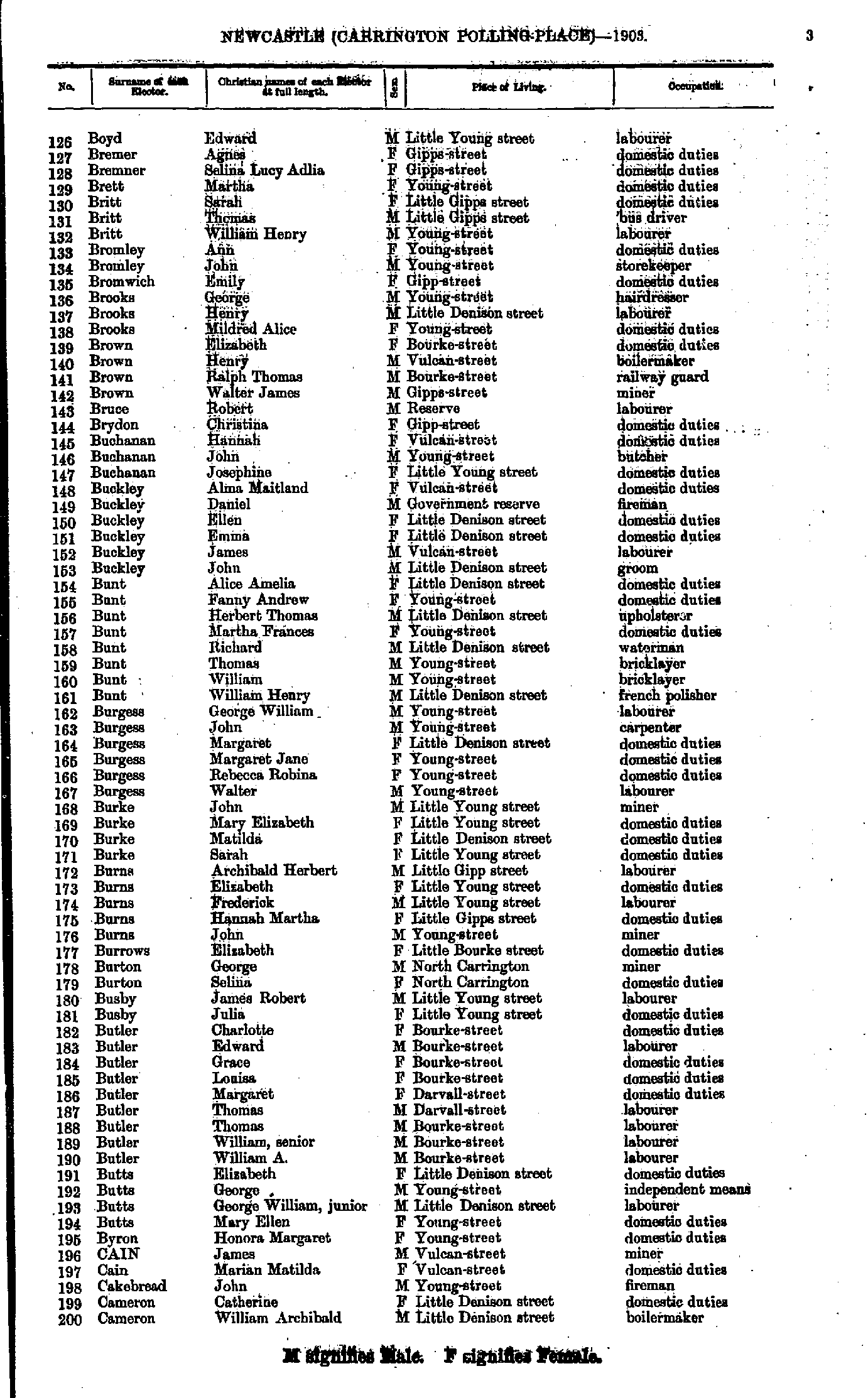
- Boyd Edward - Cameron William
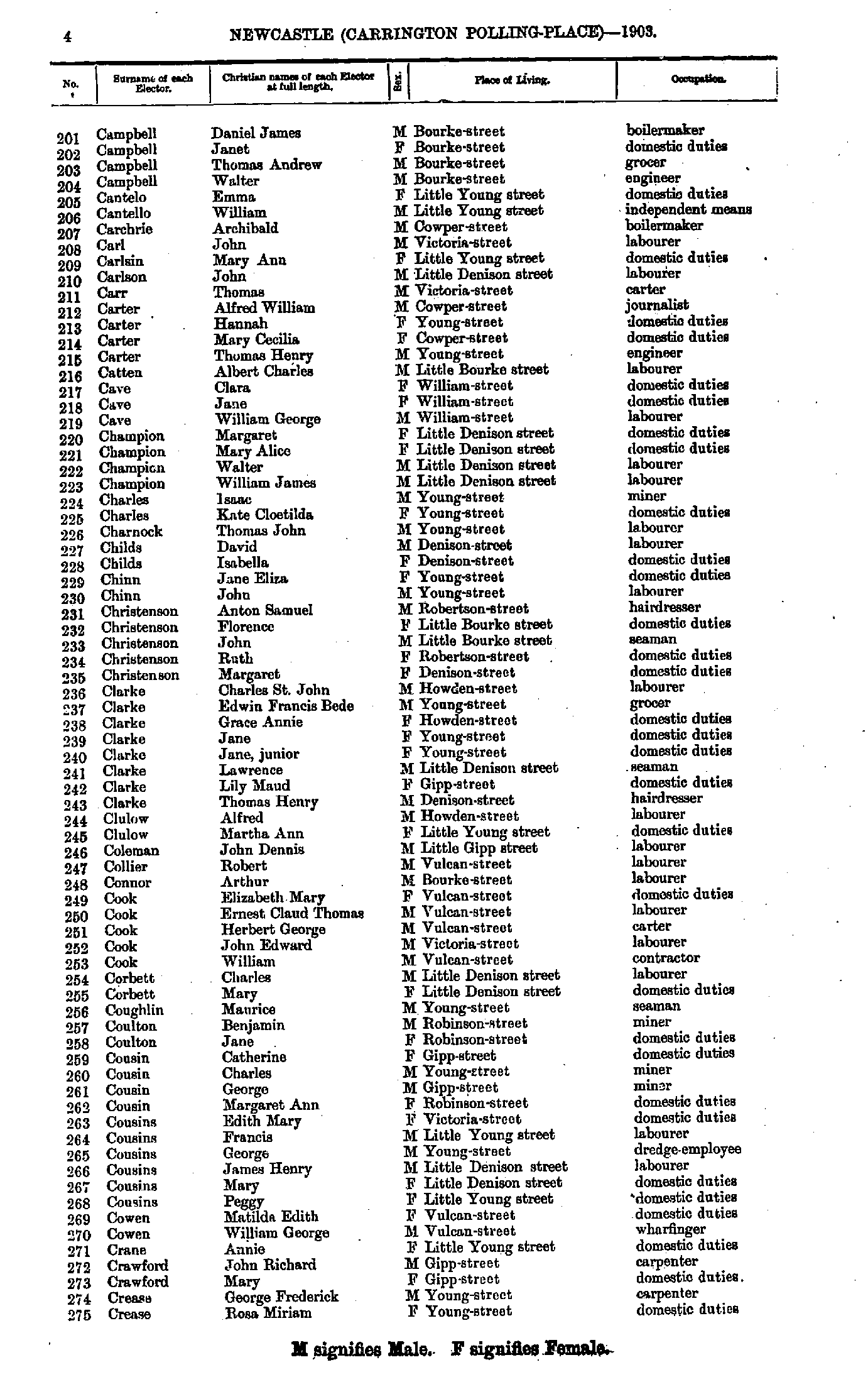
- Campbell Daniel - Crease Rosa
- Cremor Florina - Downie Hannah
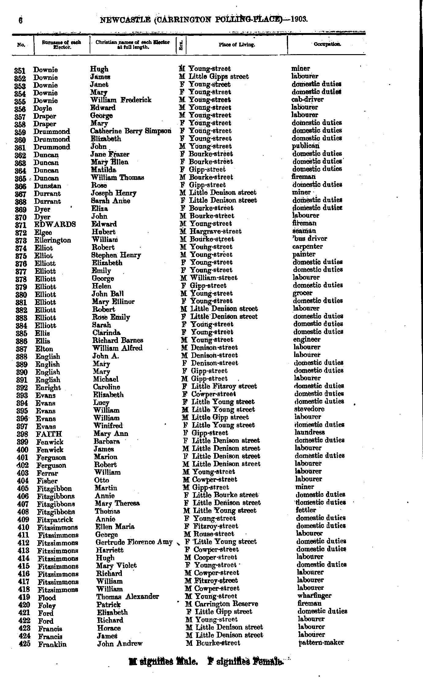
- Downie Hugh - Franklin John
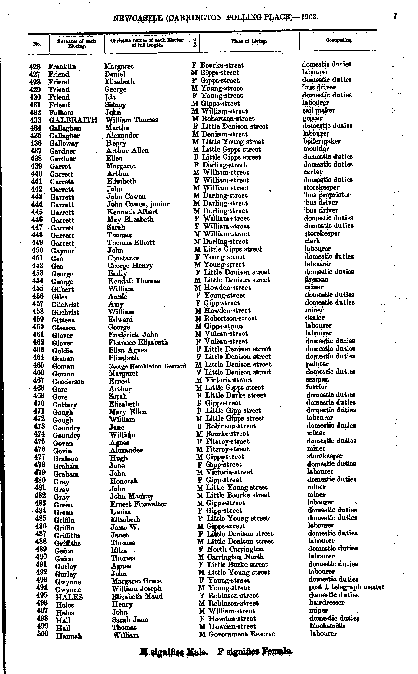
- Franklin Margaret - Hannah William
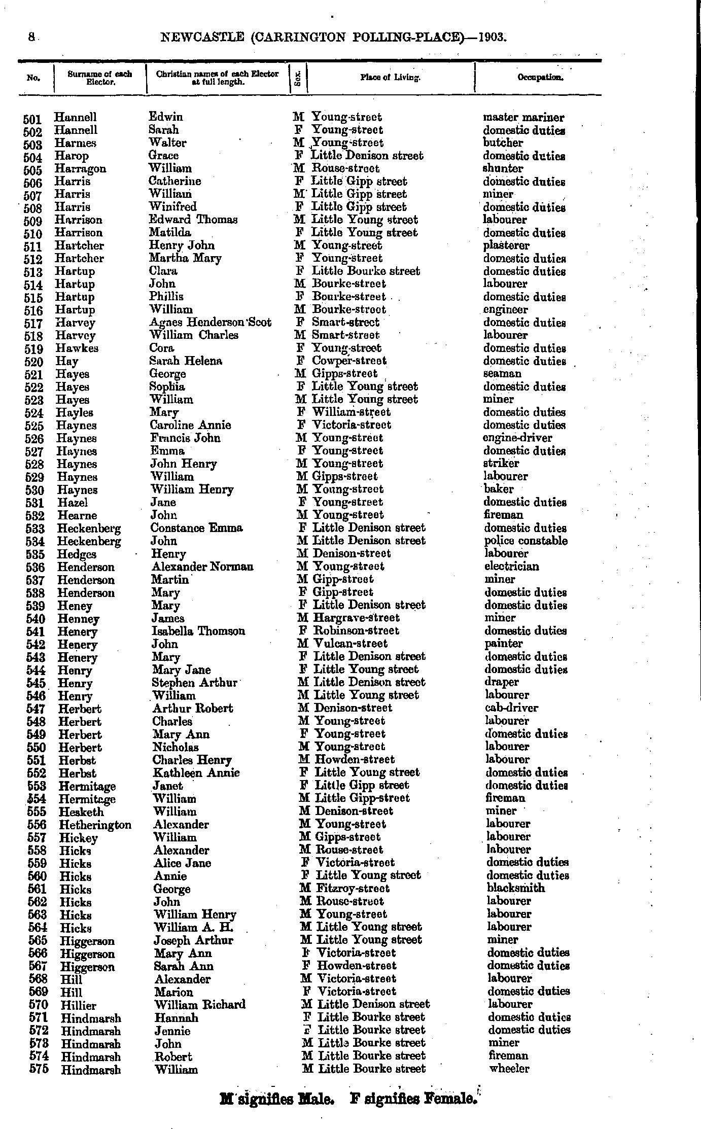
- Hannell Edwin - Hindmarsh William
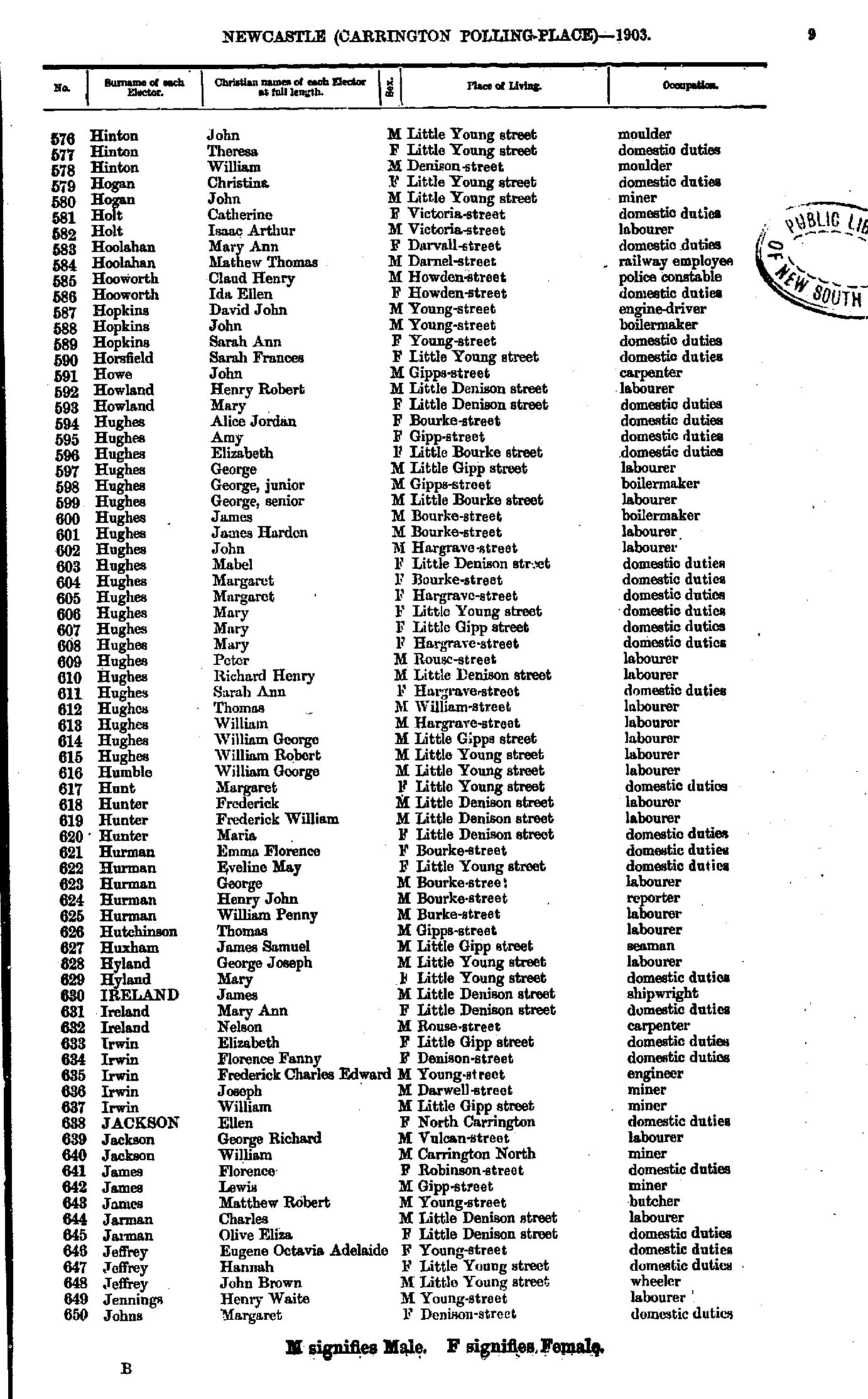
- Hinton John - Johns Margaret
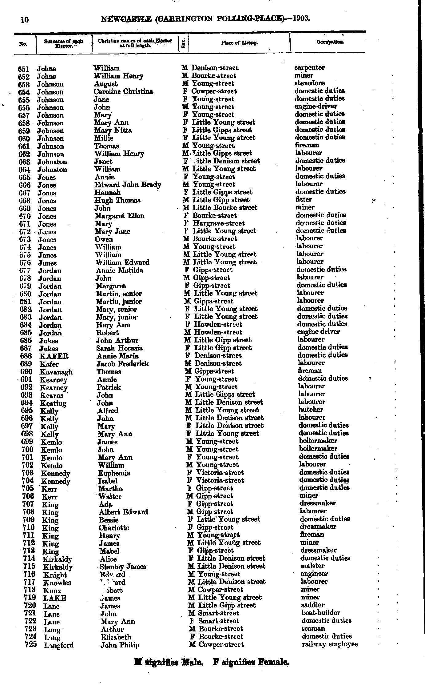
- Johns William - Langford John
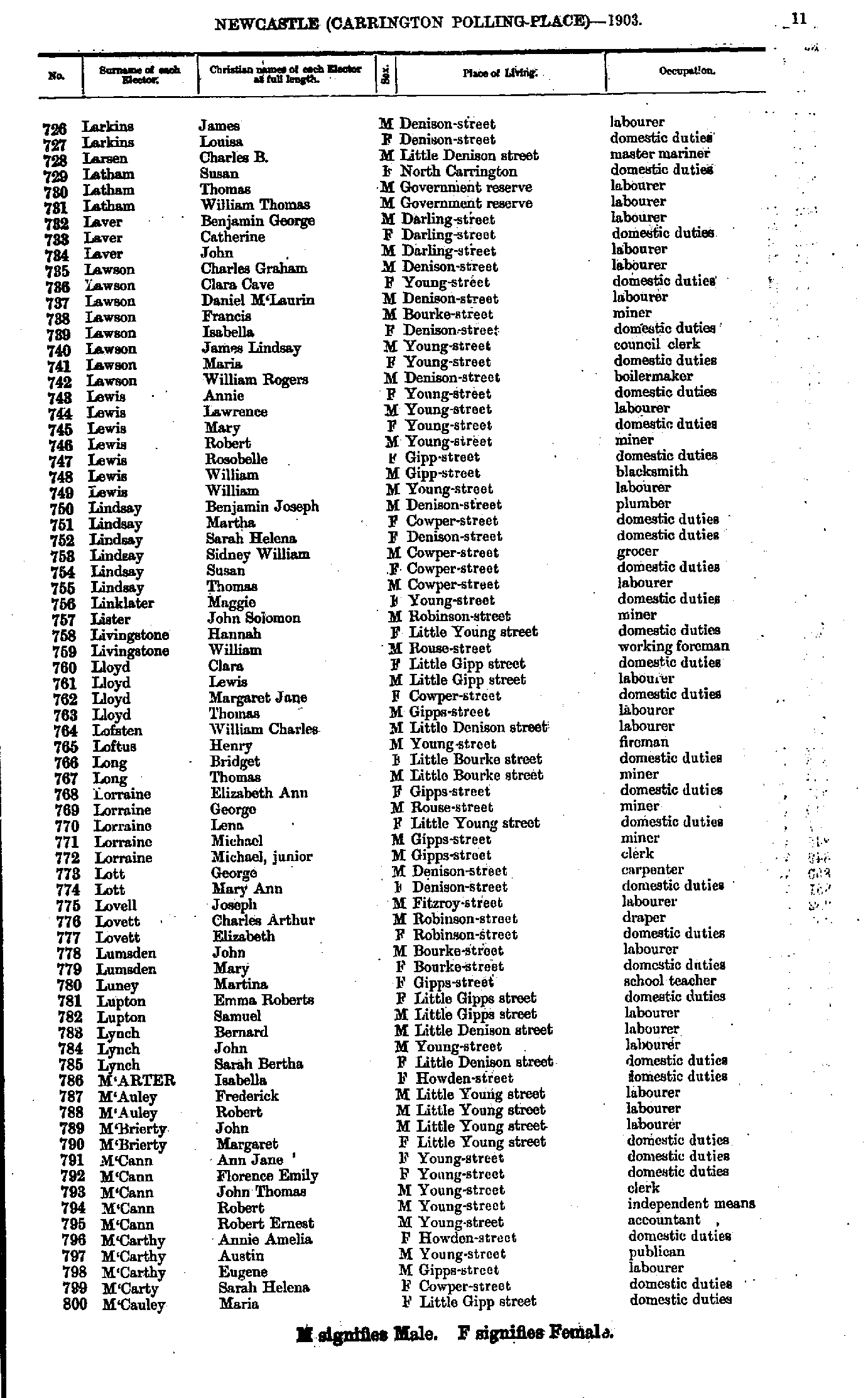
- Larkins James - M'Cauley Maria
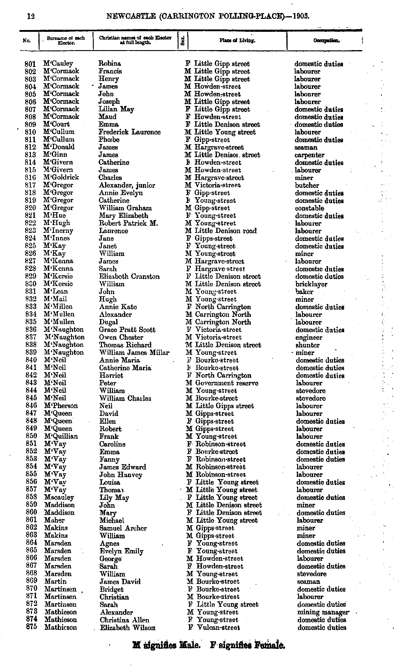
- M'Cauley Robina - Mathieson Elizabeth
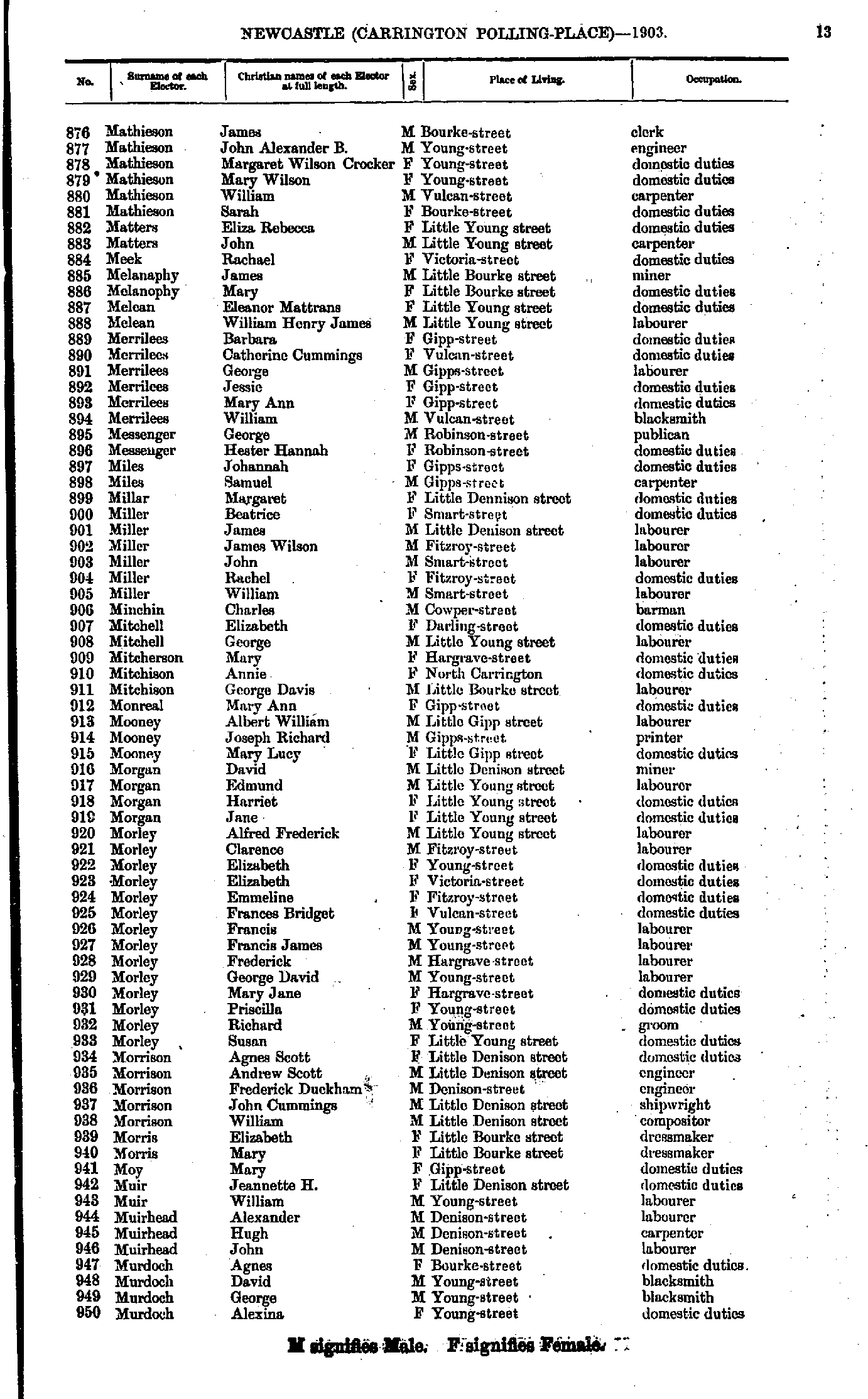
- Mathieson James - Murdoch Alexina
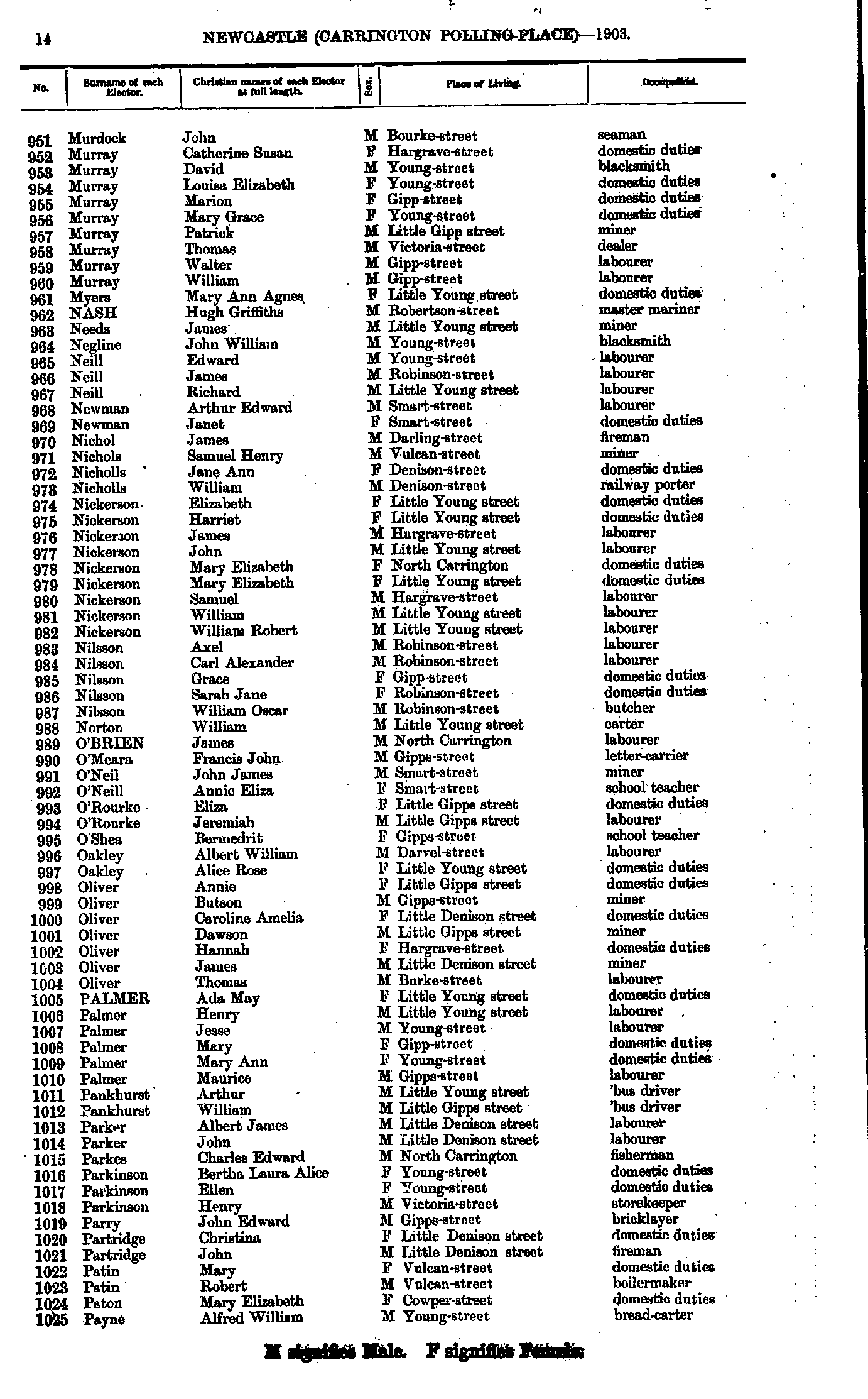
- Murdock John - Payne Alfred
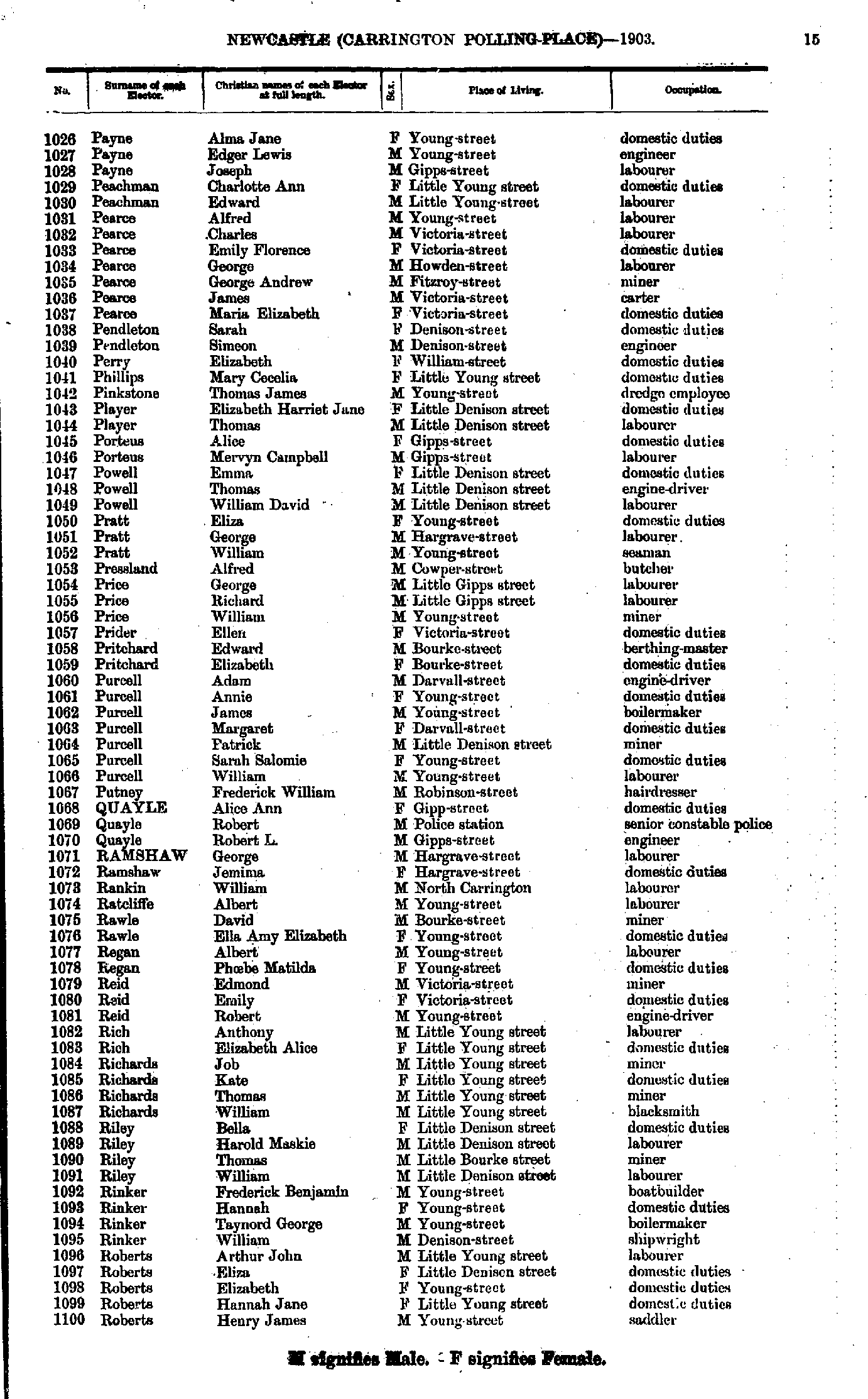
- Payne Alma - Roberts Henry
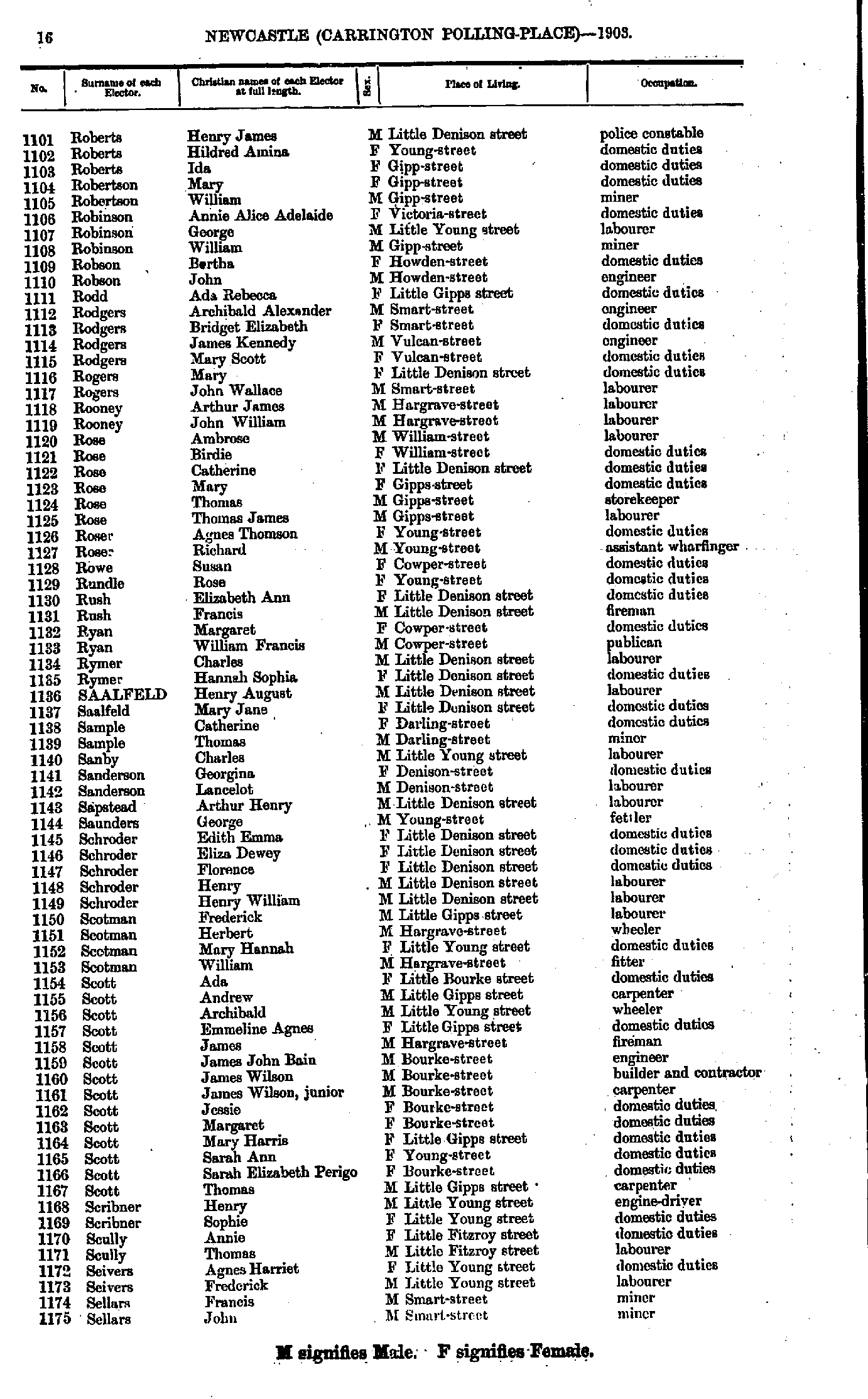
- Roberts Henry - Sellars John
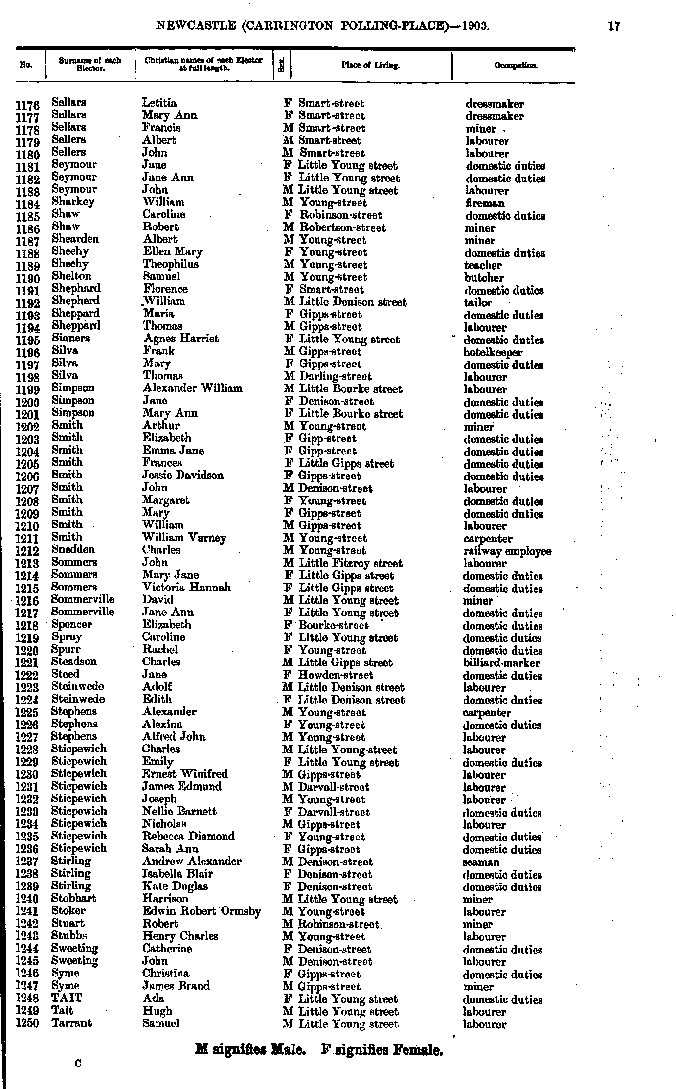
- Sellars Letitia - Tarrant Samuel
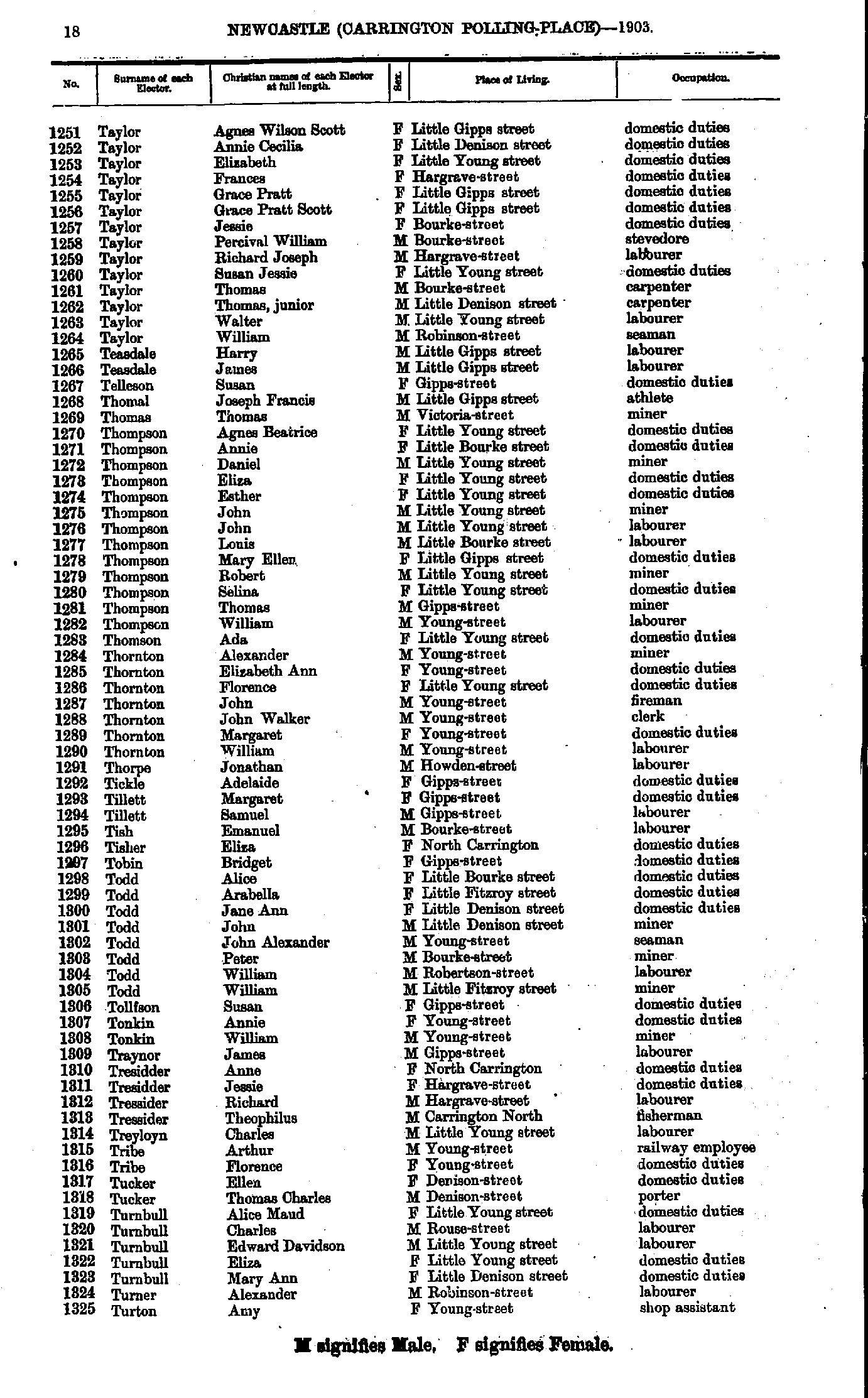
- Taylor Agnes - Turton Amy
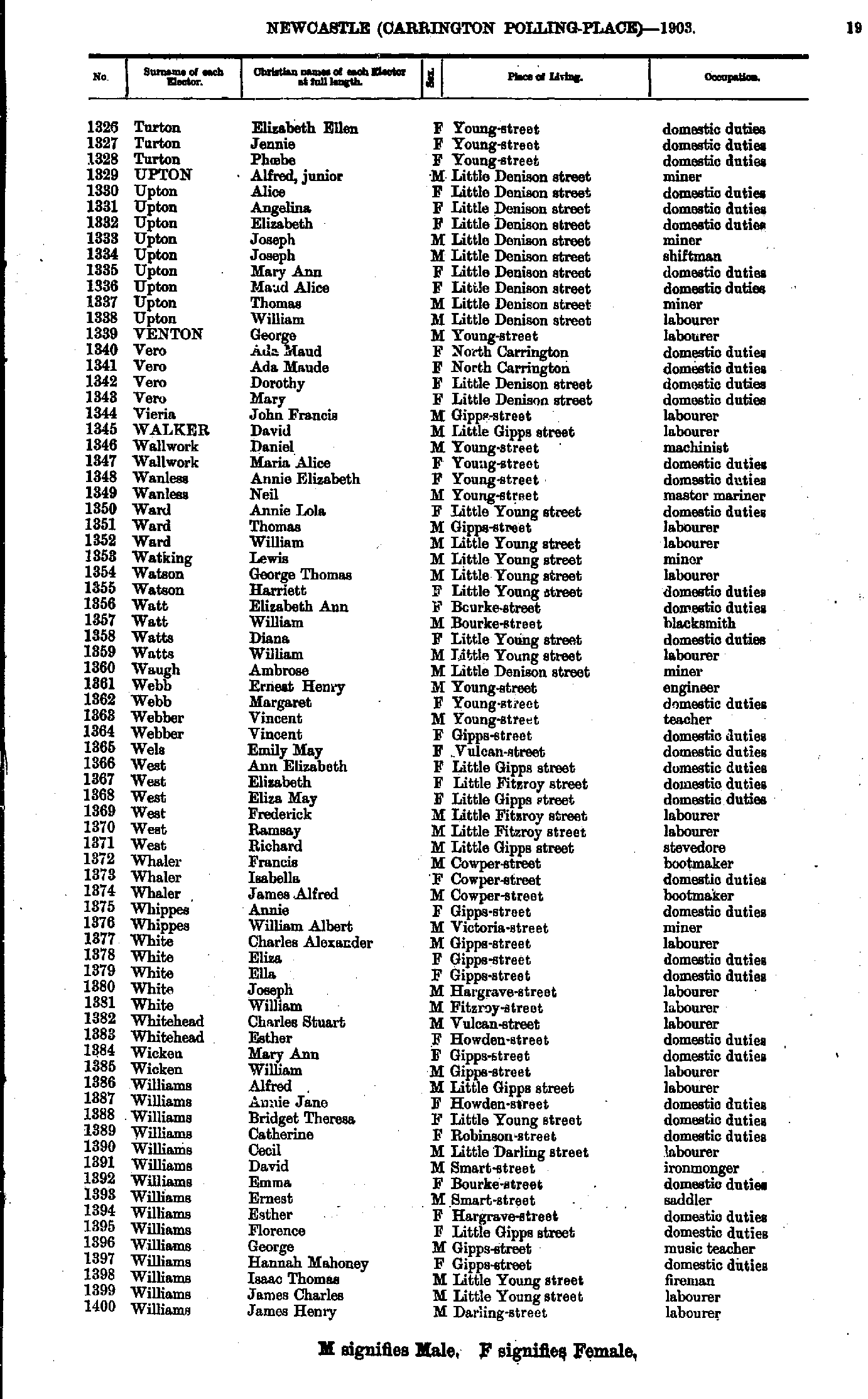
- Turton Elizabeth - Williams James
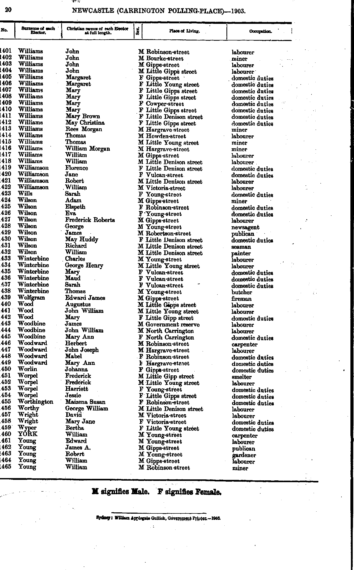
- Williams John - Young William
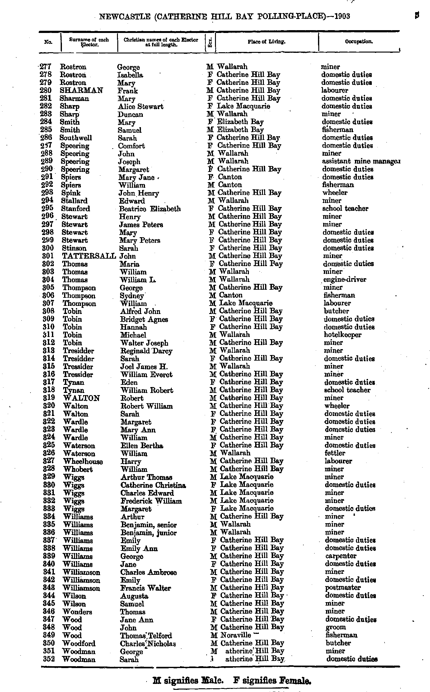
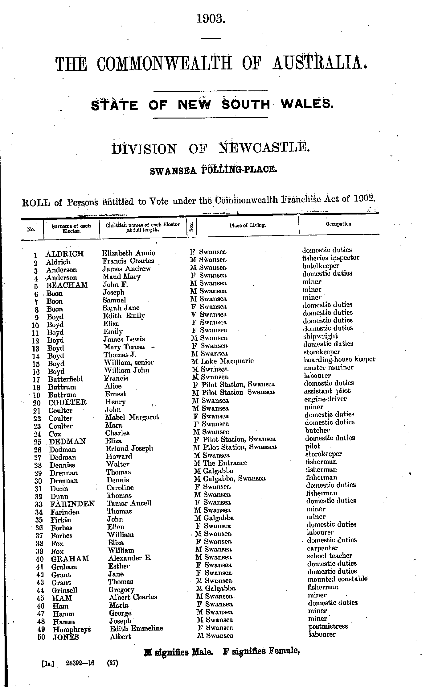
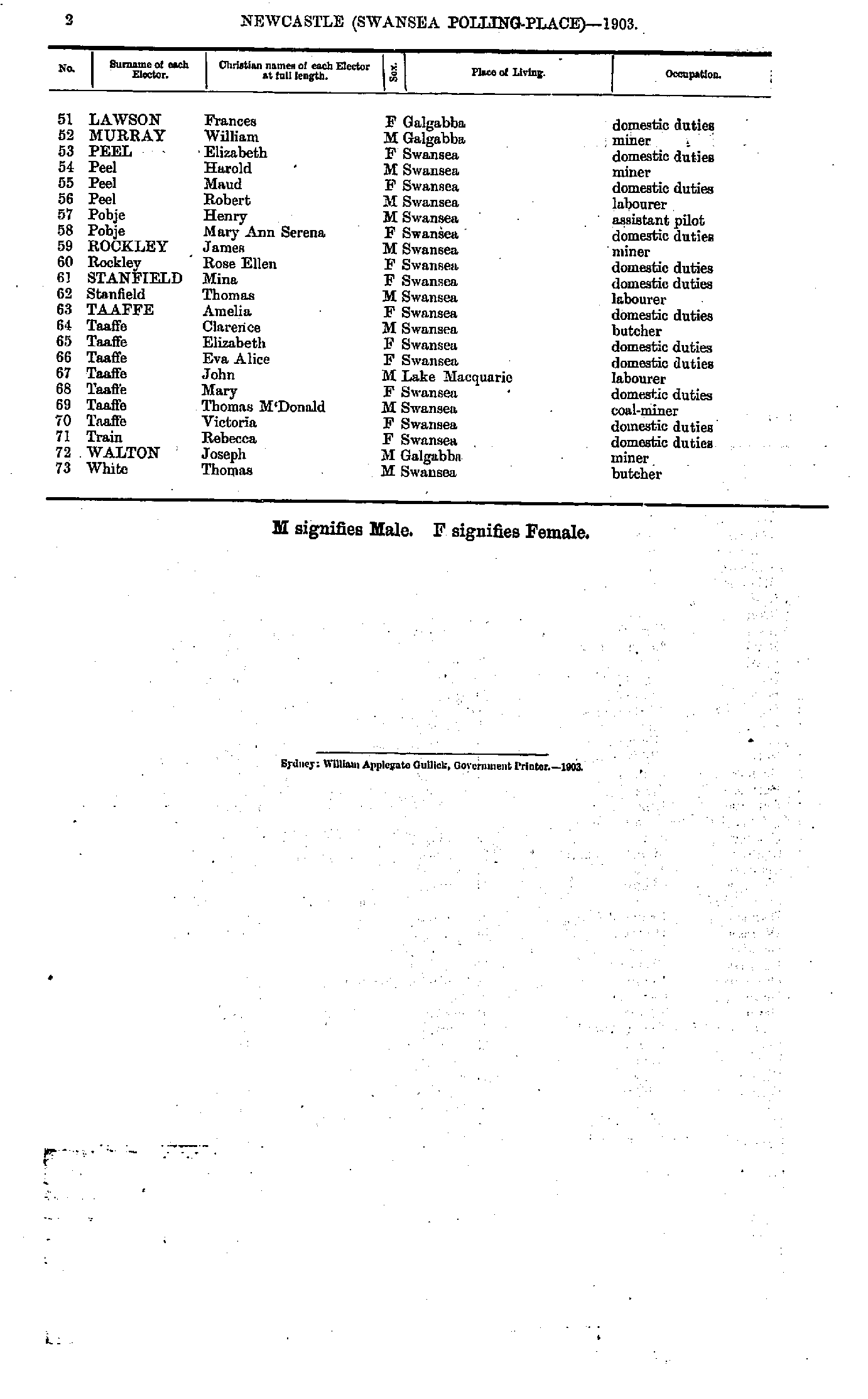
Catherine Hill Bay Polling Place
- Ashman Jessie - Connah John
- Connah Mary - Gray George
- Gray Louisa - M'Nair Robert
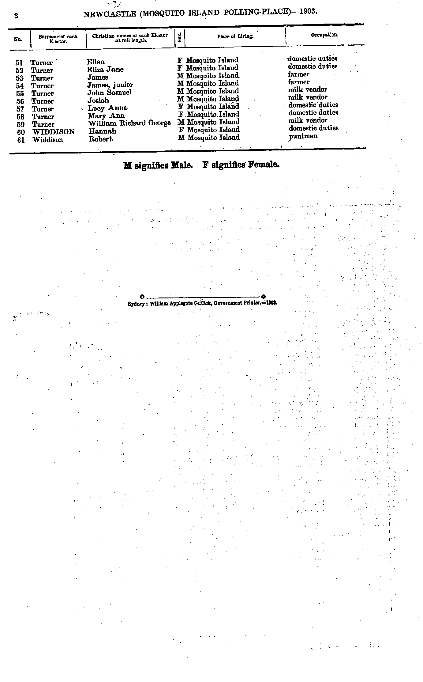
- Magill Margaret - Rostron Aquila
- Rostron George - Woodman Sarah
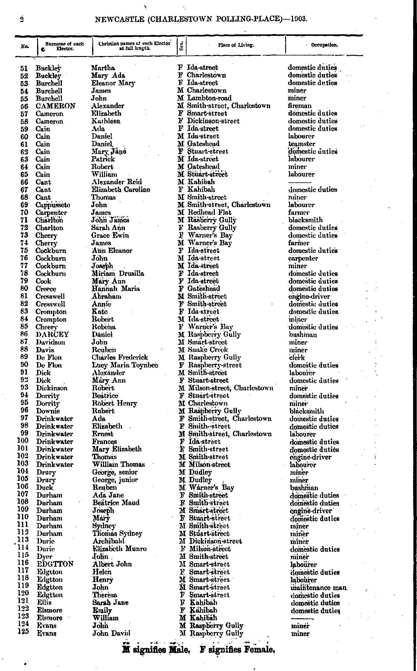
- Anderson Grace - Buckley Bernard
- Buckley Martha - Evans John
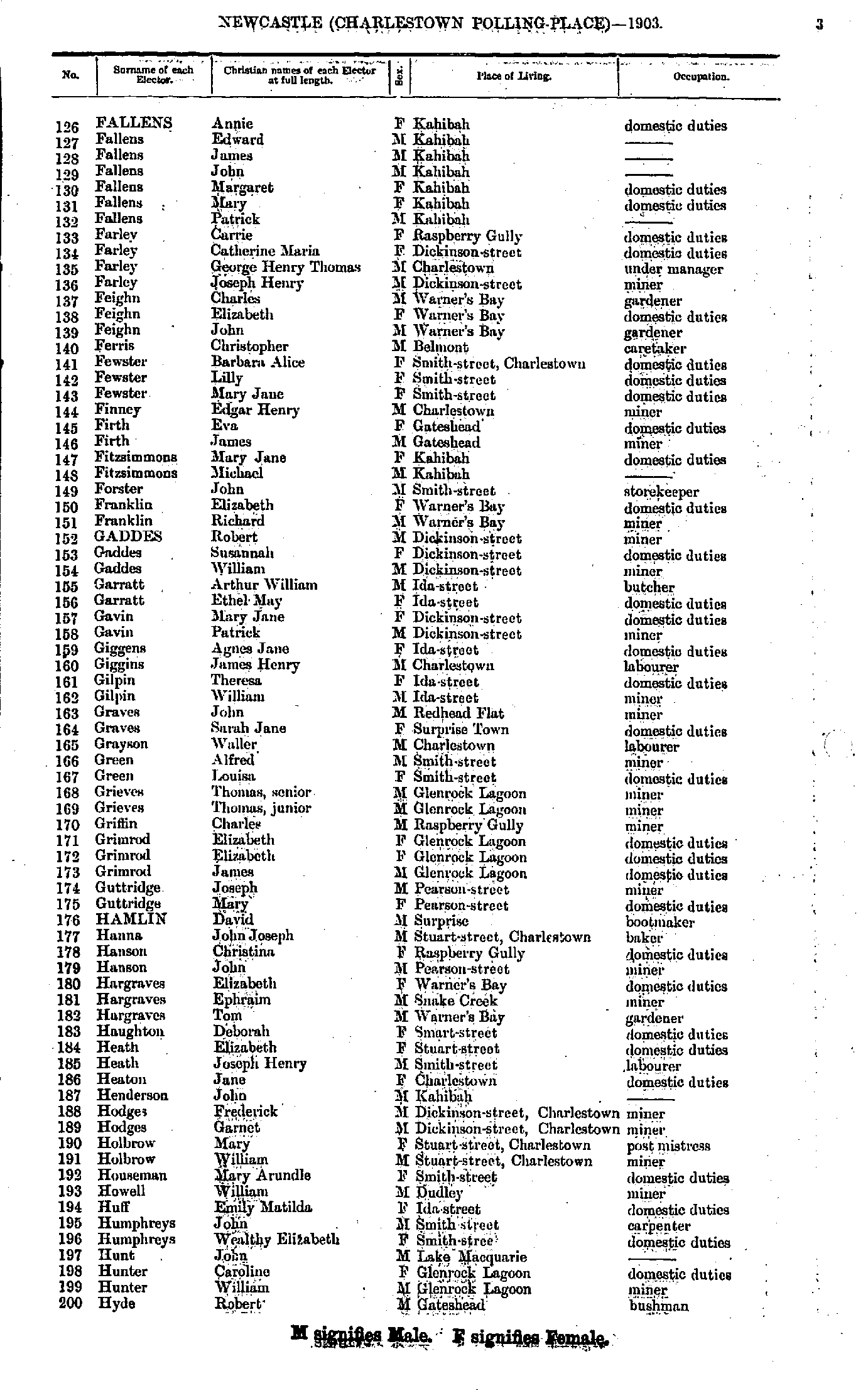
- Fallens Annie - Hyde Robert
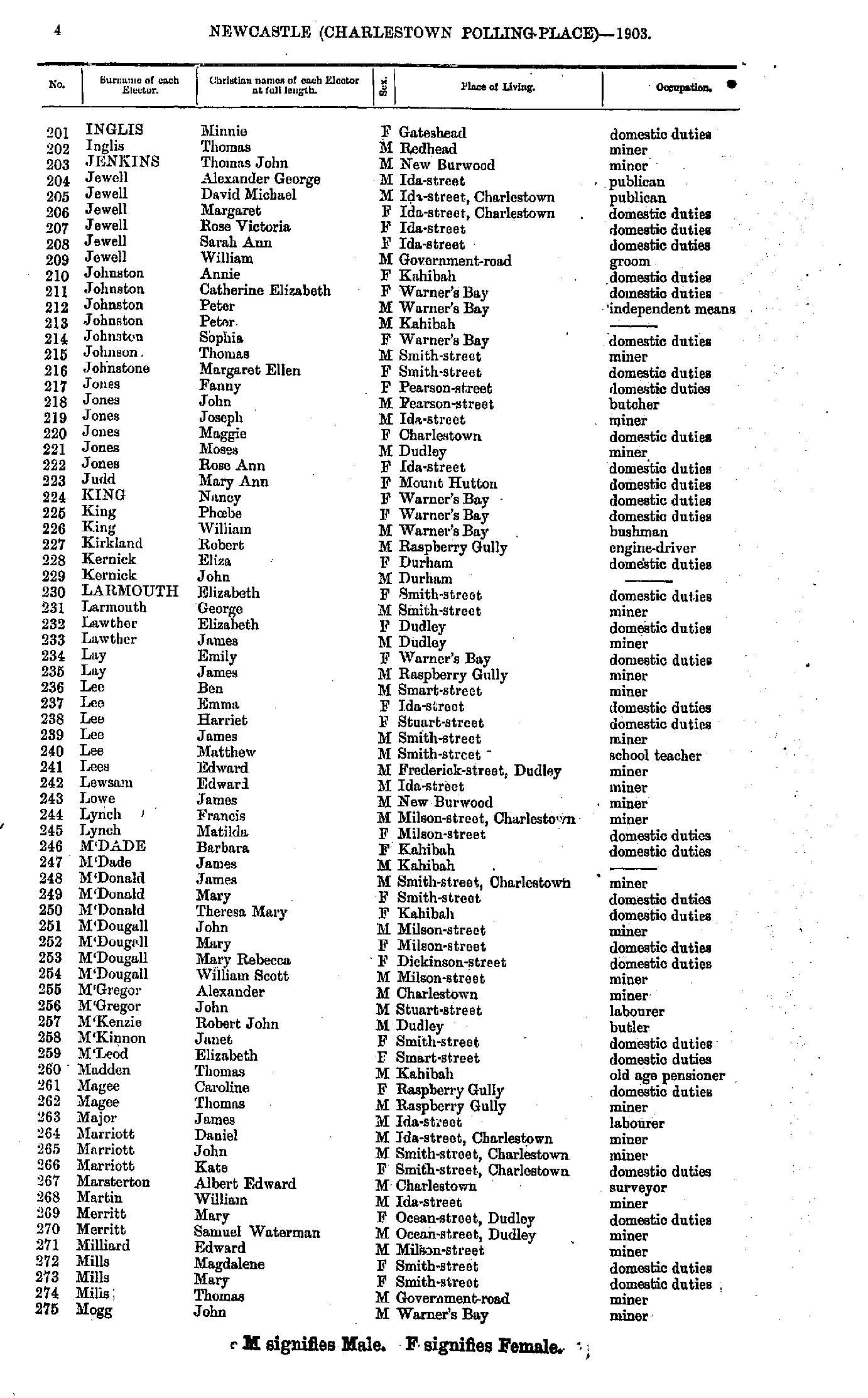
- Inglis Minnie - Mogg John
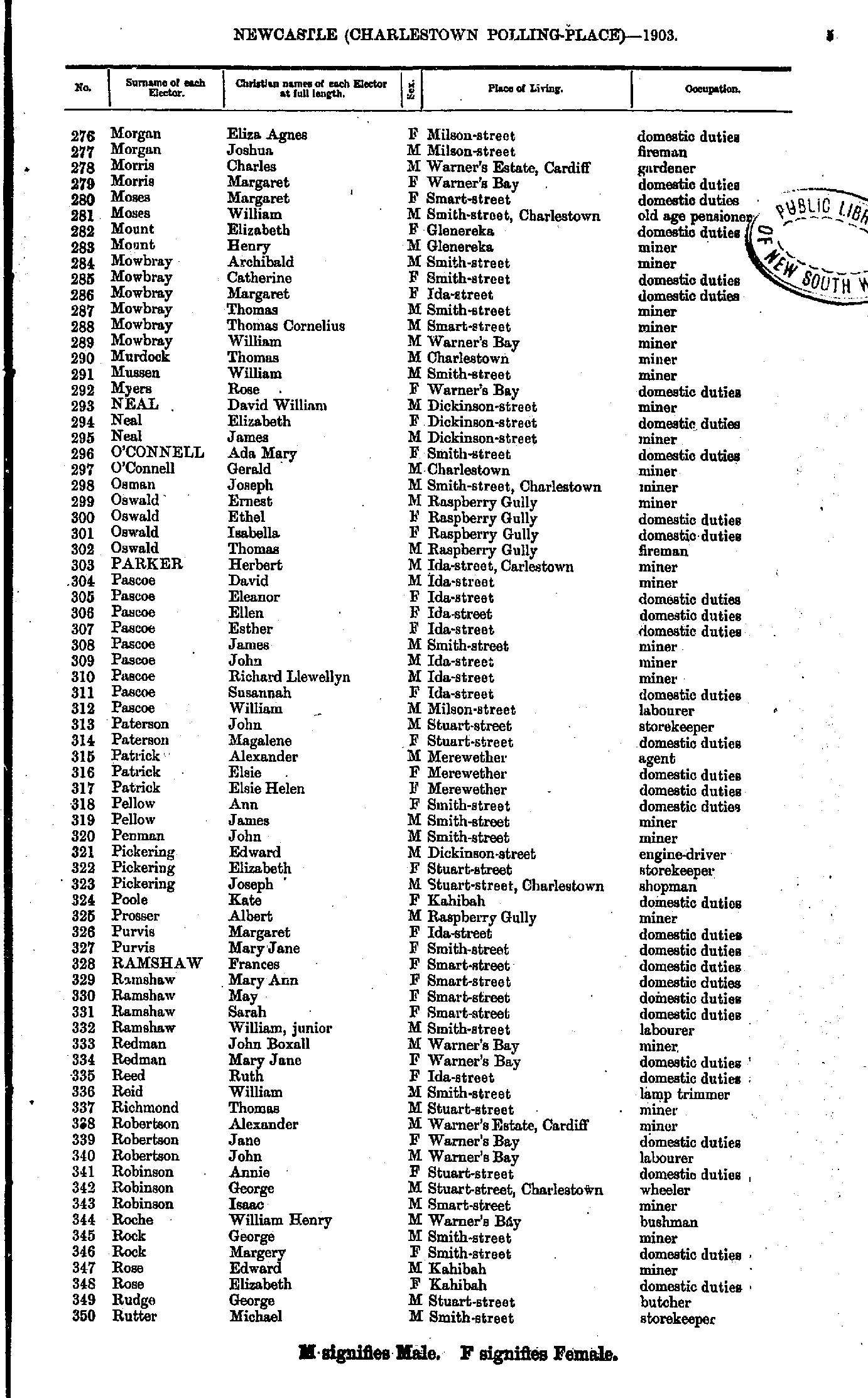
- Morgan Eliza - Rutter Michael
- Sarginson James - Weichert Louis
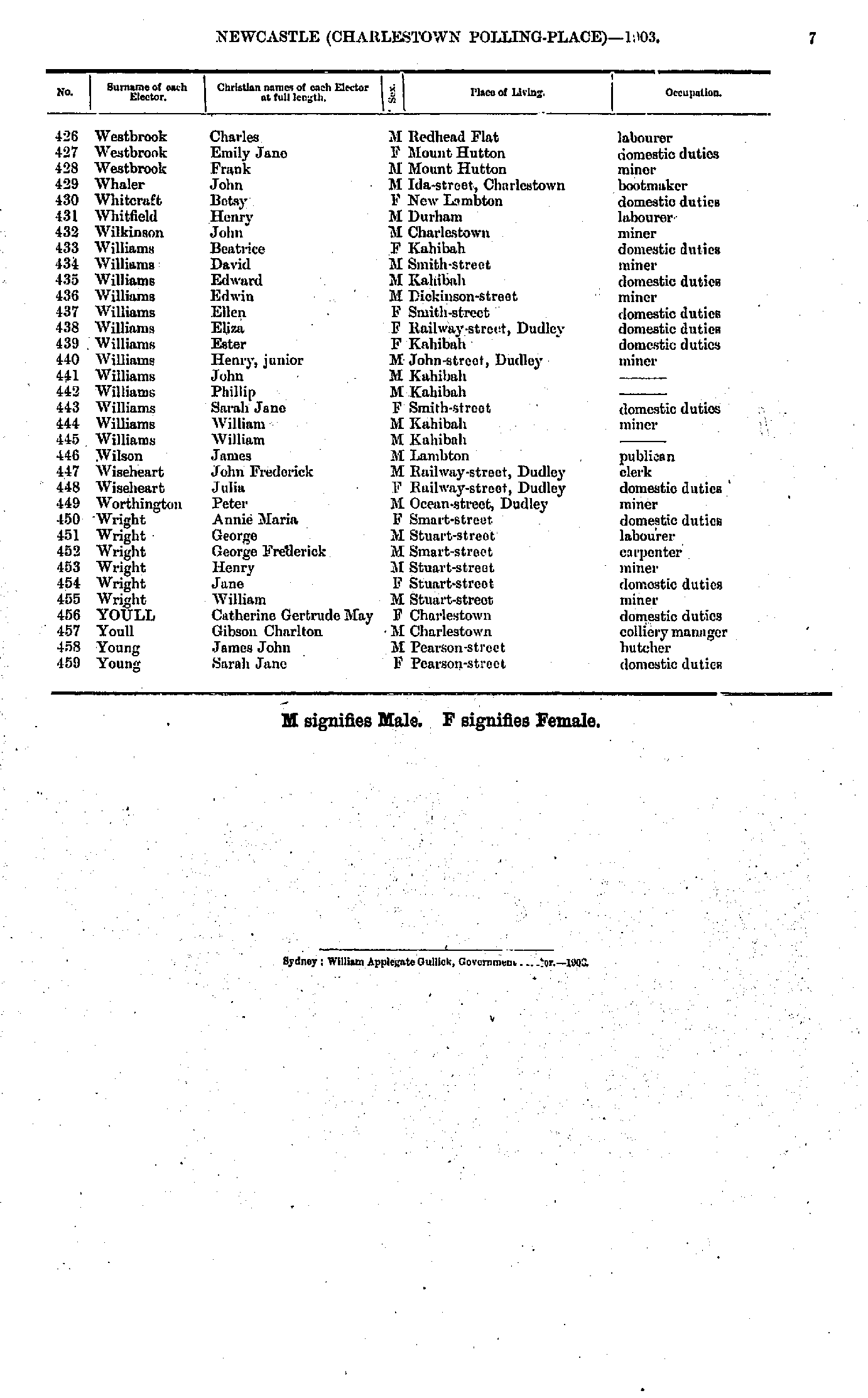
- Westbrook Charles - Young Sarah
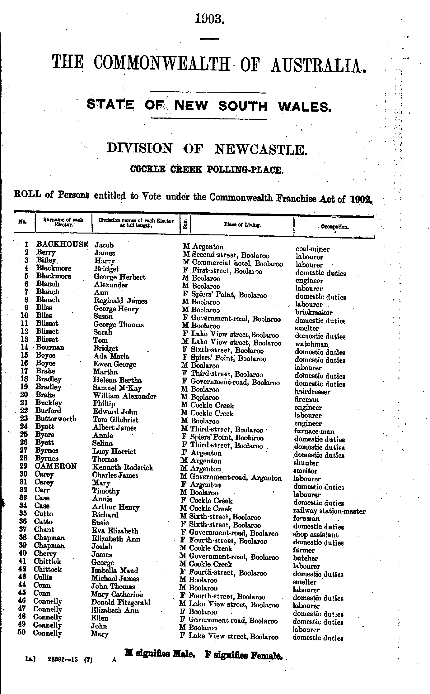
- Backhouse Jacob - Connelly Mary
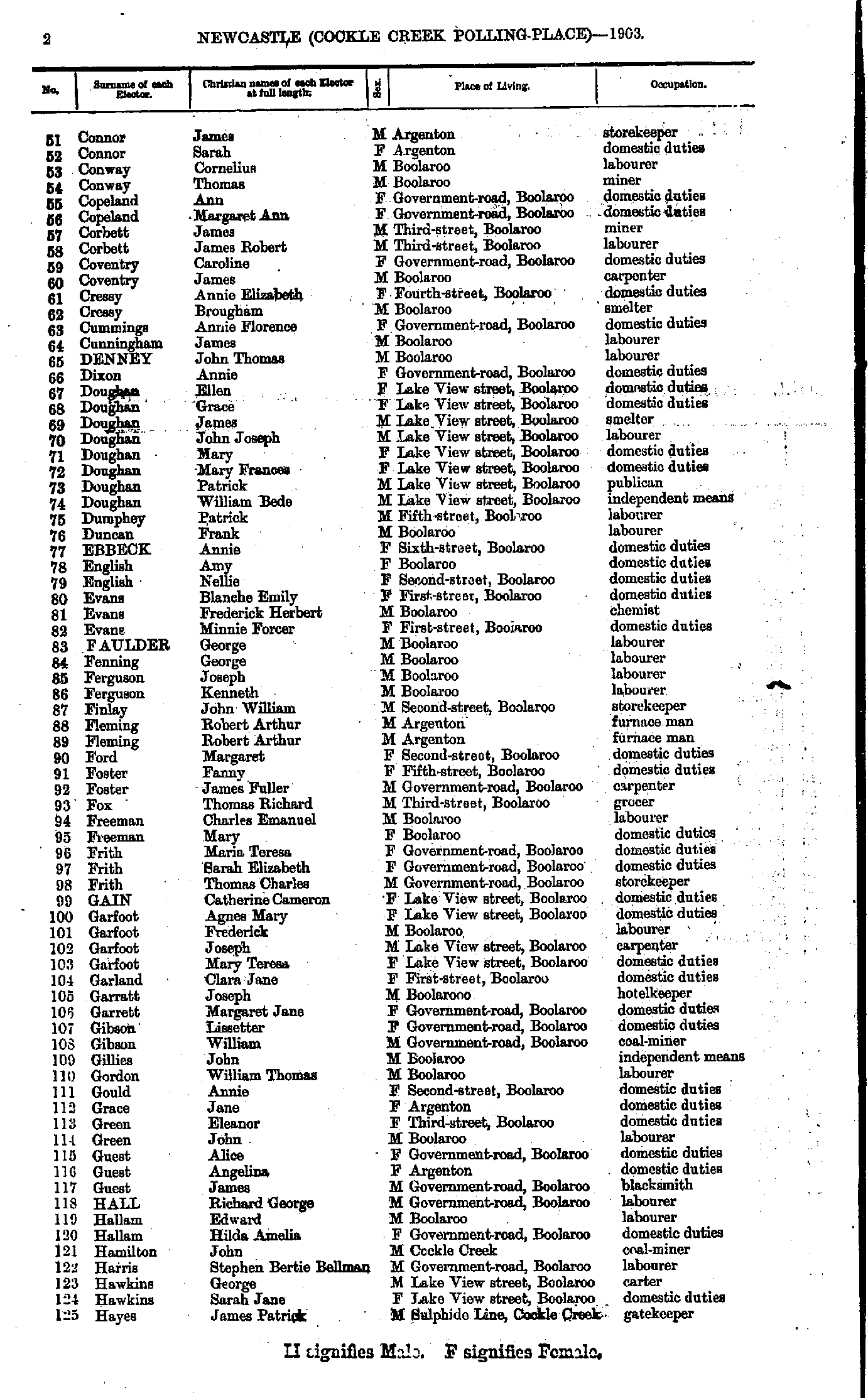
- Connor James - Hayes James
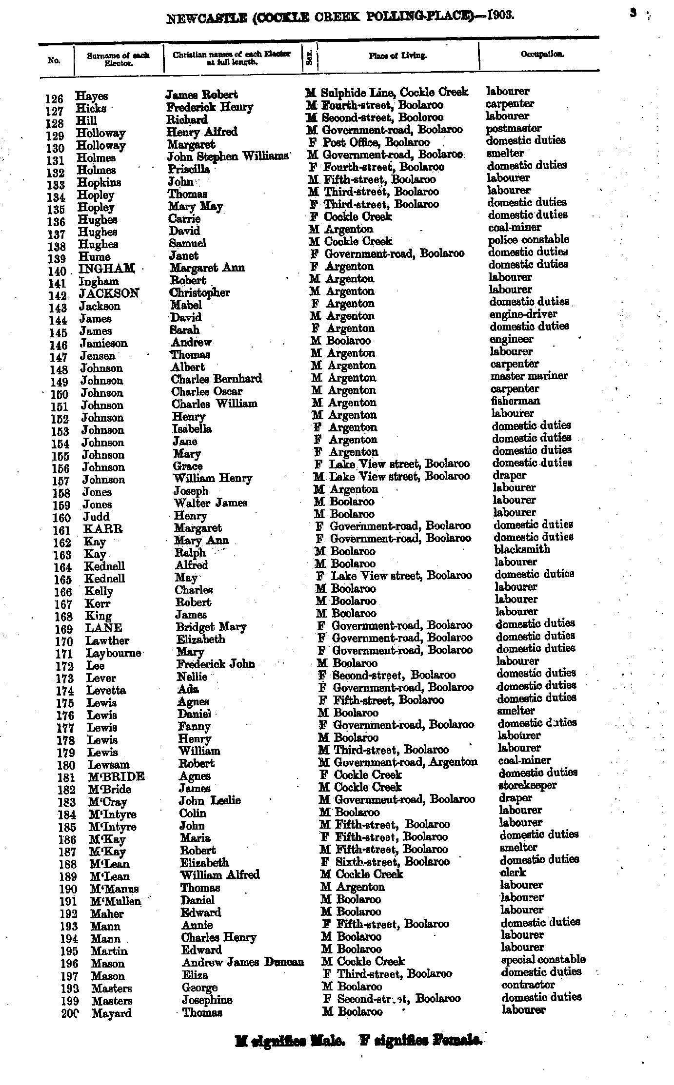
- Hayes James - Mayard Thomas
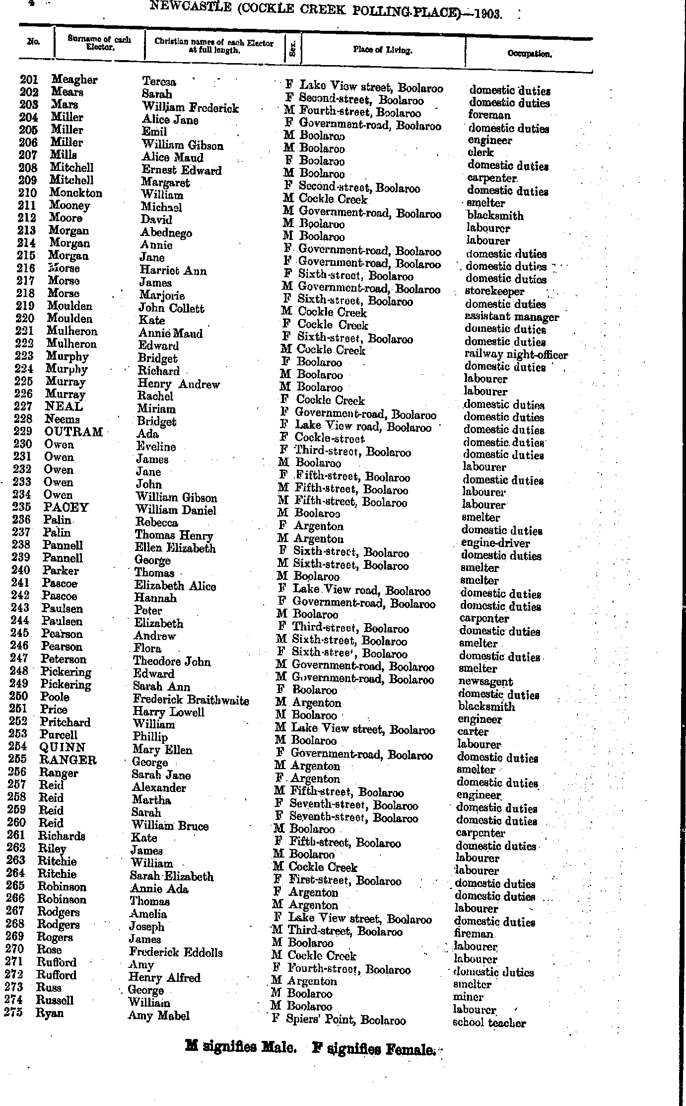
- Meagher Teresa - Ryan Amy
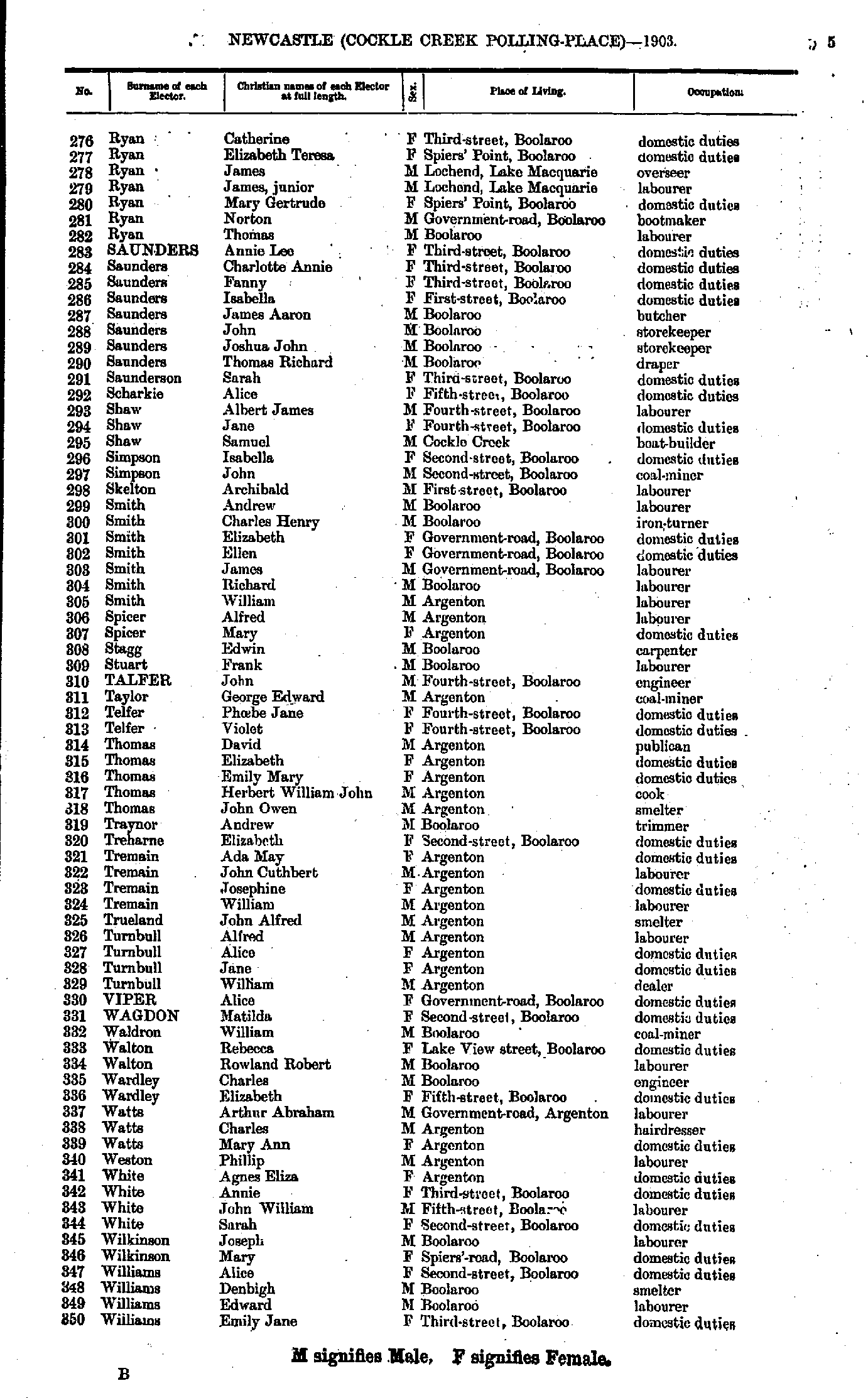
- Ryan Catherine - Williams Emily
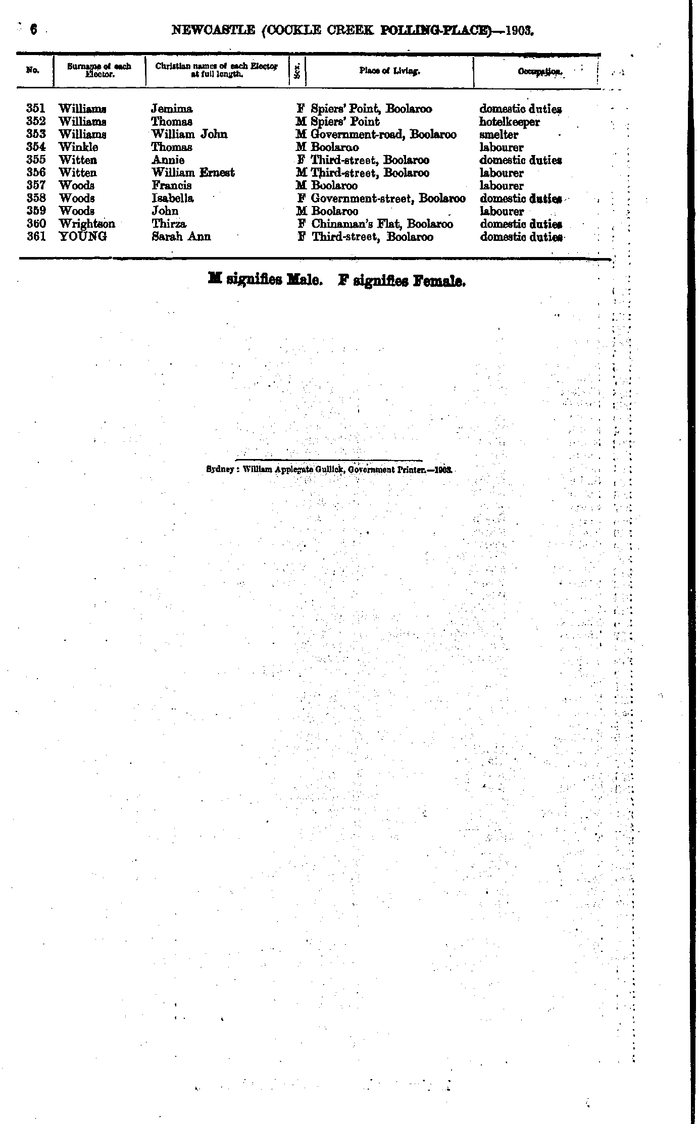
- Williams Jemima - Young Sarah
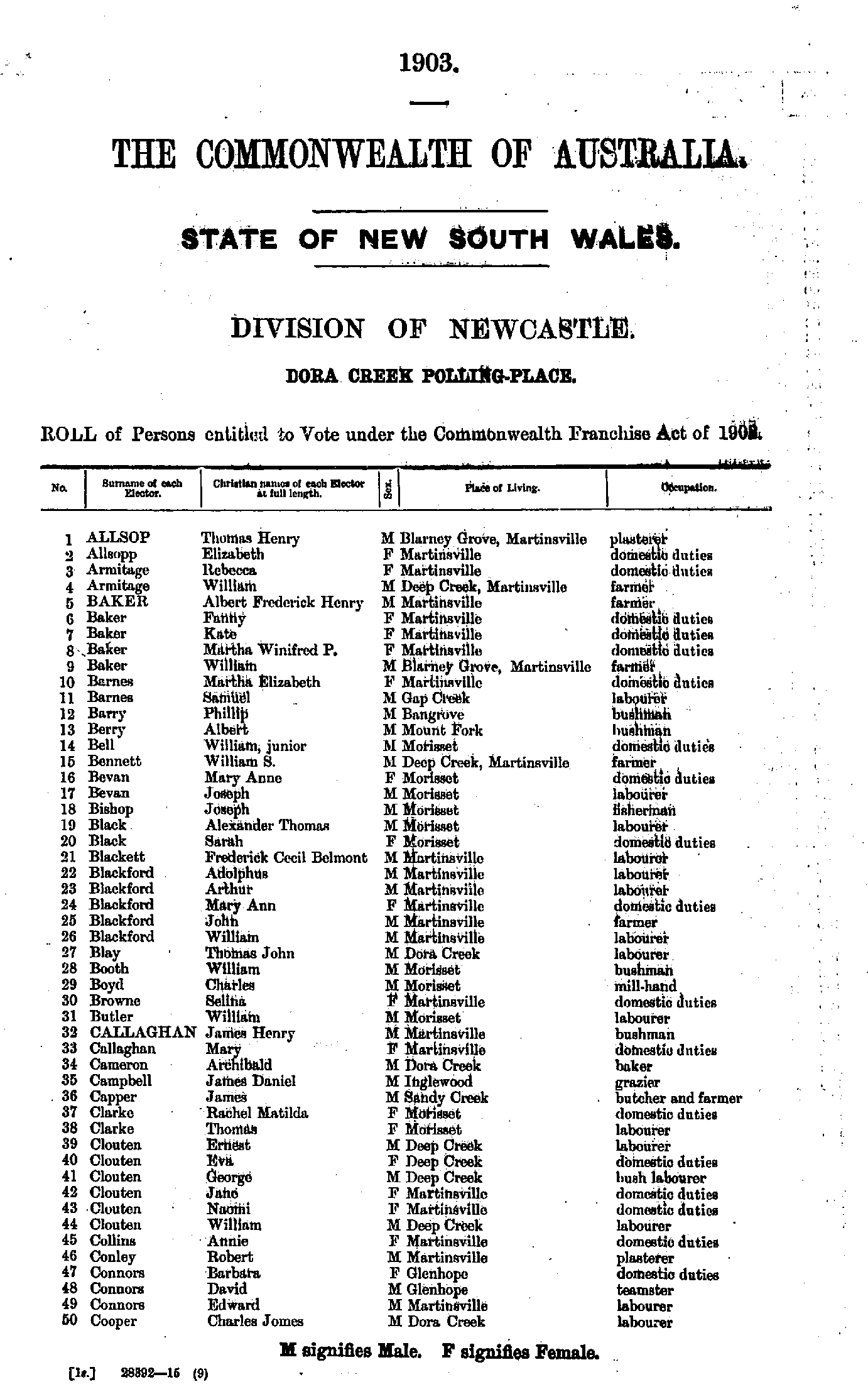
- Allsop Thomas - Cooper Charles
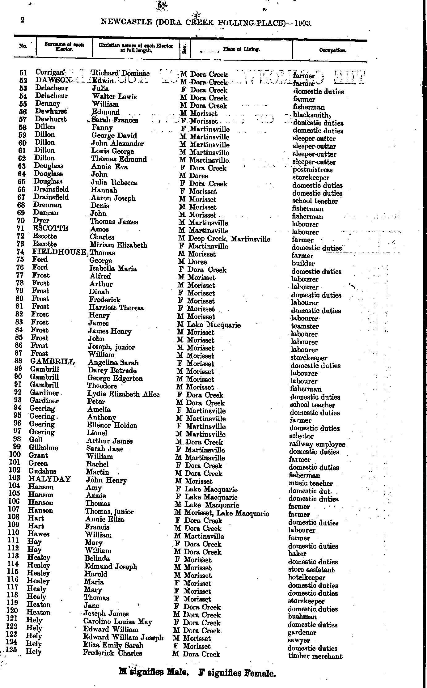
- Corrigan Richard - Hely Frederick
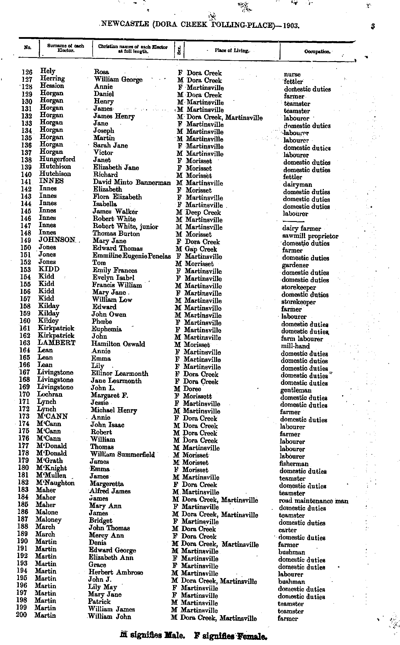
- Hely Rosa - Martin William
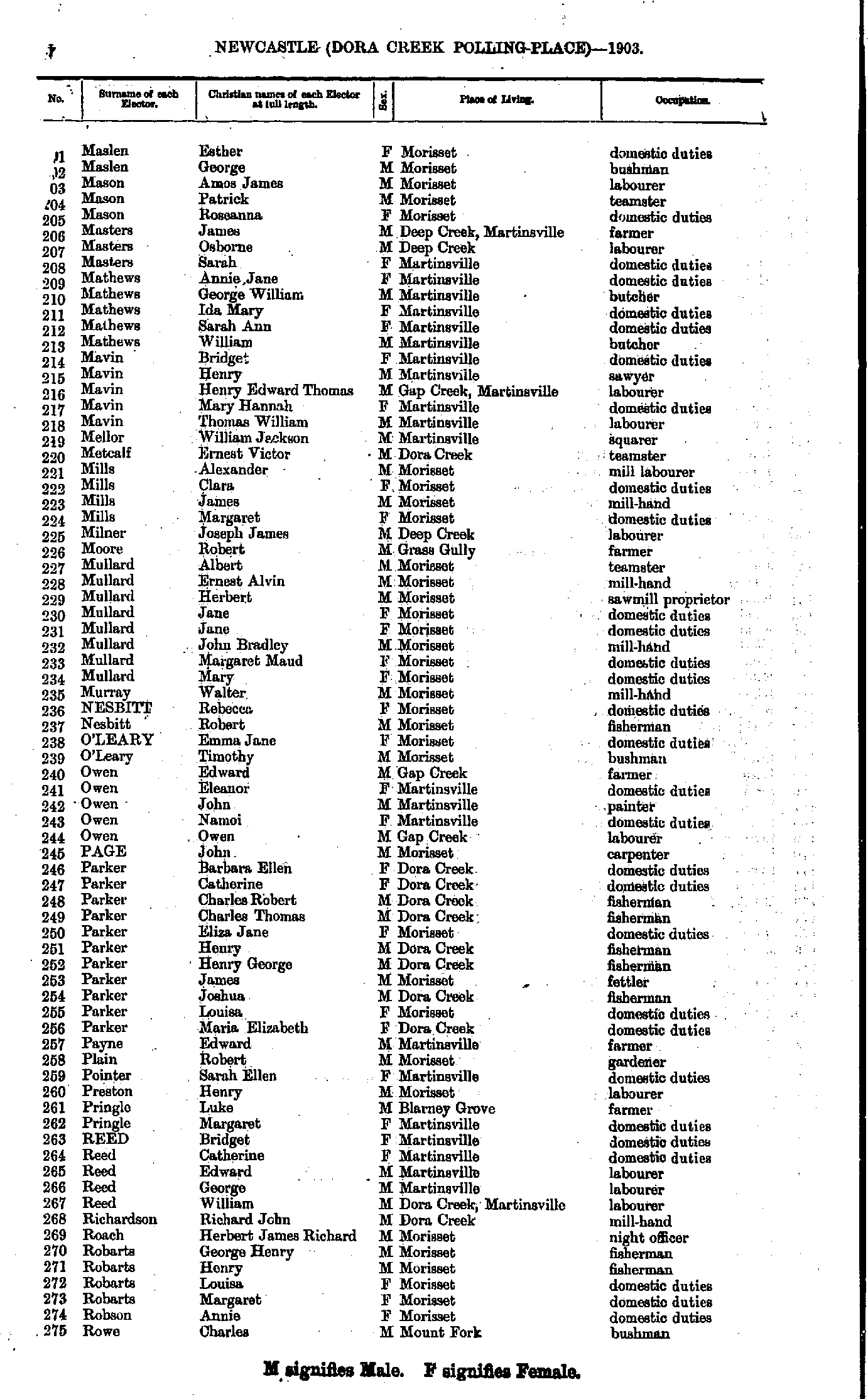
- Maslen Esther - Rowe Charles
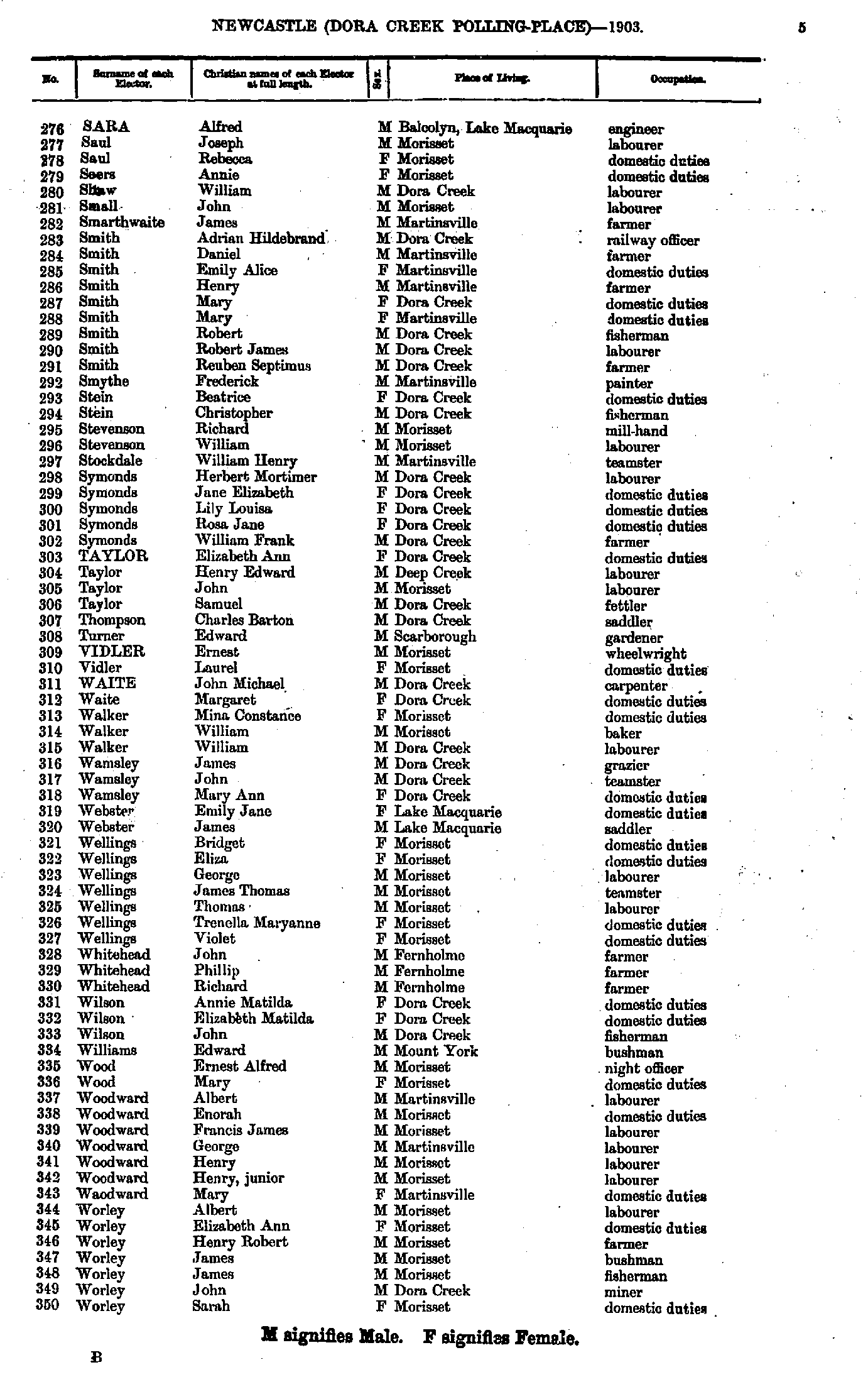
- Sara Alfred - Worley Sarah
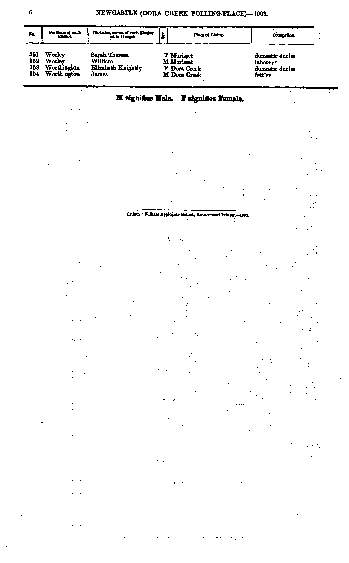
- Worley Sarah - Worthington James
- Ackroyd Elizabeth - Brown Harry
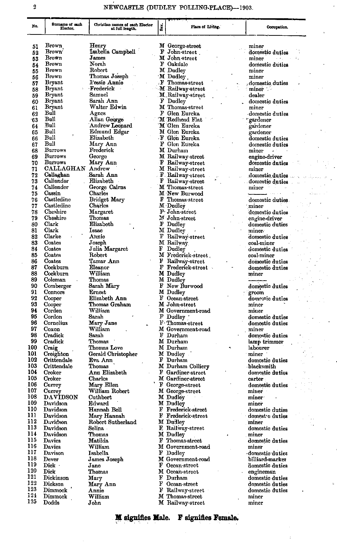
- Brown Henry - Dodds John
- Dodds Margaret - Hemingway William
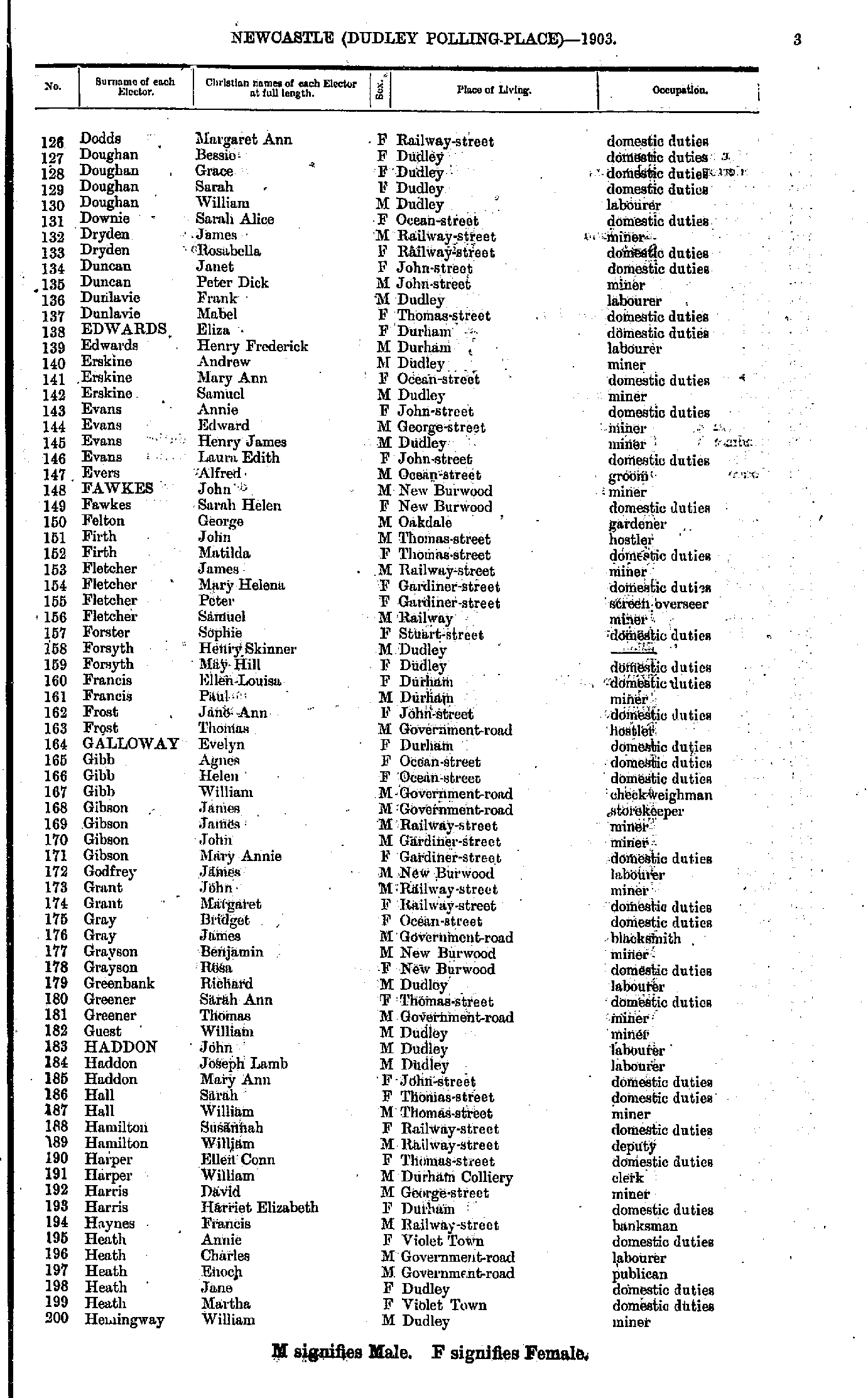
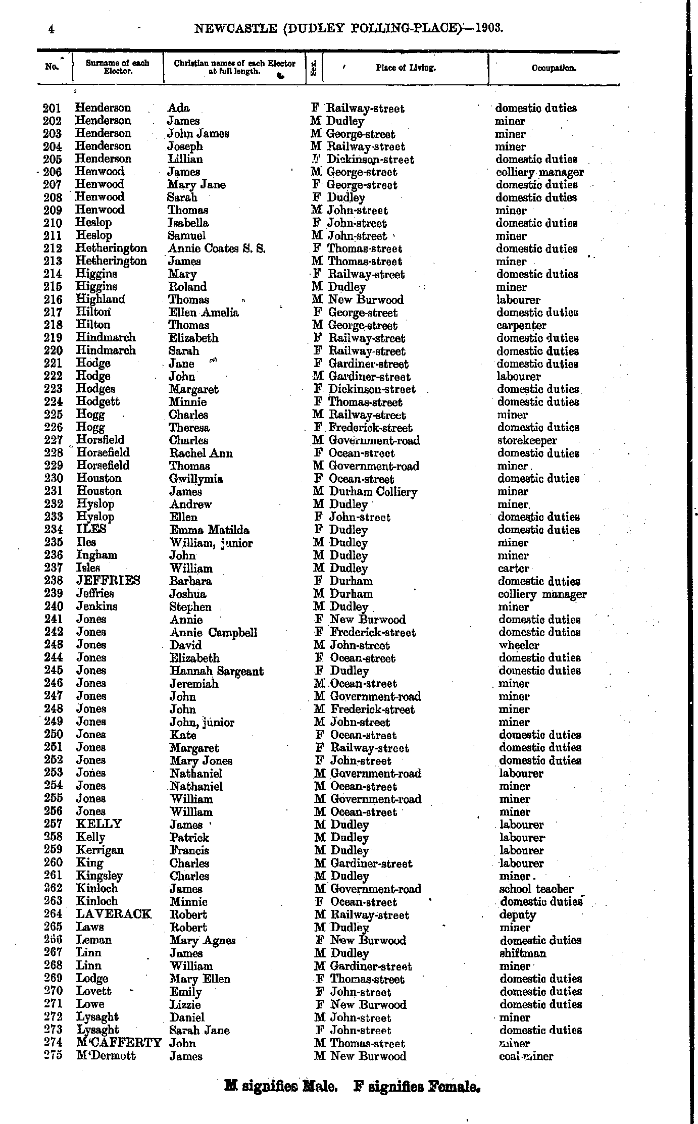
- Henderson Ada - M'Dermott James
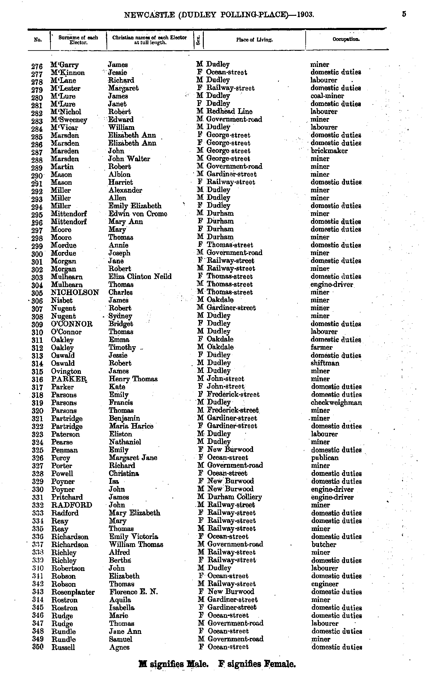
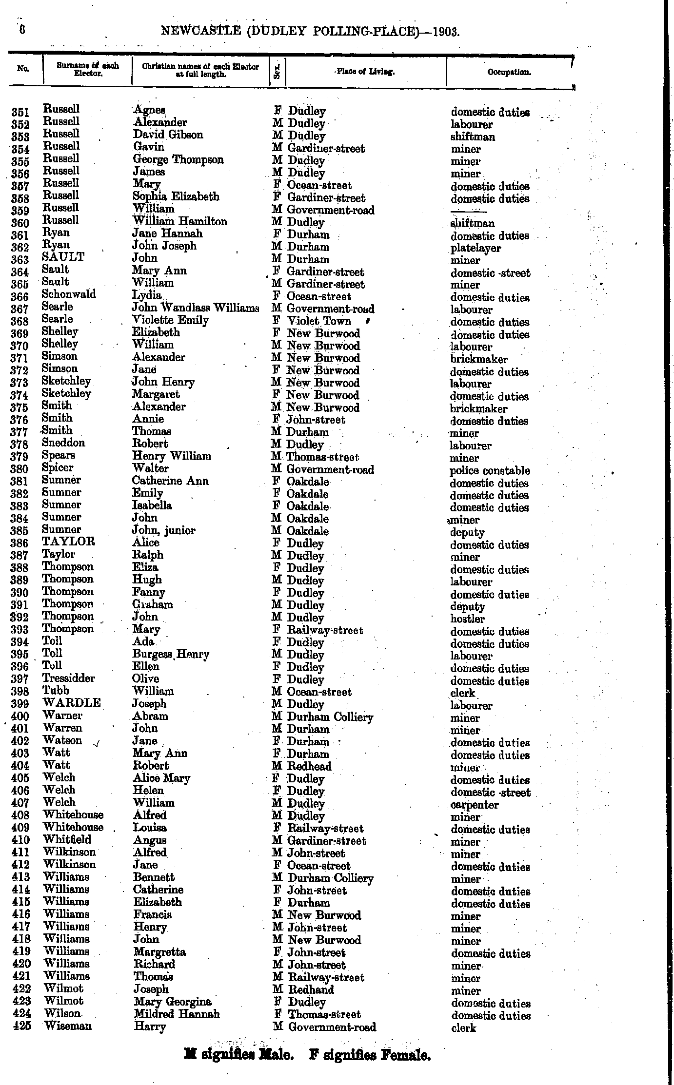
- M'Garry James - Russell Agnes
- Russell Agnes - Wiseman Harry
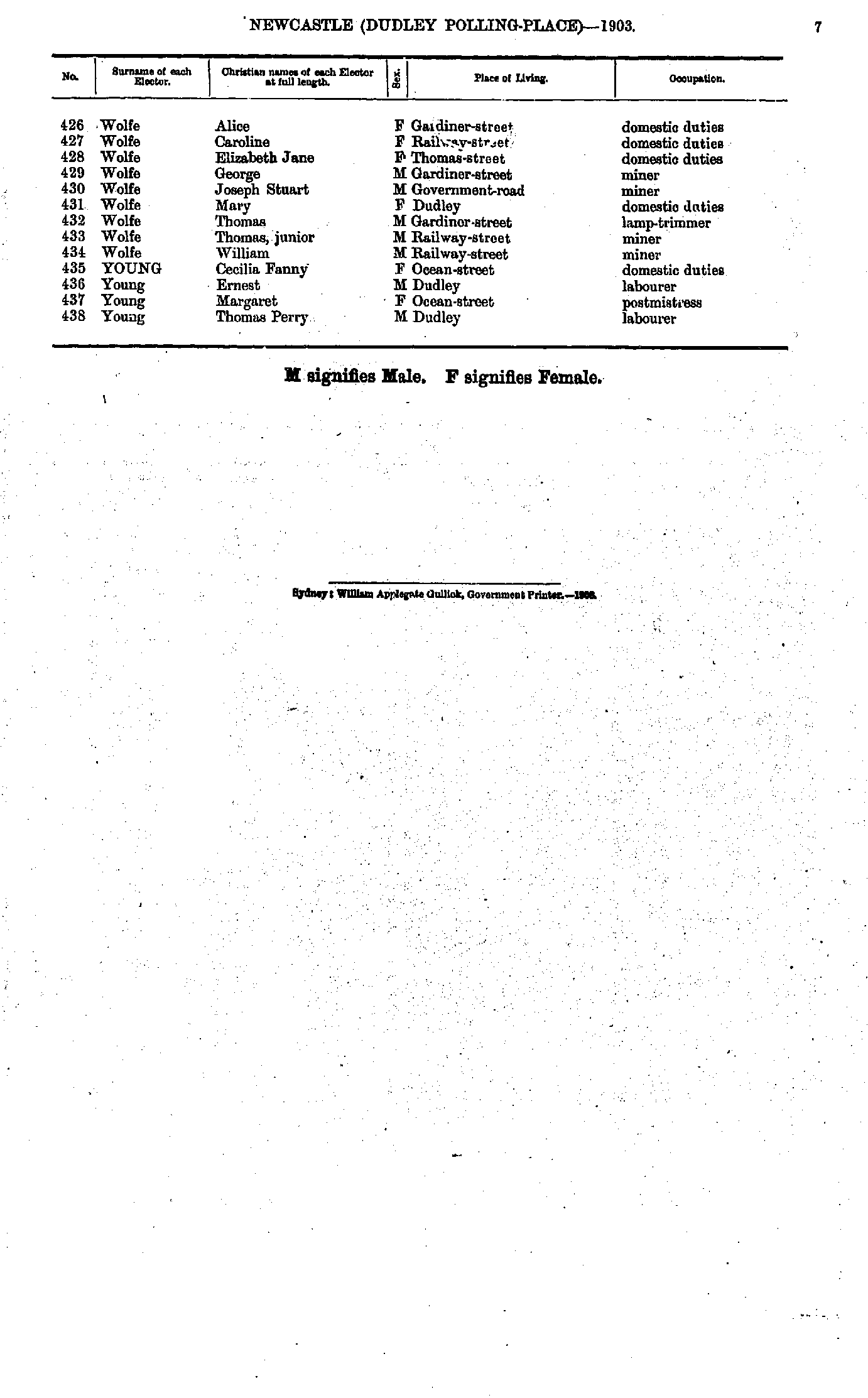
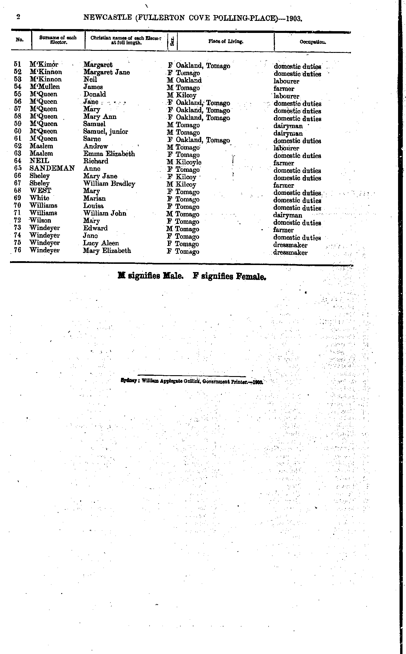
- Wolfe Alice - Young Thomas
- A'Beckett James - Arnott Maud
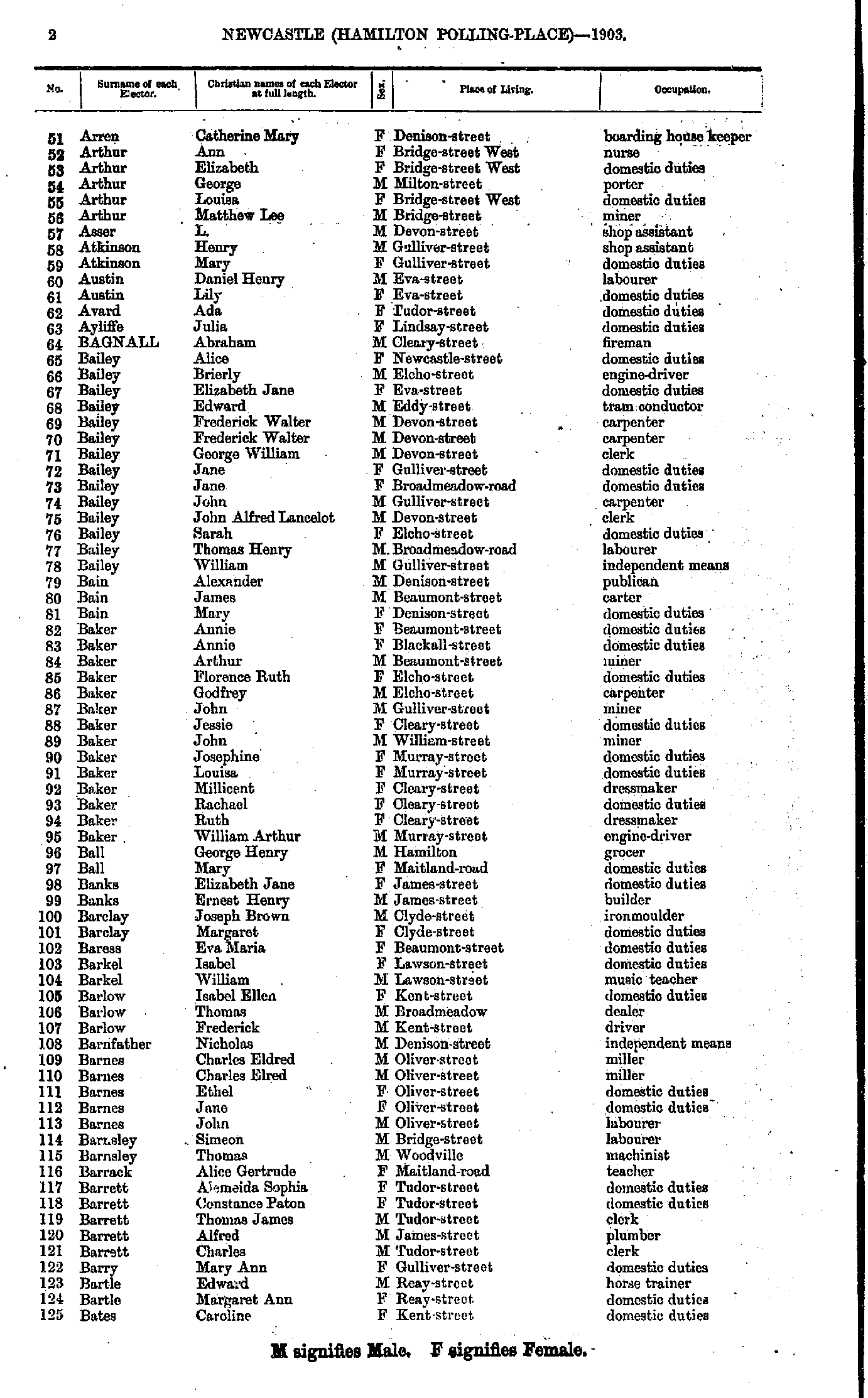
- Arren Catherine - Bates Caroline
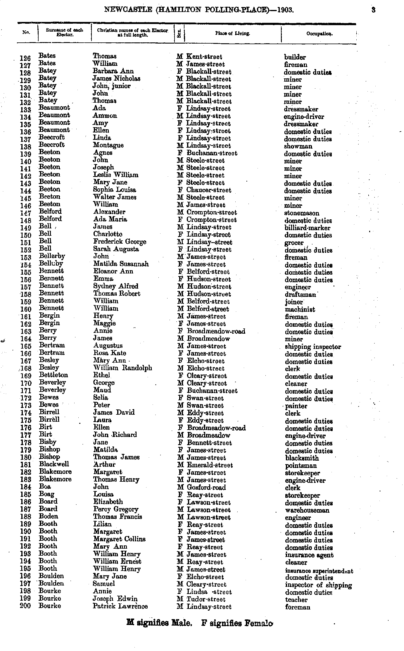
- Bates Thomas - Bourke Patrick
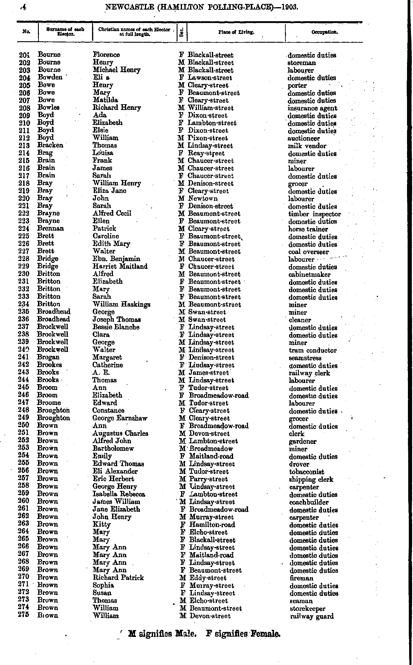
- Bourne Florence - Brown William
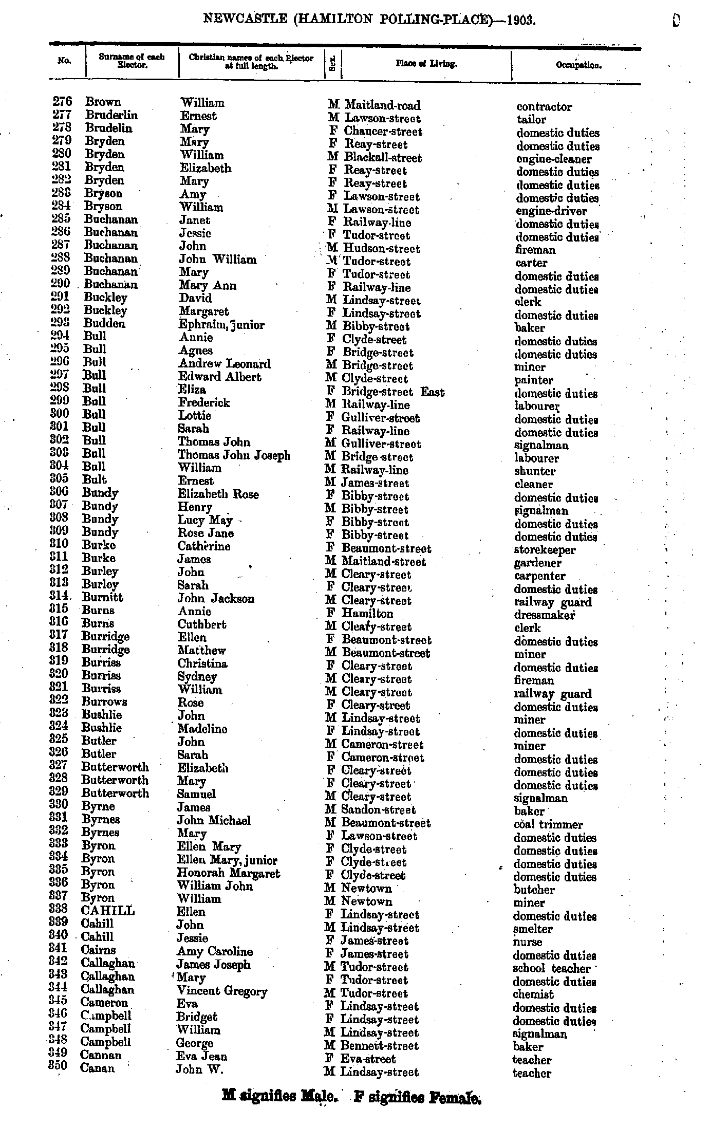
- Brown William - Canan John
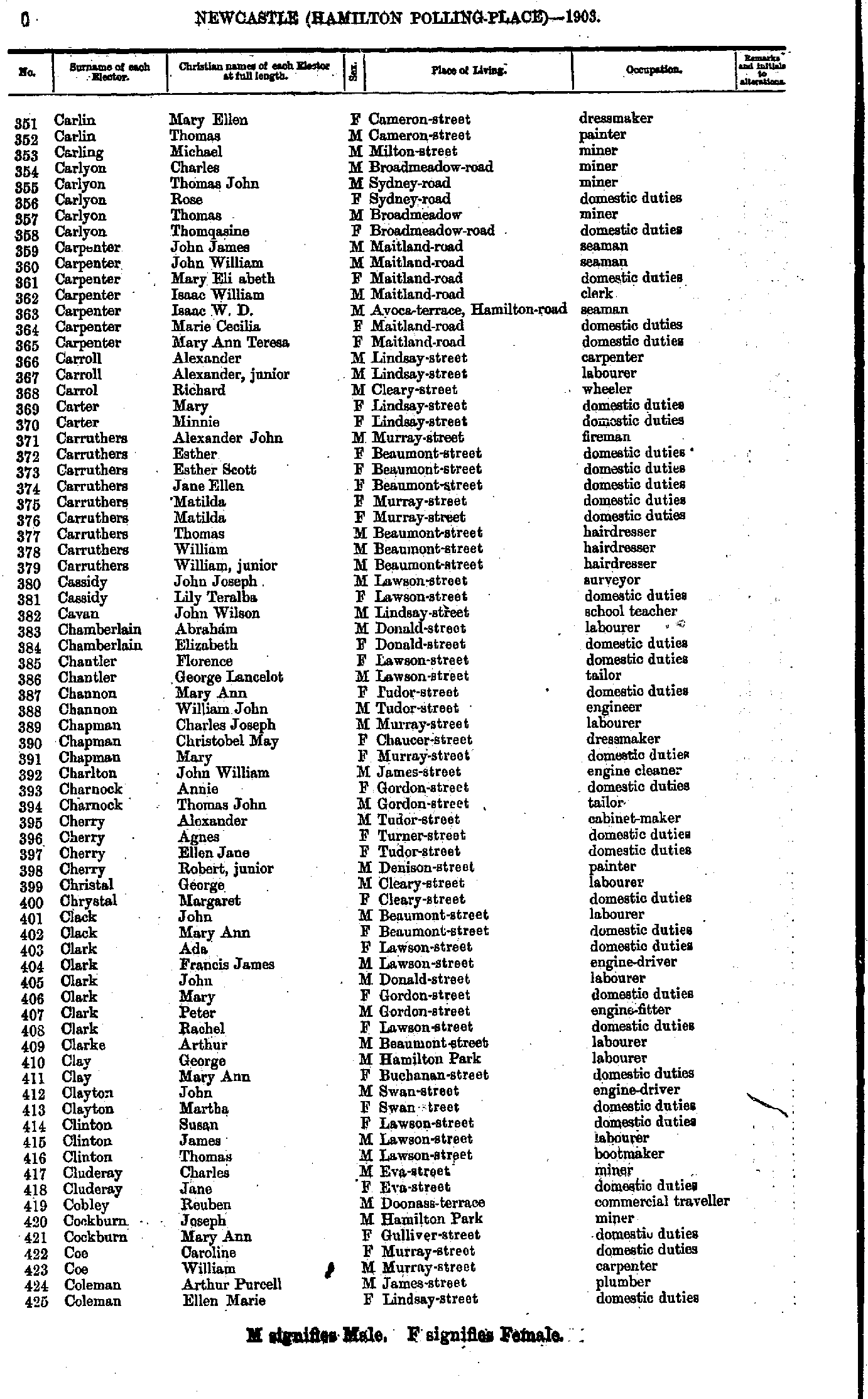
- Carlin Mary - Coleman Ellen
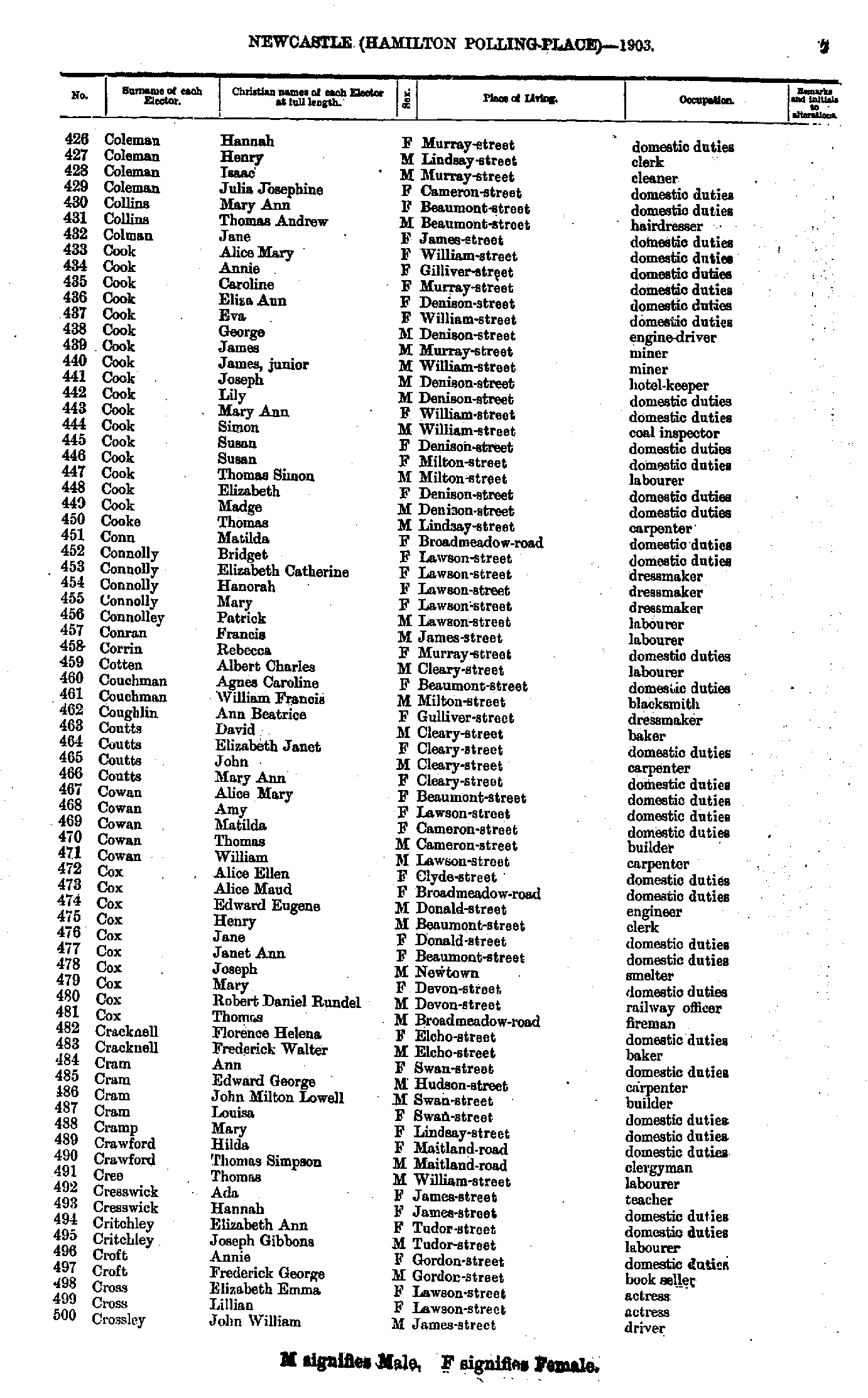
- Coleman Hannah - Crossley John
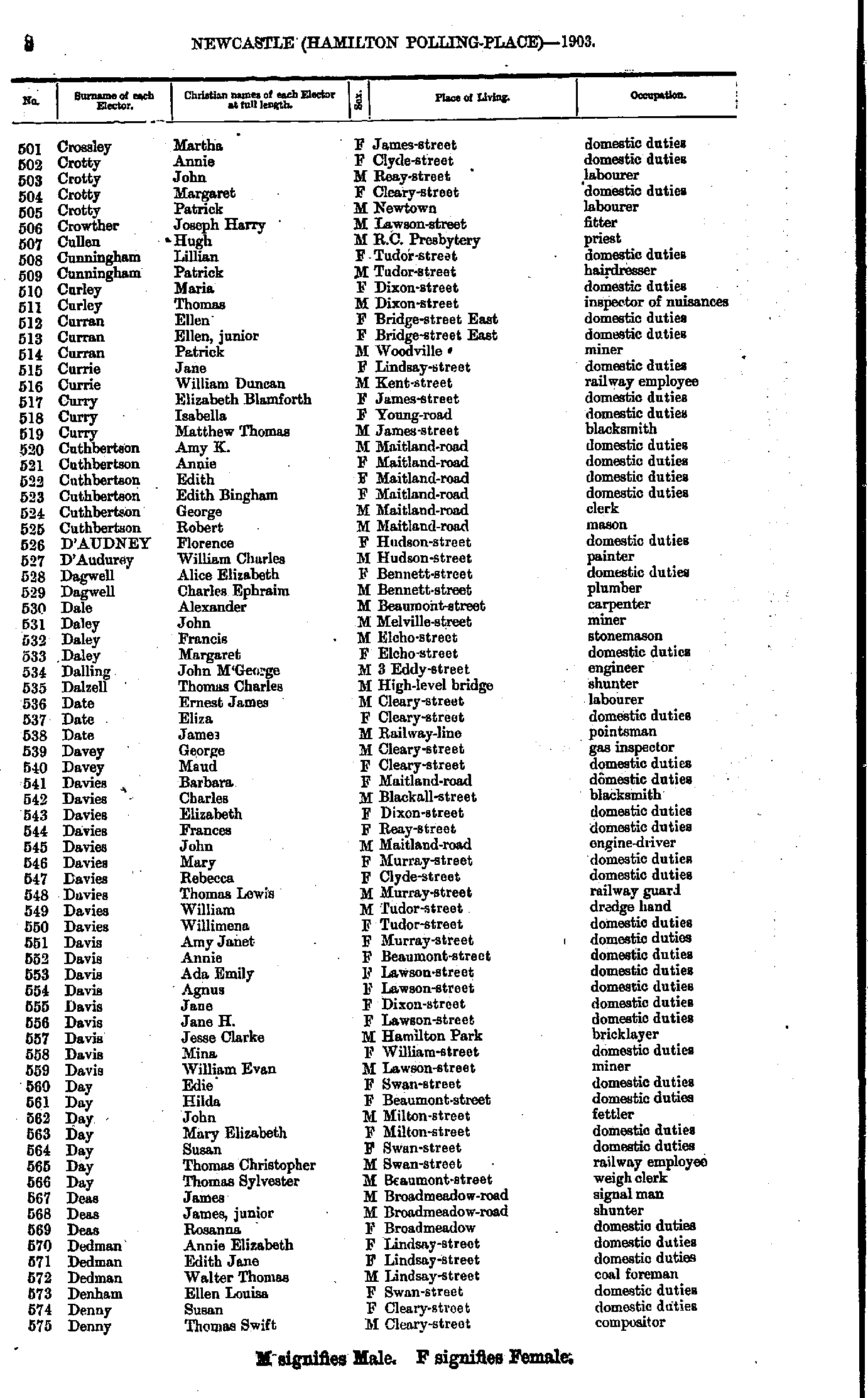
- Crossley Martha - Denny Thomas
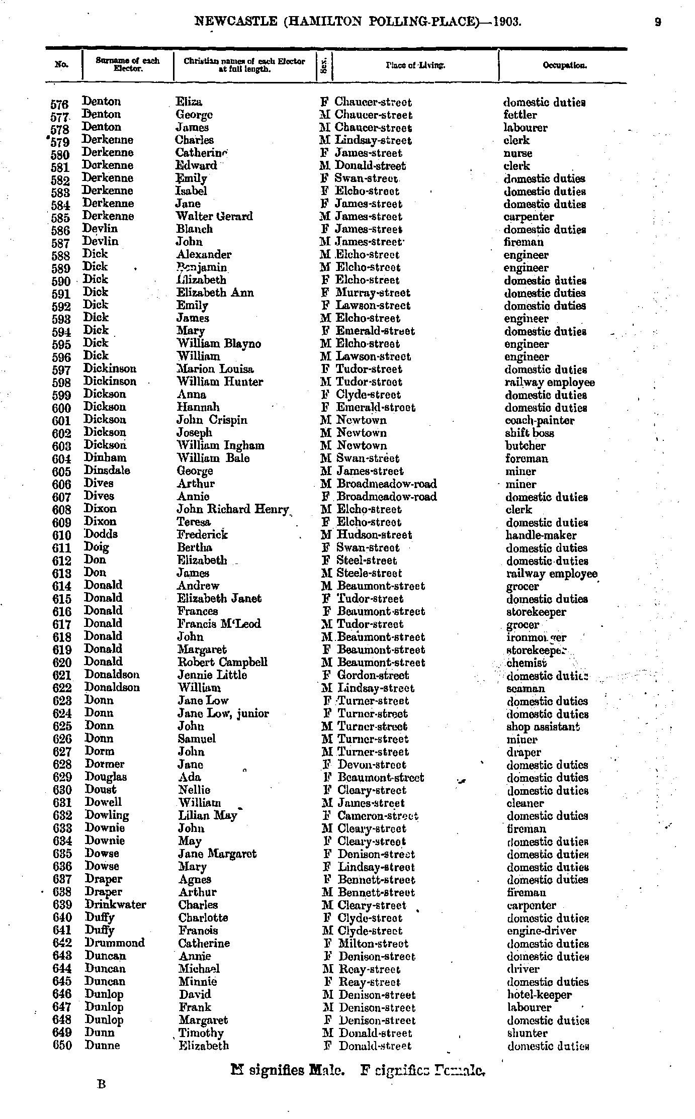
- Denton Eliza - Dunne Elizabeth
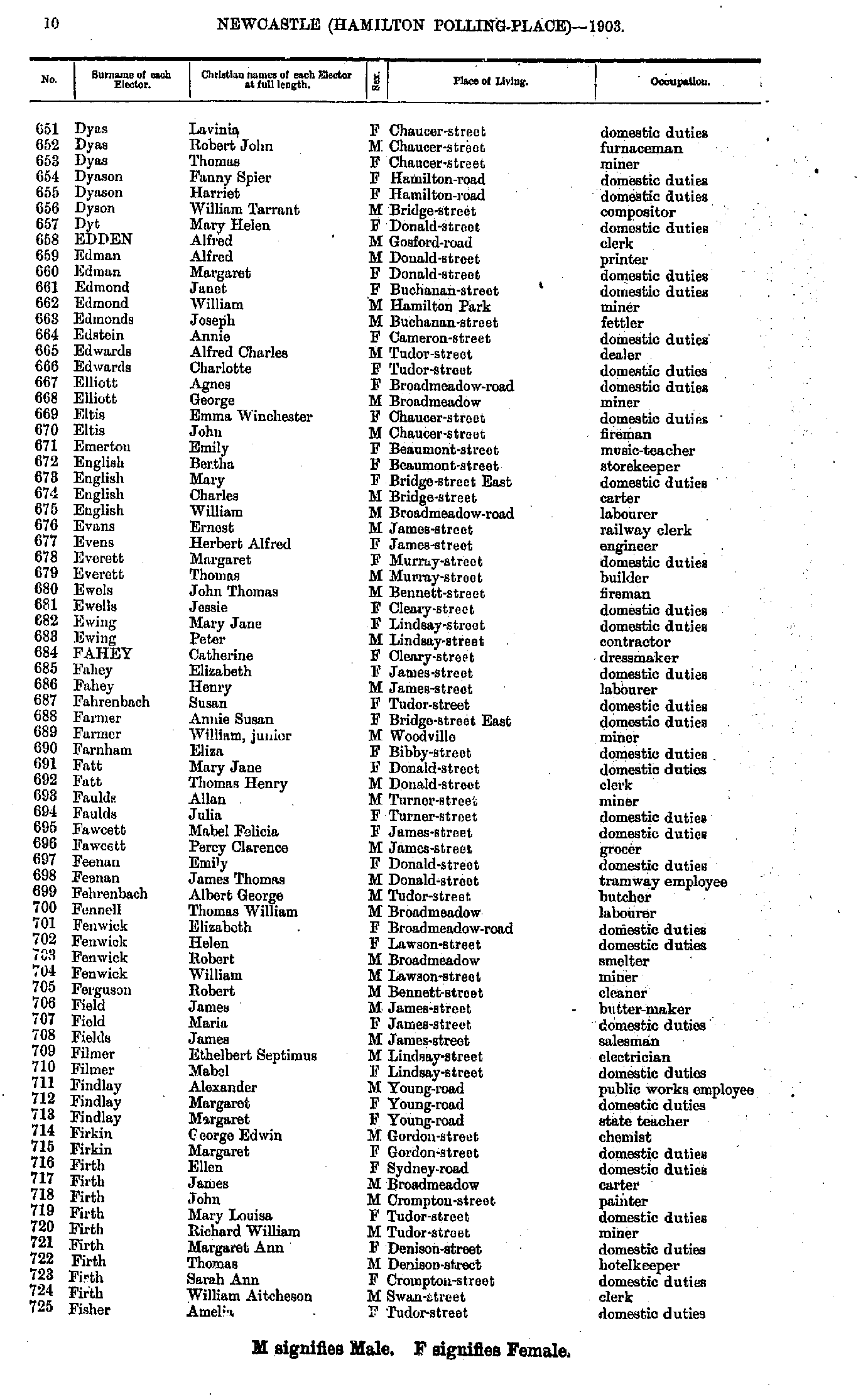
- Dyas Lavinia - Fisher Amelia
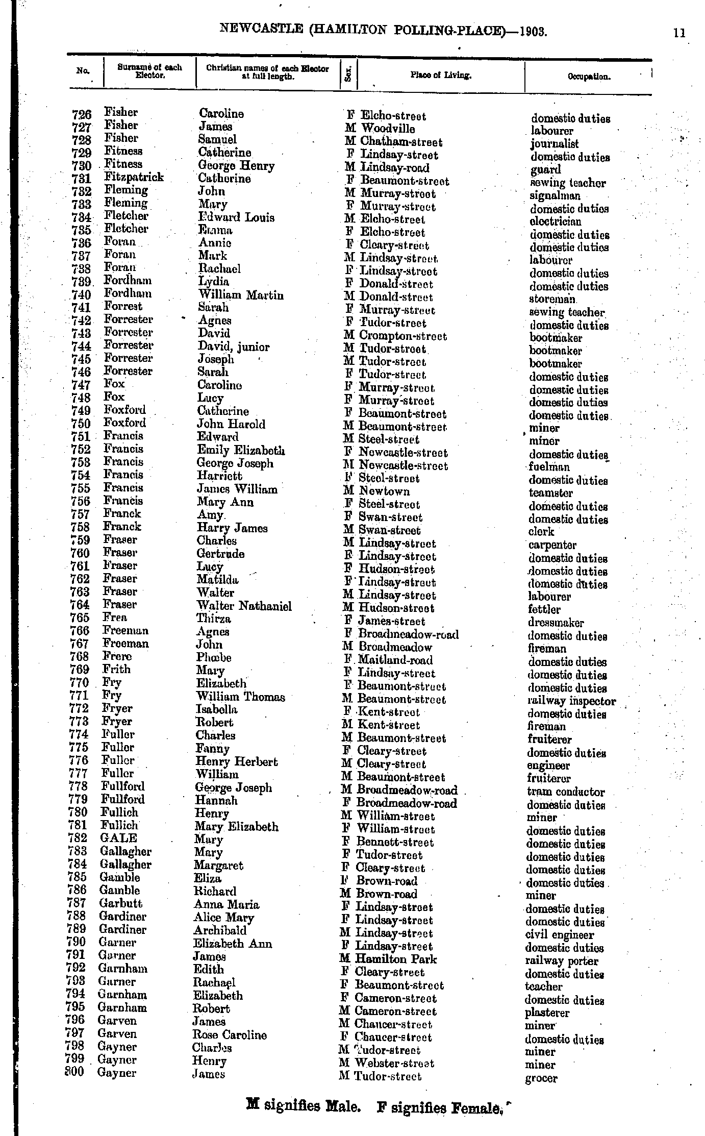
- Fisher Caroline - Gayner James
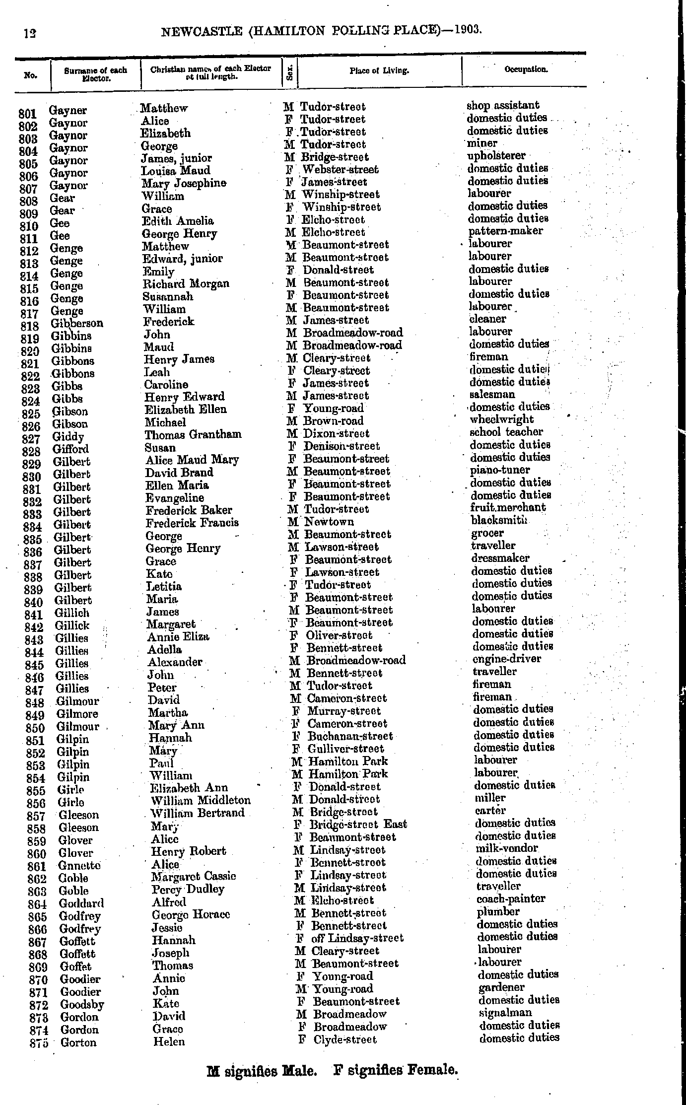
- Gayner Matthew - Gorton Helen
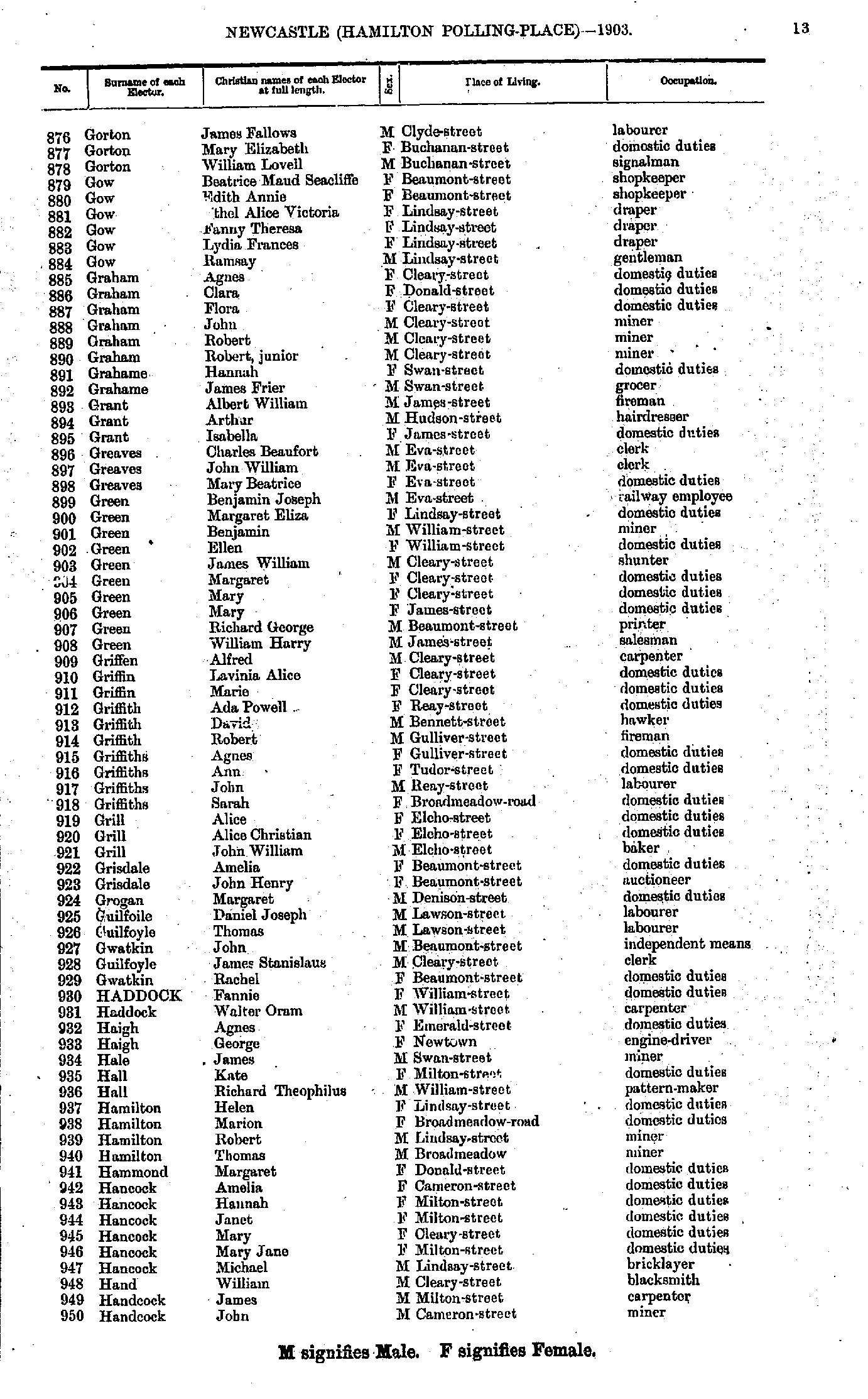
- Gorton James - Handcock John
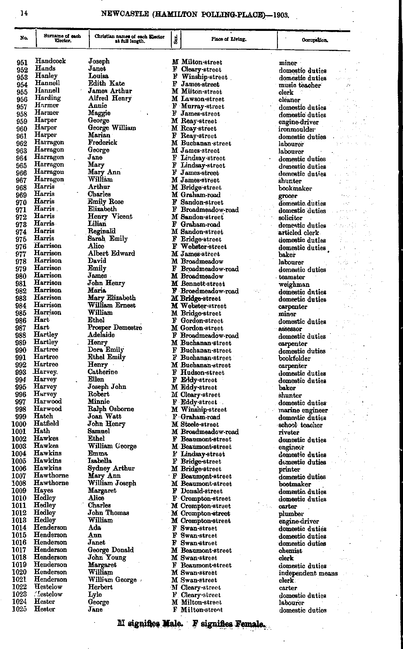
- Handcock Joseph - Hester Jane
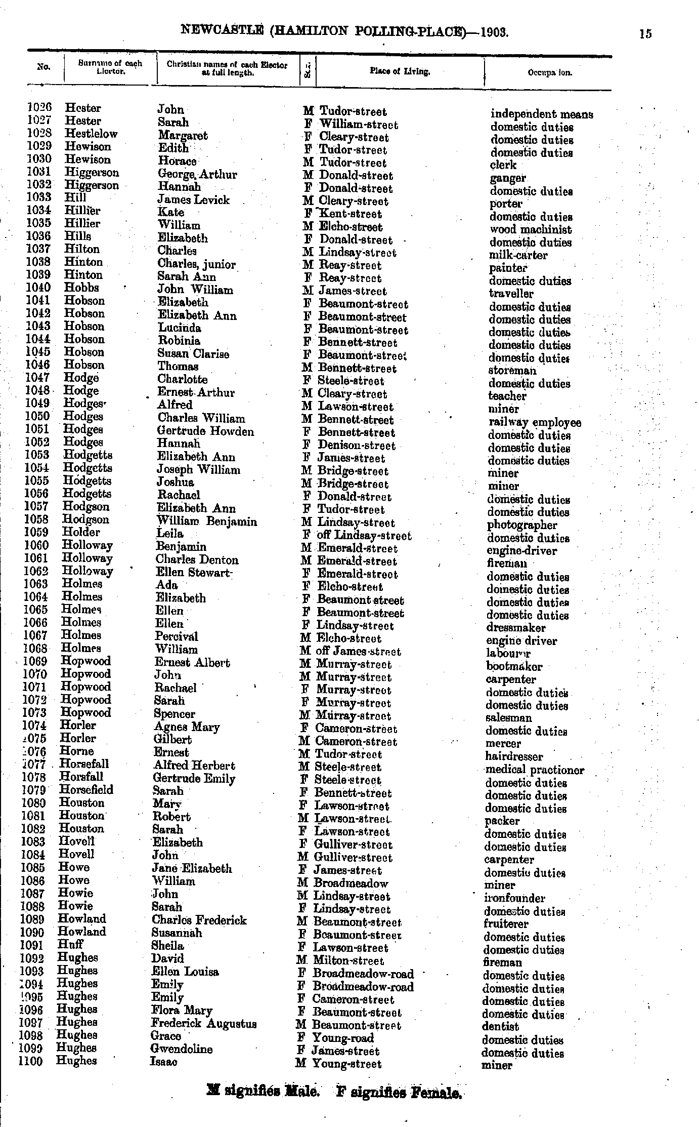
- Hester John - Hughes Isaac
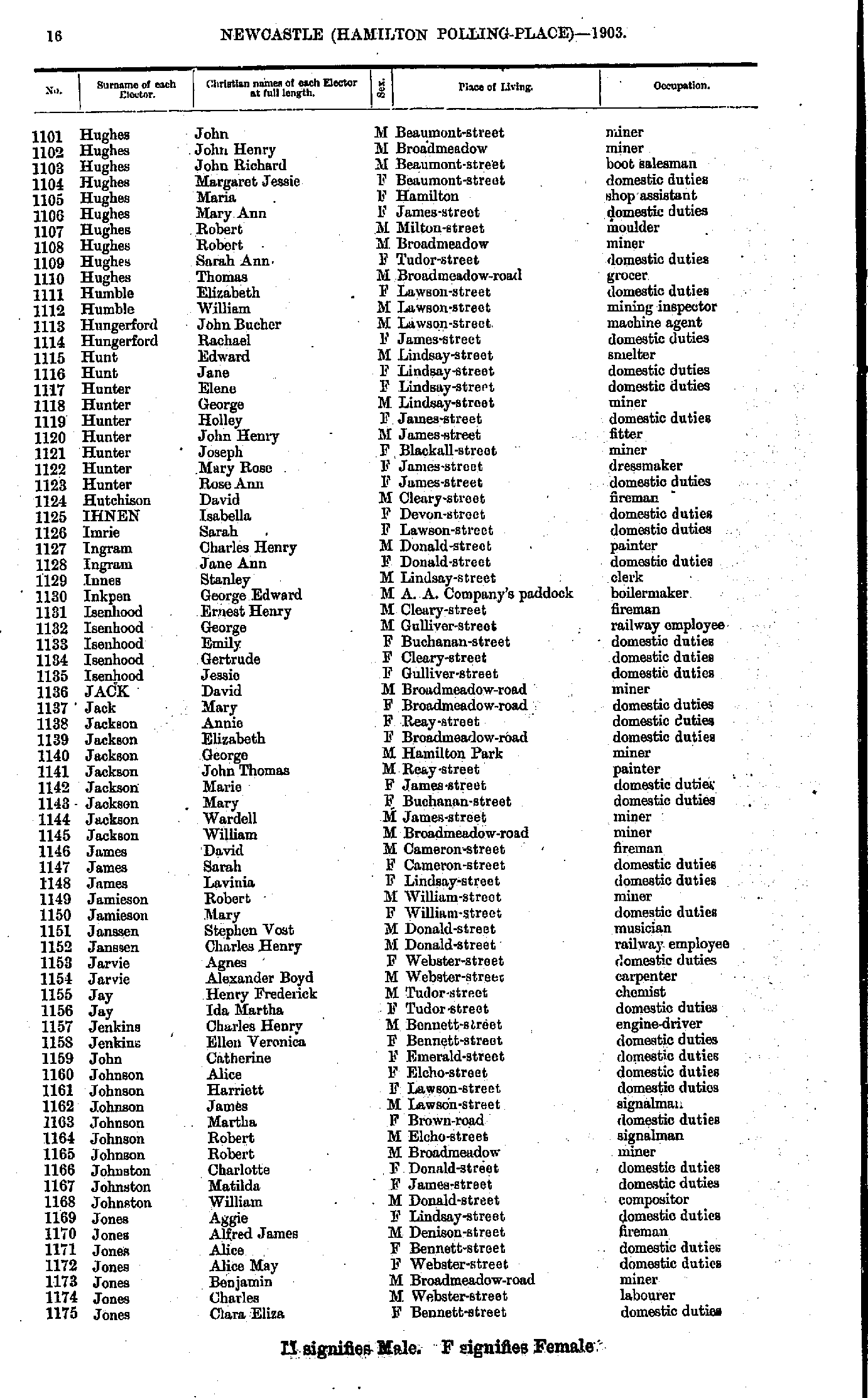
- Hughes John - Jones Clara
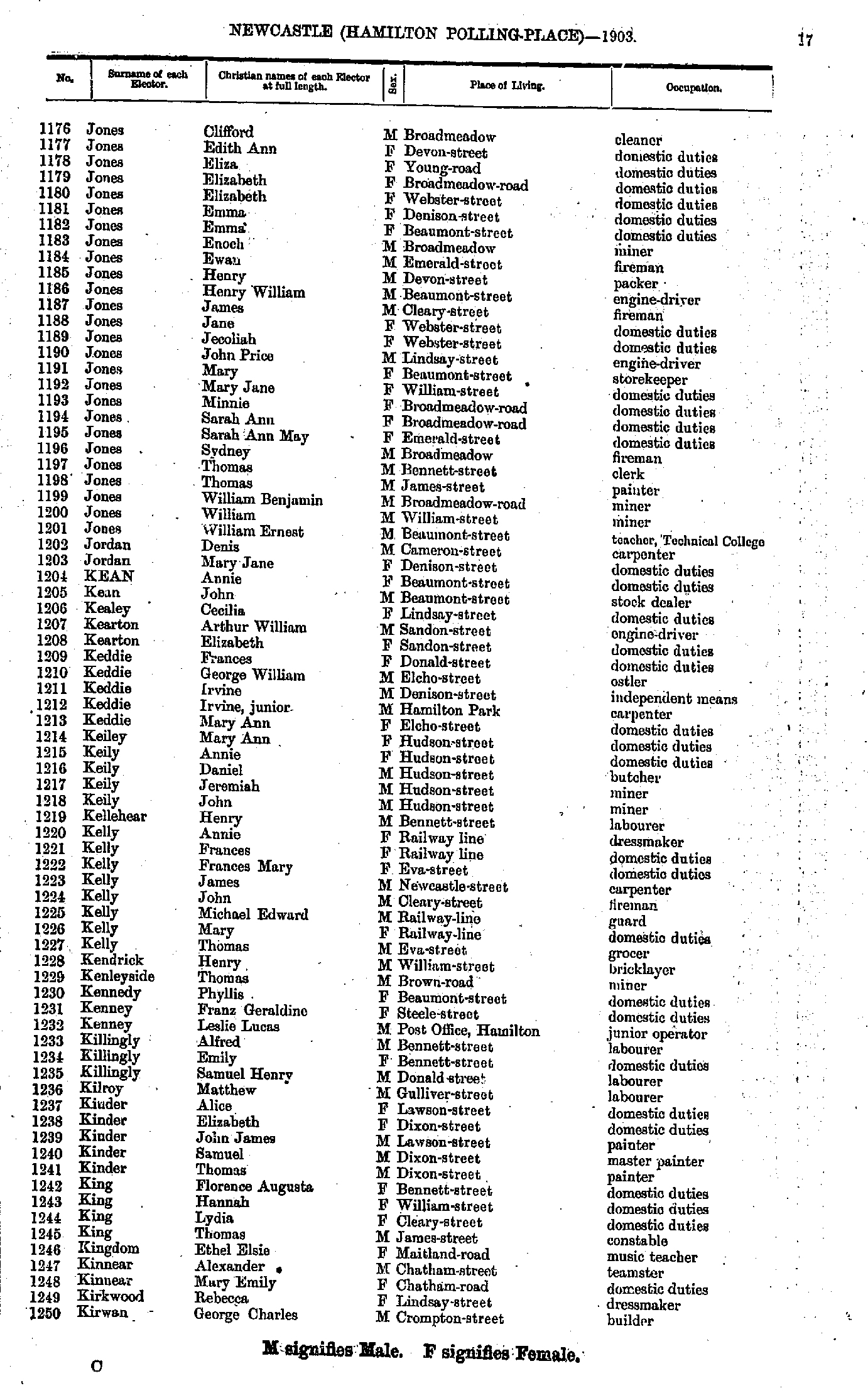
- Jones Clifford - Kirwan George
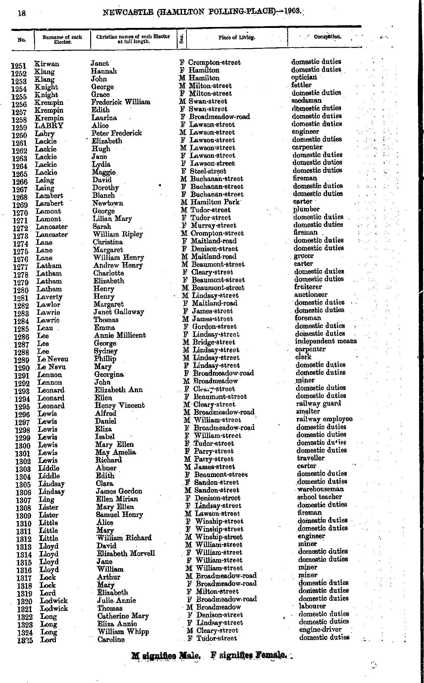
- Kirwan Janet - Lord Caroline
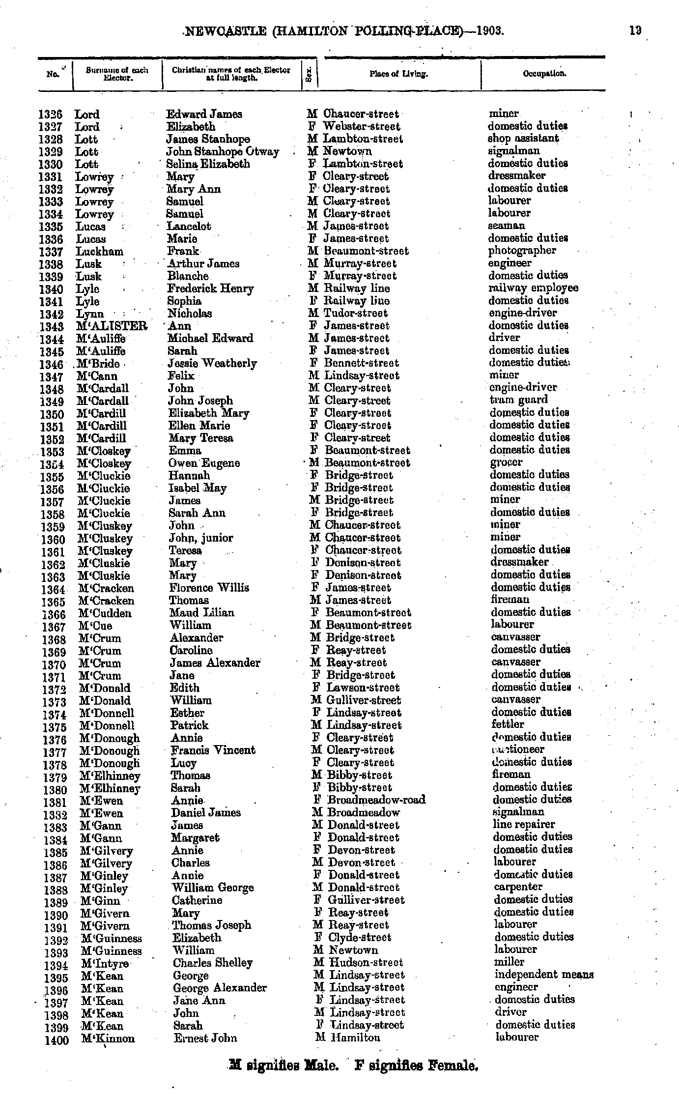
- Lord Edward - M'Kinnon Ernest
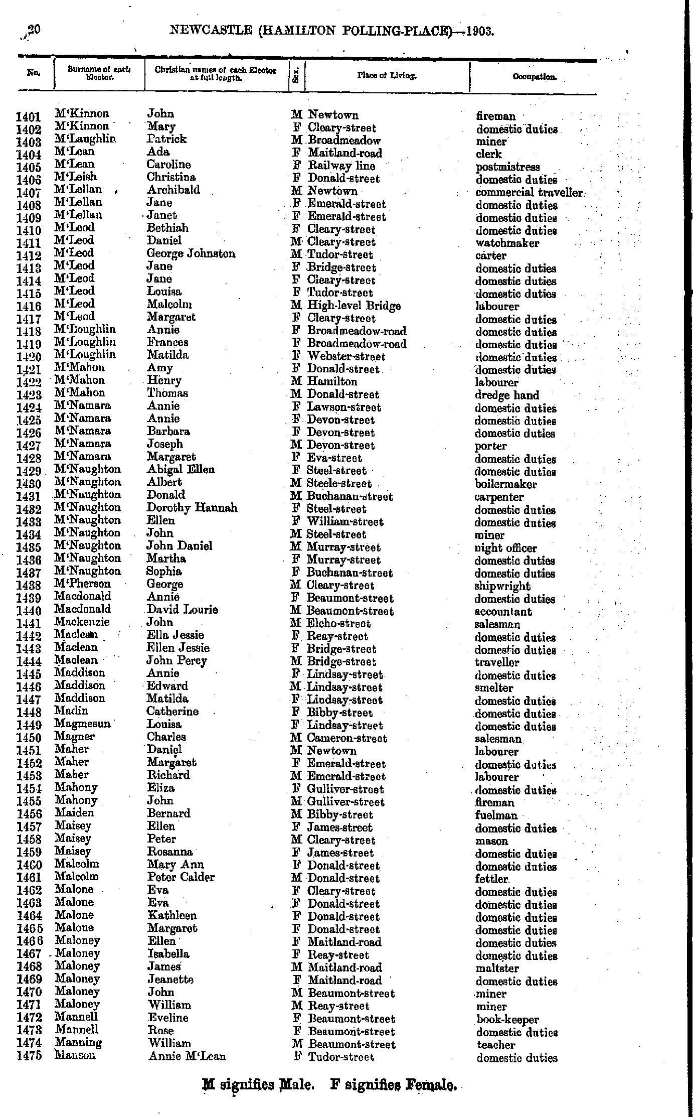
- M'Kinnon John - Manson Annie
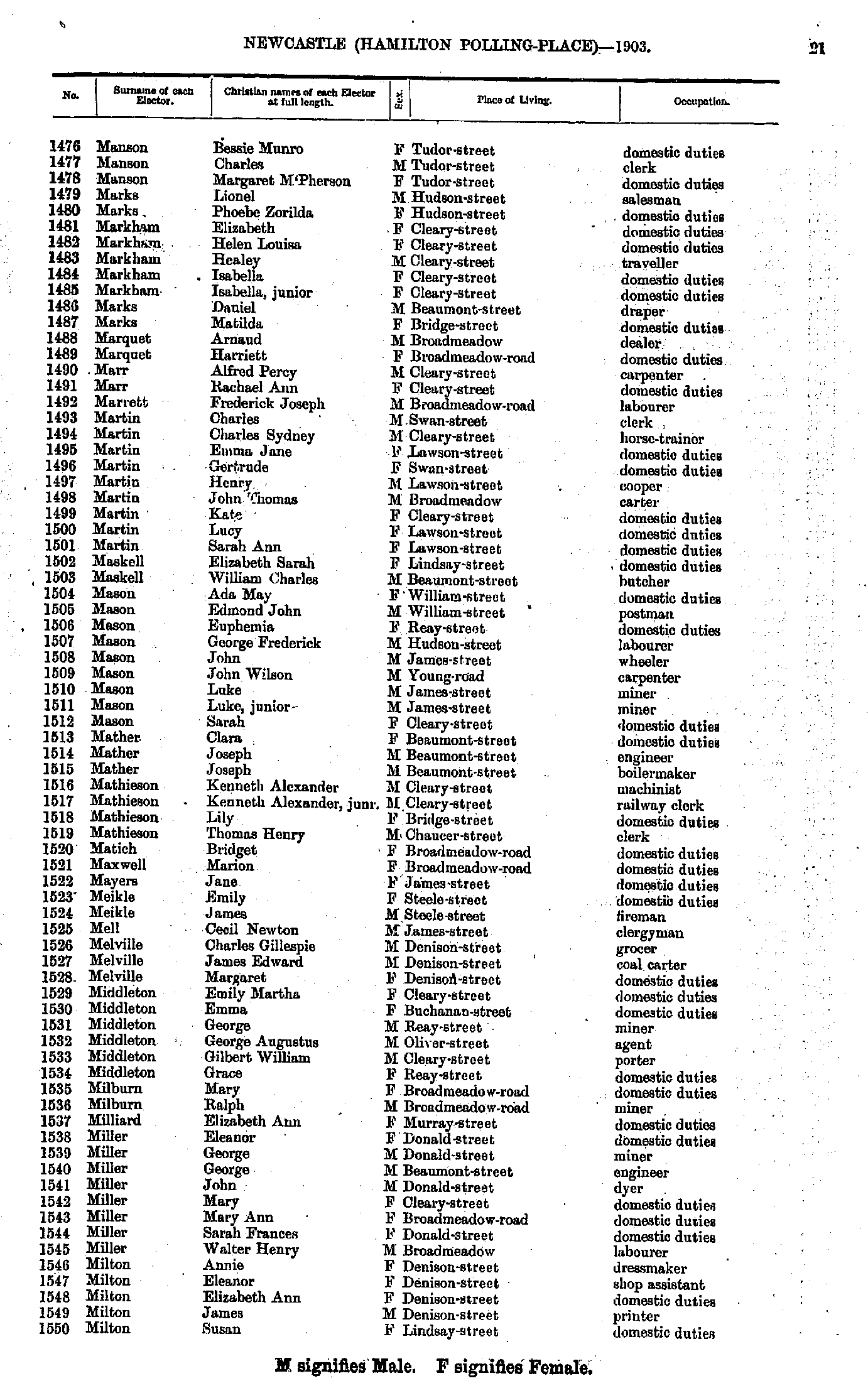
- Manson Bessie - Milton Susan
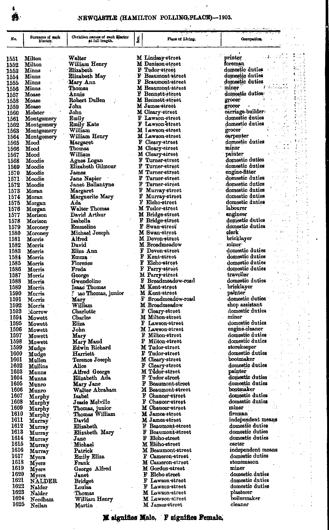
- Milton Walter - Neilan Martin
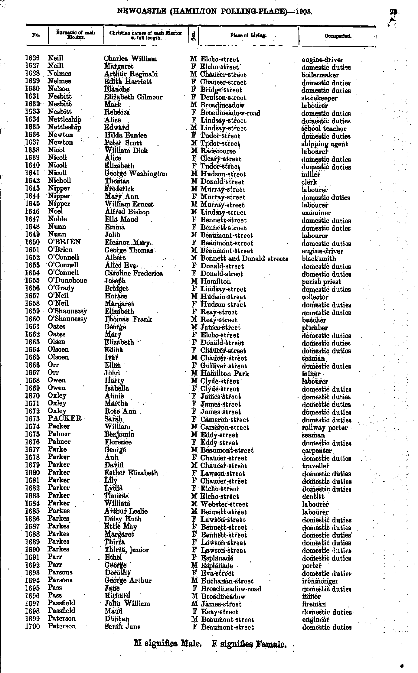
- Neill Charles - Paterson Sarah
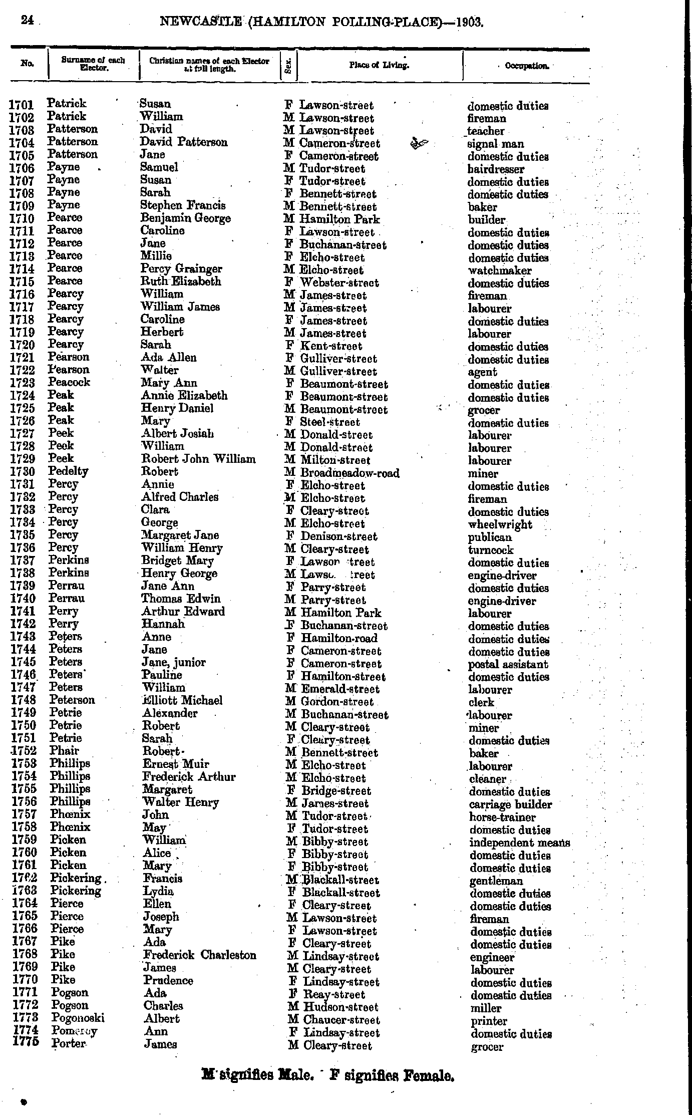
- Patrick Susan - Porter James
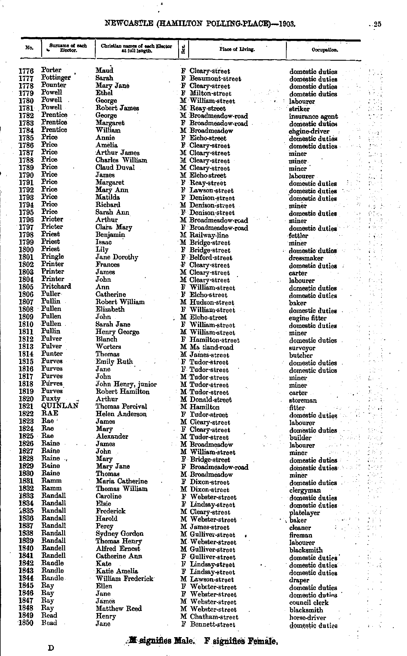
- Porter Maud - Read Jane
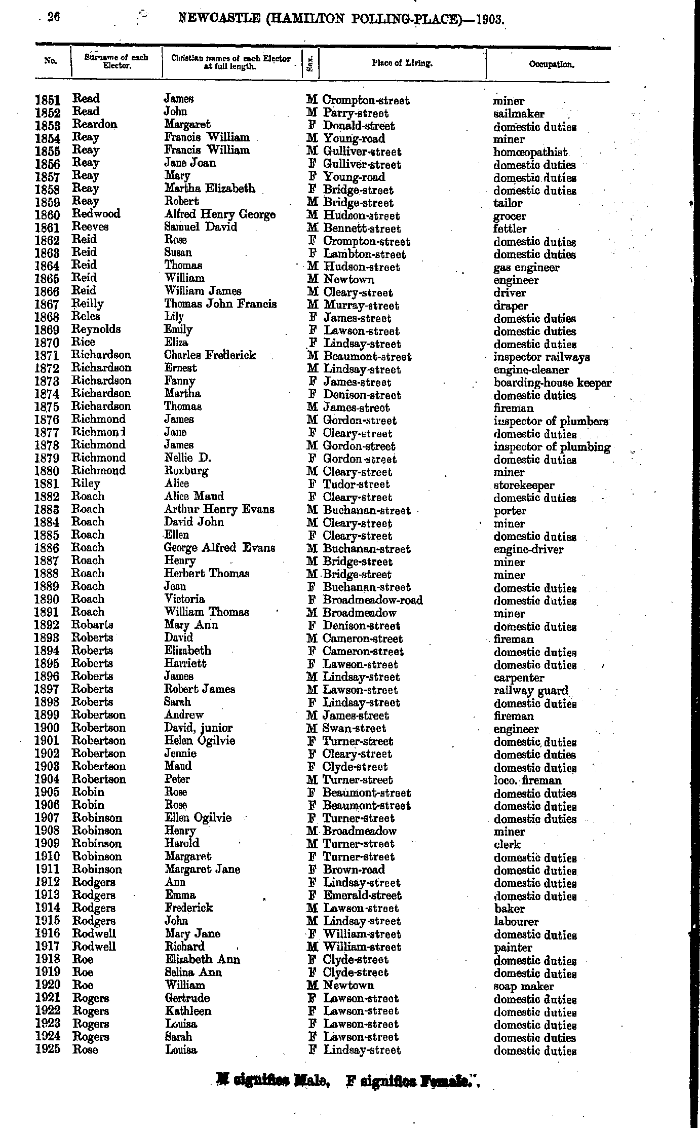
- Read James - Rose Louisa
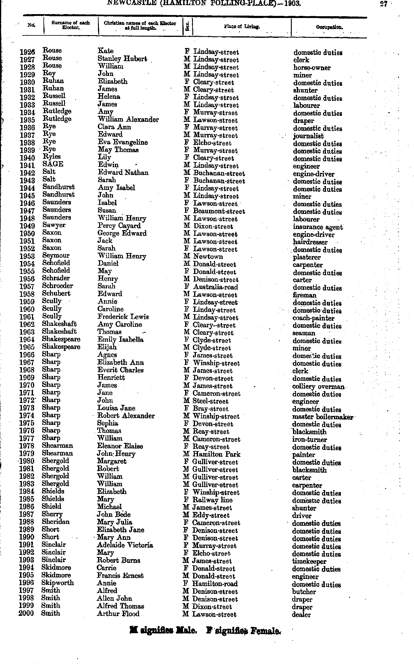
- Rouse Kate - Smith Arthur
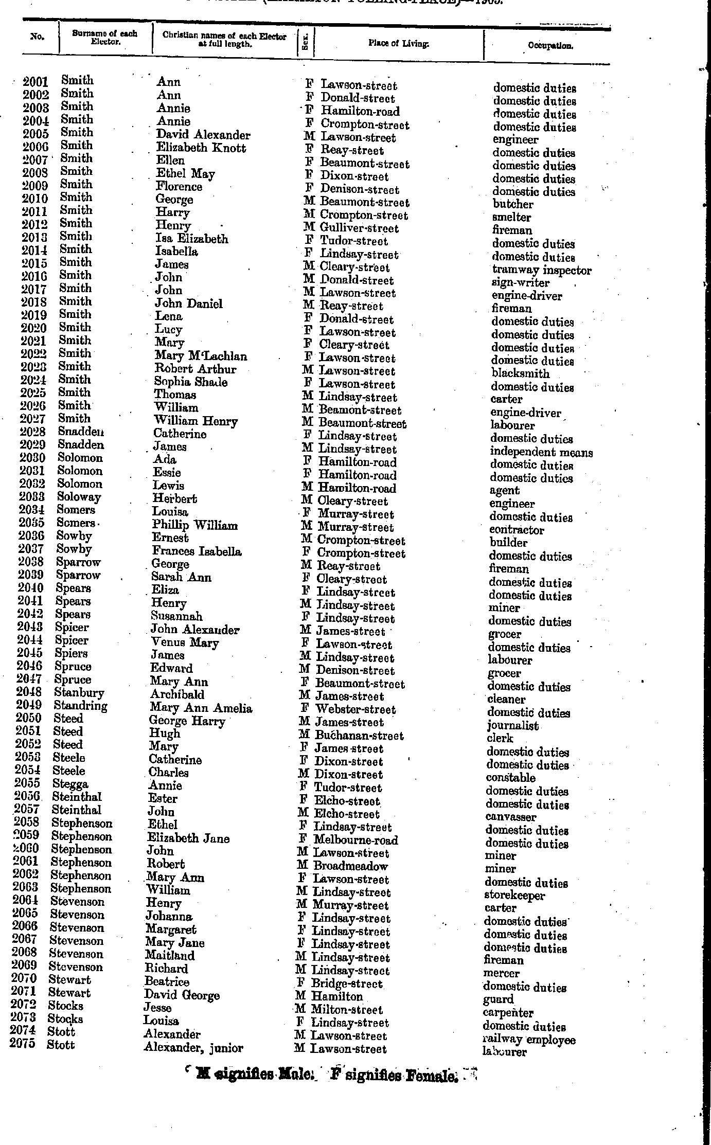
- Smith Ann - Stott Alexander
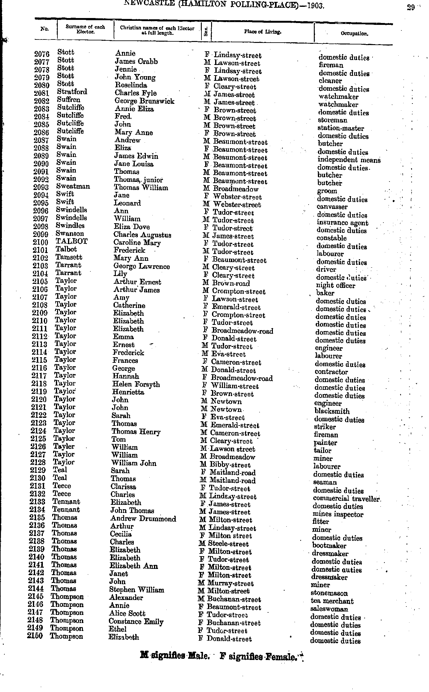
- Stott Annie - Thompson Elizabeth
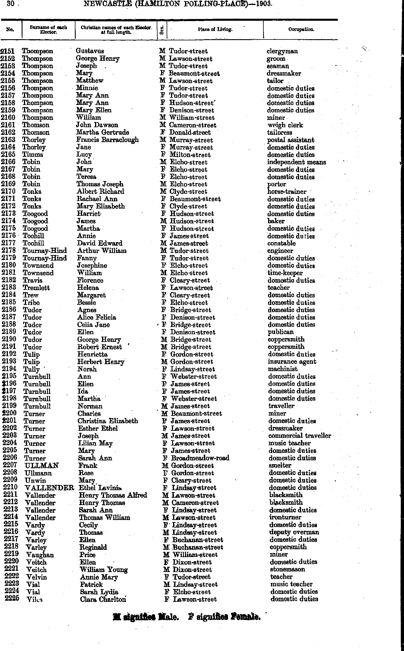
- Thompson Gustavus - Viles Clara
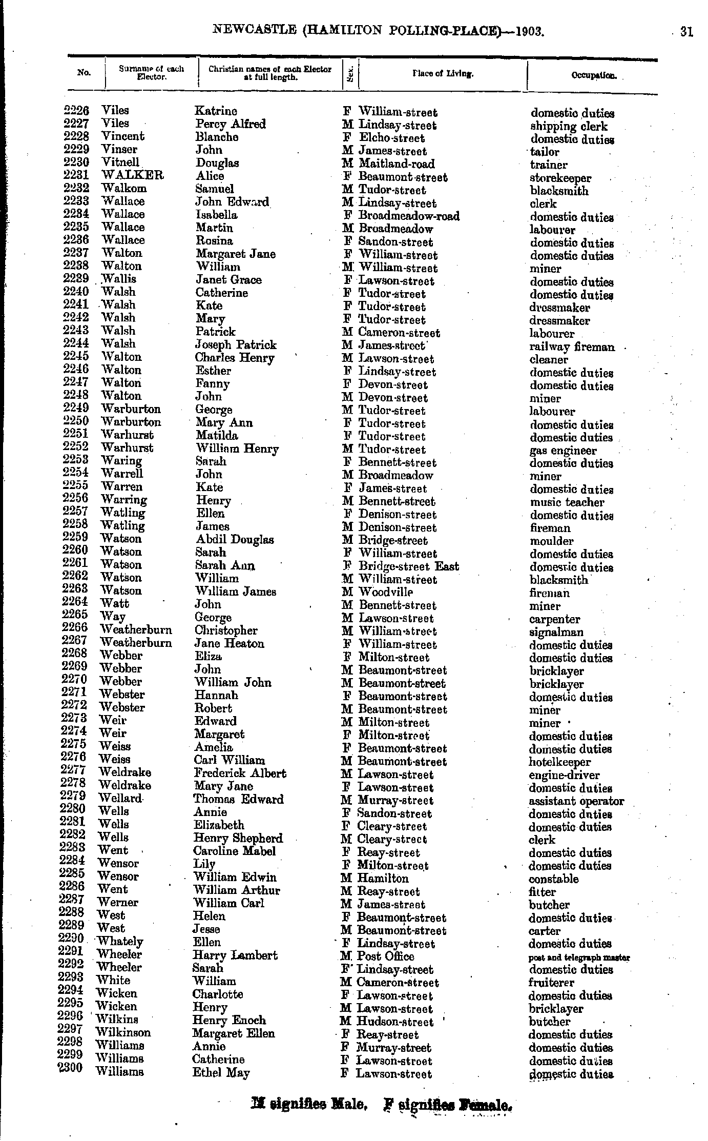
- Viles Katrine - Williams Ethel
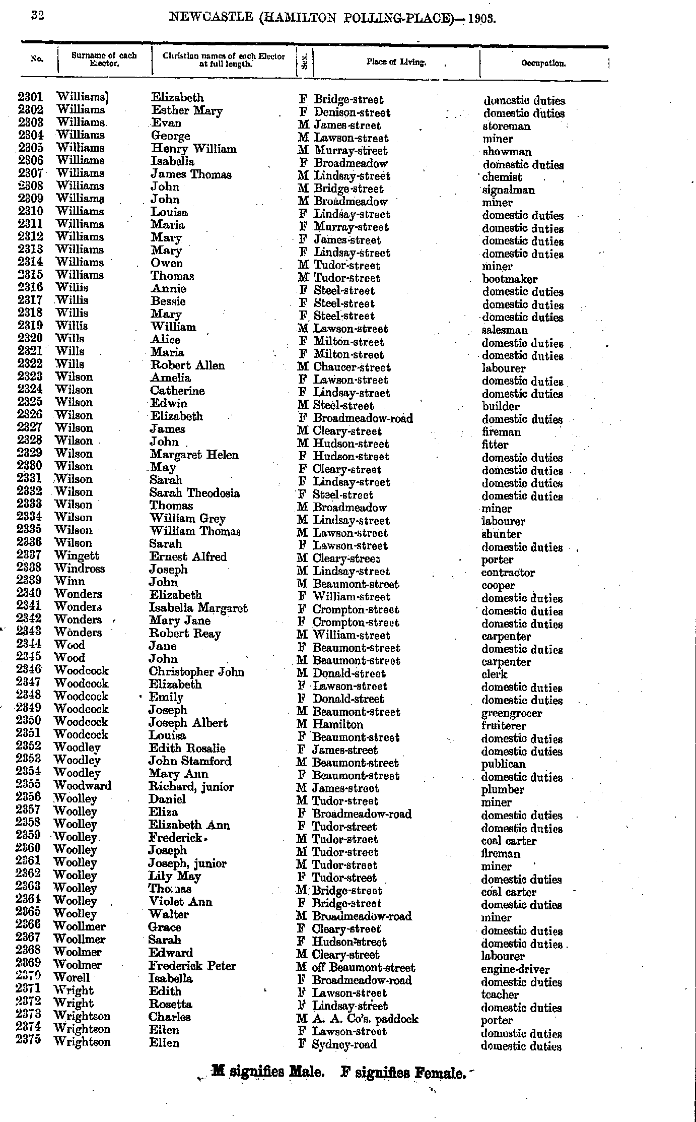
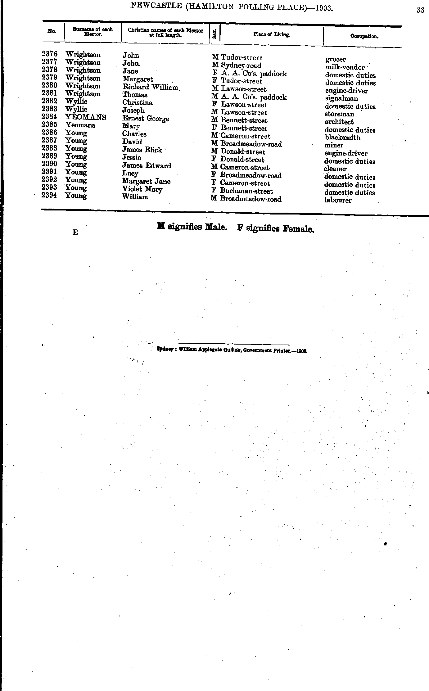
- Williams Elizabeth - Wrightson Ellen
- Wrightson John - Young William
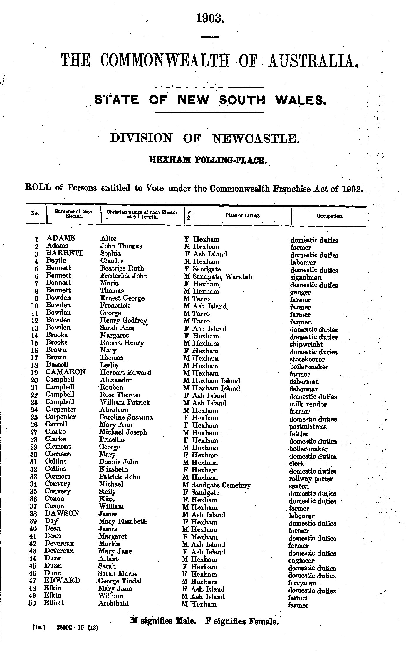
- Adams Alice - Elliott Archibald
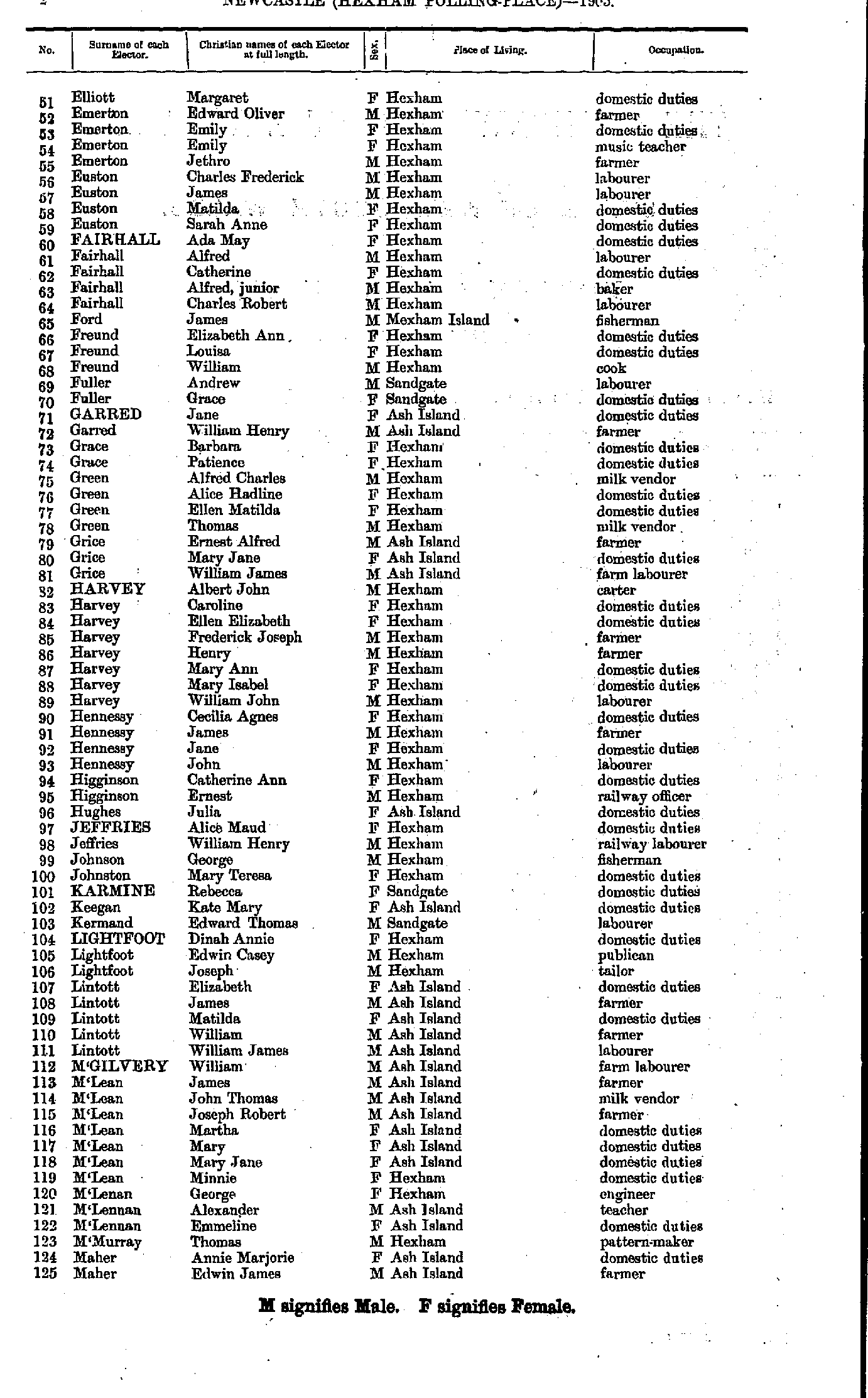
- Elliott Margaret - Maher Edwin
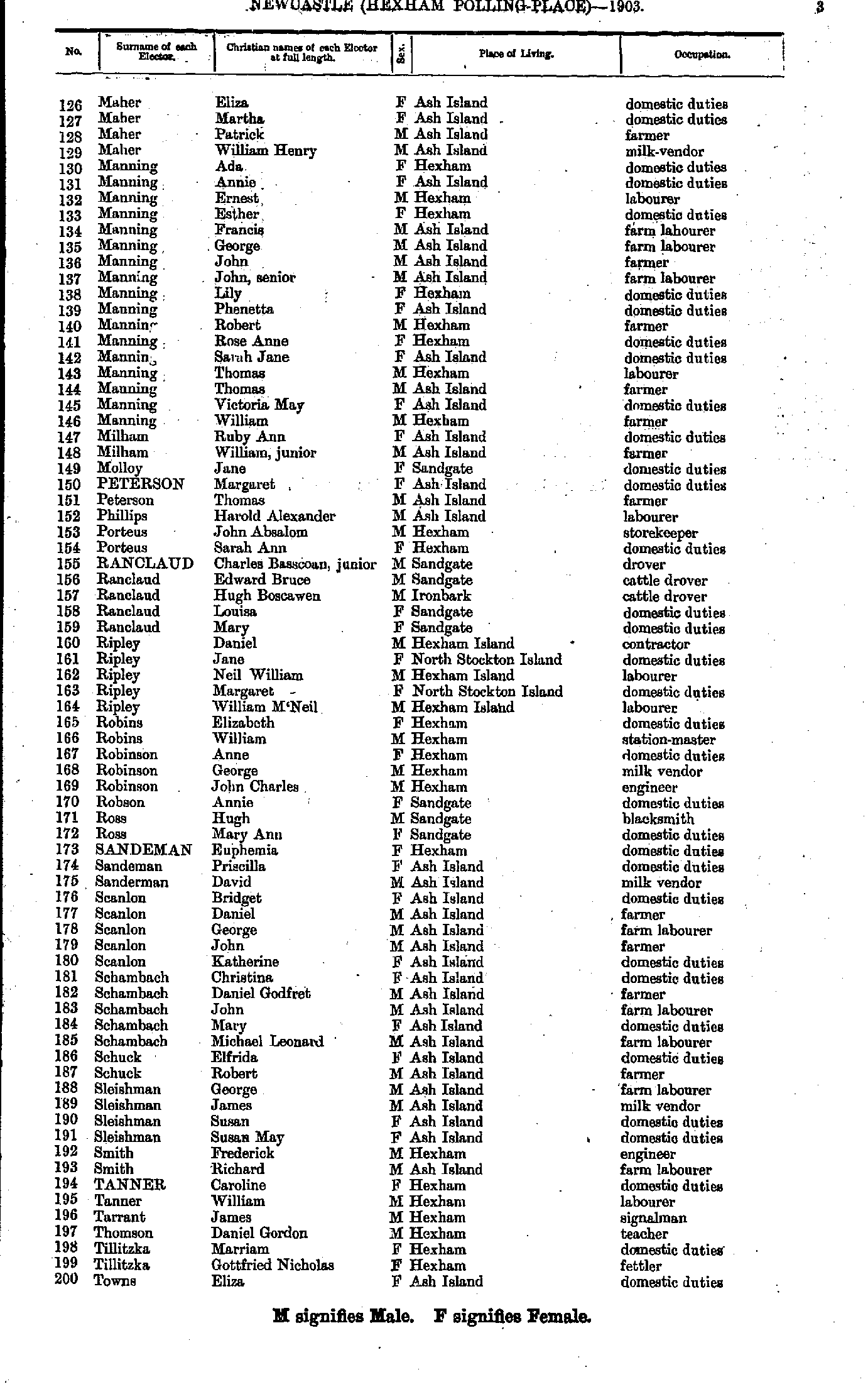
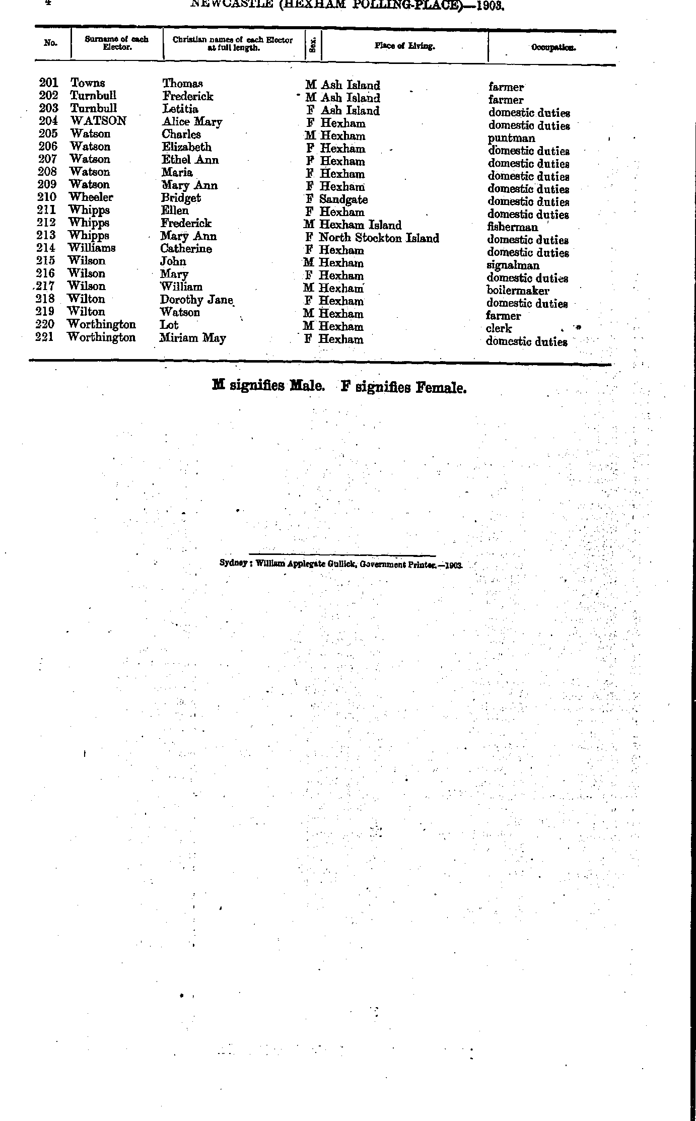
- Maher Eliza - Towns Eliza
- Towns Thomas - Worthington Miriam
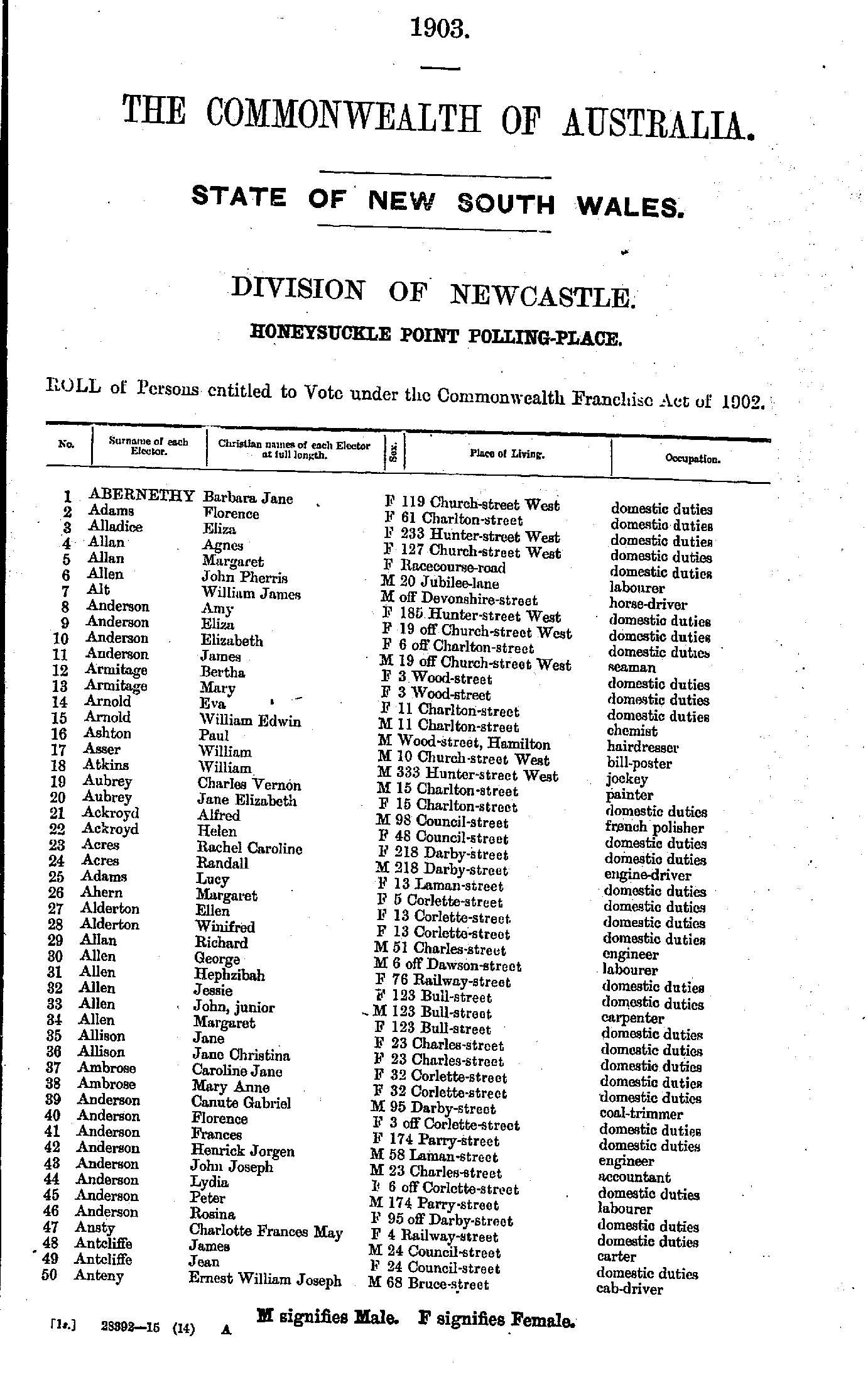
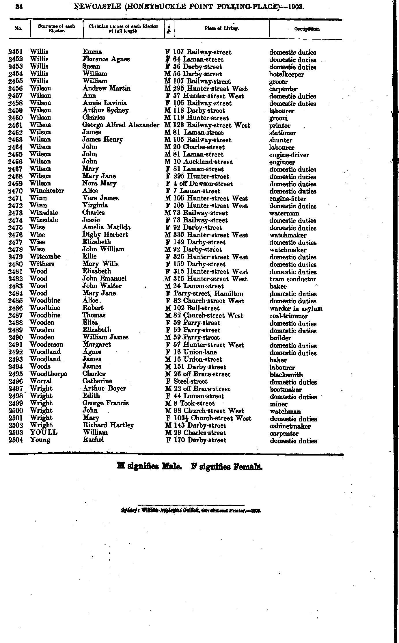
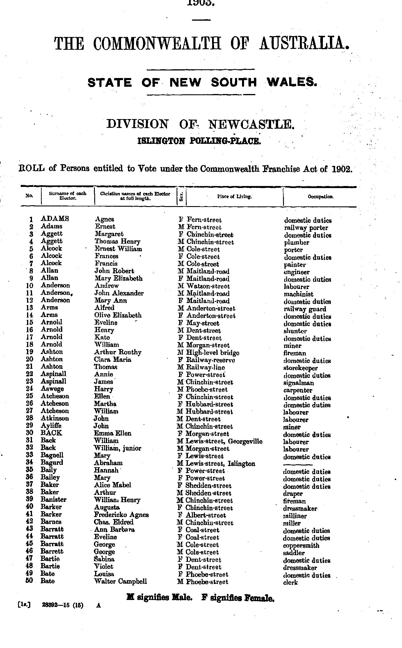
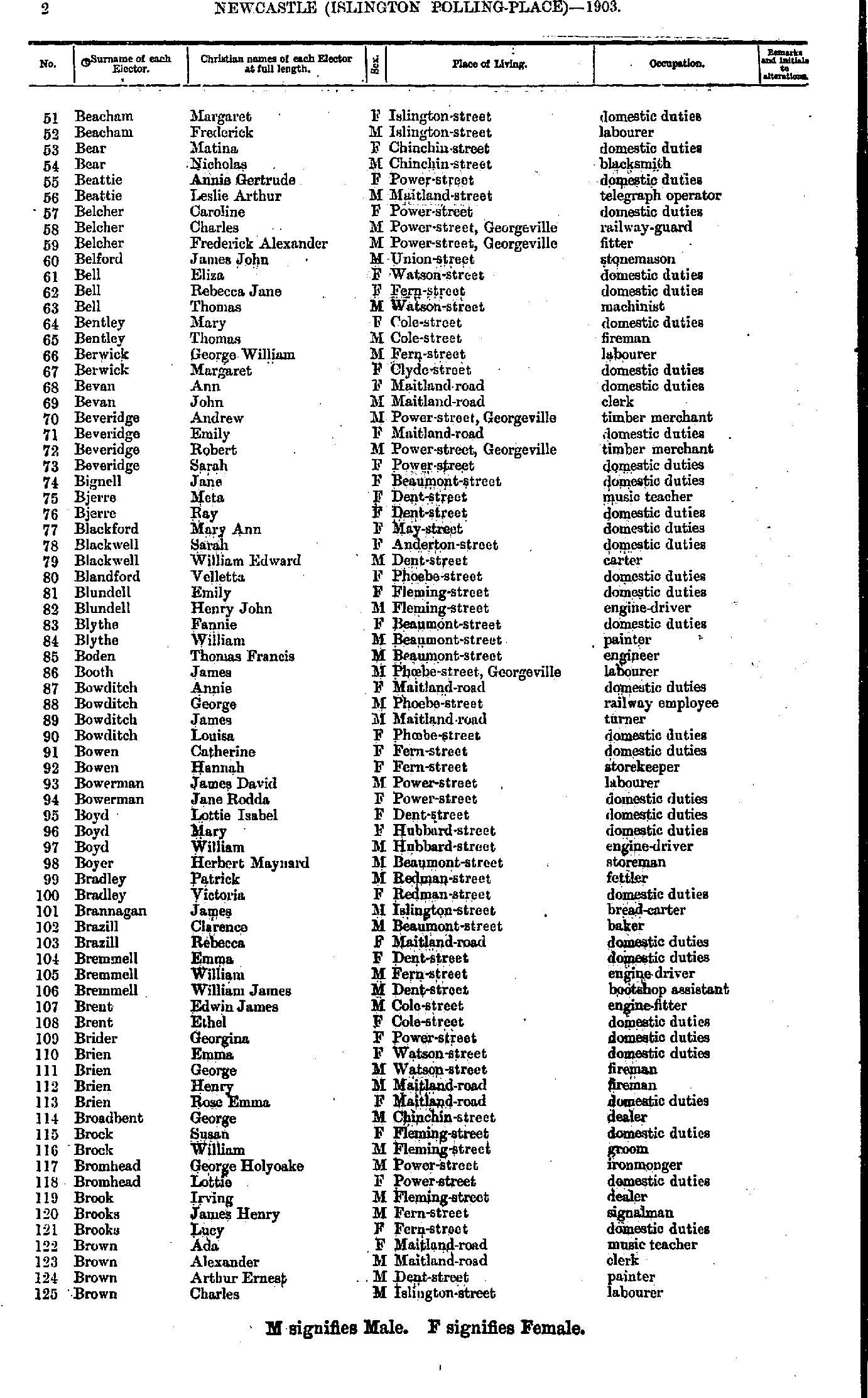
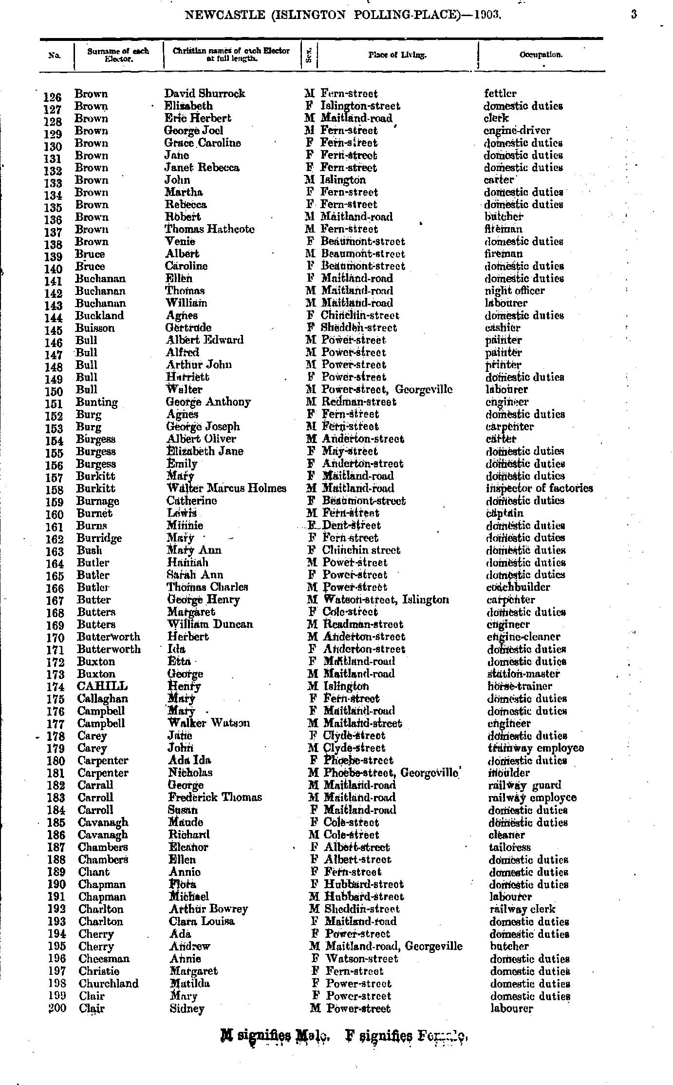
Honeysuckle Point Polling Place
- Abernethy Barbara - Anteny Ernest
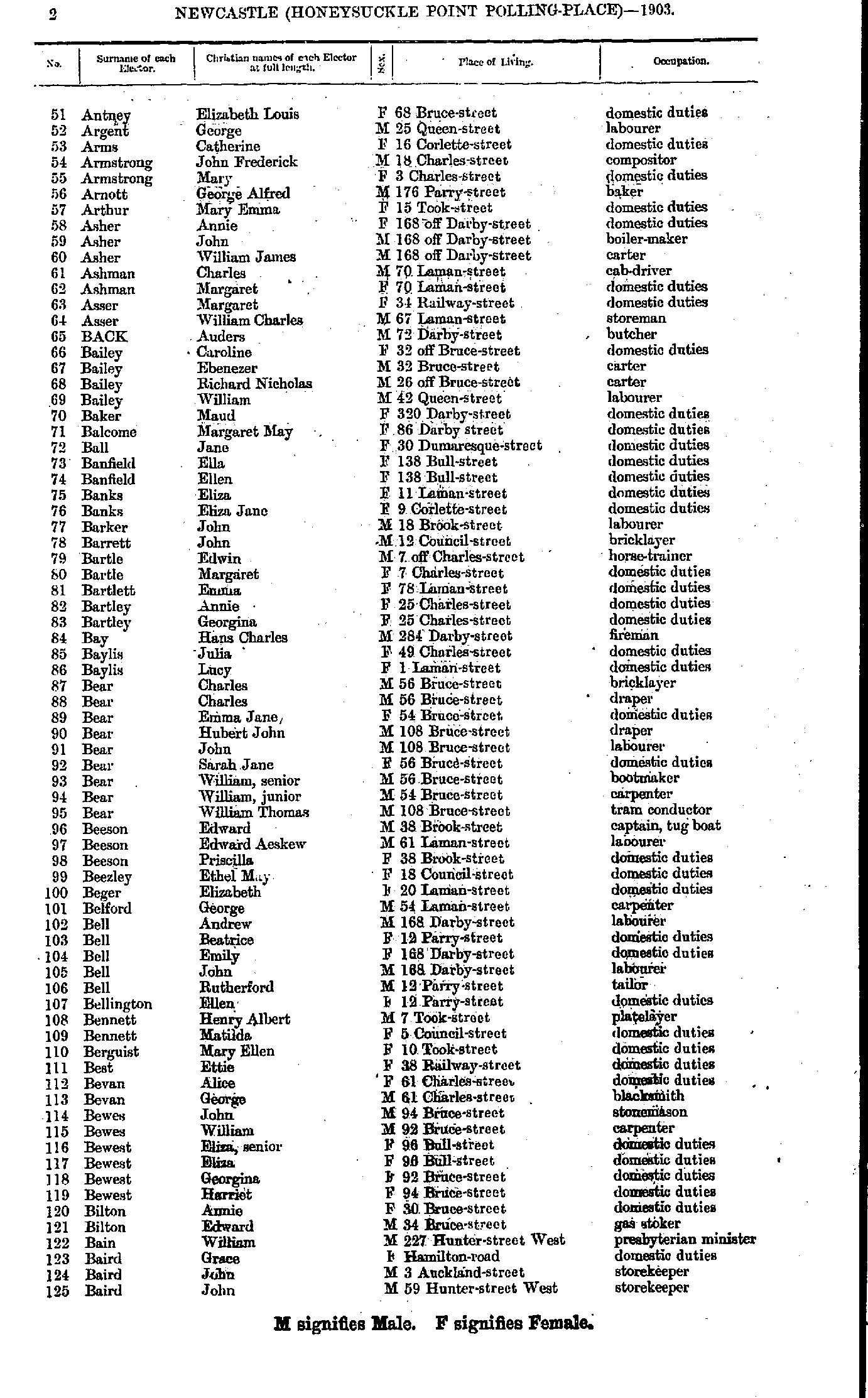
- Antney Elizabeth - Baird John
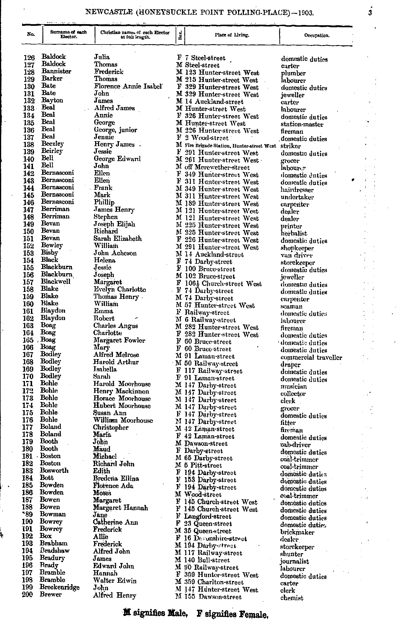
- Baldock Julia - Brewer Alfred
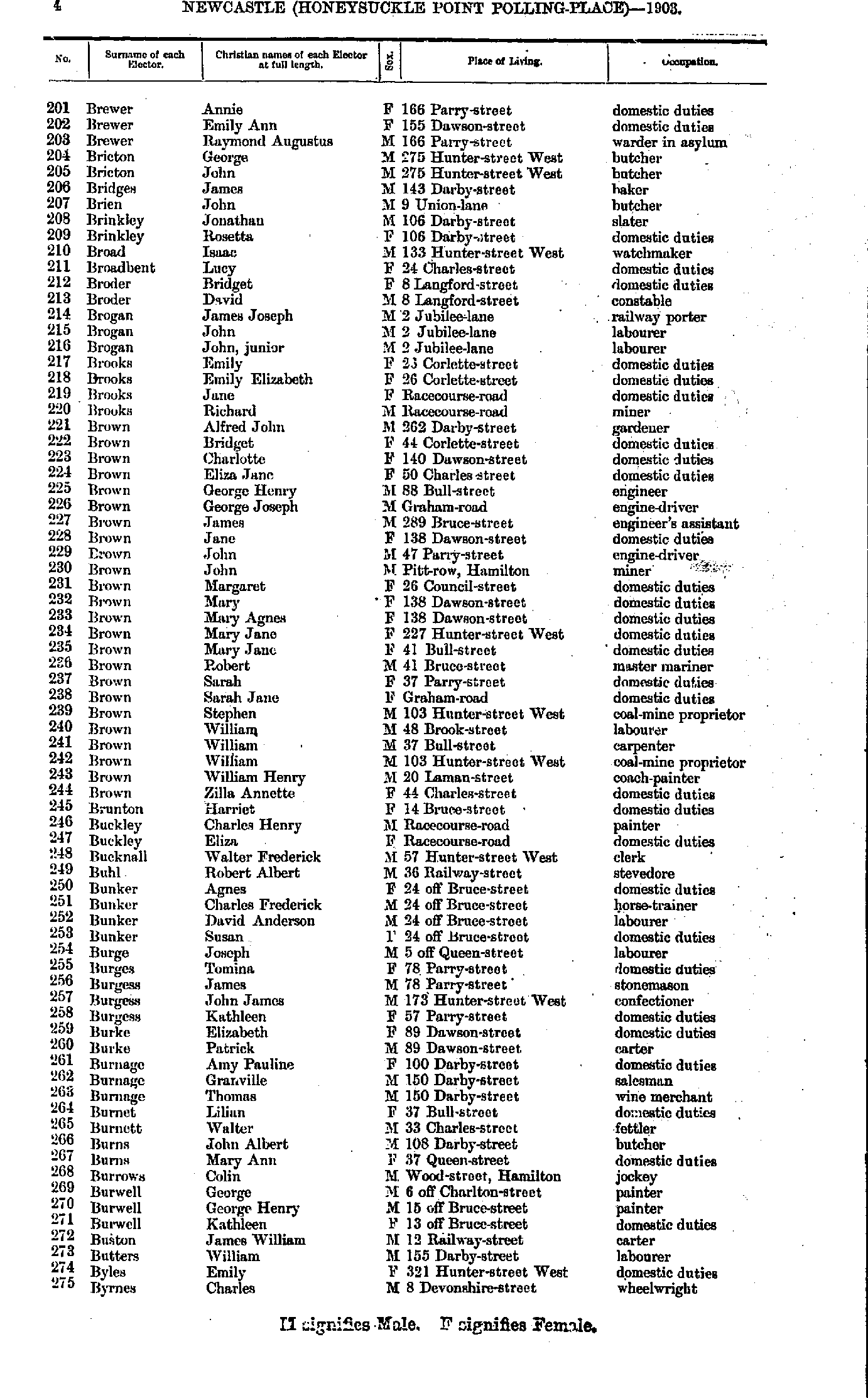
- Brewer Annie - Byrnes Charles
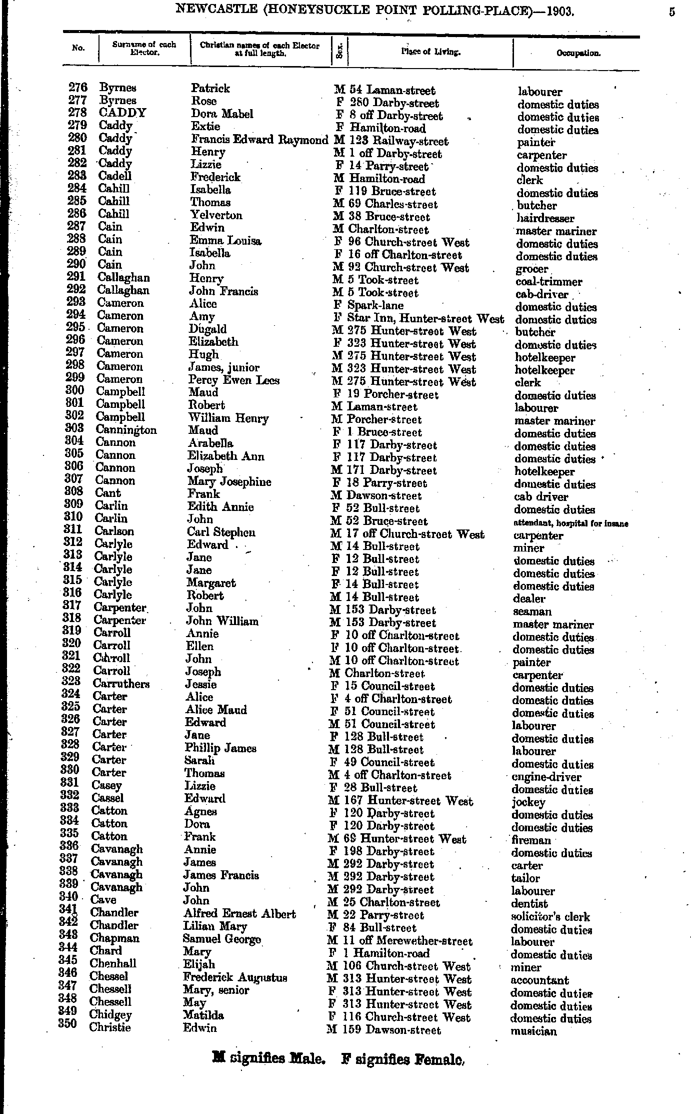
- Byrnes Patrick - Christie Edwin
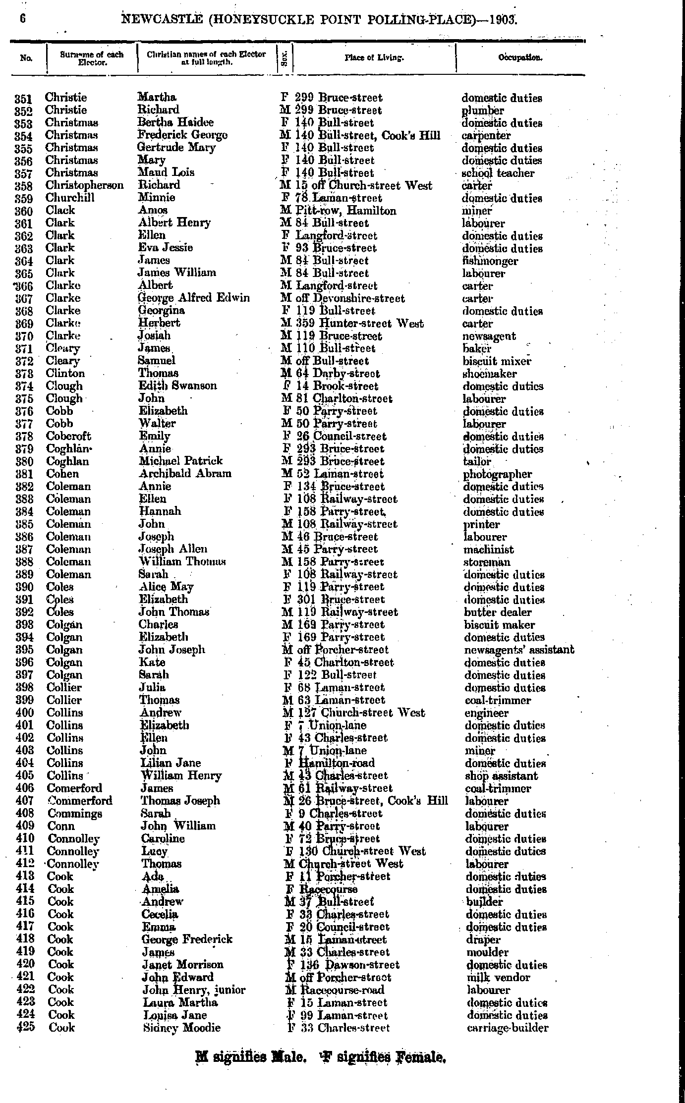
- Christie Martha - Cook Sidney
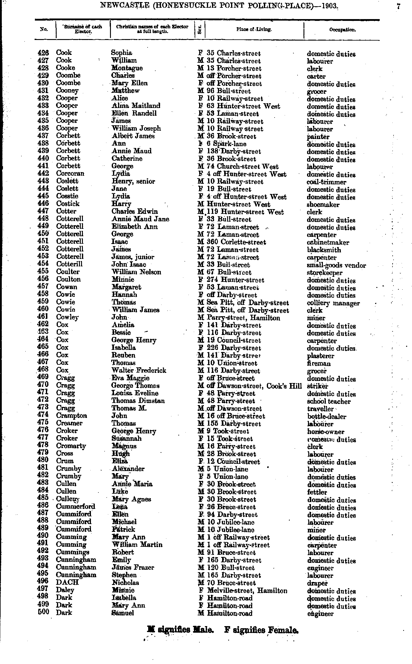
- Cook Sophia - Dark Samuel
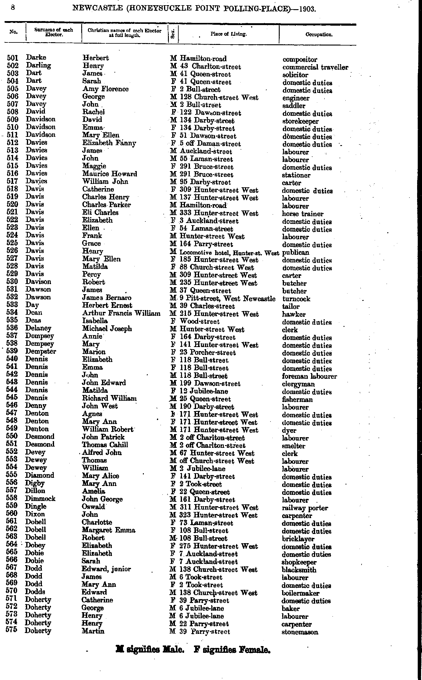
- Darke Herbert - Doherty Martin
- Doherty Minnie - Elphick William
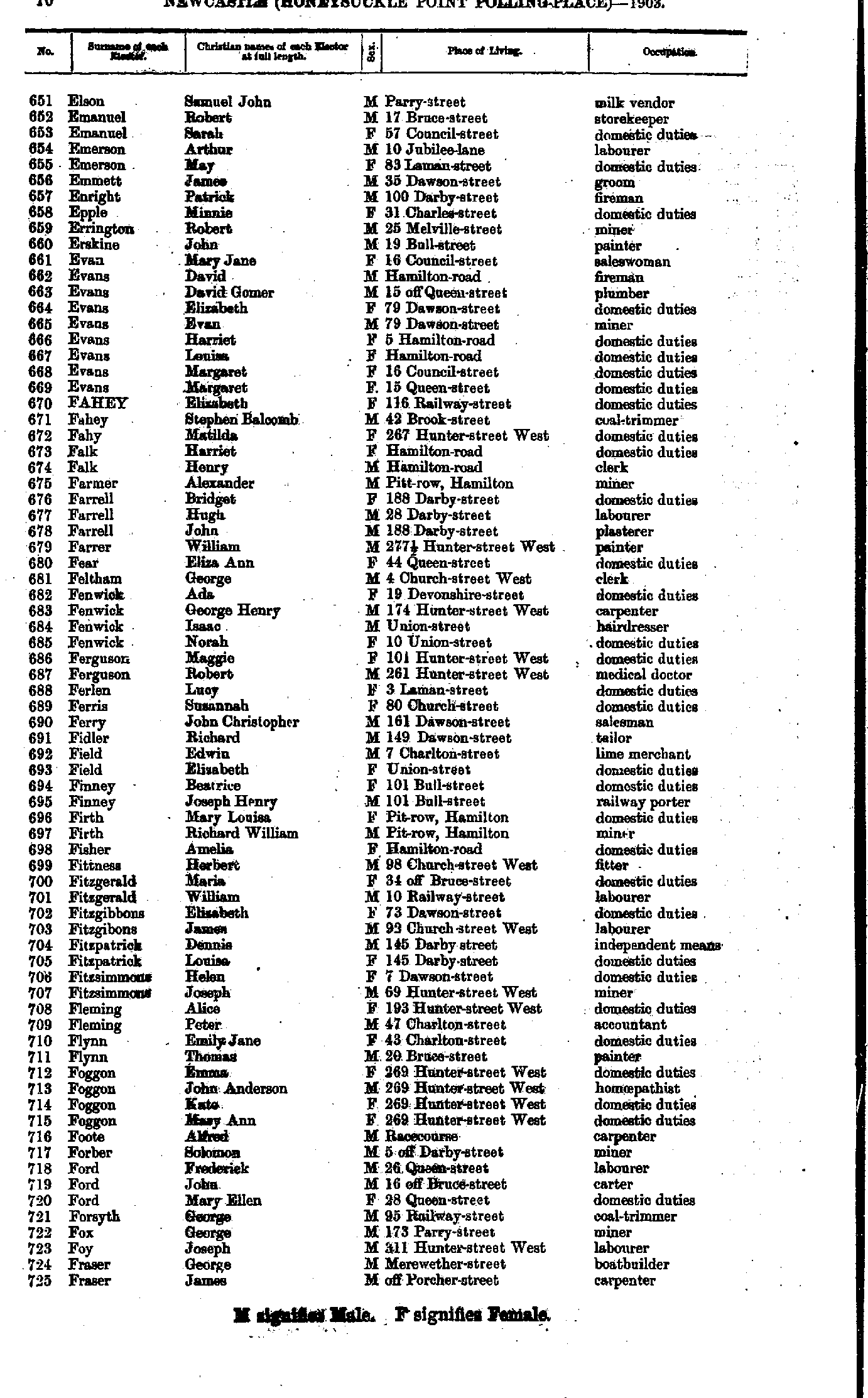
- Elson Samuel - Fraser James
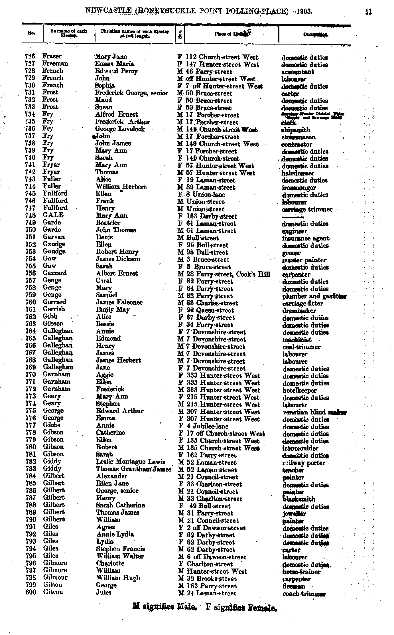
- Fraser Mary - Giteau Jules
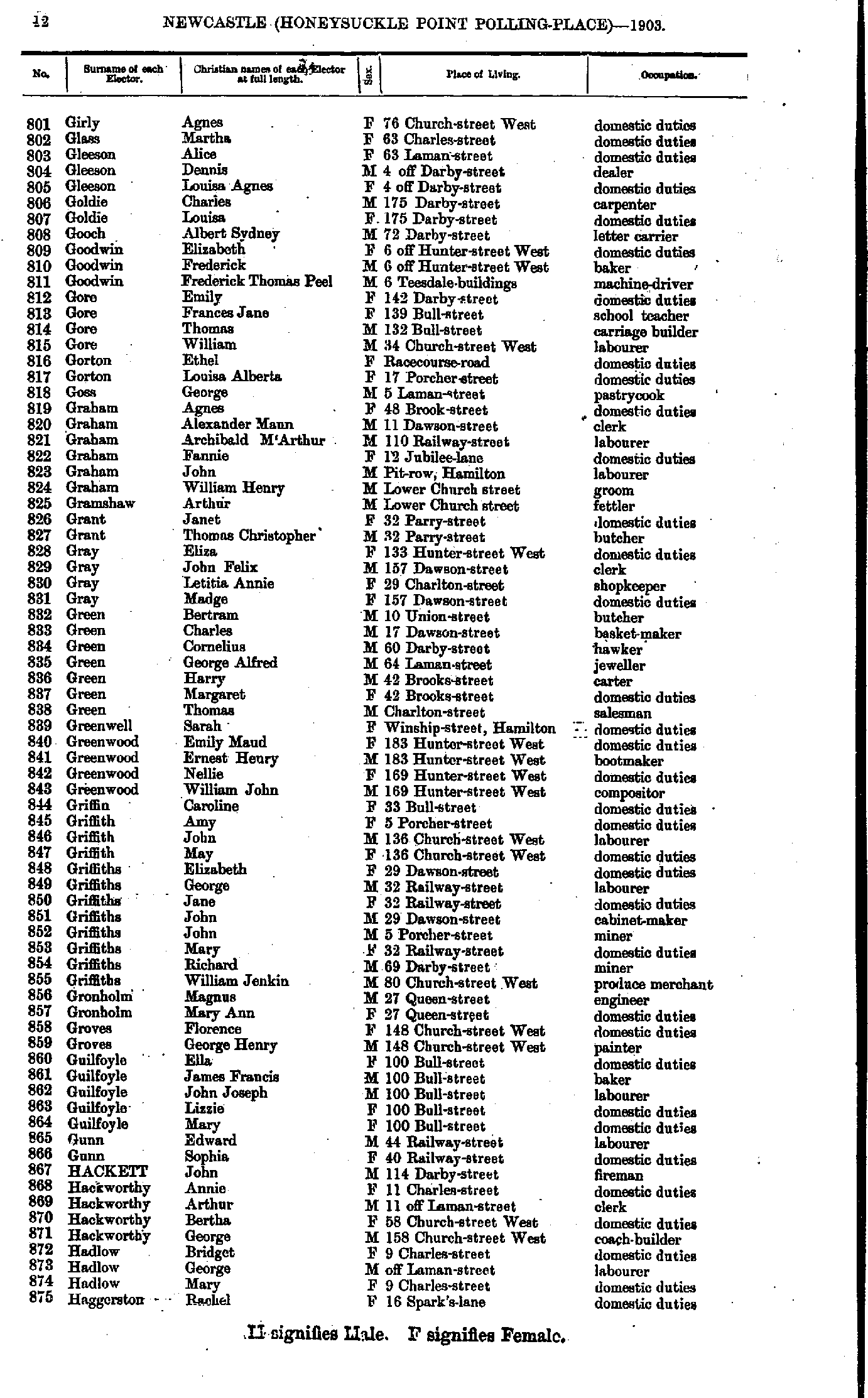
- Girly Agnes - Haggerston Rachel
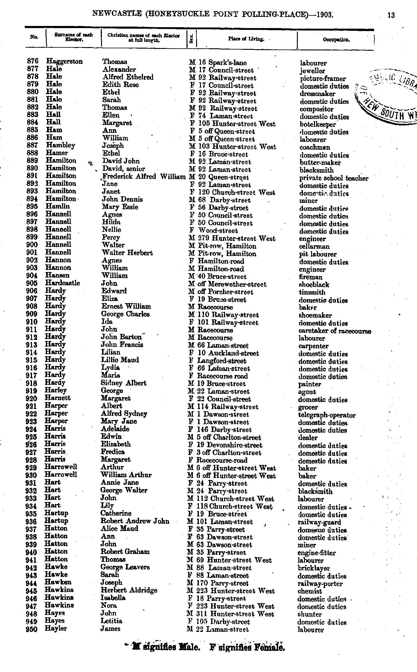
- Haggerston Thomas - Hayler James
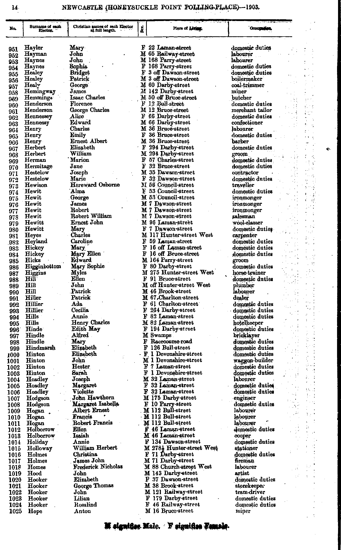
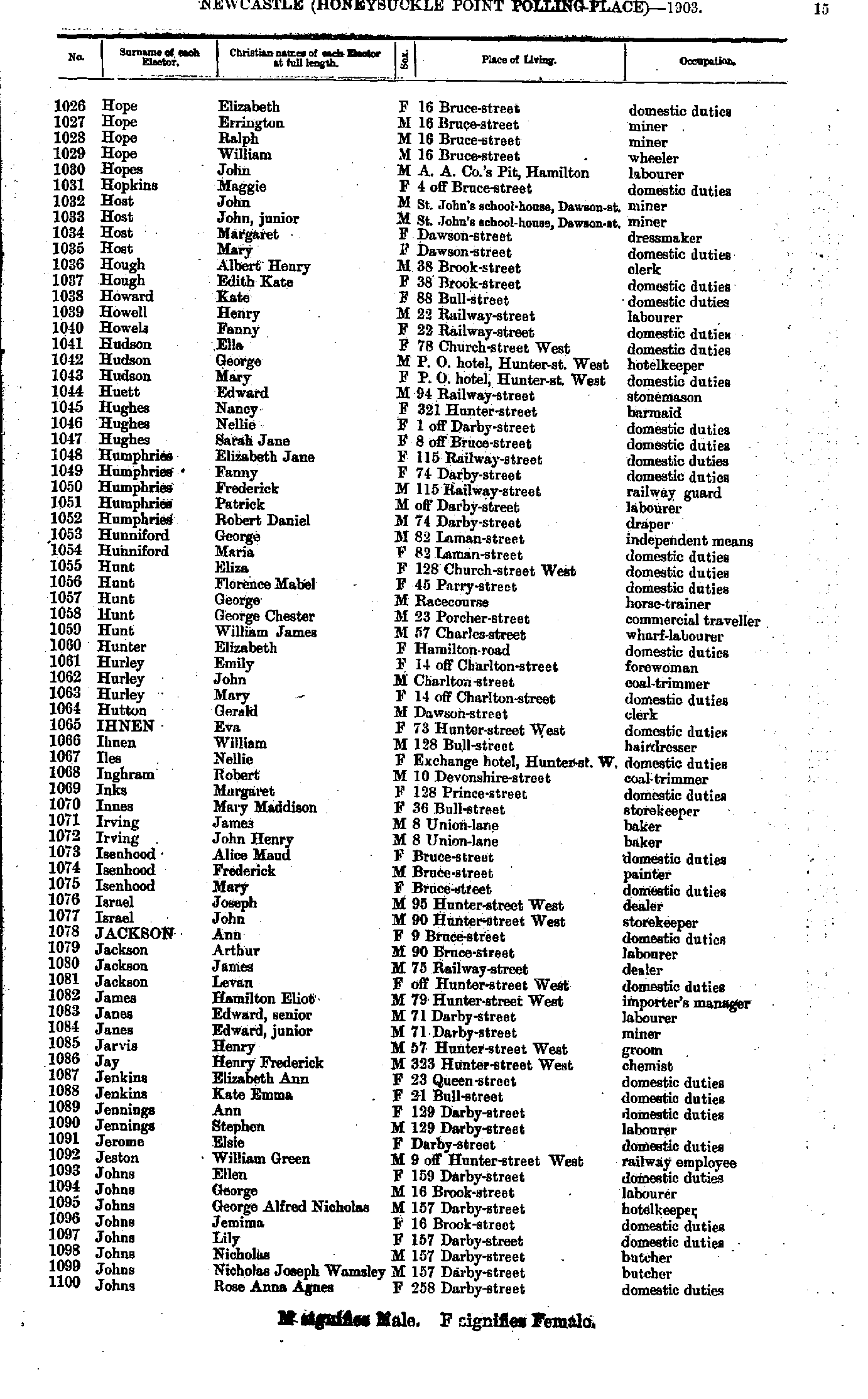
- Hayler Mary - Hope Anton
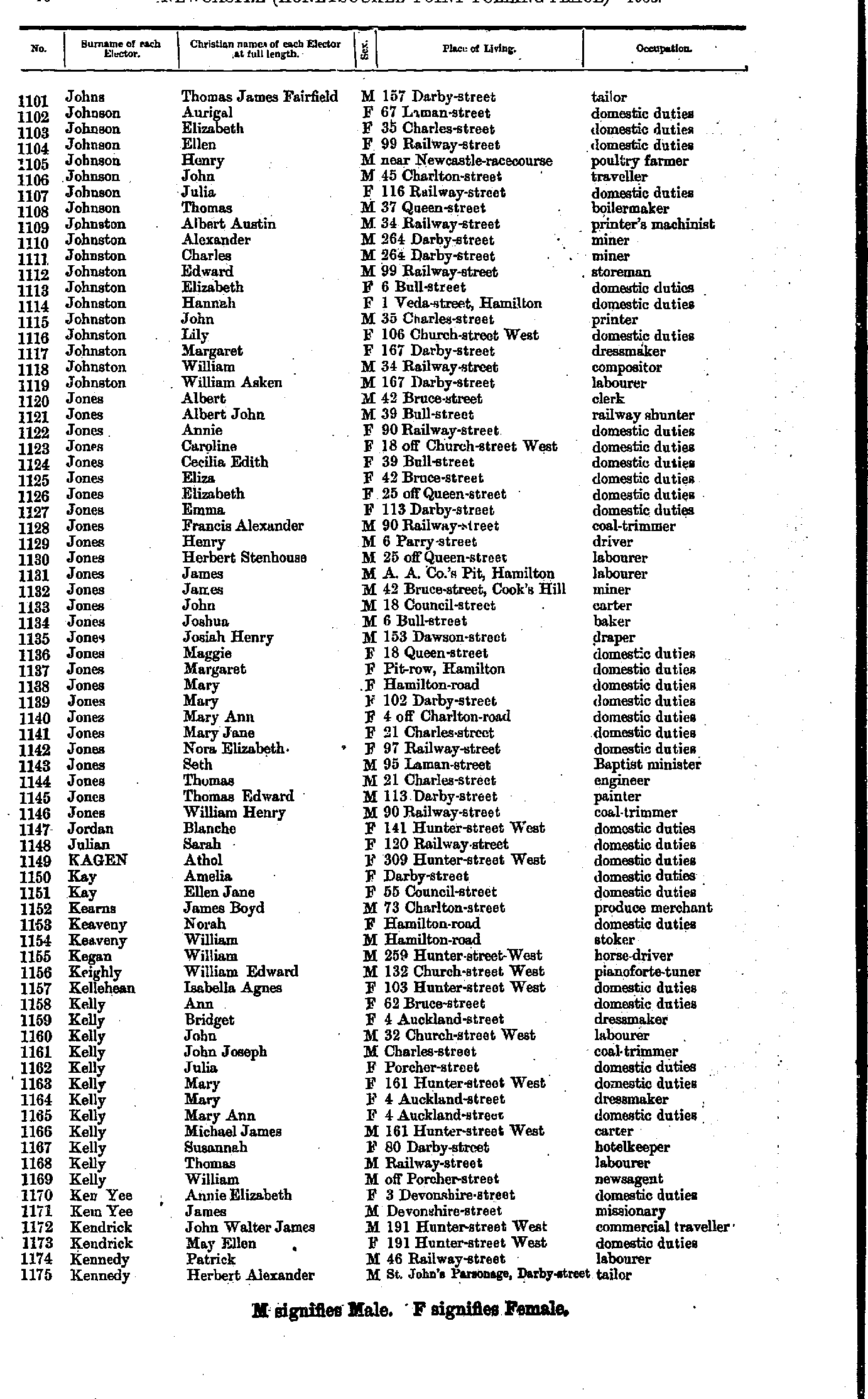
- Hope Elizabeth - Johns Rose
- Johns Thomas - Kennedy Herbert
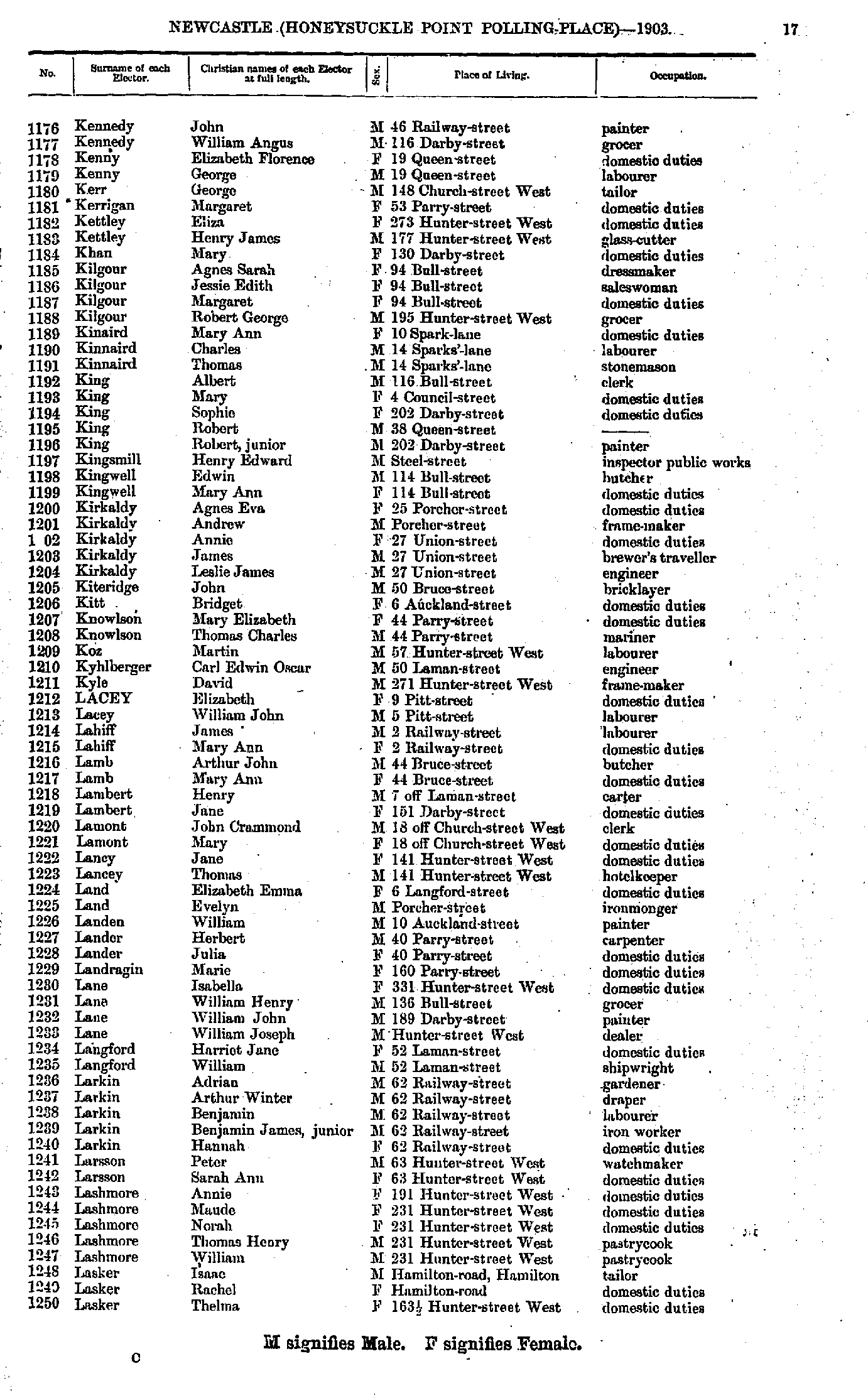
- Kennedy John - Lasker Thelma
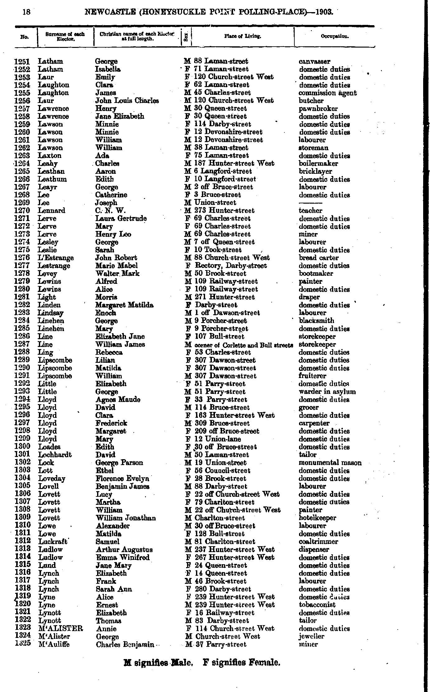
- Latham George - M'Auliffe Charles
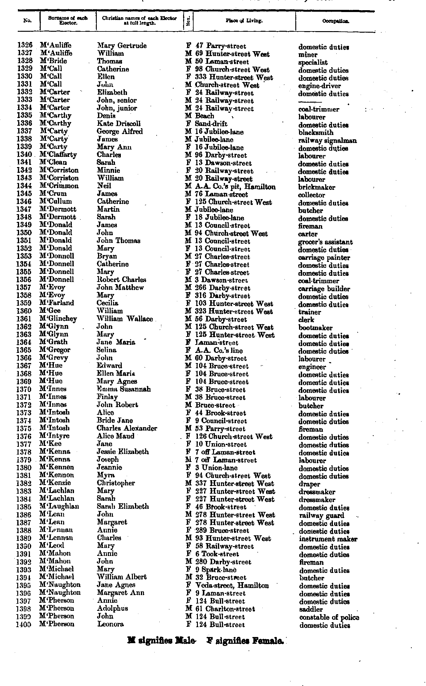
- M'Auliffe Mary - M'Pherson Leonora
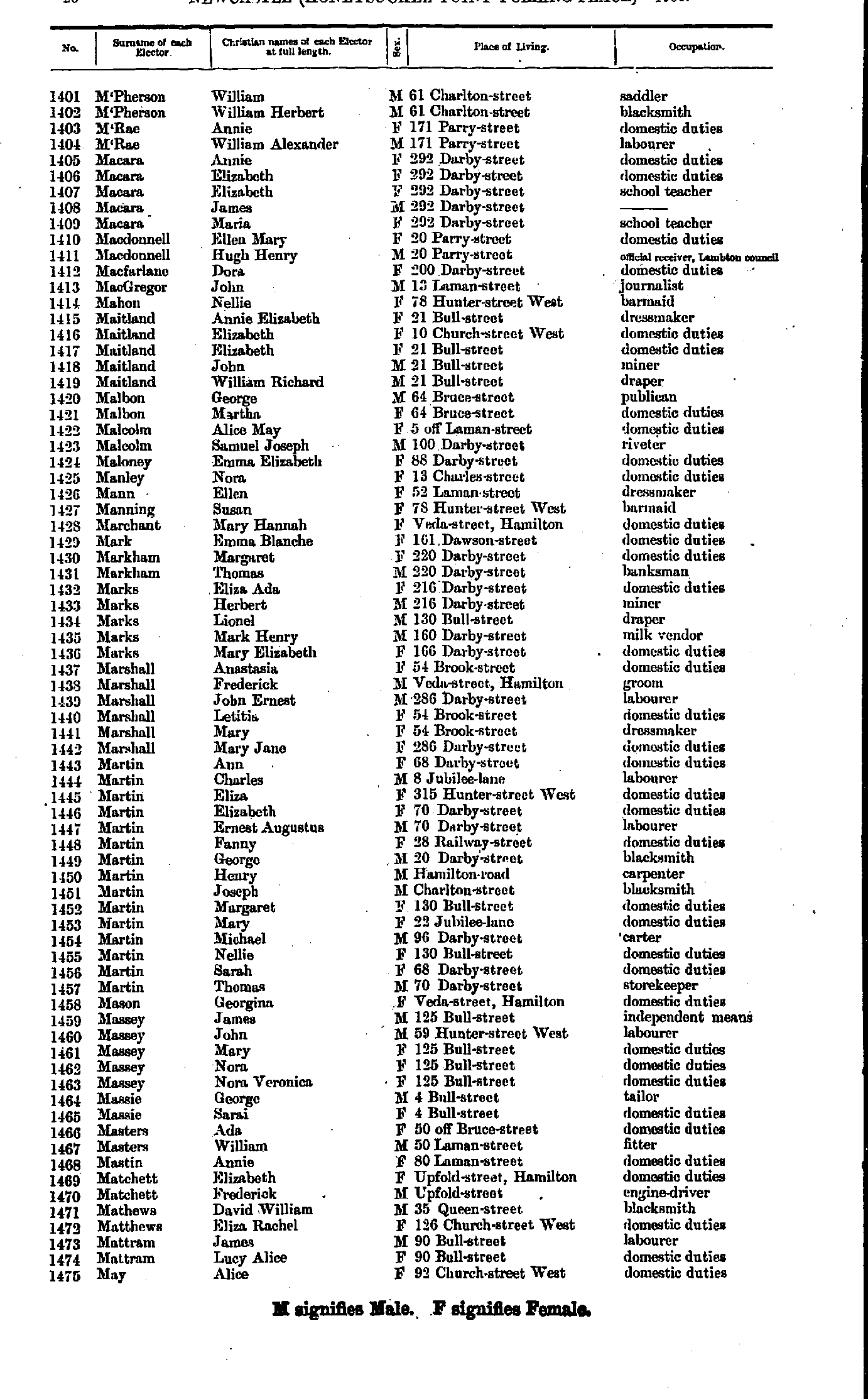
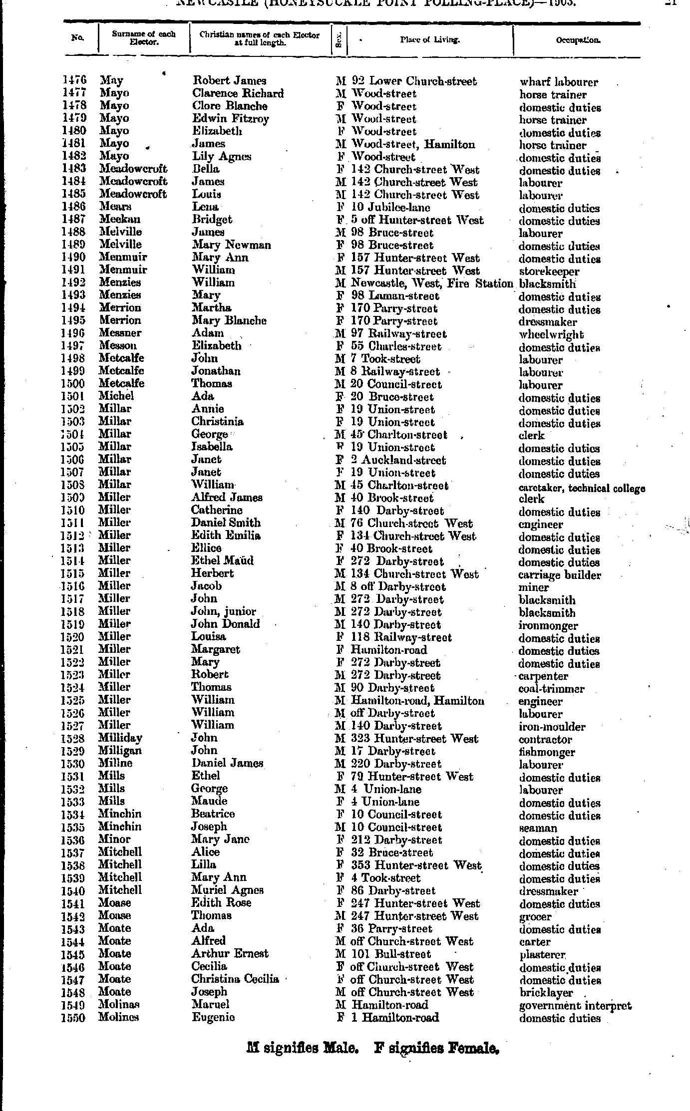
- M'Pherson William - May Alice
- May Robert - Molines Eugenie
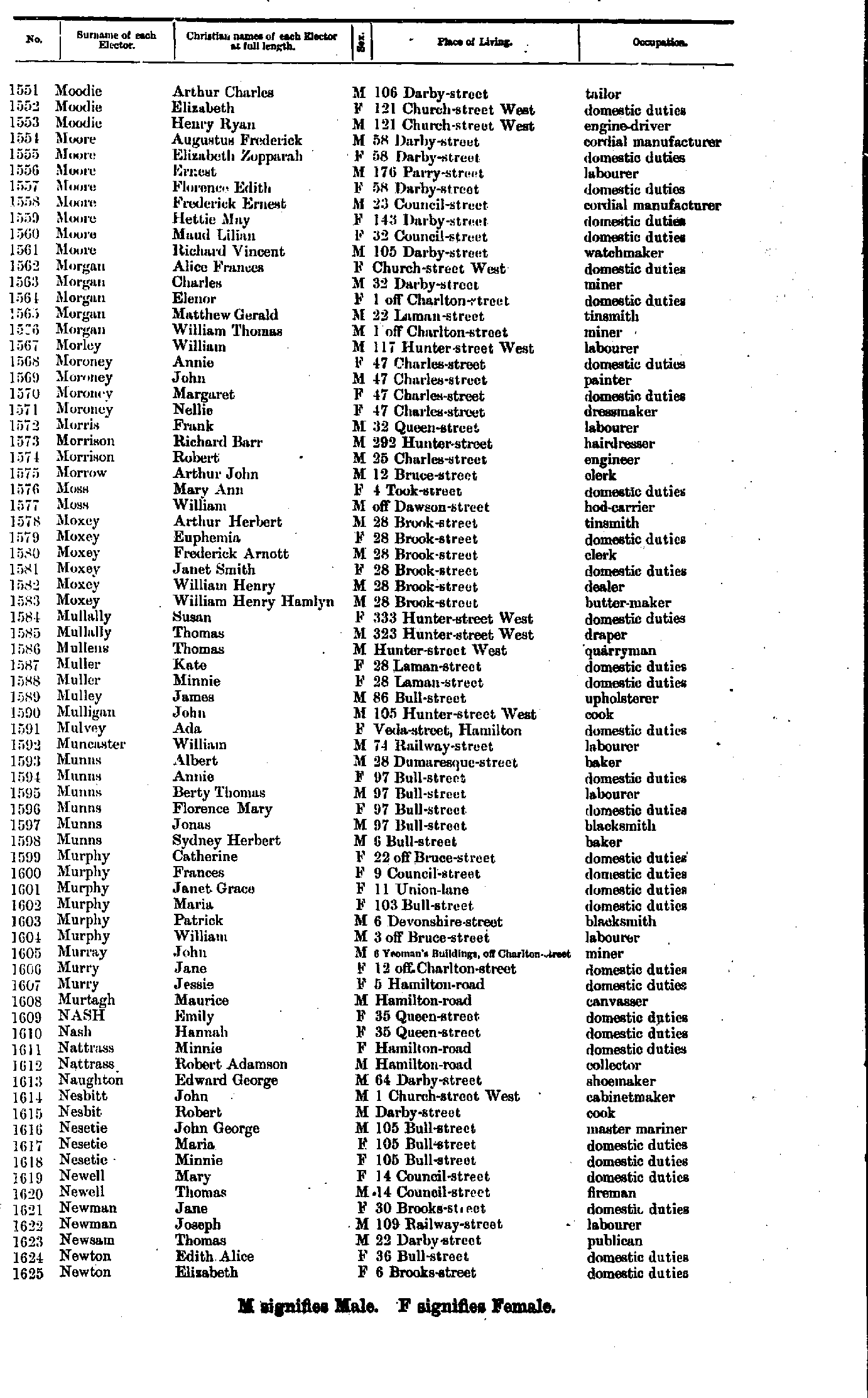
- Moodie Arthur - Newton Elizabeth
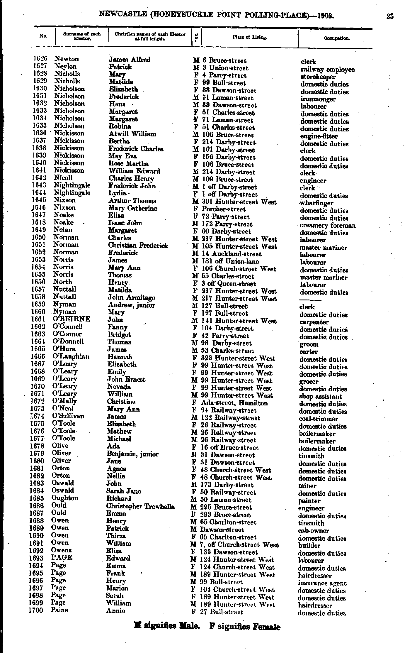
- Newton James - Paine Annie
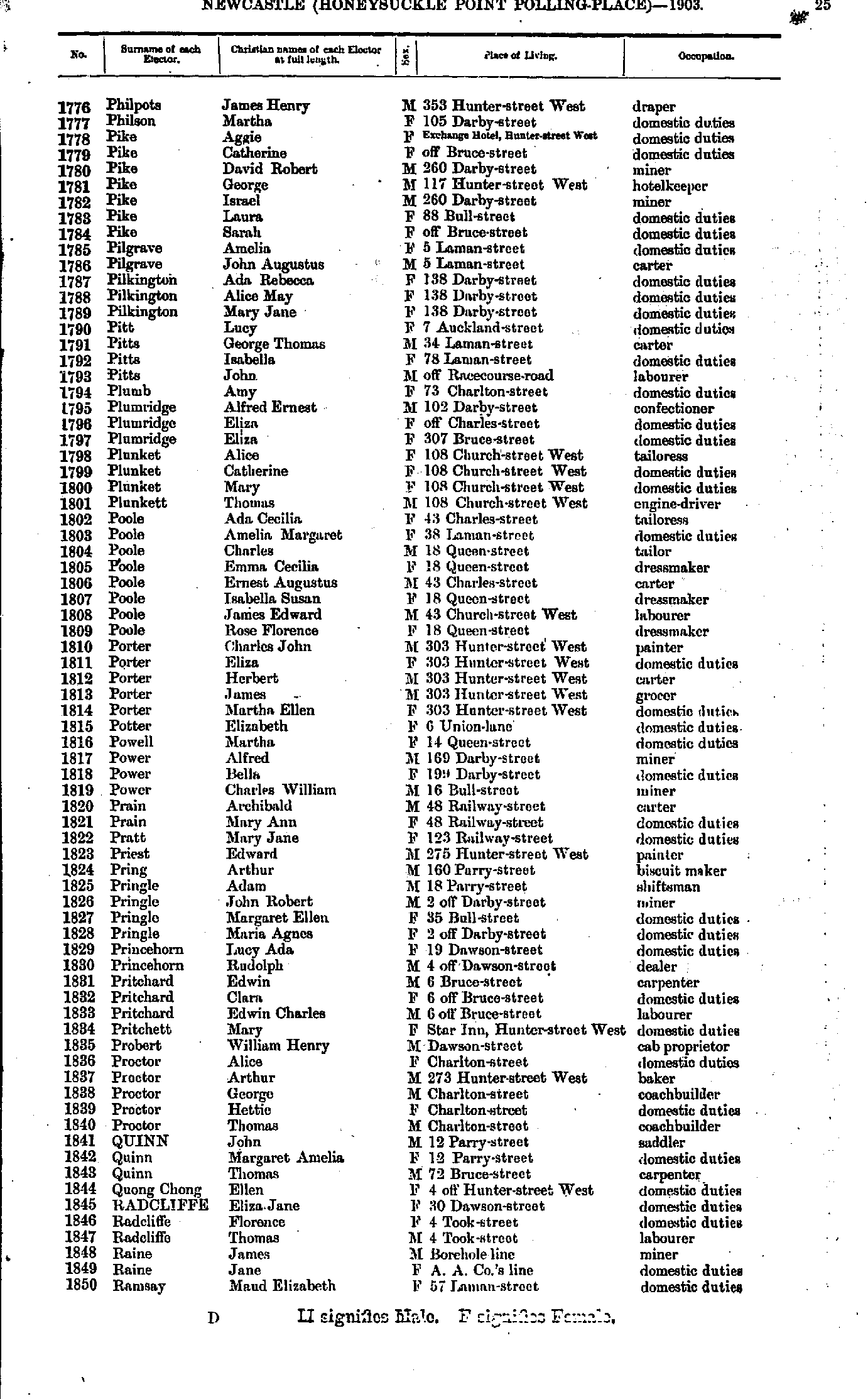
- Paine Elizabeth - Philpots Eliza
- Philpots James - Ramsay Maud
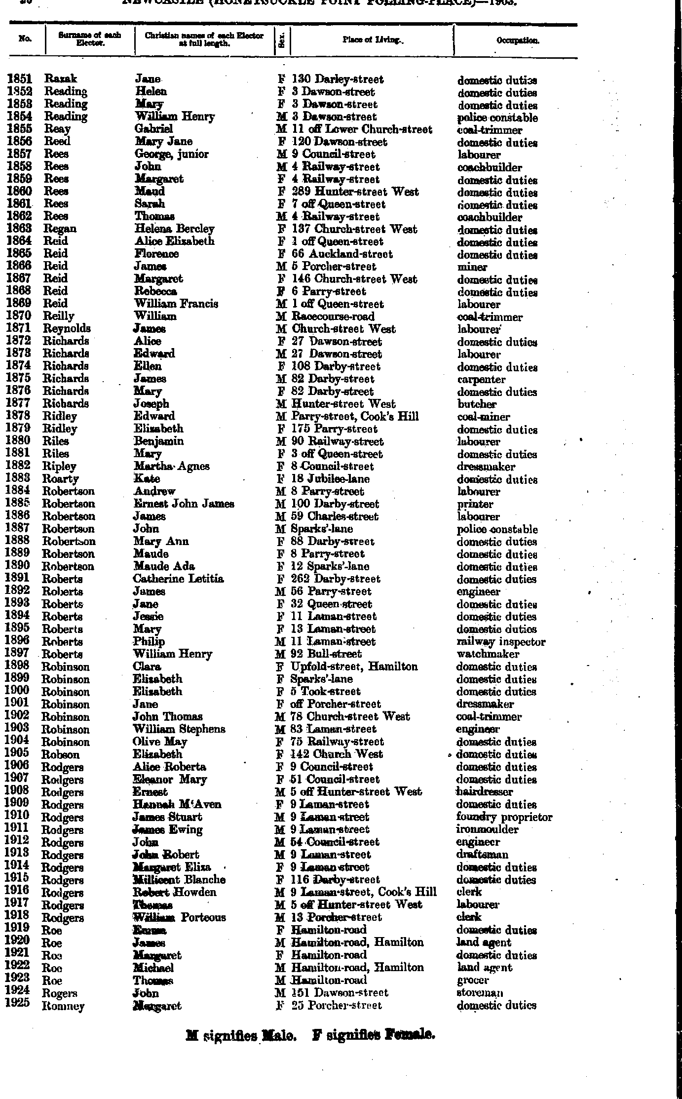
- Razak Jane - Romney Margaret
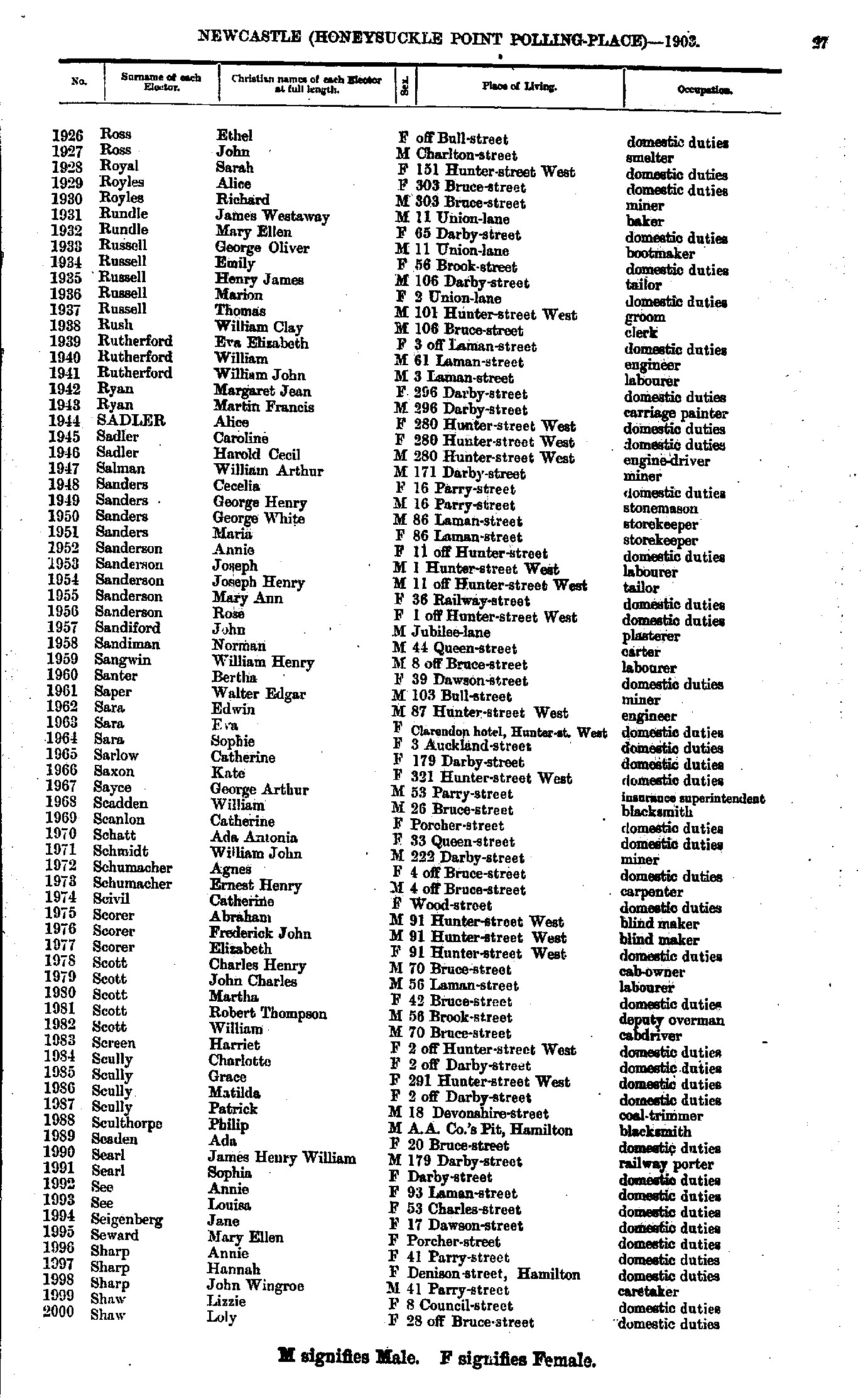
- Ross Ethel - Shaw Loly
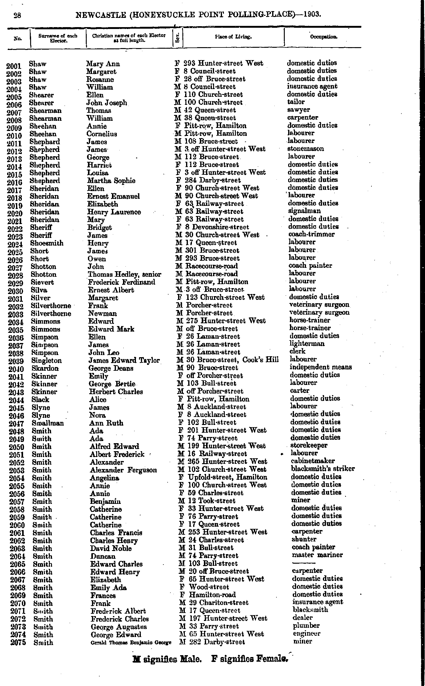
- Shaw Mary - Smith Gerald
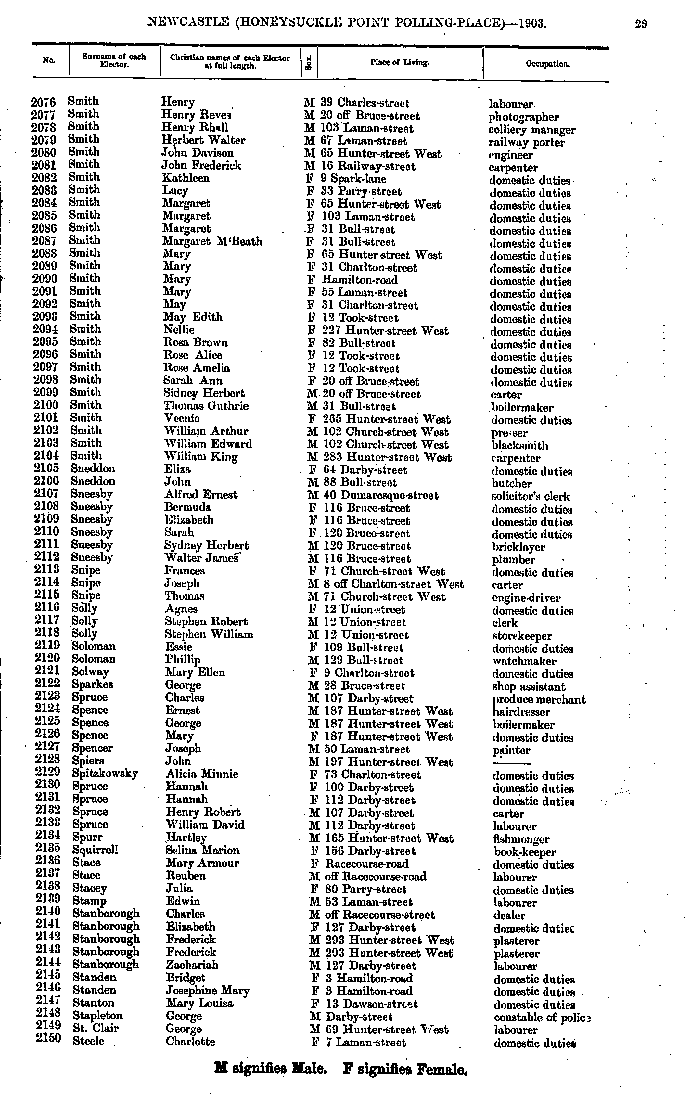
- Smith Henry - Steele Charlotte
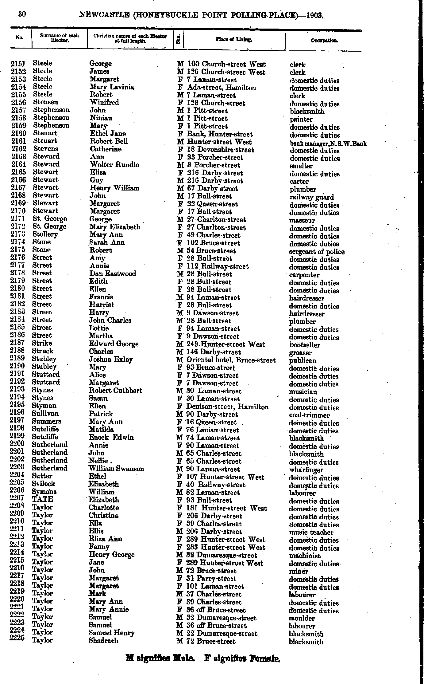
- Steele George - Taylor Shadrach
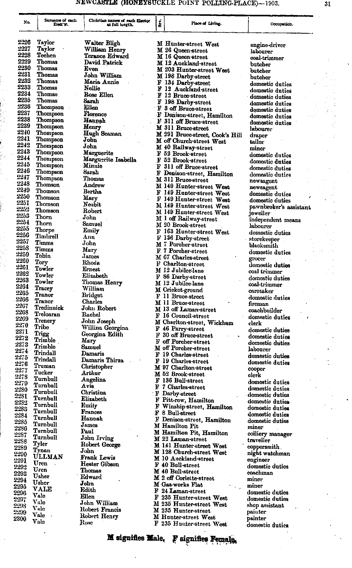
- Taylor Walter - Vale Rose
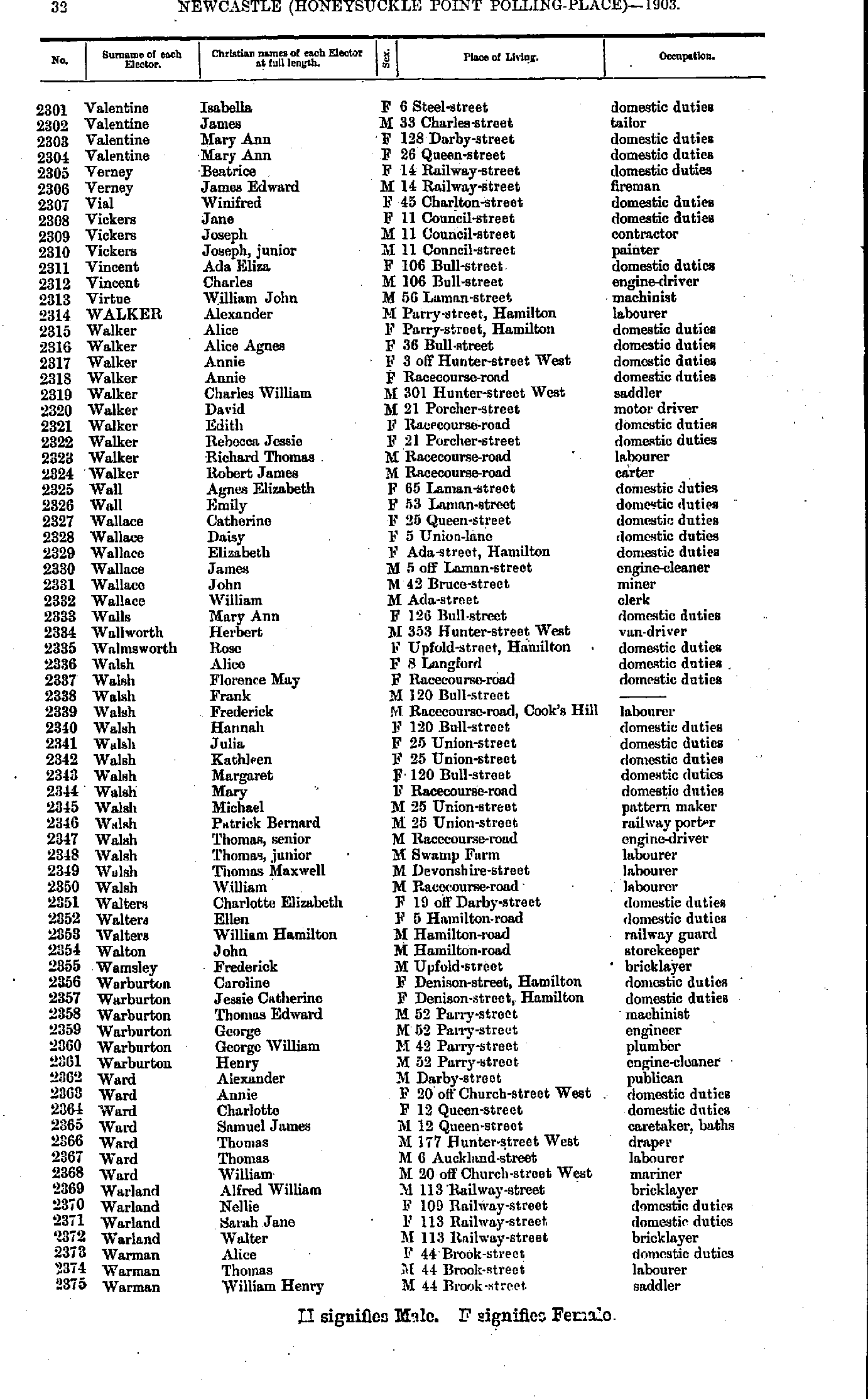
- Valentine Isabella - Warman William
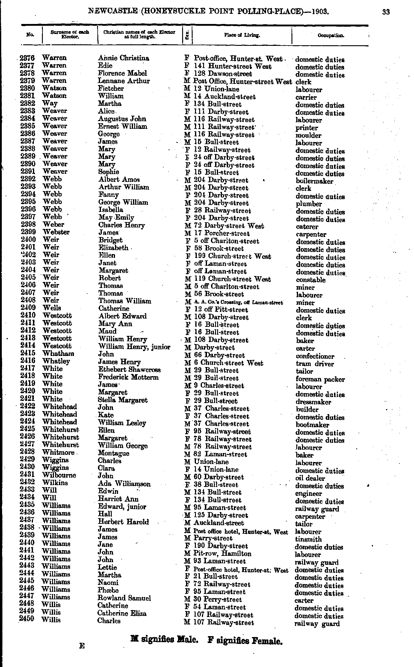
- Warren Annie - Willis Charles
- Willis Emma - Young Rachel
- Adams Agnes - Bate Walter
- Beacham Margaret - Brown Charles
- Brown David - Clair Sidney
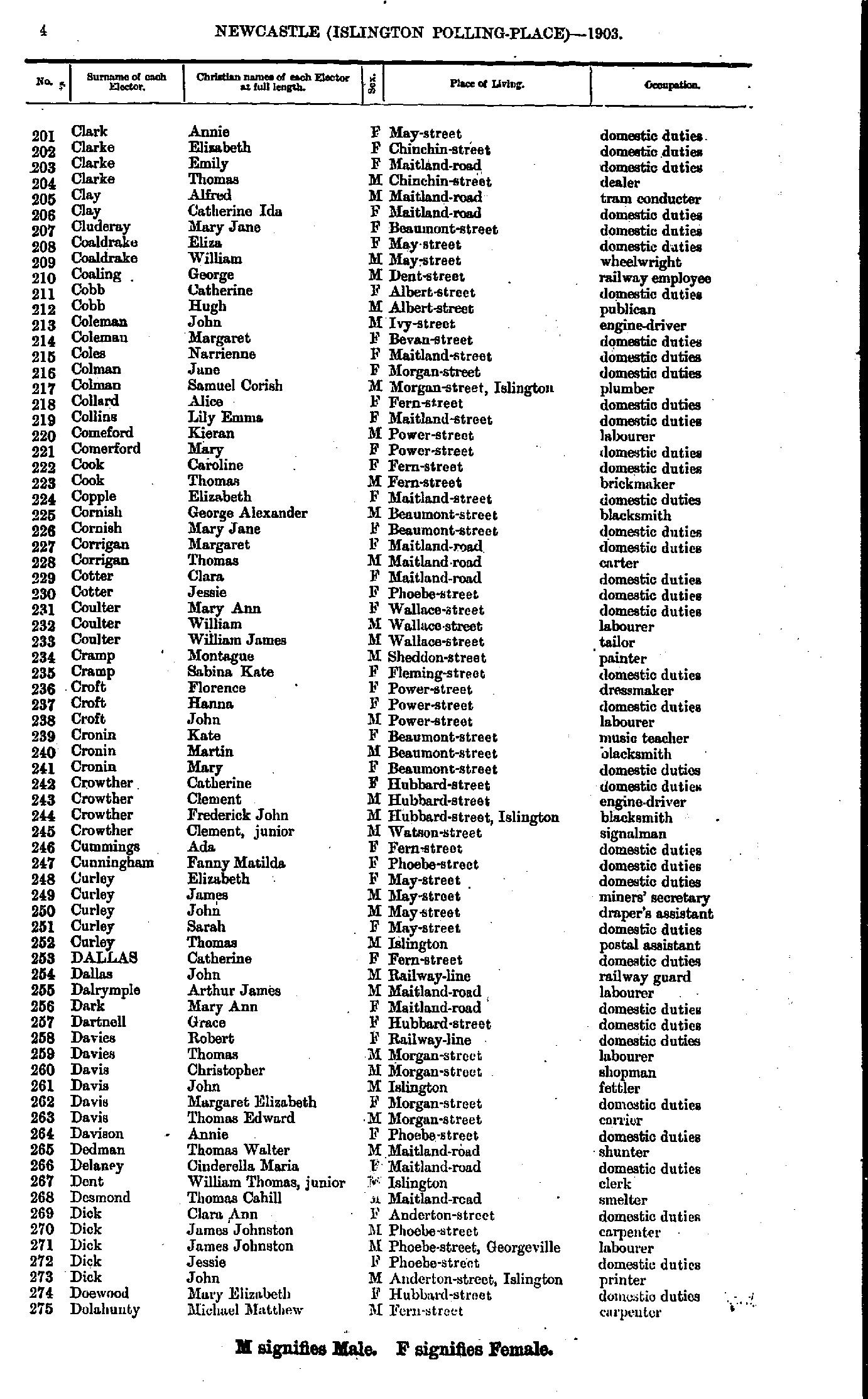
- Clark Annie - Dolahunty Michael
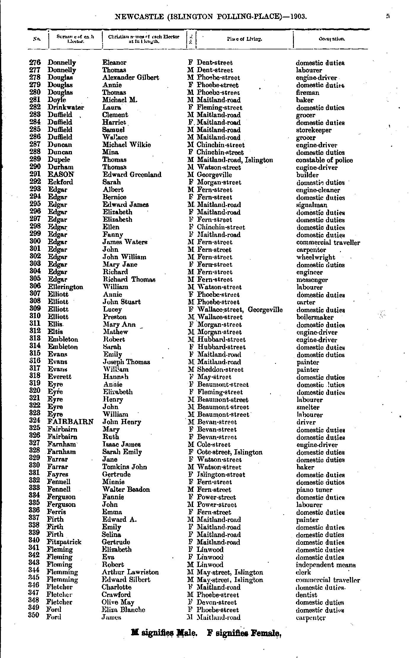
- Donnelly Eleanor - Ford James
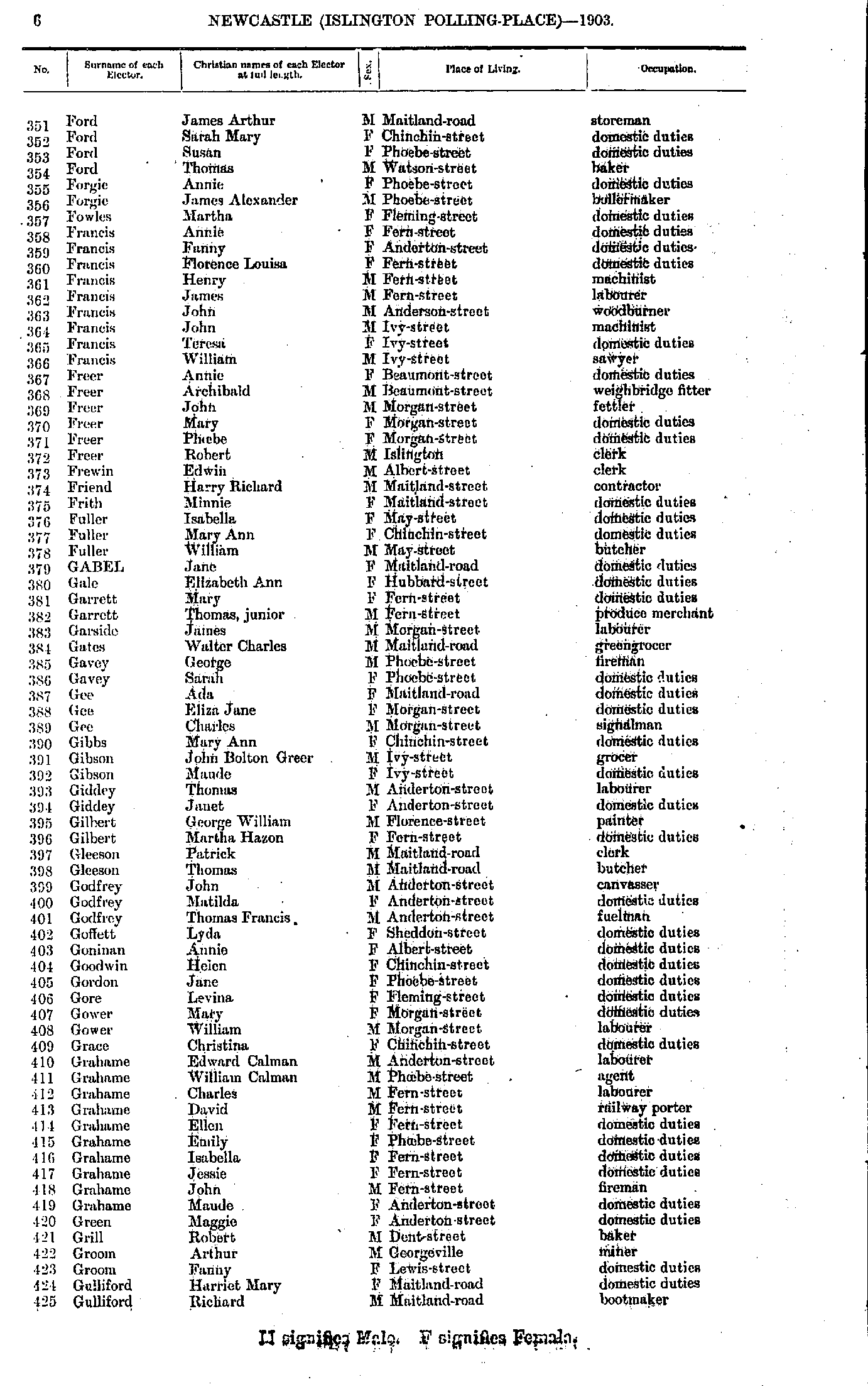
- Ford James - Gulliford Richard
- Gwatkin John - Howard William
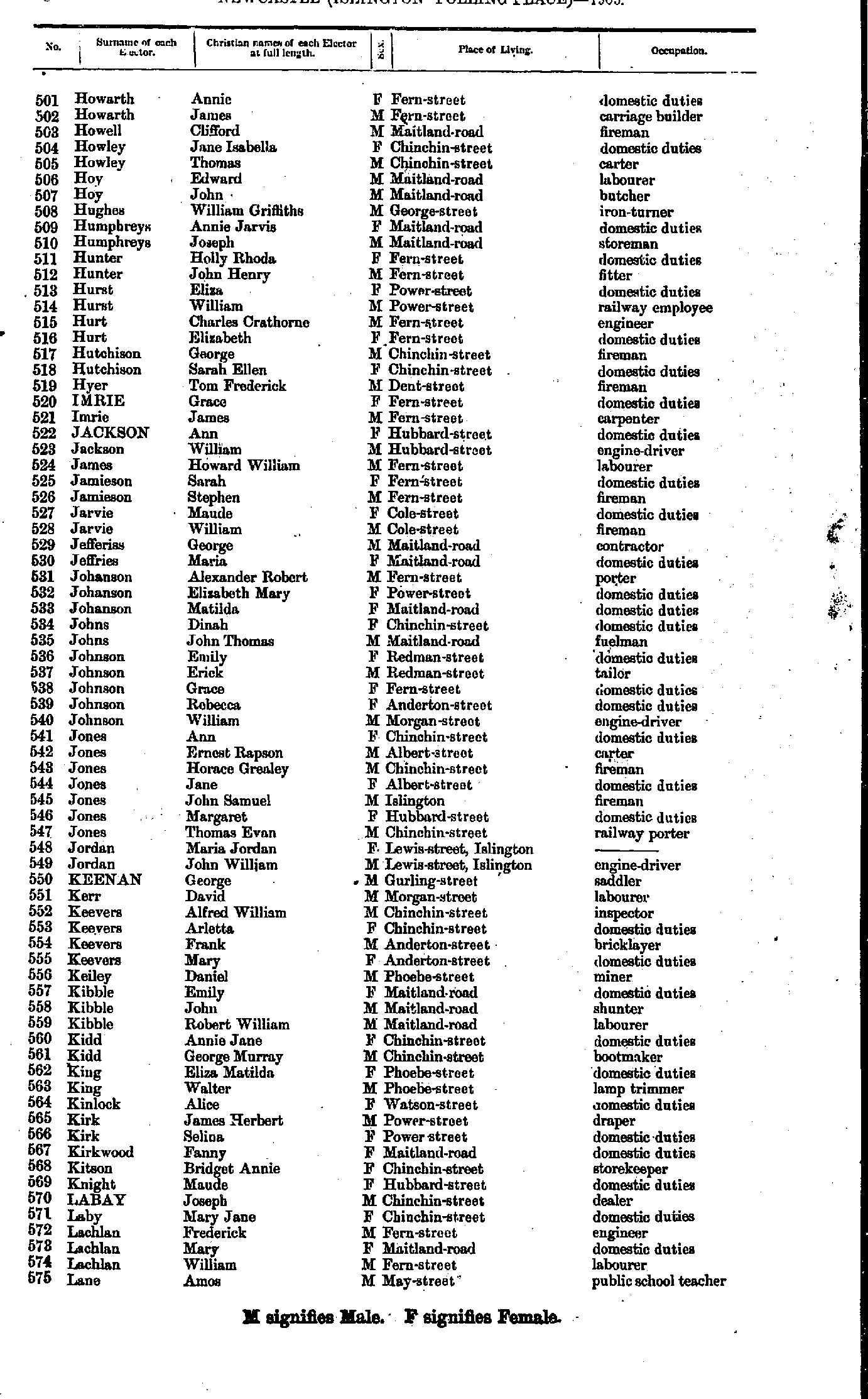
- Howarth Annie - Lane Amos
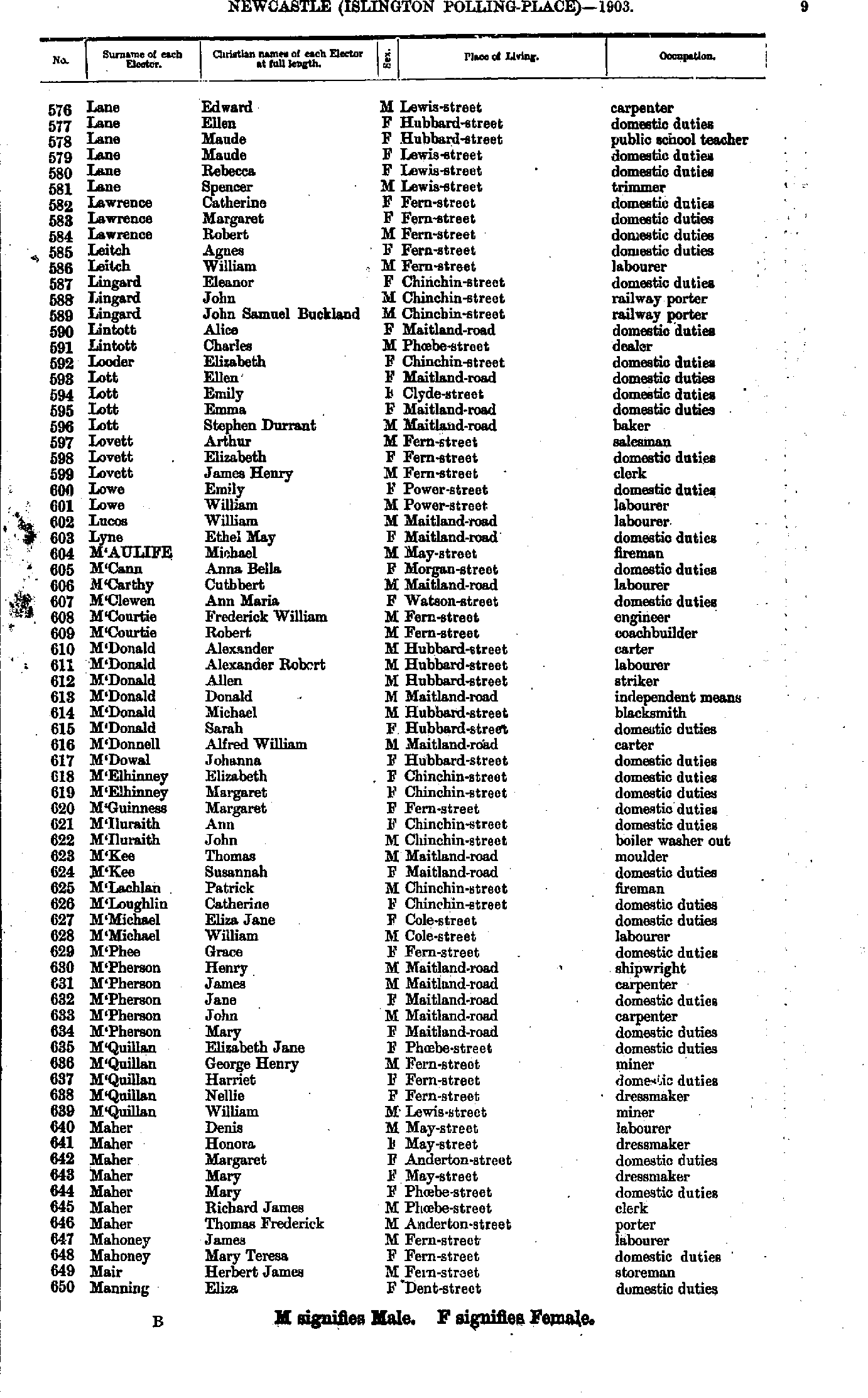
- Lane Edward - Manning Eliza
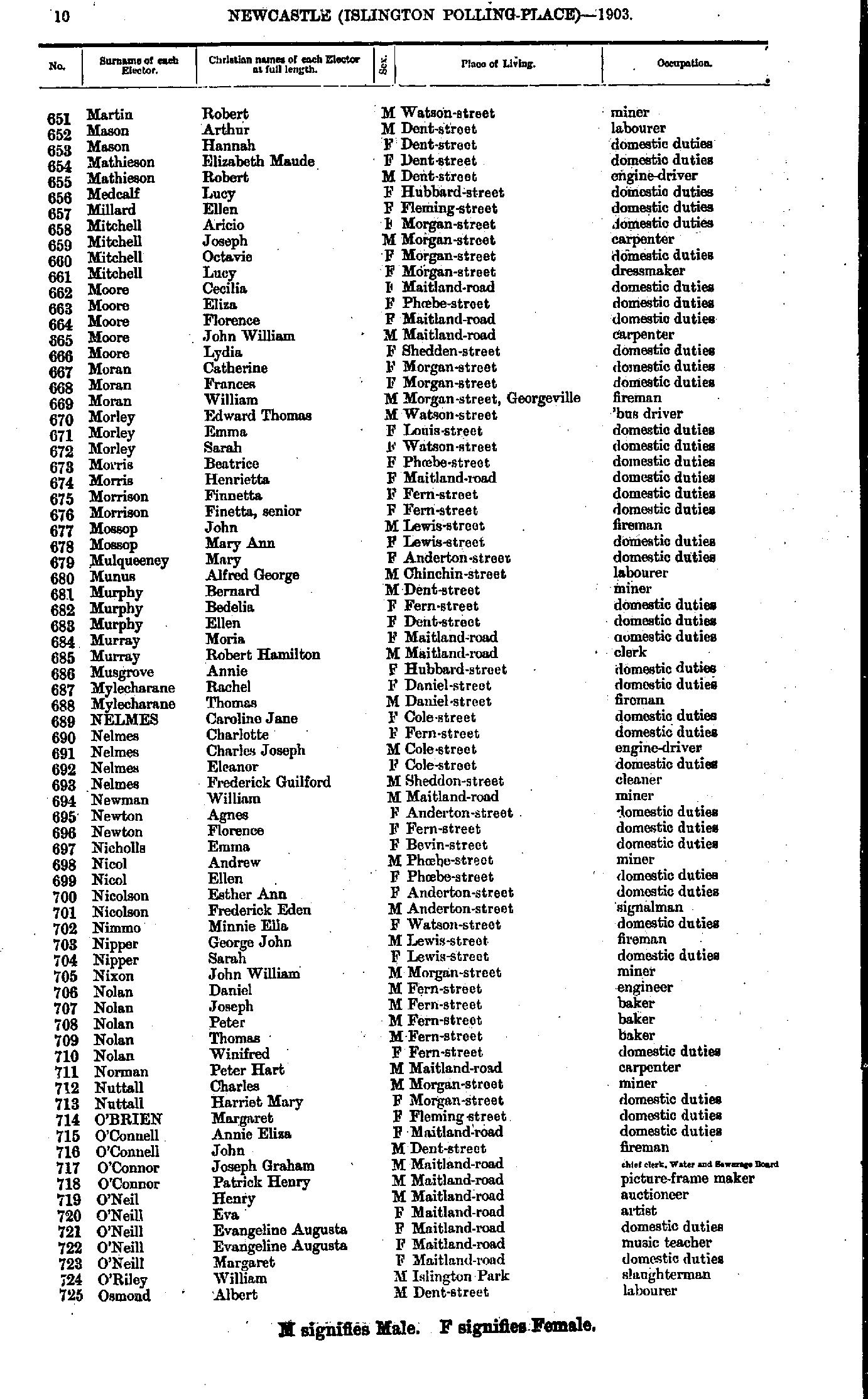
- Martin Robert - Osmond Albert
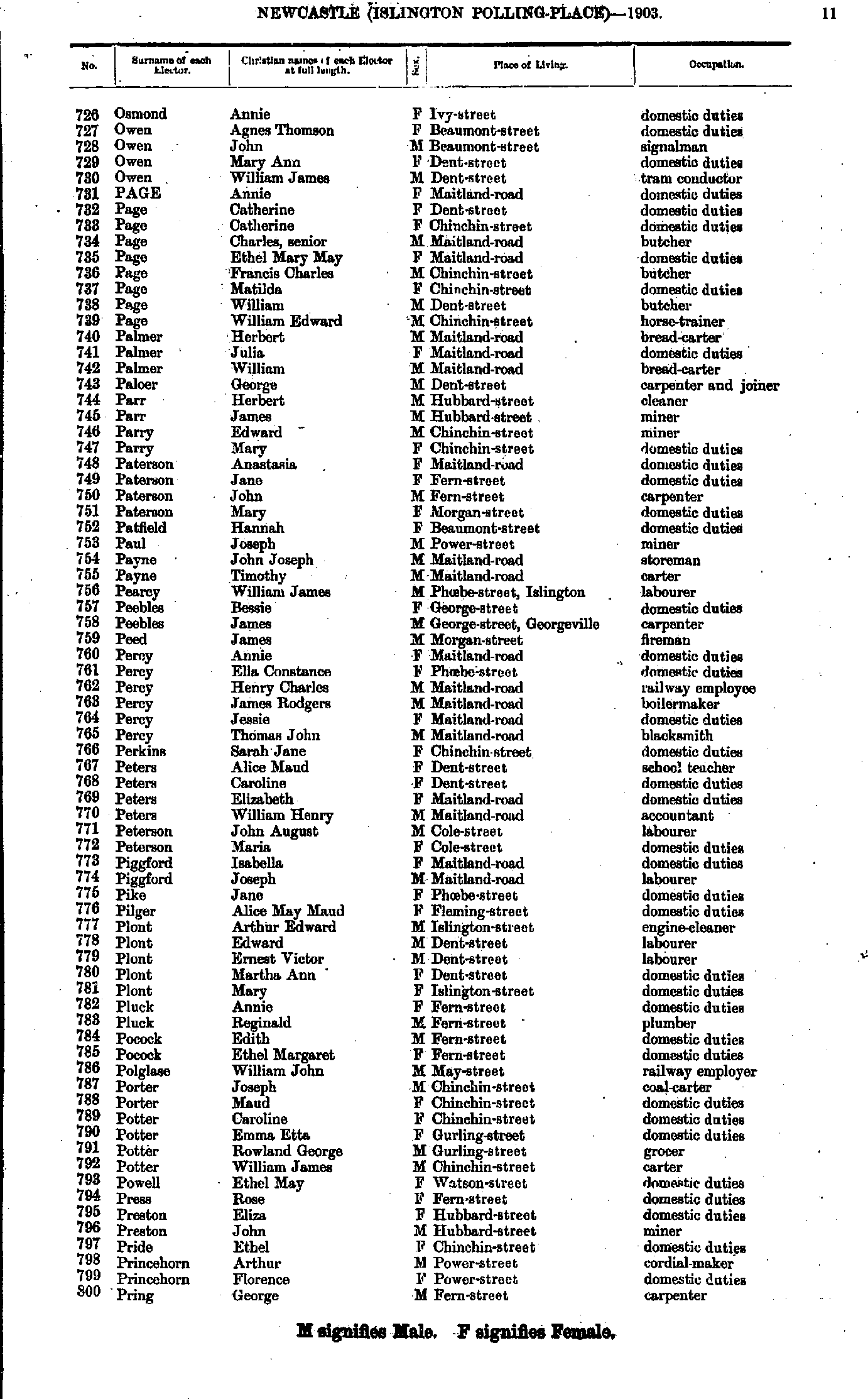
- Osmond Annie - Pring George
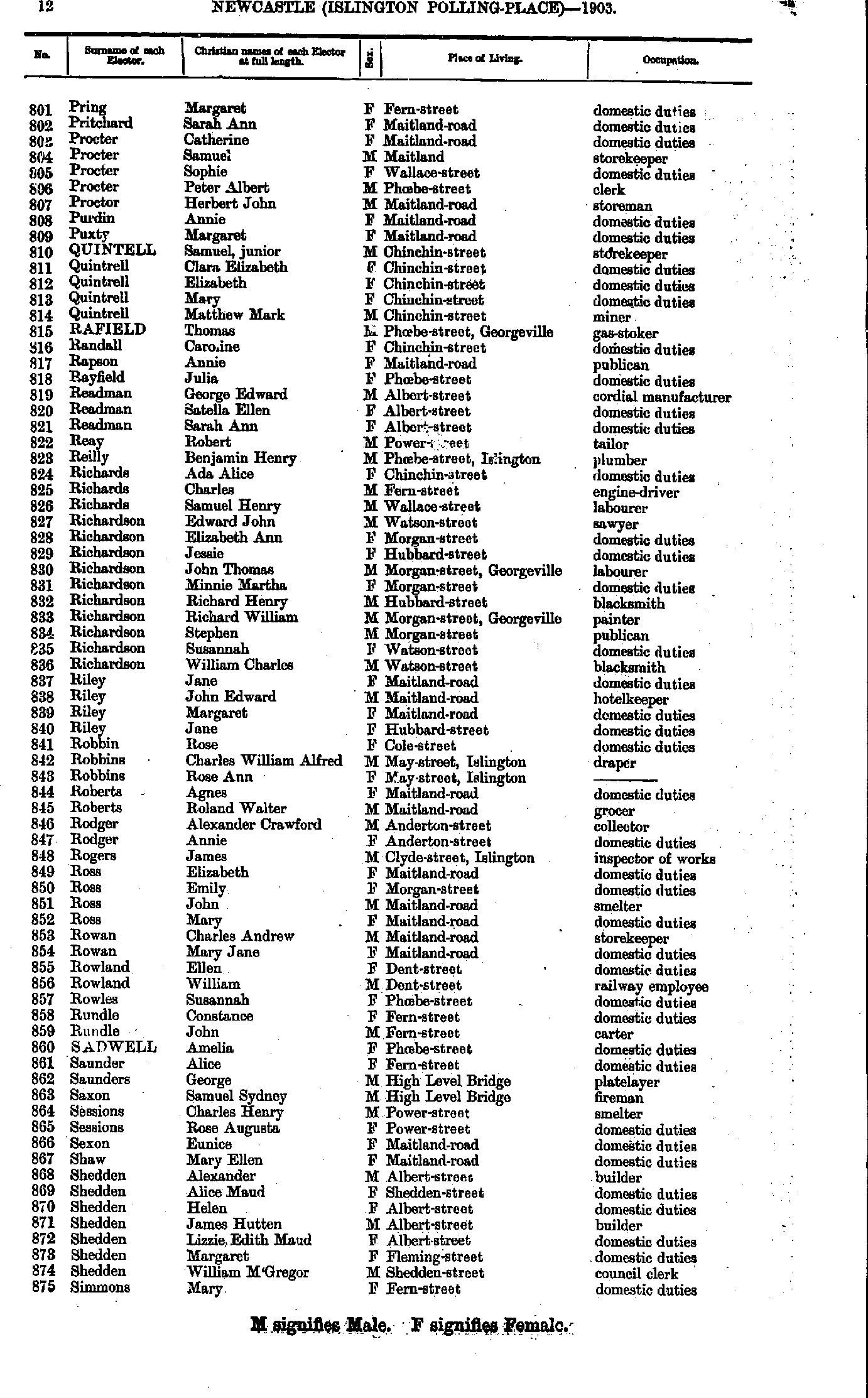
- Pring Margaret - Simmons Mary.
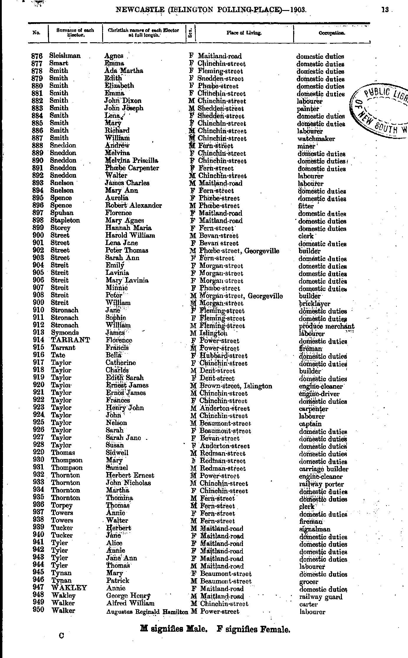
- Sleishman Agnes - Walker Augustus
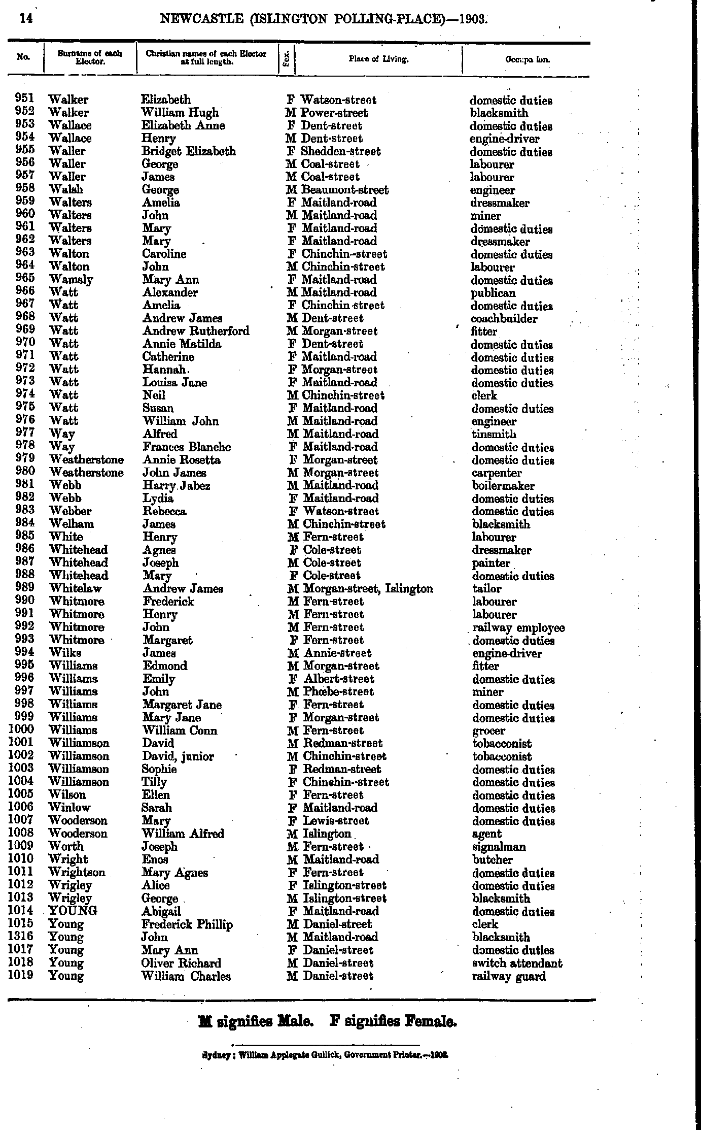
- Walker Elizabeth - Young William
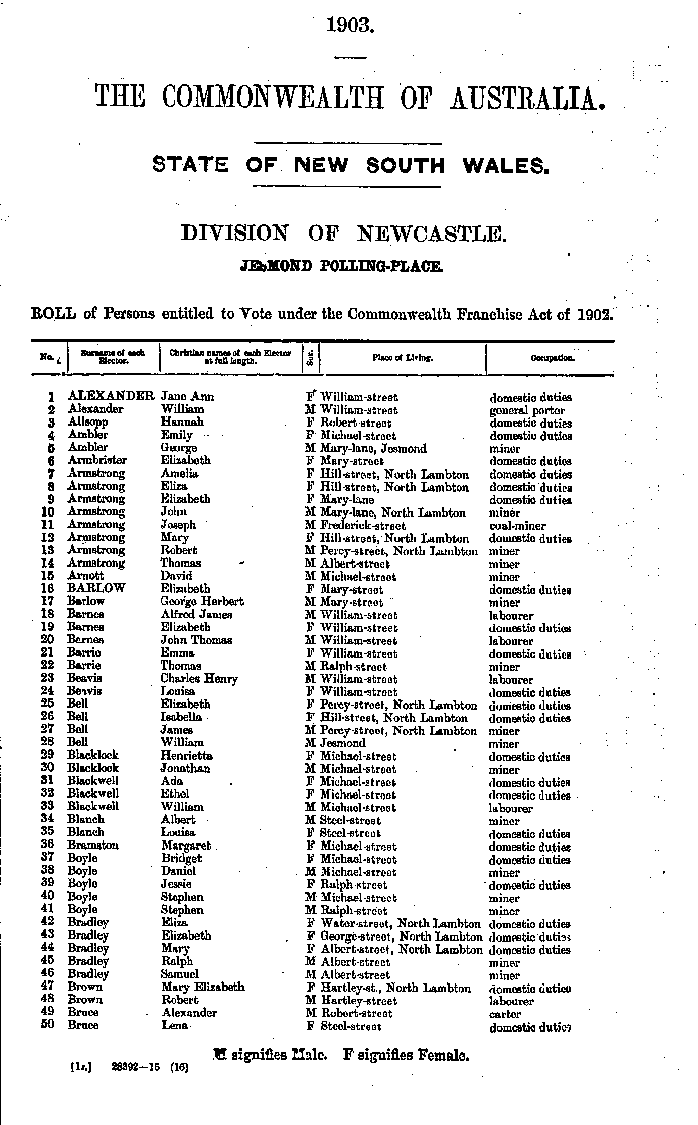
- Alexander Jane - Bruce Lena
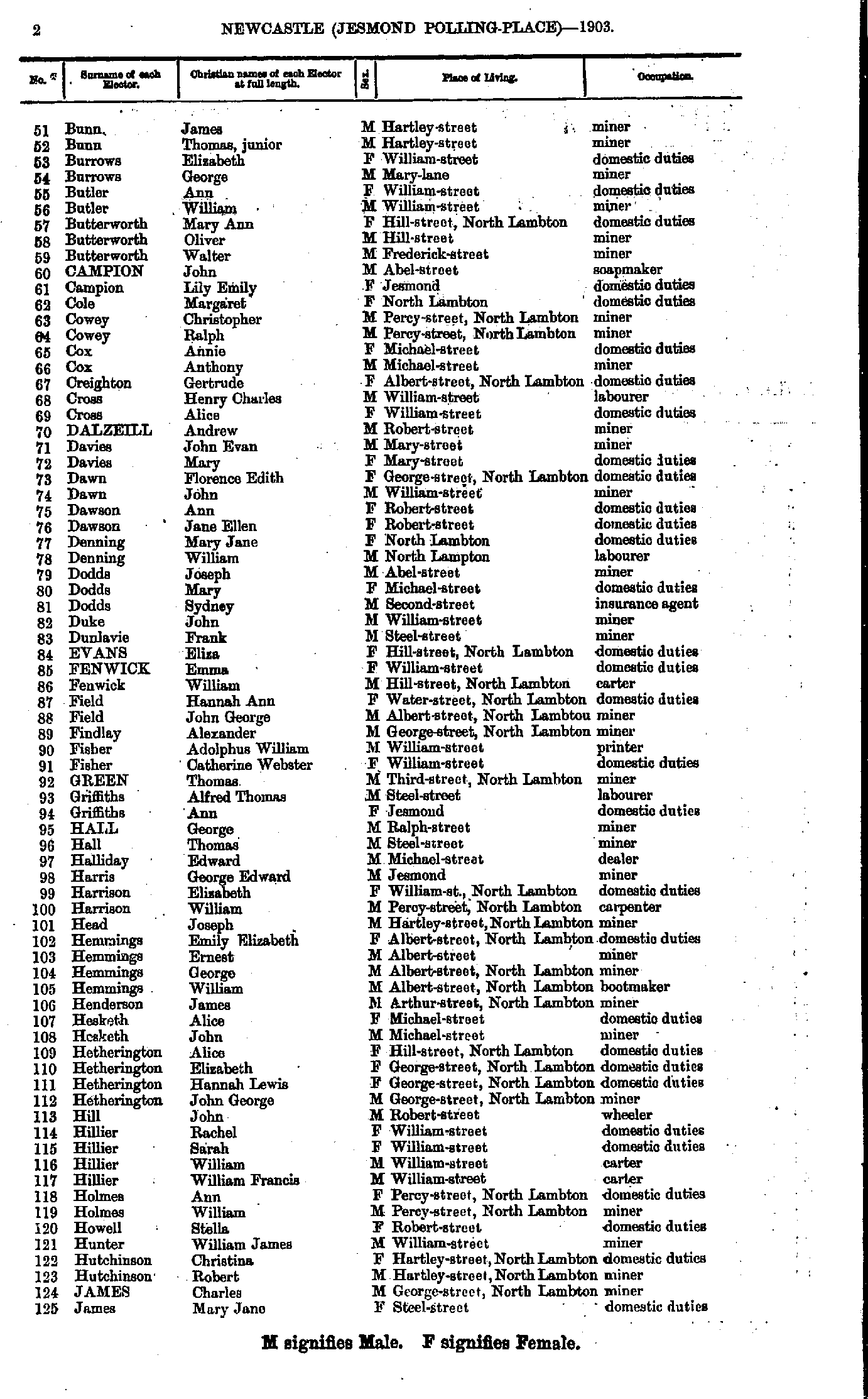
- Bunn James - James Mary
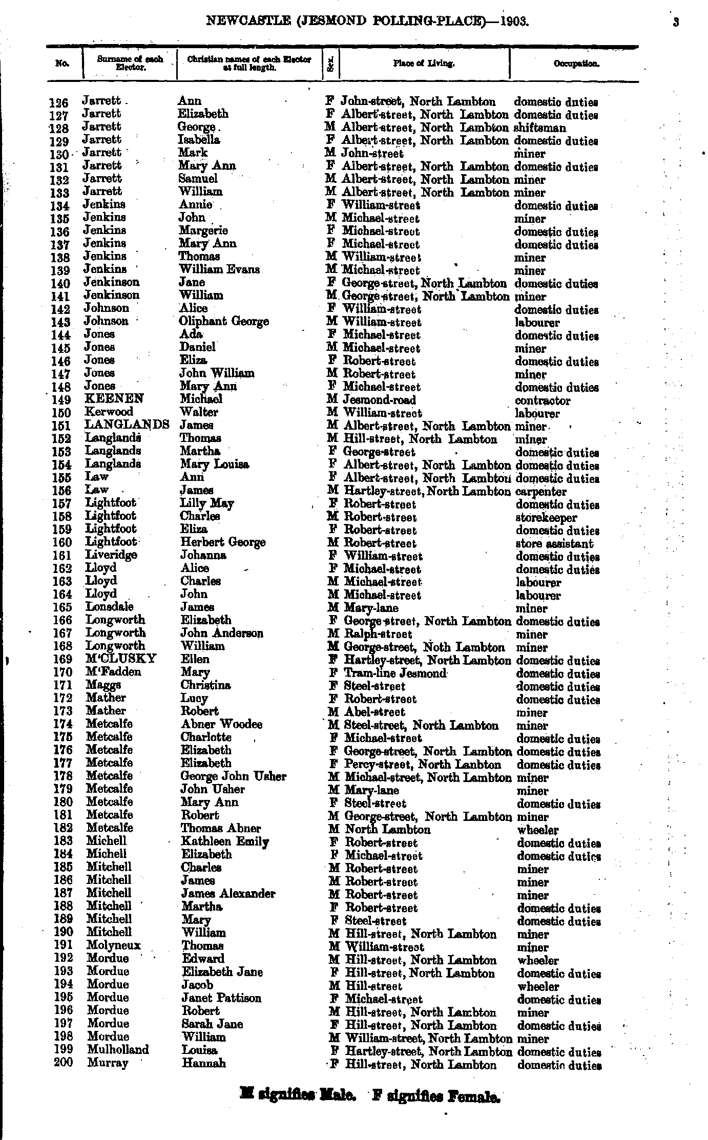
- Jarrett Ann - Murray Hannah
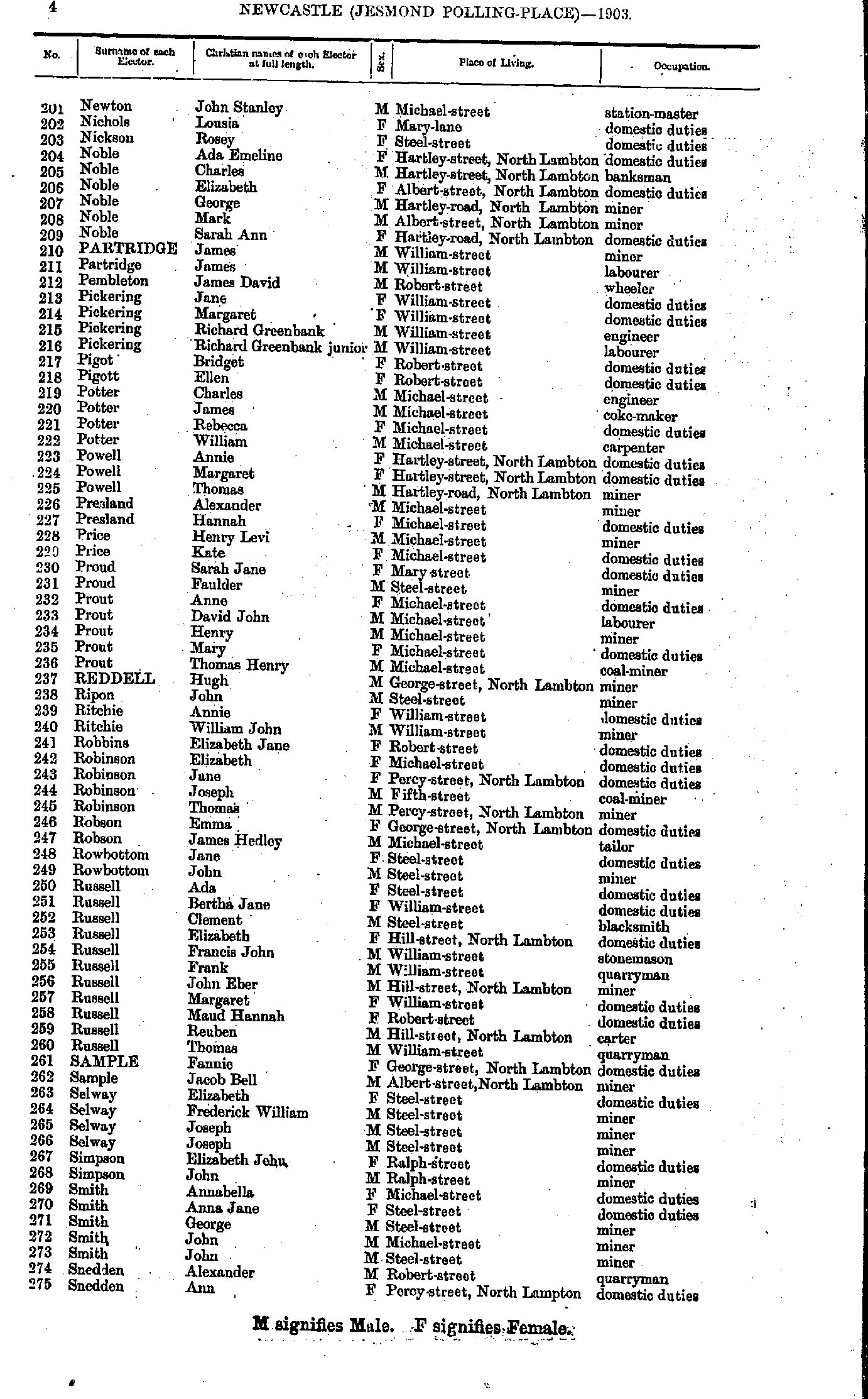
- Newton John - Snedden Ann
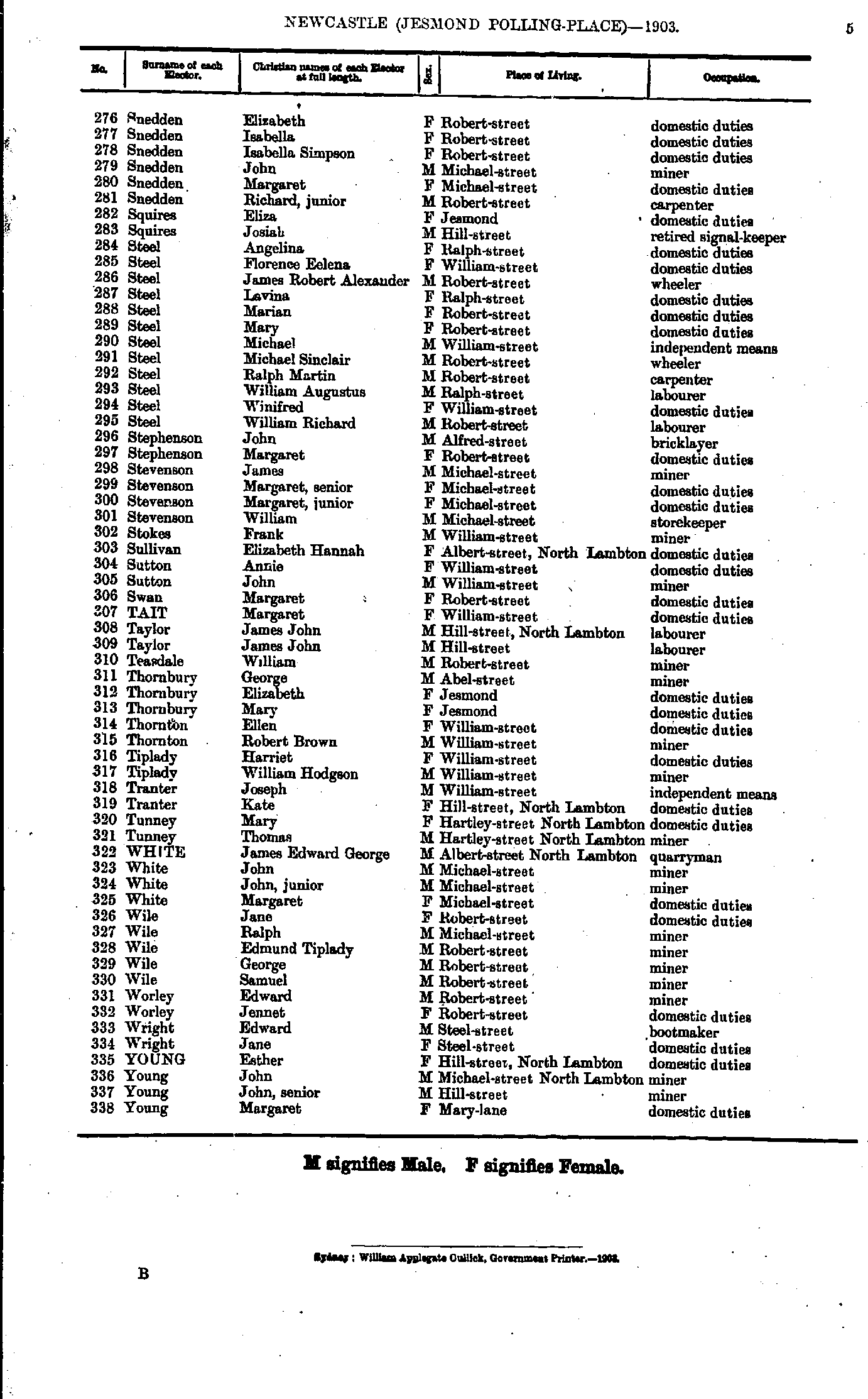
- Snedden Elizabeth - Young Margaret
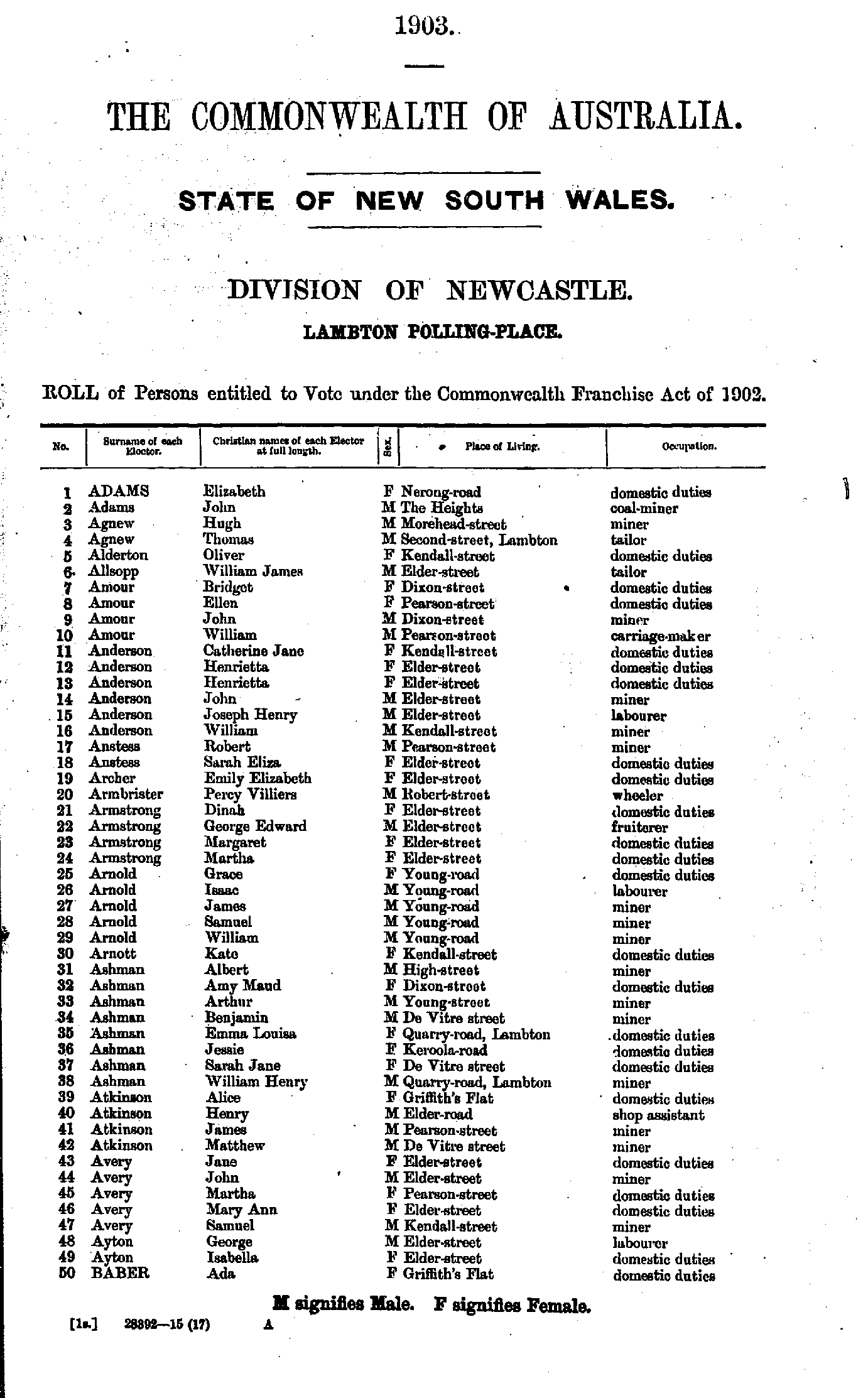
- Adams Elizabeth - Baber Ada
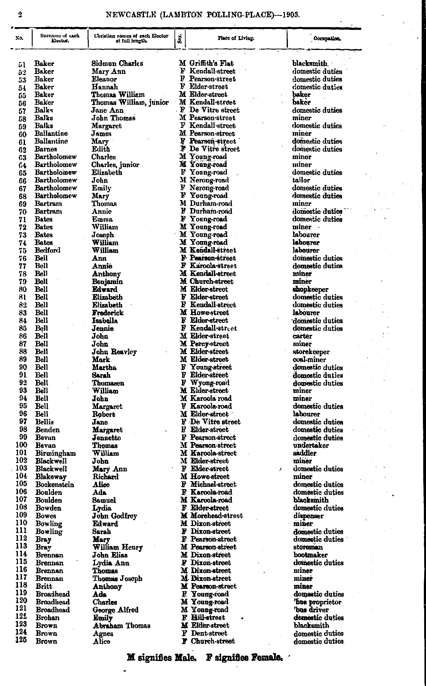
- Baker Sidman - Brown Alice
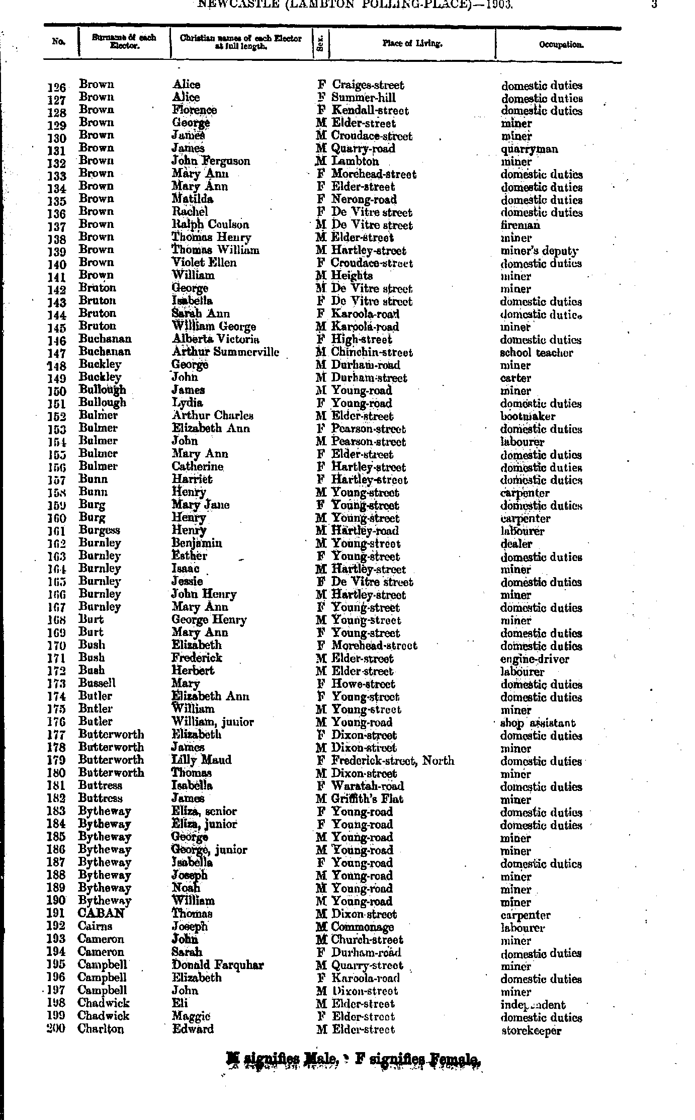
- Brown Alice - Charlton Edward
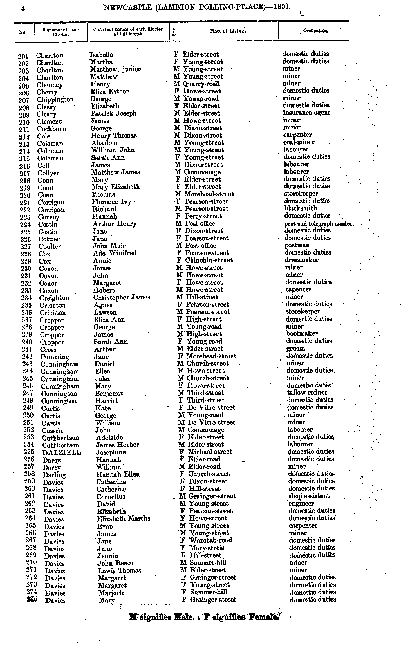
- Charlton Isabella - Davies Mary
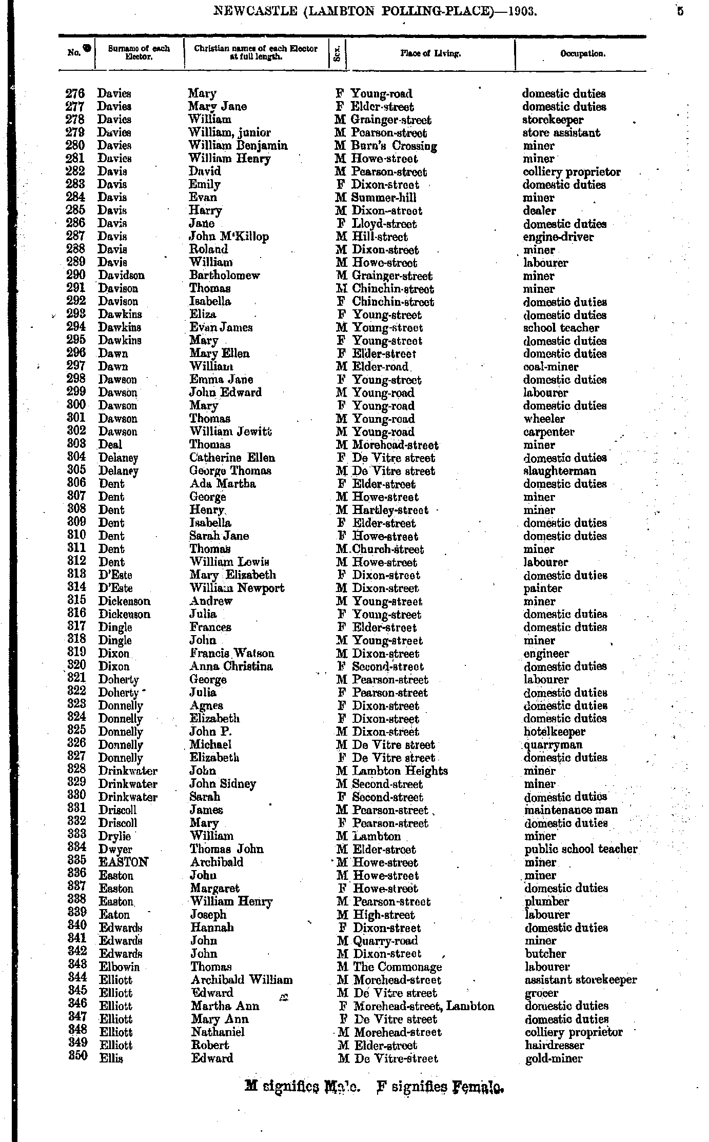
- Davies Mary - Ellis Edward
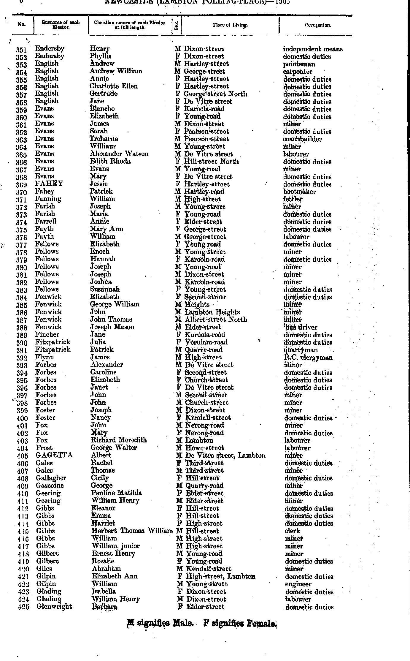
- Endersby Henry - Glenwright Barbara
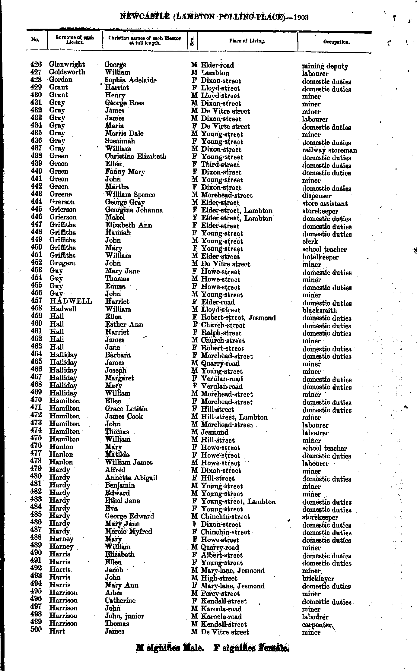
- Glenwright George - Hart James
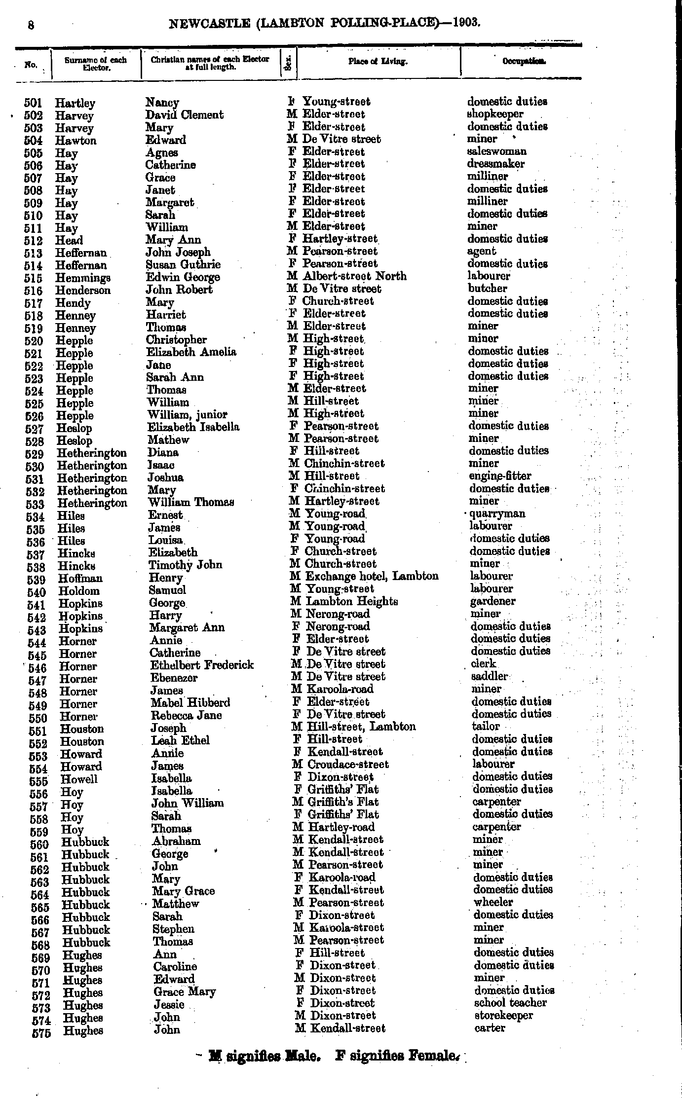
- Hartley Nancy - Hughes John
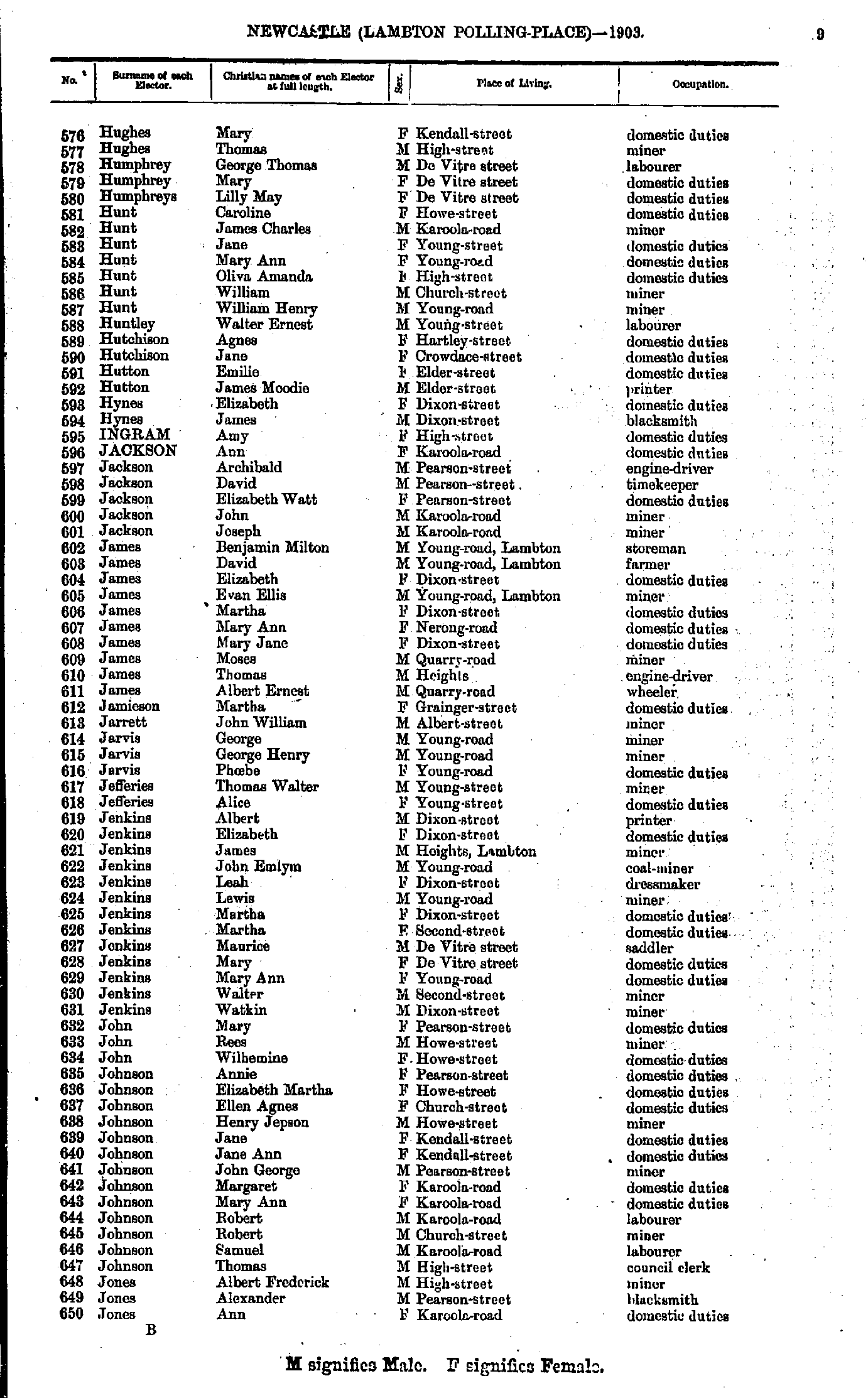
- Hughes Mary - Jones Ann
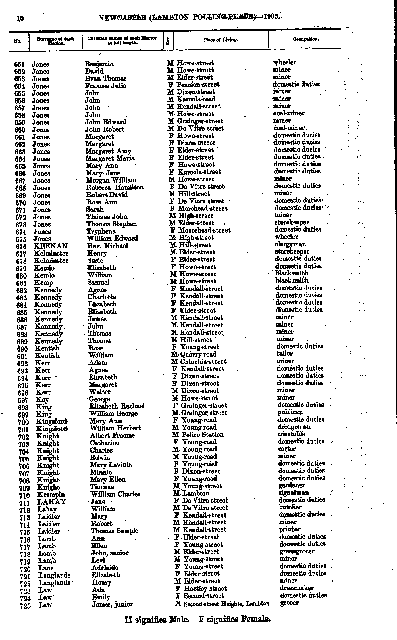
- Jones Benjamin - Law James
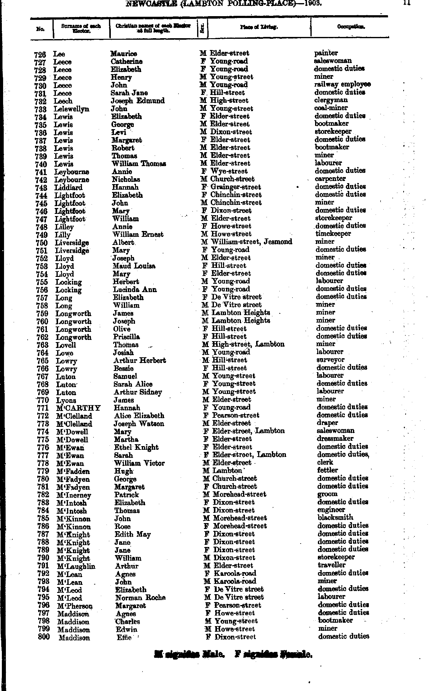
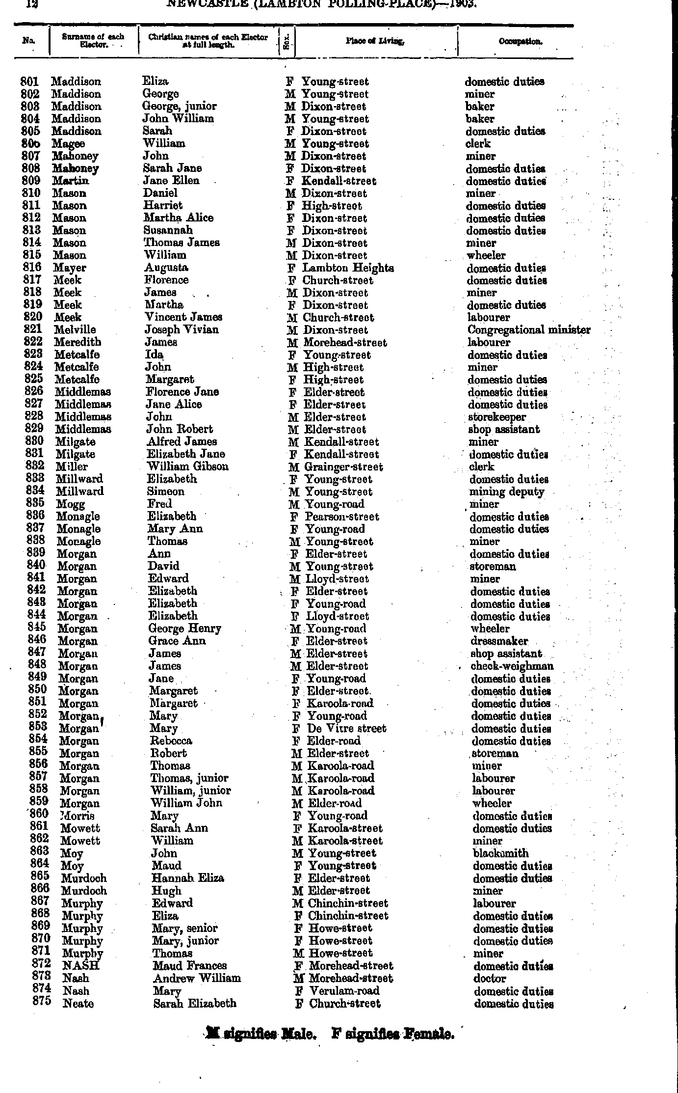
- Lee Maurice - Maddison Effie
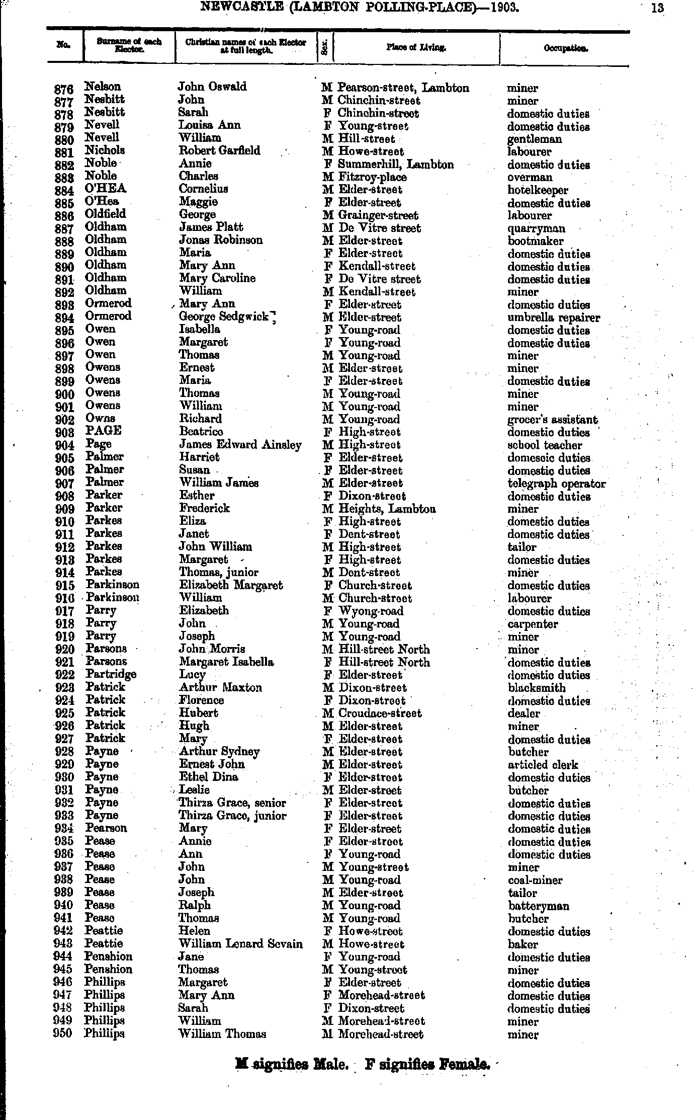
- Maddison Eliza - Neate Sarah
- Nelson John - Phillips William
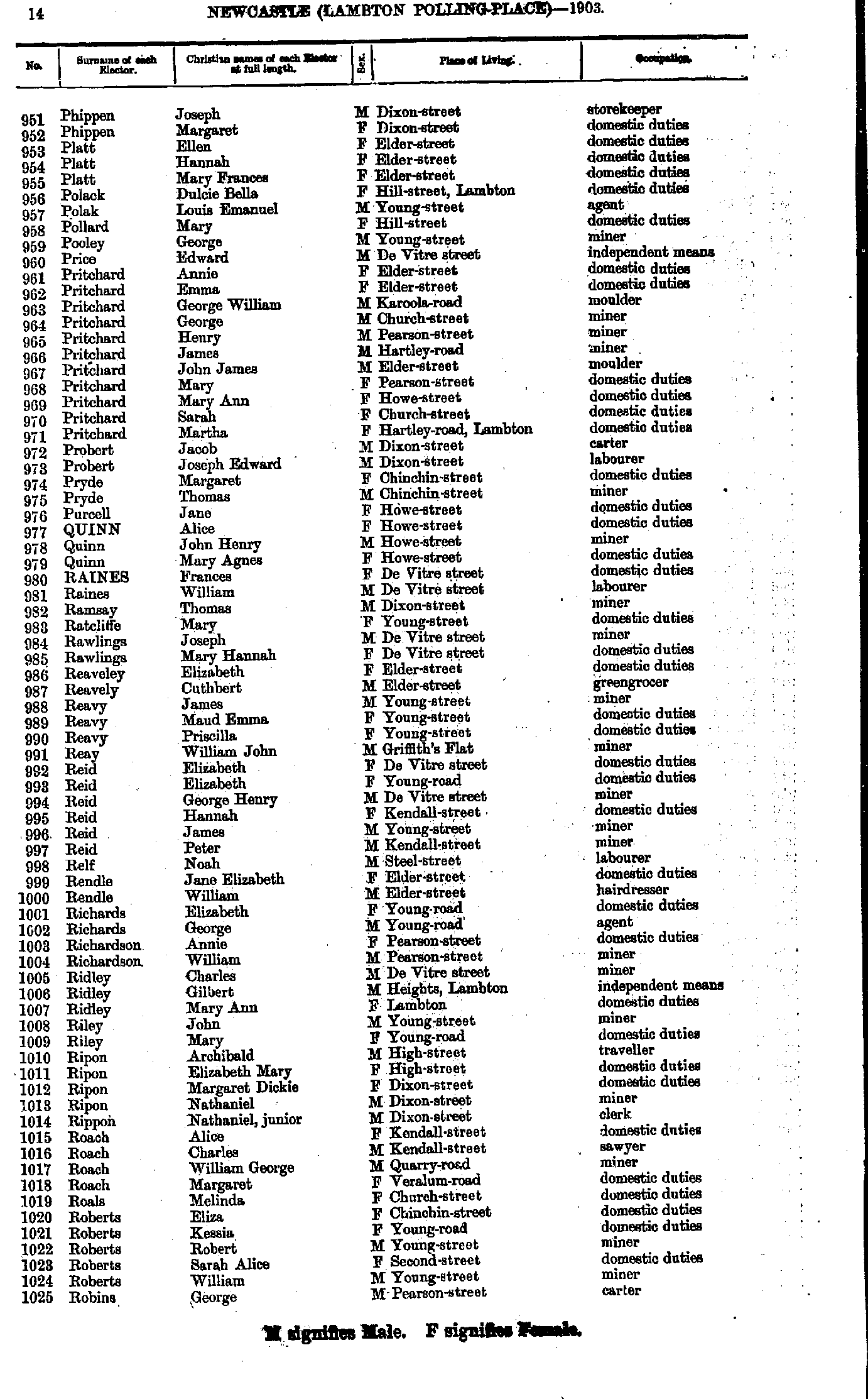
- Phippen Joseph - Robins George
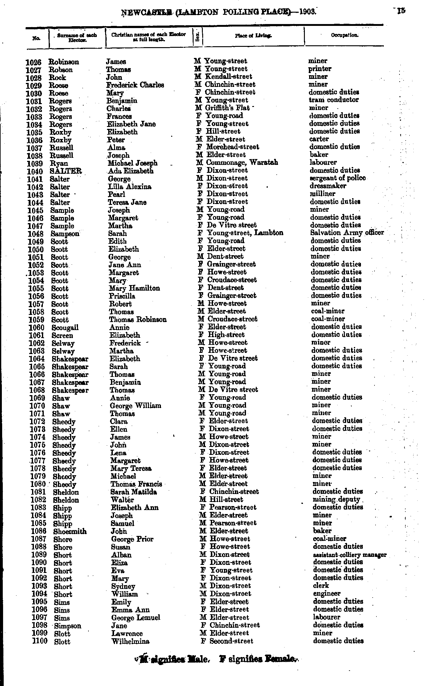
- Robinson James - Slott Wilhelmina
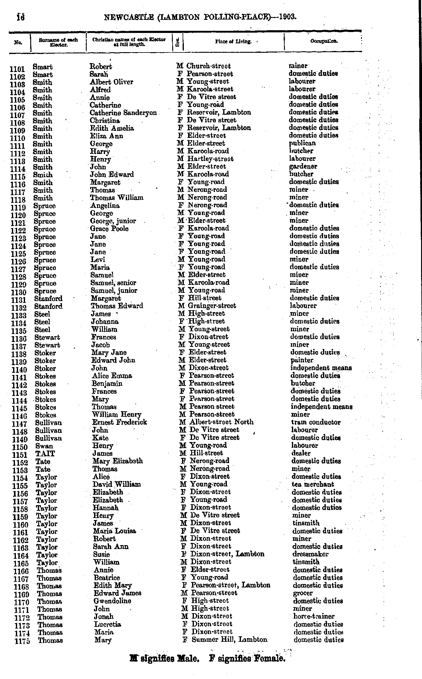
- Smart Robert - Thomas Mary
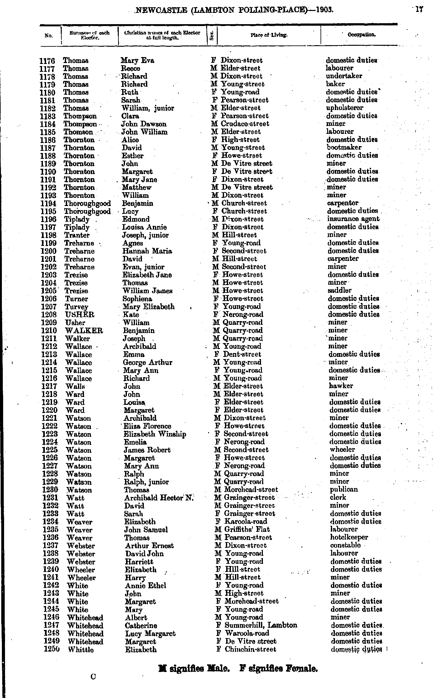
- Thomas Mary - Whittle Elizabeth
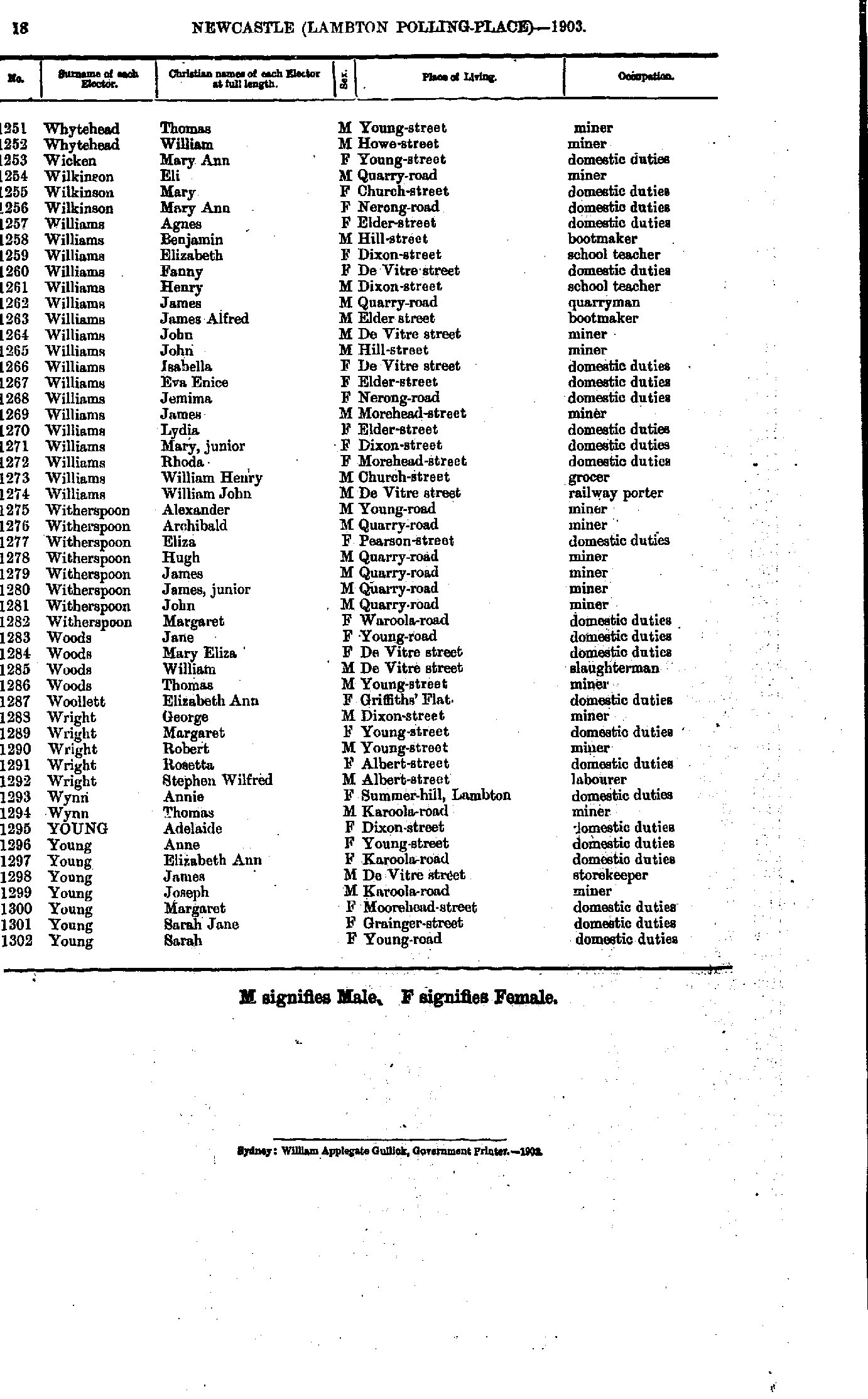
- Whytehead Thomas - Young Sarah
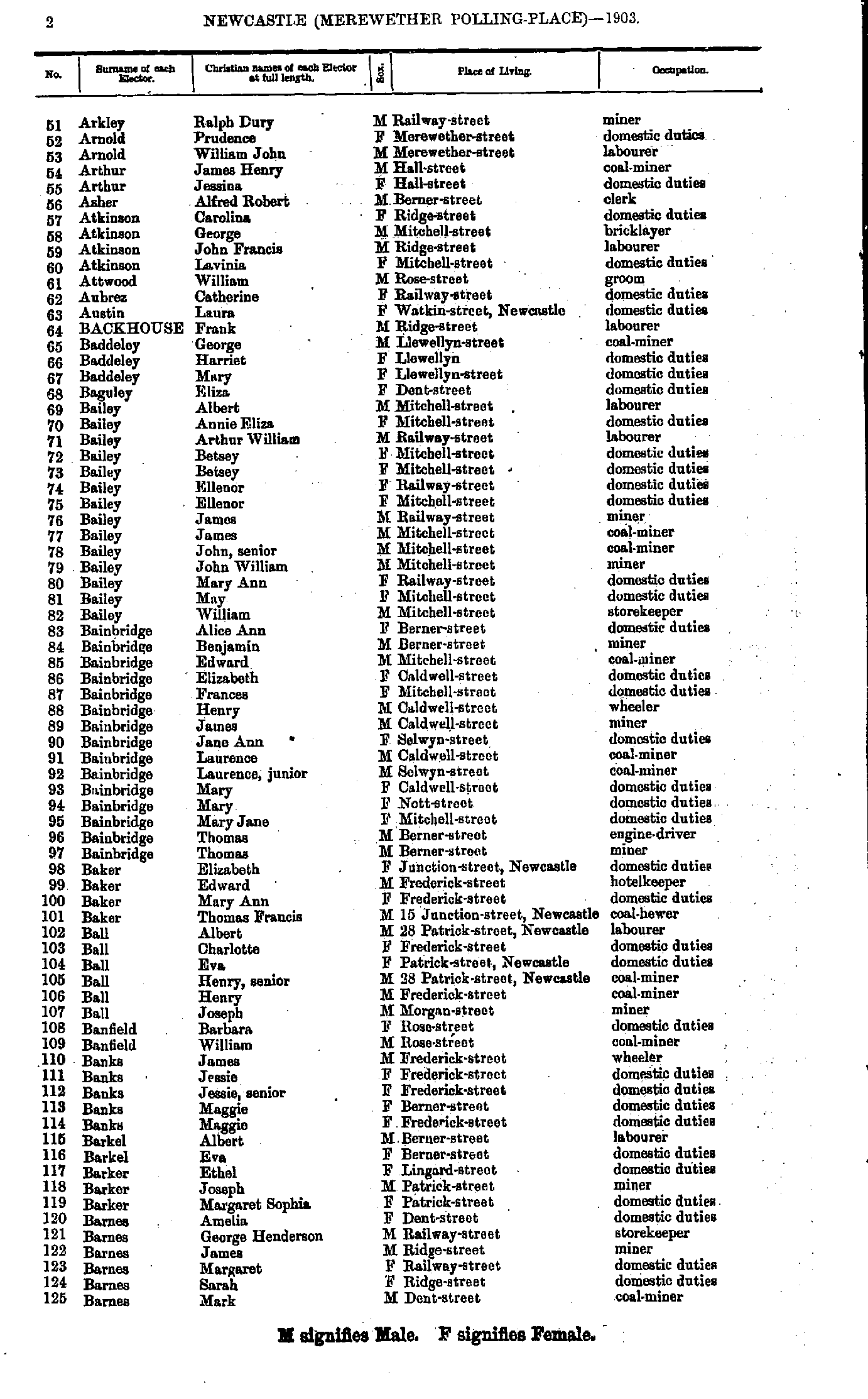
- Abell John - Arkley John
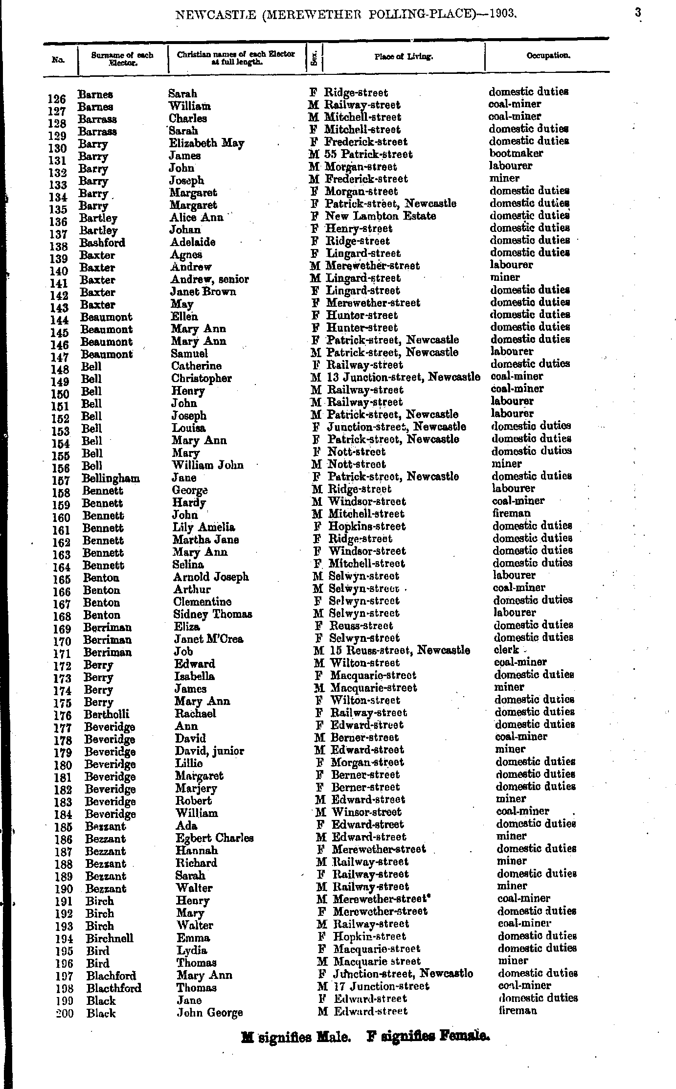
- Arkley Ralph - Barnes Mark
- Barnes Sarah - Black John
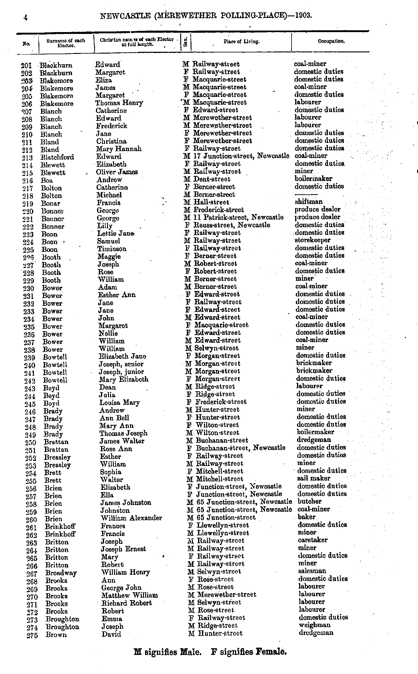
- Blackburn Edward - Brown David
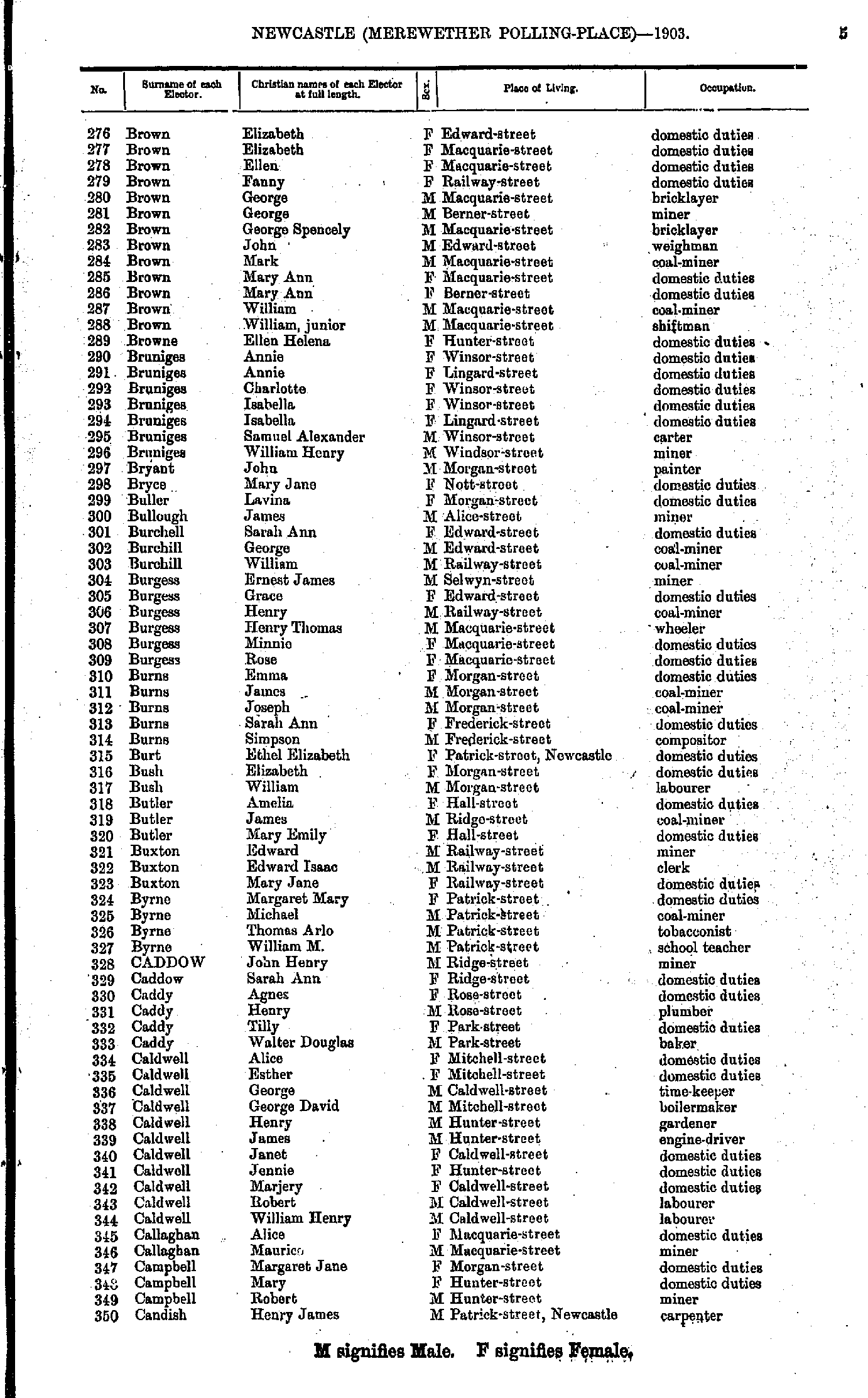
- Brown Elizabeth - Candish Henry
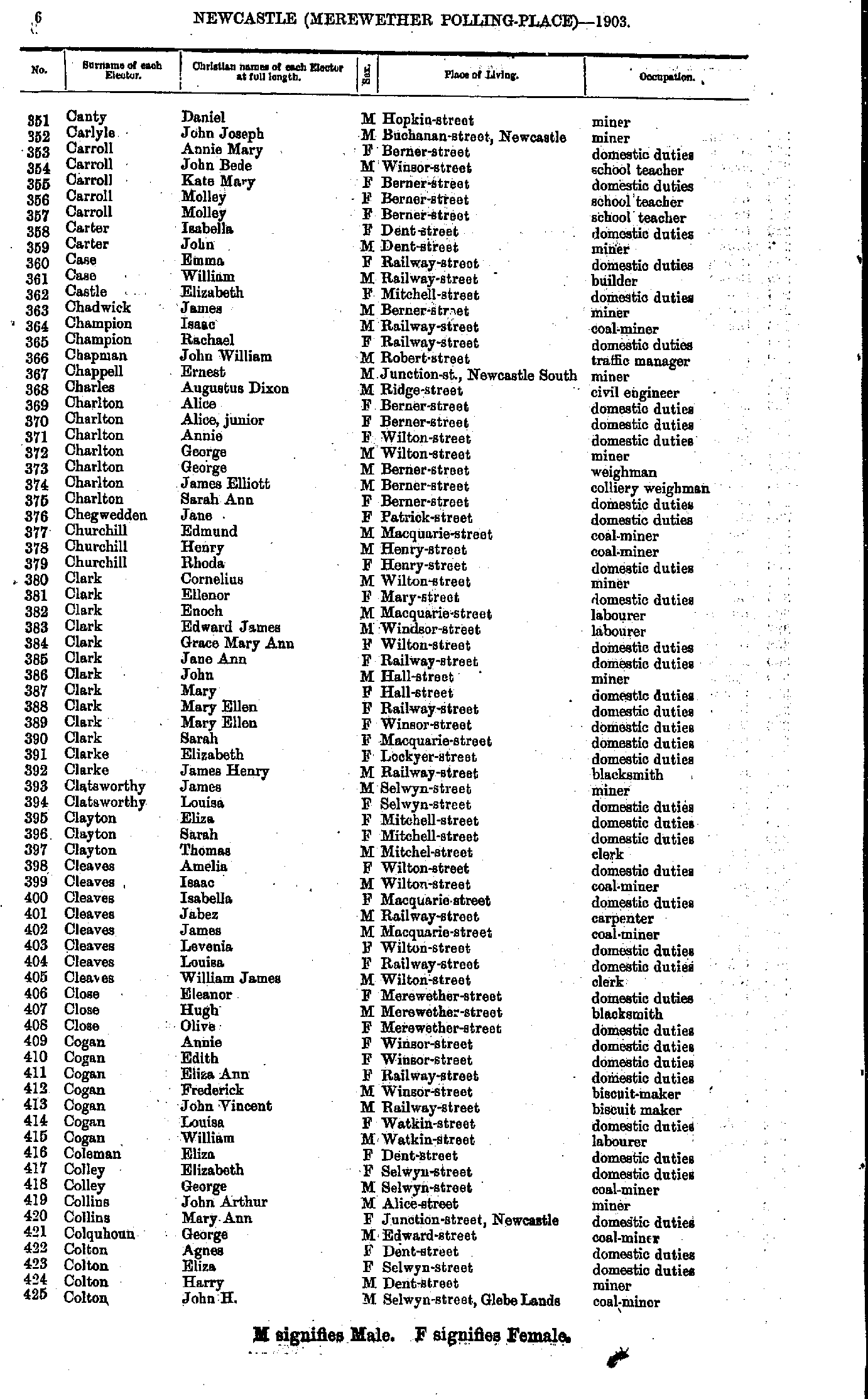
- Canty Daniel - Colton John
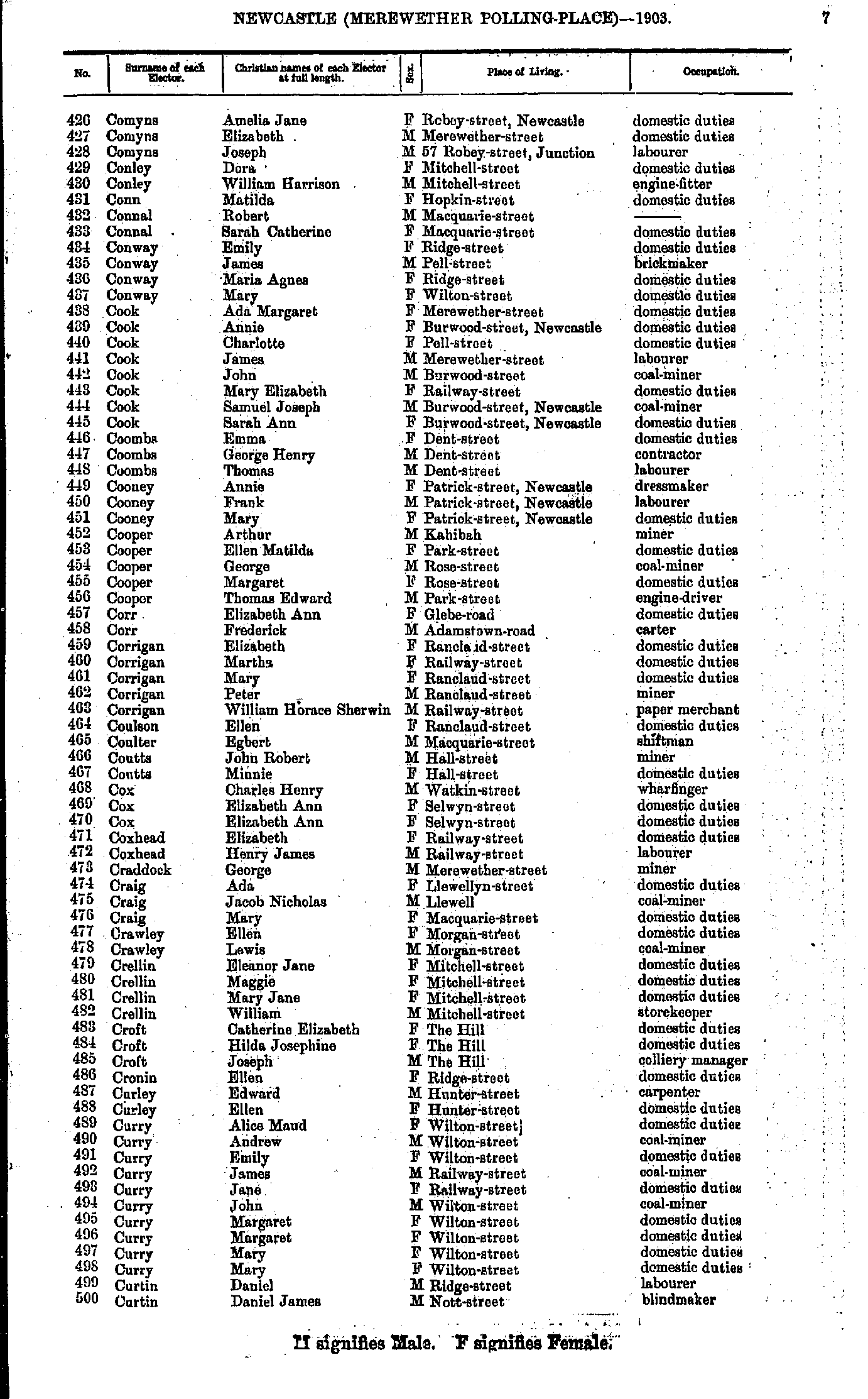
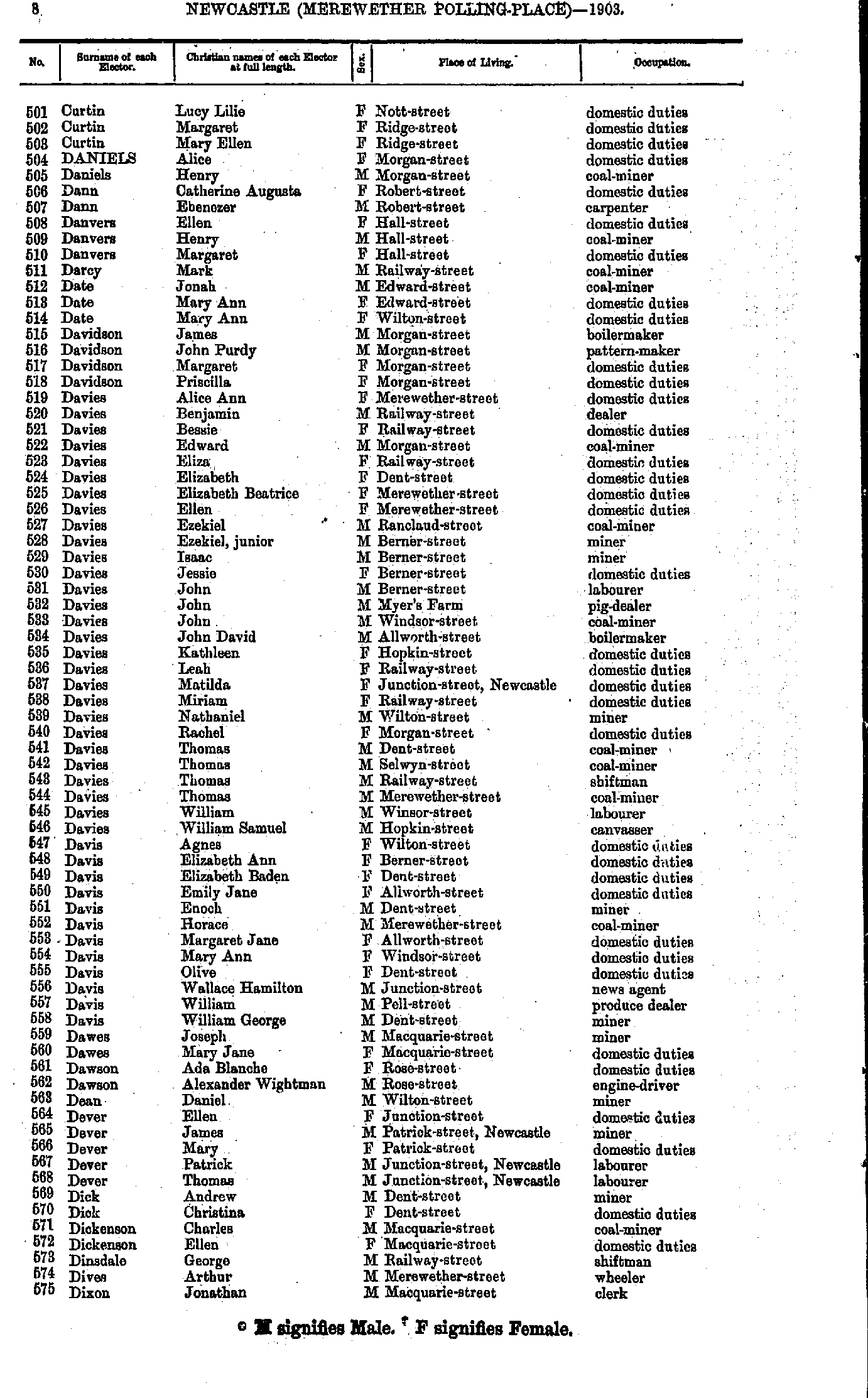
- Comyns Amelia - Curtin Daniel
- Curtin Lucy - Dixon Jonathan
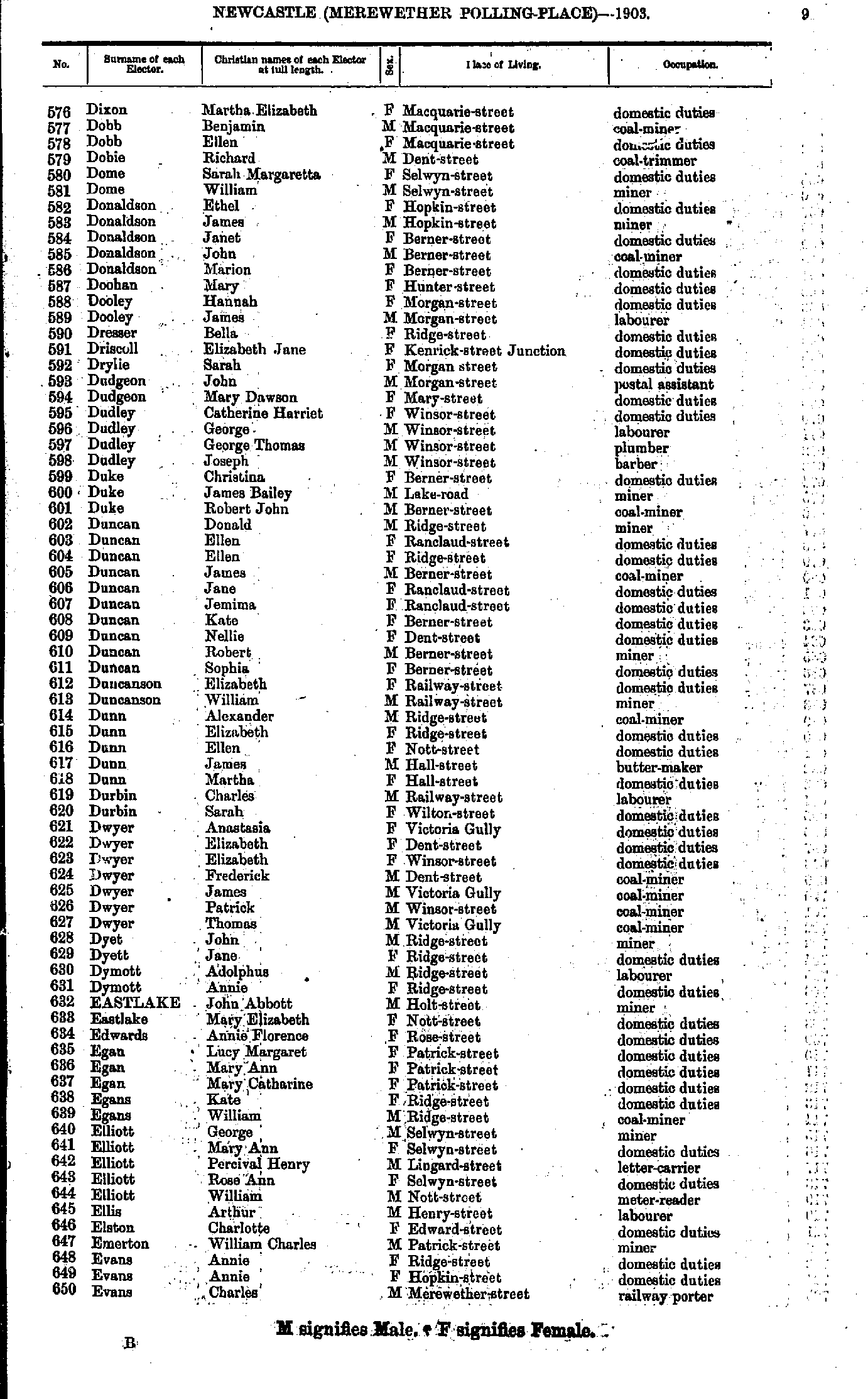
- Dixon Martha - Evans Charles
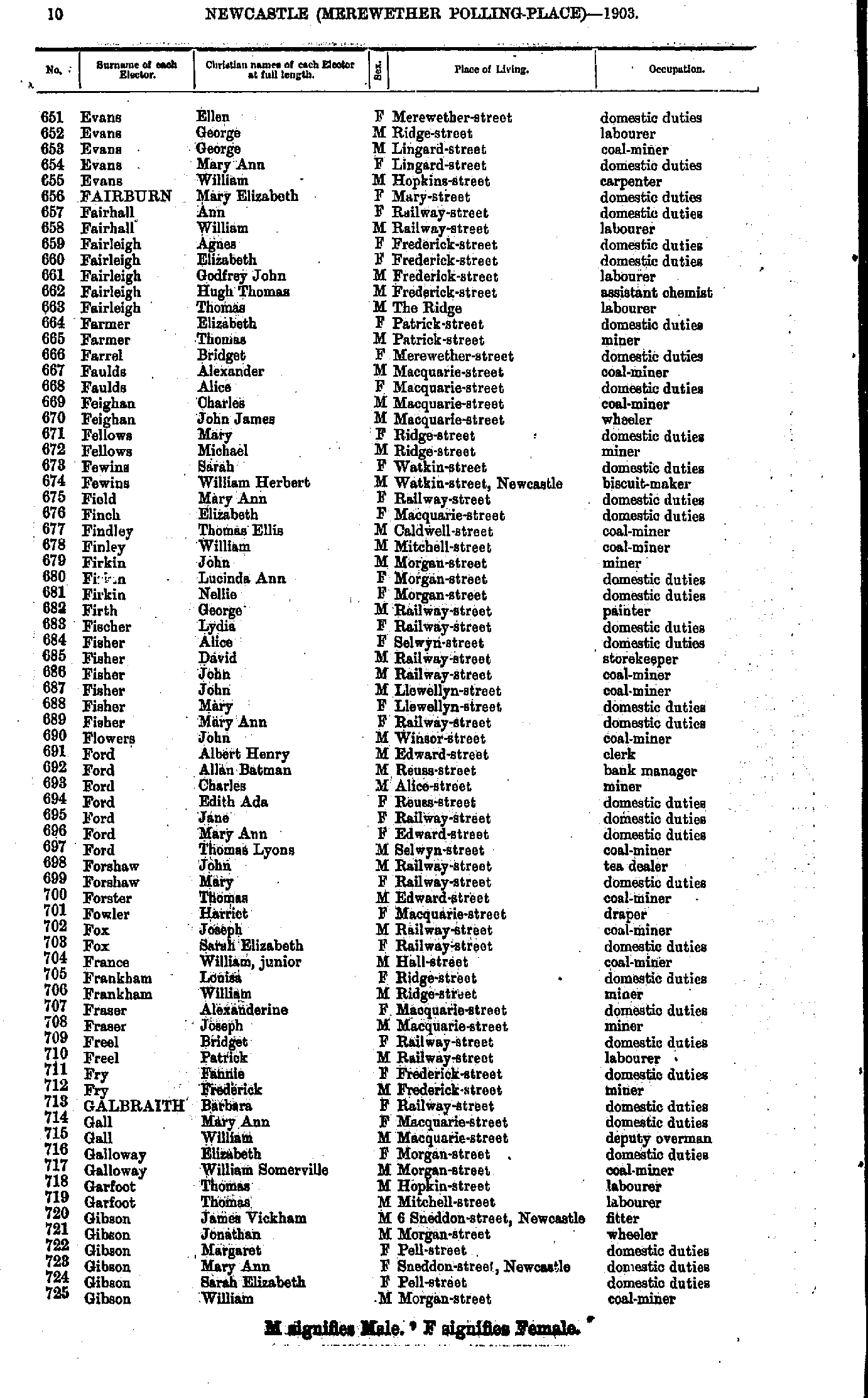
- Evans Ellen - Gibson William
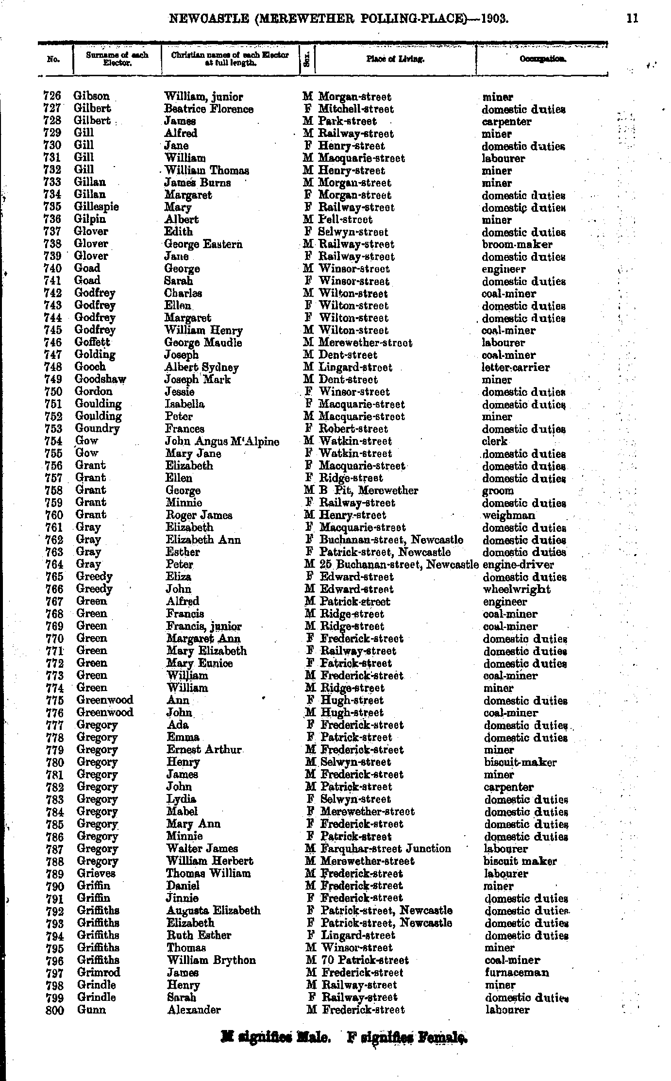
- Gibson William - Gunn Alexander
- Gunther Charlotte - Hawthorne Adam
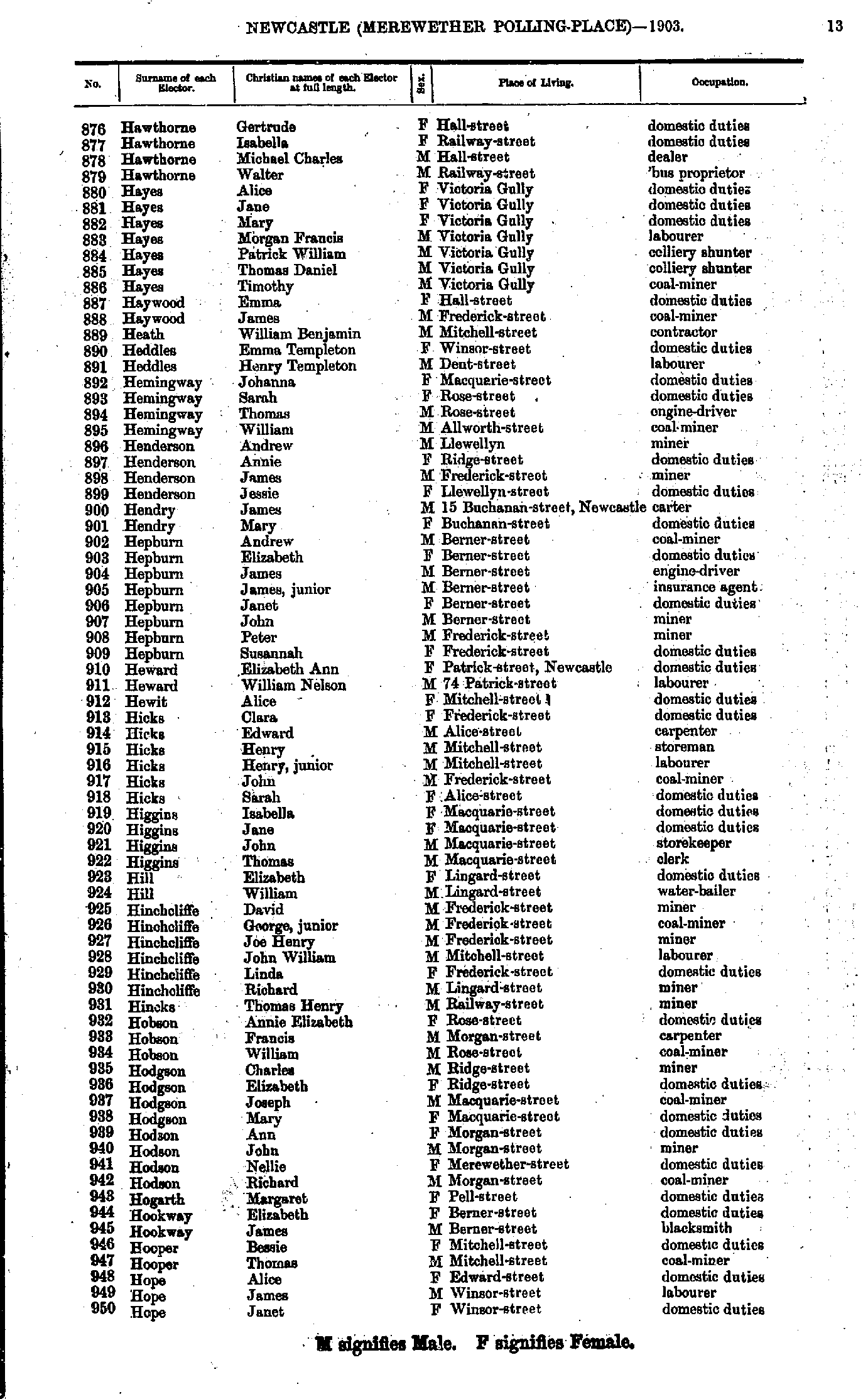
- Hawthorne Gertrude - Hope Janet
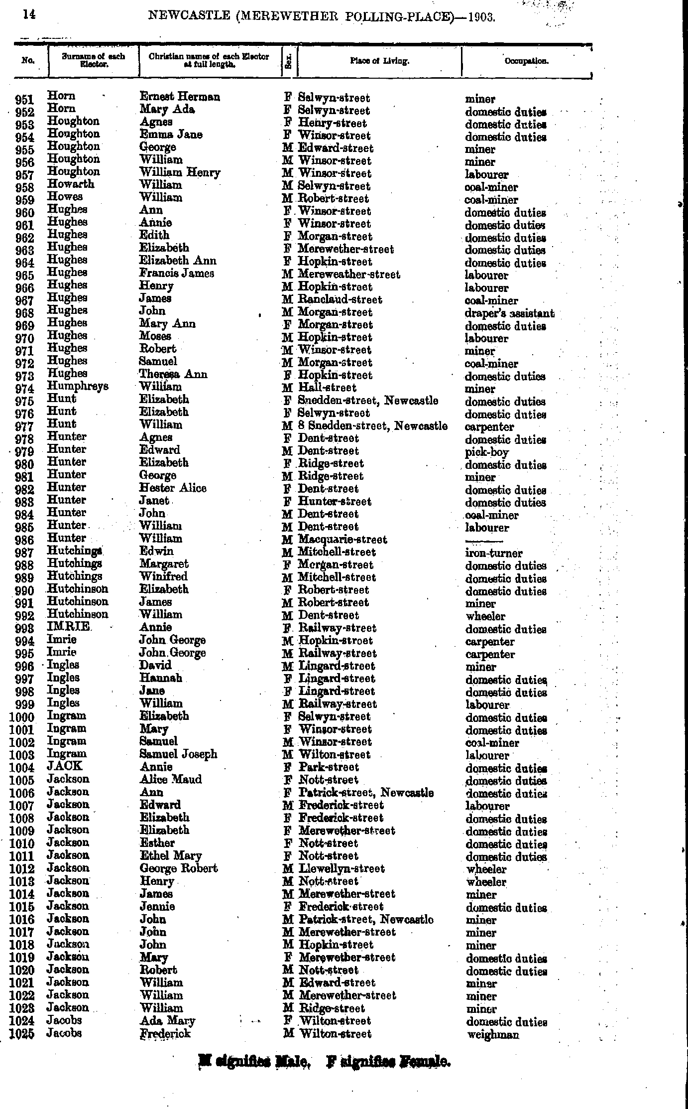
- Horn Ernest - Jacobs Frederick
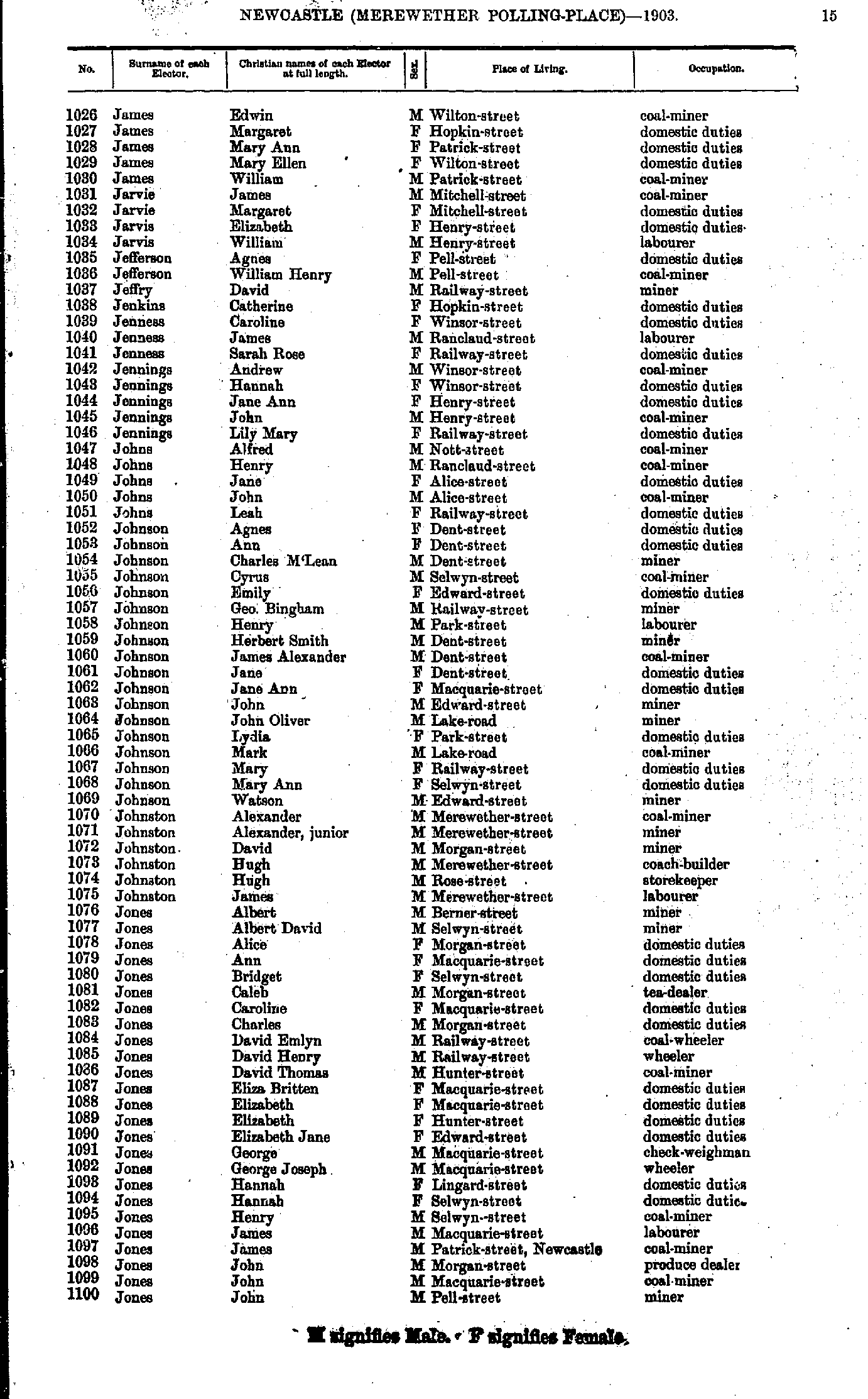
- James Edwin - Jones John
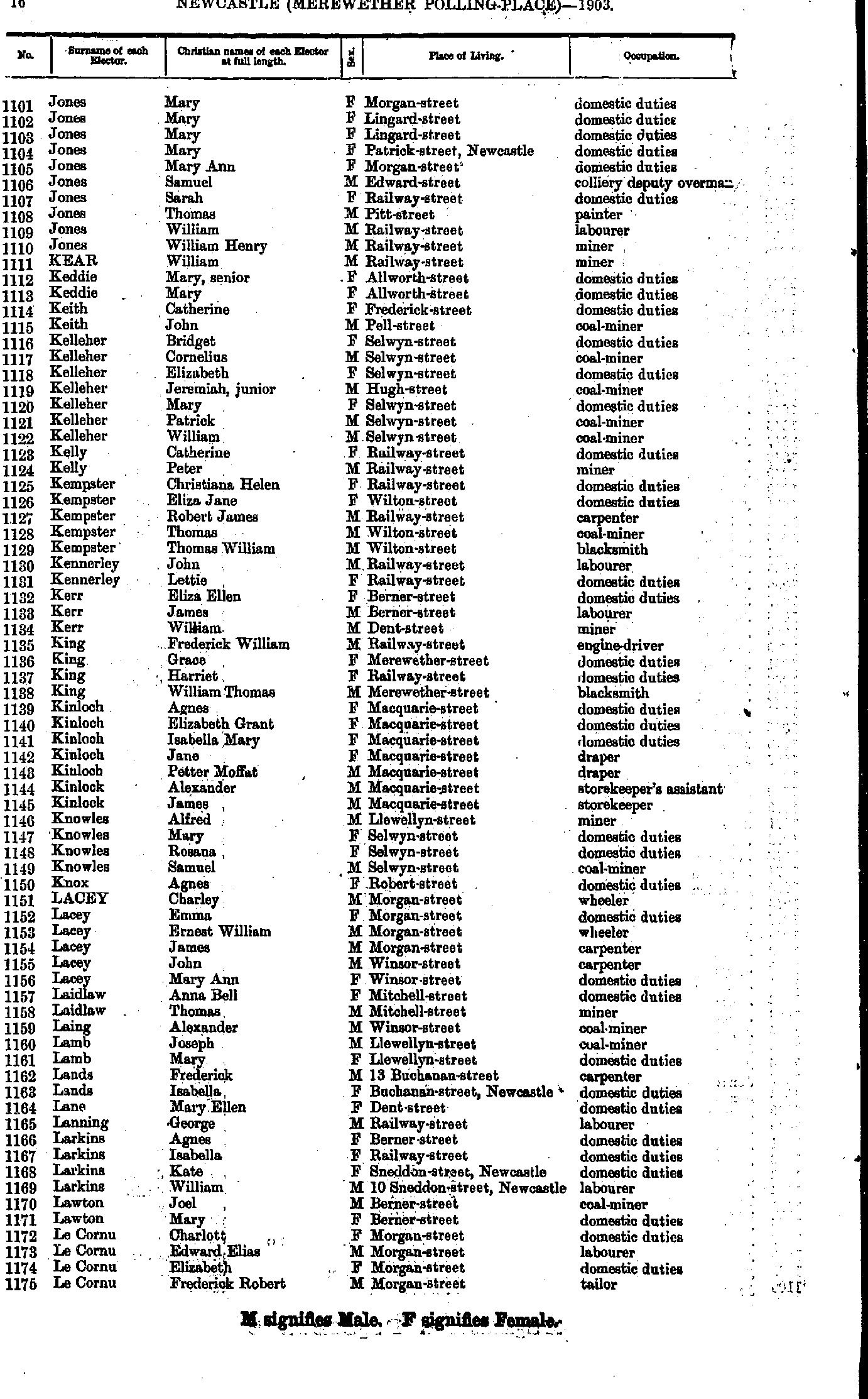
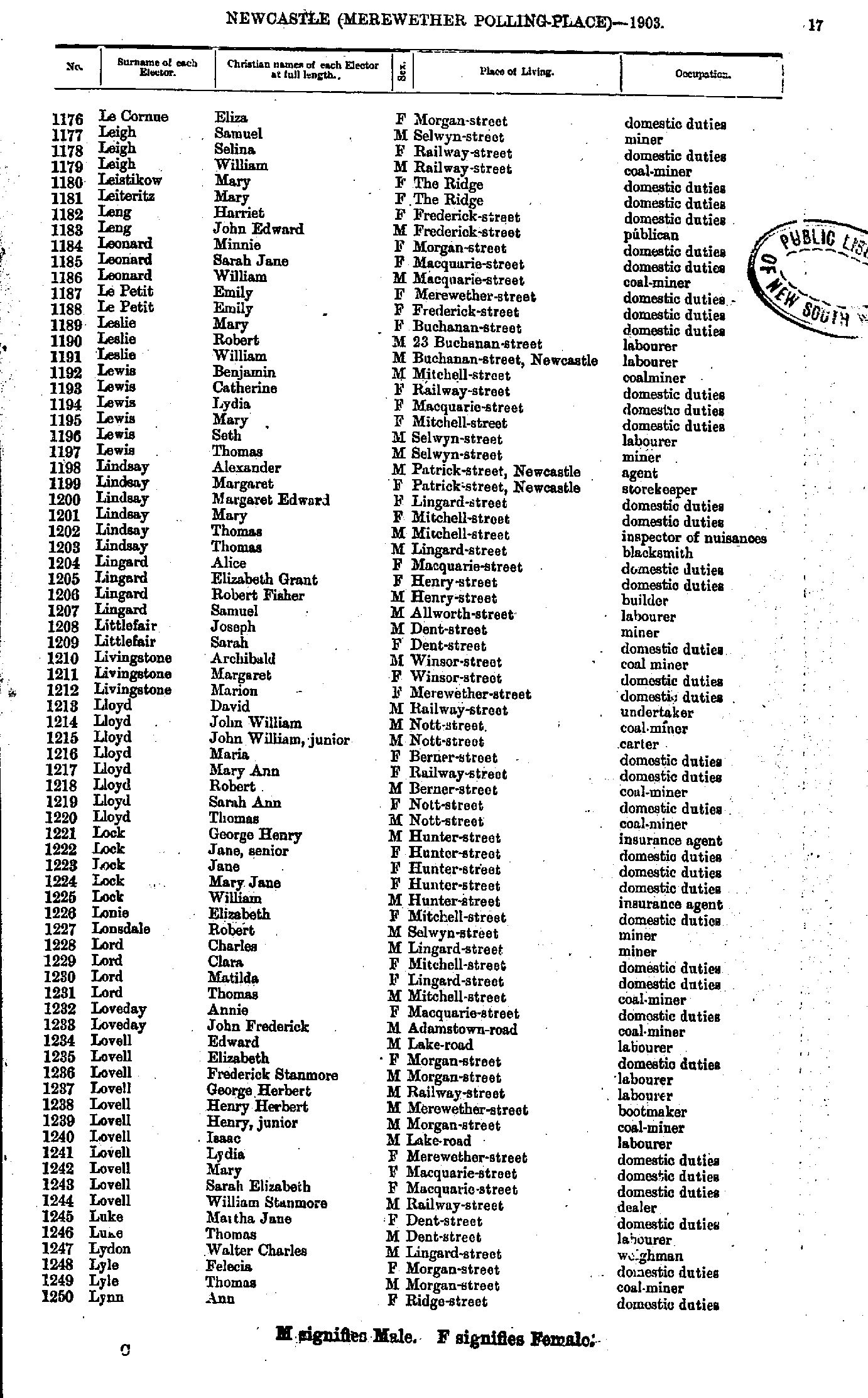
- Jones Mary - Le Cornu Frederick
- Le Cornue Eliza - Lynn Ann
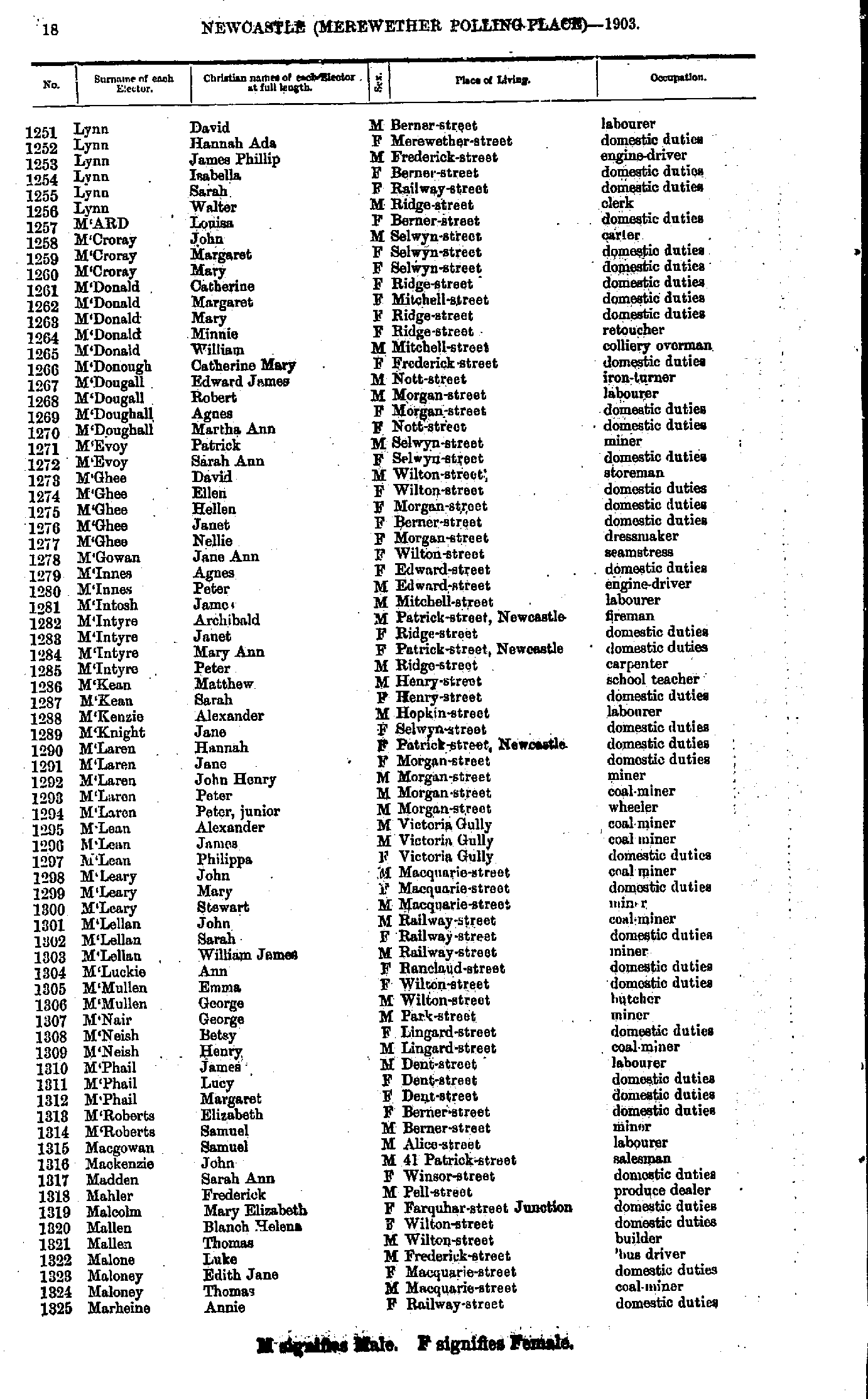
- Lynn David - Marheine Annie
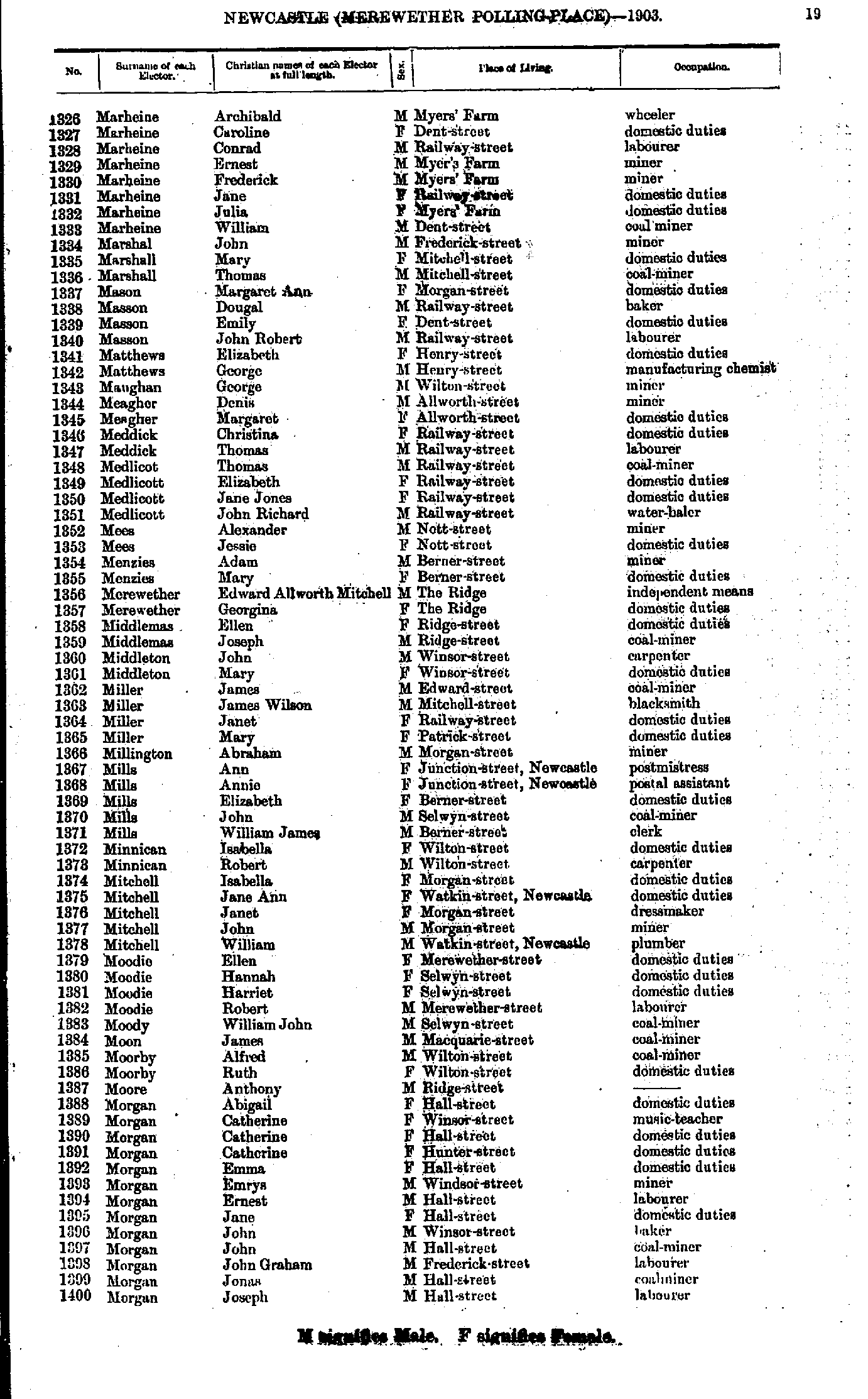
- Marheine Archibald - Morgan Joseph
- Morgan Louisa - O'Connor Roderick
- O'Connor William - Peterson Phoebe
- Phillips Elizabeth - Redpath Jonathan
- Reeder Elizabeth - Roderick John
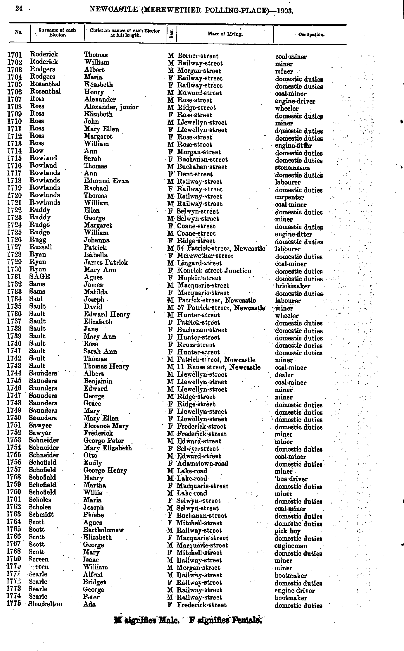
- Roderick Thomas - Shackelton Ada
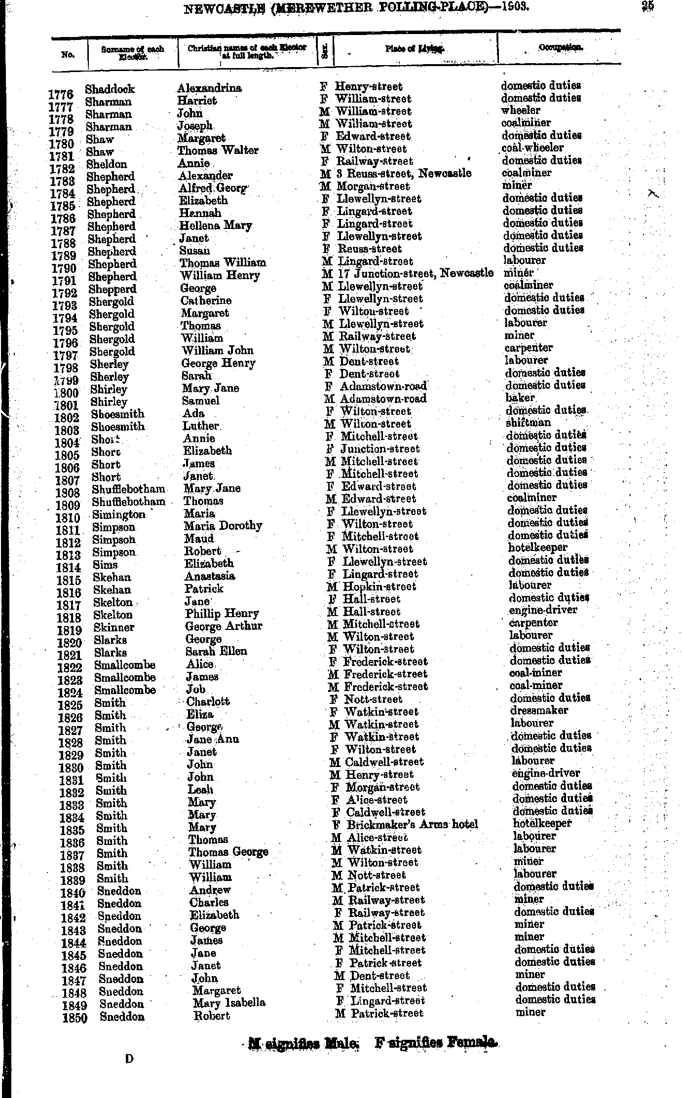
- Shaddock Alexandrina - Sneddon Robert
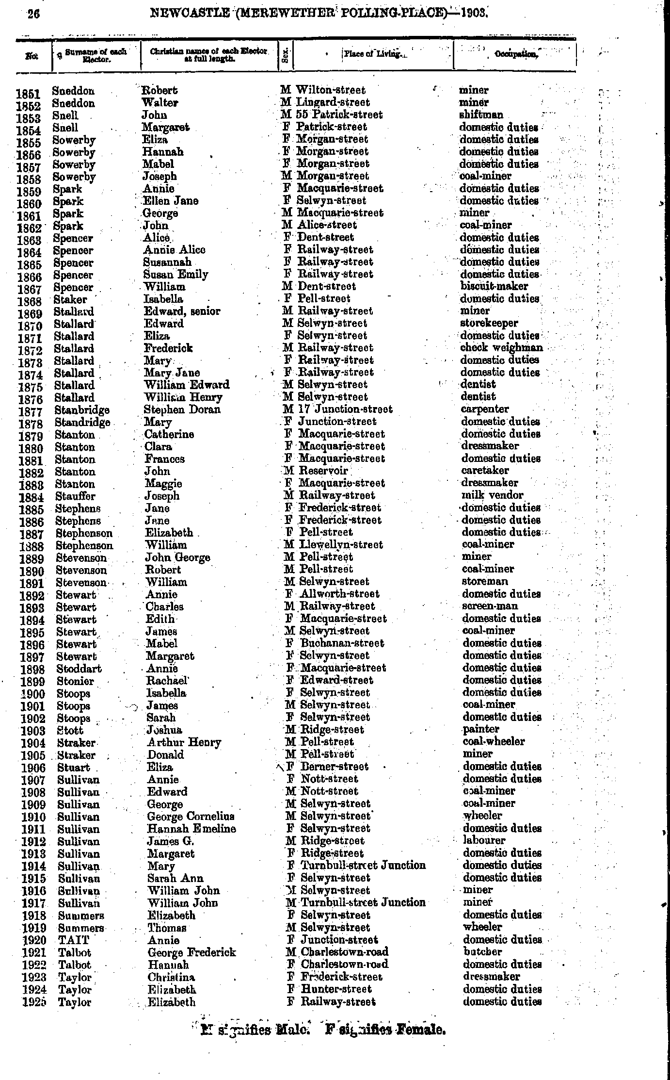
- Sneddon Robert - Taylor Elizabeth
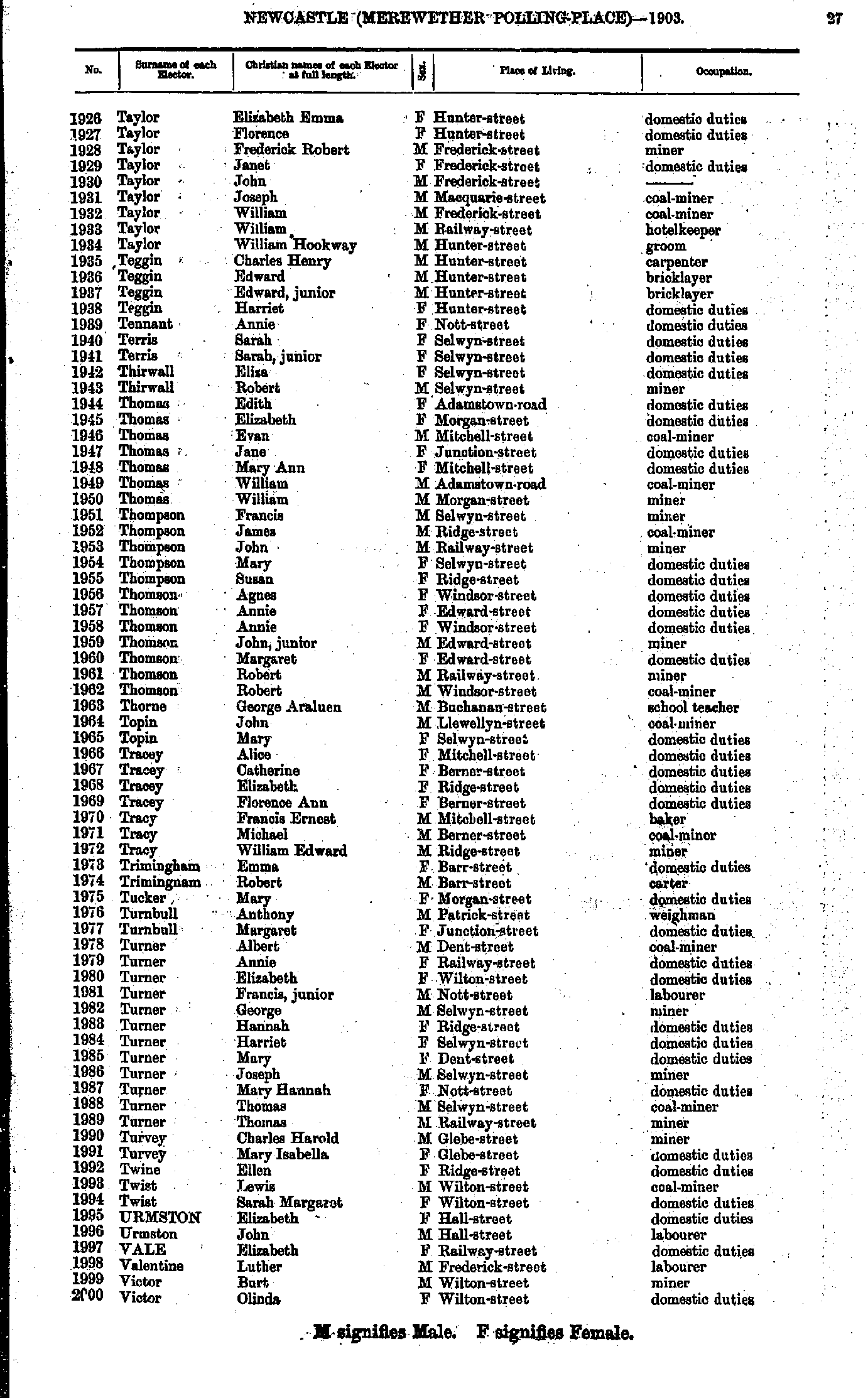
- Taylor Elizabeth - Victor Olinda
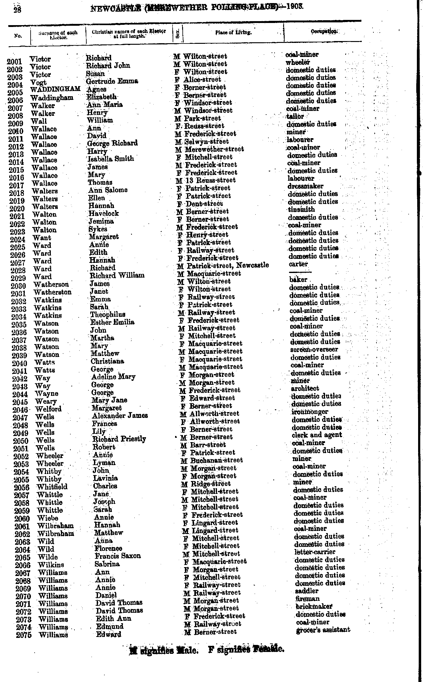
- Victor Richard - Williams Edward
- Williams Edward - Wilson Henry
- Wilson James - Young William
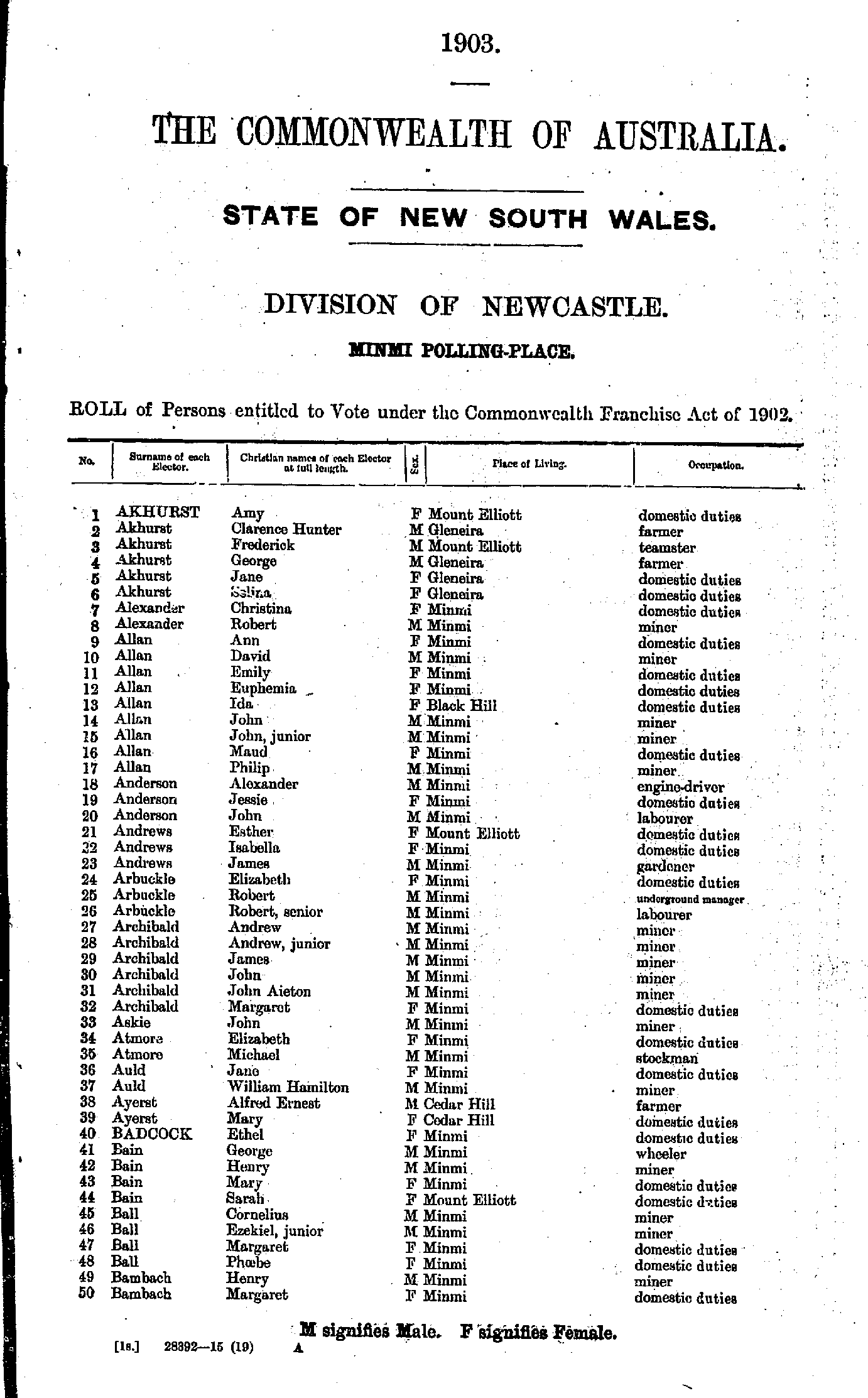
- Akhurst Amy - Bambach Margaret
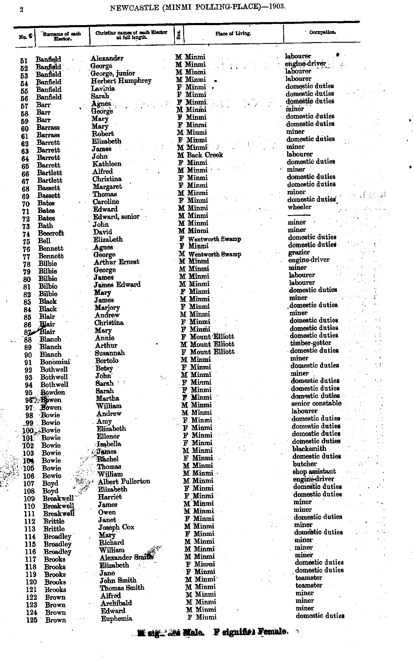
- Banfield Alexander - Brown Euphemia
- Brown James - Collins Martha
- Collins Mary - Dodd Ellen
- Dodd John - Fenwick Mary
- Fenwick Minnie - Gray Robert
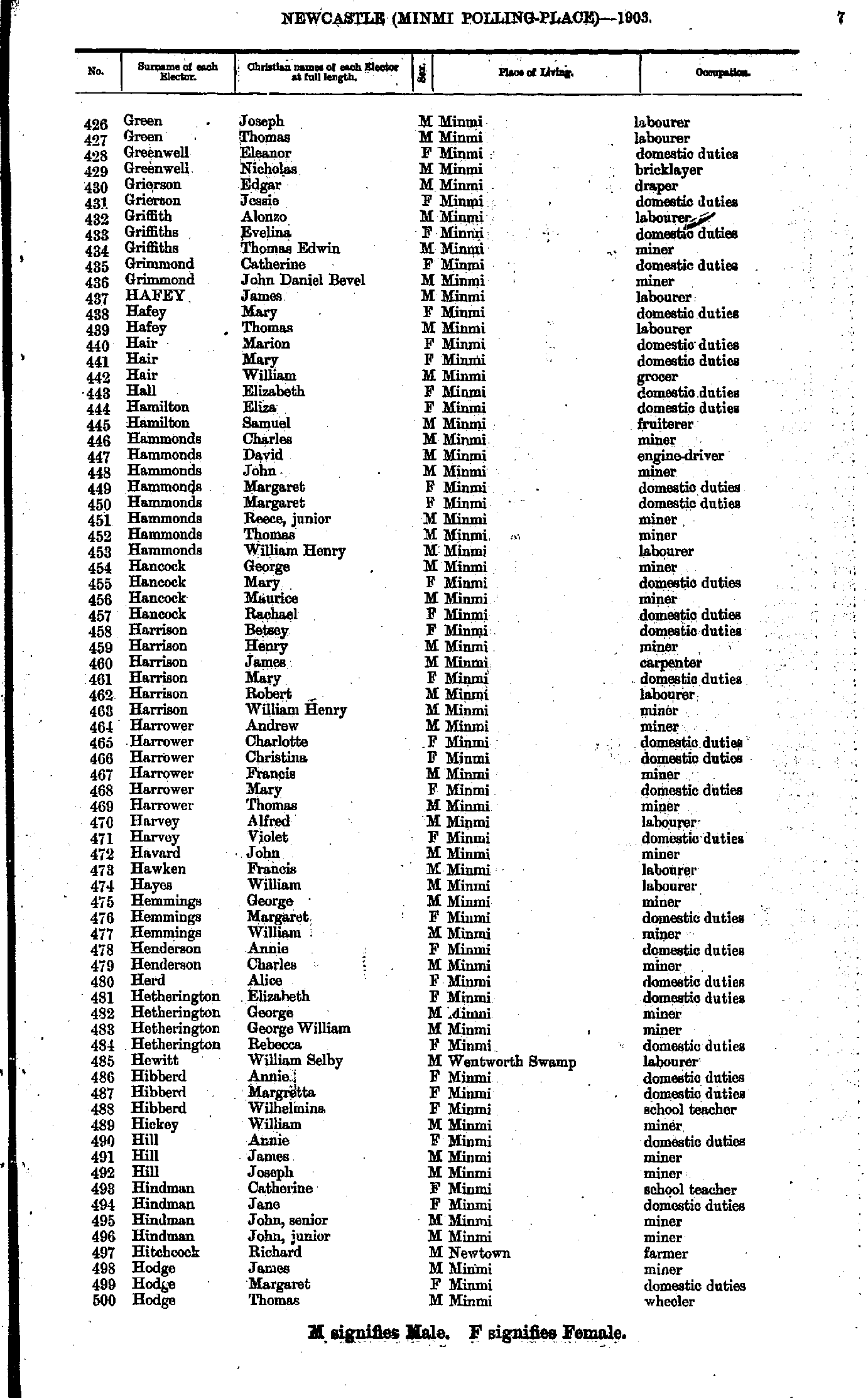
- Green Joseph - Hodge Thomas
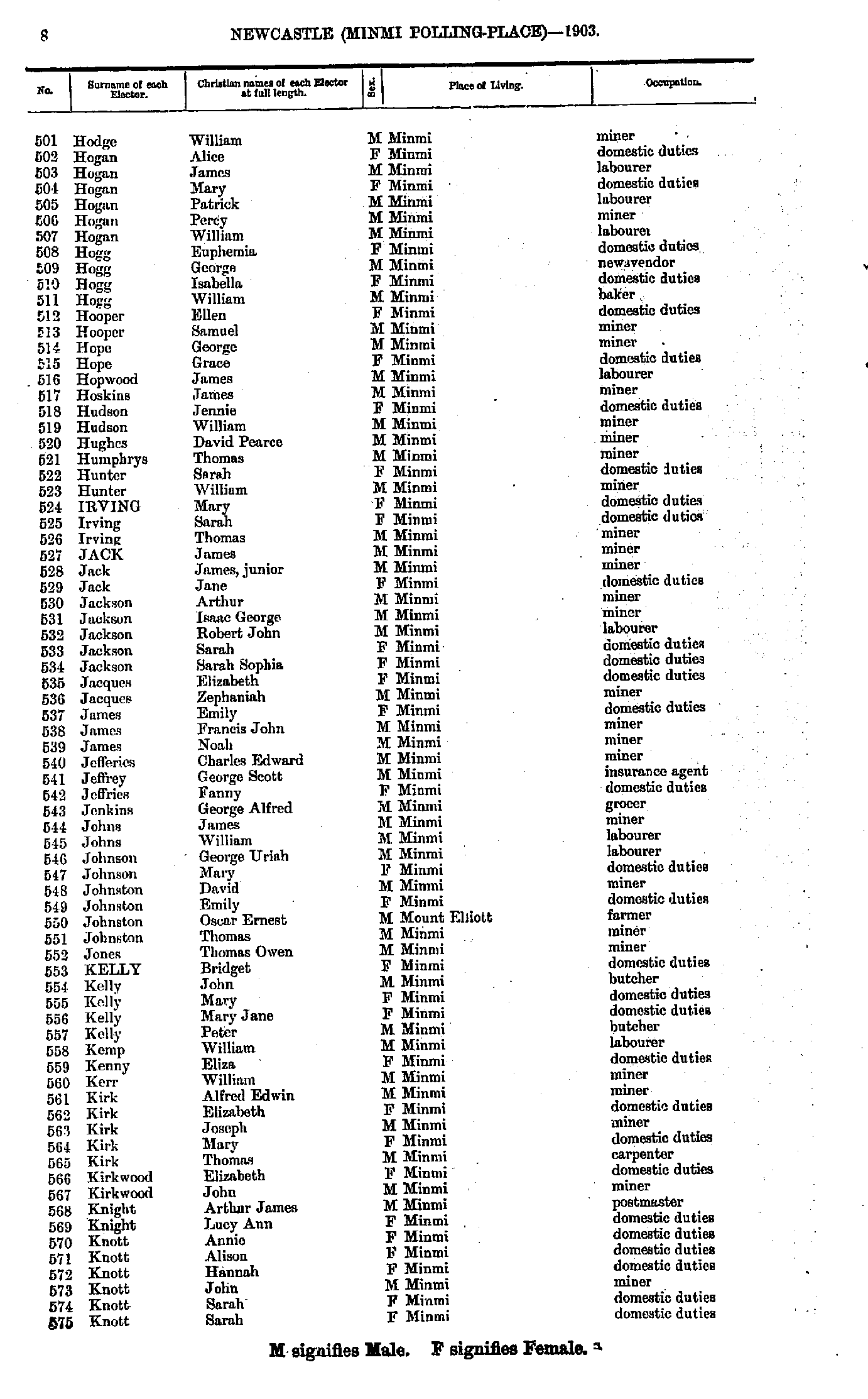
- Hodge William - Knott Sarah
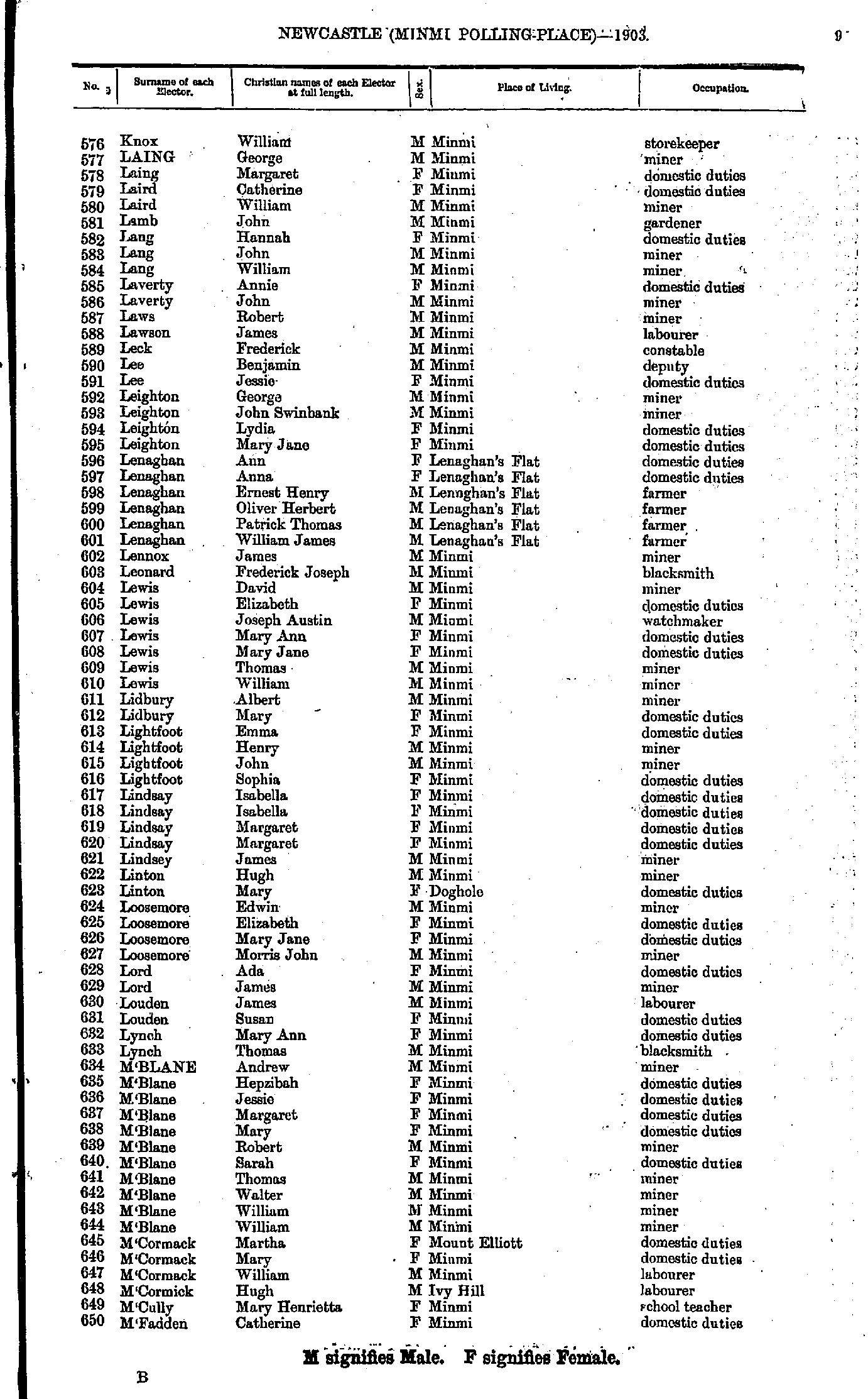
- Knox William - M'Fadden Catherine
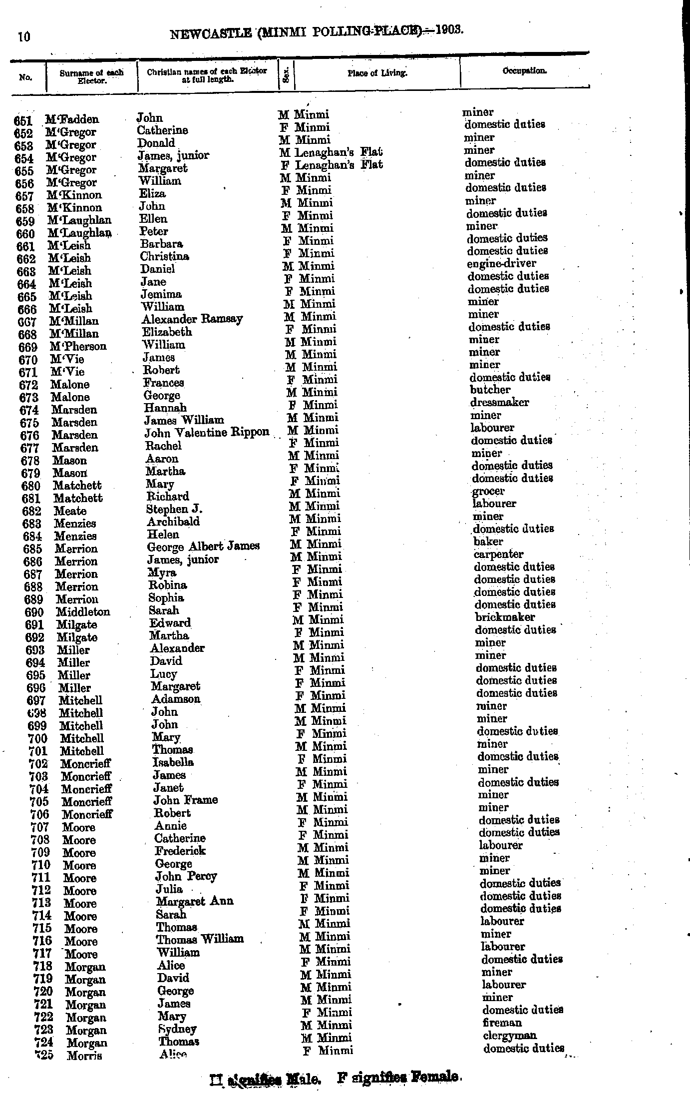
- M'Fadden John - Morris Alice
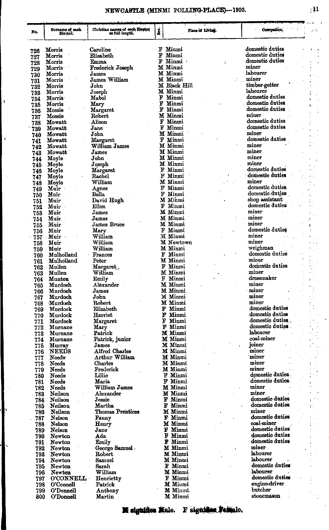
- Morris Caroline - O'Donnell Martin
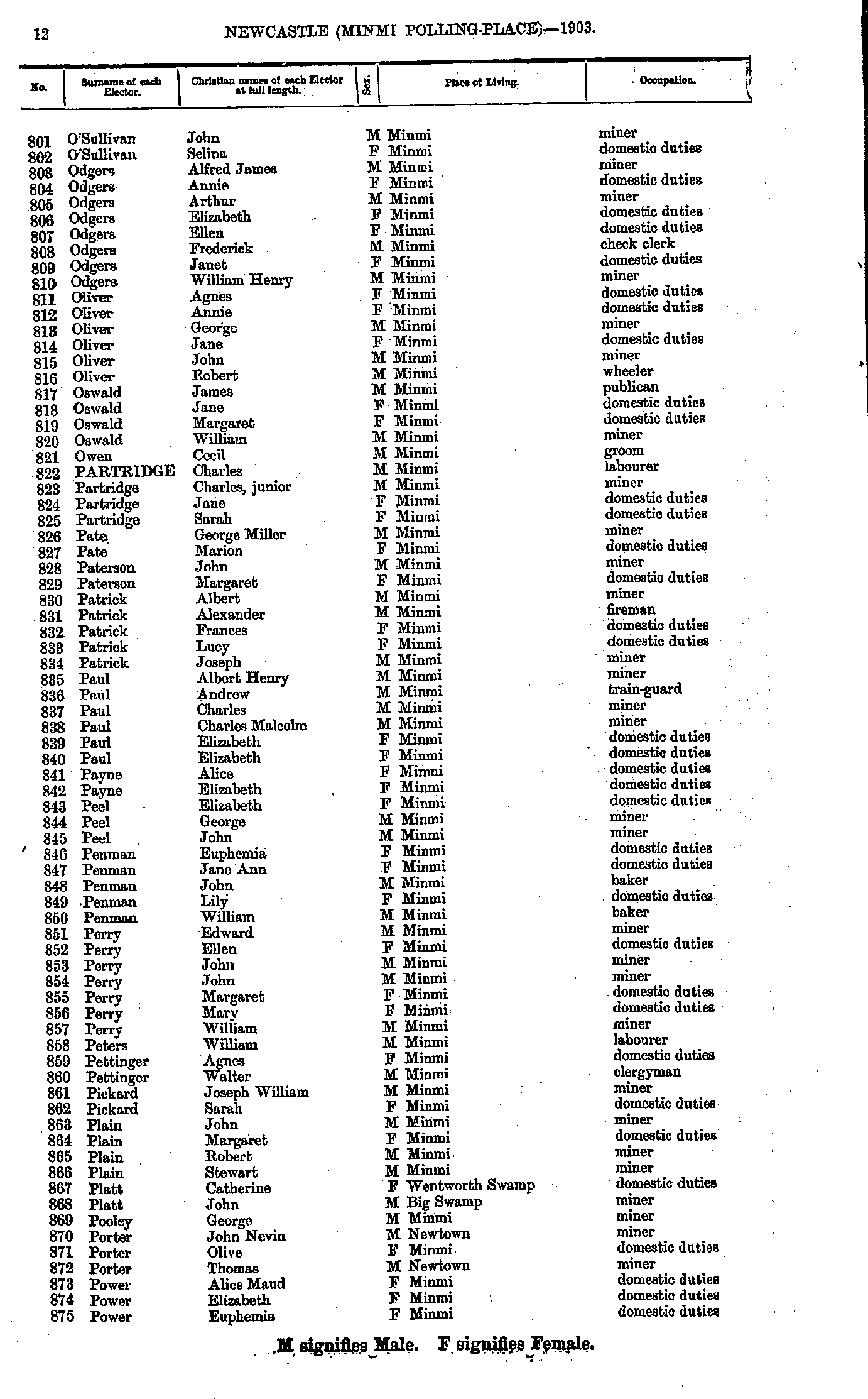
- O'Sullivan John - Power Euphemia
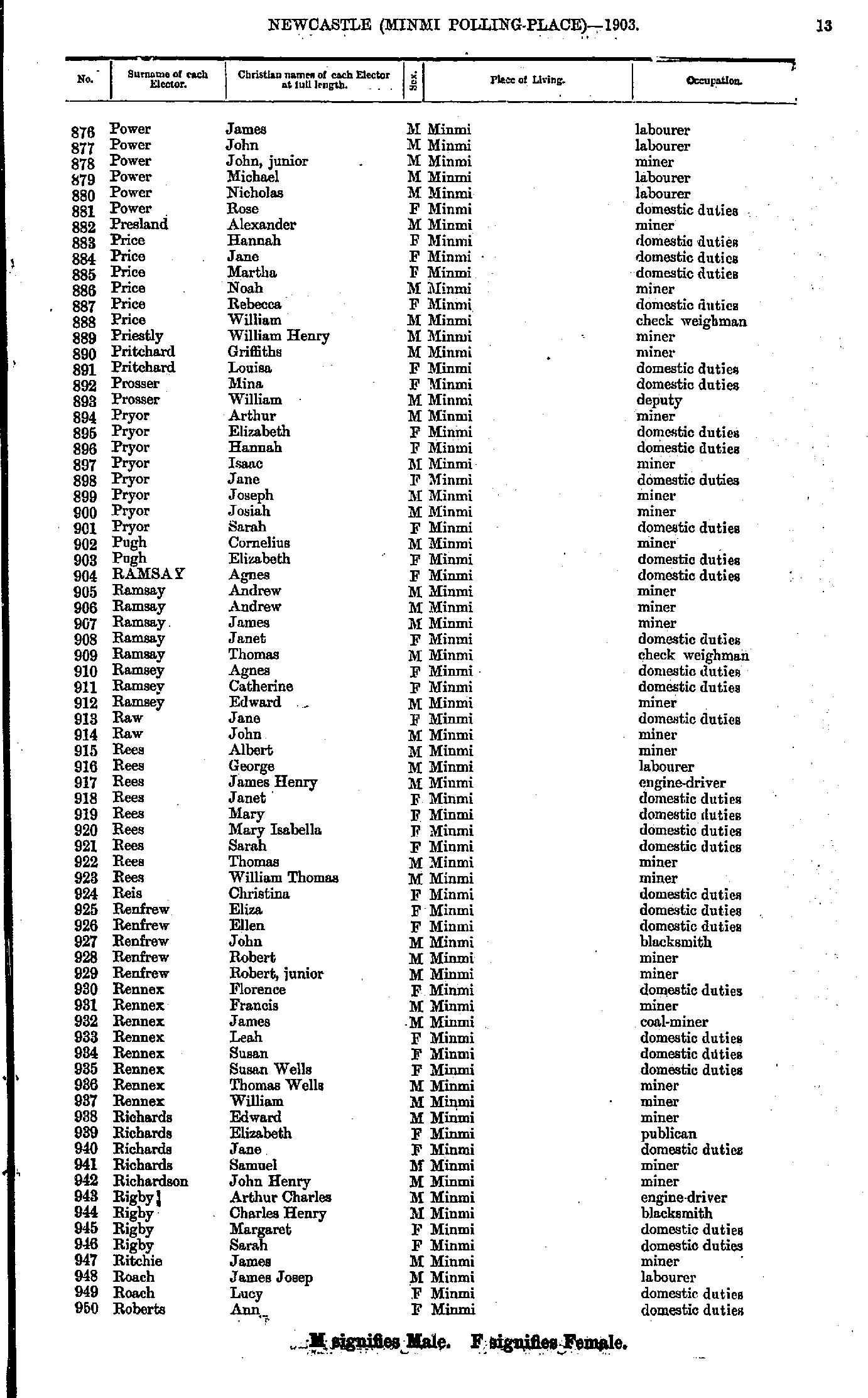
- Power James - Roberts Ann
- Roberts George - Shields Gilbert
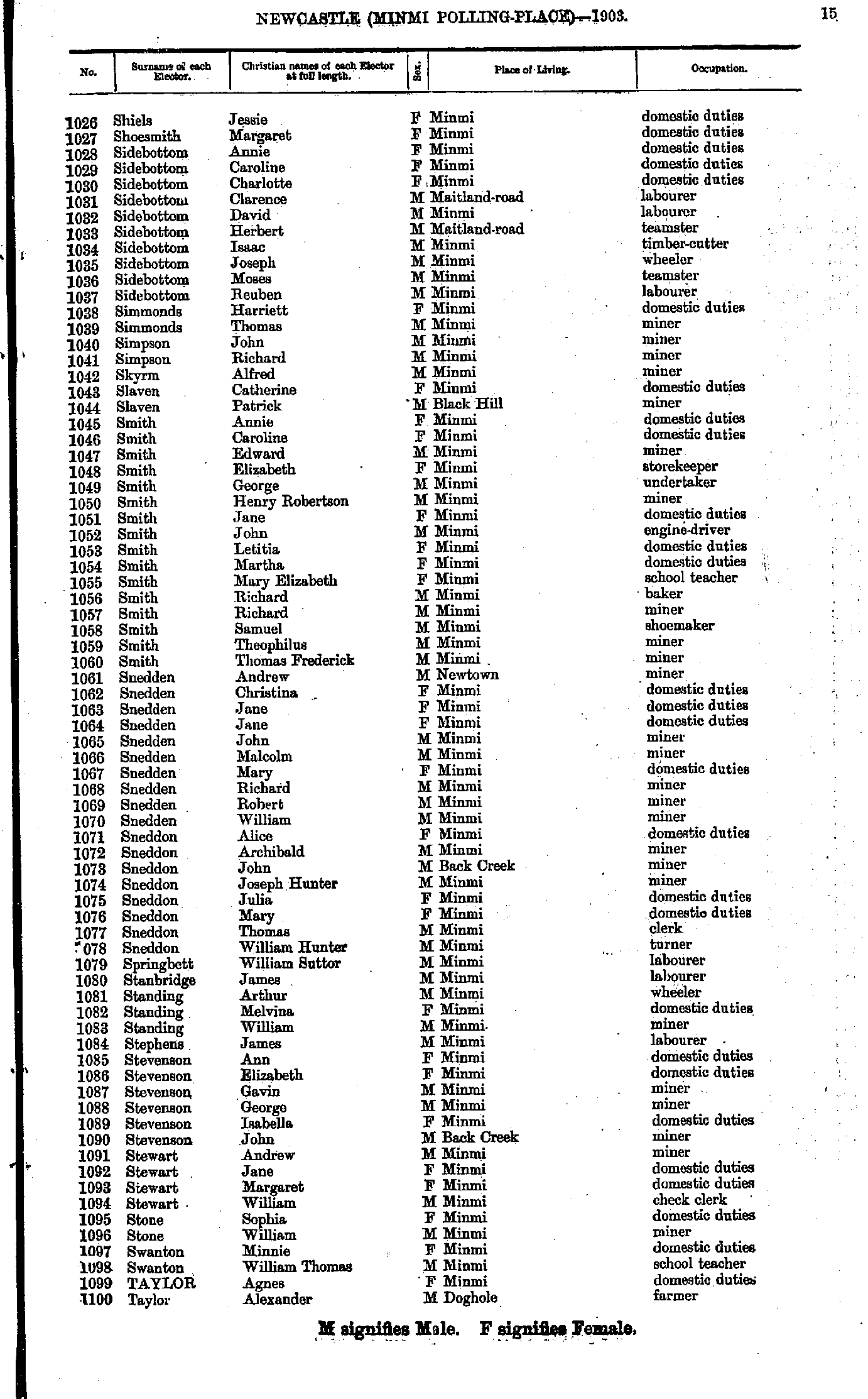
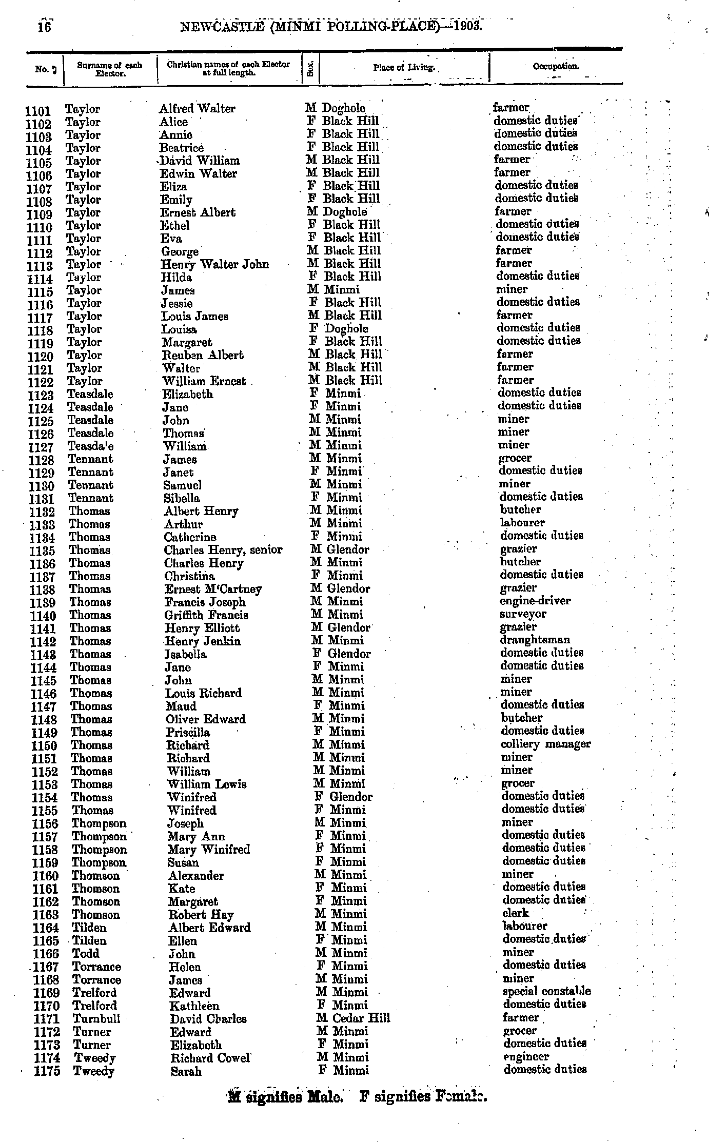
- Shiels Jessie - Taylor Alexander
- Taylor Alfred - Tweedy Sarah
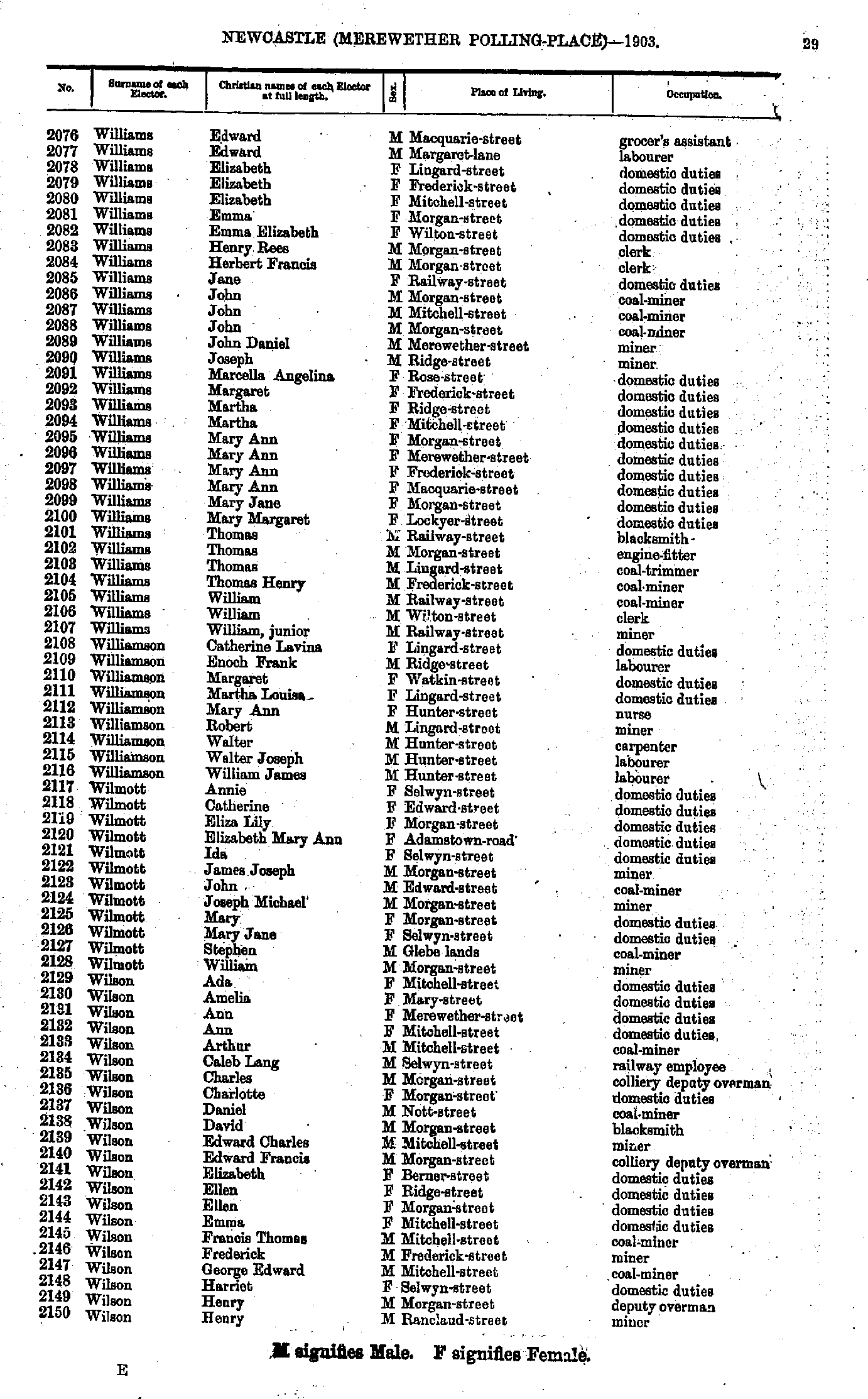
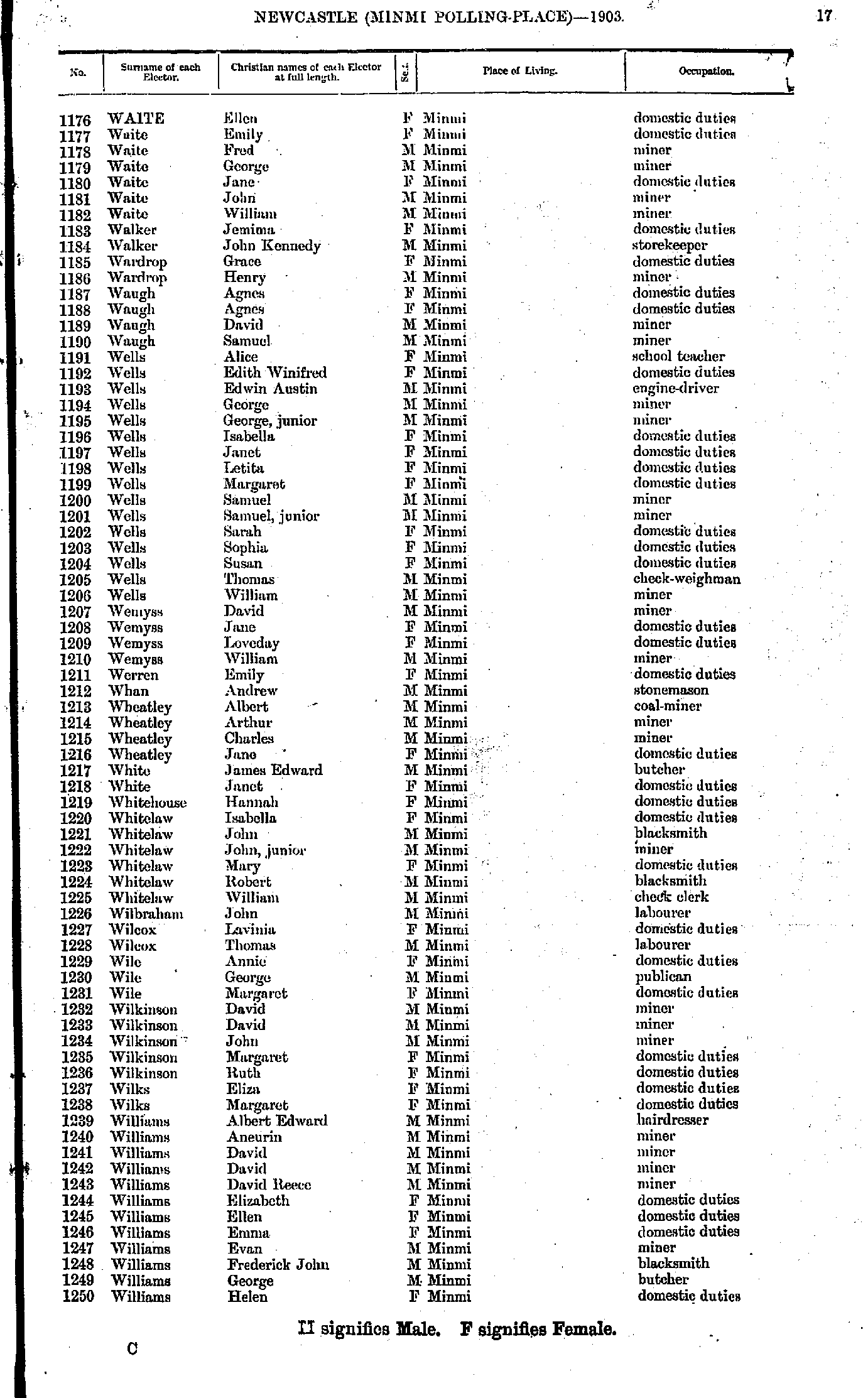
- Waite Ellen - Williams Helen
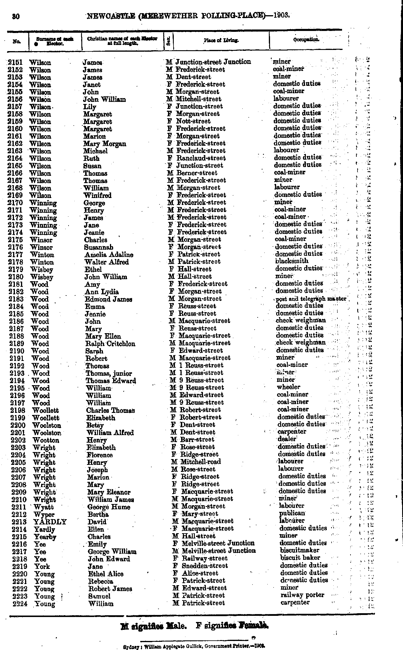
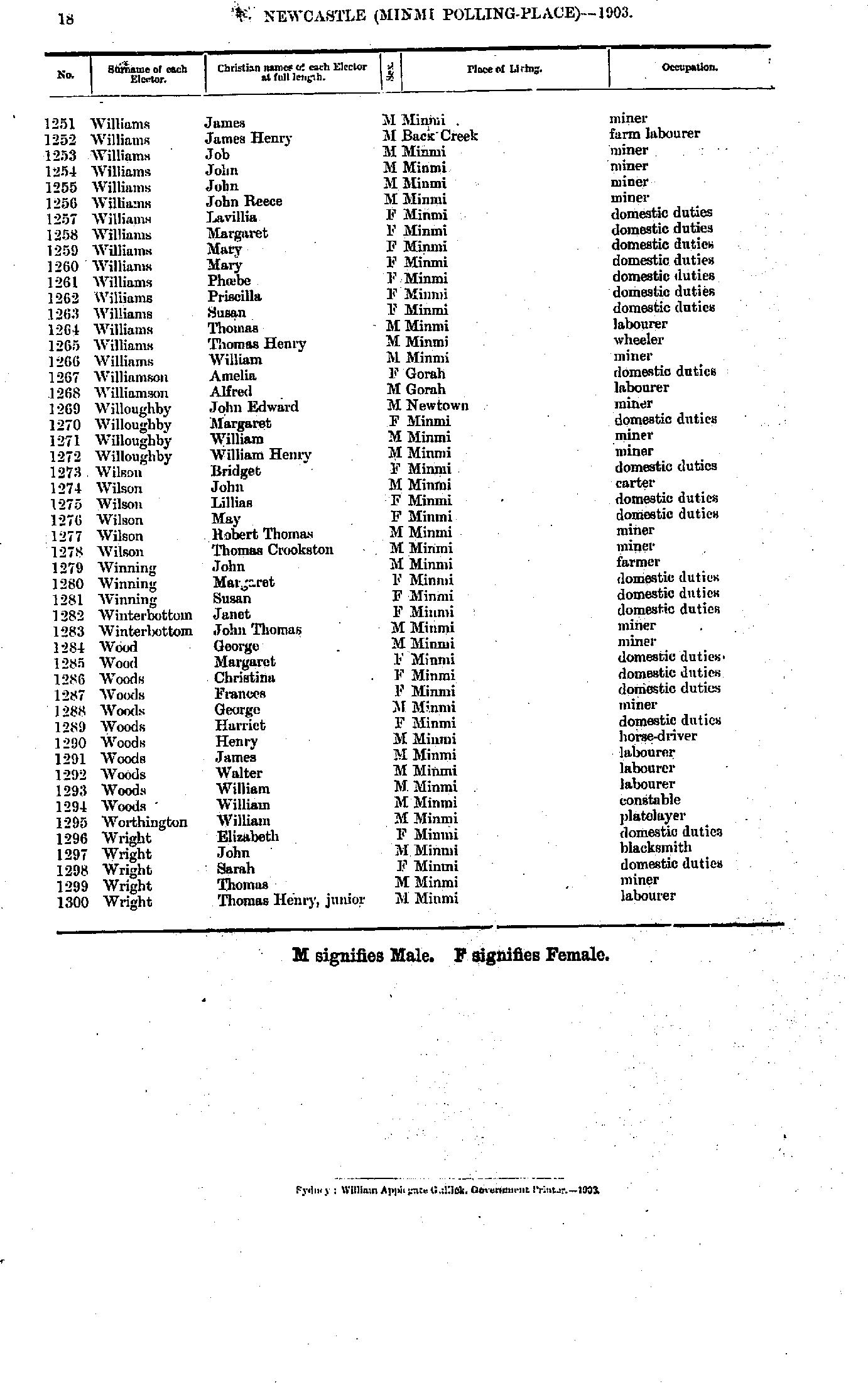
- Williams James - Wright Thomas
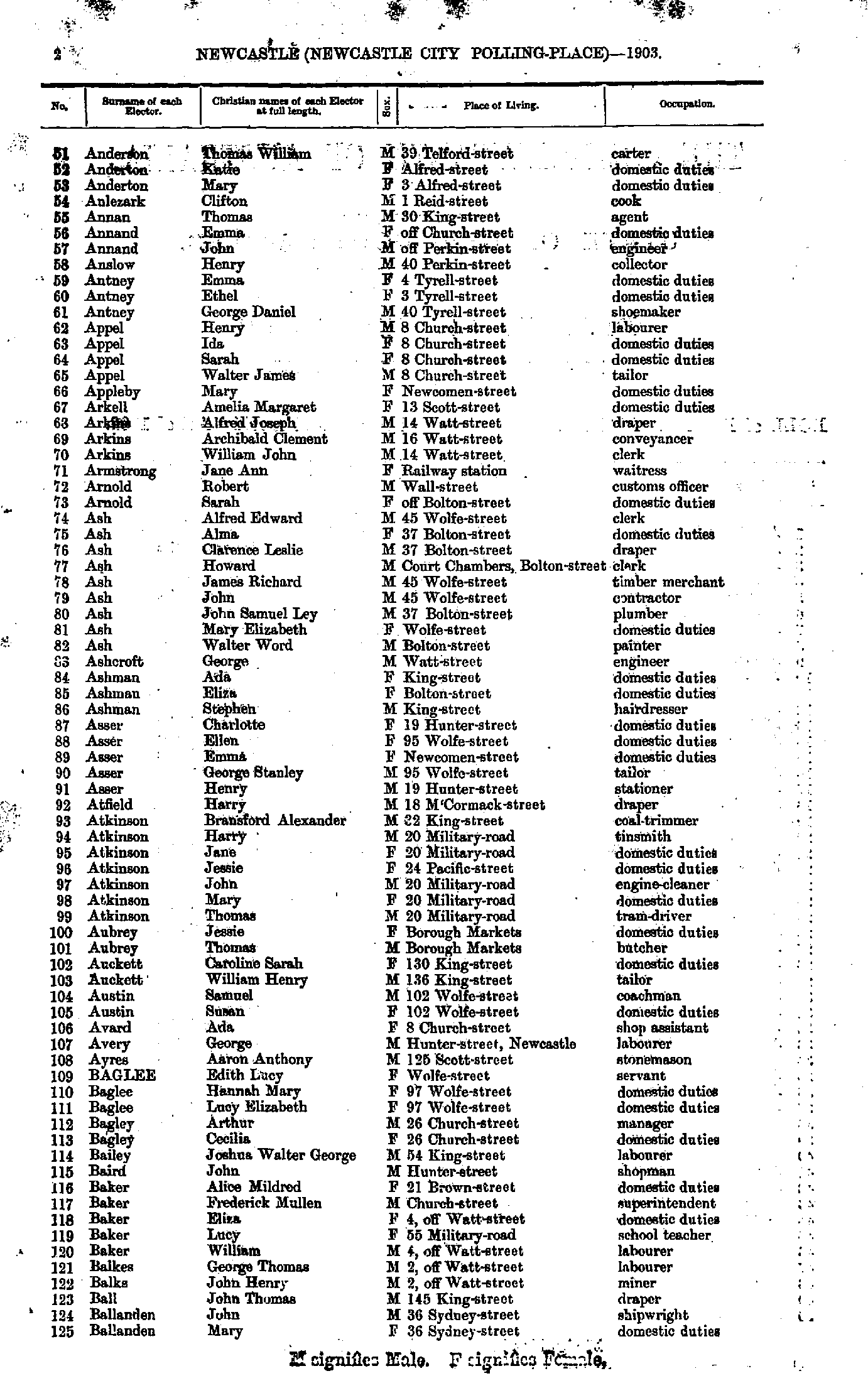
- Abberton John - Anderson Philip
- Anderson Thomas - Ballanden Mary
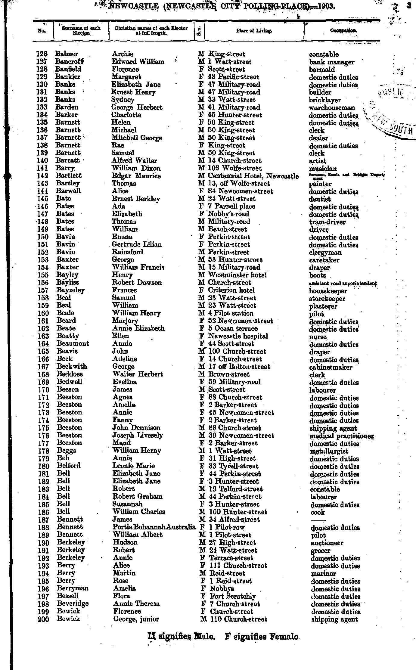
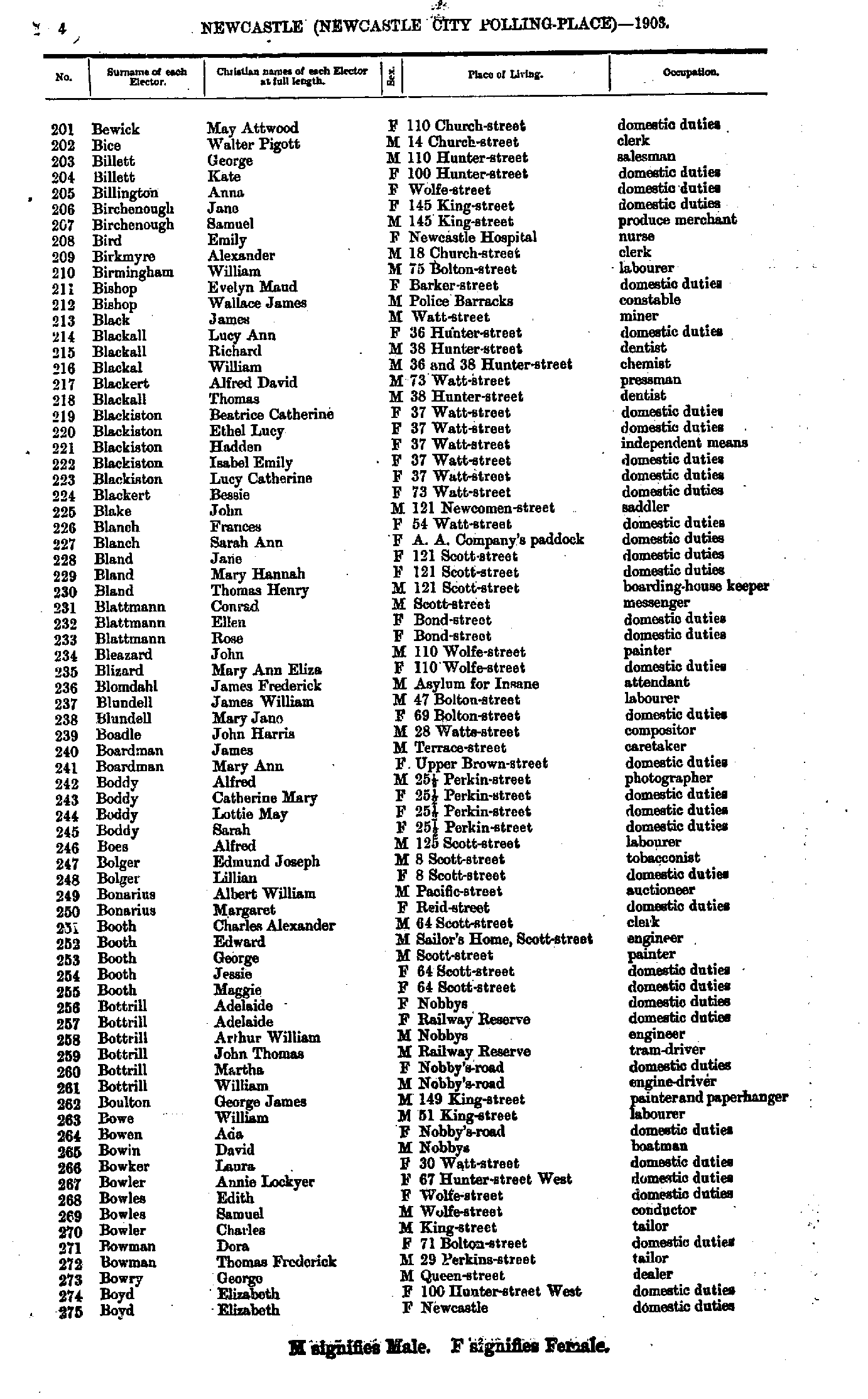
- Balmer Archie - Bewick George
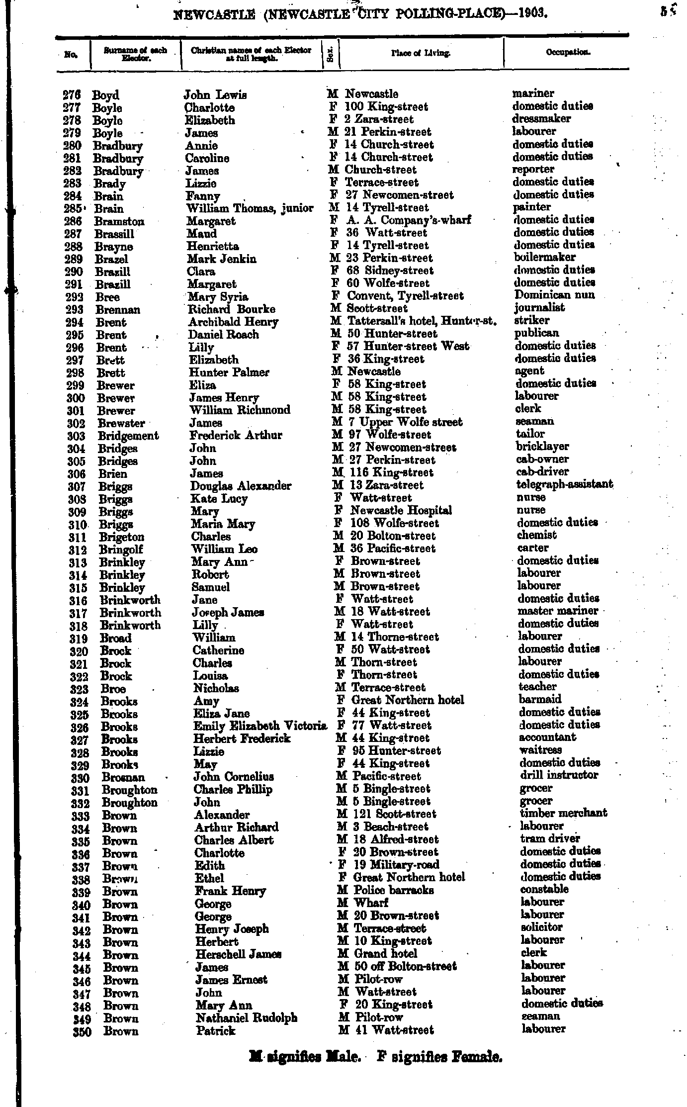
- Bewick May - Boyd Elizabeth
- Boyd John - Brown Patrick
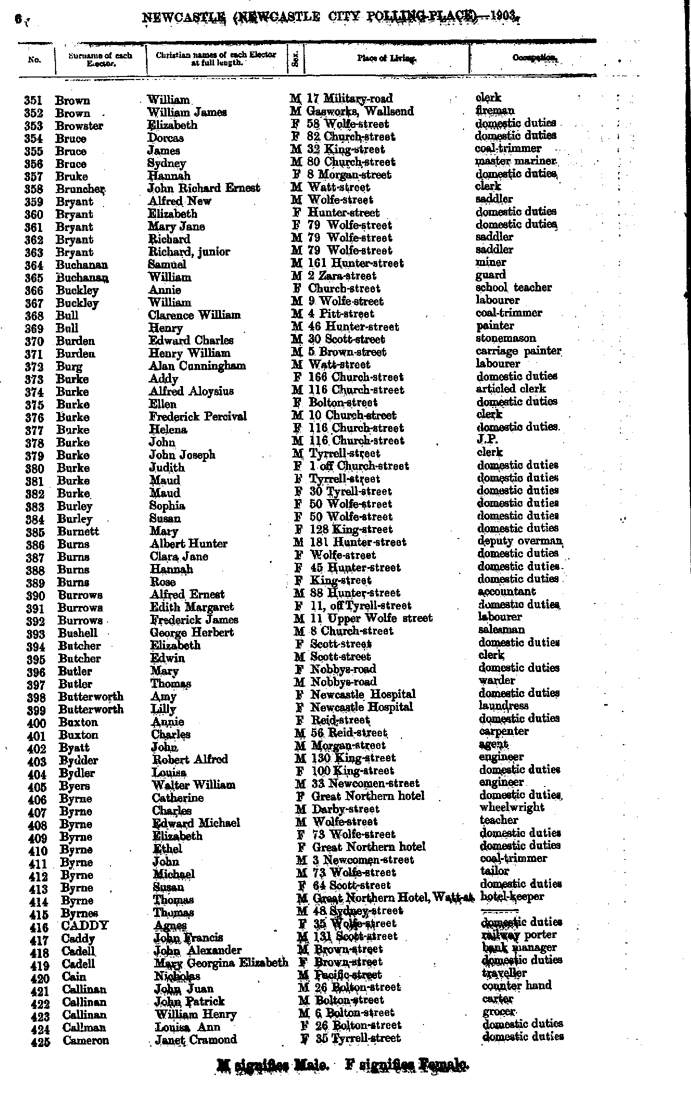
- Brown William. - Cameron Janet
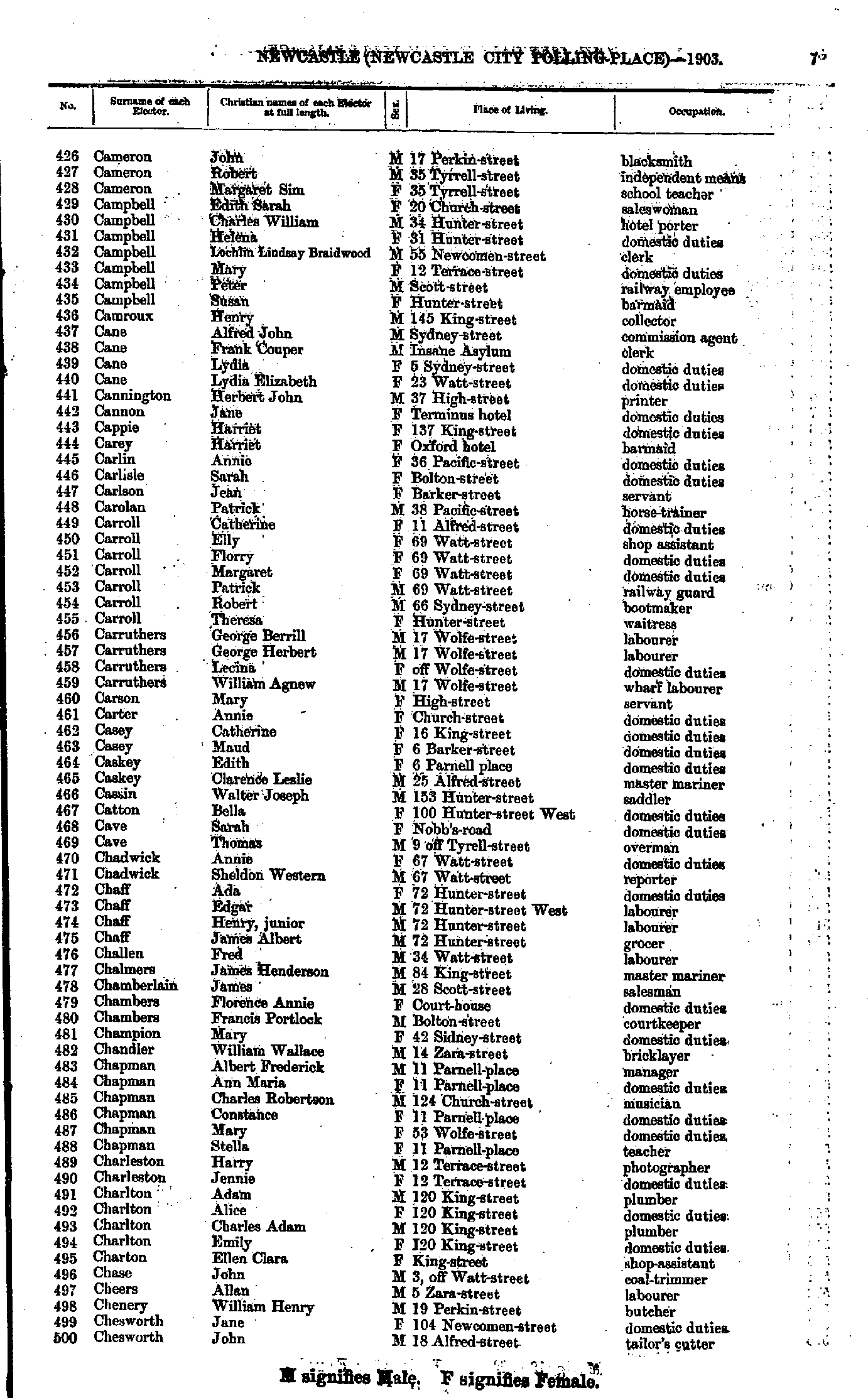
- Cameron John - Chesworth John
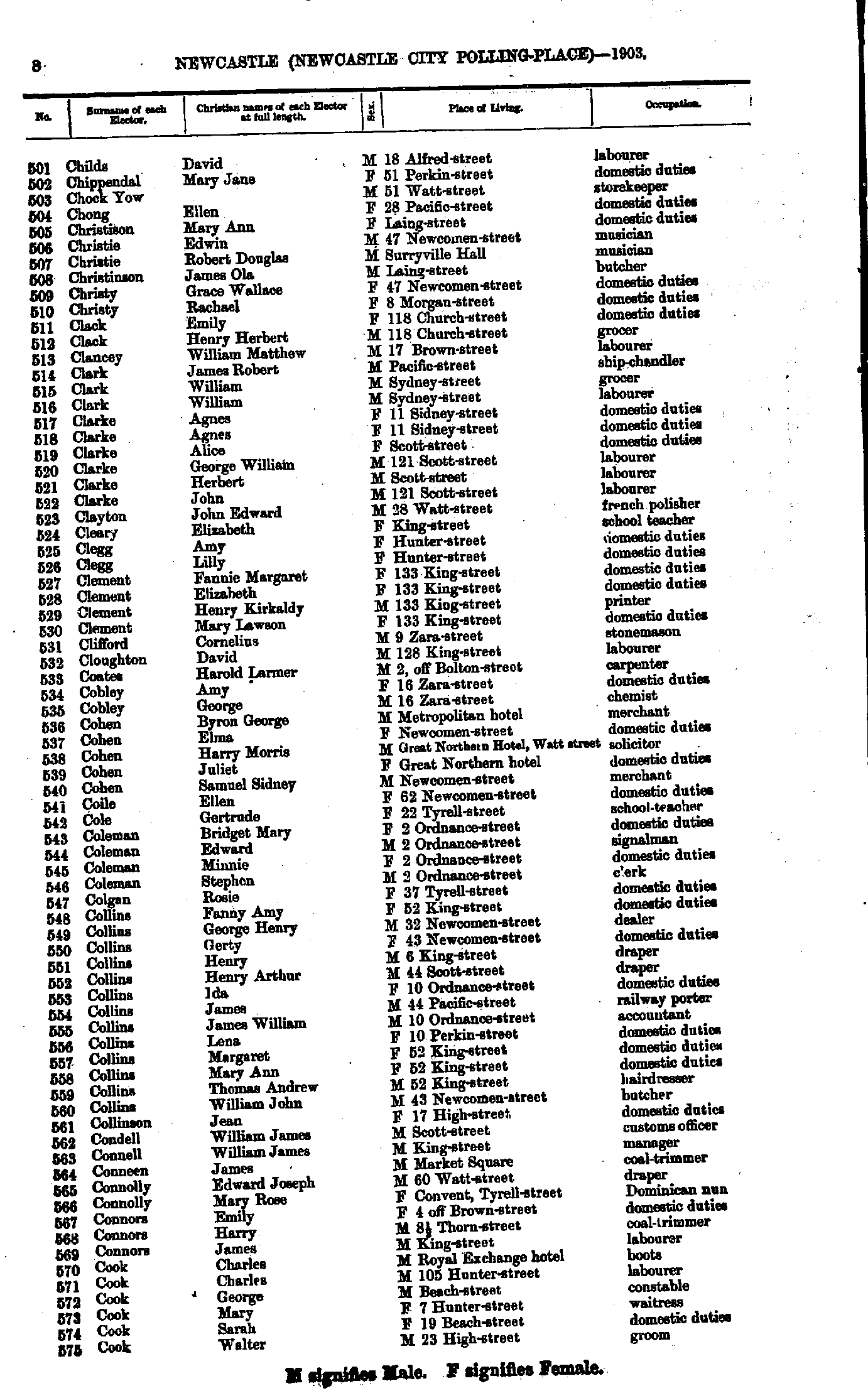
- Childs David - Cook Walter
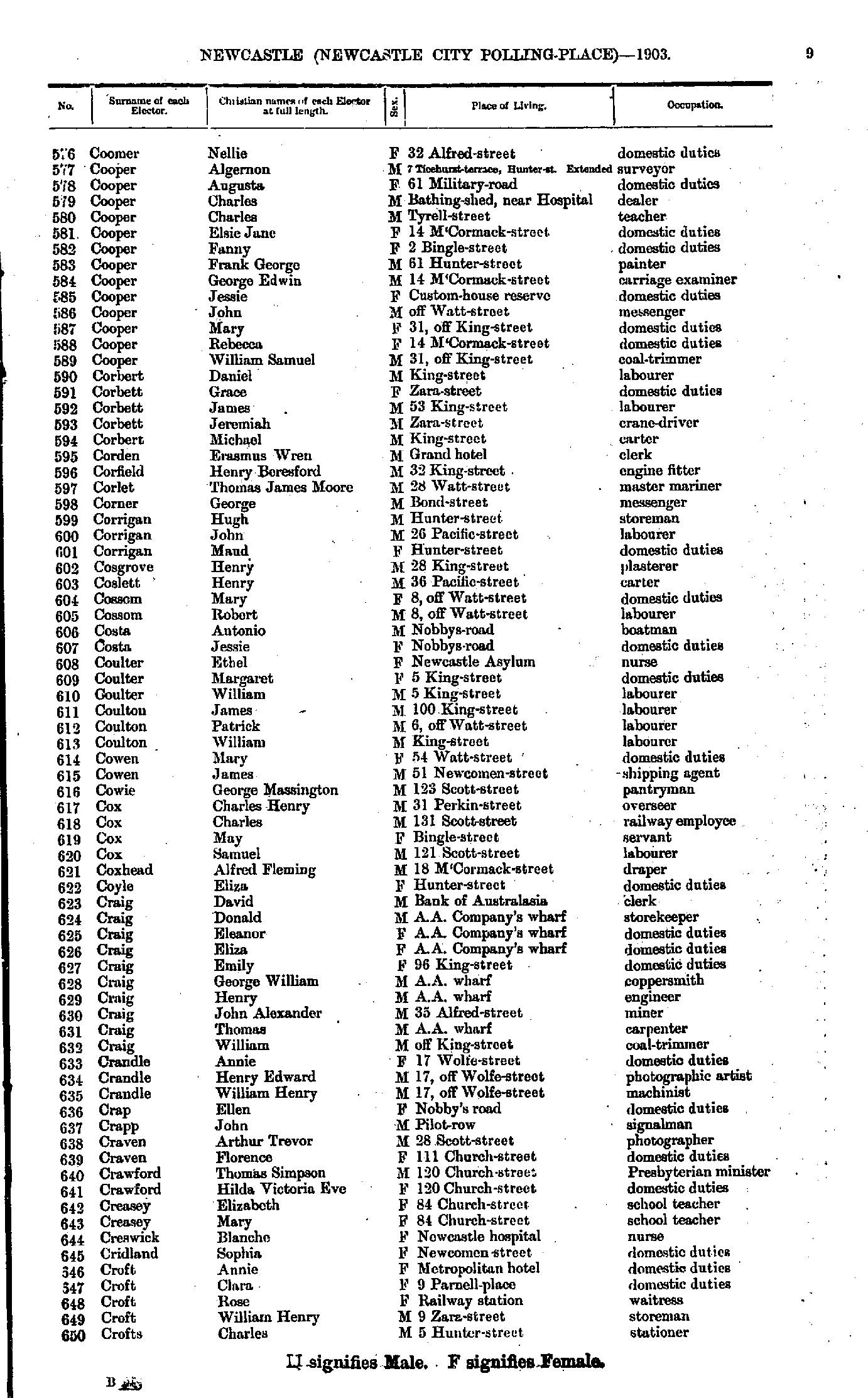
- Coomer Nellie - Crofts Charles
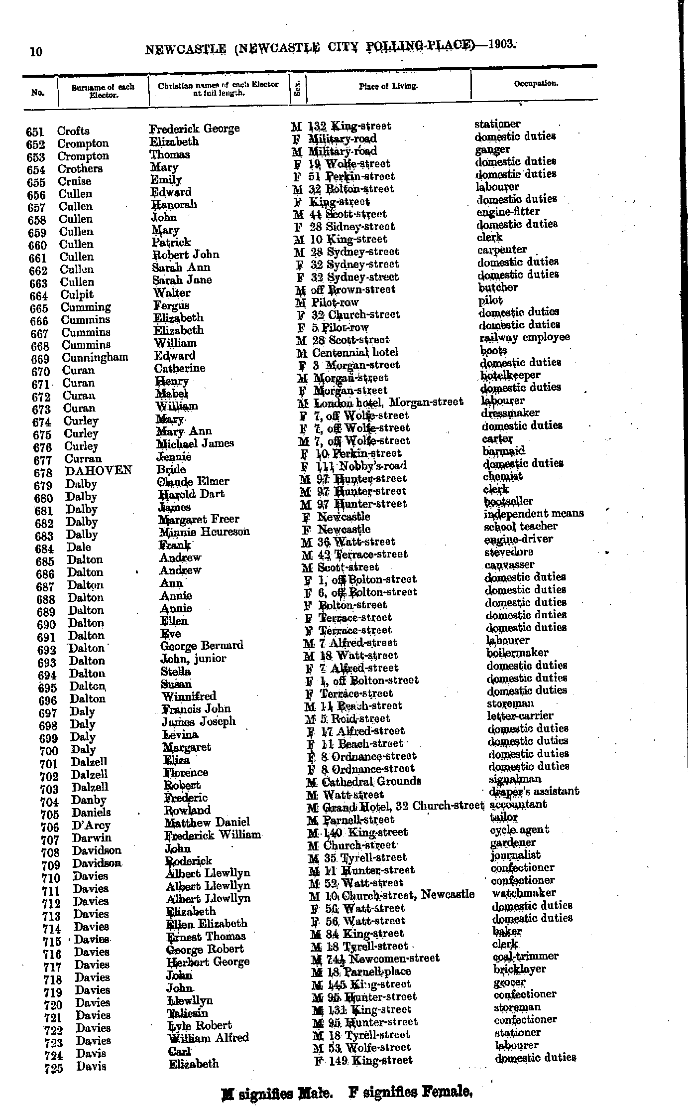
- Crofts Frederick - Davis Elizabeth
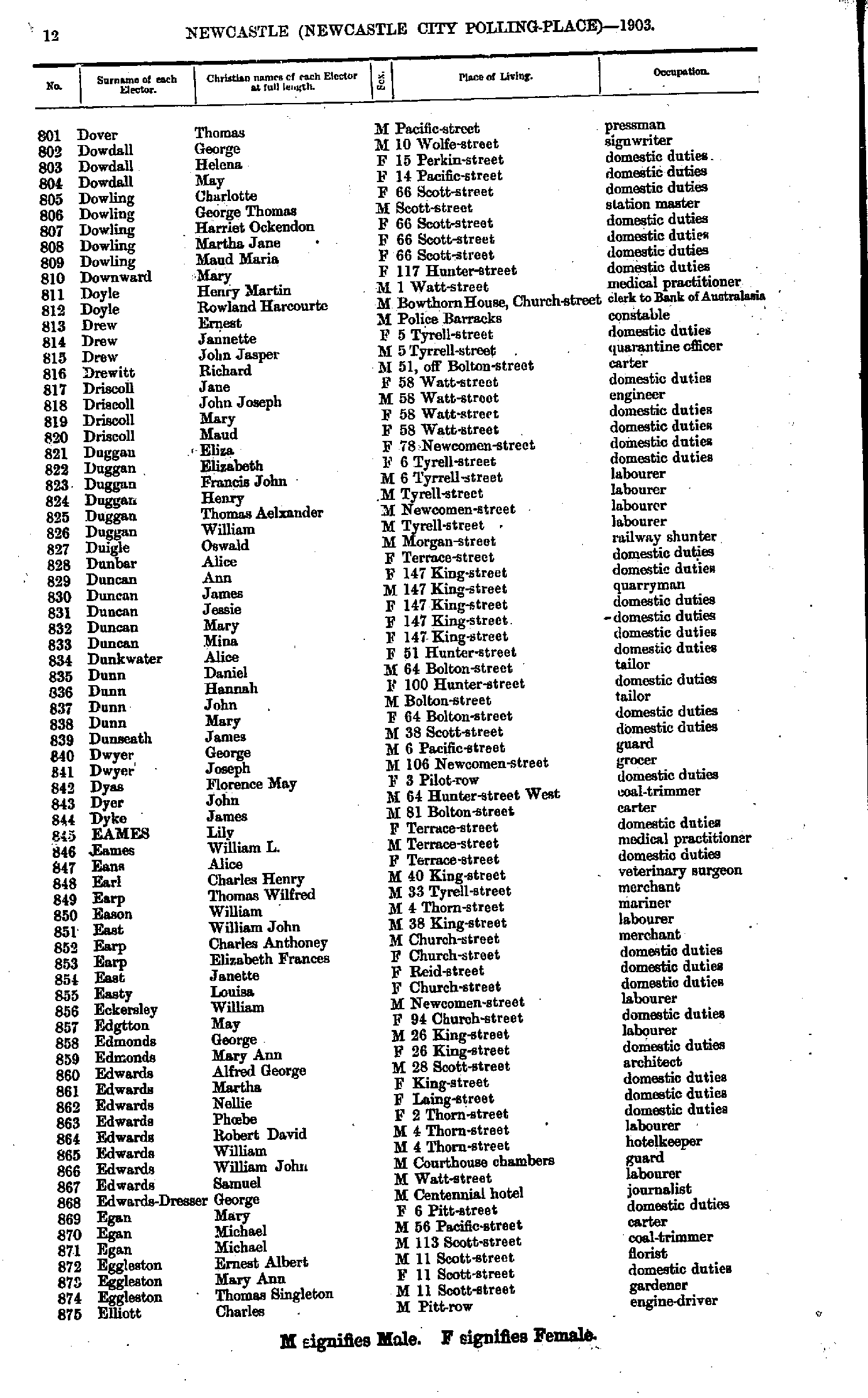
- Davis Florence - Dover Nellie
- Dover Thomas - Elliott Charles
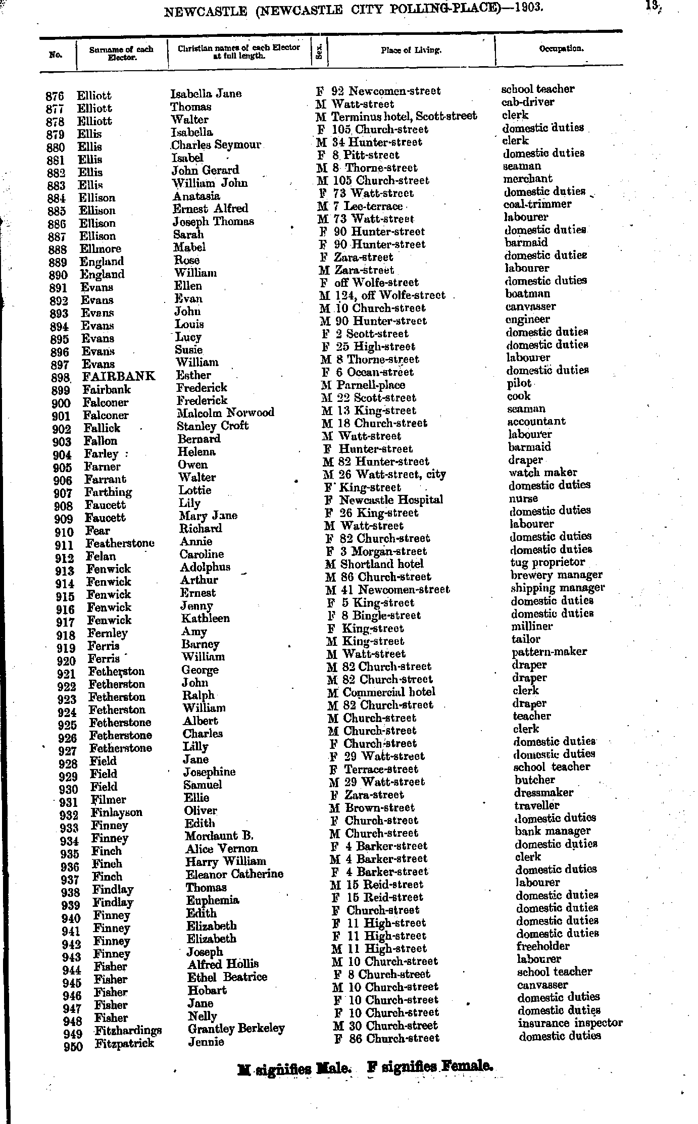
- Elliott Isabella - Fitzpatrick Jennie
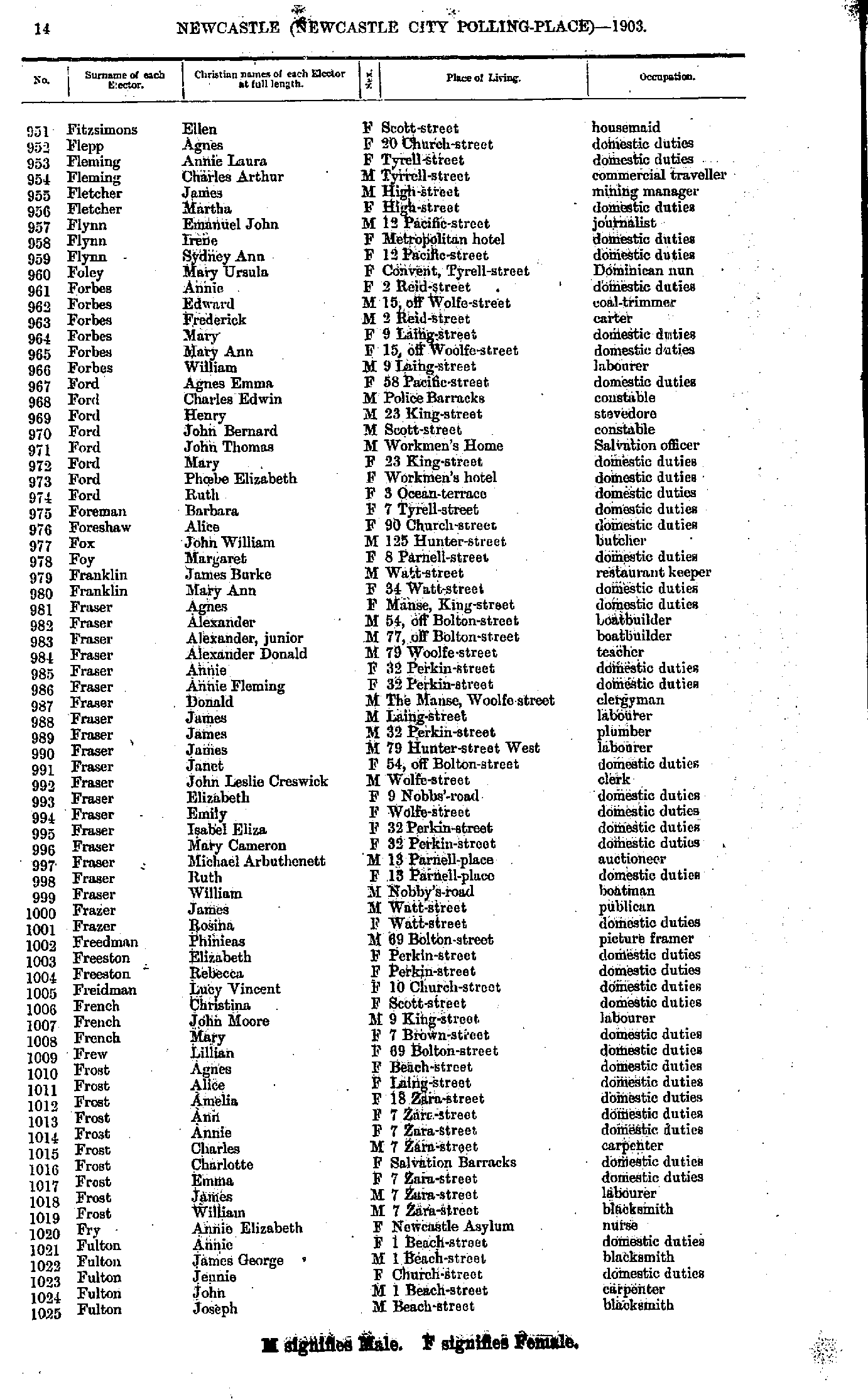
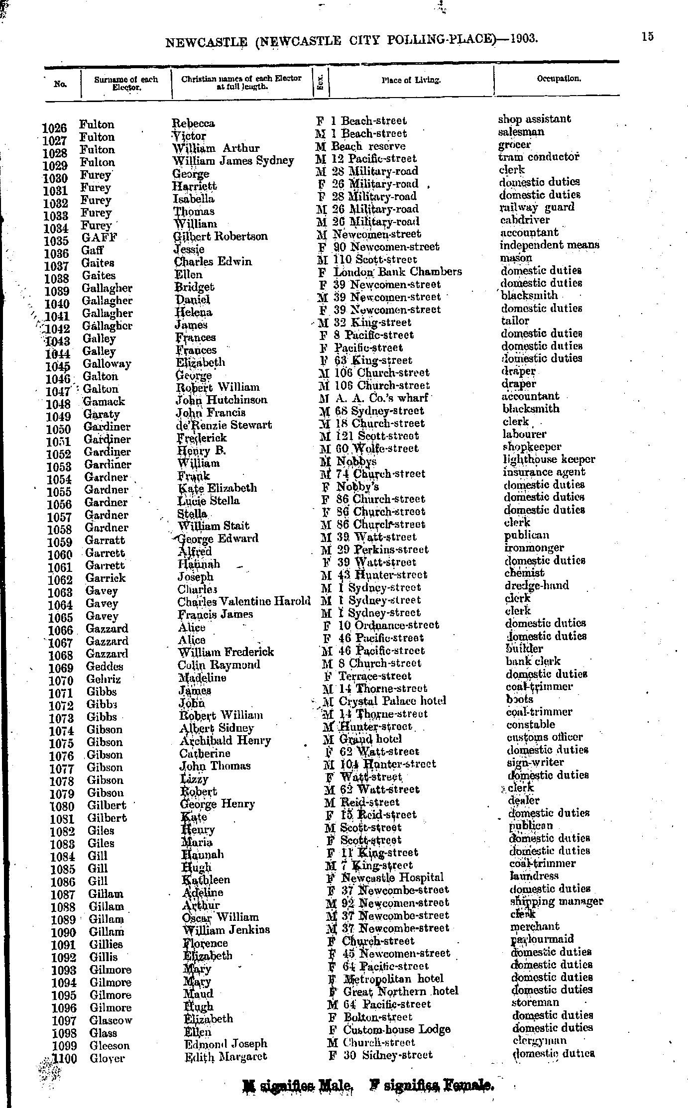
- Fitzsimons Ellen - Fulton Joseph
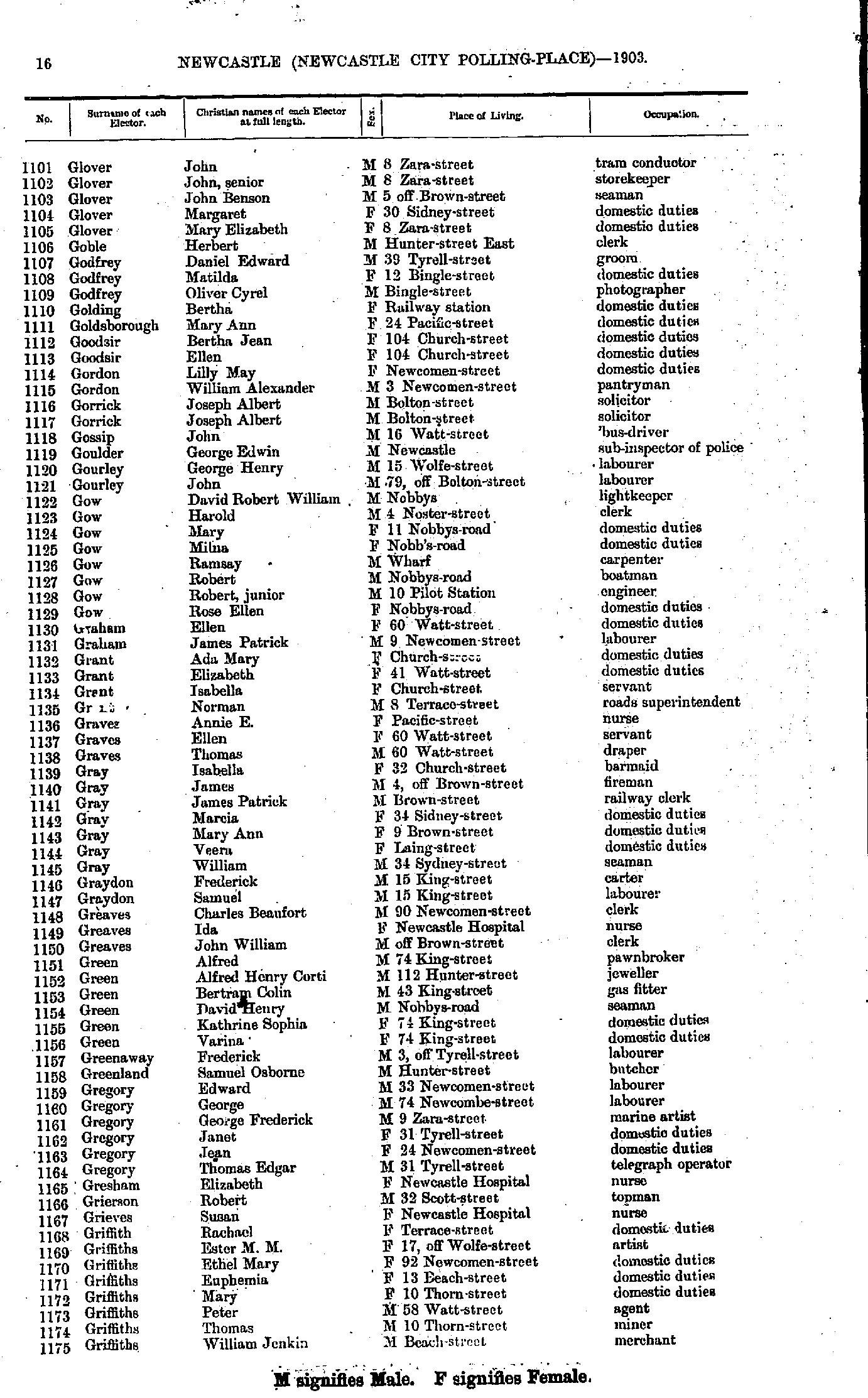
- Fulton Rebecca - Glover Edith
- Glover John - Griffiths William
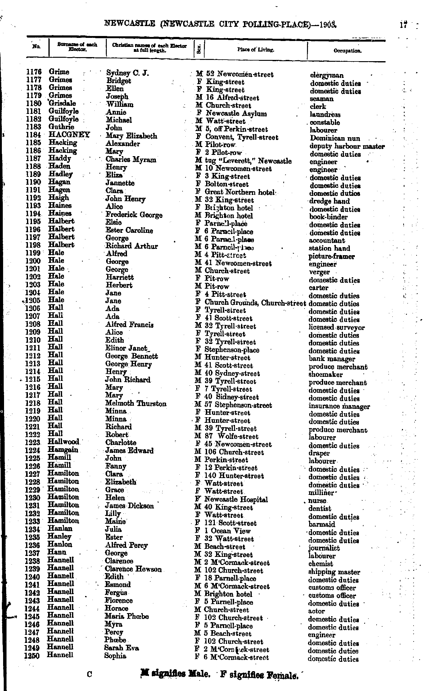
- Grime Sydney - Hannell Sophia
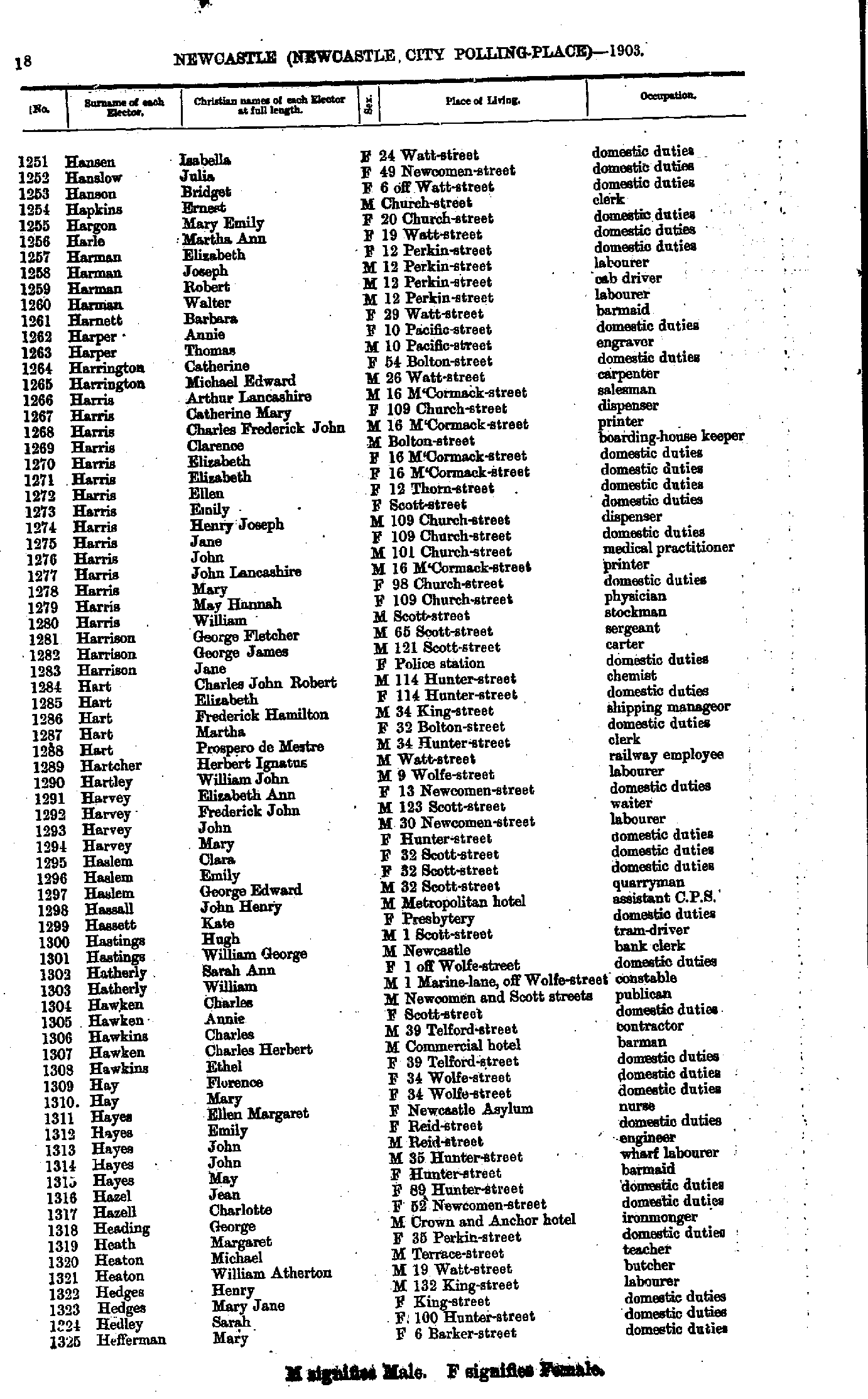
- Hansen Isabella - Hefferman Mary
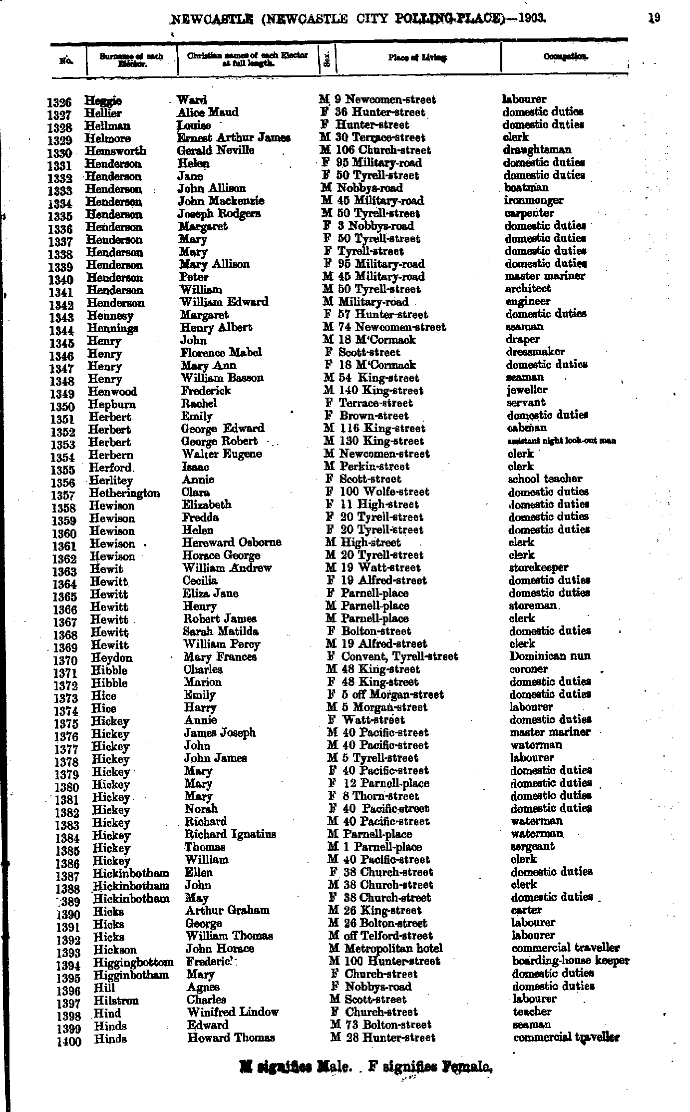
- Heggie Ward - Hinds Howard
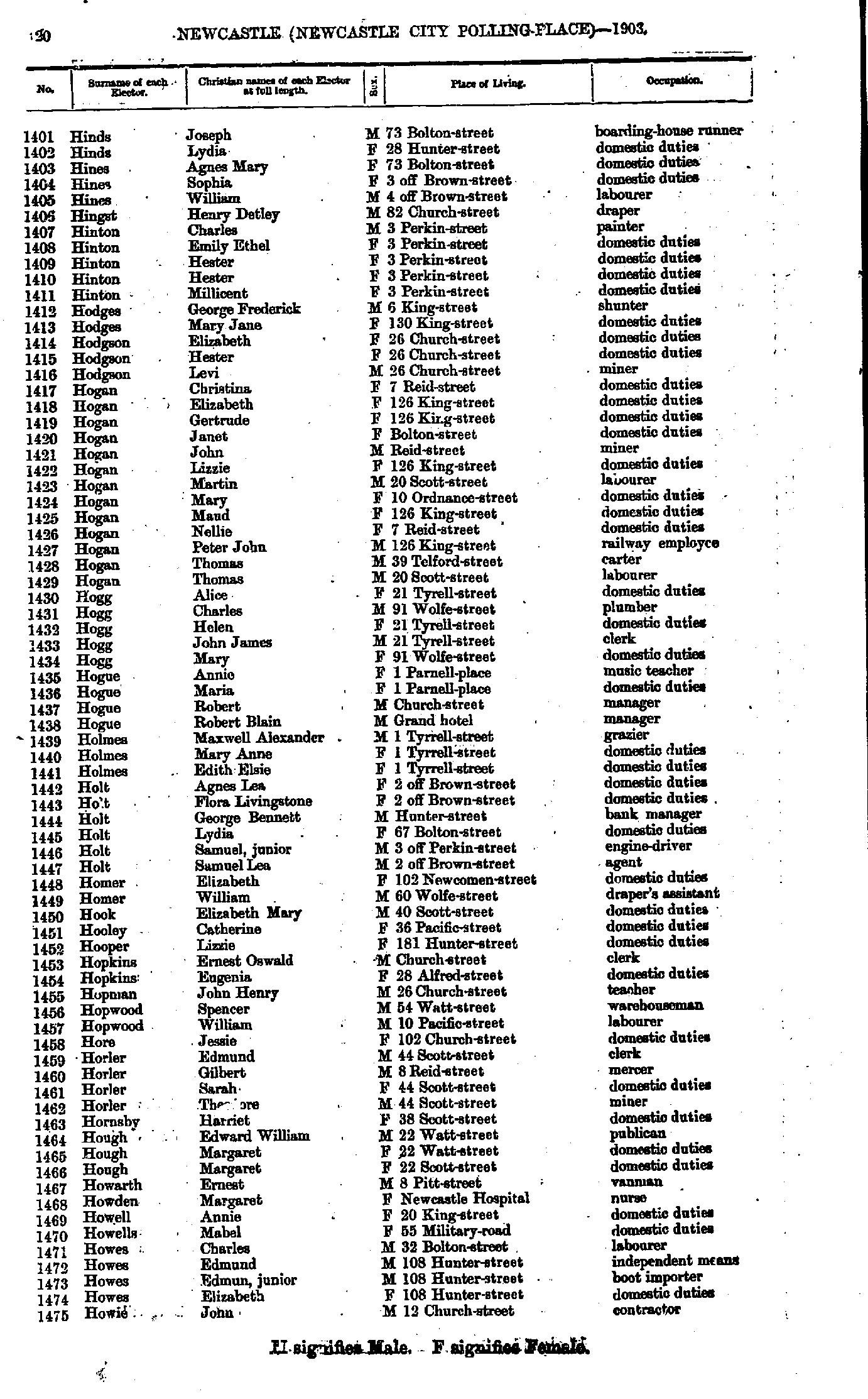
- Hinds Joseph - Howie John
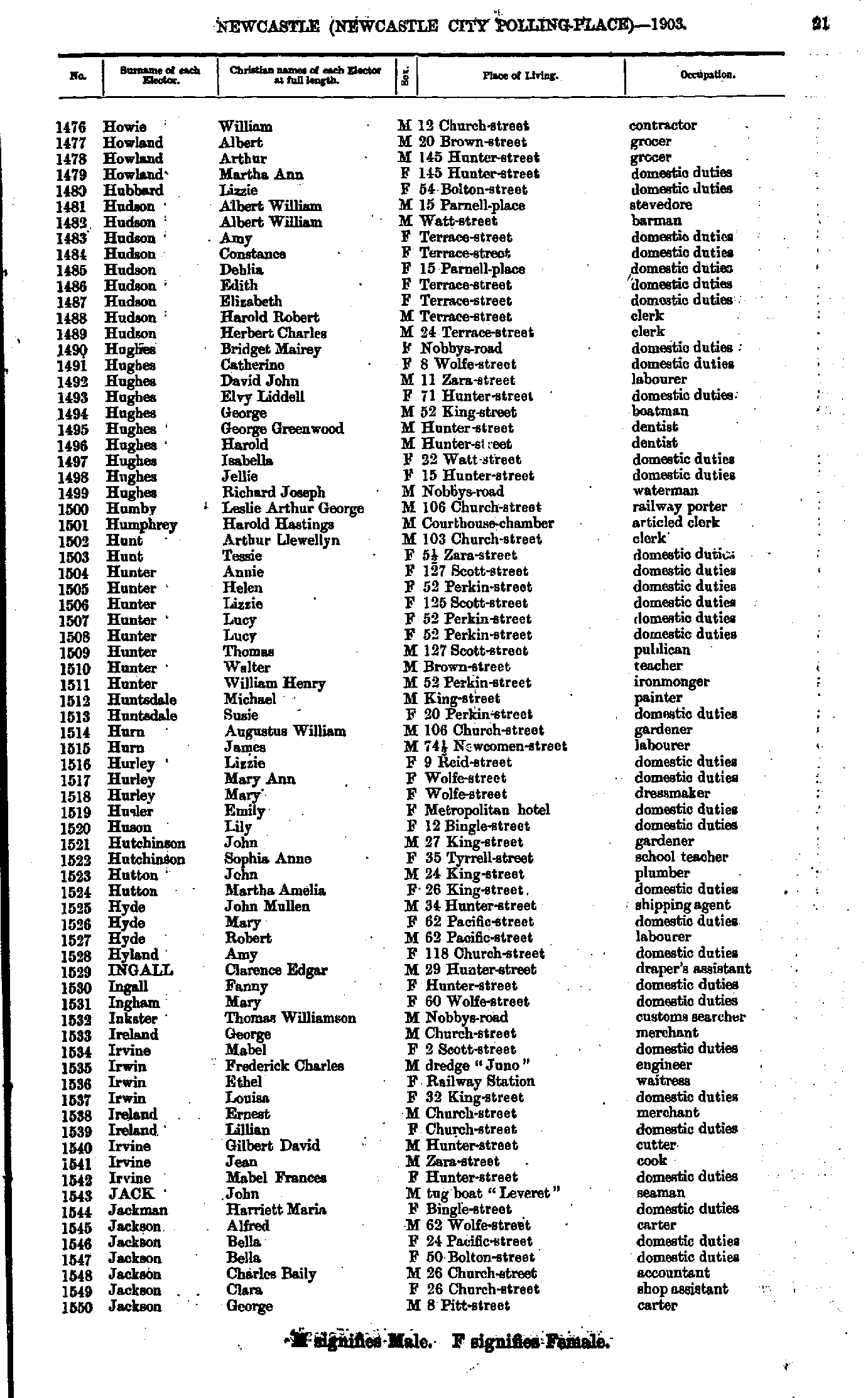
- Howie William - Jackson George
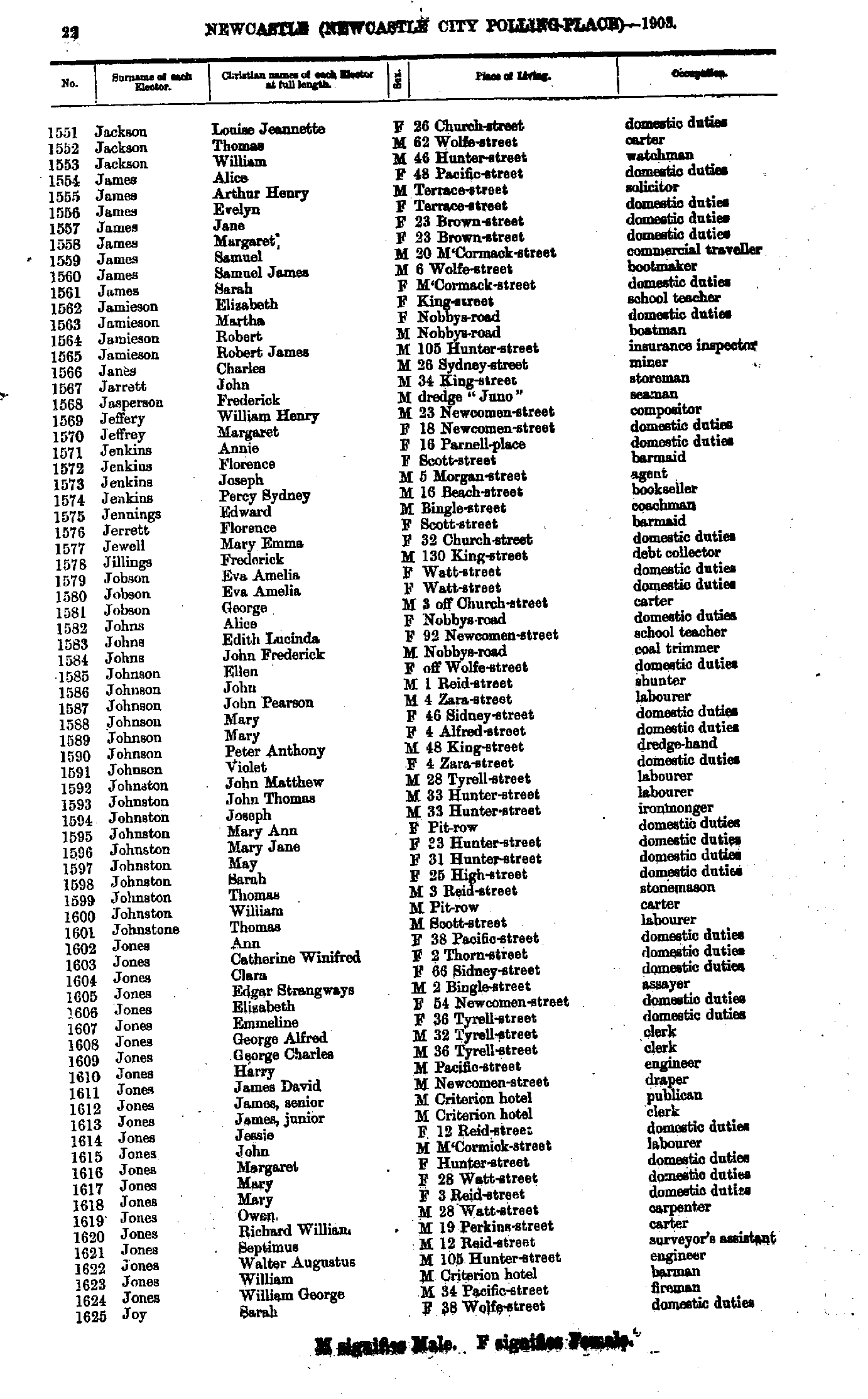
- Jackson Louise - Joy Sarah
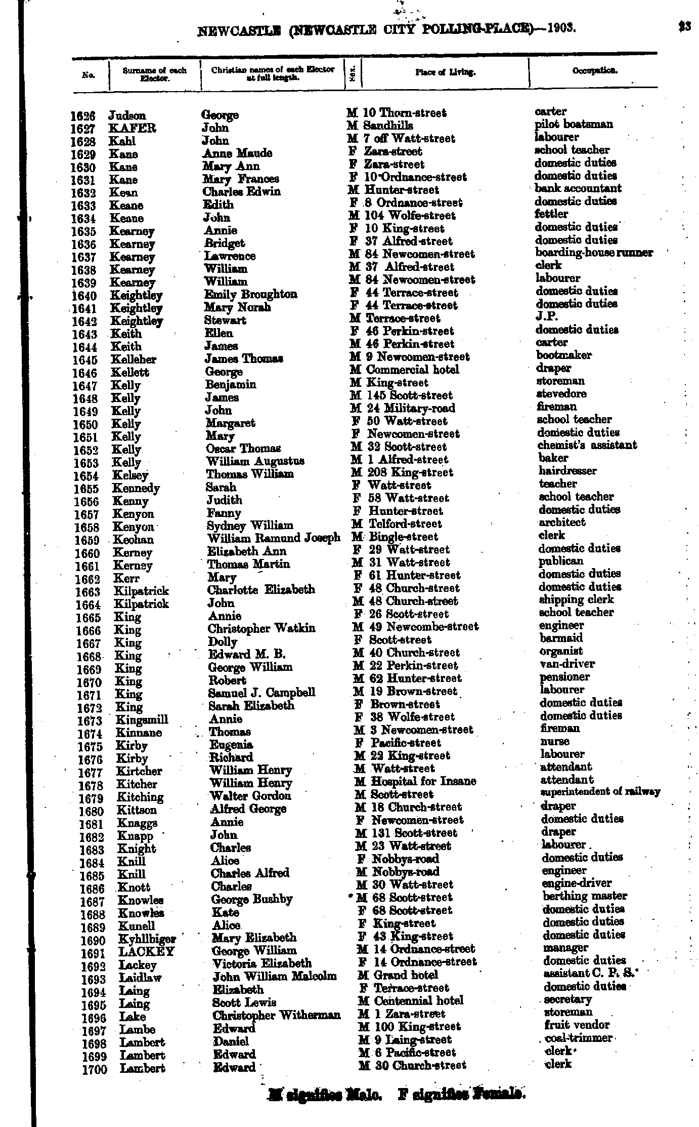
- Judson George - Lambert Edward
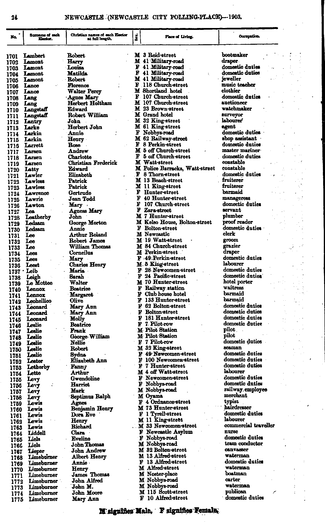
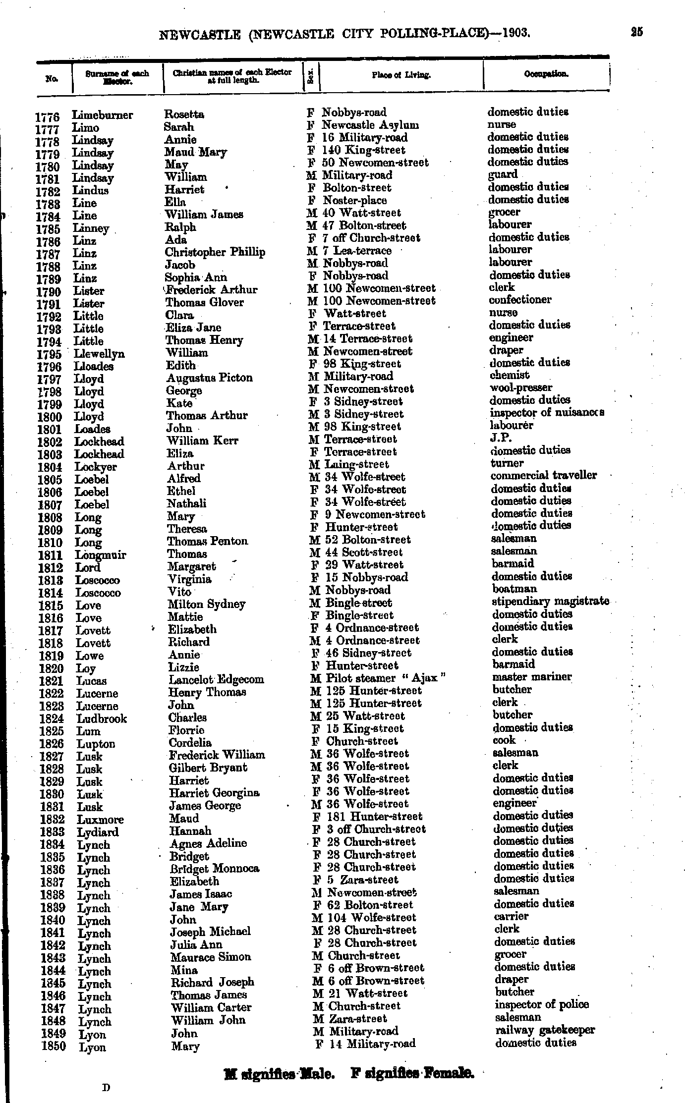
- Lambert Robert - Limeburner Mary
- Limeburner Rosetta - Lyon Mary
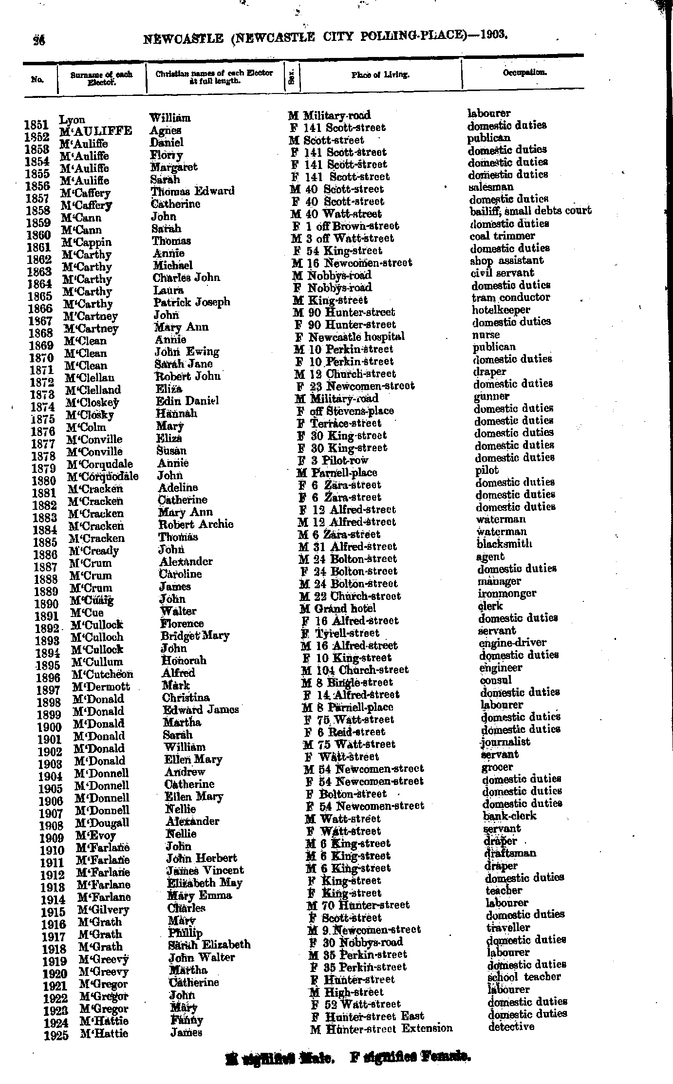
- Lyon William - M'Hattie James
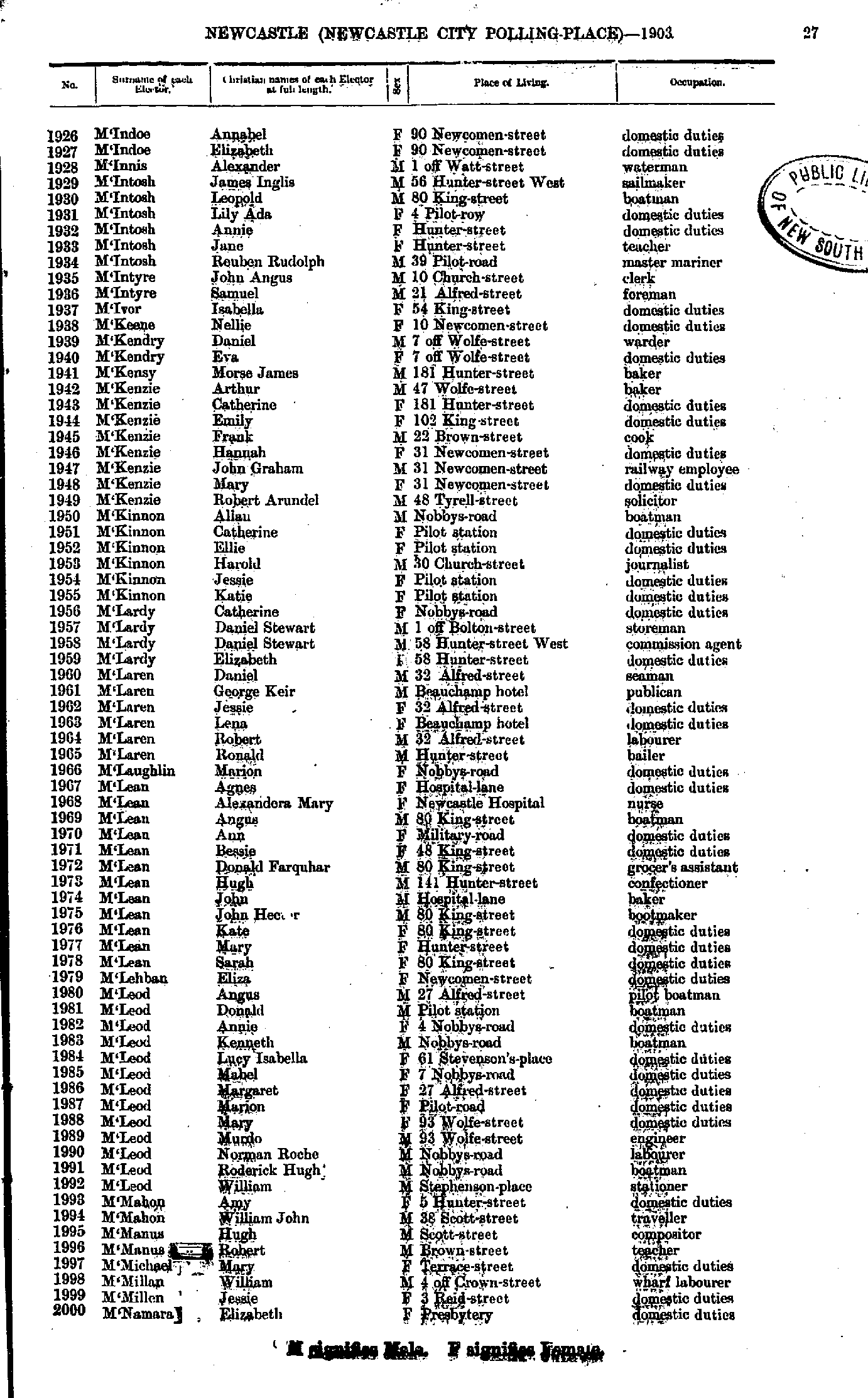
- M'Indoe Annabel - M'Namara Elizabeth
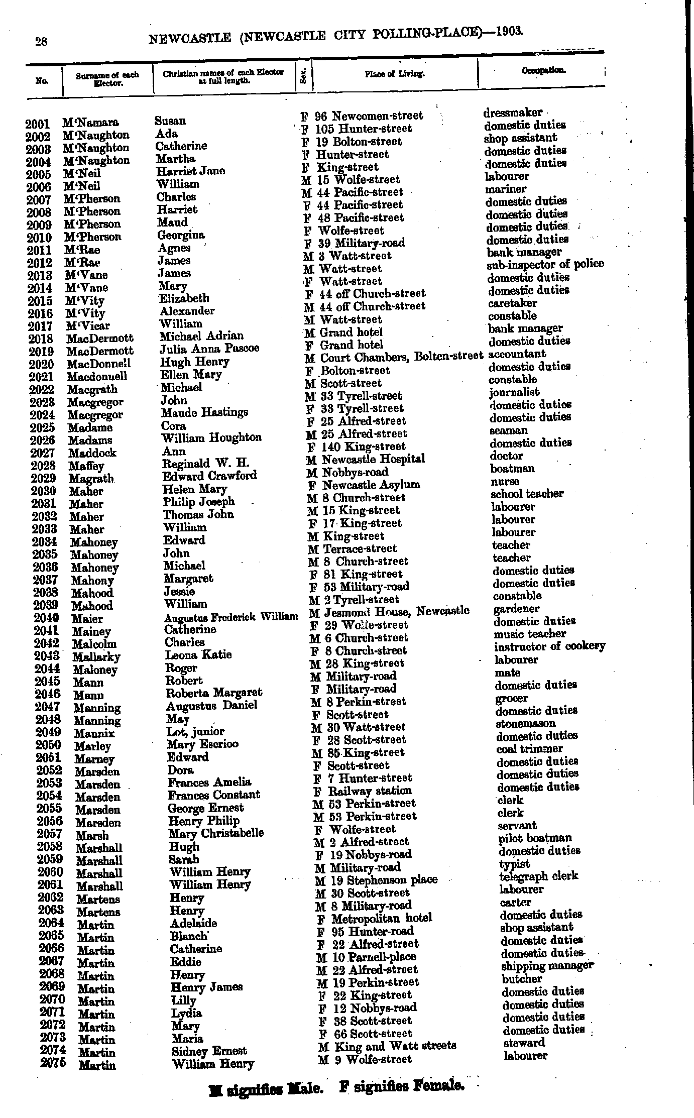
- M'Namara Susan - Martin William
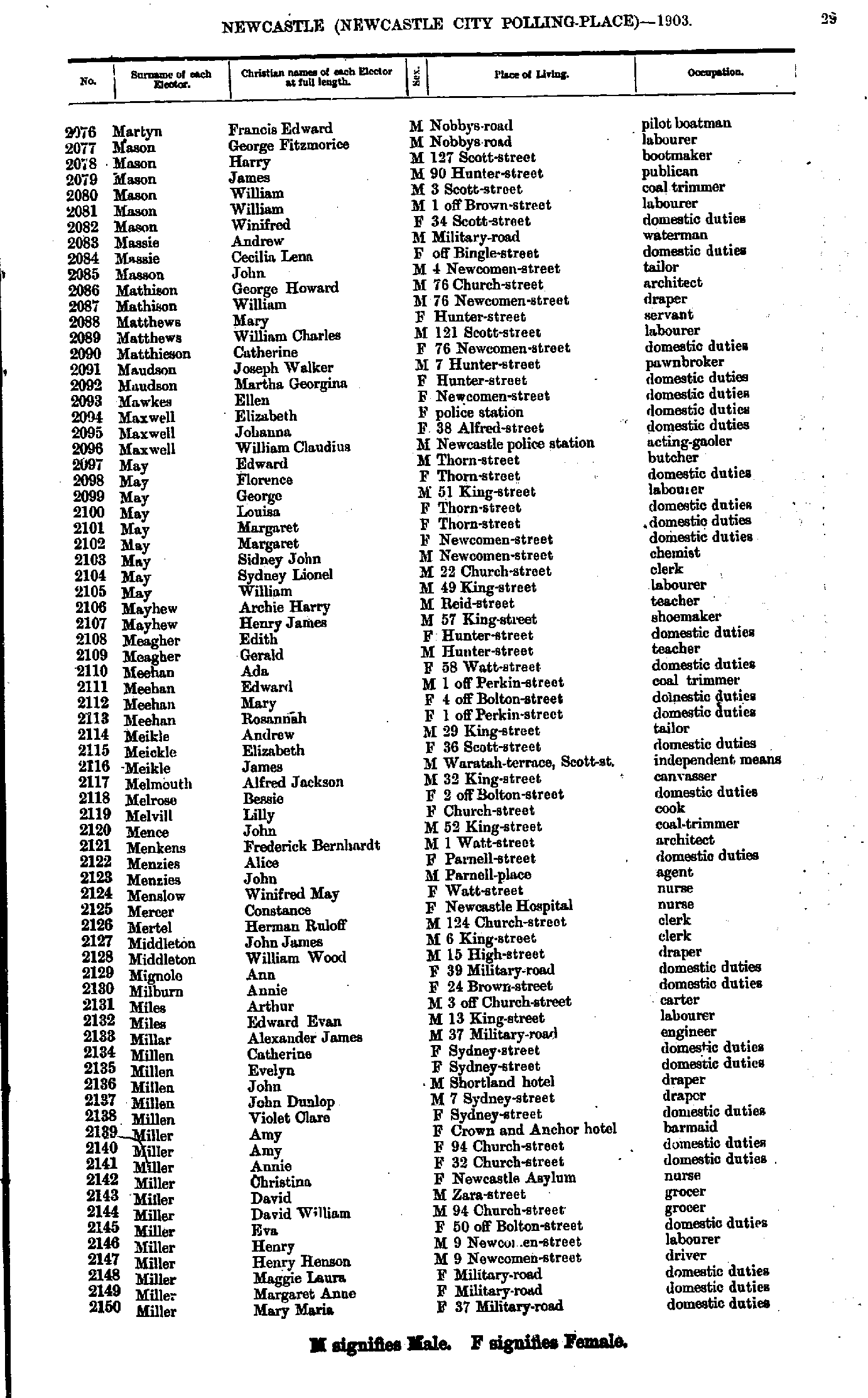
- Martyn Francis - Miller Mary
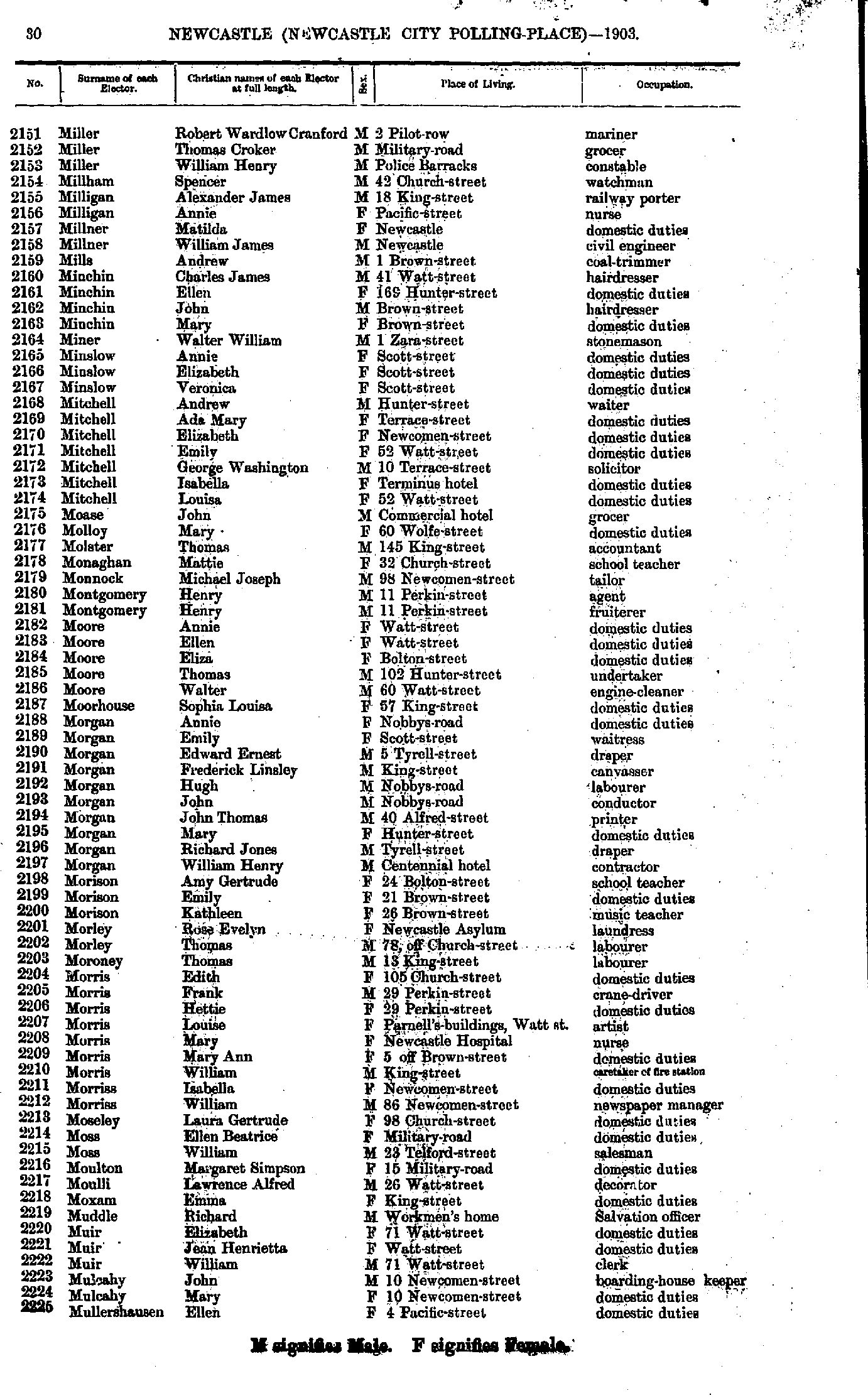
- Miller Robert - Mullershausen Ellen
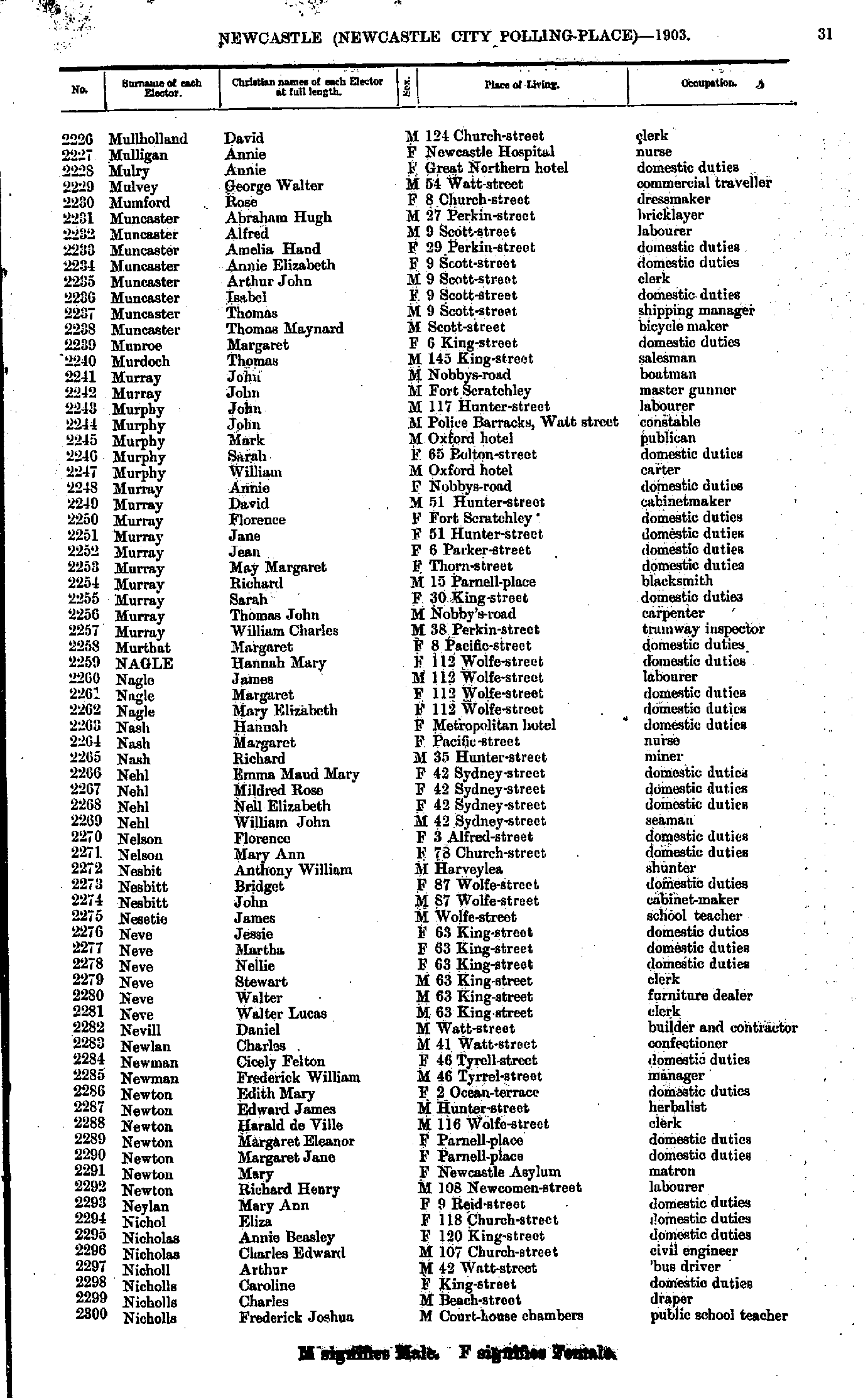
- Mullholland David - Nicholls Frederick
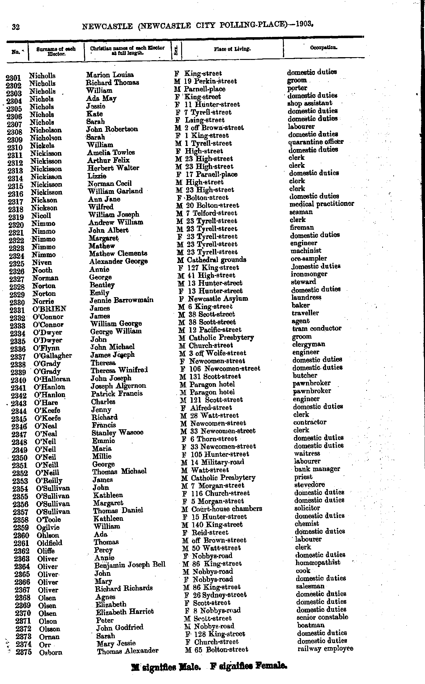
- Nicholls Marion - Osborn Thomas
- Oswald James - Percy Ernest
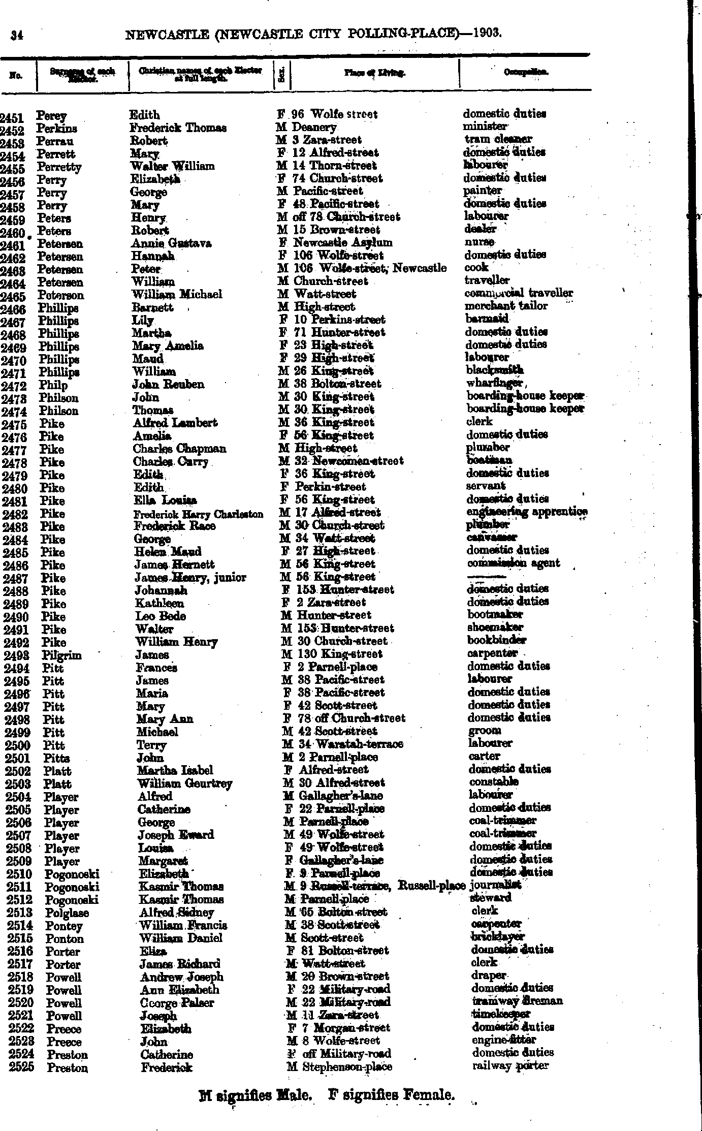
- Perey Edith - Preston Frederick
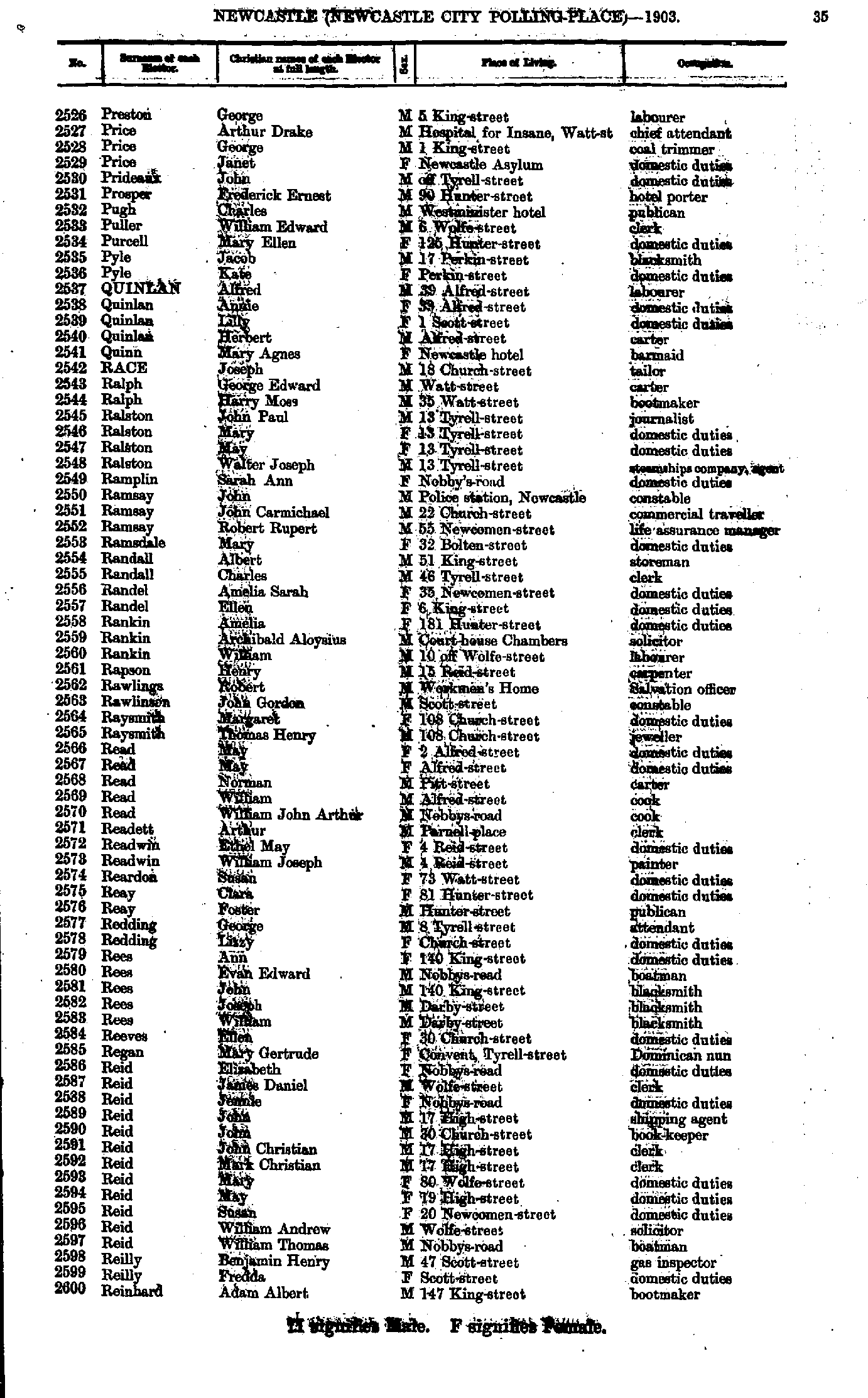
- Preston George - Reinhard Adam
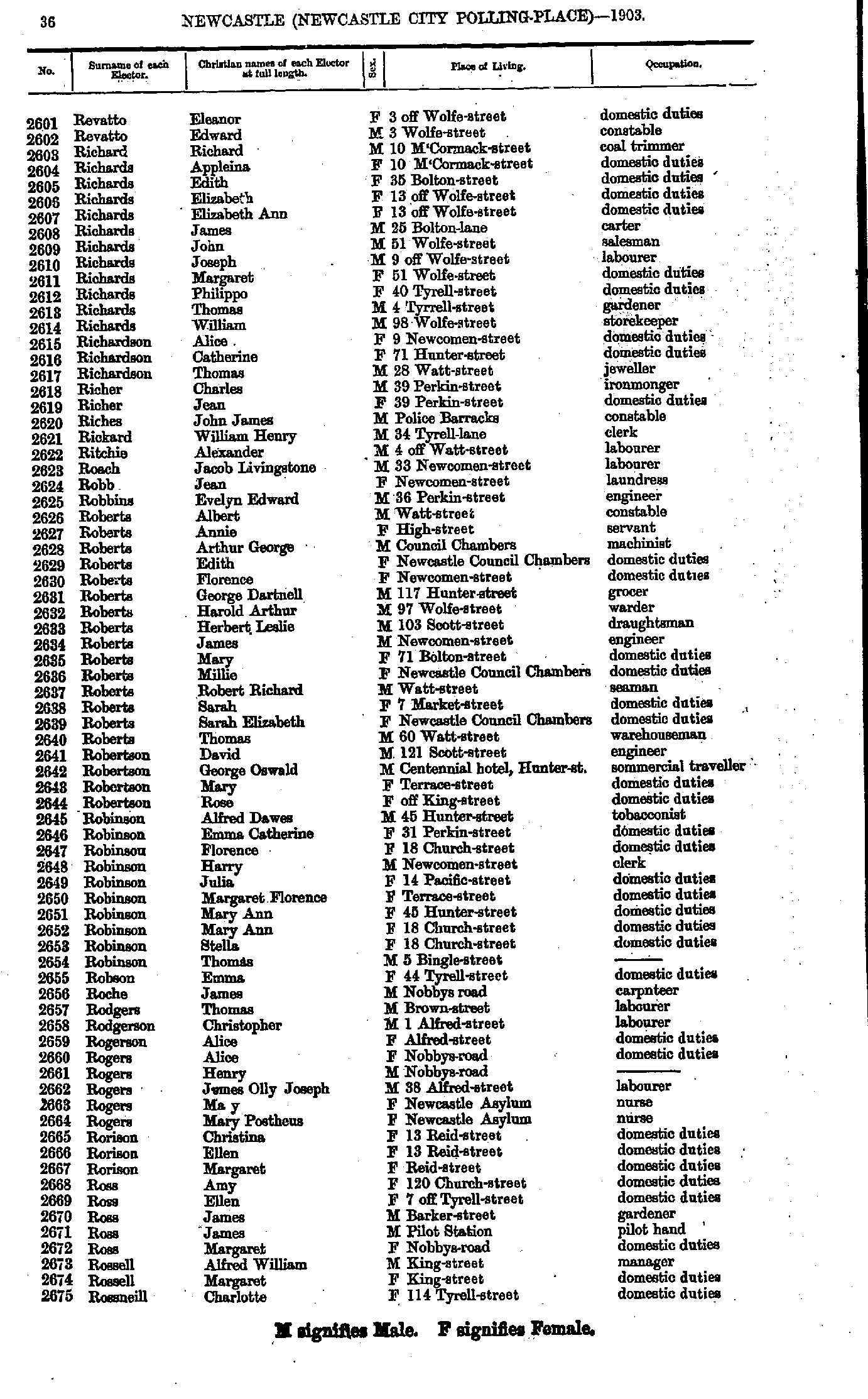
- Revatto Eleanor - Rossneill Charlotte
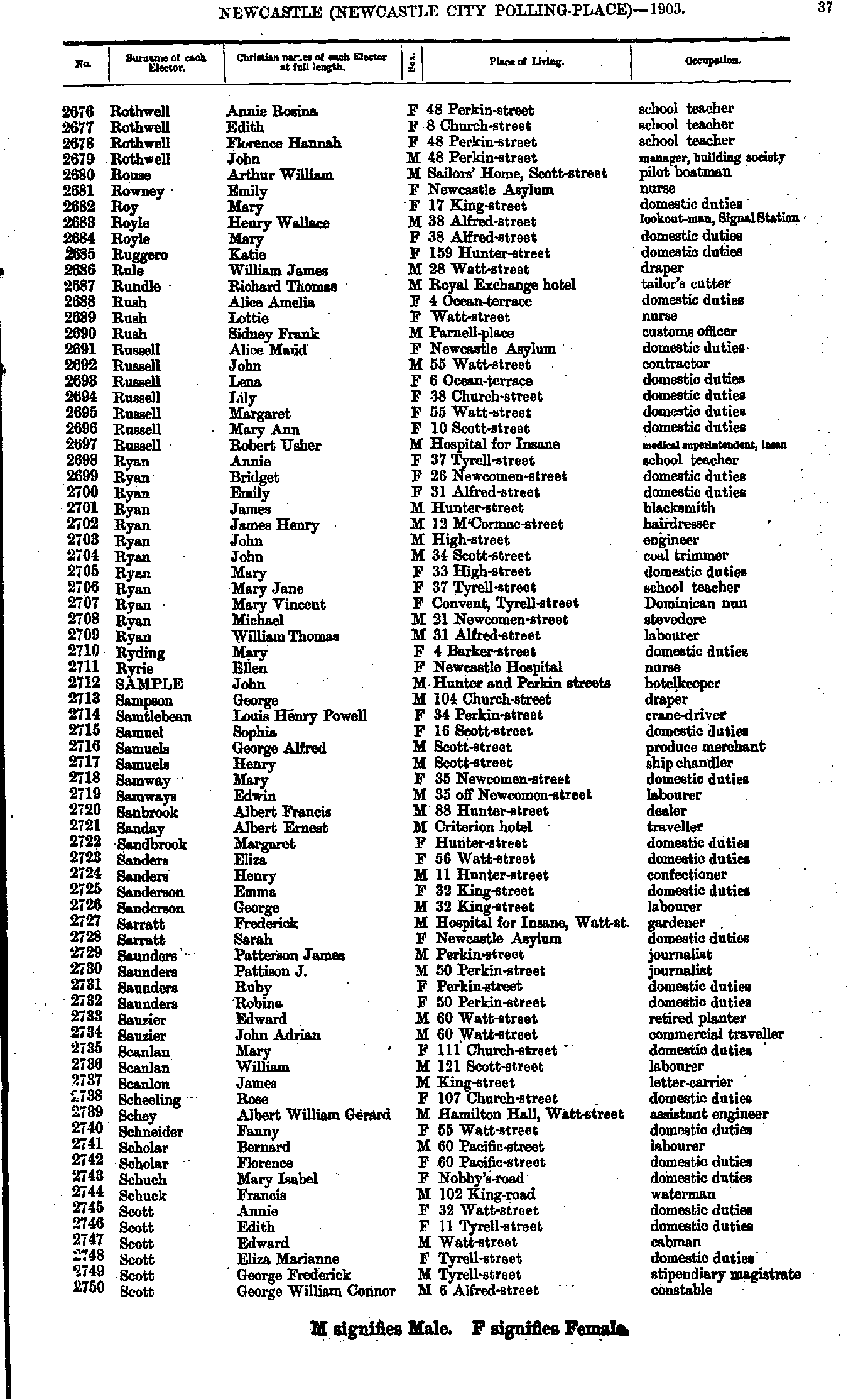
- Rothwell Annie - Scott George
- Scott Margaret - Smith Alfred
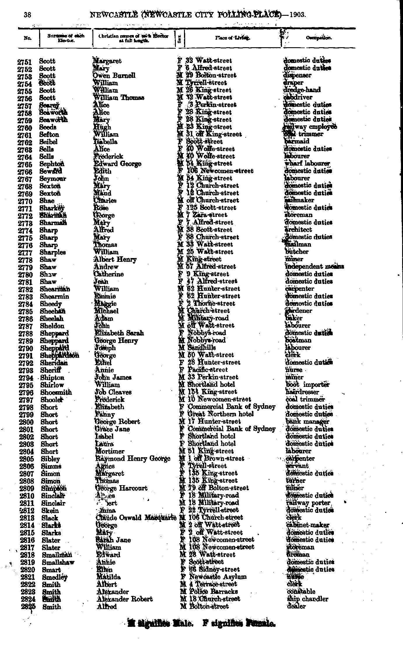
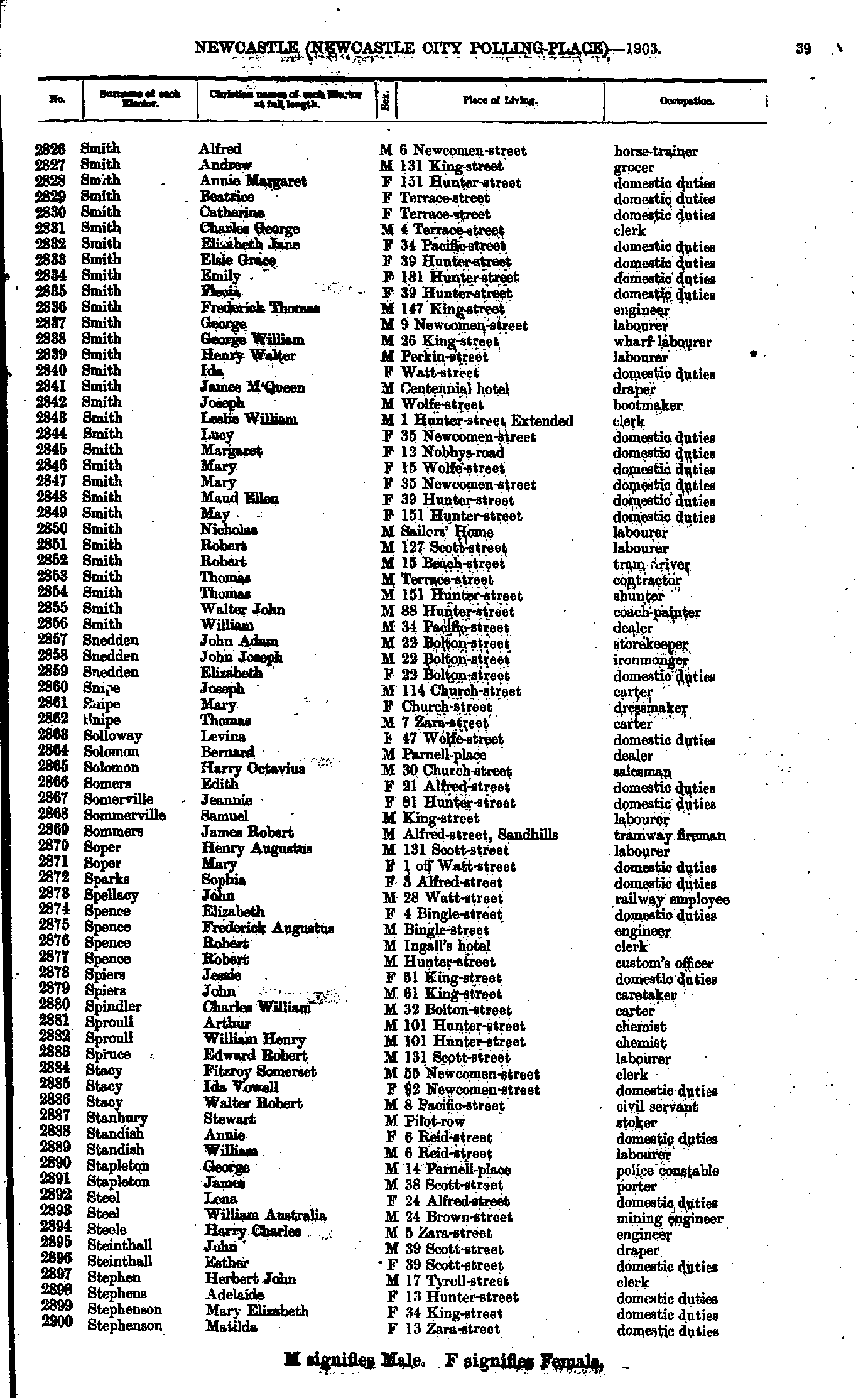
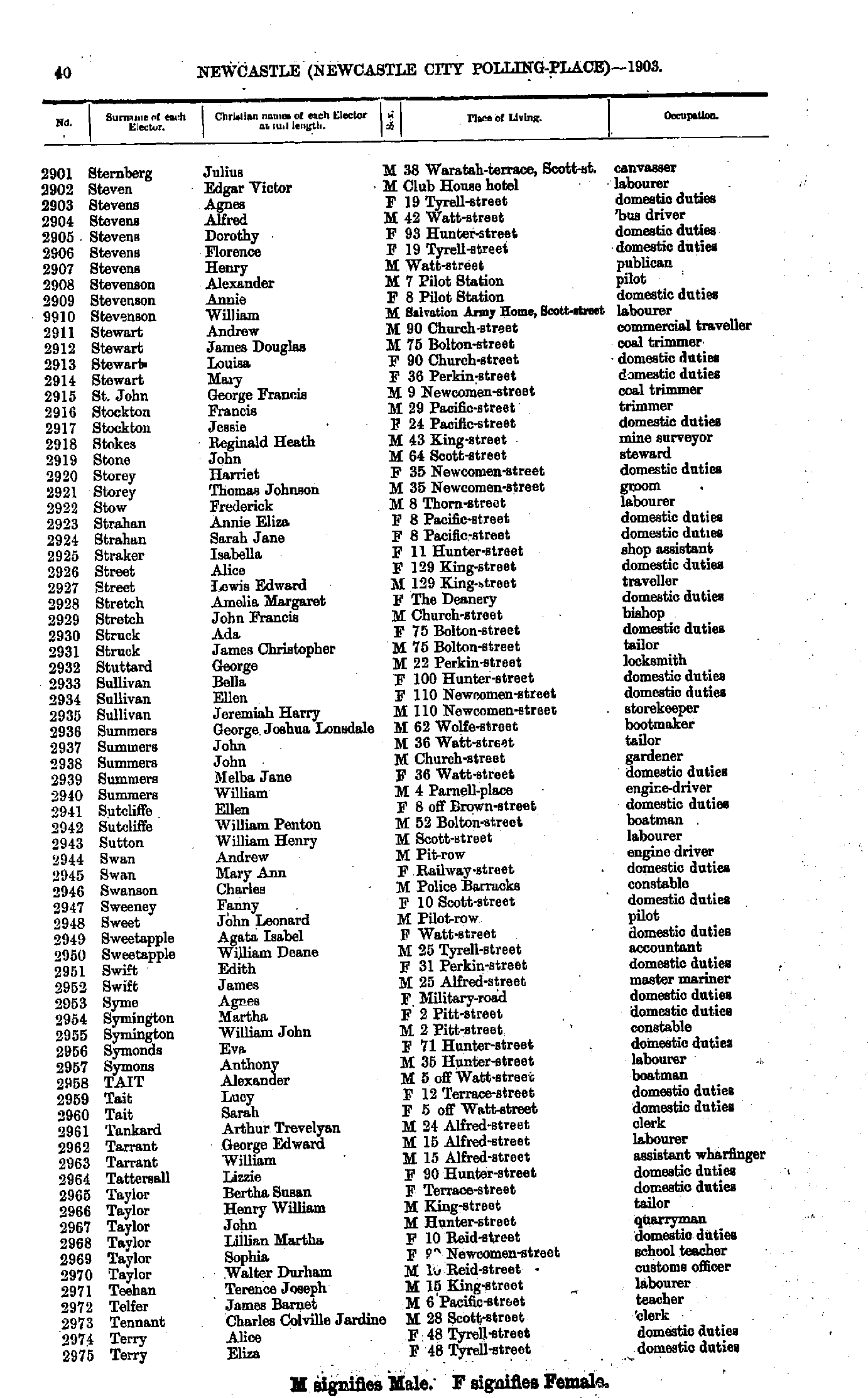
- Smith Alfred - Stephenson Matilda
- Sternberg Julius - Terry Eliza
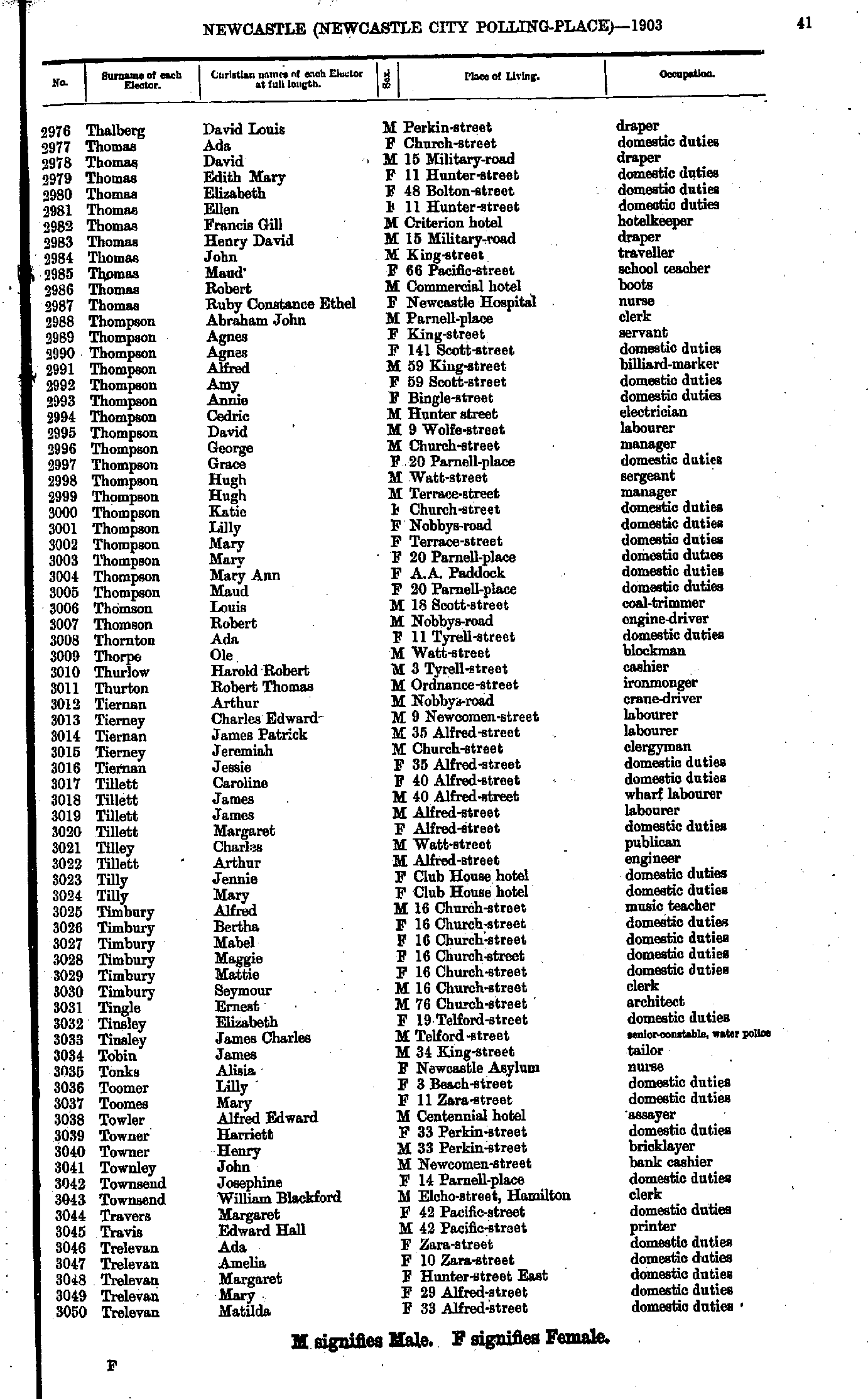
- Thalberg David - Trelevan Matilda
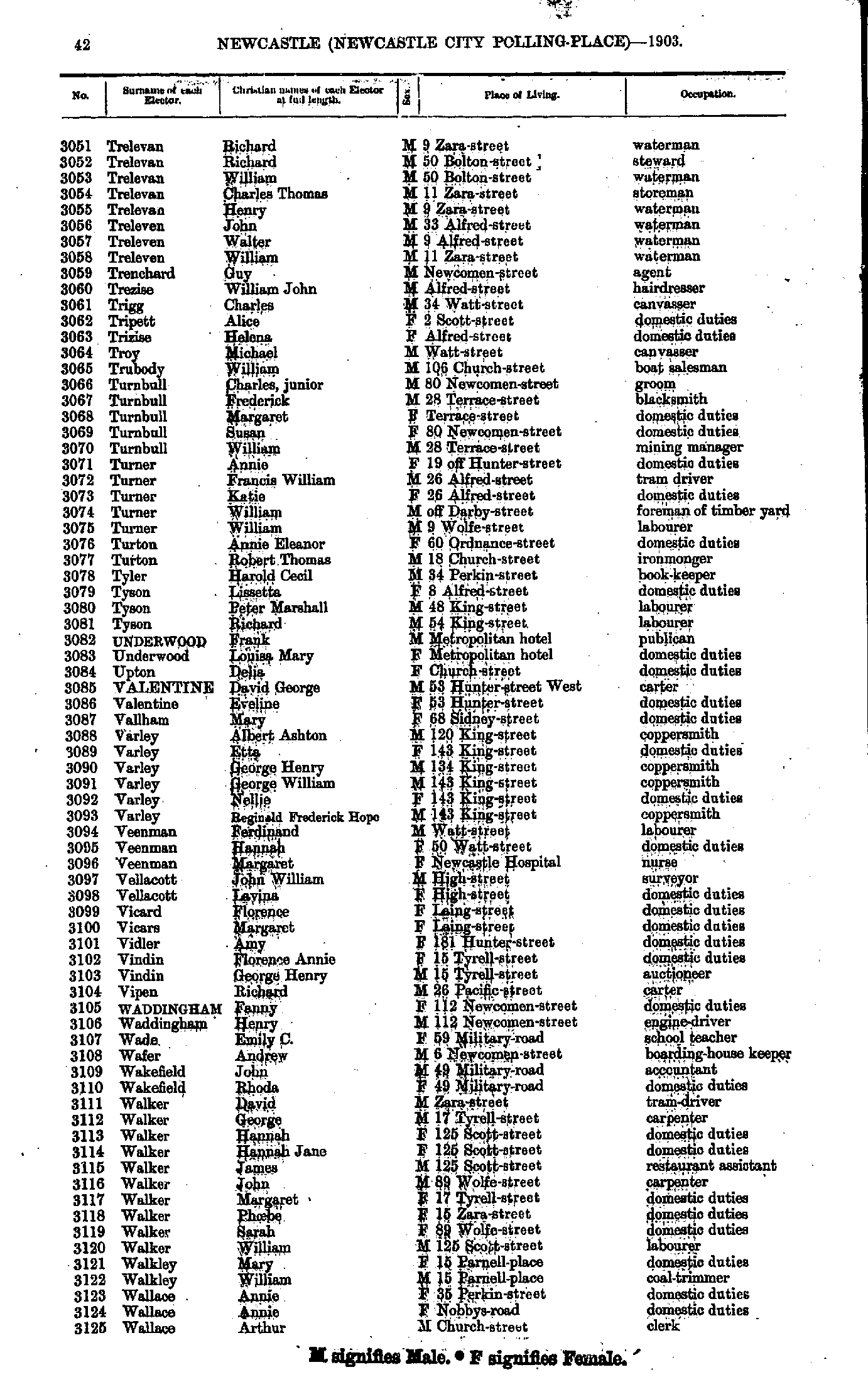
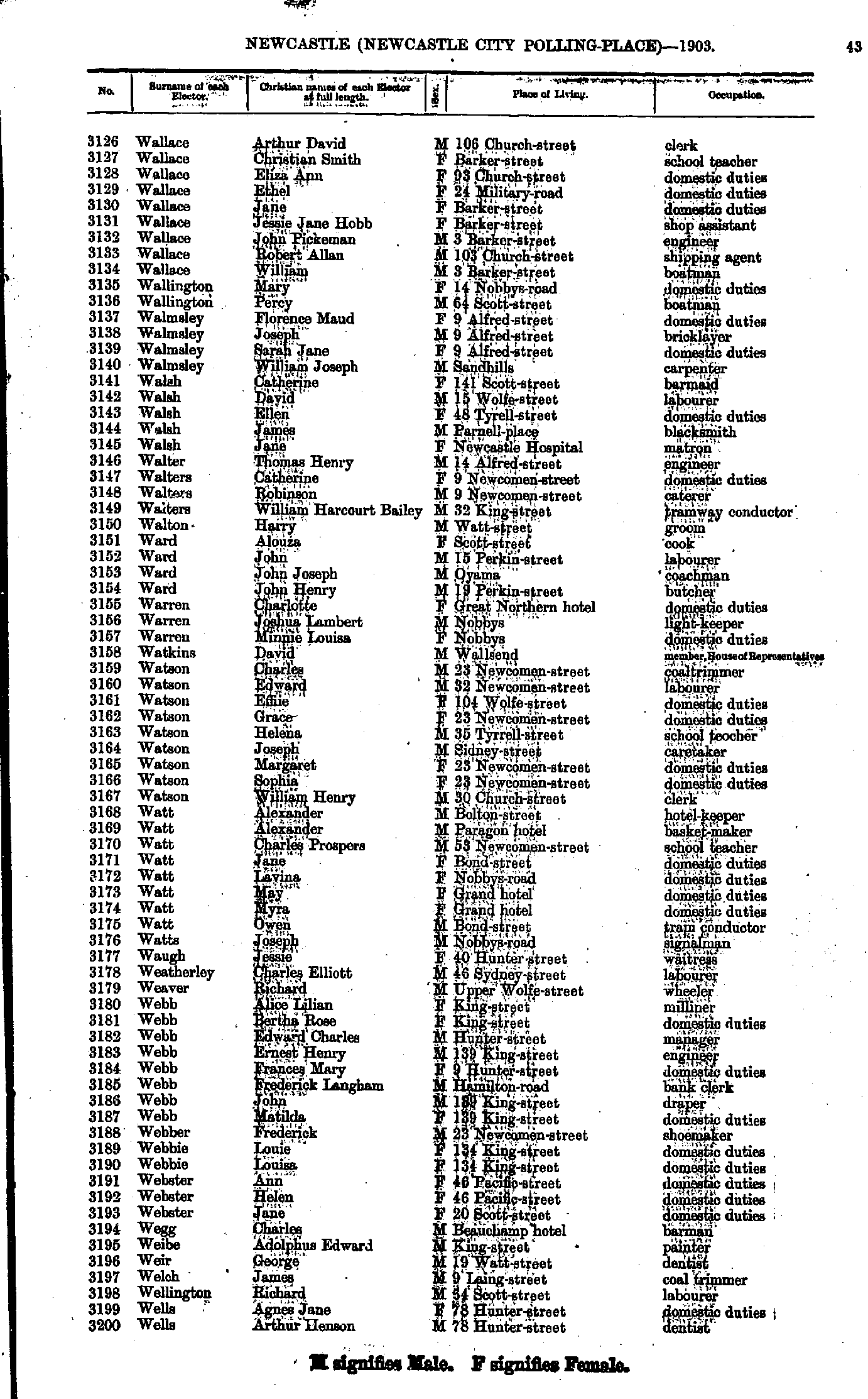
- Trelevan Richard - Wallace Arthur
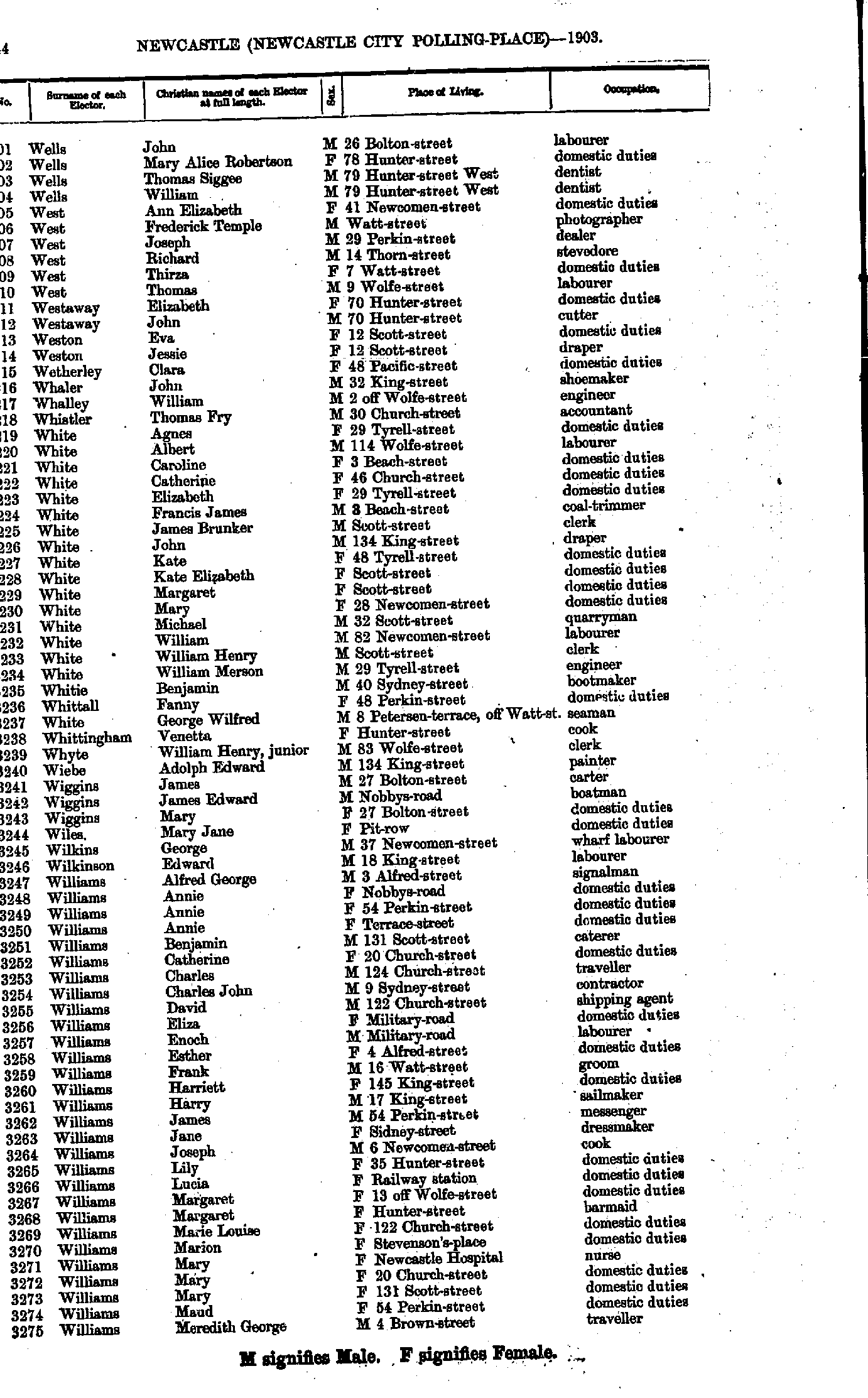
- Wallace Arthur - Wells Arthur
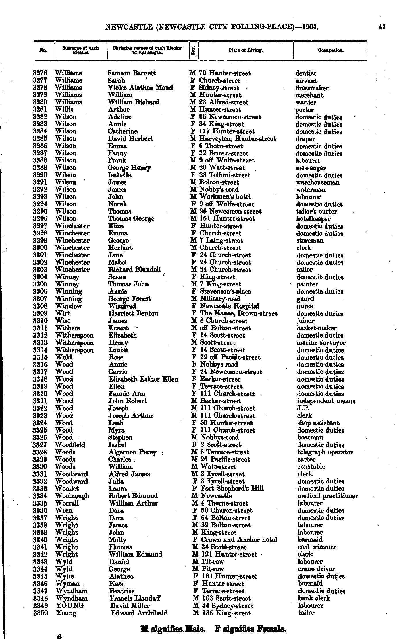
- Wells John - Williams Meredith
- Williams Samson - Young Edward
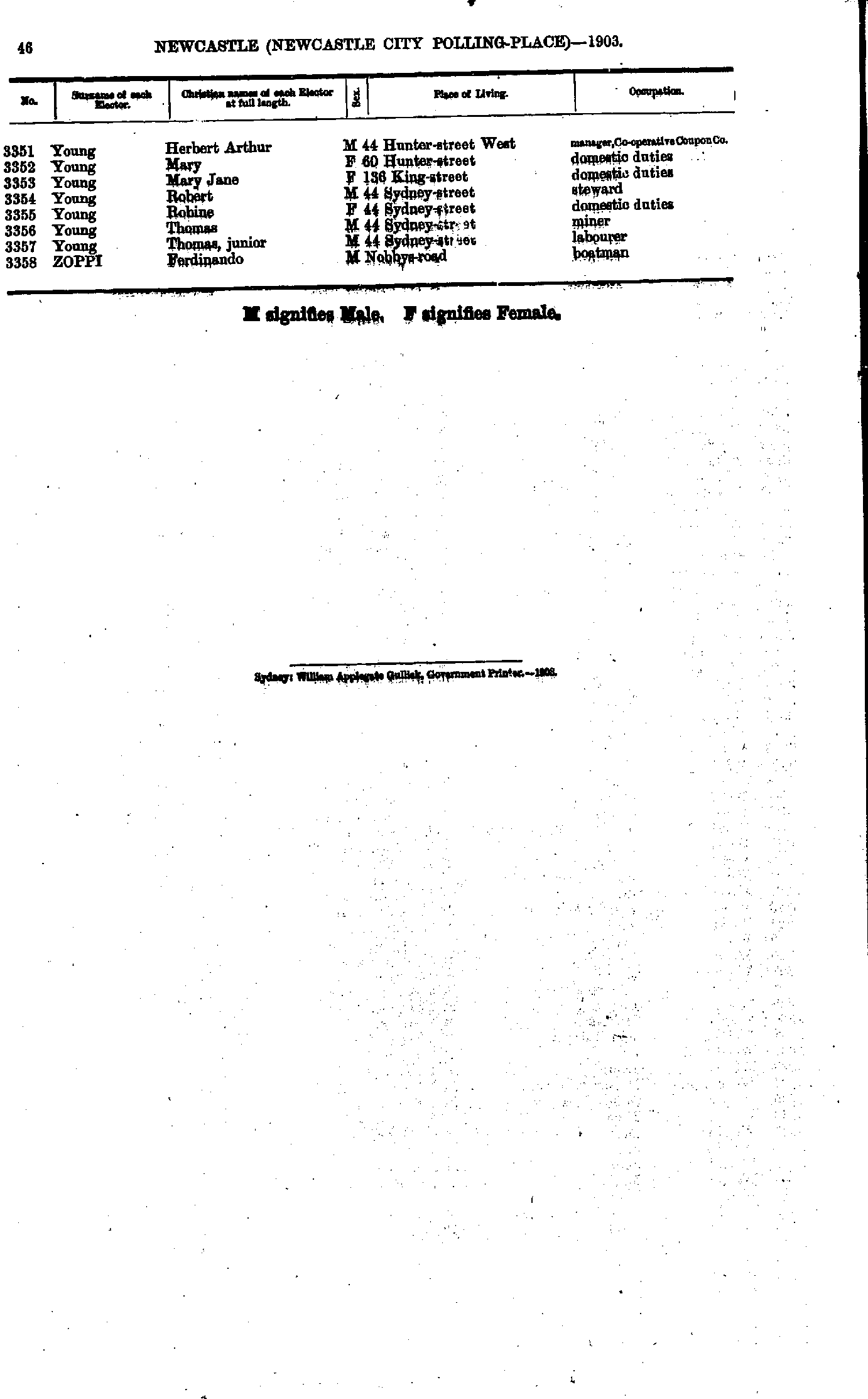
- Young Herbert - Zoppi Ferdinando
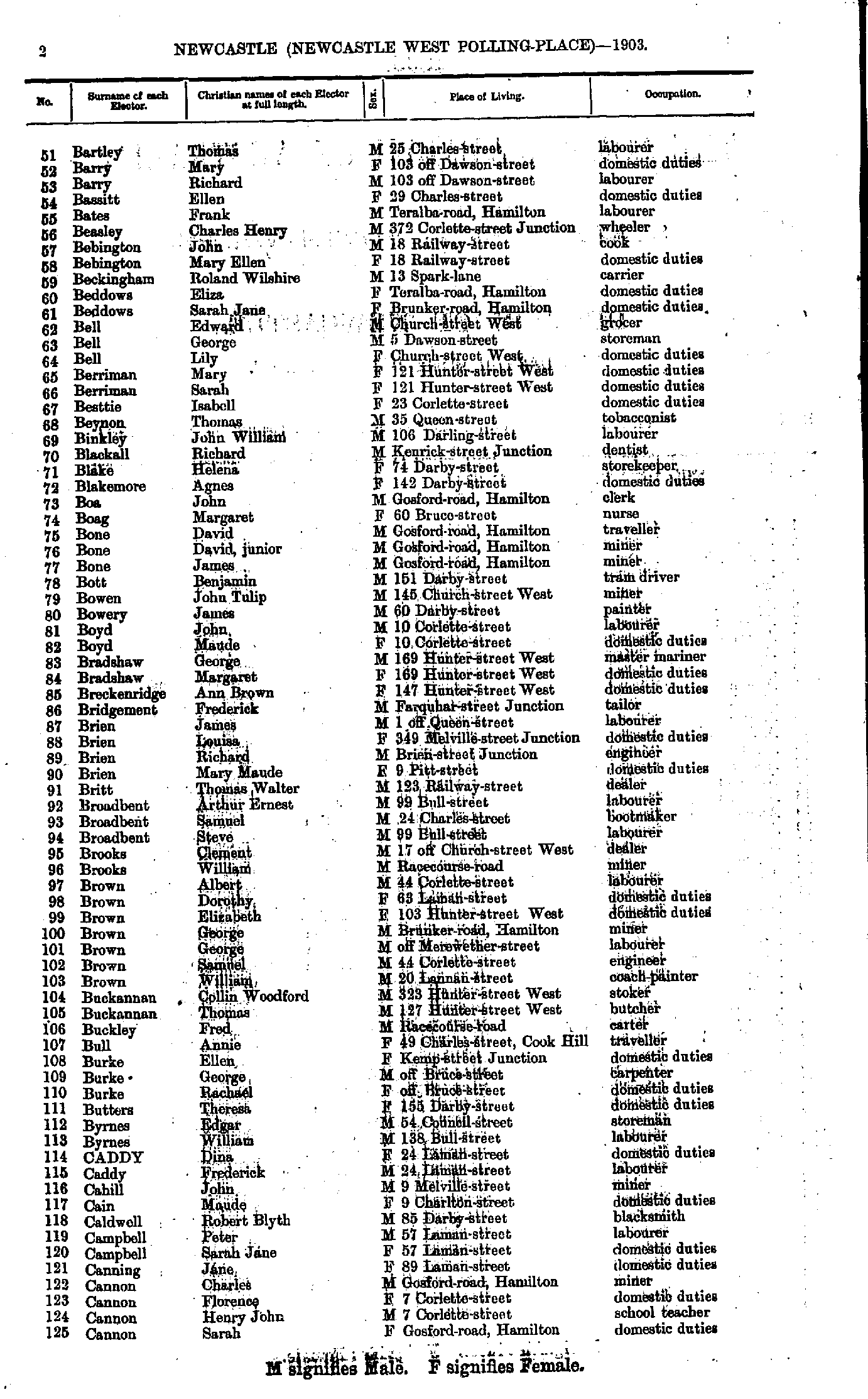
- Ackroyd Clara - Bartlett James
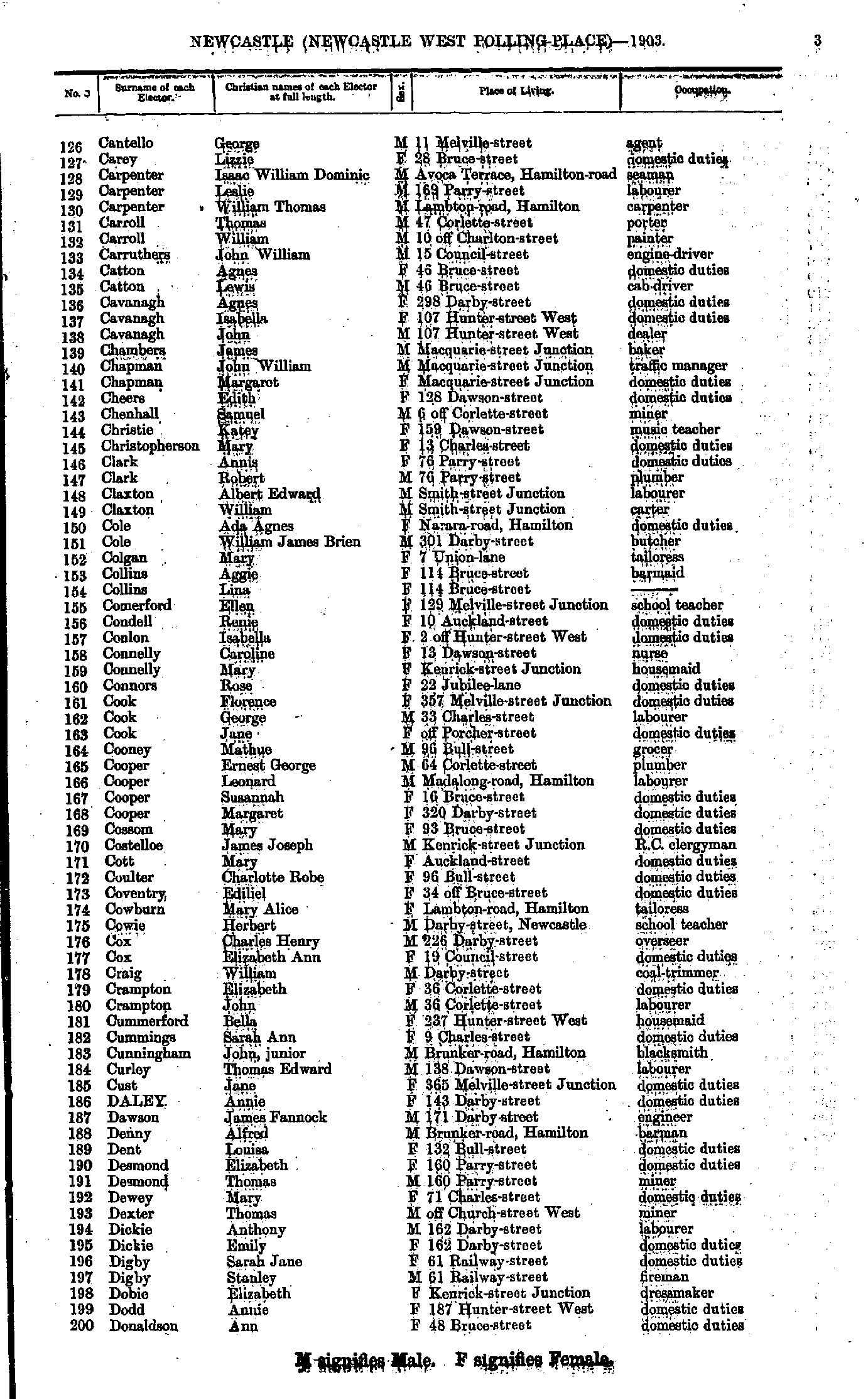
- Bartley Thomas - Cannon Sarah
- Cantello George - Donaldson Ann
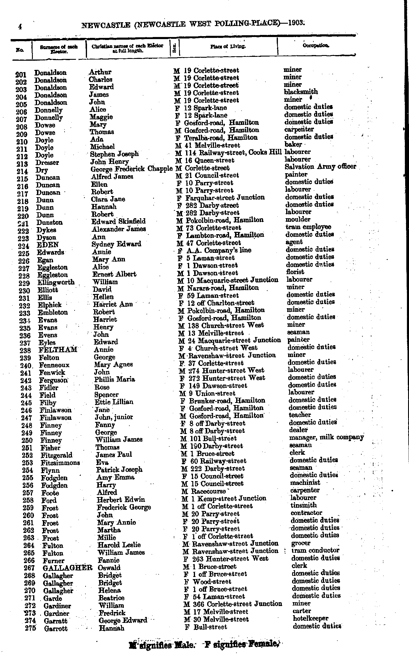
- Donaldson Arthur - Garrott Hannah
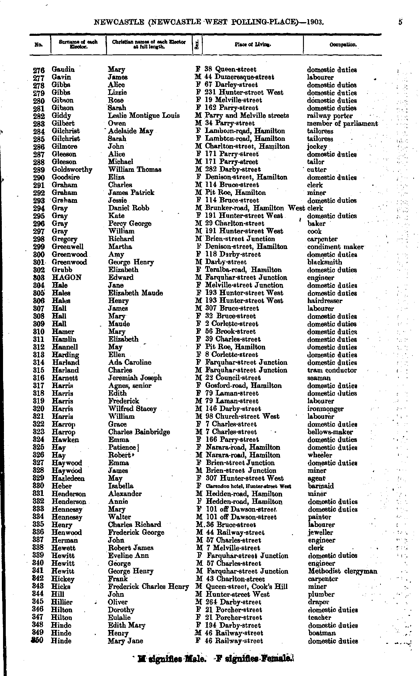
- Gaudin Mary - Hinde Mary
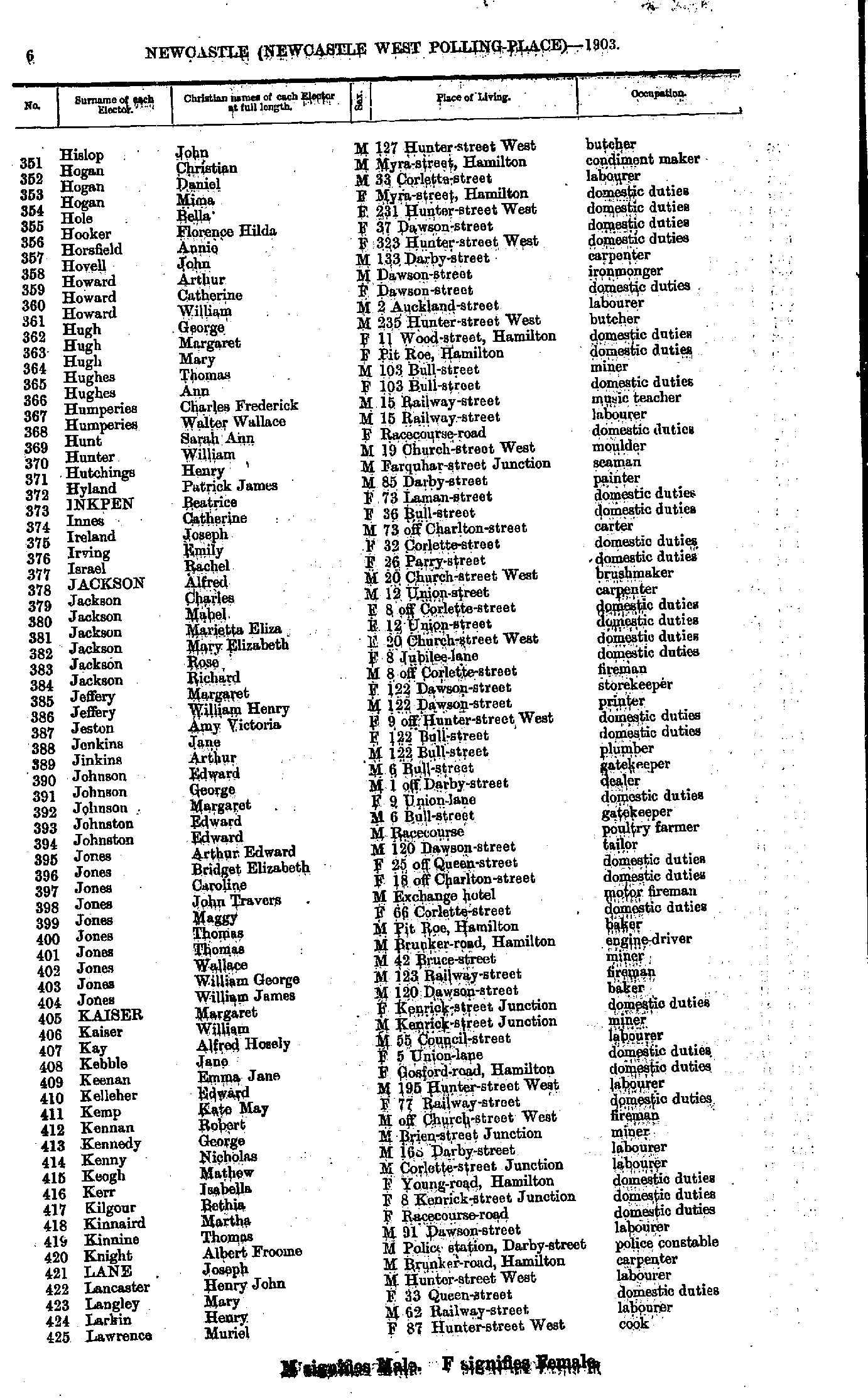
- Hislop John - Lawrence Muriel
- Lawrence William - Malarky Francis
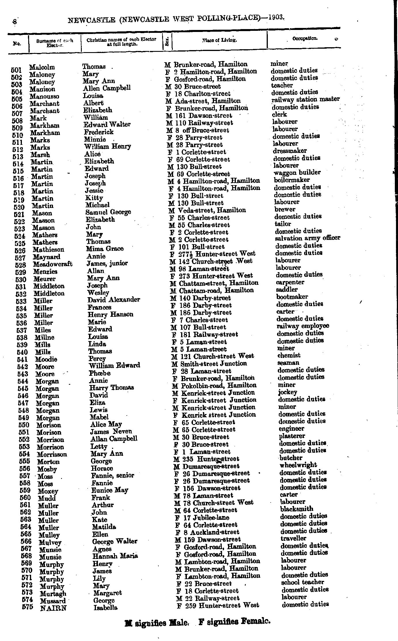
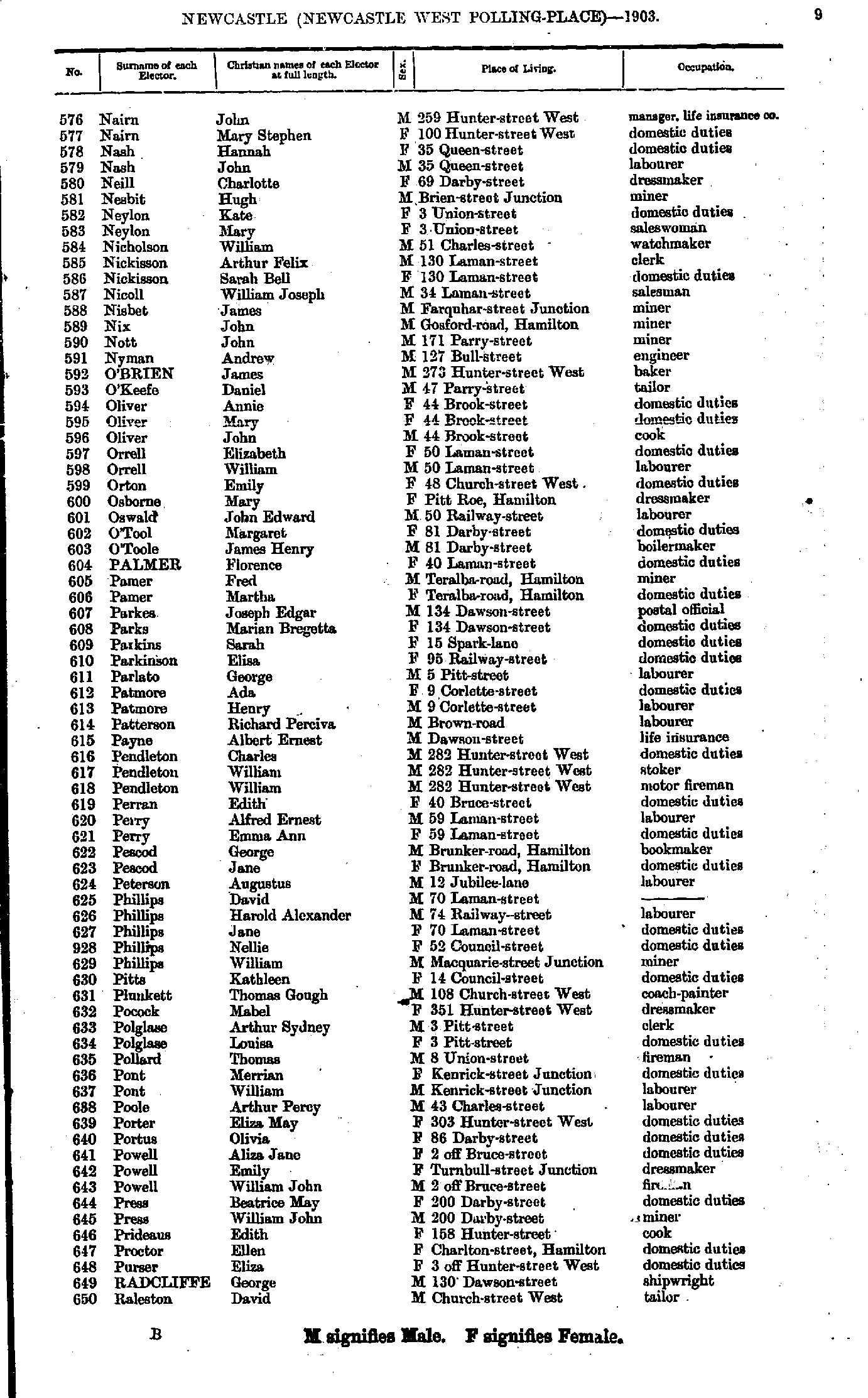
- Malcolm Thomas - Nairn Isabella
- Nairn John - Raleston David
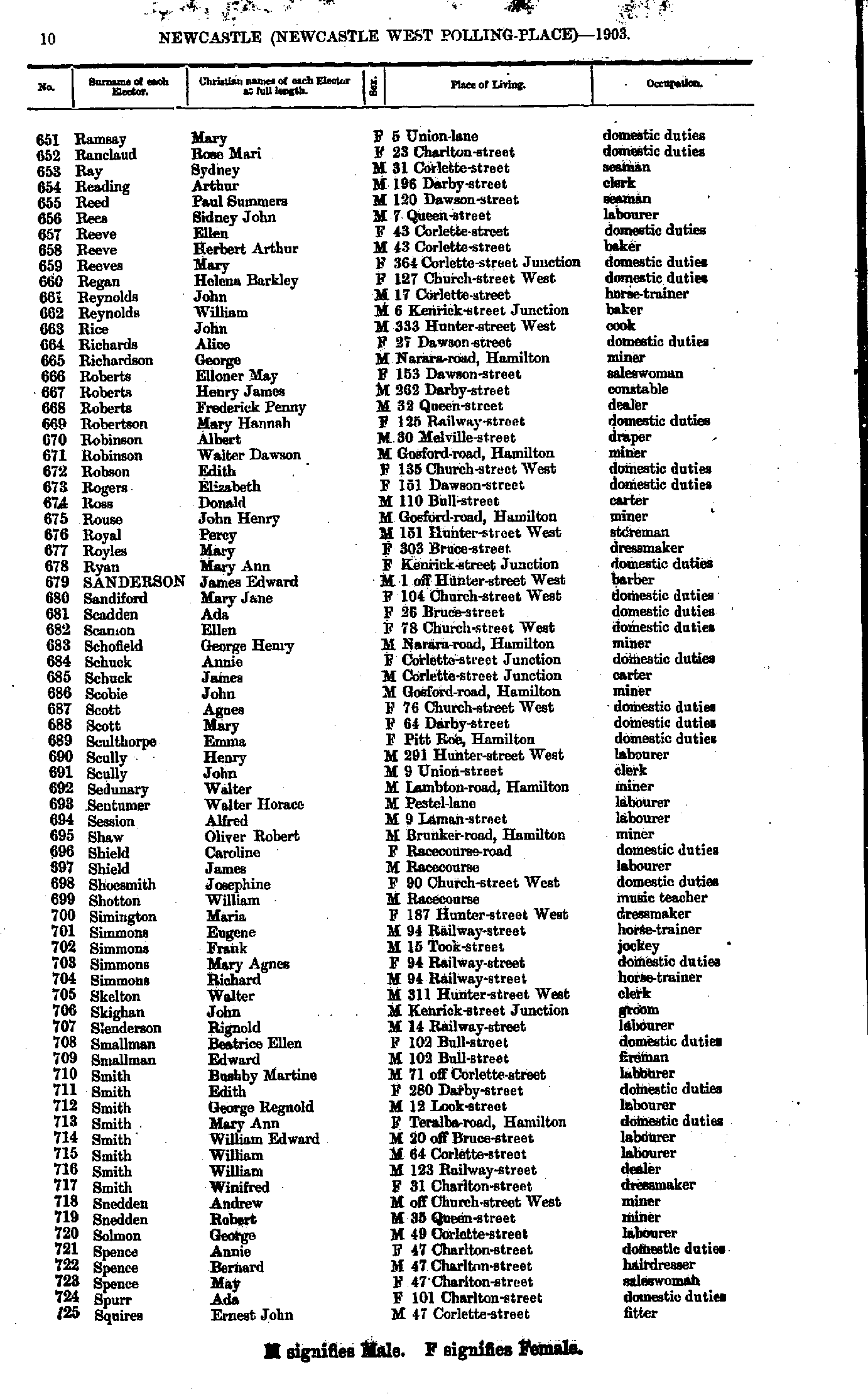
- Ramsay Mary - Squires Ernest
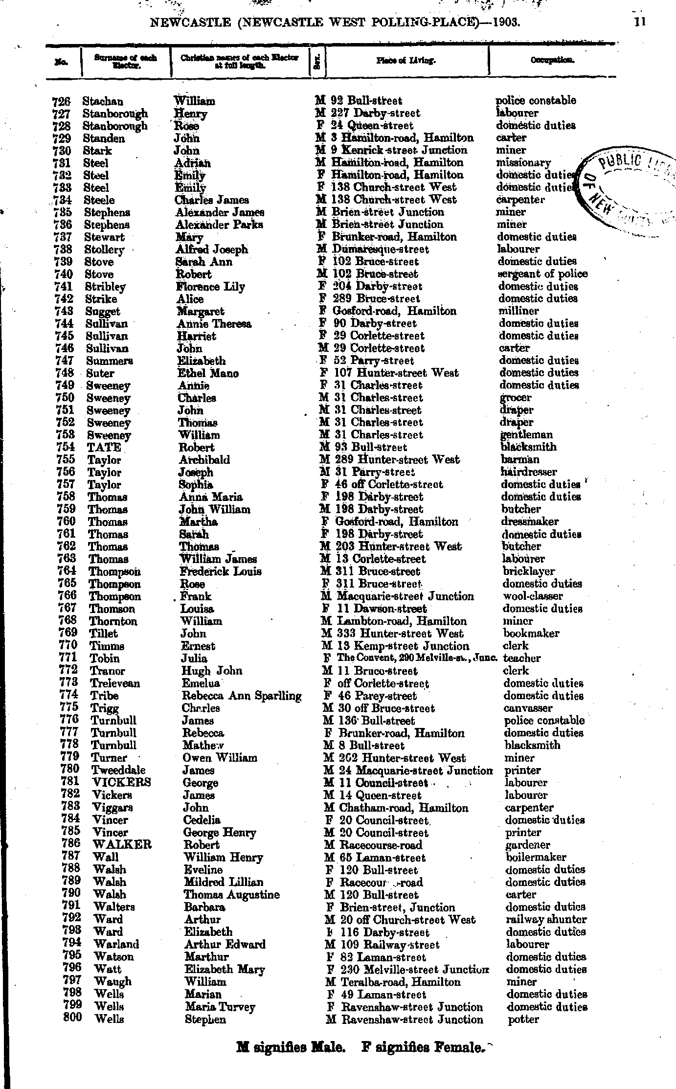
- Stachan William - Wells Stephen
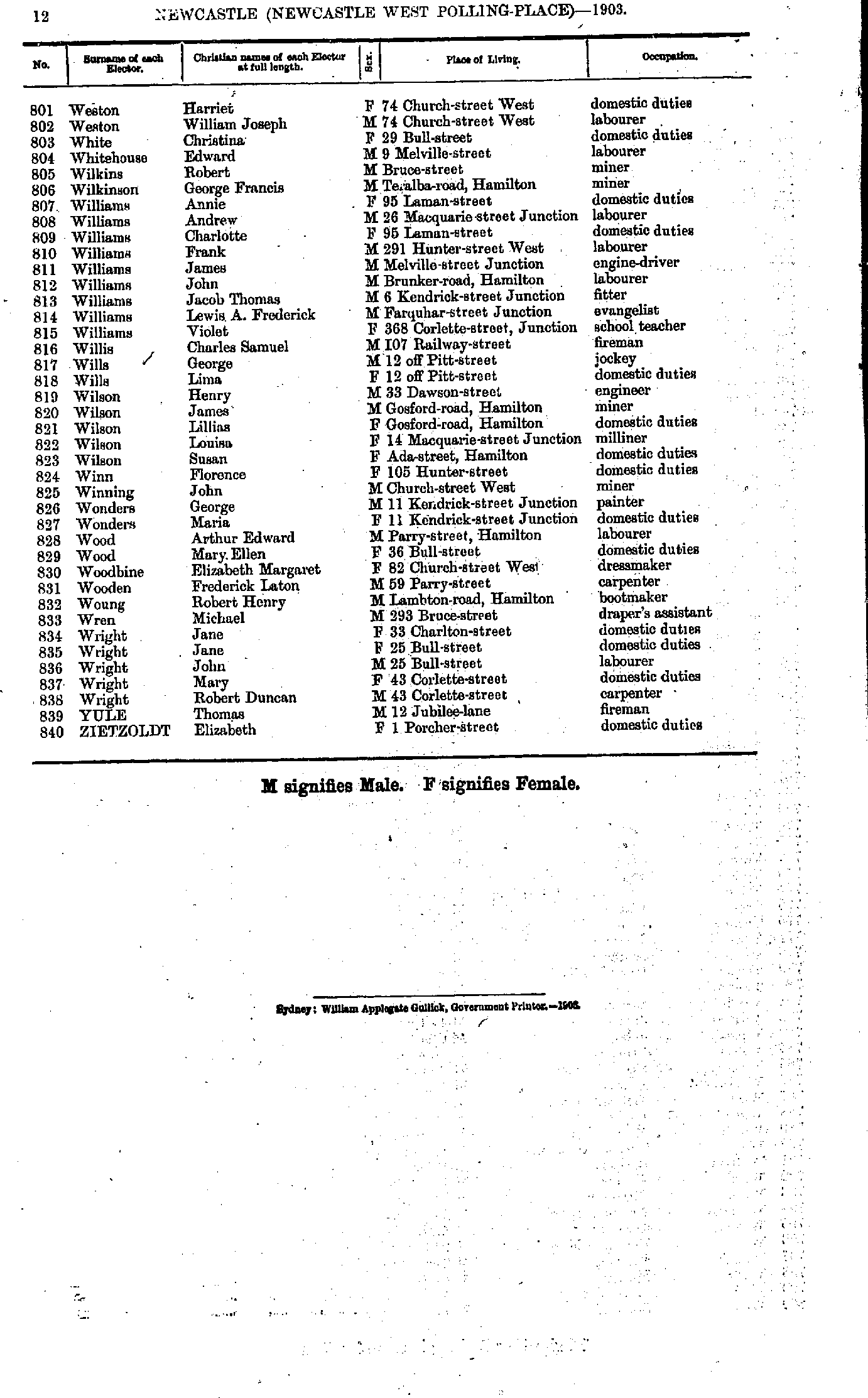
- Weston Harriet - Zietzoldt Elizabeth
- Abraham Richard - Blanch Annie
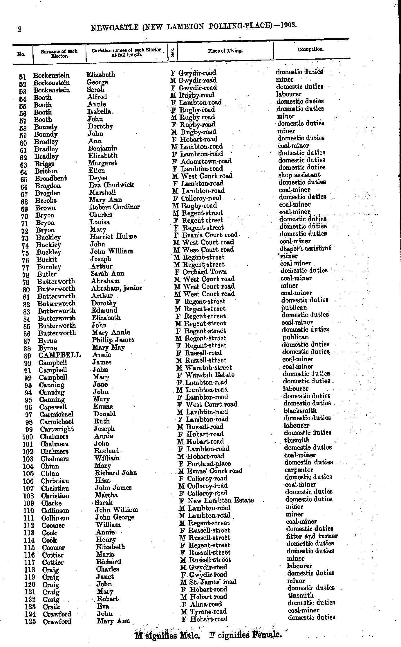
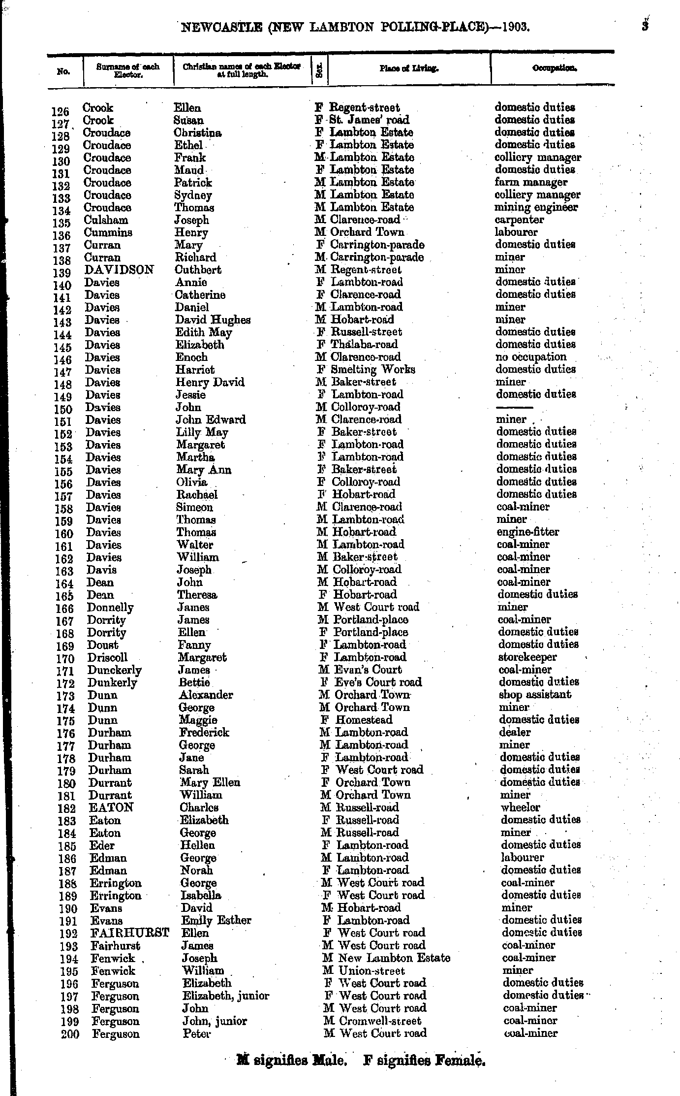
- Bockenstein Elizabeth - Crawford Mary
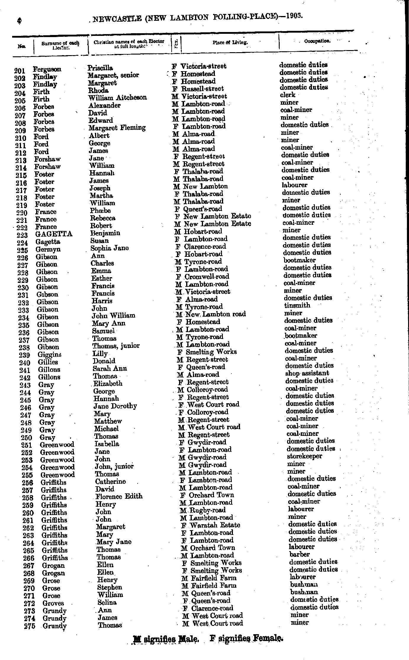
- Crook Ellen - Ferguson Peter
- Ferguson Priscilla - Grundy Thomas
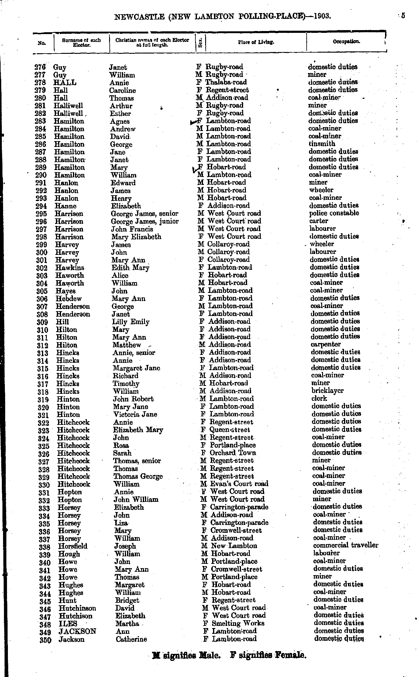
- Guy Janet - Jackson Catherine
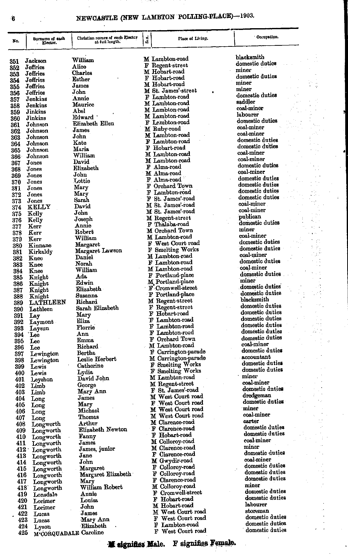
- Jackson William - M'Corquadale Caroline
- M'Cullough Ellen - Nelson Harriet
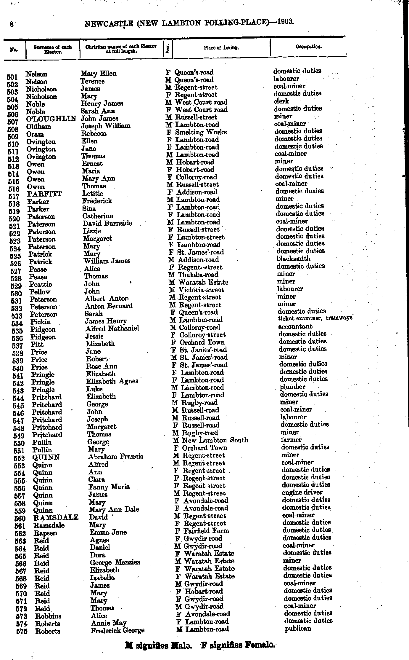
- Nelson Mary - Roberts Frederick
- Roberts Mary - Thomas James
- Thomas John - Wright William
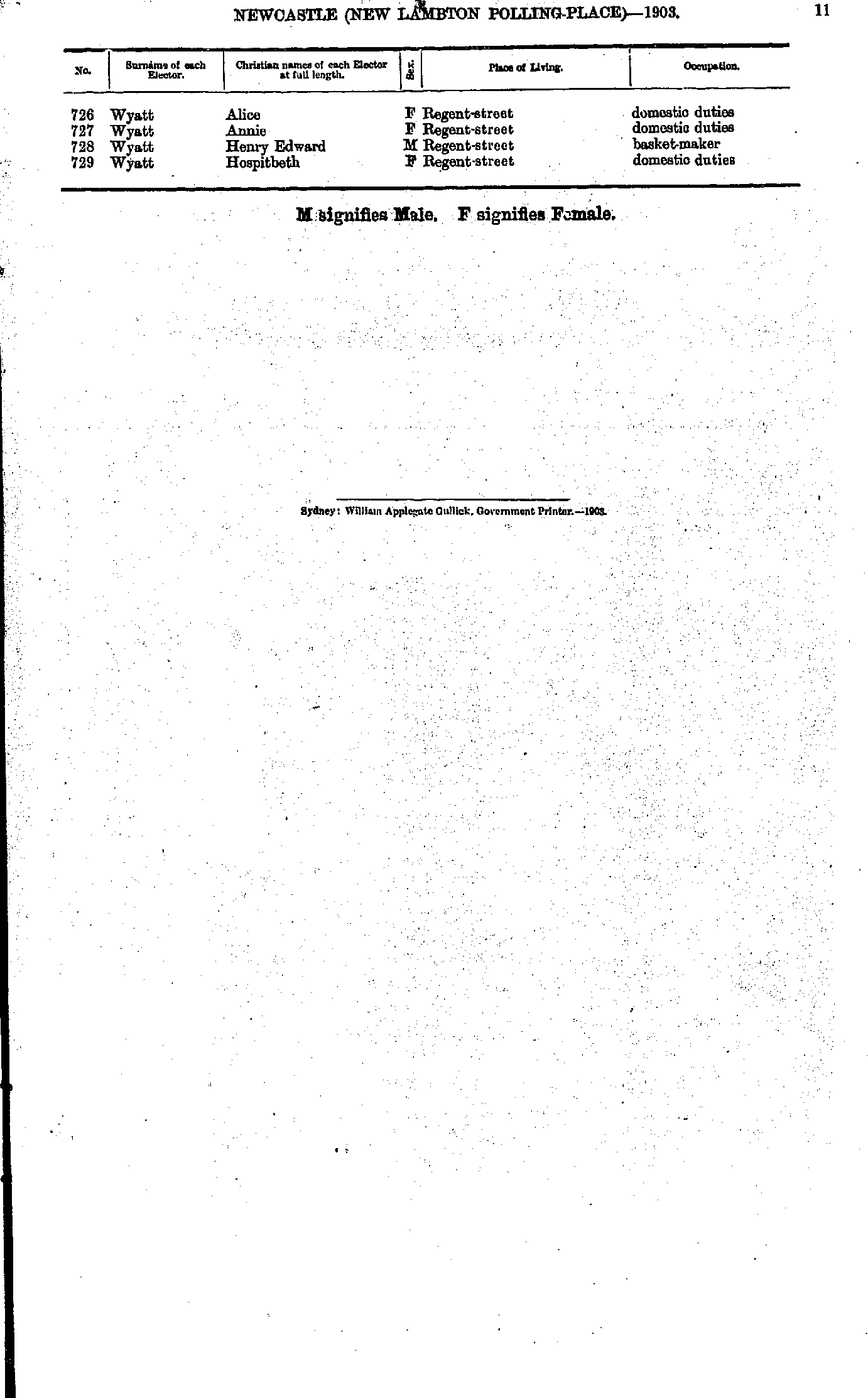
- Wyatt Alice - Wyatt Hospitbeth
- Abel Agnes - Austin Elizabeth
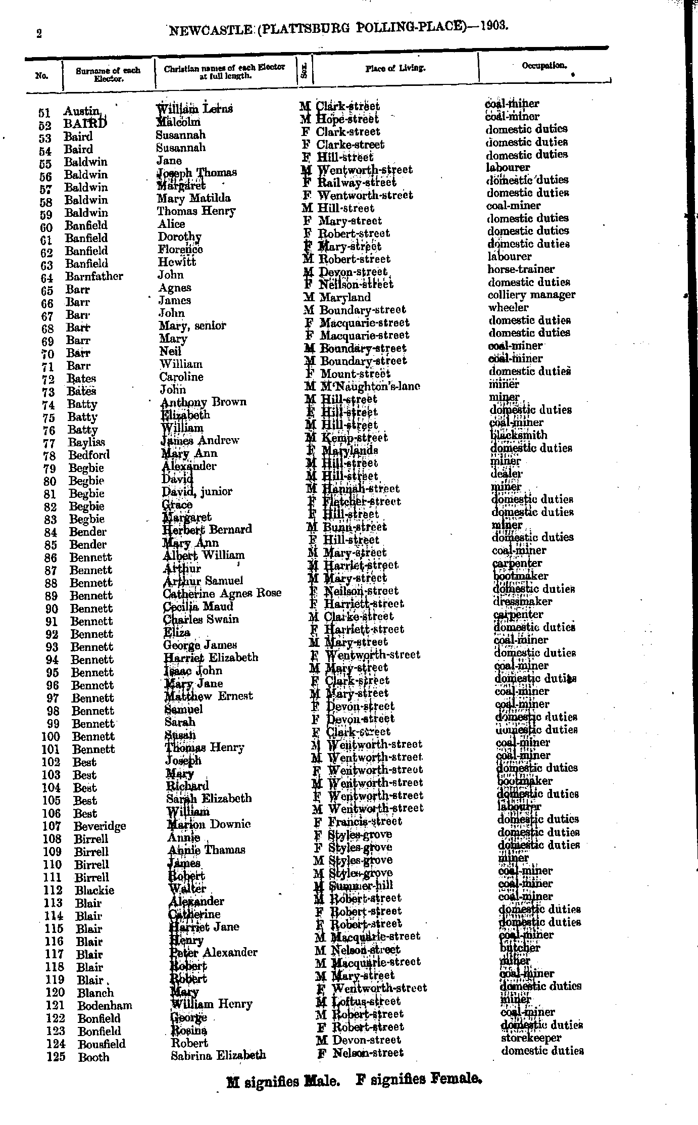
- Austin William - Booth Sabrina
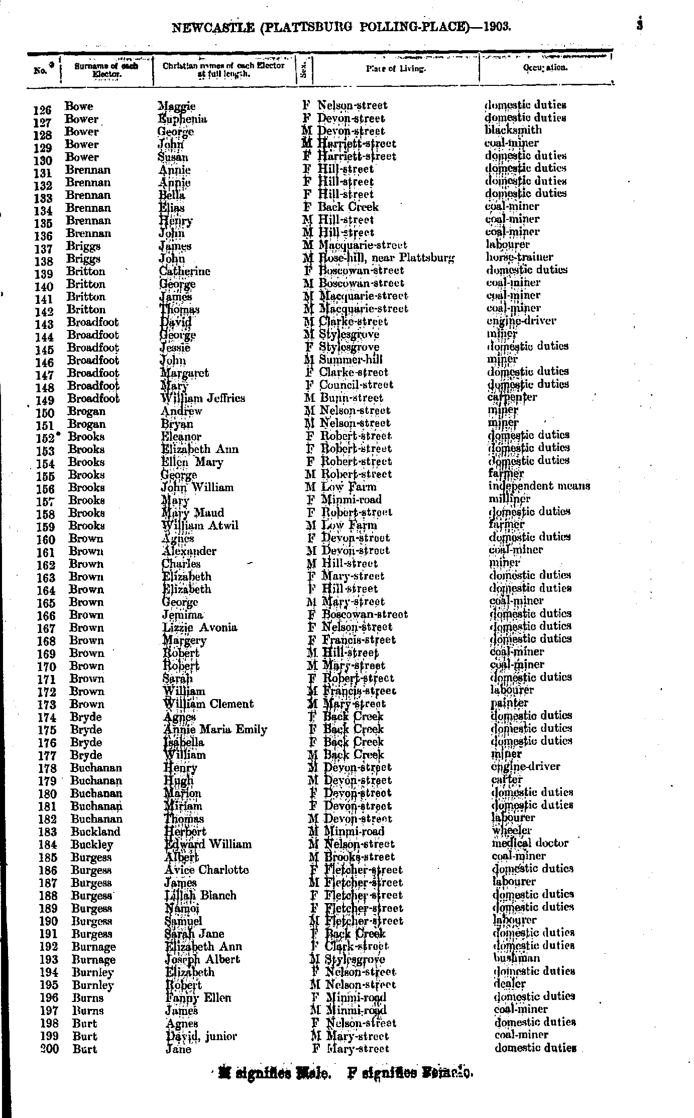
- Bowe Maggie - Burt Jane
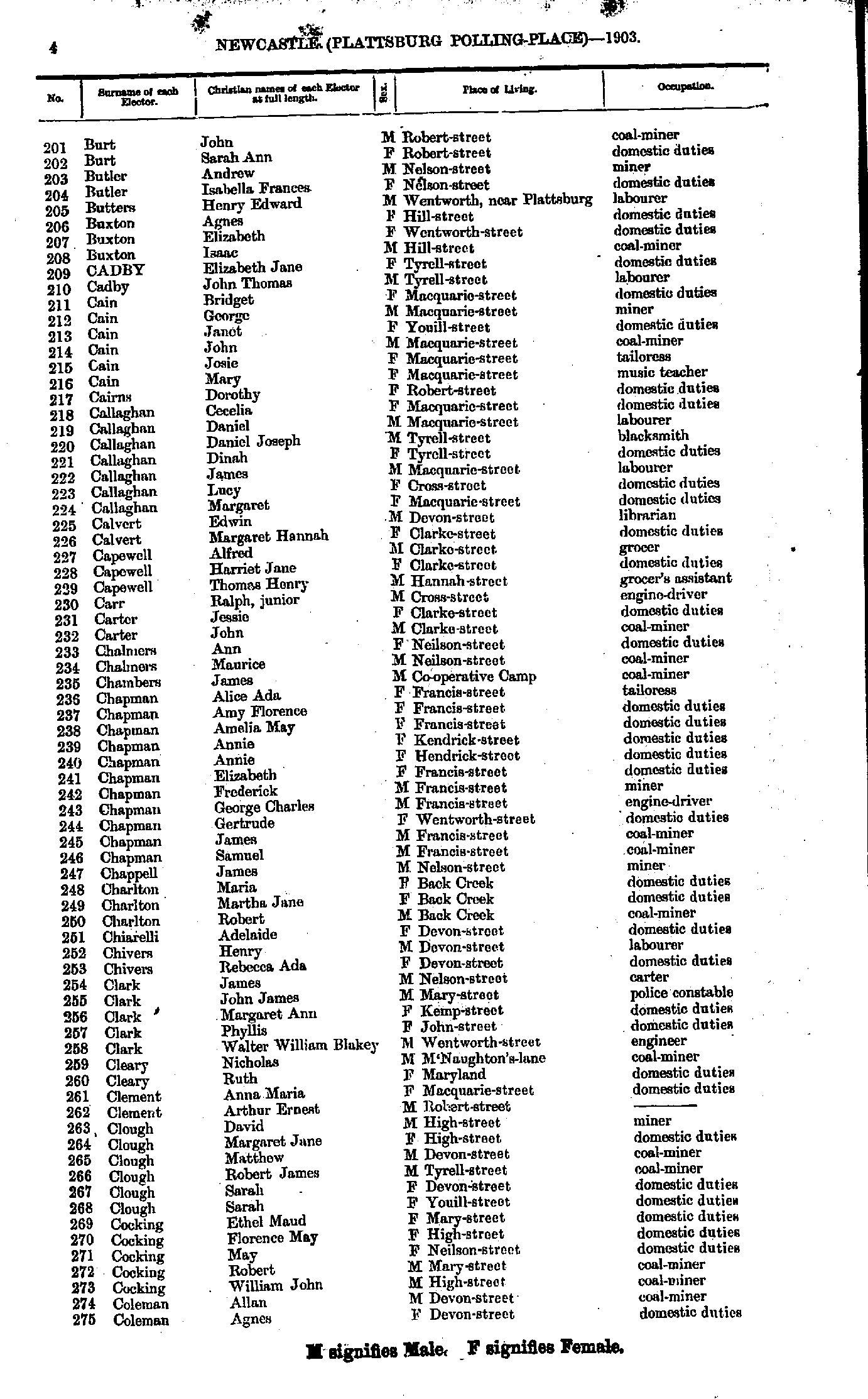
- Burt John - Coleman Agnes
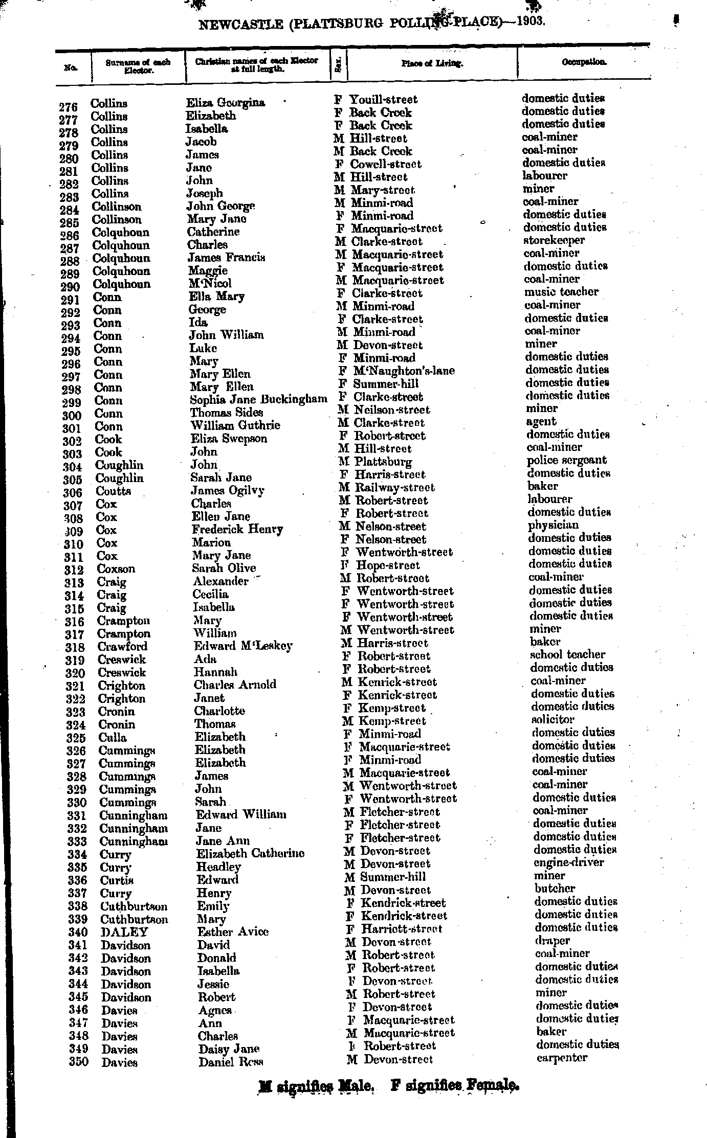
- Collins Eliza - Davies Daniel
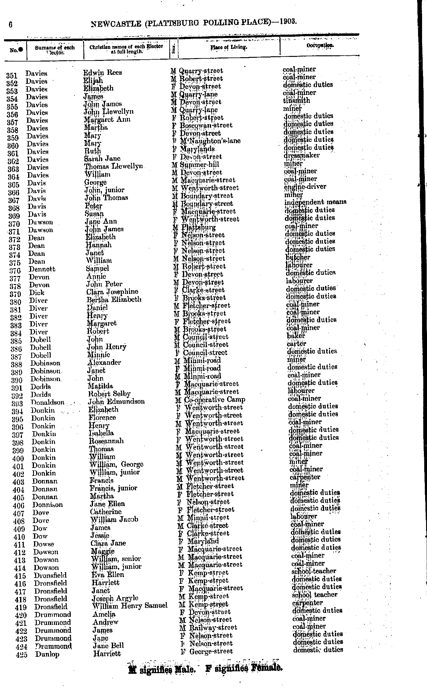
- Davies Edwin - Dunlop Harriet
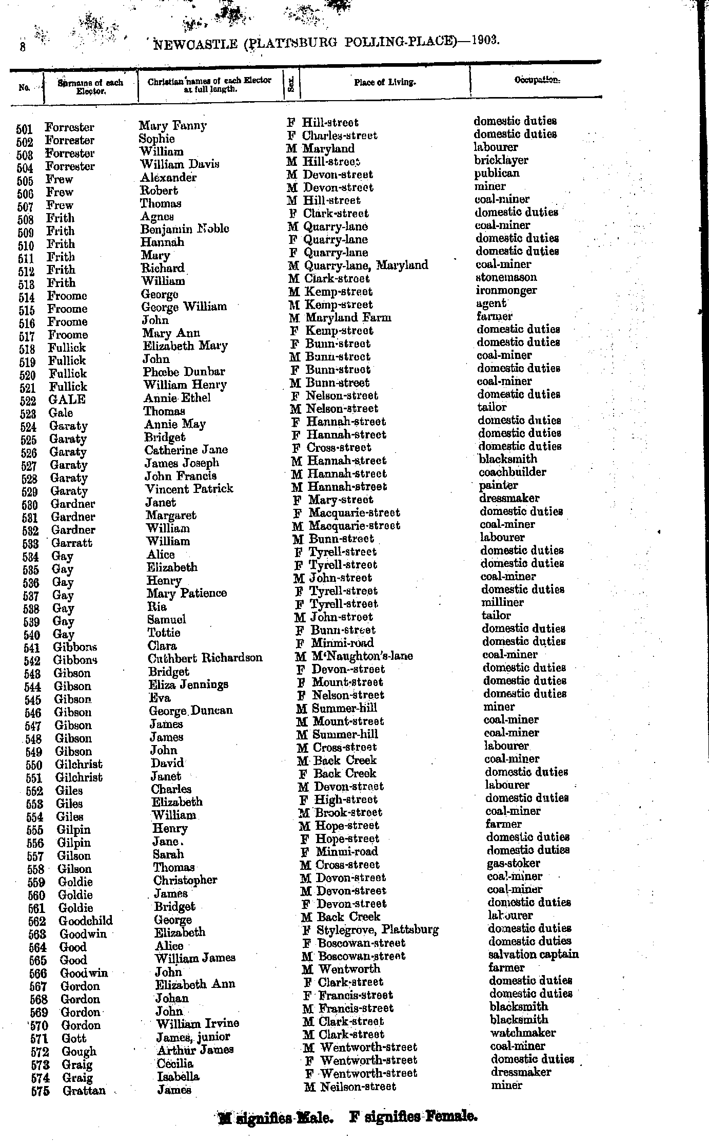
- Dunlop Thomas - Forrester Mary
- Forrester Mary - Grattan James
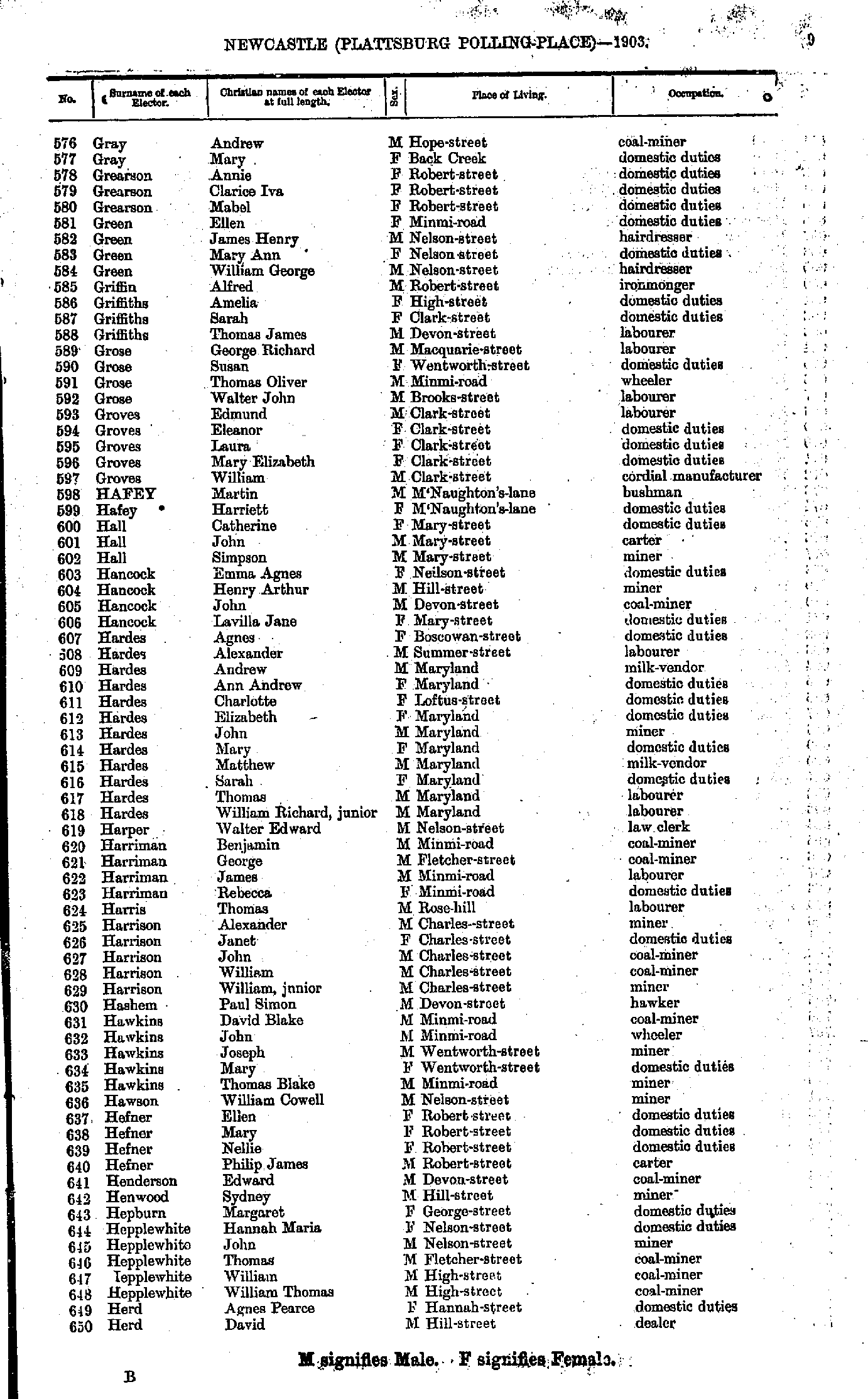
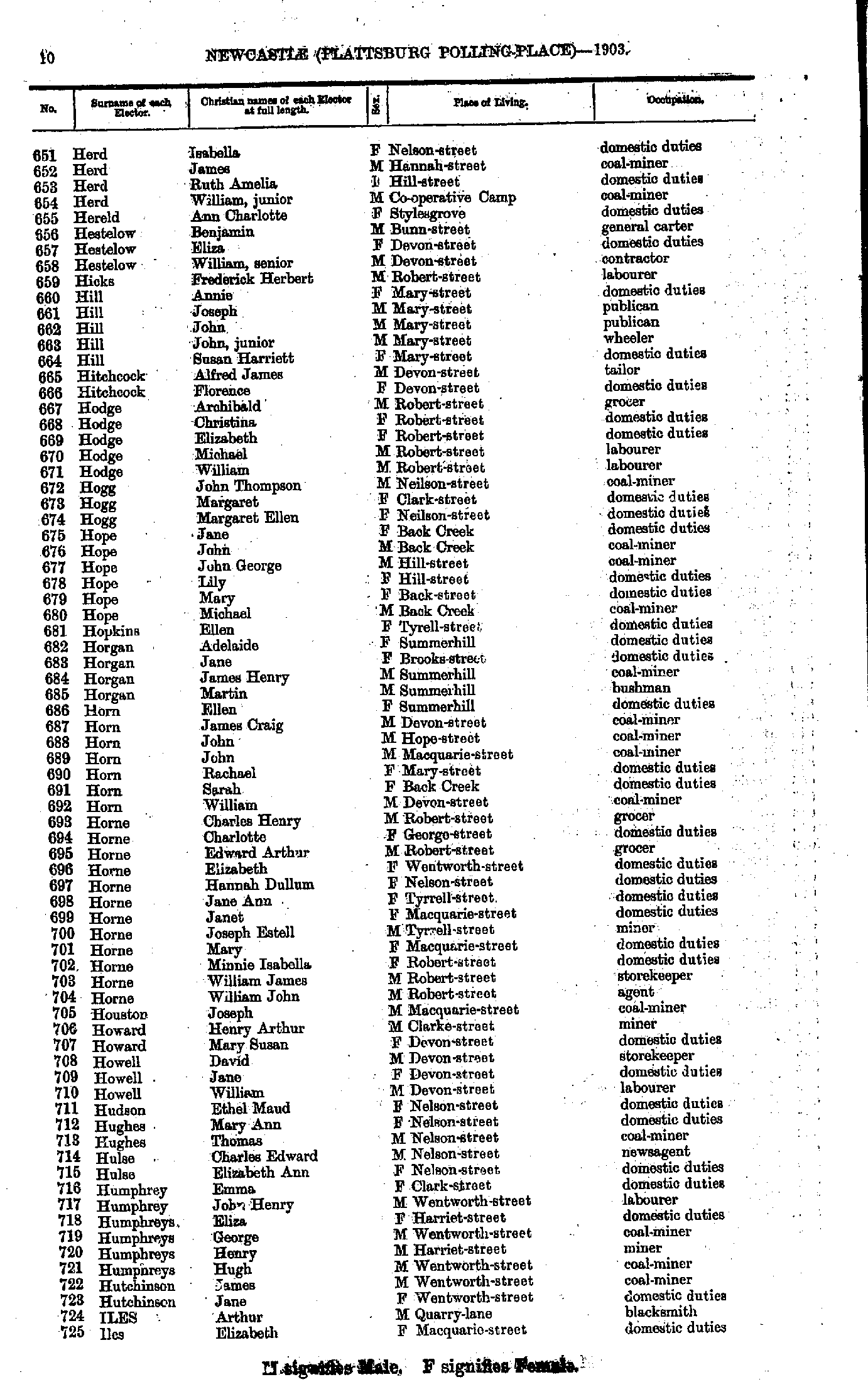
- Gray Andrew - Herd David
- Herd Isabella - Iles Elizabeth
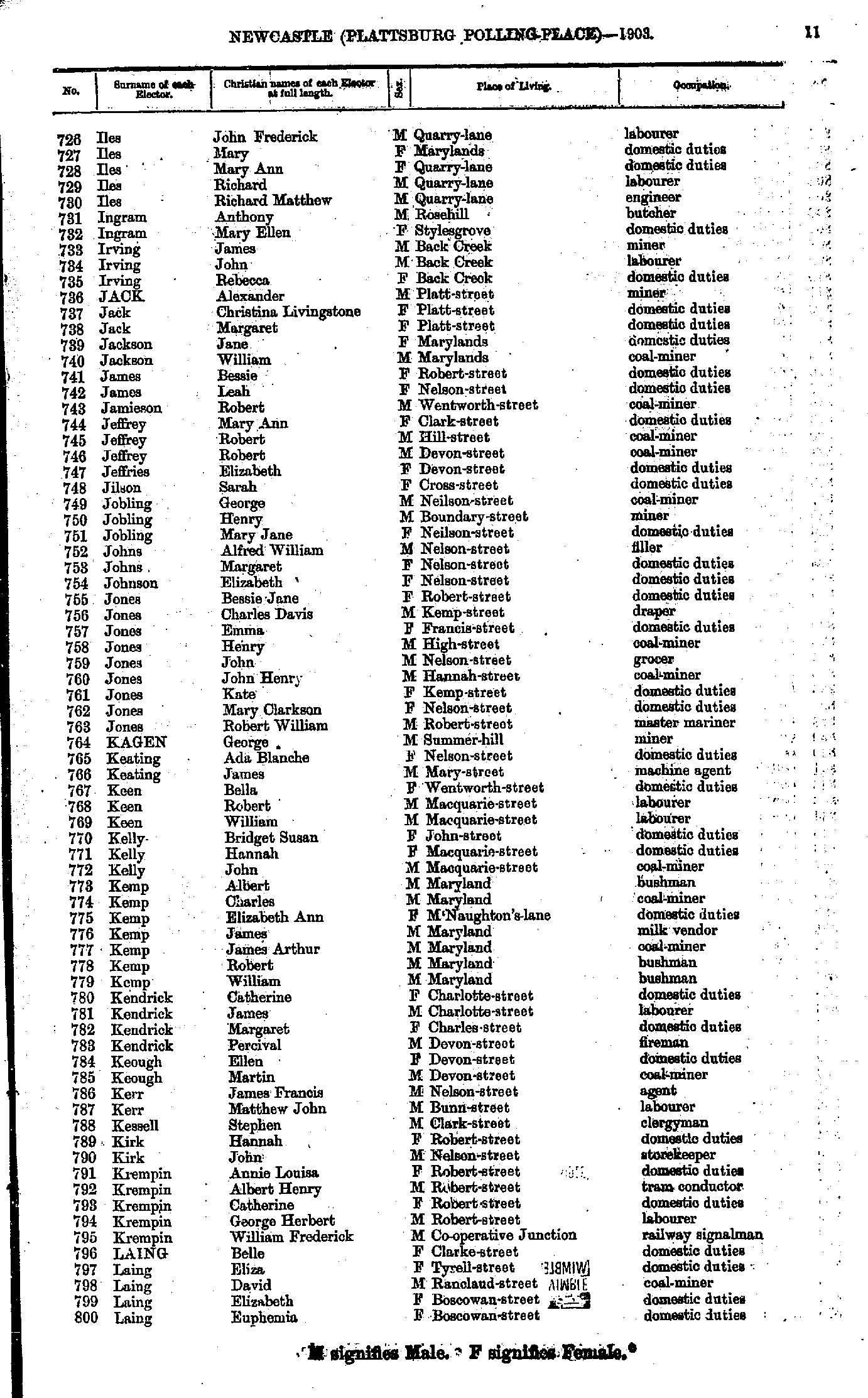
- Iles John - Laing Euphemia
- Laing Henry - Logan Catherine
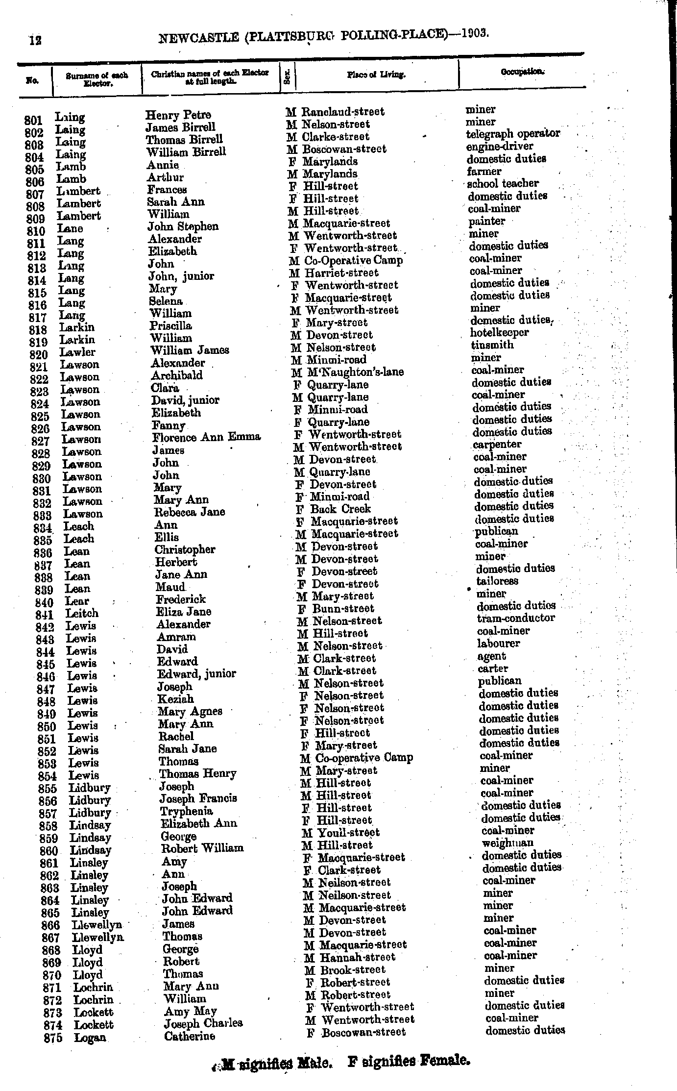
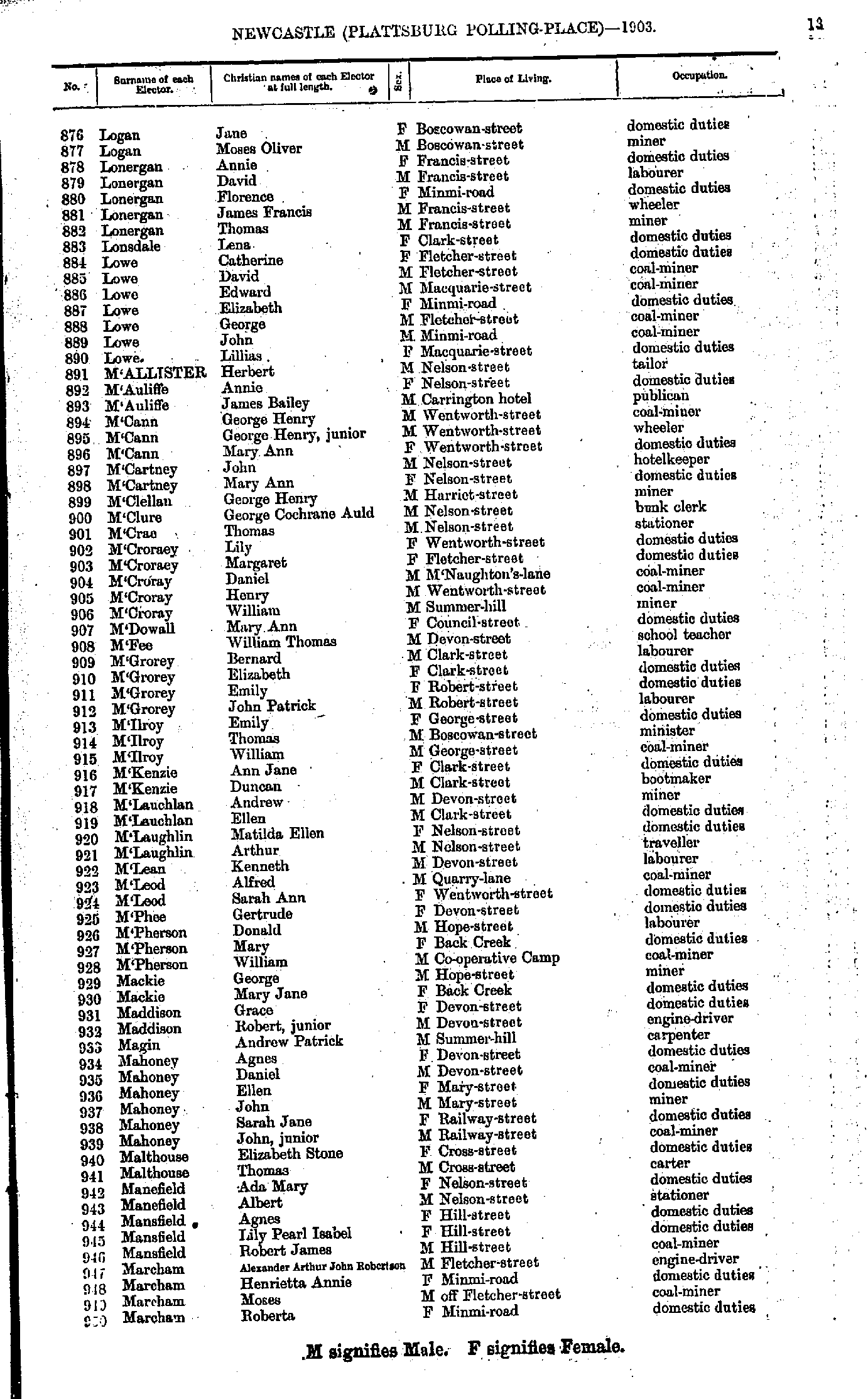
- Logan Jane - Marcham Roberta
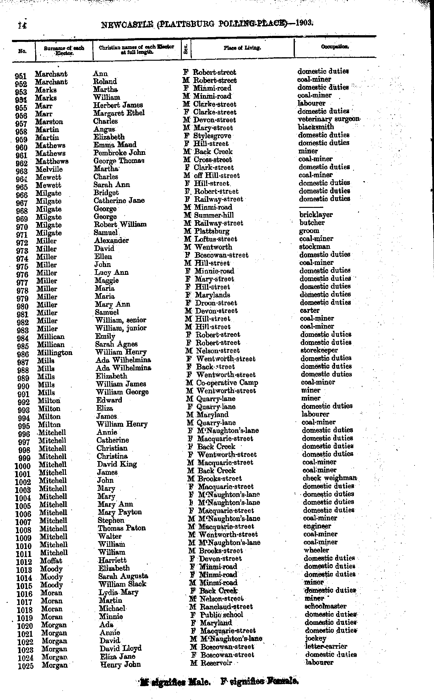
- Marchant Ann - Morgan Henry
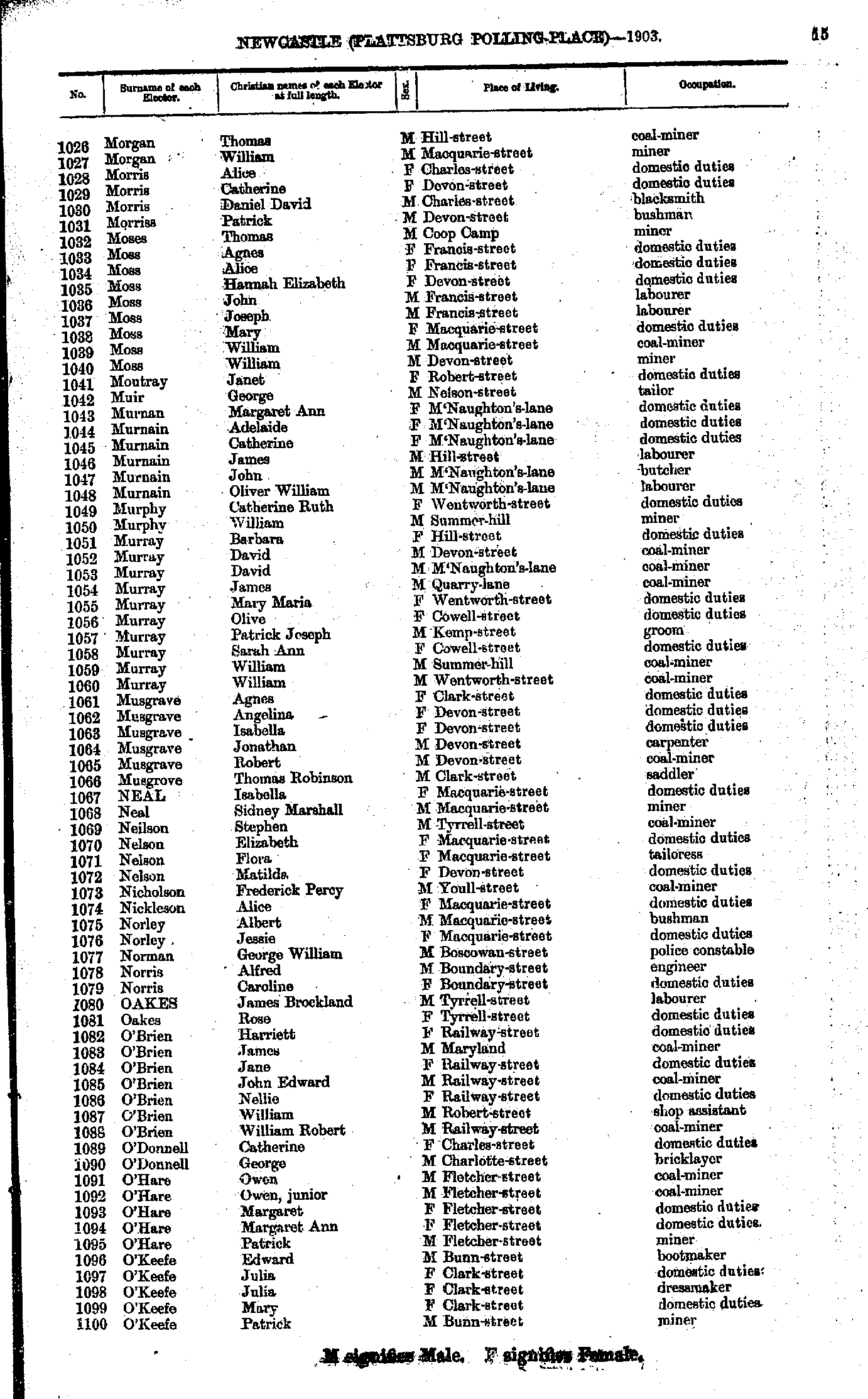
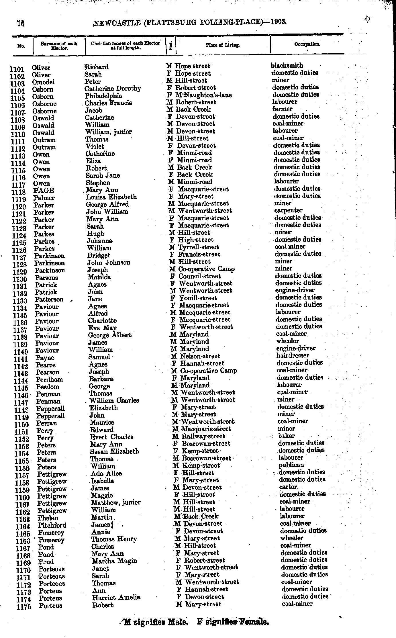
- Morgan Thomas - O'Keefe Patrick
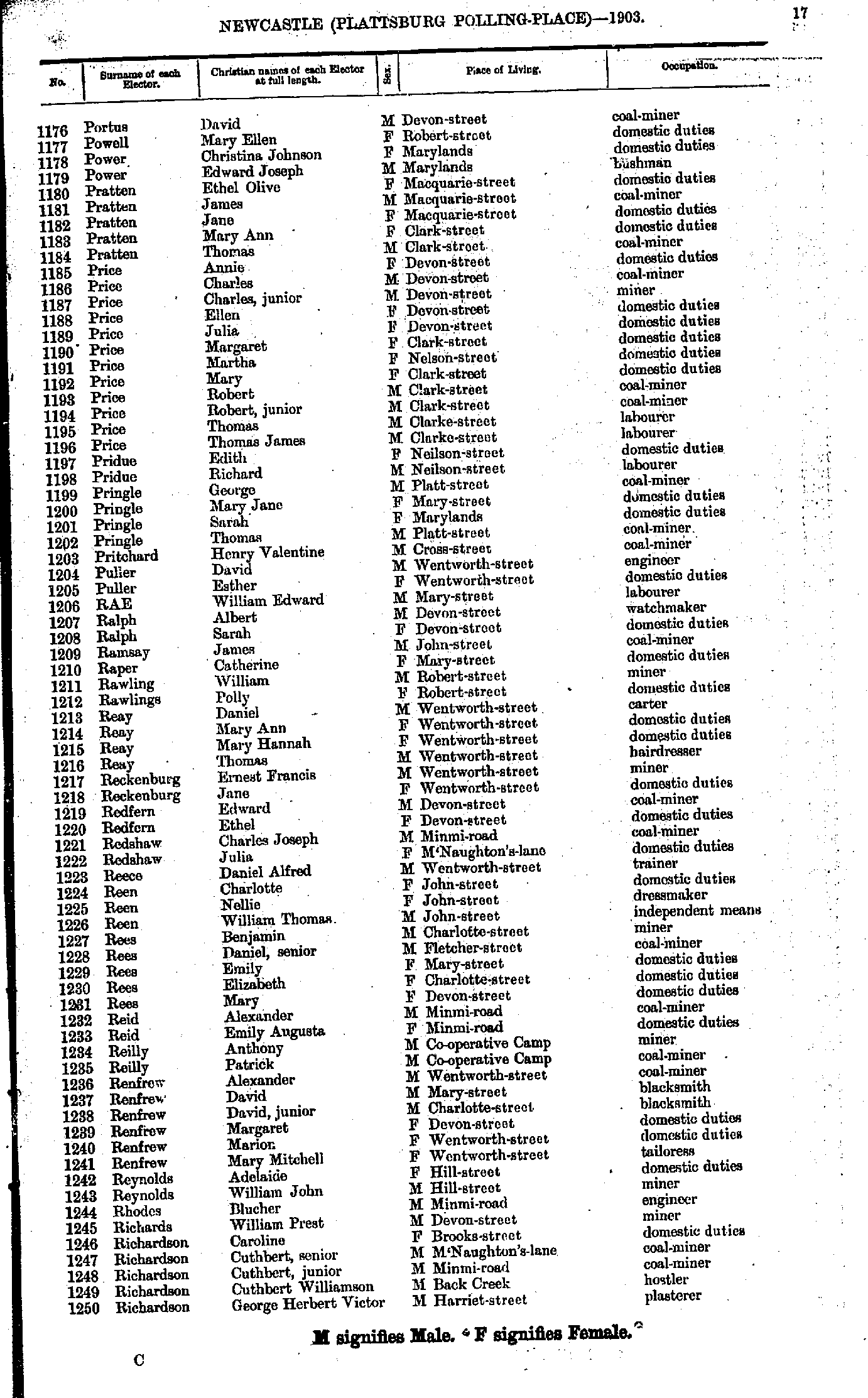
- Oliver Richard - Porteus Robert
- Portus David - Richardson George
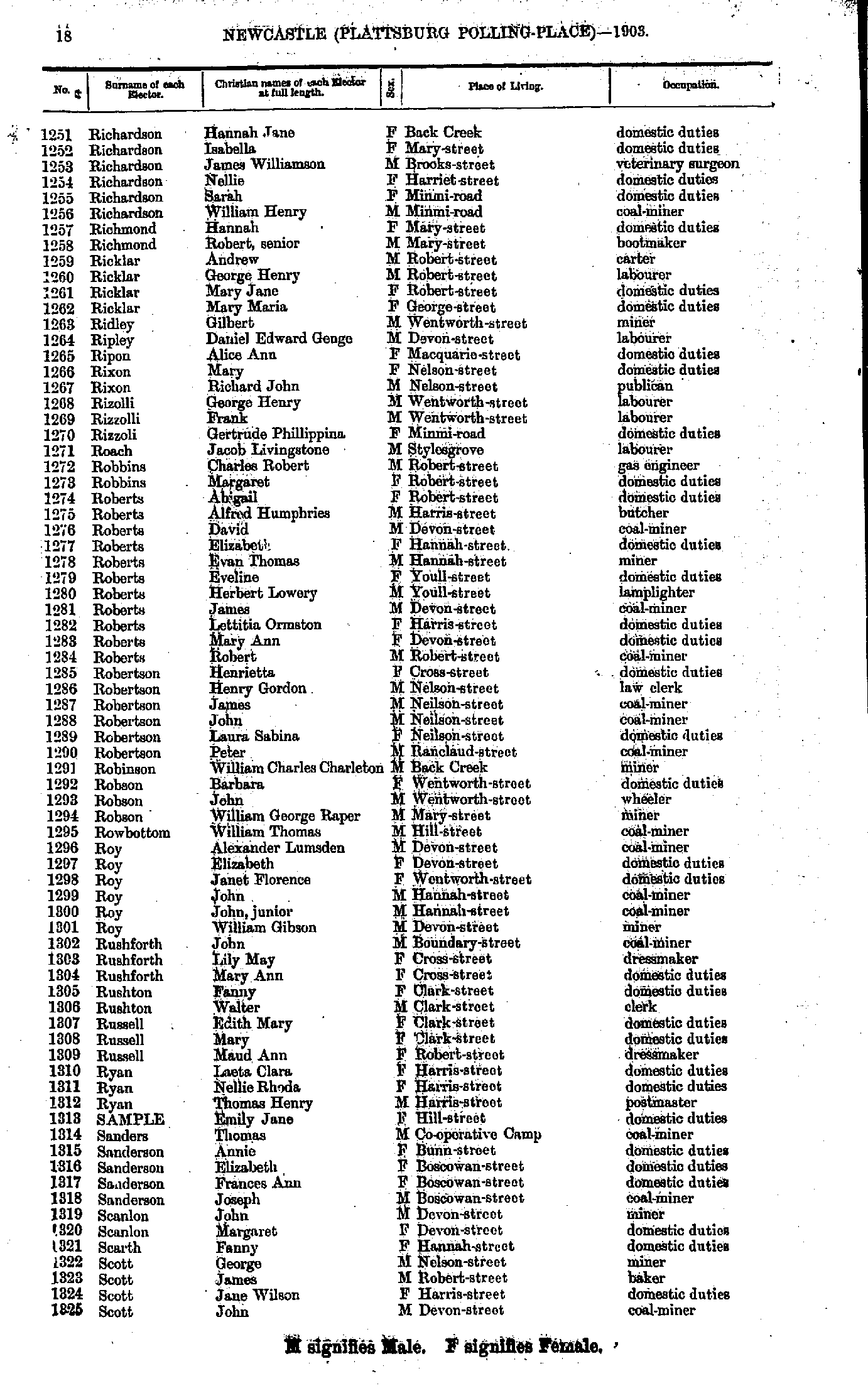
- Richardson Hannah - Scott John
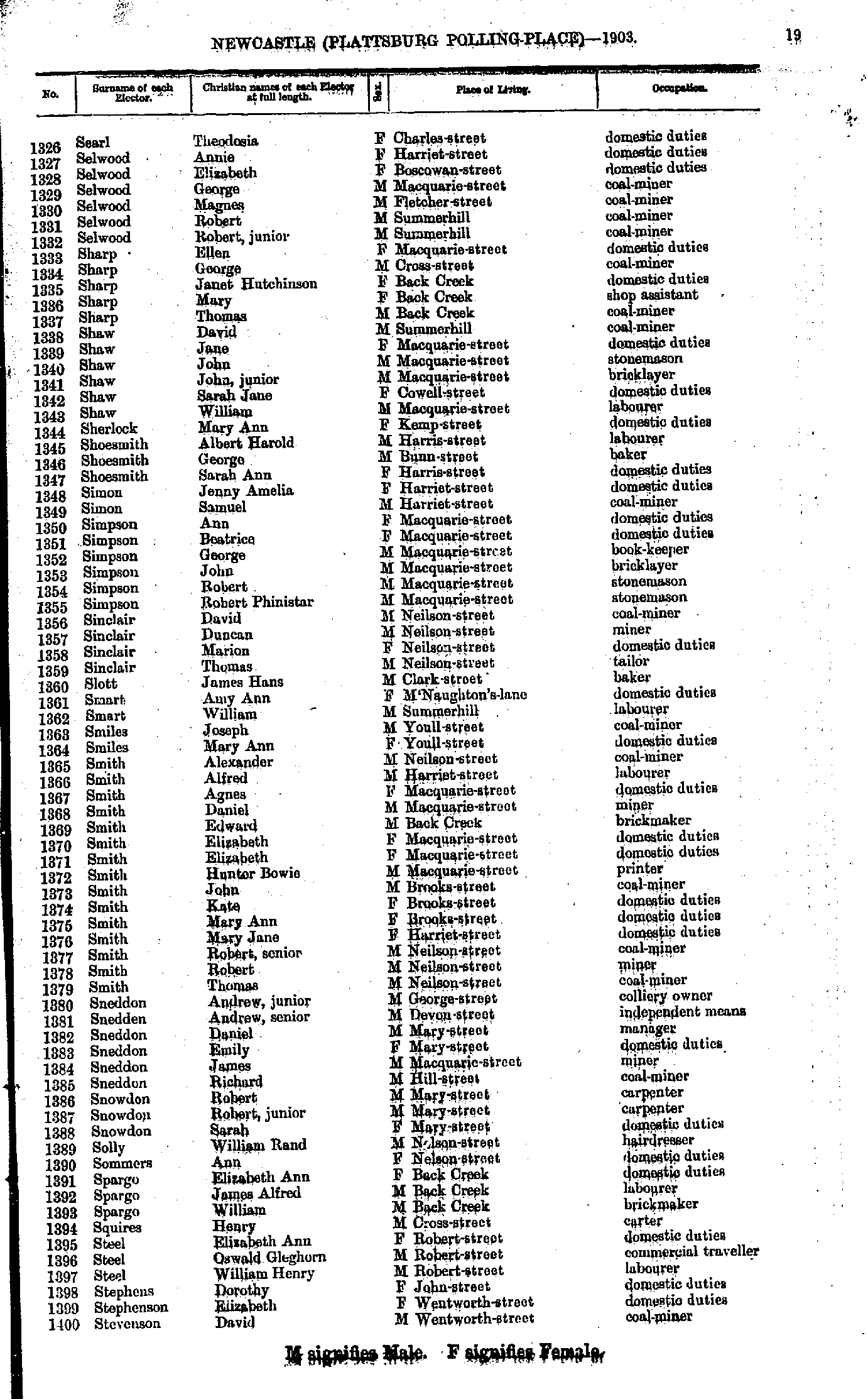
- Searl Theodosia - Stevenson David
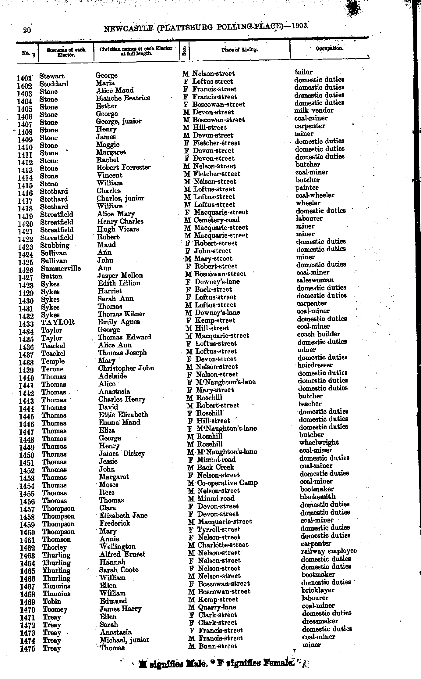
- Stewart George - Treay Thomas
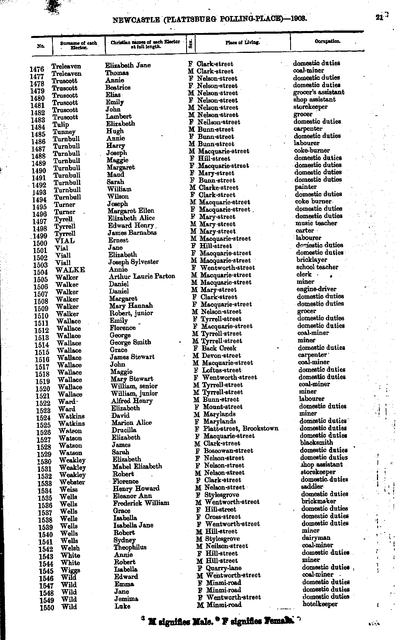
- Treleaven Elizabeth - Wild Luke
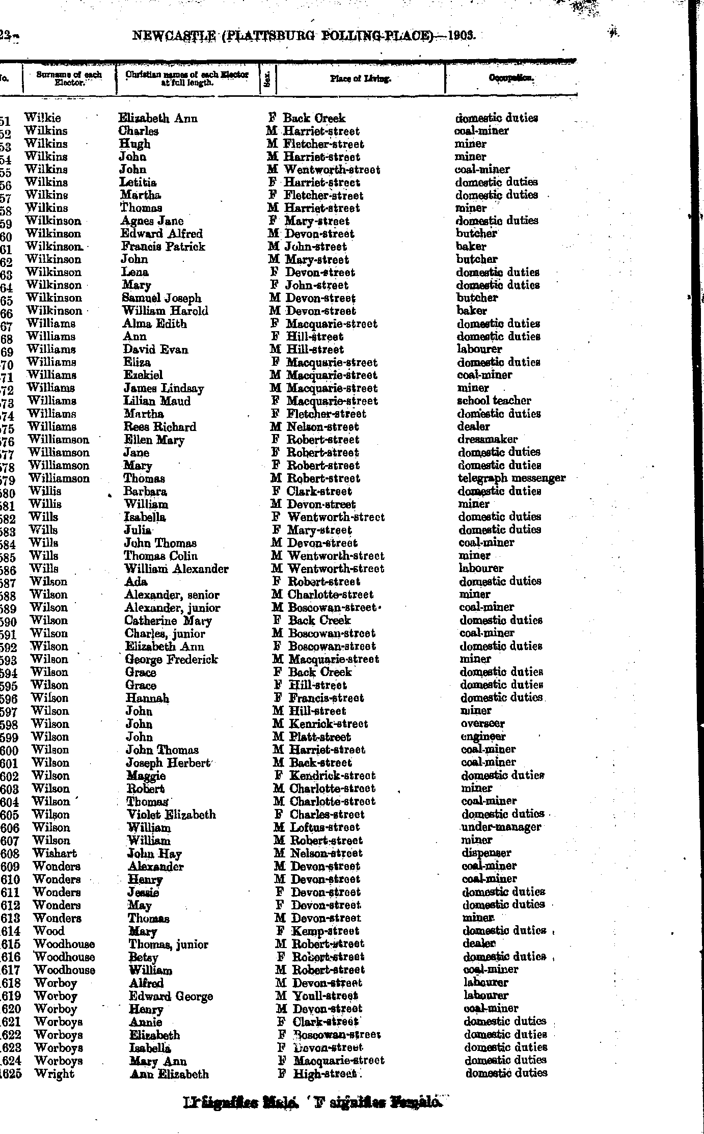
- Wilkie Elizabeth - Wright Ann
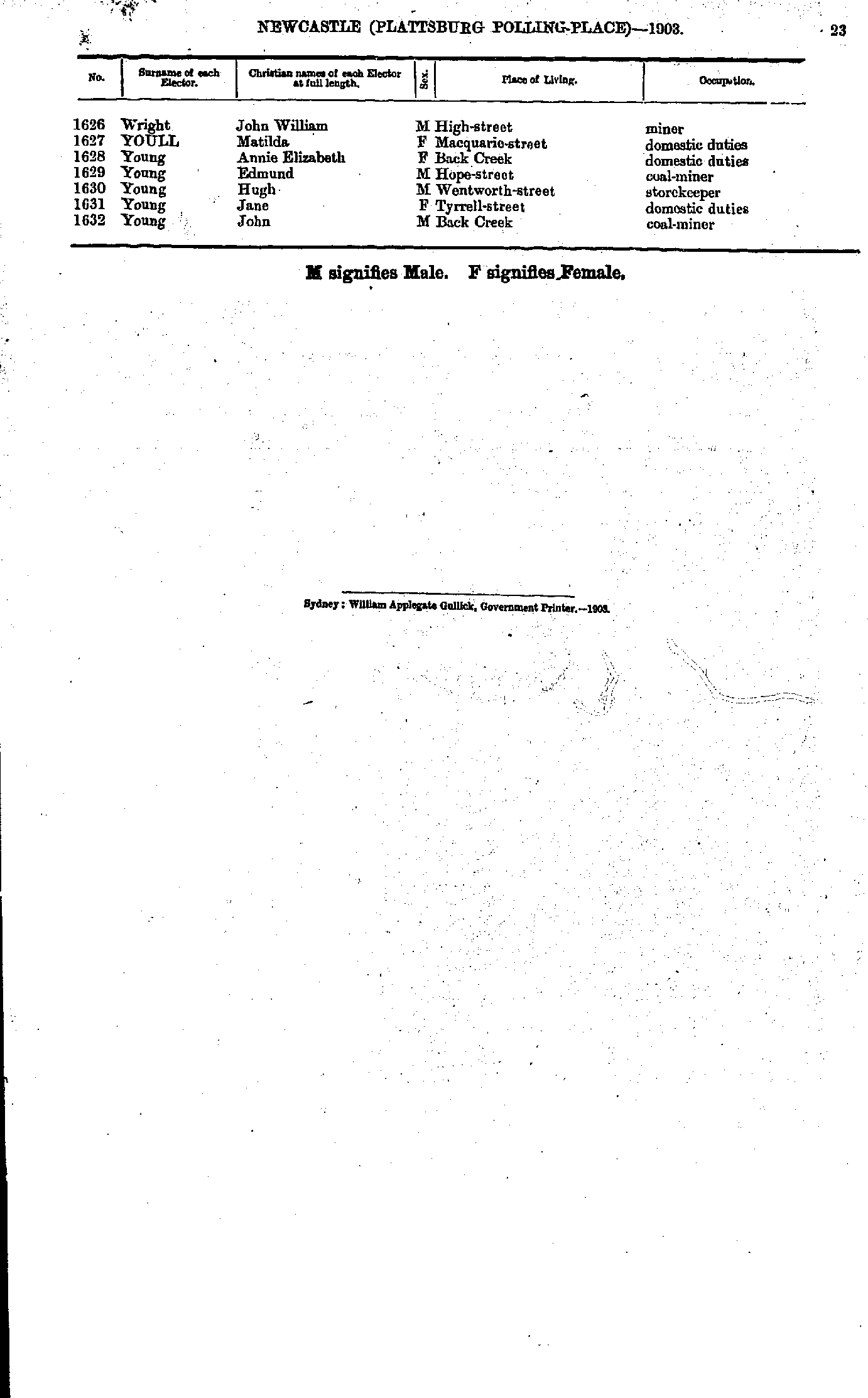
- Wright John - Young John
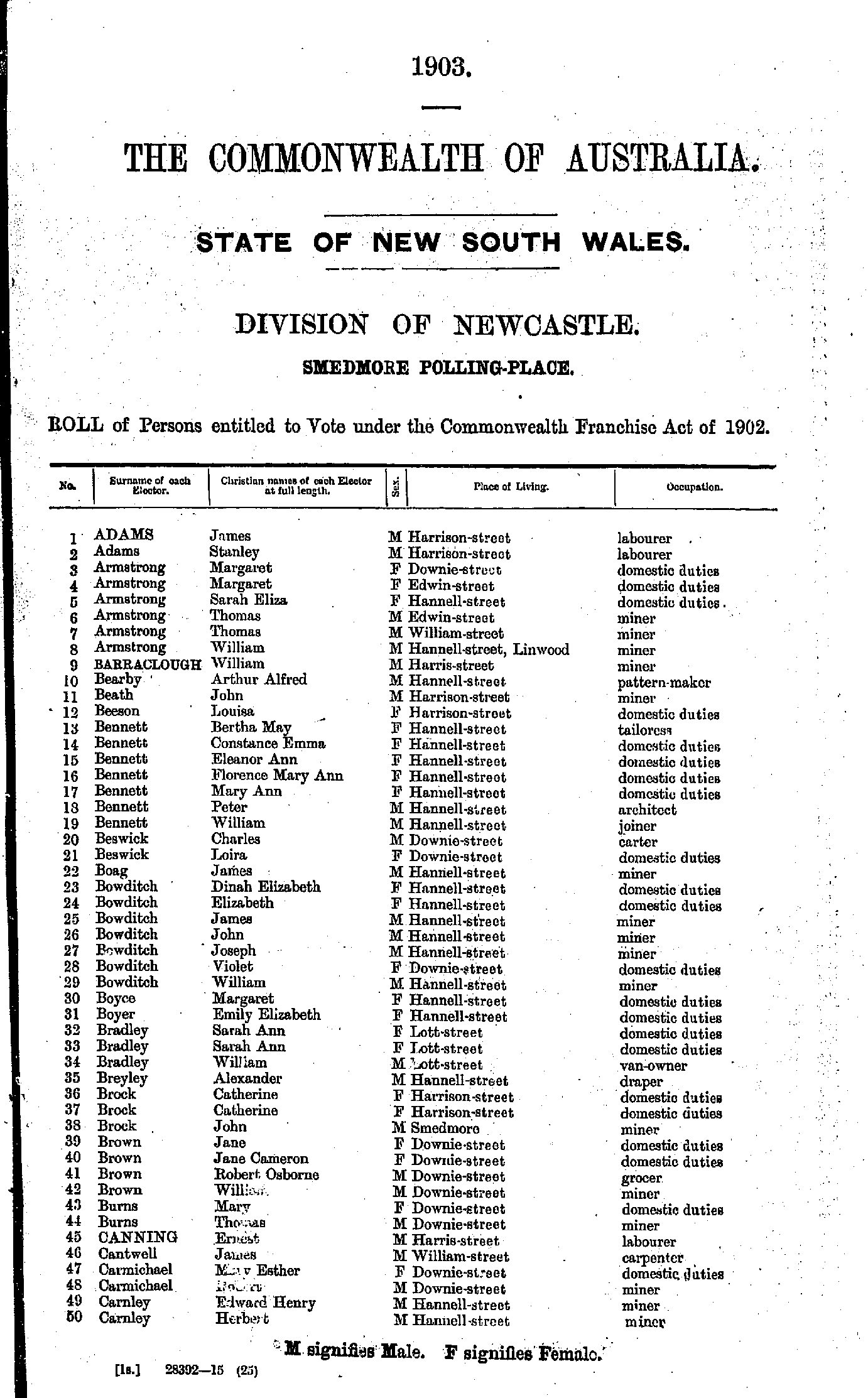
- Adams James - Carnley Herbert
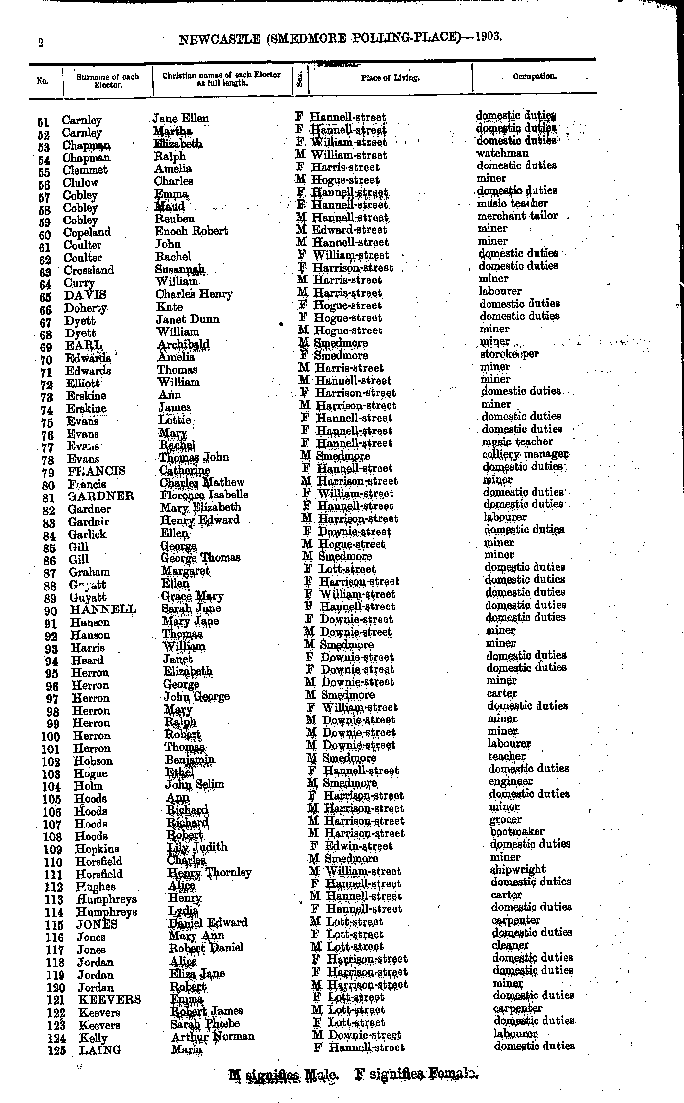
- Carnley Jane - Laing Maria
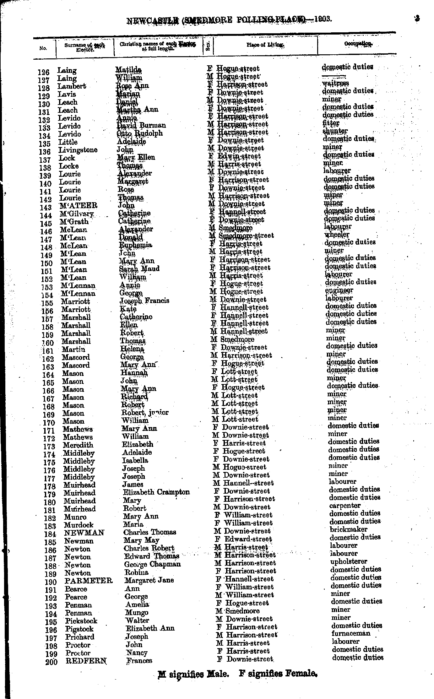
- Laing Matilda - Redfern Frances
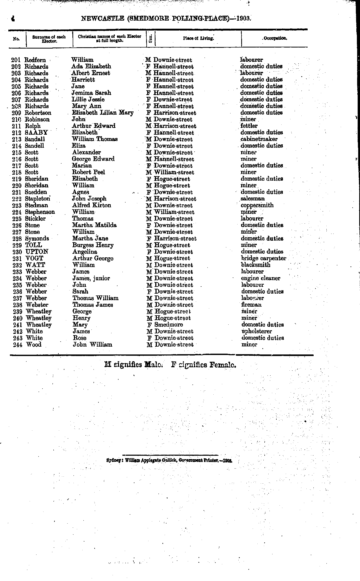
- Redfern William - Wood John
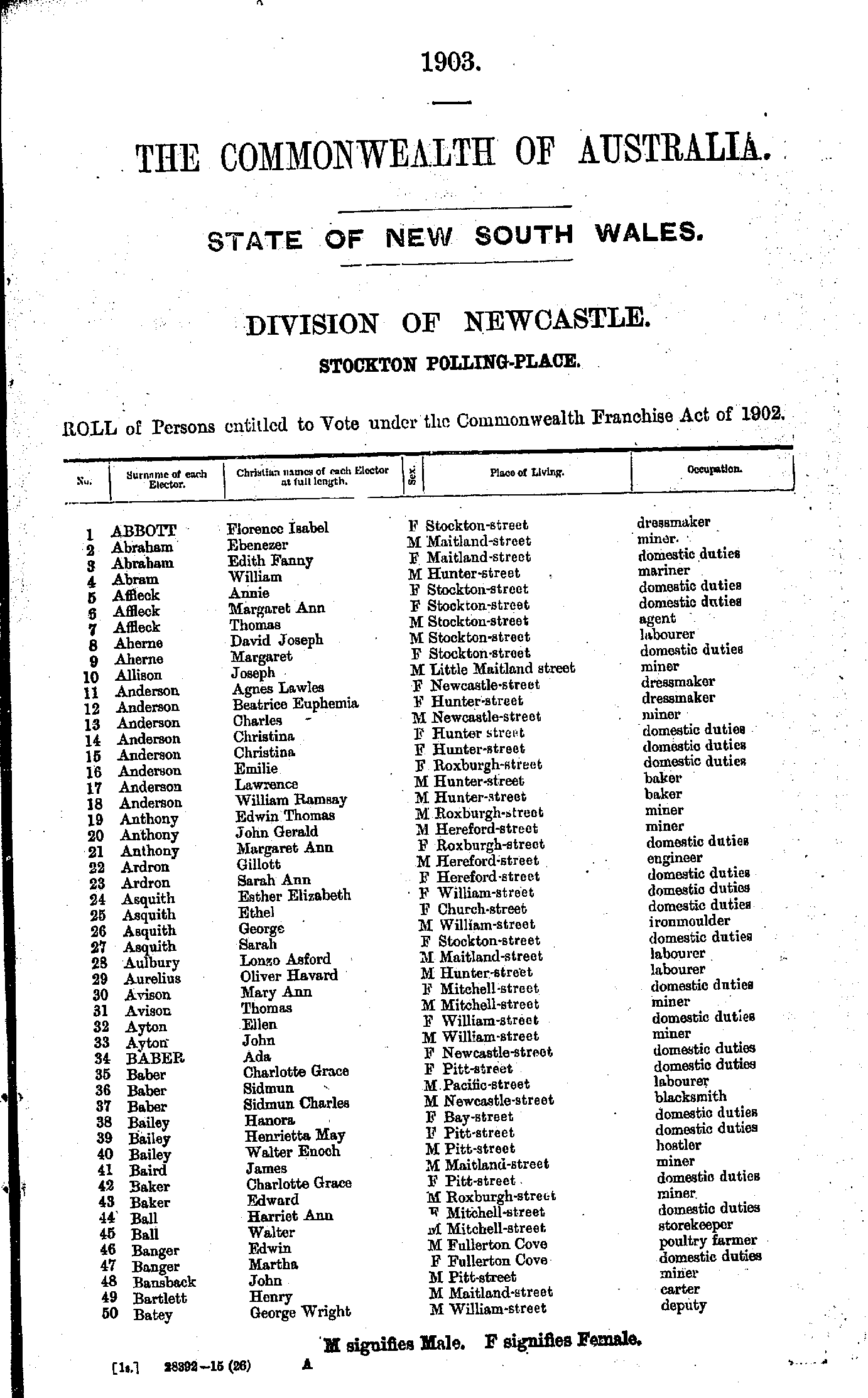
- Abbott Florence - Batey George
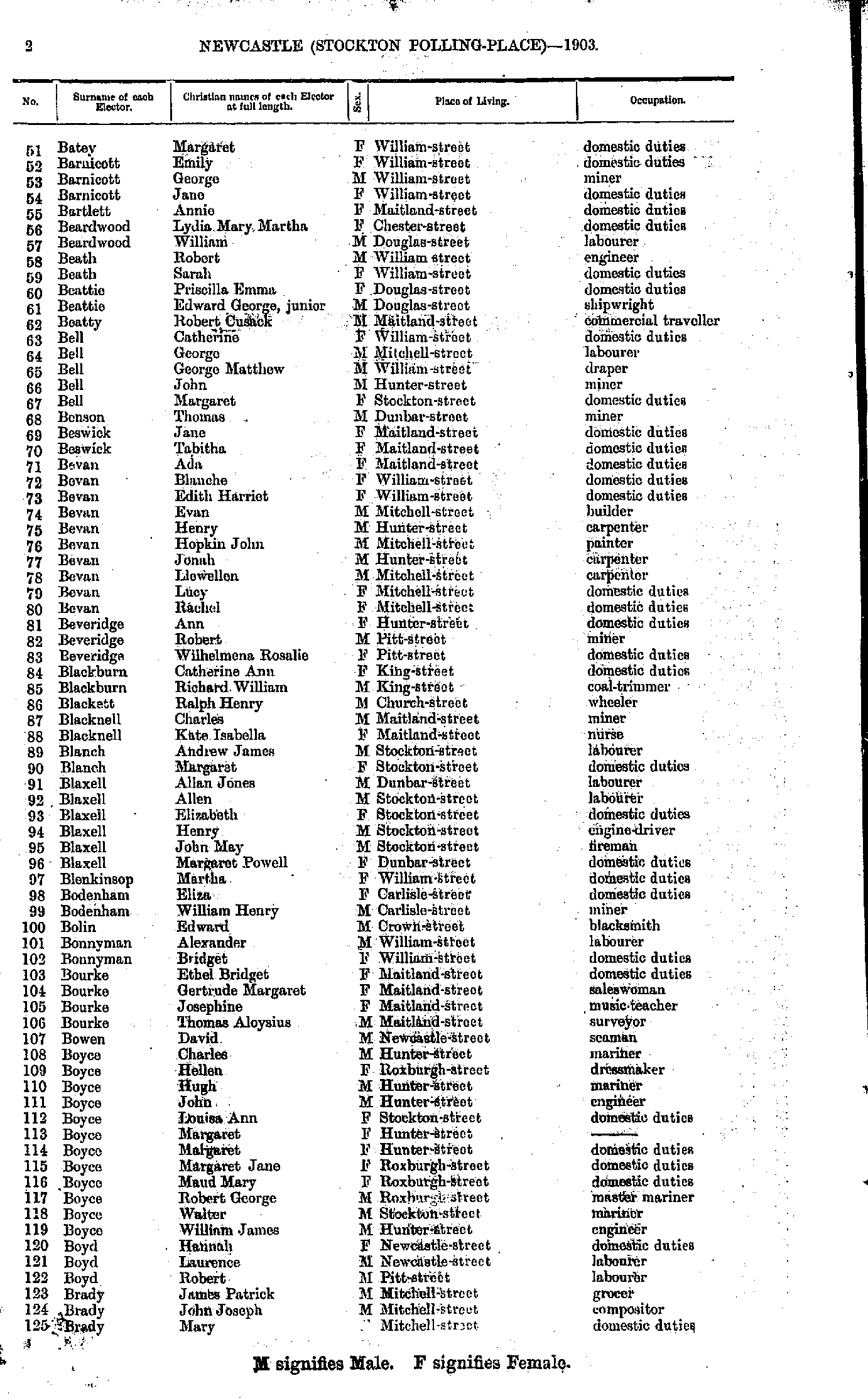
- Batey Margaret - Brady Mary
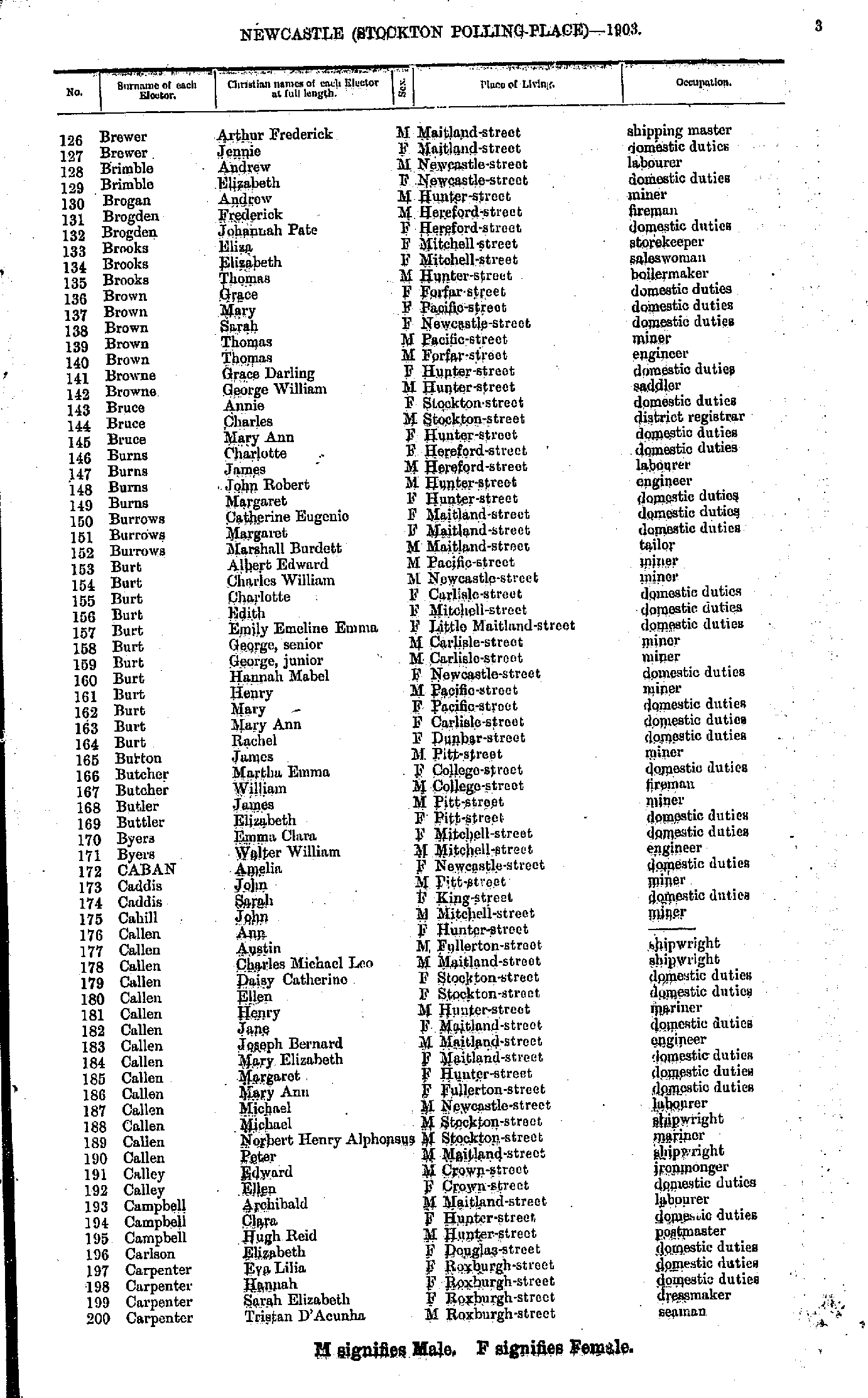
- Brewer Arthur - Carpenter Tristan
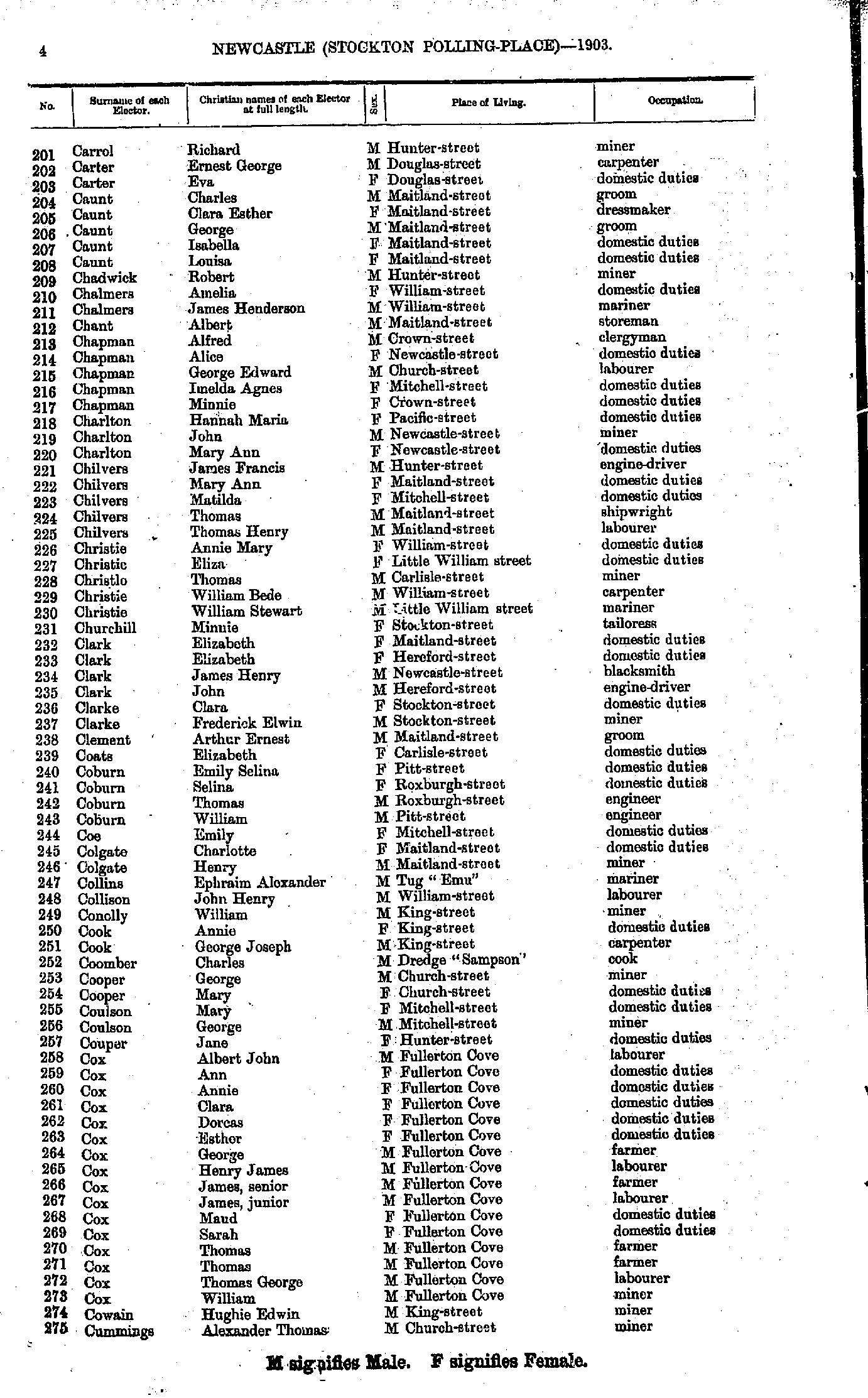
- Carrol Richard - Cummings Alexander
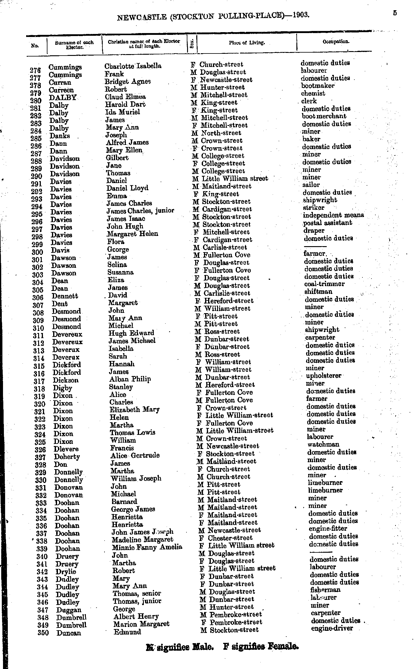
- Cummings Charlotte - Duncan Edmund
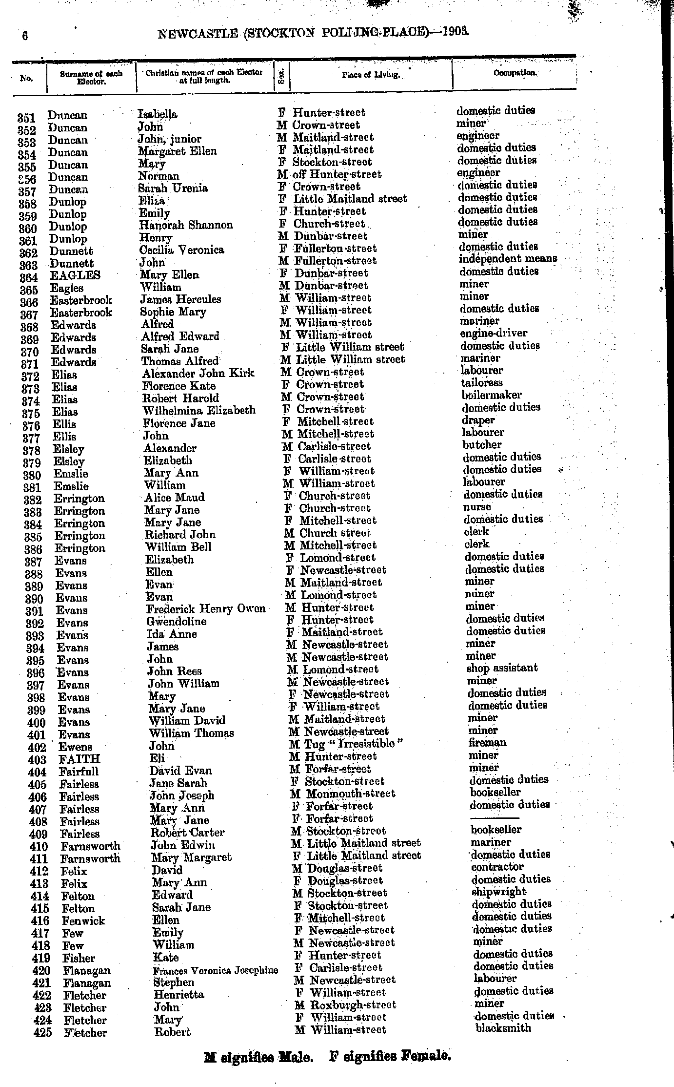
- Duncan Isabella - Fletcher Robert
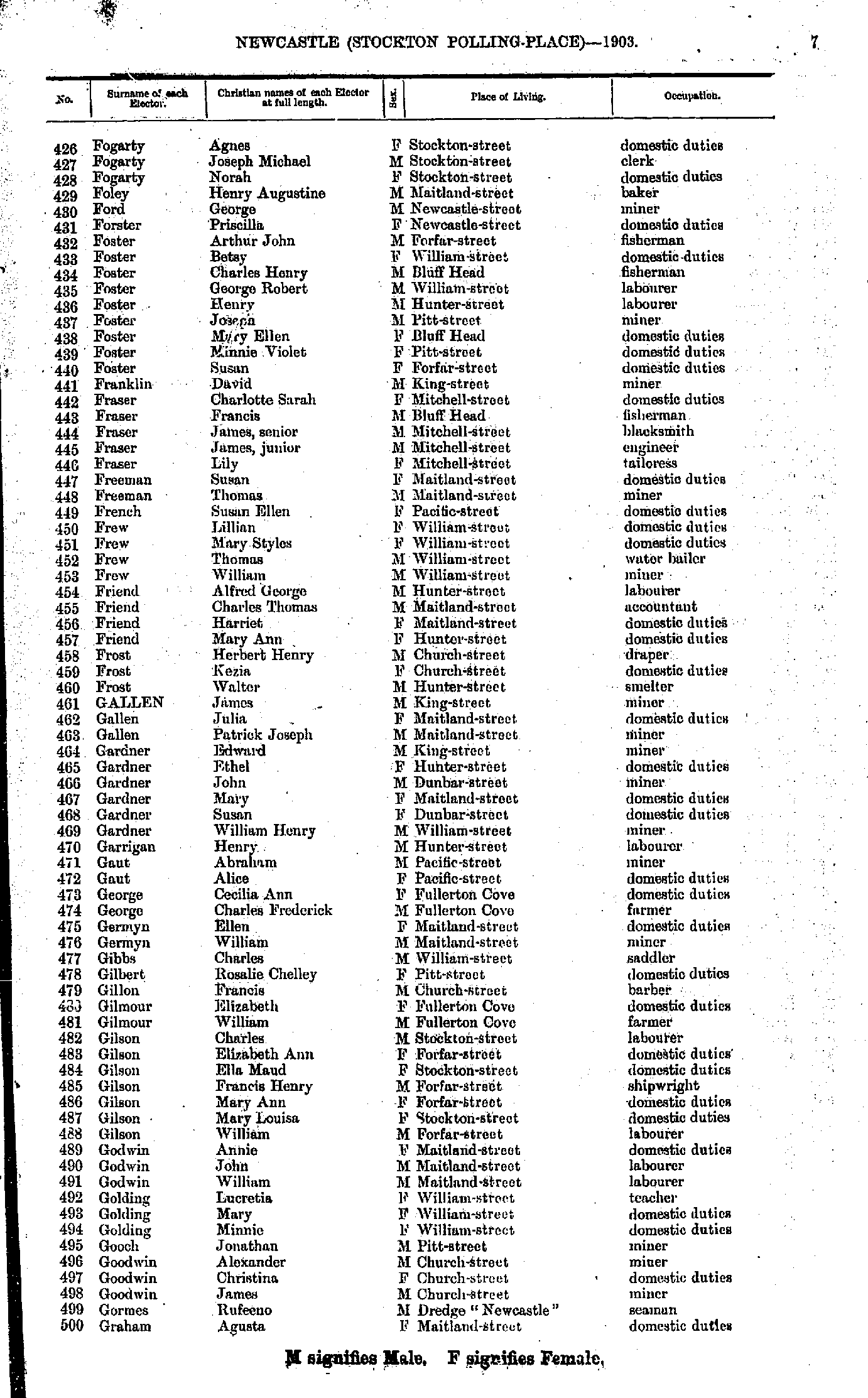
- Fogarty Agnes - Graham Agusta
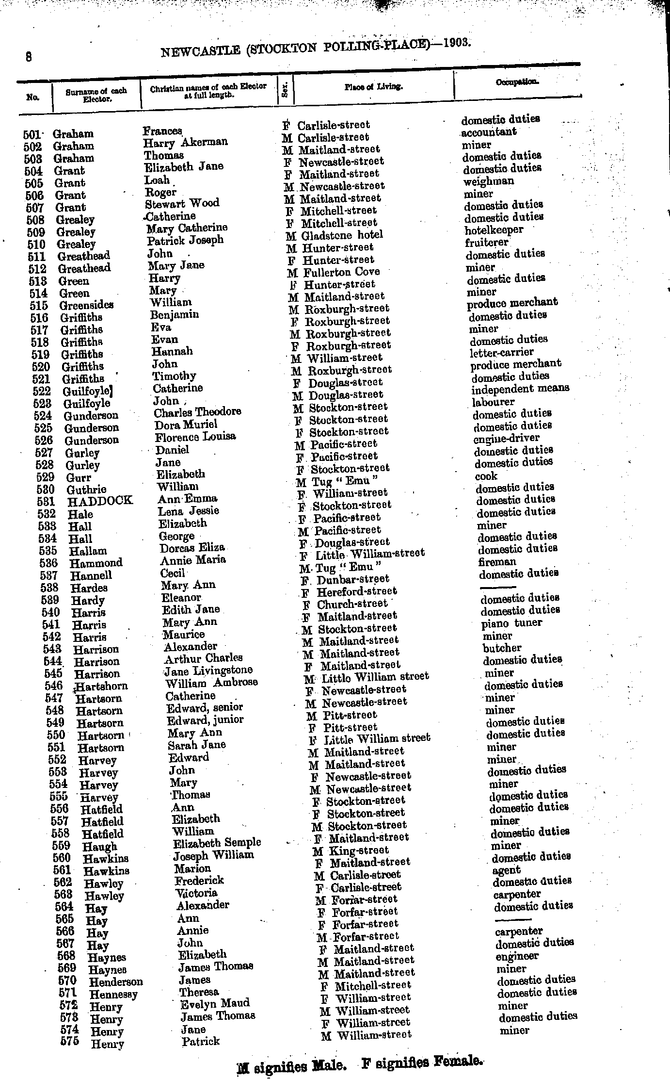
- Graham Frances - Henry Patrick
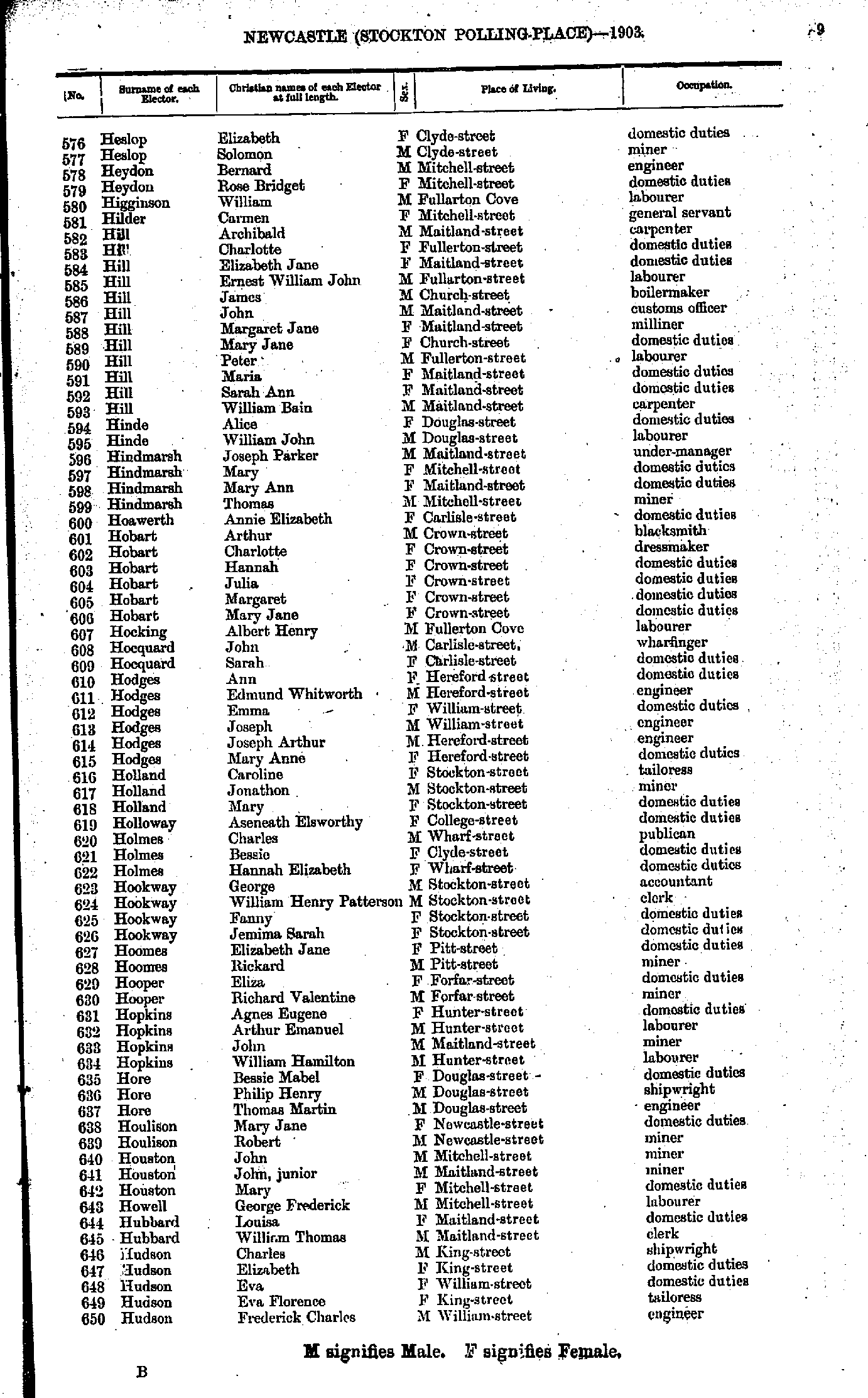
- Heslop Elizabeth - Hudson Frederick
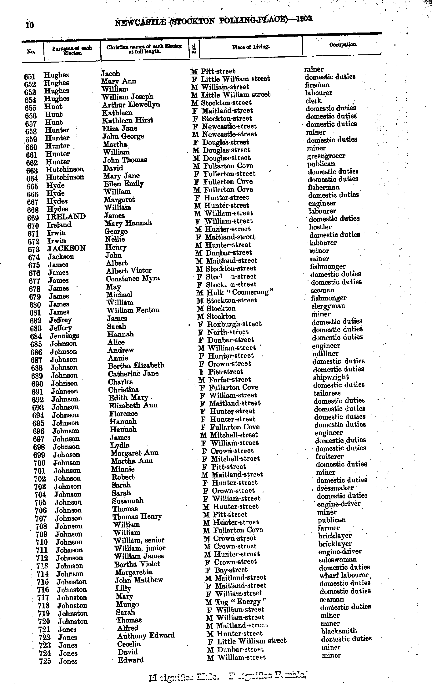
- Hughes Jacob - Jones Edward
- Jones Edward - Lewis Rhoda
- Lewis Richard - M'Donald Helen
- M'Donald James - Minto William
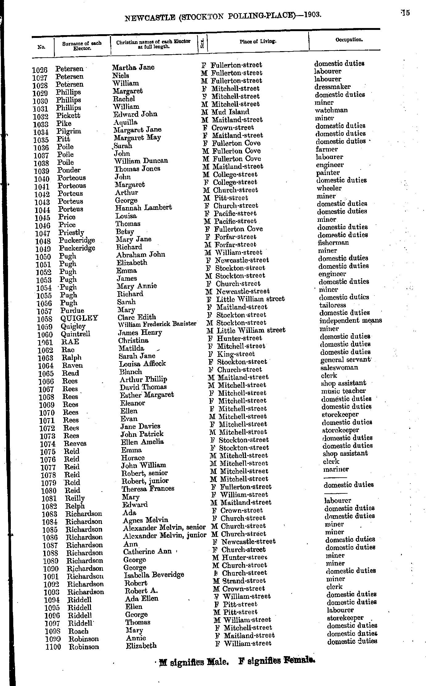
- Minto Maud - Petersen Henry
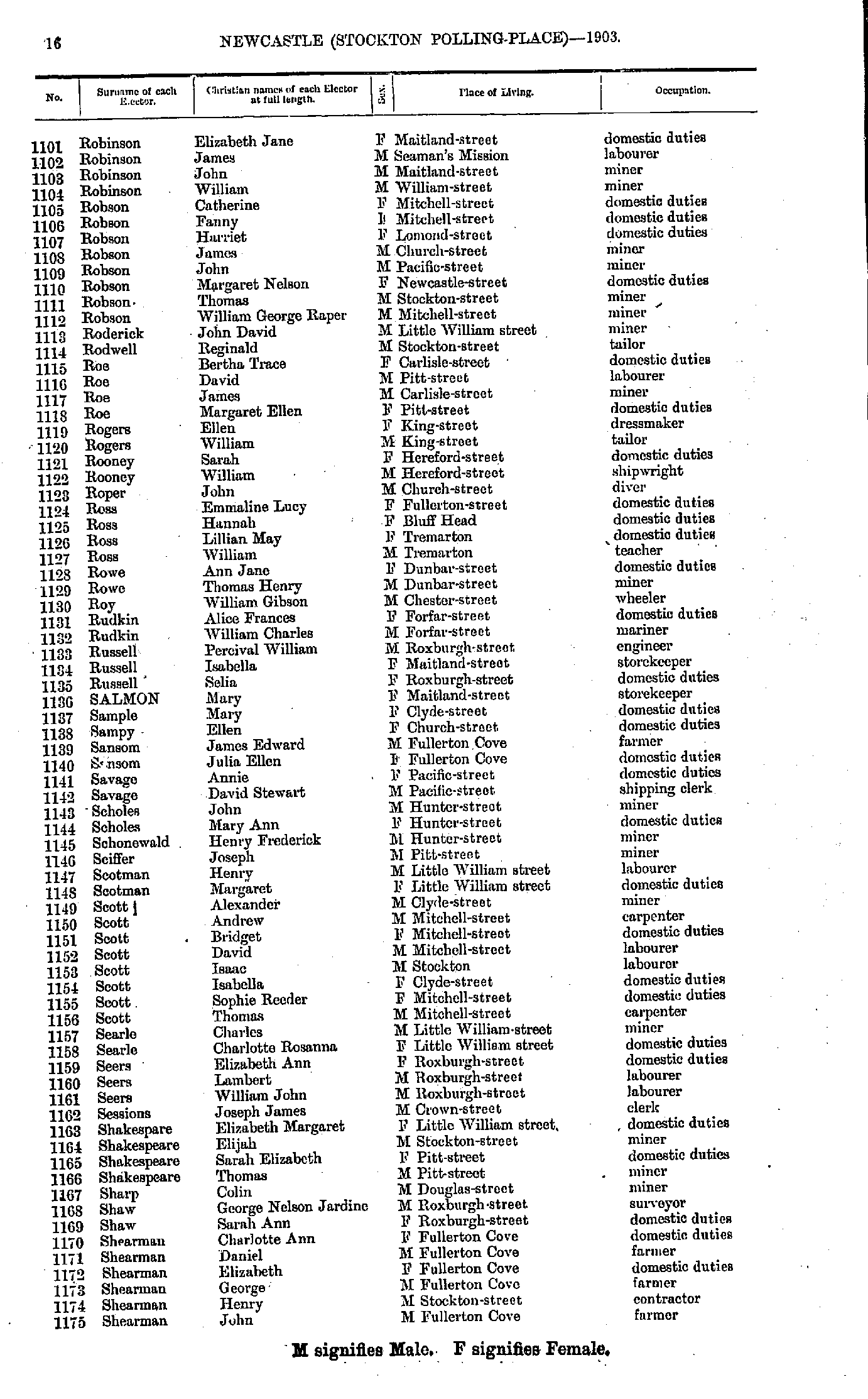
- Petersen Martha - Robinson Elizabeth
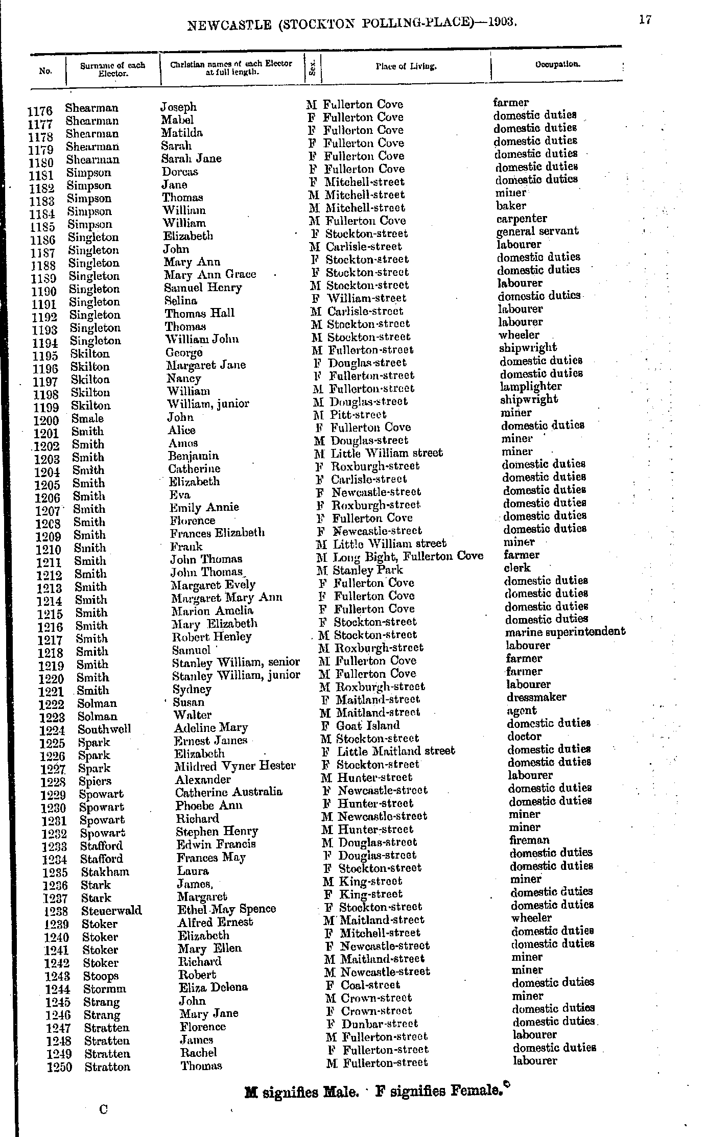
- Robinson Elizabeth - Shearman John
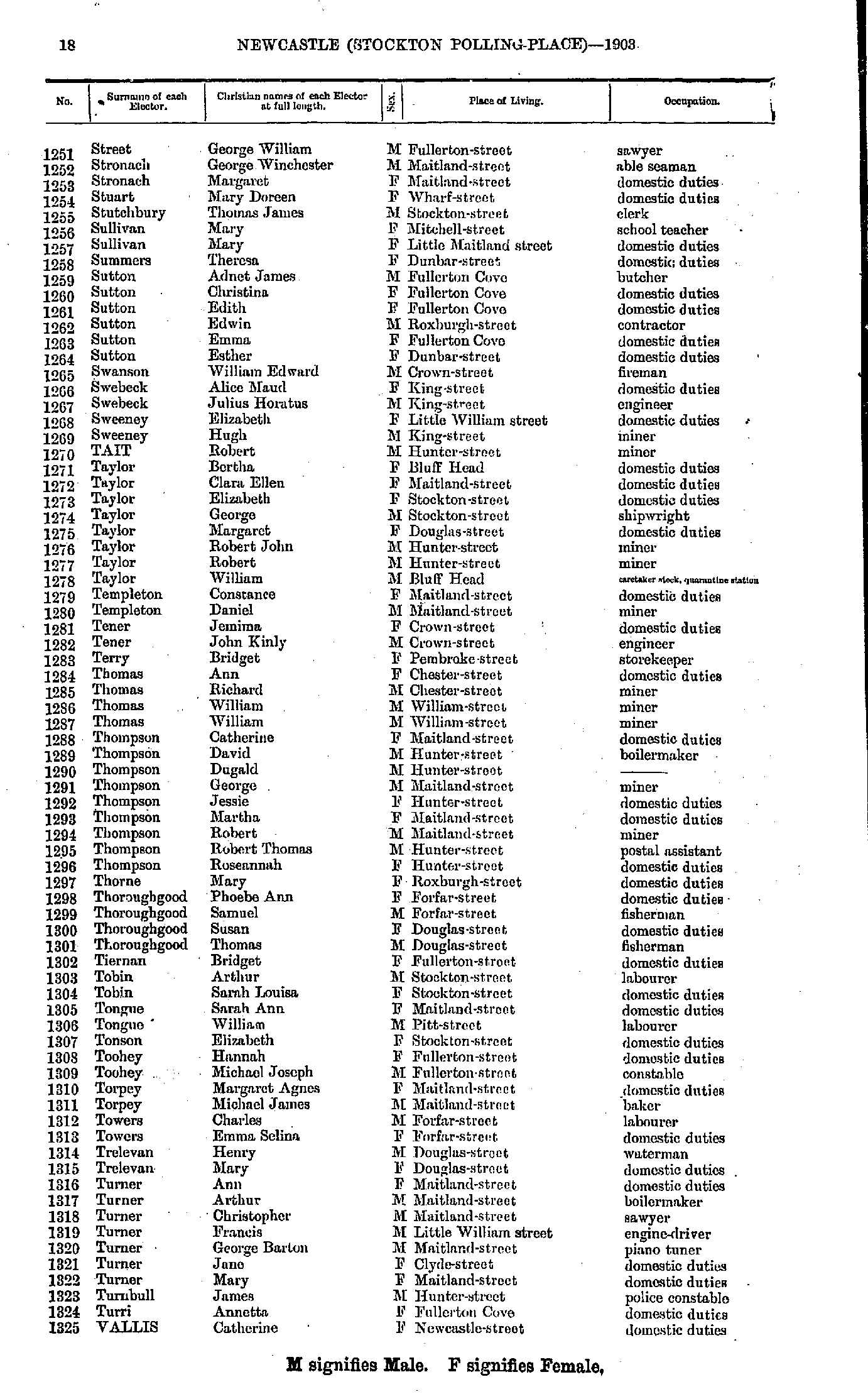
- Shearman Joseph - Stratton Thomas
- Street George - Vallis Catherine
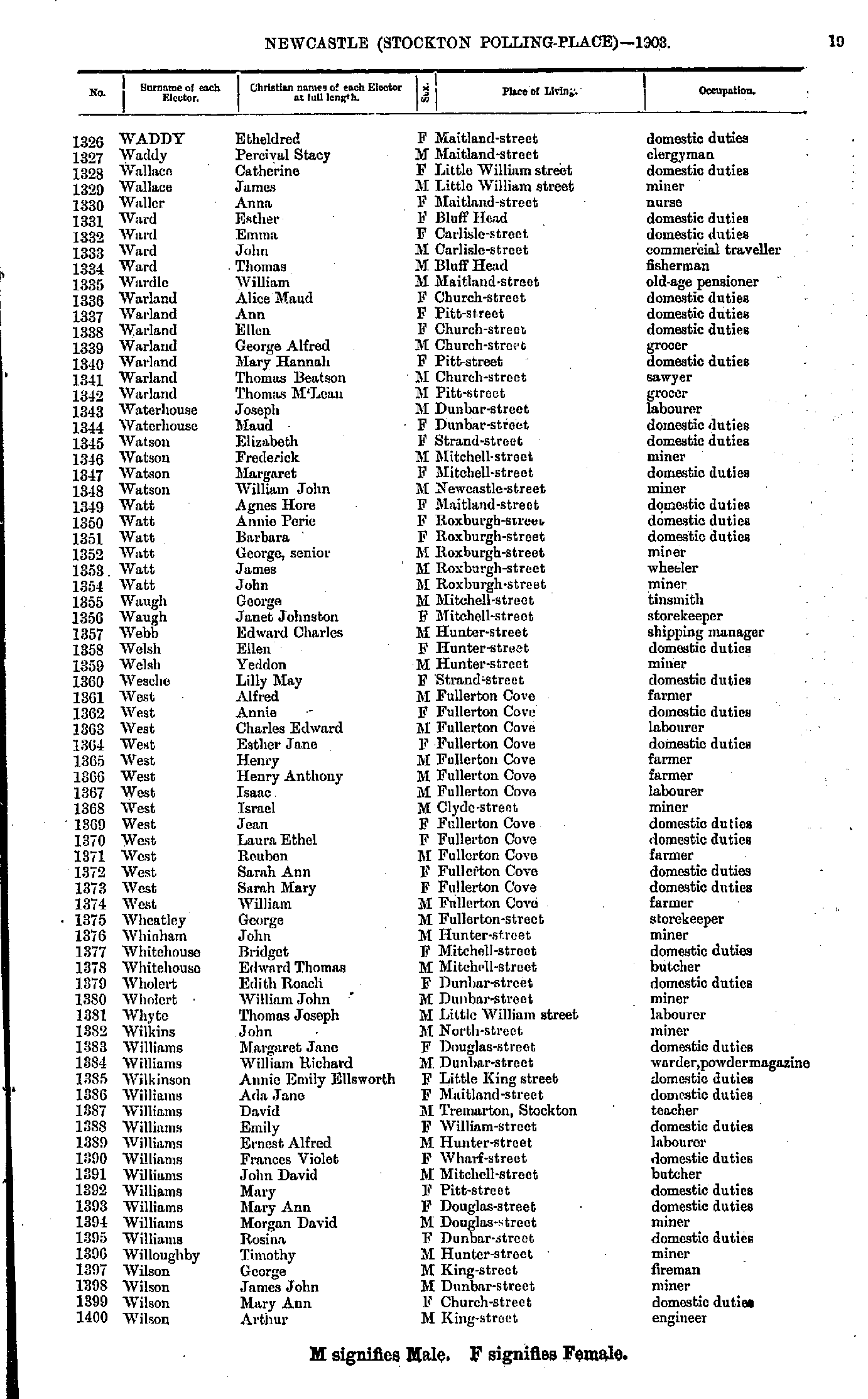
- Waddy Etheldred - Wilson Arthur
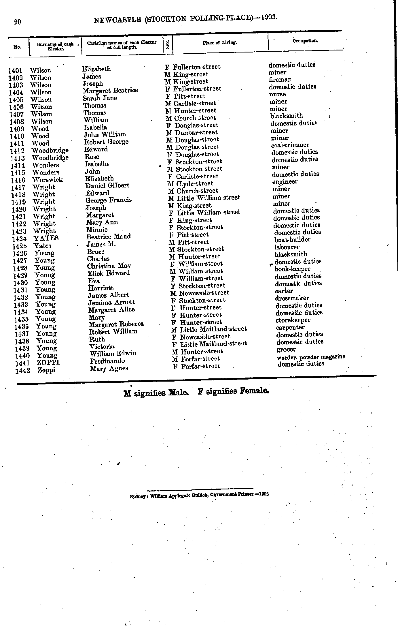
- Wilson Elizabeth - Zoppi Mary
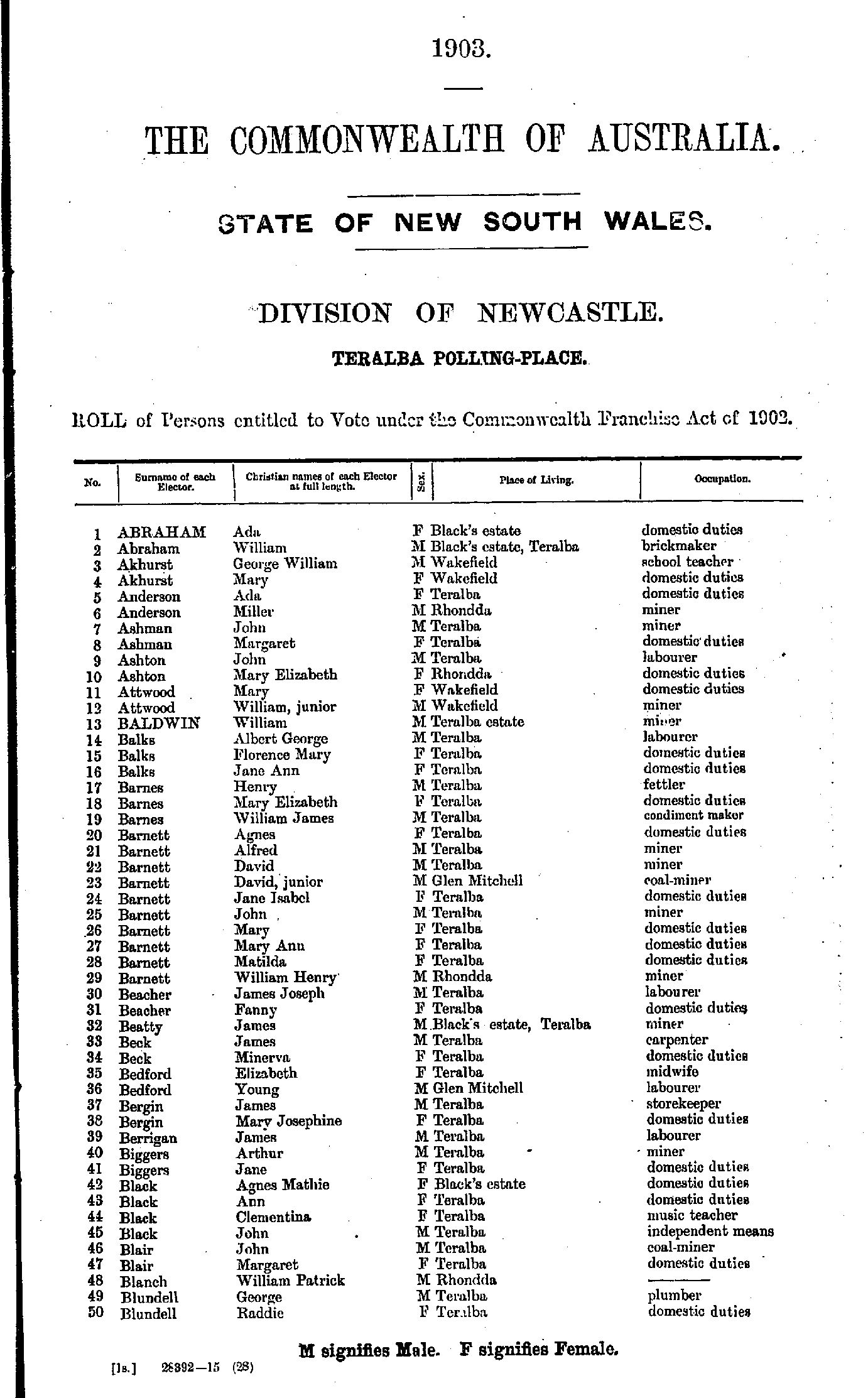
- Abraham Ada - Blundell Raddie
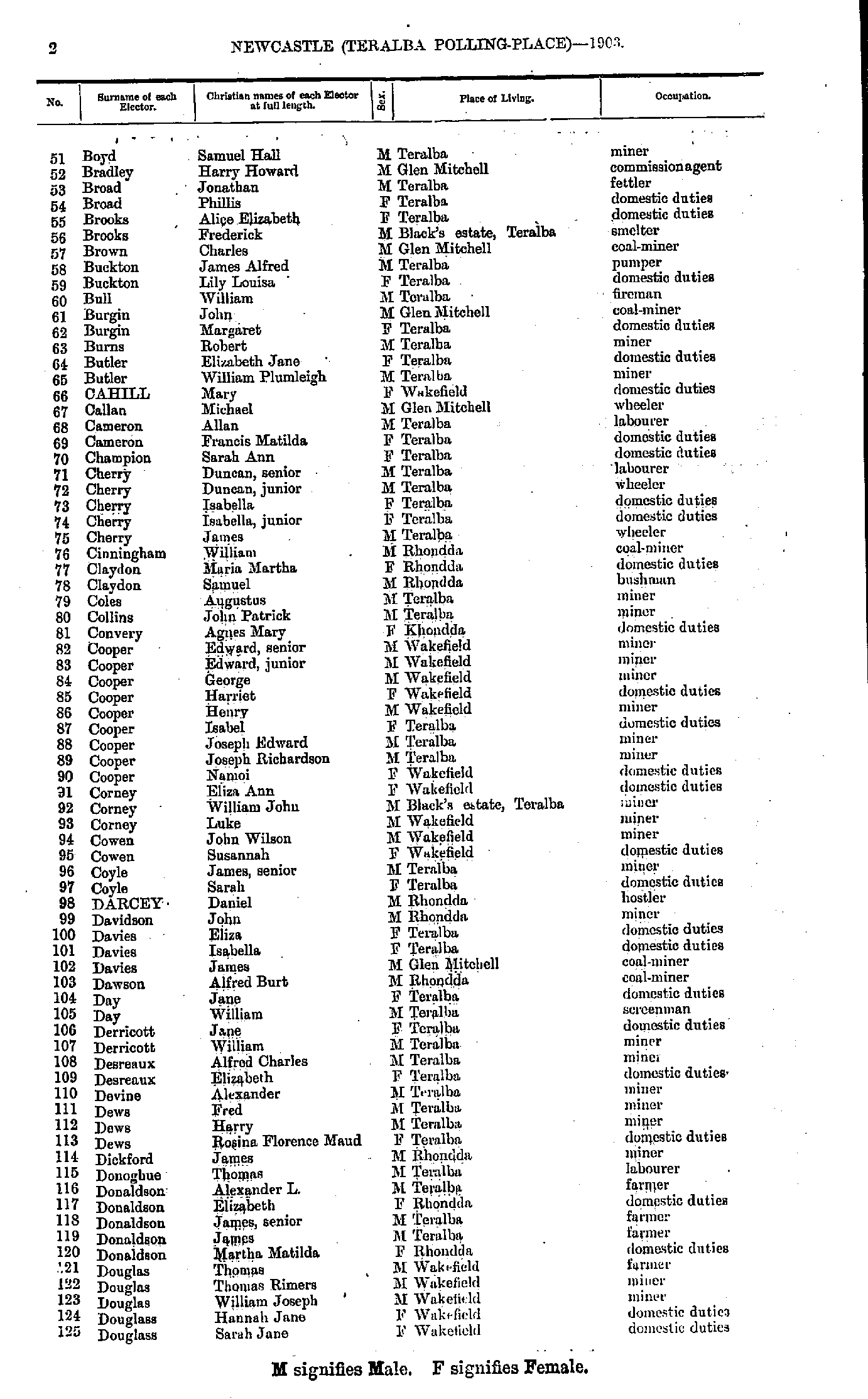
- Boyd Samuel - Douglass Sarah
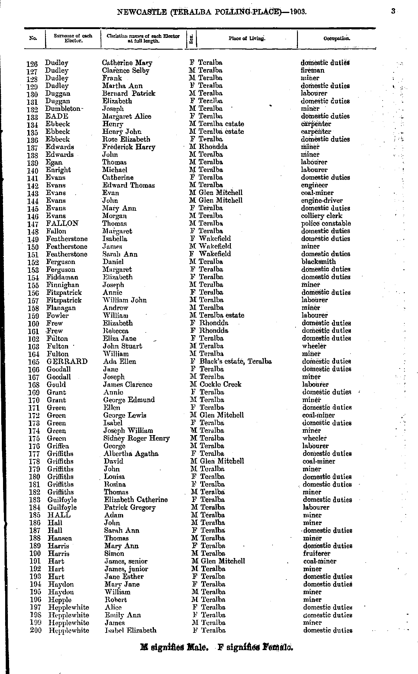
- Dudley Catherine - Hepplewhite Isabel
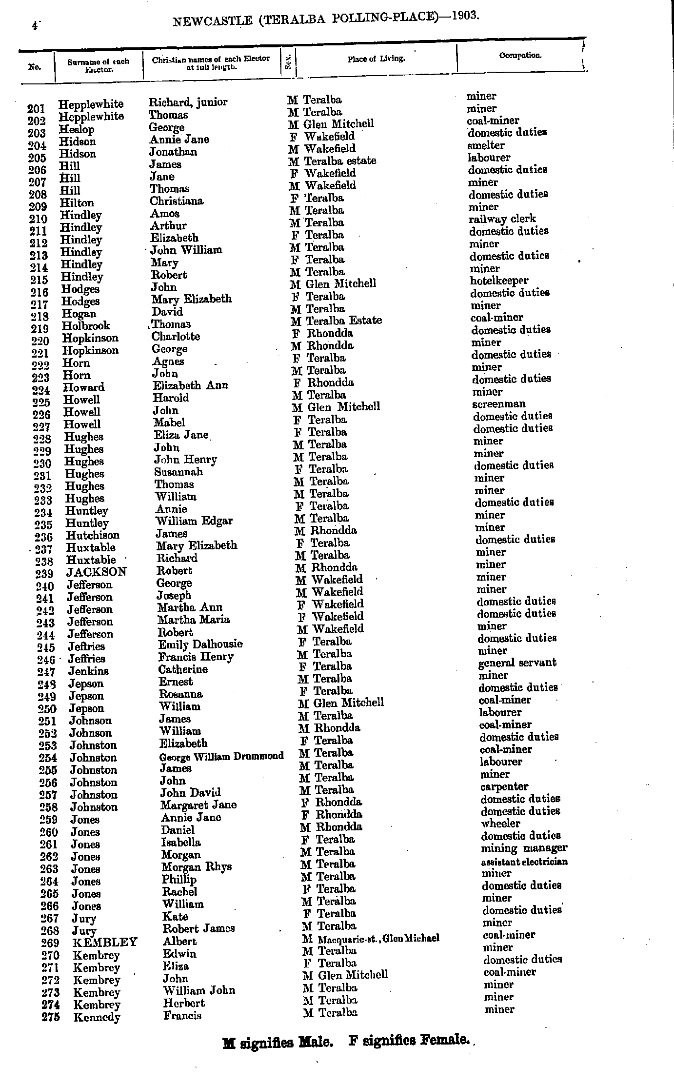
- Hepplewhite Richard - Kennedy Francis
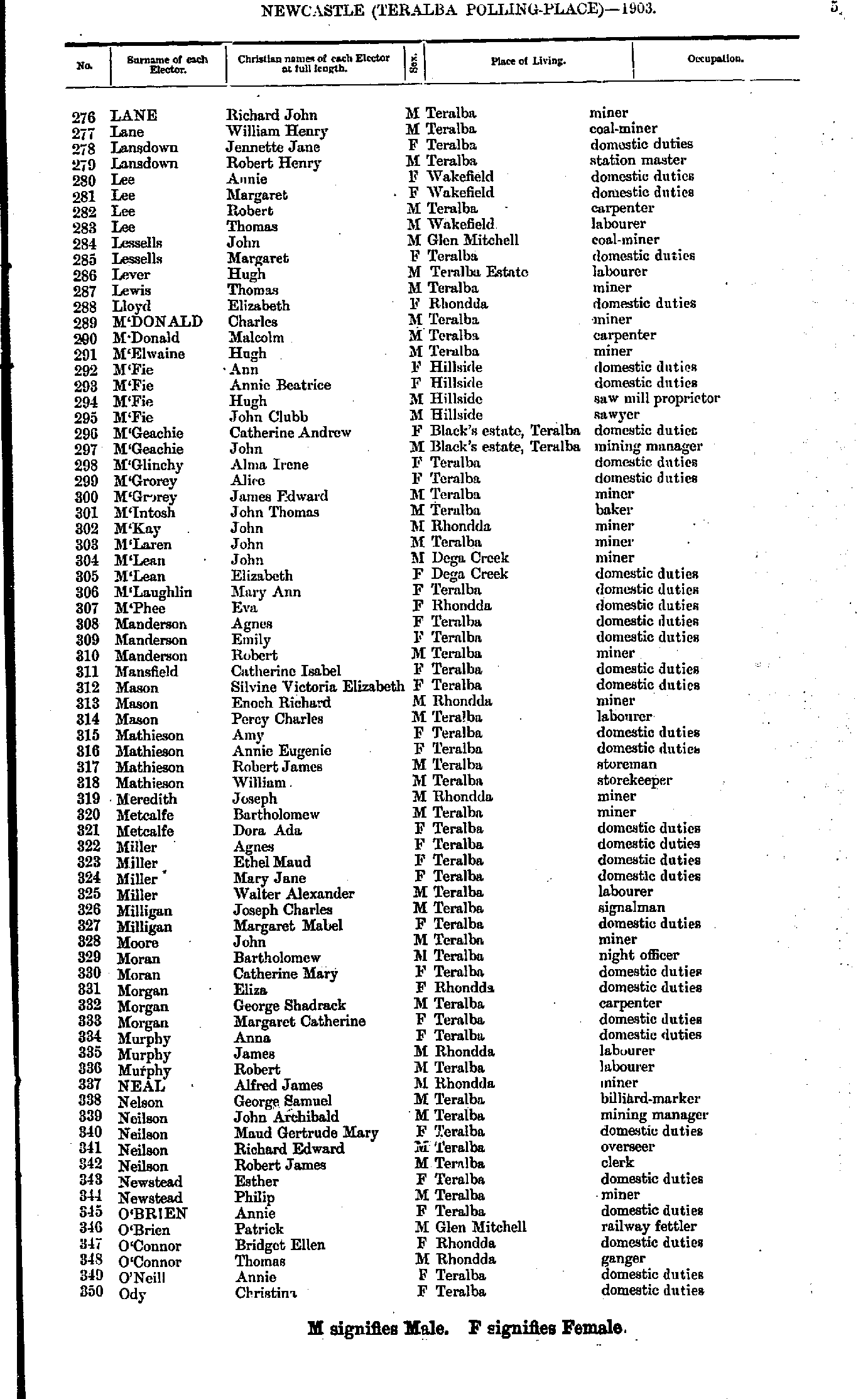
- Lane Richard - Ody Christina
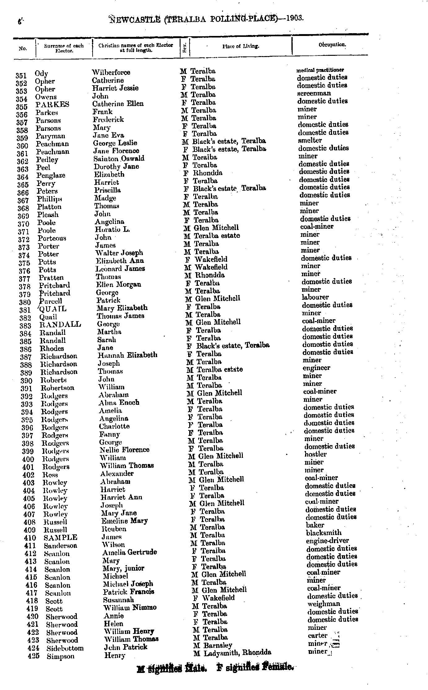
- Ody Wilberforce - Simpson Henry
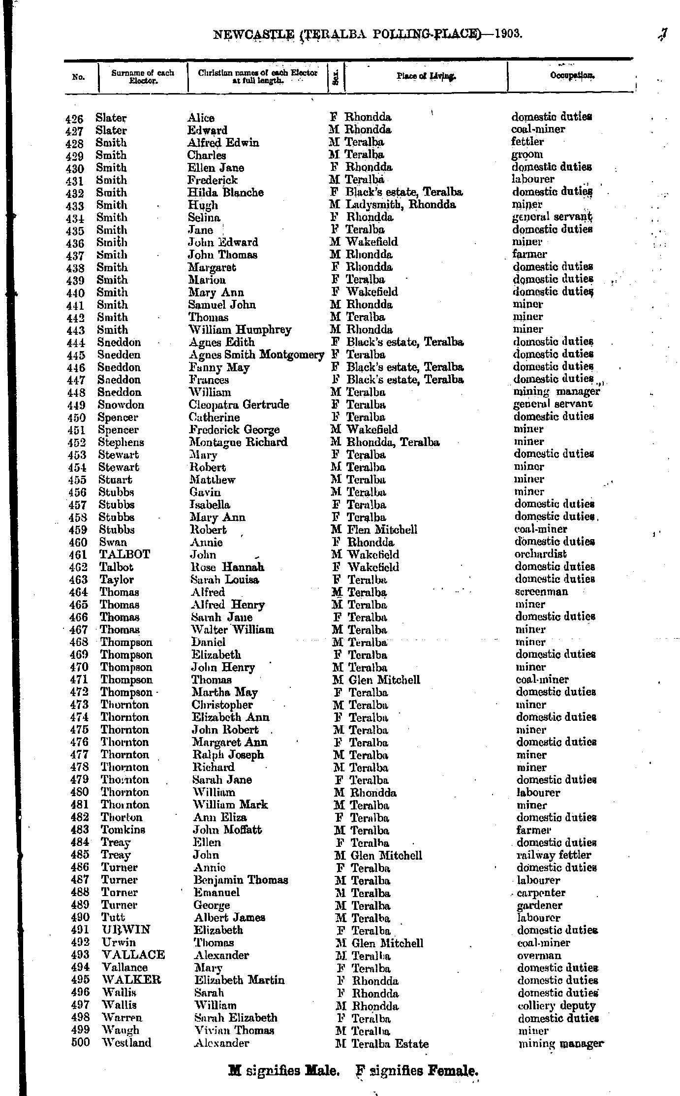
- Slater Alice - Westland Alexander
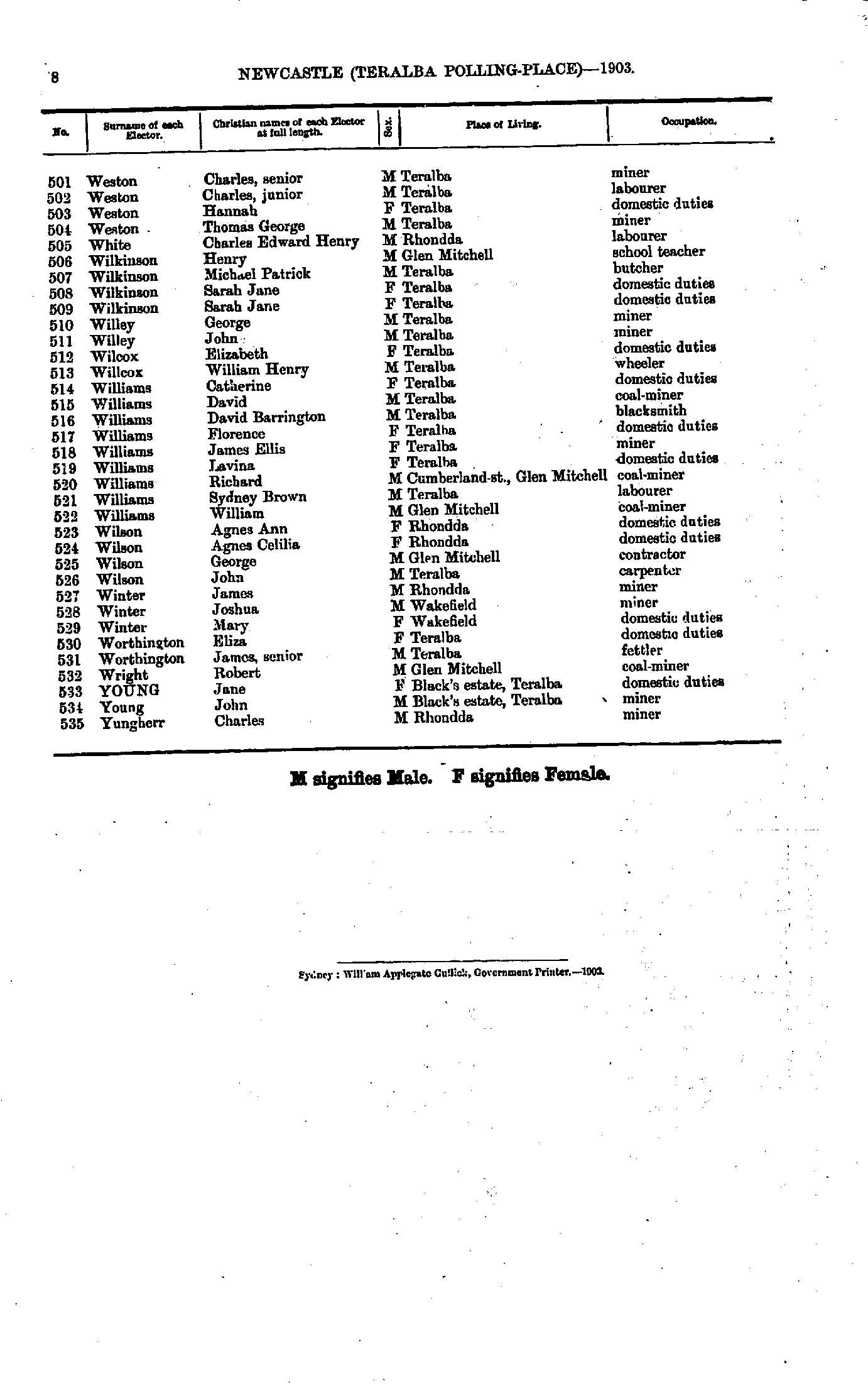
- Weston Charles - Yungherr Charles
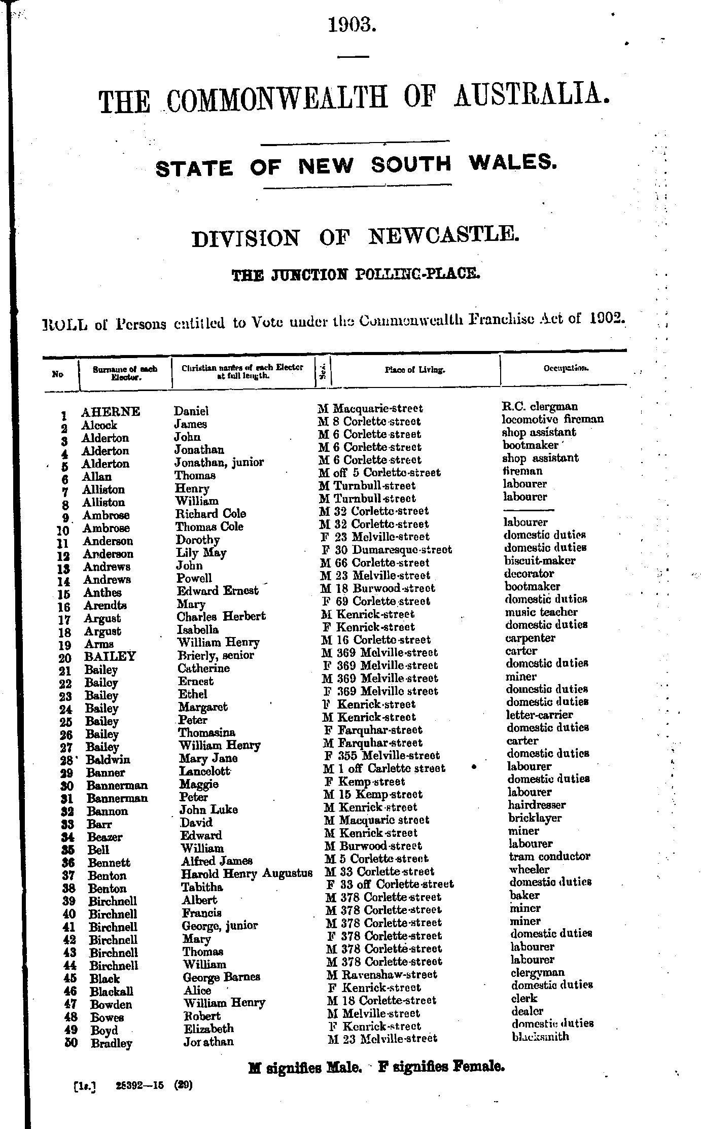
- Aherne Daniel - Bradley Jonathan
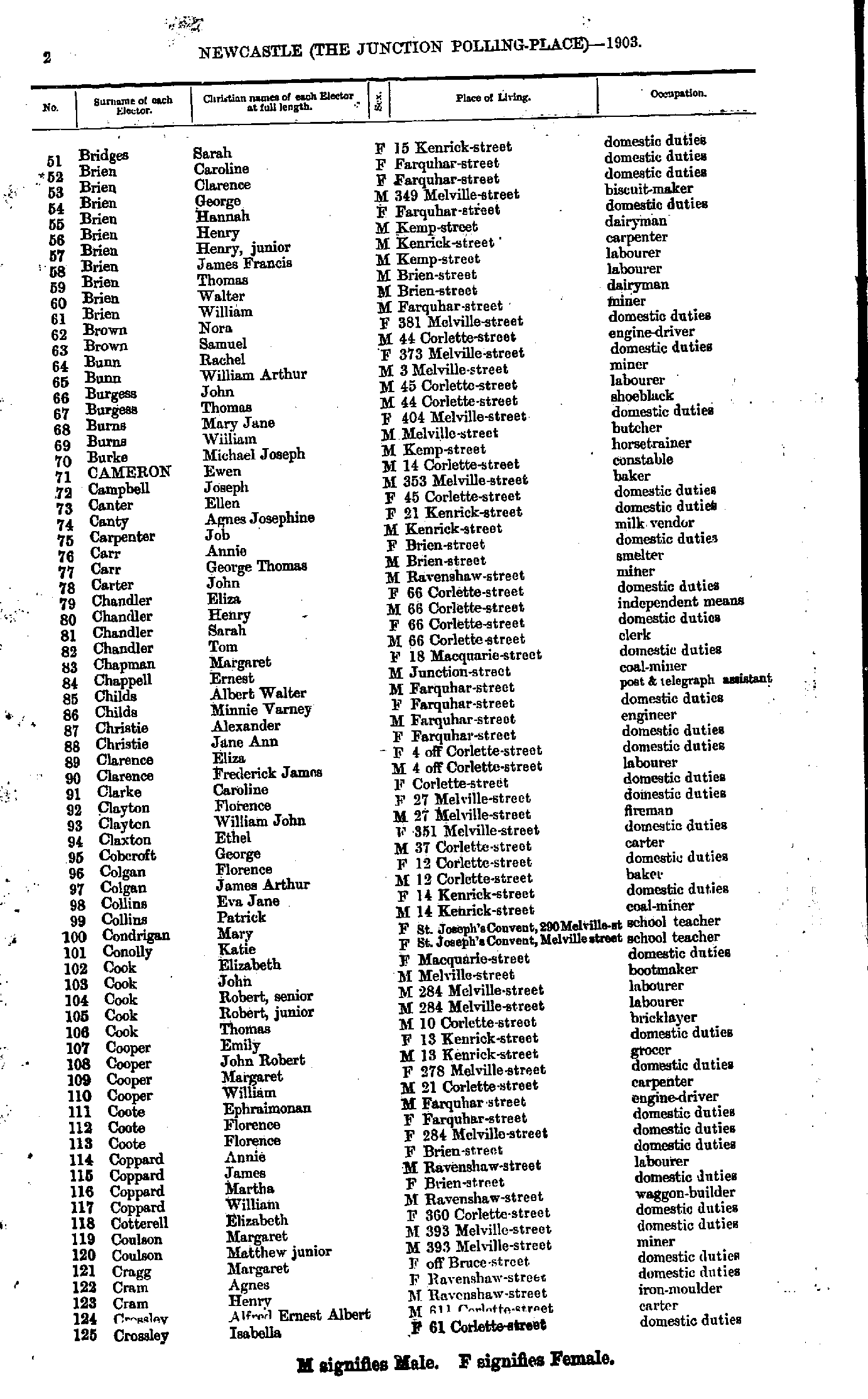
- Bridges Sarah - Crossley Isabella
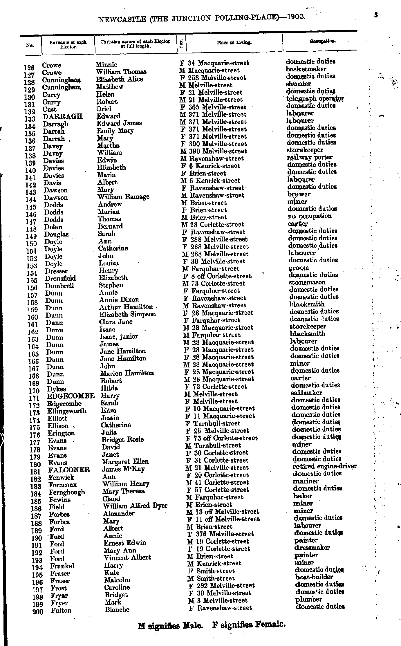
- Crowe Minnie - Fulton Blanche
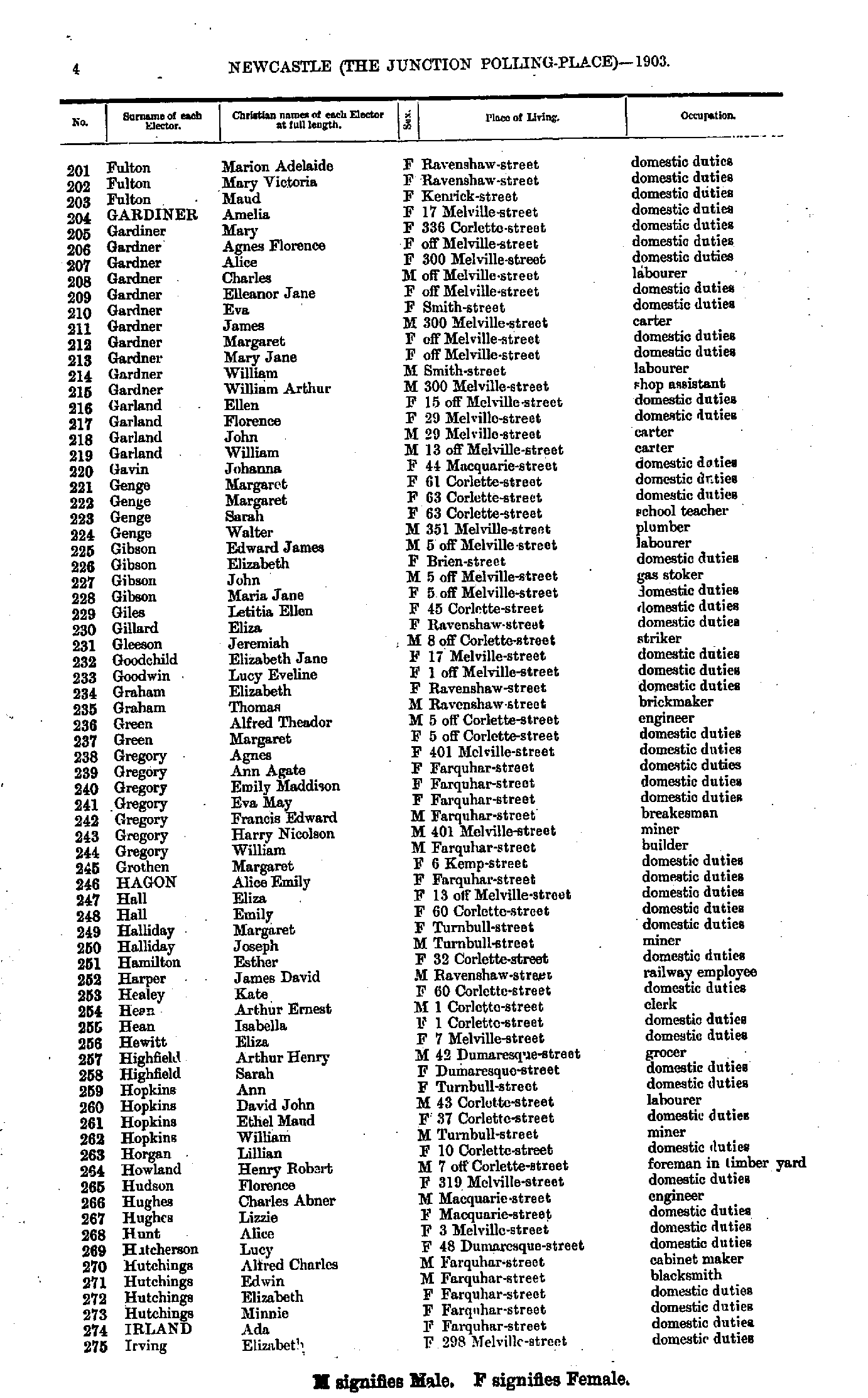
- Fulton Marion - Irving Elizabeth
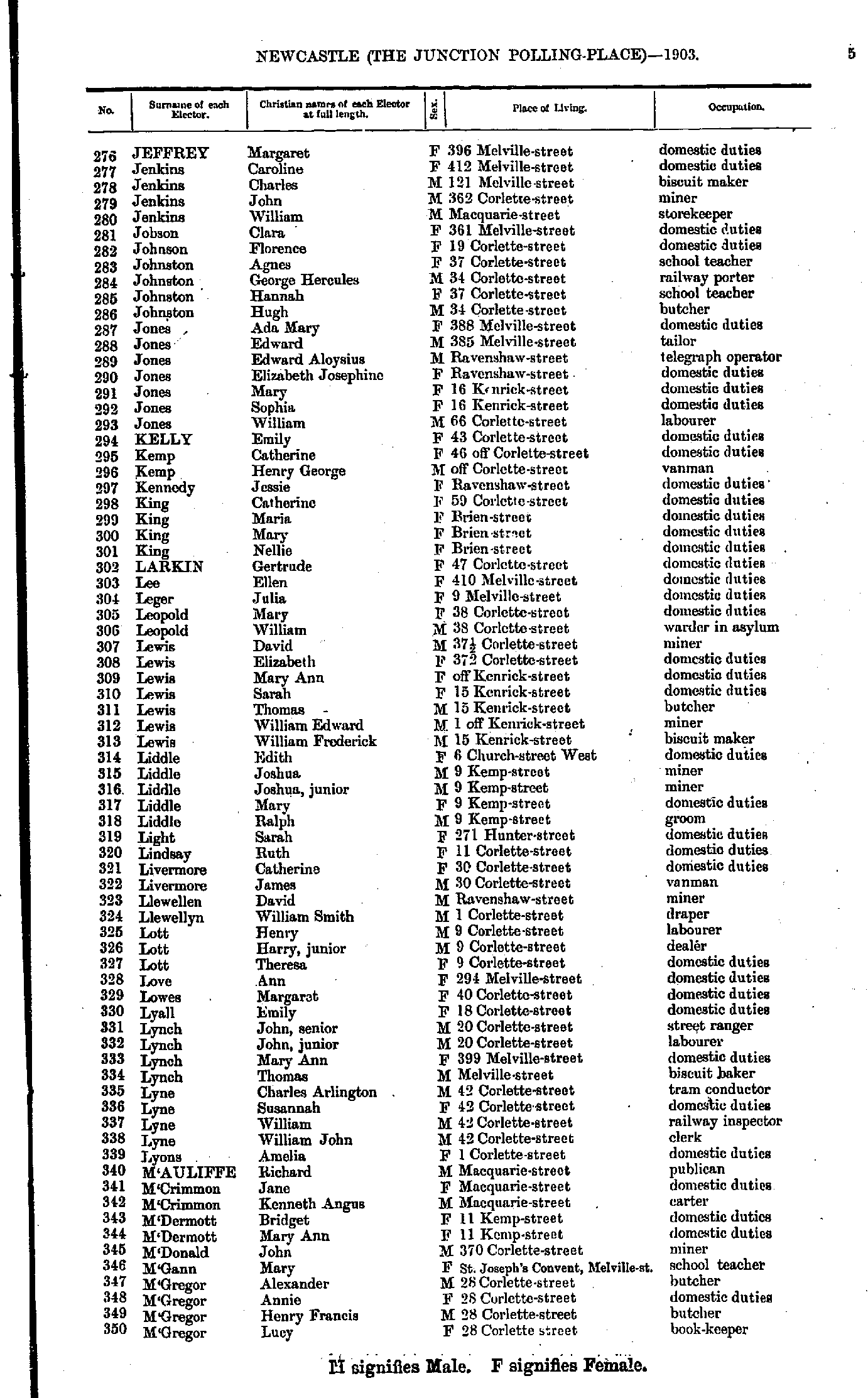
- Jeffrey Margaret - M'Gregor Lucy
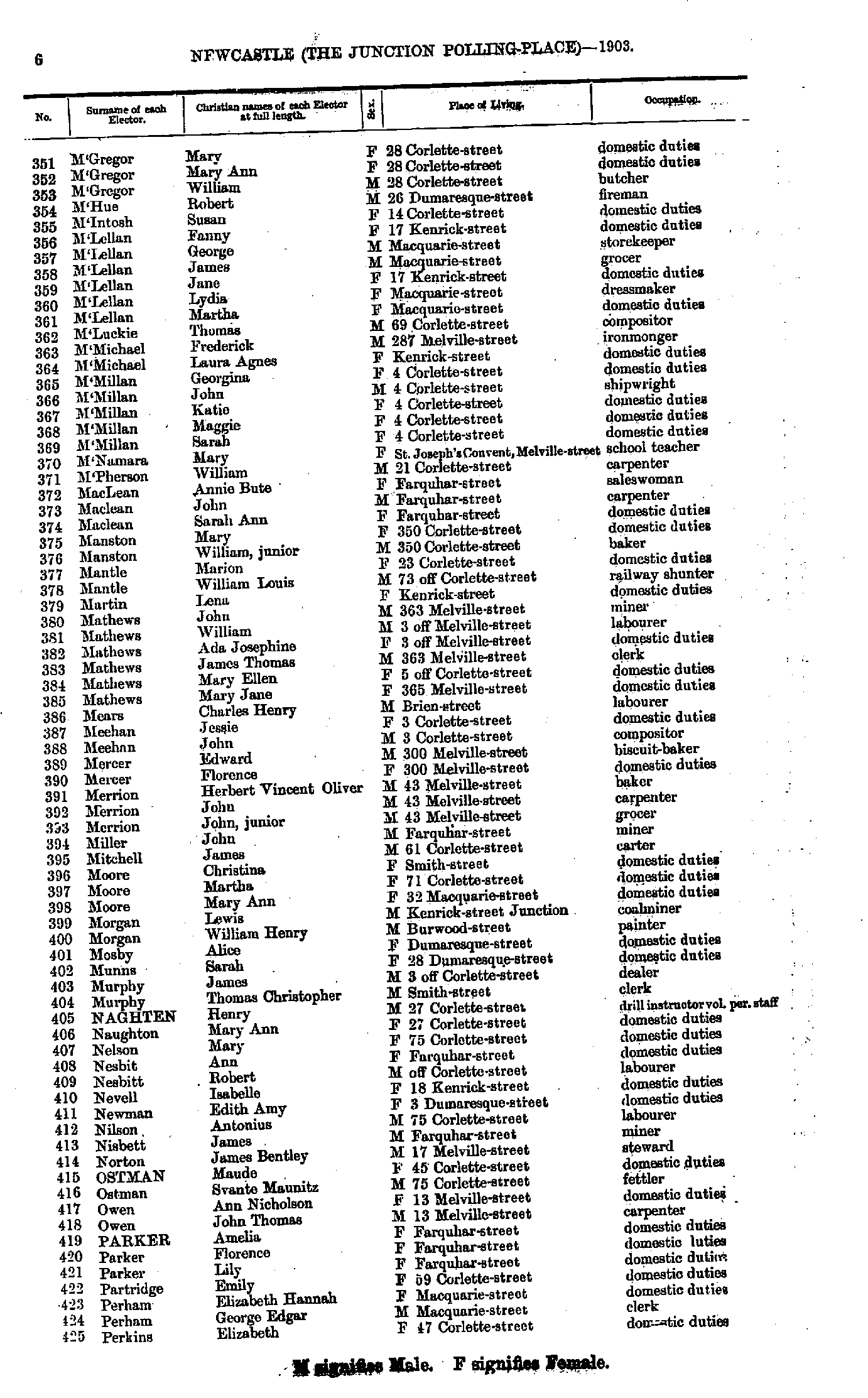
- M'Gregor Mary - Perkins Elizabeth
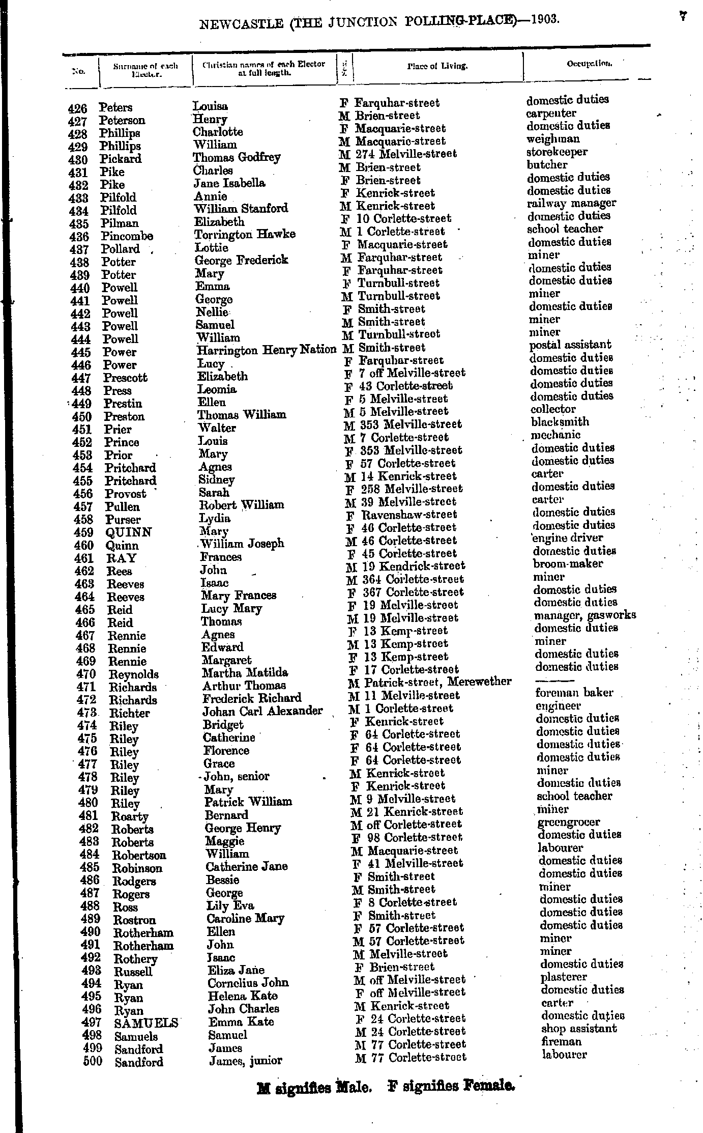
- Peters Louisa - Sandford James
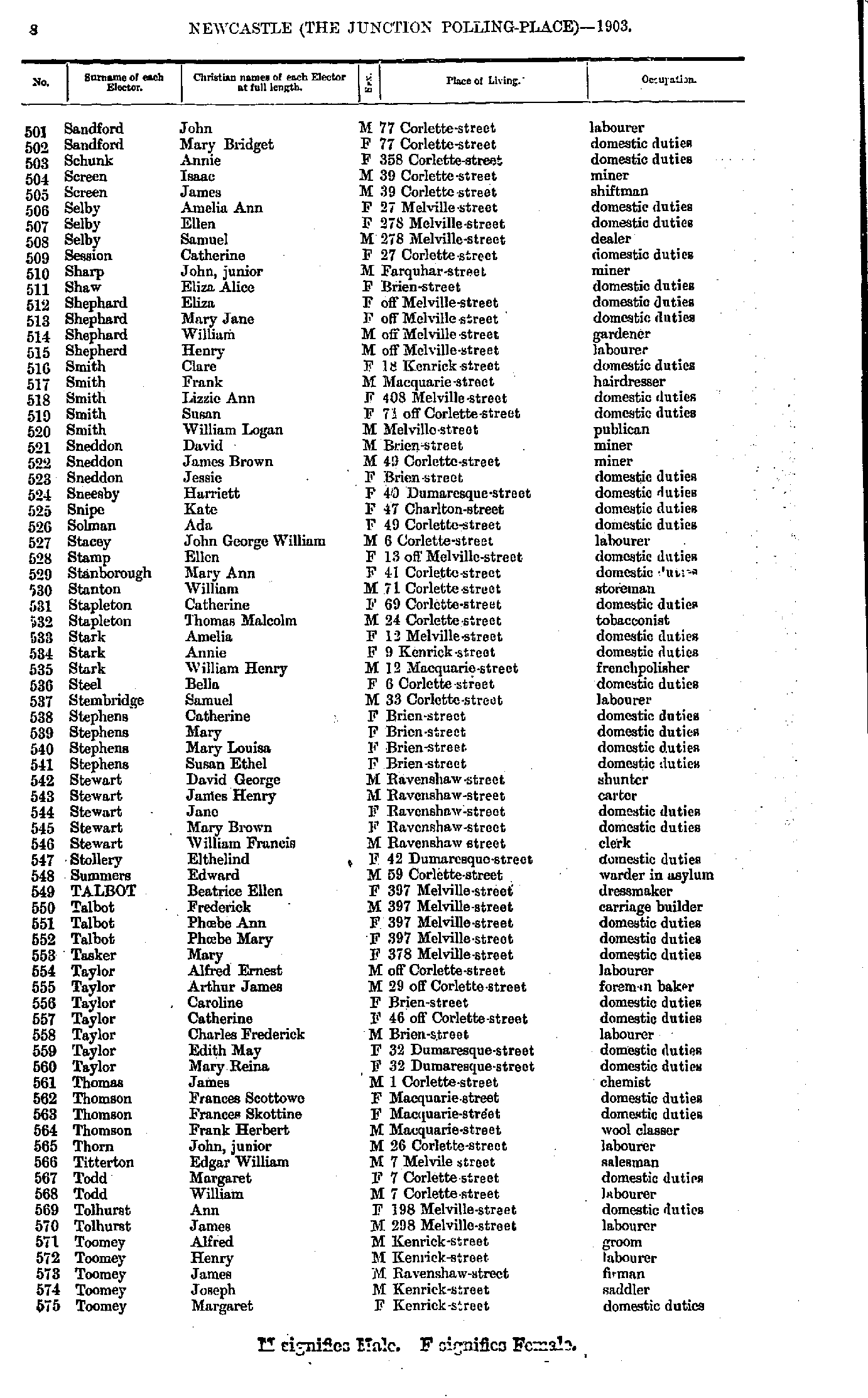
- Sandford John - Toomey Margaret
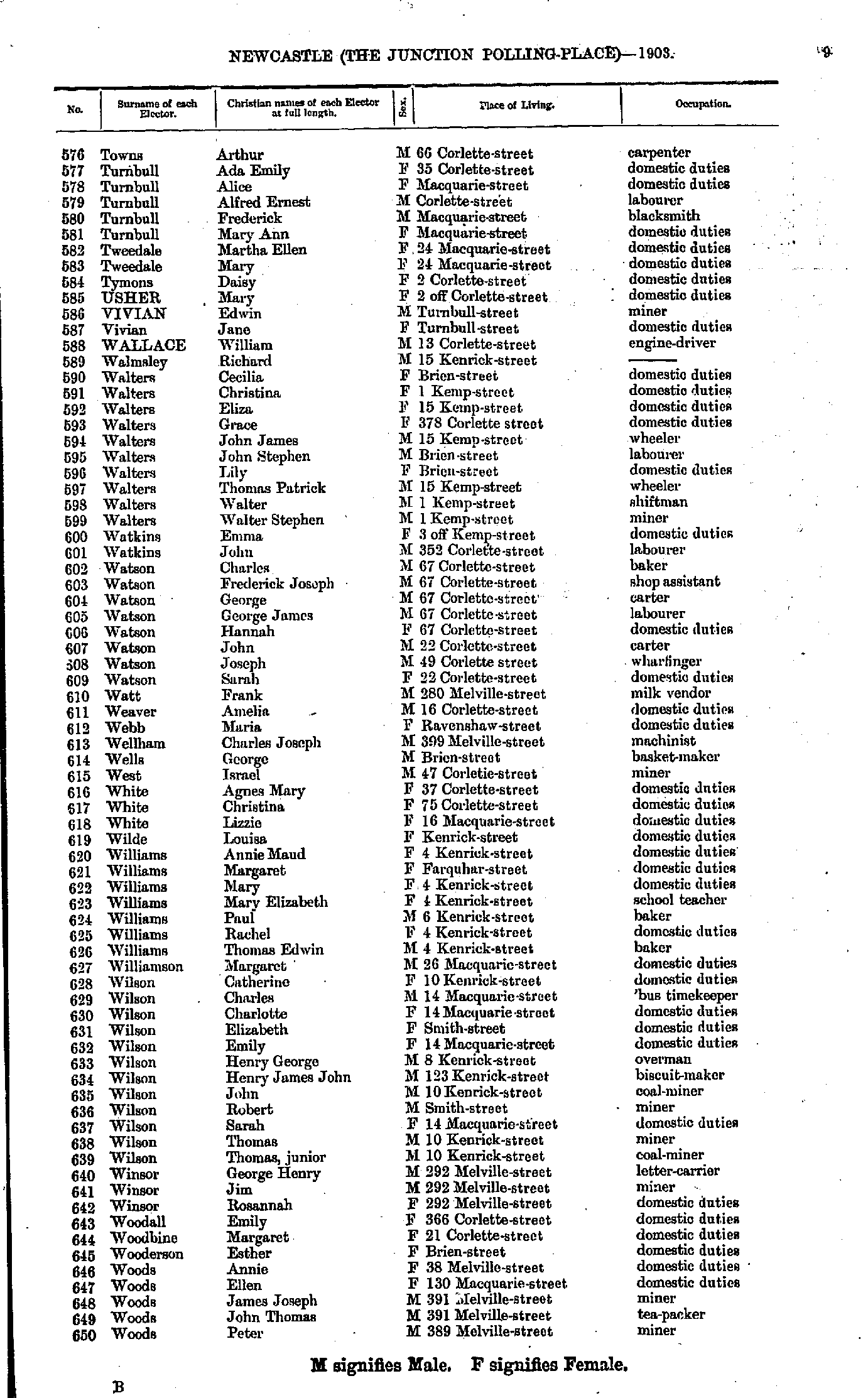
- Towns Arthur - Woods Peter
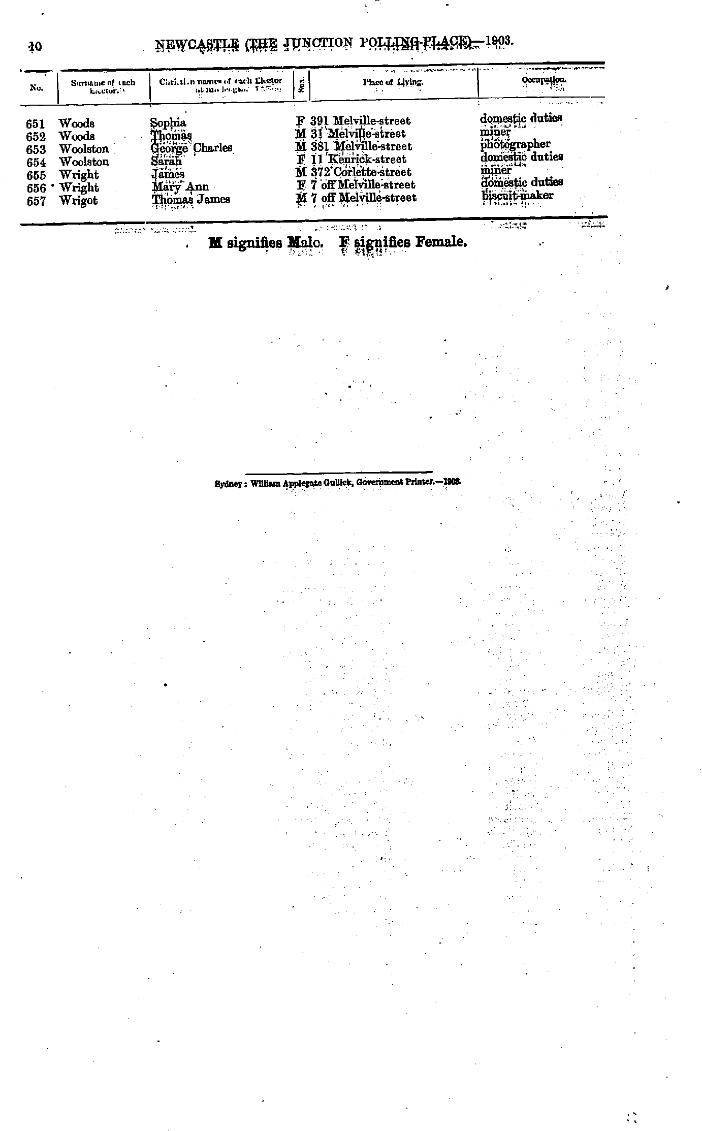
- Woods Sophia - Wrigot Thomas
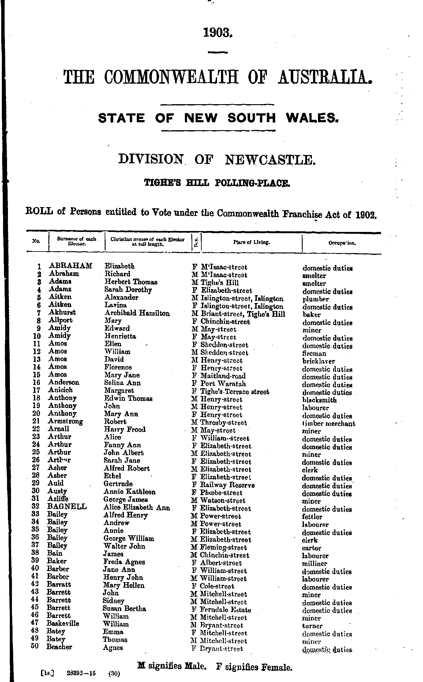
- Abraham Elizabeth - Beacher Agnes
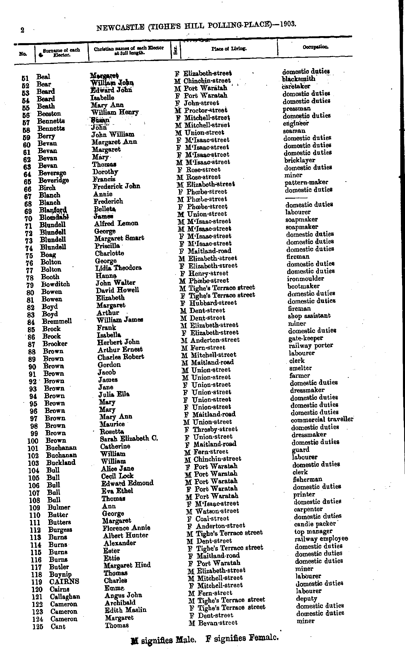
- Beal Margaret - Cant Thomas
- Cant Elizabeth - Croft Annie
- Croft Clarence - Duffield Maud
- Duffill John - Green John
- Green Julia - Hobson Arthur
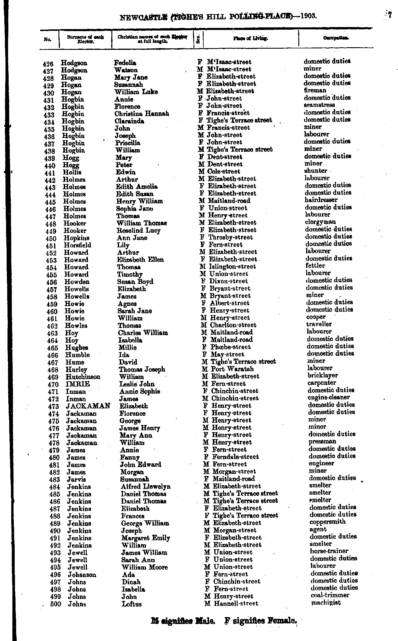
- Hodgson Fedelia - Johns Loftus
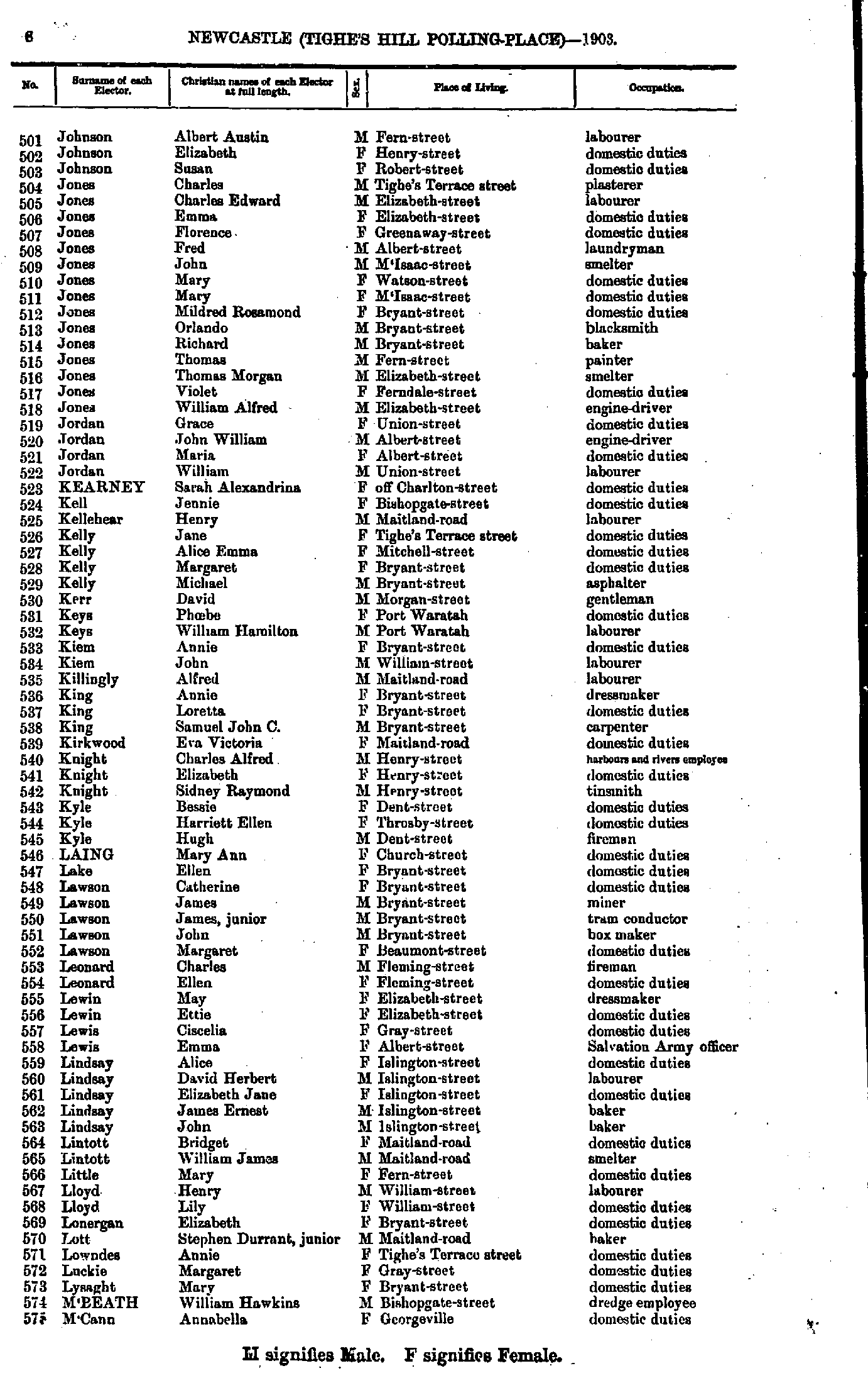
- Johnson Albert - M'Cann Annabella
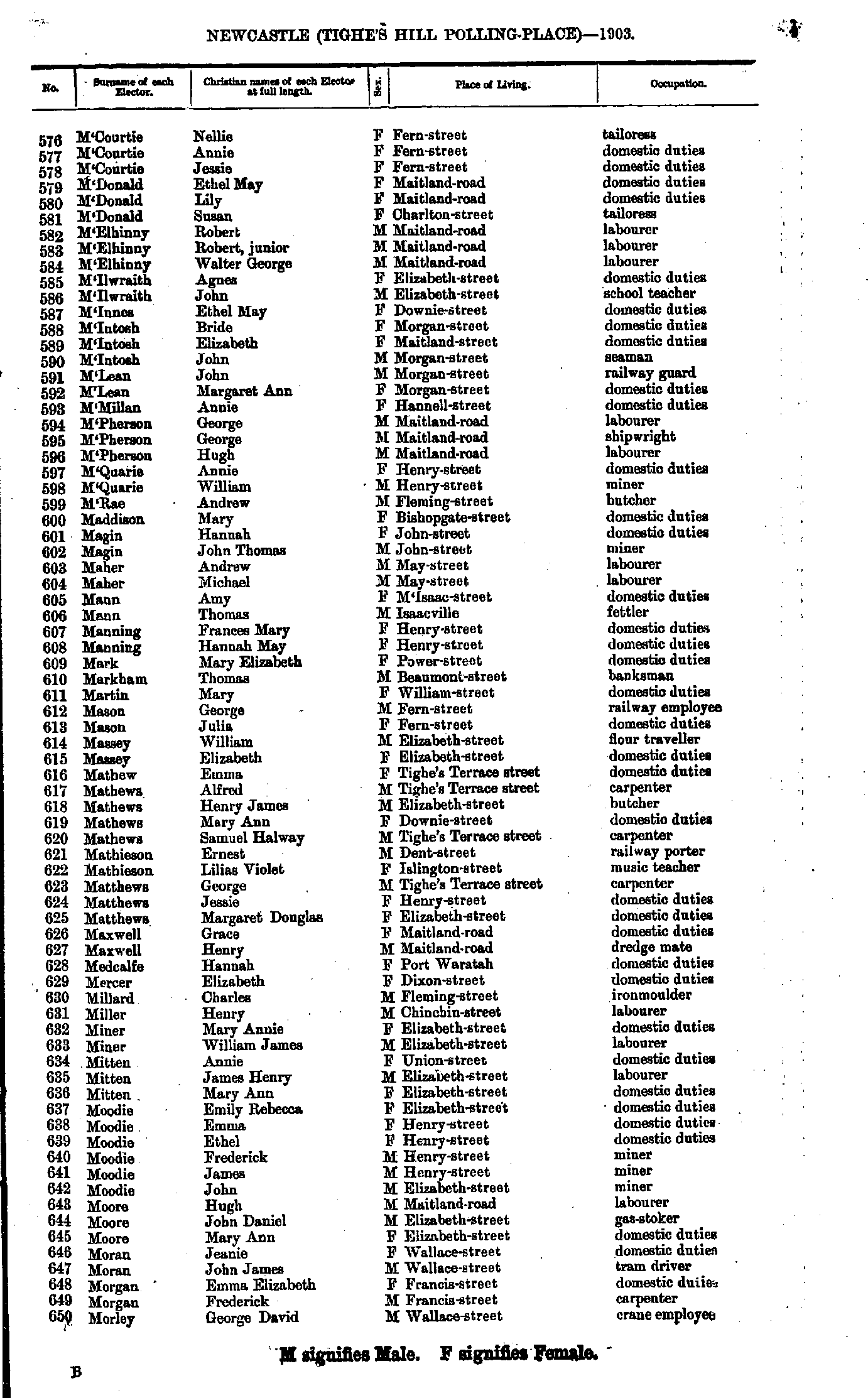
- M'Courtie Nellie - Morley George
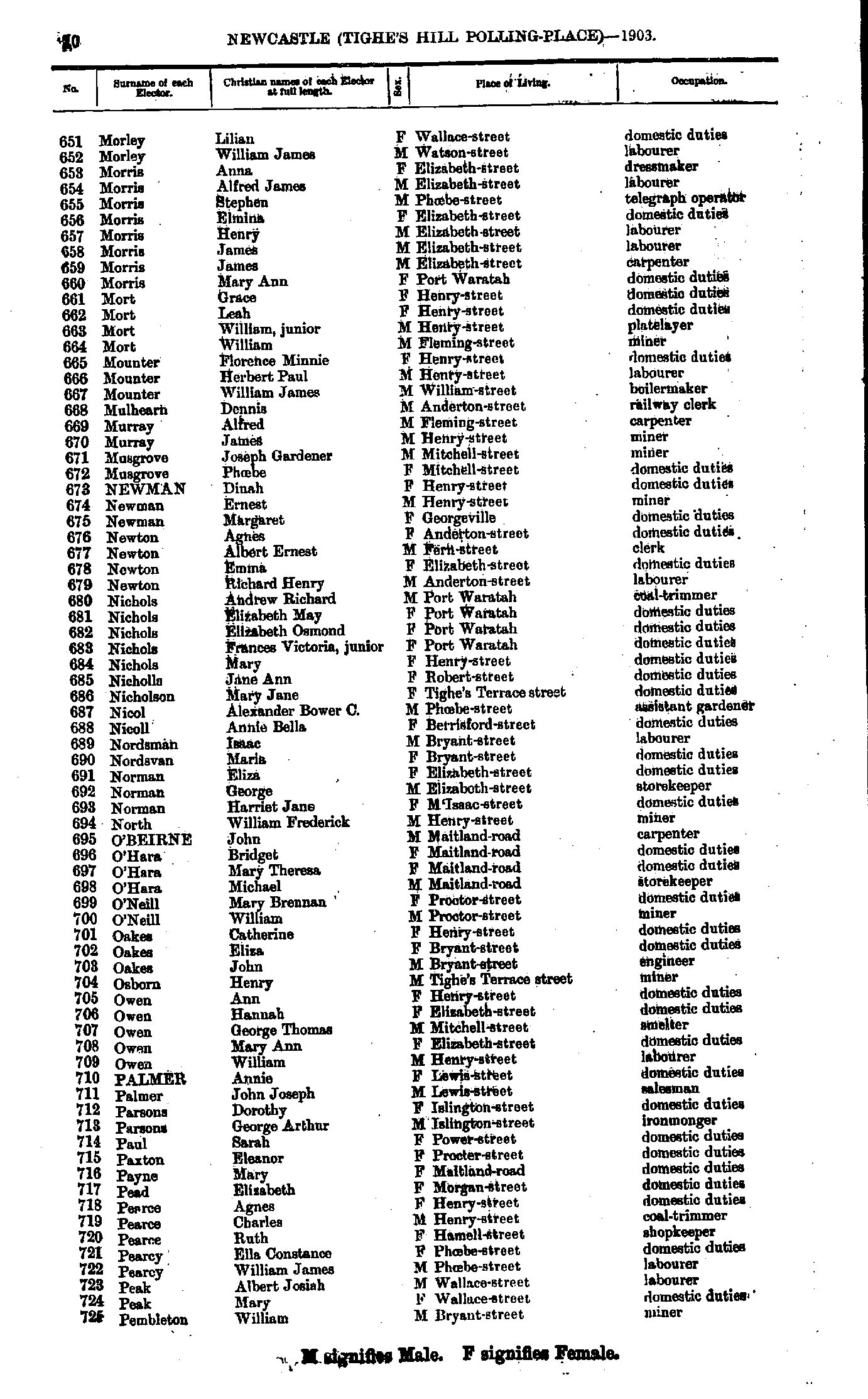
- Morley Lilian - Pembleton William
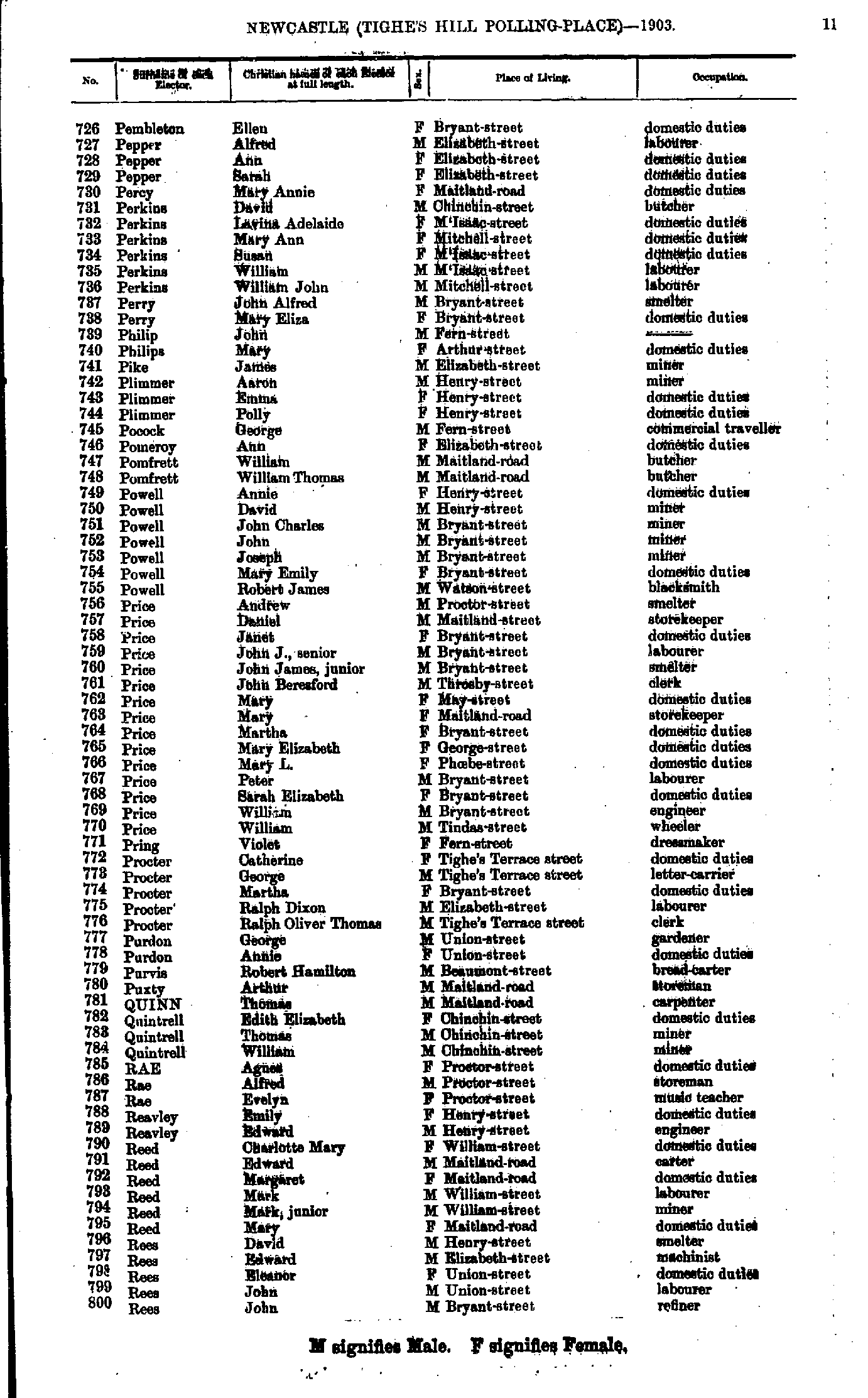
- Pembleton Ellen - Rees John
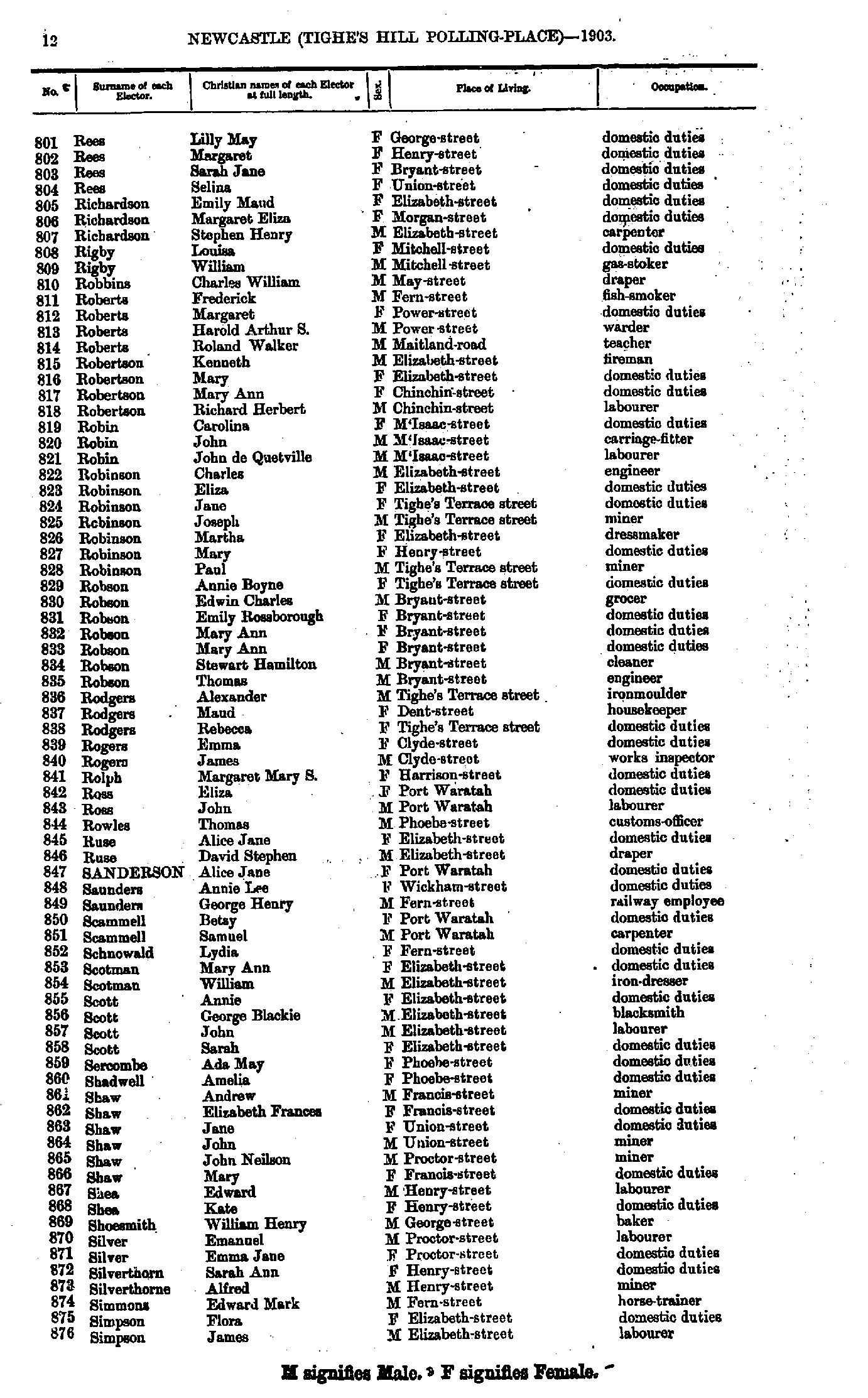
- Rees Lilly - Simpson James
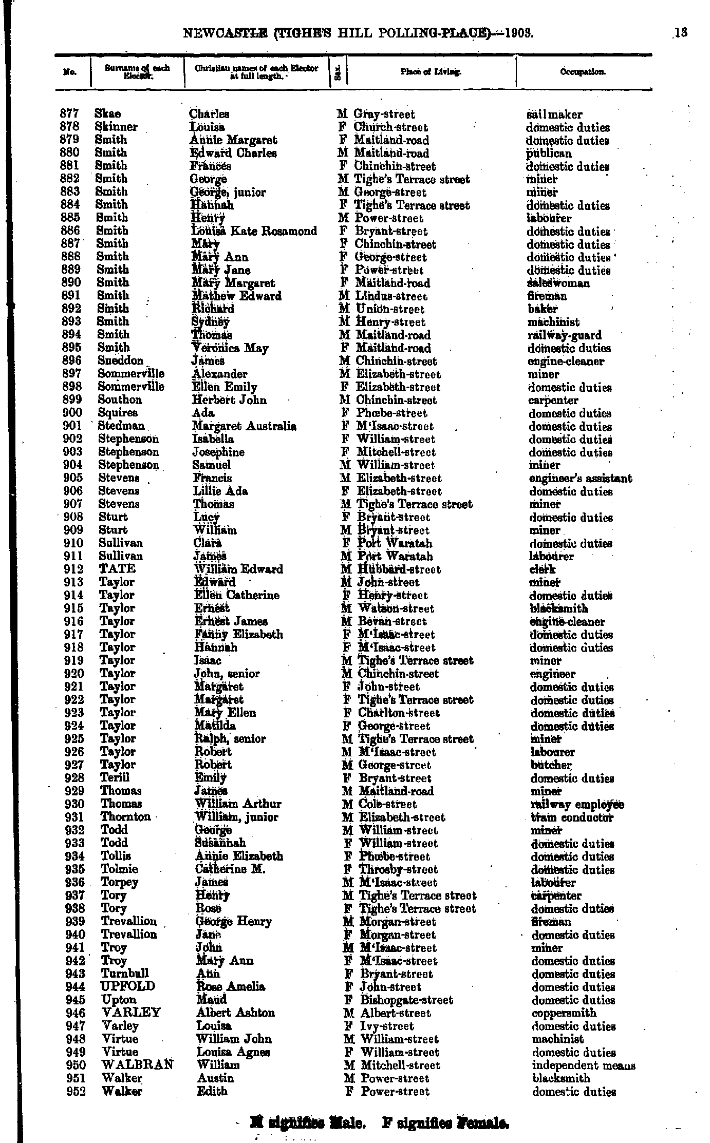
- Skae Charles - Walker Edith
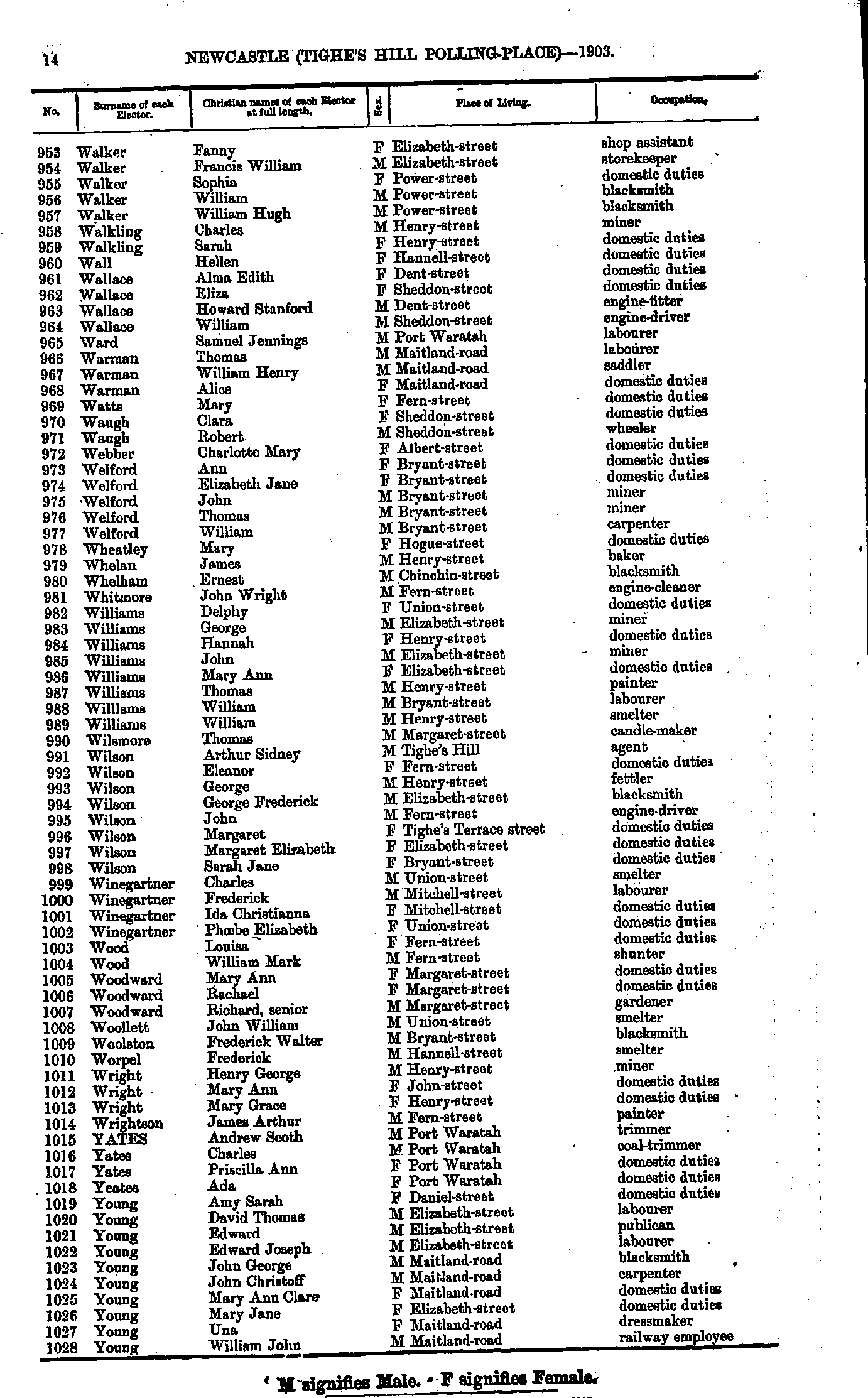
- Walker Fanny - Young William
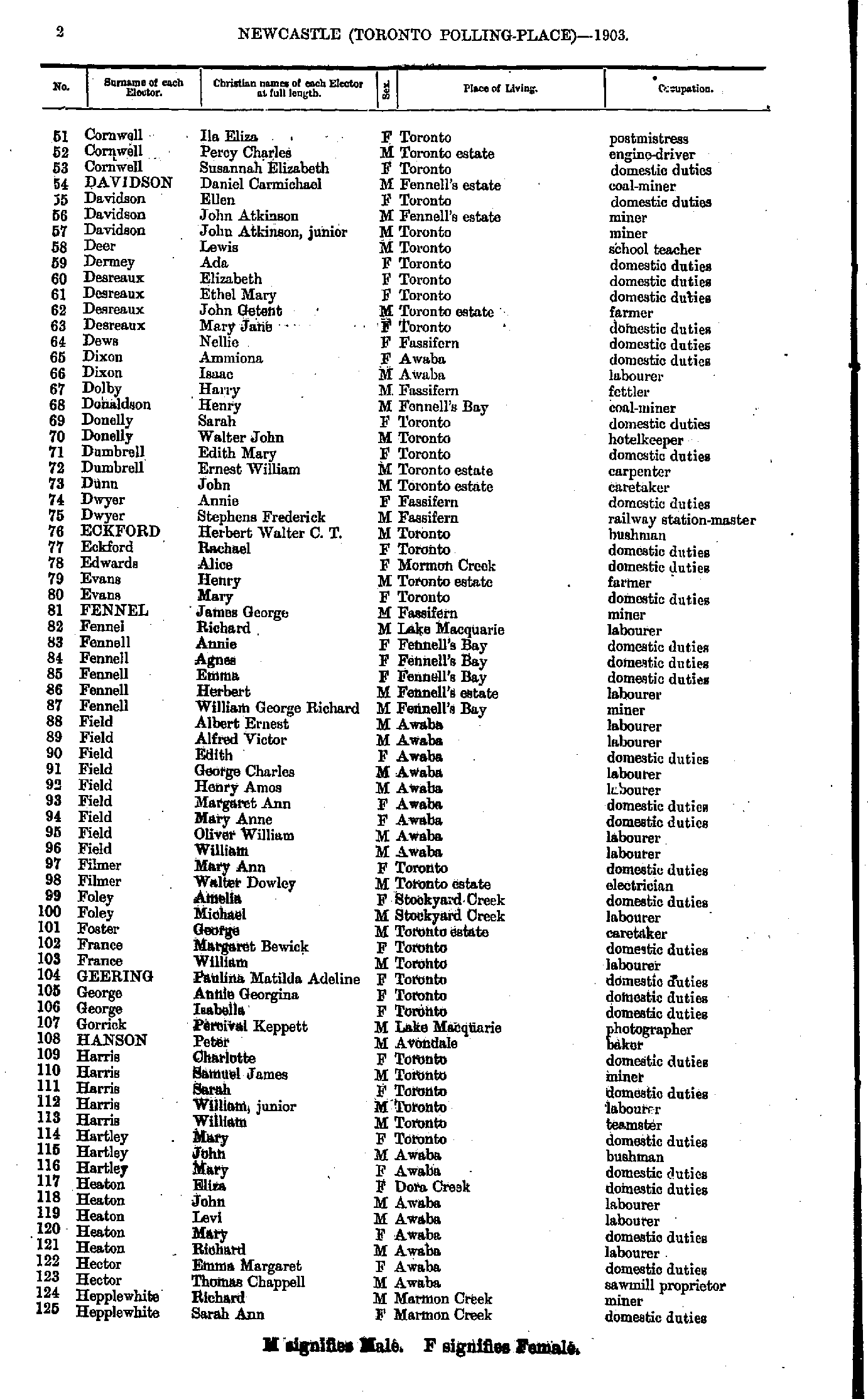
- Ackerman Arthur - Cornwell Alfred
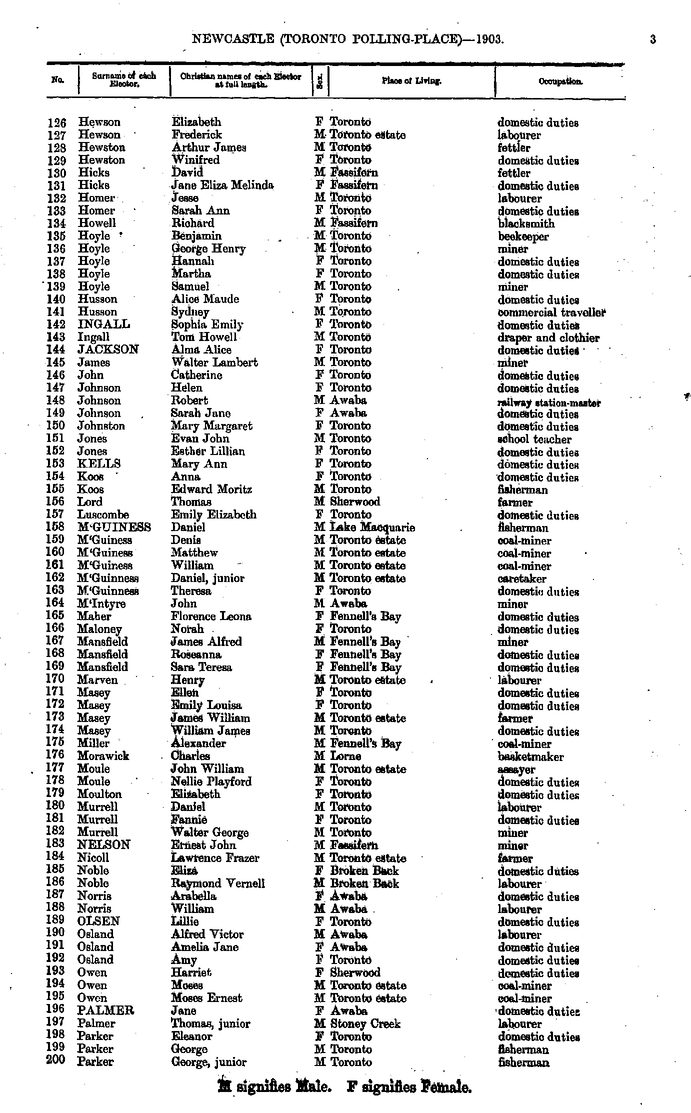
- Cornwell Ila - Hepplewhite Sarah
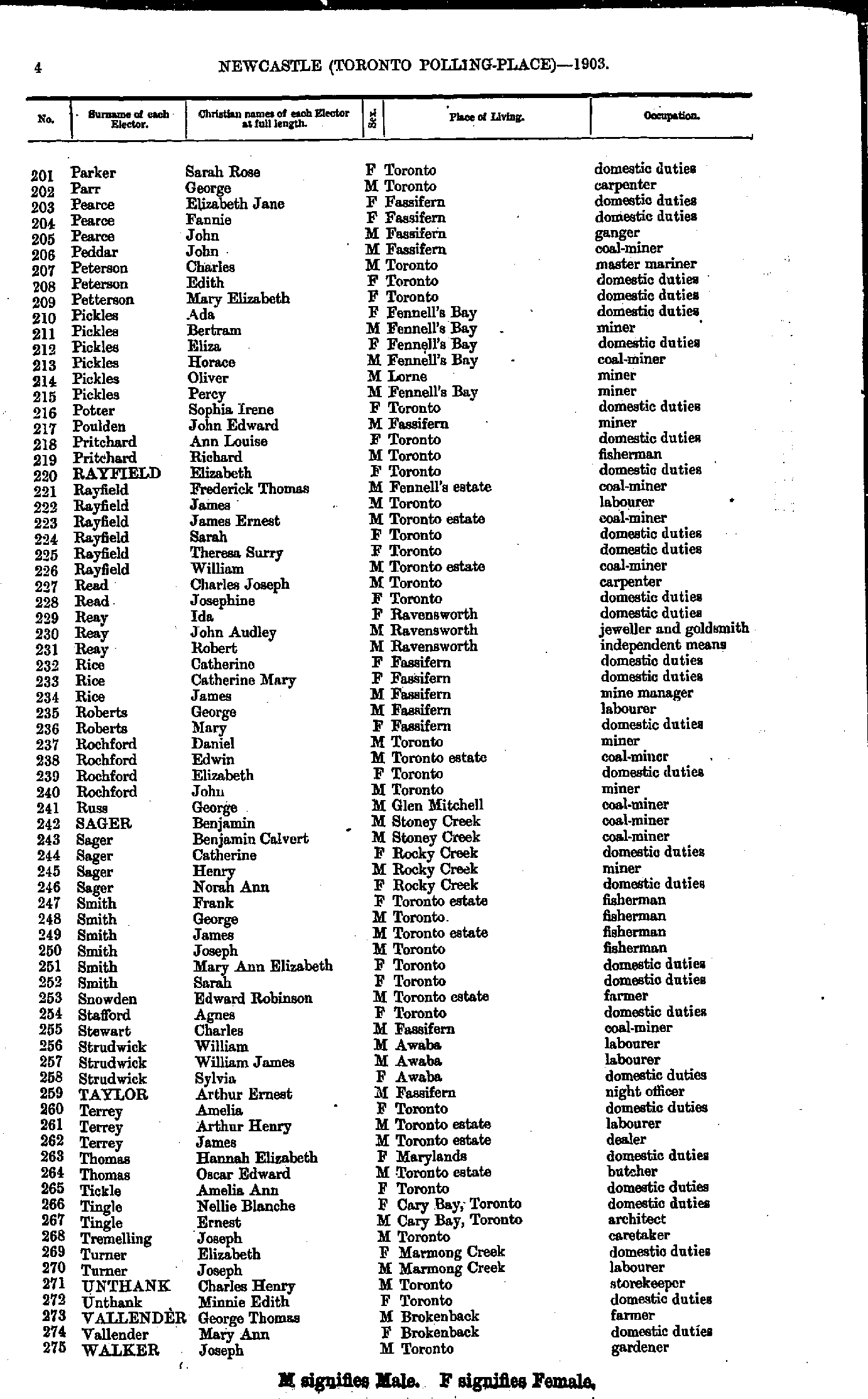
- Hewson Elizabeth - Parker George
- Parker Sarah - Walker Joseph
- Walker John - Young John
- Abell Alexander - Armstrong William
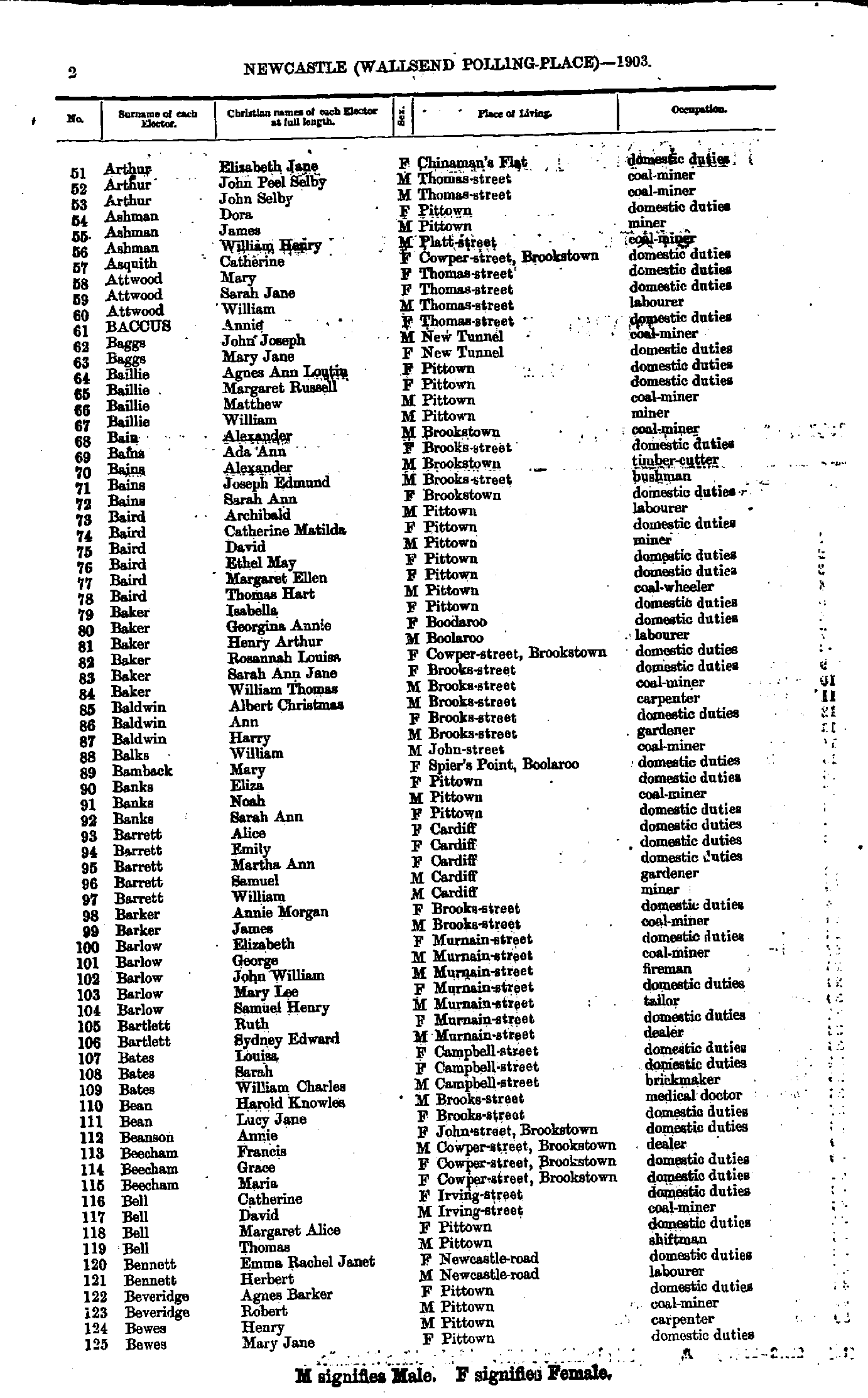
- Arthur Elizabeth - Bewes Mary
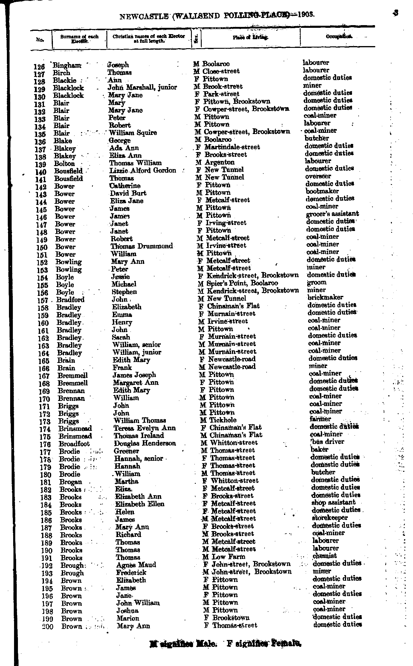
- Bingham Joseph - Brown Mary
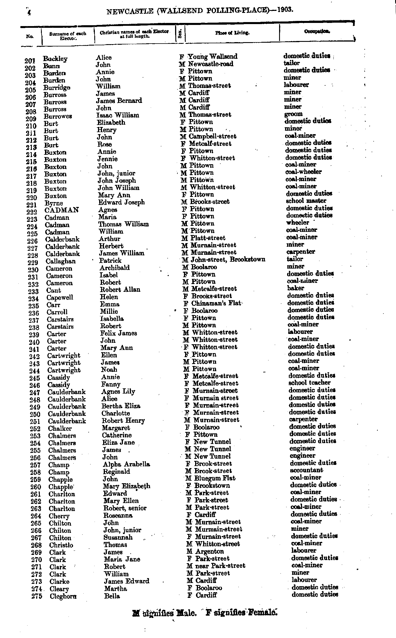
- Buckley Alice - Cleghorn Bella
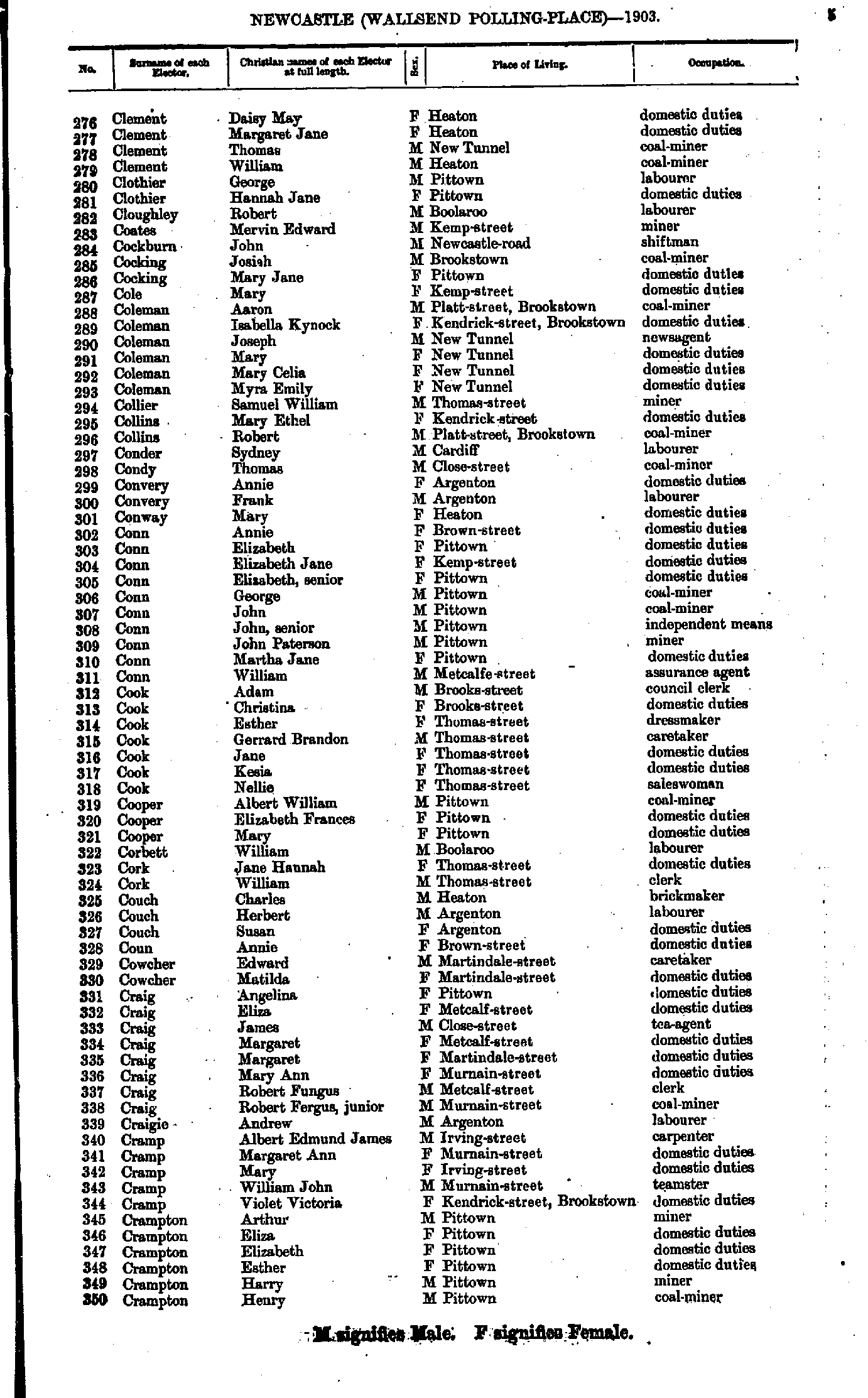
- Clement Daisy - Crampton Henry
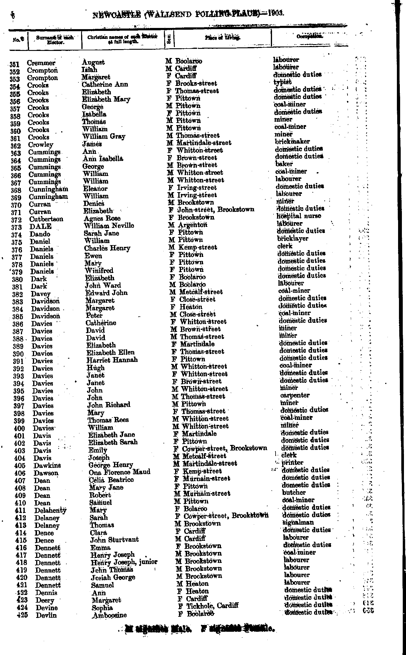
- Cremmer August - Devlin Amboosine
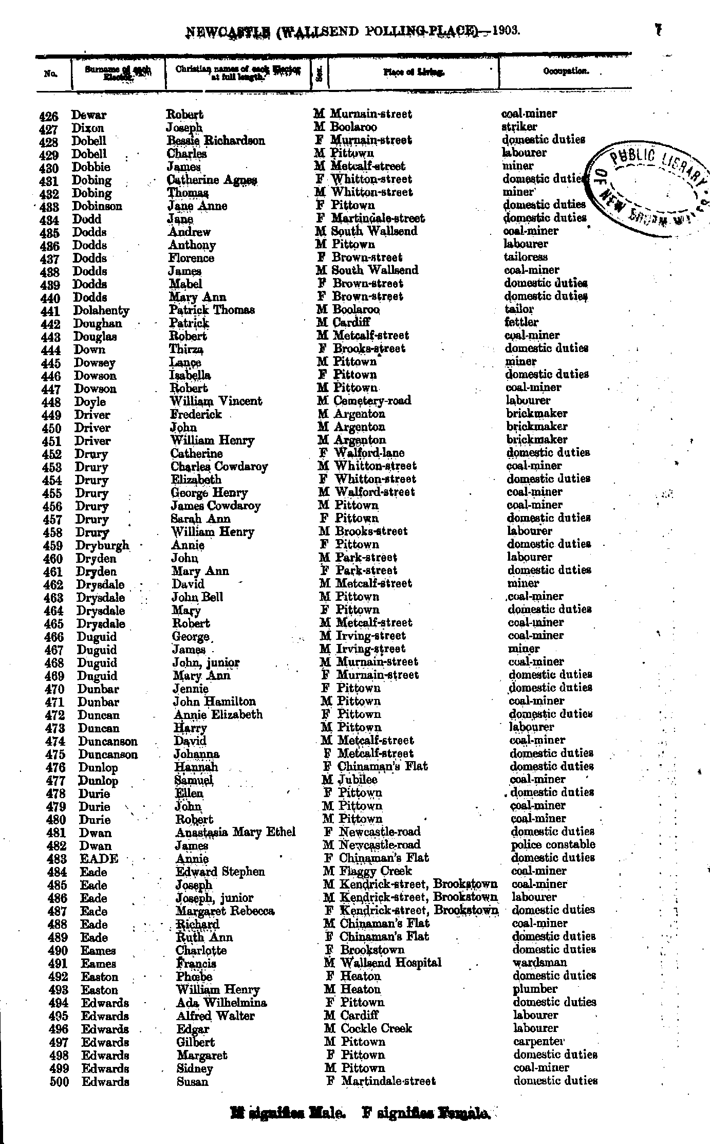
- Dewar Robert - Edwards Susan
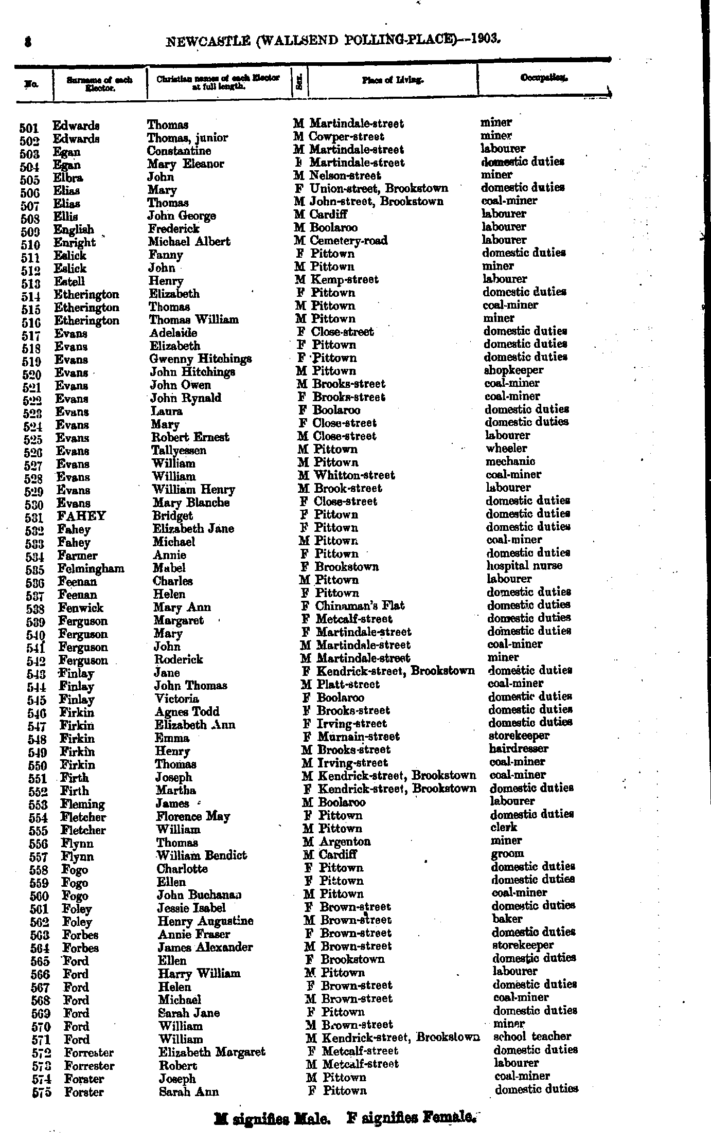
- Edwards Thomas - Forster Sarah
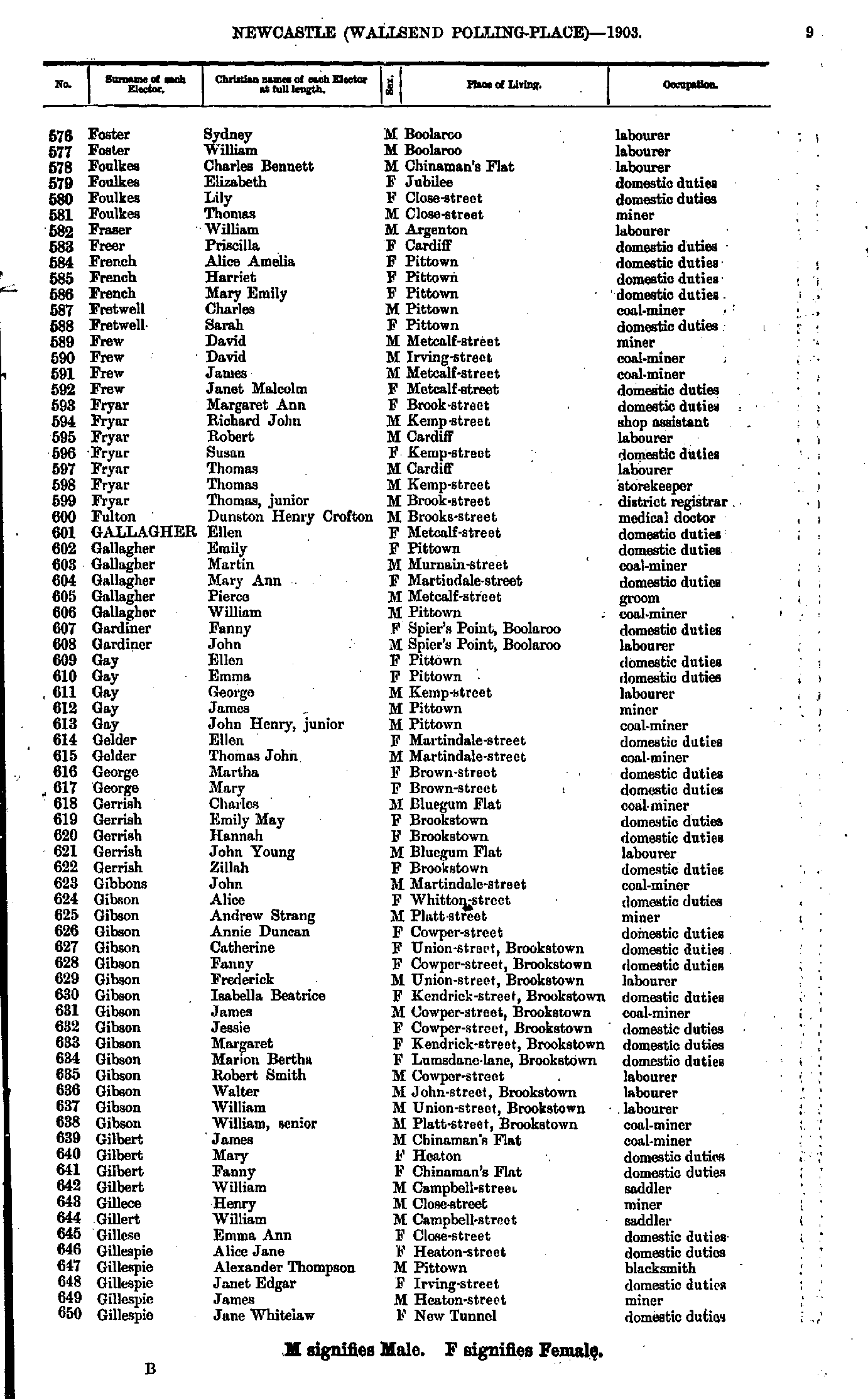
- Foster Sydney - Gillespie Jane
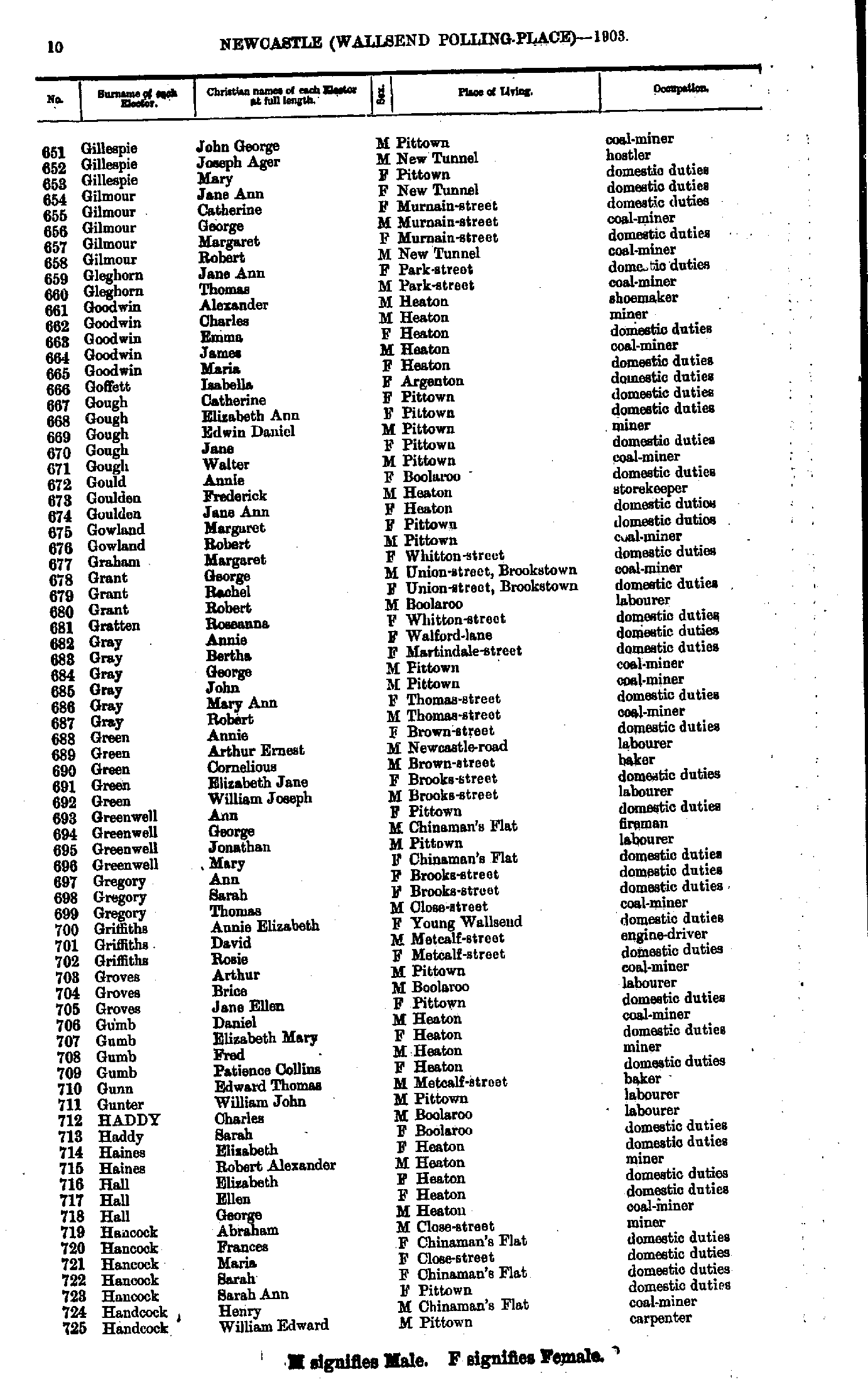
- Gillespie John - Handcock William
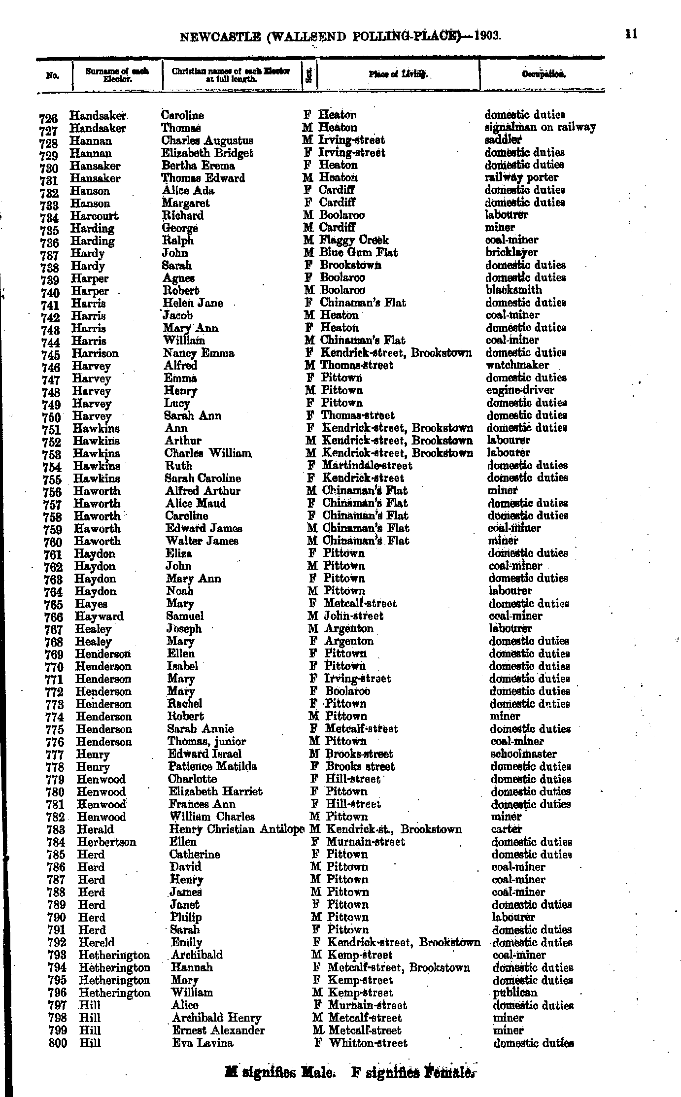
- Handsaker Caroline - Hill Eva
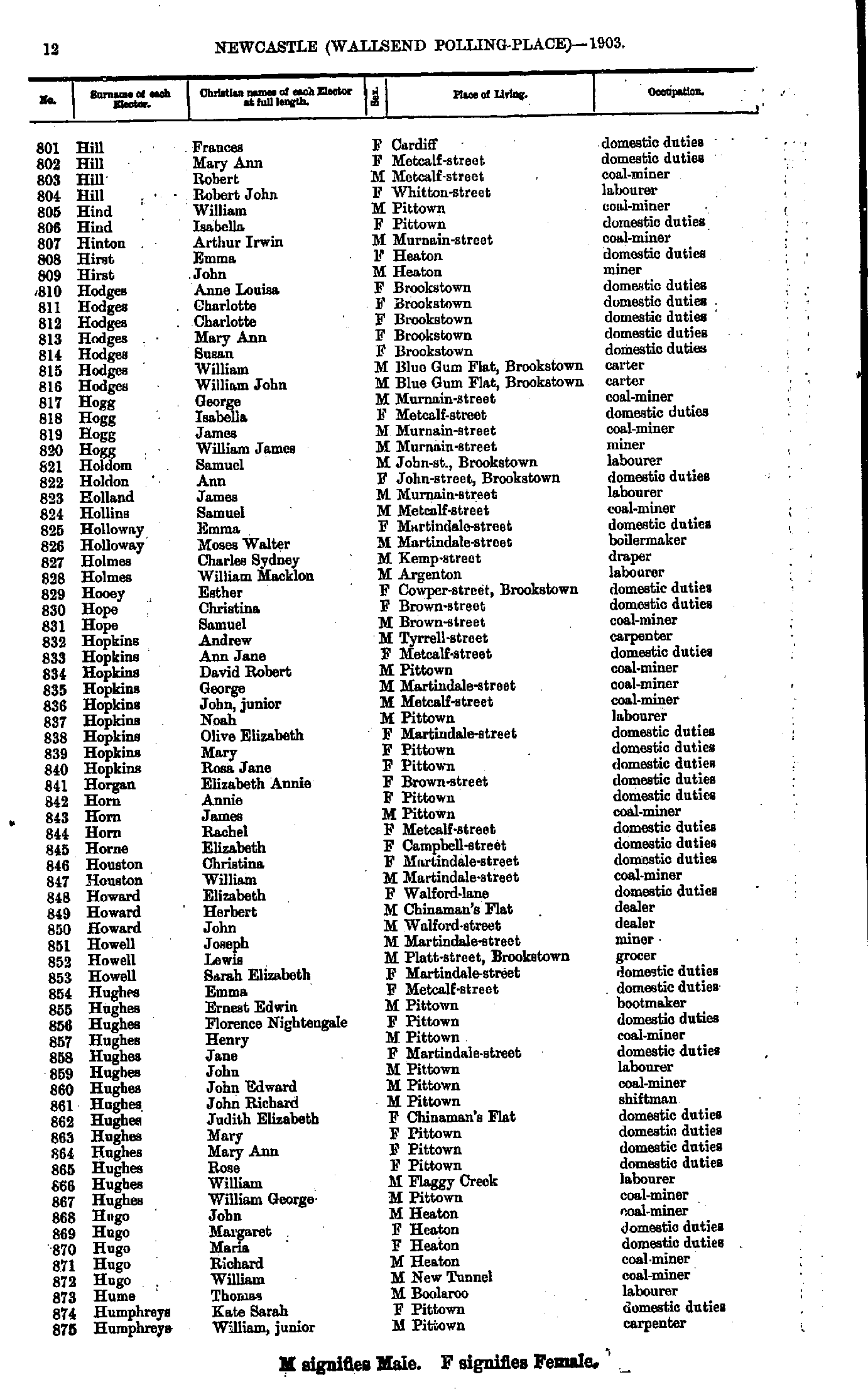
- Hill Frances - Humphreys William
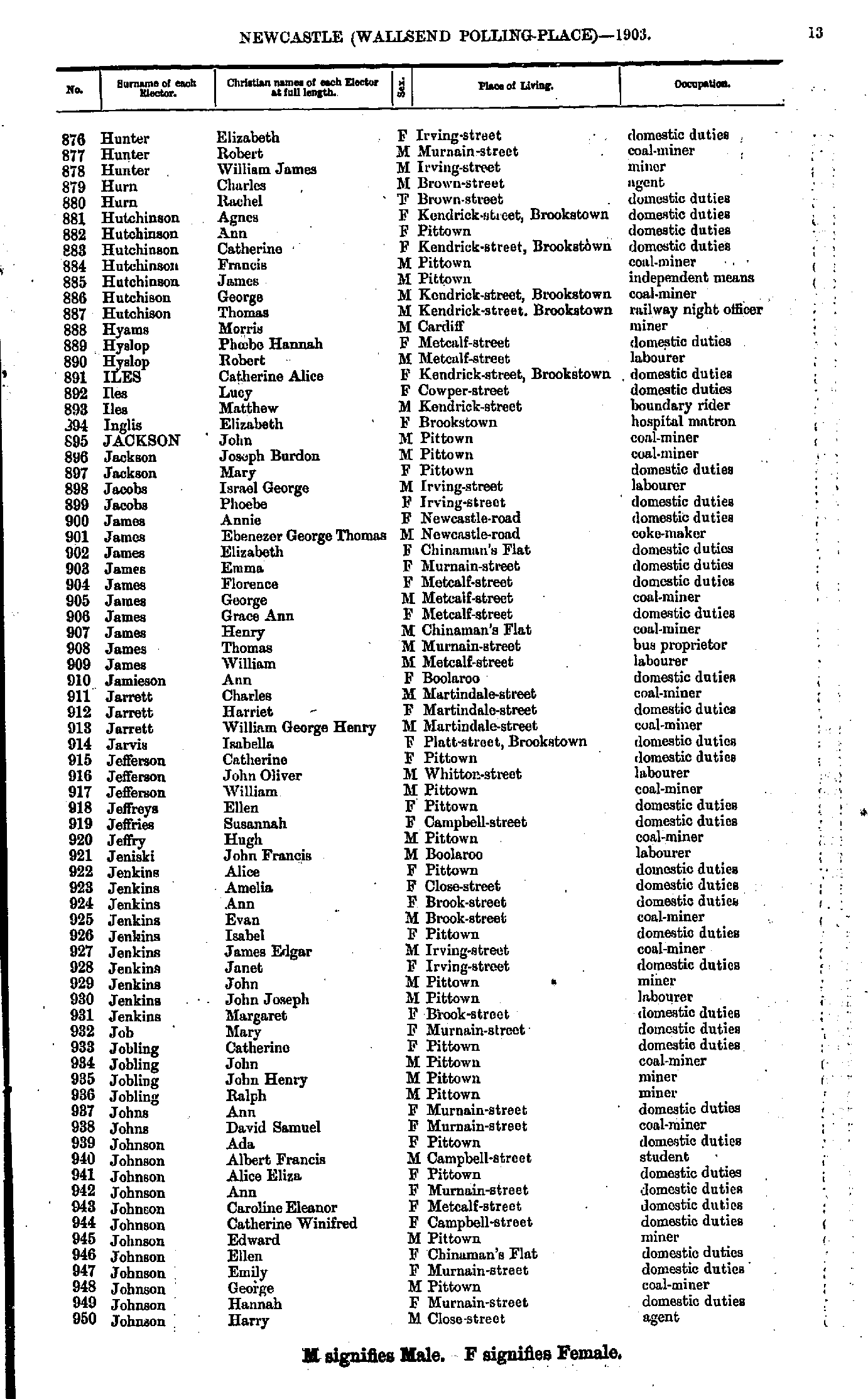
- Hunter Elizabeth - Johnson Harry
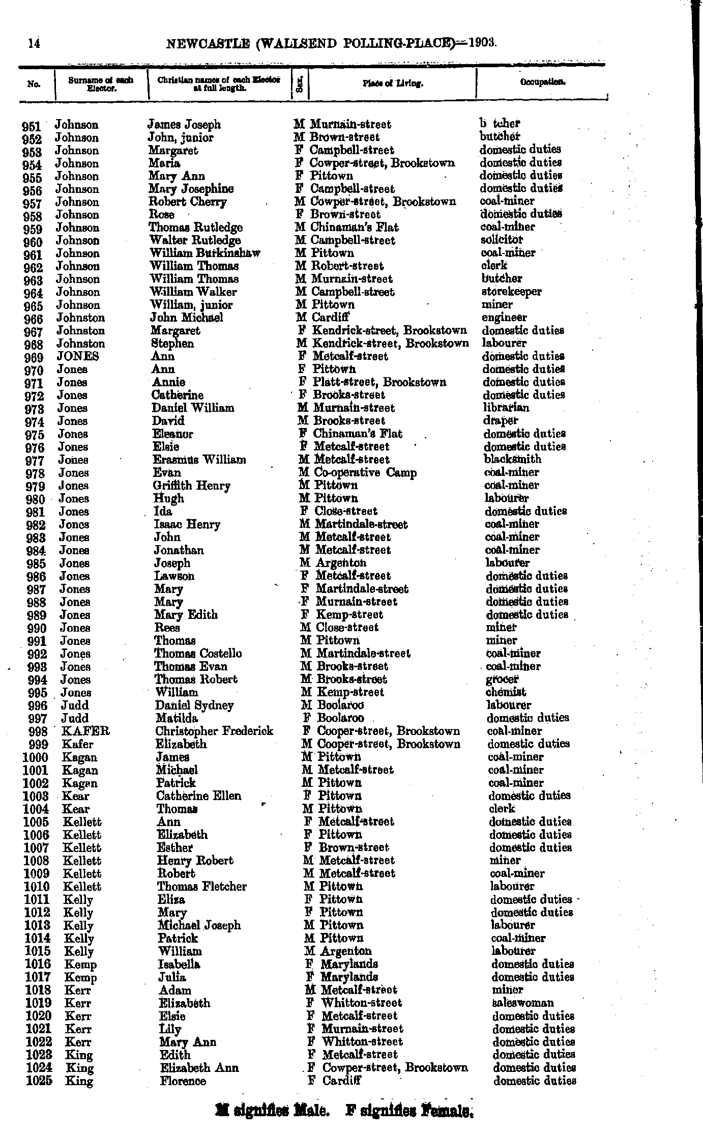
- Johnson James - King Florence
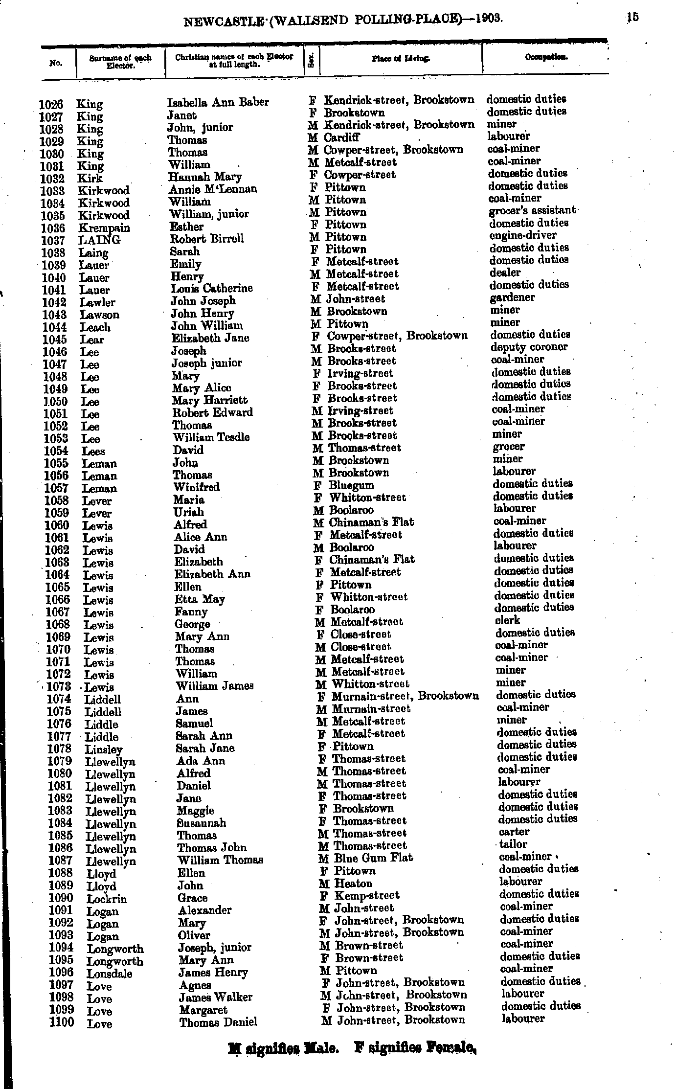
- King Isabella - Love Thomas
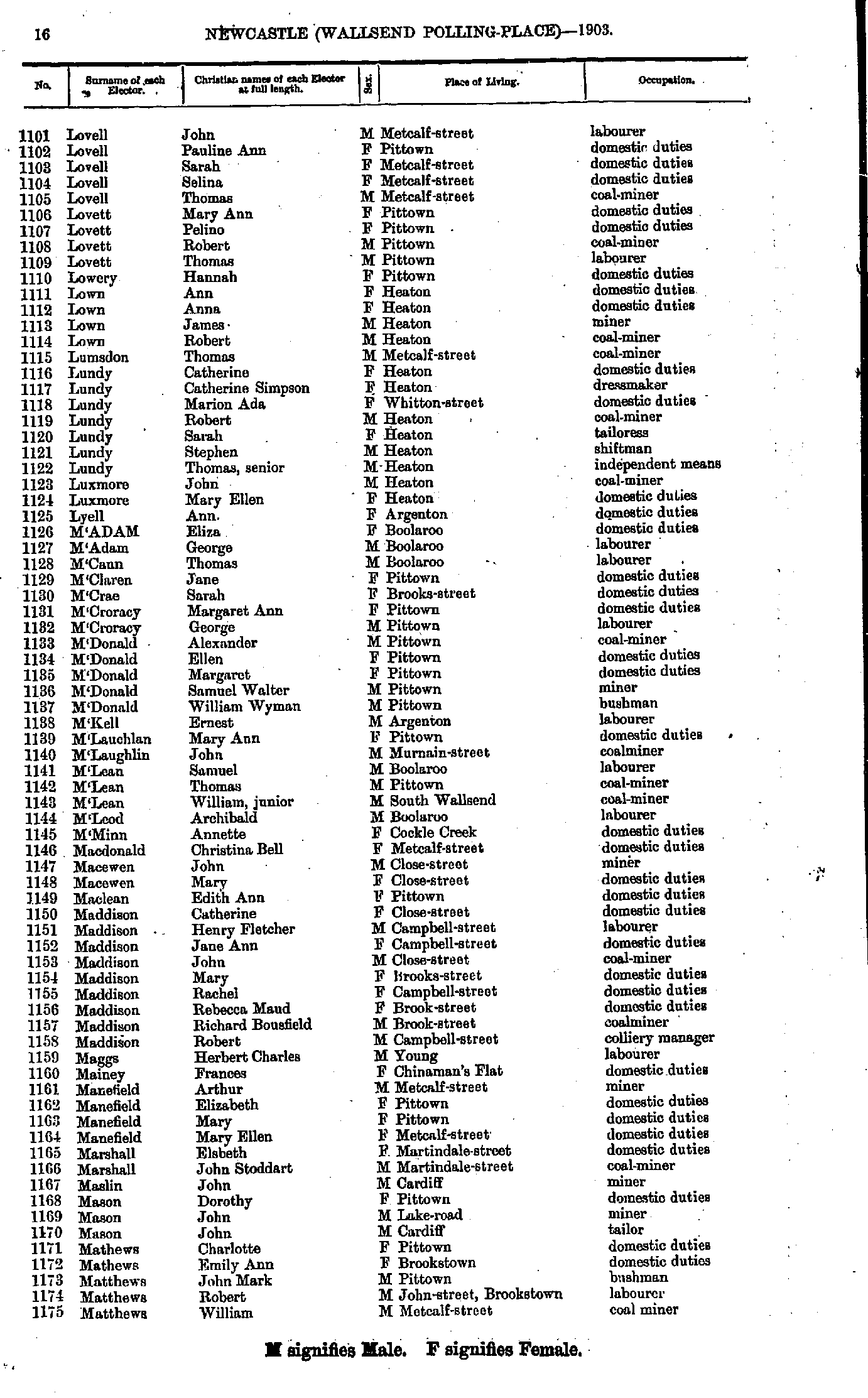
- Lovell John - Matthews William
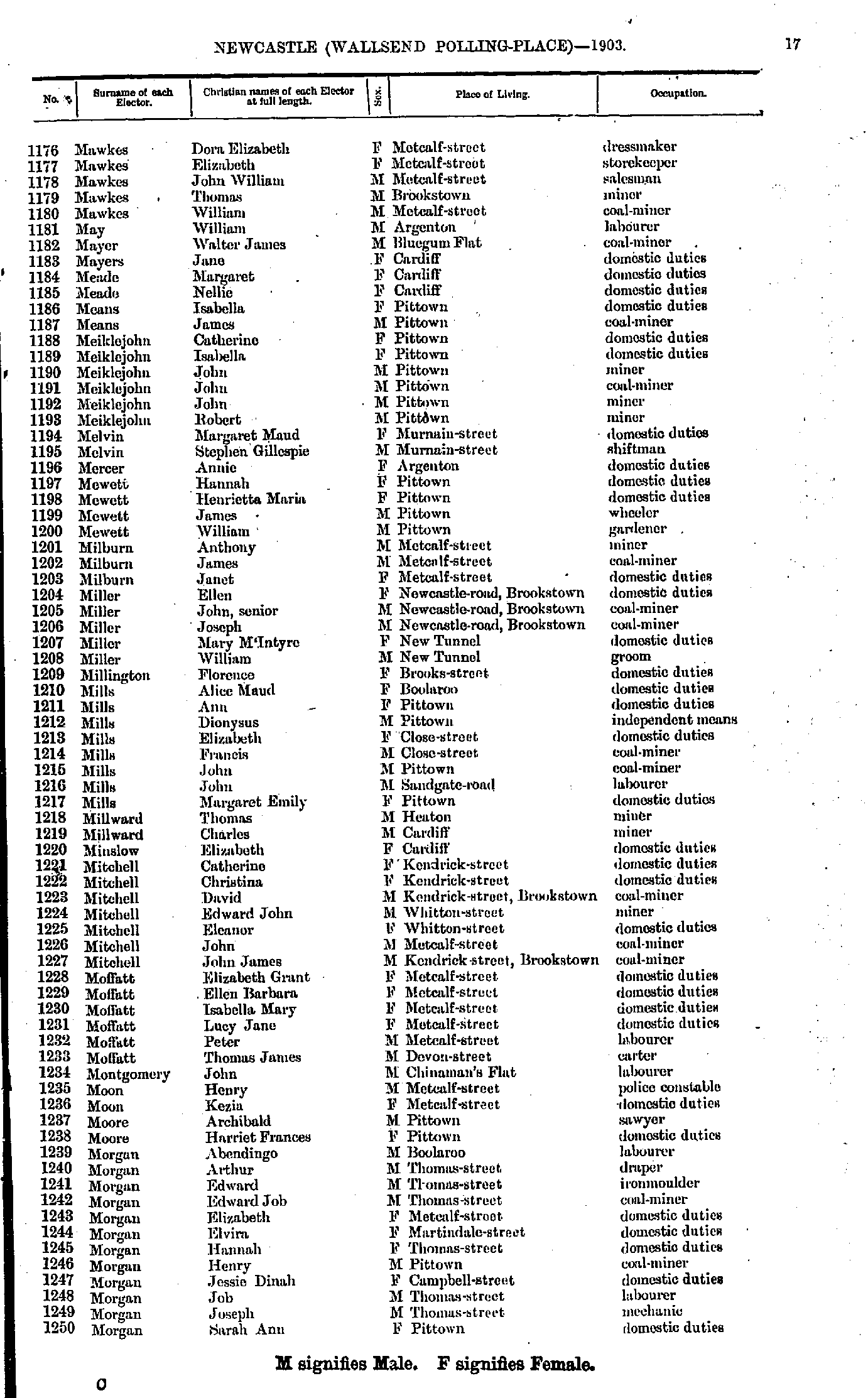
- Mawkes Dora - Morgan Sarah
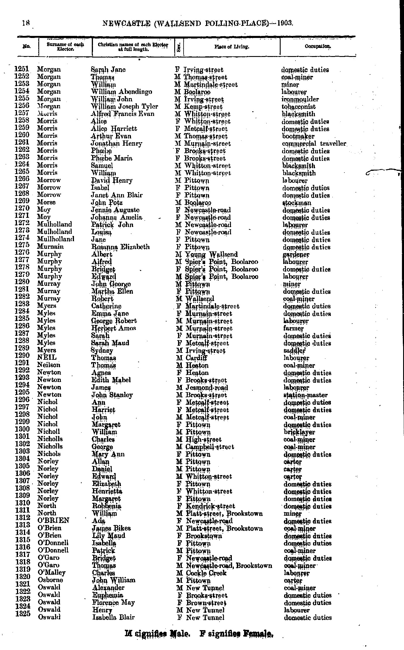
- Morgan Sarah - Oswald Isabella
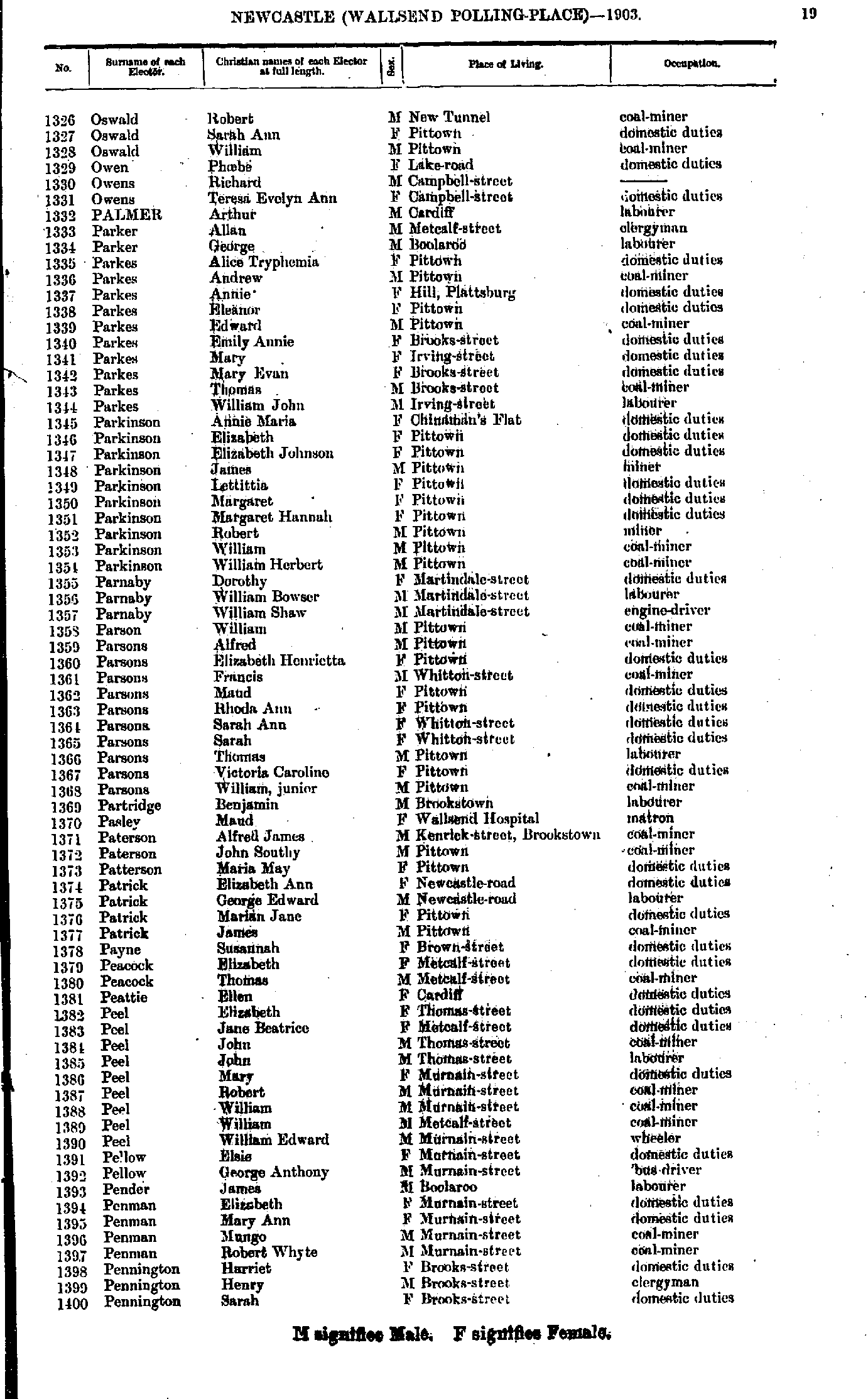
- Oswald Robert - Pennington Sarah
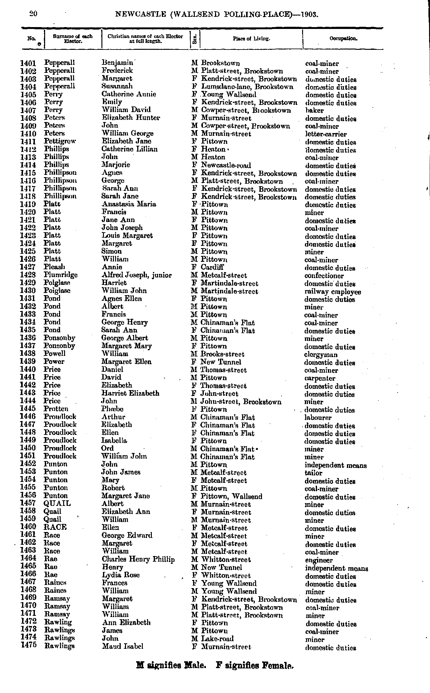
- Pepperall Benjamin - Rawlings Maud
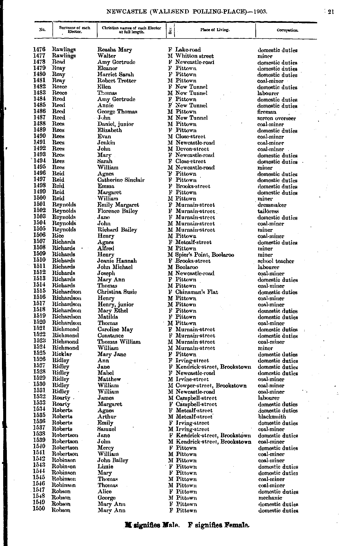
- Rawlings Reasha - Robson Mary
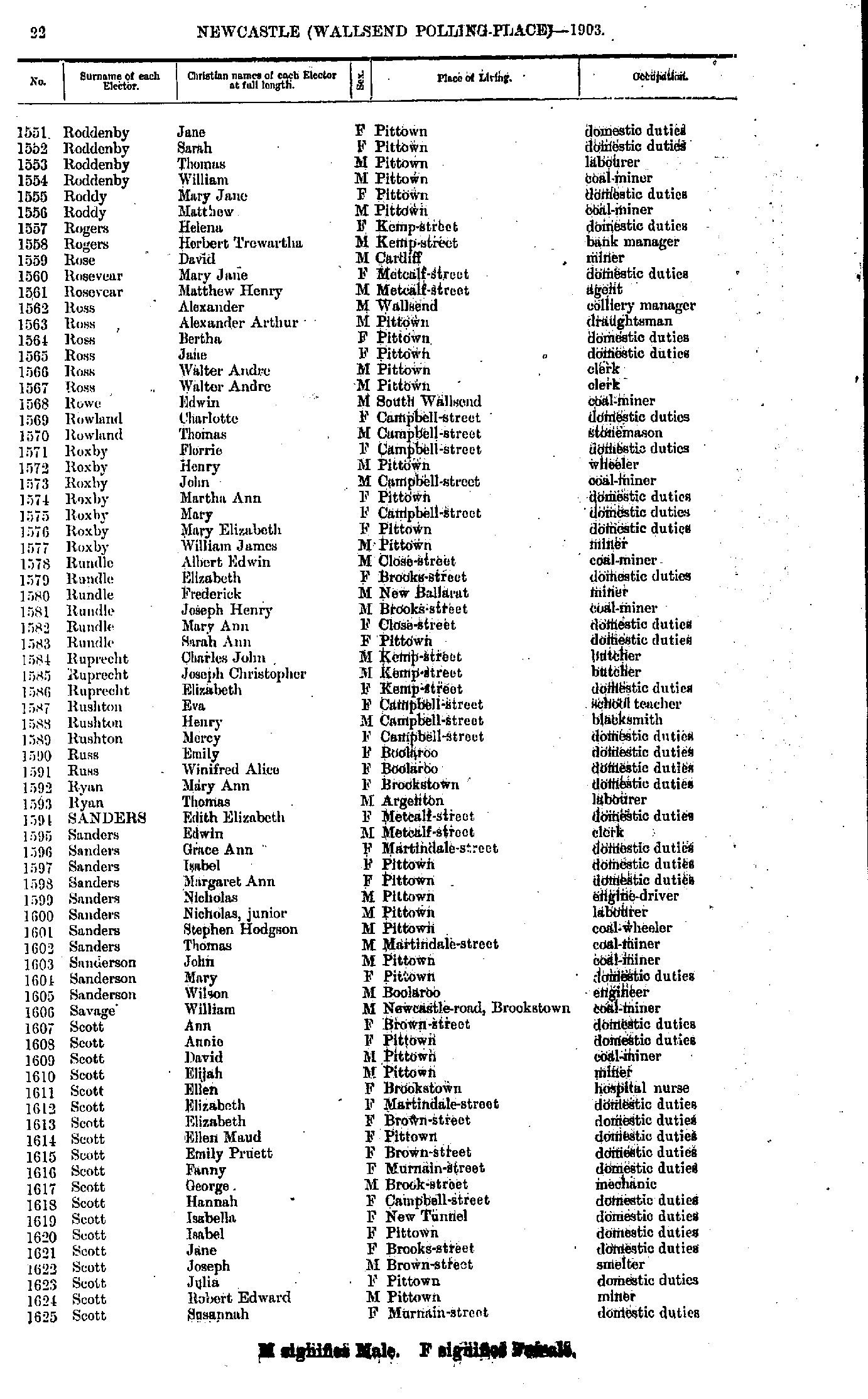
- Roddenby Jane - Scott Susannah
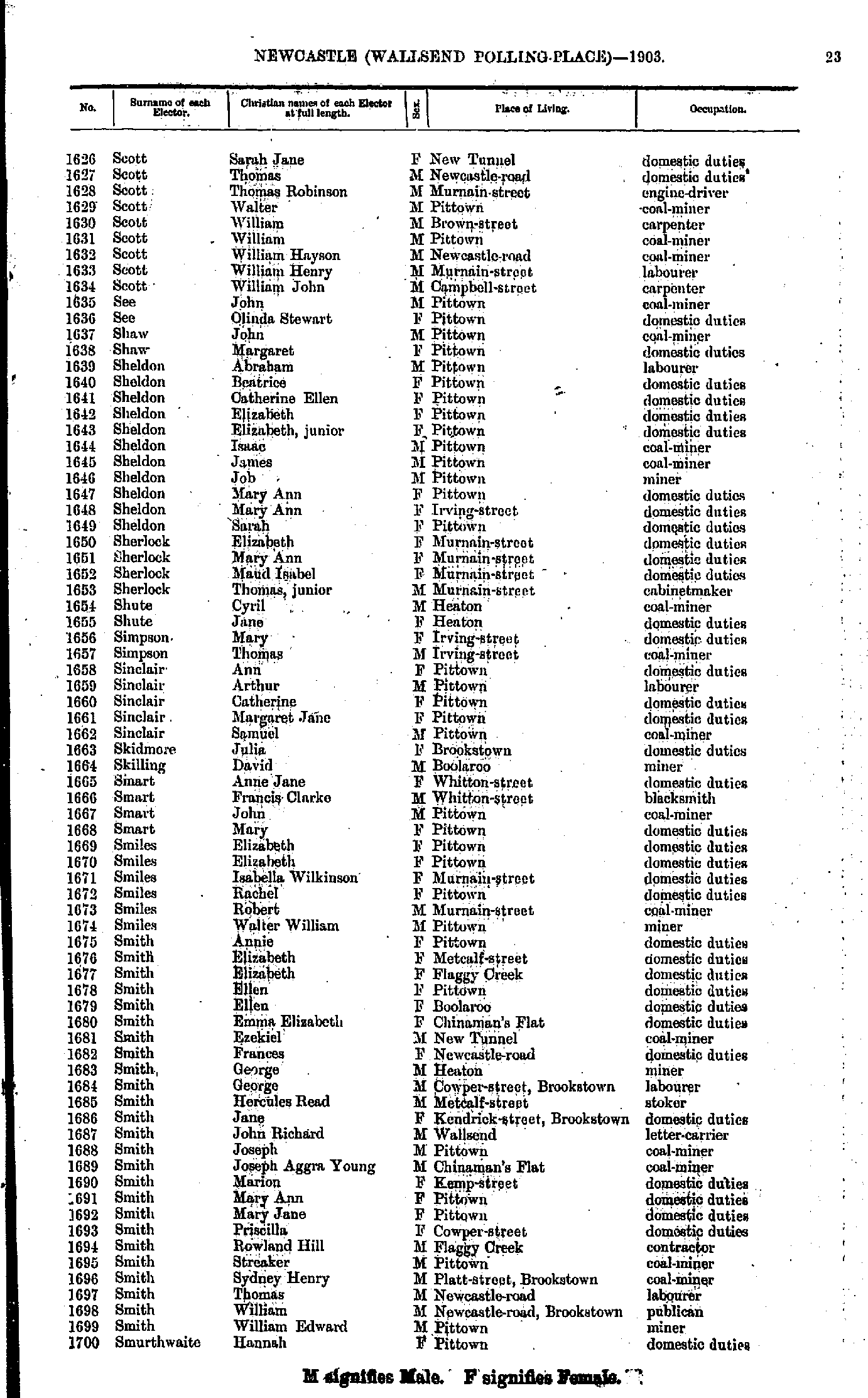
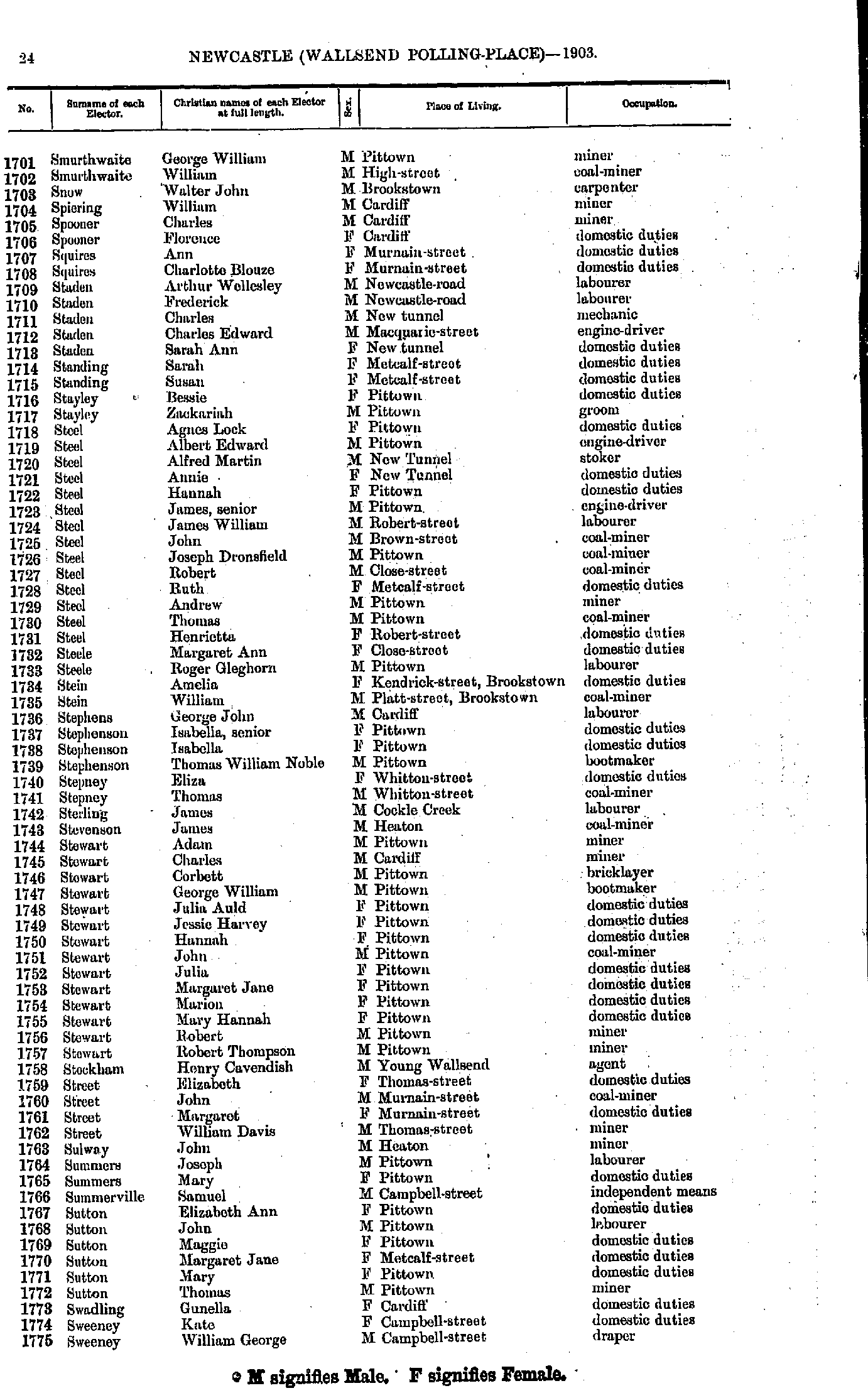
- Scott Sarah - Smurthwaite Hannah
- Smurthwaite George - Sweeney William
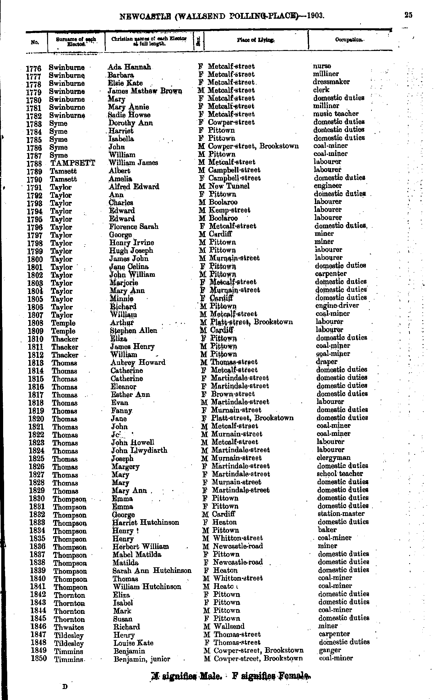
- Swinburne Ada - Timmins Benjamin
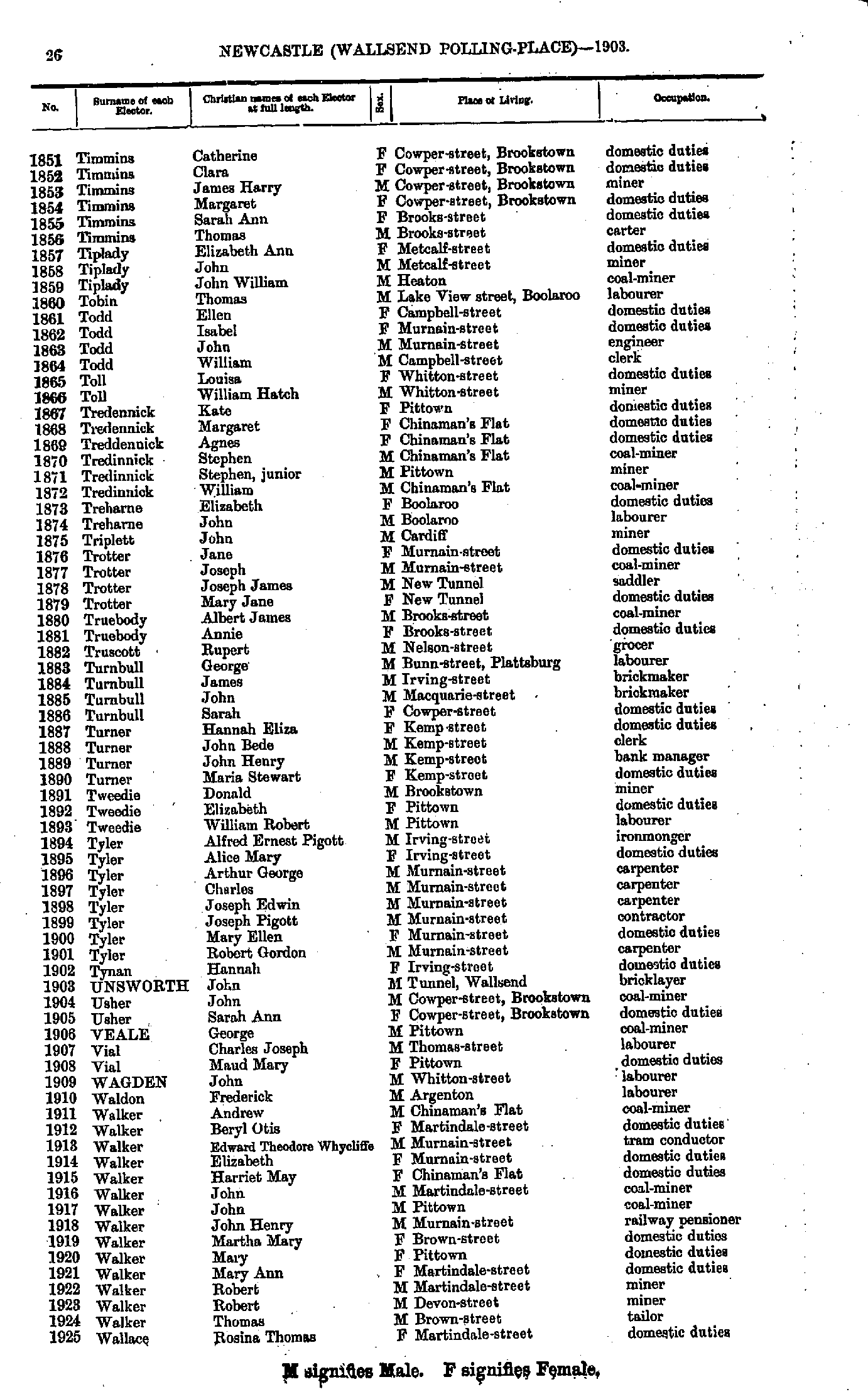
- Timmins Catherine - Wallace Rosina
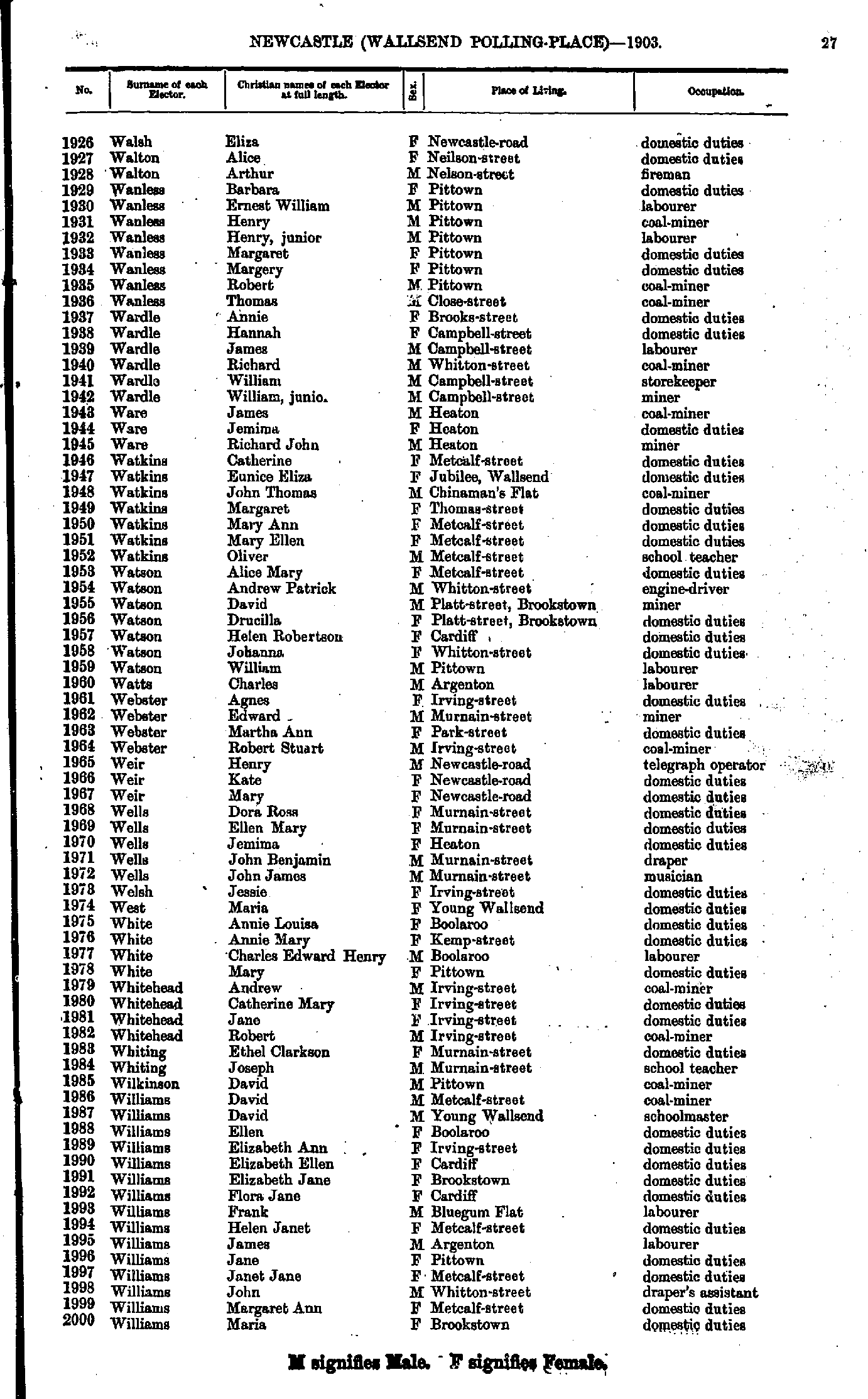
- Walsh Eliza - Williams Maria
- Williams Martha - Young William
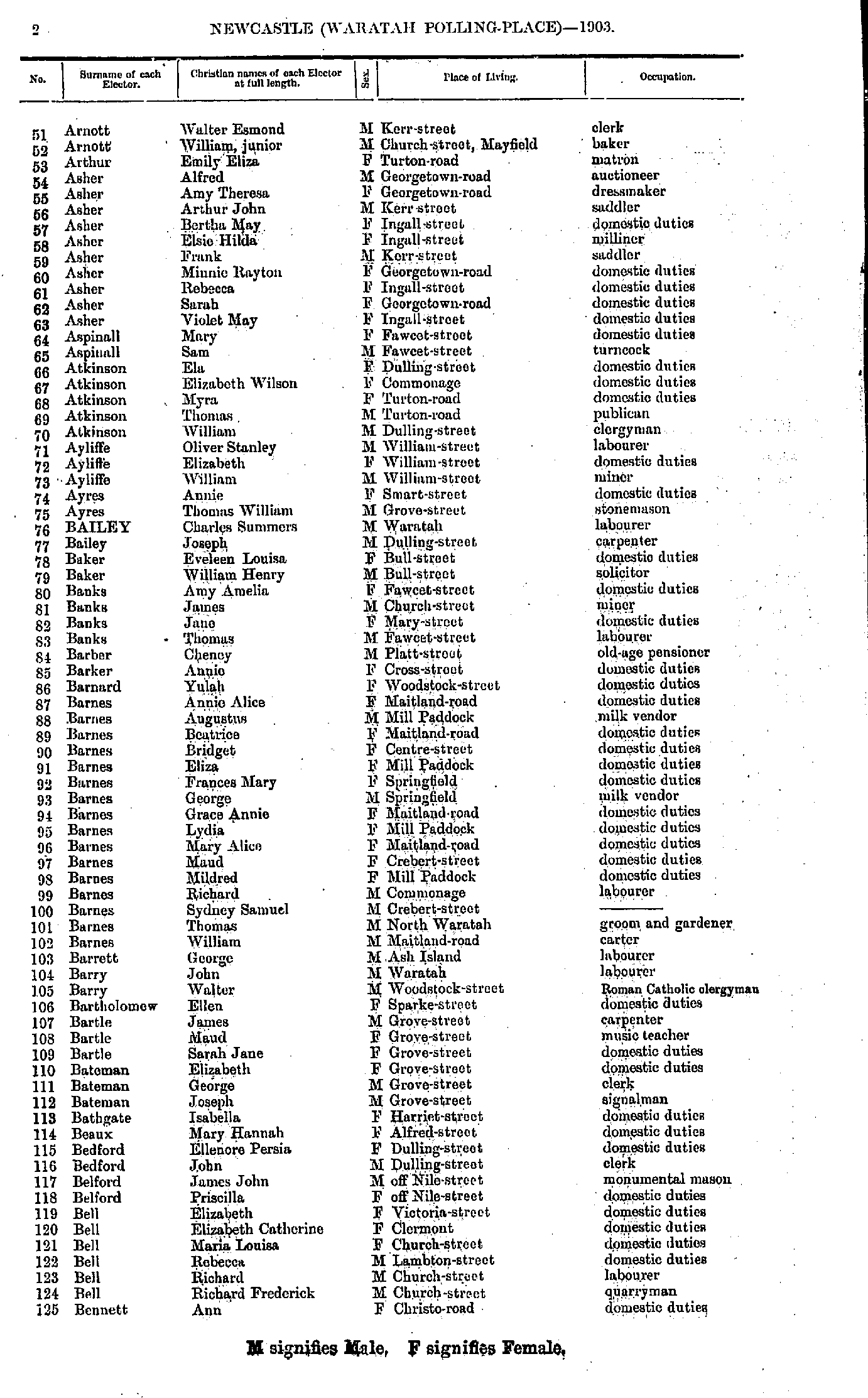
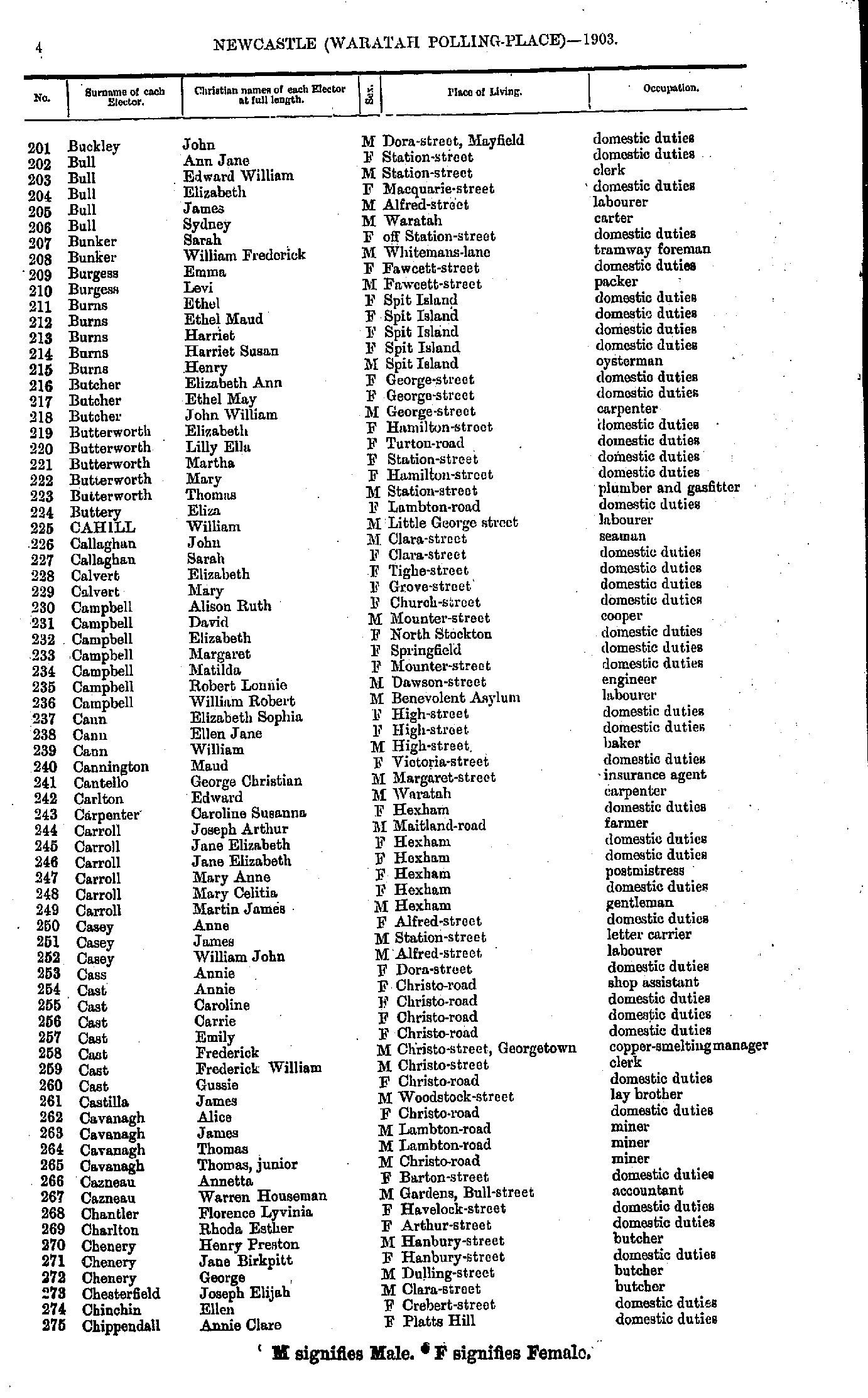
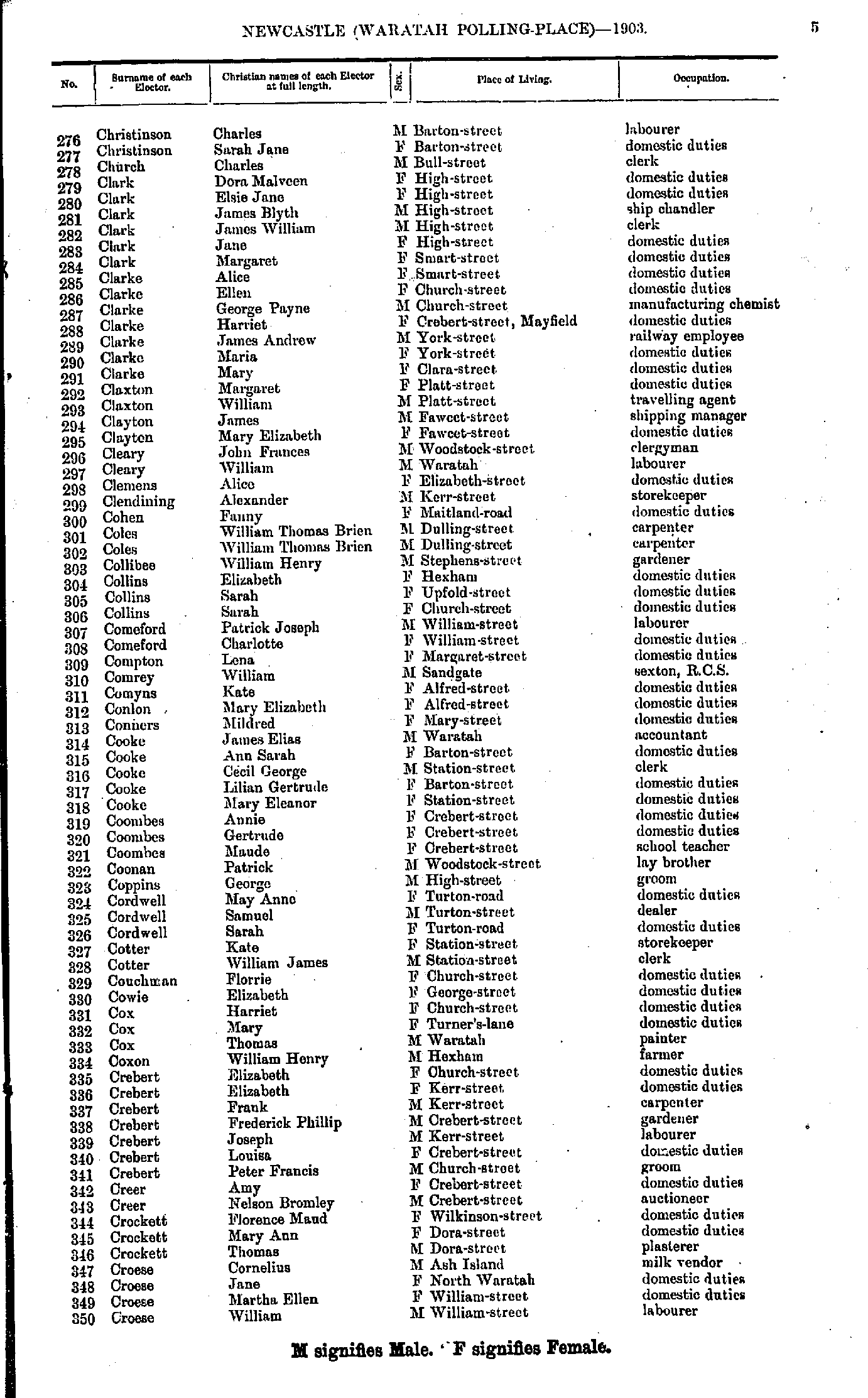
- Ackroyd Elizabeth - Arnott Sarah
- Arnott Walter - Bennett Ann
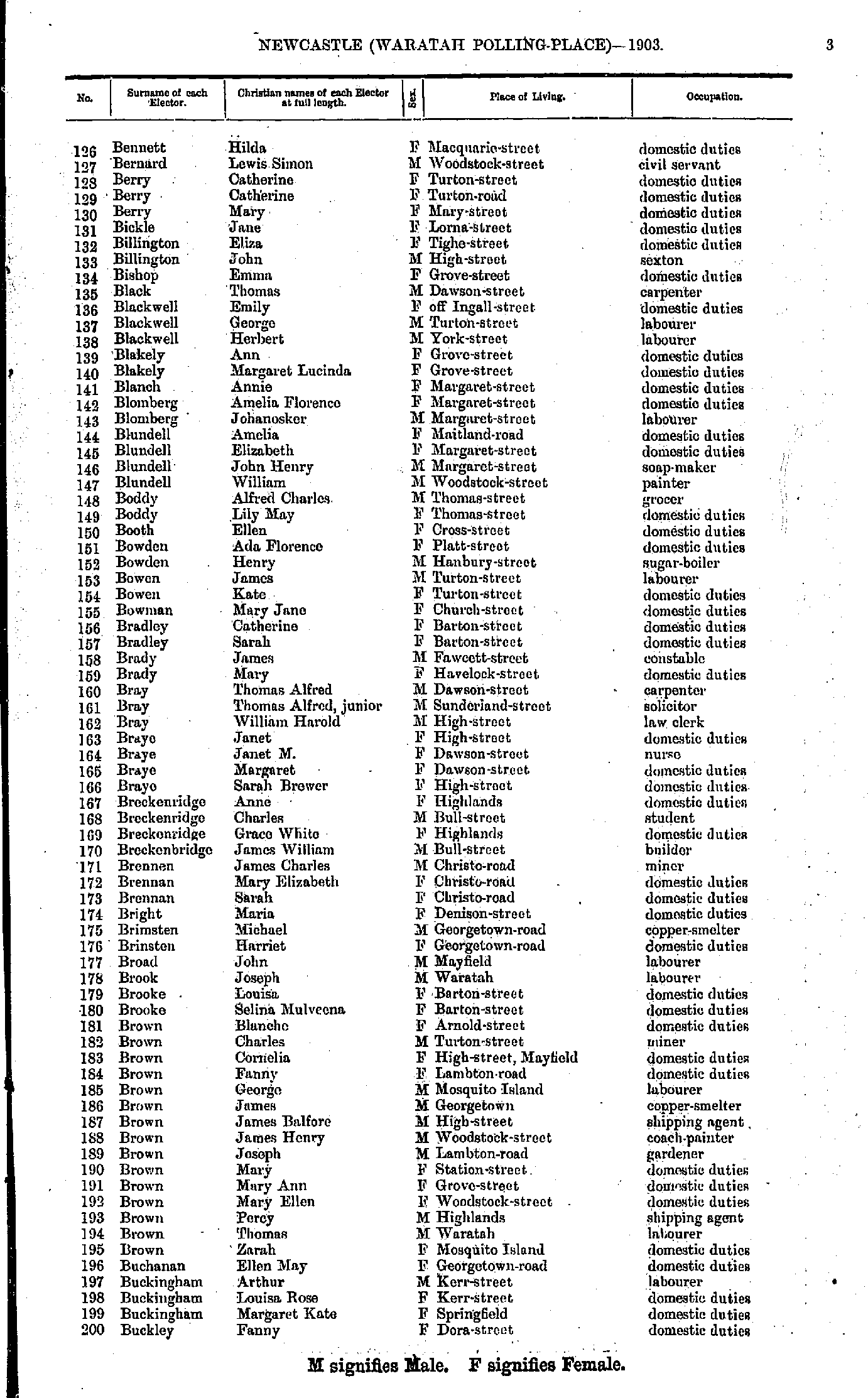
- Bennett Hilda - Buckley Fanny
- Buckley John - Chippendall Annie
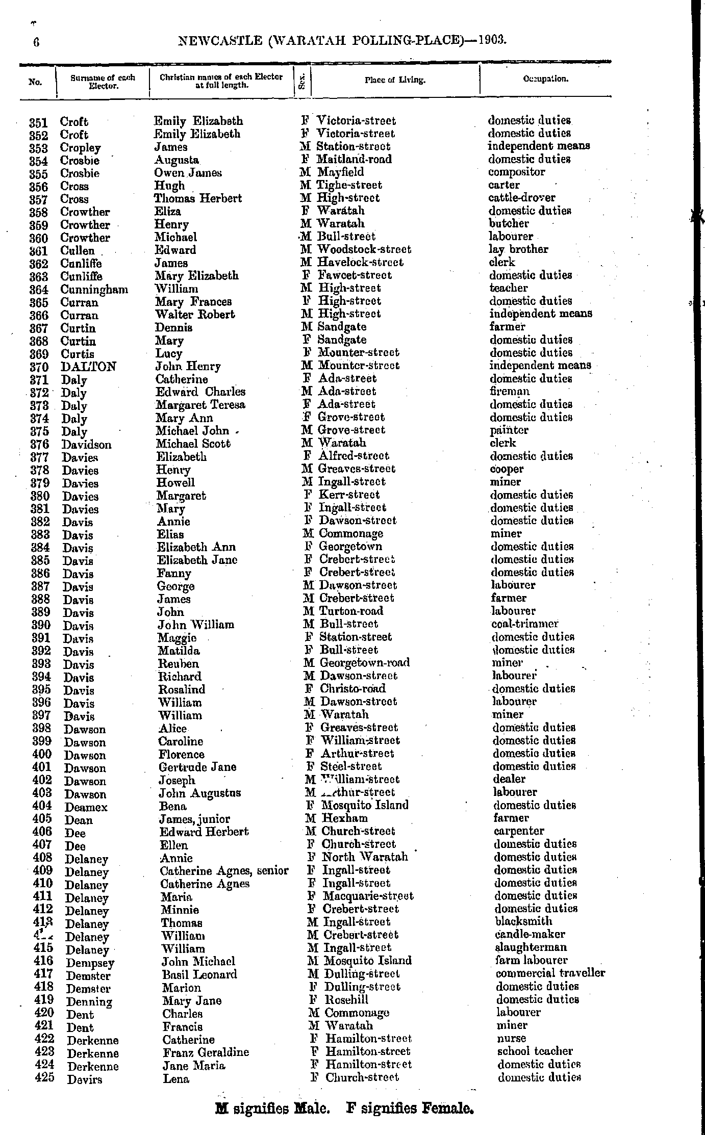
- Christinson Charles - Croese William
- Croft Emily - Devirs Lena
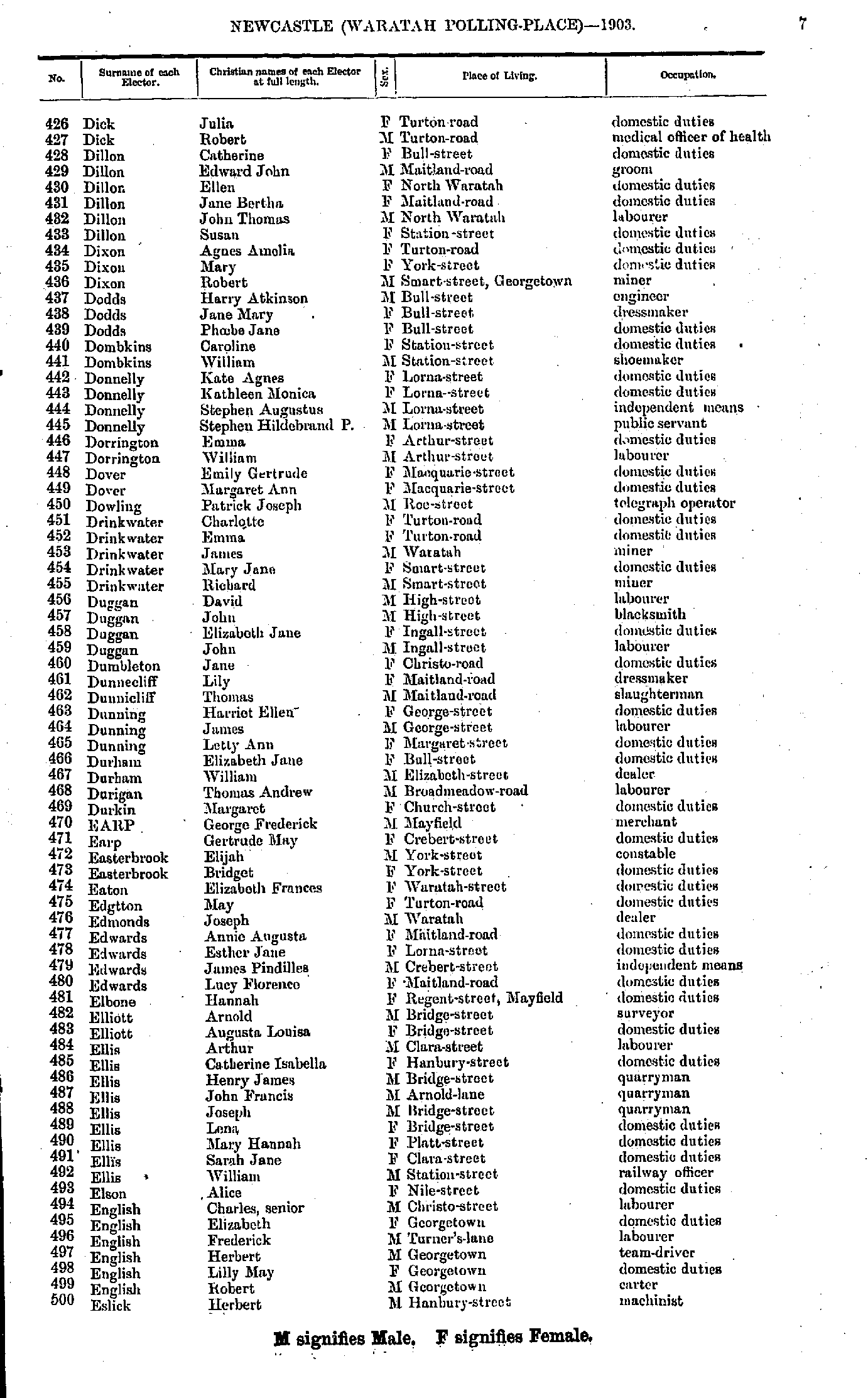
- Dick Julia - Eslick Herbert
- Eslick Mary - Gibson Maud
- Gidney William - Hall Sophia
- Hall William - Henderson Ann
- Henderson Mary - Hughes Frank
- Hughes George - Jordan Frank
- Jordan John - Lee Bridget
- Lee Emma - Macdougall William
- Mack Harriet - Morris Evan
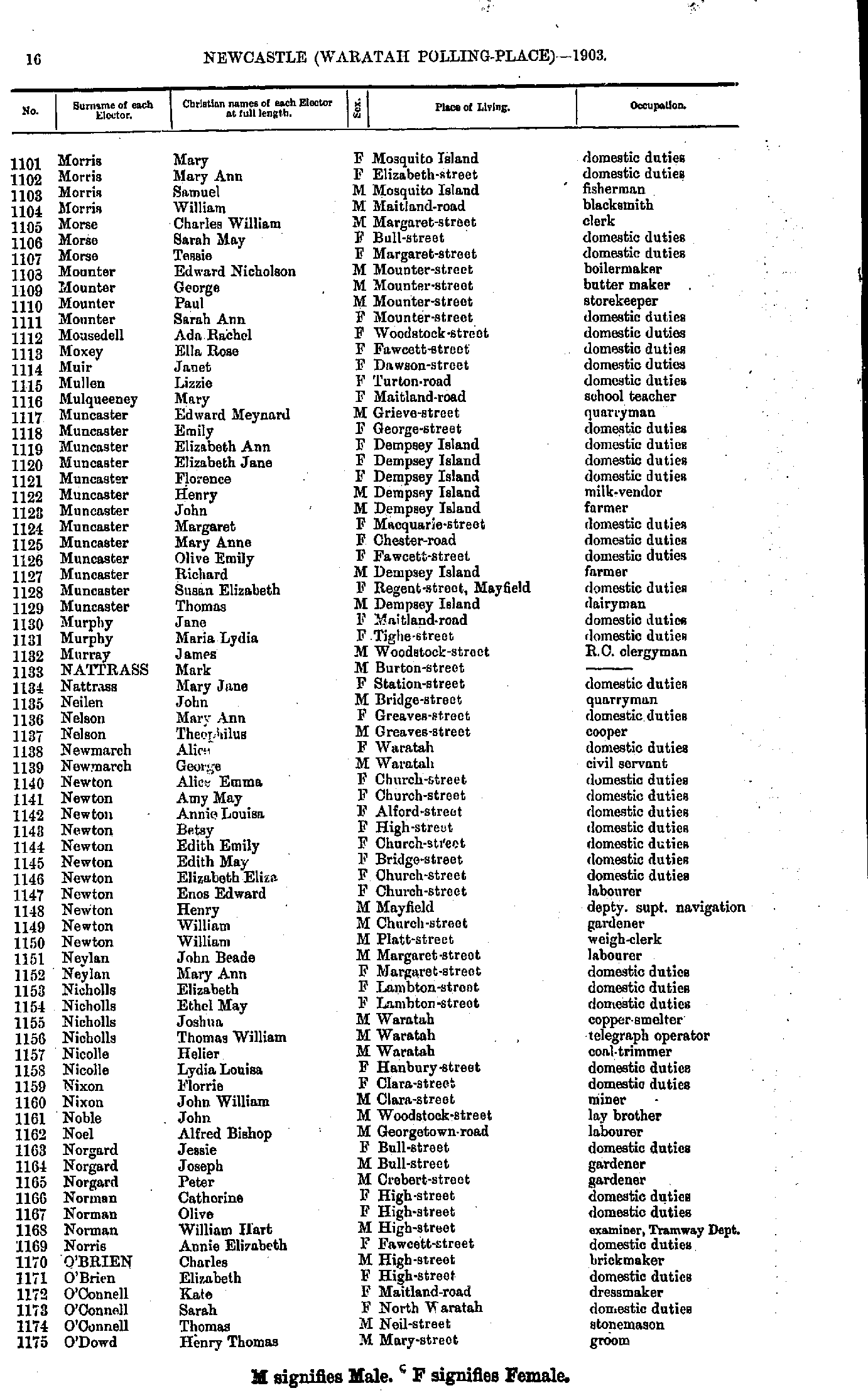
- Morris Mary - O'Dowd Henry
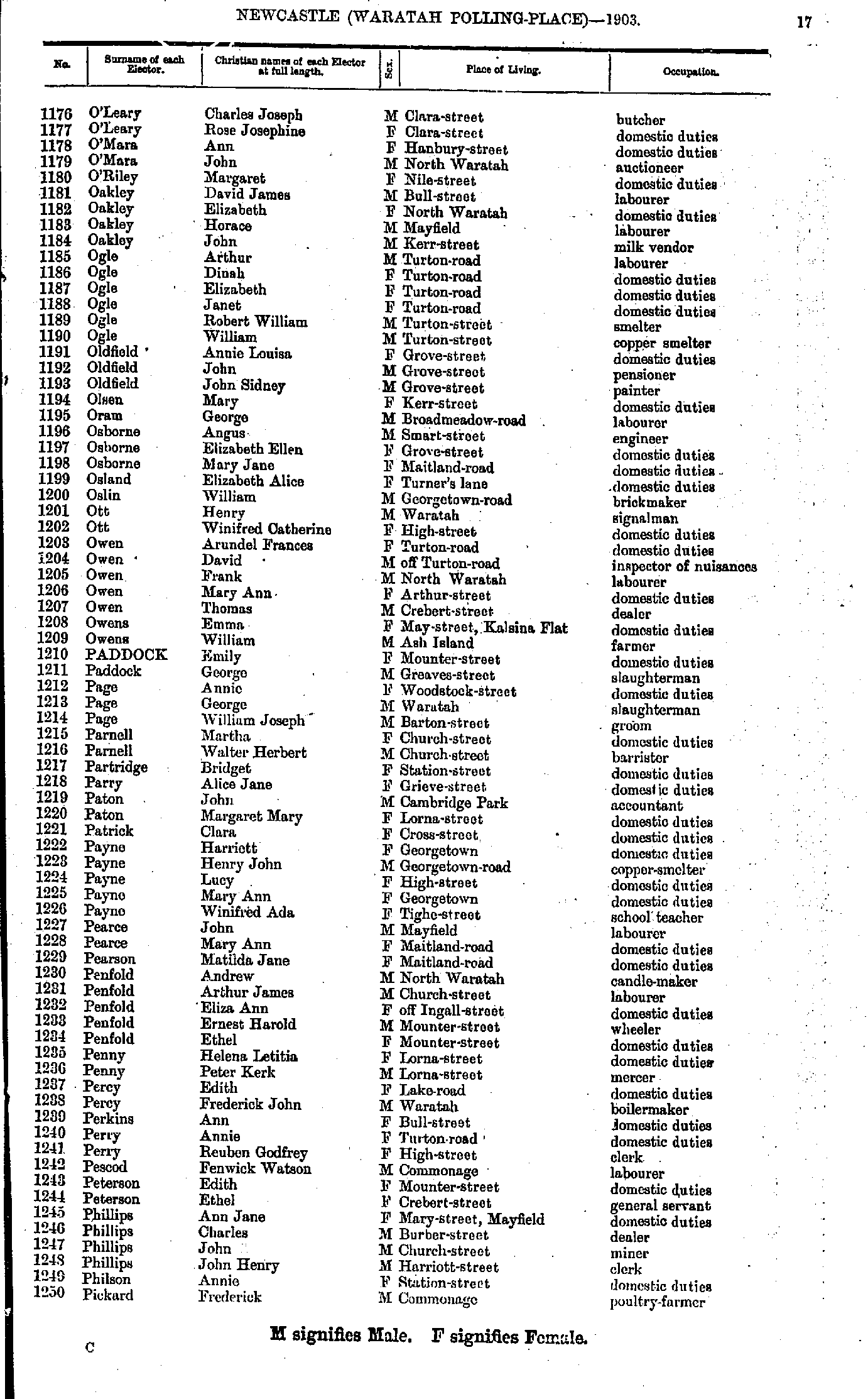
- O'Leary Charles - Pickard Frederick
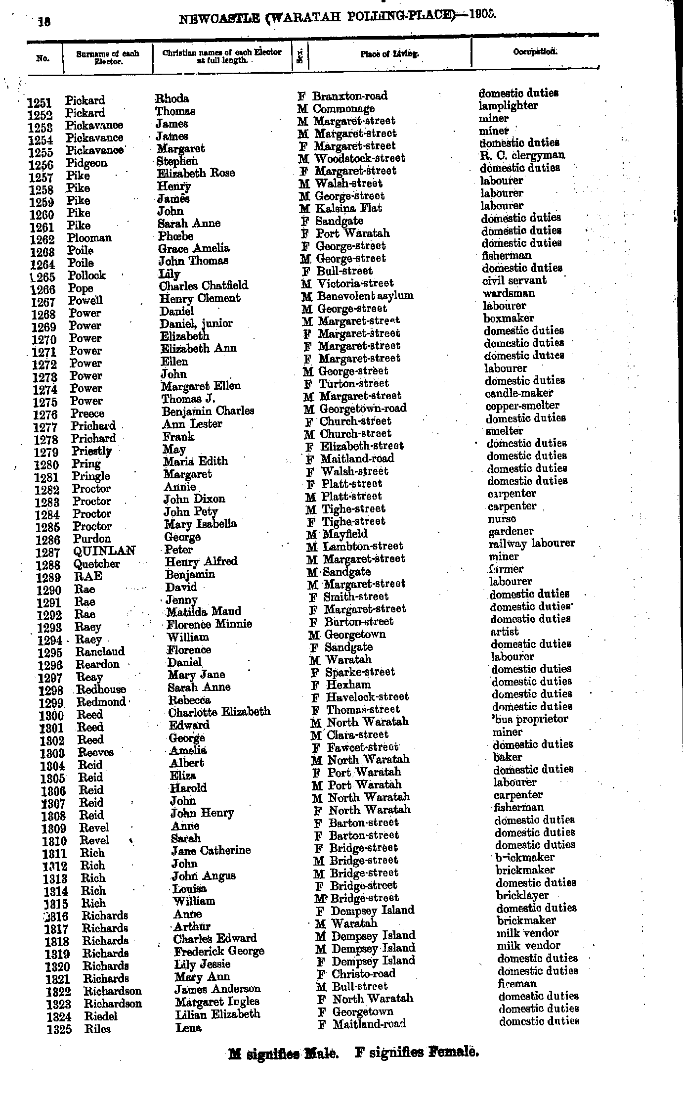
- Pickard Rhoda - Riles Lena
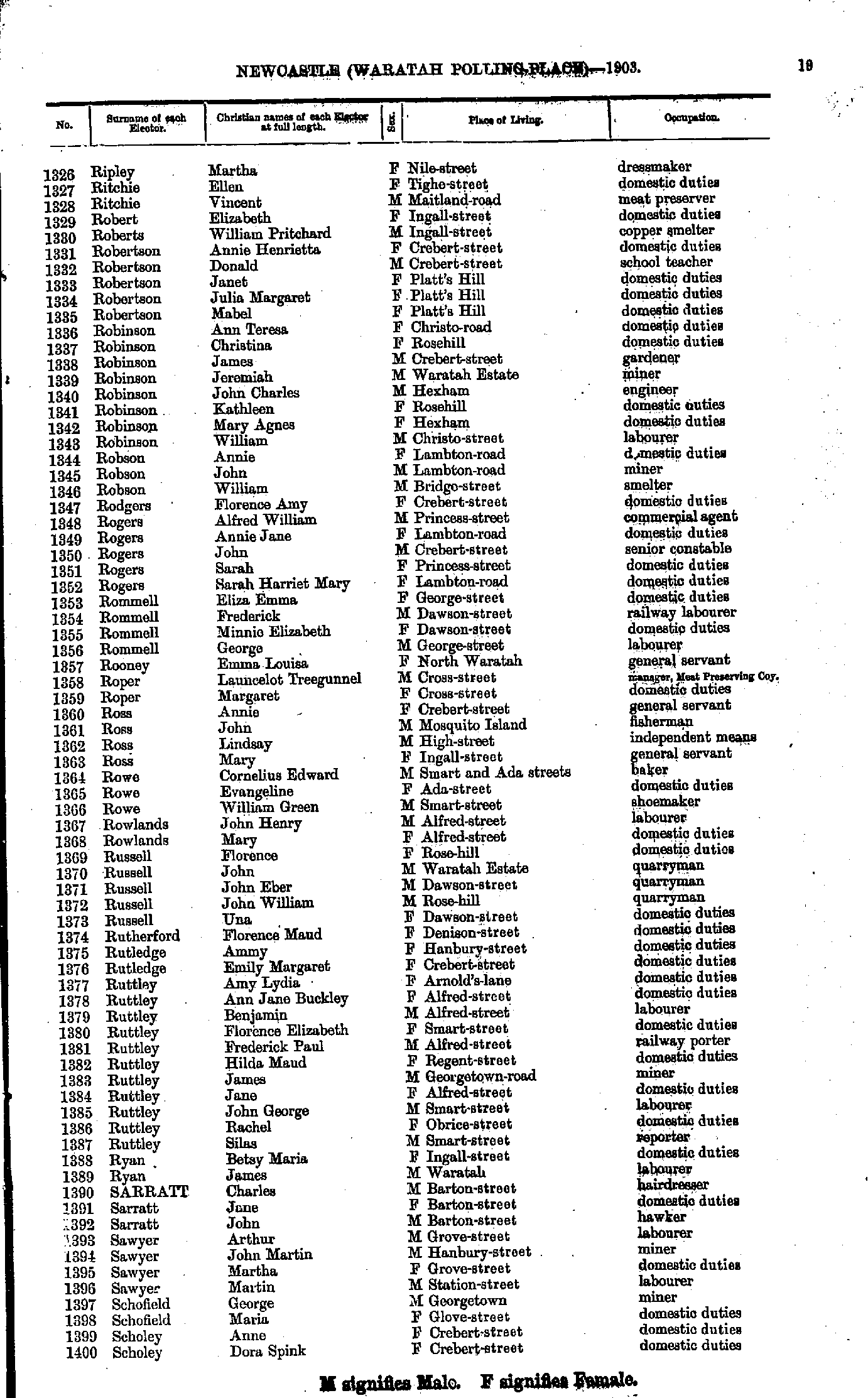
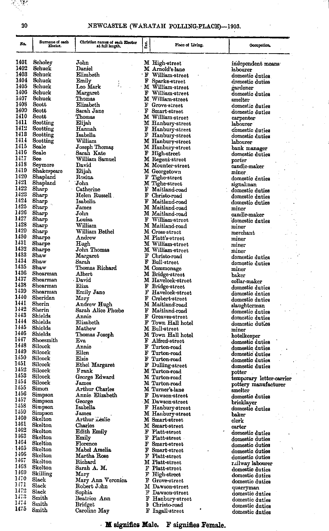
- Ripley Martha - Scholey Dora
- Scholey John - Smith Caroline
- Smith David - Summers Vincent
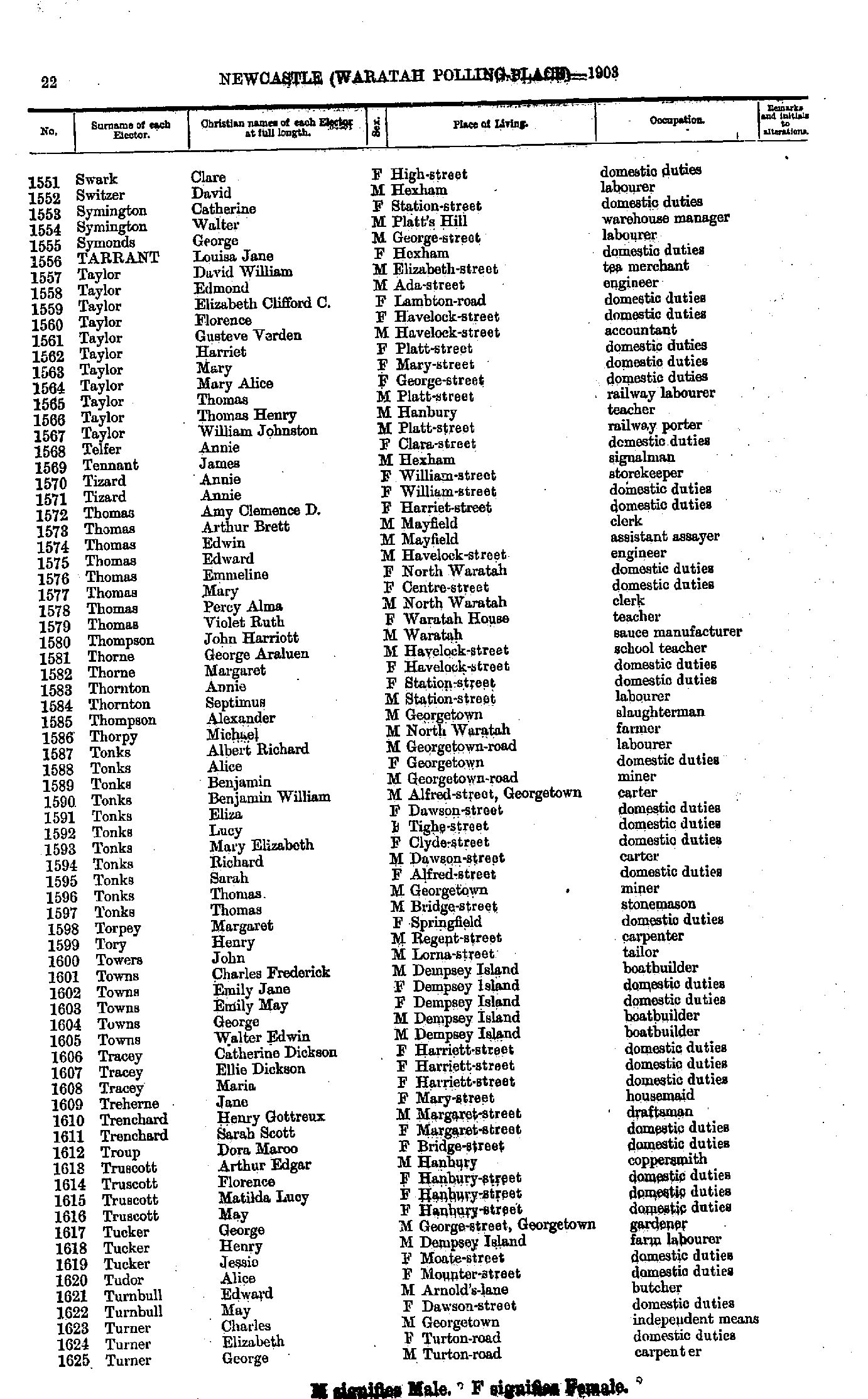
- Swark Clare - Turner George
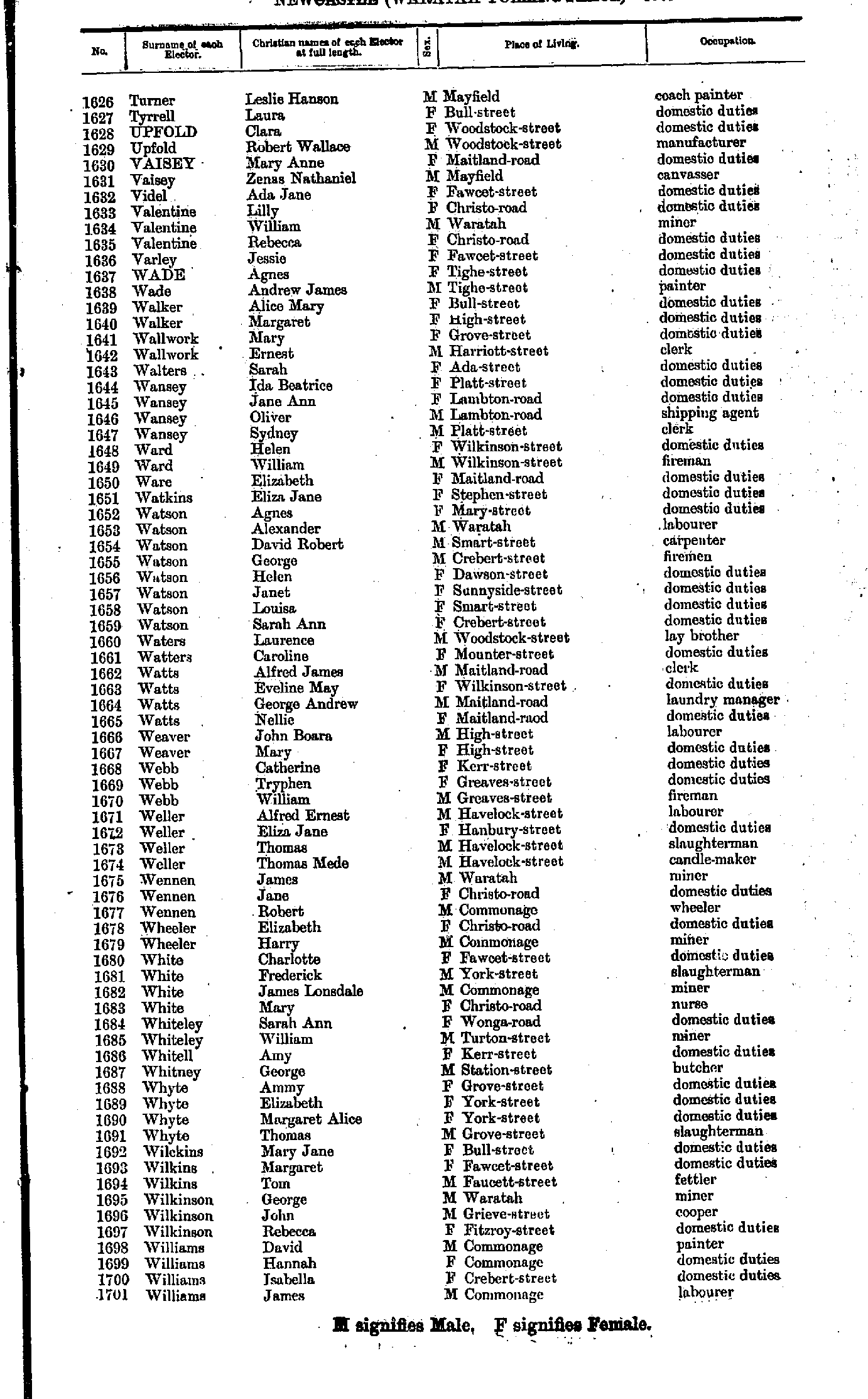
- Turner Leslie - Williams James
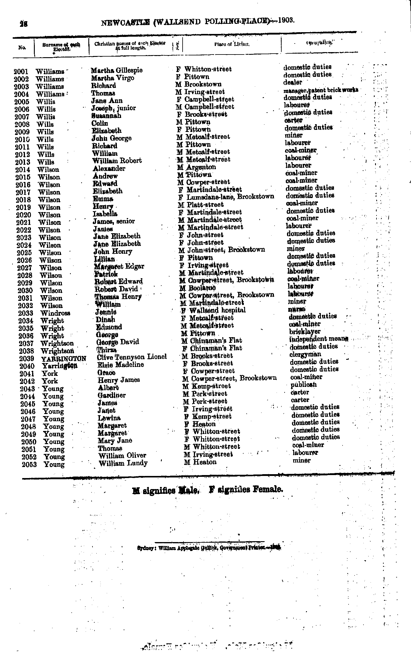
- Williams James - Young George
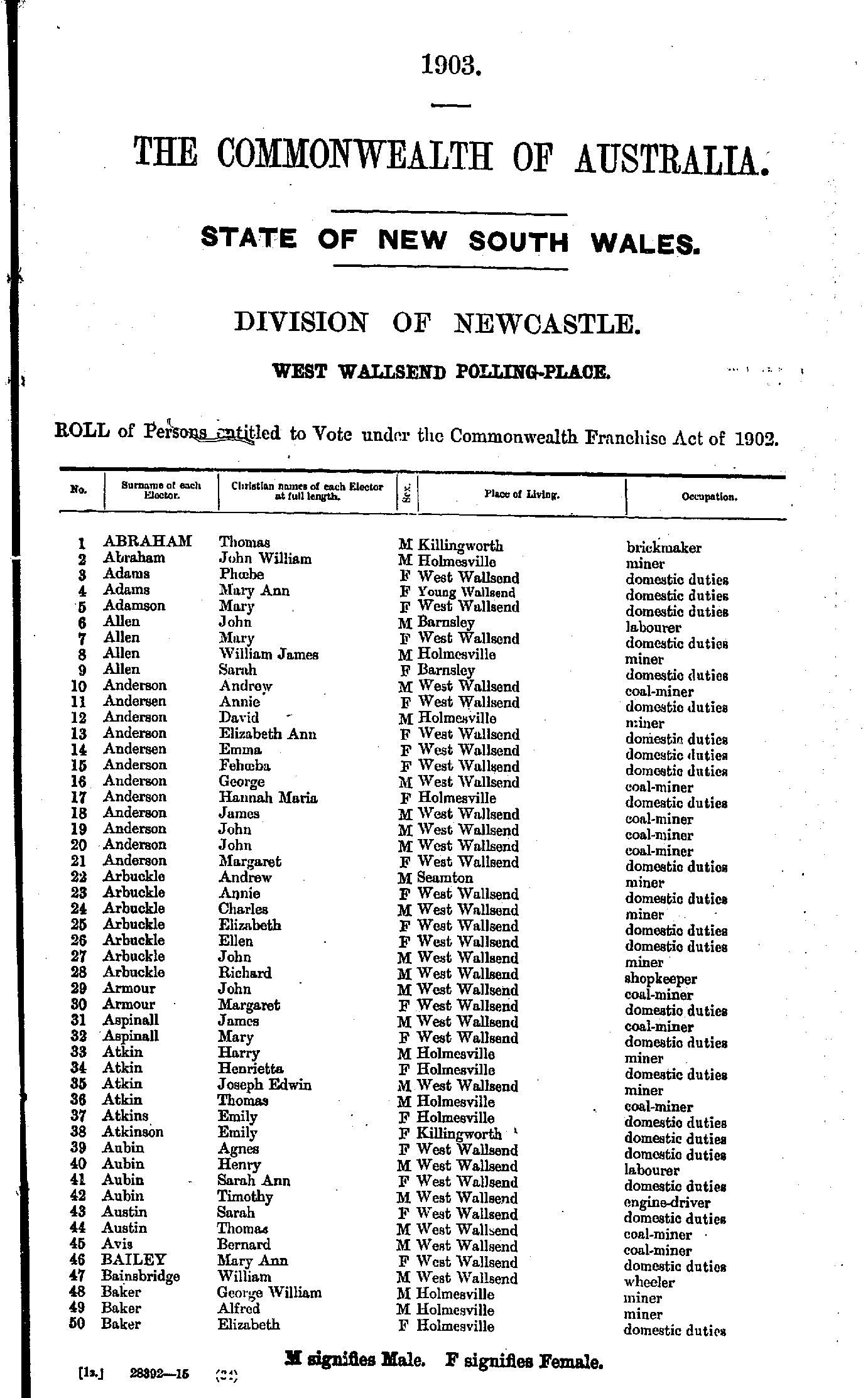
- Abraham Thomas - Baker Elizabeth
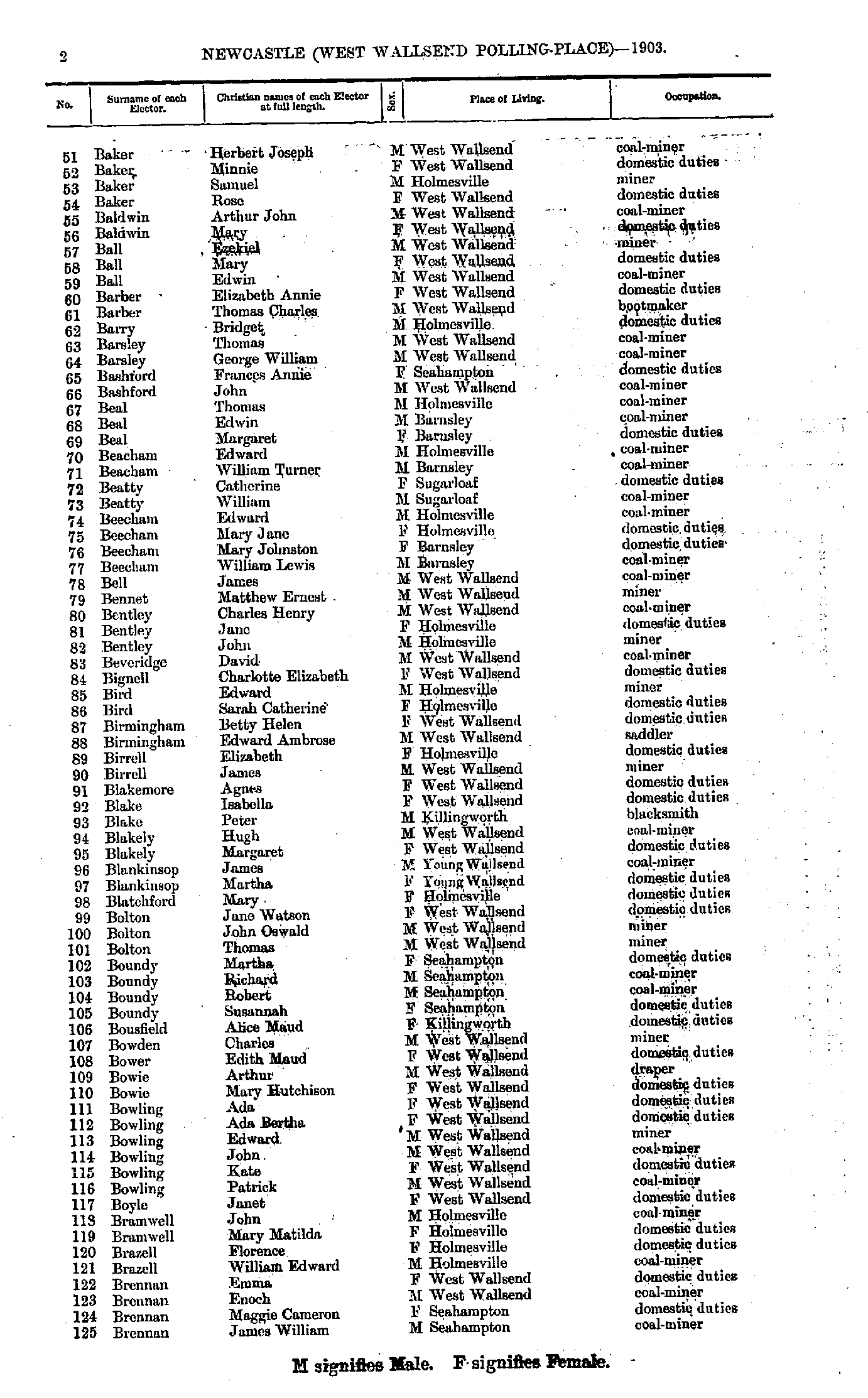
- Baker Herbert - Brennan James
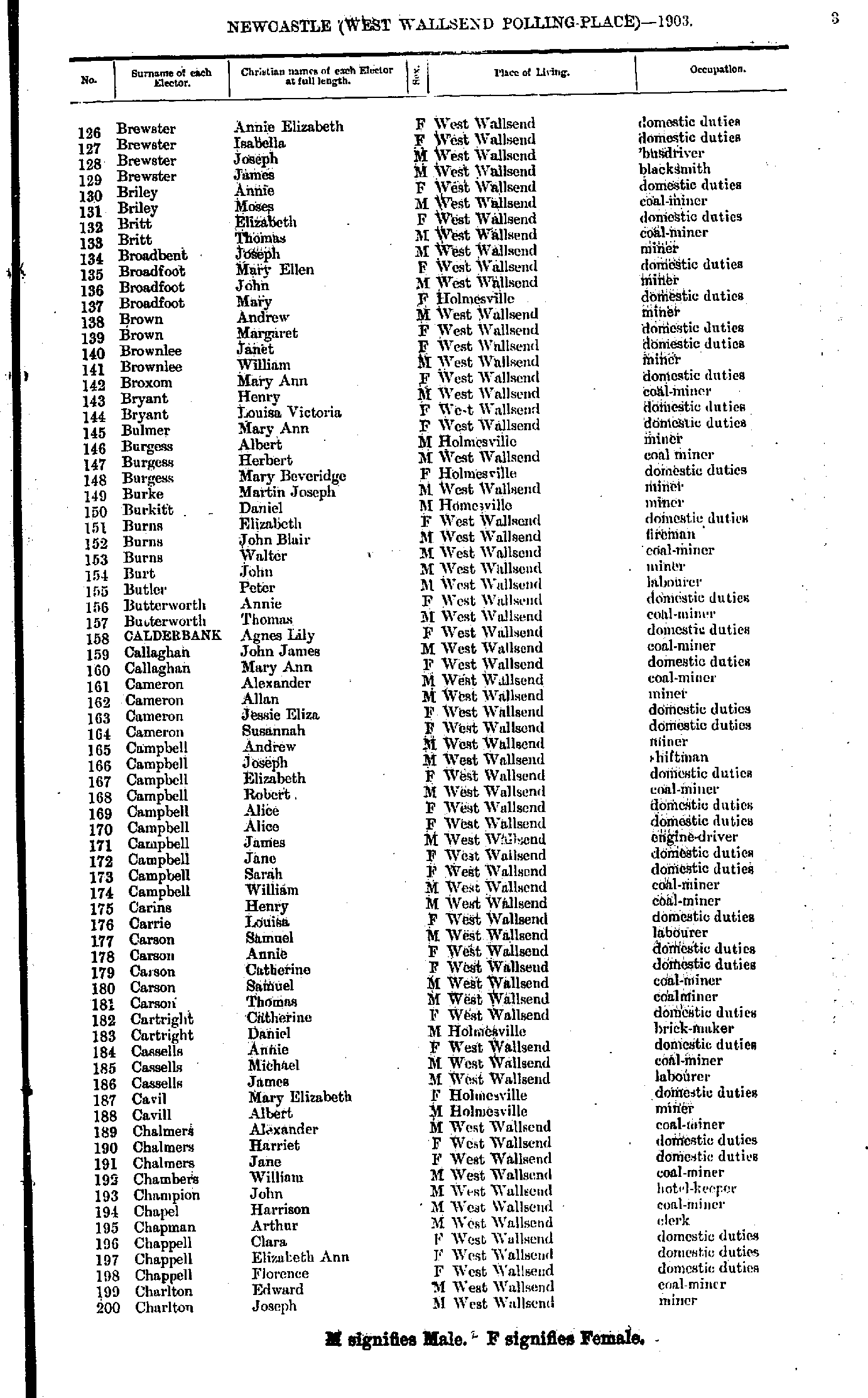
- Brewster Annie - Charlton Joseph
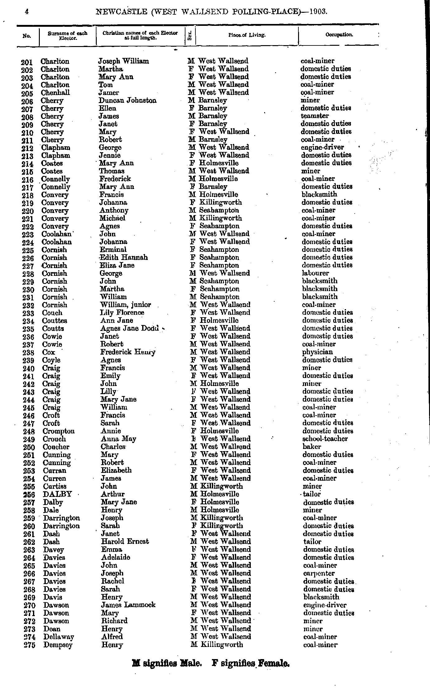
- Charlton Joseph - Dempsey Henry
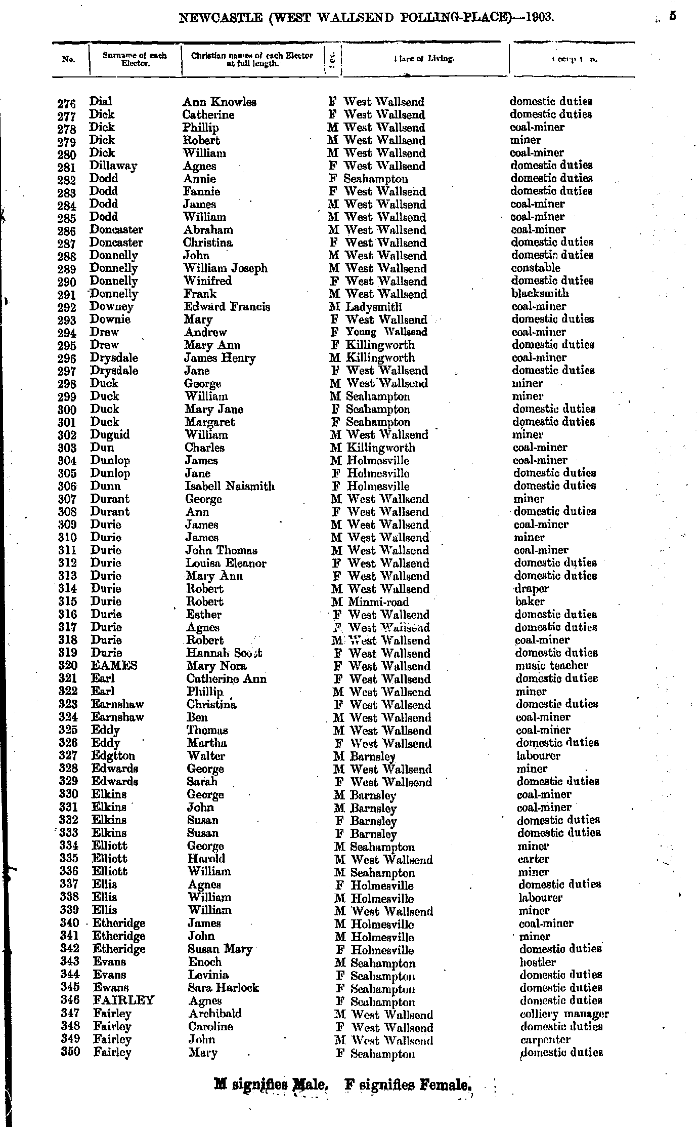
- Dial Ann - Fairley Mary
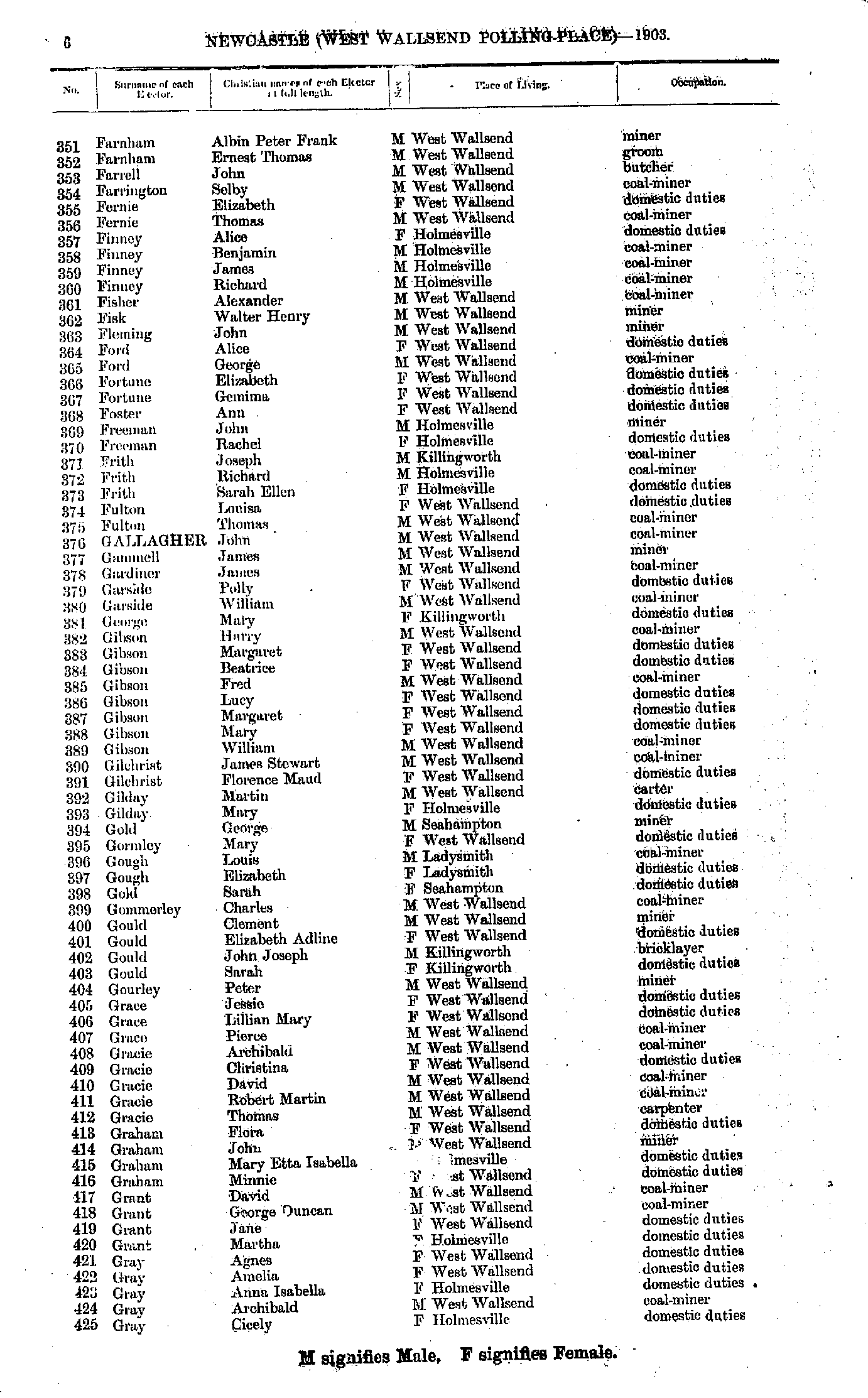
- Farnham Albin - Gray Cicely
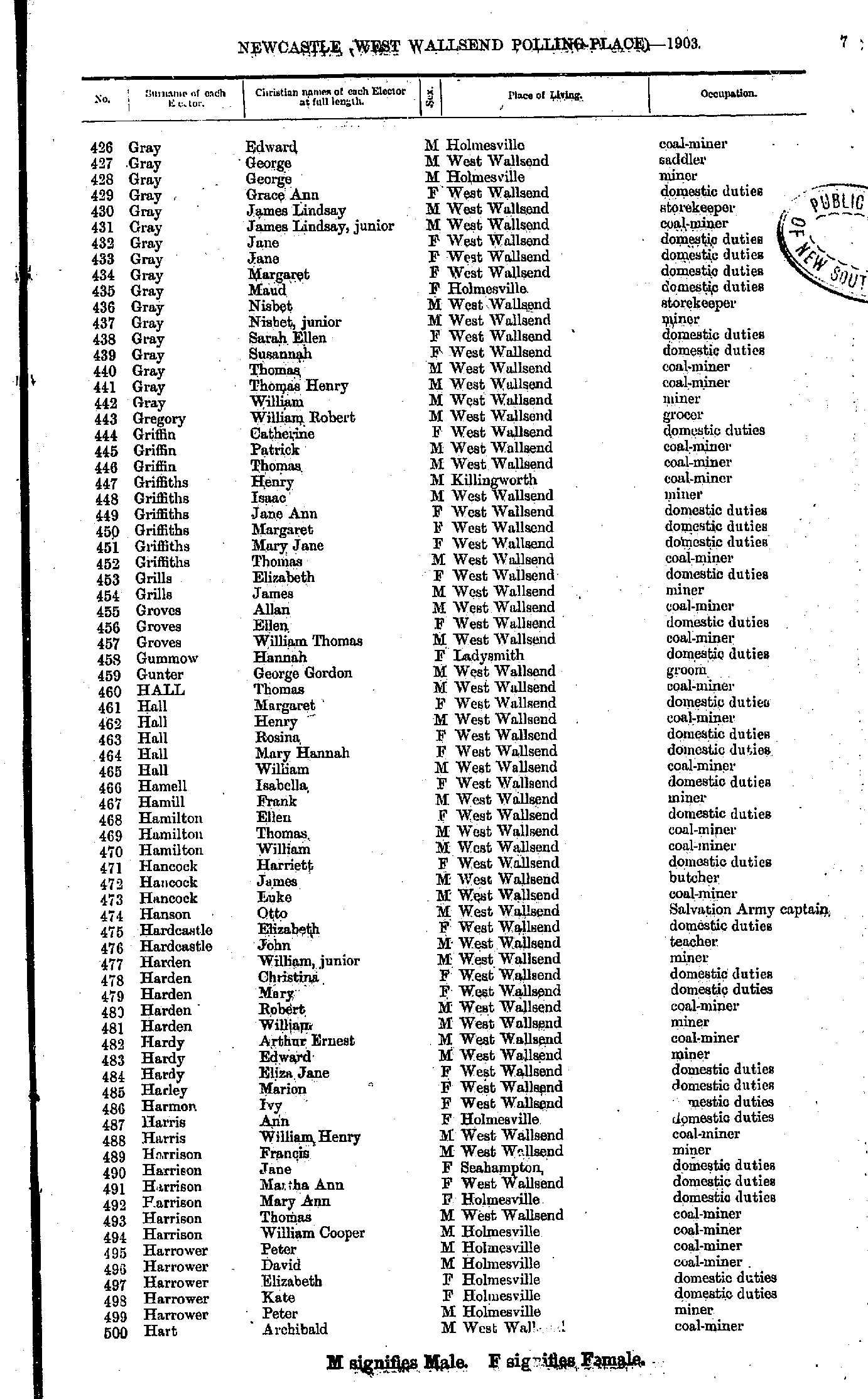
- Gray Edward - Hart Archibald
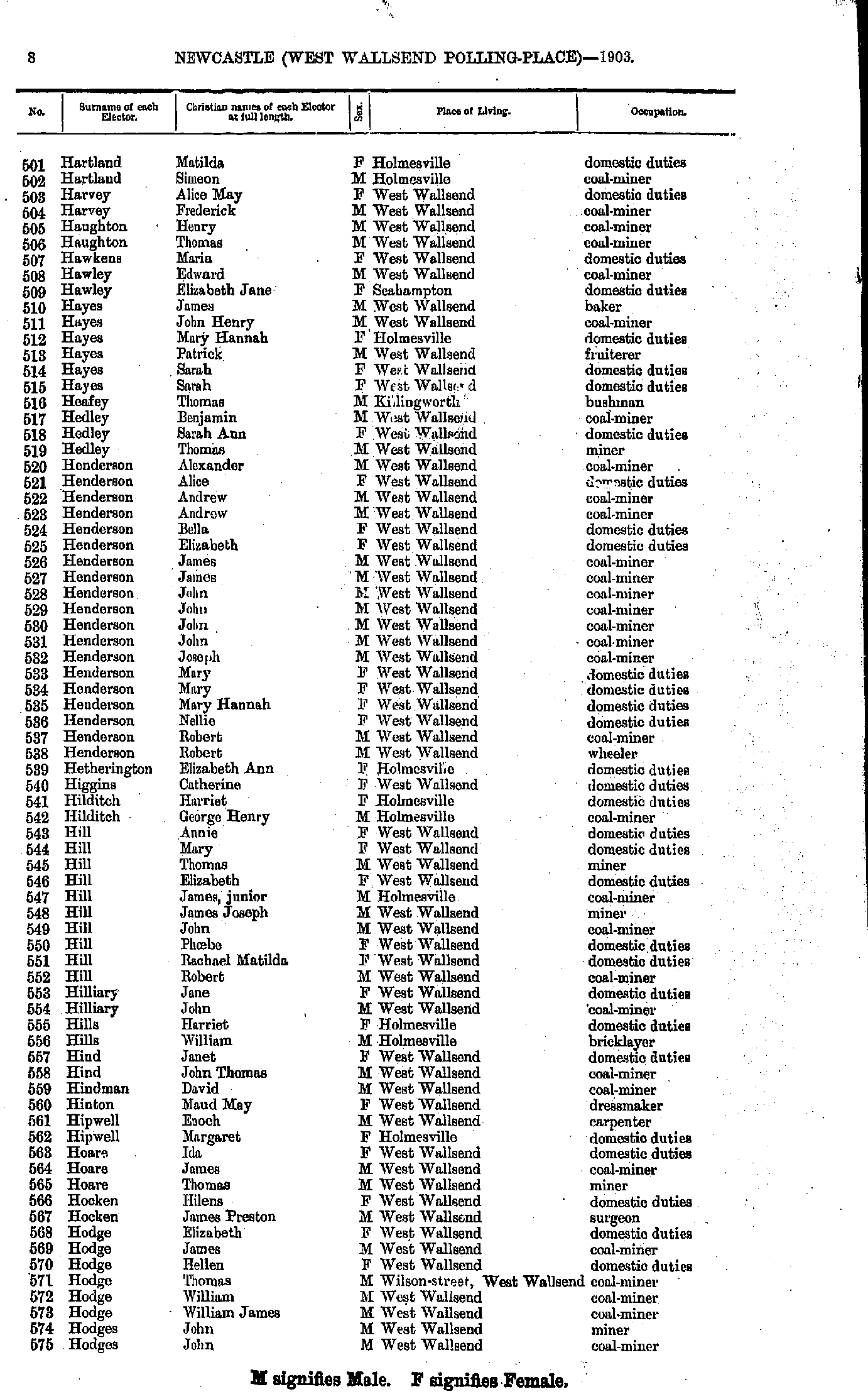
- Hartland Matilda - Hodges John
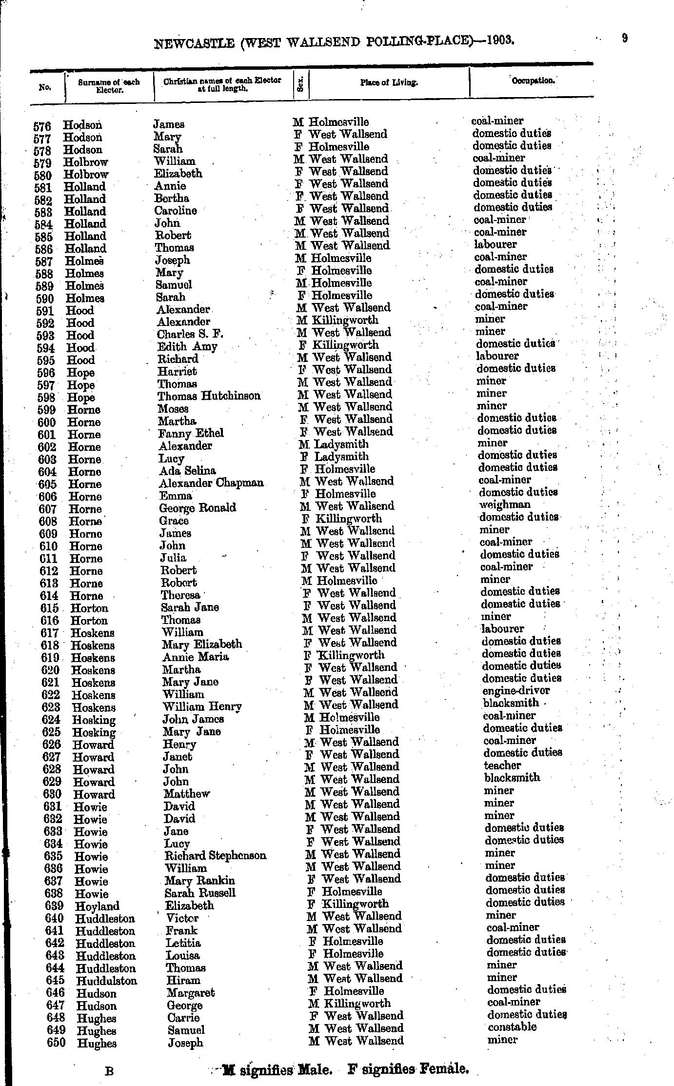
- Hodson James - Hughes Joseph
- Hughes Margaret - Keen Joseph
- Keen Nellie - Lewis Arthur
- Lewis Bessie - M'Guiness John
- M'Guiness May - Means Mary
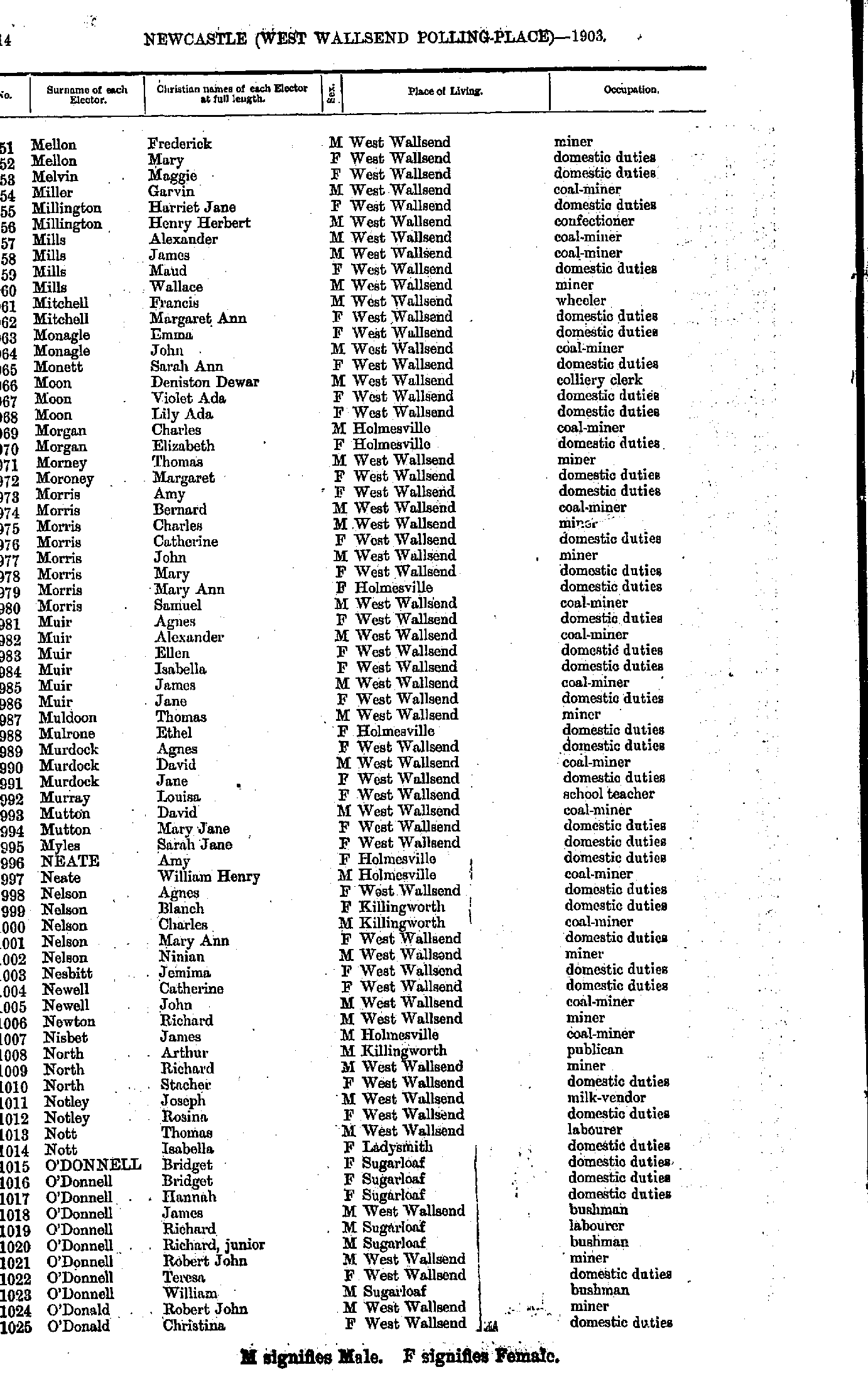
- Mellon Frederick - O'Donald Christina
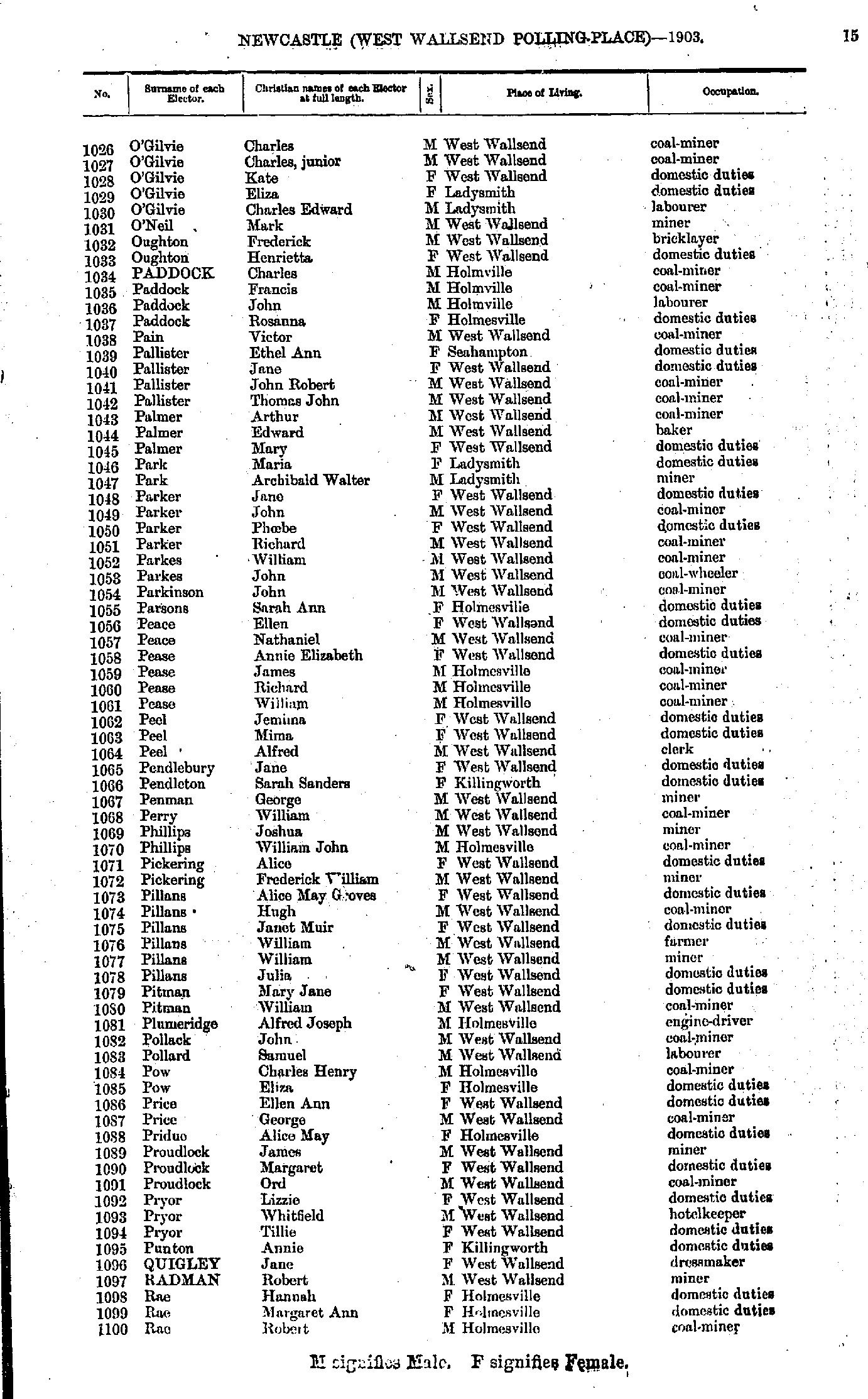
- O'Gilvie Charles - Rae Robert
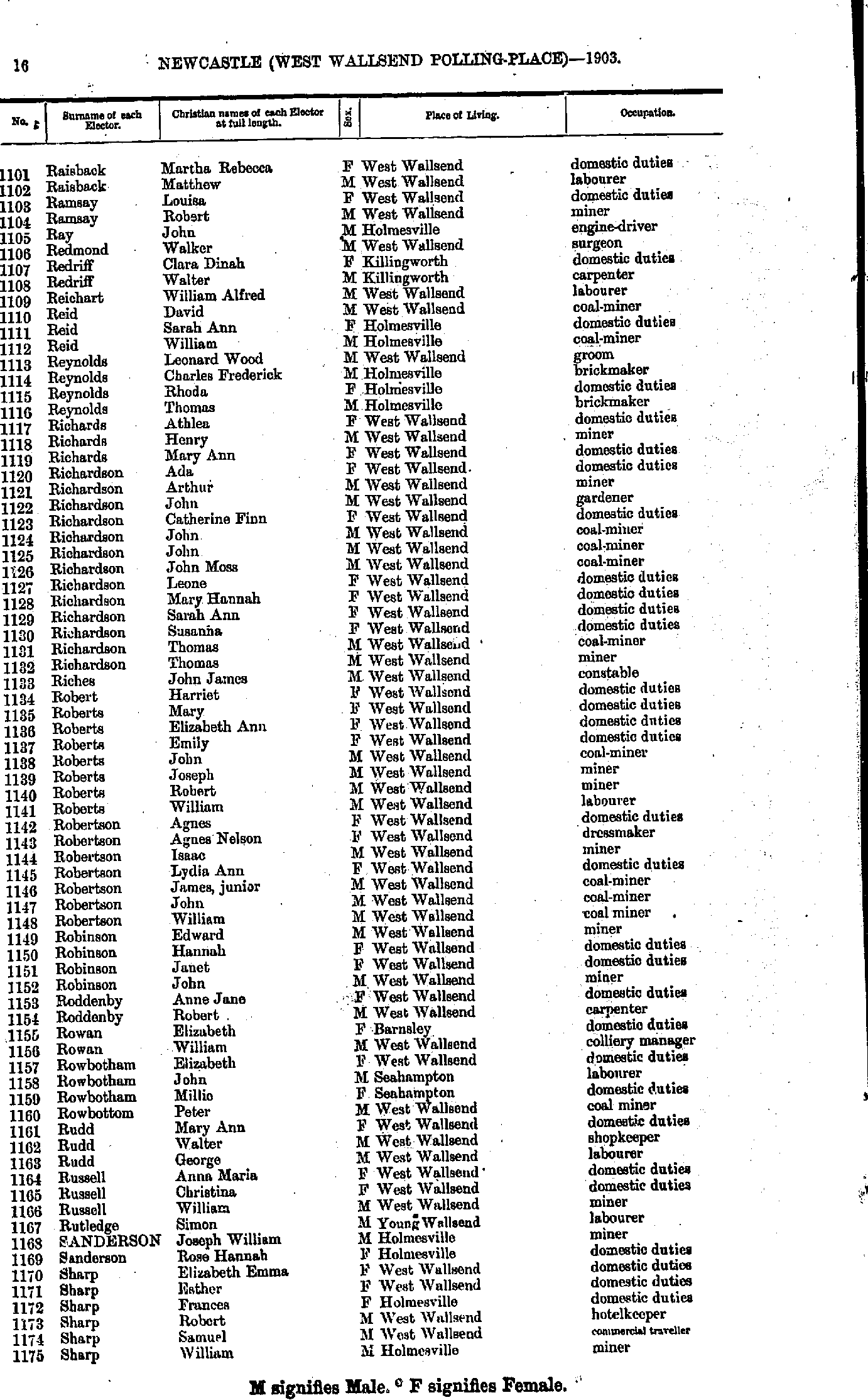
- Raisback Martha - Sharp William
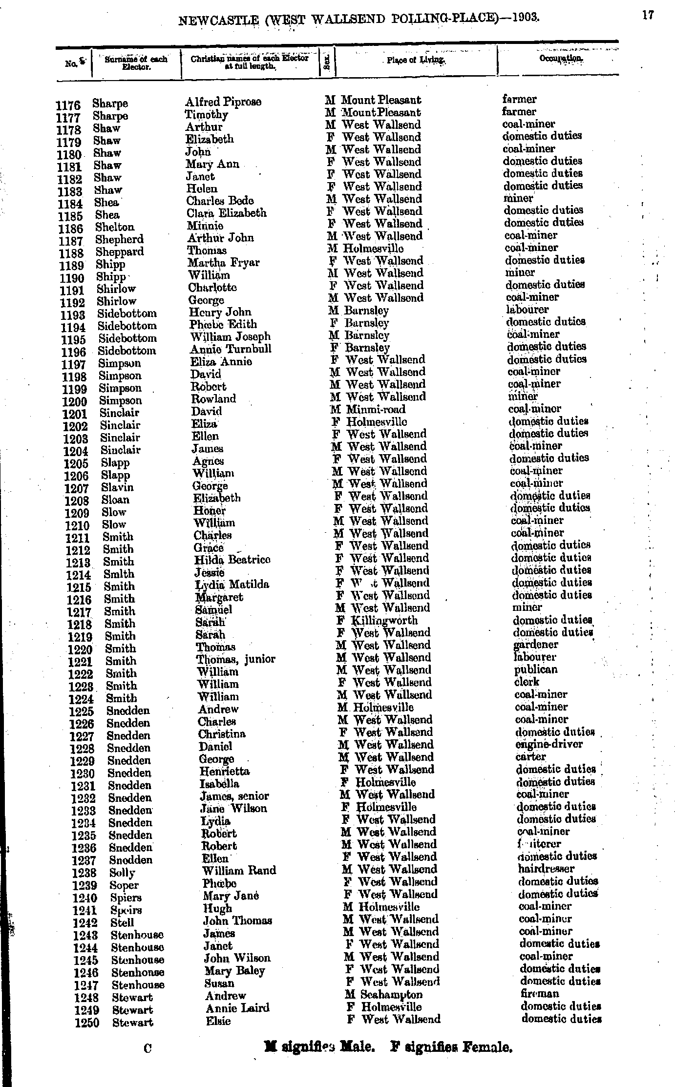
- Sharpe Alfred - Stewart Elsie
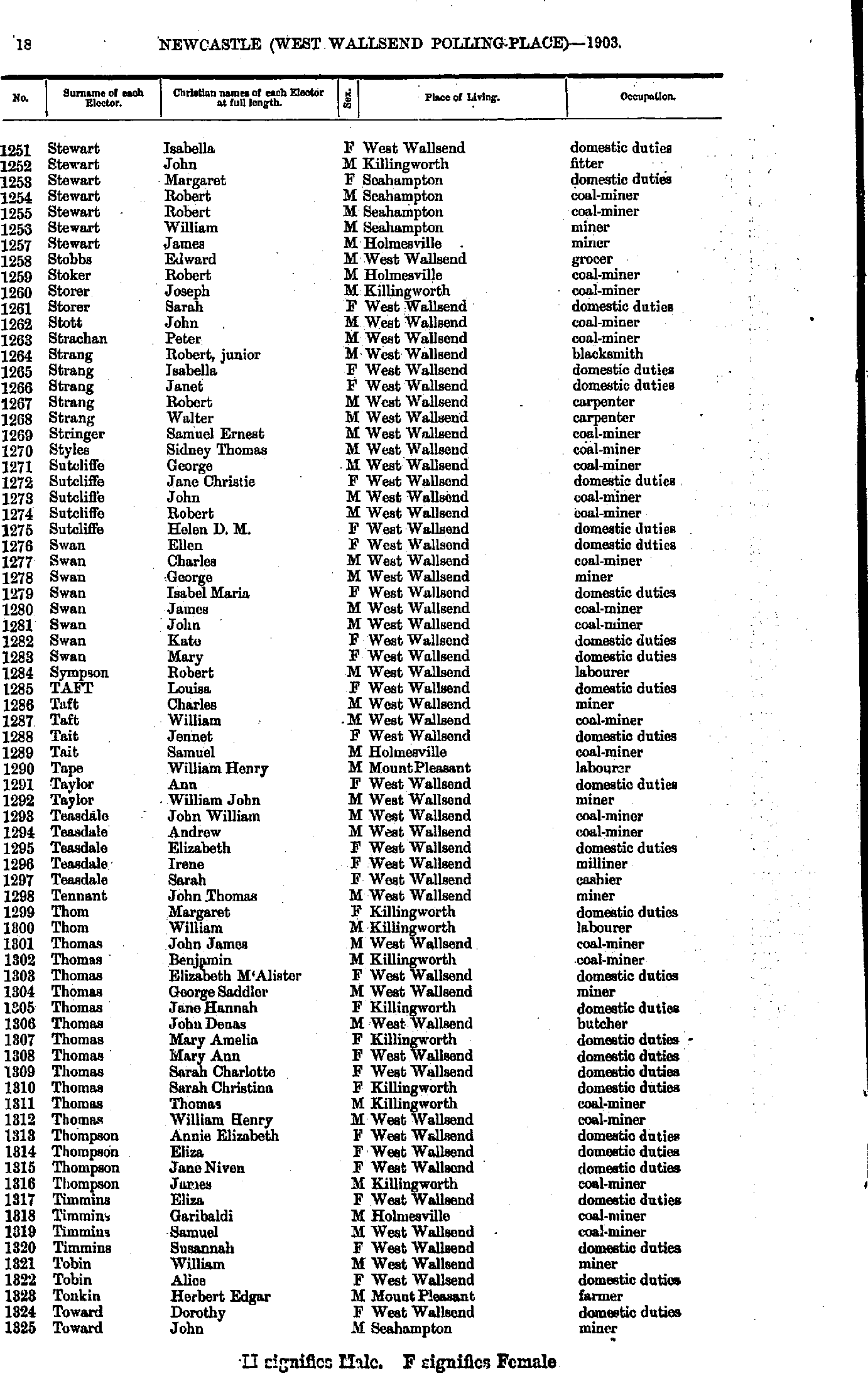
- Stewart Isabella - Toward John
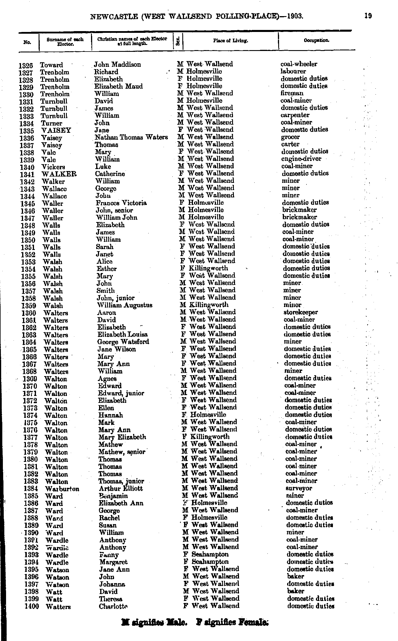
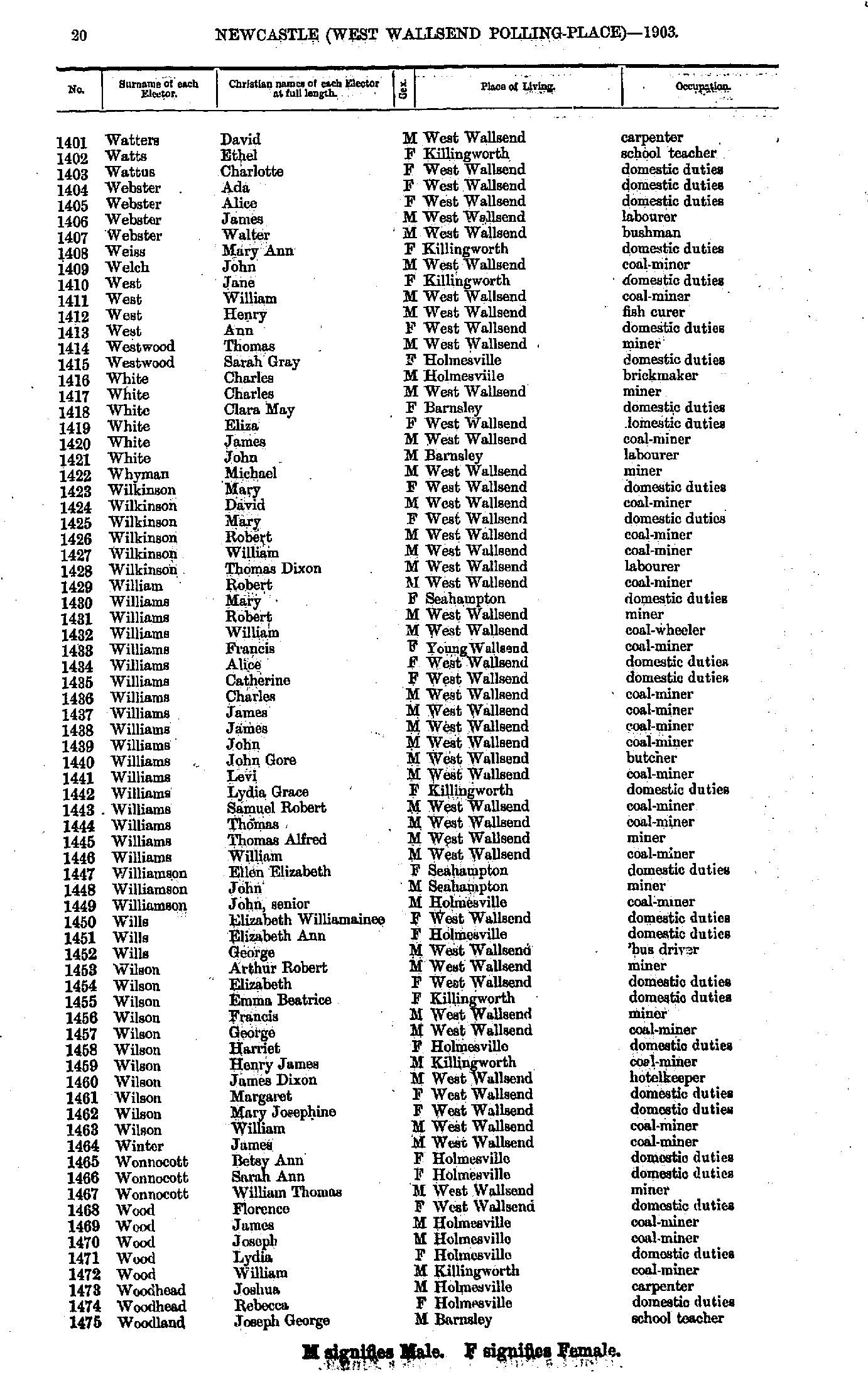
- Toward John - Watters Charlotte
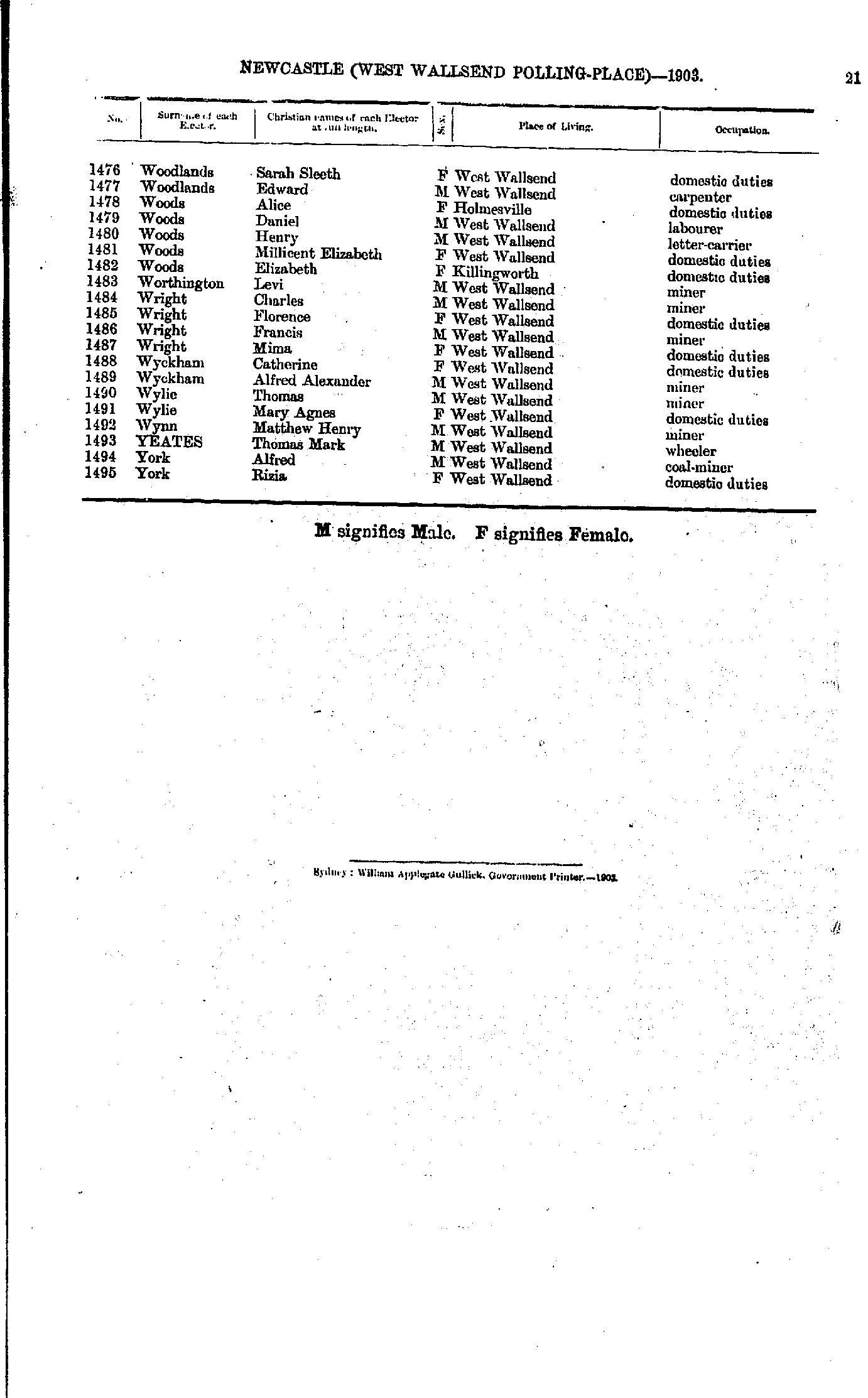
- Watters David - Woodland Joseph
- Woodlands Sarah - York Rizia
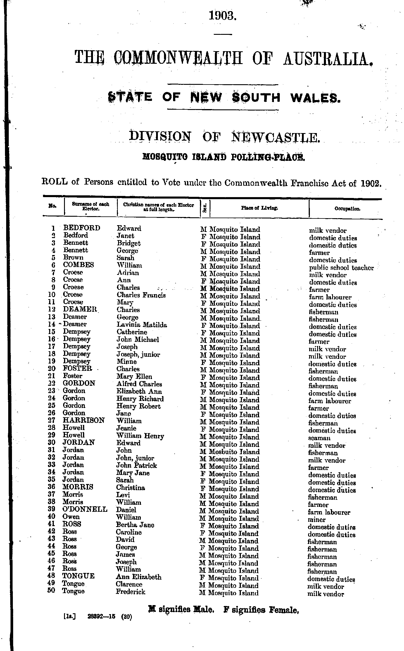
Maps of the Newcastle Electoral Division
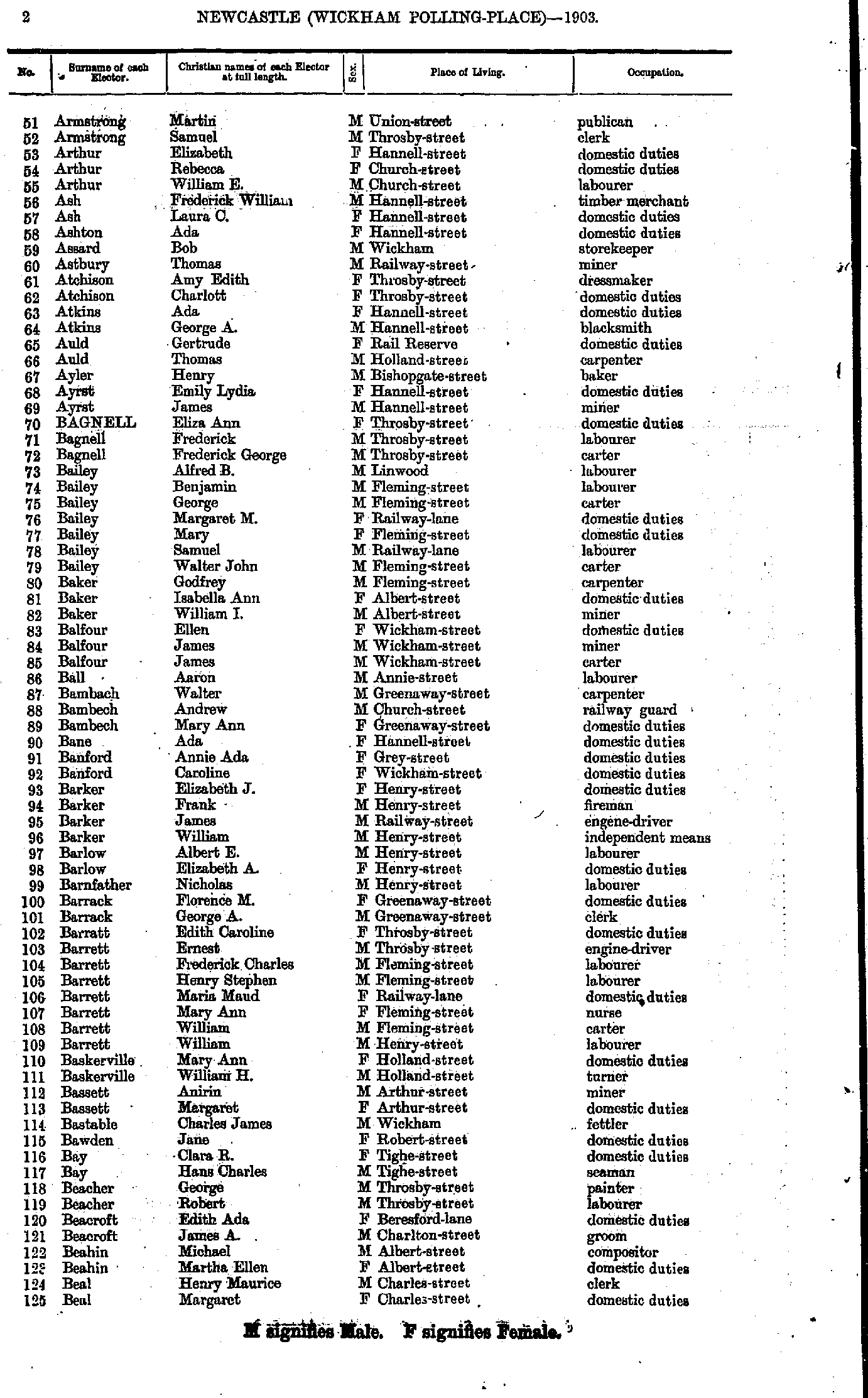
- Ackroyd Clara - Armstrong Martha
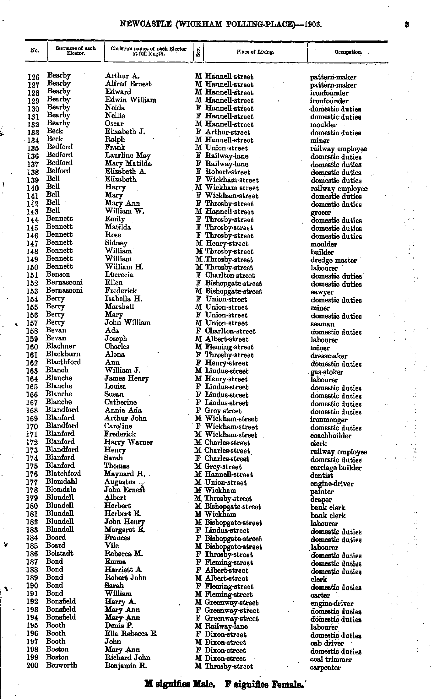
- Armstrong Martin - Beal Margaret
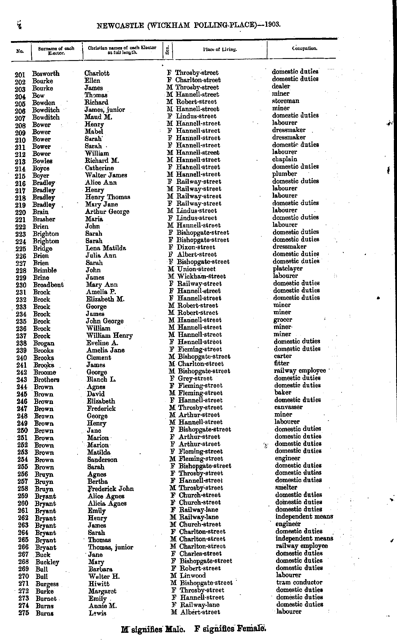
- Bearby Arthur - Bosworth Benjamin
- Bosworth Charlott - Burns Lewis
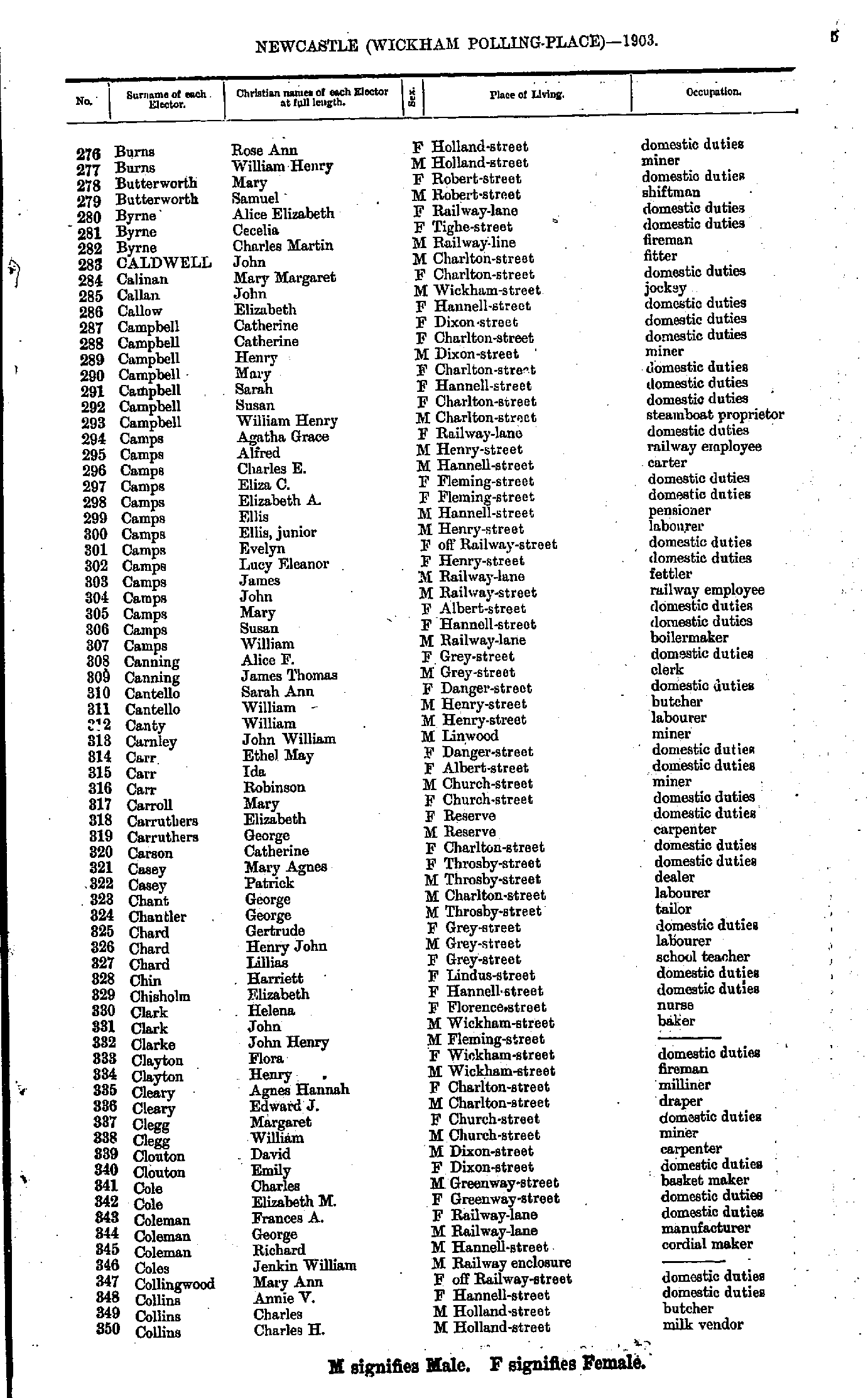
- Burns Rose - Collins Charles
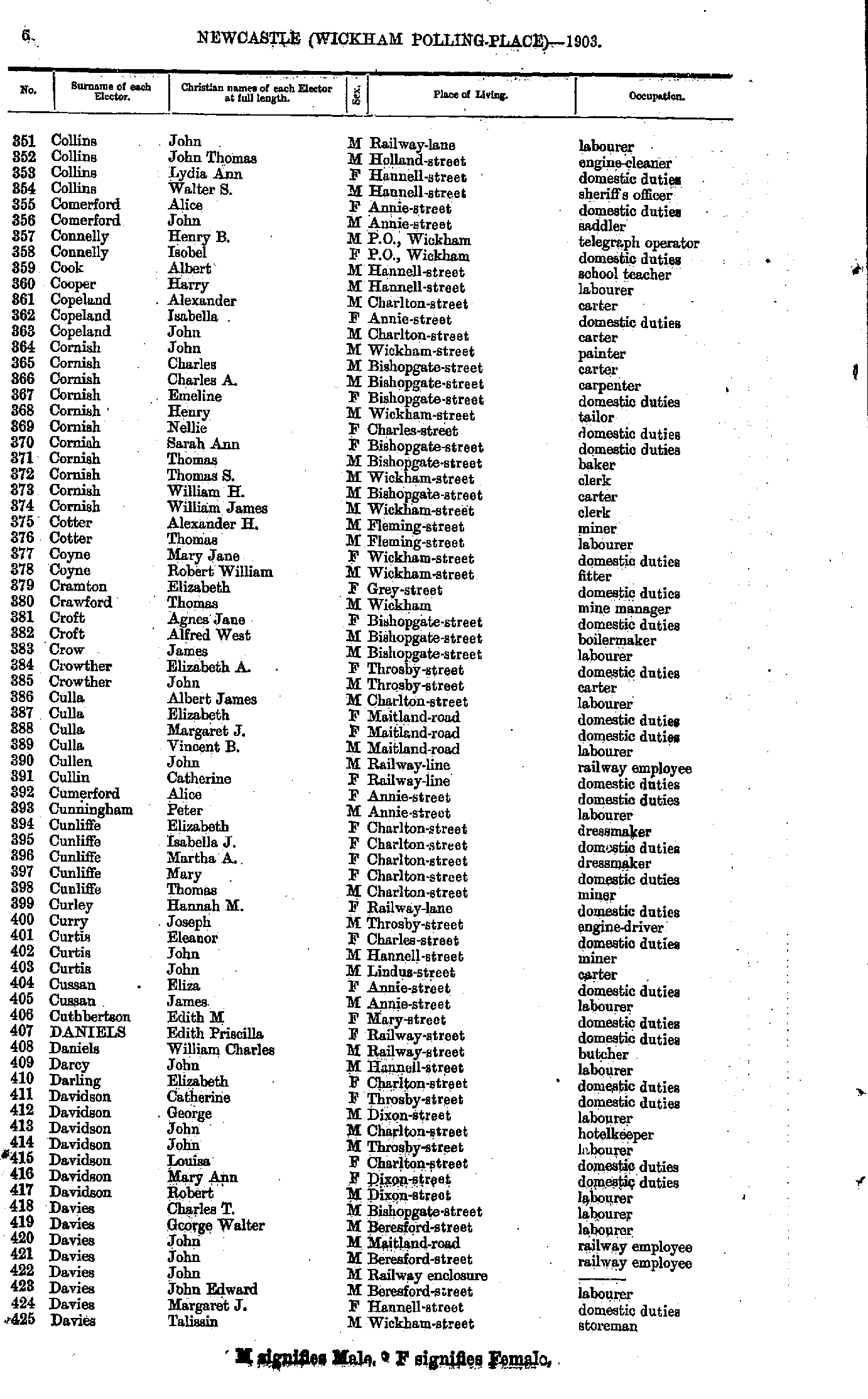
- Collins John - Davies Talissin
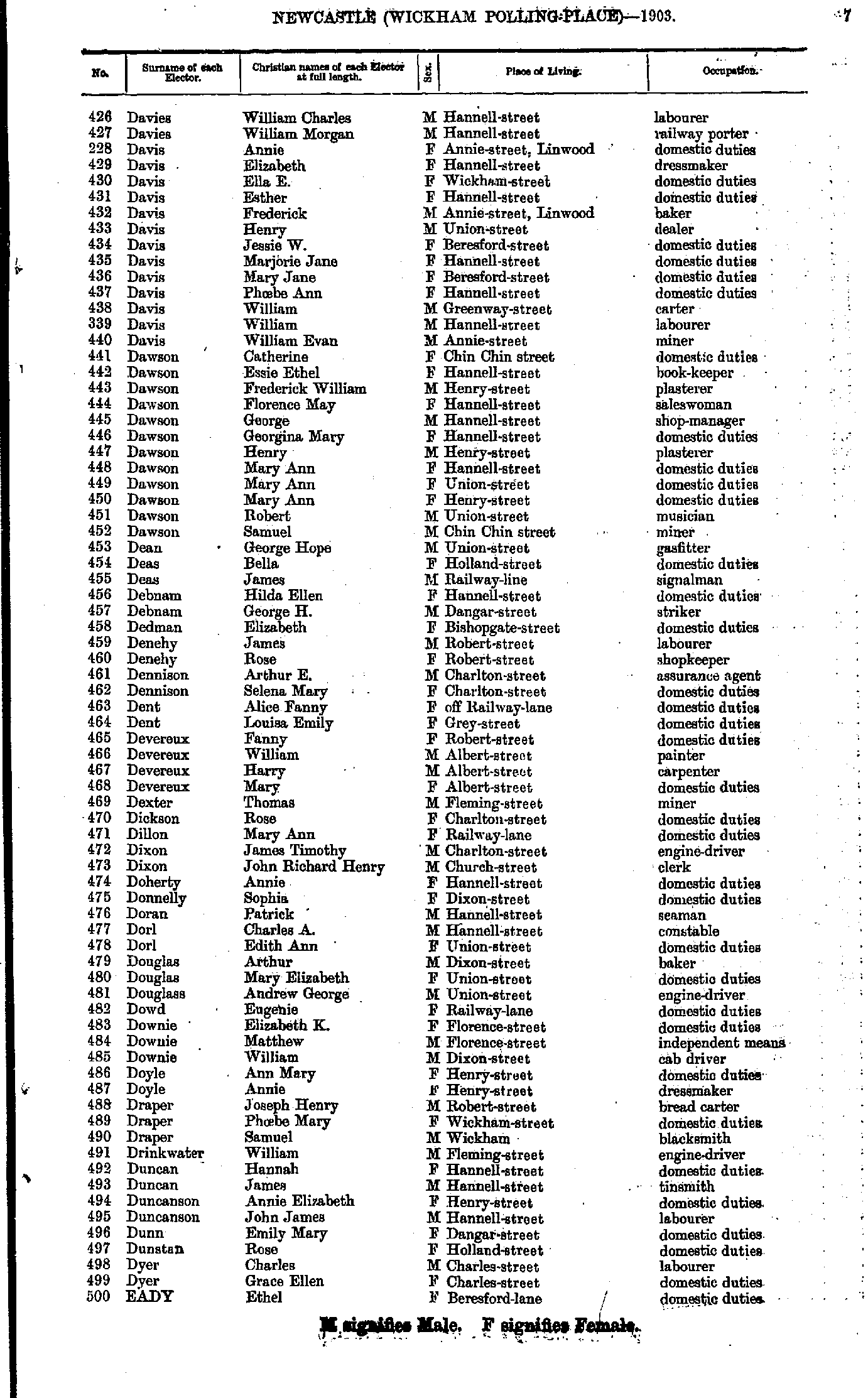
- Davies William - Eady Ethel
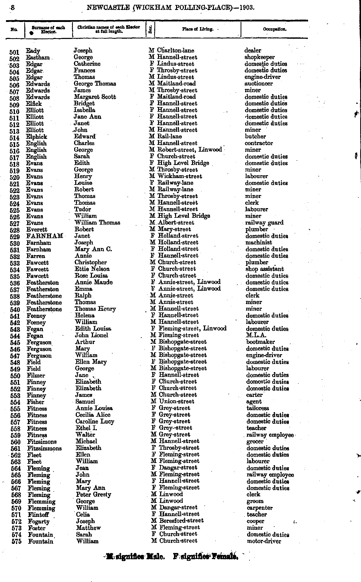
- Eady Joseph - Fountain William
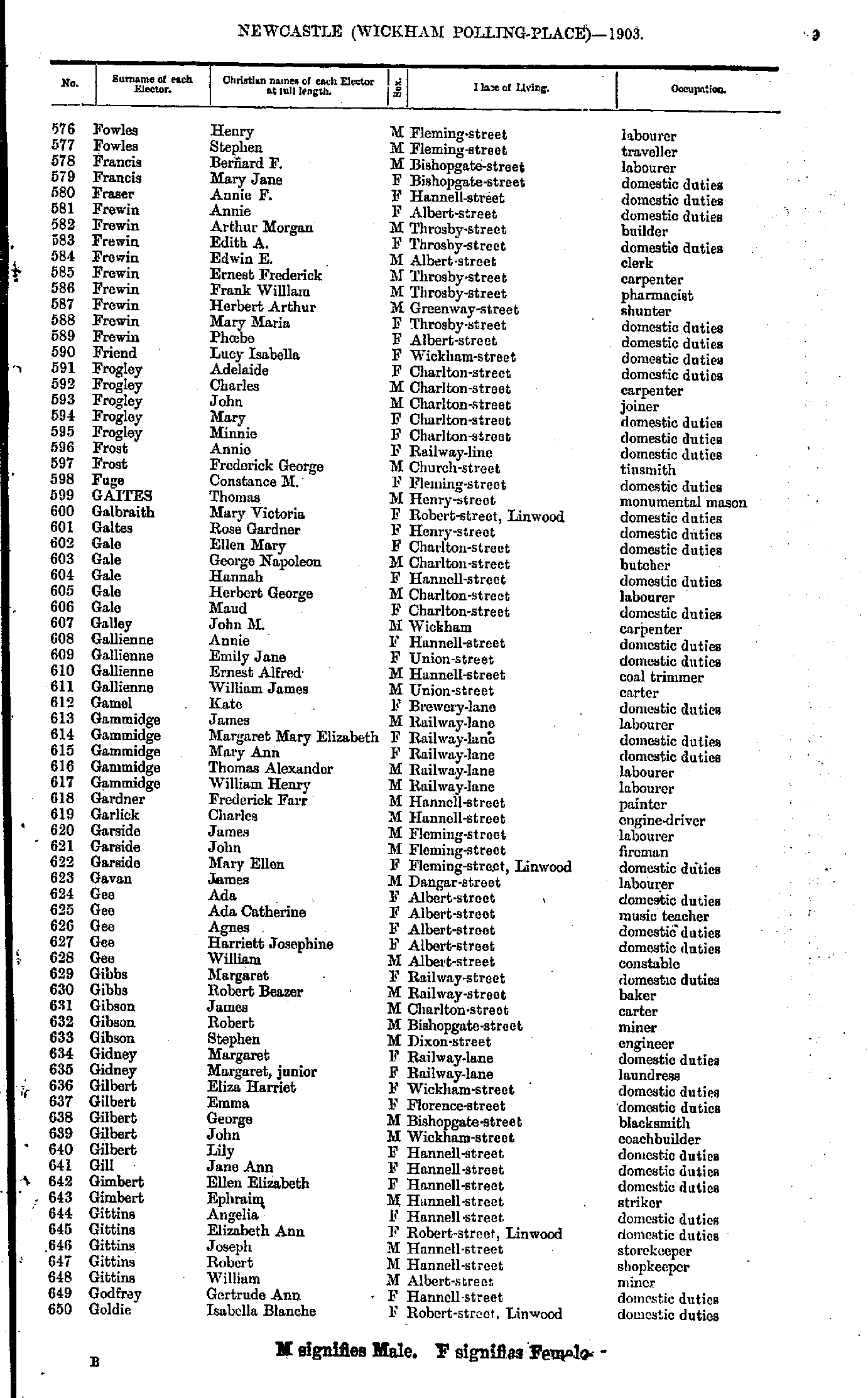
- Fowles Henry - Goldie Isabella
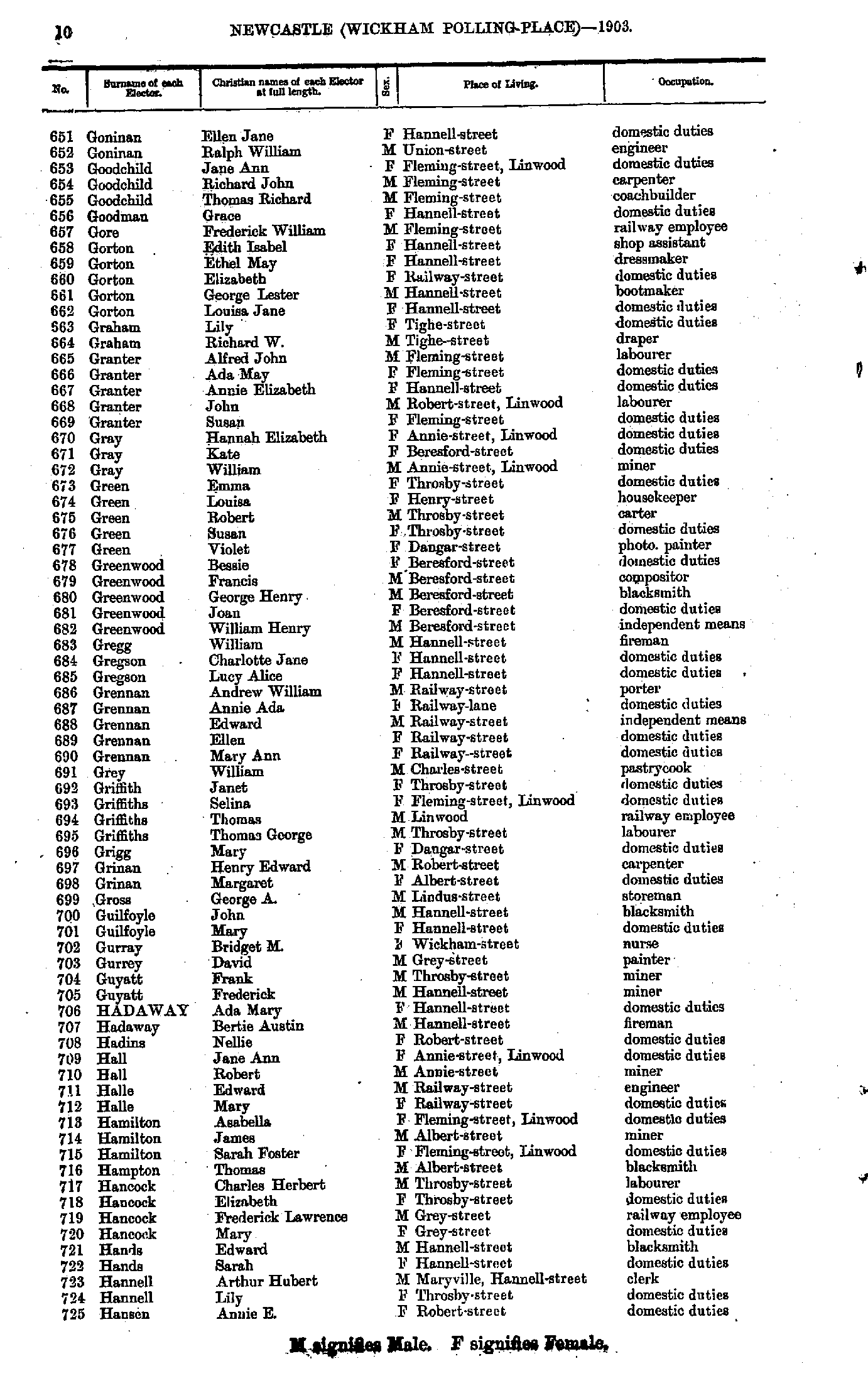
- Goninan Ellen - Hansen Annie
- Hansen Joseph - Hobson Mary
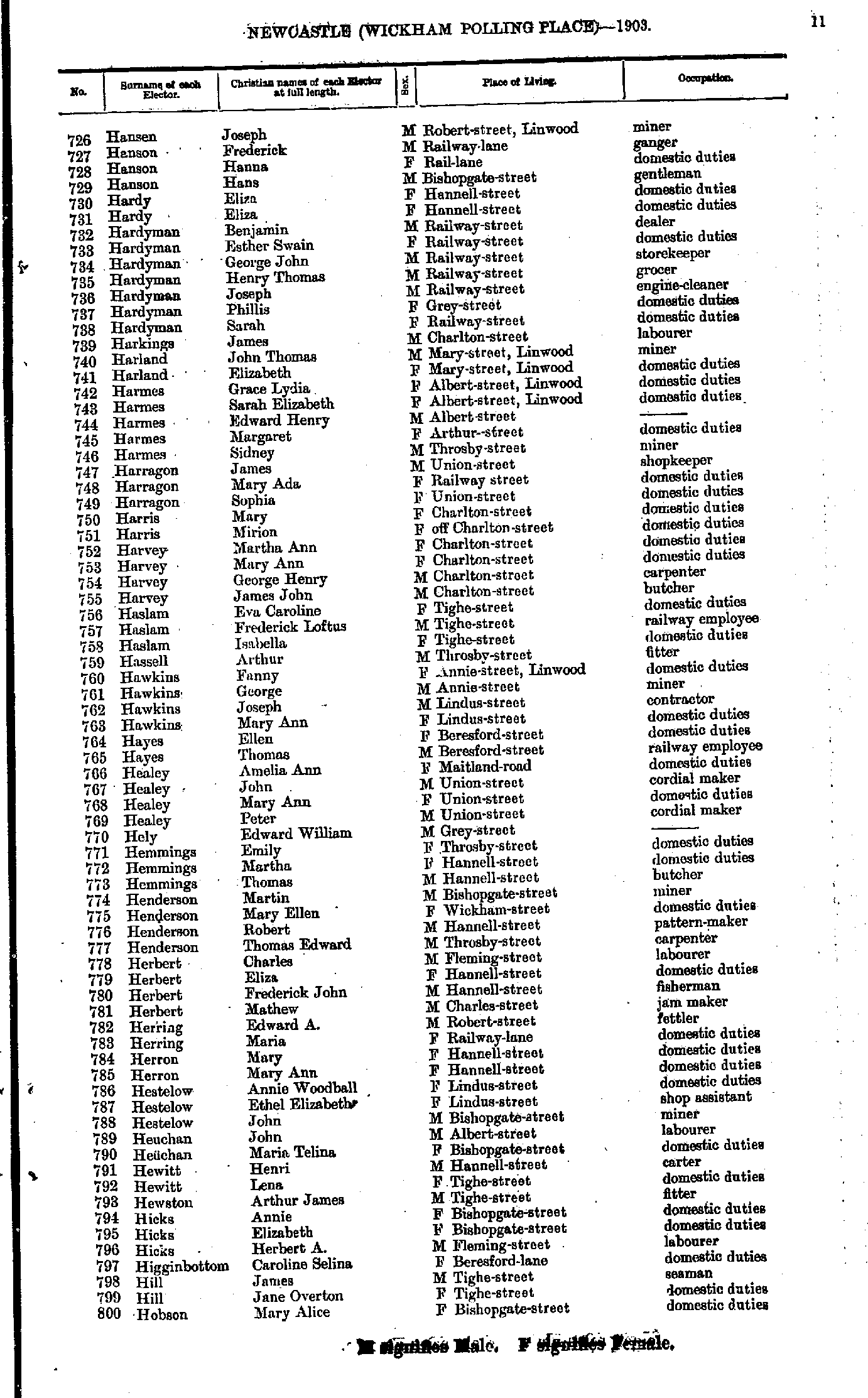
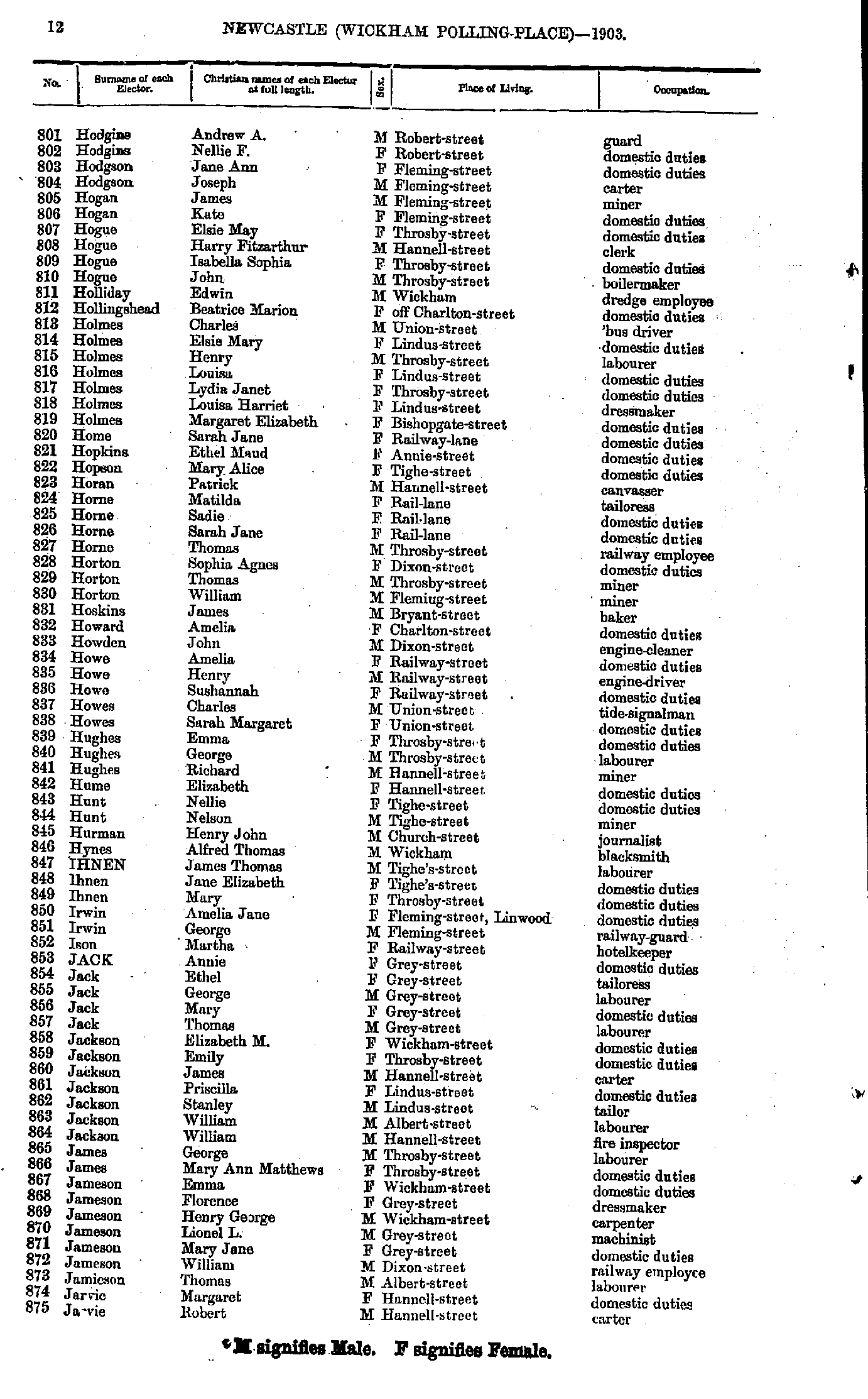
- Hodgins Andrew - Jarvie Robert
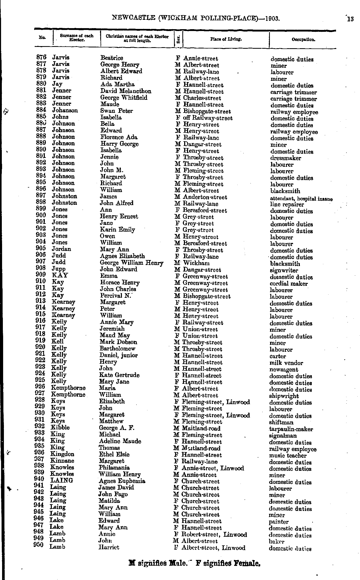
- Jarvis Beatrice - Lamb Harriet
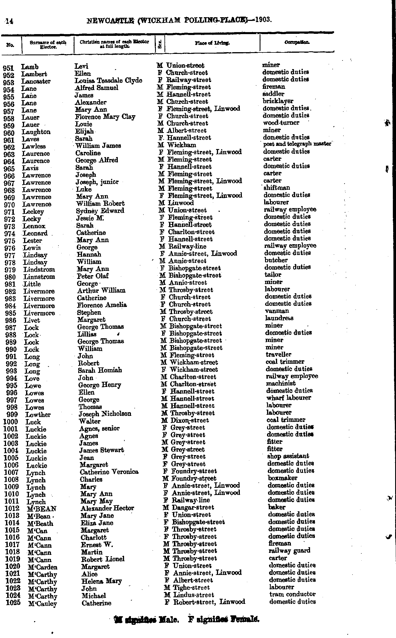
- Lamb Levi - M'Cauley Catherine
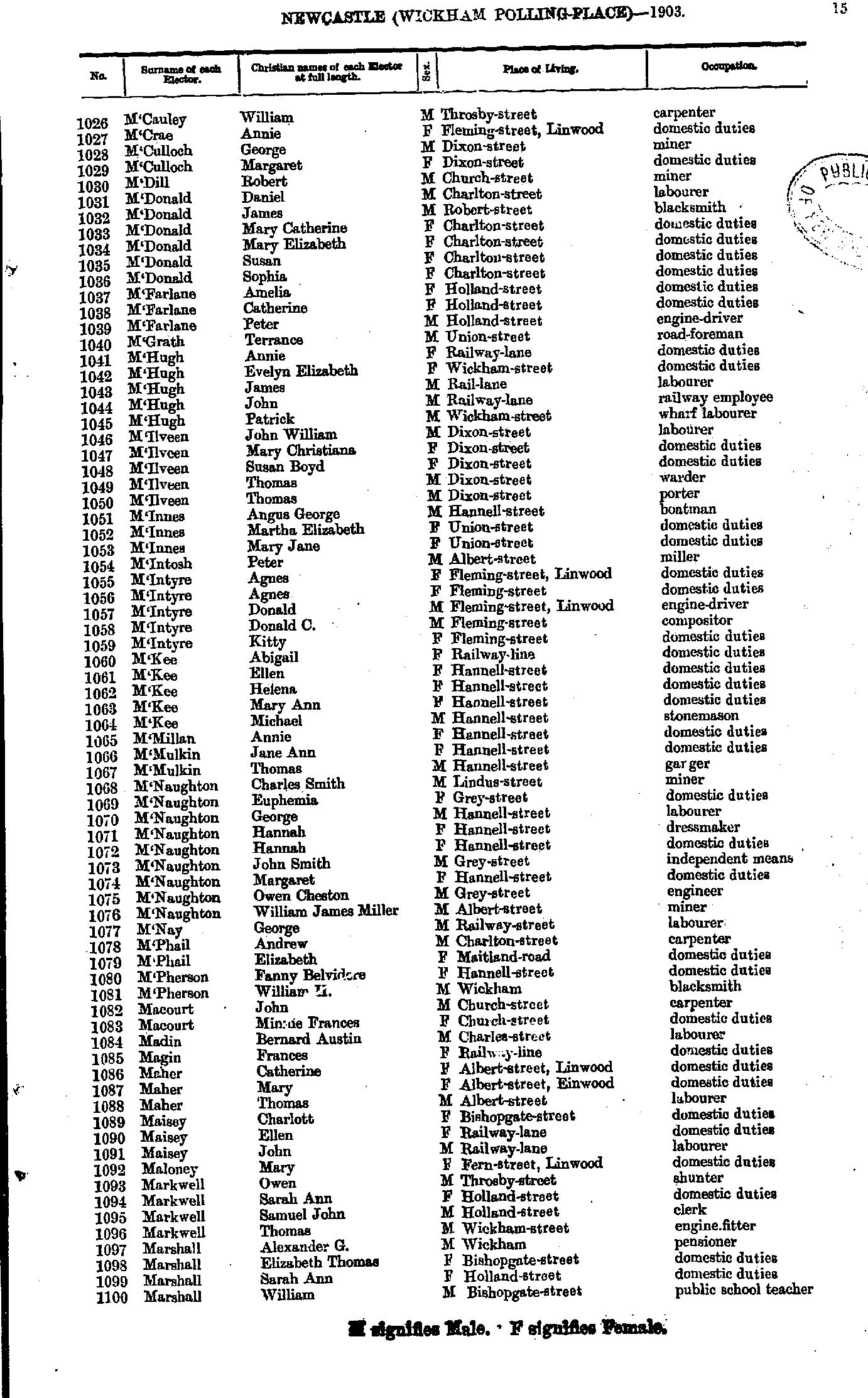
- M'Cauley William - Marshall William
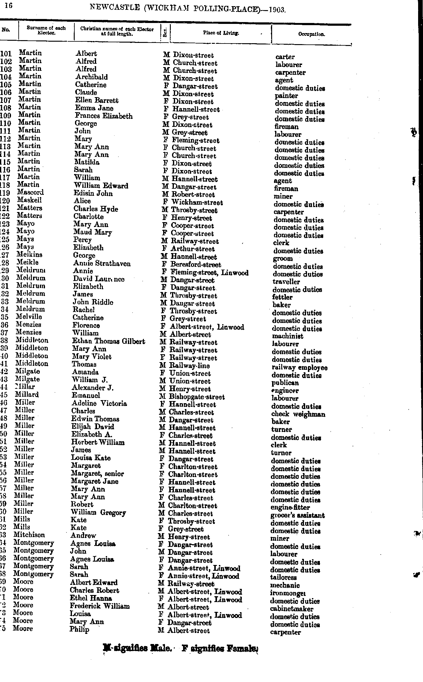
- Martin Albert - Moore Philip
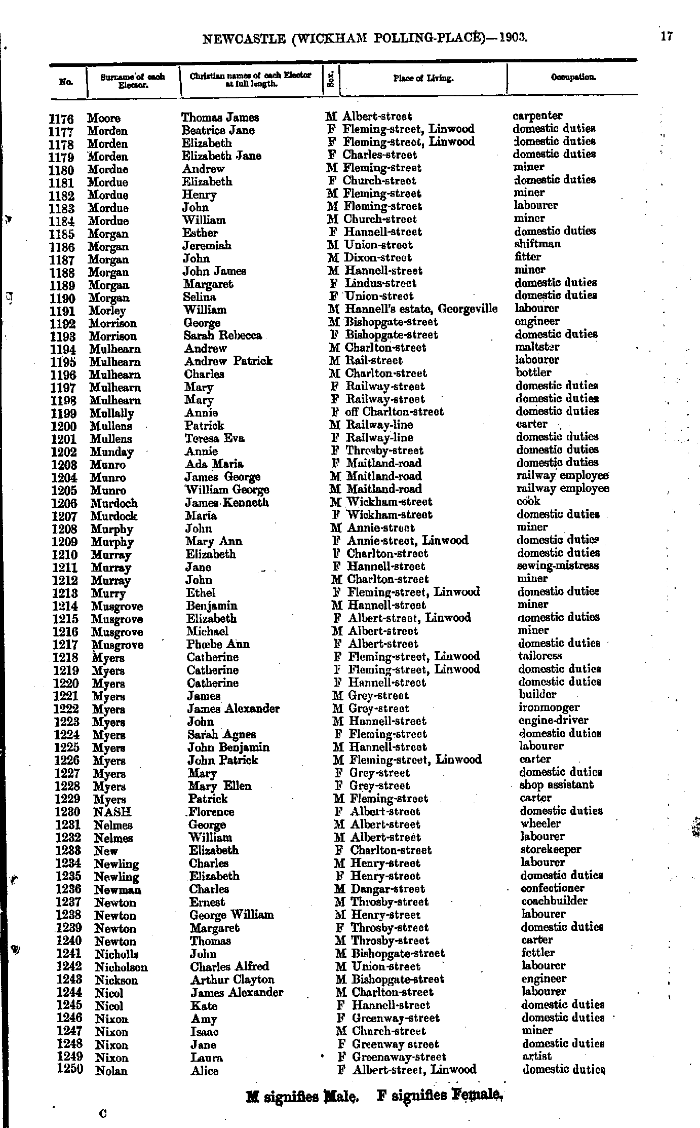
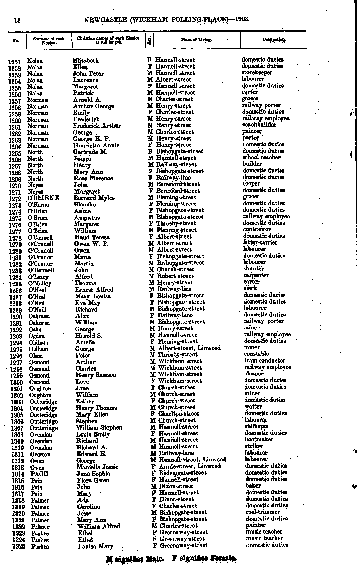
- Moore Thomas - Nolan Alice
- Nolan Elizabeth - Parkes Louisa
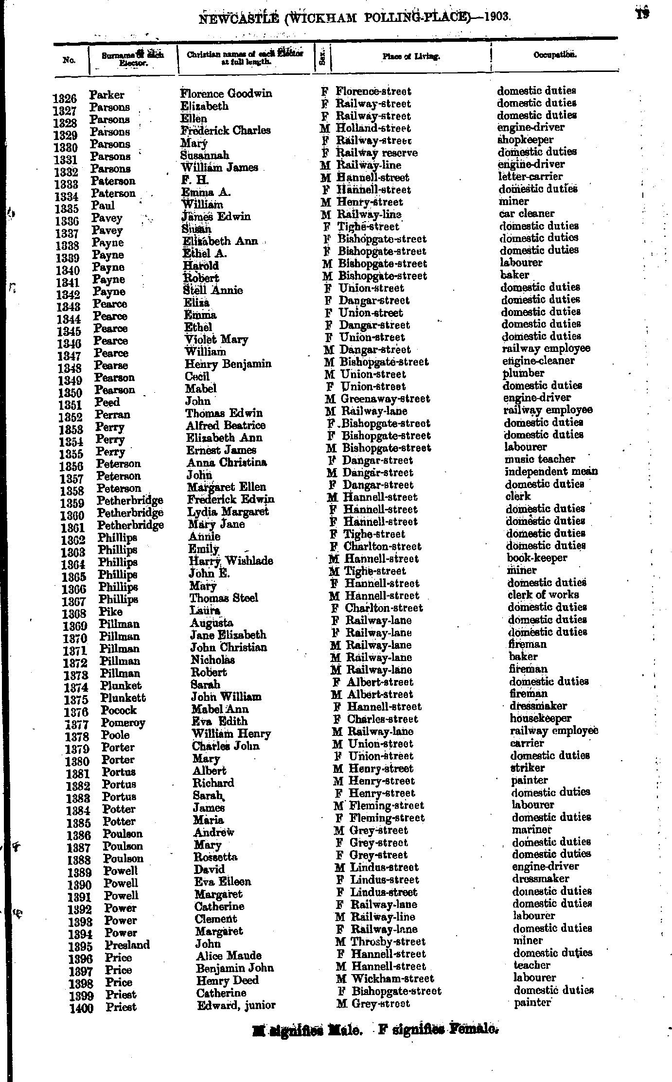
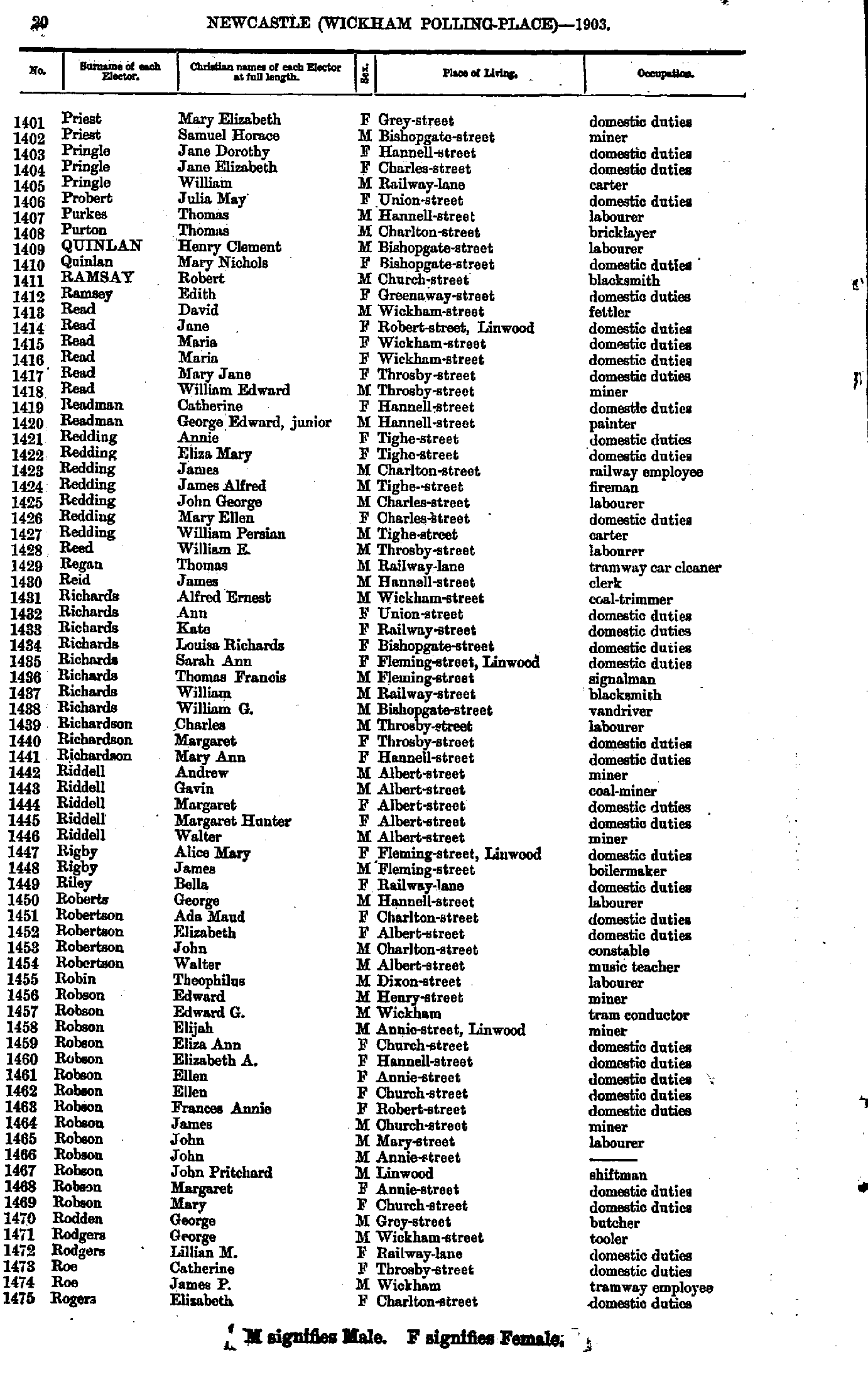
- Parker Florence - Priest Edward
- Priest Mary - Rogers Elizabeth
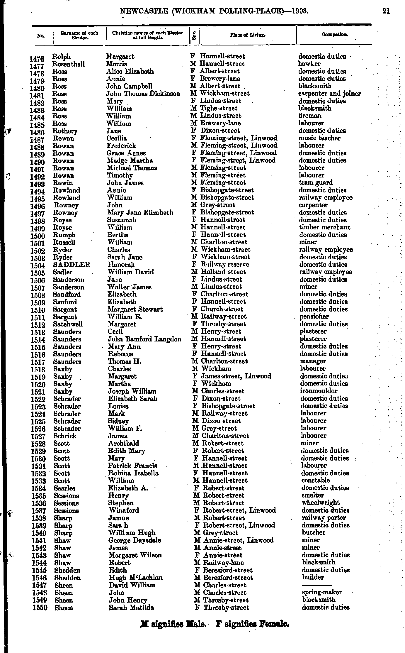
- Rolph Margaret - Sheen Sarah
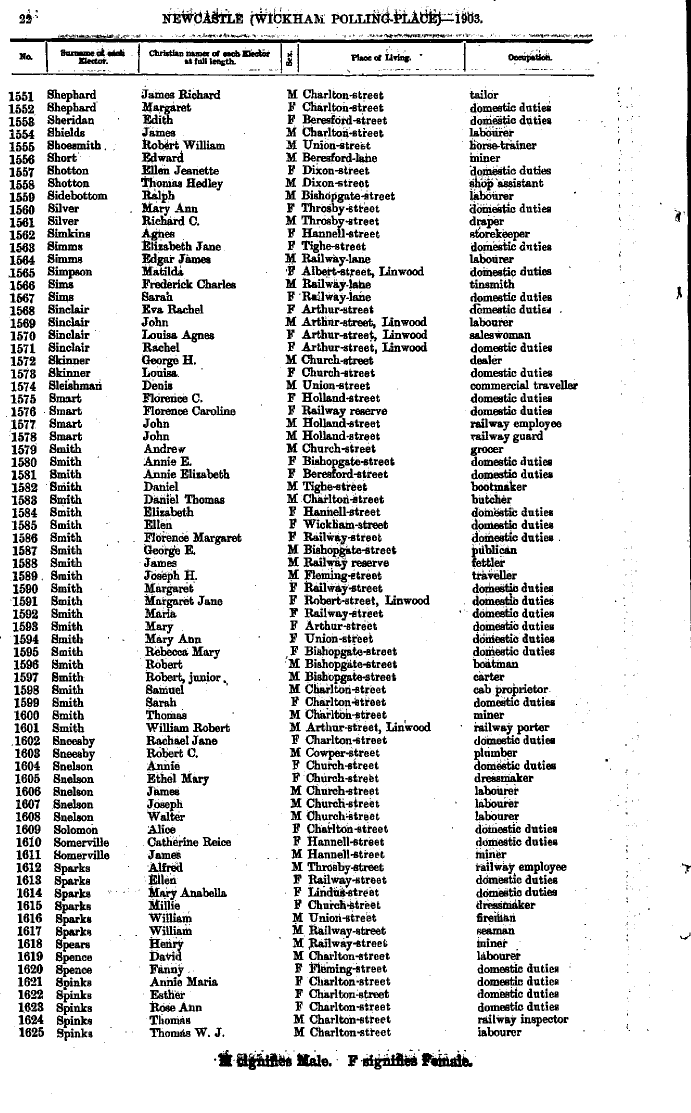
- Shephard James - Spinks Thomas
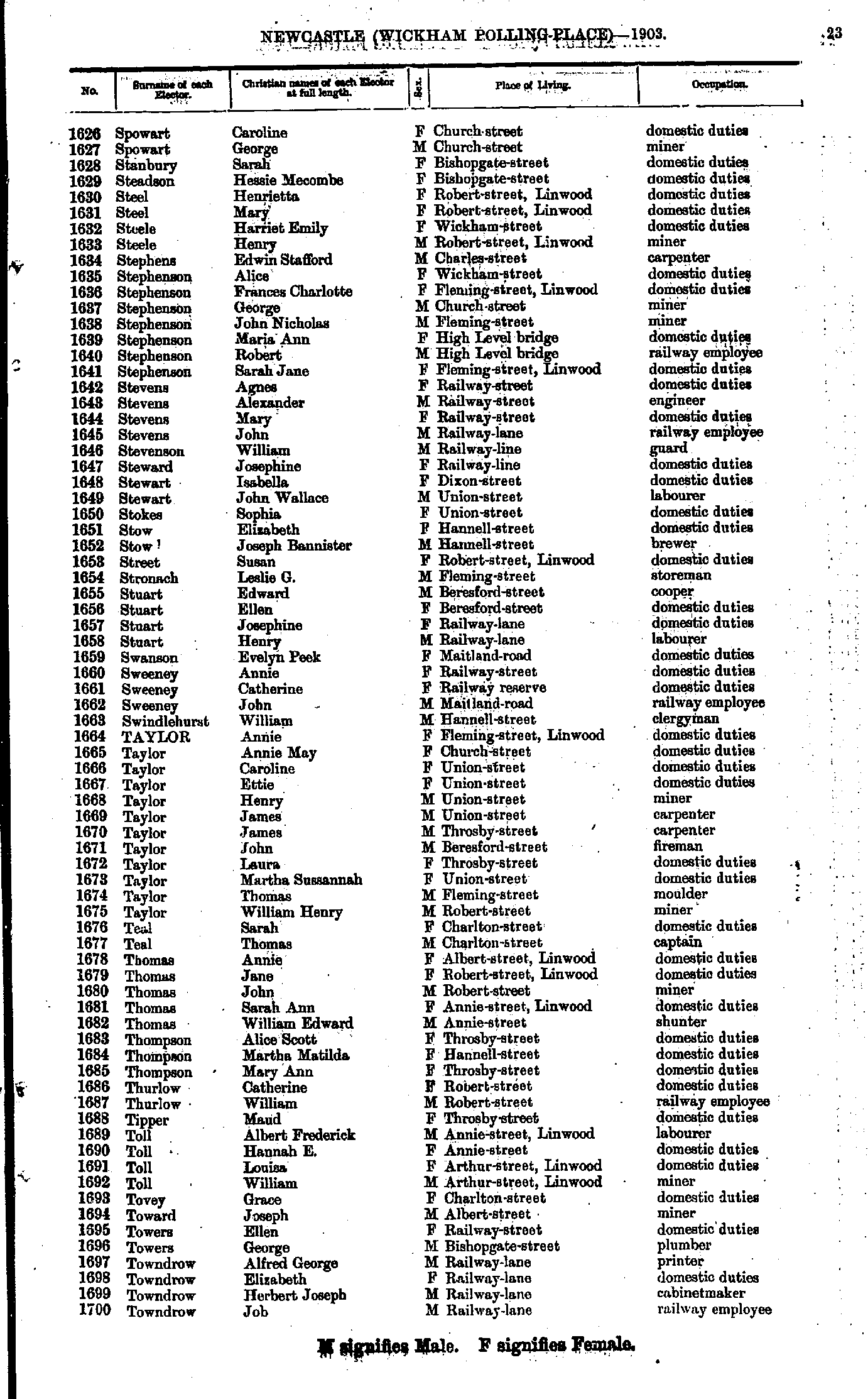
- Spowart Caroline - Towndrow Job
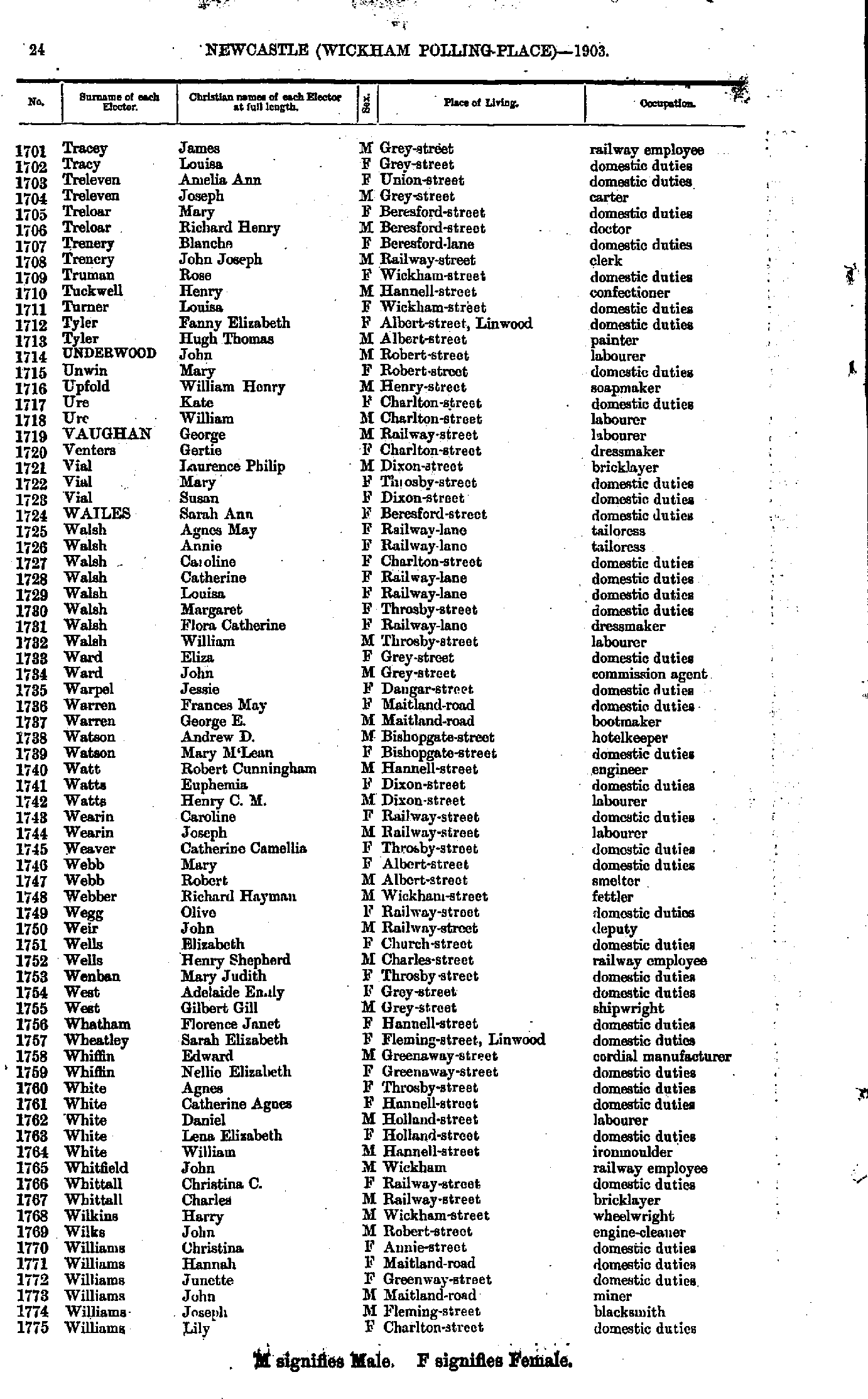
- Tracey James - Williams Lily
- Williams Lily - Young Sarah
From: Federal Electoral Districts Commissioners 1901, Maps of the Federal Electoral Districts of the State of New South Wales, William Applegate Gullick, Government Printer, Sydney.
JPEG file (367KB)
Portable Document Format(PDF) file (2.11MB)If you do not have a PDF reader you can click on the button to download the free Adobe Acrobat Reader
The documents in this site are arranged into seven major indexes. You are currently in the Electoral Rolls index. Use the Back button on your browser to move within this index, or use the links below to view another index:
- Directories
- Electoral Rolls
- Land Records
- General and Miscellaneous Records
- Mining Records
- Pastoral and Agricultural Records
- Other Occupations
Copyright © Internet History Resources 2006
