IHR NSW Family History Documents
Electoral Rolls Index
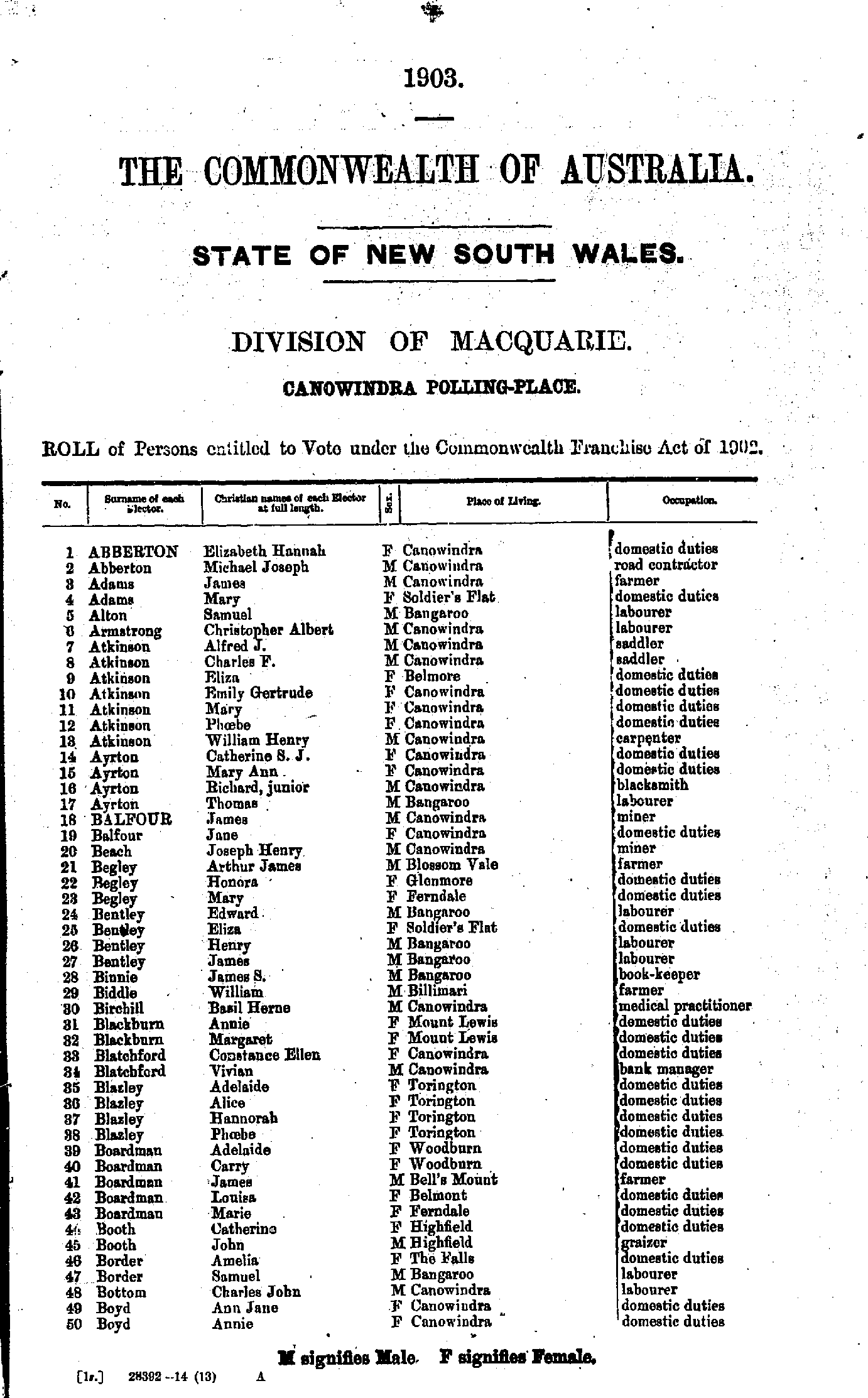
Home | Directories | Electoral | Land | General | Mining | Pastoral | OccupationsNSW Electoral Rolls 1903 - Macquarie Division
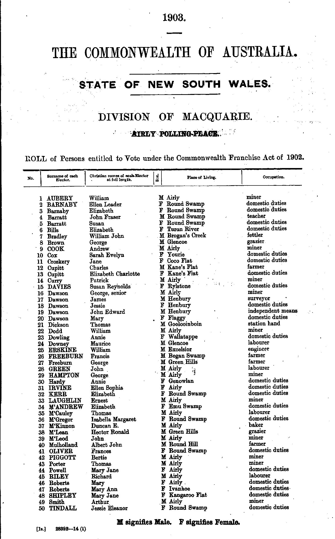
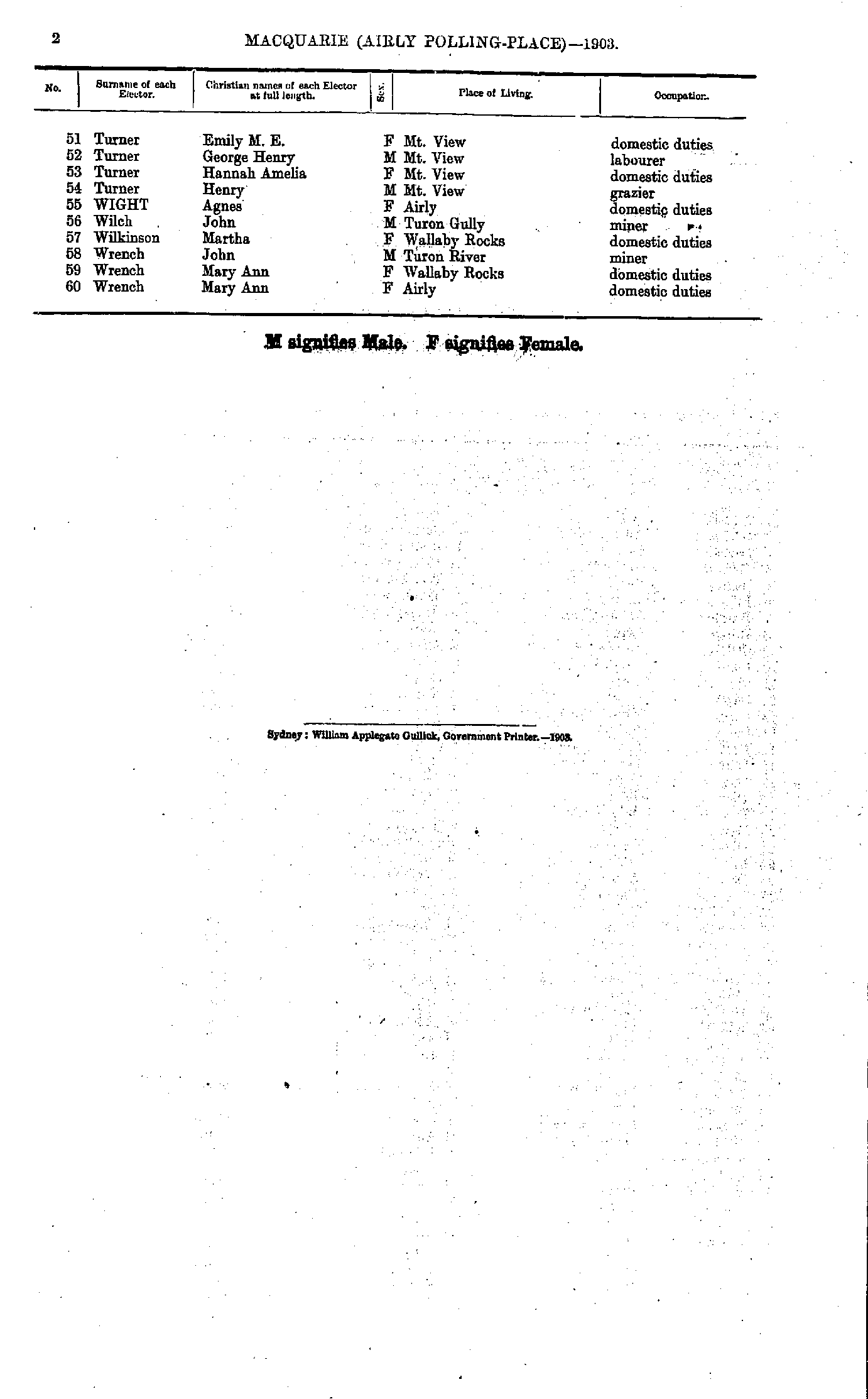
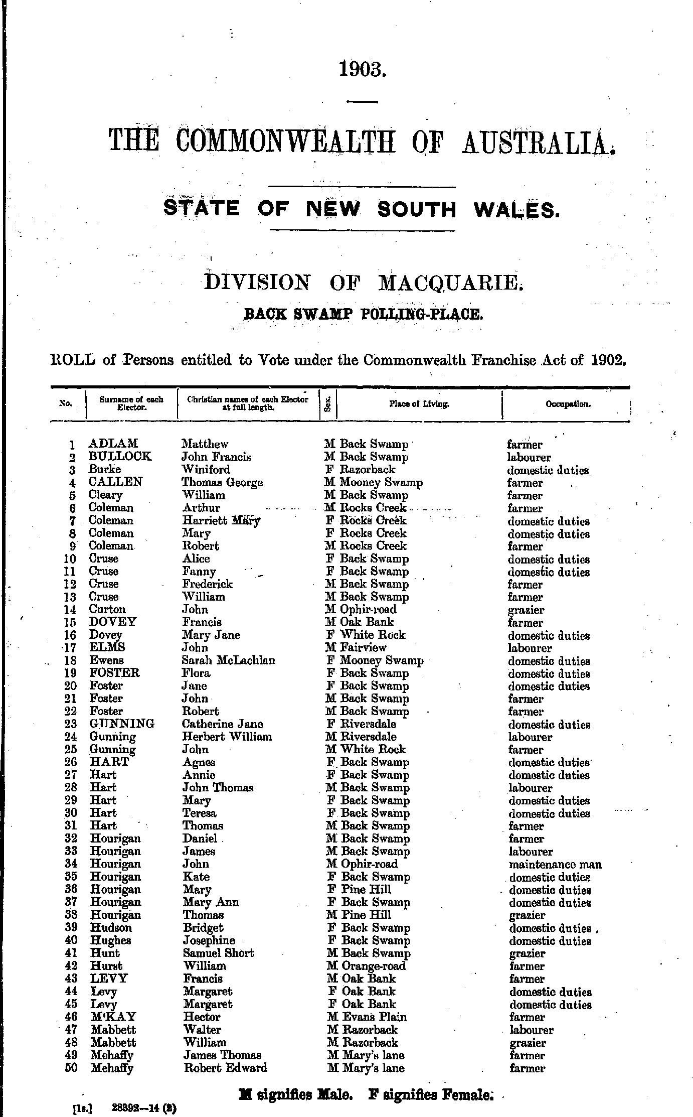
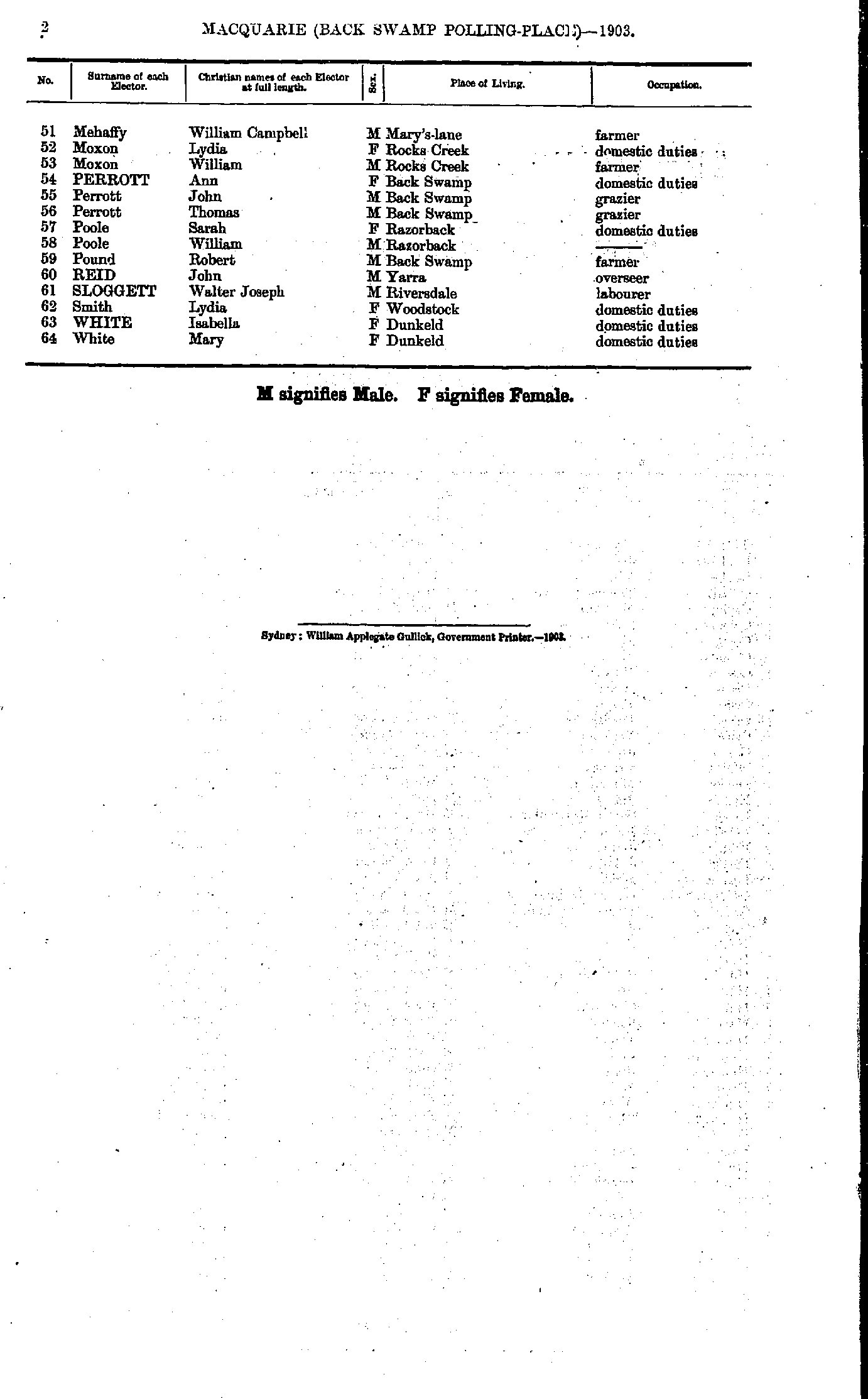
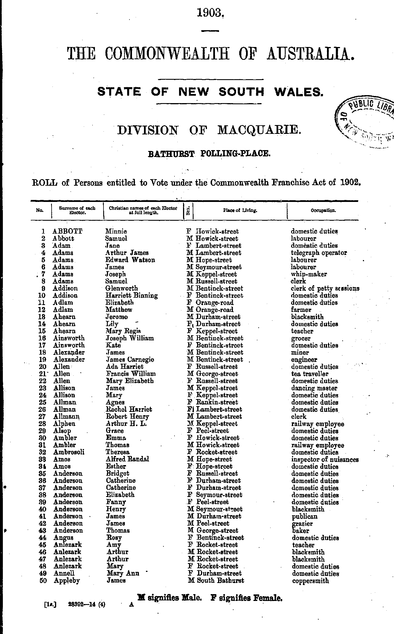
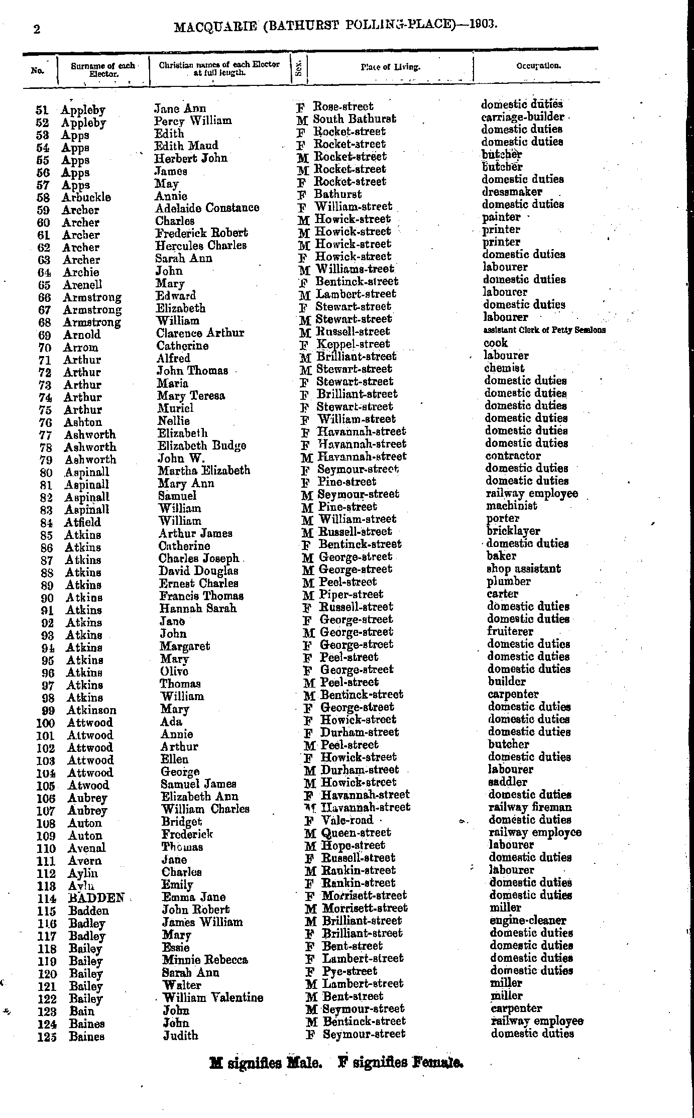
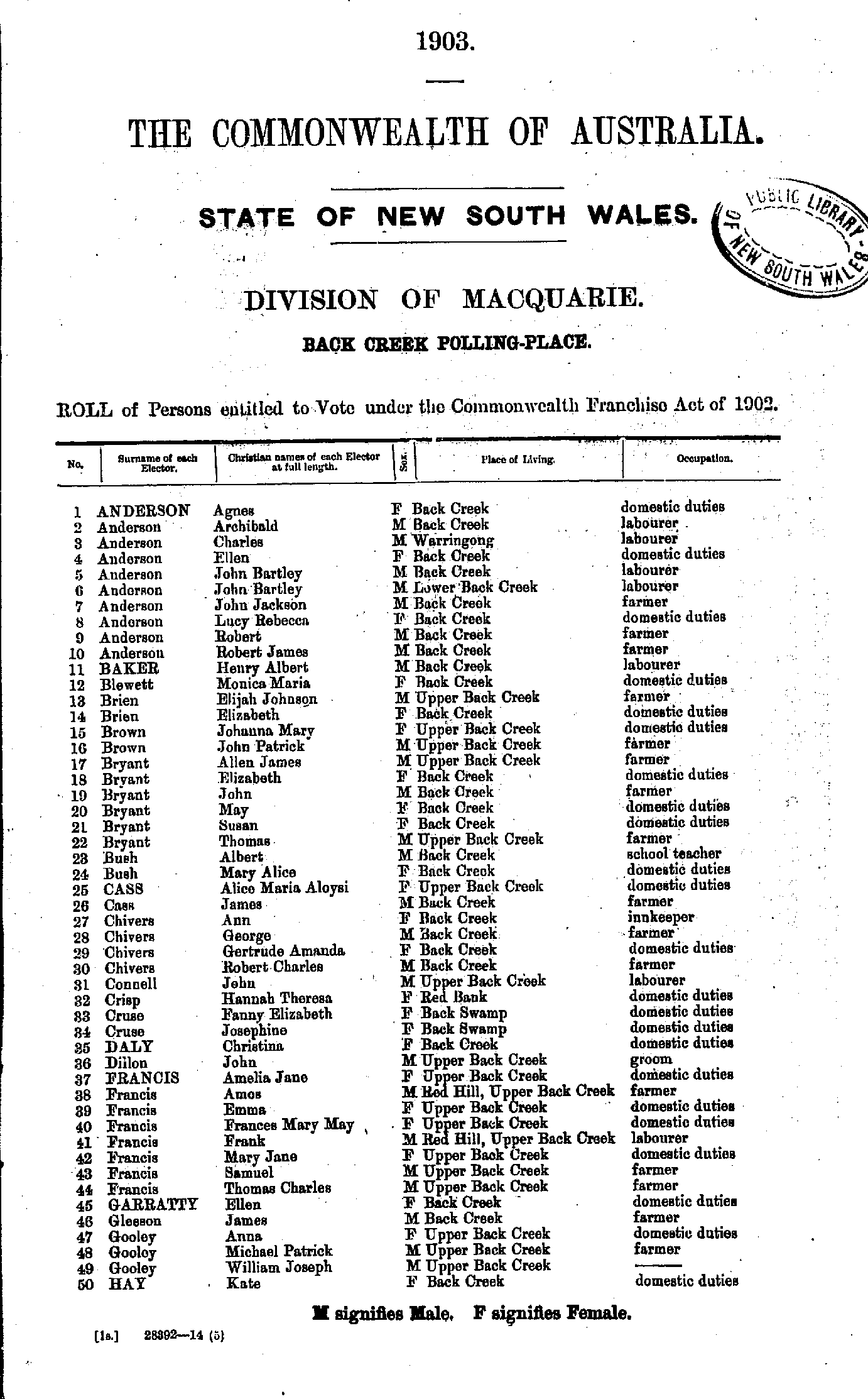
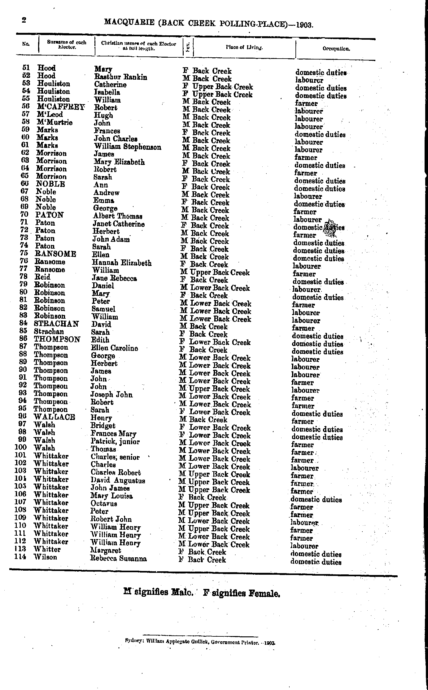
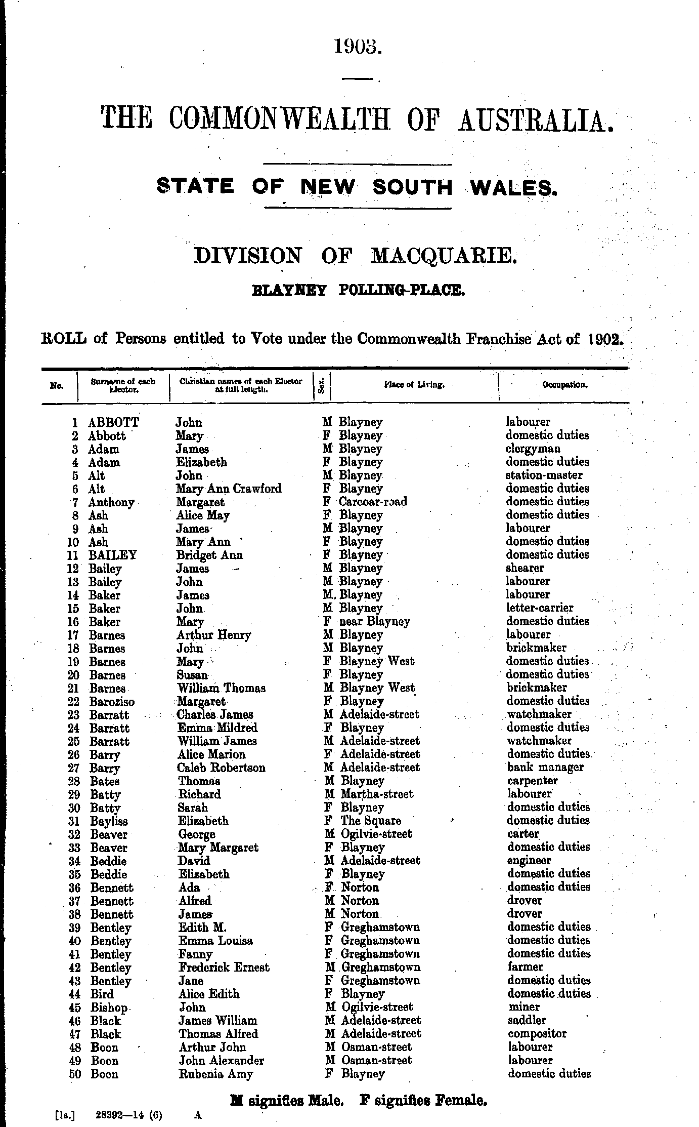
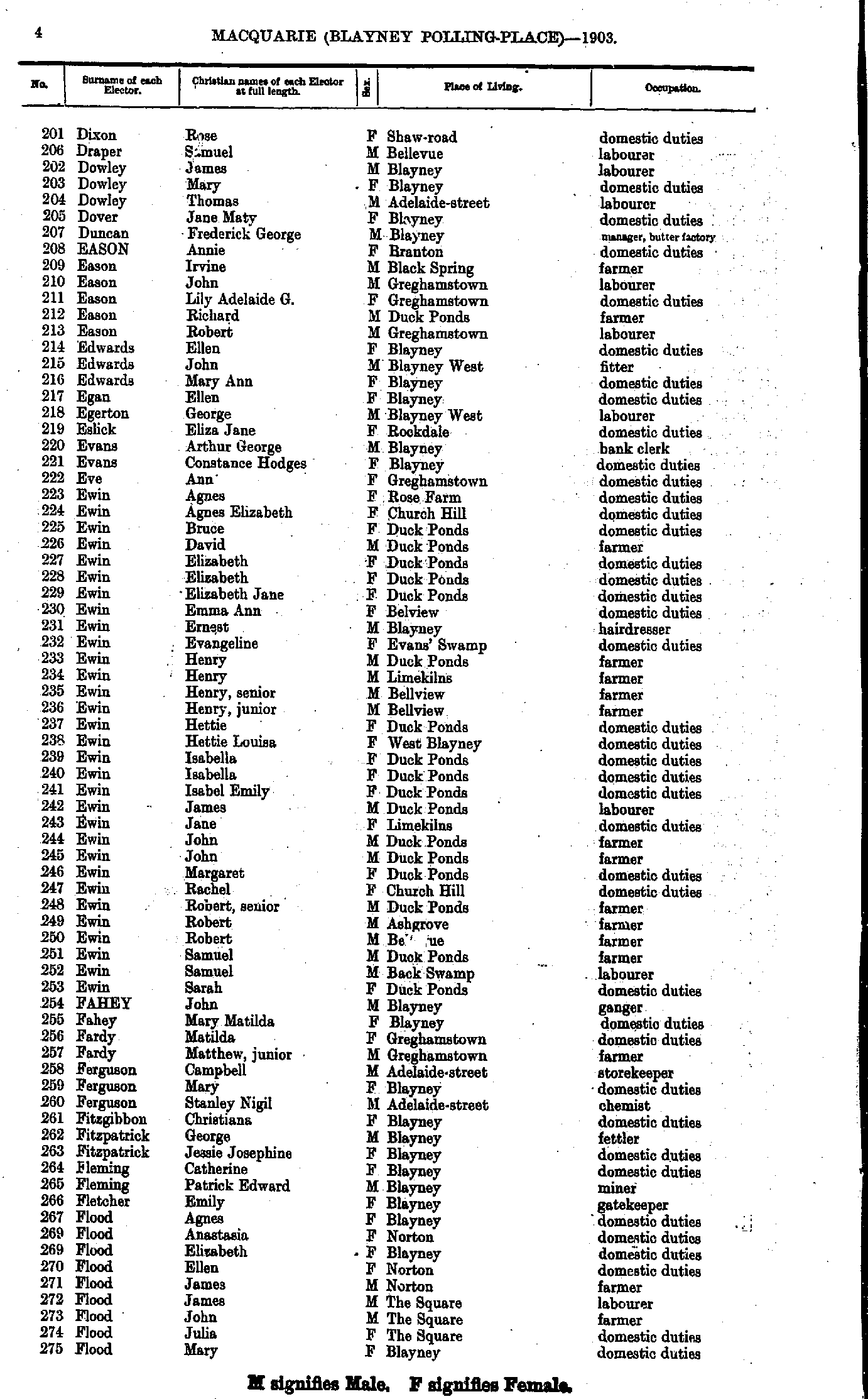
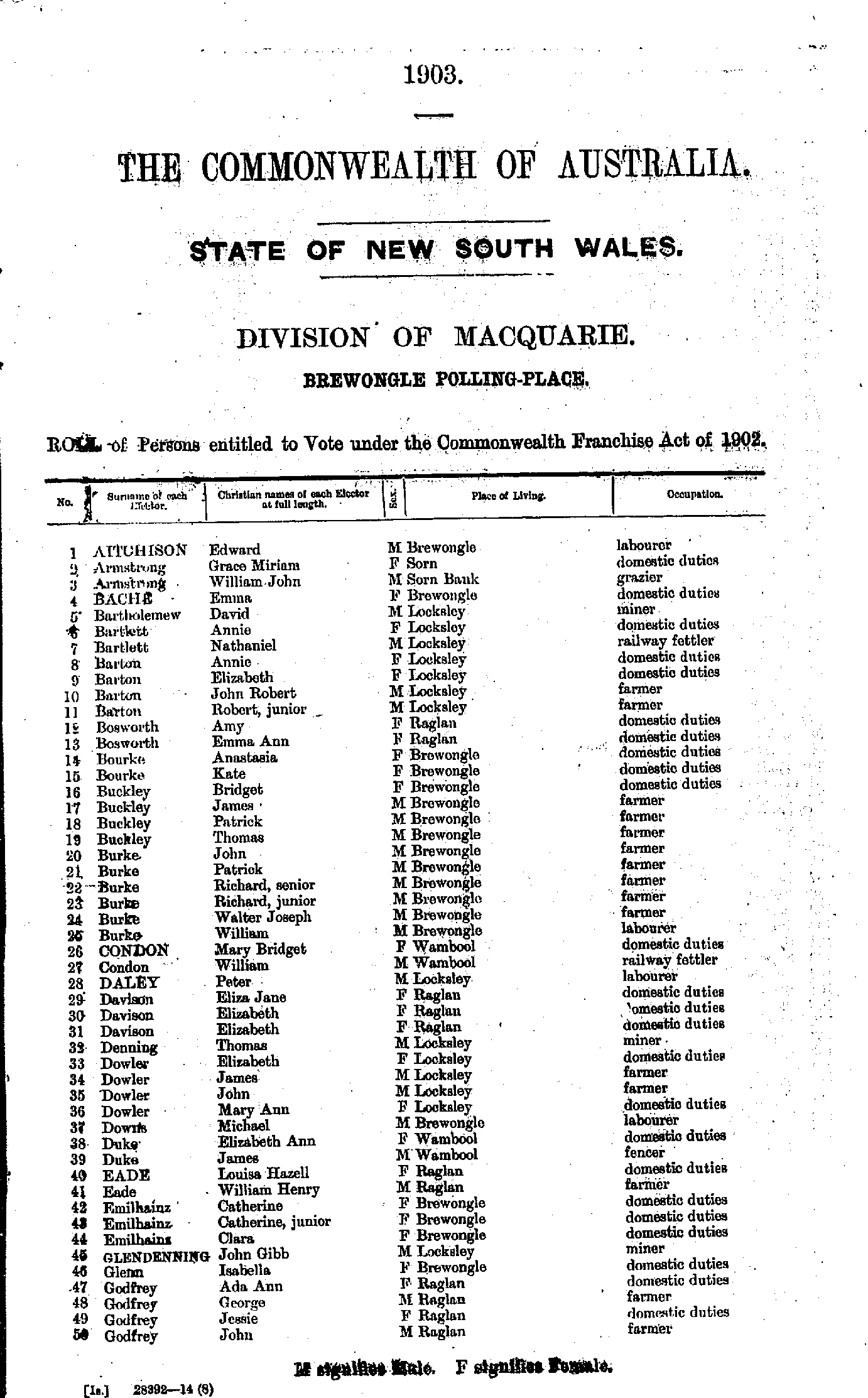
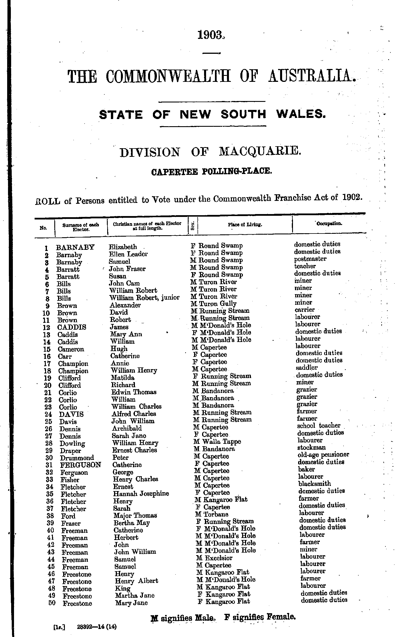
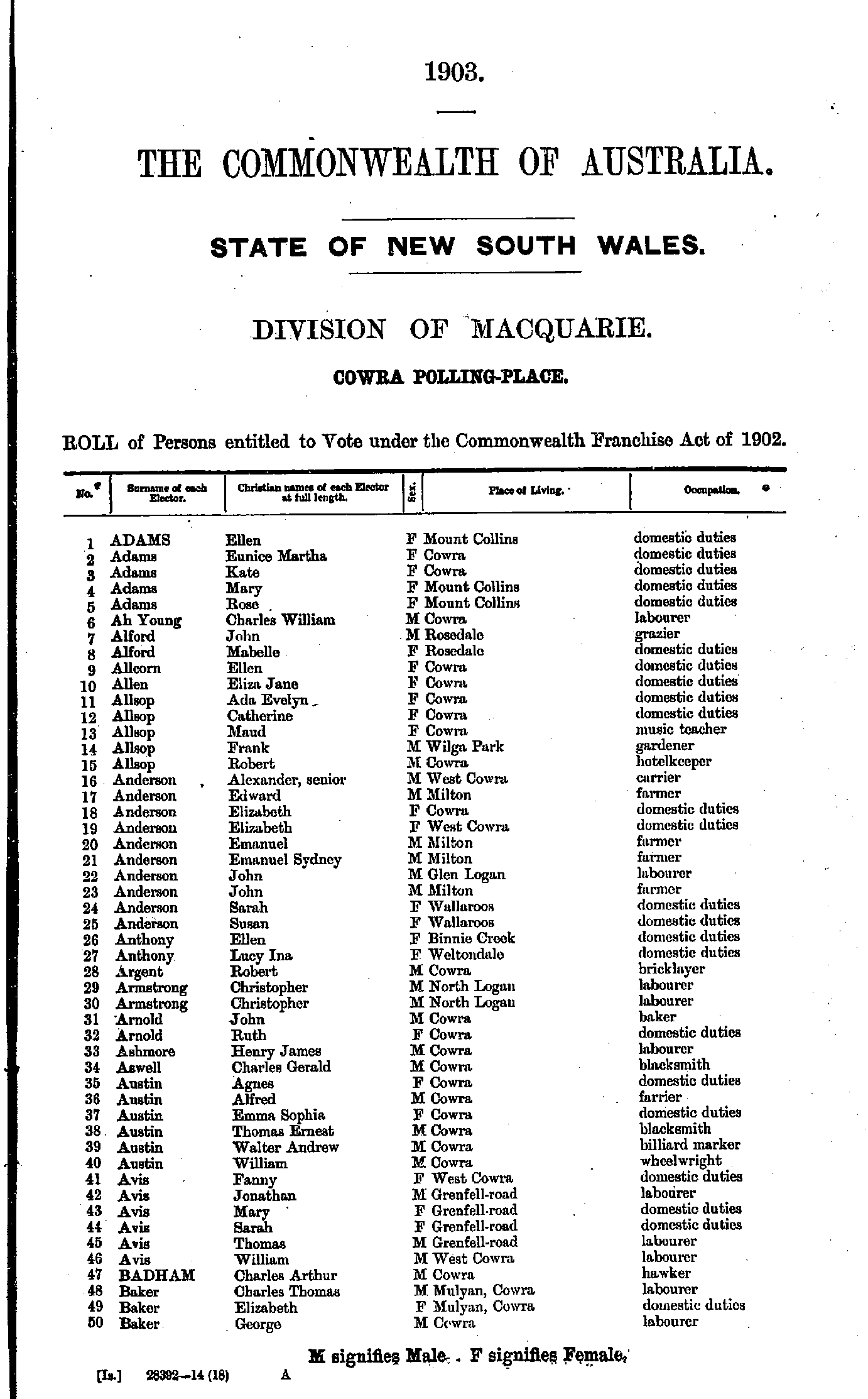
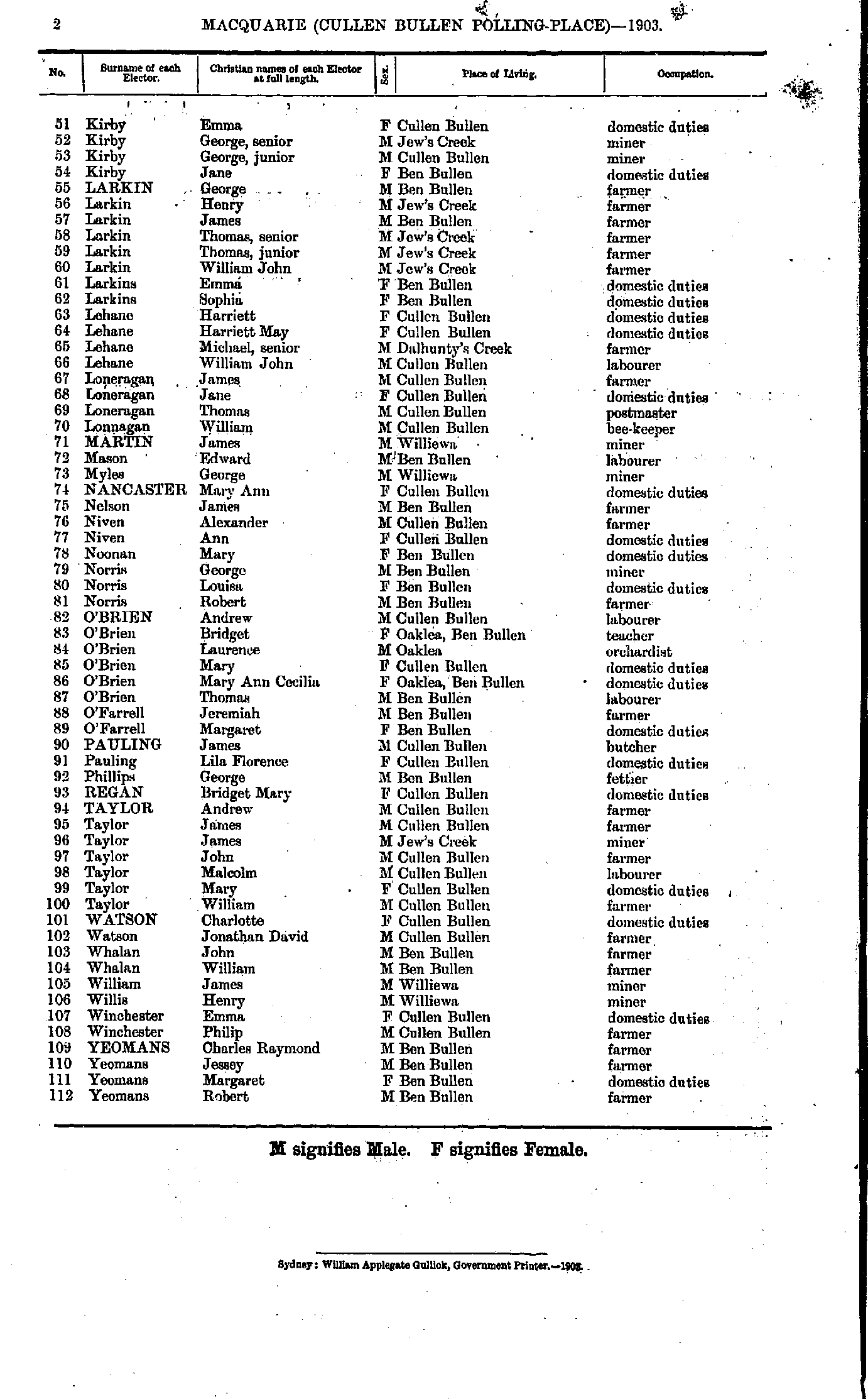
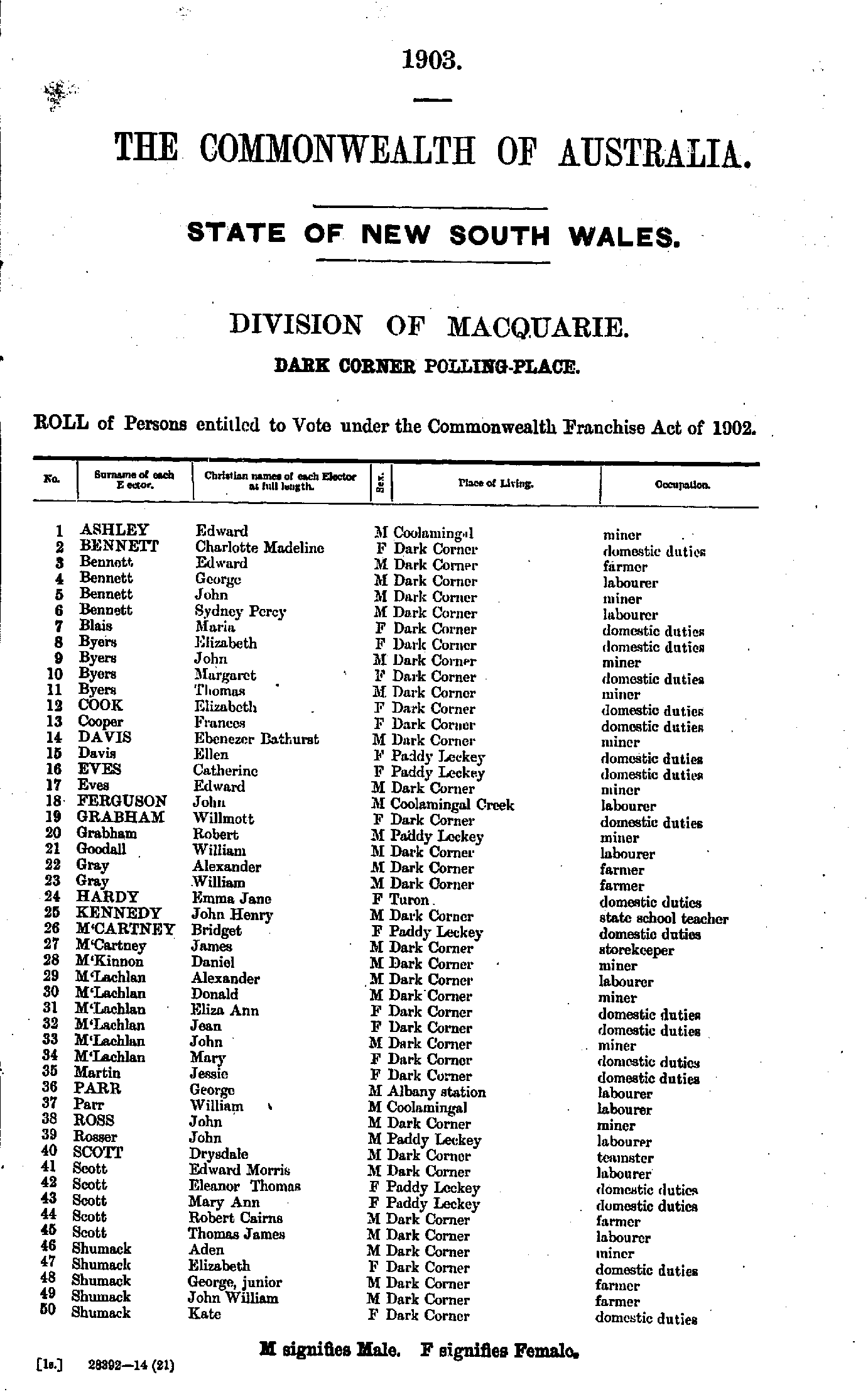
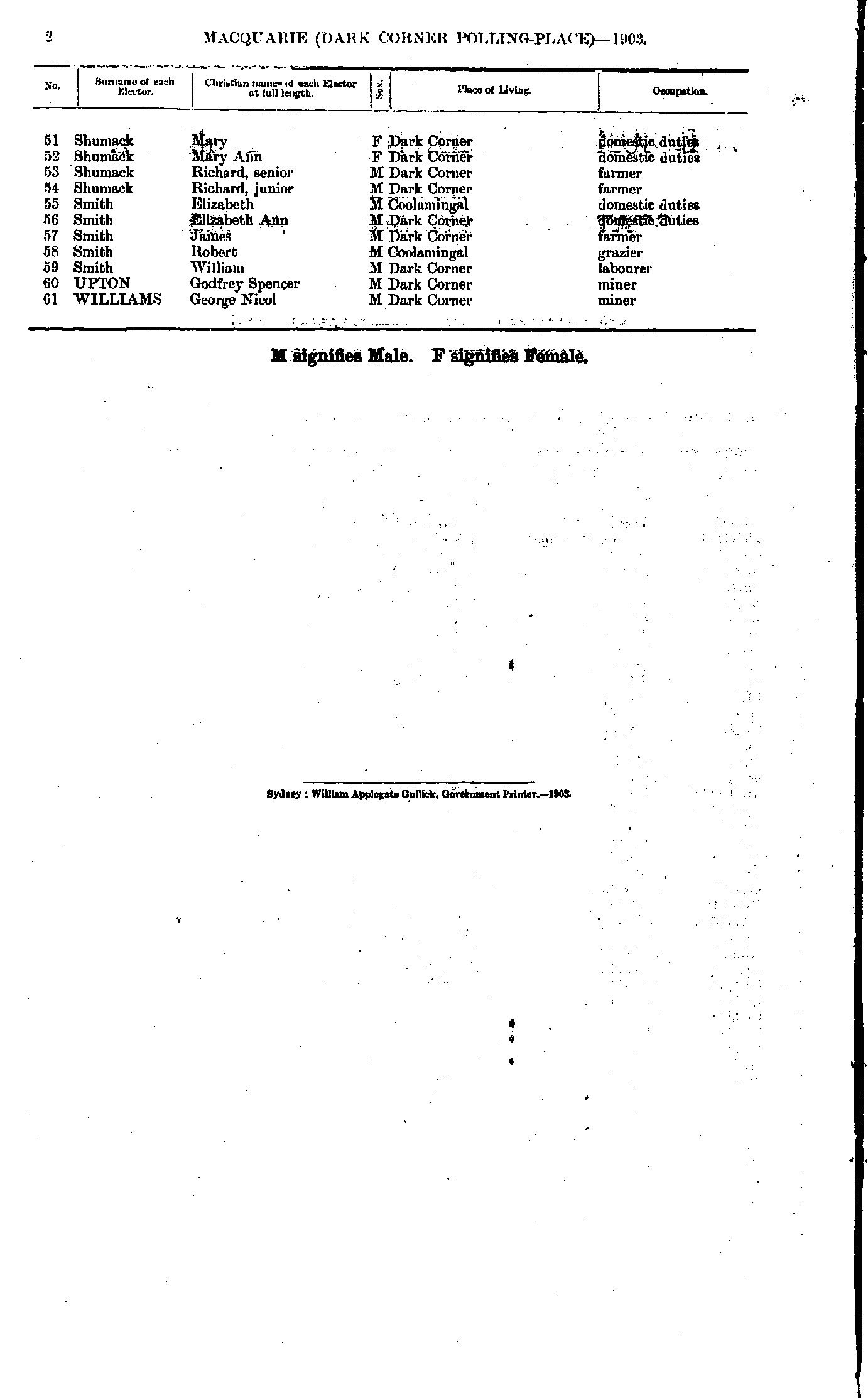
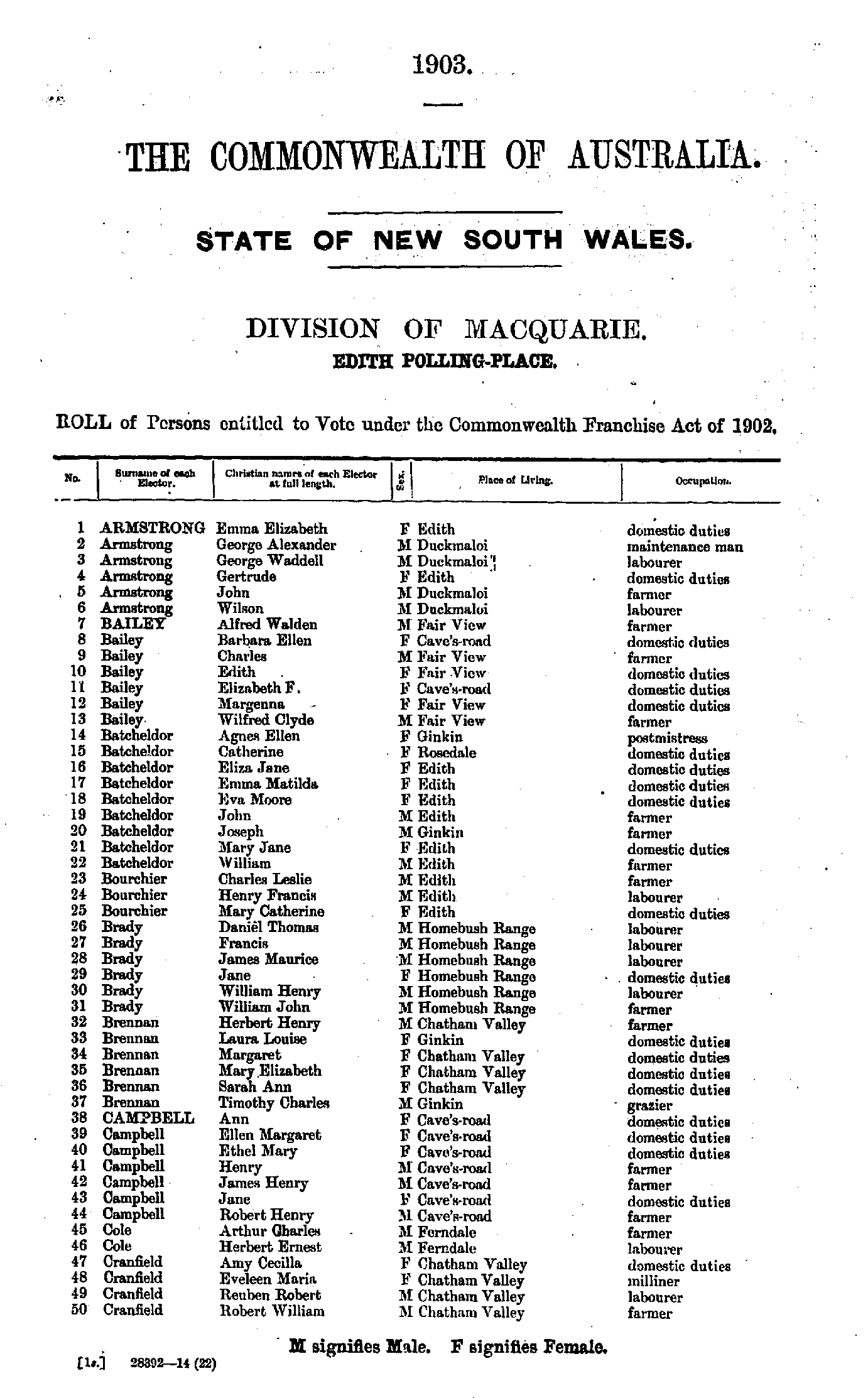
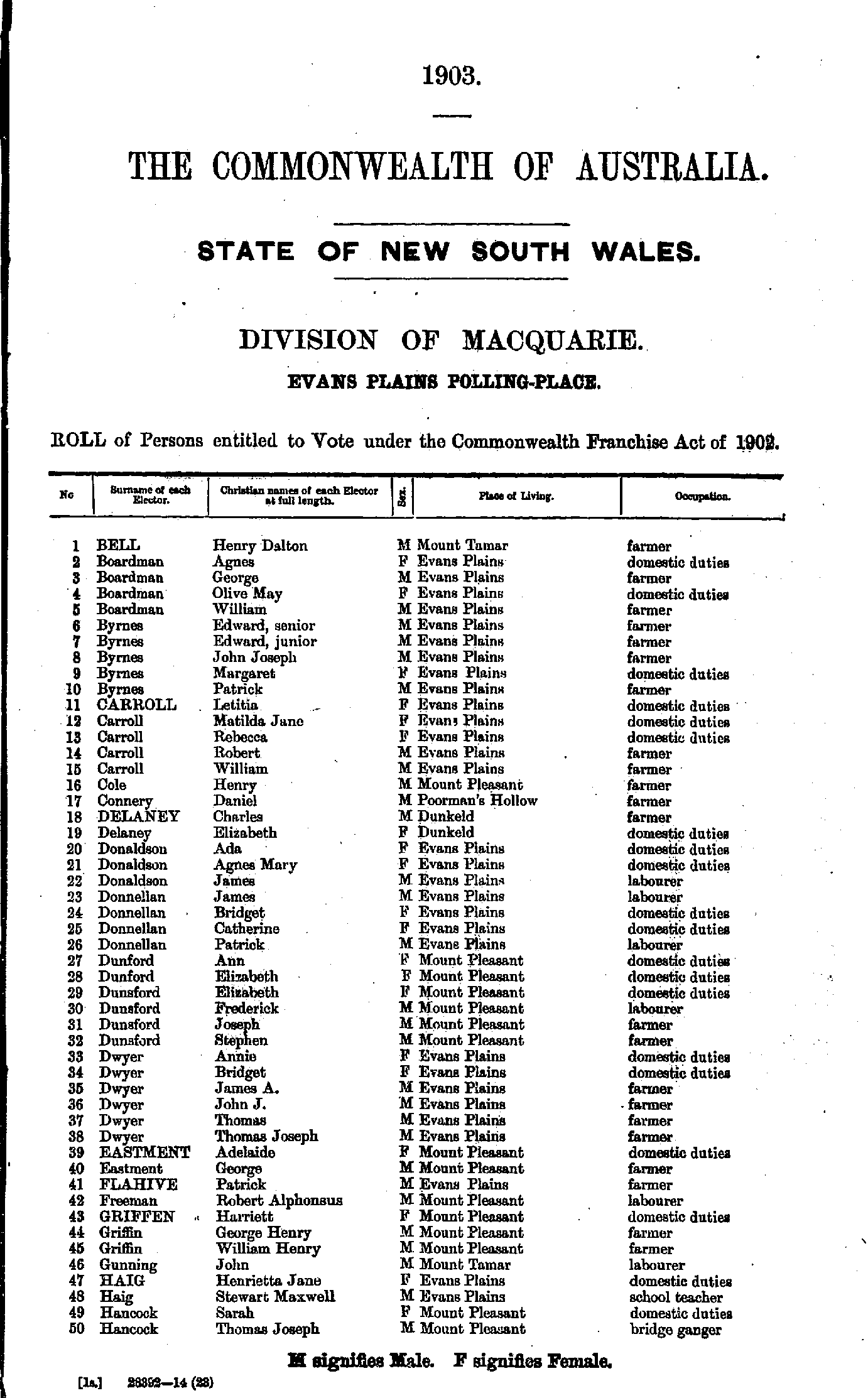
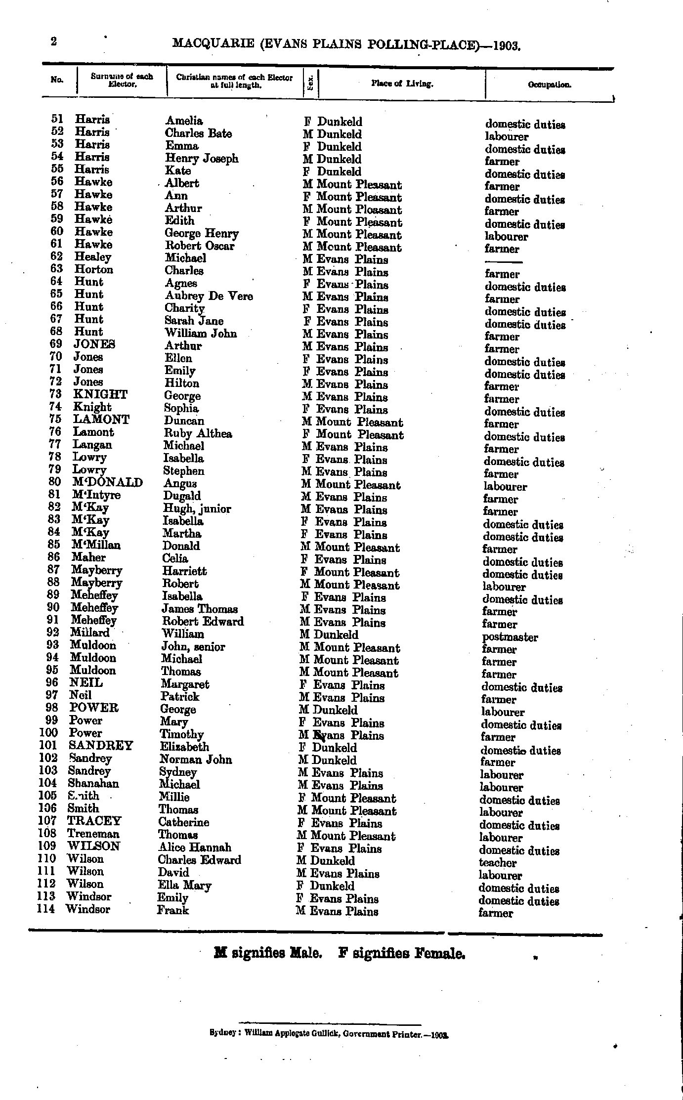
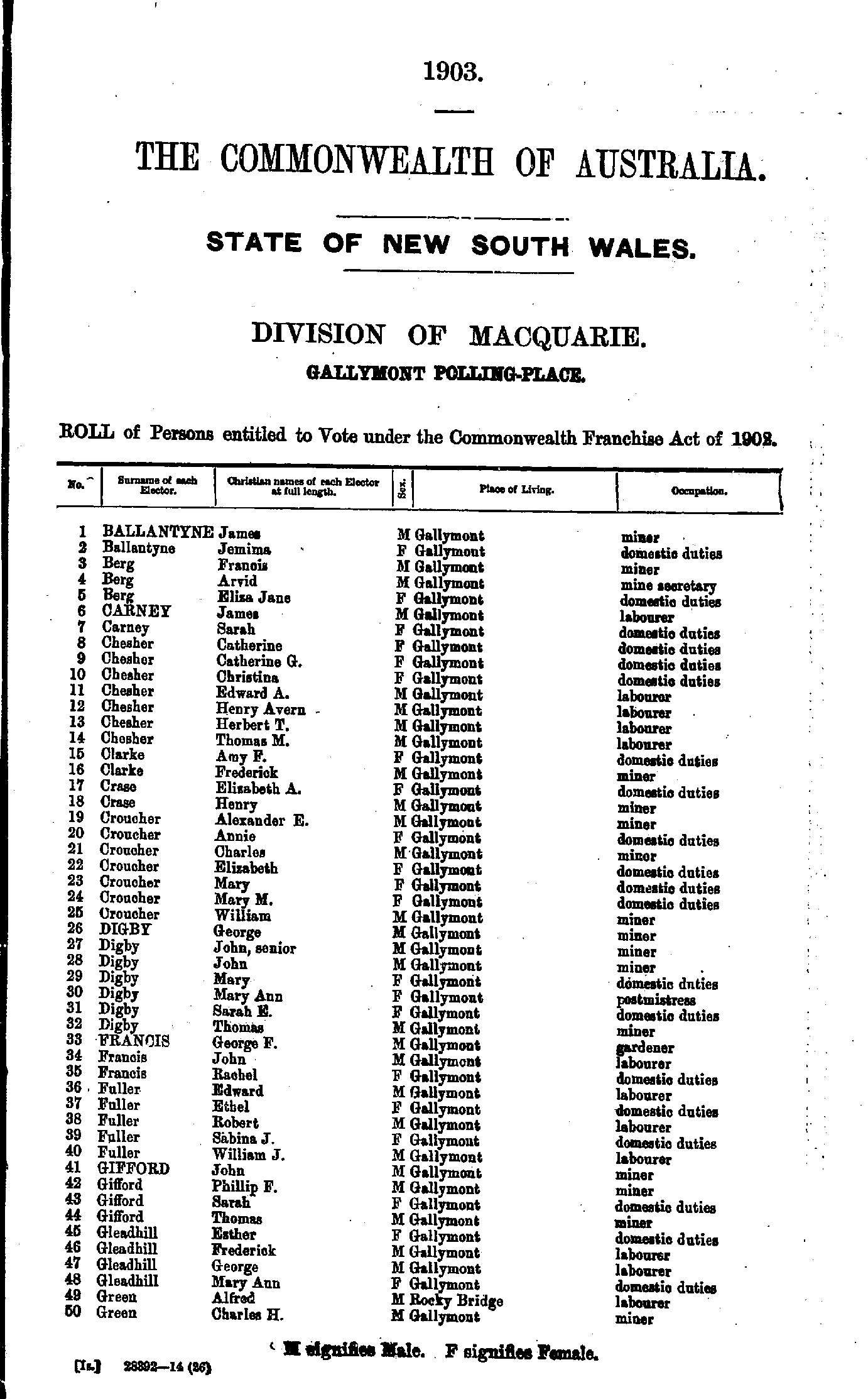
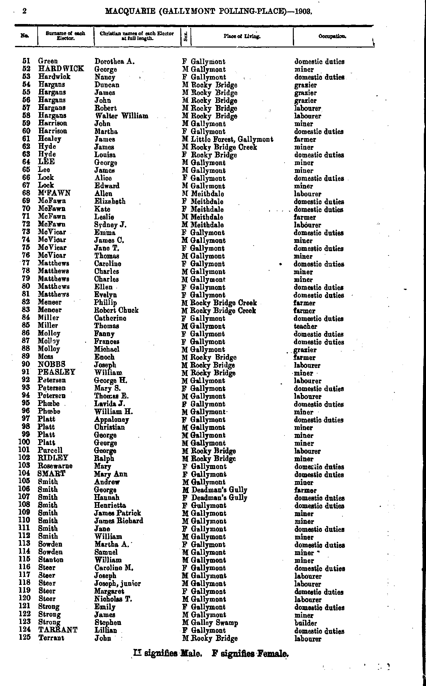
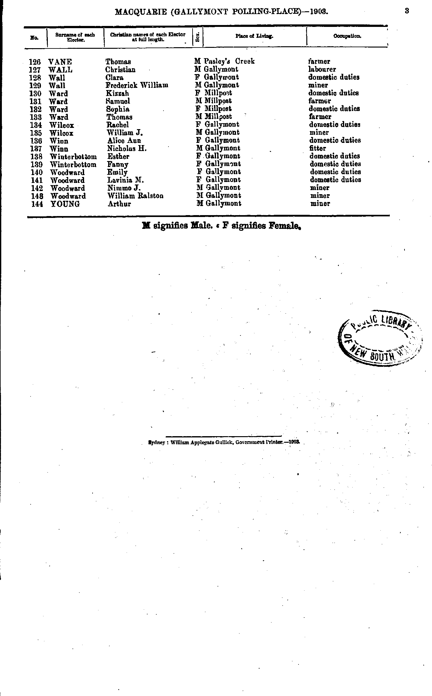
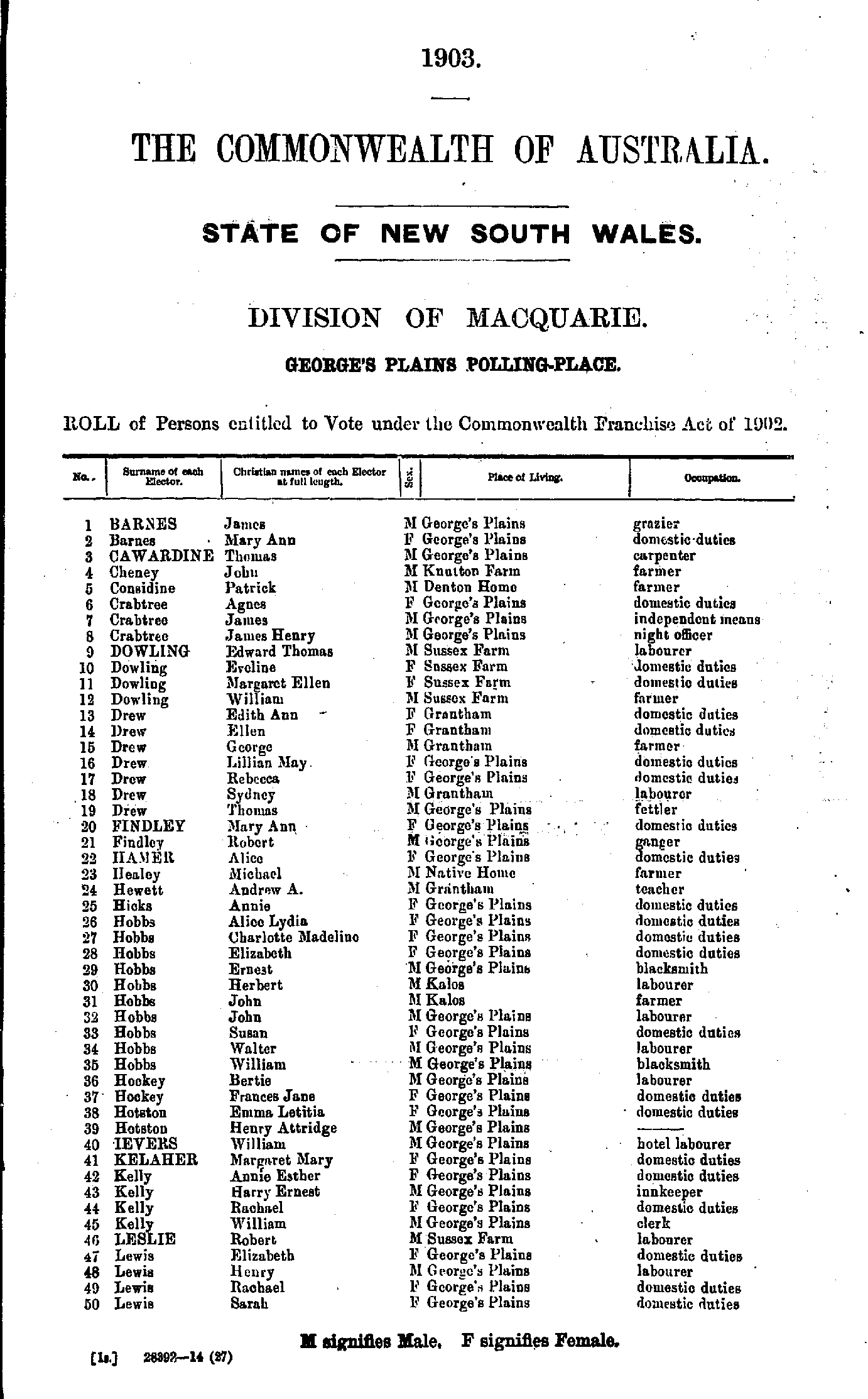
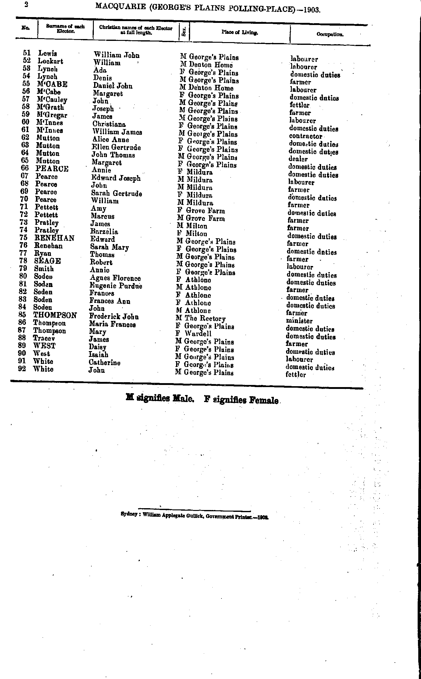
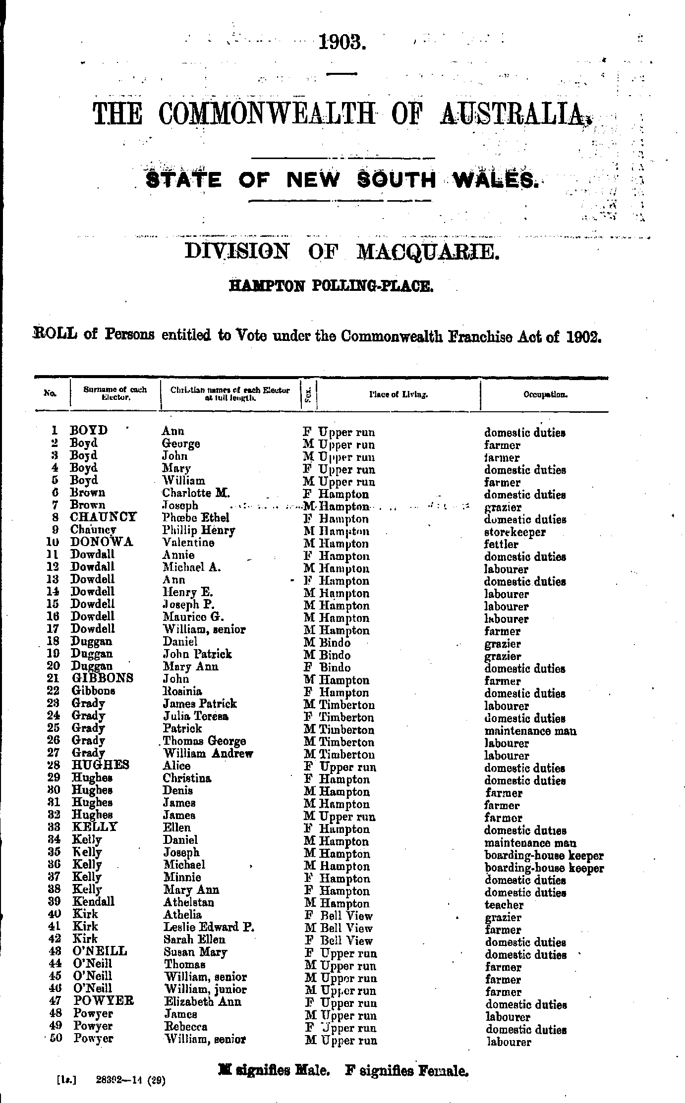
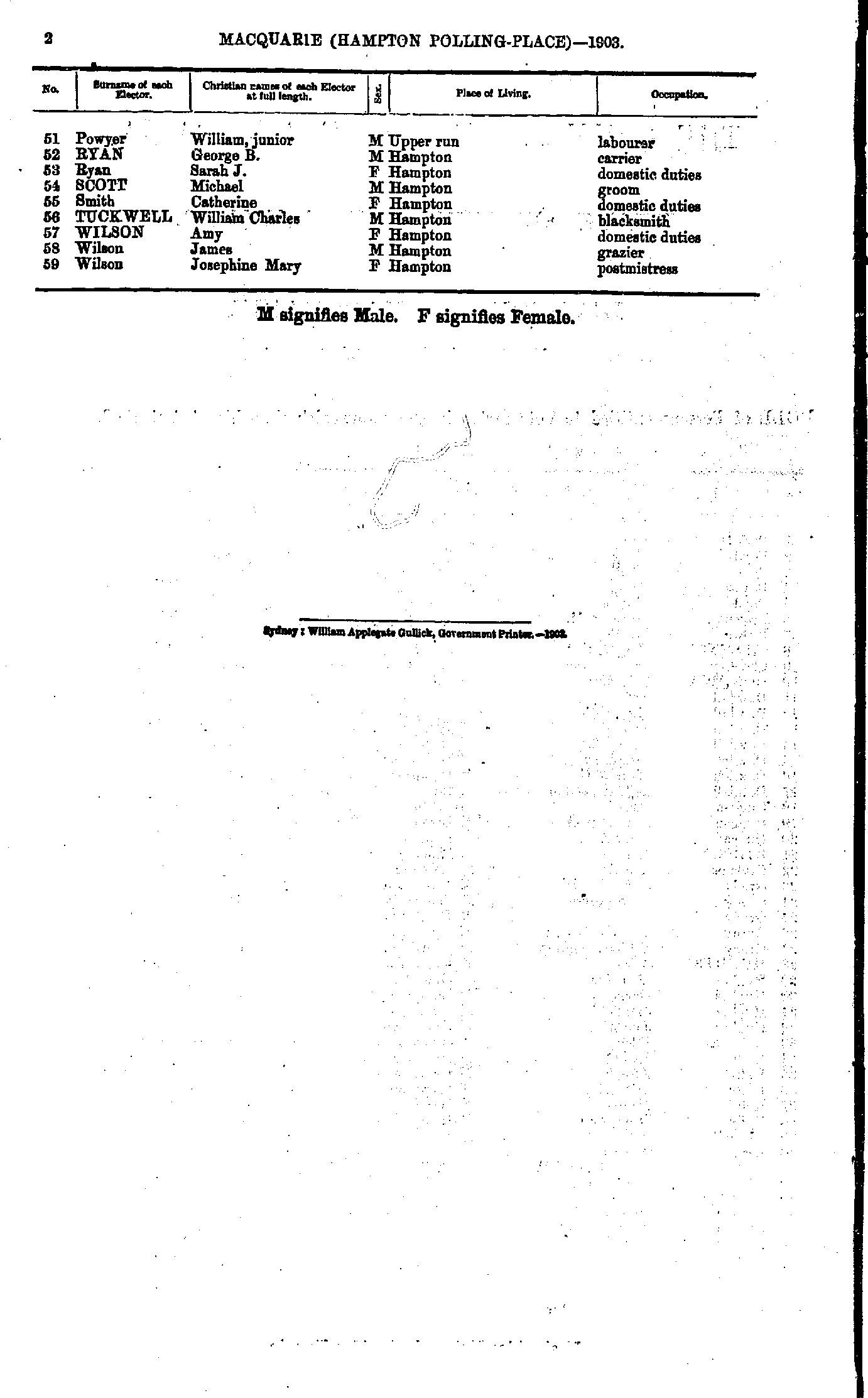
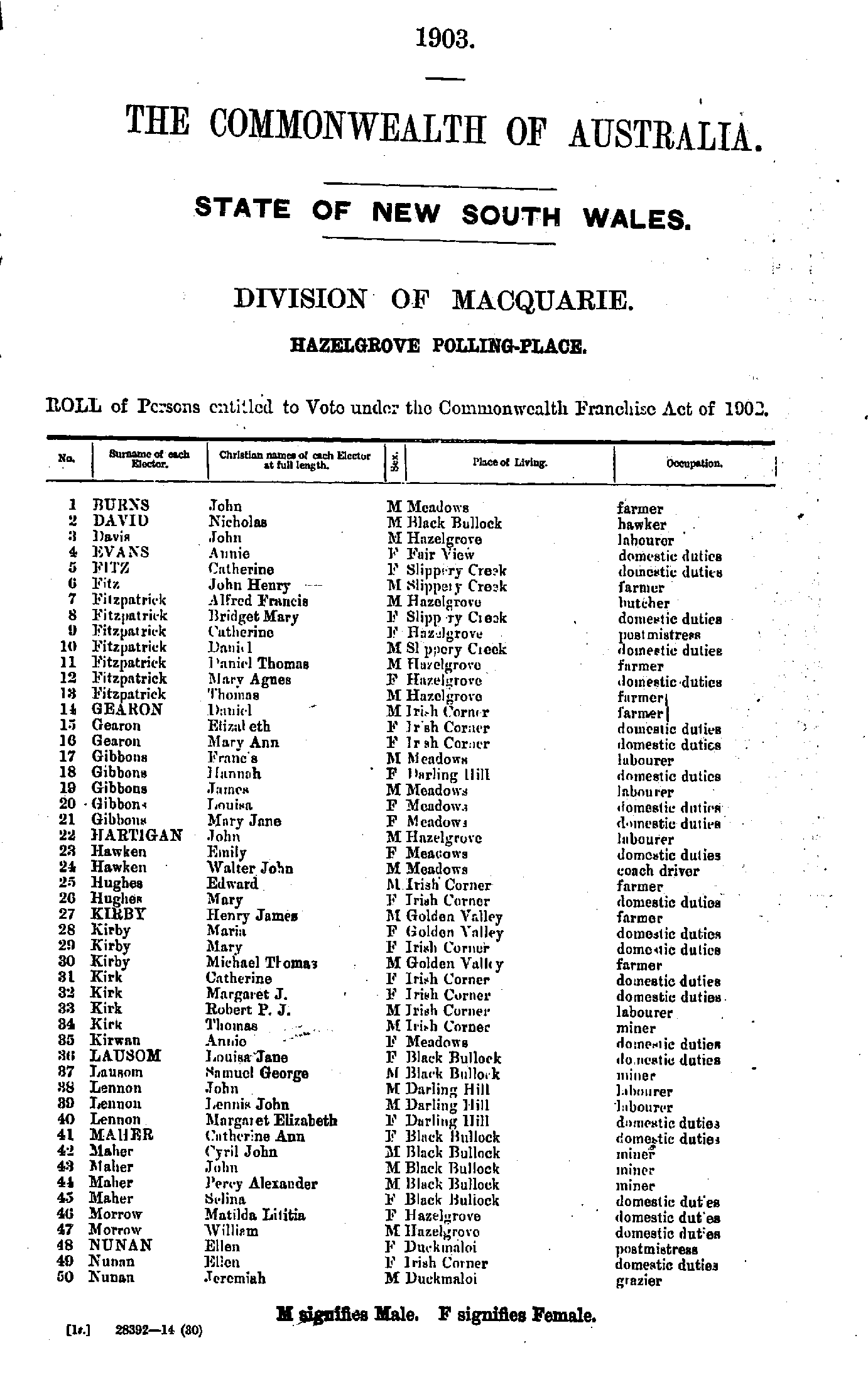
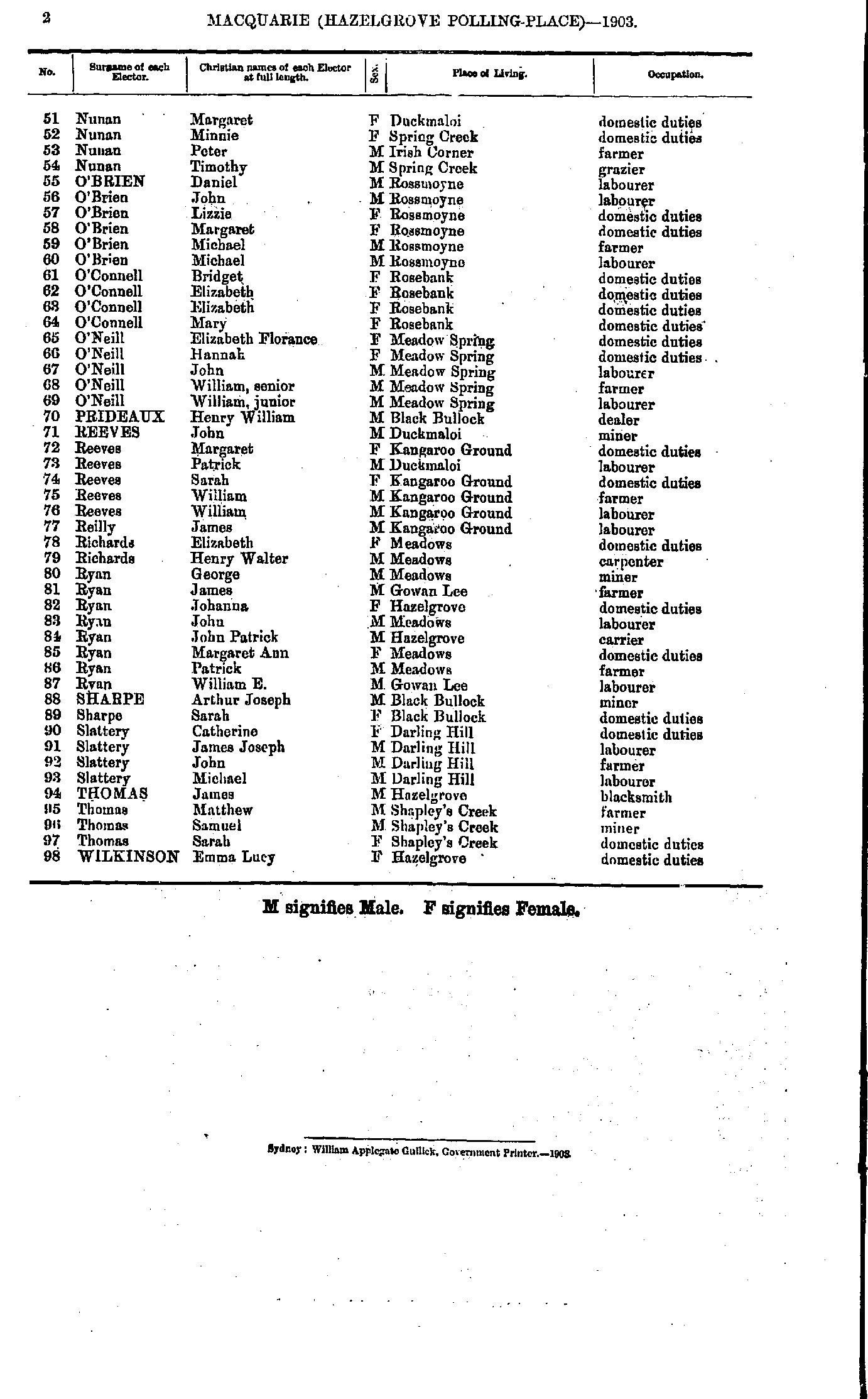
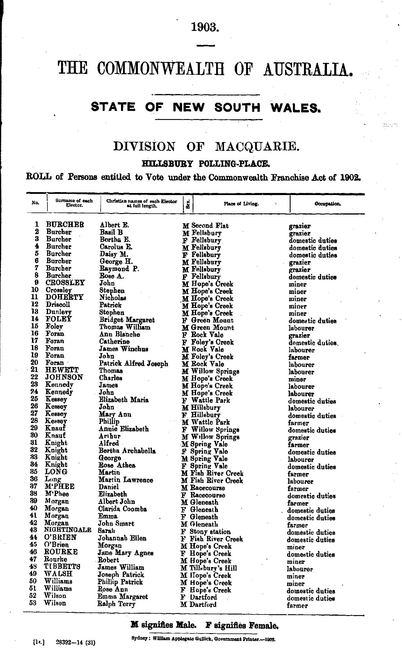
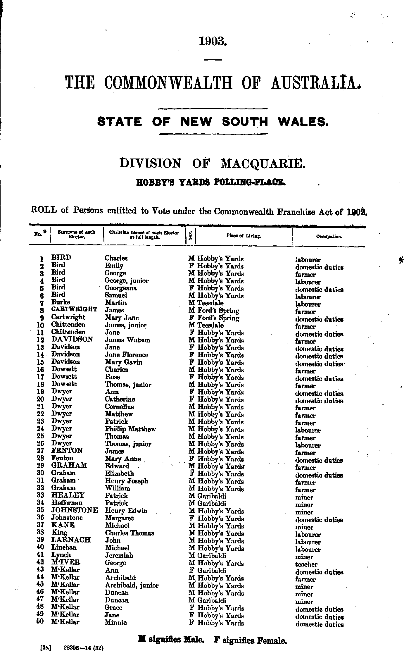
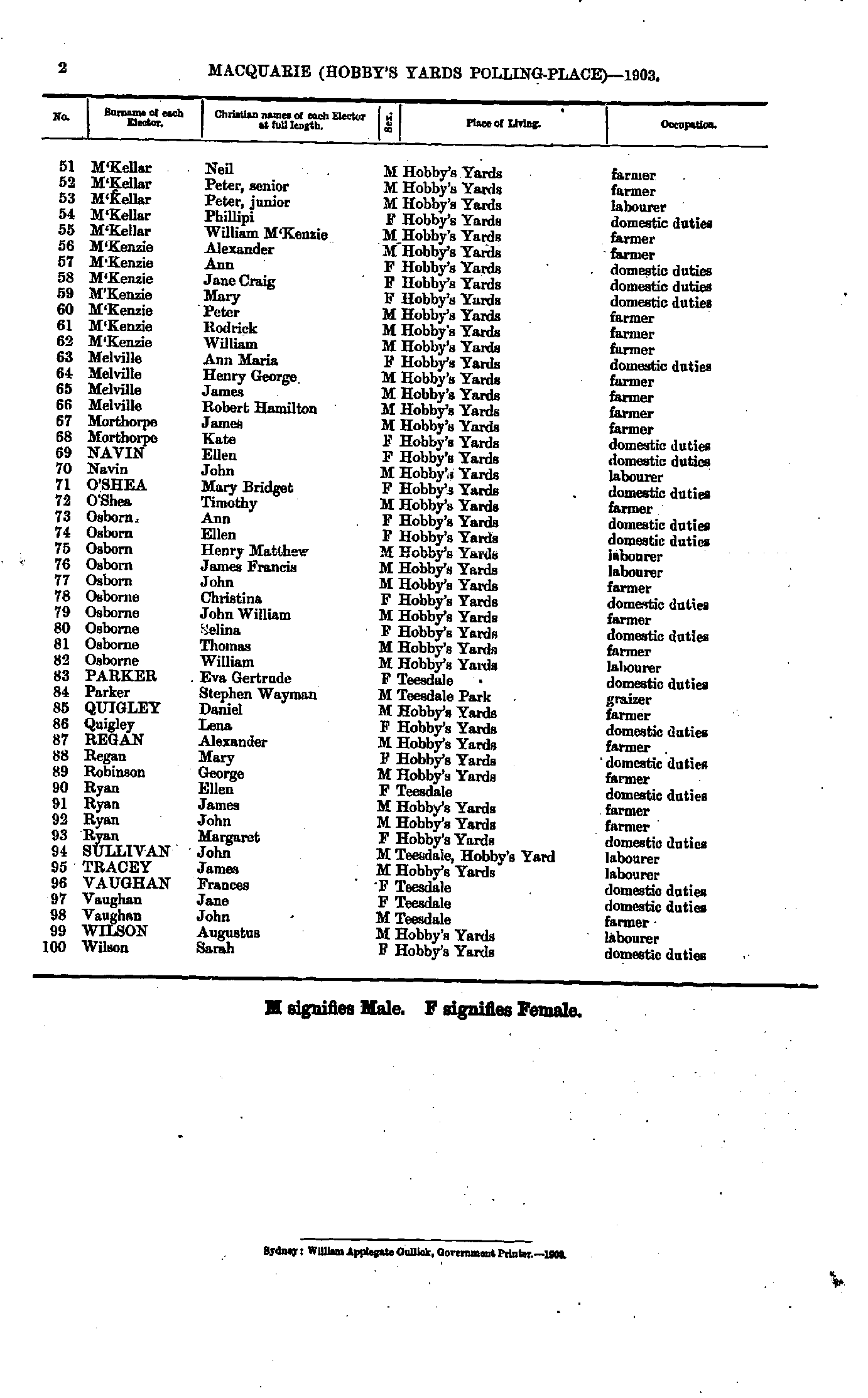
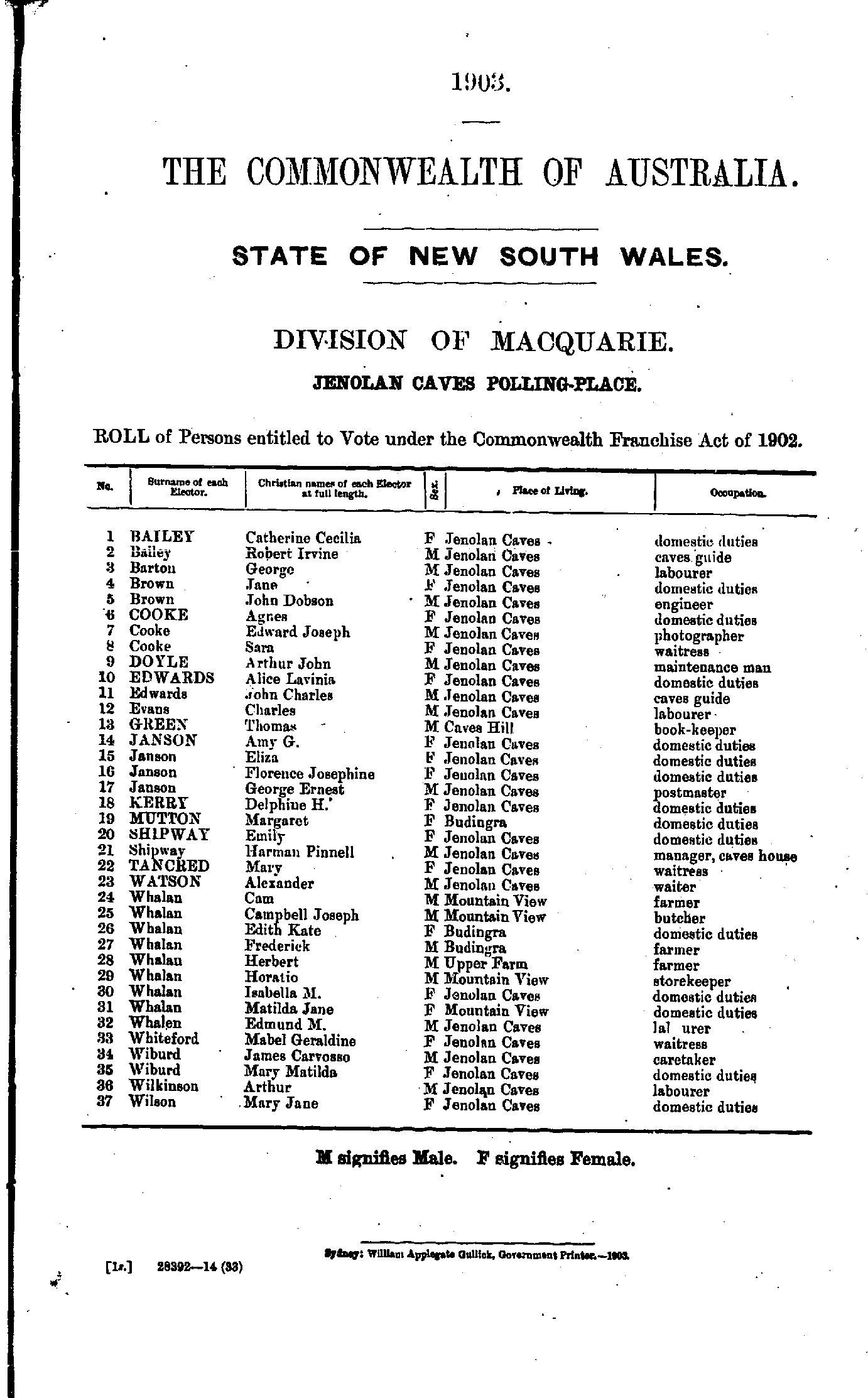
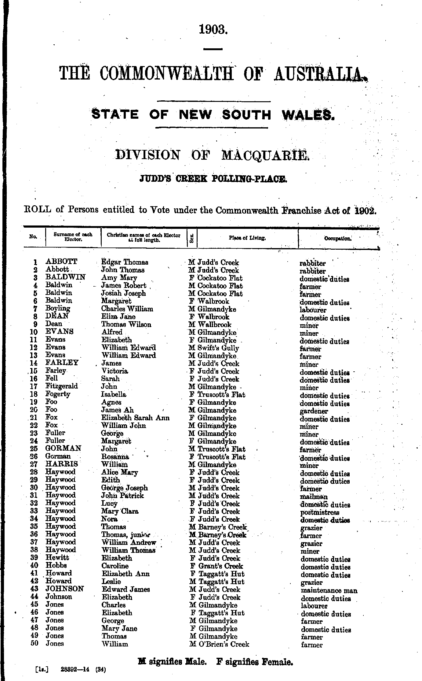
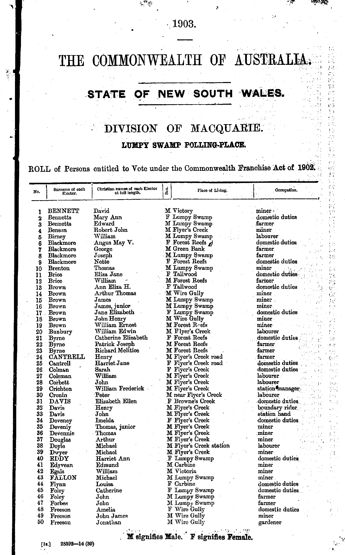
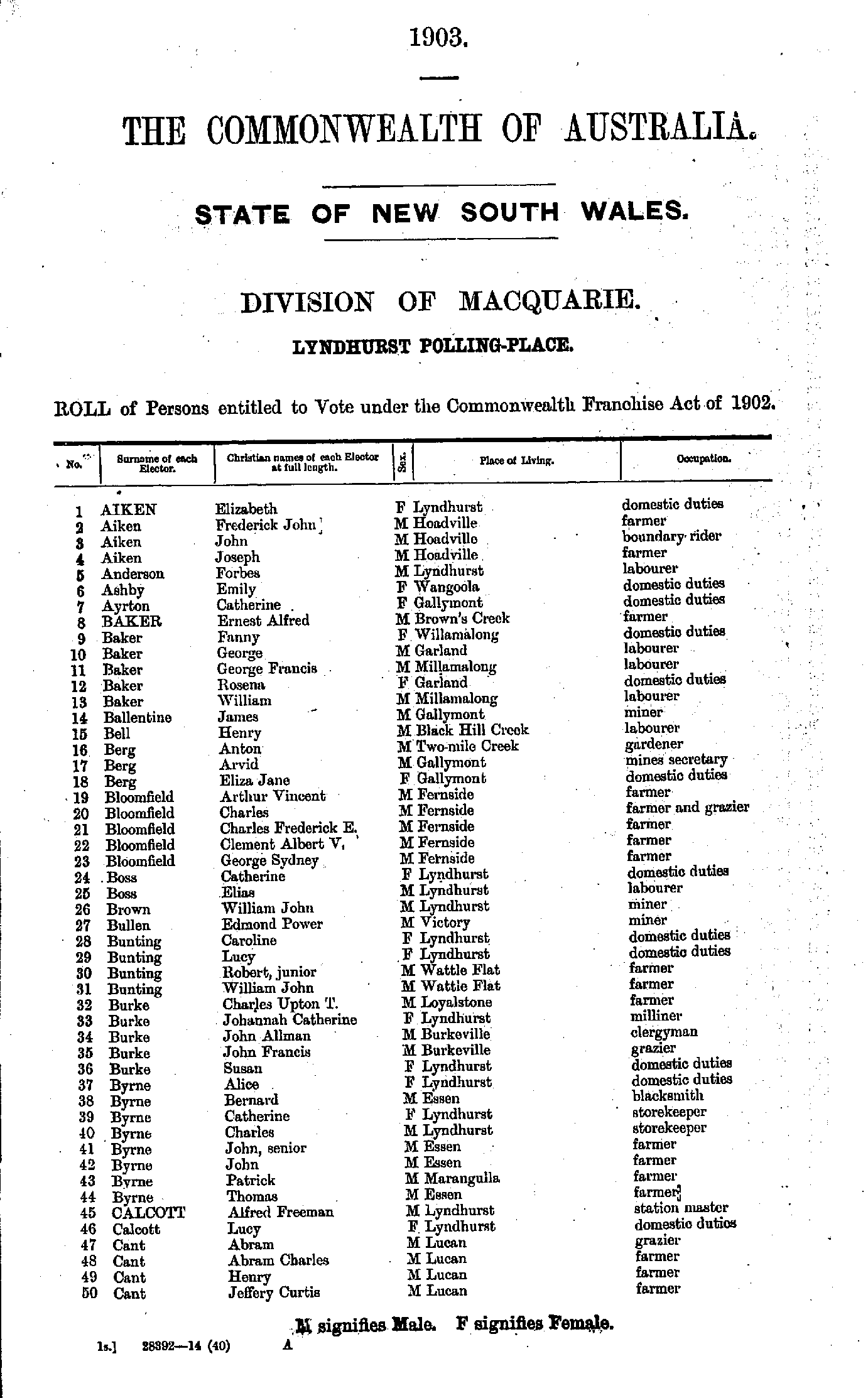
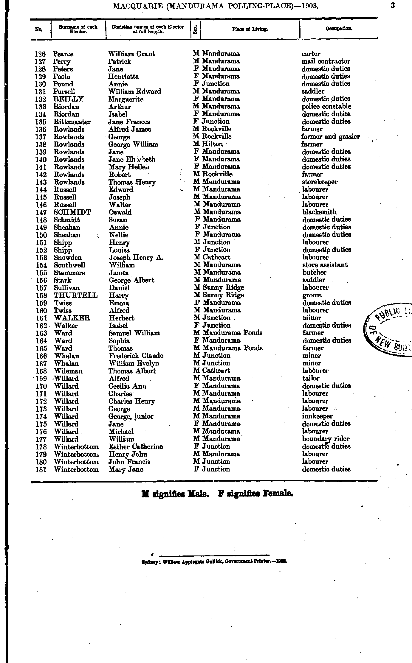
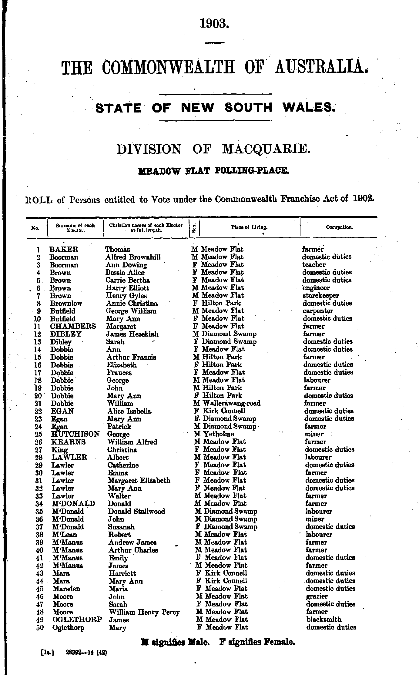
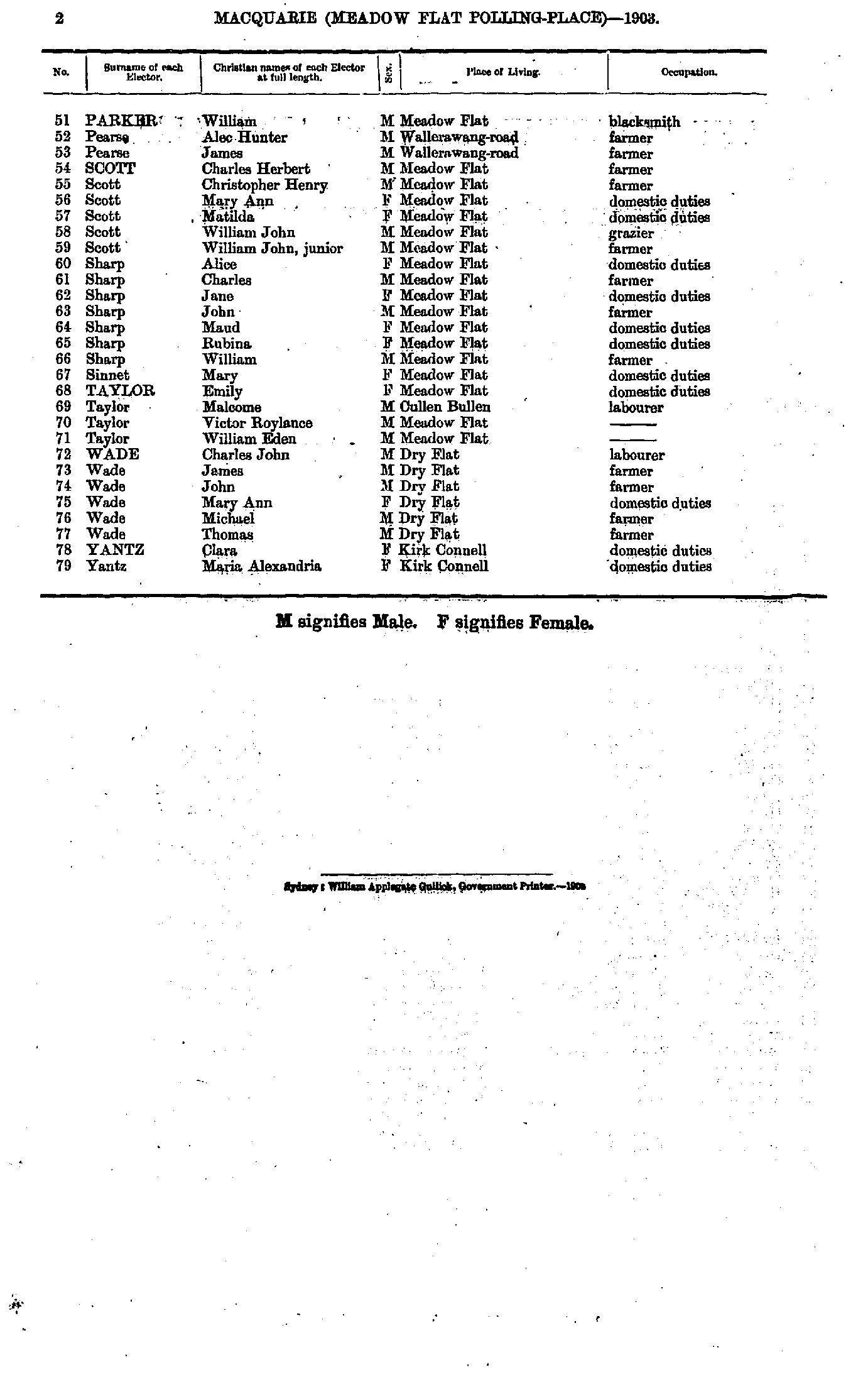
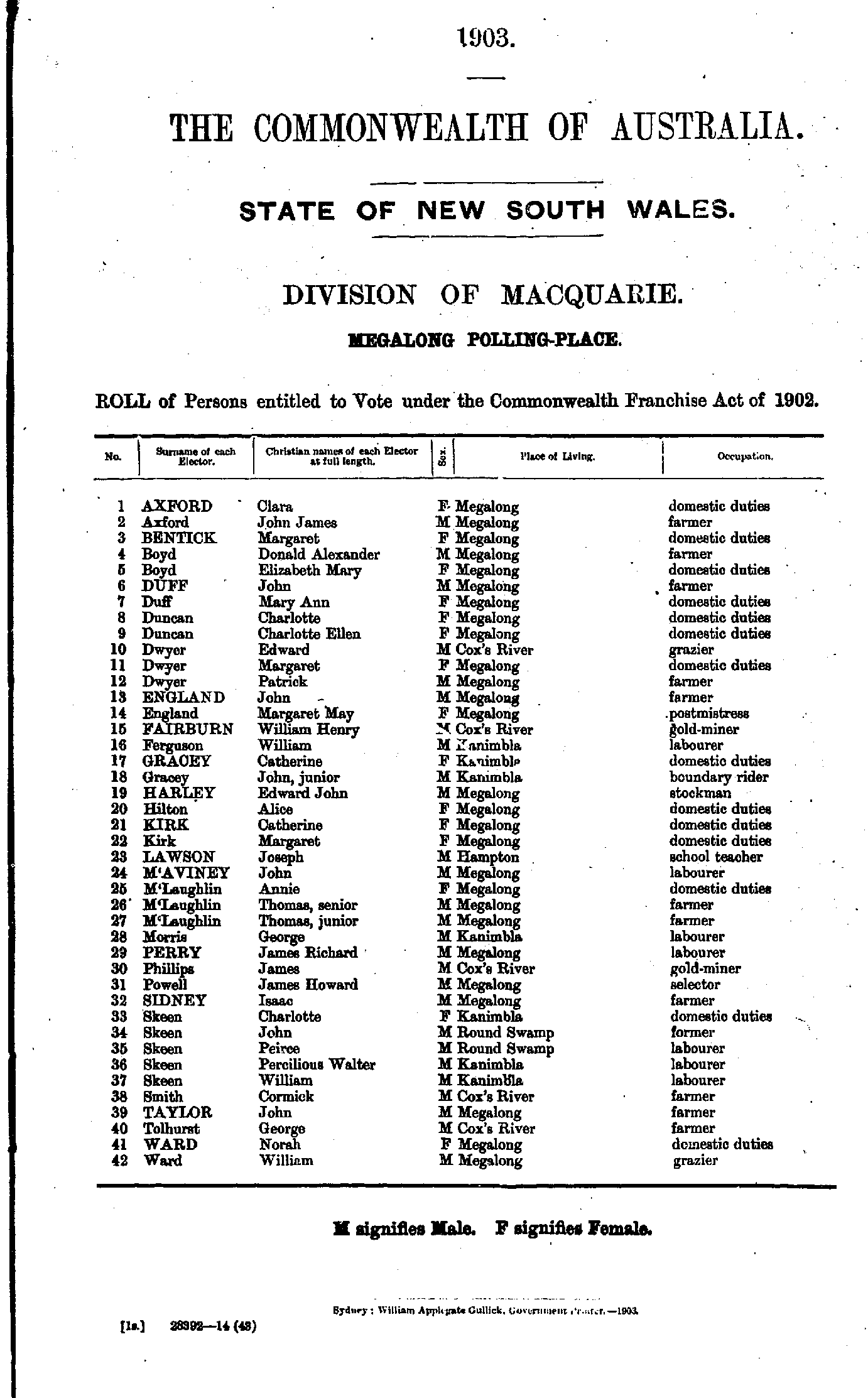
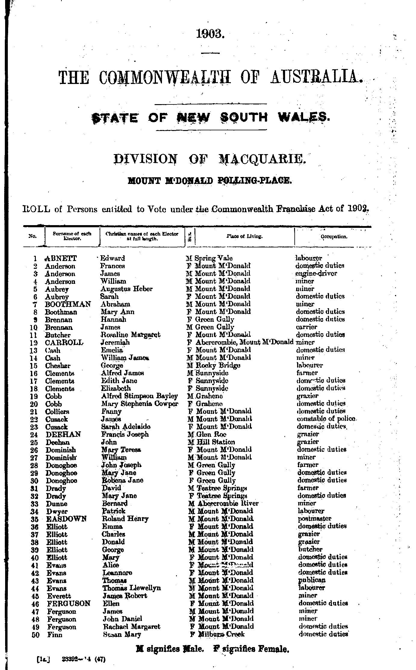
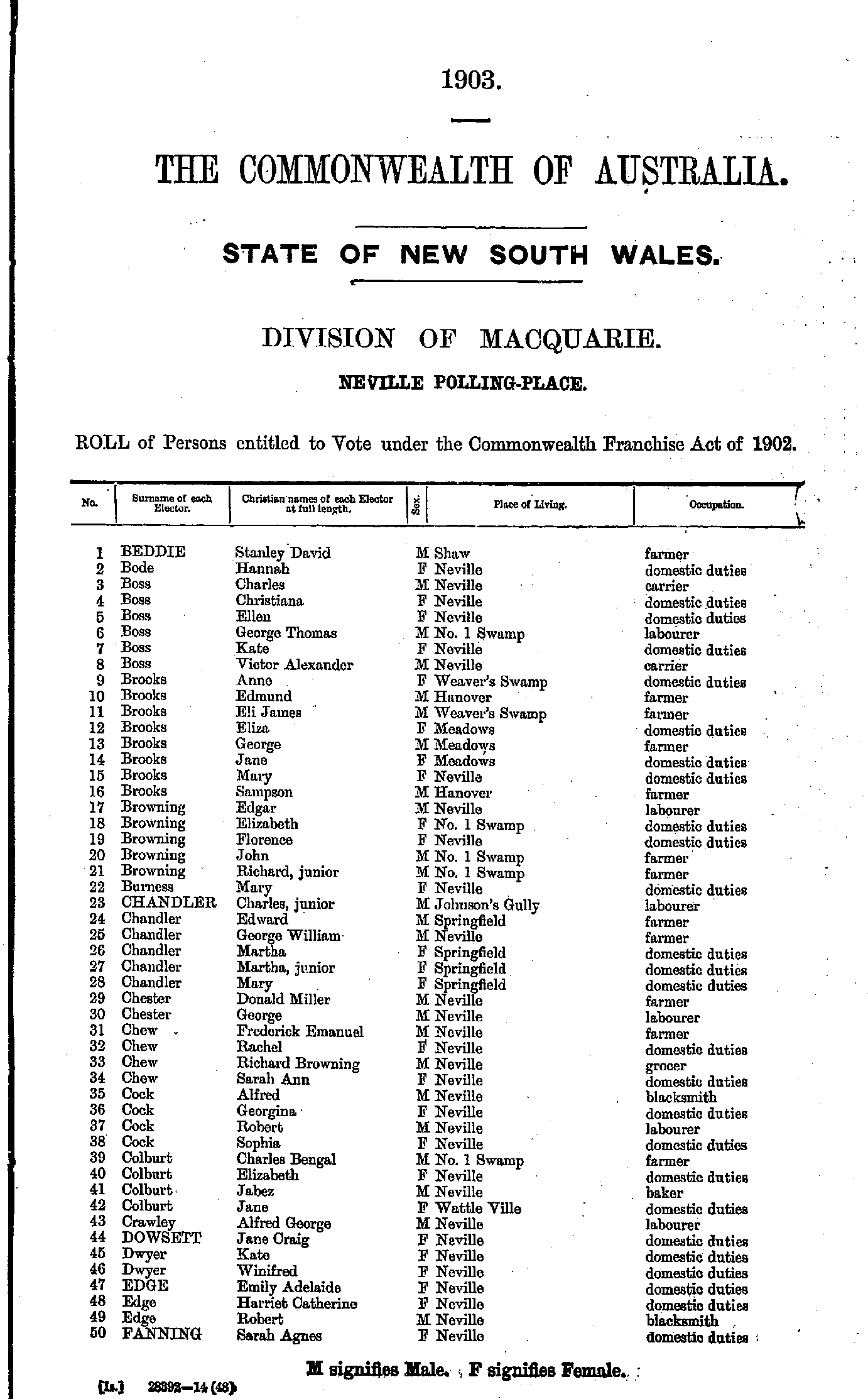
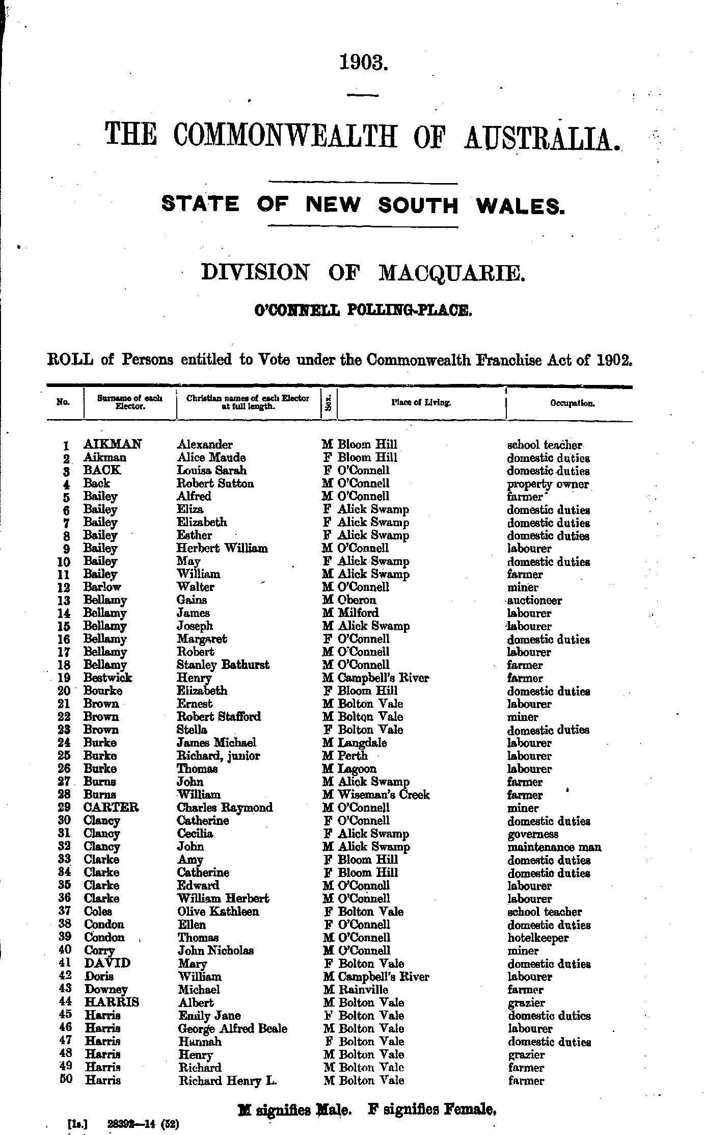
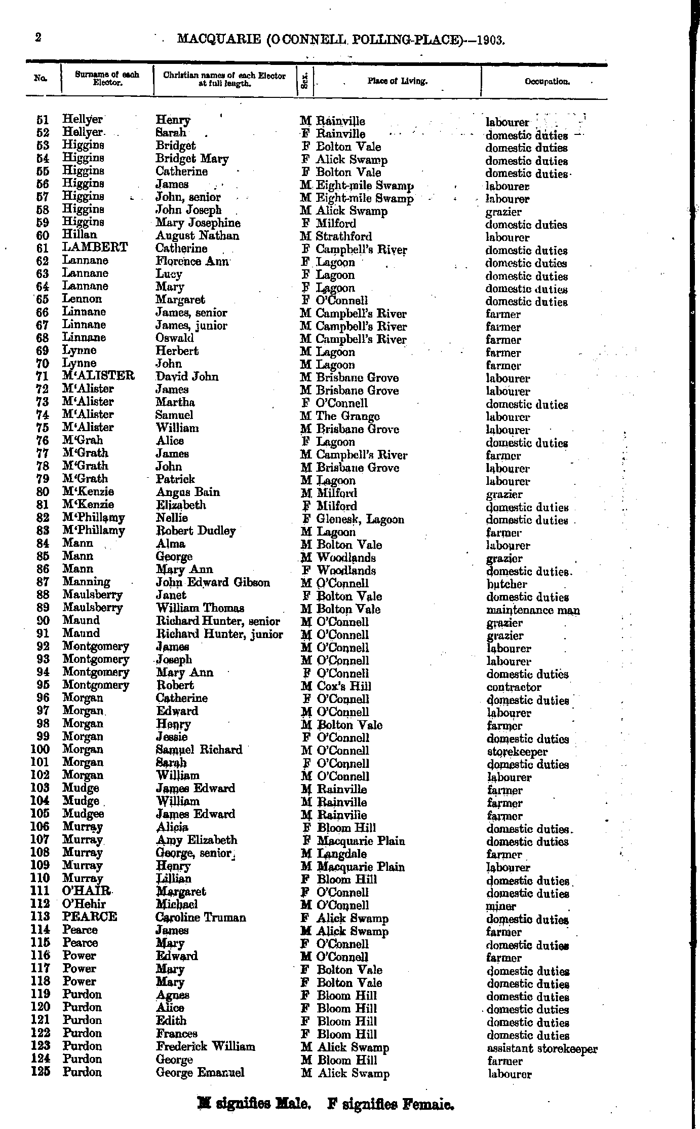
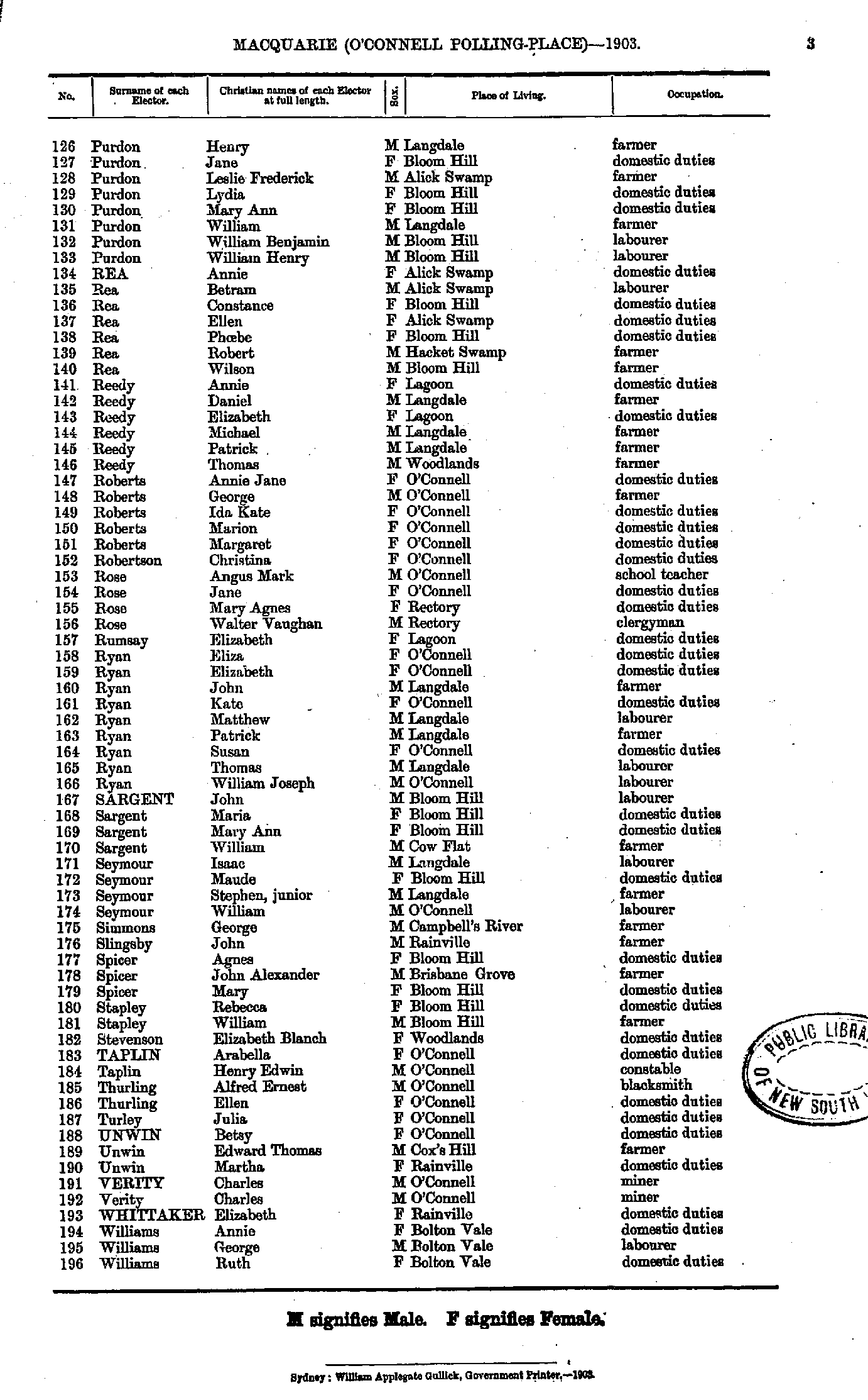
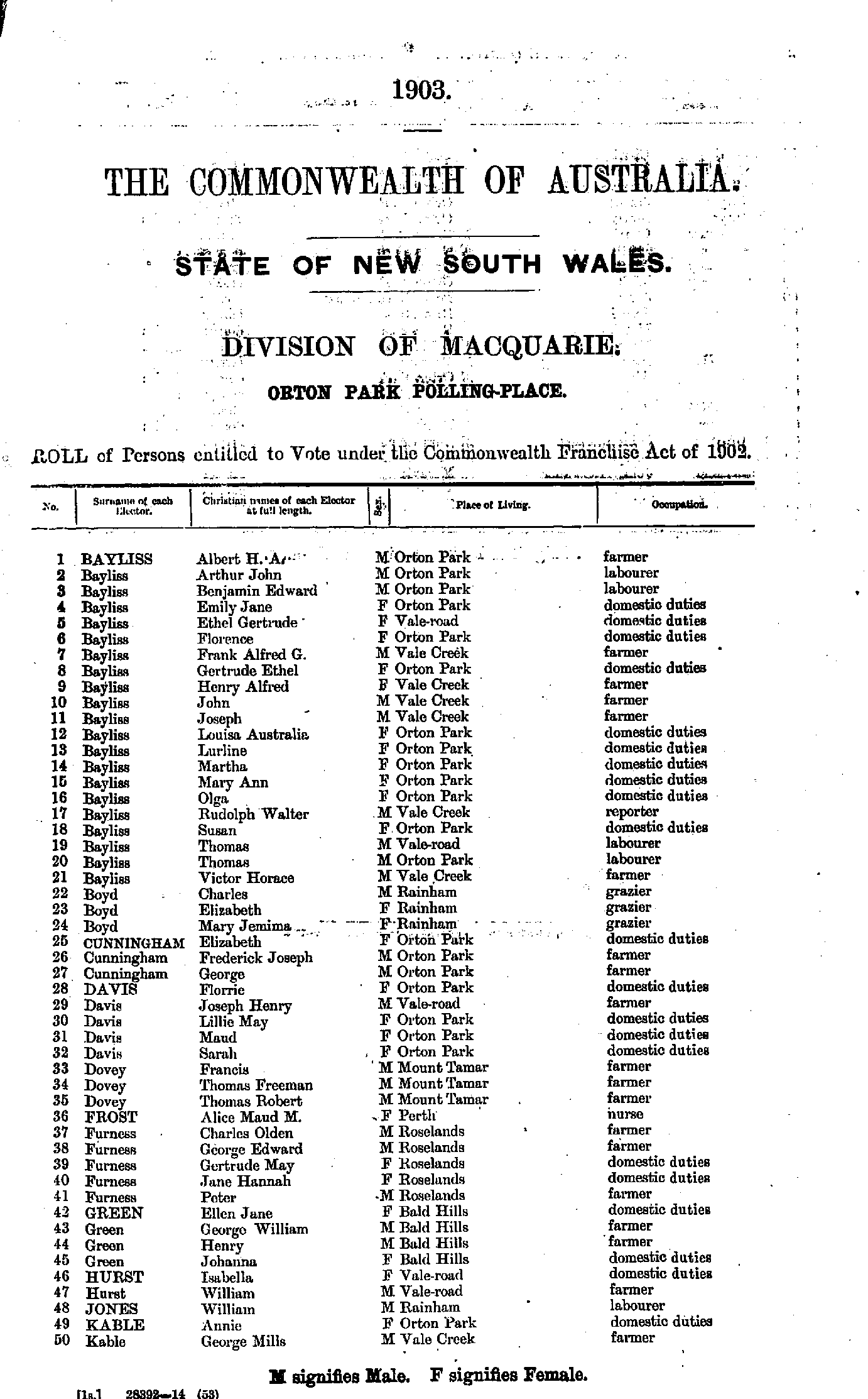
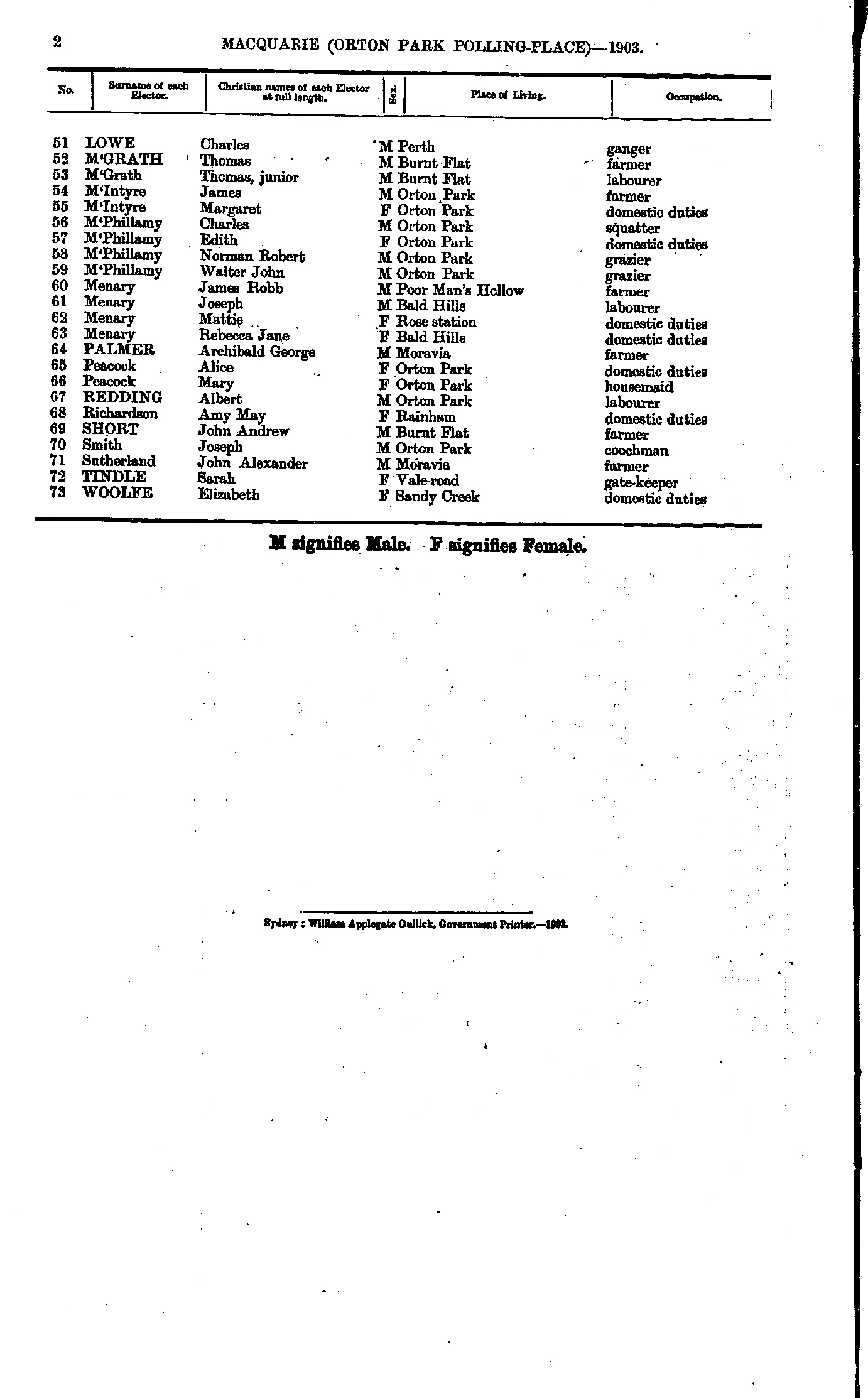
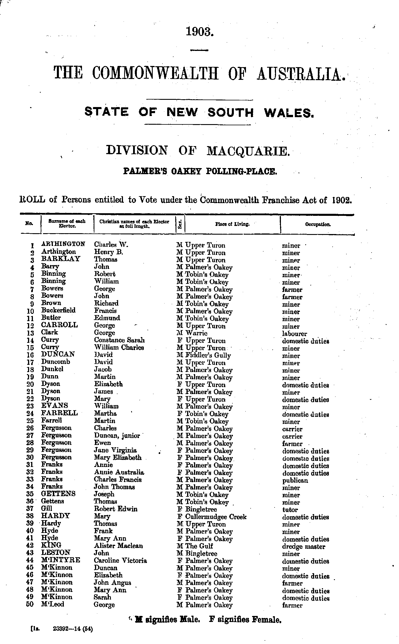
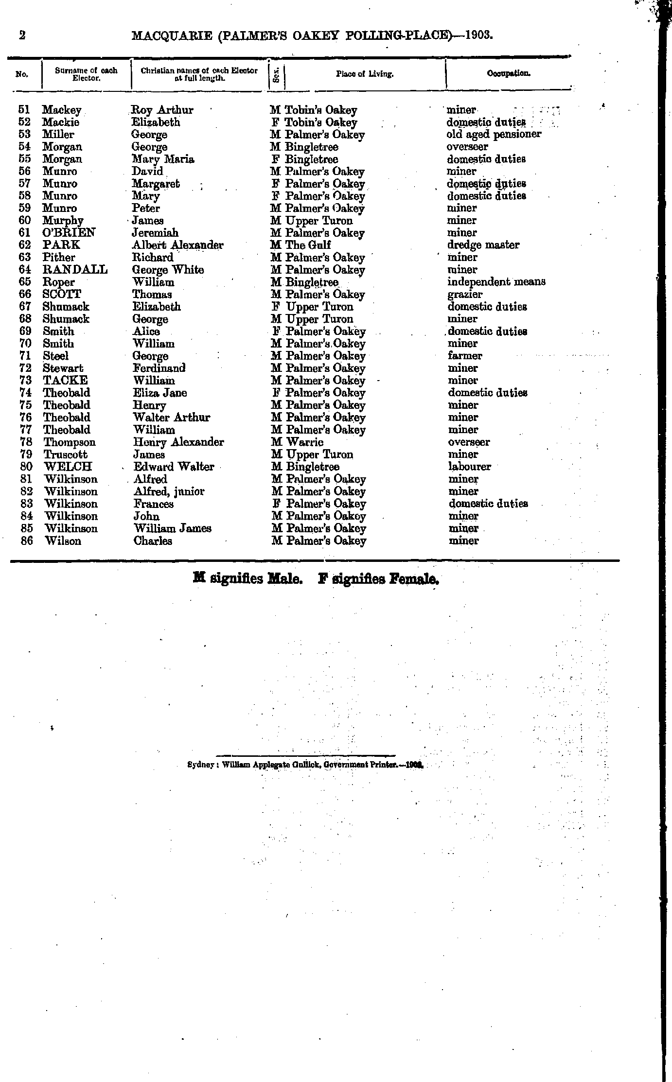
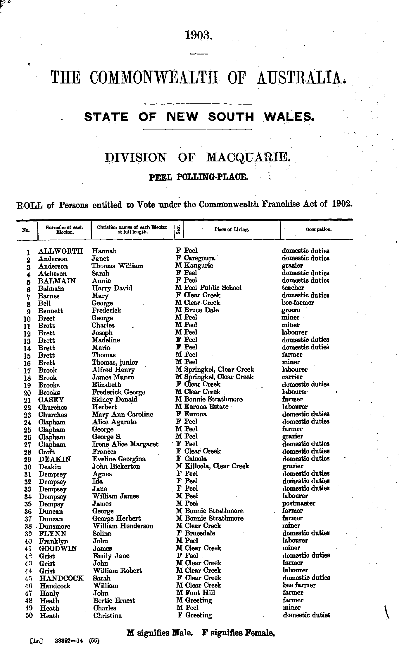
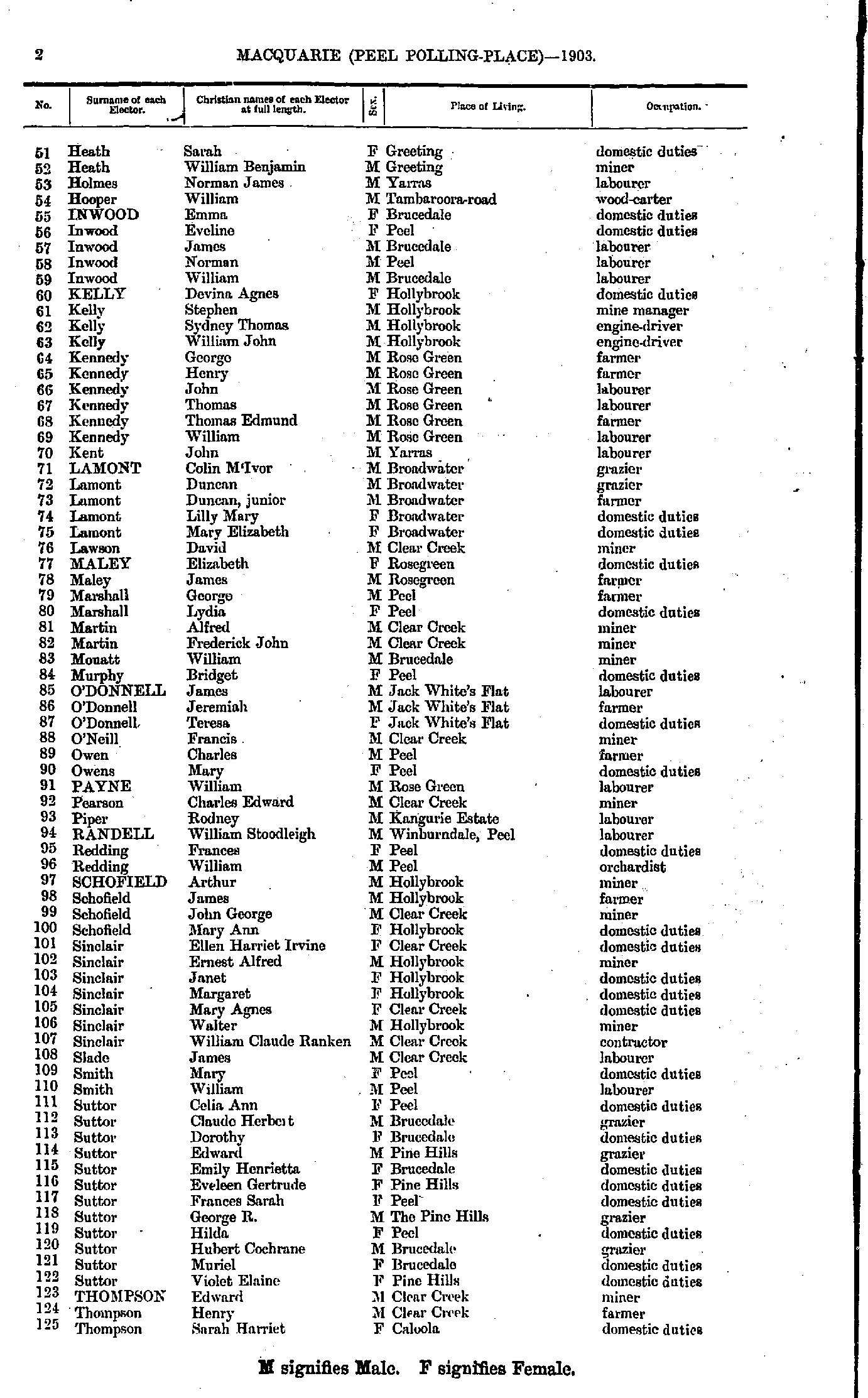
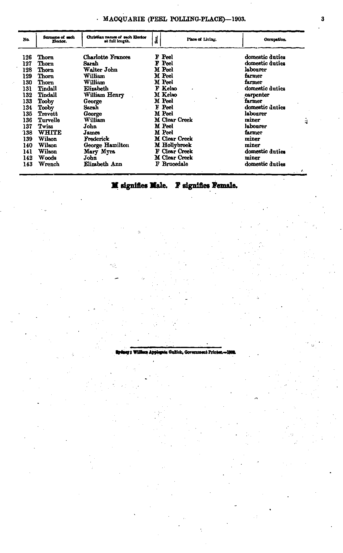
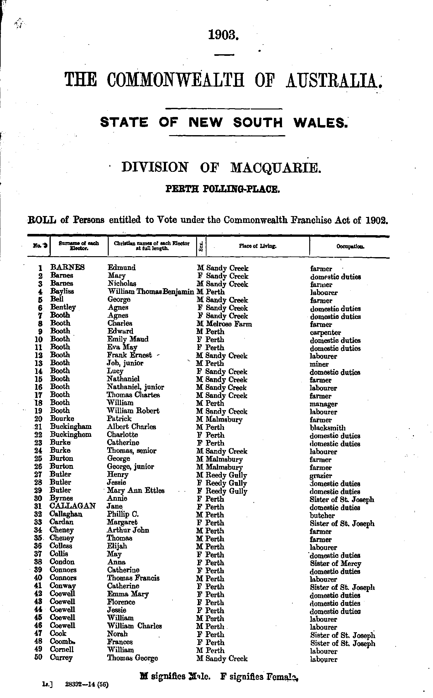
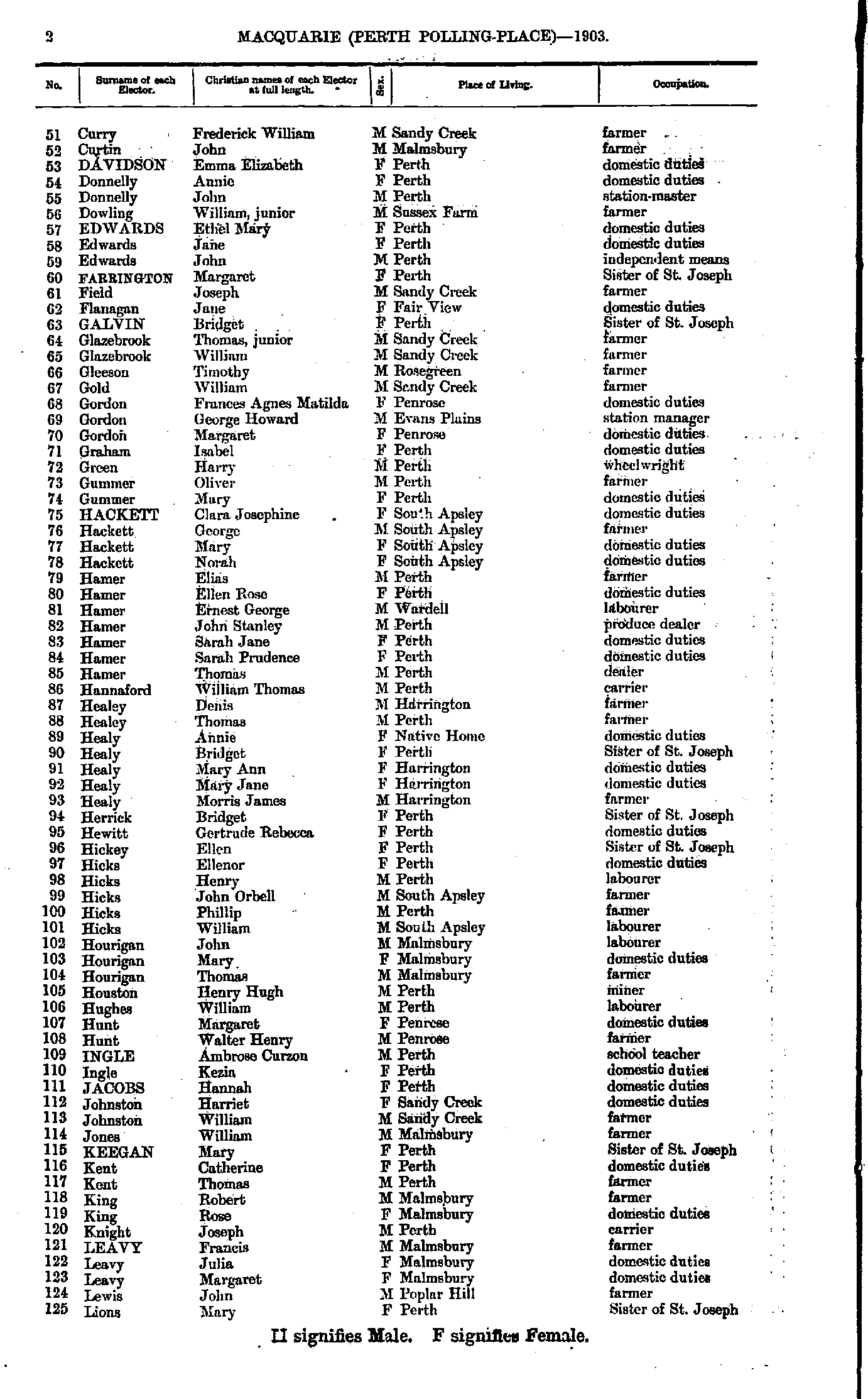
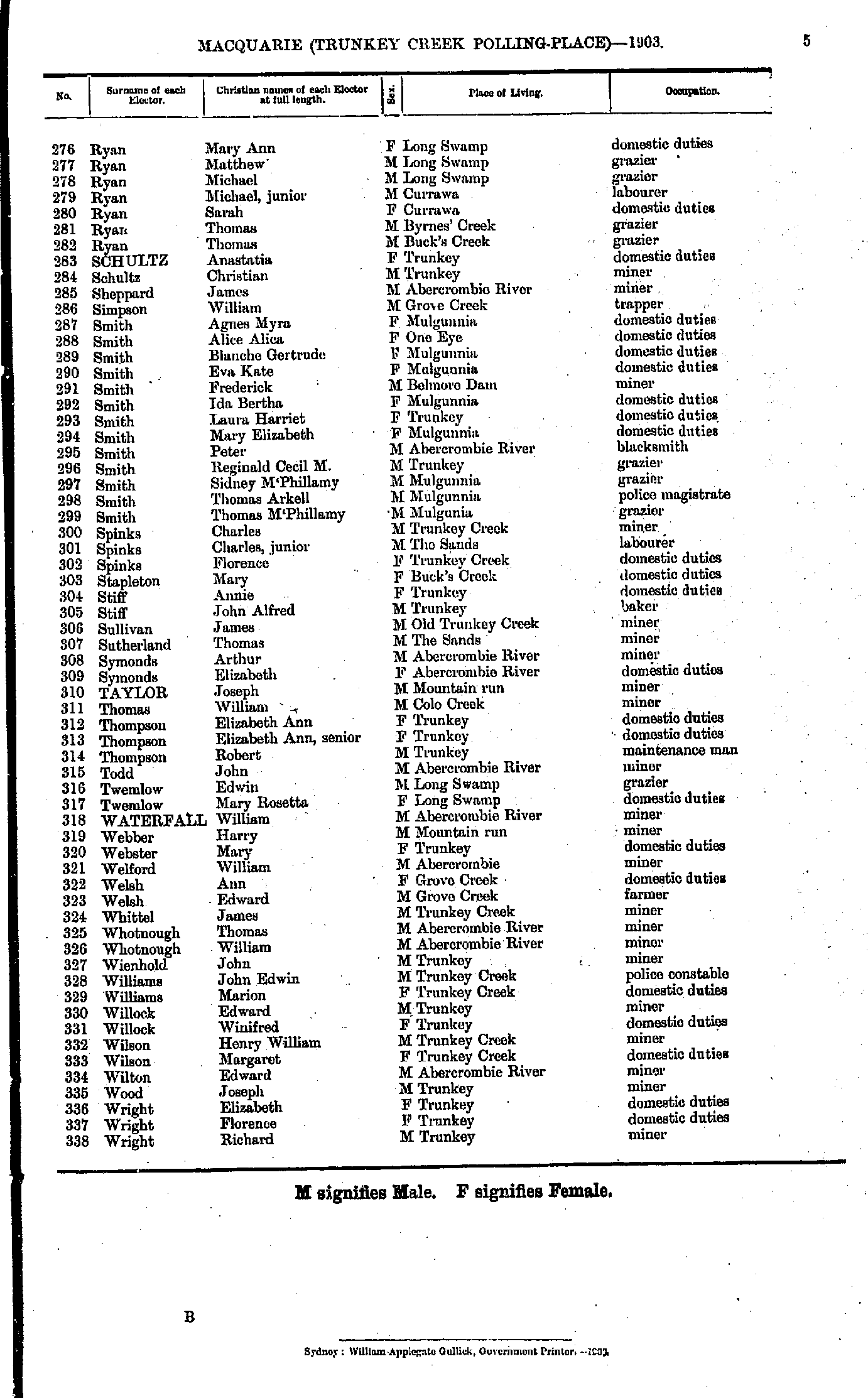
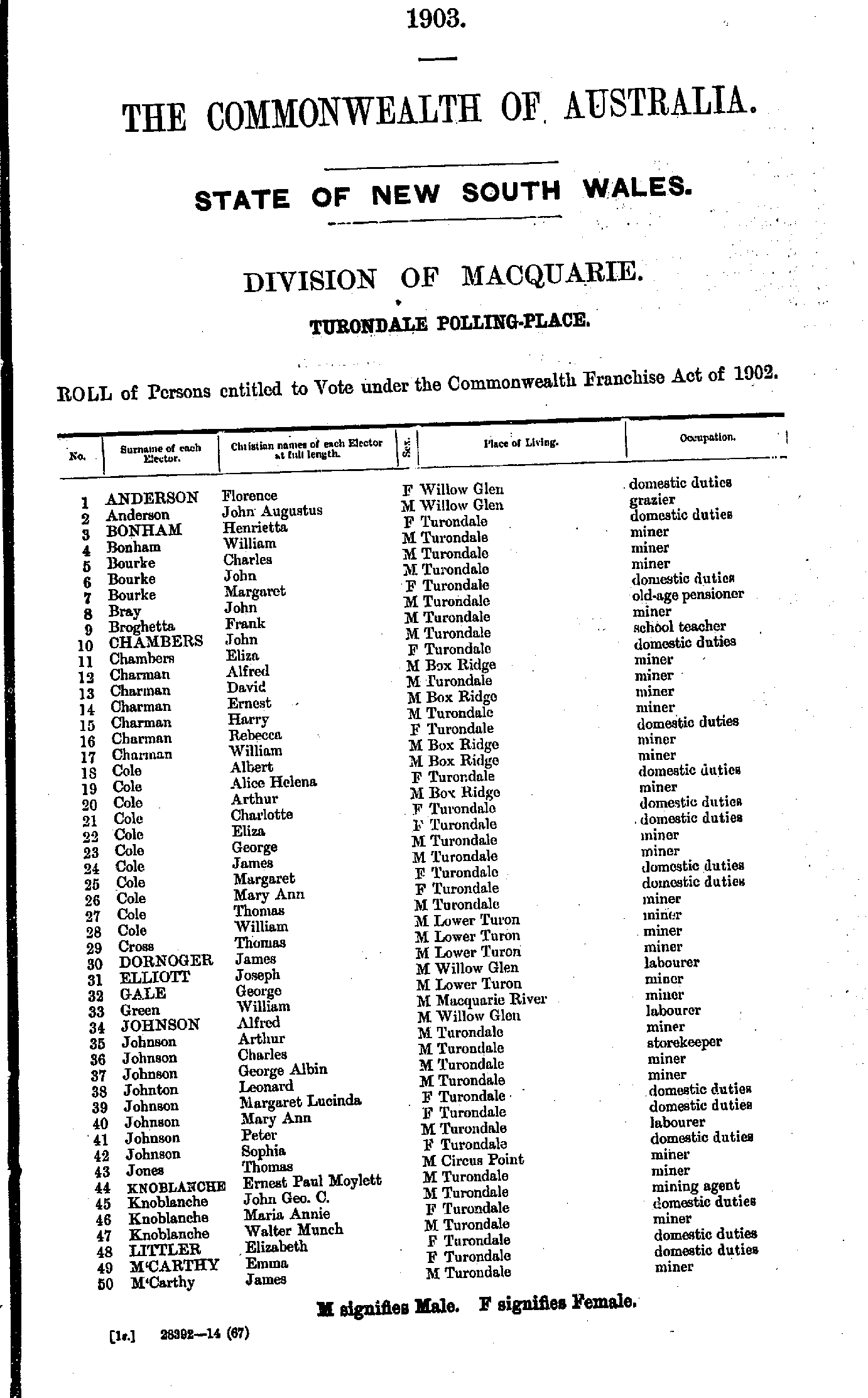
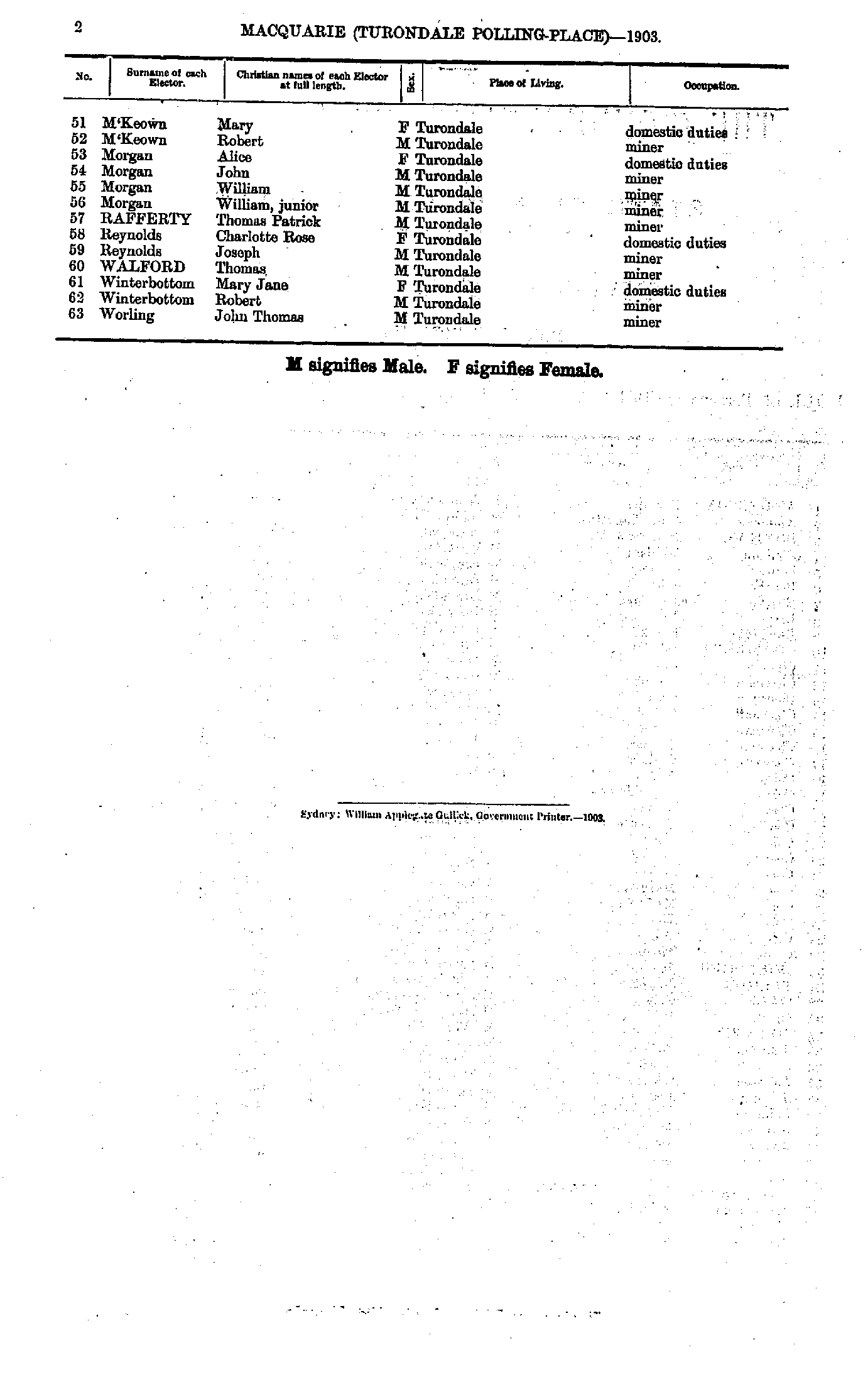
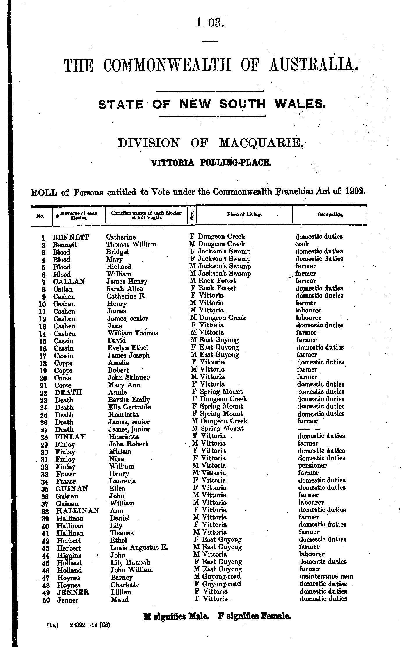
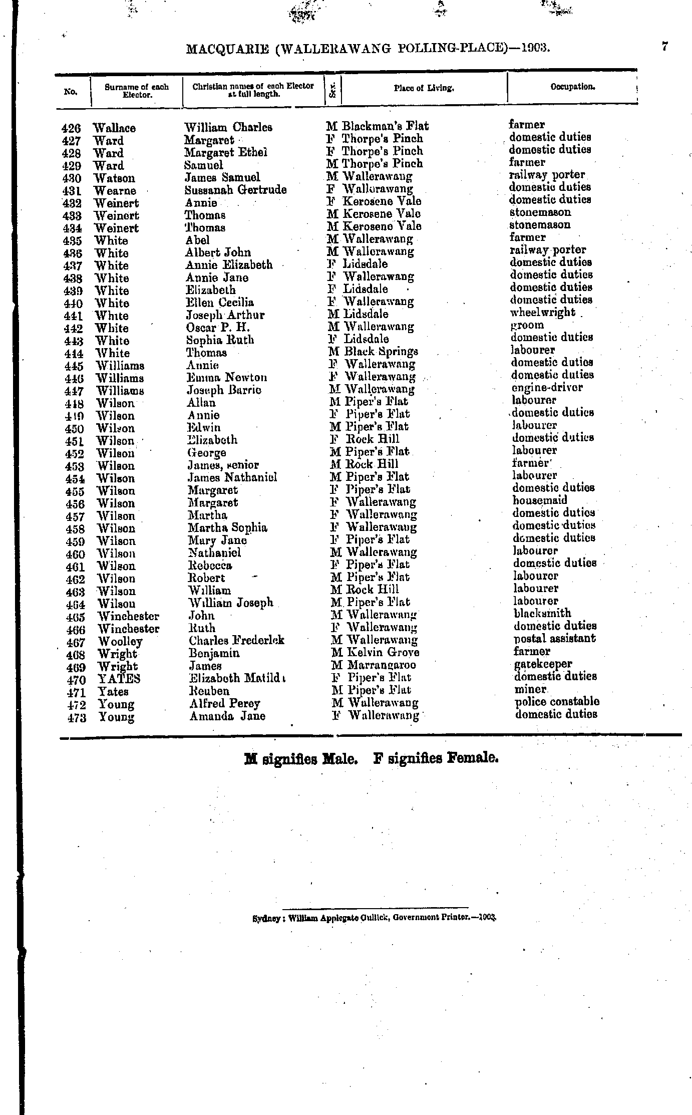
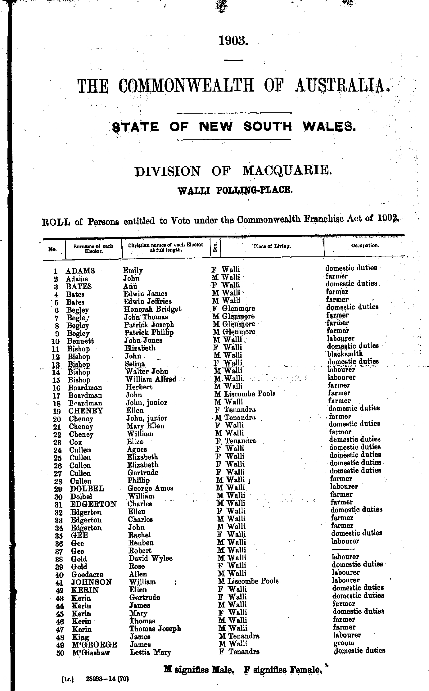
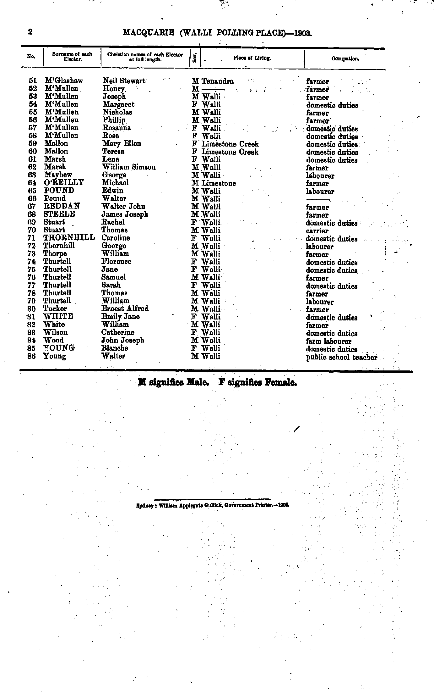
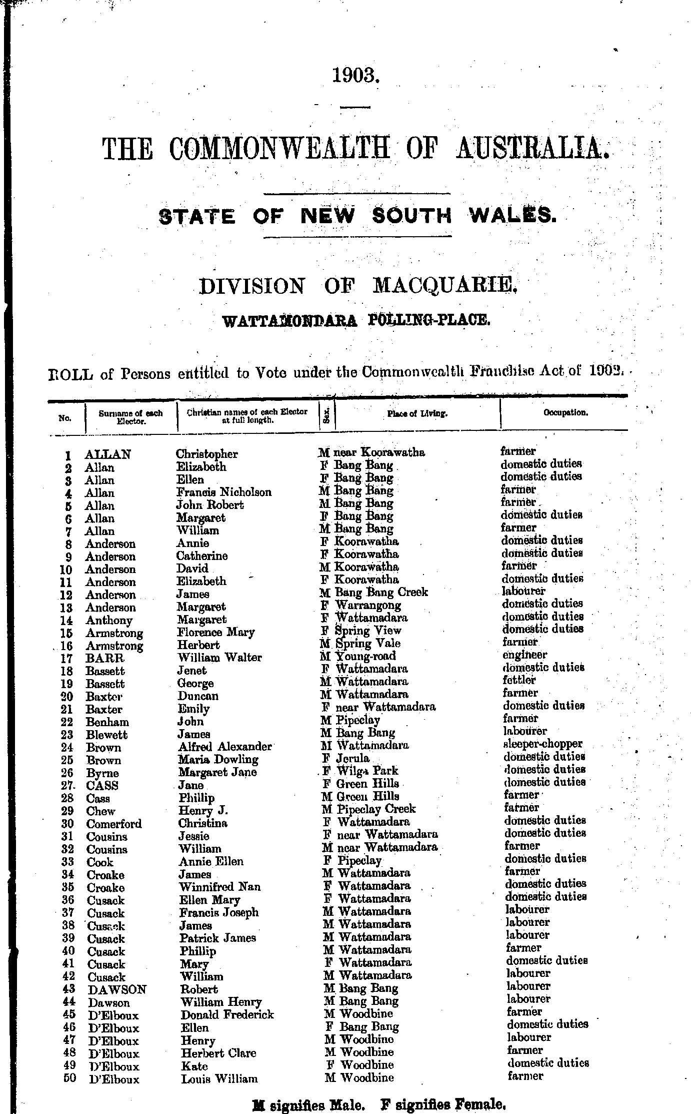
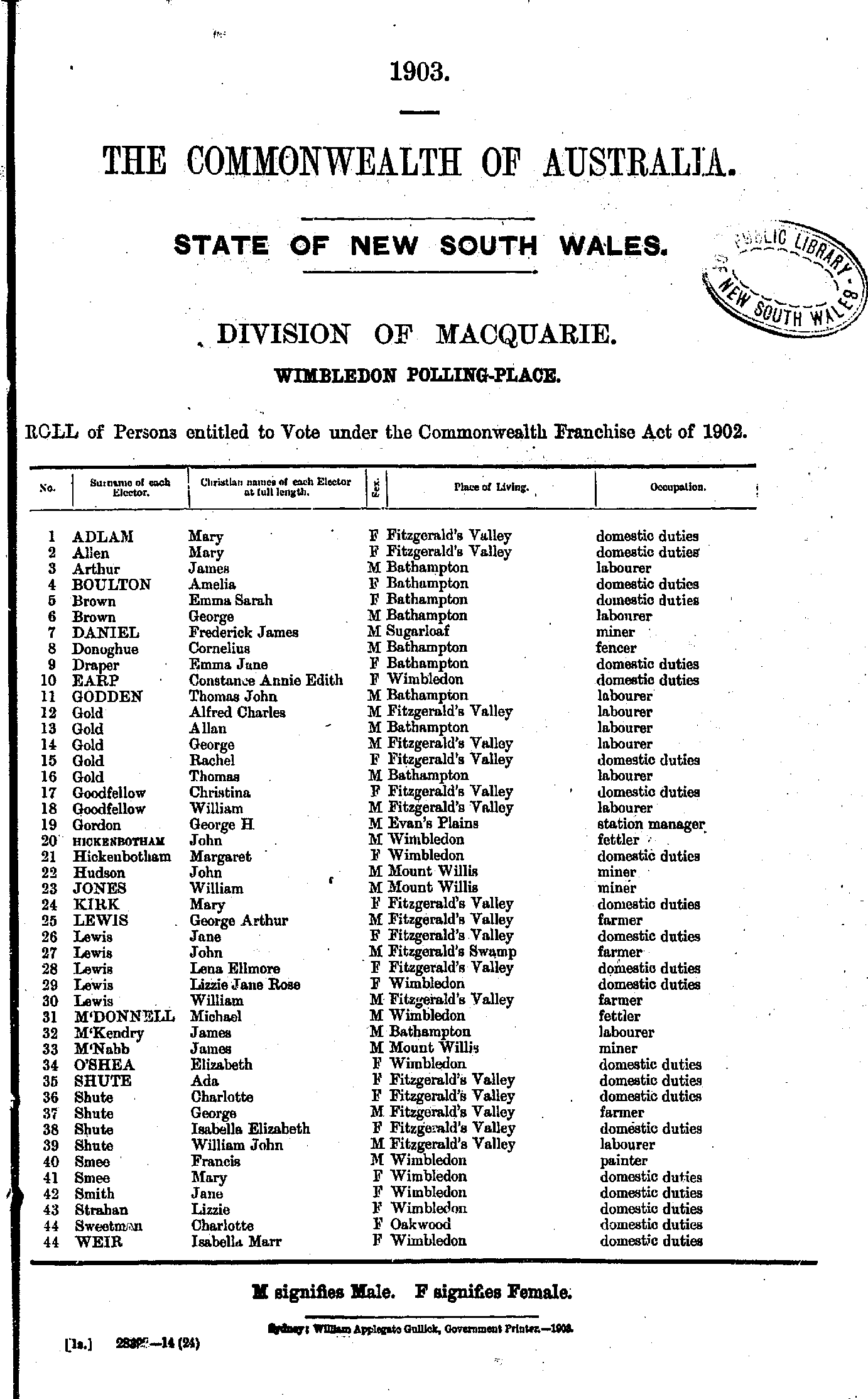
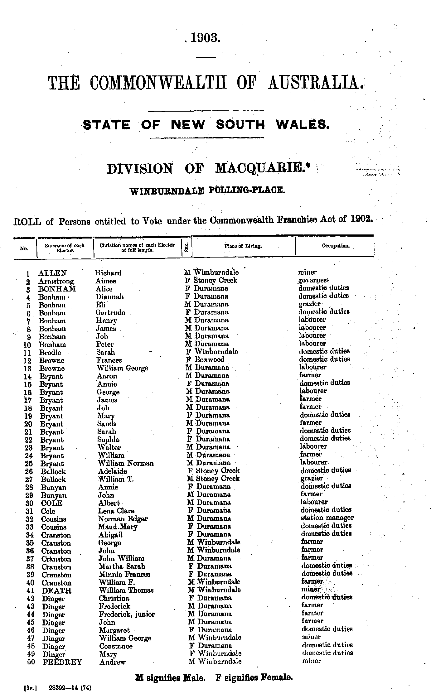
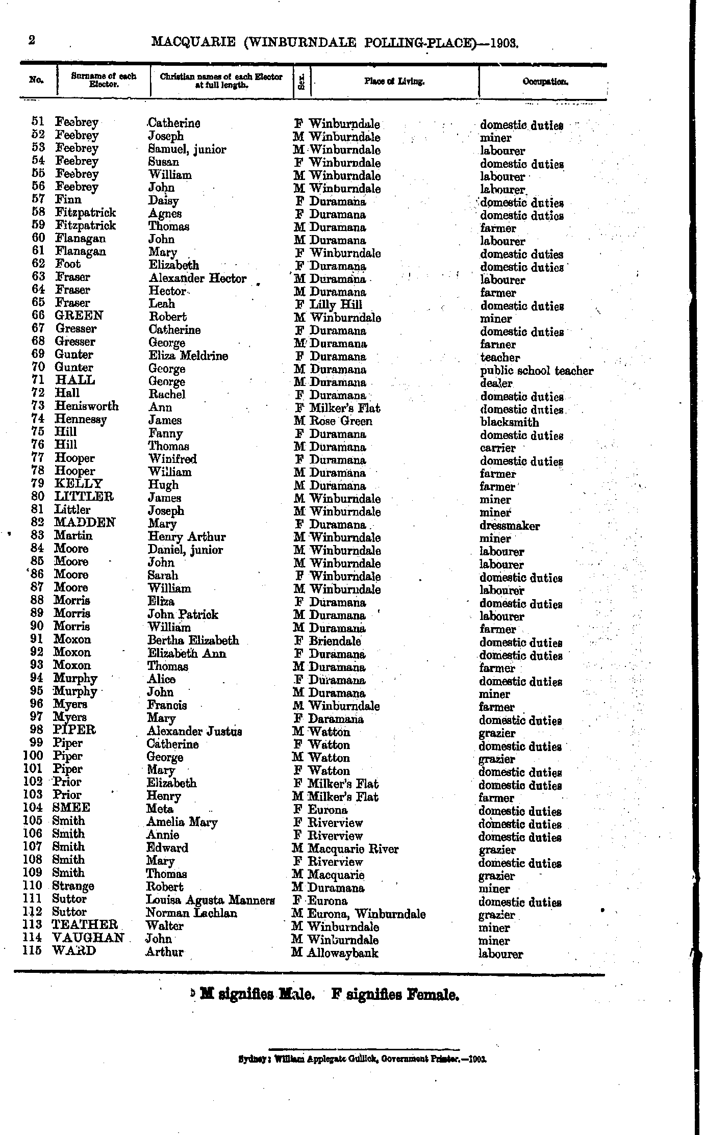
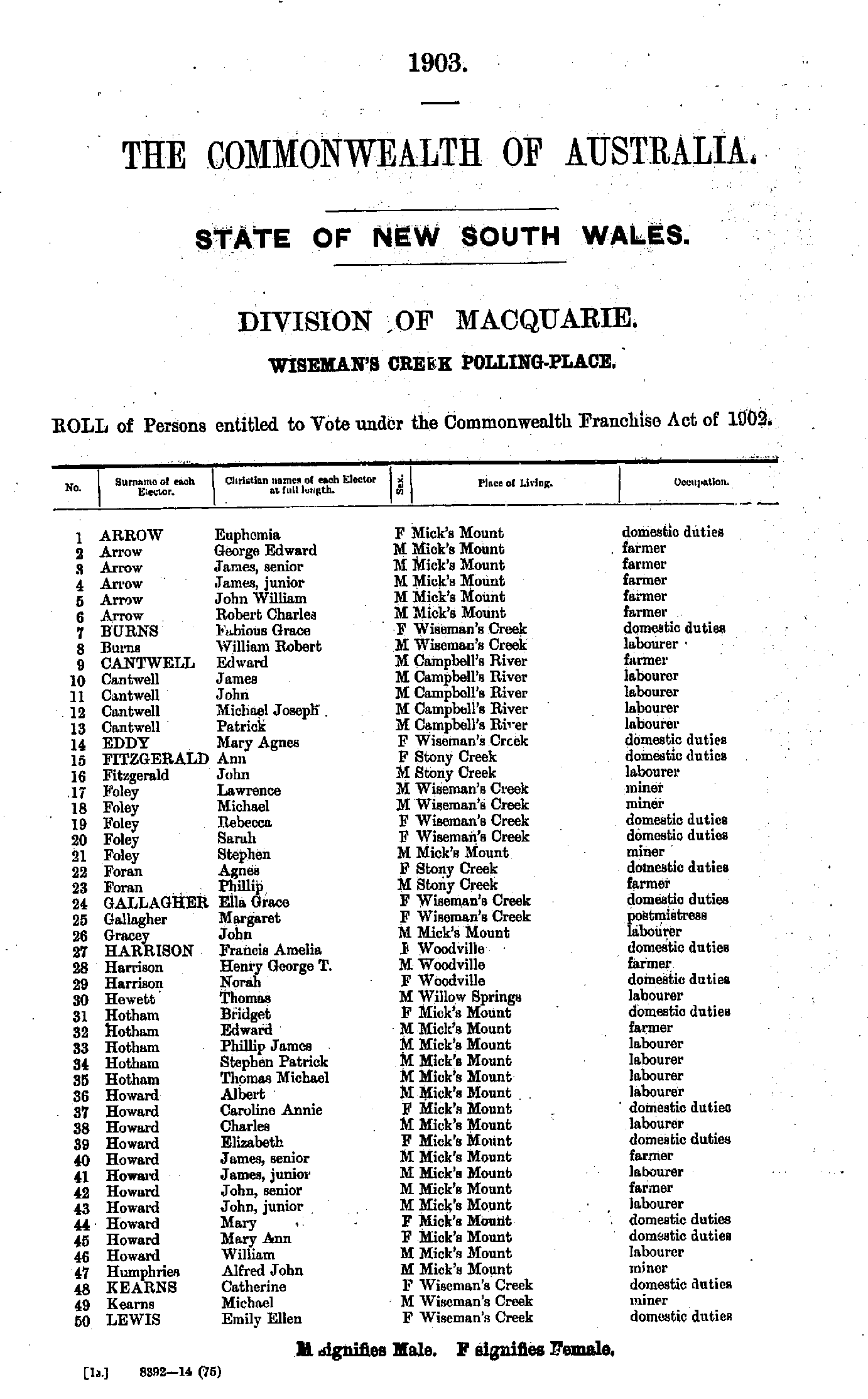
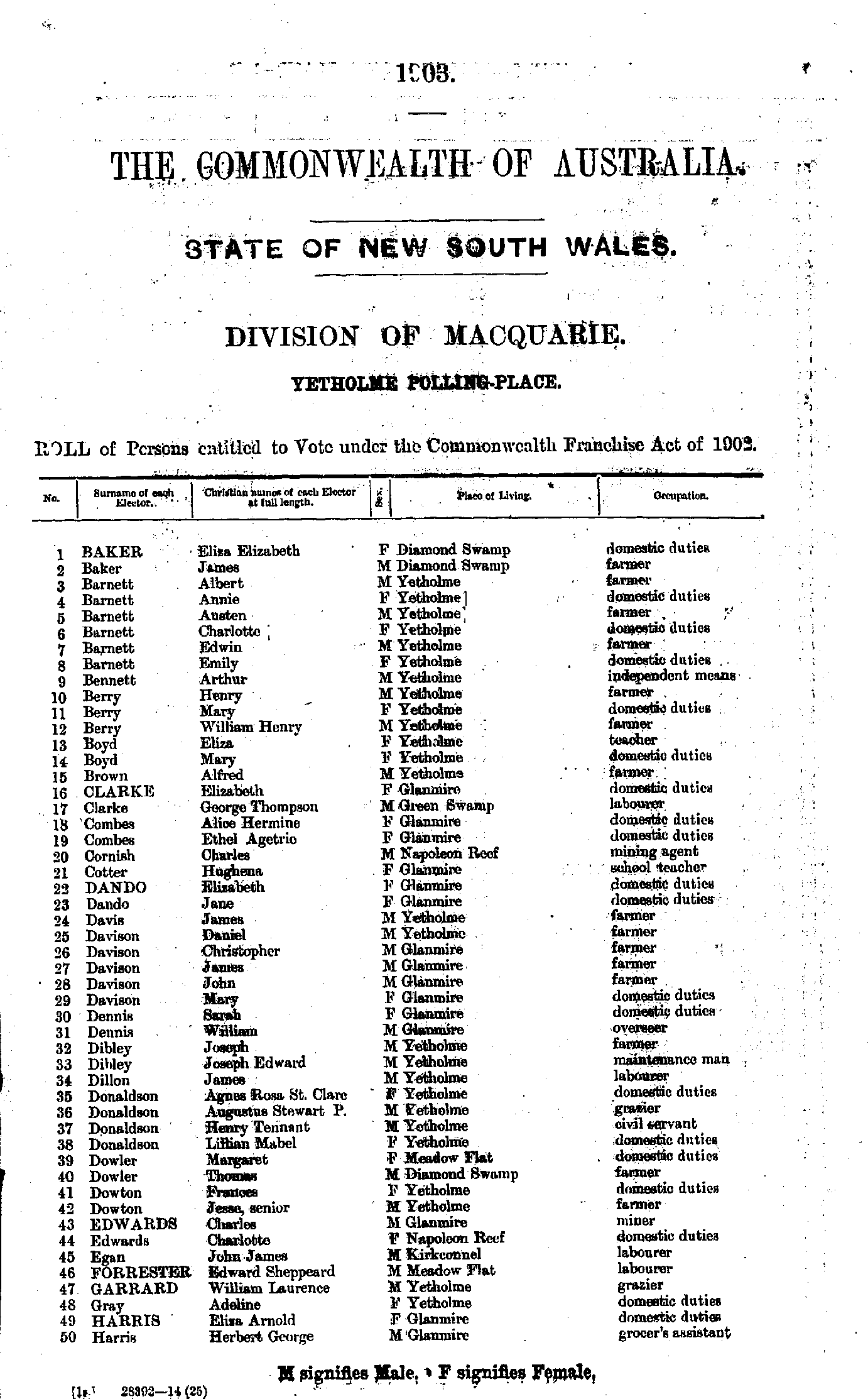
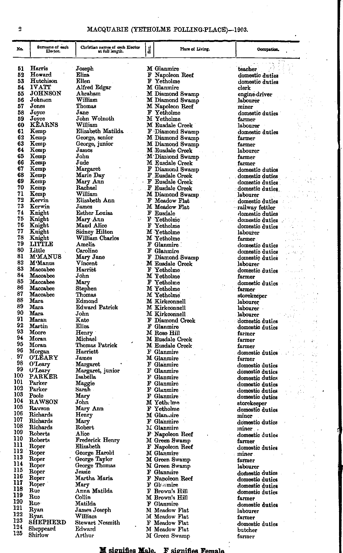
Roll of Persons entitled to Vote under the Commonwealth Franchise Act of 1902 Reproduced from microform copies of the originals in the Mitchell Library, State Library of New South Wales.
Index Copyright © Internet History Resources 2007
Electoral Maps of the Macquarie Division, 1901
Polling Places:
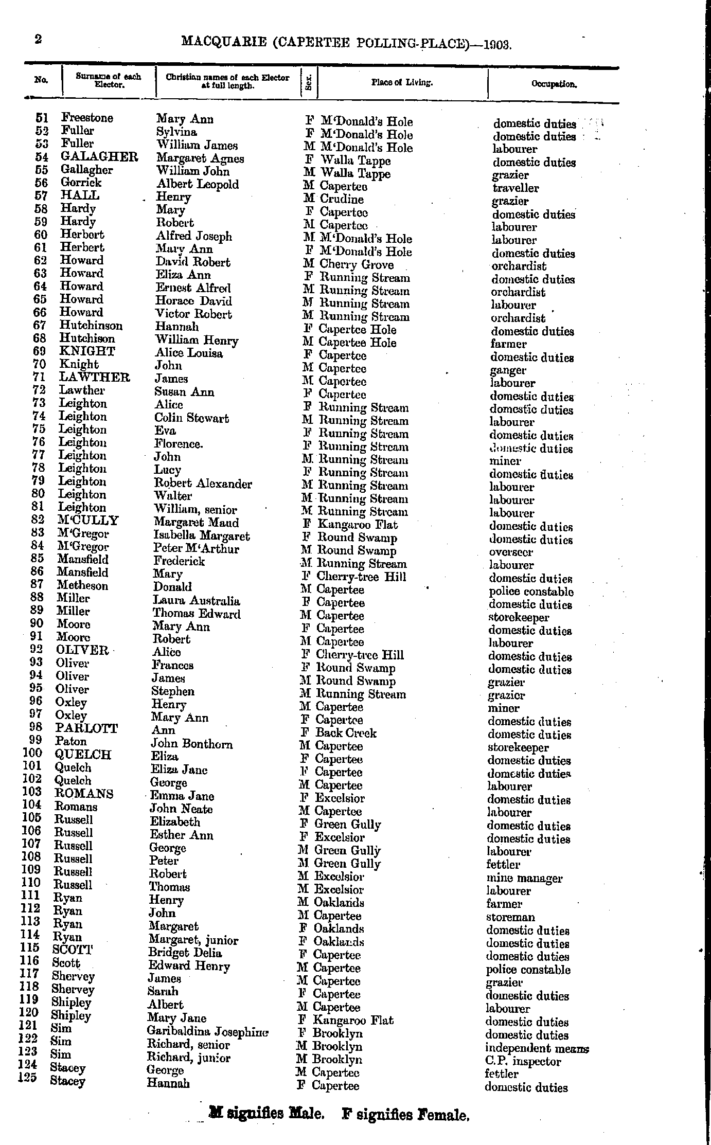
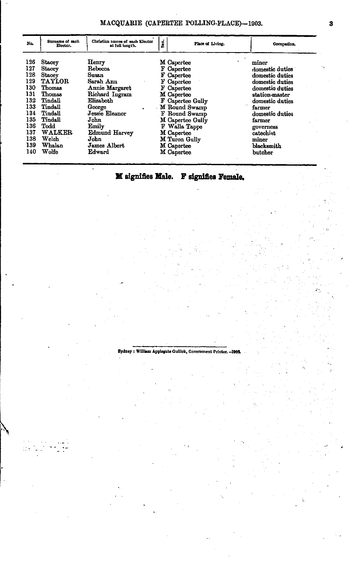
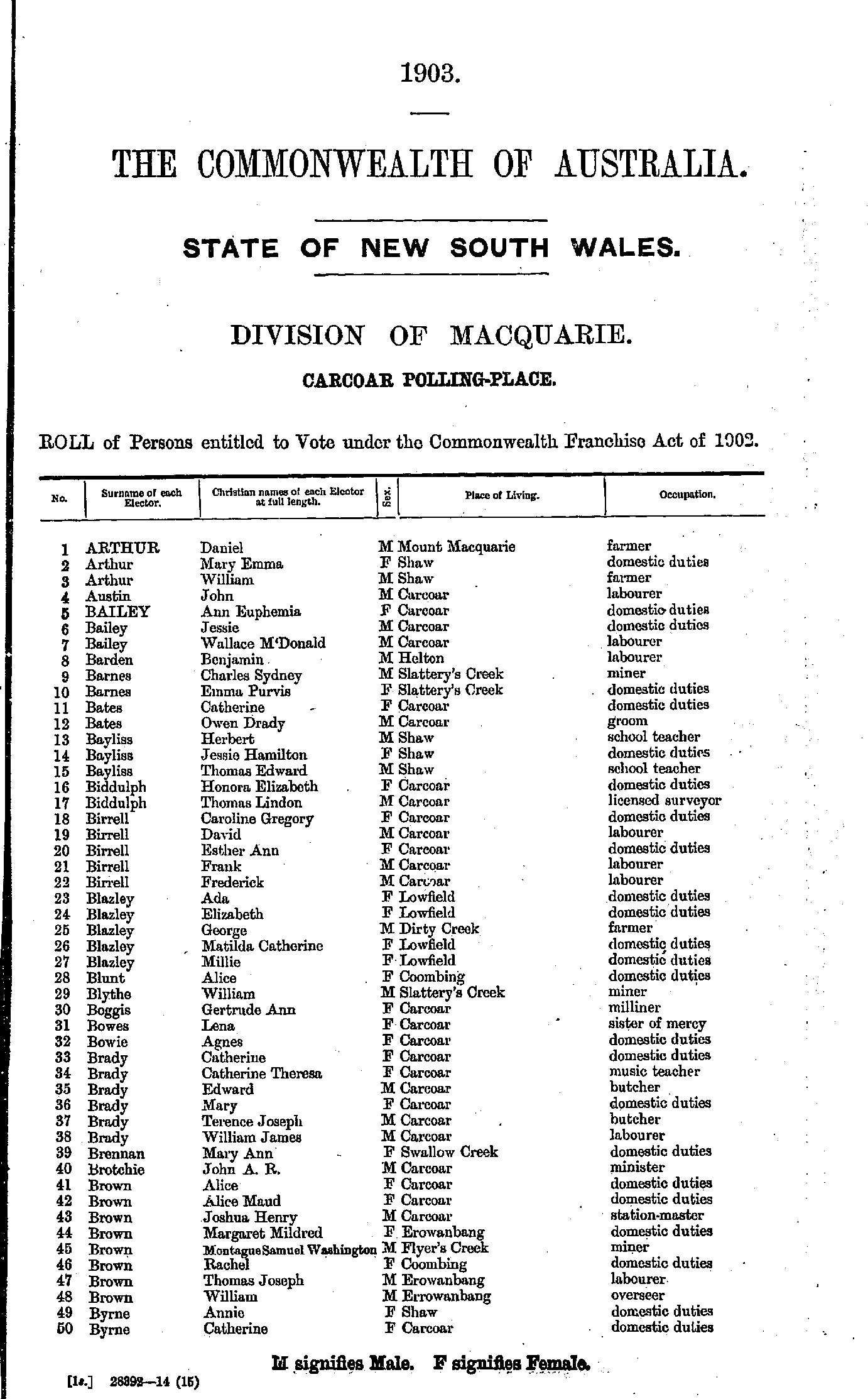
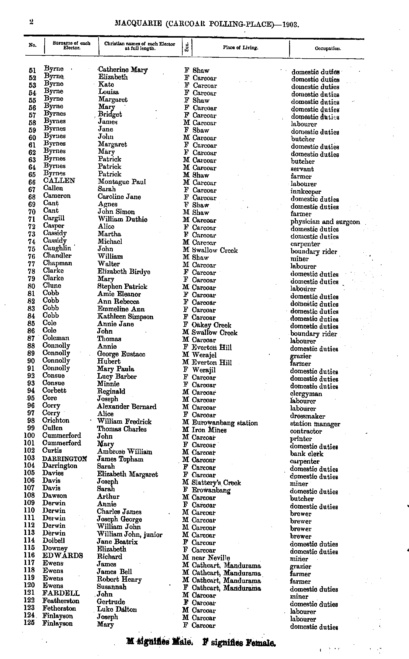
Airly | Back Swamp | Barry | Bathurst | Back Creek | Blayney | Bowenfels | Brewongle | Brown's Creek | Burnt Yards | Burraga | Caloola | Canowindra | Capertee | Carcoar | Charlton | Cow Flat | Cowra | Cowra-Goolagong Road | Cullen Bullen | Dark Corner | Edith | Eglinton | Evans Plains | Gallymont | George's Plains | Hampton | Hazelgrove | Hillsbury | Hobby's Yards | Jenolan Caves | Judd's Creek | Kelso | King's Plains | Limekilns | Little Hartley | Lowther | Lumpy Swamp | Lyndhurst | Mandurama | Meadow Flat | Megalong | Millthorpe | Morongla Creek | Mount David | Mount M'Donald | Neville | Newbridge | Norway | Oberon | O'Connell | Orton Park | Palmer's Oakey | Peel | Perth | Portland | Rockley | Rydal | Shooter's Hill | Sofala | Sunny Corner | Swatchfield | Tarana | The Lagoon | Trunkey Creek | Turondale | Vittoria | Wallerawang | Walli | Wattamondara | Wattle Flat | White Rock | Wimbledon | Winburndale | Wiseman's Creek | Woodstock | Yetholme
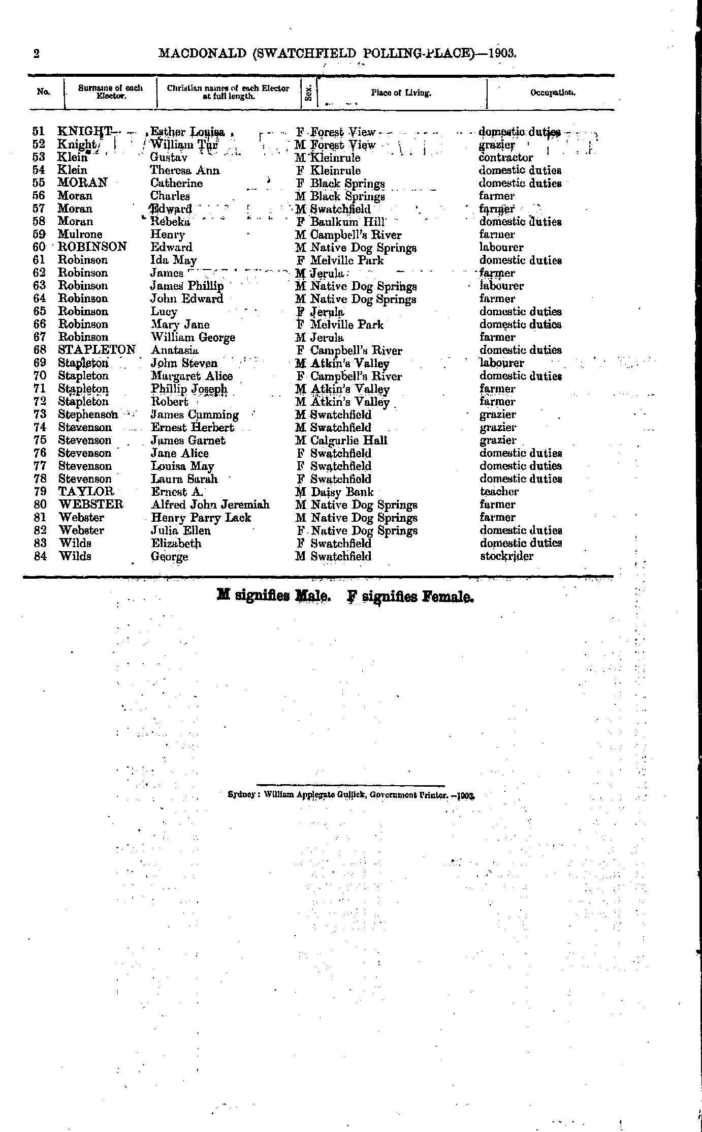
- Abbott Minnie - Appleby James
- Appleby Jane - Baines Judith
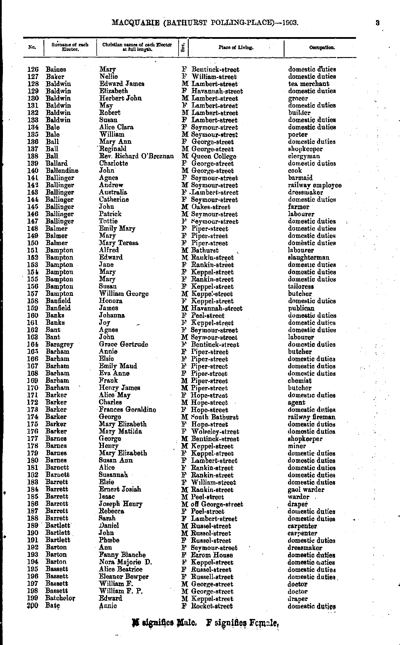
- Baines Mary - Bate Annie
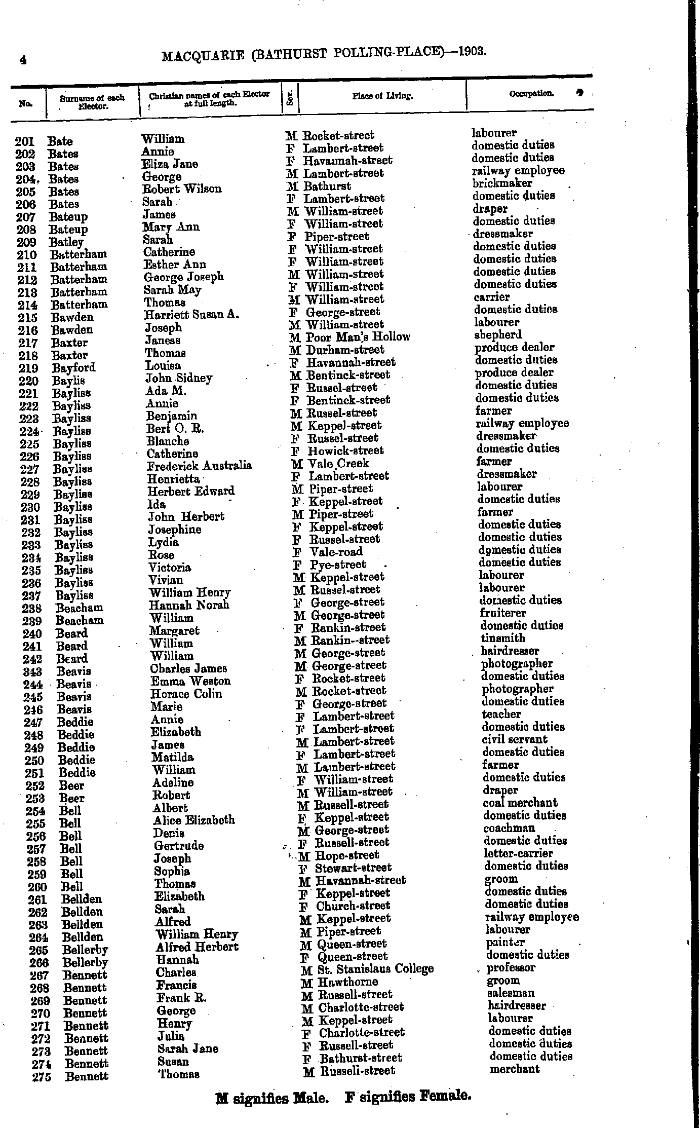
- Bate William - Bennett Thomas
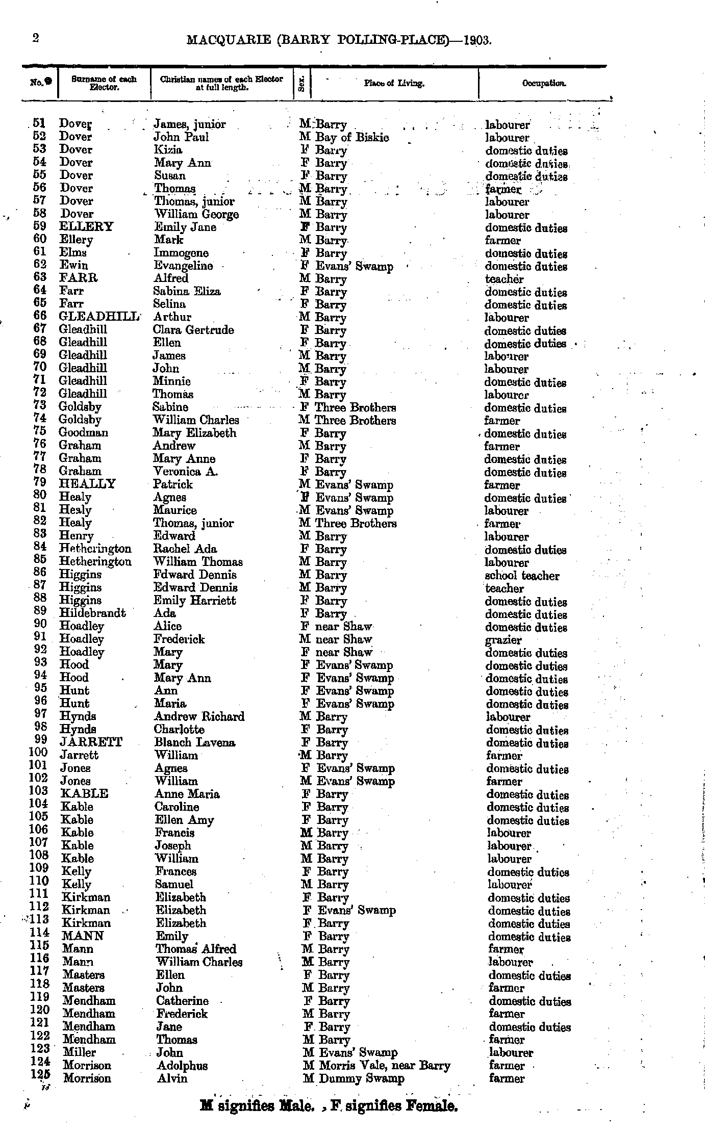
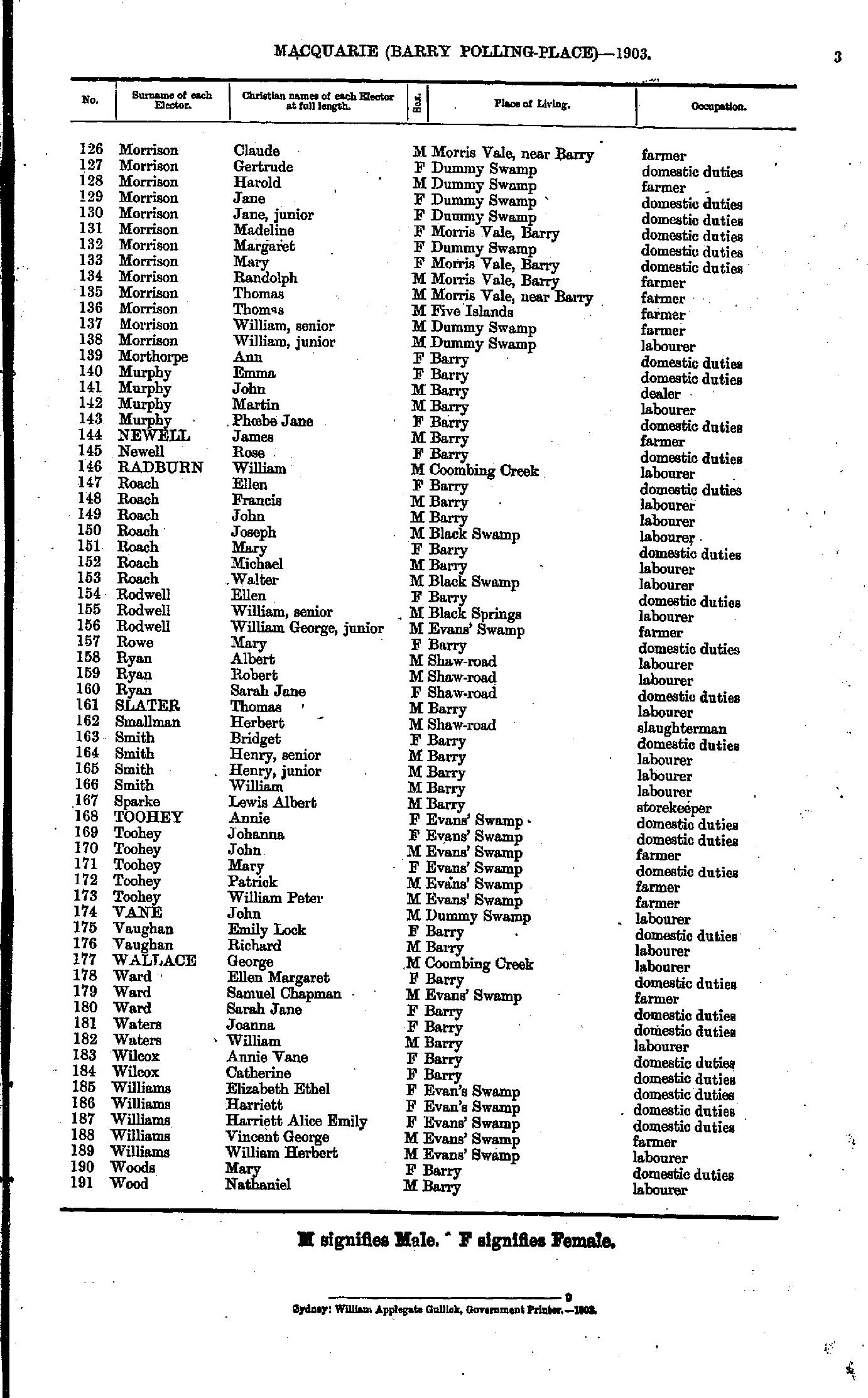
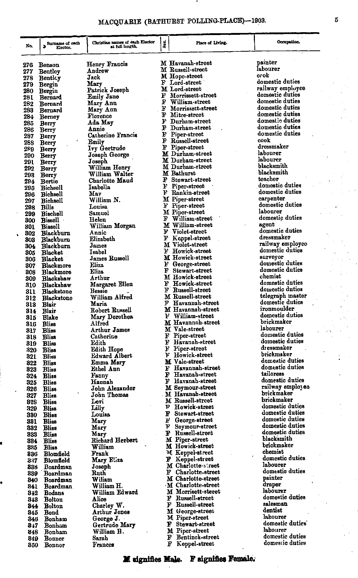
- Benson Henry - Bonnor Frances
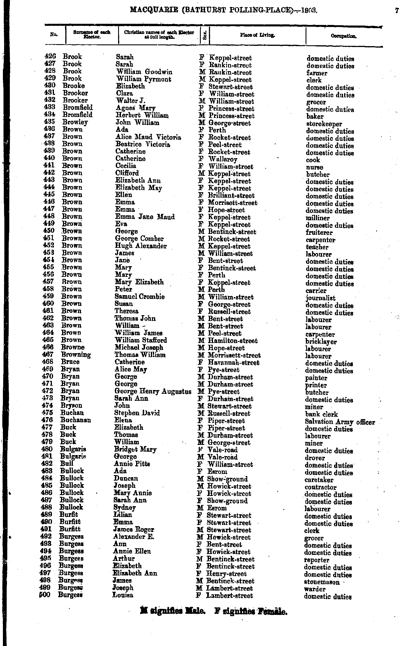
- Brook Sarah - Burgess Louisa
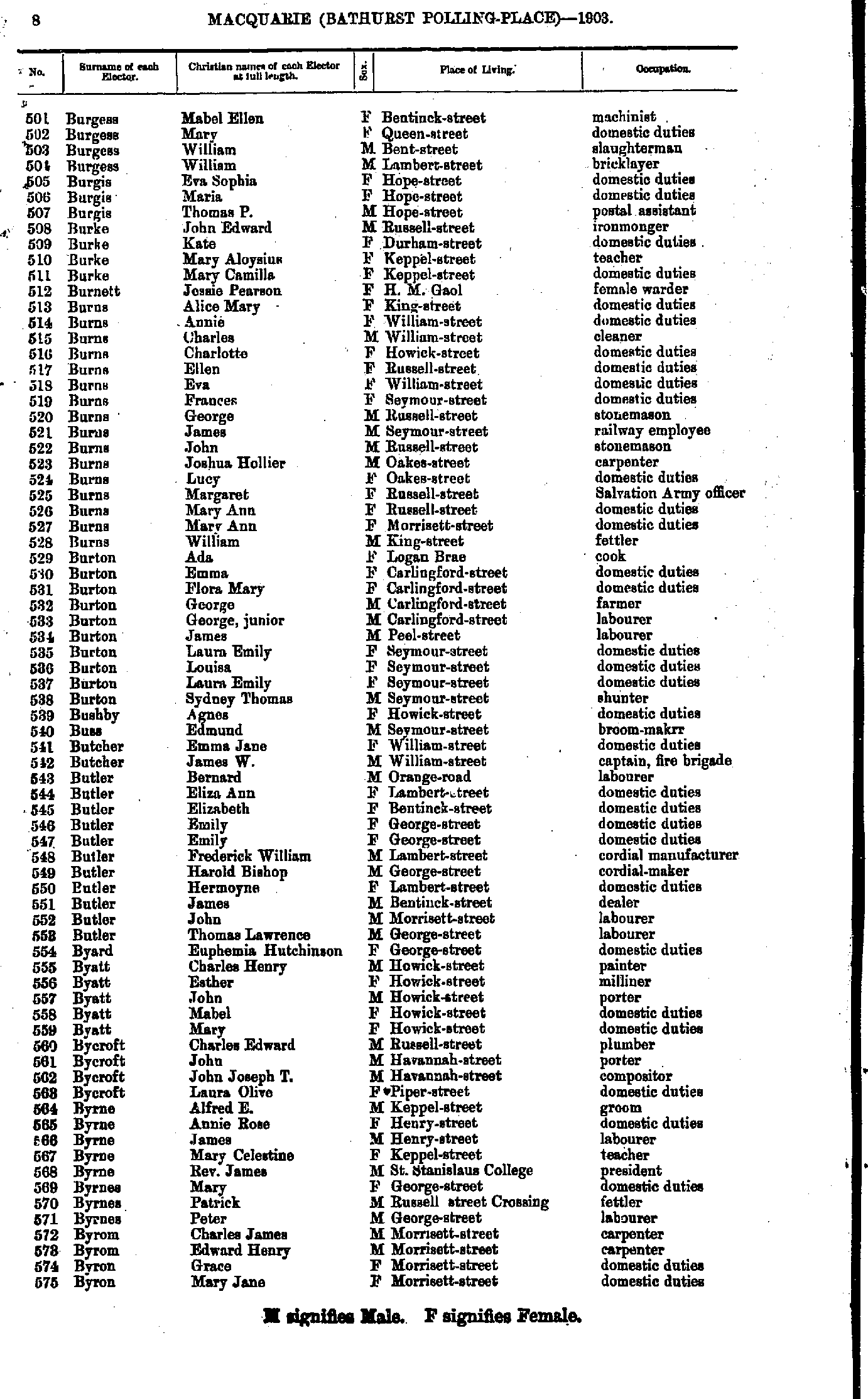
- Burgess Mabel - Byron Mary
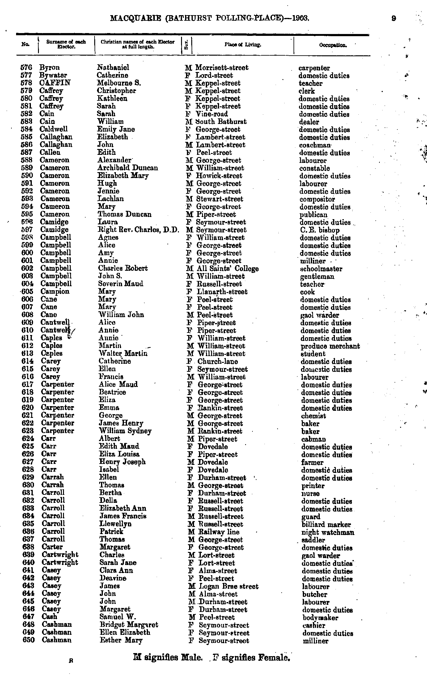
- Byron Nathaniel - Cashman Esther
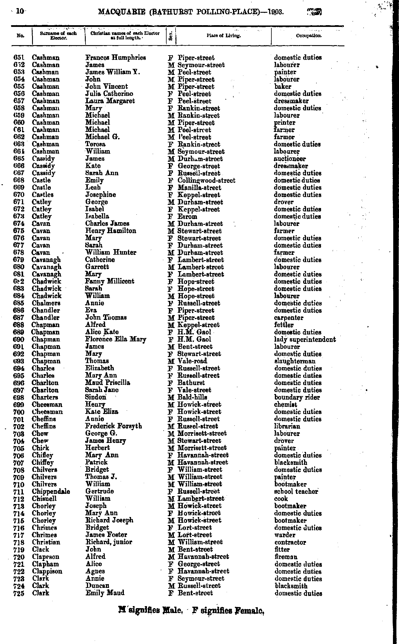
- Cashman Frances - Clark Emily
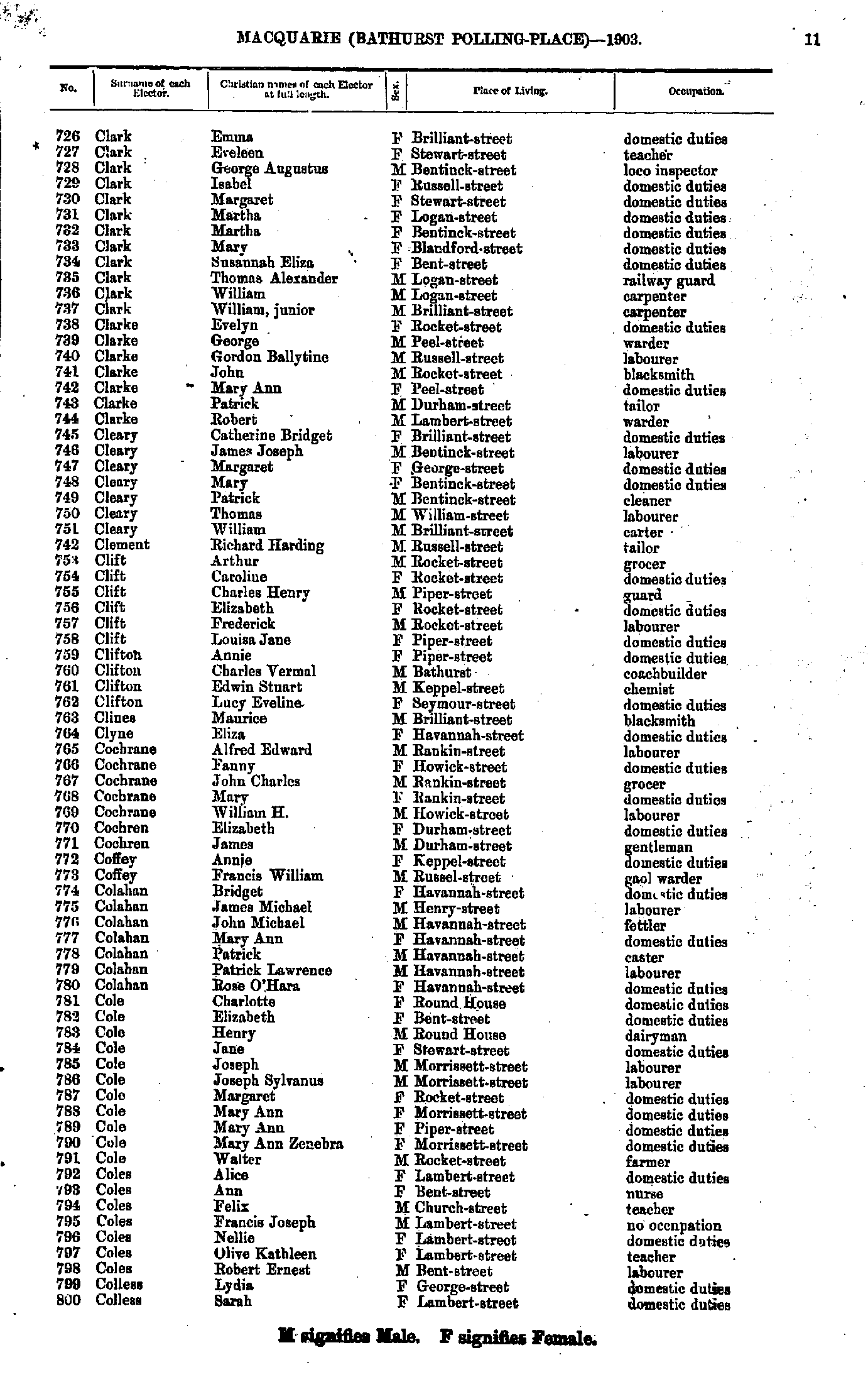
- Clark Emma - Colless Sarah
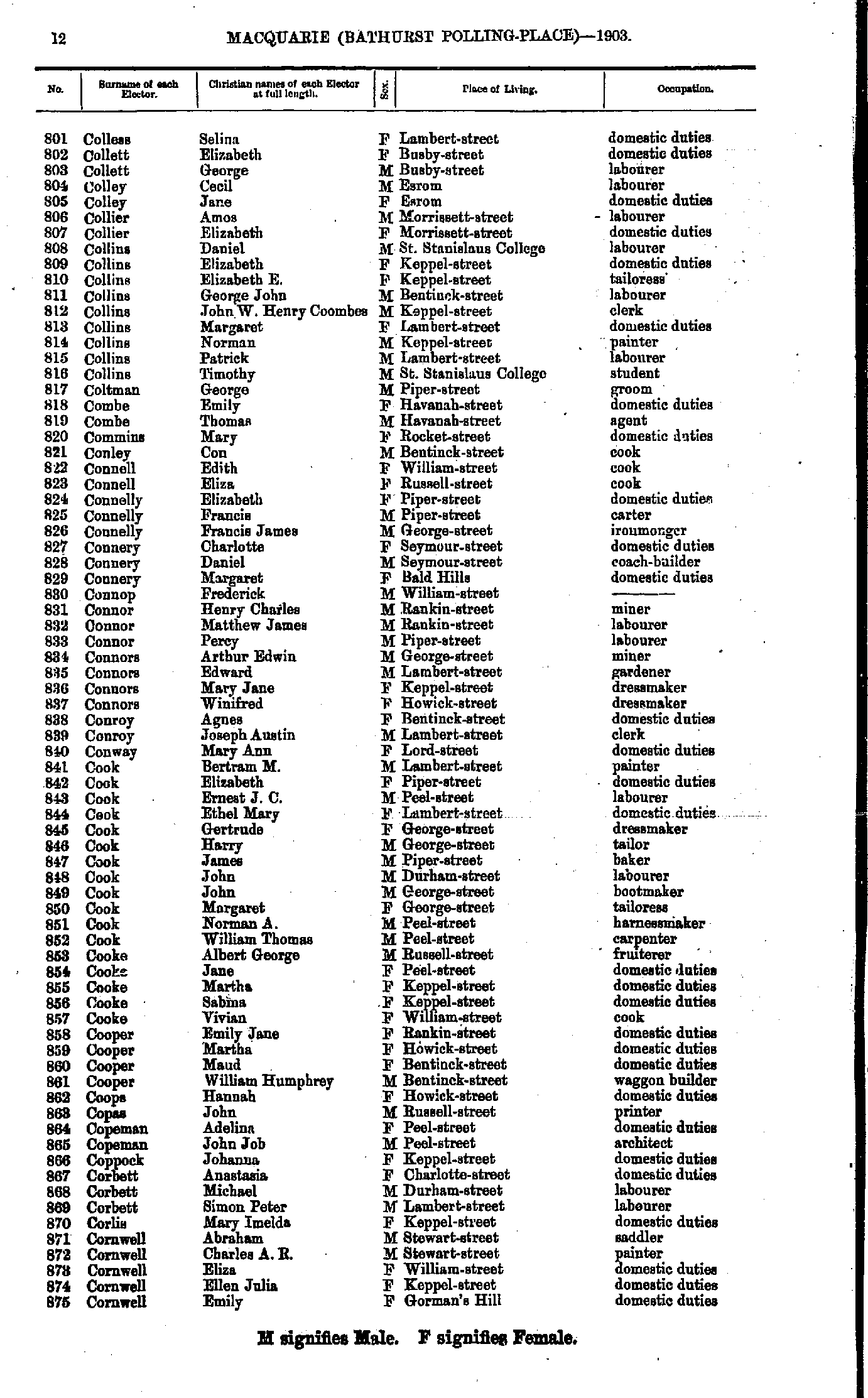
- Colless Selina - Cornwell Emily
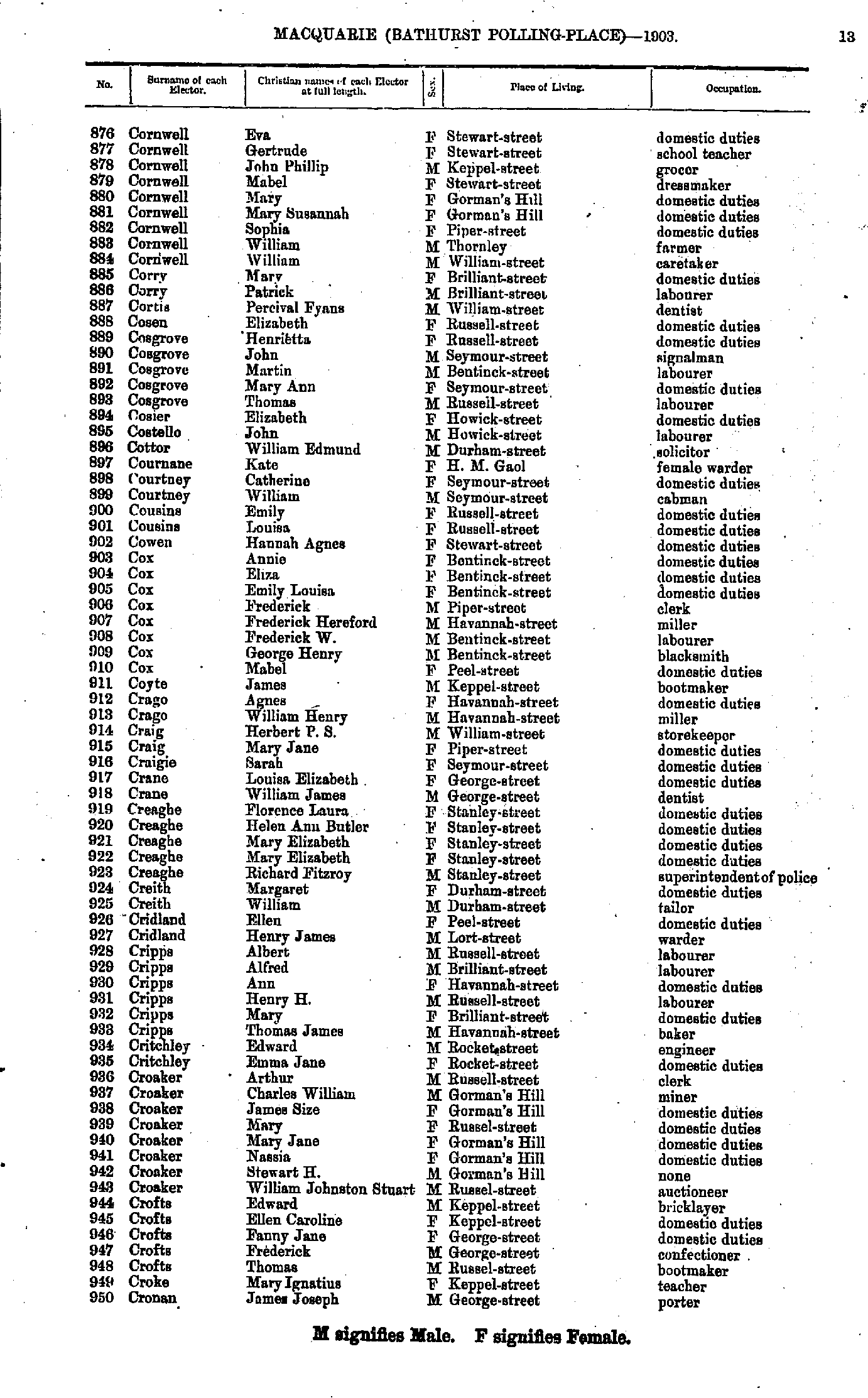
- Cornwell Eva - Cronan James
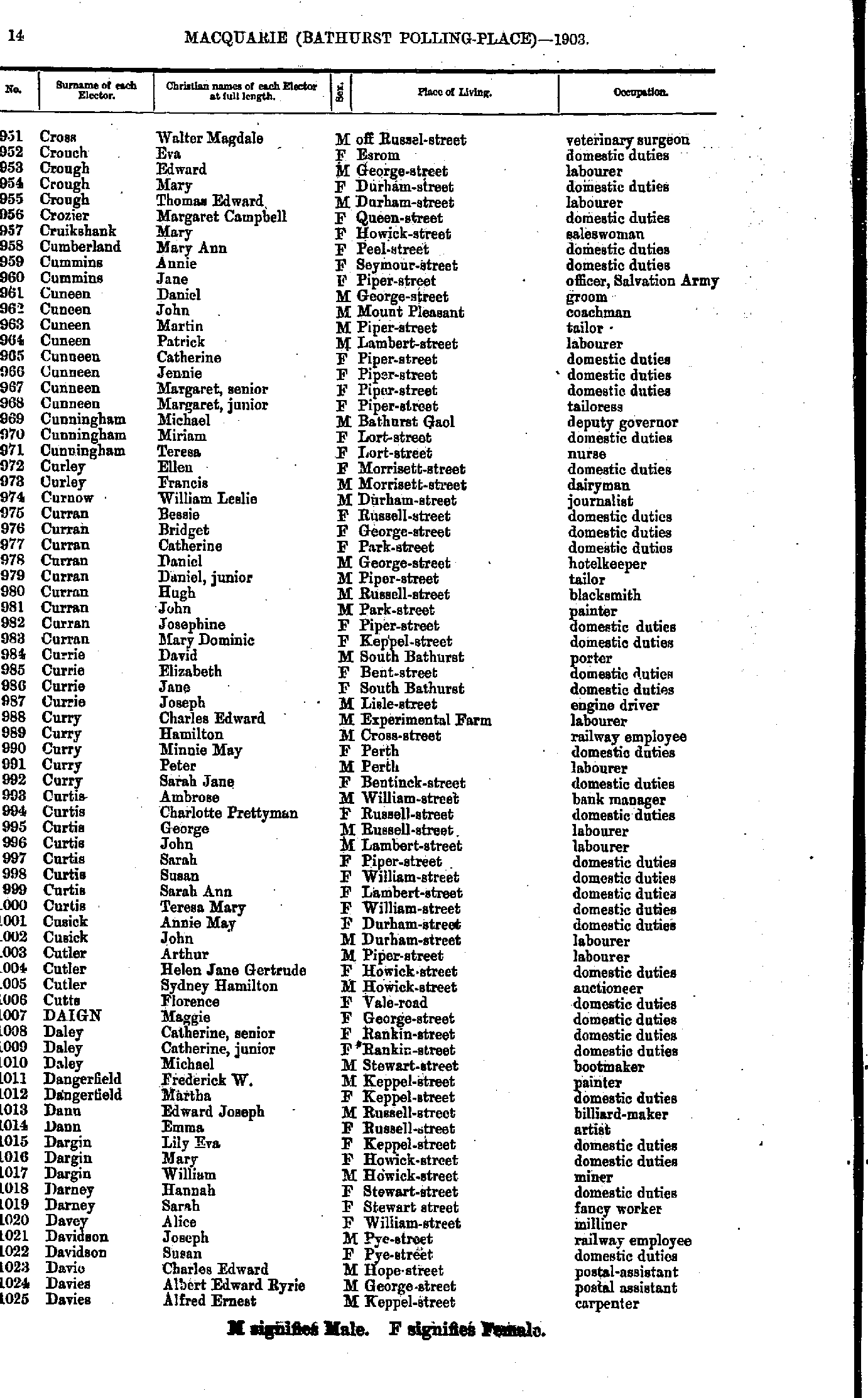
- Cross Walter - Davies Alfred
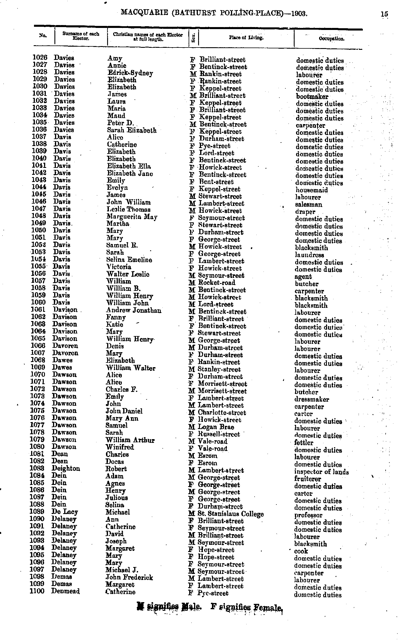
- Davies Amy - Denmead Catherine
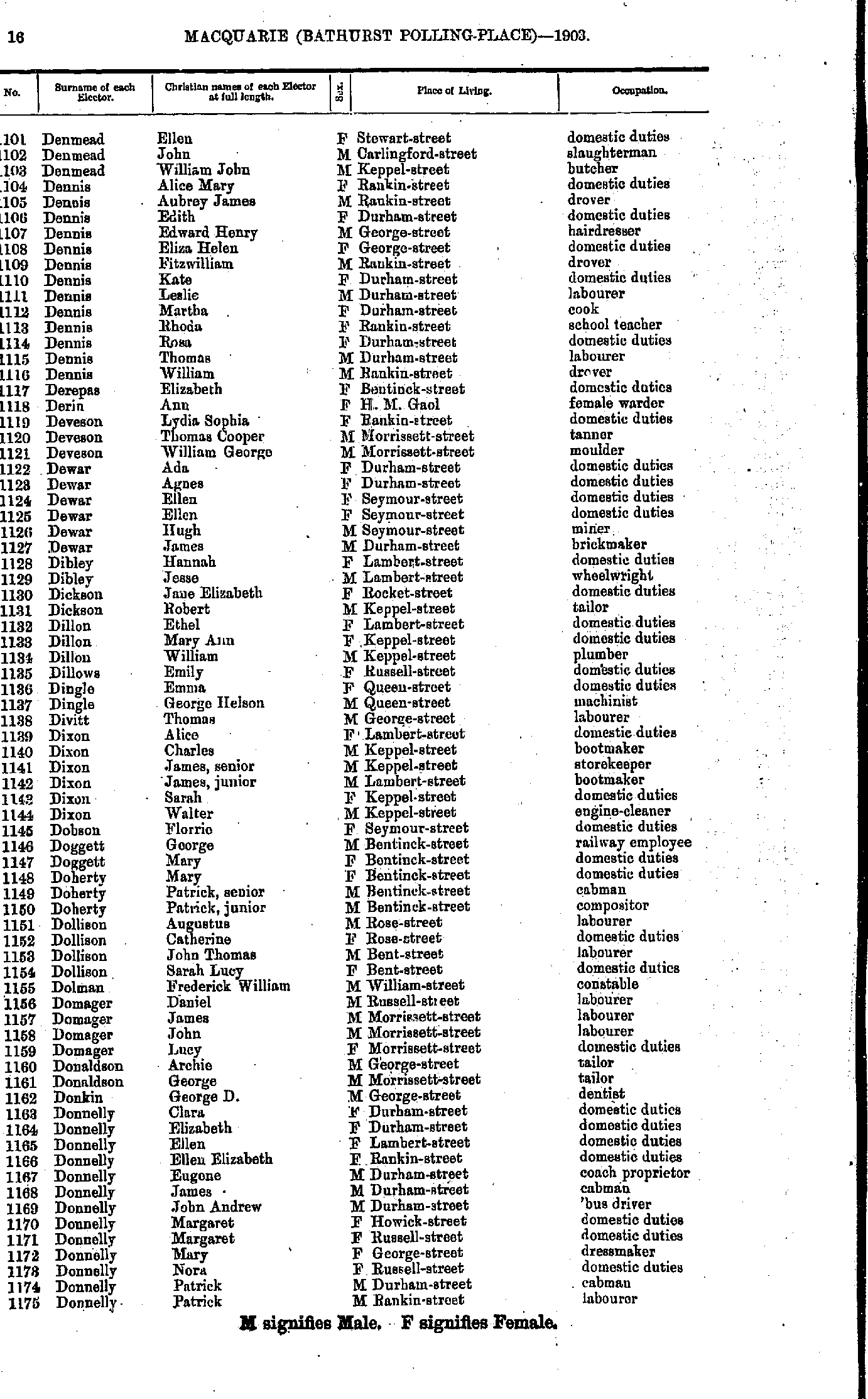
- Denmead Ellen - Donnelly Patrick
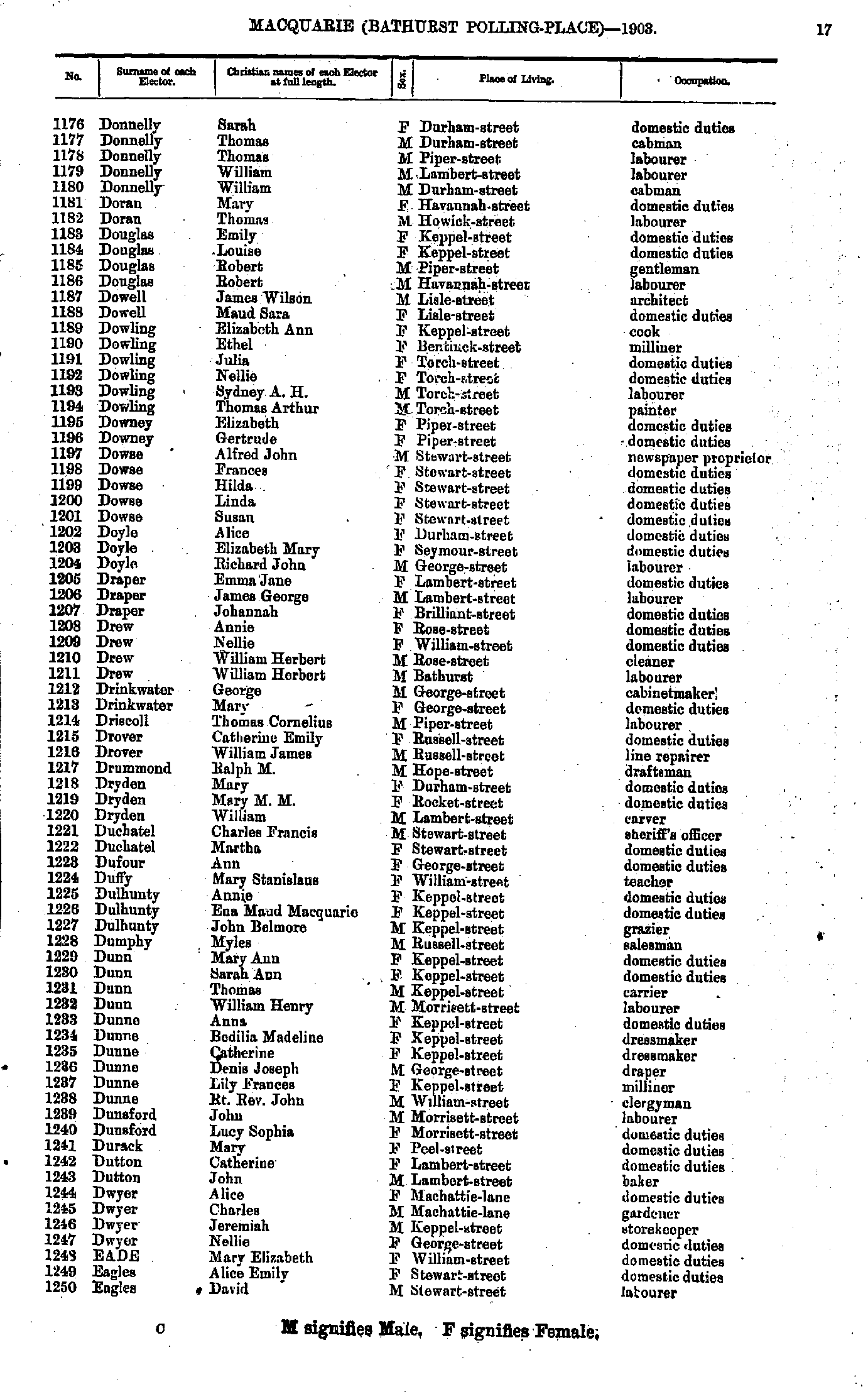
- Donnelly Sarah - Eagles David
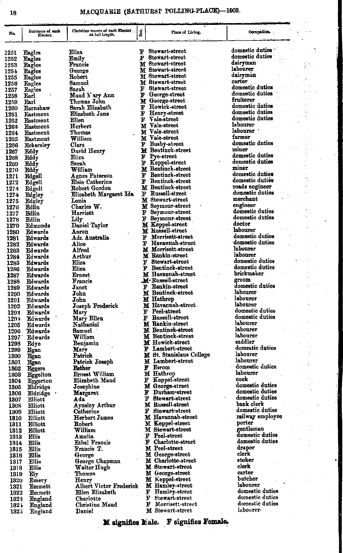
- Eagles Eliza - England Daniel
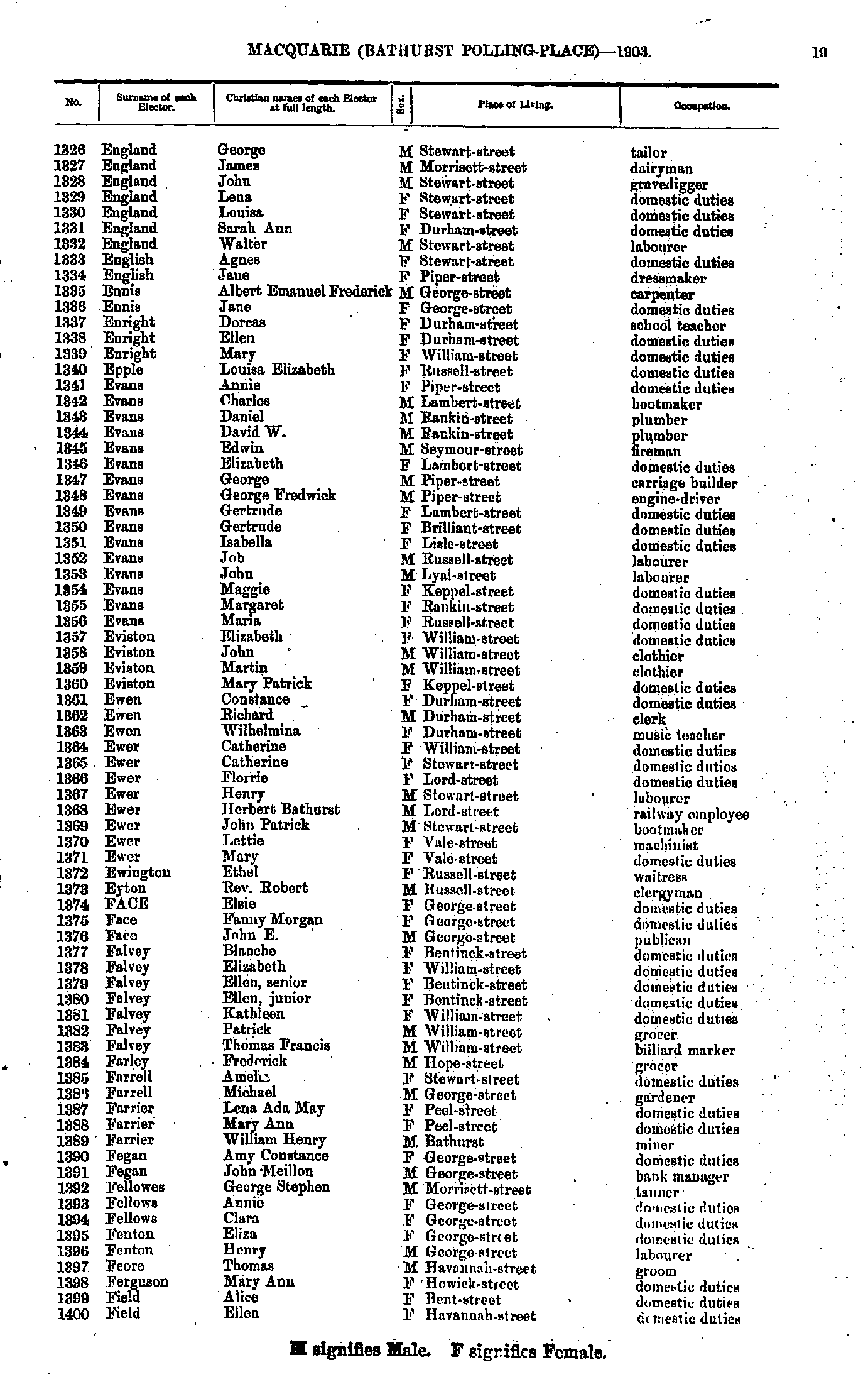
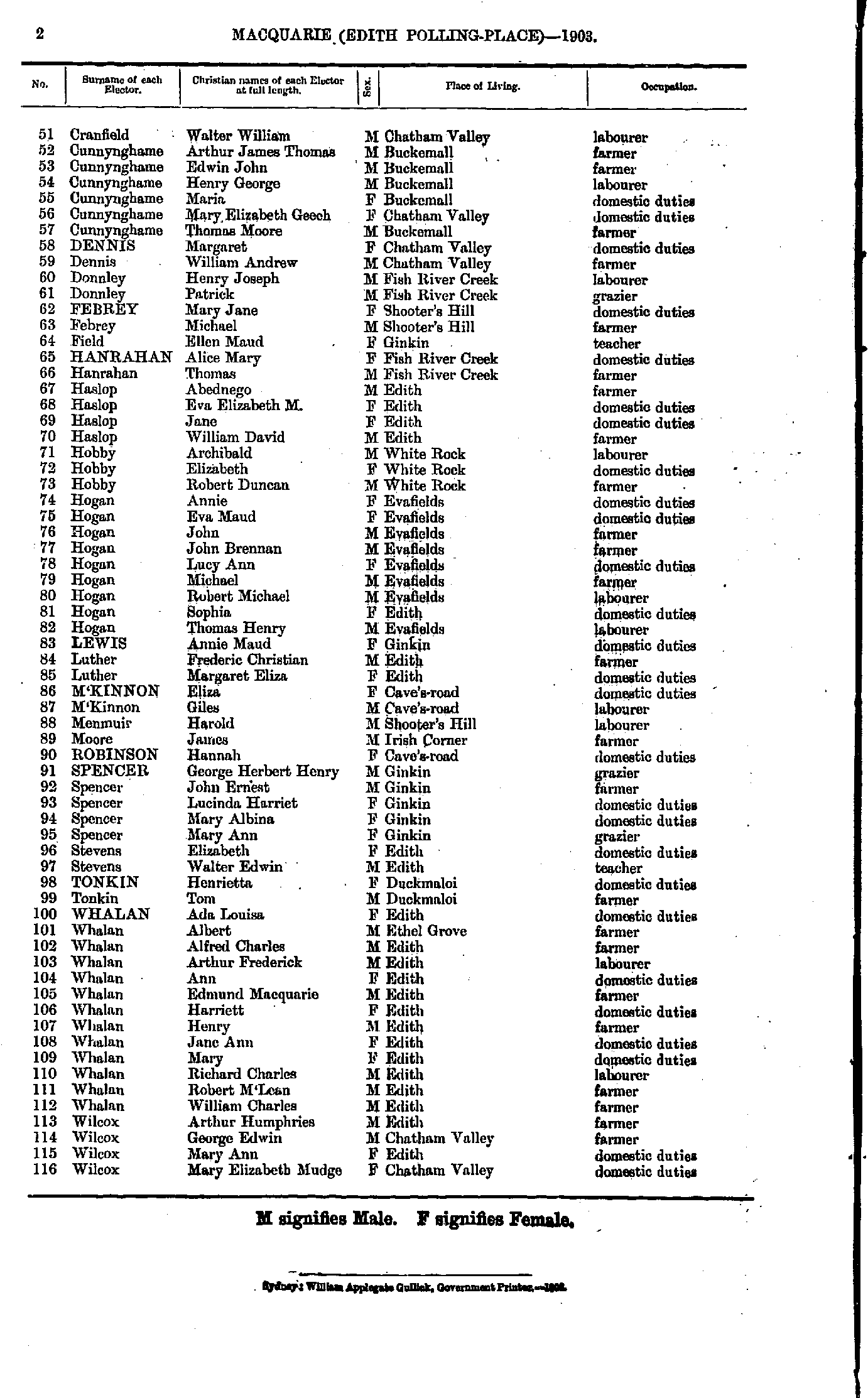
- England George - Field Ellen
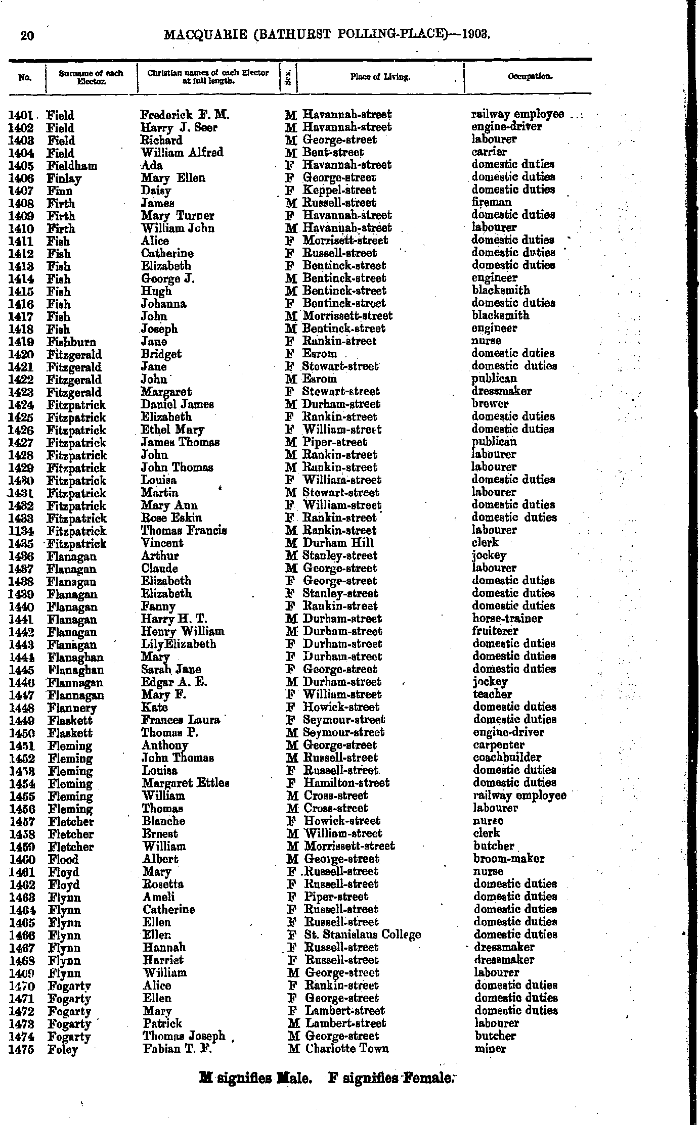
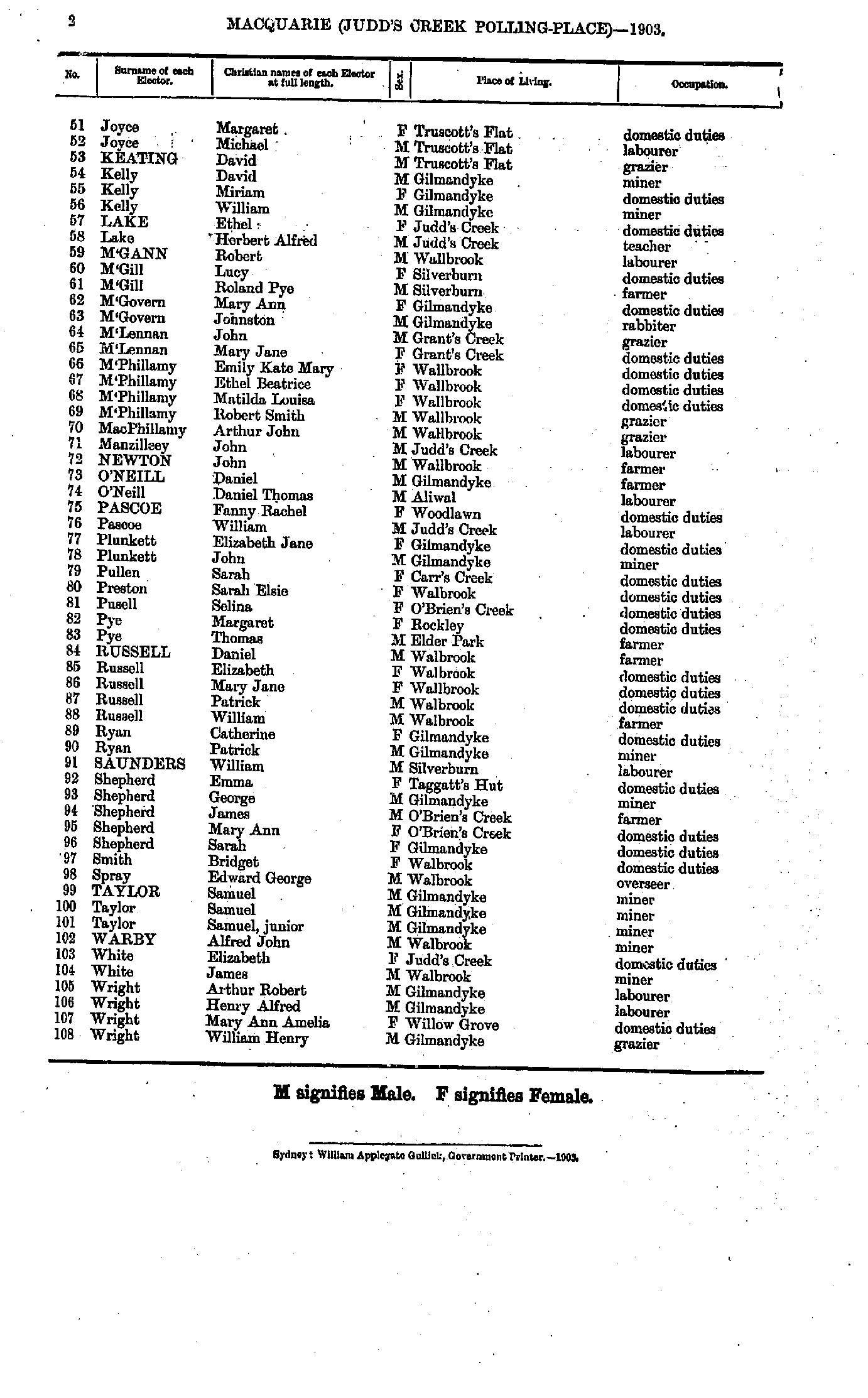
- Field Frederick - Foley Fabian
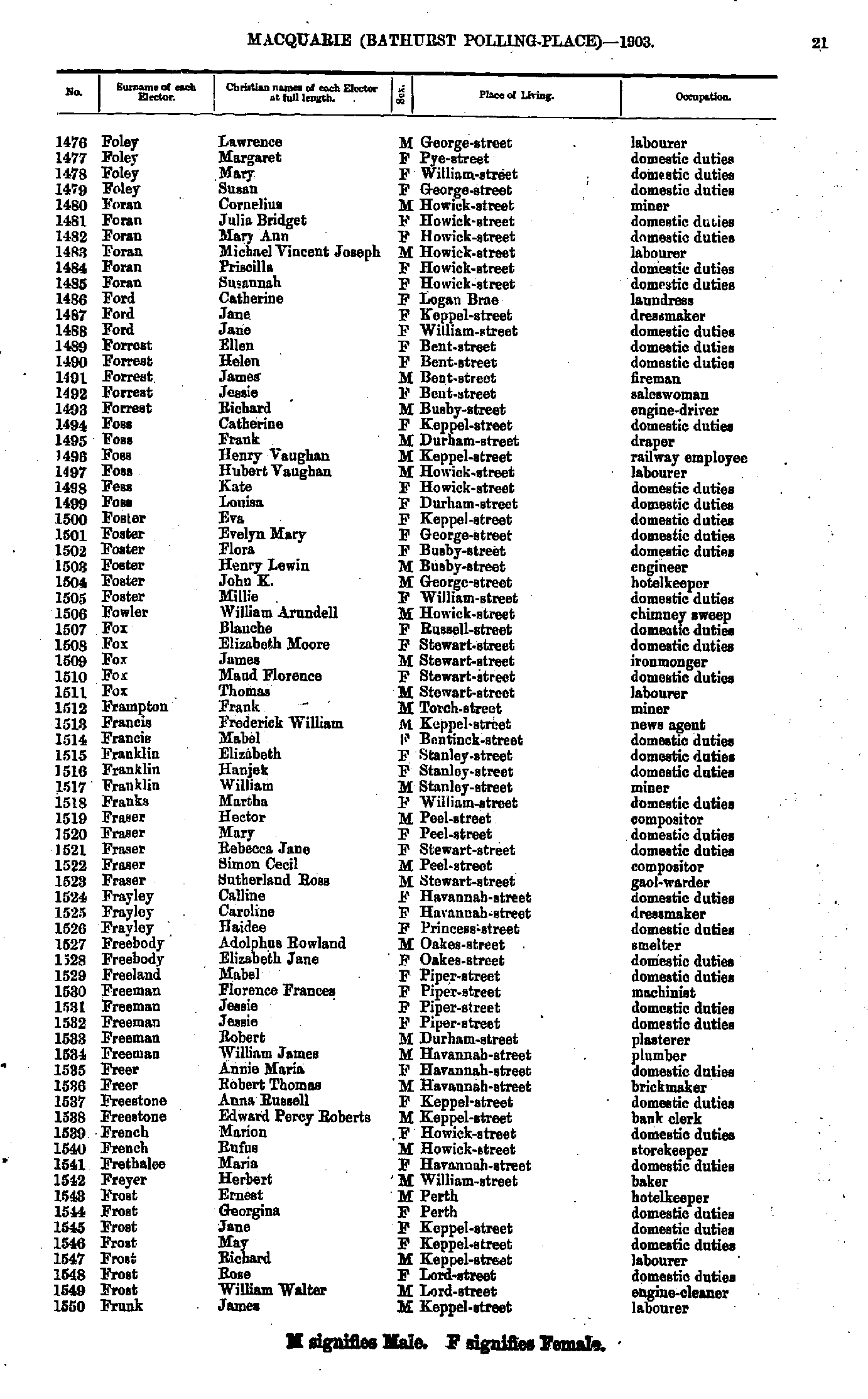
- Foley Lawrence - Frunk James
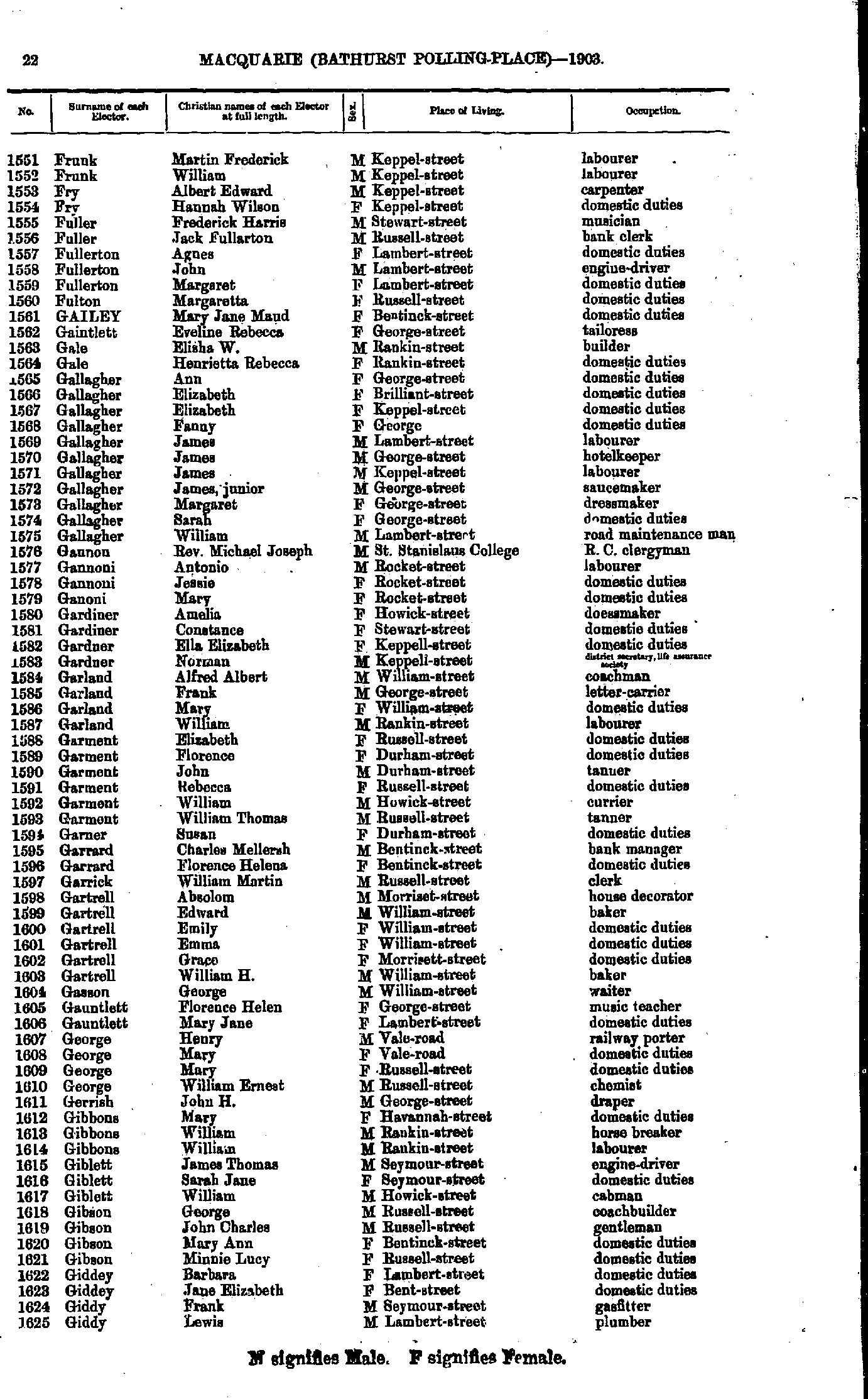
- Frunk Martin - Giddy Lewis
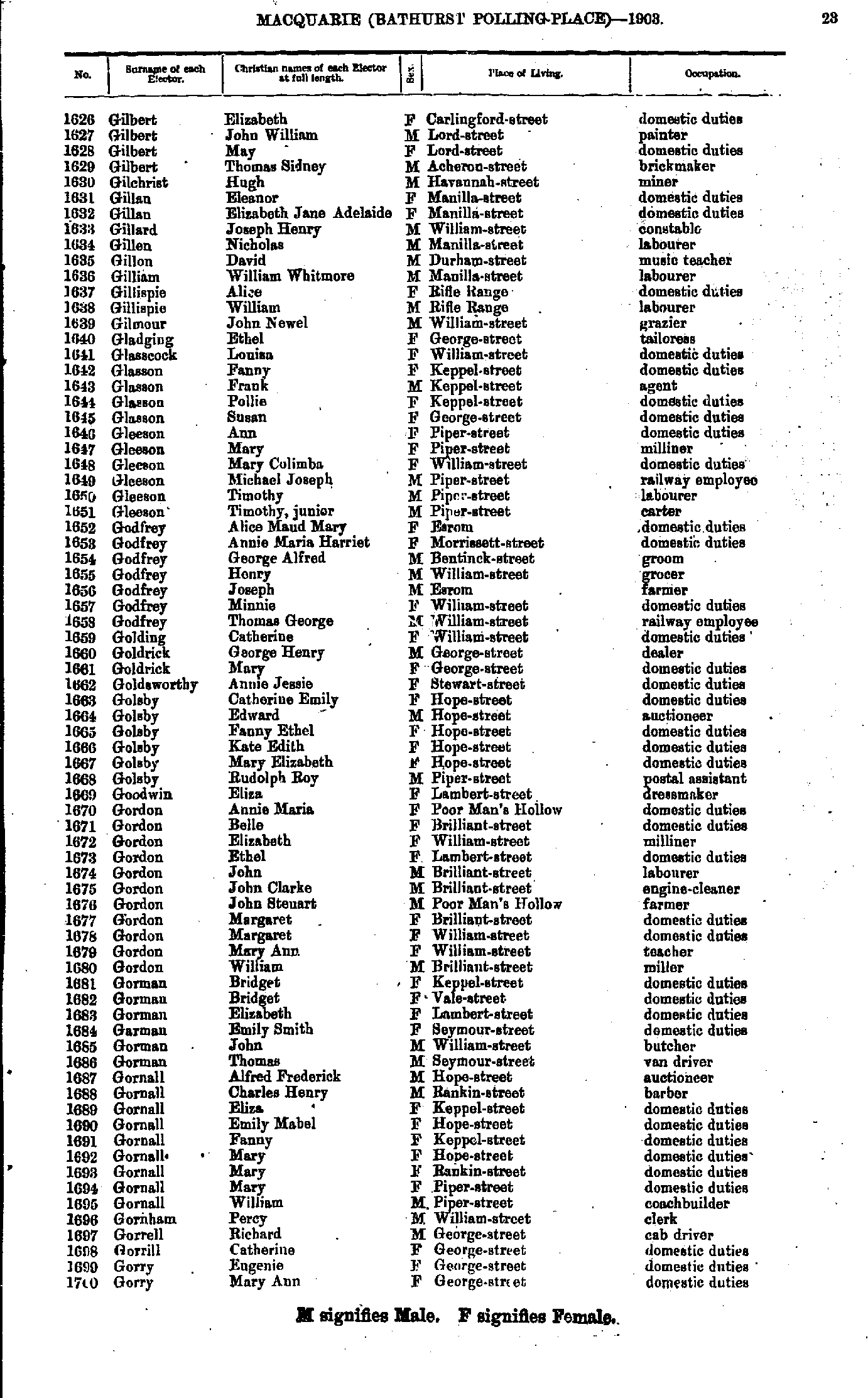
- Gilbert Elizabeth - Gorry Mary
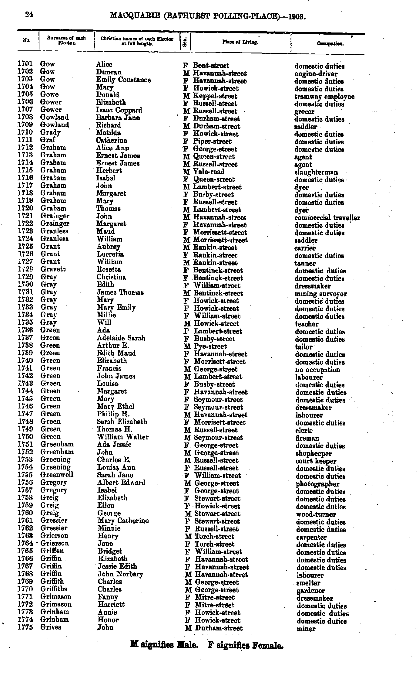
- Gow Alice - Grives John
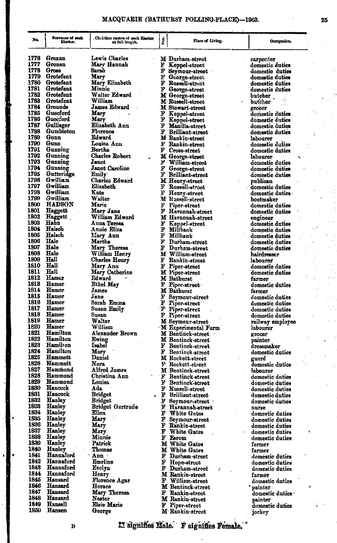
- Gronan Lewis - Hansen George
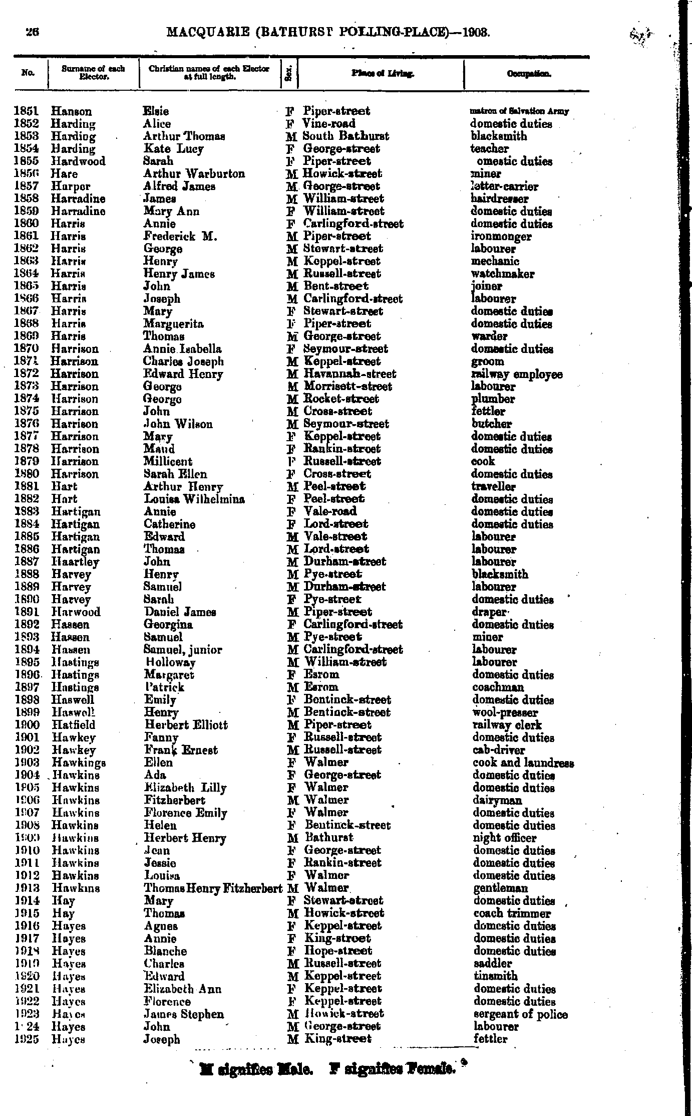
- Hanson Elsie - Hayes Joseph
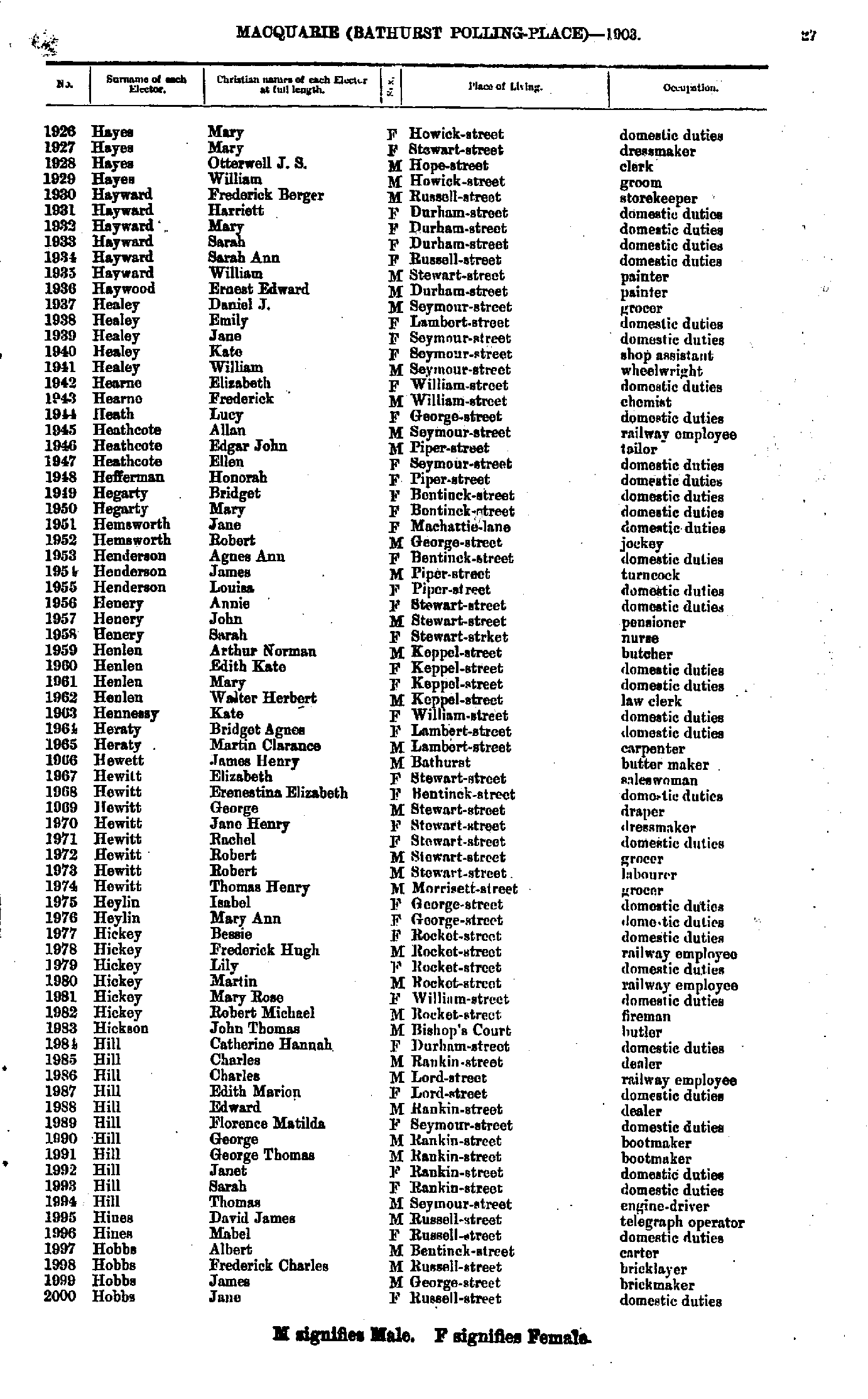
- Hayes Mary - Hobbs Jane
- Hobbs John - Howard Caldwell
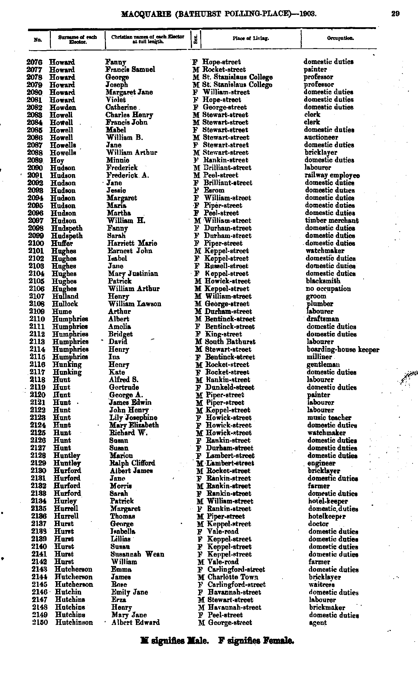
- Howard Fanny - Hutchinson Albert
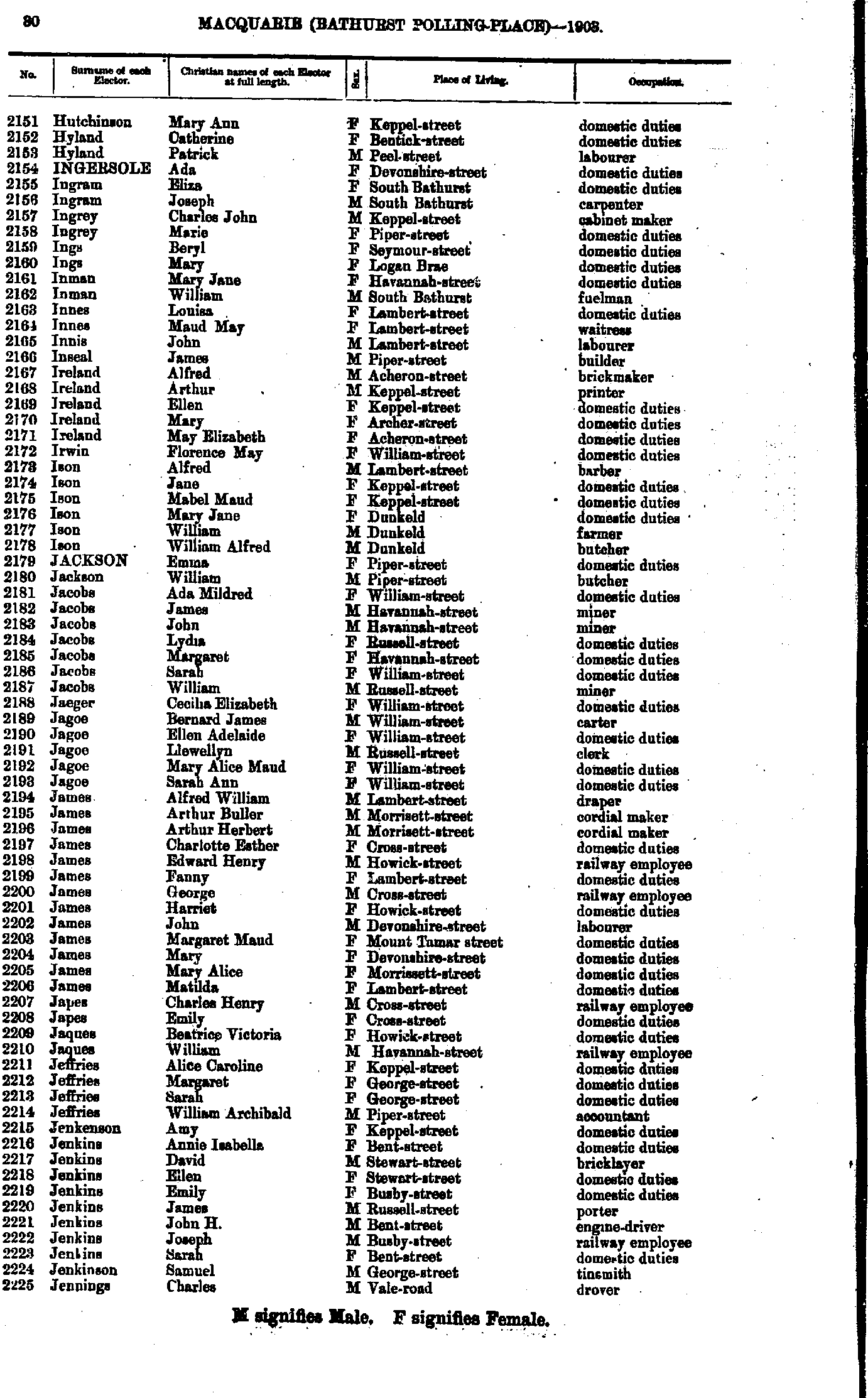
- Hutchinson Mary - Jennings Charles
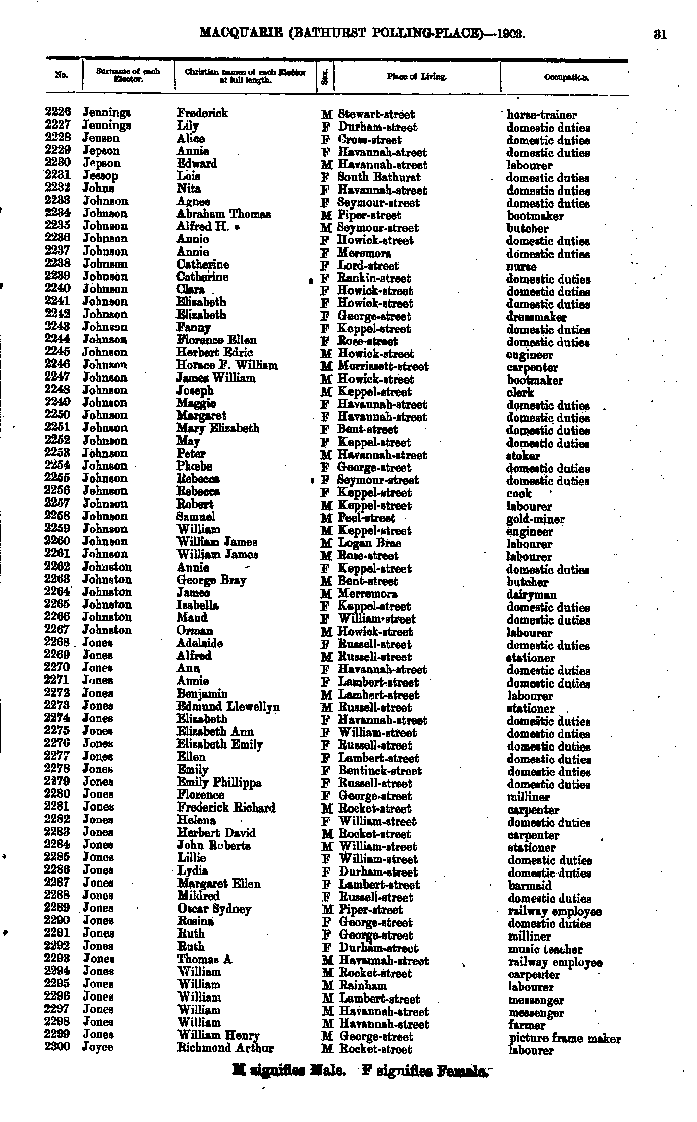
- Jennings Frederick - Joyce Richmond
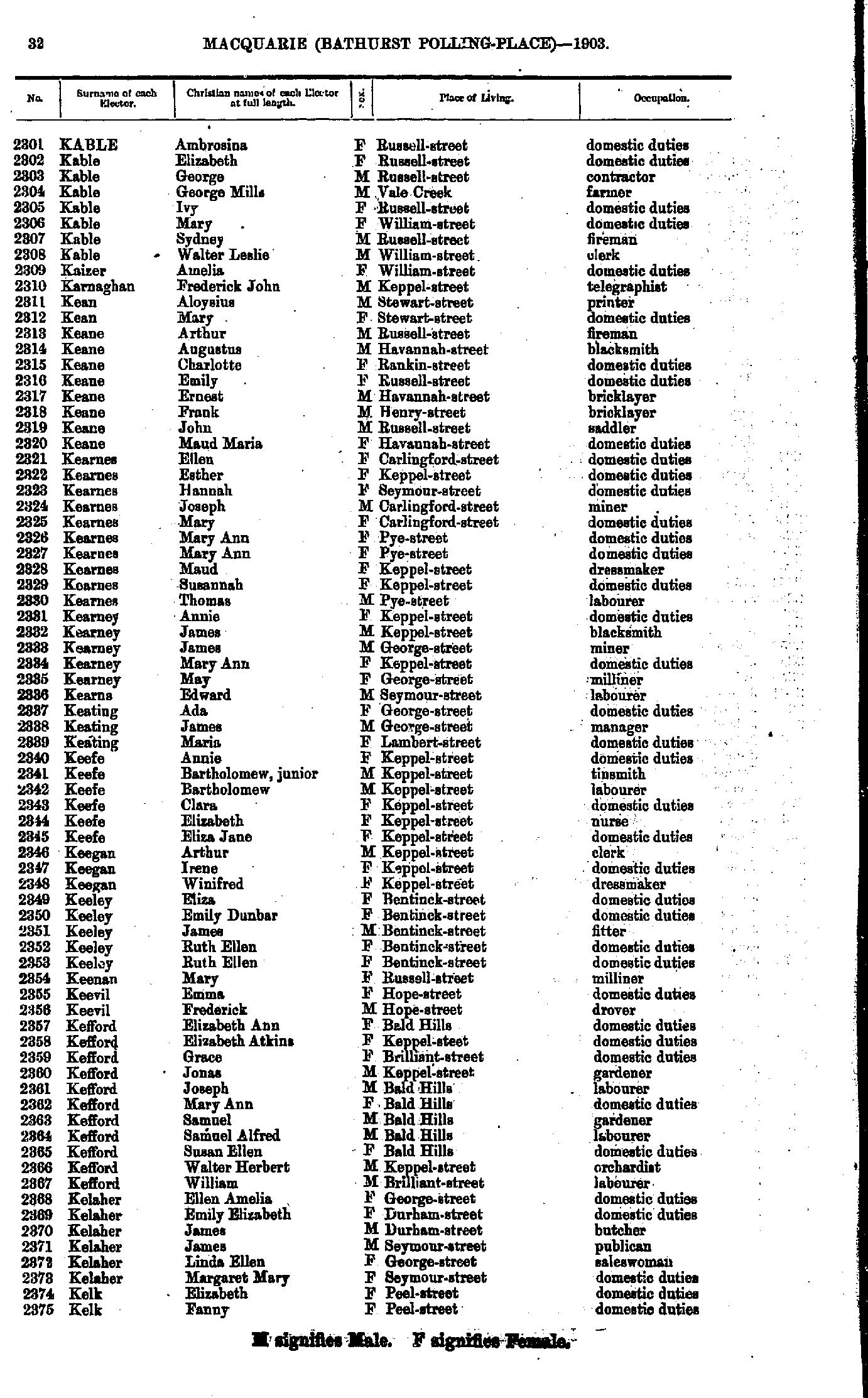
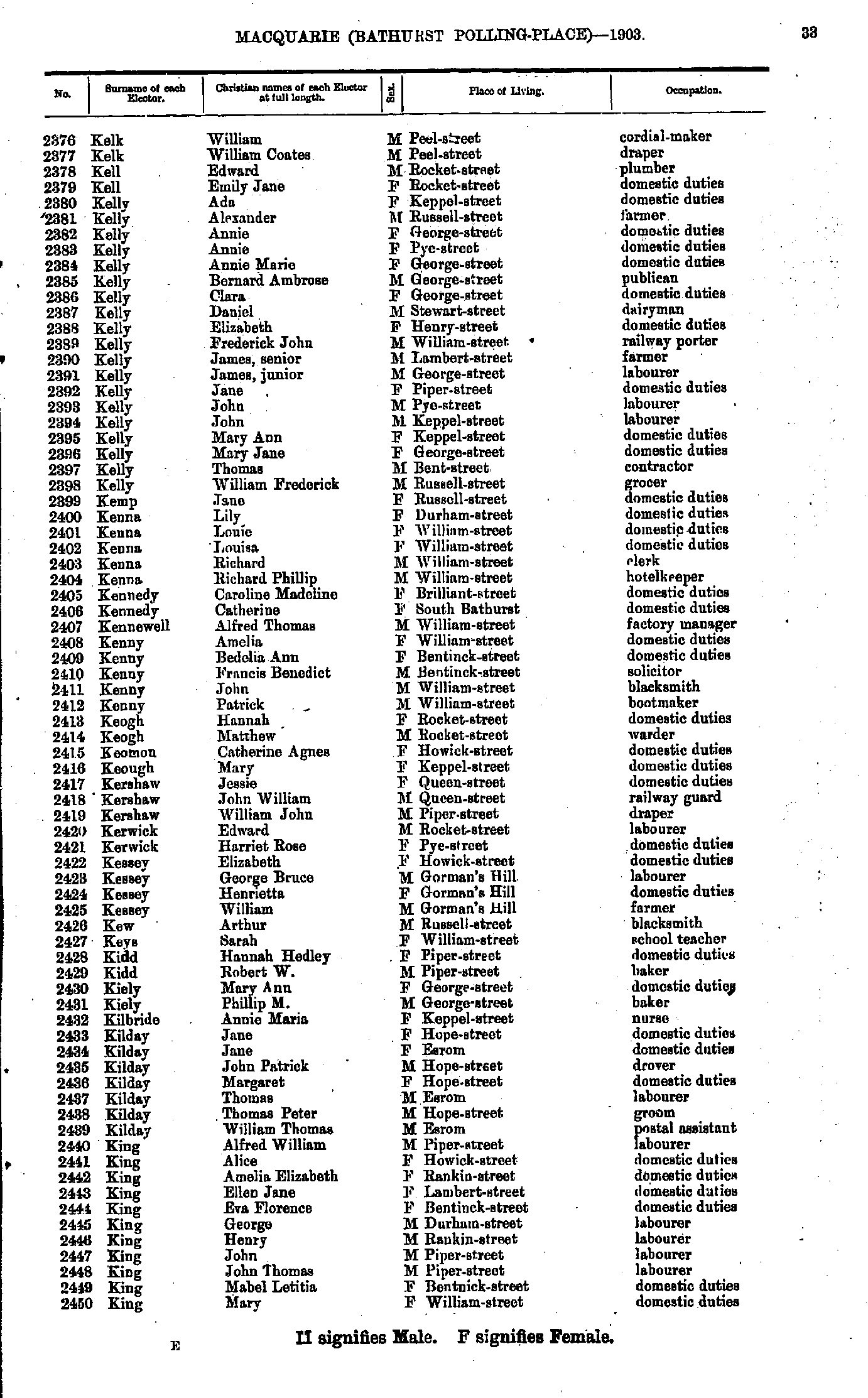
- Kable Ambrosina - Kelk Fanny
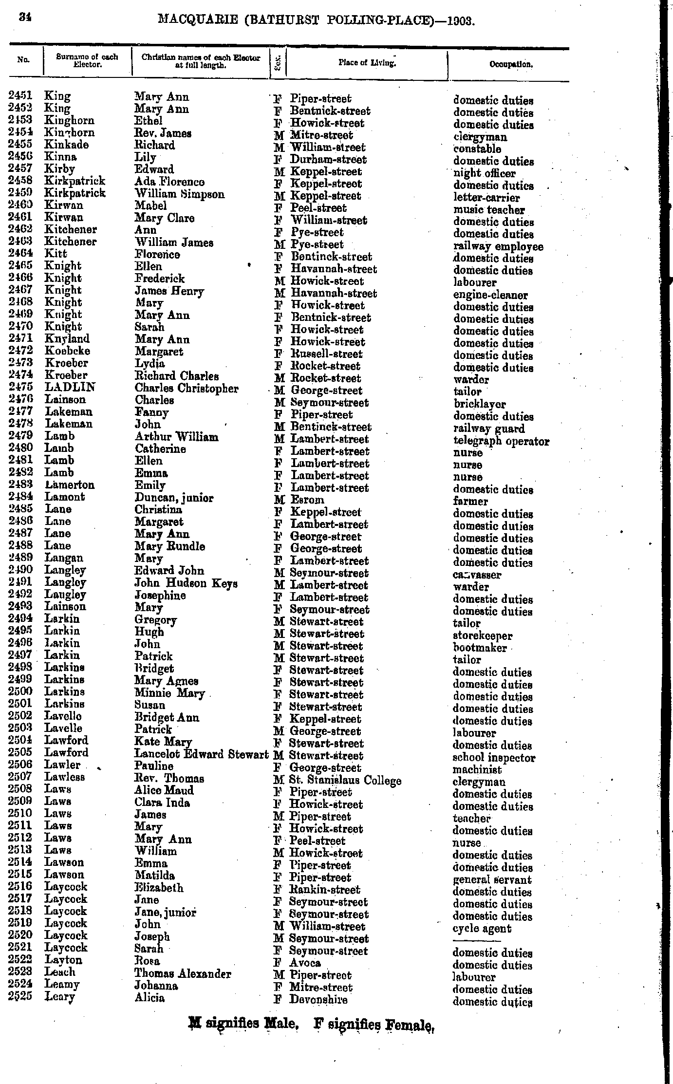
- Kelk William - King Mary
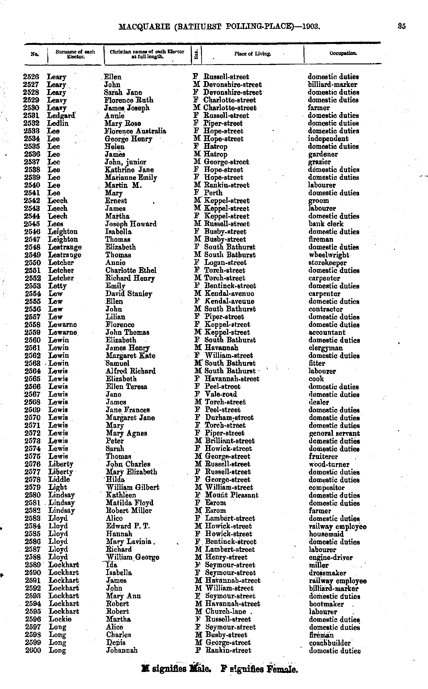
- King Mary - Leary Alicia
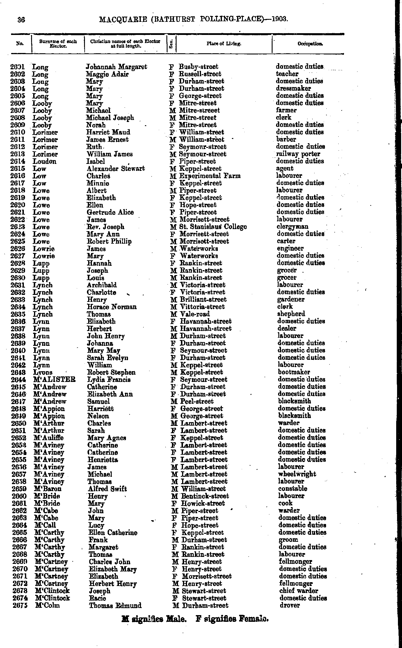
- Leary Ellen - Long Johannah
- Long Johannah - M'Colm Thomas
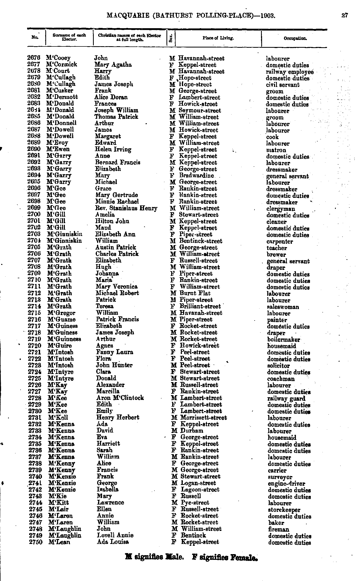
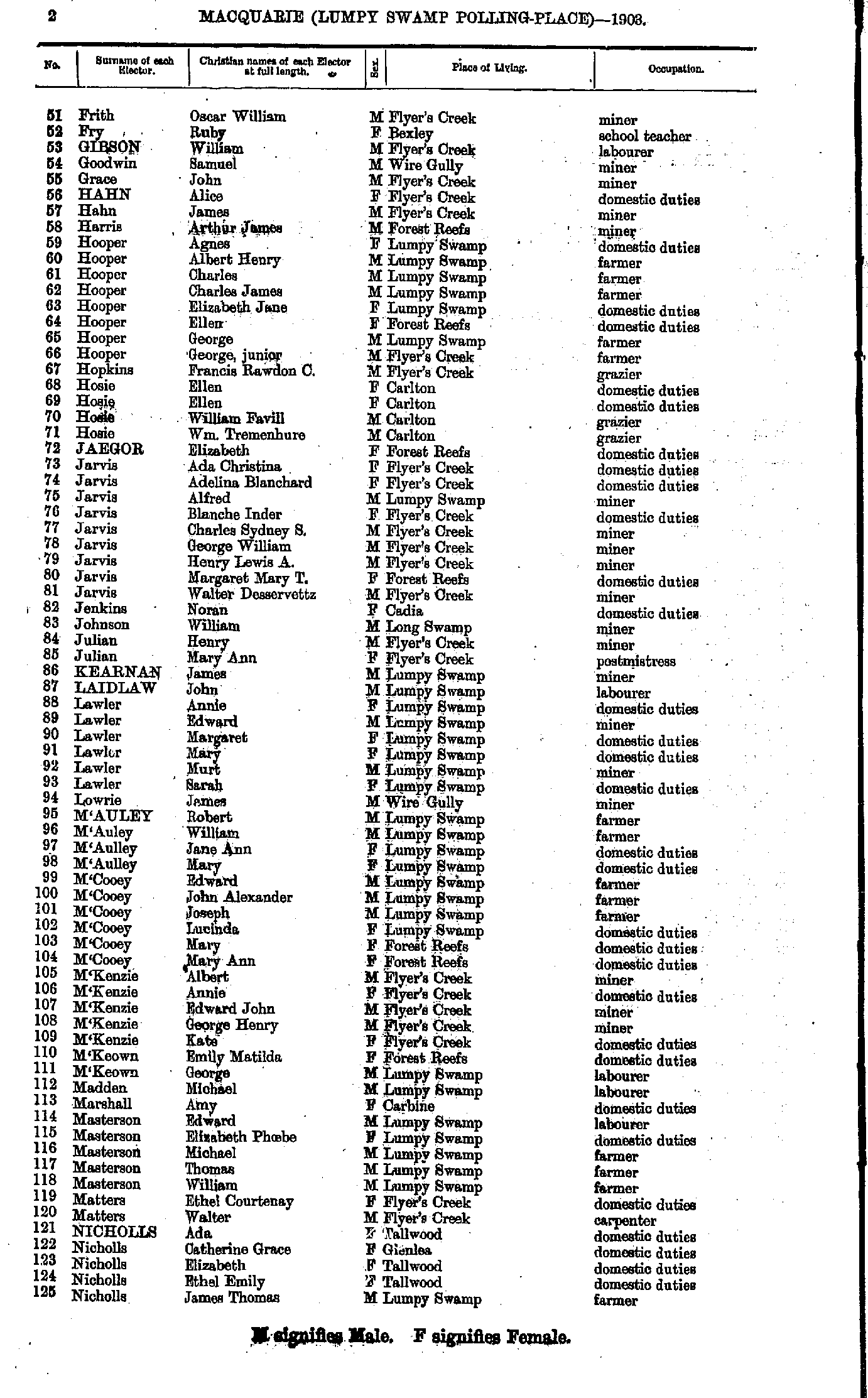
- M'Cooey John - M'Lean Ada
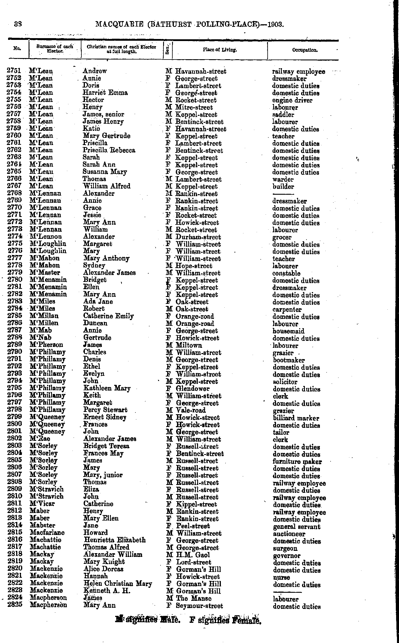
- M'Lean Andrew - Macpherson Mary
- Madden John - Martin Ethel
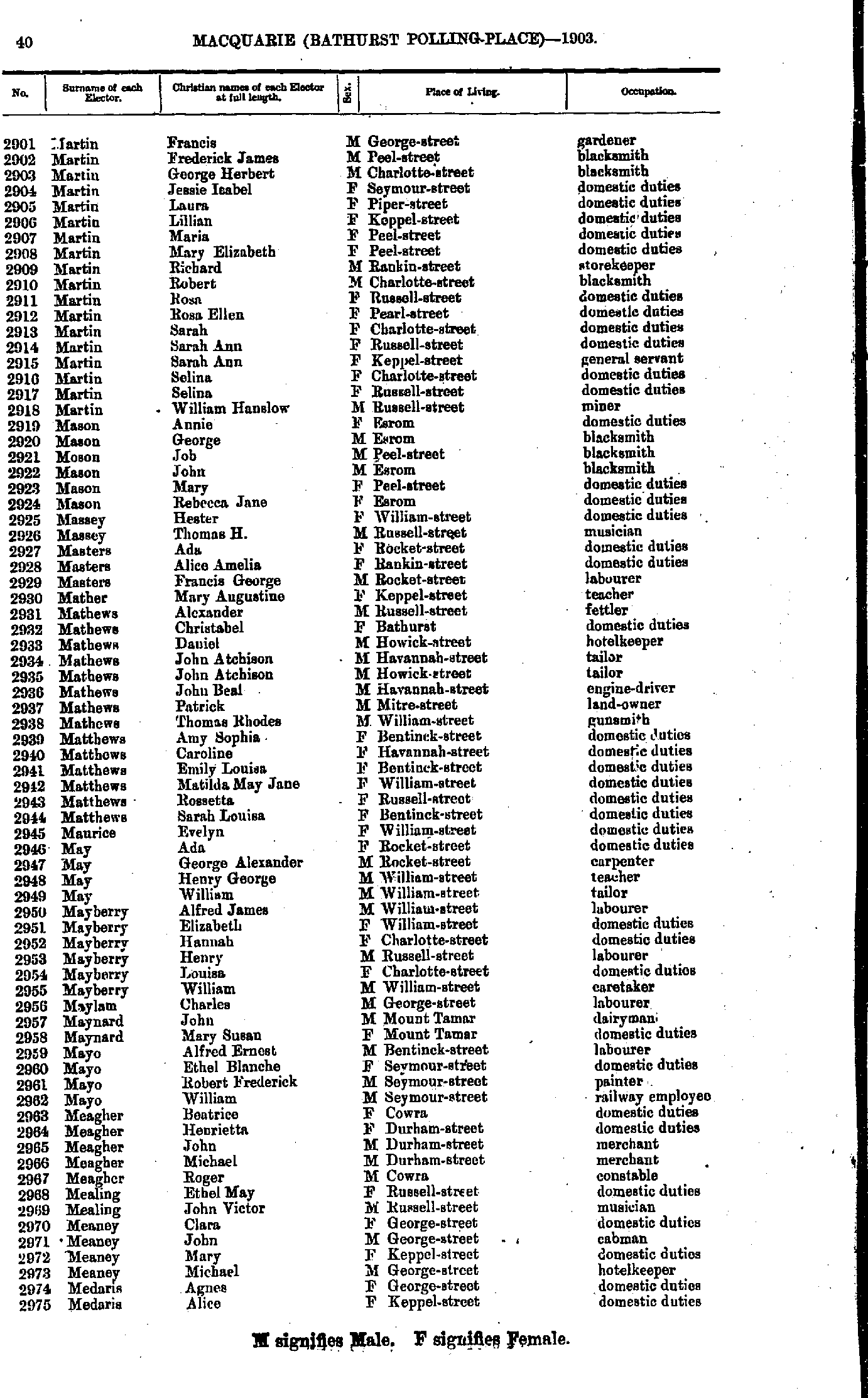
- Martin Francis - Medaris Alice
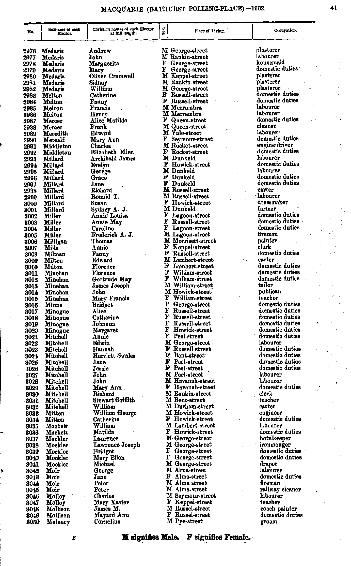
- Medaris Andrew - Moloney Cornelius
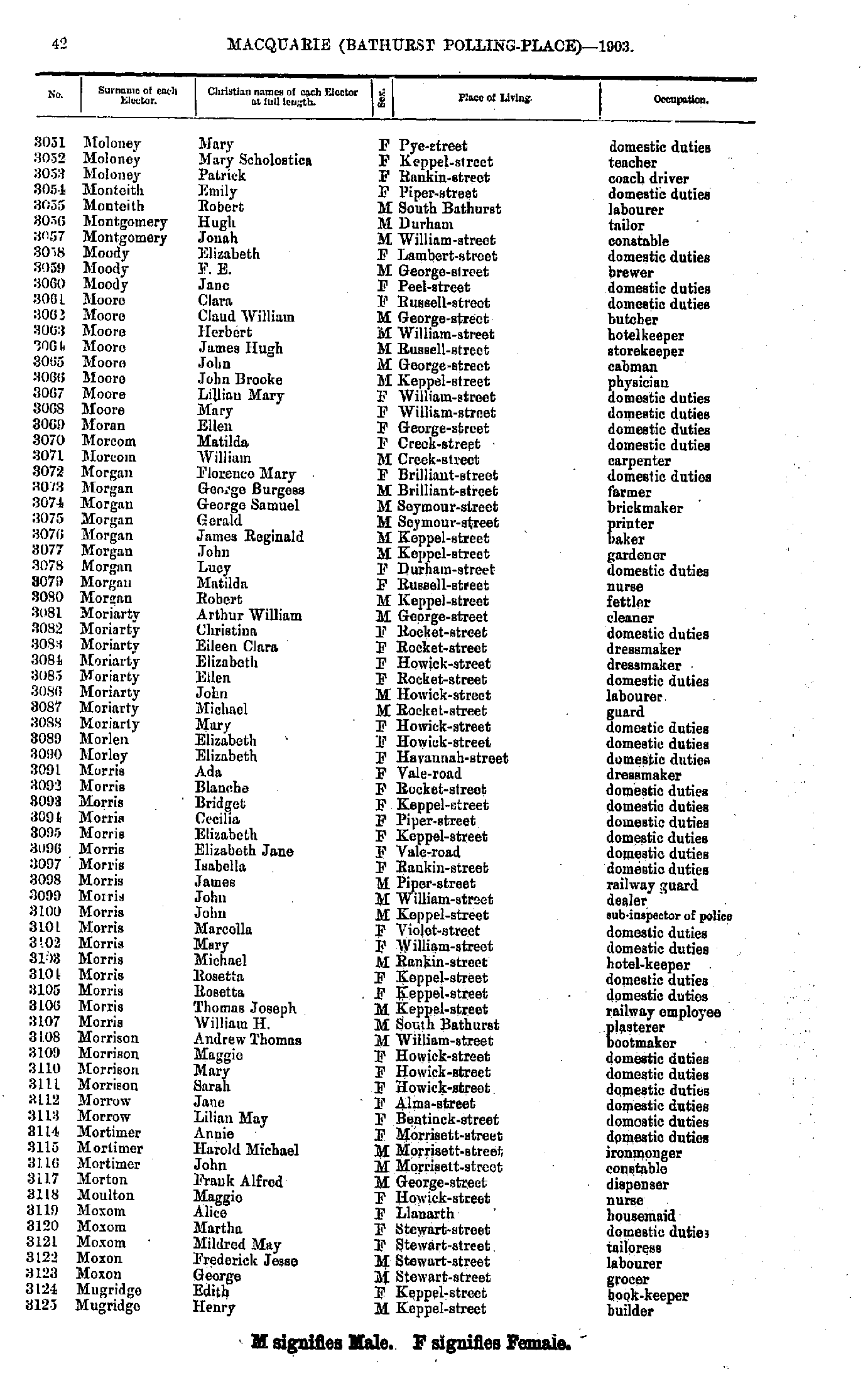
- Moloney Mary - Mugridge Henry
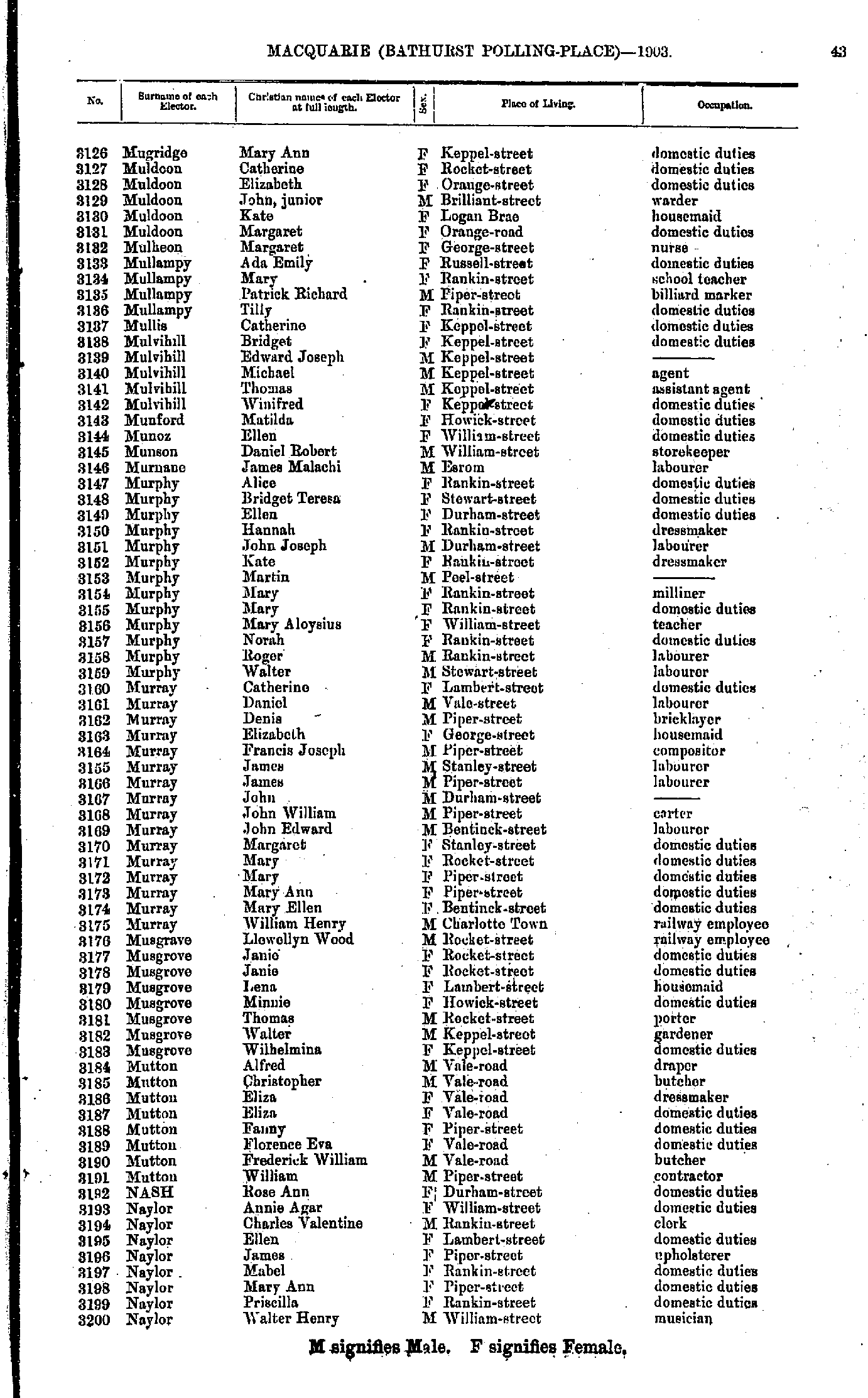
- Mugridge Mary - Naylor Walter
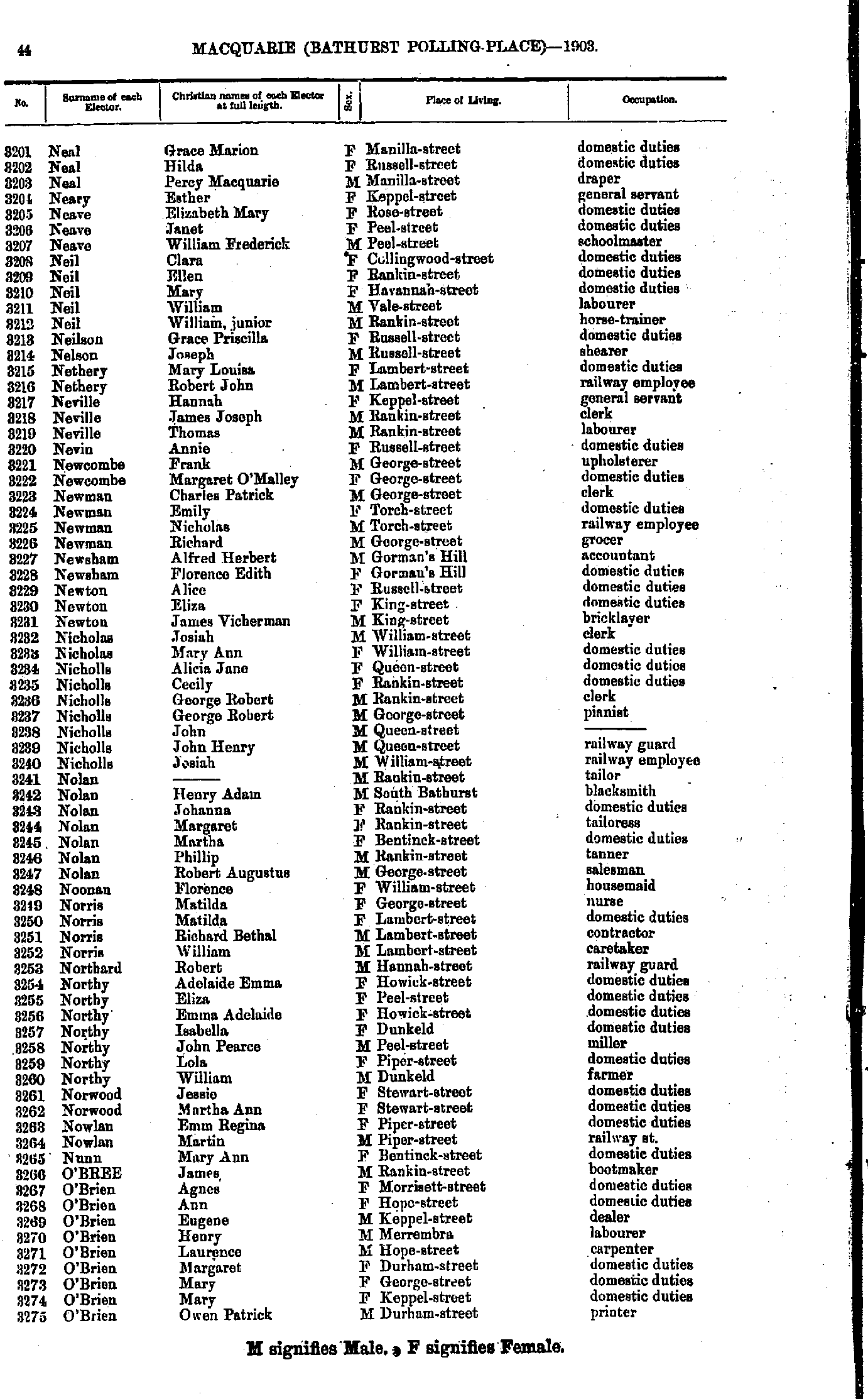
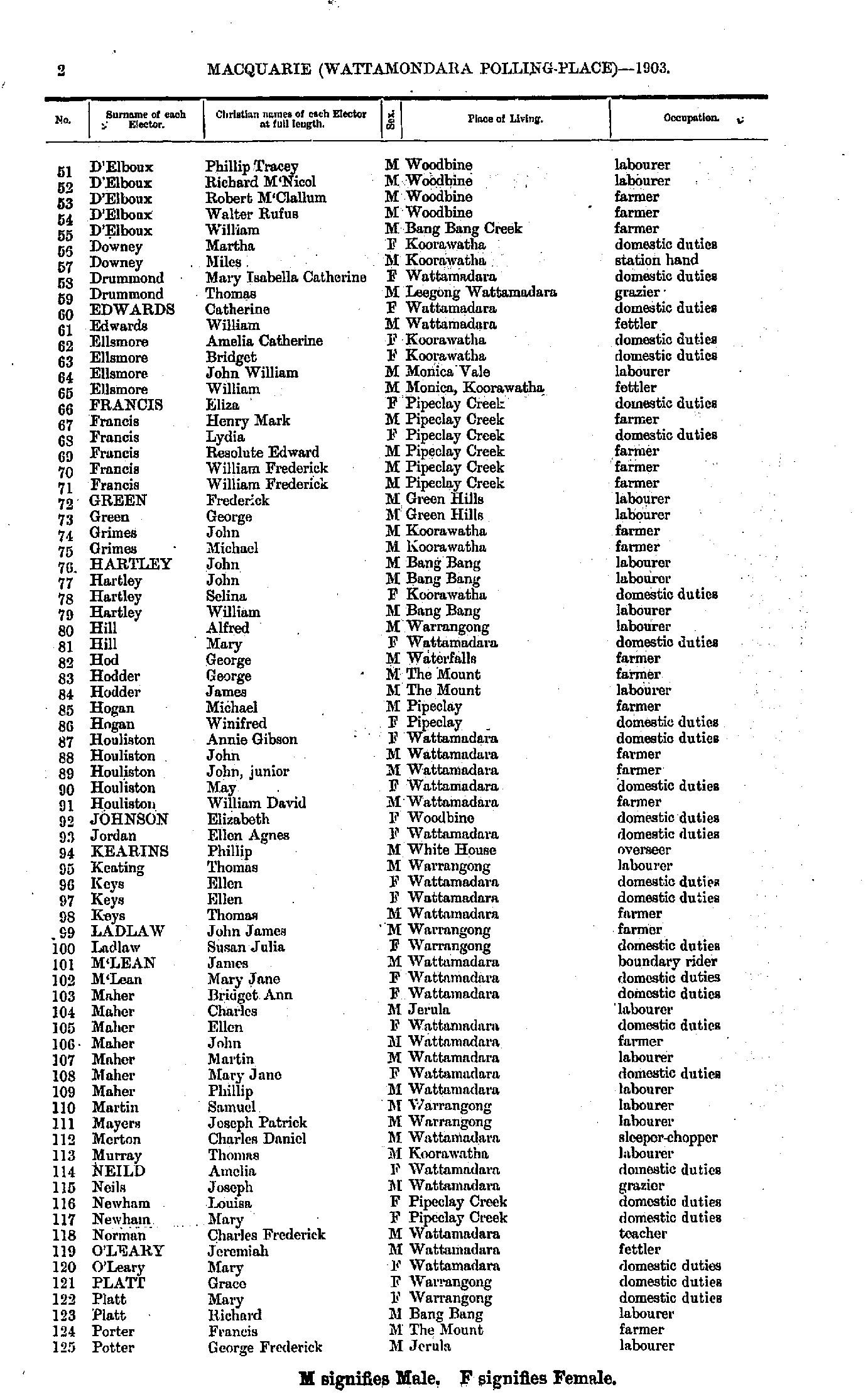
- Neal Grace - O'Brien Owen
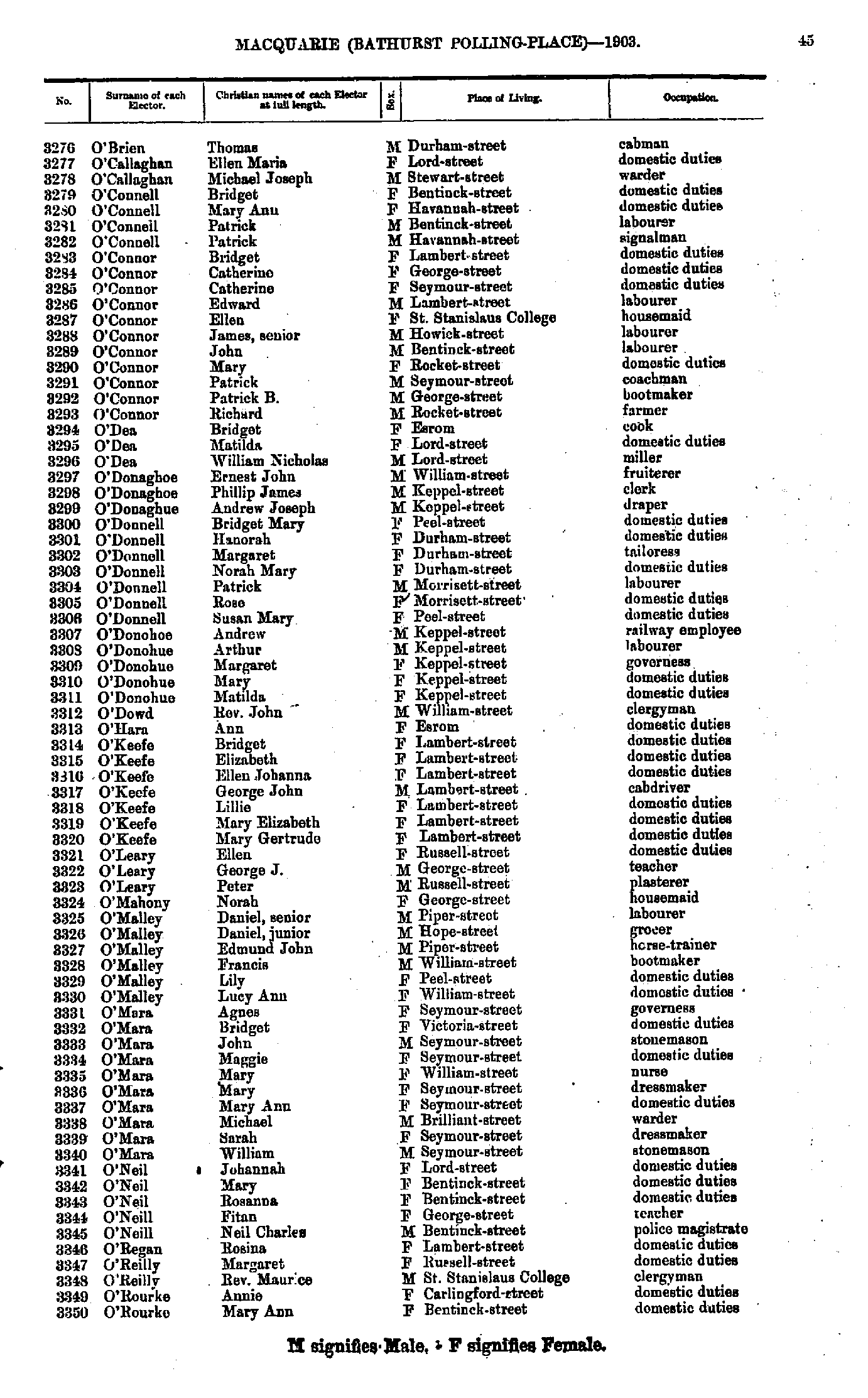
- O'Brien Thomas - O'Rourke Mary
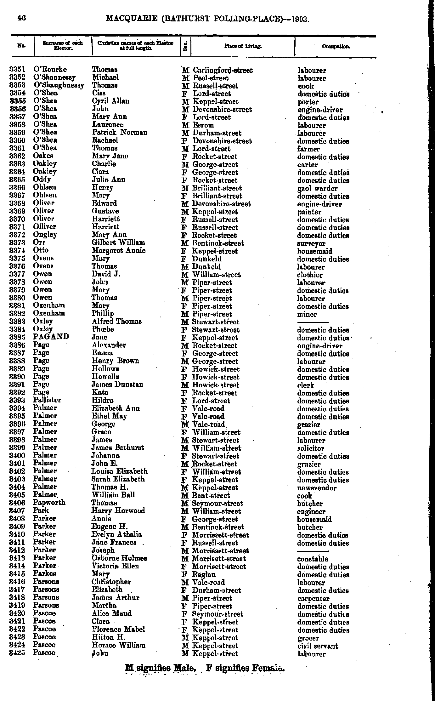
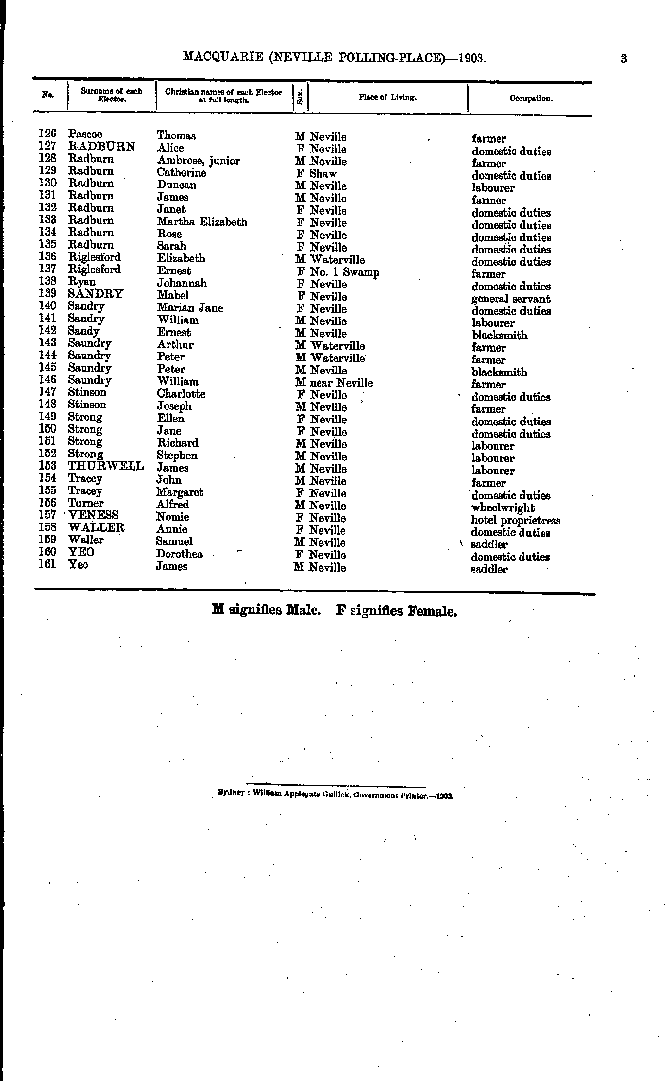
- O'Rourke Thomas - Pascoe John
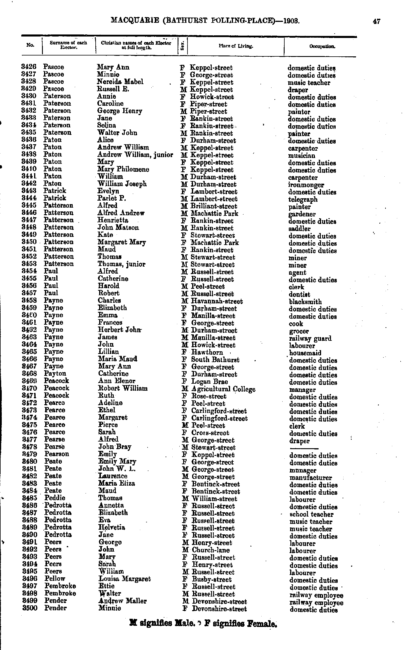
- Pascoe Mary - Pender Minnie
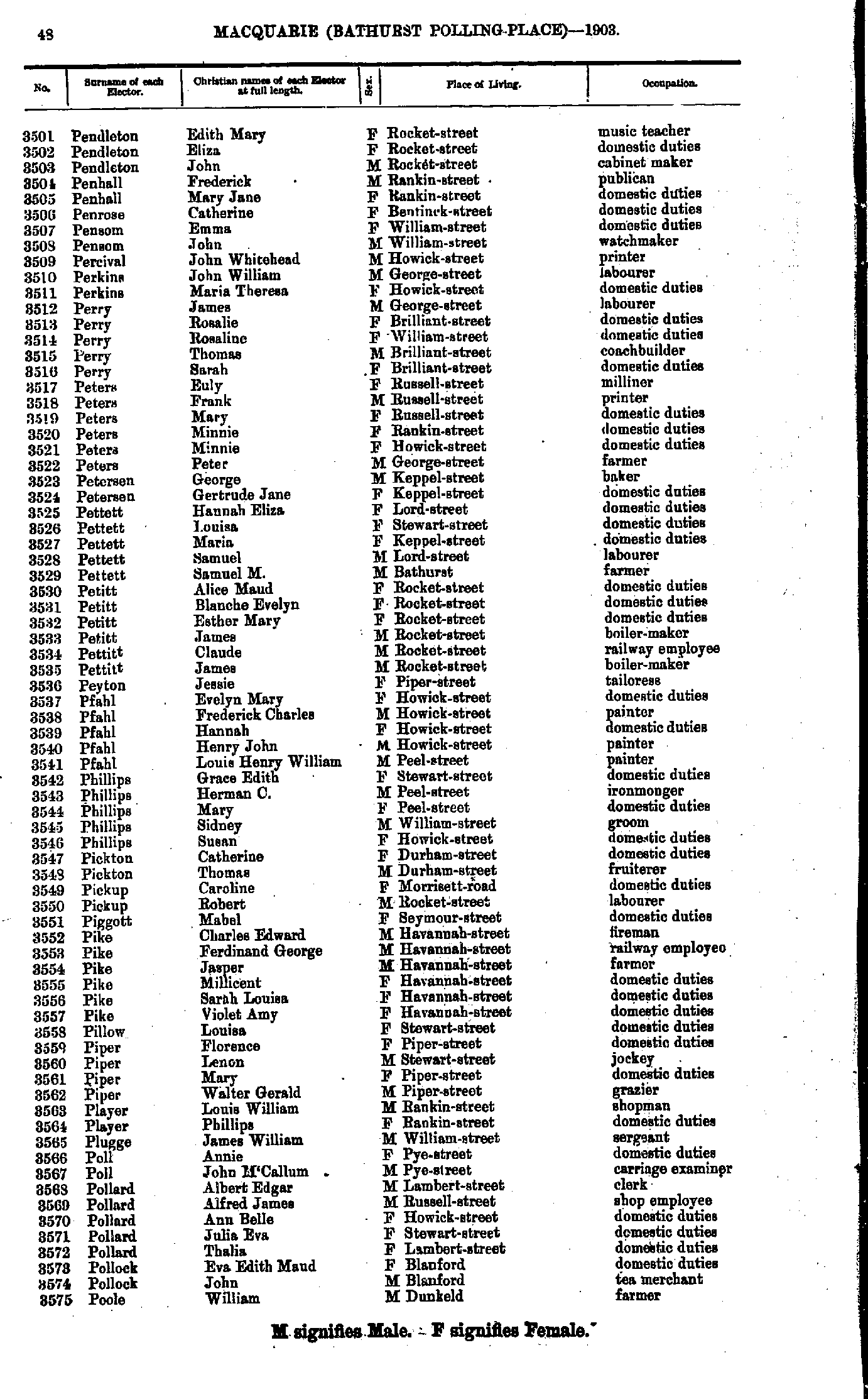
- Pendleton Edith - Poole William
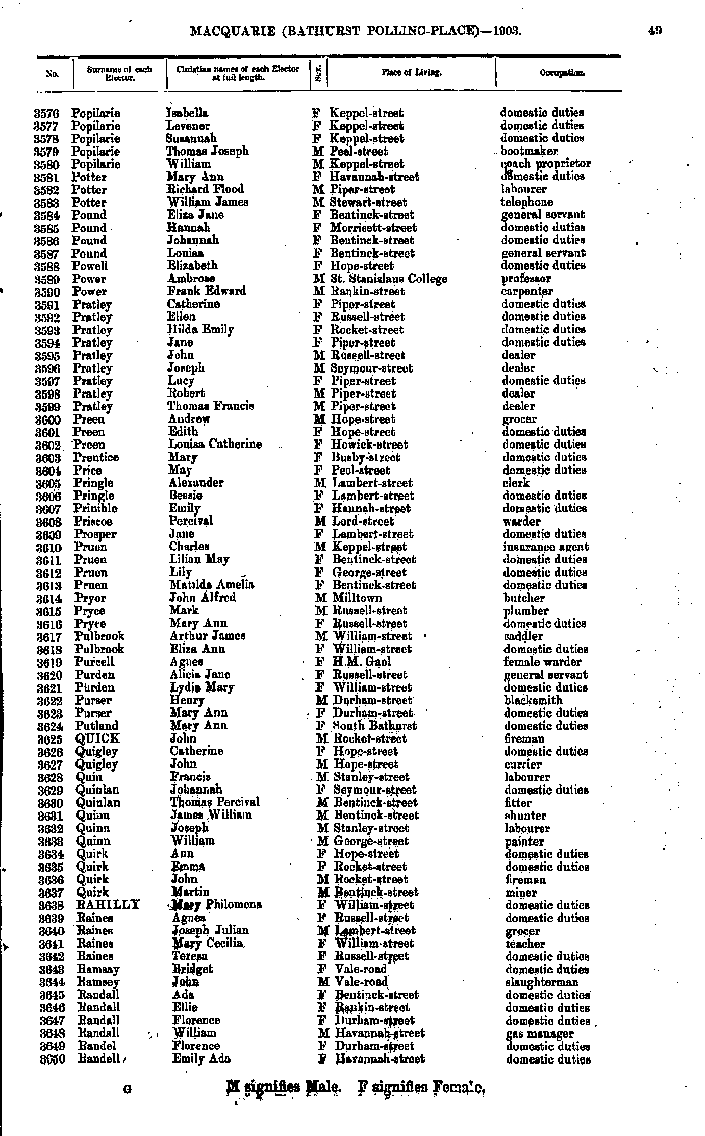
- Popilarie Isabella - Randell Emily
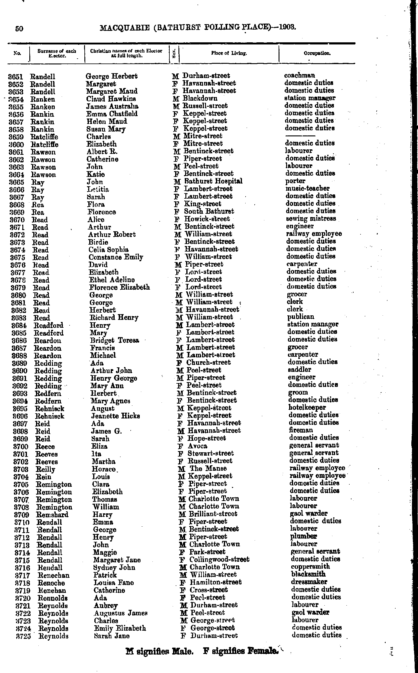
- Randell George - Reynolds Sarah
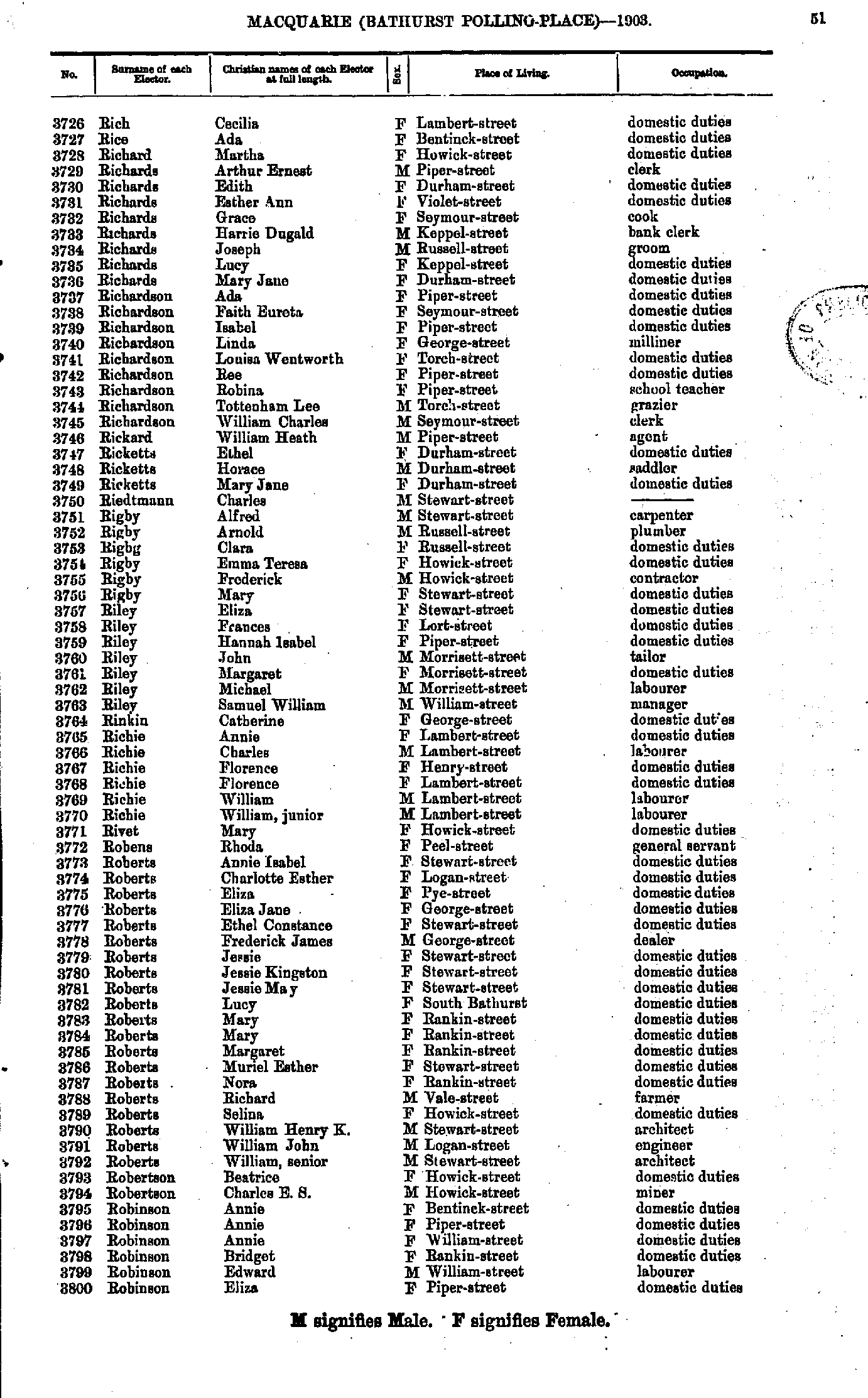
- Rich Cecilia - Robinson Eliza
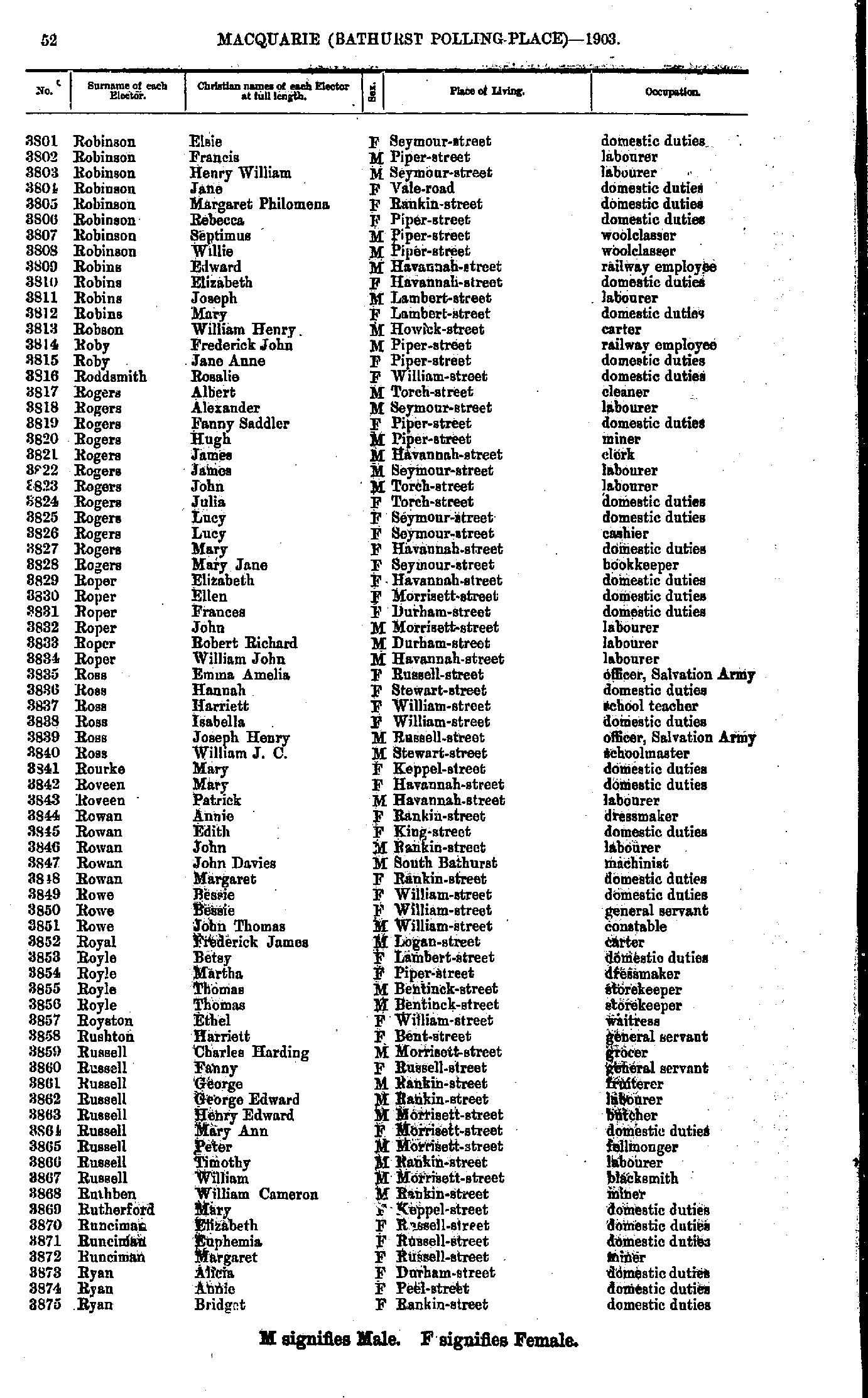
- Robinson Elsie - Ryan Bridget
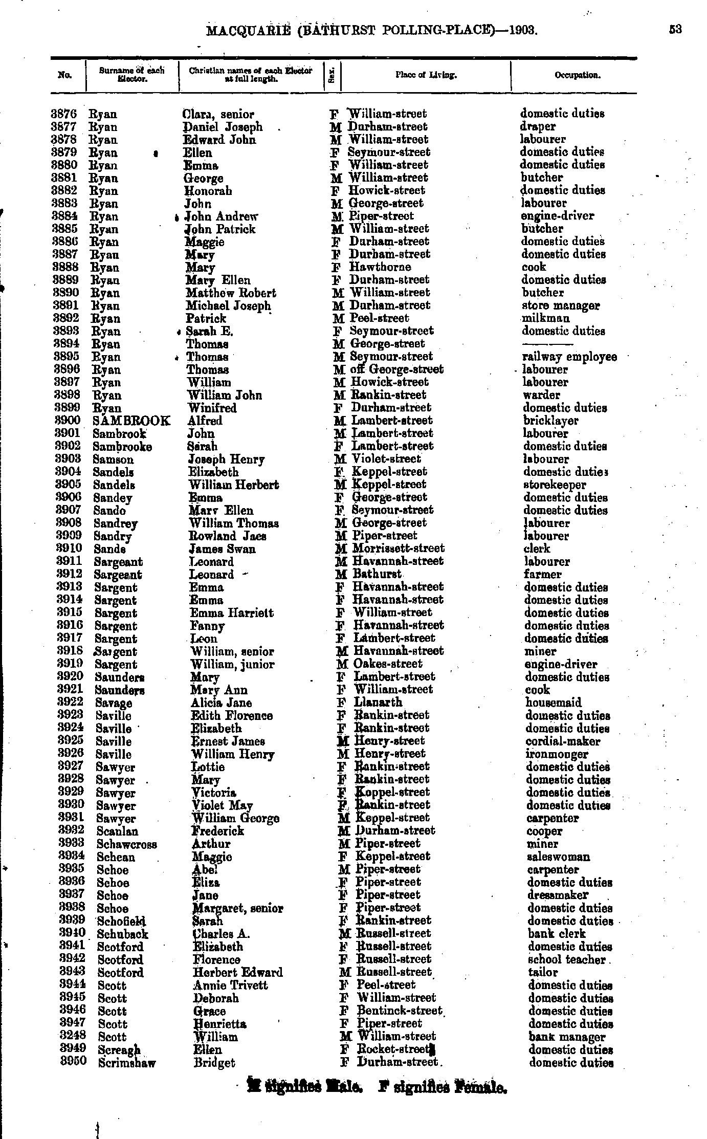
- Ryan Clara - Scrimshaw Bridget
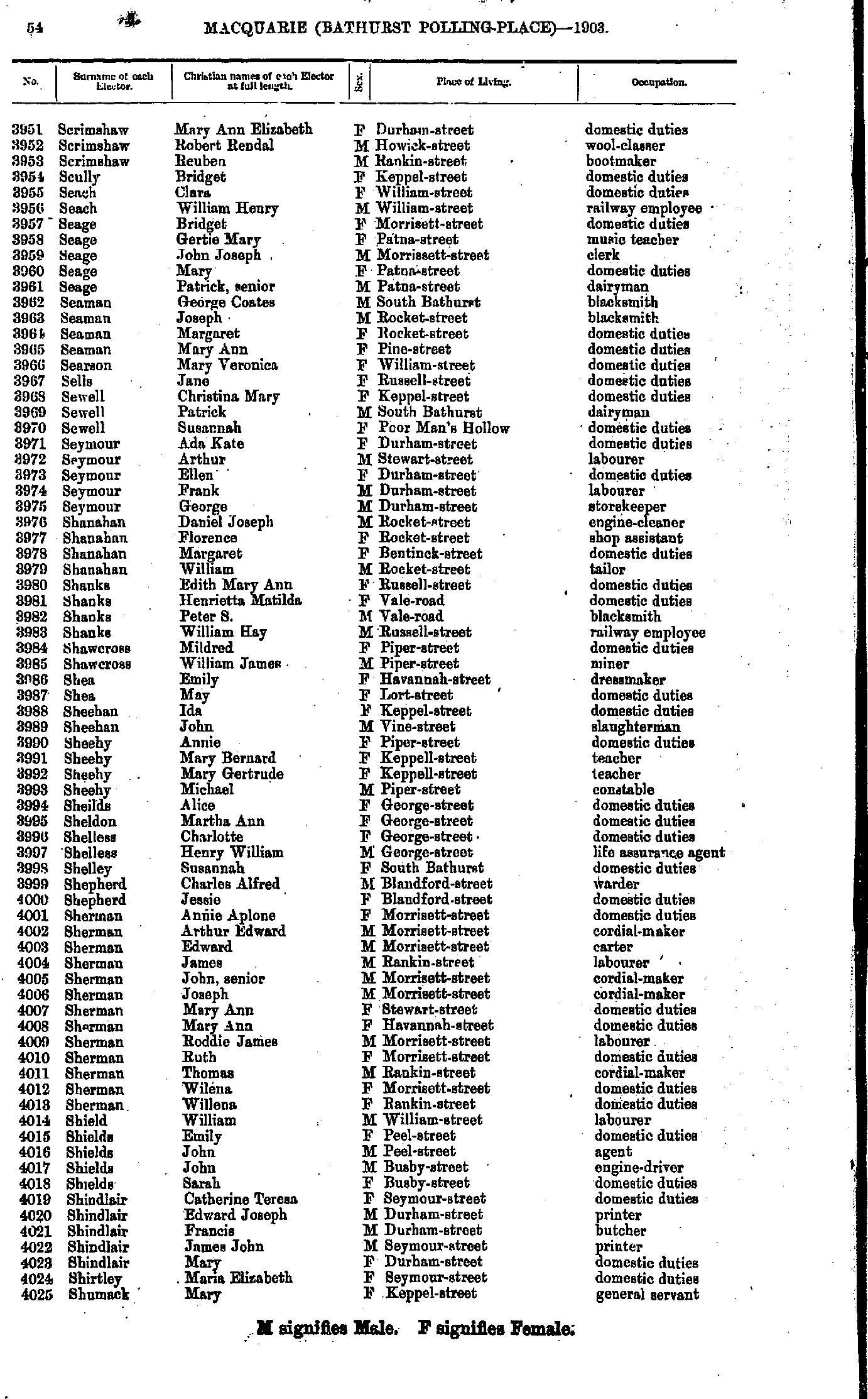
- Scrimshaw Mary - Shumack Mary
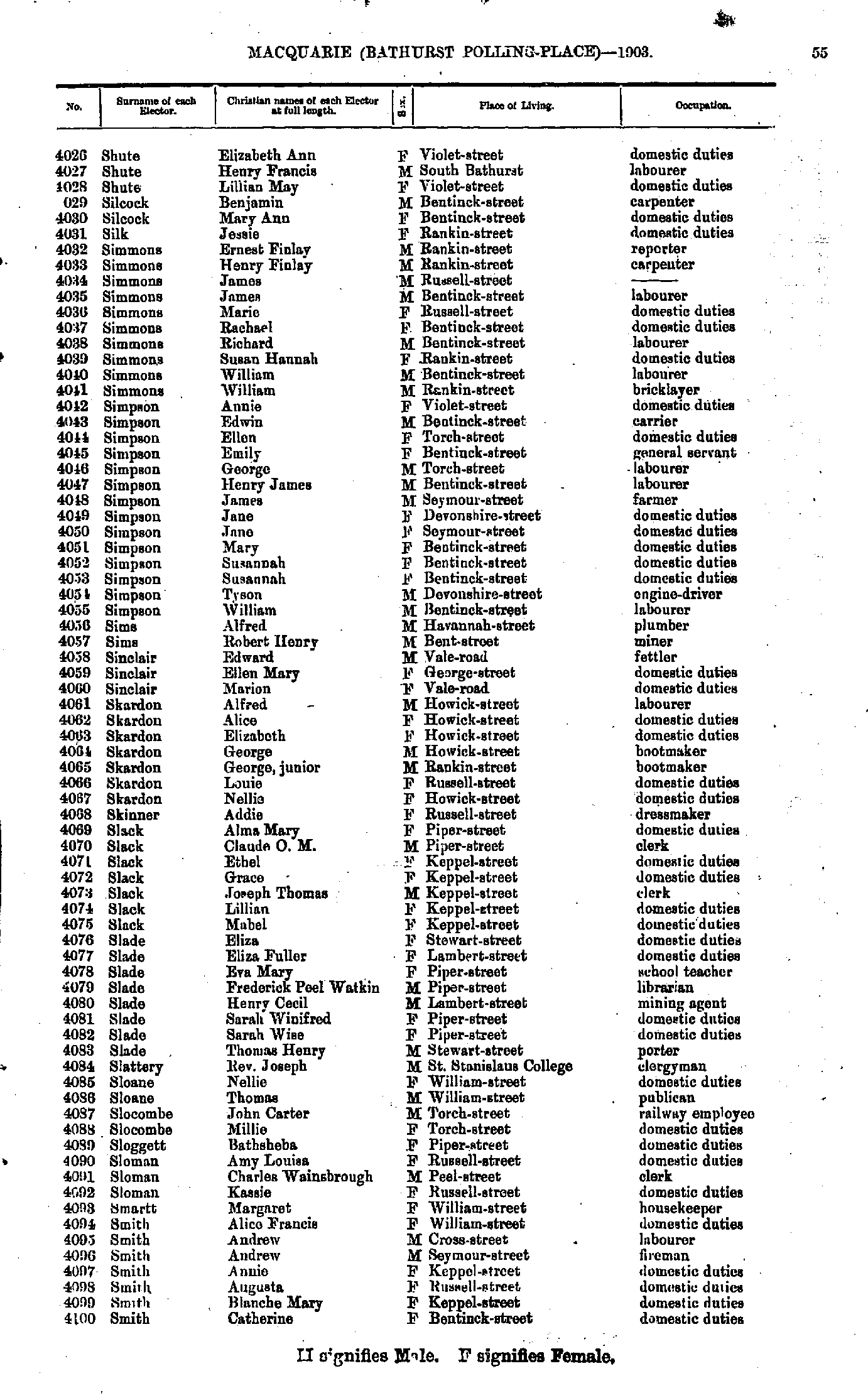
- Shute Elizabeth - Smith Catherine
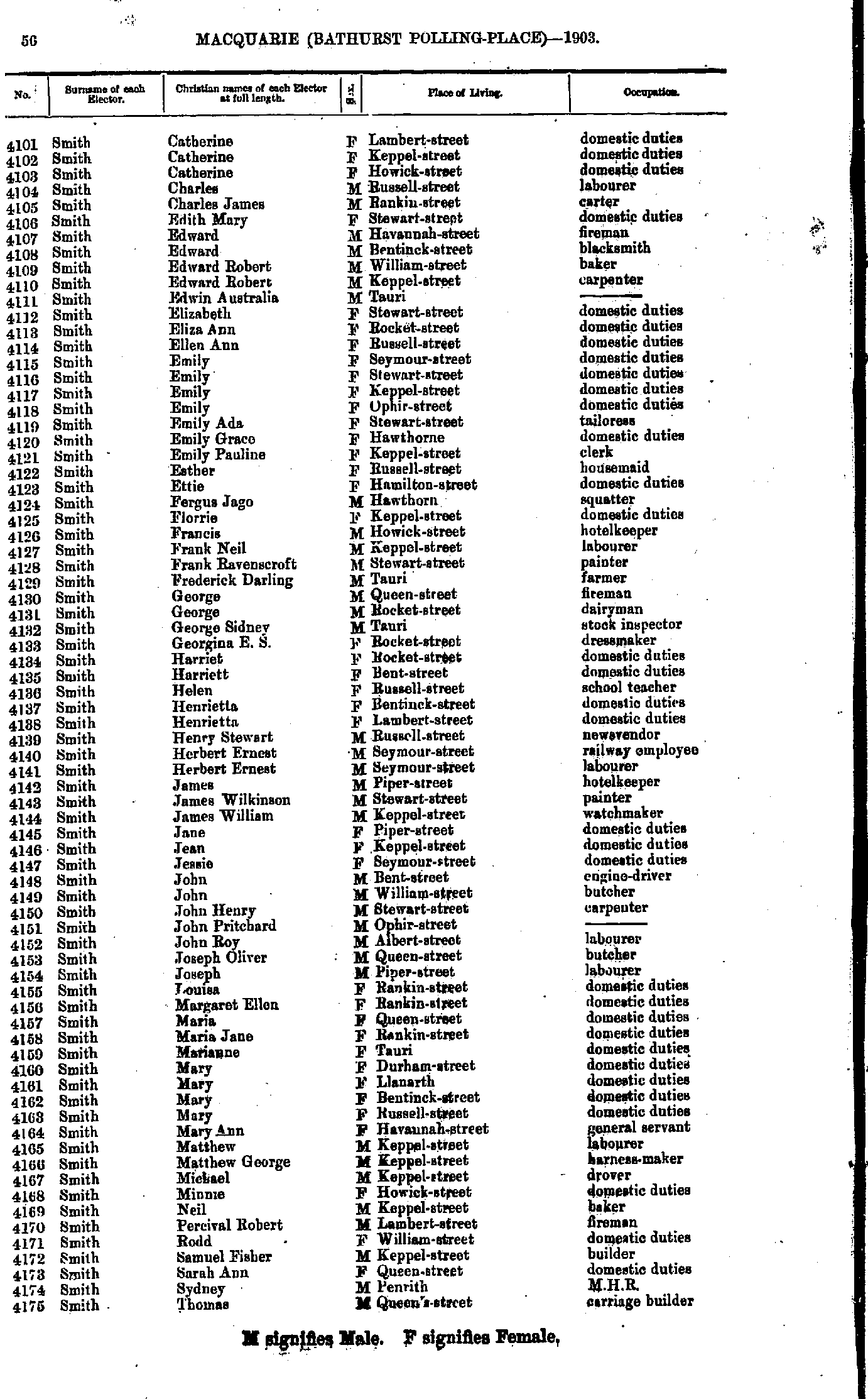
- Smith Catherine - Smith Thomas
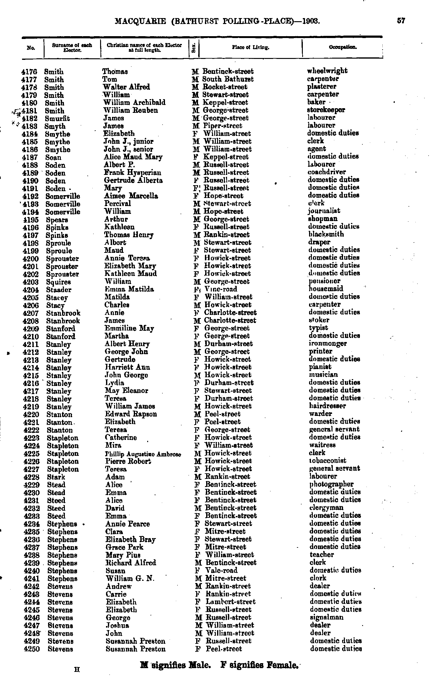
- Smith Thomas - Stevens Susannah
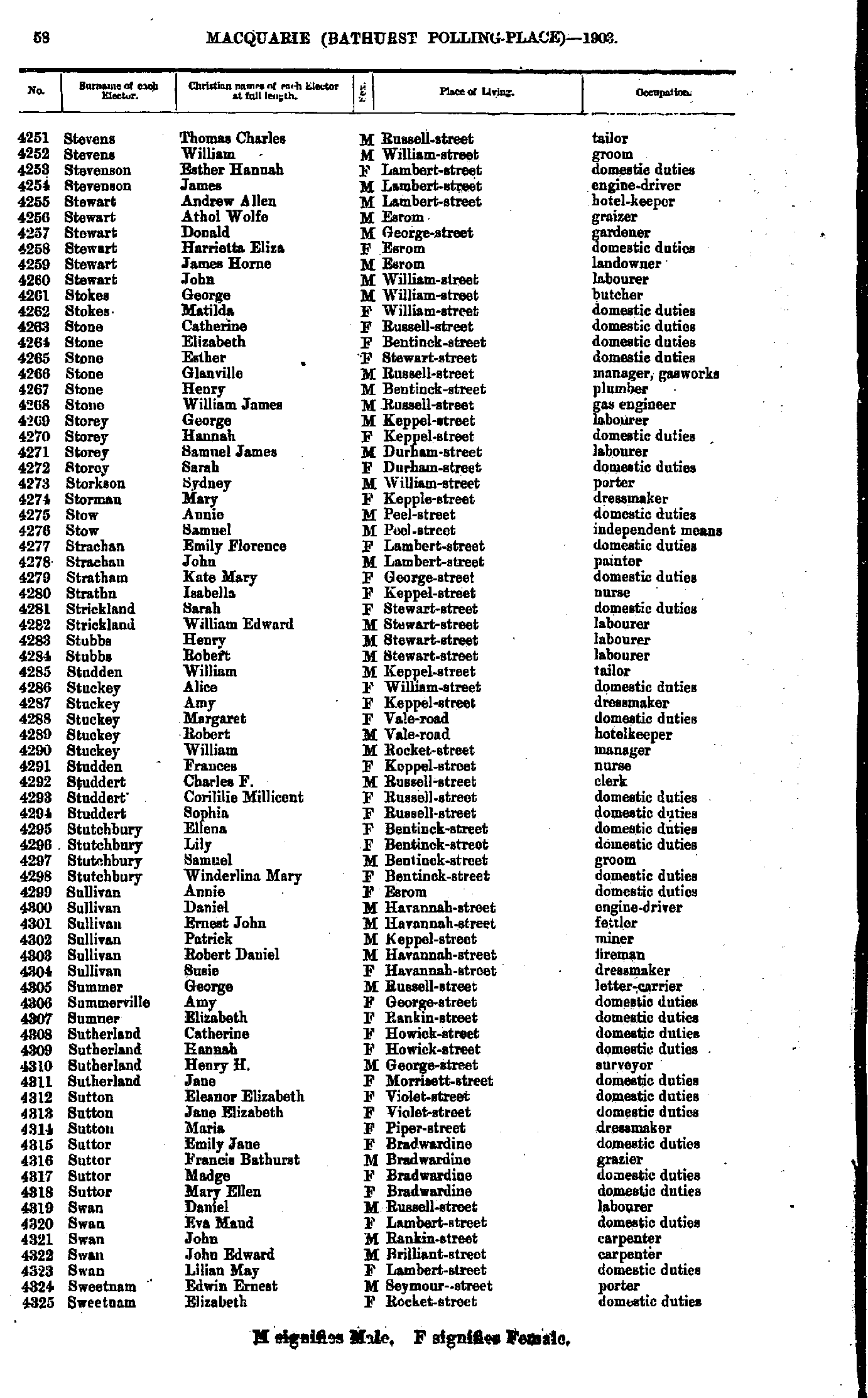
- Stevens Thomas - Sweetnam Elizabeth
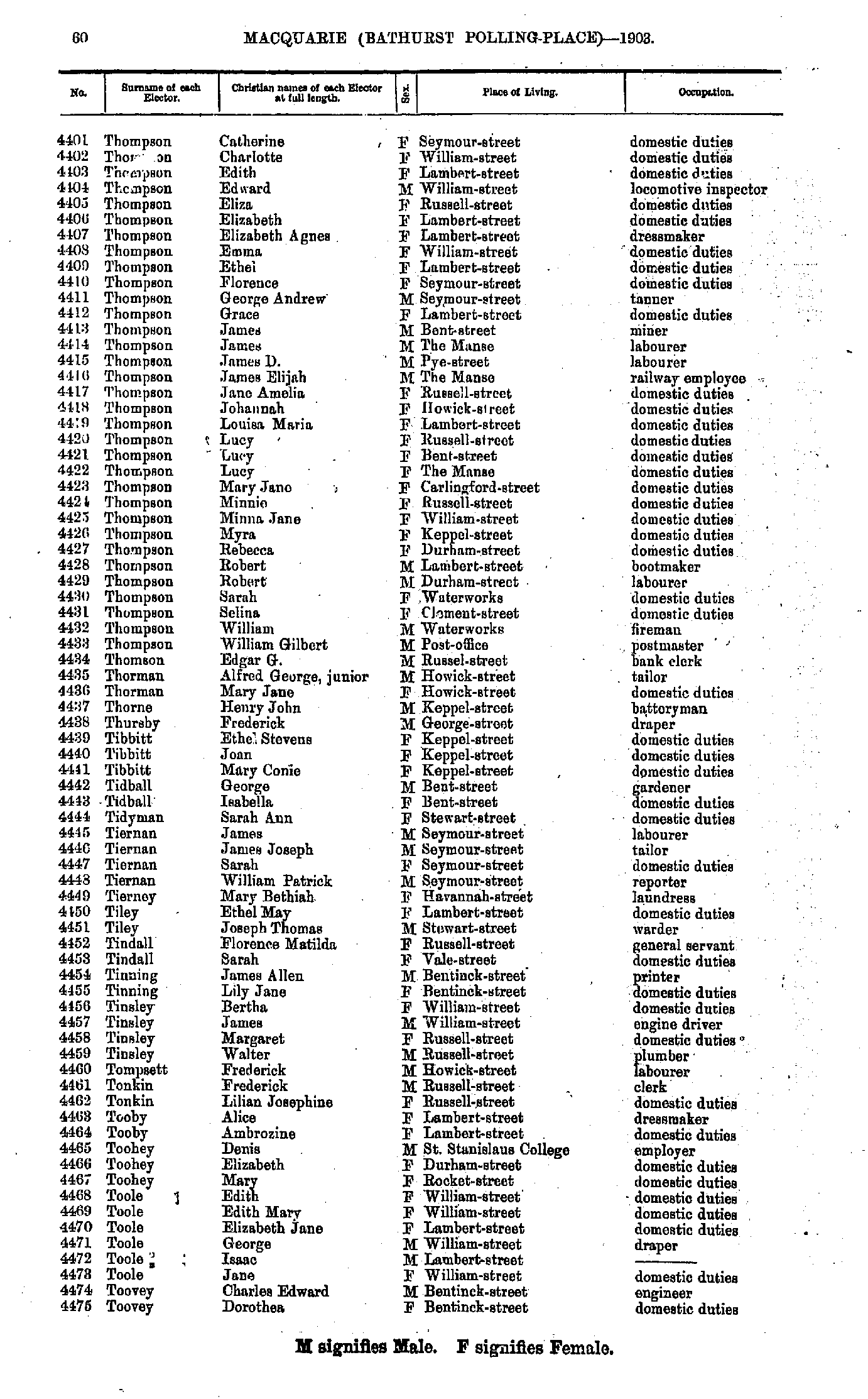
- Sweetnam Myra - Thompson Augustus
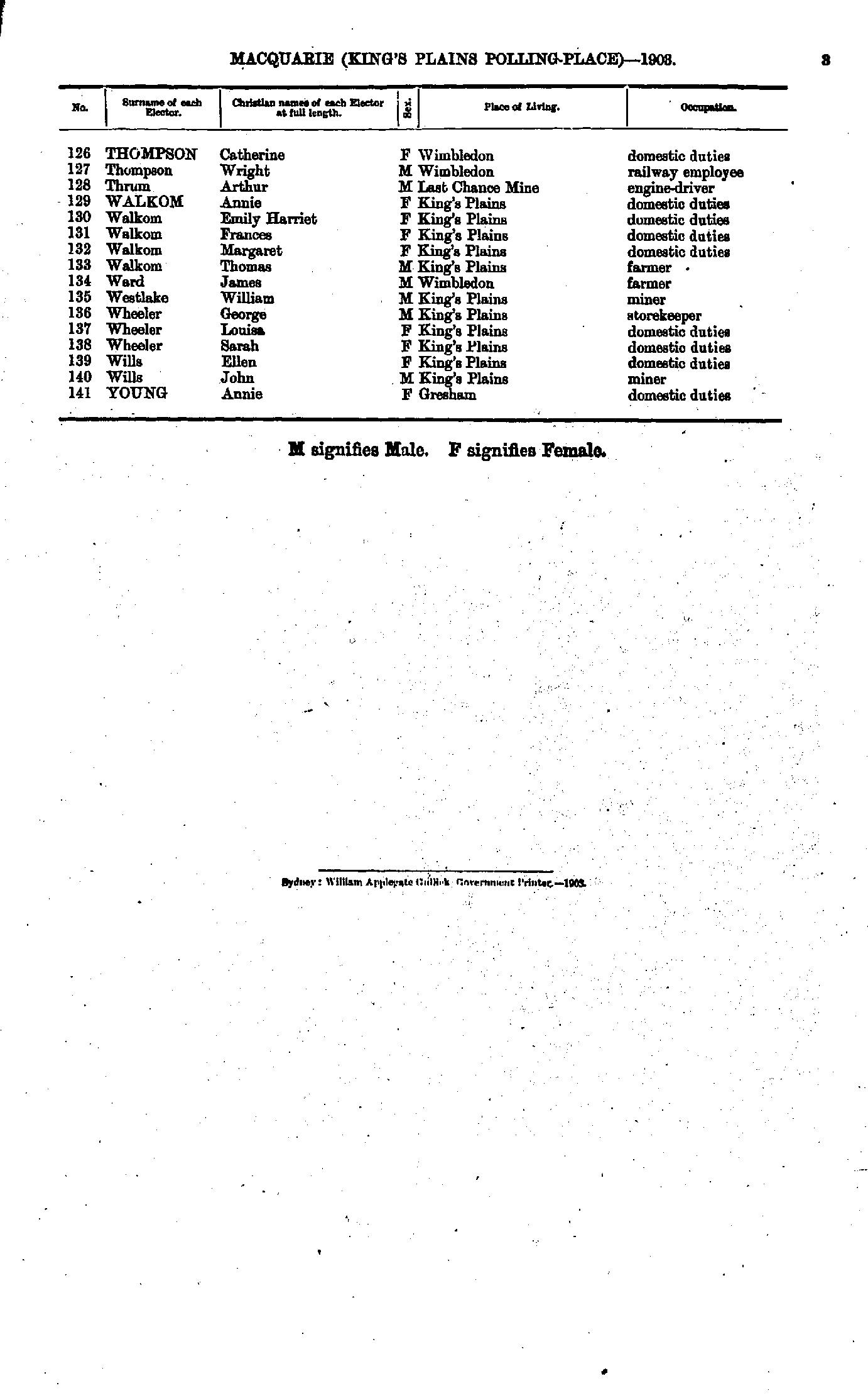
- Thompson Catherine - Toovey Dorothea
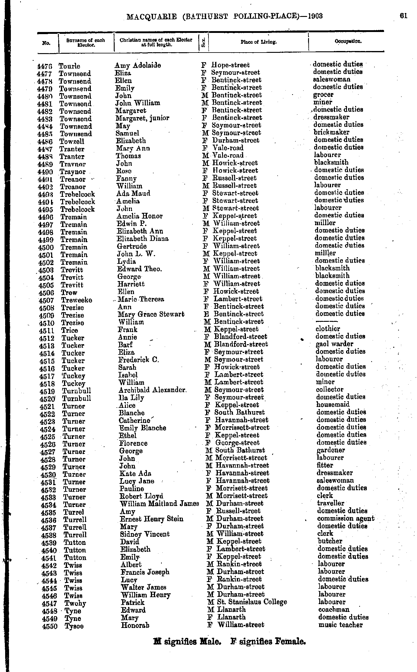
- Tourle Amy - Tysoe Honorah
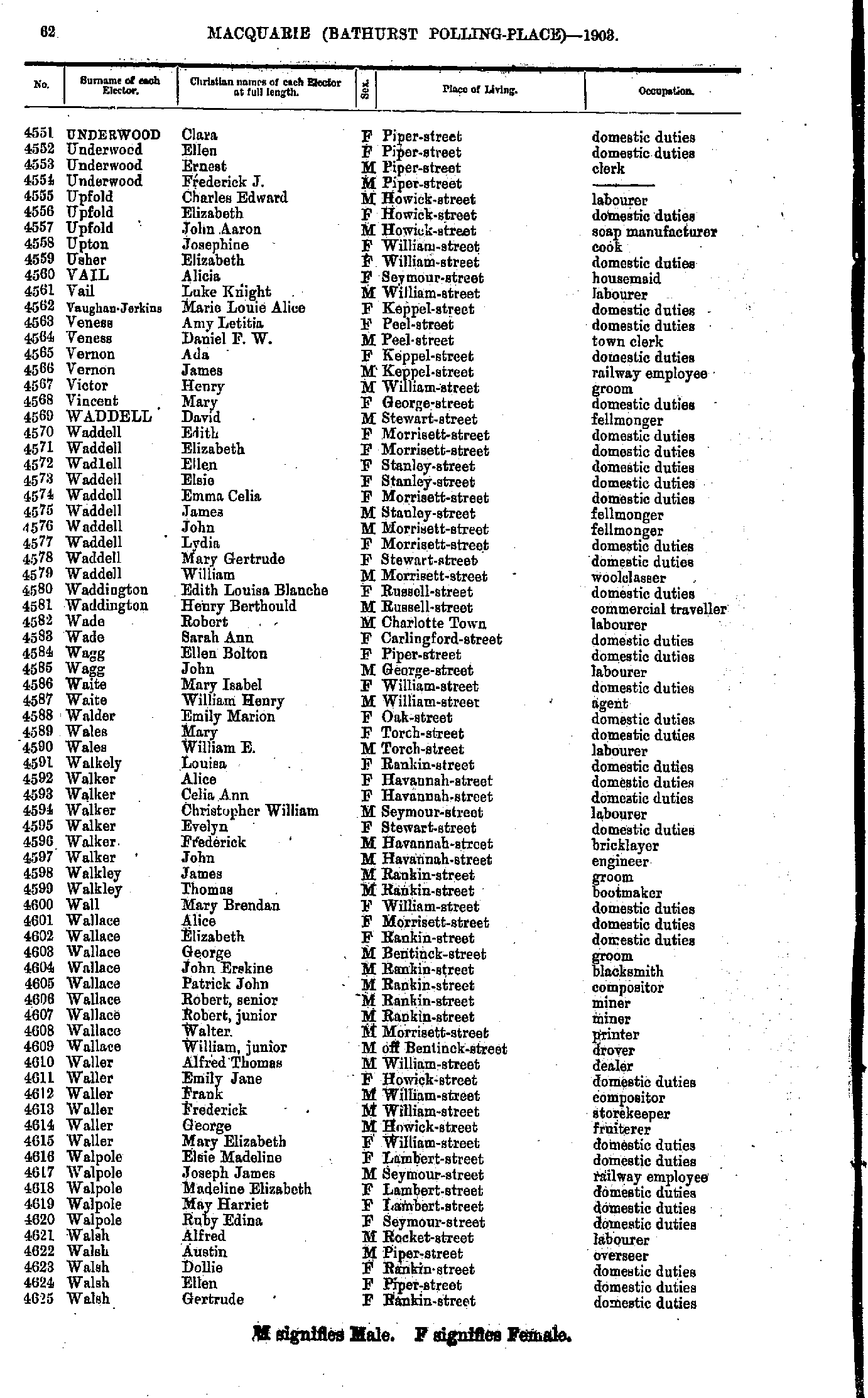
- Underwood Clara - Walsh Gertrude
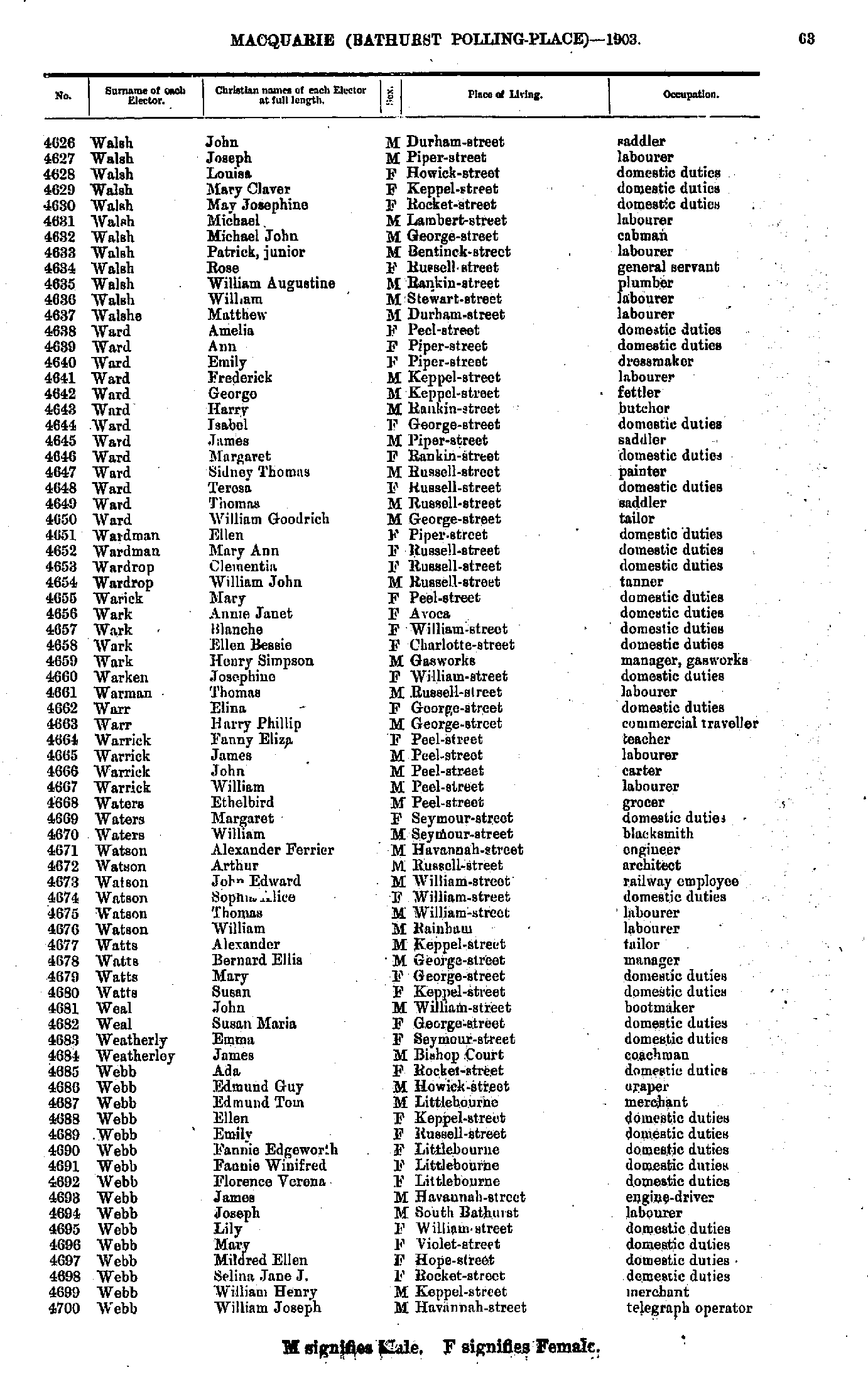
- Walsh John - Webb William
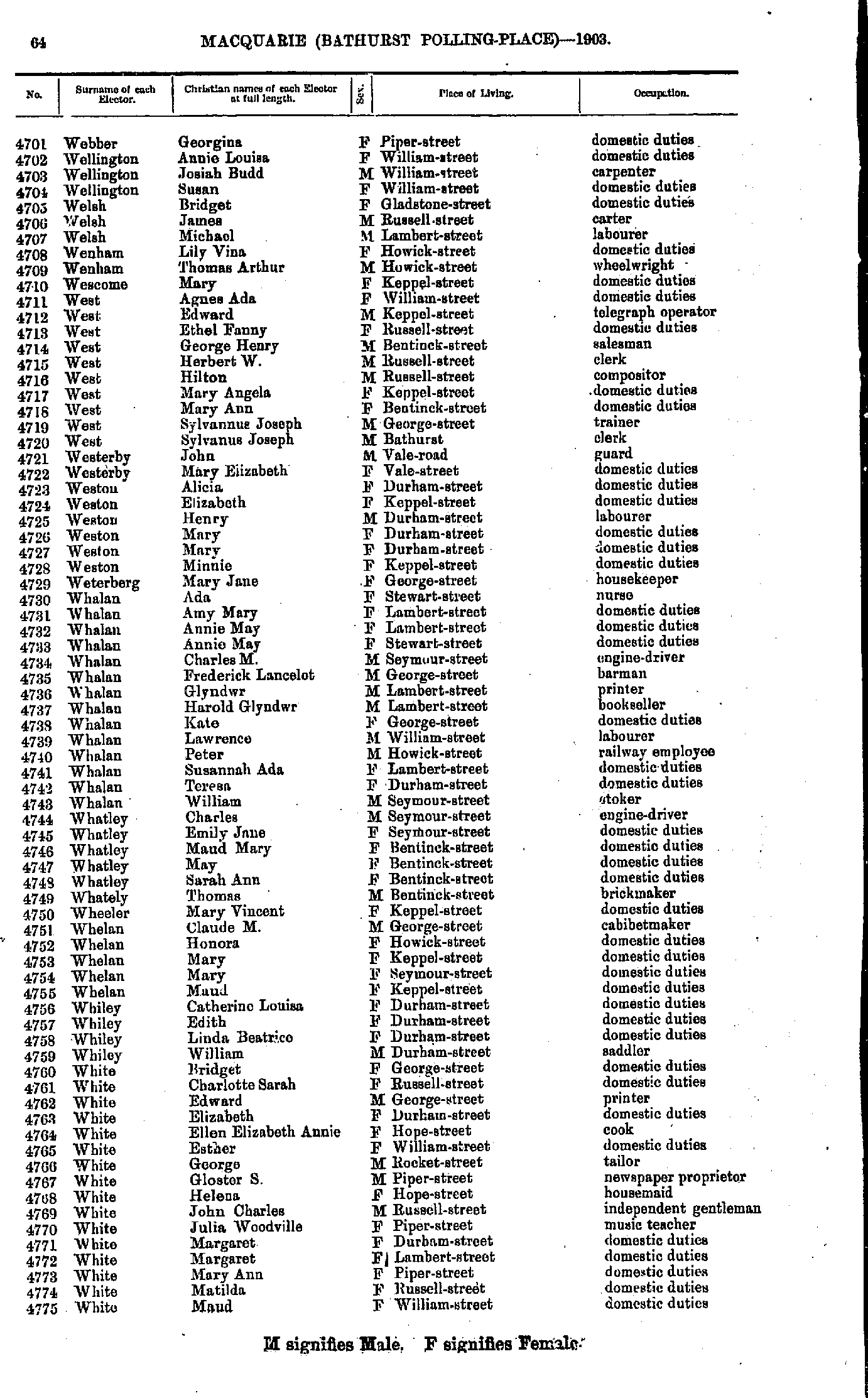
- Webber Georgina - White Maud
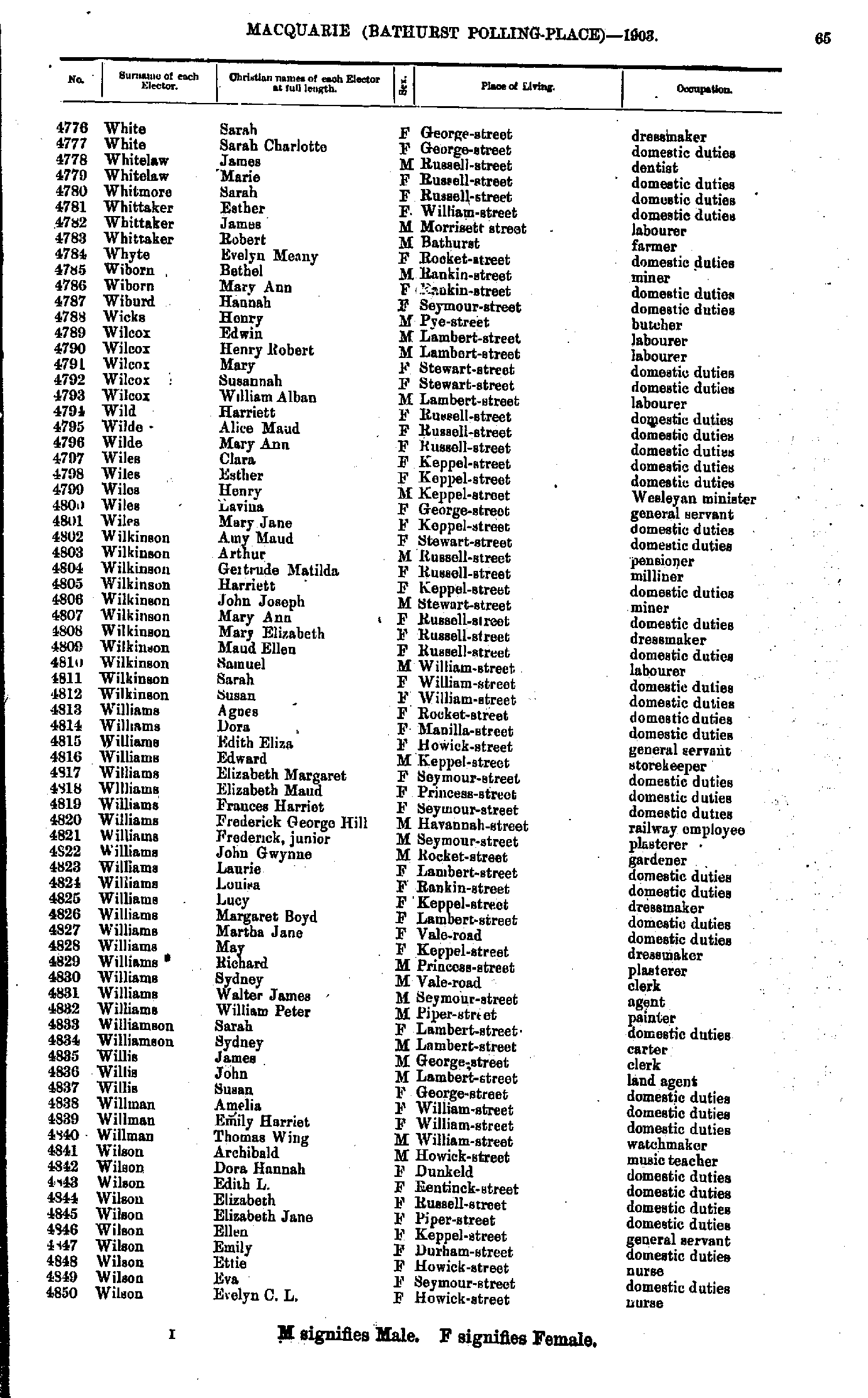
- White Sarah - Wilson Evelyn
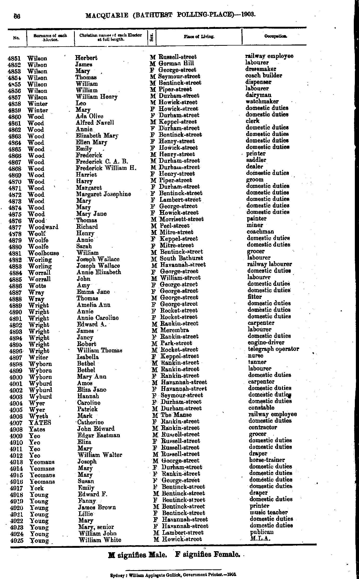
- Wilson Herbert - Young William
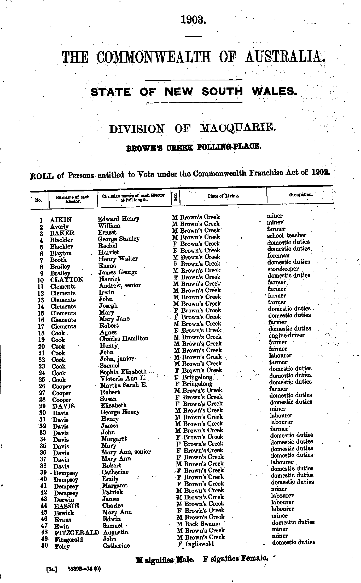
- Abbott John - Boon Rubenia
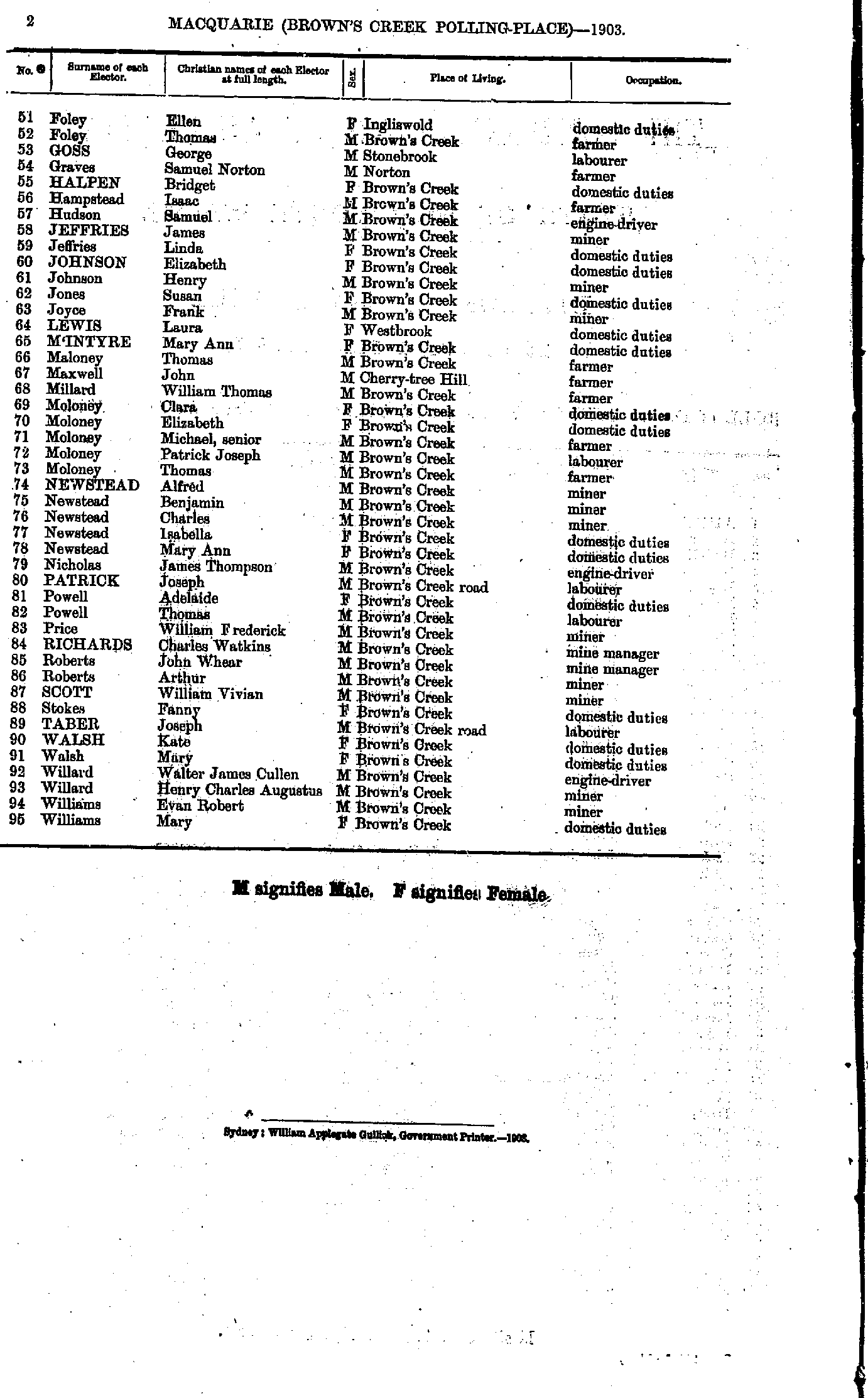
- Dixon Rose - Flood Mary
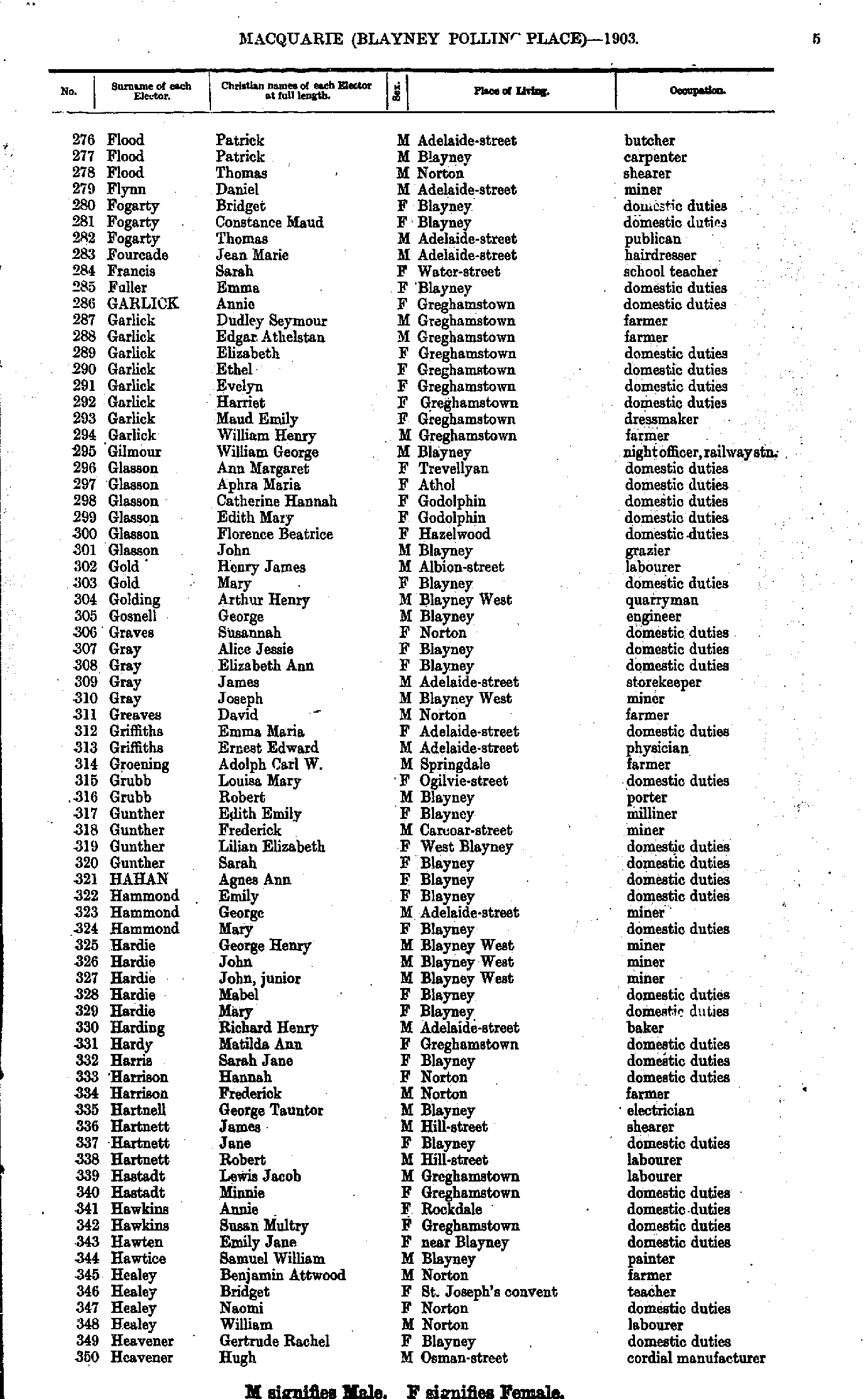
- Flood Patrick - Heavener Hugh
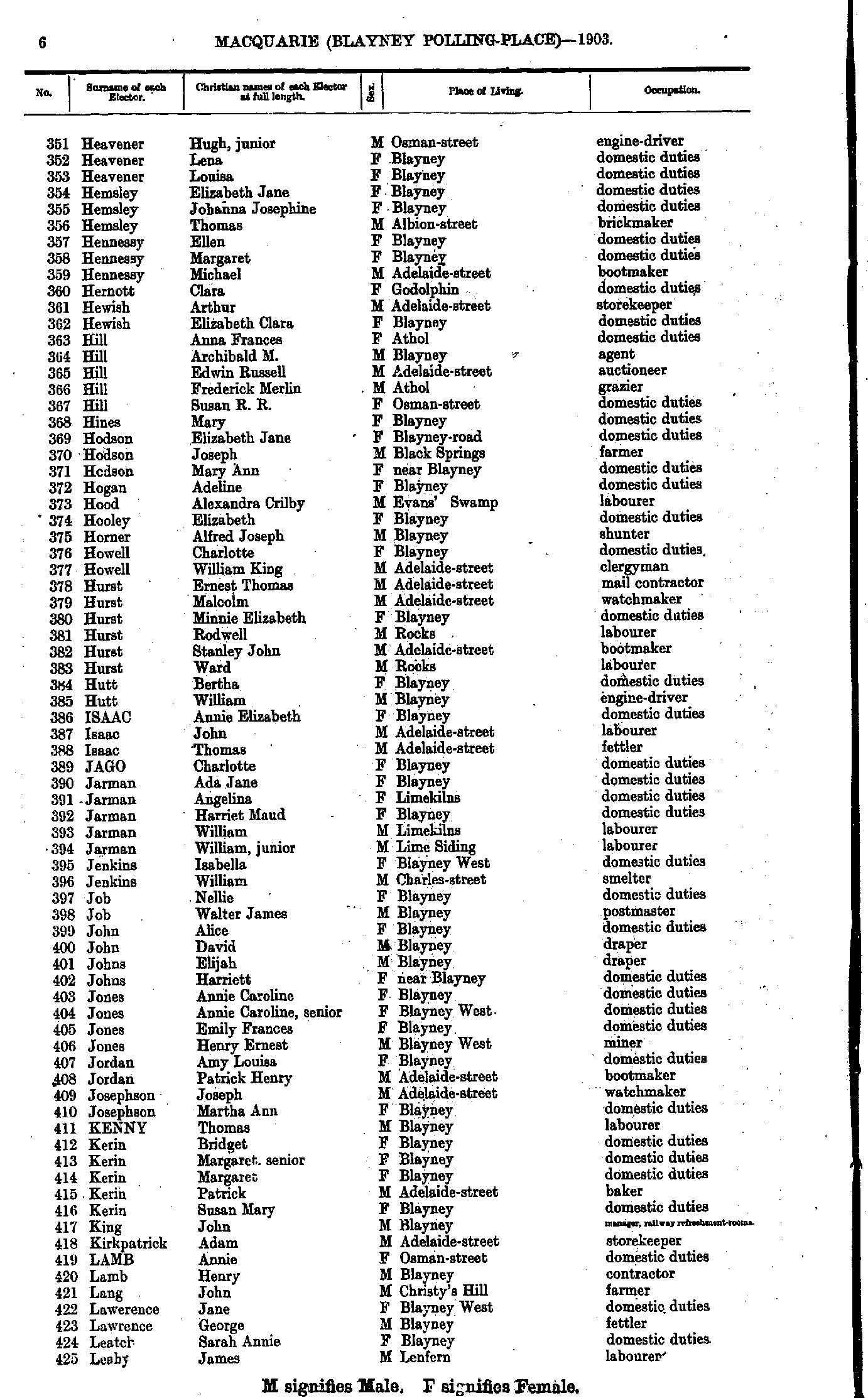
- Heavener Hugh - Leahy James
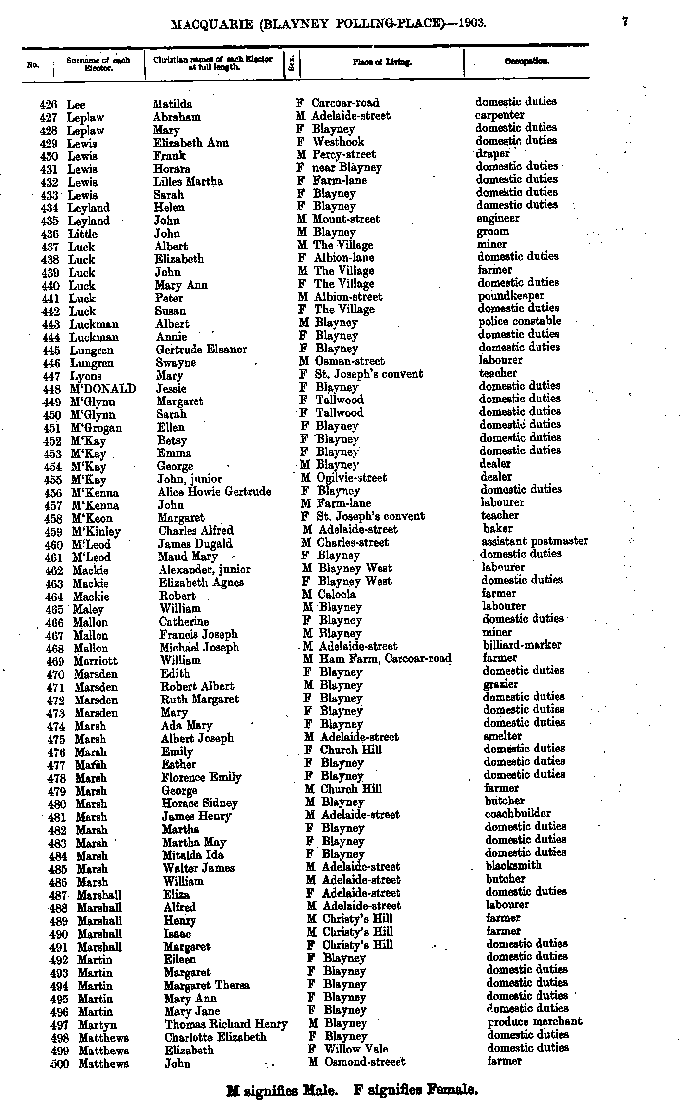
- Lee Matilda - Matthews John
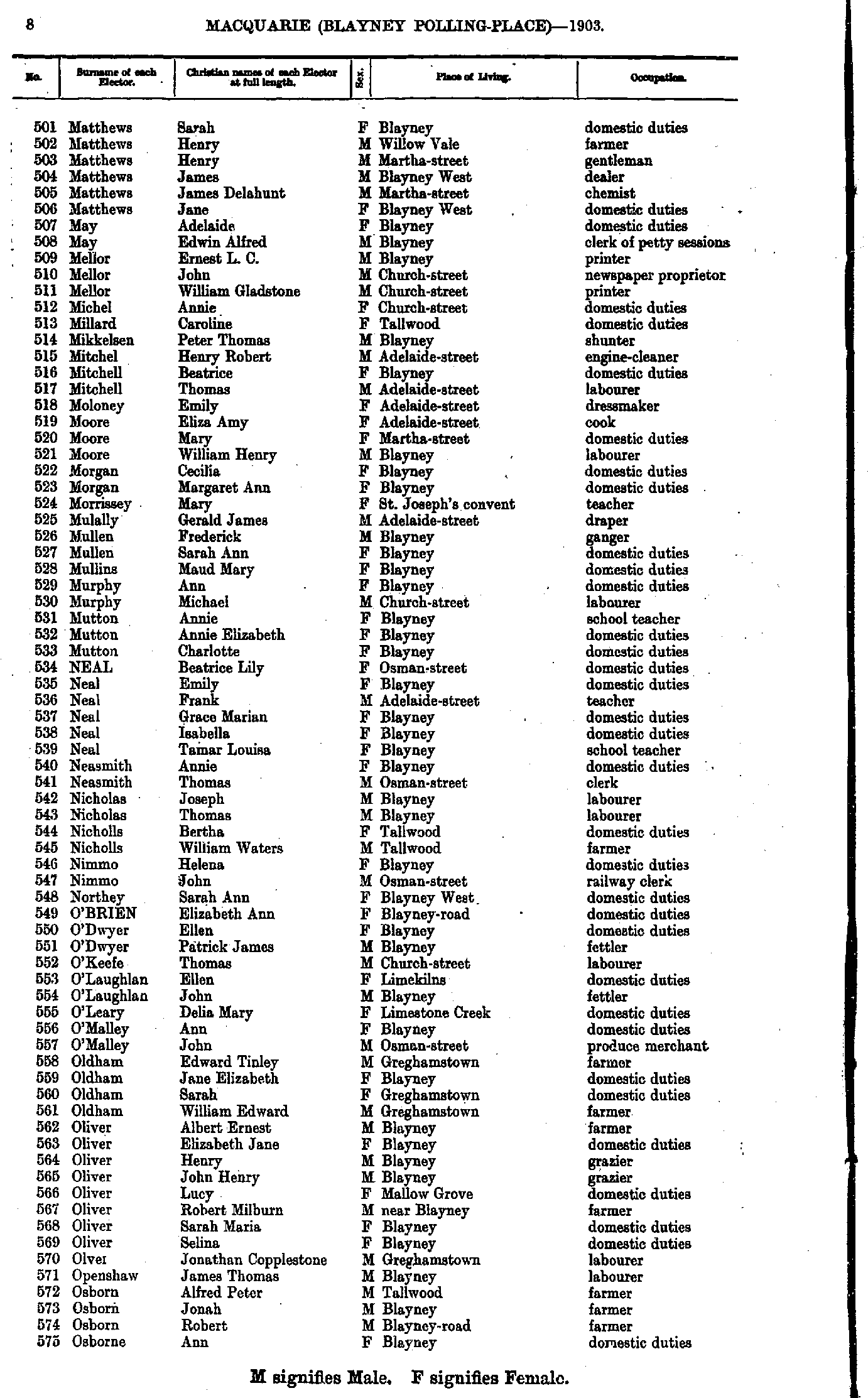
- Matthews Sarah - Osborne Ann
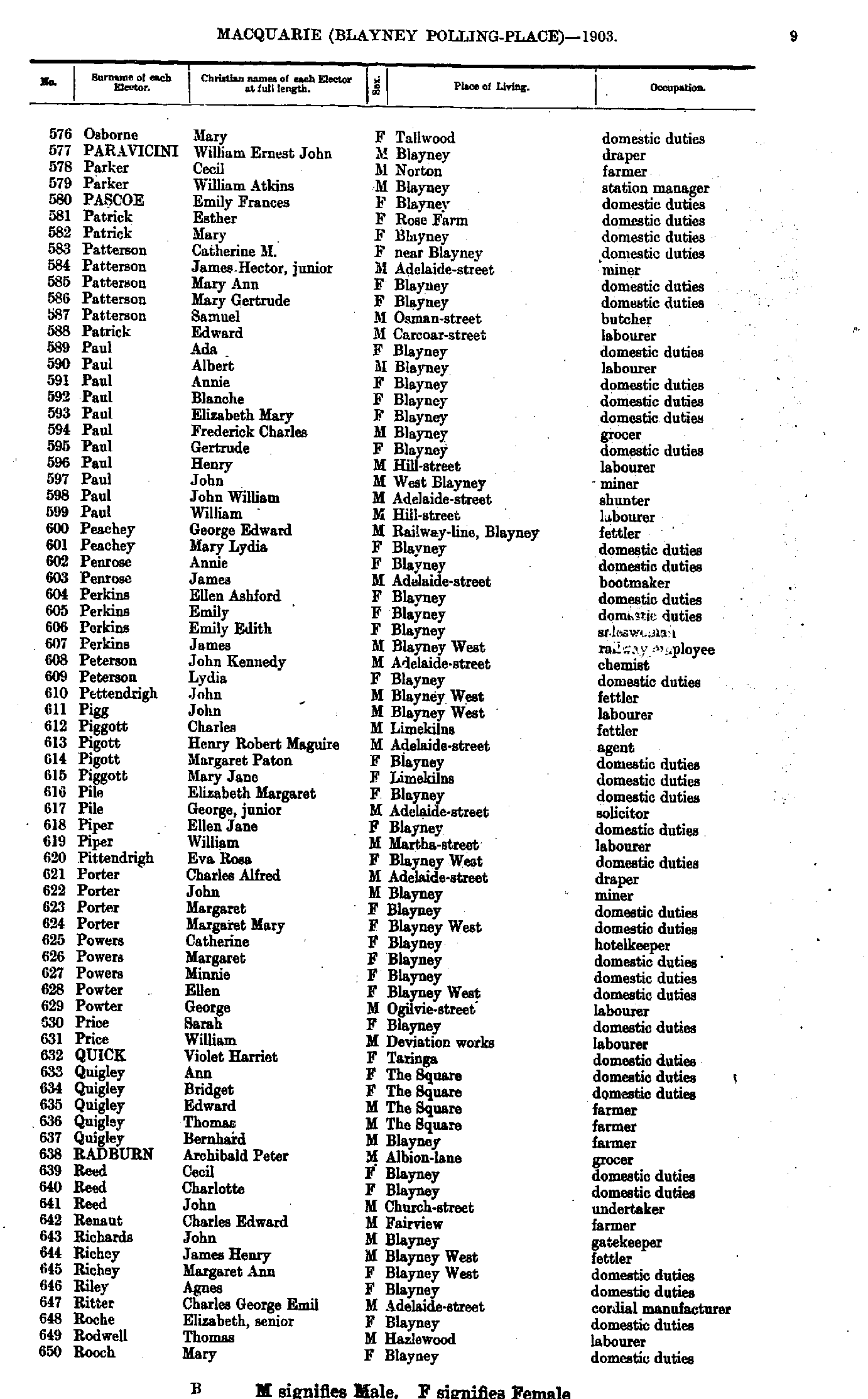
- Osborne Mary - Rooch Mary
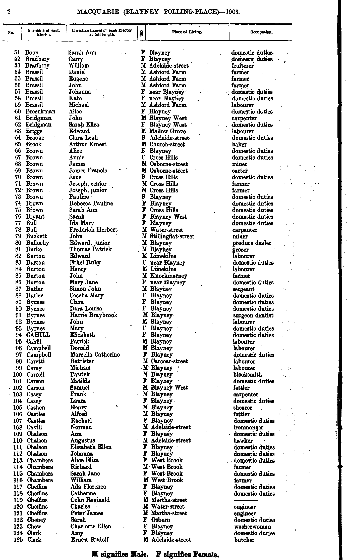
- Boon Sarah - Clark Ernest
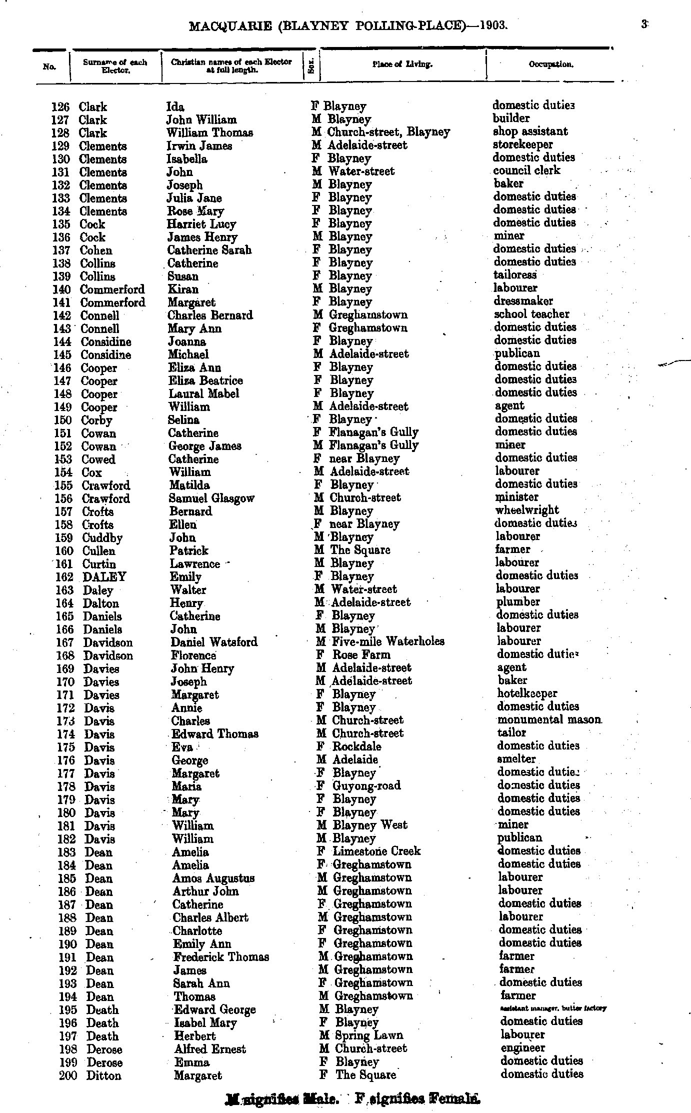
- Clark Ida - Ditton Margaret
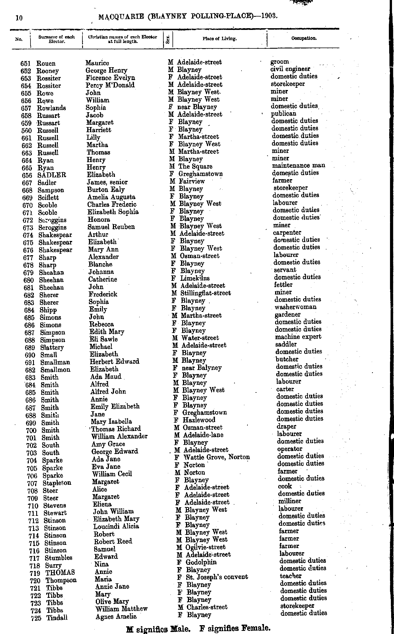
- Rouen Maurice - Tindall Agnes
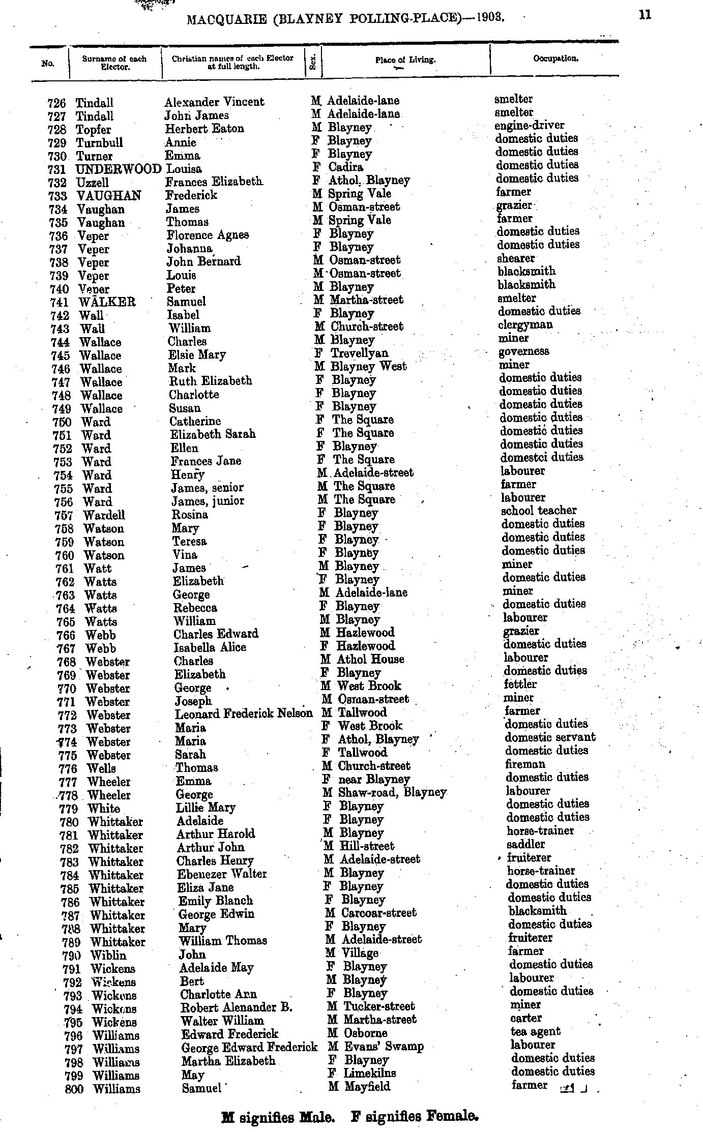
- Tindall Alexander - Williams Samuel
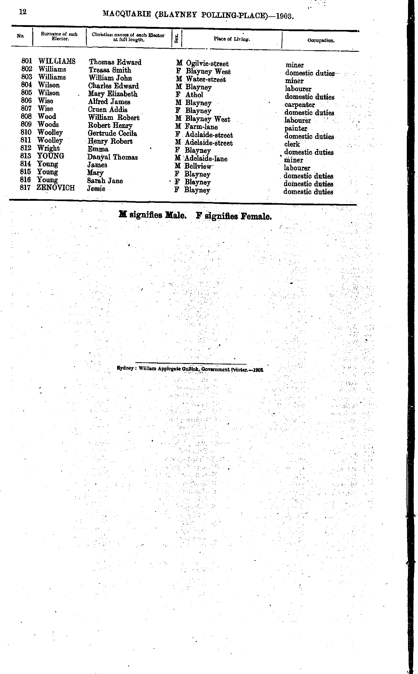
- Williams Thomas - Zenovich Jessie
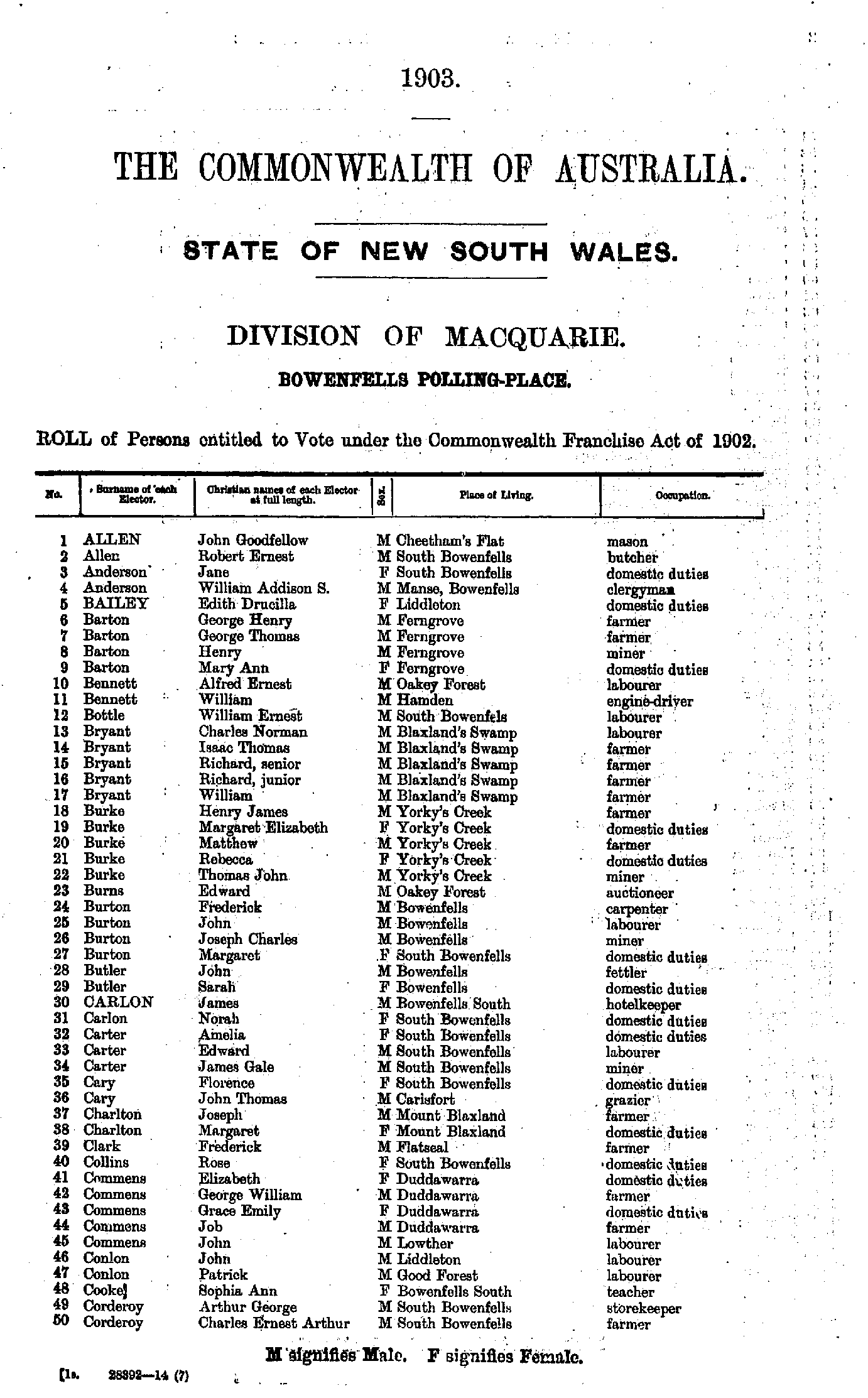
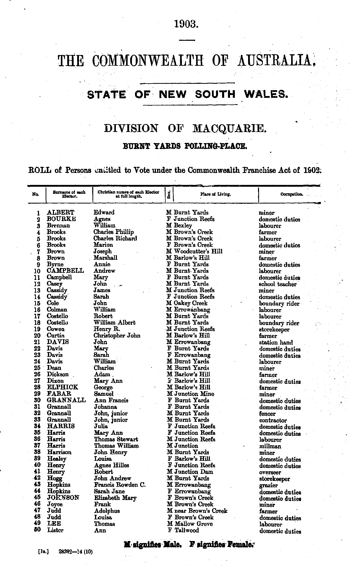
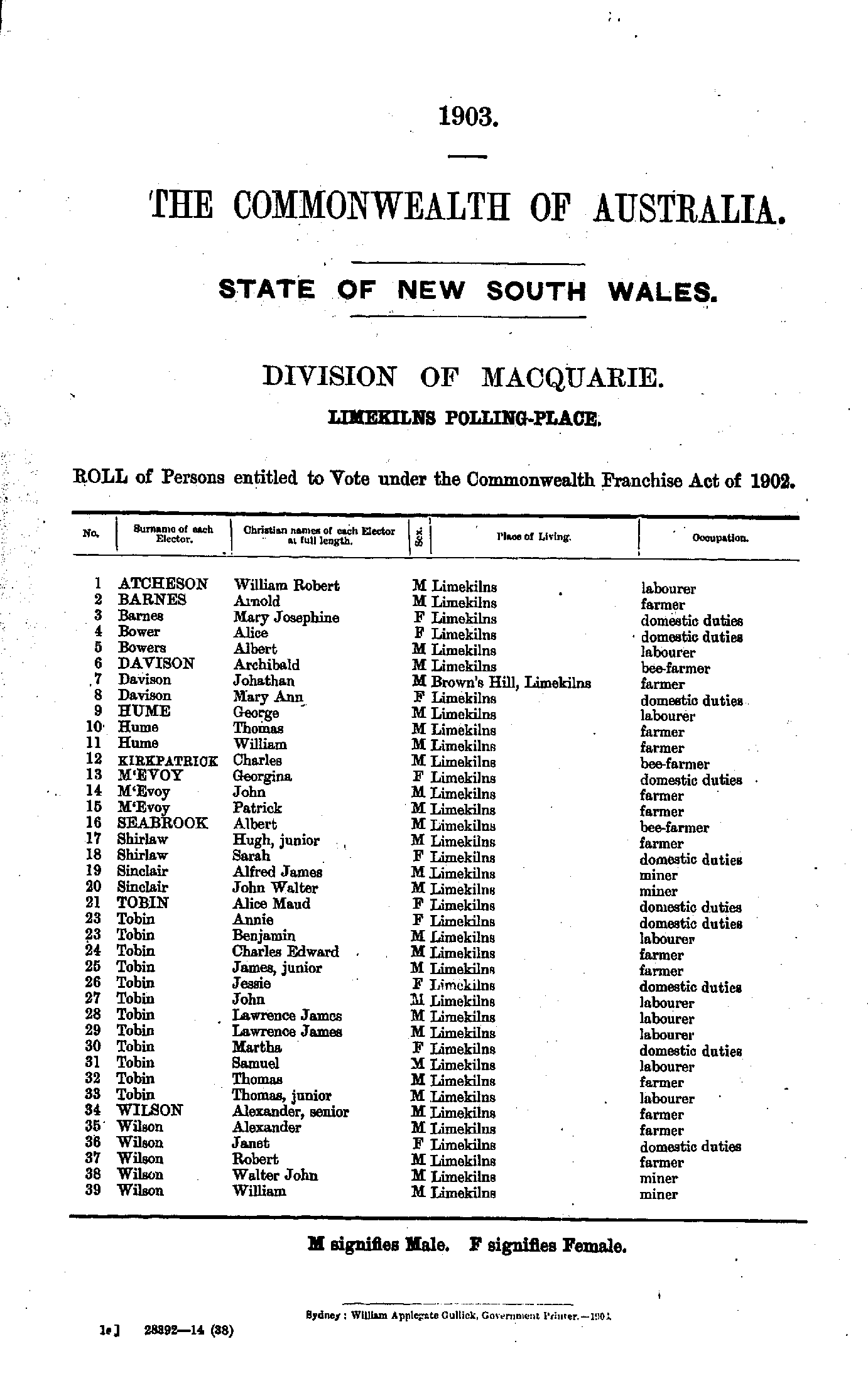
- Allen John - Corderoy Charles
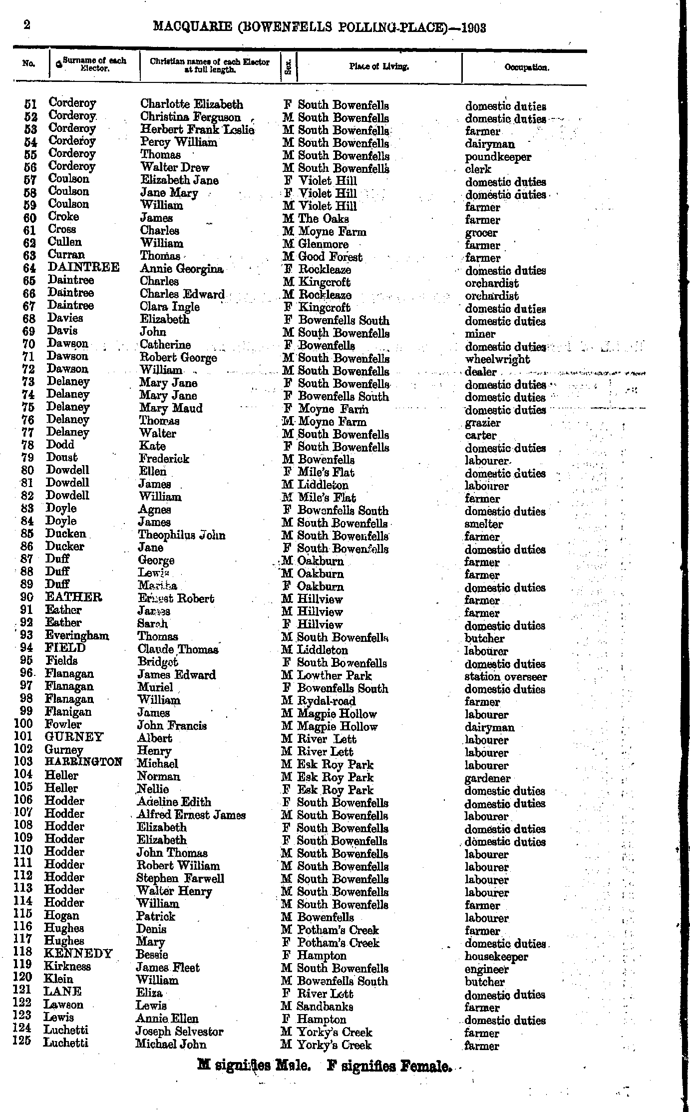
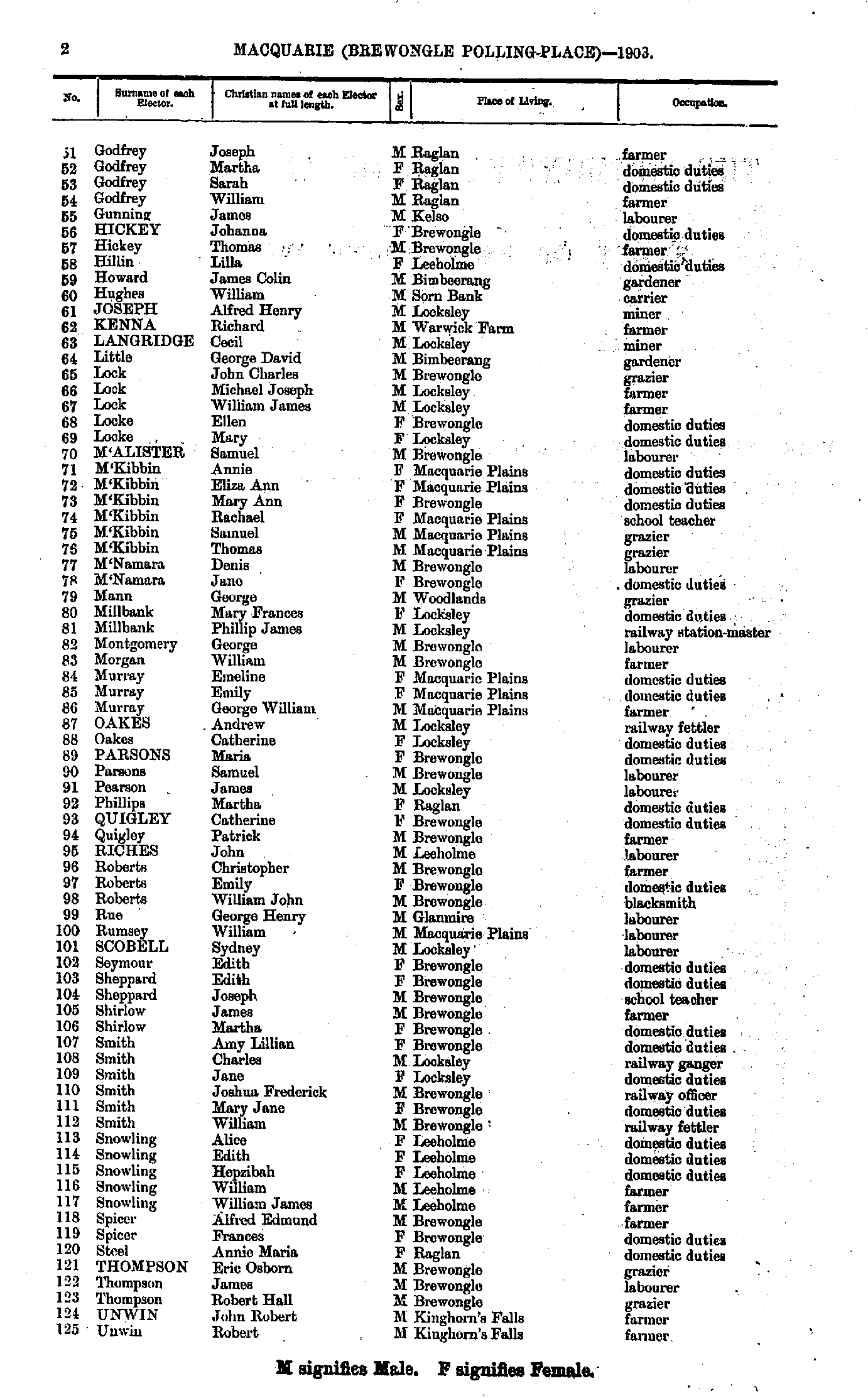
- Corderoy Charlotte - Luchetti Michael
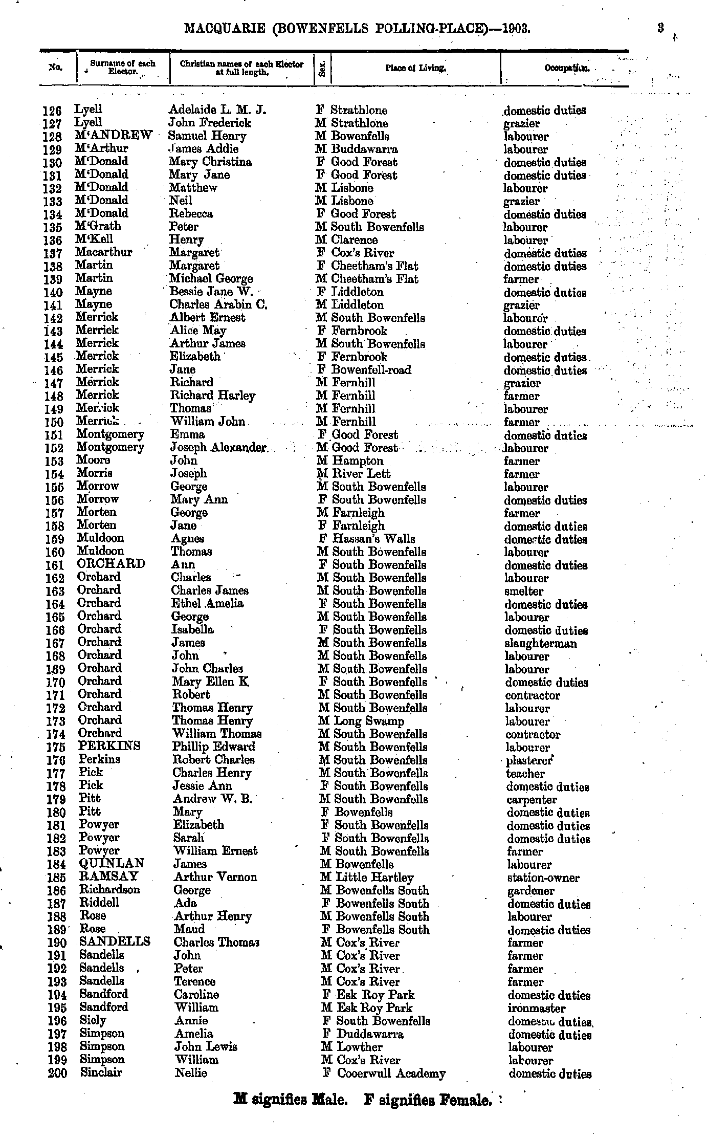
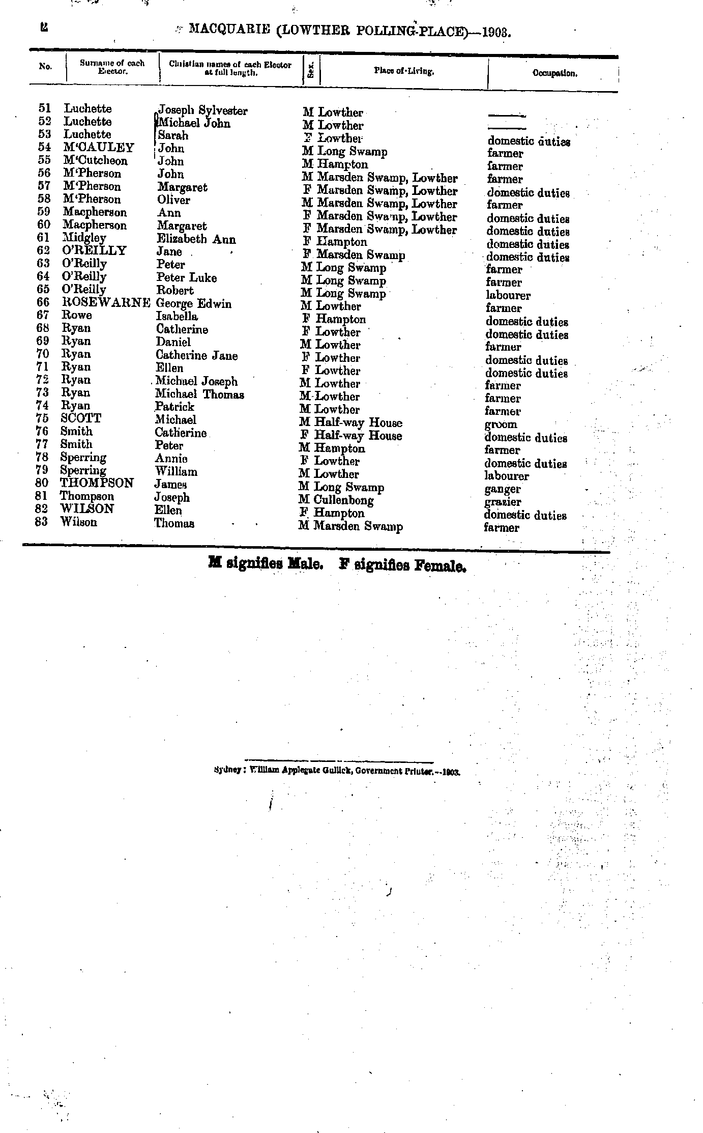
- Lyell Adelaide - Sinclair Nellie
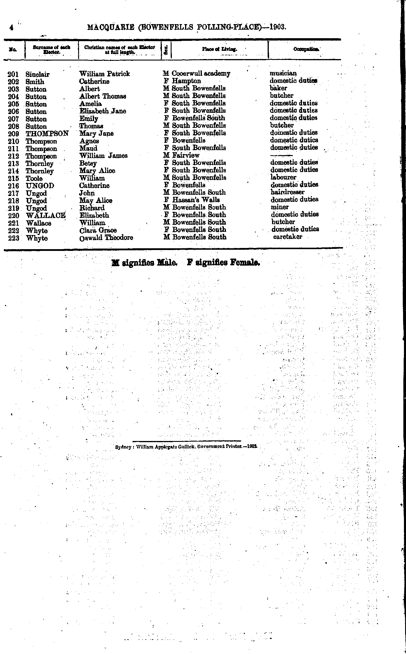
- Sinclair William - Whyte Oswald
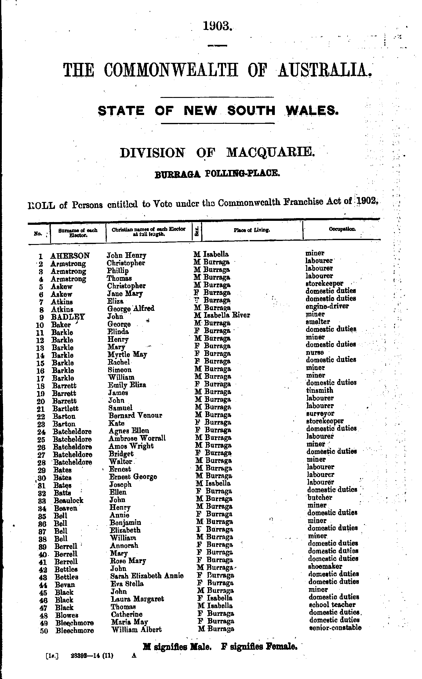
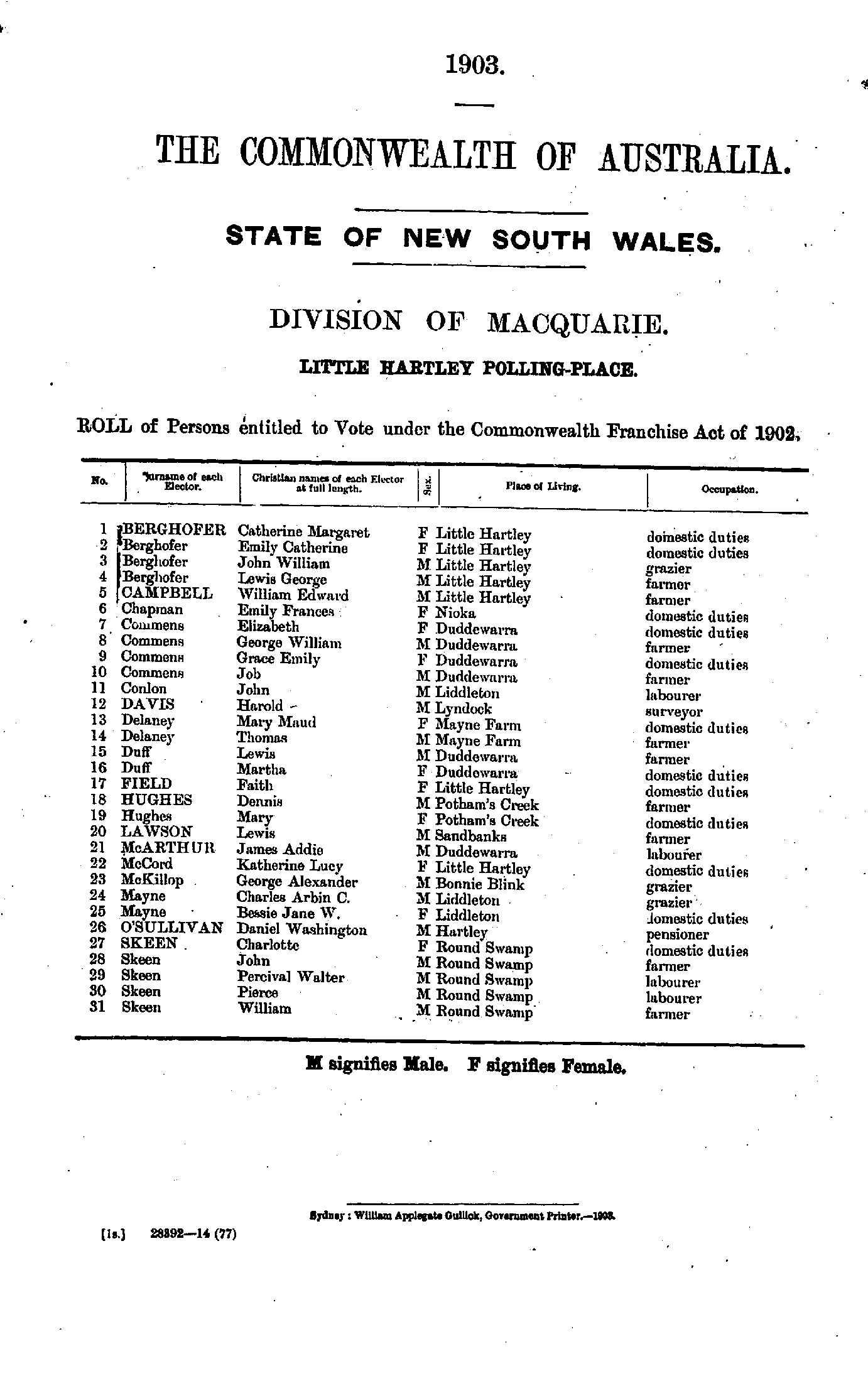
- Aherson John - Bleechmore William
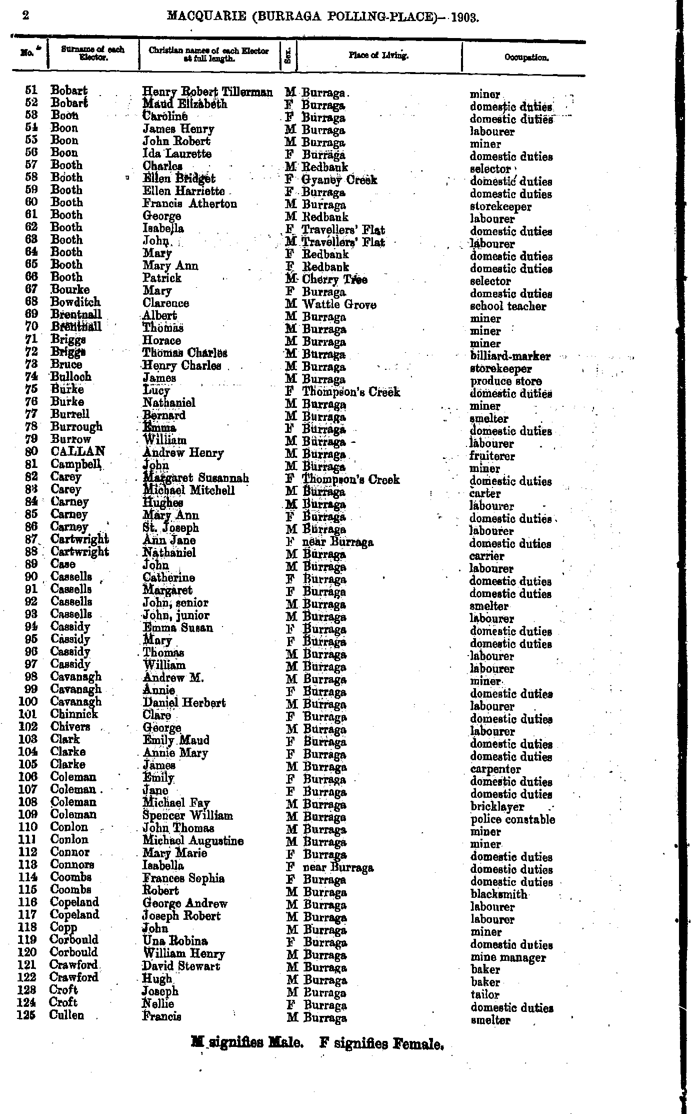
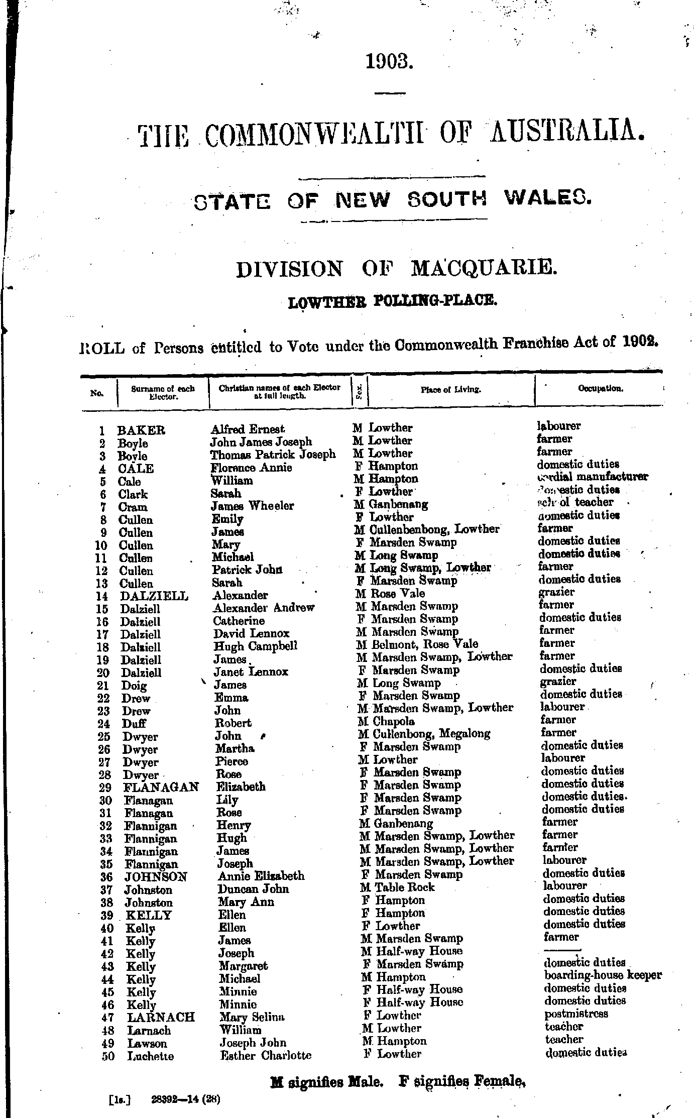
- Bobart Henry - Cullen Francis
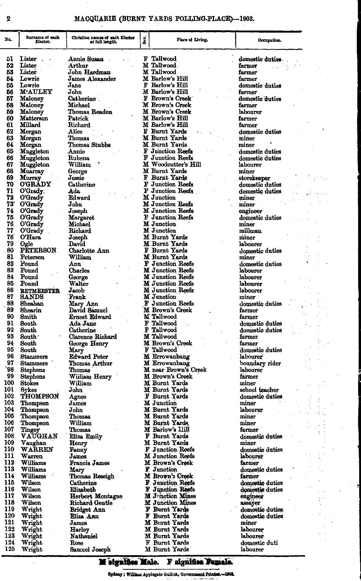
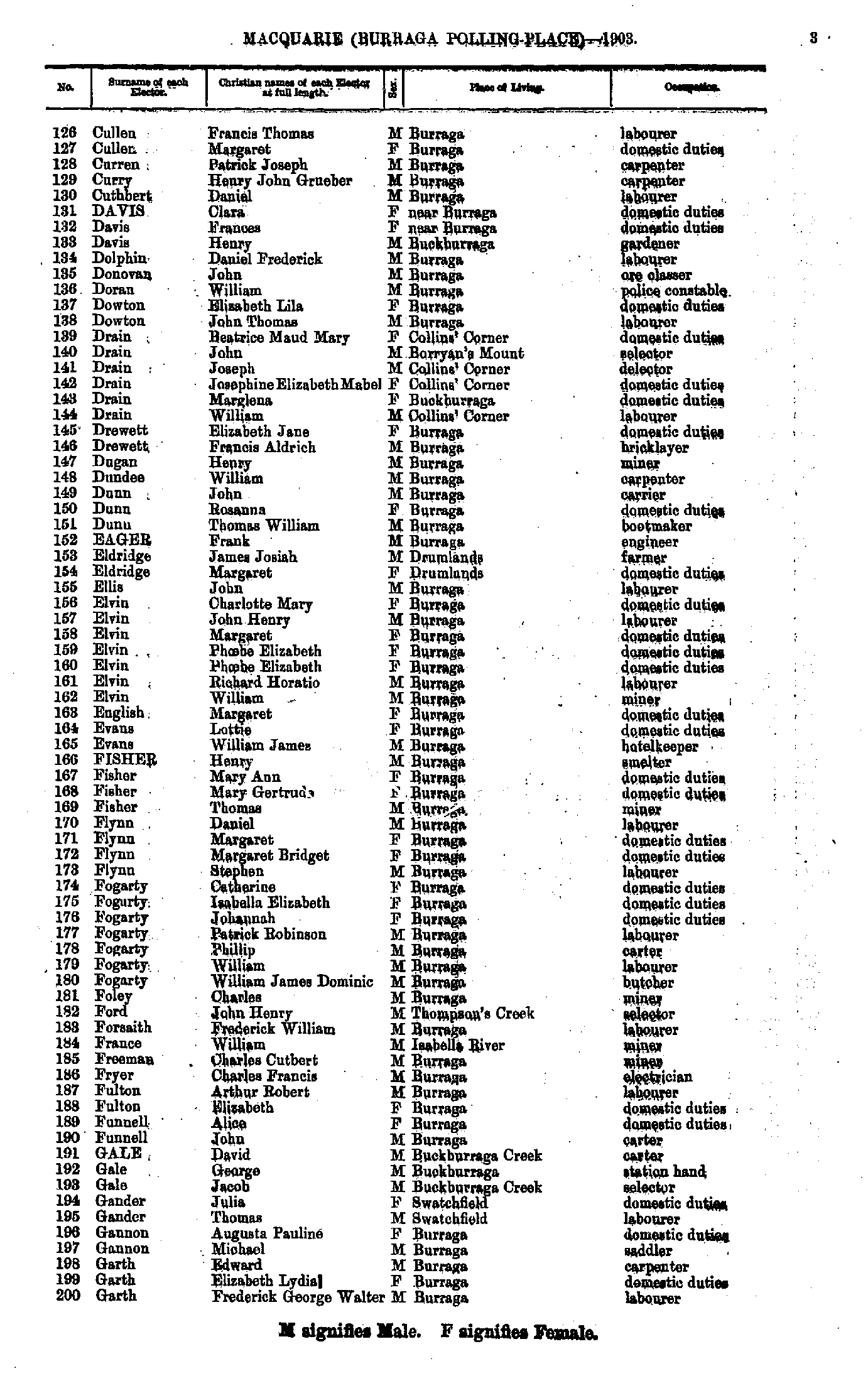
- Cullen Francis - Garth Frederick
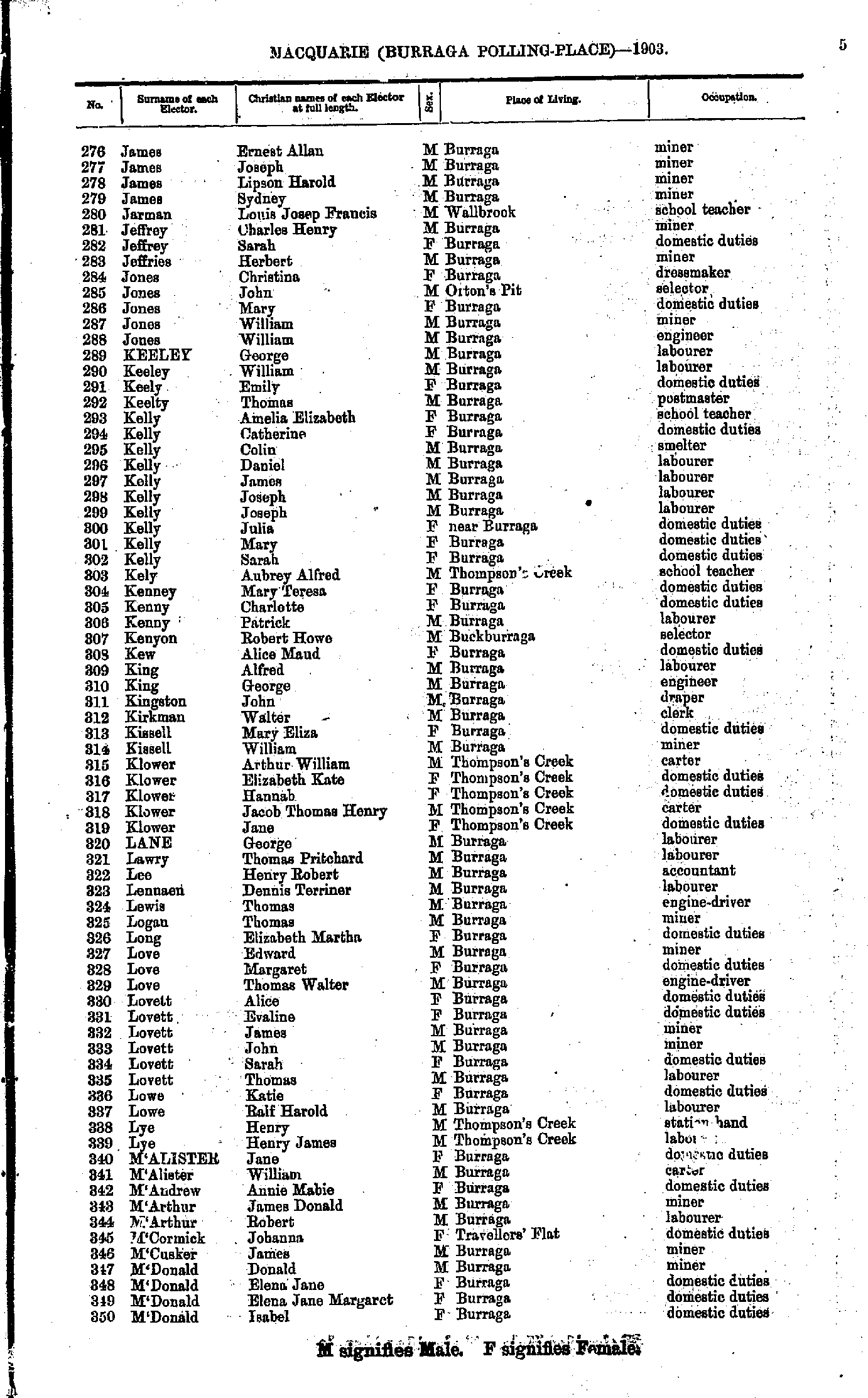
- Gibbons Catherine - James Daniel
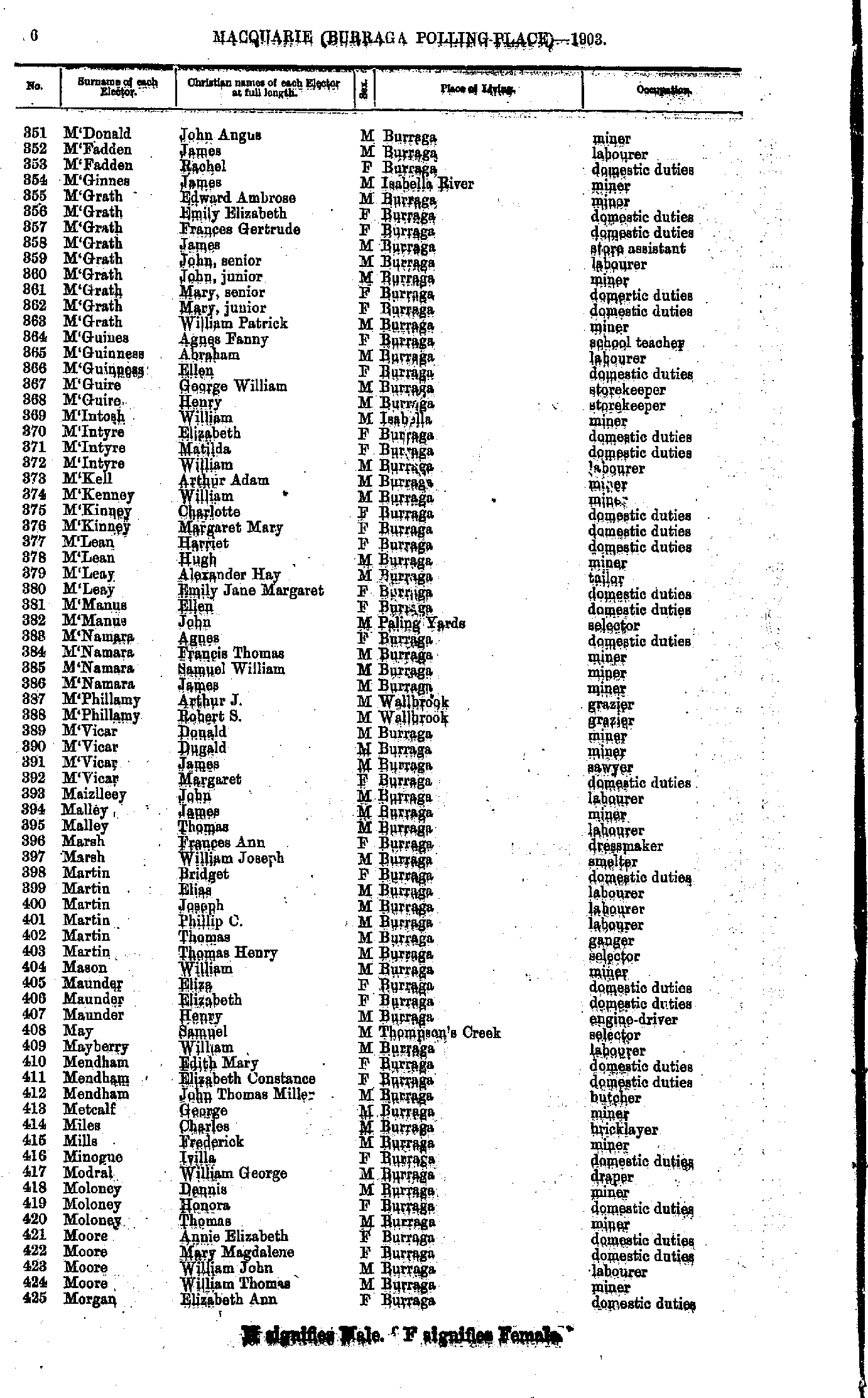
- James Ernest - M'Donald Isabel
- M'Donald John - Morgan Elizabeth
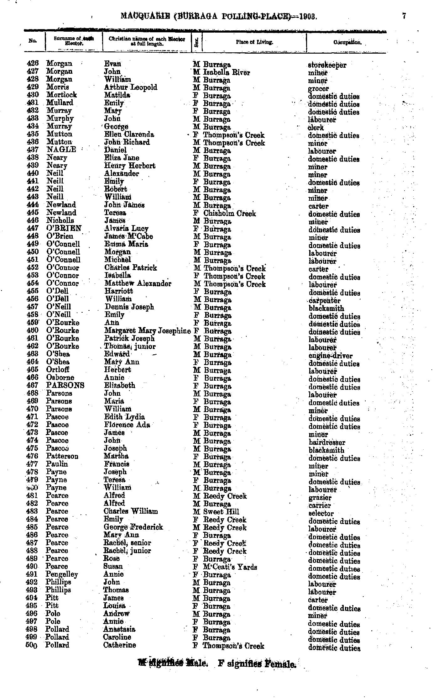
- Morgan Evan - Pollard Catherine
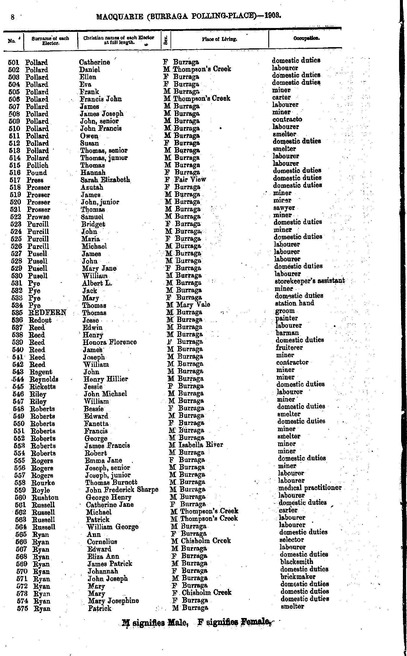
- Pollard Catherine - Ryan Patrick
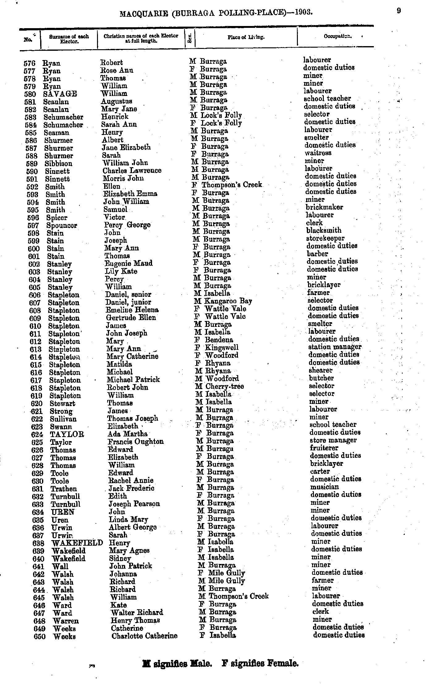
- Ryan Robert - Weeks Charlotte
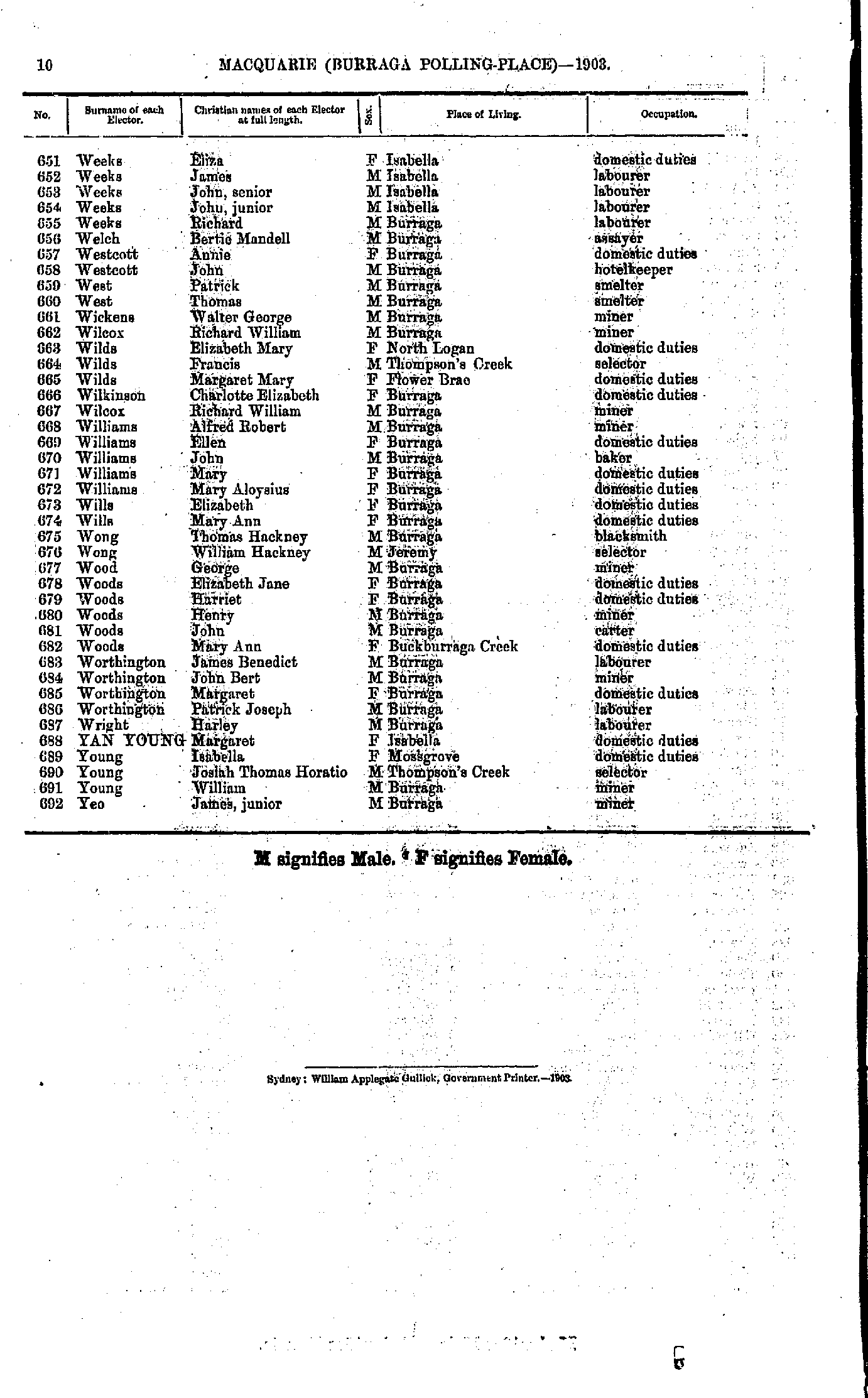
- Weeks Eliza - Yeo James
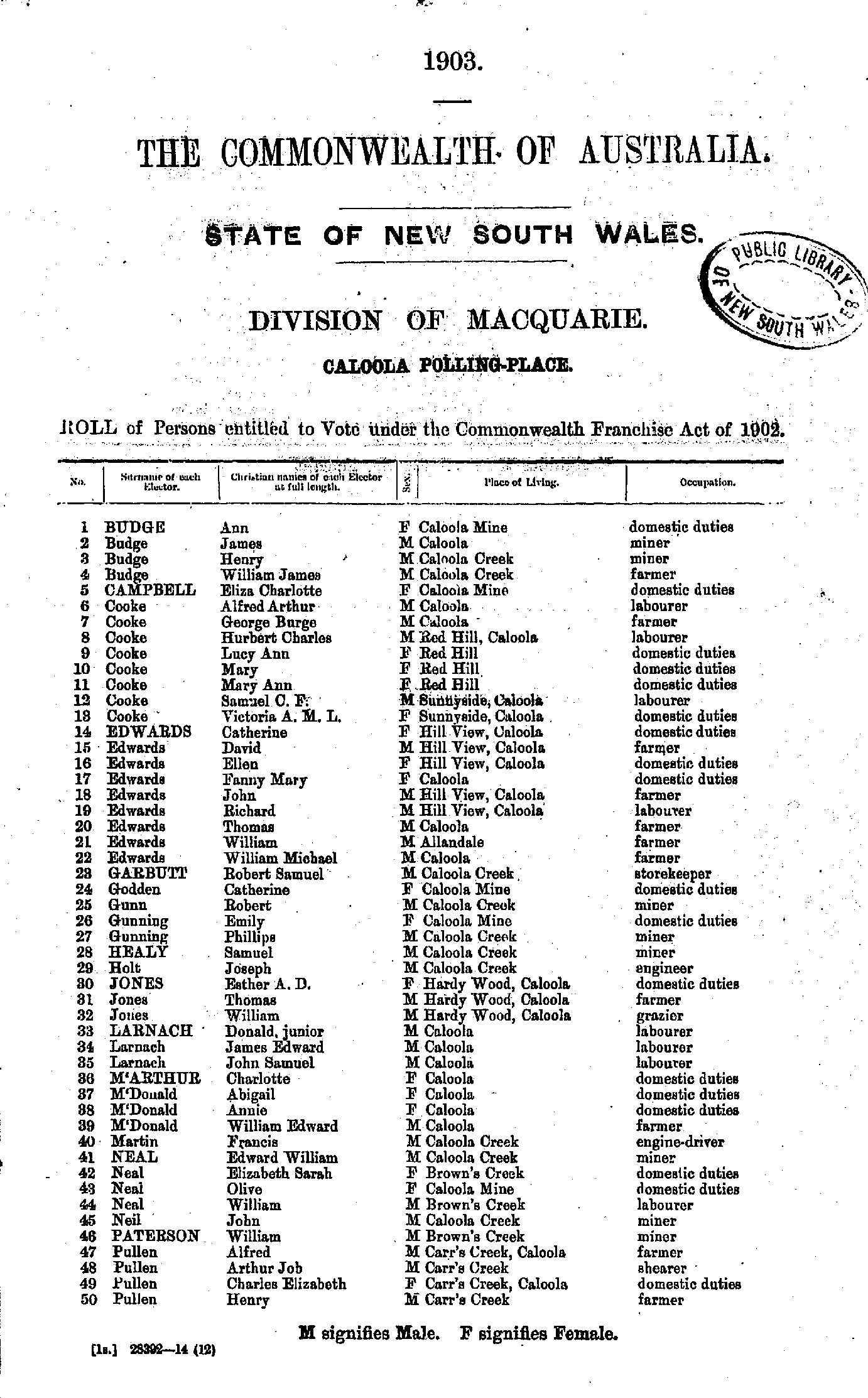
- Abberton Elizabeth - Boyd Annie
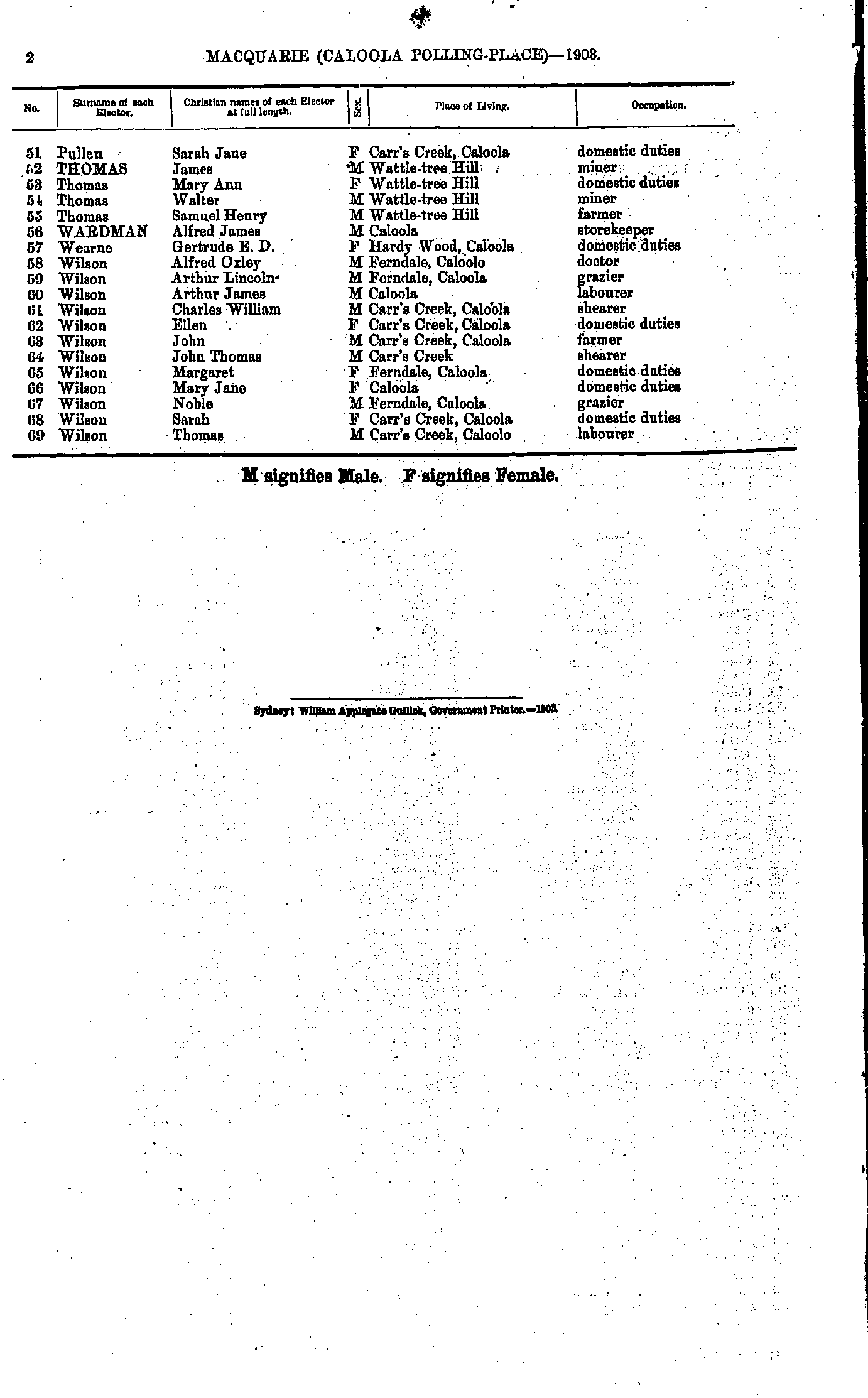
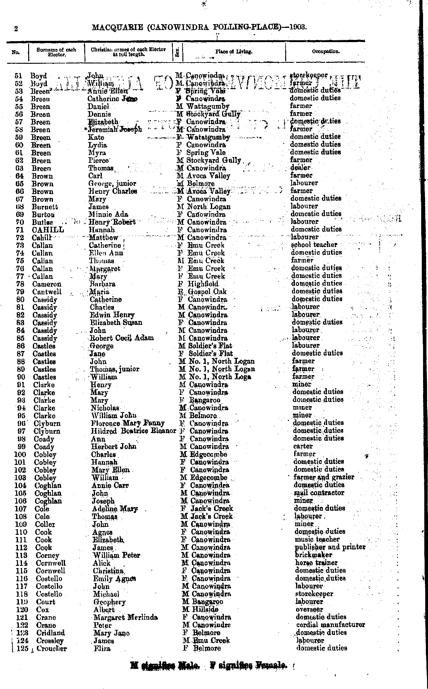
- Boyd John - Croucher Eliza
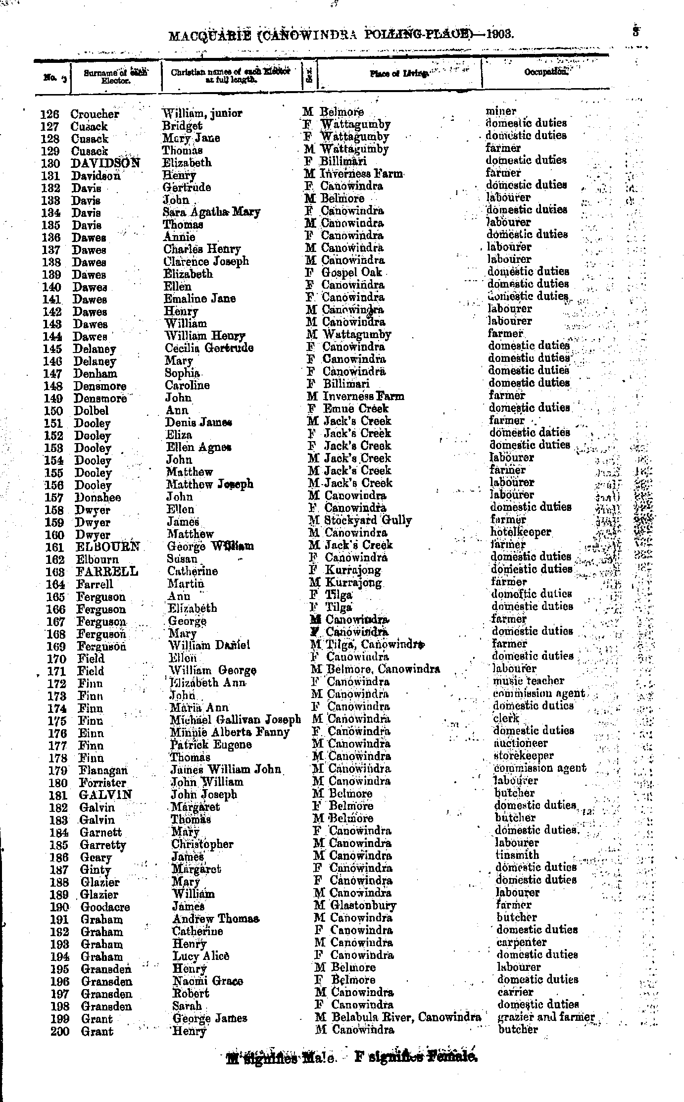
- Croucher William - Grant Henry
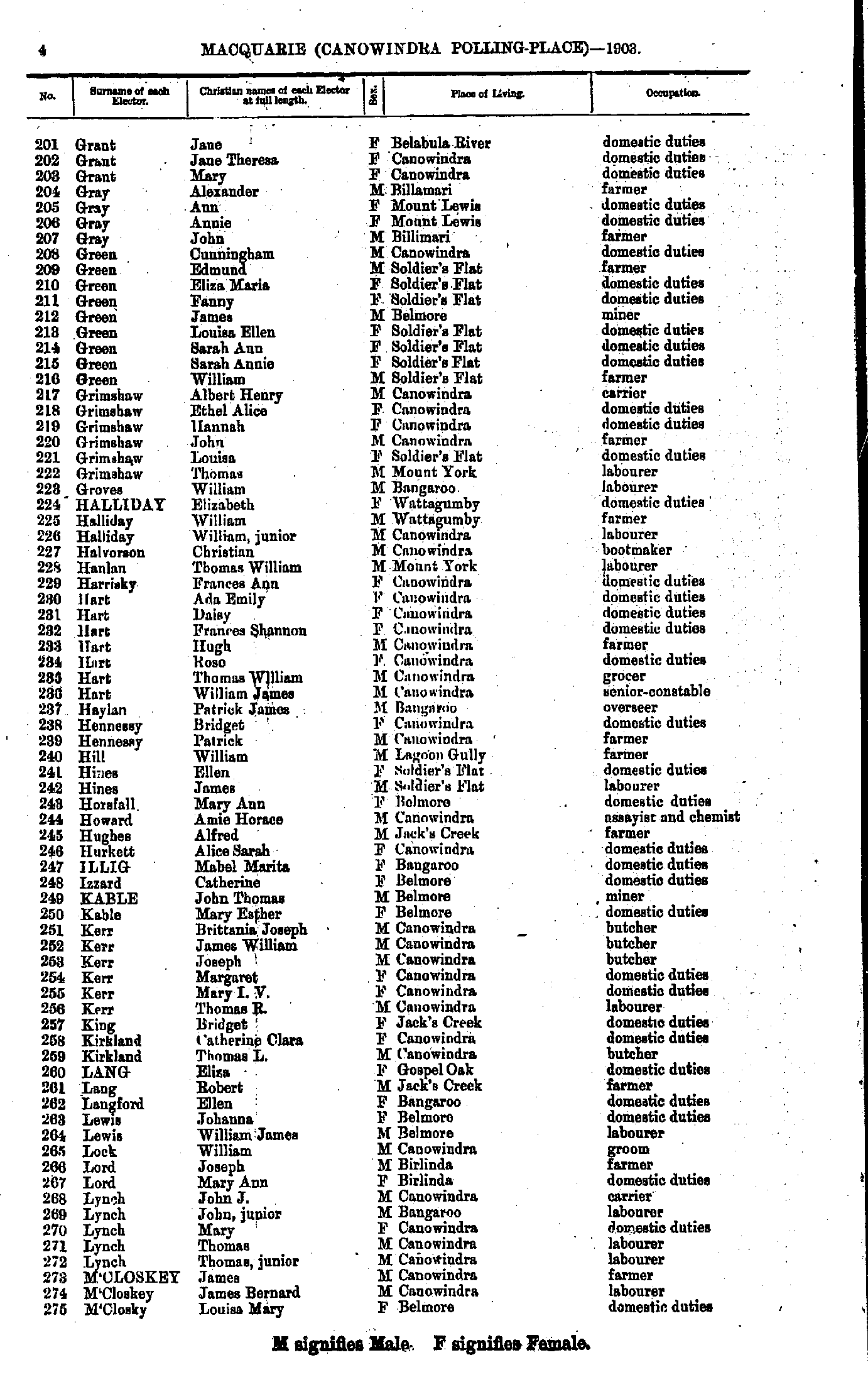
- Grant Jane - M'Closky Louisa
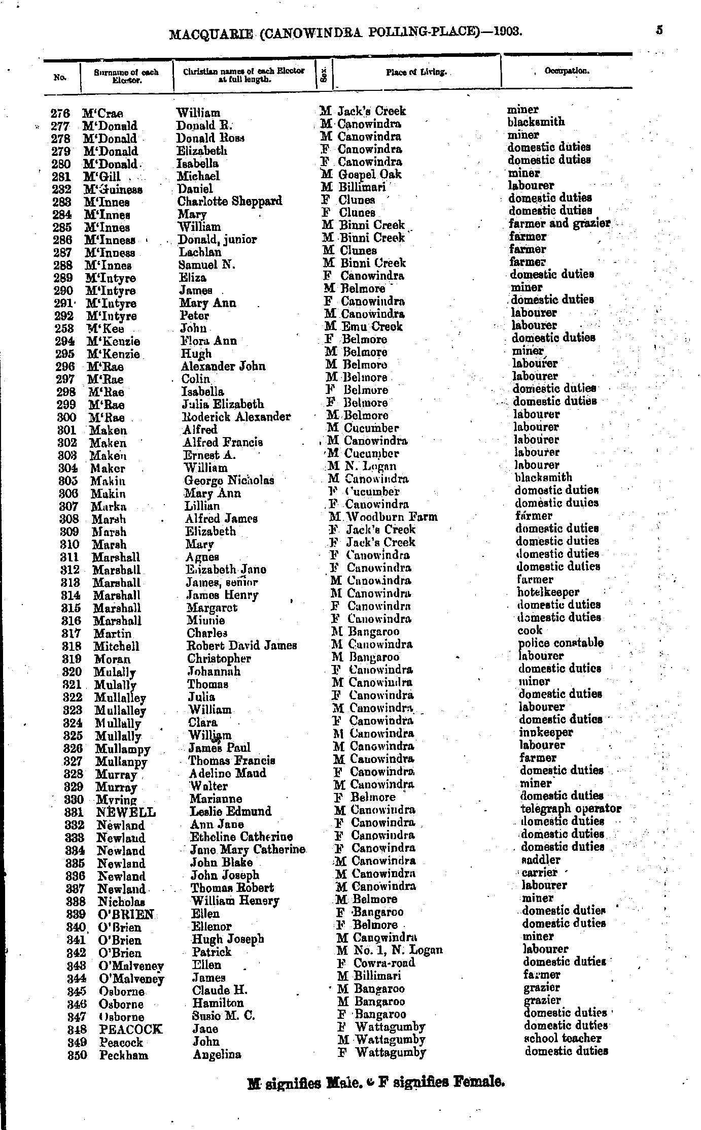
- M'Crae William - Peckham Angelina
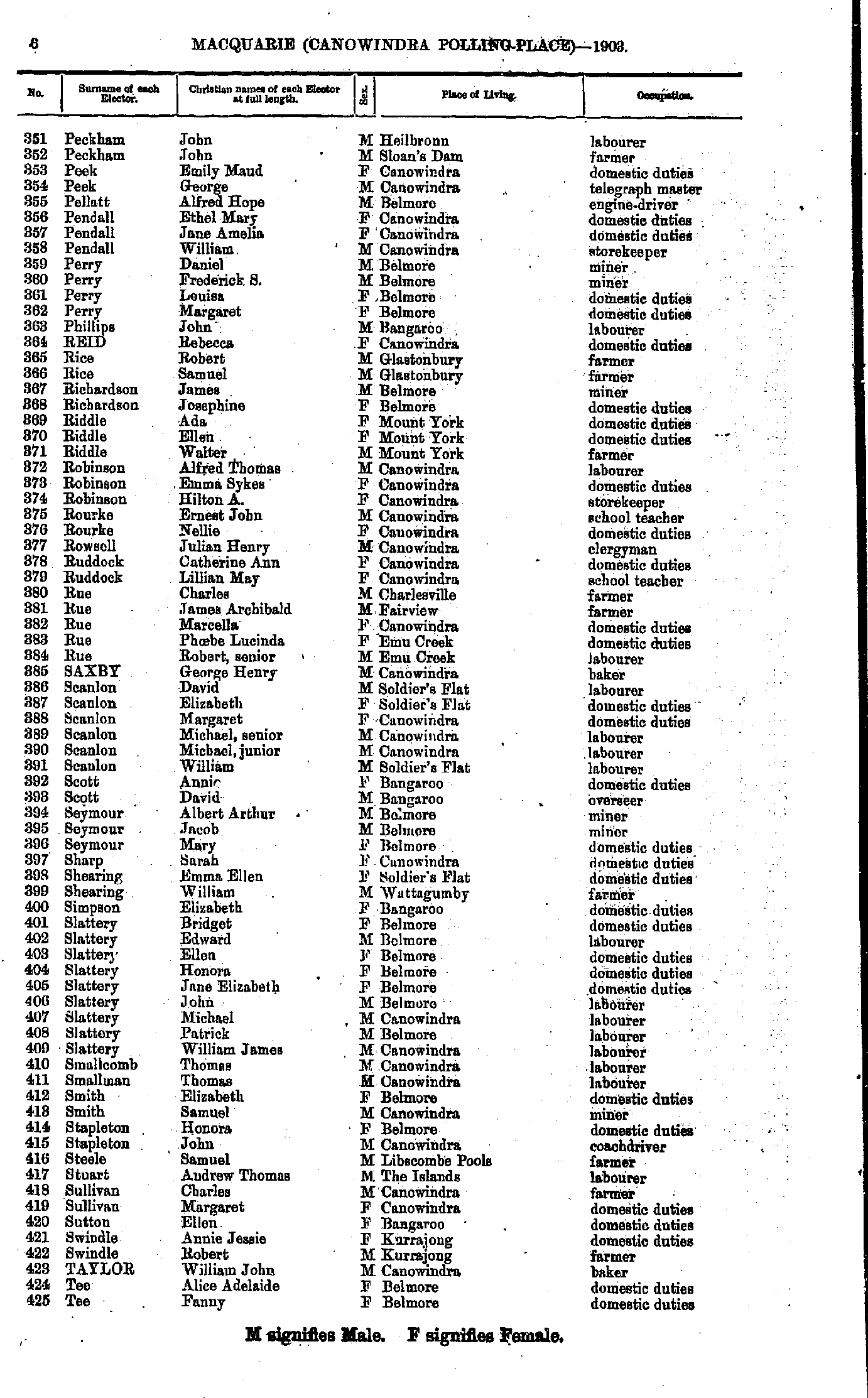
- Peckham John - Tee Fanny
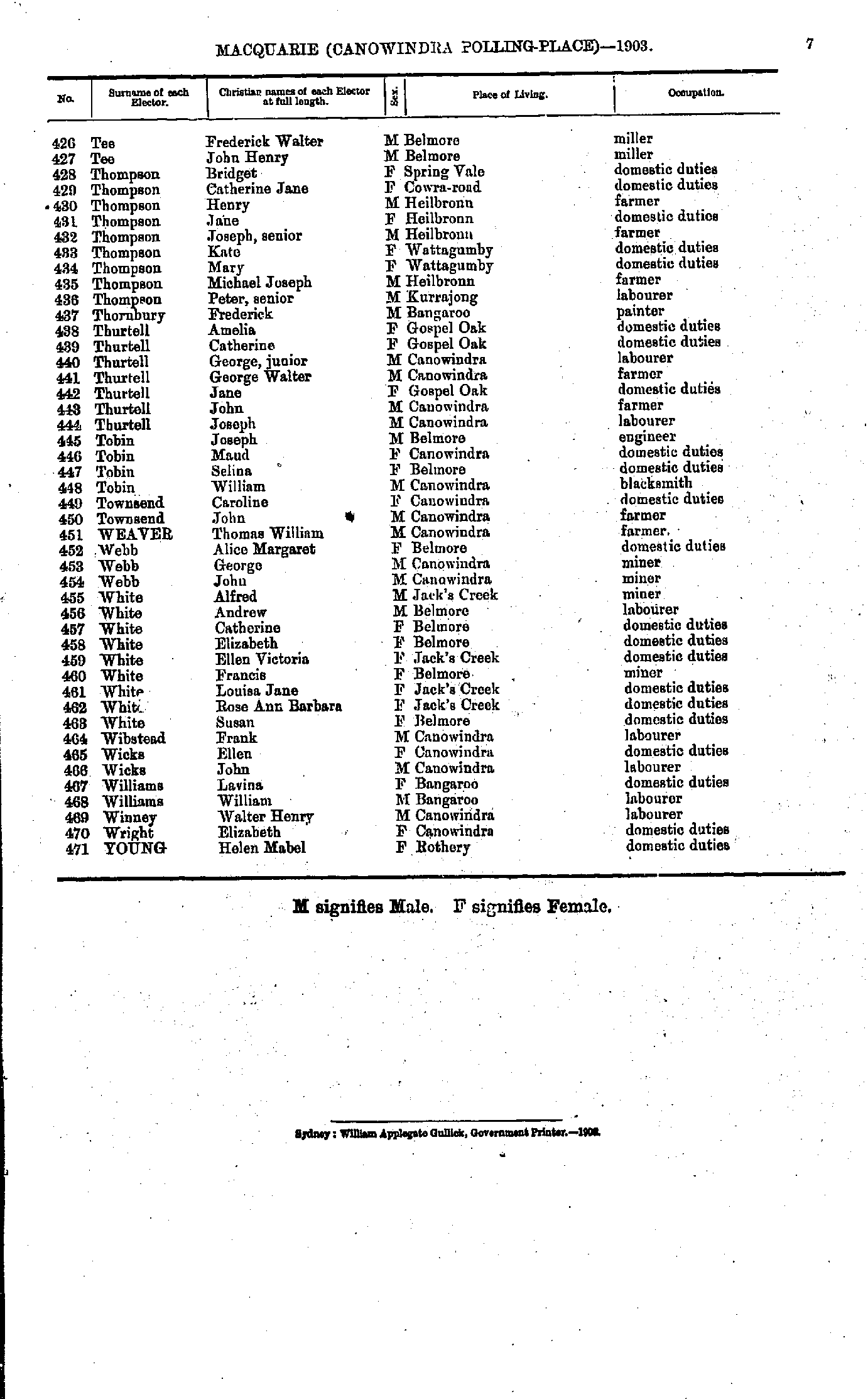
- Tee Frederick - Young Helen
- Arthur Daniel - Byrne Catherine
- Byrne Catherine - Finlayson Mary
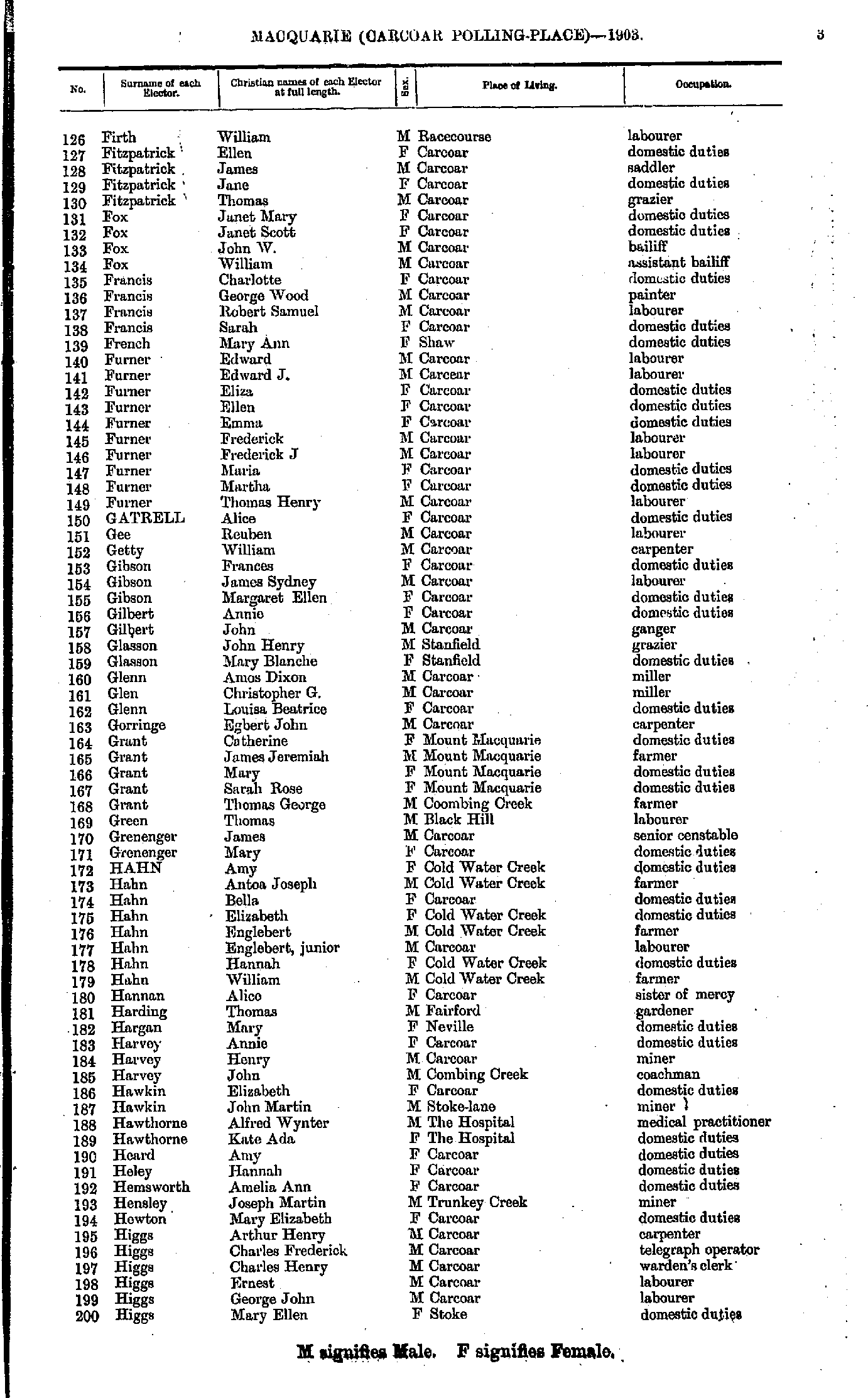
- Firth William - Higgs Mary
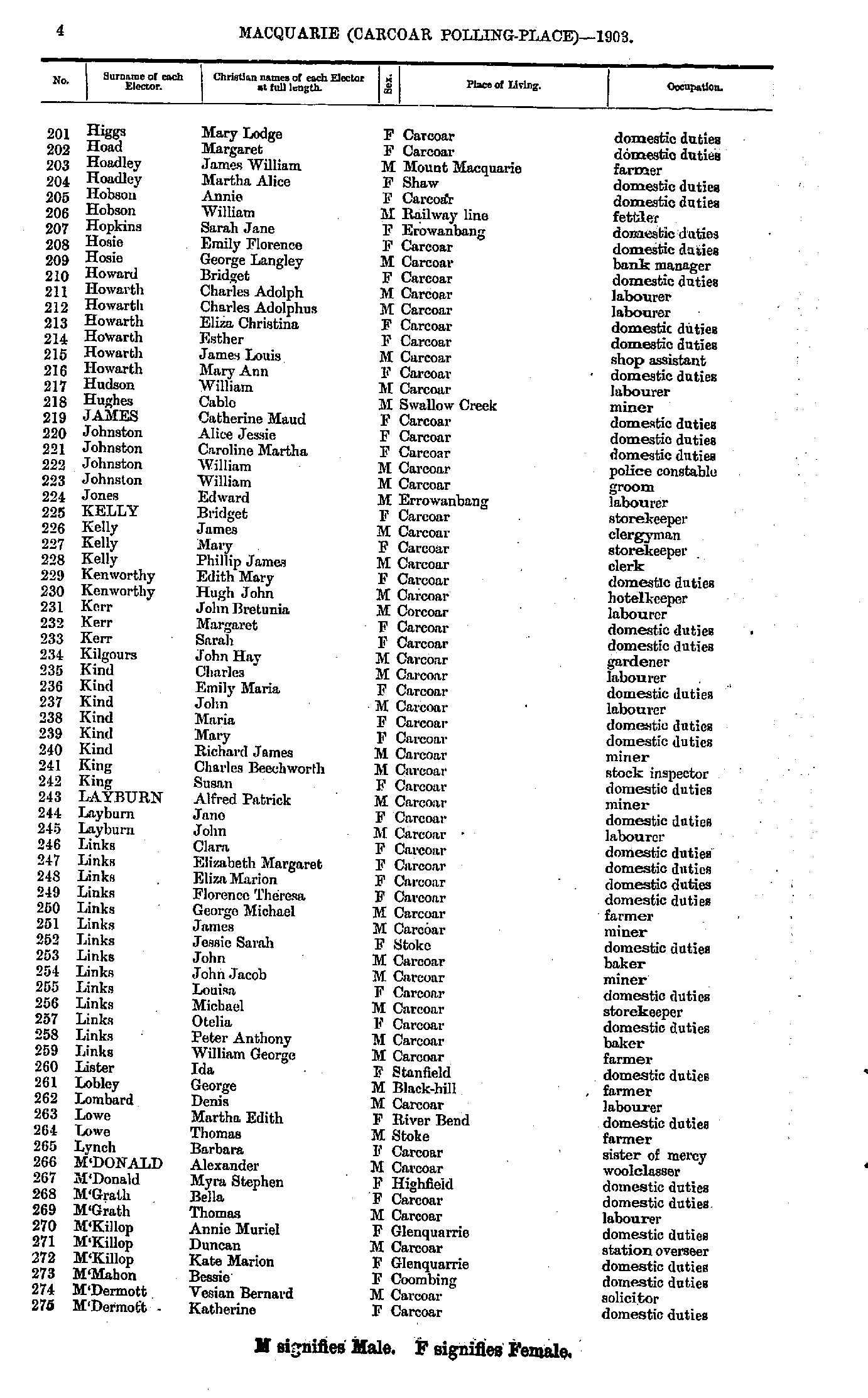
- Higgs Mary - M'Dermott Katherine
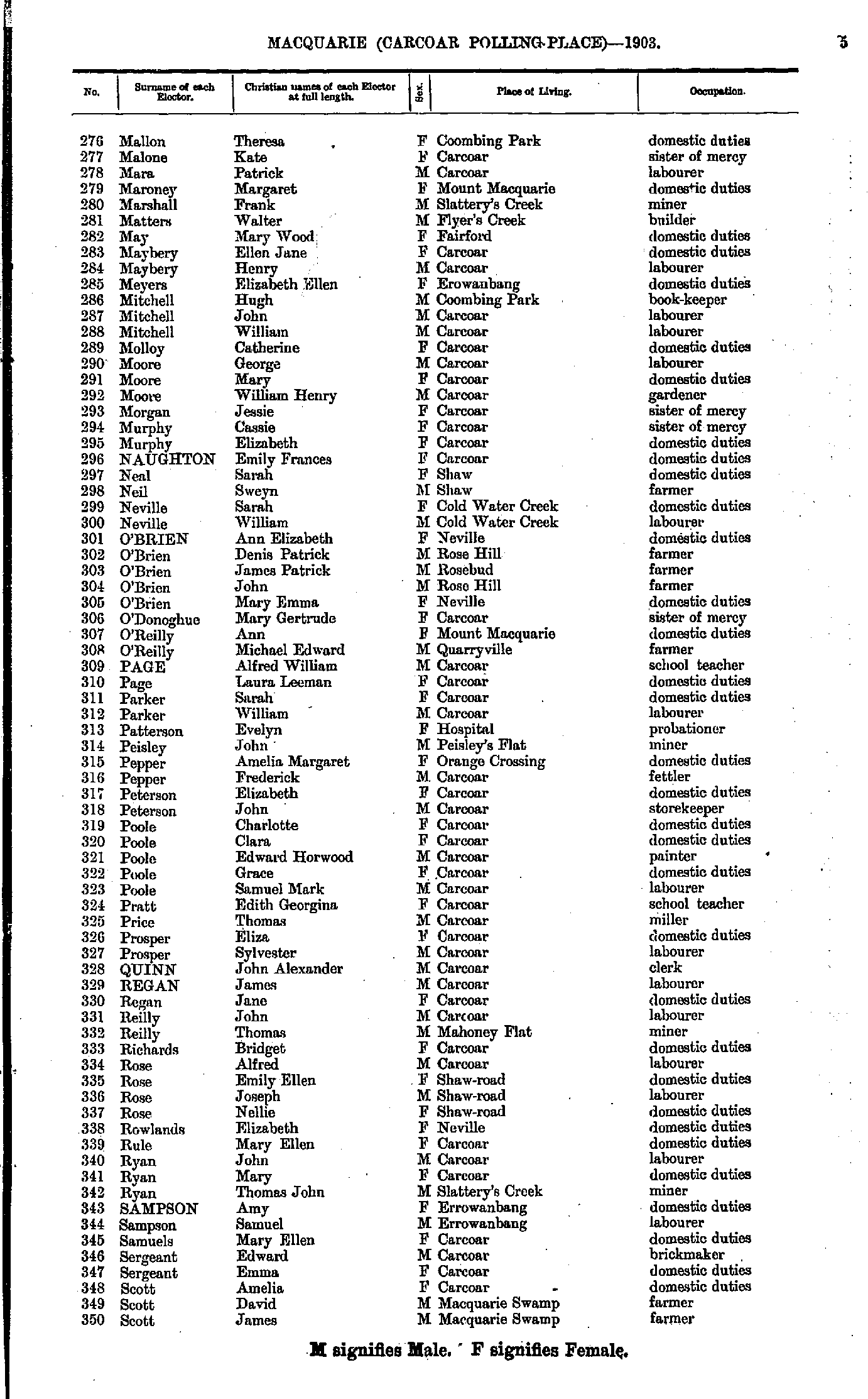
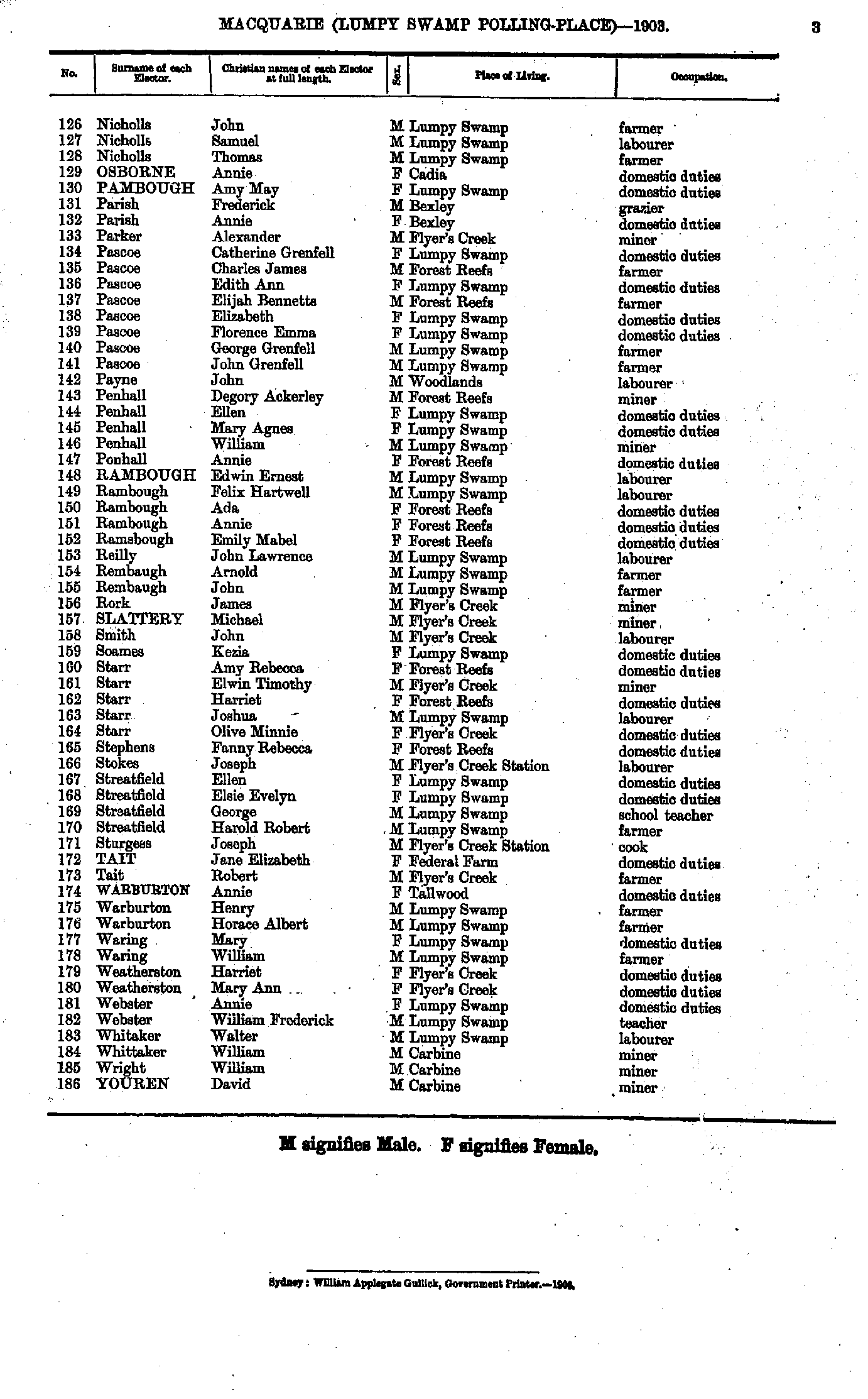
- Mallon Theresa - Scott James
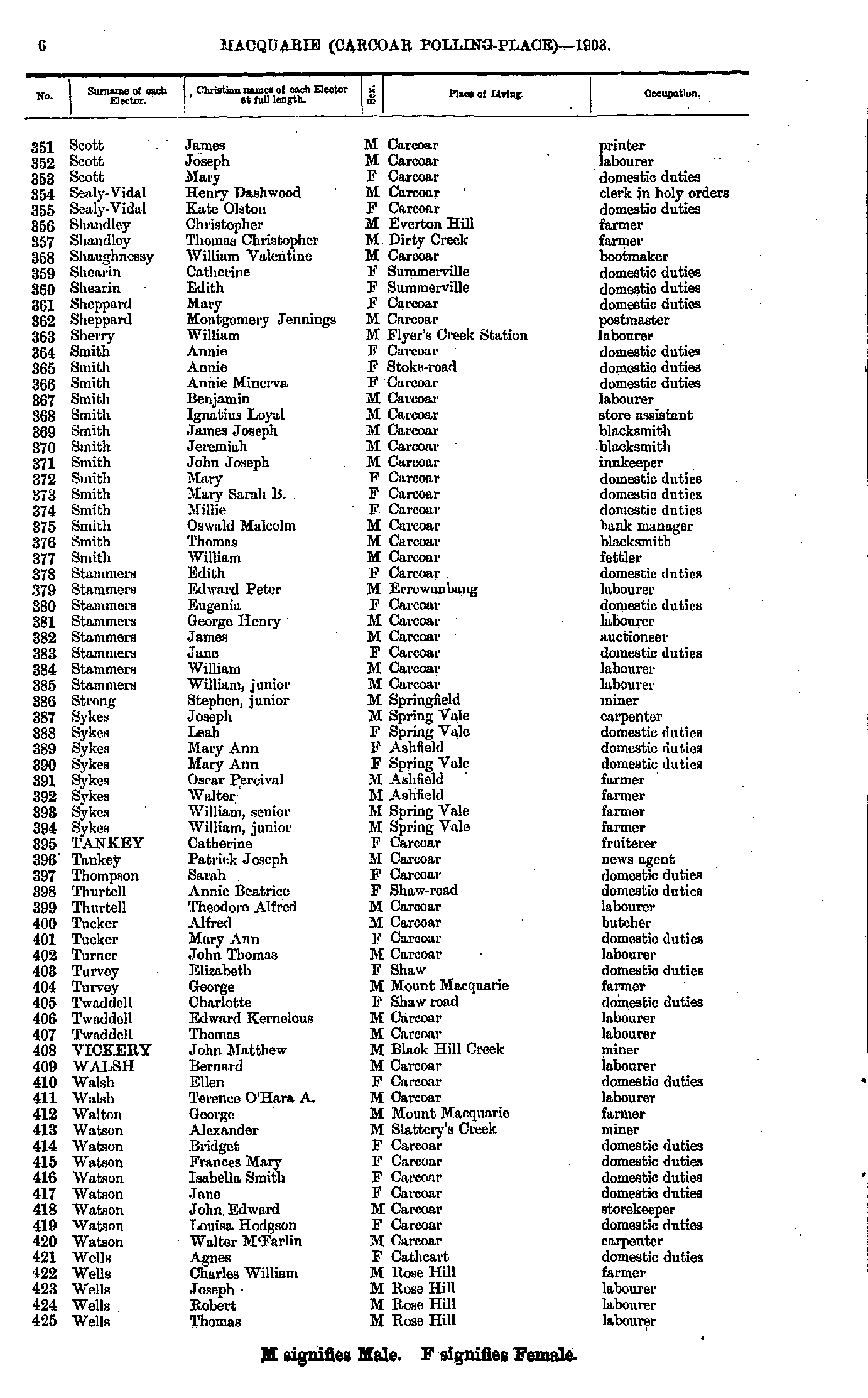
- Scott James - Wells Thomas
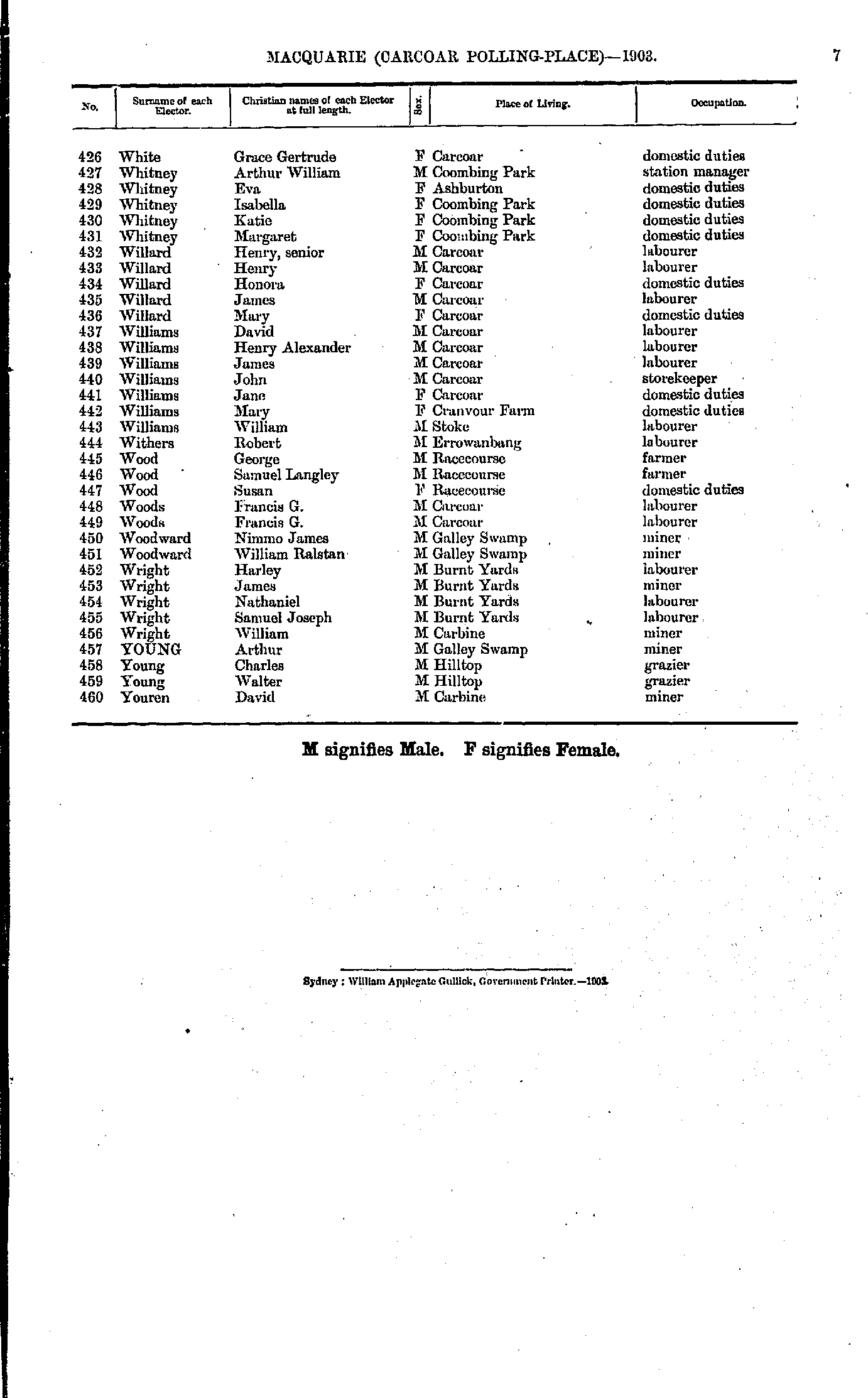
- White Grace - Youren David
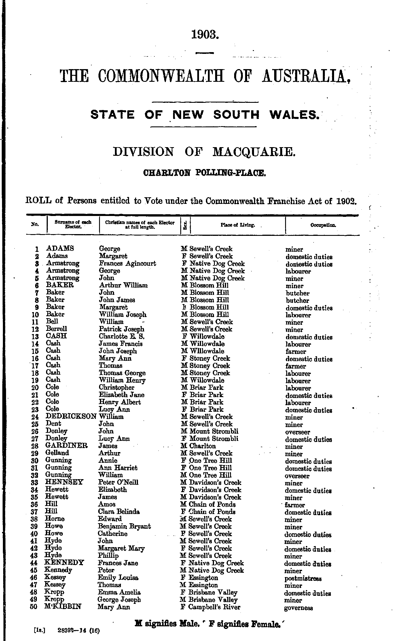
- Adams Ellen - Baker George
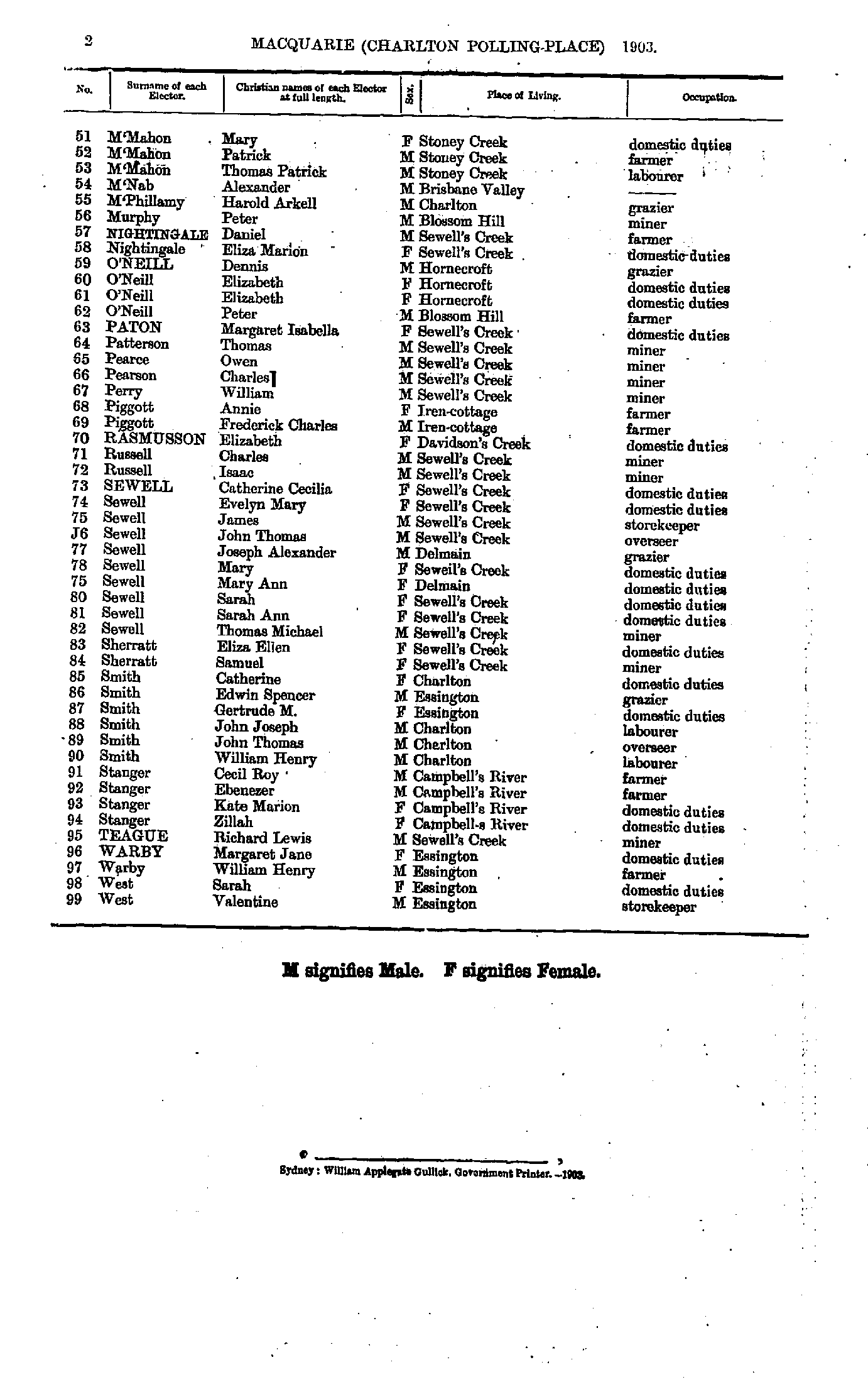
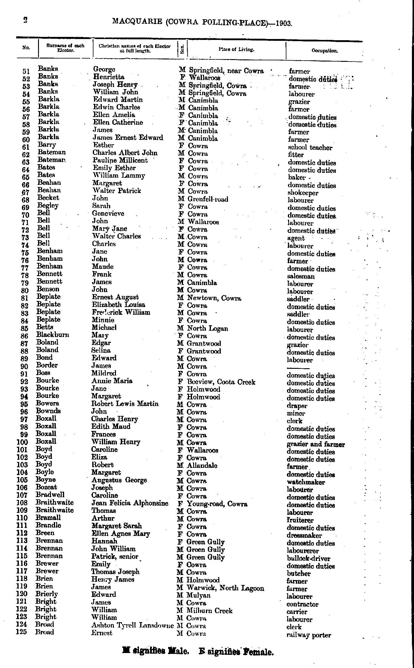
- Banks George - Broad Ernest
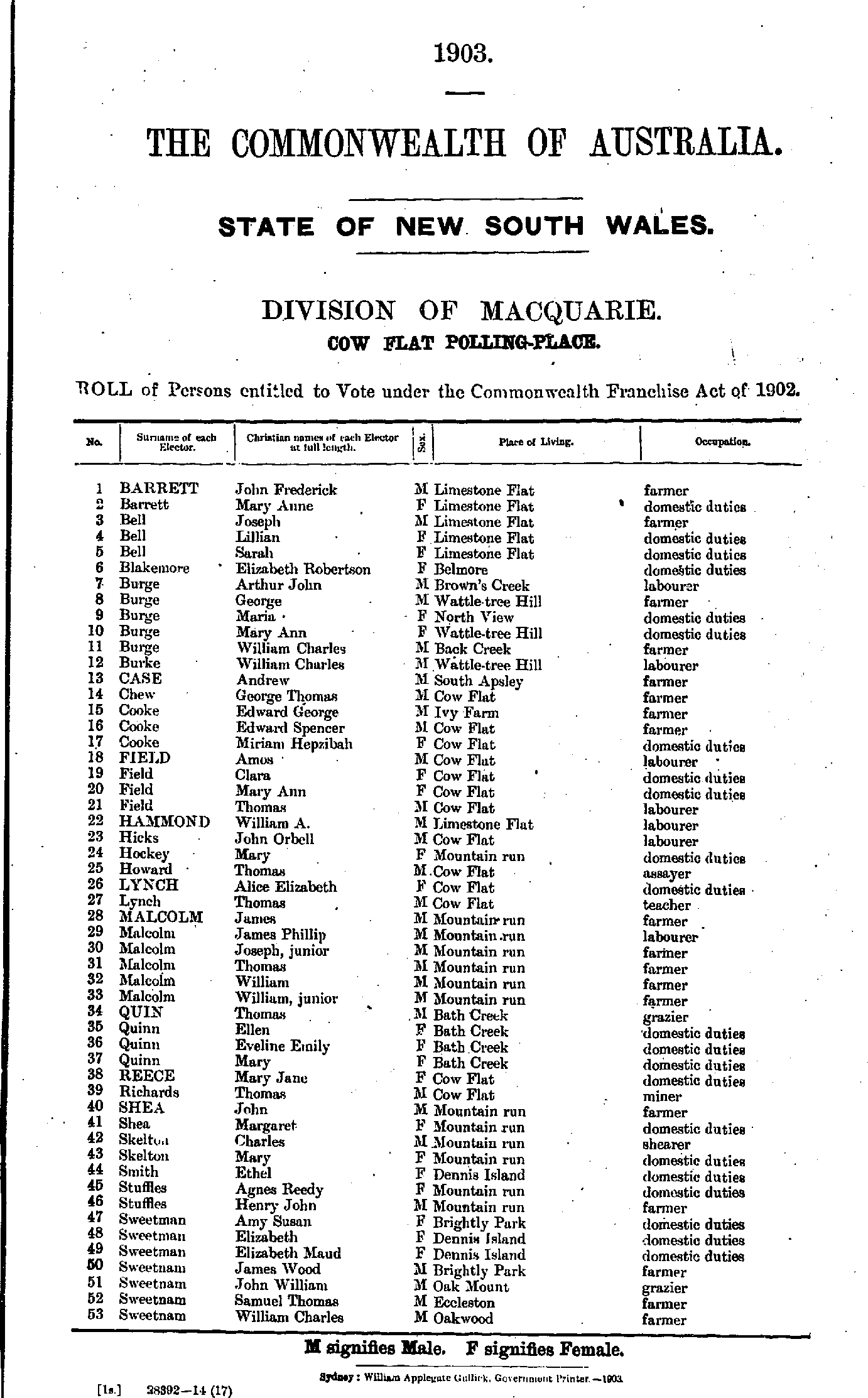
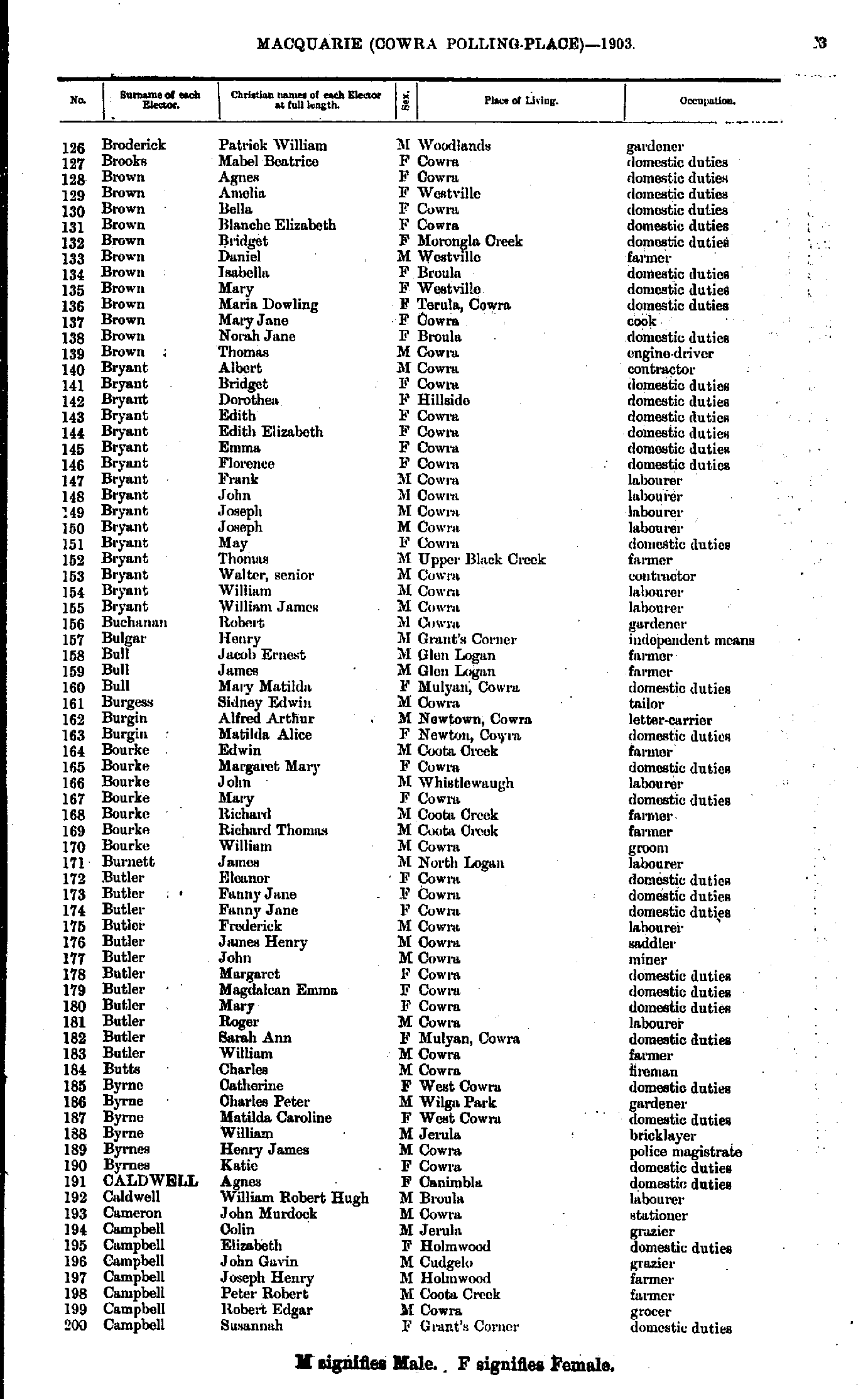
- Broderick Patrick - Campbell Susannah
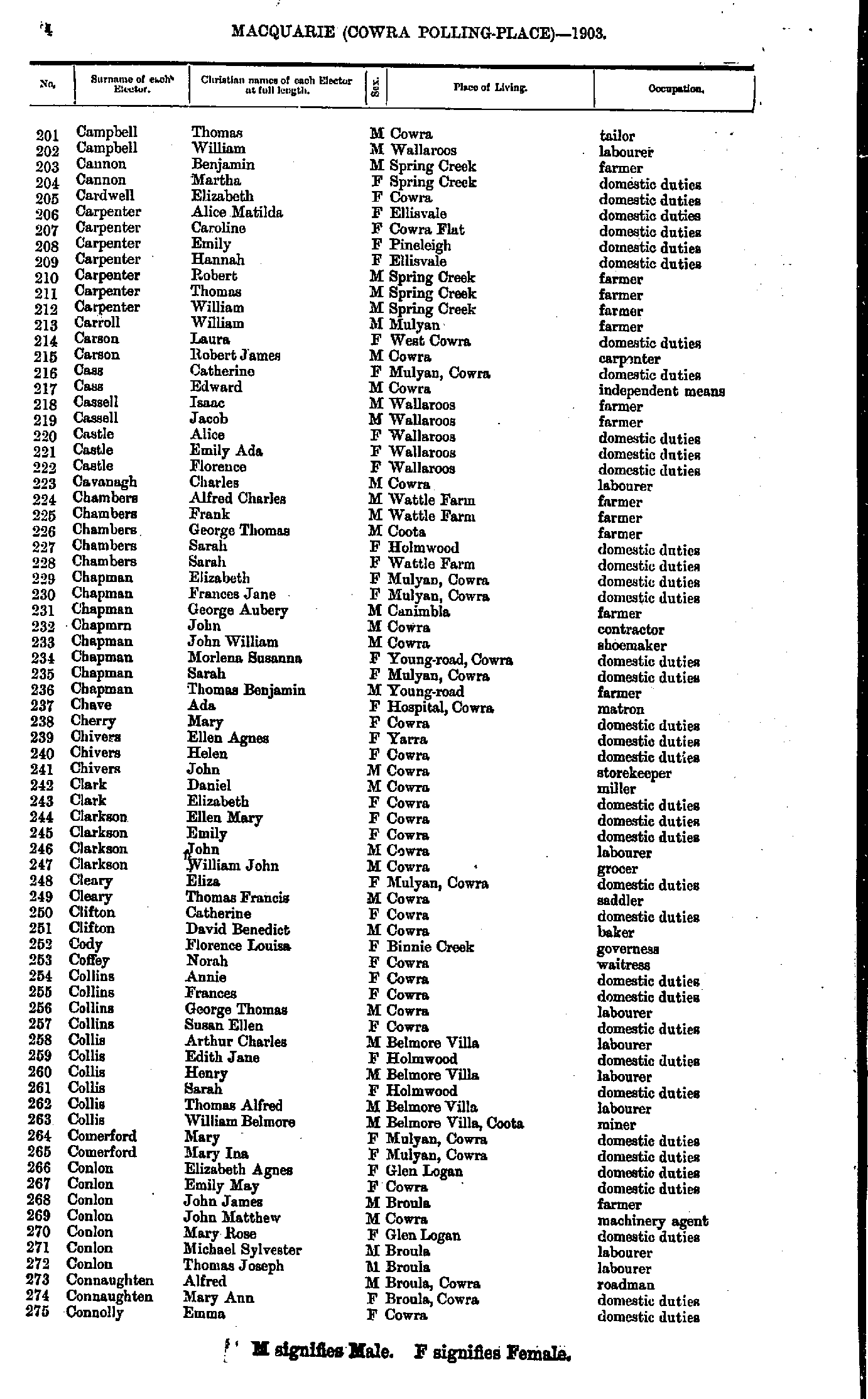
- Campbell Thomas - Connolly Emma
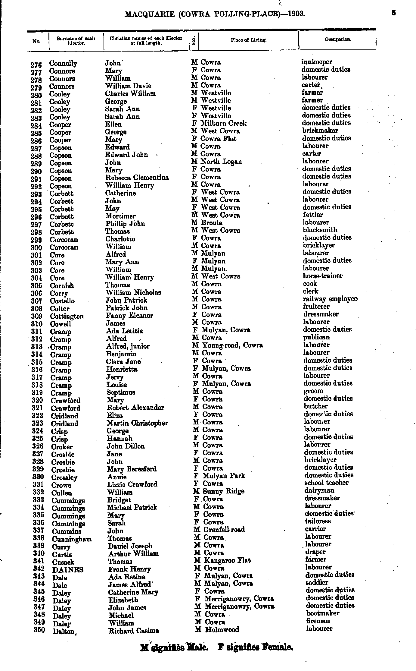
- Connolly John - Dalton Richard
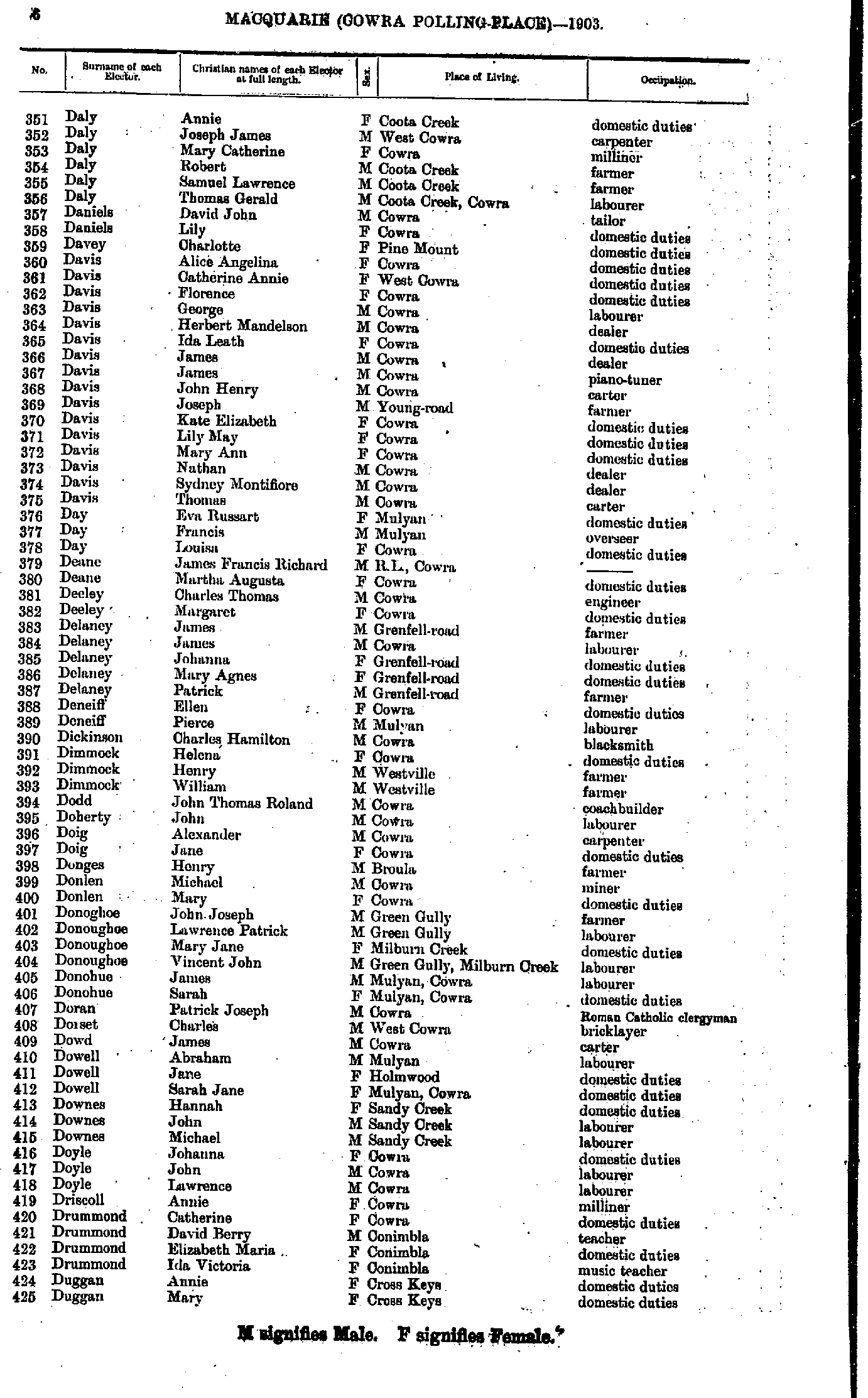
- Daly Annie - Duggan Mary
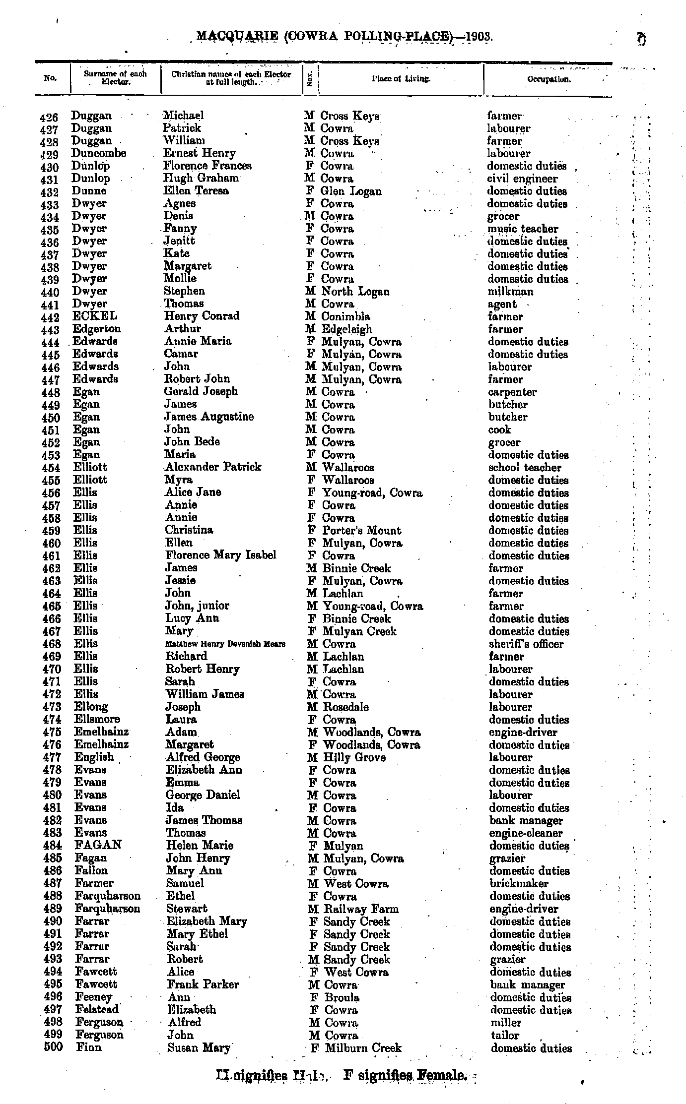
- Duggan Michael - Finn Susan
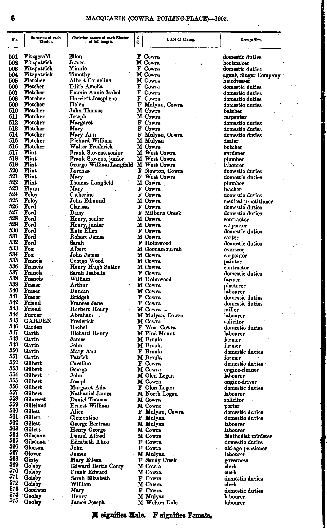
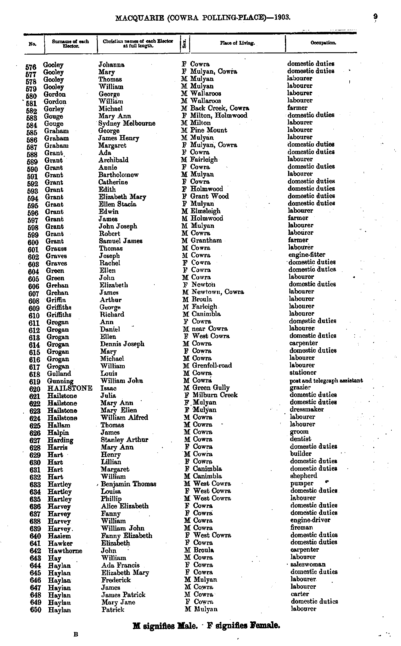
- Fitzgerald Ellen - Gooley James
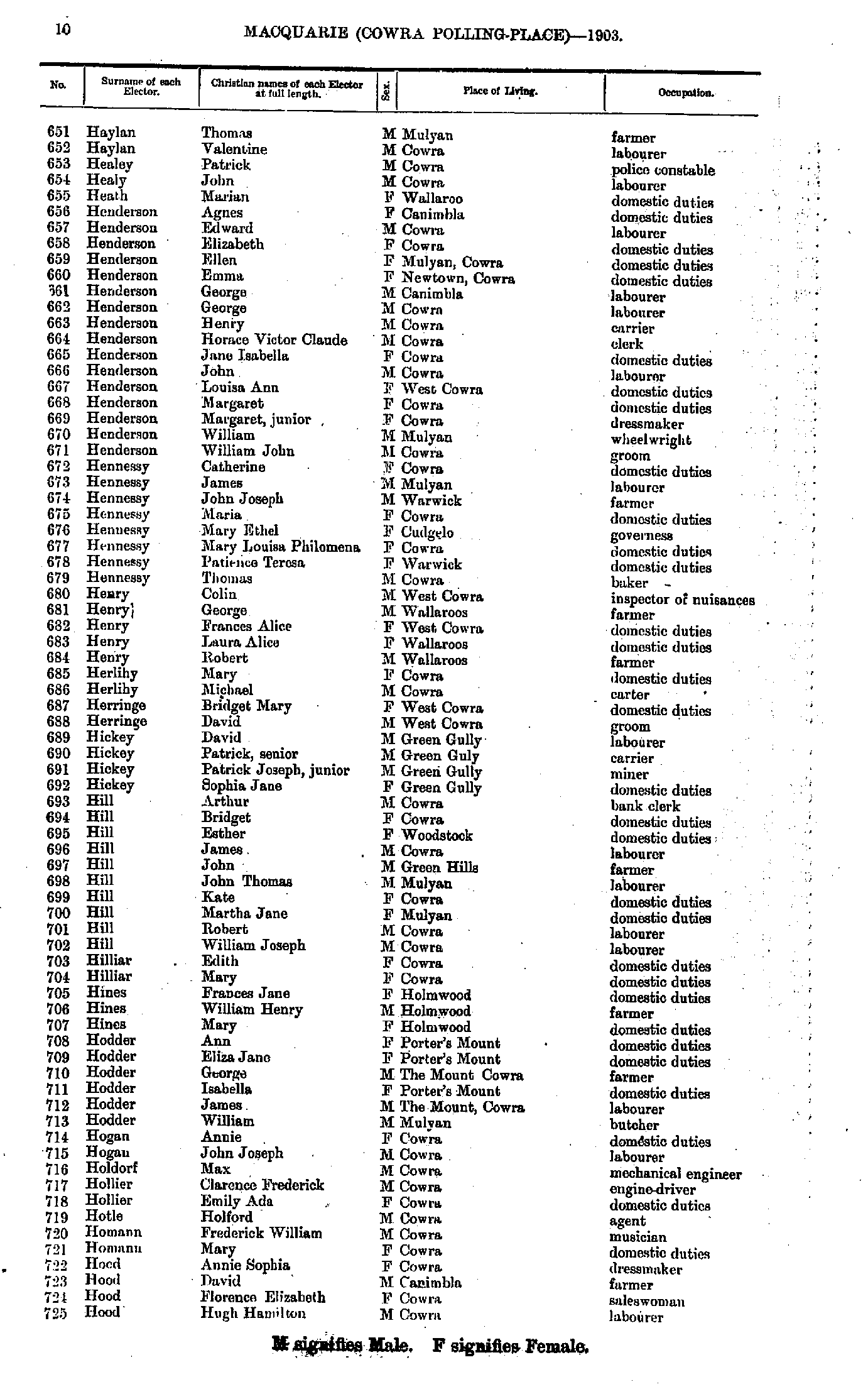
- Gooley Johanna - Haylan Patrick
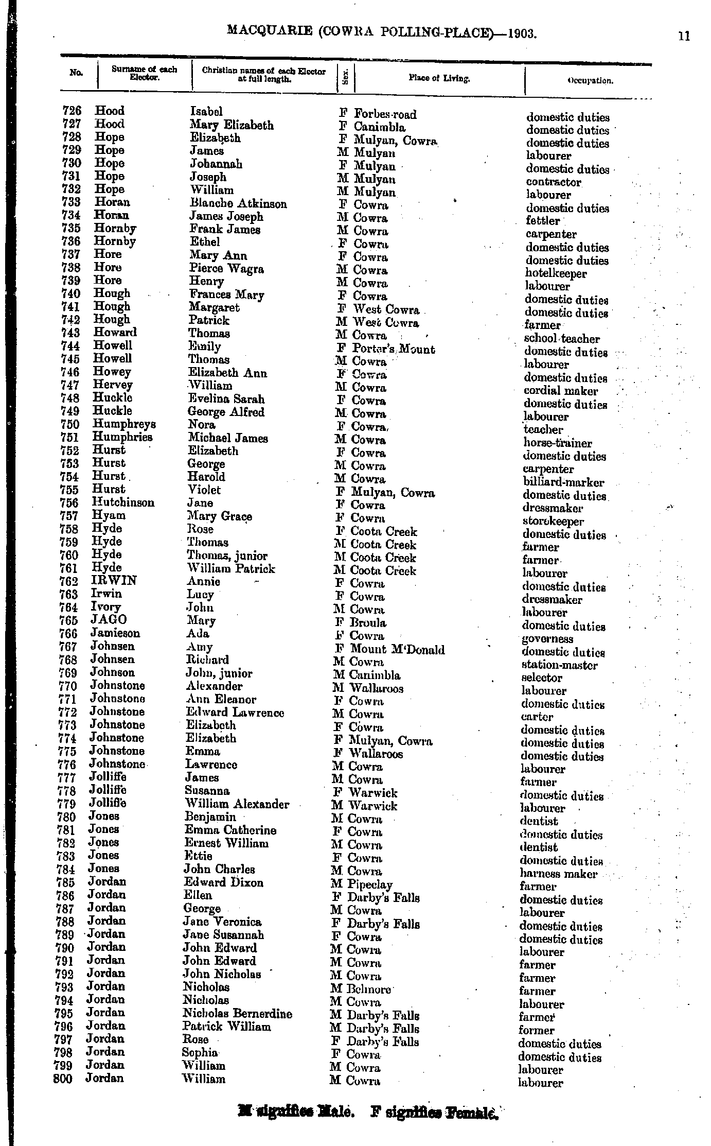
- Haylan Thomas - Hood Hugh
- Hood Isabel - Jordan William
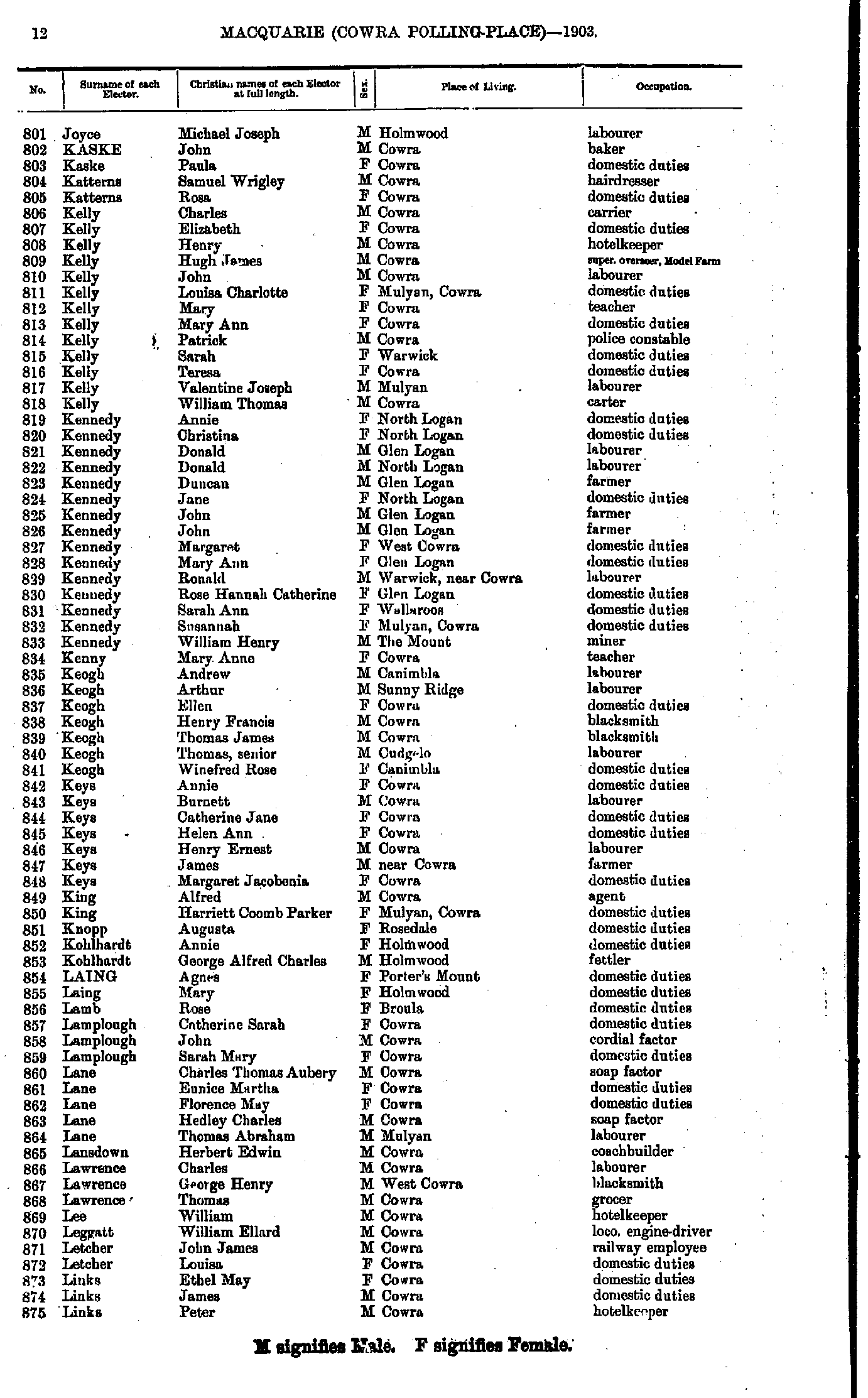
- Joyce Michael - Links Peter
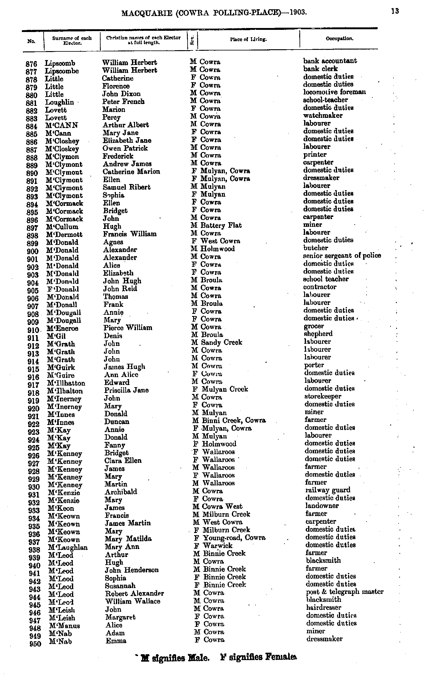
- Lipscomb William - M'Nab Emma
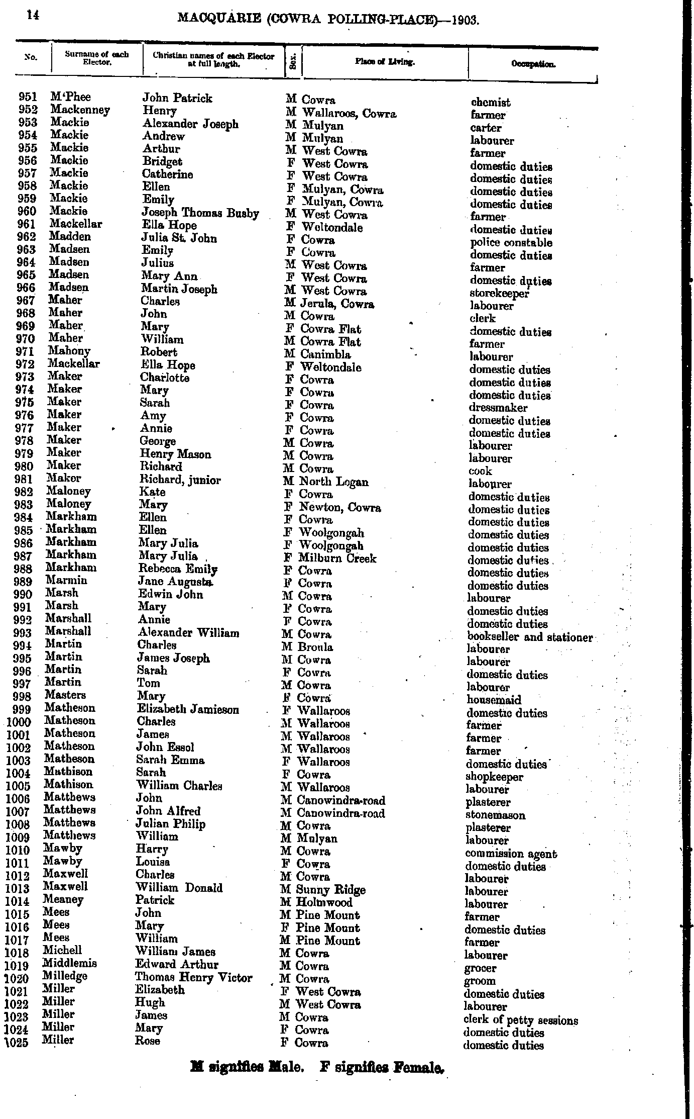
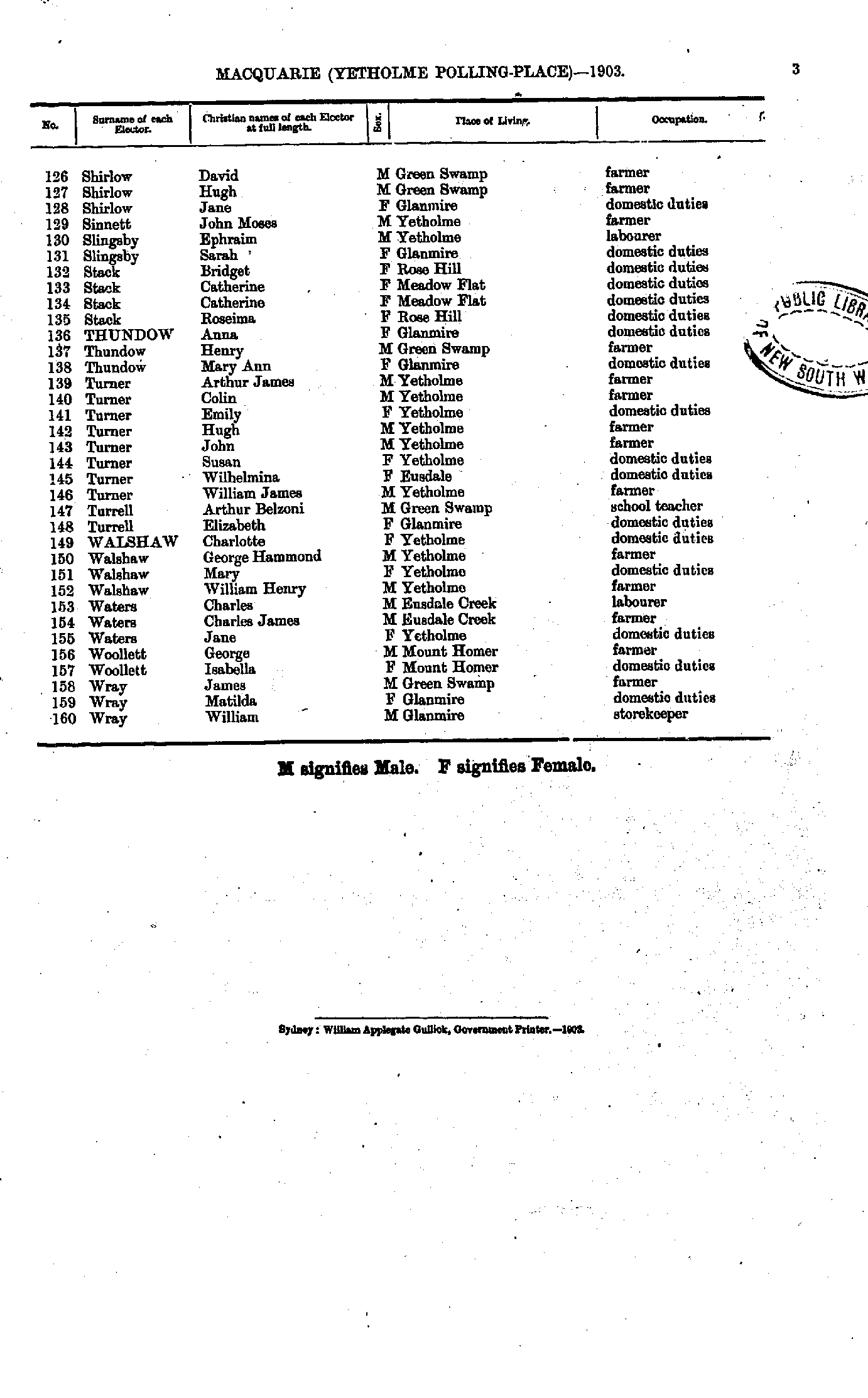
- M'Phee John - Miller Rose
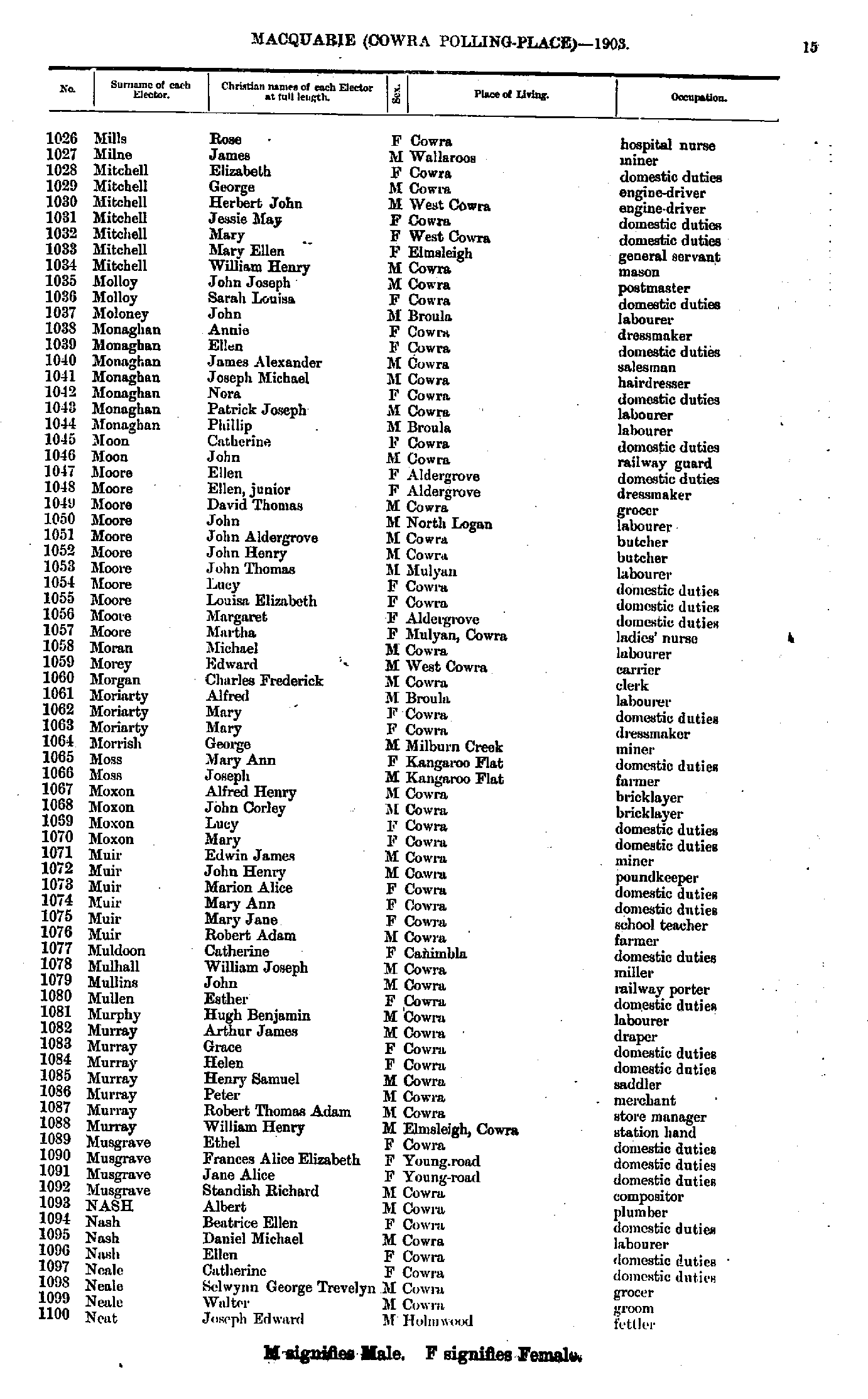
- Mills Rose - Neat Joseph
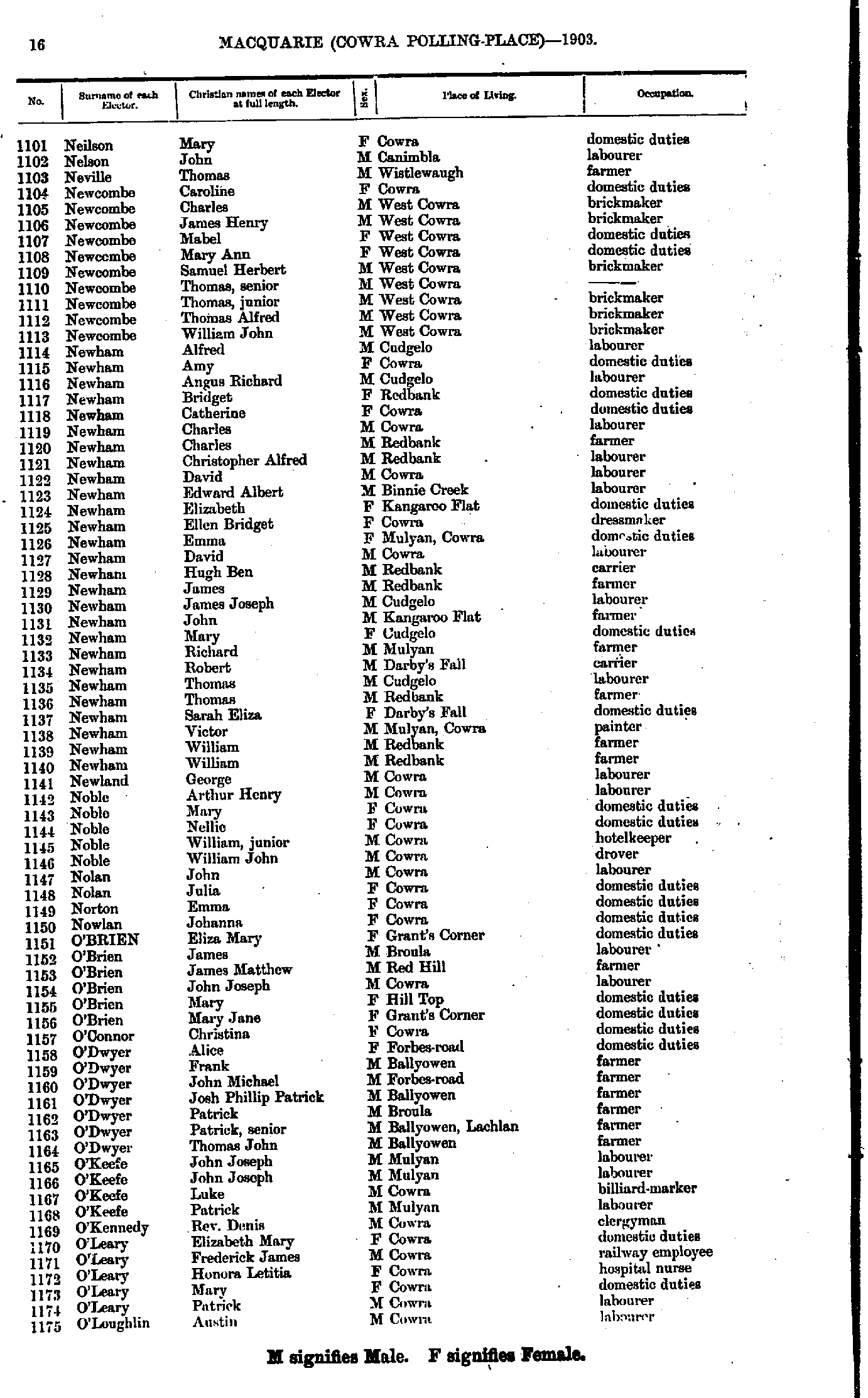
- Neilson Mary - O'Loughlin Austin
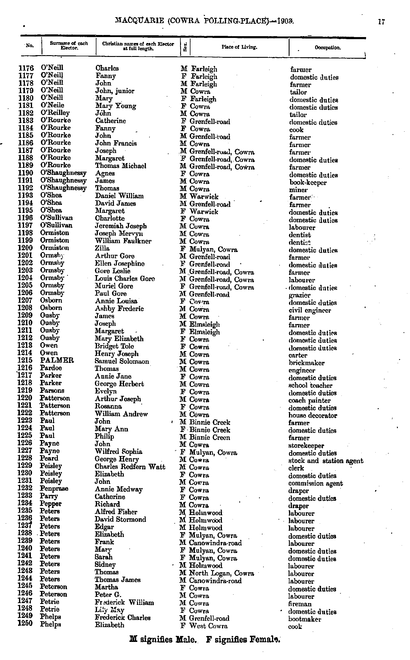
- O'Neill Charles - Phelps Elizabeth
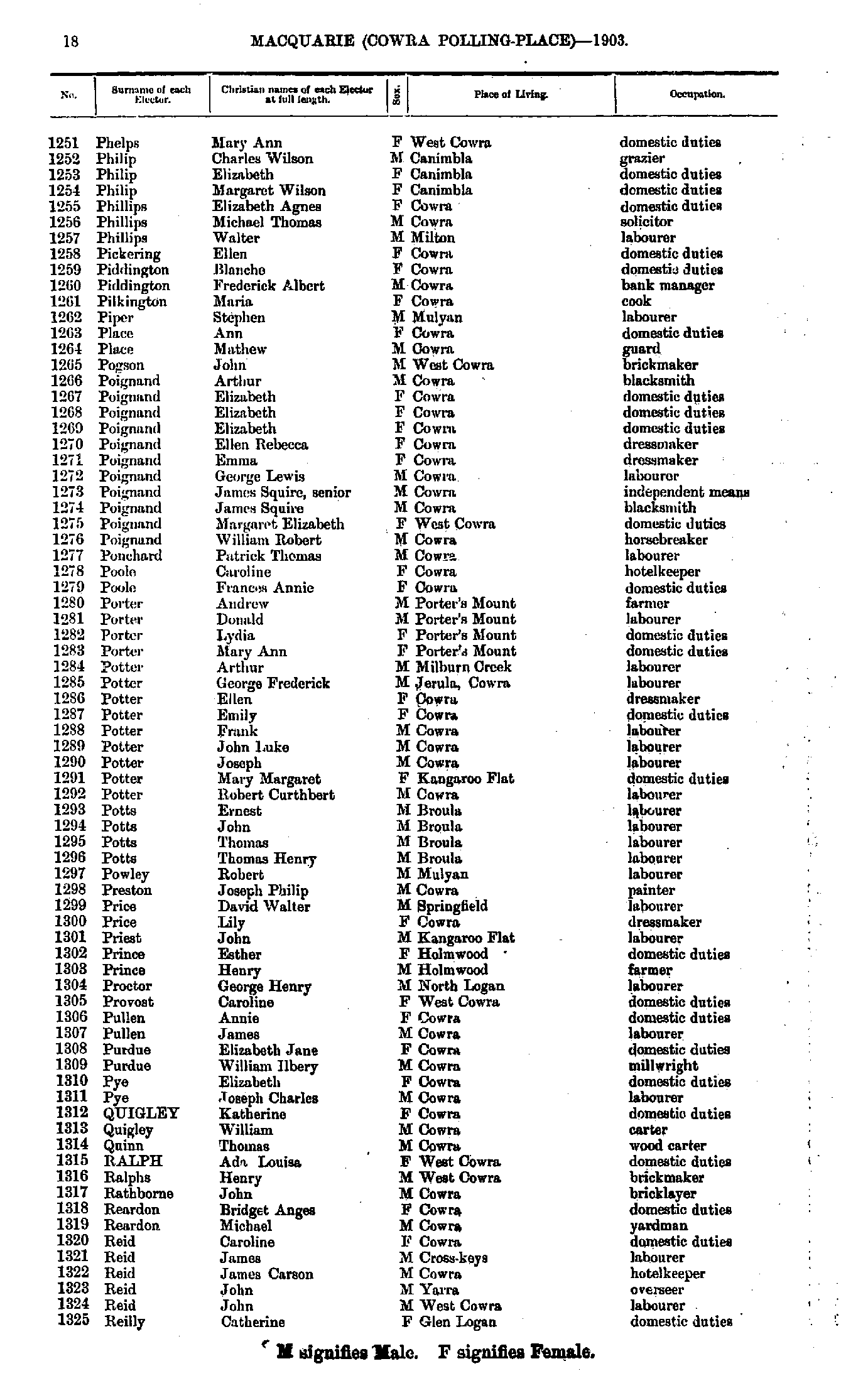
- Phelps Mary - Reilly Catherine
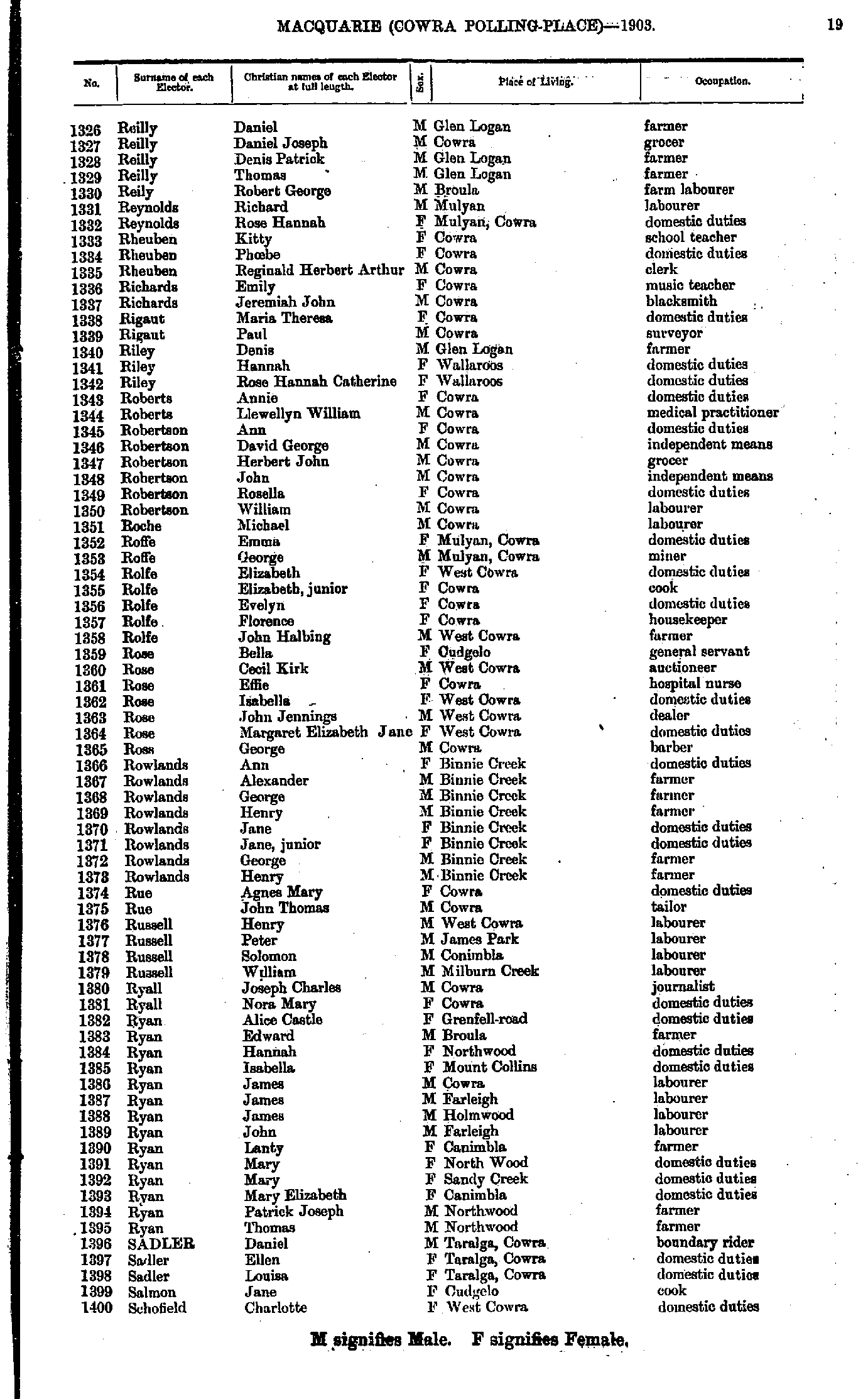
- Reilly Daniel - Schofield Charlotte
- Schofield Henry - Steele Edwin
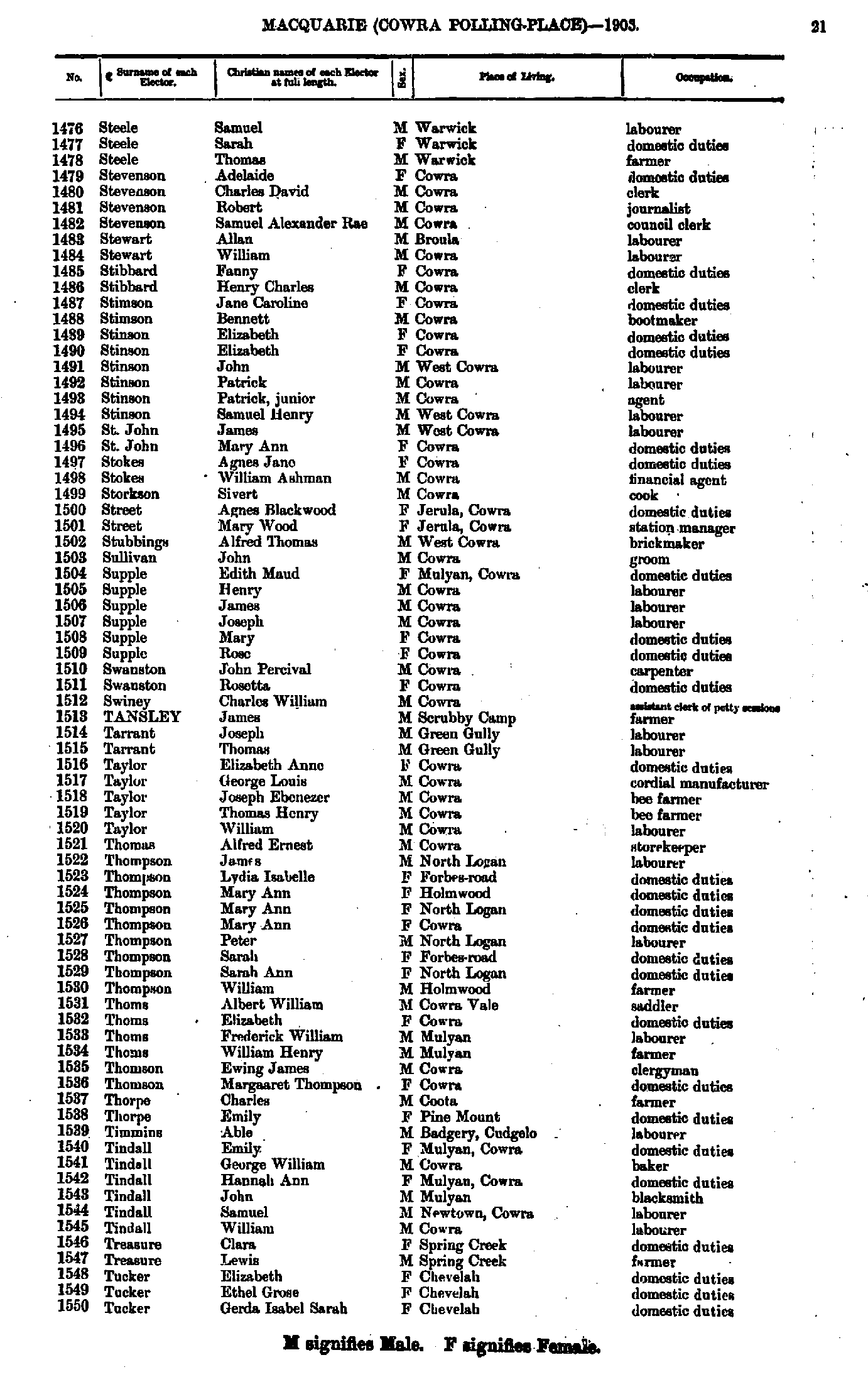
- Steele Samuel - Tucker Gerda
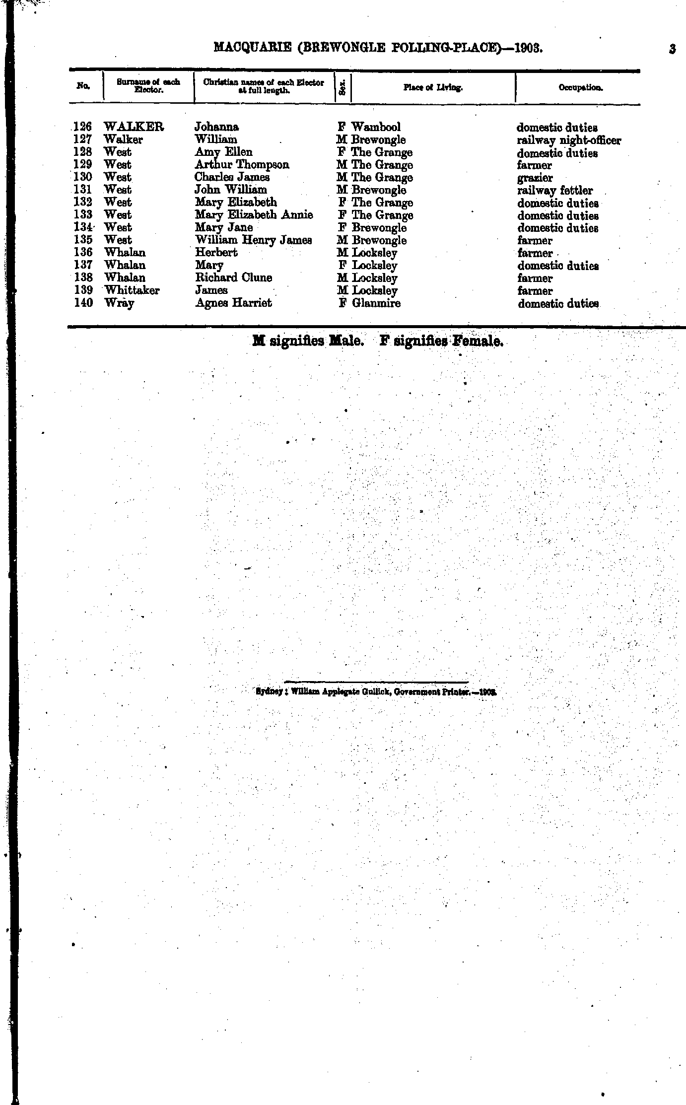
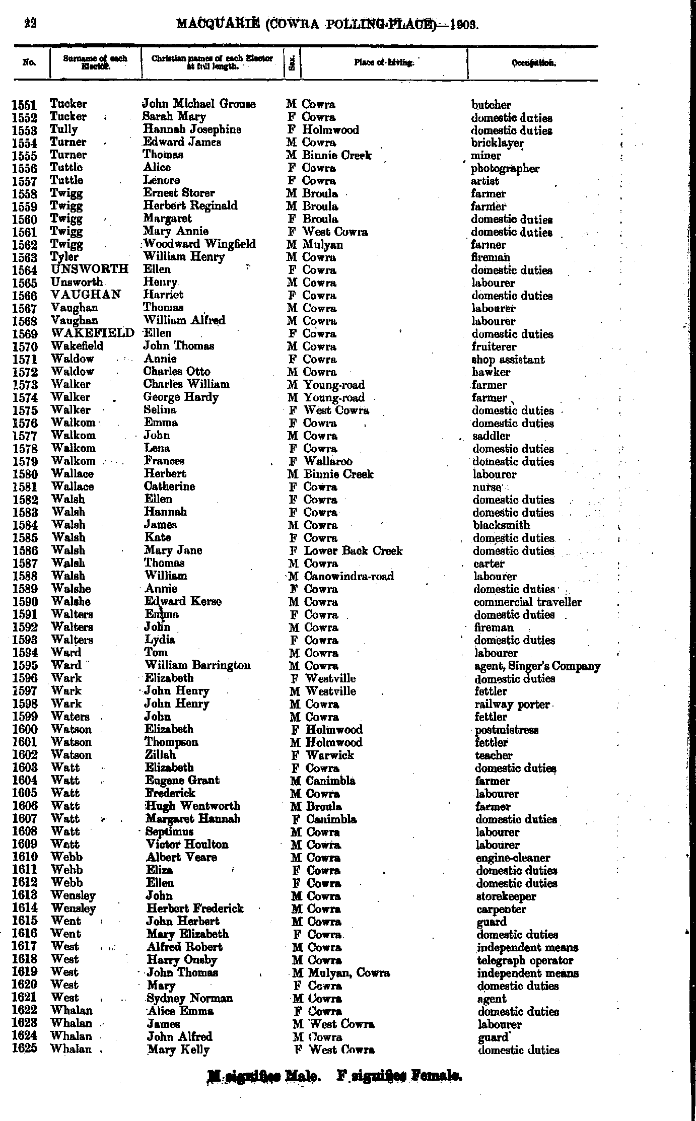
- Tucker John - Whalan Mary
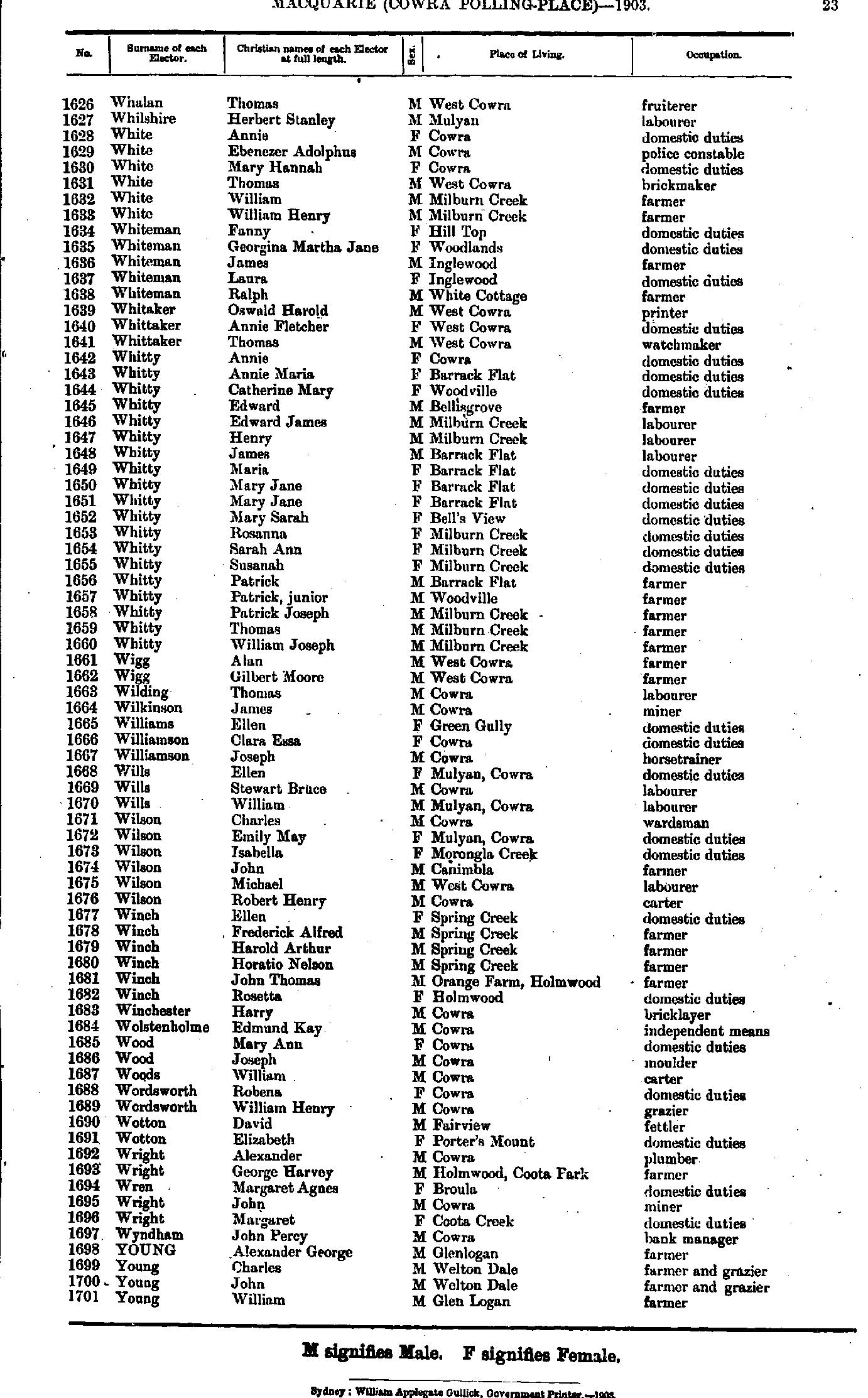
- Whalan Thomas - Young William
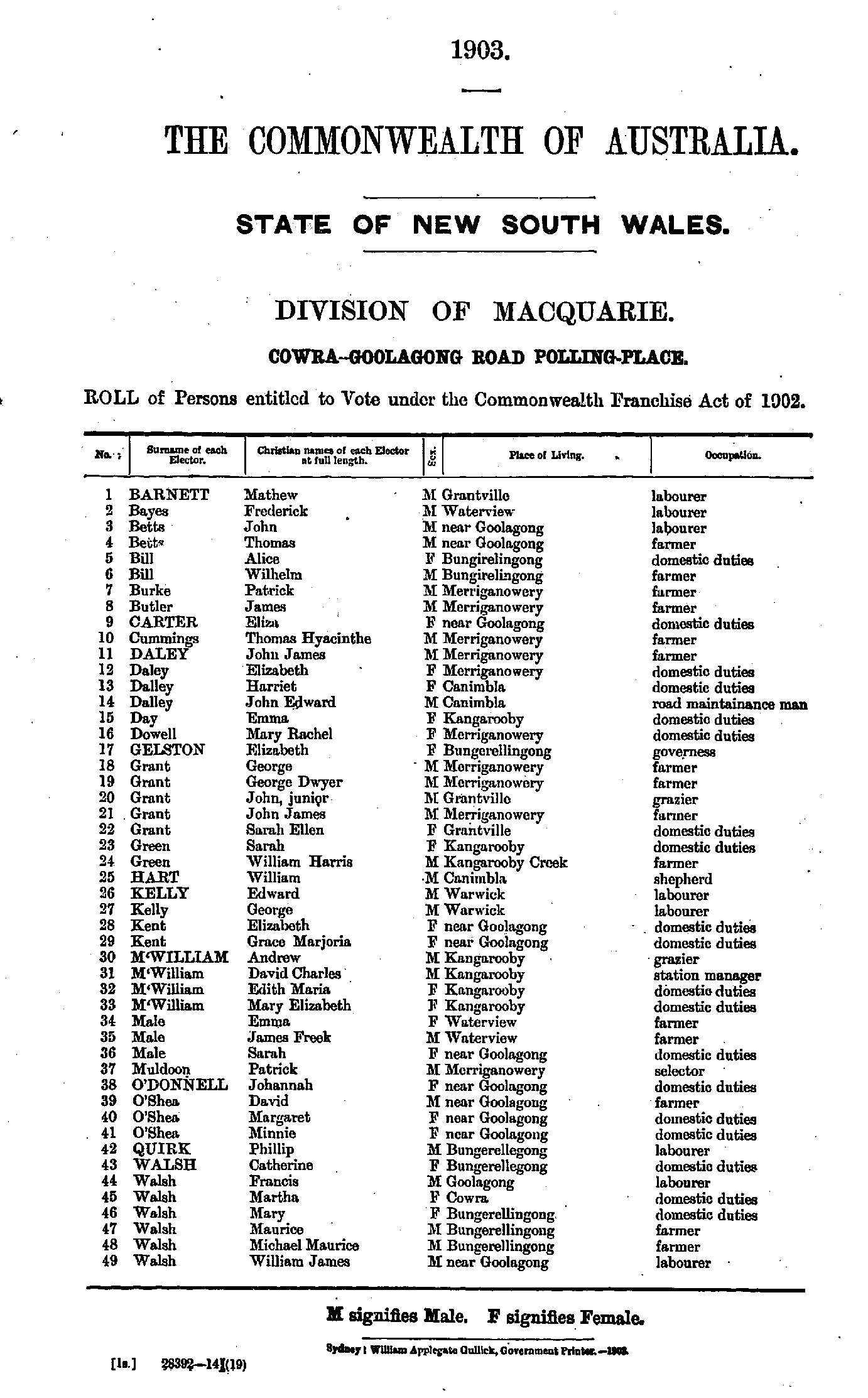
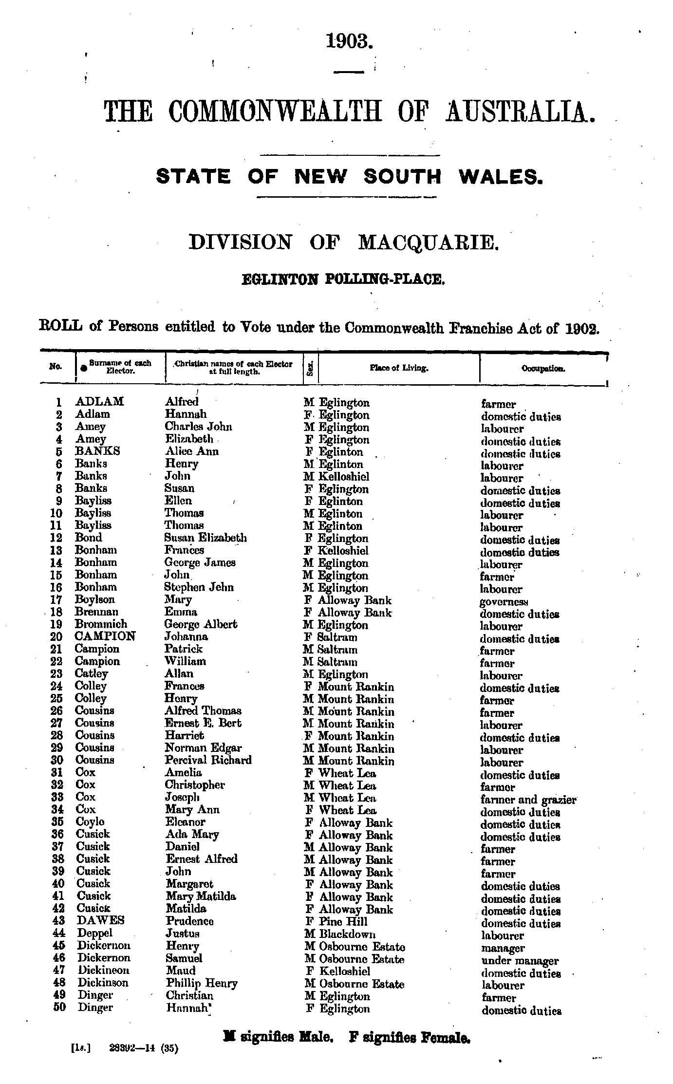
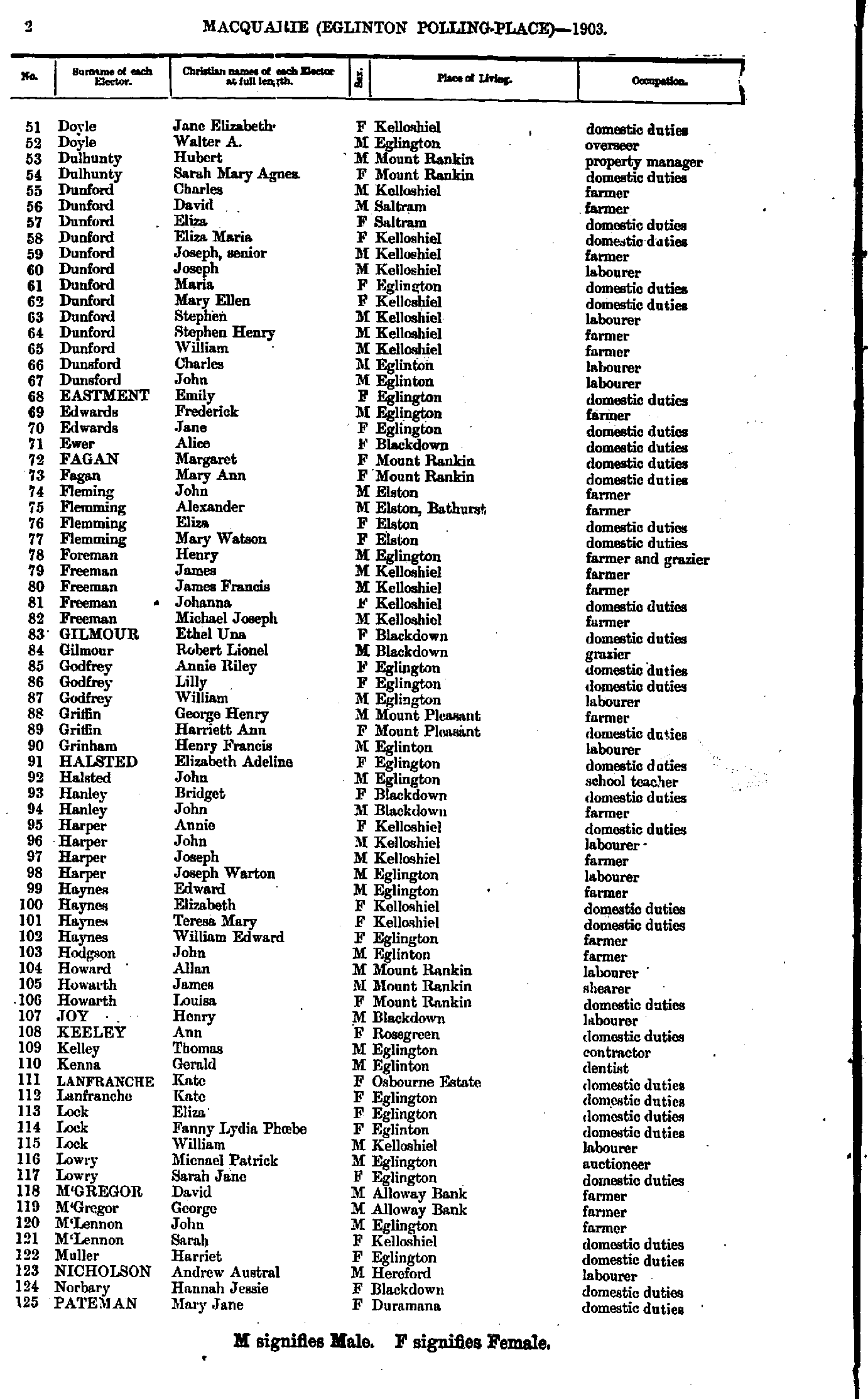
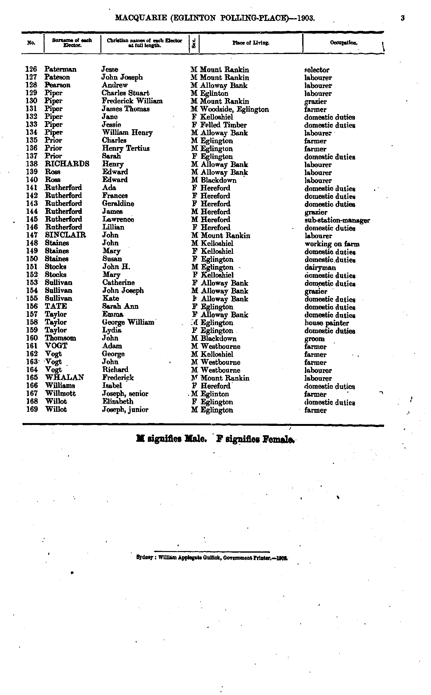
Cowra-Goolagong Road Polling Place
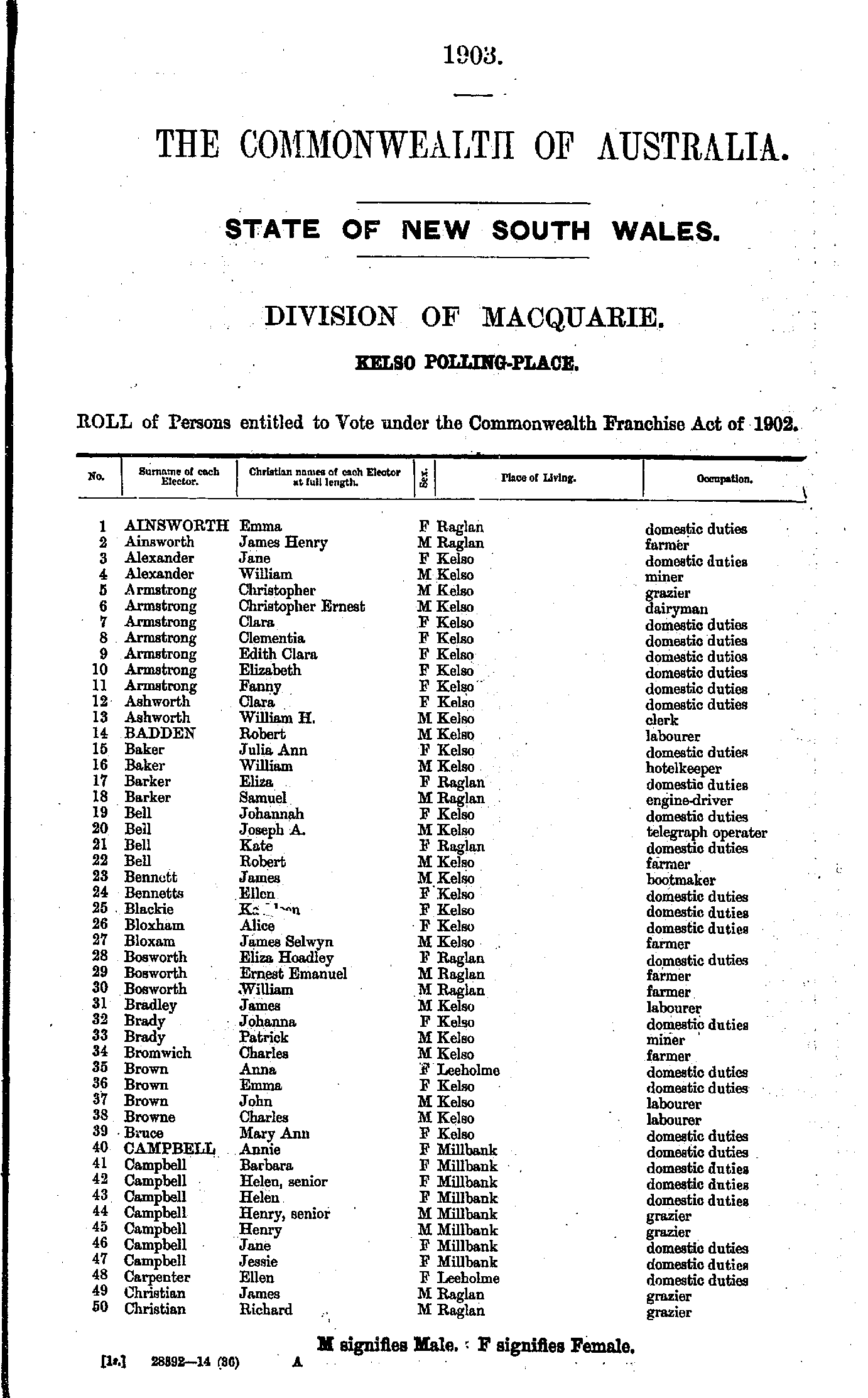
- Ainsworth Emma - Christian Richard
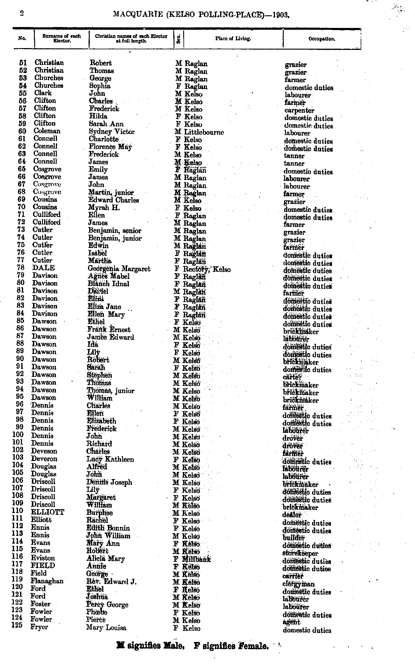
- Christian Robert - Fryer Mary
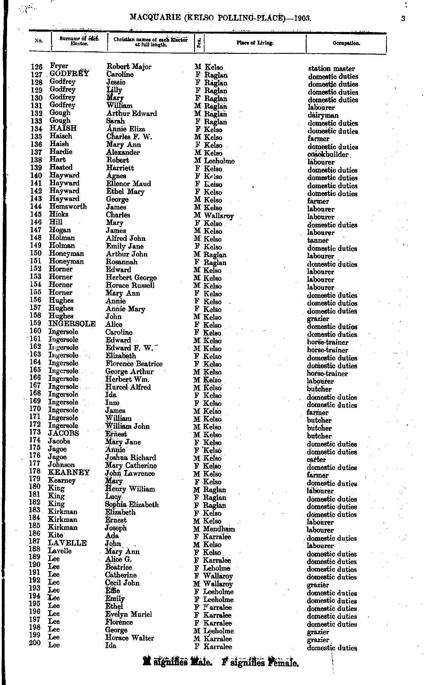
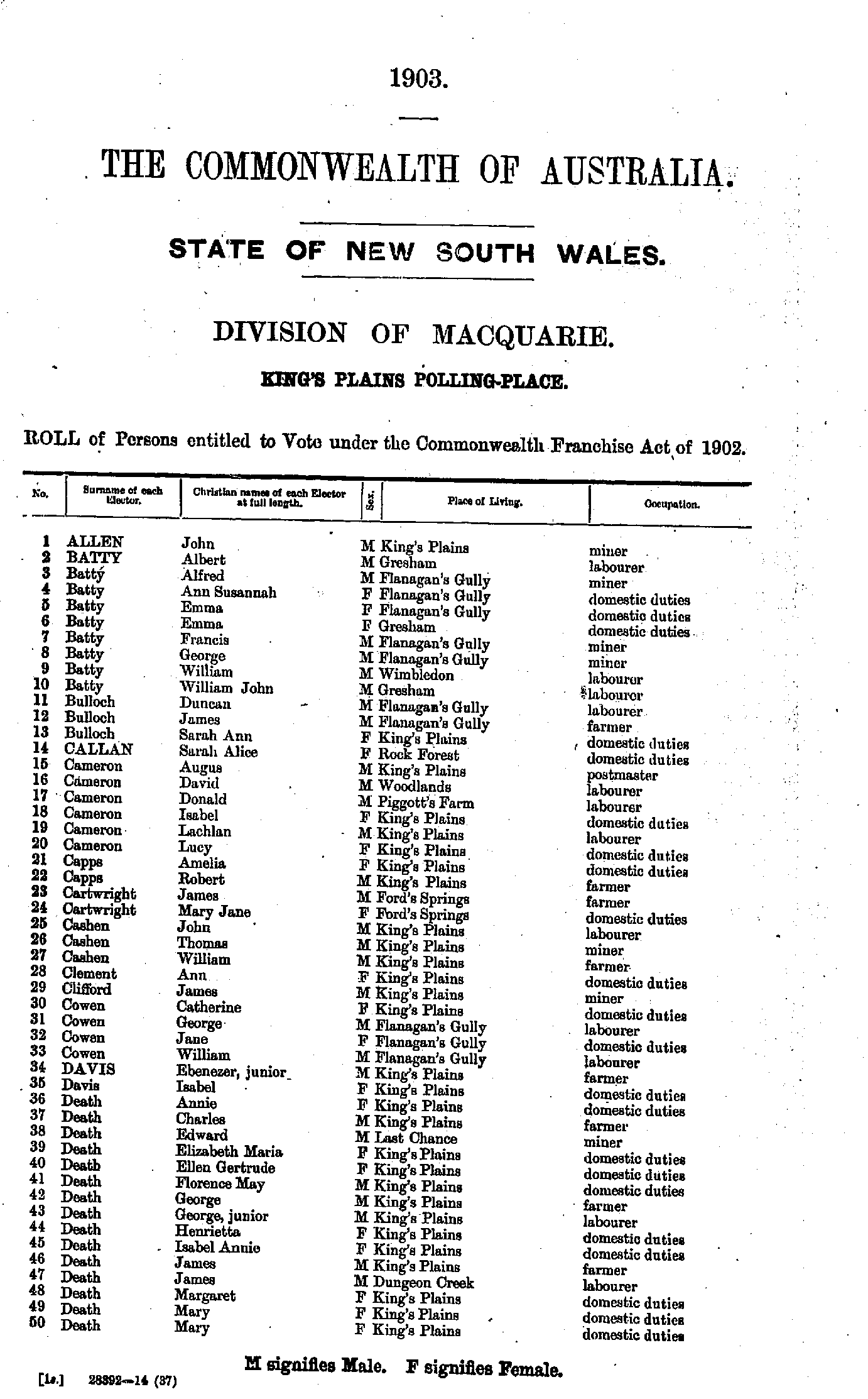
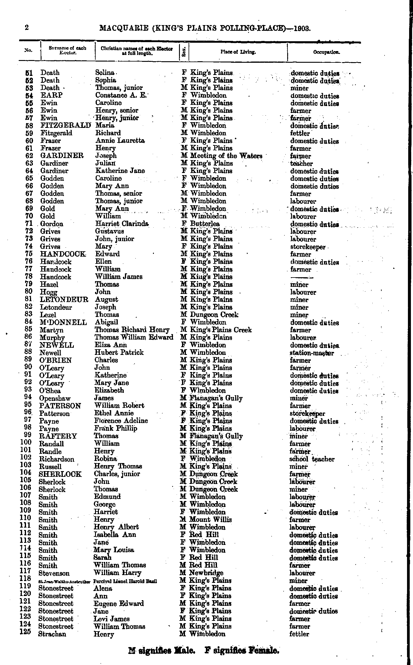
- Fryer Robert - Lee Ida
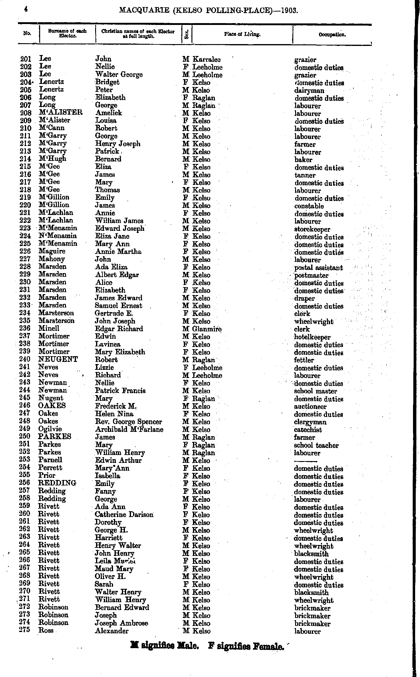
- Lee John - Ross Alexander
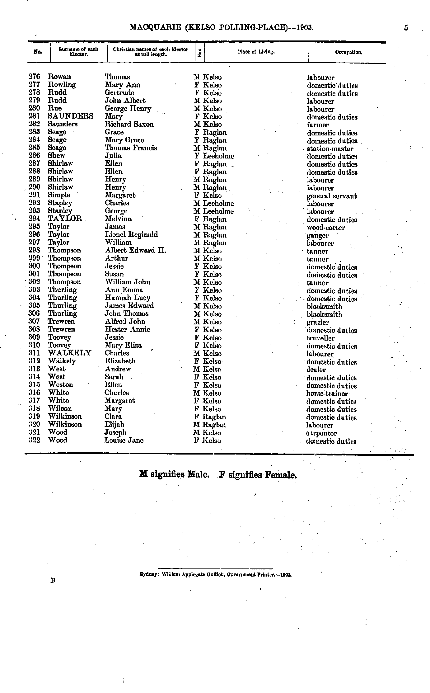
- Rowan Thomas - Wood Louise
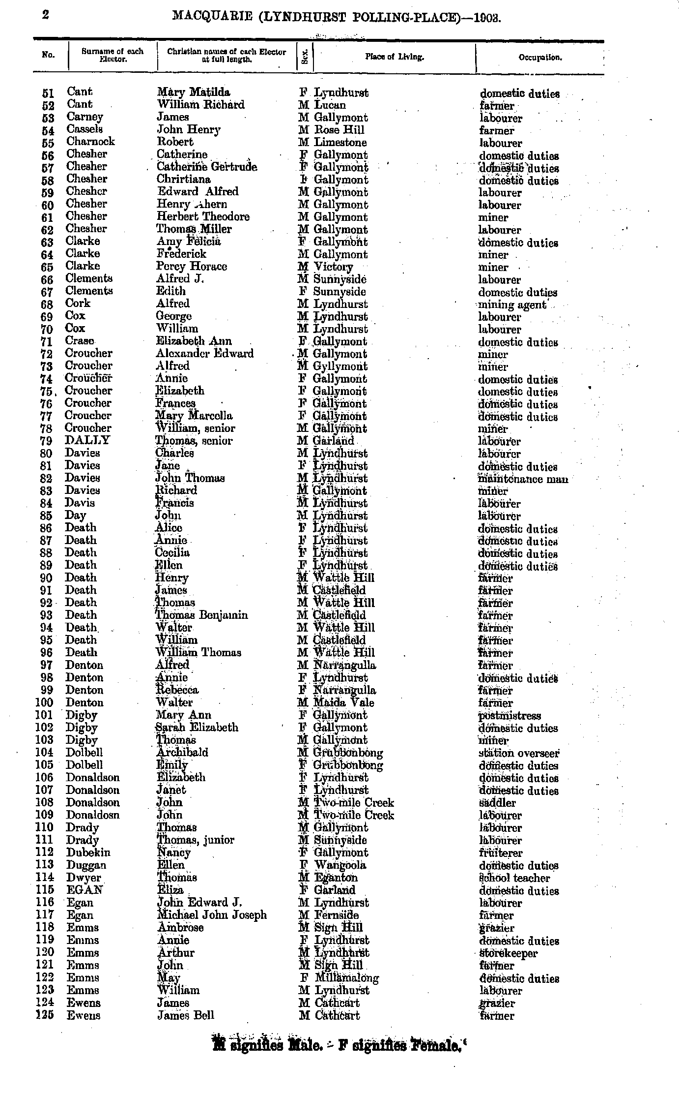
- Aiken Elizabeth - Cant Jeffery
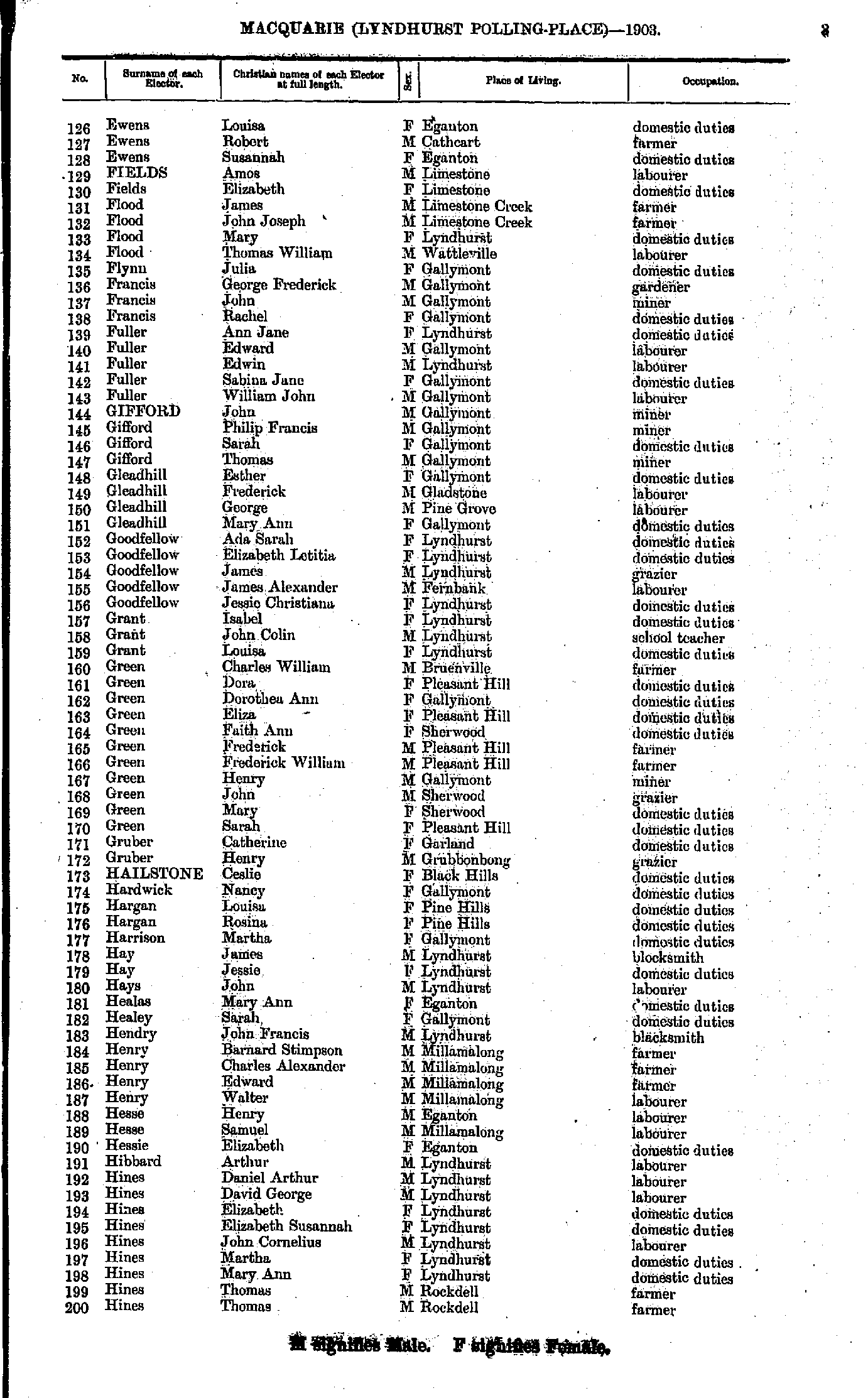
- Cant Mary - Ewens James
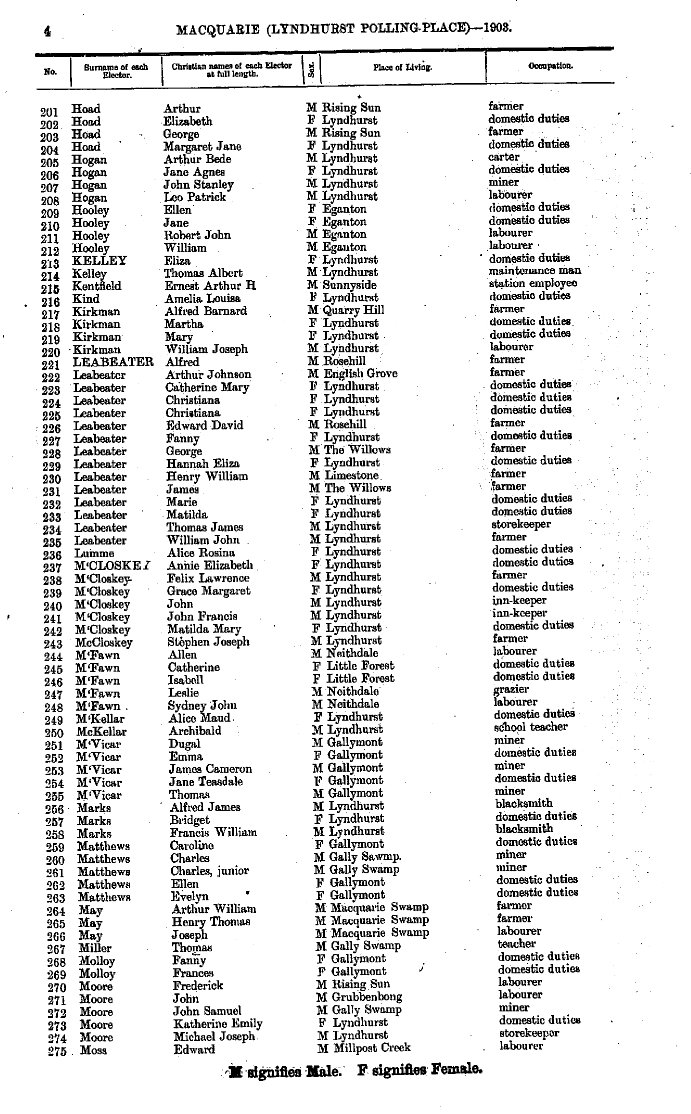
- Ewens Louisa - Hines Thomas
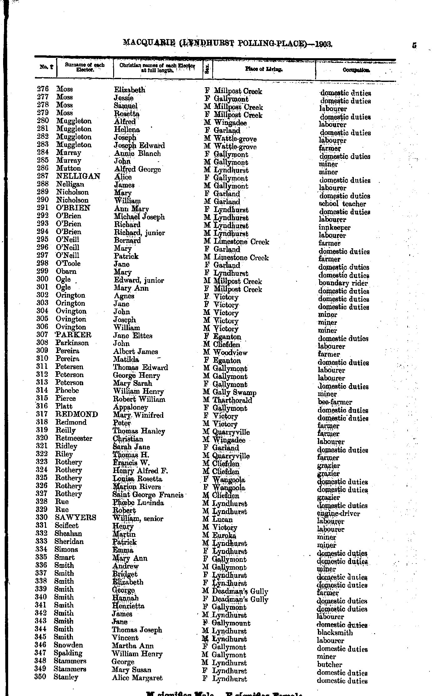
- Hoad Arthur - Moss Edward
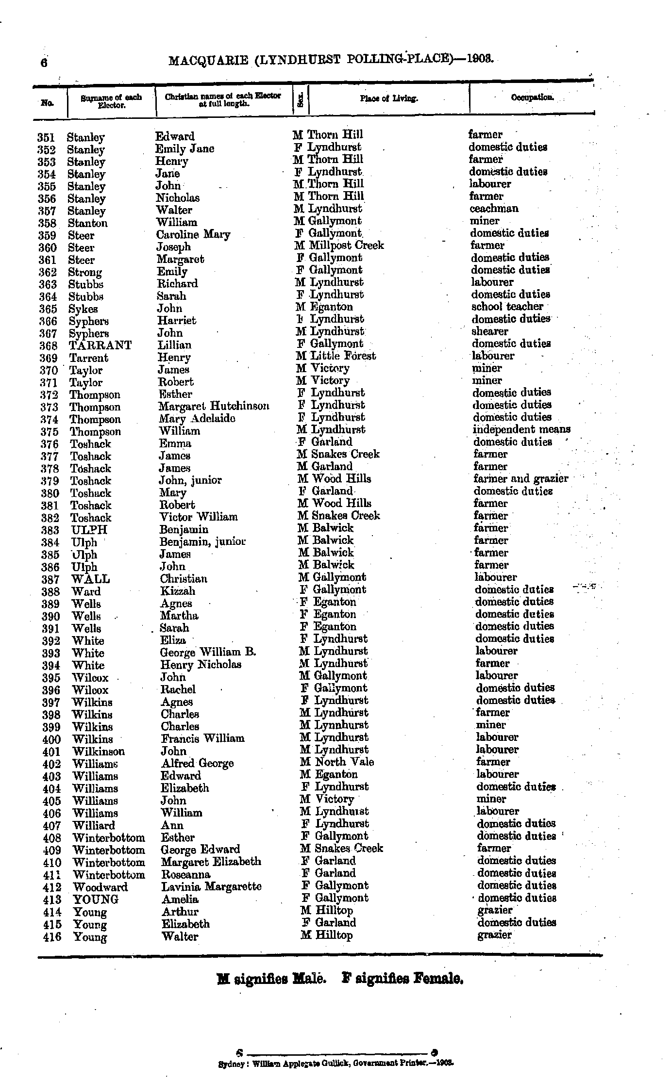
- Moss Elizabeth - Stanley Alice
- Stanley Edward - Young Walter
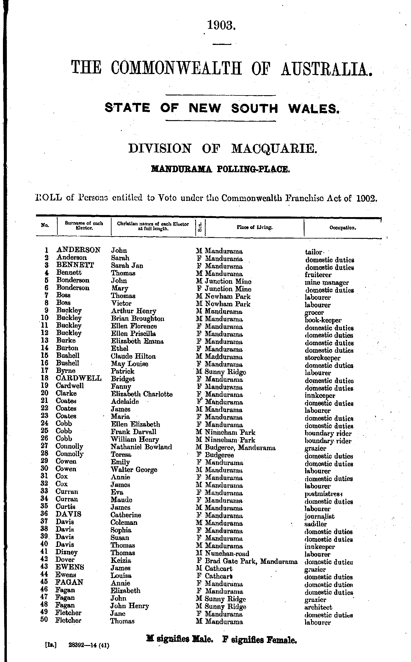
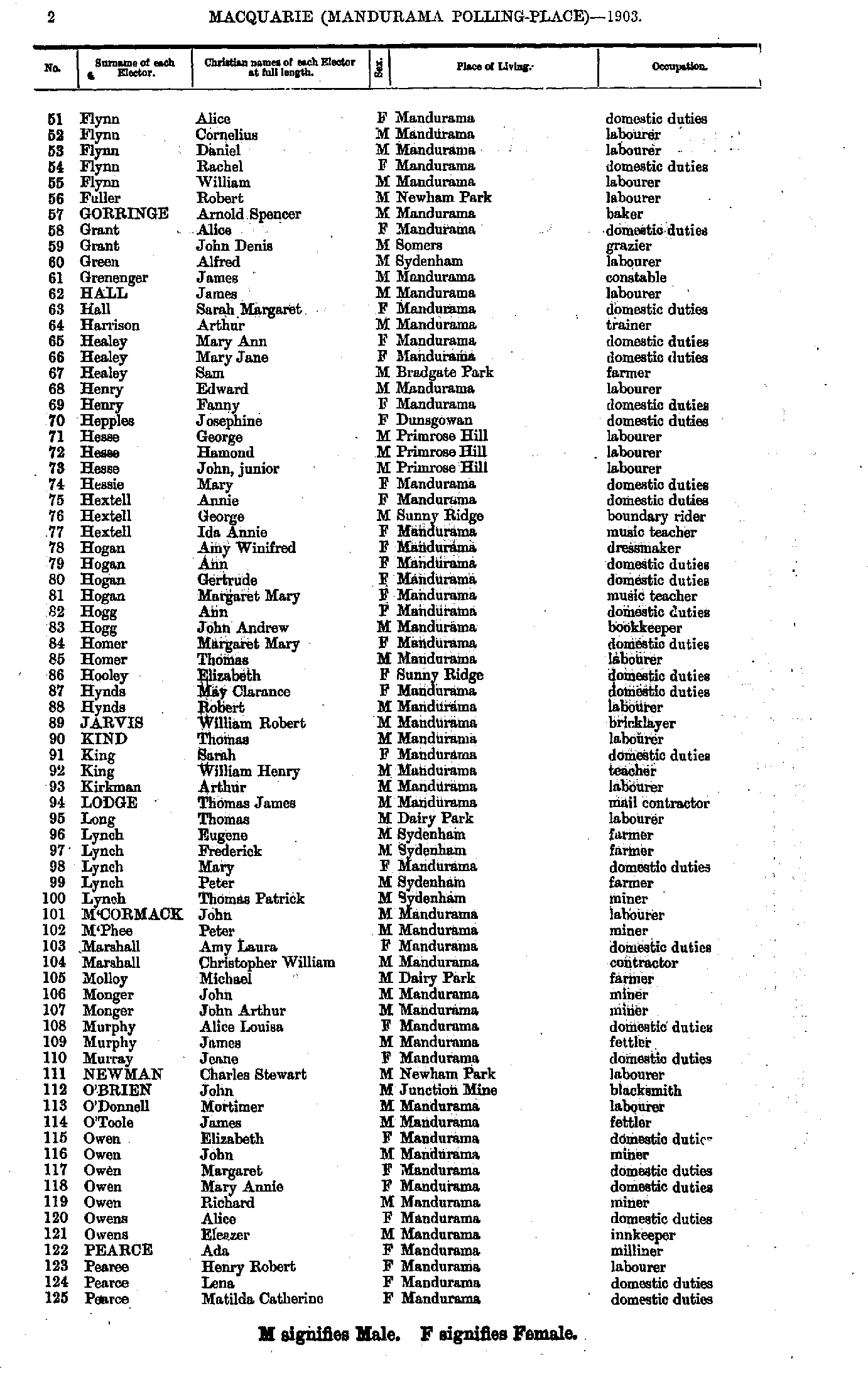
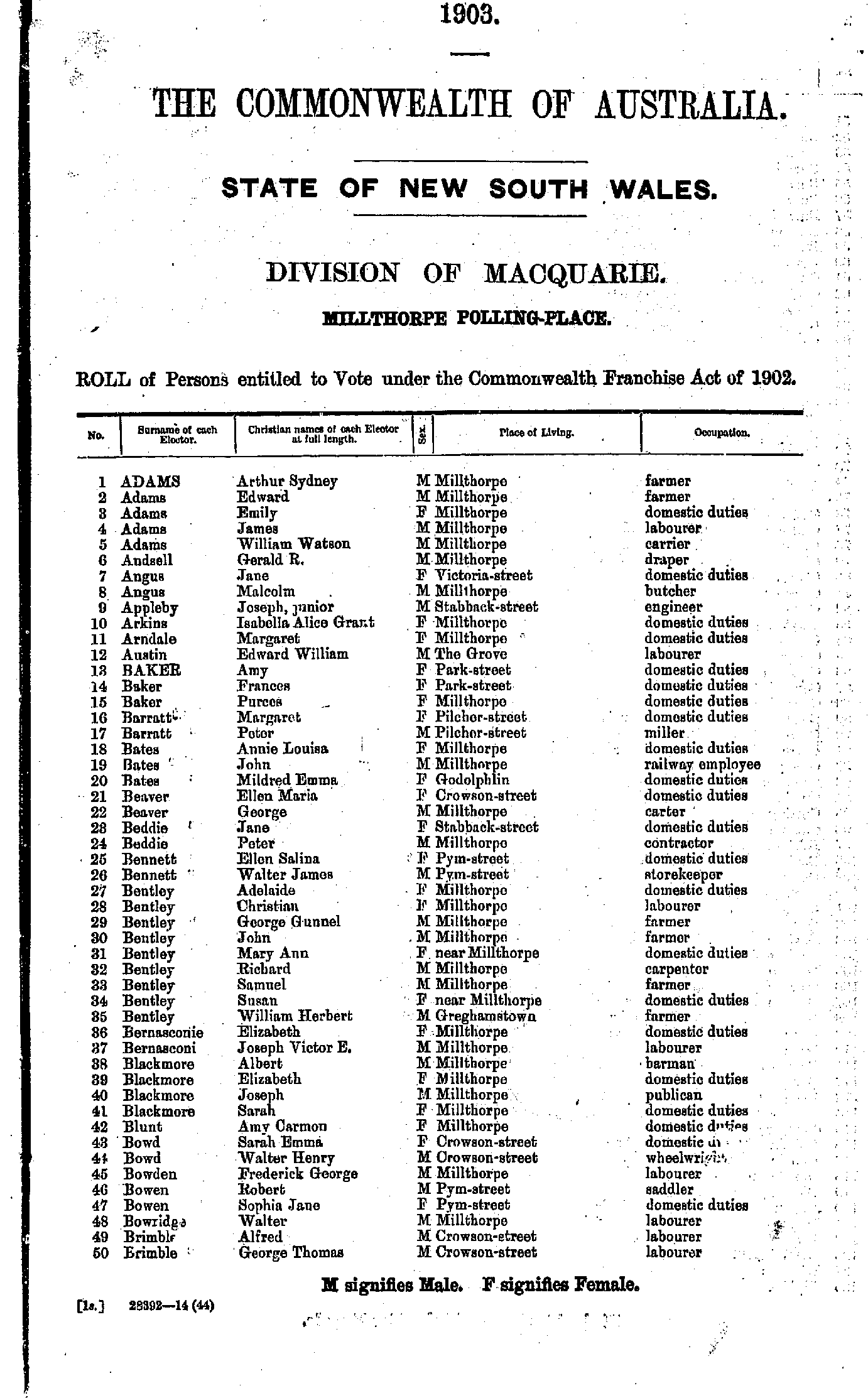
- Adams Arthur - Brimble George
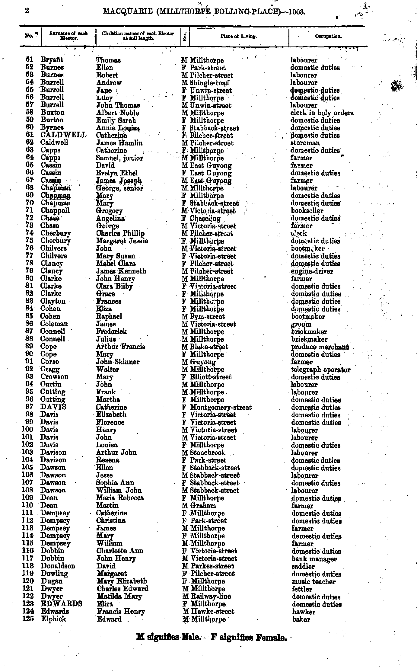
- Bryant Thomas - Elphick Edward
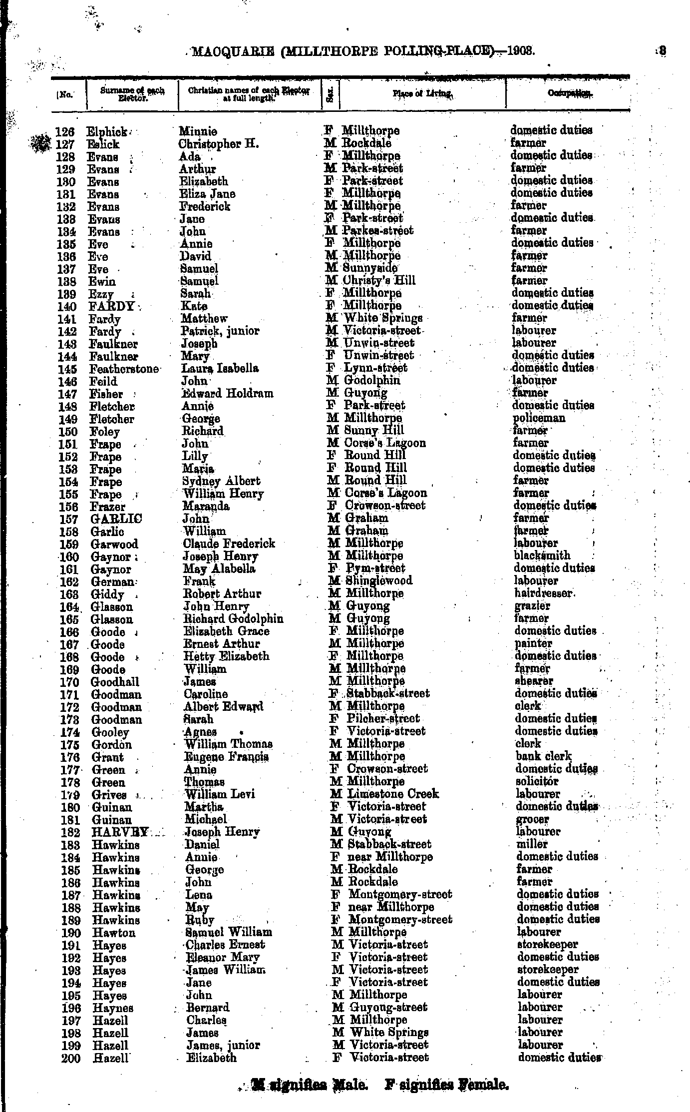
- Elphick Minnie - Hazell Elizabeth
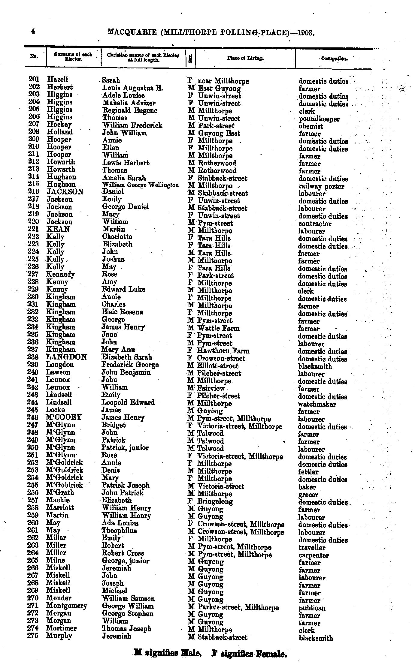
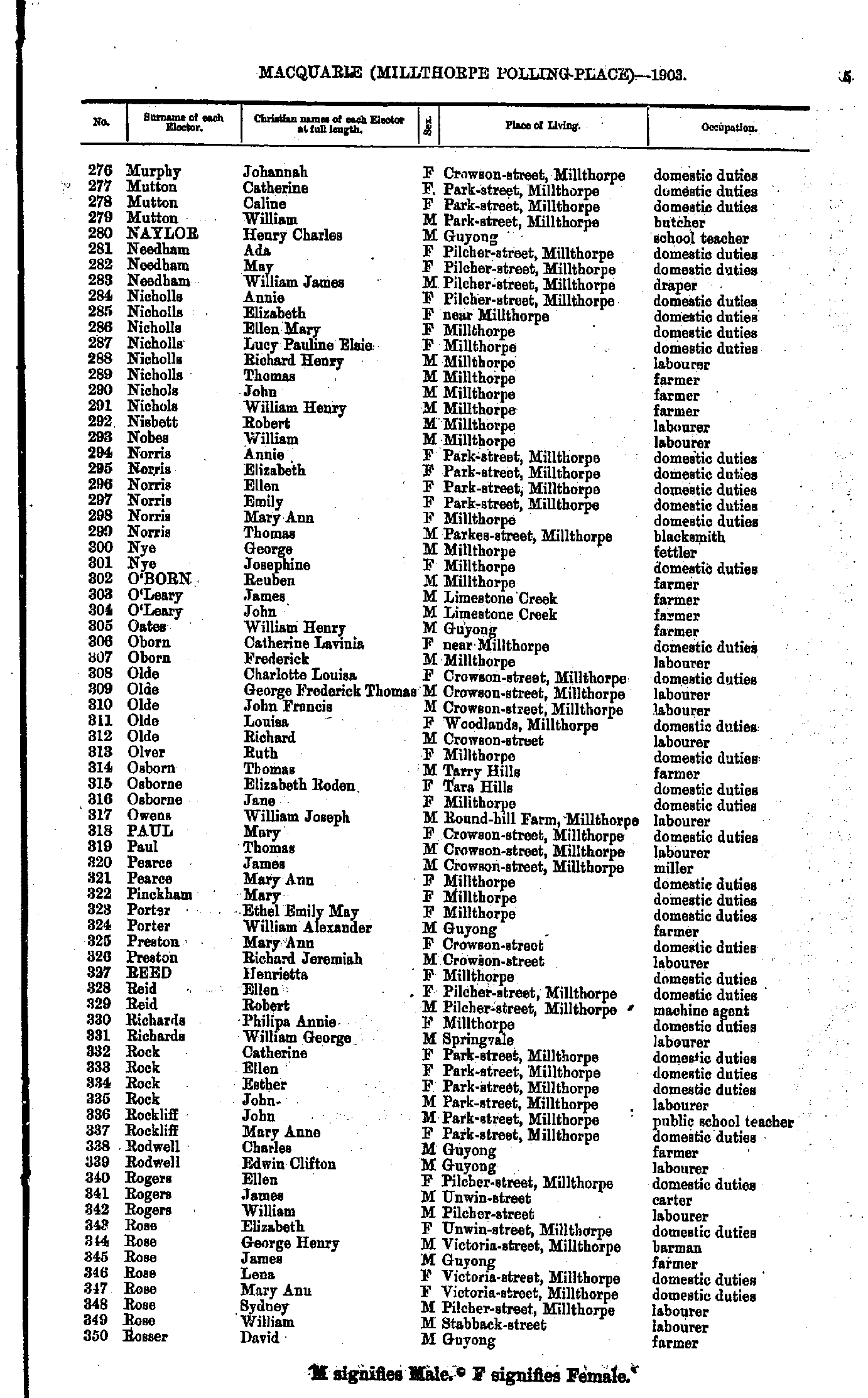
- Hazell Sarah - Murphy Jeremiah
- Murphy Johannah - Rosser David
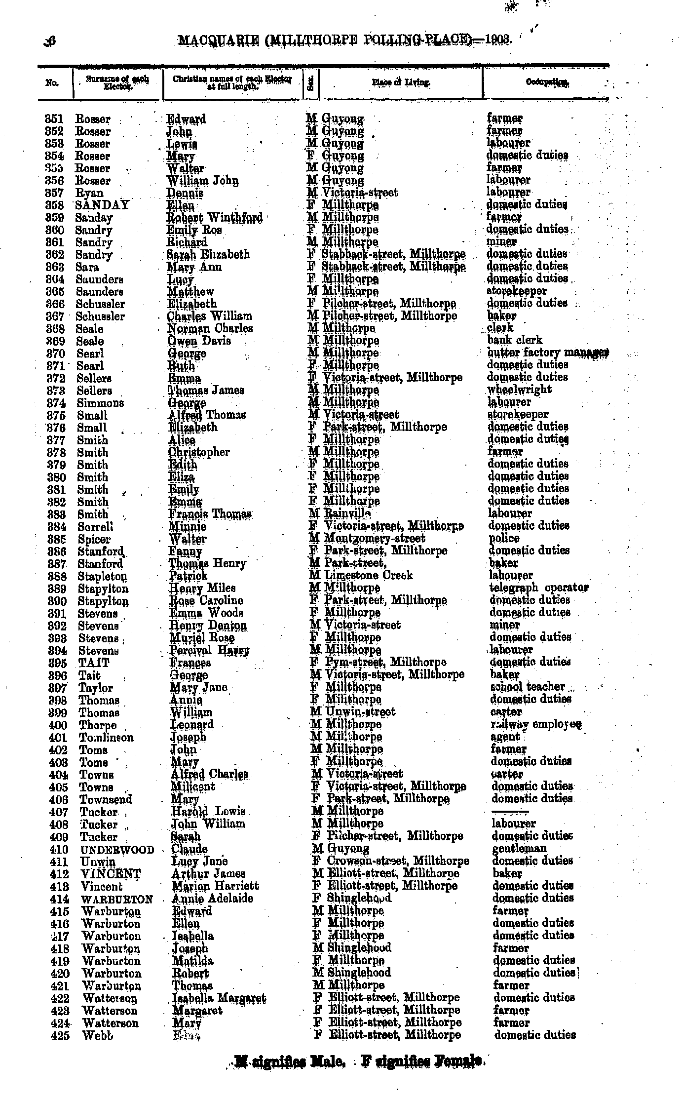
- Rosser Edward - Webb Edna
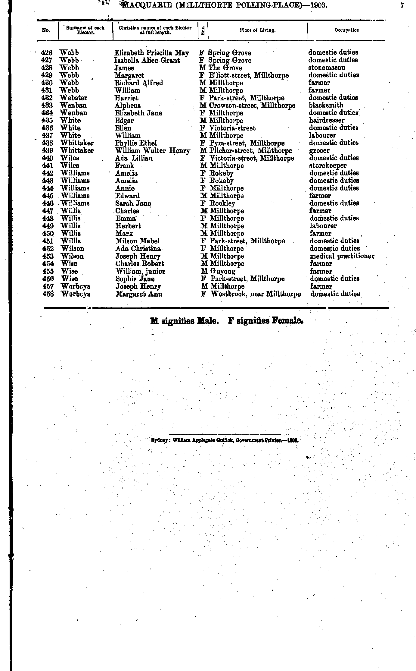
- Webb Elizabeth - Worboys Margaret
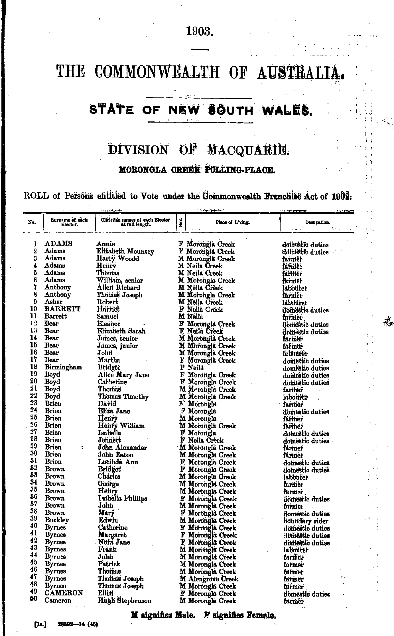
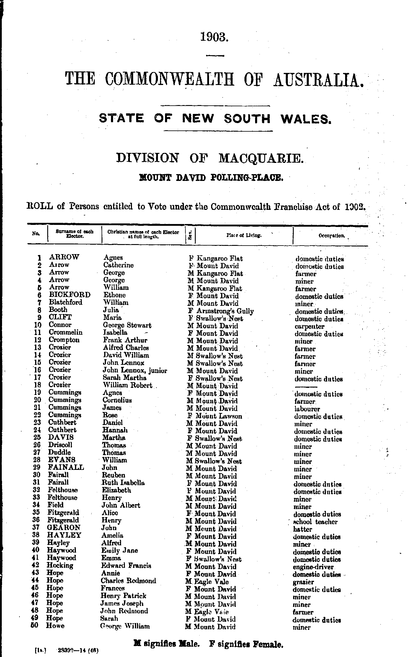
- Adams Annie - Cameron Hugh
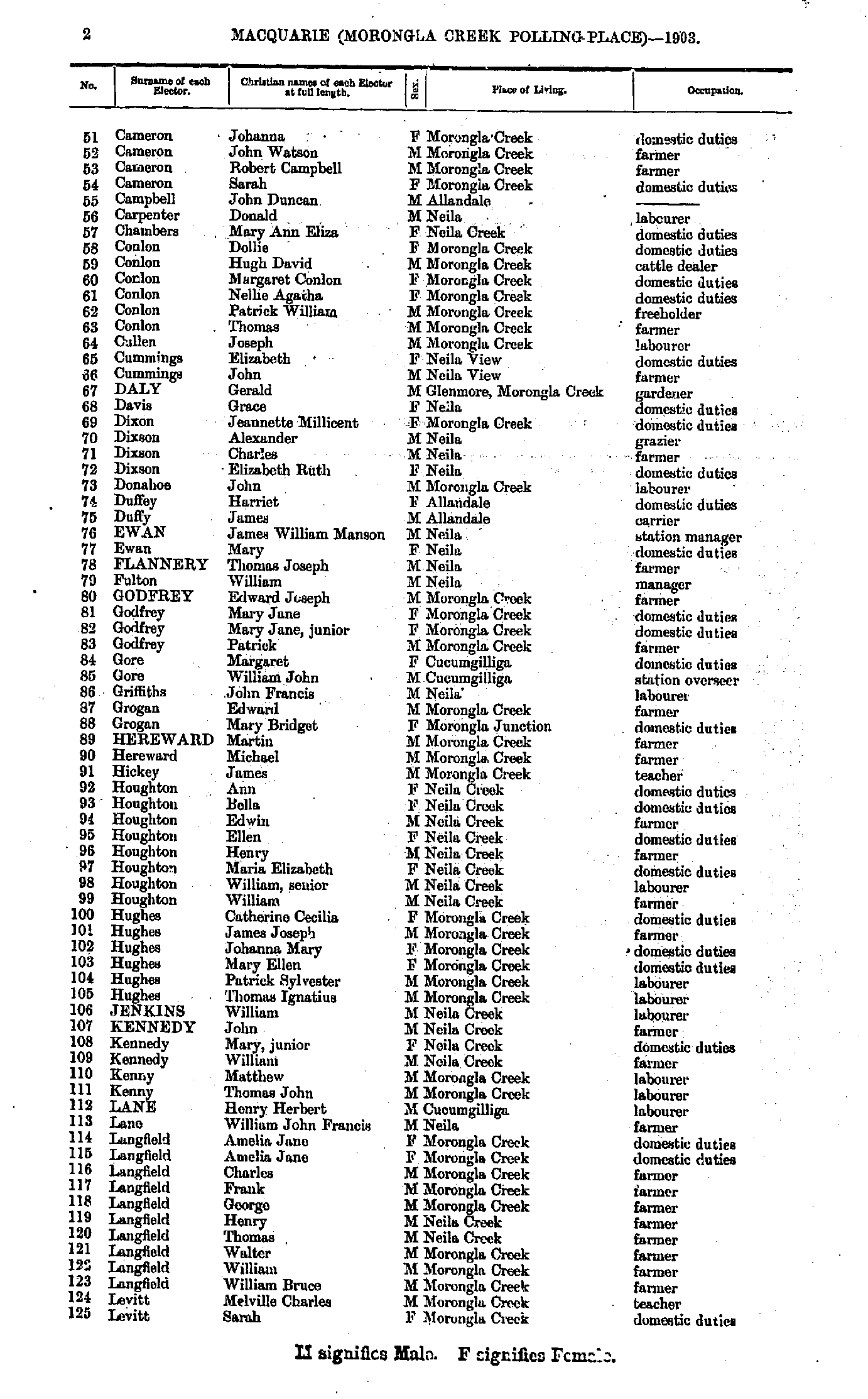
- Cameron Johanna - Levitt Sarah
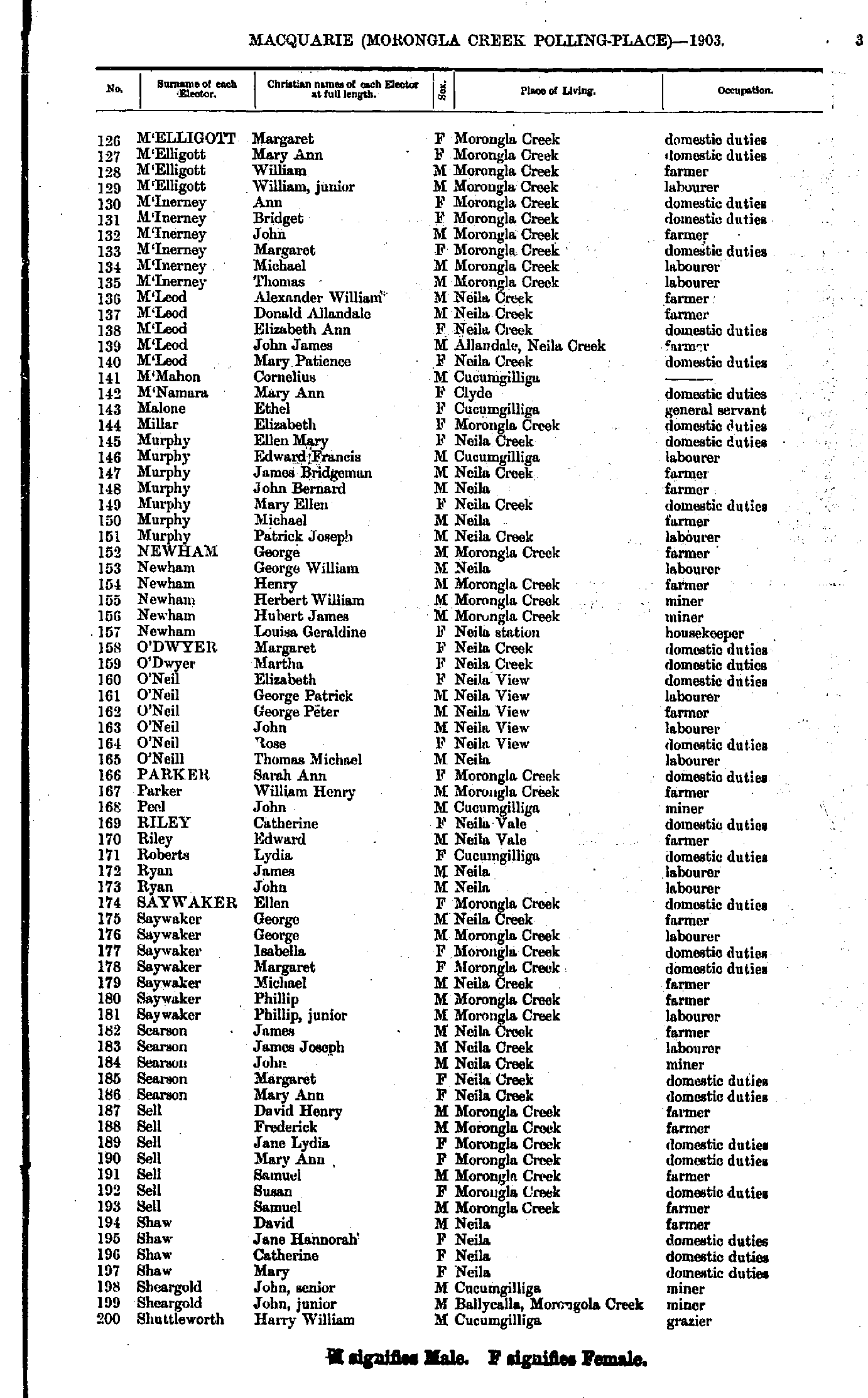
- M'Elligott Margaret - Shuttleworth Harry
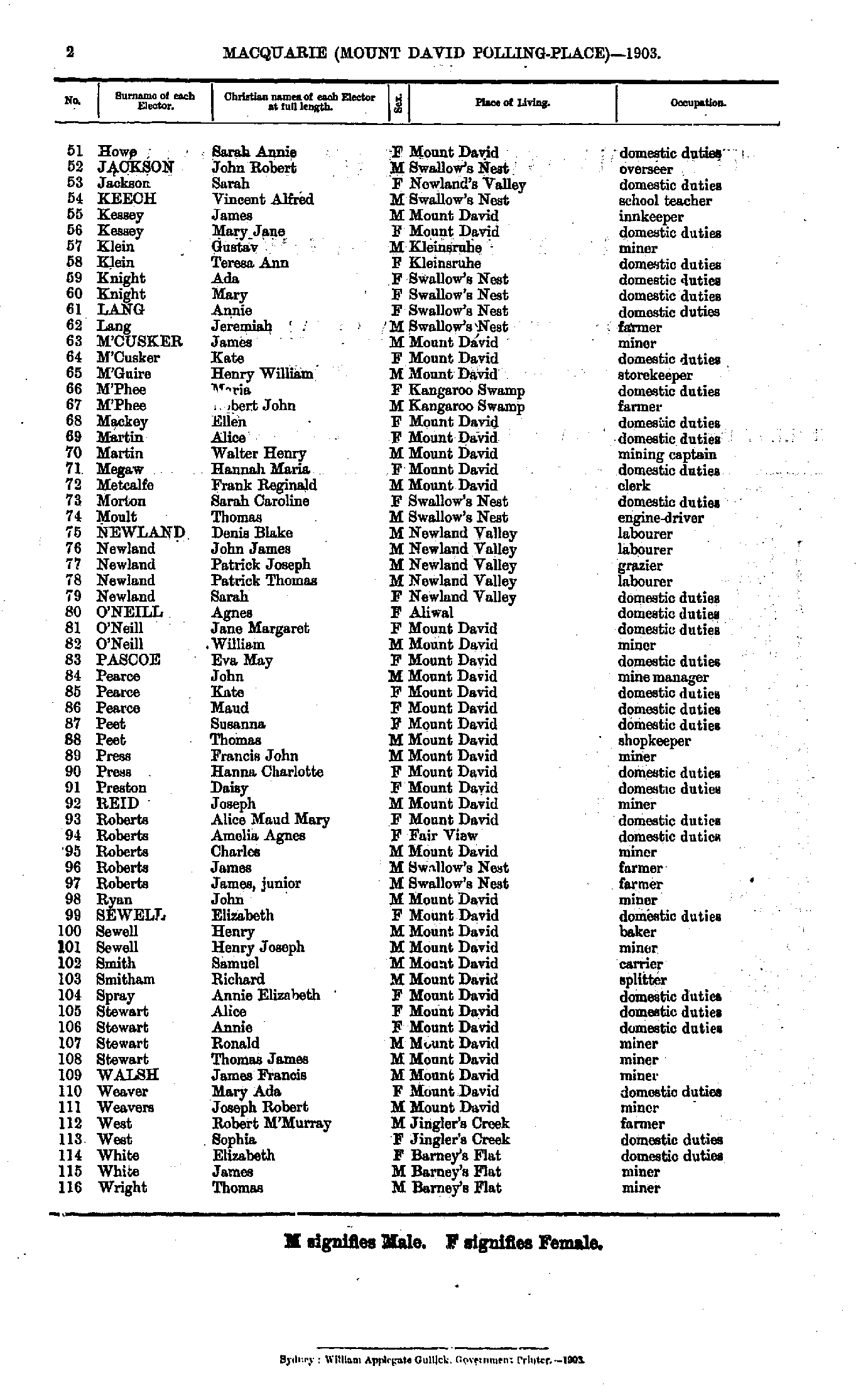
- Shuttleworth Laura - Wright Martha
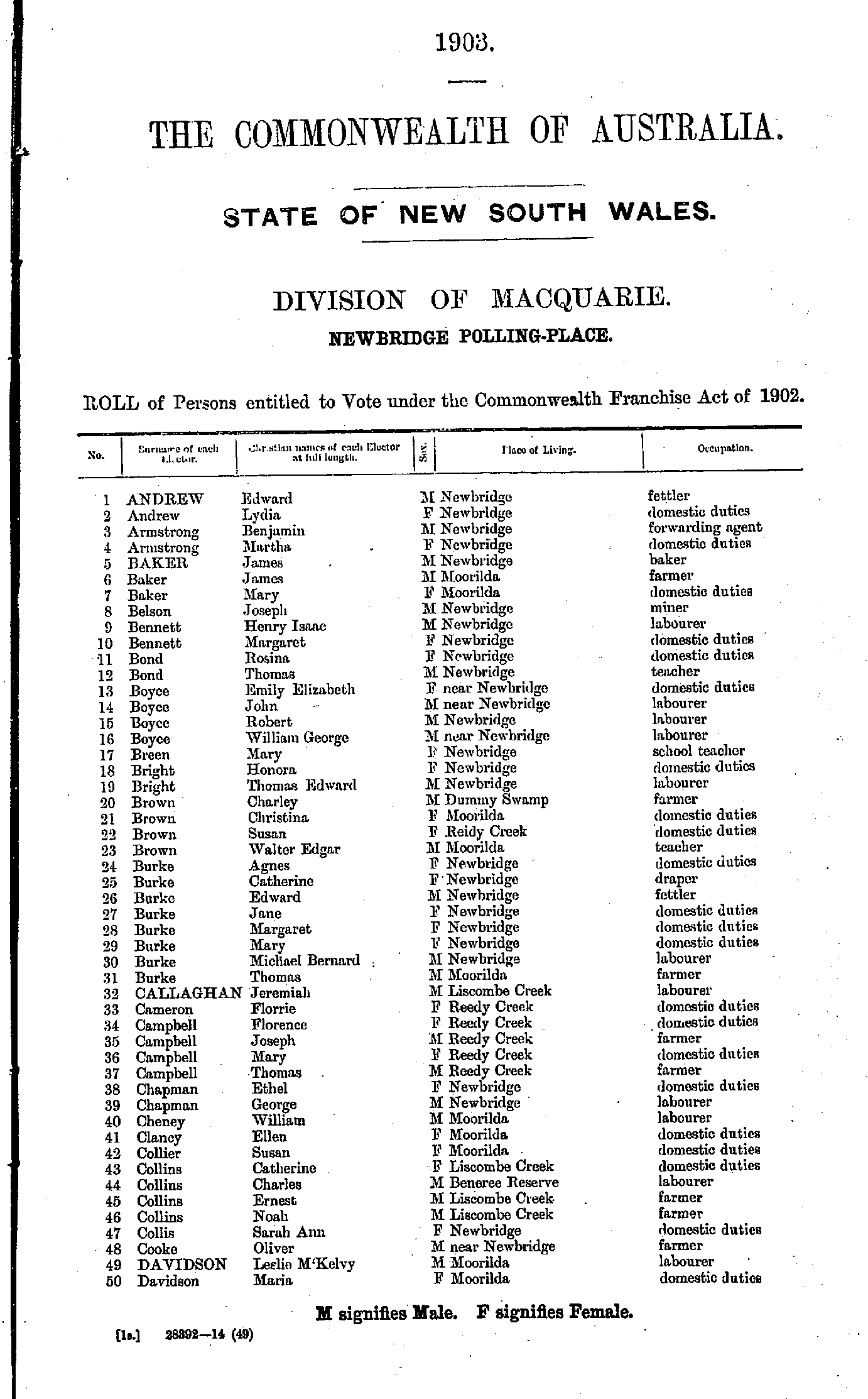
- Andrew Edward - Davidson Maria
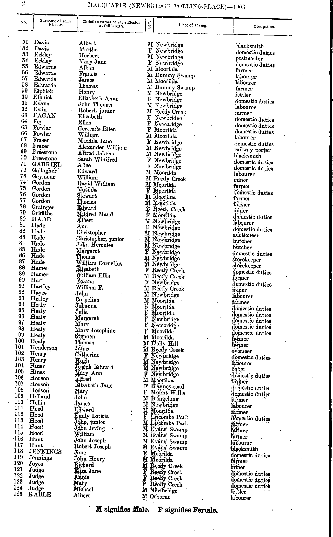
- Davis Albert - Kable Albert
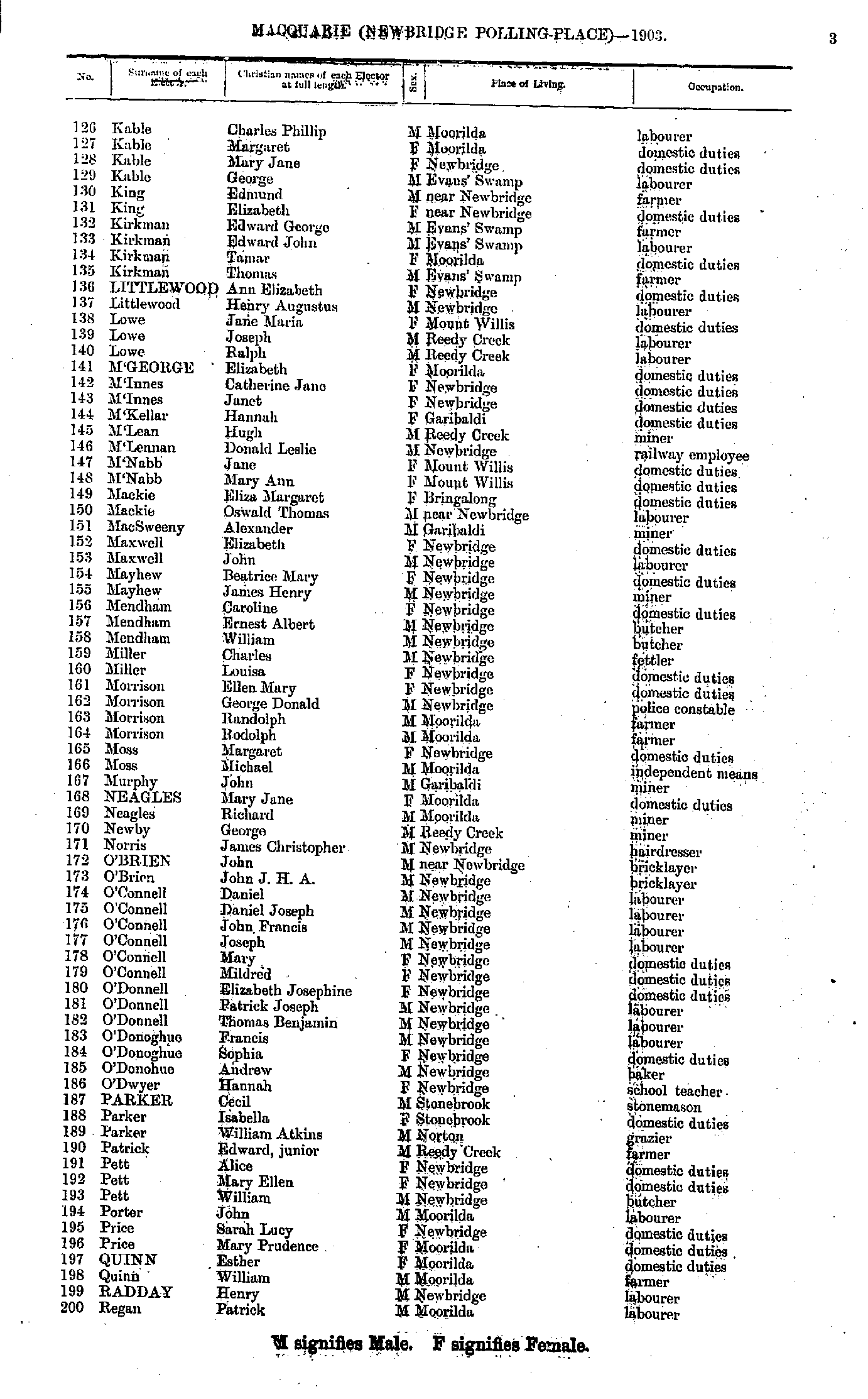
- Kable Charles - Regan Patrick
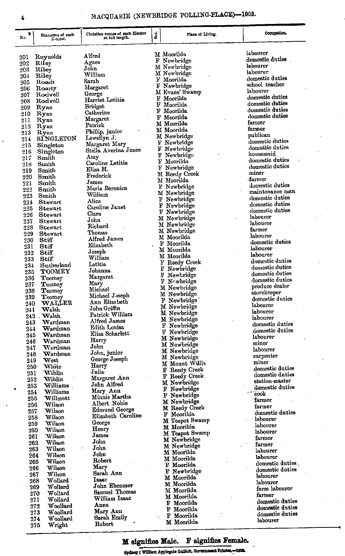
- Reynolds Alfred - Wright Robert
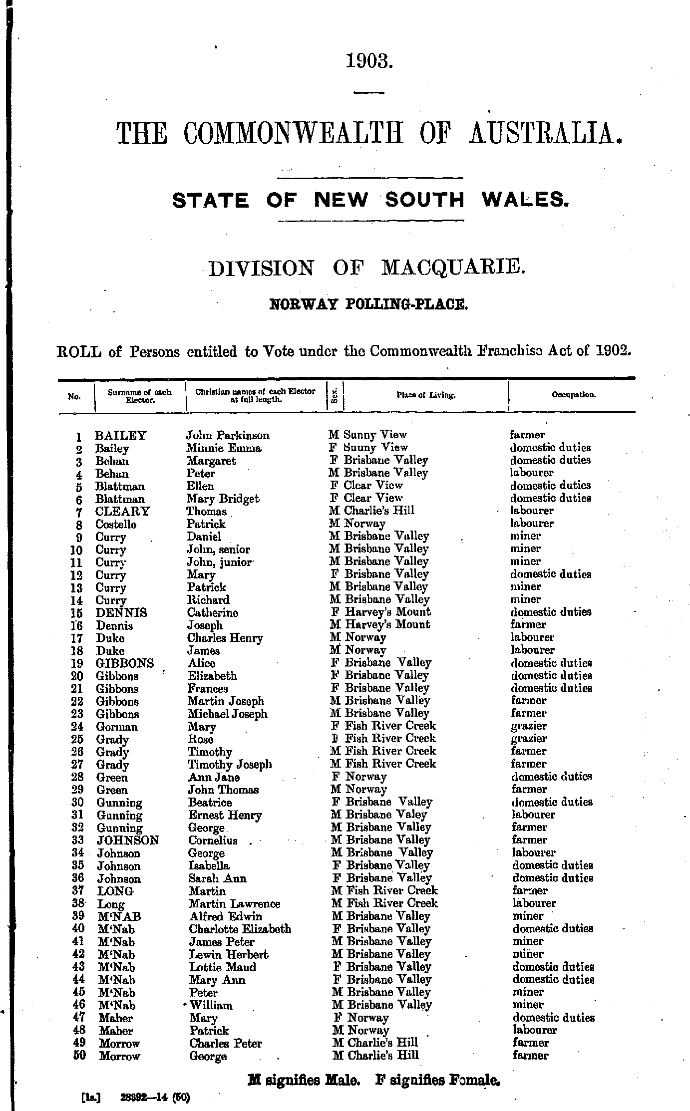
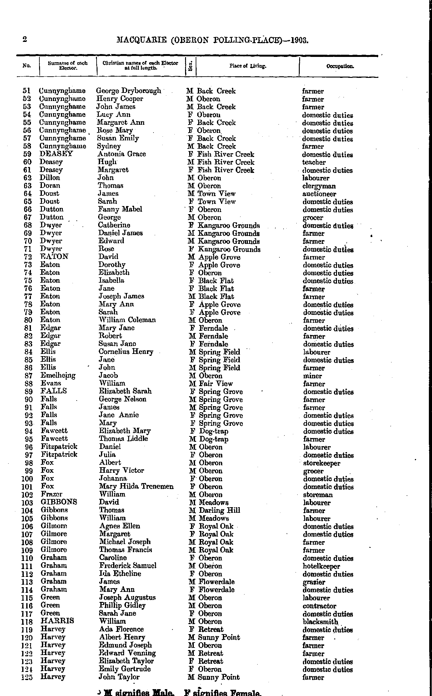
- Armstrong Mary - Cunnynghame Elizabeth
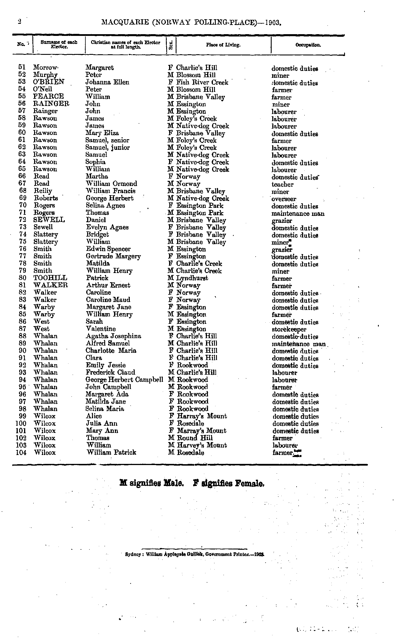
- Cunnynghame George - Harvey John
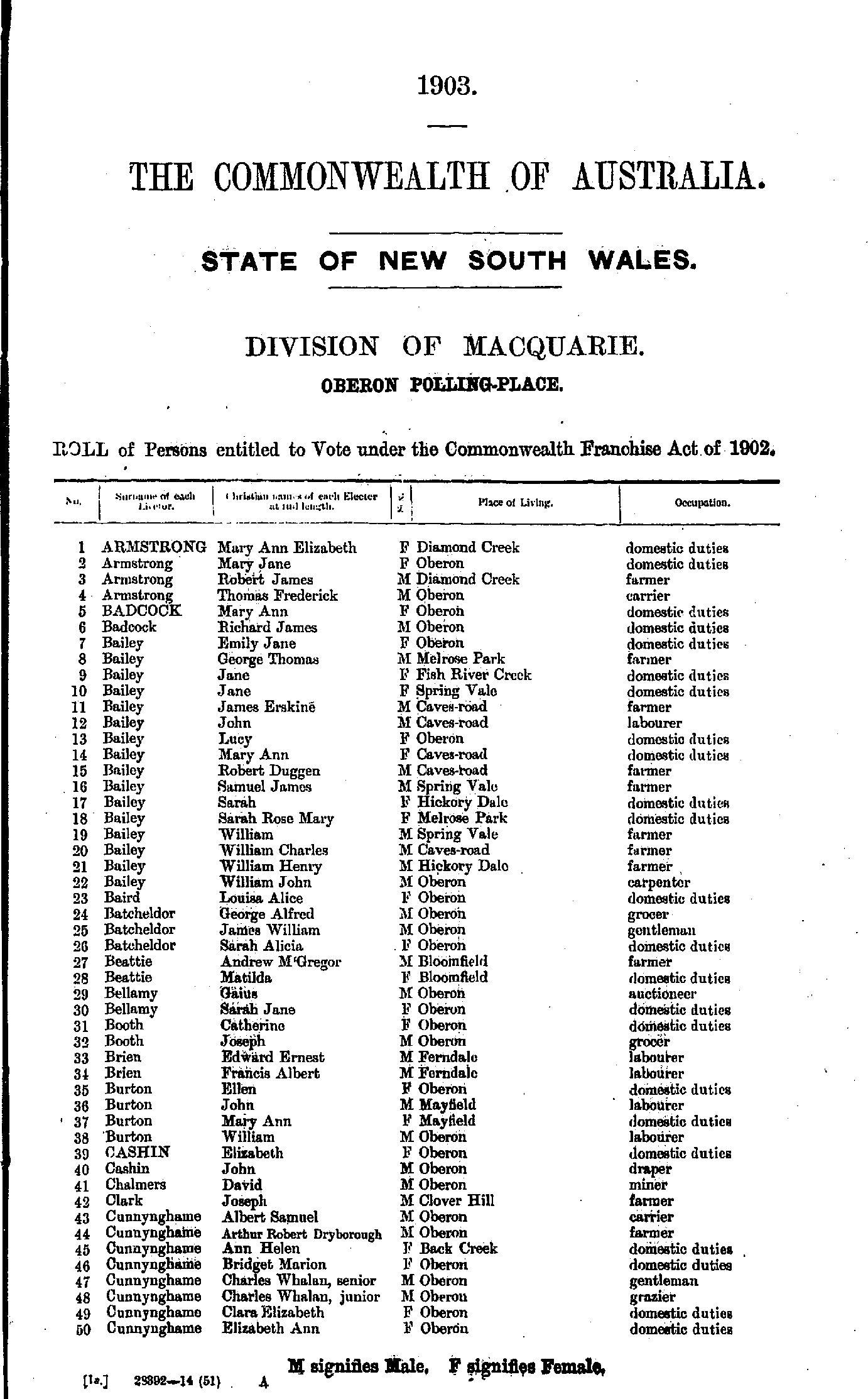
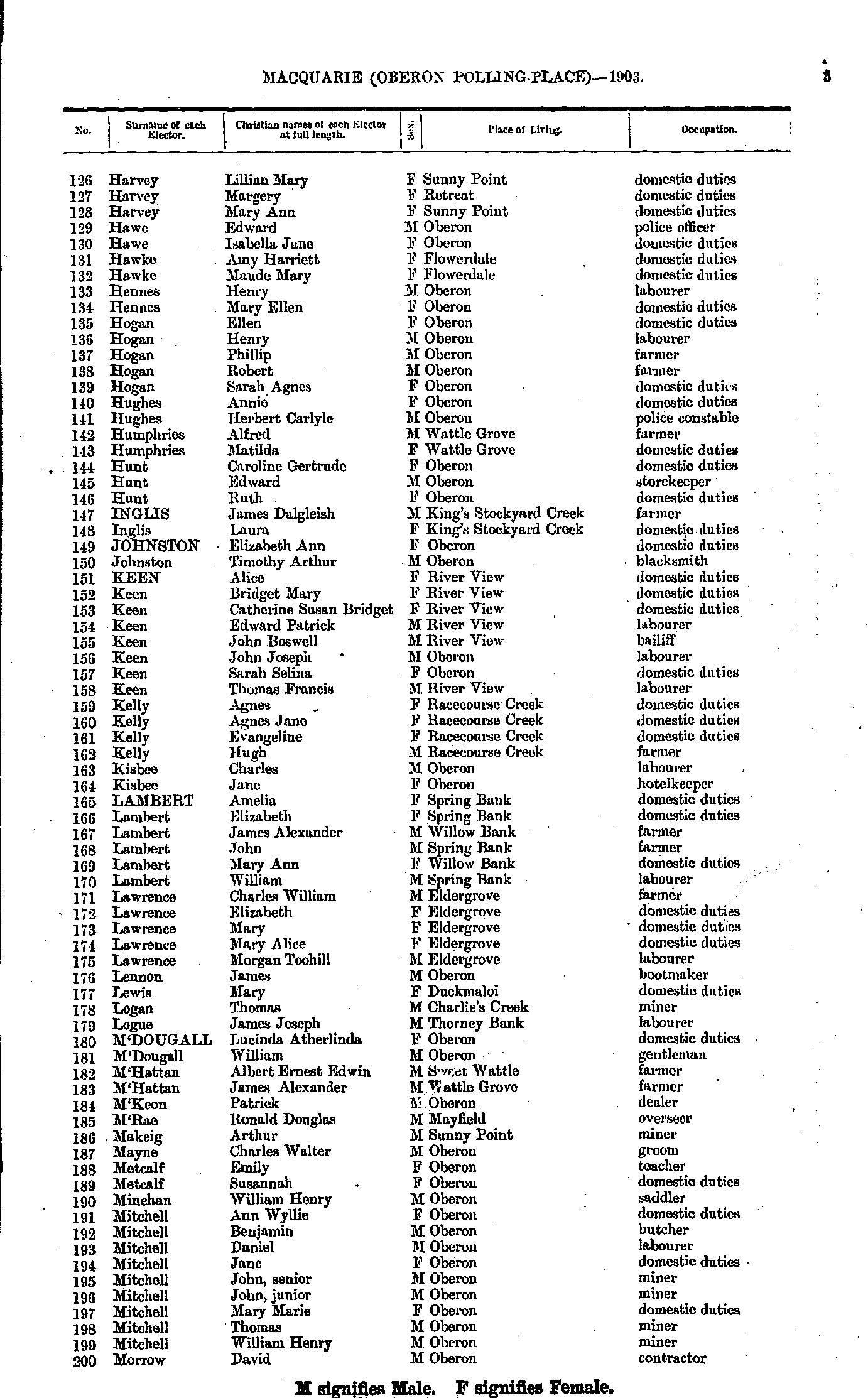
- Harvey Lillian - Morrow David
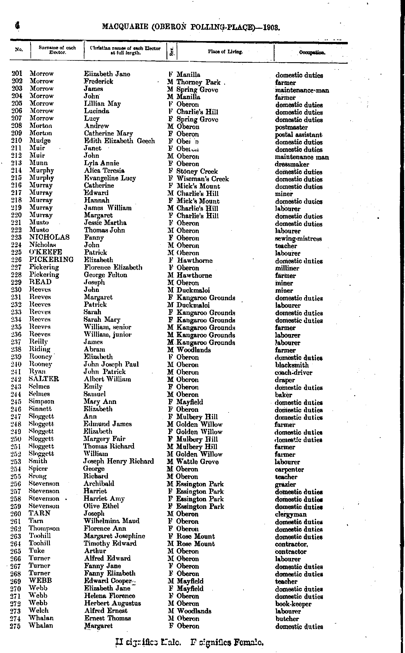
- Morrow Elizabeth - Whalan Margaret
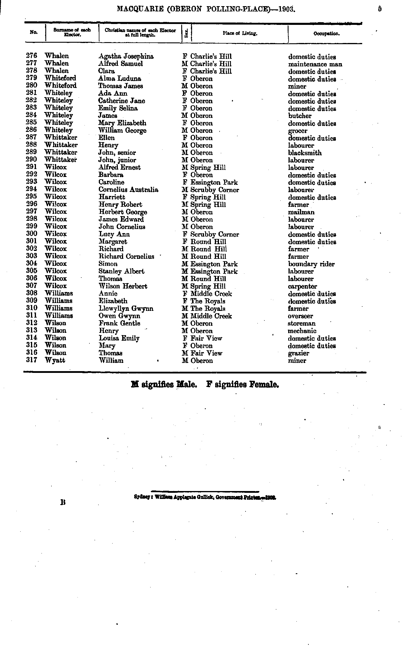
- Whalen Agatha - Wyatt William
- Barnes Edmund - Currey Thomas
- Curry Frederick - Lions Mary
- Lloyd Charles - Spray John
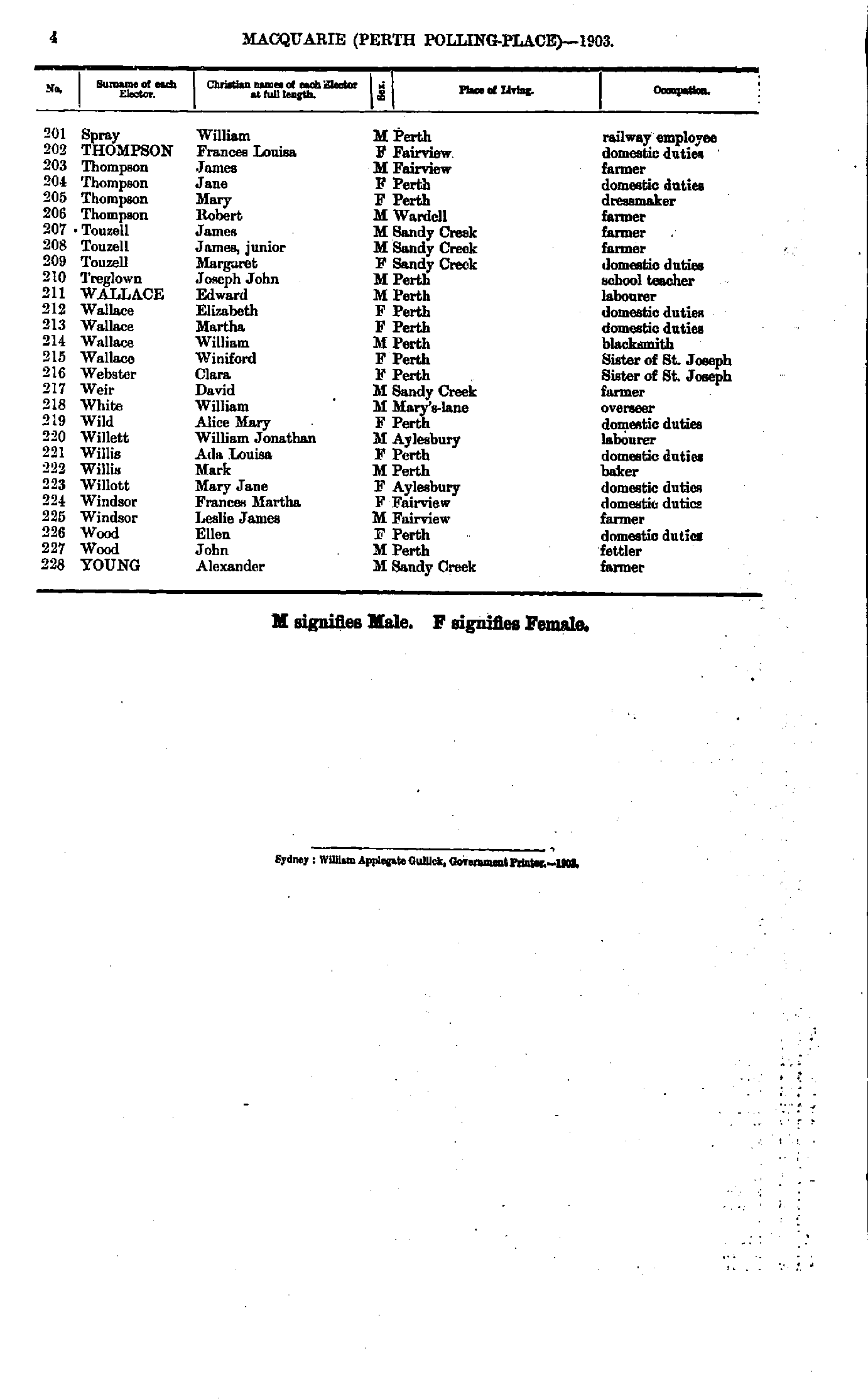
- Spray William - Young Alexander
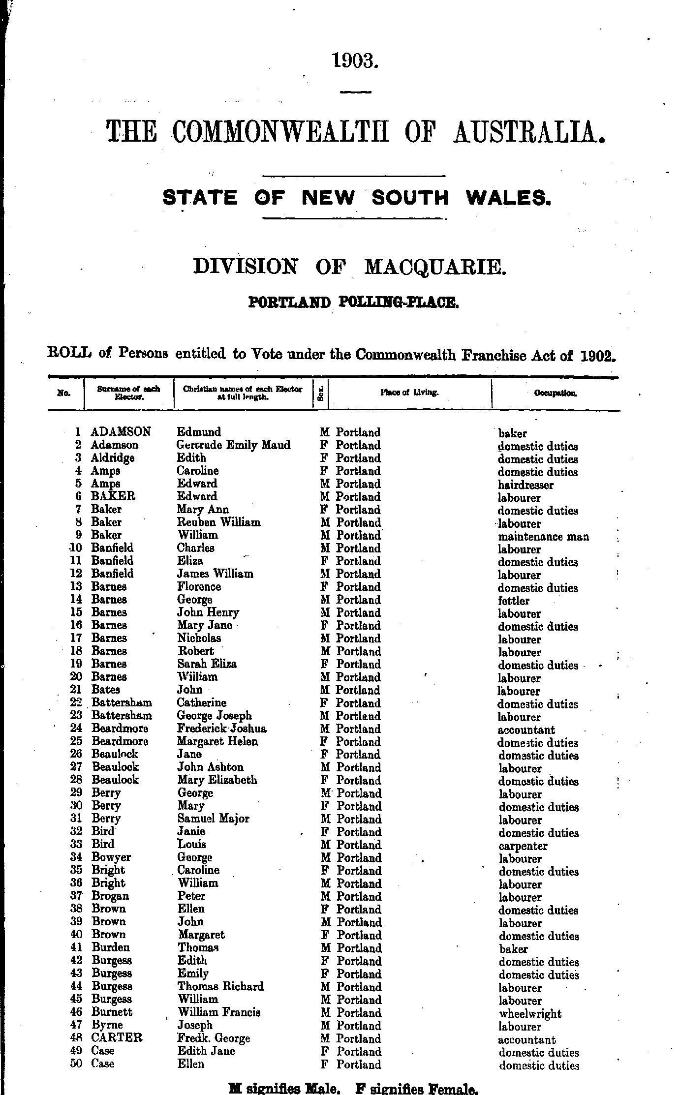
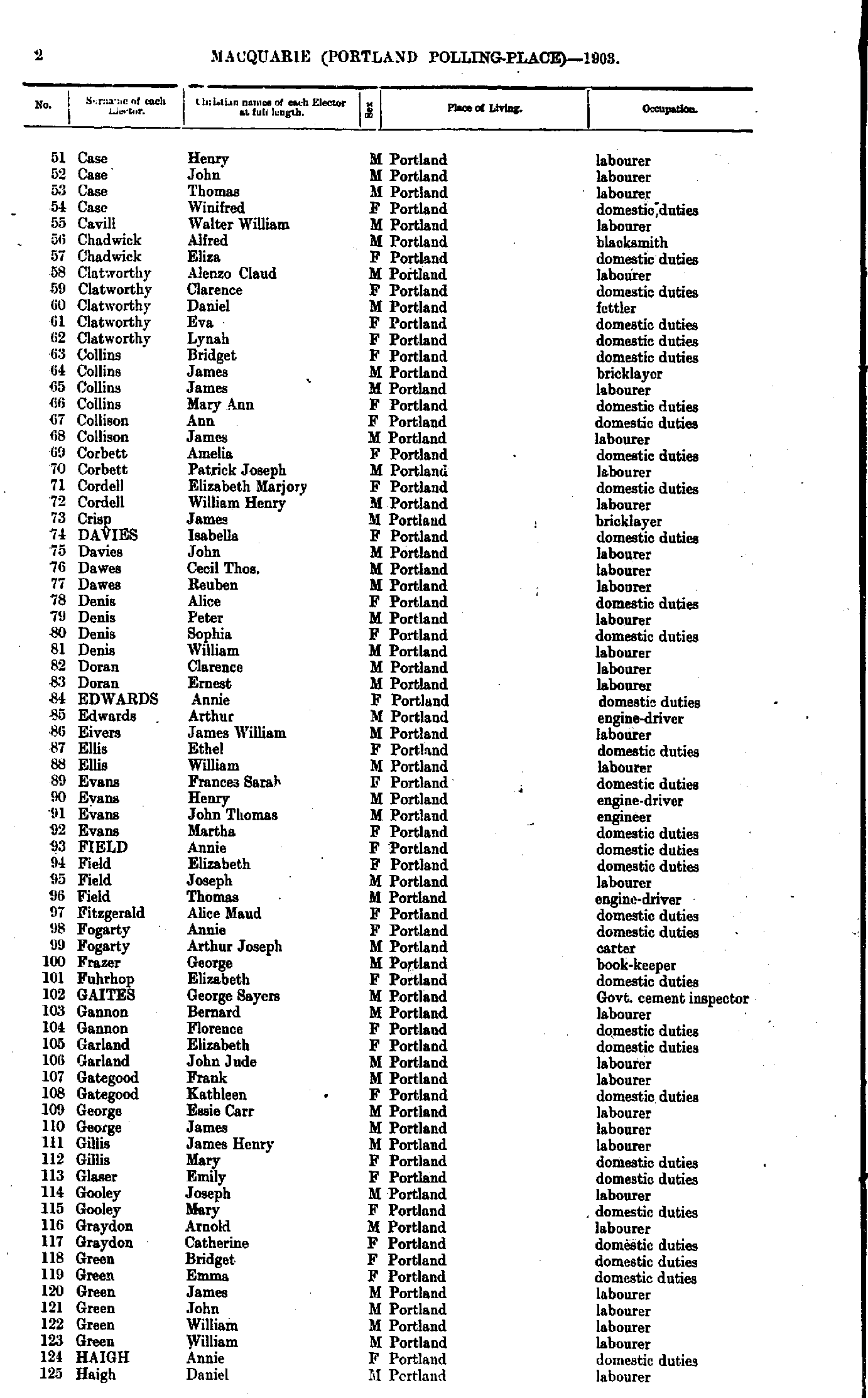
- Adamson Edmund - Case Ellen
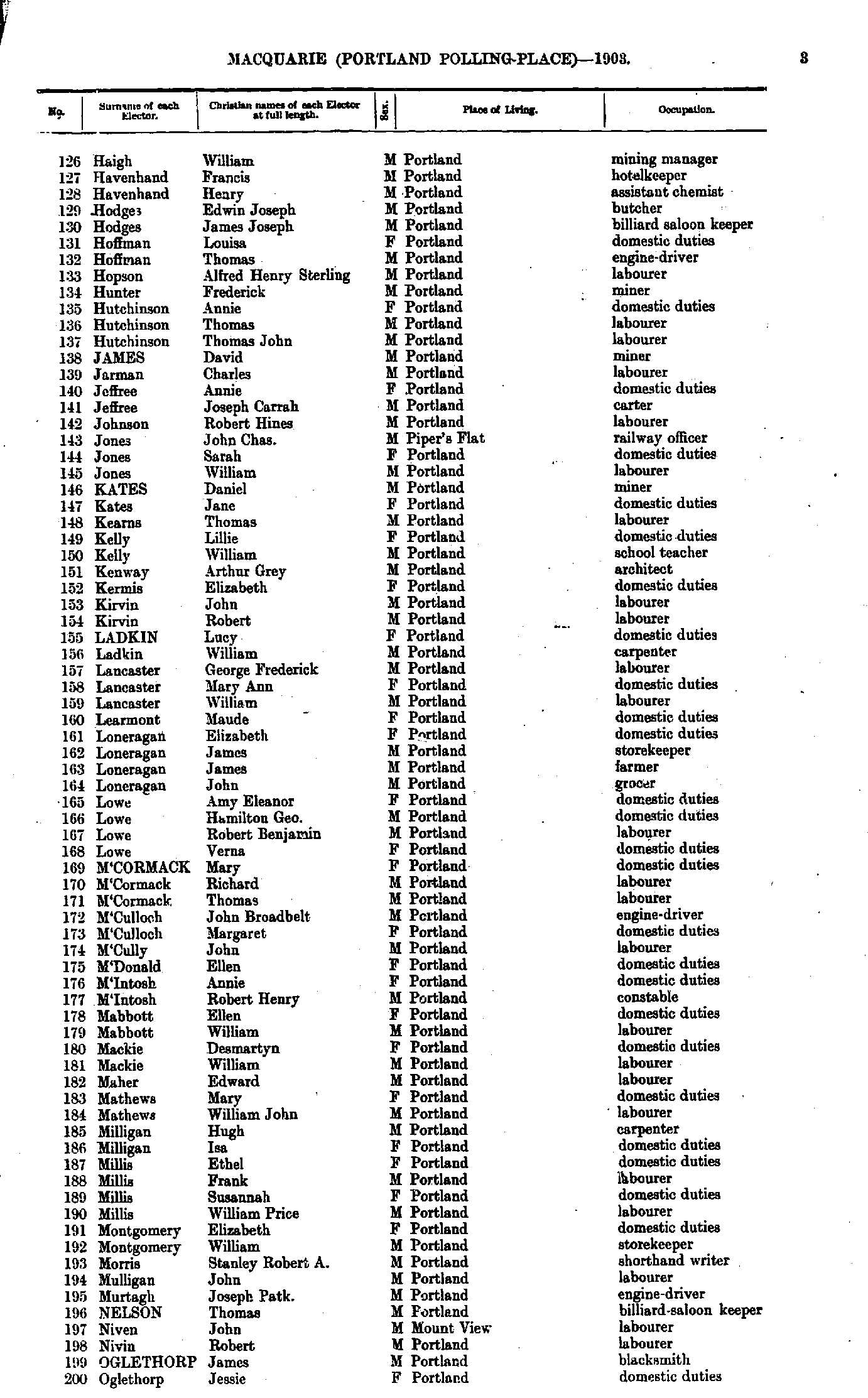
- Case Henry - Haigh Daniel
- Haigh William - Oglethorp Jessie
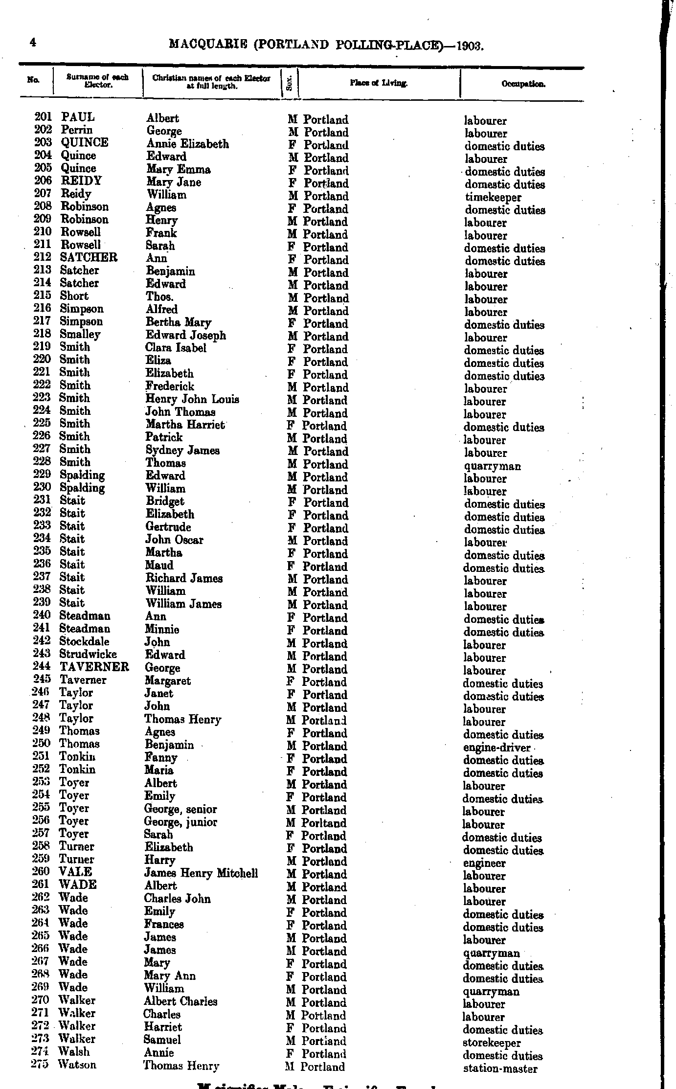
- Paul Albert - Watson Thomas
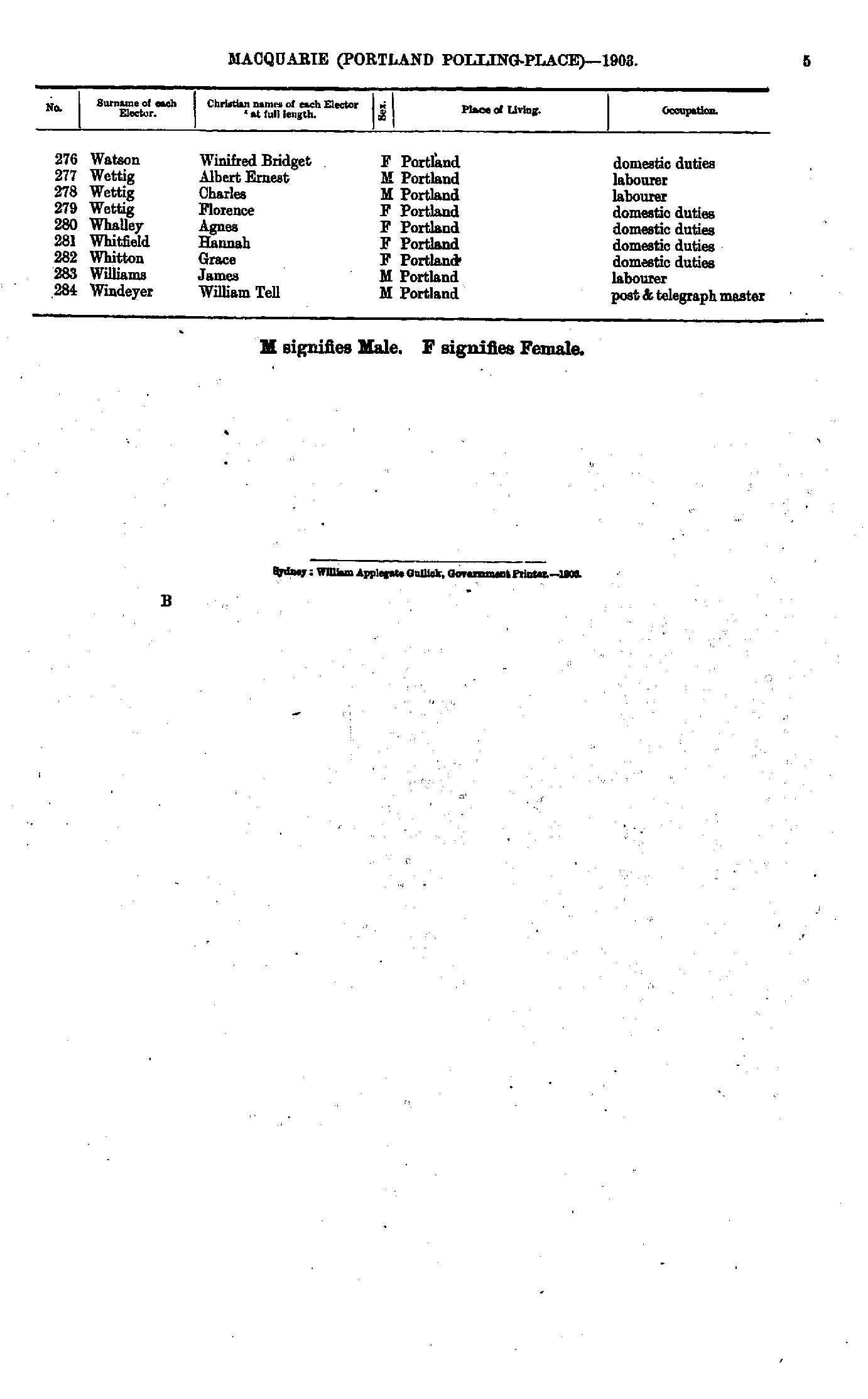
- Watson Winifred - Windeyer William
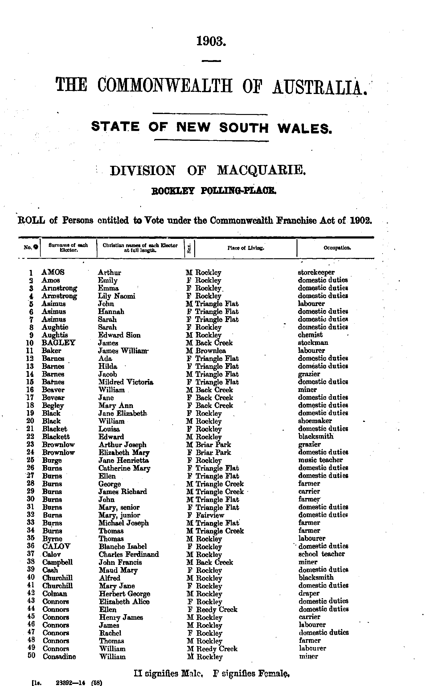
- Amos Arthur - Consadine William
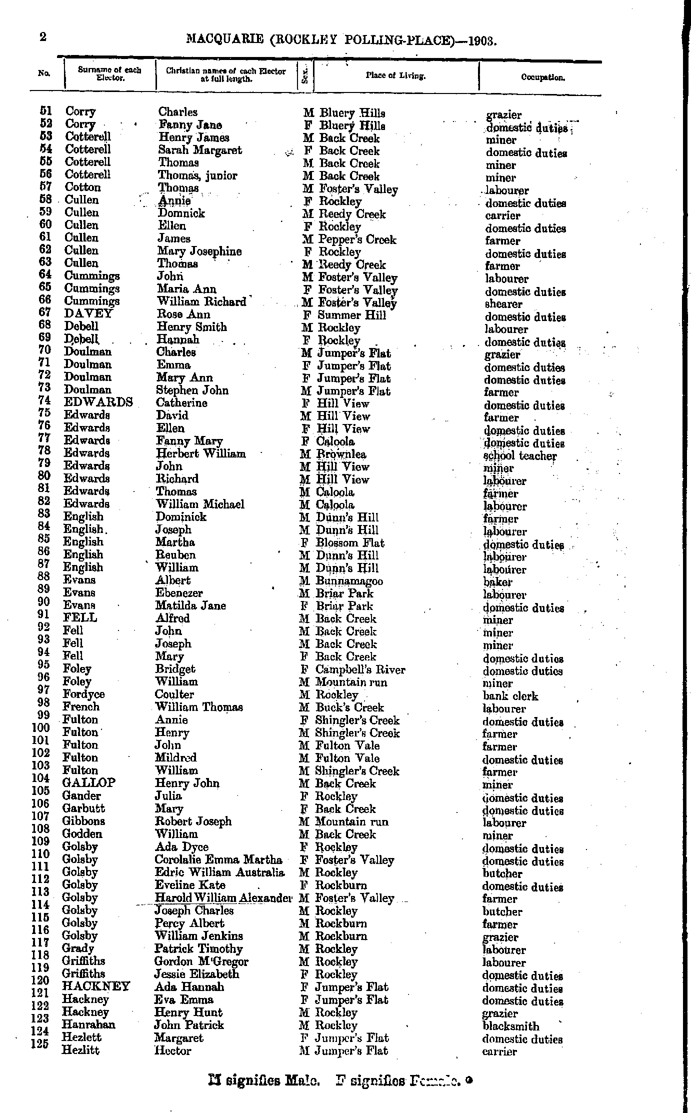
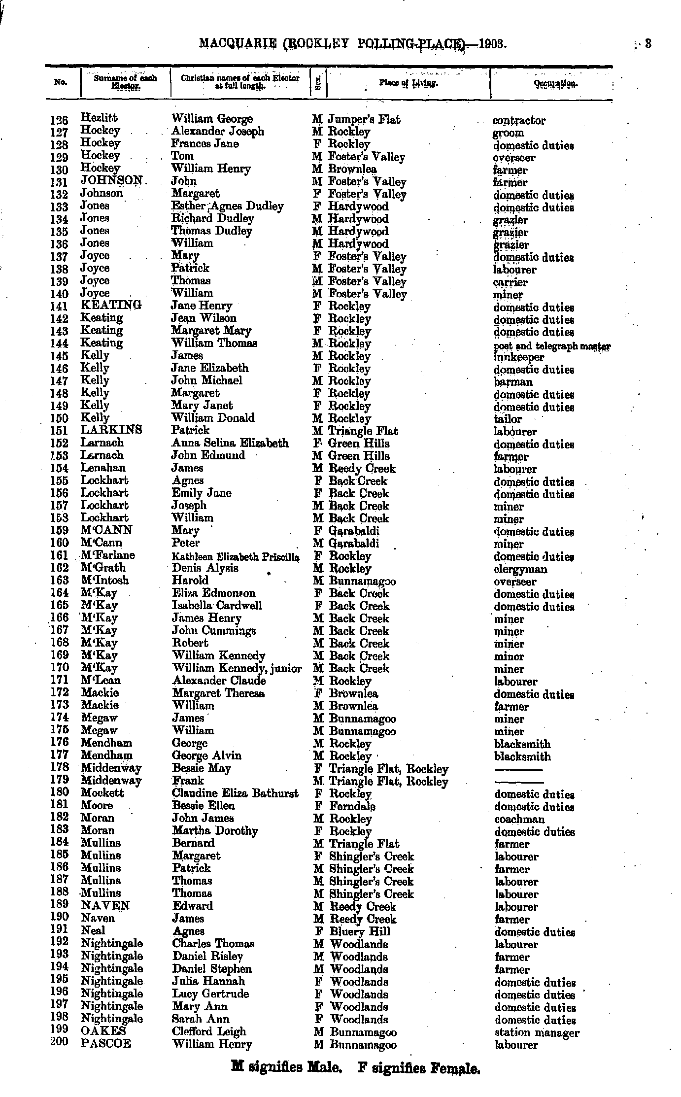
- Corry Charles - Hezlitt Hector
- Hezlitt William - Pascoe William
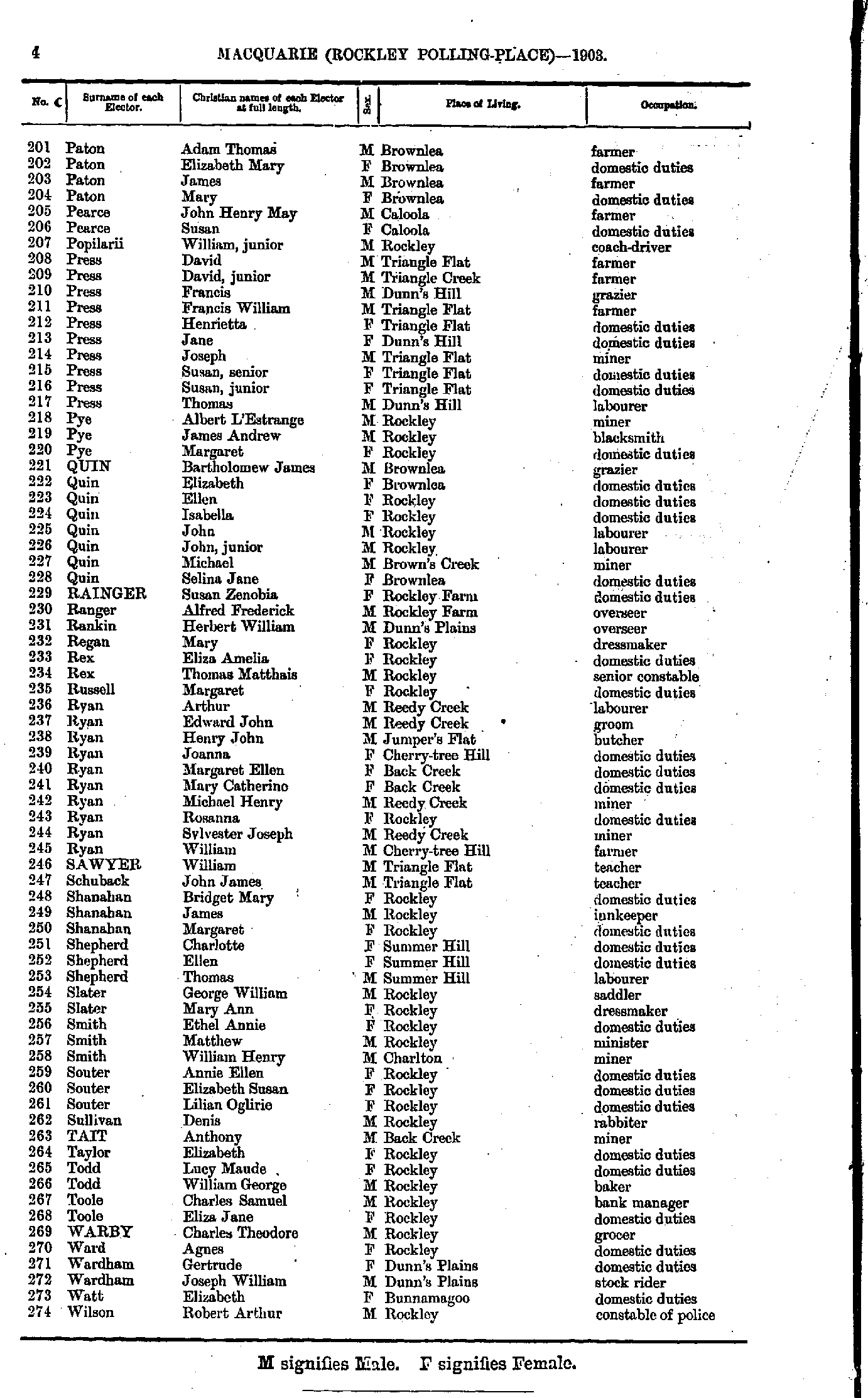
- Paton Adam - Wilson Robert
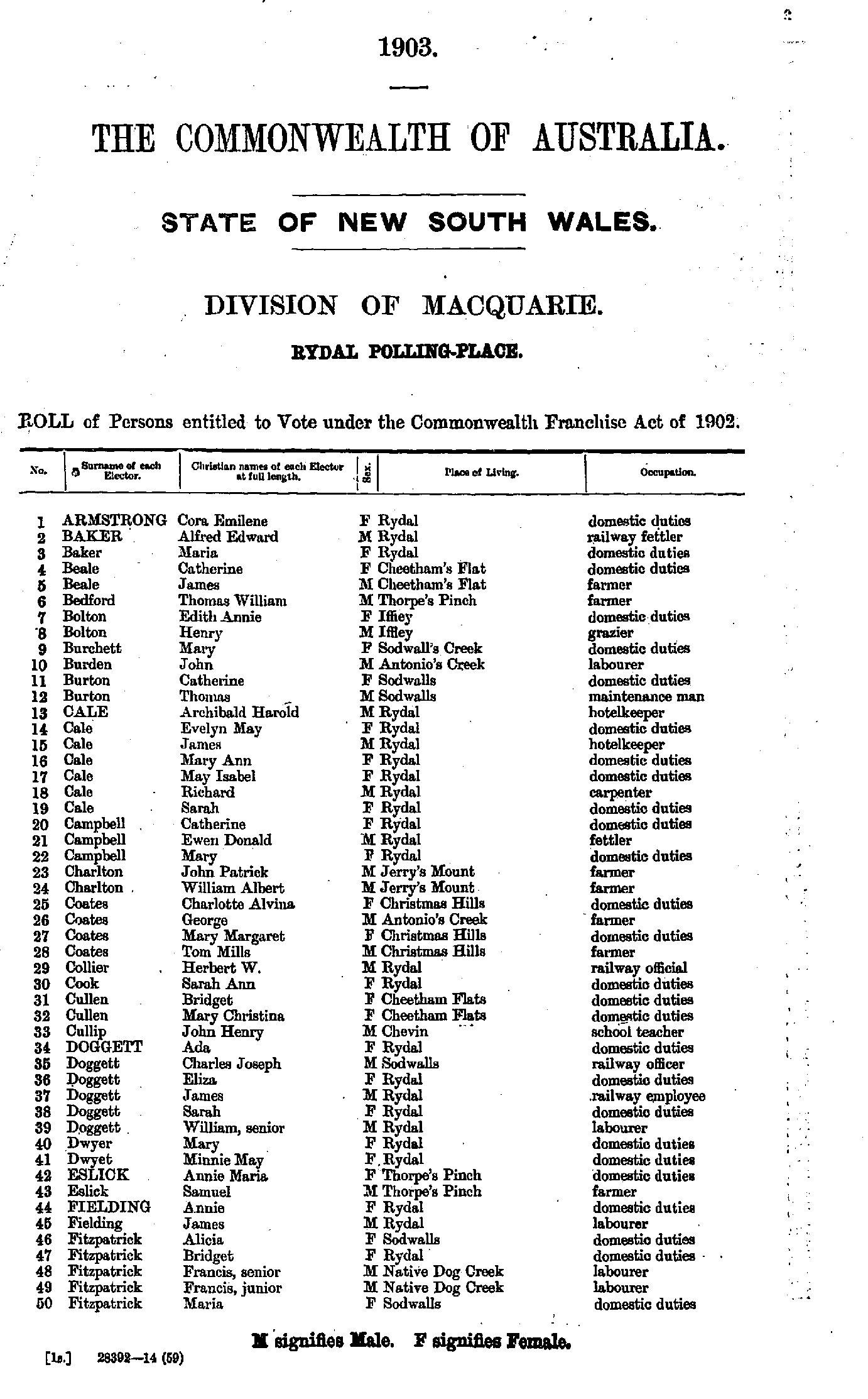
- Armstrong Cora - Fitzpatrick Maria
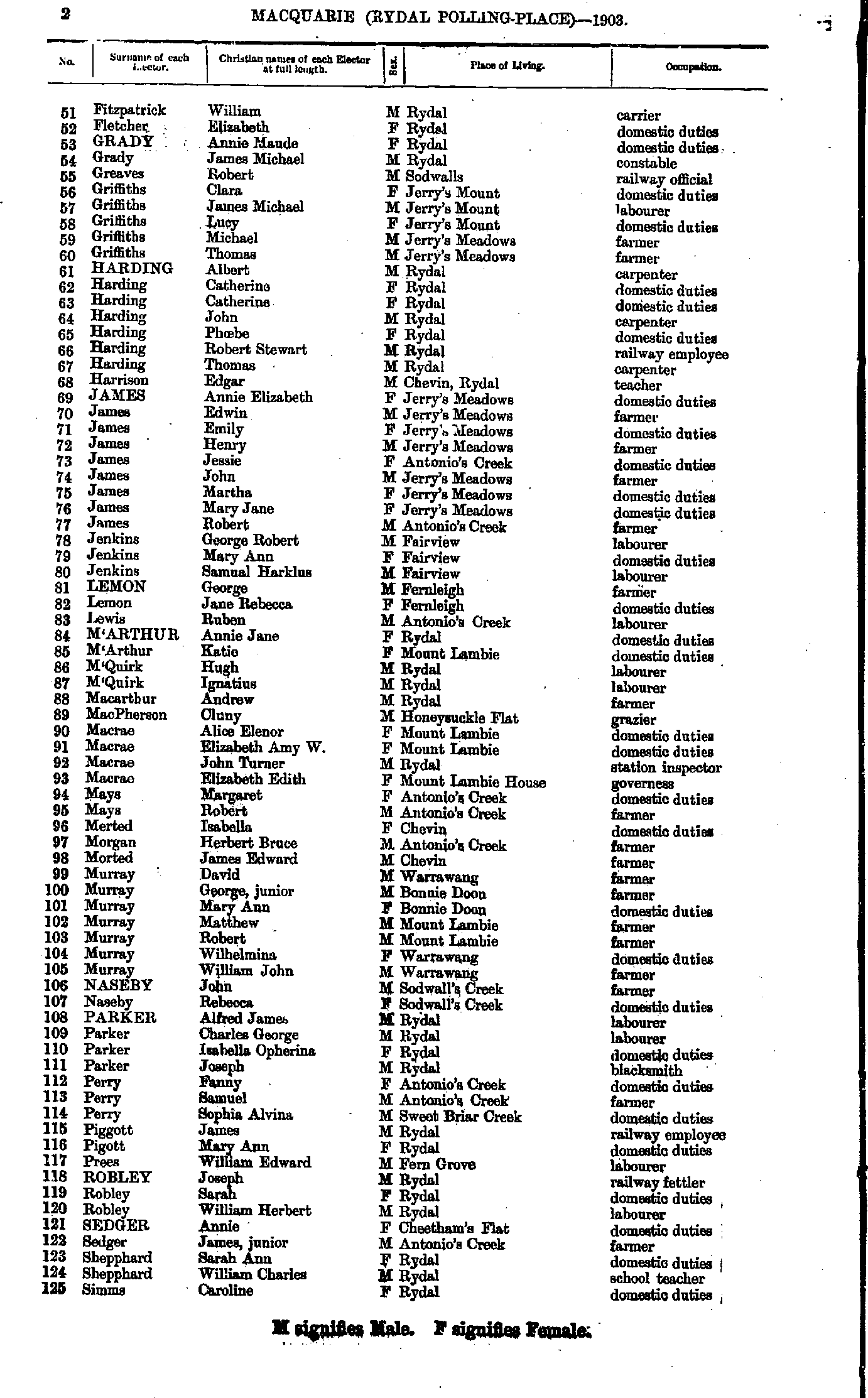
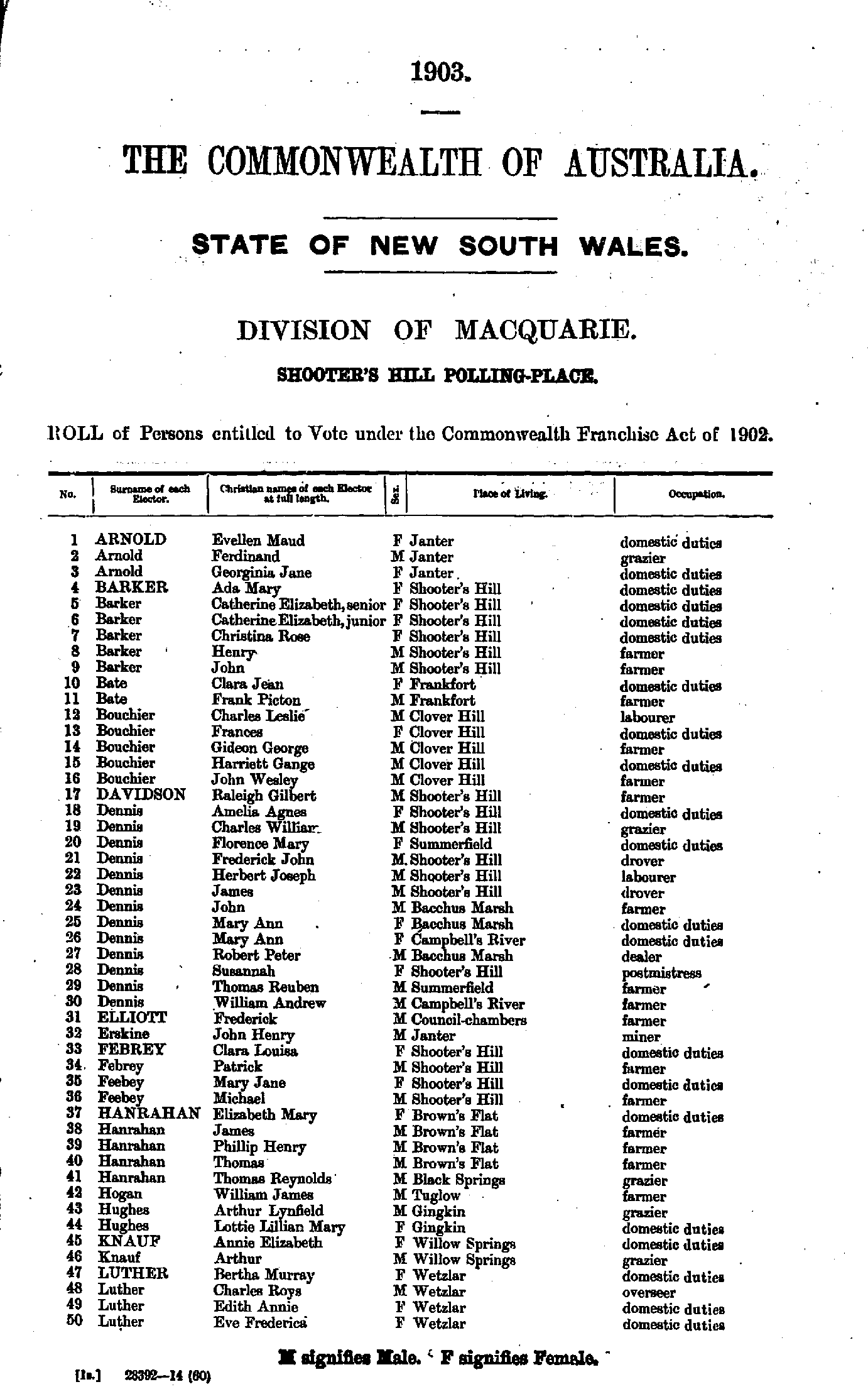
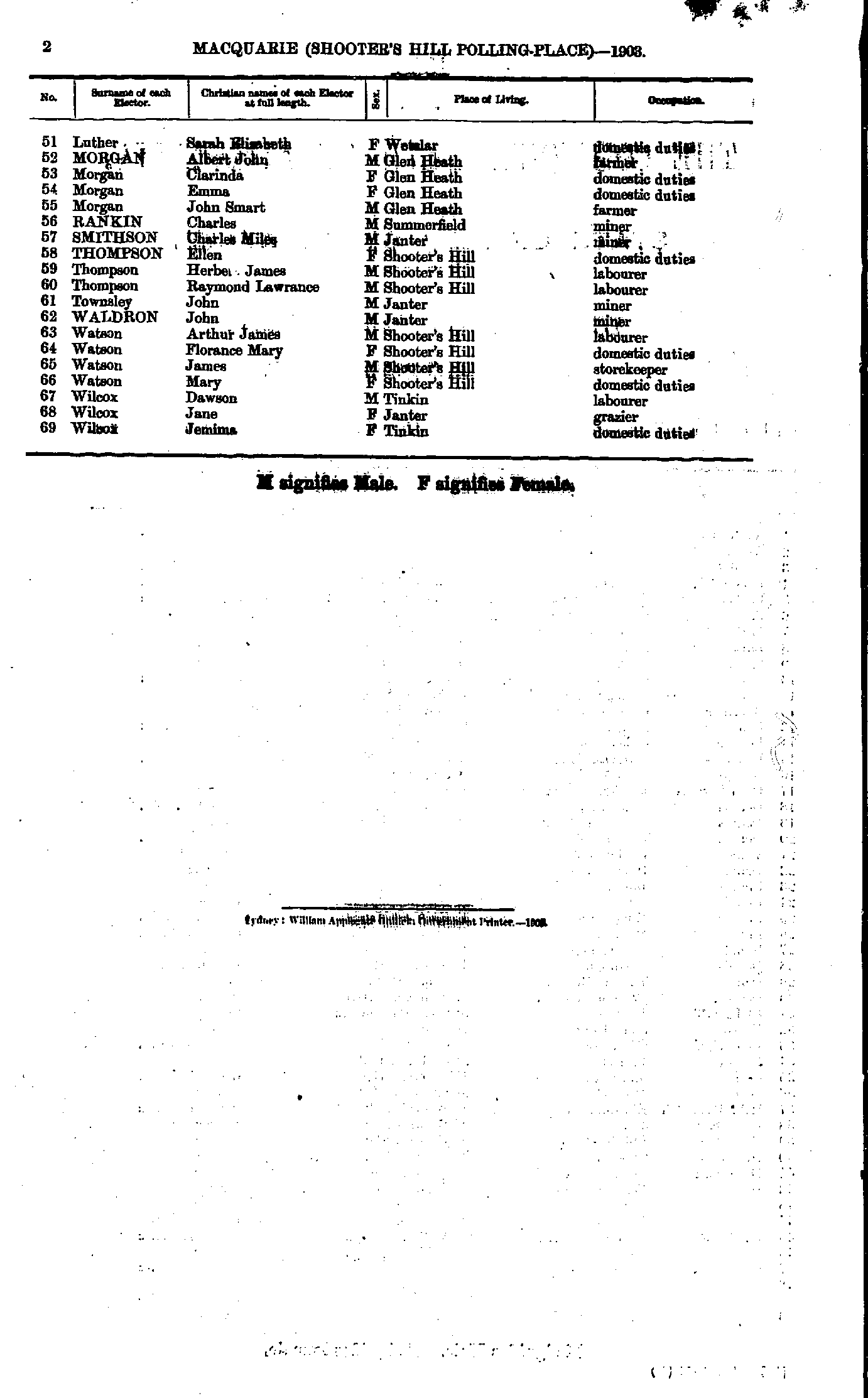
- Fitzpatrick William - Simms Caroline
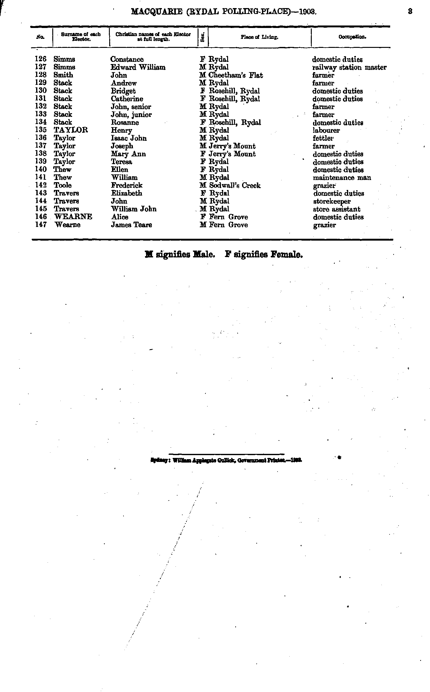
- Simms Constance - Wearne James
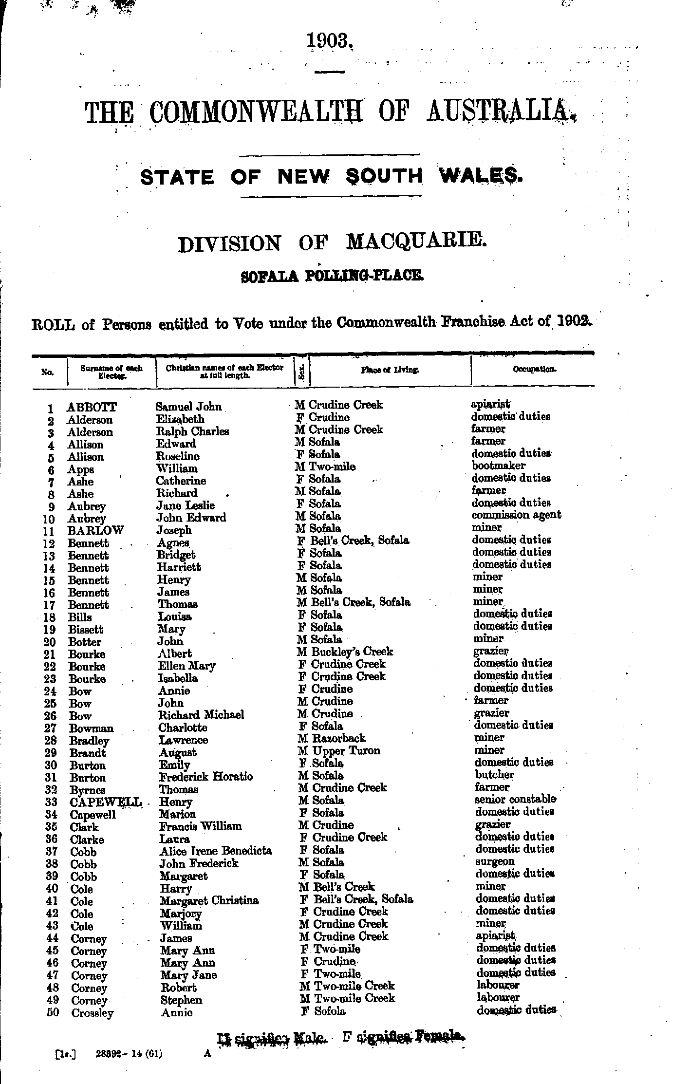
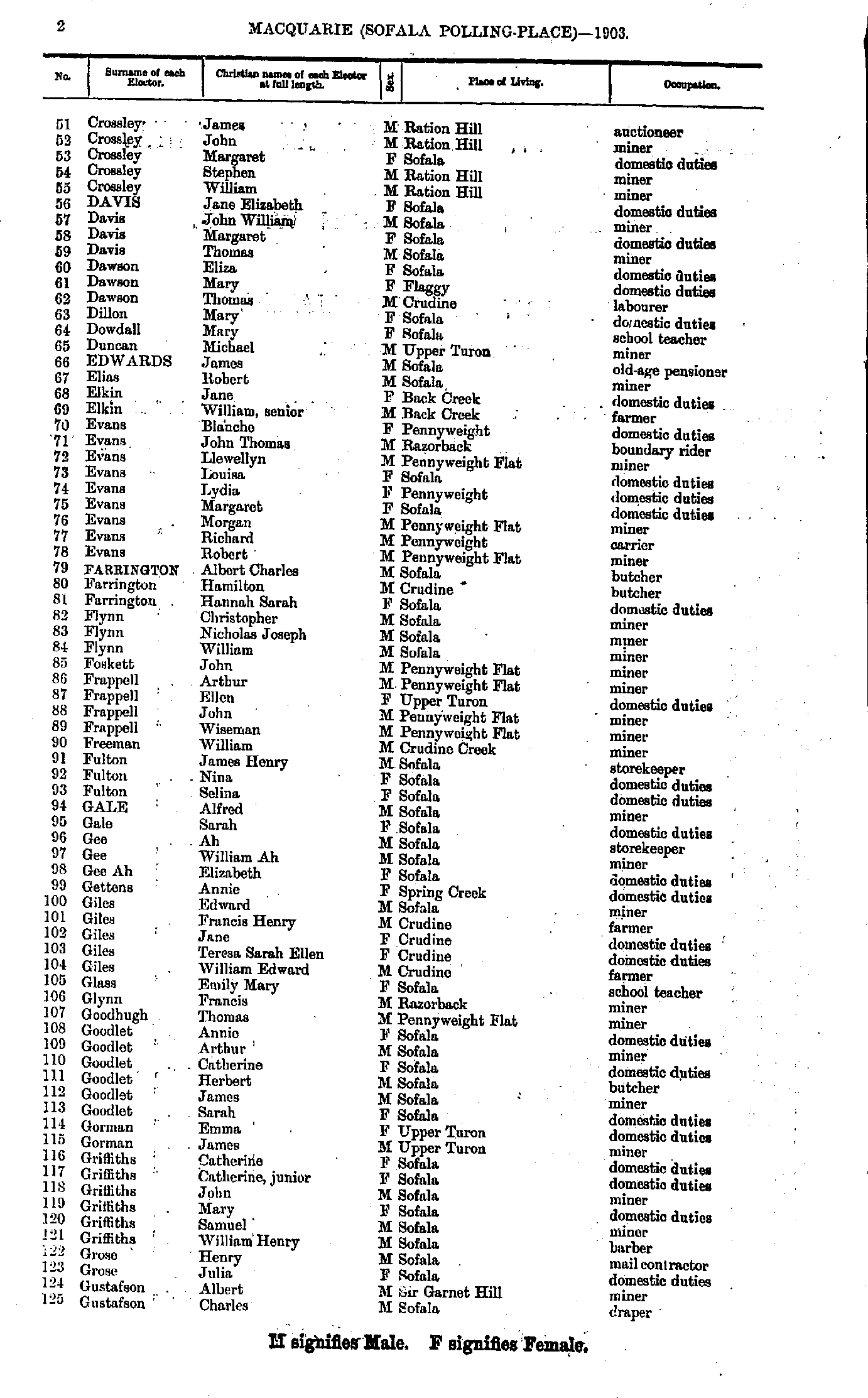
- Abbott Samuel - Crossley Annie
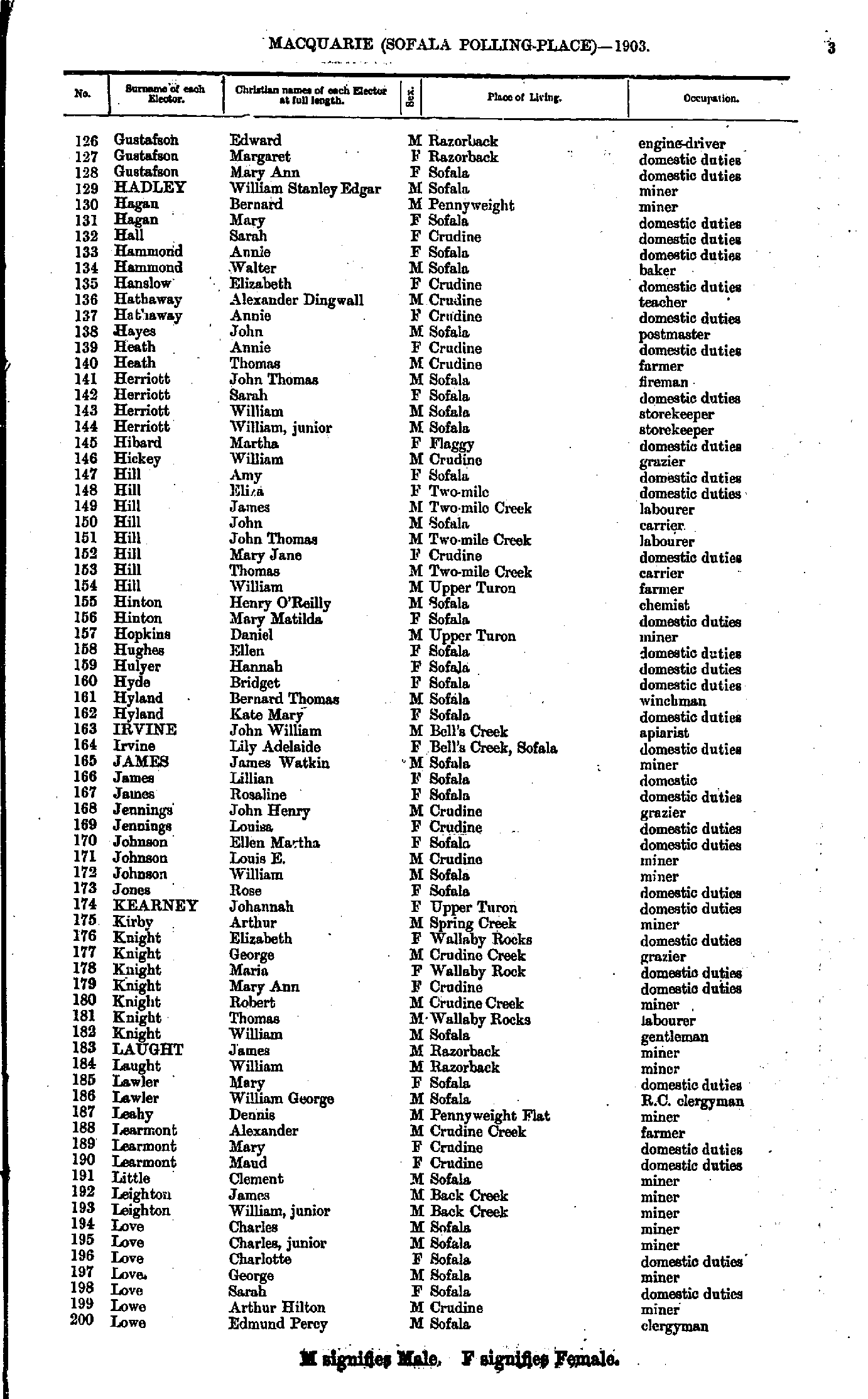
- Crossley James - Gustafson Charles
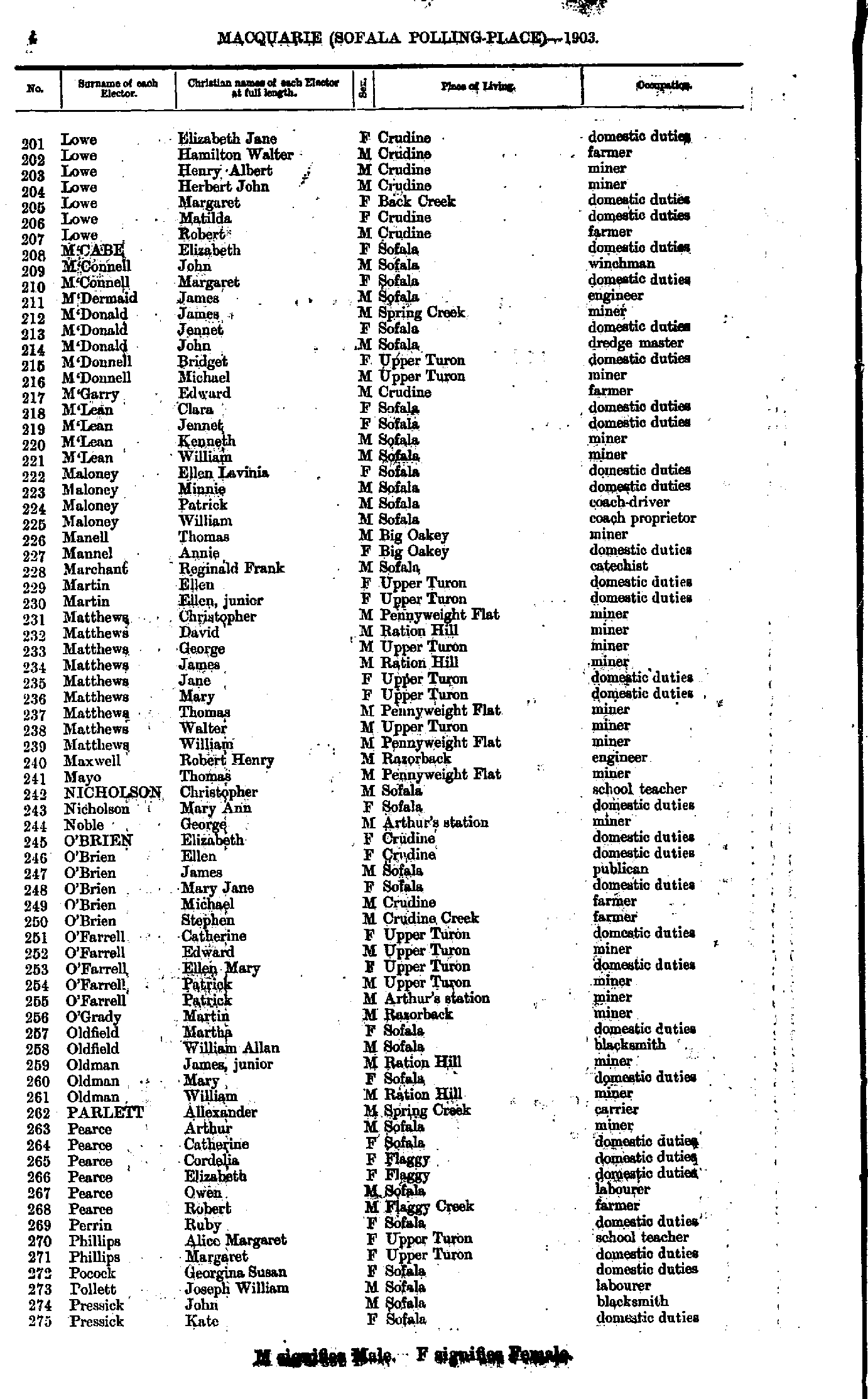
- Gustafson Edward - Lowe Edmund
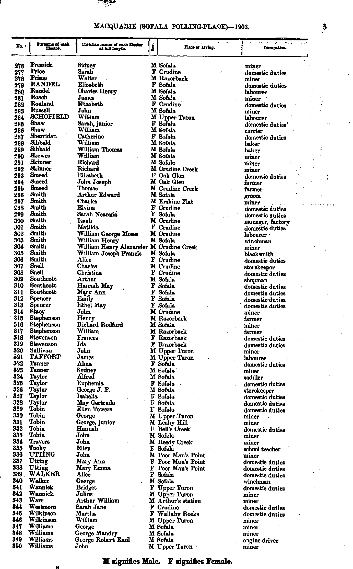
- Lowe Elizabeth - Pressick Kate
- Pressick Sidney - Williams John
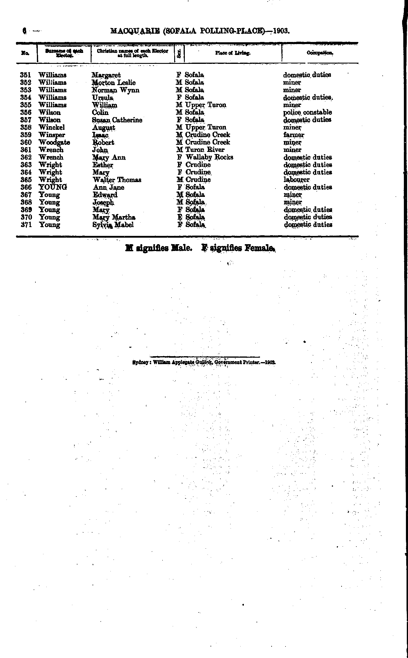
- Williams Margaret - Young Sylvia
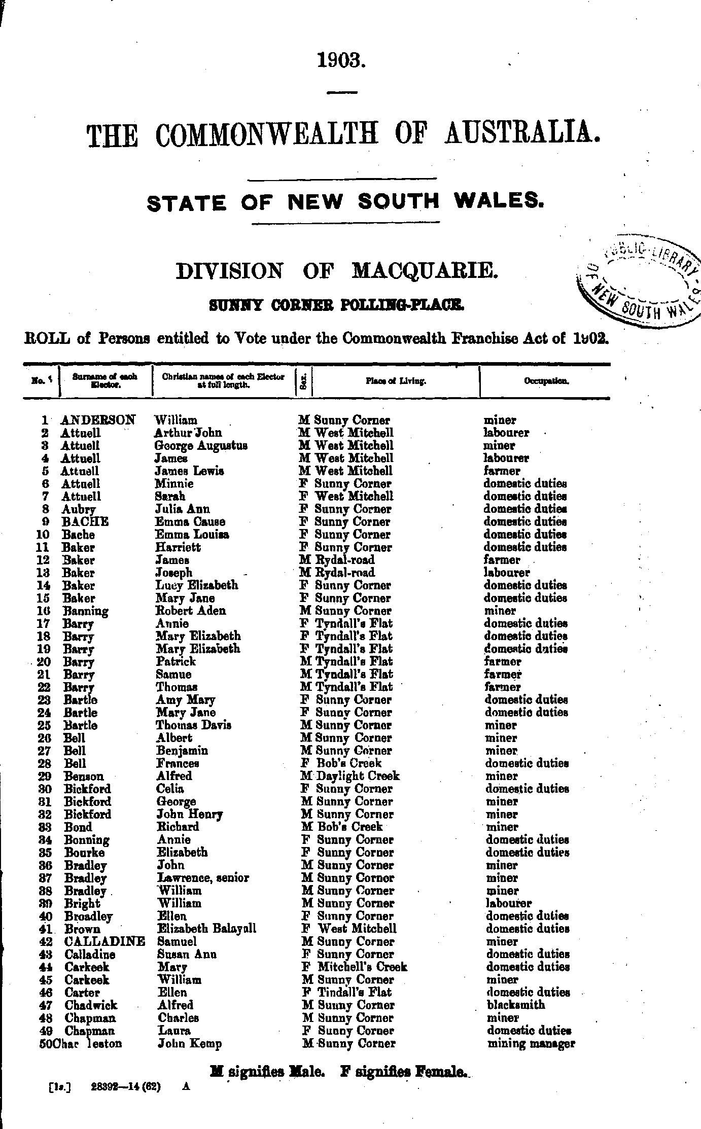
- Anderson William - Charleston John
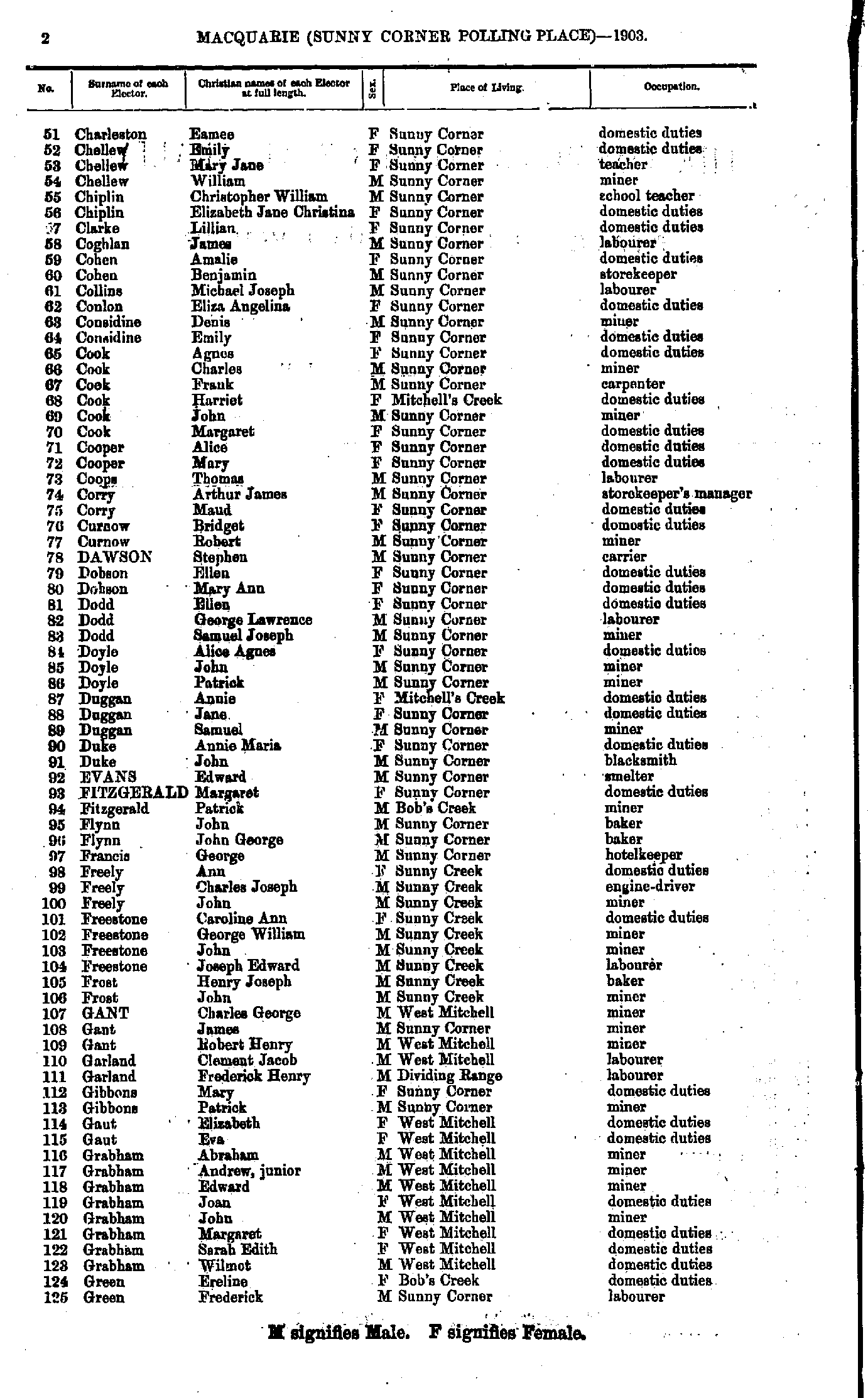
- Charleston Eamee - Green Frederick
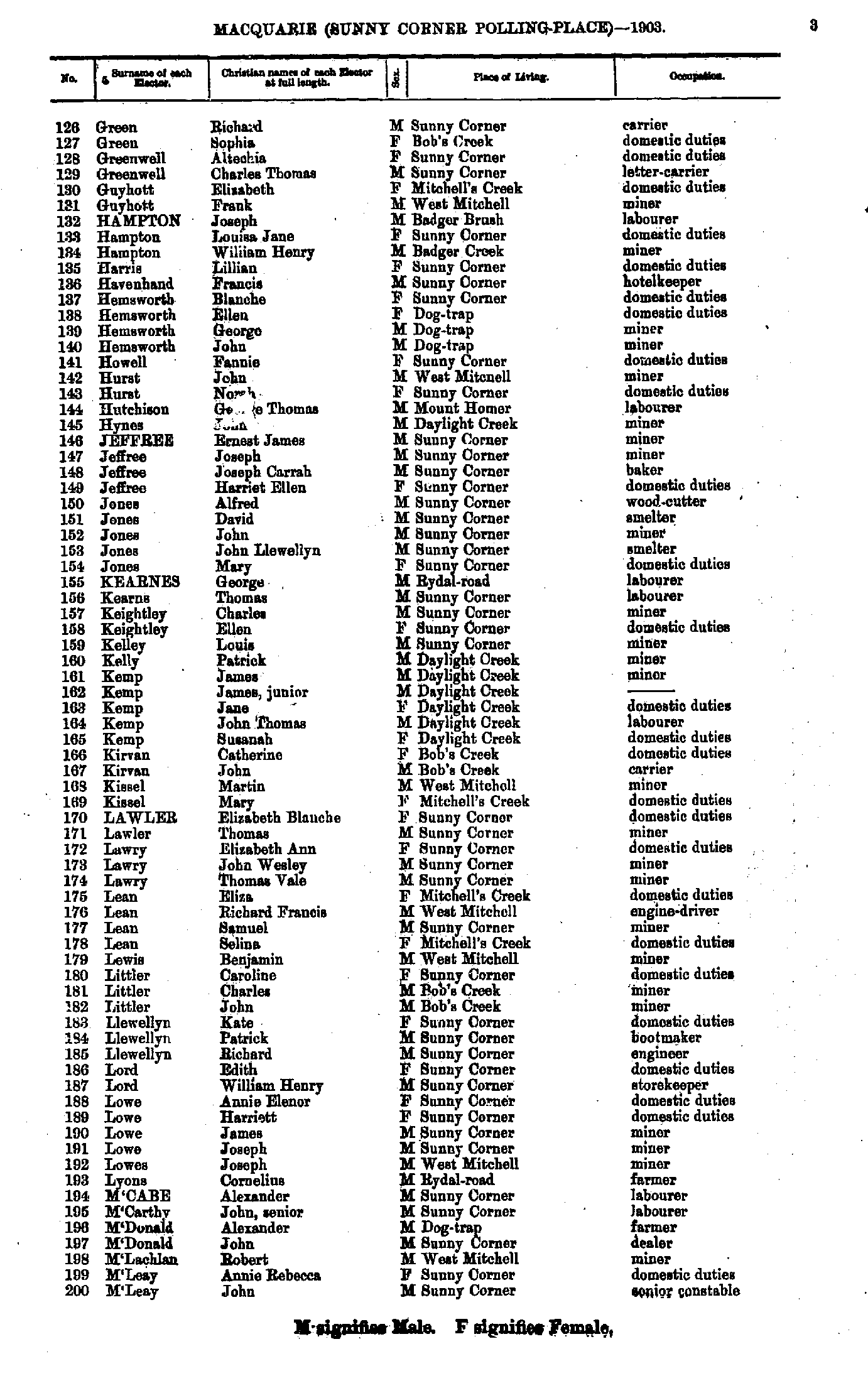
- Green Richard - M'Leay John
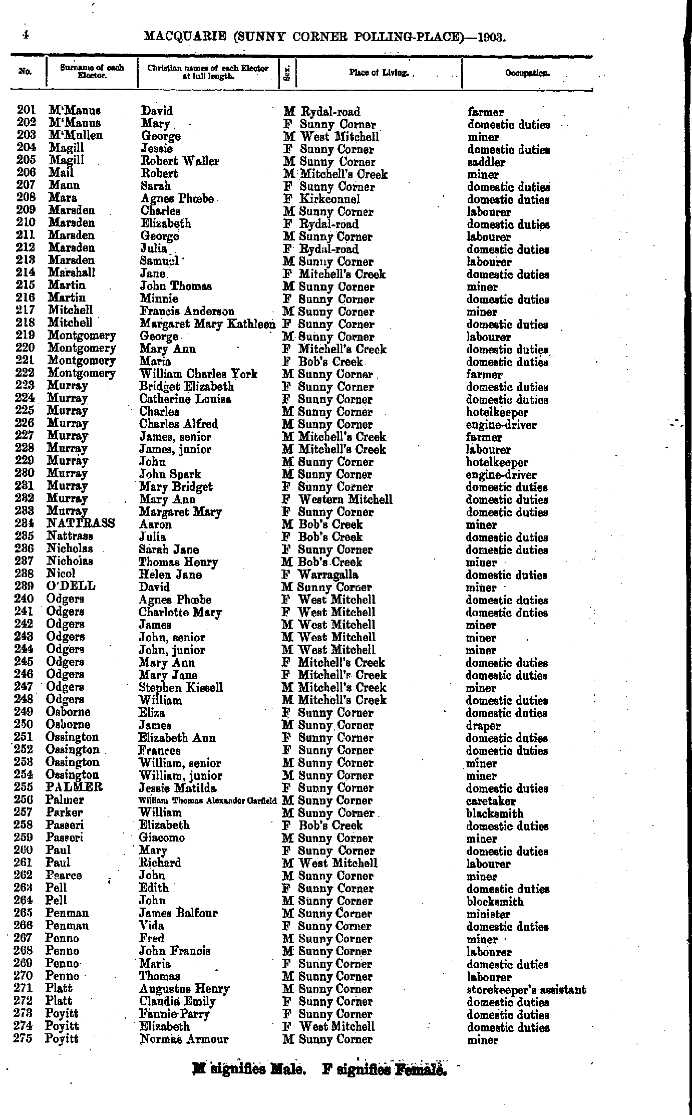
- M'Manus David - Poyitt Norman
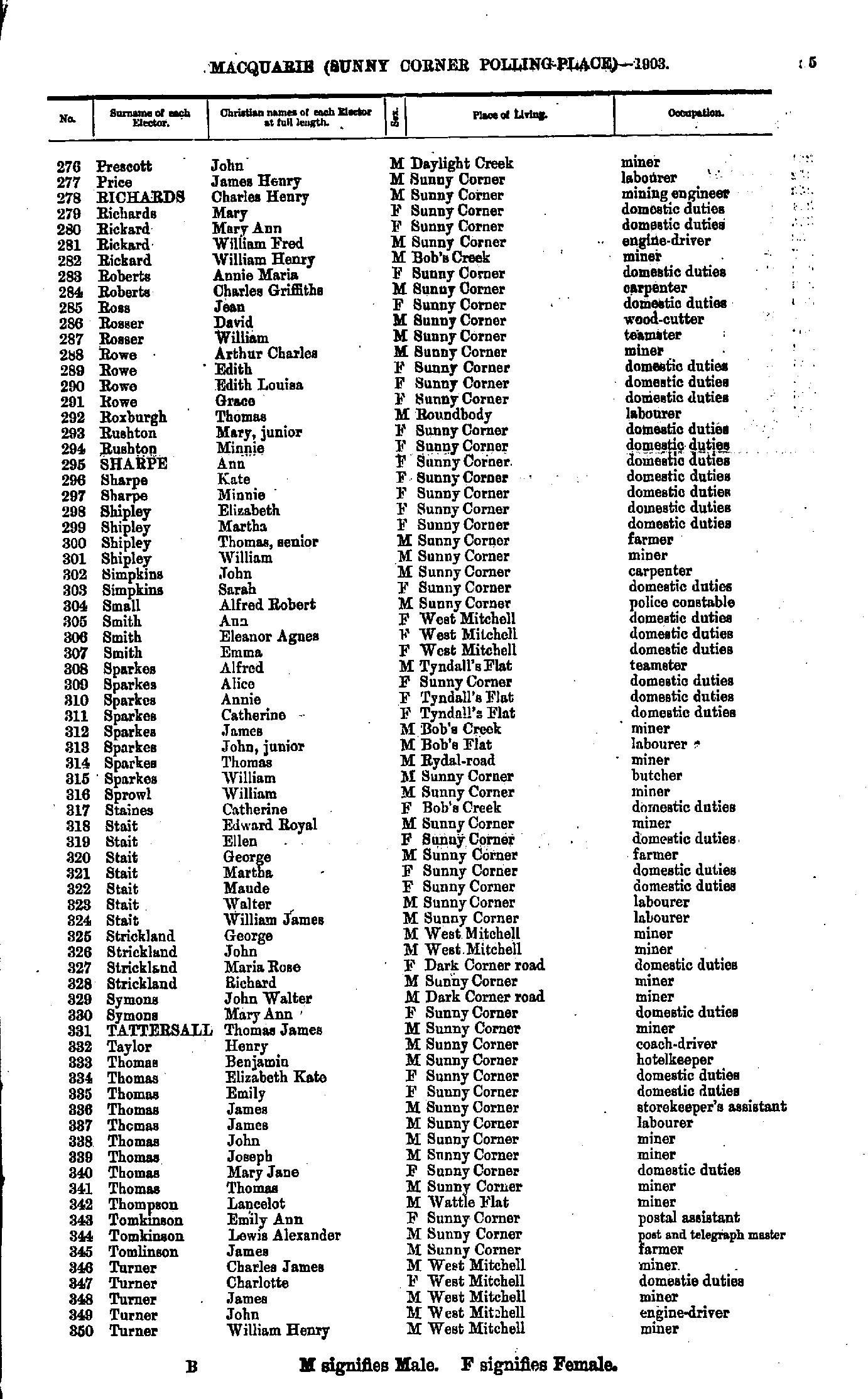
- Prescott John - Turner William
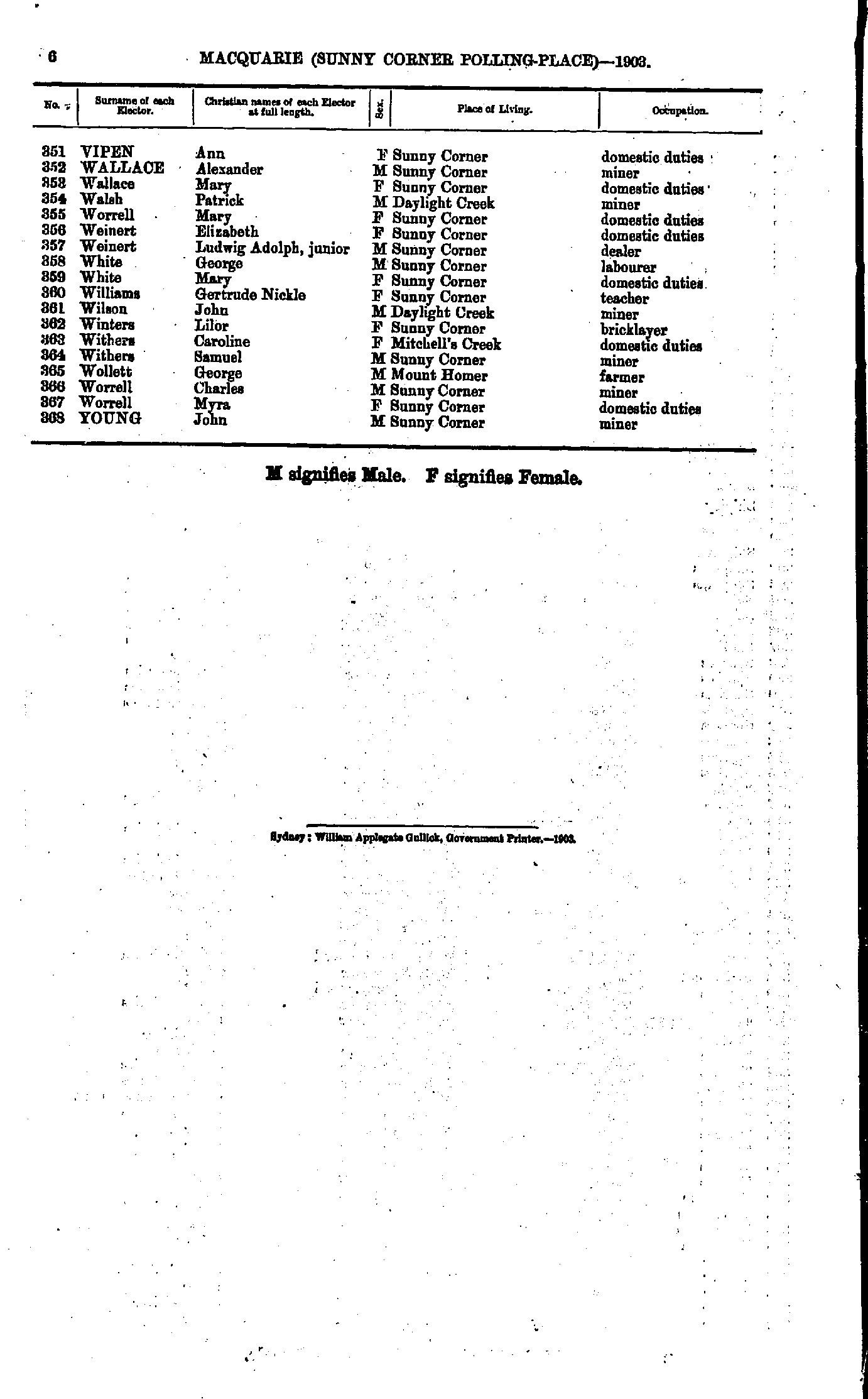
- Vipen Ann - Young John
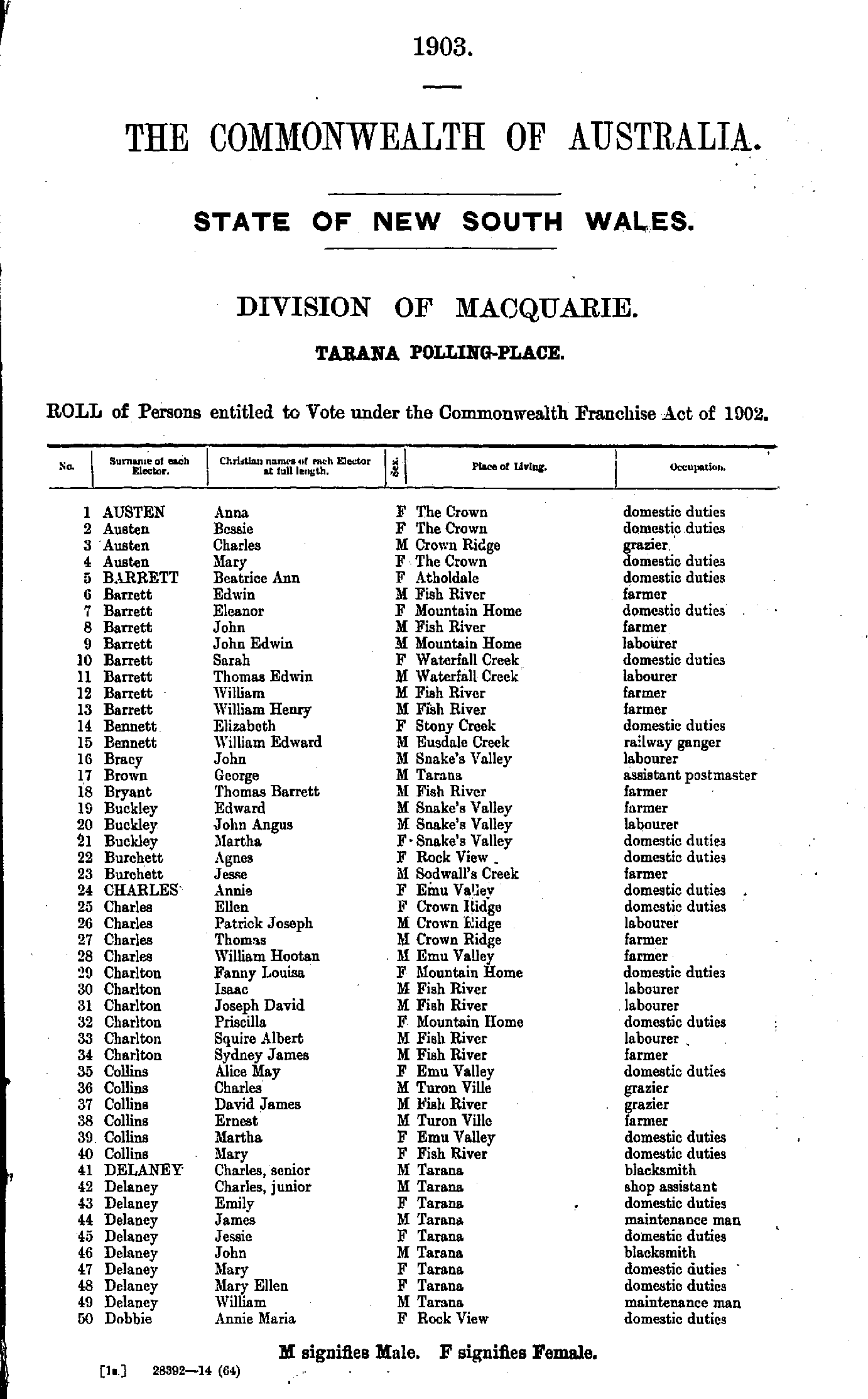
- Austen Anna - Dobbie Annie
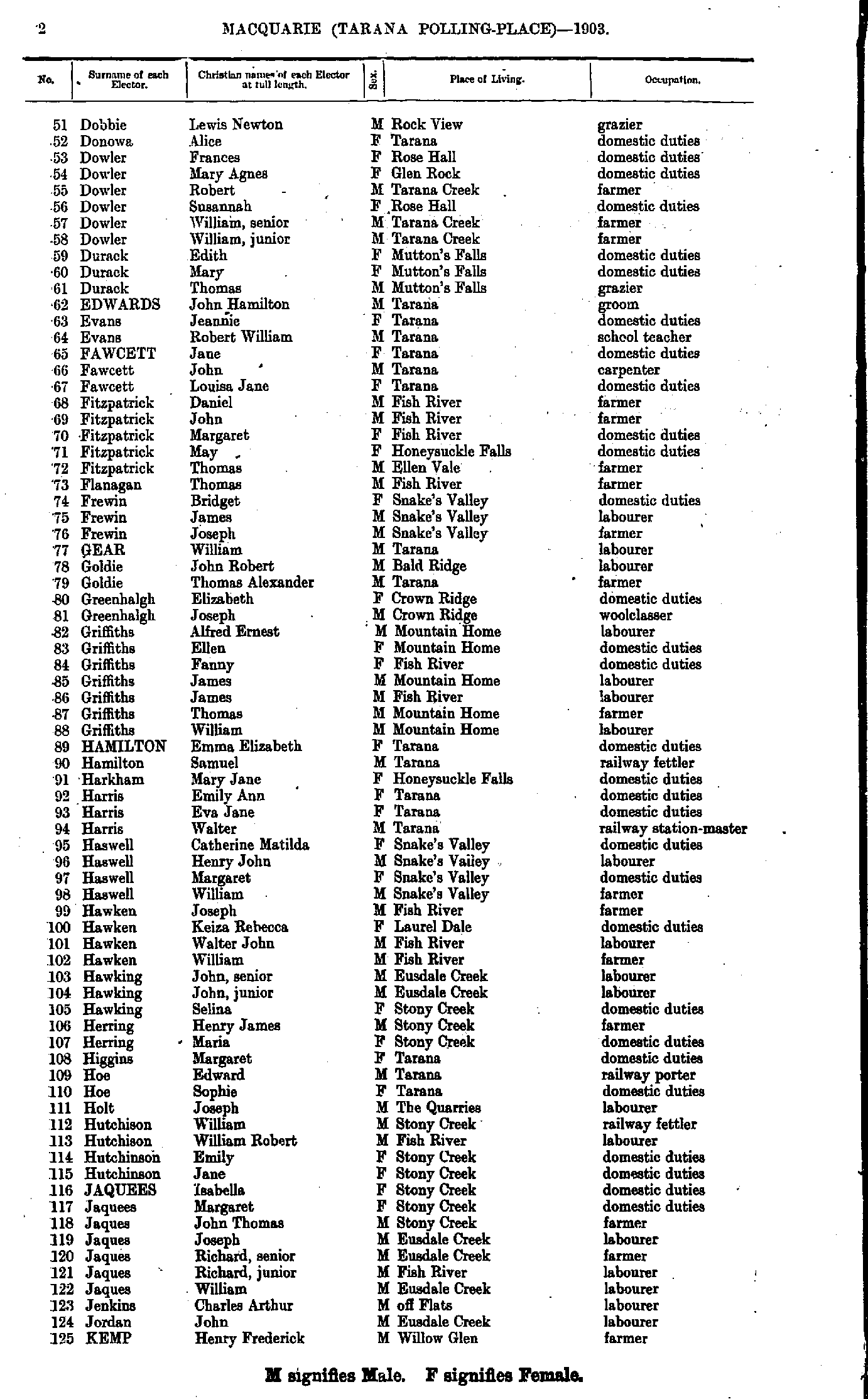
- Dobbie Lewis - Kemp Henry
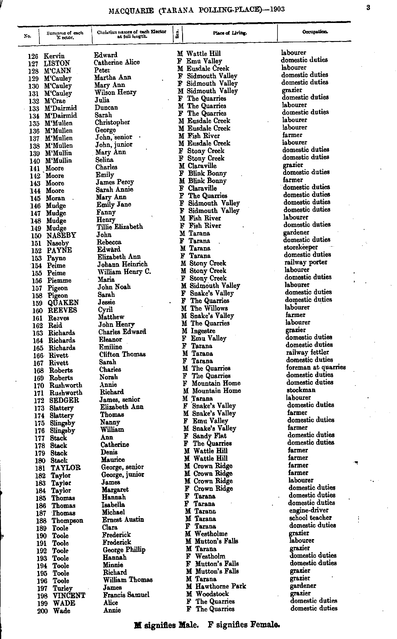
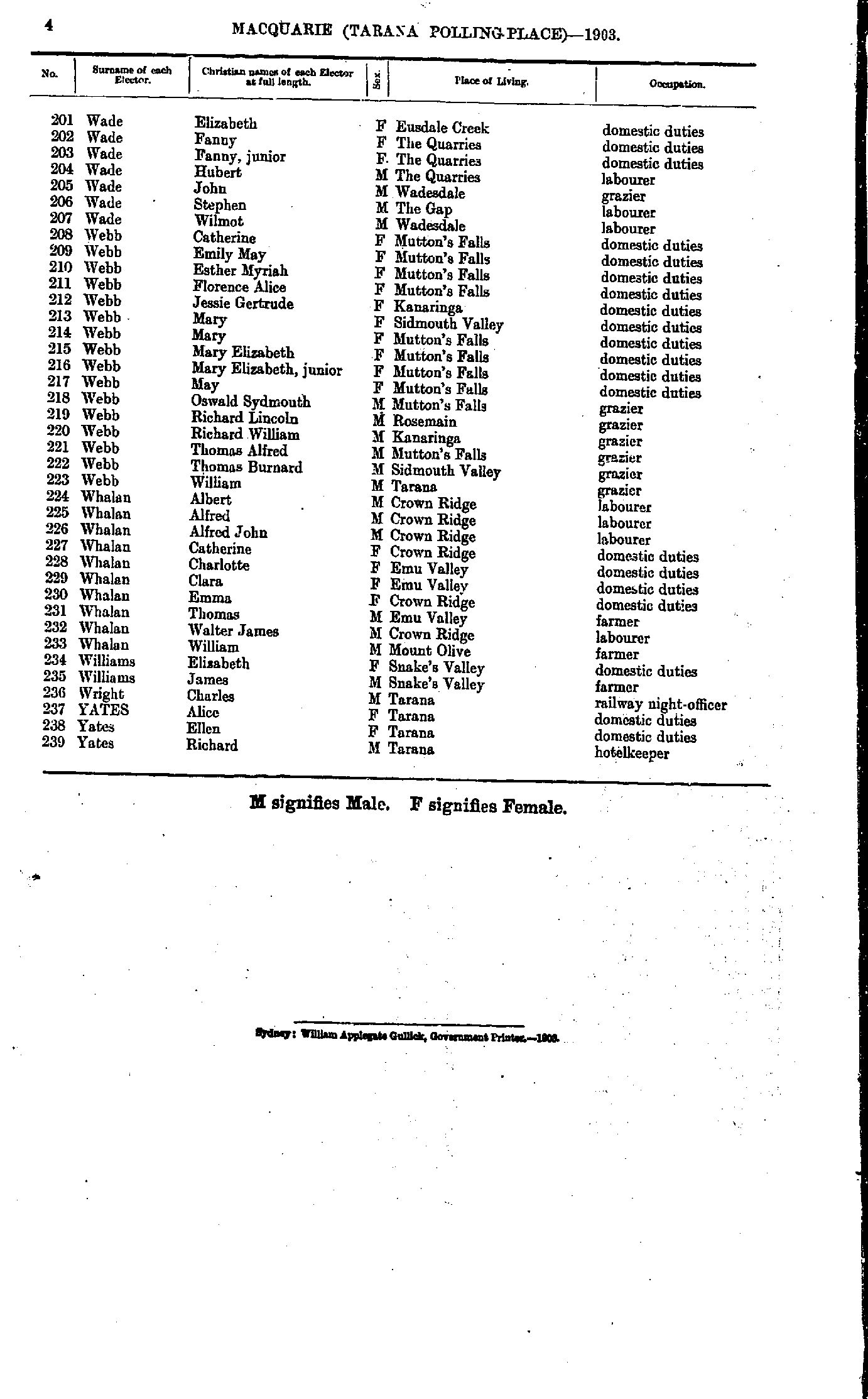
- Kervin Edward - Wade Annie
- Wade Elizabeth - Yates Richard
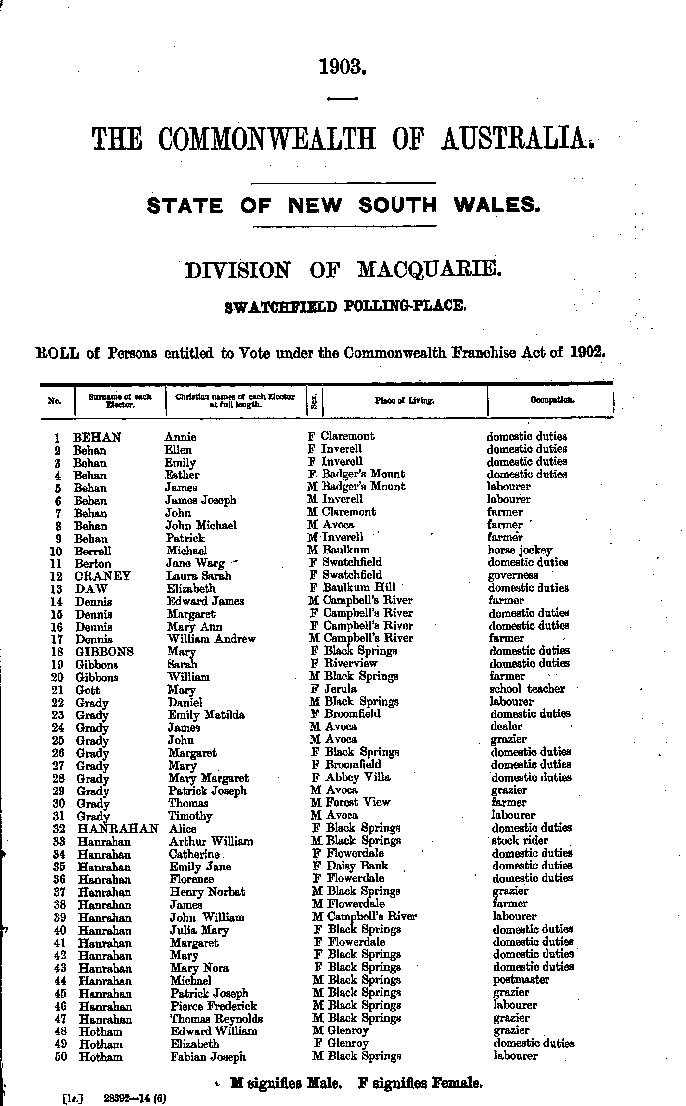
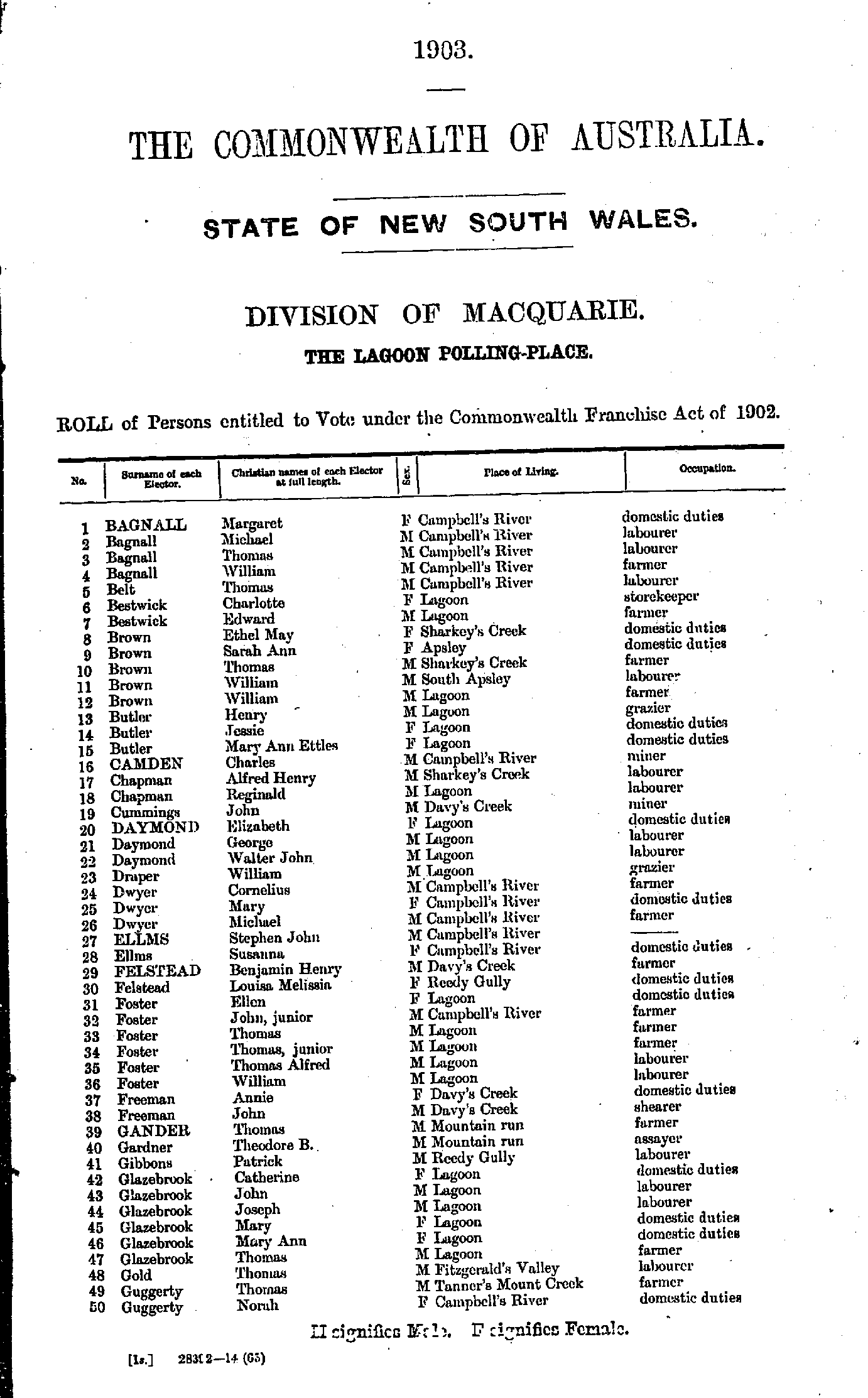
- Bagnall Margaret - Guggerty Norah
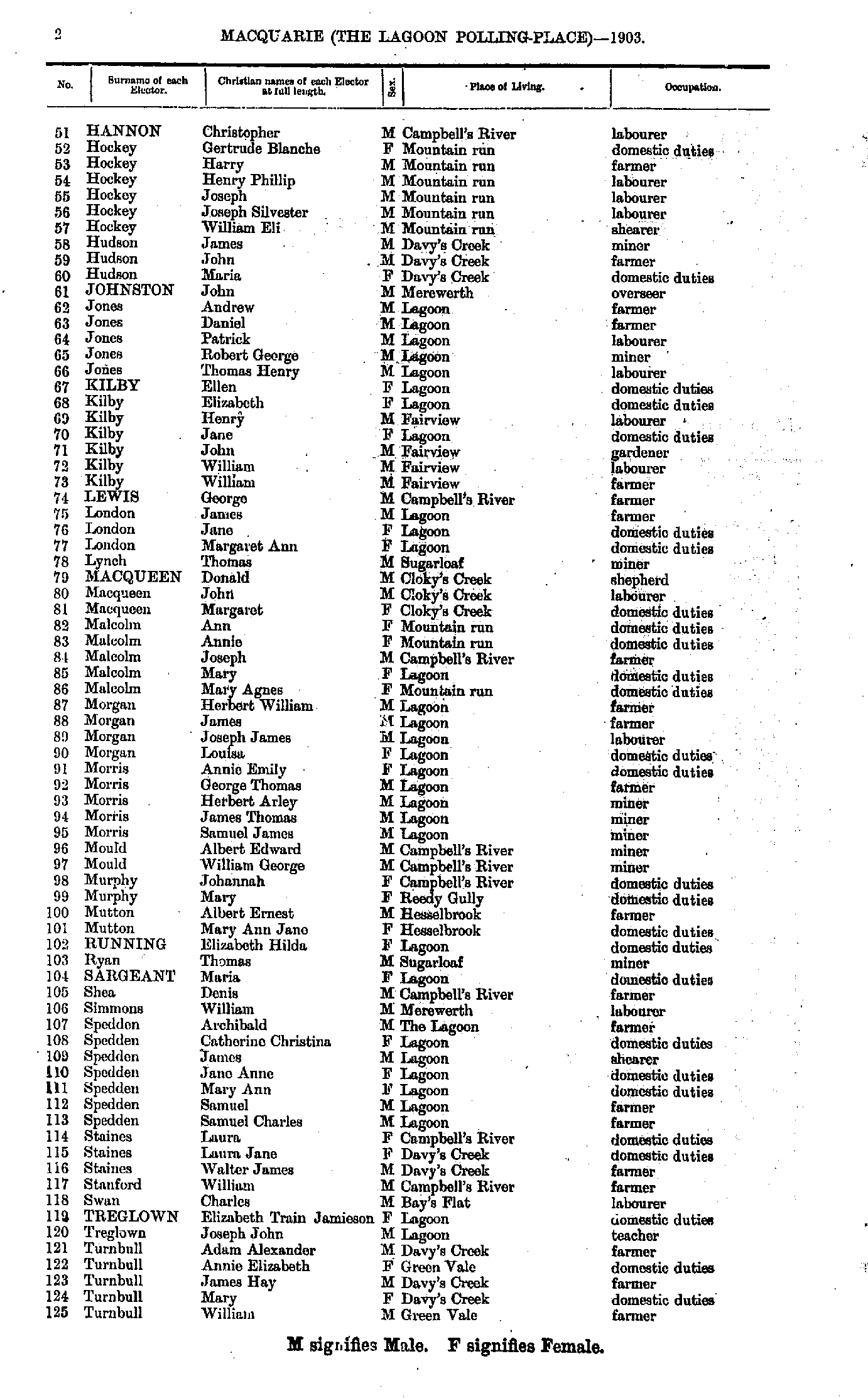
- Hannon Christopher - Turnbull William
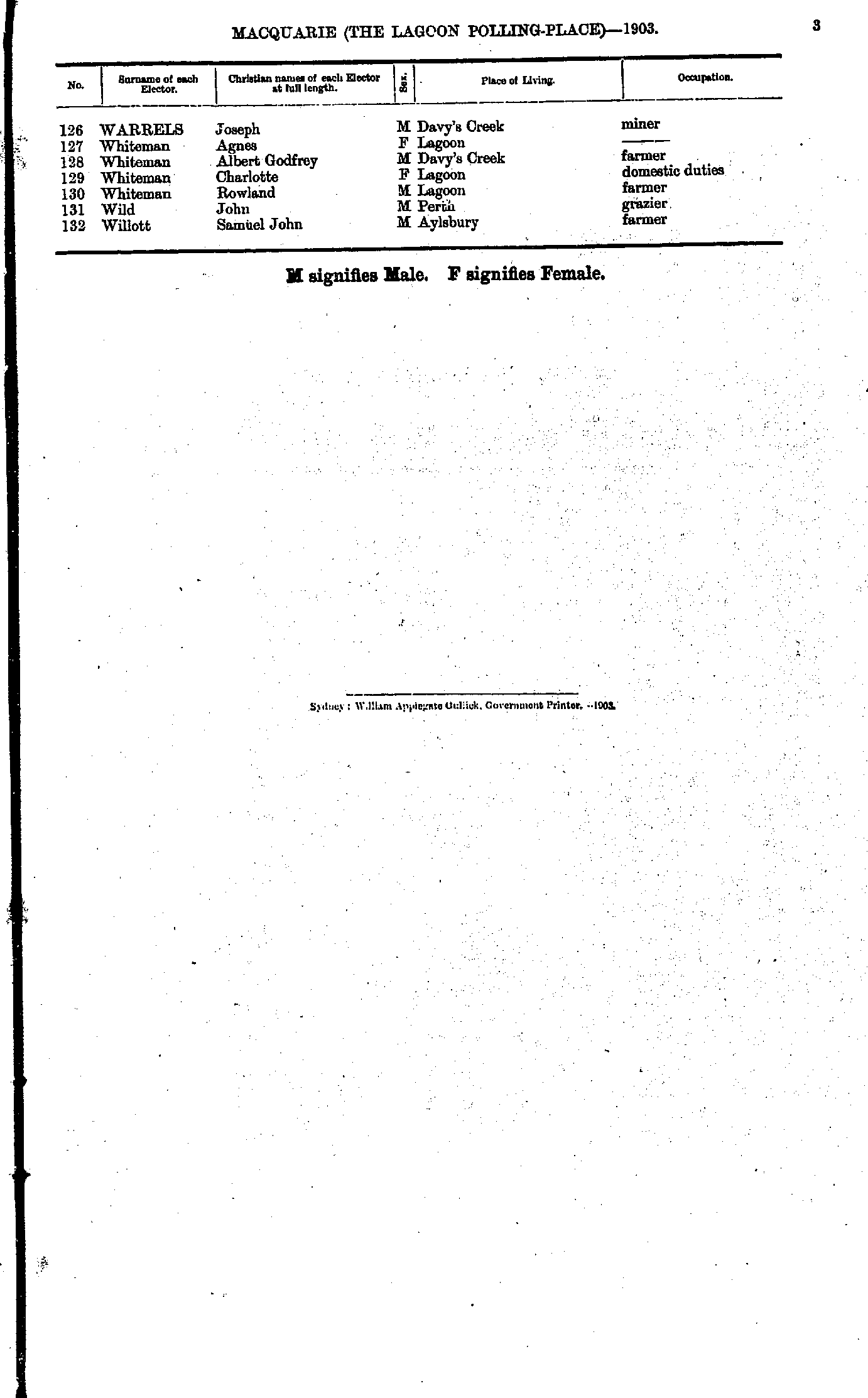
- Warrels Joseph - Willott Samuel
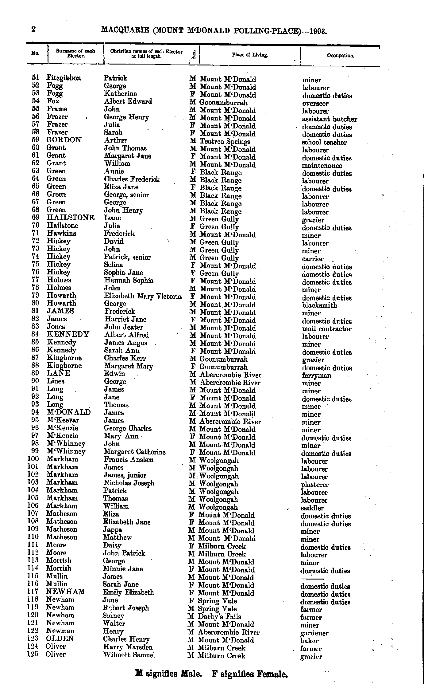
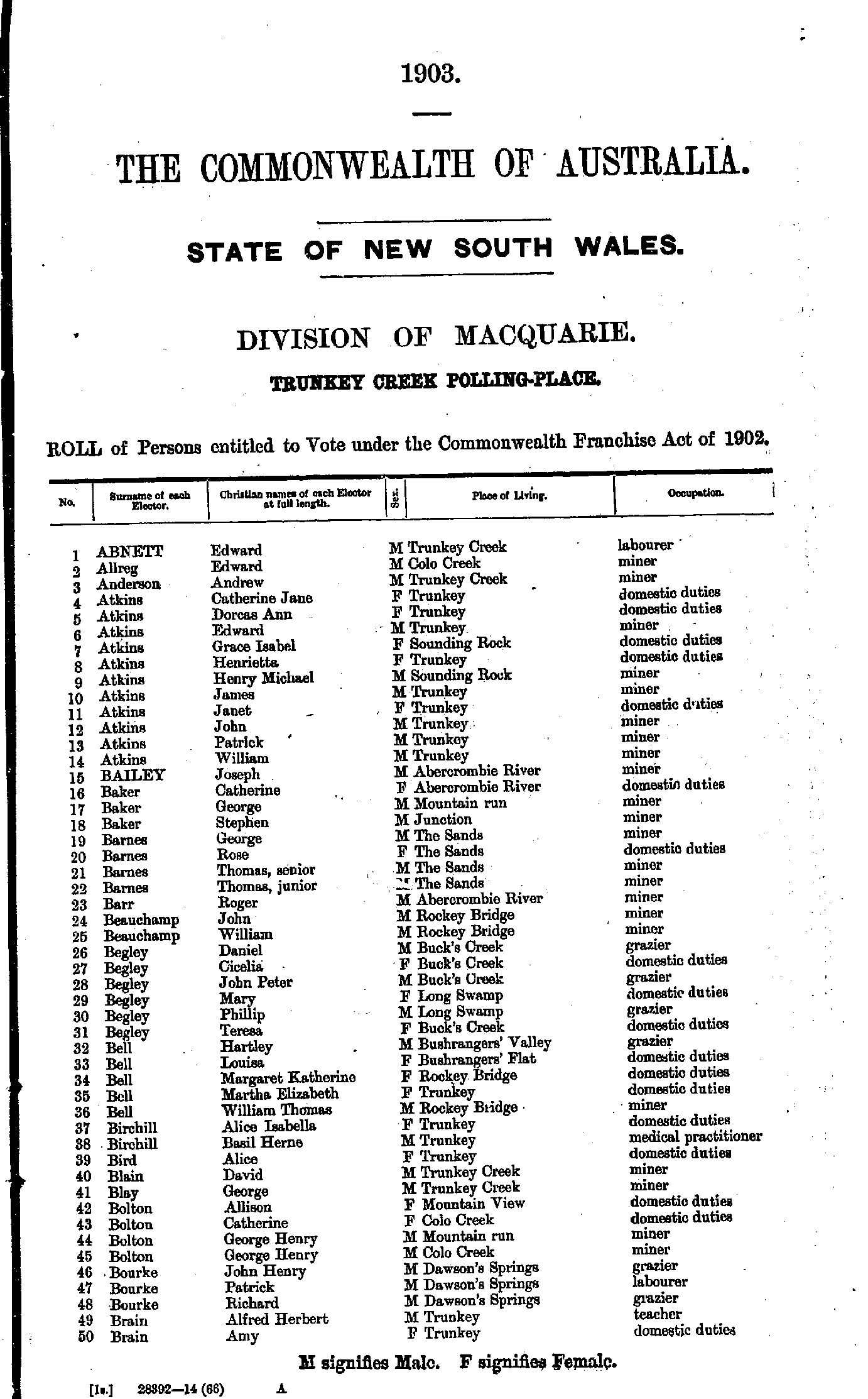
- Abnett Edward - Brain Amy
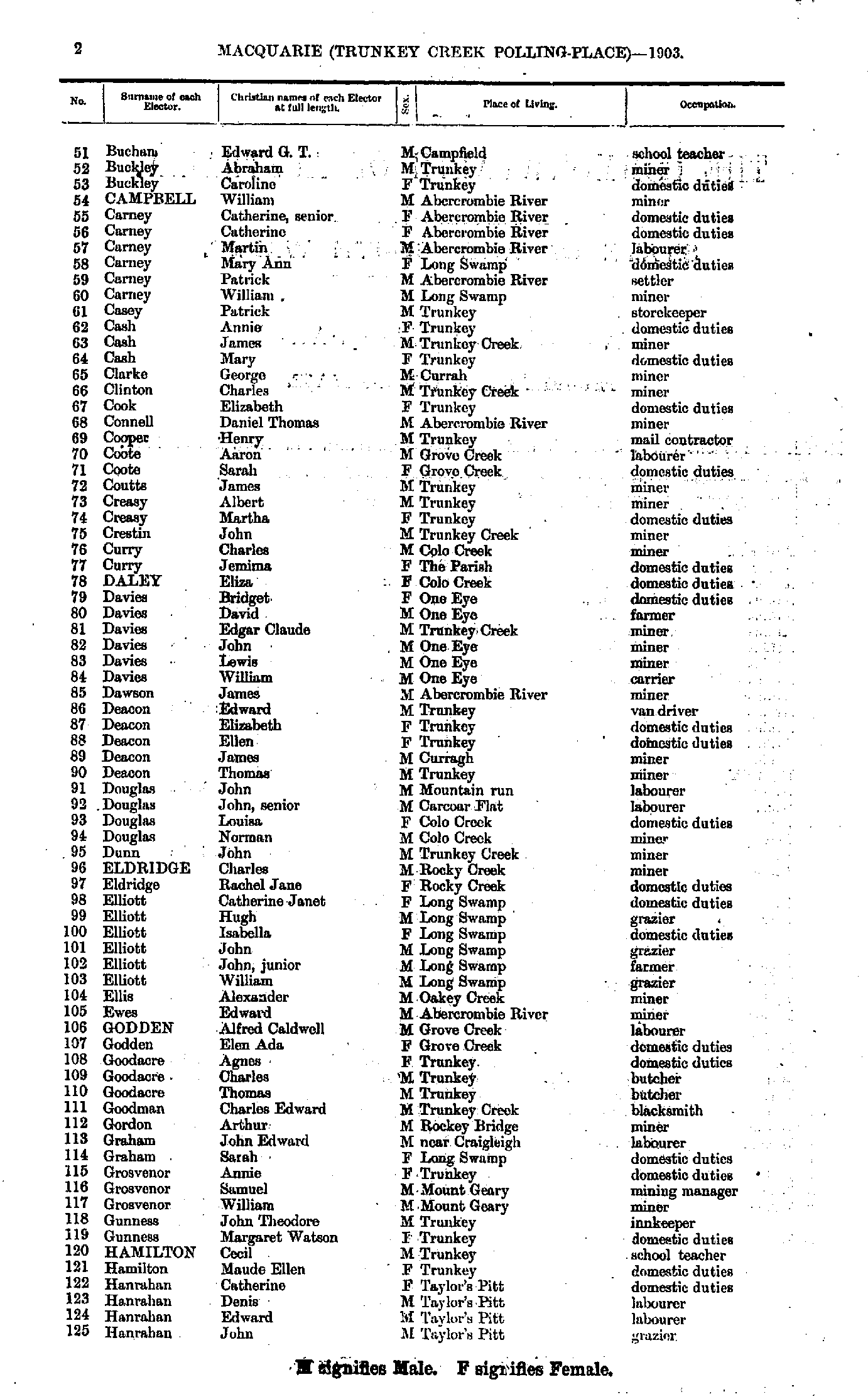
- Buchan Edward - Hanrahan John
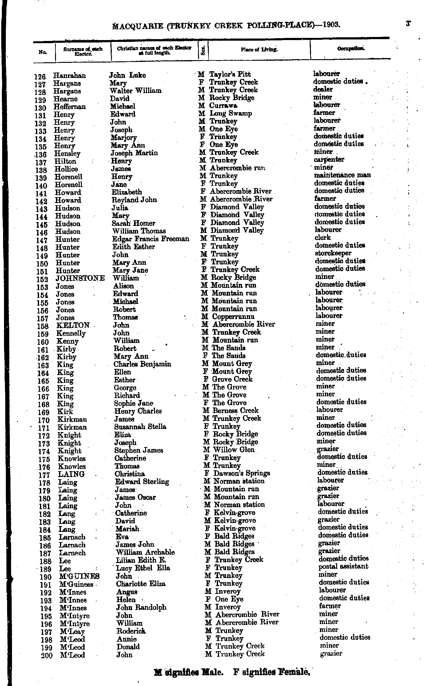
- Hanrahan John - M'Leod John
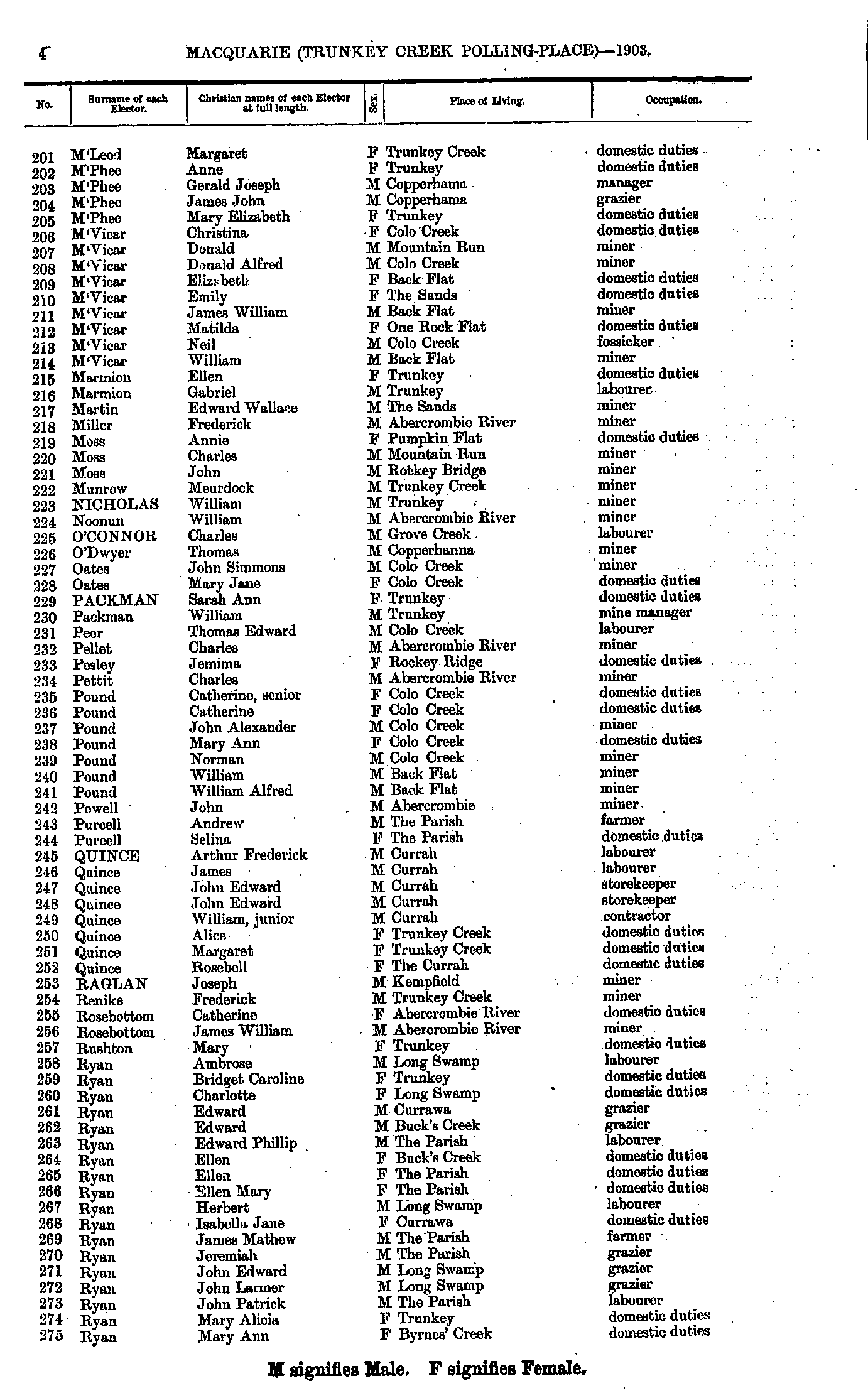
- M'Leod Margaret - Ryan Mary
- Ryan Mary - Wright Richard
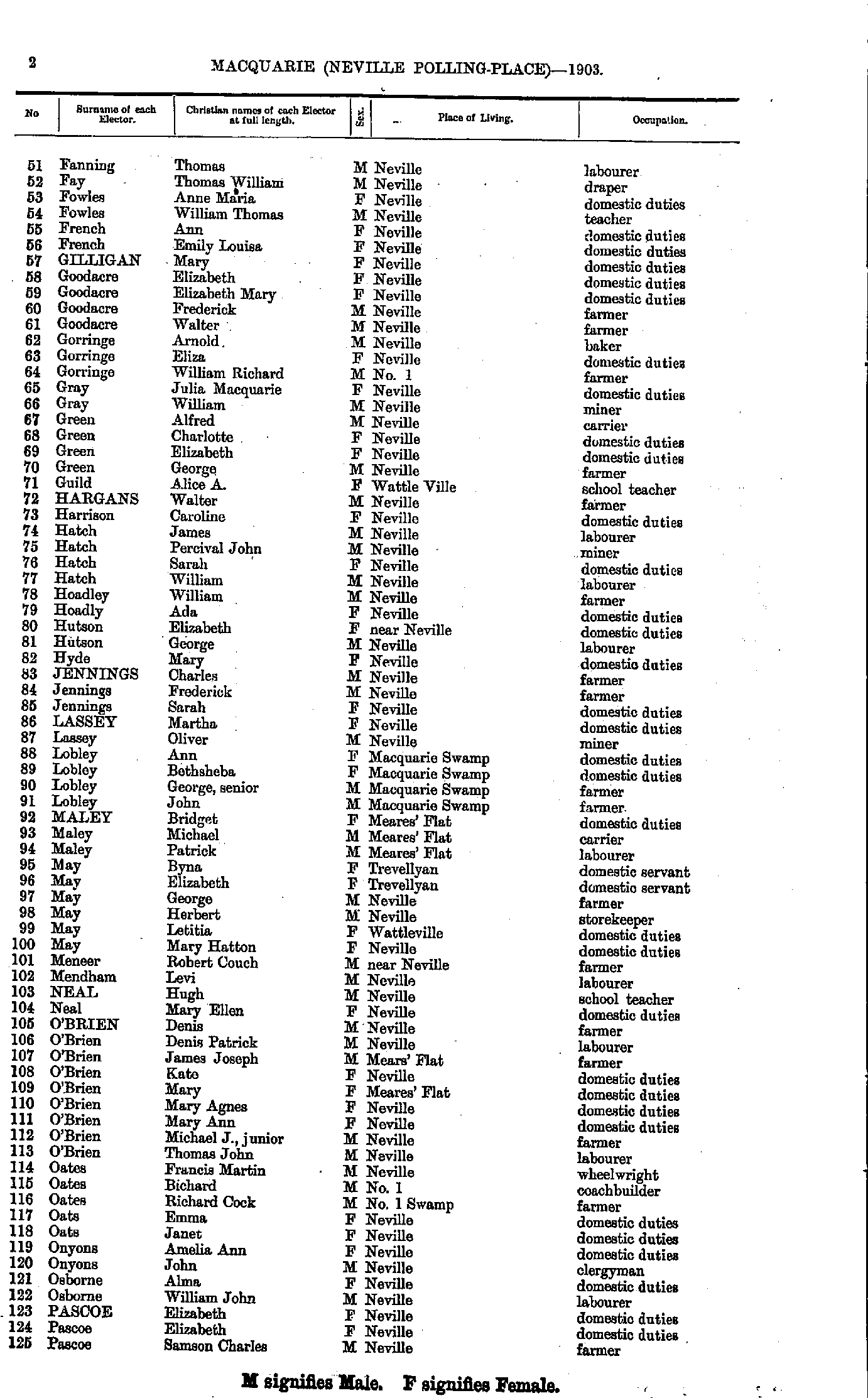
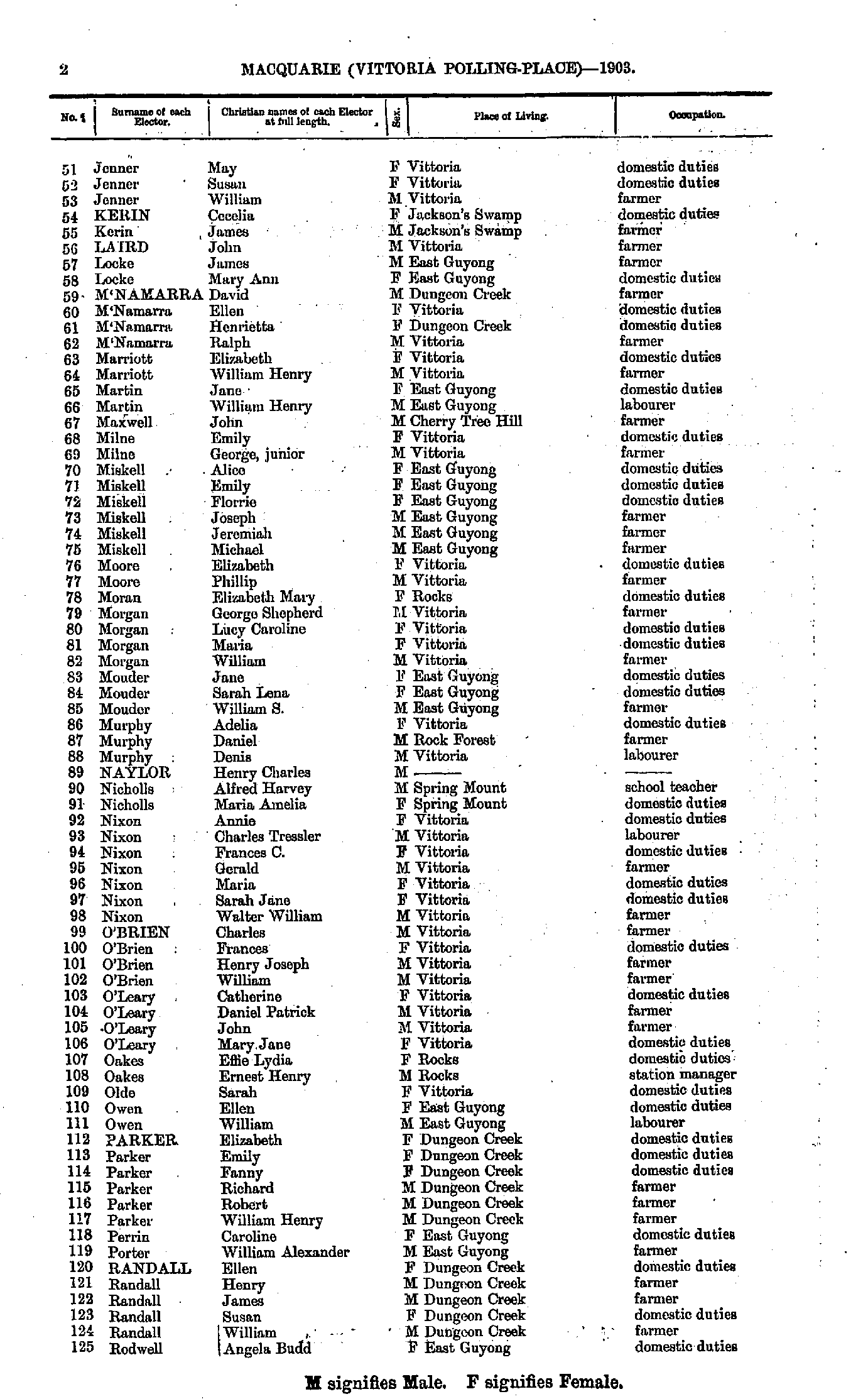
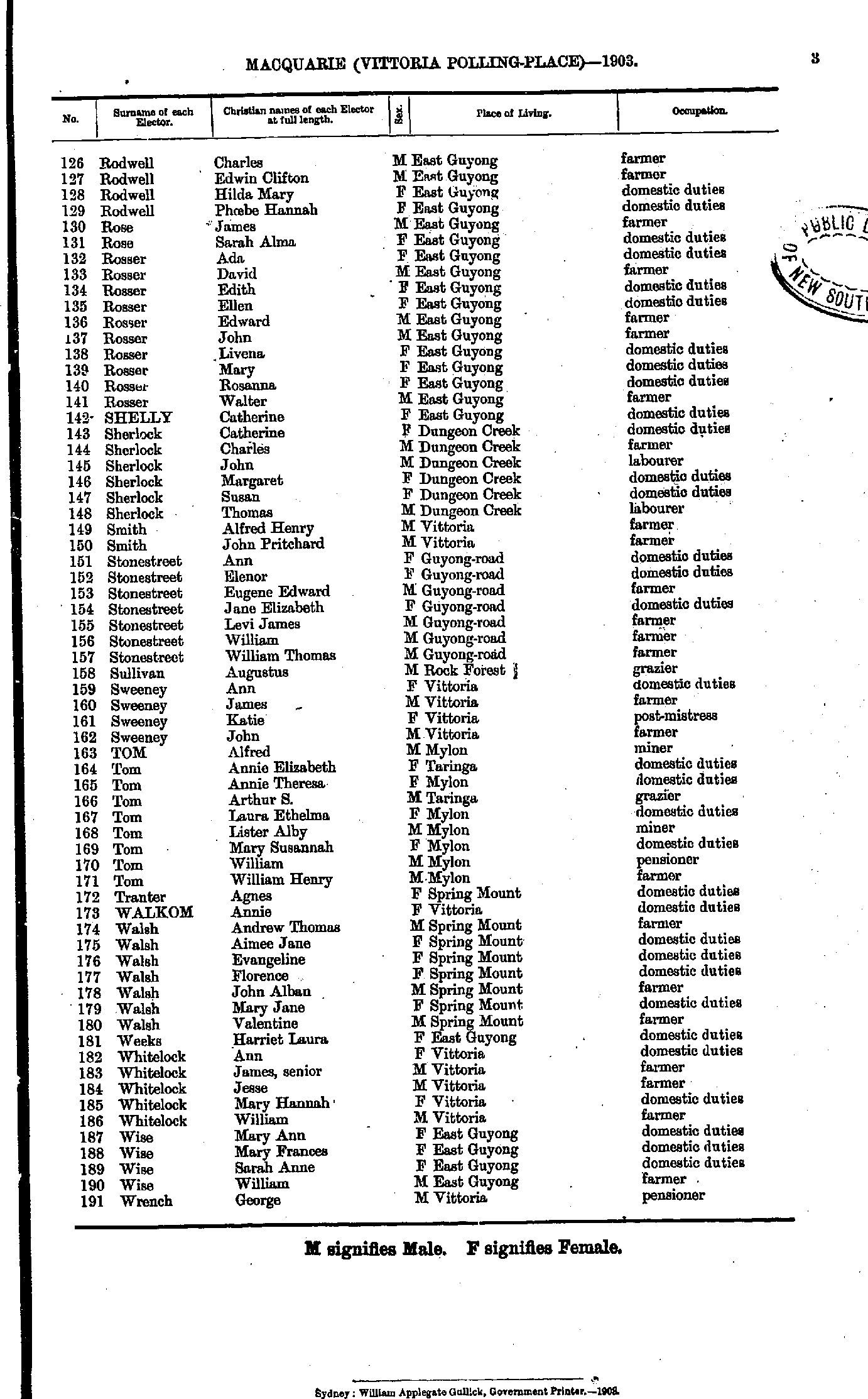
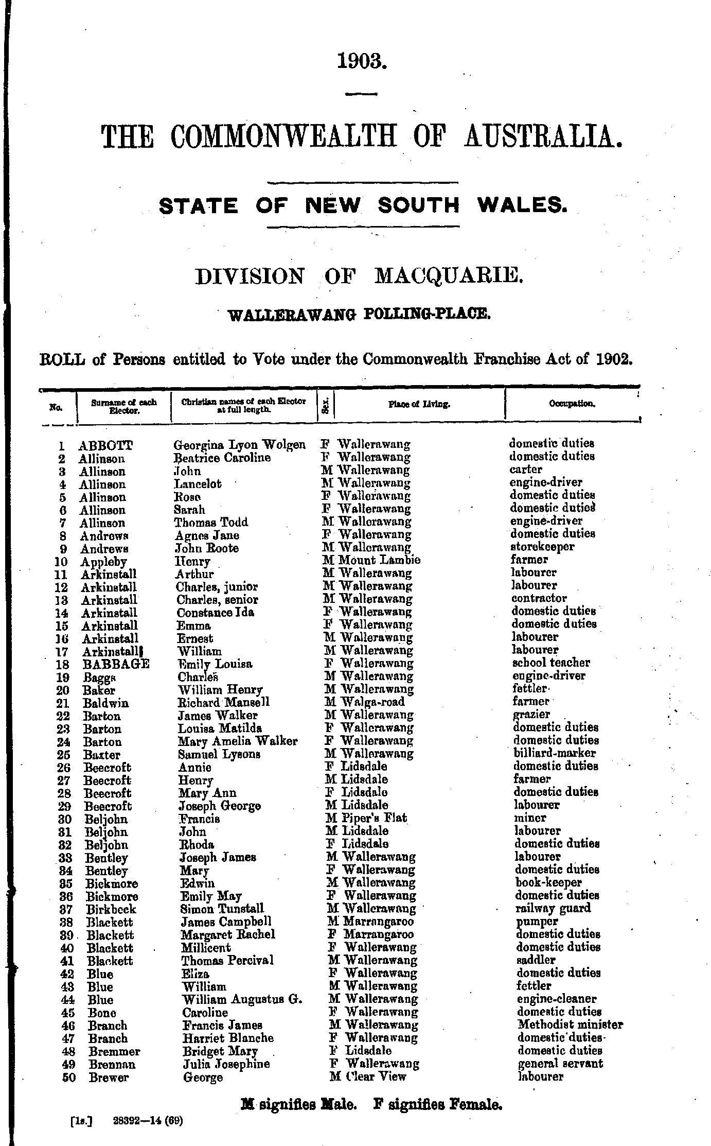
- Abbott Georgina - Brewer George
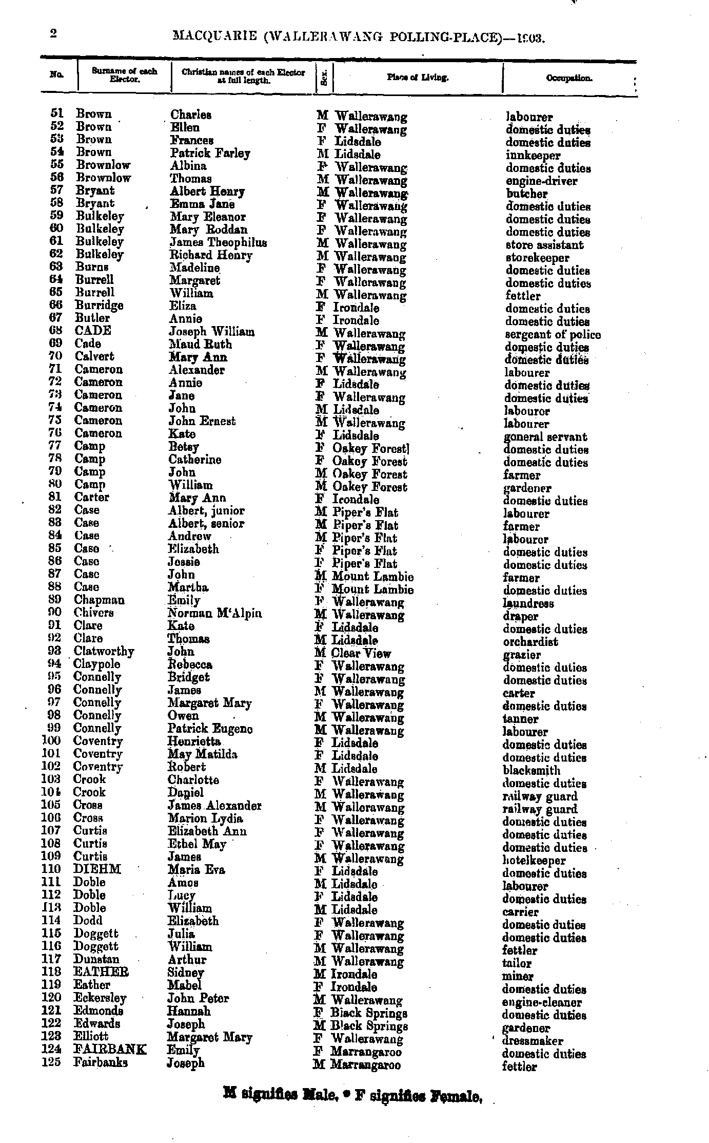
- Brown Charles - Fairbanks Joseph
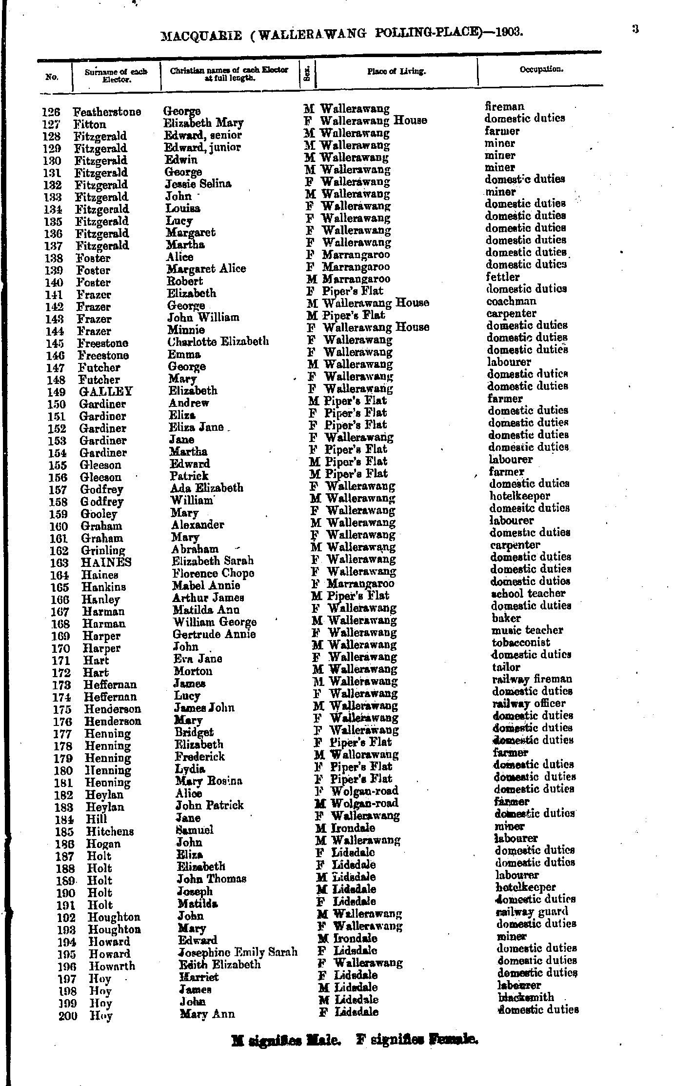
- Featherstone George - Hoy Mary
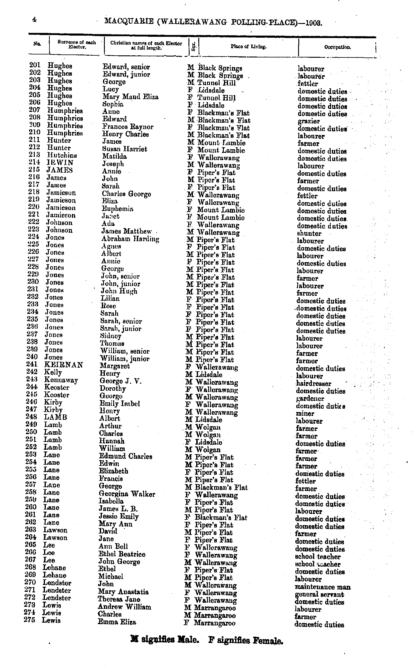
- Hughes Edward - Lewis Emma
- Lewis Janet - Page Emily
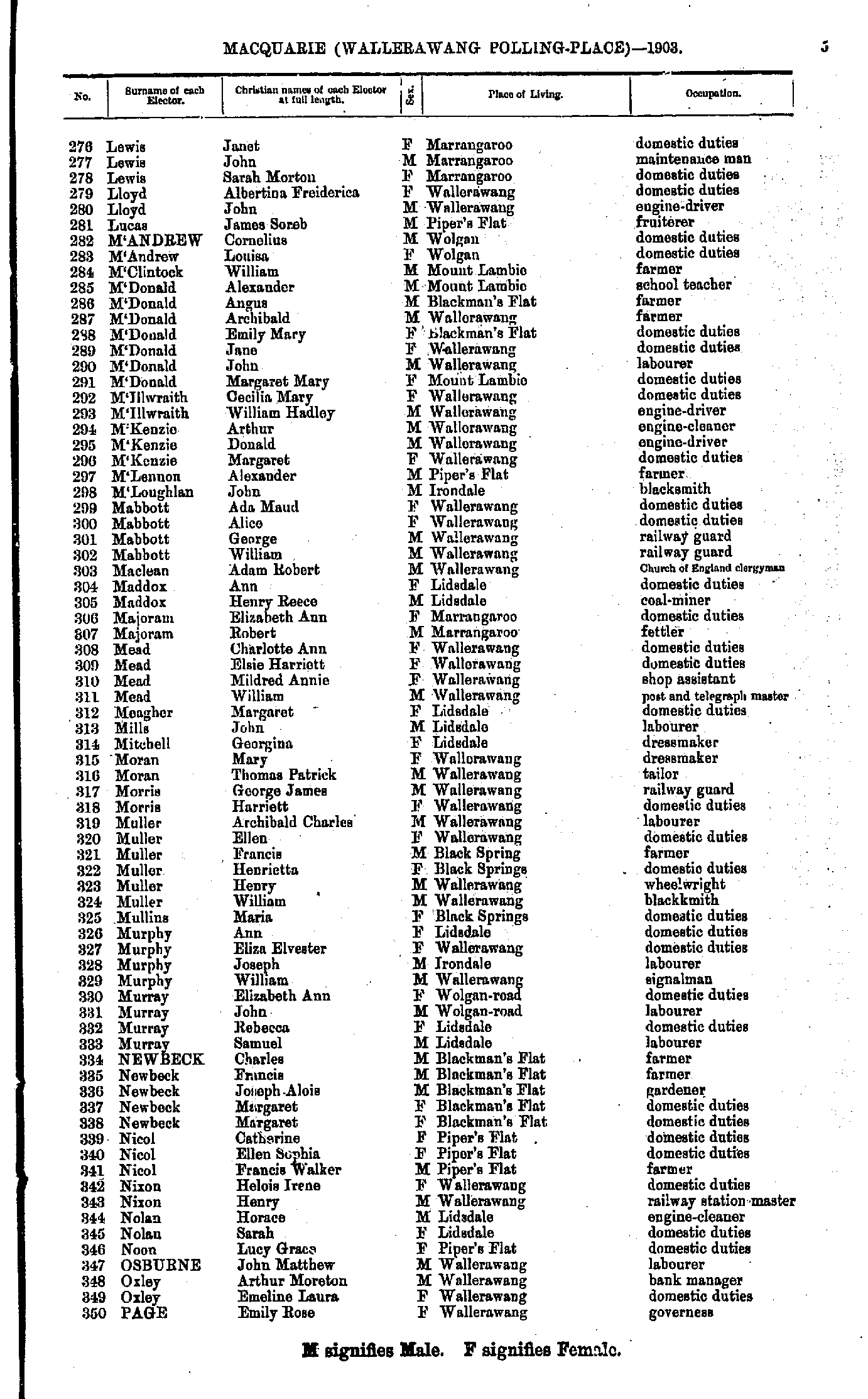
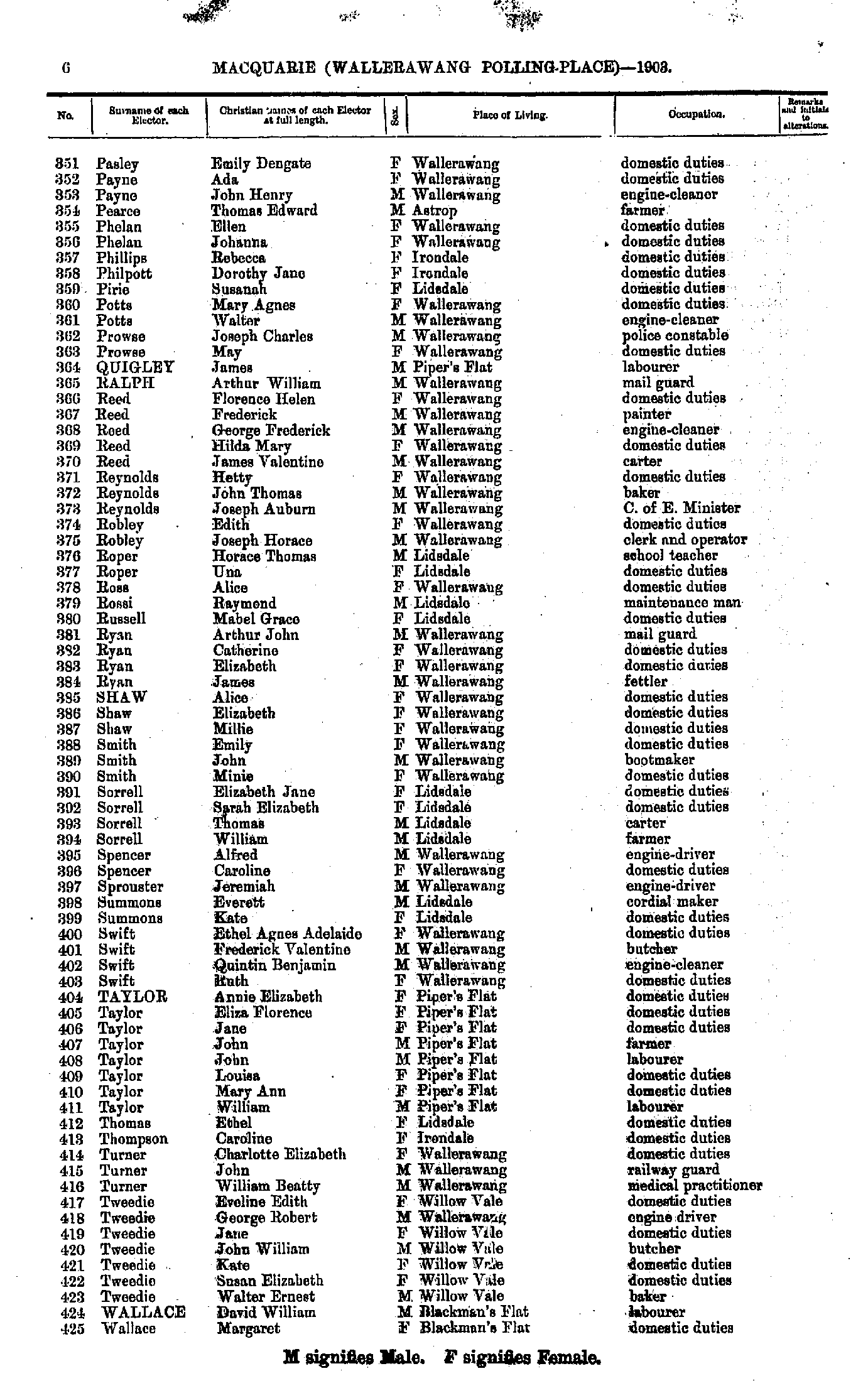
- Pasley Emily - Wallace Margaret
- Wallace William - Young Amanda
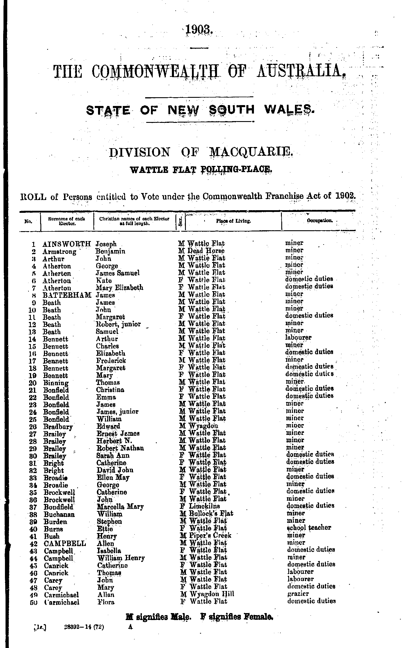
- Ainsworth Joseph - Carmichael Flora
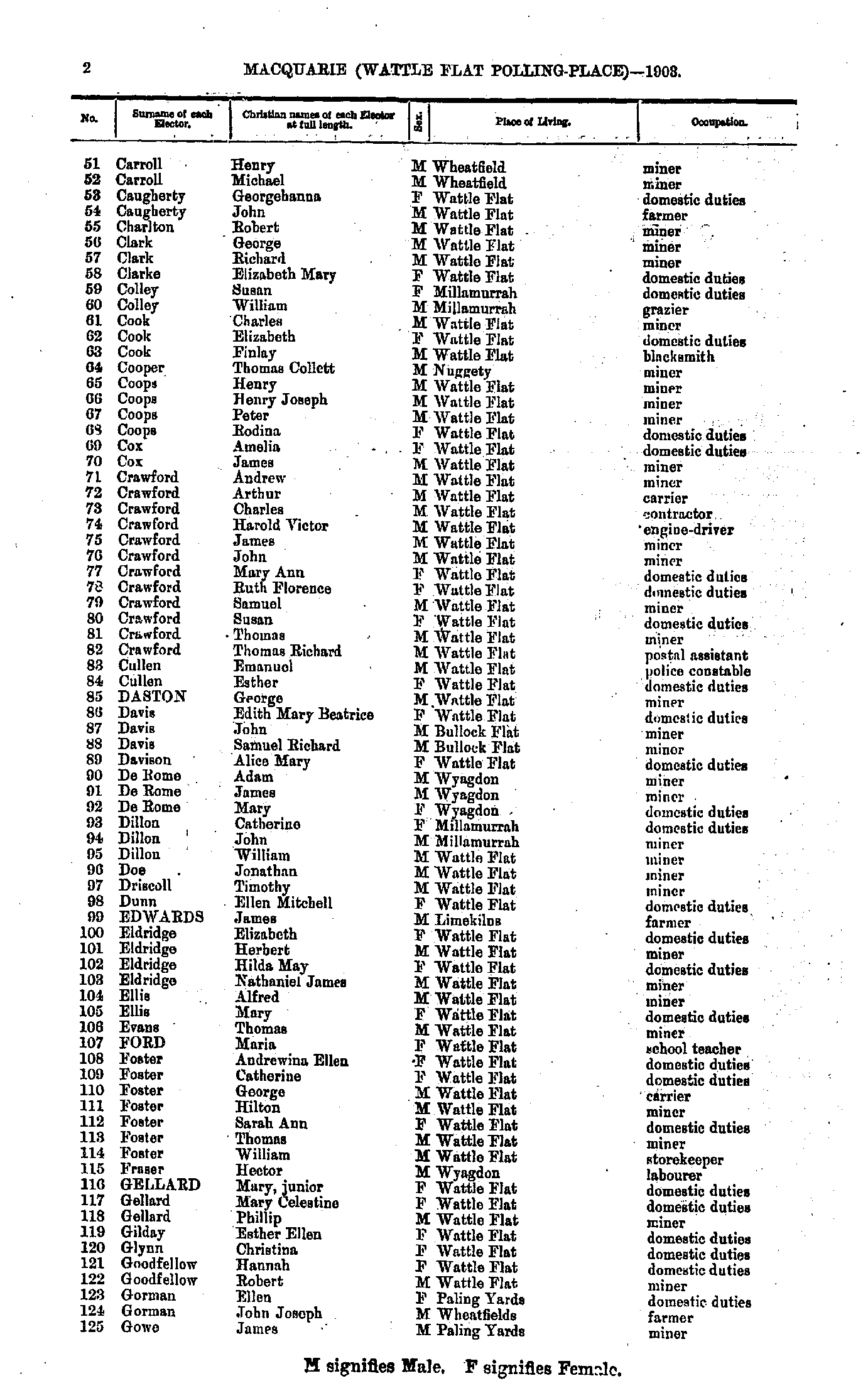
- Carroll Henry - Gowe James
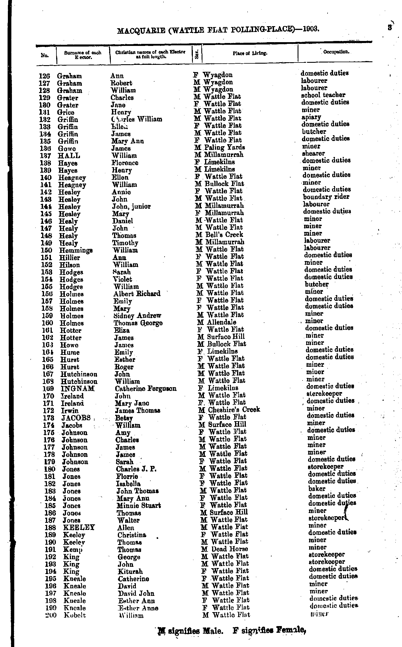
- Graham Ann - Kobelt William
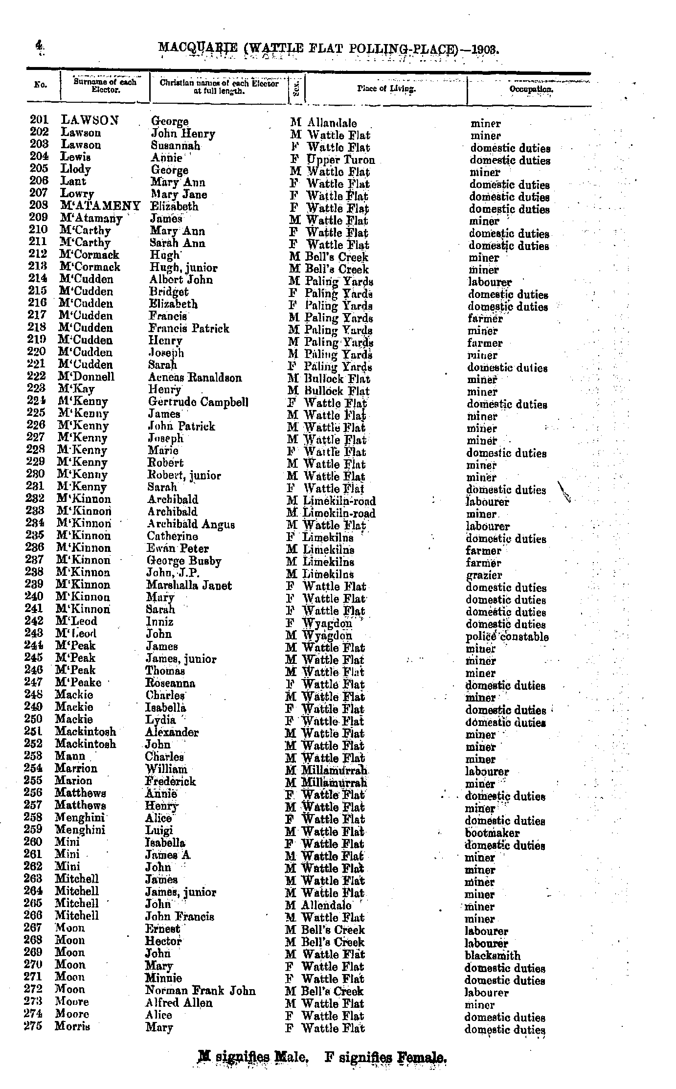
- Lawson George - Morris Mary
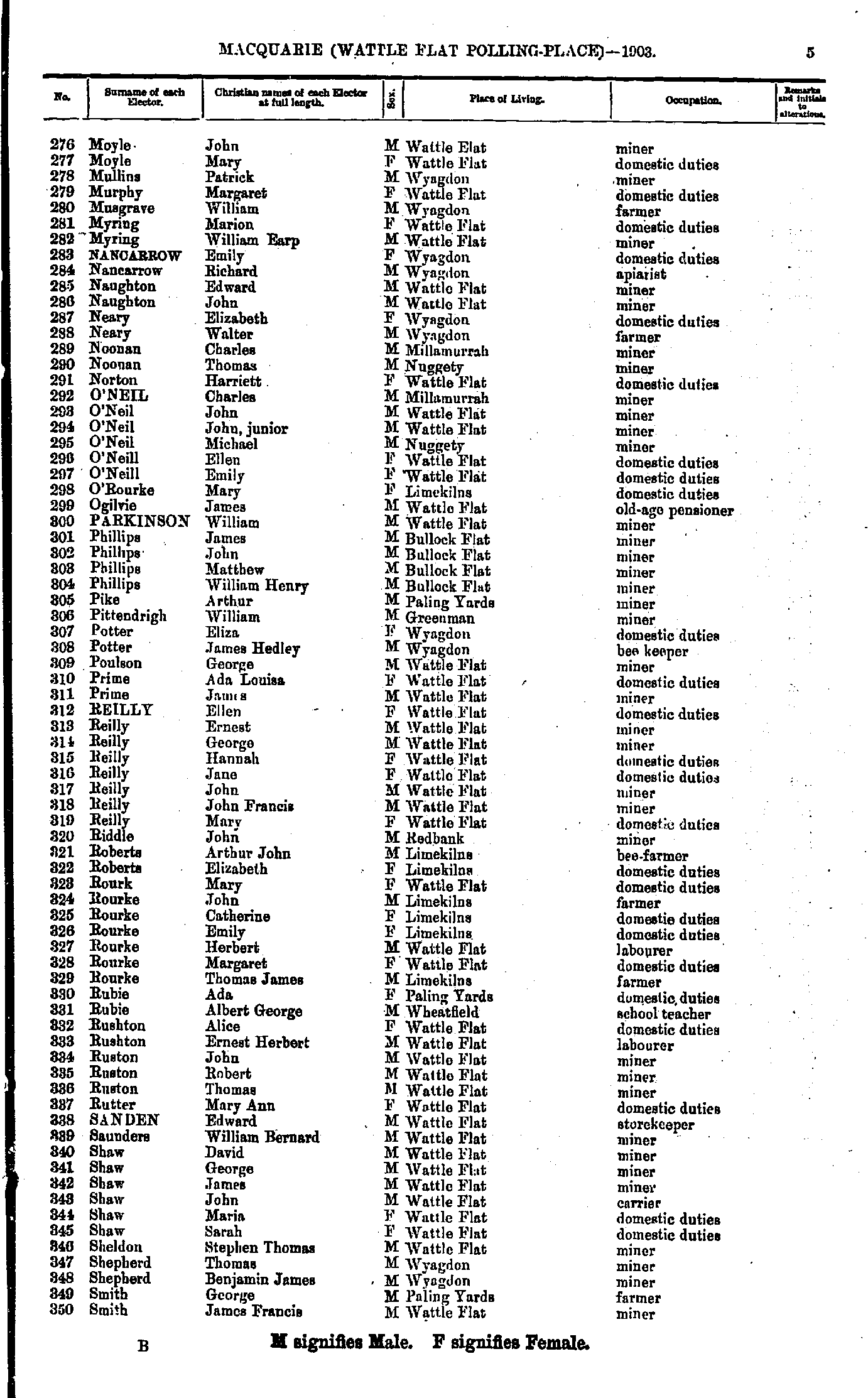
- Moyle John - Smith James
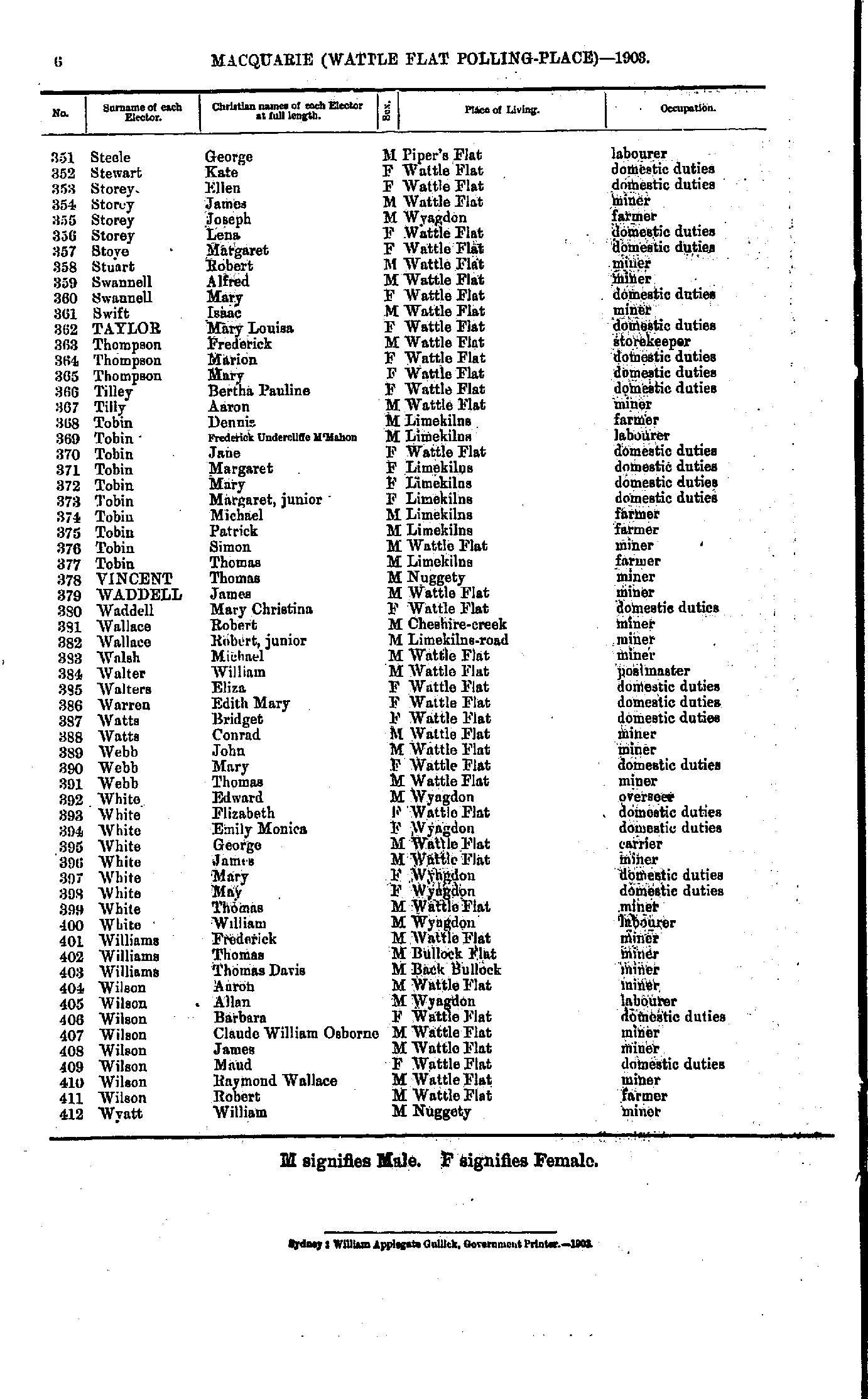
- Steele George - Wyatt William
Maps of the Macquarie Electoral Division
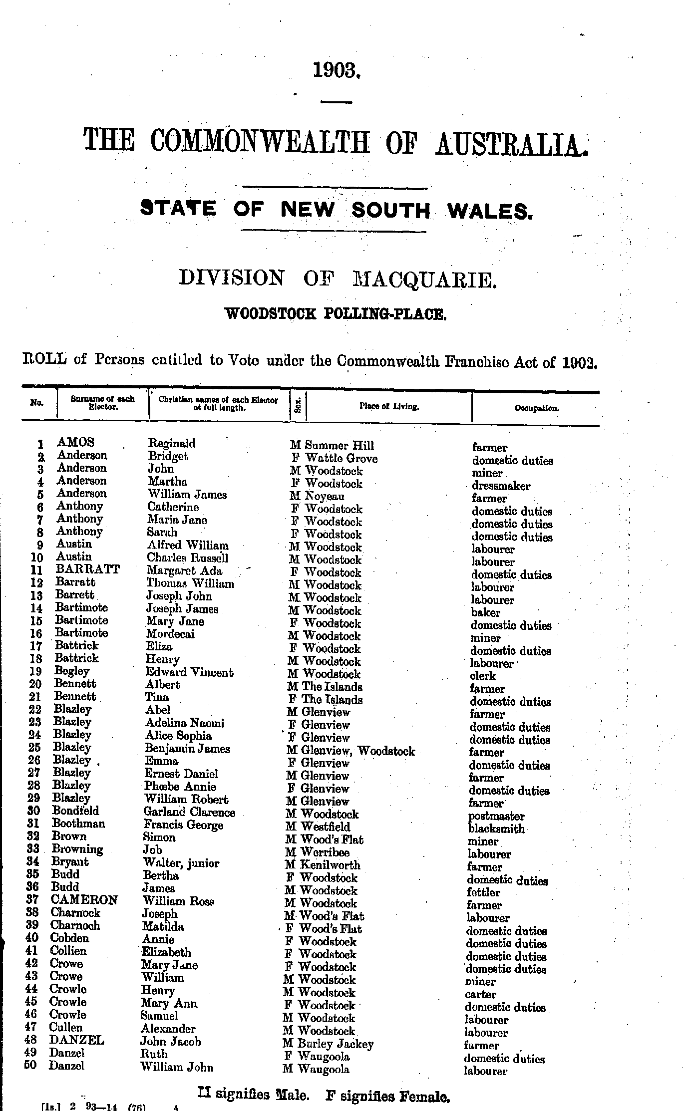
- Amos Reginald - Danzel William
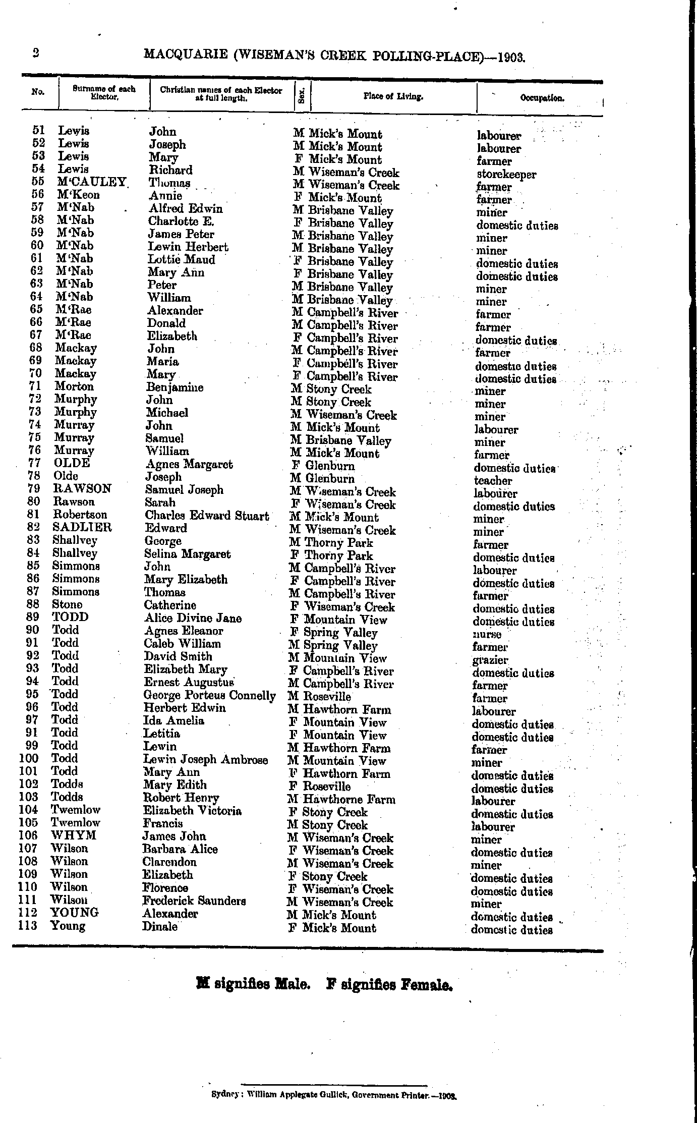
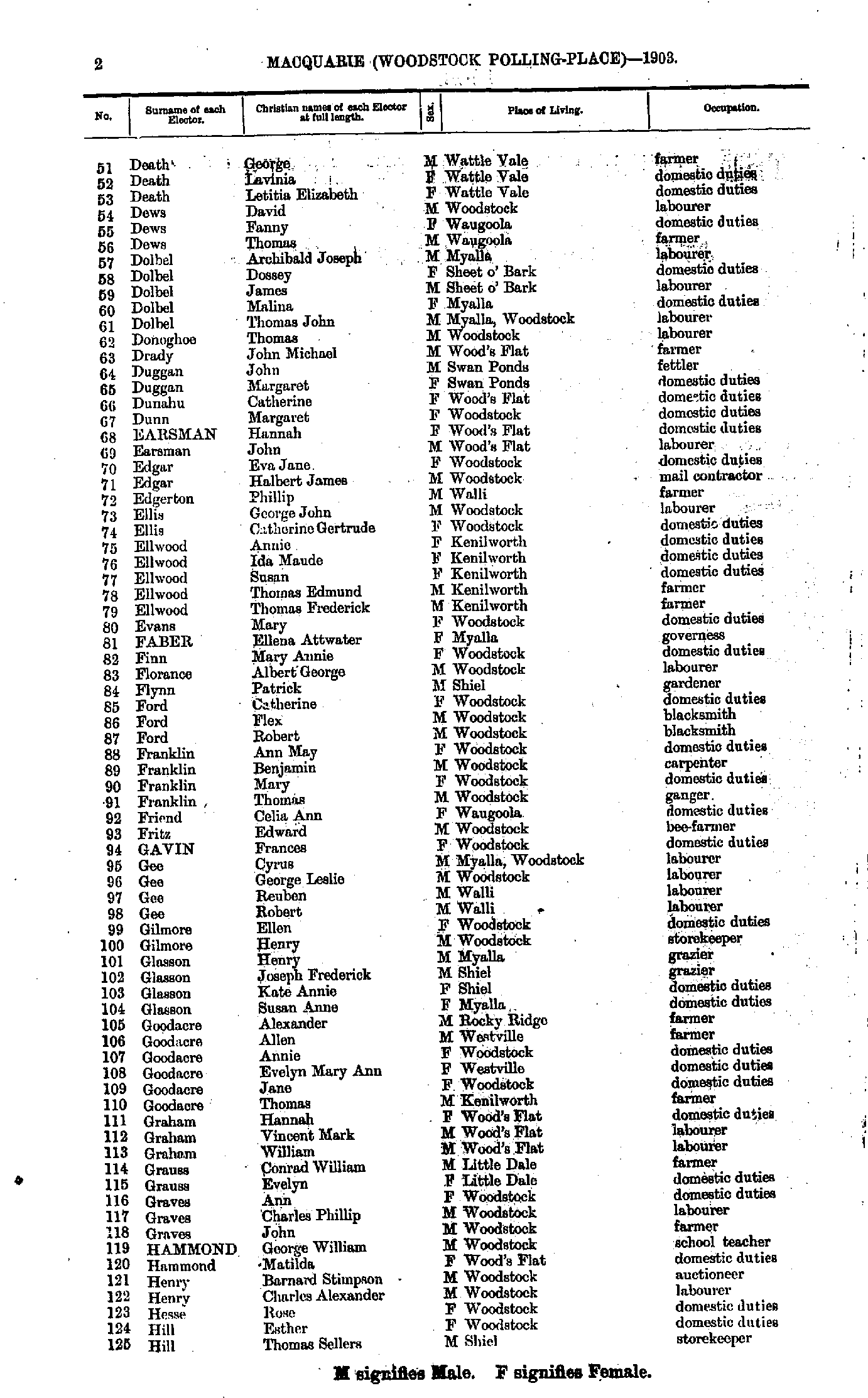
- Death George - Hill Thomas
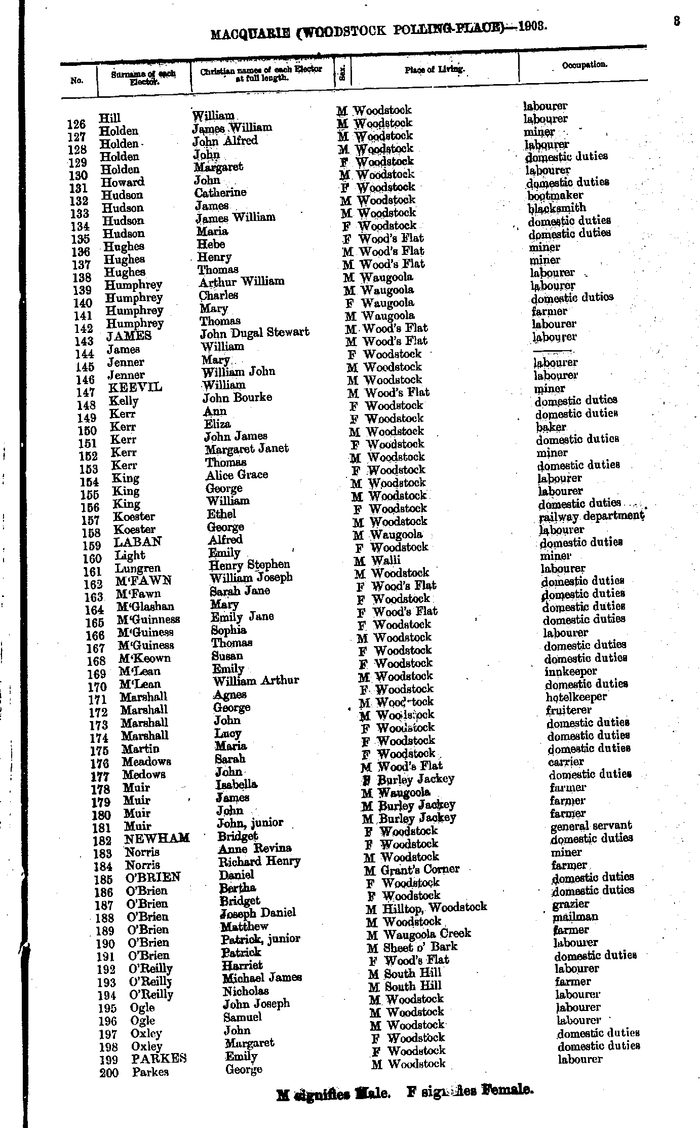
- Hill William. - Parkes George
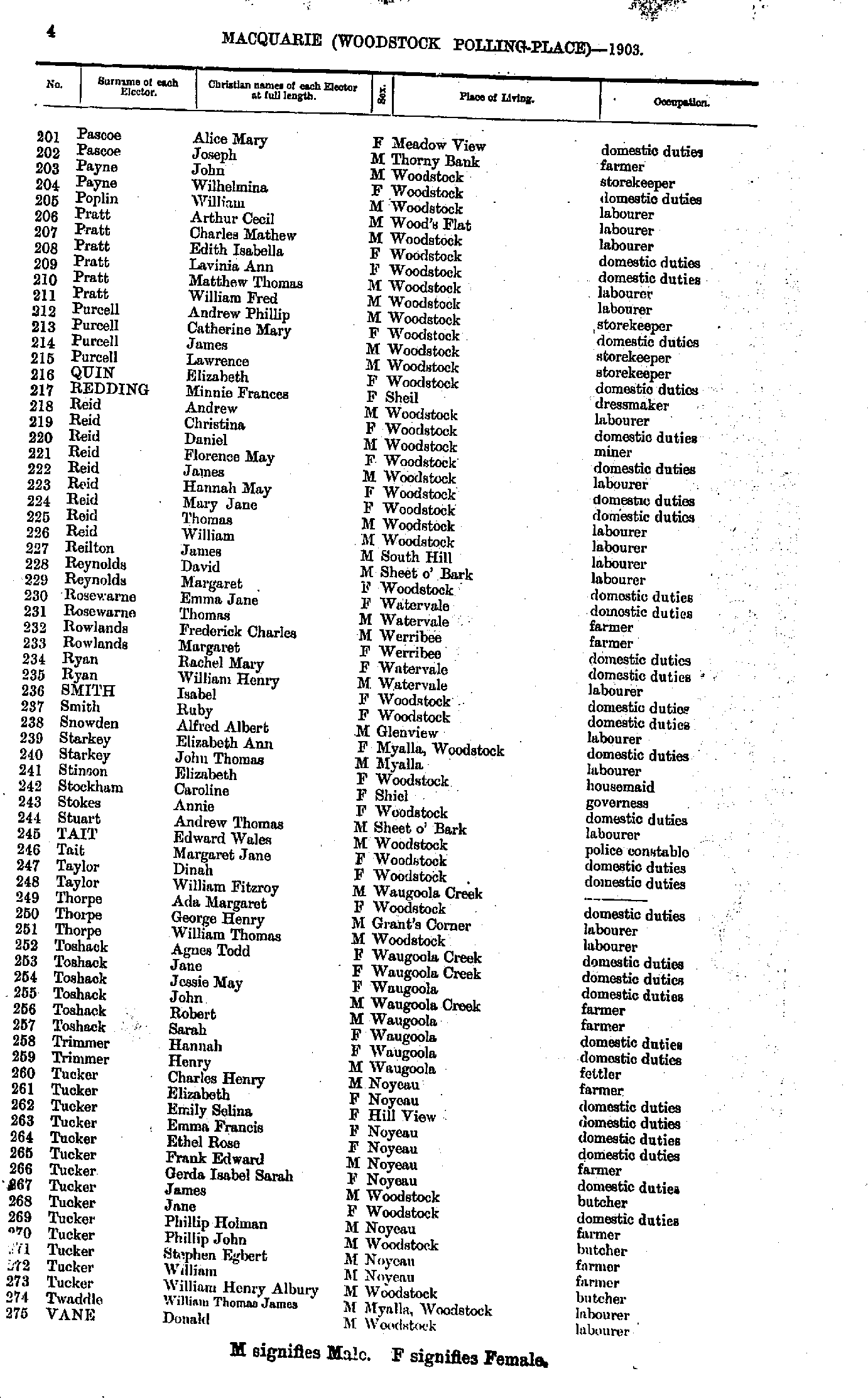
- Pascoe Alice - Vane Donald
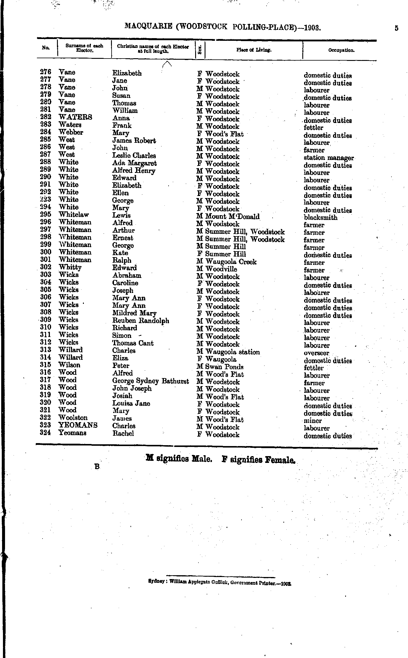
- Vane Elizabeth - Yeomans Rachel
From: Federal Electoral Districts Commissioners 1901, Maps of the Federal Electoral Districts of the State of New South Wales, William Applegate Gullick, Government Printer, Sydney.
JPEG file (329KB)
Portable Document Format(PDF) file (2.0MB)If you do not have a PDF reader you can click on the button to download the free Adobe Acrobat Reader
The documents in this site are arranged into seven major indexes. You are currently in the Electoral Rolls index. Use the Back button on your browser to move within this index, or use the links below to view another index:
- Directories
- Electoral Rolls
- Land Records
- General and Miscellaneous Records
- Mining Records
- Pastoral and Agricultural Records
- Other Occupations
Copyright © Internet History Resources 2007
