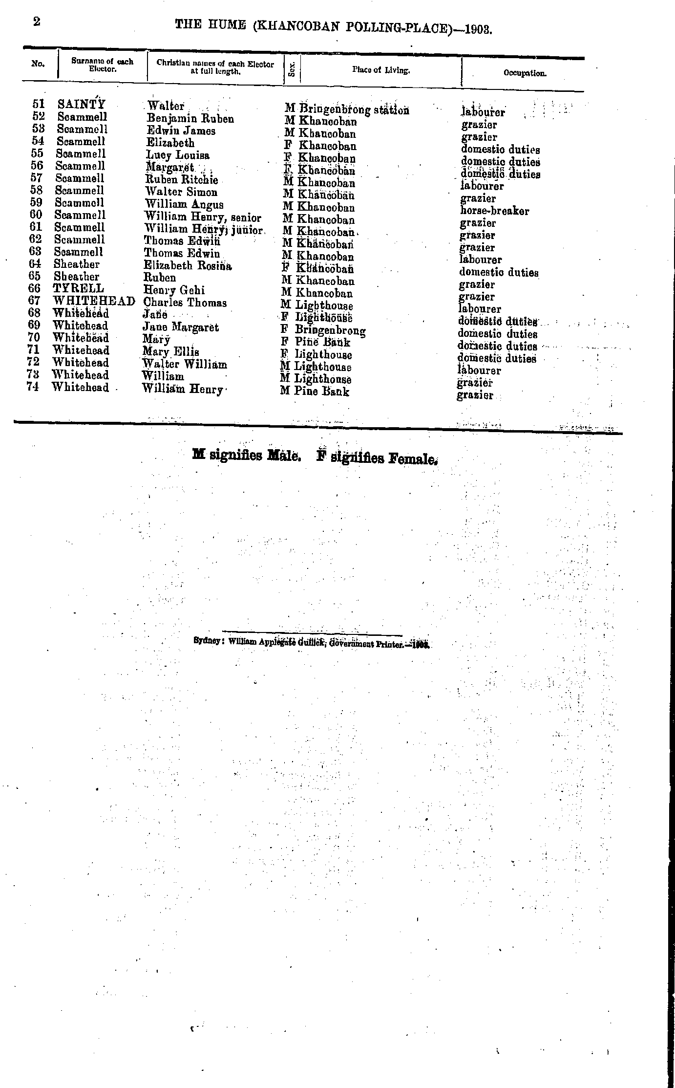
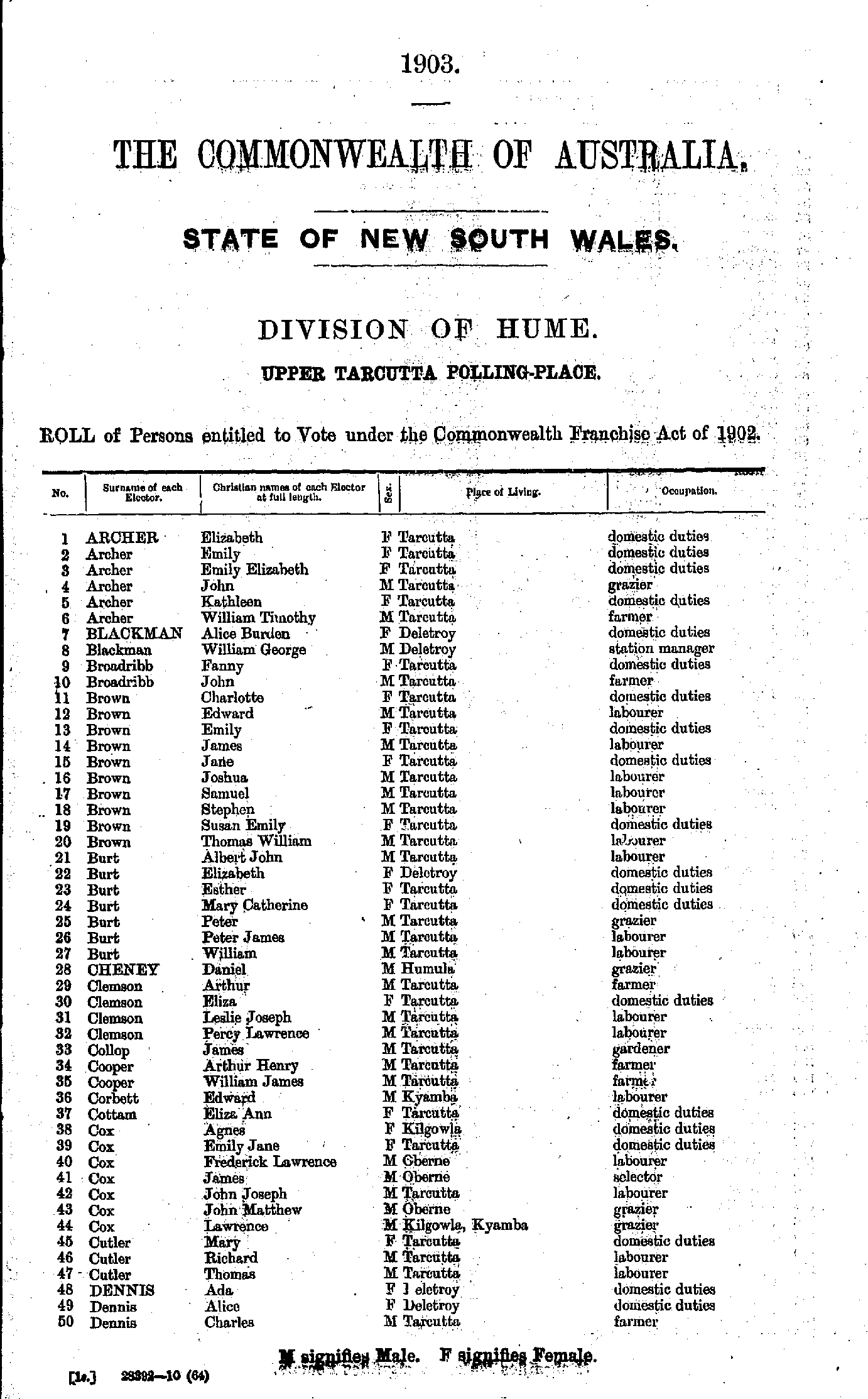
IHR NSW Family History Documents
Electoral Rolls Index
Home | Directories | Electoral | Land | General | Mining | Pastoral | OccupationsNSW Electoral Rolls 1903 - Hume Division
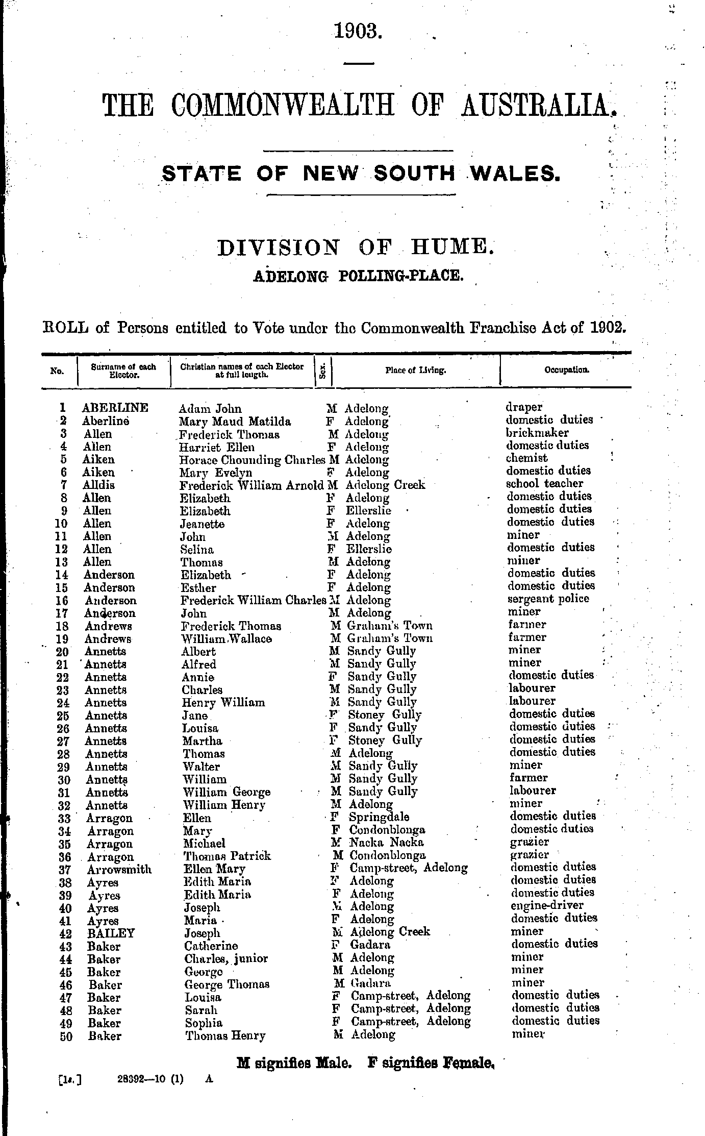
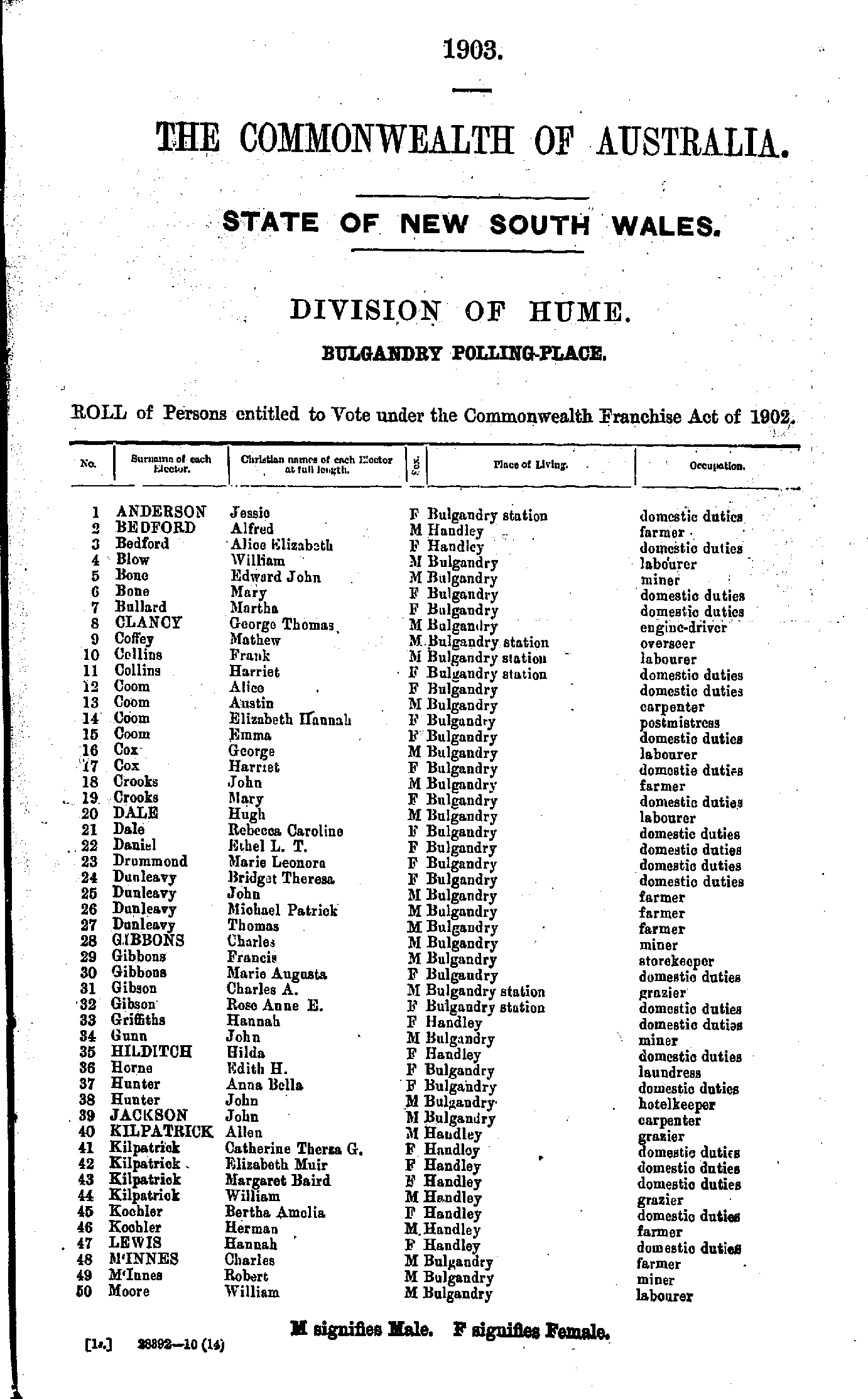
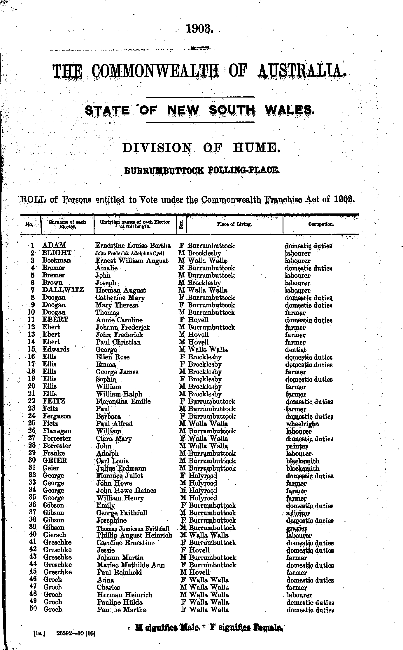
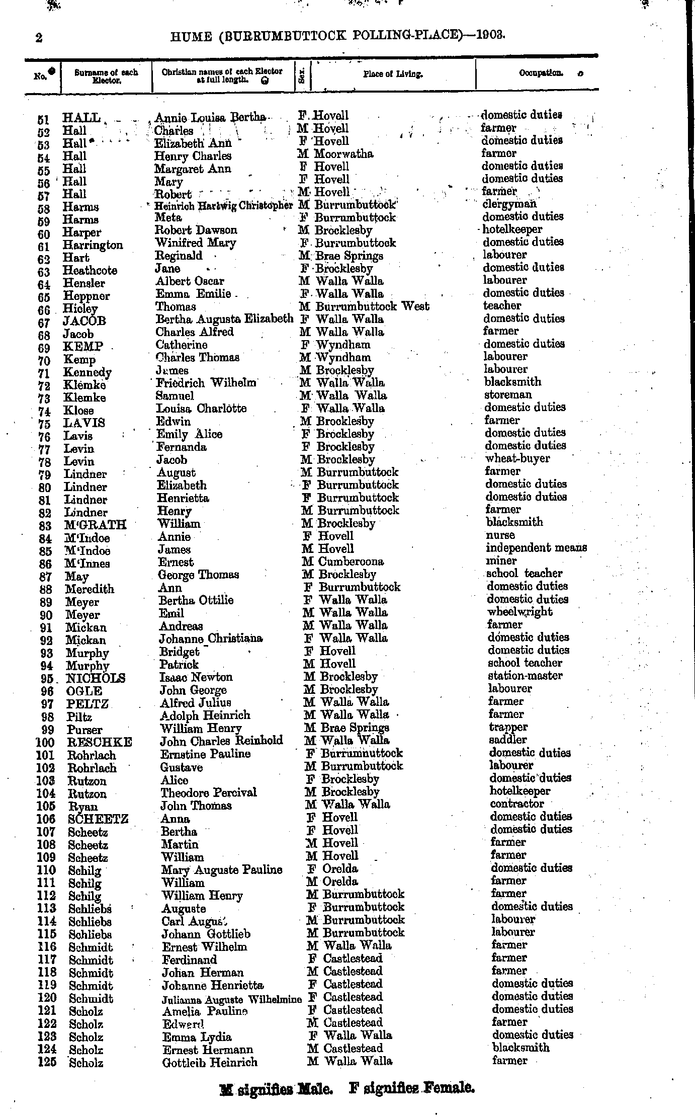
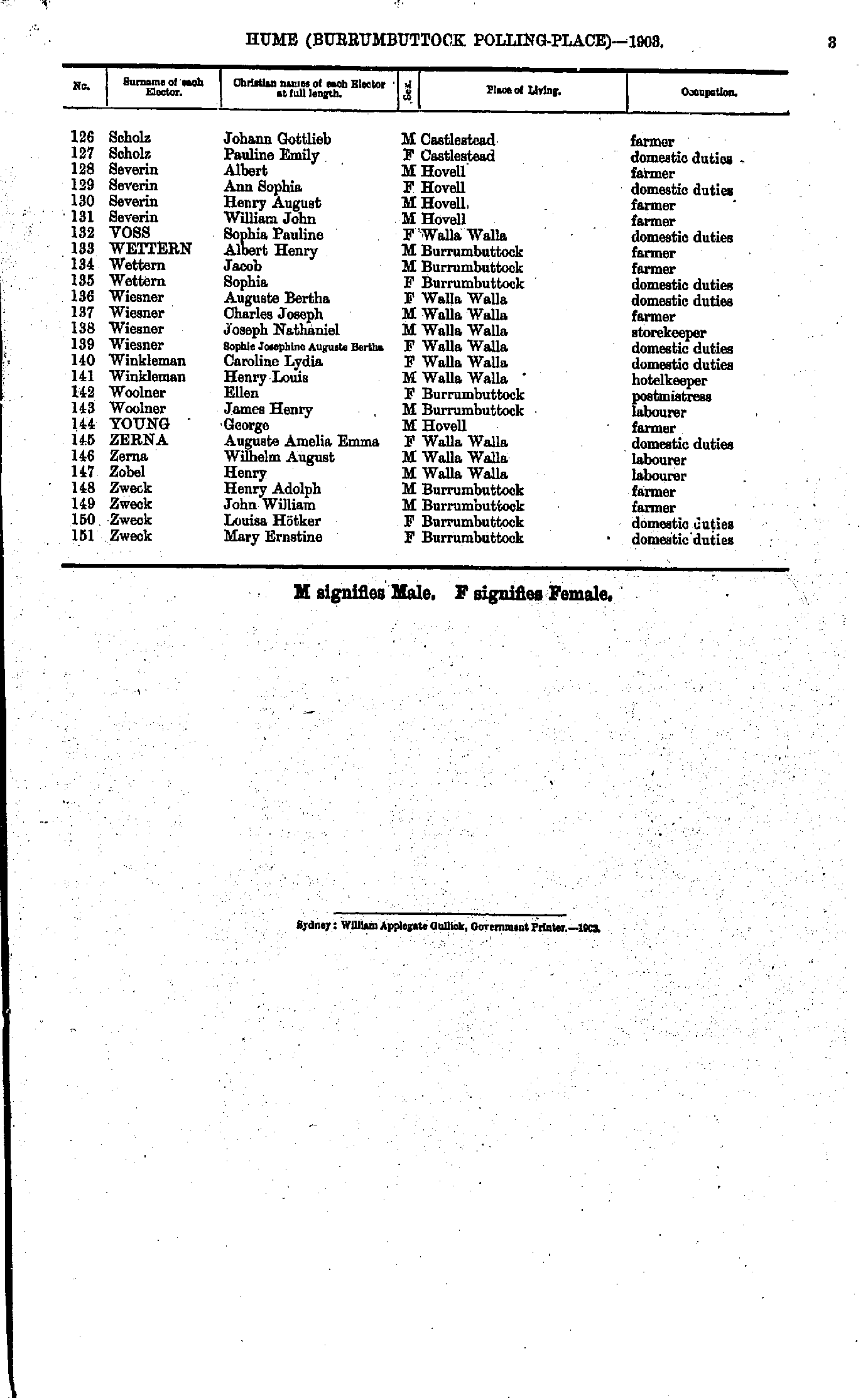
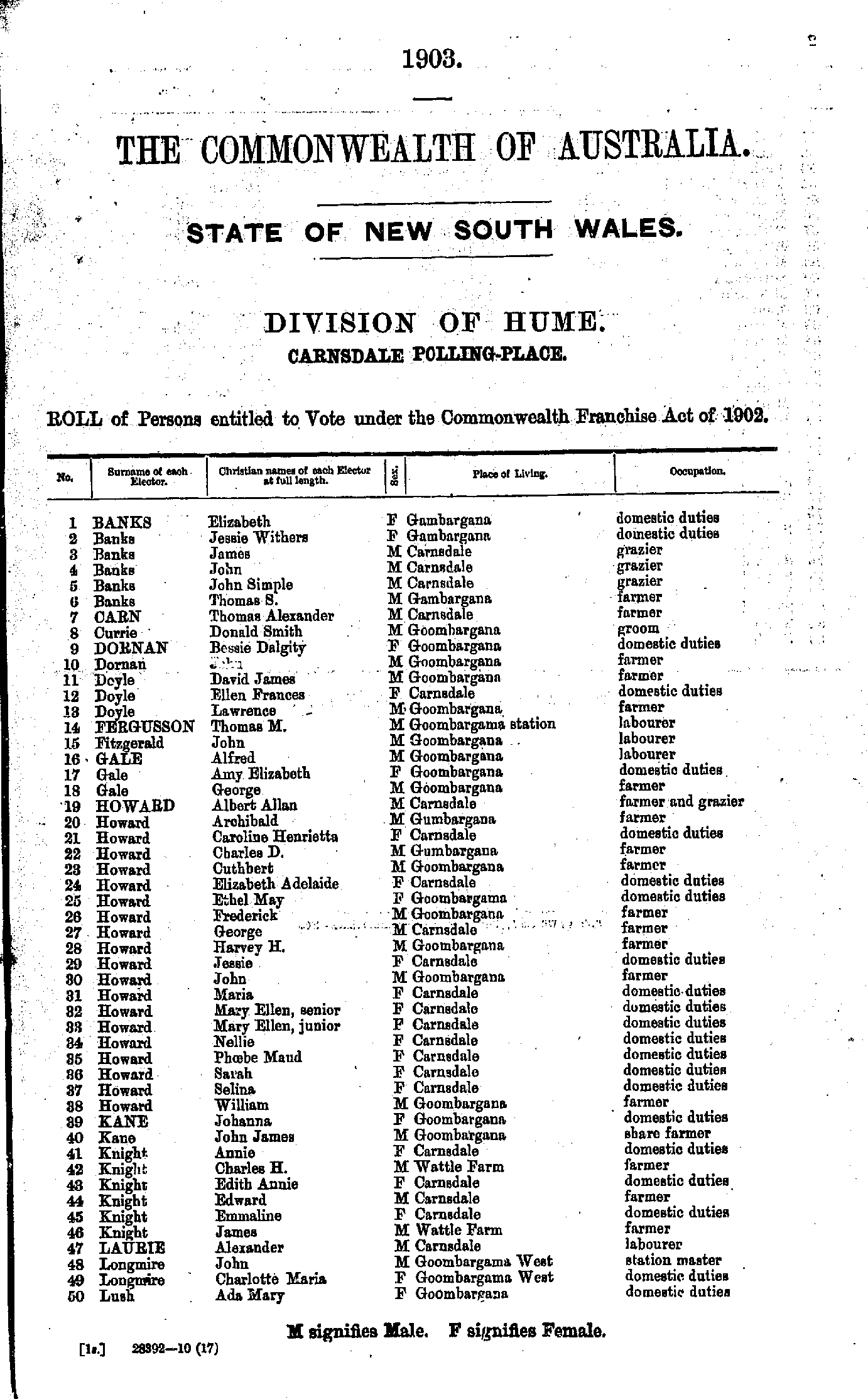
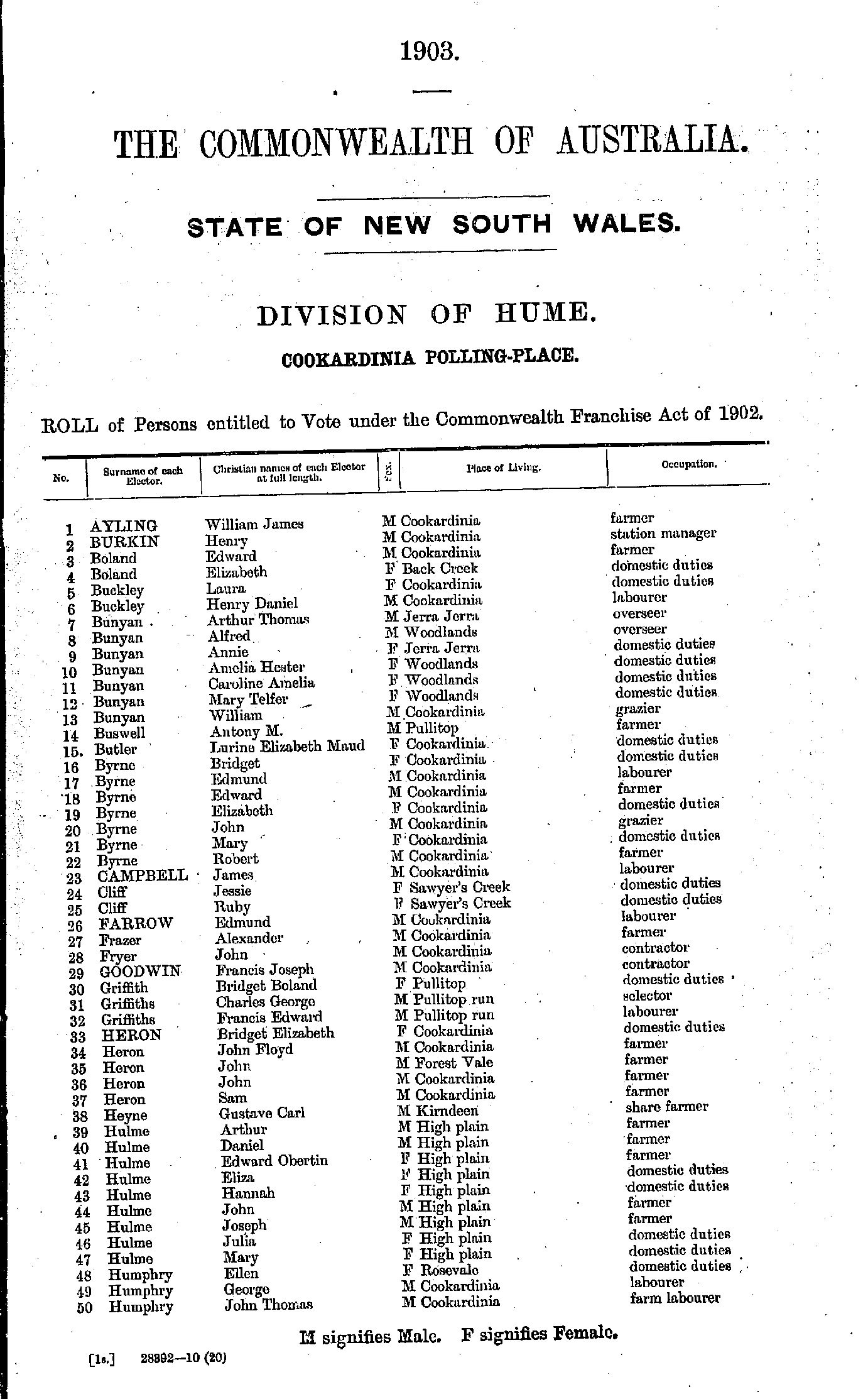
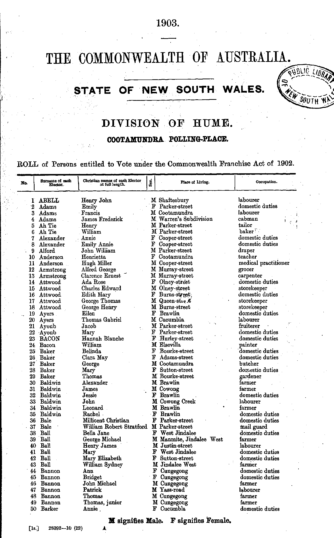
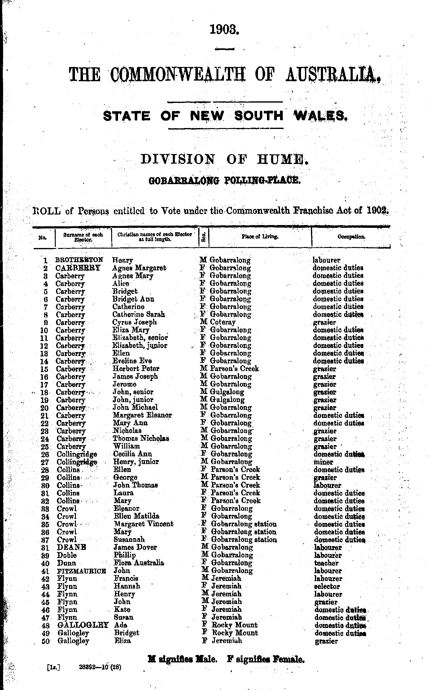
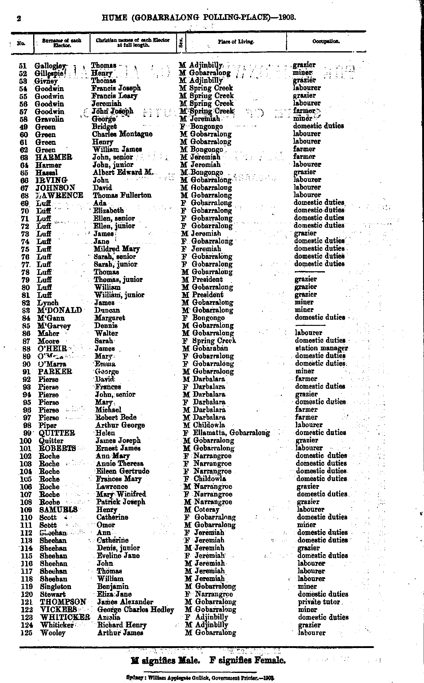
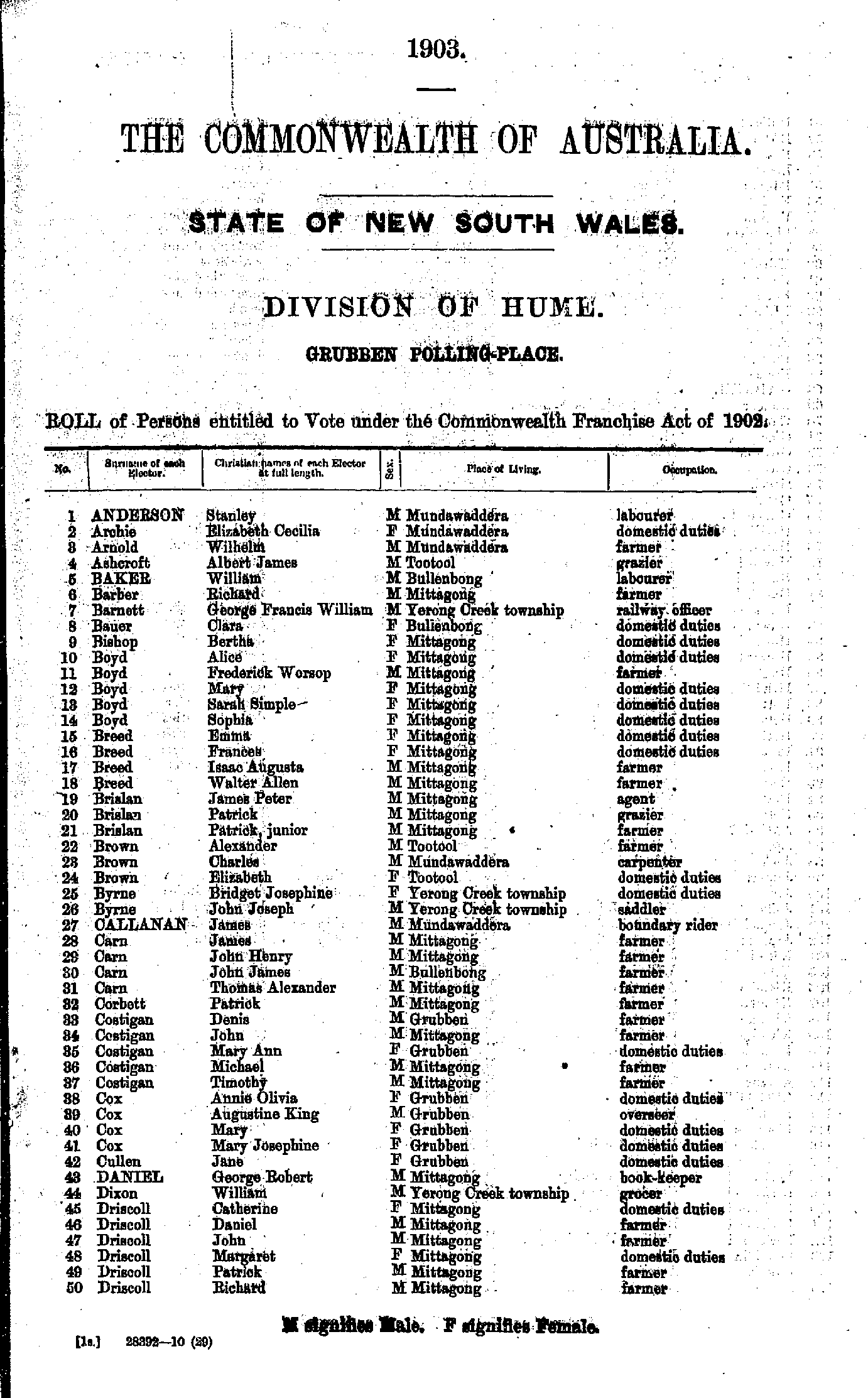
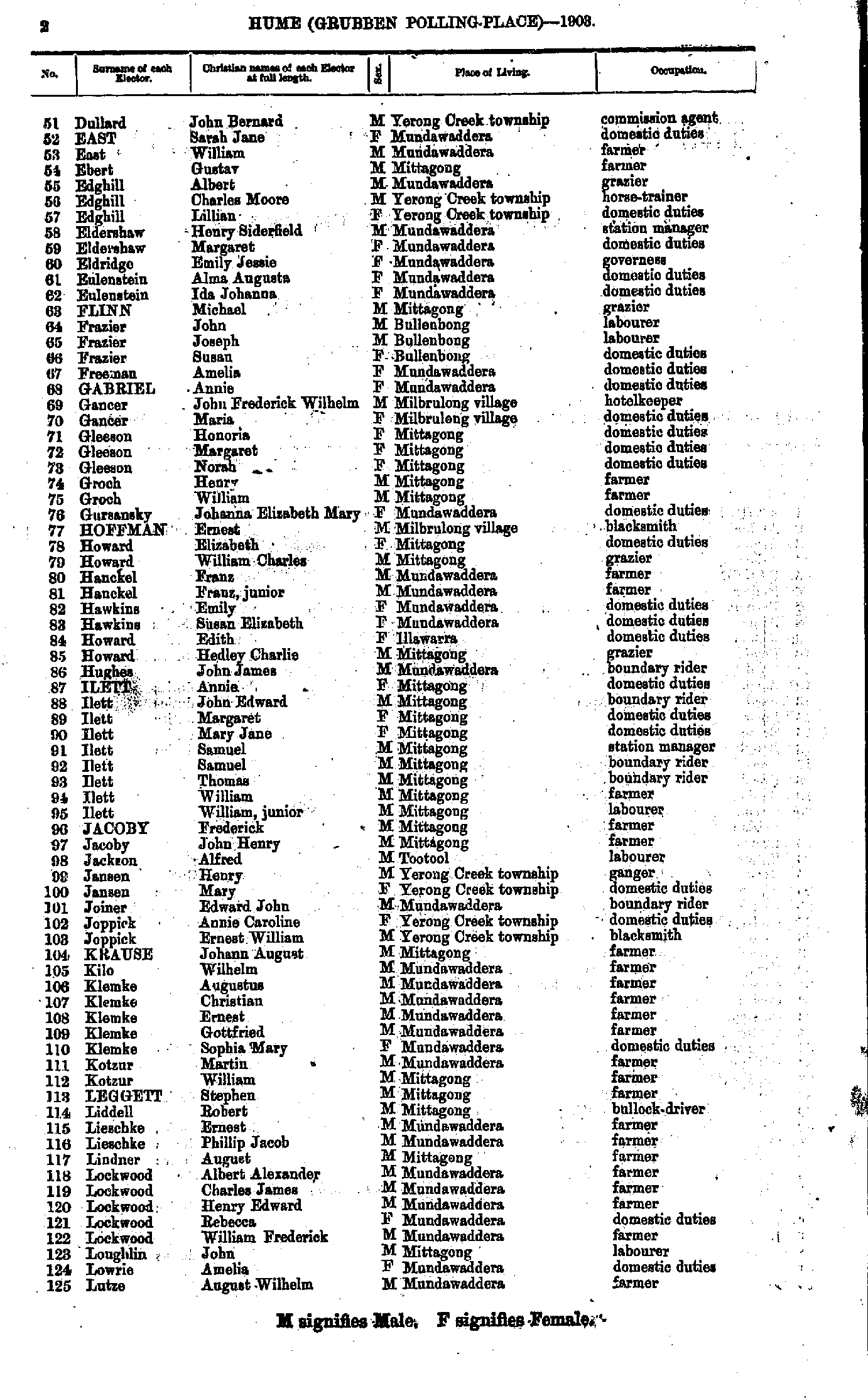
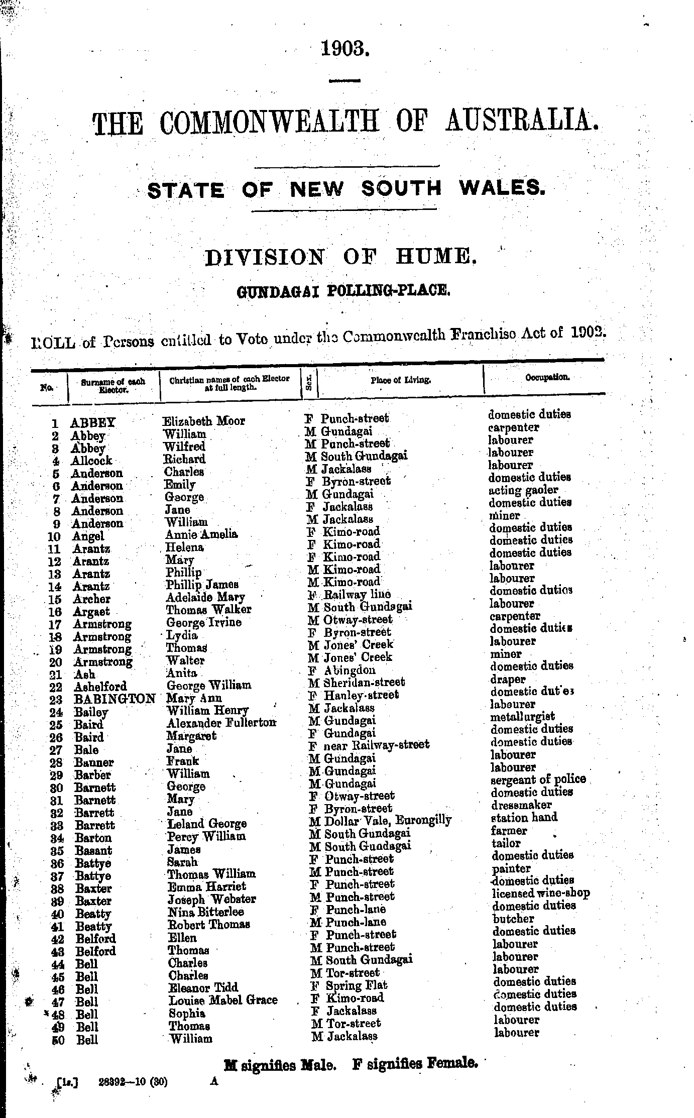
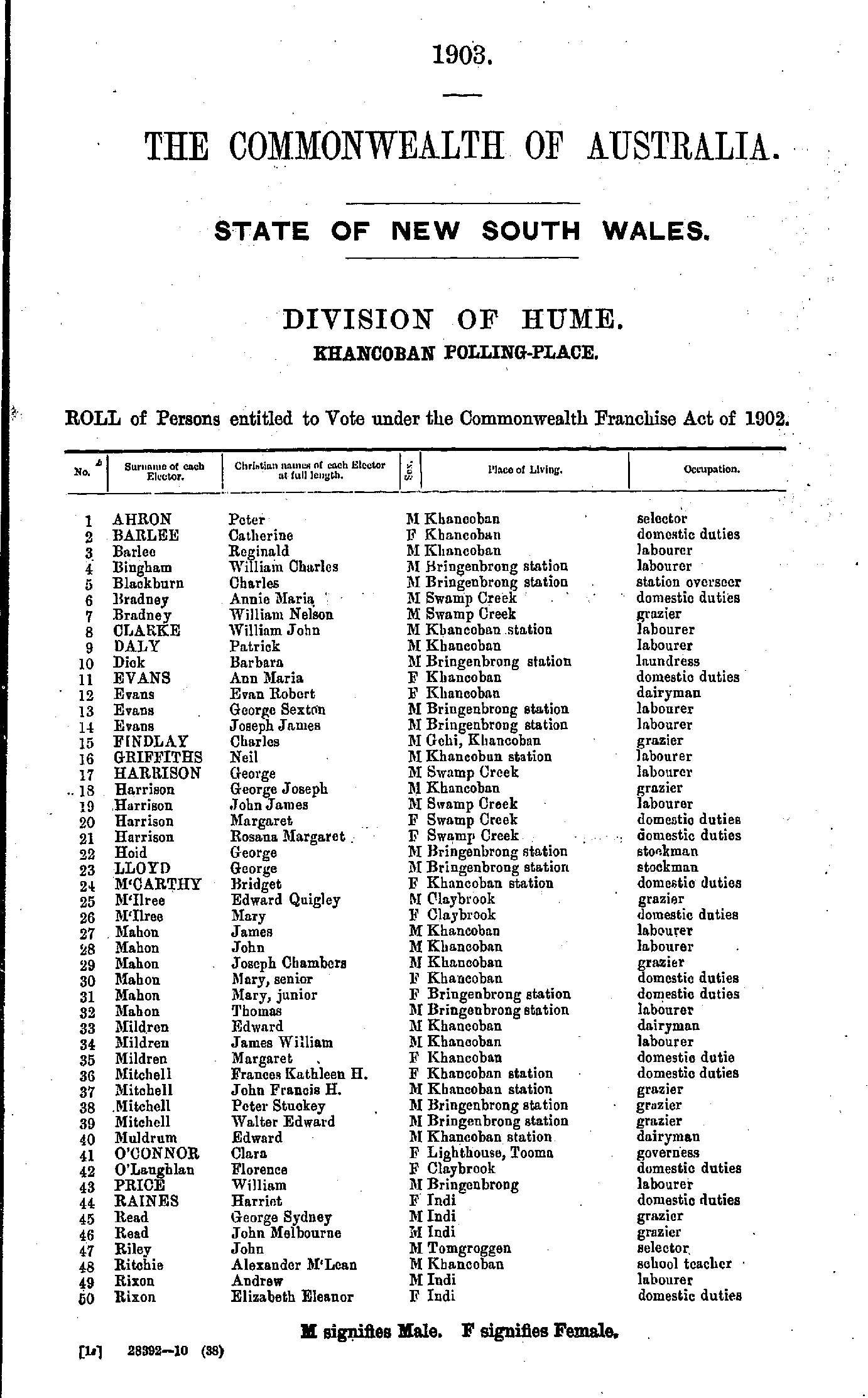
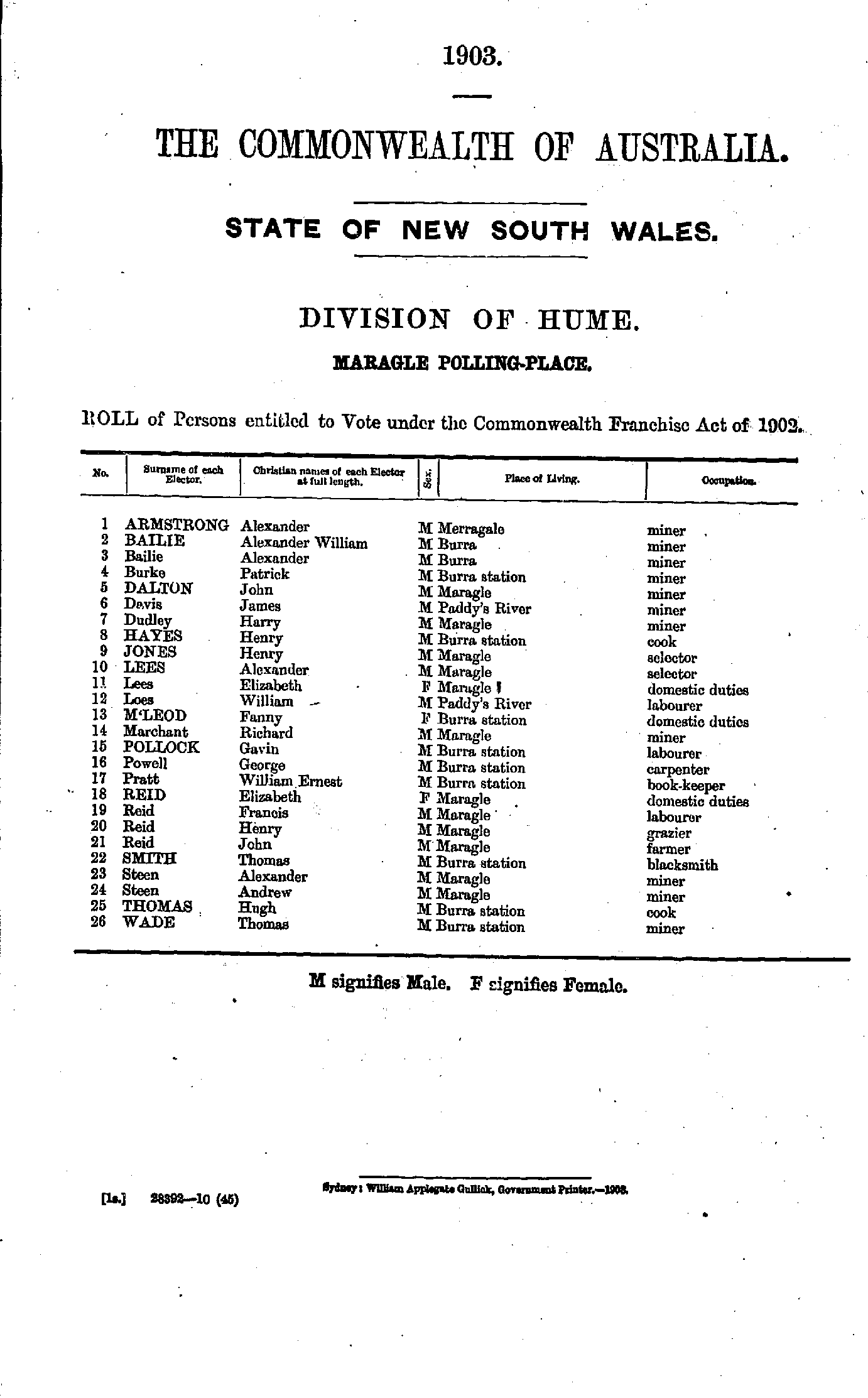
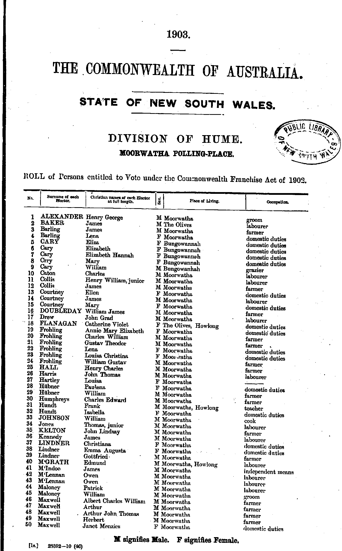
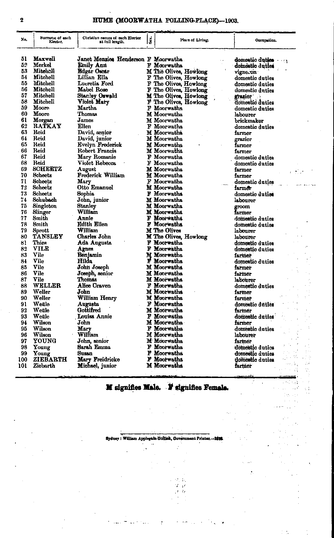
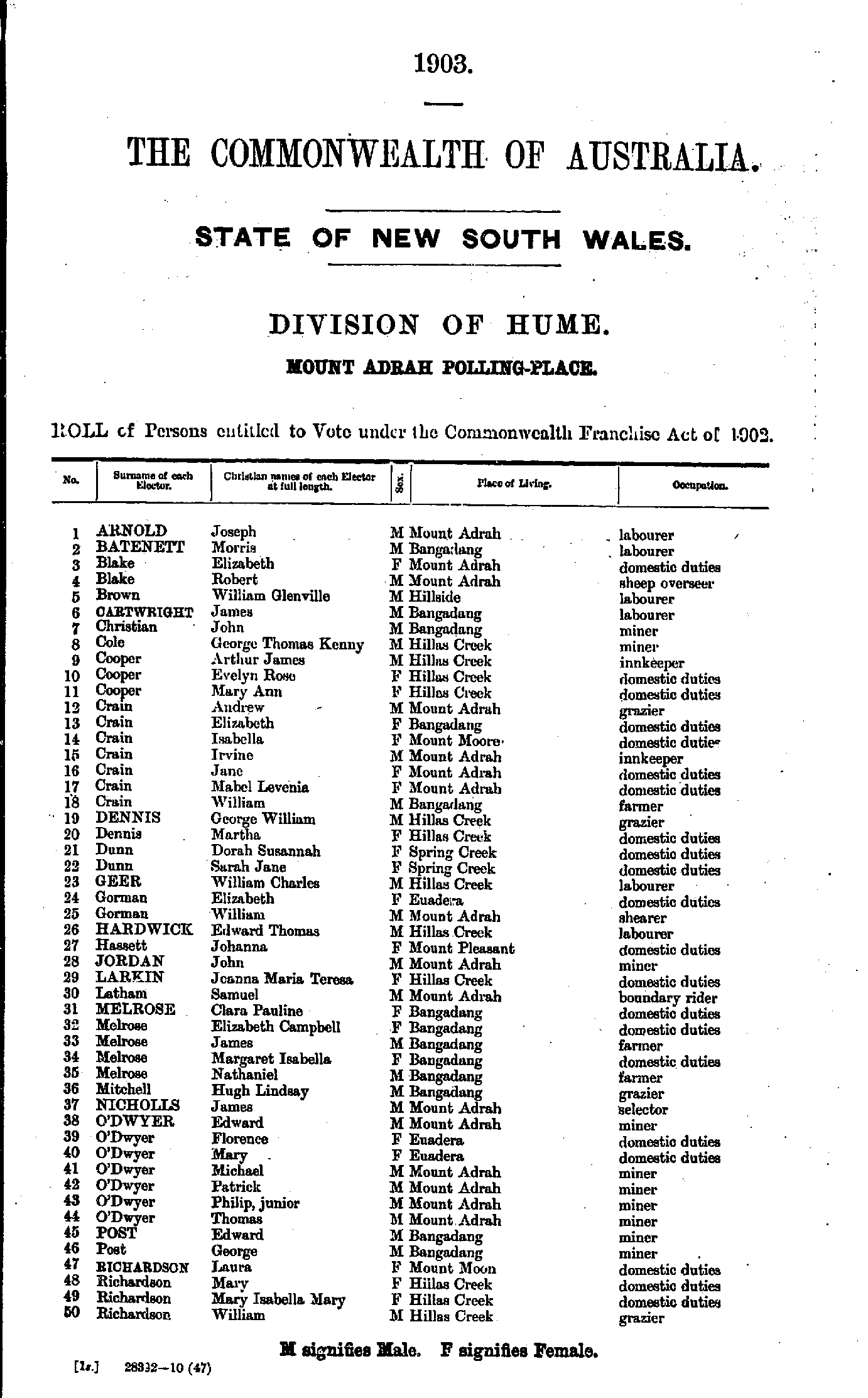
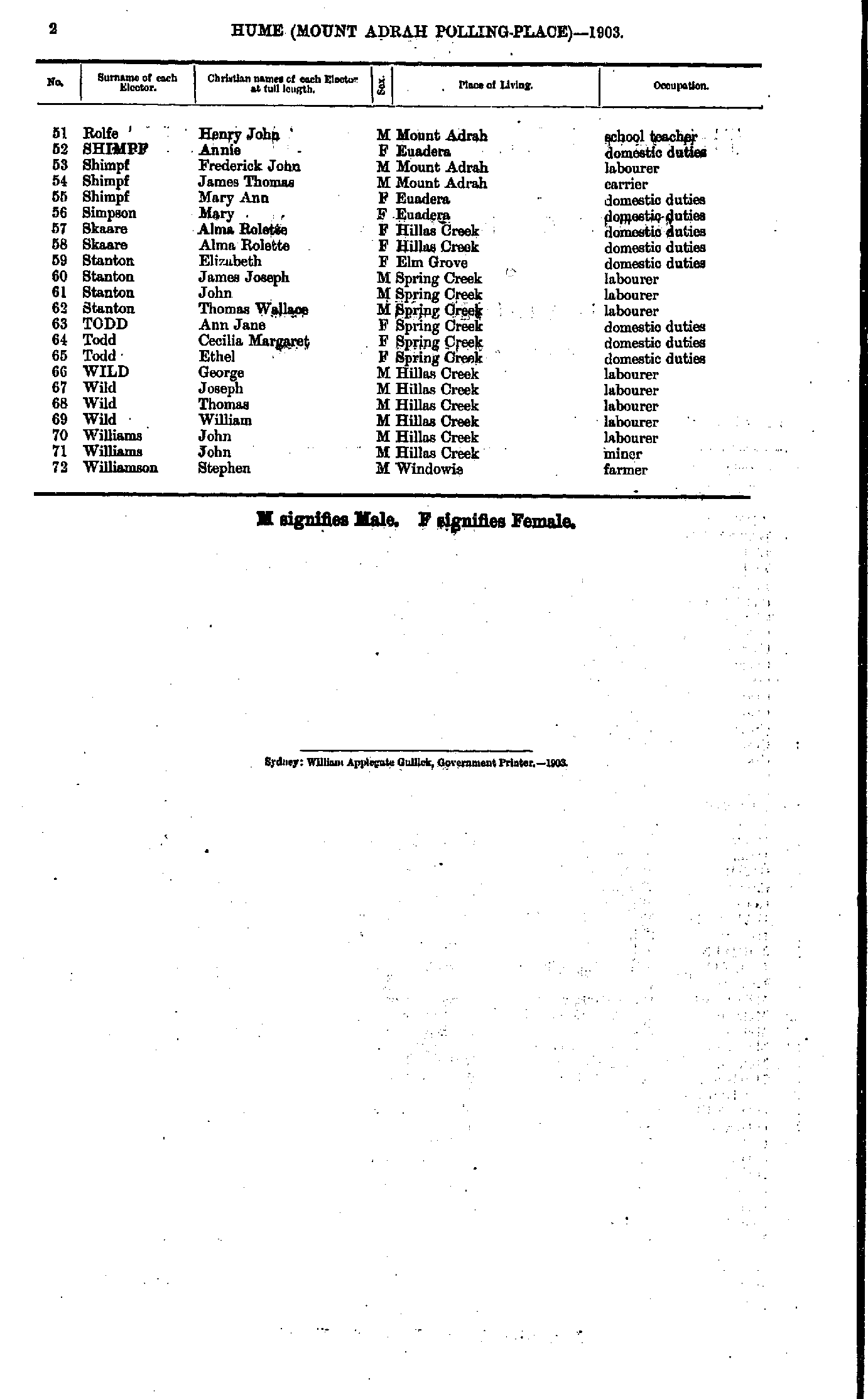
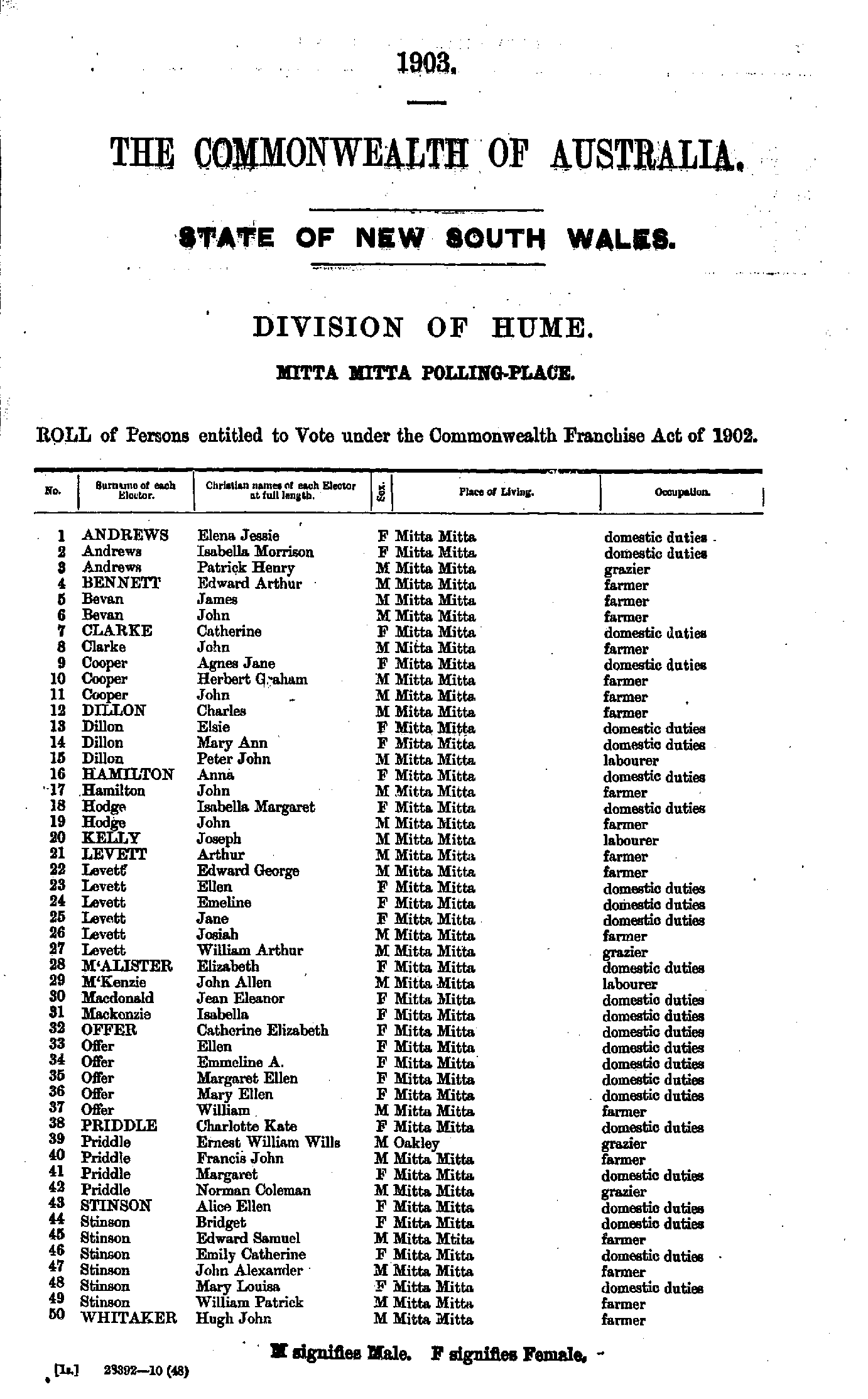
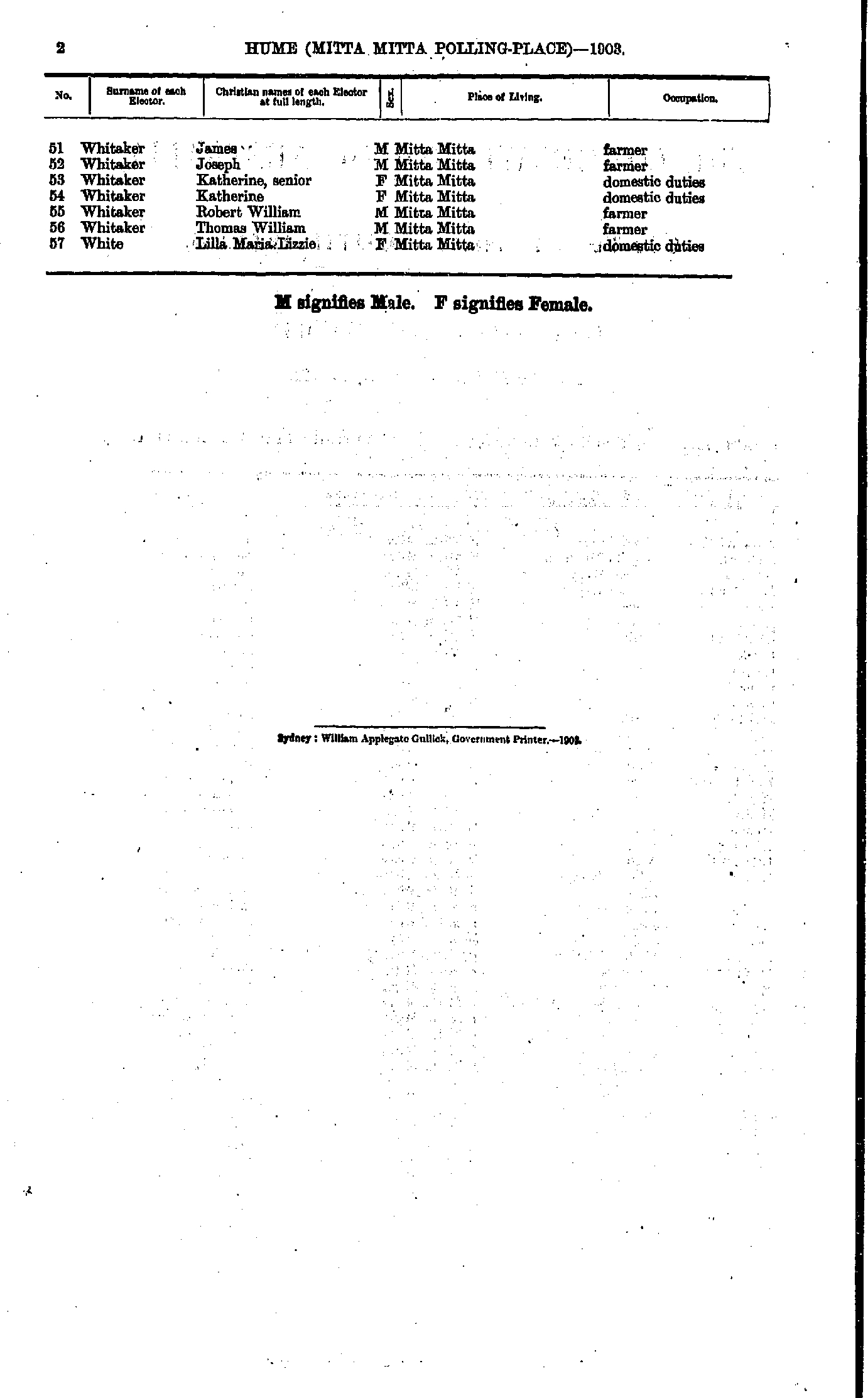
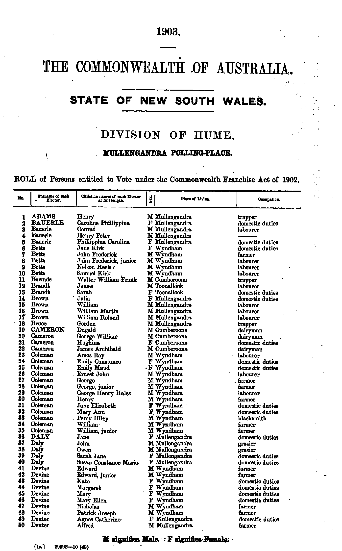
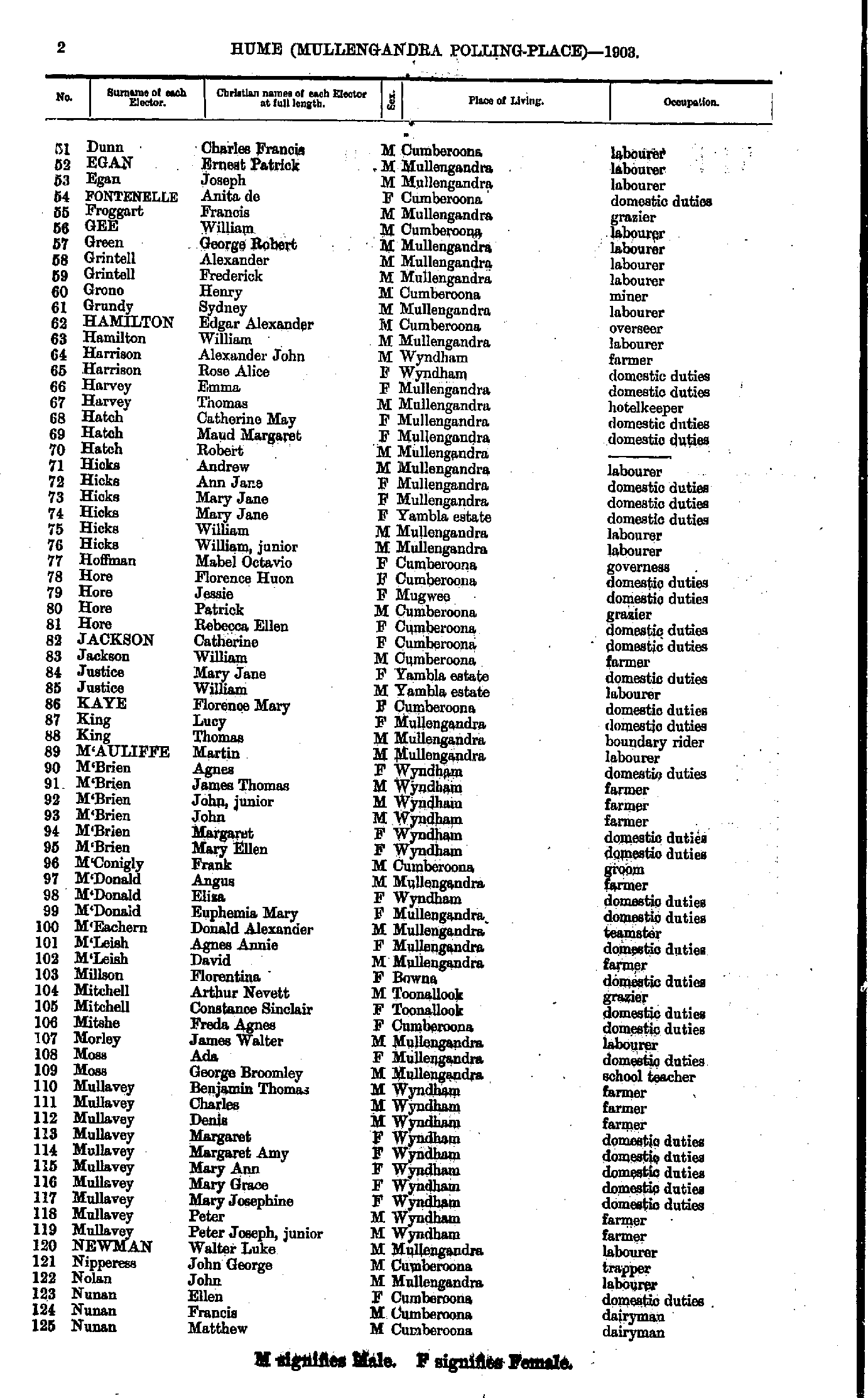
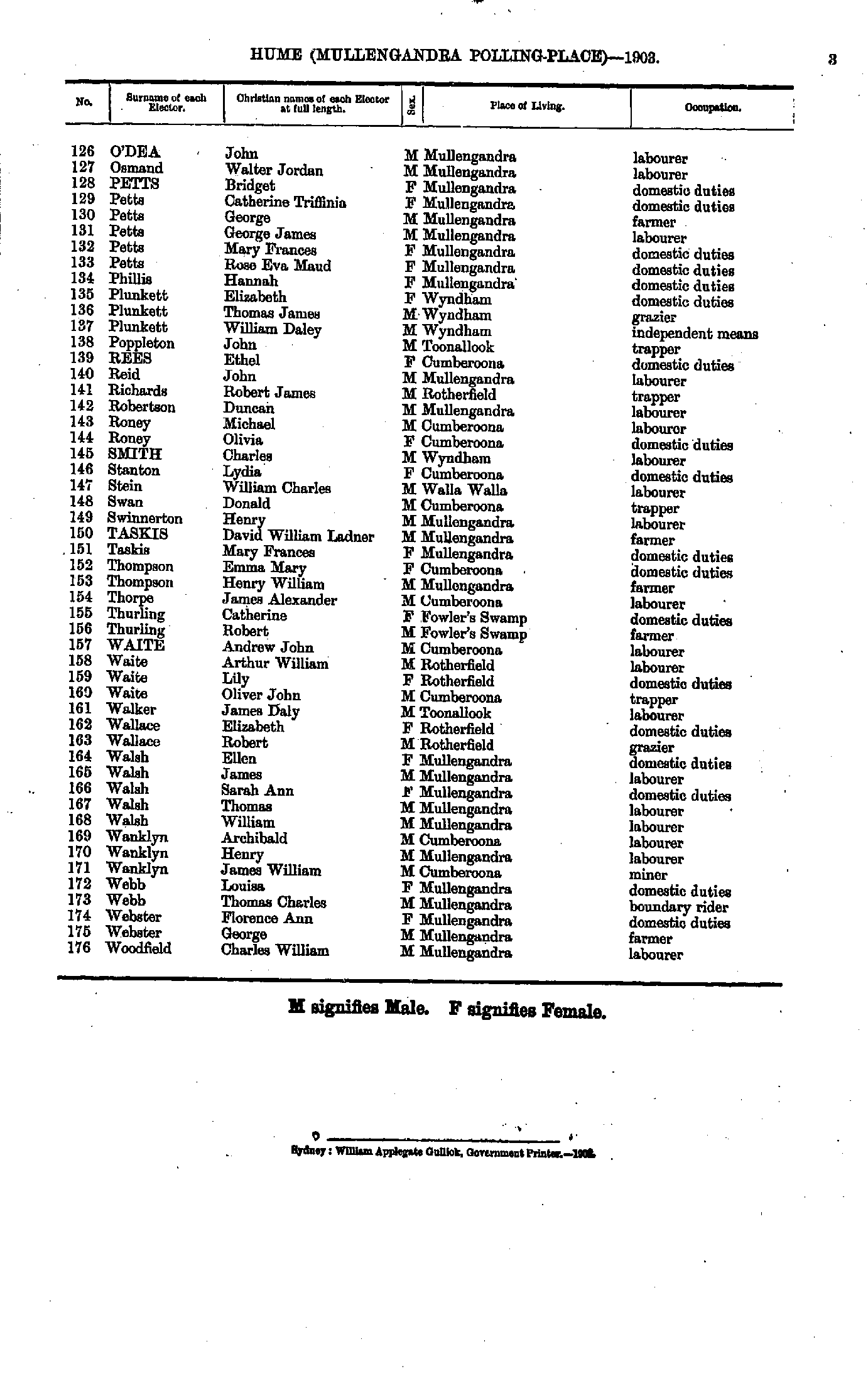
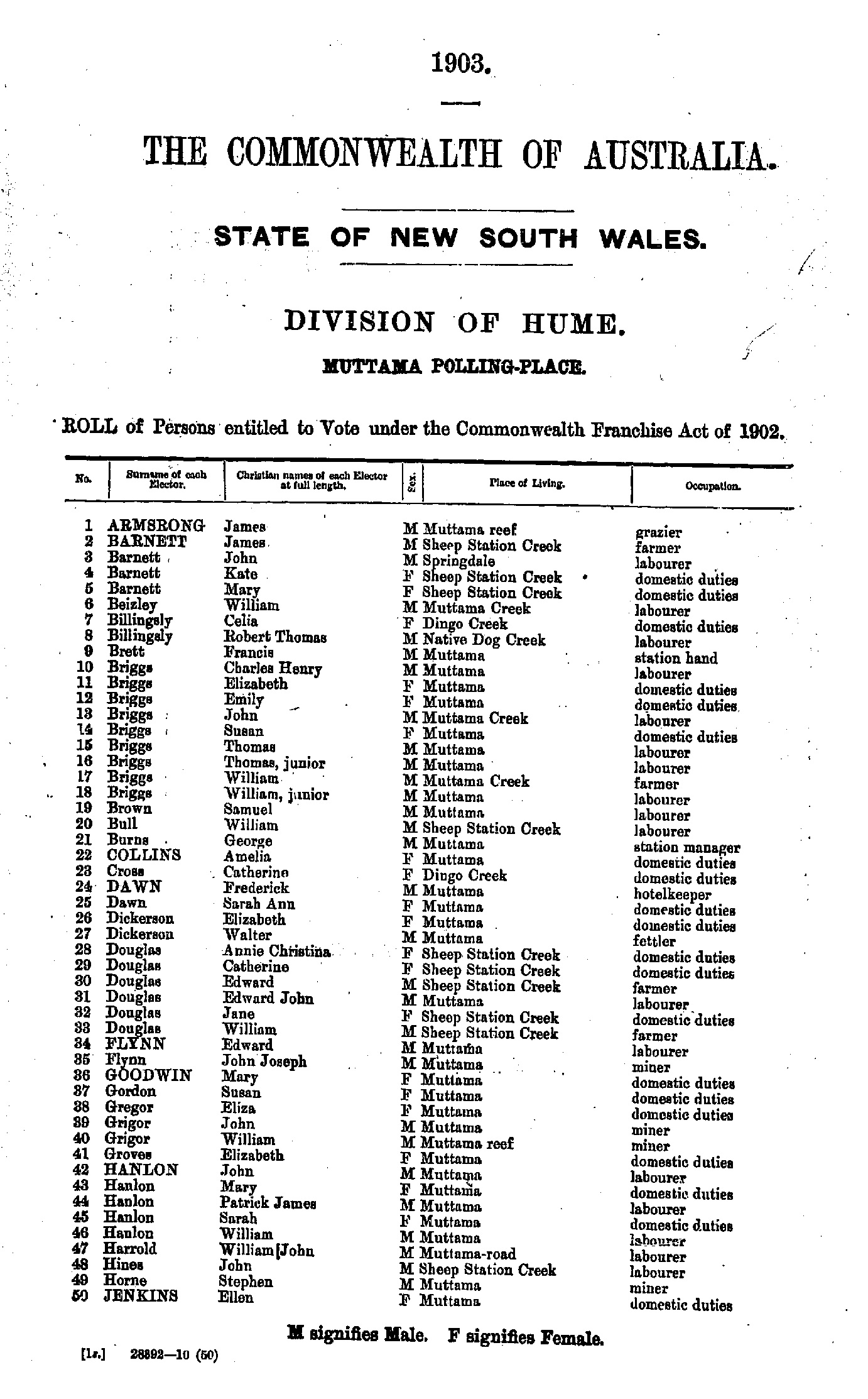
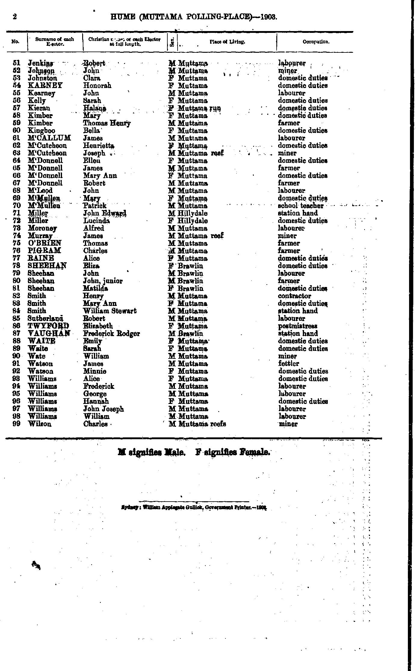
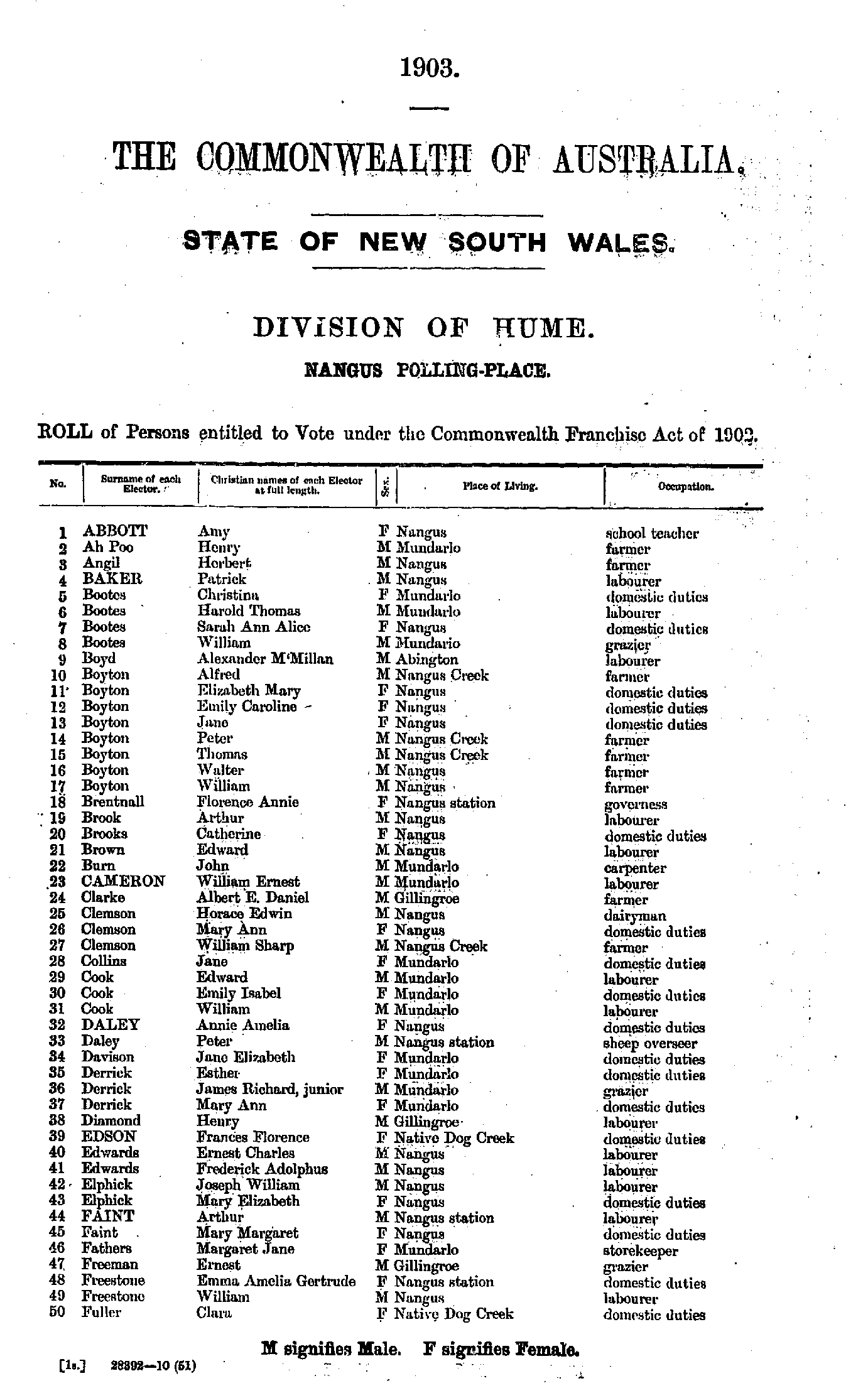
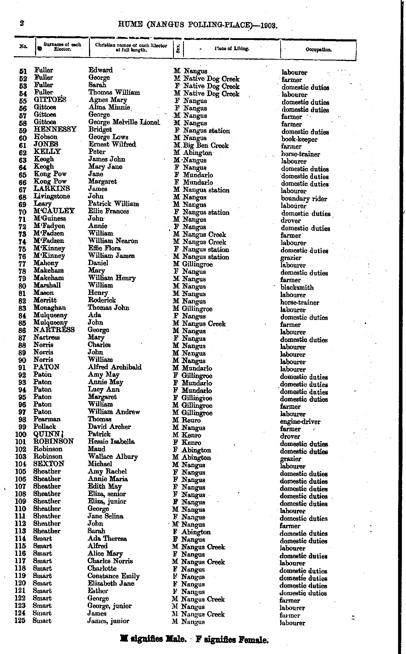
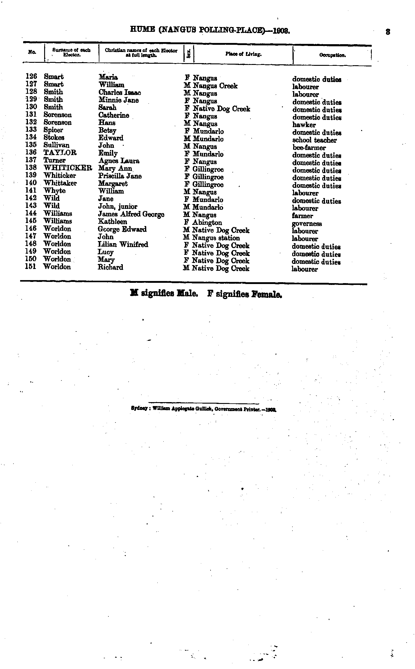
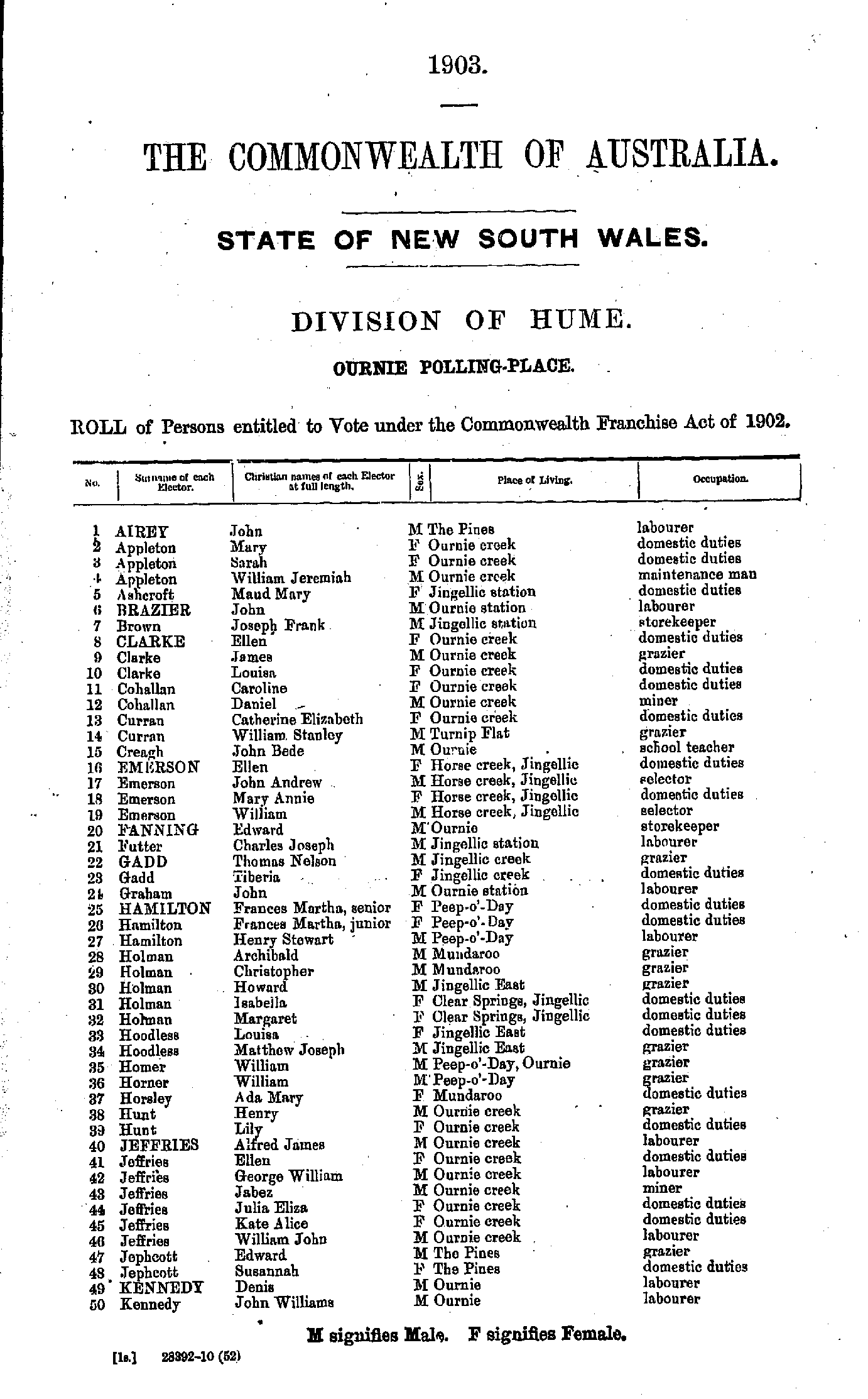
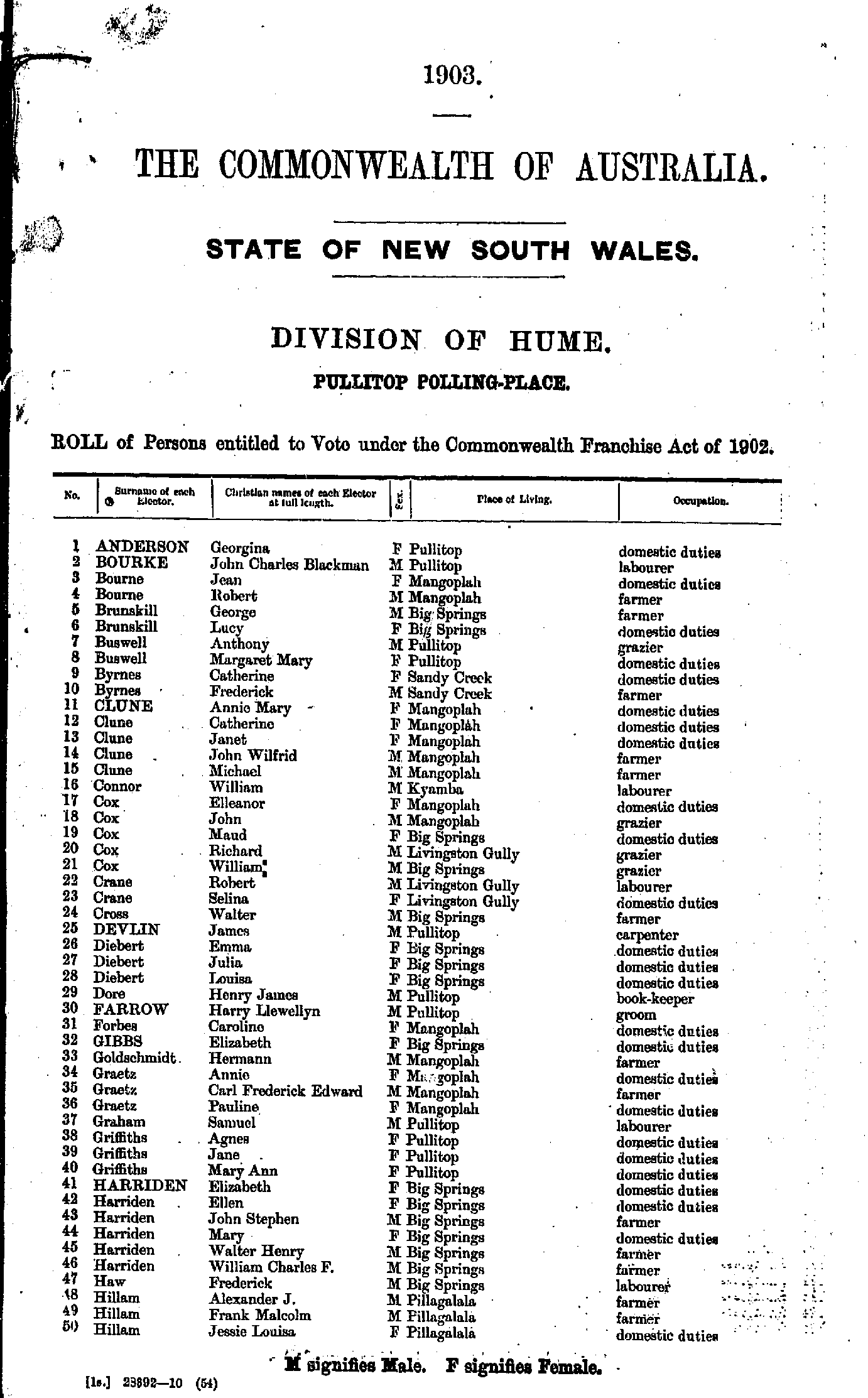
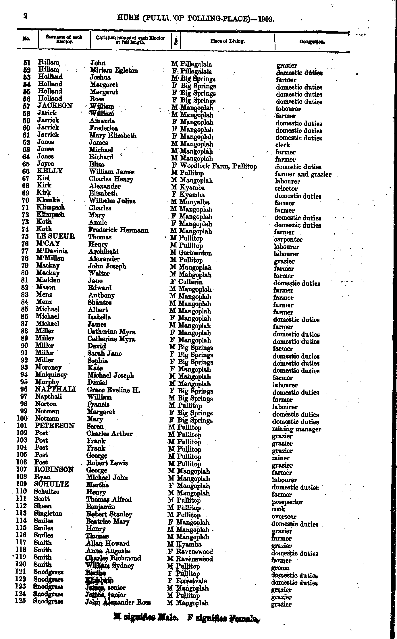
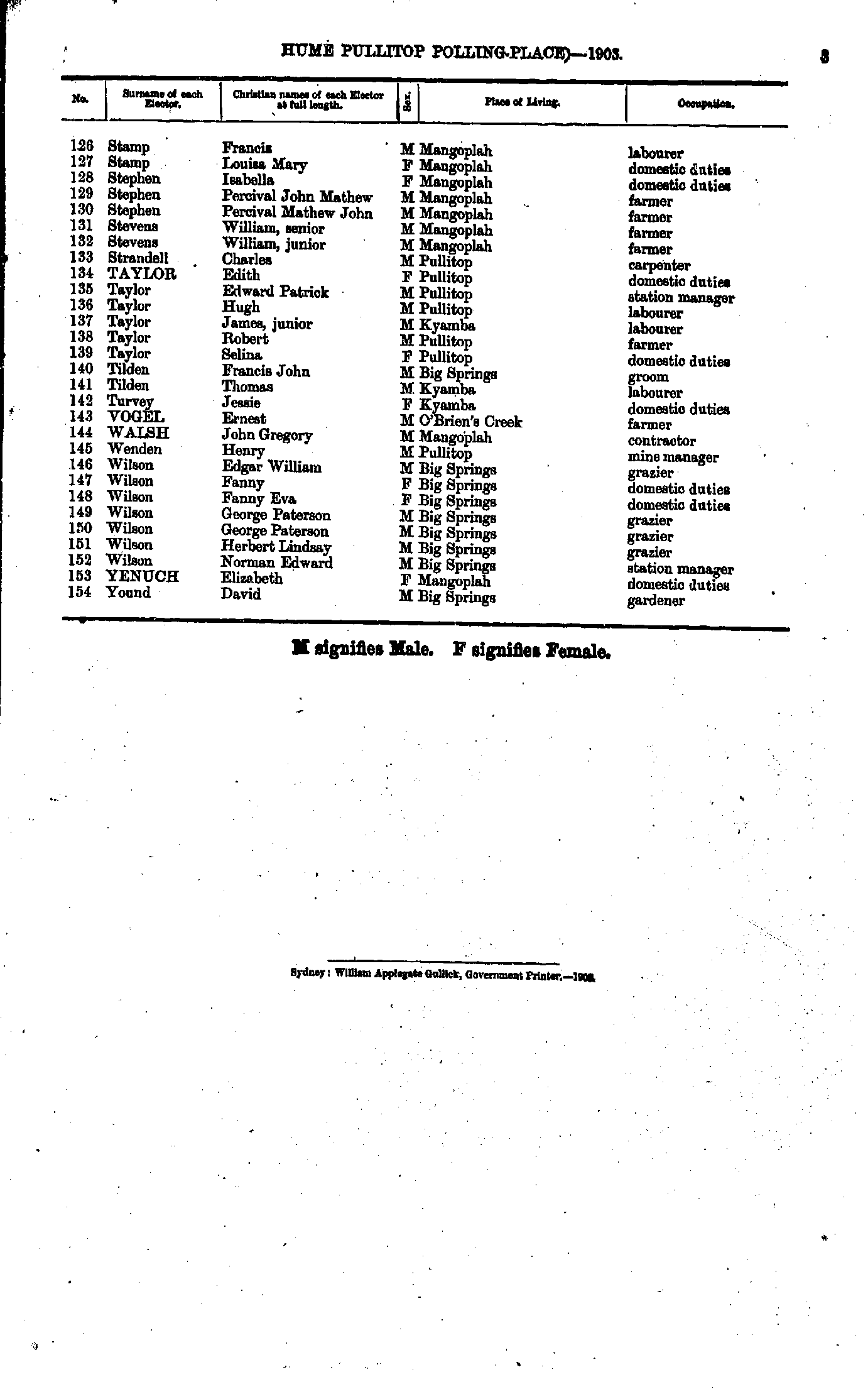
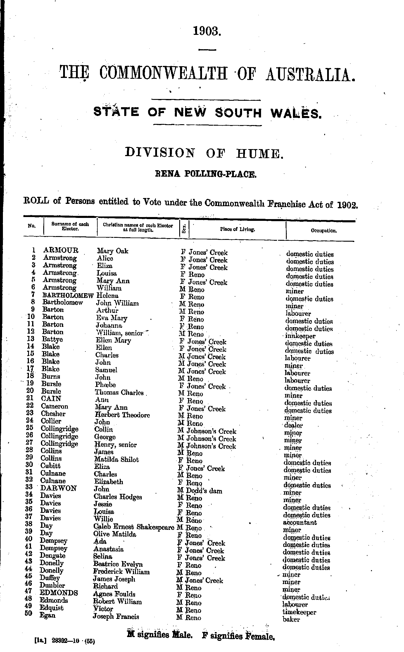
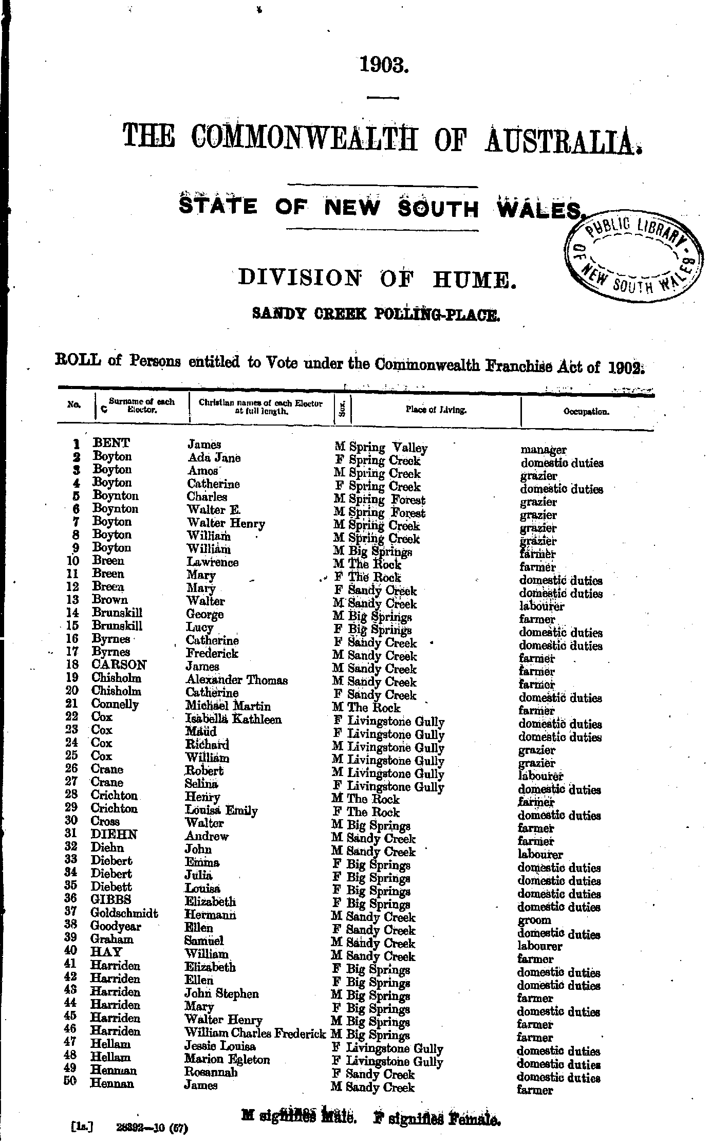
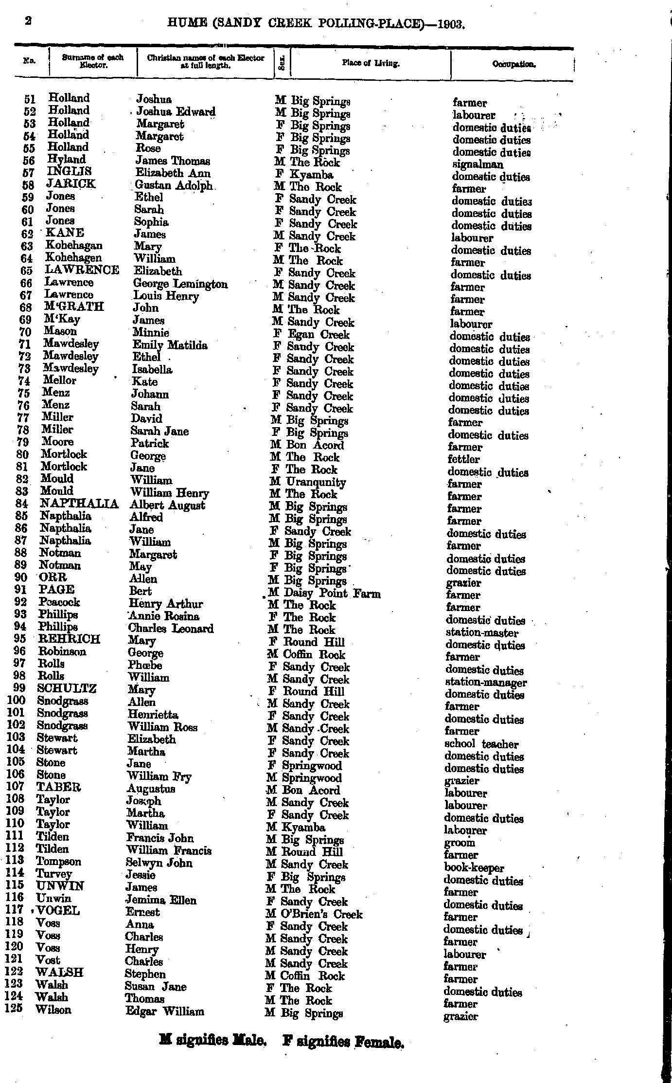
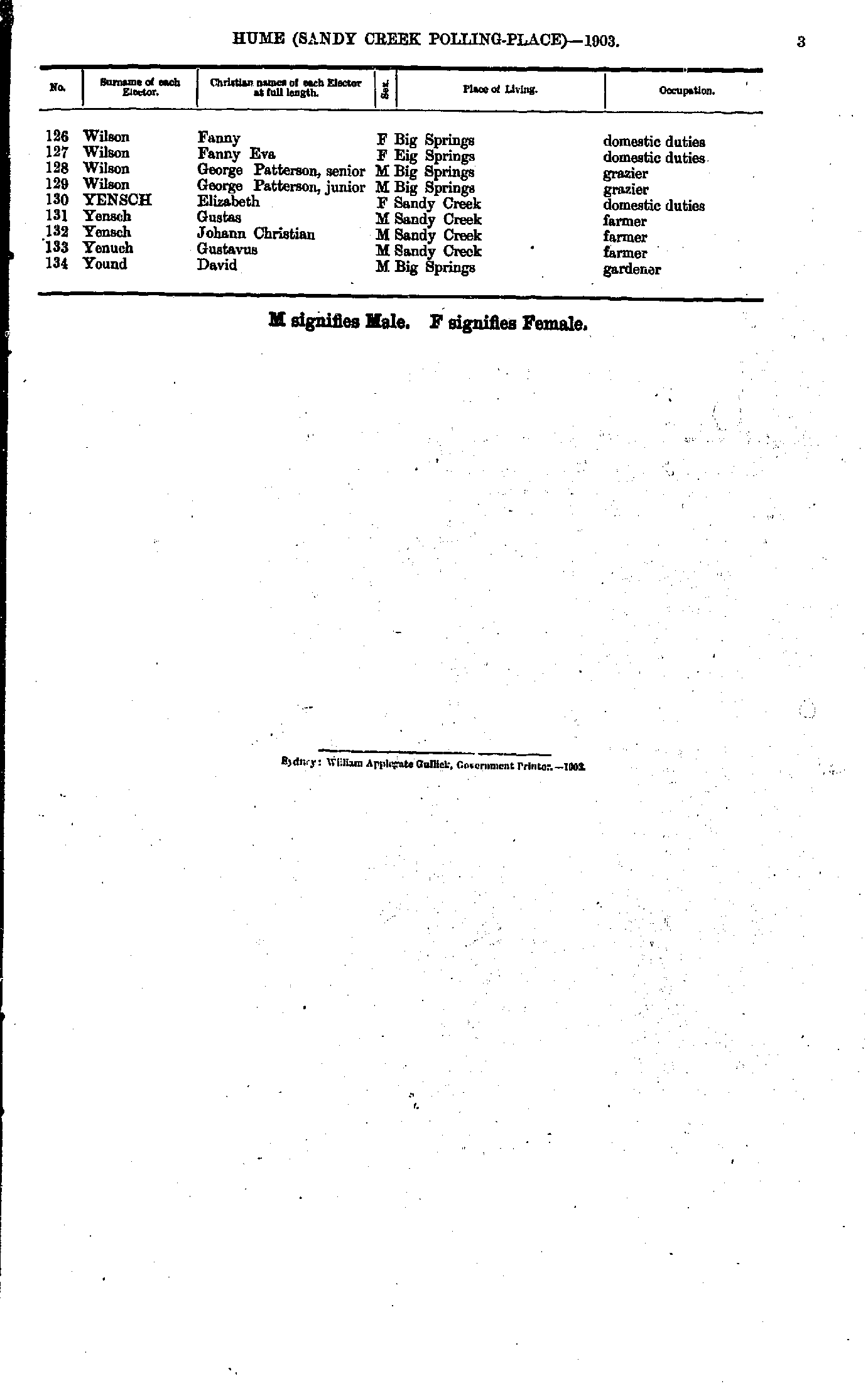
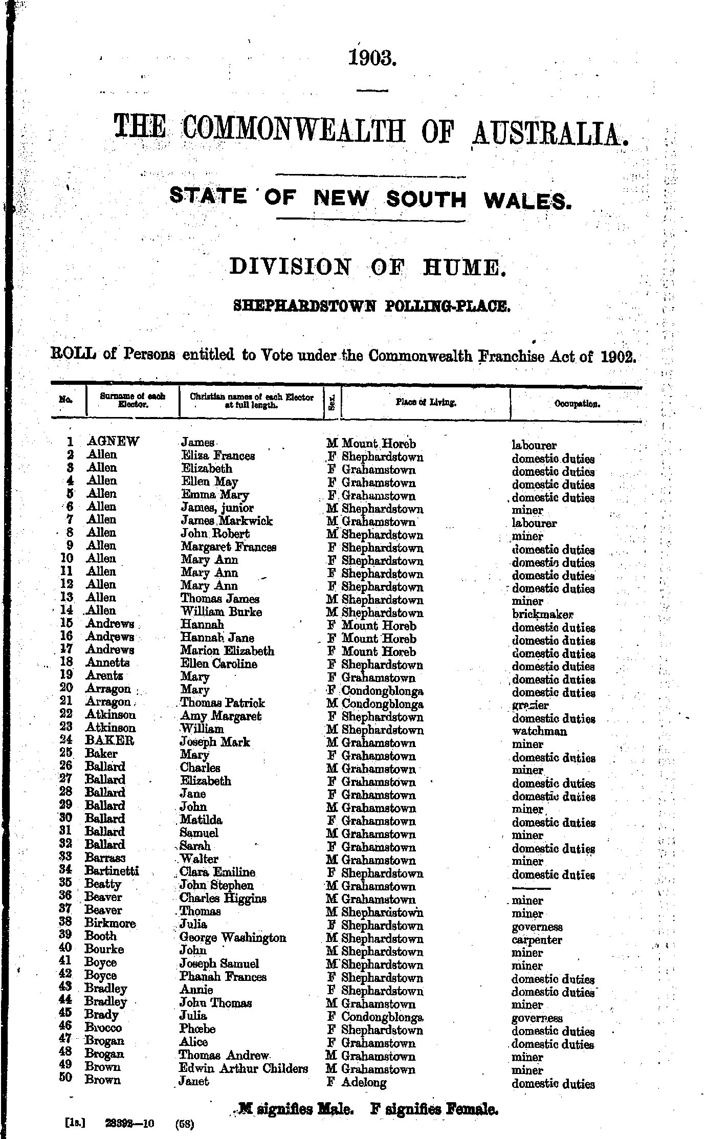
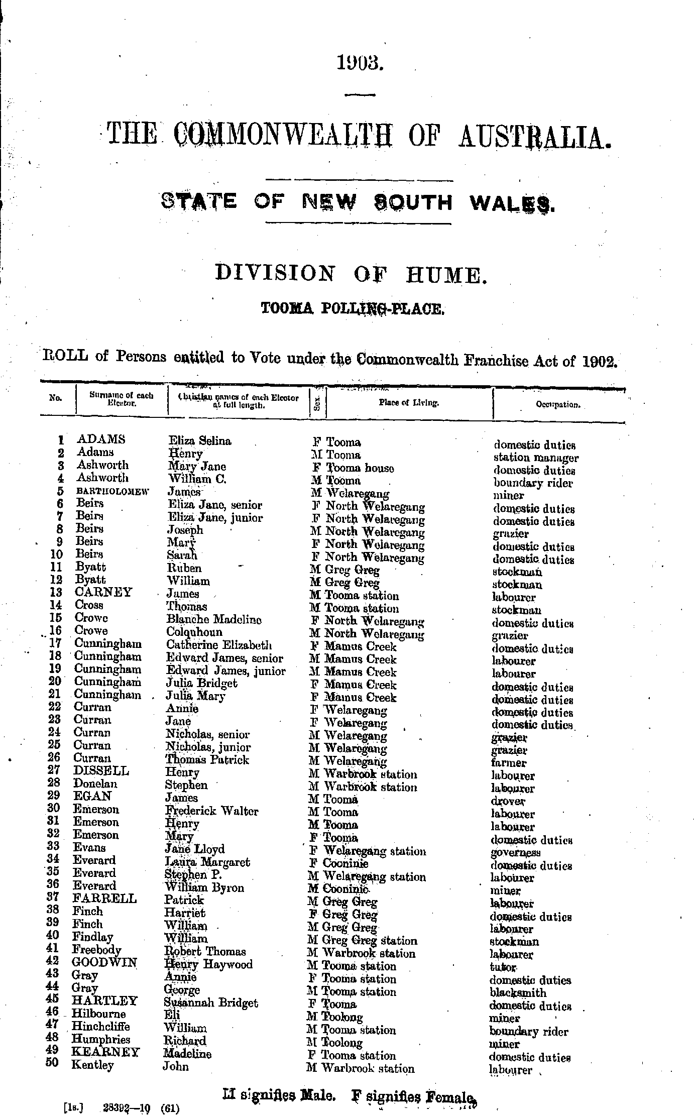
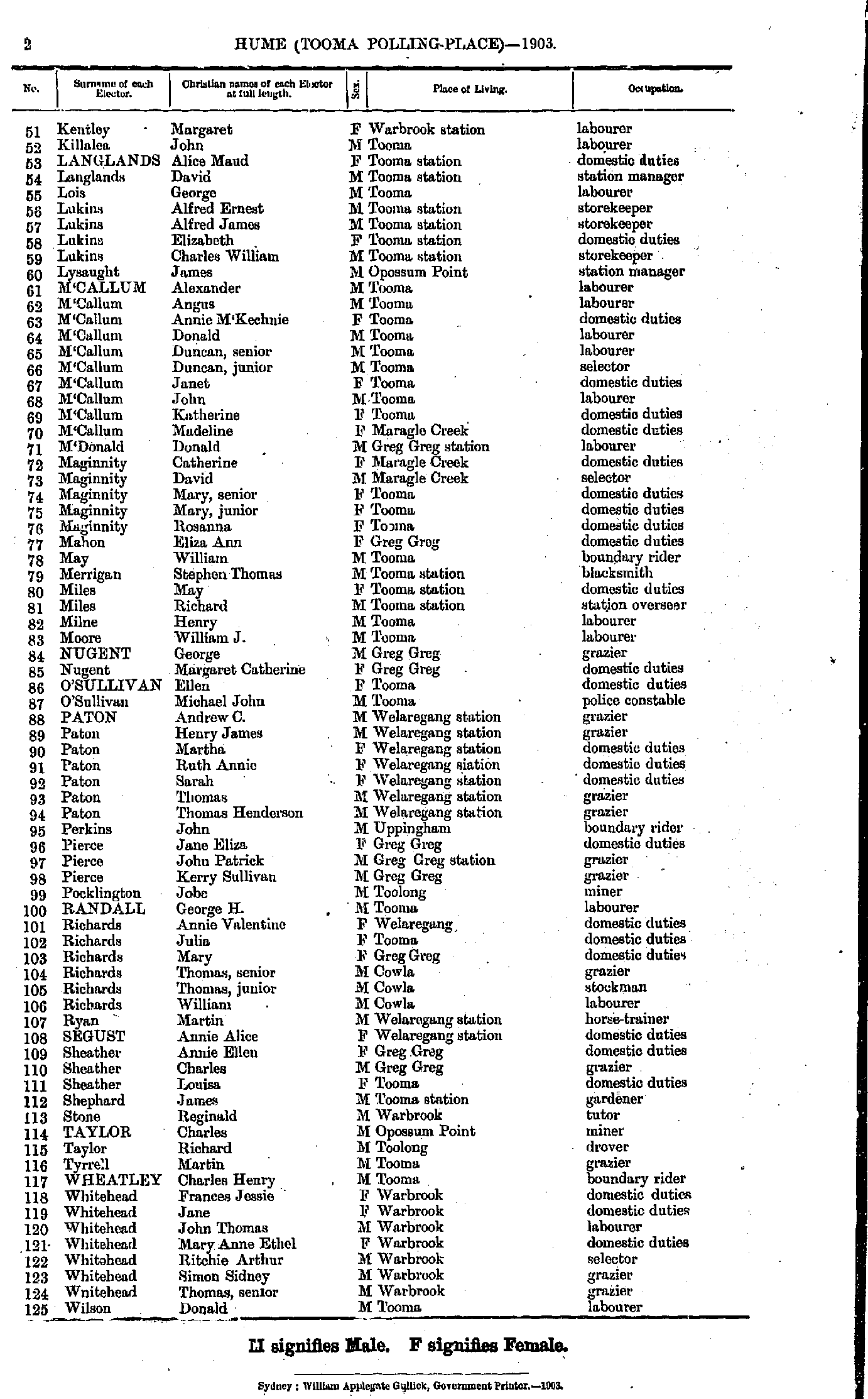
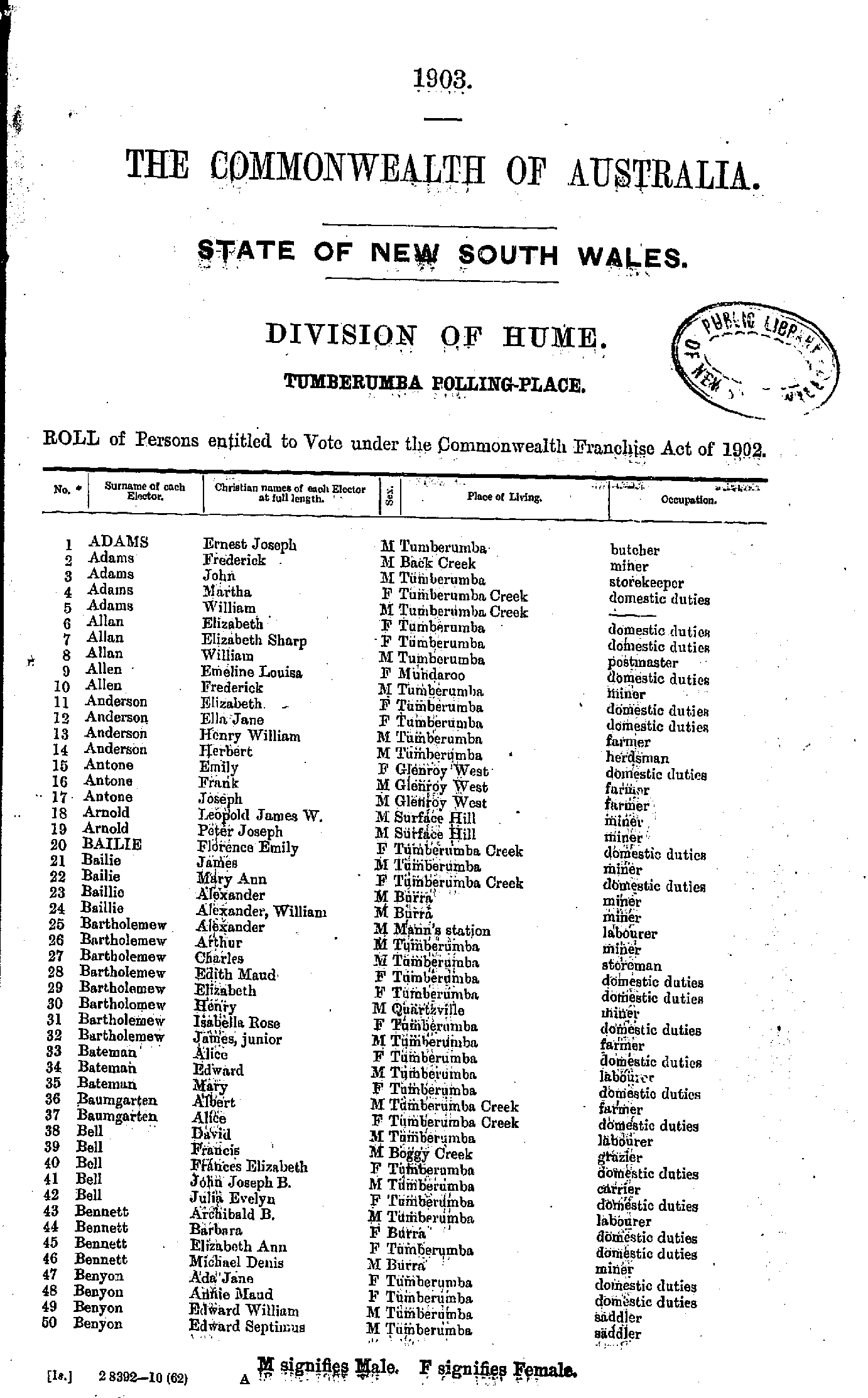
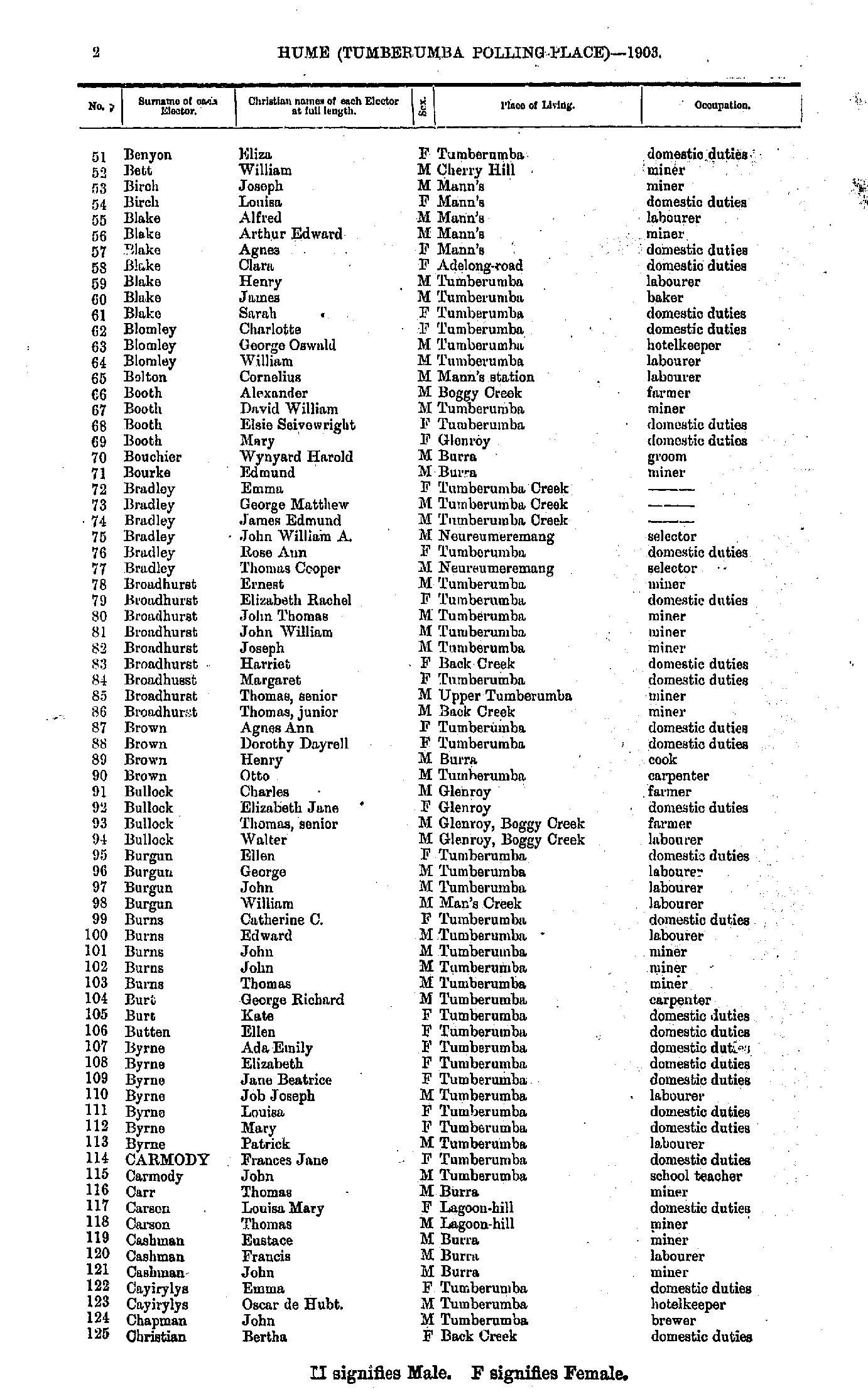
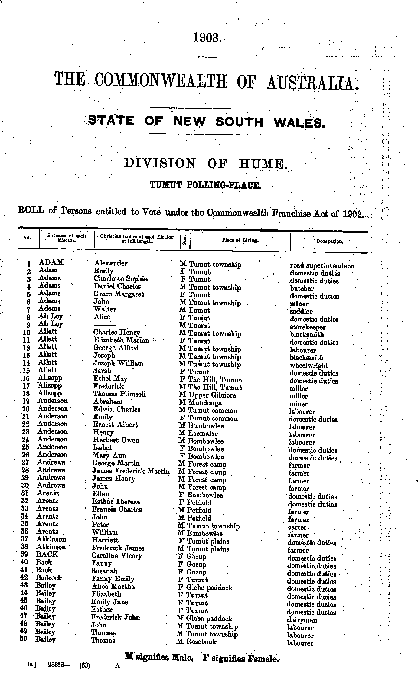
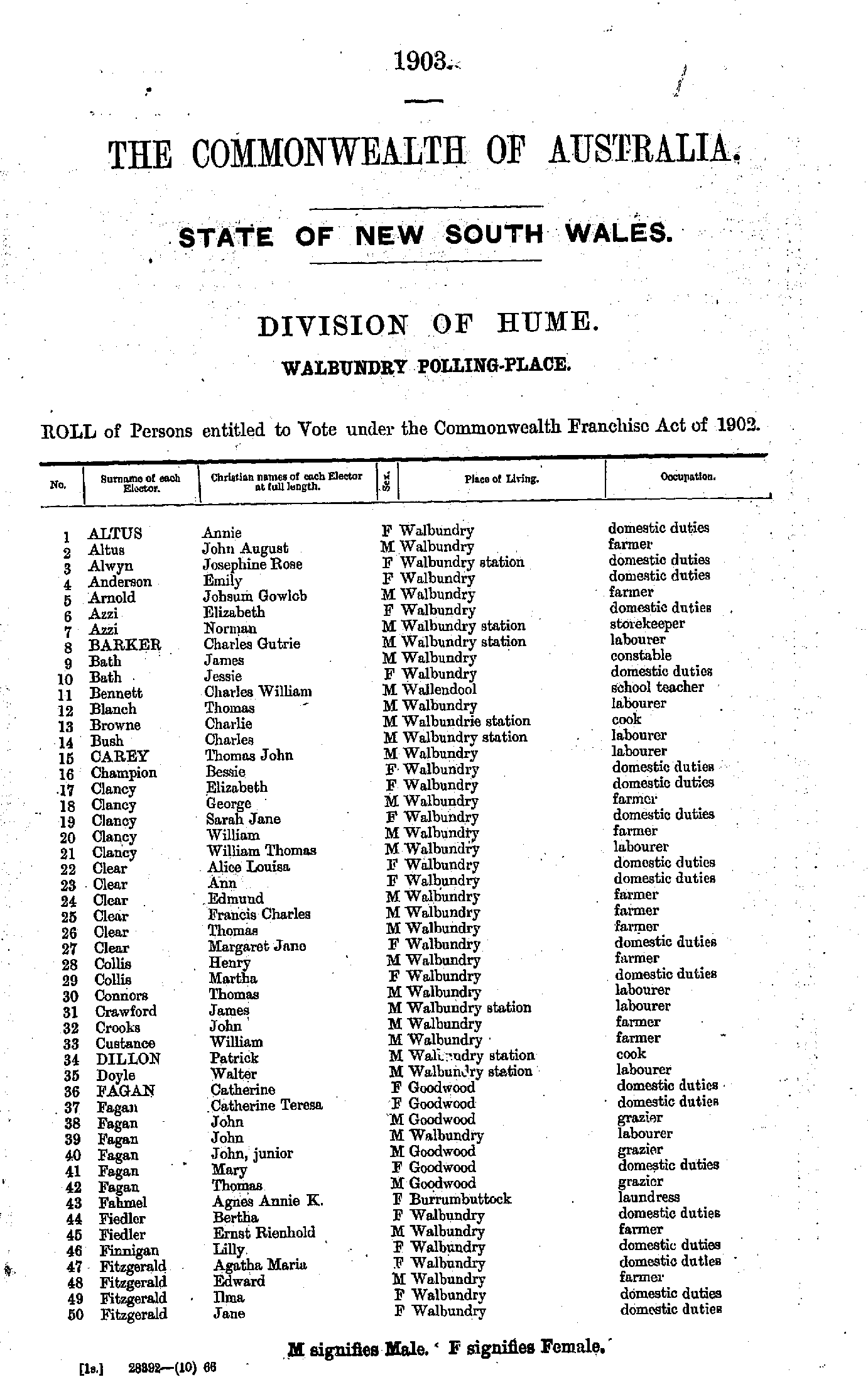
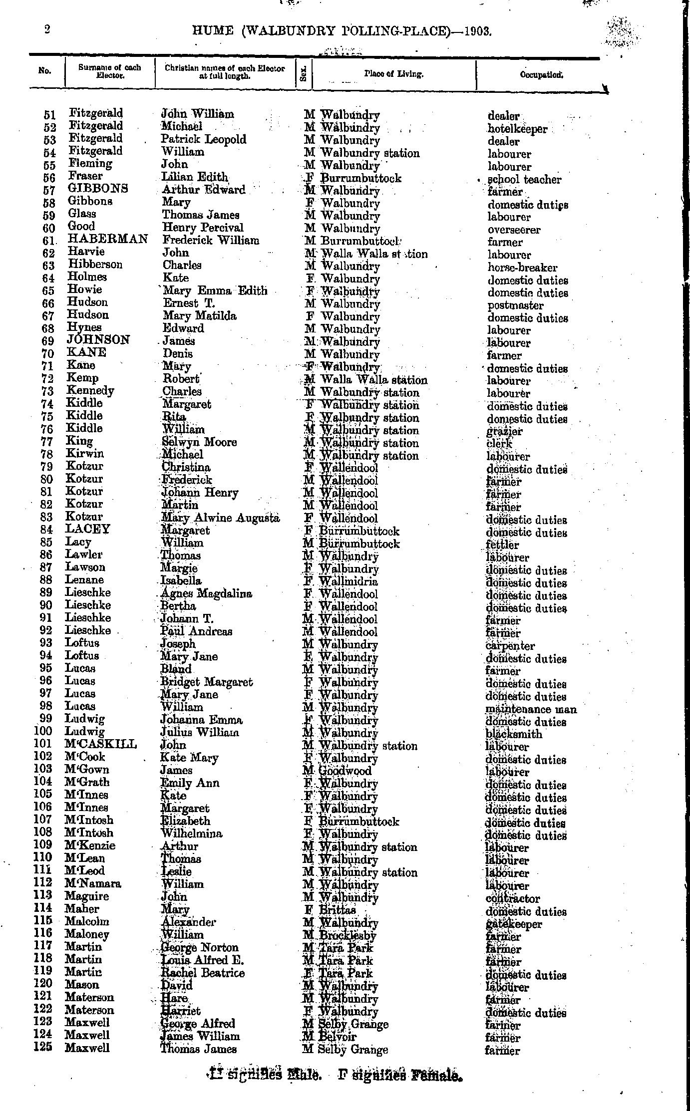
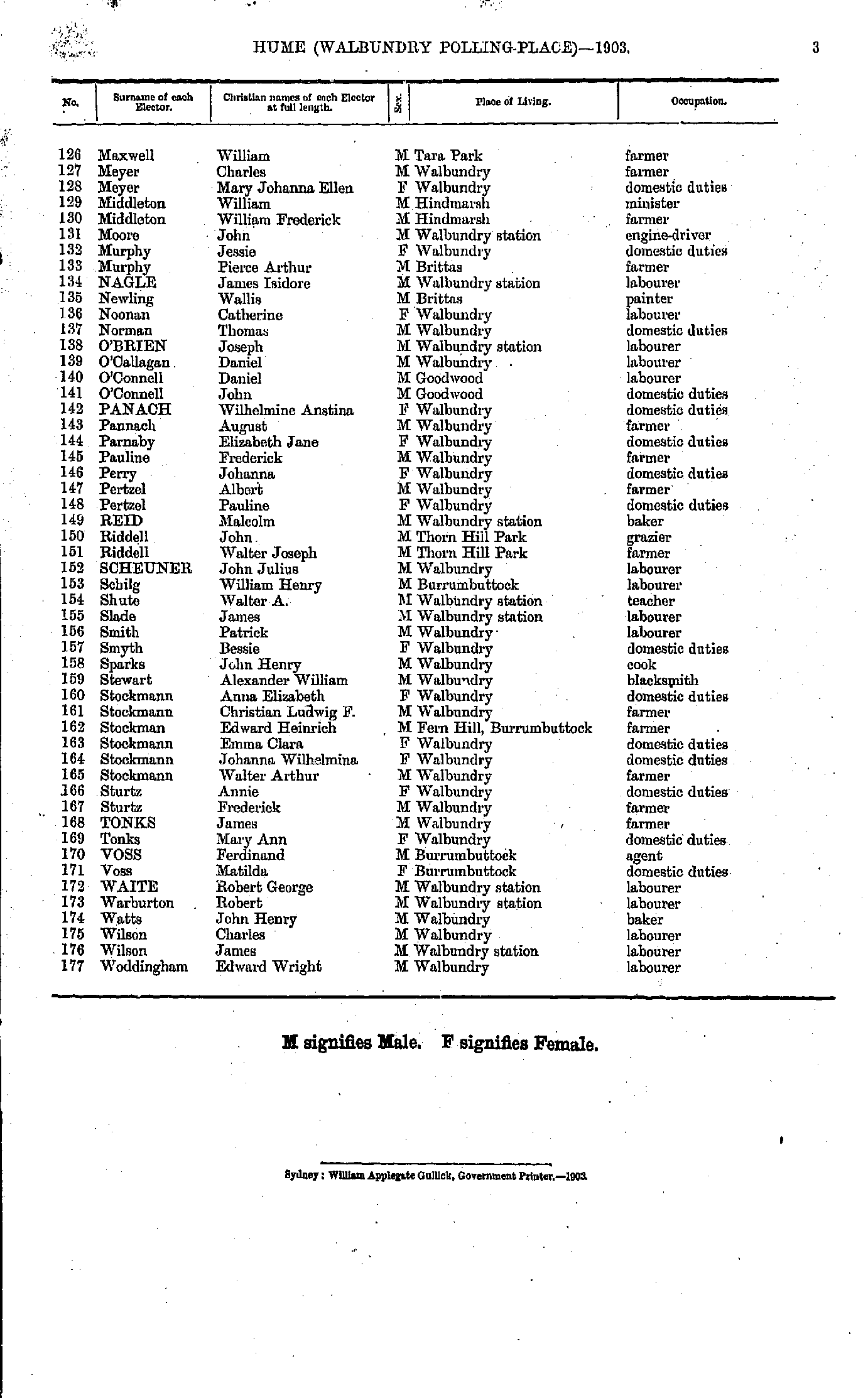
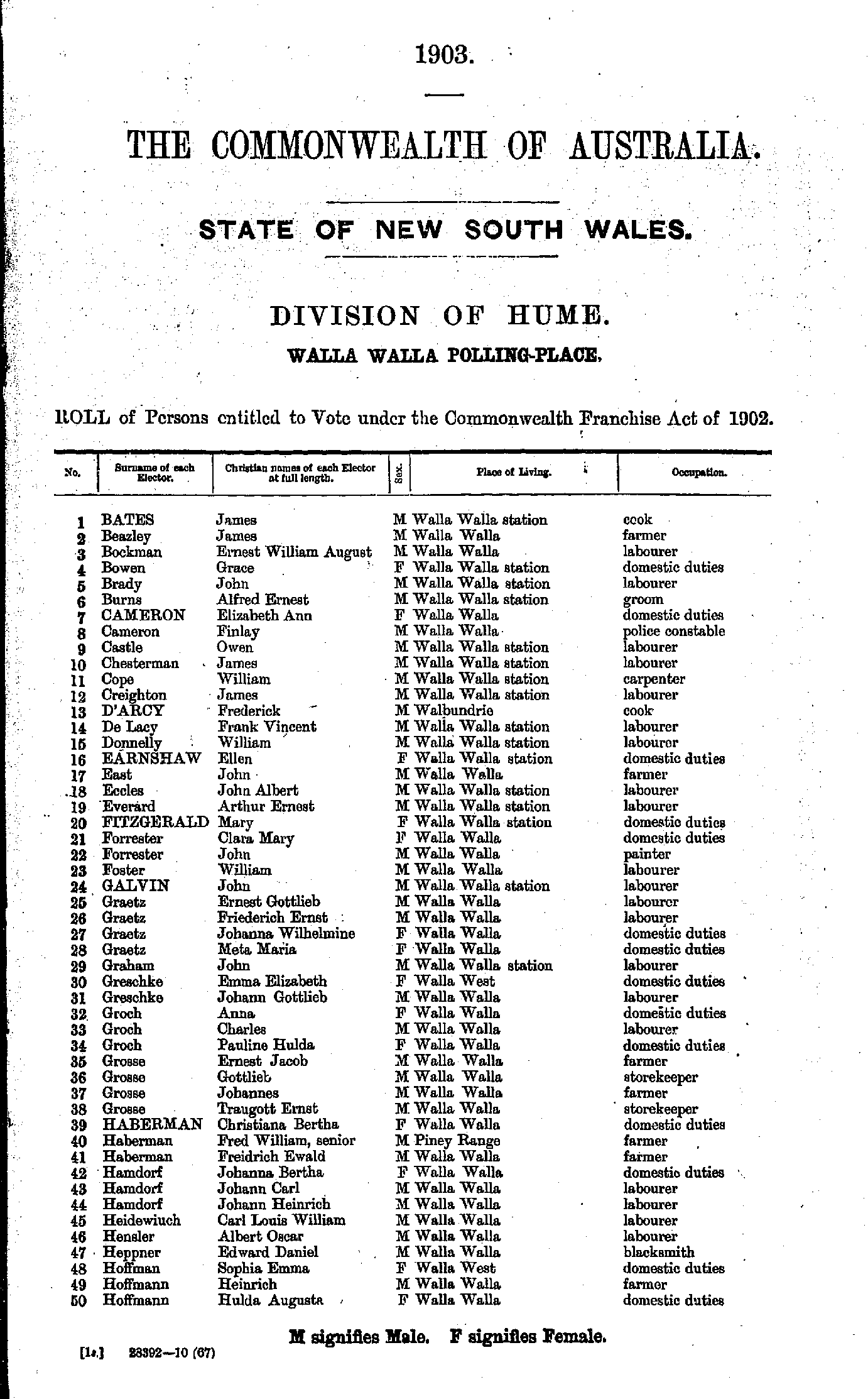
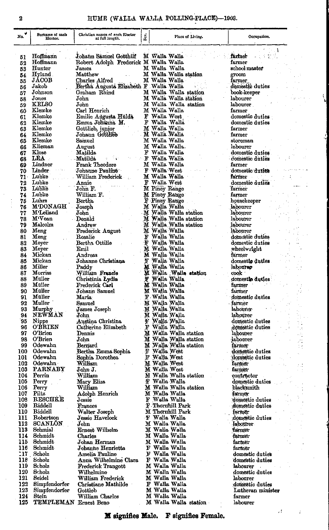
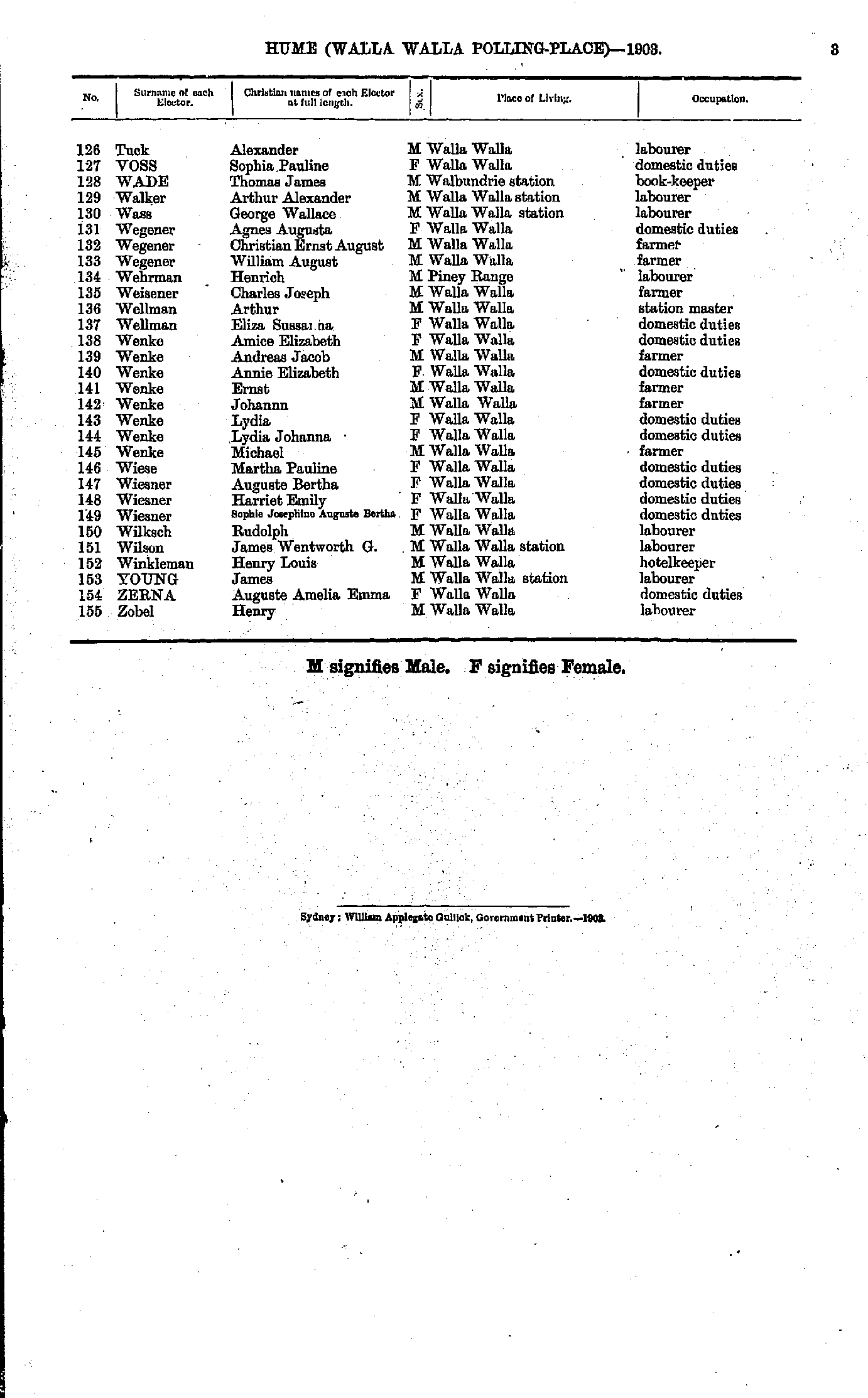
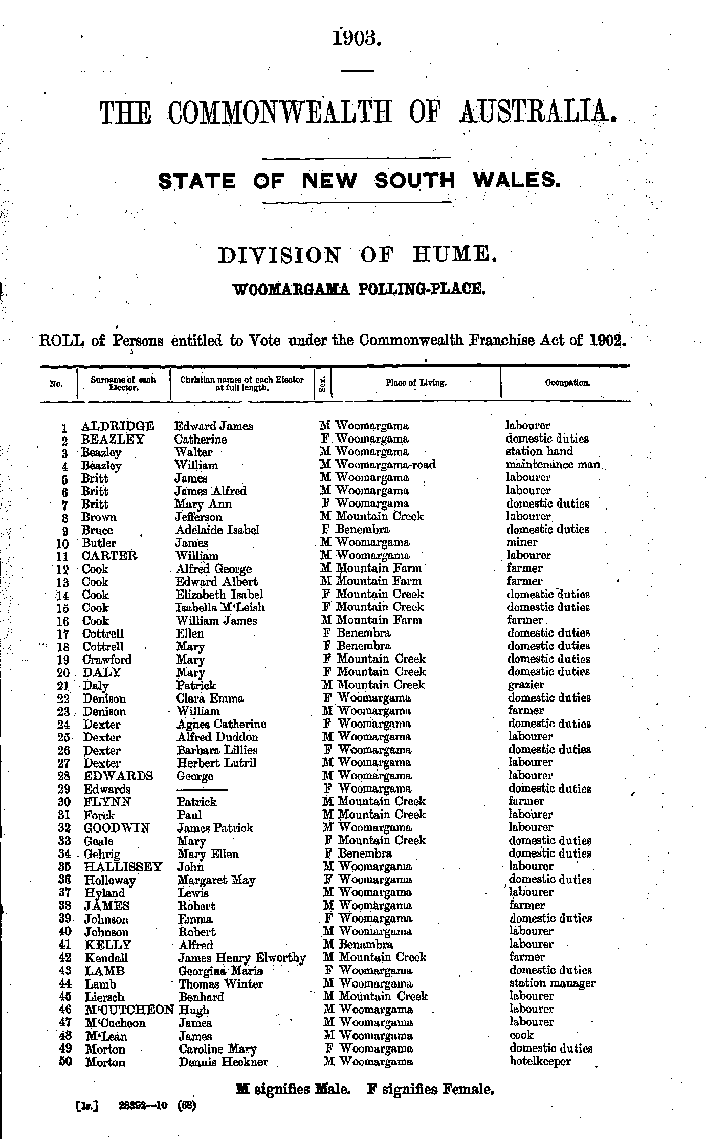
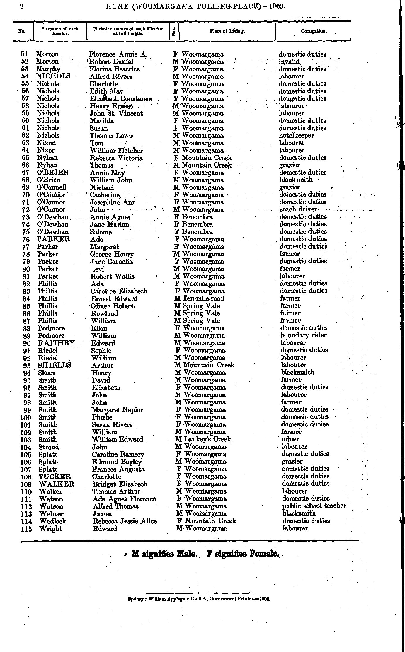
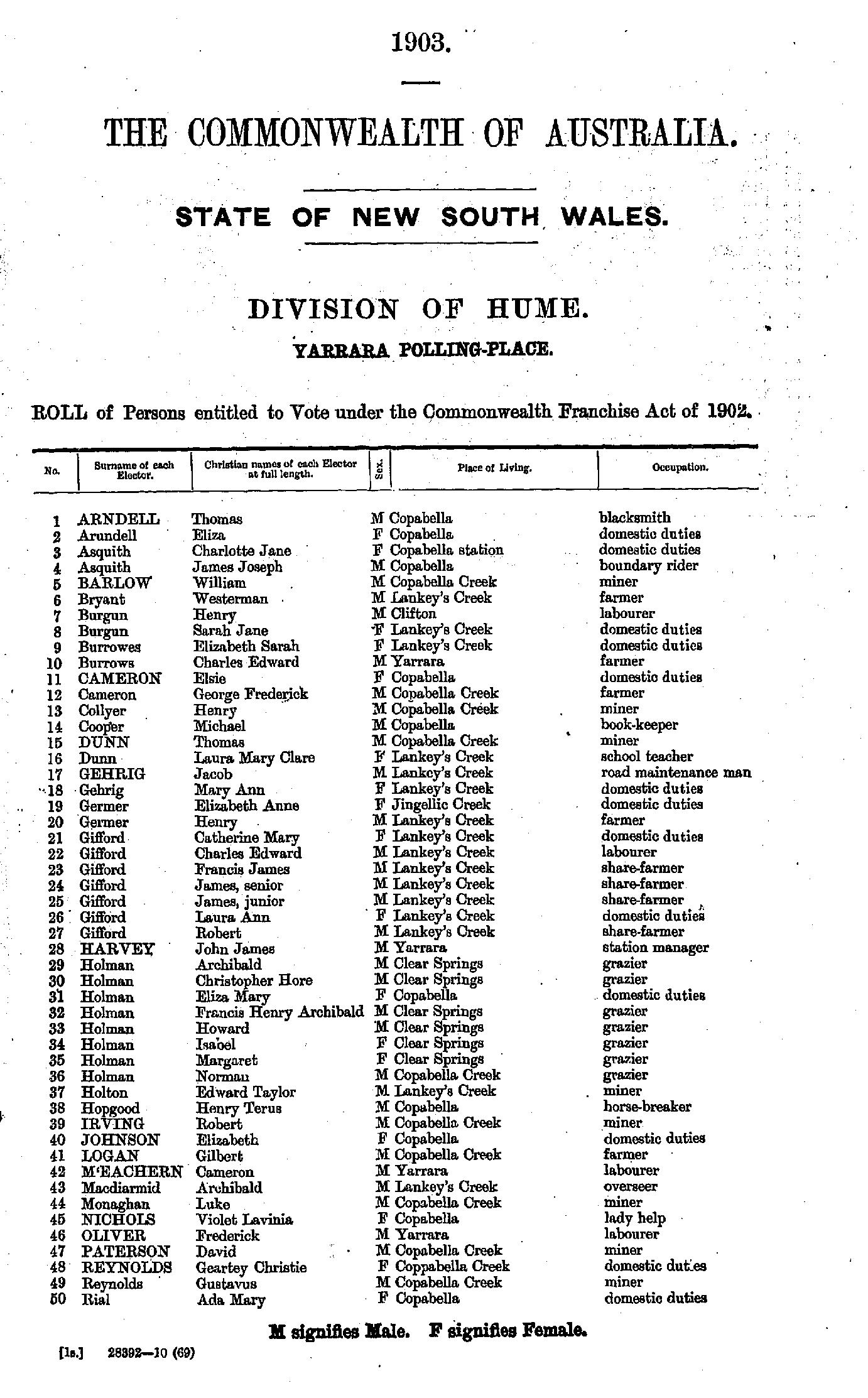
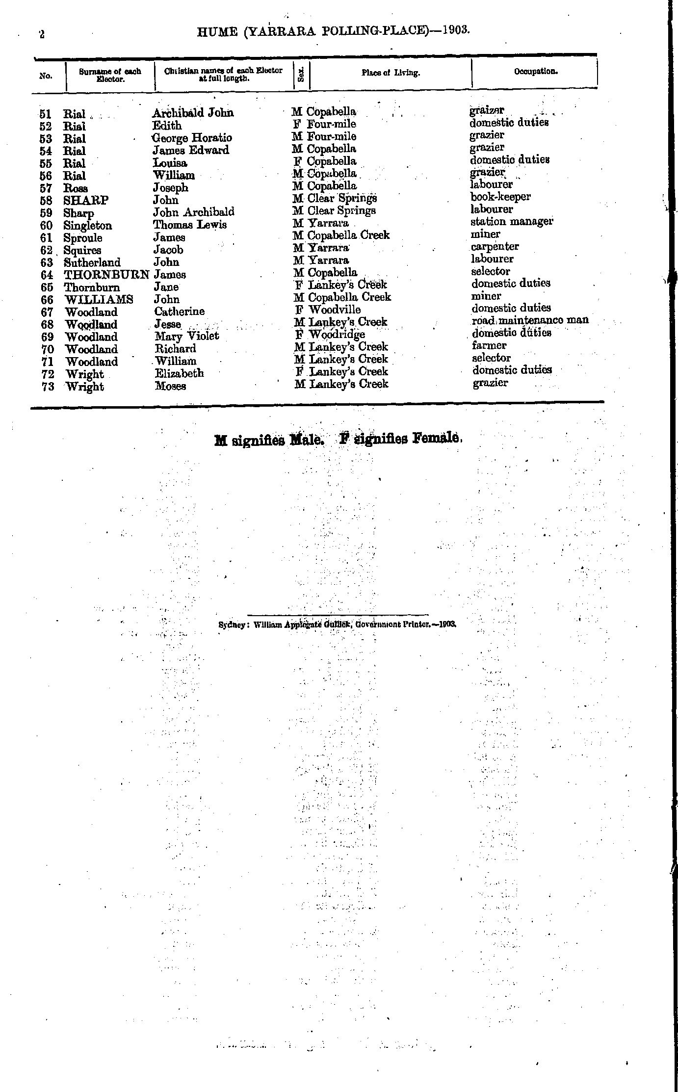
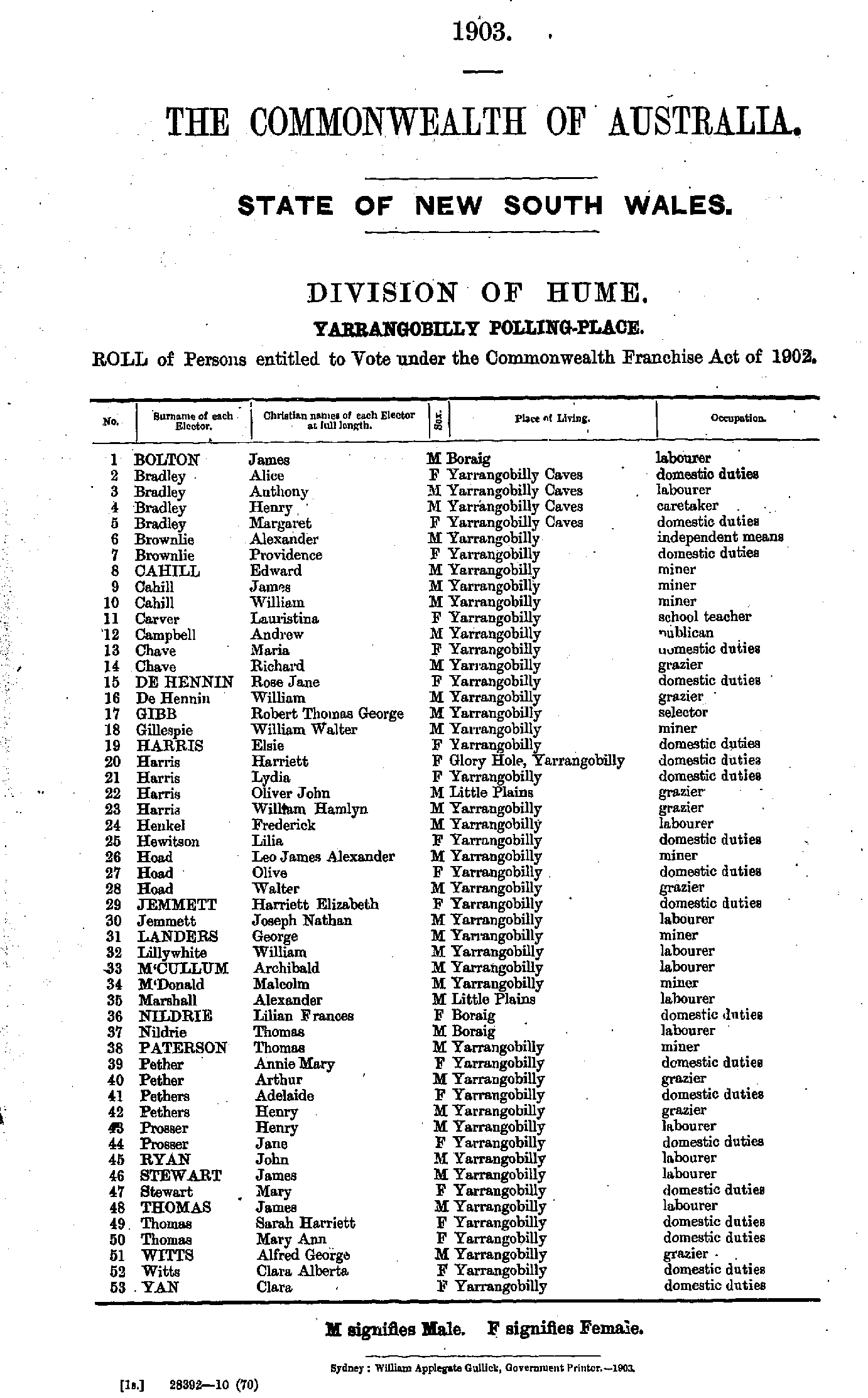
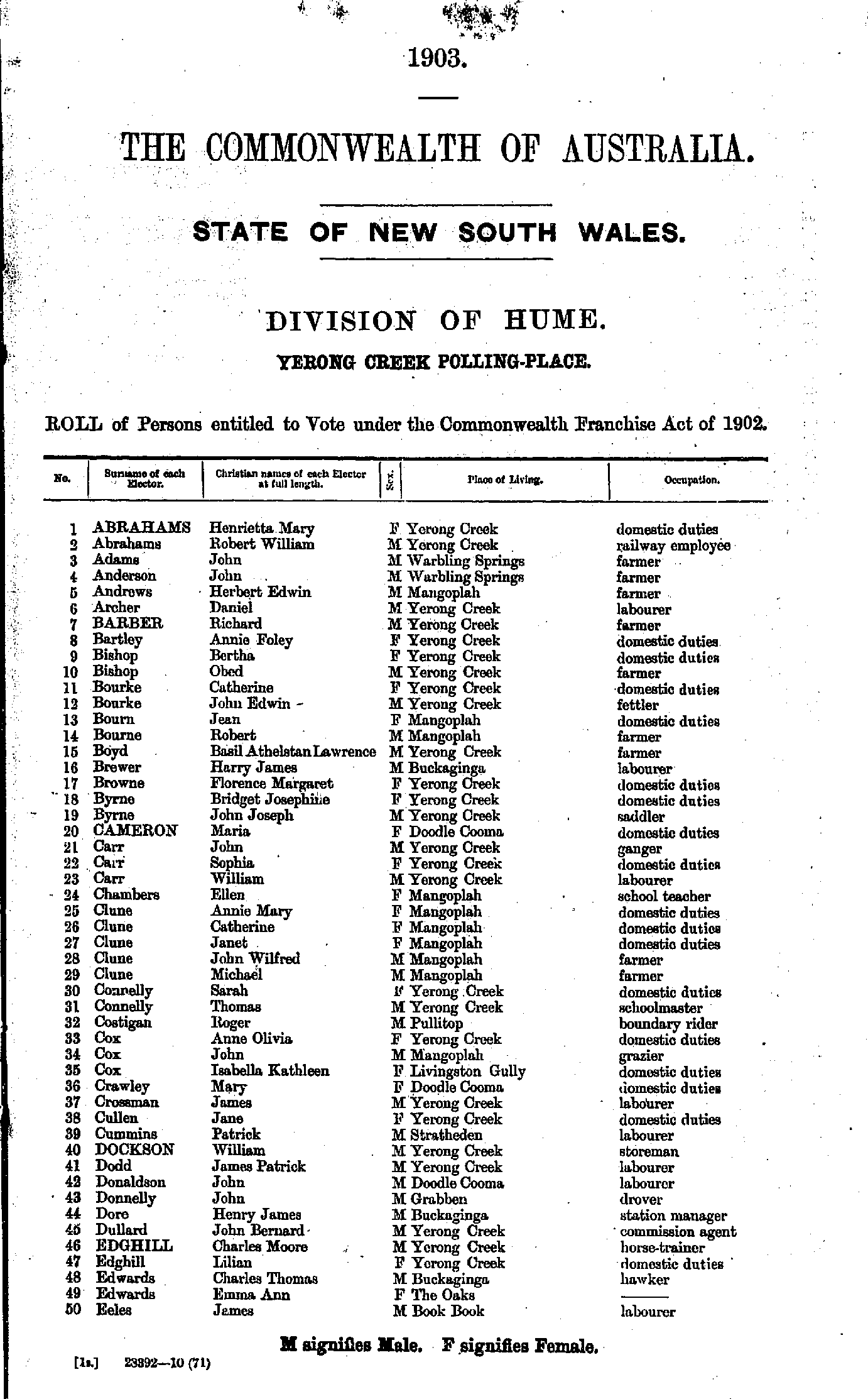
Roll of Persons entitled to Vote under the Commonwealth Franchise Act of 1902 Reproduced from microform copies of the originals in the Mitchell Library, State Library of New South Wales.
Index Copyright © Internet History Resources 2007
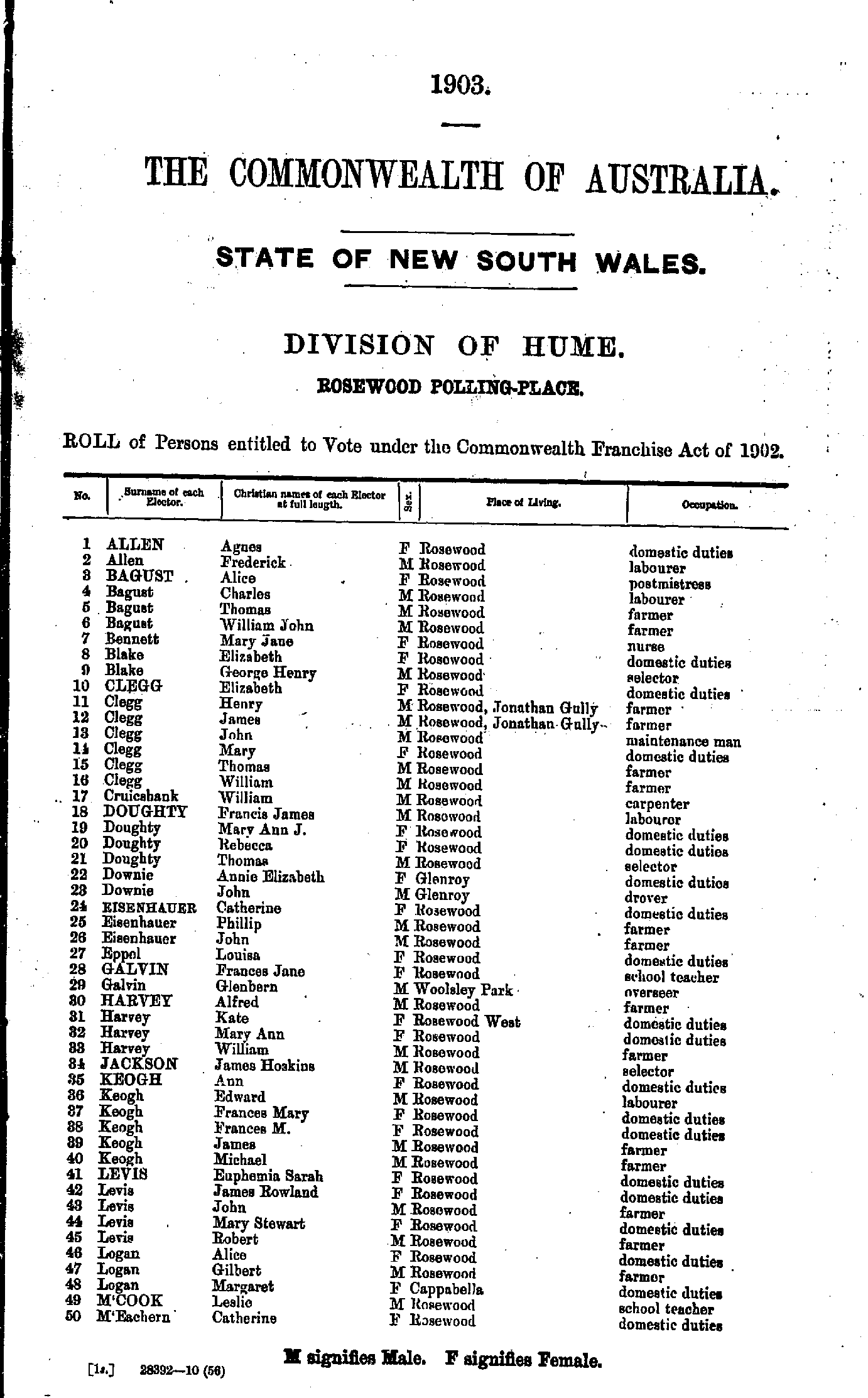
Electoral Maps of the Hume Division, 1901
Polling Places:
Adelong | Adelong Crossing | Albury | Argalong | Batlow | Bethungra | Black Range | Blowering | Bongongolong | Book Book | Bowna | Brocklesby | Brungle | Bulgandry | Bungowannah | Burrumbuttock | Carnsdale | Cherry Hill | Clarendon | Cookardinia | Coolac | Cootamundra | Corowa | Culcairn | Dora Dora | Germanton | Gerogery | Gobarralong | Grubben | Gundagai | Henty | Howlong | Humula | Illabo | Jindera | Jingellic | Jugiong | Khancoban | Little Billabong | Lobb's Hole | Lockhart | Lower Bago | Lowesdale | Mahonga | Maragle | Moorwatha | Mount Adrah | Mitta Mitta | Mullengandra | Muttama | Nangus | Ournie | Pleasant Hills | Pullitop | Rena | Rosewood | Sandy Creek | Shephardstown | The Rock | Tomooroma | Tooma | Tumberumba | Tumut | Upper Tarcutta | Wagra | Walbundry | Walla Walla | Woomargama | Yarrara | Yarrangobilly | Yerong Creek
- Aberline Adam - Baker Thomas
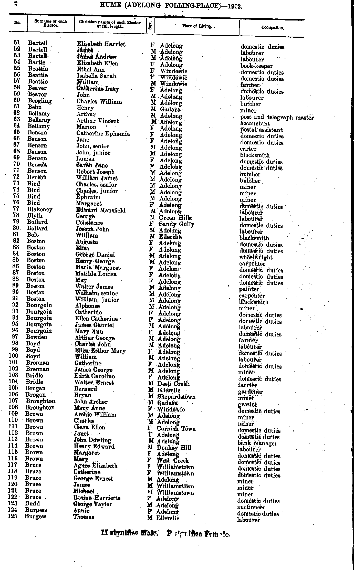
- Bartell Elizabeth - Burgess Thomas
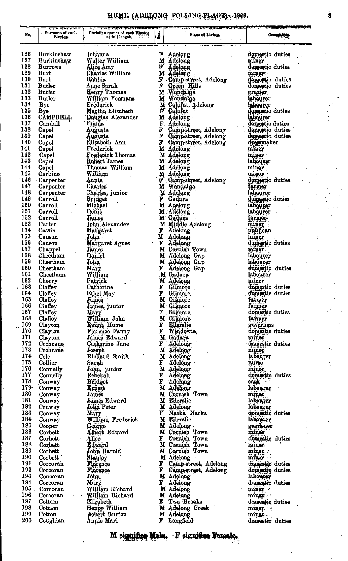
- Burkinshaw Johanna - Coughlan Annie
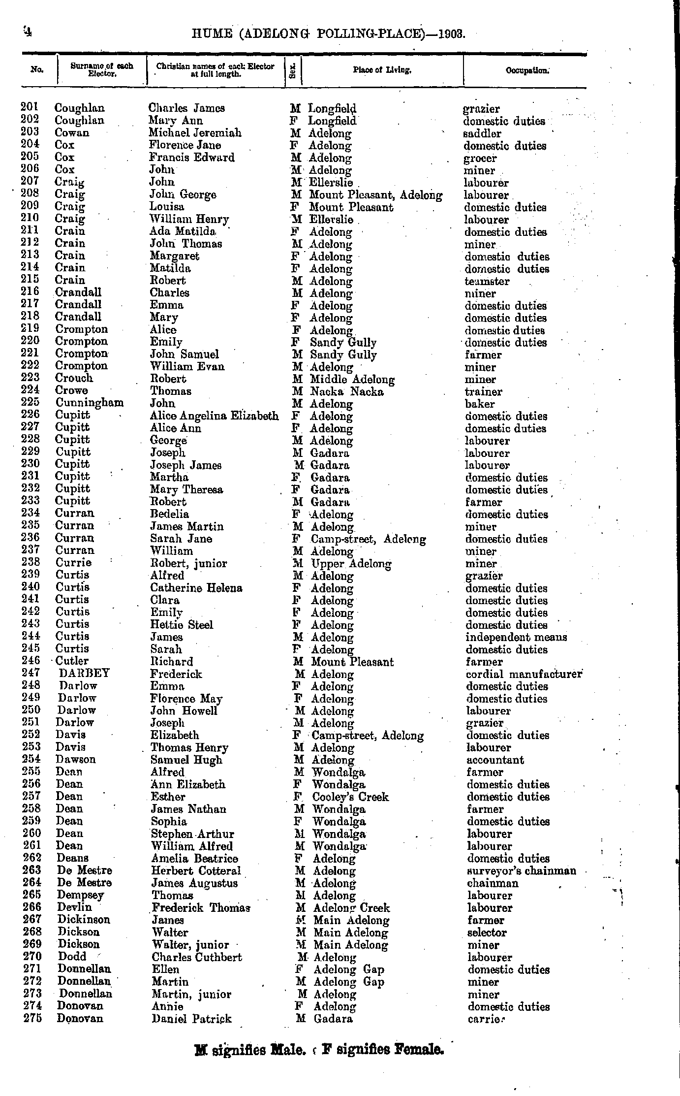
- Coughlan Charles - Donovan Daniel
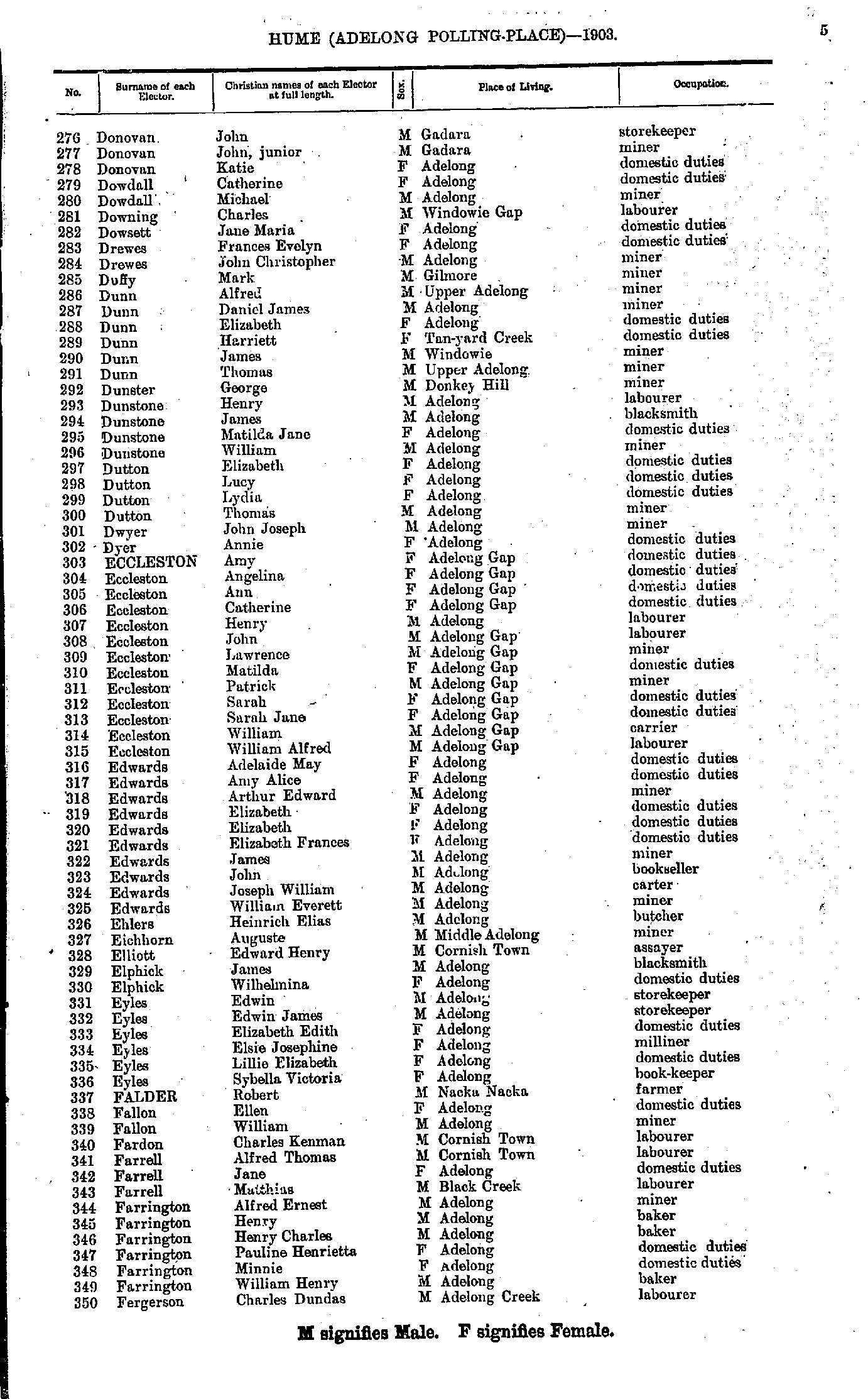
- Donovan John - Fergerson Charles
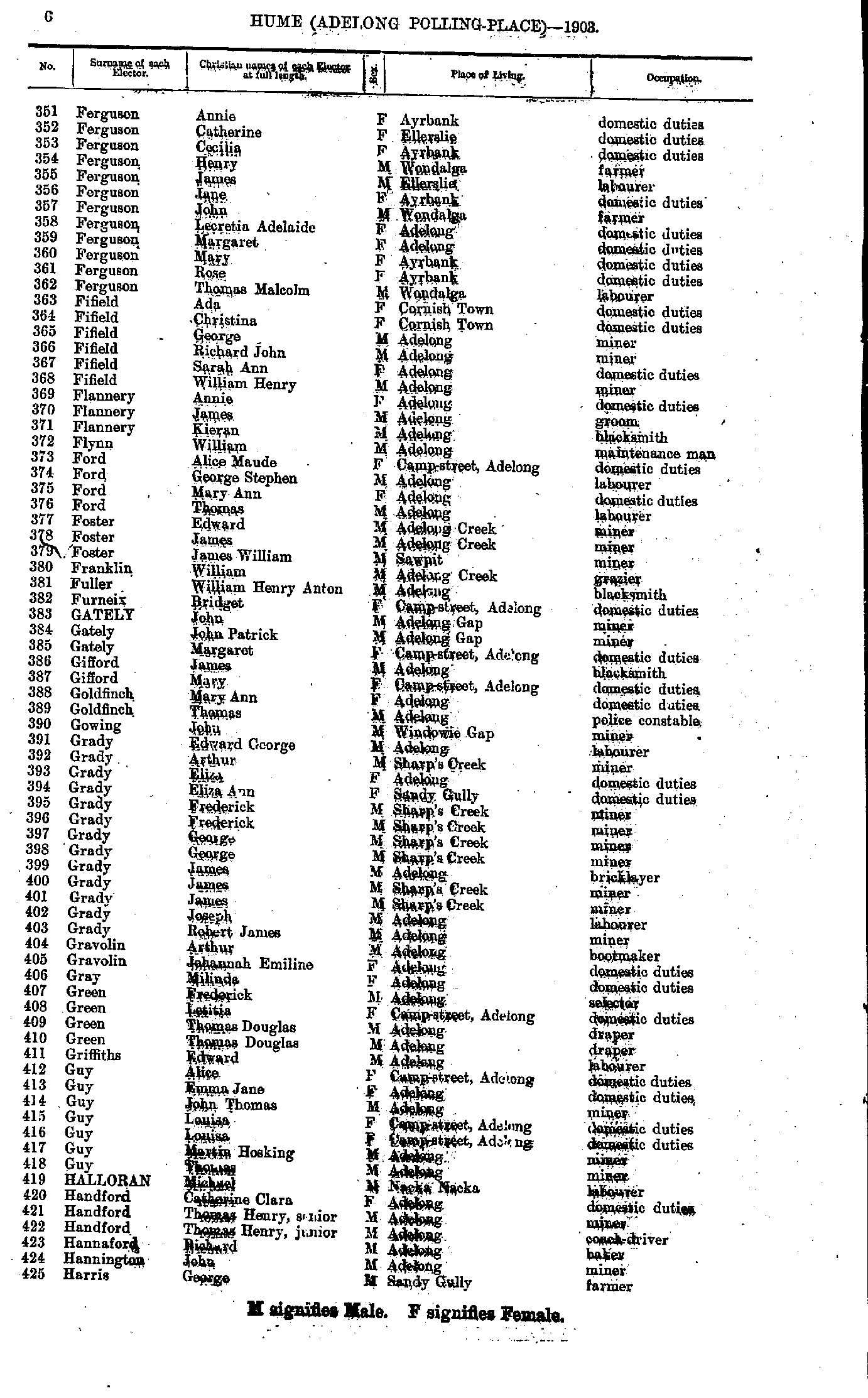
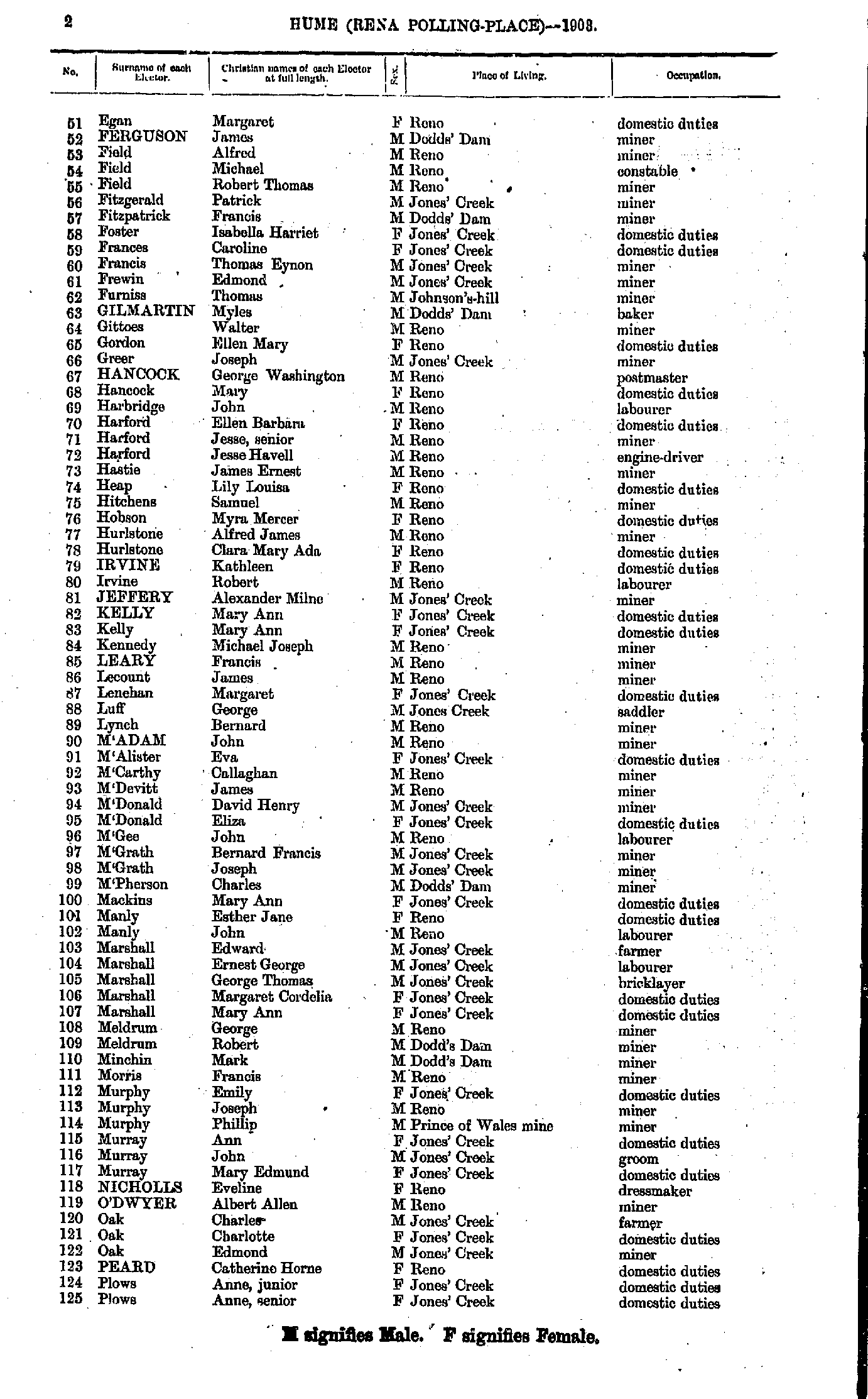
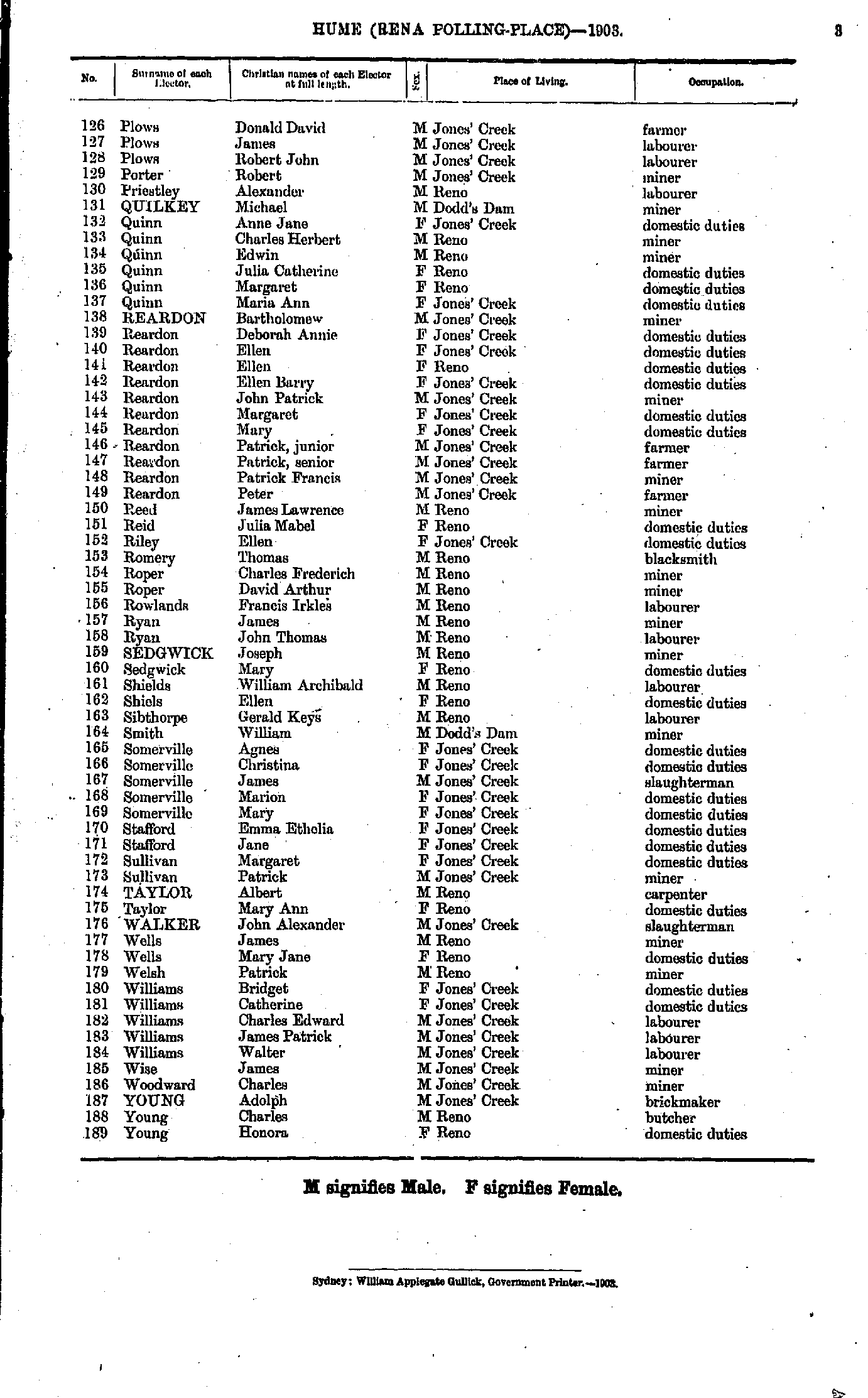
- Ferguson Annie - Harris George
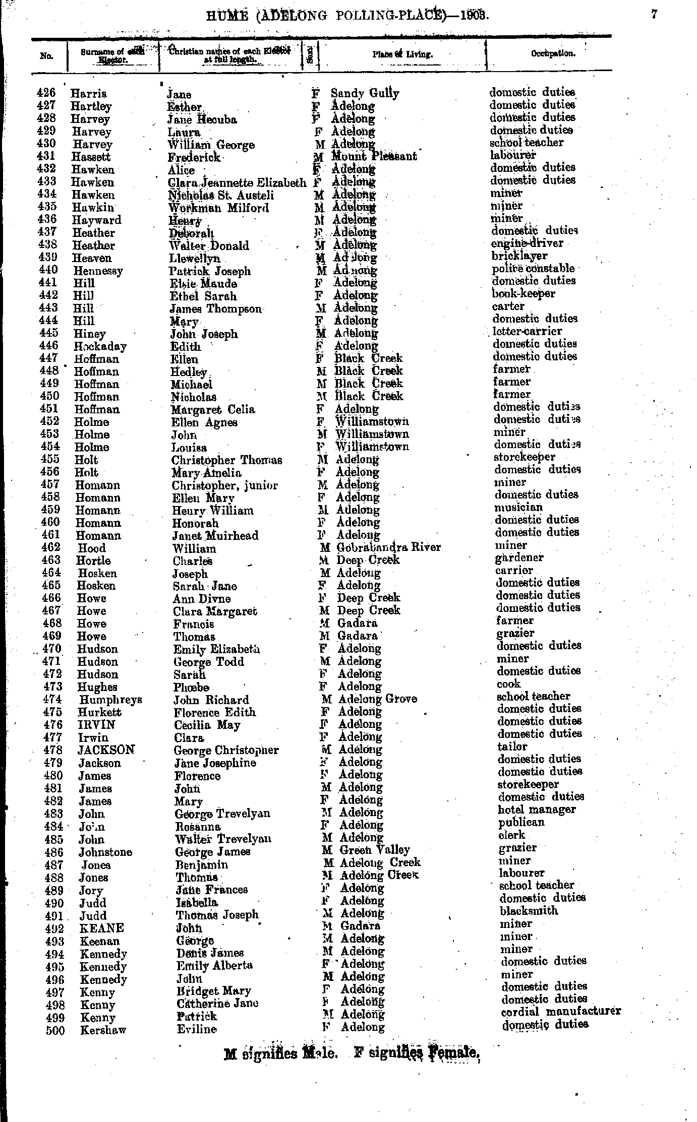
- Harris Jane - Kershaw Eviline
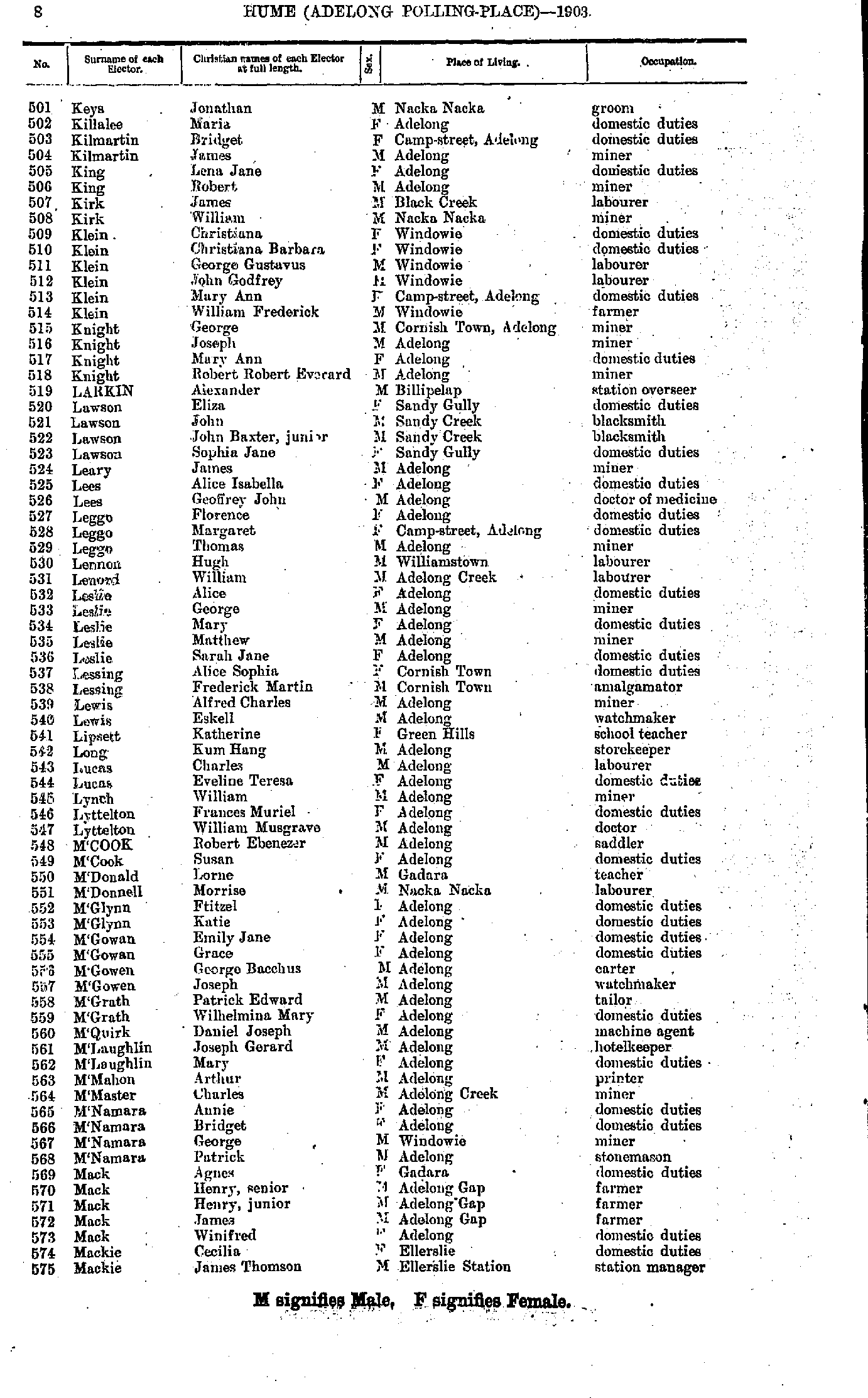
- Keys Jonathan - Mackie James
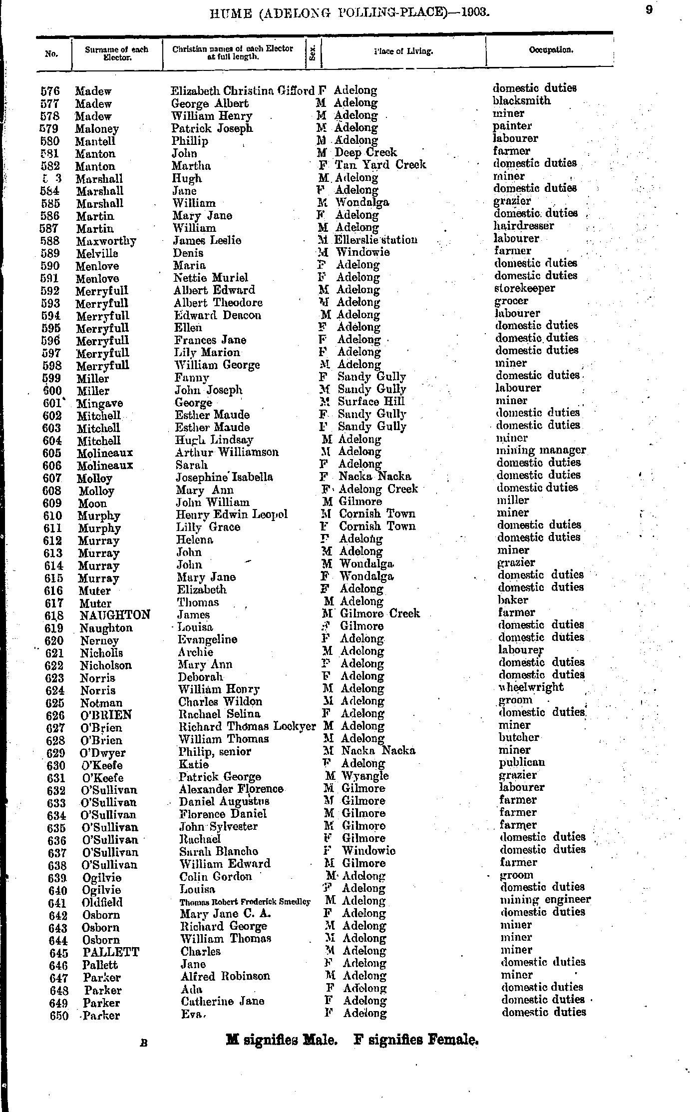
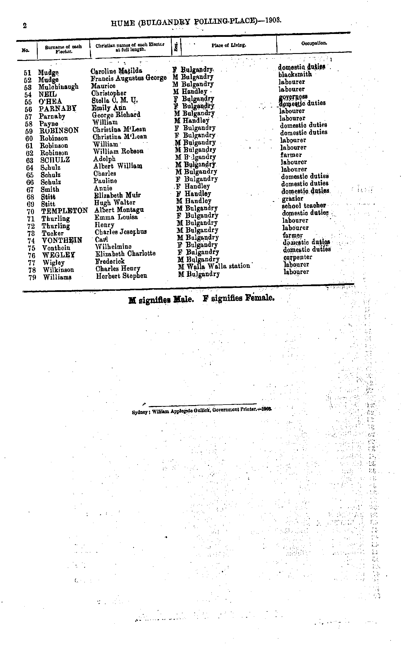
- Madew Elizabeth - Parker Eva.
- Parker John - Prowse Matilda
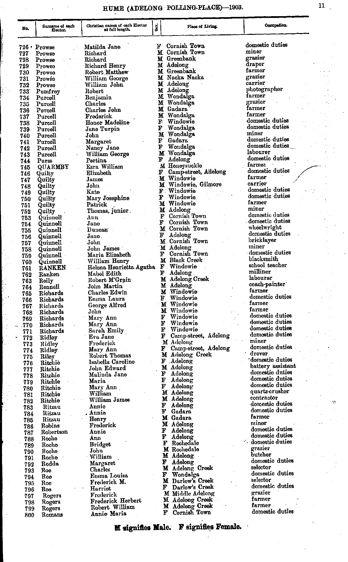
- Prowse Matilda - Romans Annie
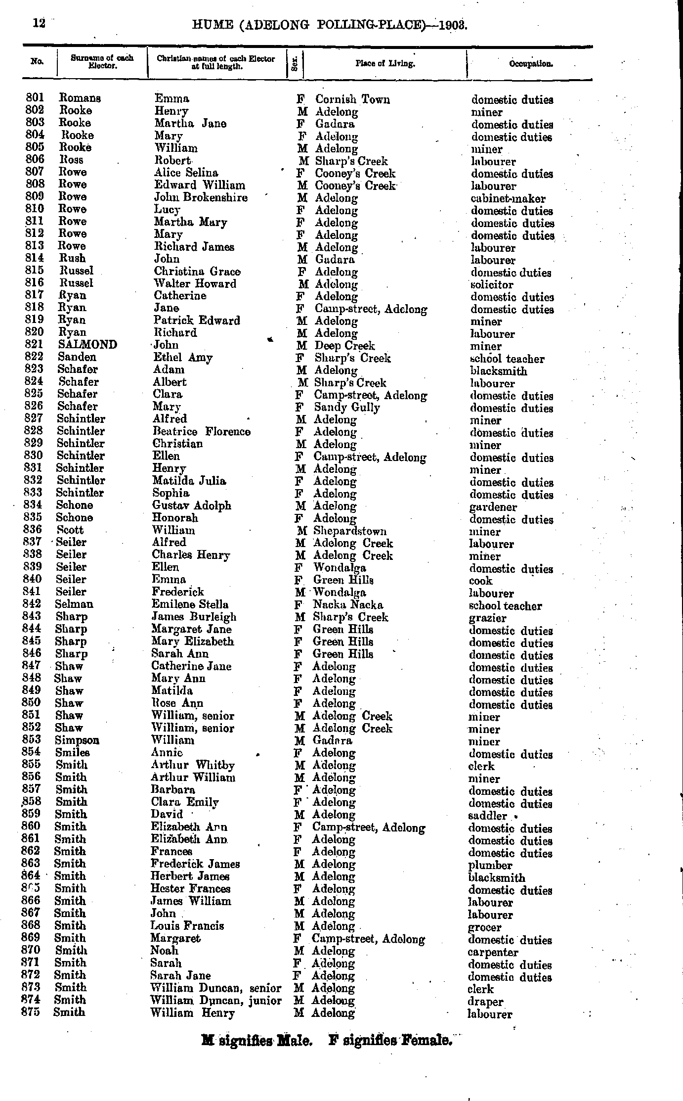
- Romans Emma - Smith William
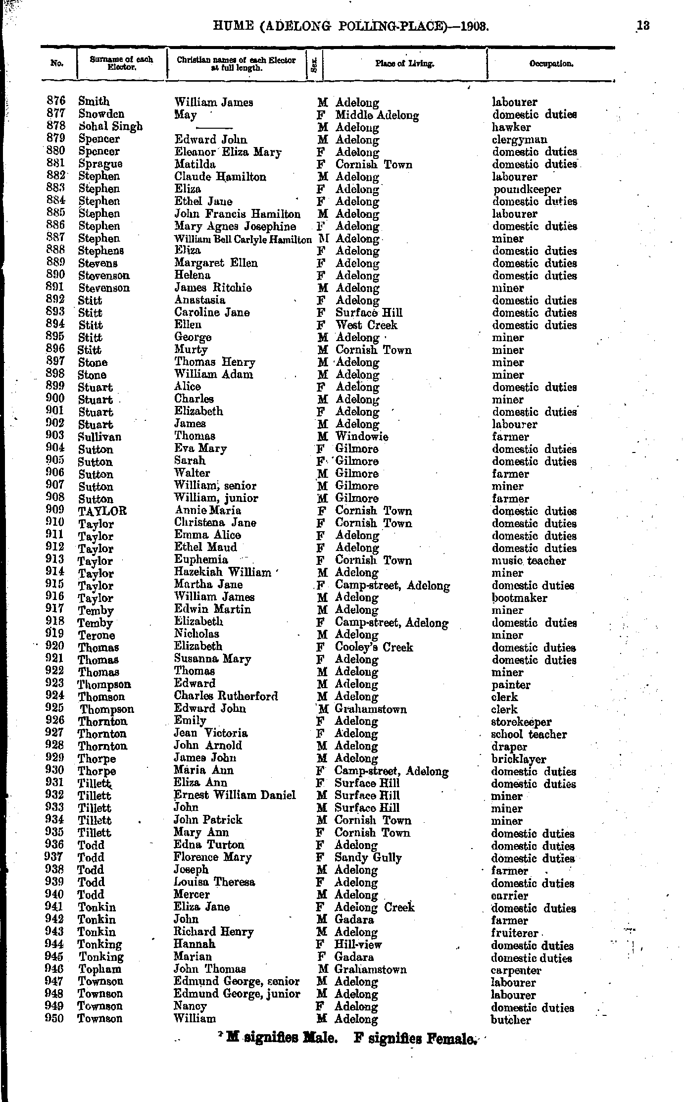
- Smith William - Townson William
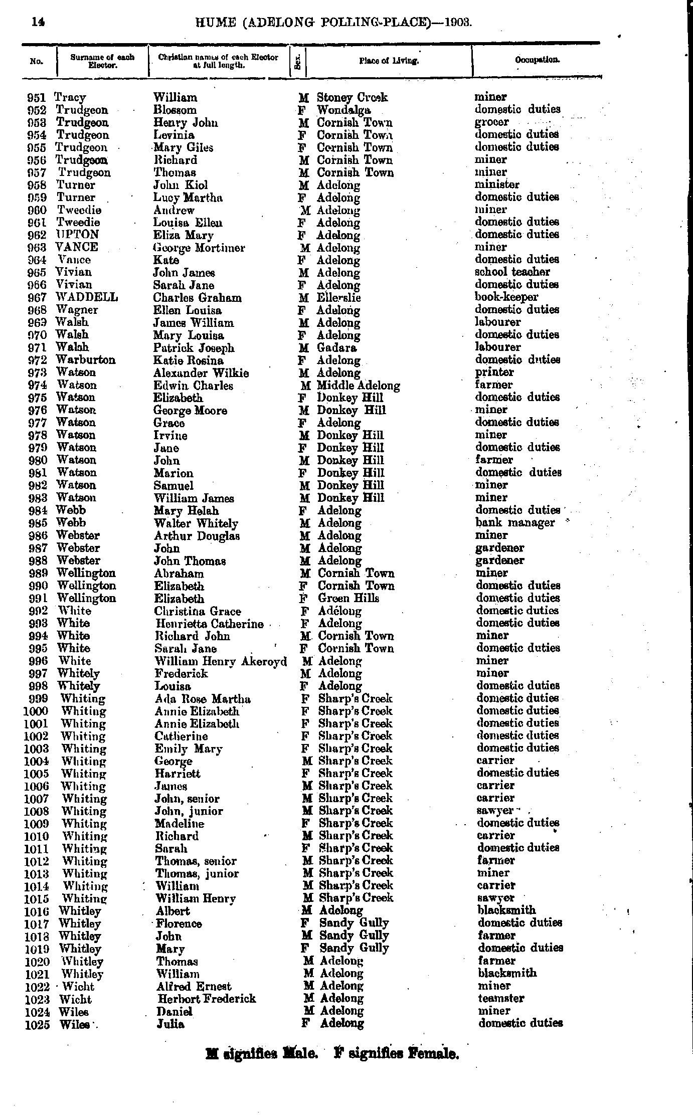
- Tracy William - Wiles Julia
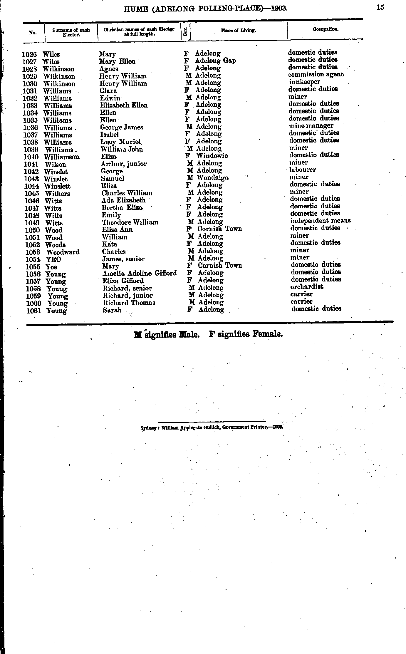
- Wiles Mary - Young Sarah
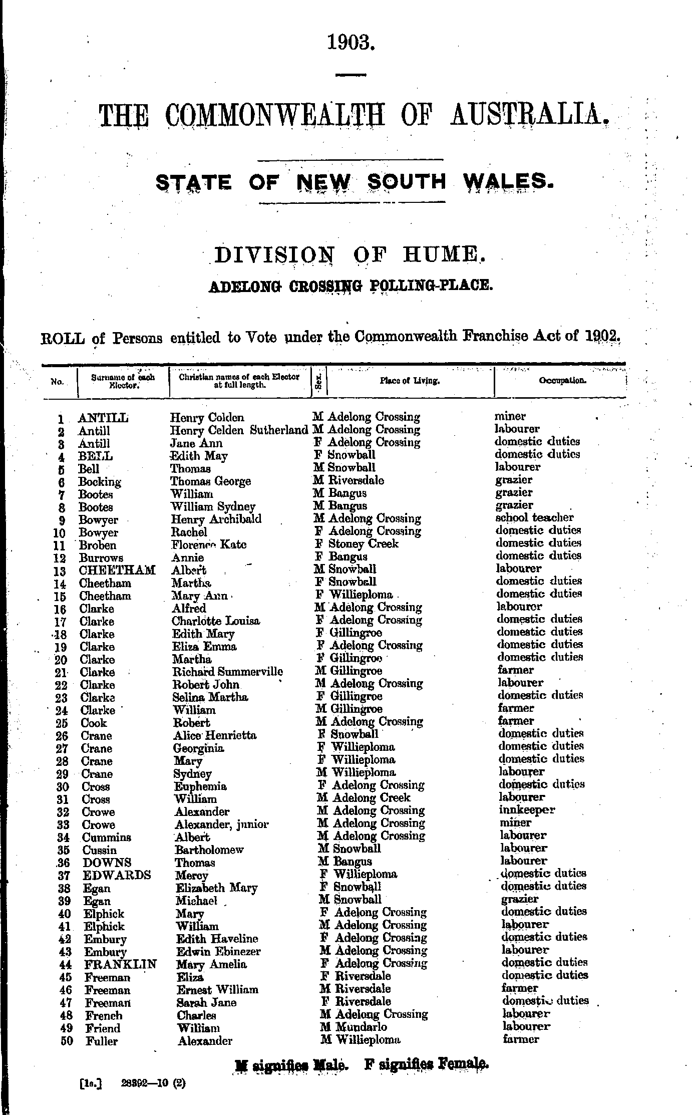
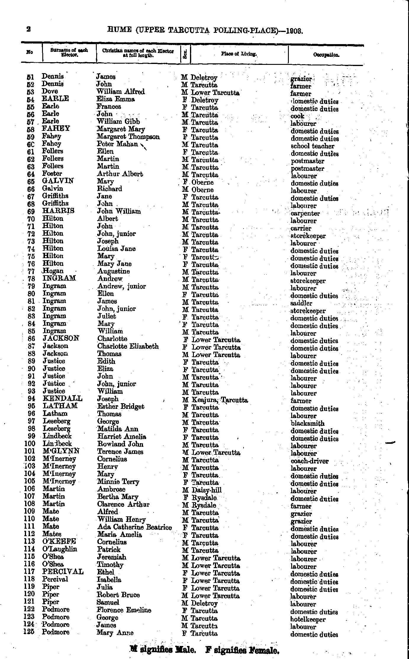
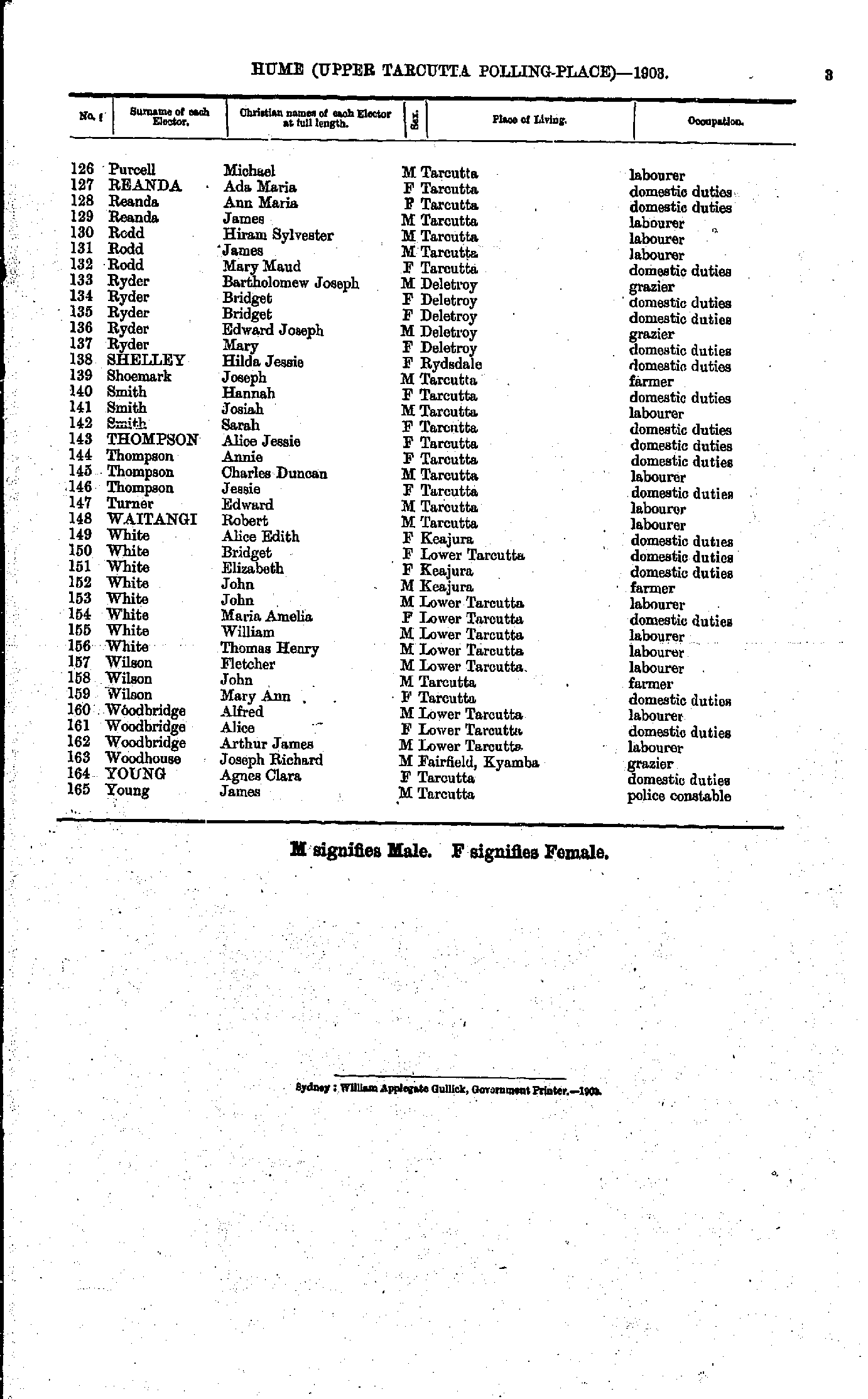
Adelong Crossing Polling Place
- Antill Henry - Fuller Alexander
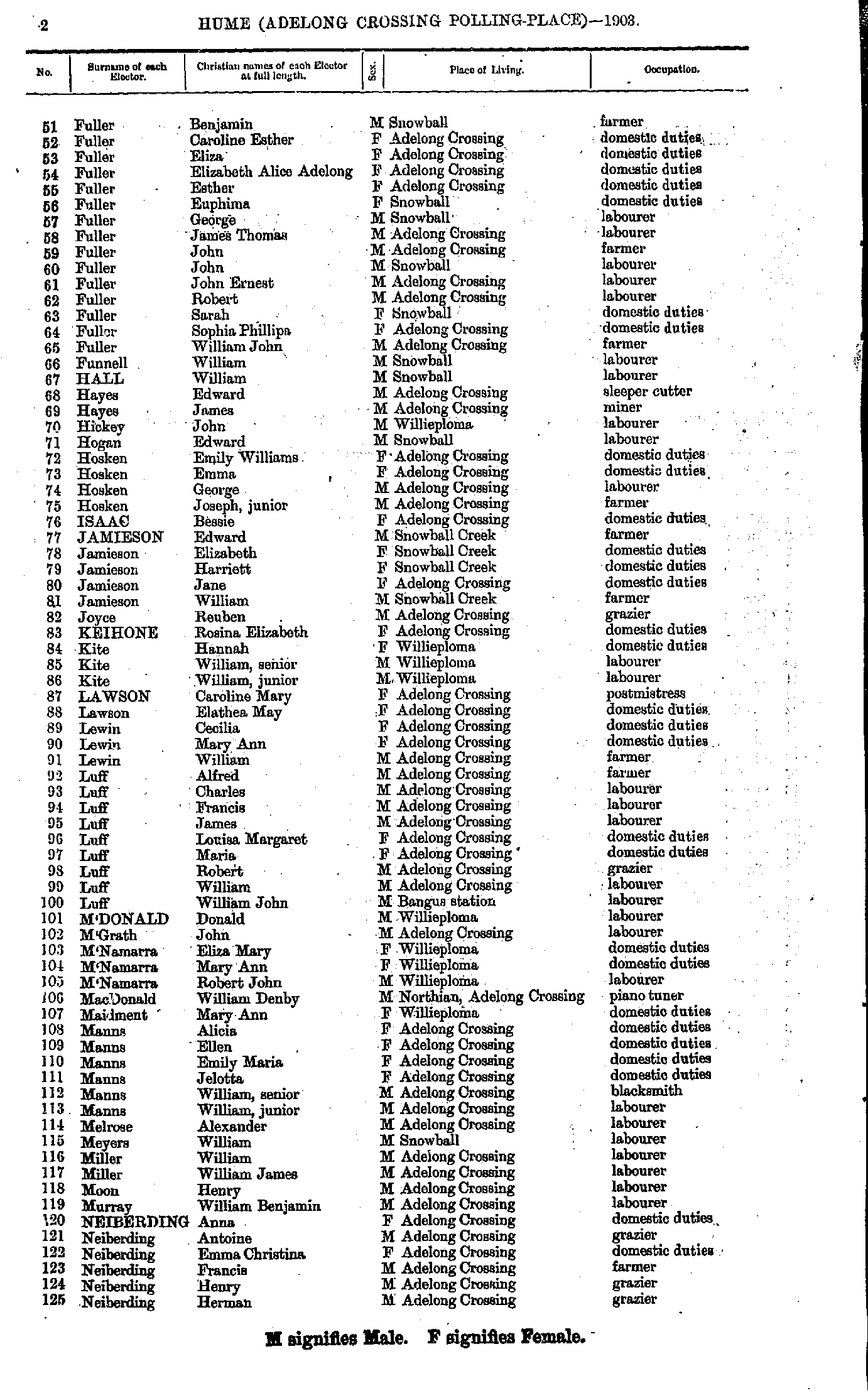
- Fuller Benjamin - Neiberding Herman
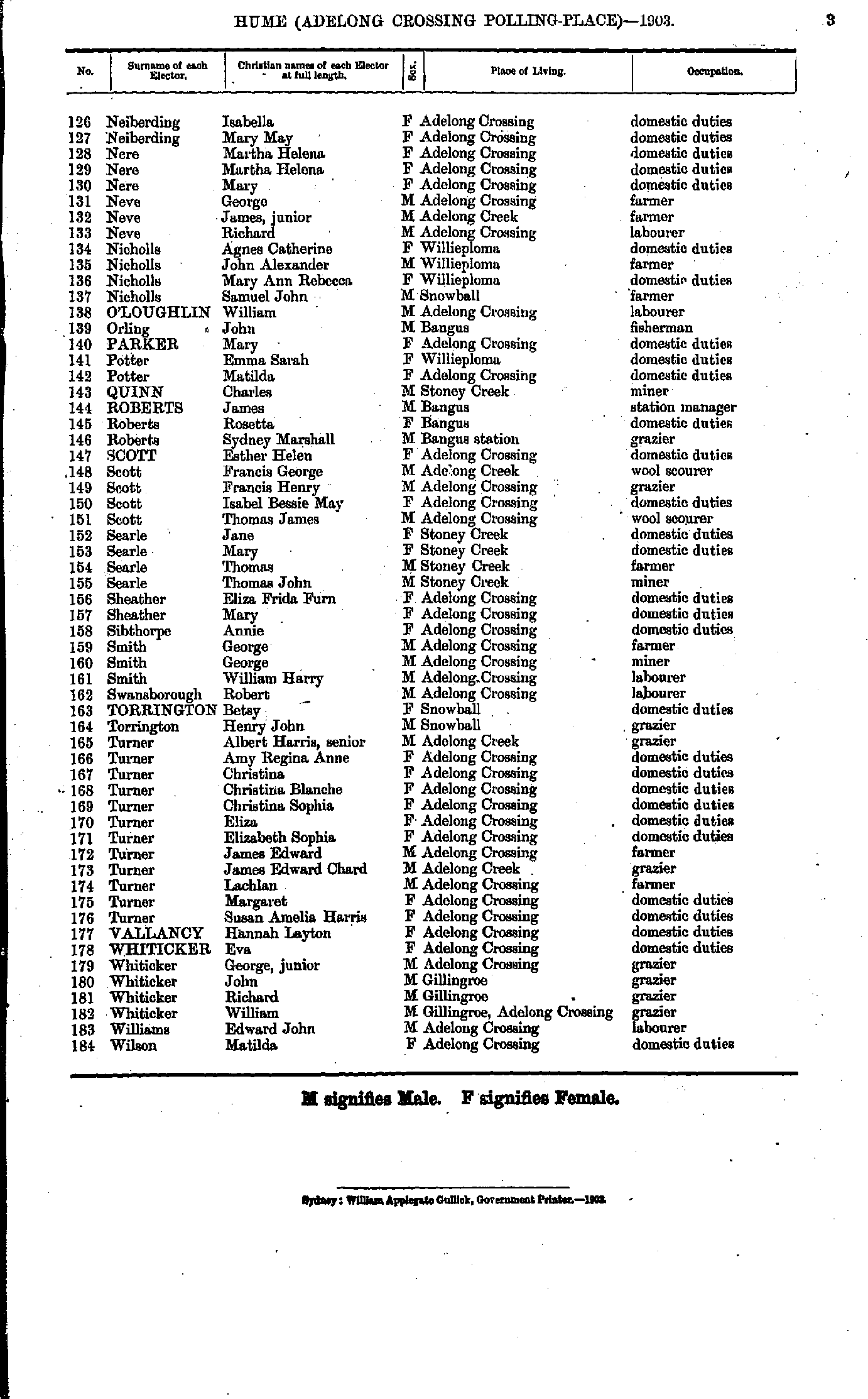
- Neiberding Isabella - Wilson Matilda
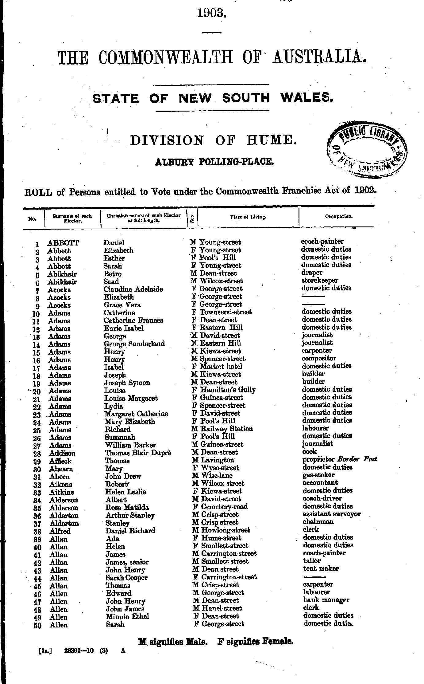
- Abbott Daniel - Allen Sarah
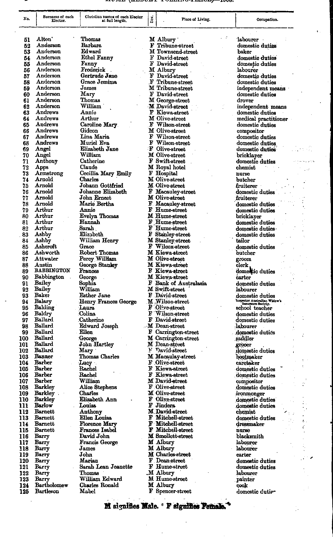
- Alton Thomas - Bartleson Mabel
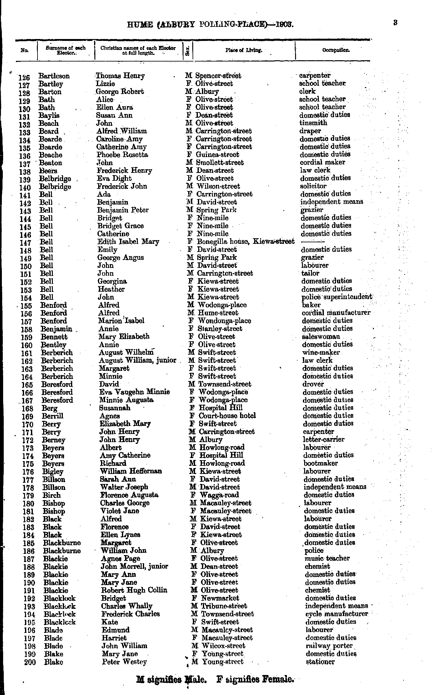
- Bartleson Thomas - Blake Peter
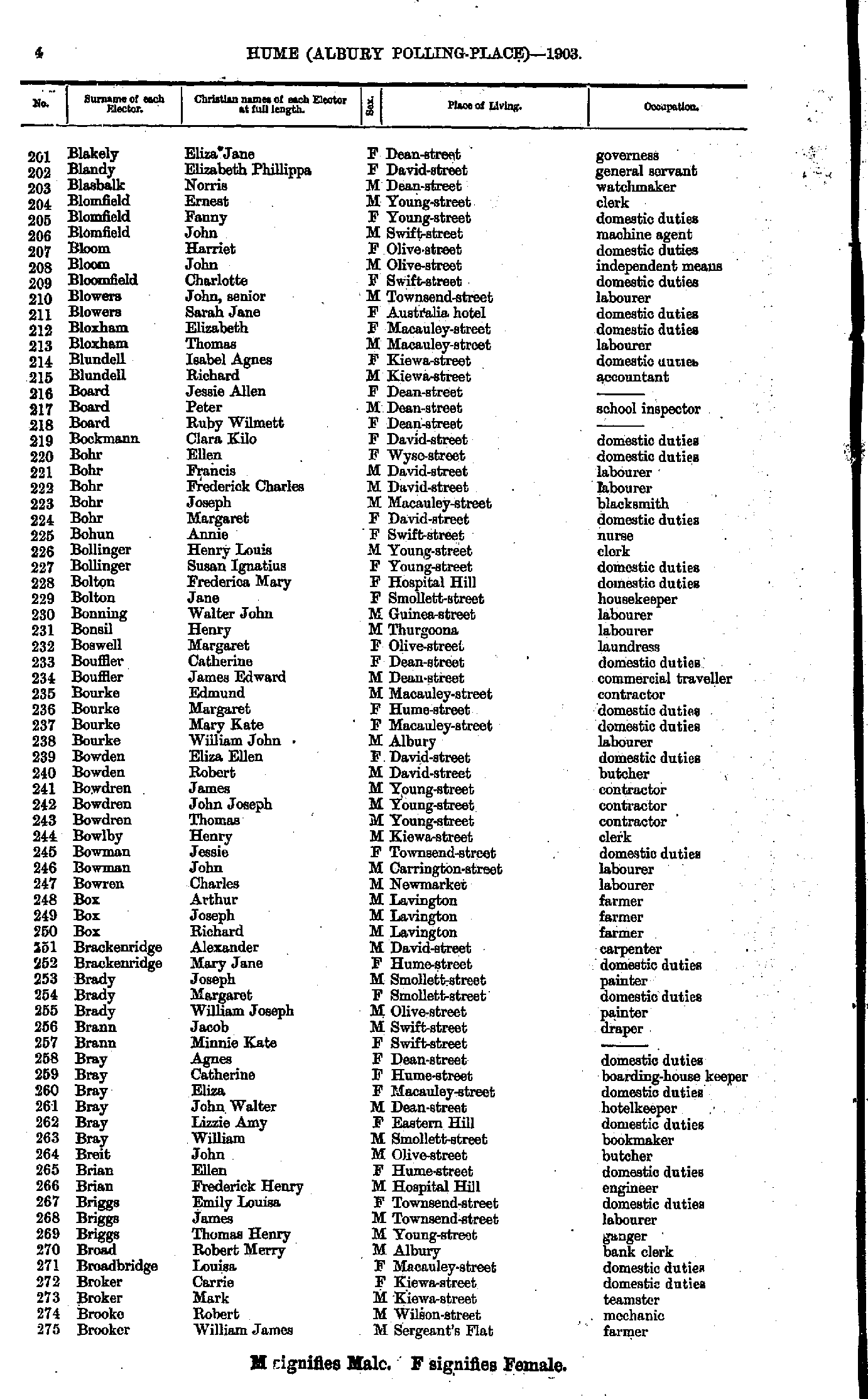
- Blakely Eliza - Brooker William
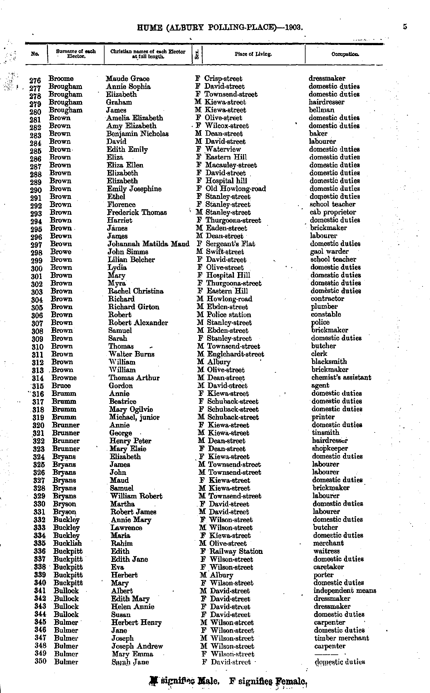
- Broome Maude - Bulmer Sarah
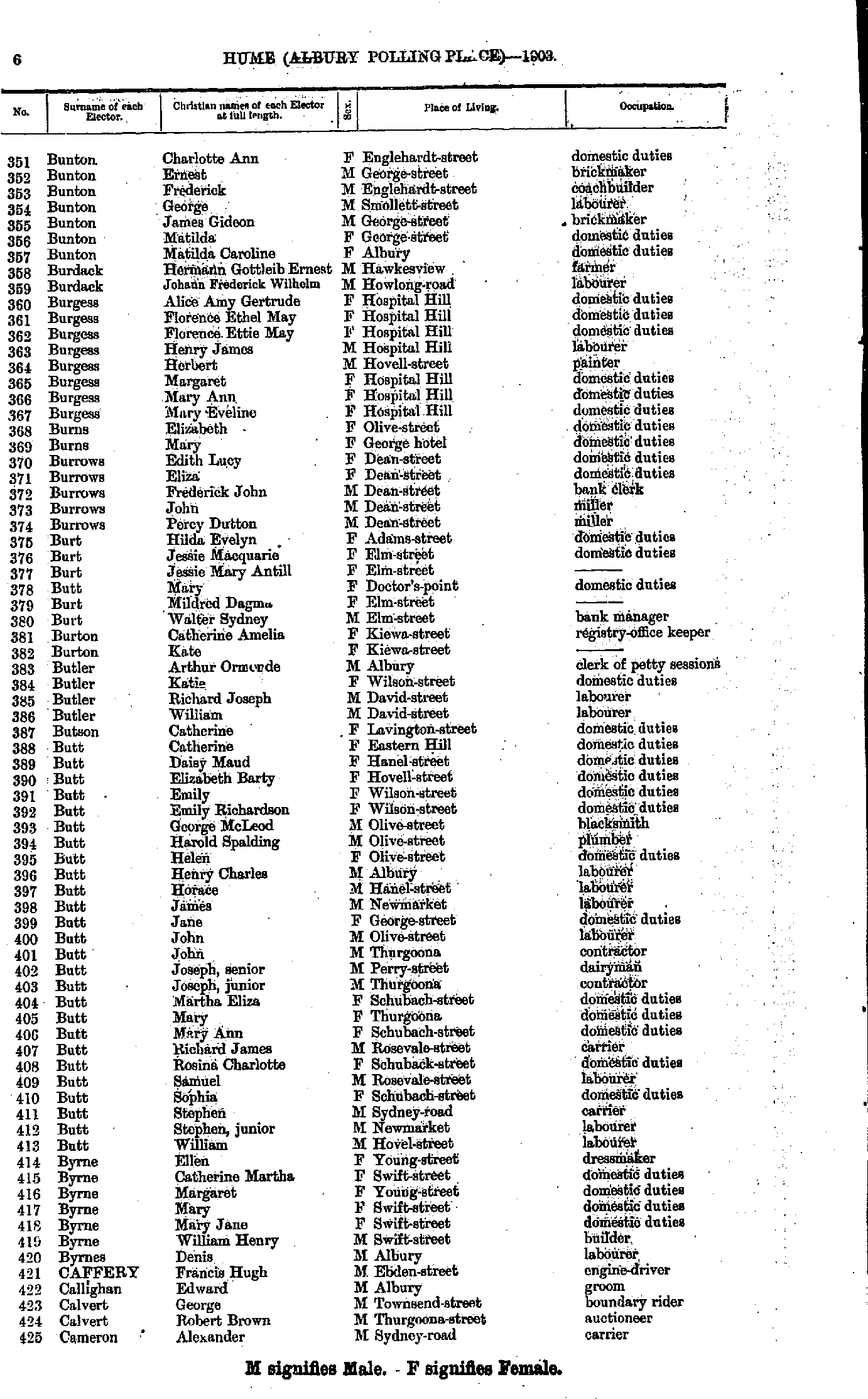
- Bunton Charlotte - Cameron Alexander
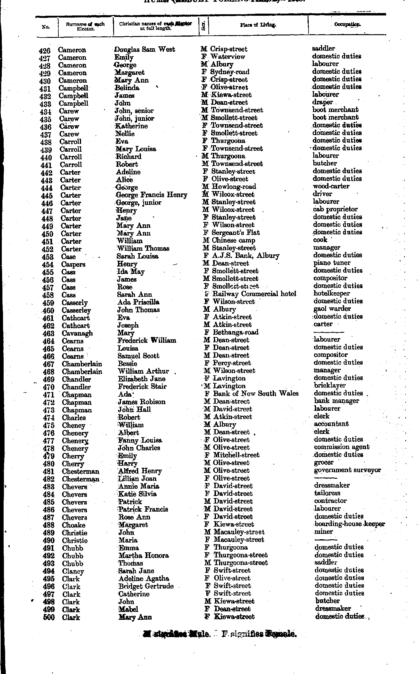
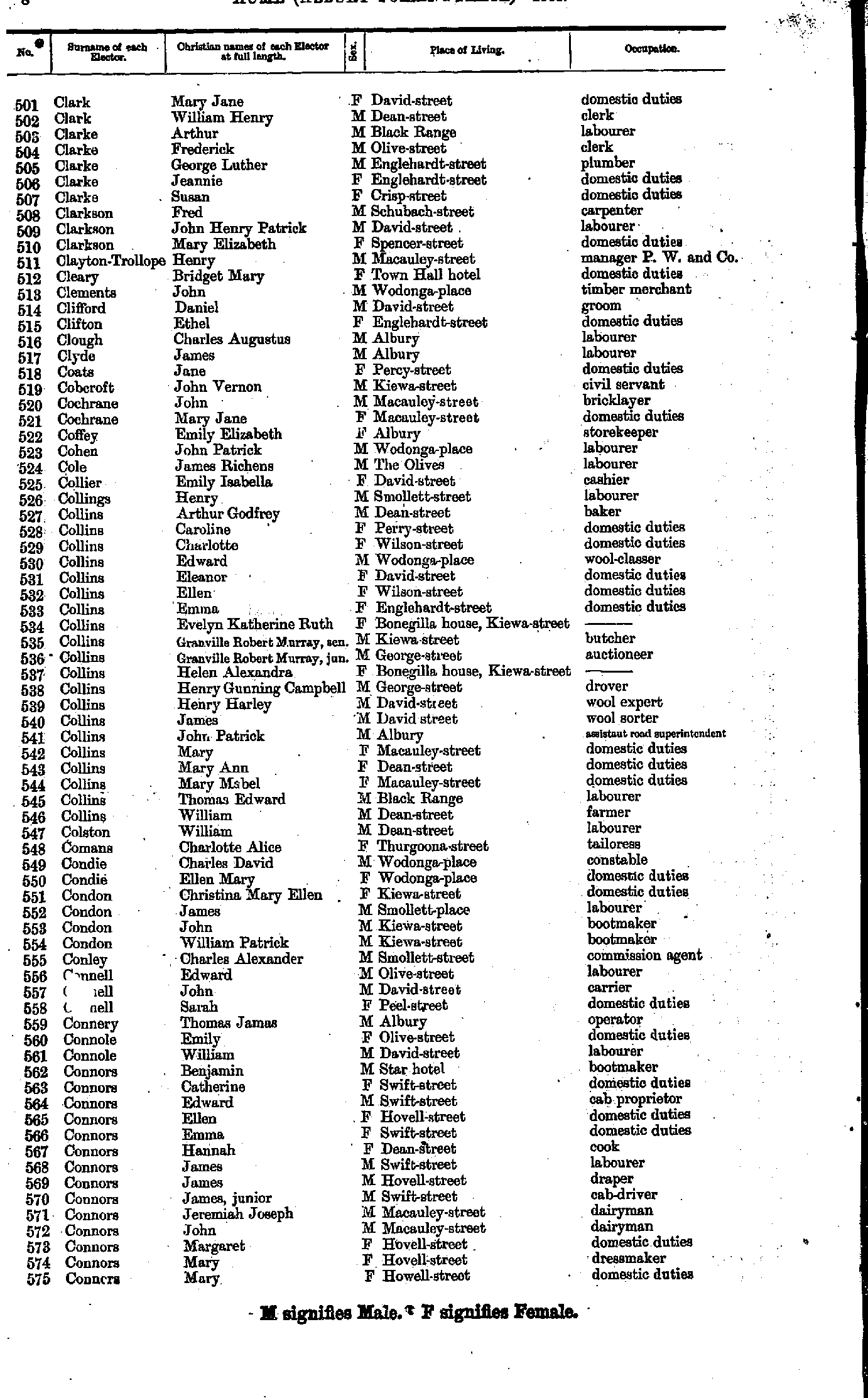
- Cameron Douglas - Clark Mary
- Clark Mary - Conners Mary
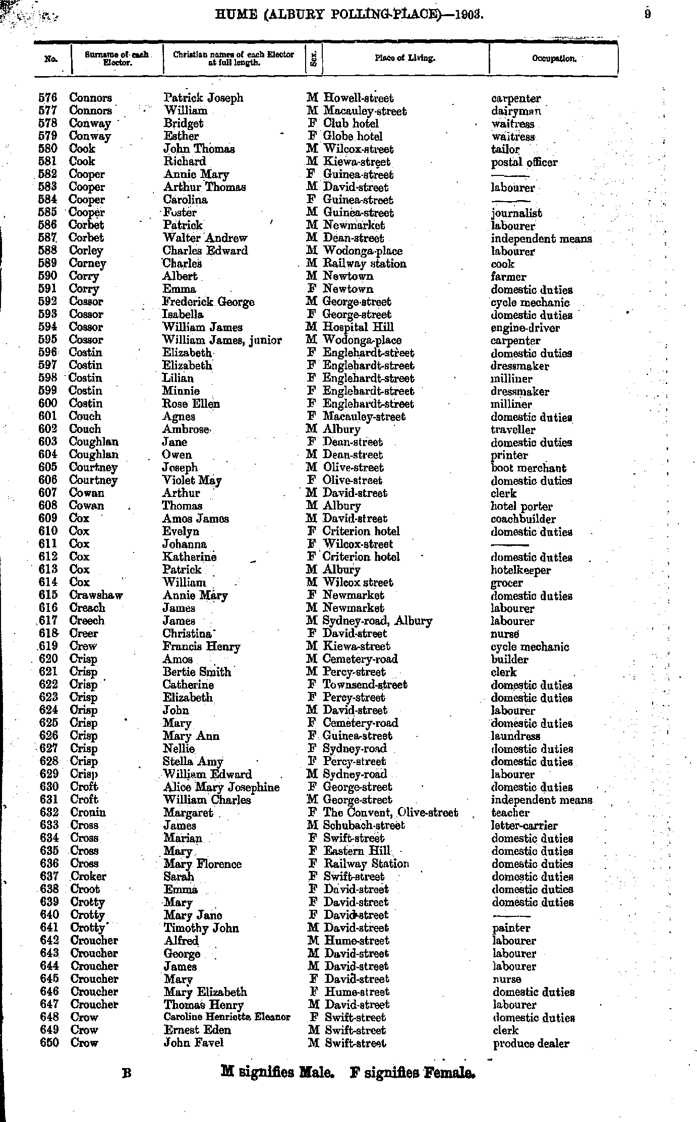
- Connors Patrick - Crow John
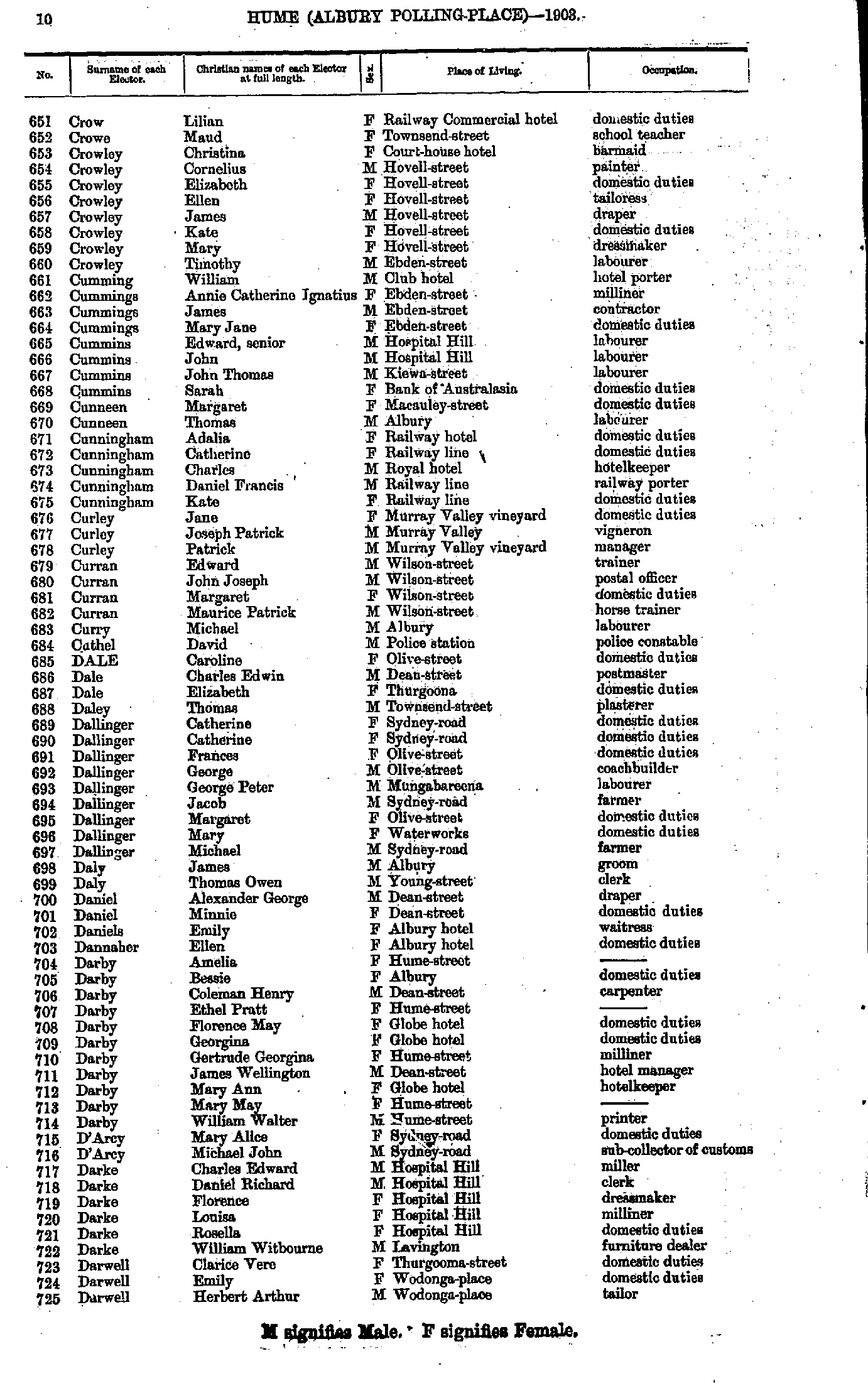
- Crow Lilian - Darwell Herbert
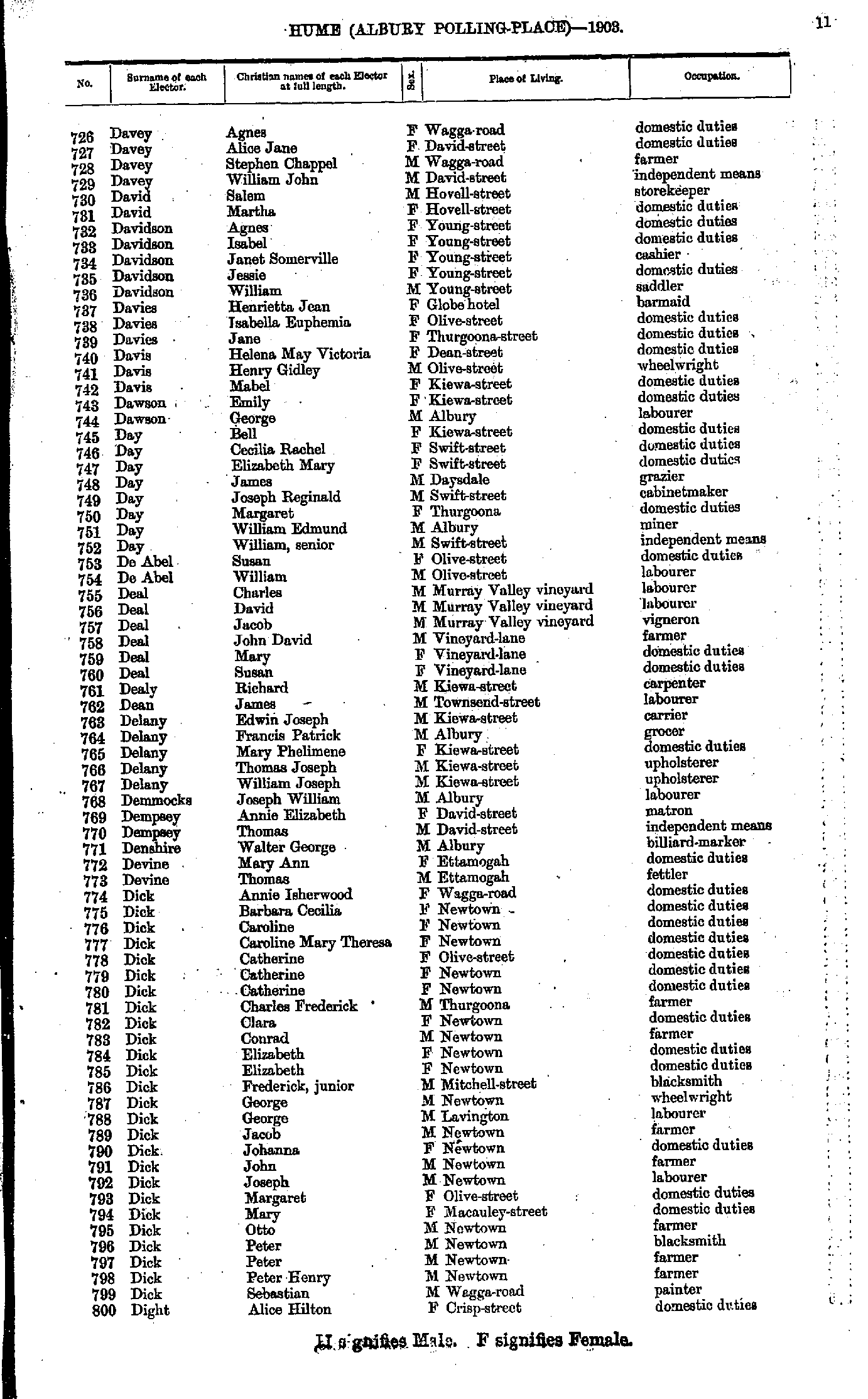
- Davey Agnes - Dight Alice
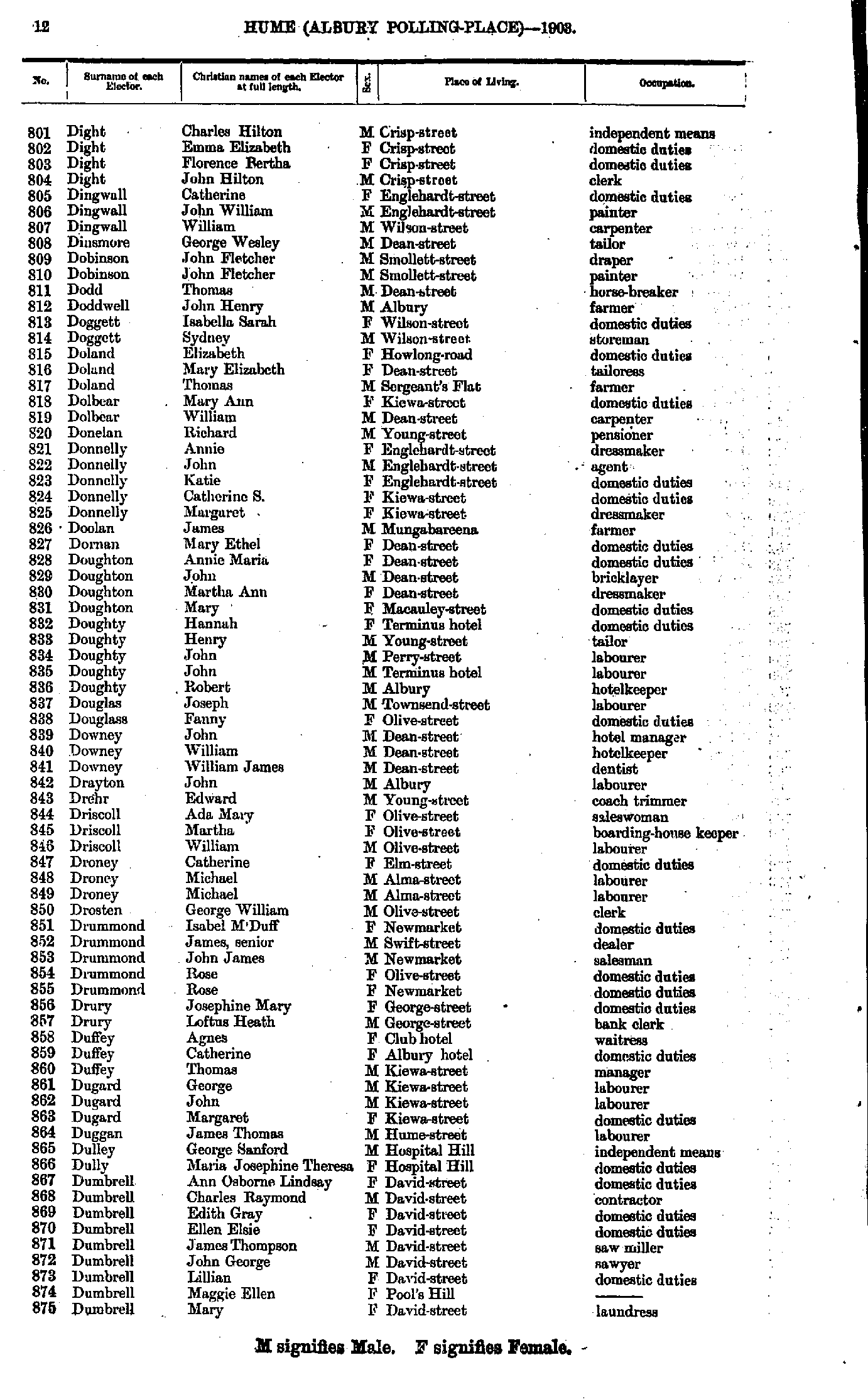
- Dight Charles - Dumbrell Mary
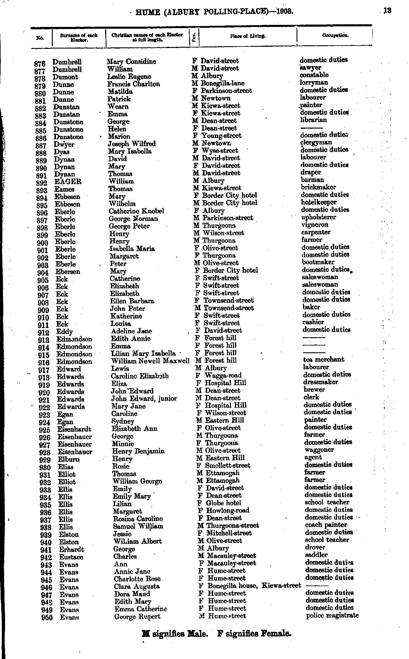
- Dumbrell Mary - Evans George
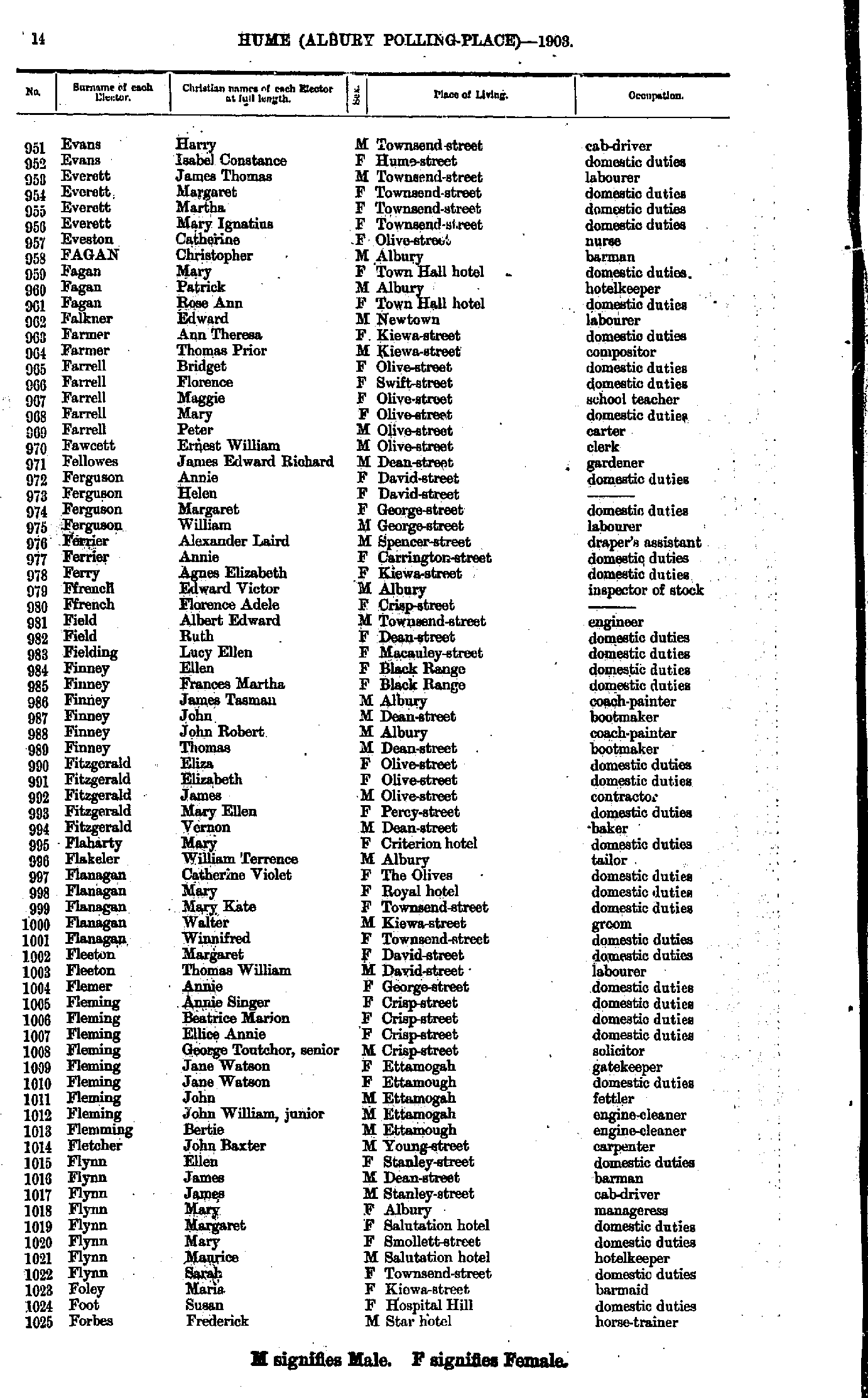
- Evans Harry - Forbes Frederick
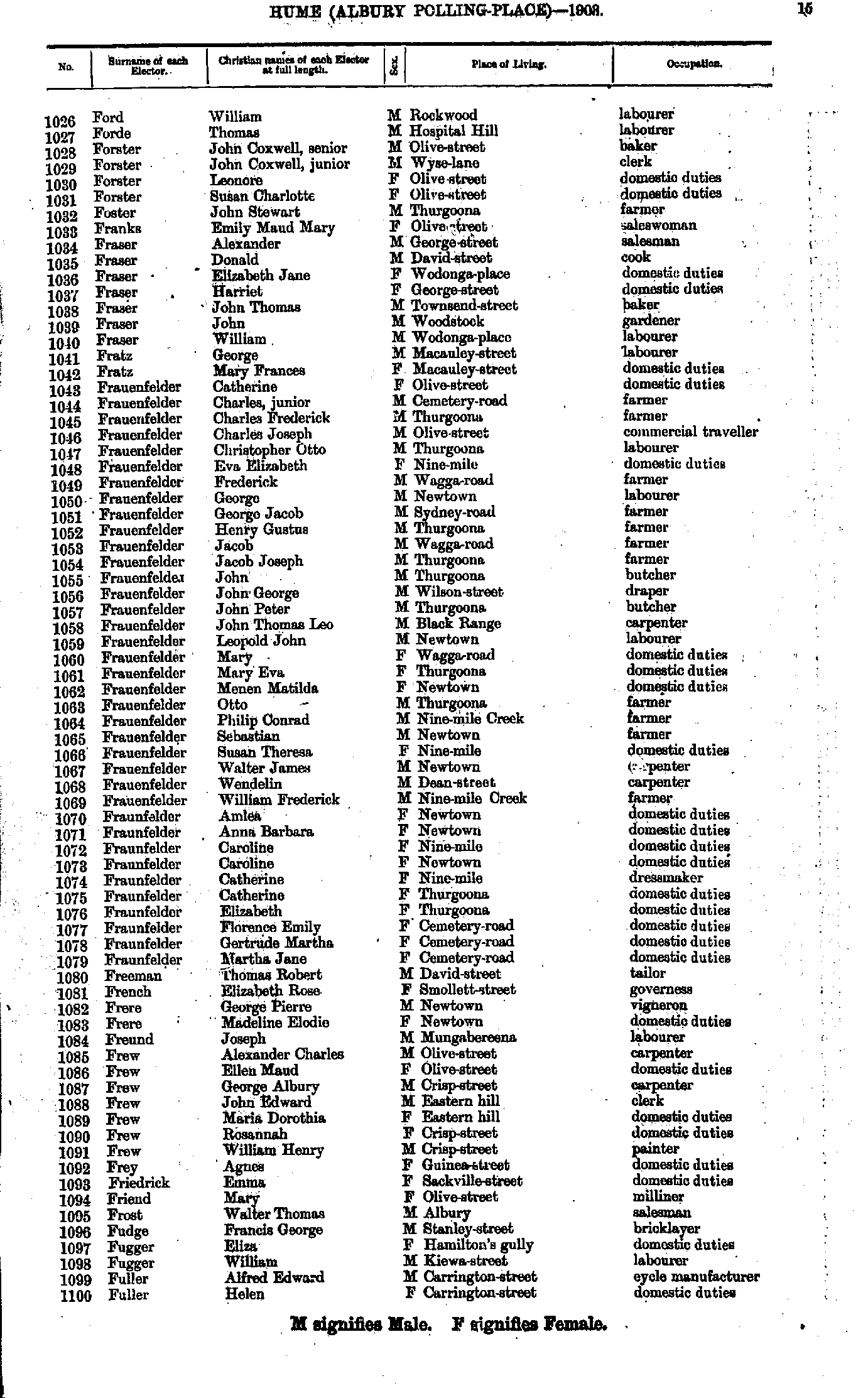
- Ford William - Fuller Helen
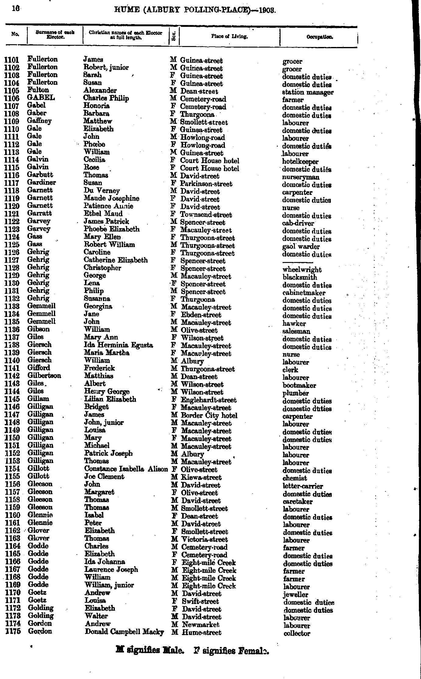
- Fullerton James - Gordon Donald
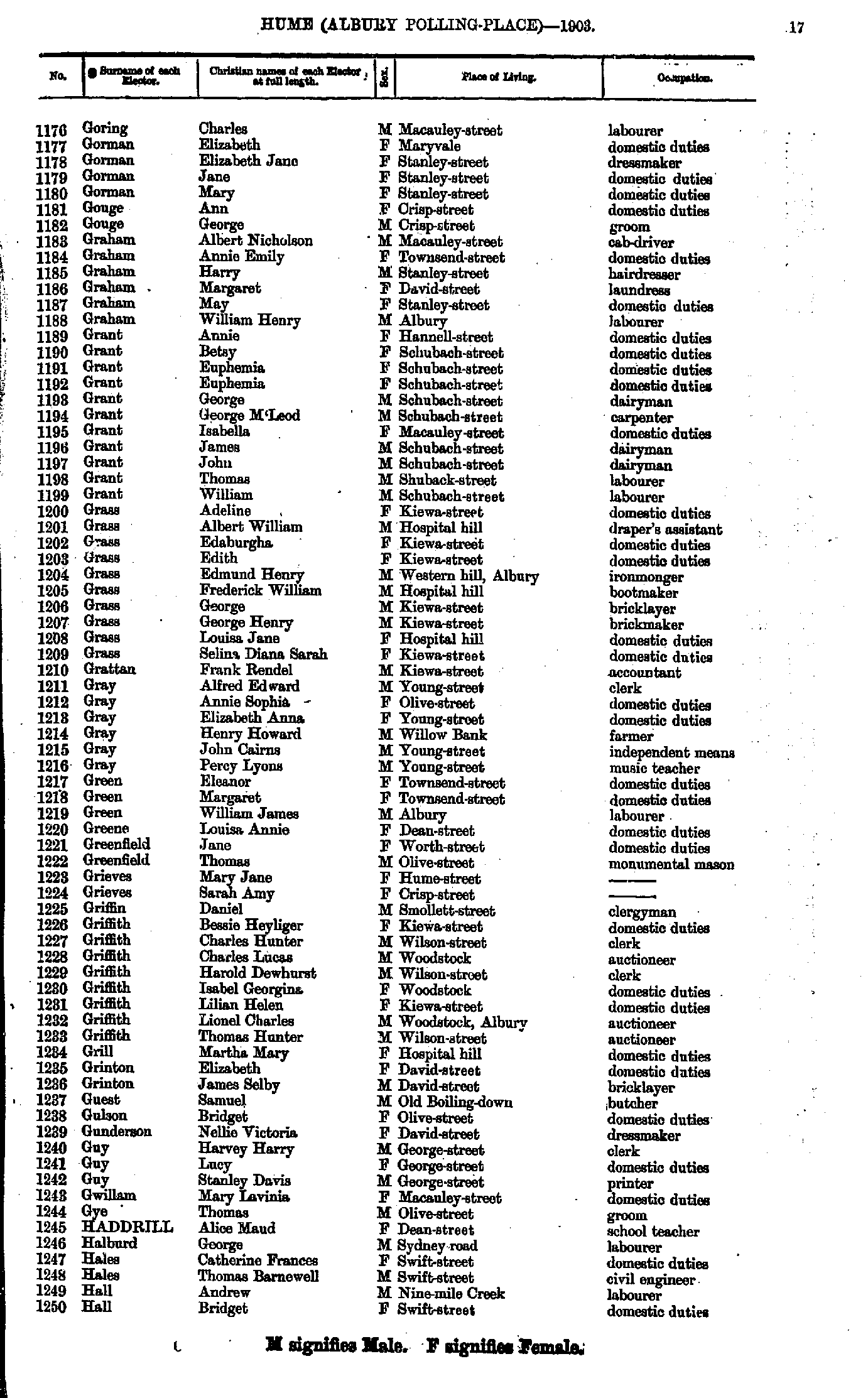
- Goring Charles - Hall Bridget
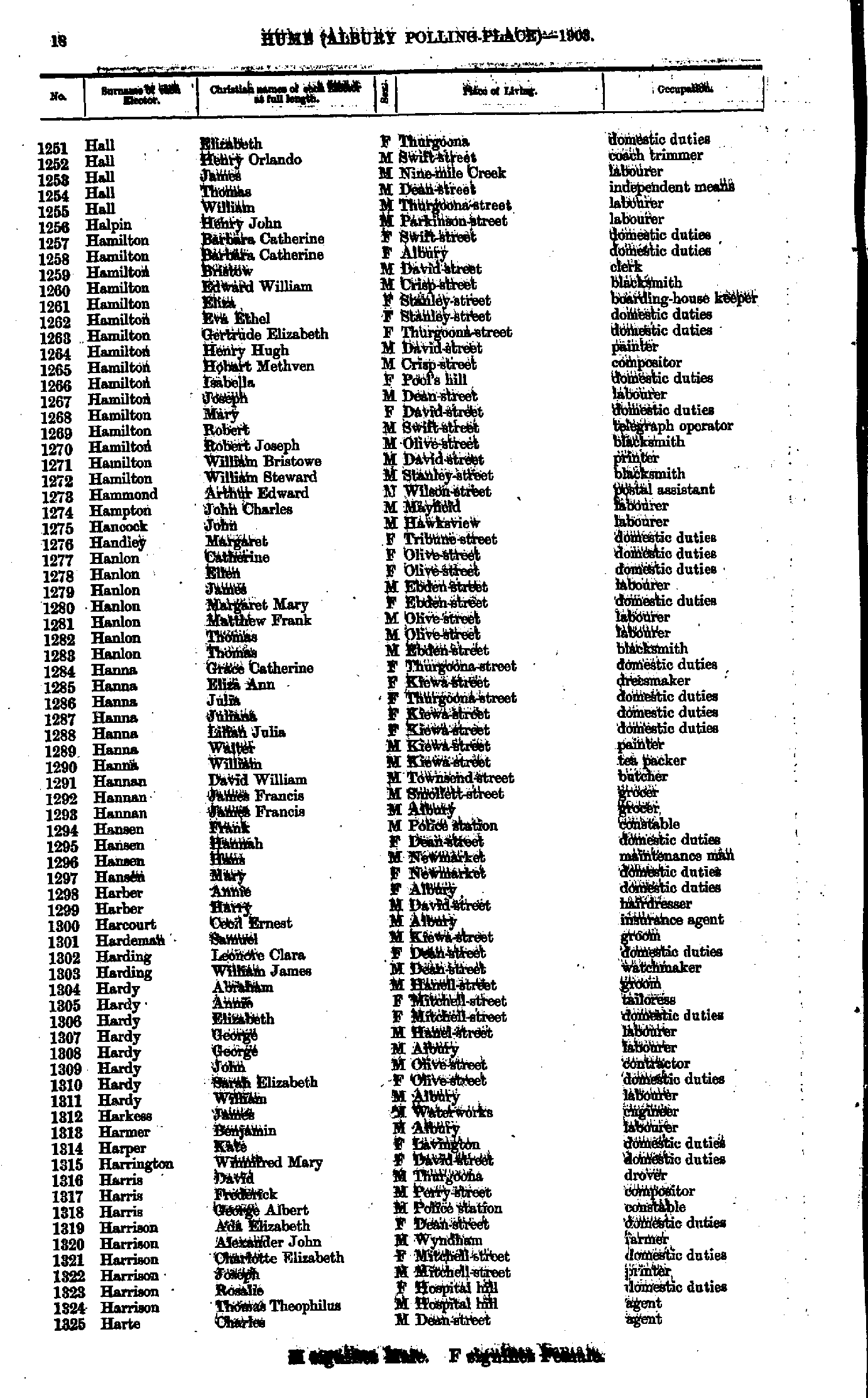
- Hall Elizabeth - Harte Charles
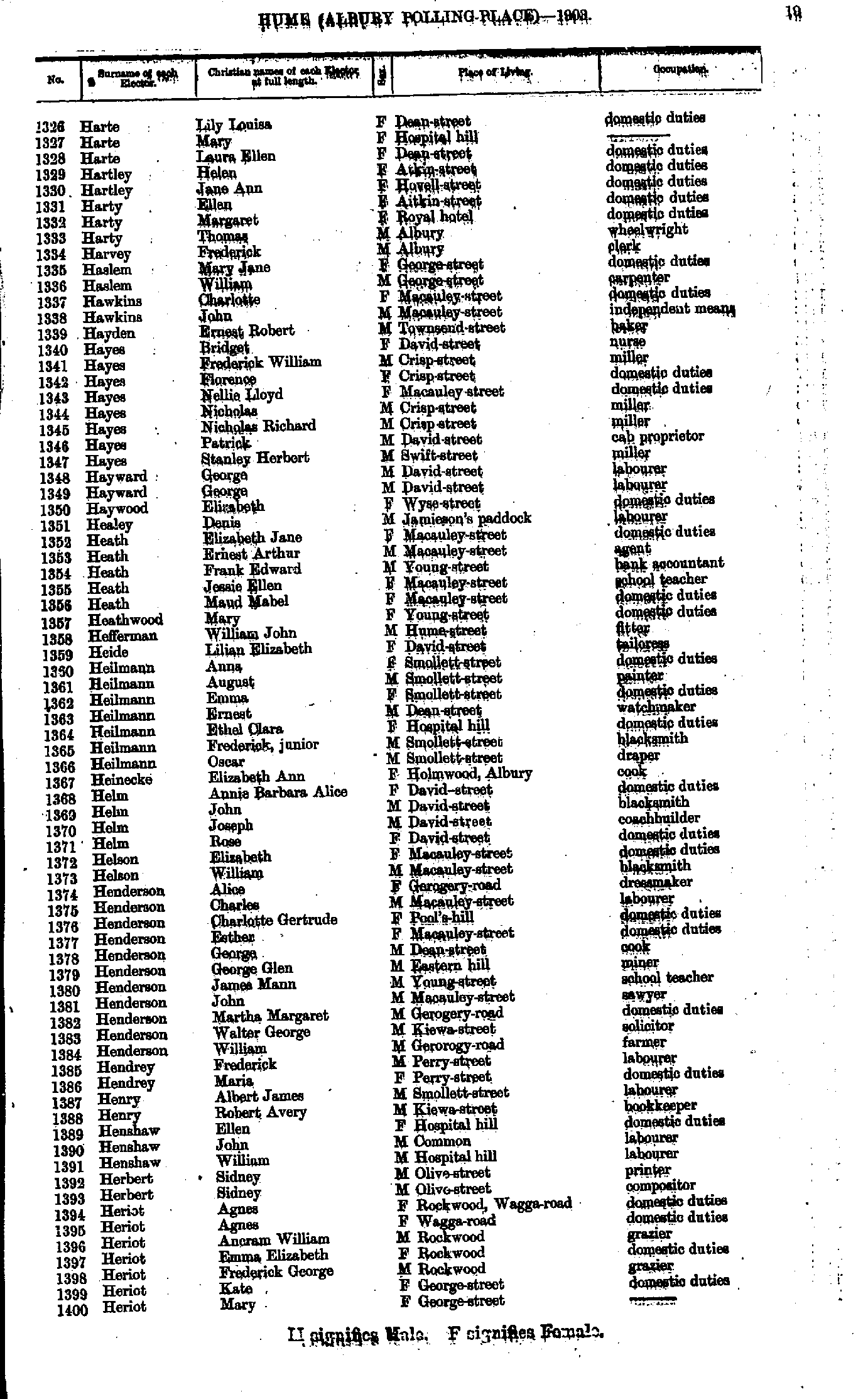
- Harte Lily - Heriot Mary
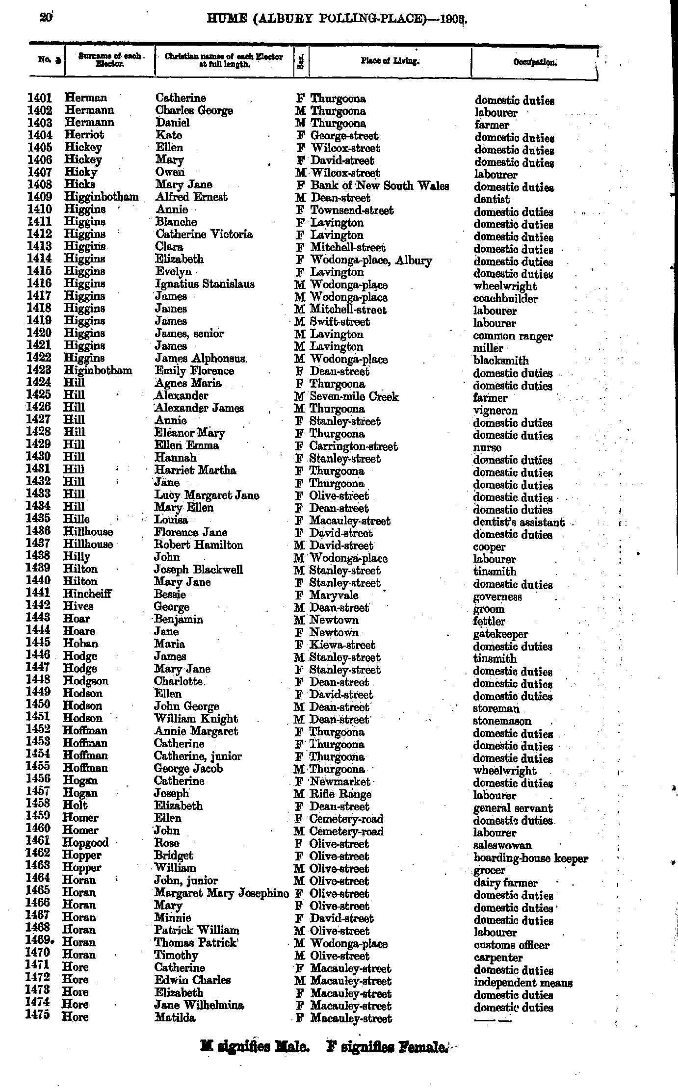
- Herman Catherine - Hore Matilda
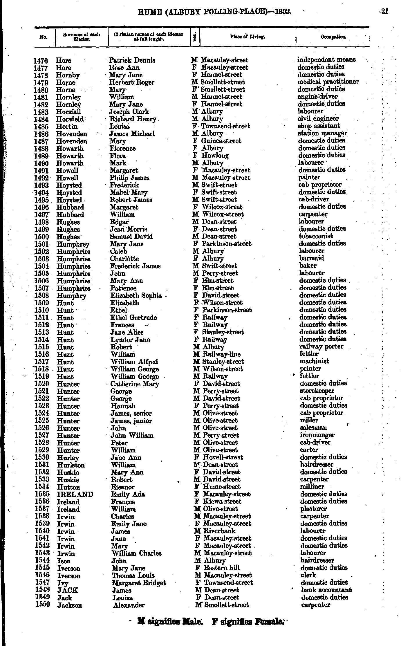
- Hore Patrick - Jackson Alexander
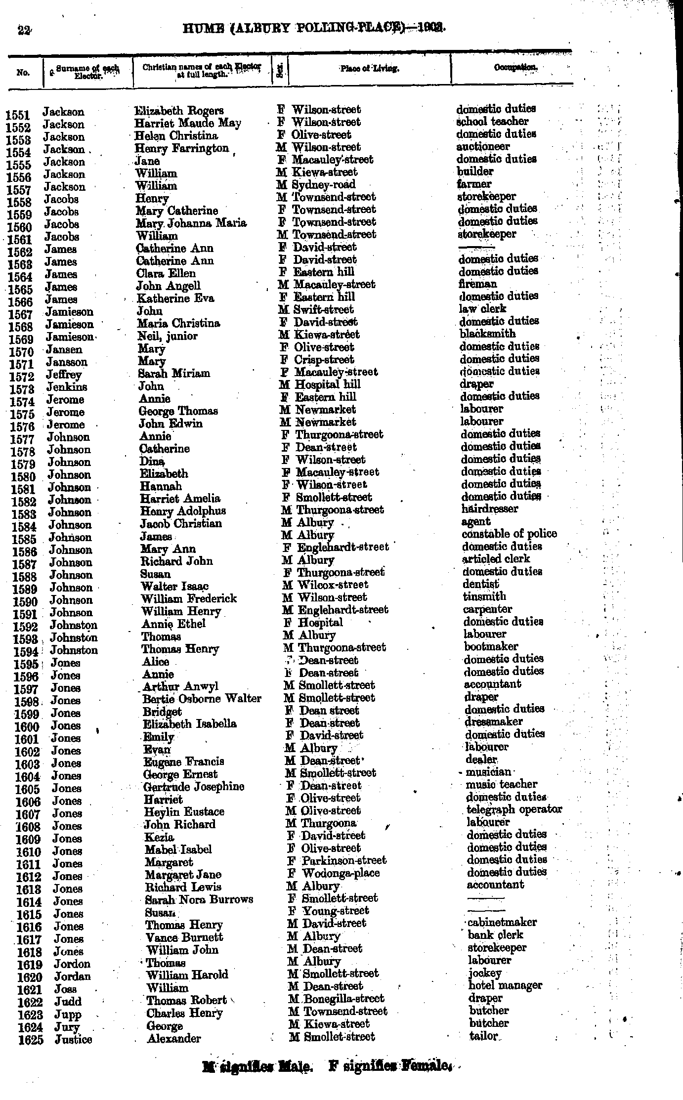
- Jackson Elizabeth - Justice Alexander
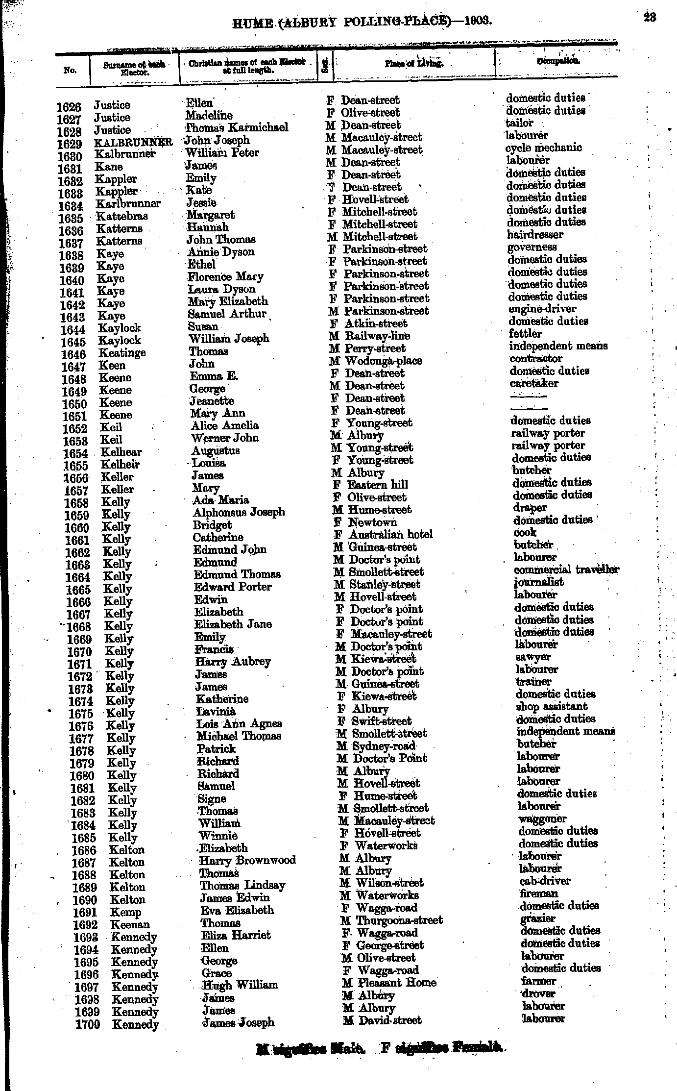
- Justice Ellen - Kennedy James
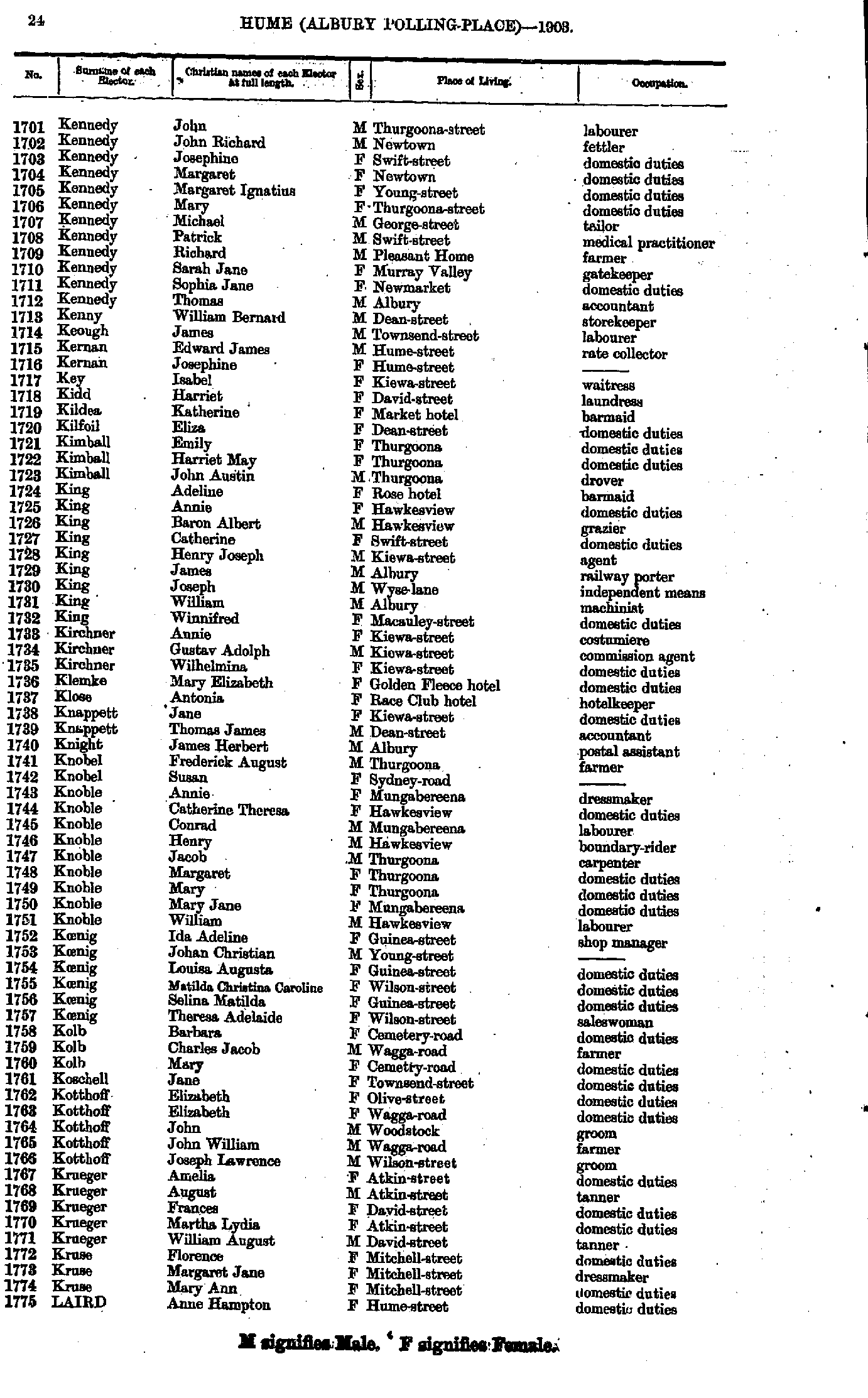
- Kennedy John - Laird Anne
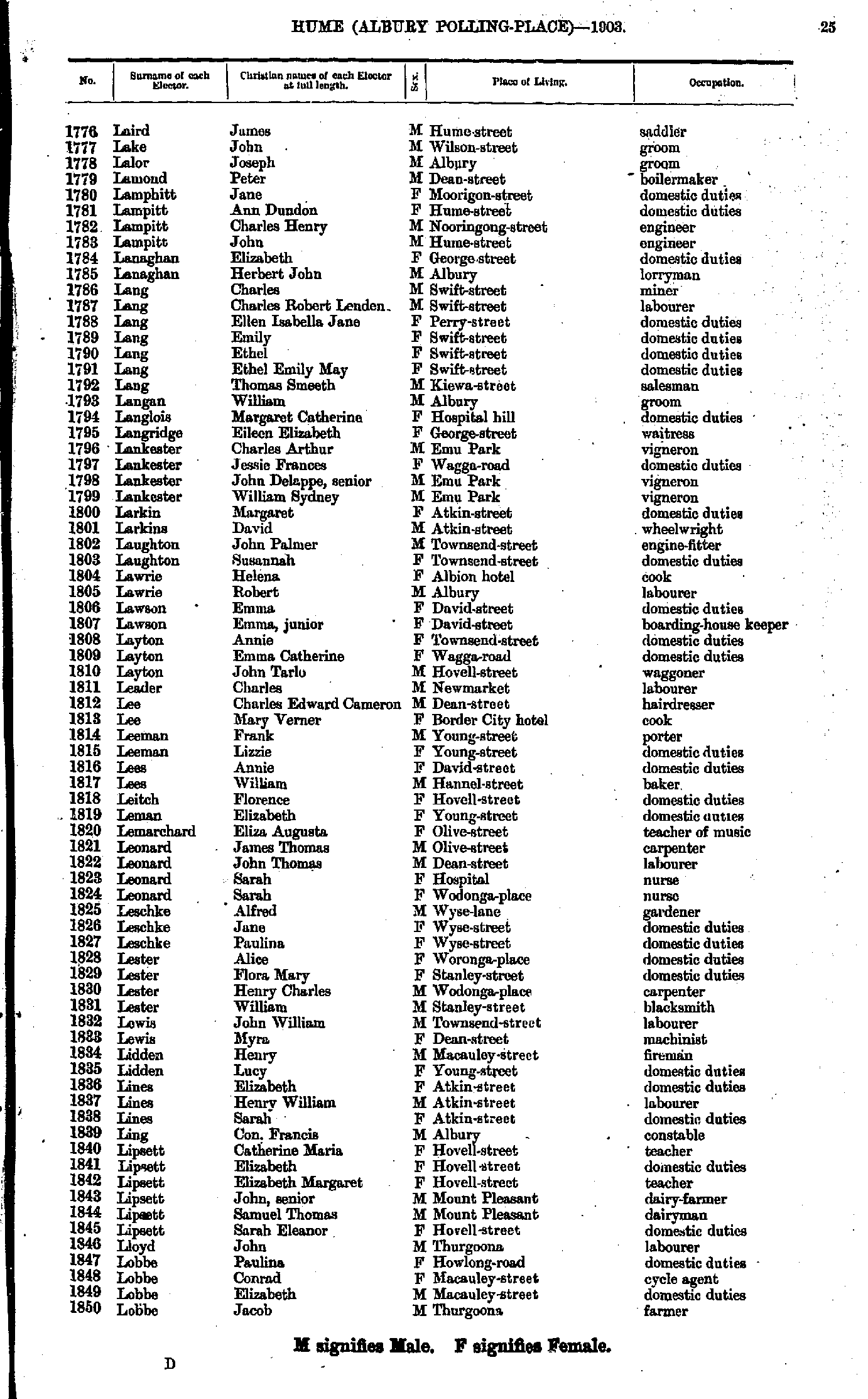
- Laird James - Lobbe Jacob
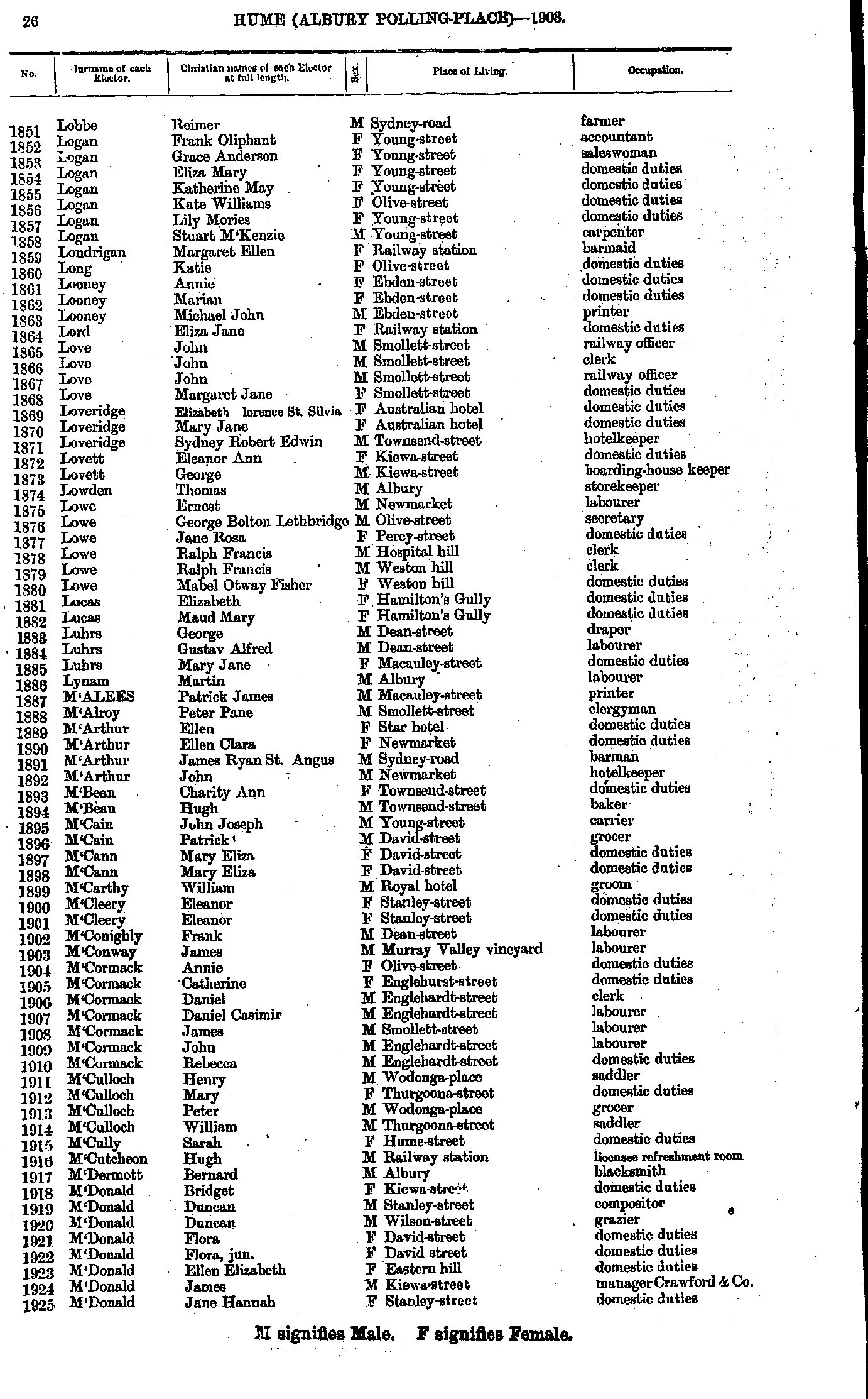
- Lobbe Reimer - M'Donald Jane
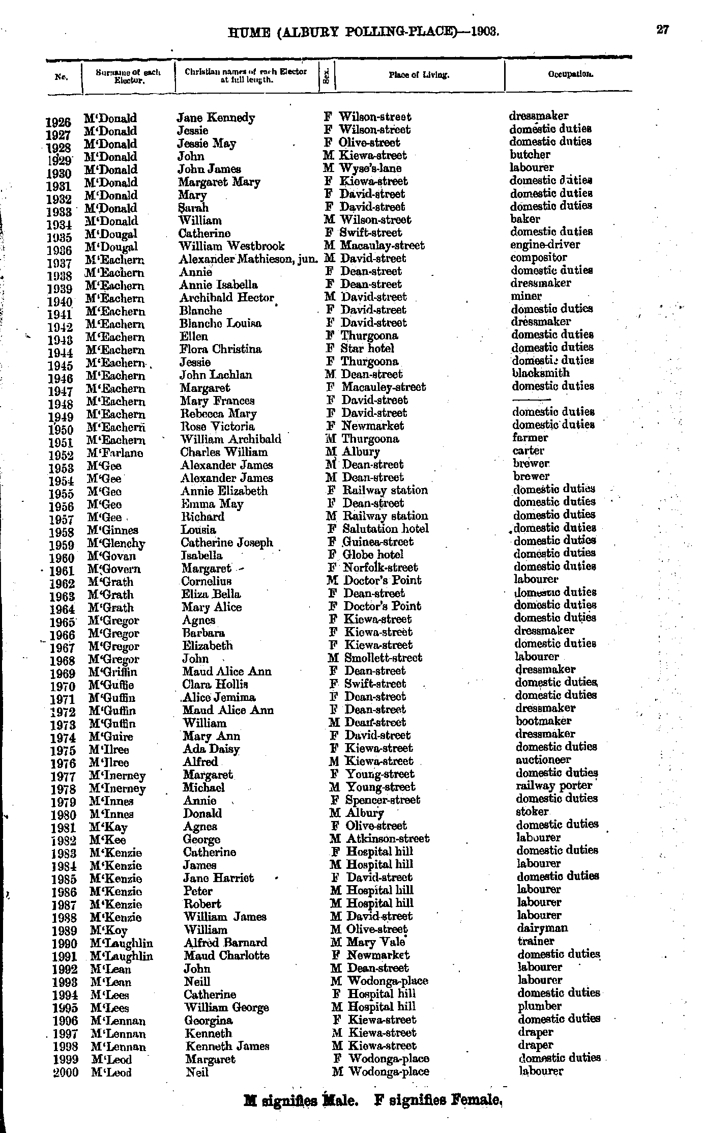
- M'Donald Jane - M'Leod Neil
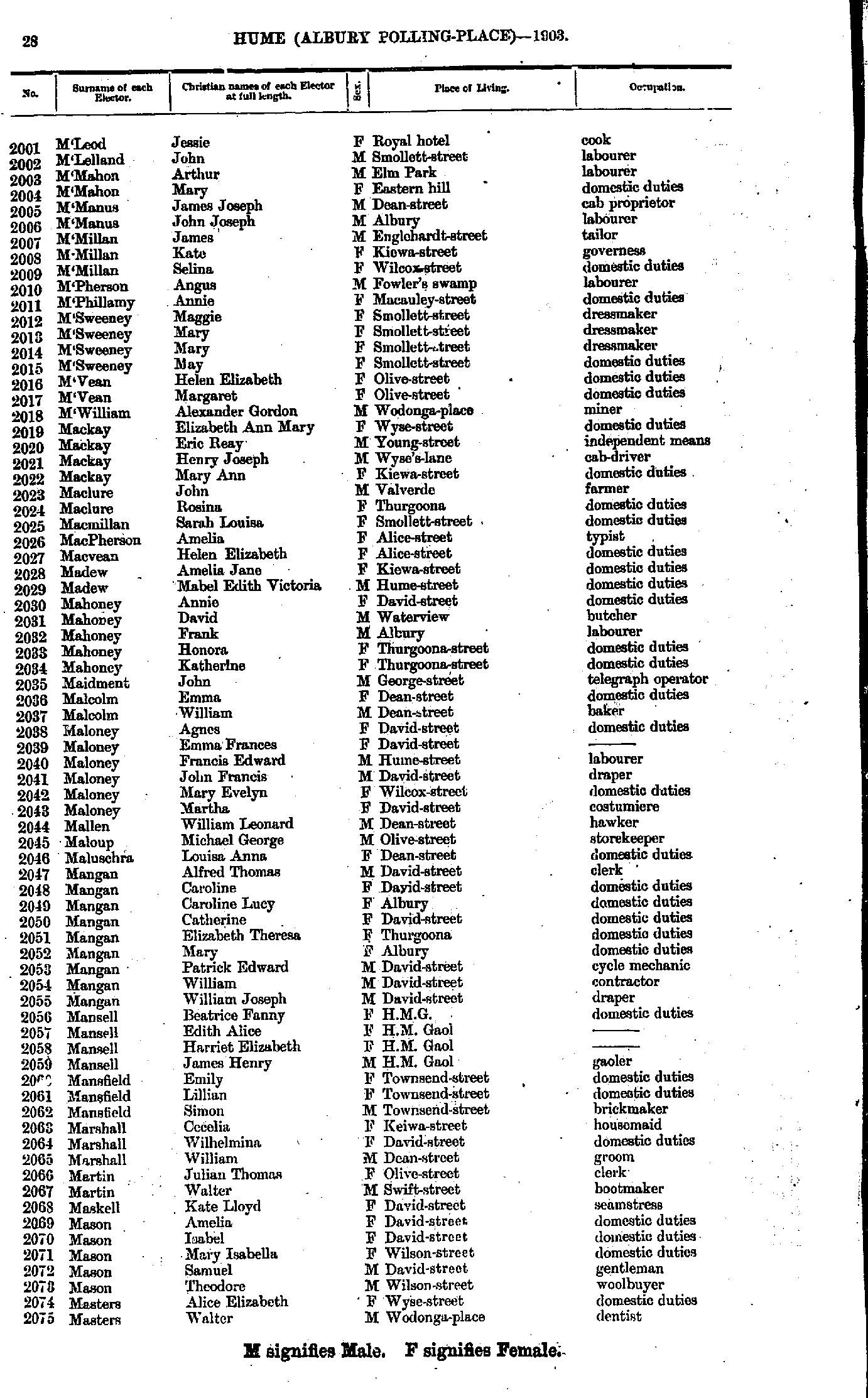
- M'Leod Jessie - Masters Walter
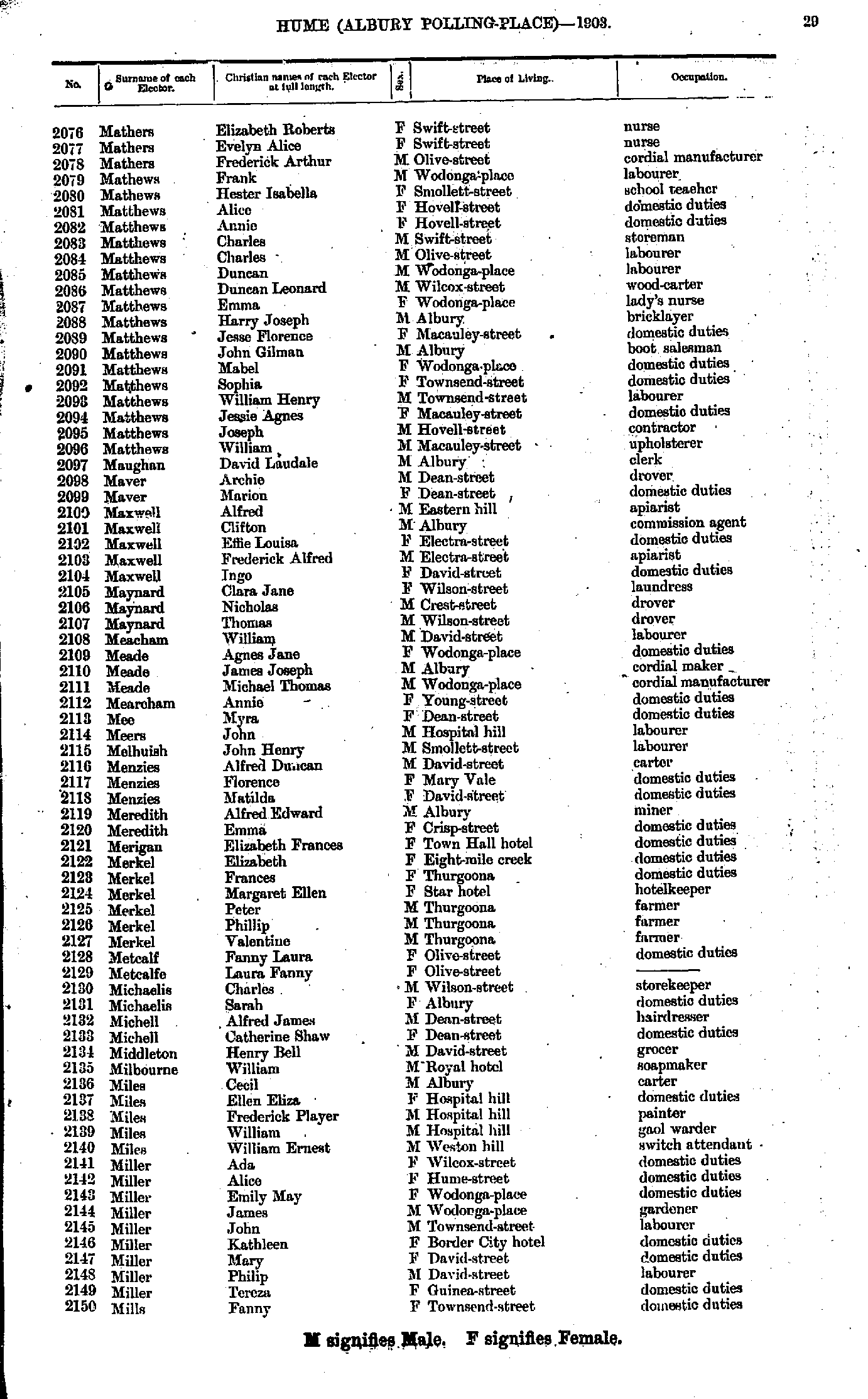
- Mathers Elizabeth - Mills Fanny
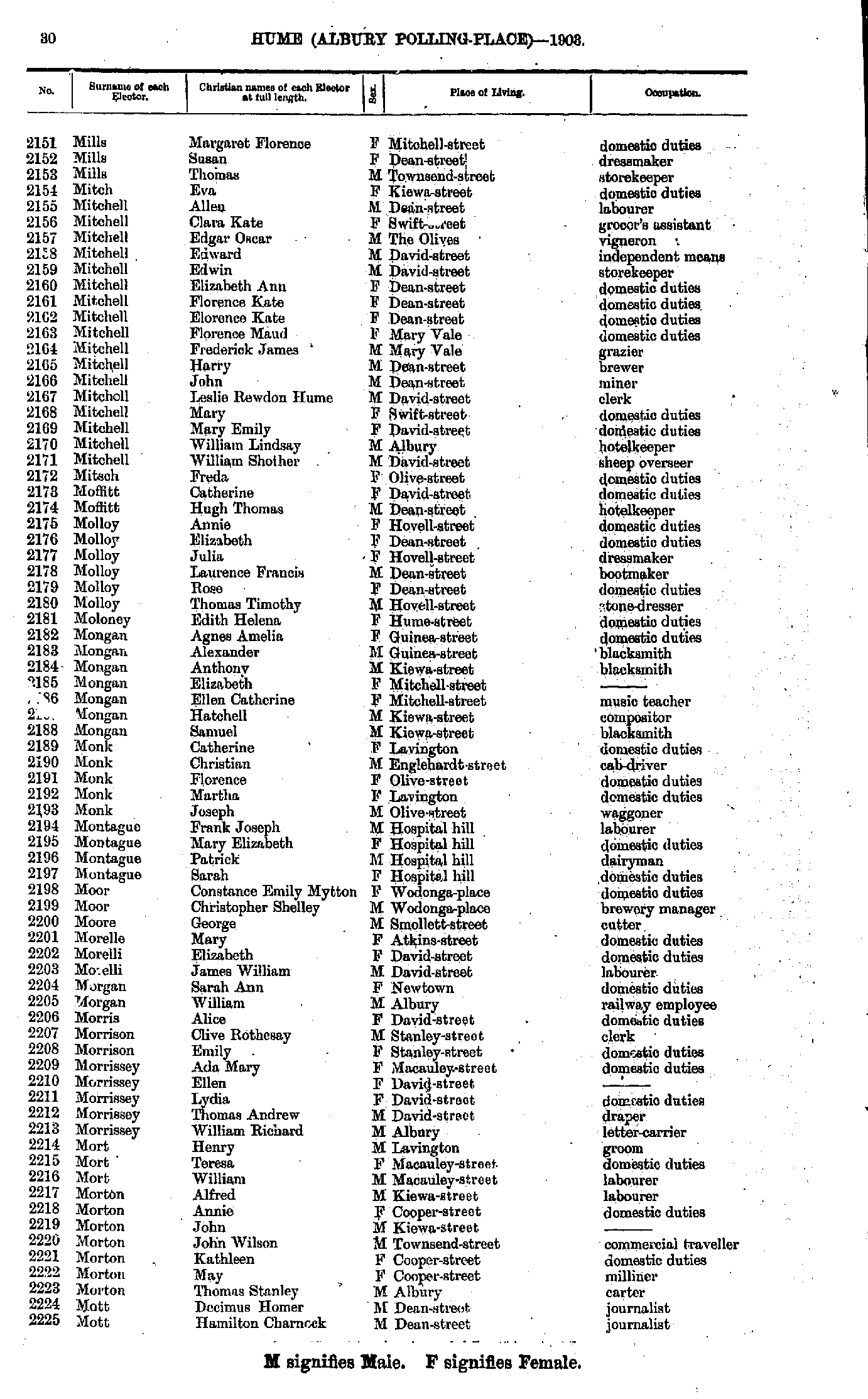
- Mills Margaret - Mott Hamilton
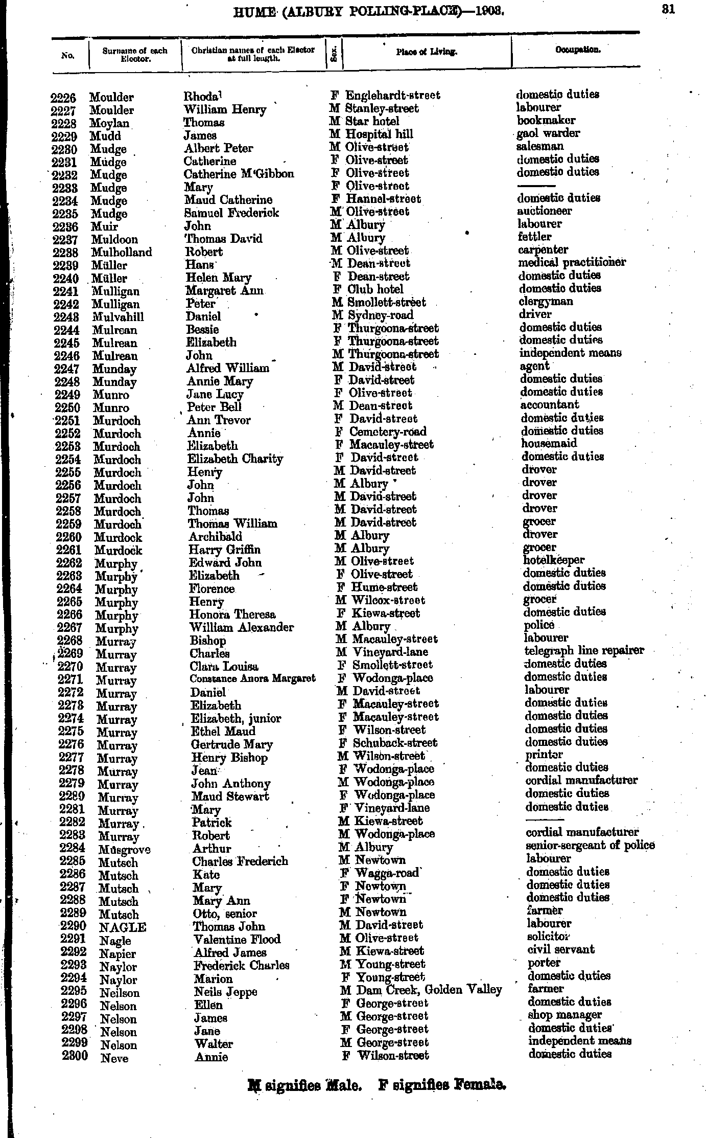
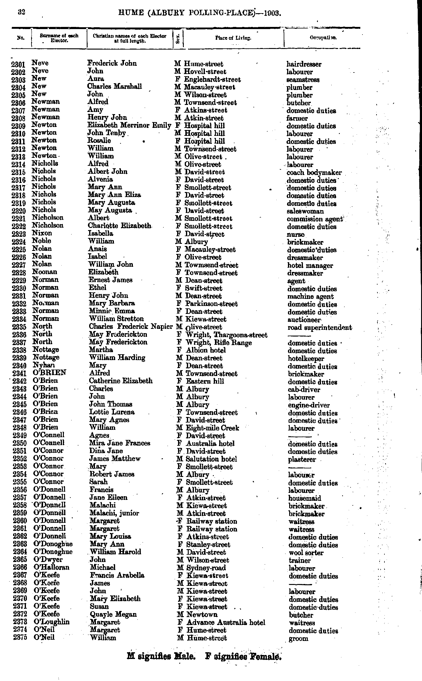
- Moulder Rhoda - Neve Annie
- Neve Frederick - O'Neil William
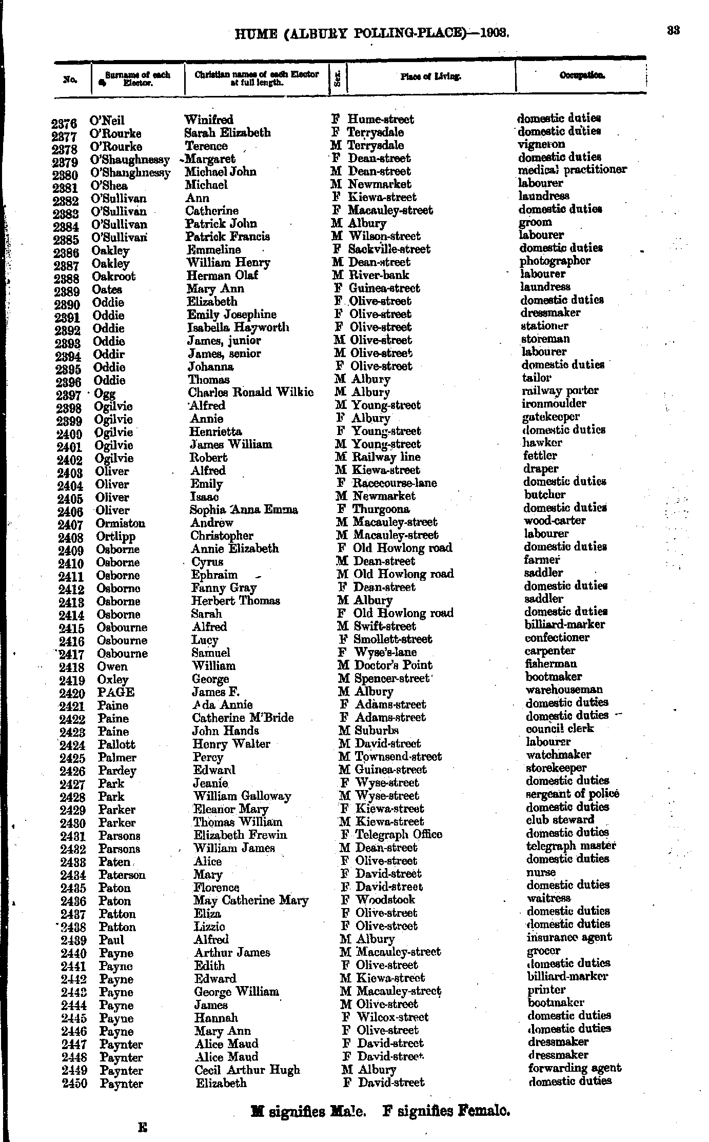
- O'Neil Winifred - Paynter Elizabeth
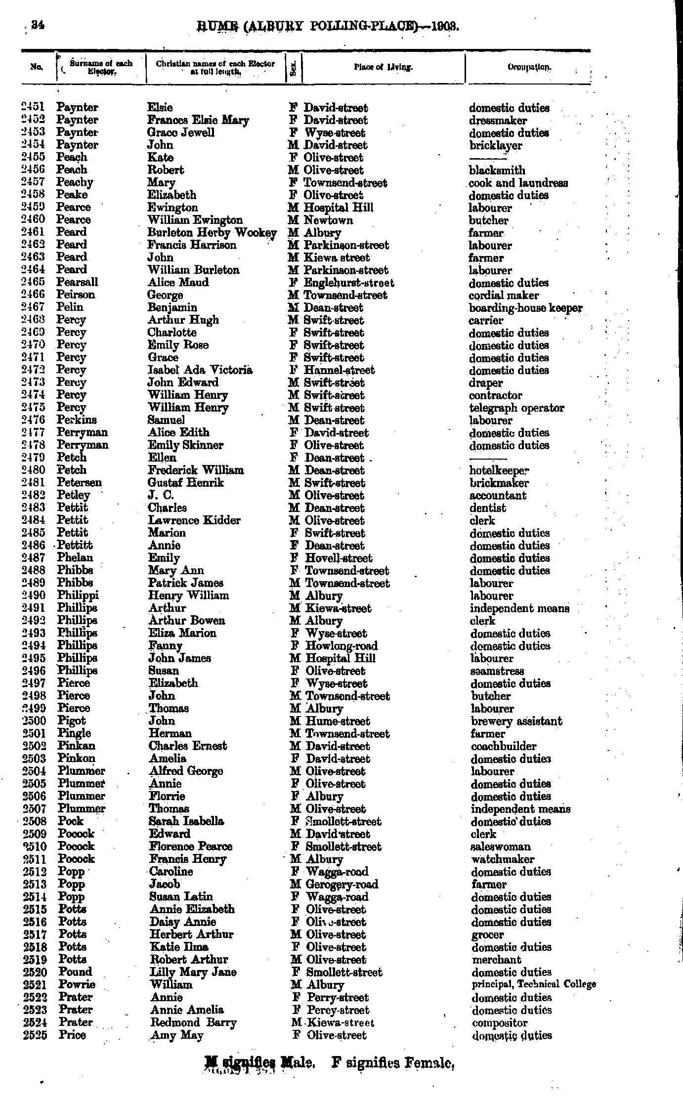
- Paynter Elsie - Price Amy
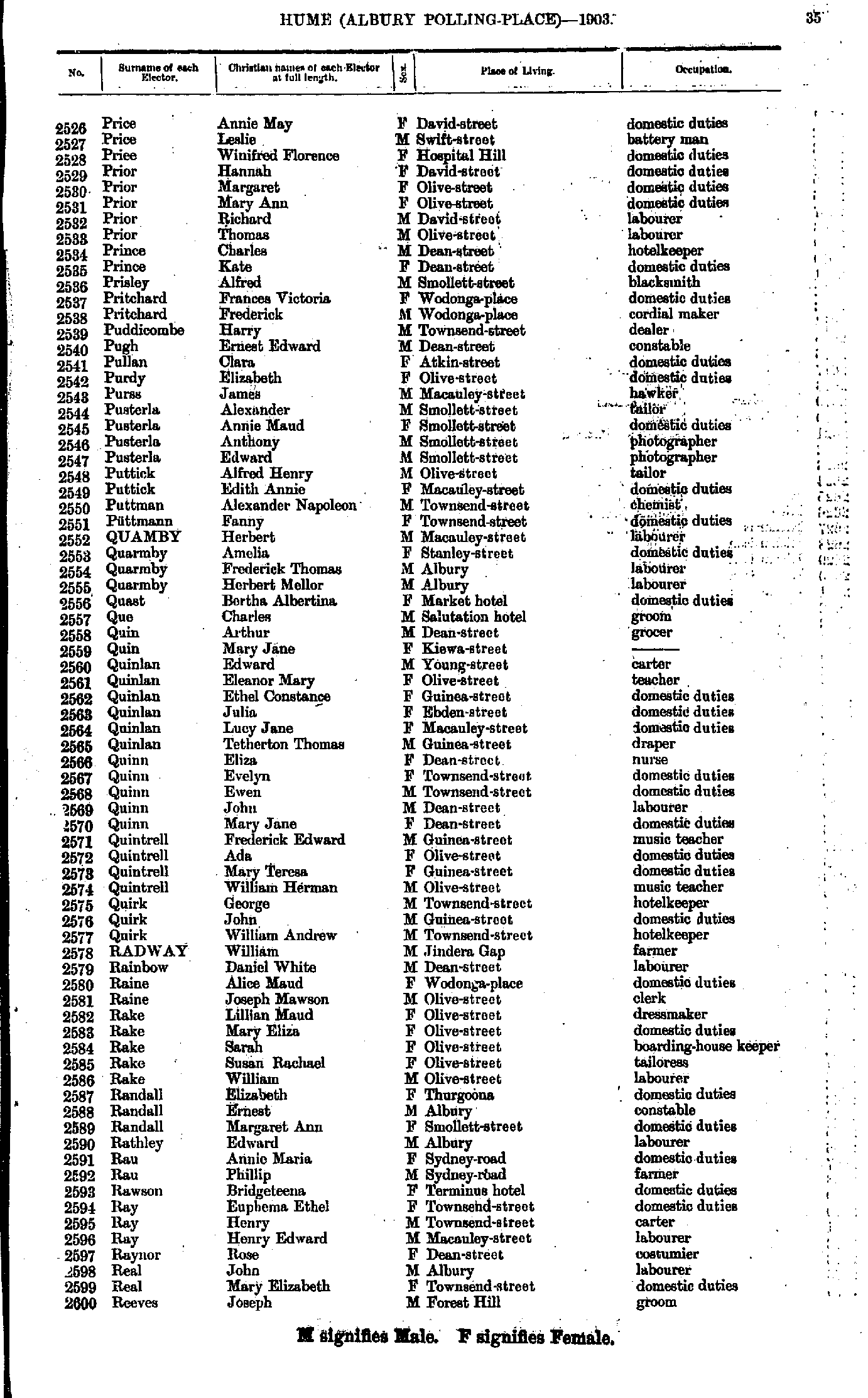
- Price Annie - Reeves Joseph
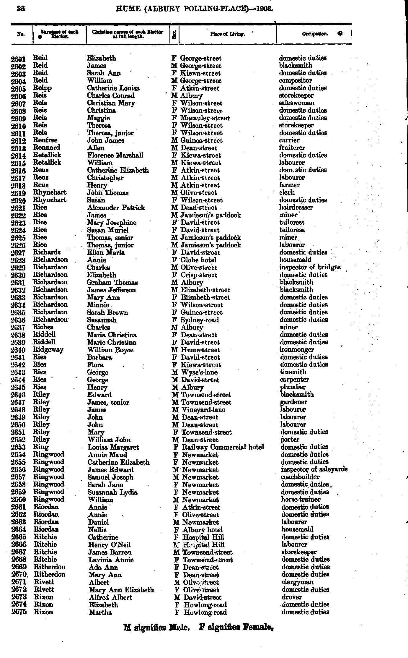
- Reid Elizabeth - Rixon Martha
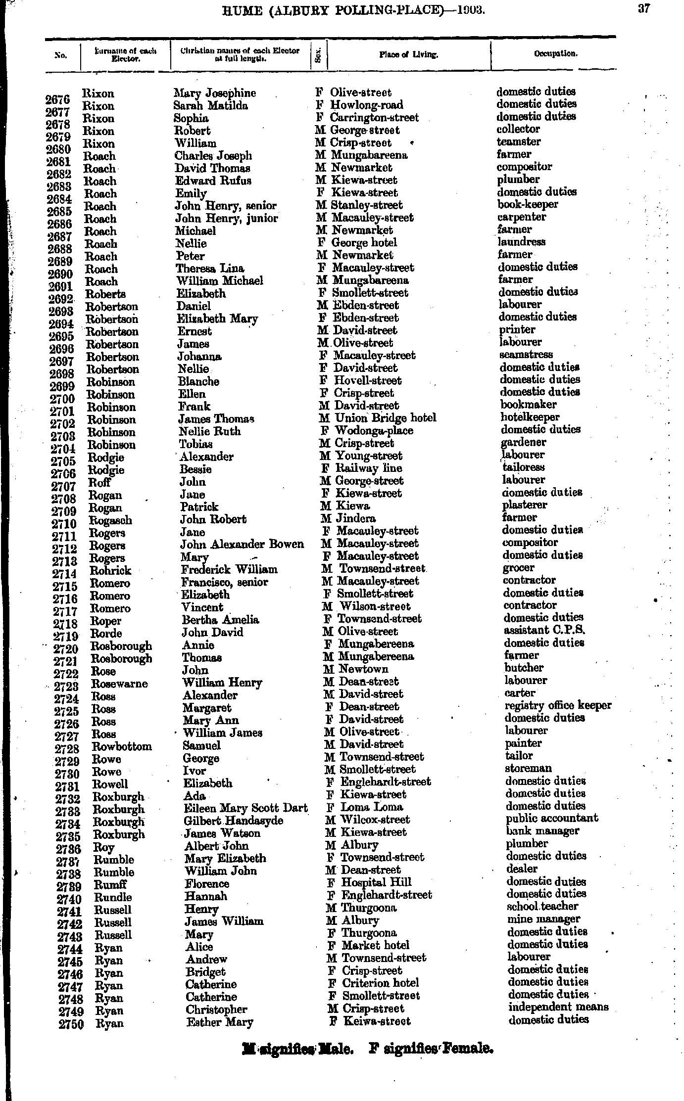
- Rixon Mary - Ryan Esther
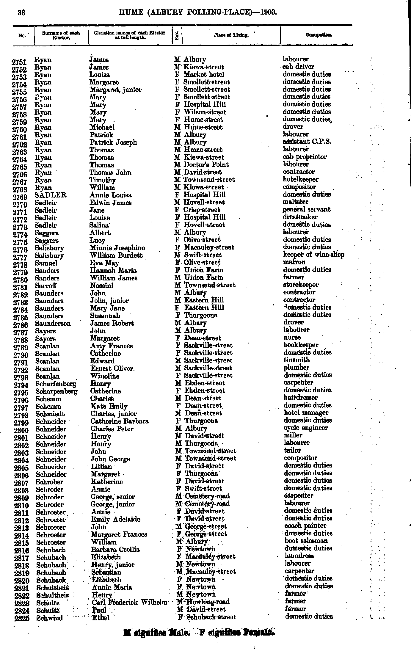
- Ryan James - Schwind Ethel
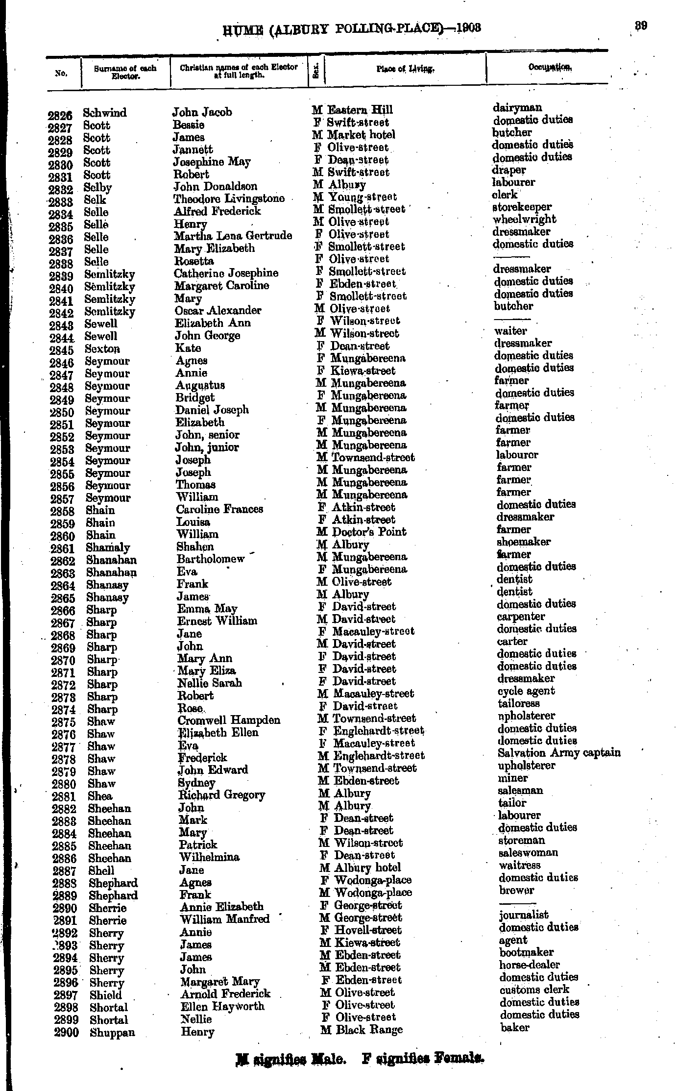
- Schwind John - Shuppan Henry
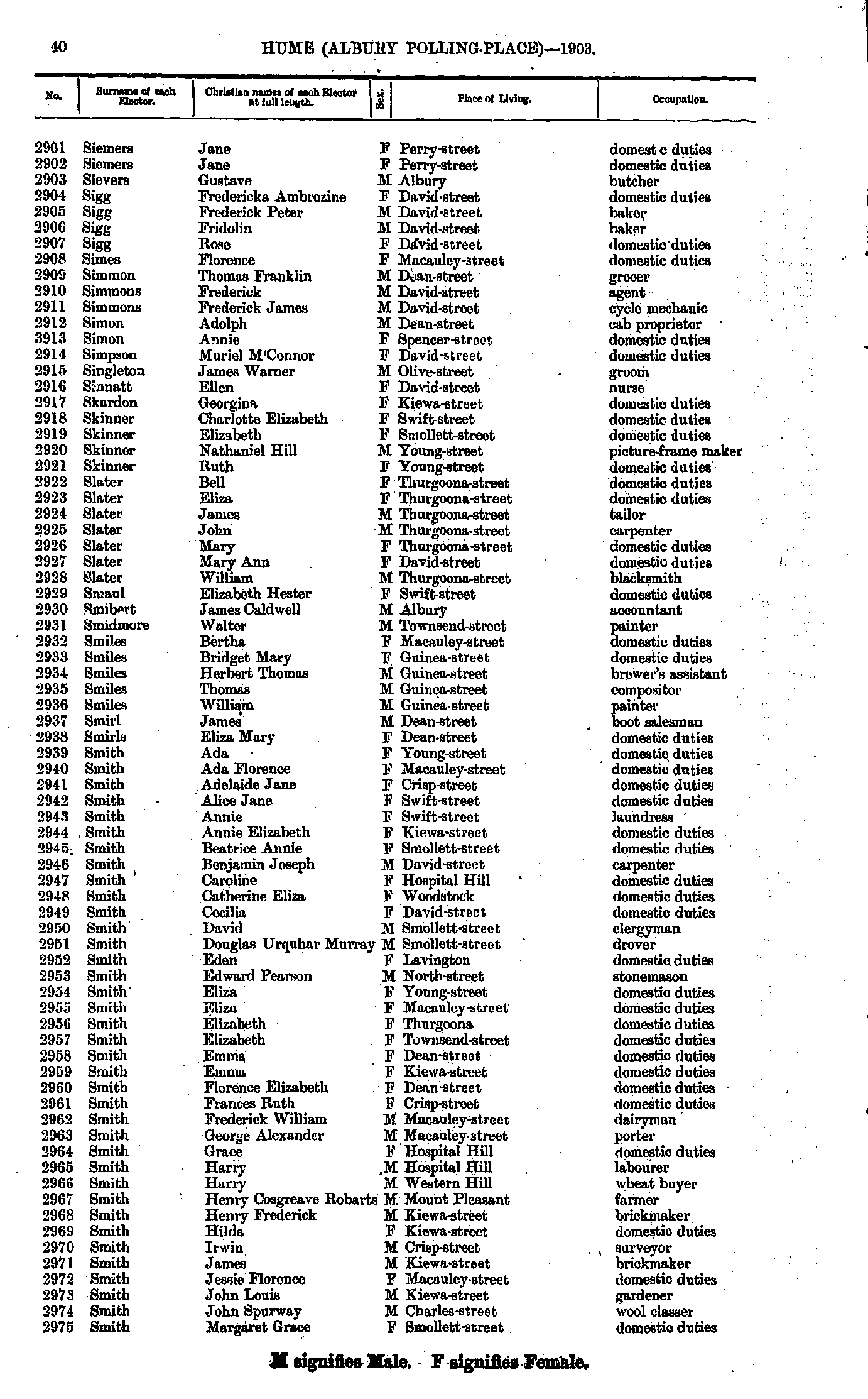
- Siemers Jane - Smith Margaret
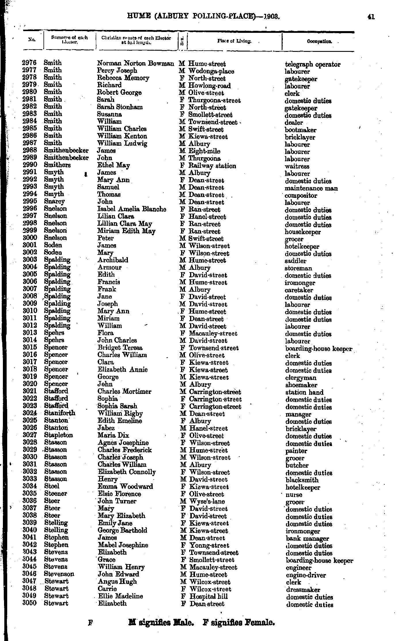
- Smith Norman - Stewart Elizabeth
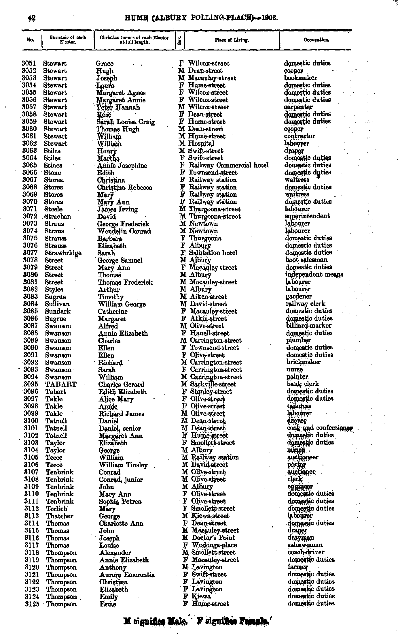
- Stewart Grace - Thompson Esme
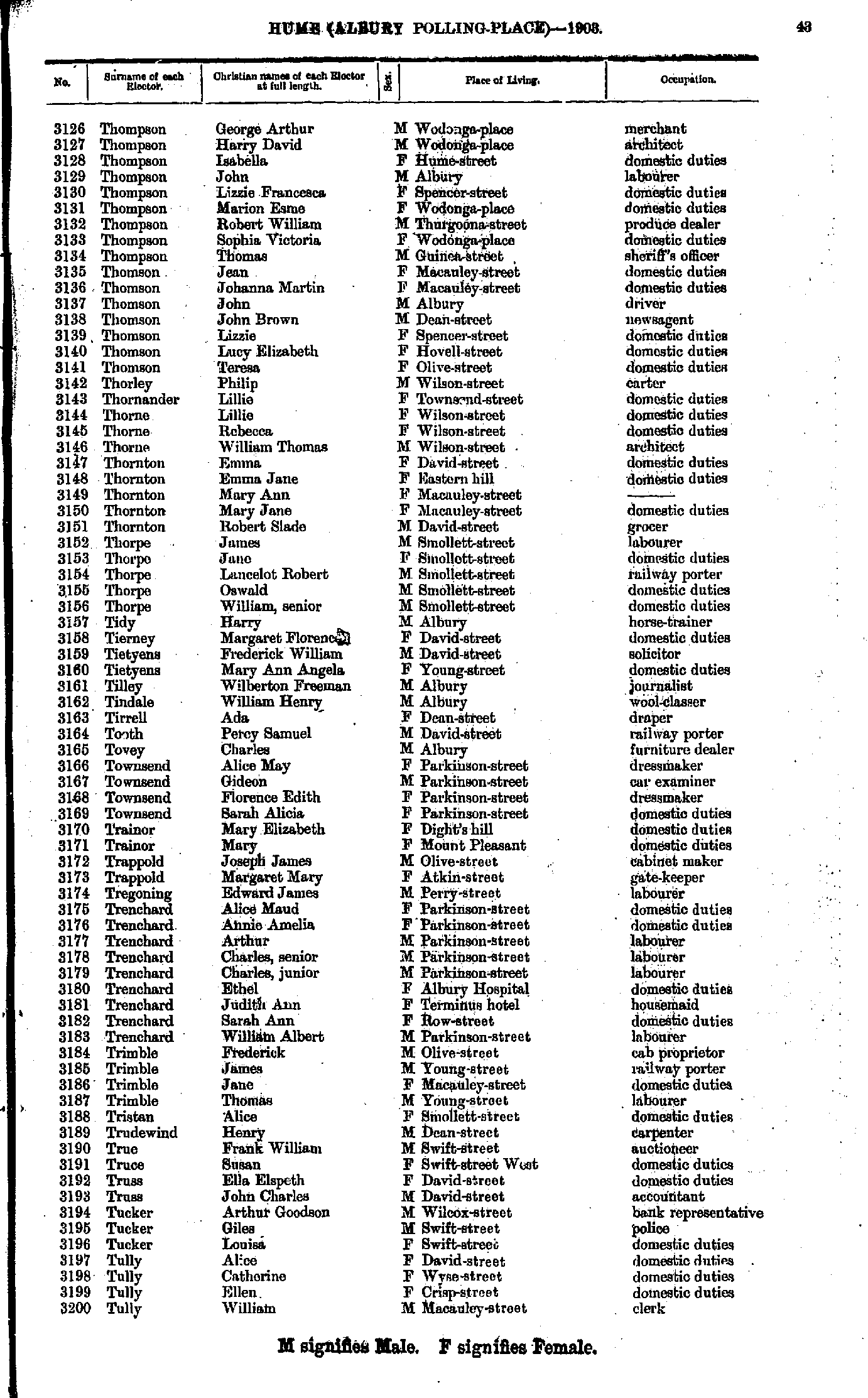
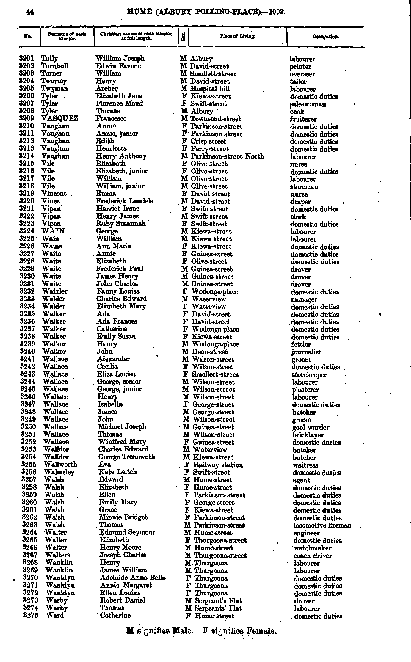
- Thompson George - Tully William
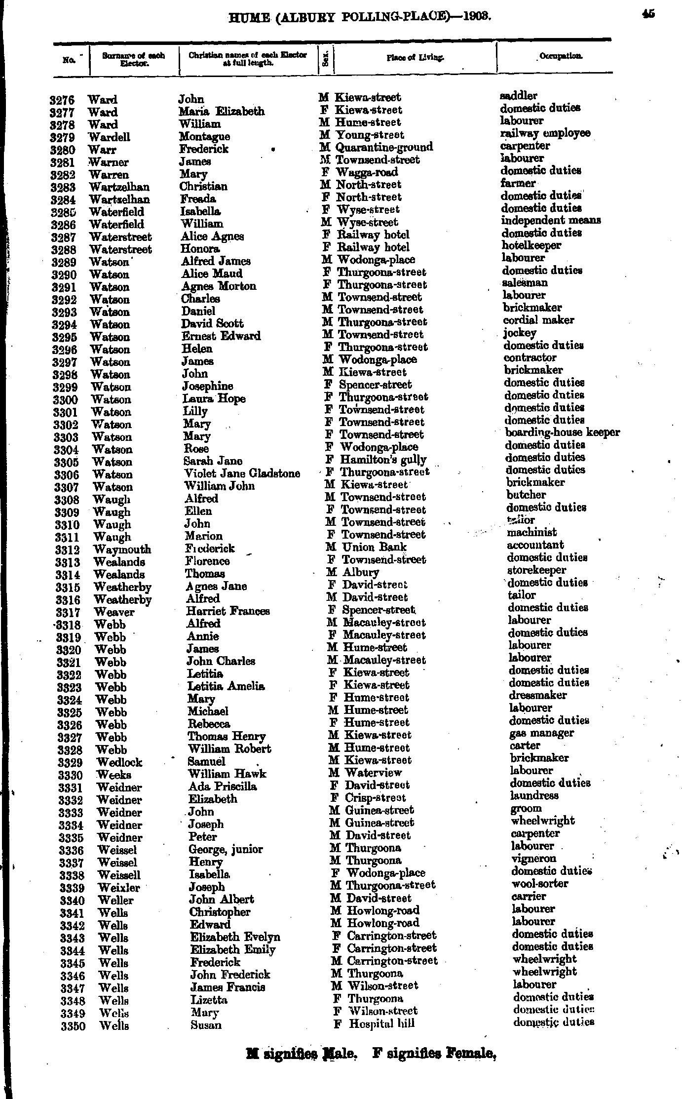
- Tully William - Ward Catherine
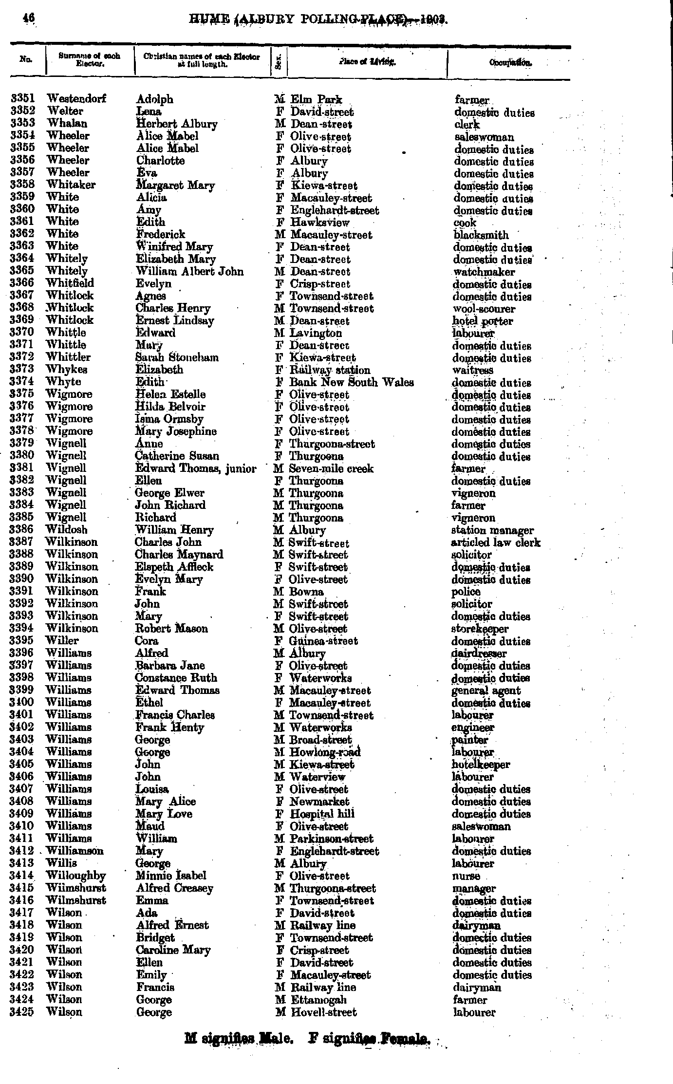
- Ward John - Wells Susan
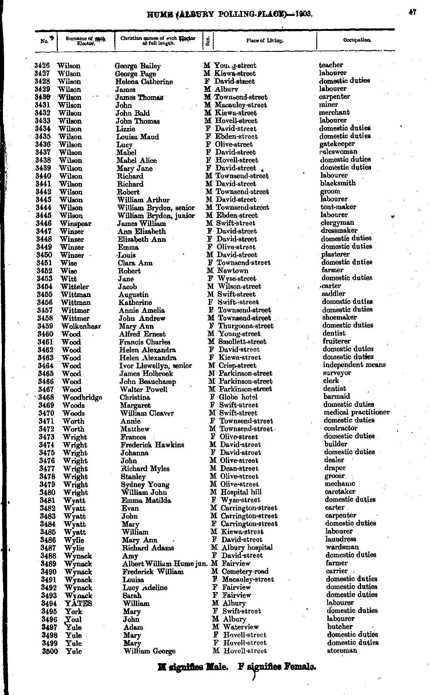
- Westendorf Adolph - Wilson George
- Wilson George - Yule William
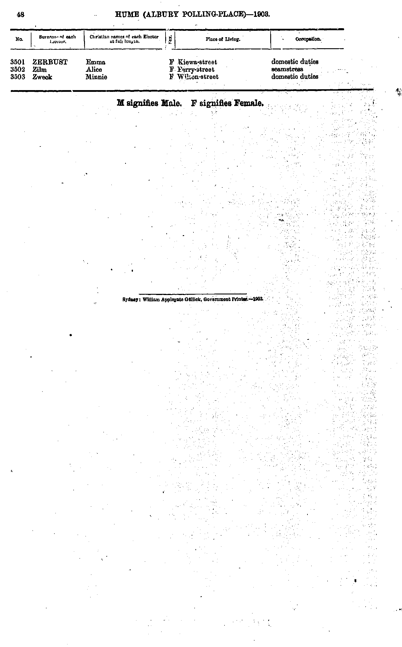
- Zerbust Emma - Zweck Minnie
- Adams Edward - Davis Thomas
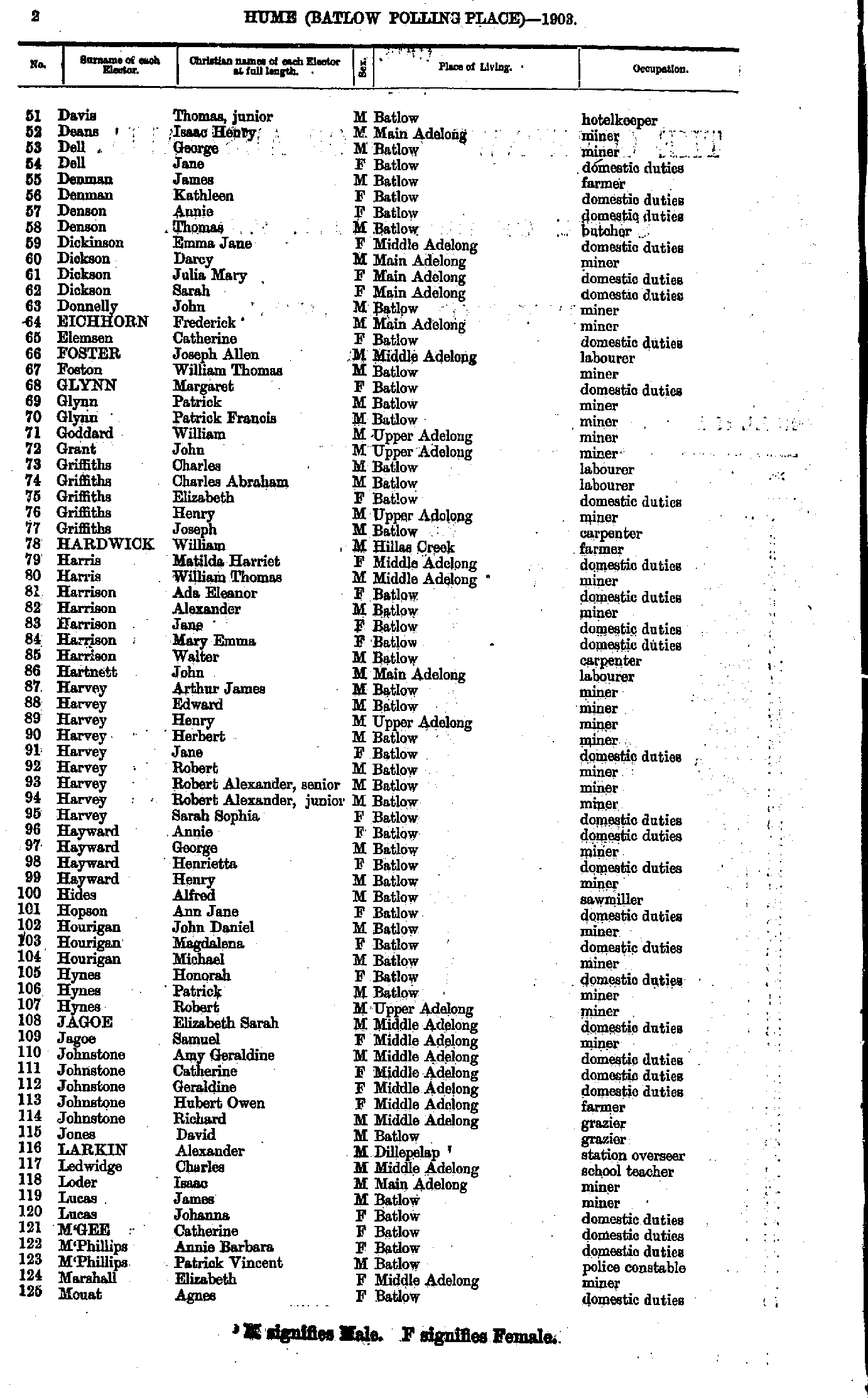
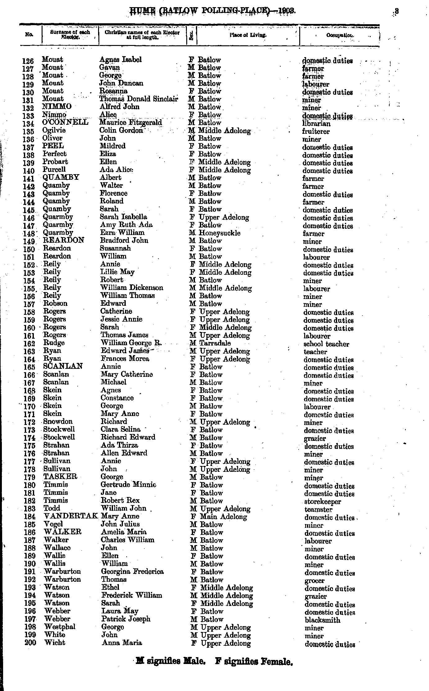
- Davis Thomas - Mouat Agnes
- Mouat Agnes - Wicht Anna
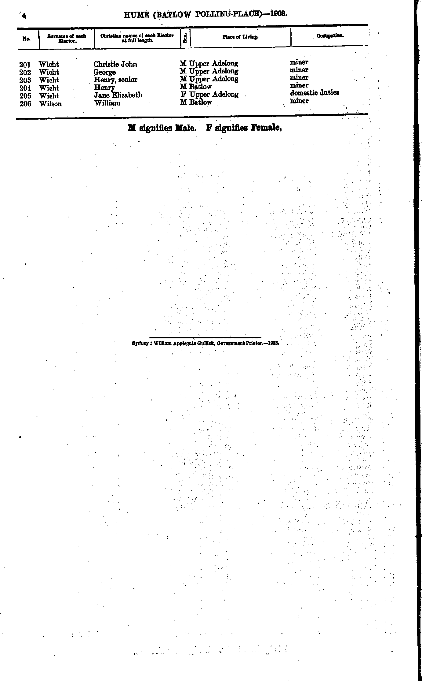
- Wicht Christie - Wilson William
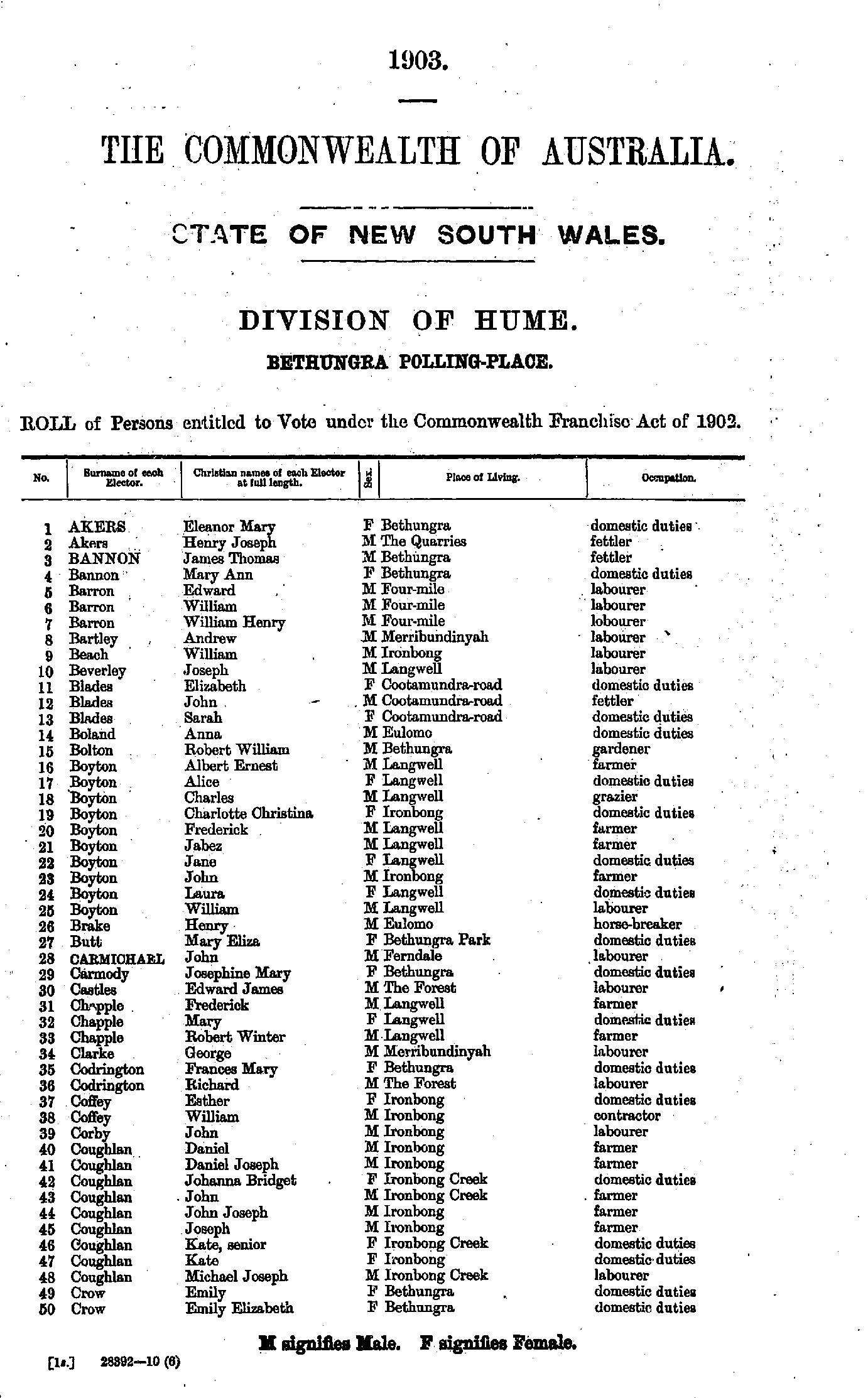
- Akers Eleanor - Crow Emily
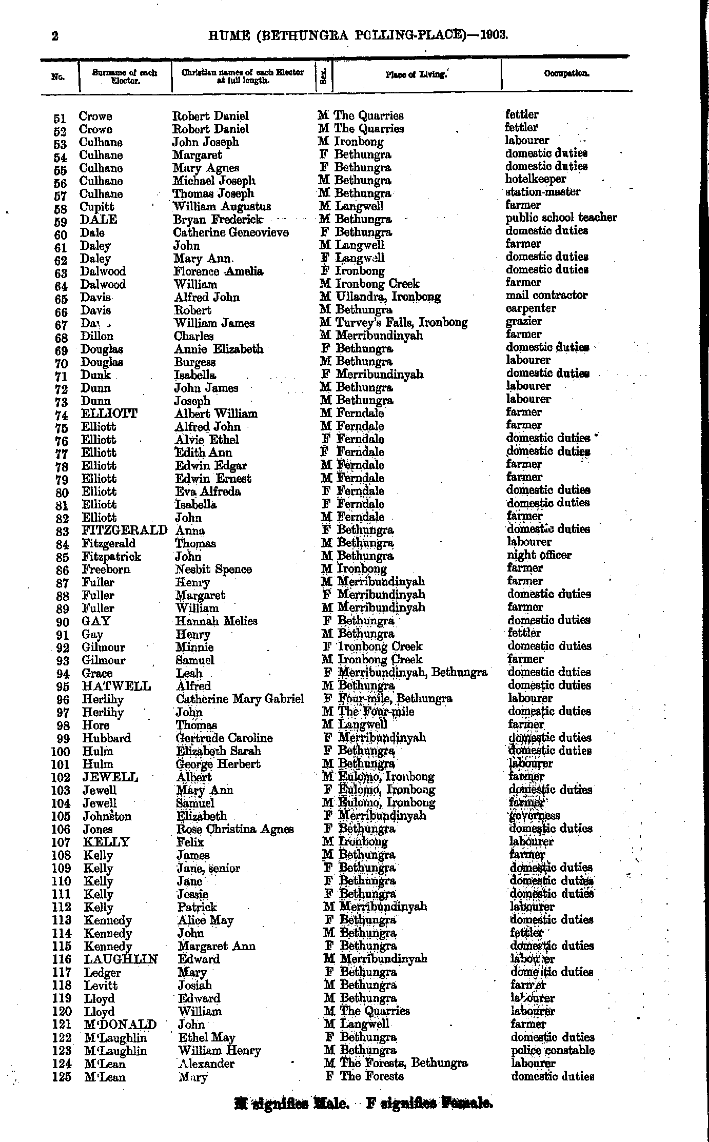
- Crowe Robert - M'Lean Mary
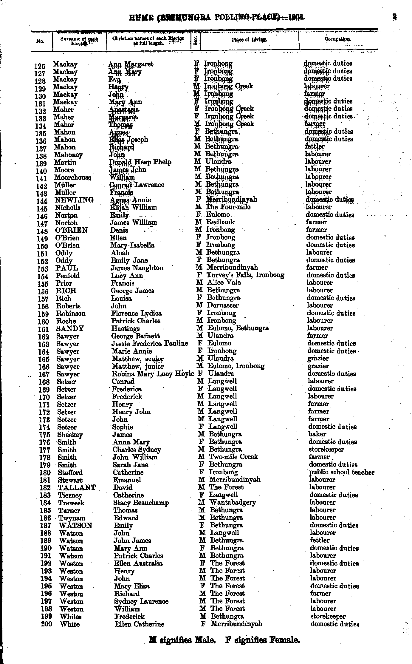
- Mackay Ann - White Ellen
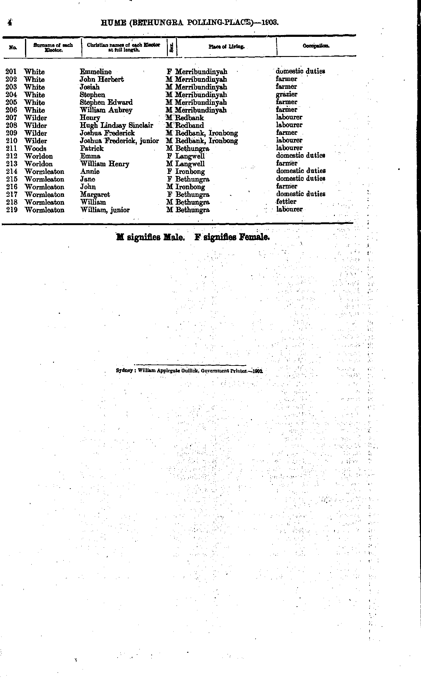
- White Emmeline - Wormleaton William
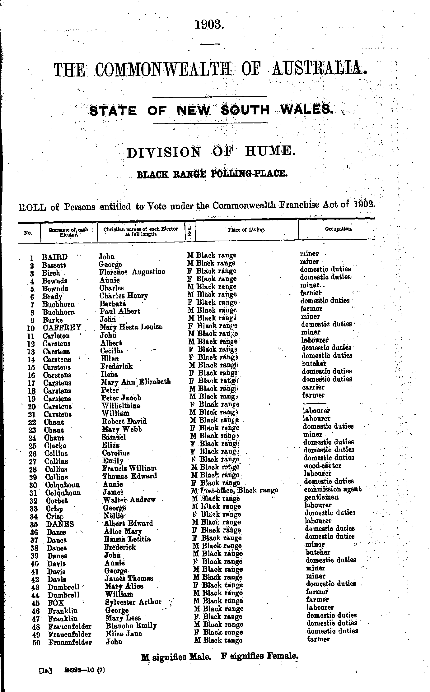
- Baird John - Frauenfelder John
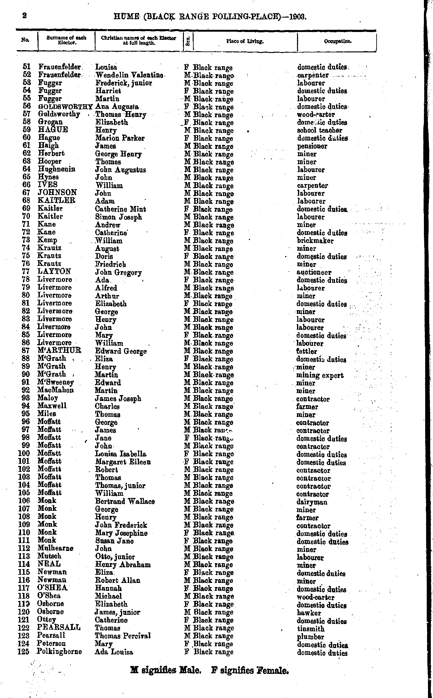
- Frauenfelder Louisa - Polkinghorne Ada
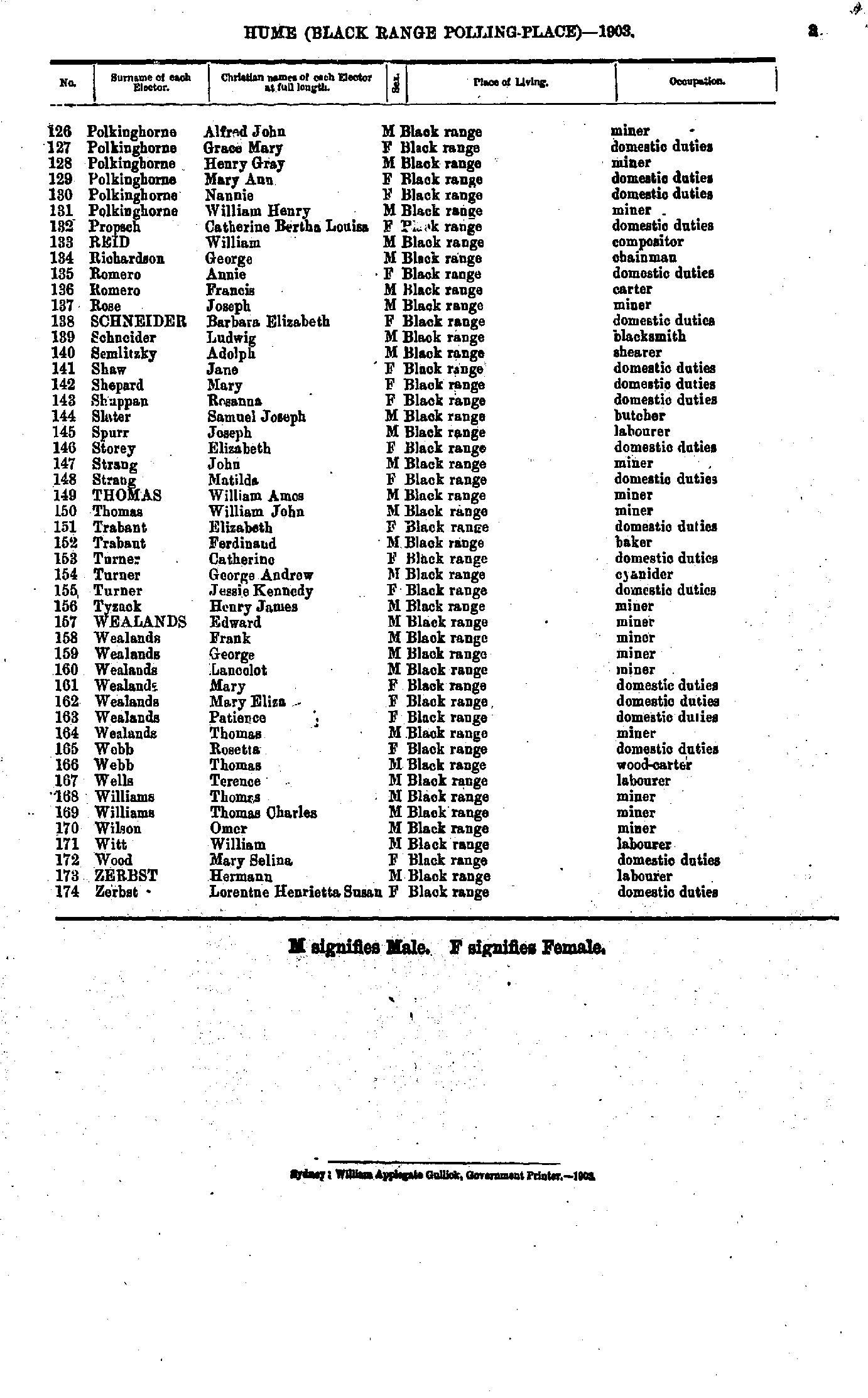
- Polkinghorne Alfred - Zerbst Lorentne
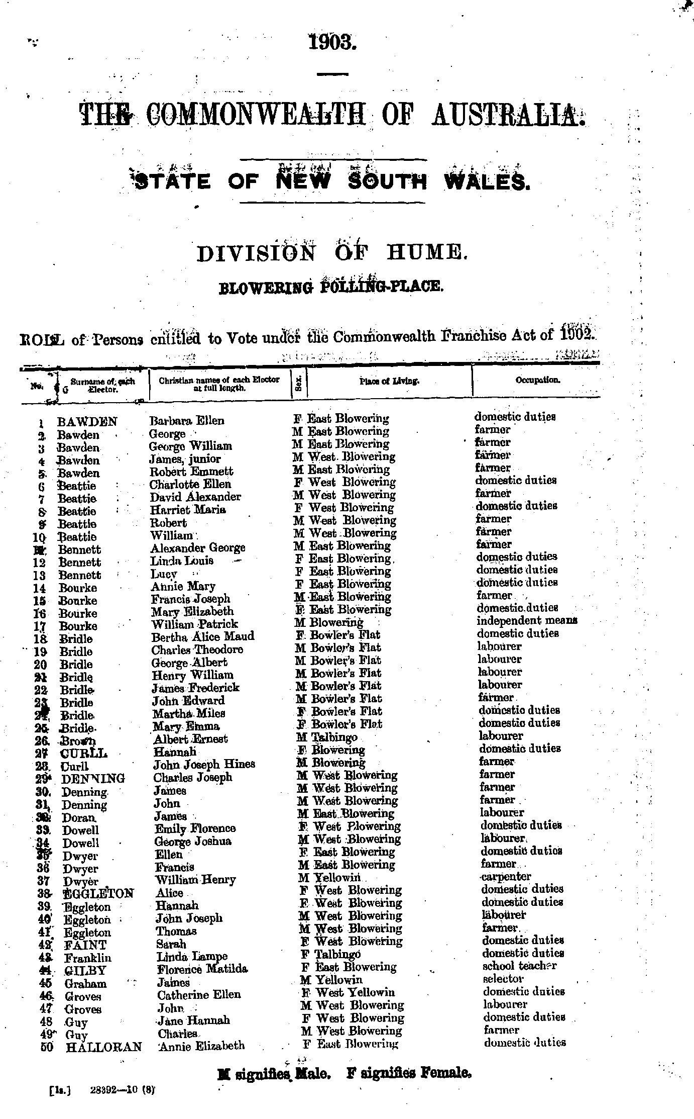
- Bawden Barbara - Halloran Annie
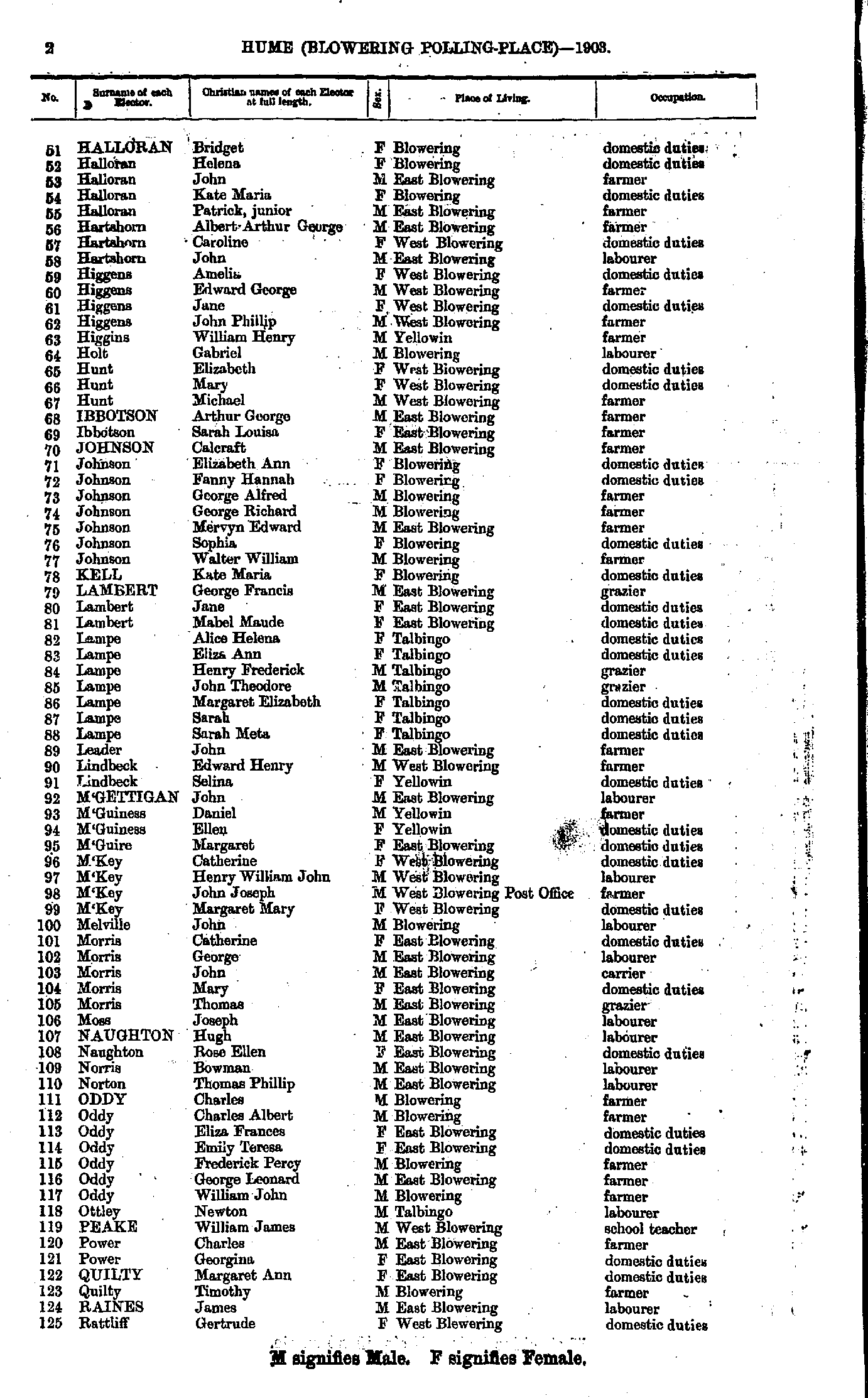
- Halloran Bridget - Rattliff Gertrude
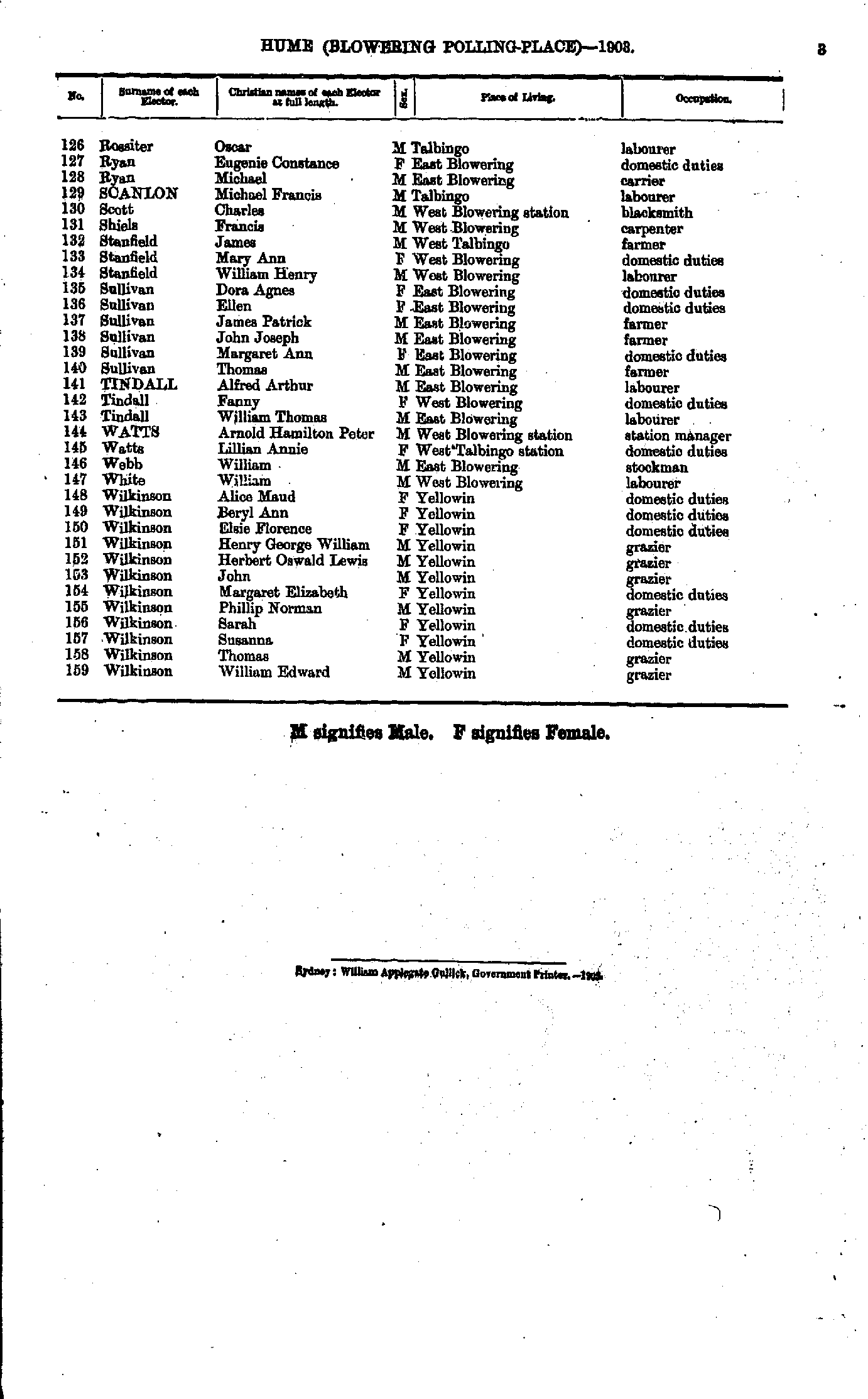
- Rossiter Oscar - Wilkinson William
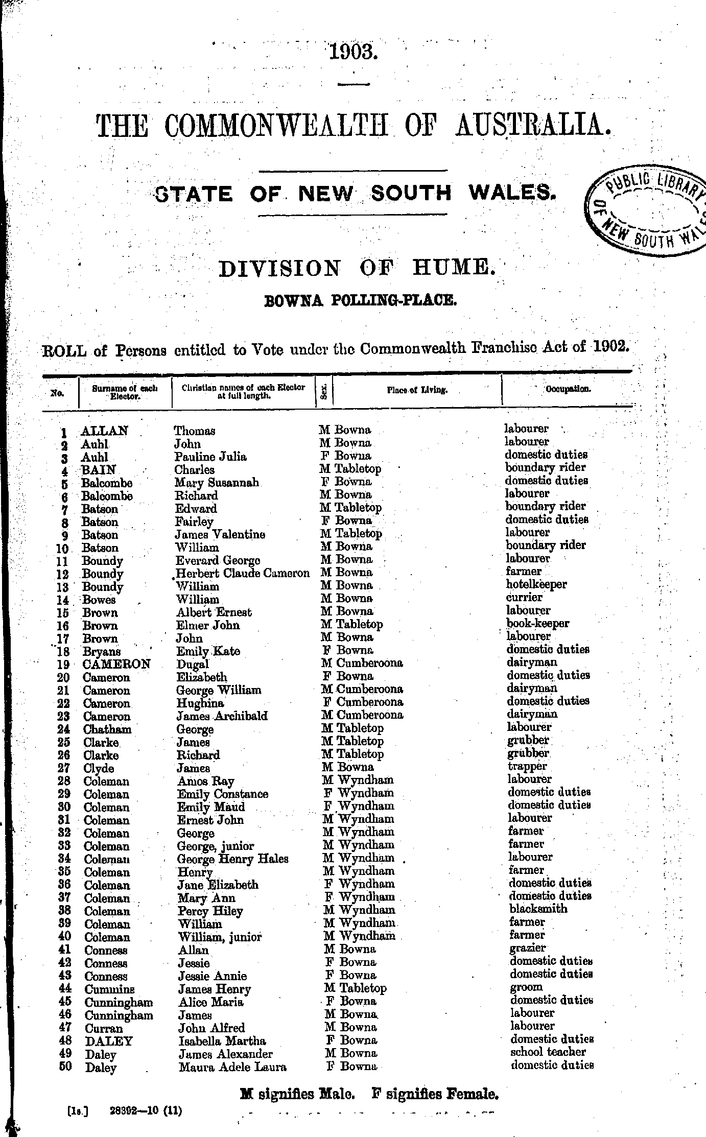
- Allan Thomas - Daley Maura
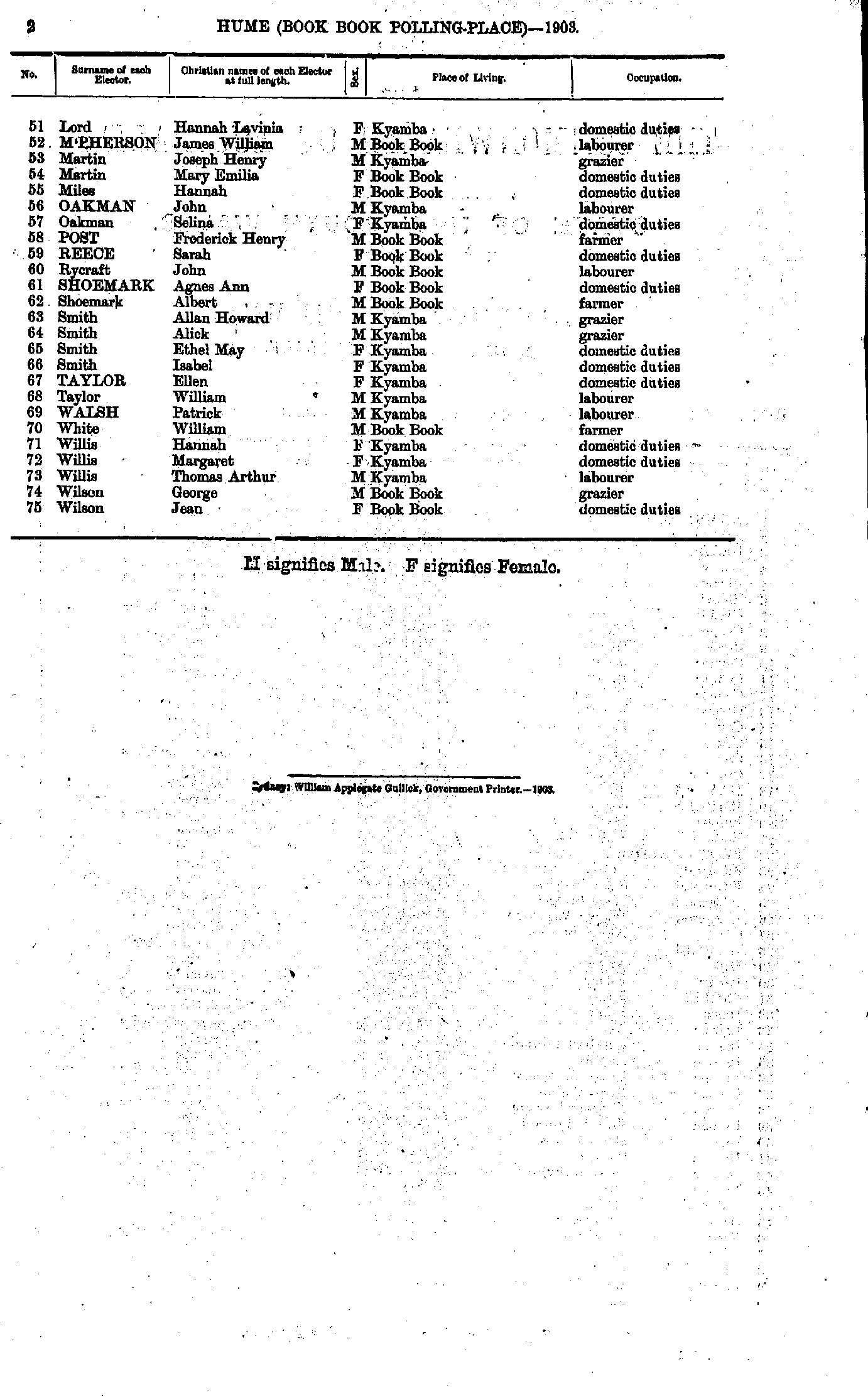
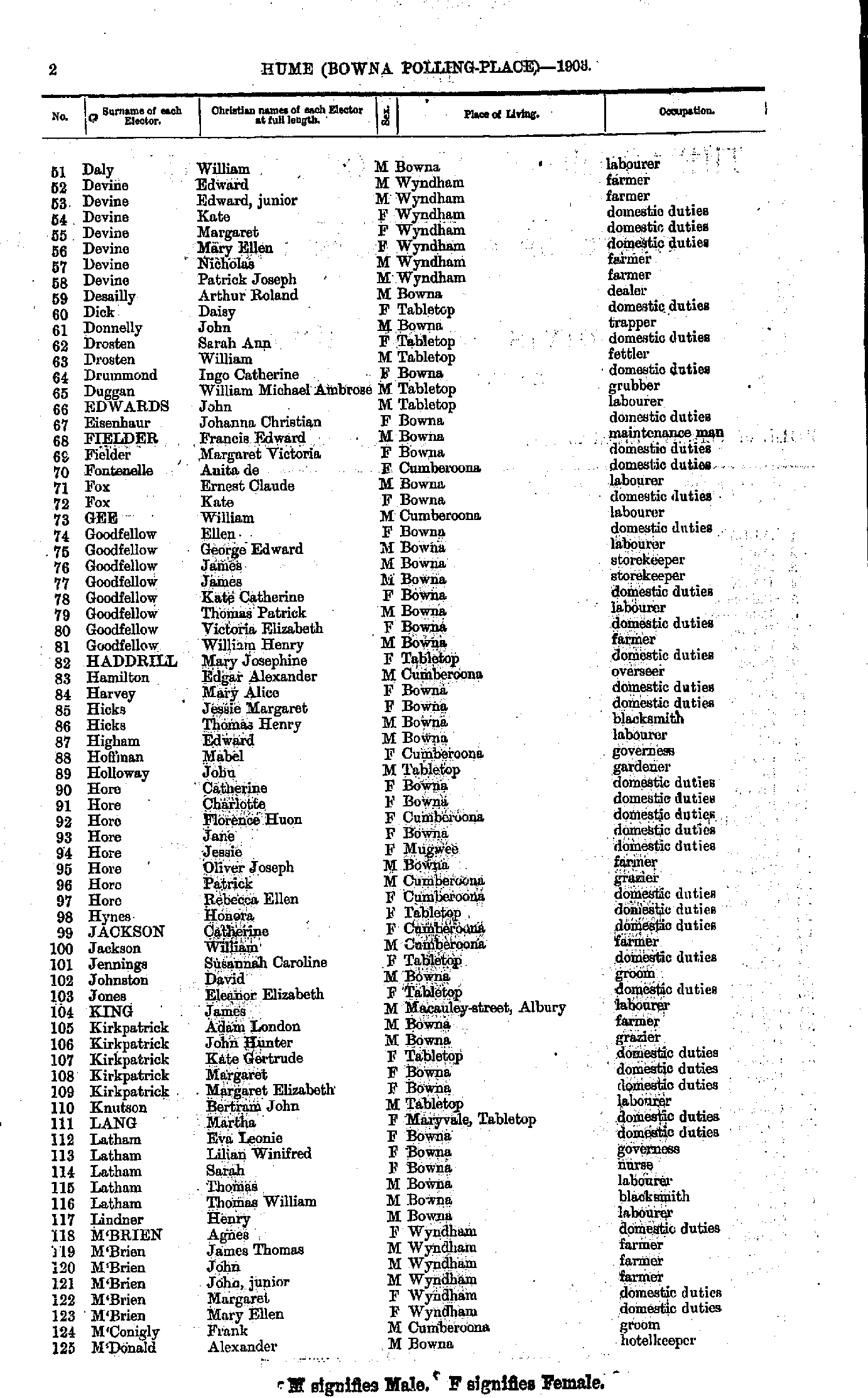
- Daly William - M'Donald Alexander
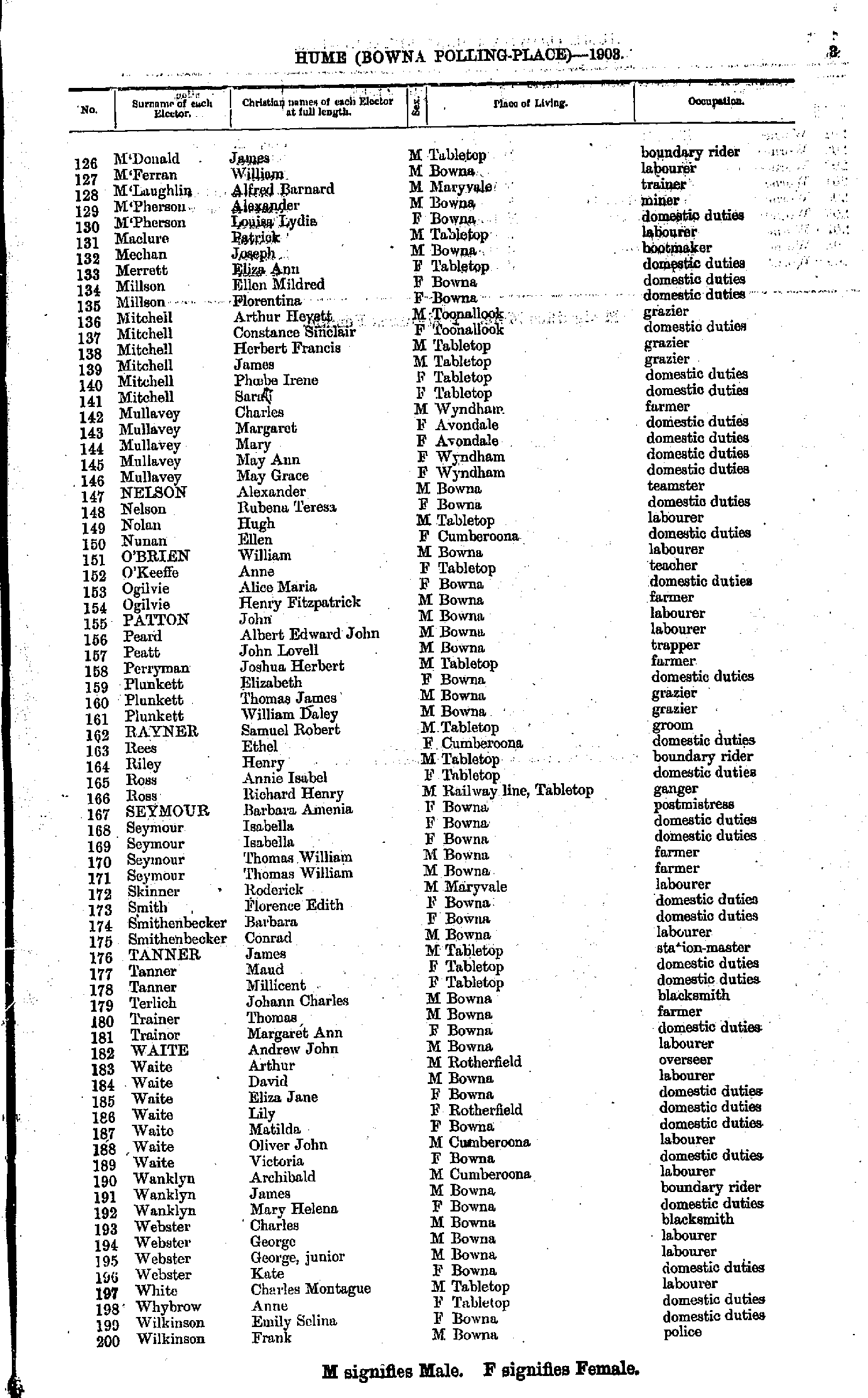
- M'Donald James - Wilkinson Frank
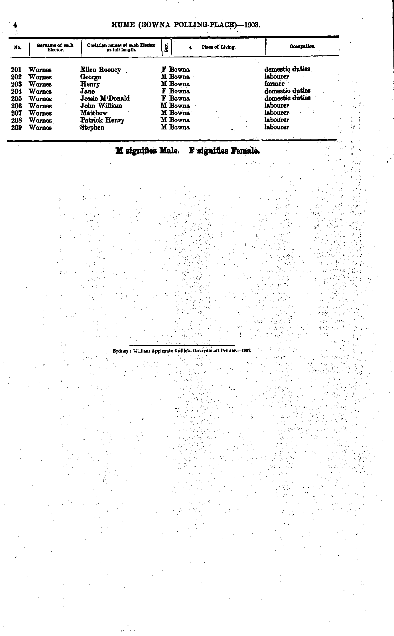
- Wornes Ellen - Wornes Stephen
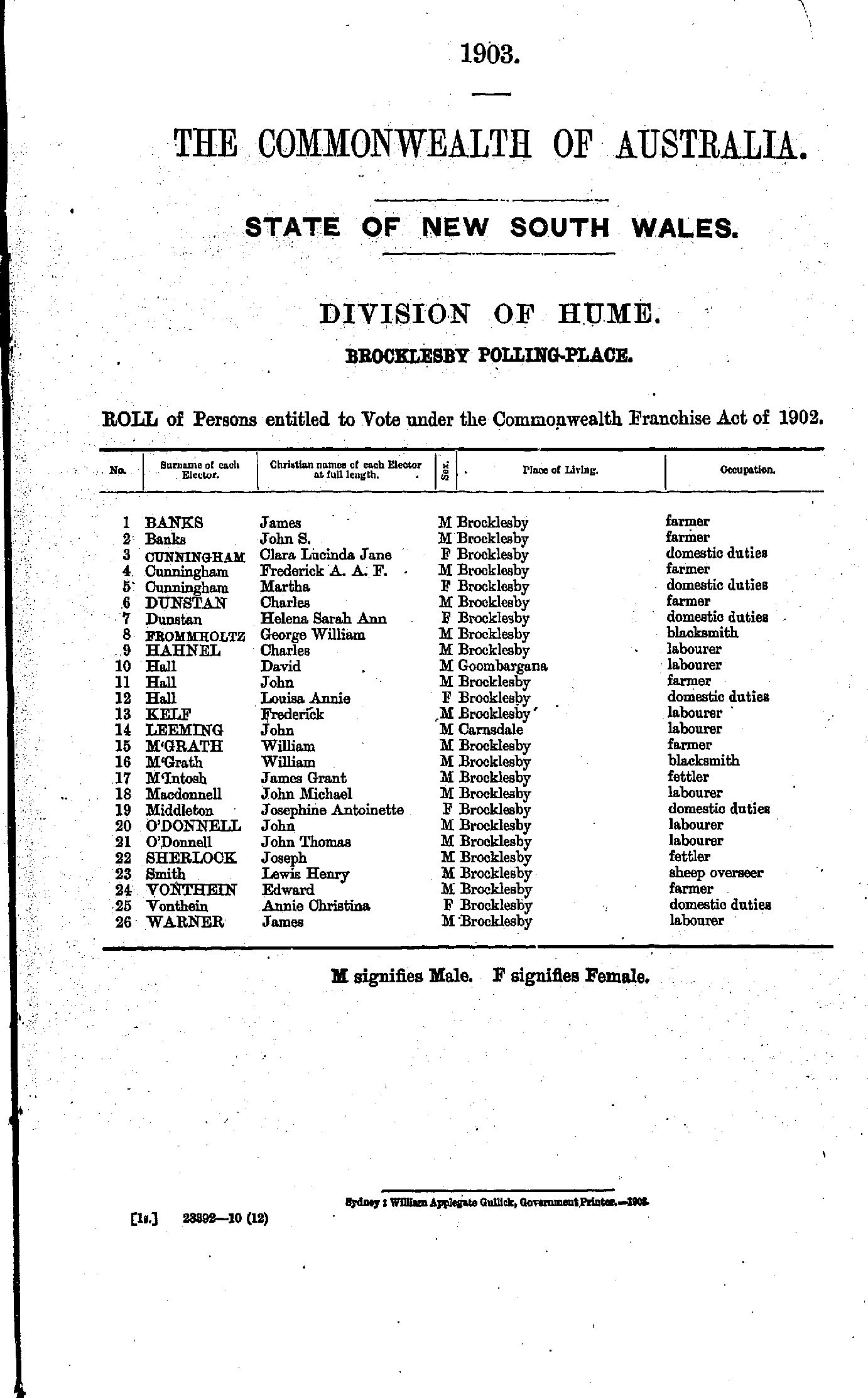
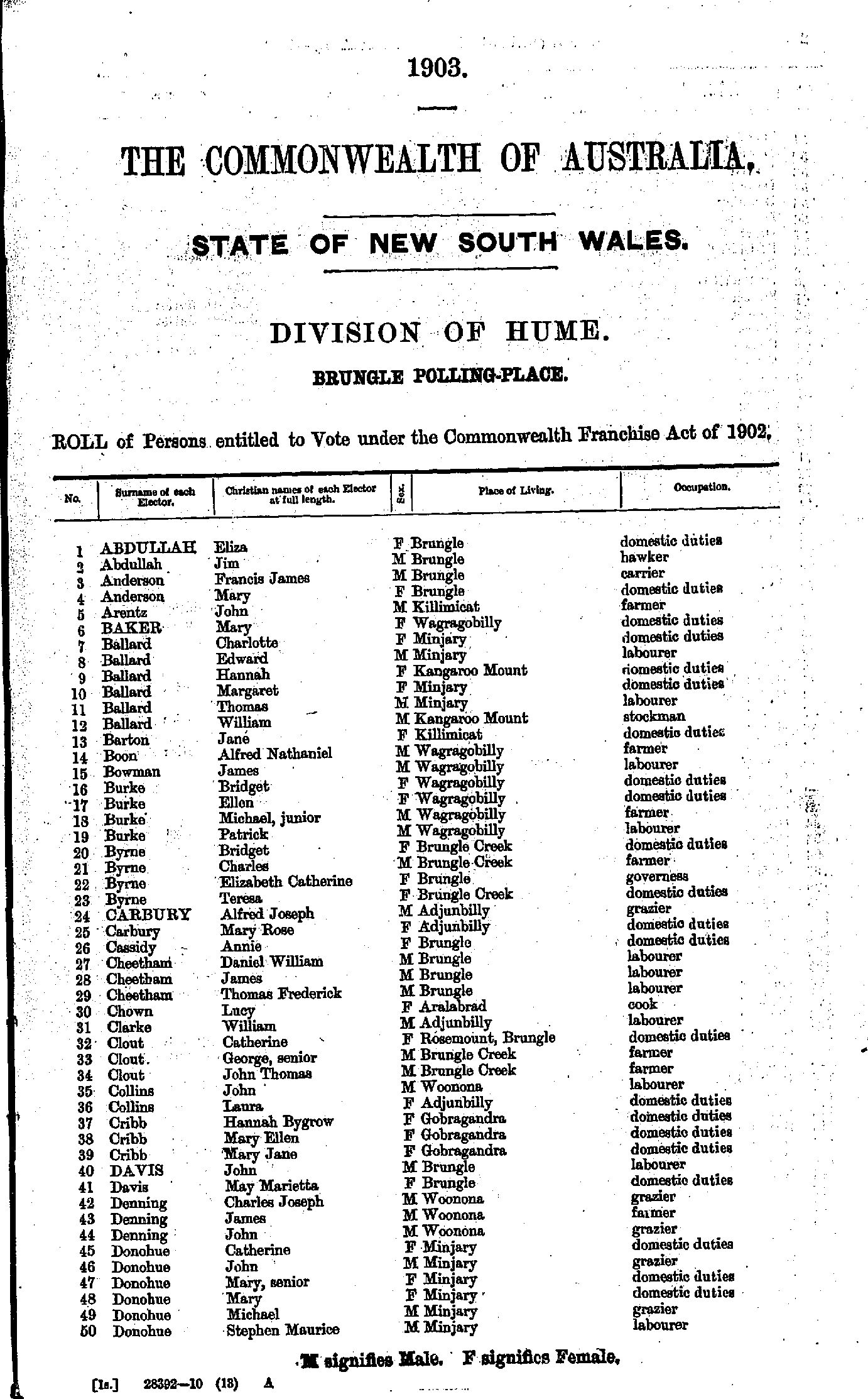
- Abdullah Eliza - Donohue Stephen
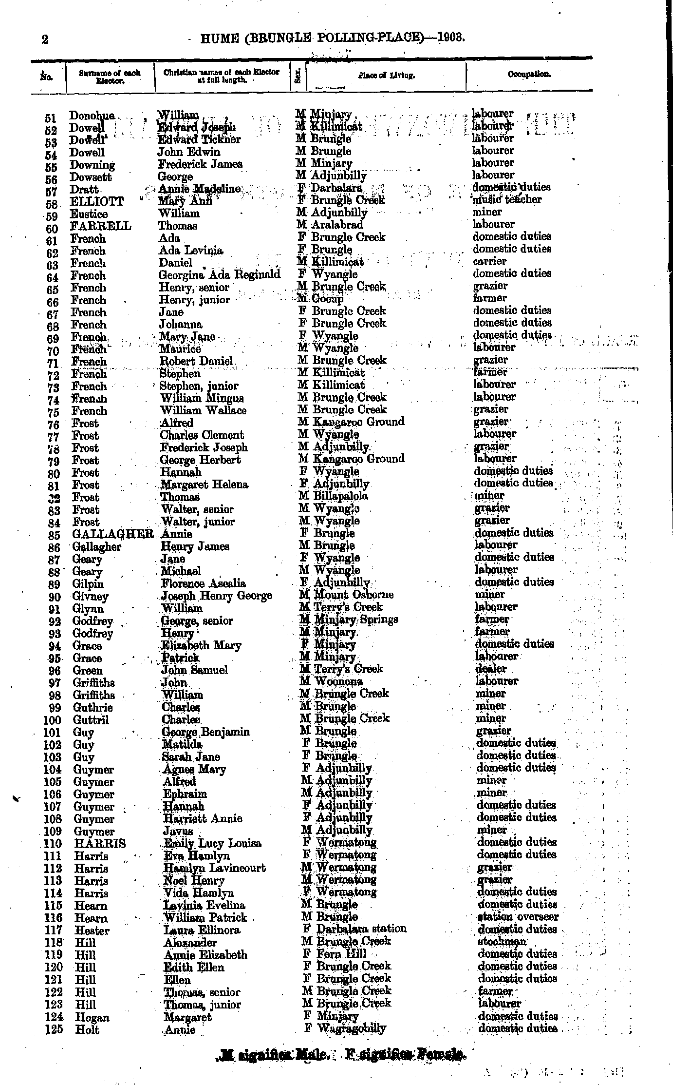
- Donohue William - Holt Annie
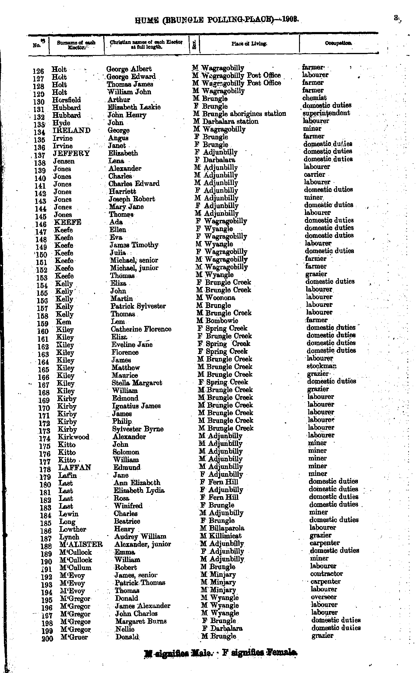
- Holt George - M'Gruer Donald
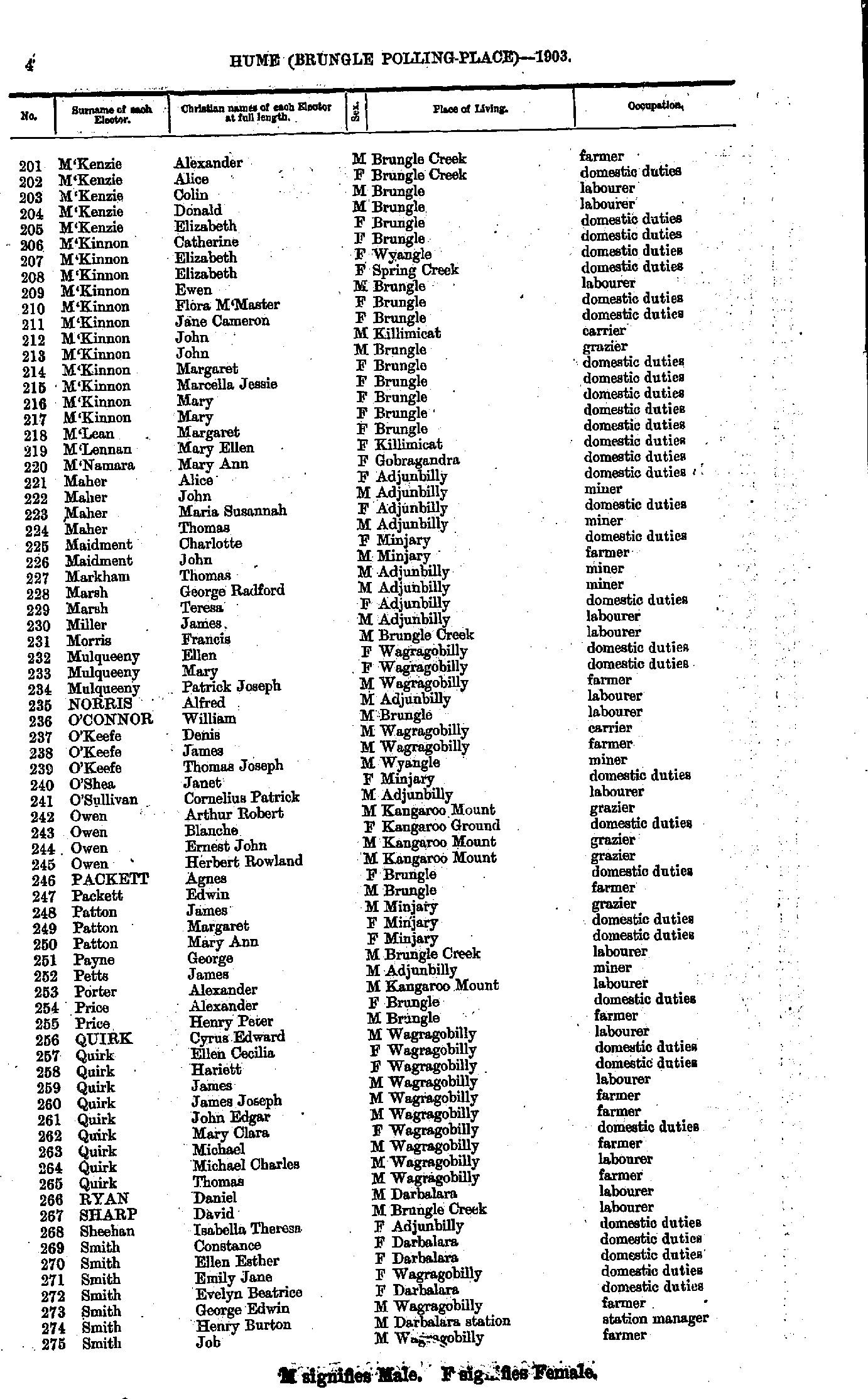
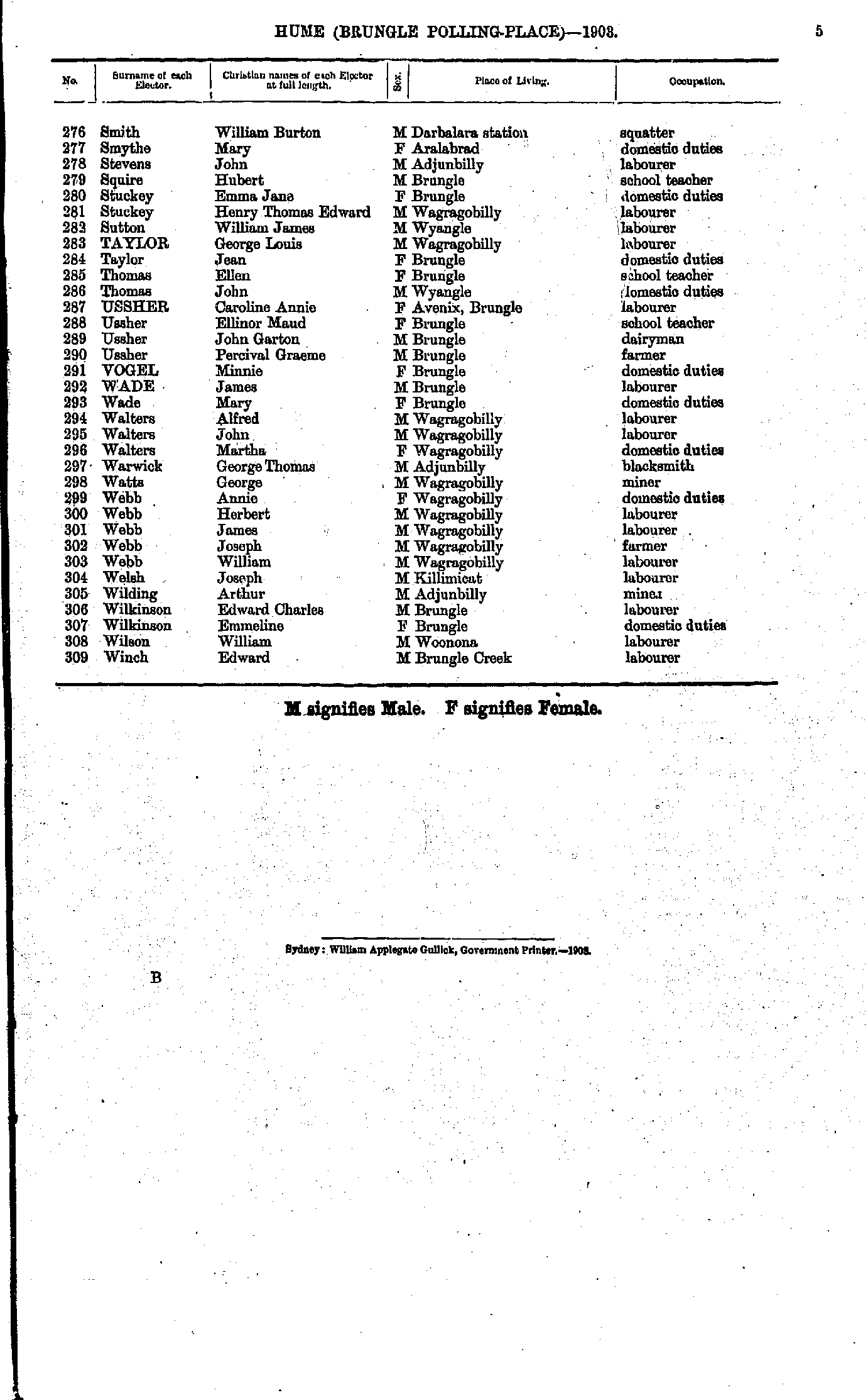
- M'Kenzie Alexander - Smith Job
- Smith William - Winch Edward
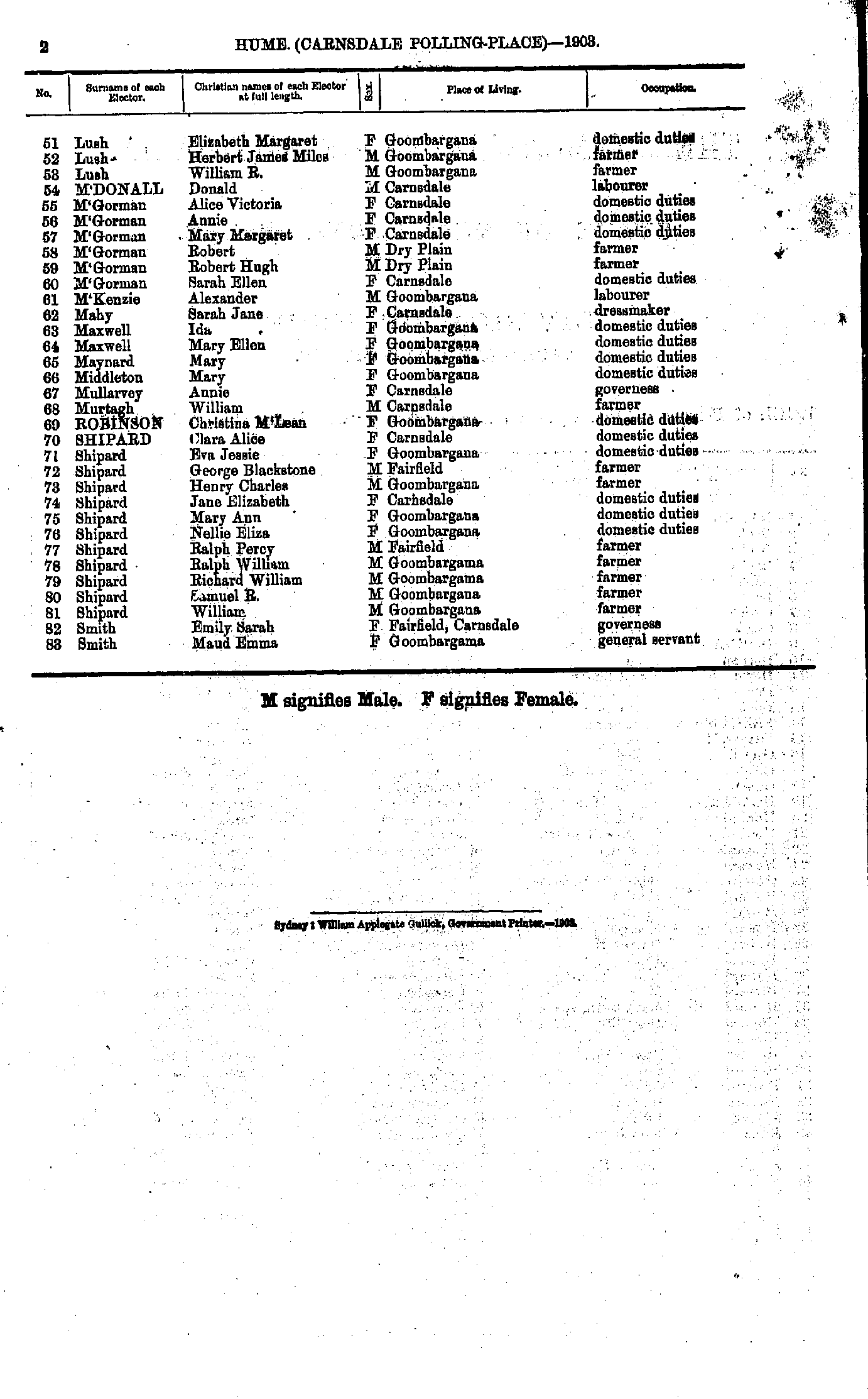
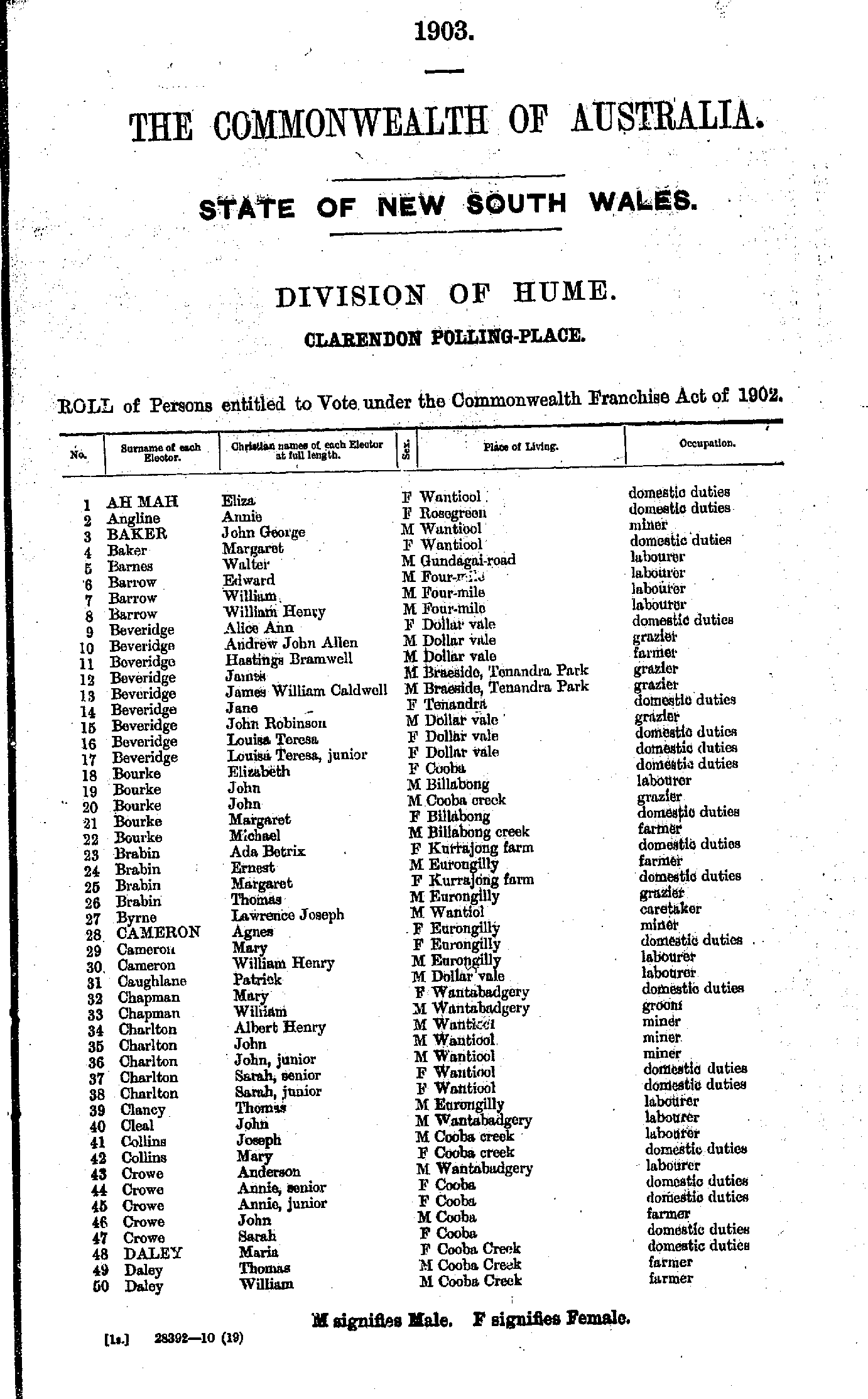
- Ahmah Eliza - Daley William
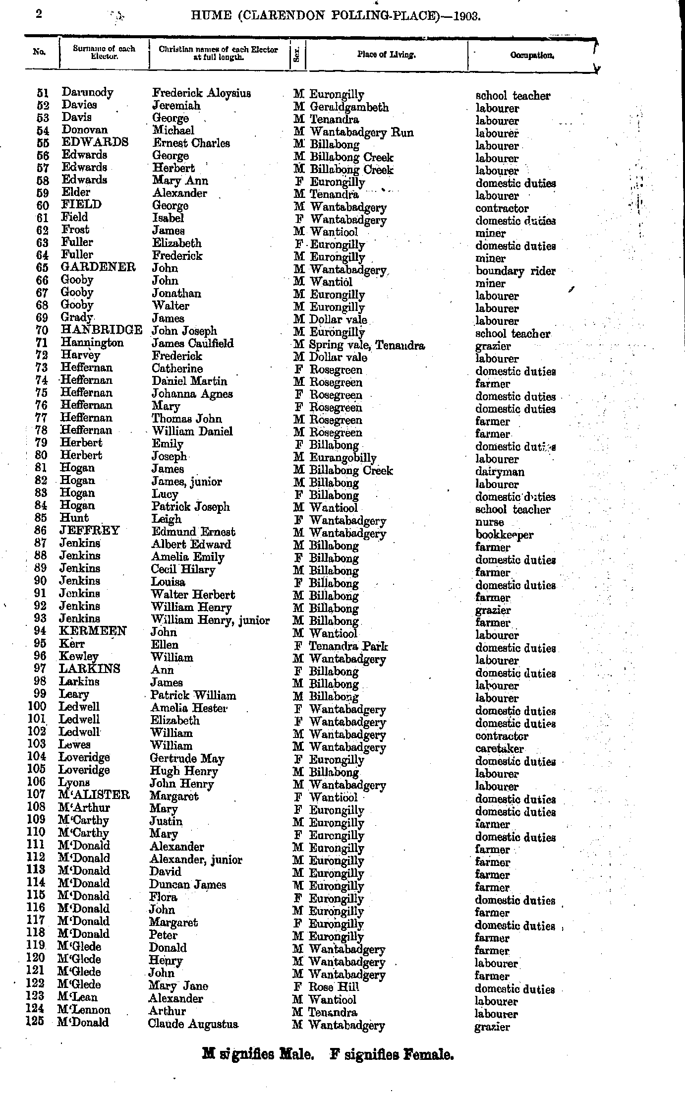
- Darunody Frederick - M'Donald Claude
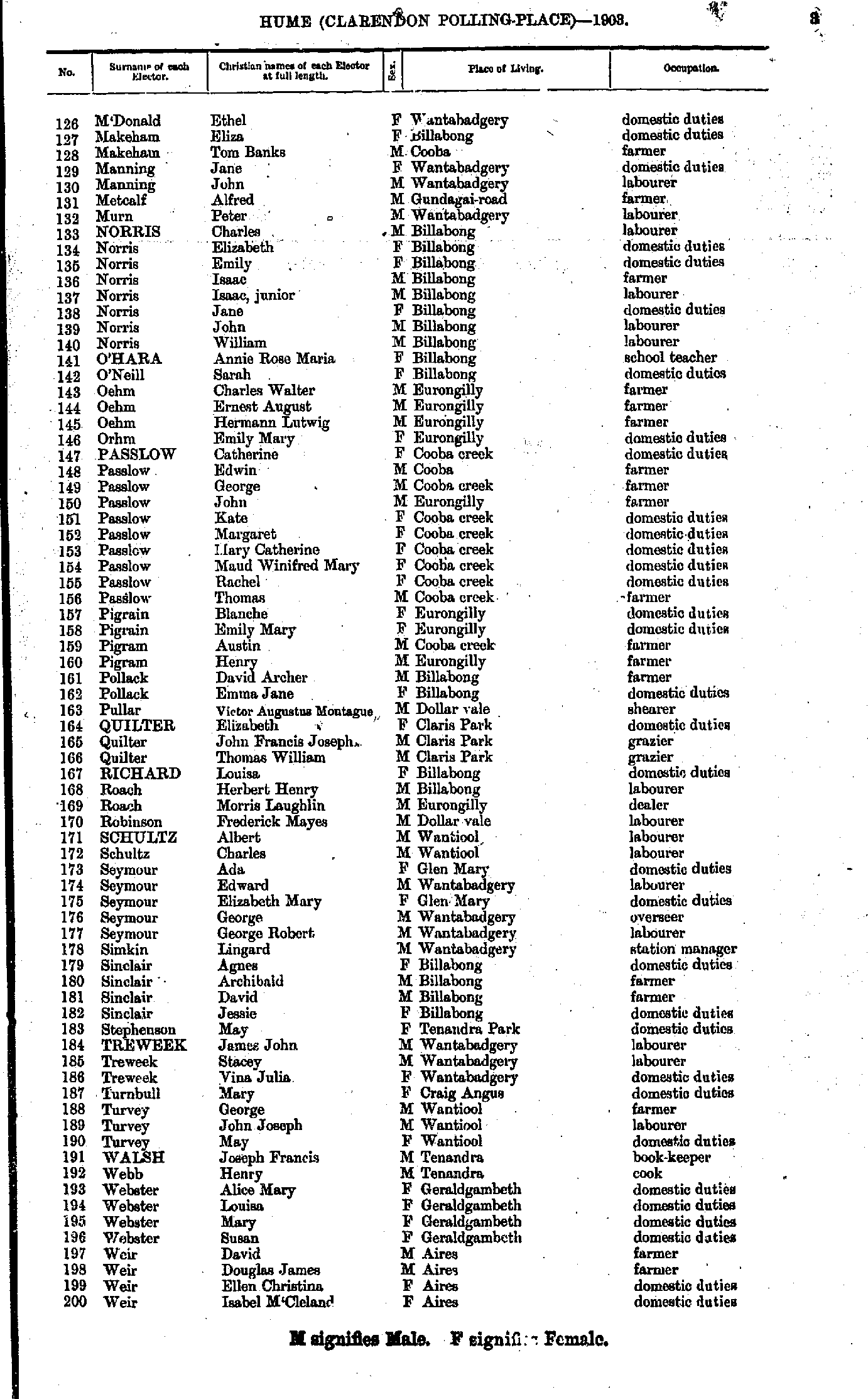
- M'Donald Ethel - Weir Isabel
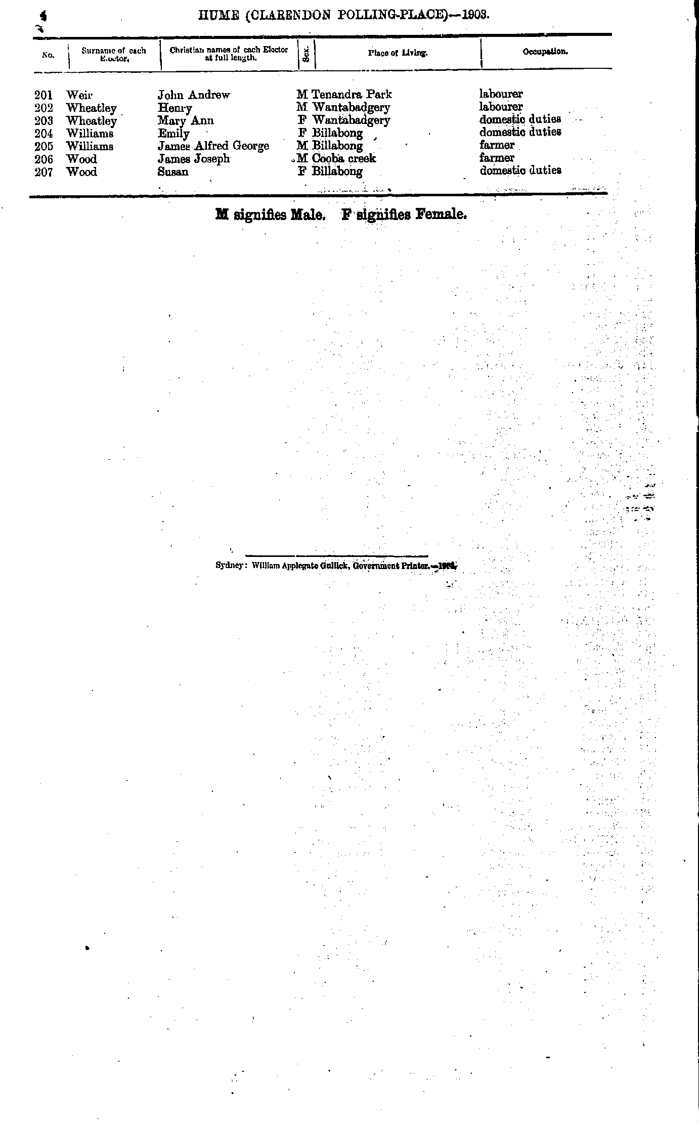
- Weir John - Wood Susan
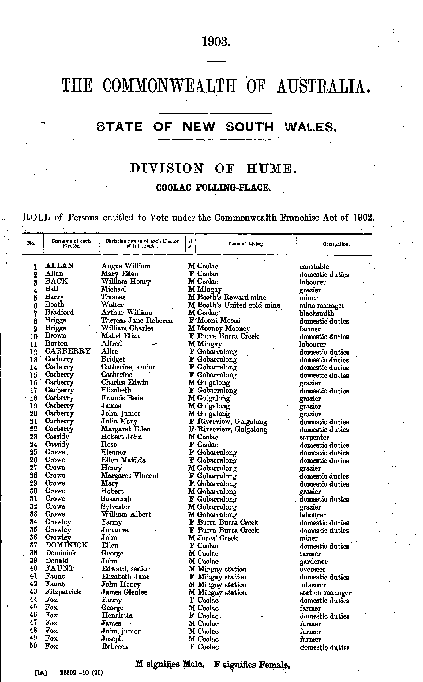
- Allan Angus - Fox Rebecca
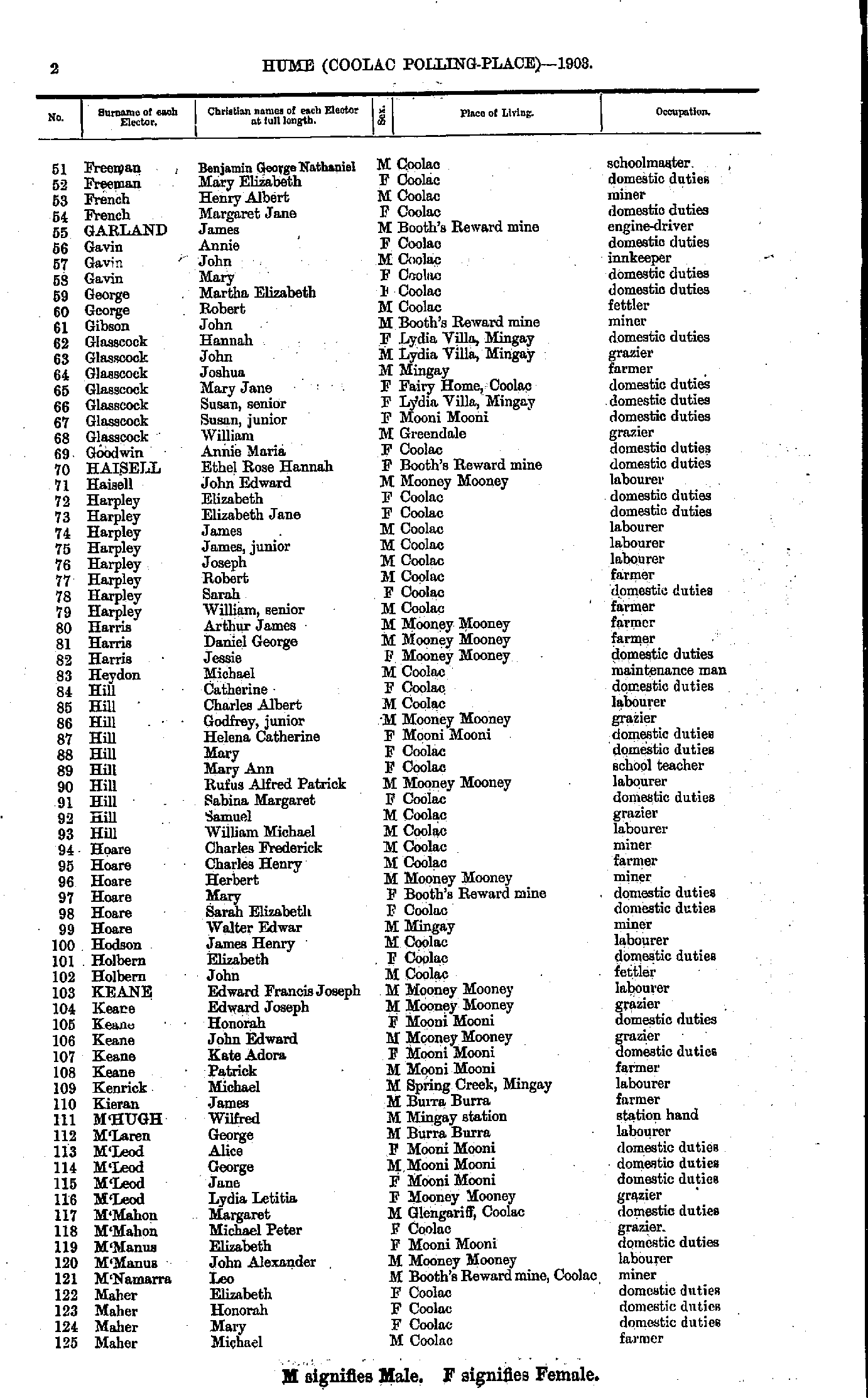
- Freeman Benjamin - Maher Michael
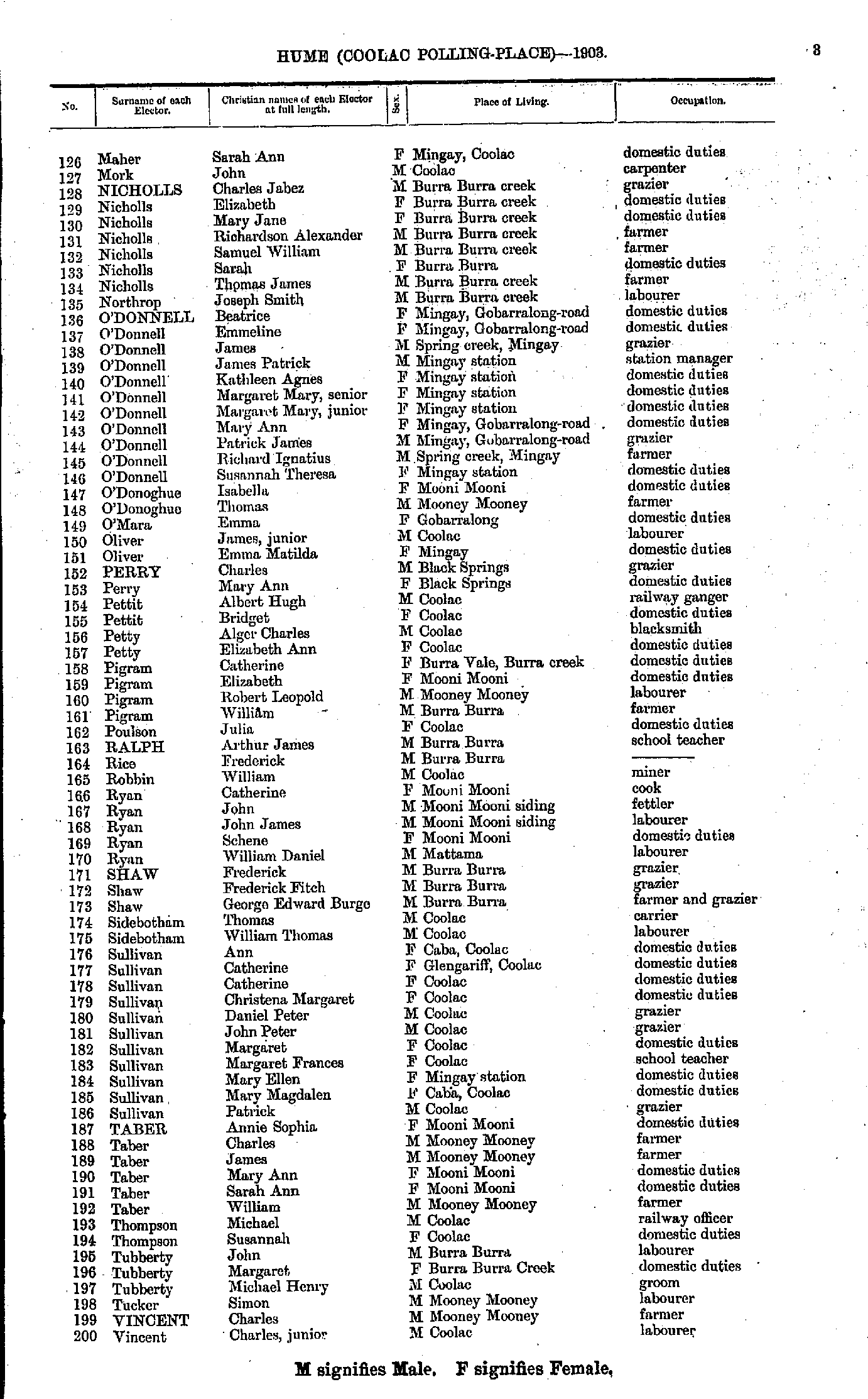
- Maher Sarah - Vincent Charles
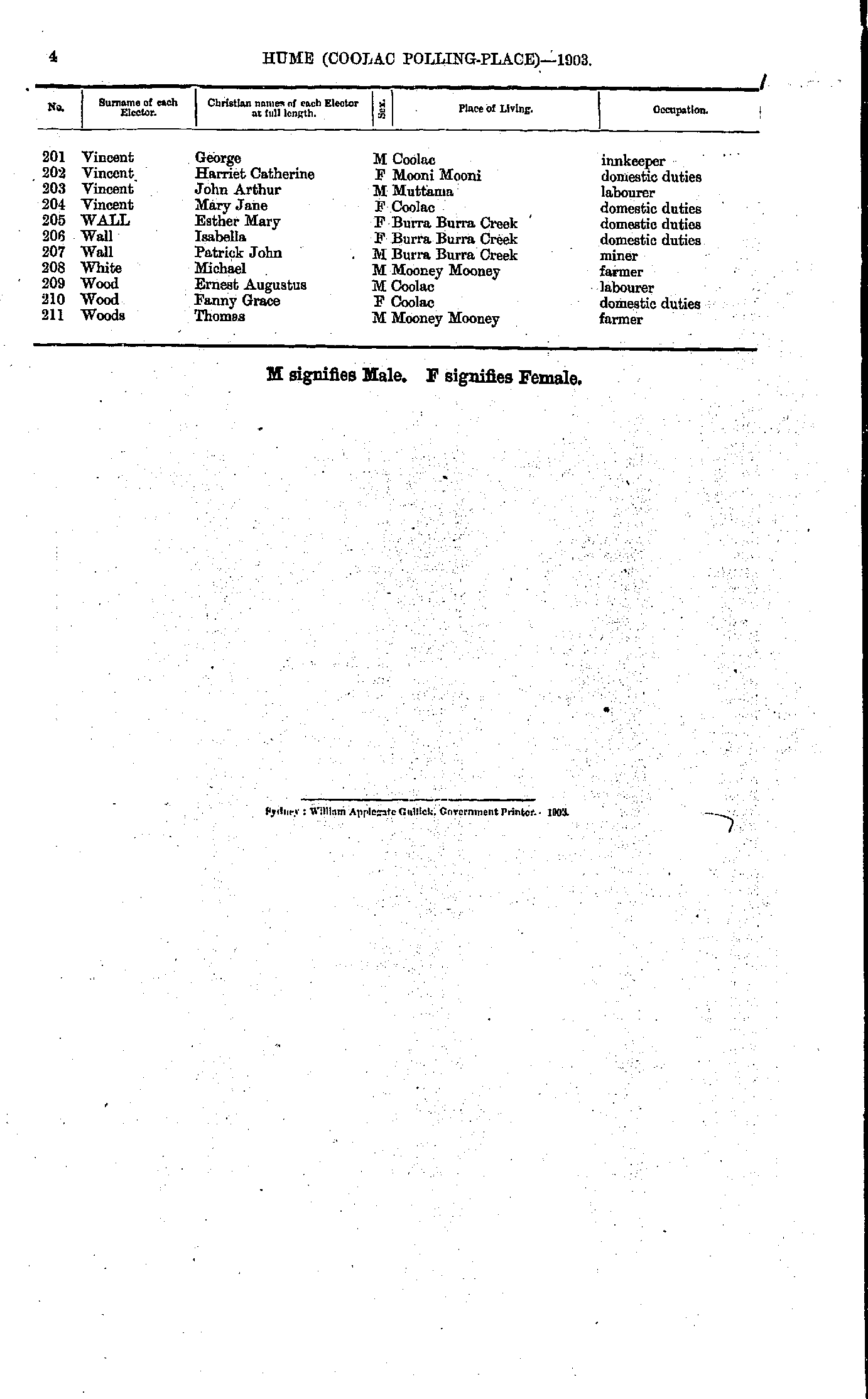
- Vincent George - Woods Thomas
- Abell Henry - Barker Annie.
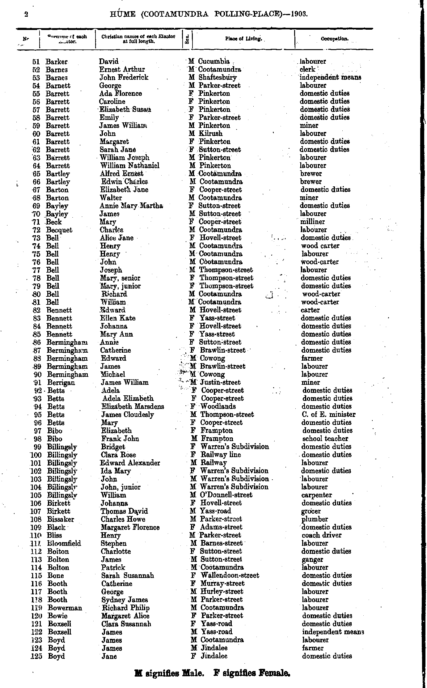
- Barker David - Boyd Jane
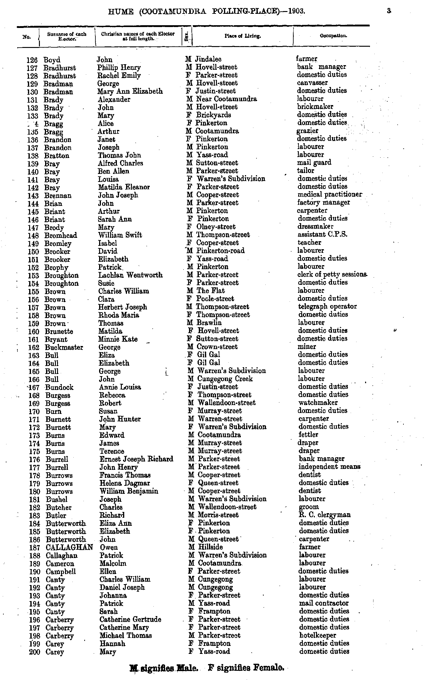
- Boyd John - Carey Mary
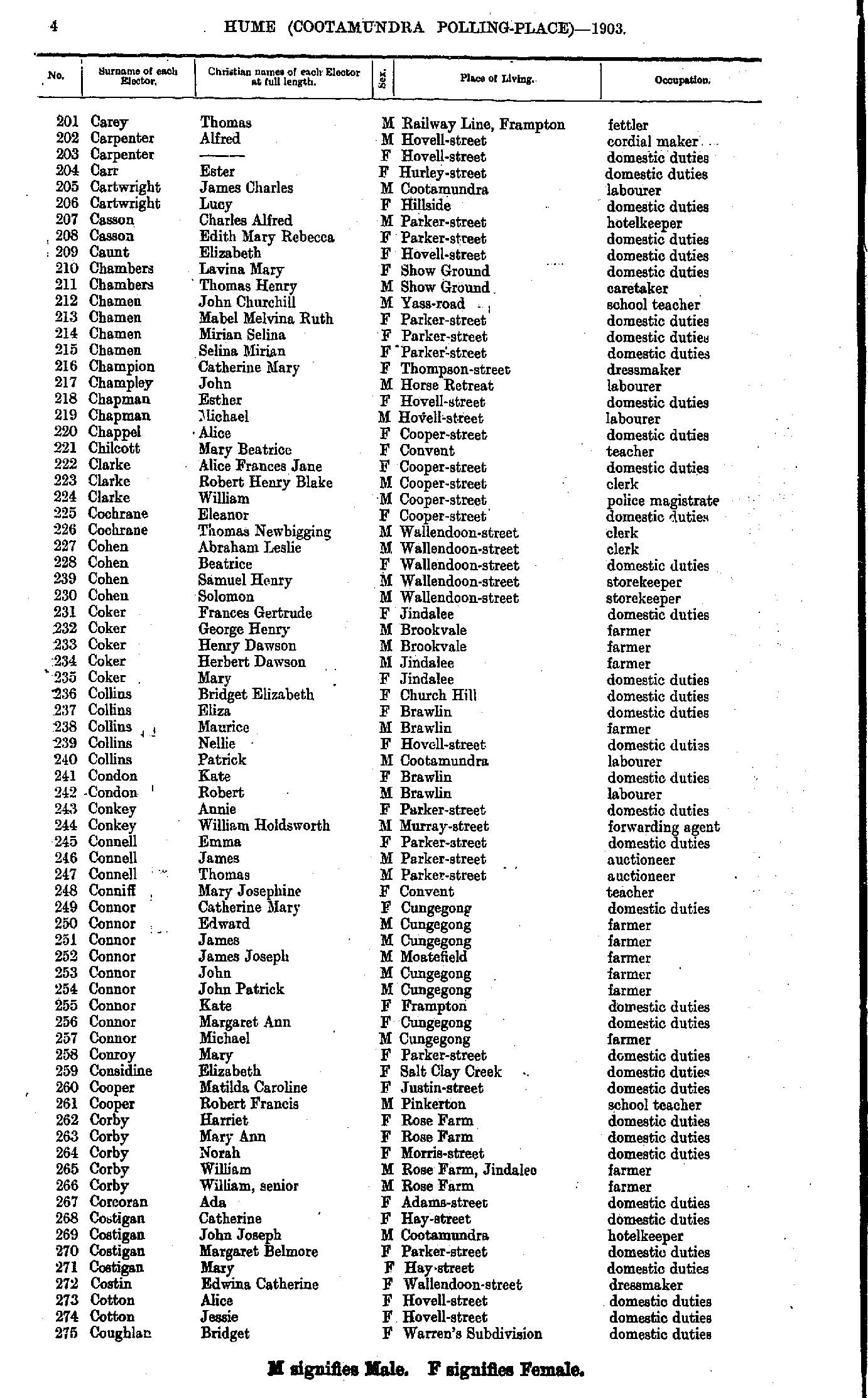
- Carey Thomas - Coughlan Bridget
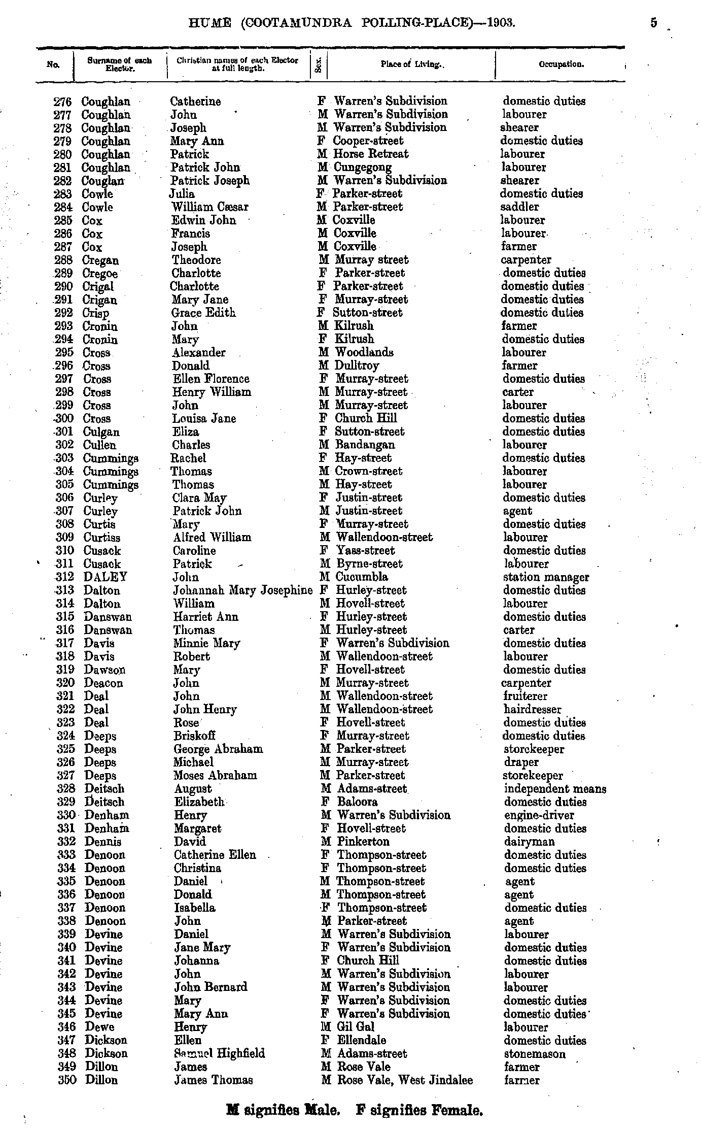
- Coughlan Catherine - Dillon James
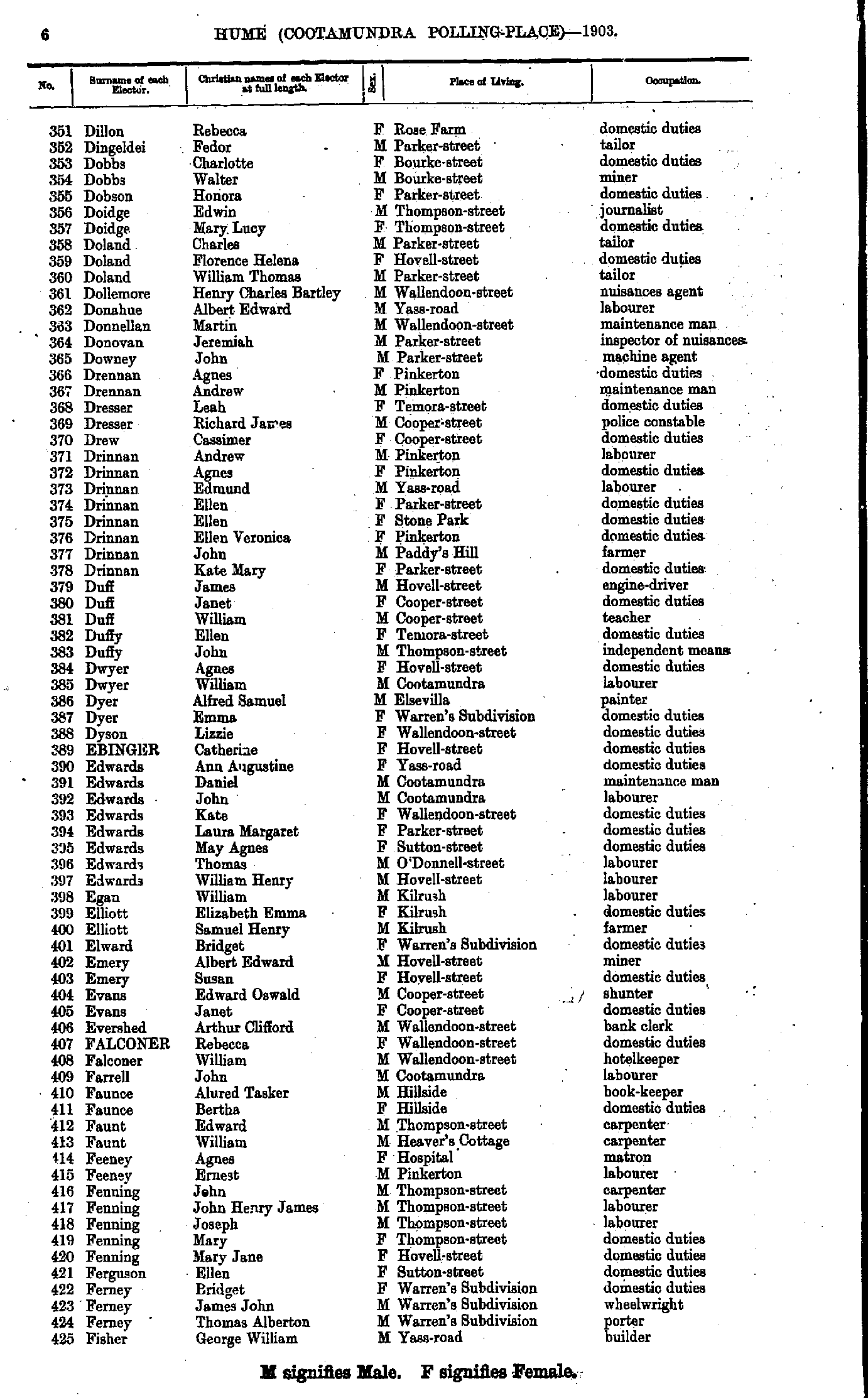
- Dillon Rebecca - Fisher George
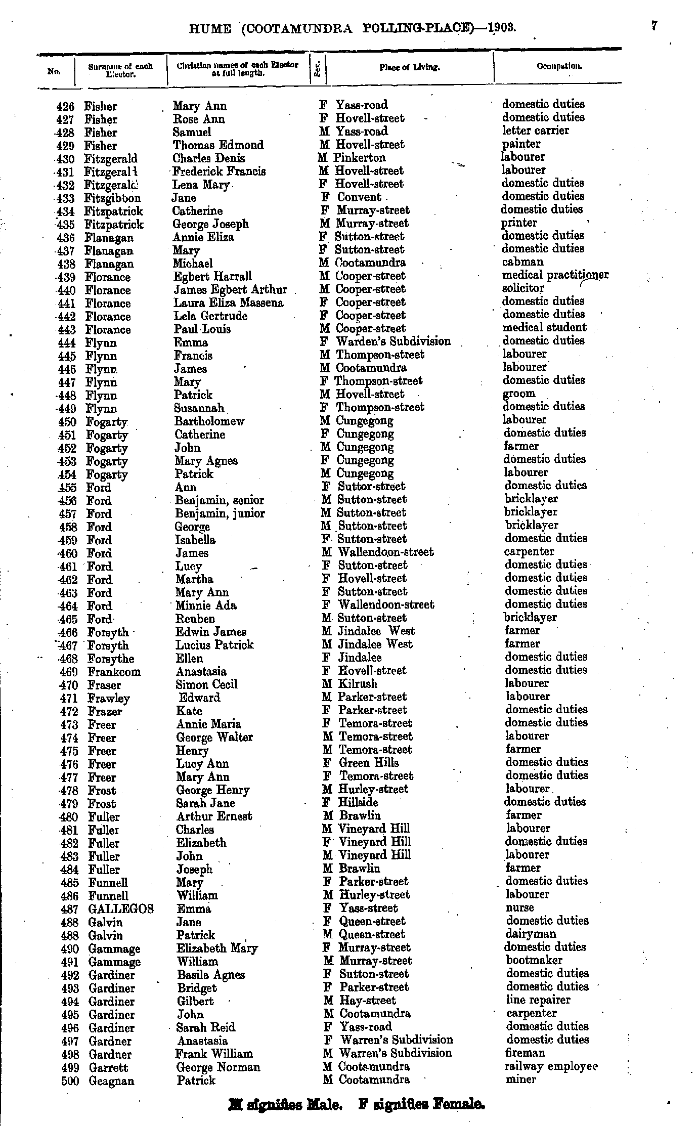
- Fisher Mary - Geagnan Patrick
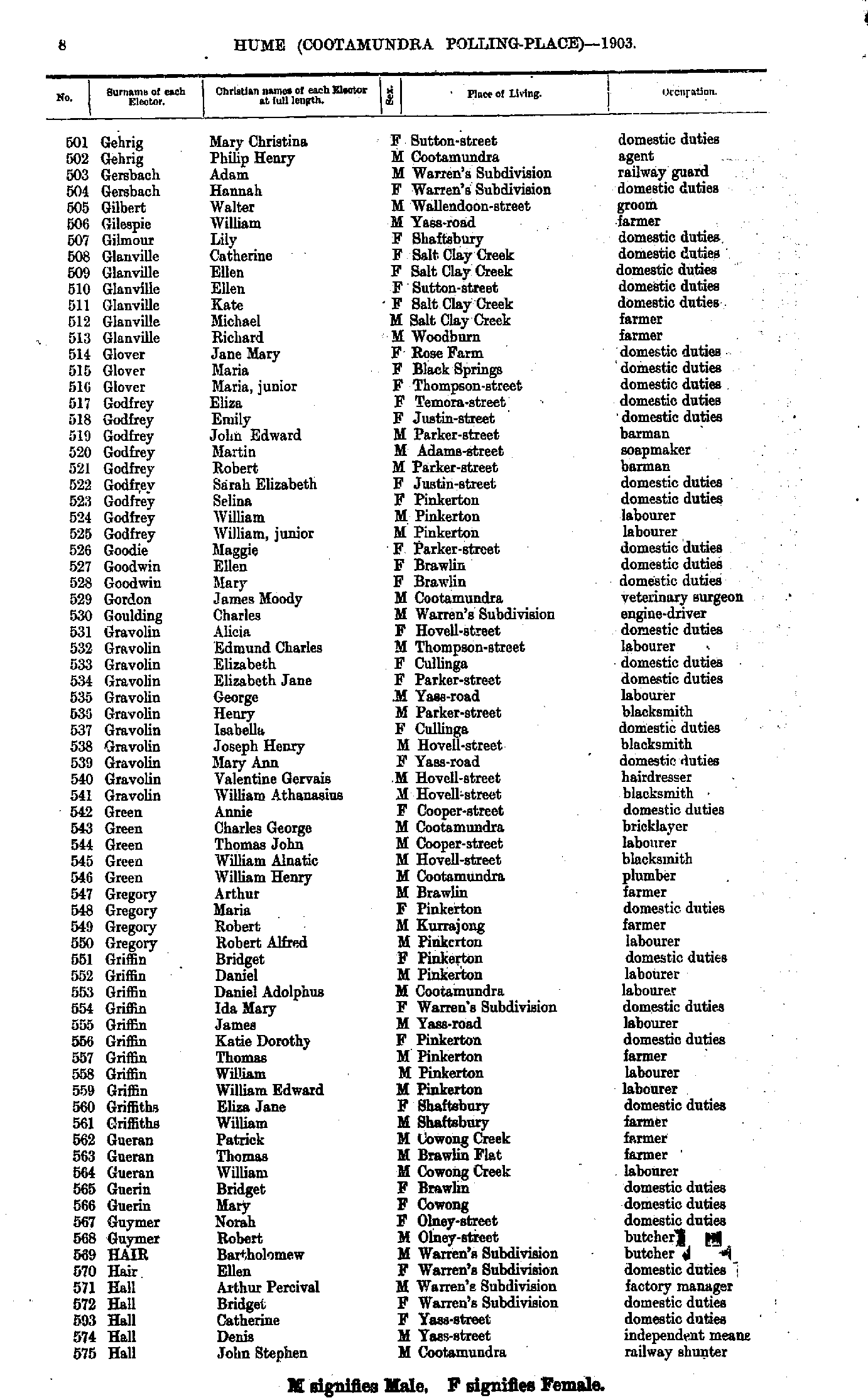
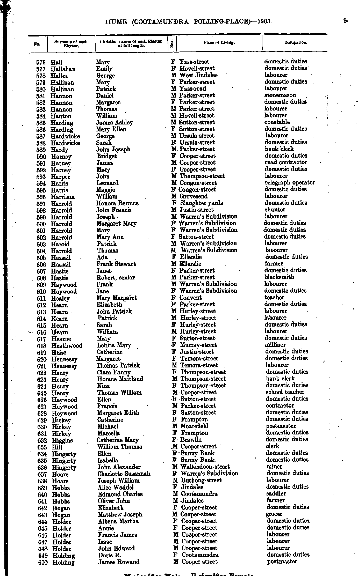
- Gehrig Mary - Hall John
- Hall Mary - Holding James
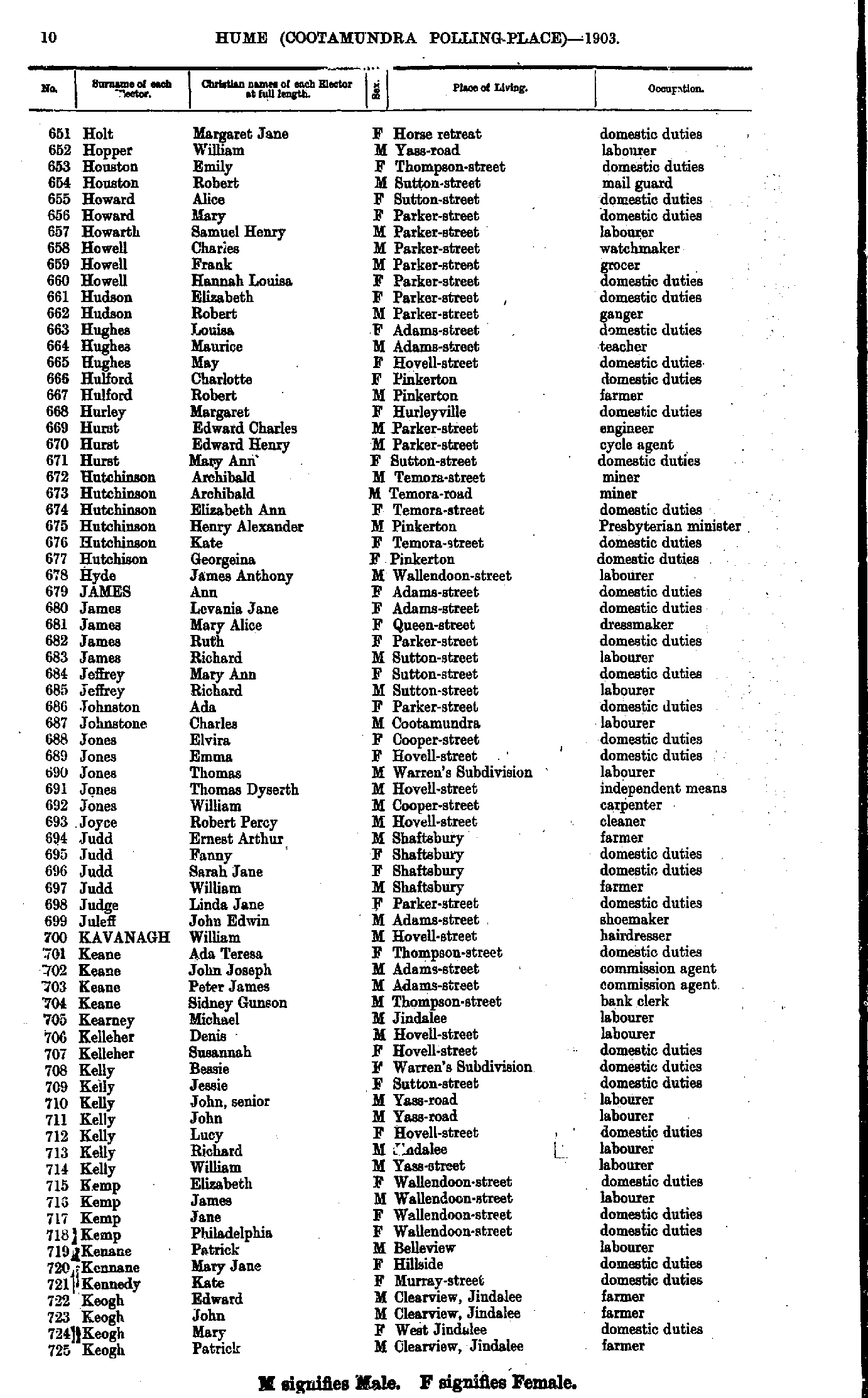
- Holt Margaret - Keogh Patrick
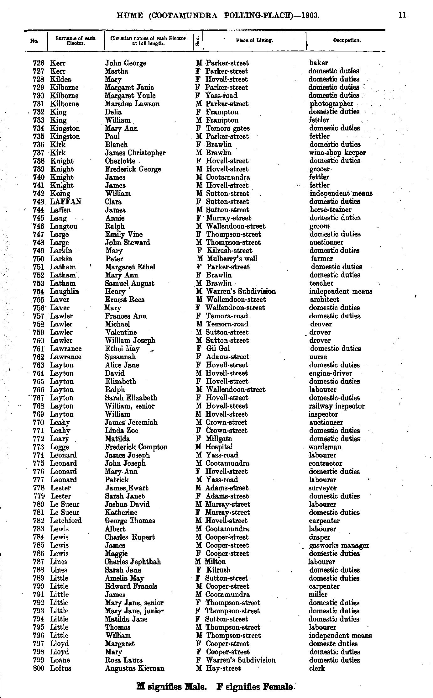
- Kerr John - Loftus Augustus
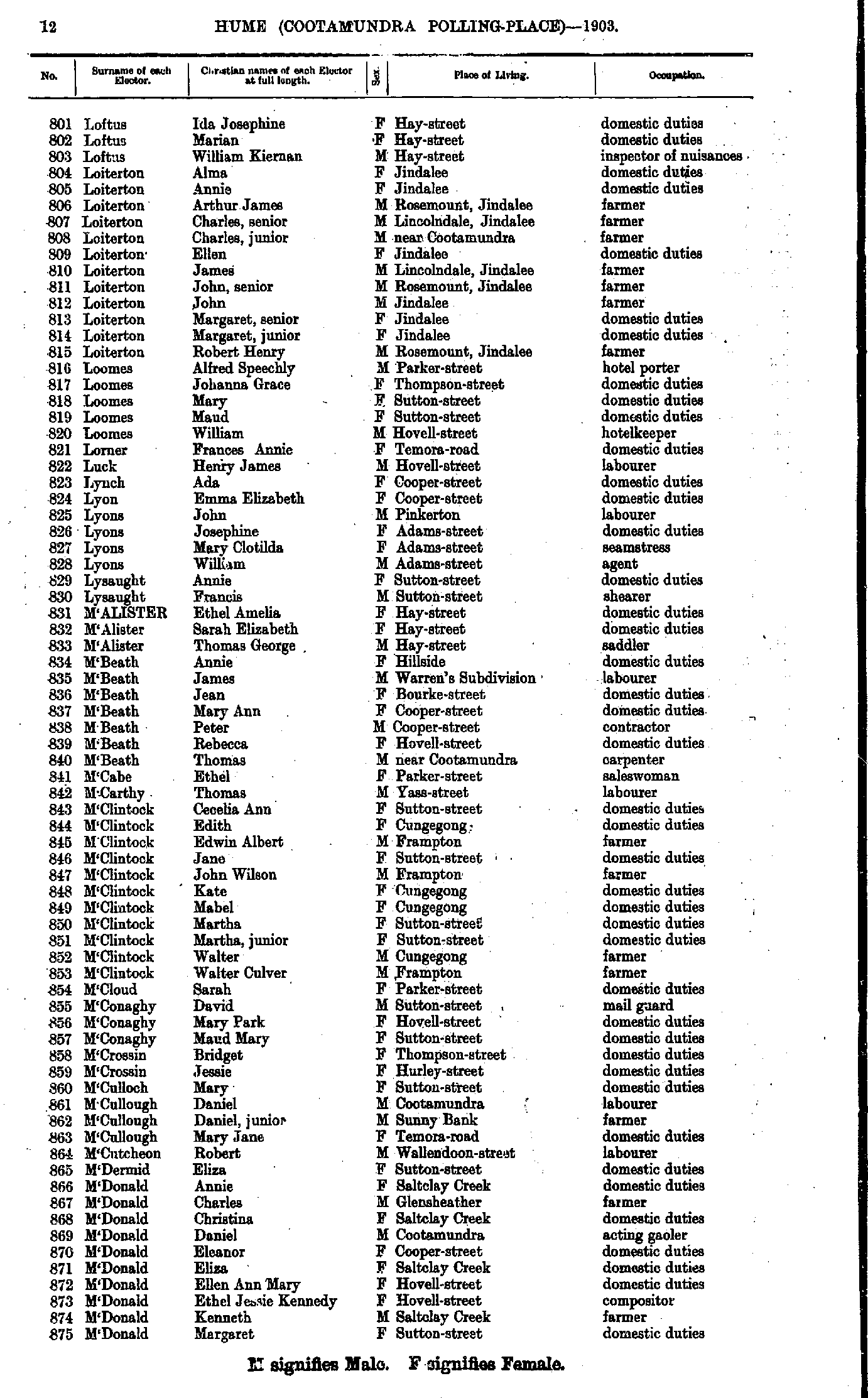
- Loftus Ida - M'Donald Margaret
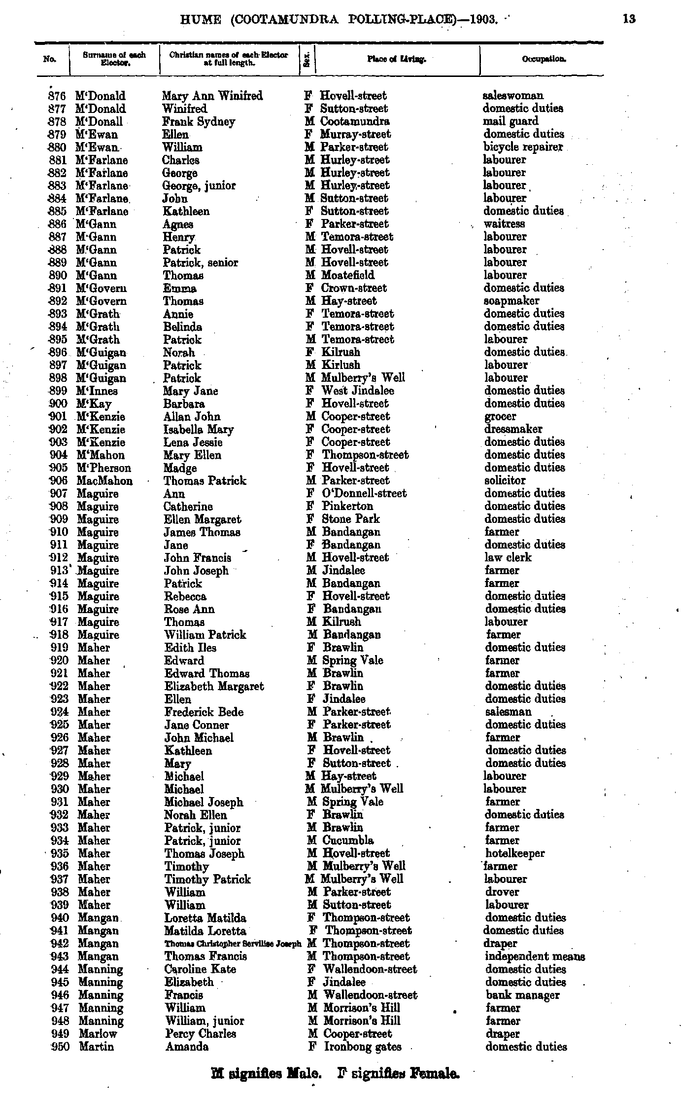
- M'Donald Mary - Martin Amanda
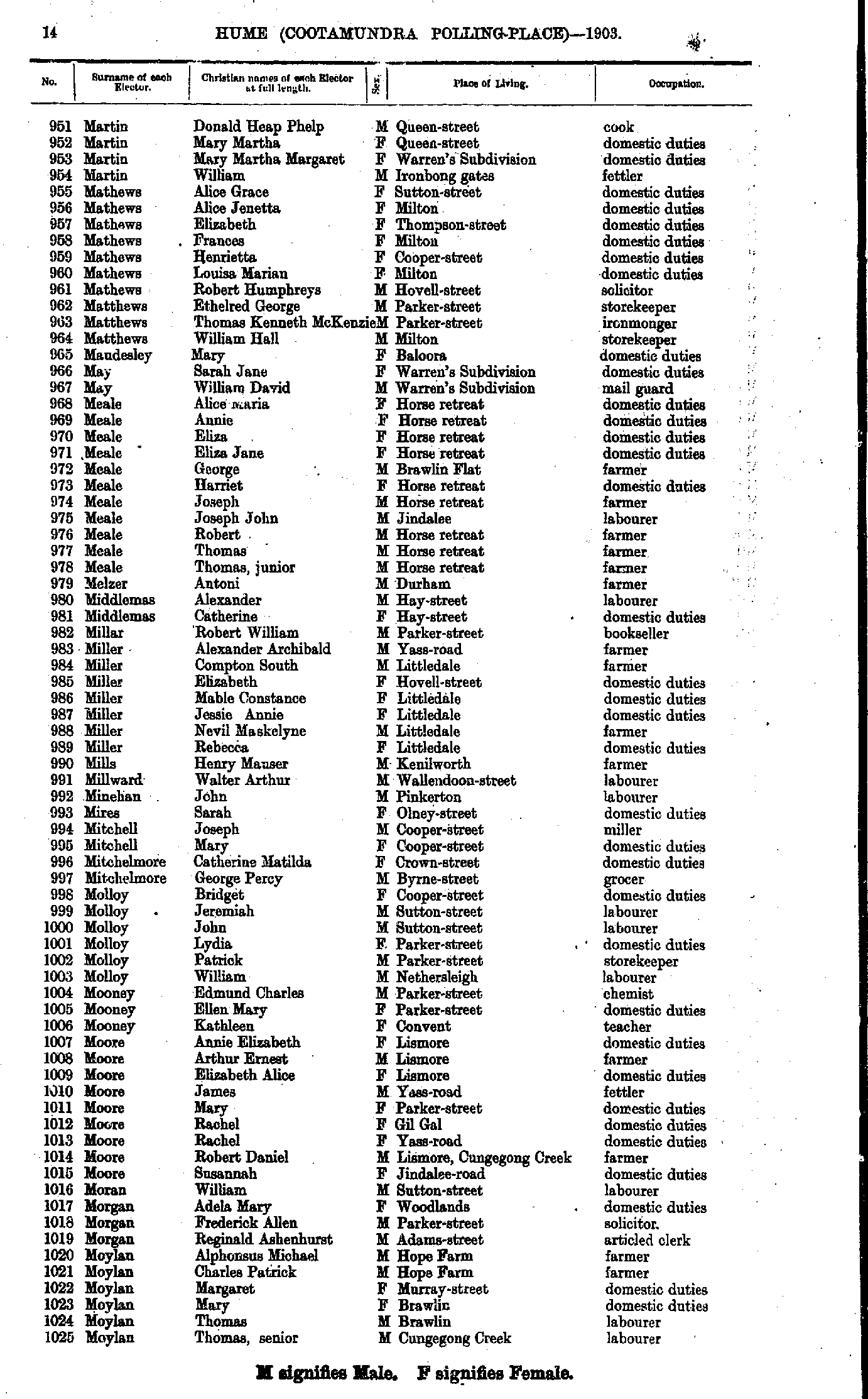
- Martin Donald - Moylan Thomas
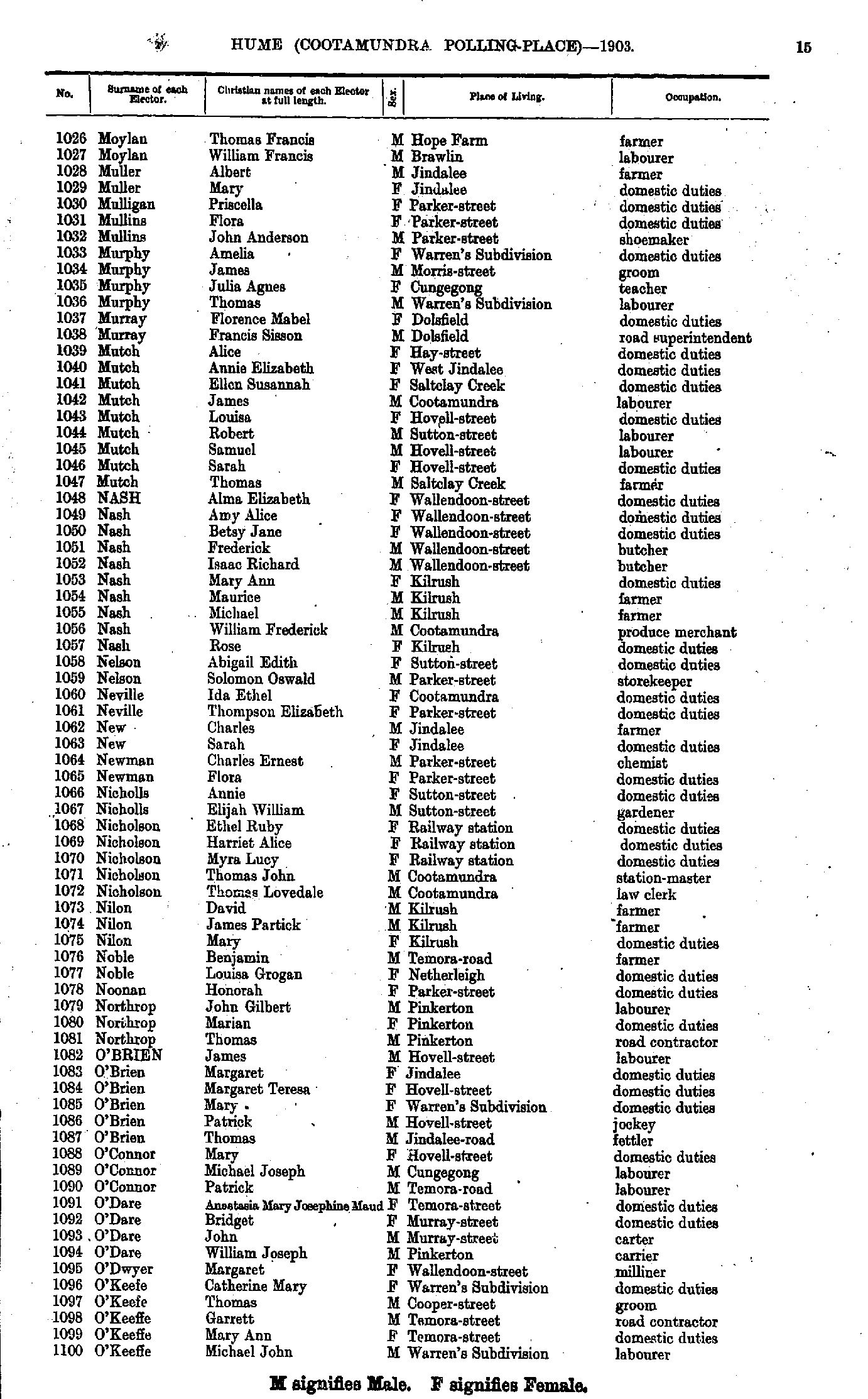
- Moylan Thomas - O'Keeffe Michael
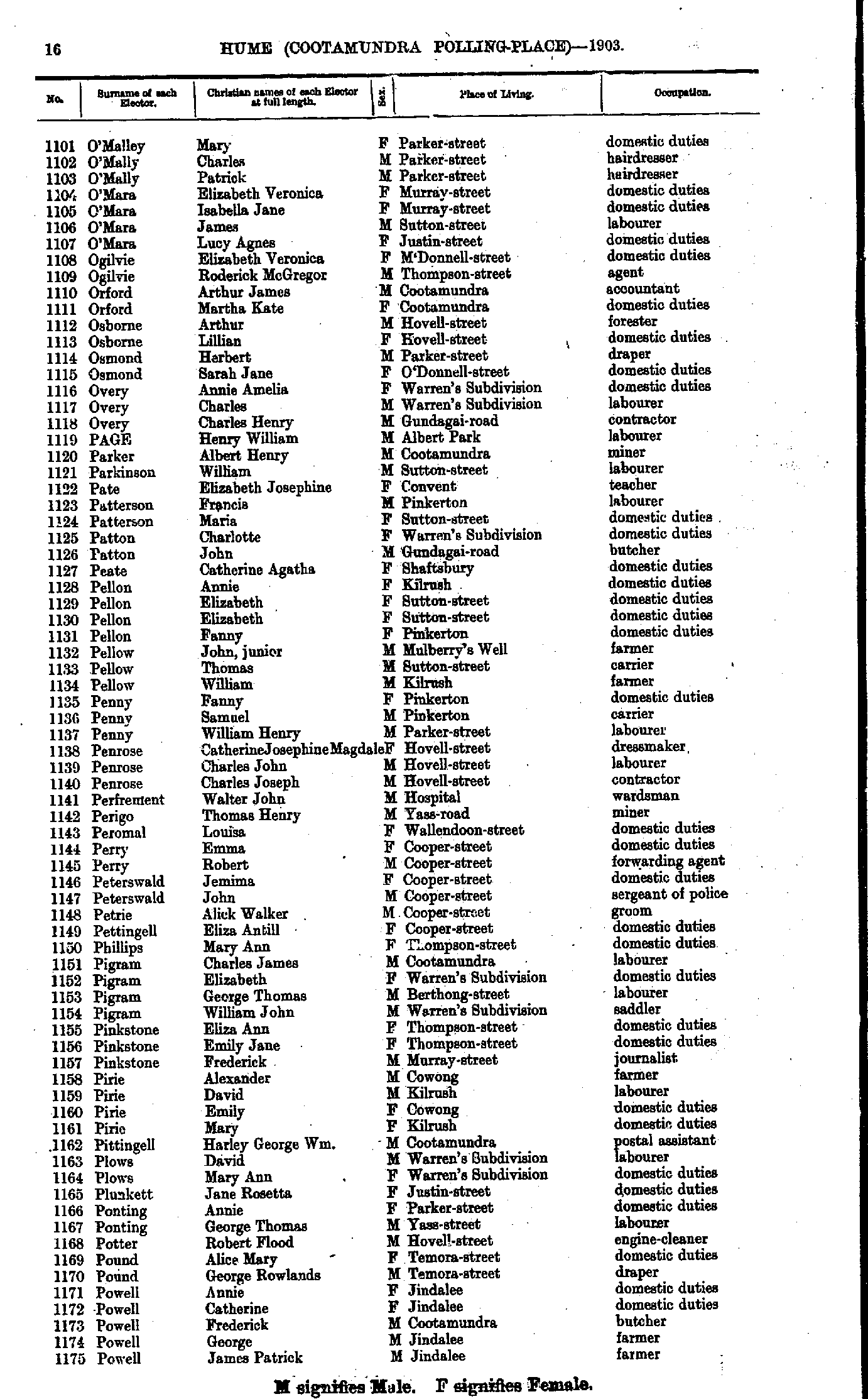
- O'Malley Mary - Powell James
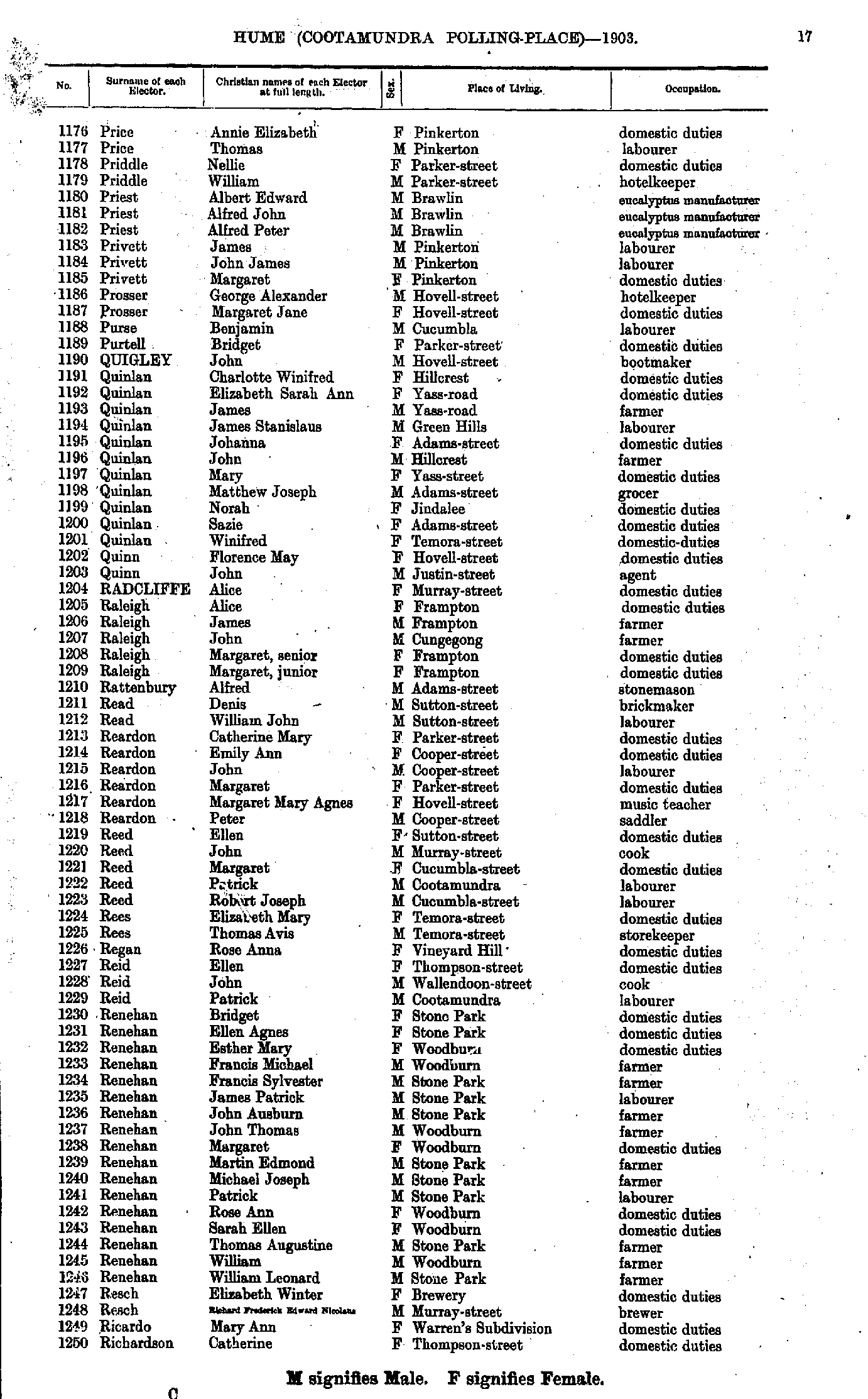
- Price Annie - Richardson Catherine
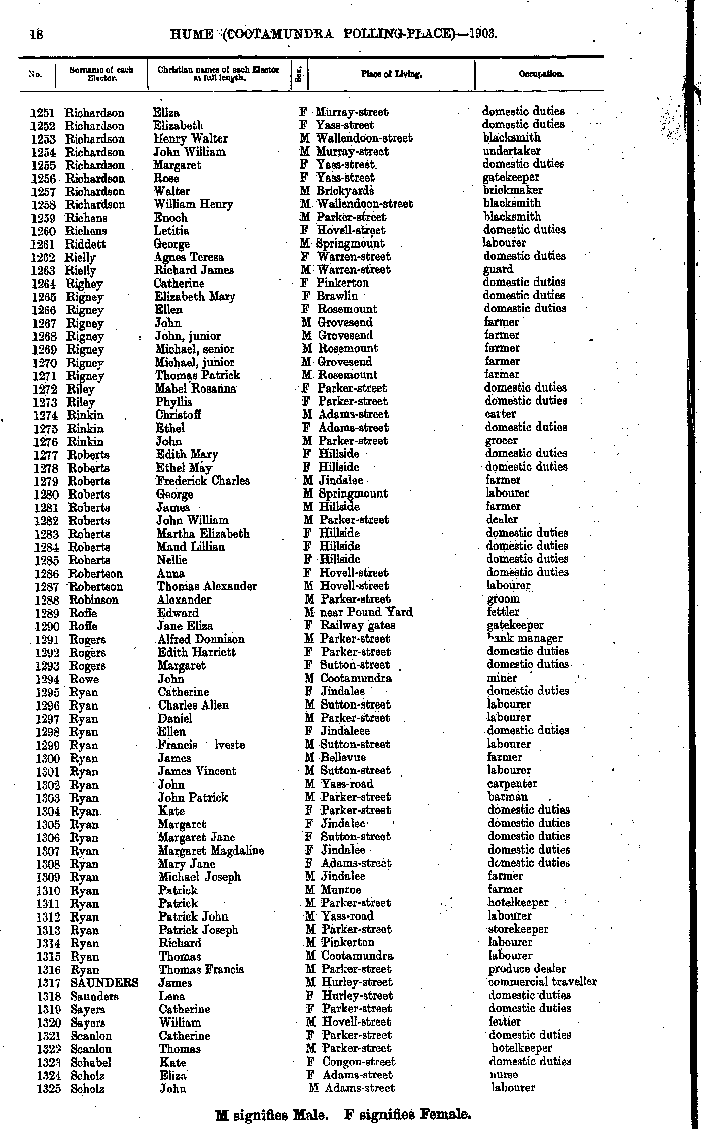
- Richardson Eliza - Scholz John
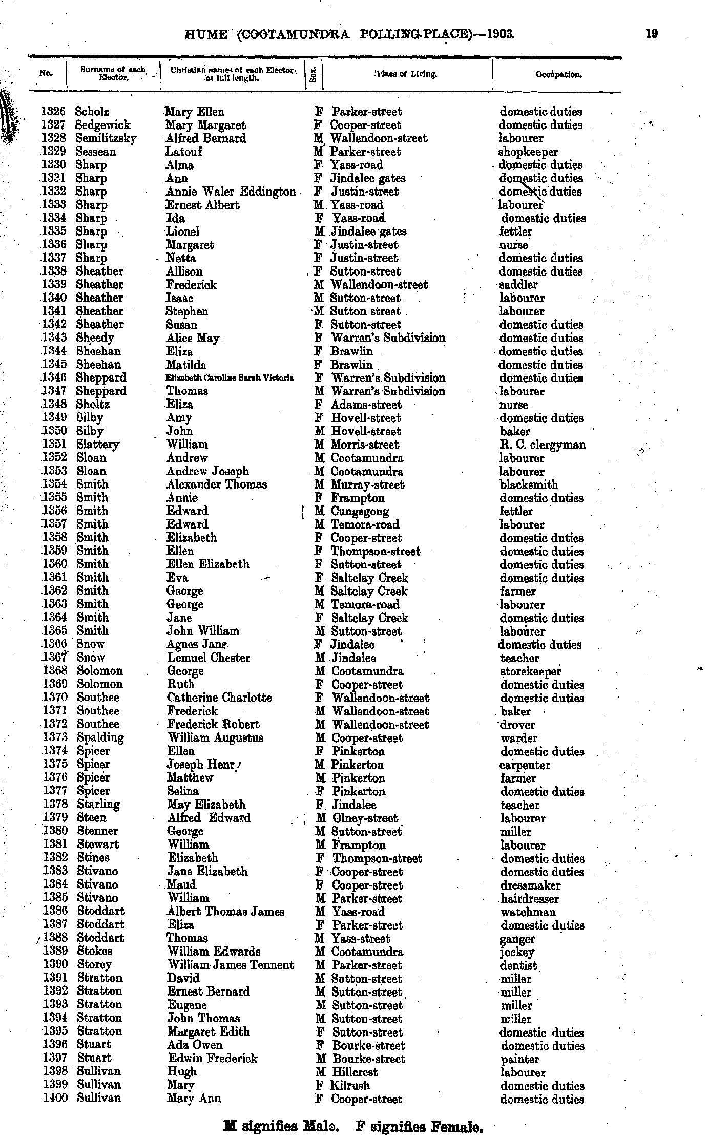
- Scholz Mary - Sullivan Mary
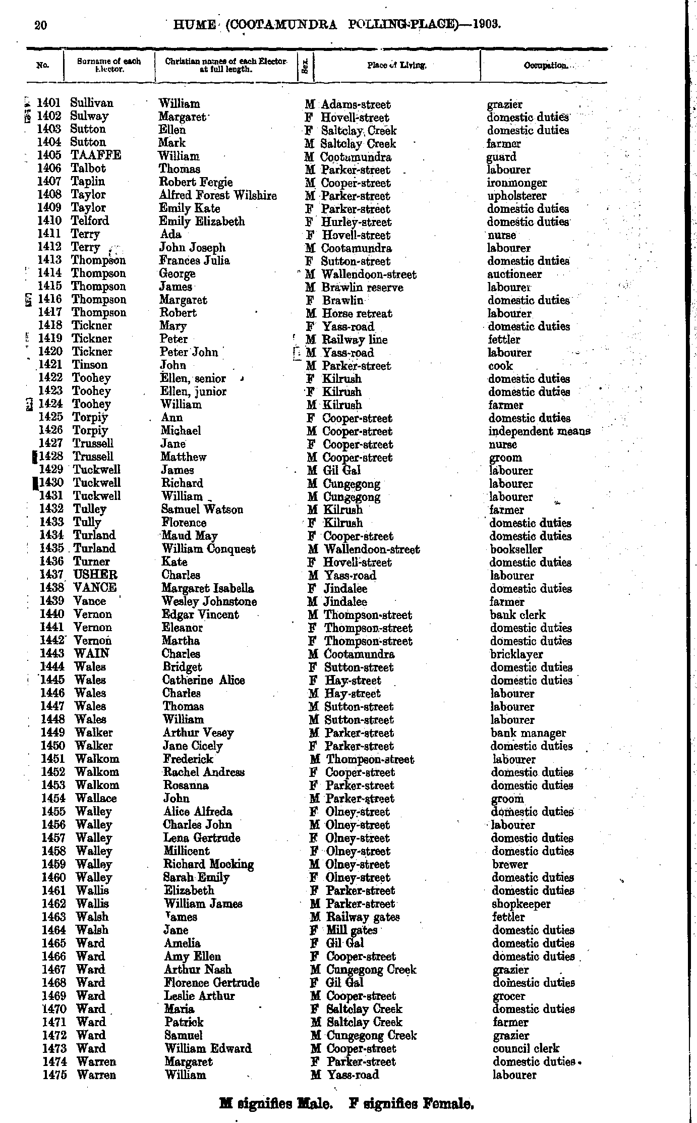
- Sullivan William - Warren William
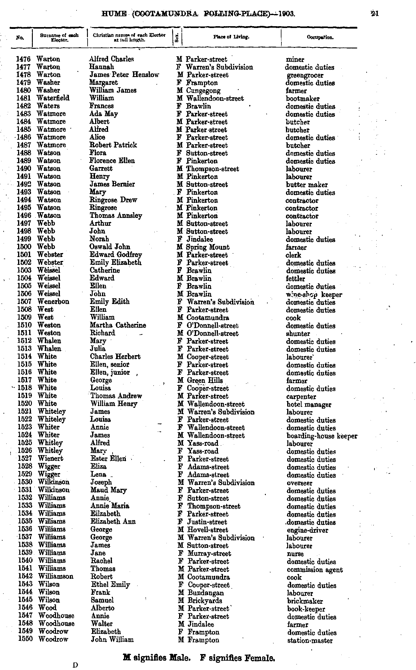
- Warton Alfred - Woodrow John
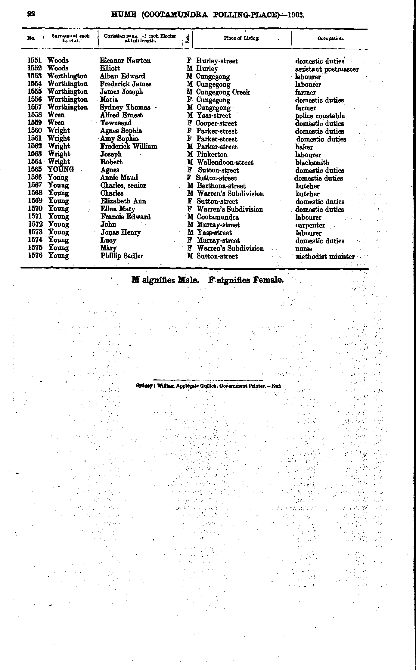
- Woods Eleanor - Young Phillip
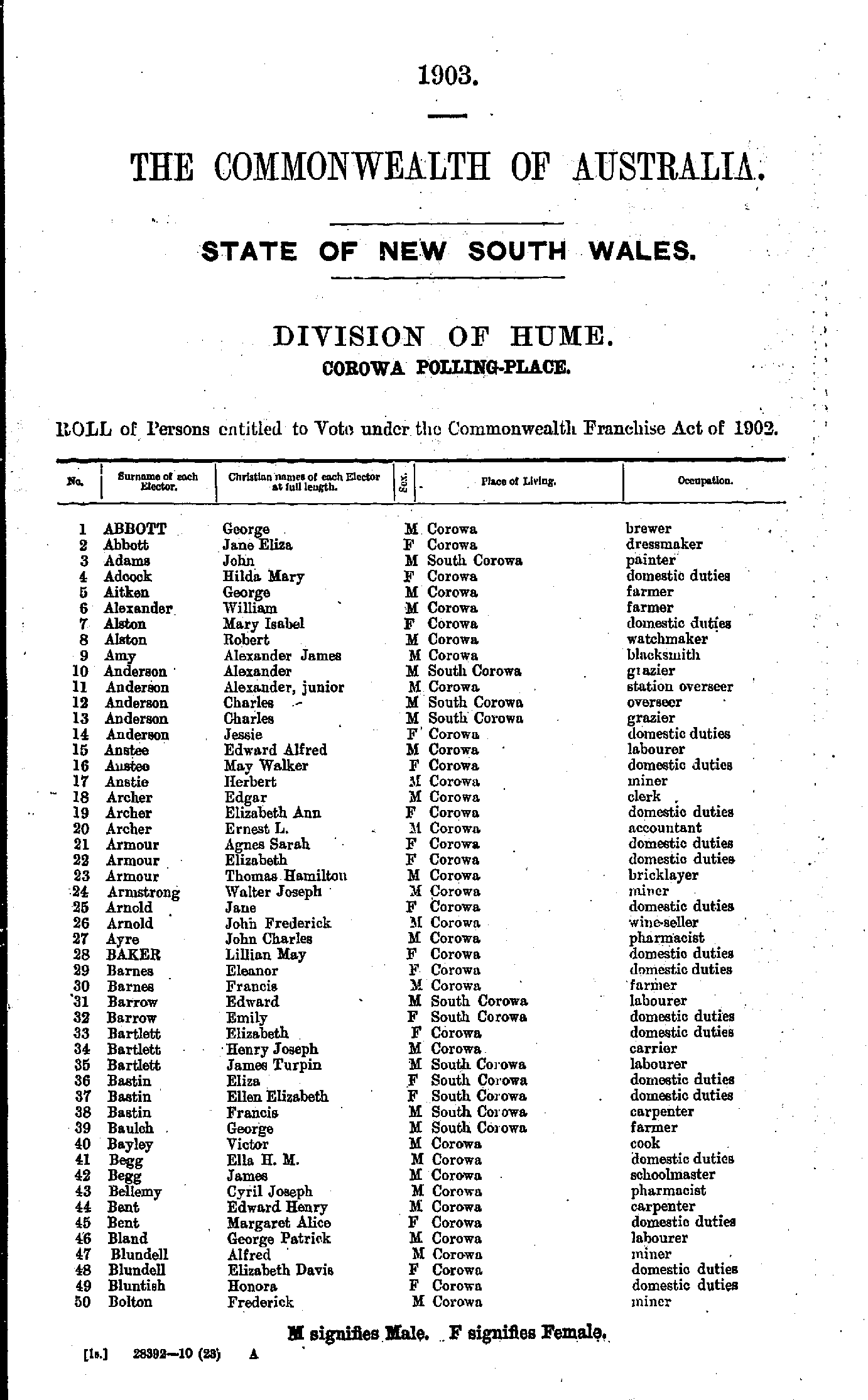
- Abbott George - Bolton Frederick
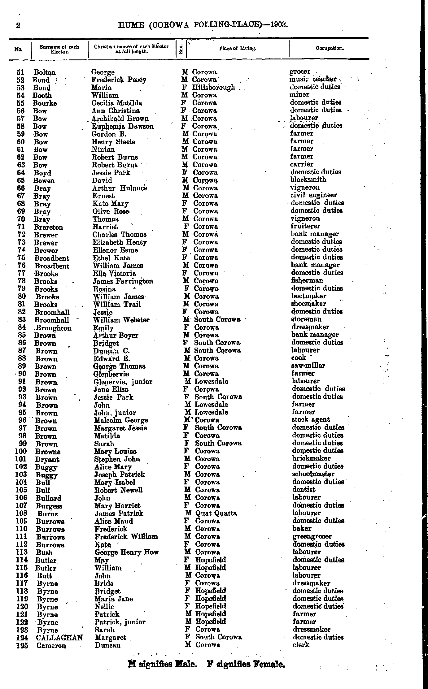
- Bolton George - Cameron Duncan
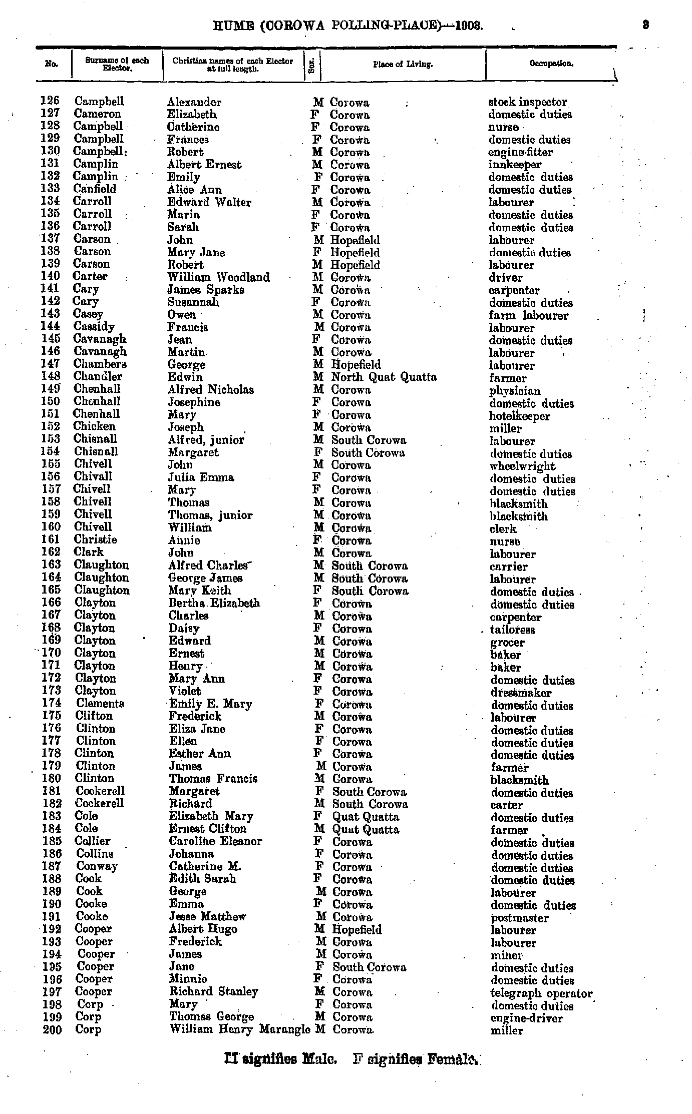
- Campbell Alexander - Corp William
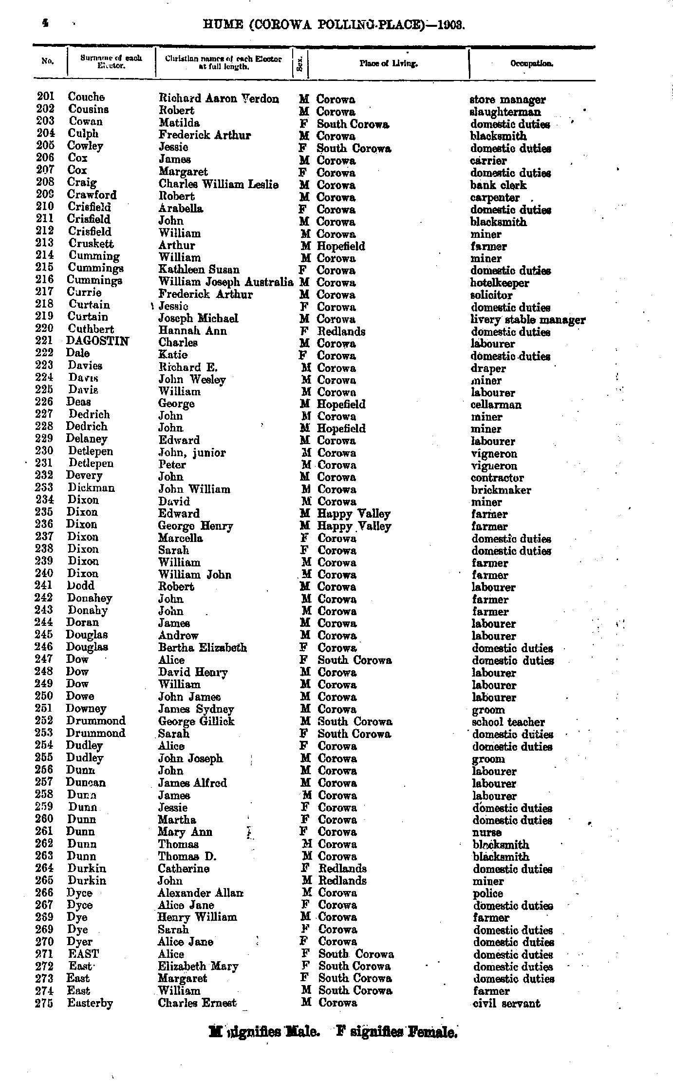
- Couche Richard - Easterby Charles
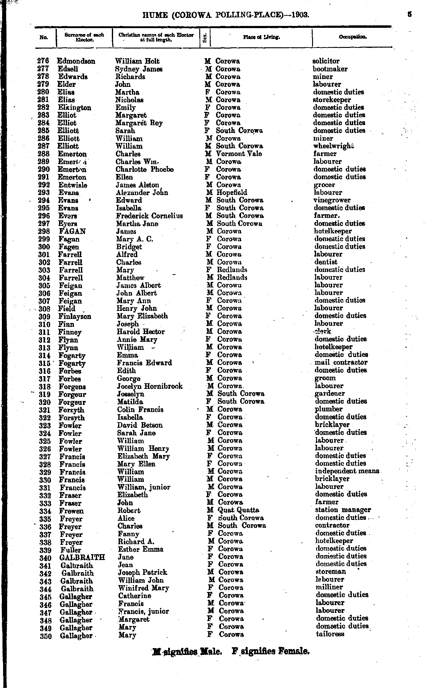
- Edmondson William - Gallagher Mary
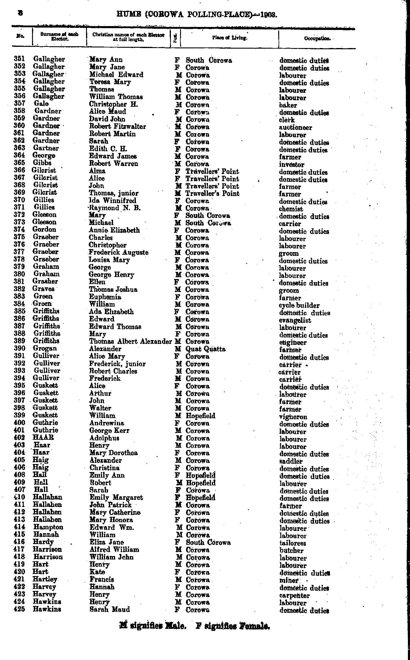
- Gallagher Mary - Hawkins Sarah
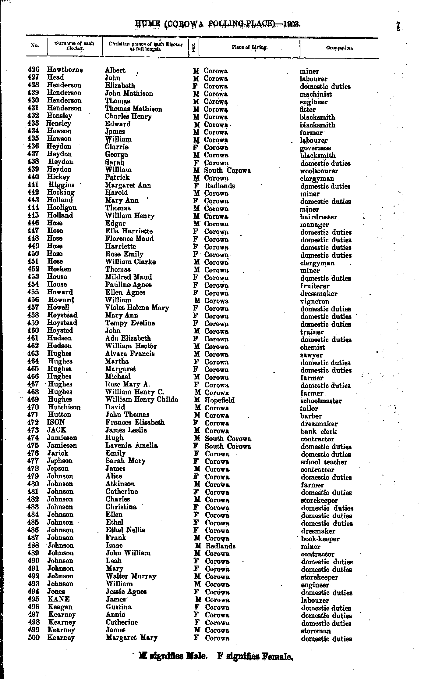
- Hawthorne Albert - Kearney Margaret
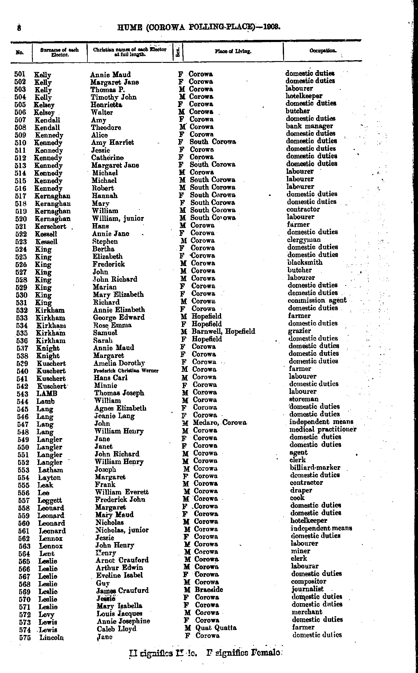
- Kelly Annie - Lincoln Jane
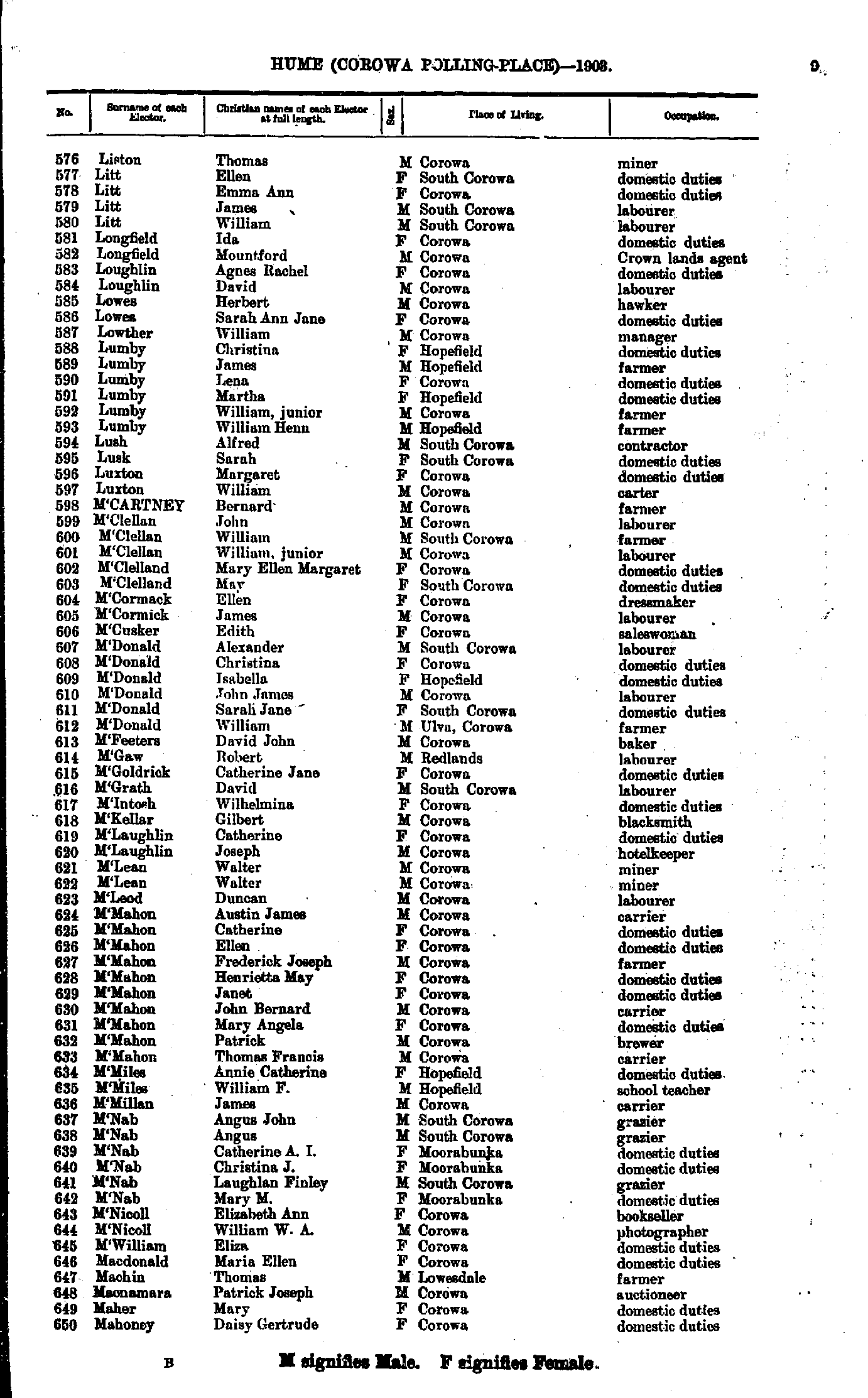
- Liston Thomas - Mahoney Daisy
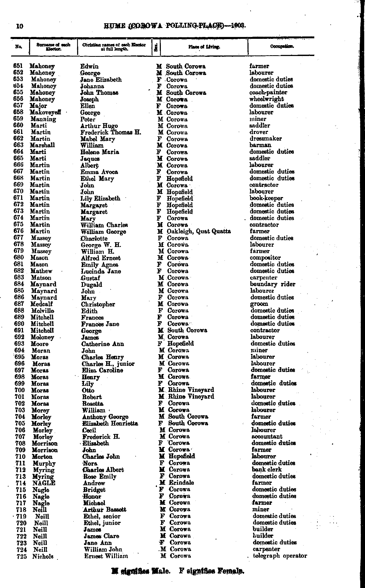
- Mahoney Edwin - Nichols Ernest
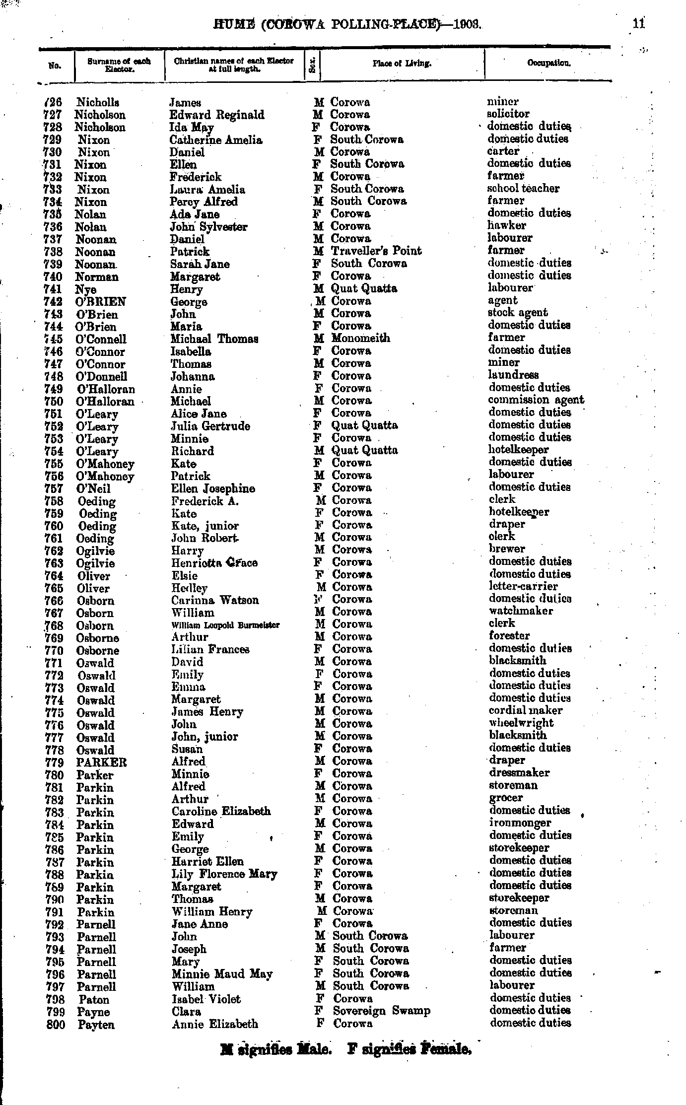
- Nicholls James - Payten Annie
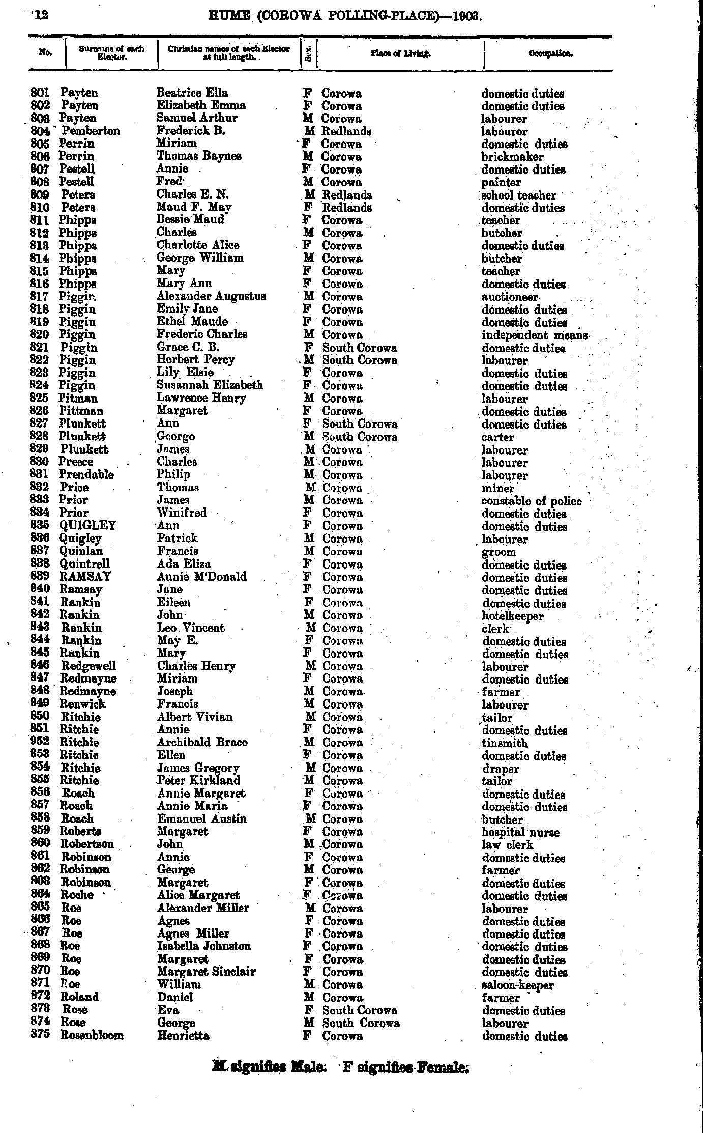
- Payten Beatrice - Rosenbloom Henrietta
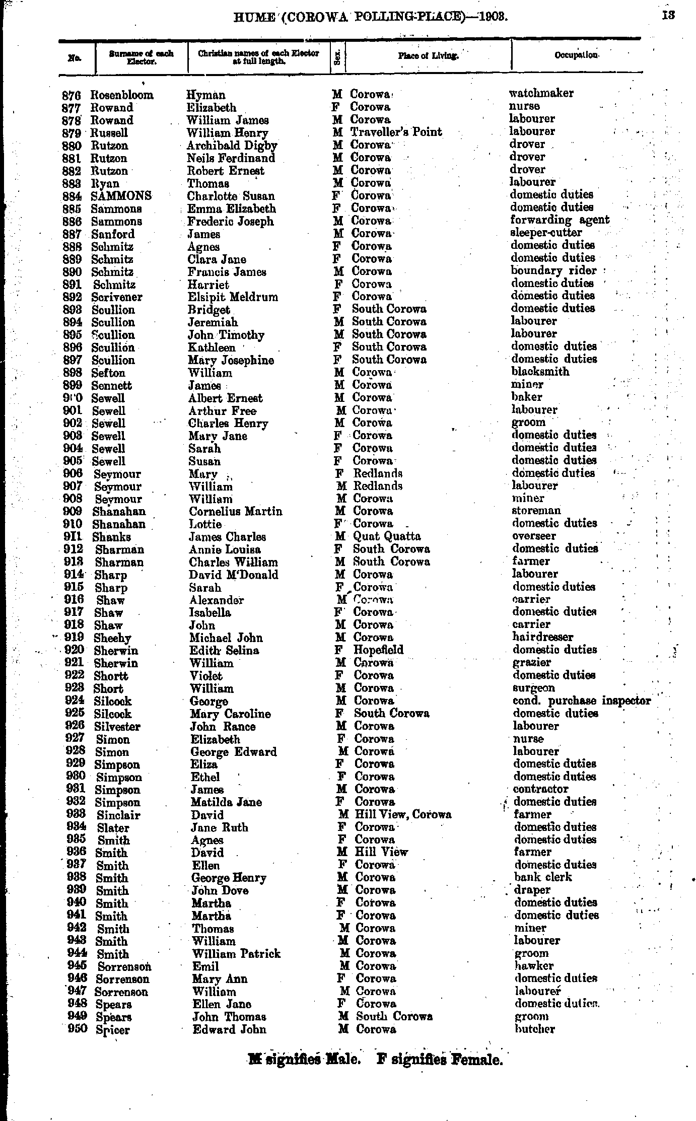
- Rosenbloom Hyman - Spicer Edward
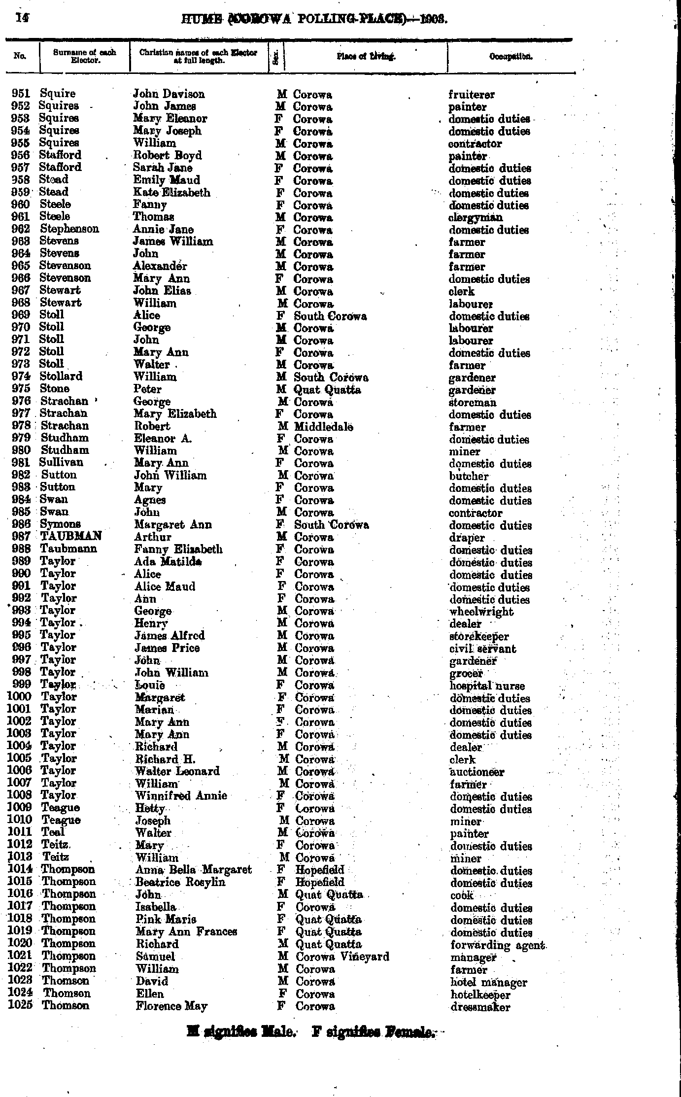
- Squire John - Thomson Florence
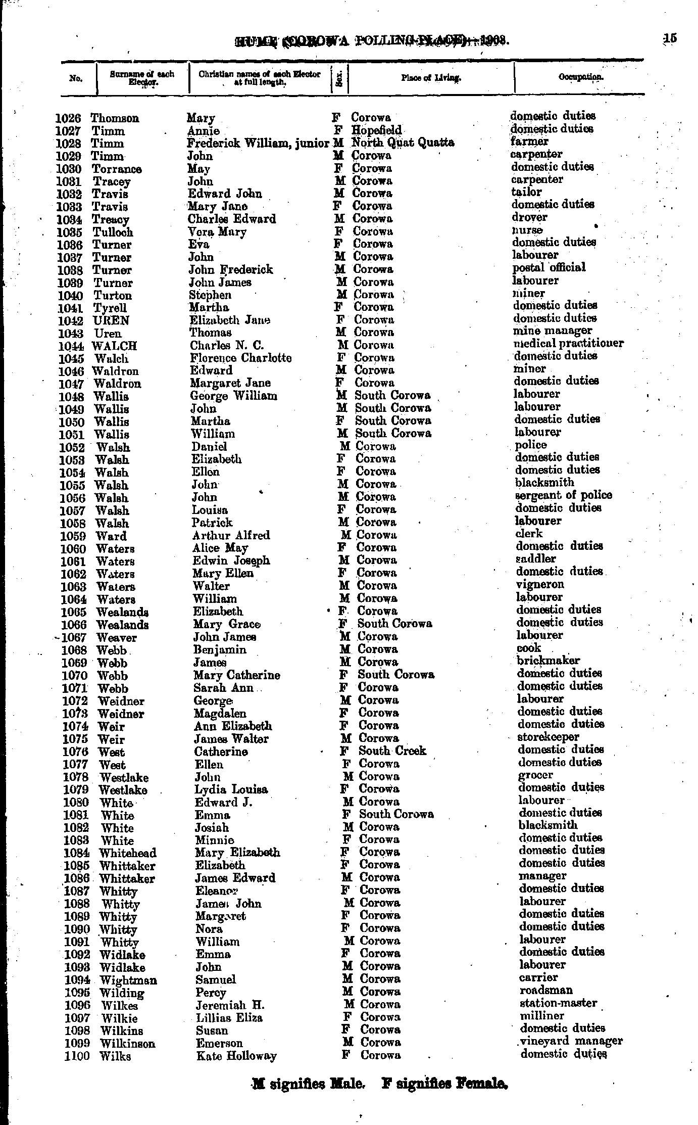
- Thomson Mary - Wilks Kate
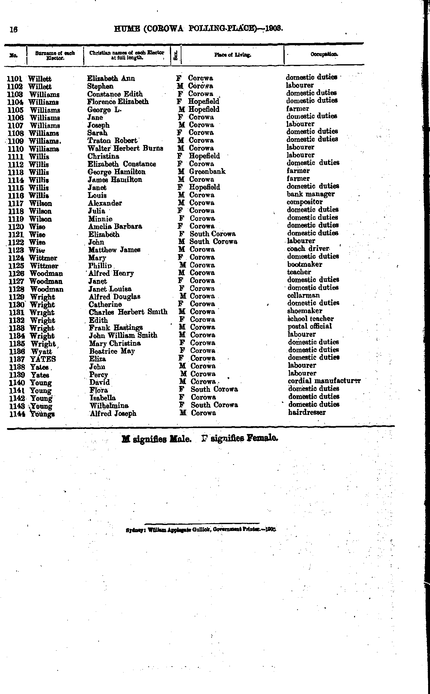
- Willett Elizabeth - Youngs Alfred
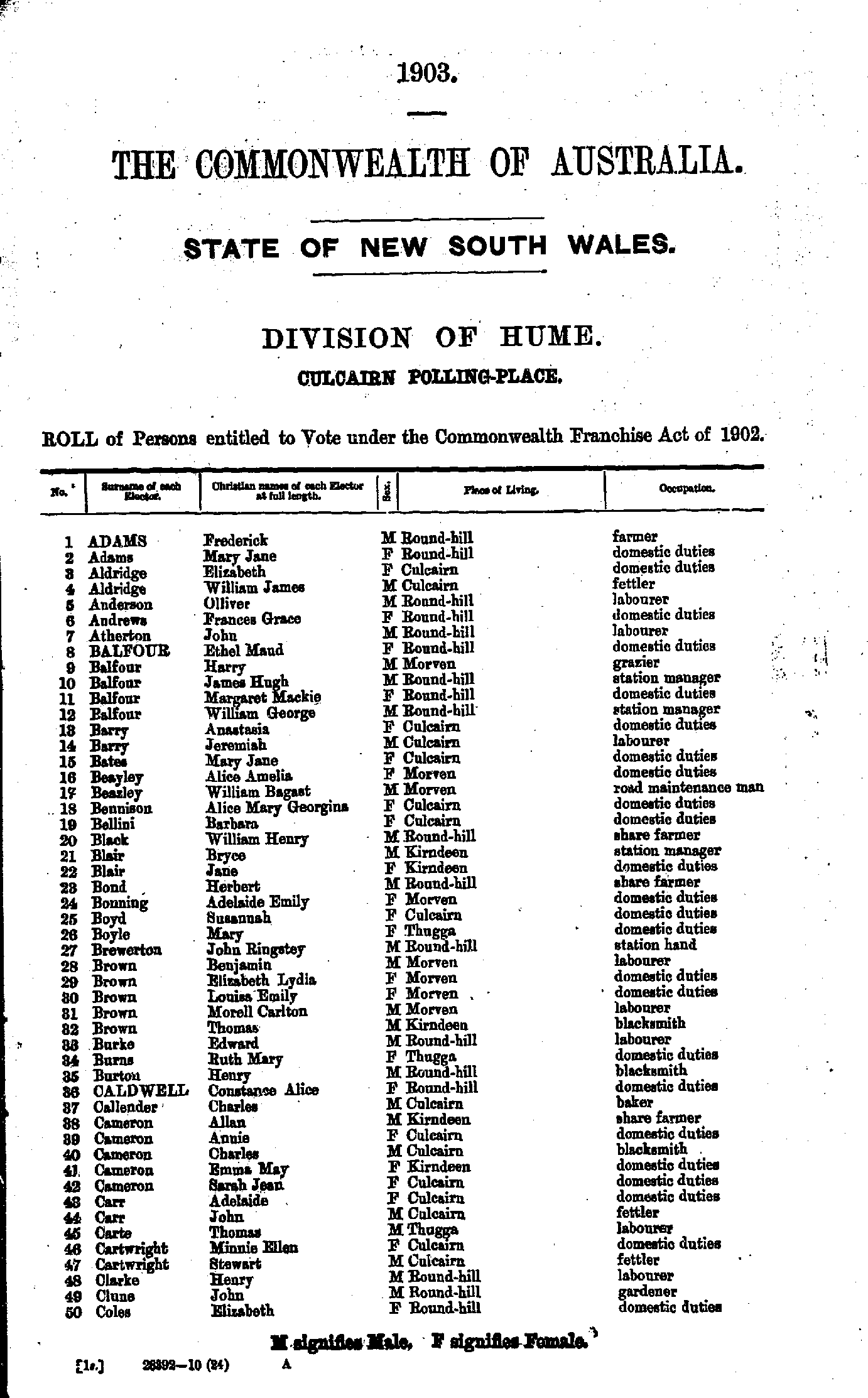
- Adams Frederick - Coles Elizabeth
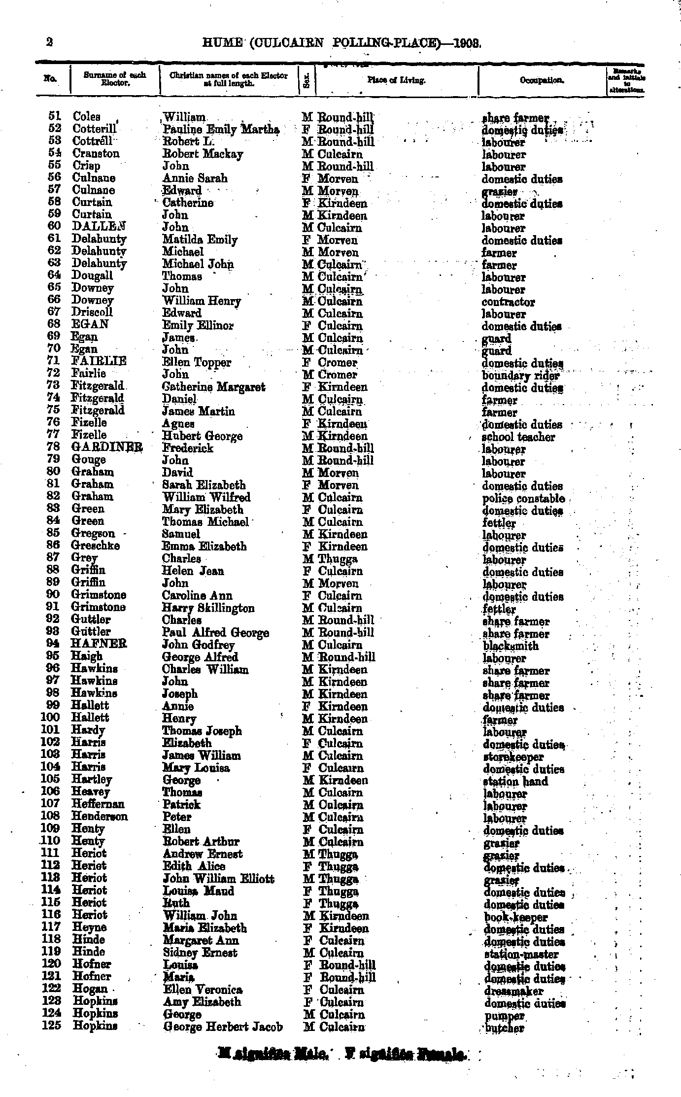
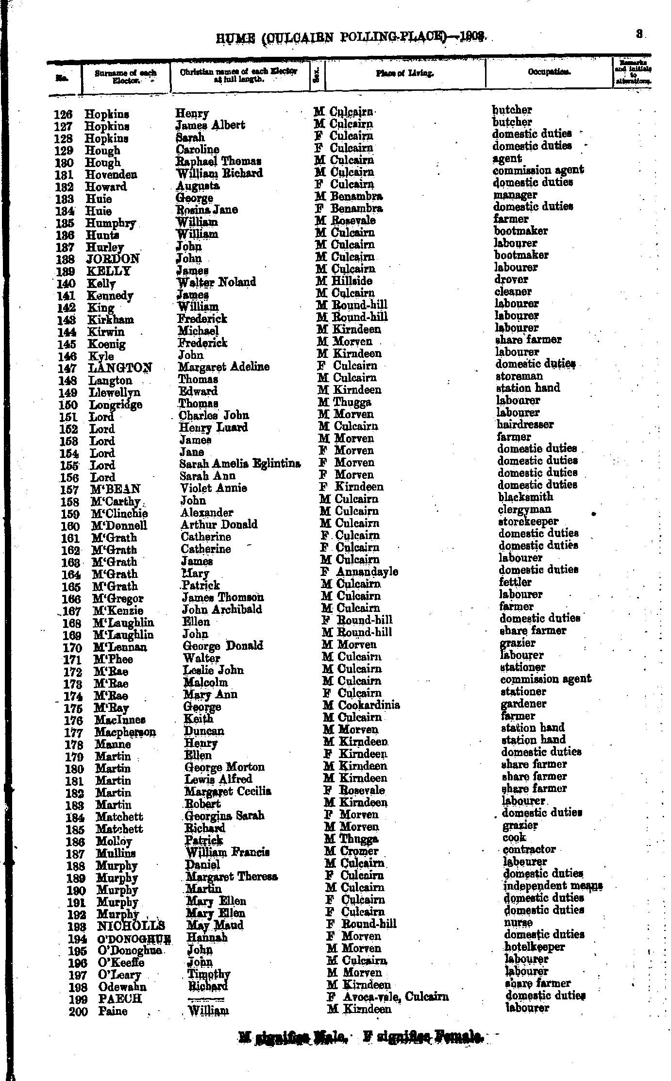
- Coles William - Hopkins George
- Hopkins Henry - Paine William
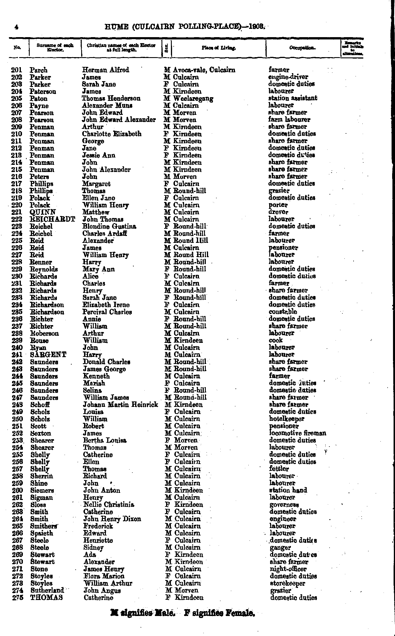
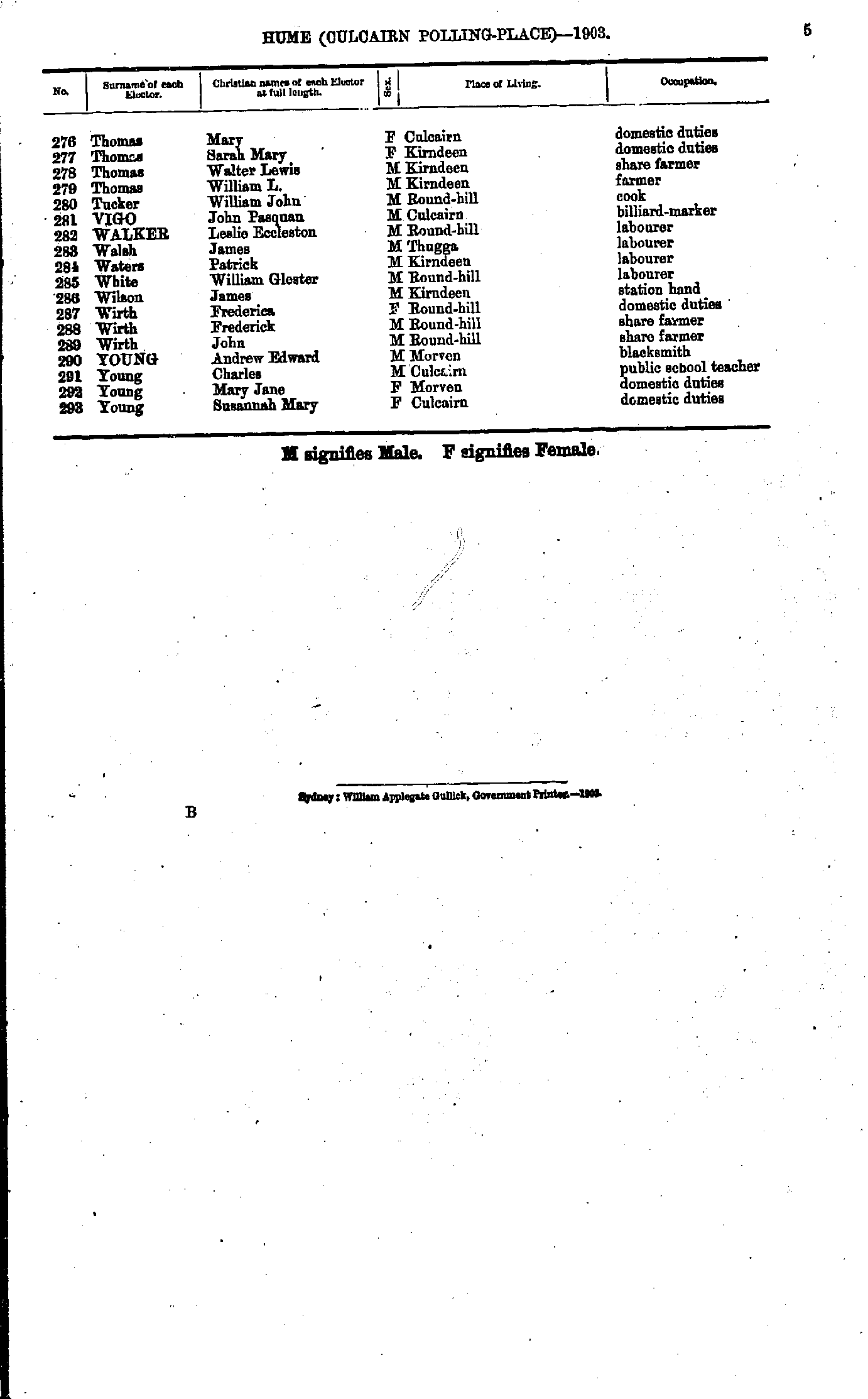
- Parch Herman - Thomas Catherine
- Thomas Mary - Young Susannah
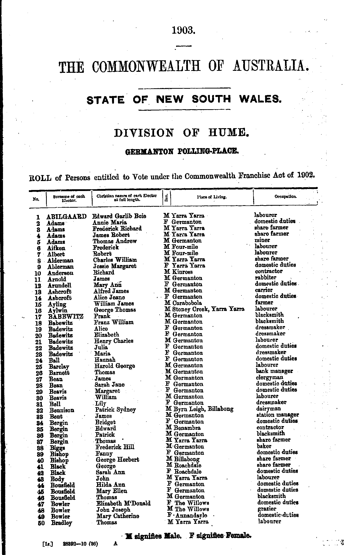
- Abilgaard Edward - Bradley Thomas
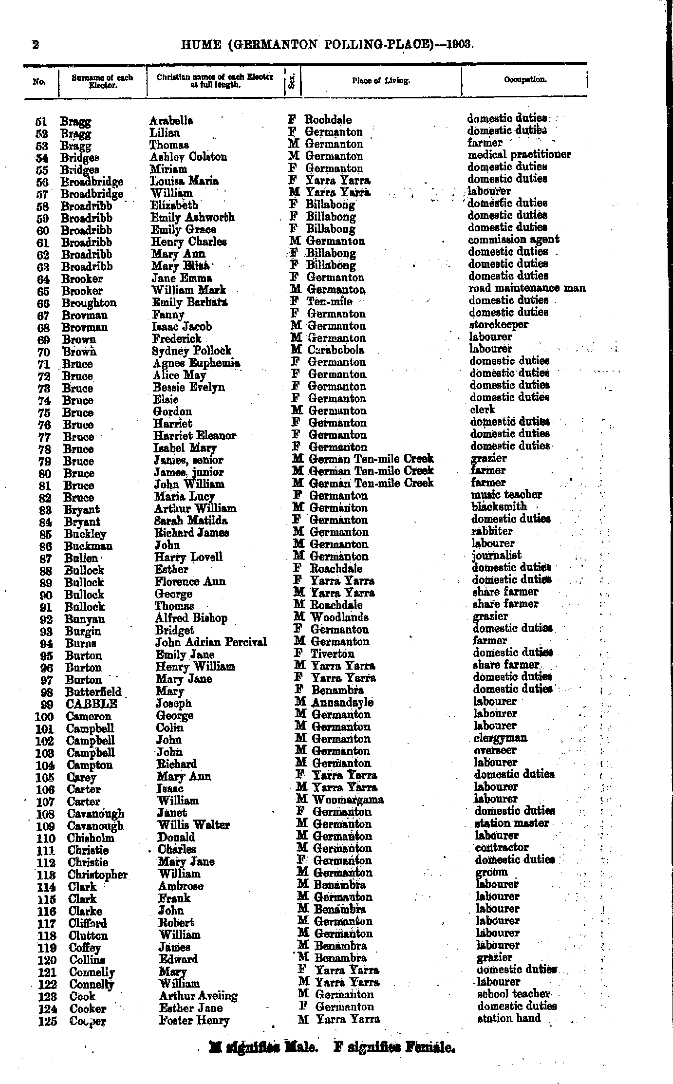
- Bragg Arabella - Cooper Foster
- Cottrell Charles - Fallon Theresa
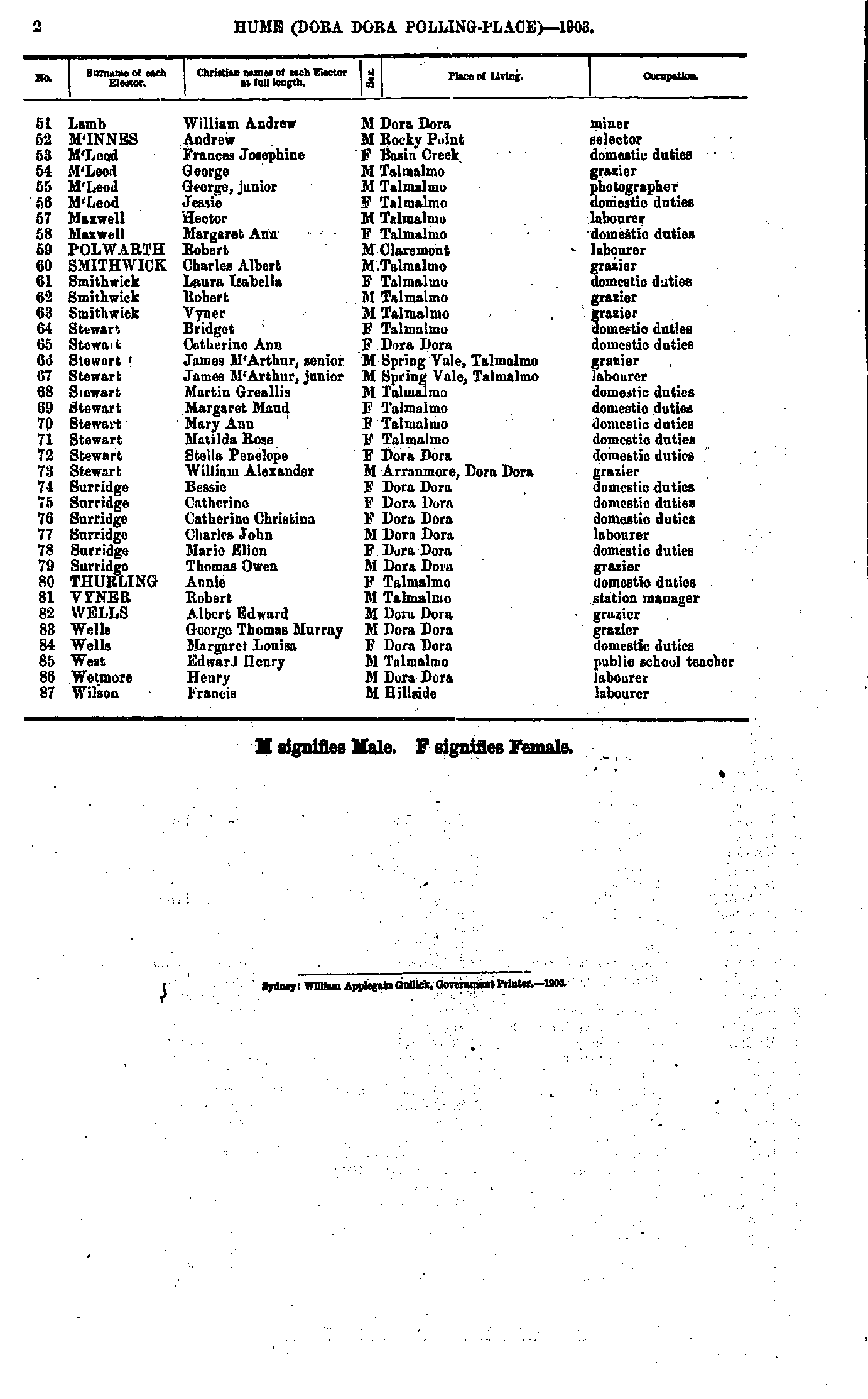
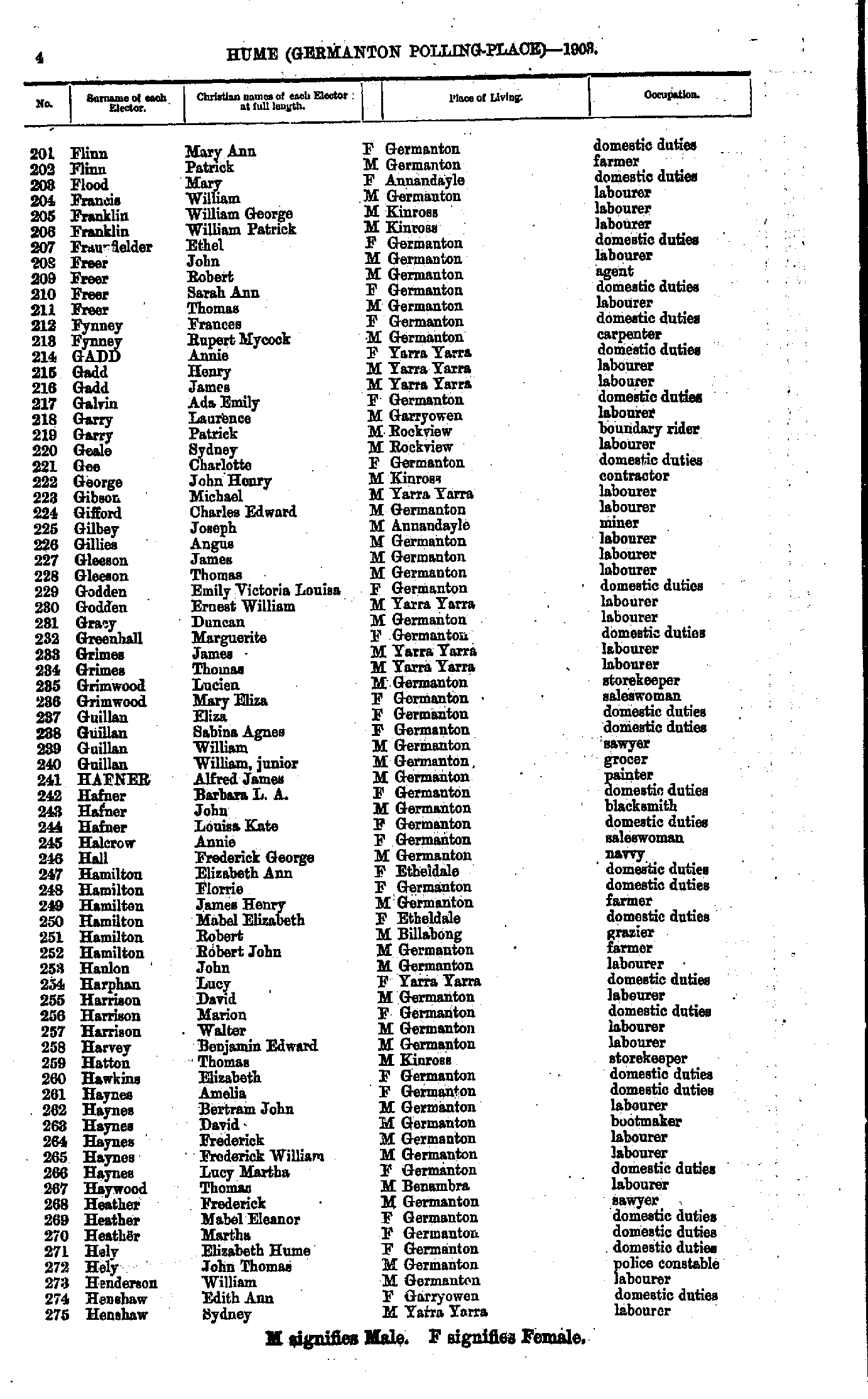
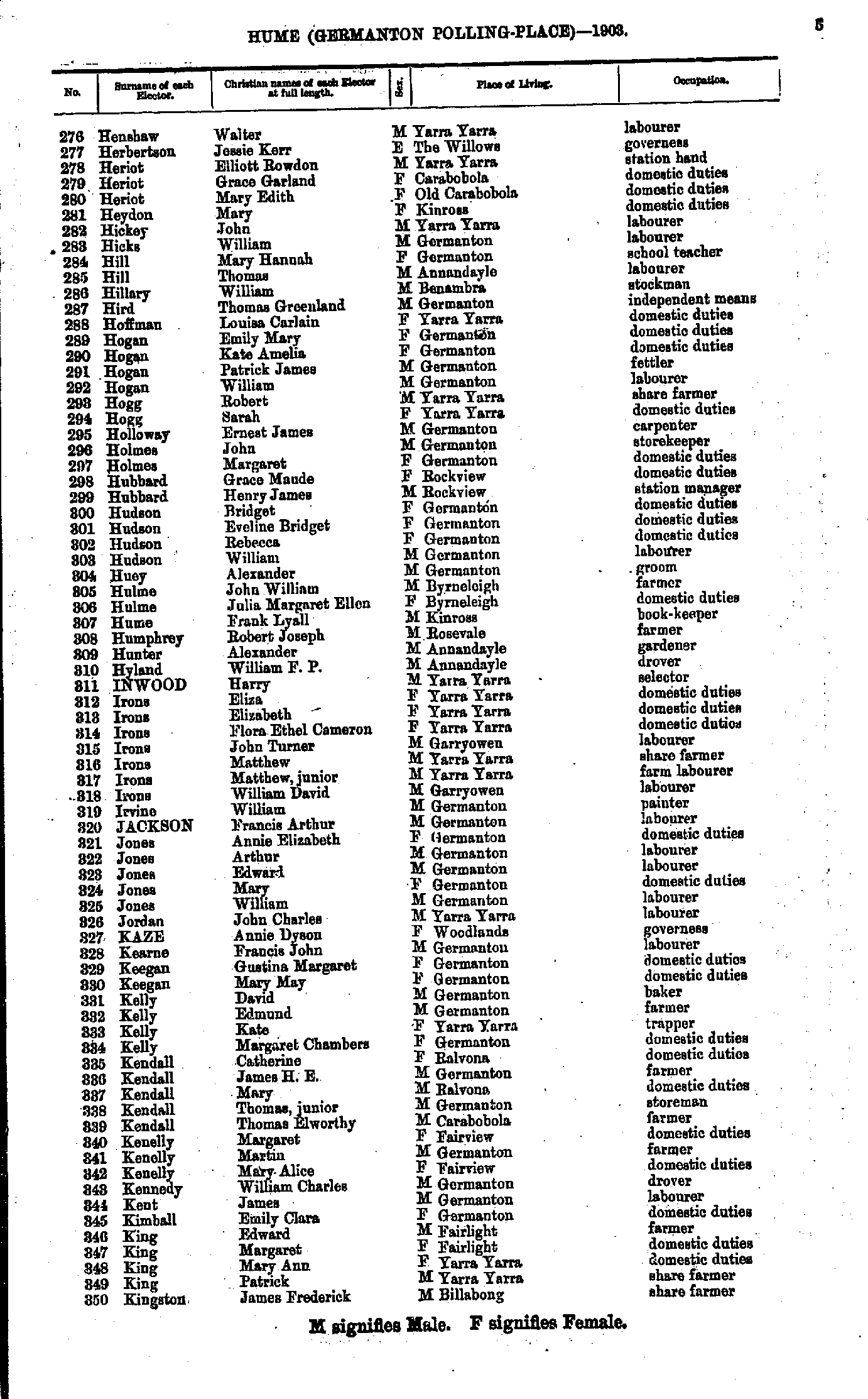
- Flinn Mary - Henshaw Sydney
- Henshaw Walter - Kingston James
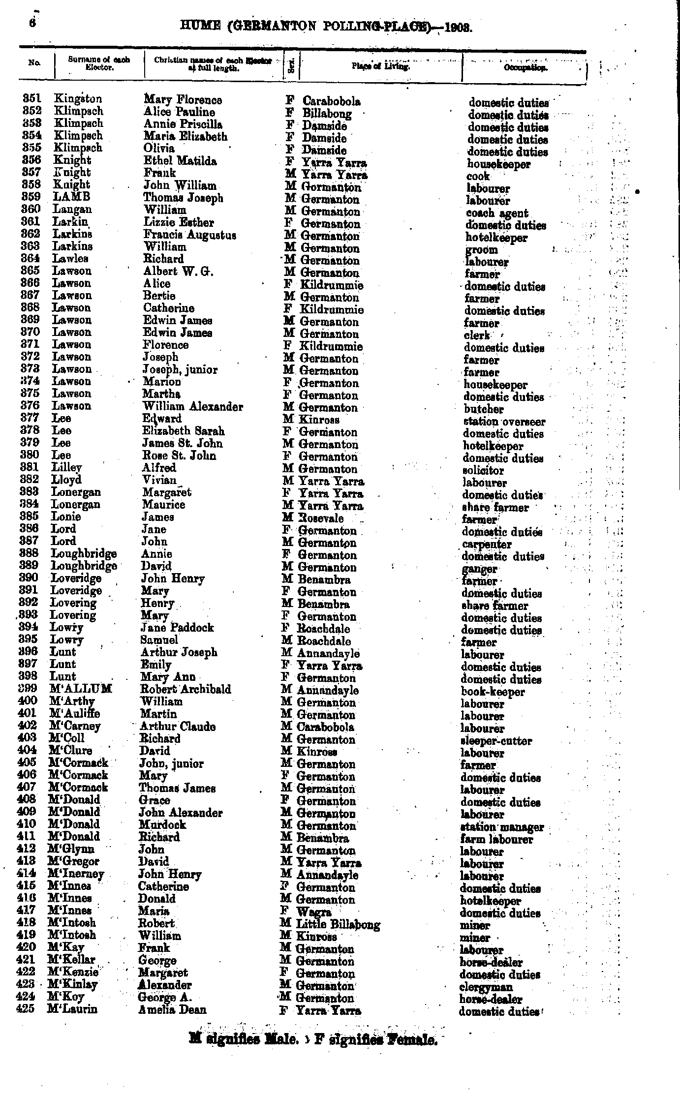
- Kingston Mary - M'Laurin Amelia
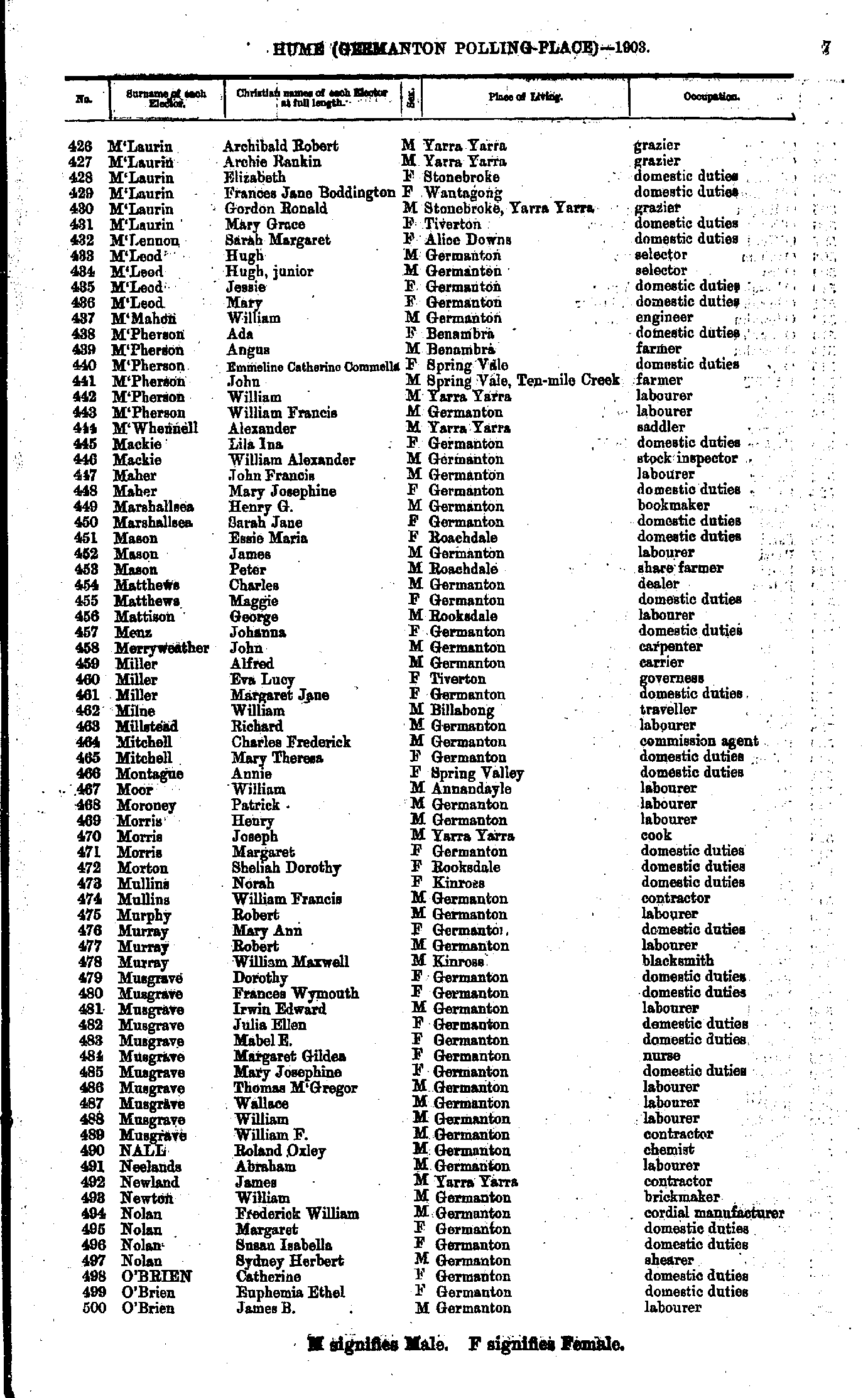
- M'Laurin Archibald - O'Brien James
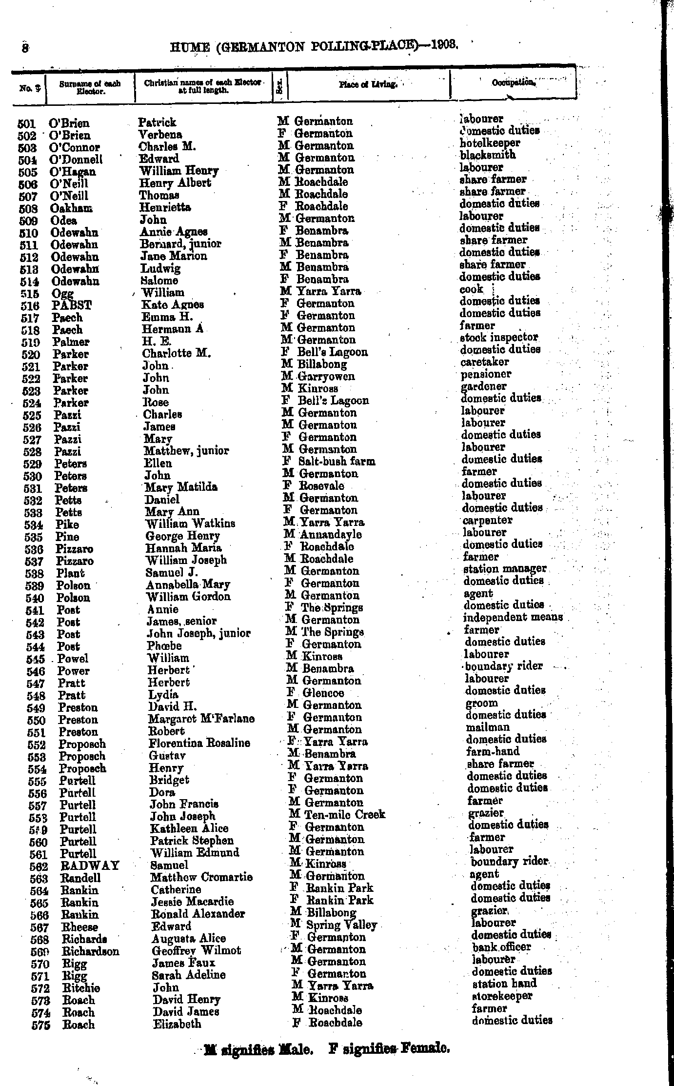
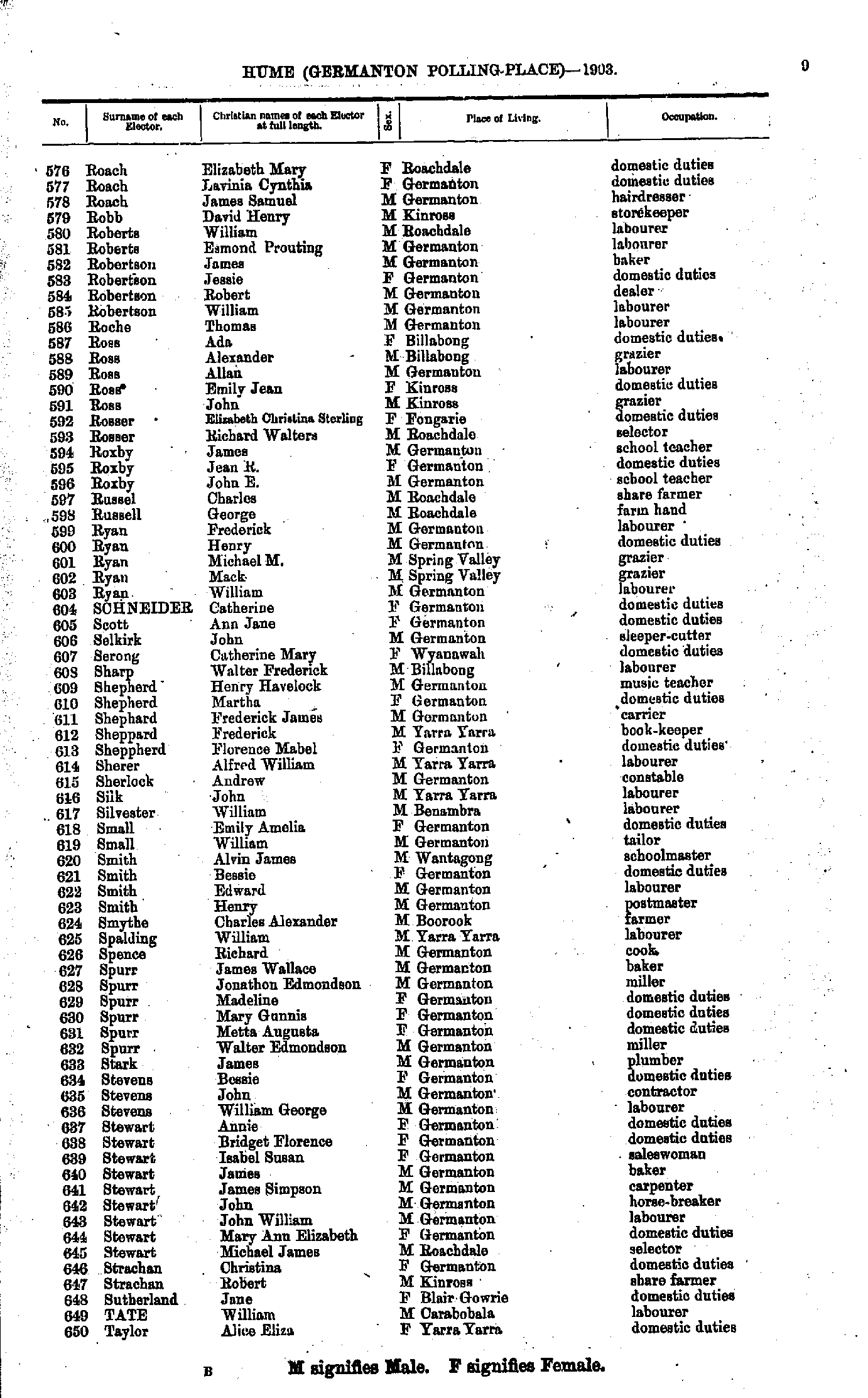
- O'Brien Patrick - Roach Elizabeth
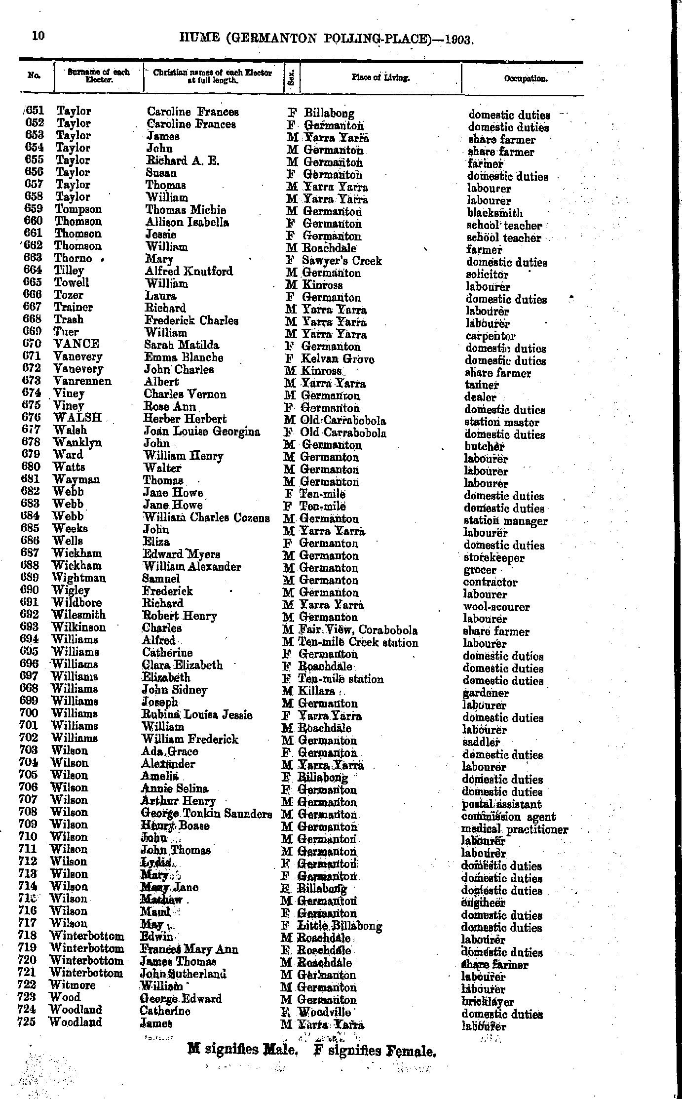
- Roach Elizabeth - Taylor Alice
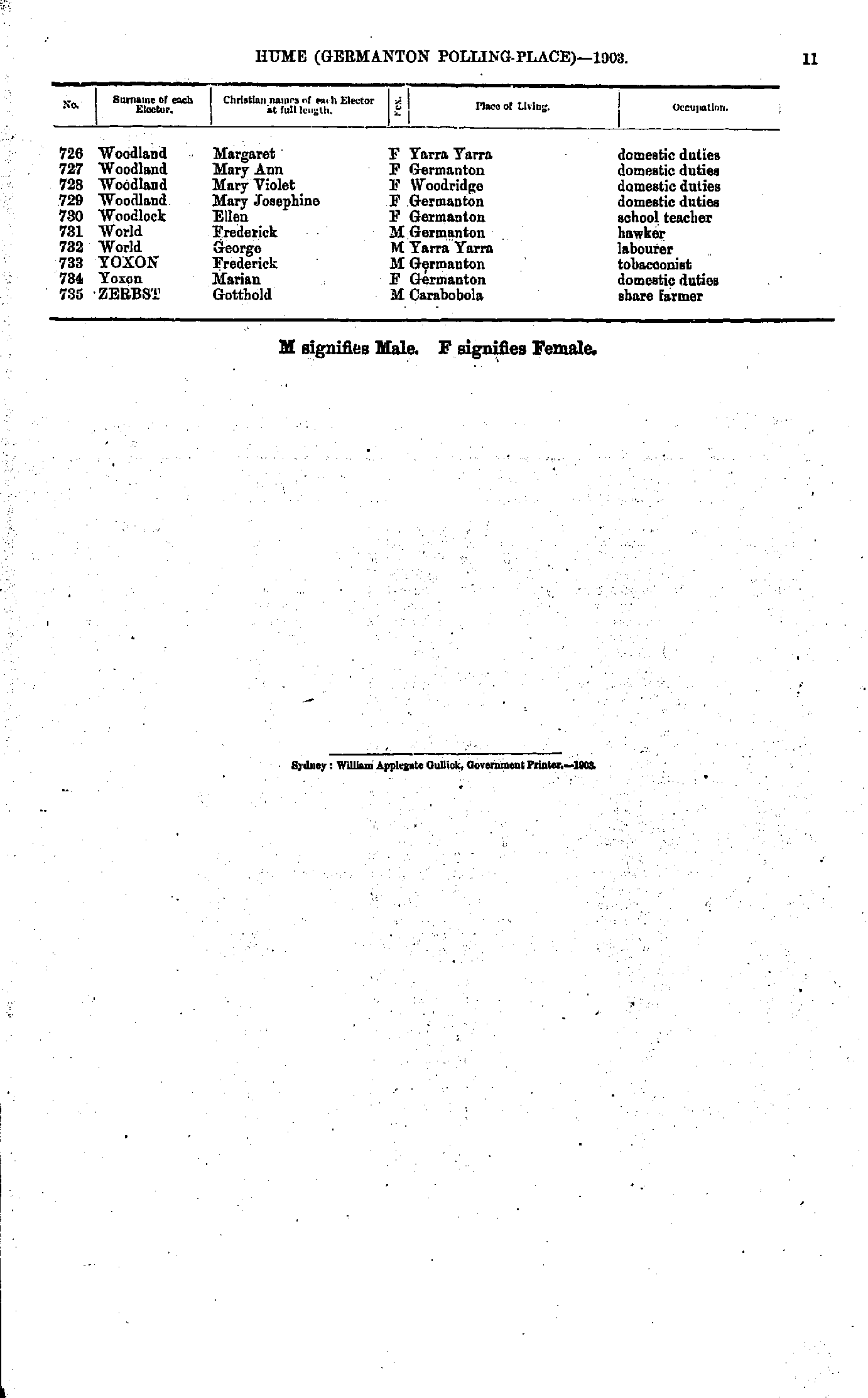
- Taylor Caroline - Woodland James
- Woodland Margaret - Zerbst Gotthold
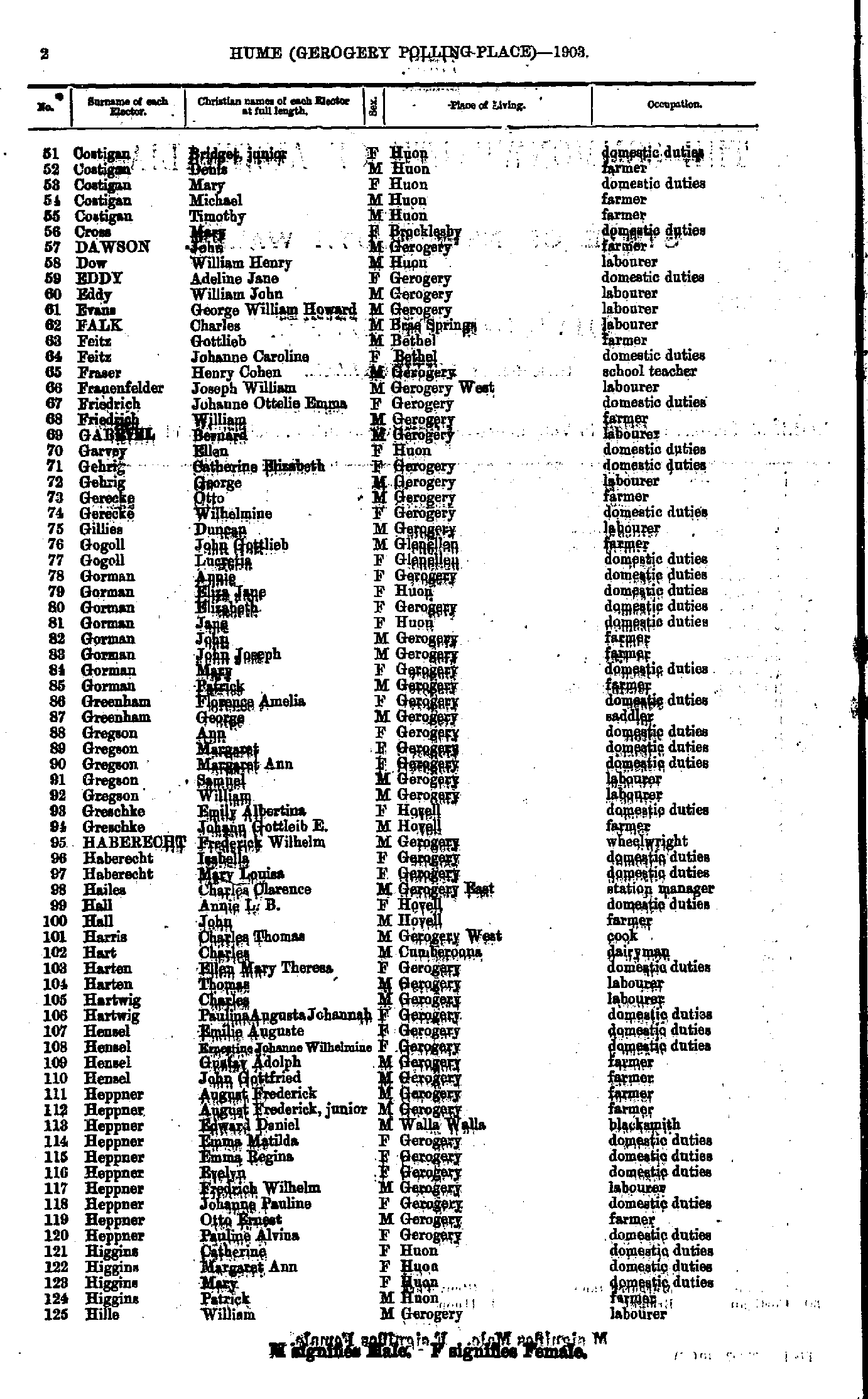
- Anderson Charles - Costigan Bridget
- Costigan Bridget - Hille William
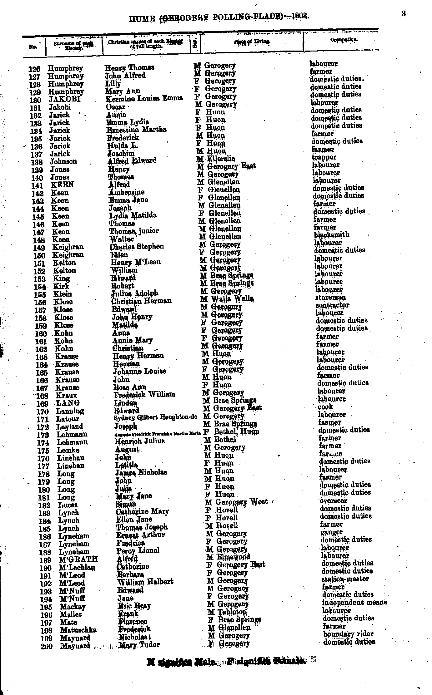
- Humphrey Henry - Maynard Mary
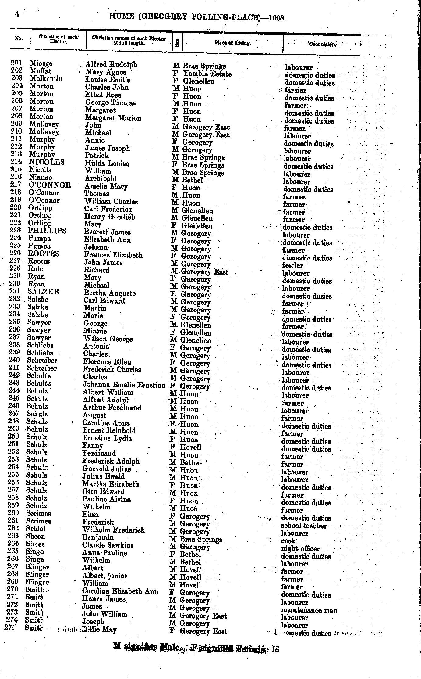
- Miosge Alfred - Smith Lillie
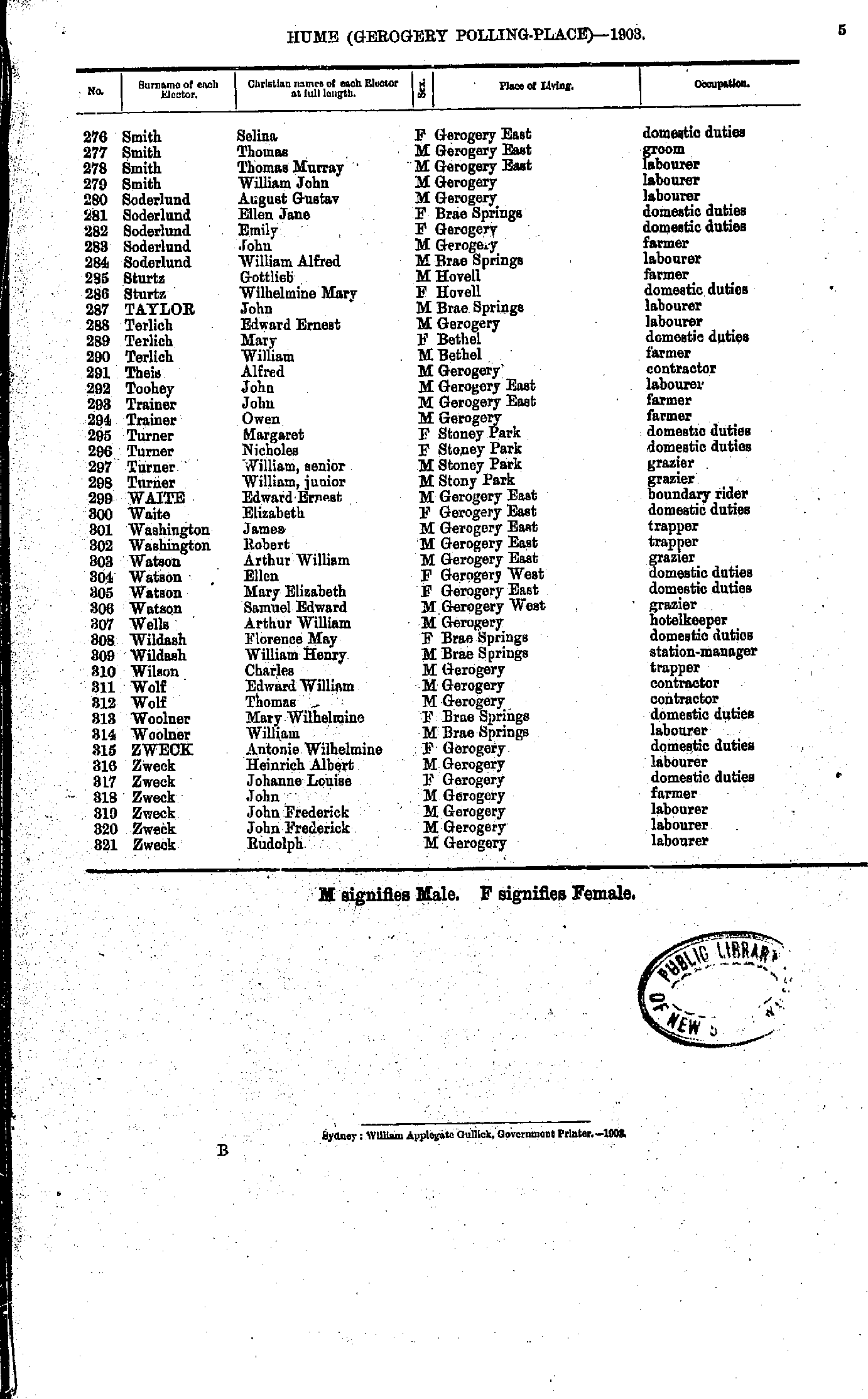
- Smith Selina - Zweck Rudolph.
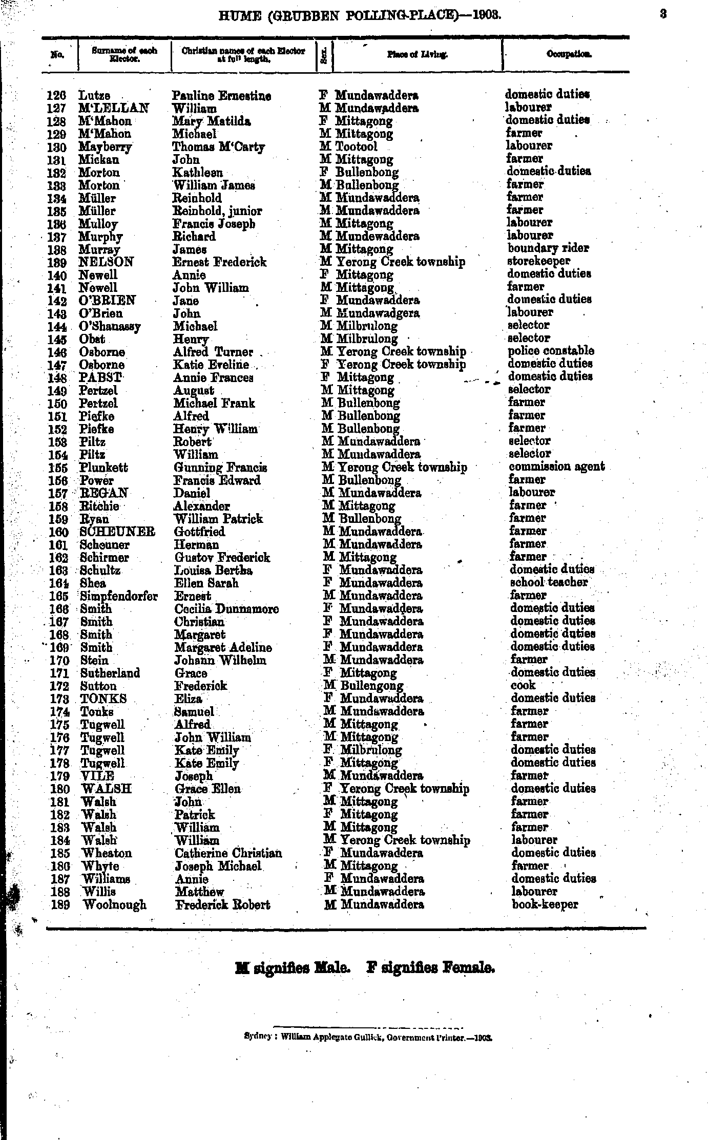
- Abbey Elizabeth - Bell William
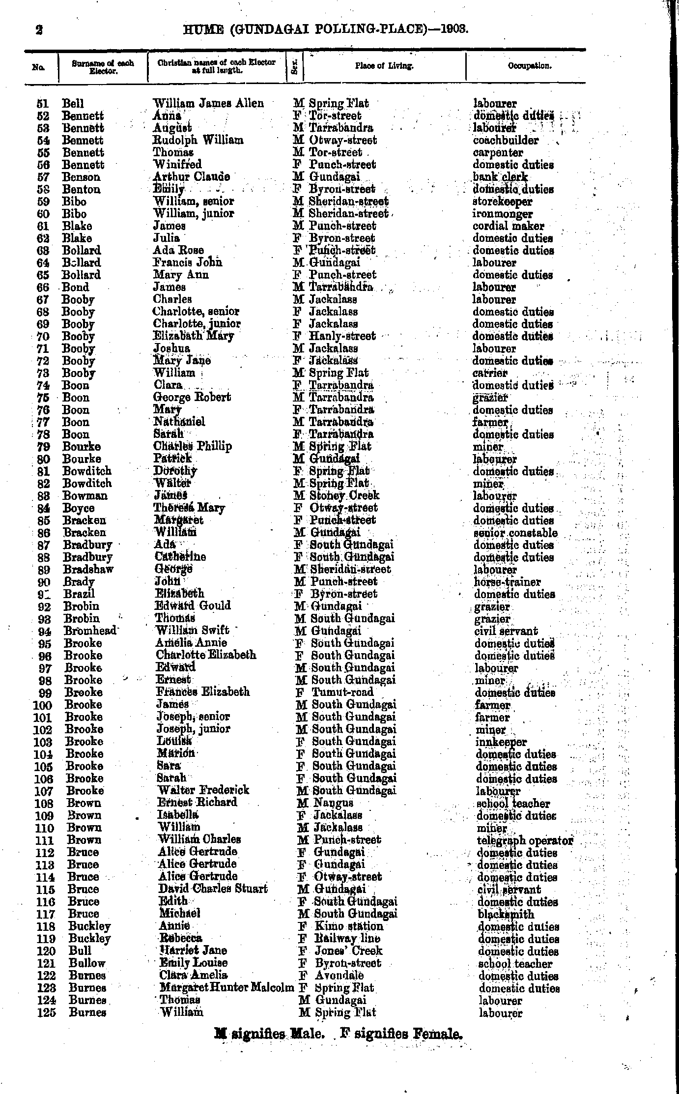
- Bell William - Burnes William
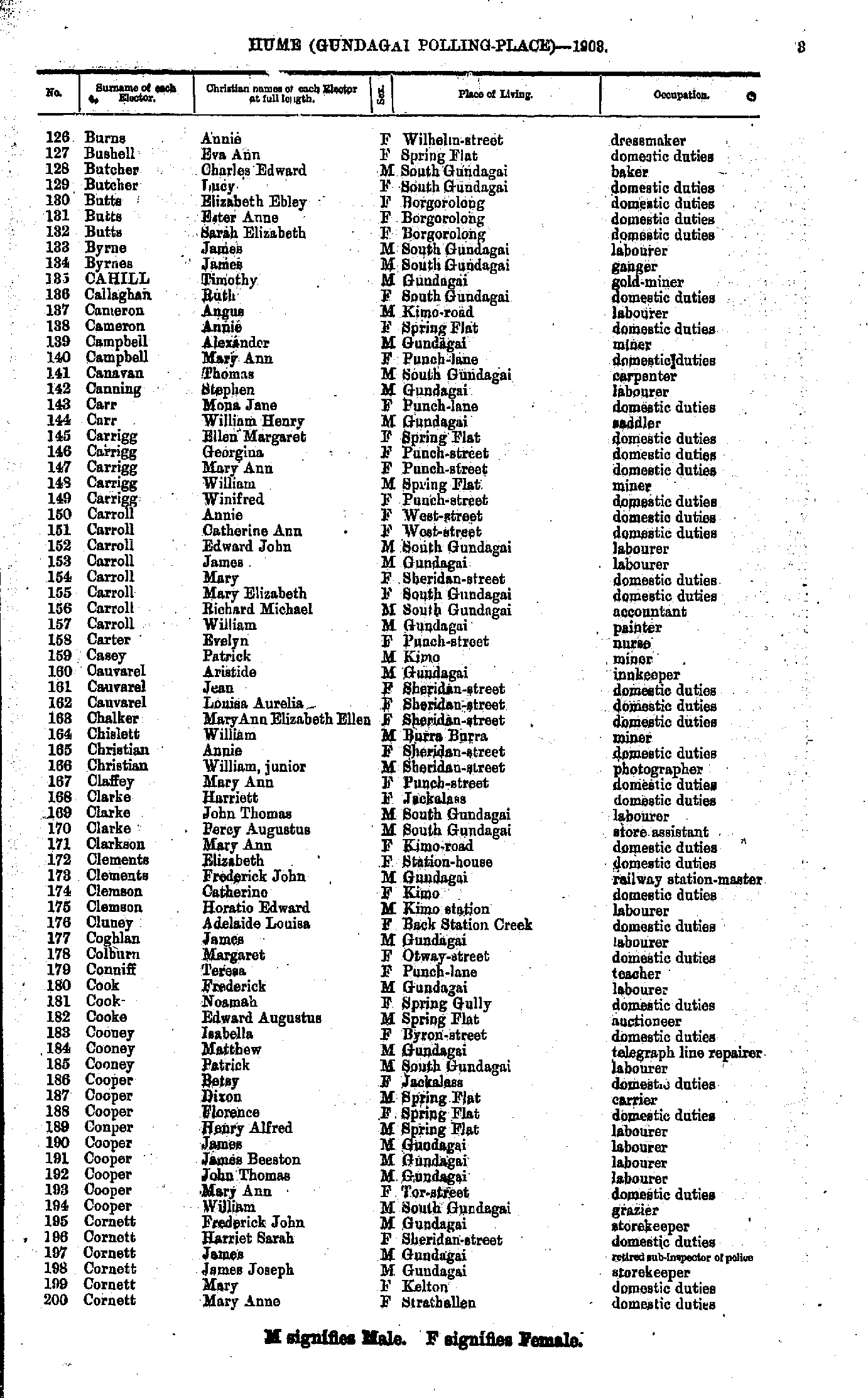
- Burns Annie - Cornett Mary
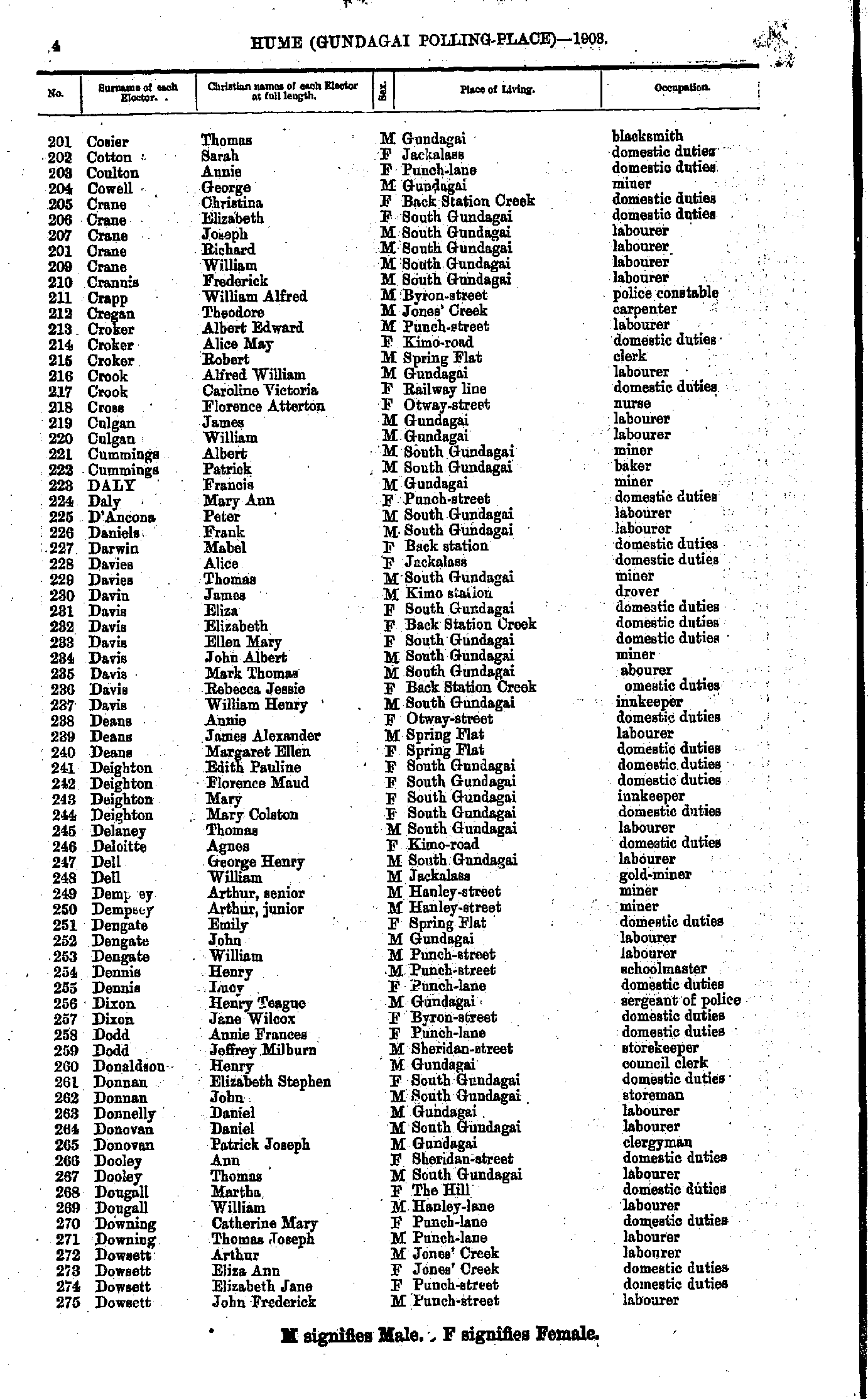
- Cozier Thomas - Dowsett John
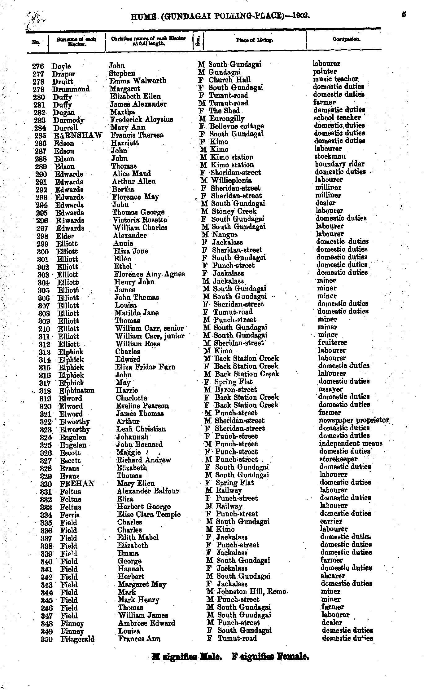
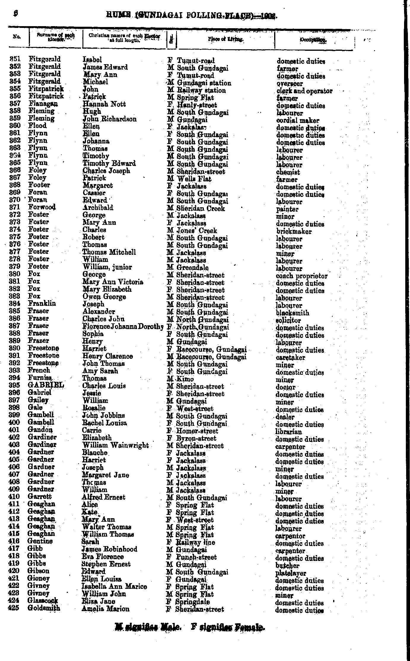
- Doyle John - Fitzgerald Frances
- Fitzgerald Isabel - Goldsmith Amelia
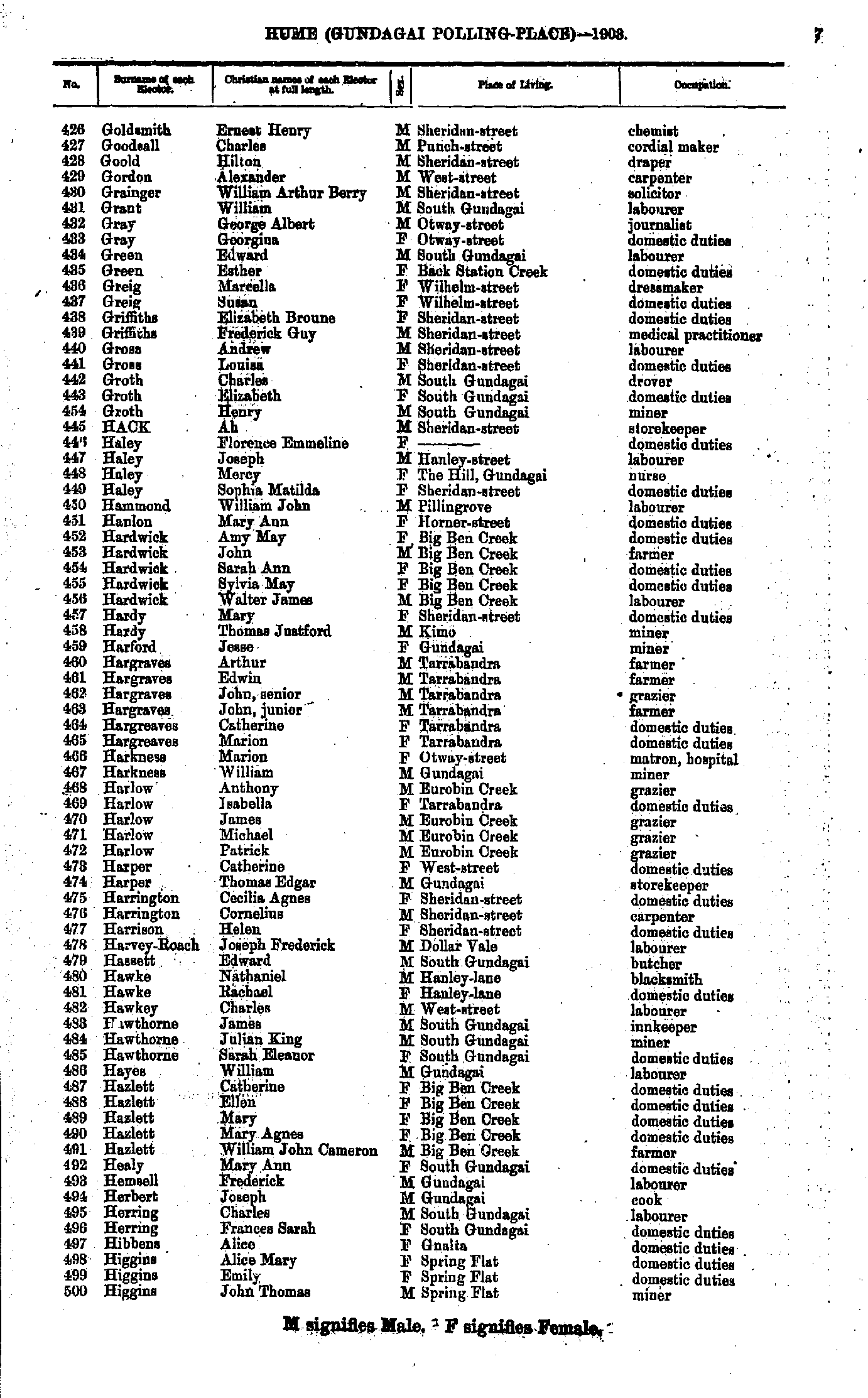
- Goldsmith Ernest - Higgins John
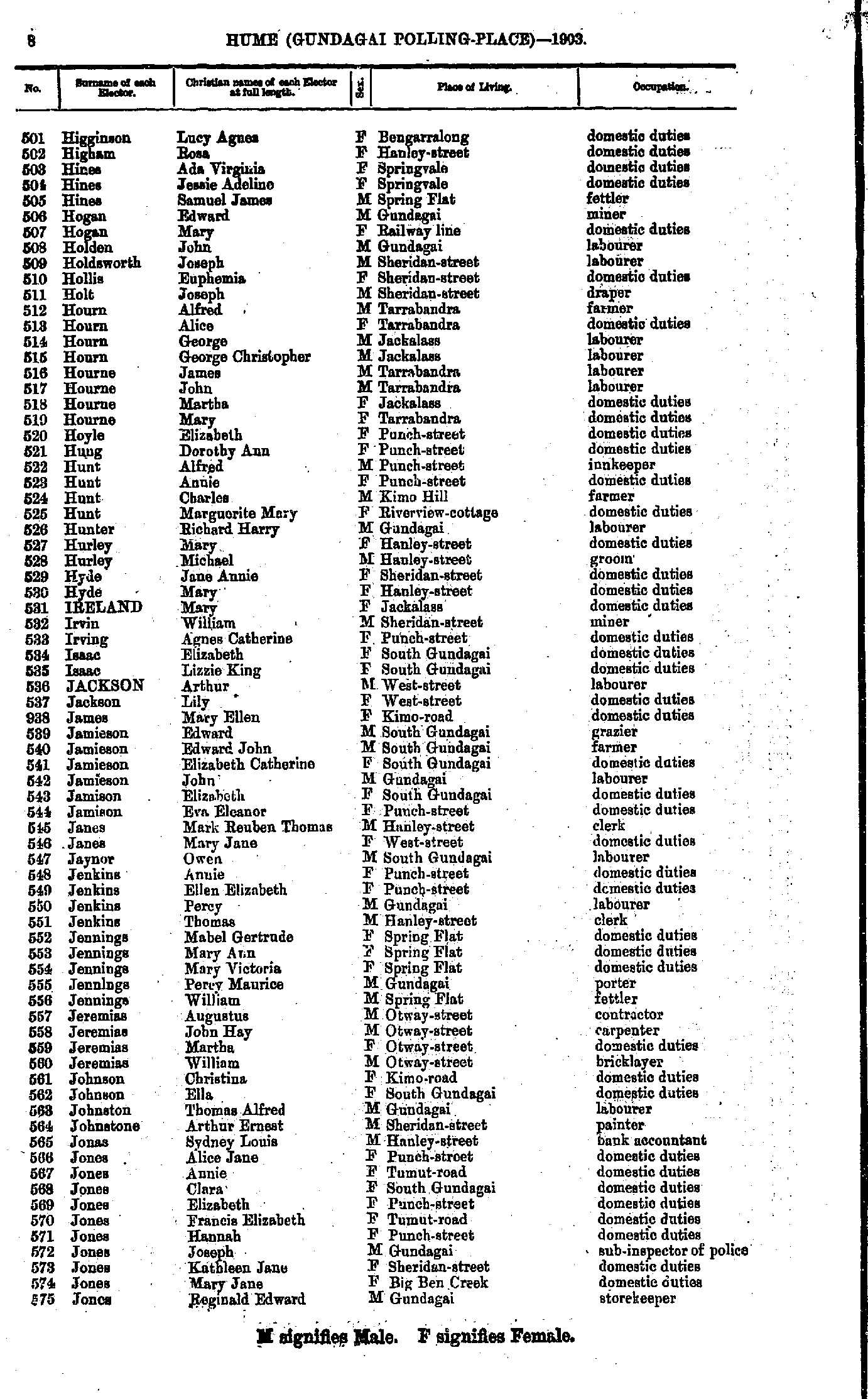
- Higginson Lucy - Jones Reginald
- Jones Sarah - Leary Edwin
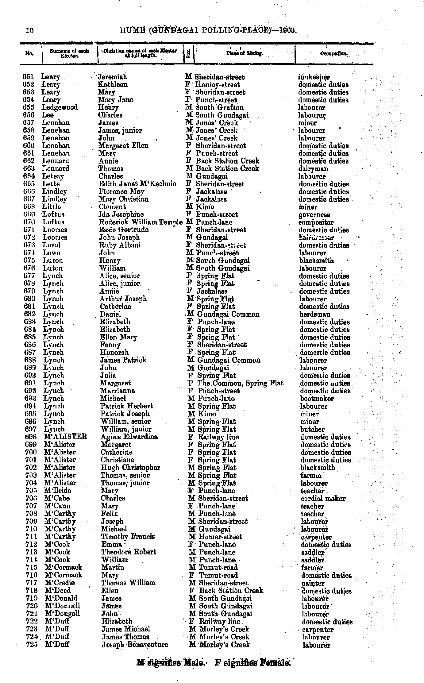
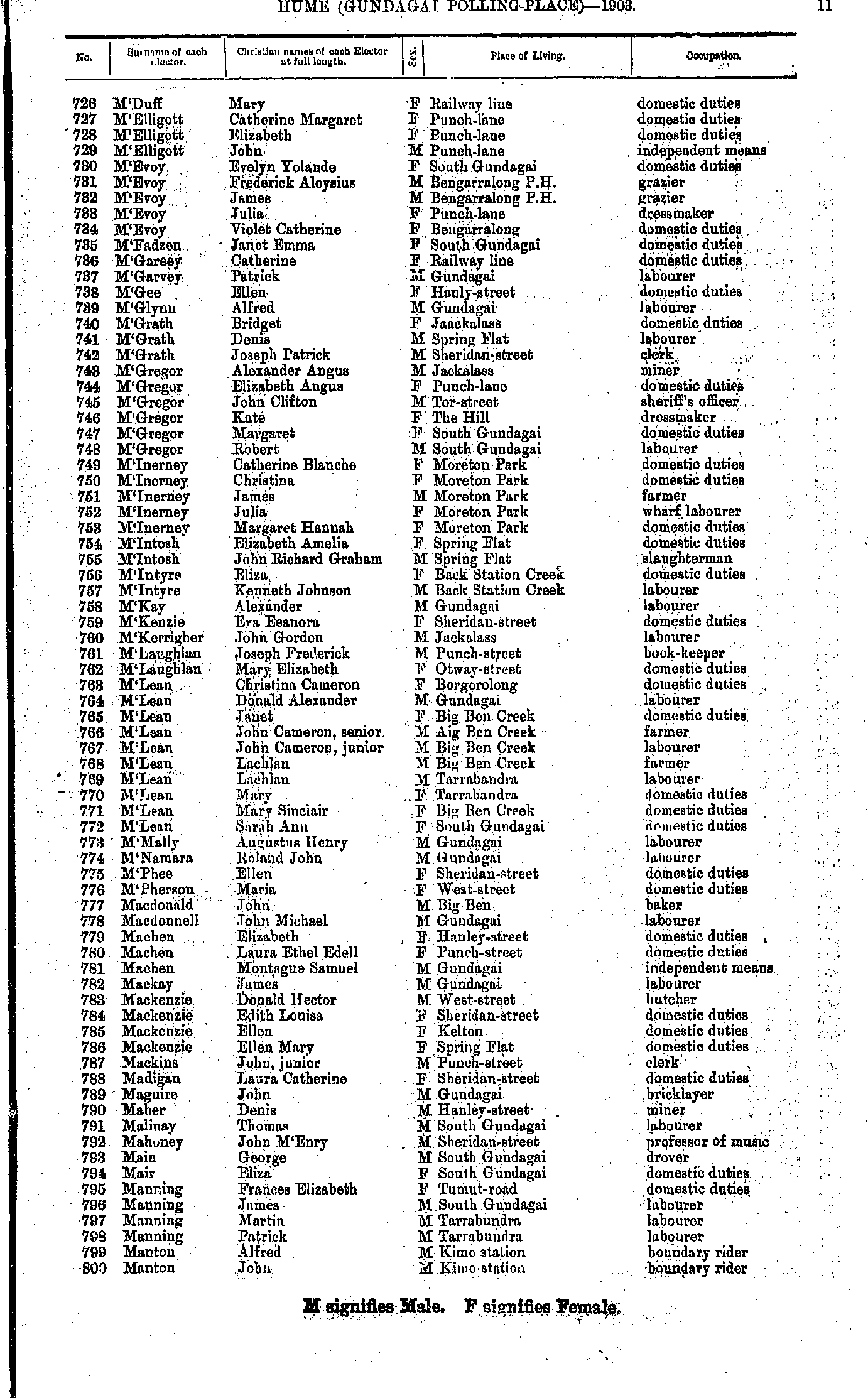
- Leary Jeremiah - M'Duff Joseph
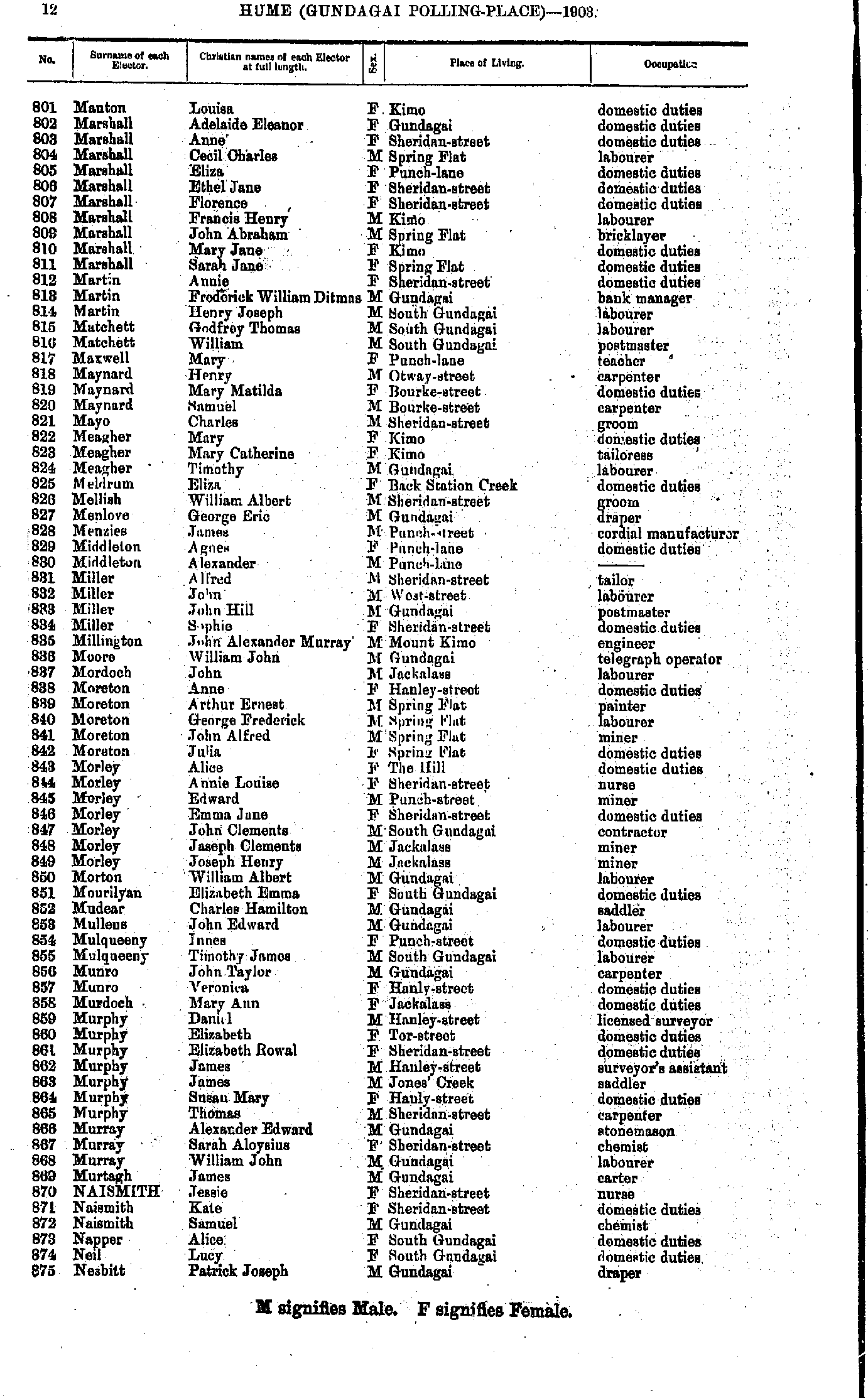
- M'Duff Mary - Manton John
- Manton Louisa - Nesbitt Patrick
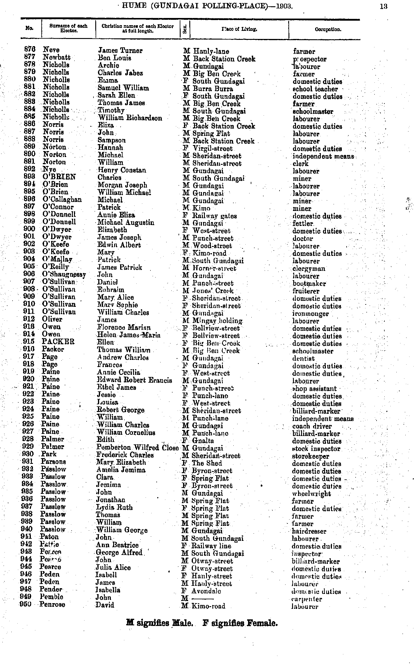
- Neve James - Penrose David
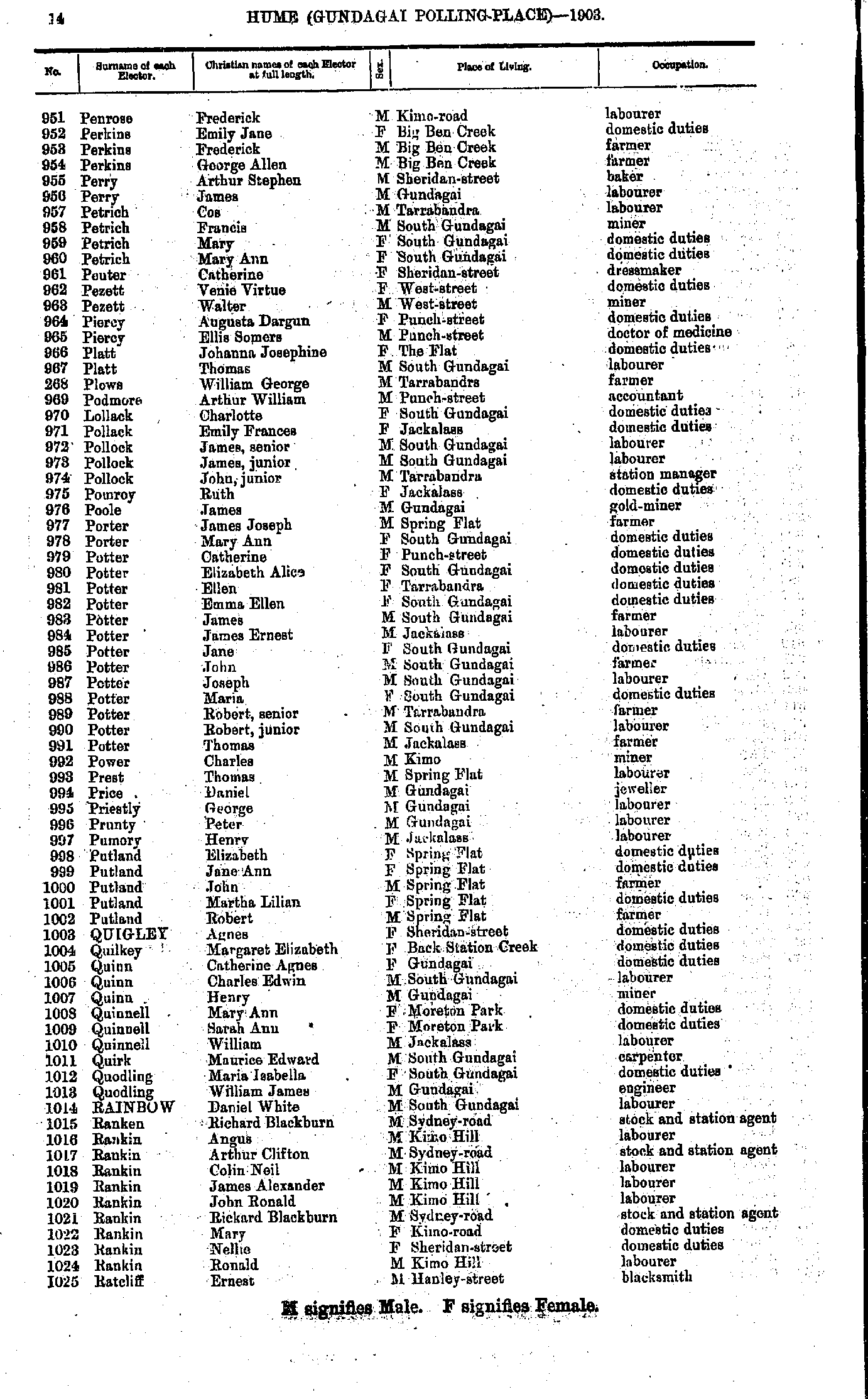
- Penrose Frederick - Ratcliff Ernest
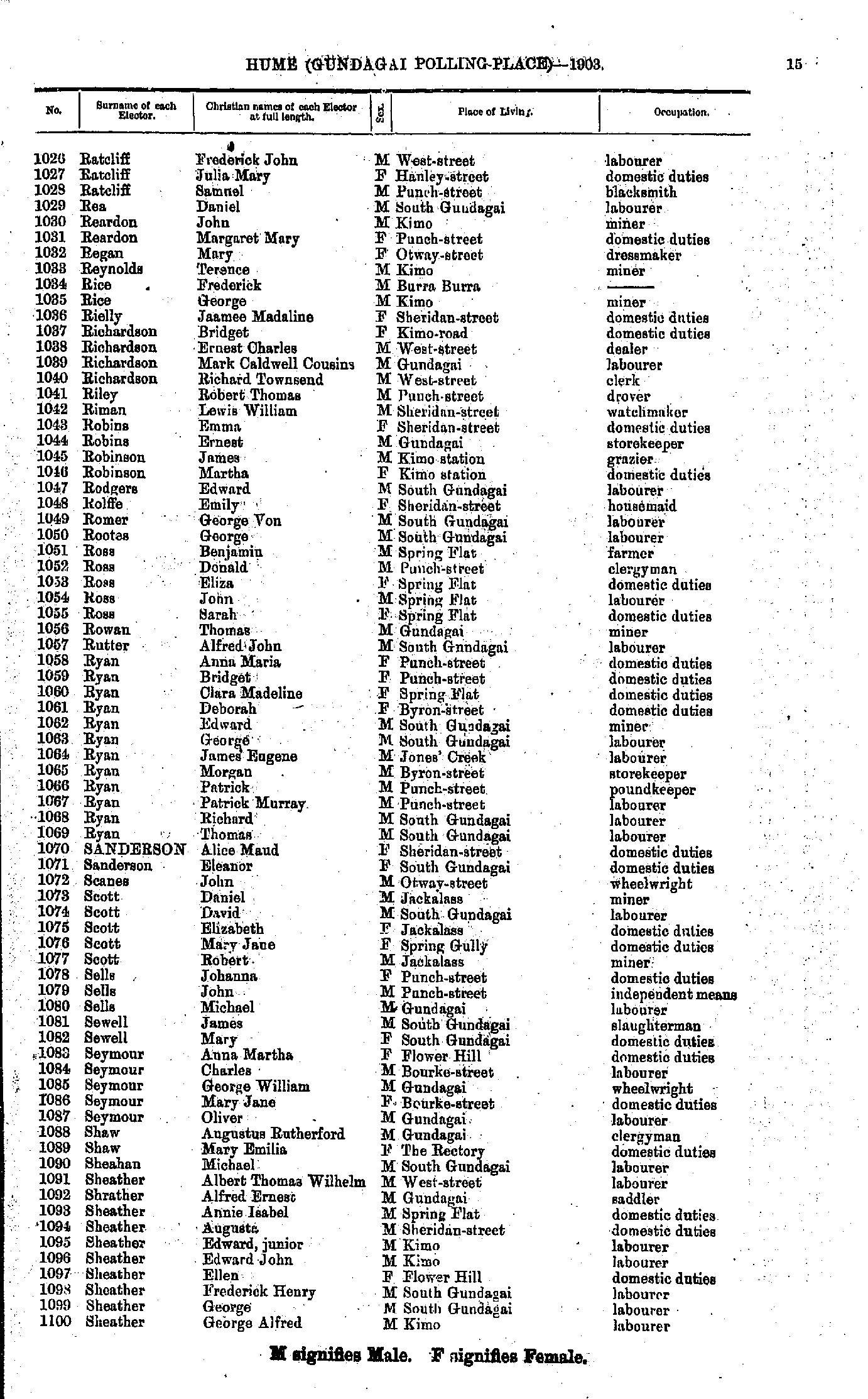
- Ratcliff Frederick - Sheather George
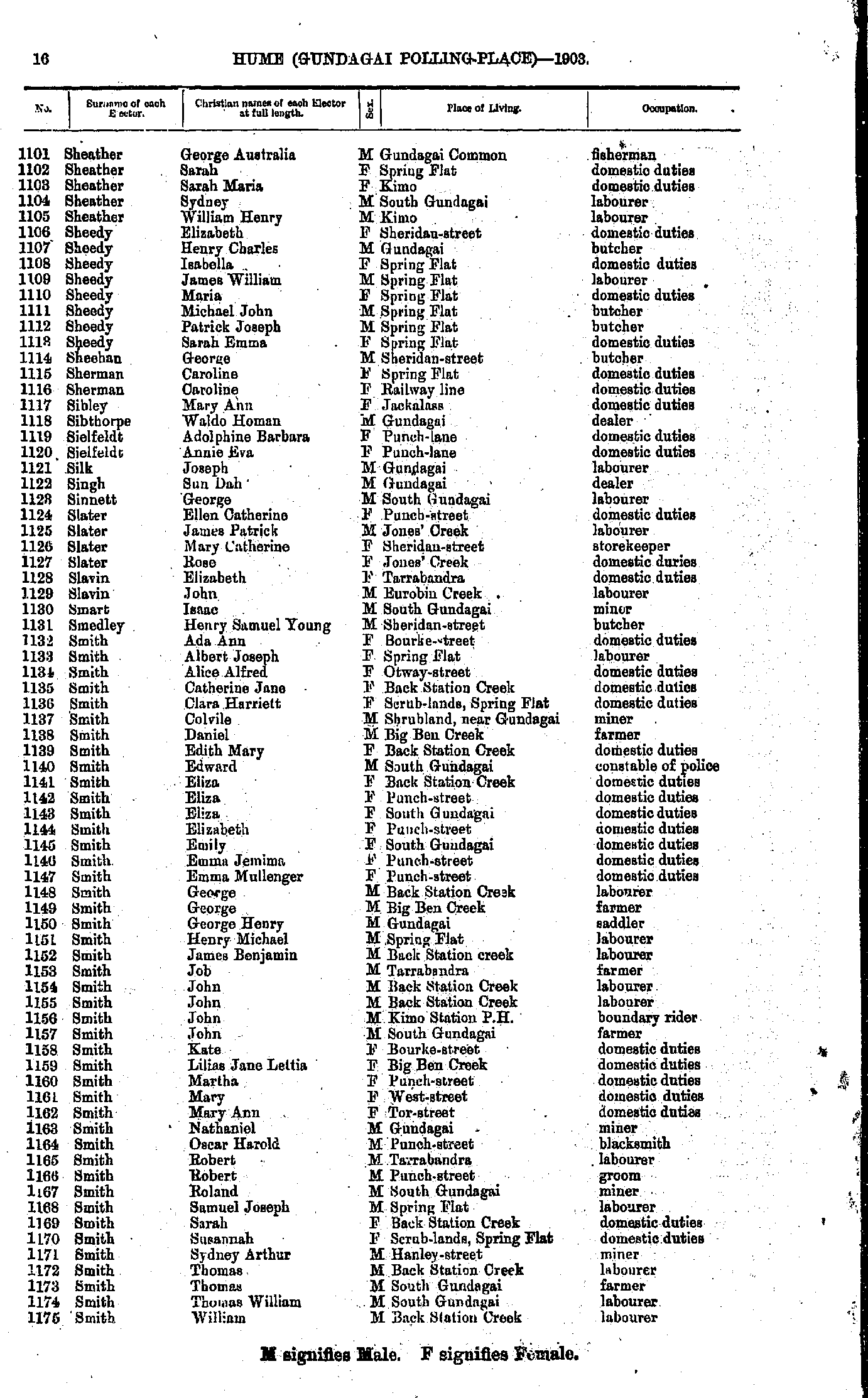
- Sheather George - Smith William
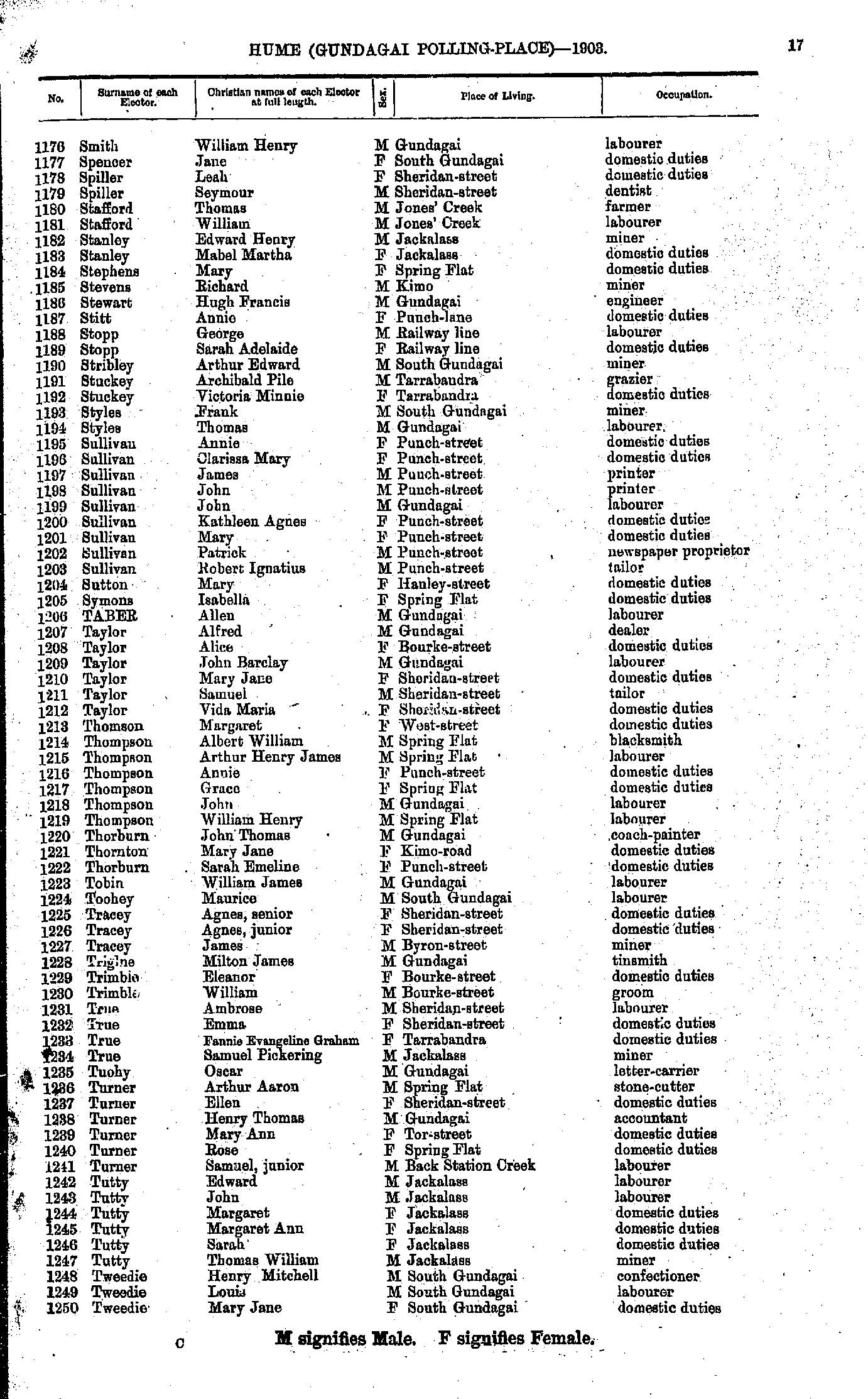
- Smith William - Tweedie Mary
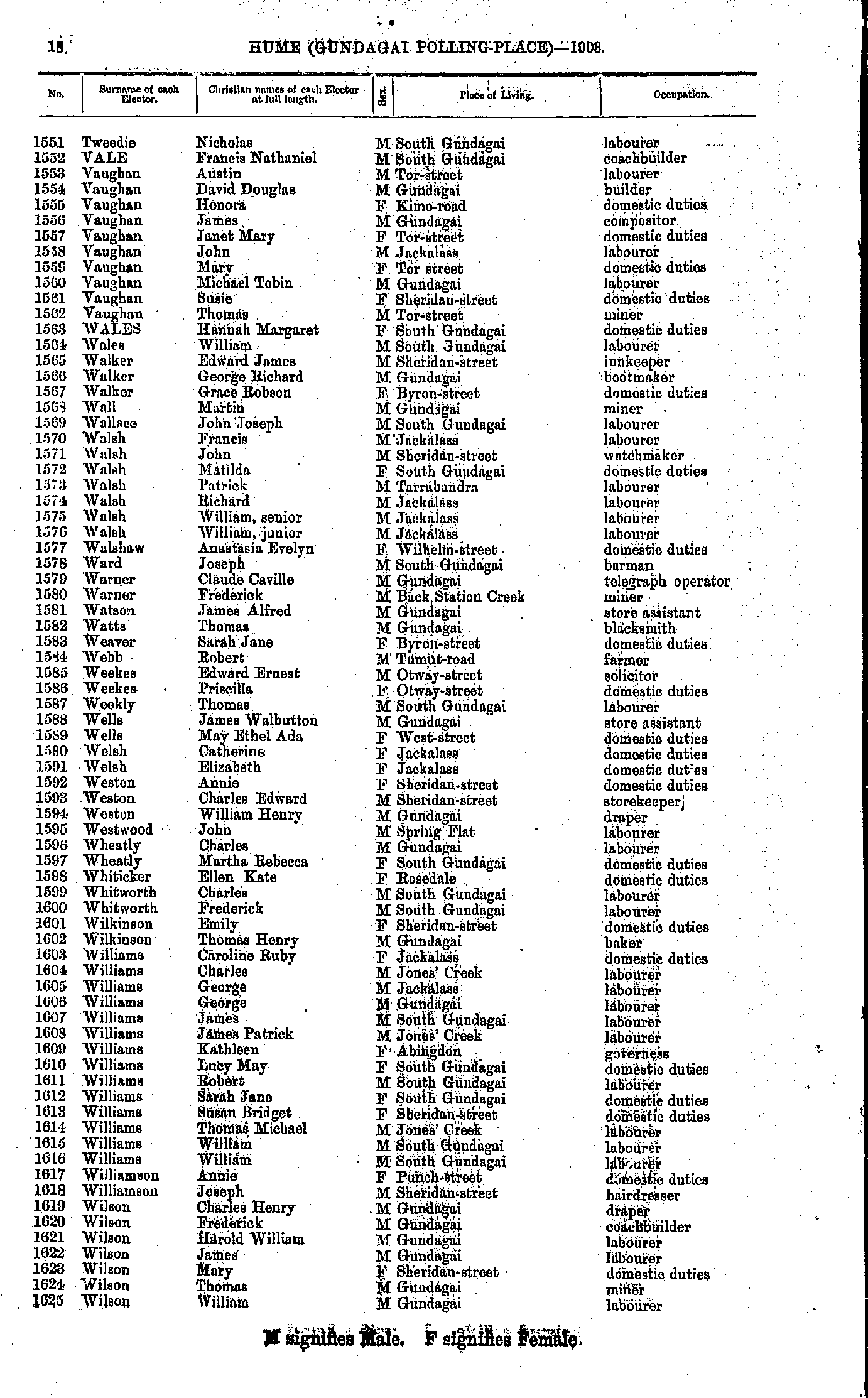
- Tweedie Nicholas - Wilson William
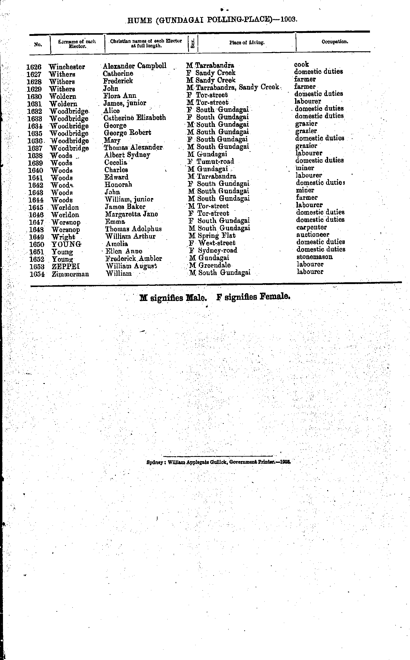
- Winchester Alexander - Zimmerman William
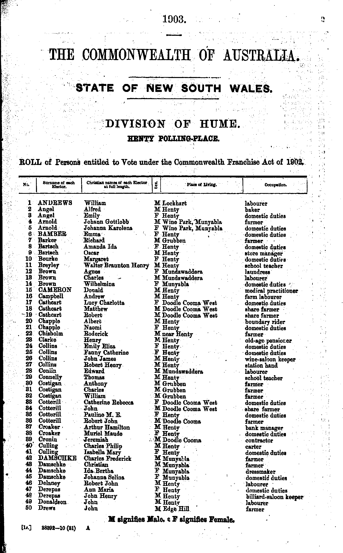
- Andrews William - Drews John
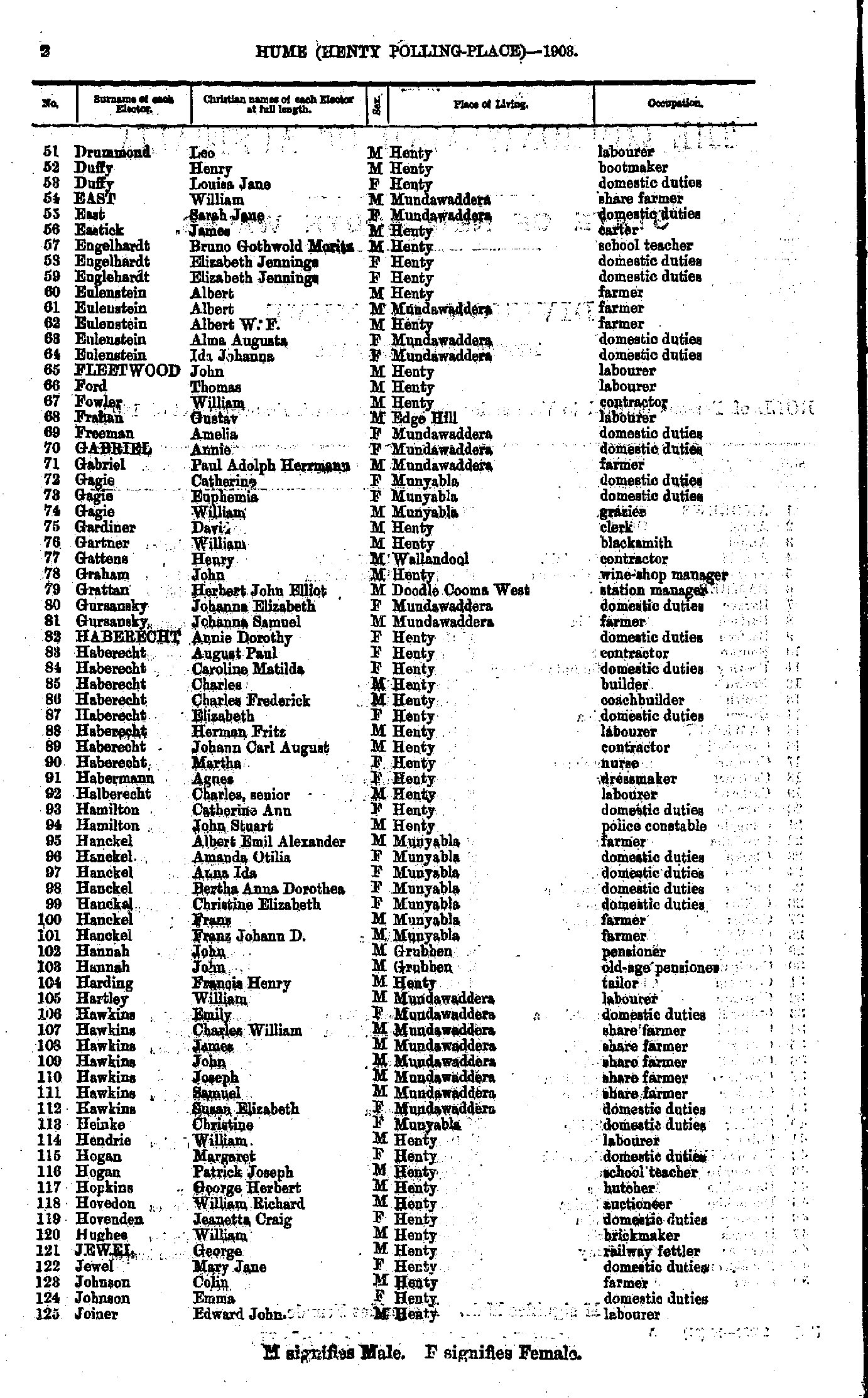
- Drummond Leo - Joiner Edward
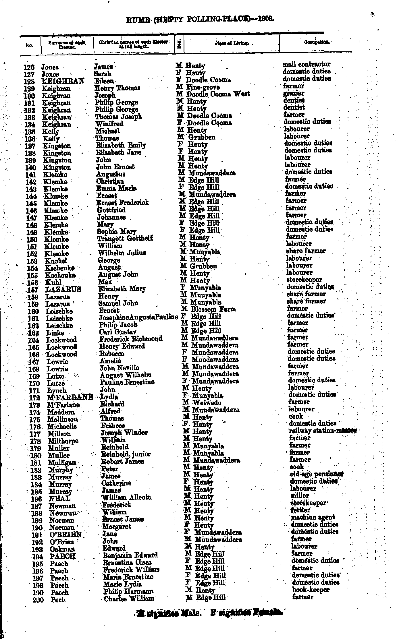
- Jones James - Pech Charles
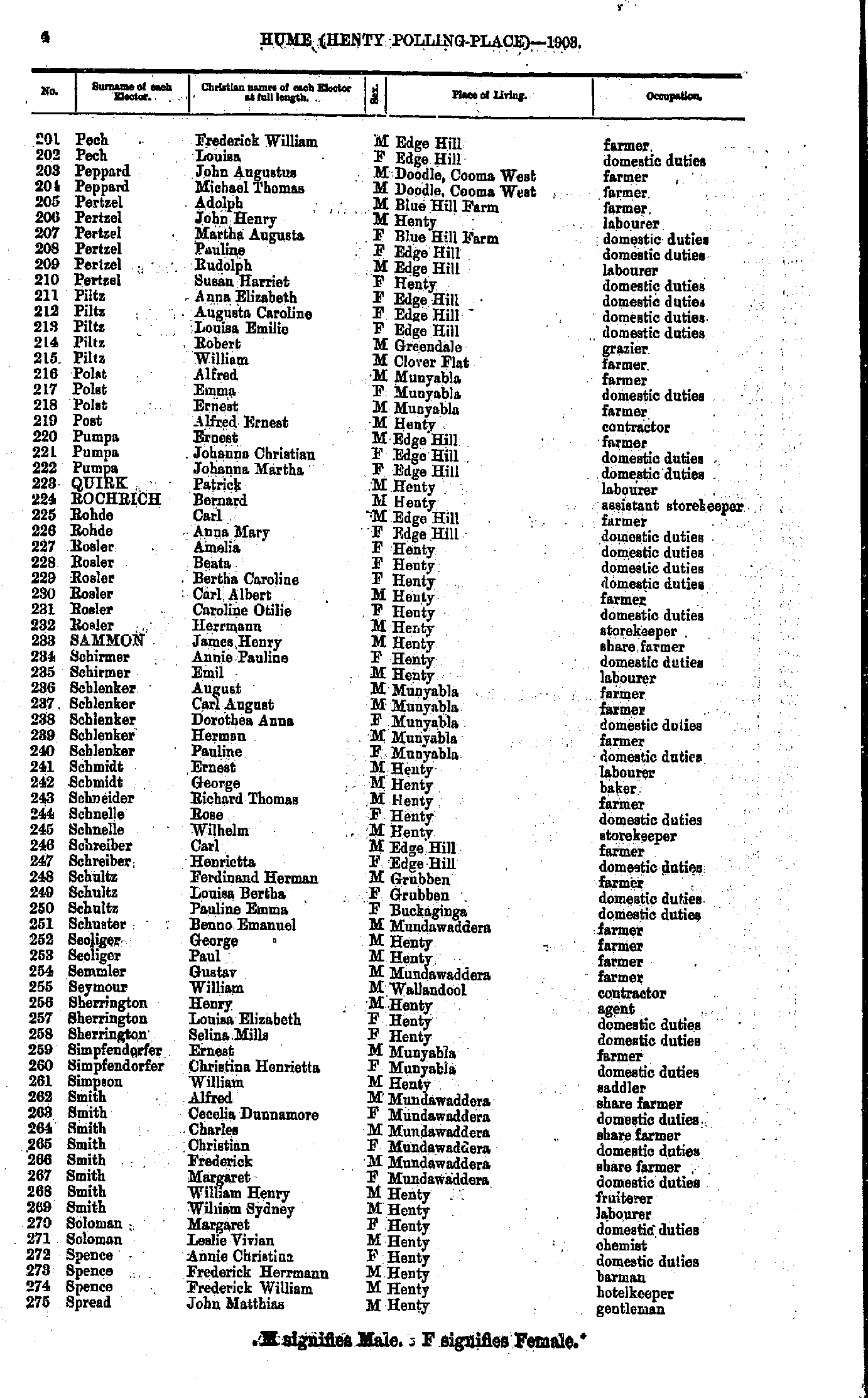
- Pech Frederick - Spread John
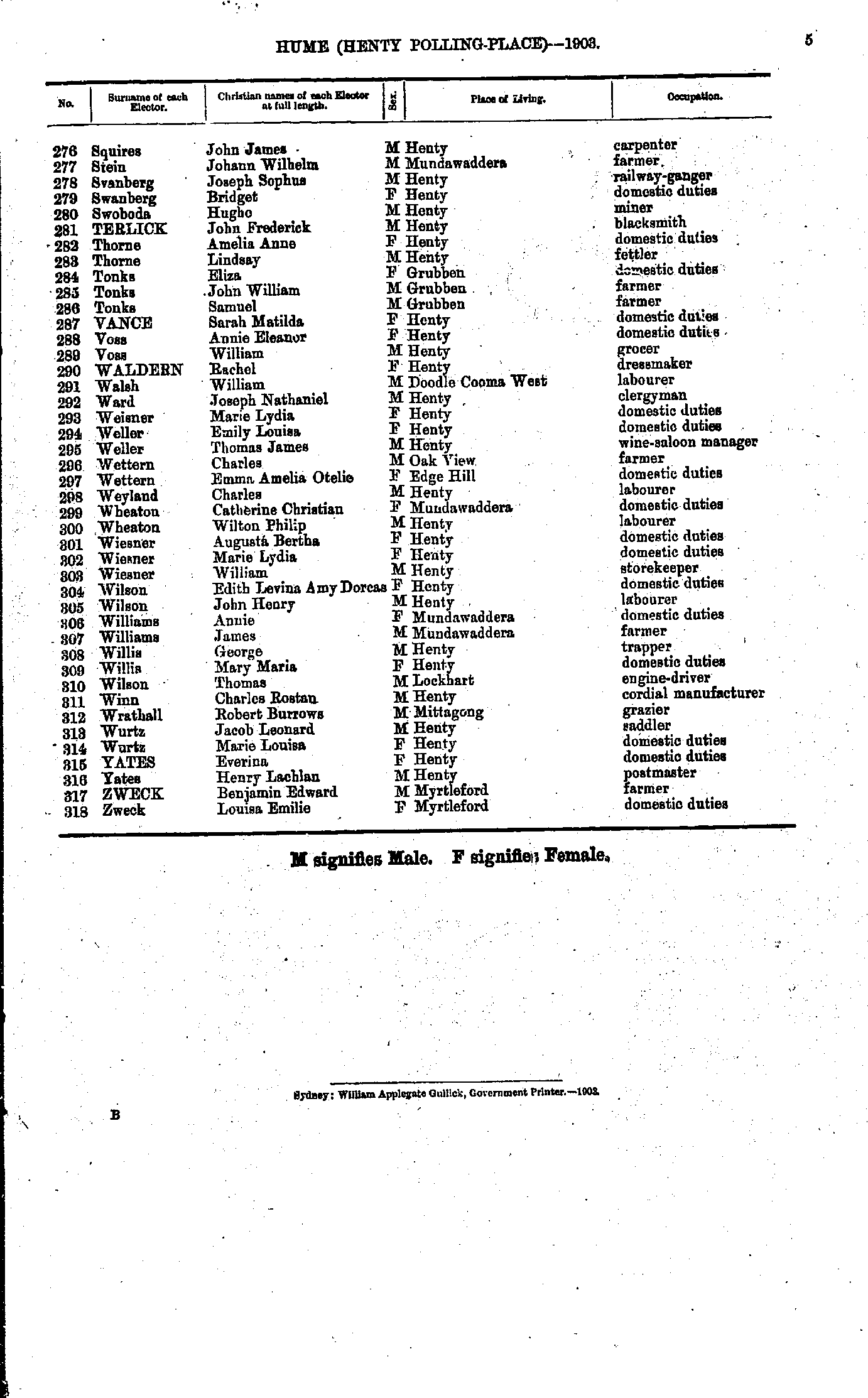
- Squires John - Zweck Louisa
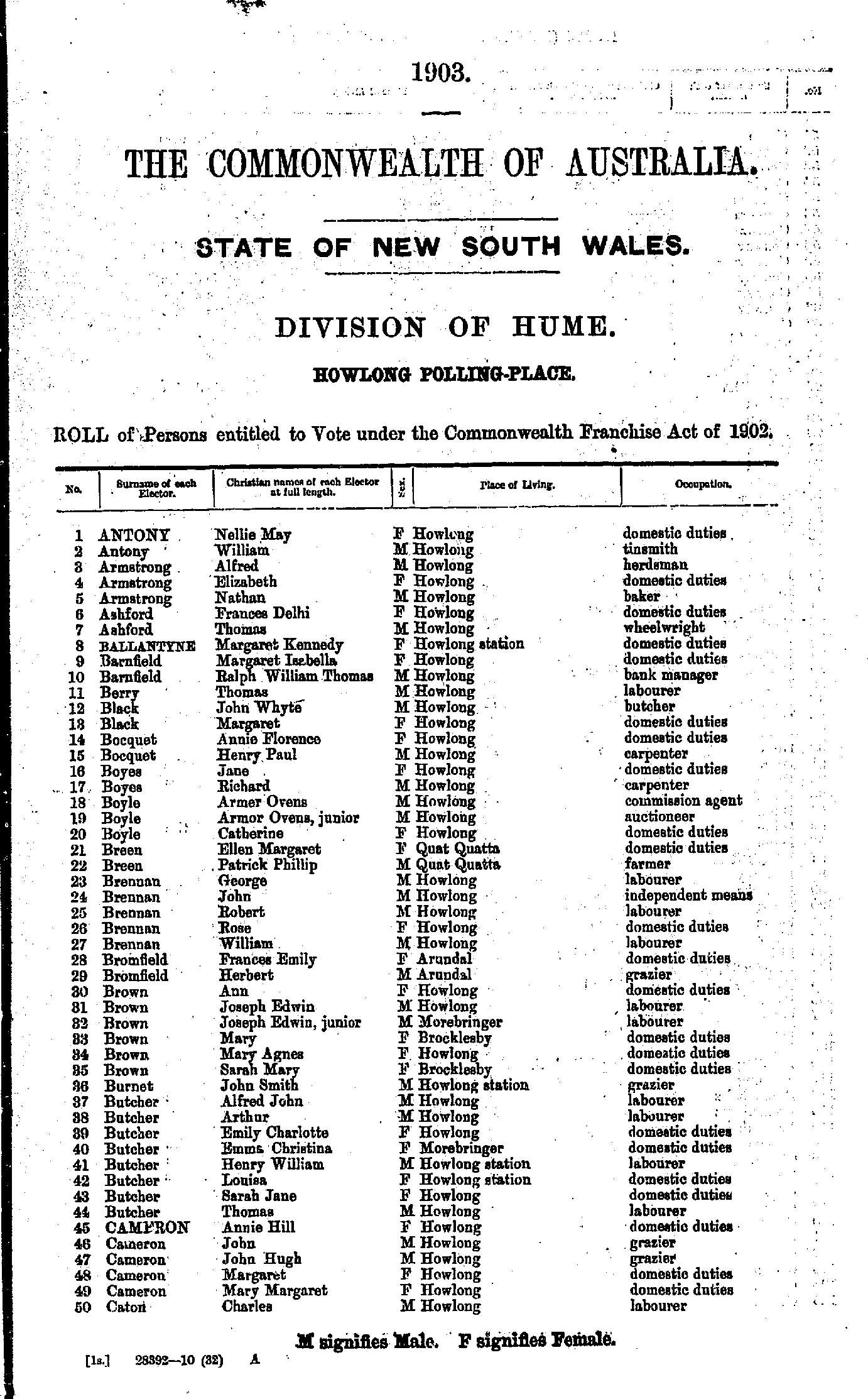
- Antony Nellie - Caton Charles
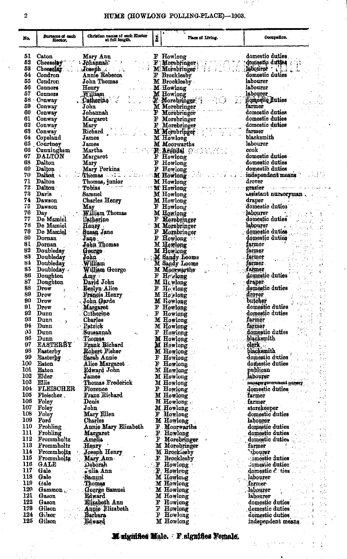
- Caton Mary - Gilson Edward
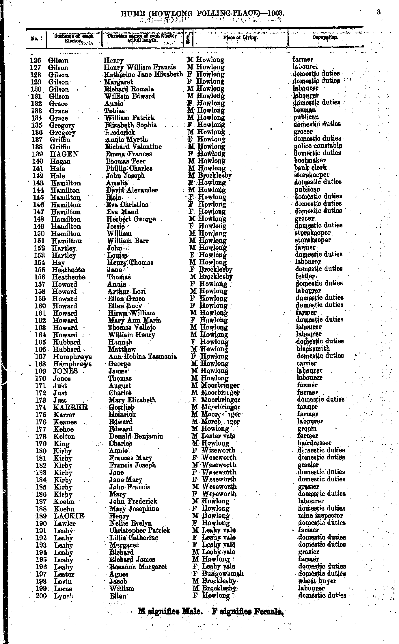
- Gilson Henry - Lynch Ellen
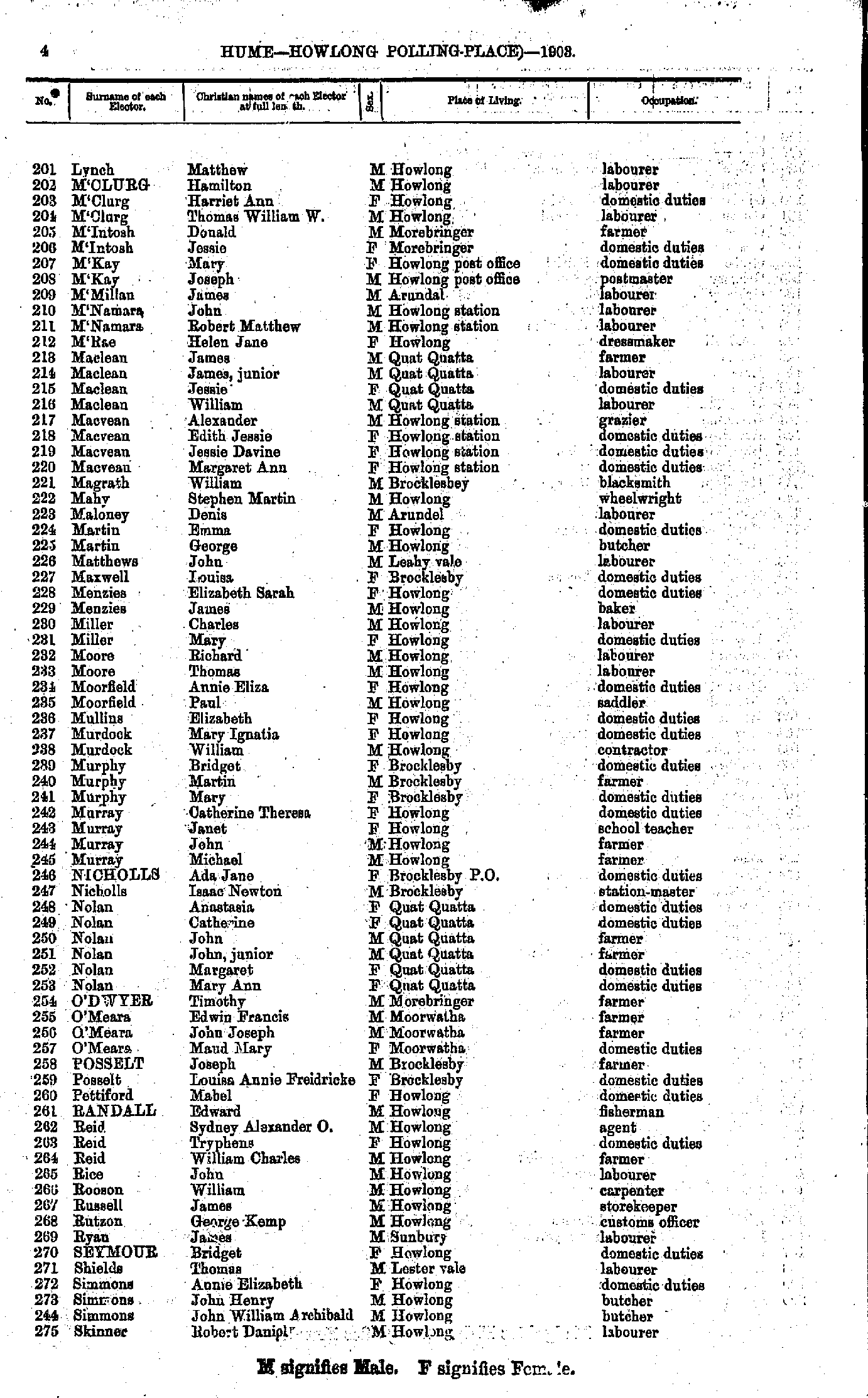
- Lynch Matthew - Skinner Robert
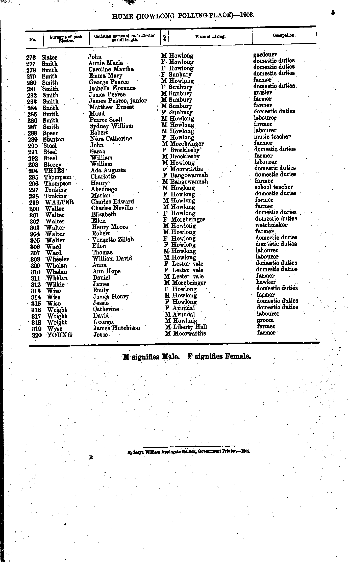
- Slater John - Young Jesse.
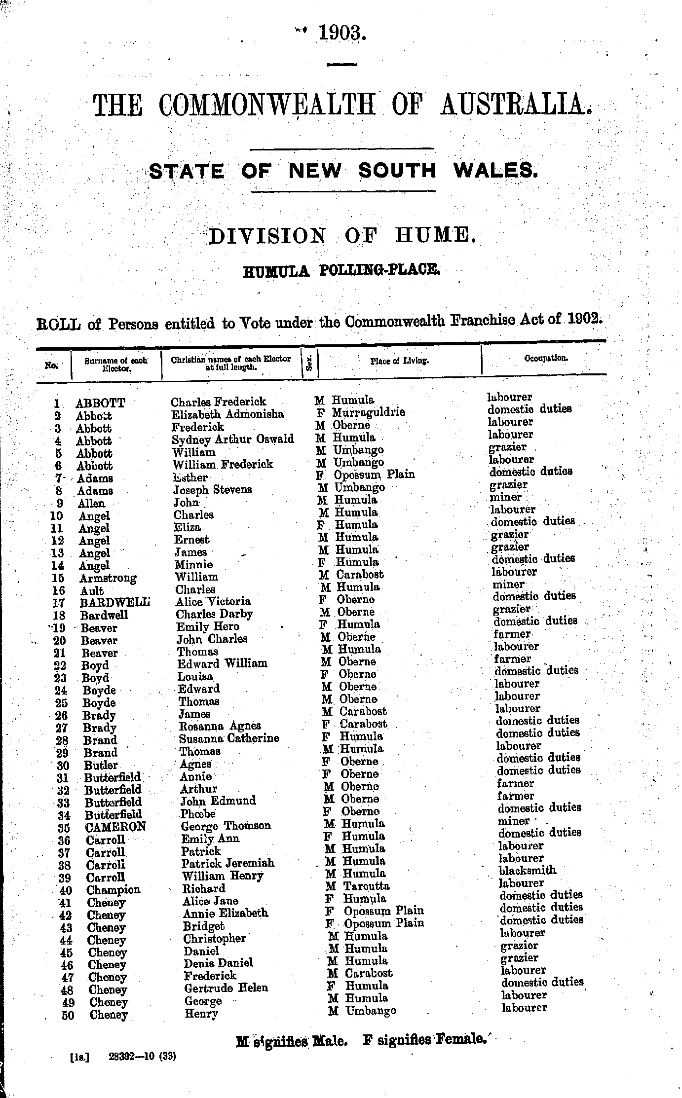
- Abbott Charles - Cheney Henry
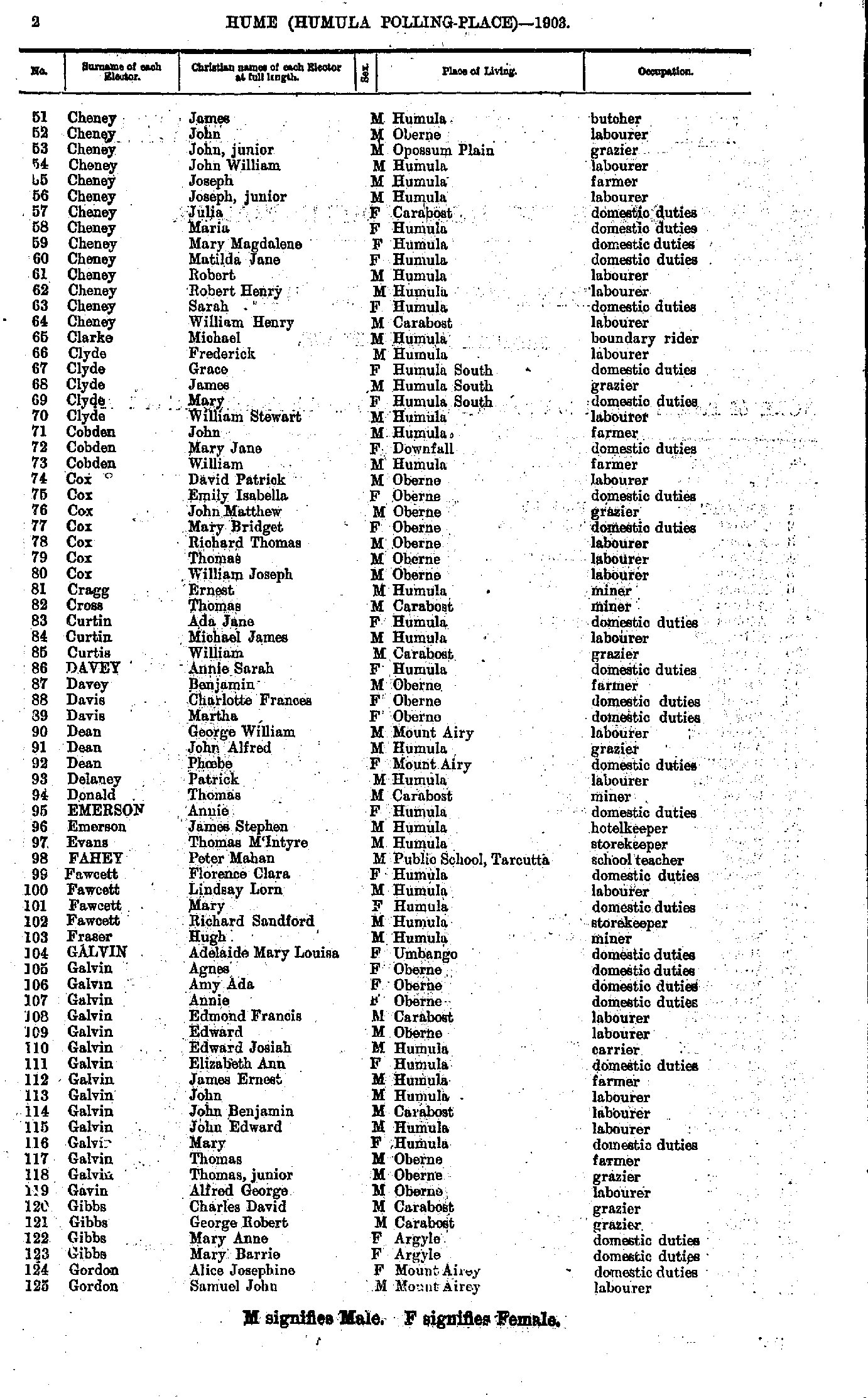
- Cheney James - Gordon Samuel
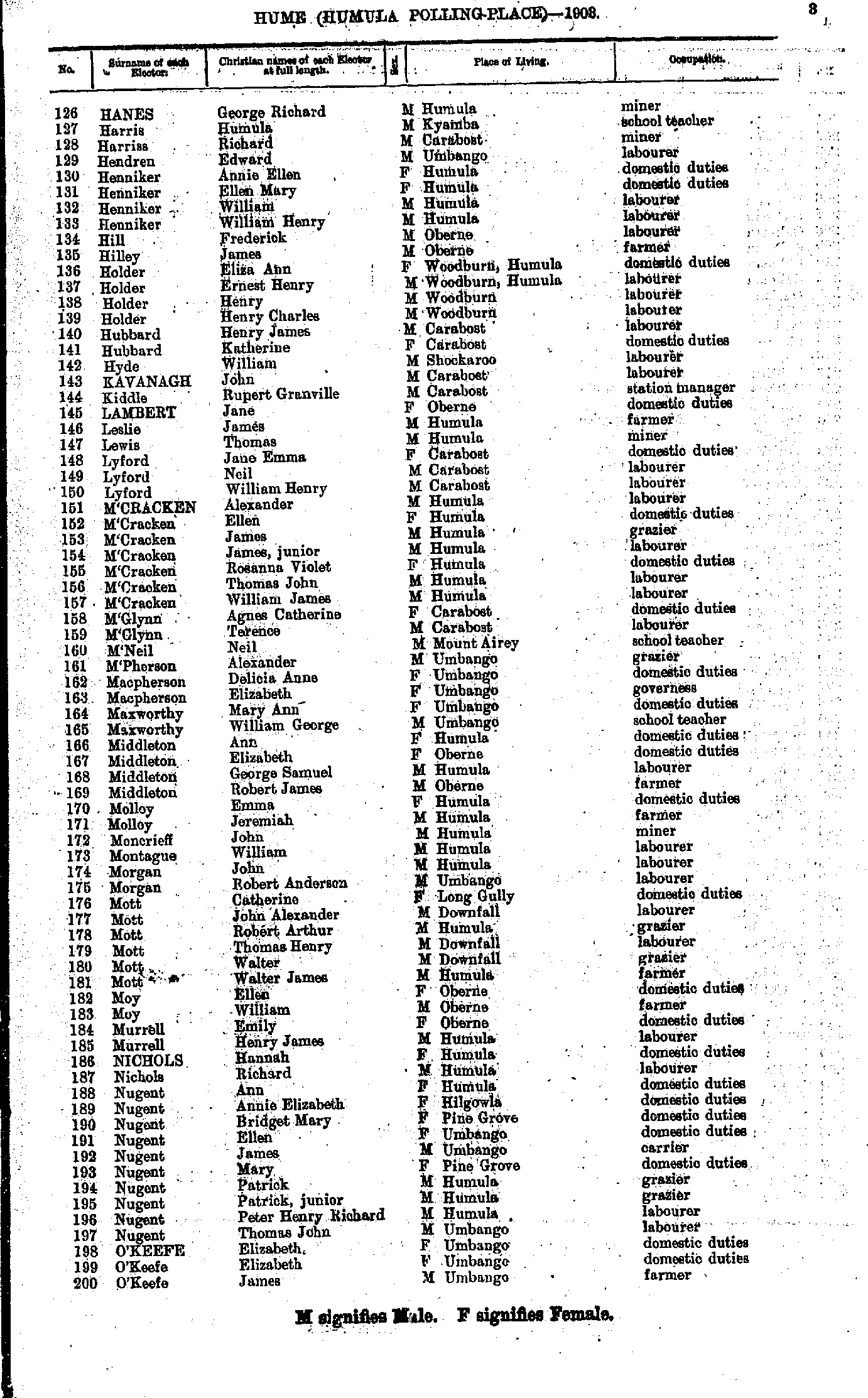
- Hanes George - O'Keefe James
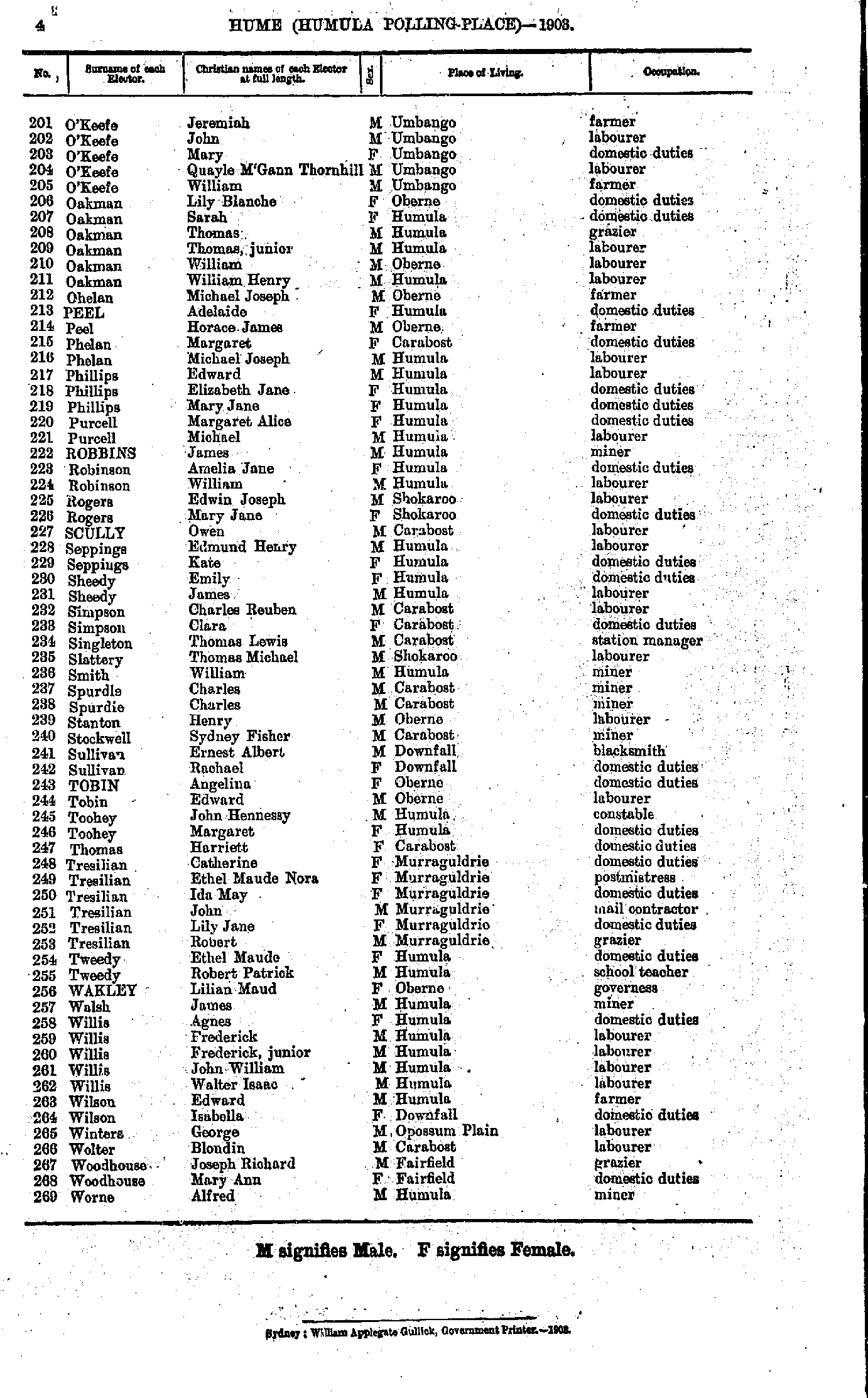
- O'Keefe Jeremiah - Worne Alfred
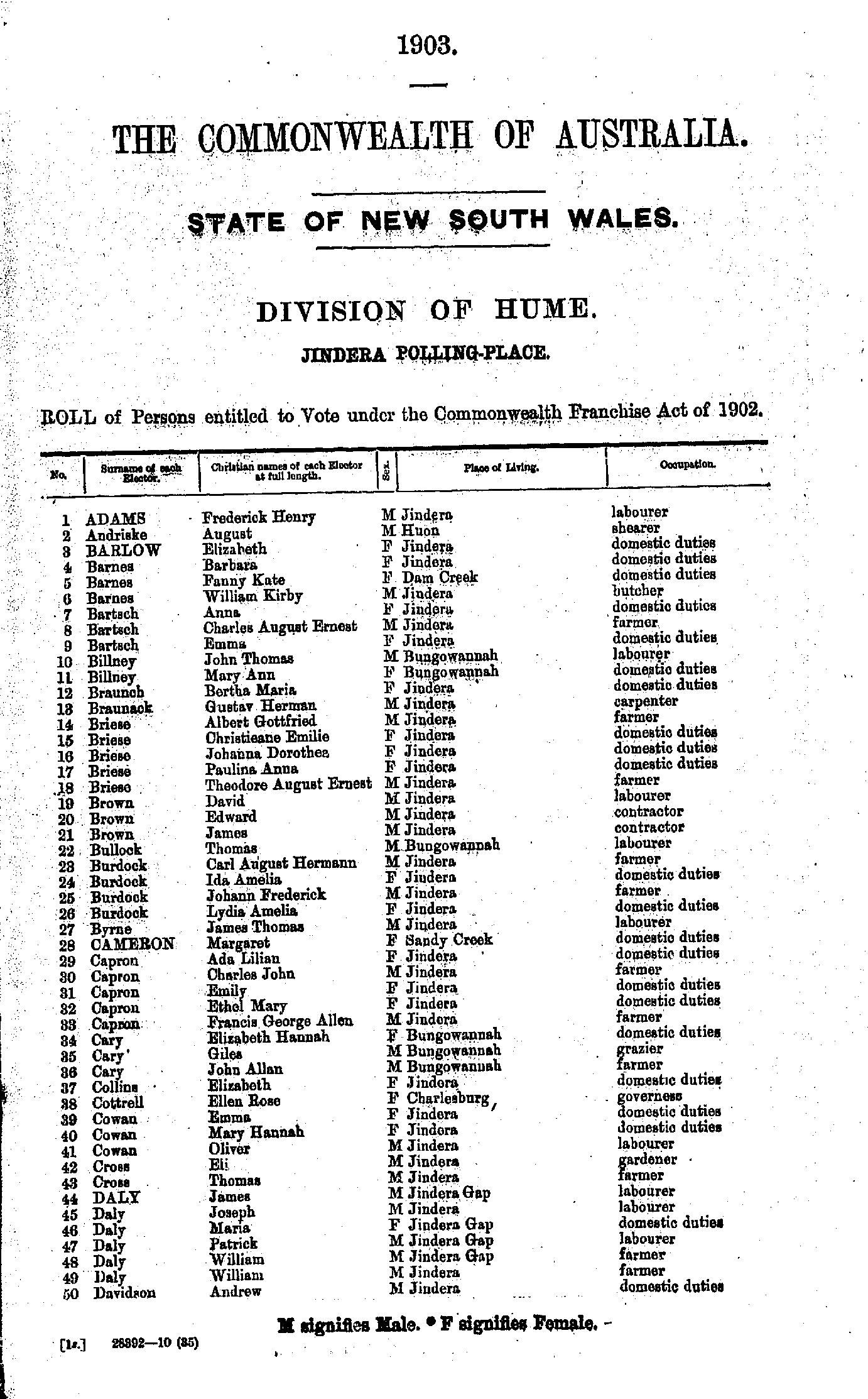
- Adams Frederick - Davidson Andrew
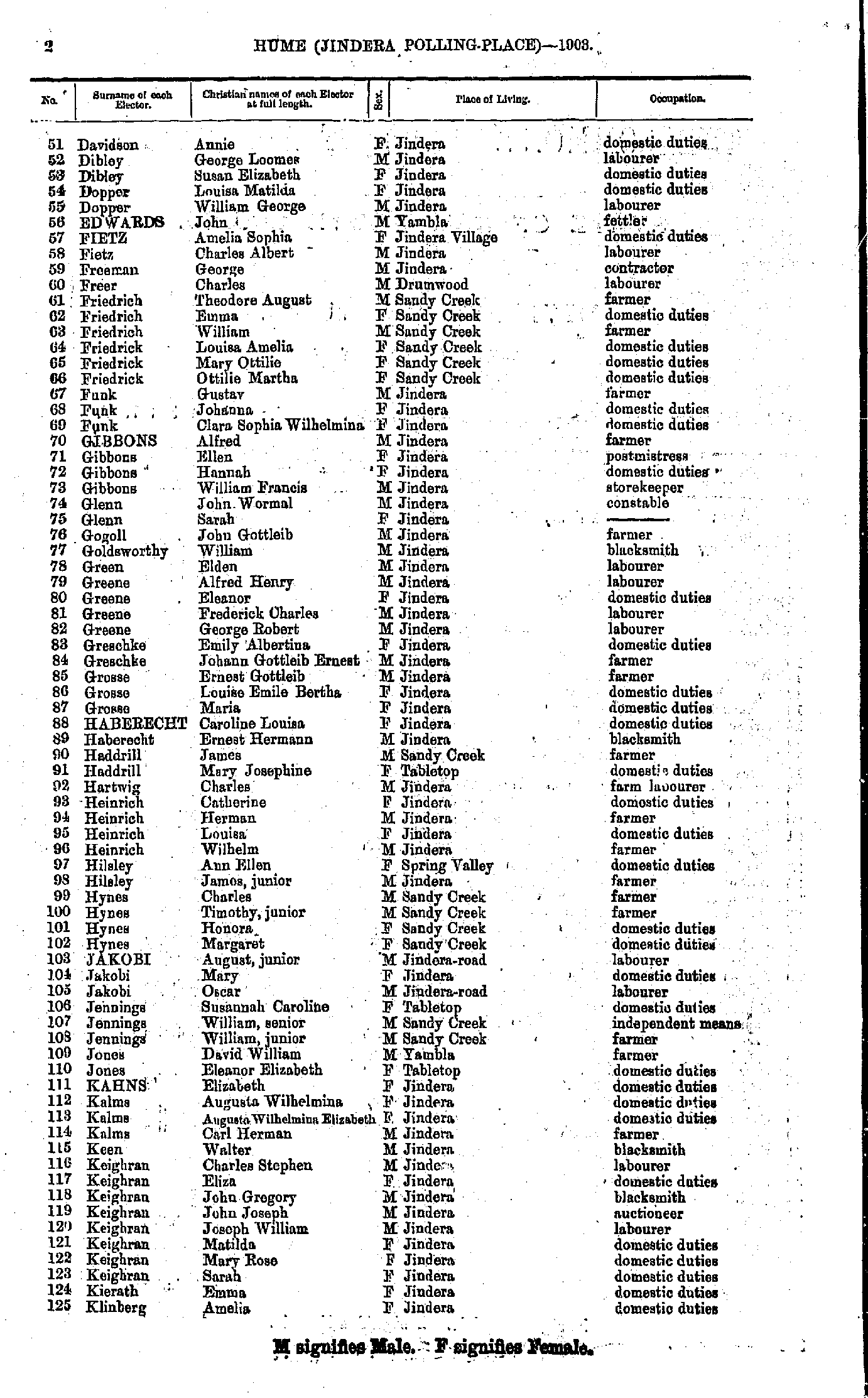
- Davidson Annie - Klinberg Amelia
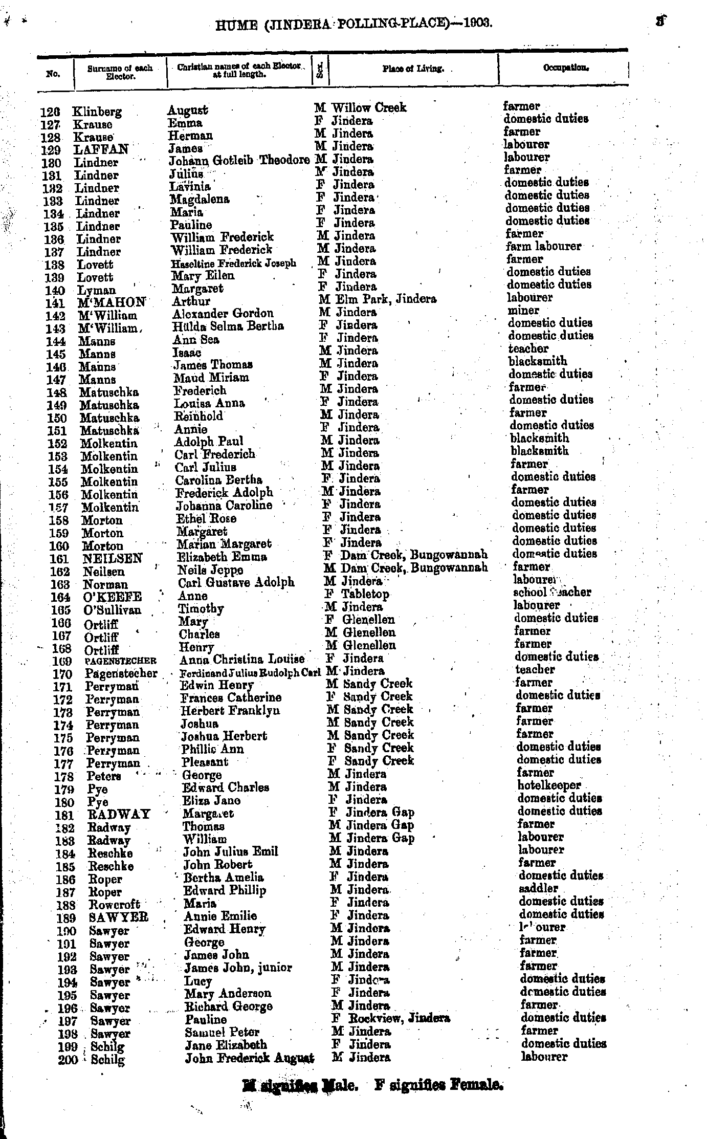
- Klinberg August - Schilg John
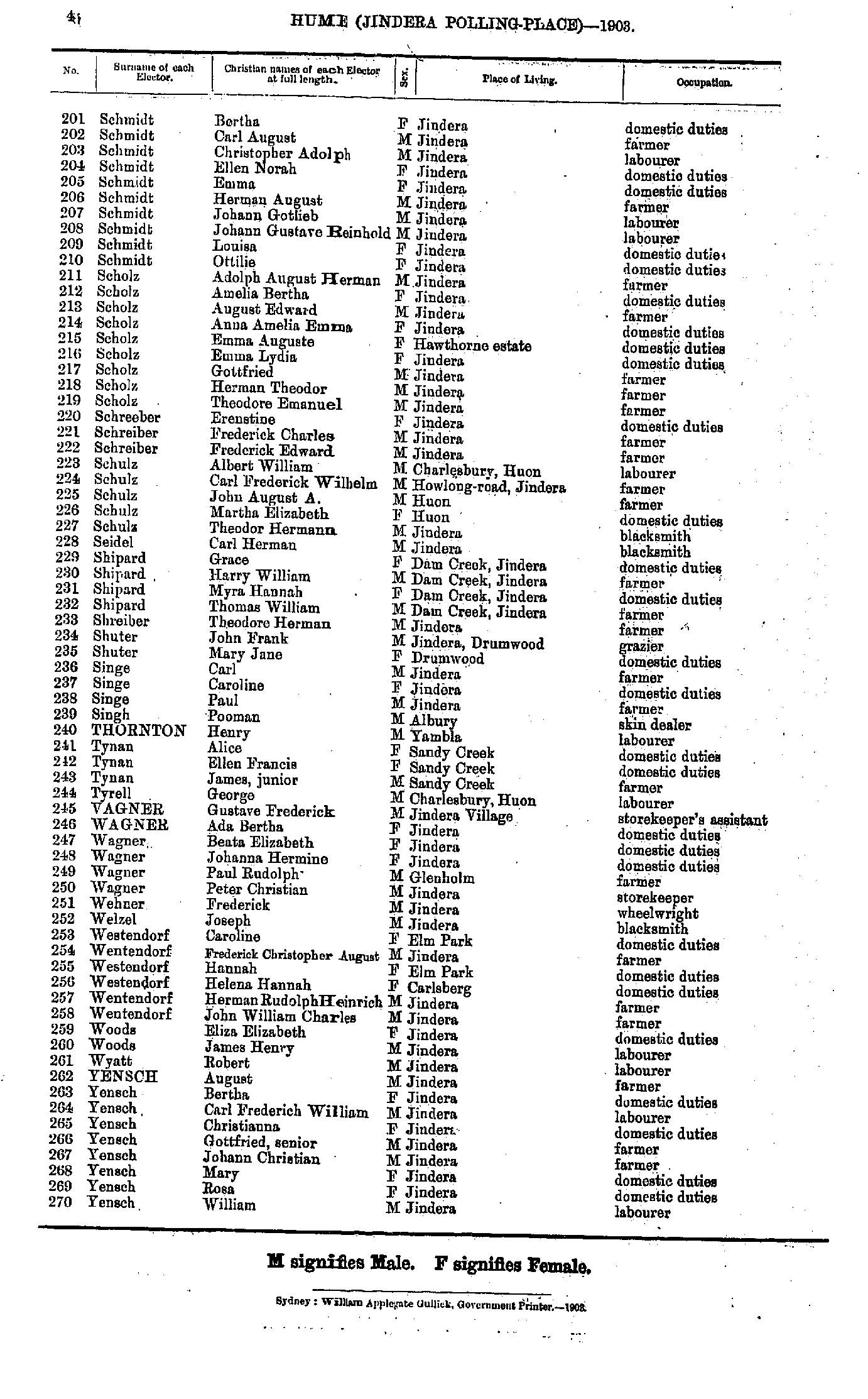
- Schmidt Bertha - Yensch William
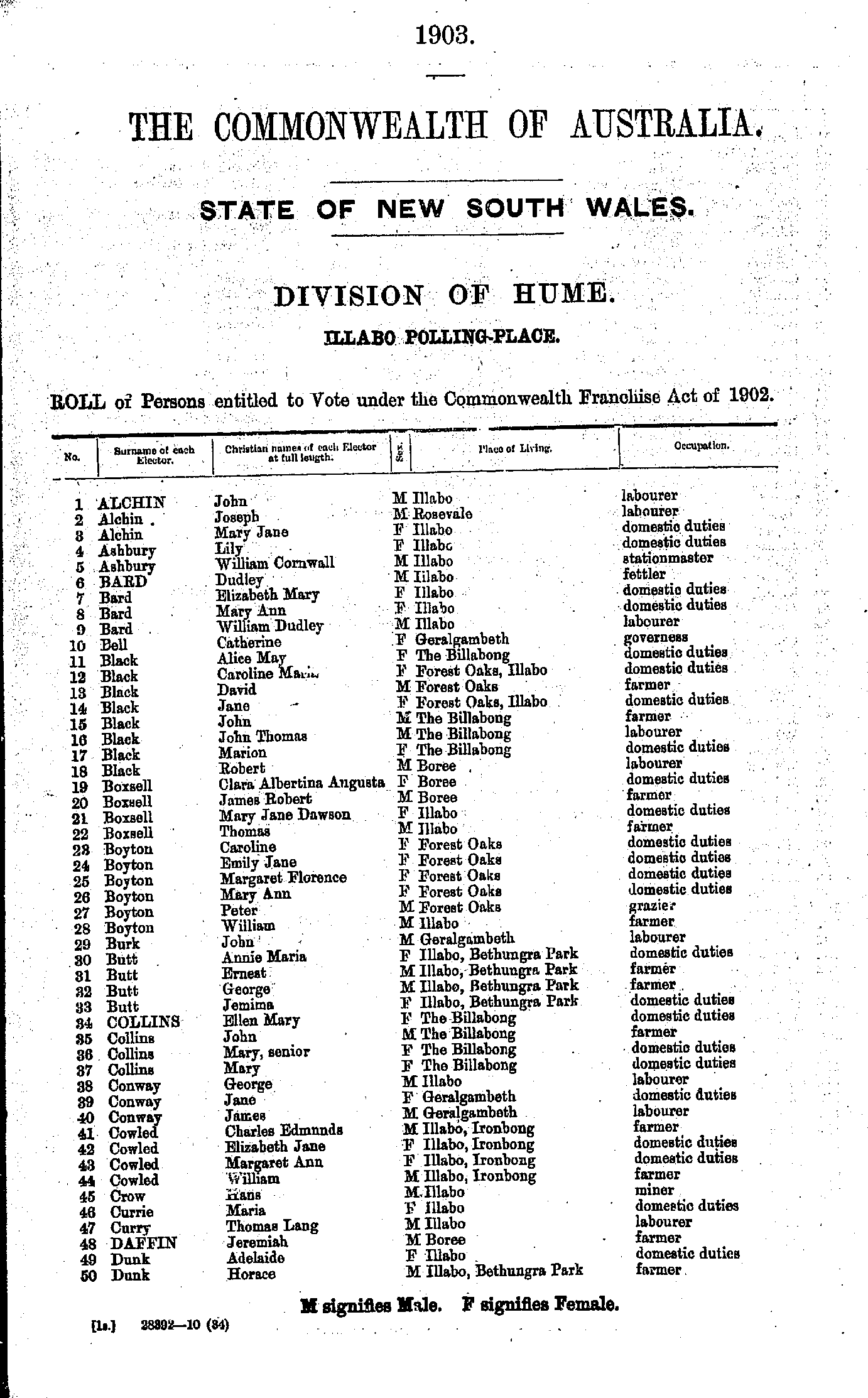
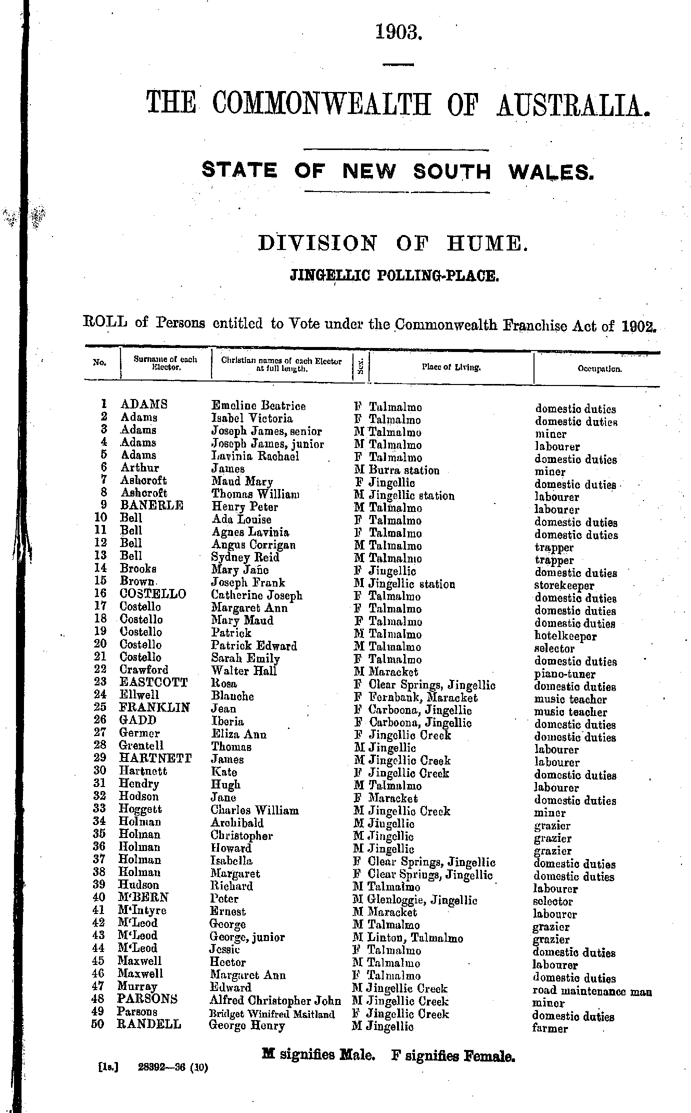
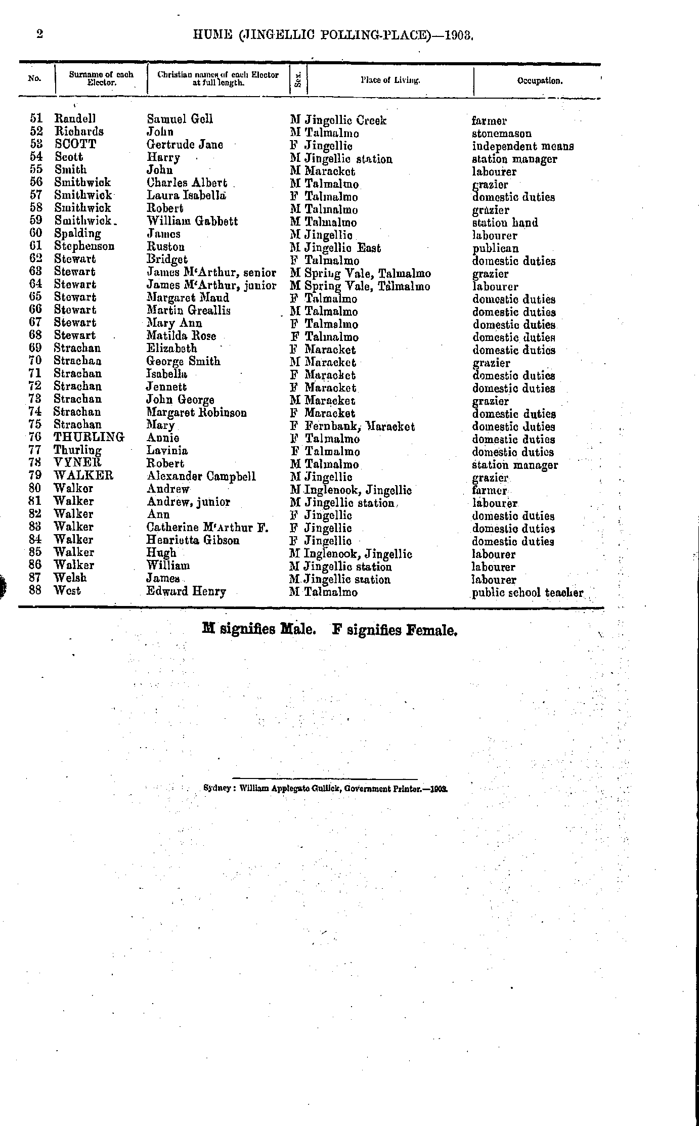
- Adams Robert - Coggan Thomas
- Coggan William - Johns George
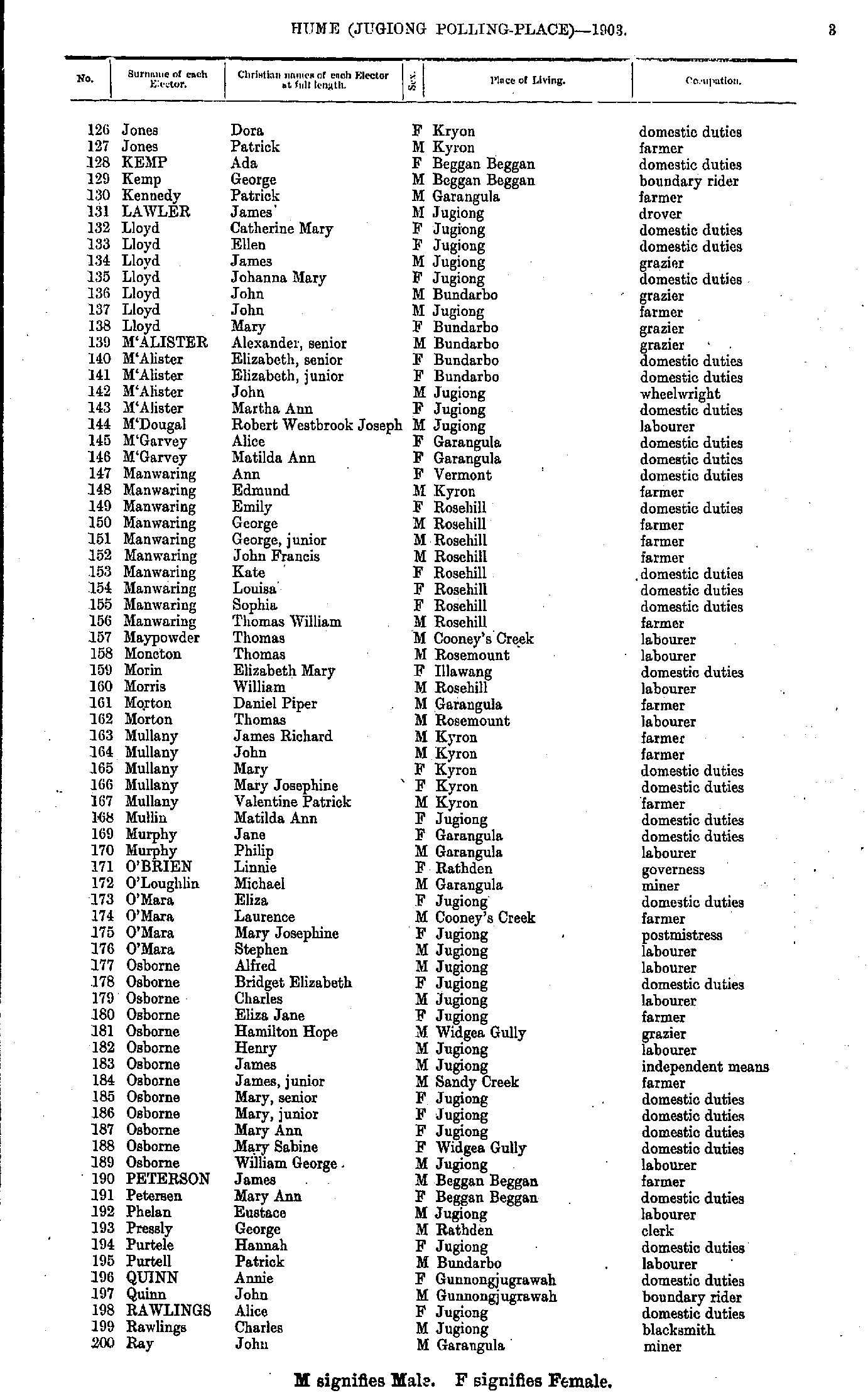
- Jones Dora - Ray John
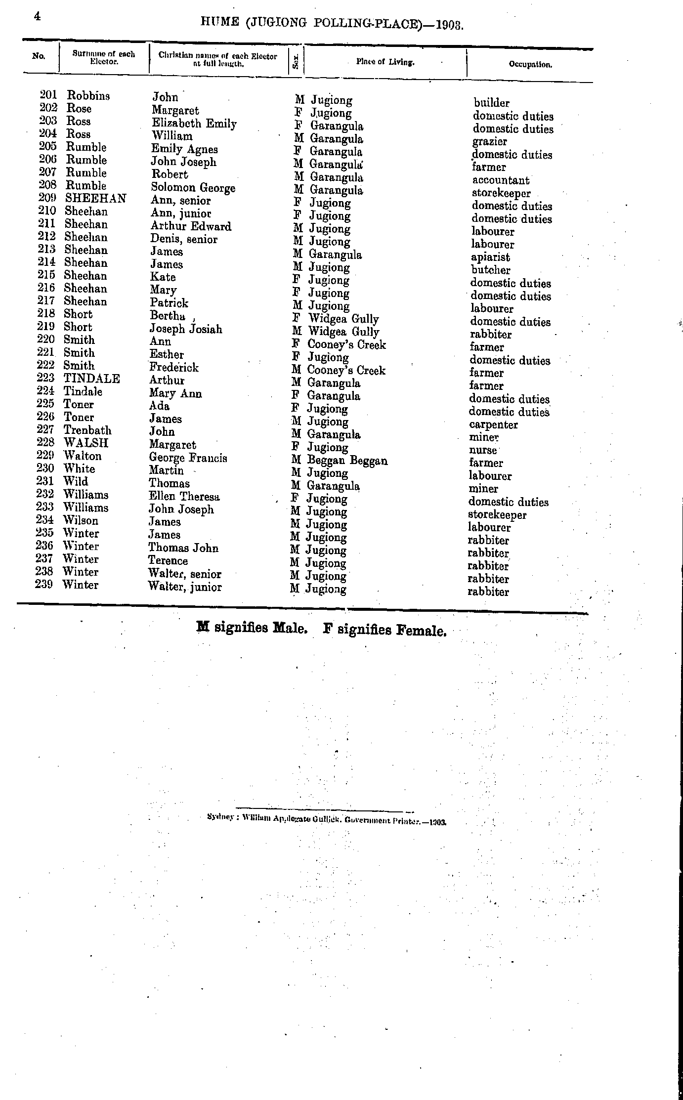
- Robbins John - Winter Walter
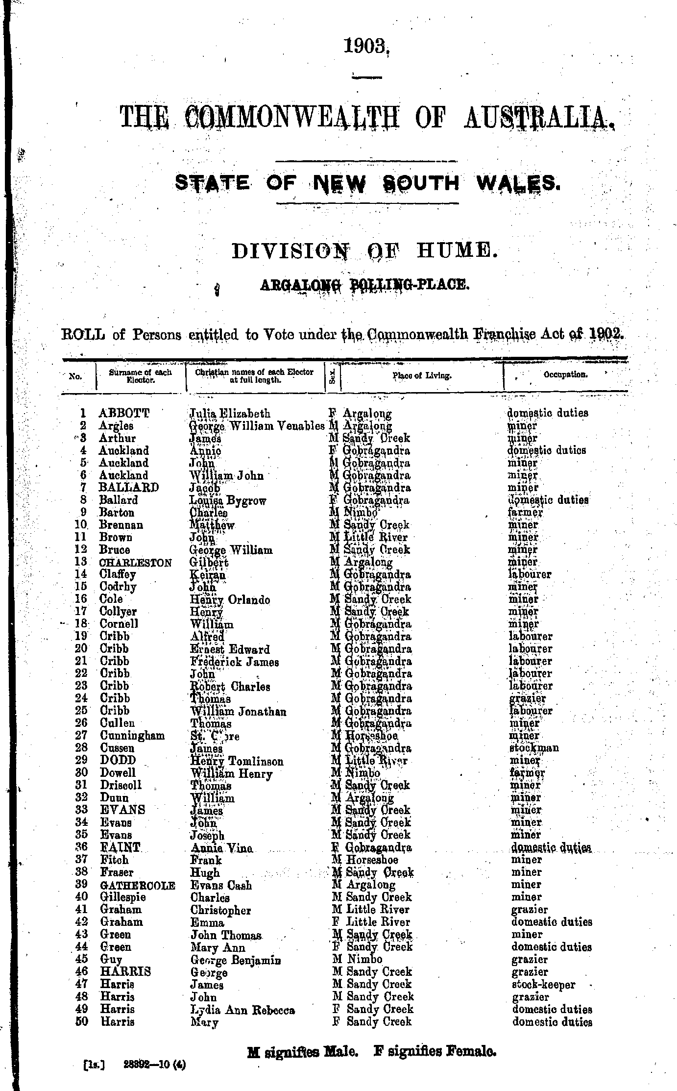
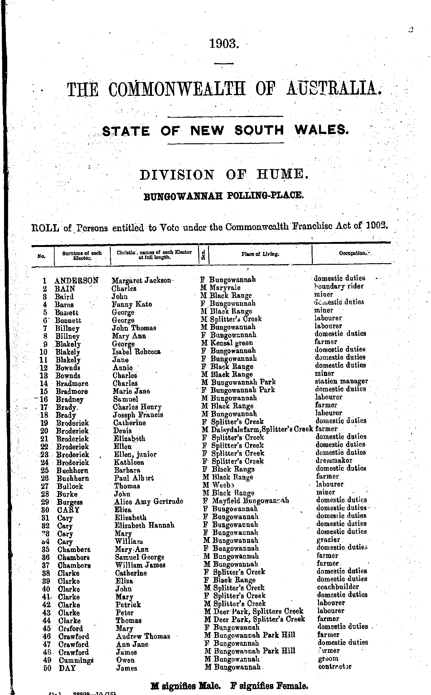
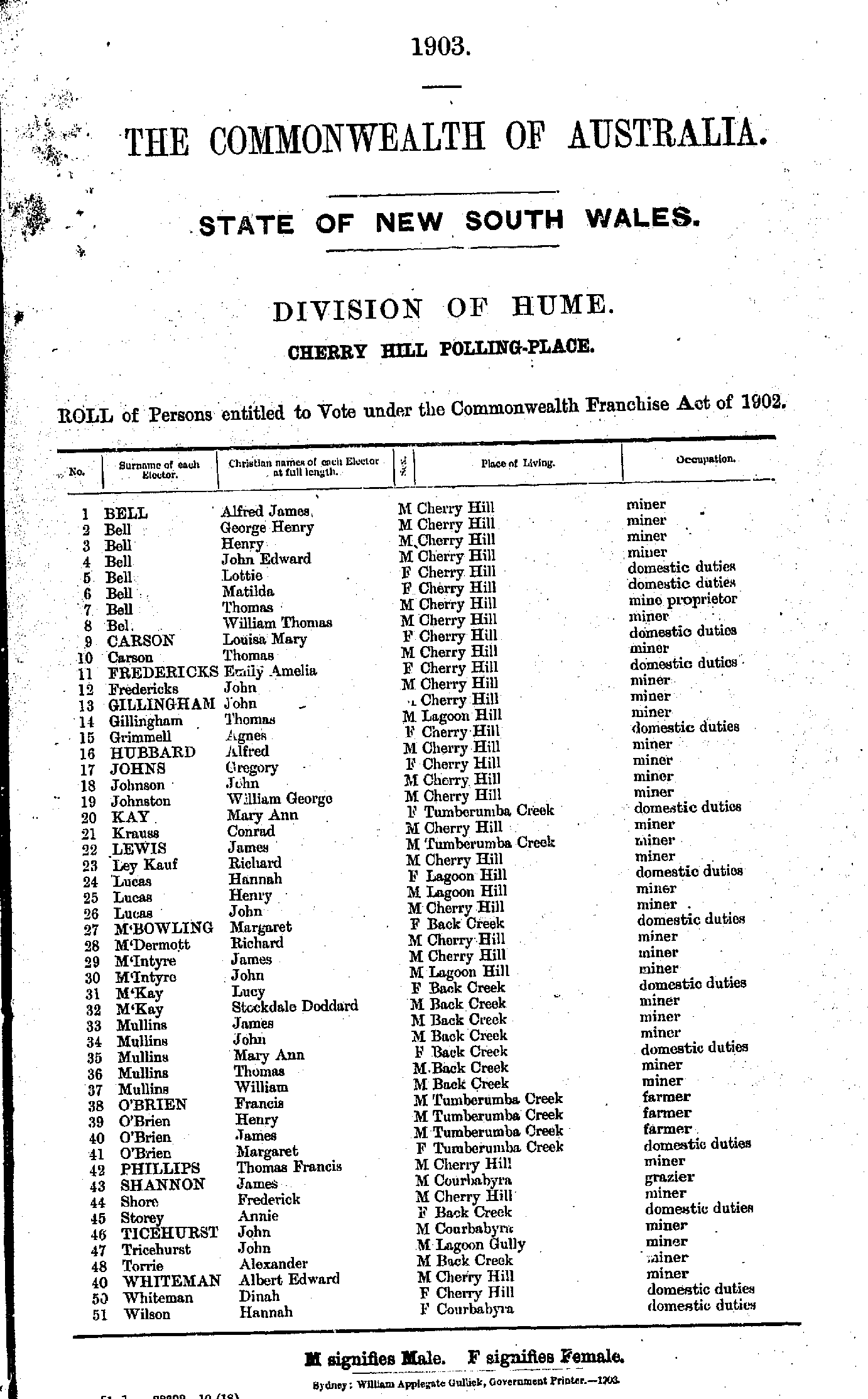
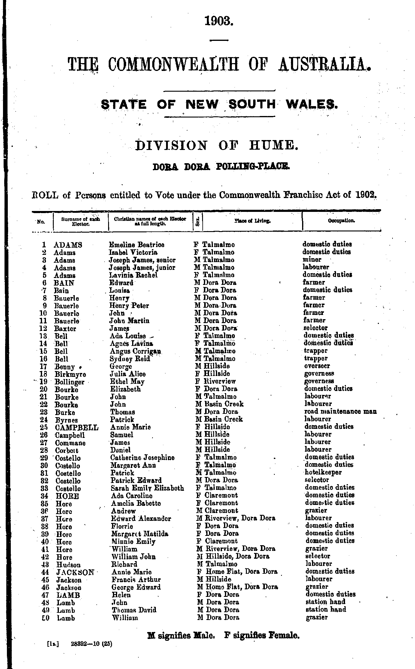
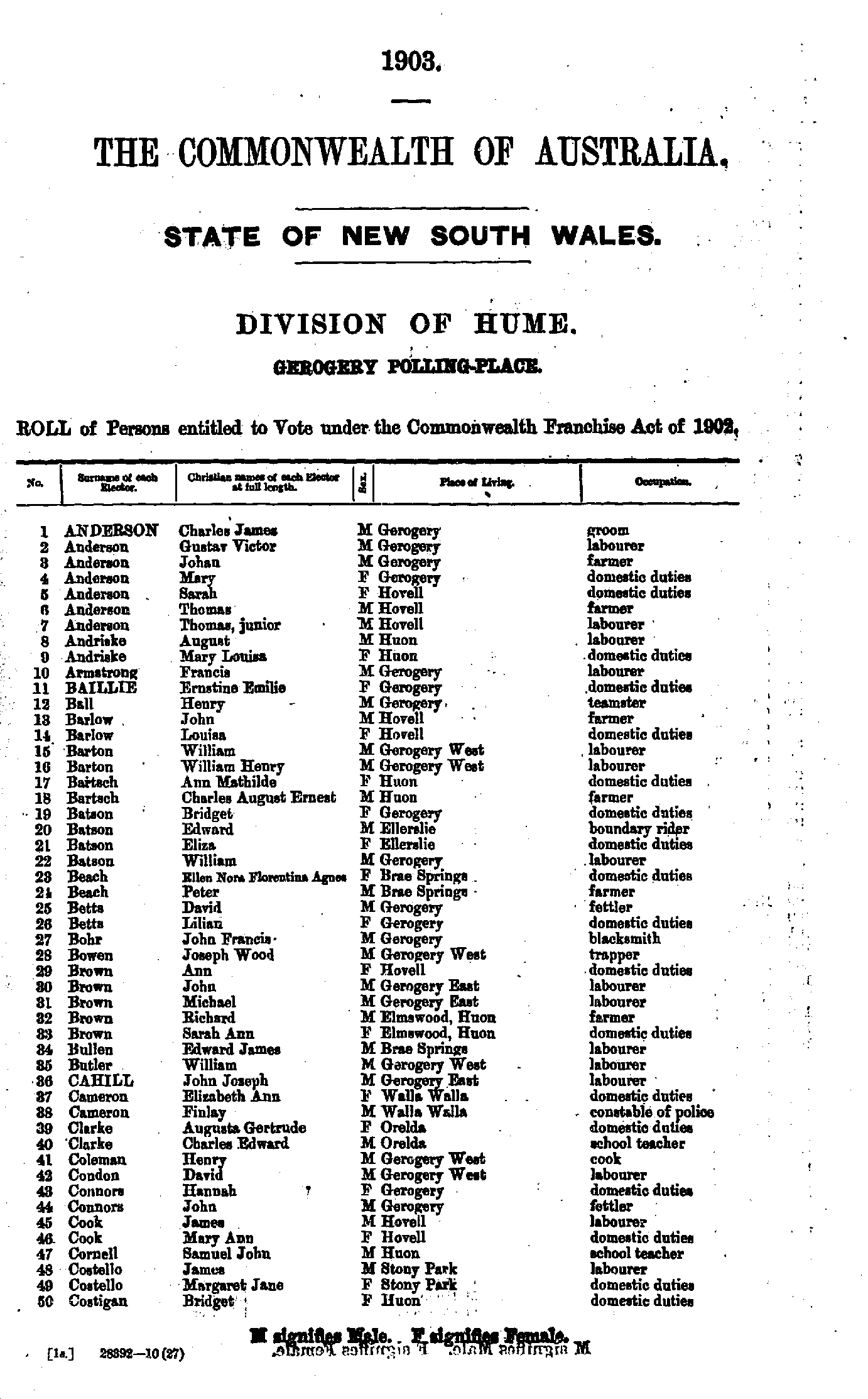
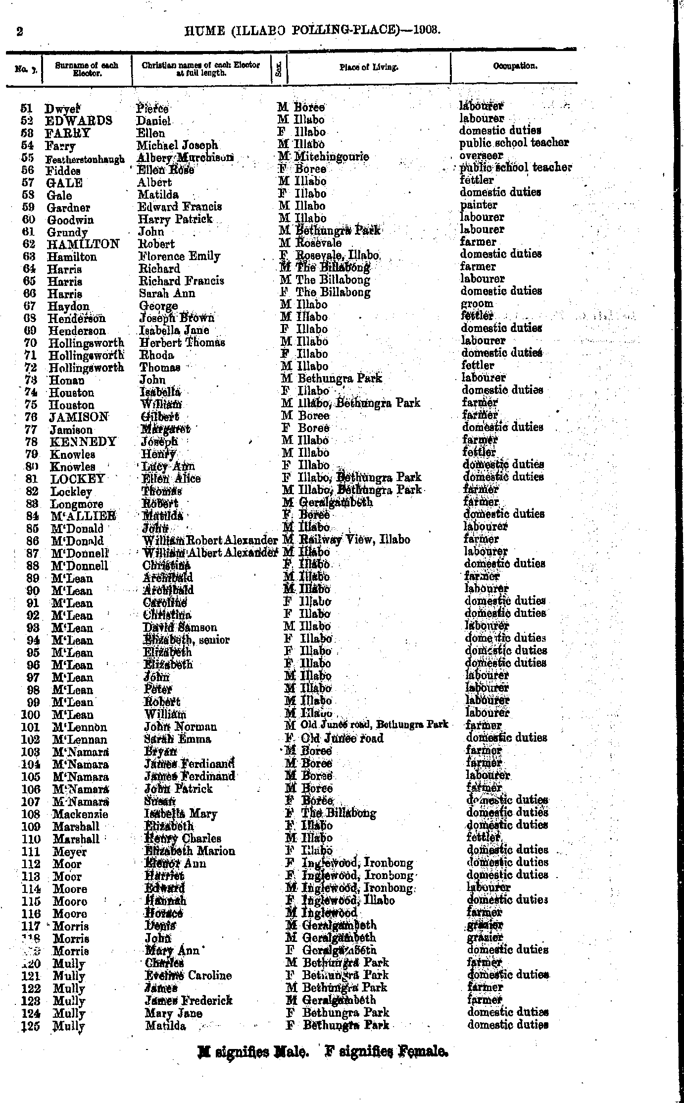
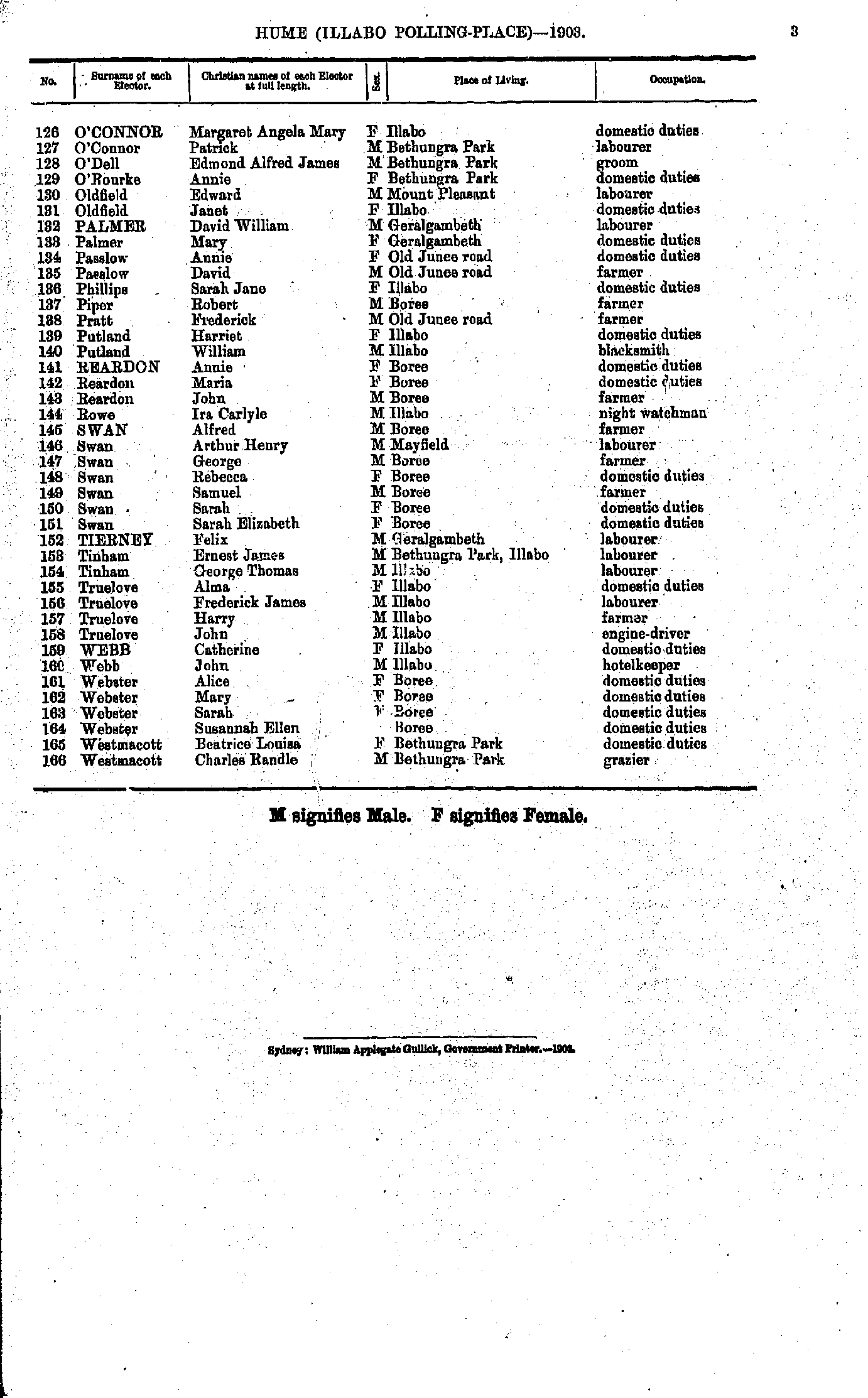
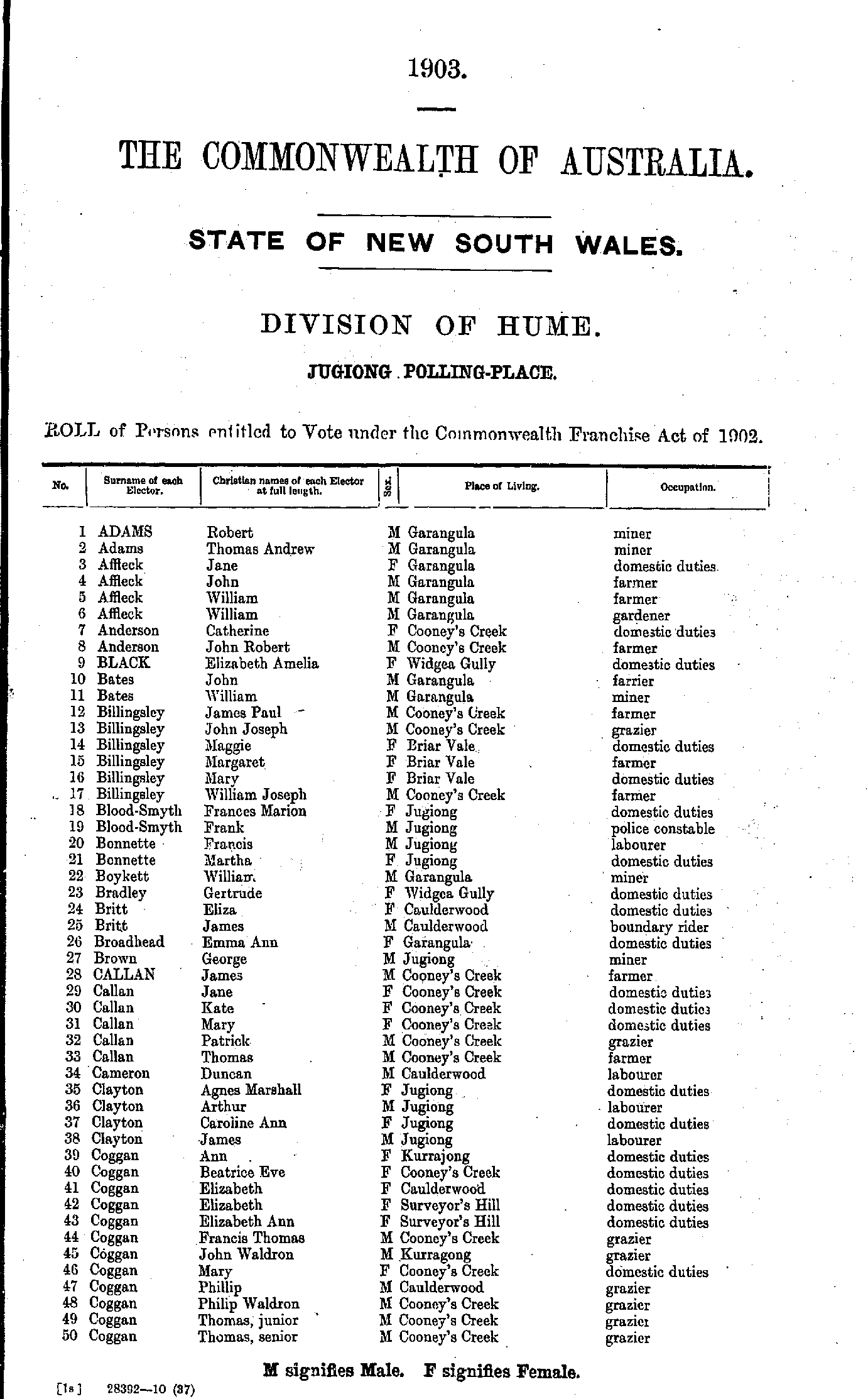
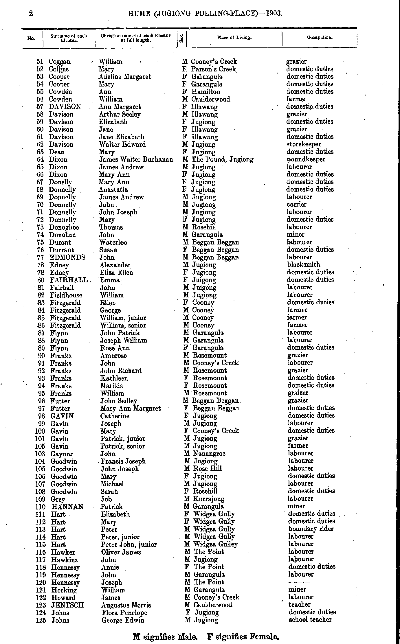
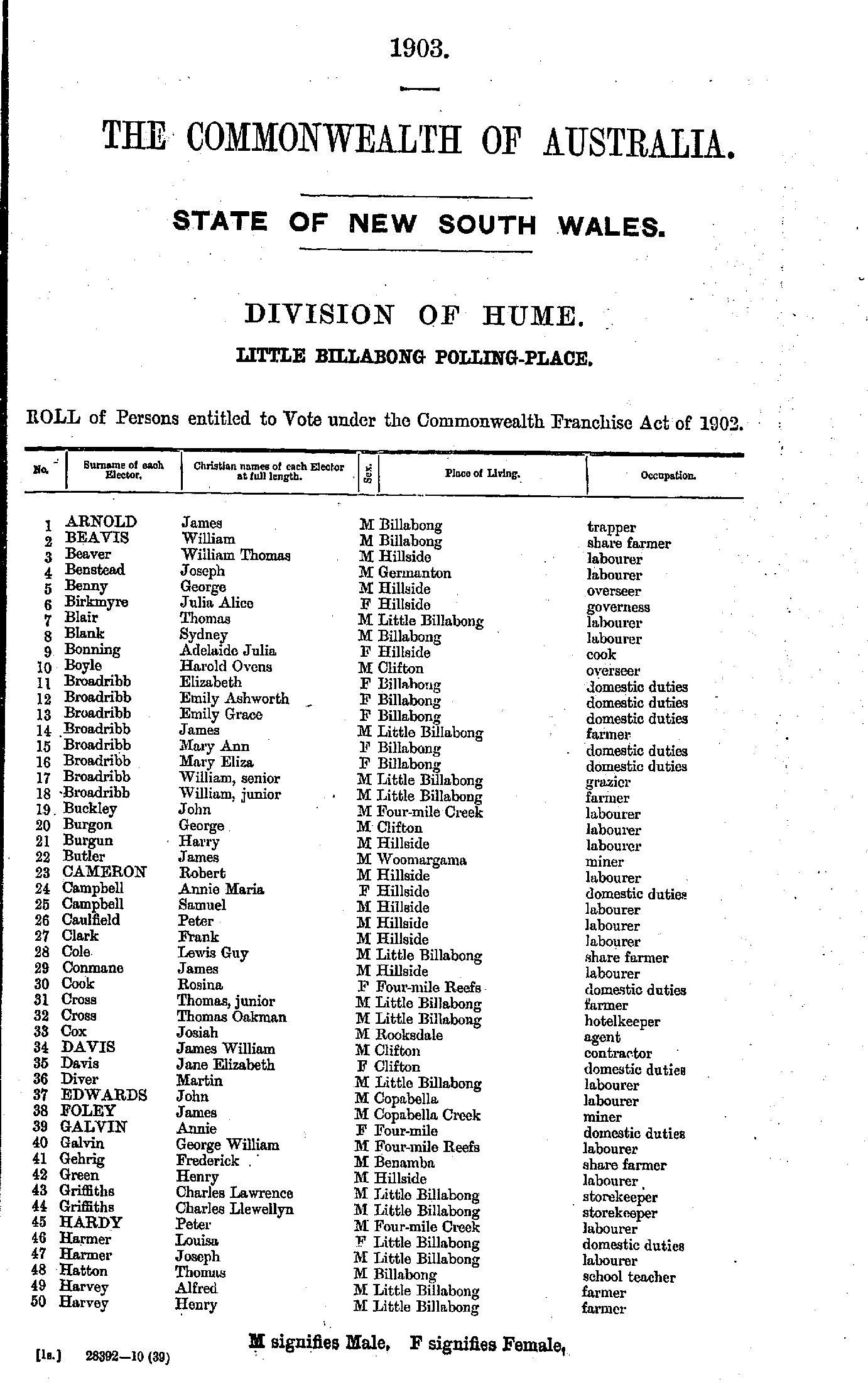
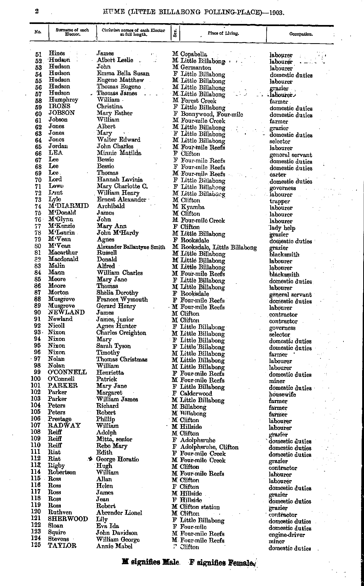
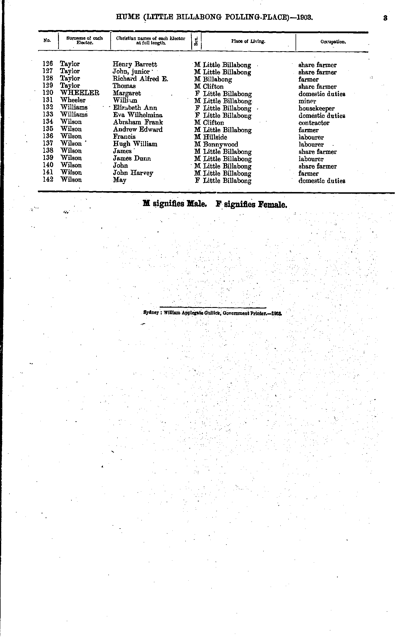
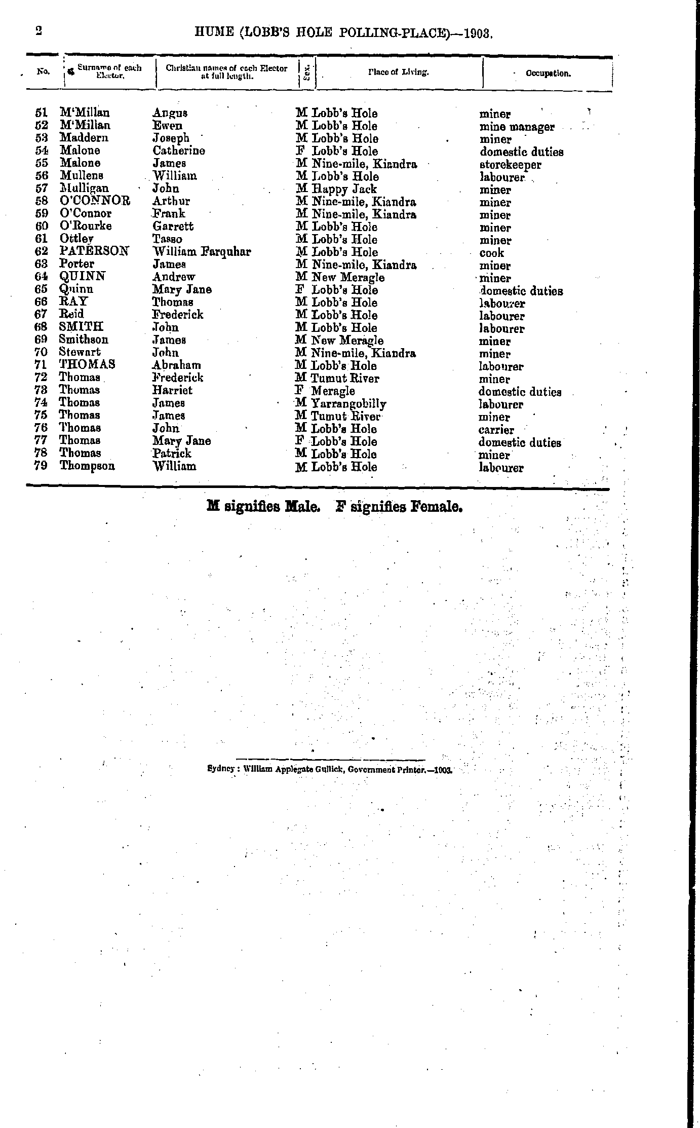
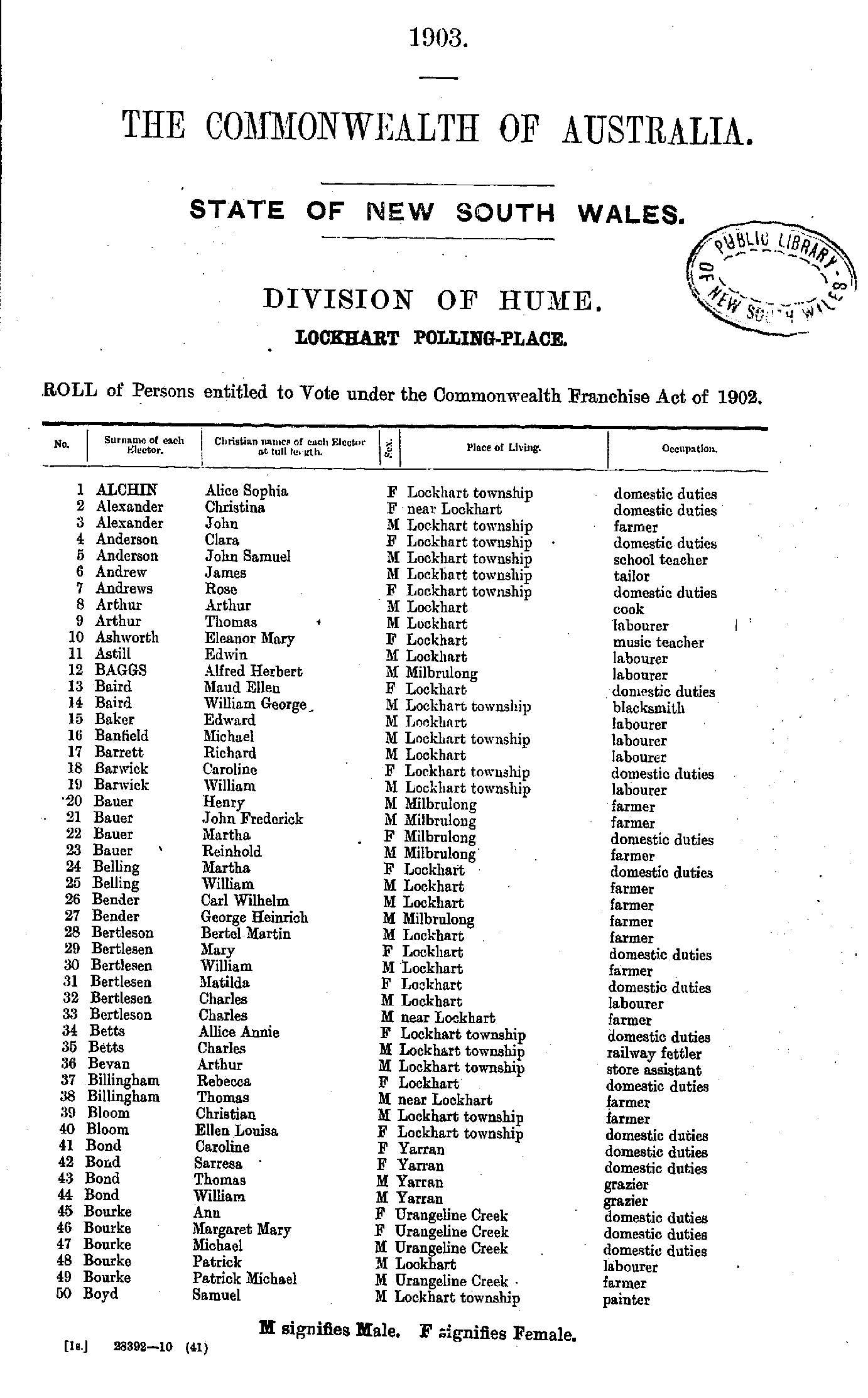
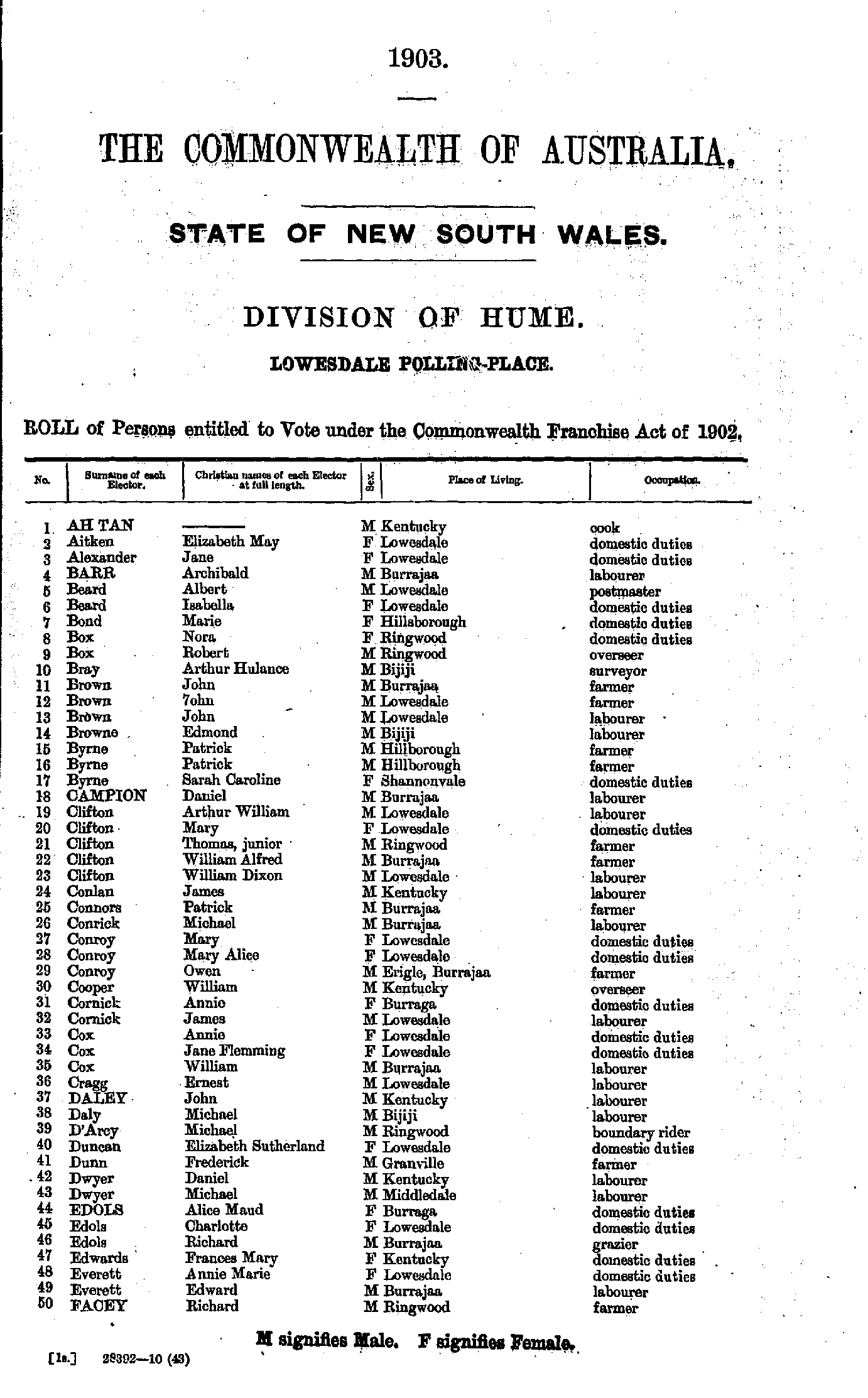
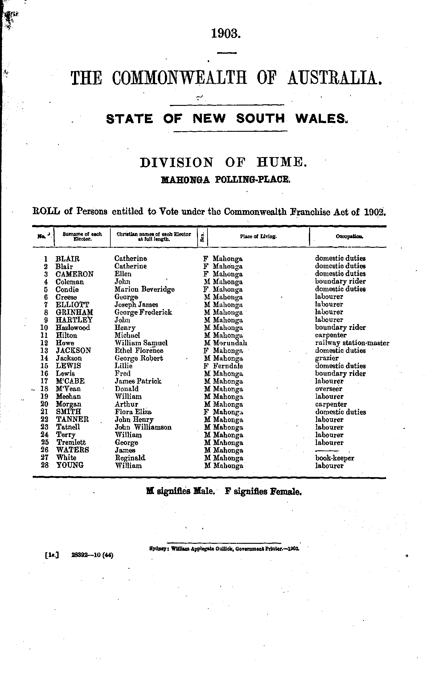
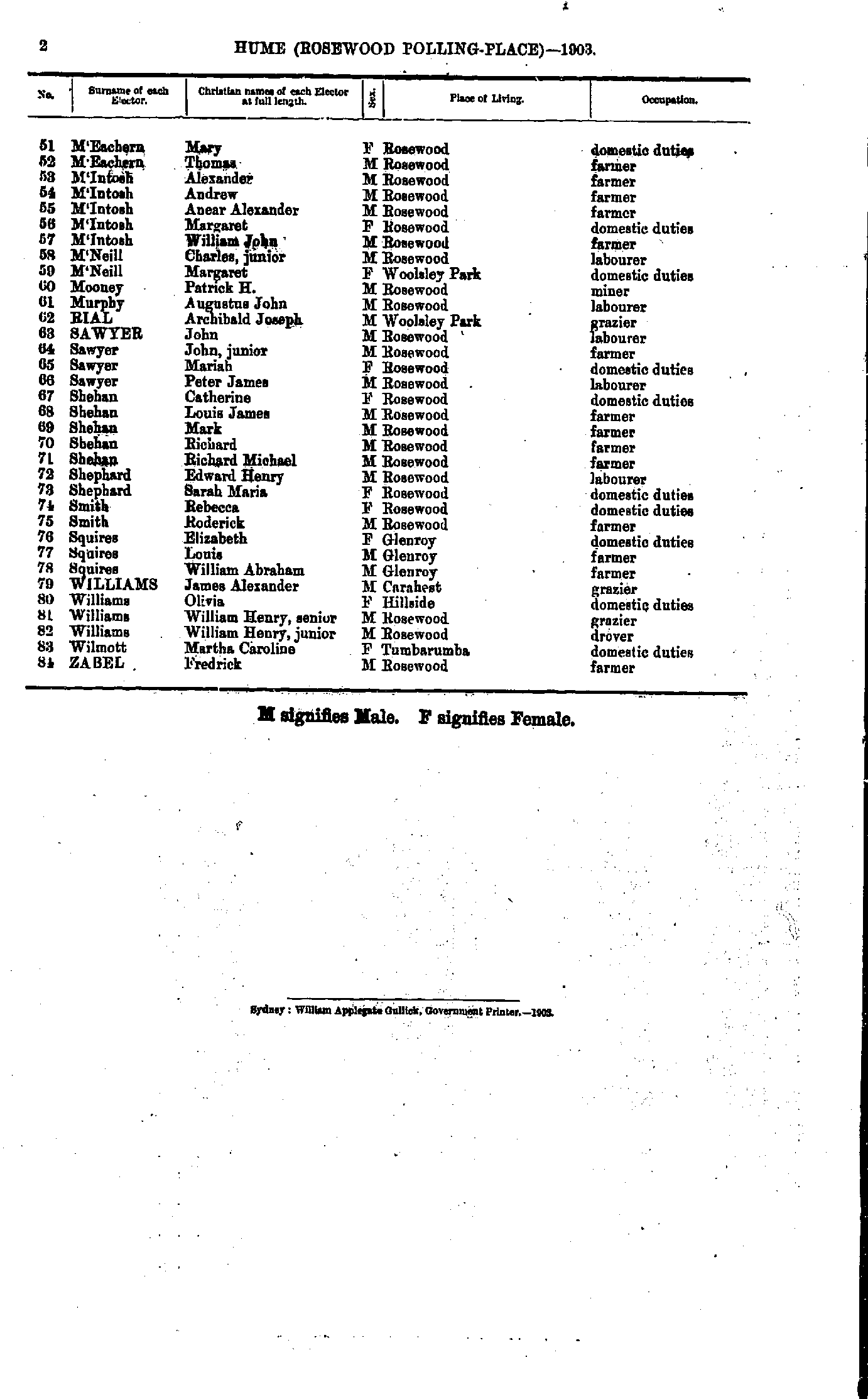
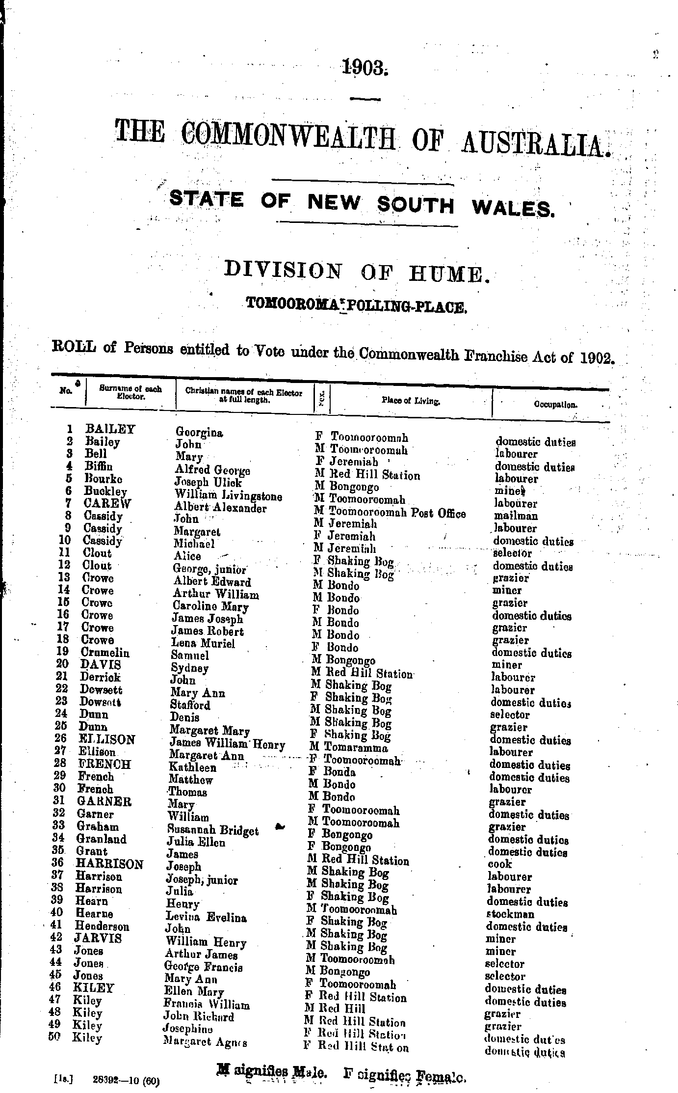
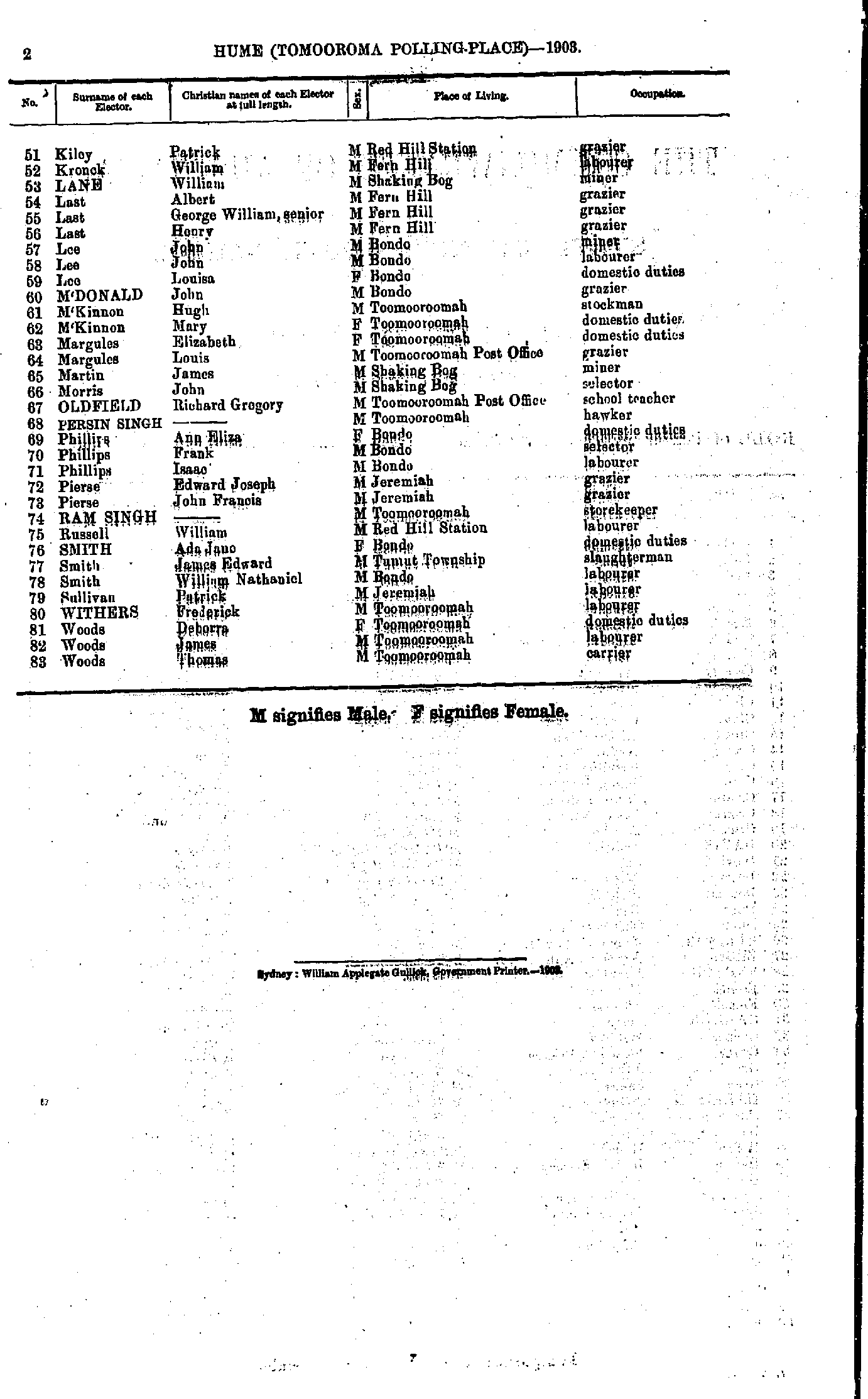
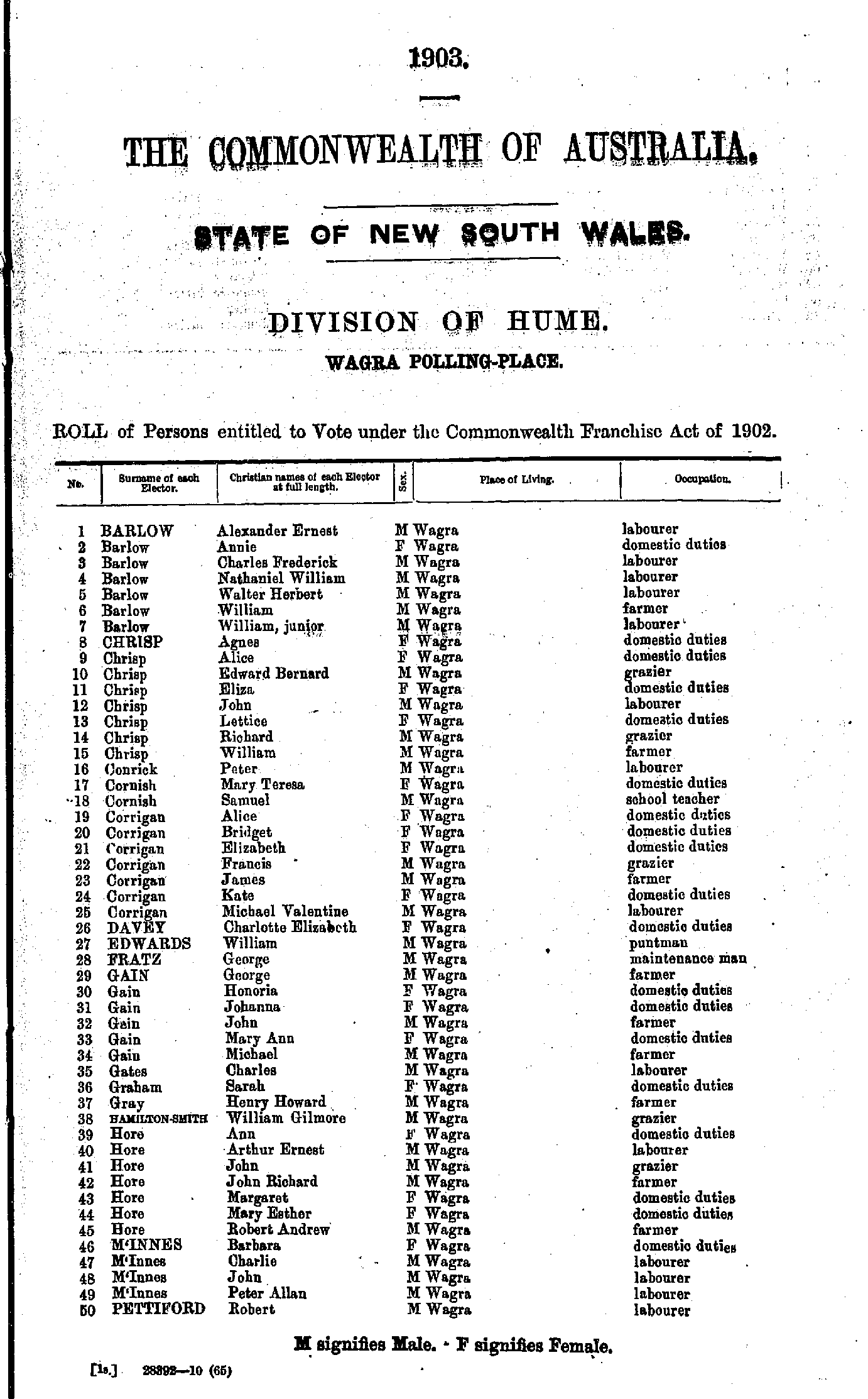
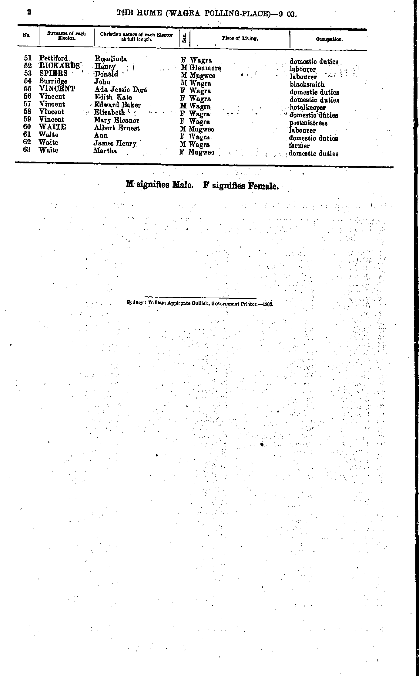
Little Billabong Polling Place
- Alchin Alice - Boyd Samuel
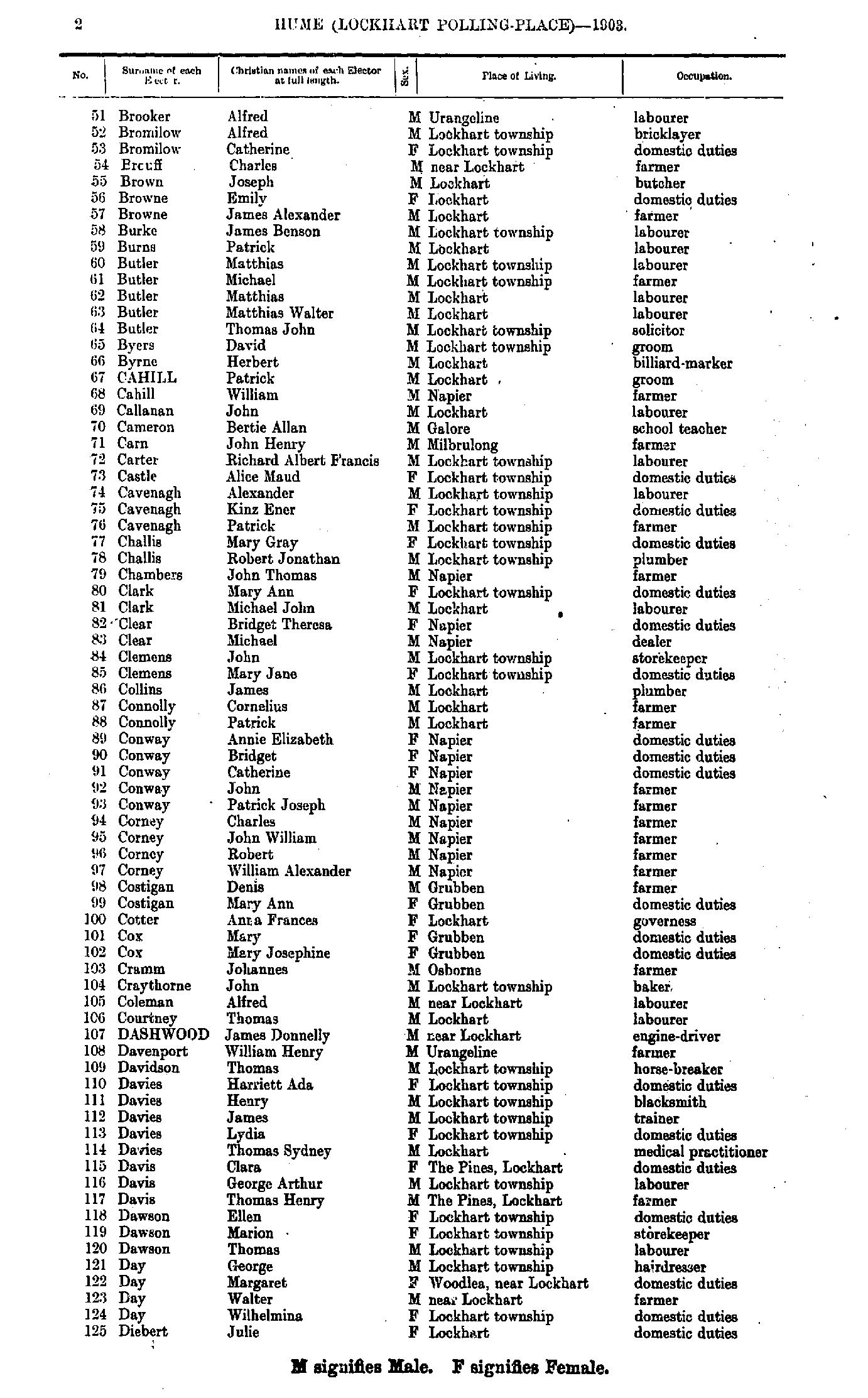
- Brooker Alfred - Diebert Julie
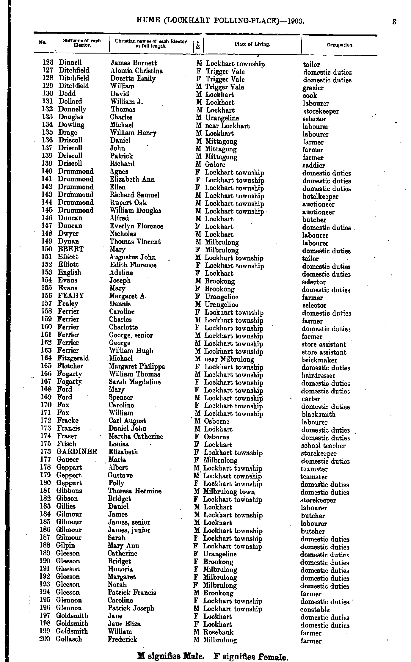
- Dinnell James - Gollasch Frederick
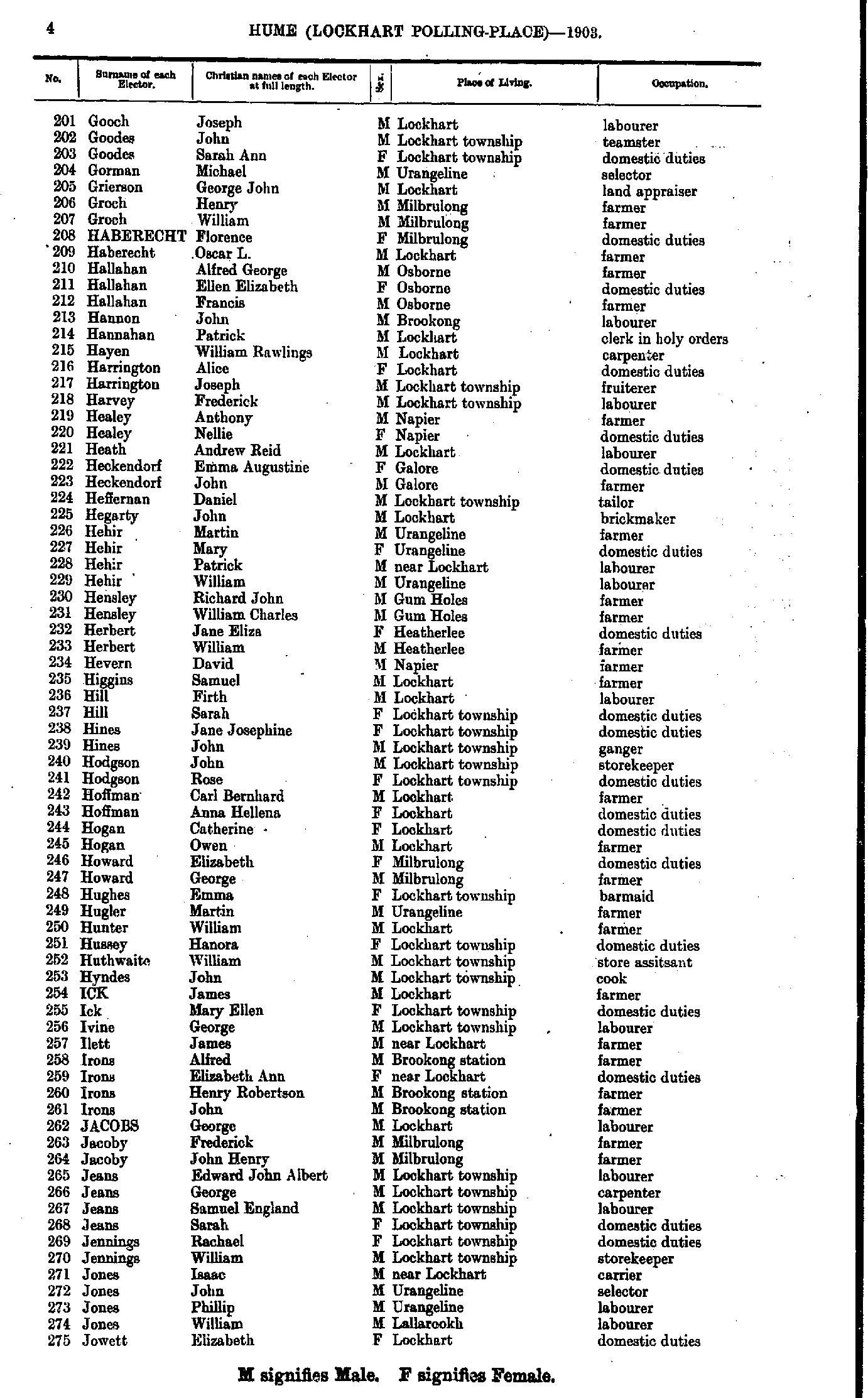
- Gooch Joseph - Jowett Elizabeth
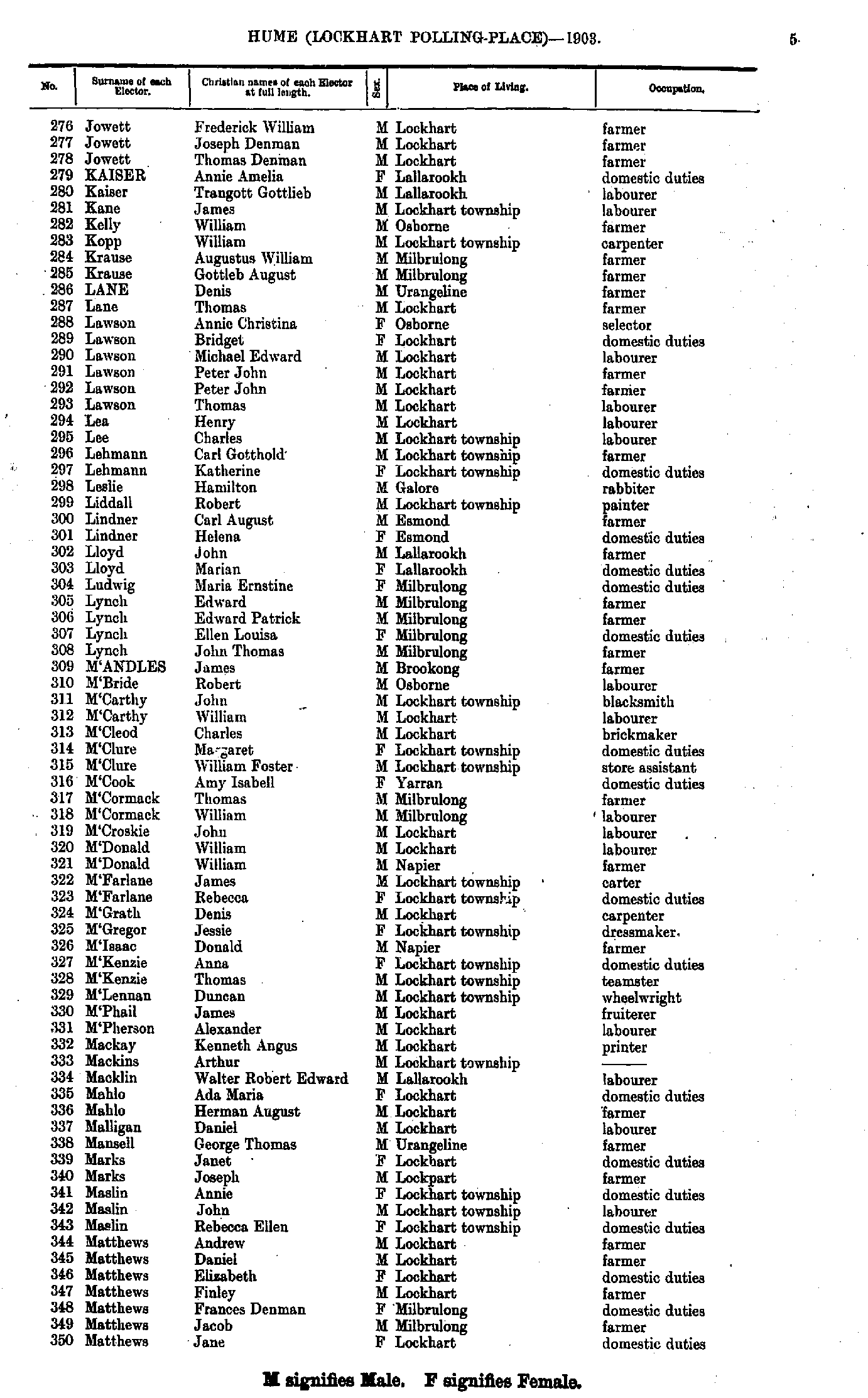
- Jowett Frederick - Matthews Jane
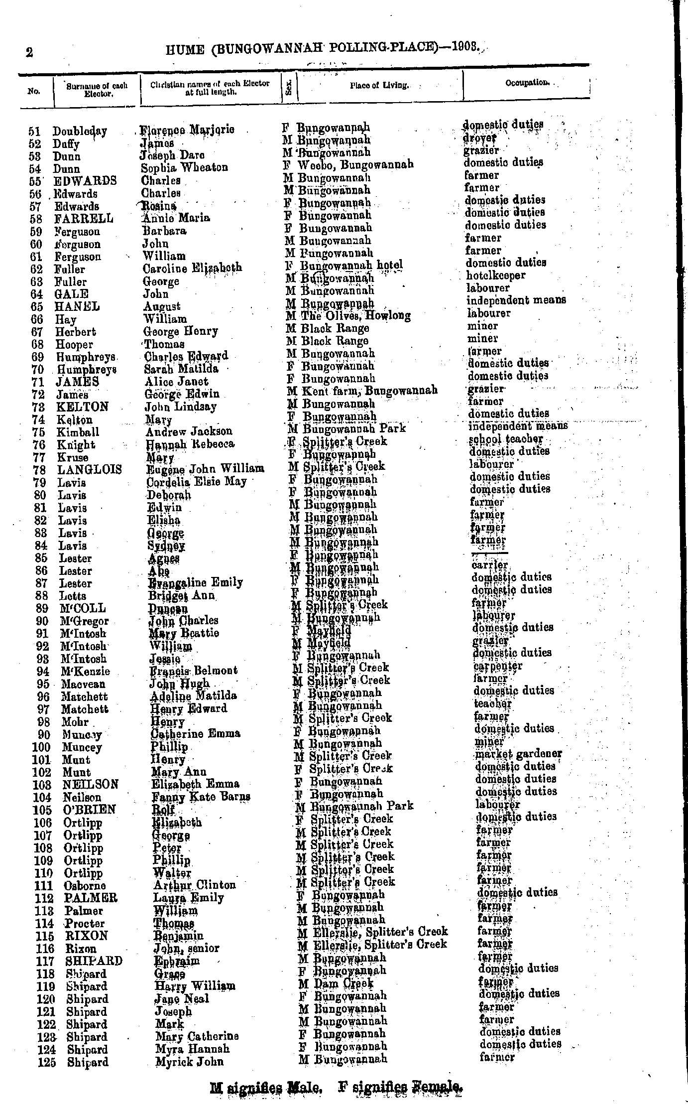
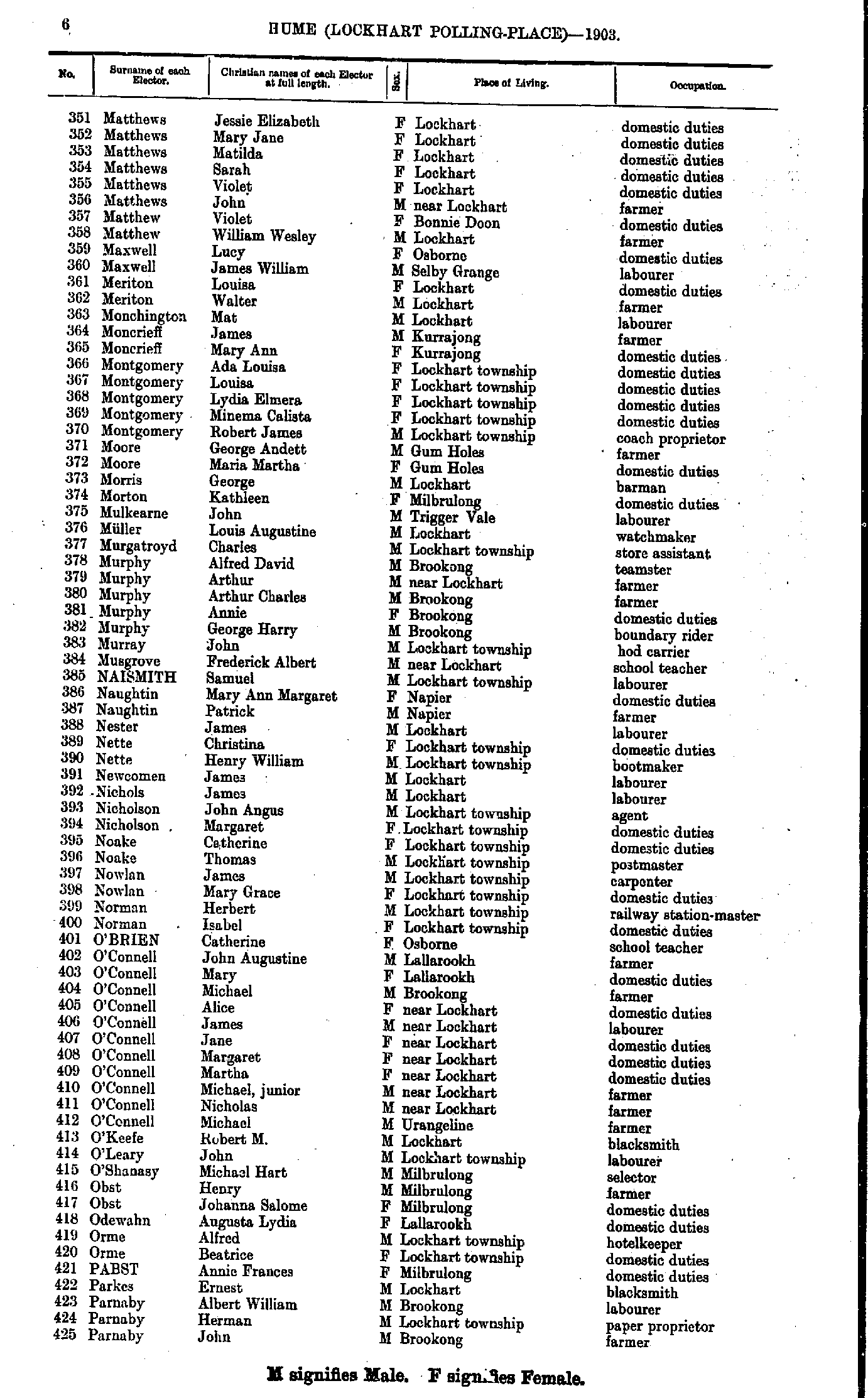
- Matthews Jessie - Parnaby John
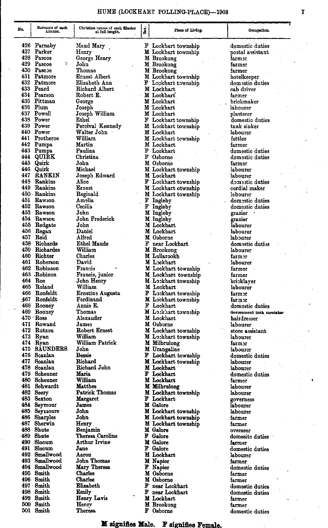
- Parnaby Maud - Smith Theresa
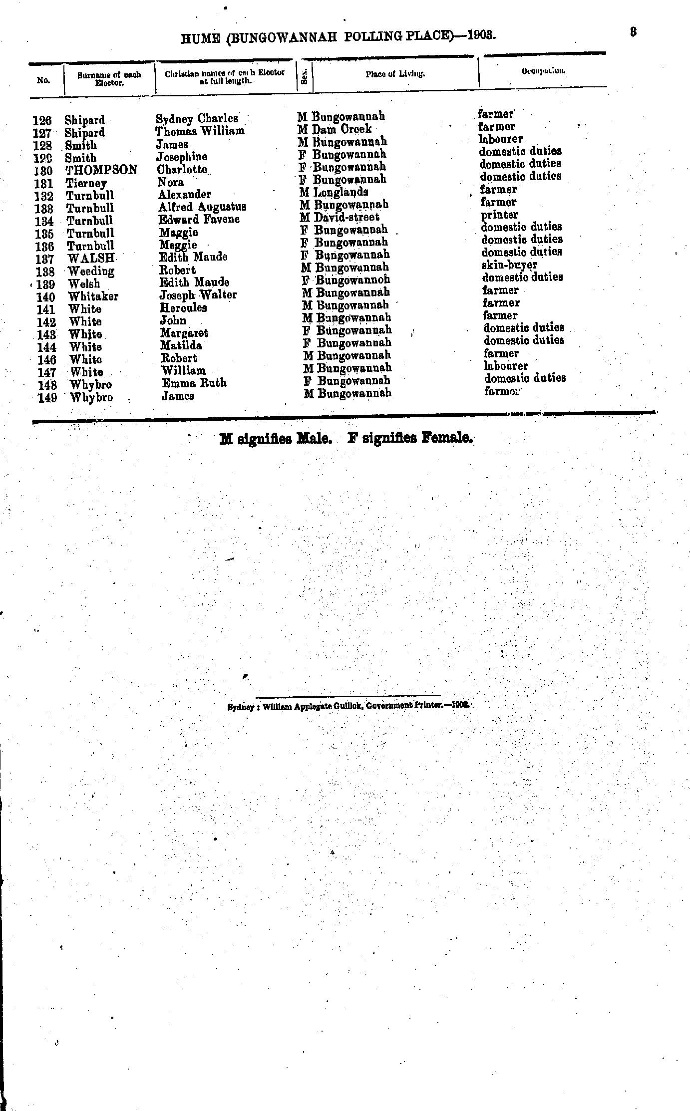
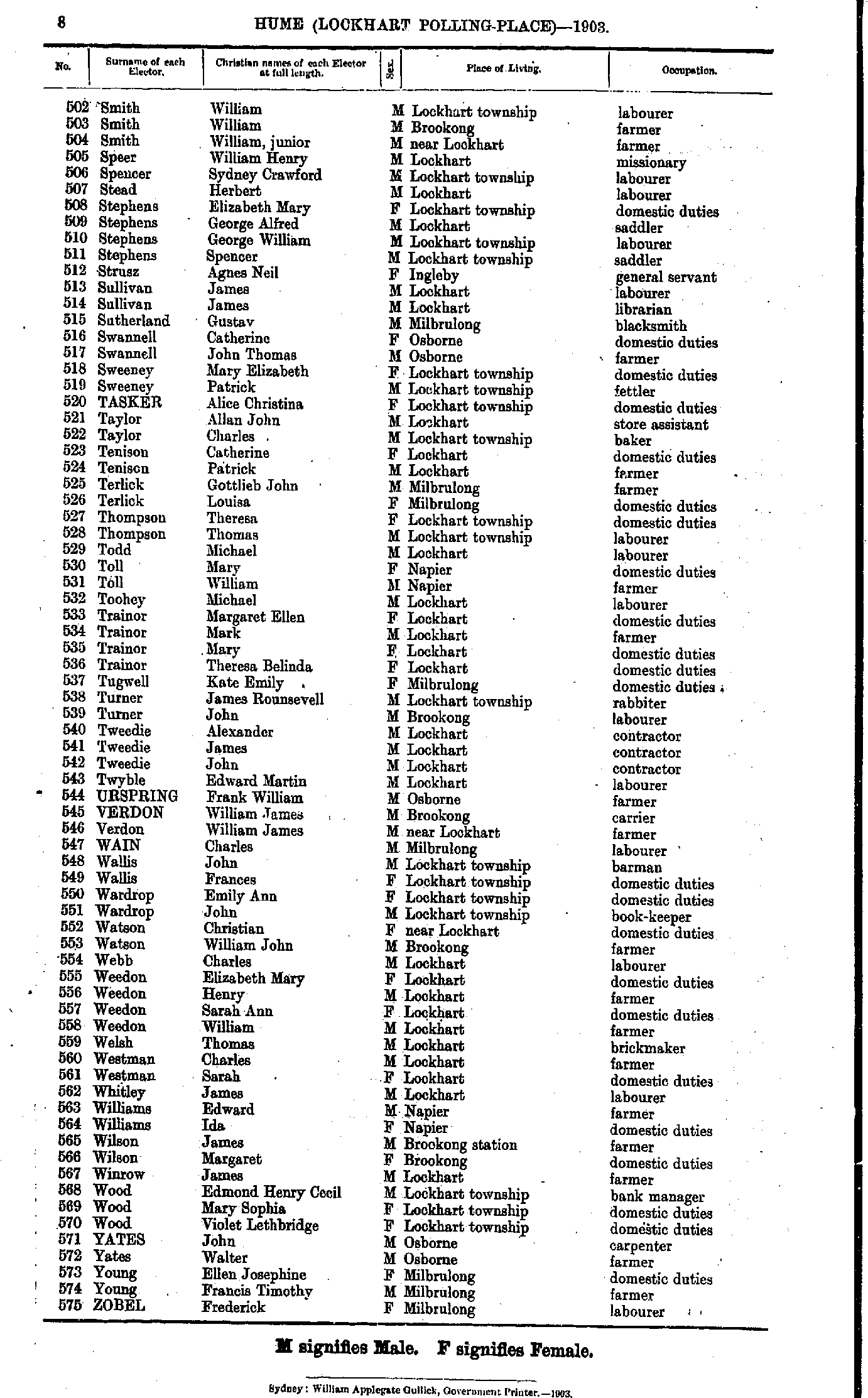
- Smith William - Zobel Frederick
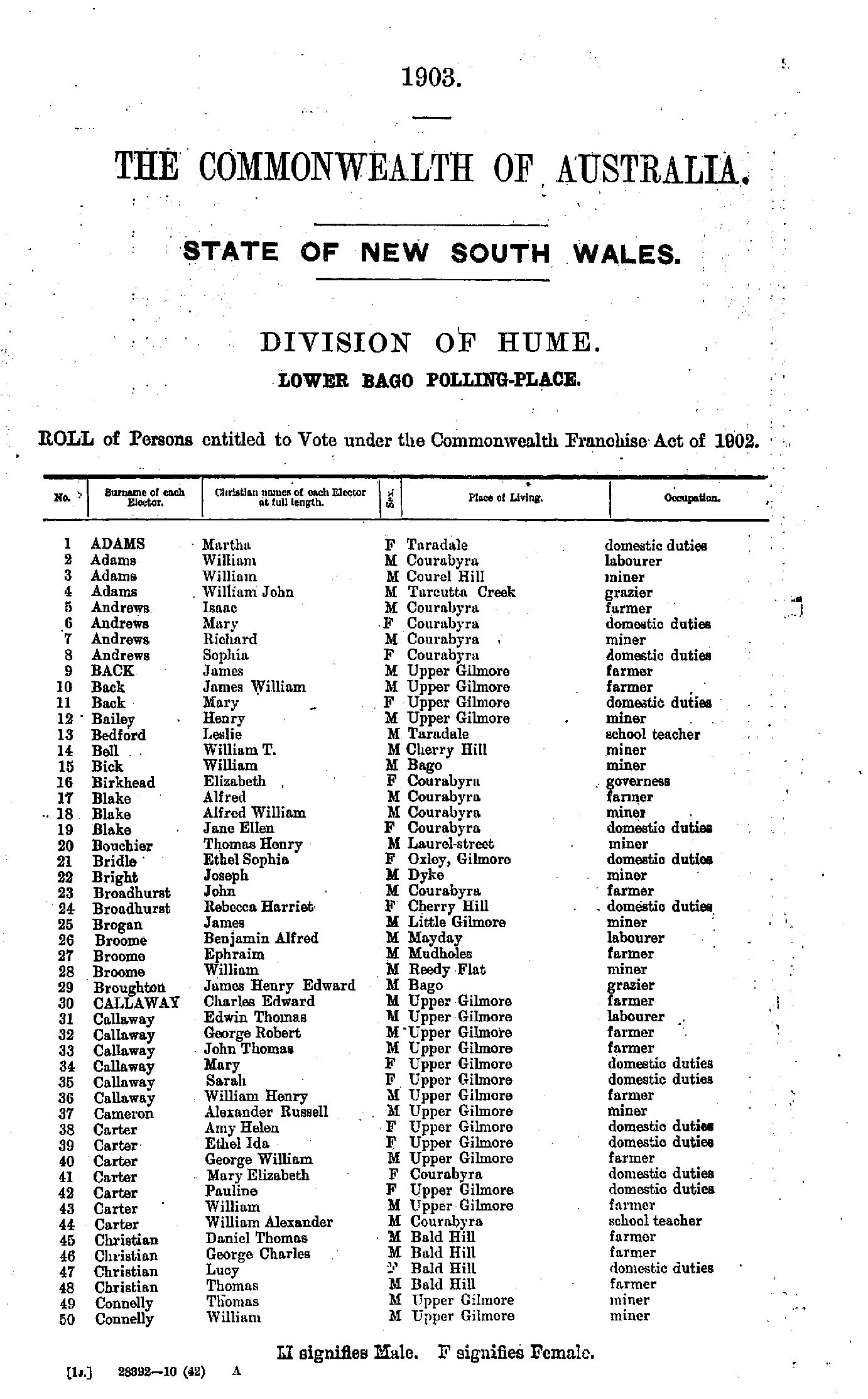
- Adams Martha - Connelly William
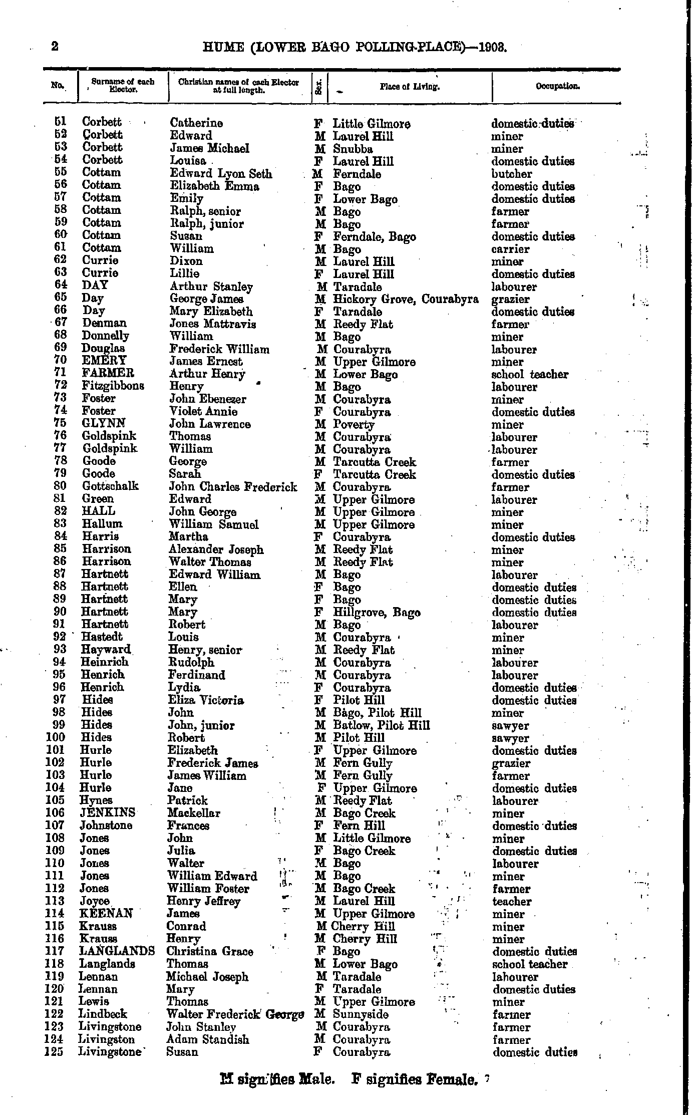
- Corbett Catherine - Livingstone Susan
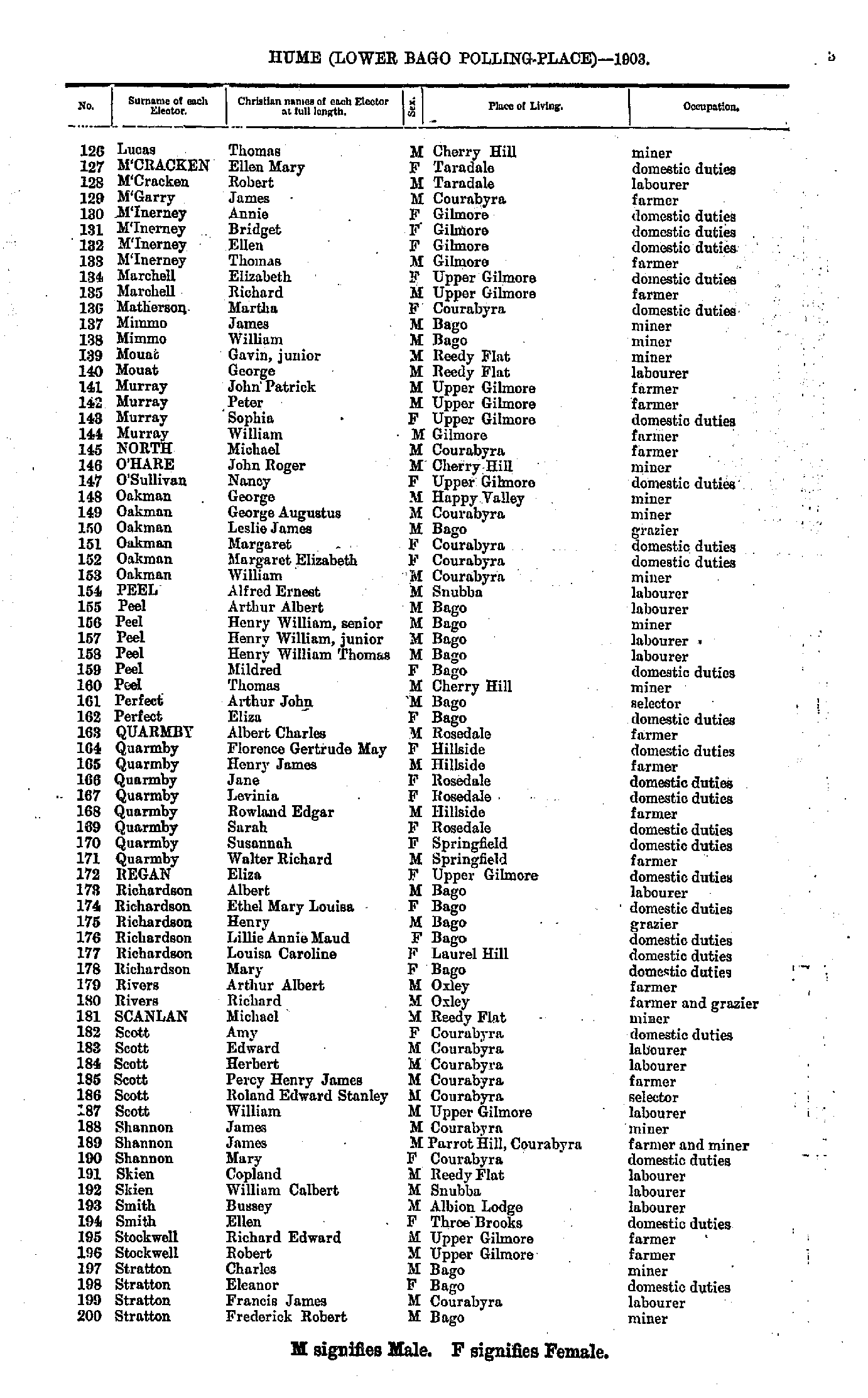
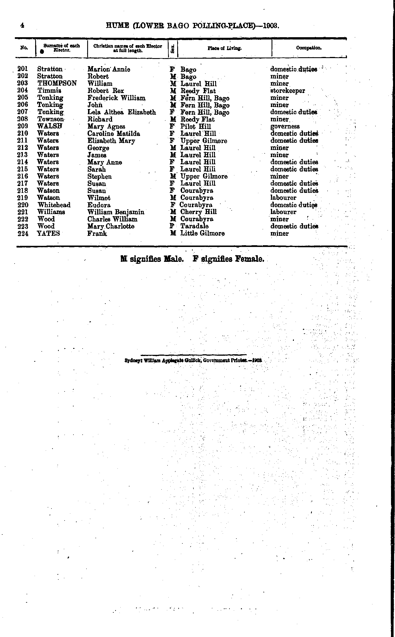
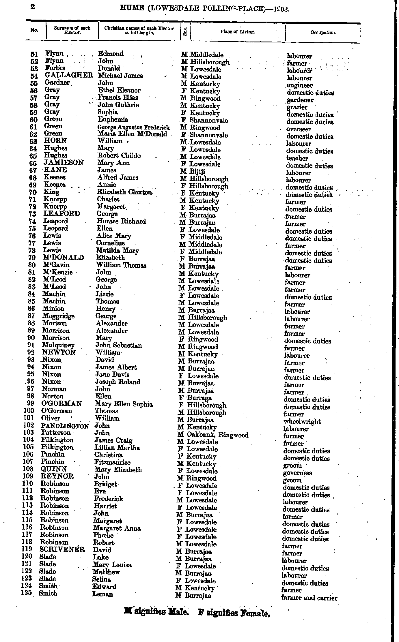
- Lucas Thomas - Stratton Frederick
- Stratton Marion - Yates Frank
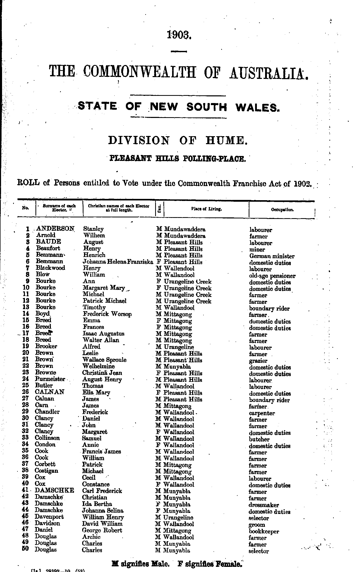
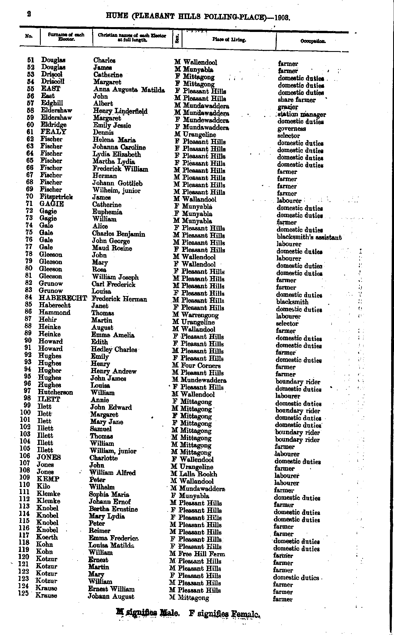
- Anderson Stanley - Douglas Charles
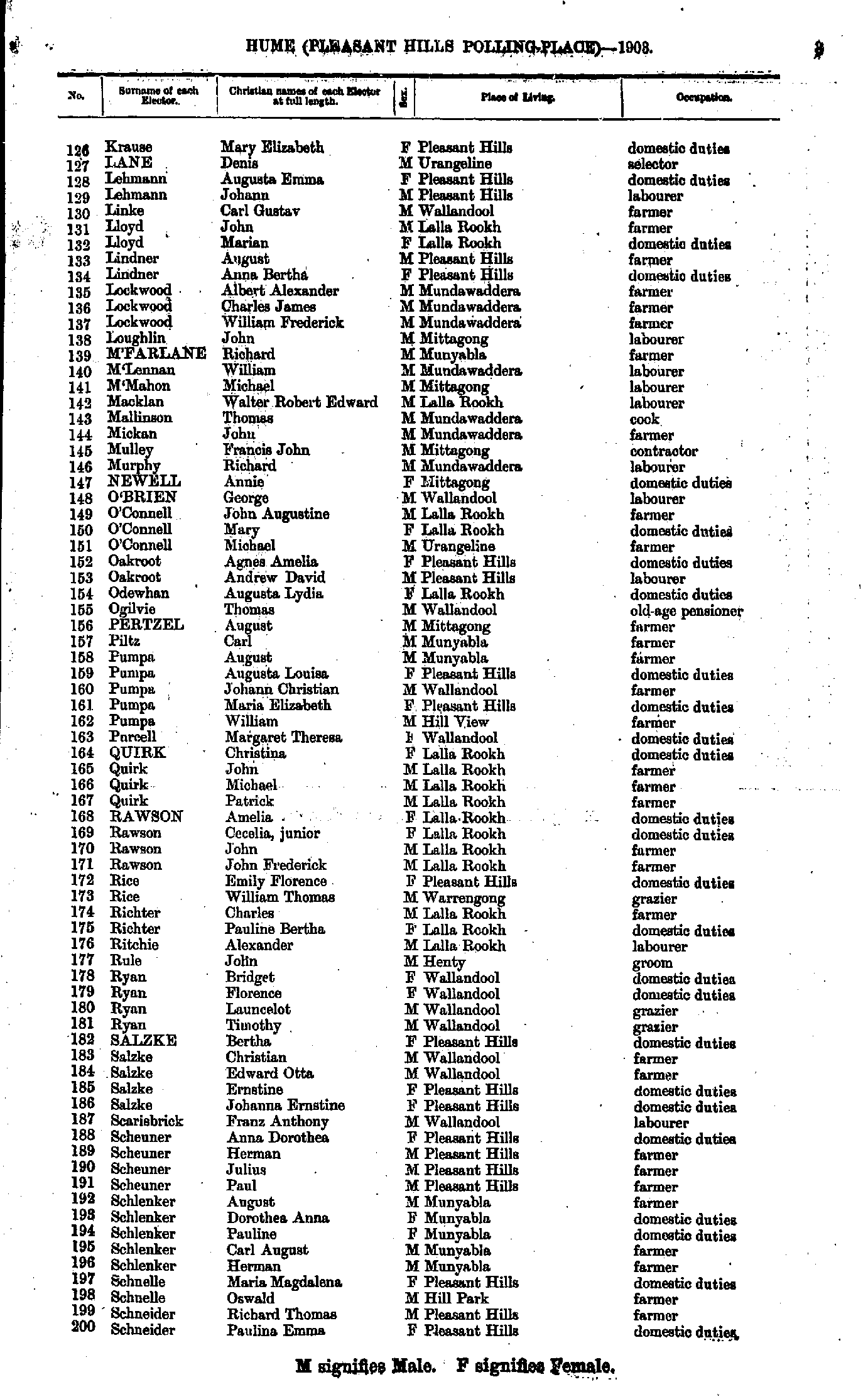
- Douglas Charles - Krause Johann
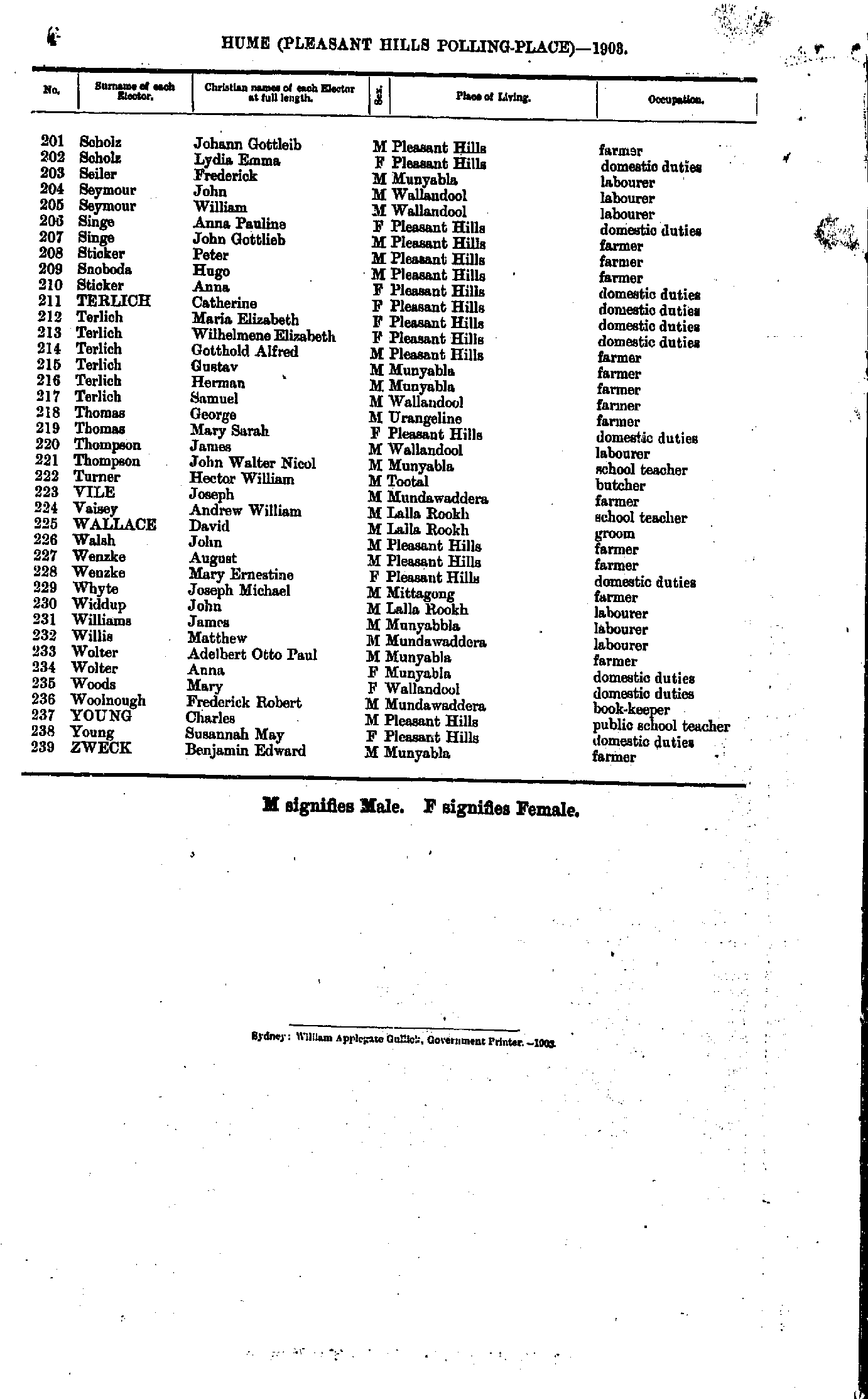
- Krause Mary - Schneider Paulina
- Scholz Johann - Zweck Benjamin
- Agnew James - Brown Janet
- Brown Mary - Ford Joseph
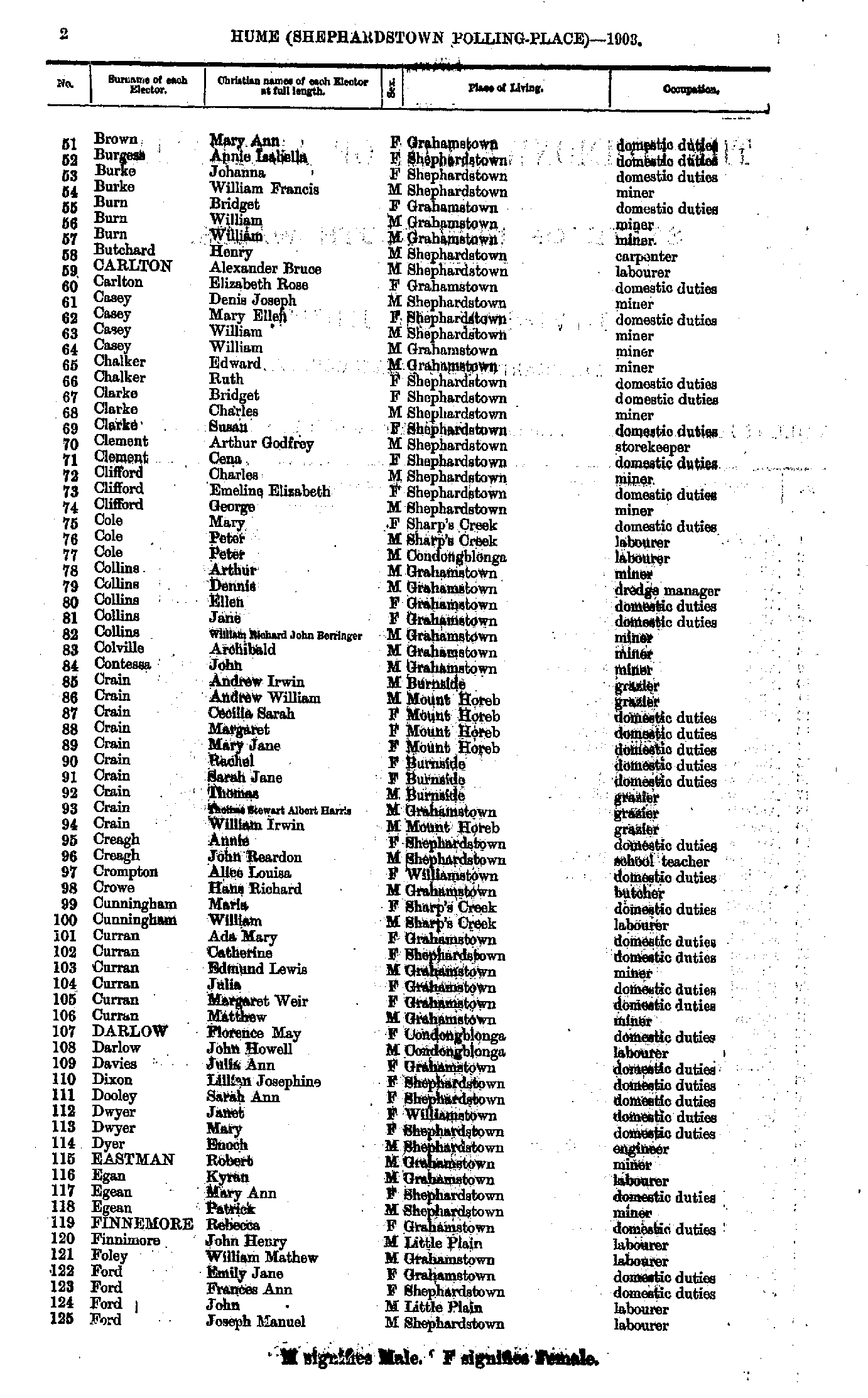
- Foster Georgethel - Hayes Michael
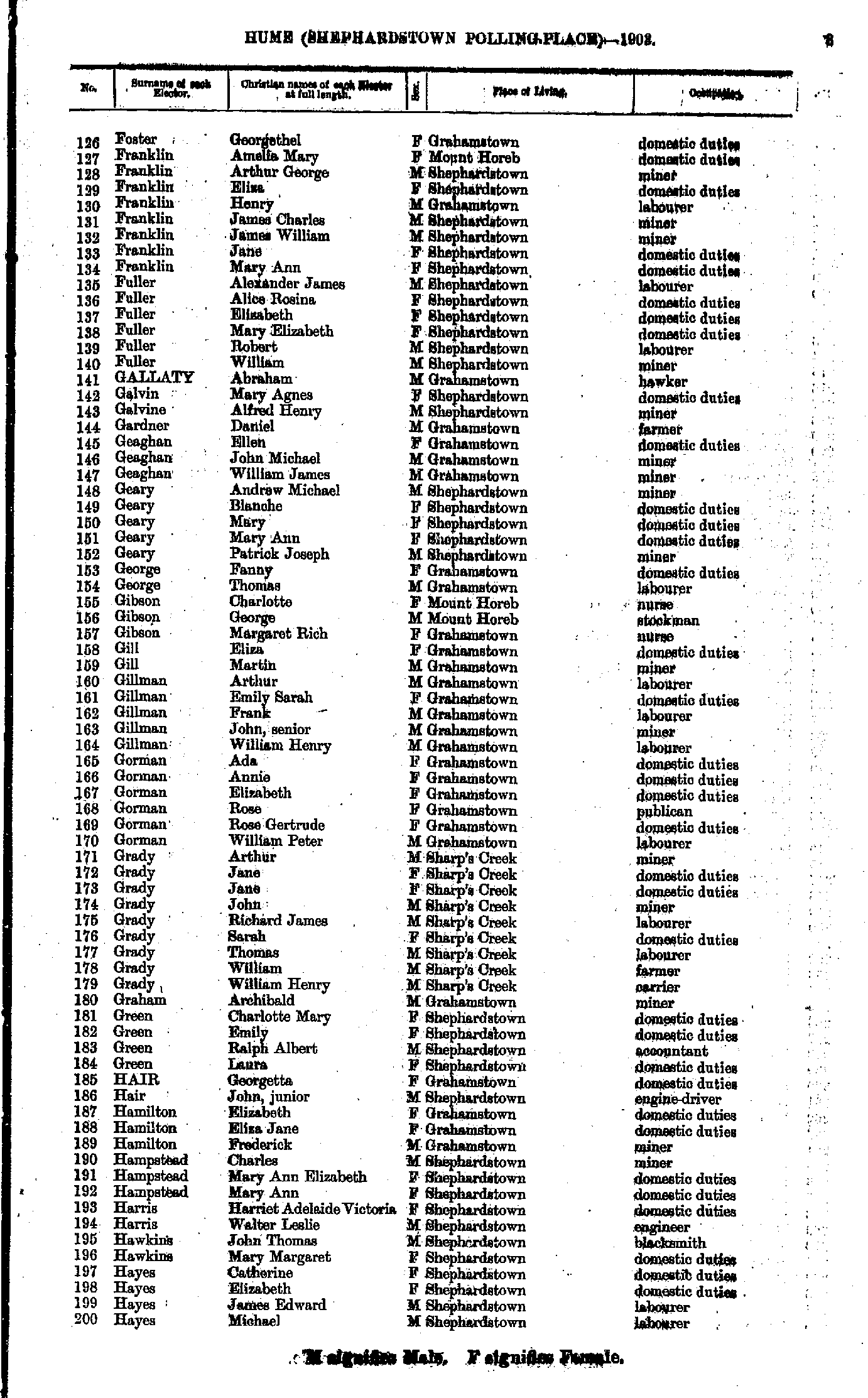
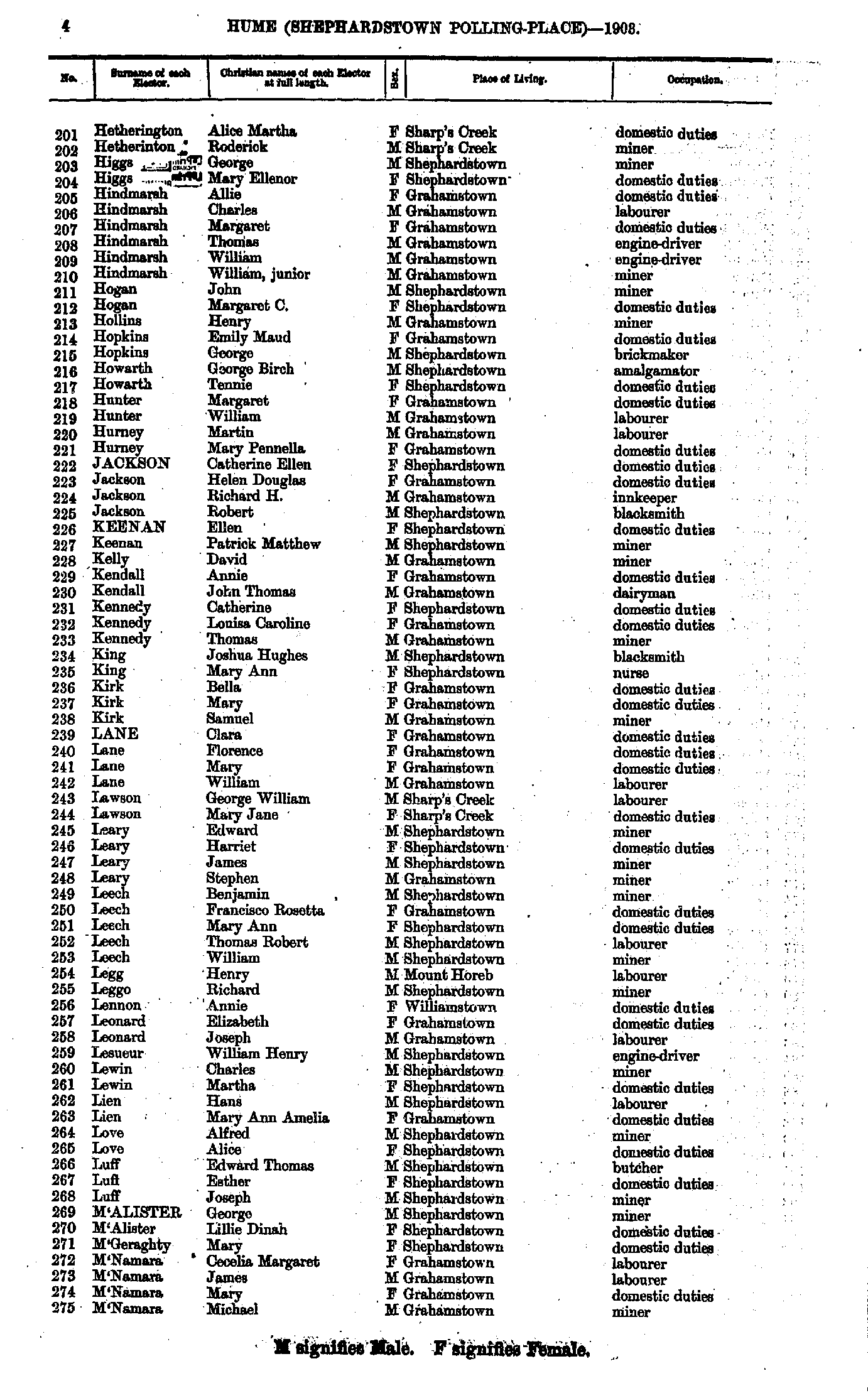
- Hetherington Alice - M'Namara Michael
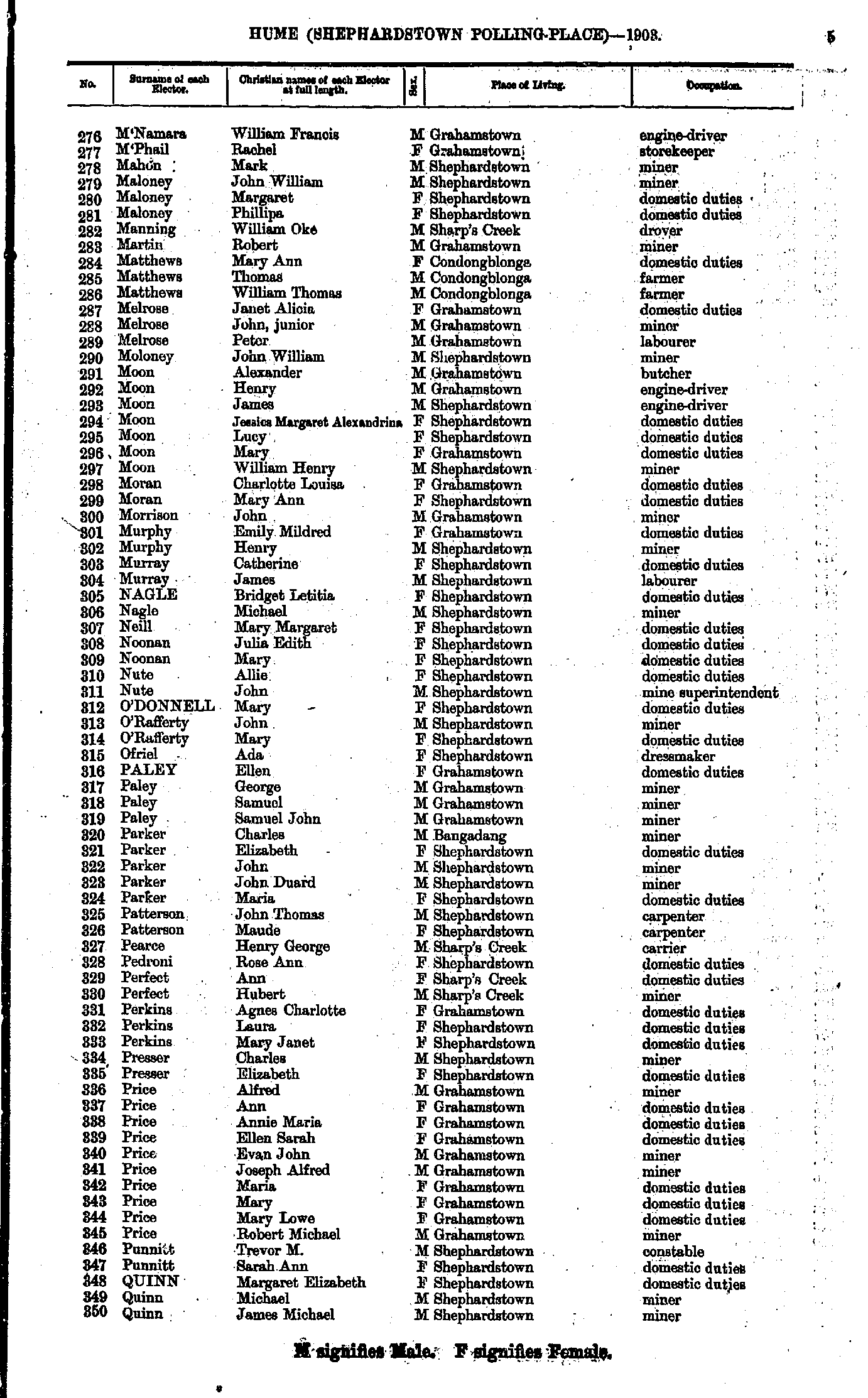
- M'Namara William - Quinn James
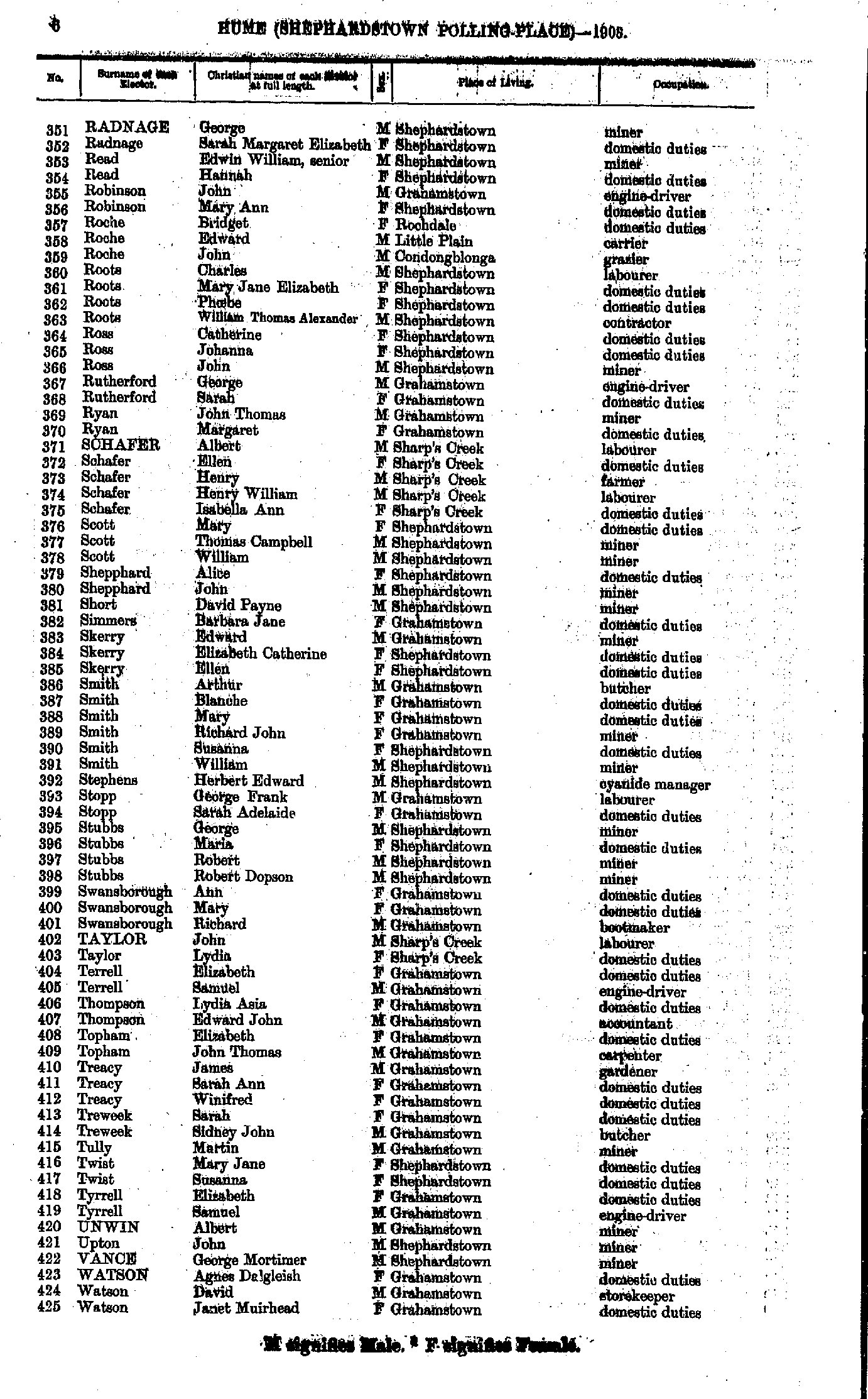
- Radnage George - Watson Janet
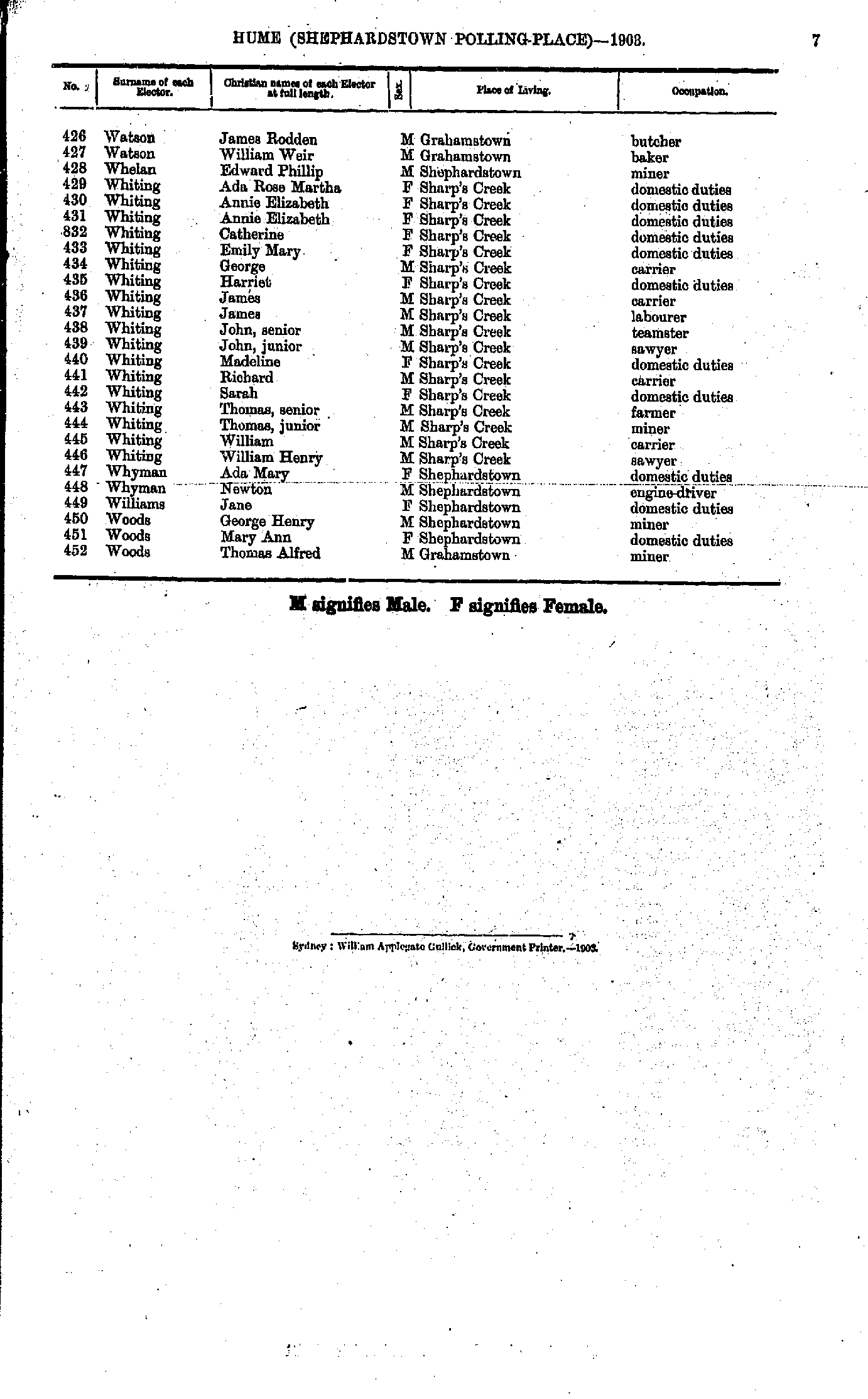
- Watson James - Woods Thomas
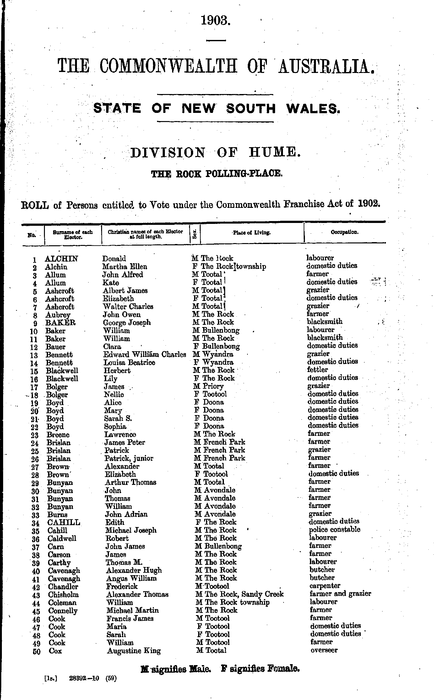
- Alchin Donald - Cox Augustine
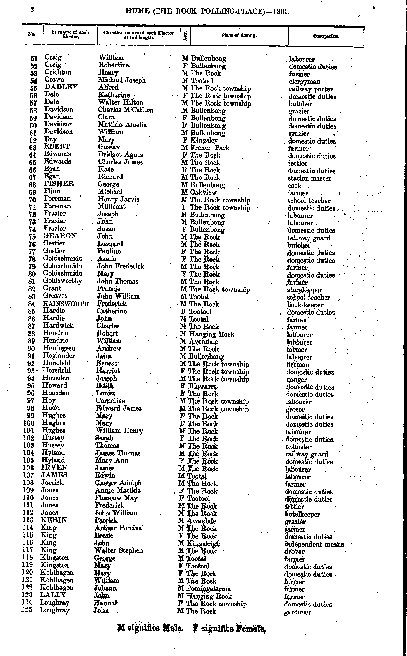
- Craig William - Loughray John
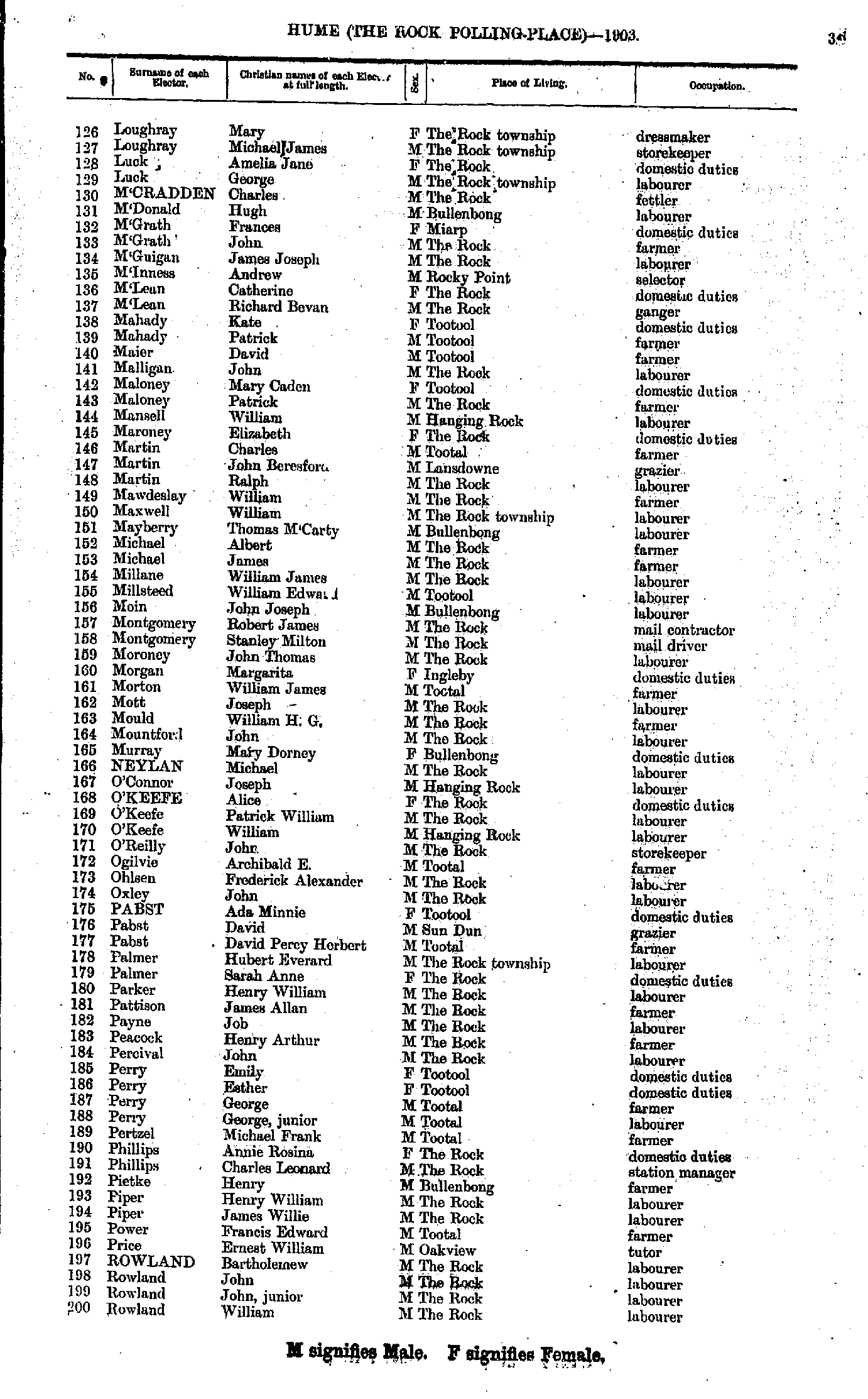
- Loughray Mary - Rowland William
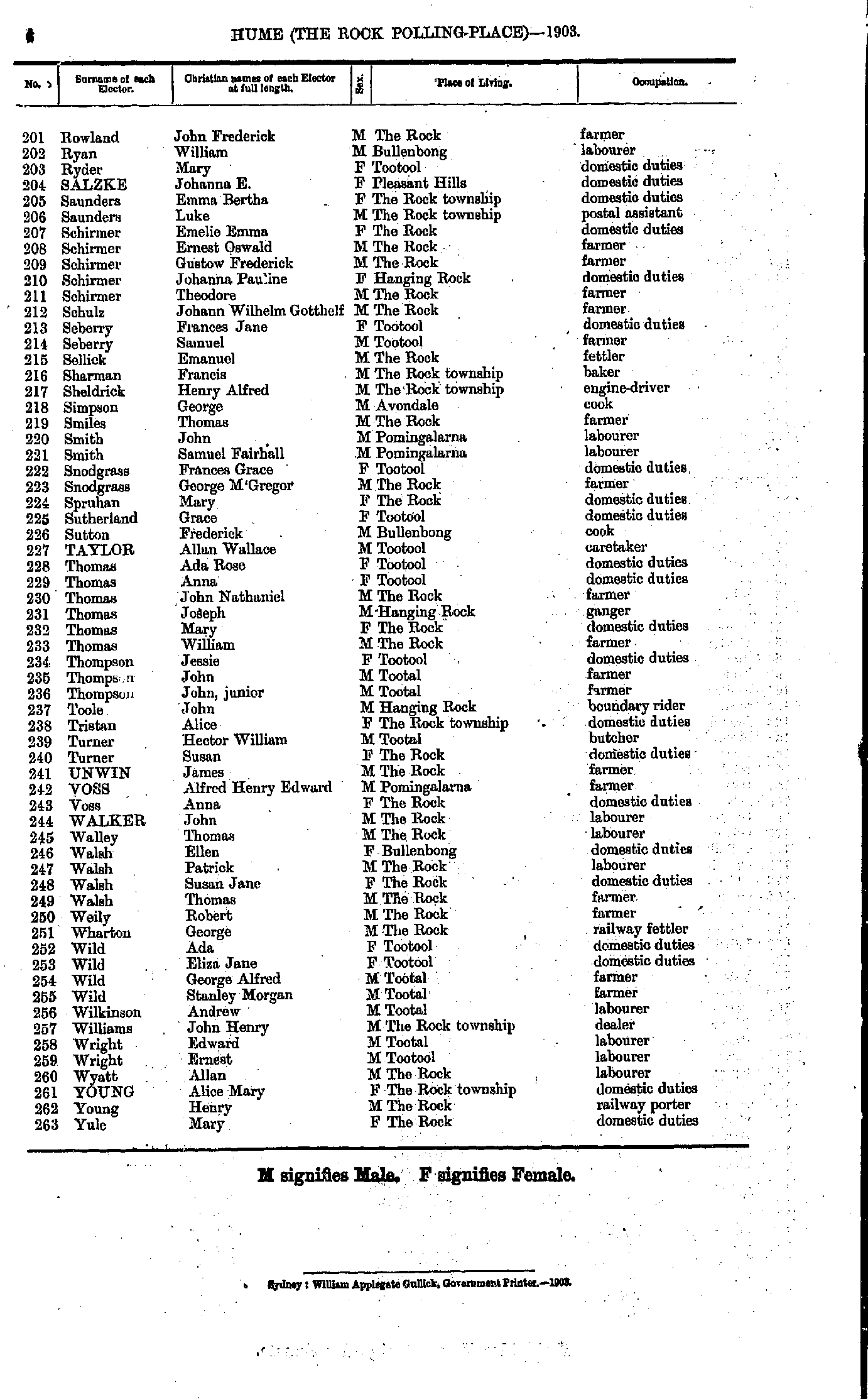
- Rowland John - Yule Mary
- Adams Ernest - Benyon Edward
- Benyon Eliza - Christian Bertha
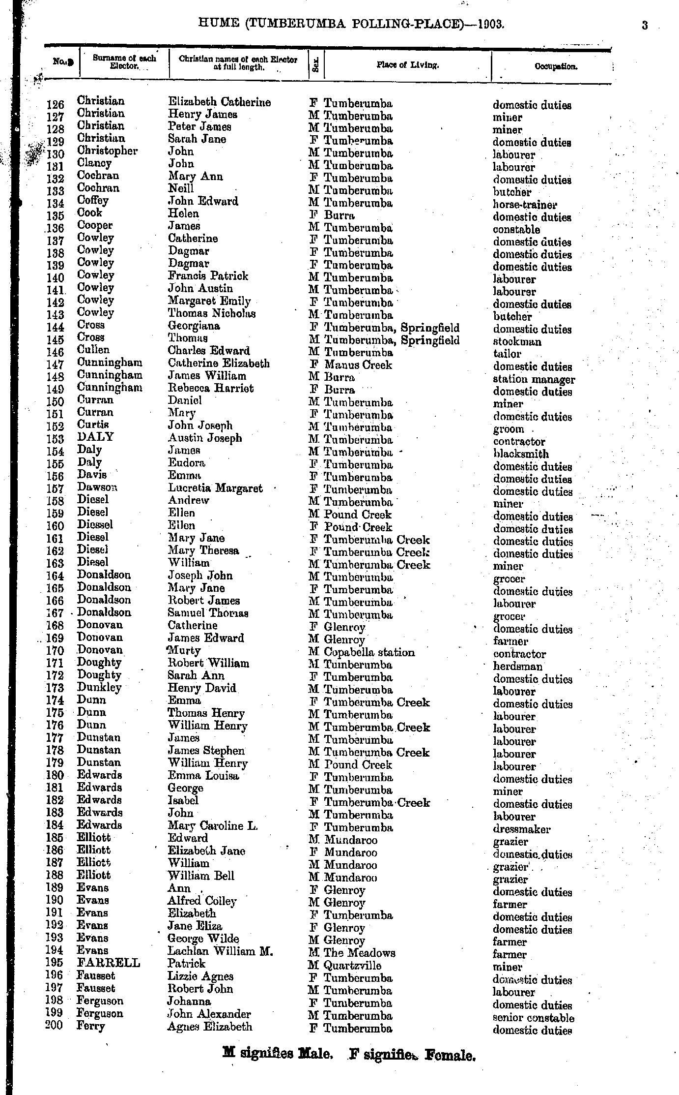
- Christian Elizabeth - Ferry Agnes
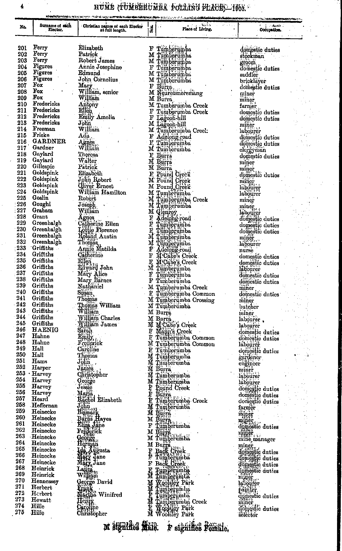
- Ferry Elizabeth - Hille Christopher
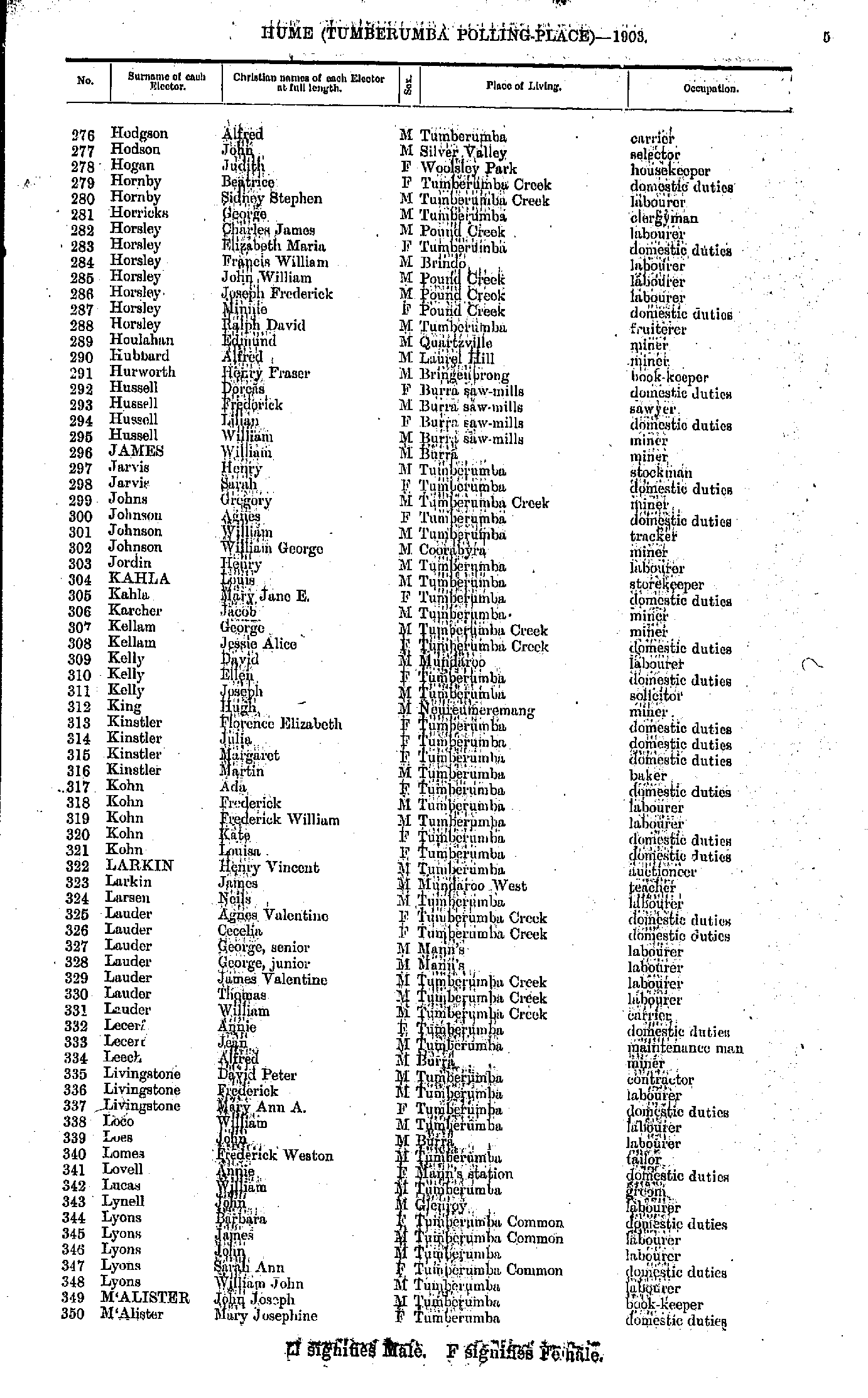
- Hodgson Alfred - M'Alister Mary
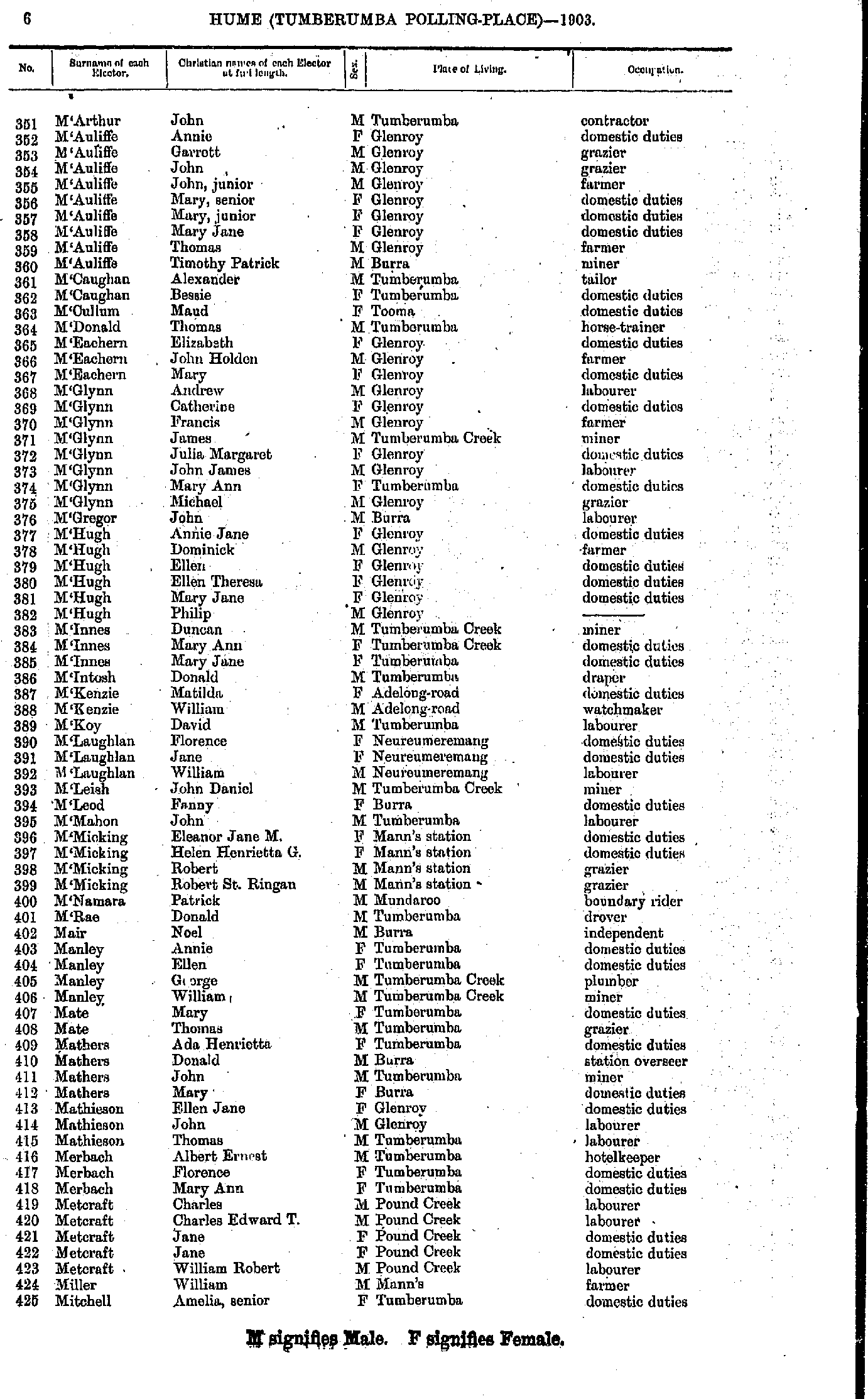
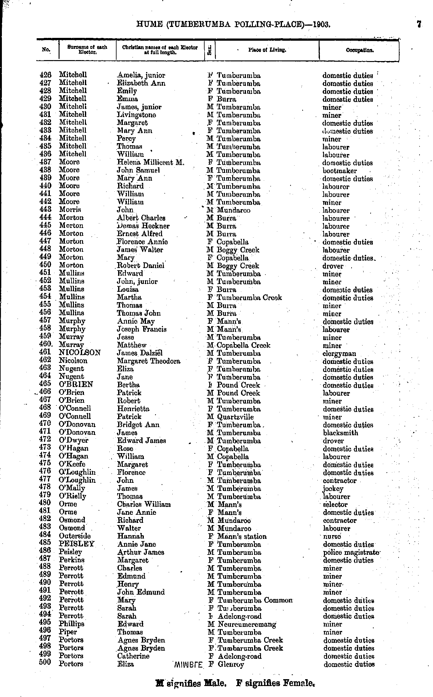
- M'Arthur John - Mitchell Amelia
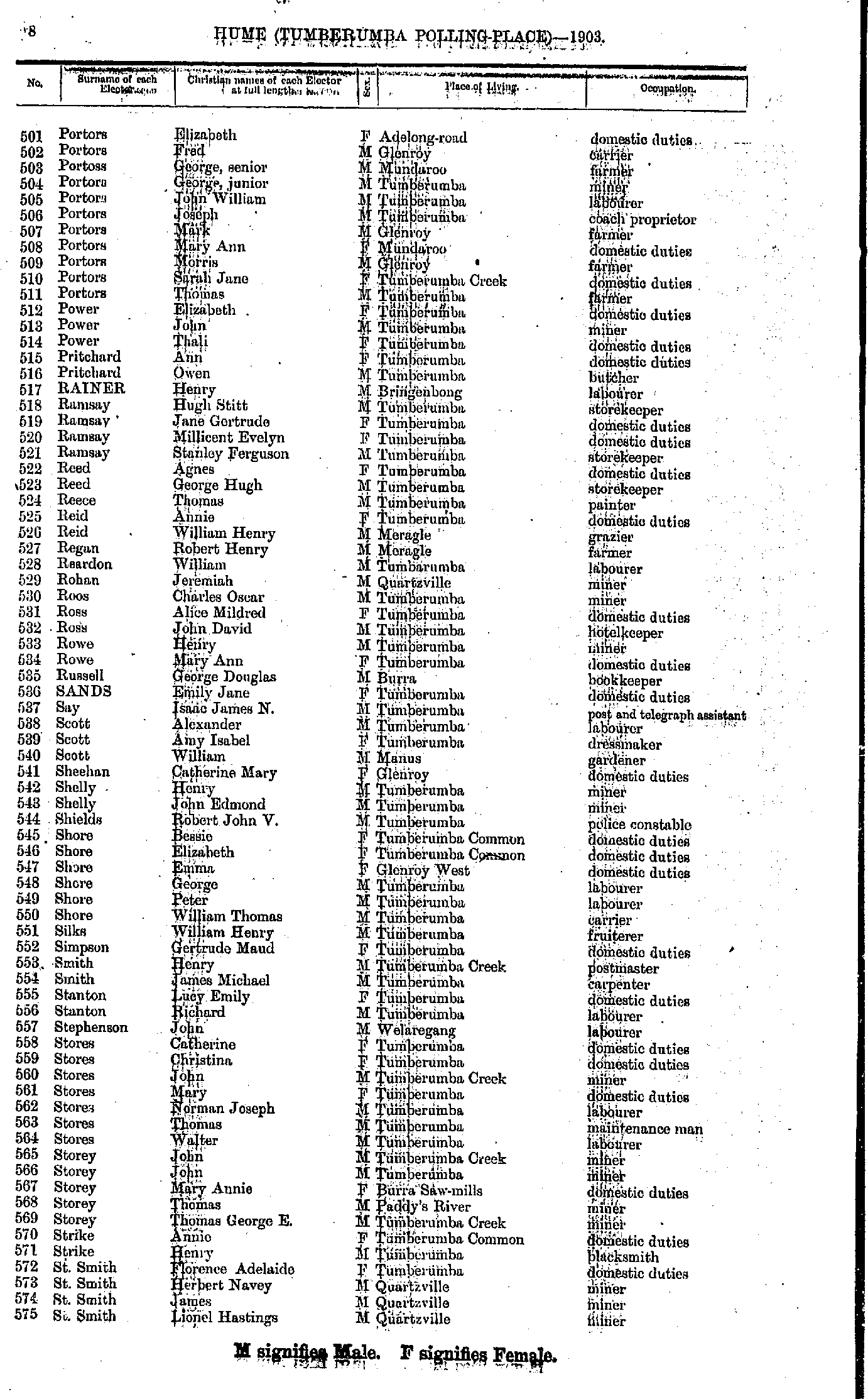
- Mitchell Amelia - Portors Eliza
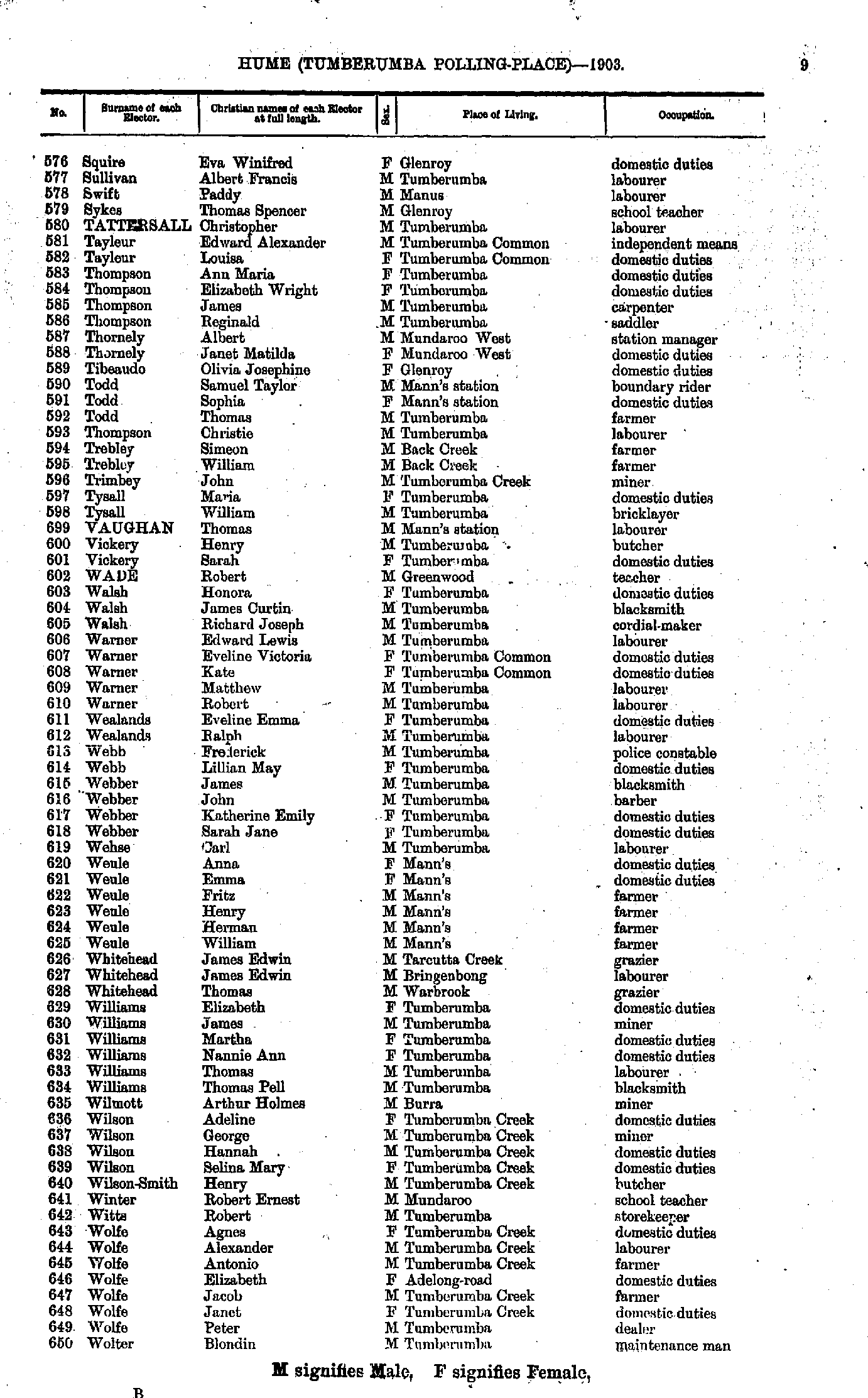
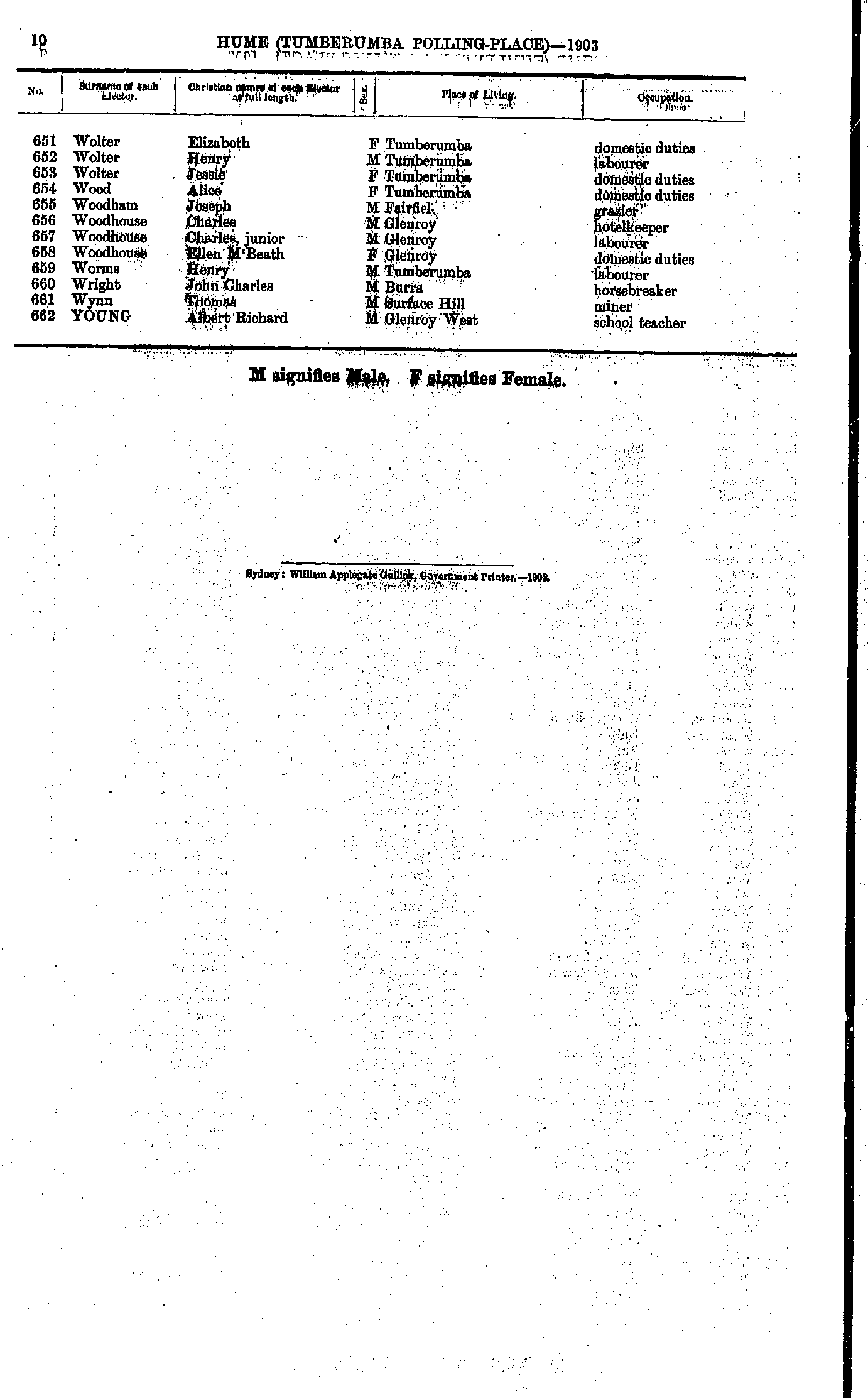
- Portors Elizabeth - St.Smith Lionel
- Squire Eva - Wolter Blondin
- Wolter Elizabeth - Young Albert
- Adam Alexander - Bailey Thomas
- Baker Annie - Brennan Johanna
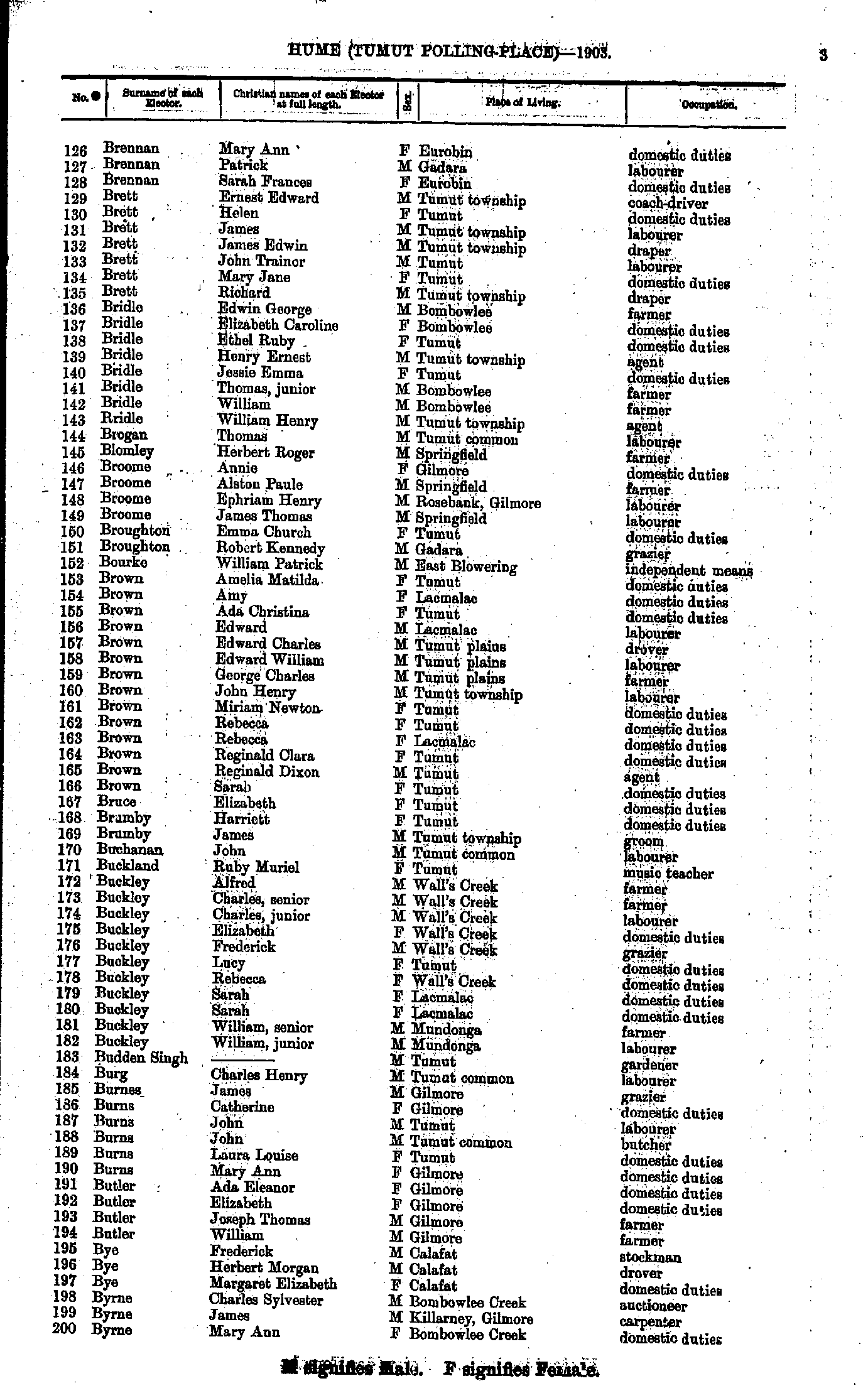
- Brennan Mary - Byrne Mary
- Campbell Frederick - Cooke Mary
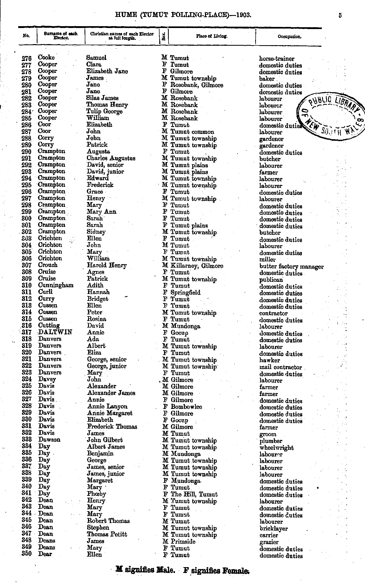
- Cooke Samuel - Dear Ellen
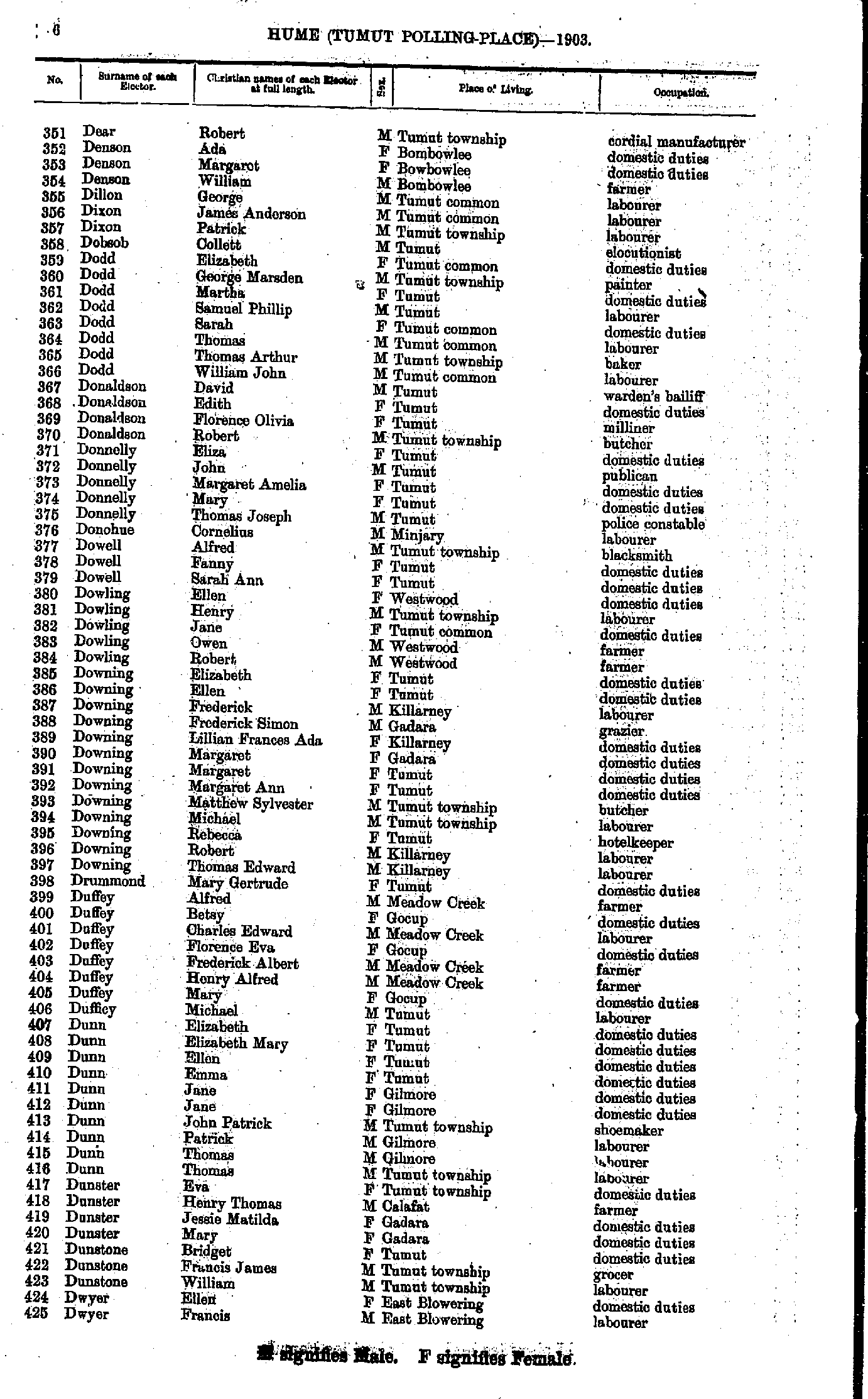
- Dear Robert - Dwyer Francis
- Dwyer William - Flynn Ellen
- Flynn James - Green Ellen
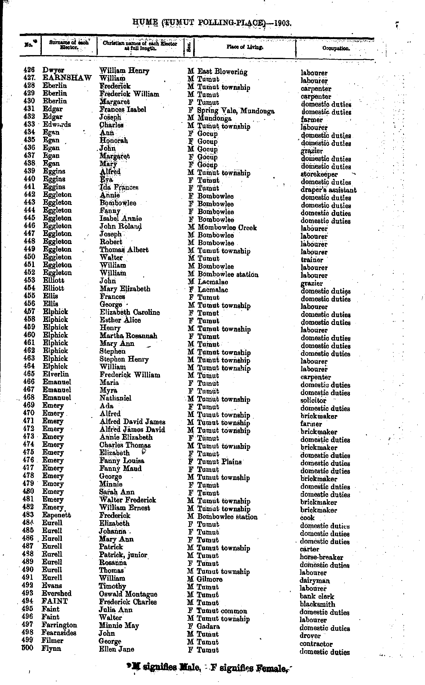
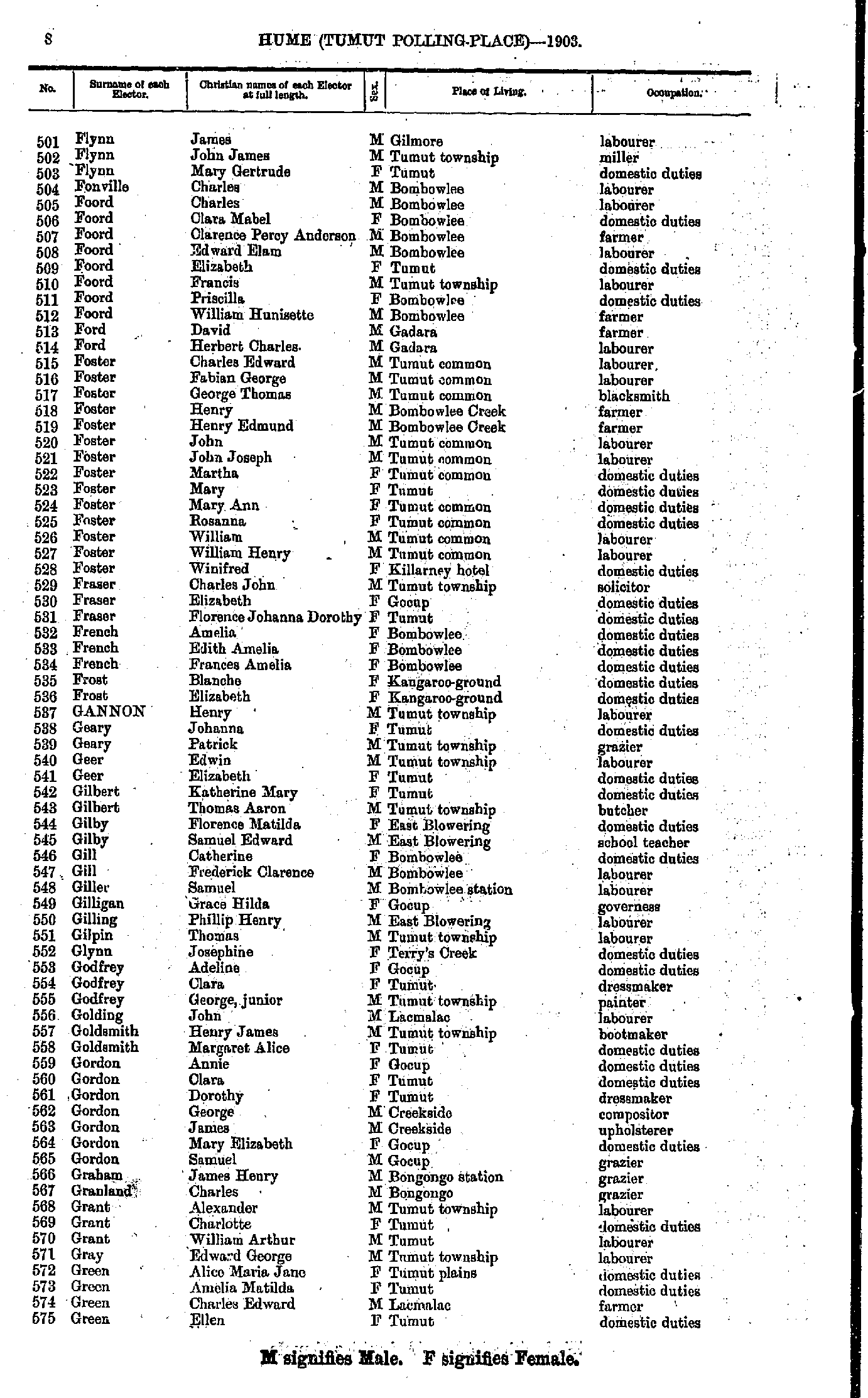
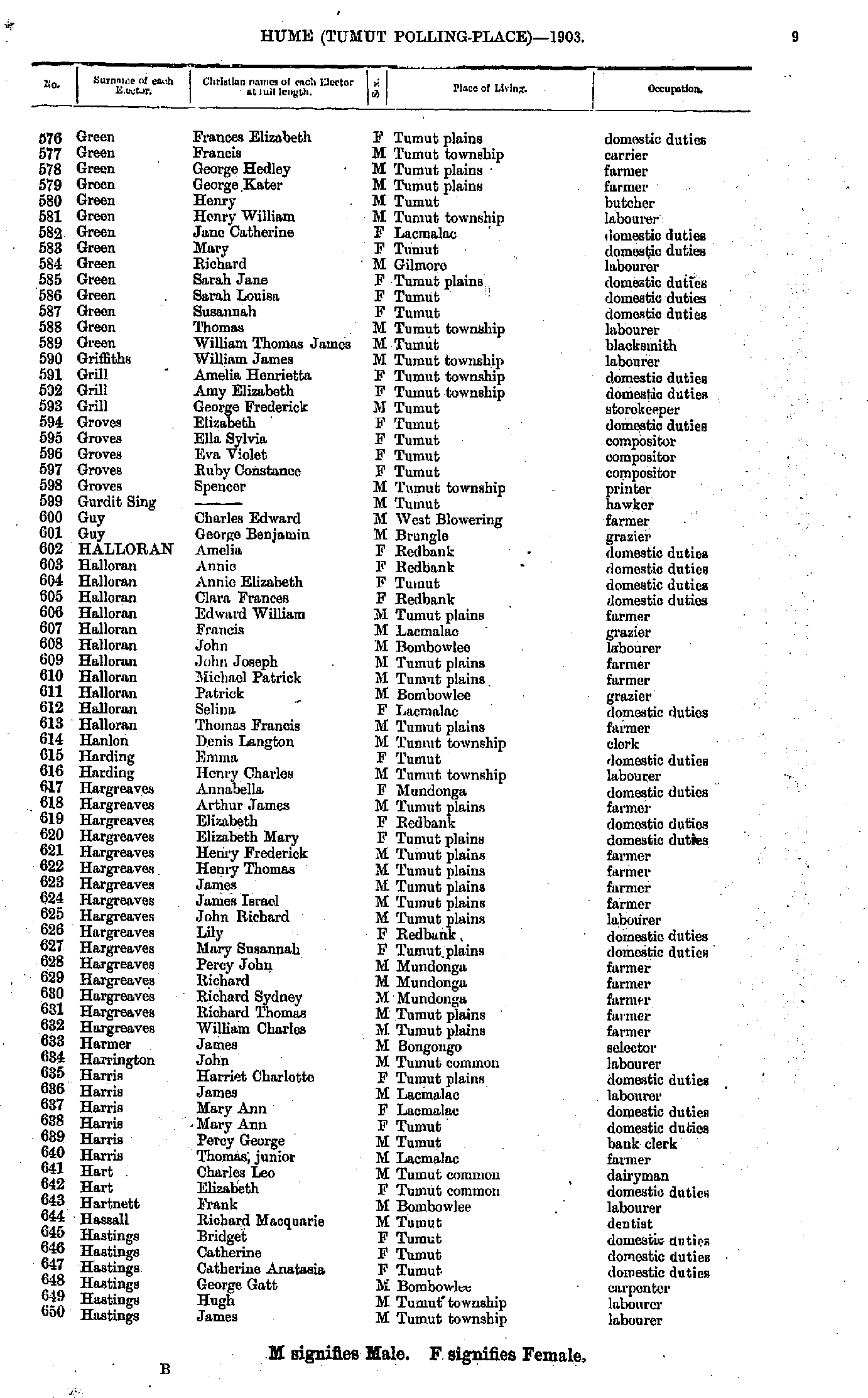
- Green Frances - Hastings James
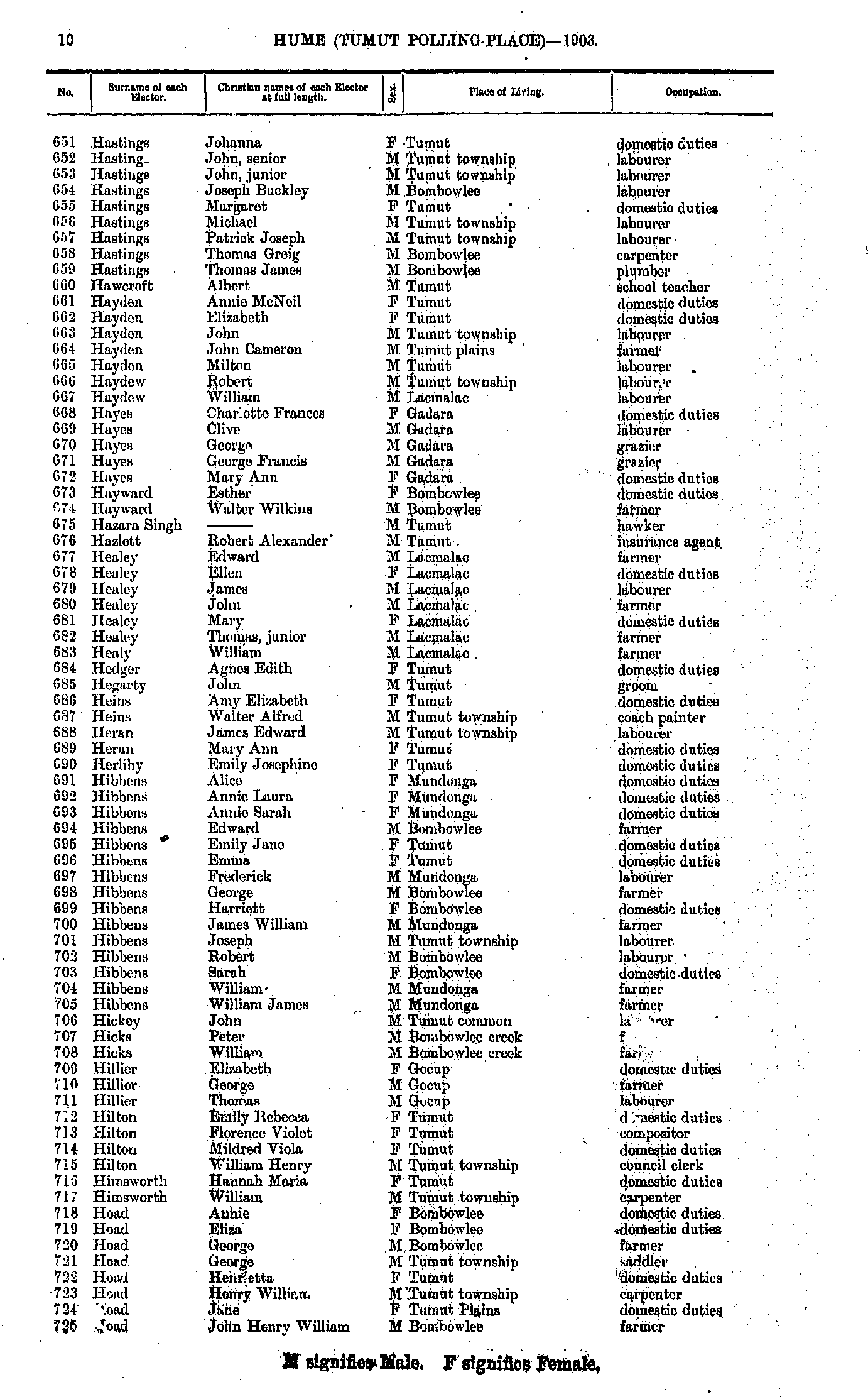
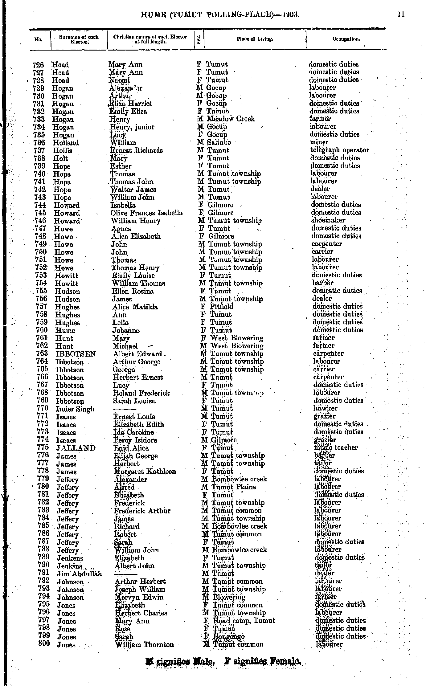
- Hastings Johanna - Hoad John
- Hoad Mary - Jones William
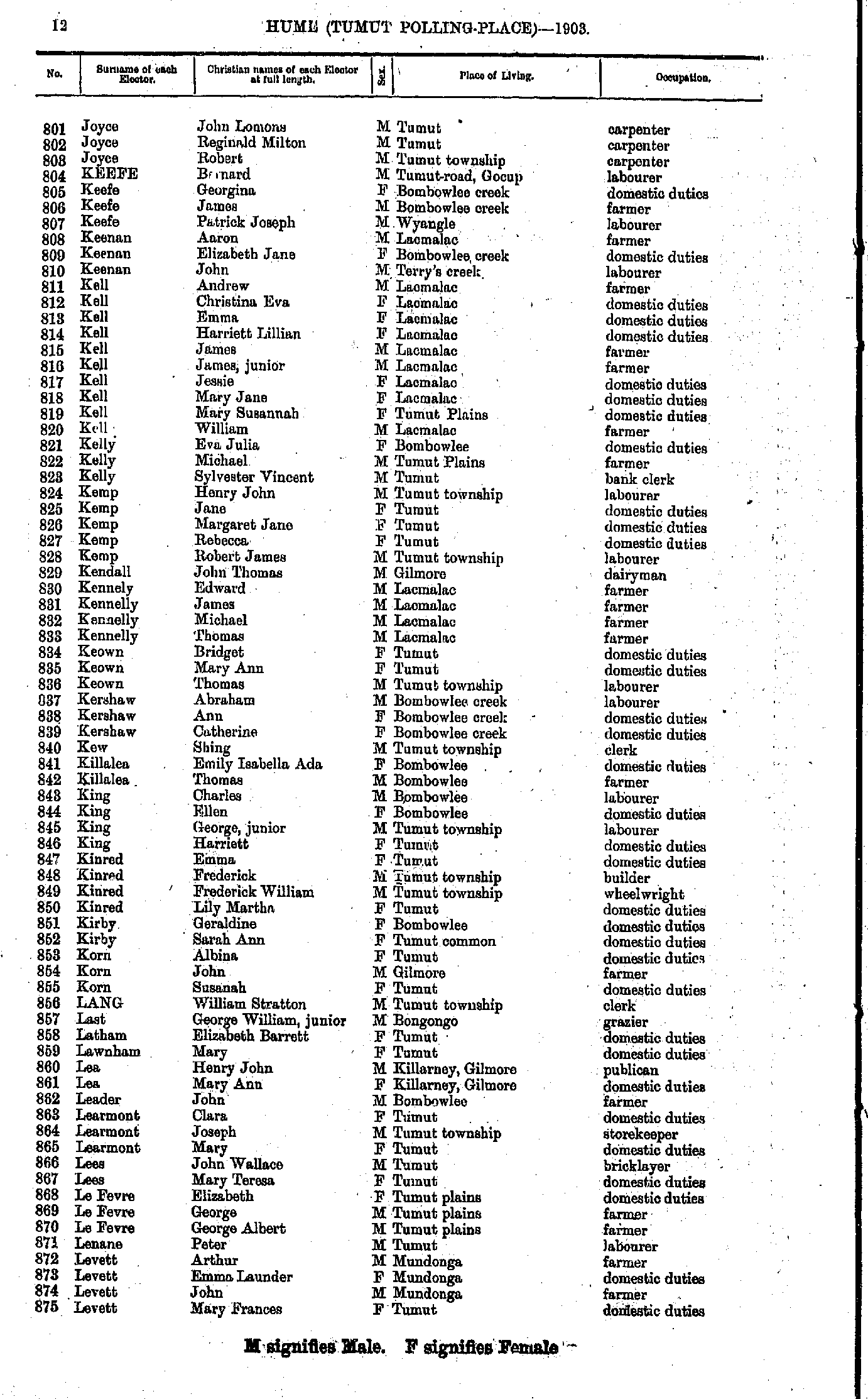
- Joyce John - Levett Mary
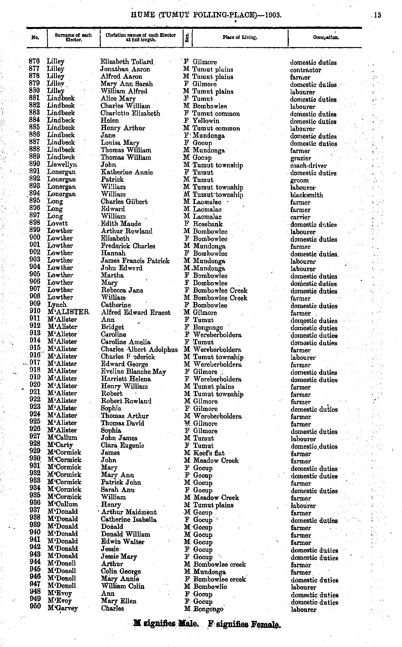
- Lilley Elizebeth - M'Garvey Charles
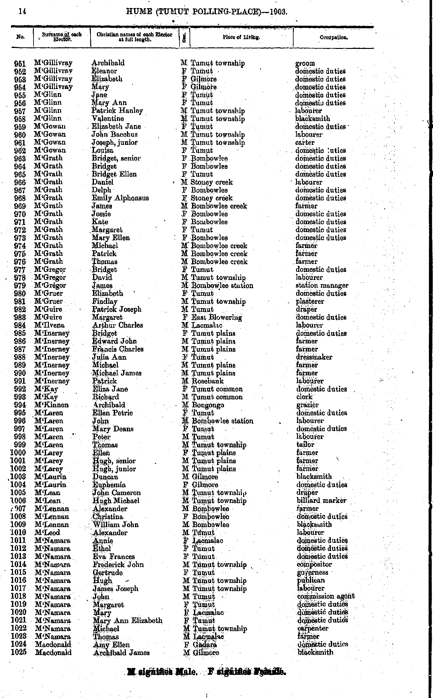
- M'Gillivray Archibald - Macdonald Archibald
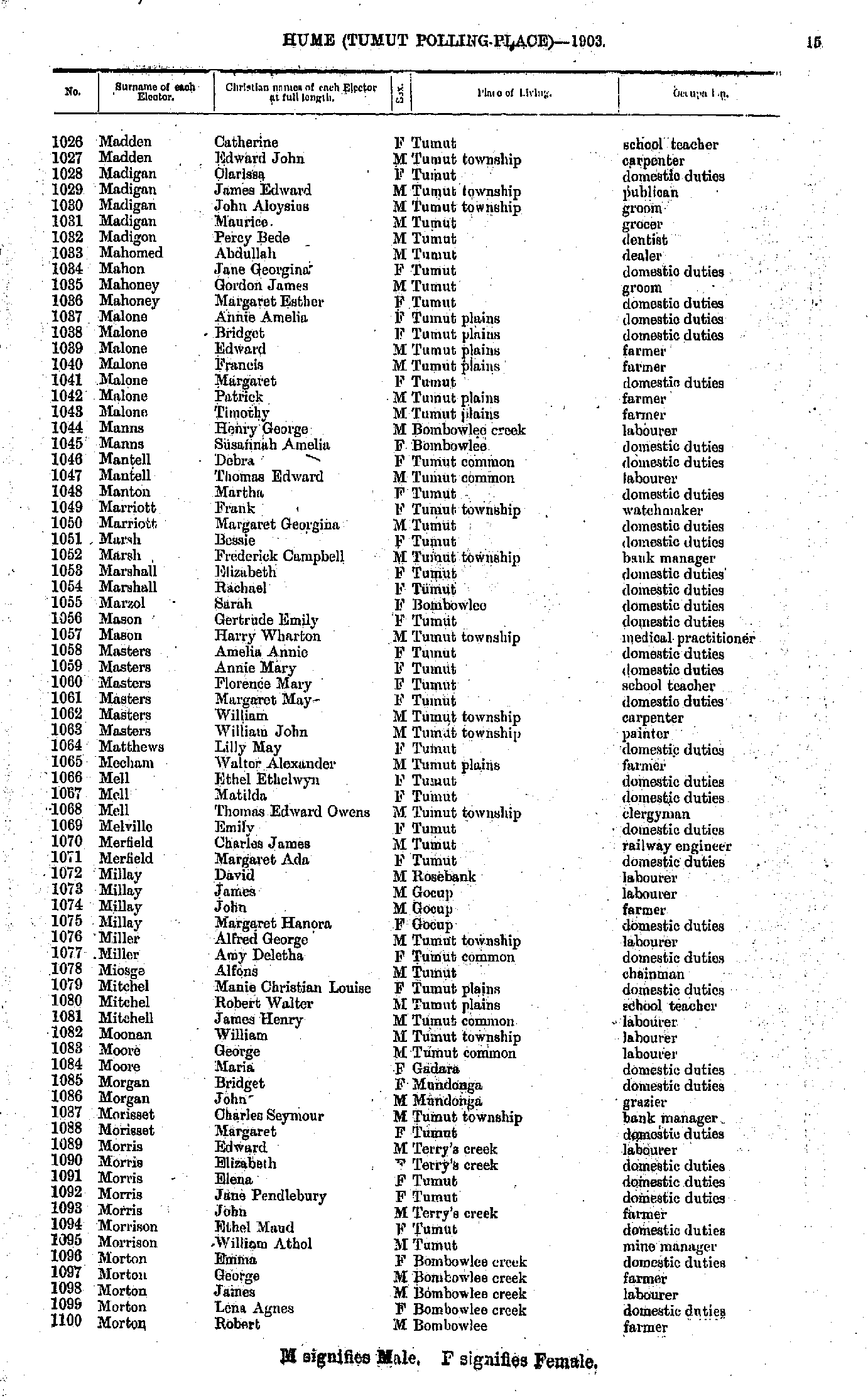
- Madden Catherine - Morton Robert
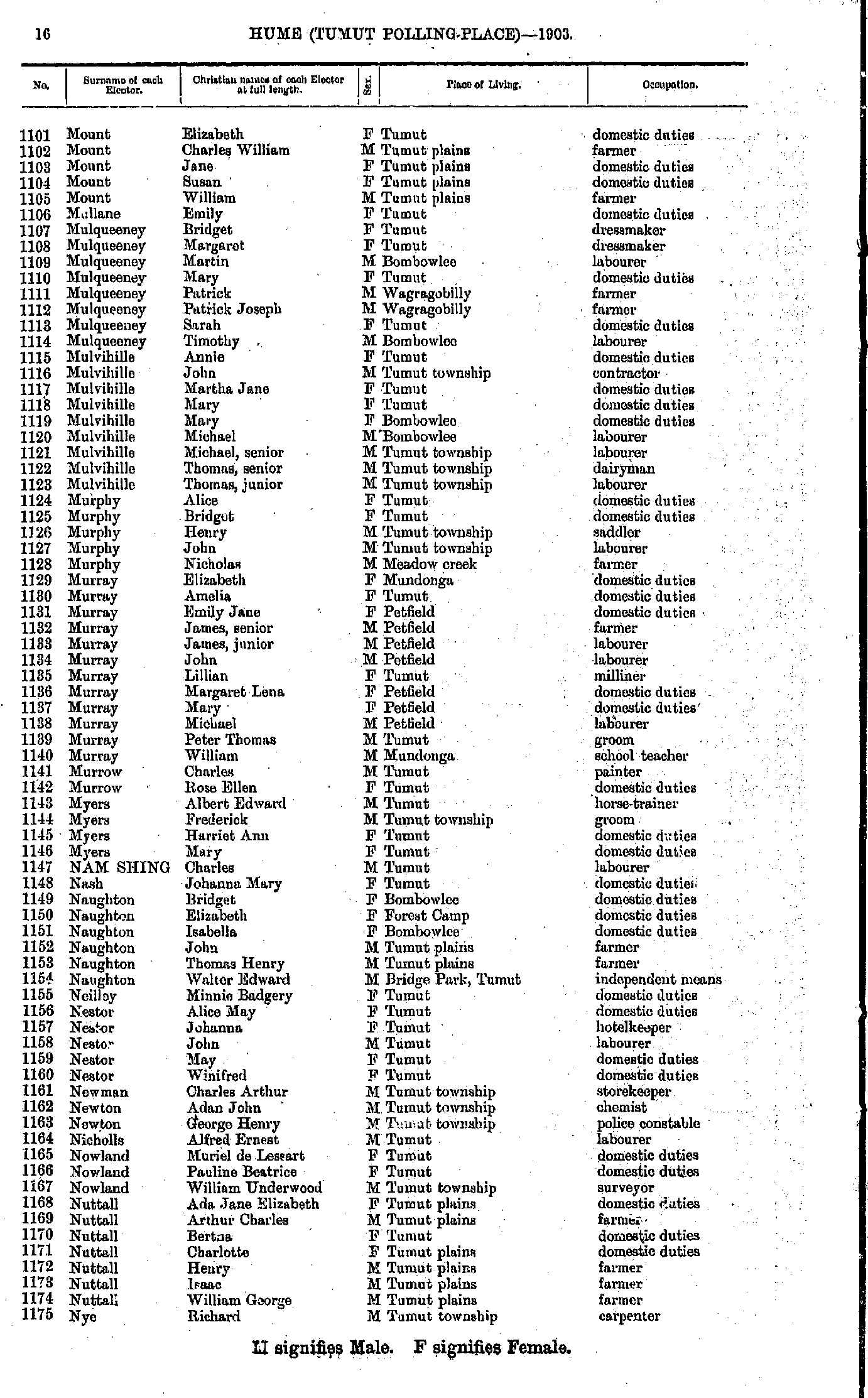
- Mount Elizabeth - Nye Richard
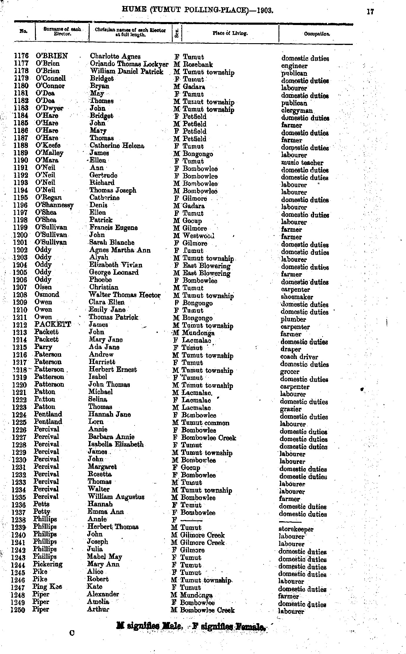
- O'Brien Charlotte - Piper Arthur
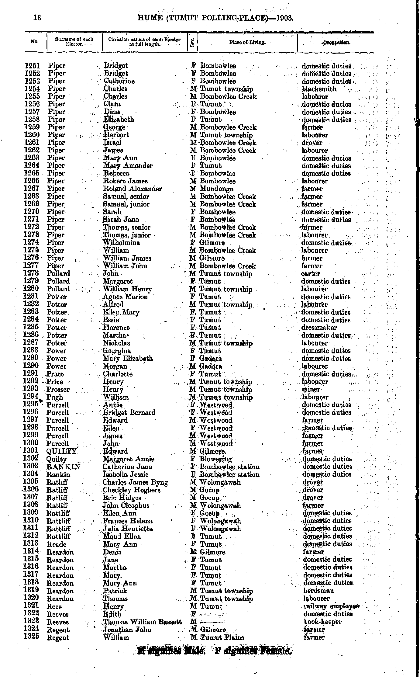
- Piper Bridget - Regent William
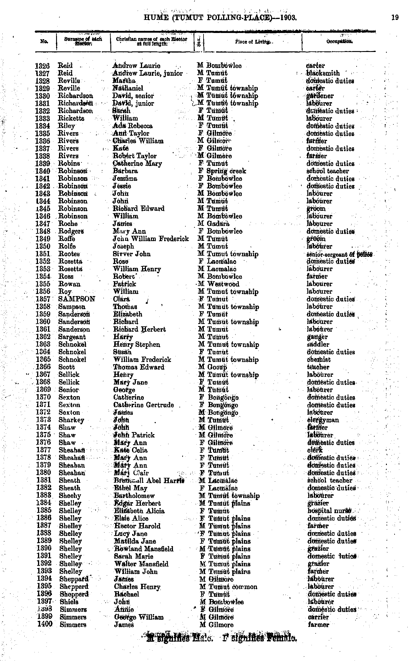
- Reid Andrew - Simmers James
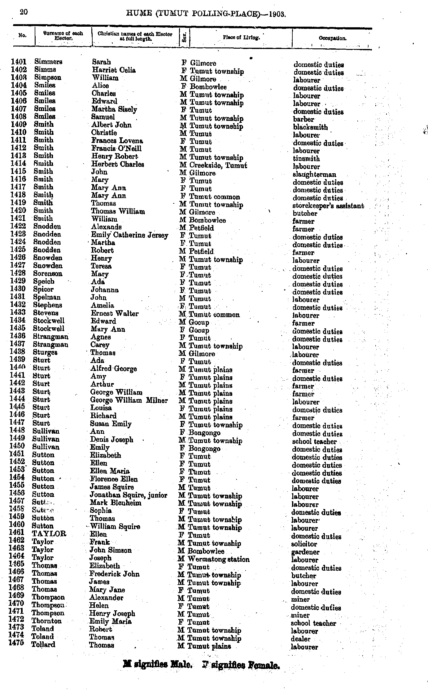
- Simmers Sarah - Tollard Thomas
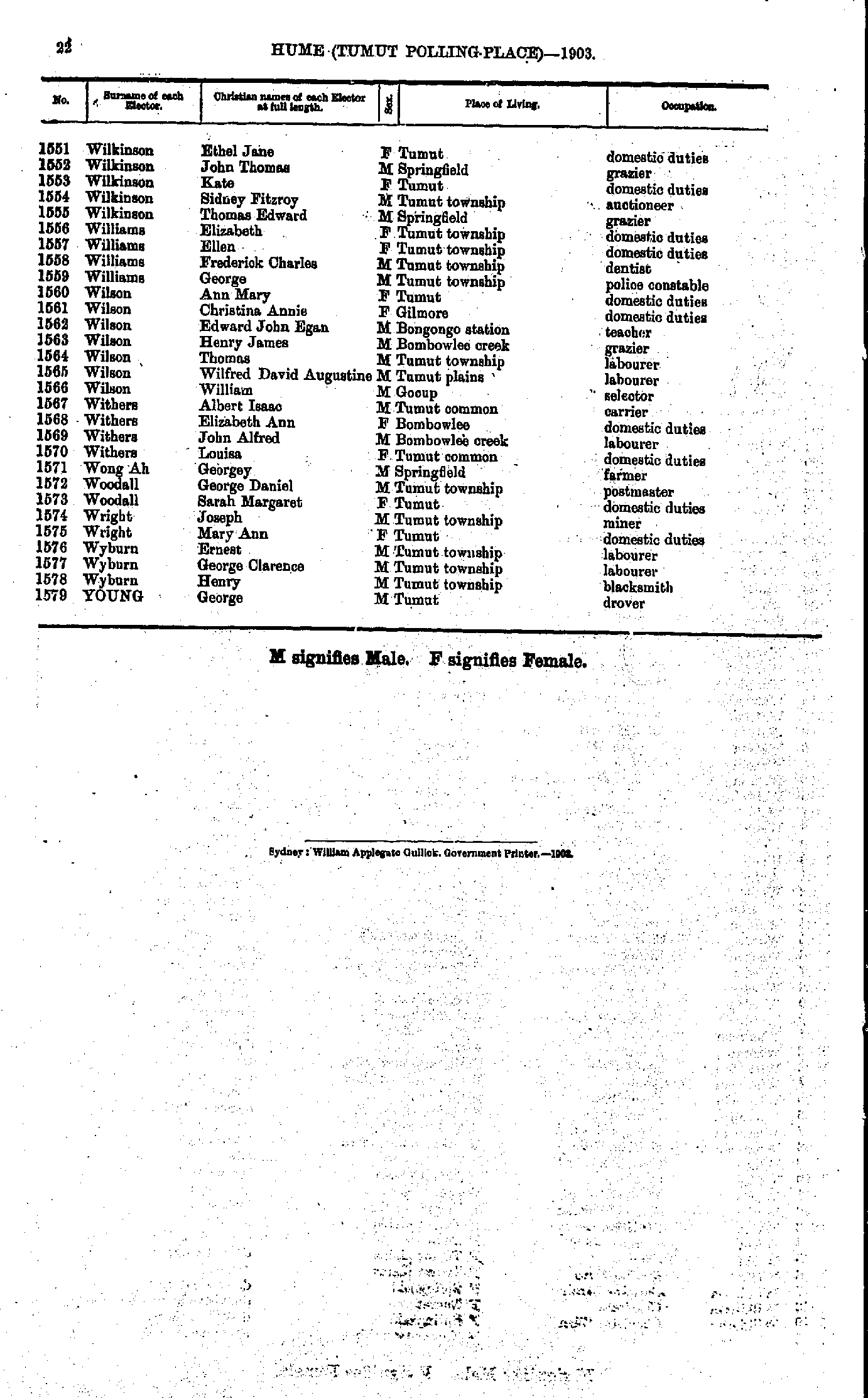
- Trewella Jane - Wilkinson Edward
- Wilkinson Ethel - Young George
Maps of the Hume Electoral Division
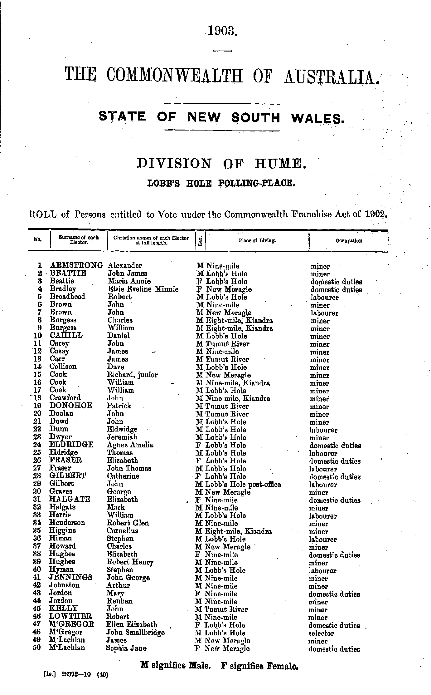
- Abrahams Henrietta - Eeles James
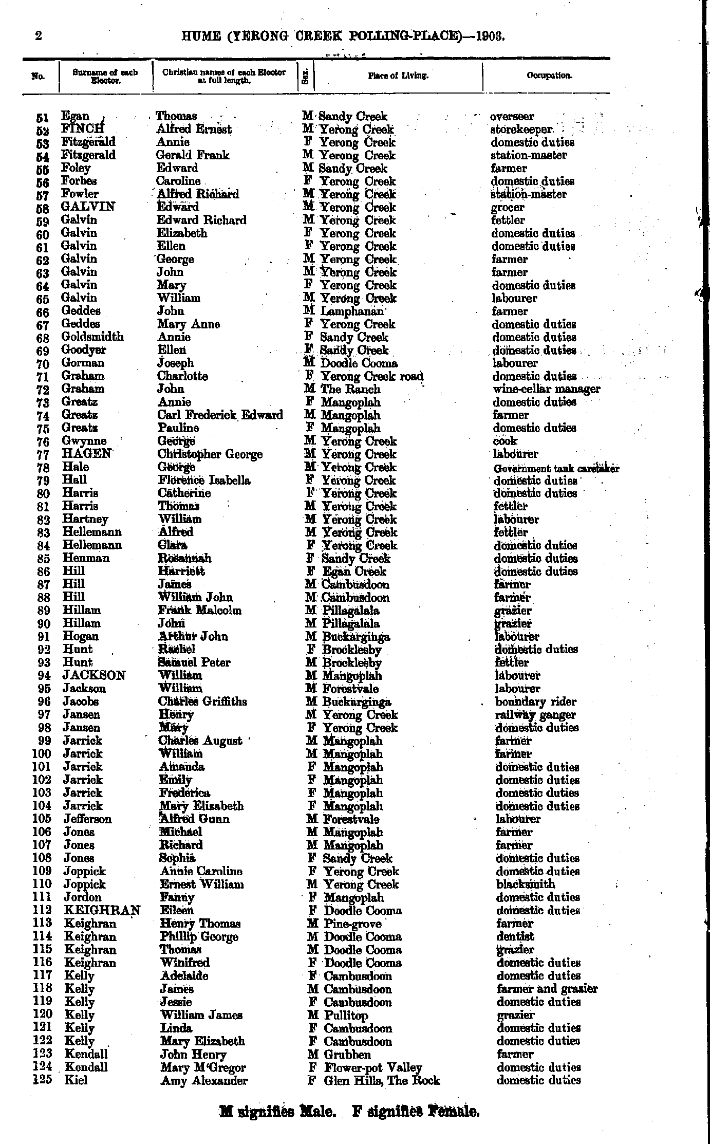
- Egan Thomas - Kiel Amy
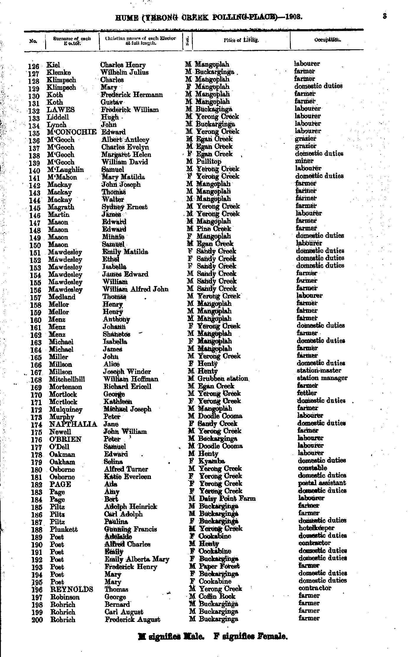
- Kiel Charles - Rohrich Frederick
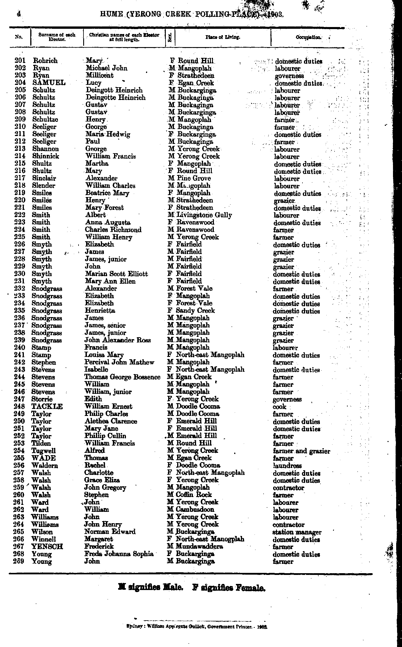
- Rohrich Mary - Young John
From: Federal Electoral Districts Commissioners 1901, Maps of the Federal Electoral Districts of the State of New South Wales, William Applegate Gullick, Government Printer, Sydney.
JPEG file (263KB)
Portable Document Format(PDF) file (1.44MB)If you do not have a PDF reader you can click on the button to download the free Adobe Acrobat Reader
The documents in this site are arranged into seven major indexes. You are currently in the Electoral Rolls index. Use the Back button on your browser to move within this index, or use the links below to view another index:
- Directories
- Electoral Rolls
- Land Records
- General and Miscellaneous Records
- Mining Records
- Pastoral and Agricultural Records
- Other Occupations
Copyright © Internet History Resources 2007
