IHR NSW Family History Documents
Electoral Rolls Index
Home | Directories | Electoral | Land | General | Mining | Pastoral | OccupationsNSW Electoral Rolls 1903 - Darling Division
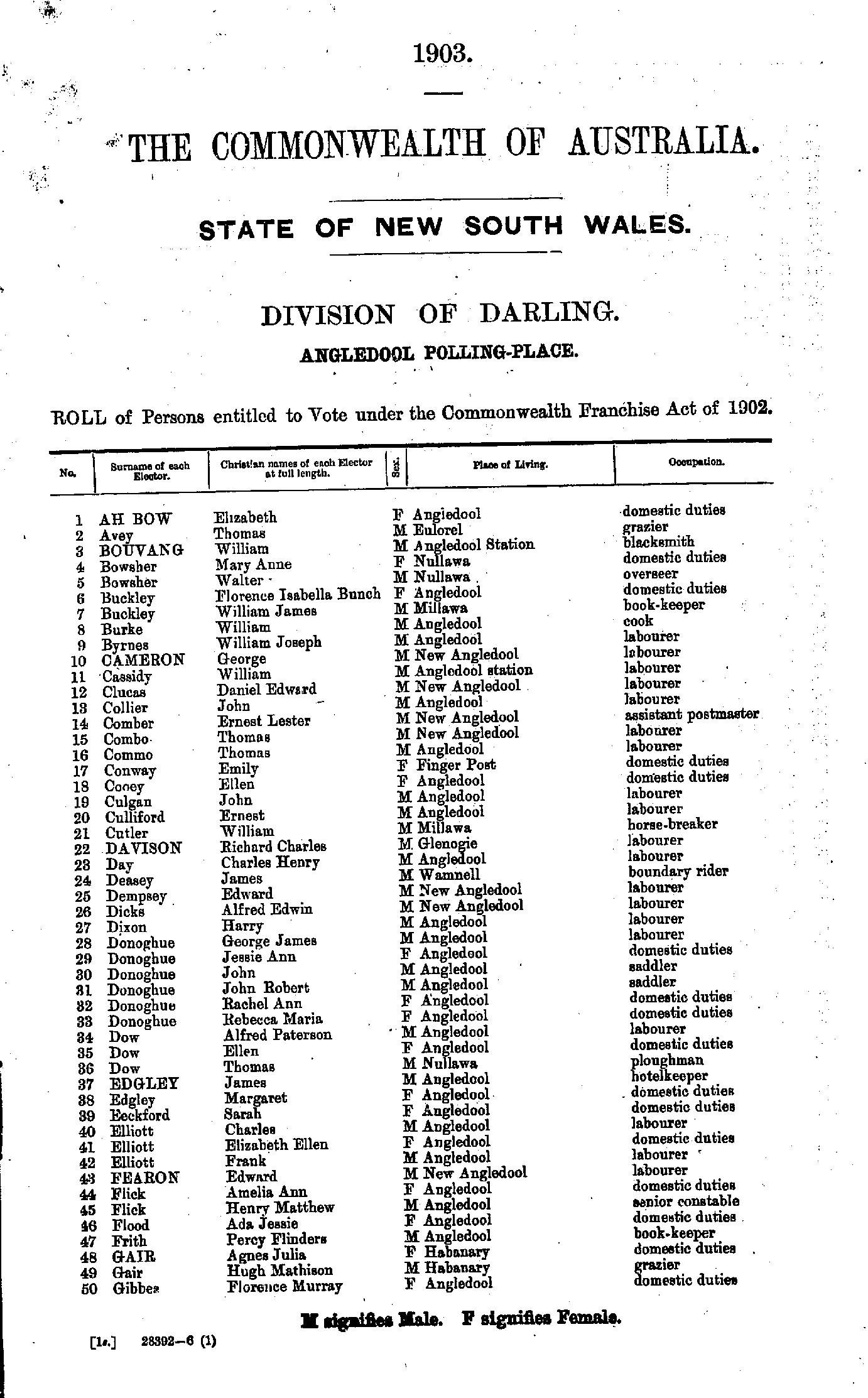
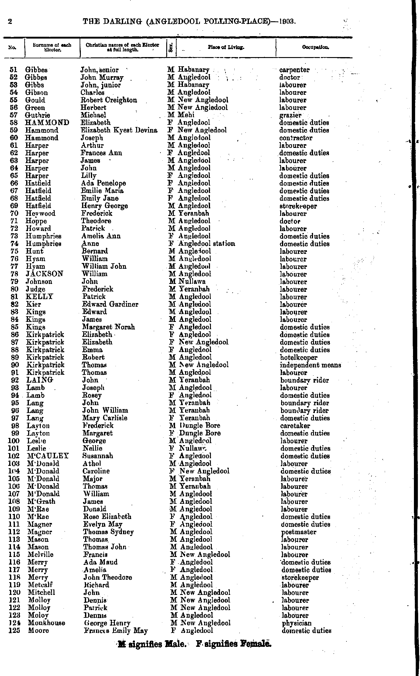
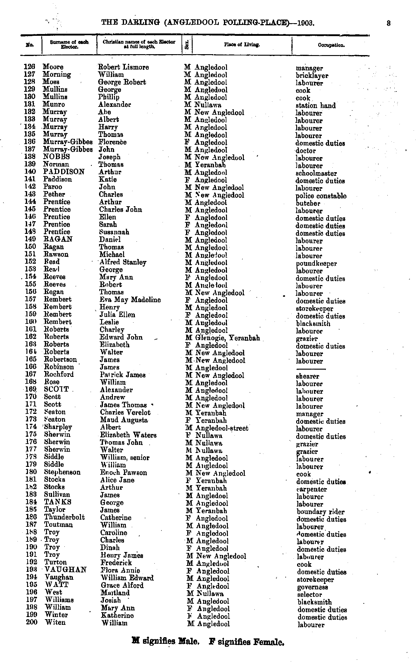
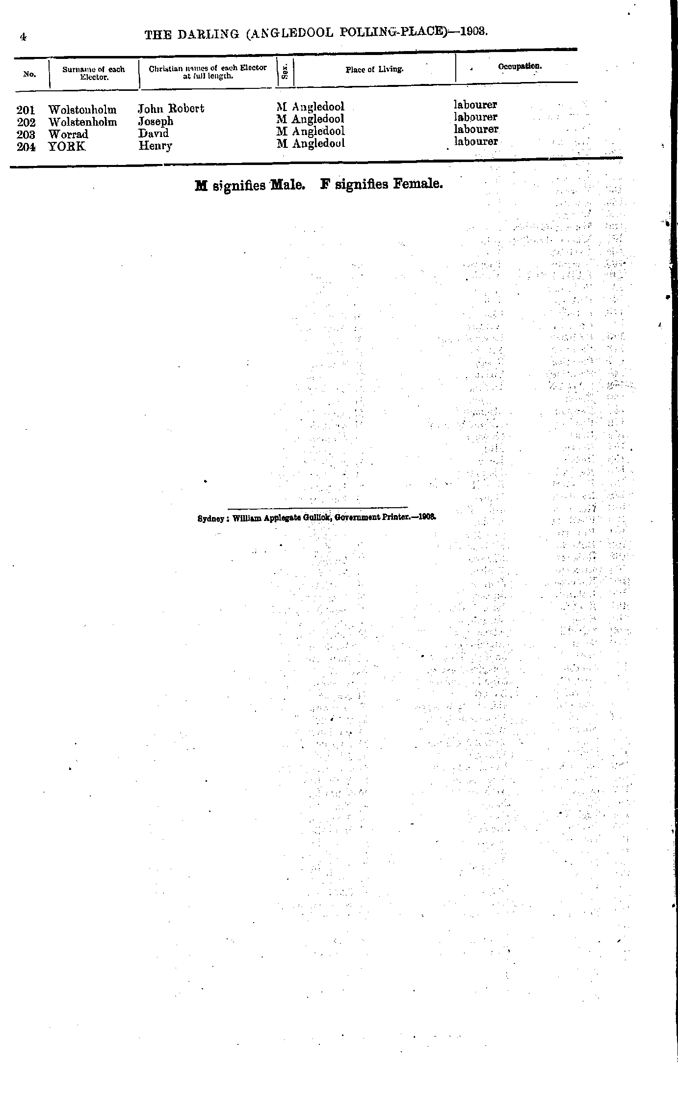
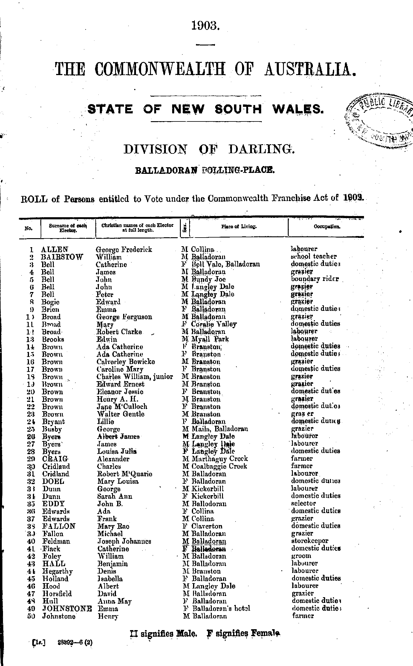
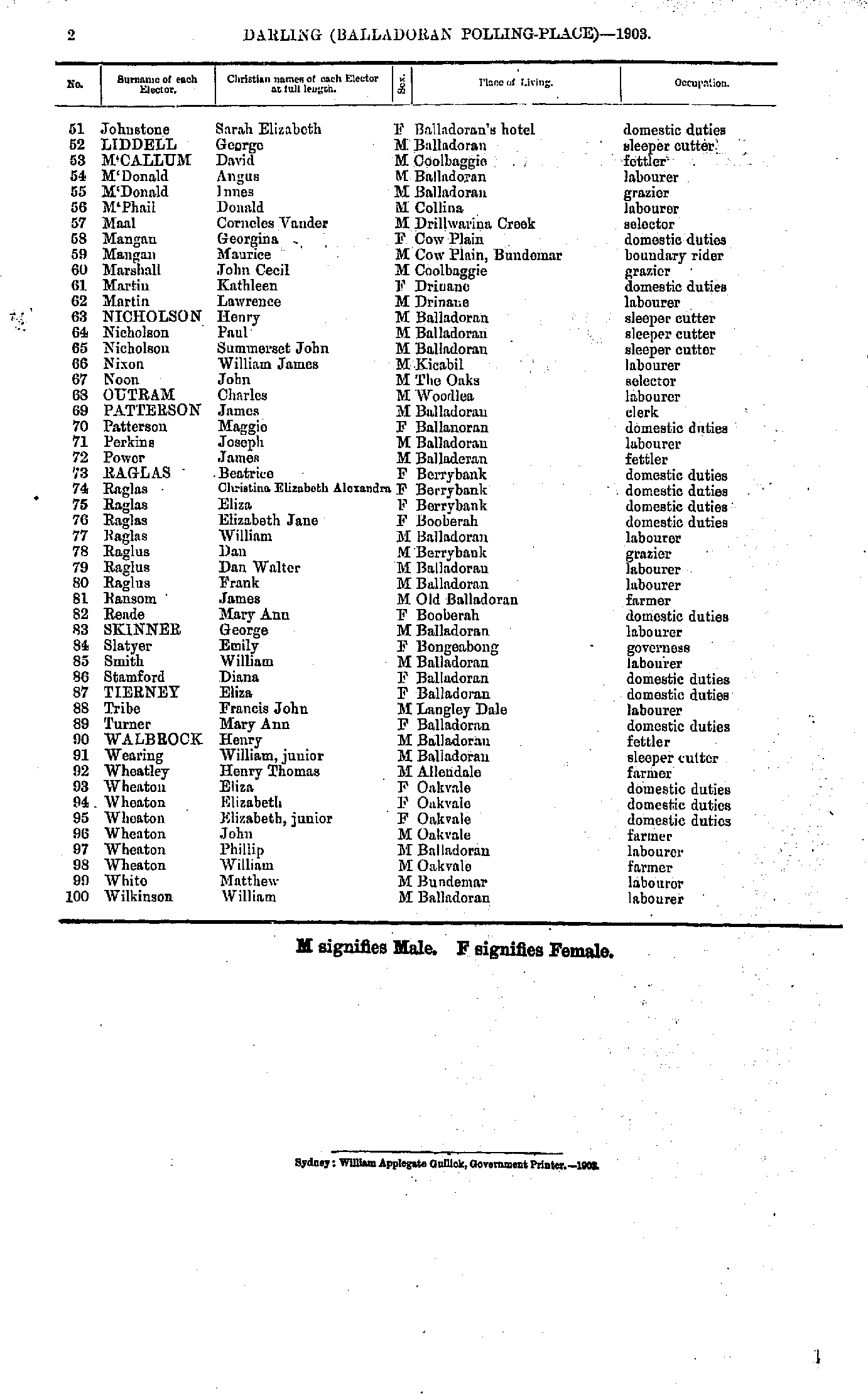
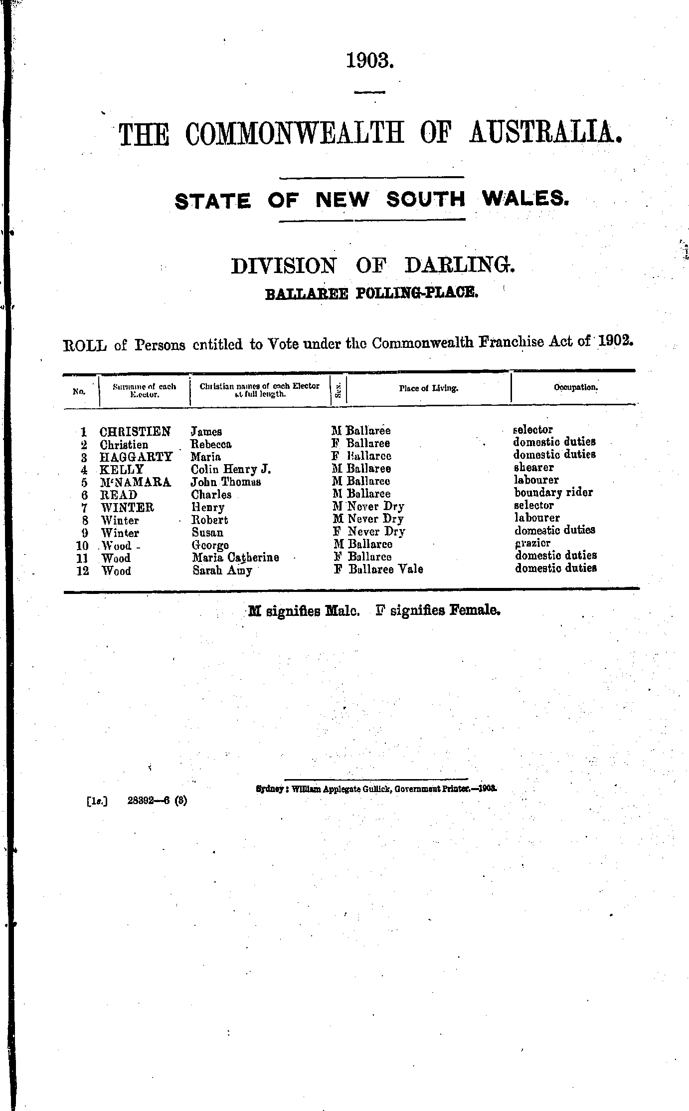
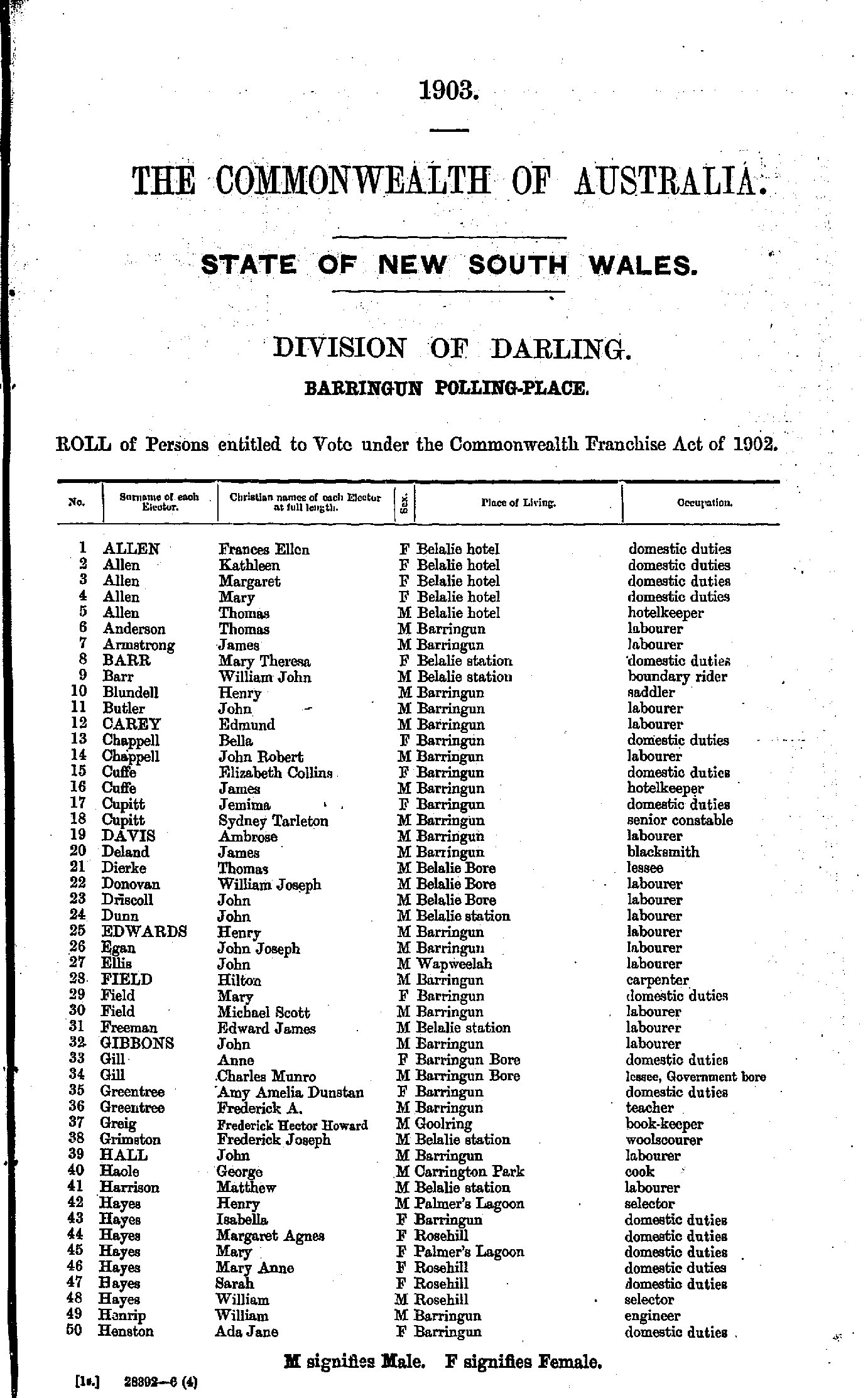
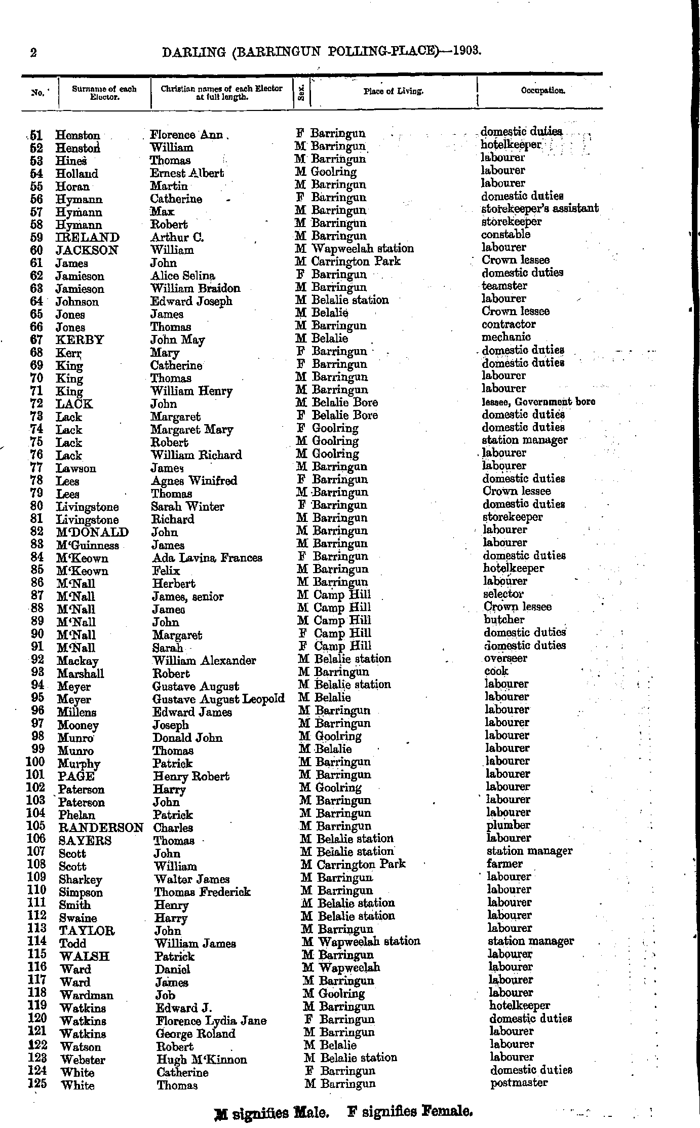
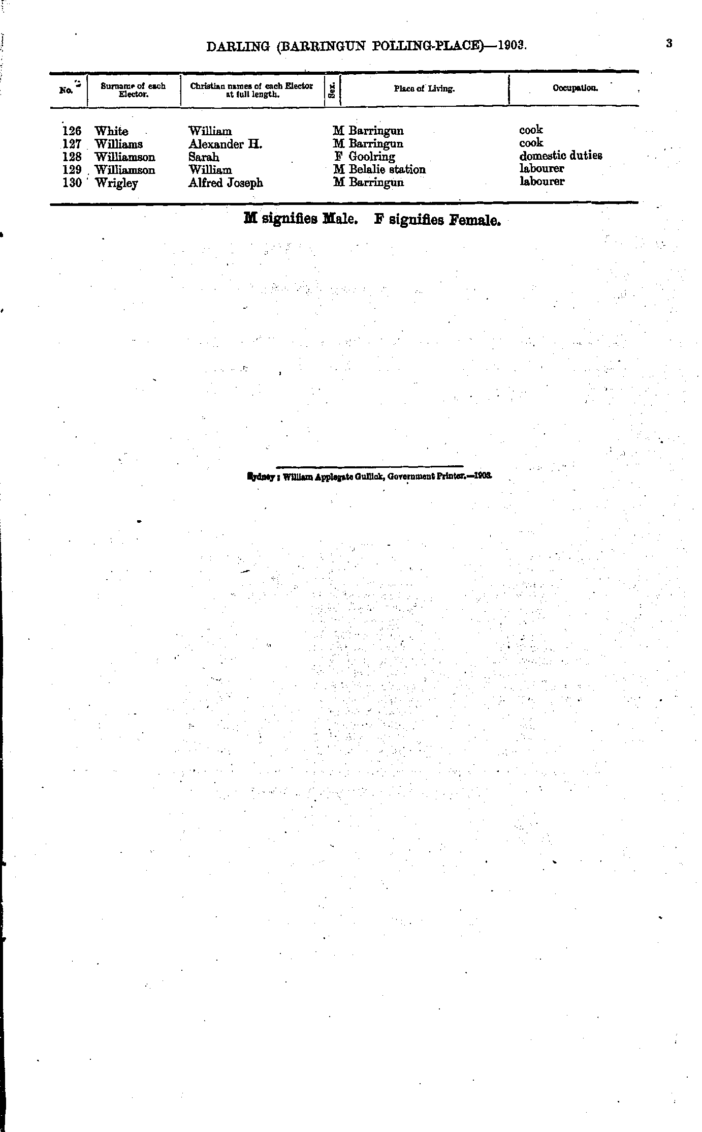
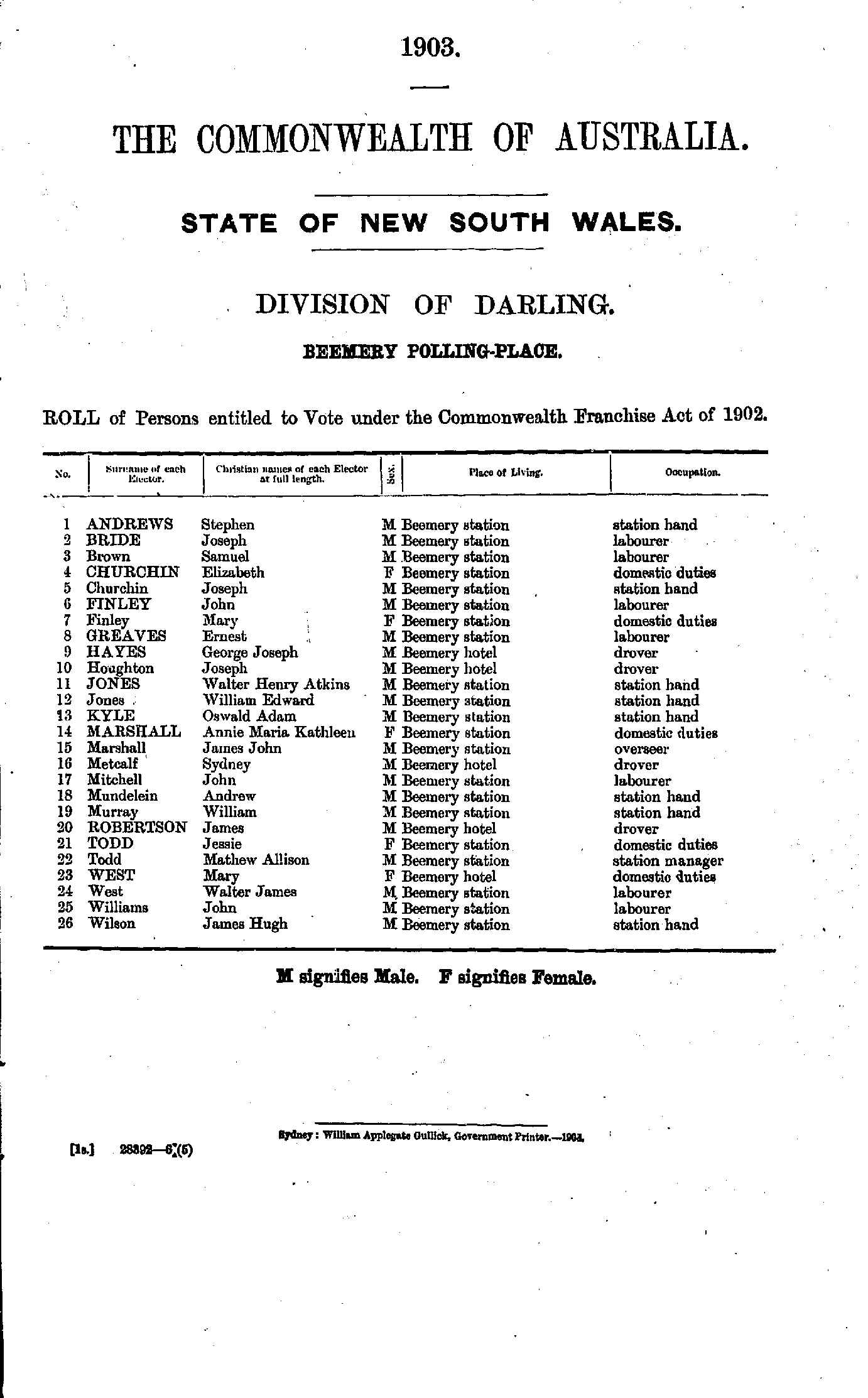
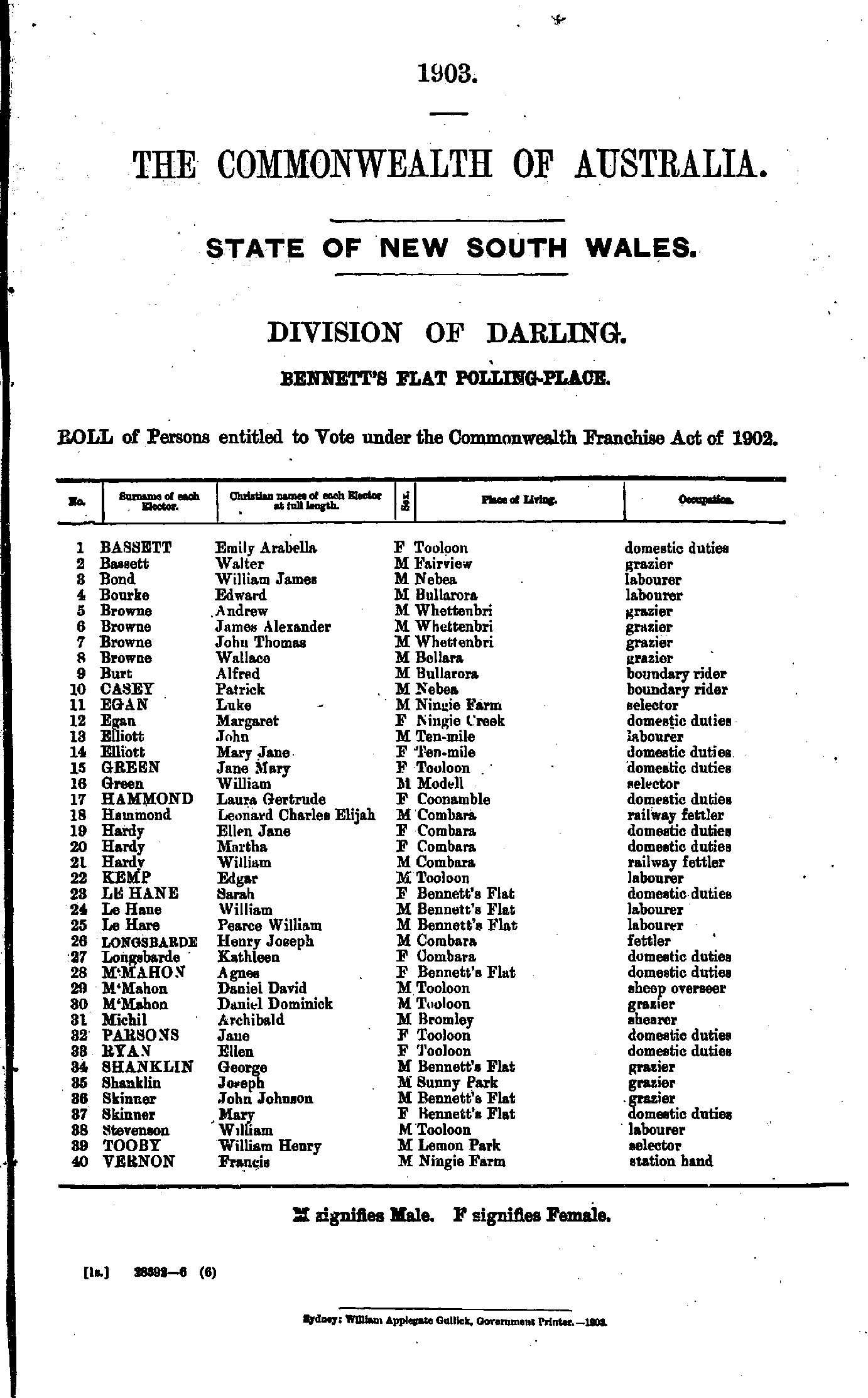
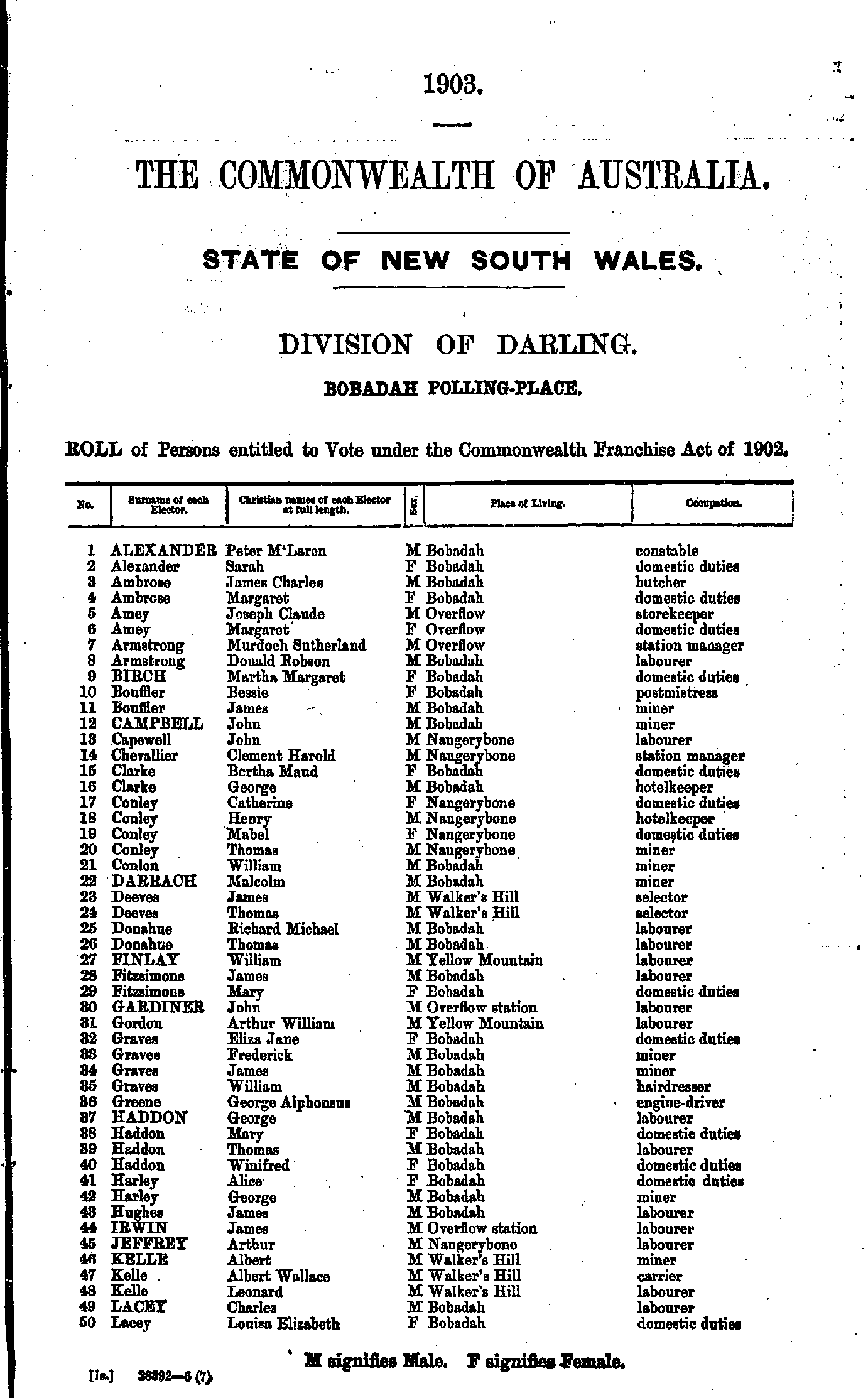
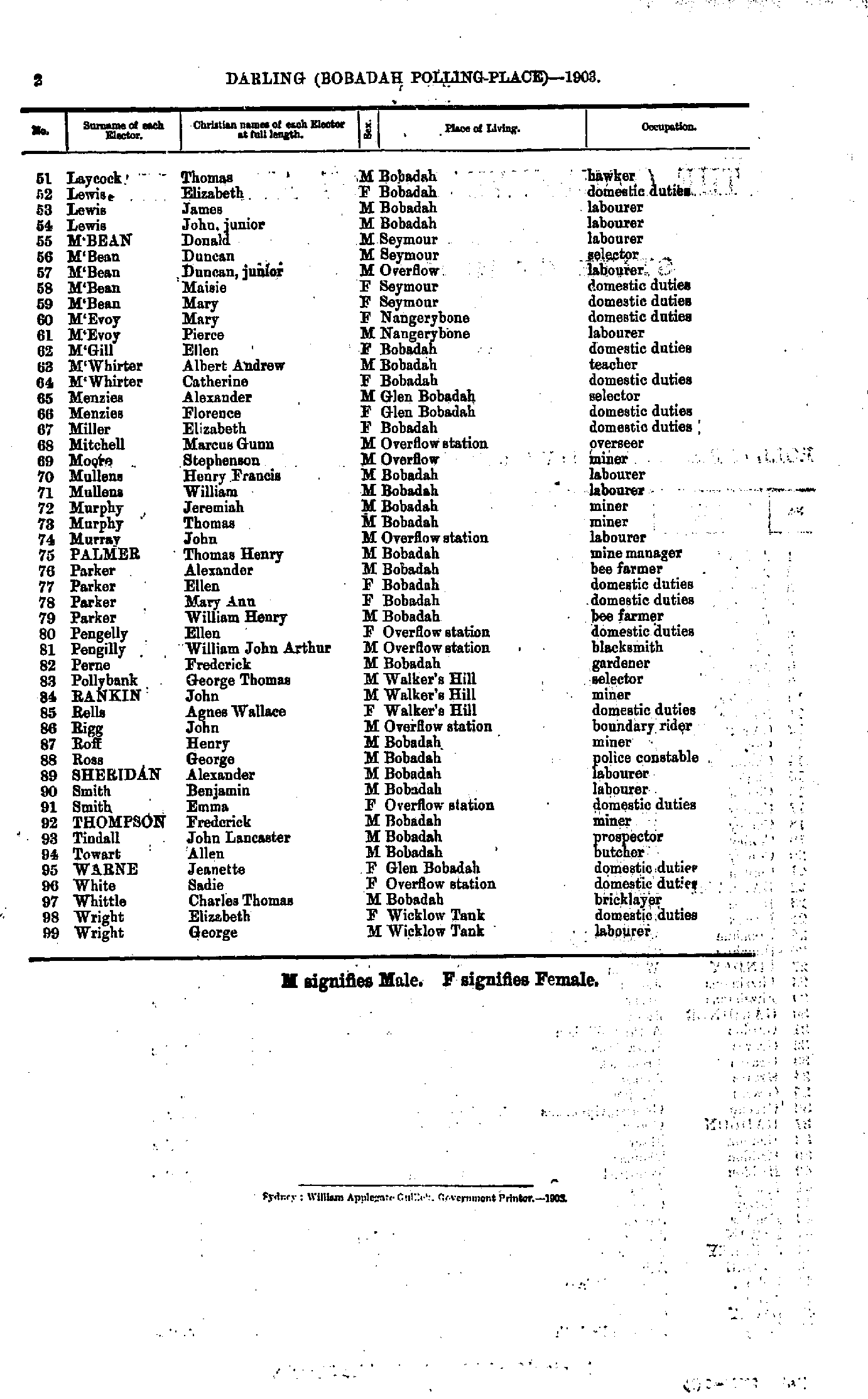
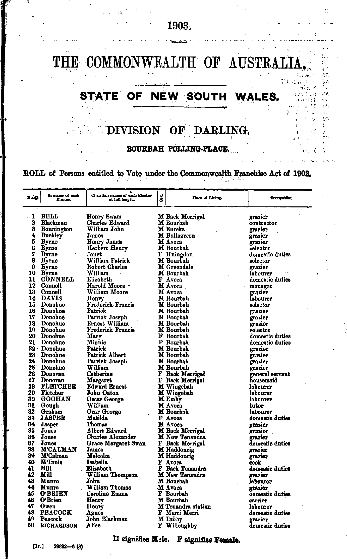
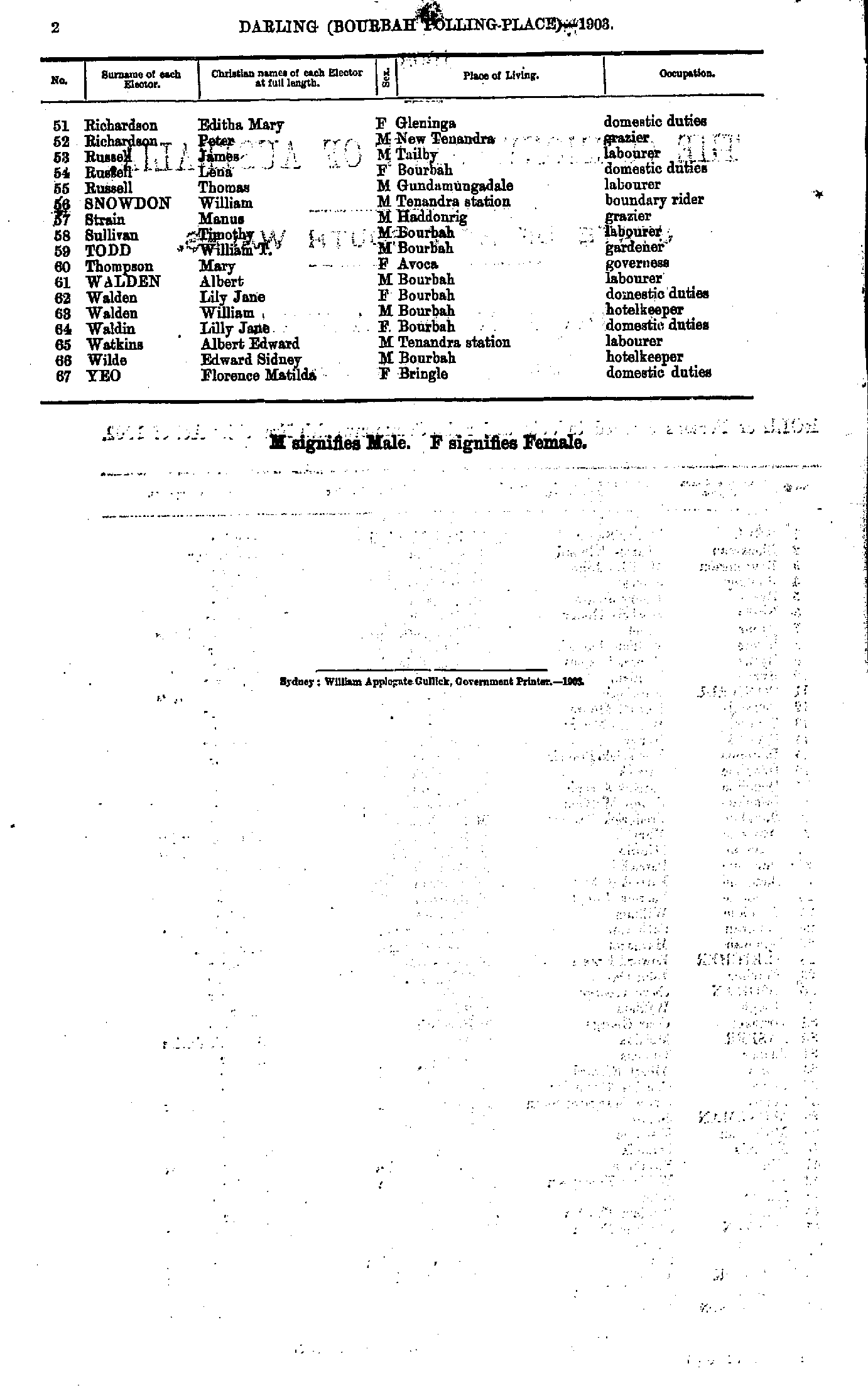
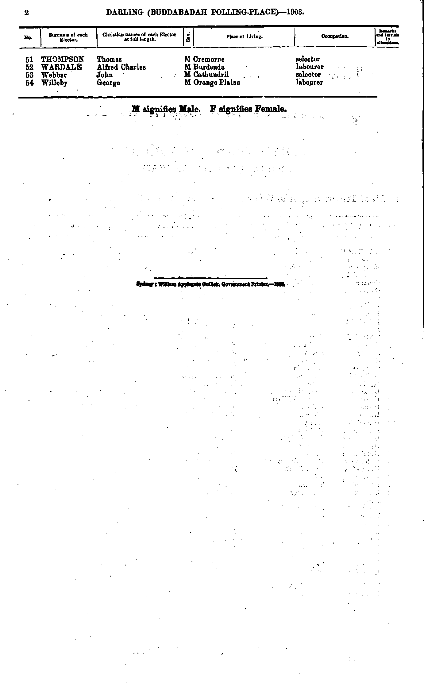
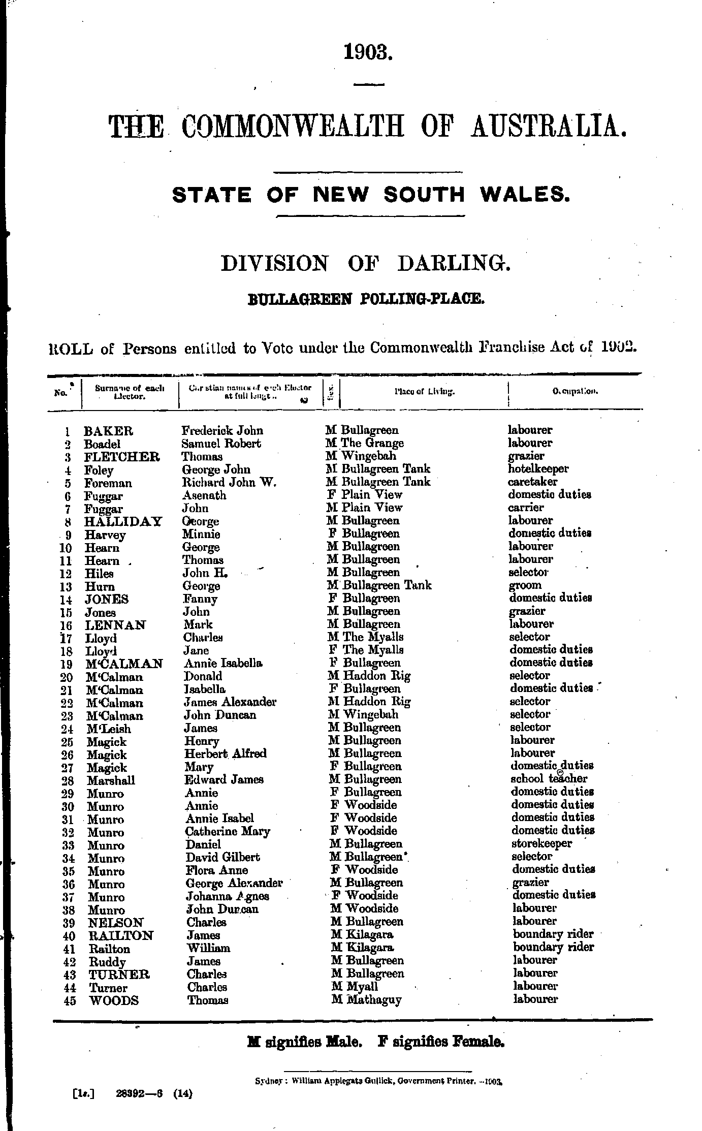
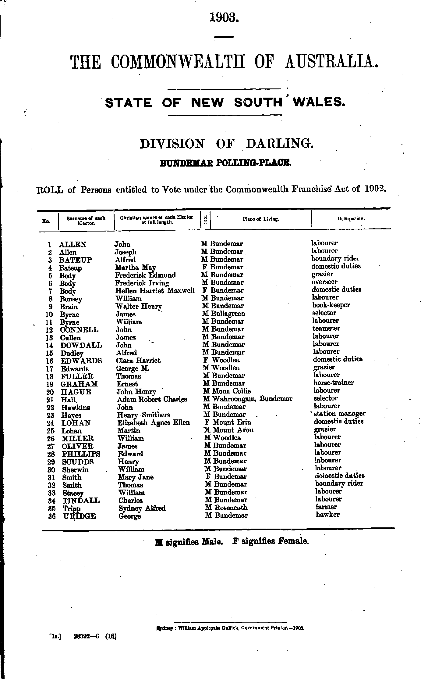
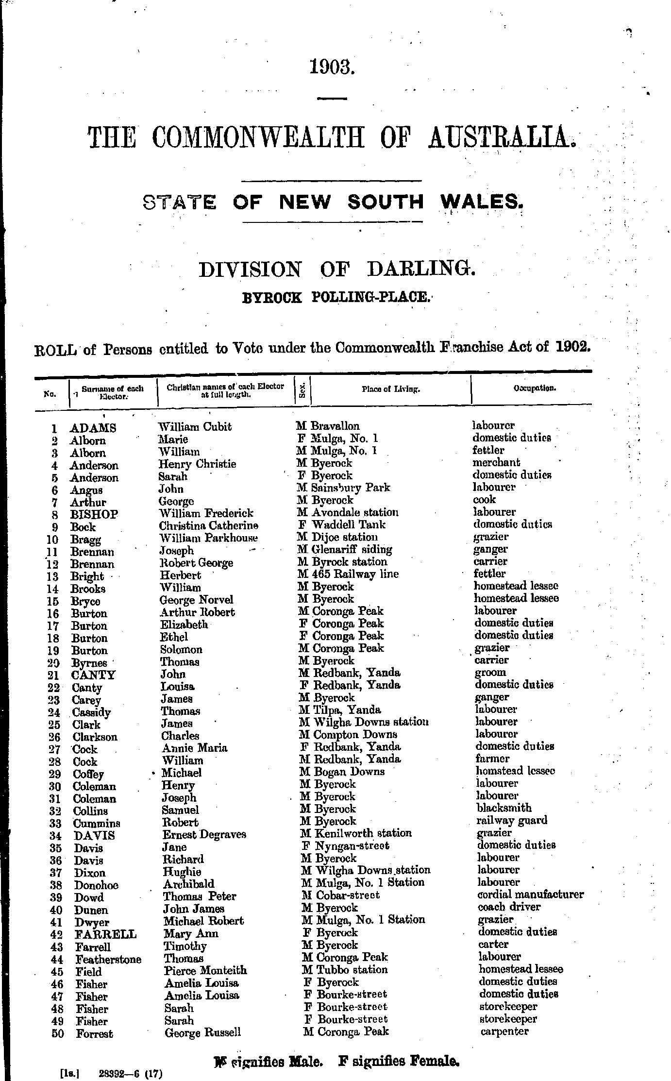
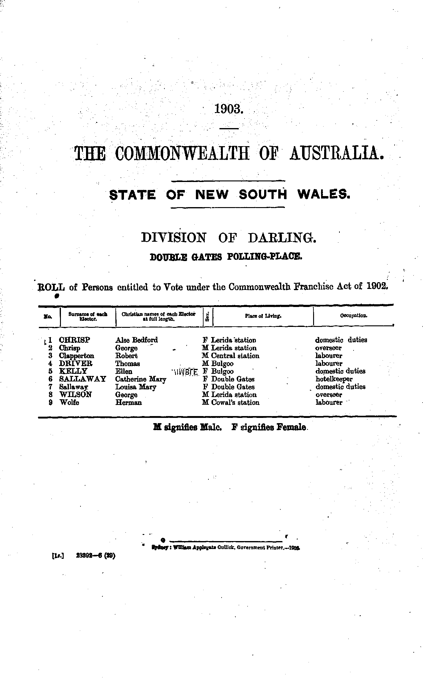
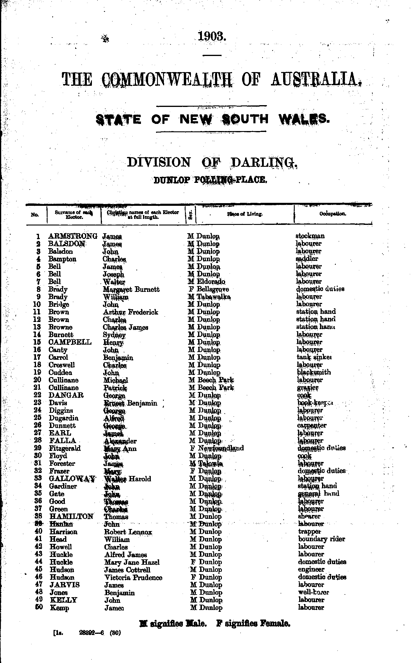
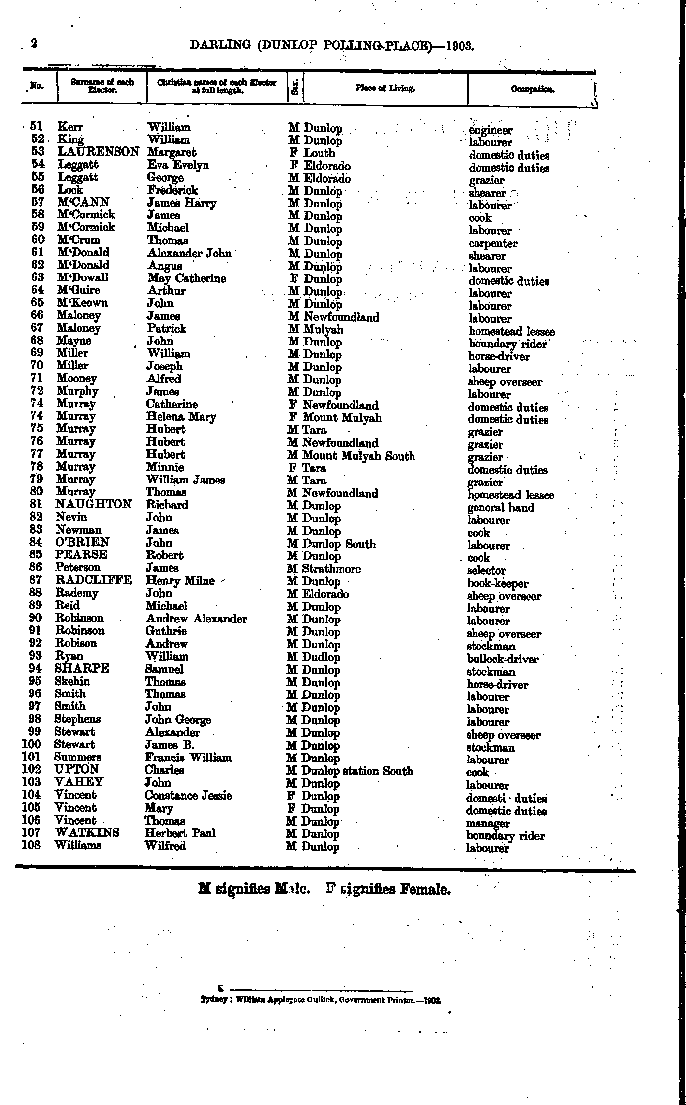
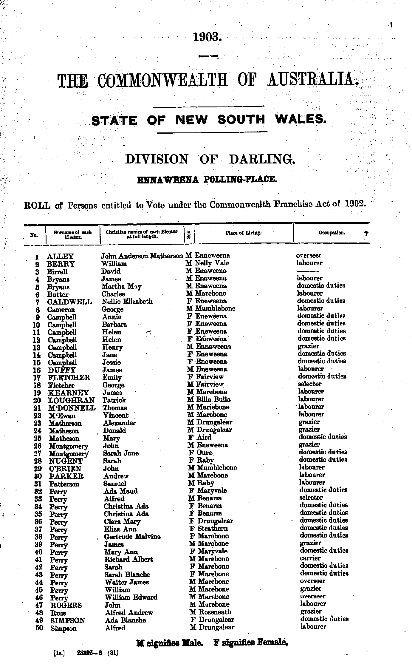
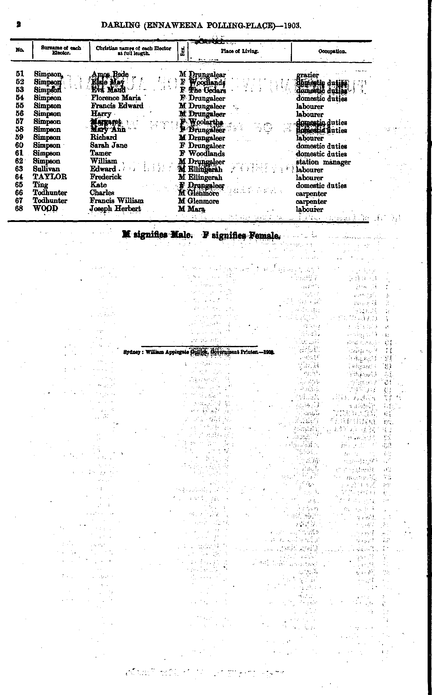
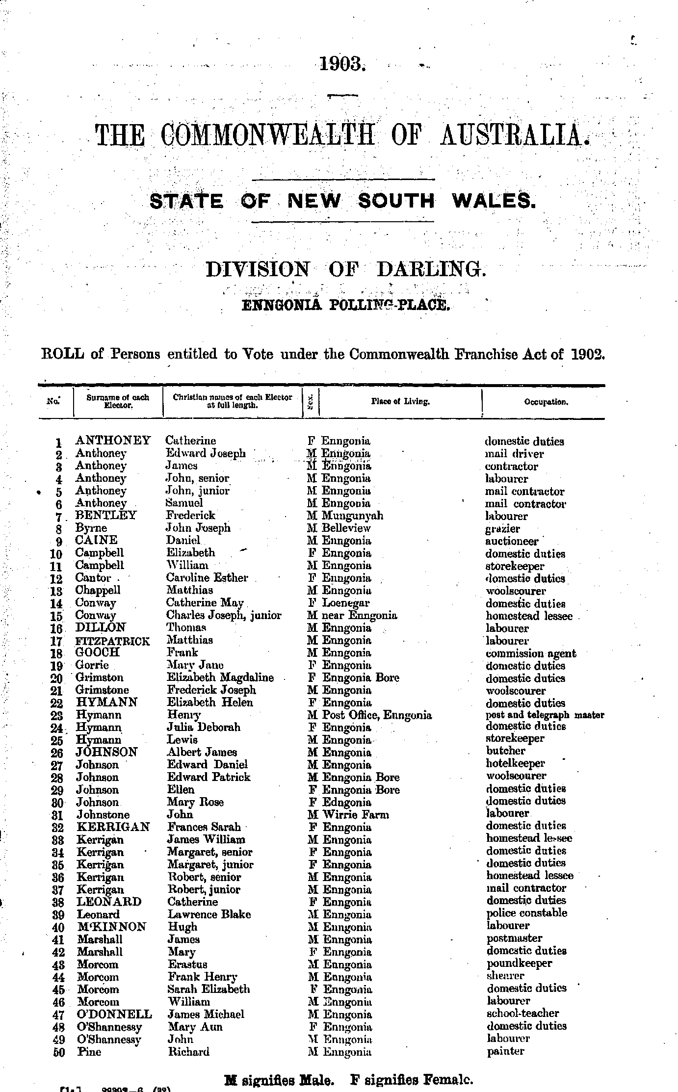
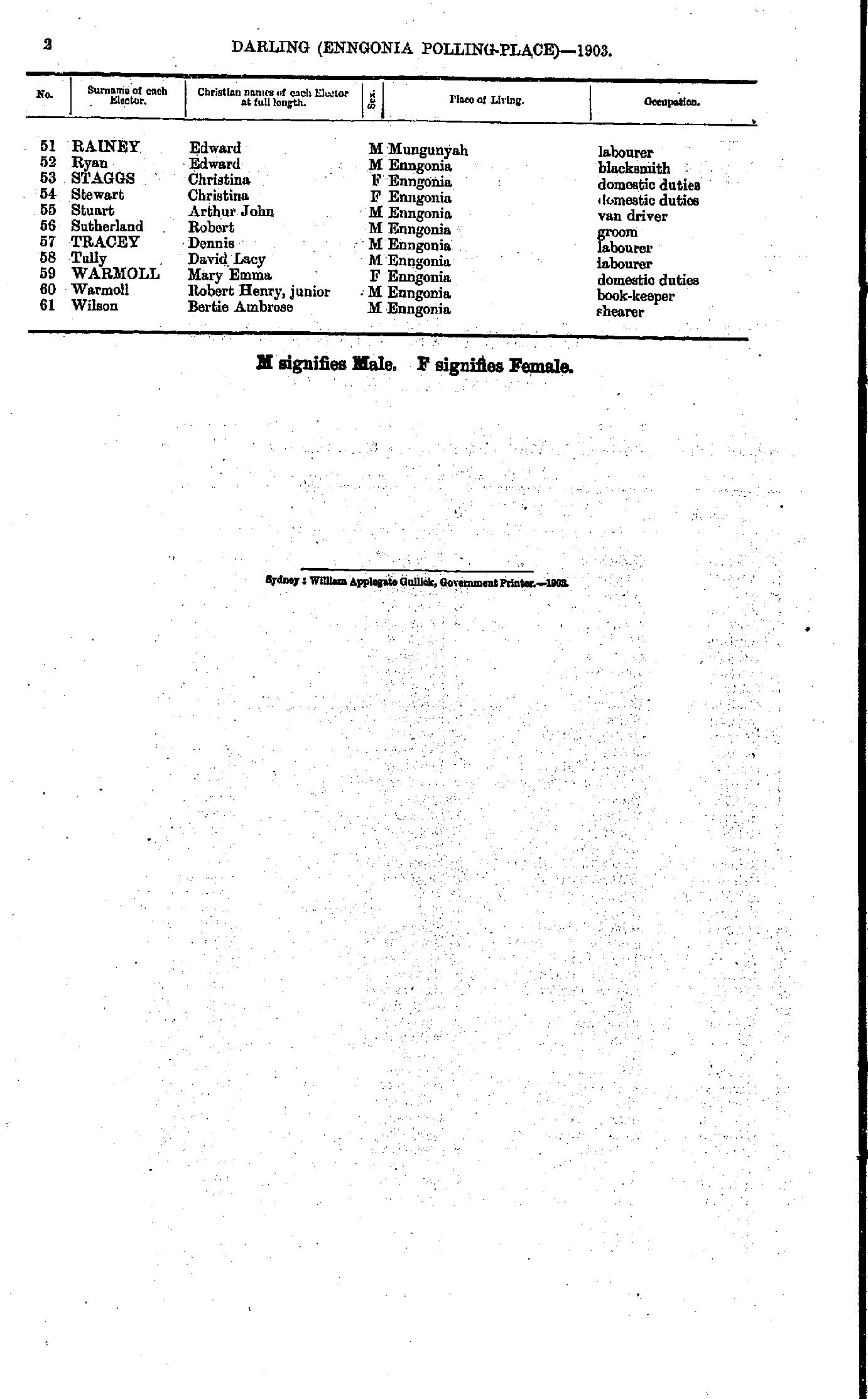
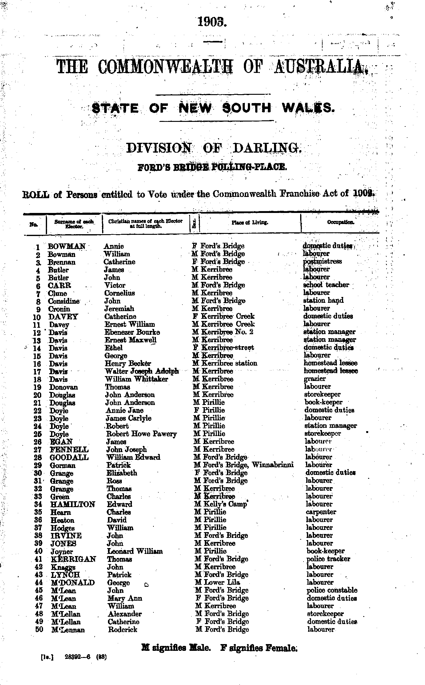
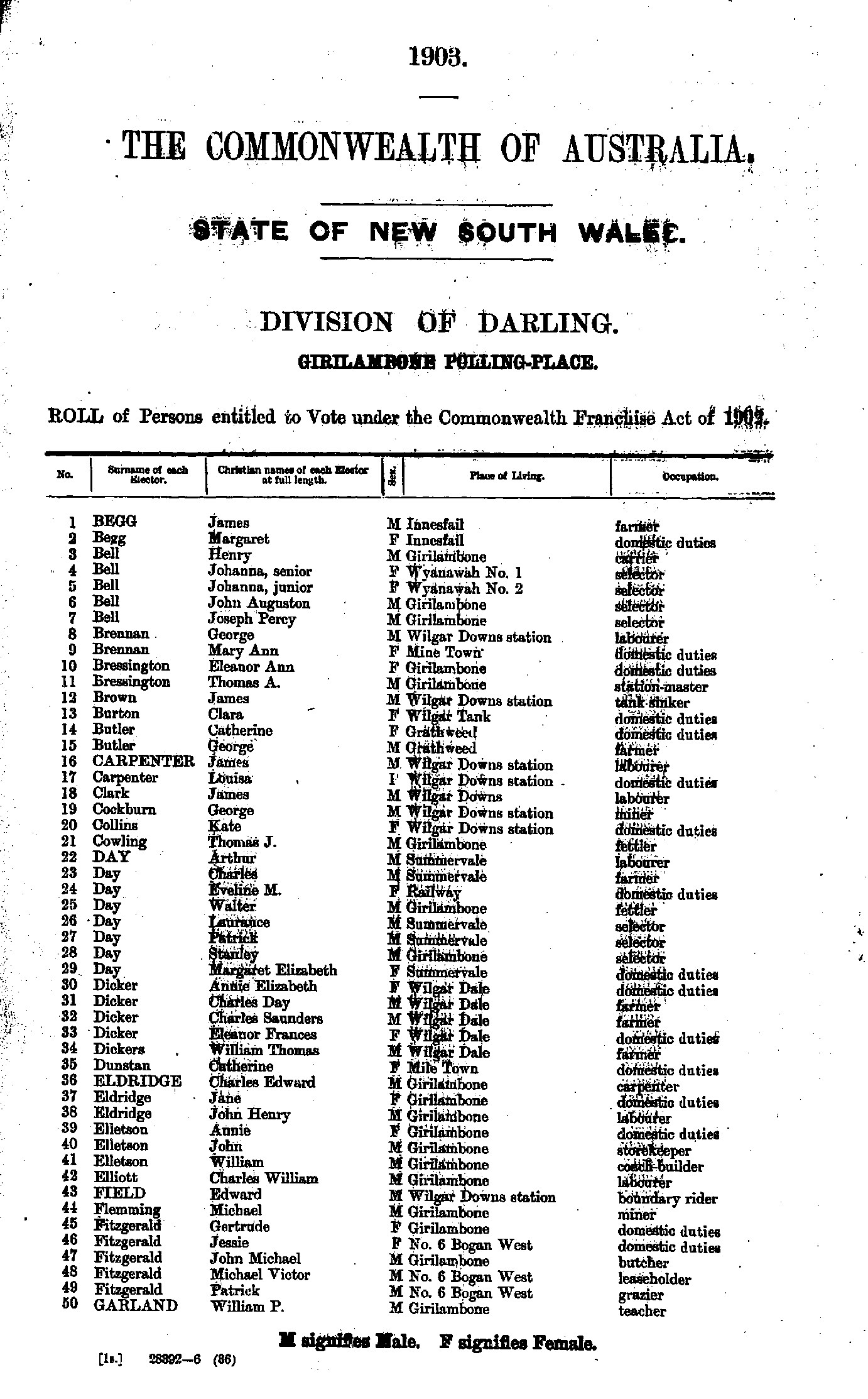
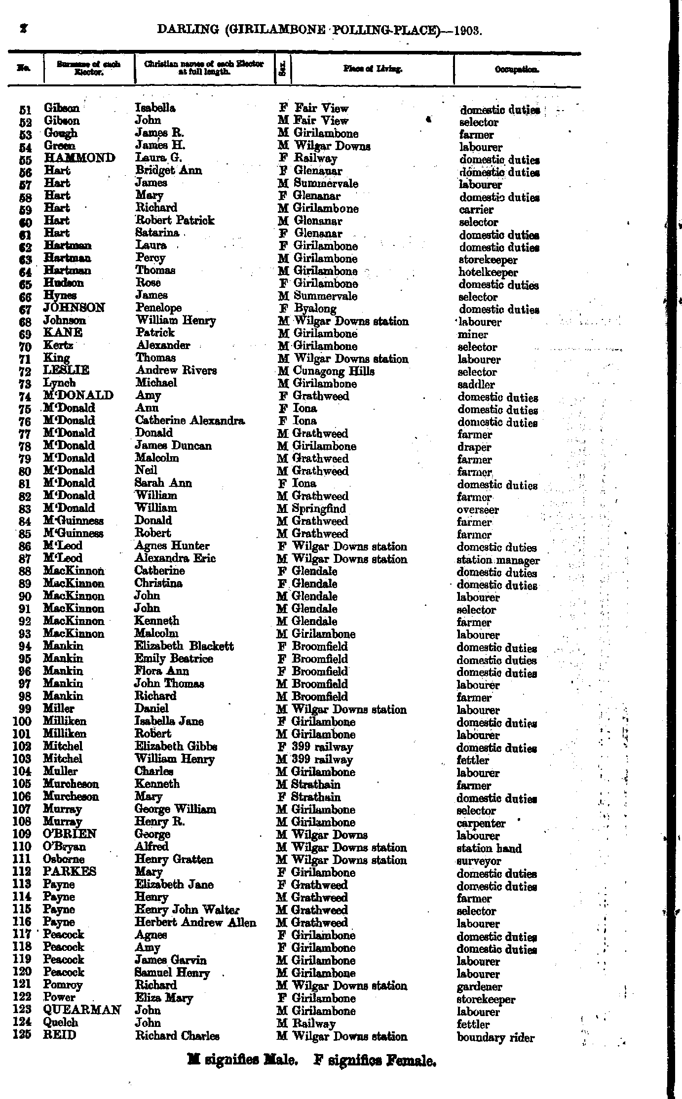
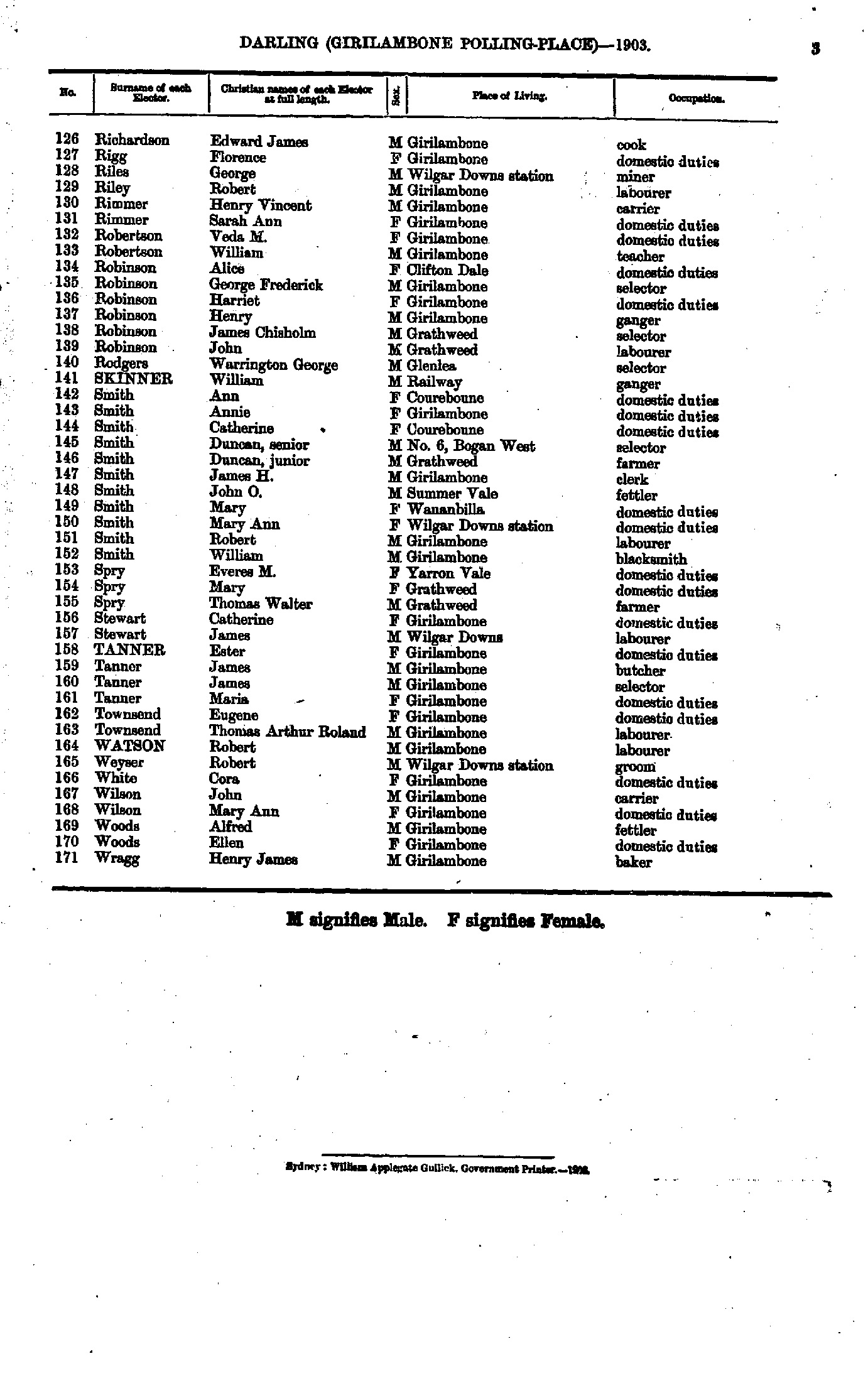
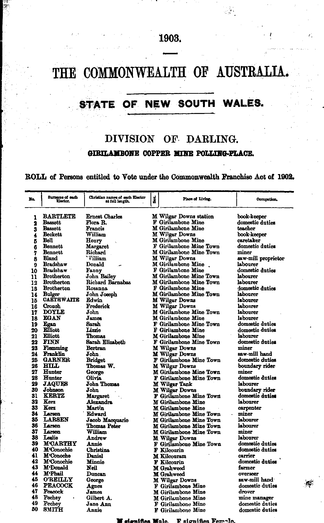
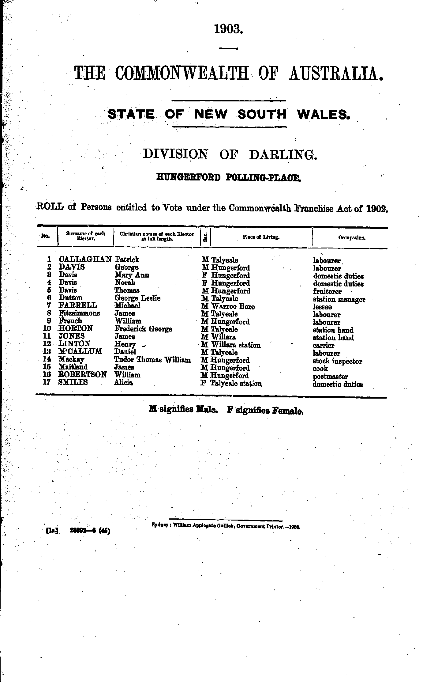
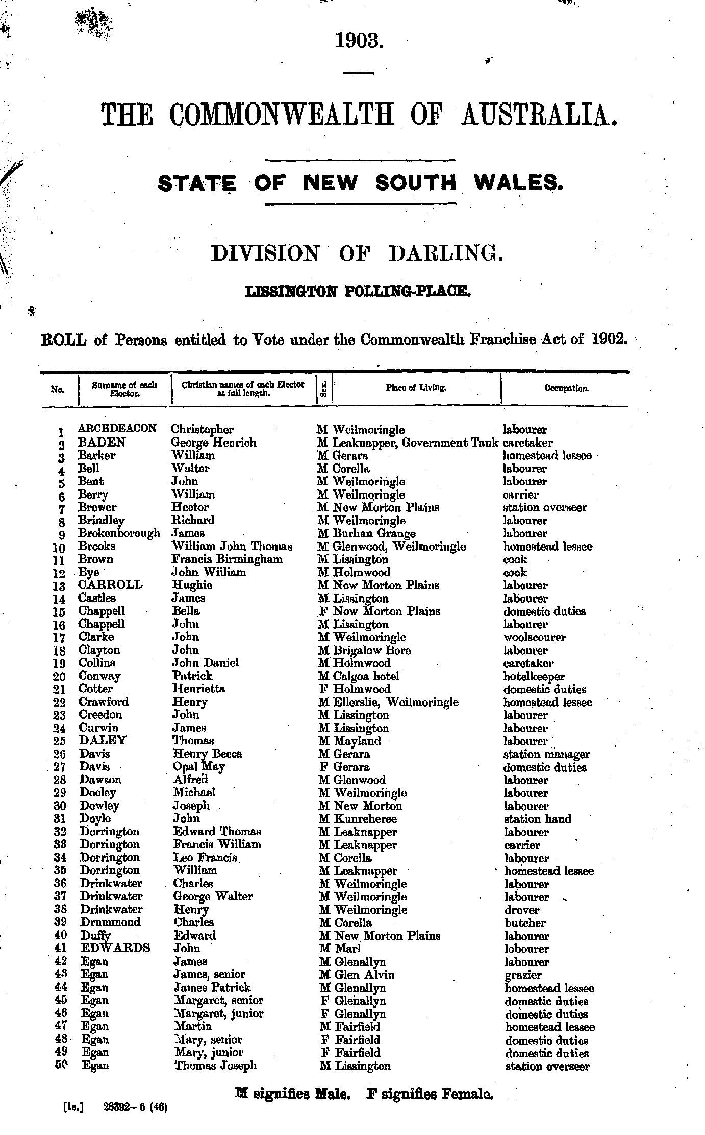
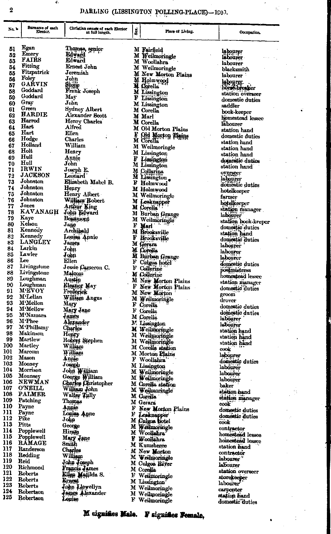
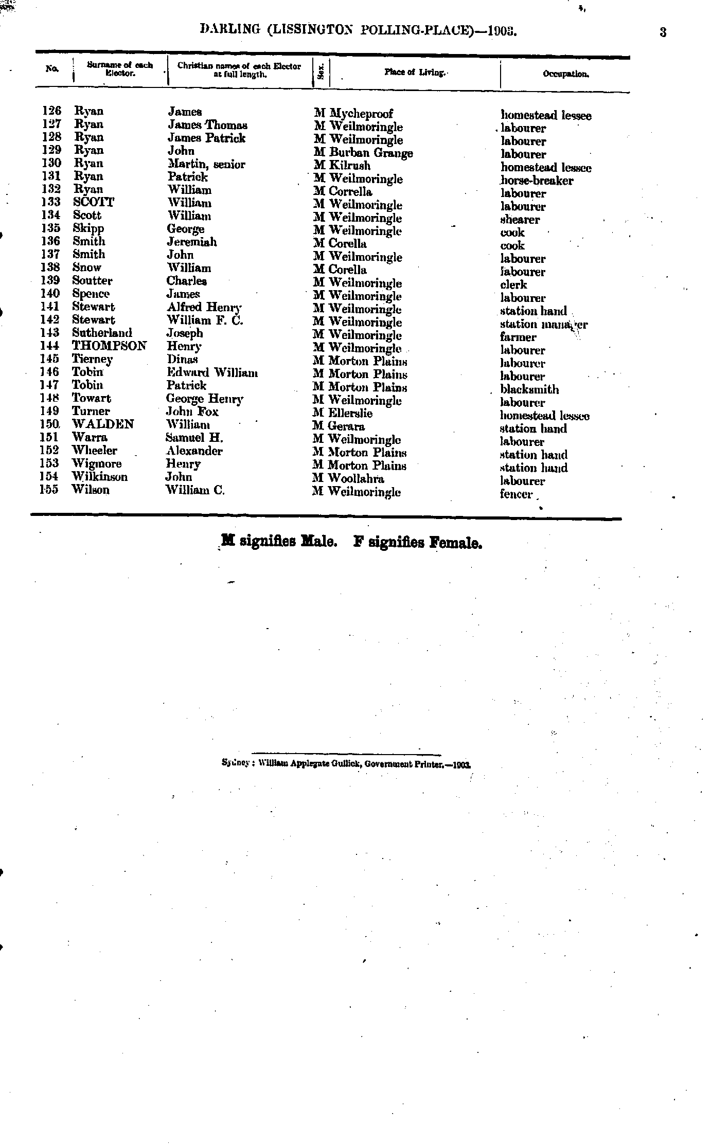
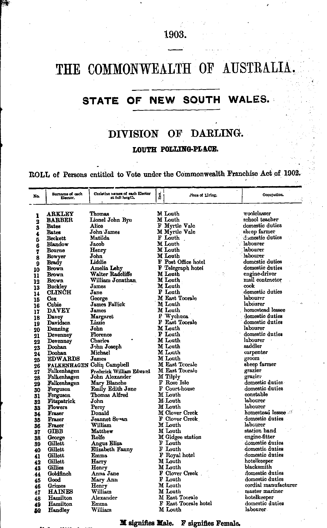
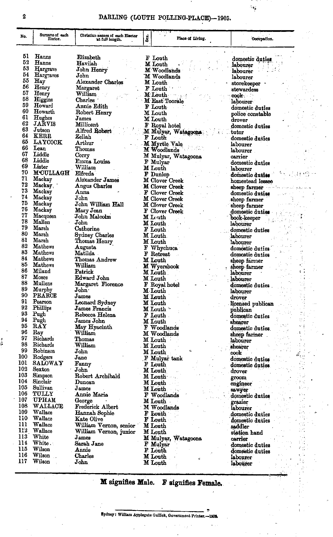
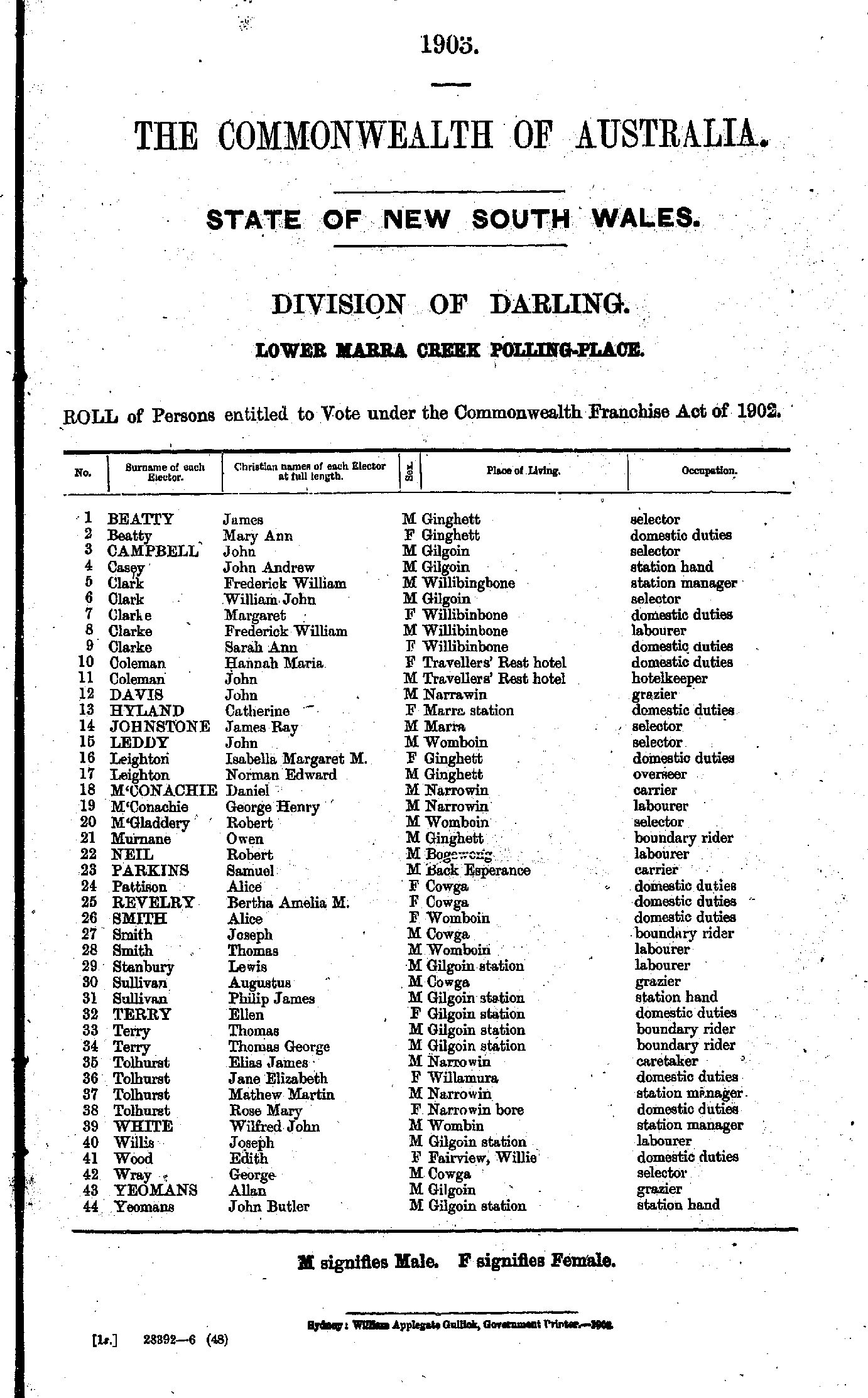
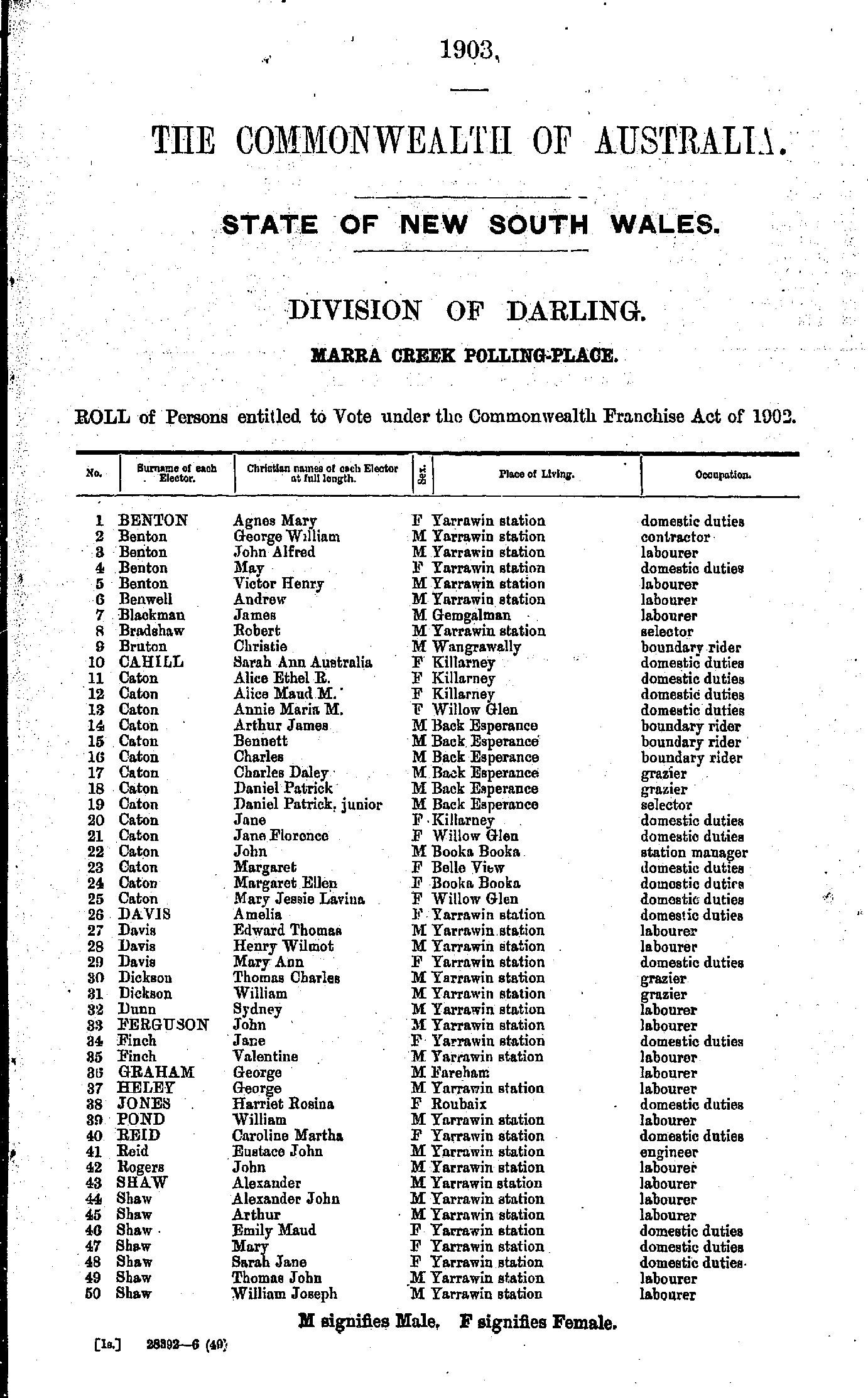
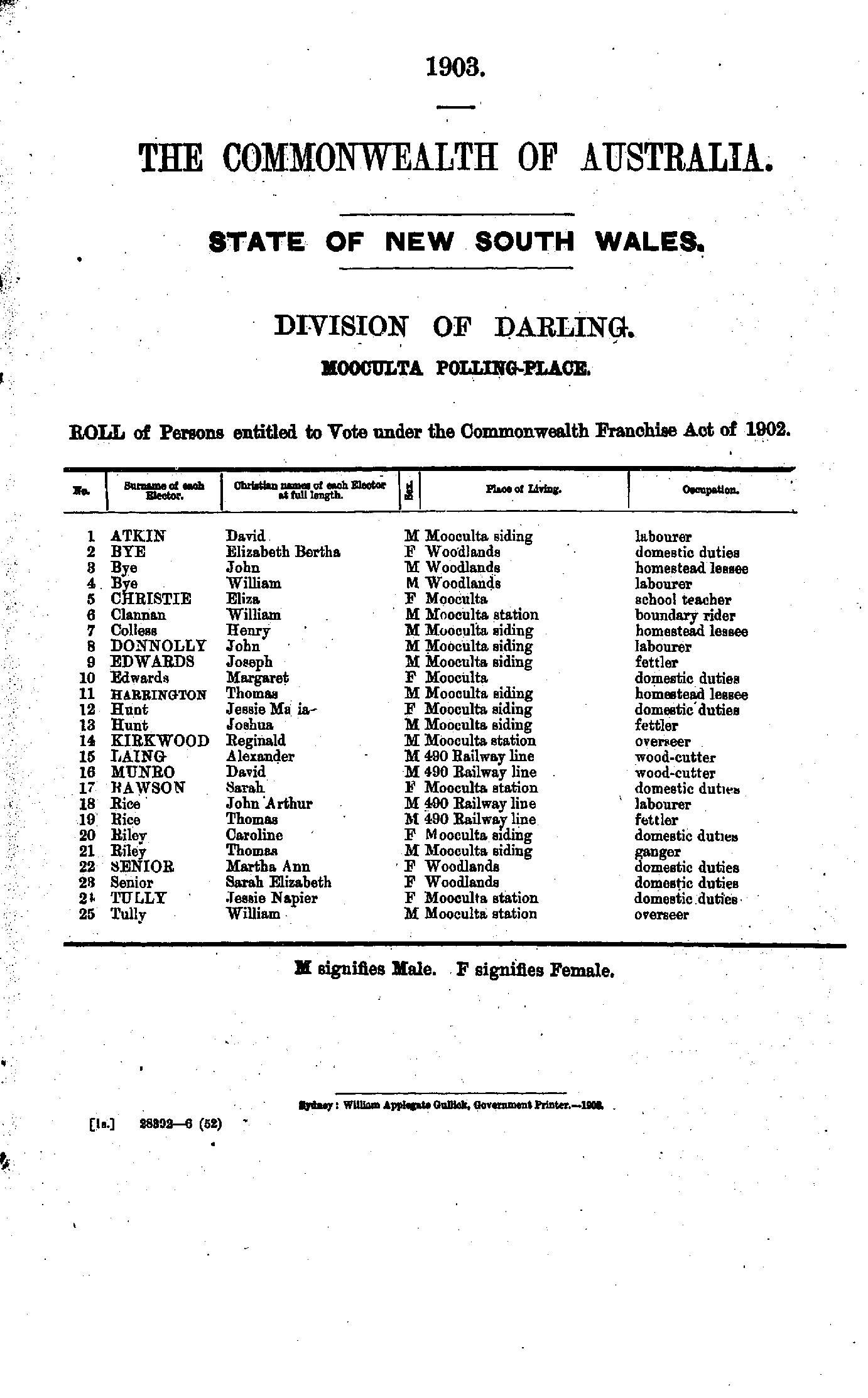
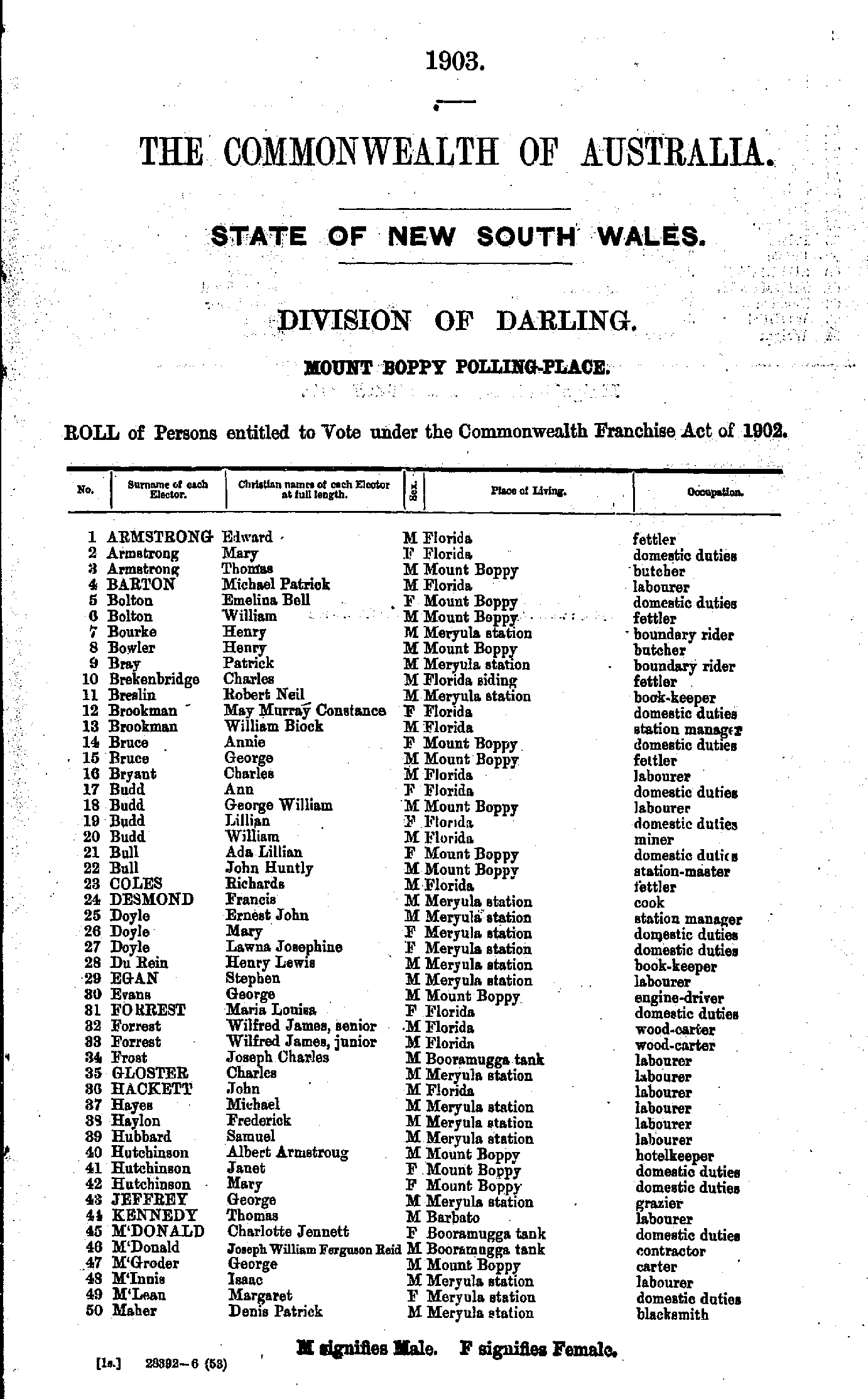
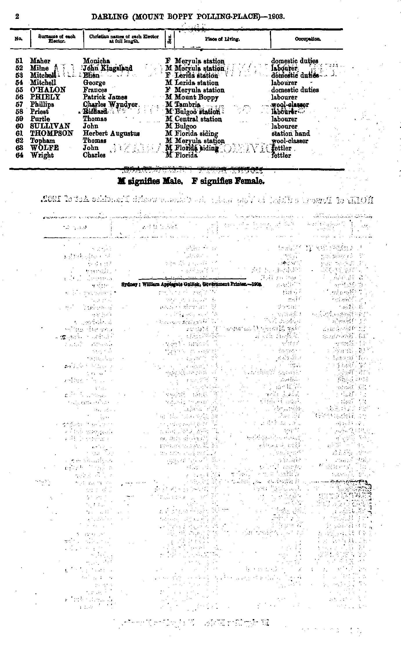
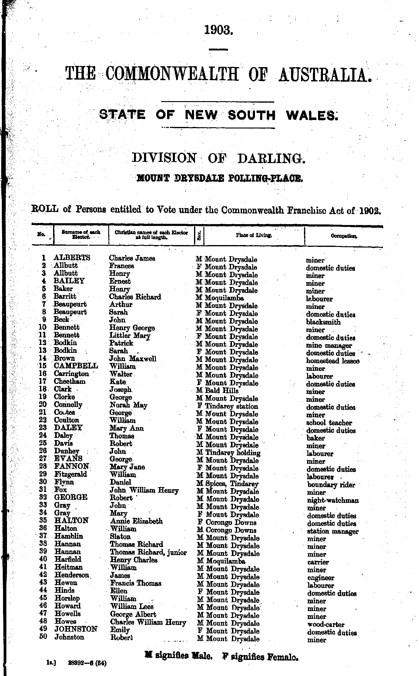
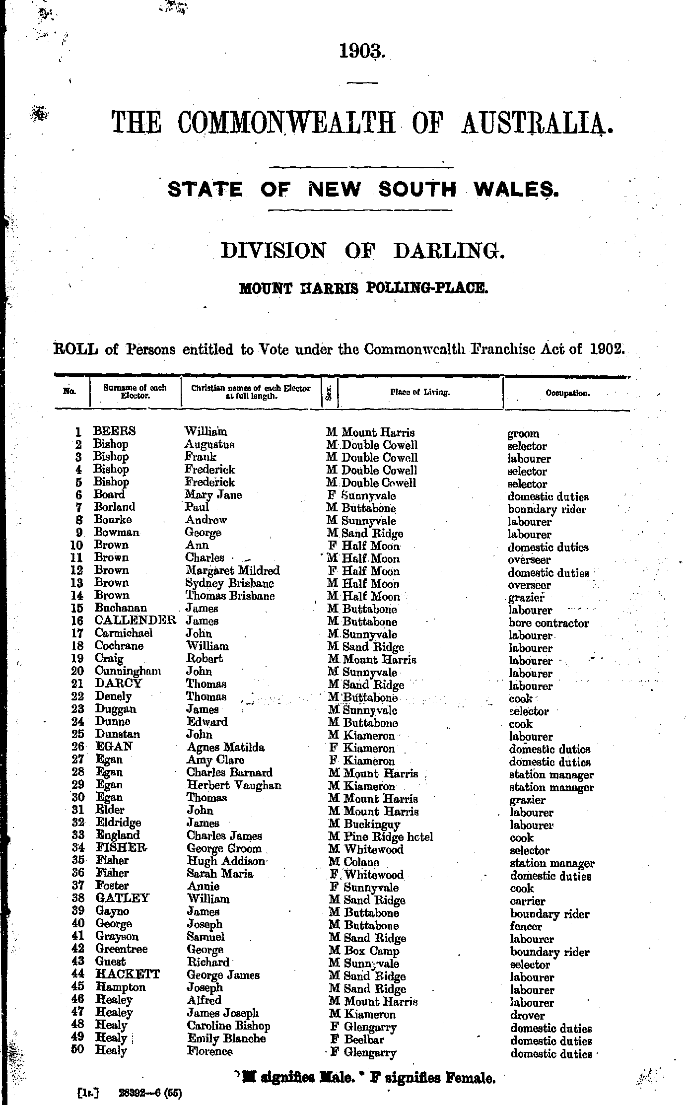
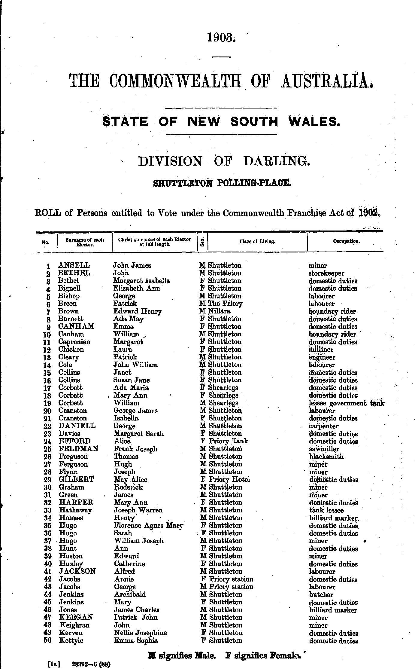
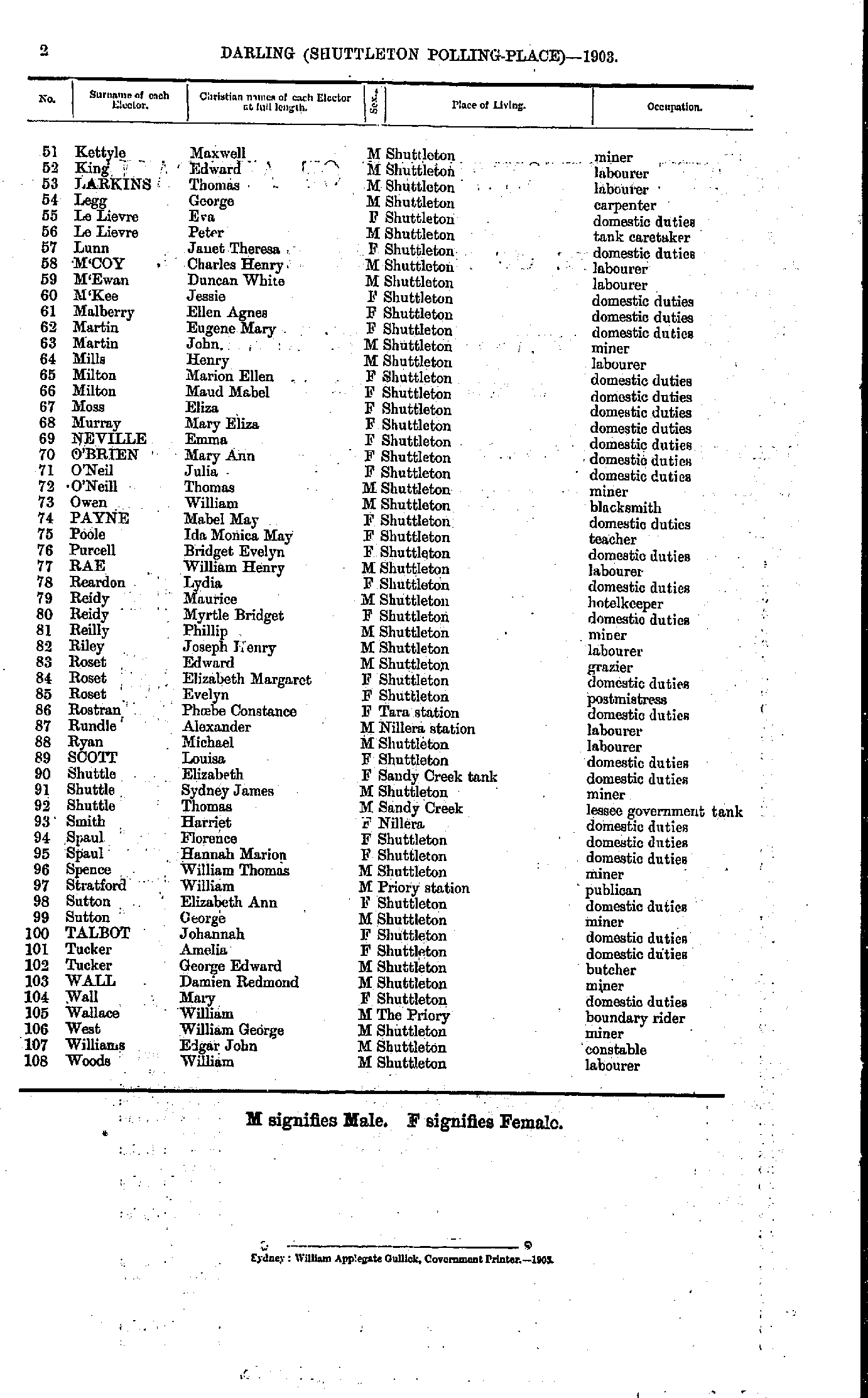
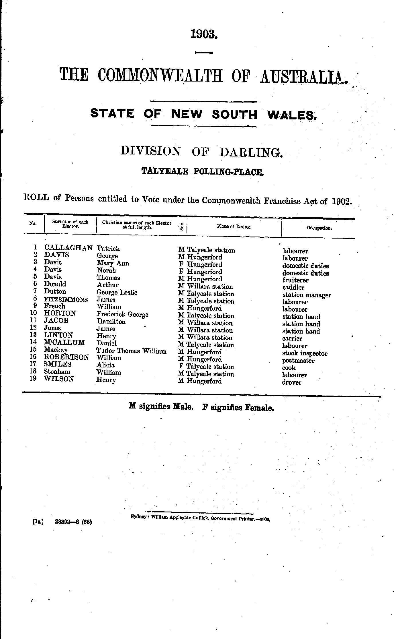
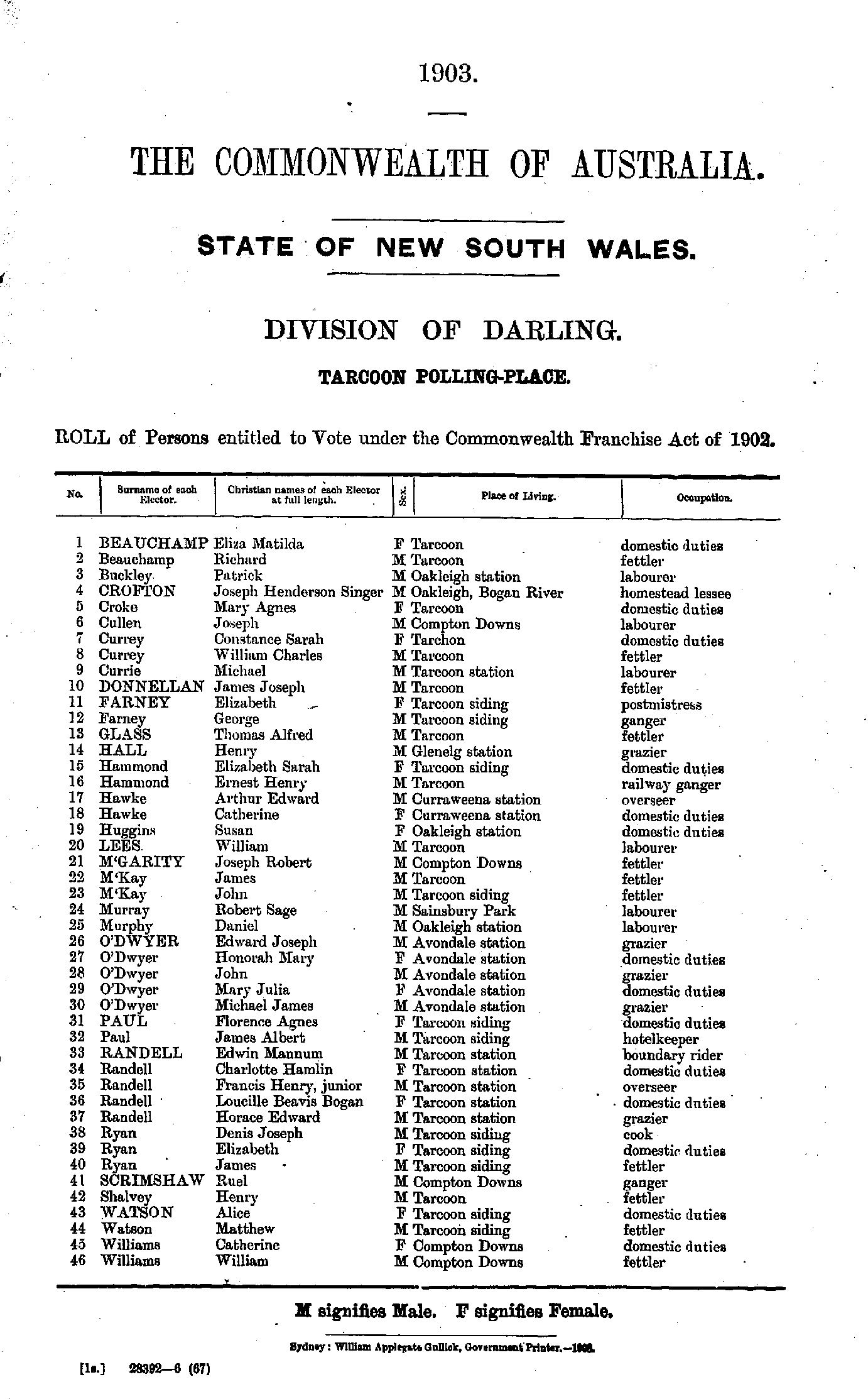
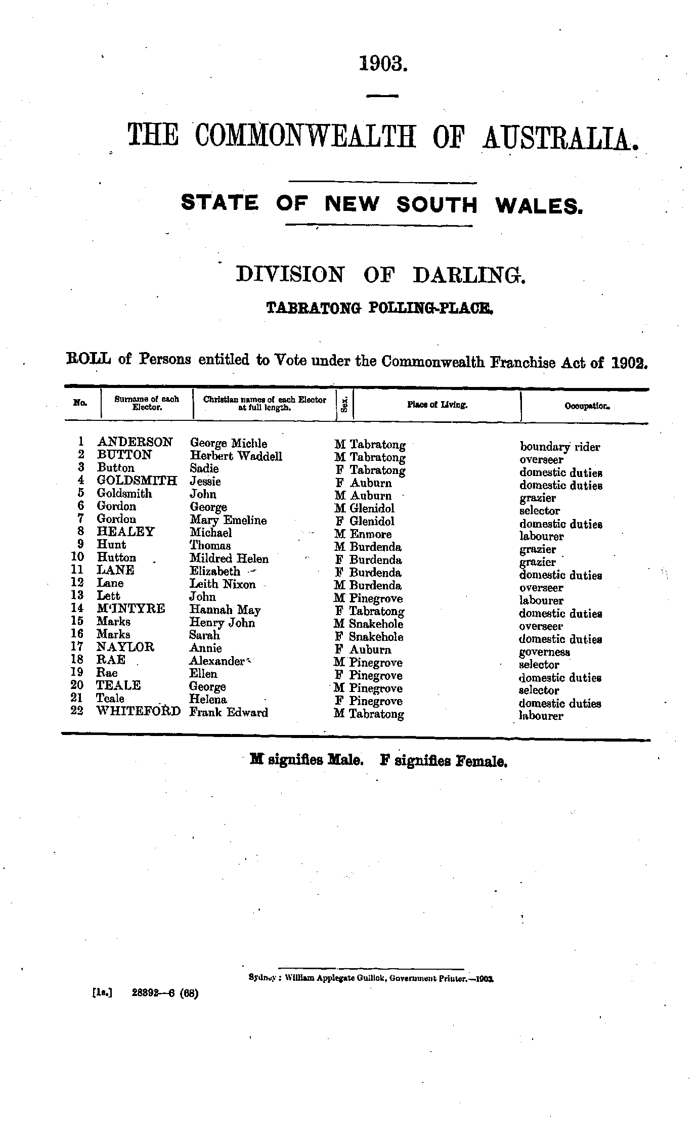
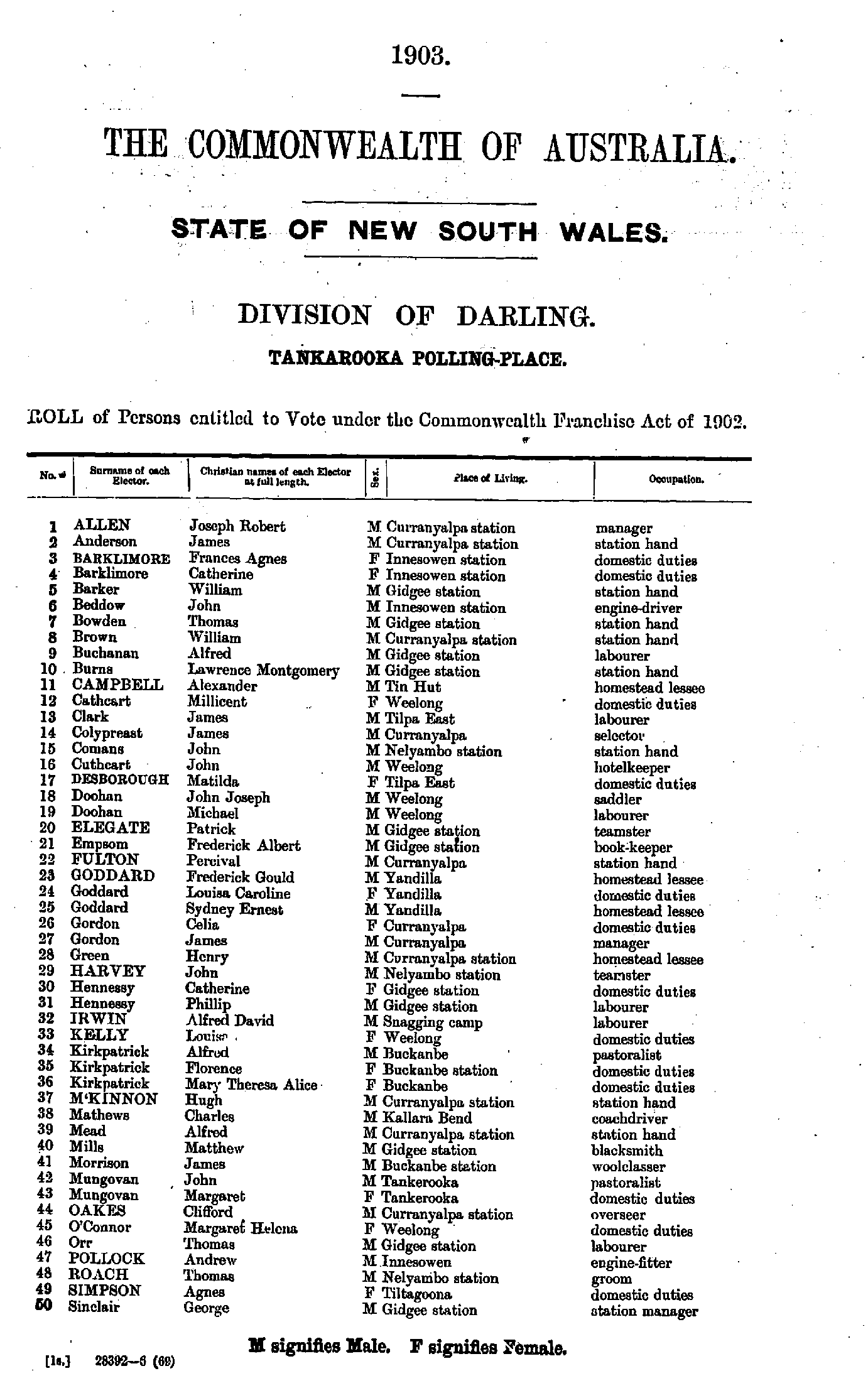
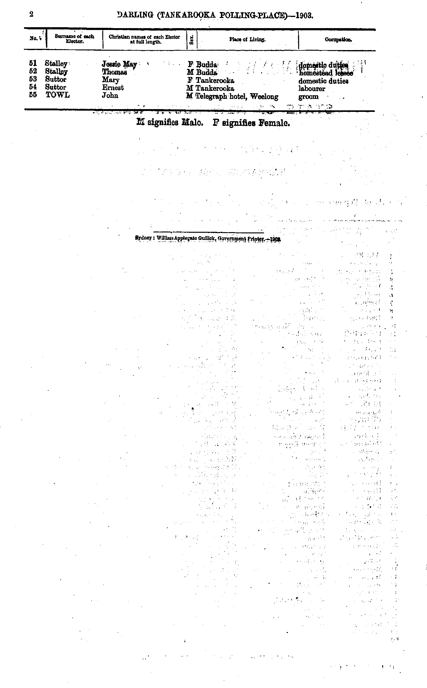
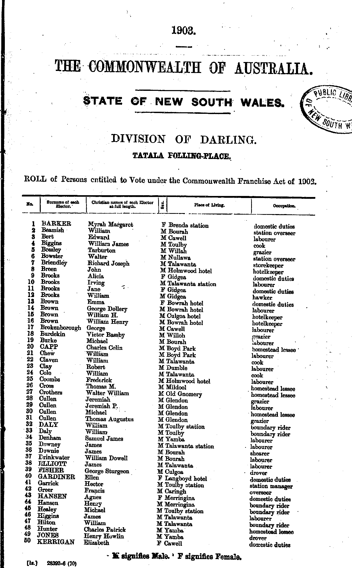
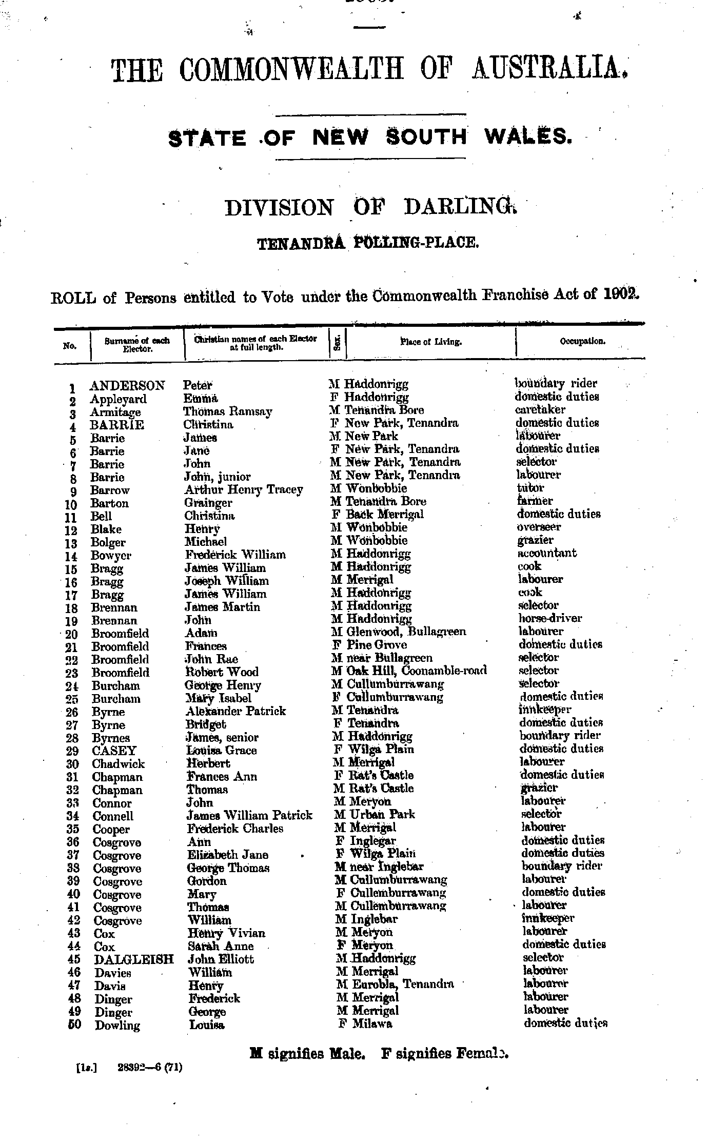
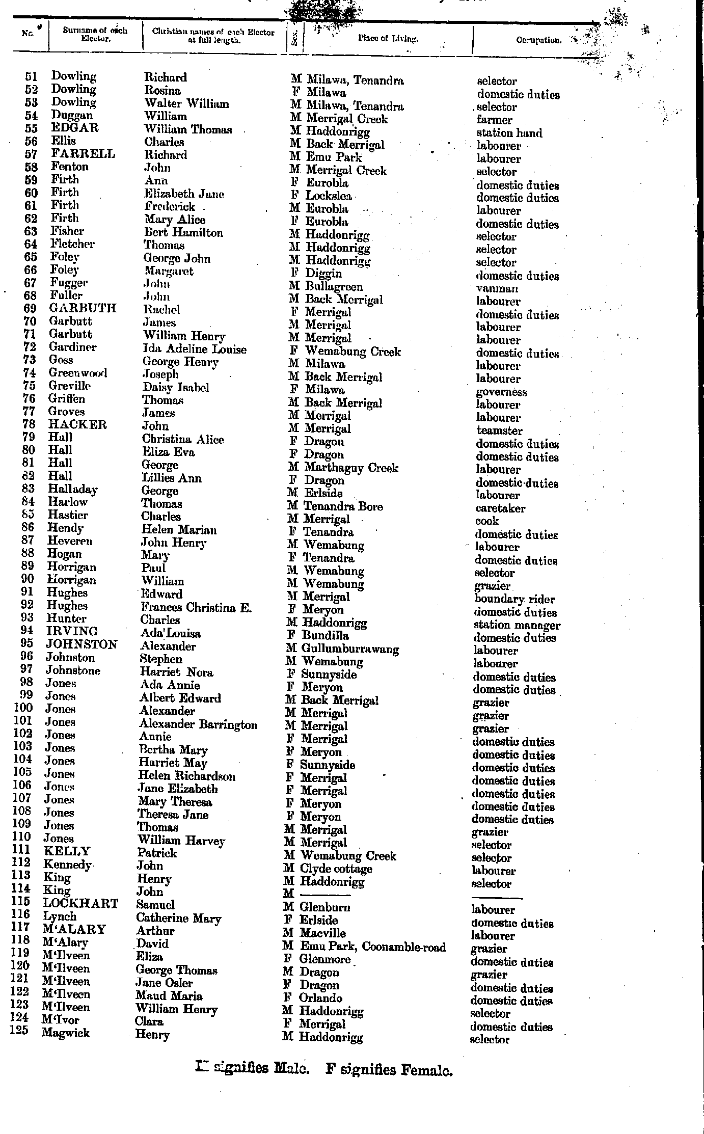
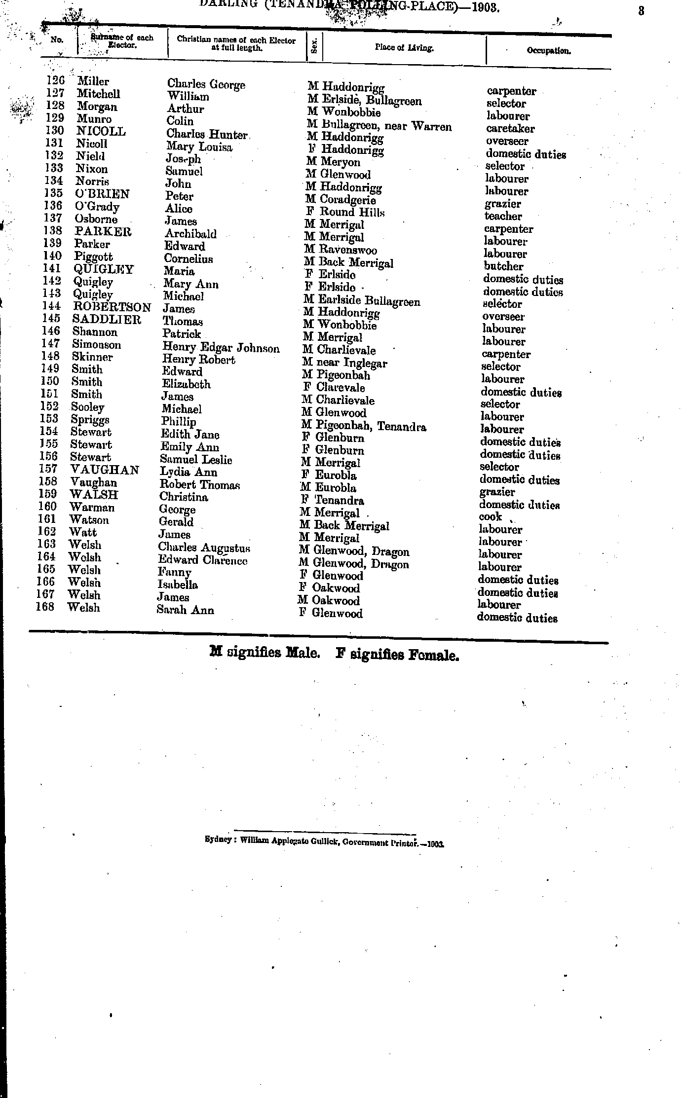
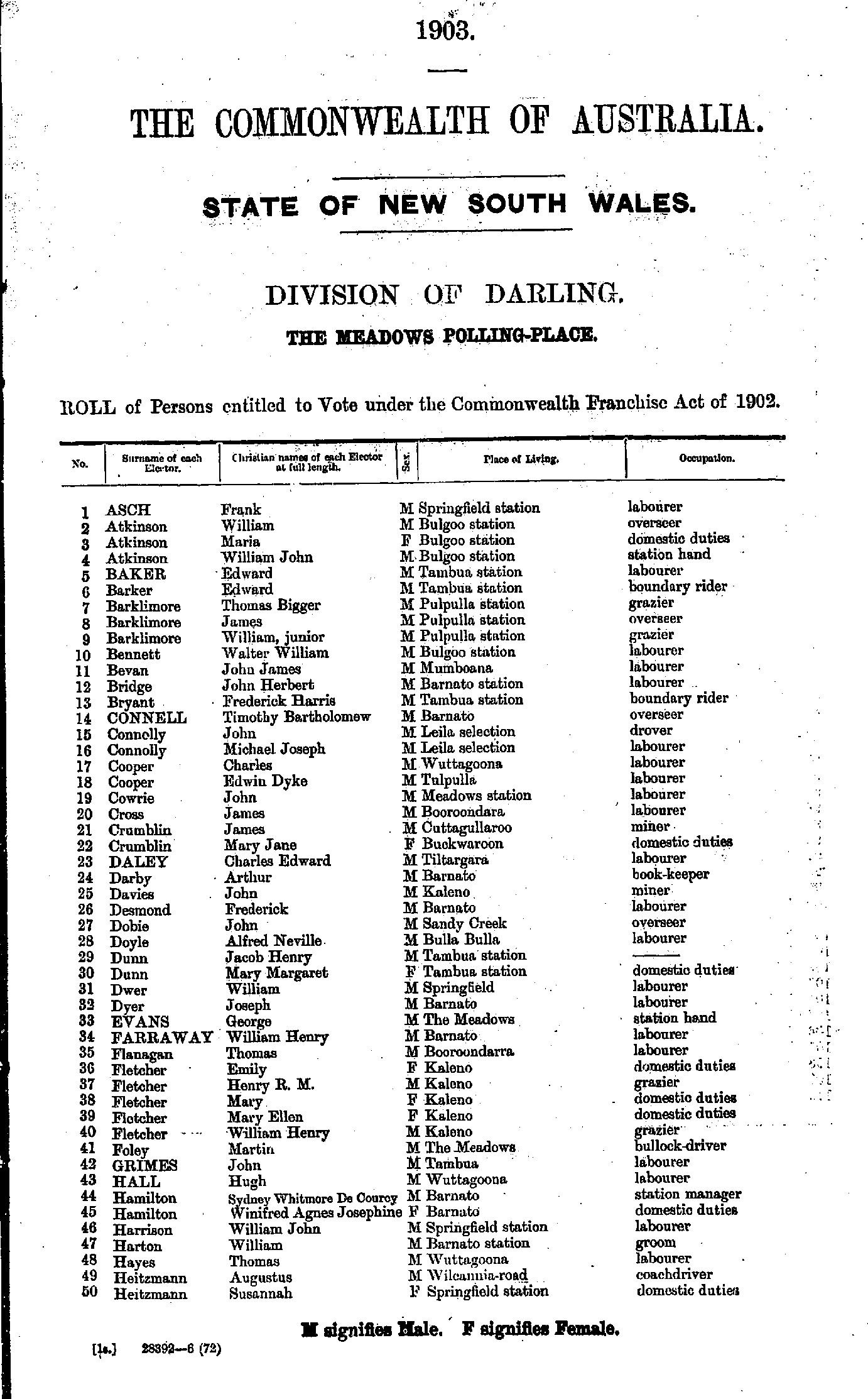
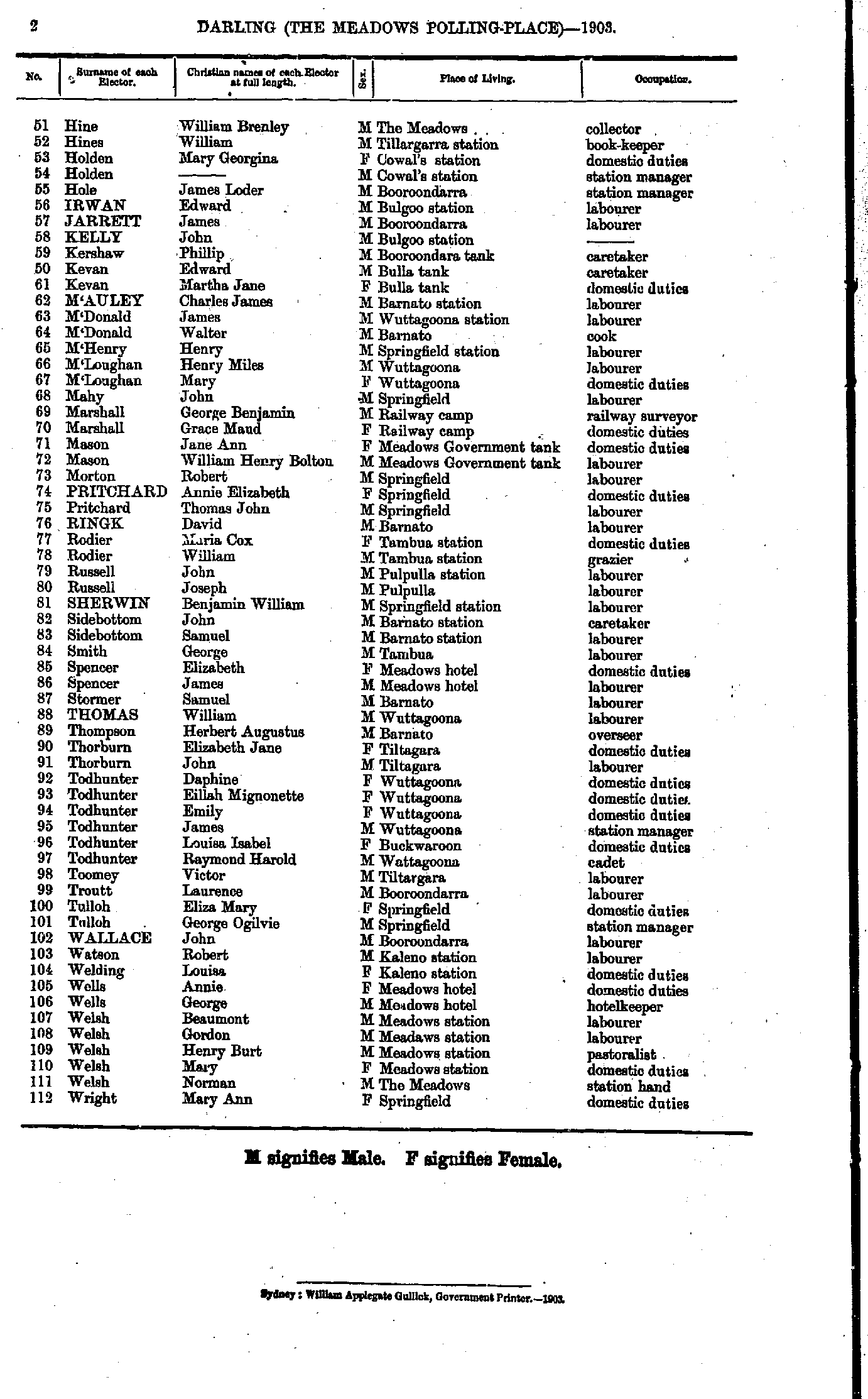
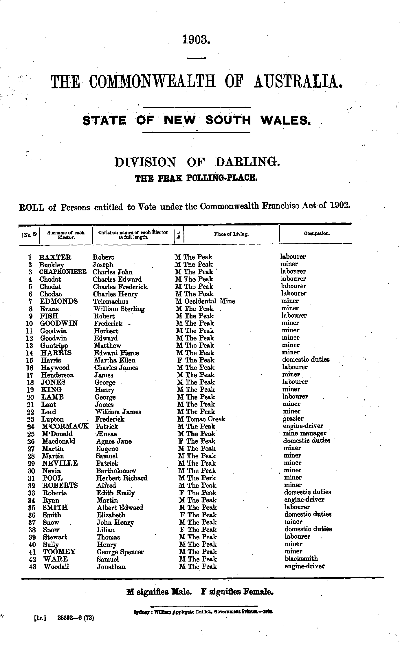
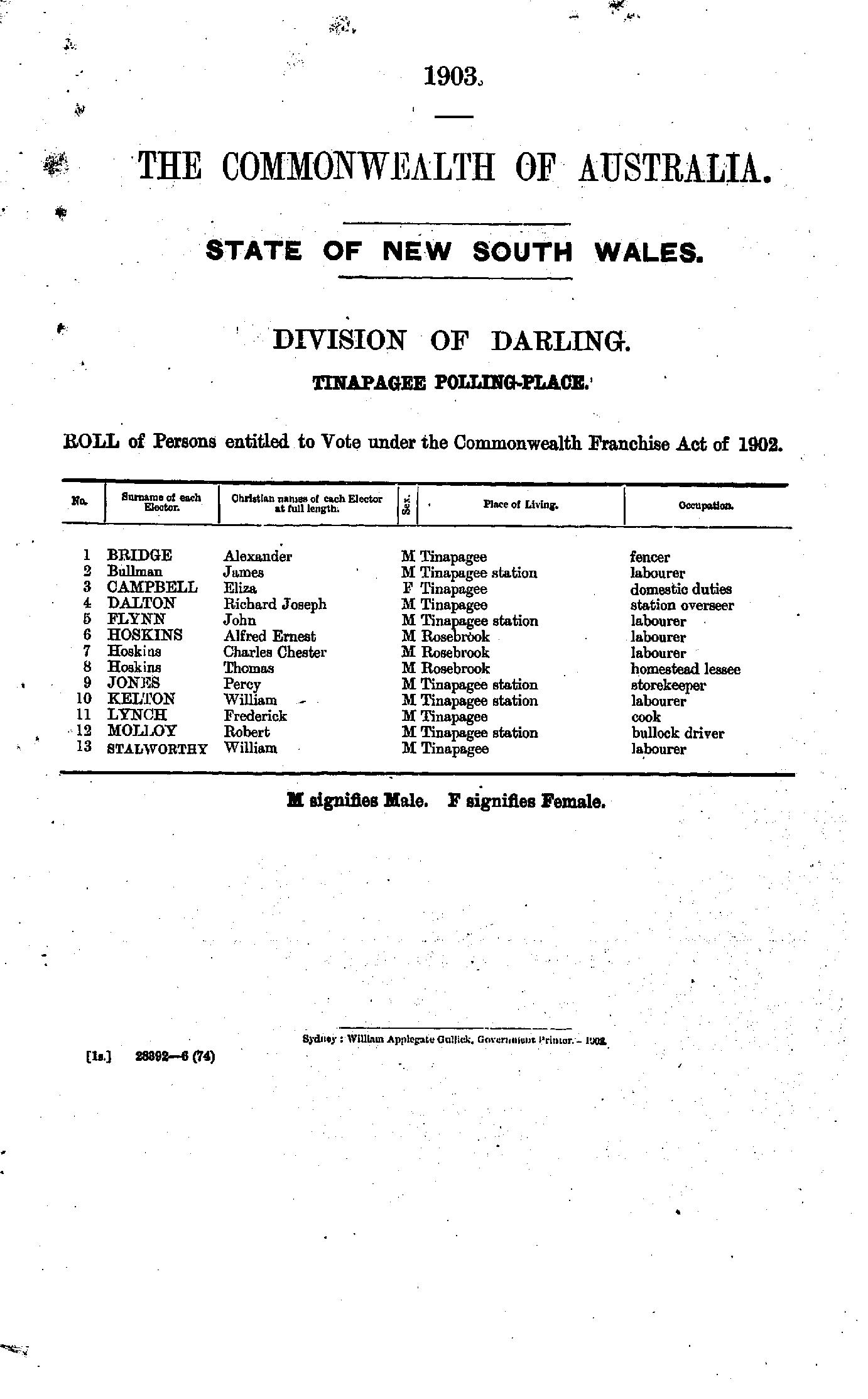
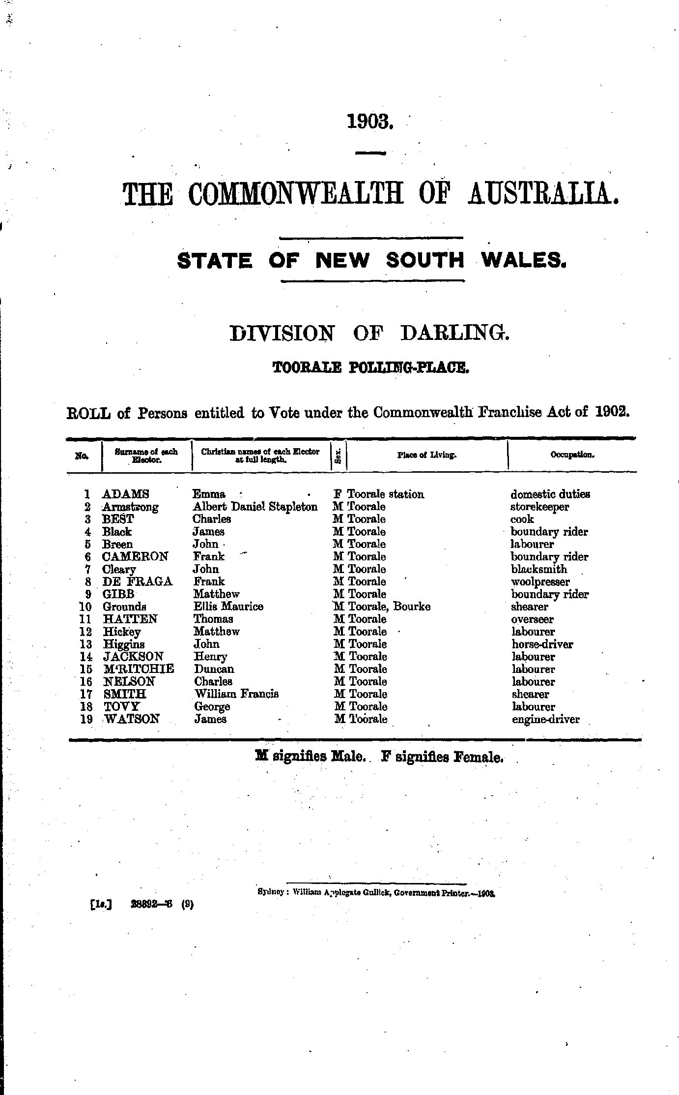
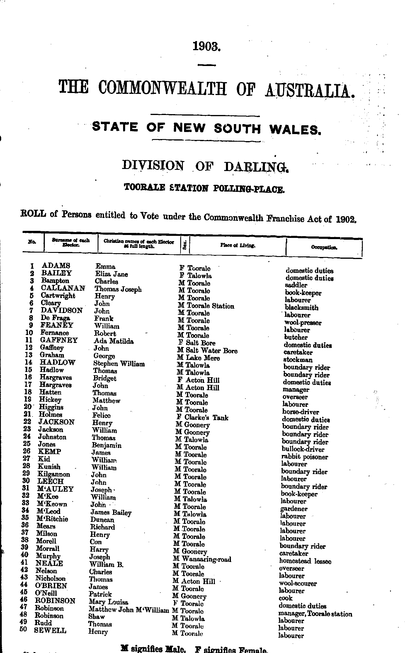
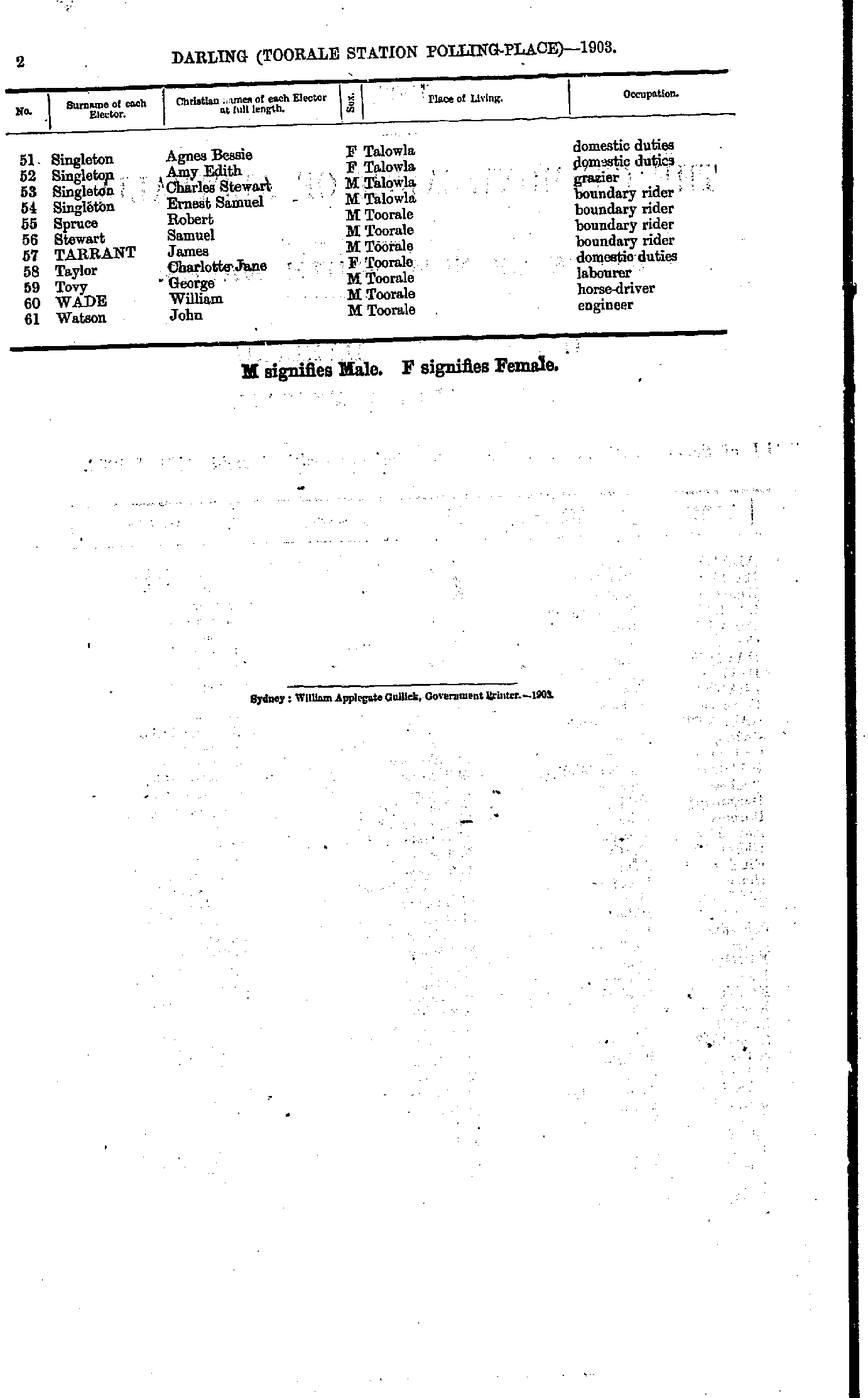
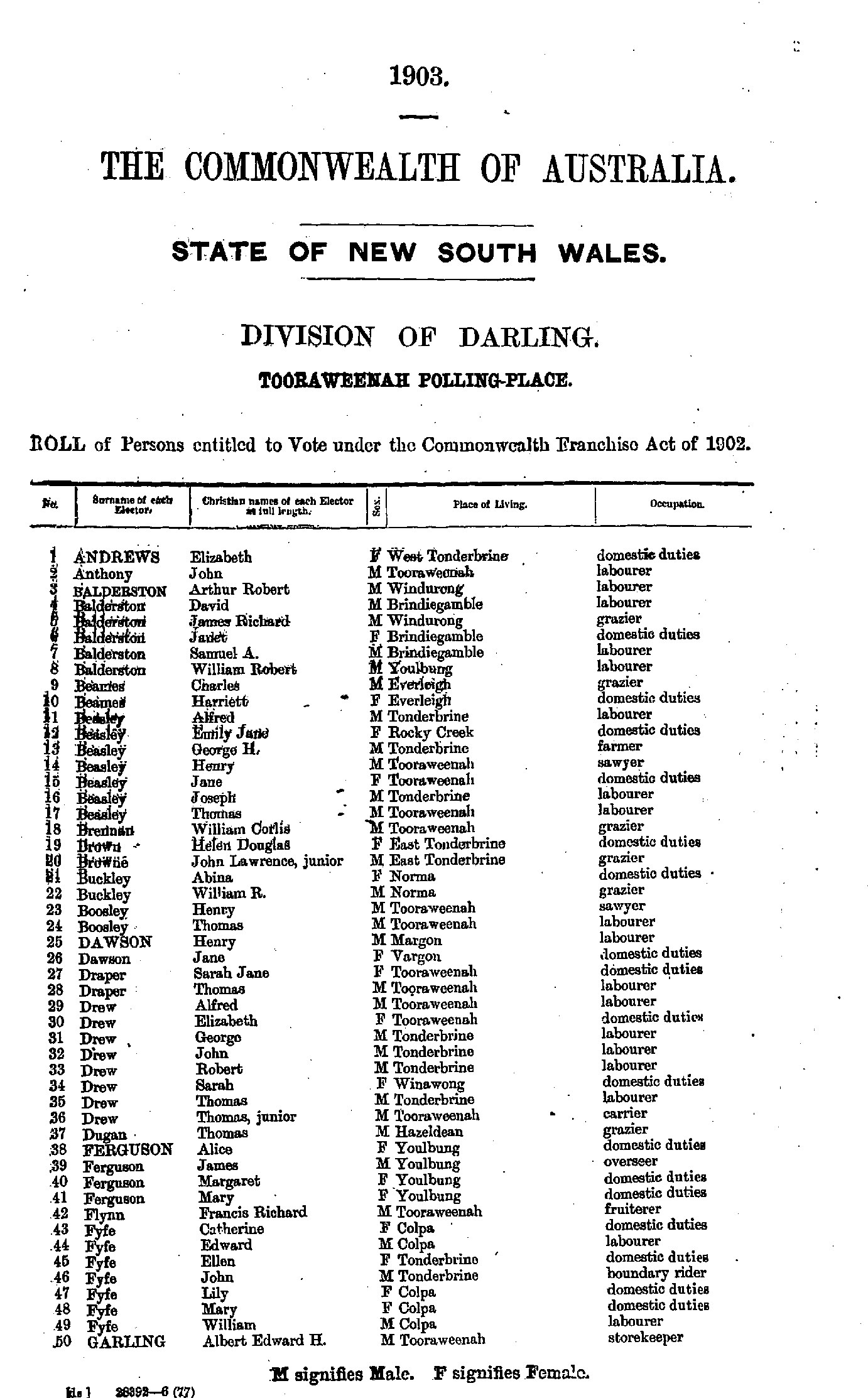
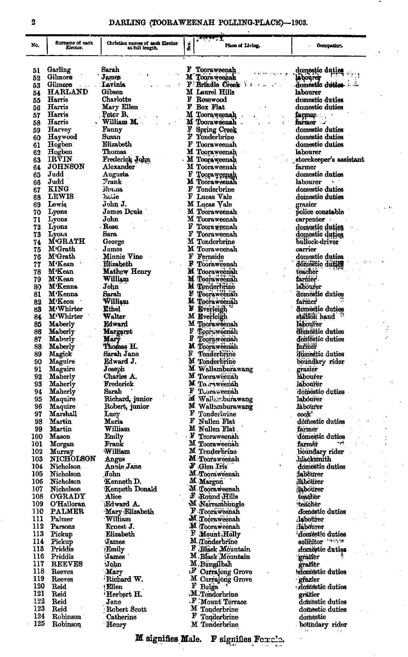
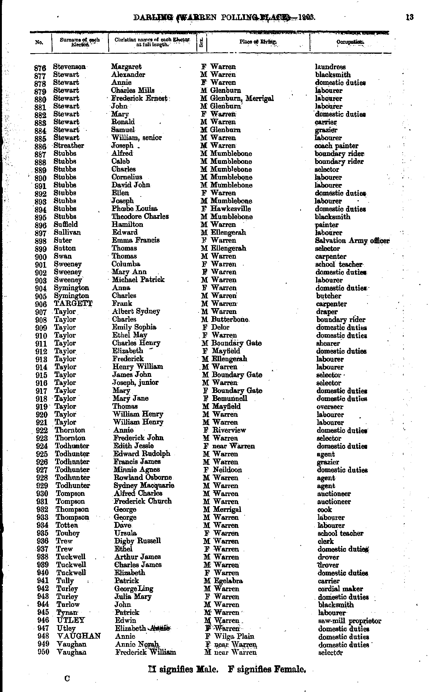
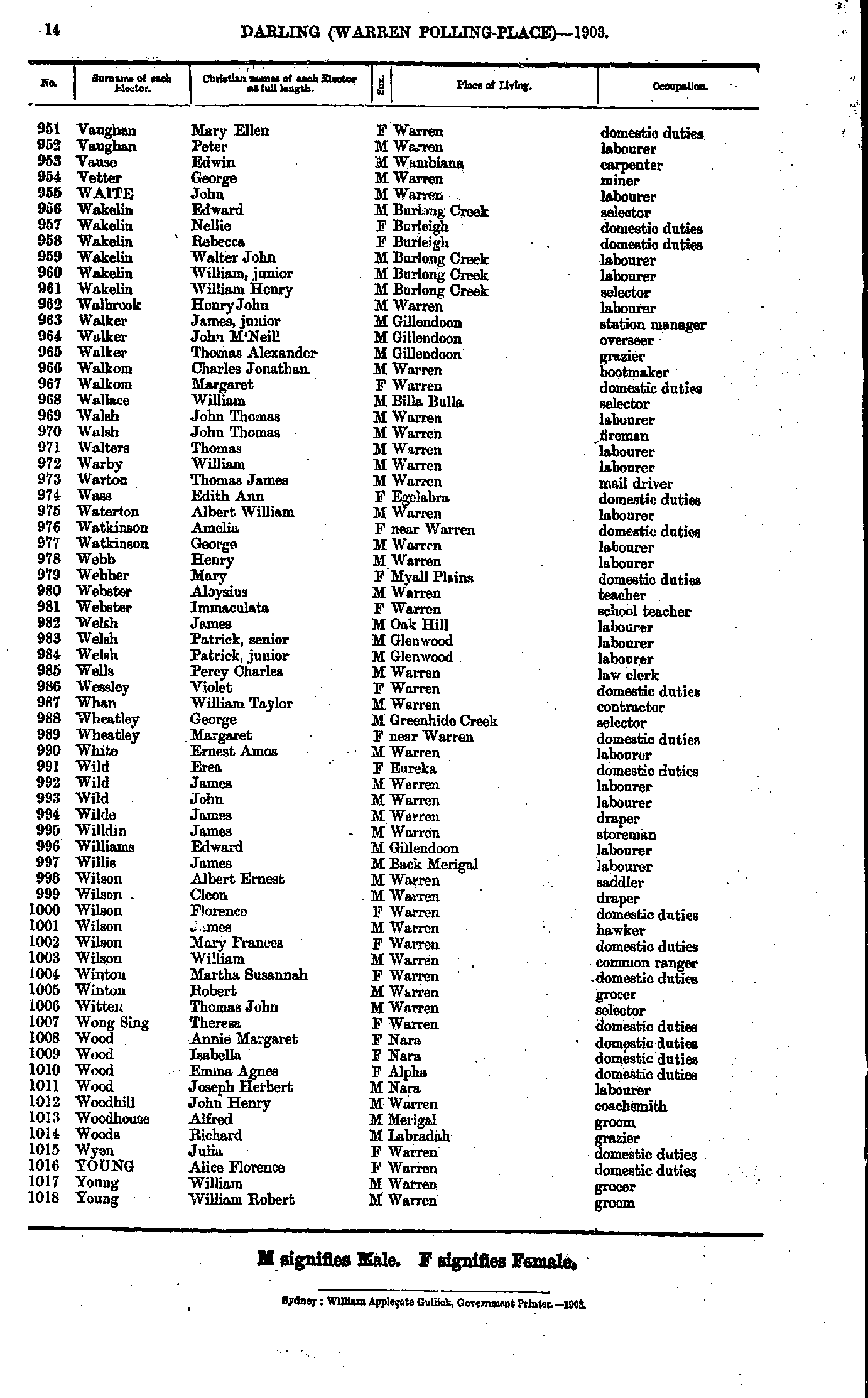
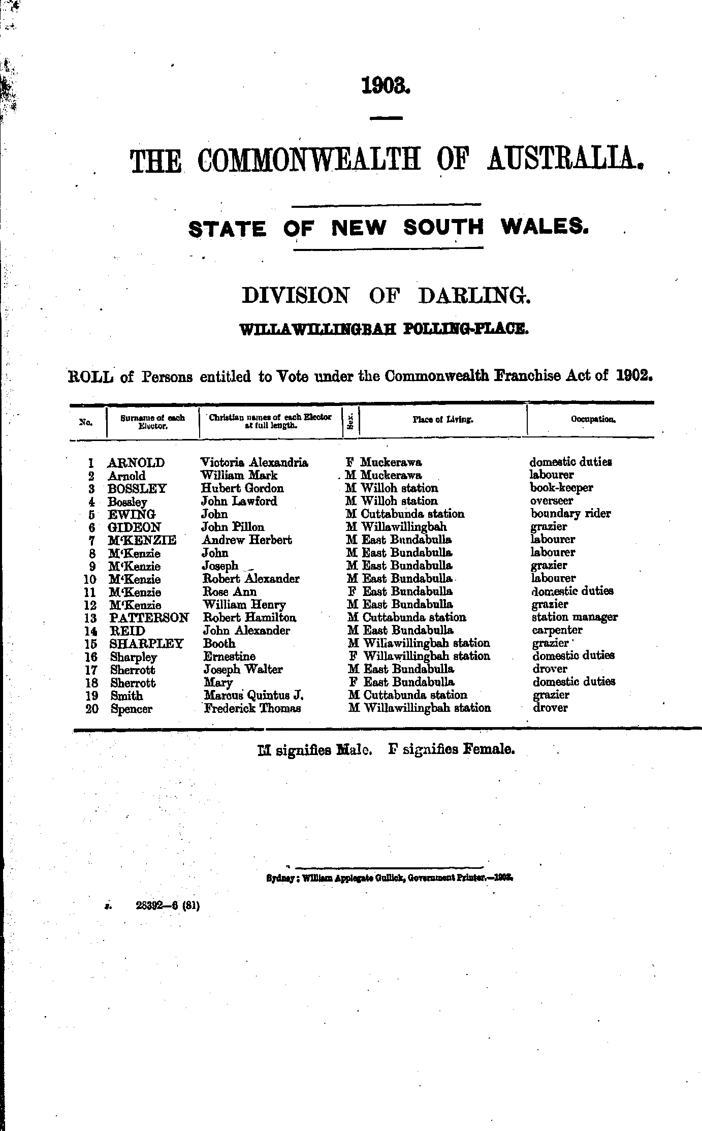
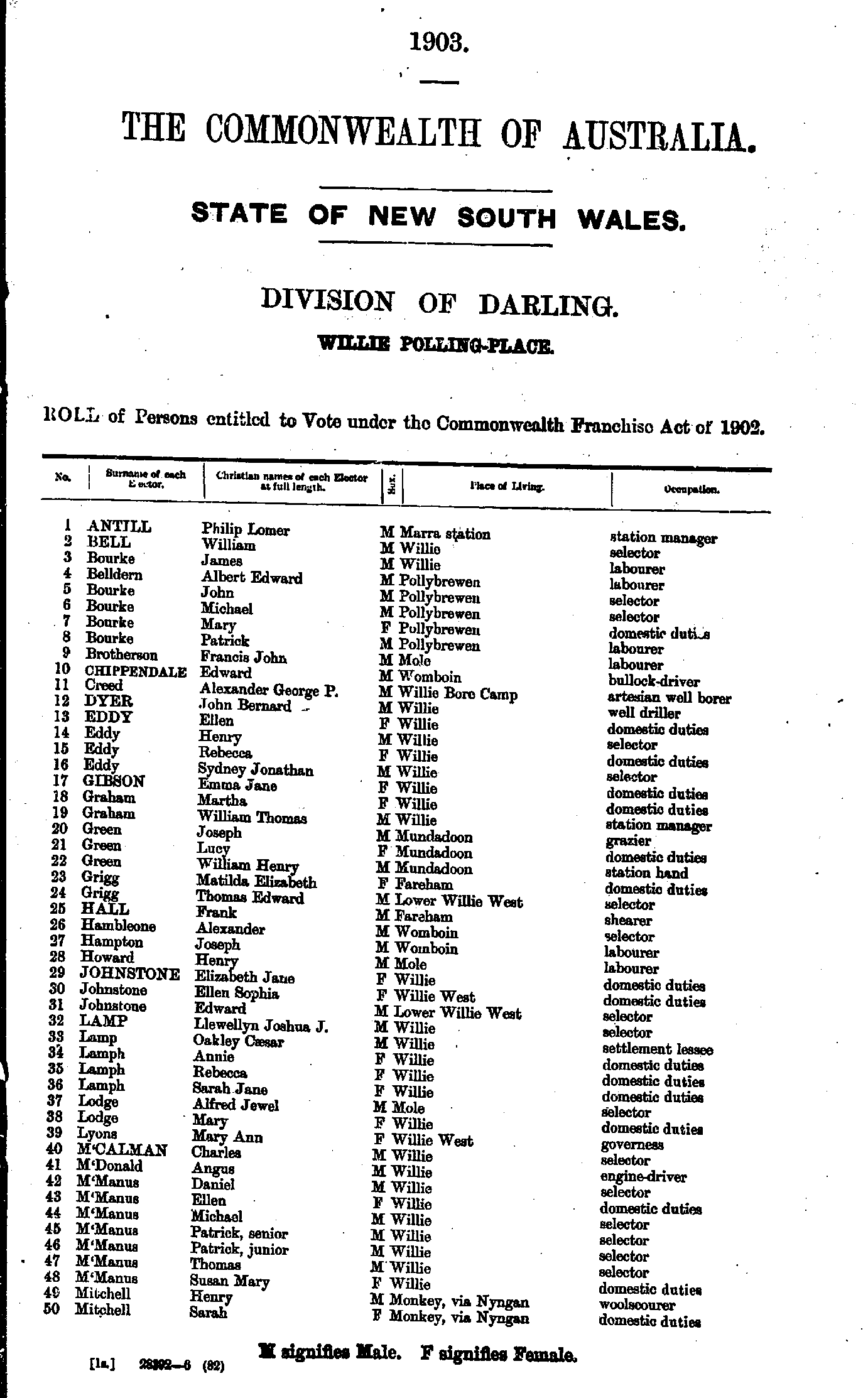
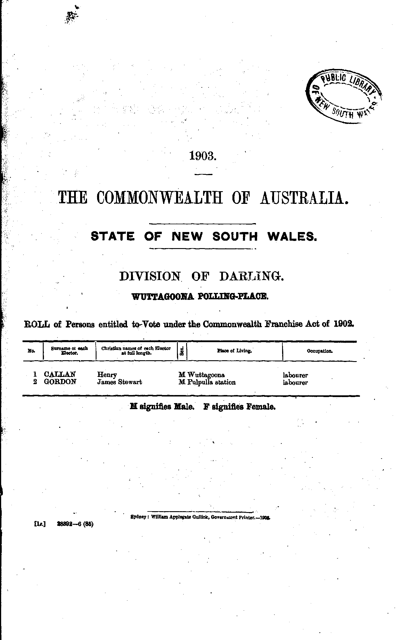
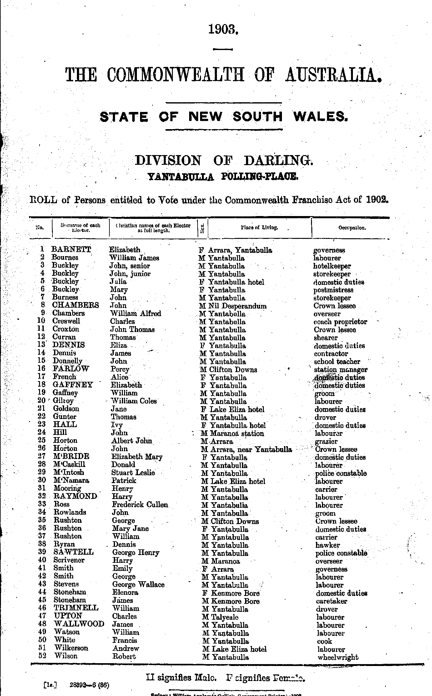
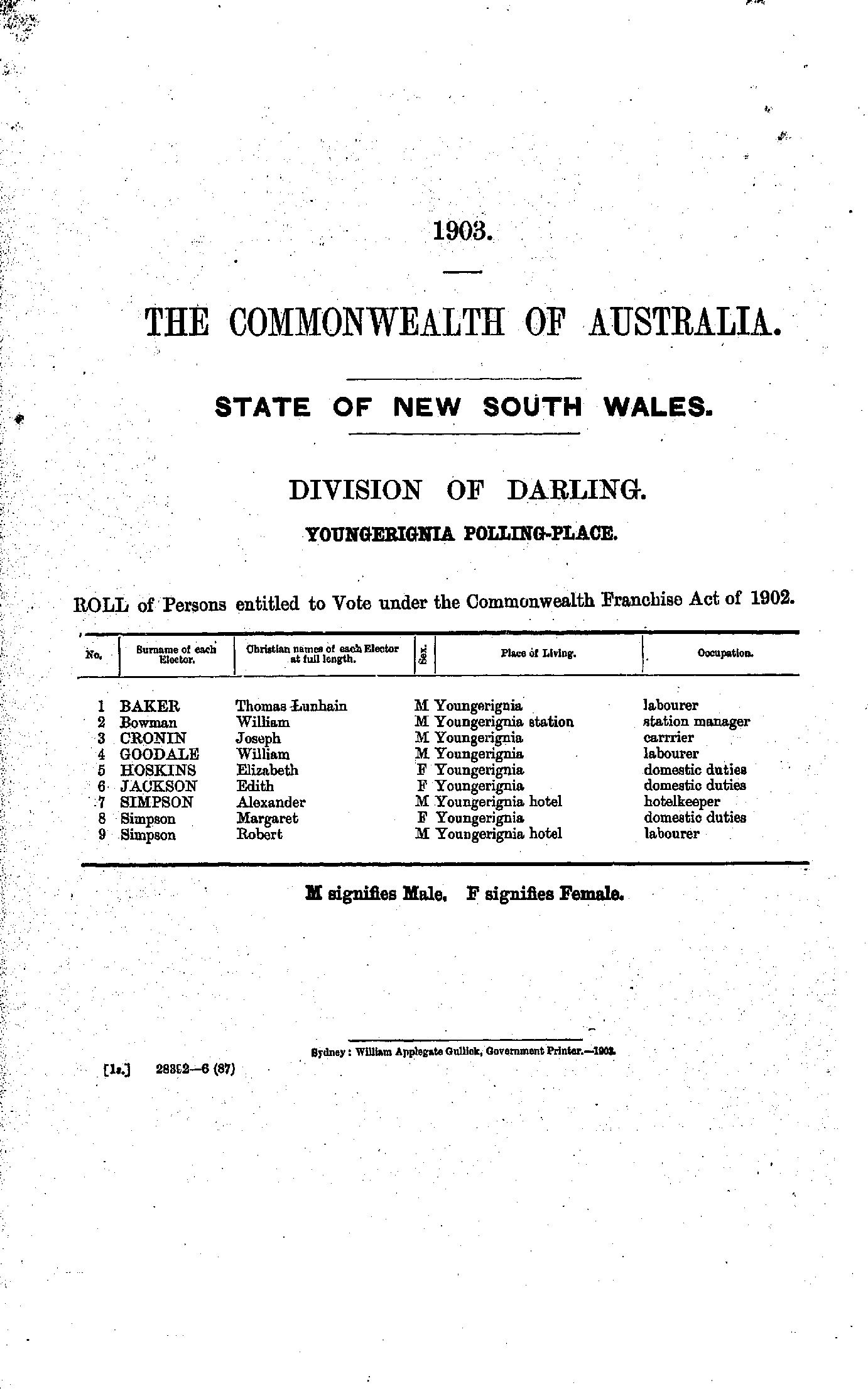
Roll of Persons entitled to Vote under the Commonwealth Franchise Act of 1902 Reproduced from microform copies of the originals in the Mitchell Library, State Library of New South Wales.
Index Copyright © Internet History Resources 2008
Electoral Maps of the Darling Division, 1901
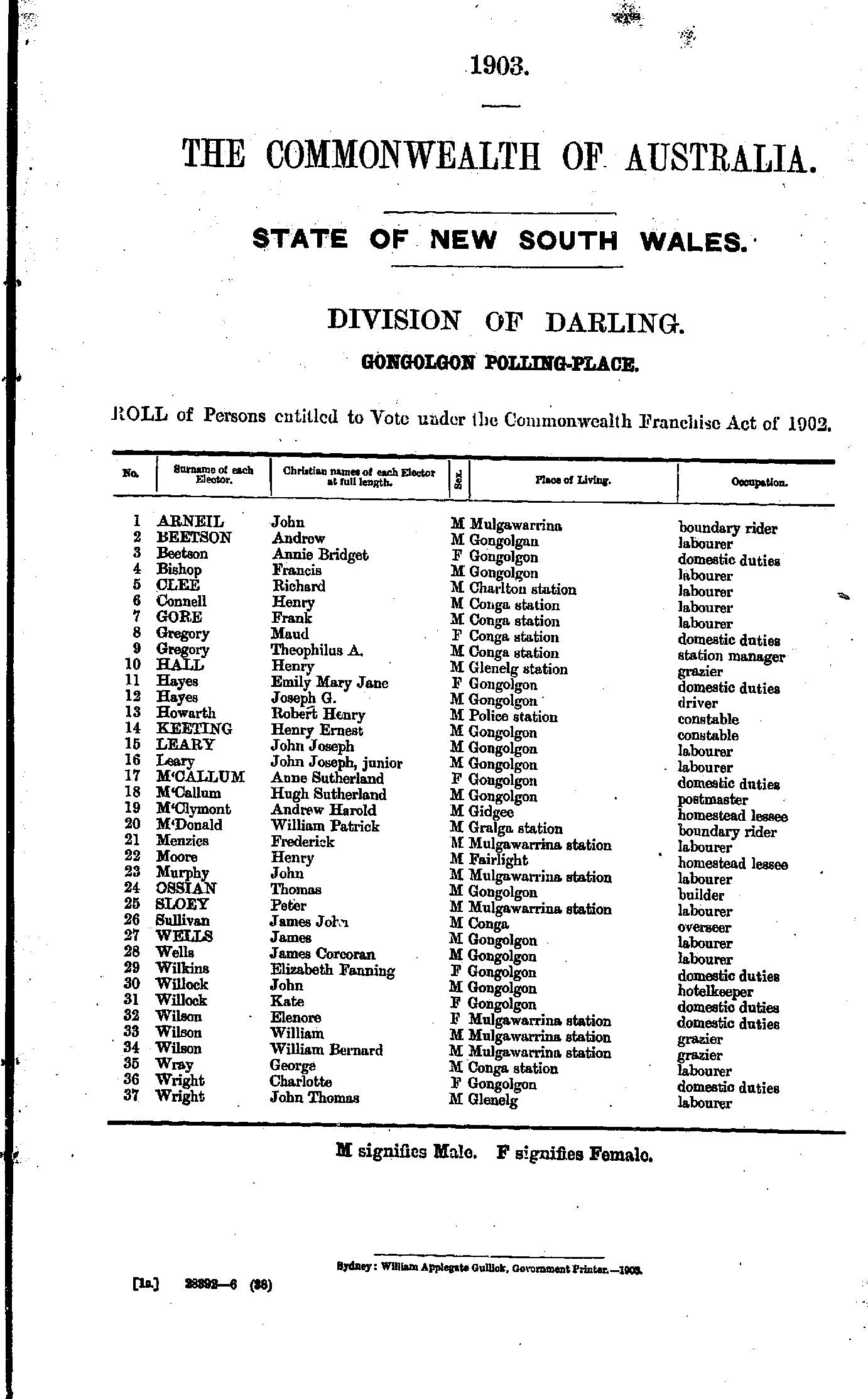
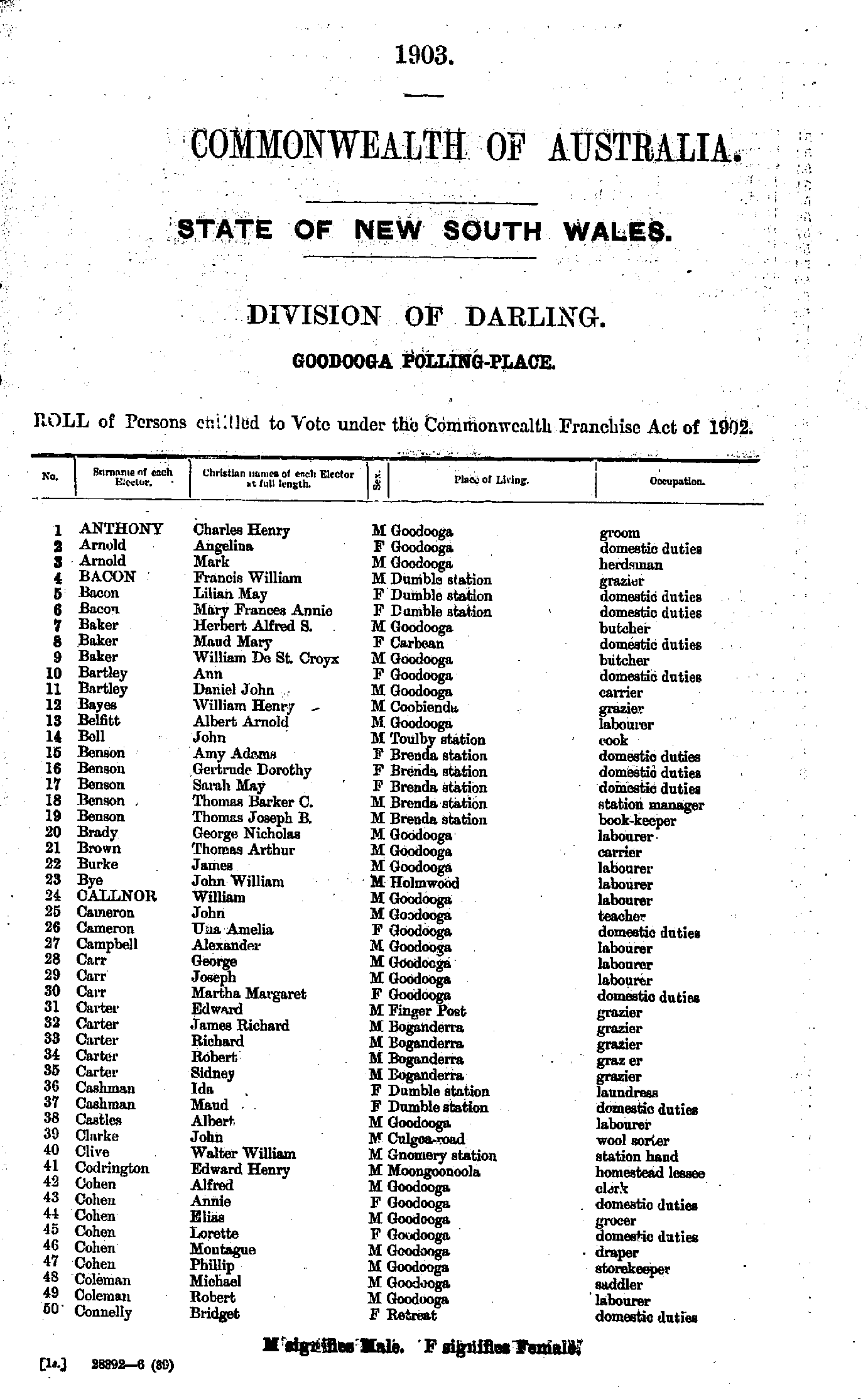
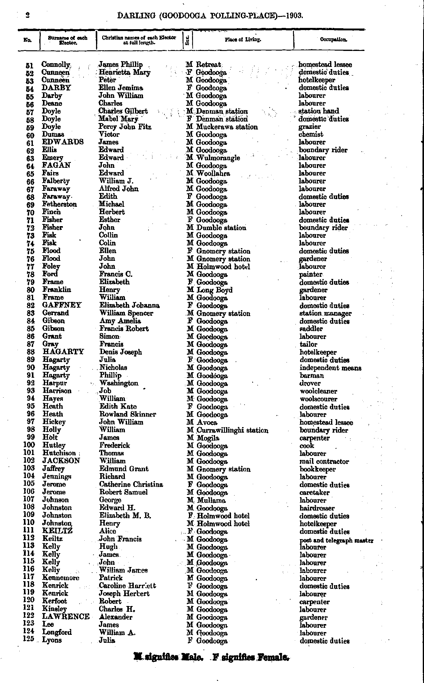
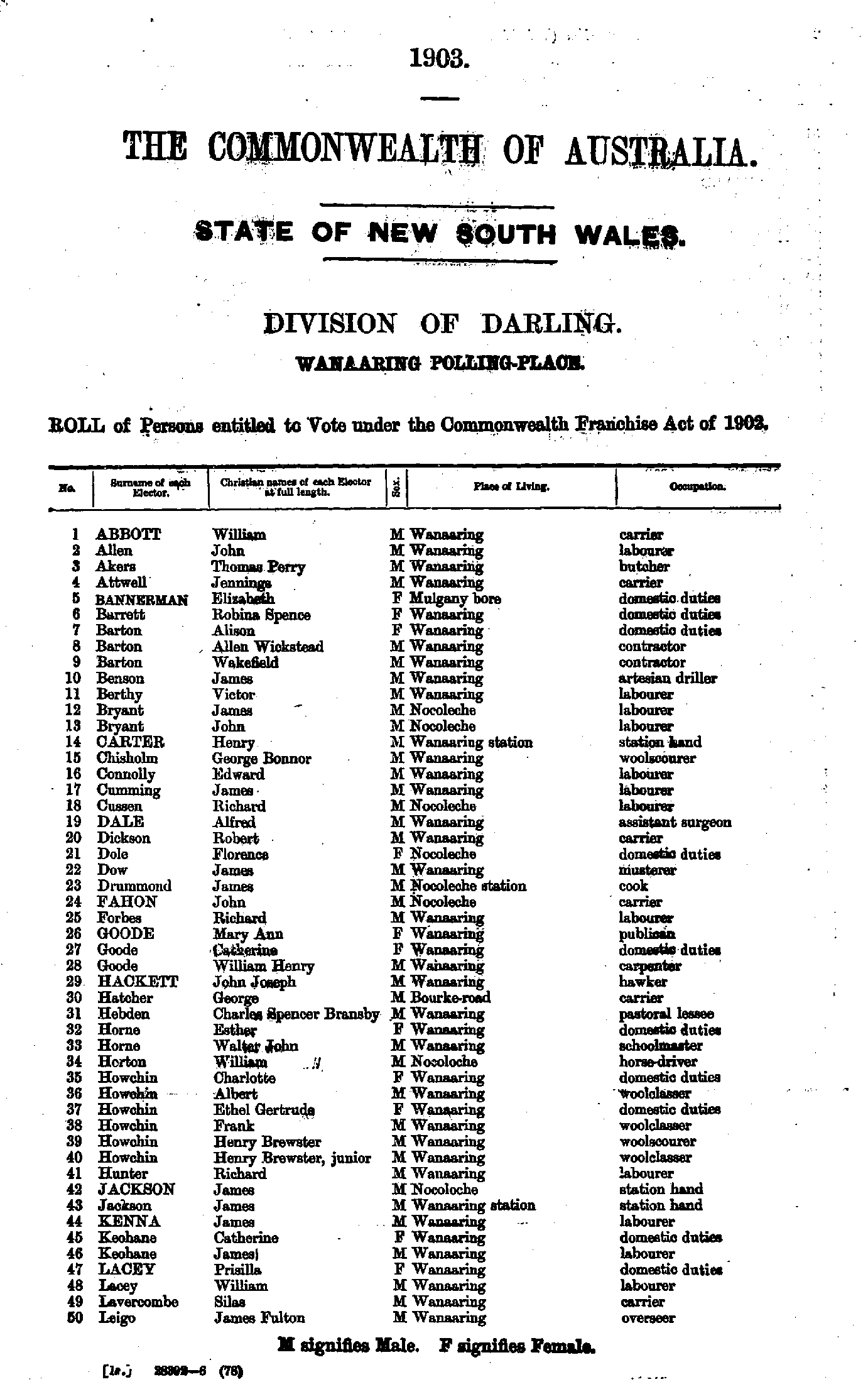
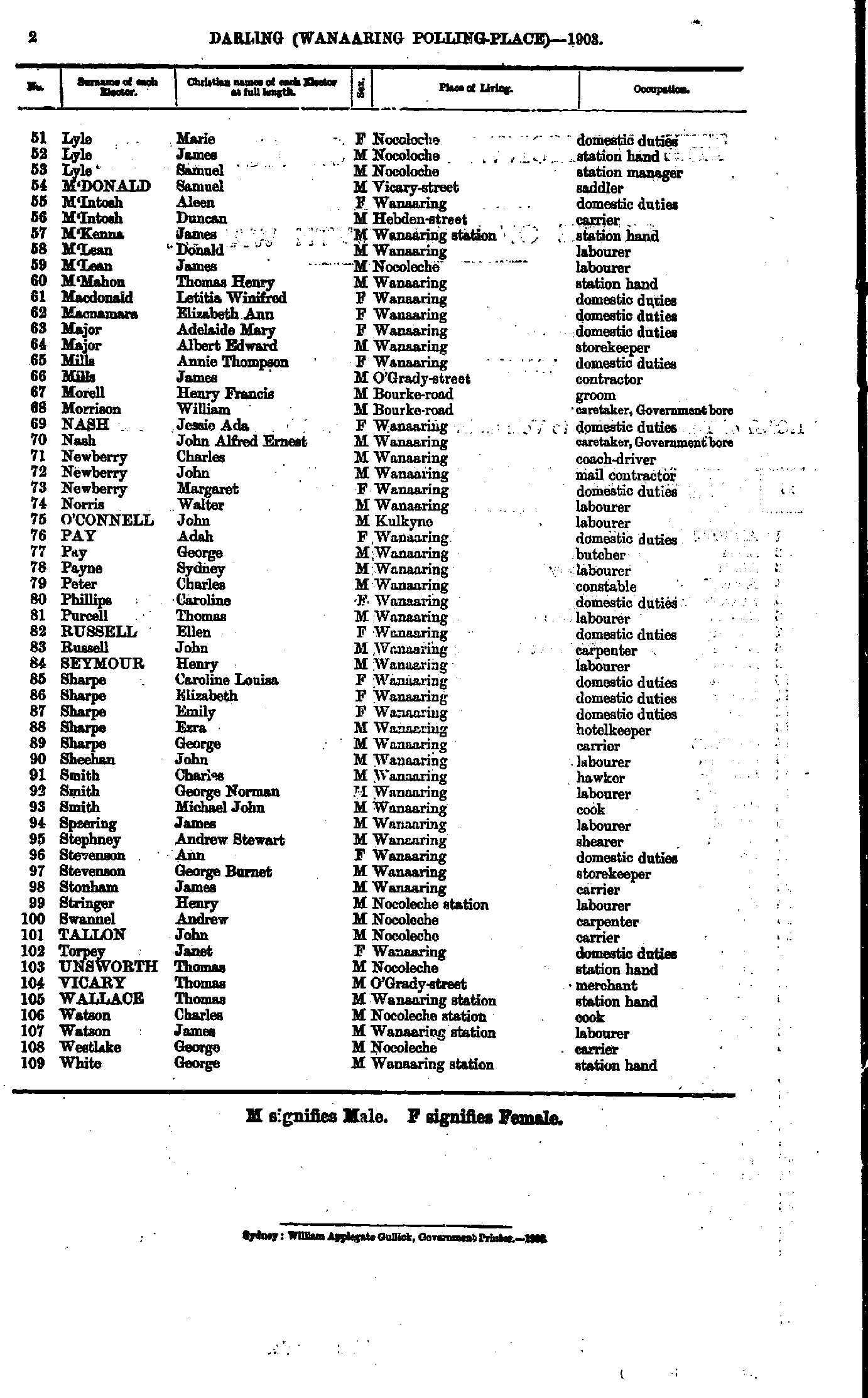
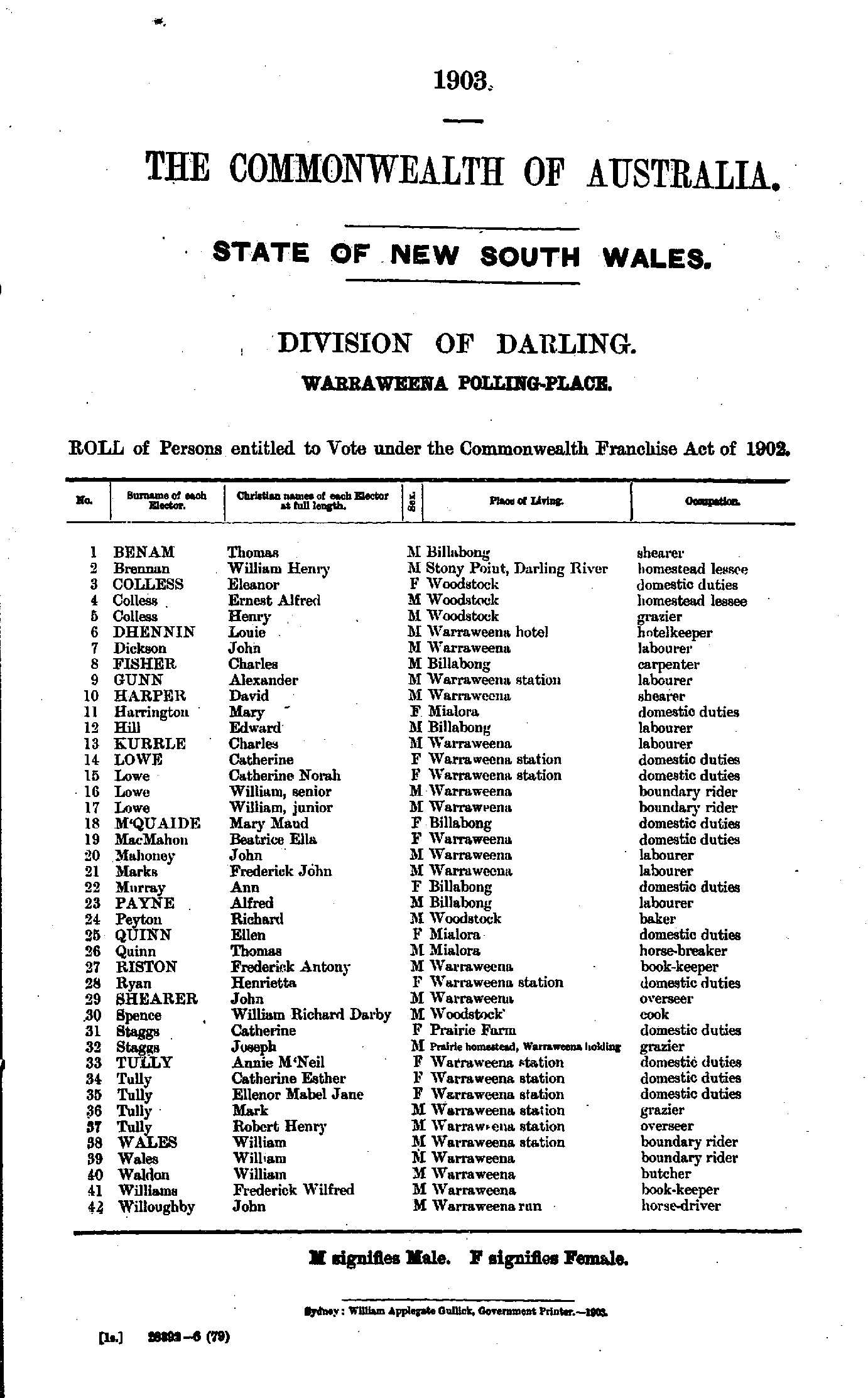
Polling Places:
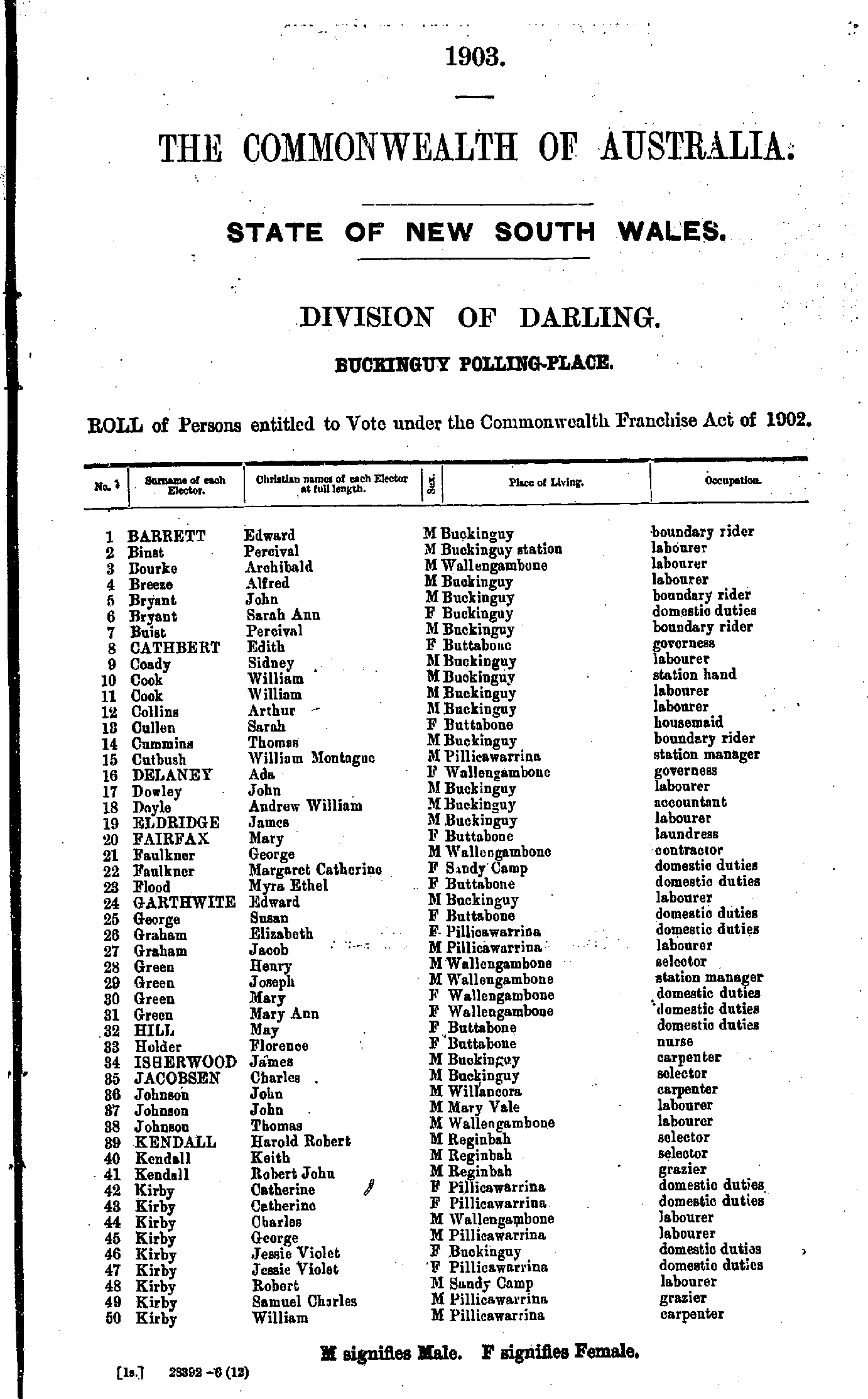
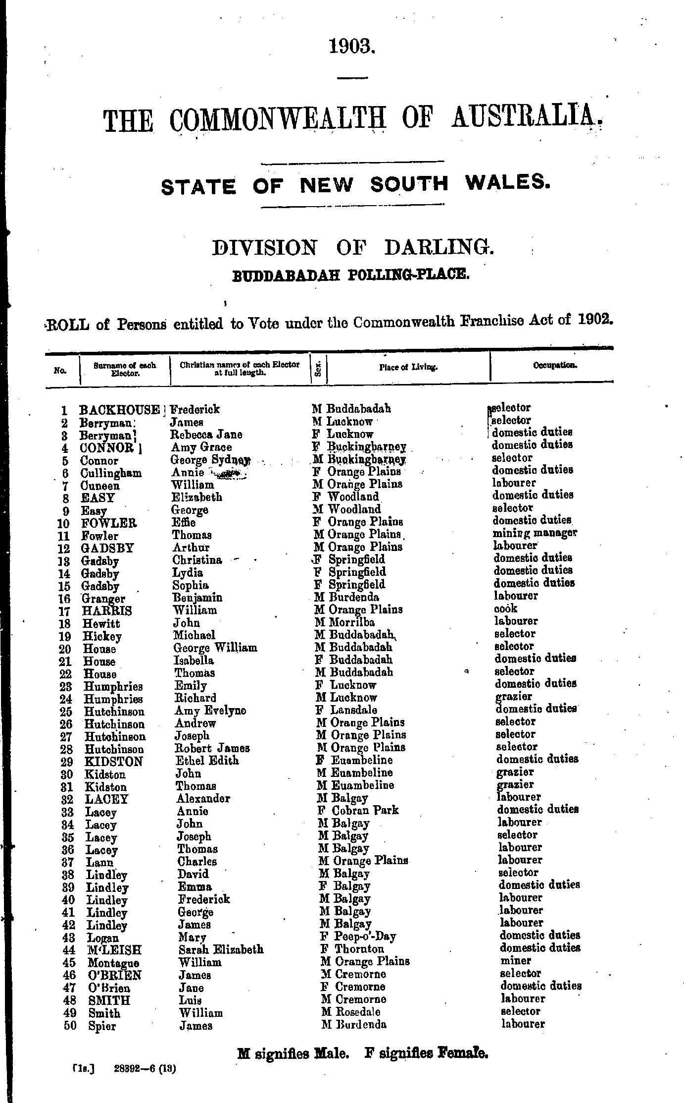
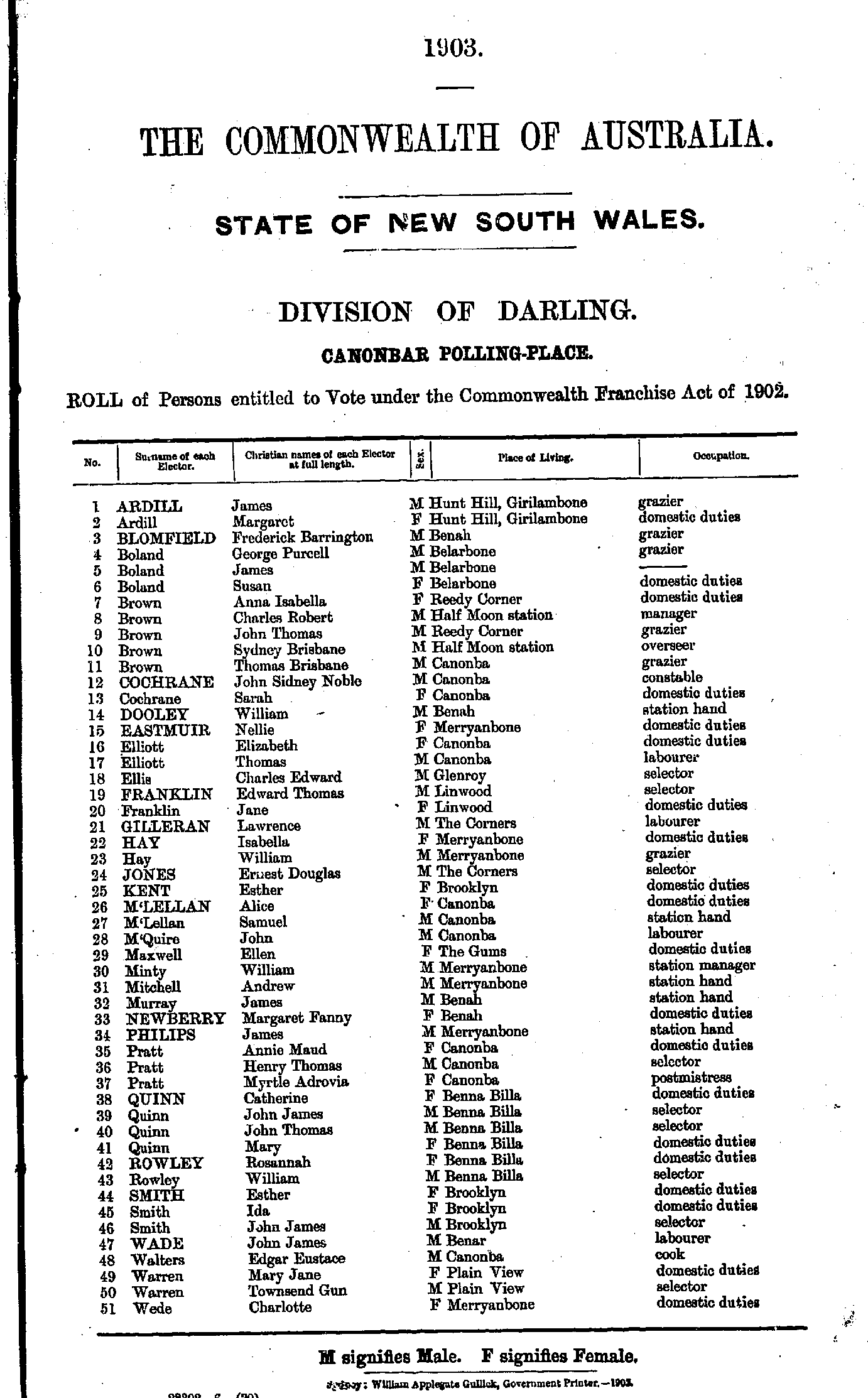
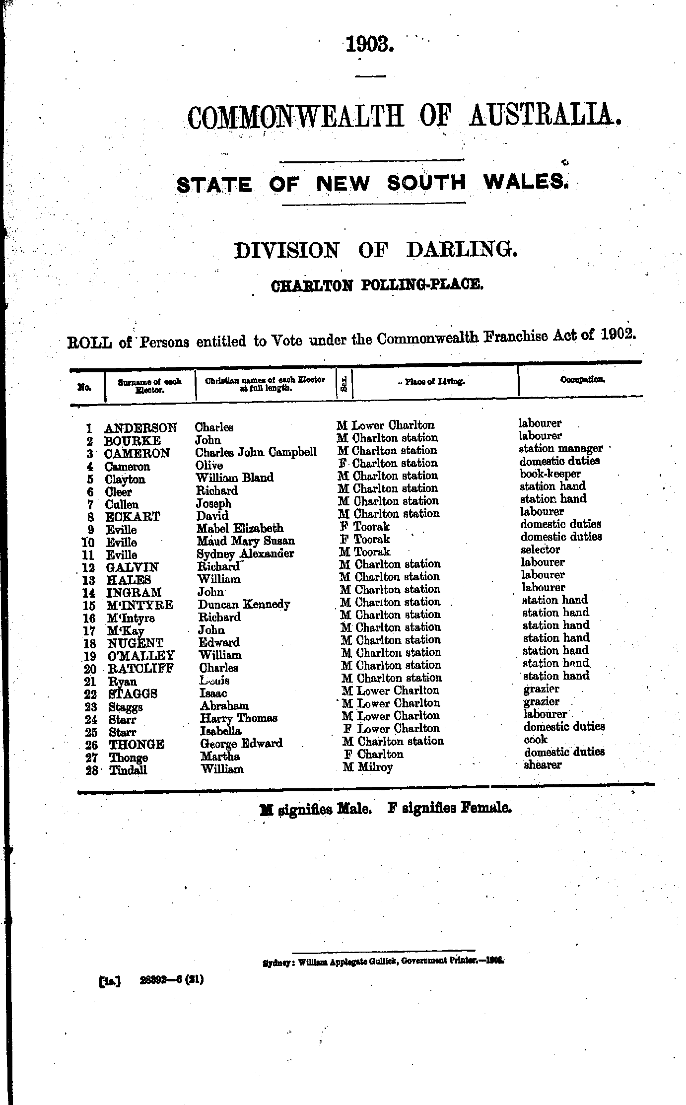
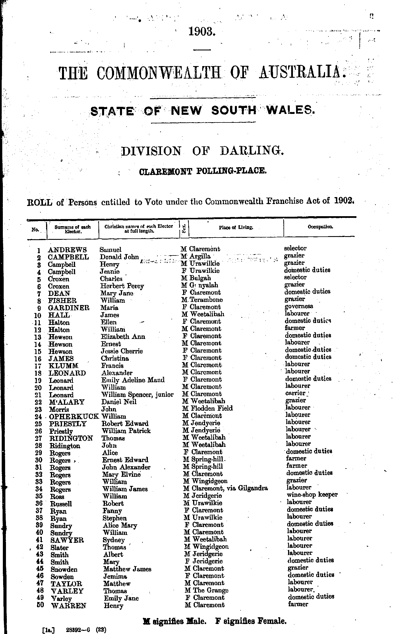
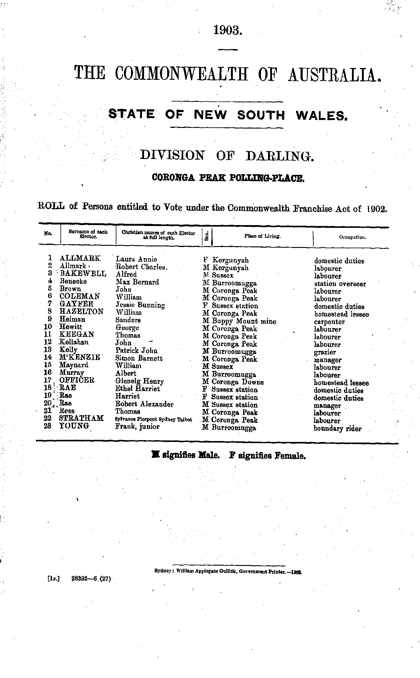
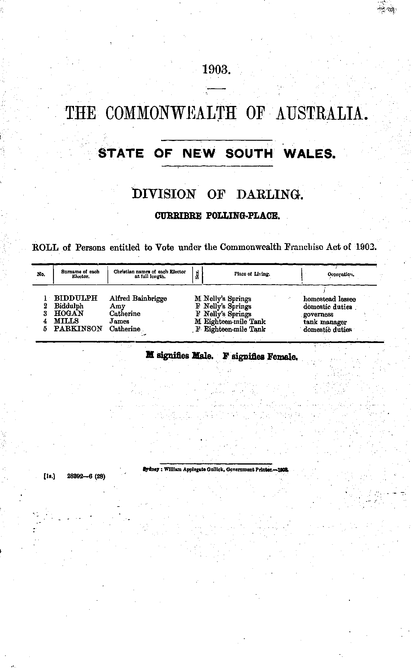
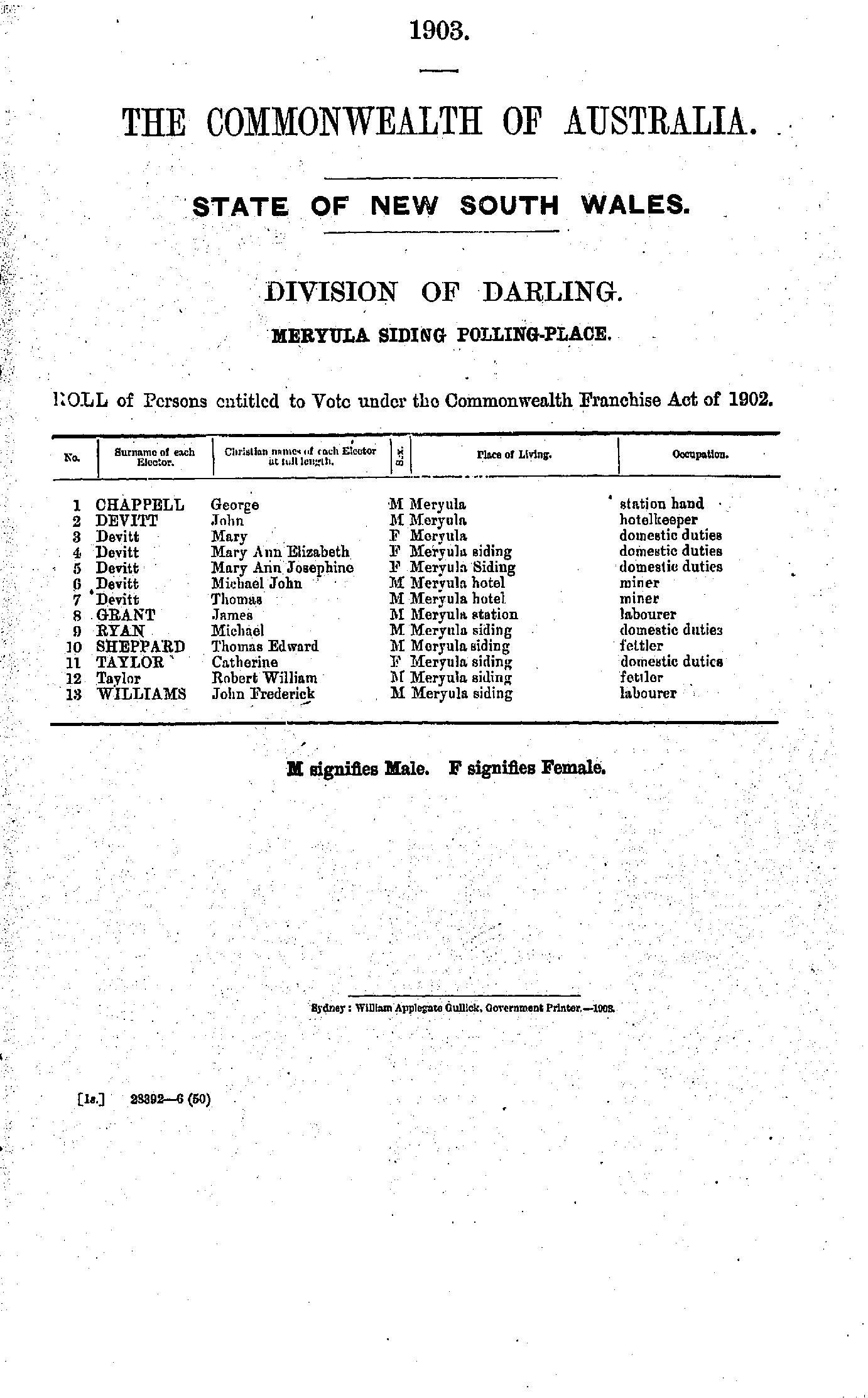
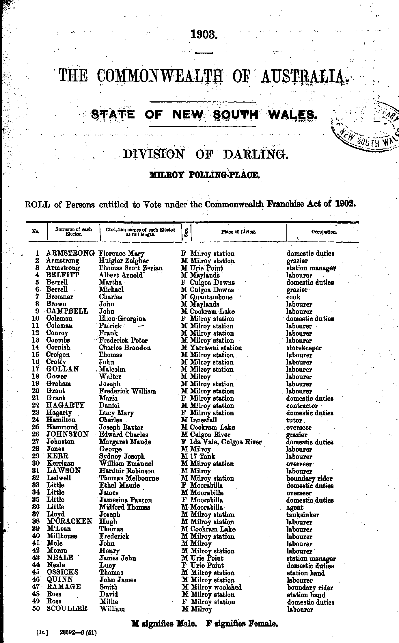
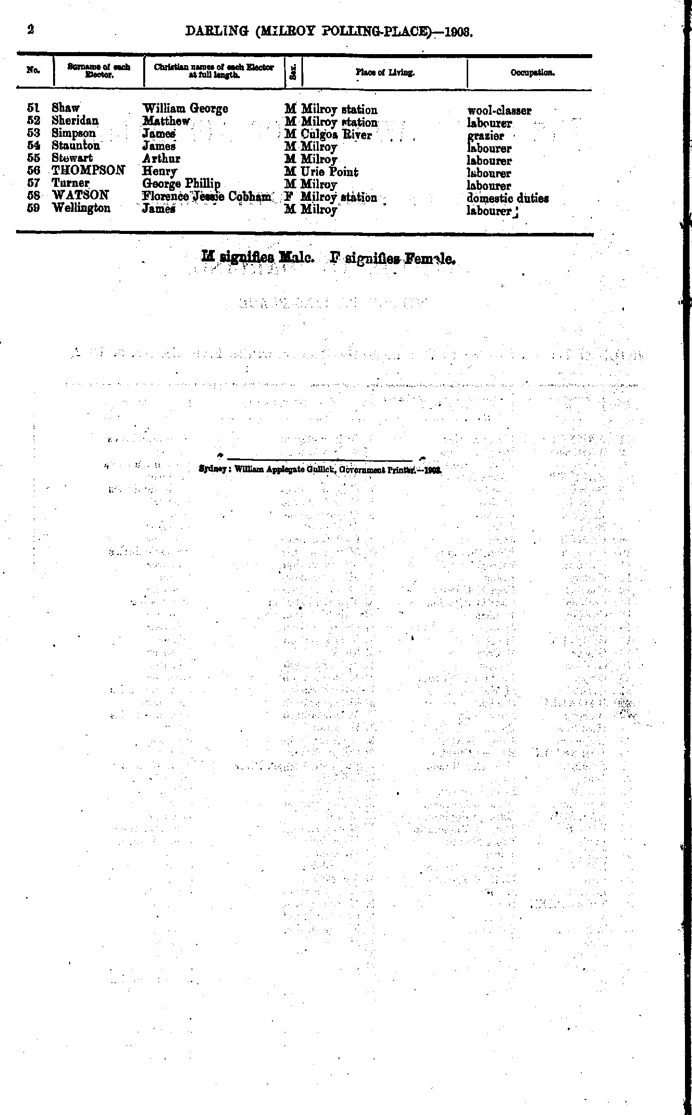
Angledool | Balladoran | Ballaree | Barringun | Beemery | Bennett's Flat | Bobadah | Bourbah | Bourke | Box Ridge | Brewarrina | Buckinguy | Buddabadah | Bullagreen | Bundabulla | Bundemar | Byrock | Calga | Canbelego | Canonbar | Charlton | Claremont | Cobar | Collie | Coolabah | Coonamble | Coronga Peak | Curribre | Double Gates | Dunlop | Ennaweena | Enngonia | Ford's Bridge | Gilgandra | Gilgunnia | Girilambone | Girilambone Copper Mine | Gongolgon | Goodooga | Gradgery | Grass Hut | Gulargambone | Gundabooka | Hermidale | Hungerford | Lissington | Louth | Lower Marra Creek | Marra Creek | Meryula Siding | Milroy | Mooculta | Mount Boppy | Mount Drysdale | Mount Harris | Murrawombie | Nevertire | North Bourke | Nymagee | Nyngan | Old Brindingabba | Pera Bore | Quambone | Quilbone | Seventy-five Mile Bore | Shuttleton | Talyeale | Tarcoon | Tabratong | Tankarooka | Tatala | Tenandra | The Meadows | The Peak | Tinapagee | Toorale | Toorale Station | Tooraweenah | Wanaaring | Warraweena | Warren | Willawillingbah | Willie | Winbar | Wrightville | Wuttagoona | Yantabulla | Youngerignia
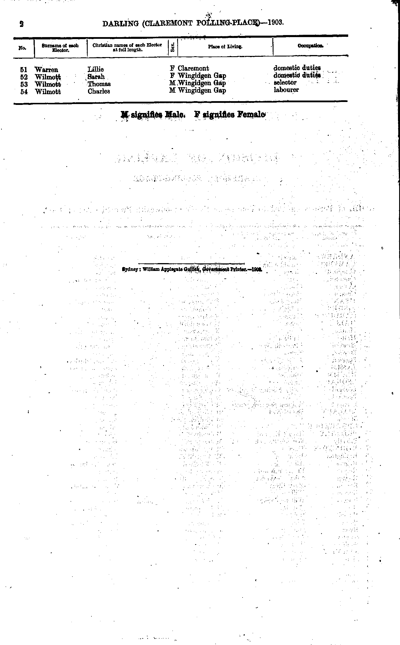
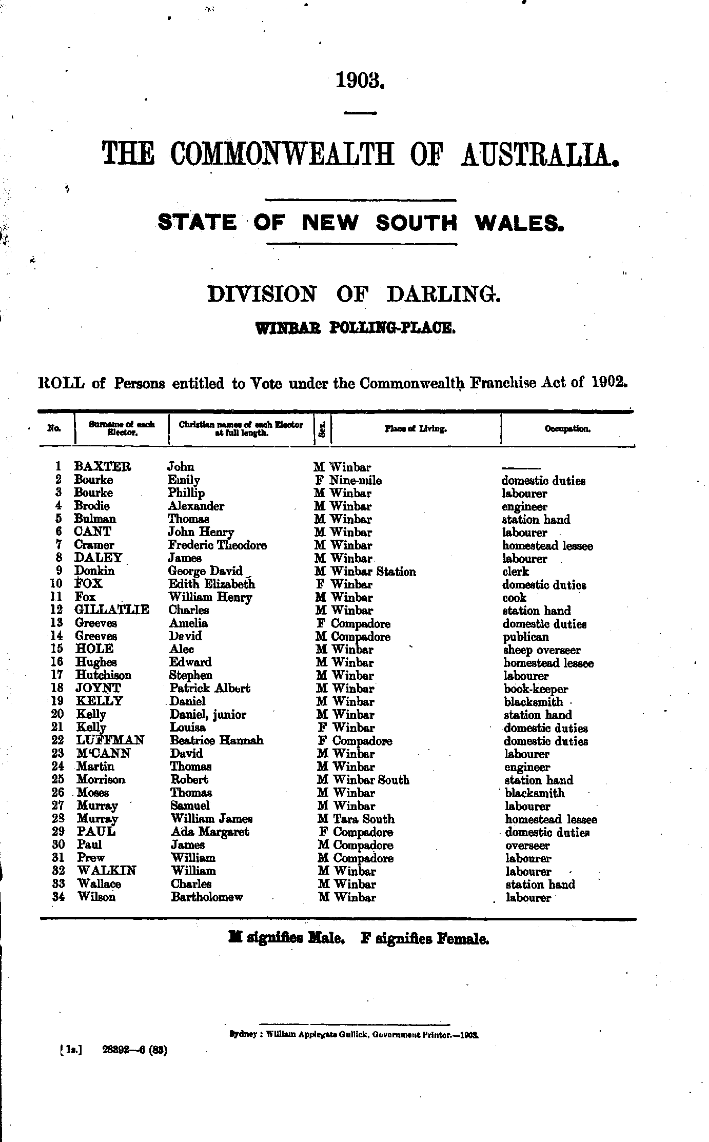
- Ah Bow Elizabeth - Gibbes Florence
- Gibbes John - Moore Frances
- Moore Robert - Witen William
- Wolstenholm John - York Henry
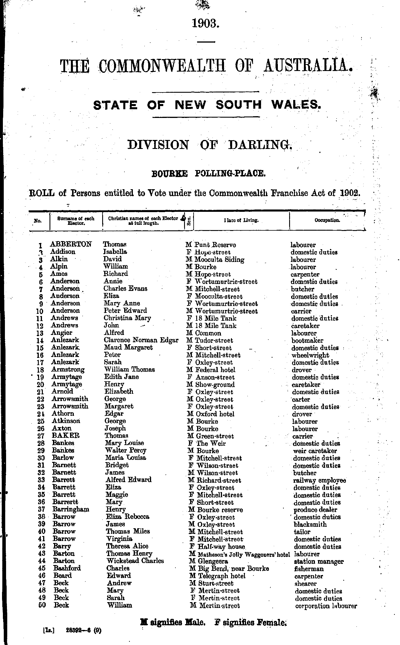
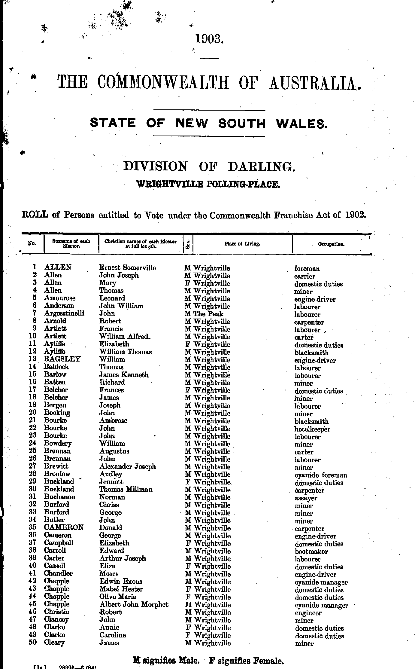
- Abberton Thomas - Beck William
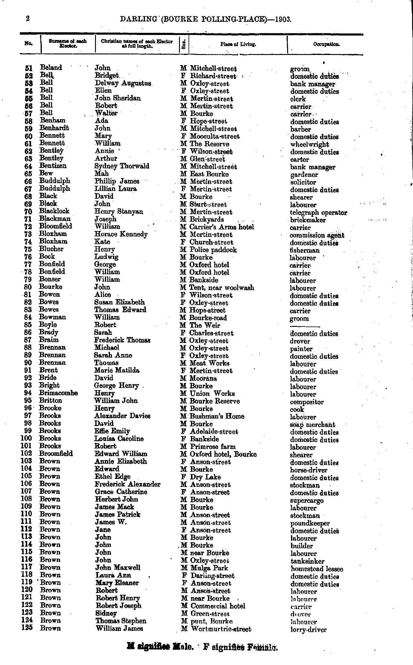
- Beland John - Brown William
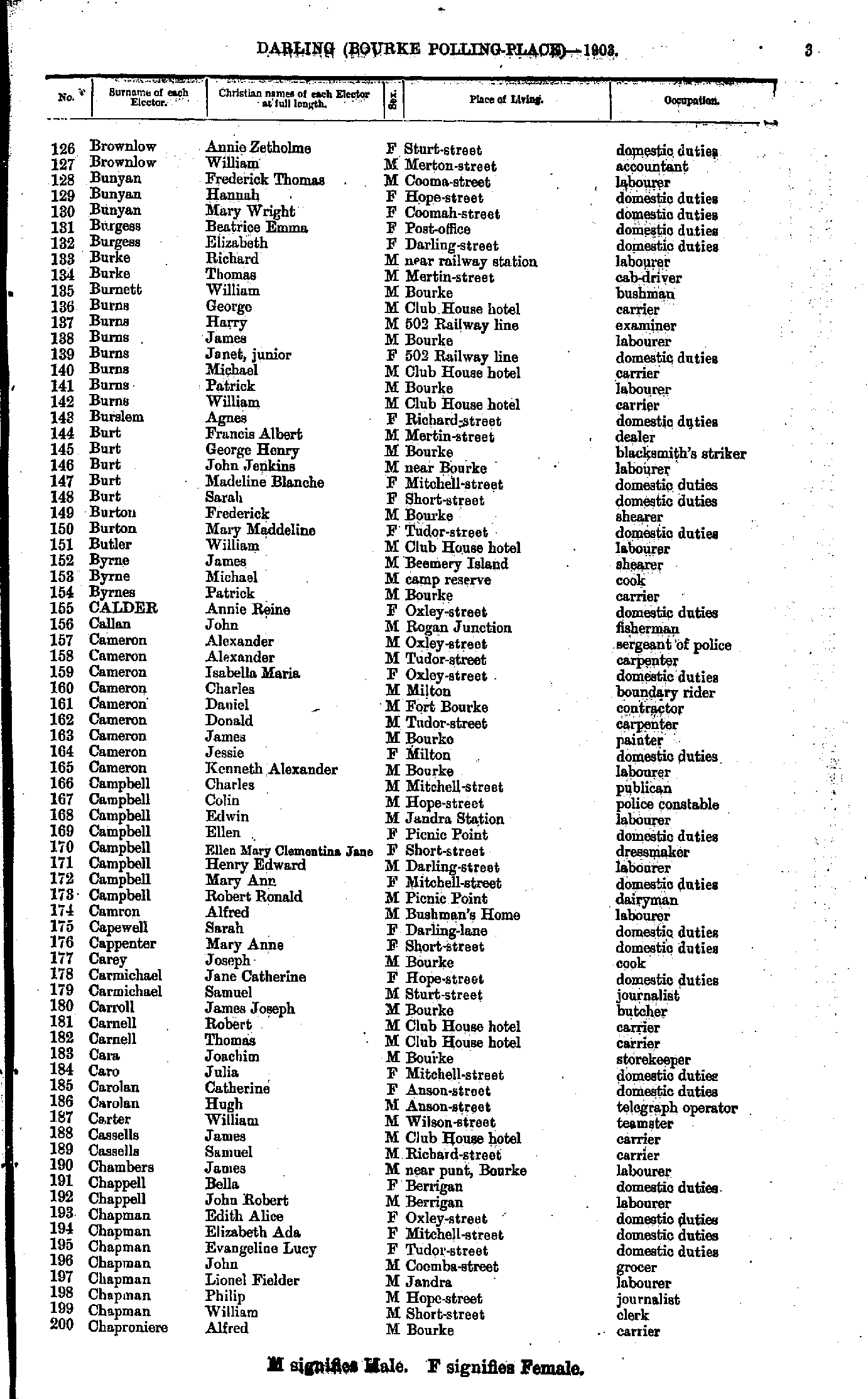
- Brownlow Annie - Chaproniere Alfred
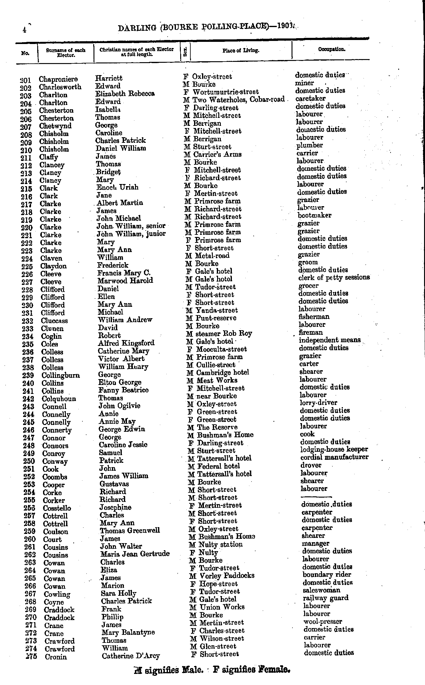
- Chaproniere Harriett - Cronin Catherine
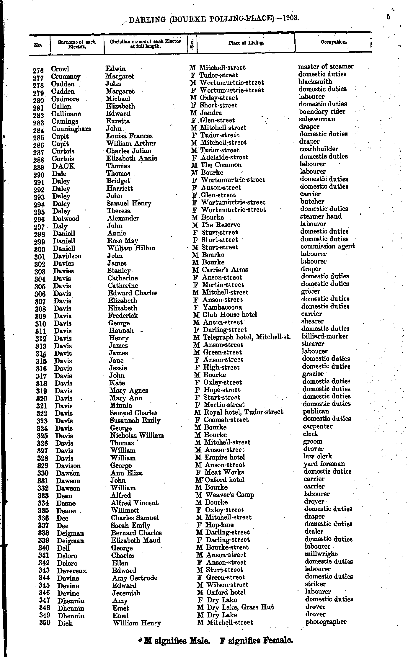
- Crowl Edwin - Dick William
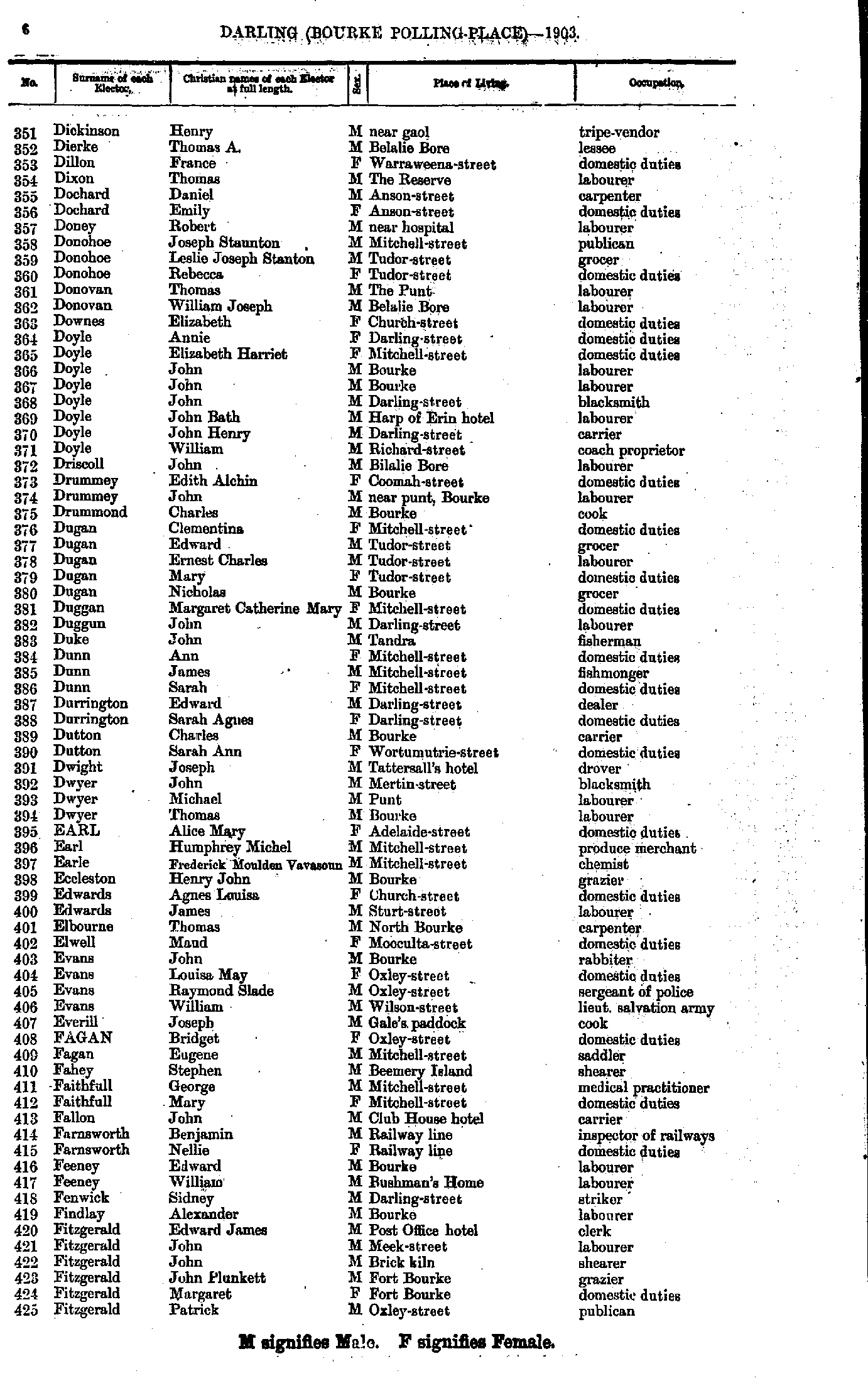
- Dickinson Henry - Fitzgerald Patrick
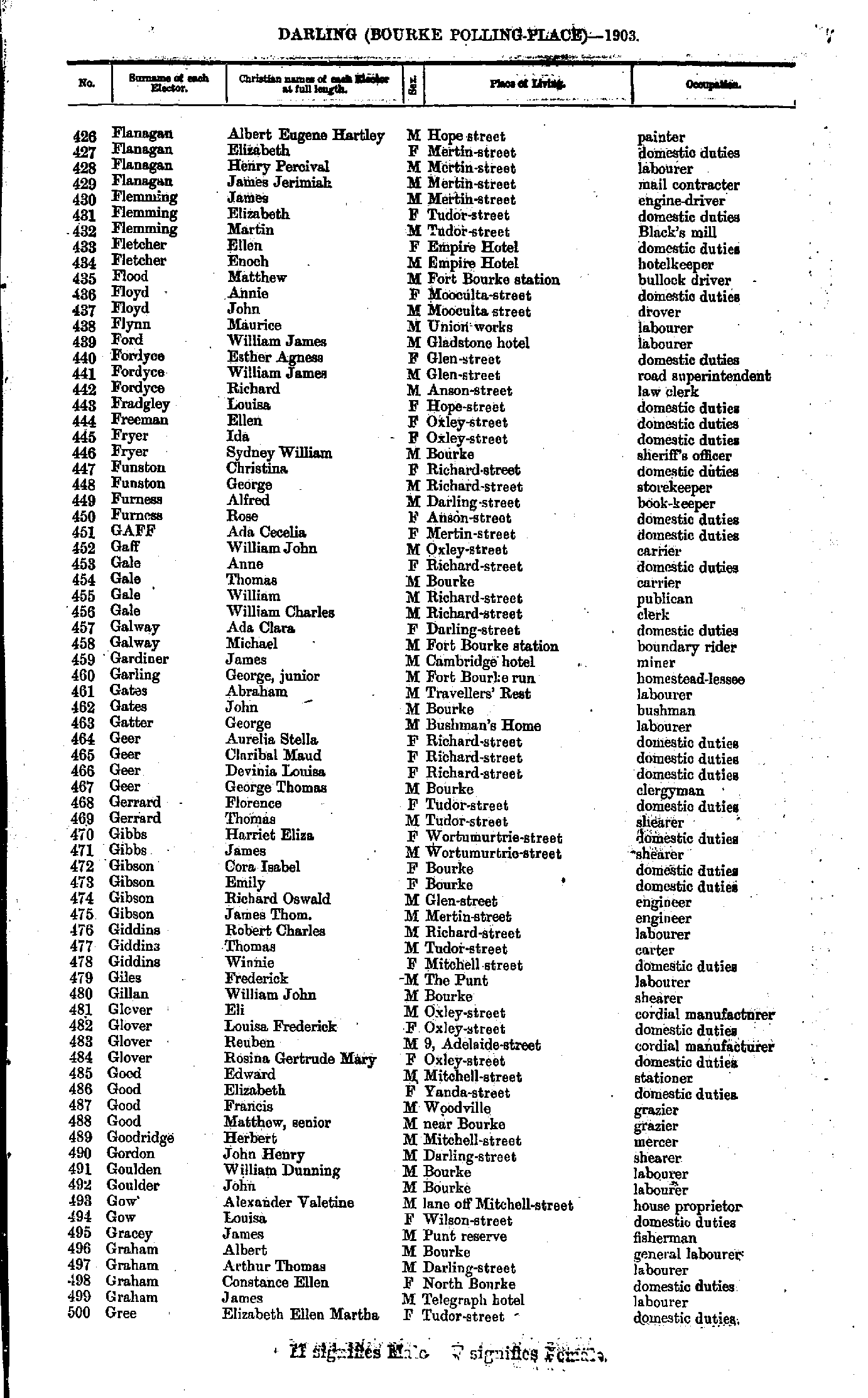
- Flanagan Albert - Gree Elizabeth
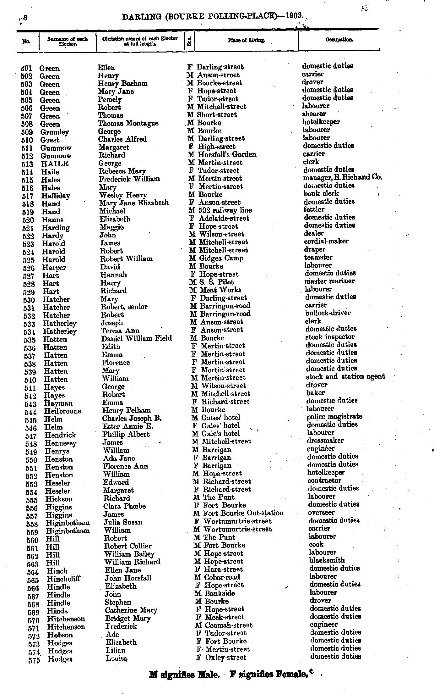
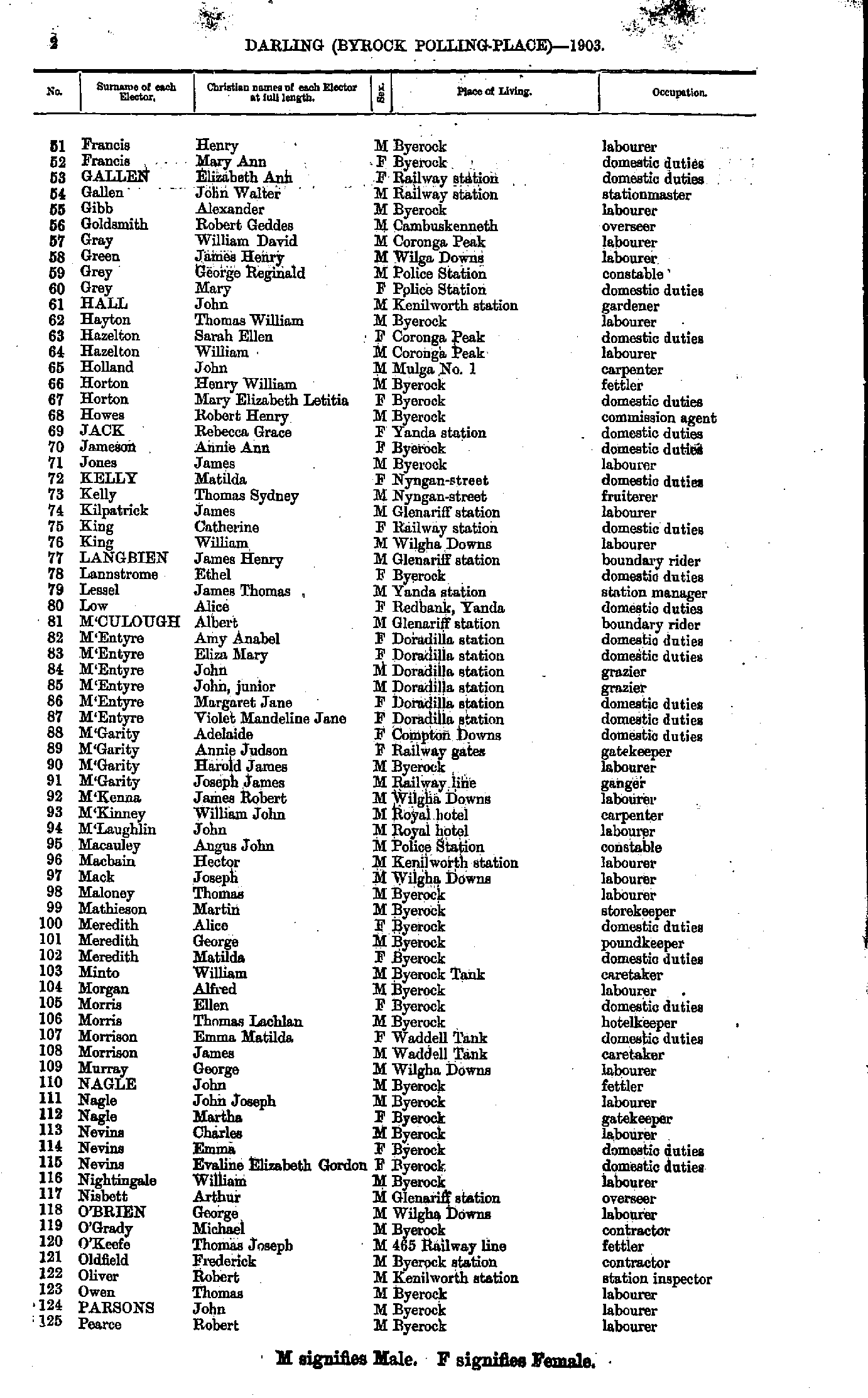
- Green Ellen - Hodges Louisa
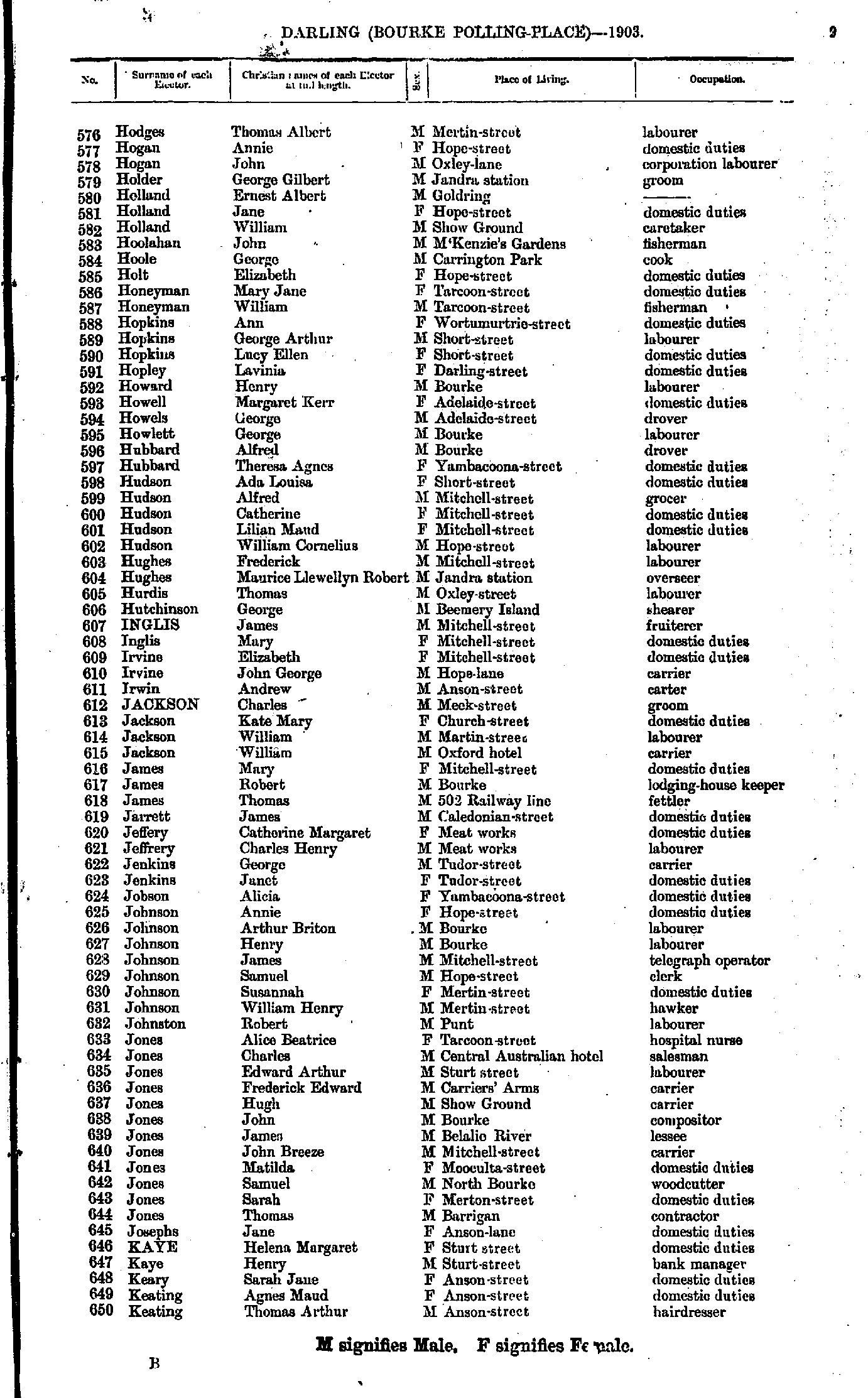
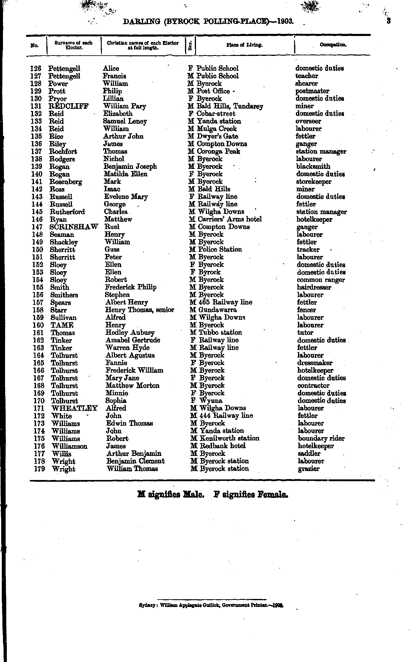
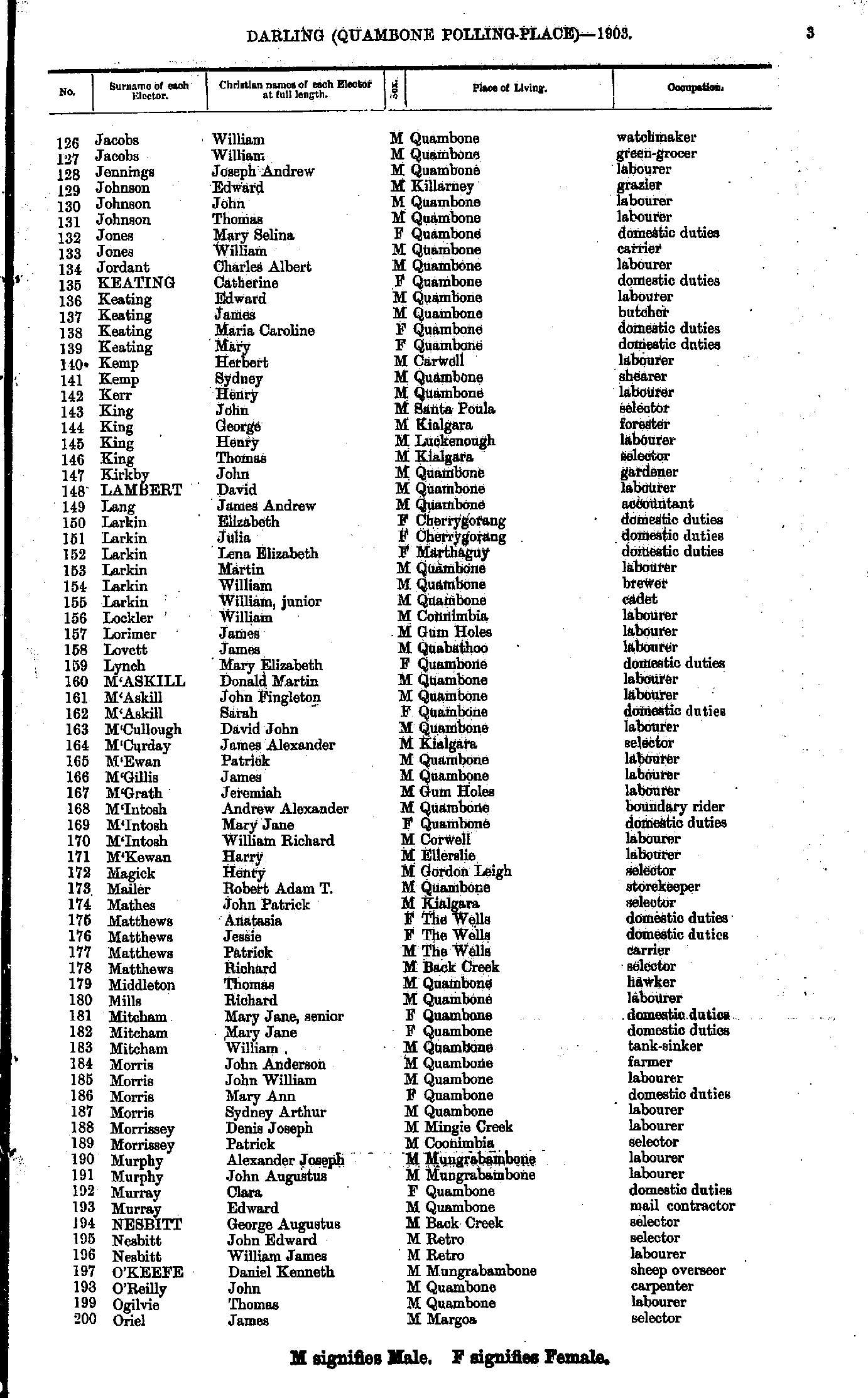
- Hodges Thomas - Keating Thomas
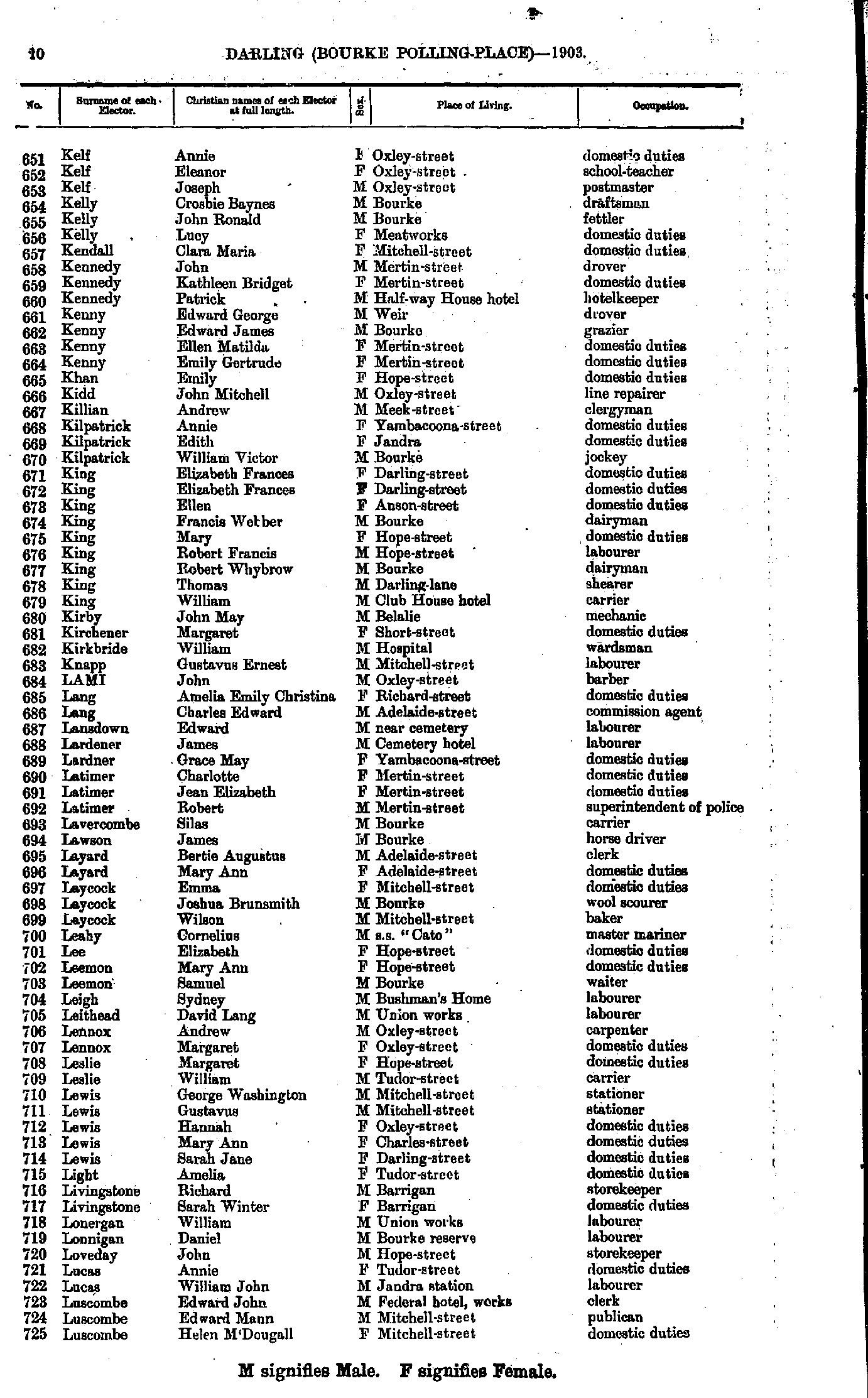
- Kelf Annie - Luscombe Helen
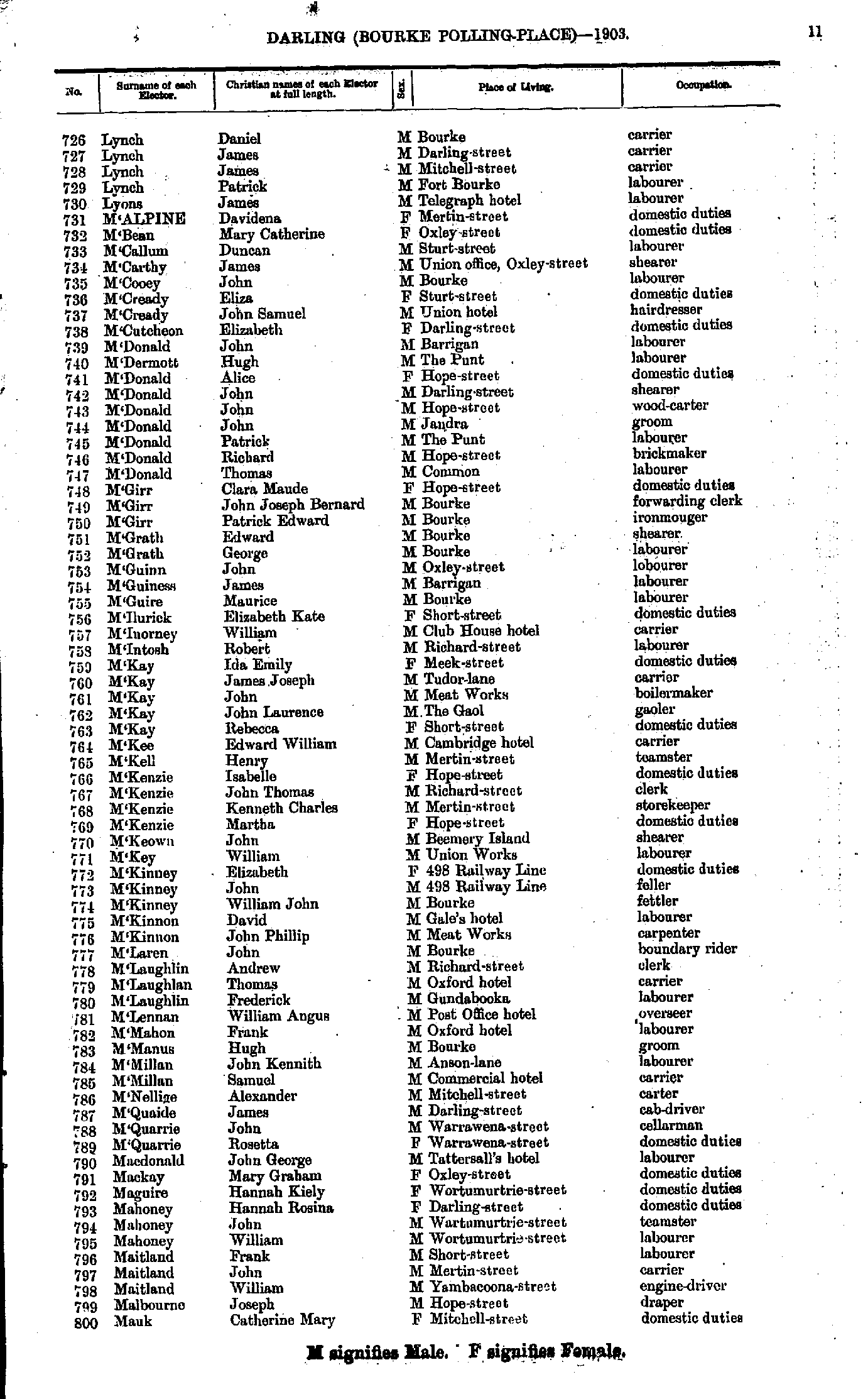
- Lynch Daniel - Mauk Catherine
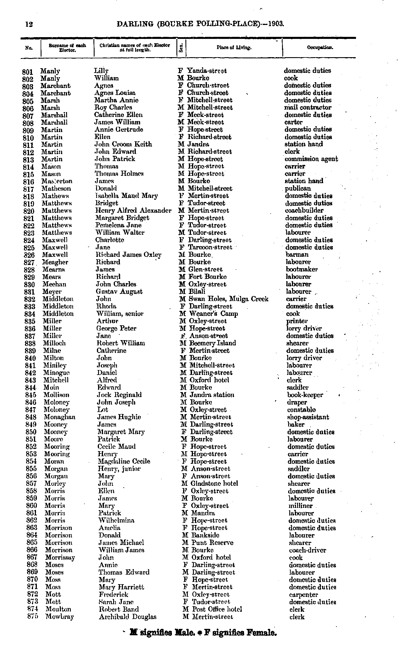
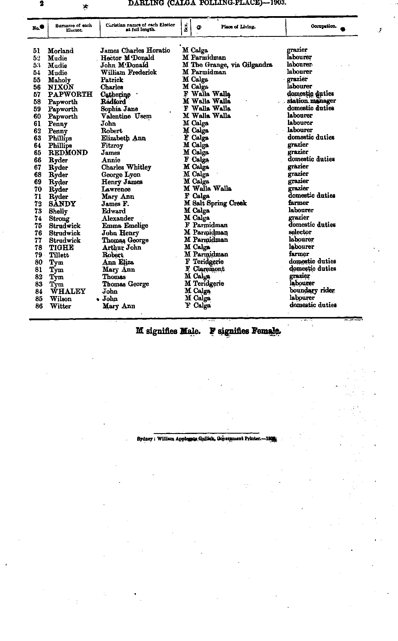
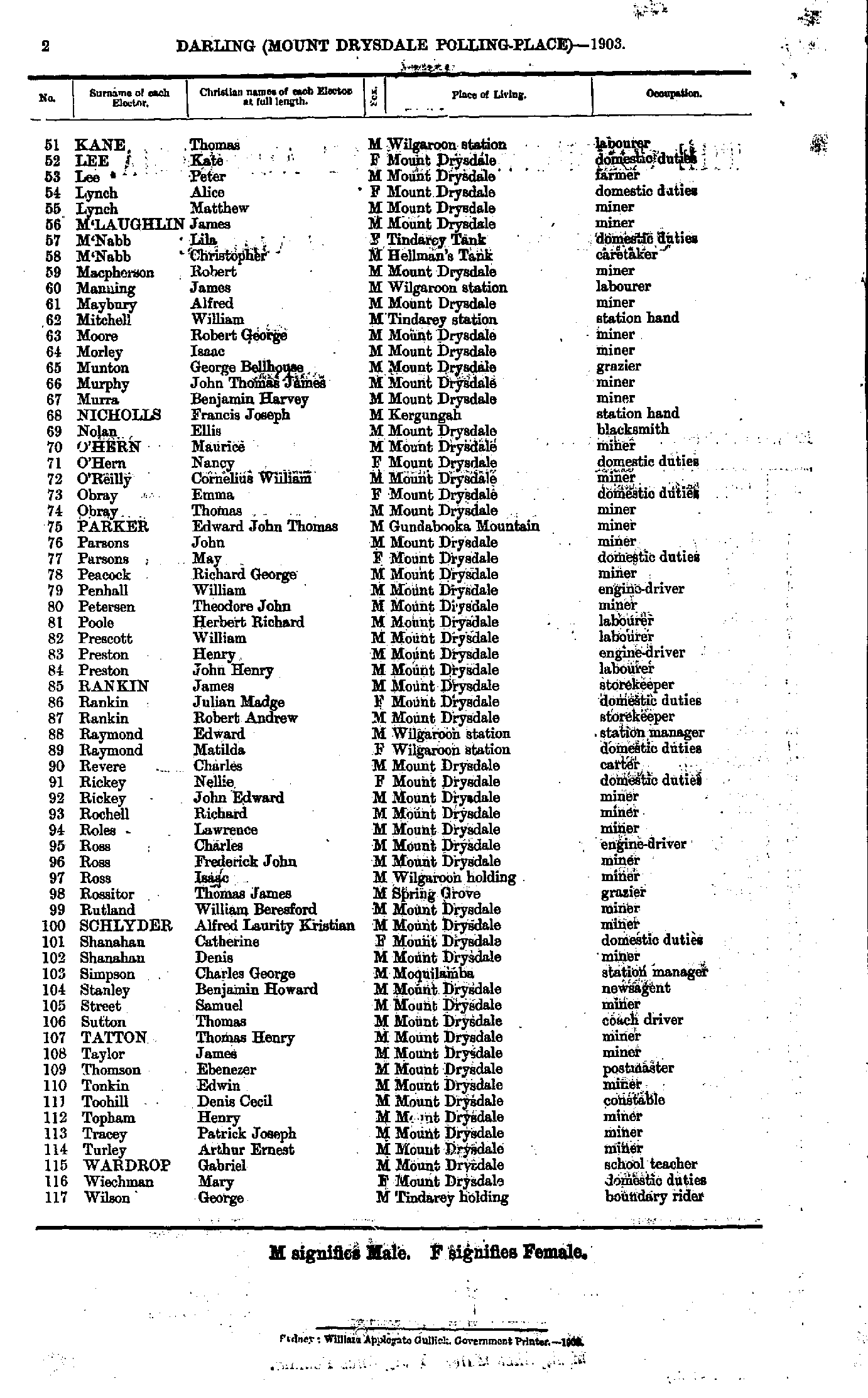
- Manly Lilly - Mowbray Archibald
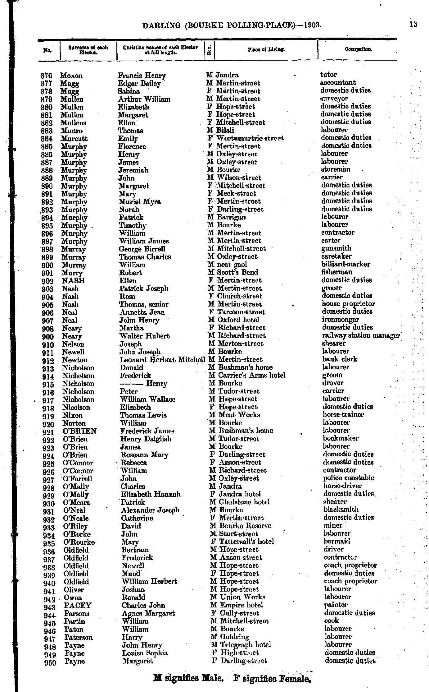
- Moxon Francis - Payne Margaret
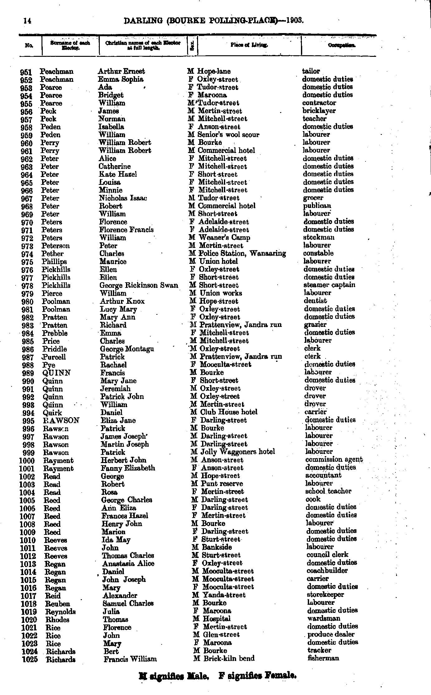
- Peachman Arthur - Richards Francis
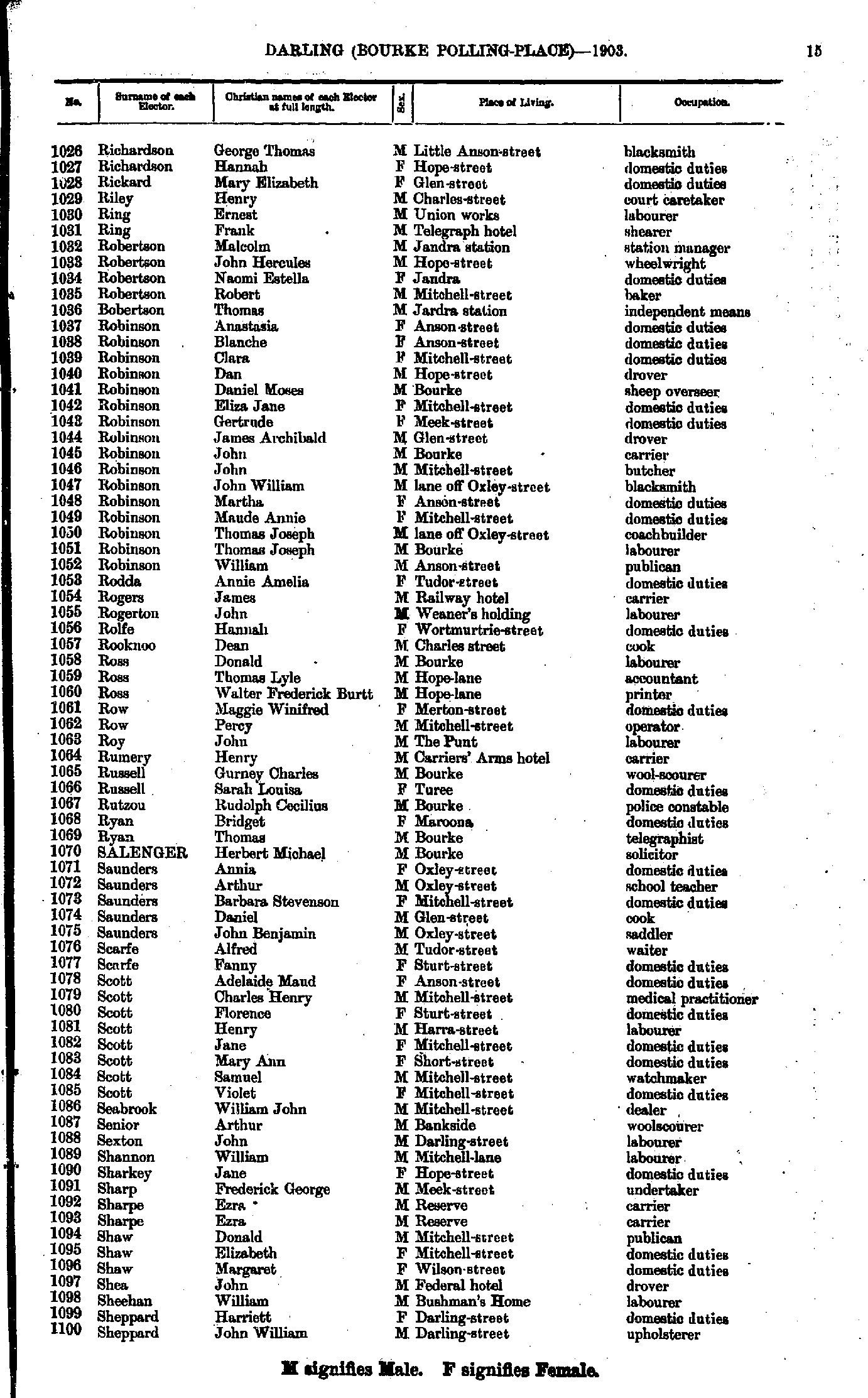
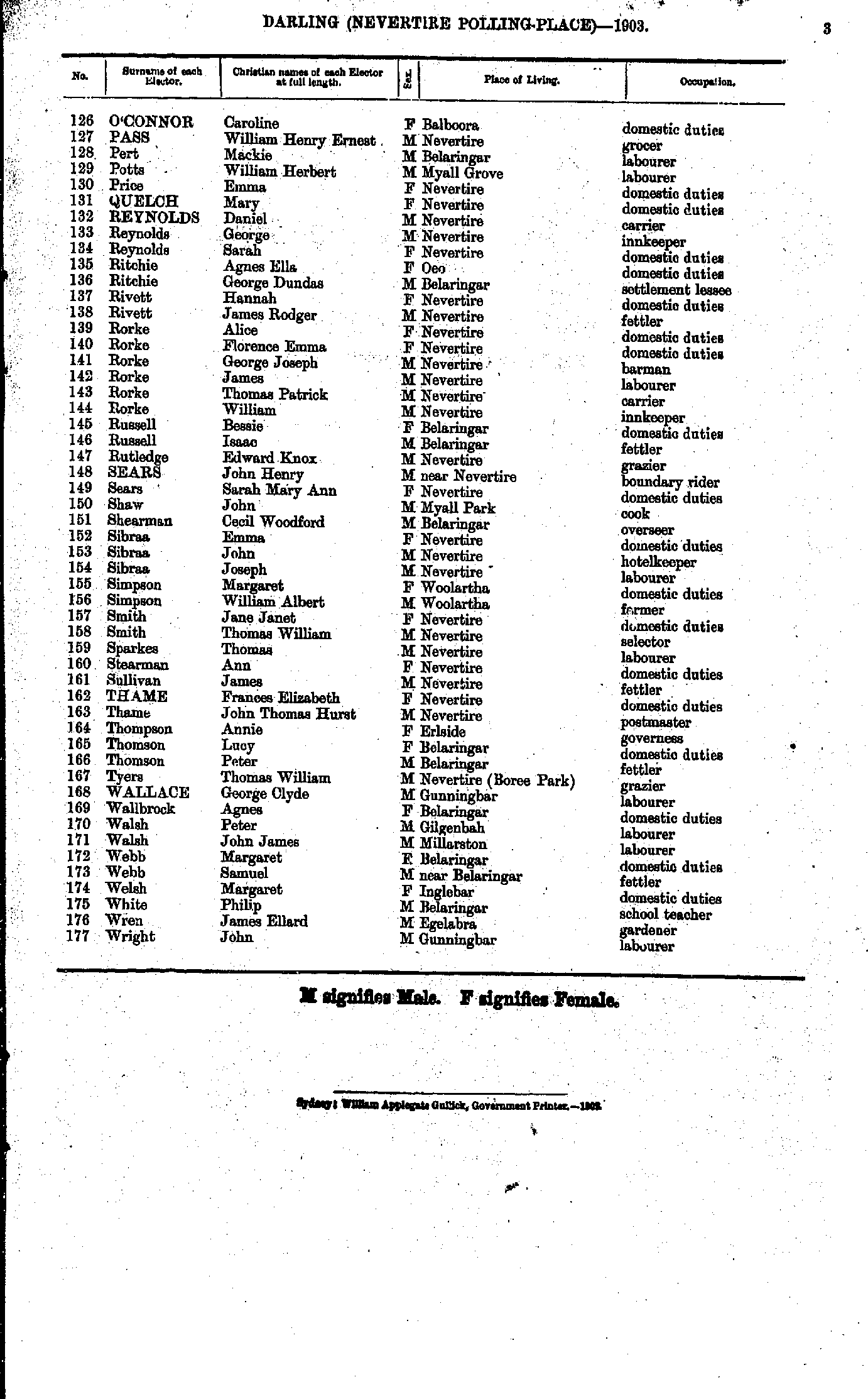
- Richardson George - Sheppard John
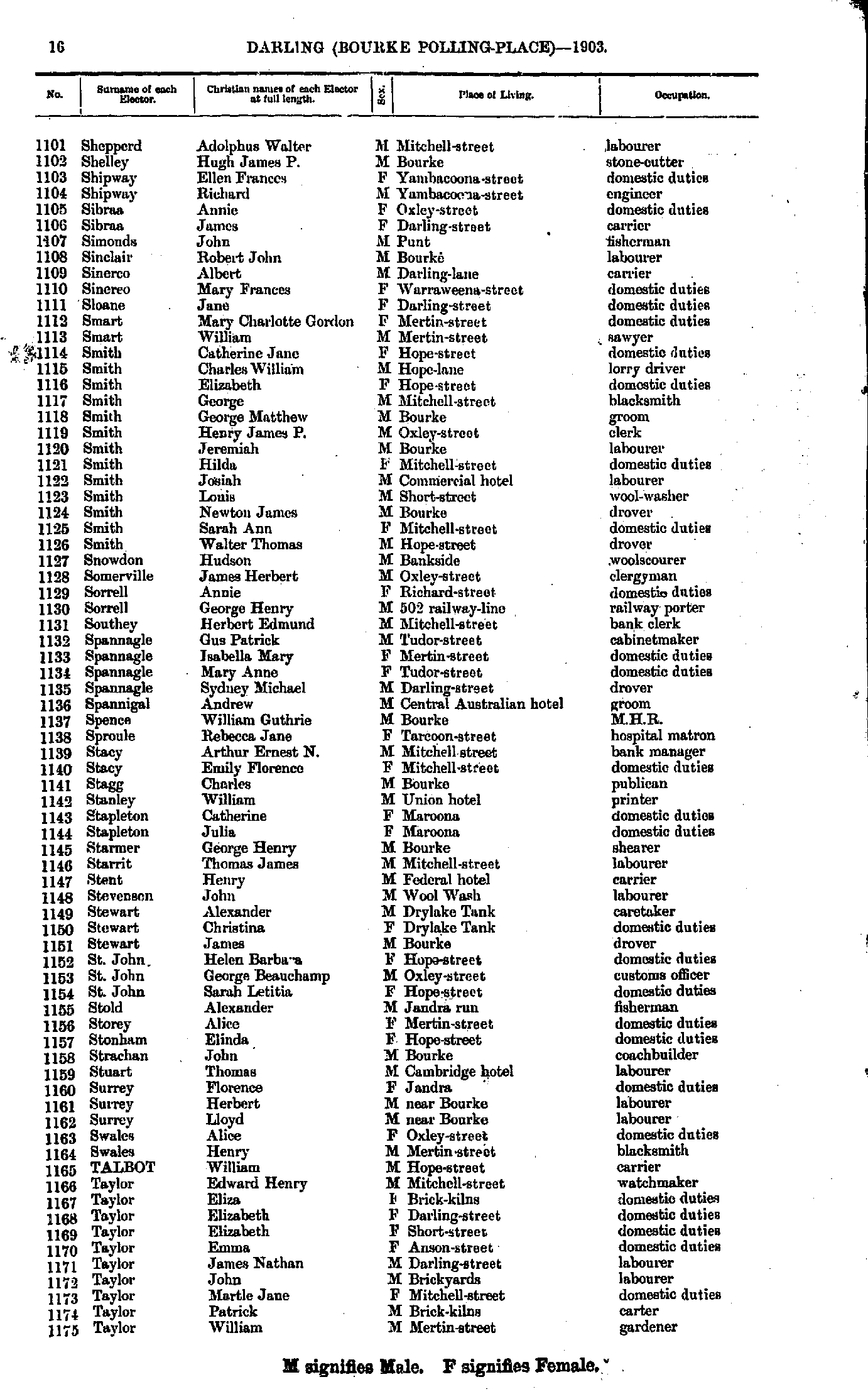
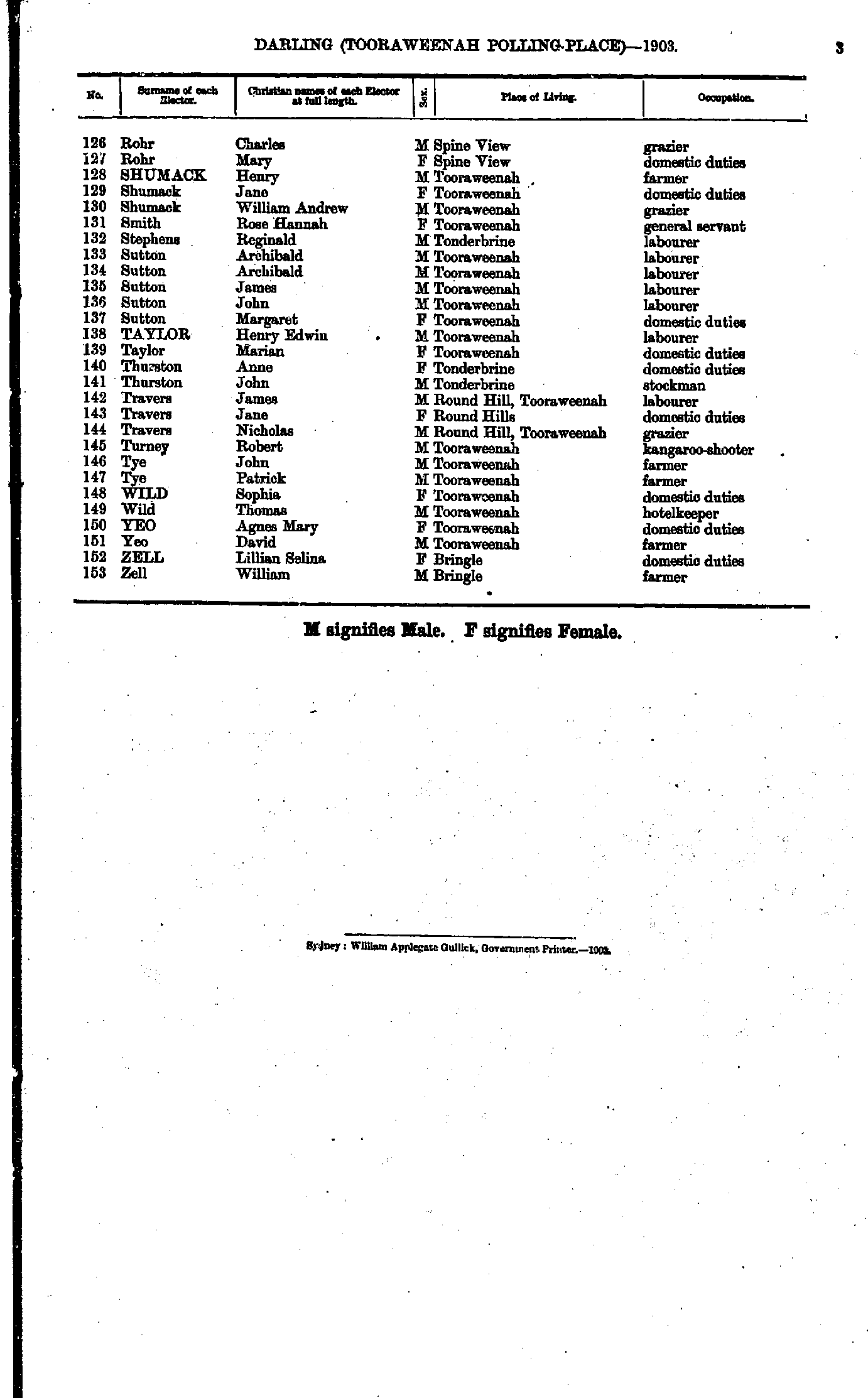
- Shepperd Adolphus - Taylor William
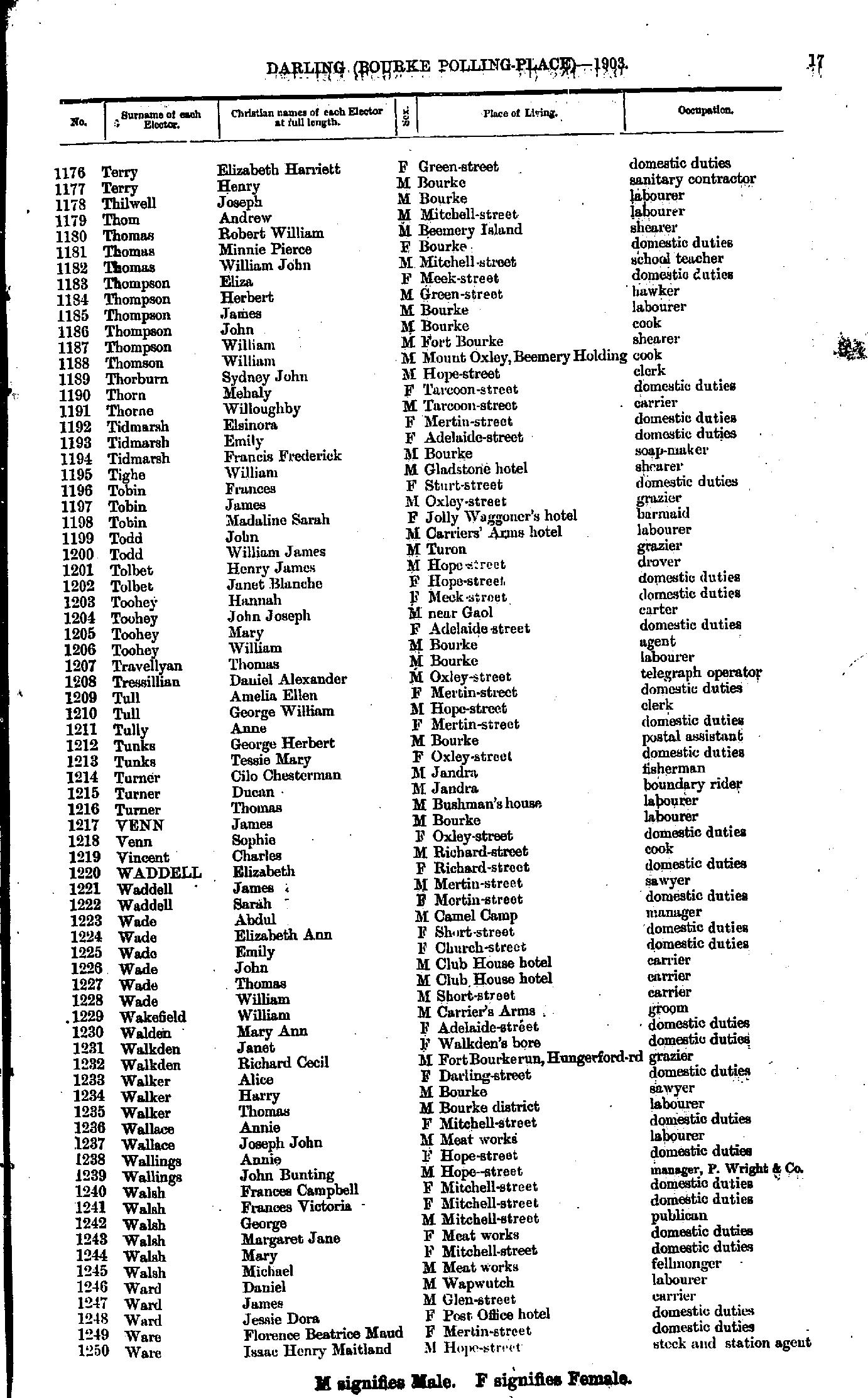
- Terry Elizabeth - Ware Isaac
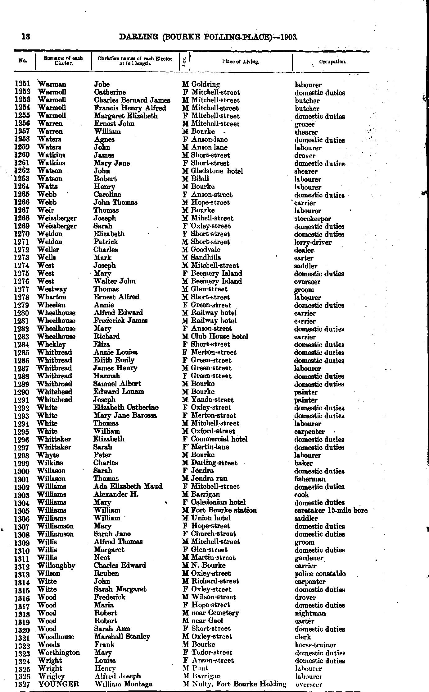
- Warman Jobe - Younger William
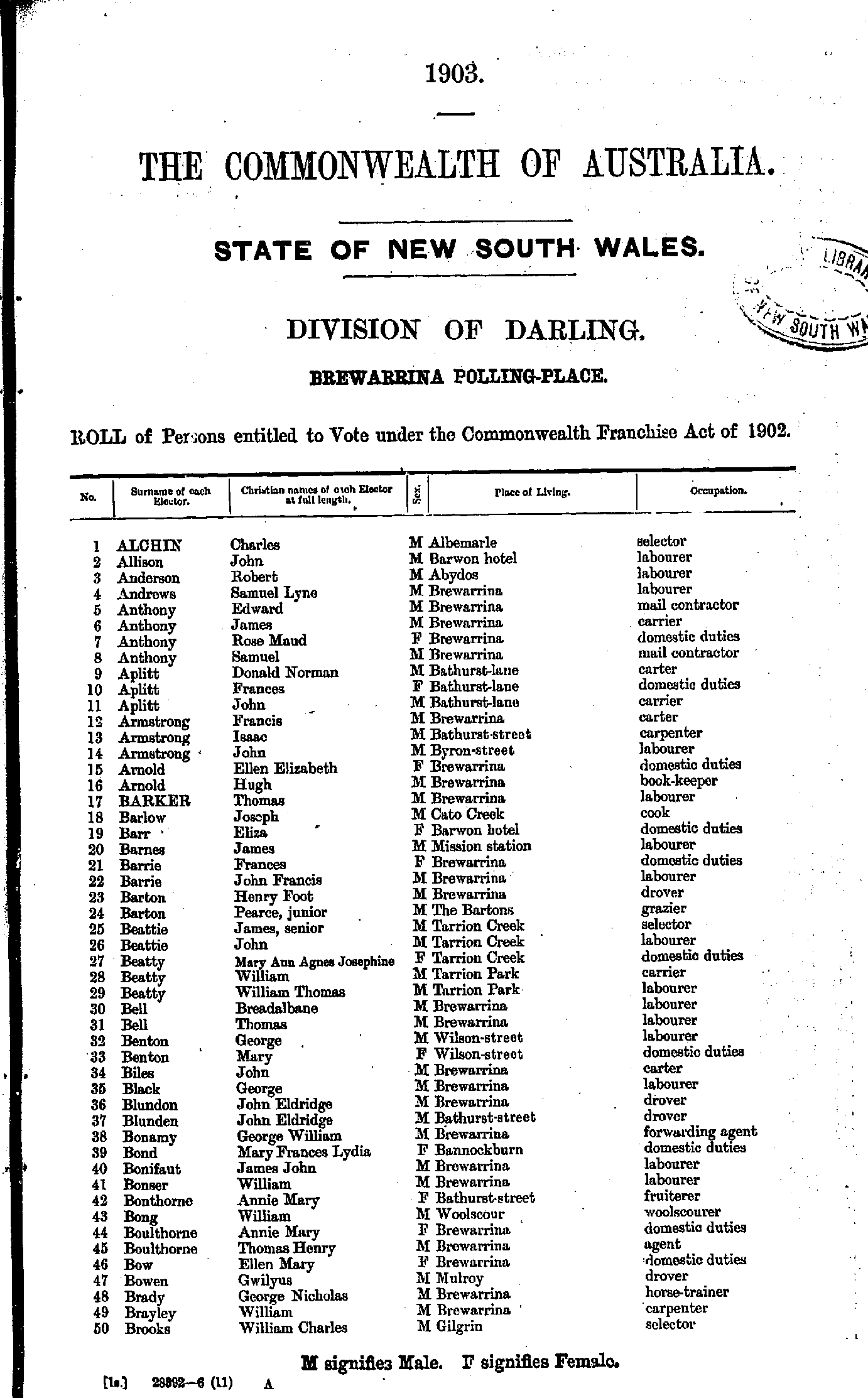
- Alchin Charles - Brooks William
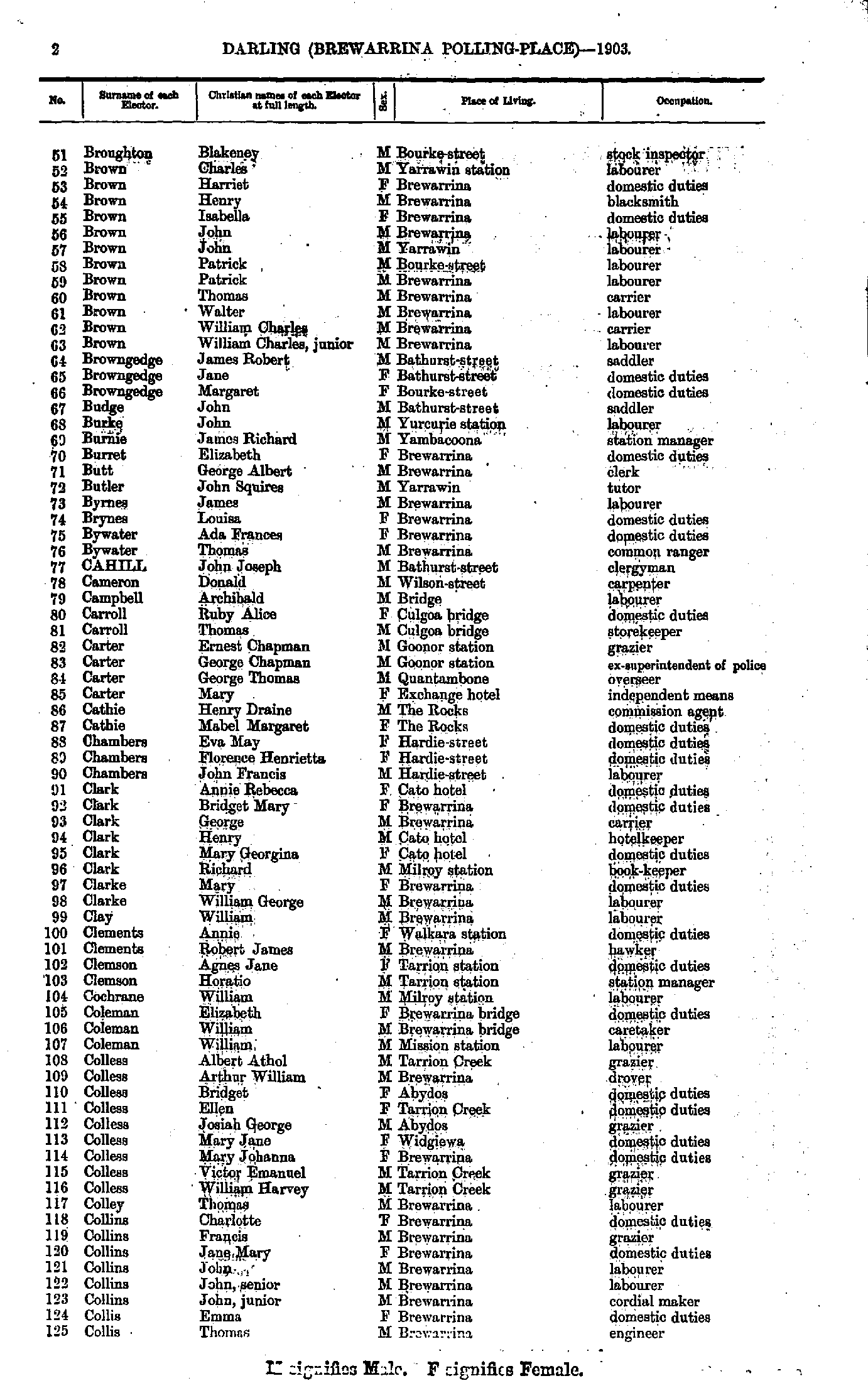
- Broughton Blakeney - Collis Thomas
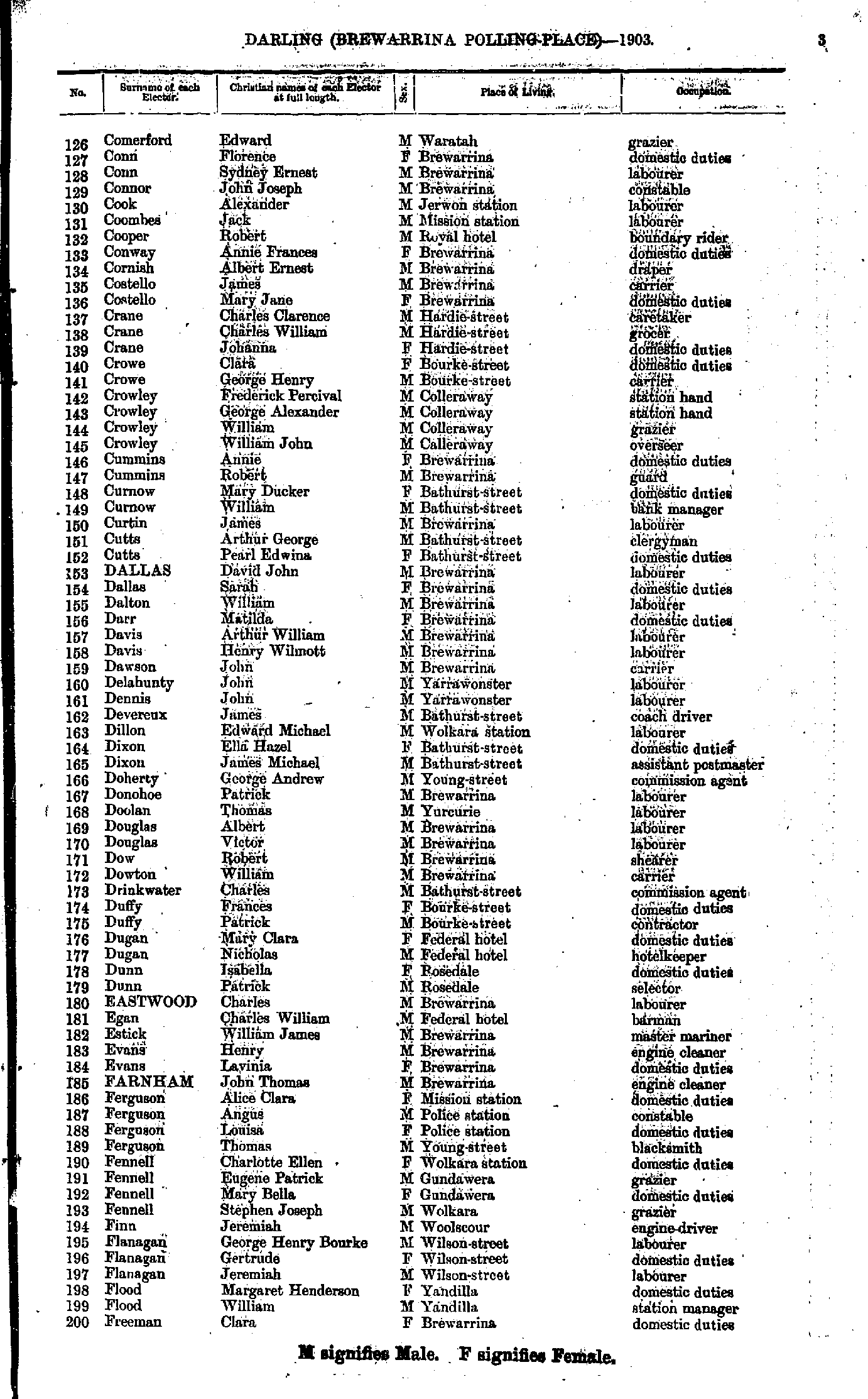
- Comerford Edward - Freeman Clara
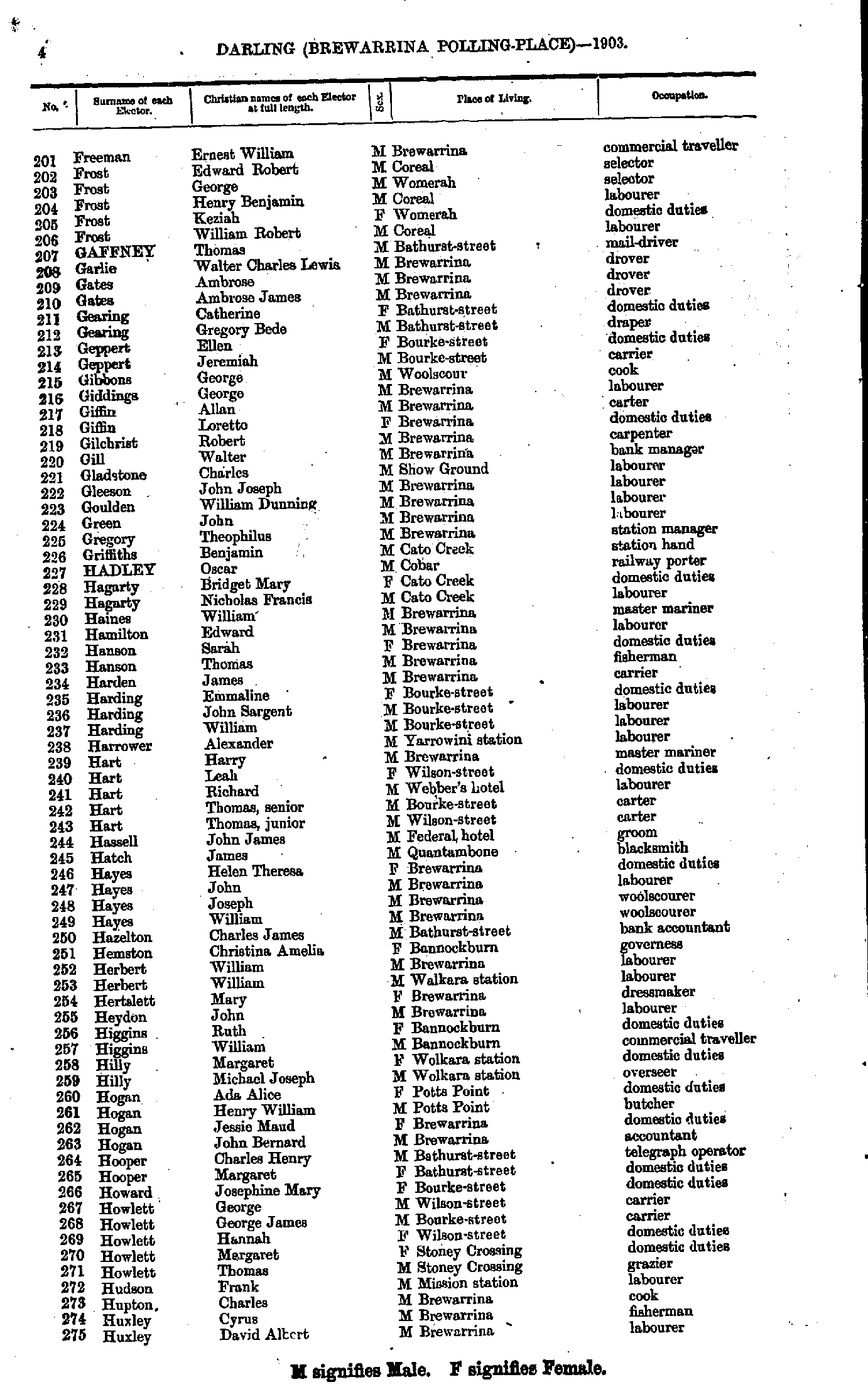
- Freeman Ernest - Huxley David
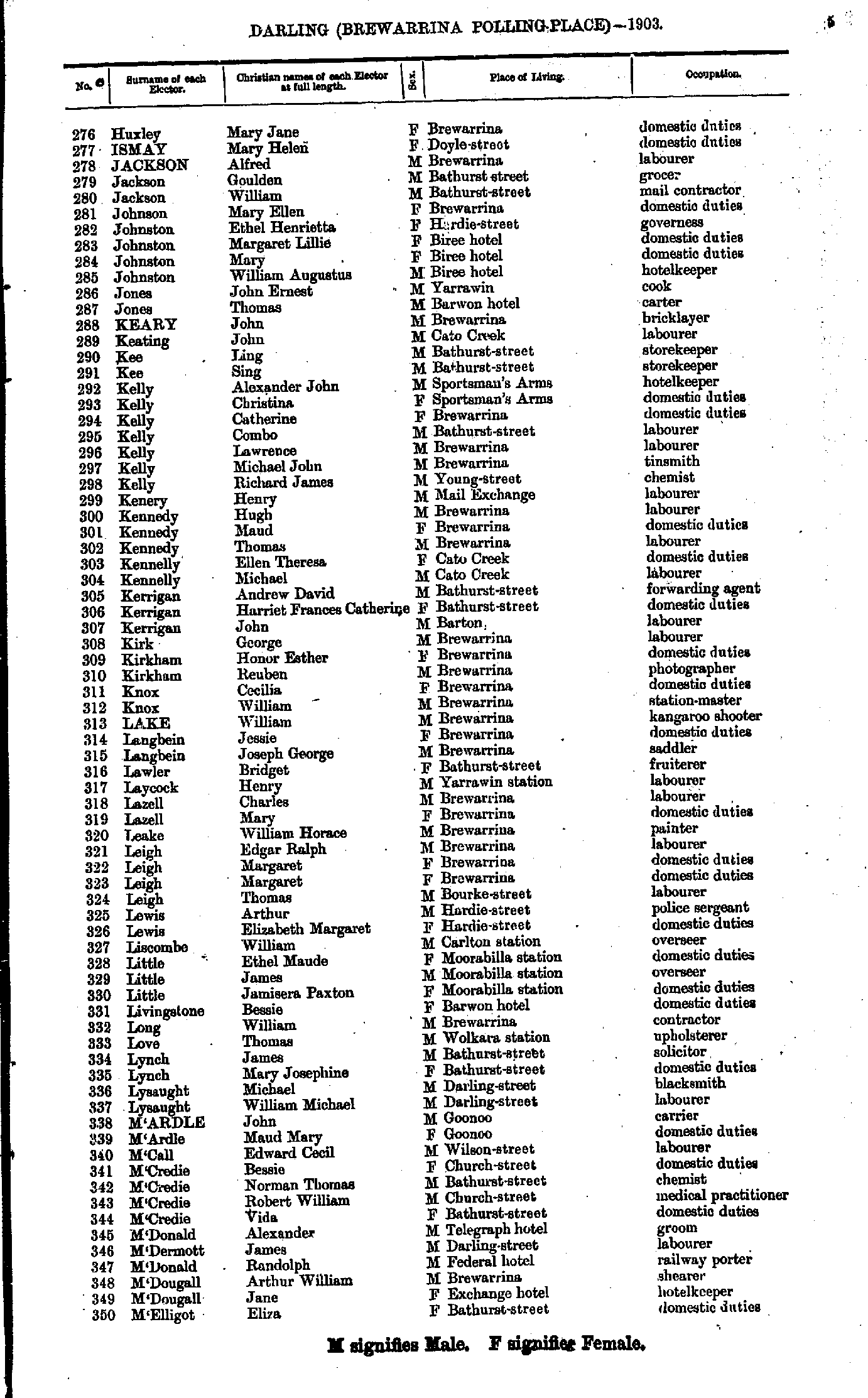
- Huxley Mary - M'Elligot Eliza
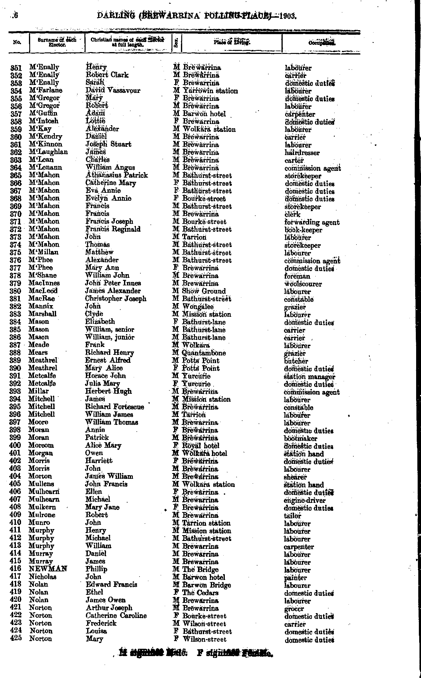
- M'Enally Henry - Norton Mary
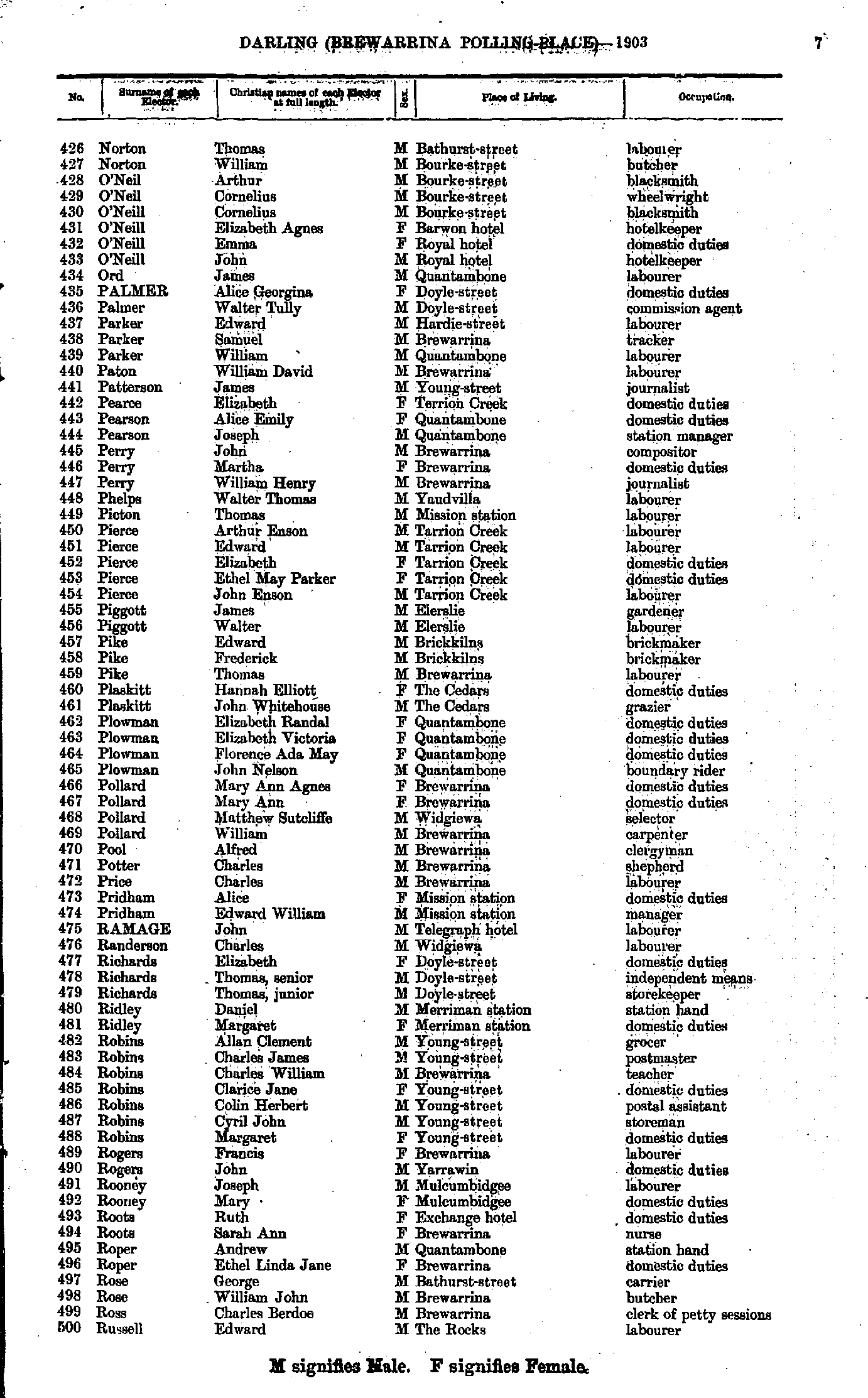
- Norton Thomas - Russell Edward
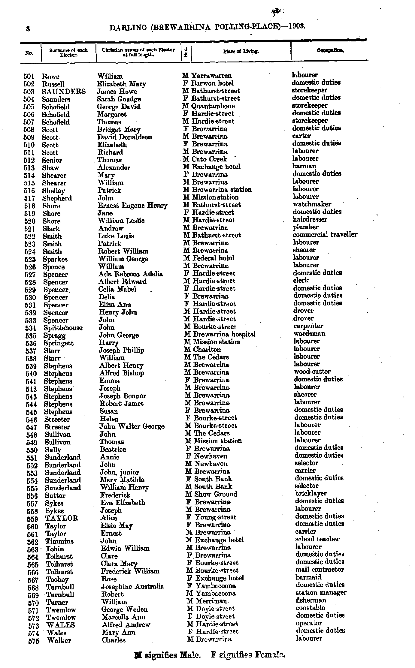
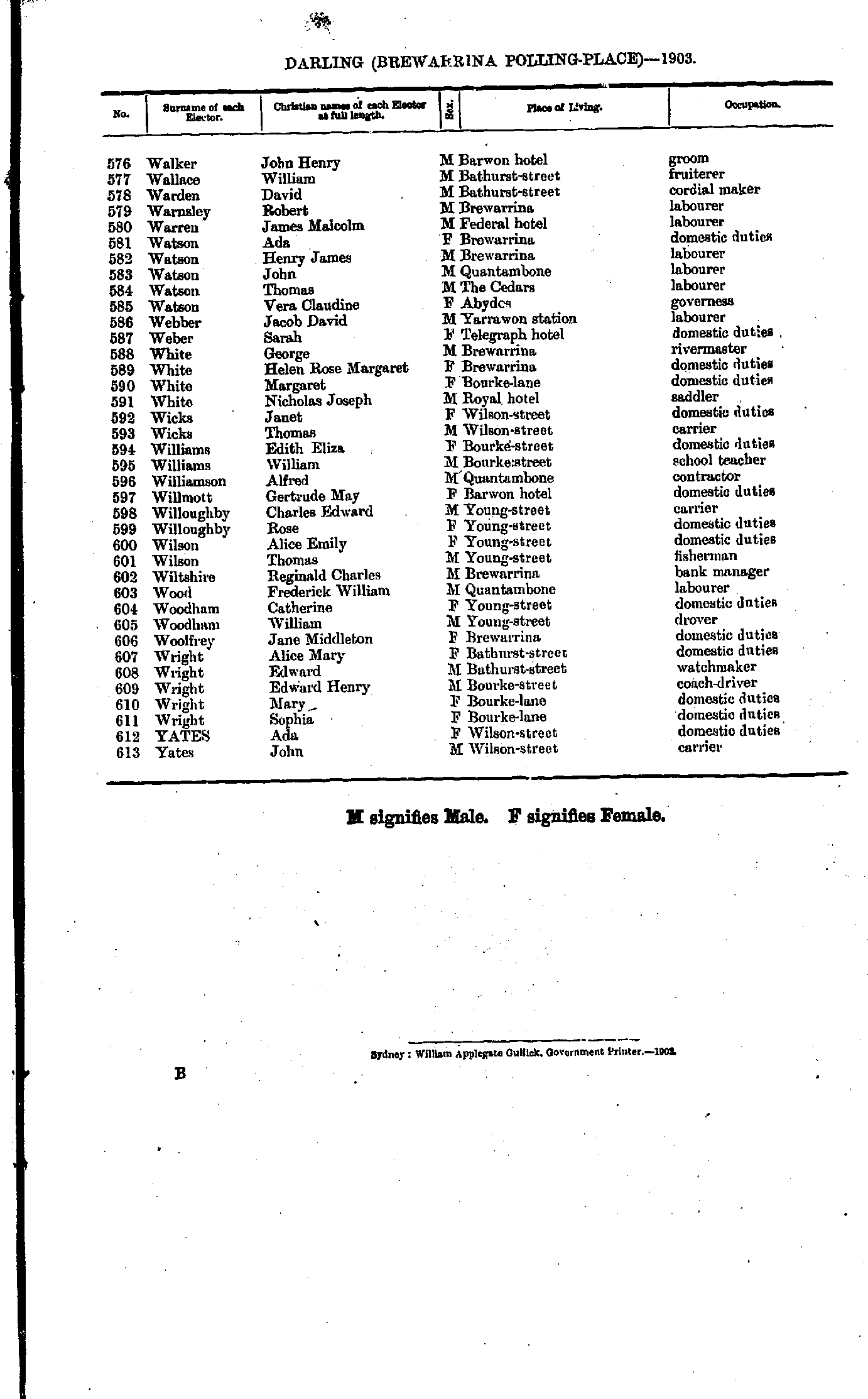
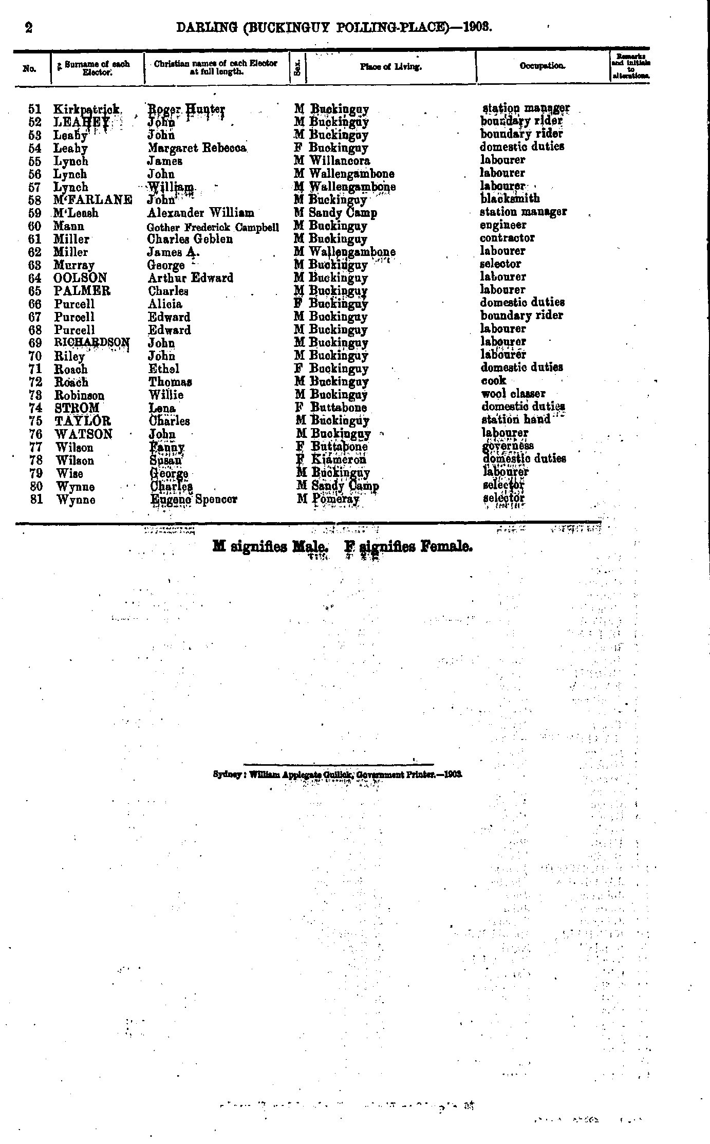
- Rowe William - Walker Charles
- Walker John - Yates John
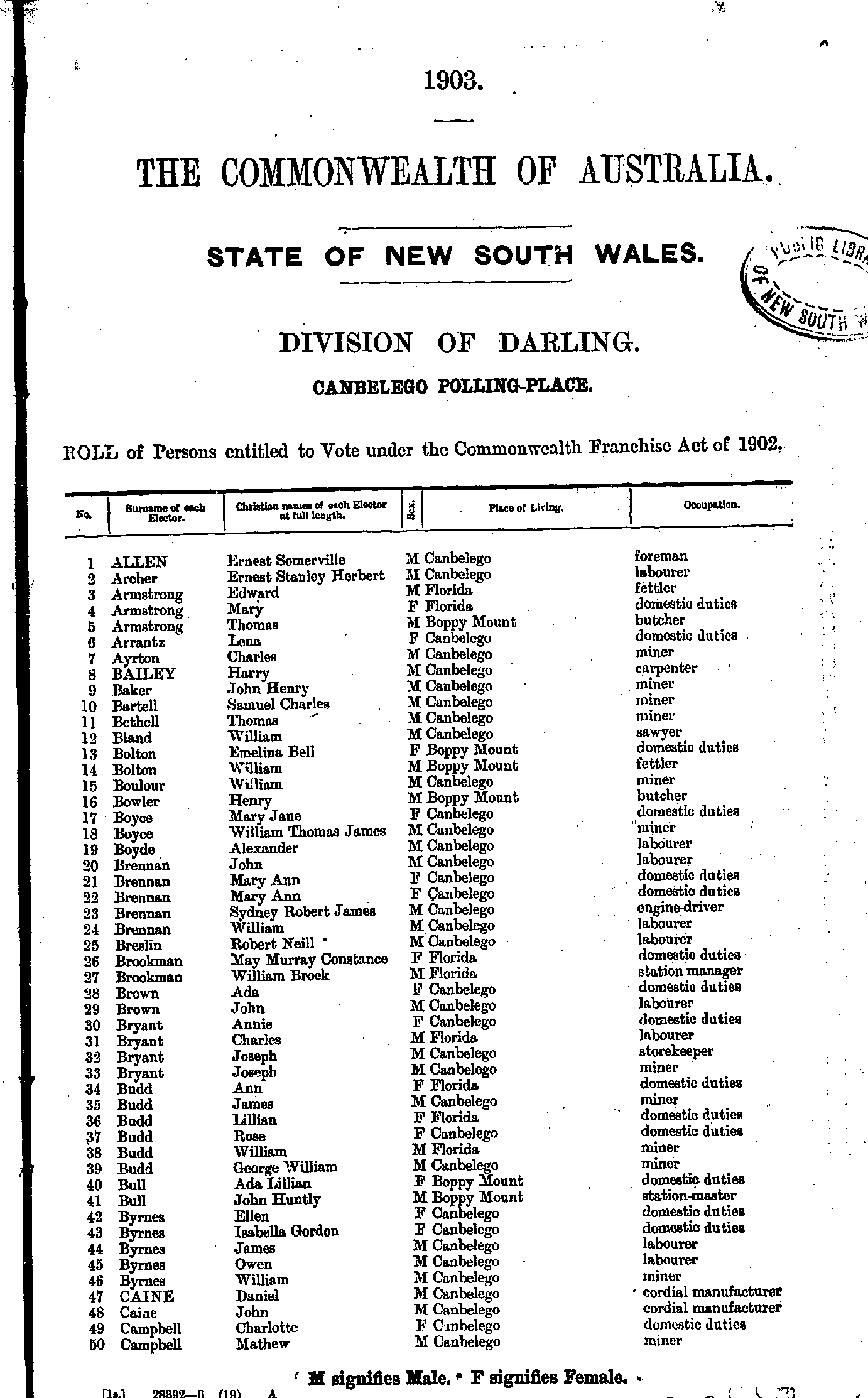
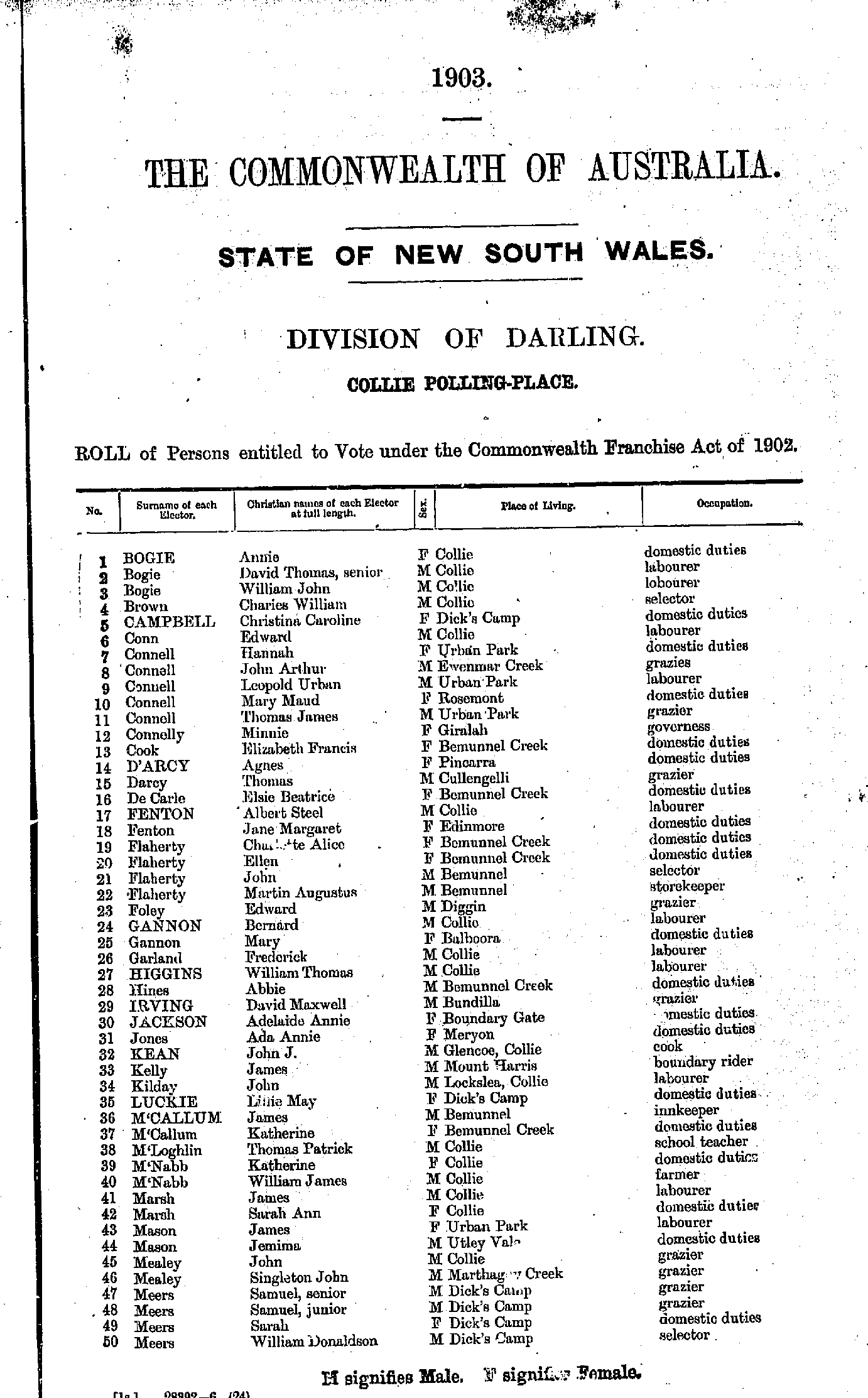
- Allen Ernest - Campbell Mathew
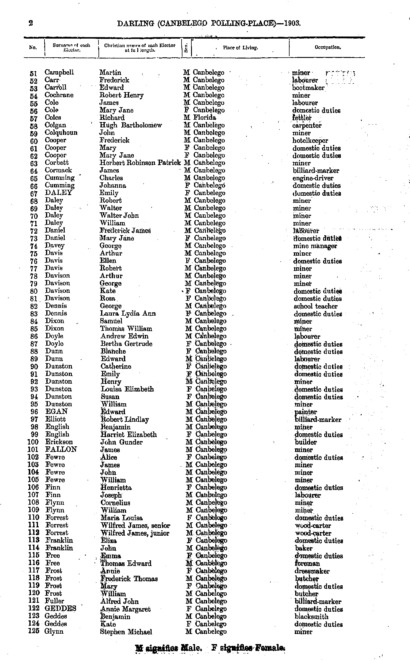
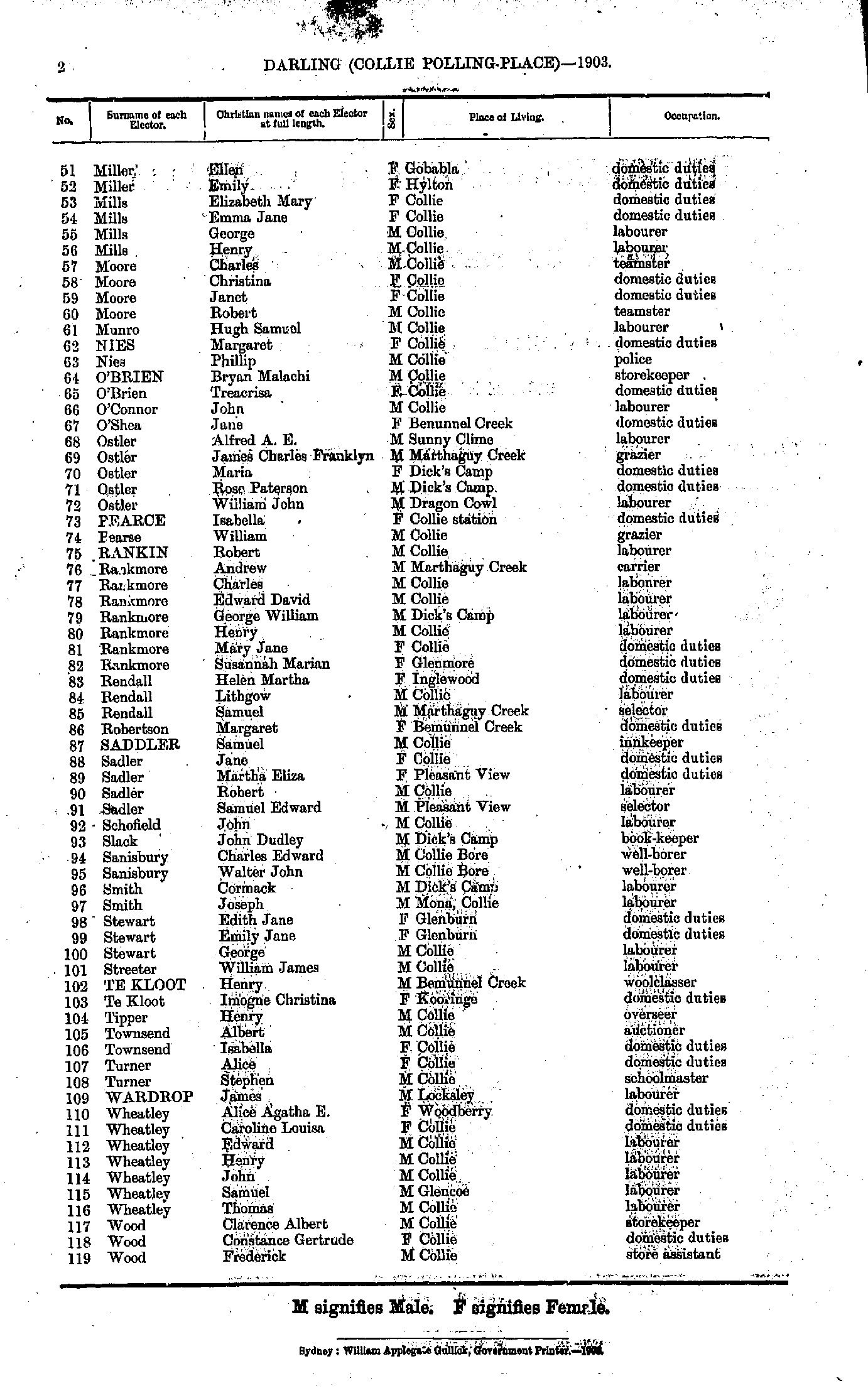
- Campbell Martin - Glynn Stephen
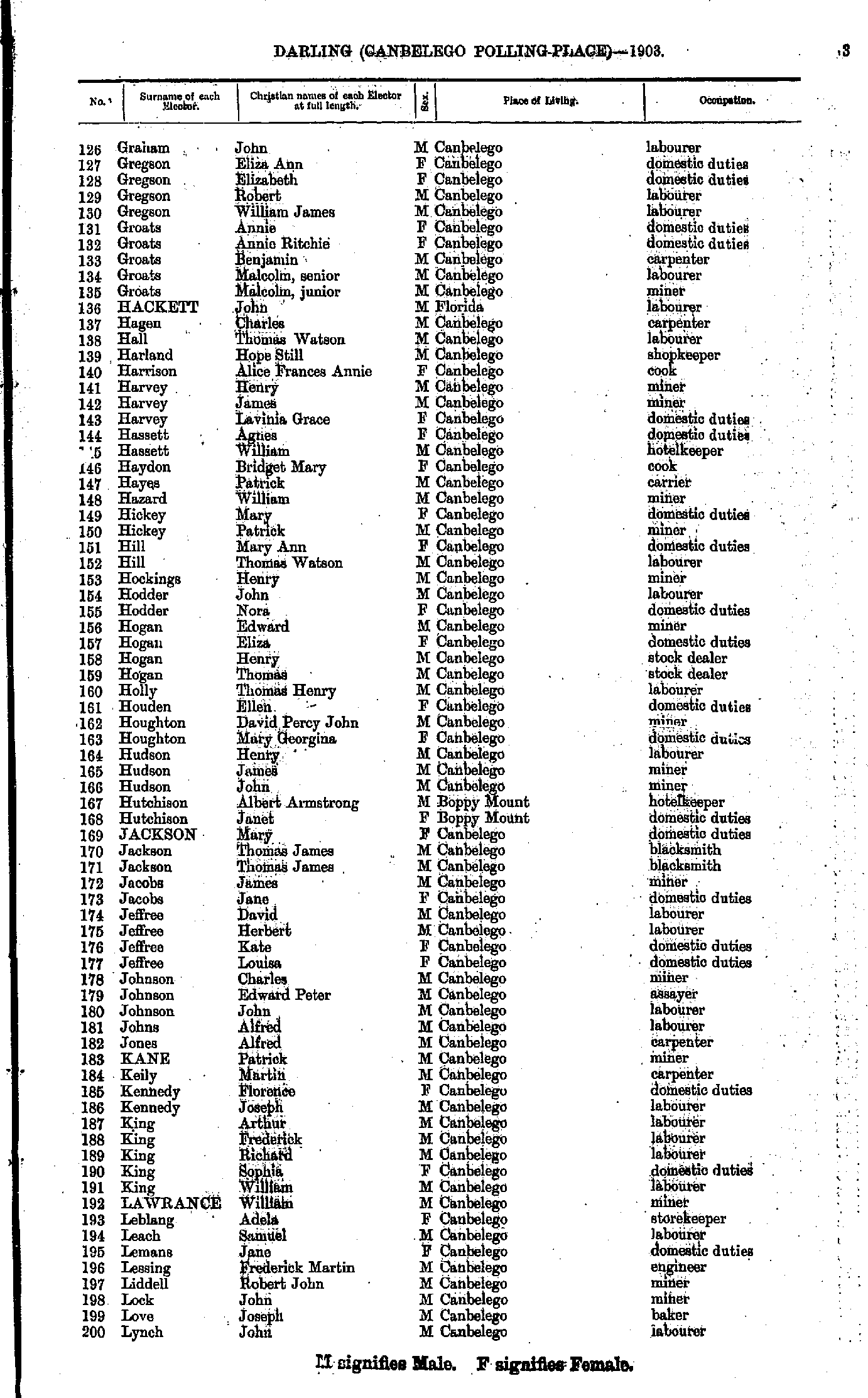
- Graham John - Lynch John
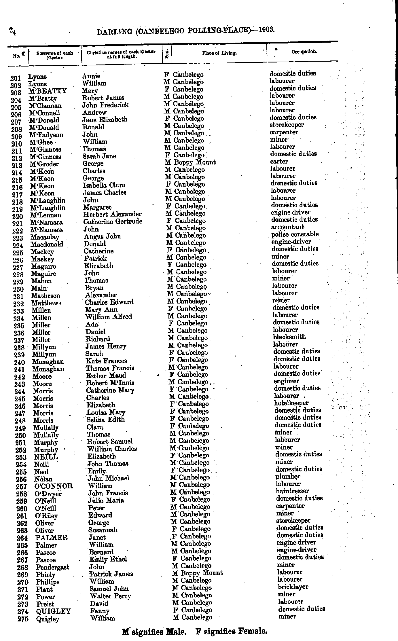
- Lyons Annie - Quigley William
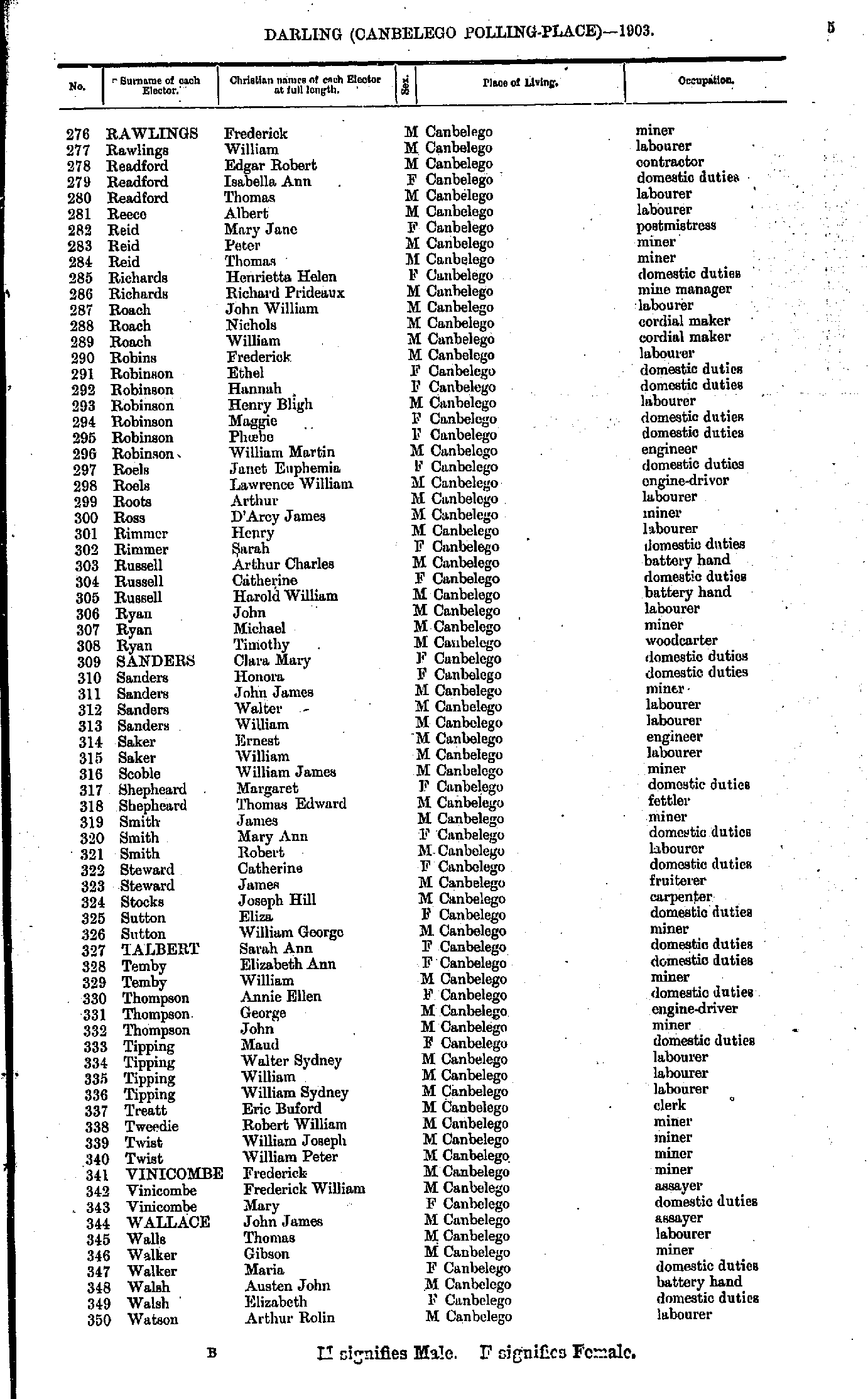
- Rawlings Frederick - Watson Arthur
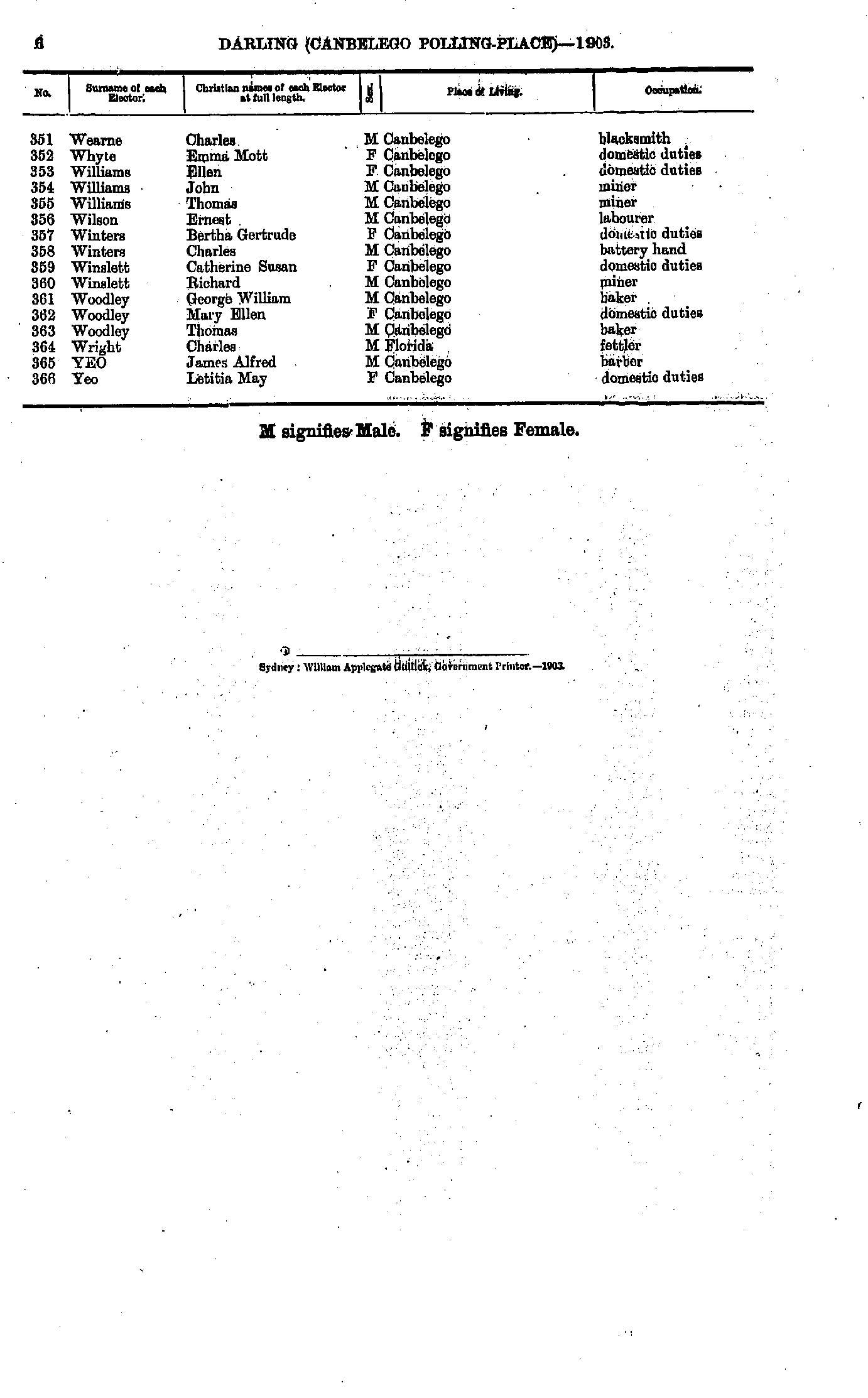
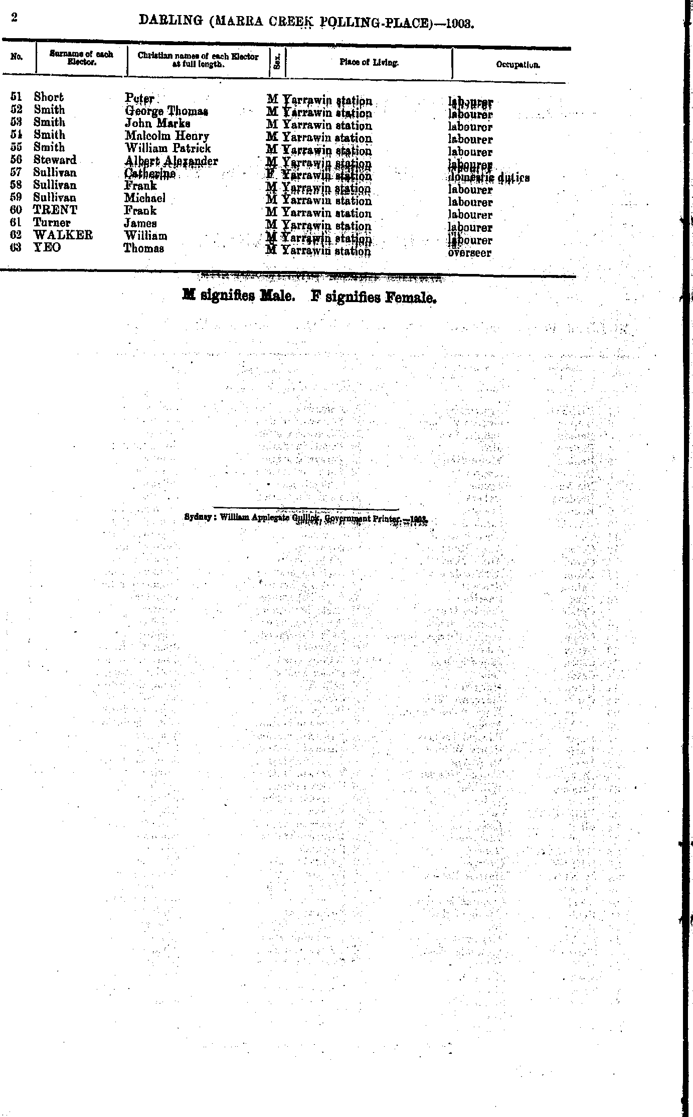
- Wearne Charles. - Yeo Letitia
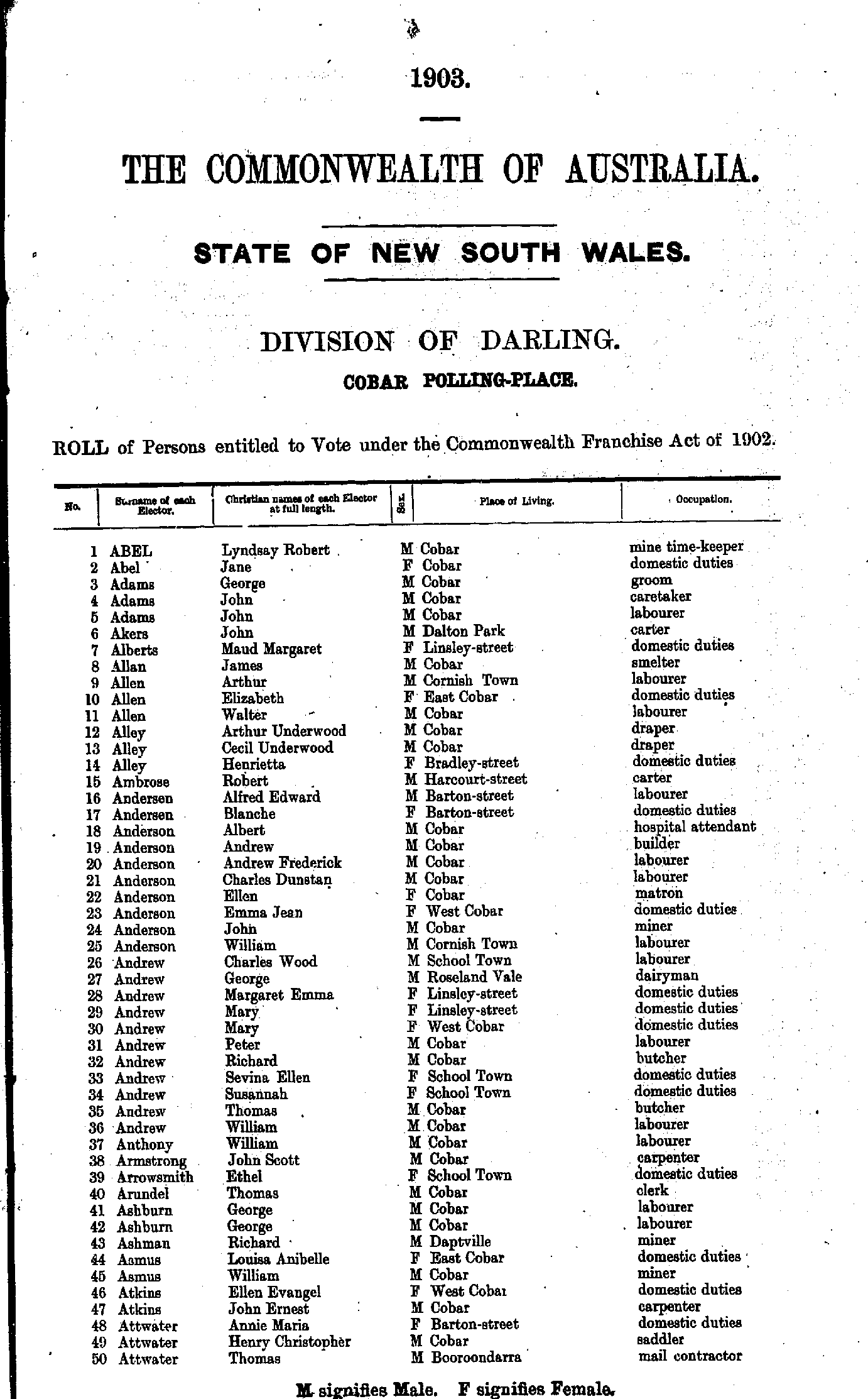
- Abel Lyndsay - Attwater Thomas
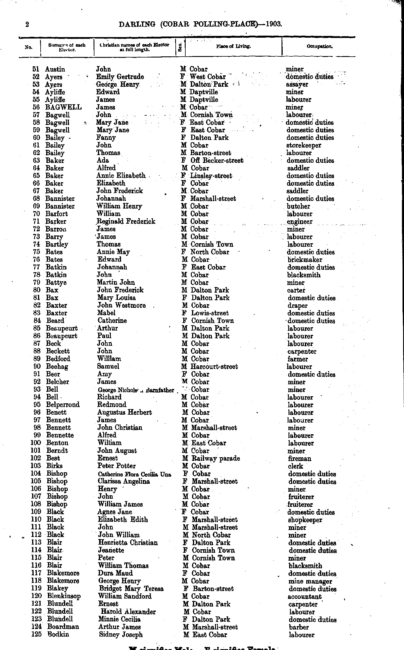
- Austin John - Bodkin Sidney
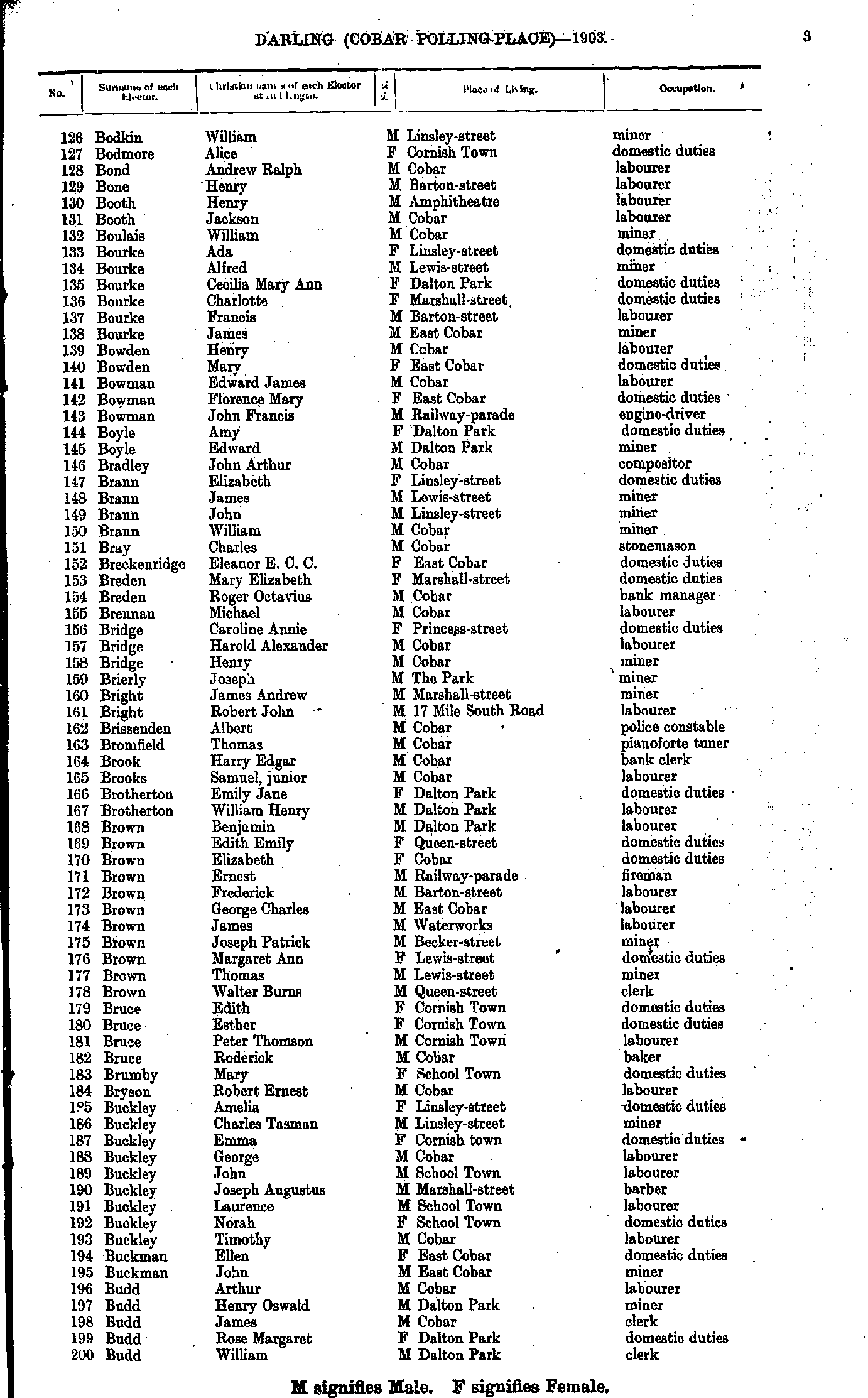
- Bodkin William - Budd William
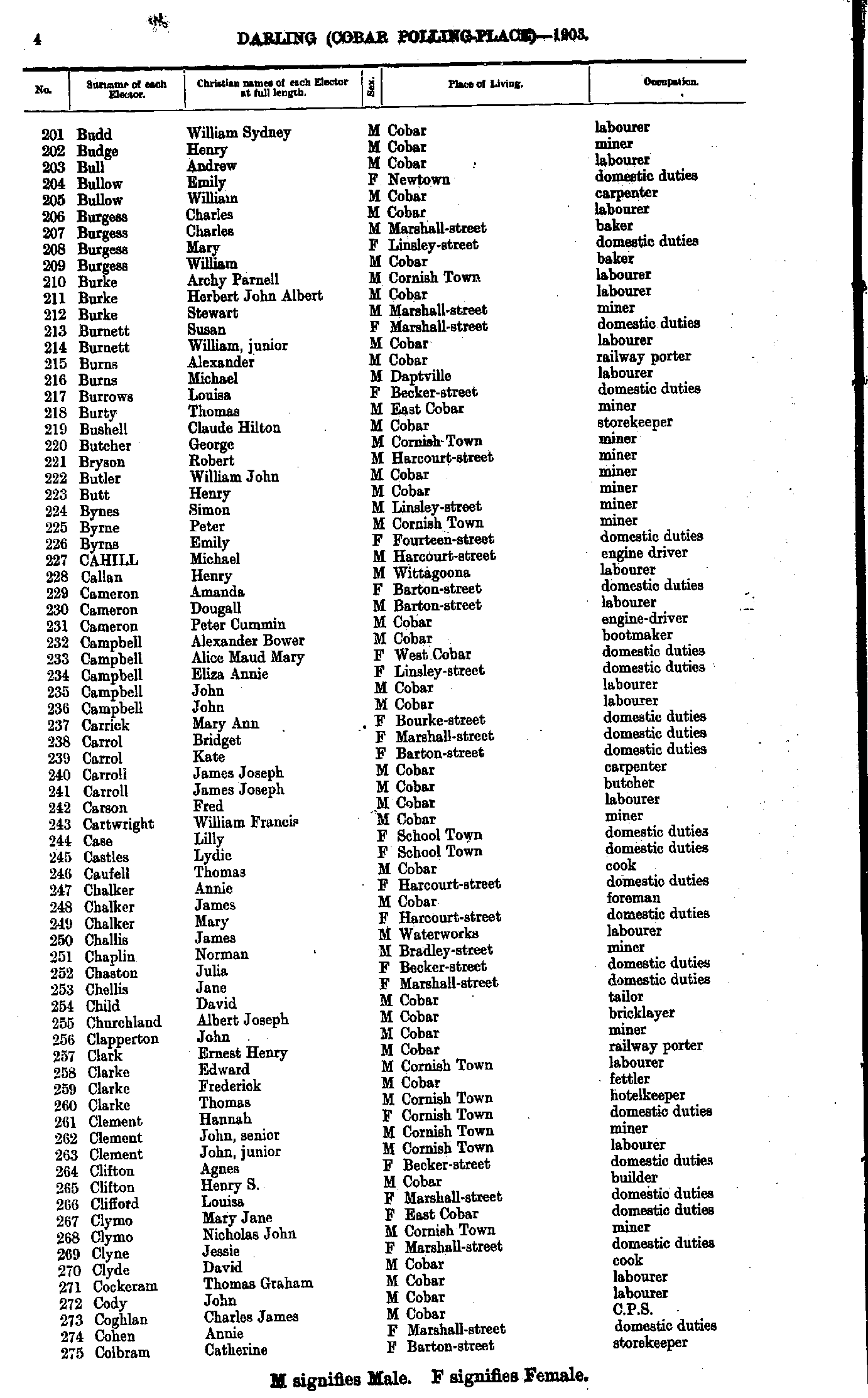
- Budd William - Colbram Catherine
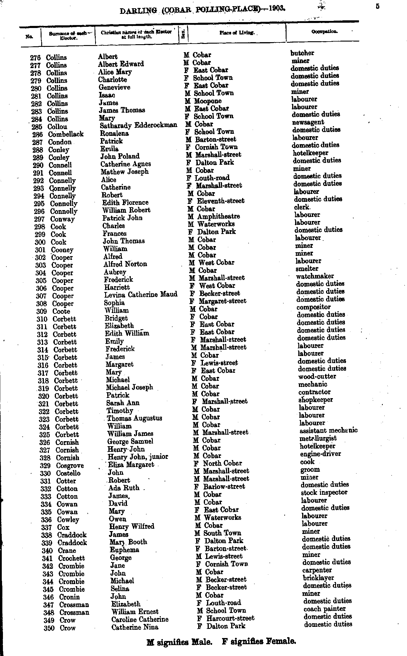
- Collins Albert - Crow Catherine
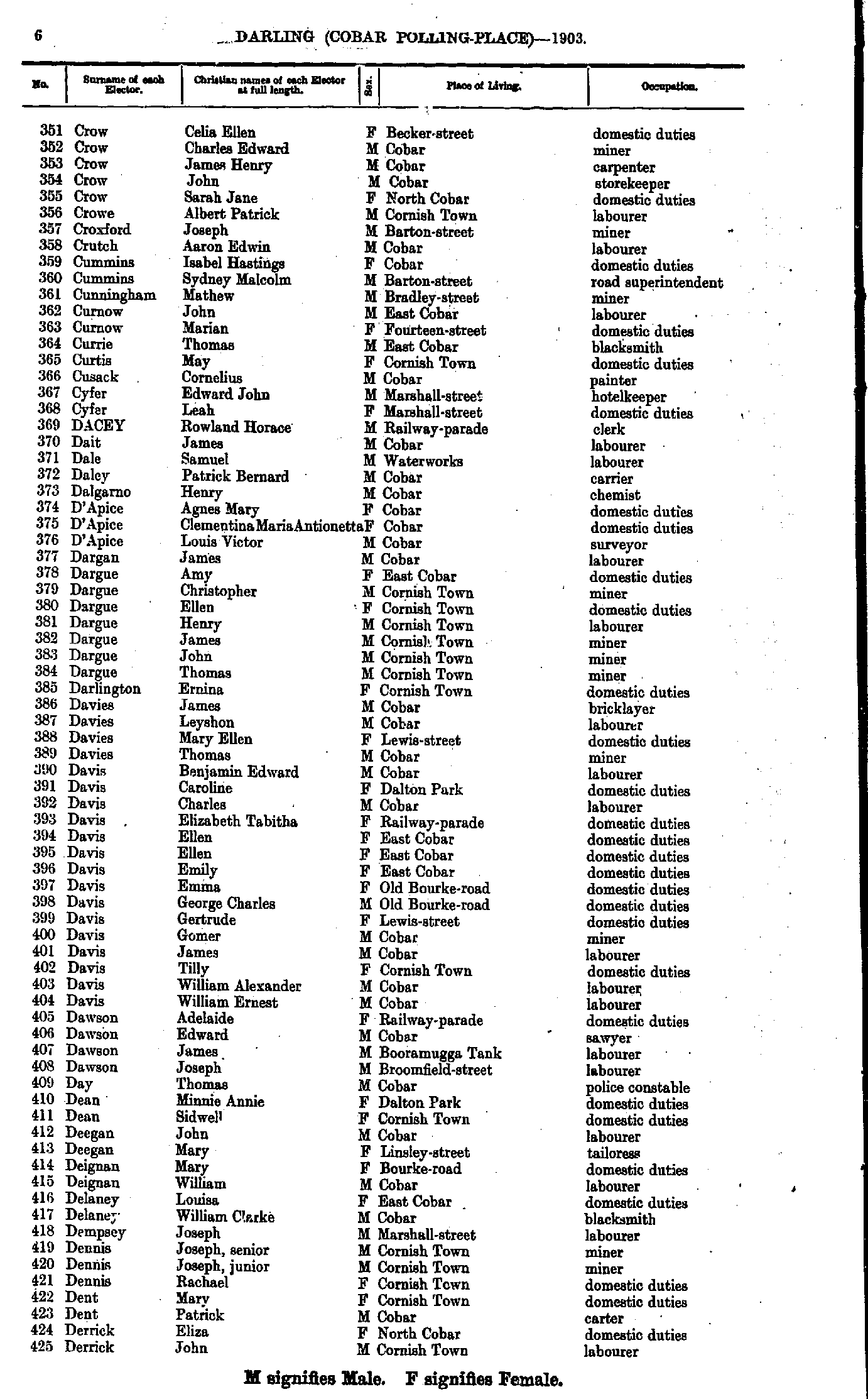
- Crow Celia - Derrick John
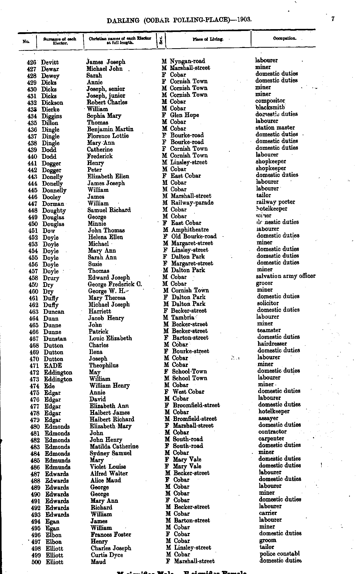
- Devitt James - Elliott Maud
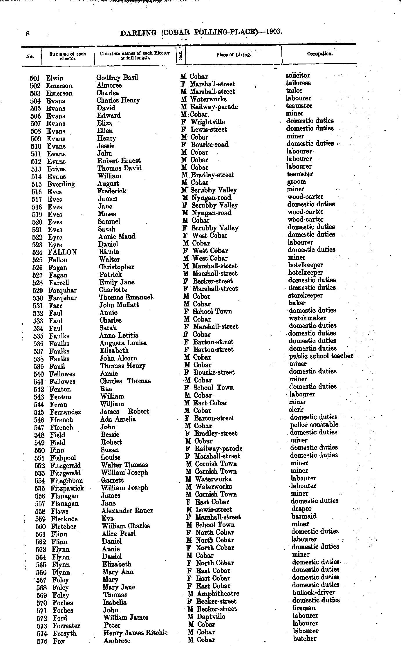
- Elwin Godfrey - Fox Ambrose
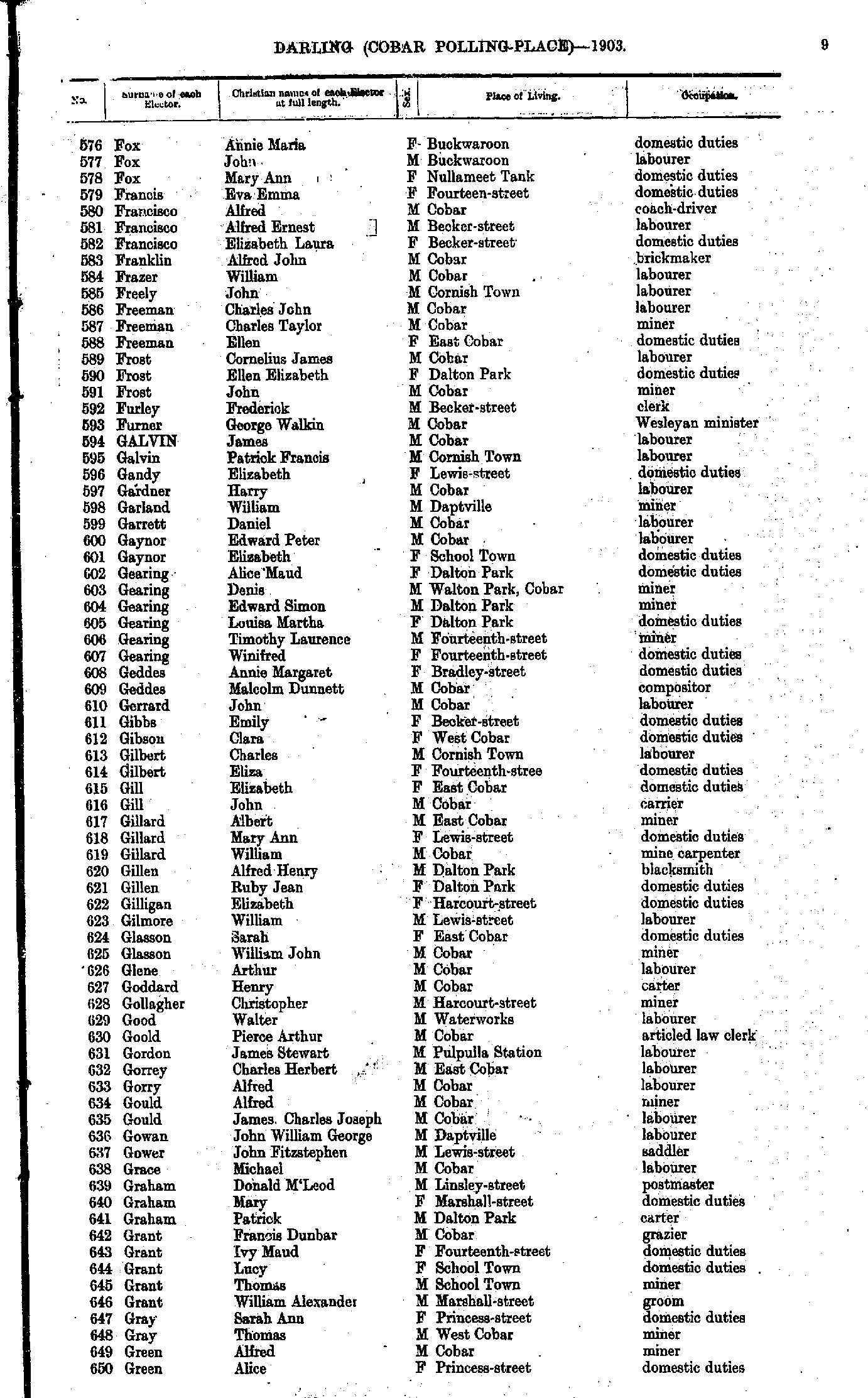
- Fox Annie - Green Alice
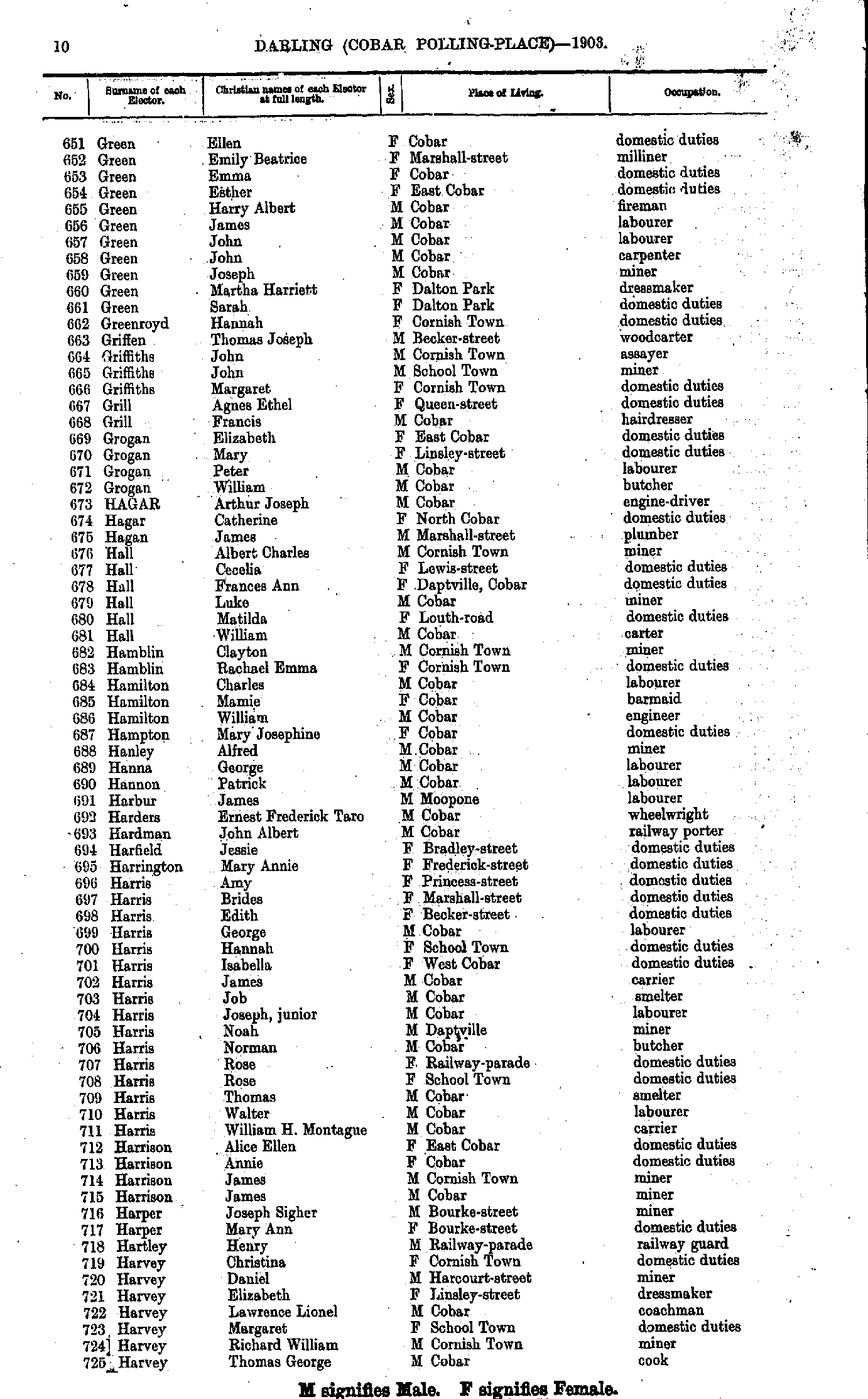
- Green Ellen - Harvey Thomas
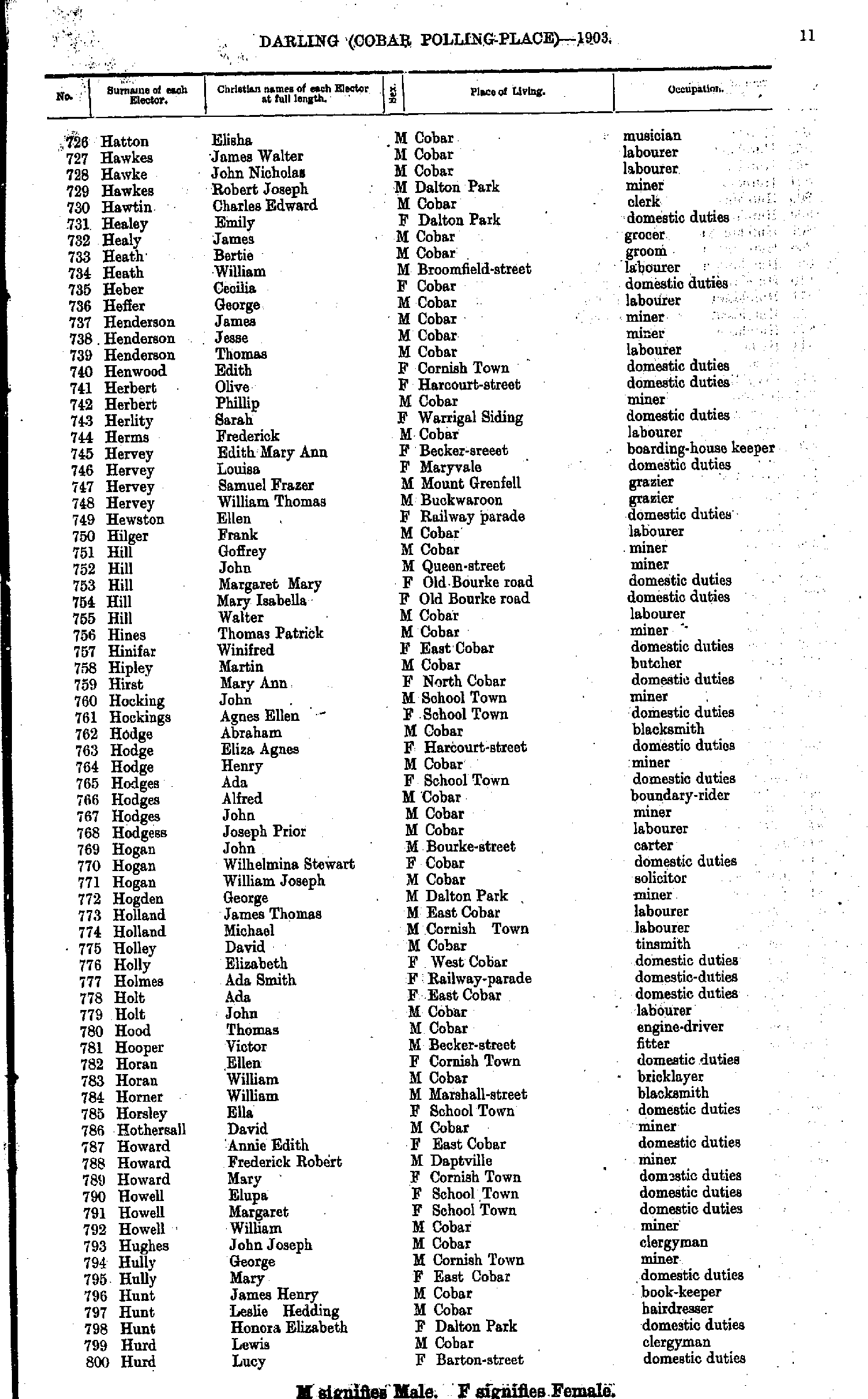
- Hatton Elisha - Hurd Lucy
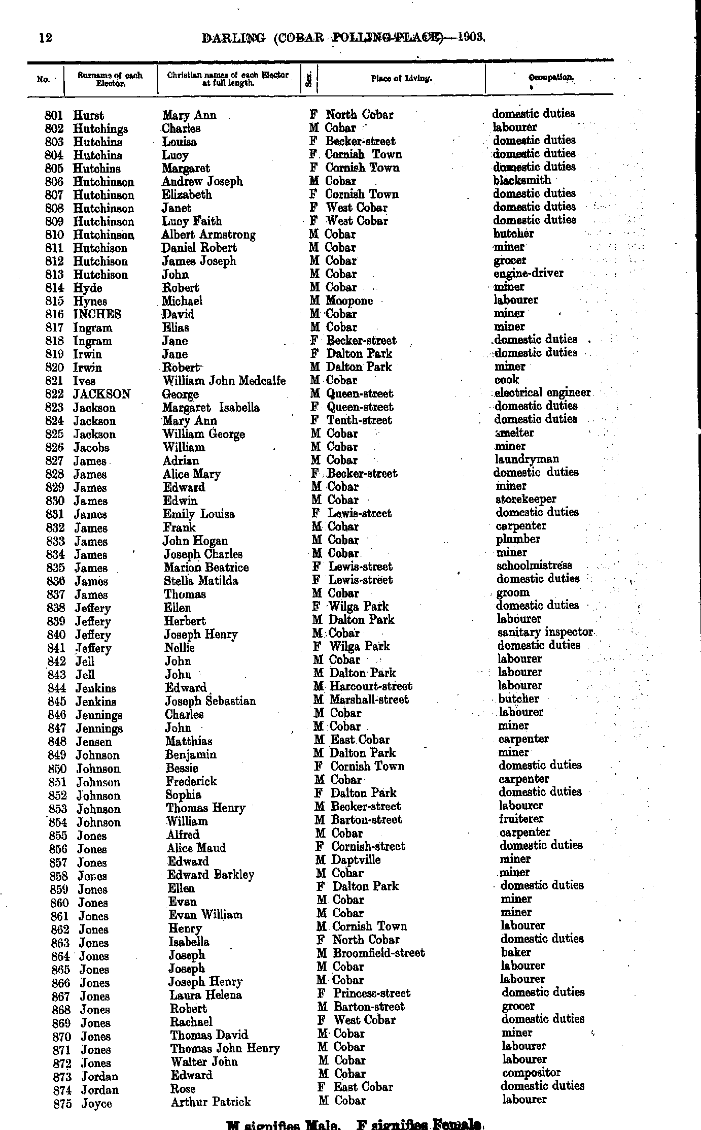
- Hurst Mary - Joyce Arthur
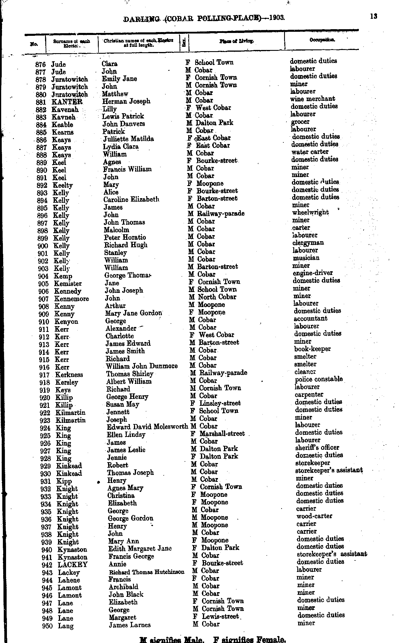
- Jude Clara - Lang James
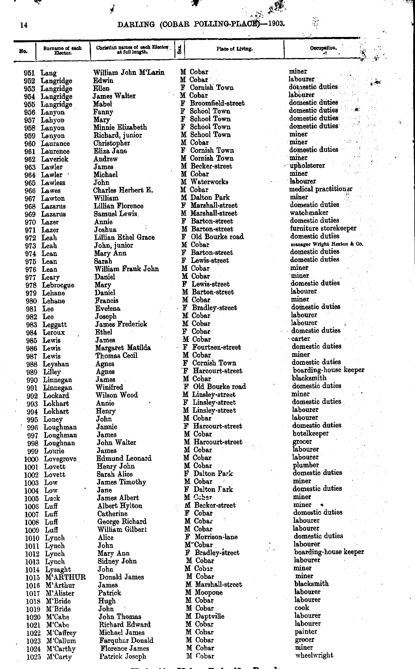
- Lang William - M'Carty Patrick
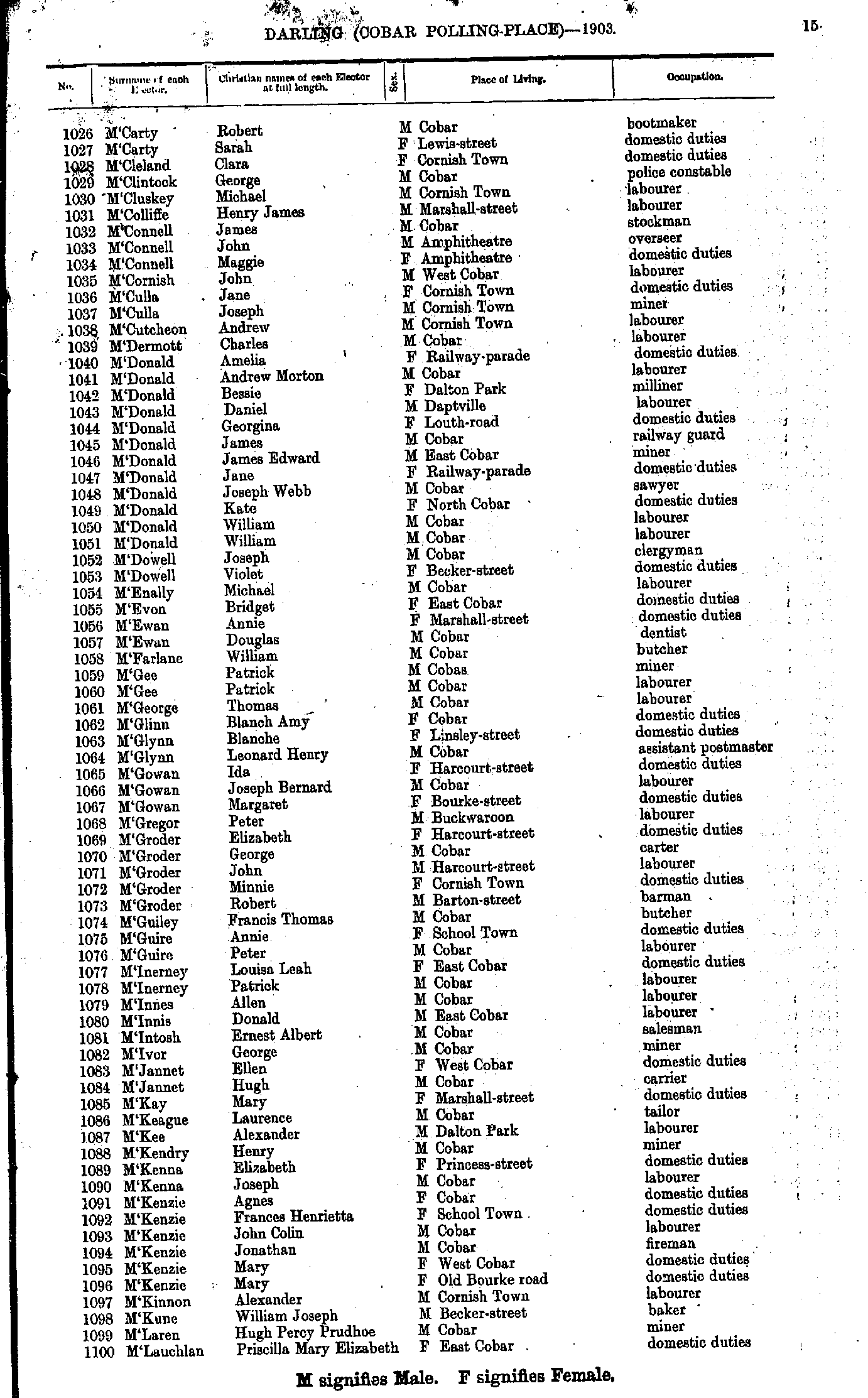
- M'Carty Robert - M'Lauchlan Priscilla
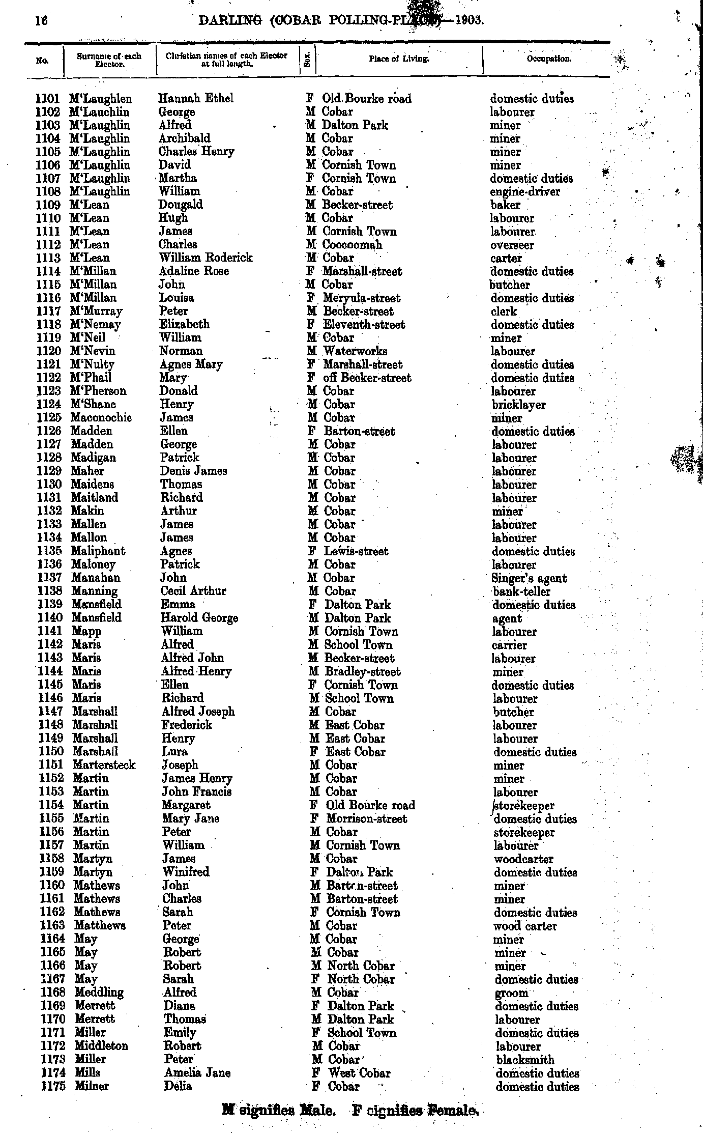
- M'Laughlen Hannah - Milner Delia
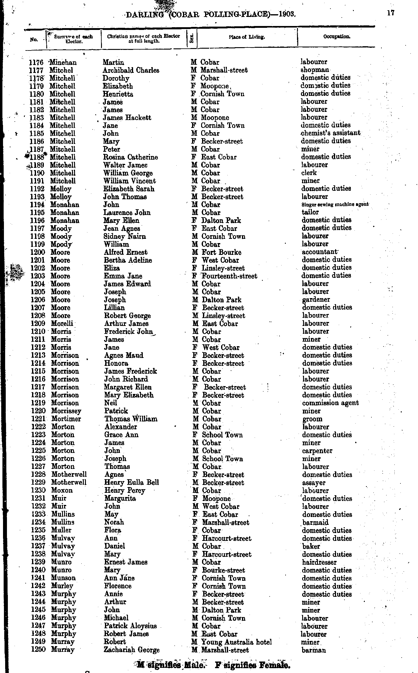
- Minehan Martin - Murray Zachariah
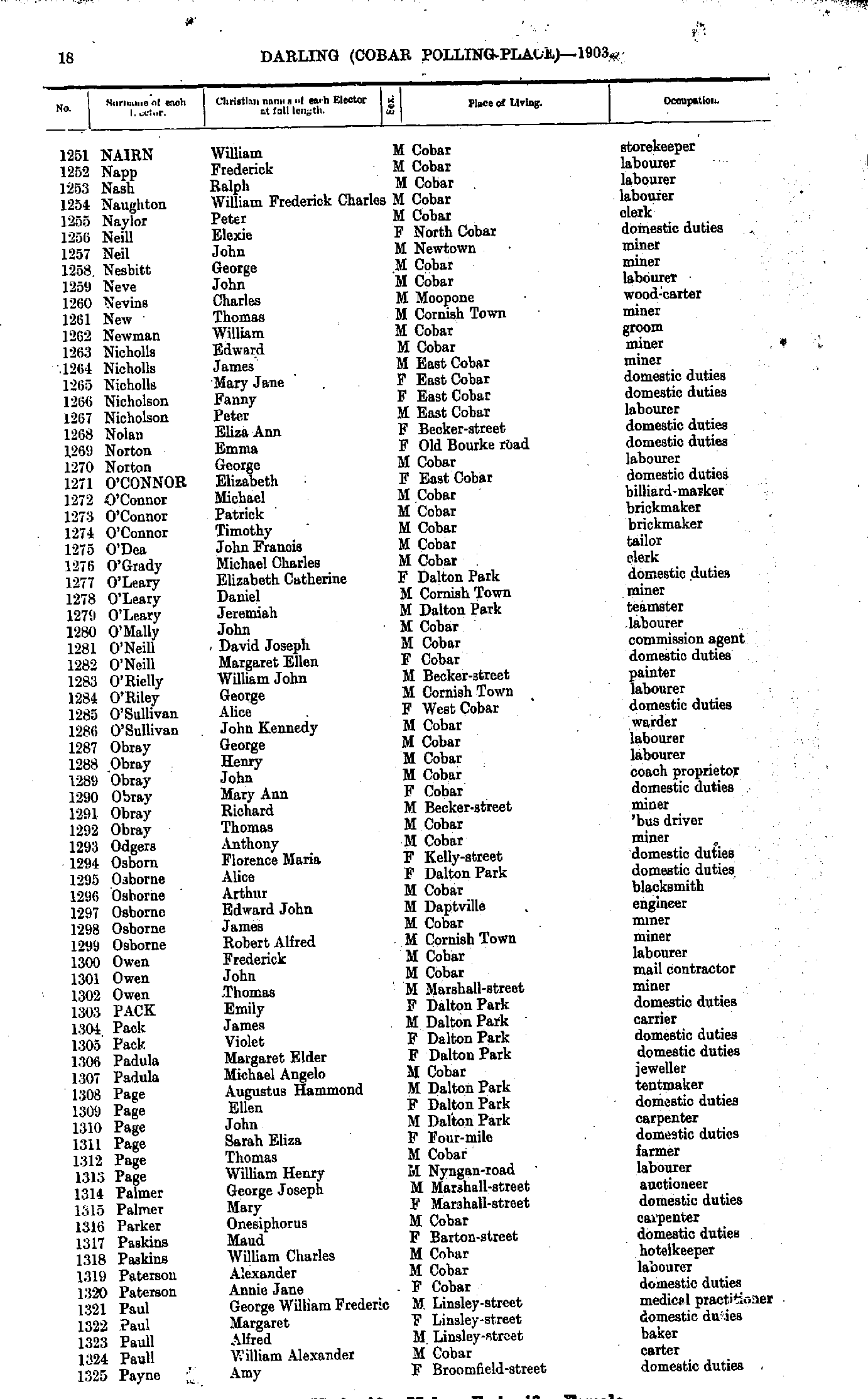
- Nairn William - Payne Amy
- Payne Charles - Ramsay John
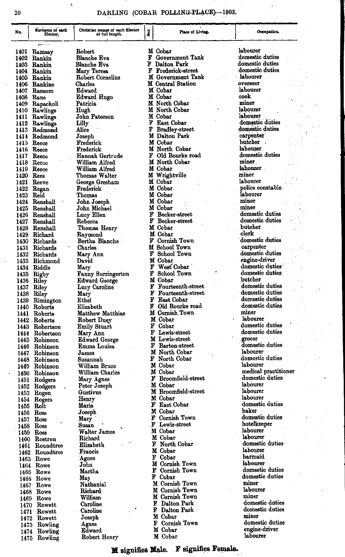
- Ramsay Robert - Rowling Robert
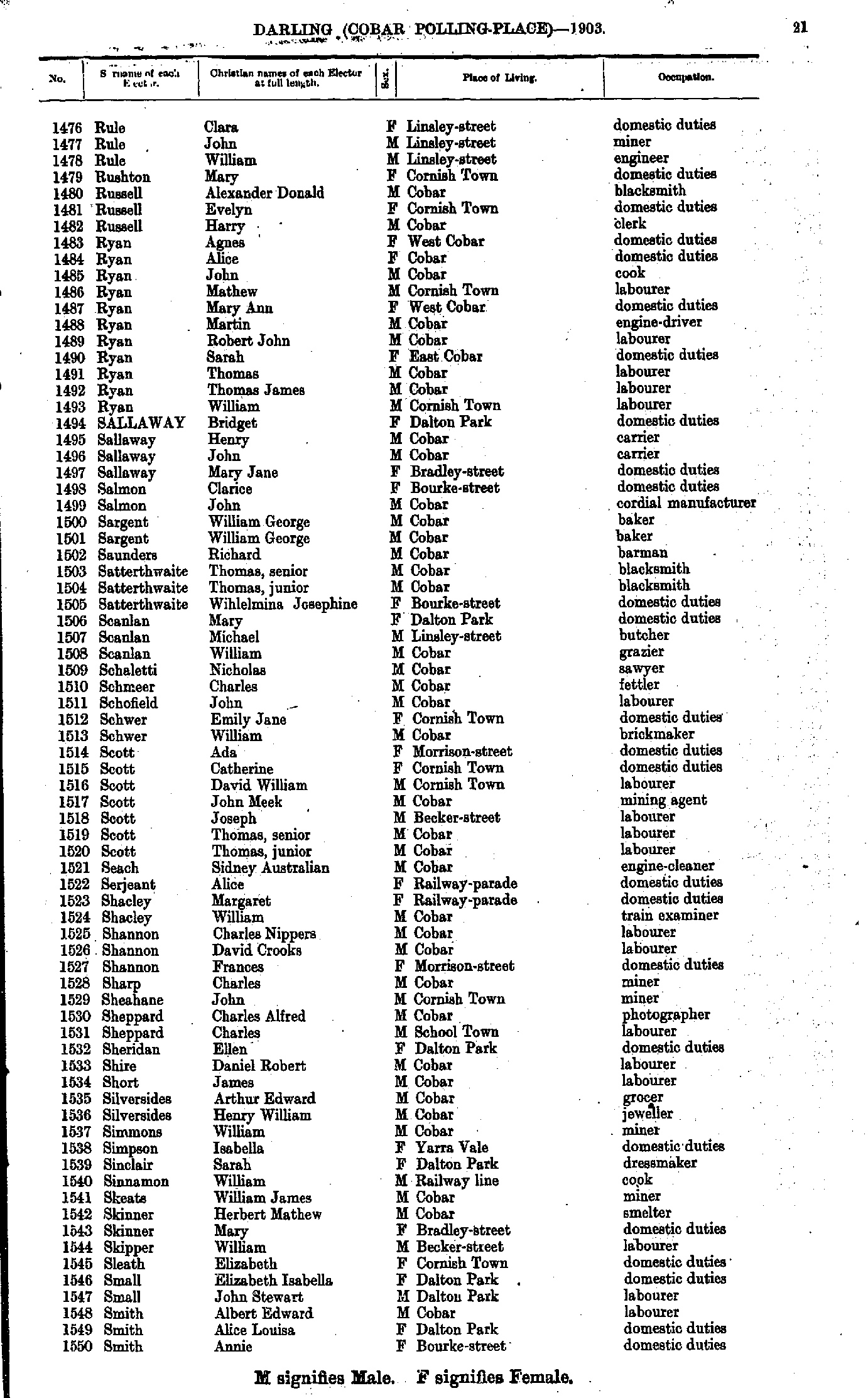
- Rule Clara - Smith Annie
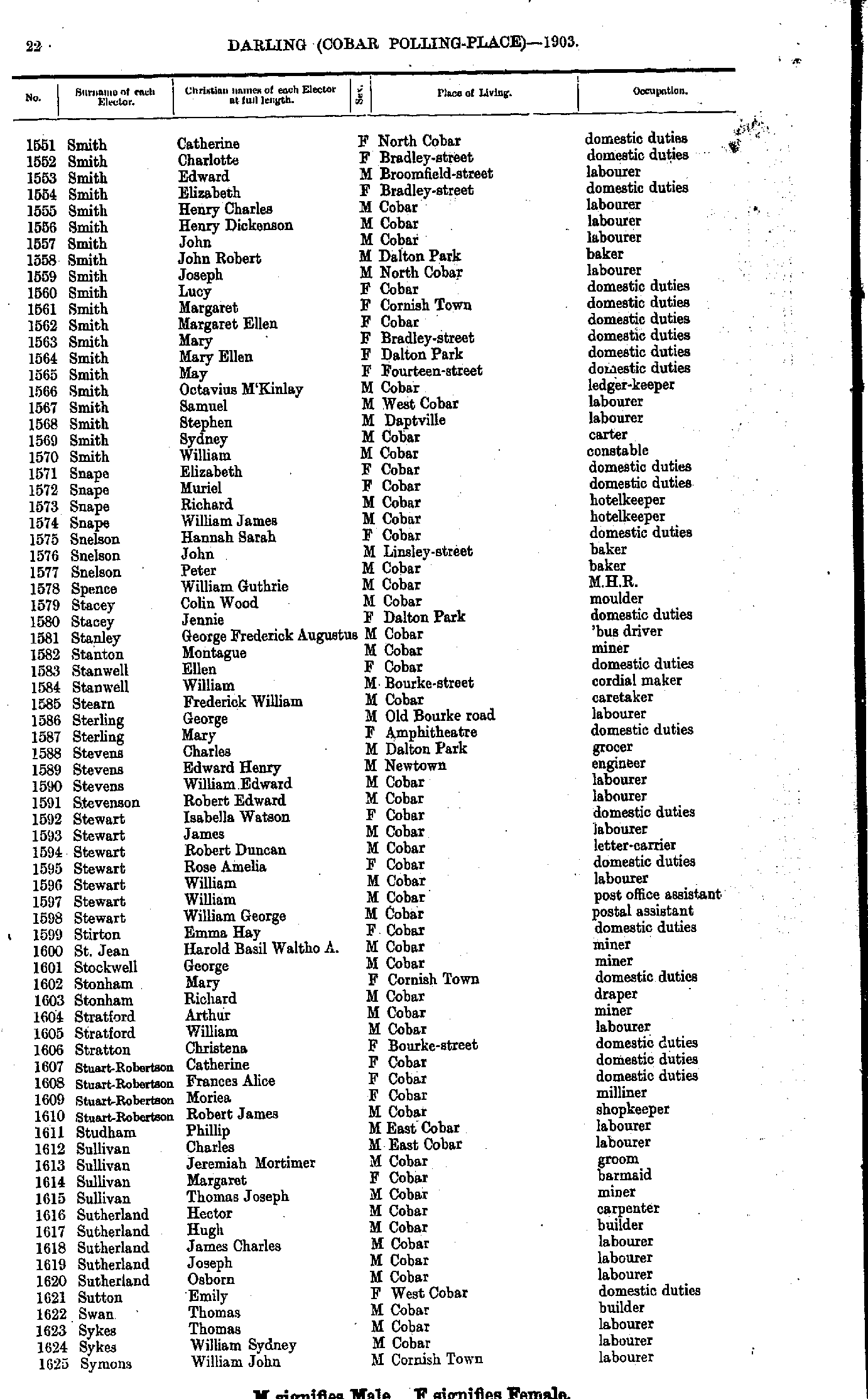
- Smith Catherine - Symons William
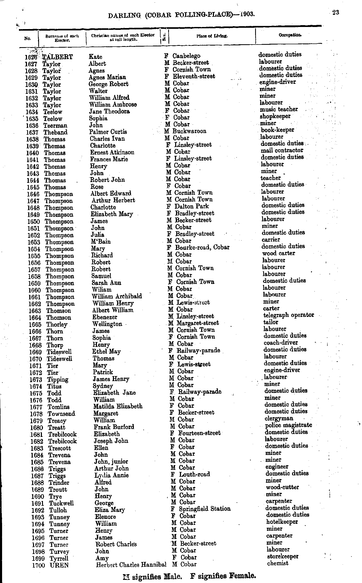
- Talbert Kate - Uren Herbert
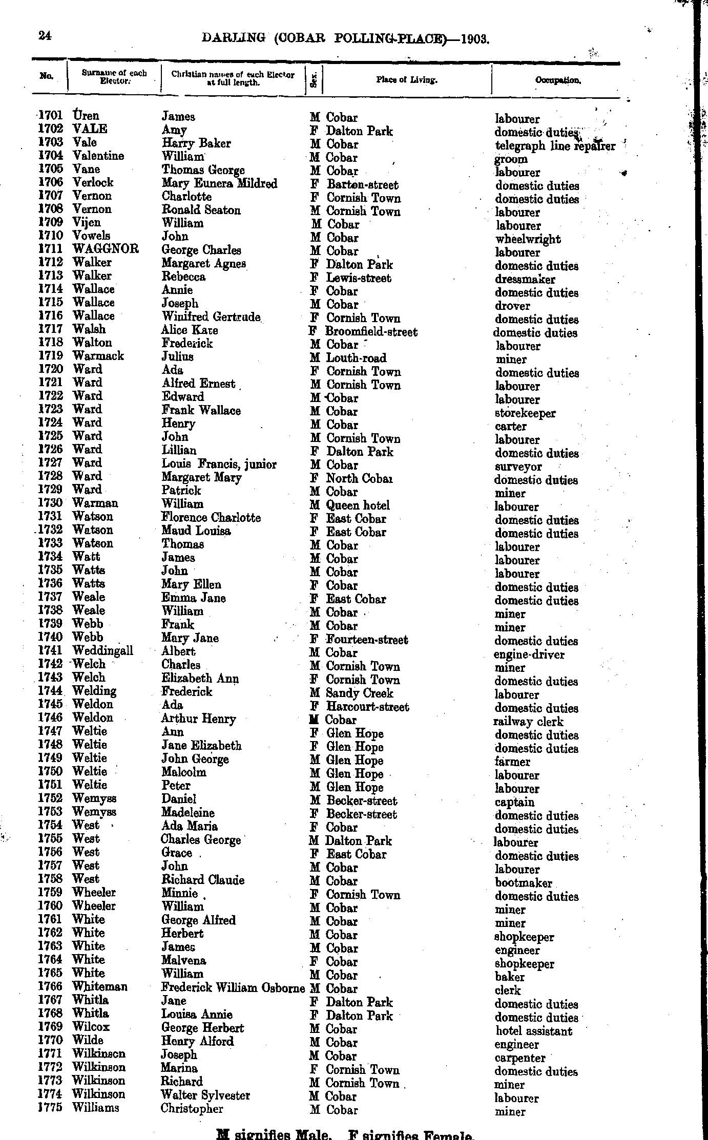
- Uren James - Williams Christopher
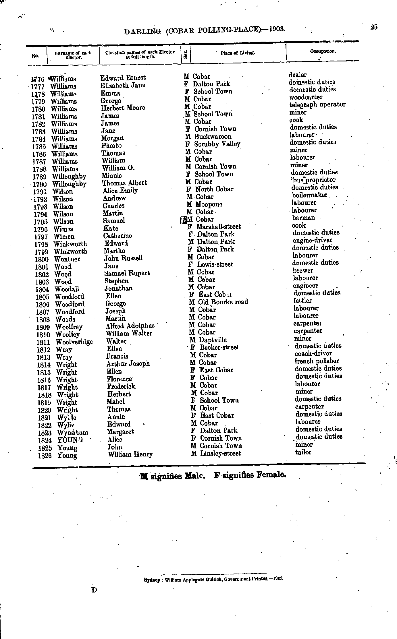
- Williams Edward - Young William
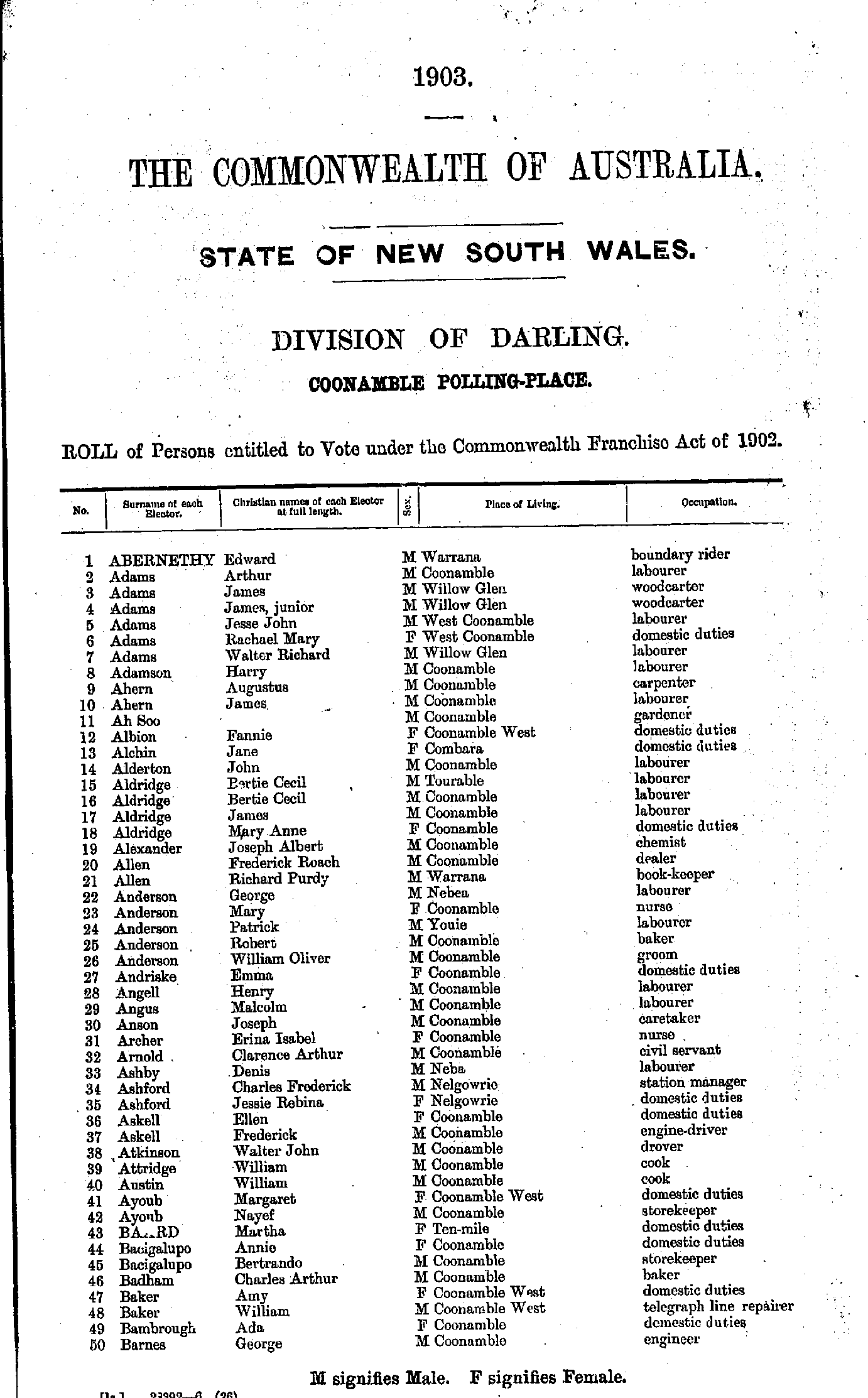
- Abernethy Edward - Barnes George
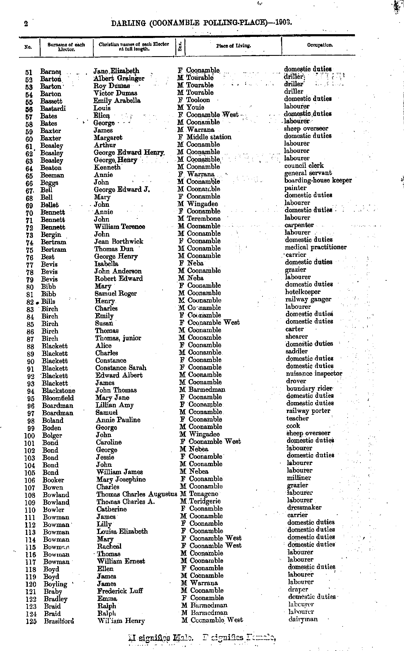
- Barnes Jane - Brasilford William
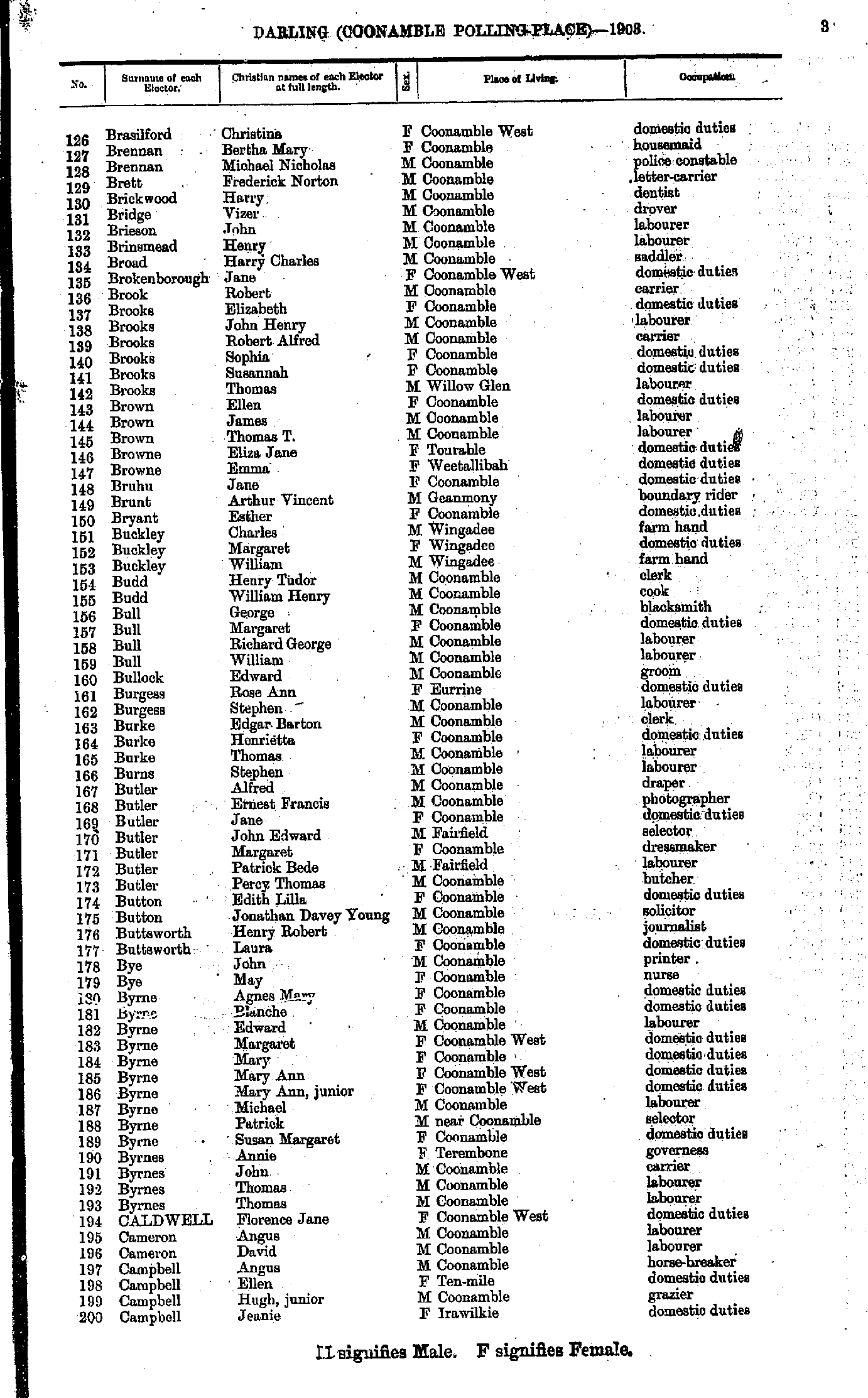
- Brasilford Christina - Campbell Jeanie
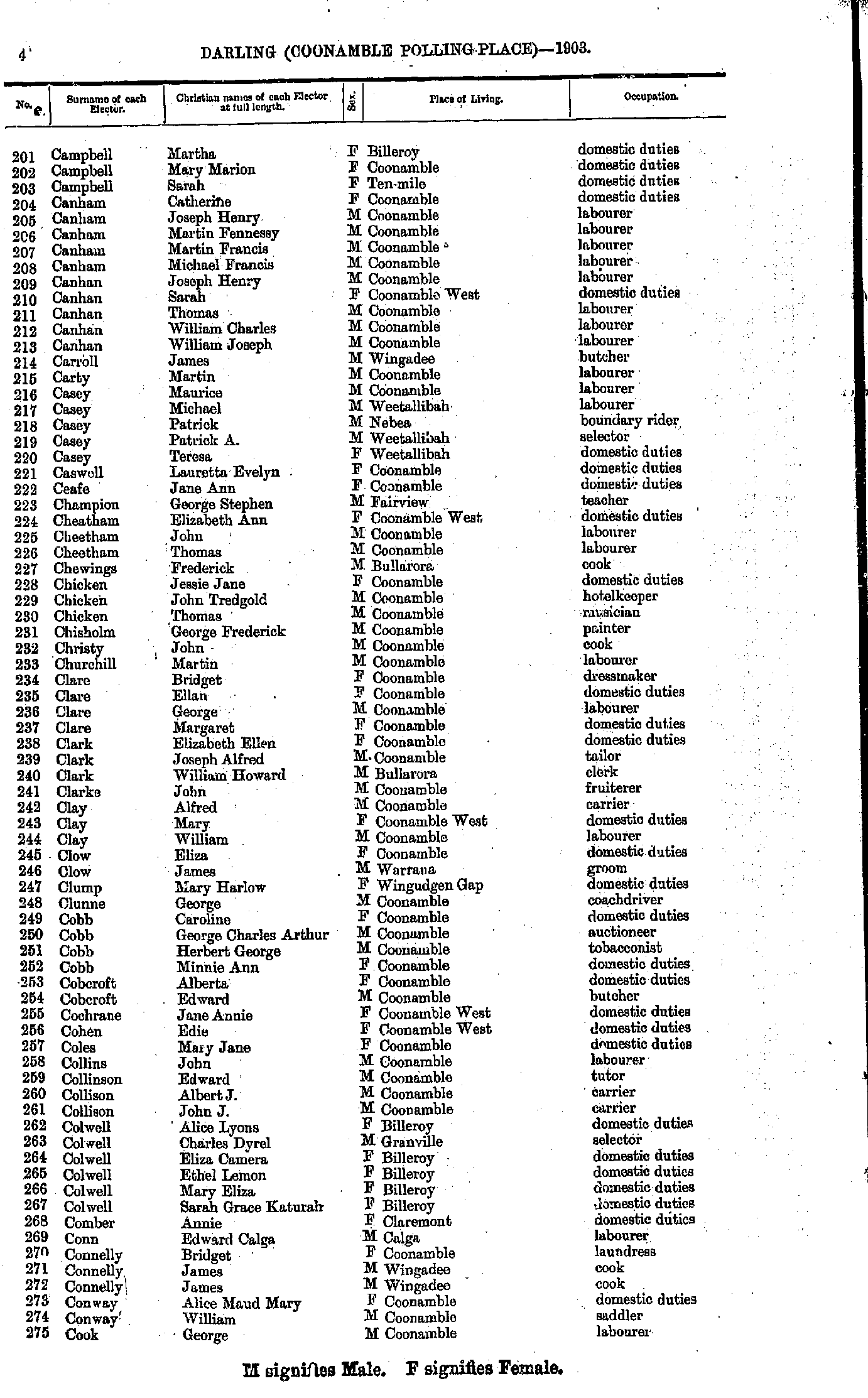
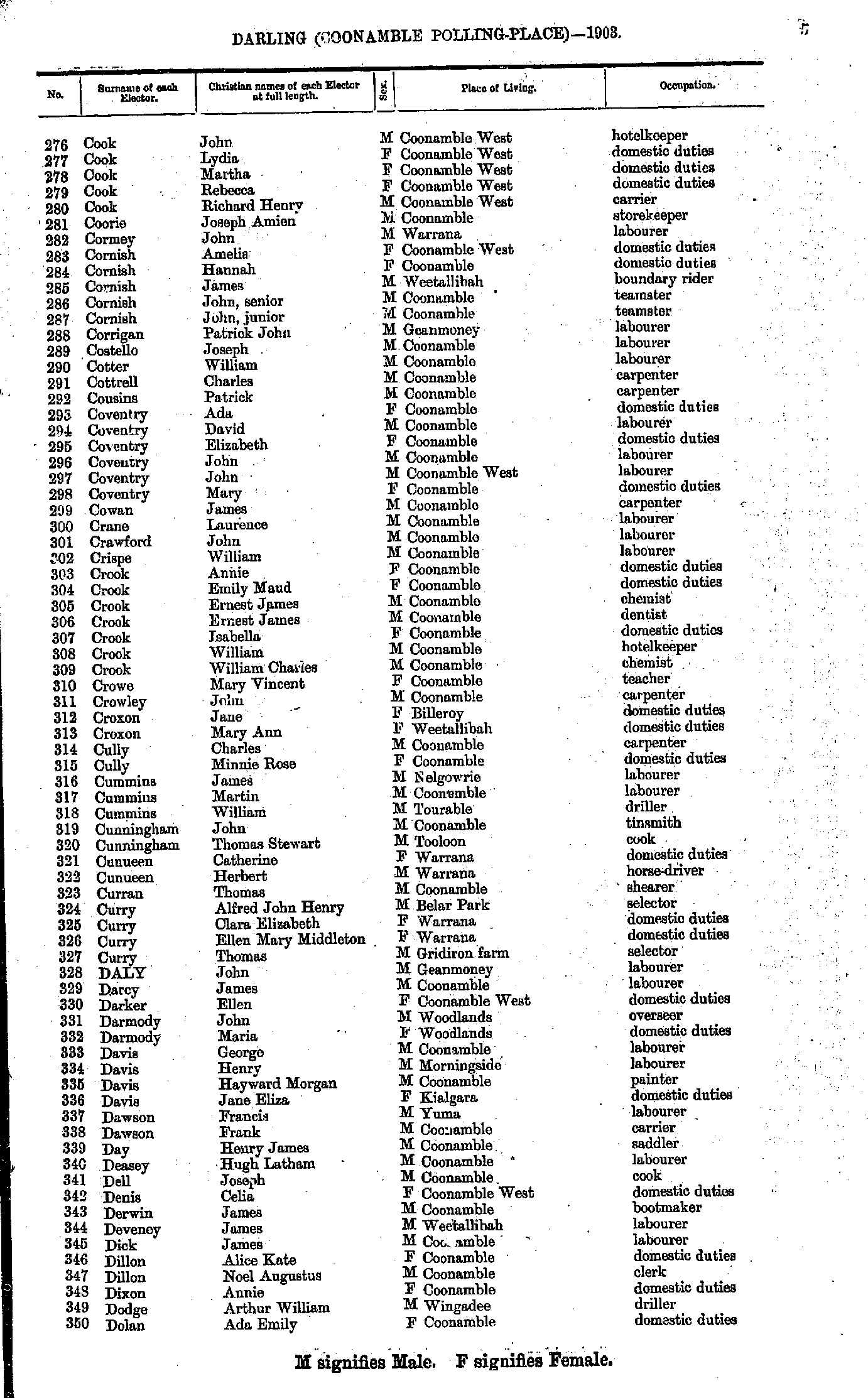
- Campbell Martha - Cook George
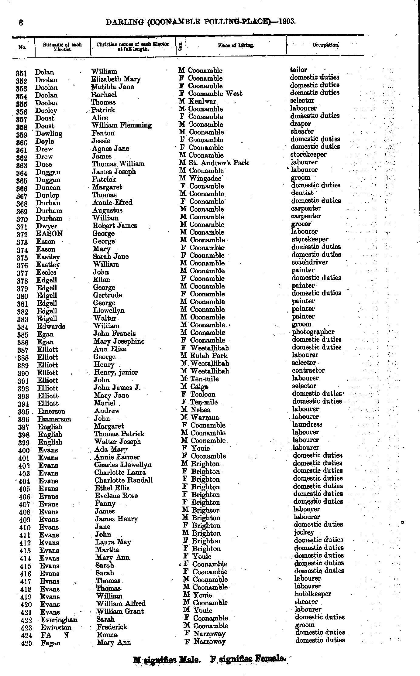
- Cook John. - Dolan Ada
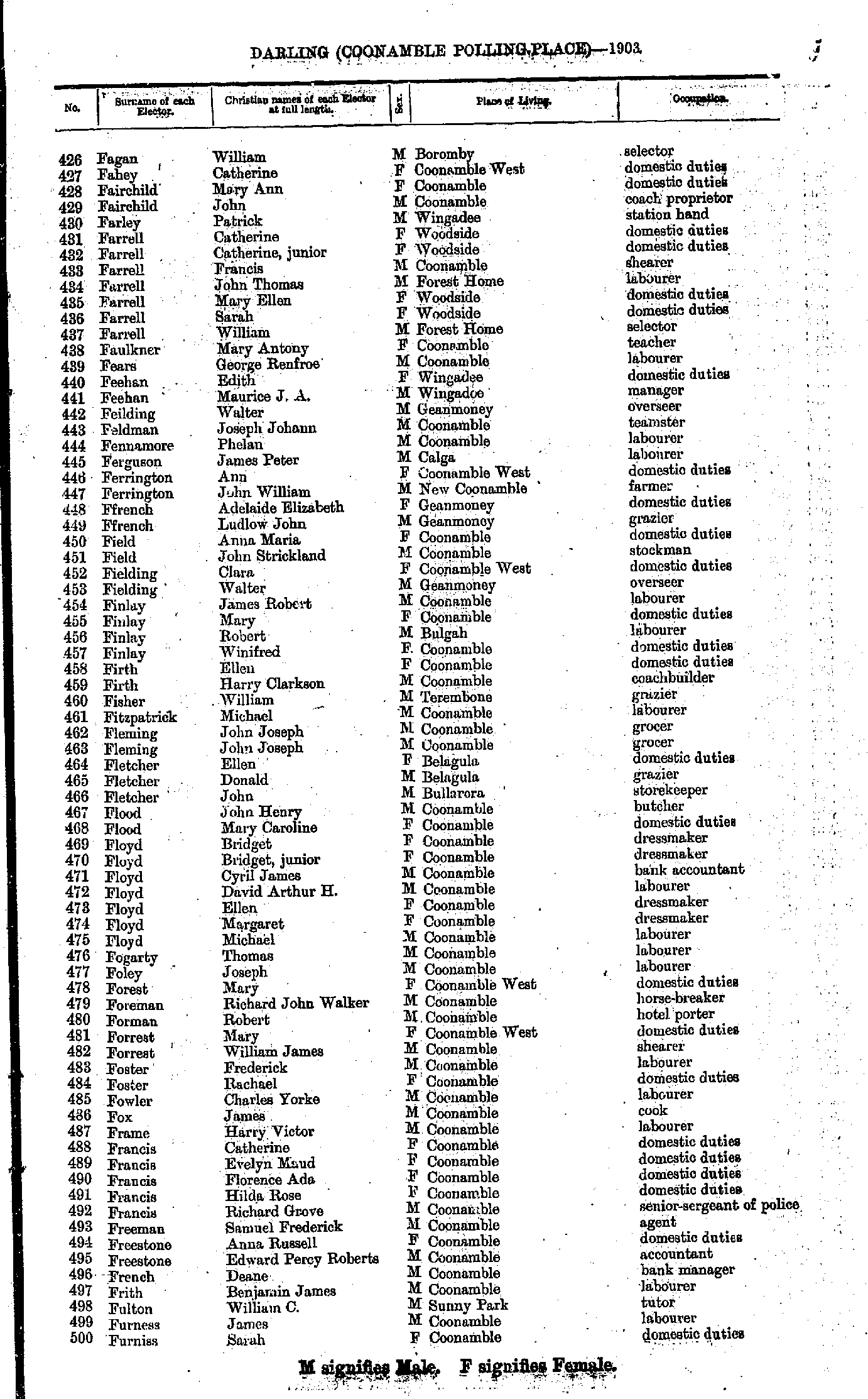
- Dolan William - Fagan Mary
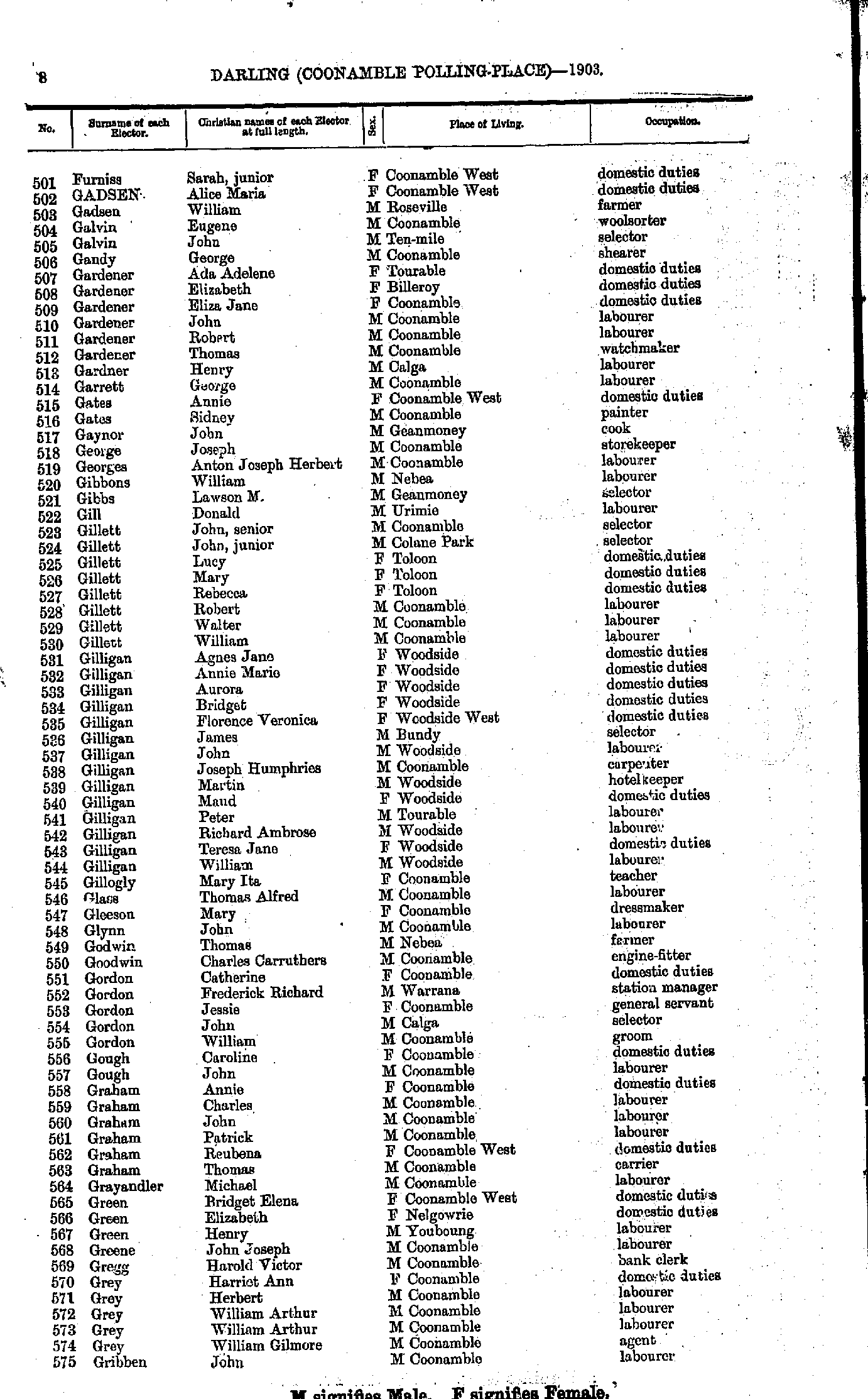
- Fagan William - Furniss Sarah
- Furniss Sarah - Gribben John
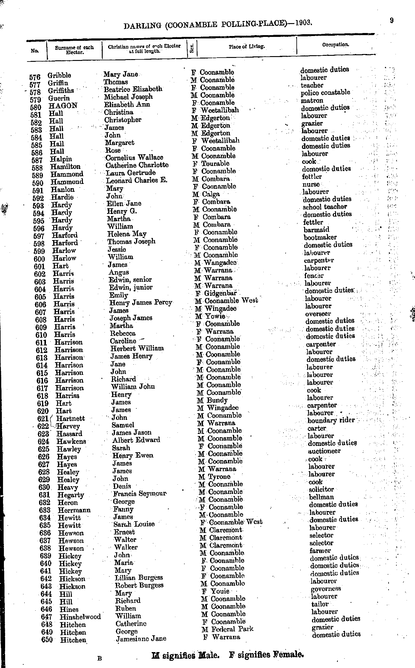
- Gribble Mary - Hitchen Jamesinne
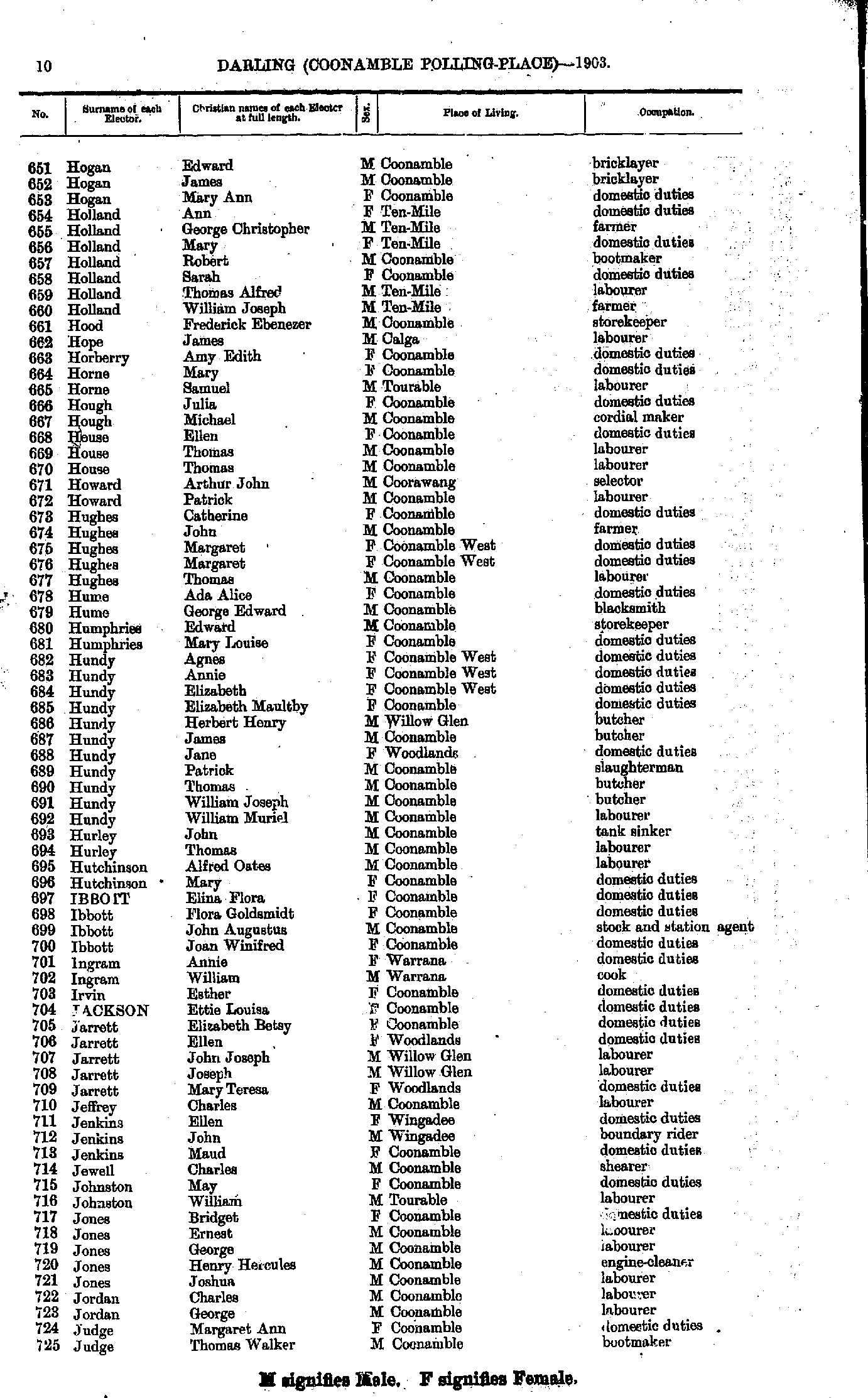
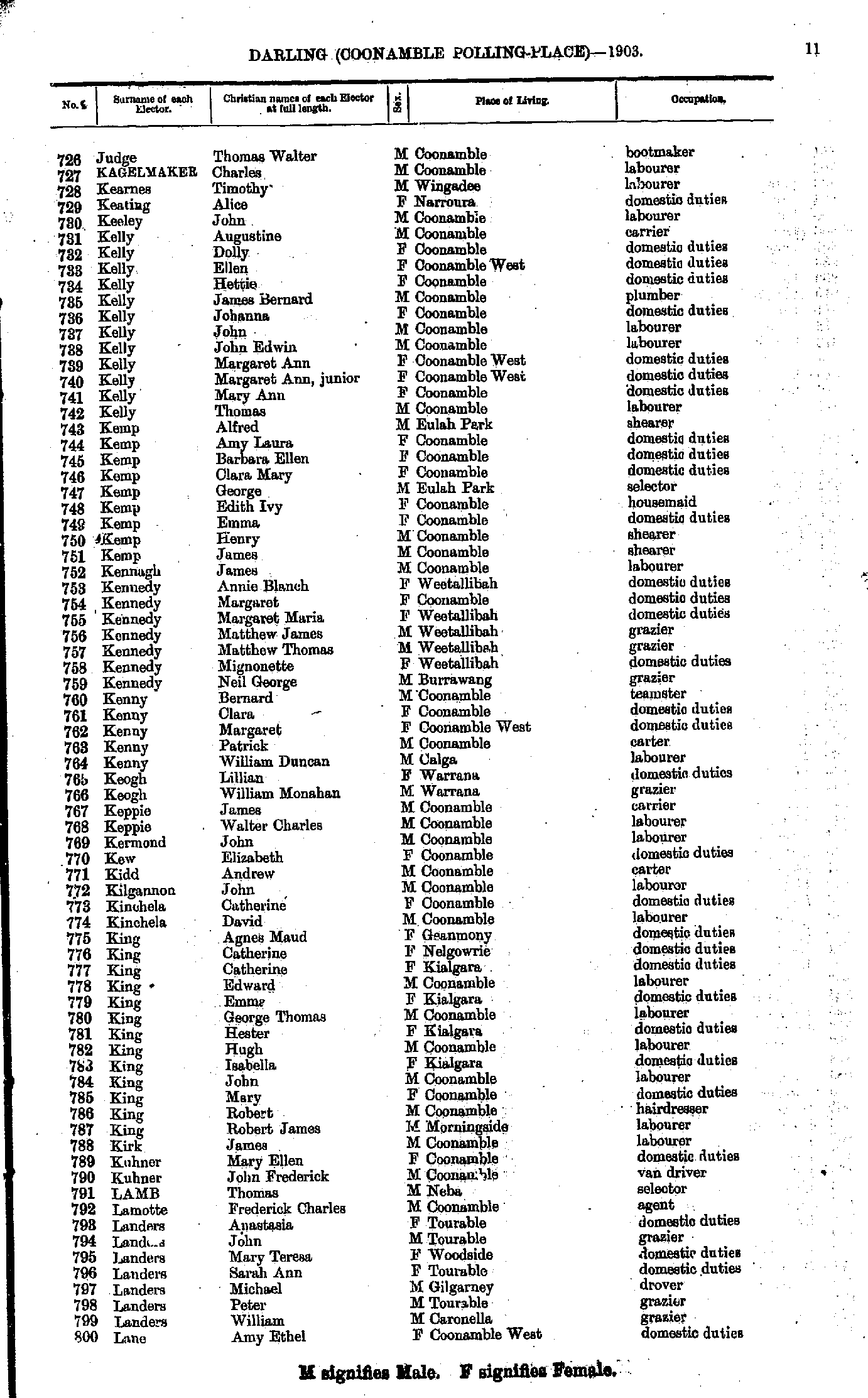
- Hogan Edward - Judge Thomas
- Judge Thomas - Lane Amy
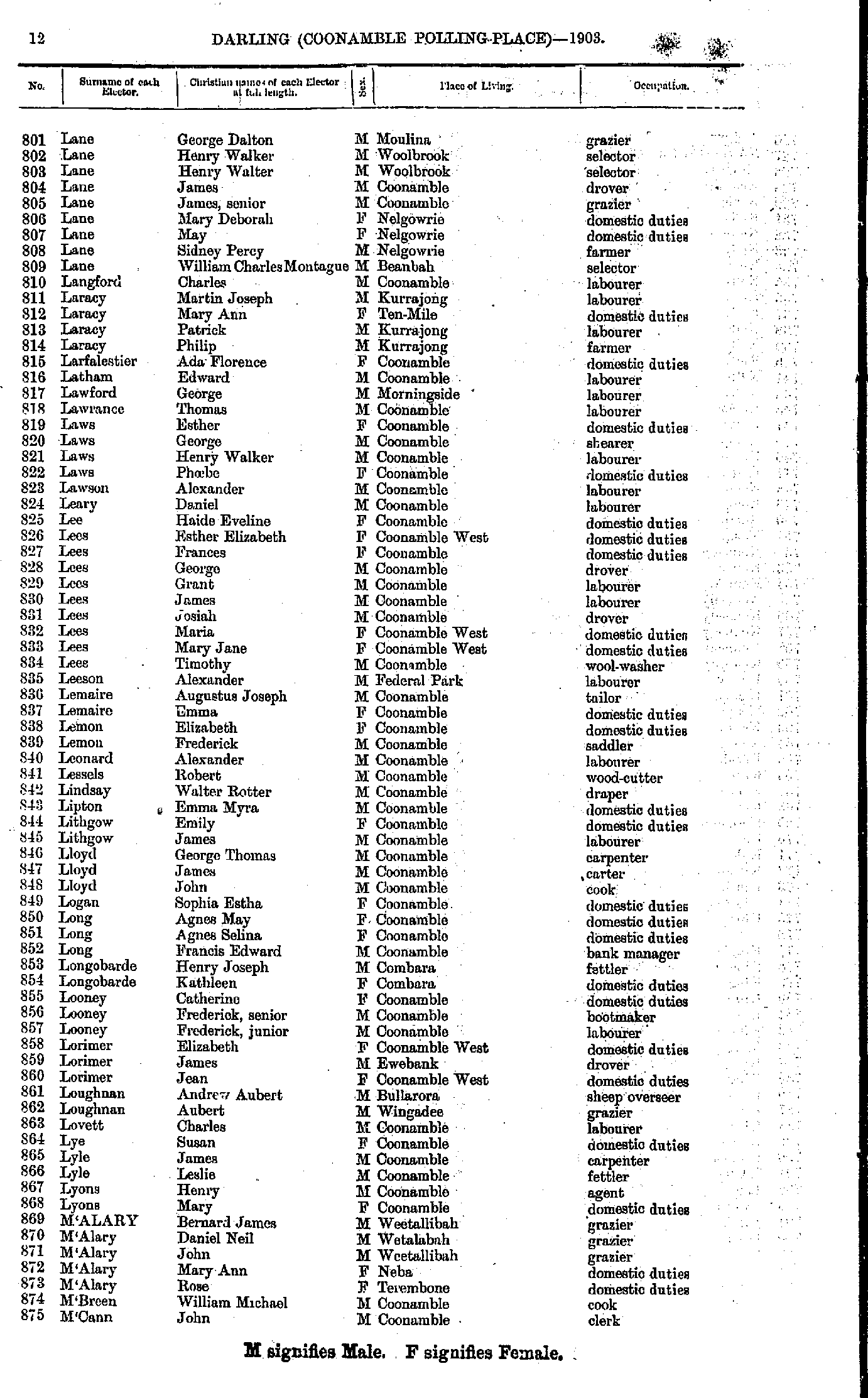
- Lane George - M'Cann John
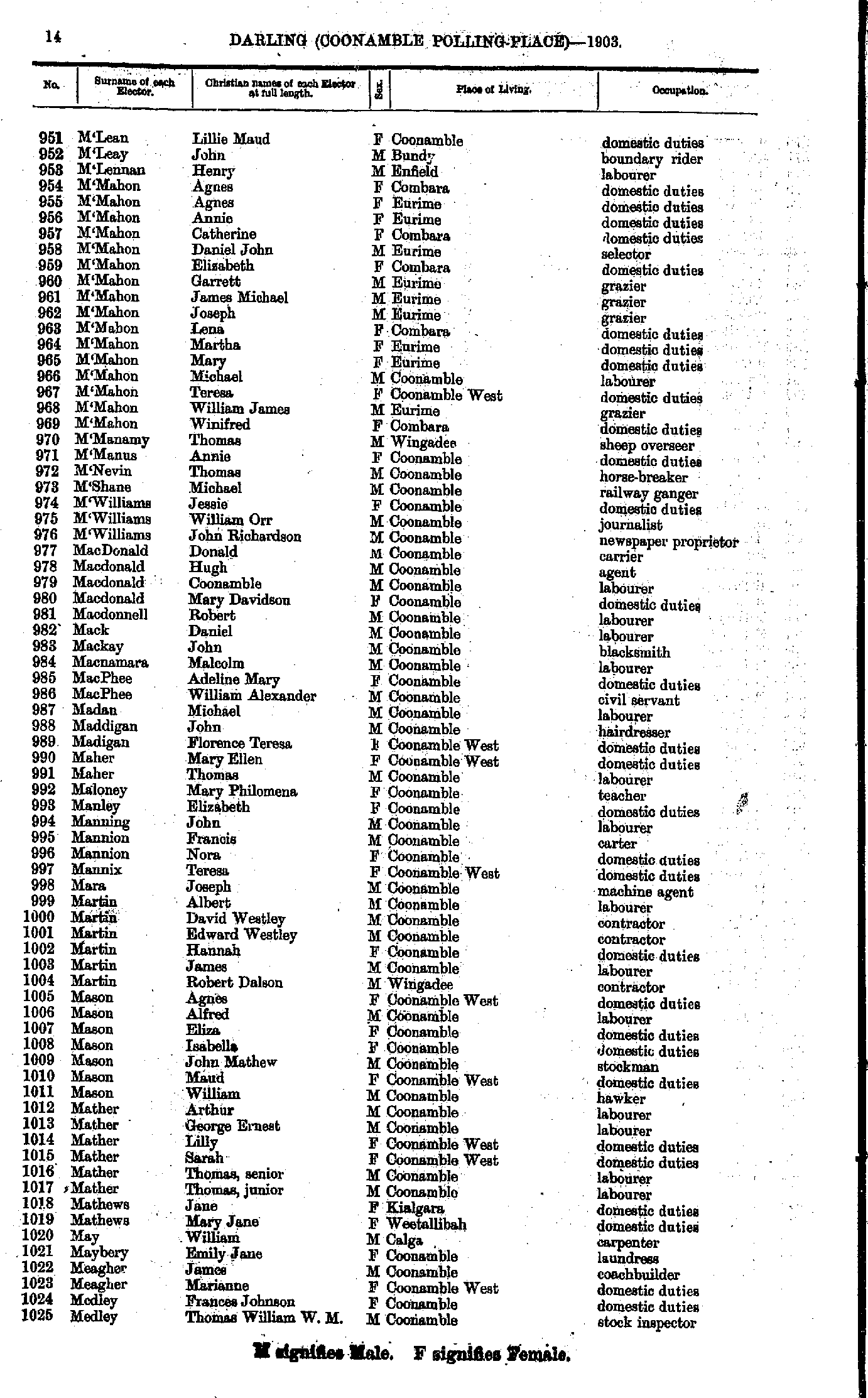
- M'Carry Agnes - M'Lean Herbert
- M'Lean Lillie - Medley Thomas
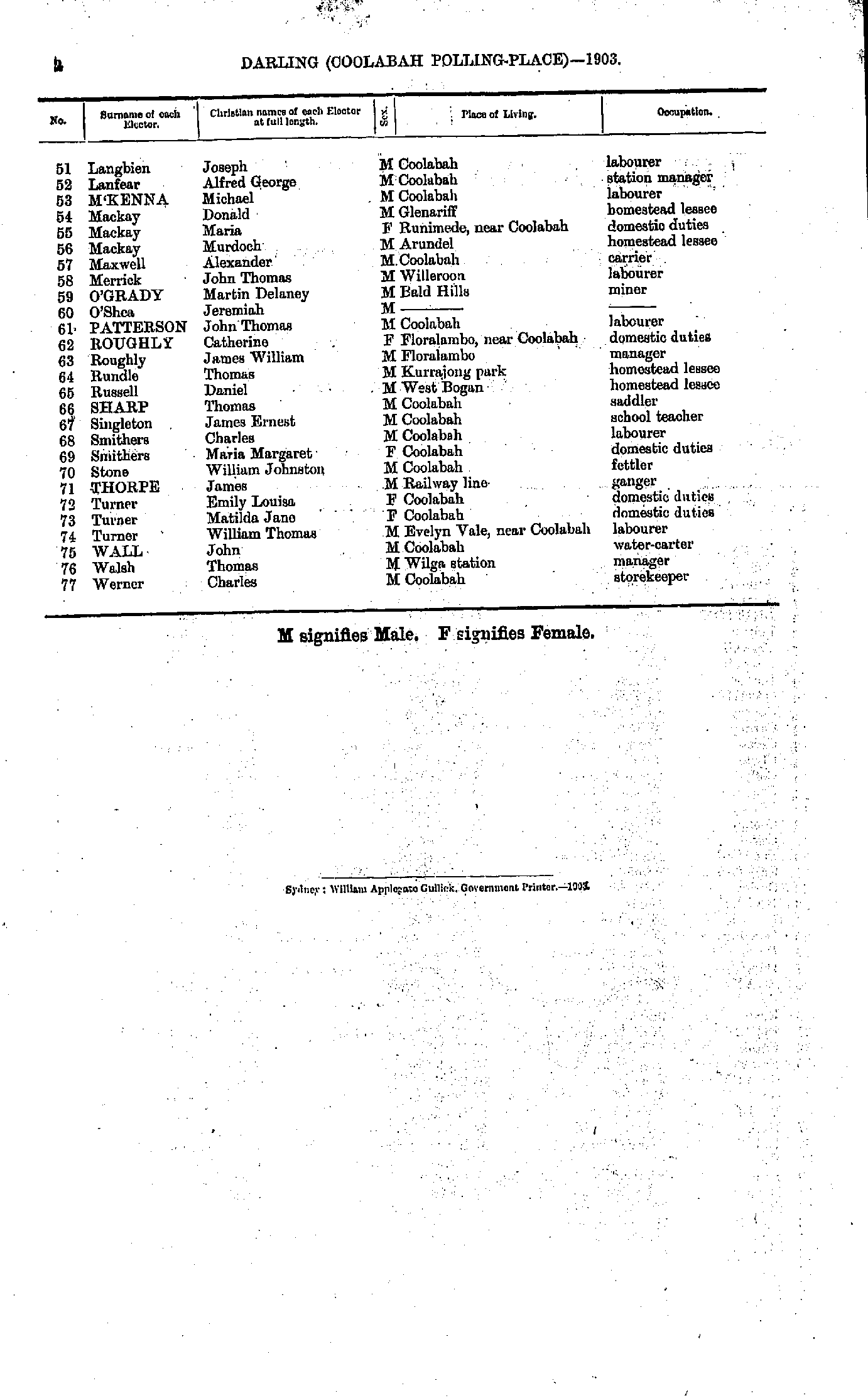
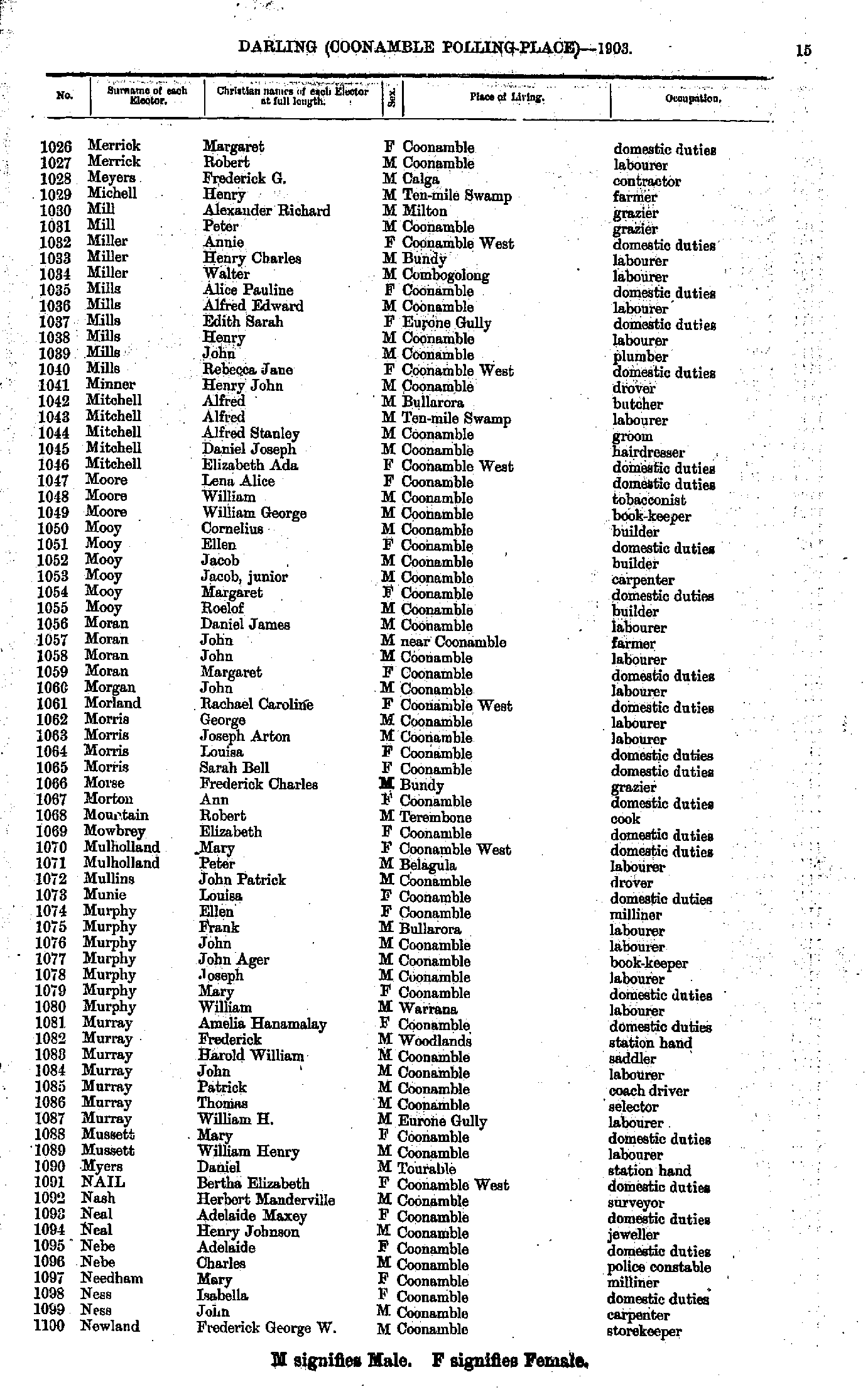
- Merrick Margaret - Newland Frederick
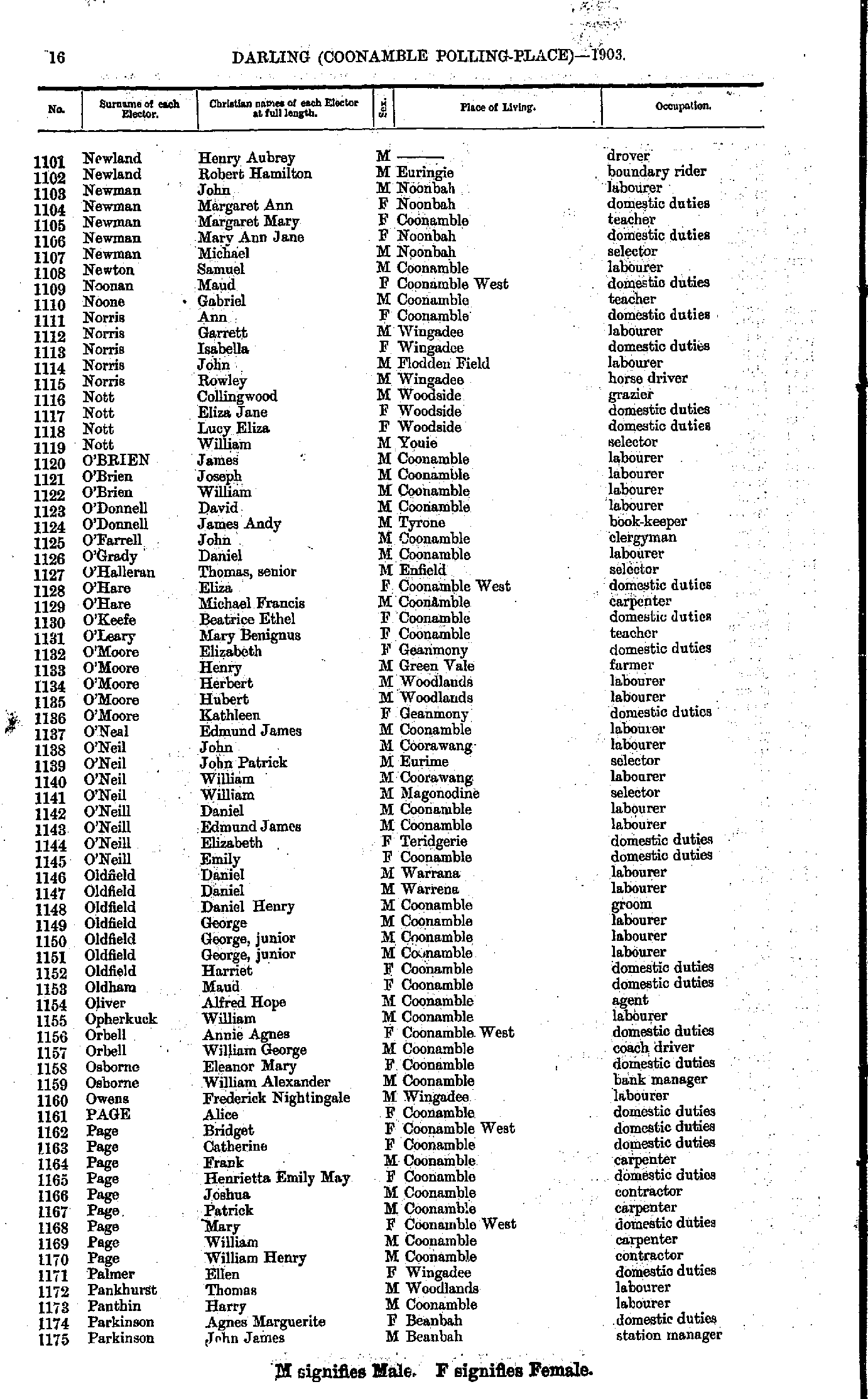
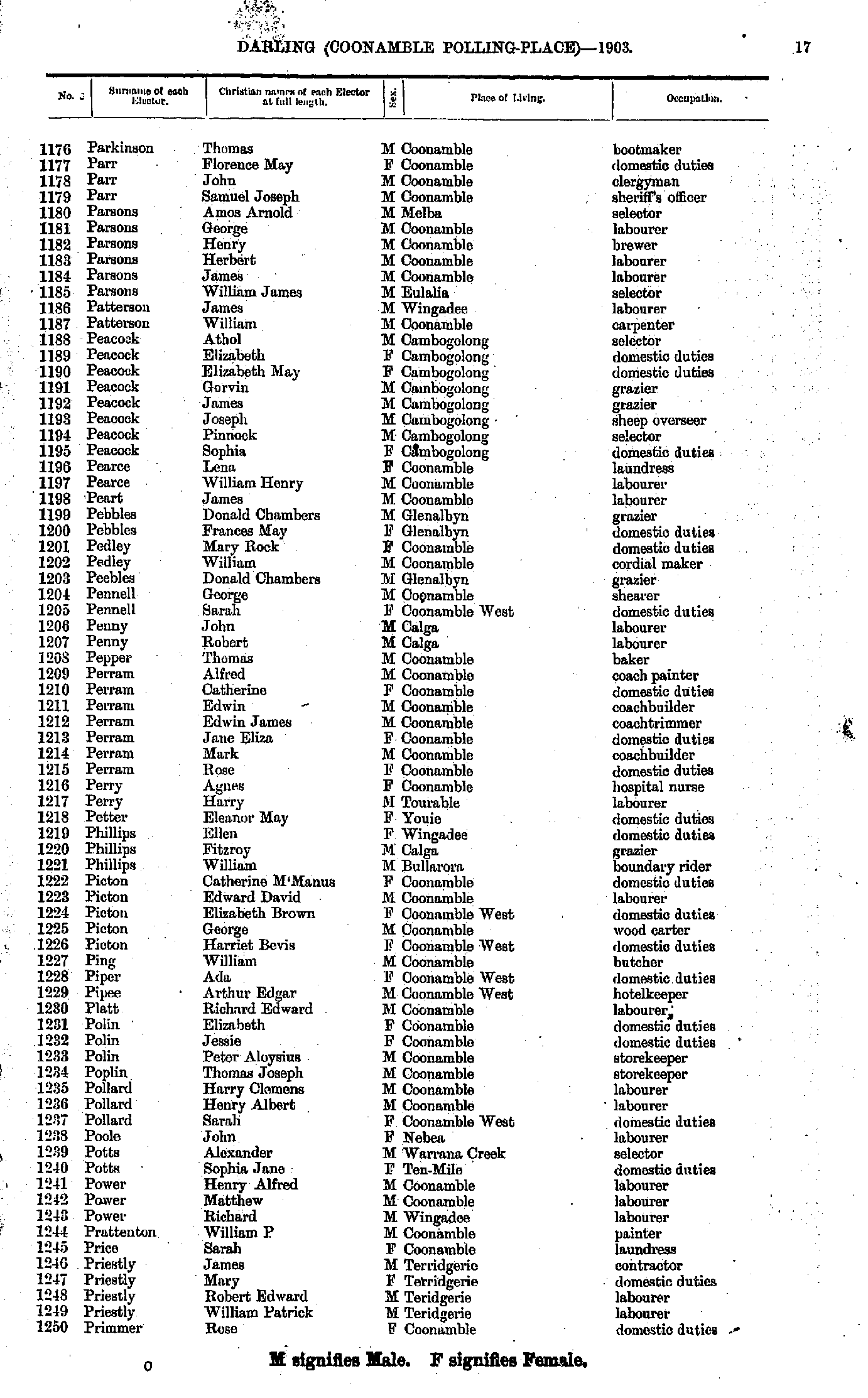
- Newland Henry - Parkinson John
- Parkinson Thomas - Primmer Rose
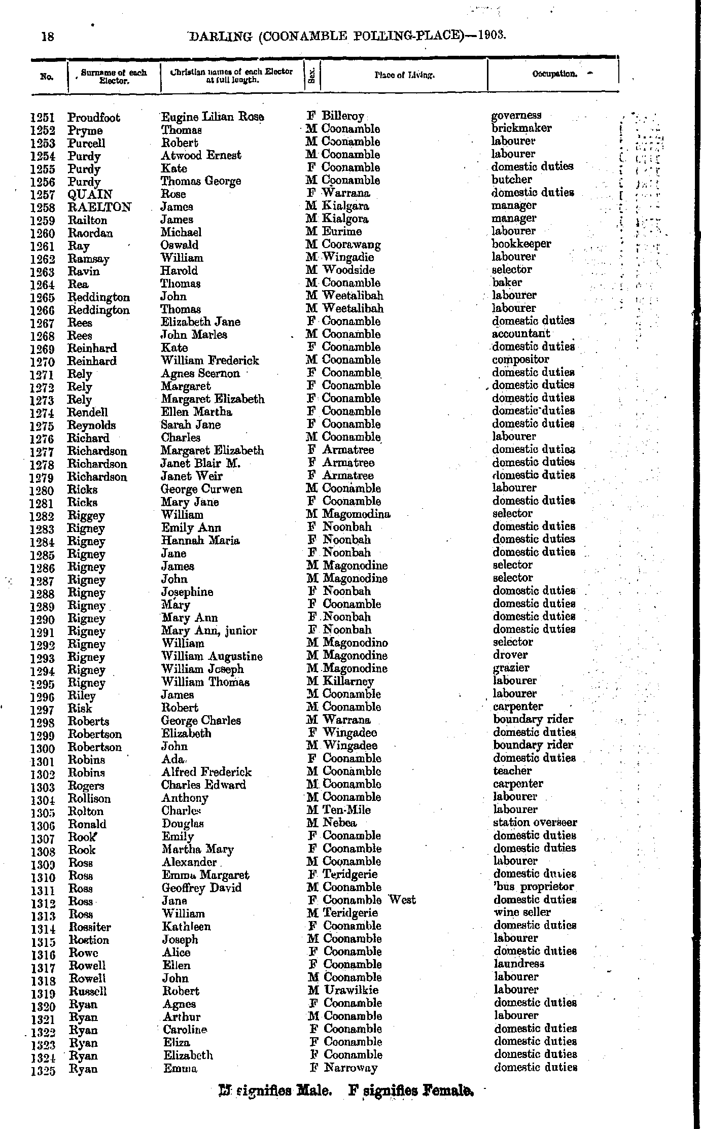
- Proudfoot Eugine - Ryan Emma
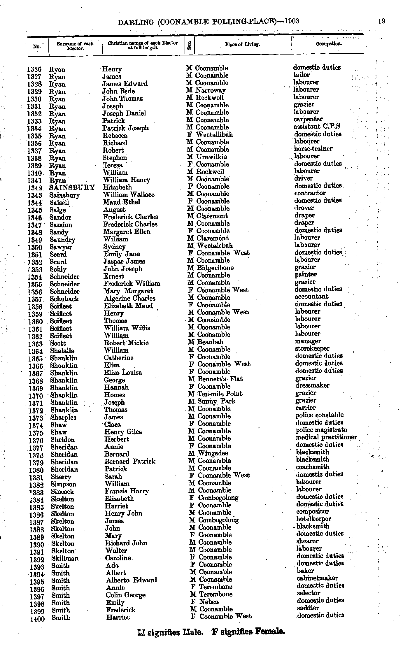
- Ryan Henry - Smith Harriet
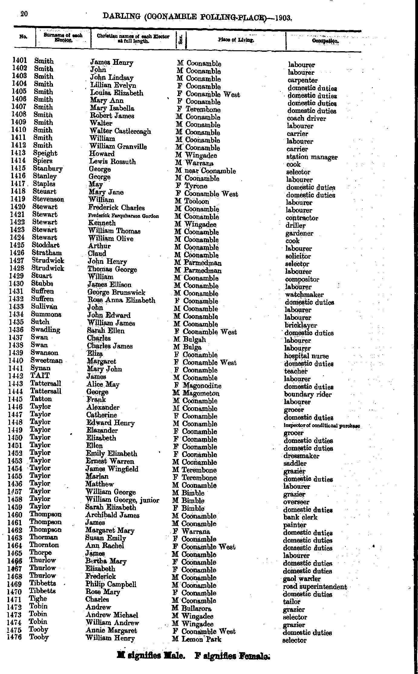
- Smith James - Tooby William
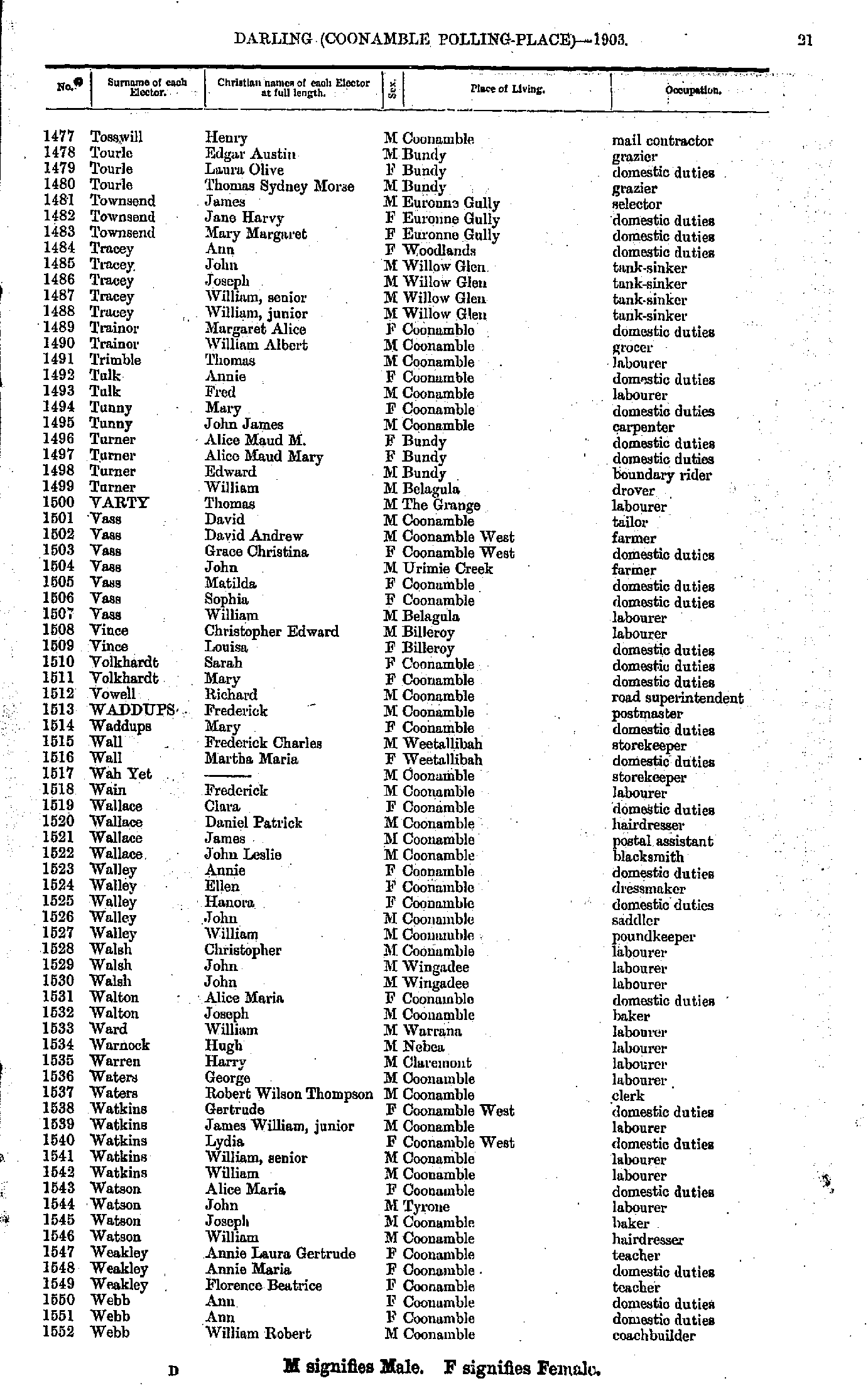
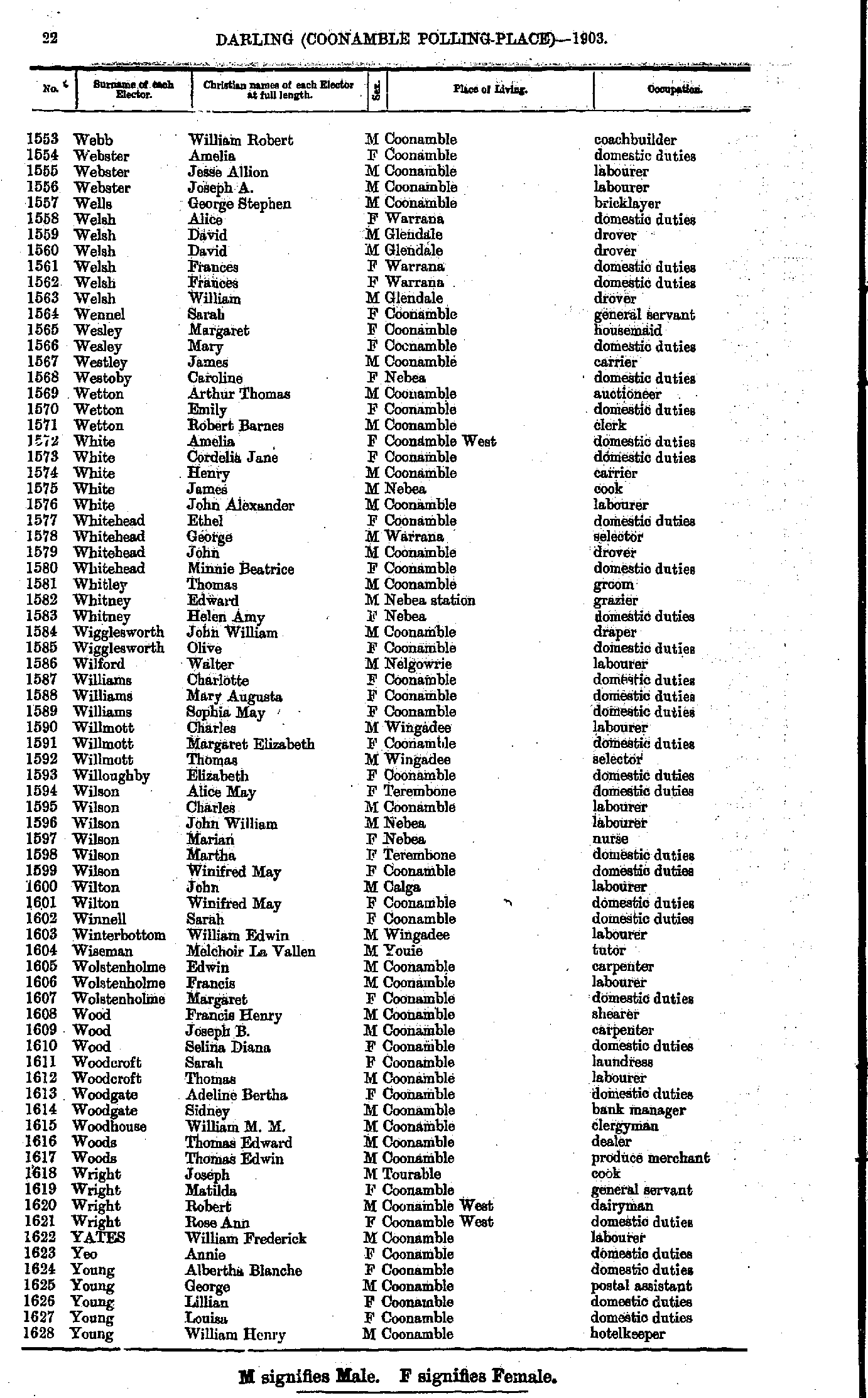
- Tosswill Henry - Webb William
- Webb William - Young William
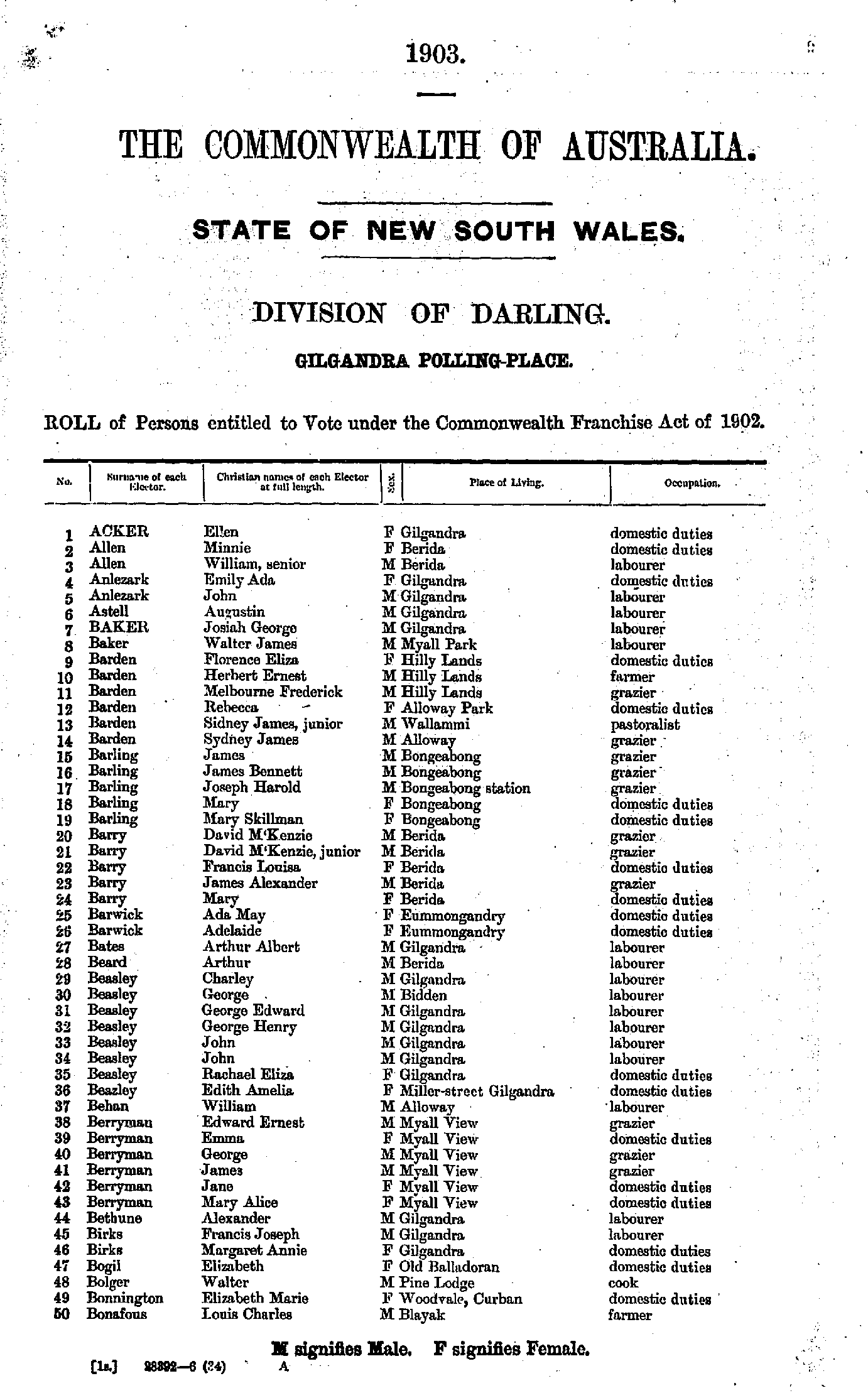
- Acker Ellen - Bonafous Louis
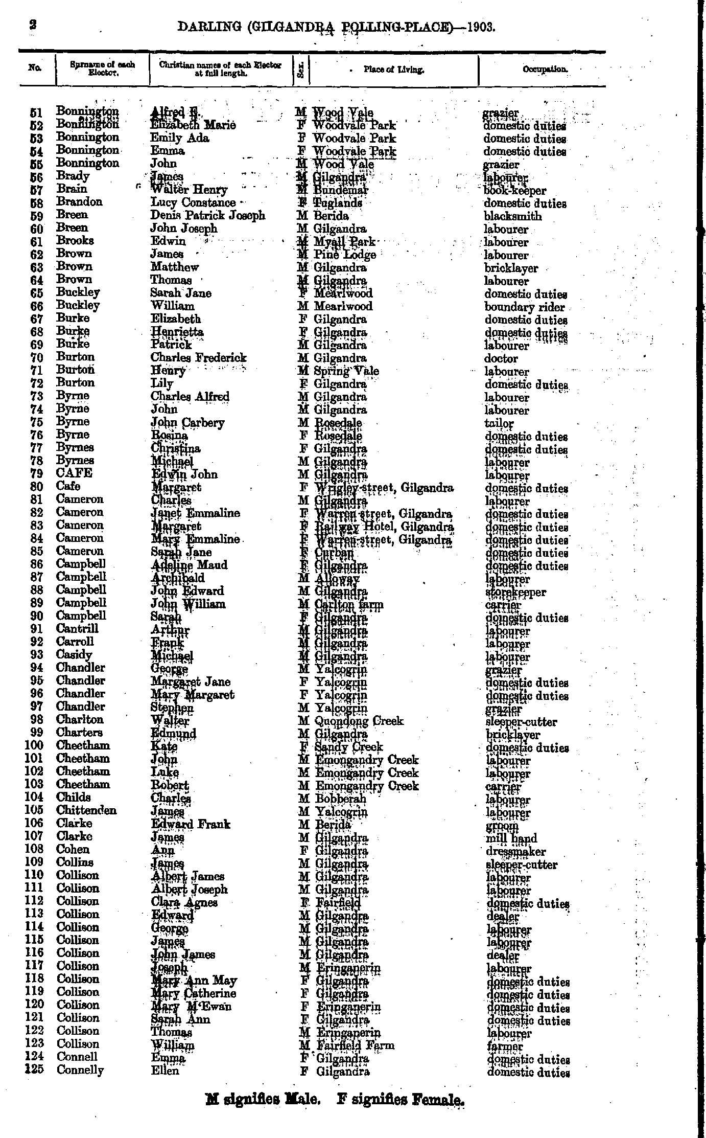
- Bonnington Alfred - Connelly Ellen
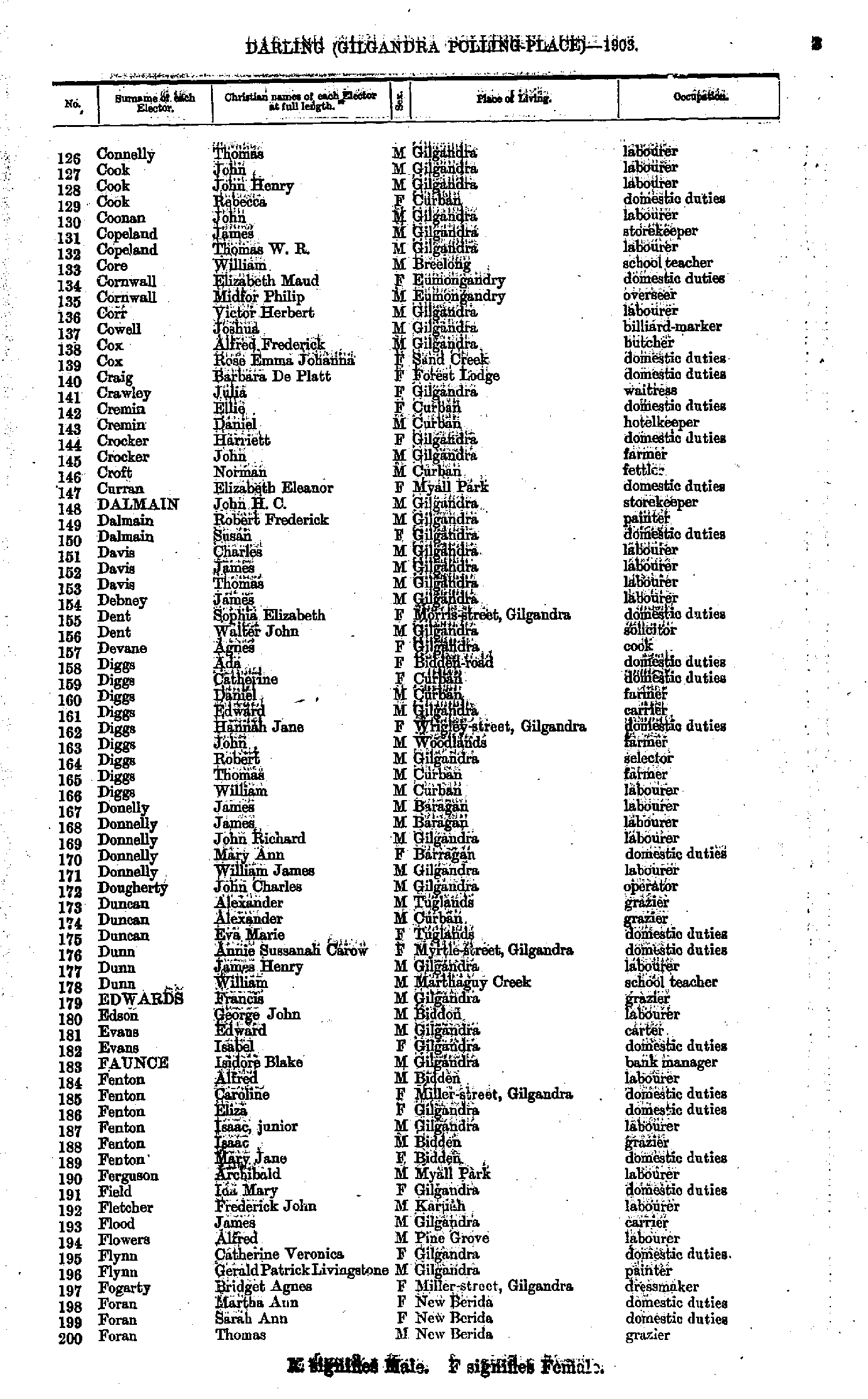
- Connelly Thomas - Foran Thomas
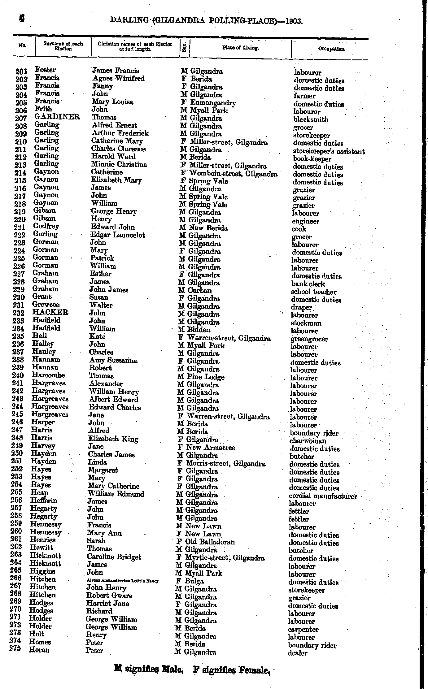
- Foster James - Horan Peter
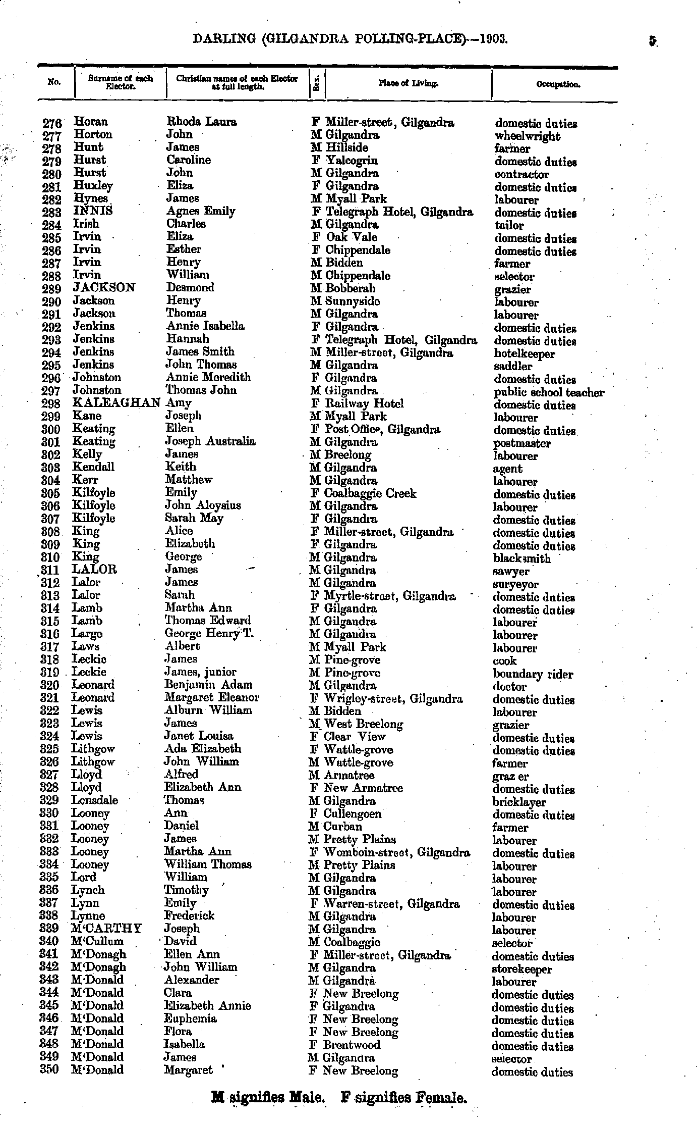
- Horan Rhoda - M'Donald Margaret
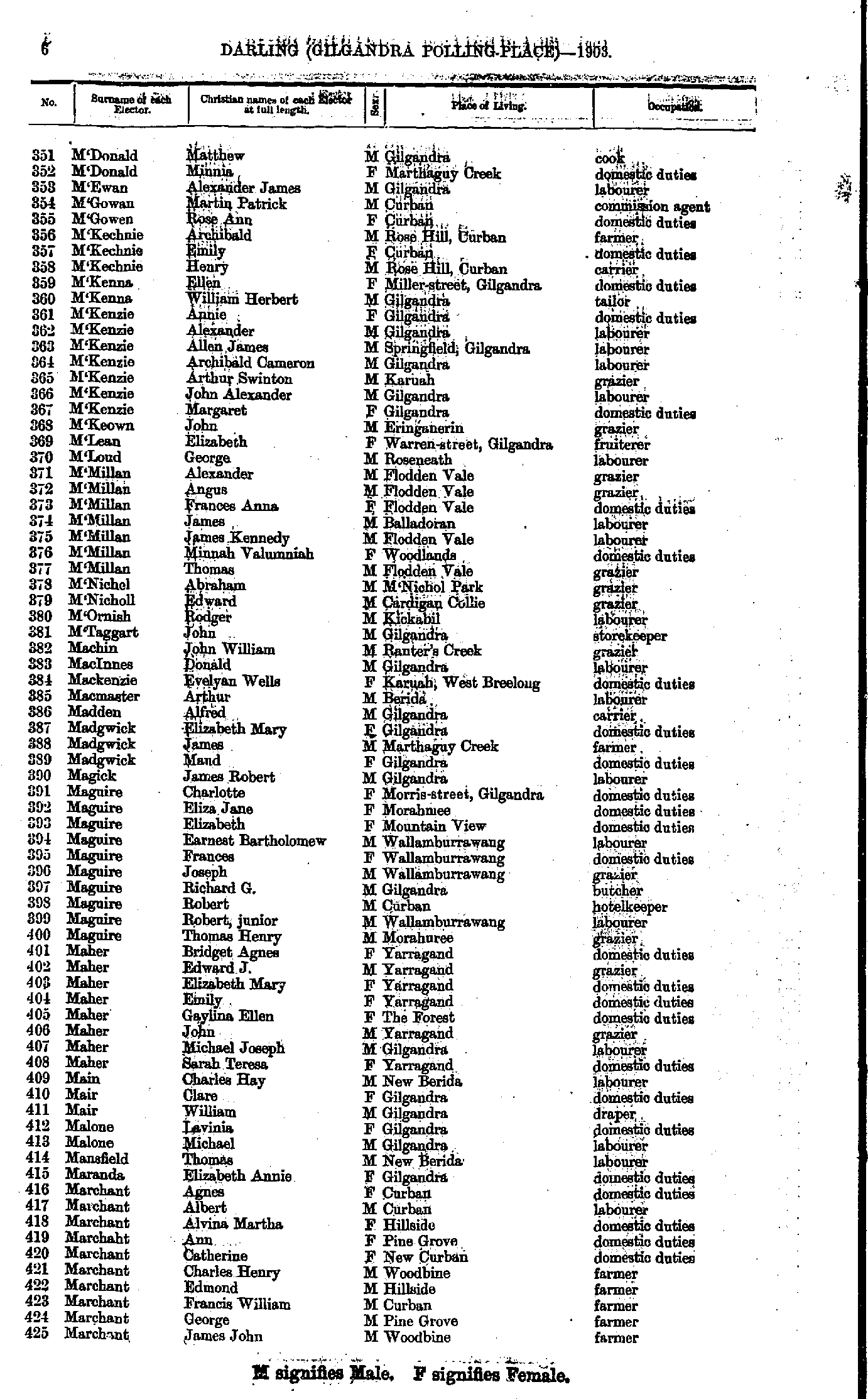
- M'Donald Matthew - Marchant James
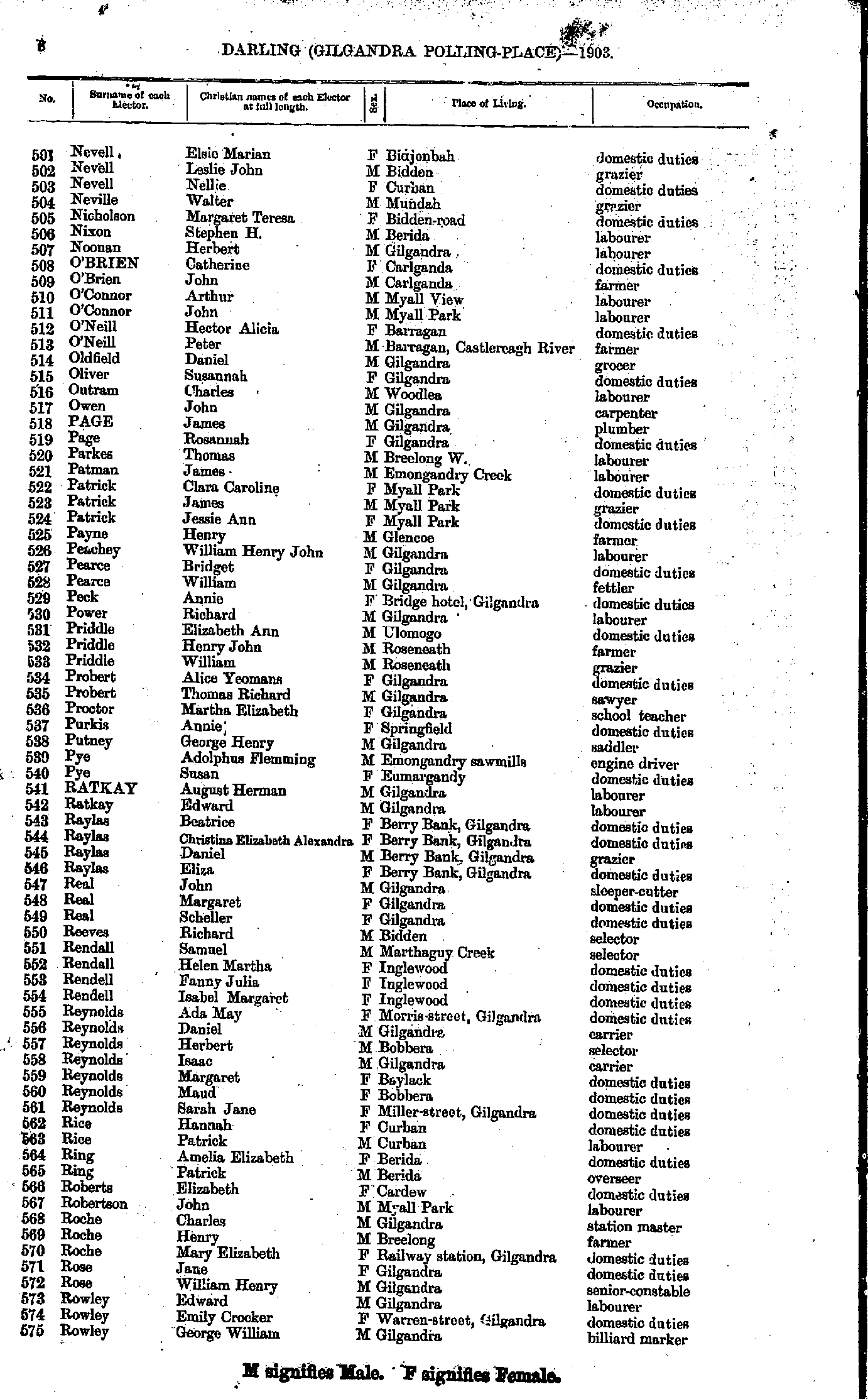
- Marchant Mary - Nelson Elizabeth
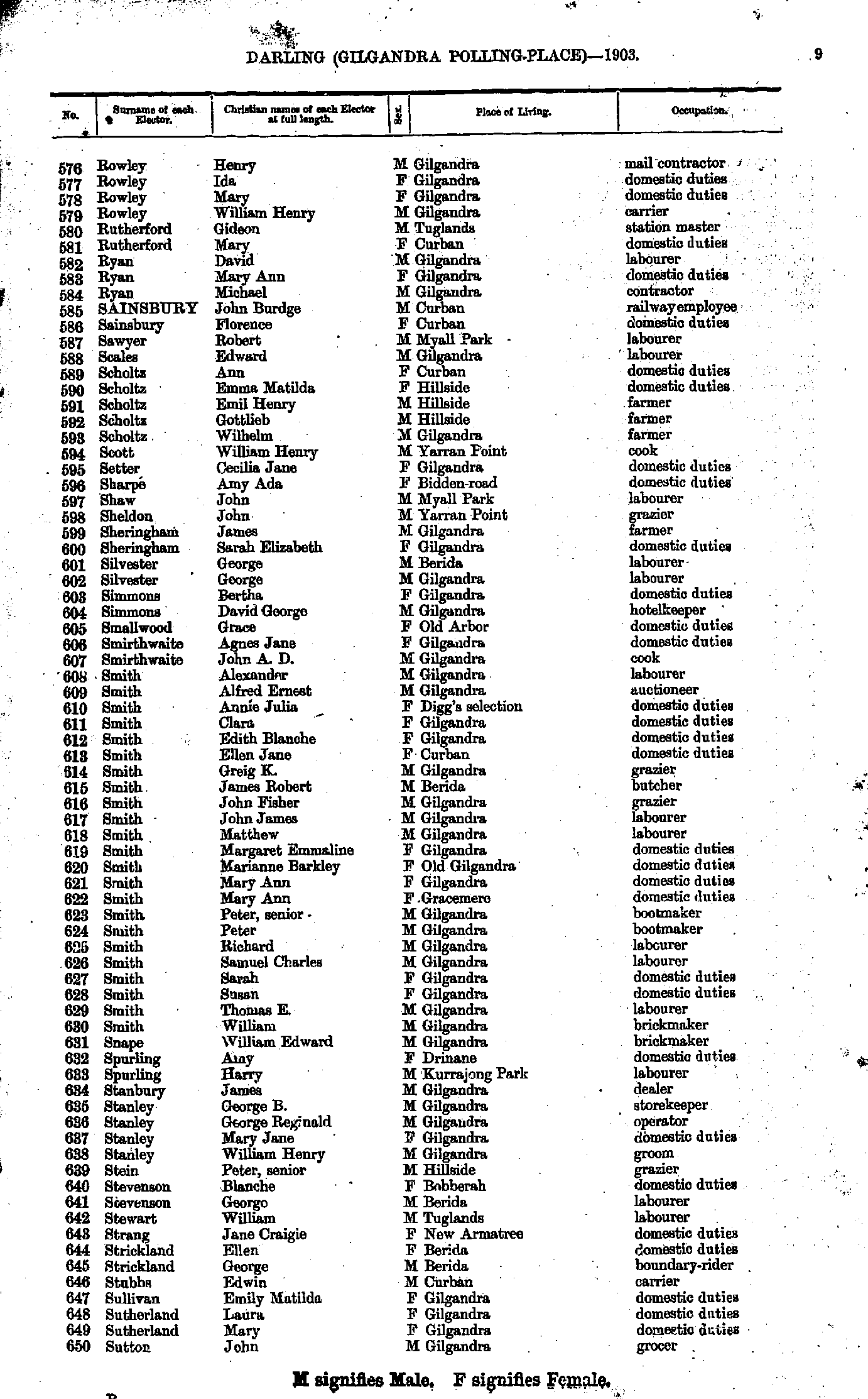
- Nevell Elsie - Rowley George
- Rowley Henry - Sutton John
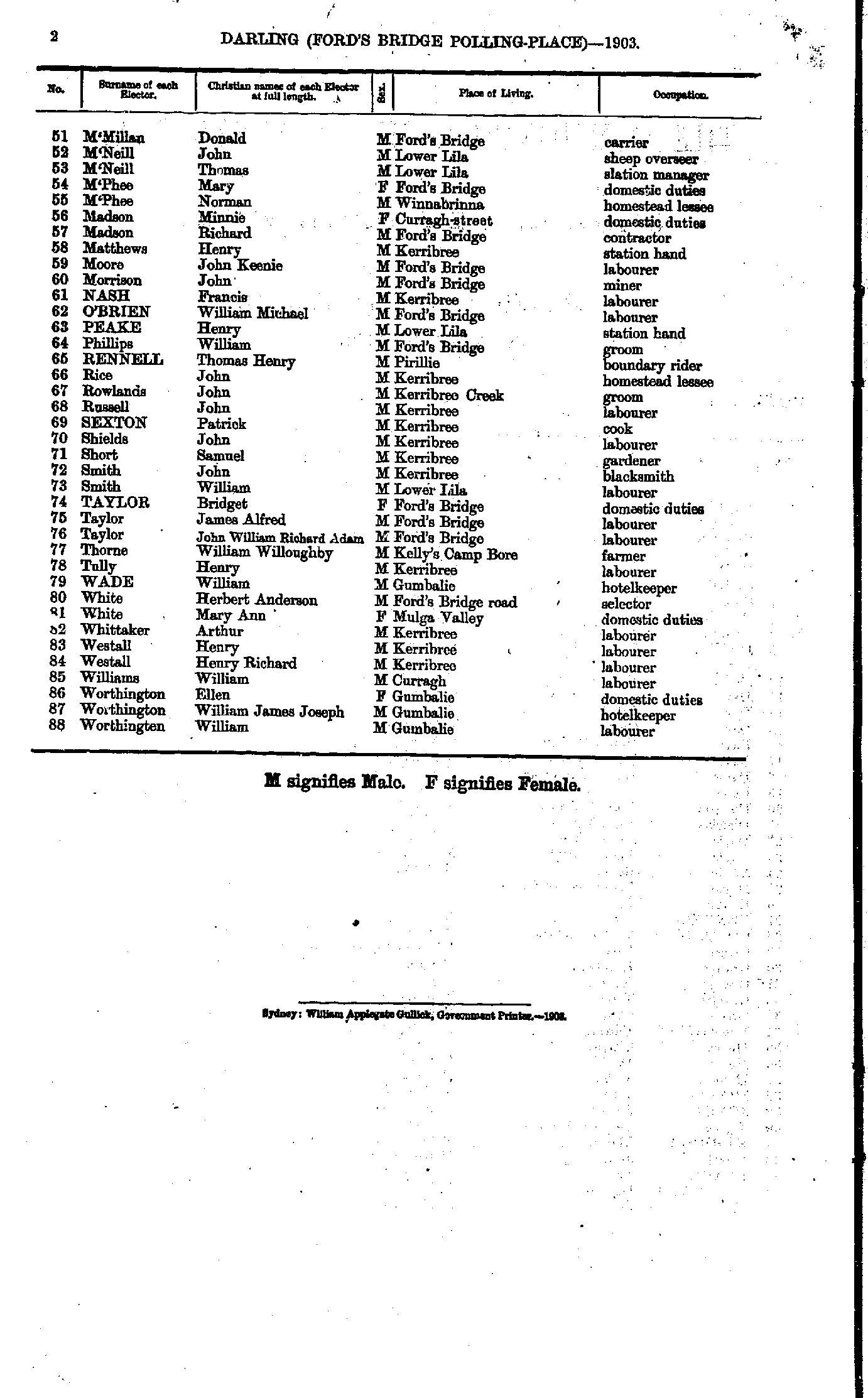
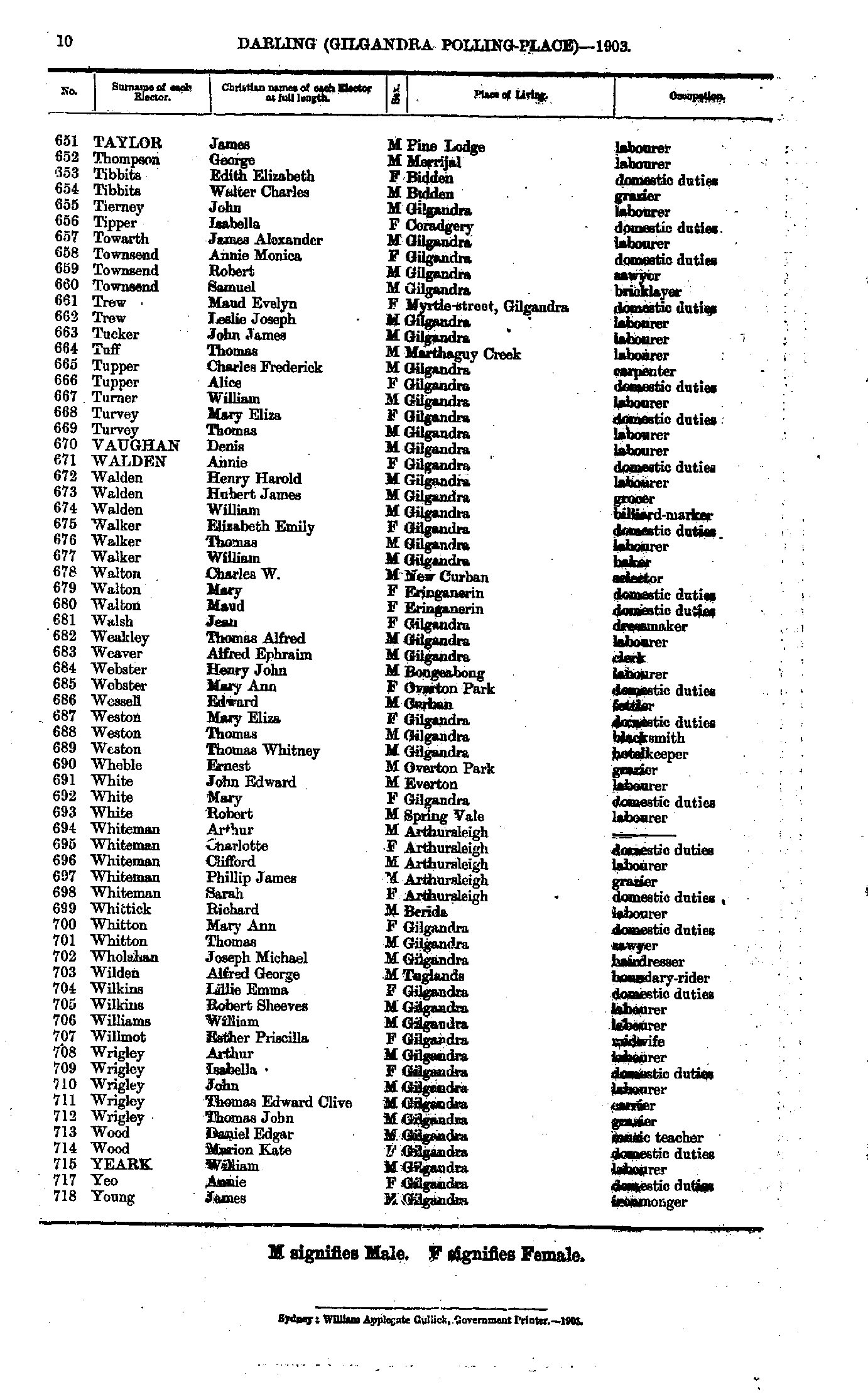
- Taylor James - Young James
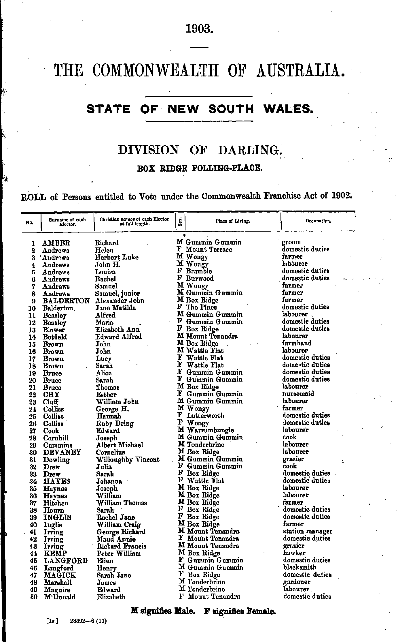
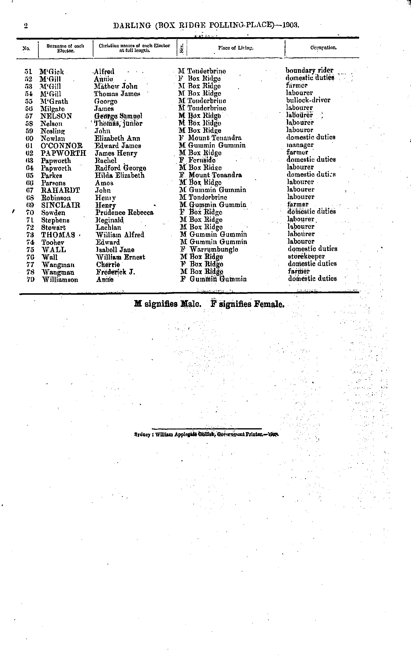
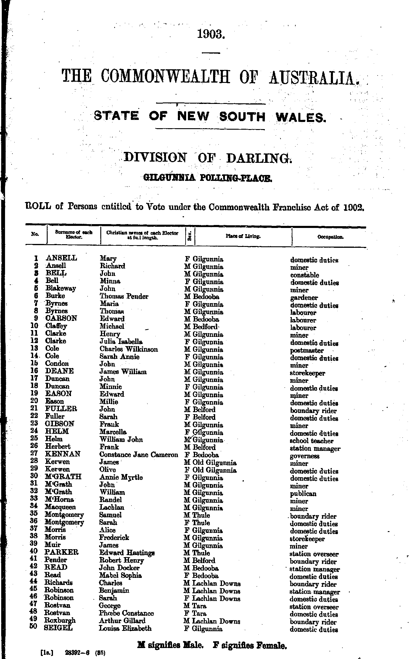
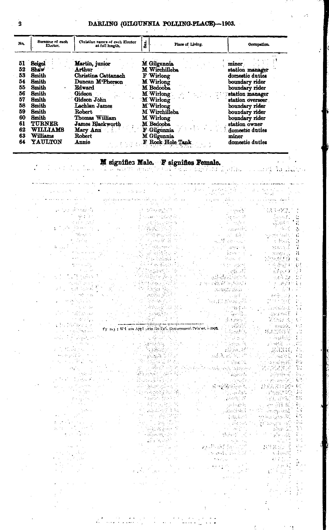
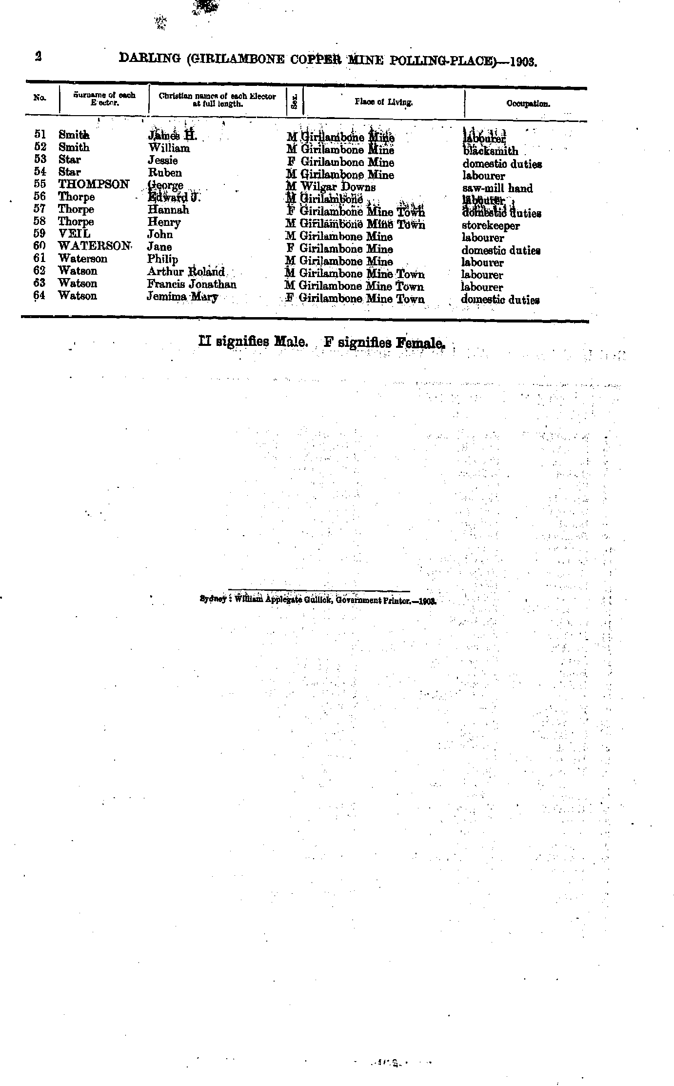
Girilambone Copper Mine Polling Place
- Anthony Charles - Connelly Bridget
- Connolly James - Lyons Julia
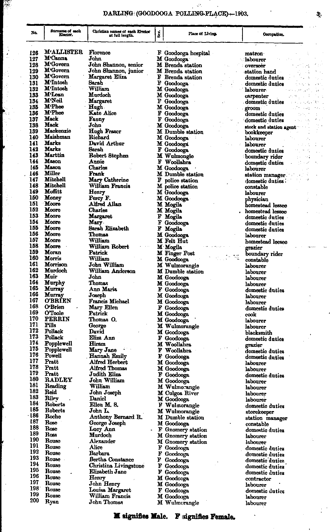
- M'Allister Florence - Ryan John
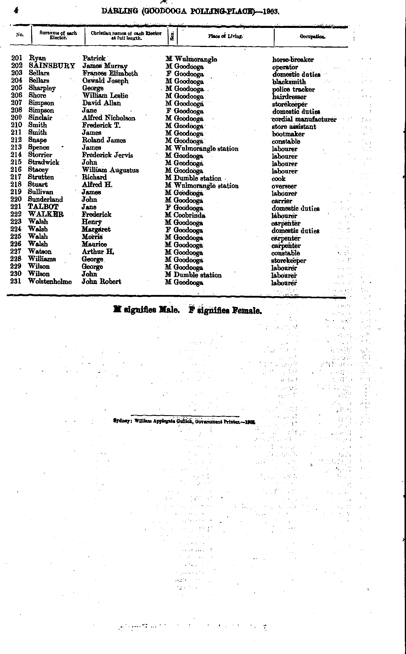
- Ryan Patrick - Wolstenholme John
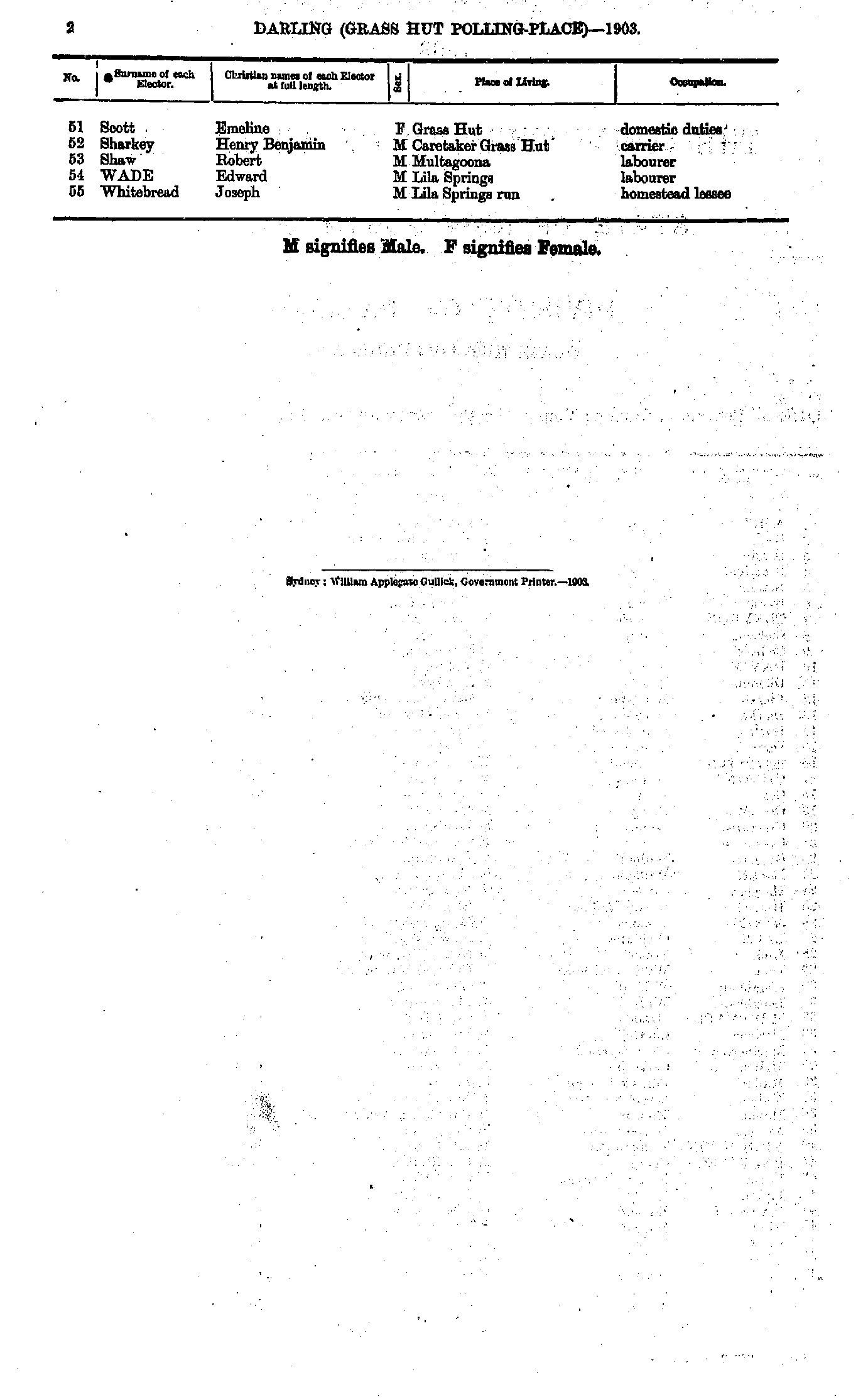
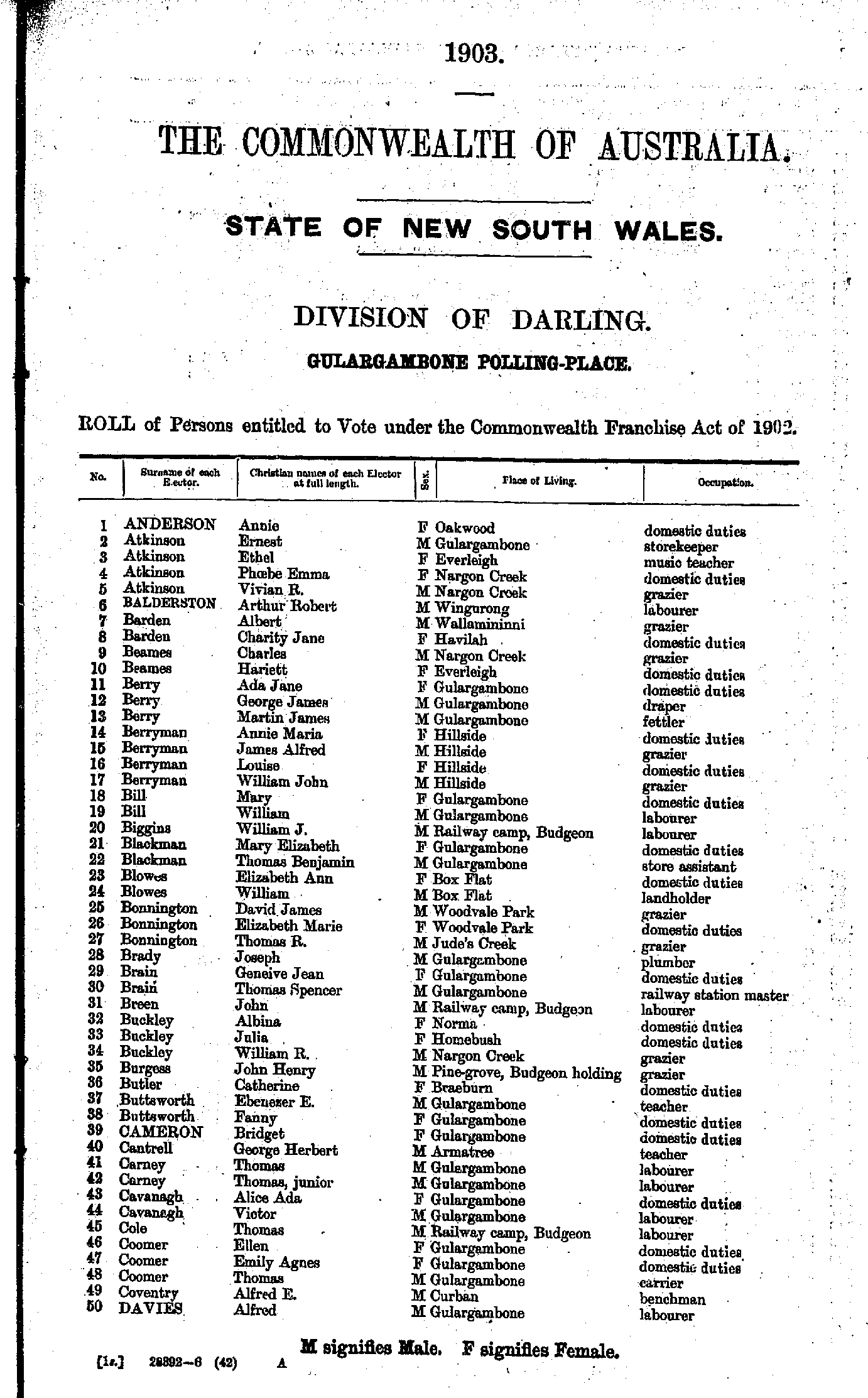
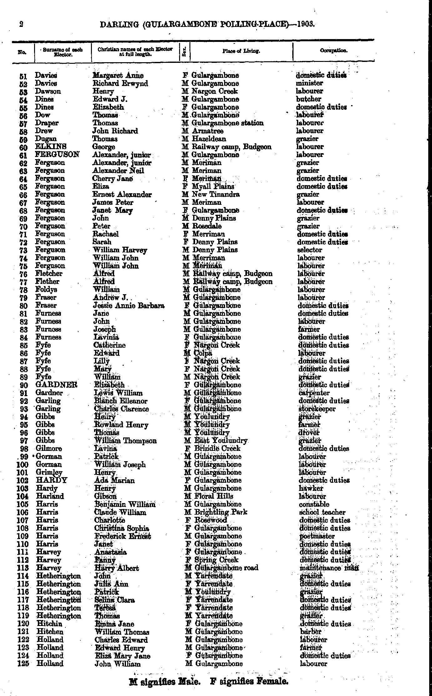
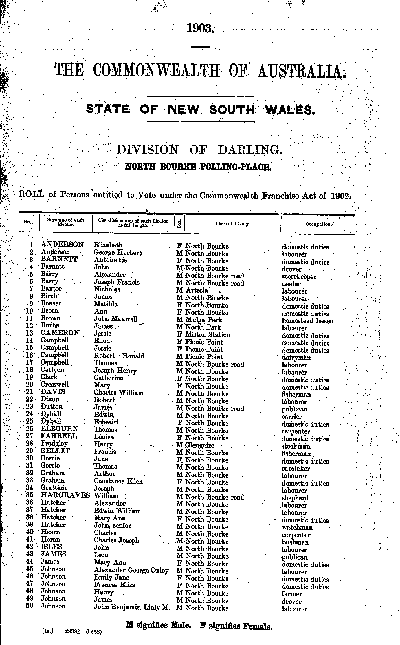
- Anderson Annie - Davies Alfred
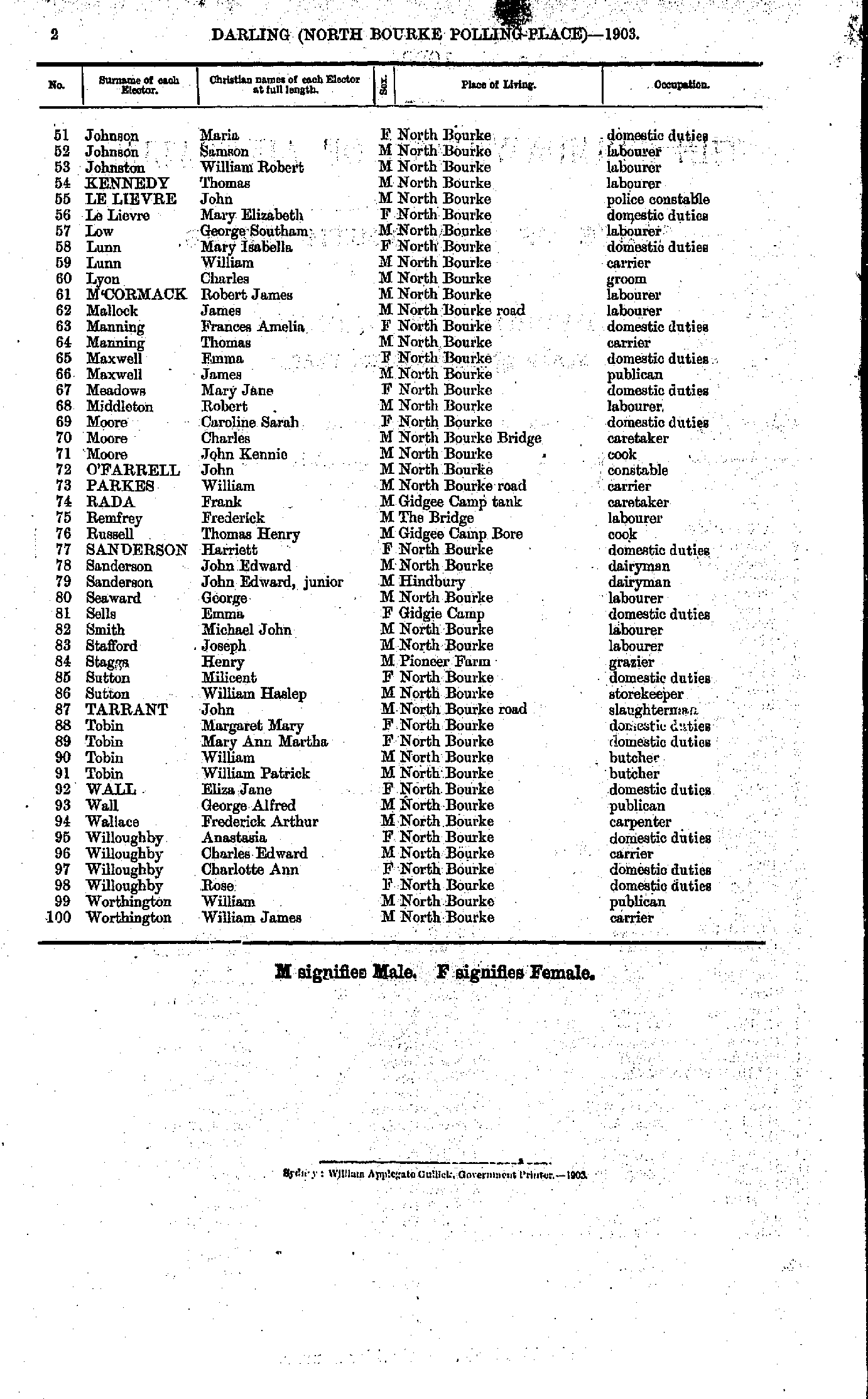
- Davies Margaret - Holland John
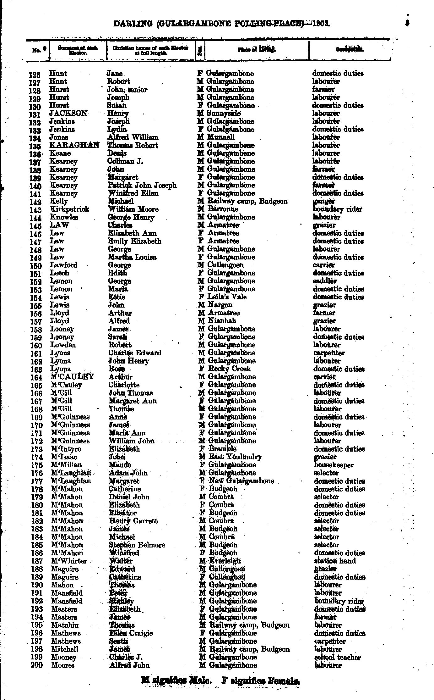
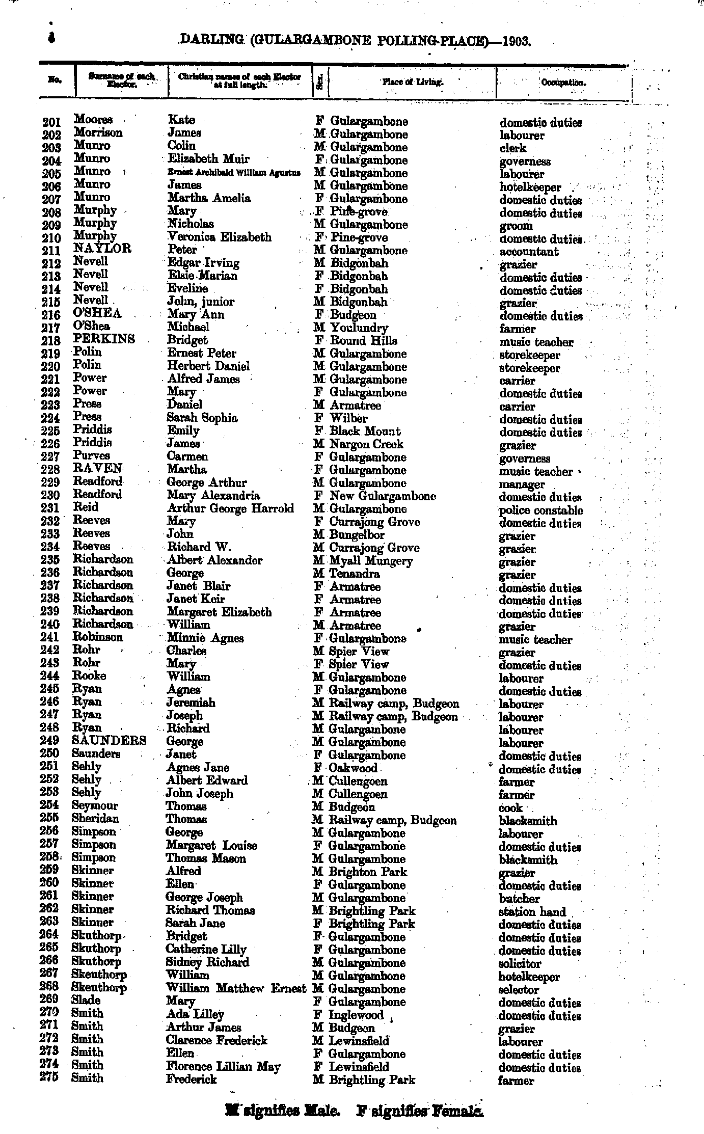
- Hunt Jane - Moores Alfred
- Moores Kate - Smith Frederick
- Smith George - Yeo Ernest
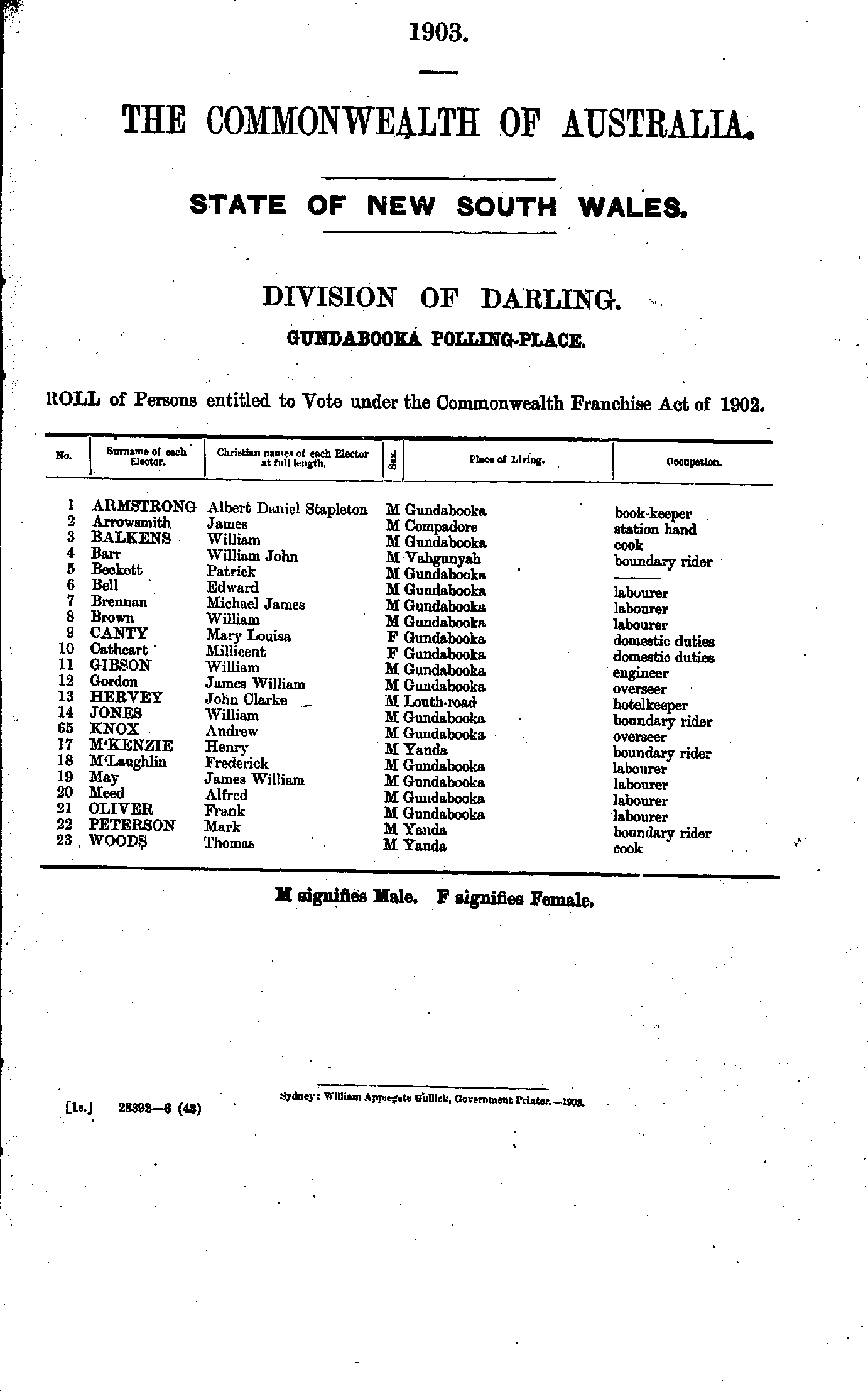
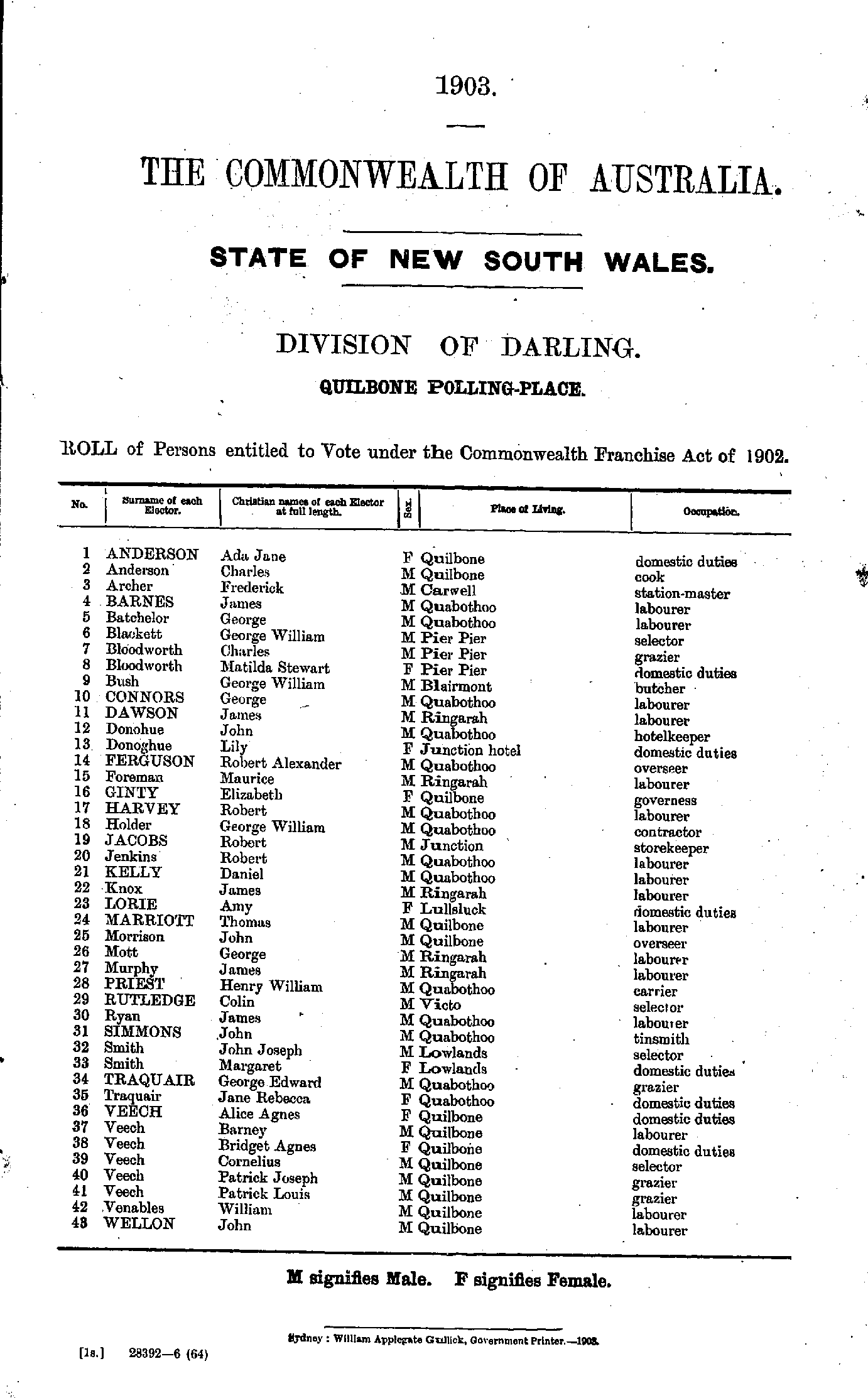
Lower Marra Creek Polling Place
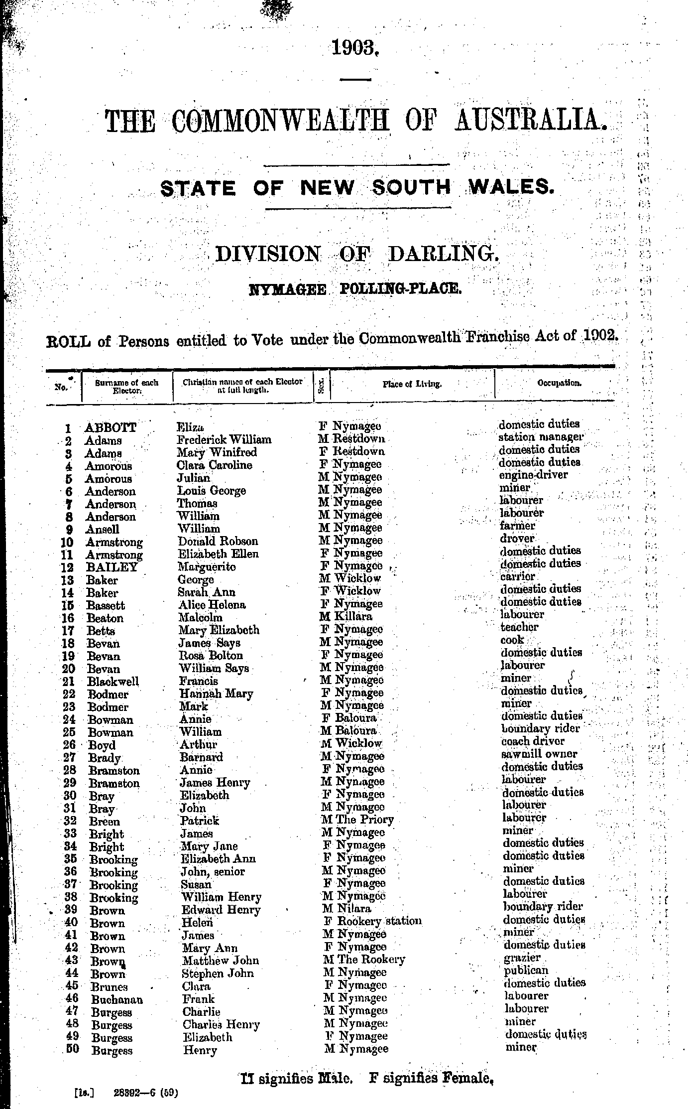
- Abbott Eliza - Burgess Henry
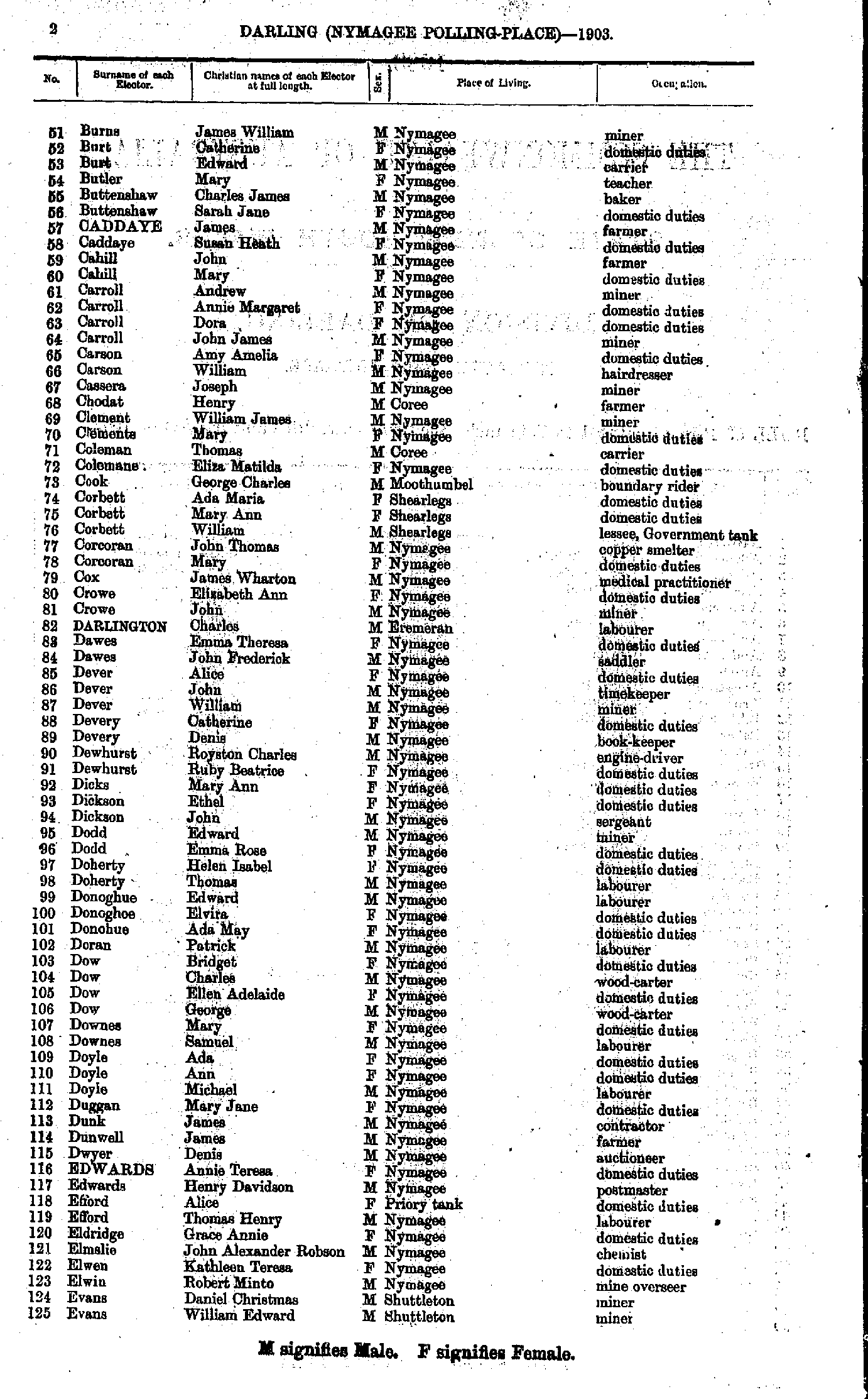
- Burns James - Evans William
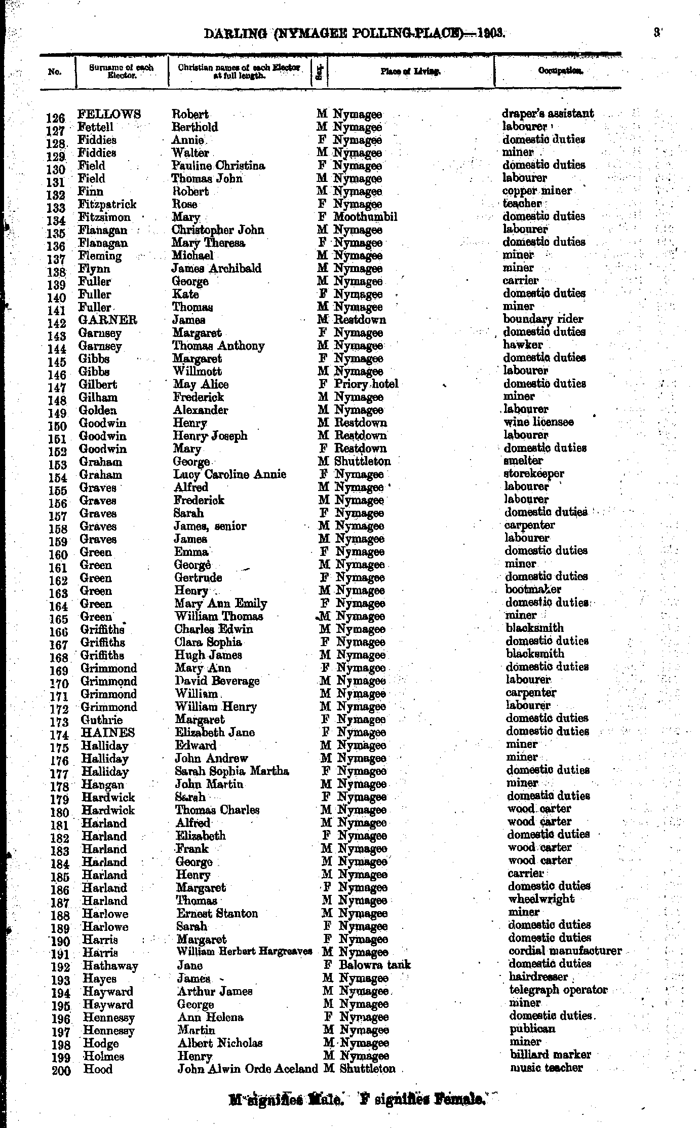
- Fellows Robert - Hood John
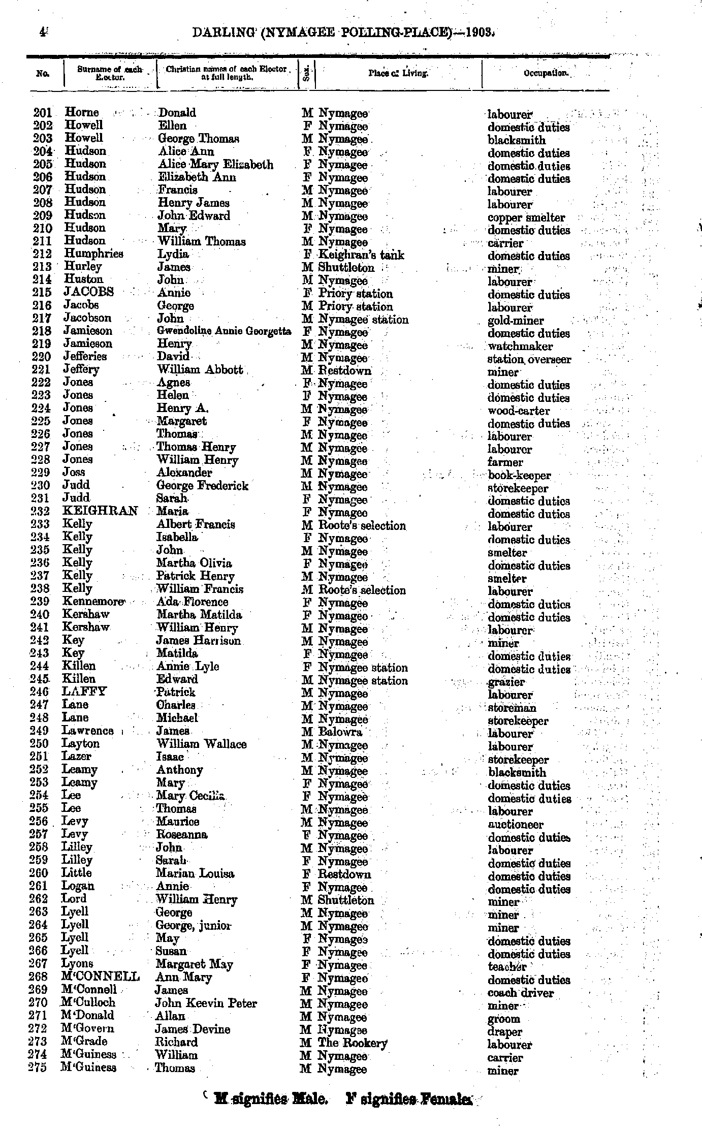
- Horne Donald - M'Guiness Thomas
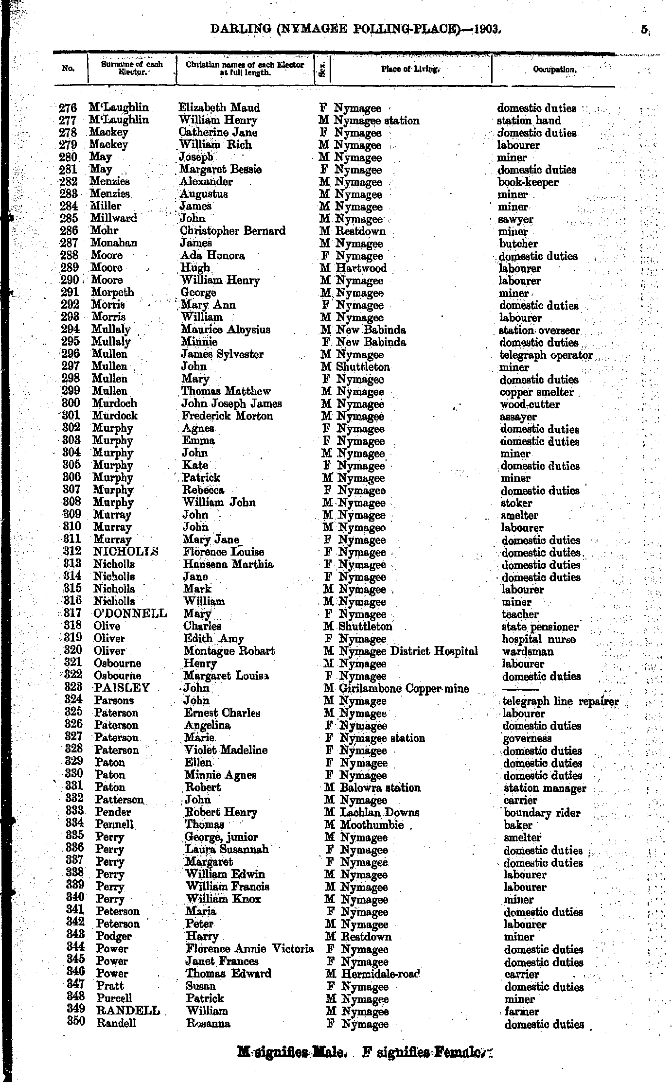
- M'Laughlin Elizabeth - Randell Rosanna
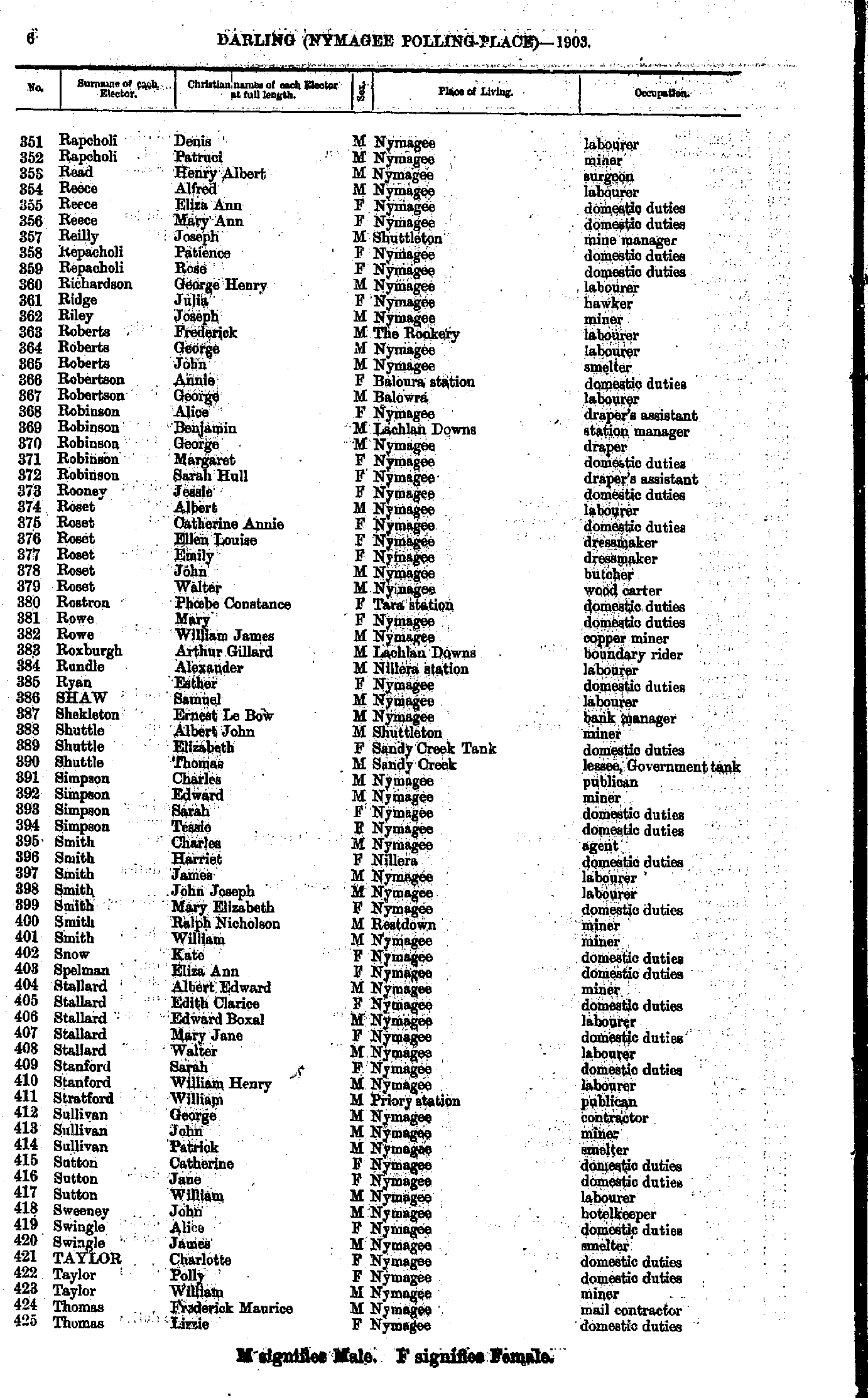
- Rapcholi Denis - Thomas Lizzie
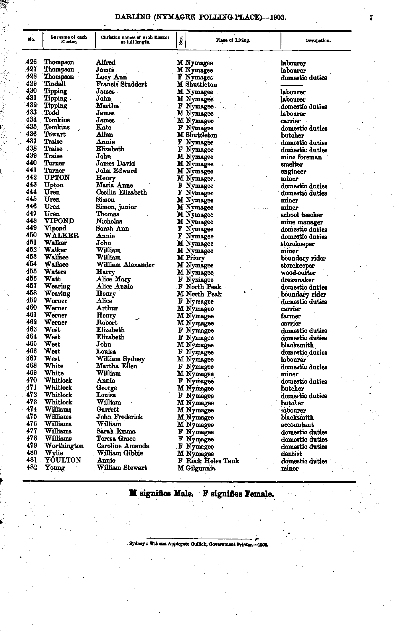
- Thompson Alfred - Young William
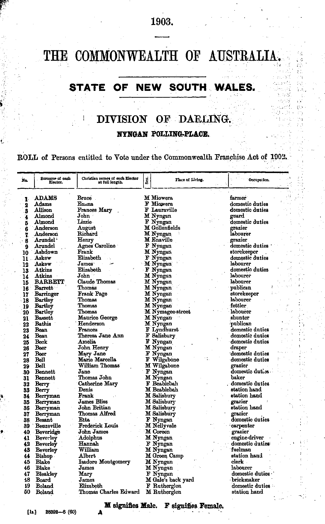
- Adams Bruce - Boland Thomas
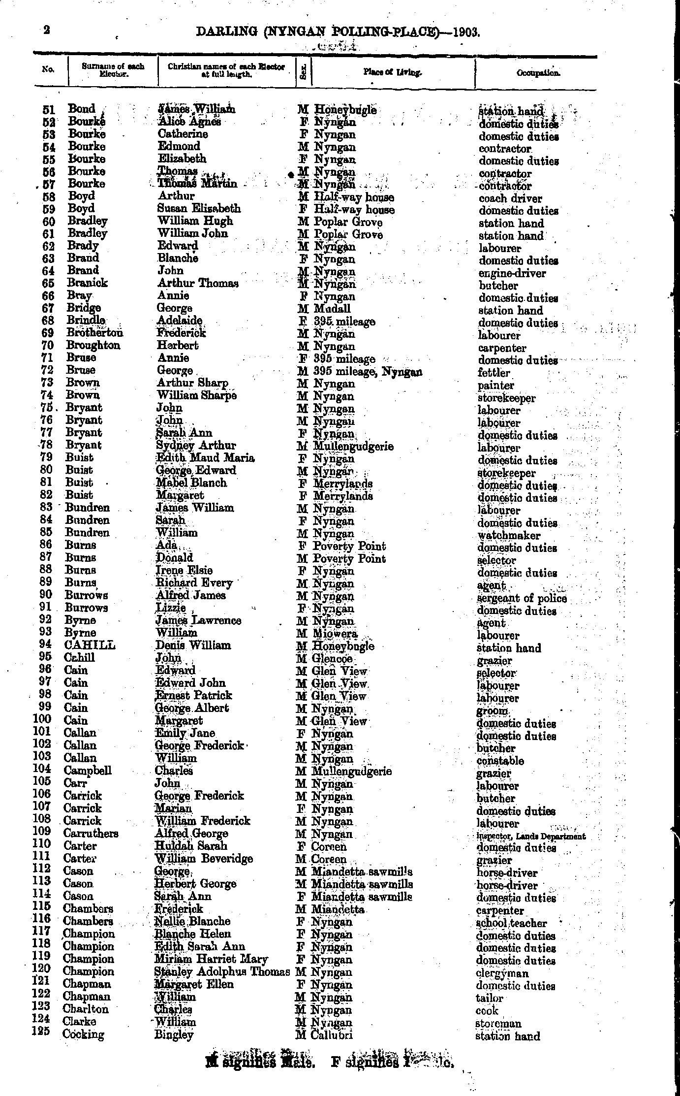
- Bond James - Cocking Bingley
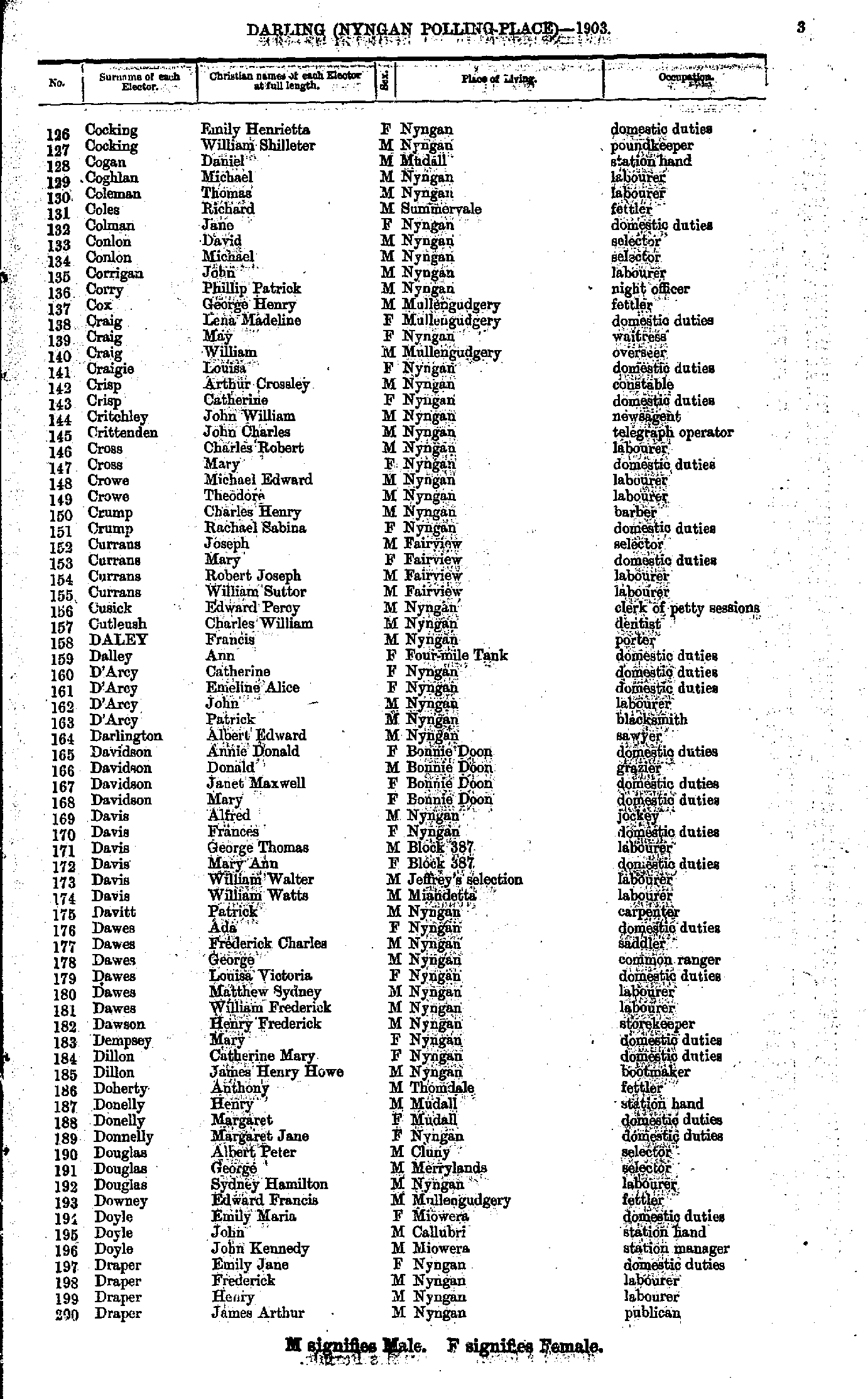
- Cocking Emily - Draper James
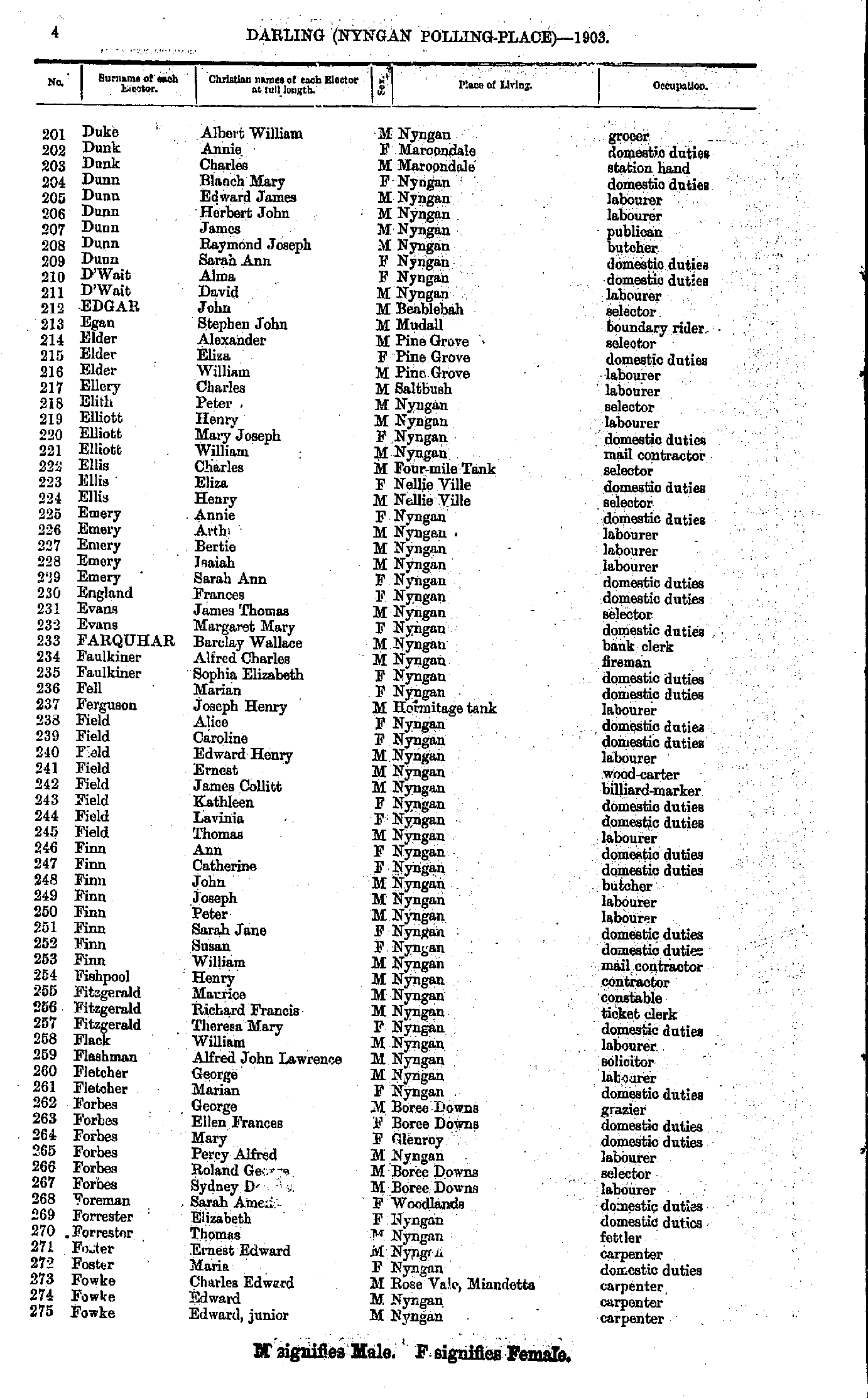
- Duke Albert - Fowke Edward
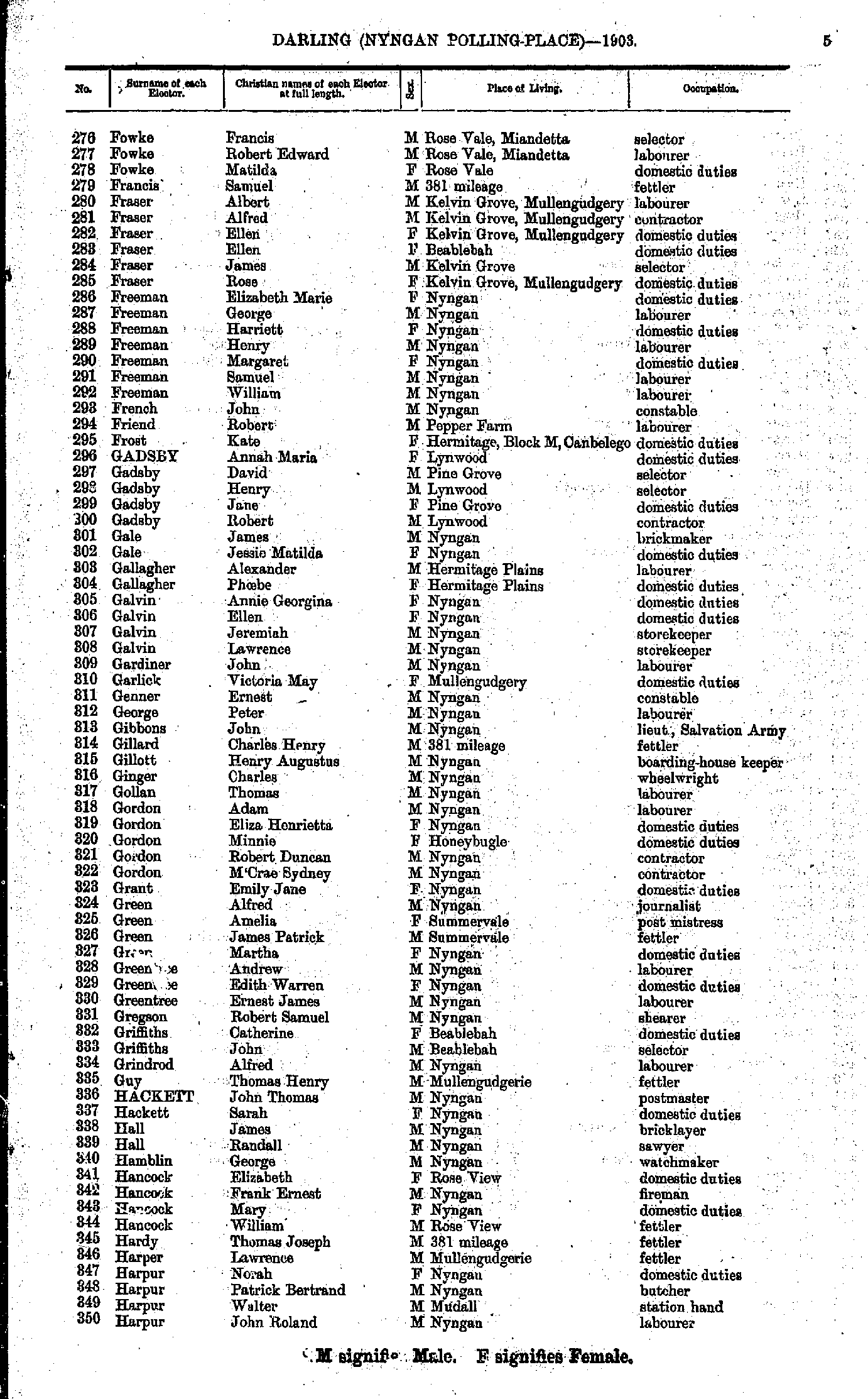
- Fowke Francis - Harpur John
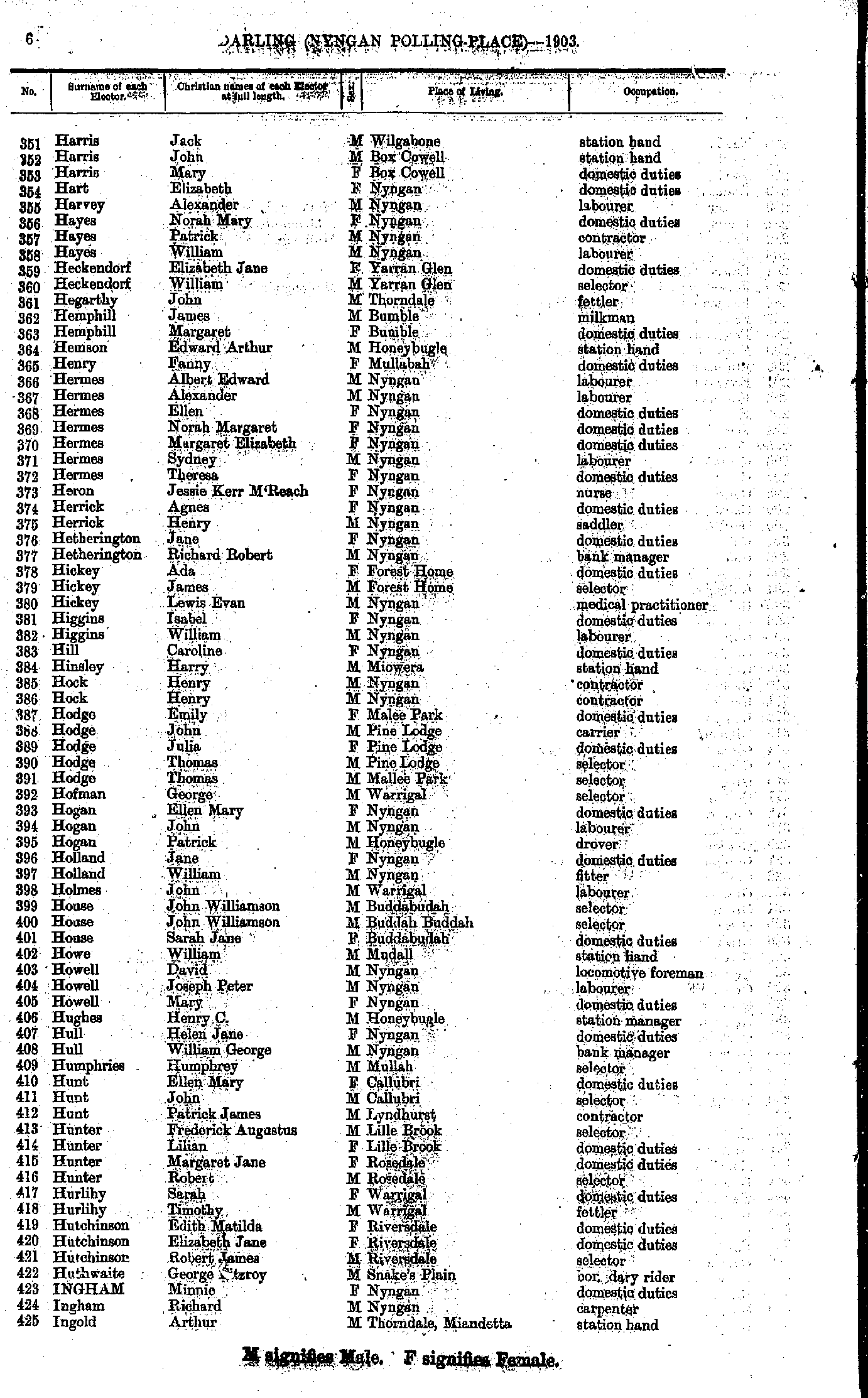
- Harris Jack - Ingold Arthur
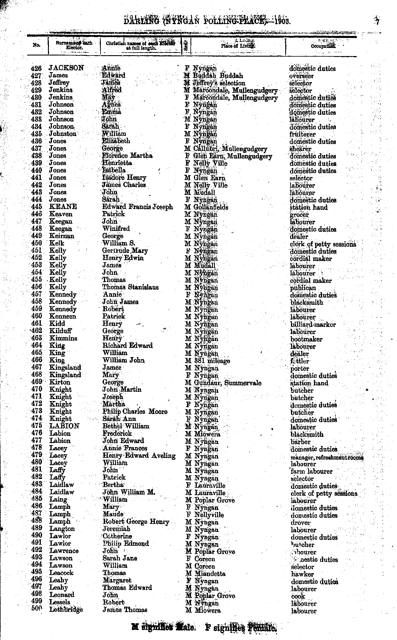
- Jackson Annie - Lethbridge James
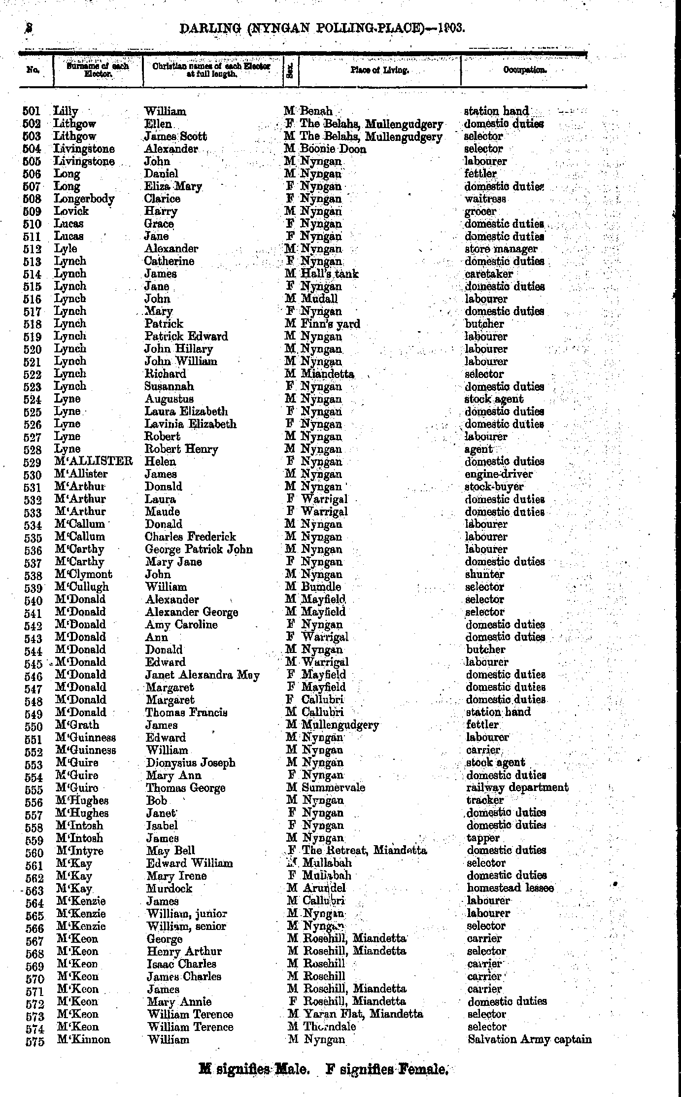
- Lilly William - M'Kinnon William
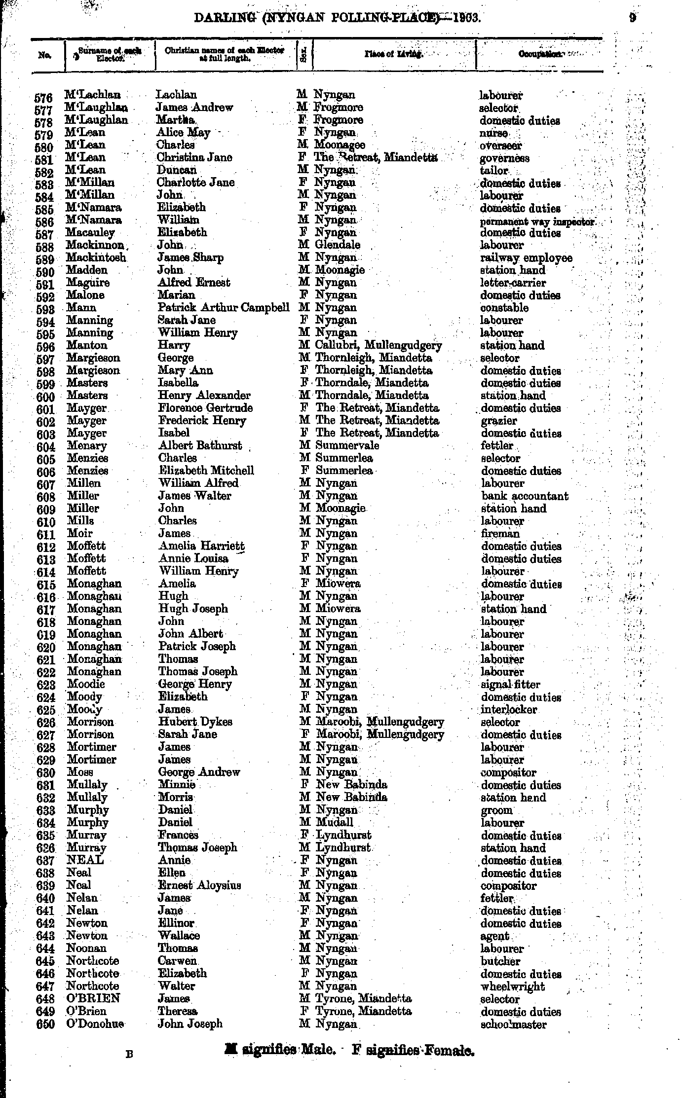
- M'Lachlan Lachlan - O'Donohue John
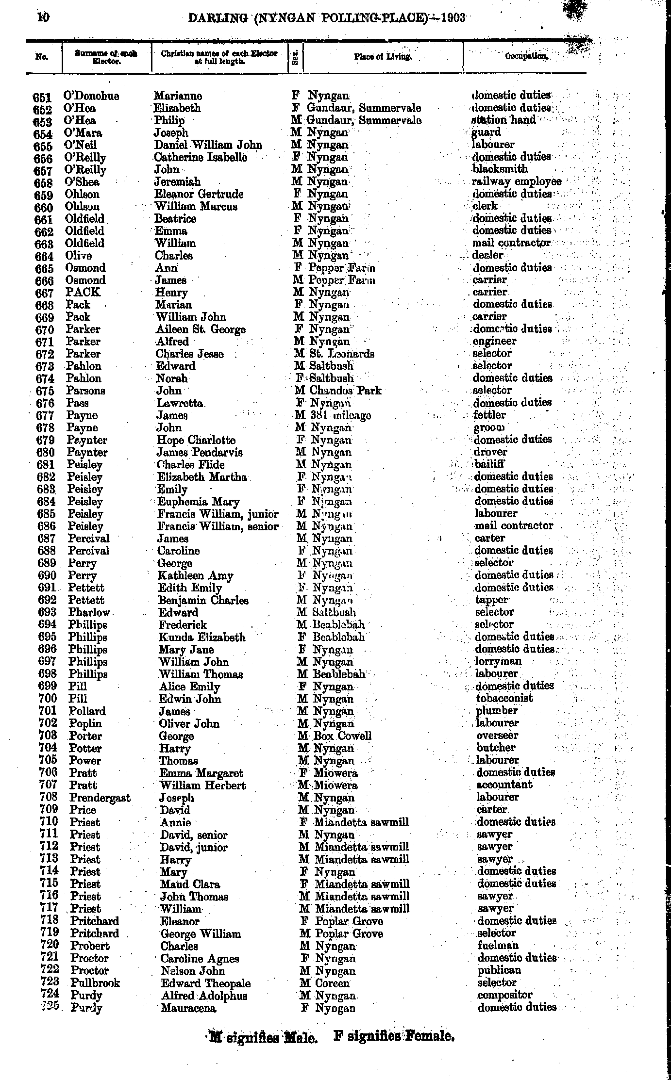
- O'Donohue Marianne - Purdy Mauracena
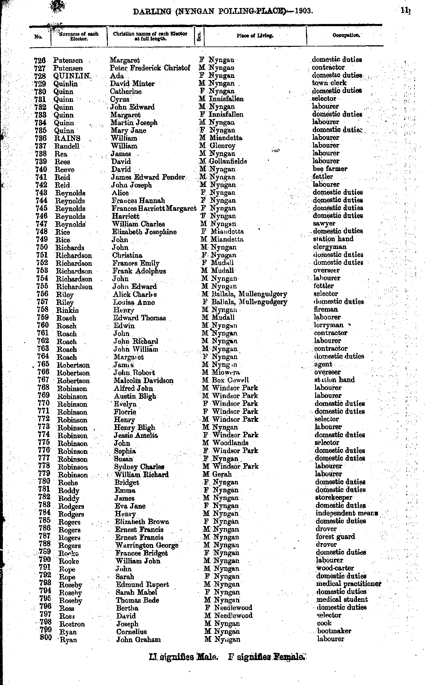
- Putensen Margaret - Ryan John
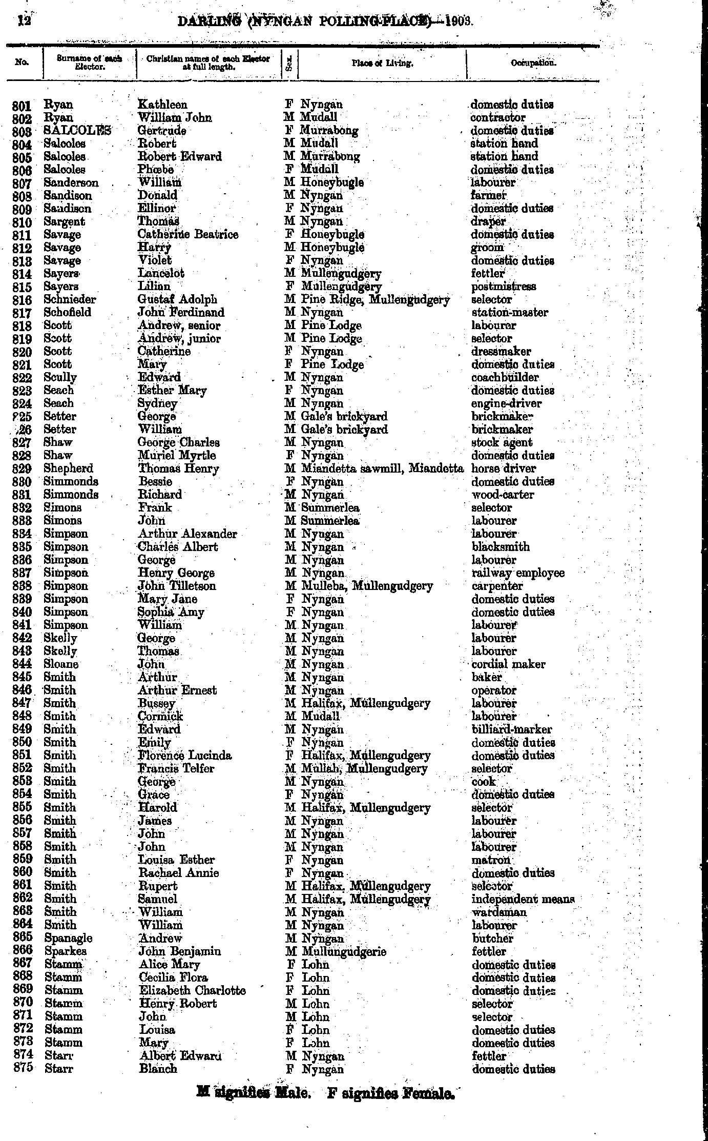
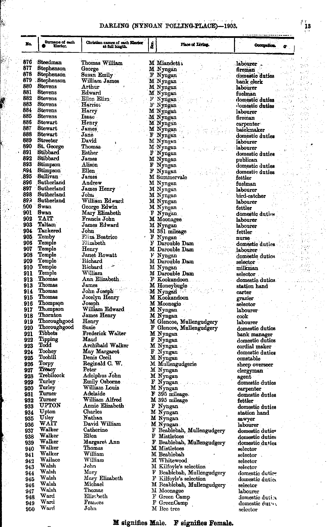
- Ryan Kathleen - Starr Blanch
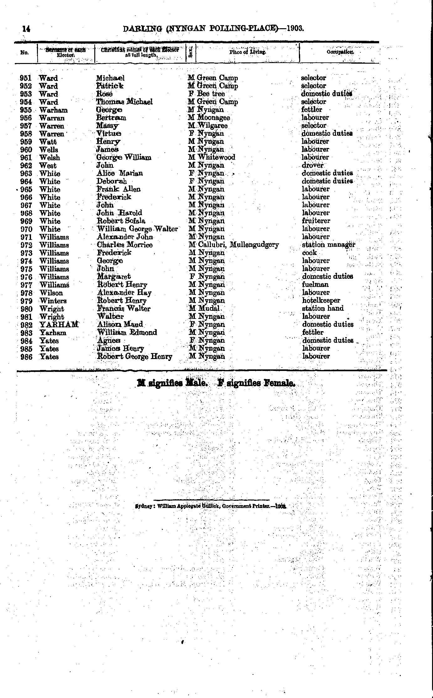
- Steedman Thomas - Ward John
- Ward Michael - Yates Robert
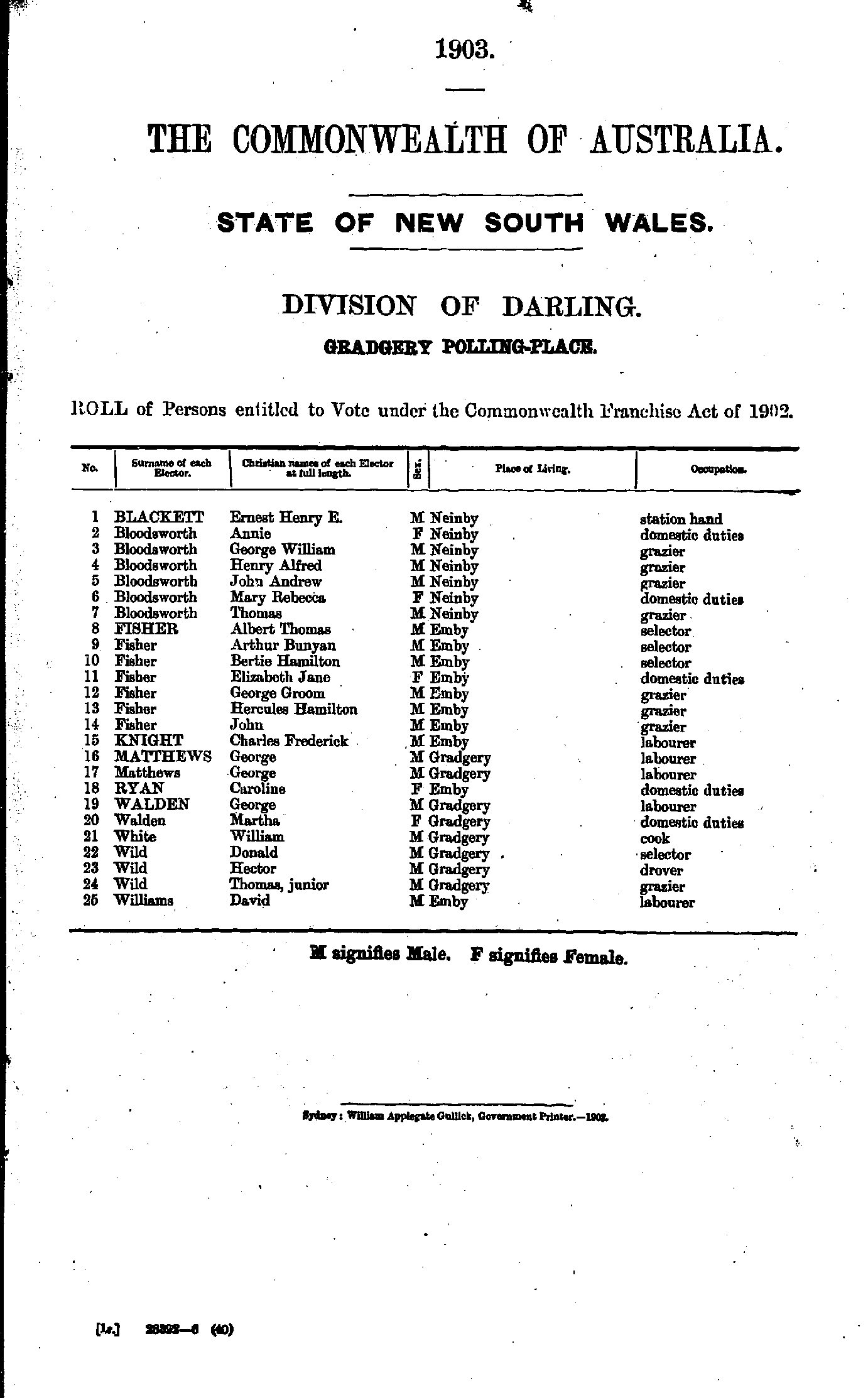
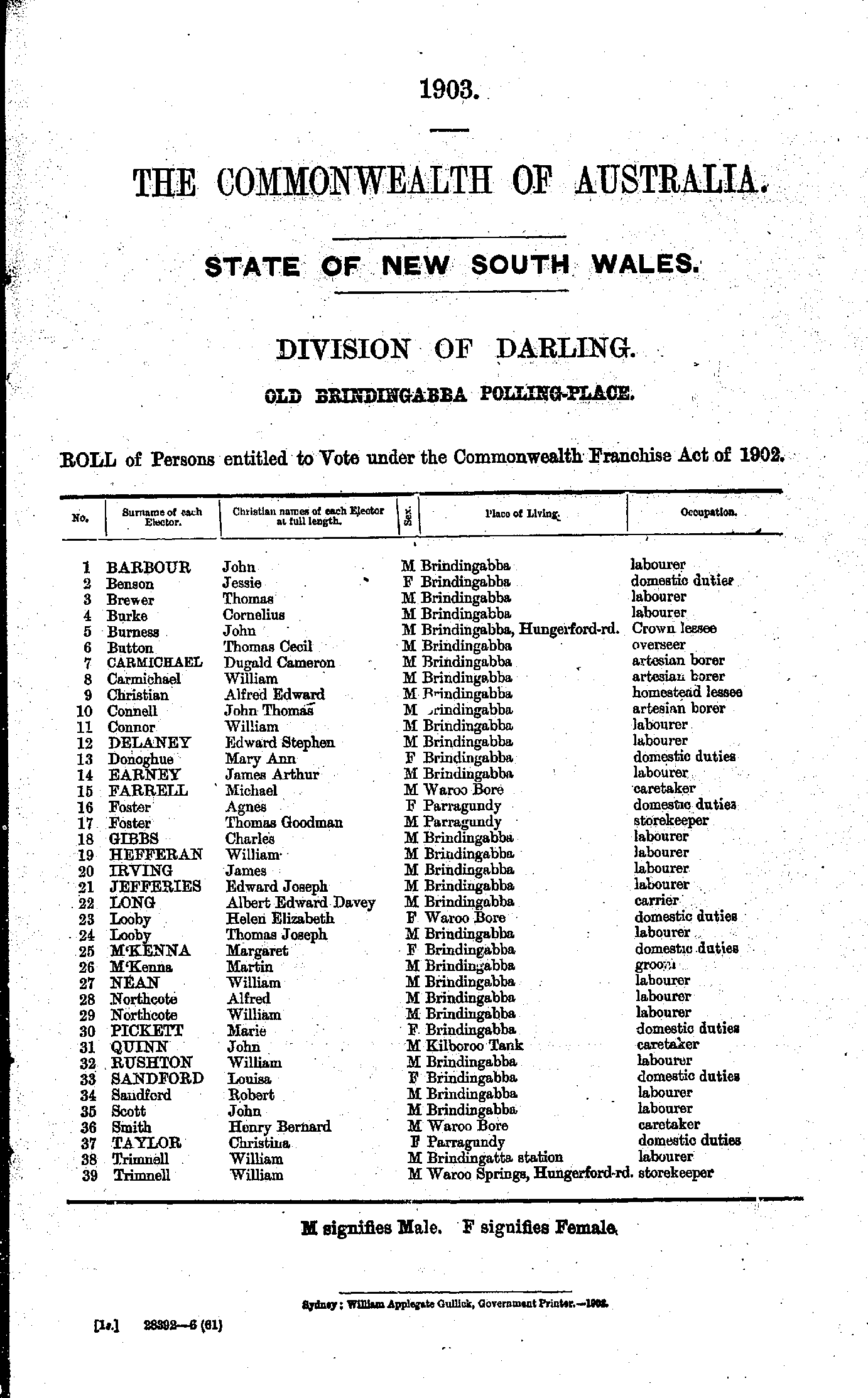
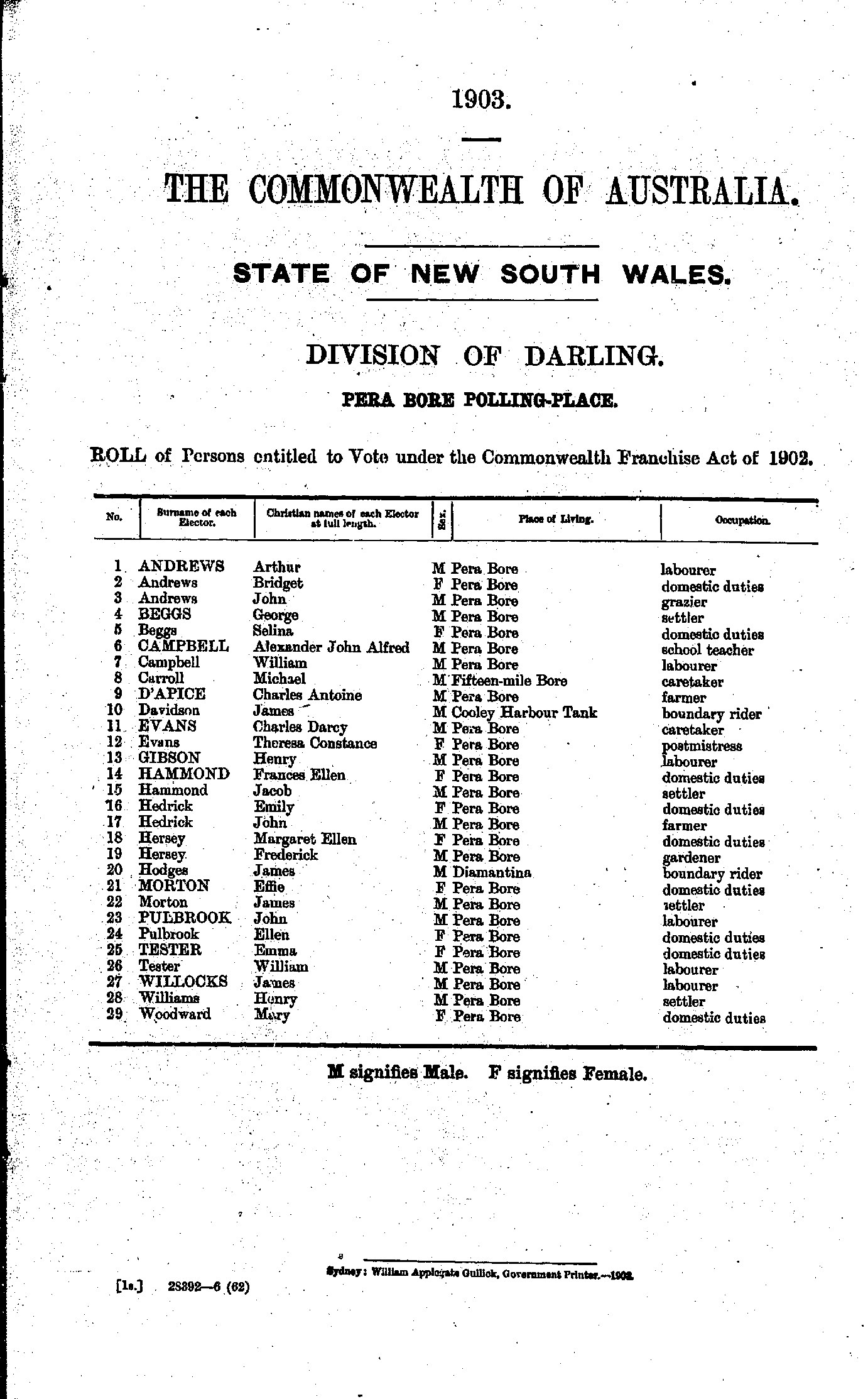
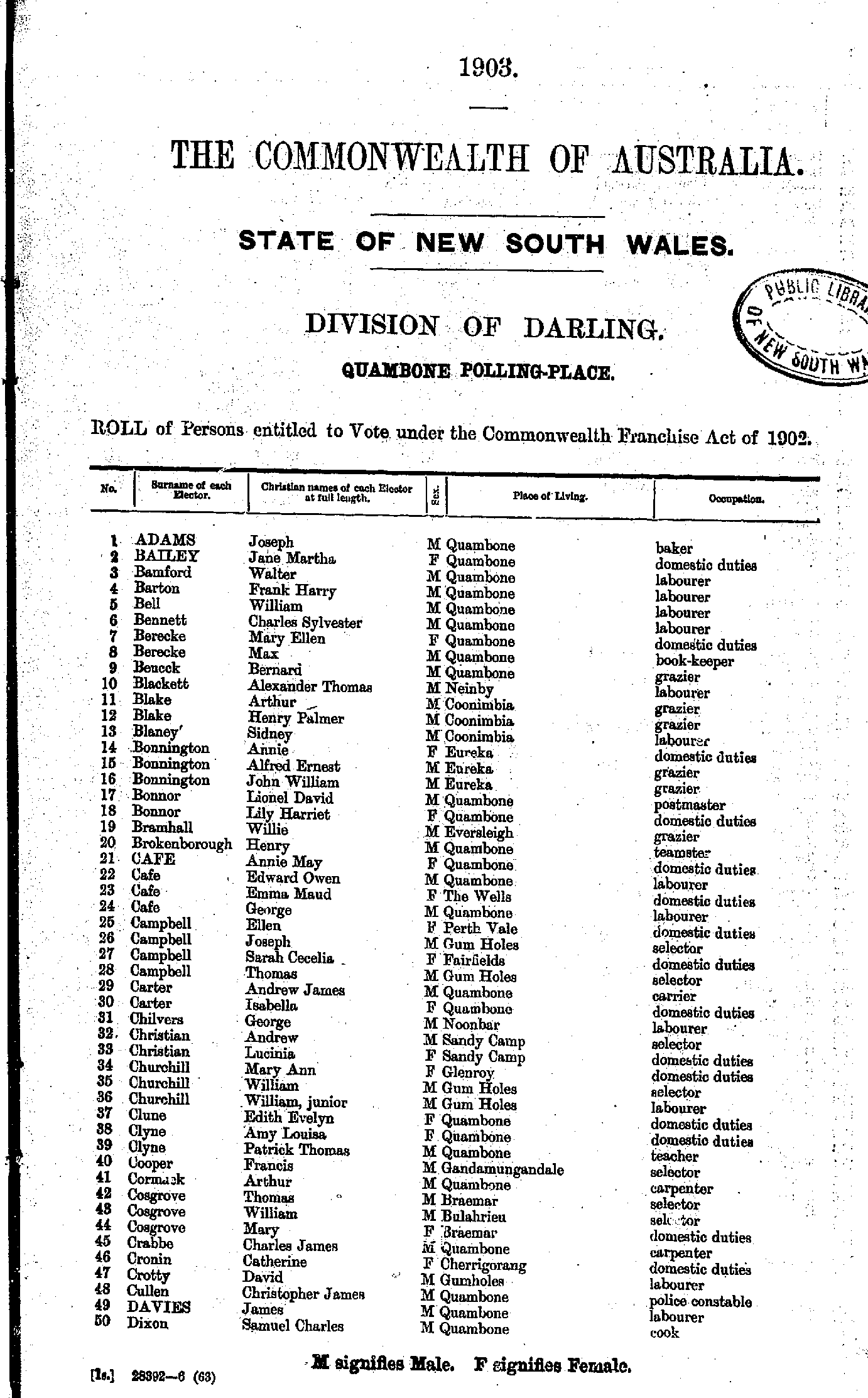
Old Brindingabba Polling Place
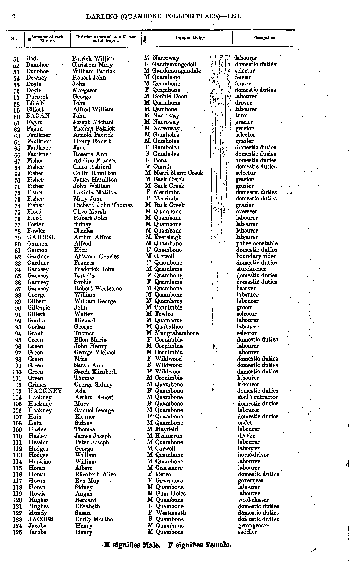
- Adams Joseph - Dixon Samuel
- Dodd Patrick - Jacobs Henry
- Jacobs William - Oriel James
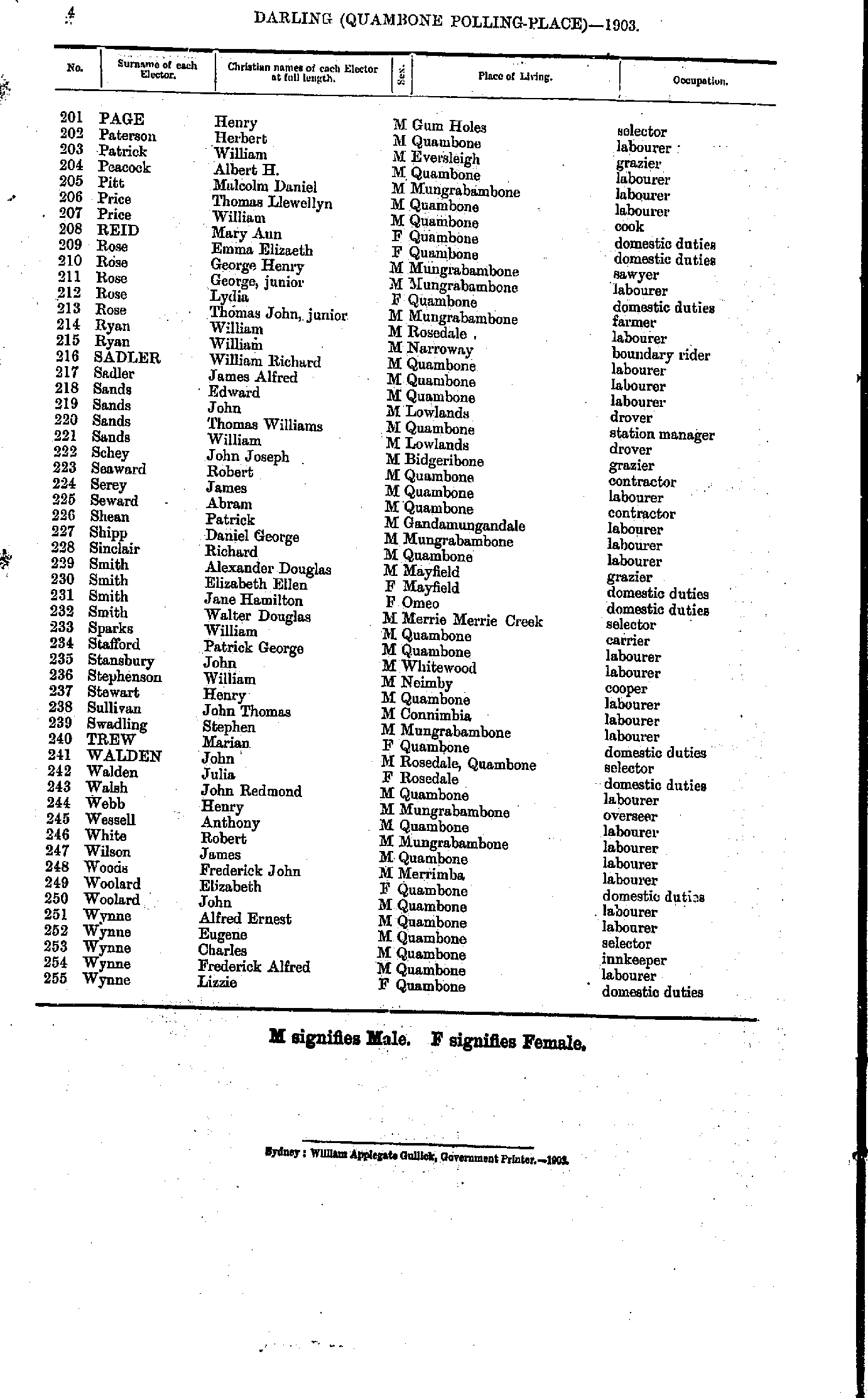
- Page Henry - Wynne Lizzie
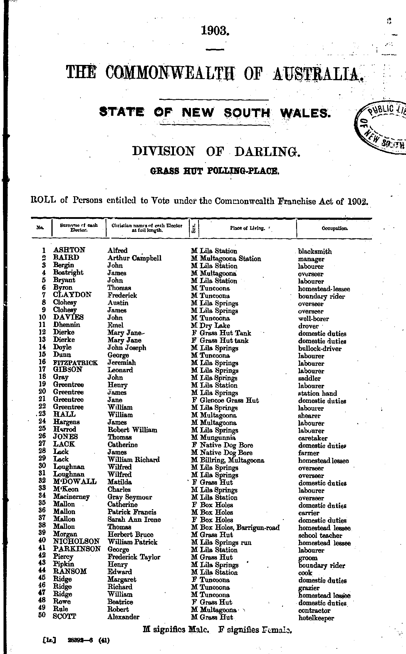
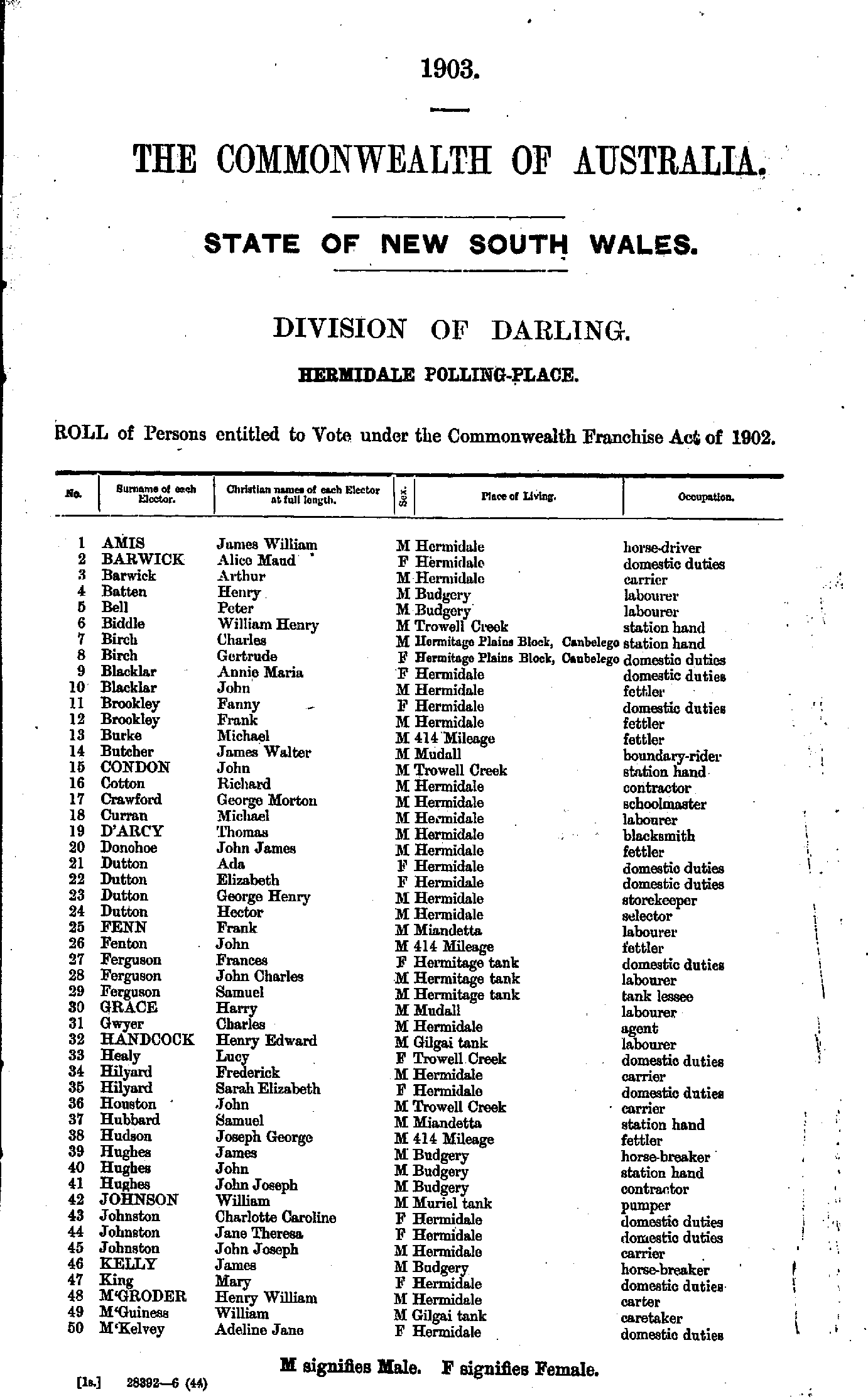
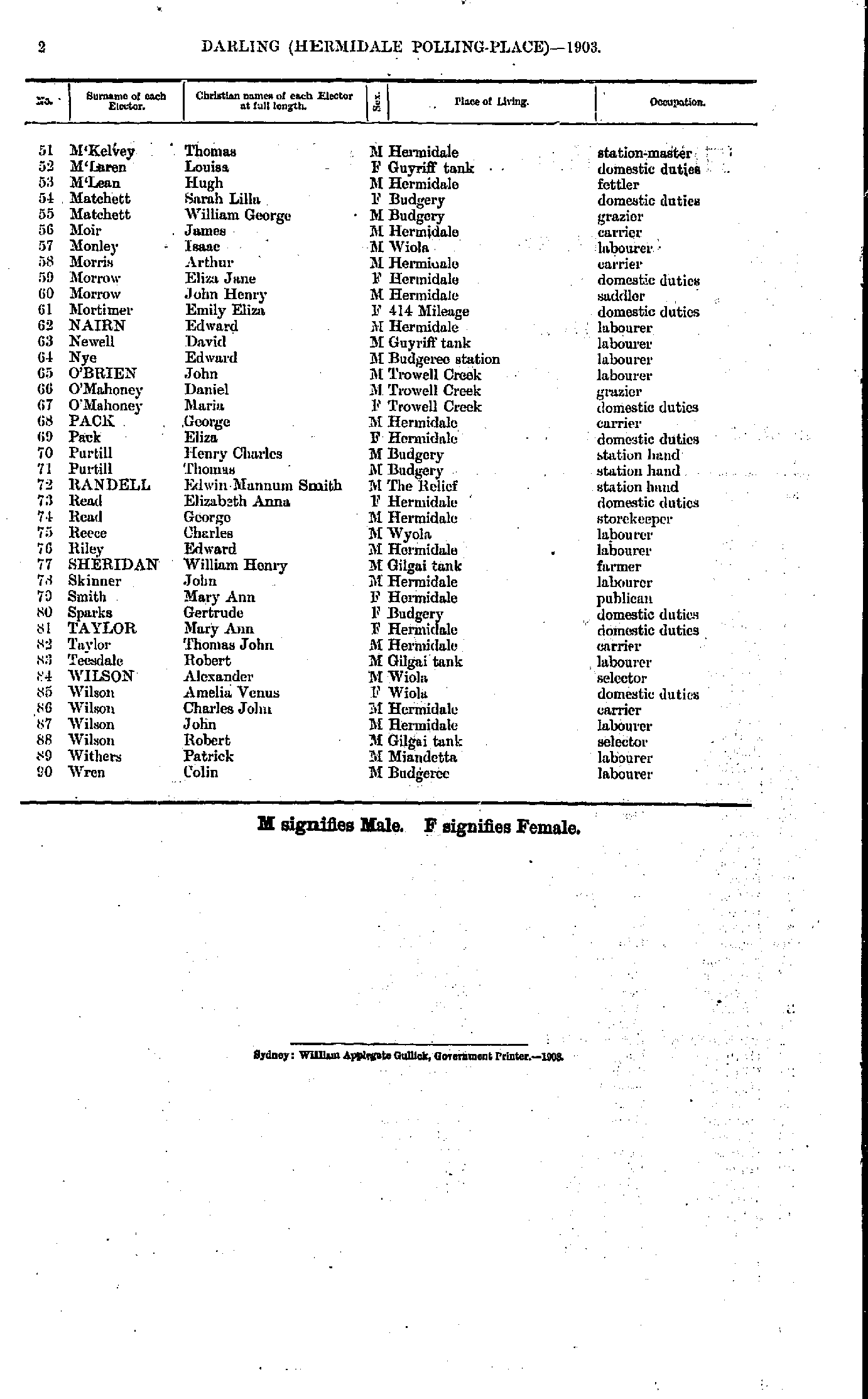
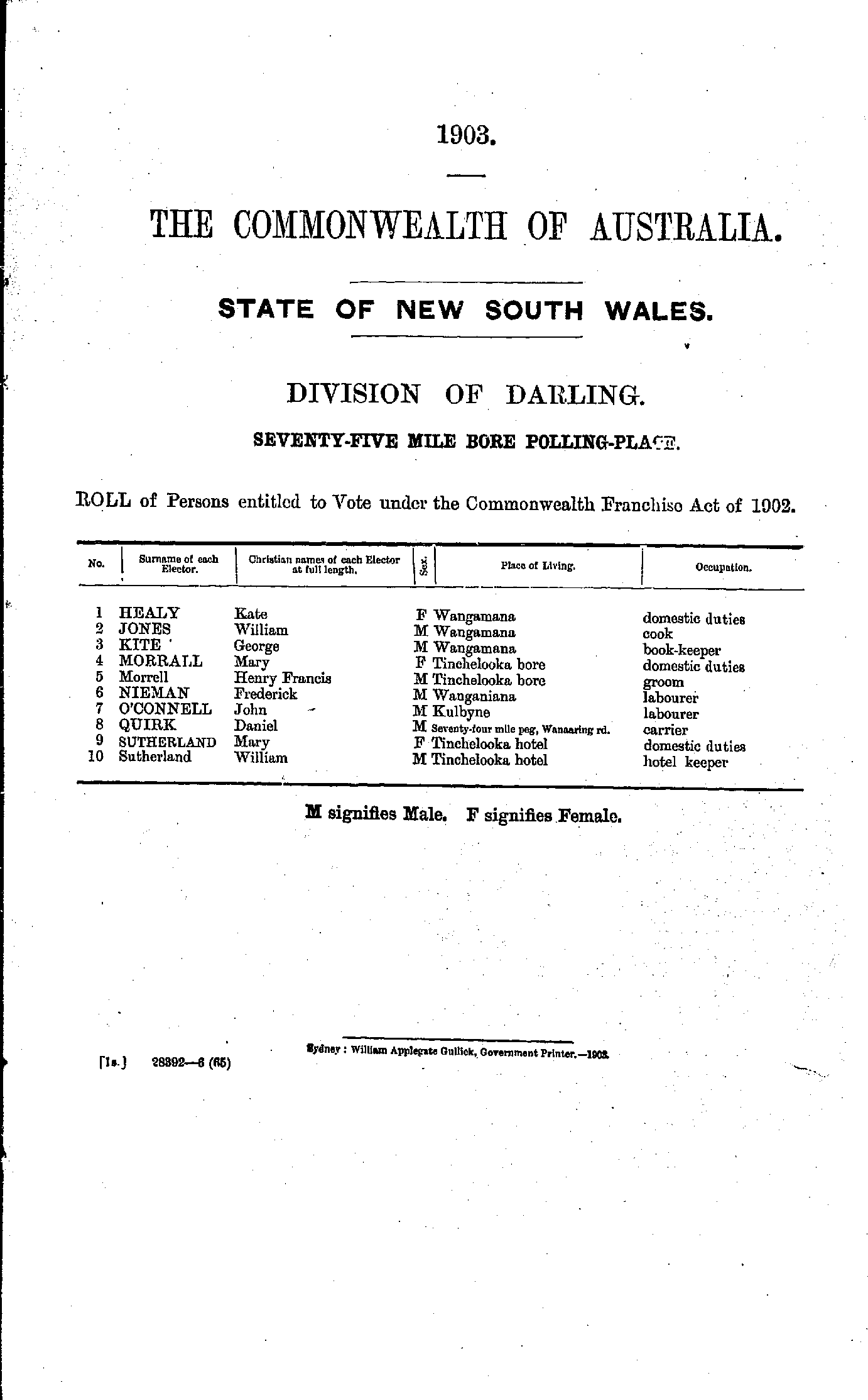
Seventy-five Mile Bore Polling Place
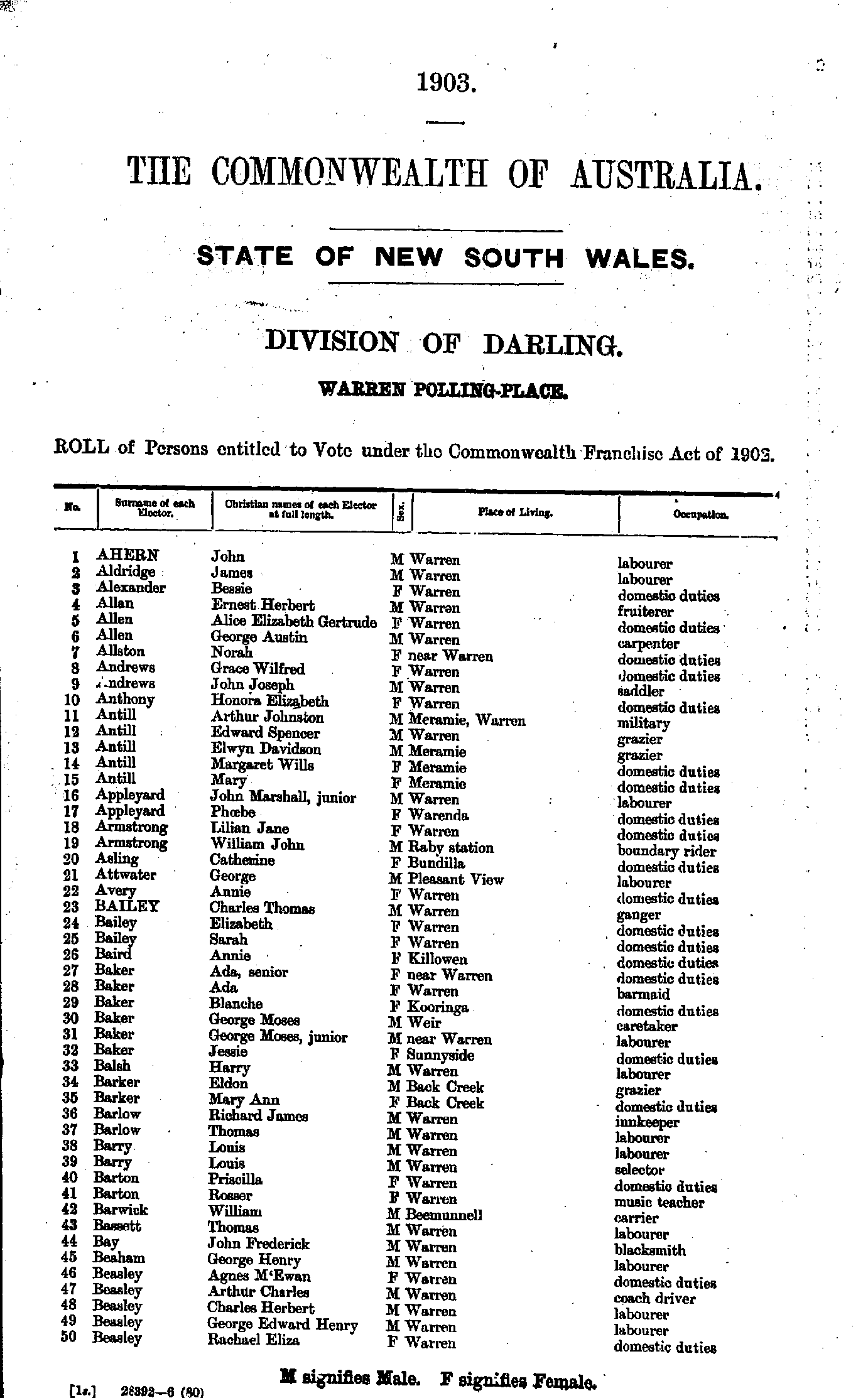
- Ahern John - Beasley Rachael
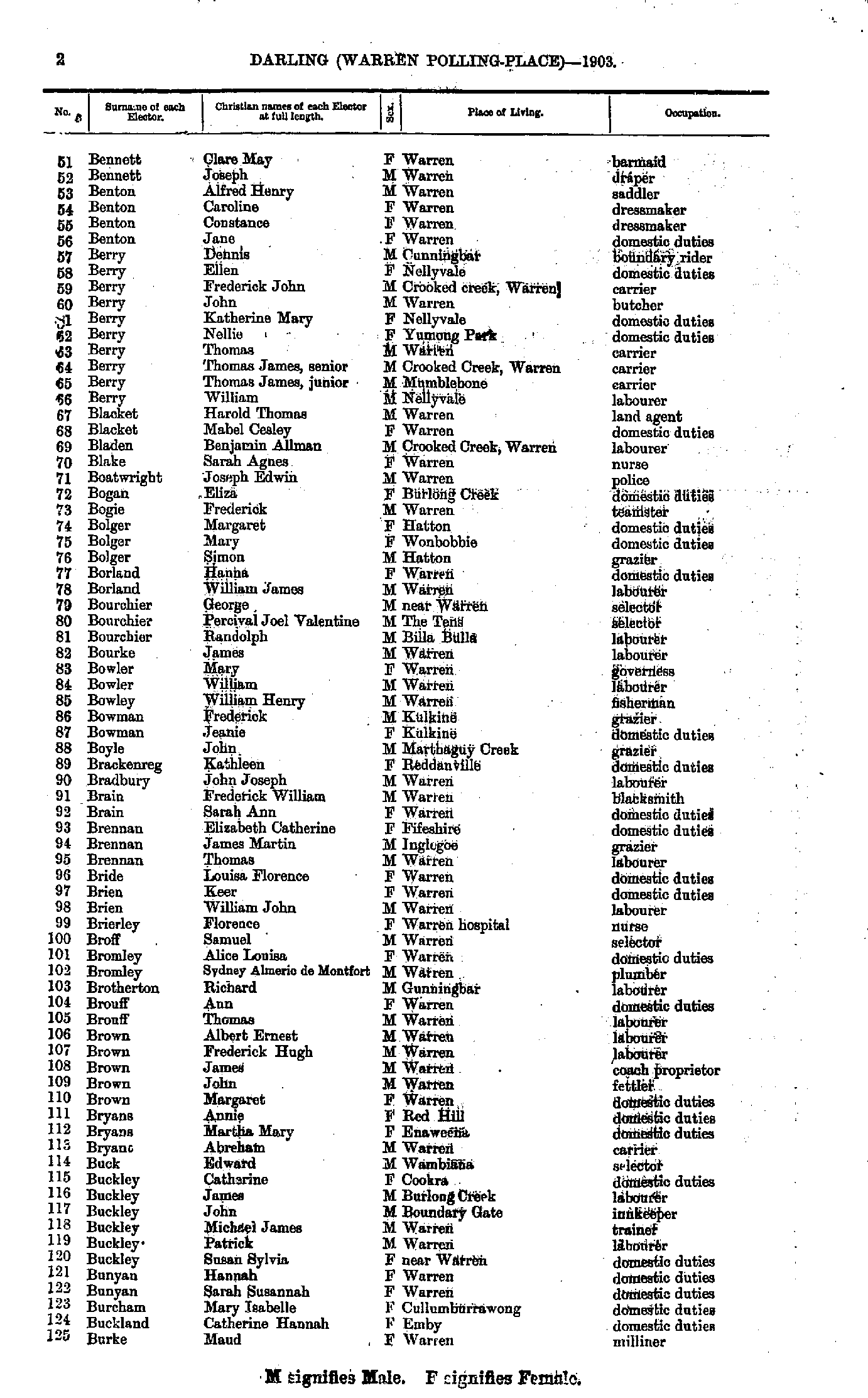
- Bennett Clare - Burke Maud
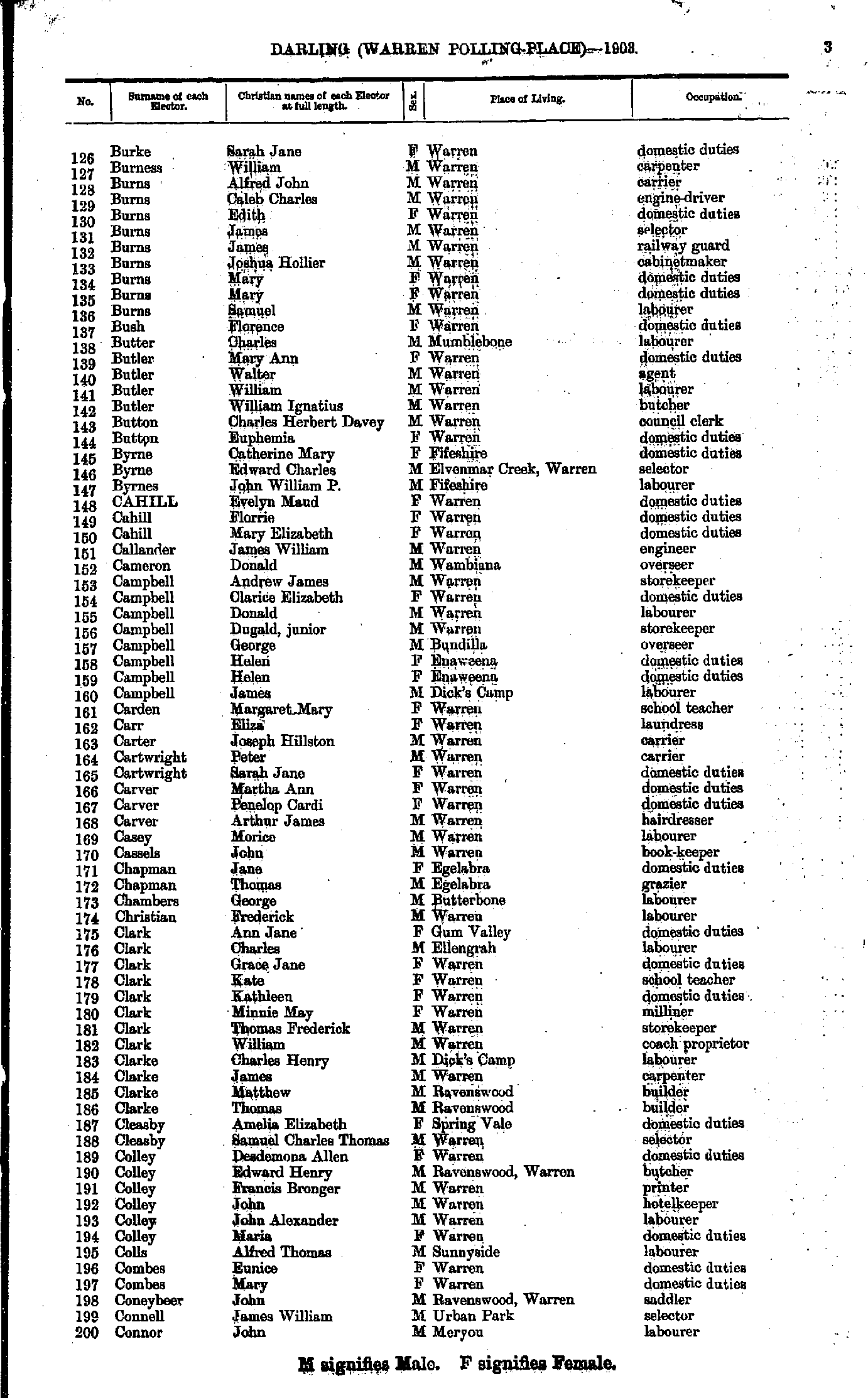
- Burke Sarah - Connor John
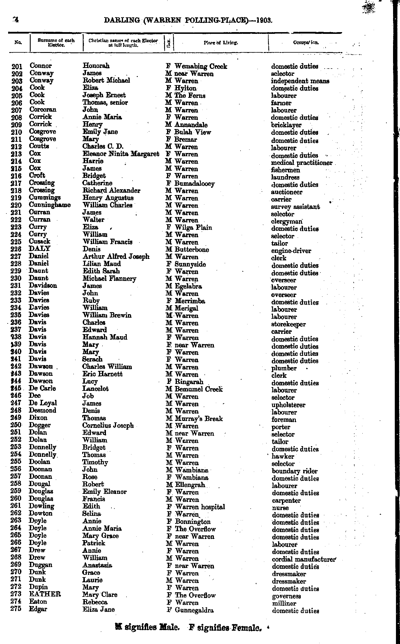
- Connor Honorah - Edgar Eliza
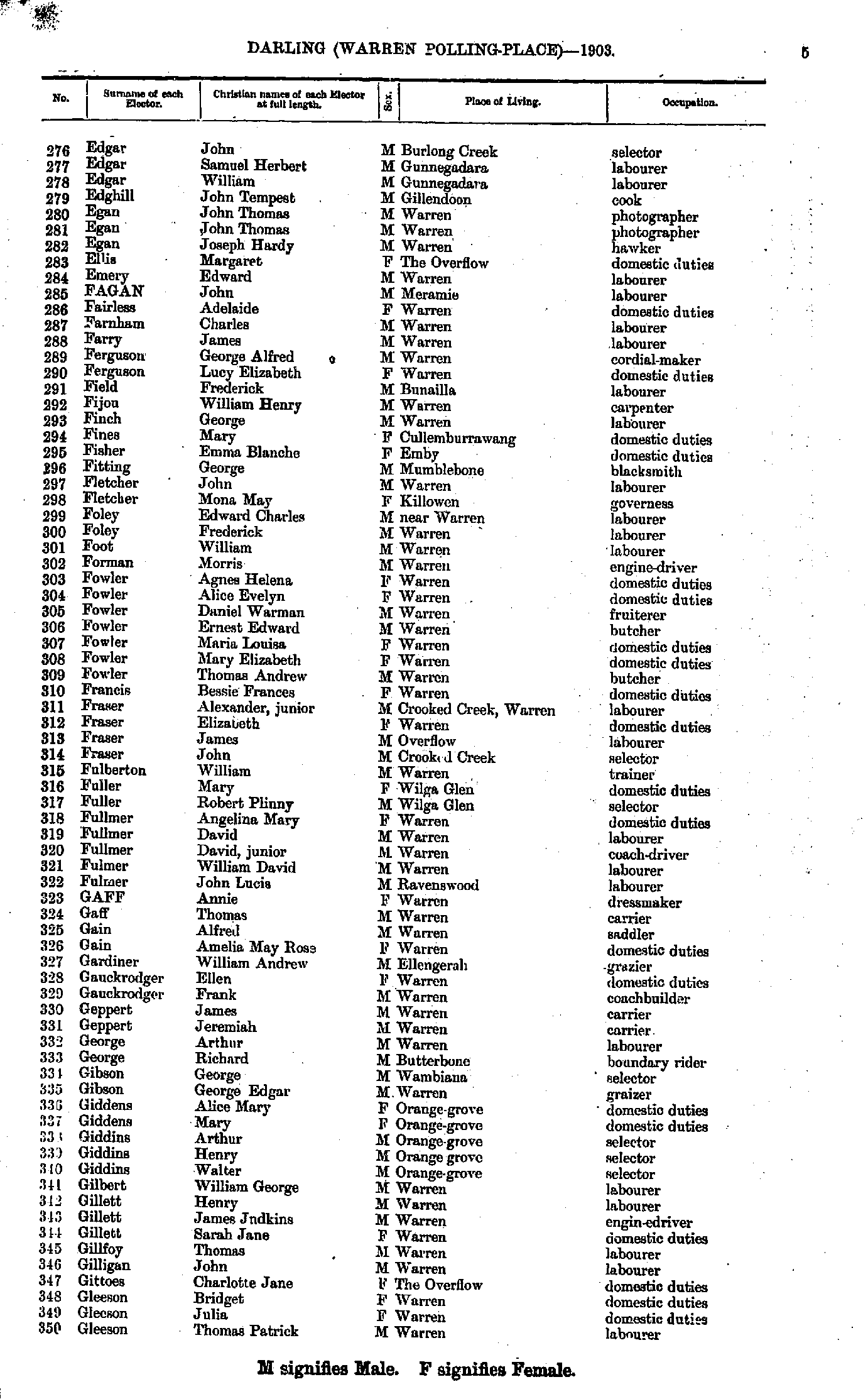
- Edgar John - Gleeson Thomas
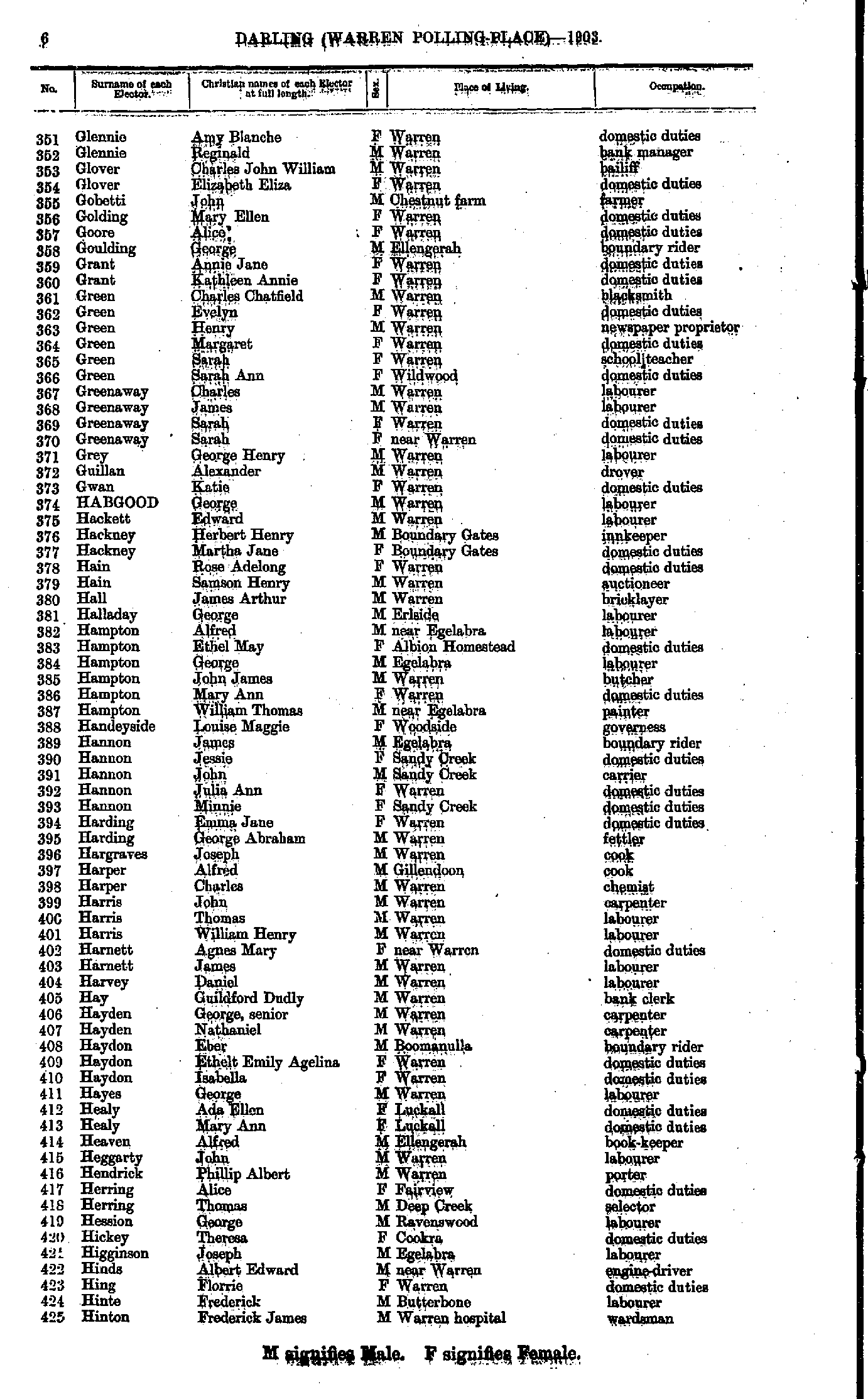
- Glennie Amy - Hinton Frederick
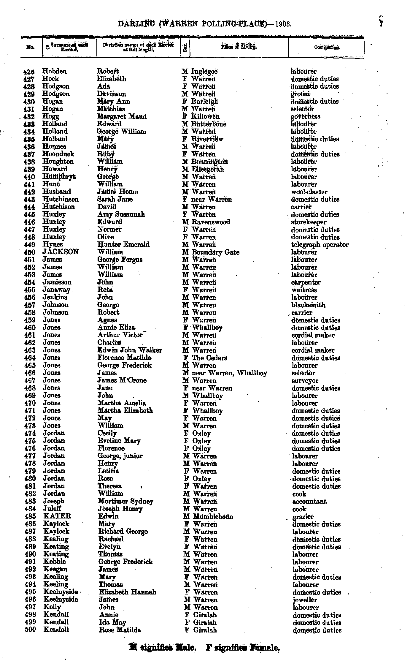
- Hobden Robert - Kendall Rose
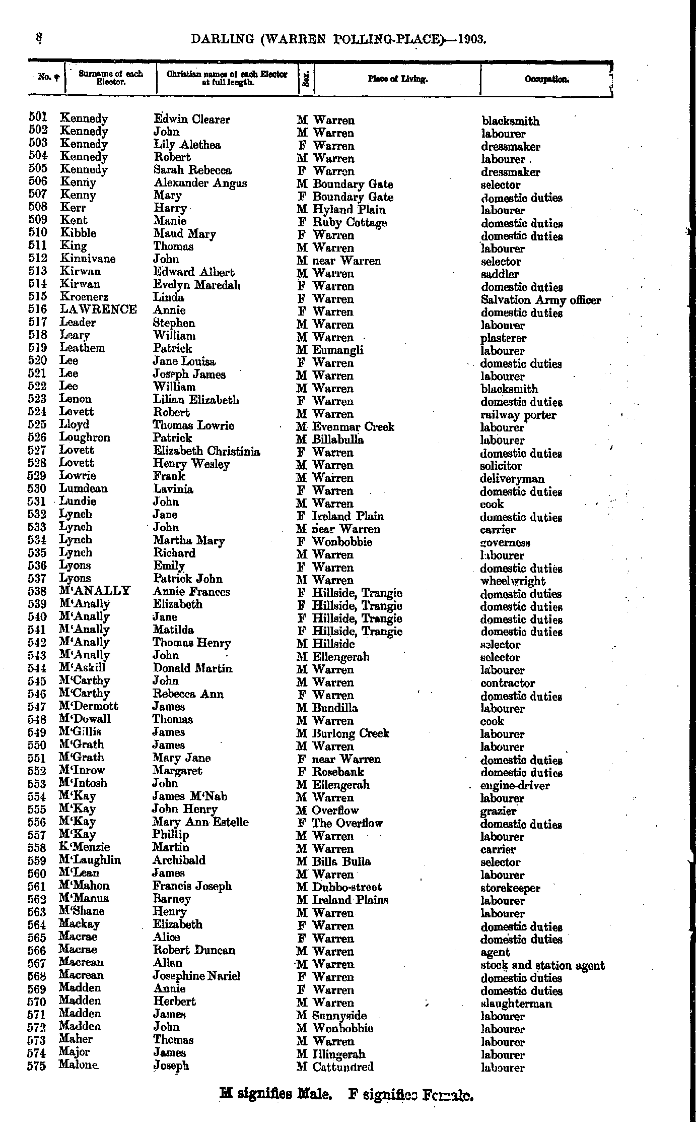
- Kennedy Edwin - Malone Joseph
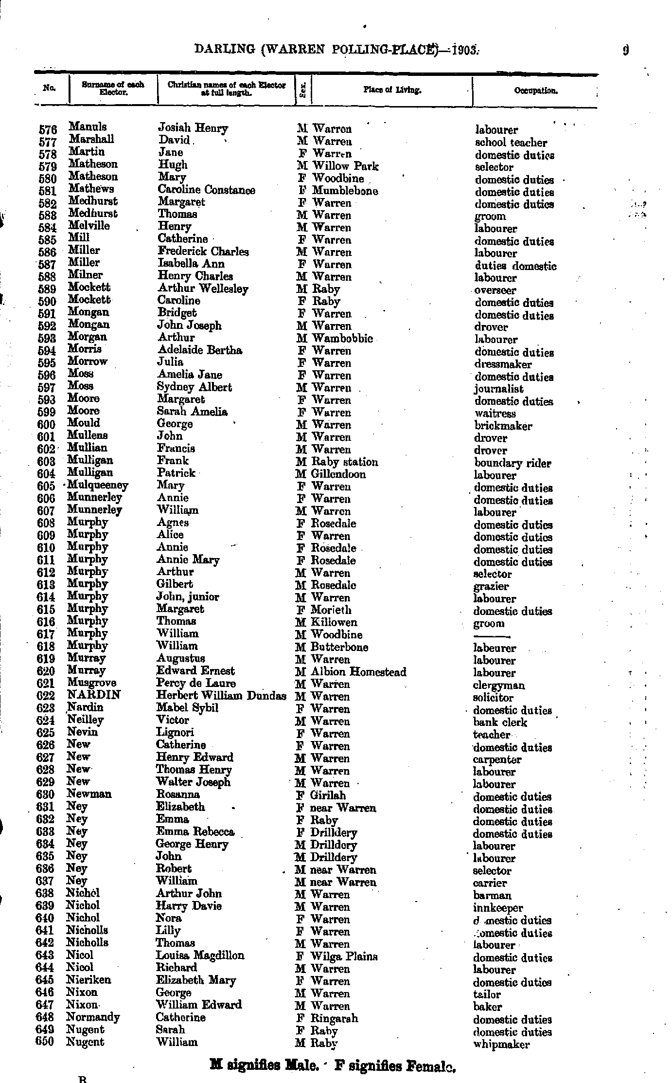
- Manuls Josiah - Nugent William
- O'Brien Andrew - Pittman William
- Powell John - Ryan John
- Ryan Michael - Stevenson Jessie
- Stevenson Margaret - Vaughan Frederick
- Vaughan Mary - Young William
Maps of the Darling Electoral Division
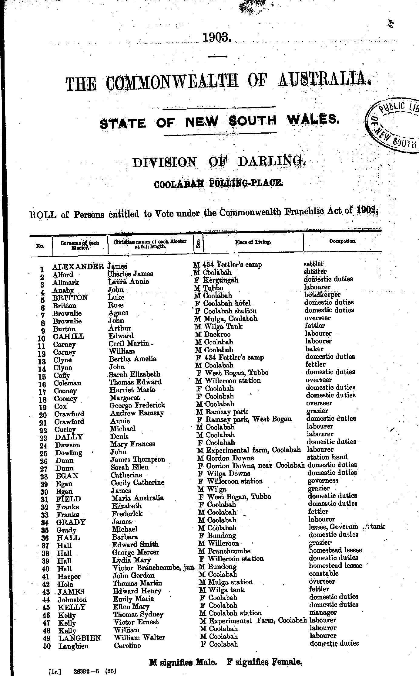
- Allen Ernest - Cleary James
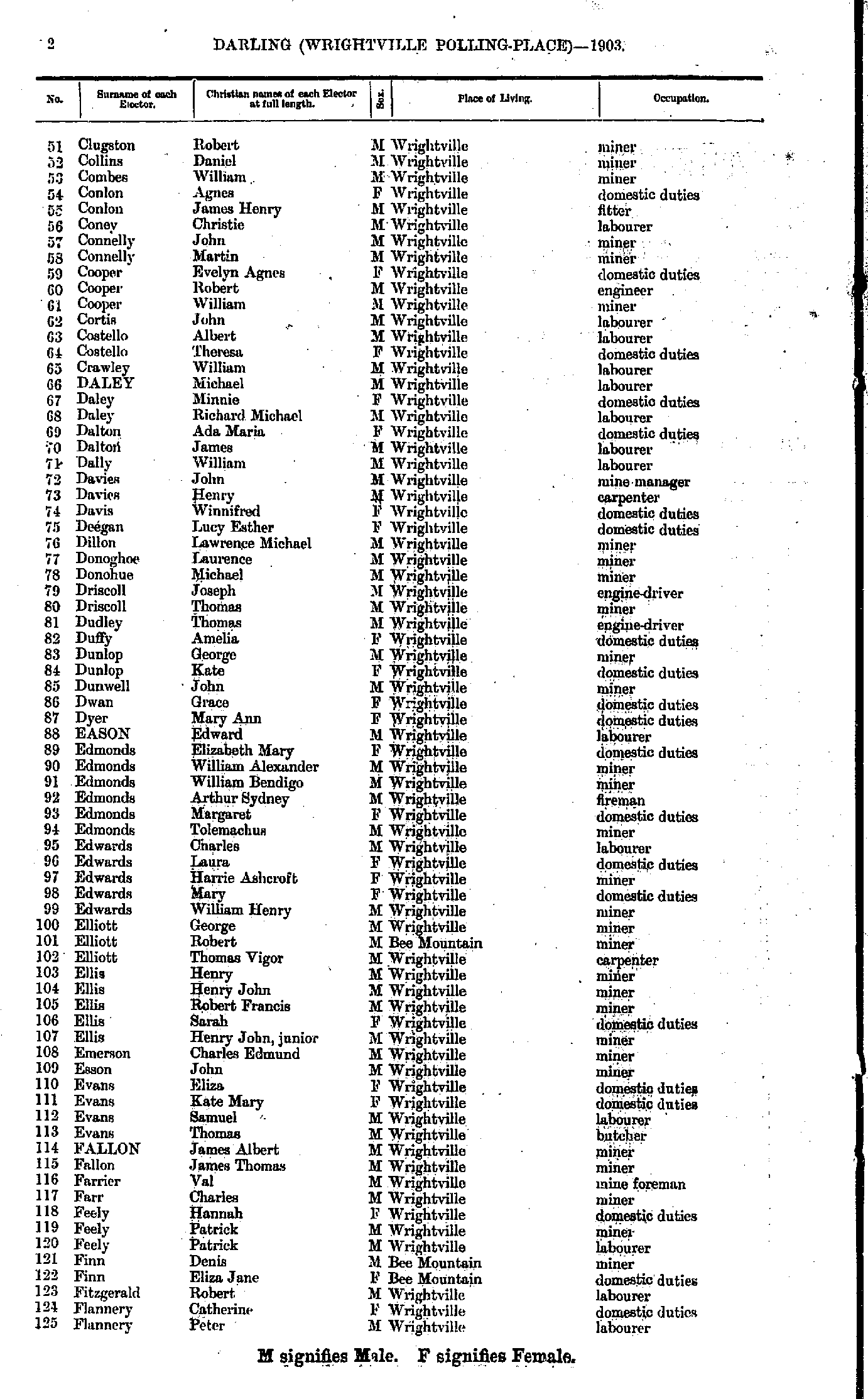
- Clugston Robert - Flannery Peter
- Flannery Thomas - Jeffree Albert
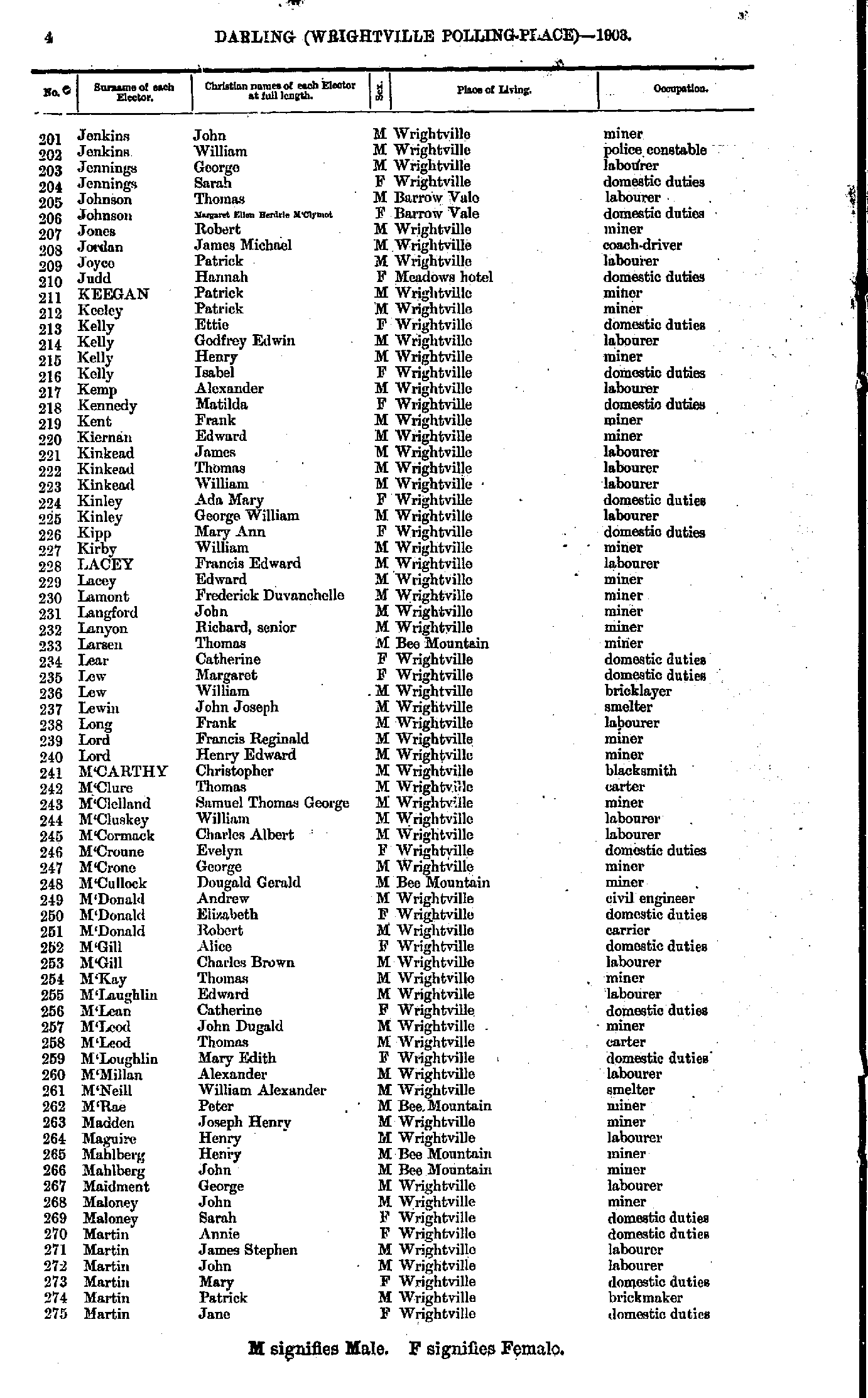
- Jenkins John - Martin Jane
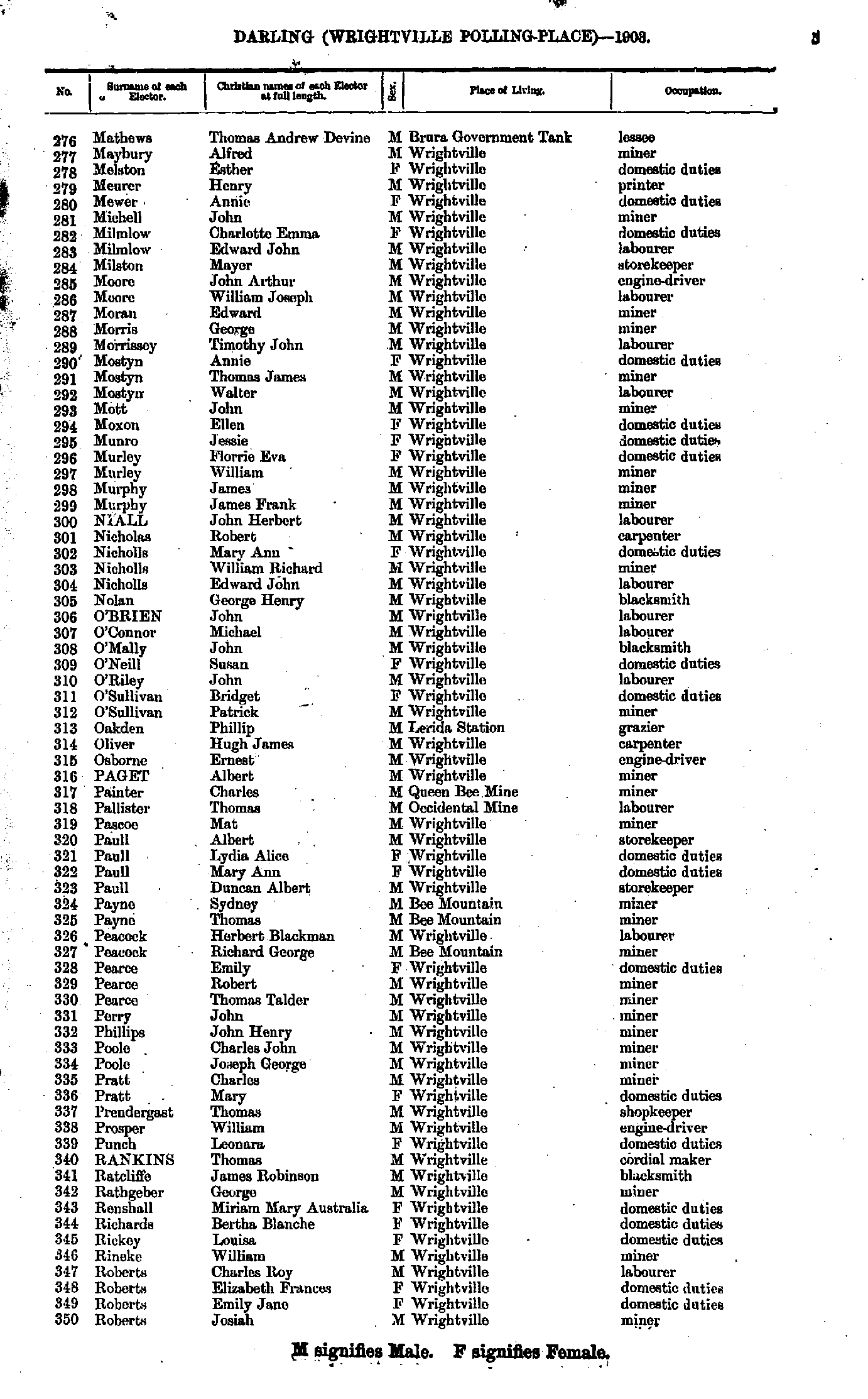
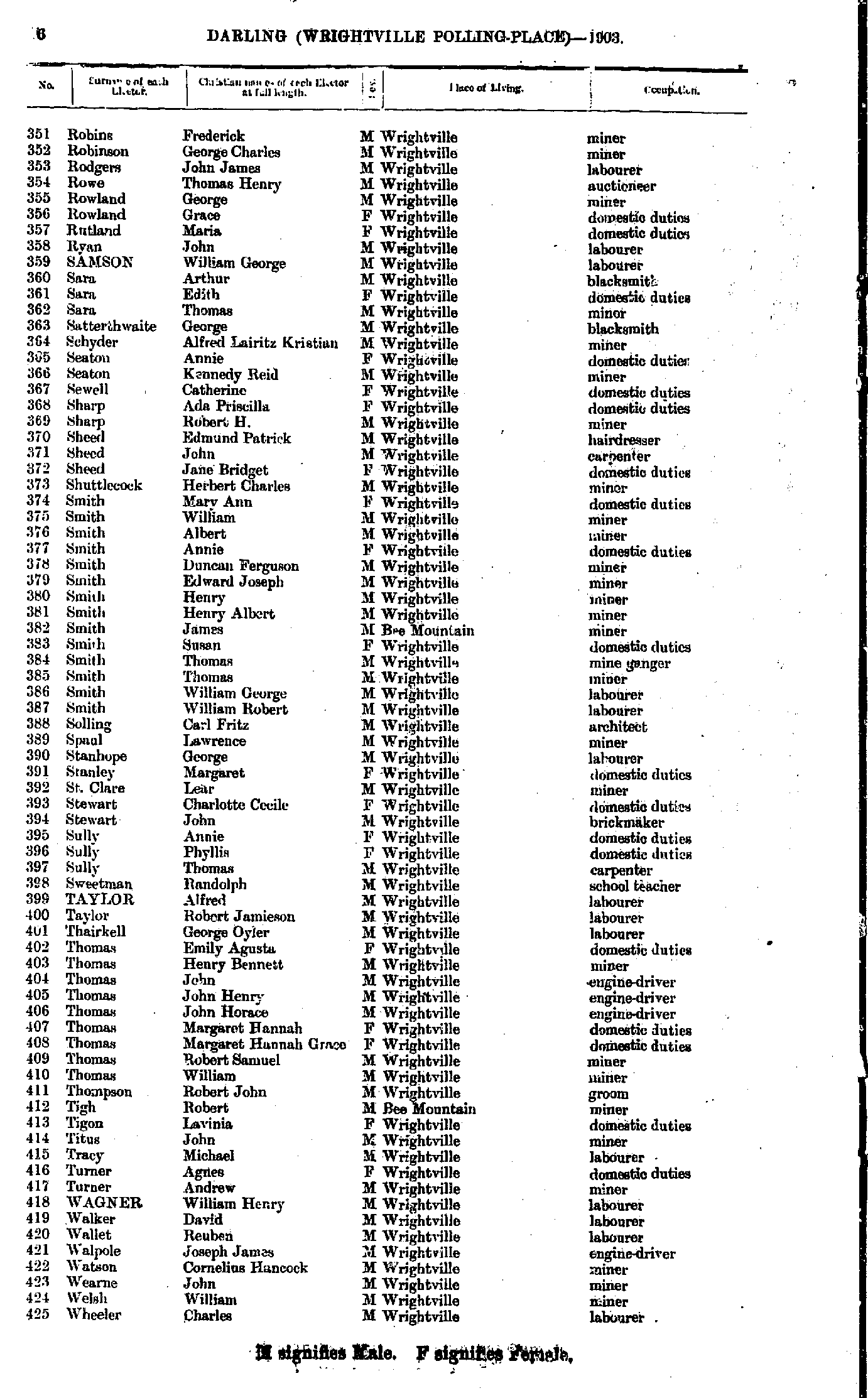
- Mathews Thomas - Roberts Josiah
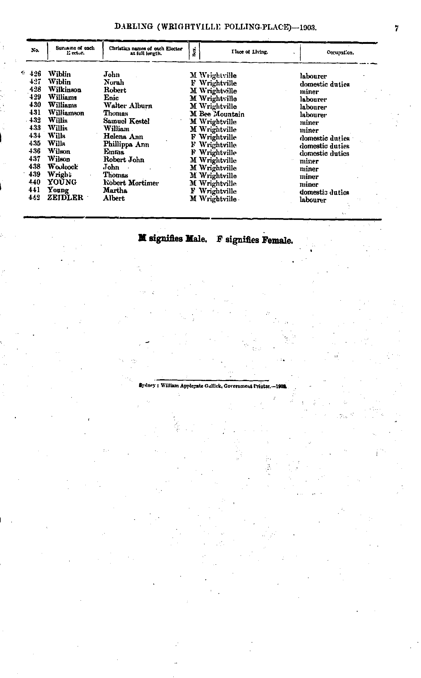
- Robins Frederick - Wheeler Charles
- Wiblin John - Zeidler Albert
From: Federal Electoral Districts Commissioners 1901, Maps of the Federal Electoral Districts of the State of New South Wales, William Applegate Gullick, Government Printer, Sydney.
JPEG file (263KB)
Portable Document Format(PDF) file (1.37MB)If you do not have a PDF reader you can click on the button to download the free Adobe Acrobat Reader
The documents in this site are arranged into seven major indexes. You are currently in the Electoral Rolls index. Use the Back button on your browser to move within this index, or use the links below to view another index:
- Directories
- Electoral Rolls
- Land Records
- General and Miscellaneous Records
- Mining Records
- Pastoral and Agricultural Records
- Other Occupations
Copyright © Internet History Resources 2008
