IHR NSW Family History Documents
Electoral Rolls Index
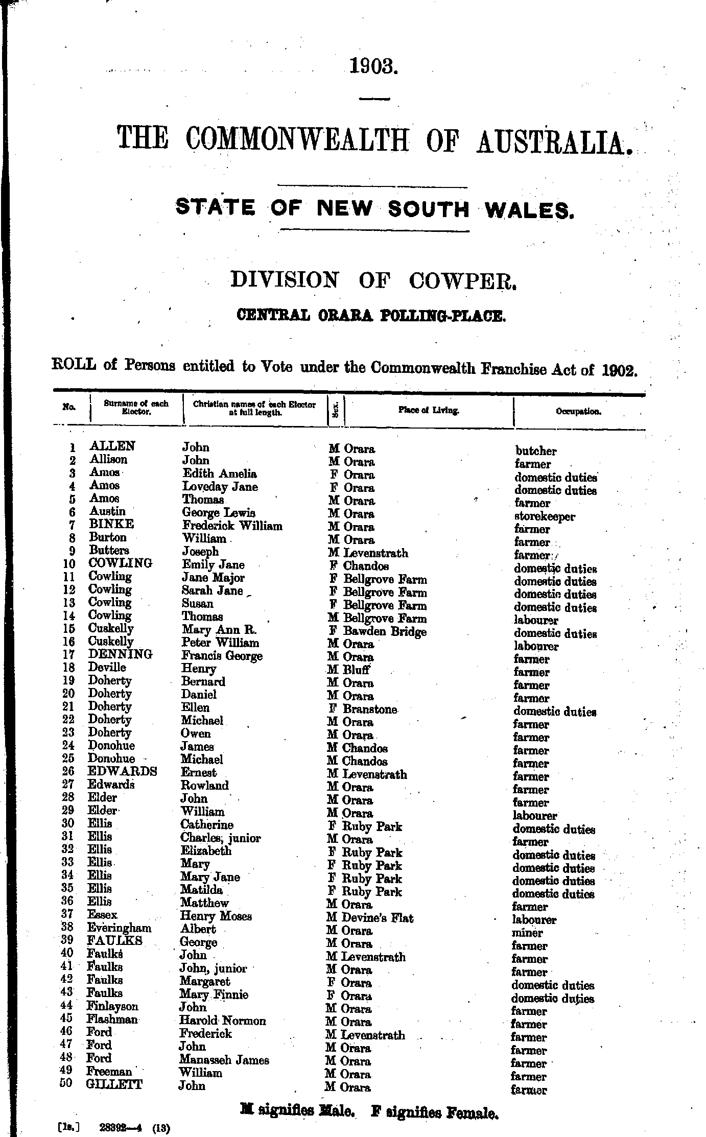
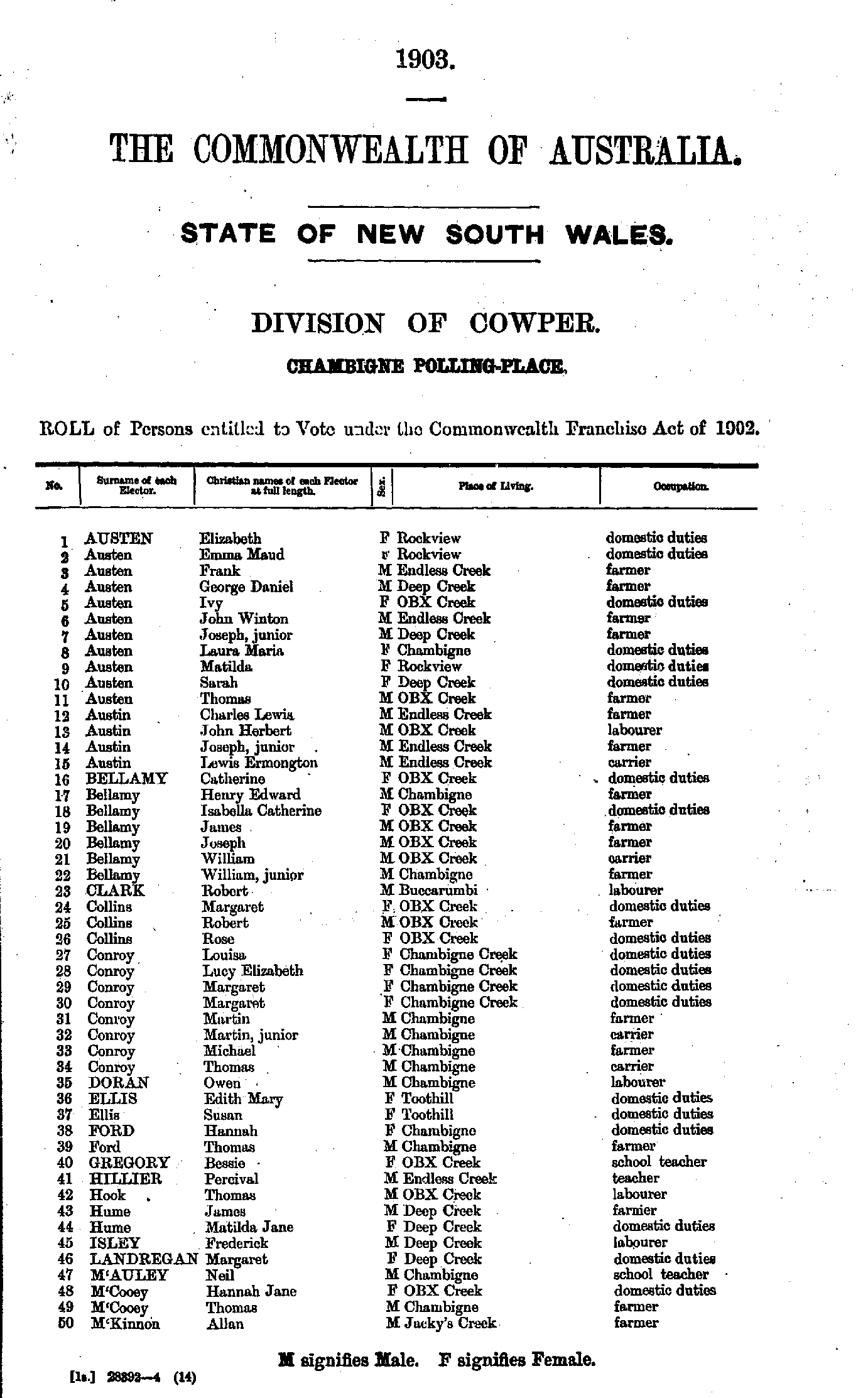
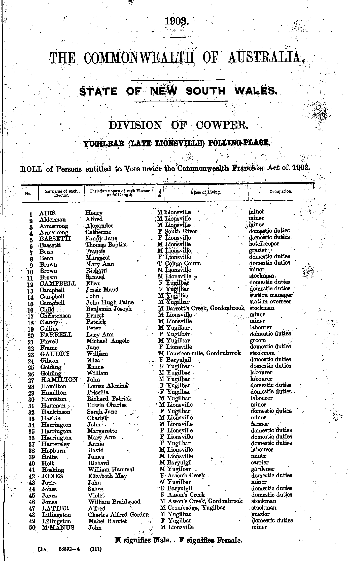
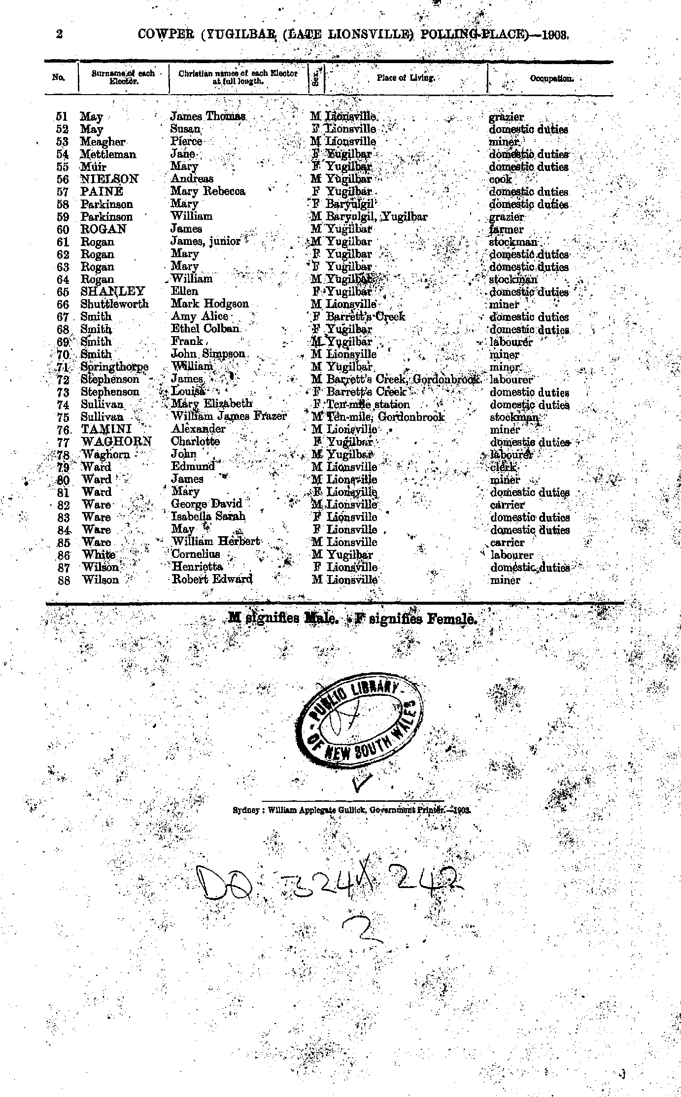
Home | Directories | Electoral | Land | General | Mining | Pastoral | OccupationsNSW Electoral Rolls 1903 - Cowper Division
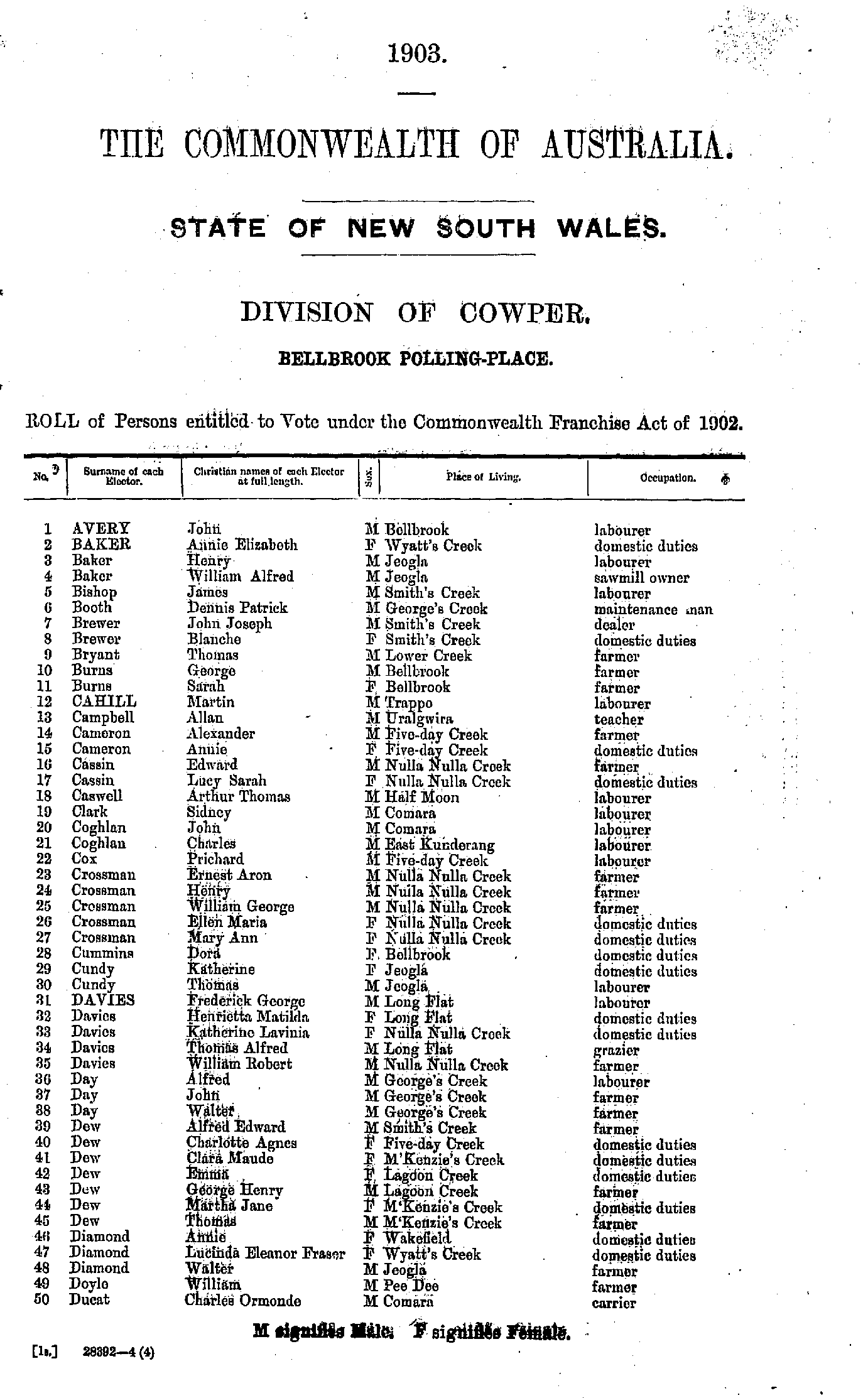
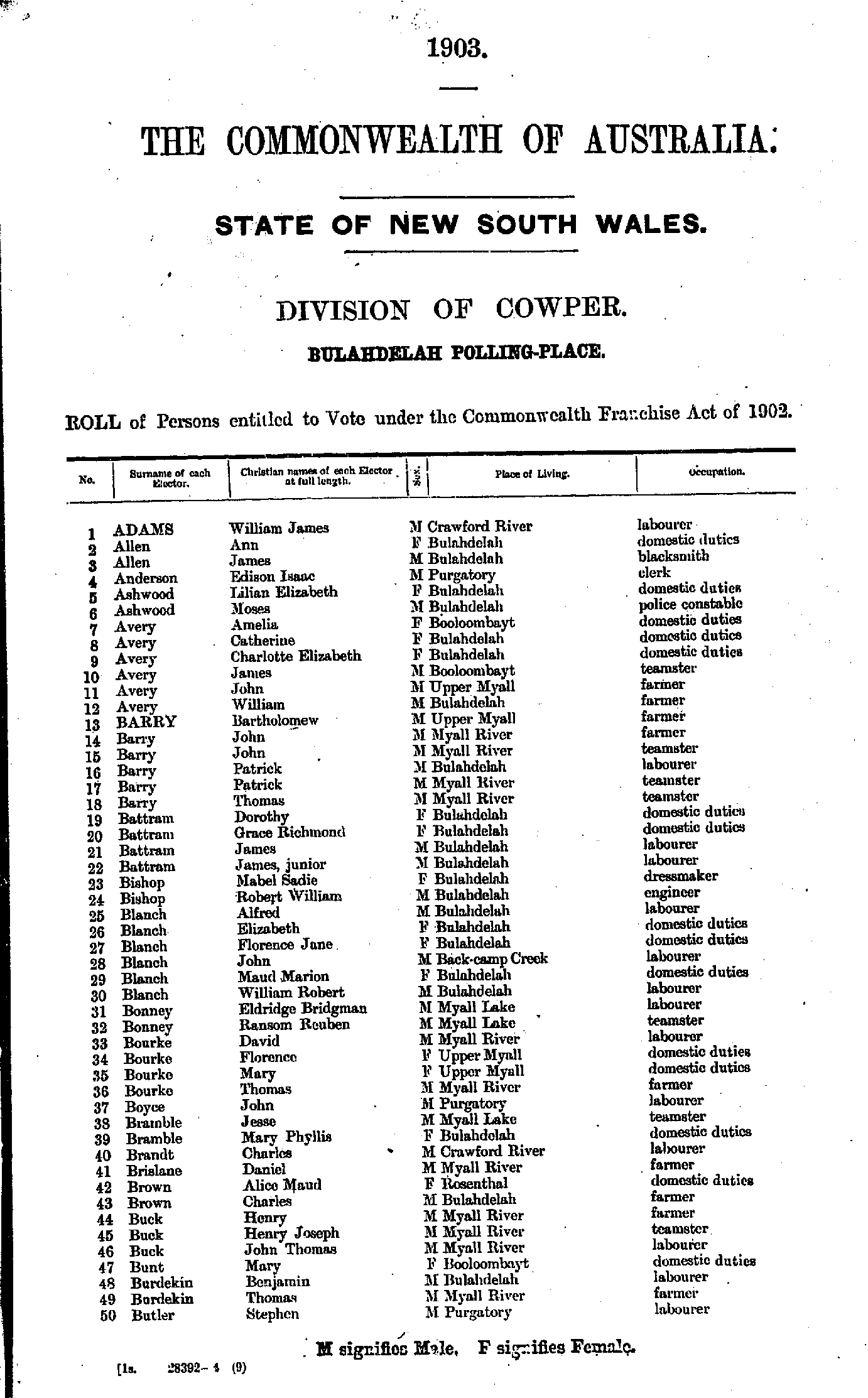
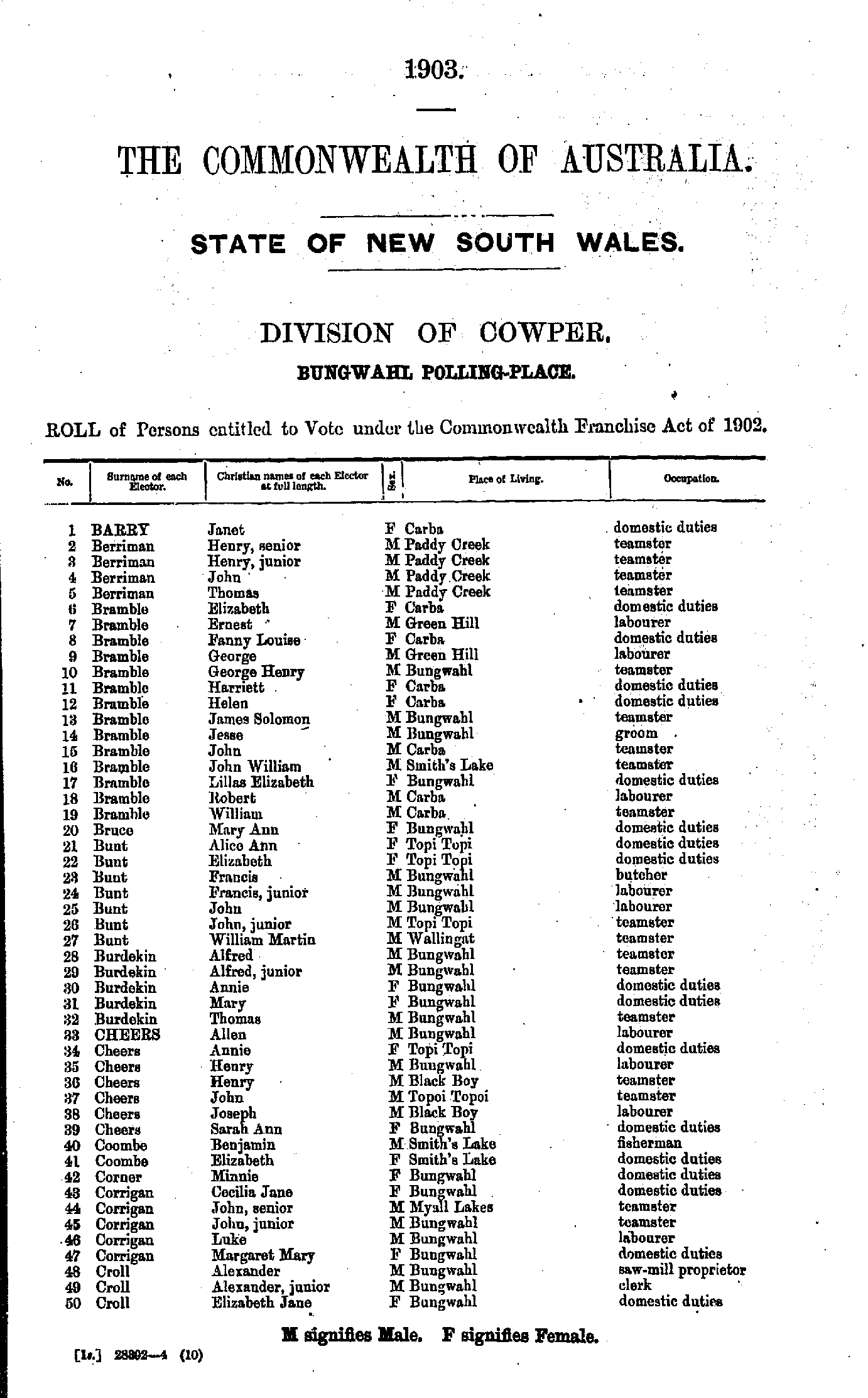
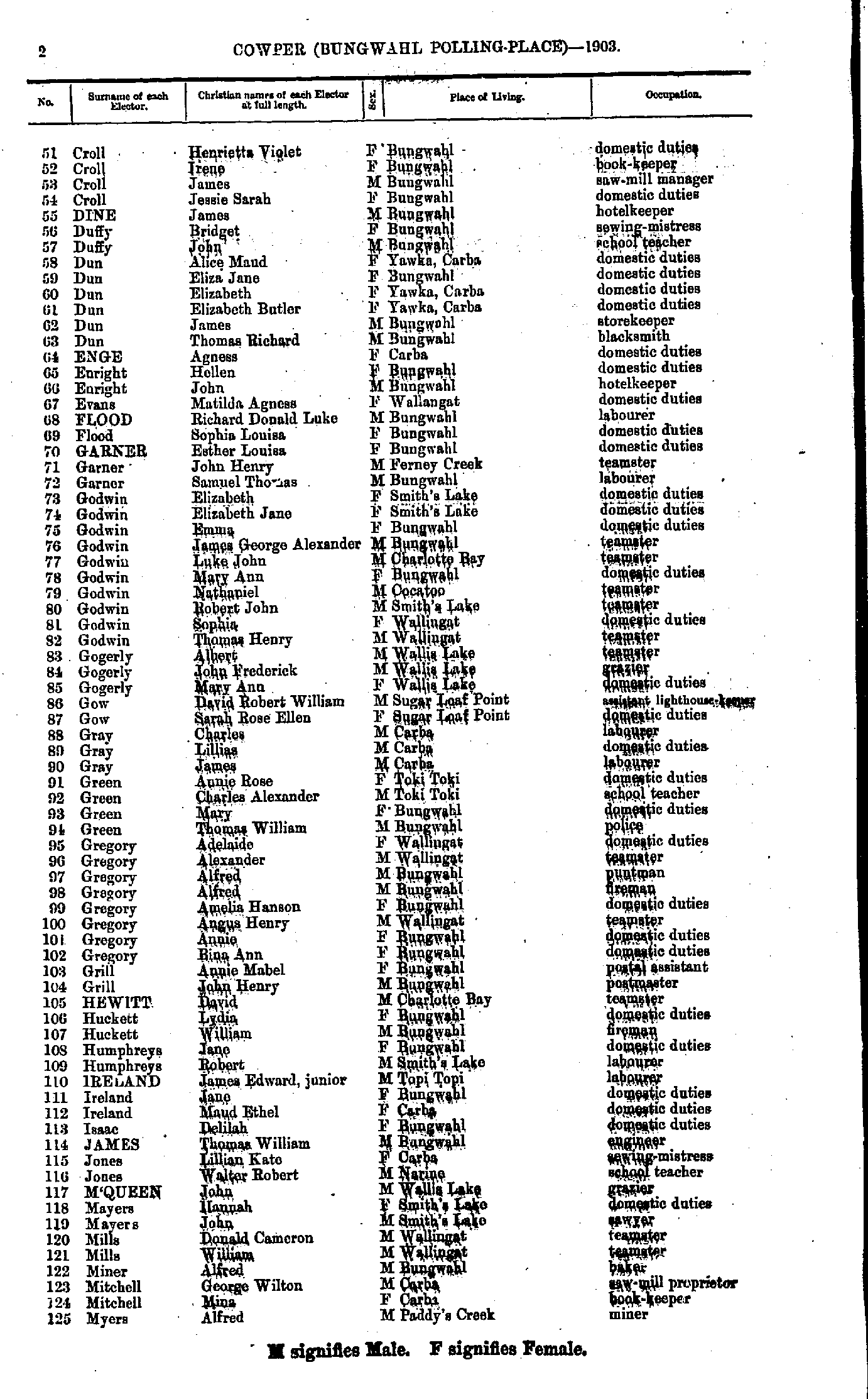
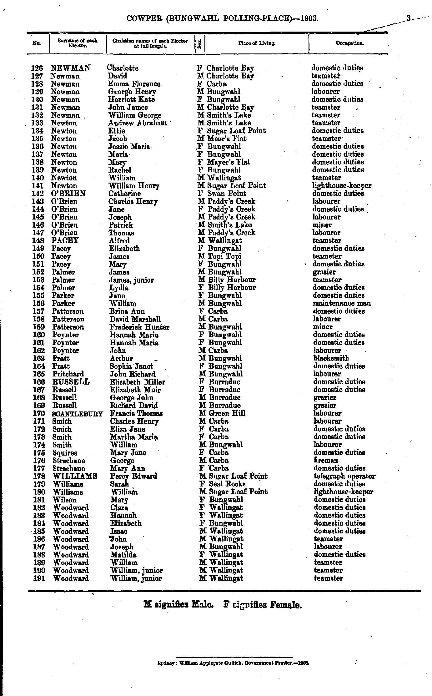
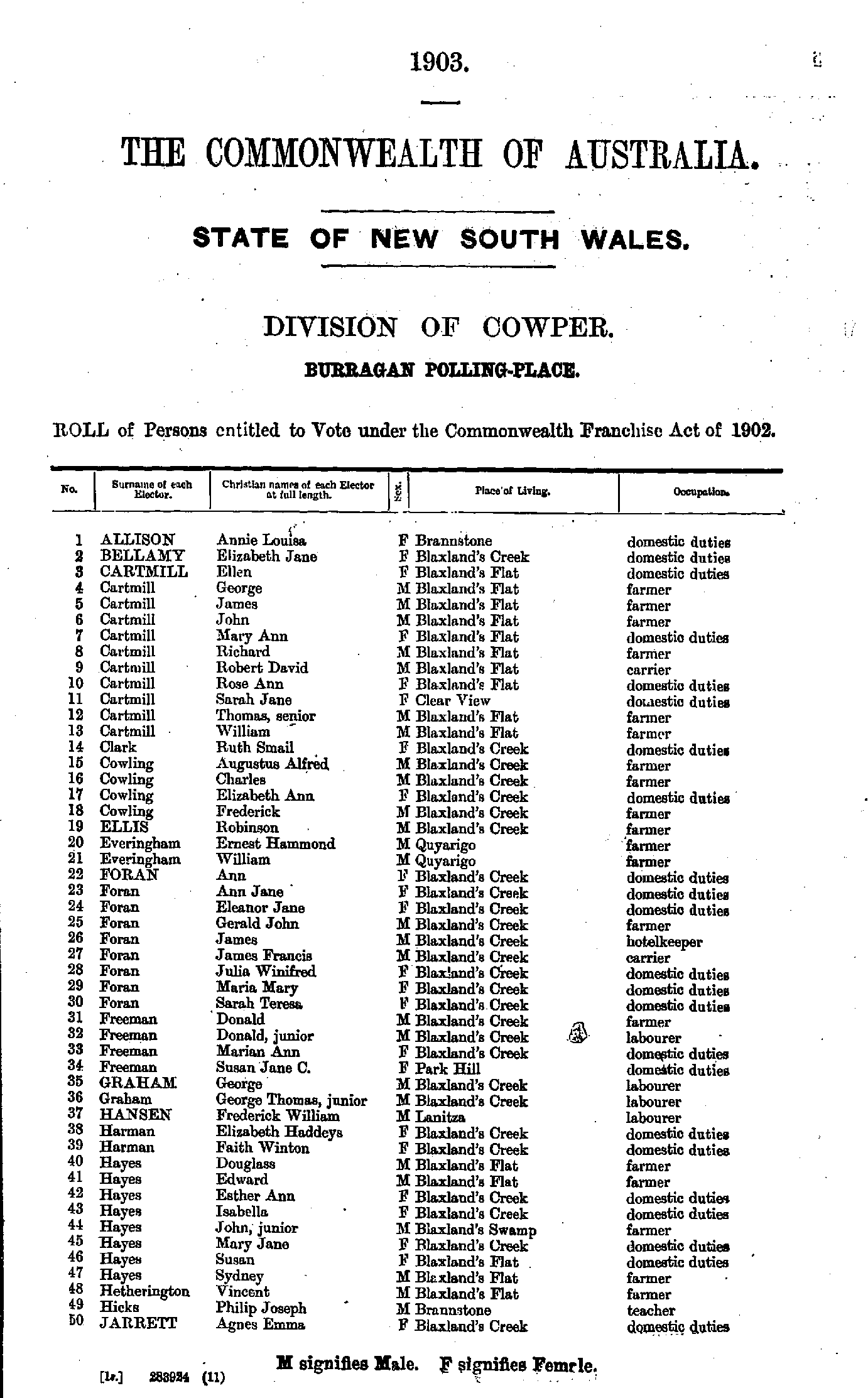
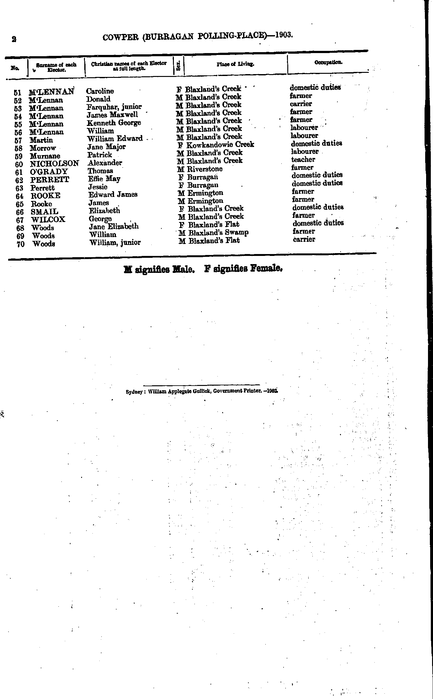
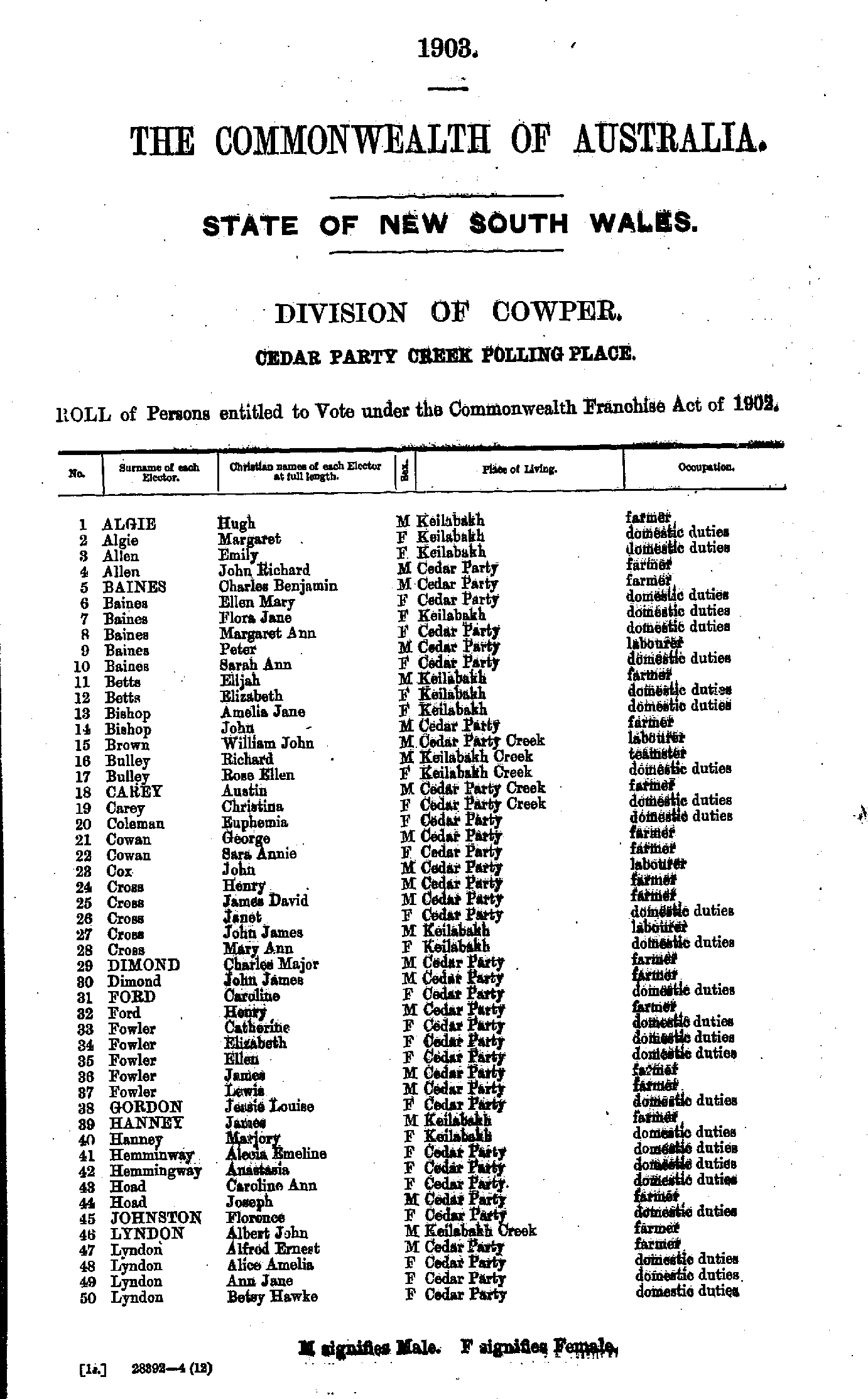
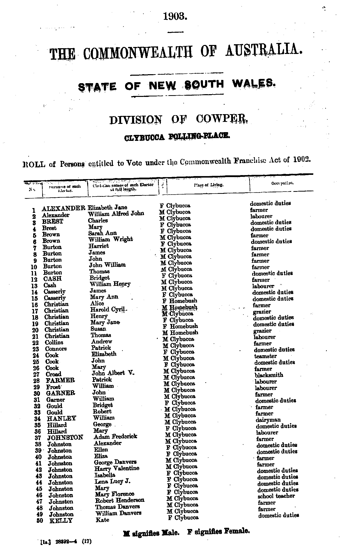
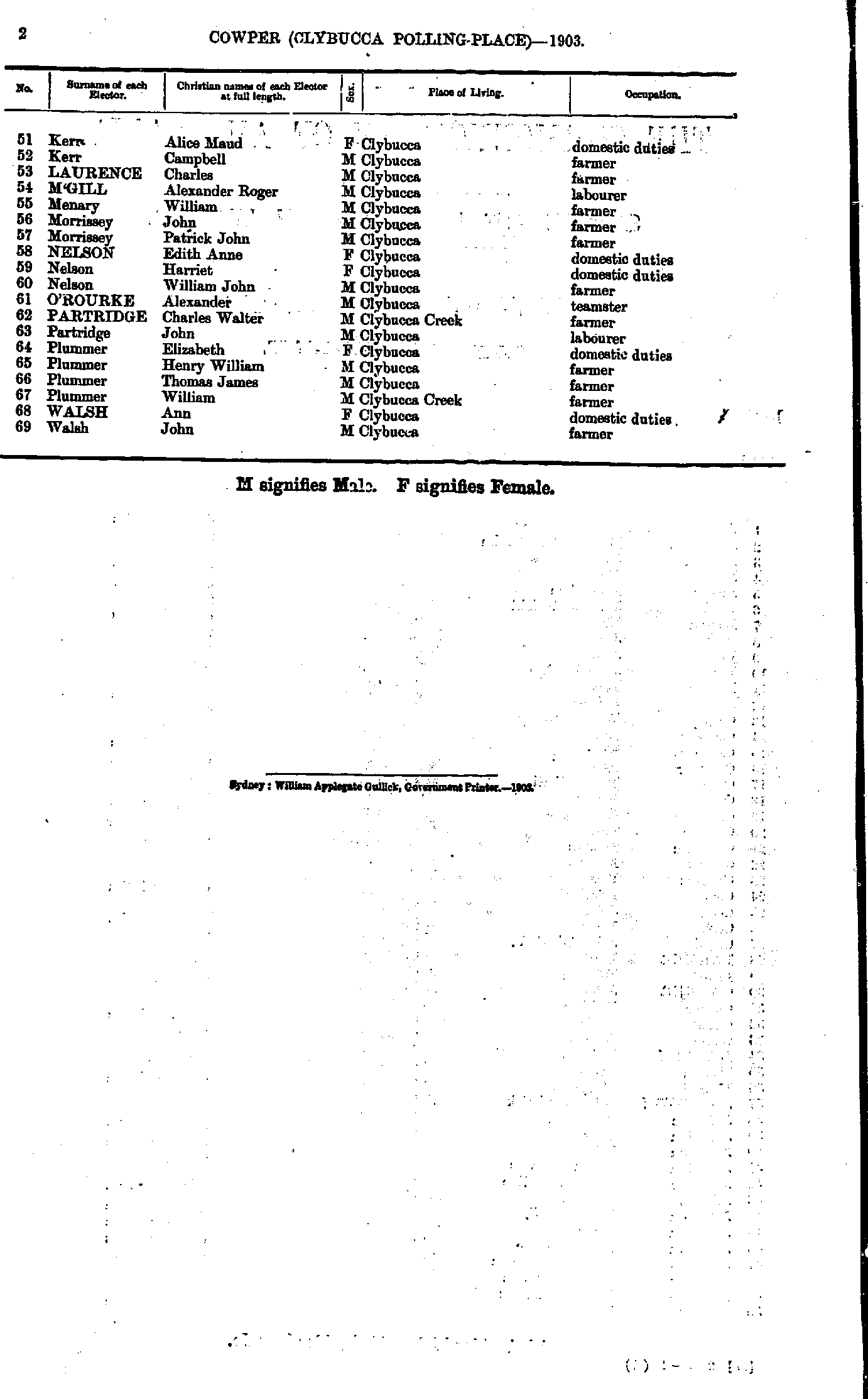
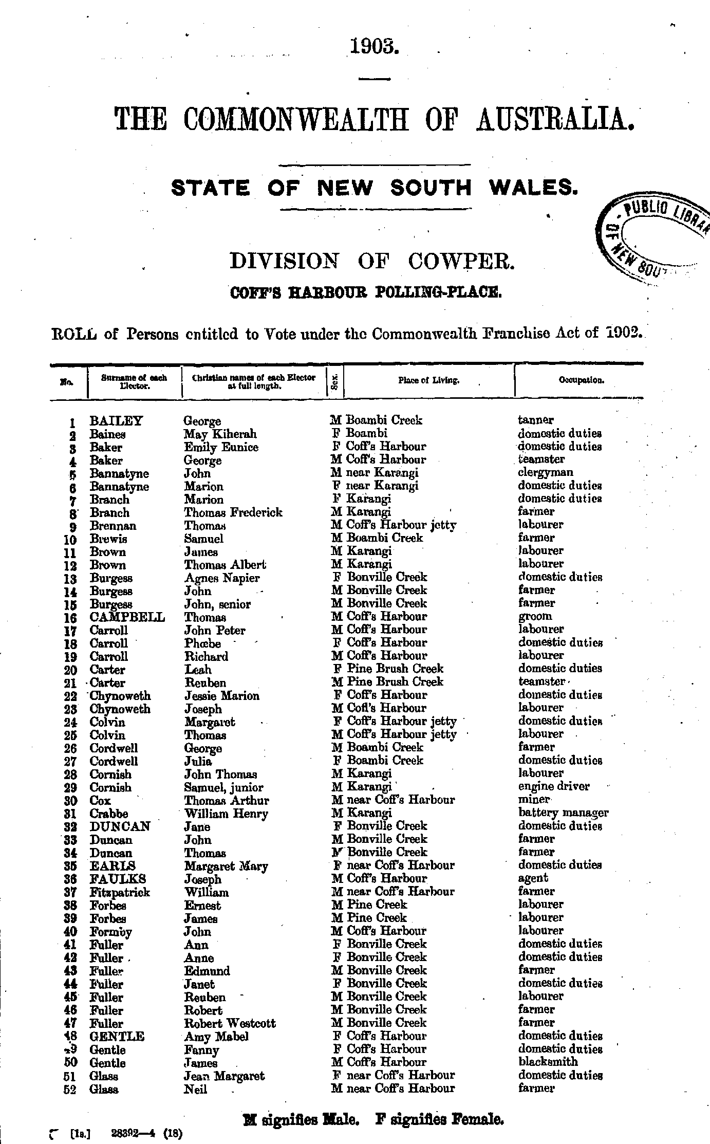
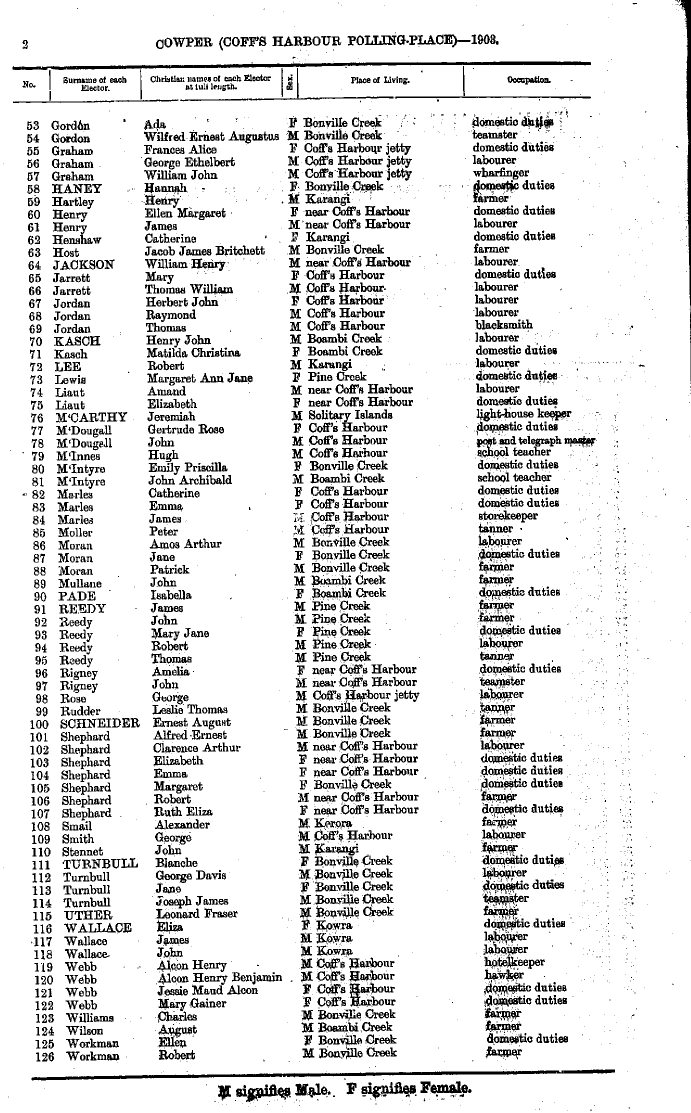
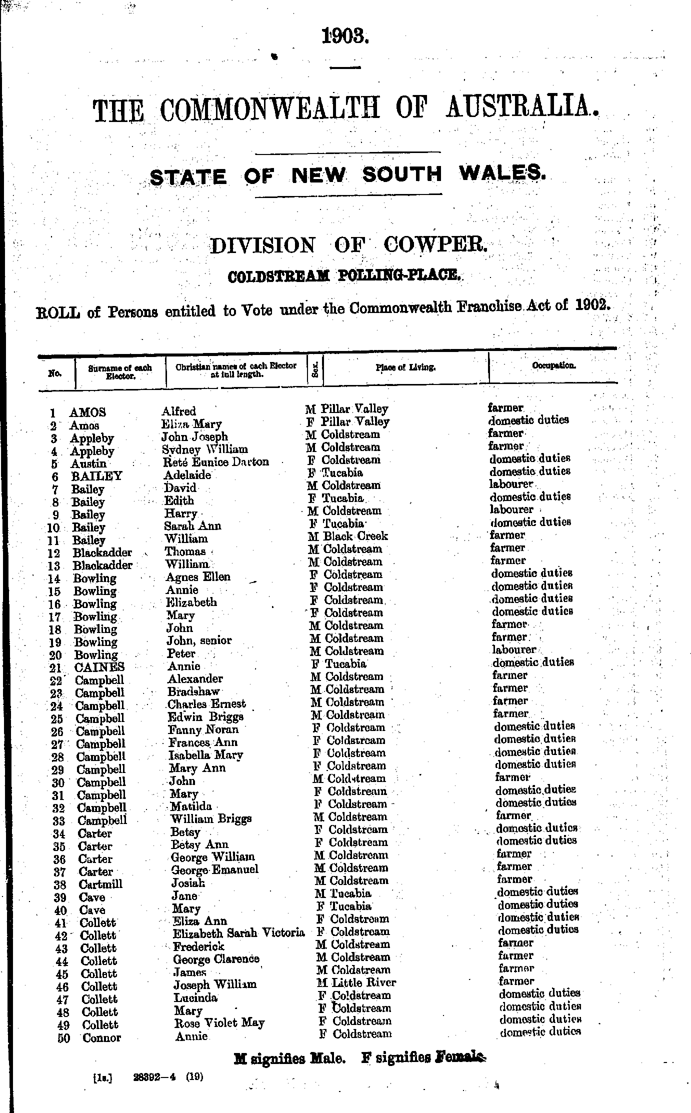
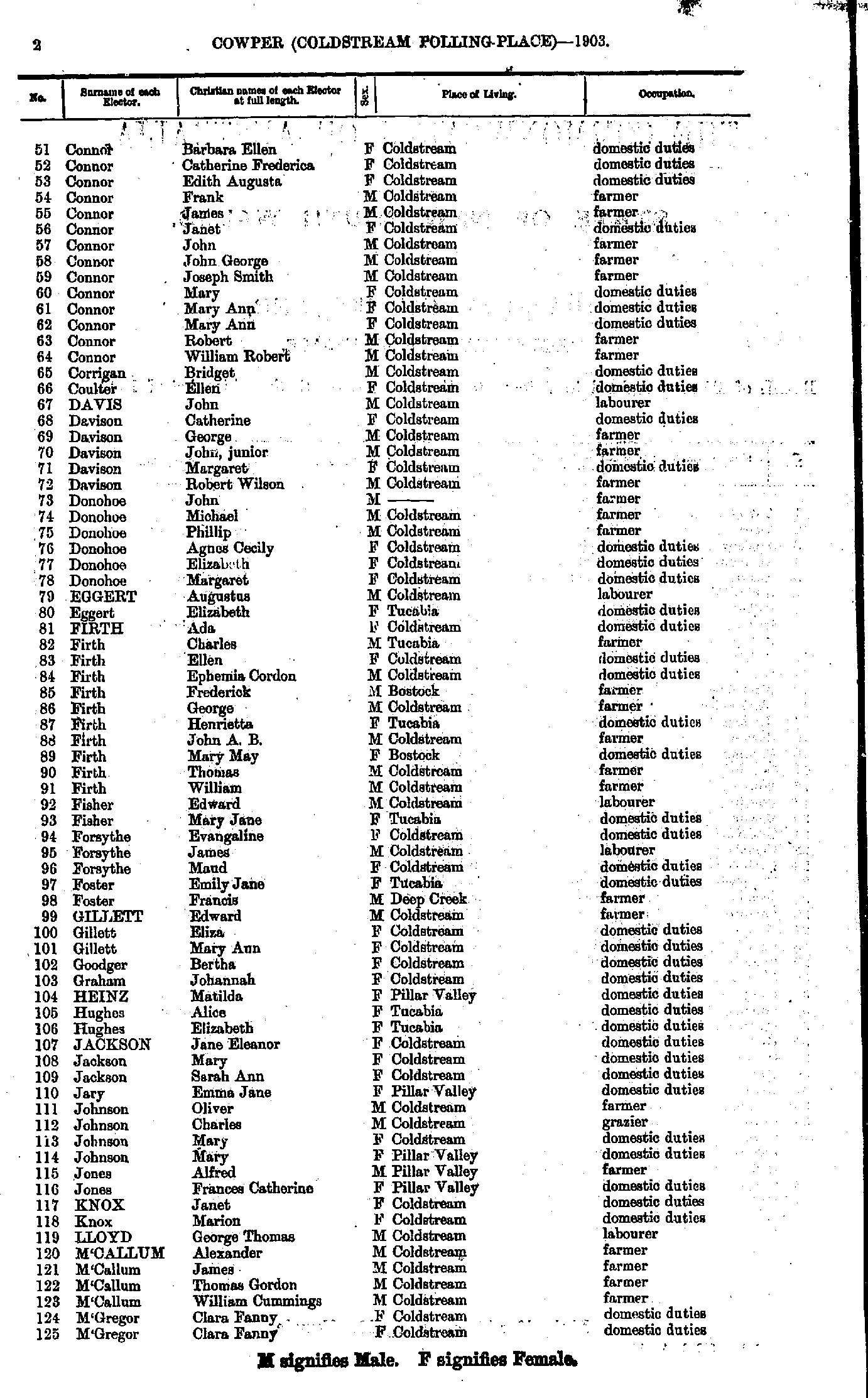
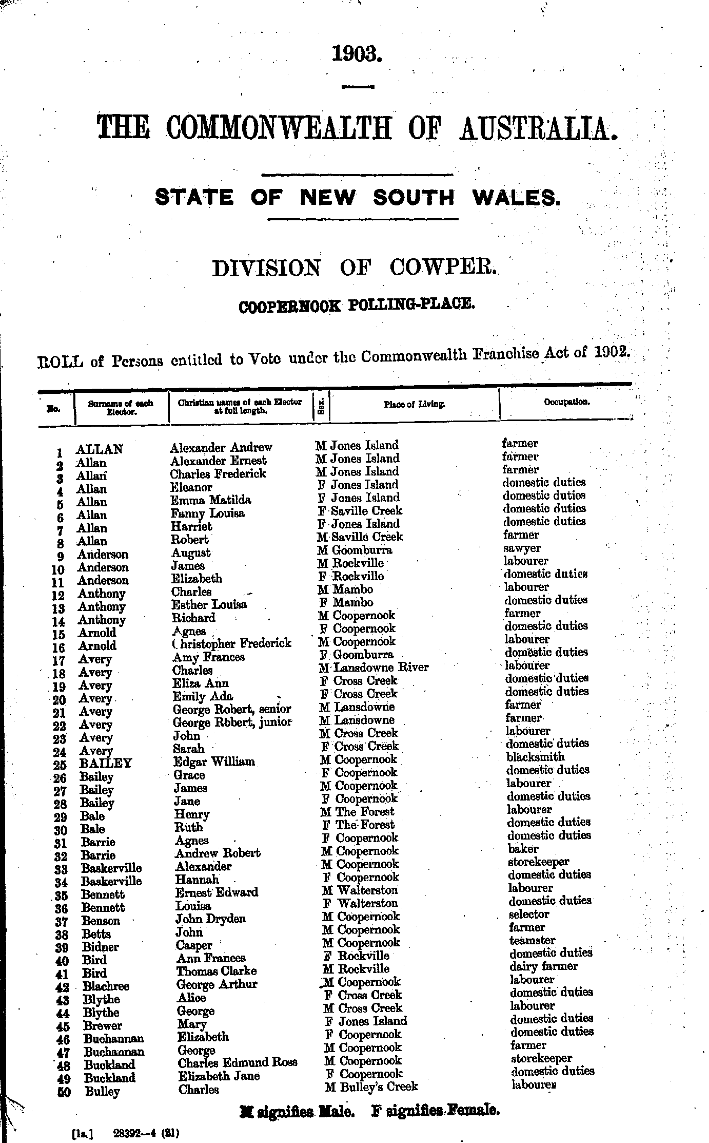
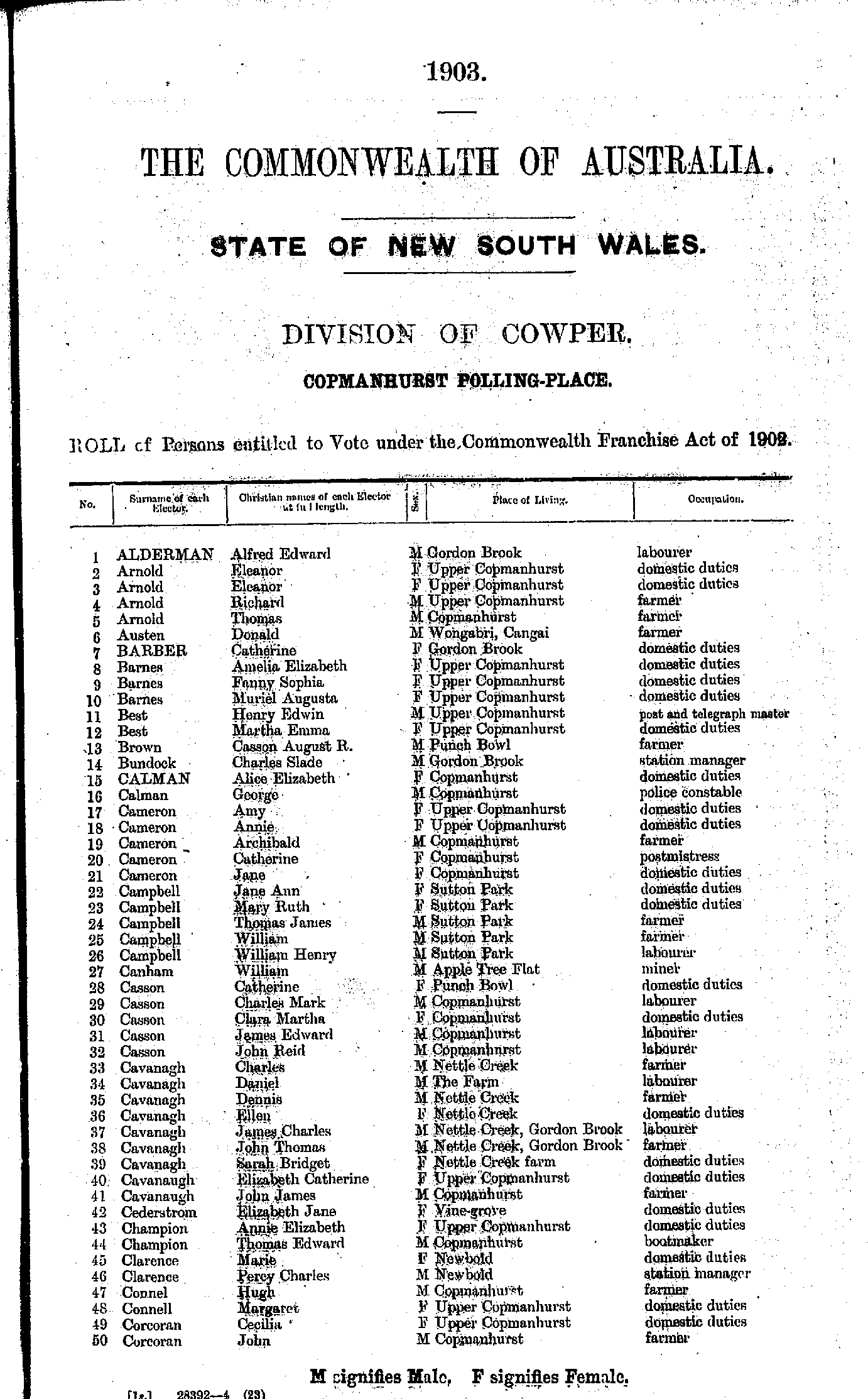
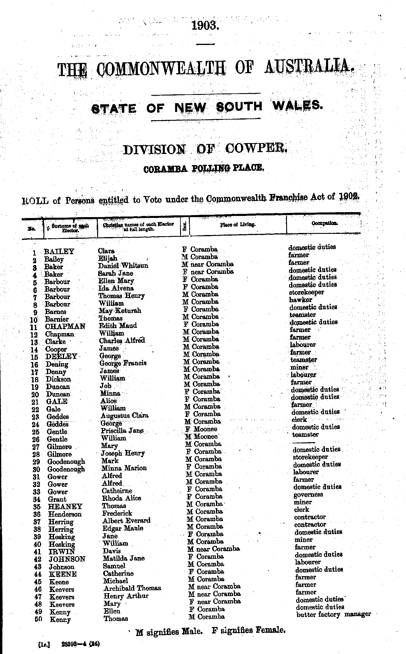
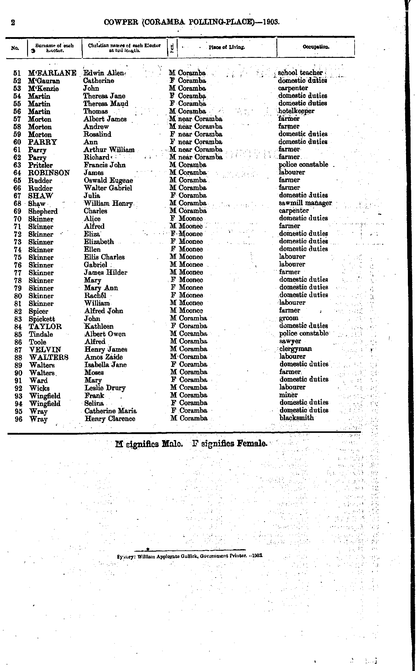
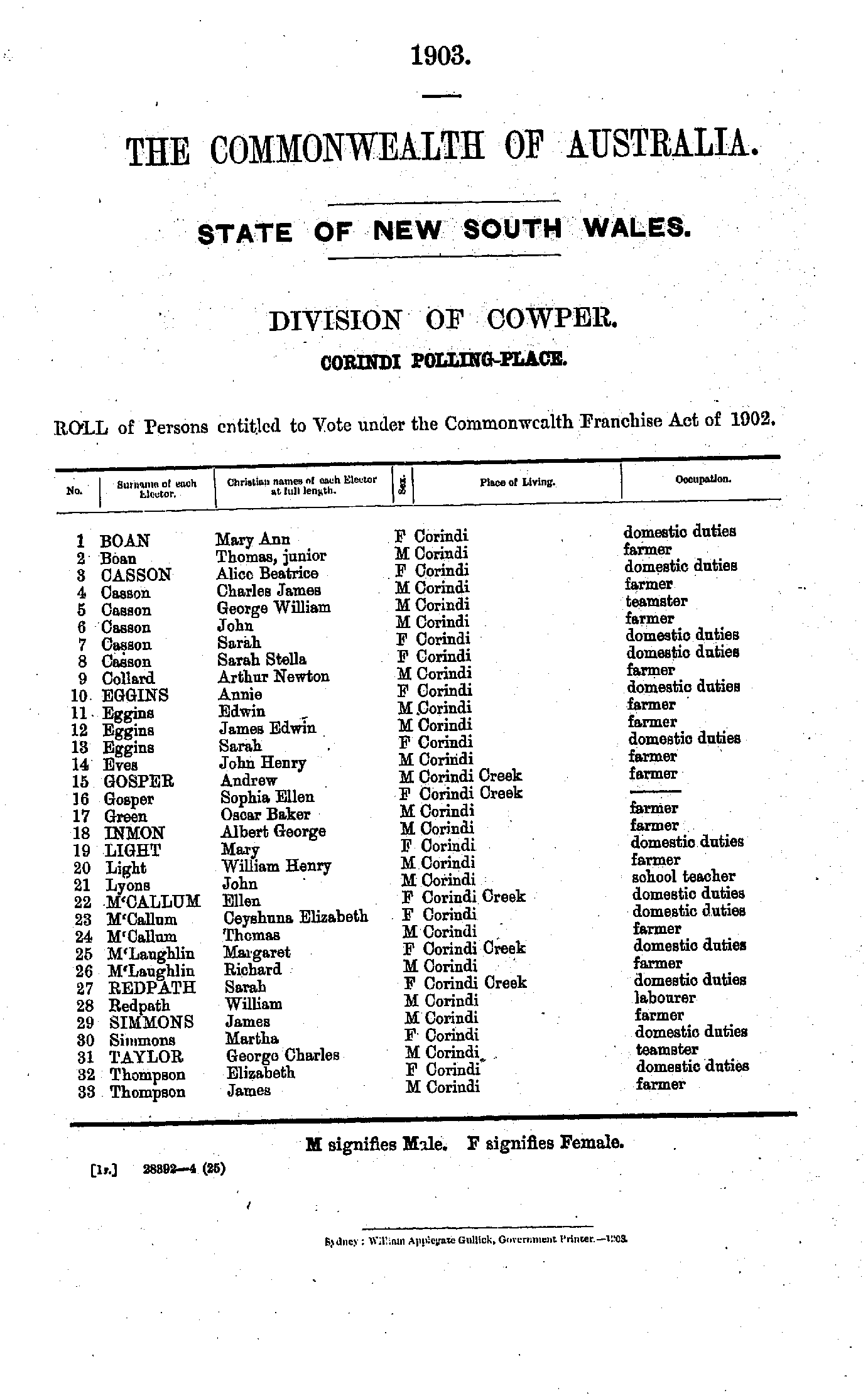
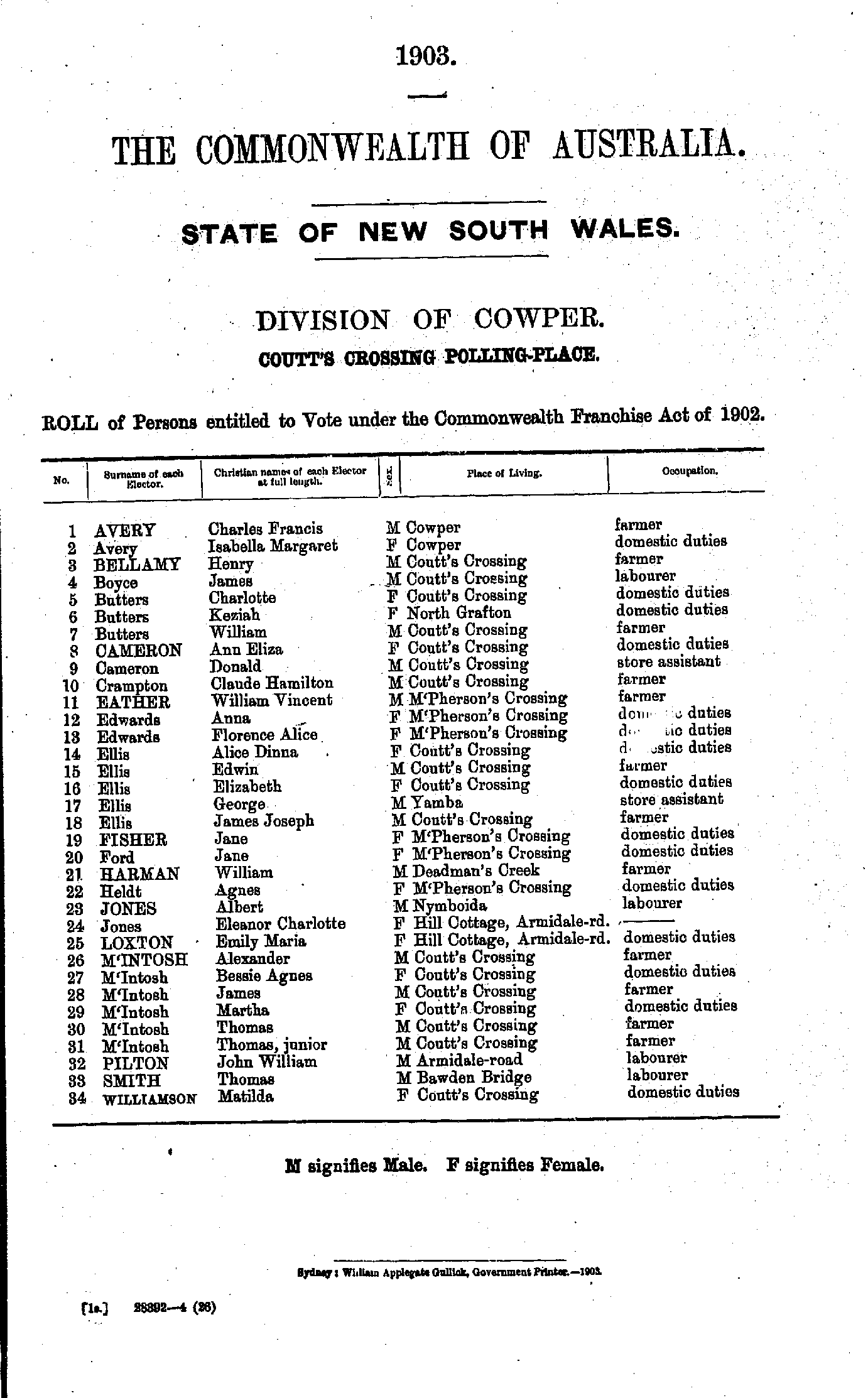
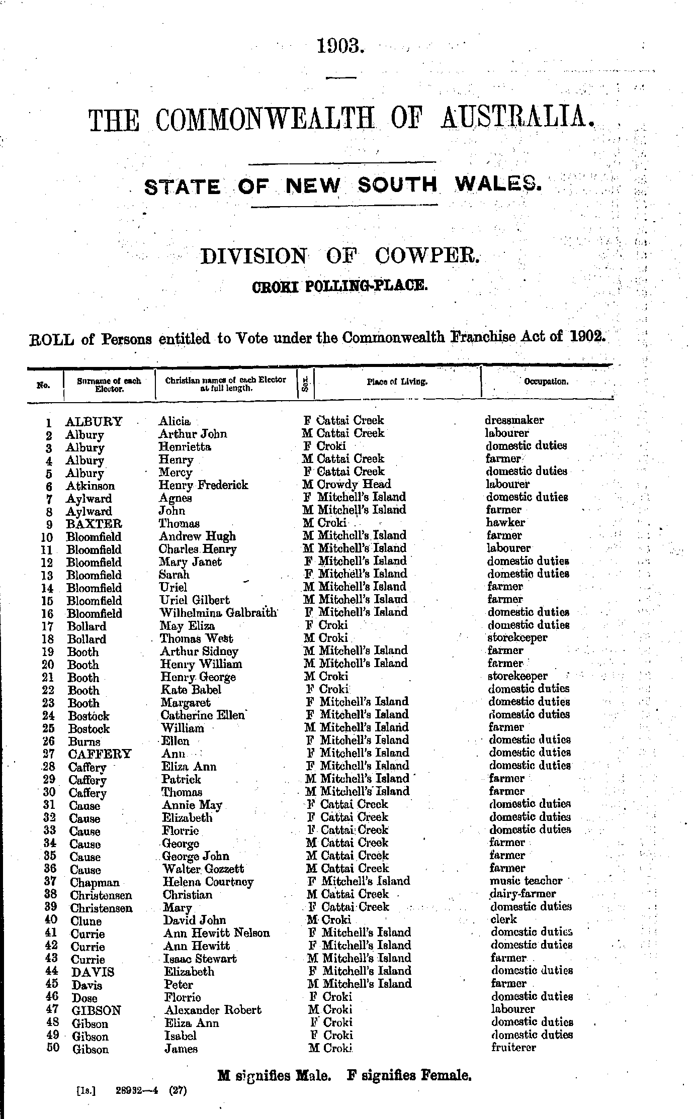
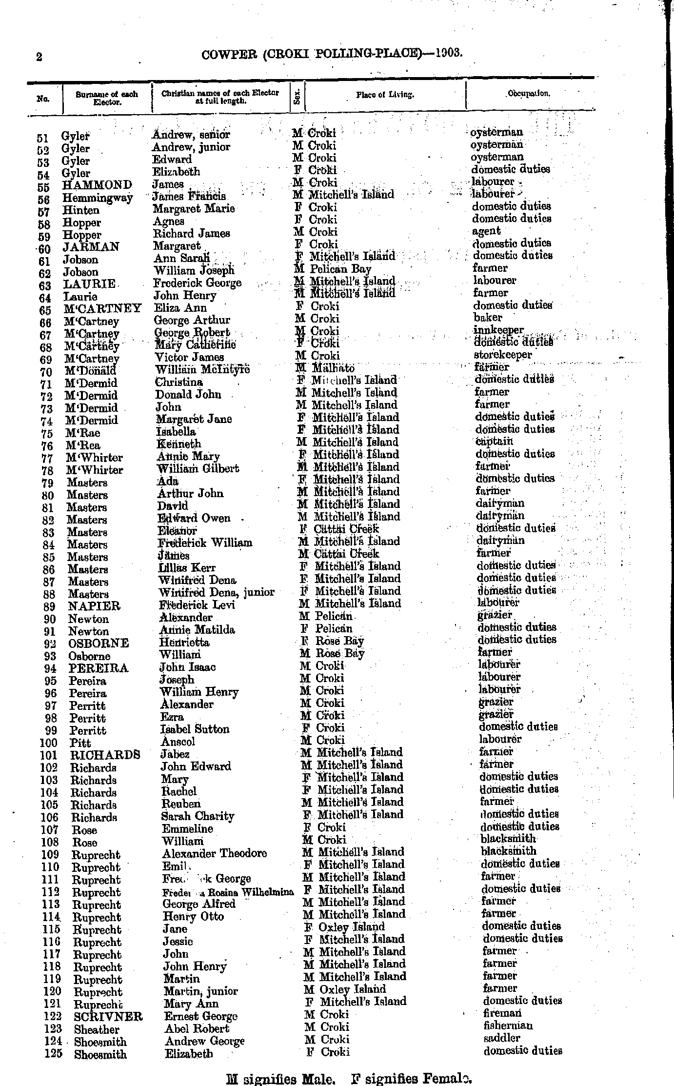
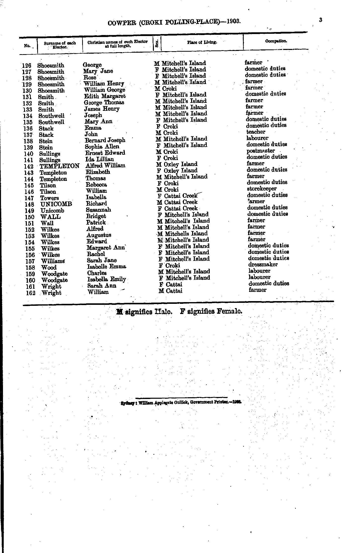
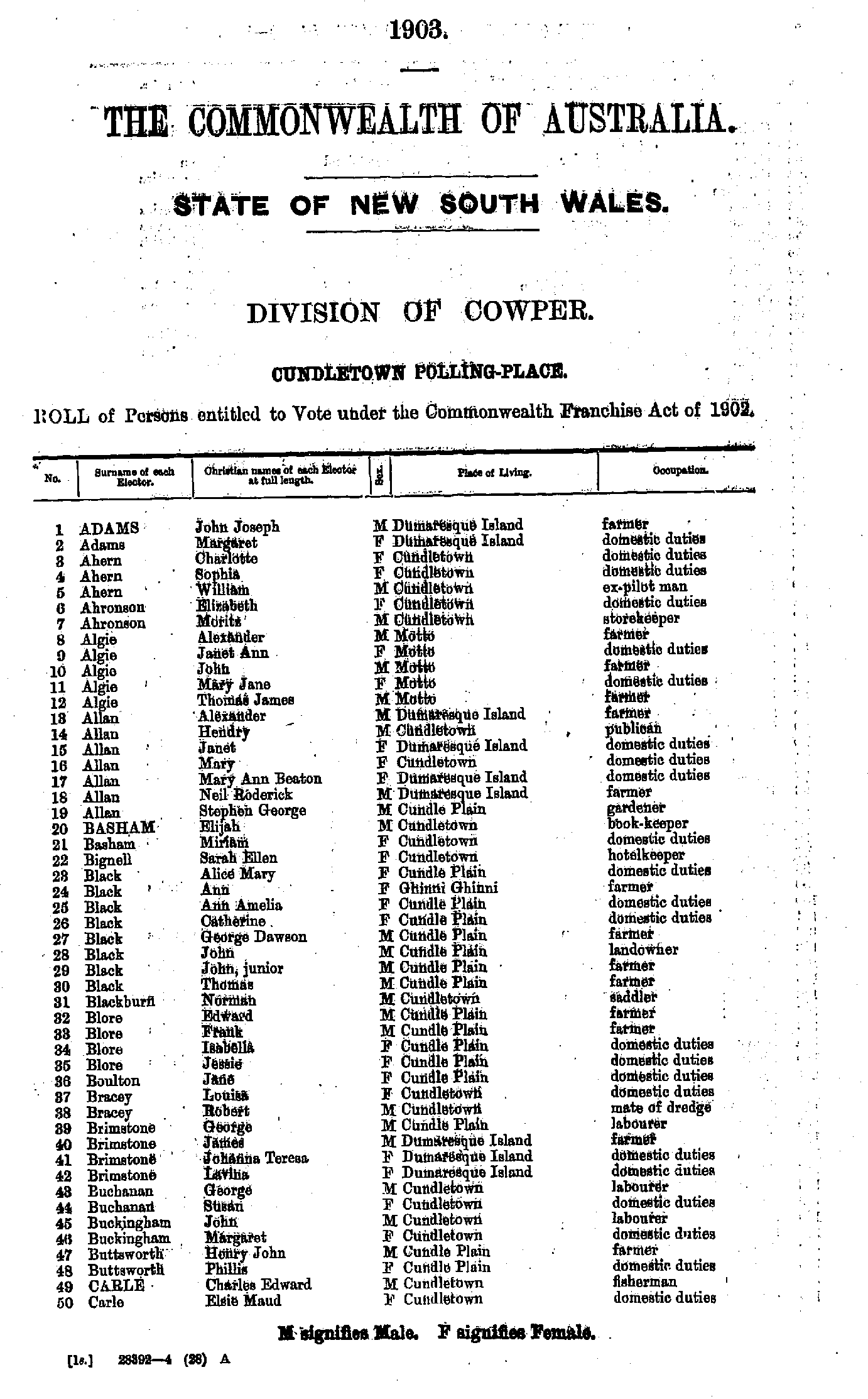
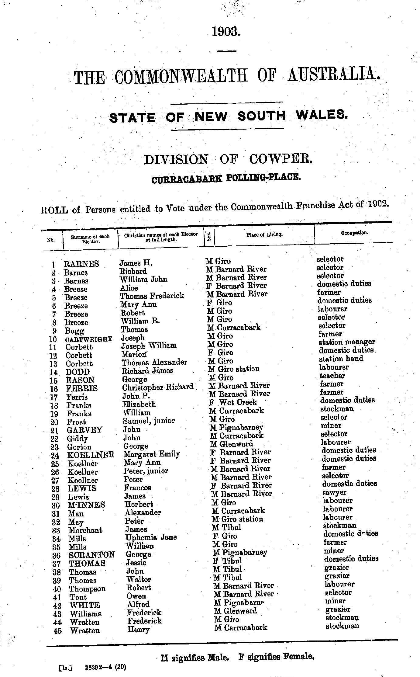
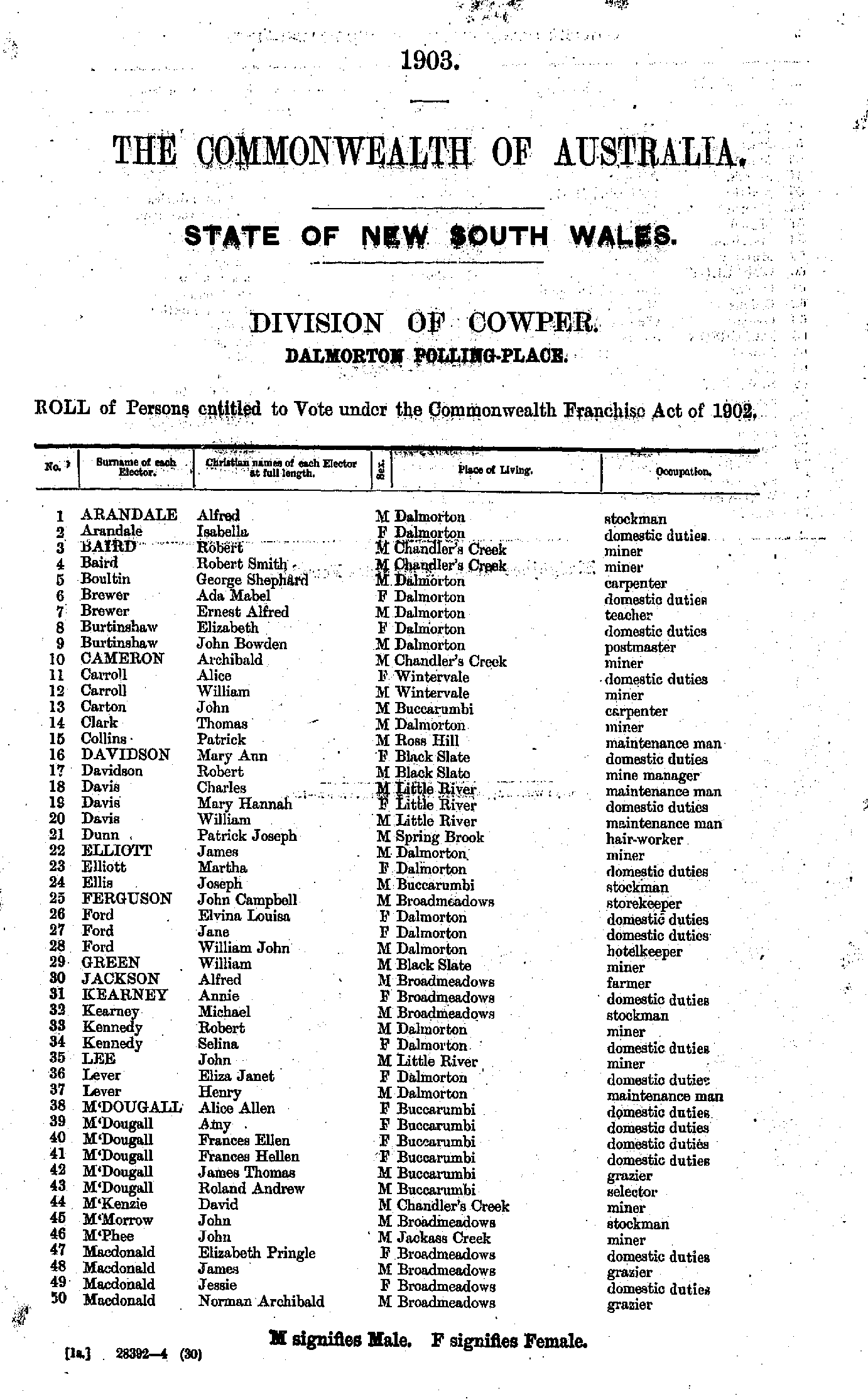
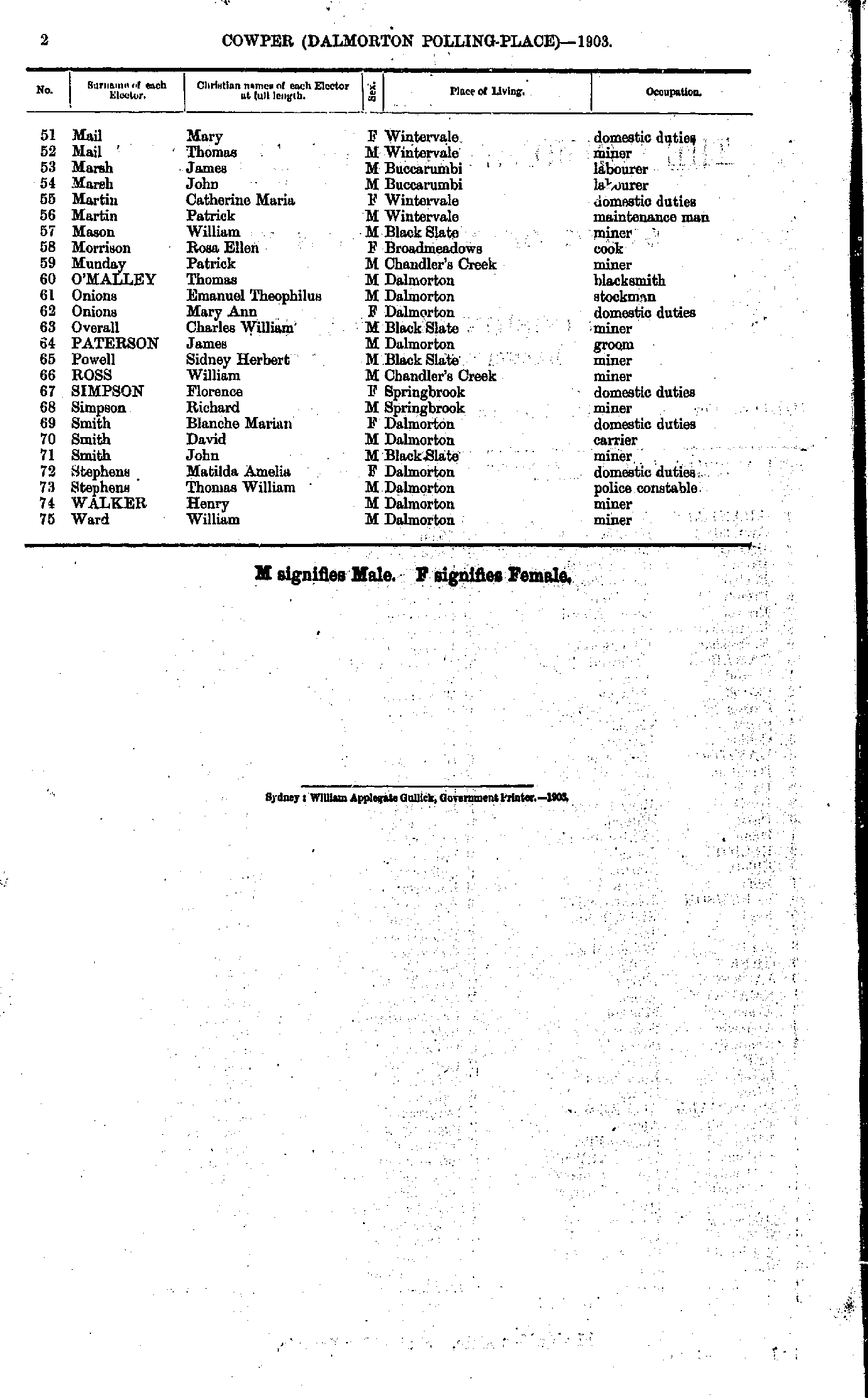
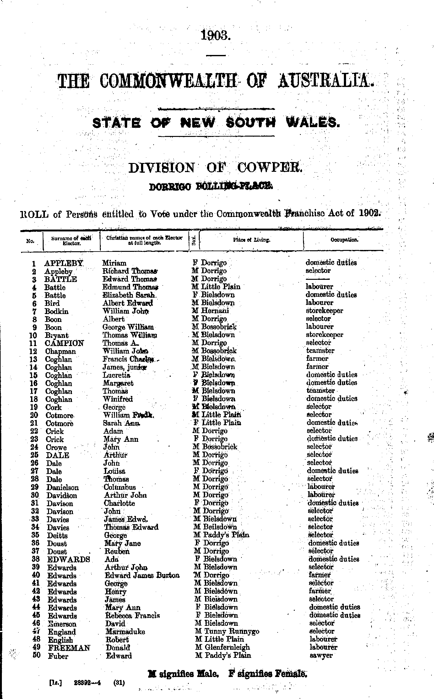
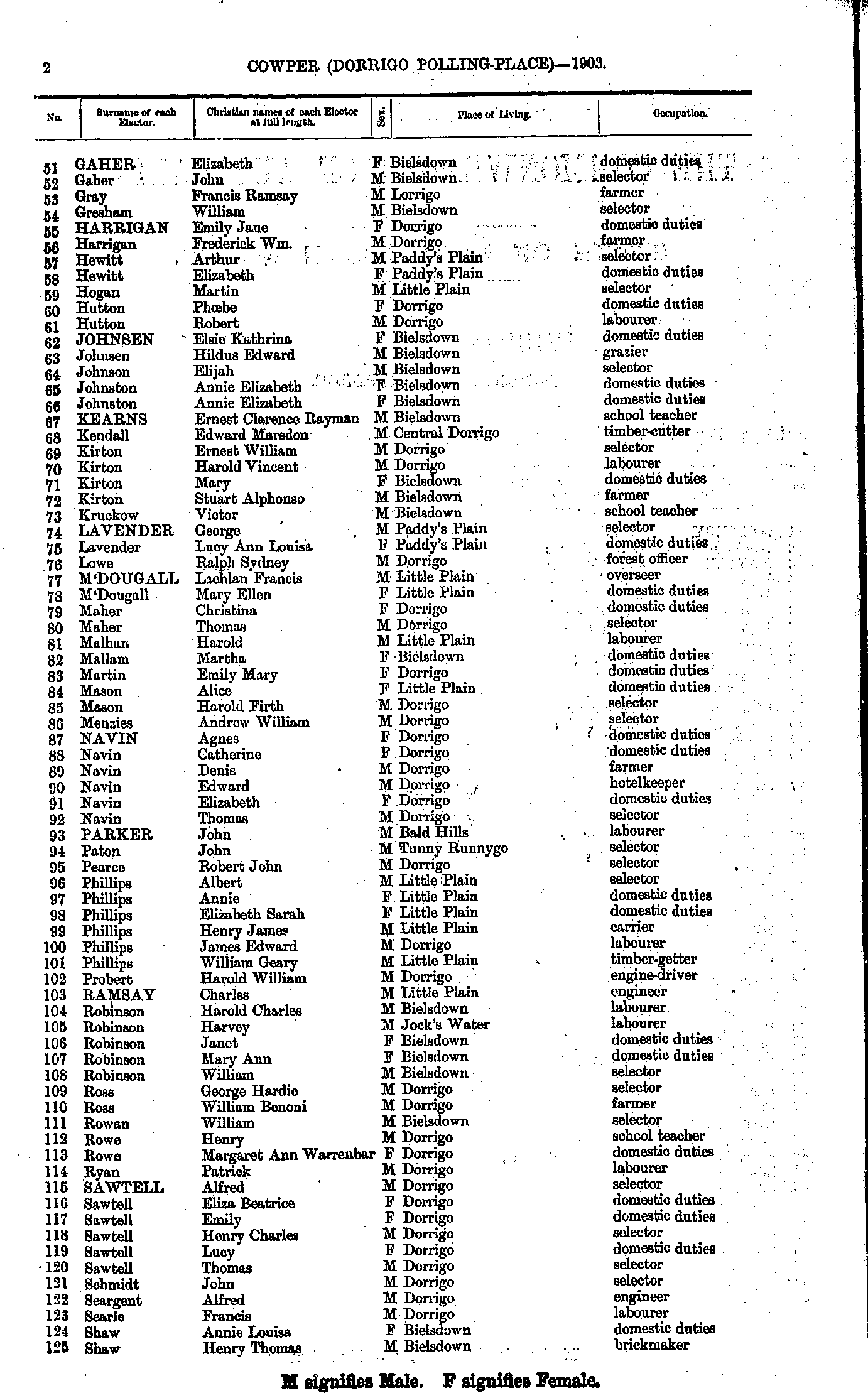
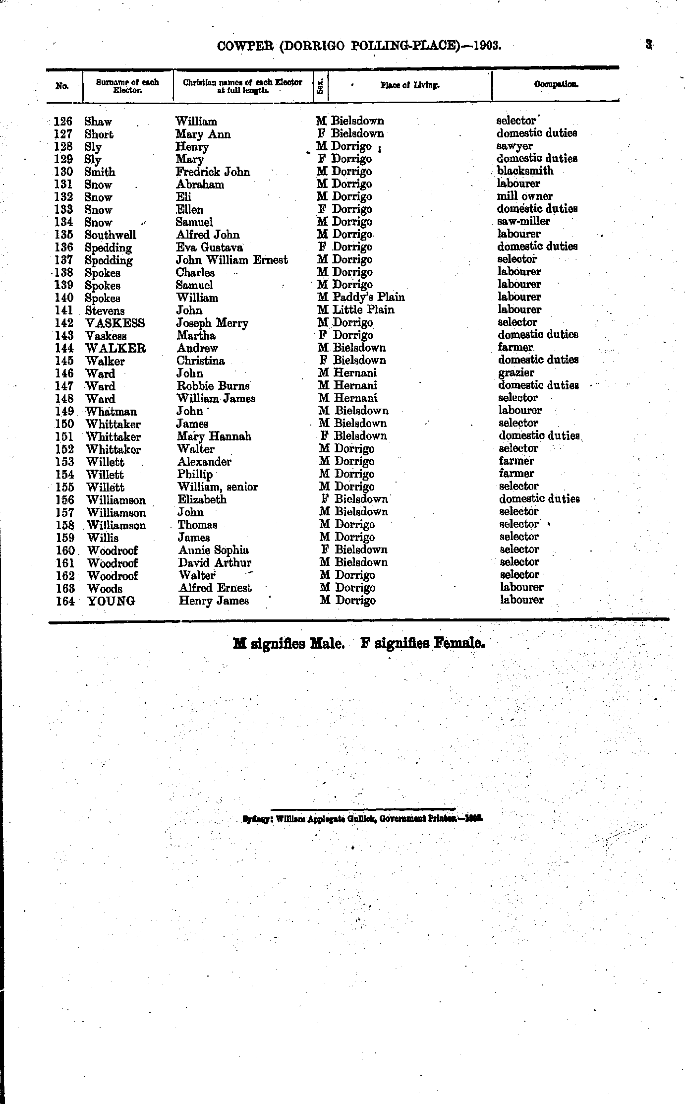
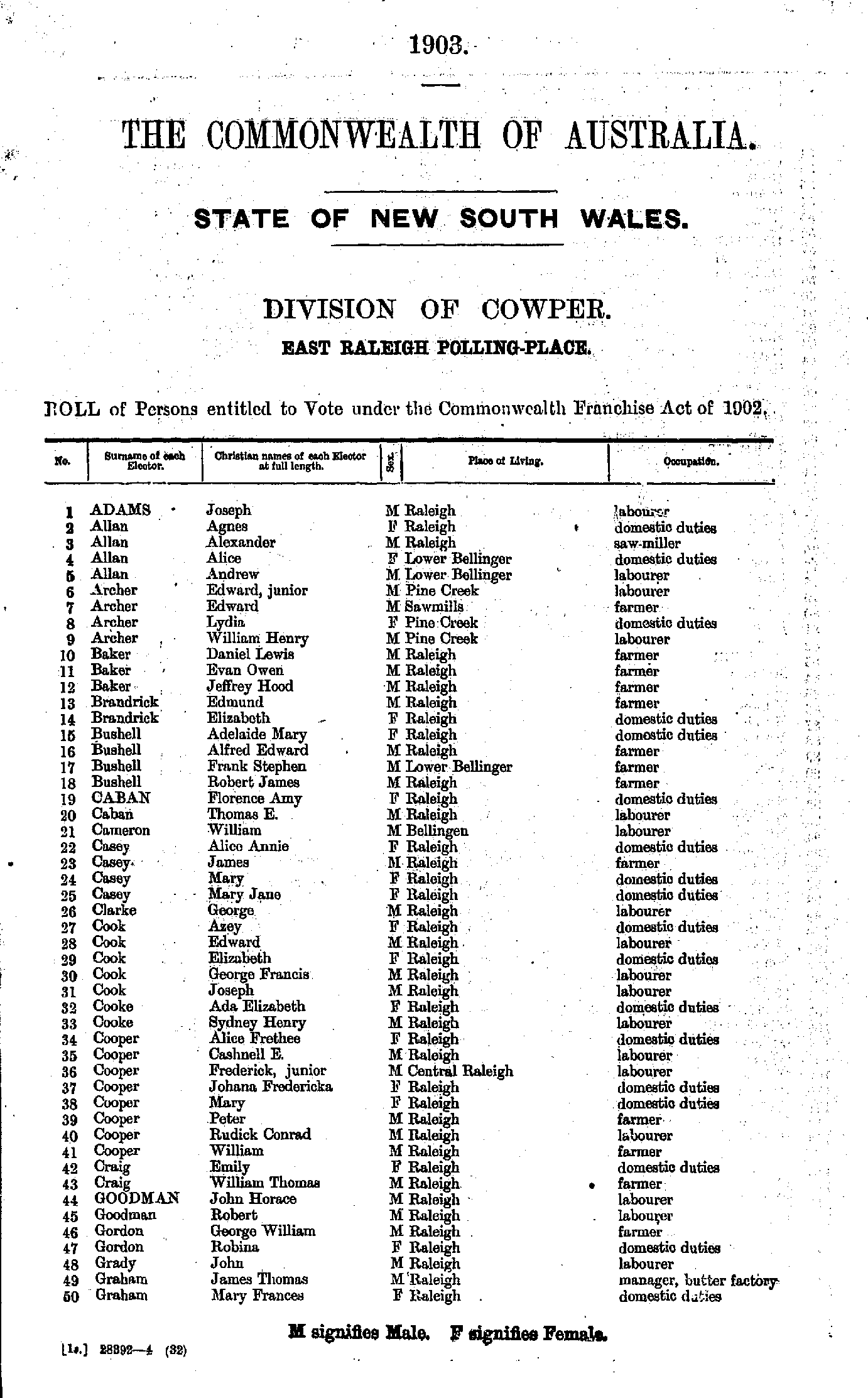
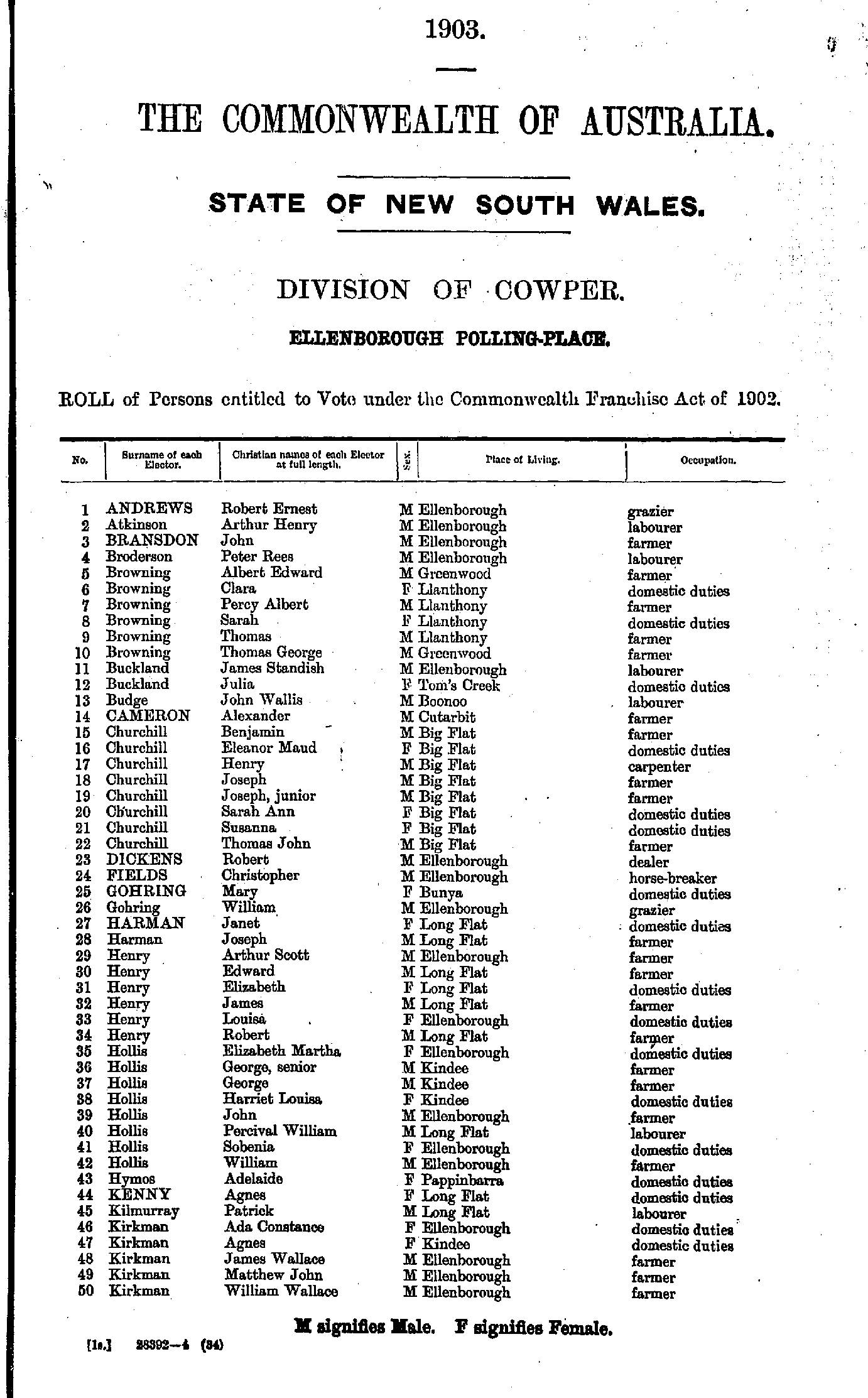
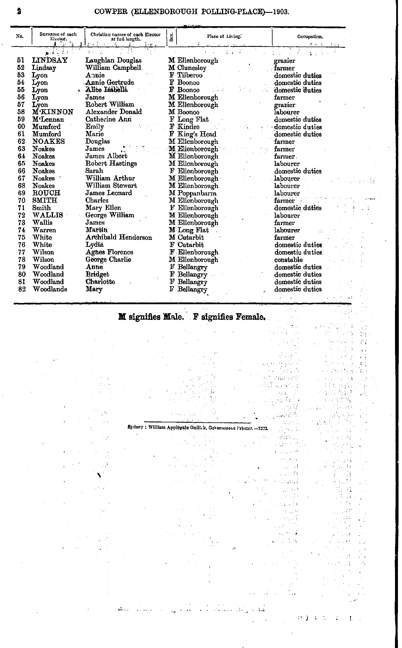
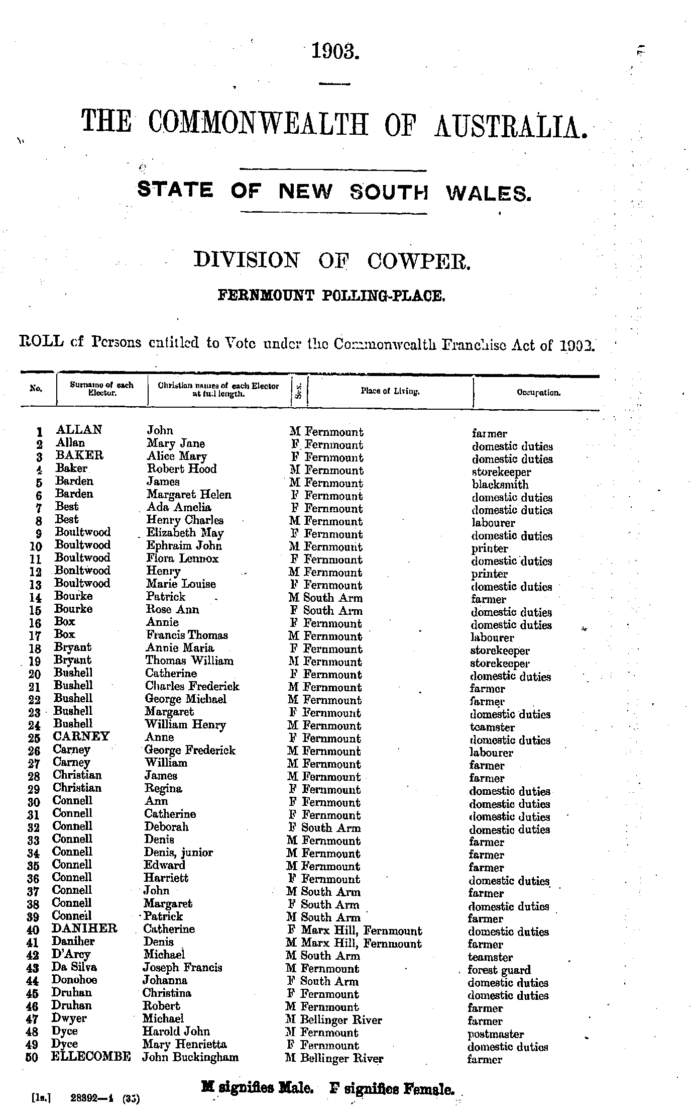
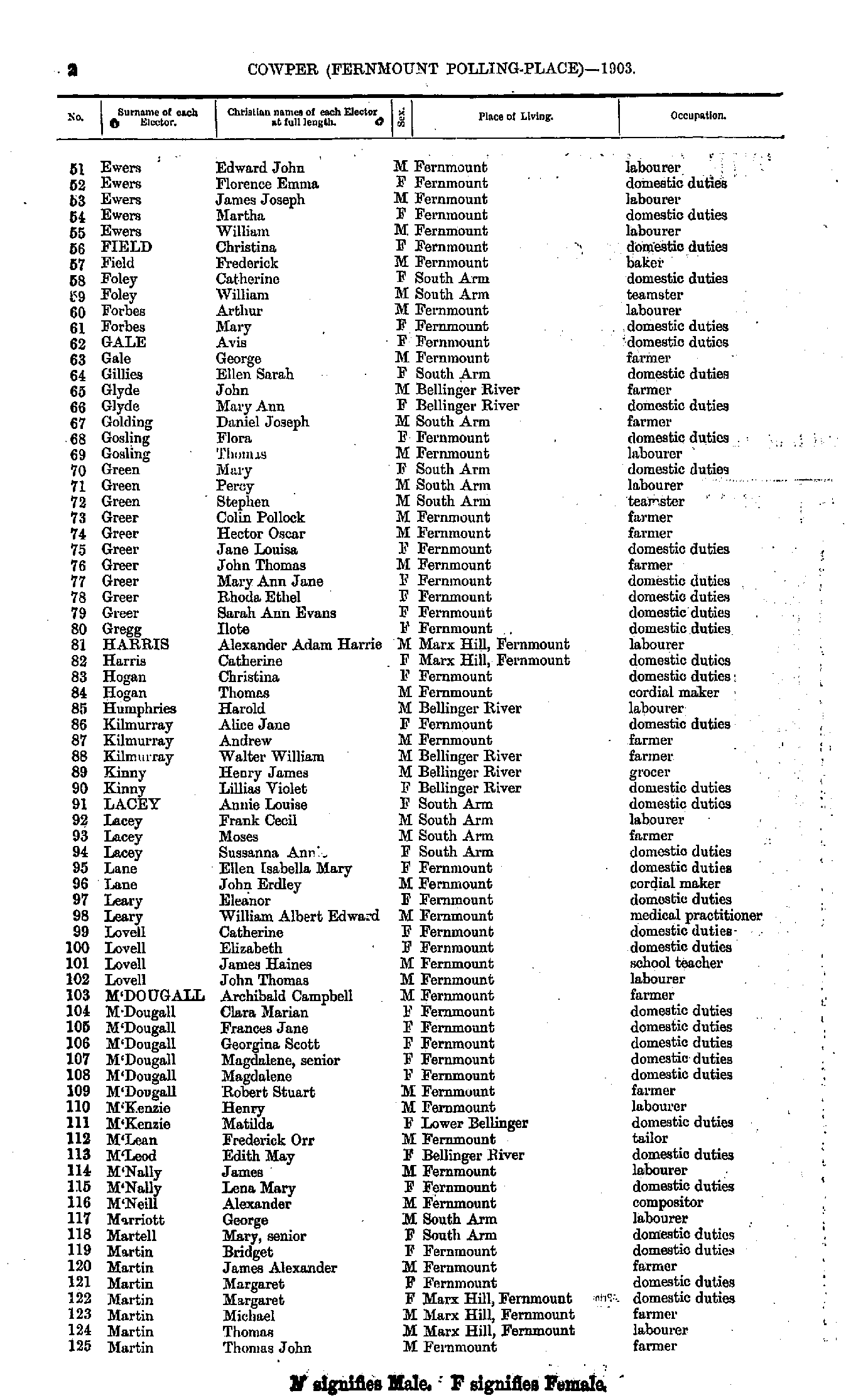
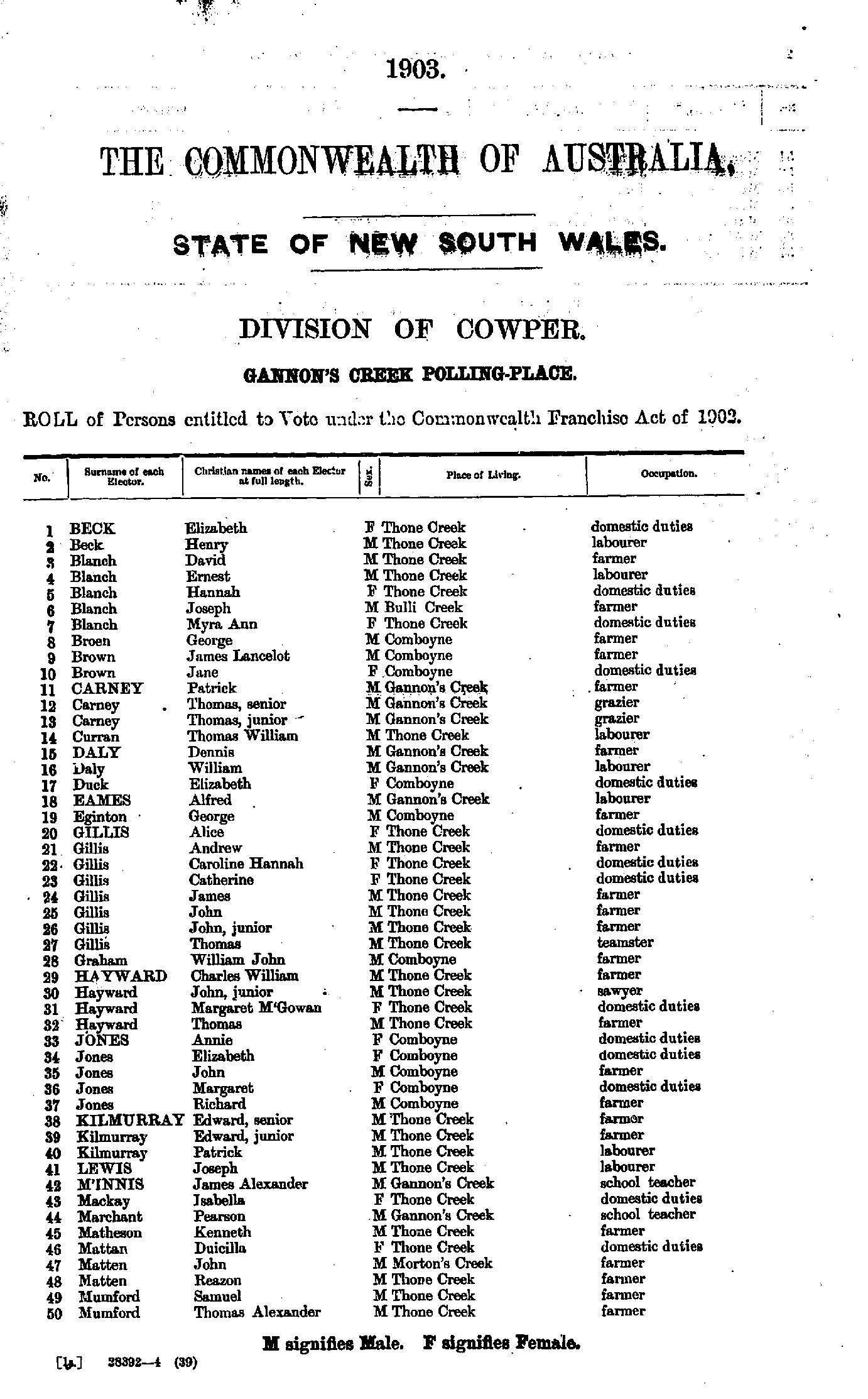
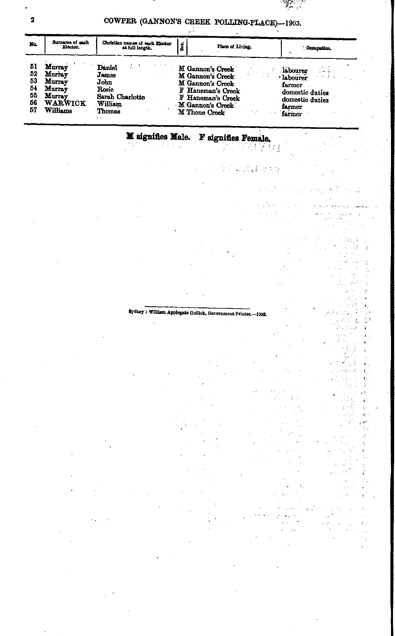
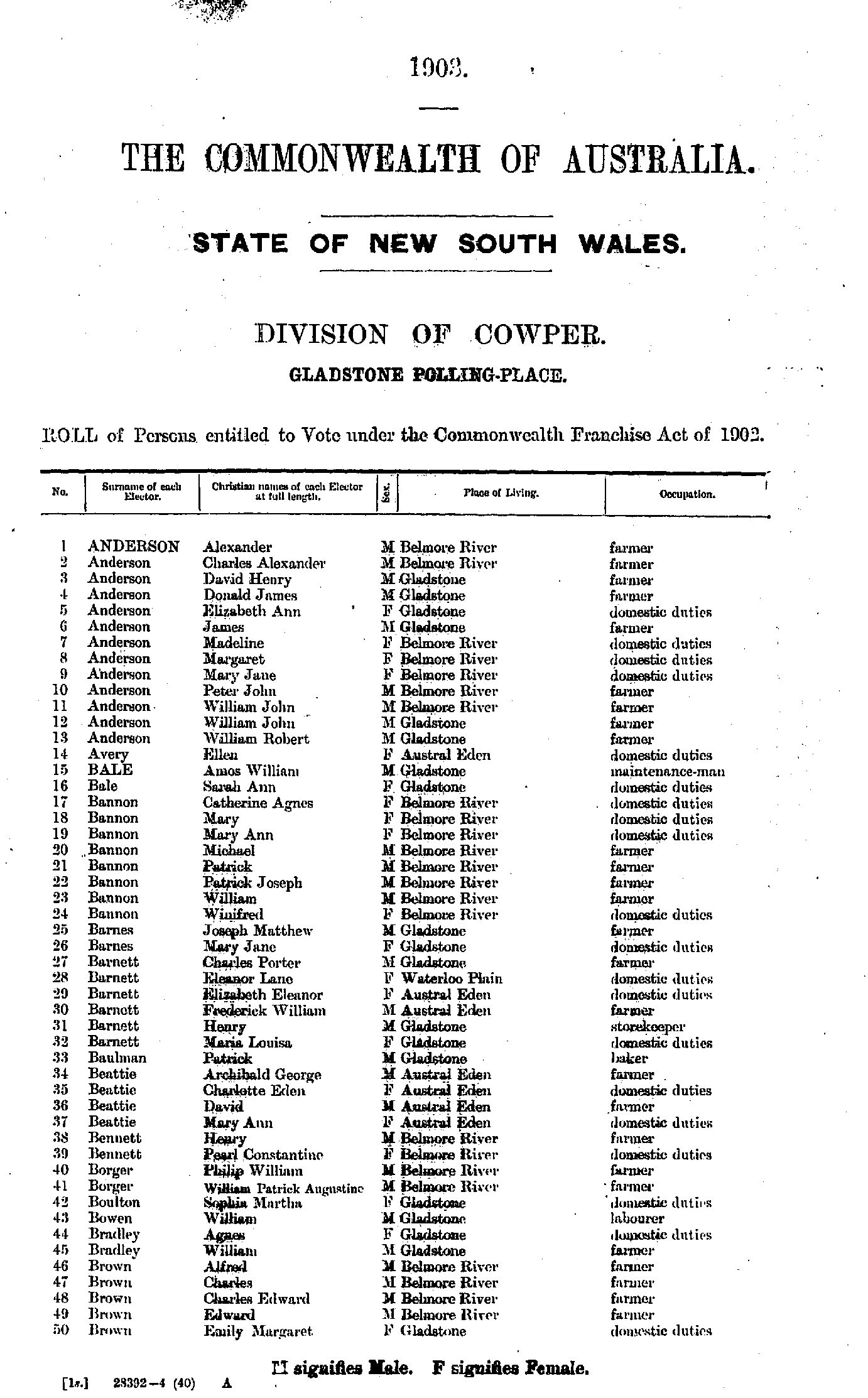
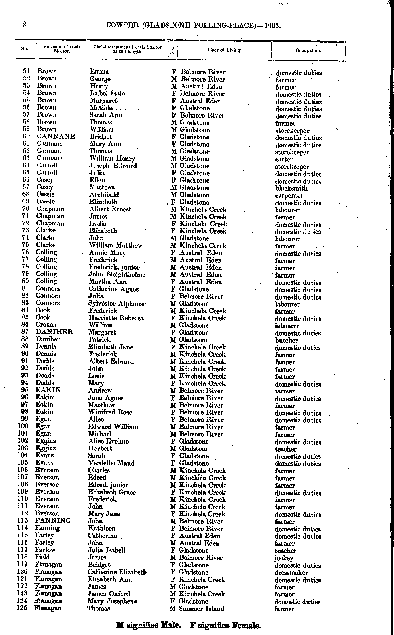
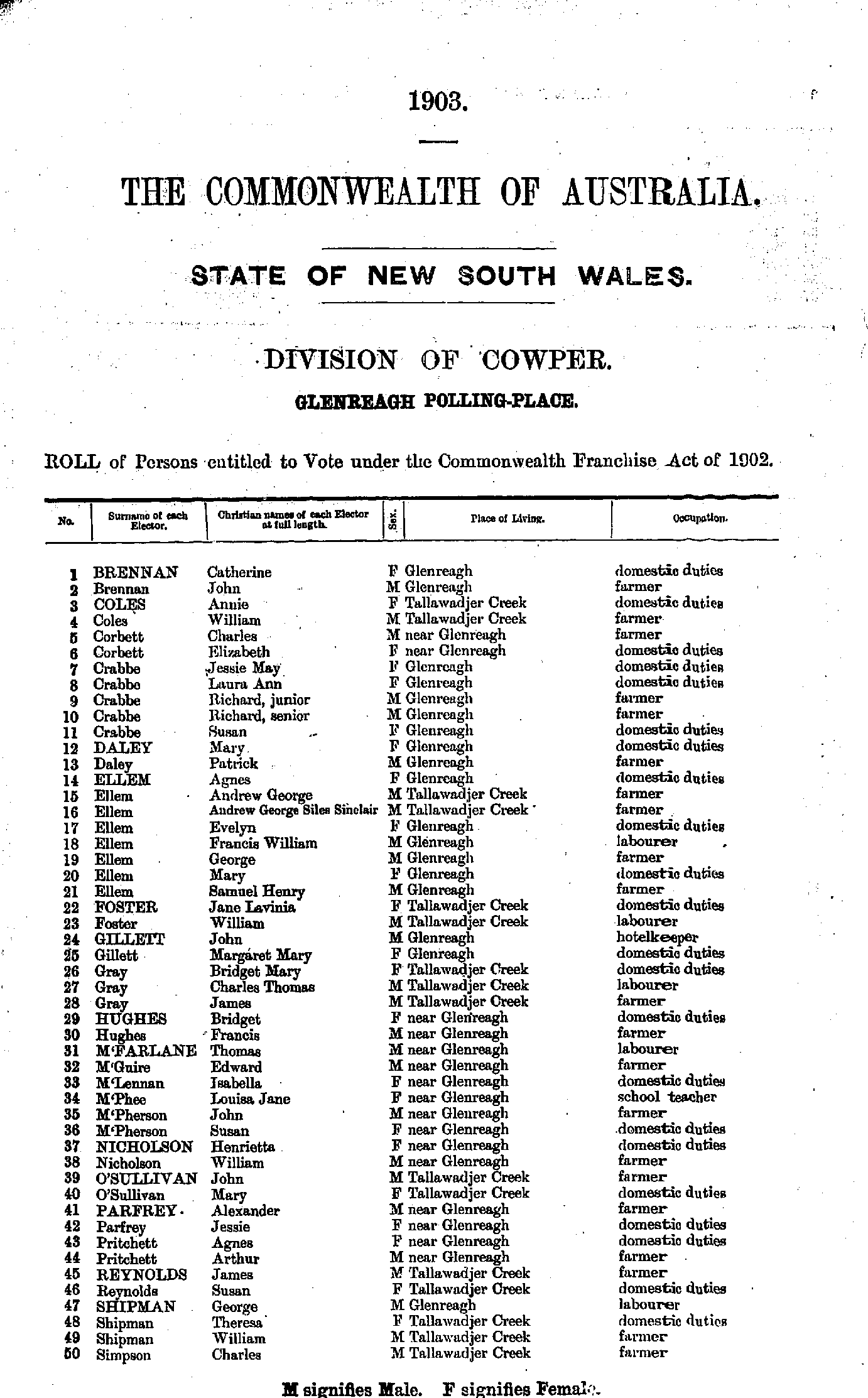
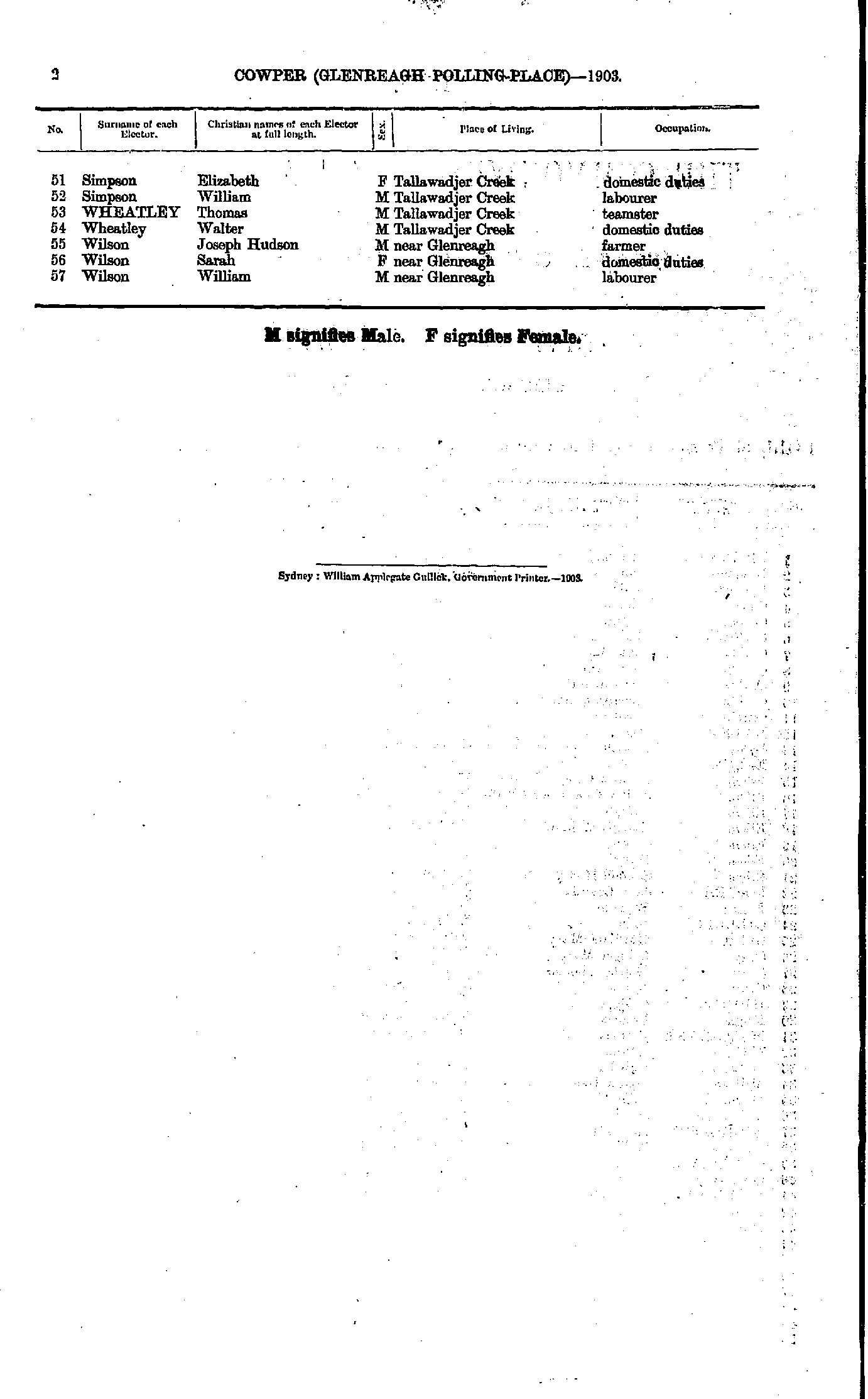
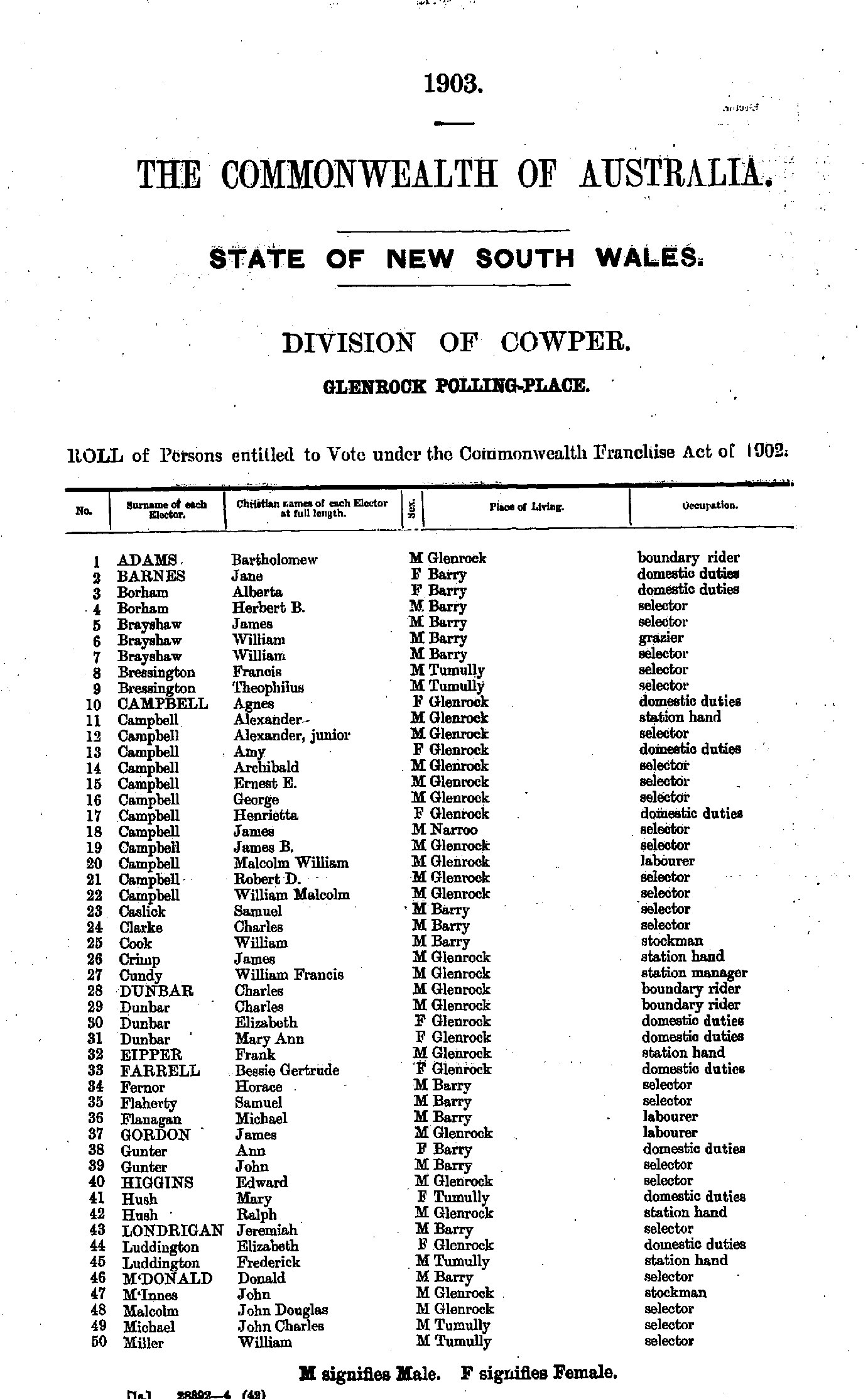
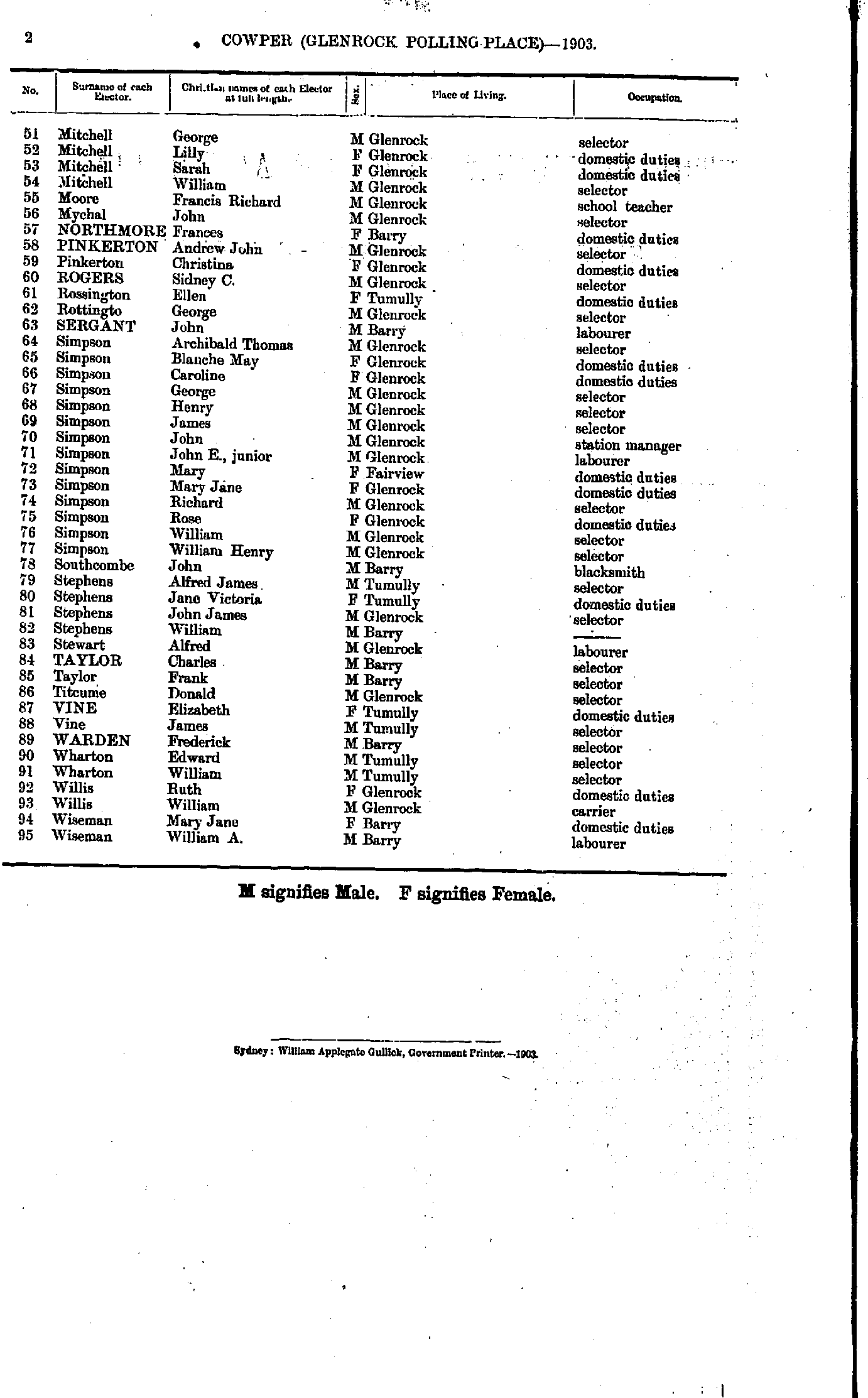
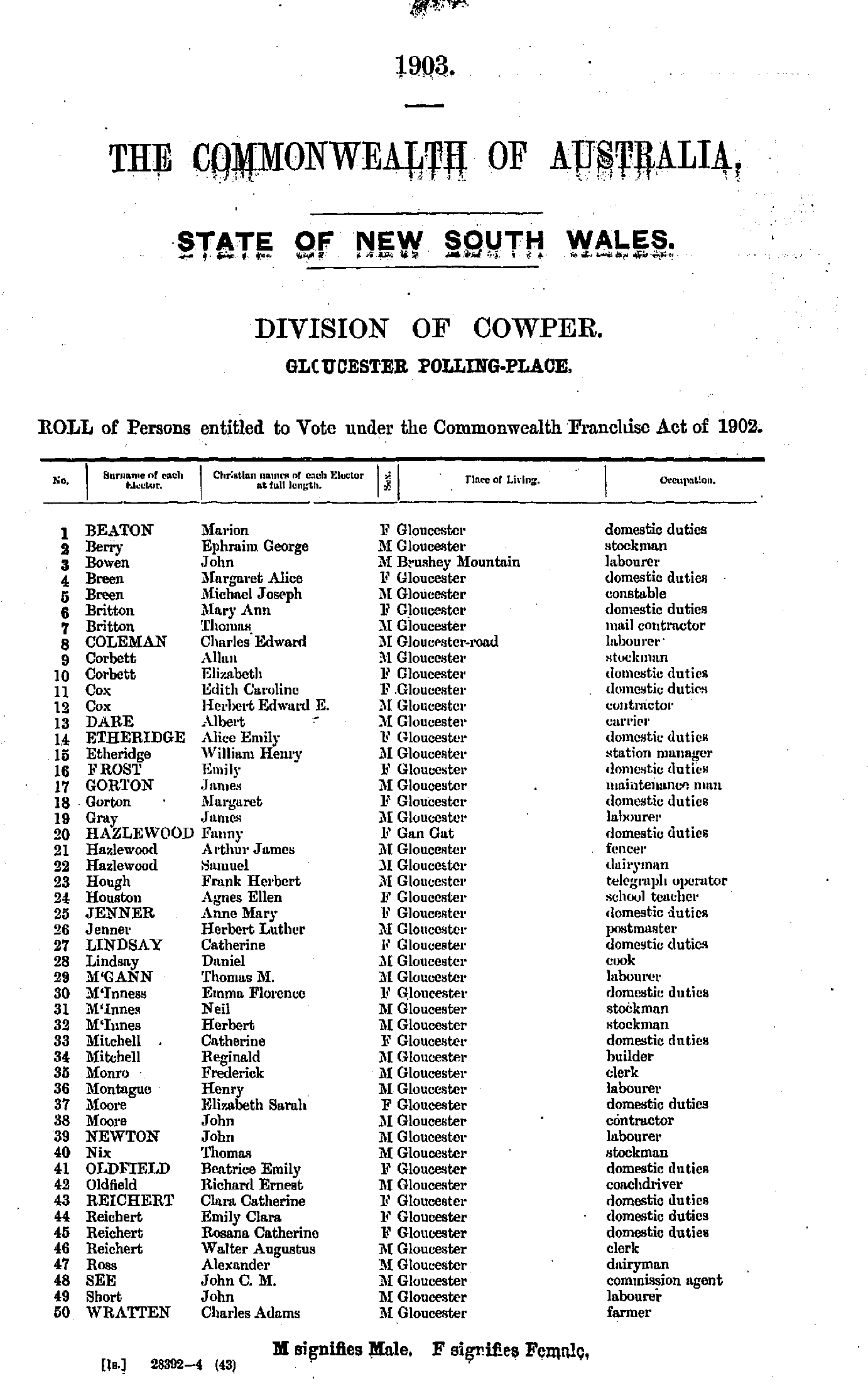
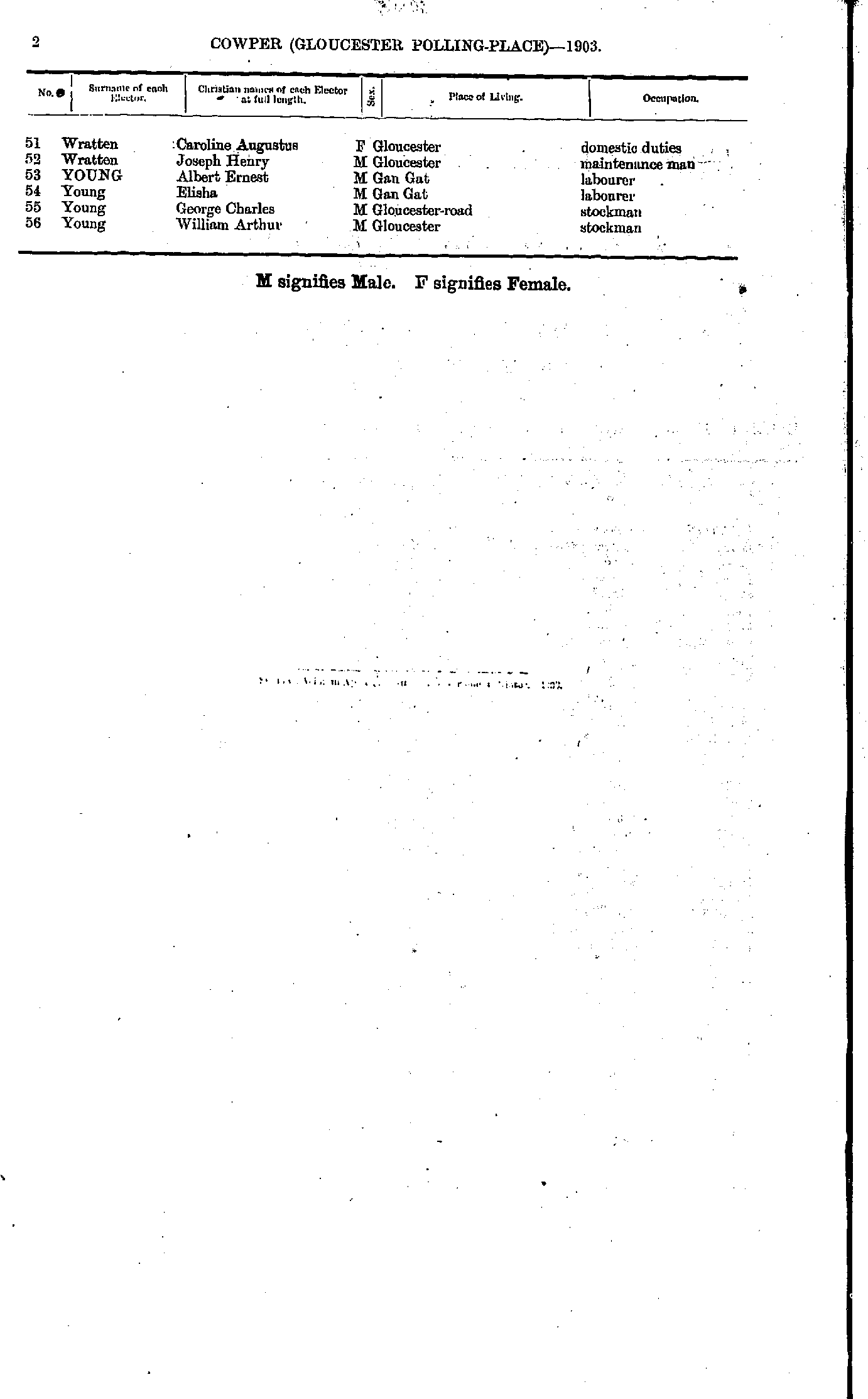
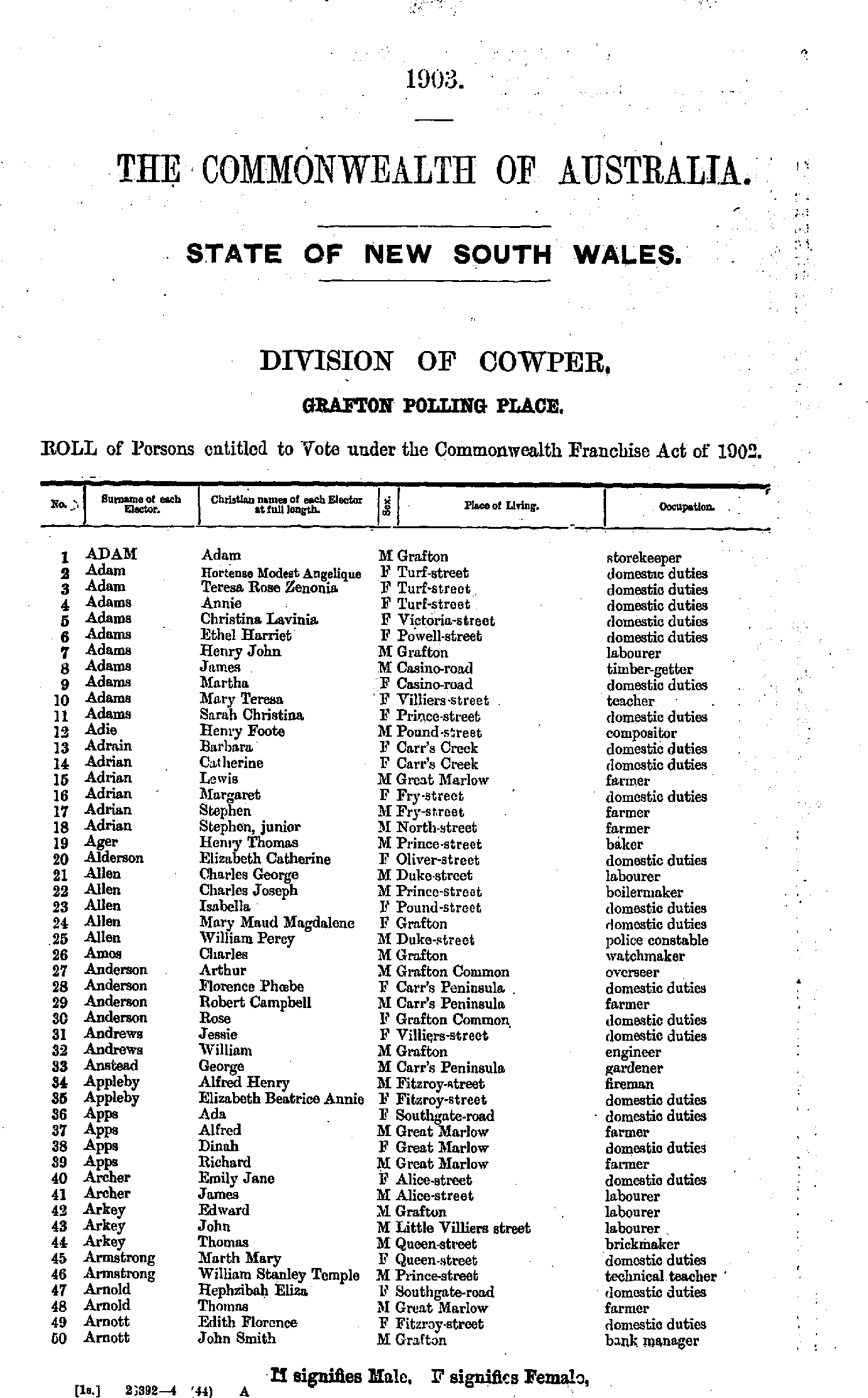
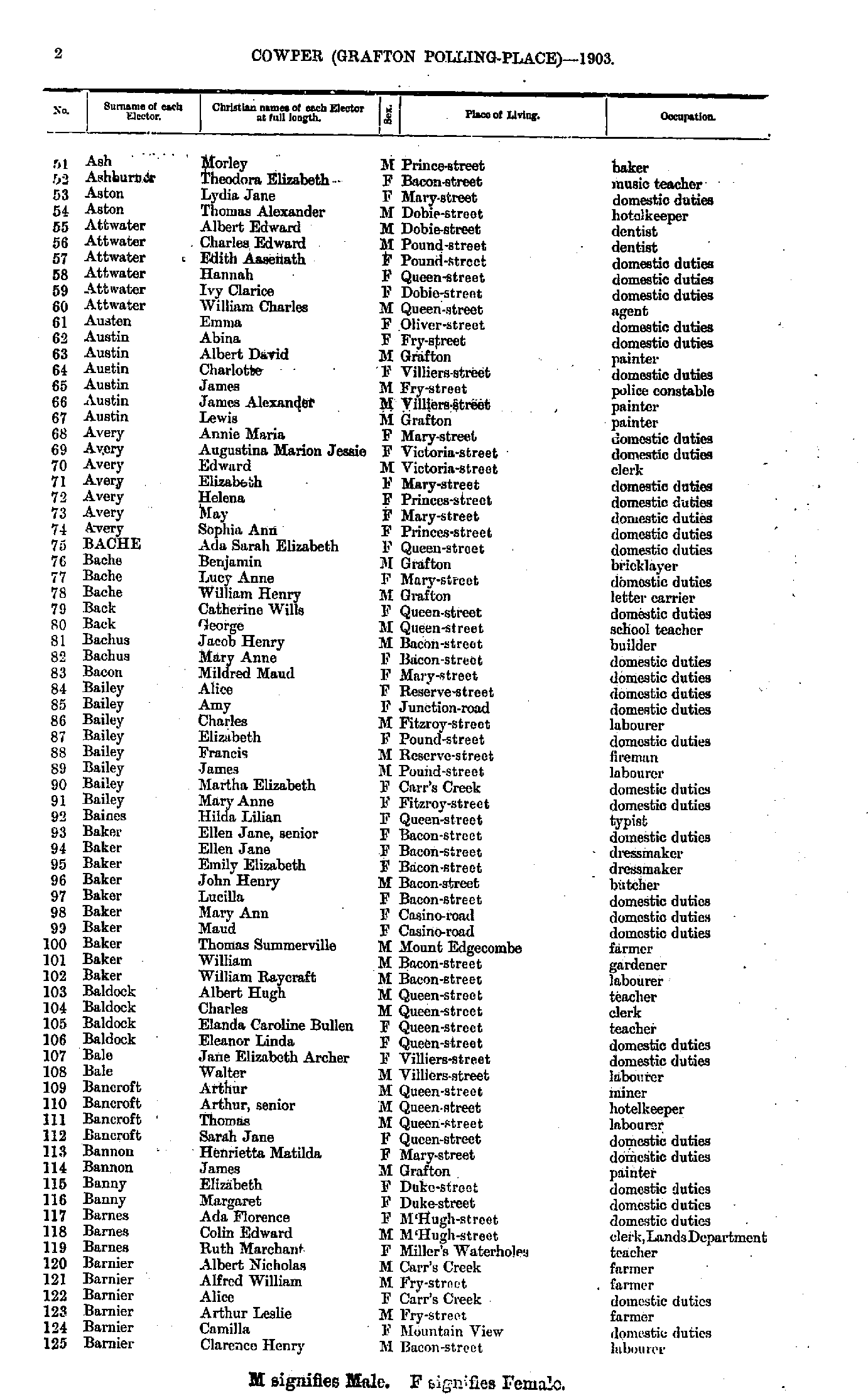
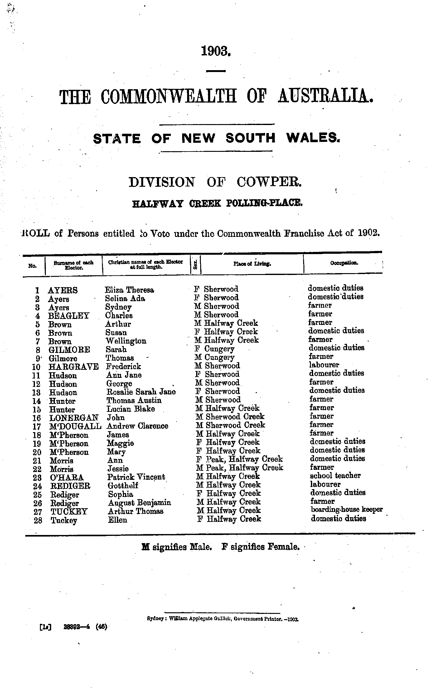
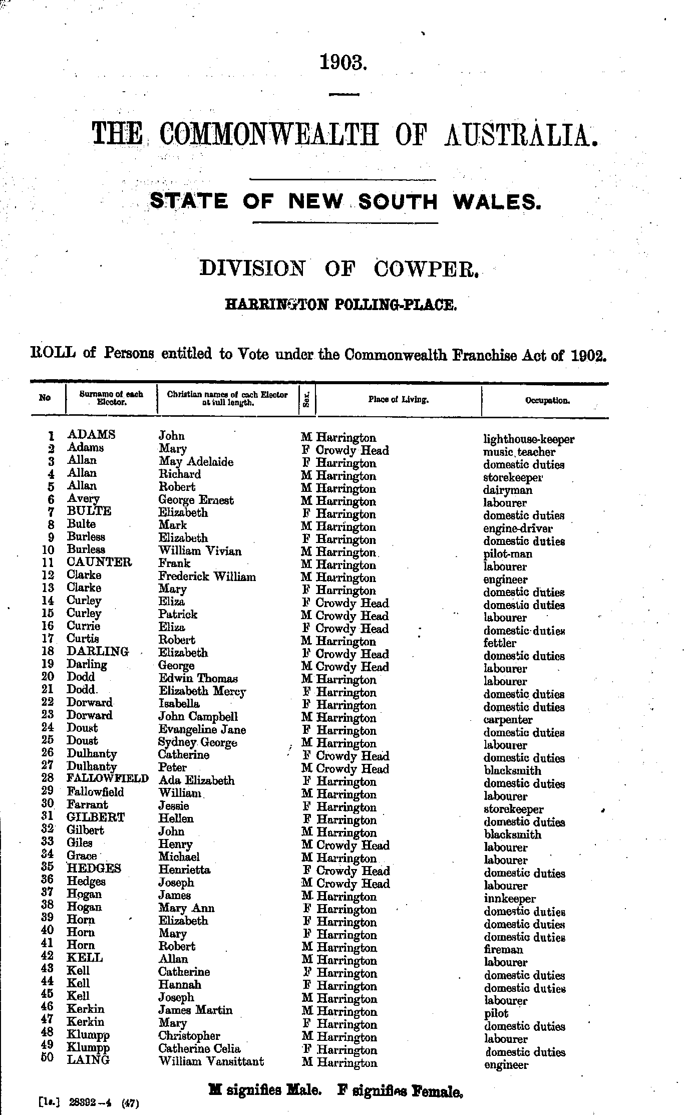
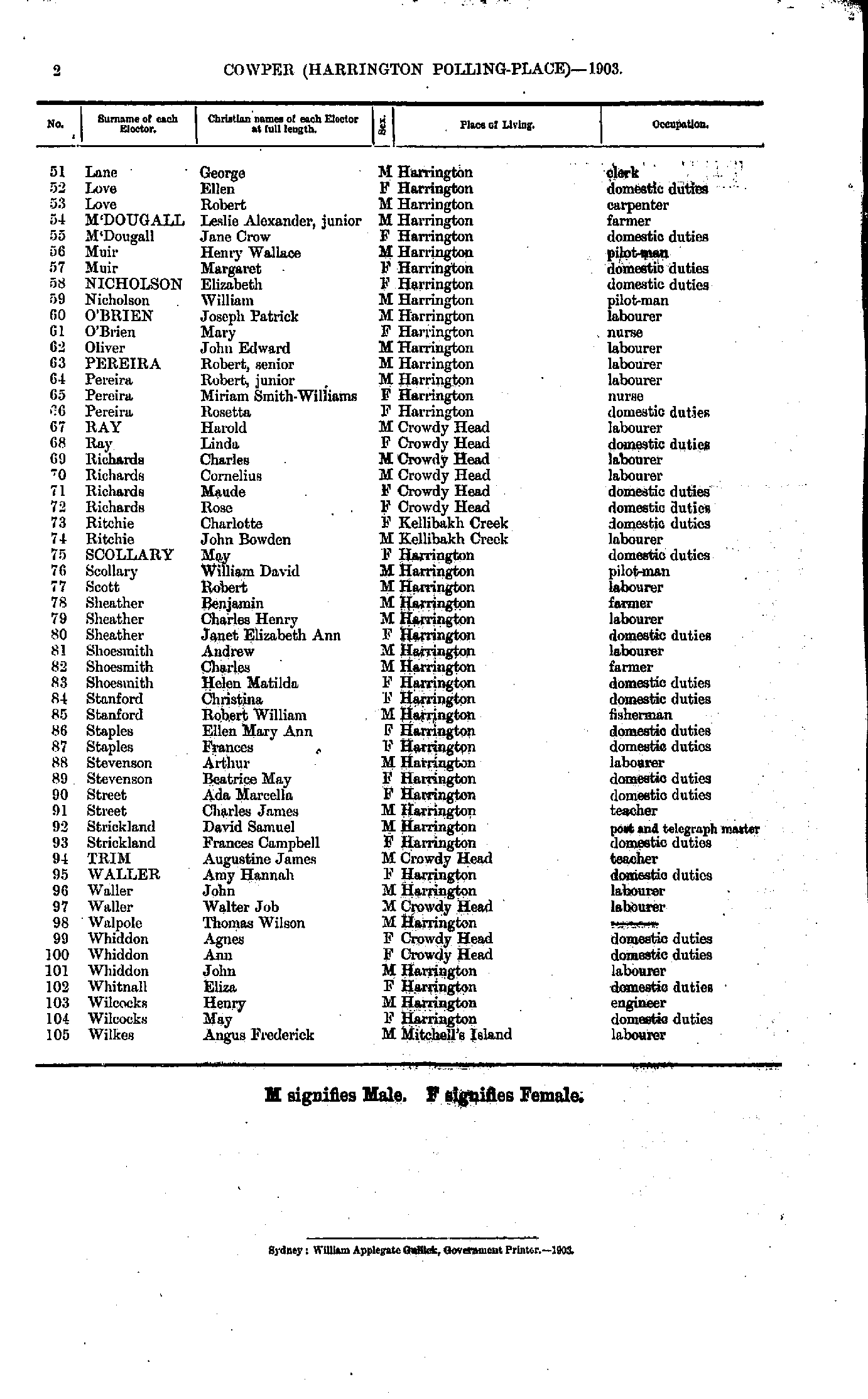
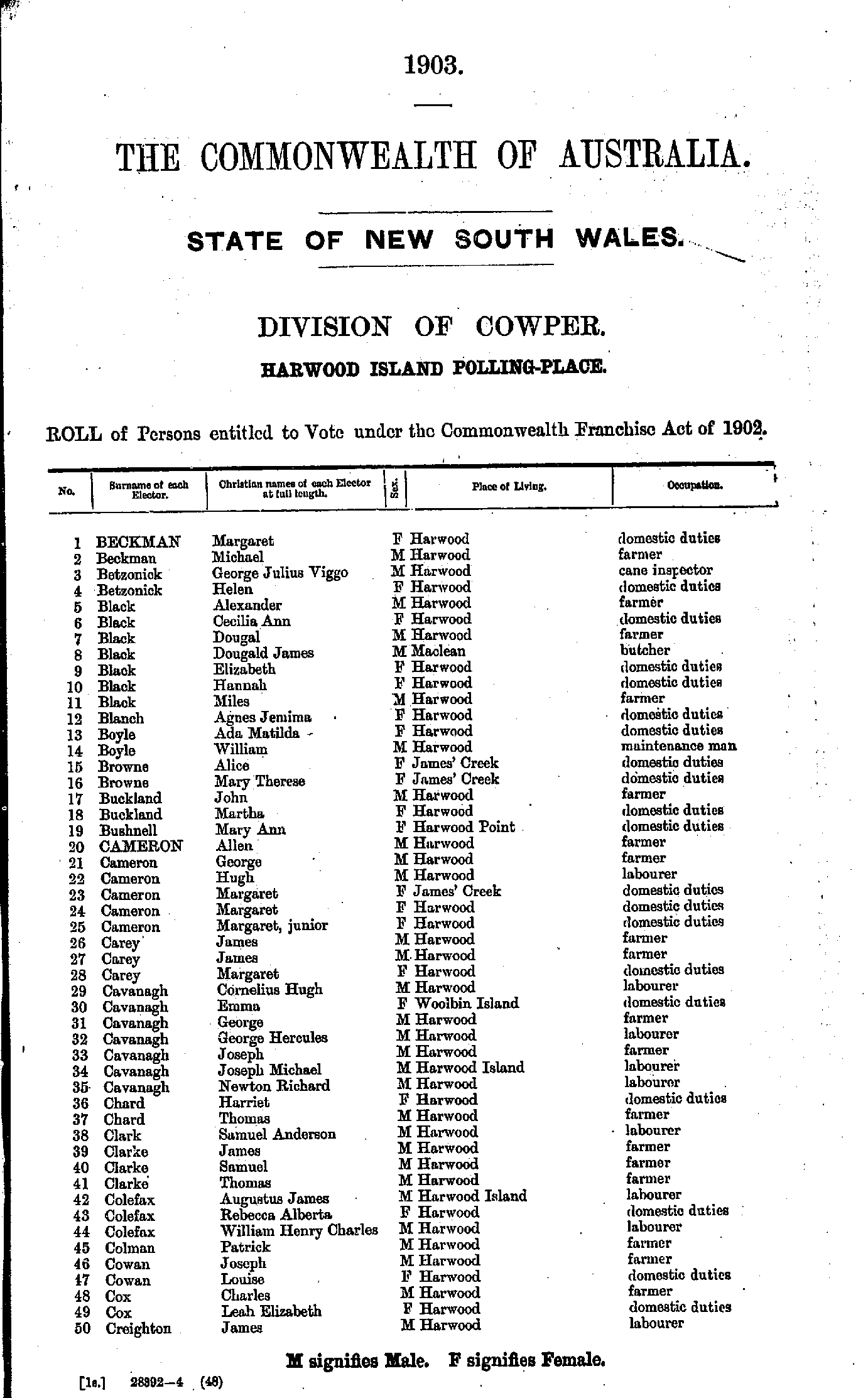
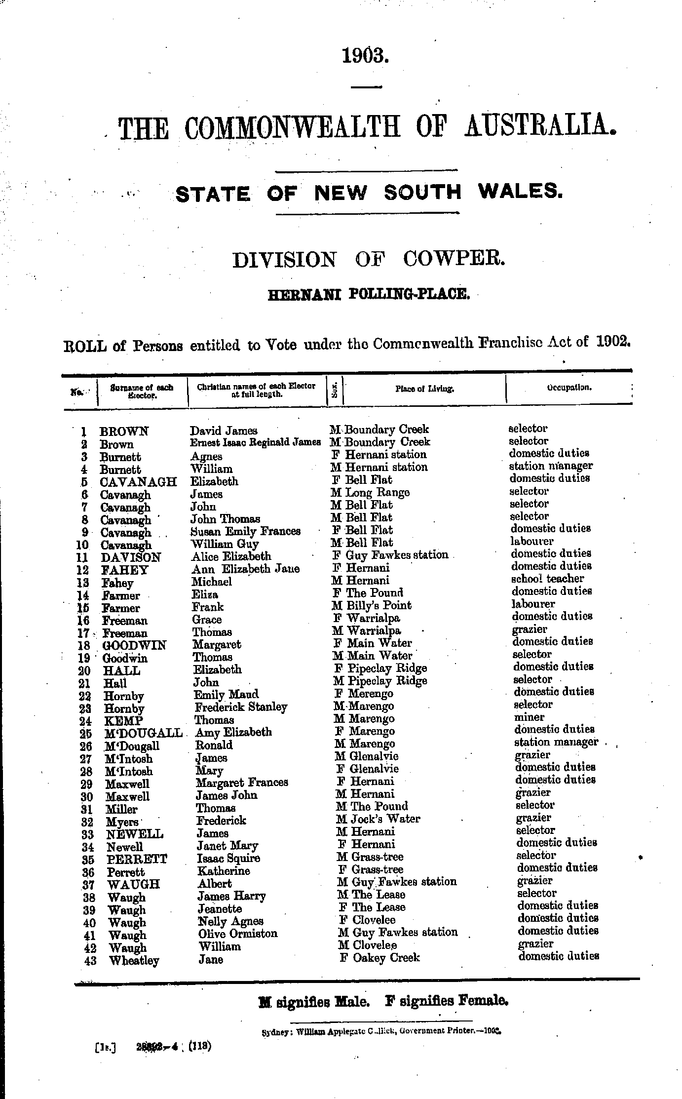
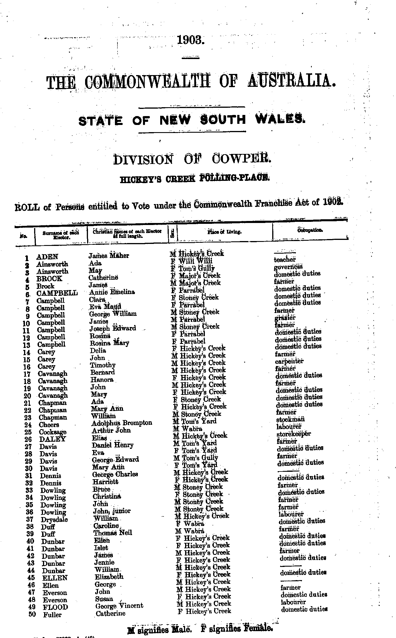
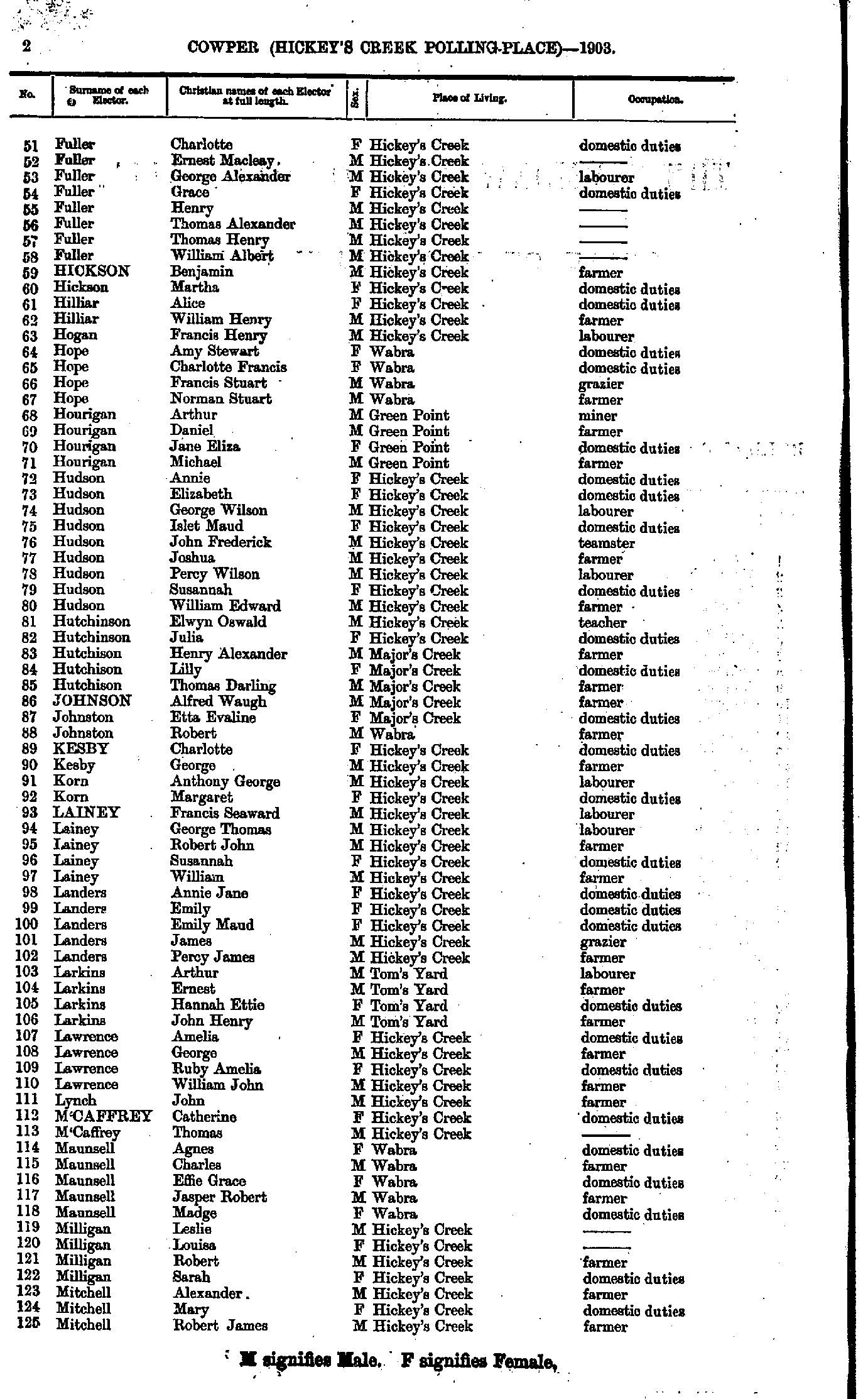
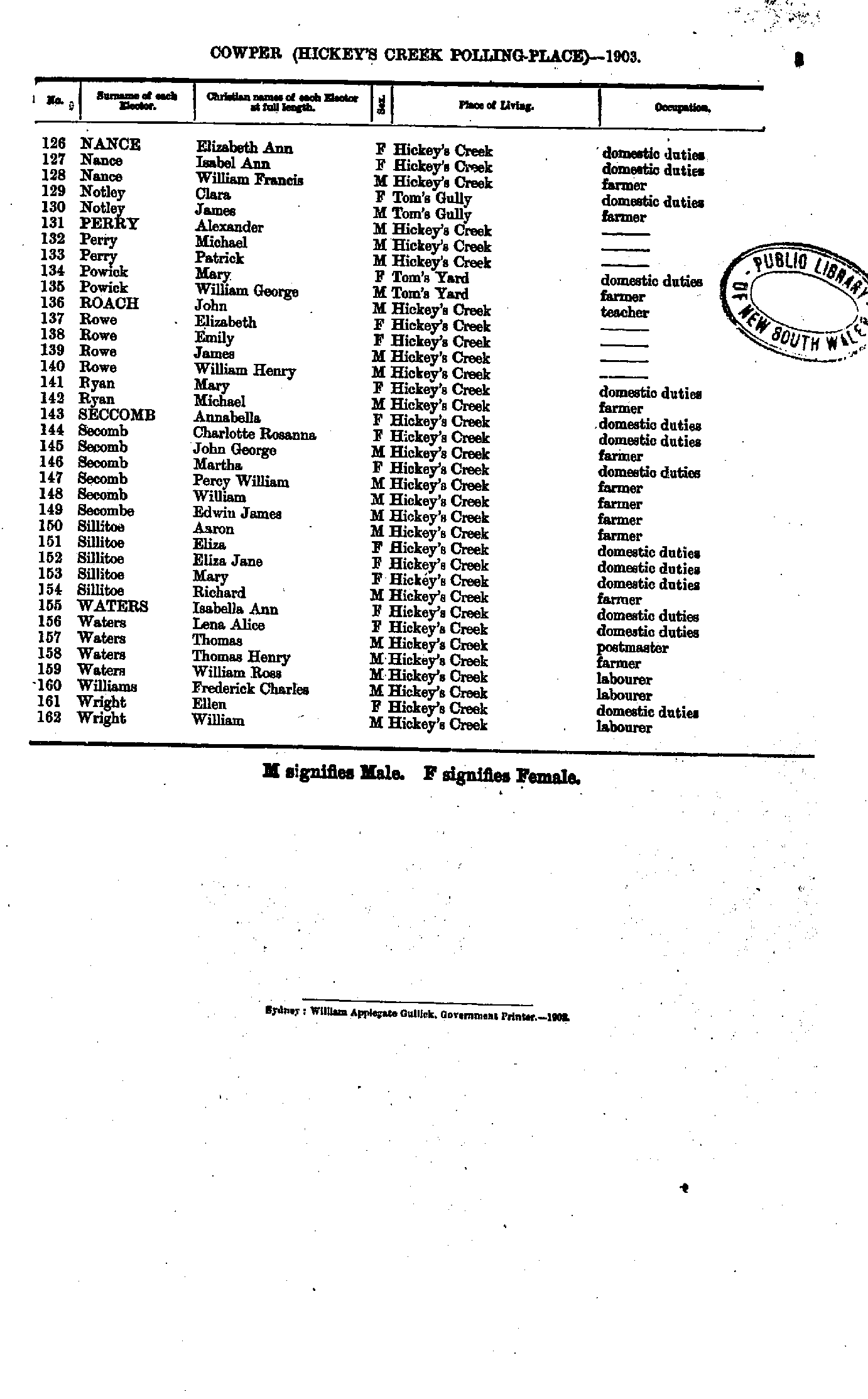
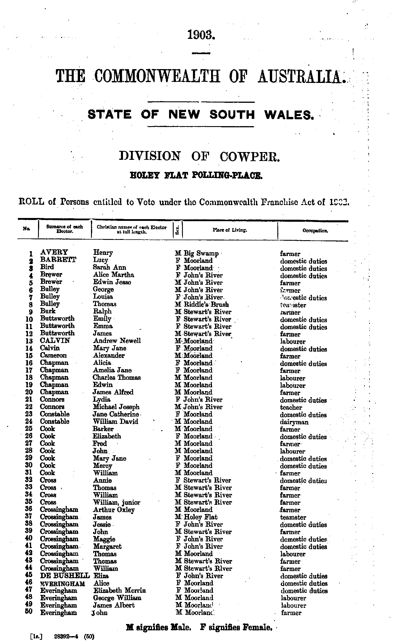
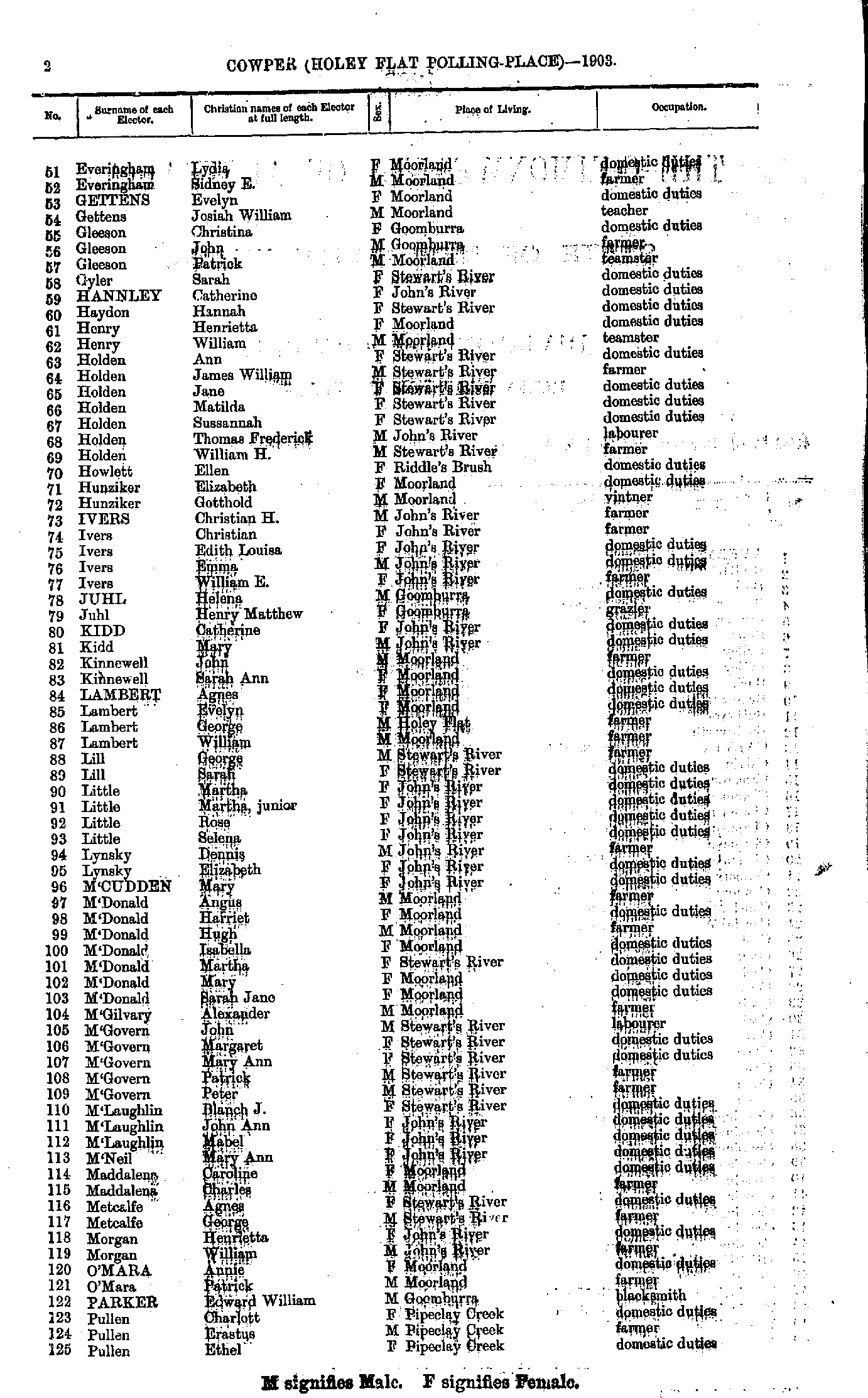
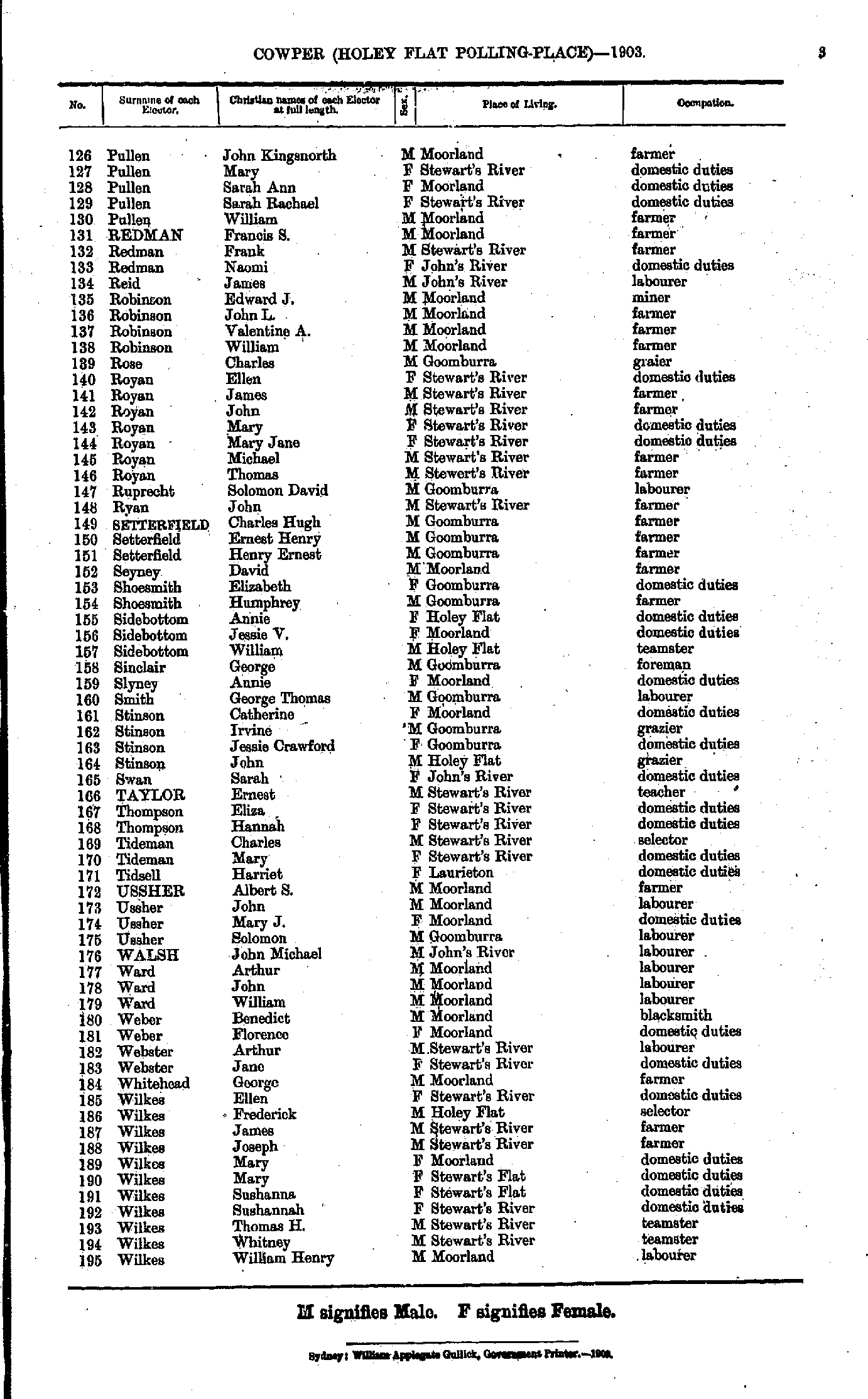
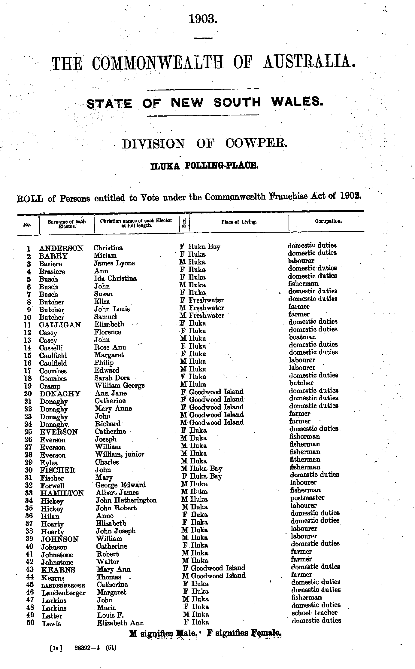
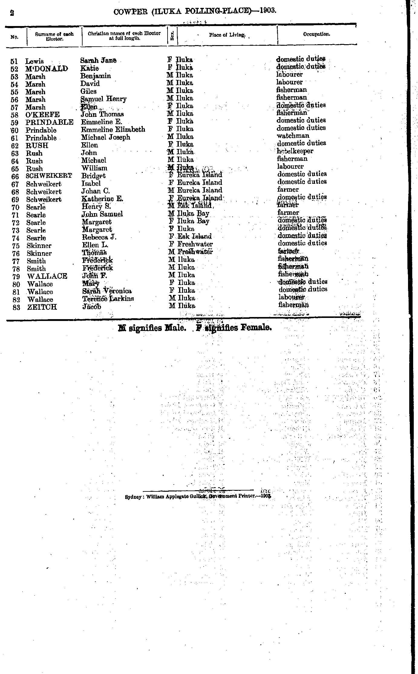
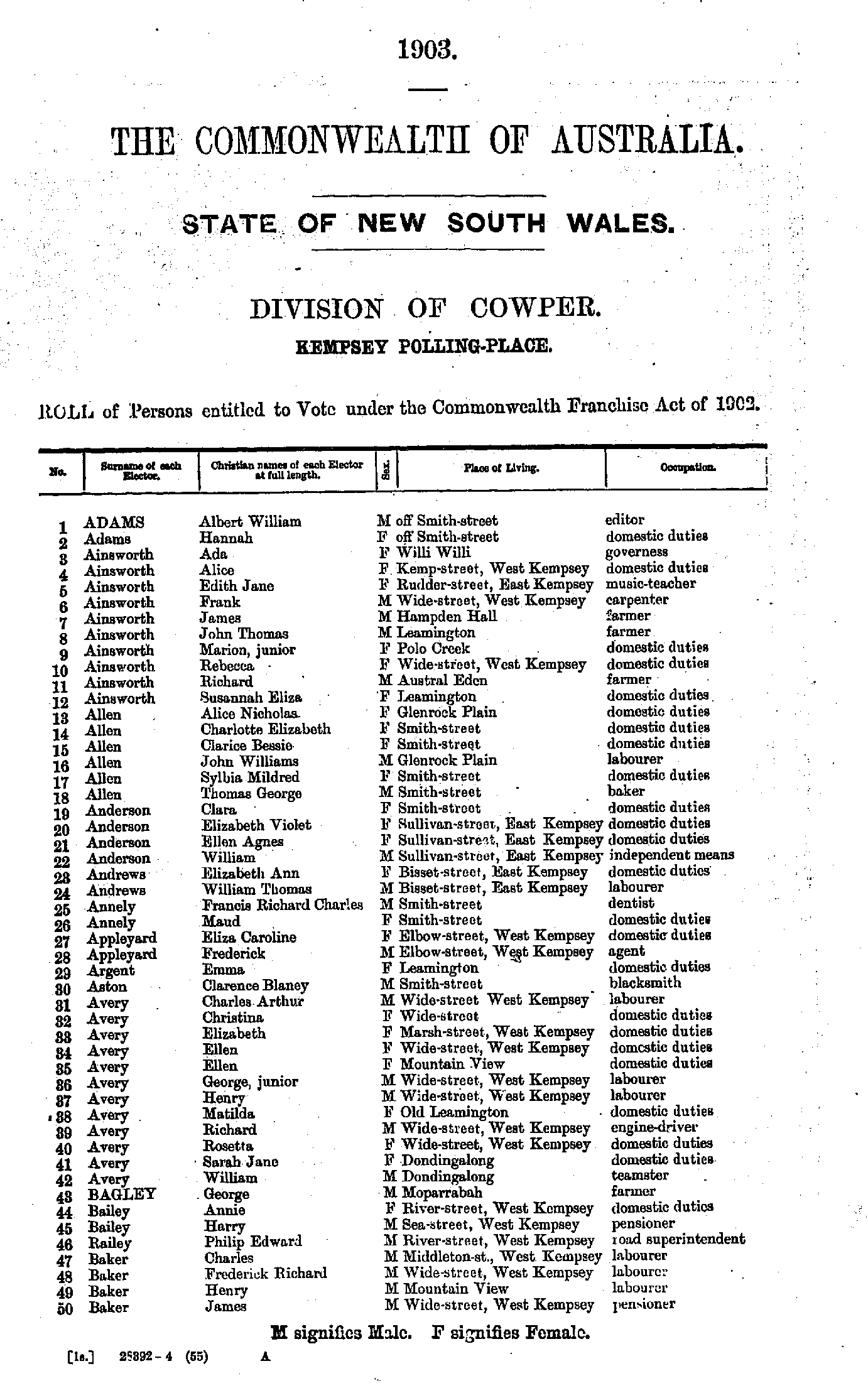
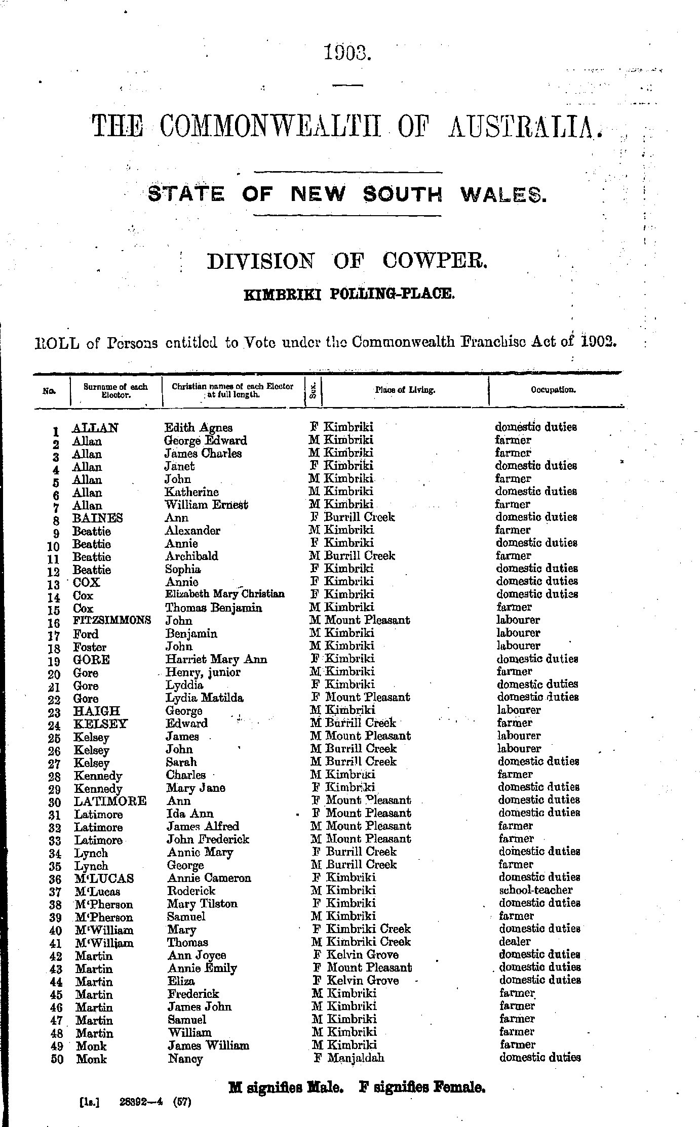
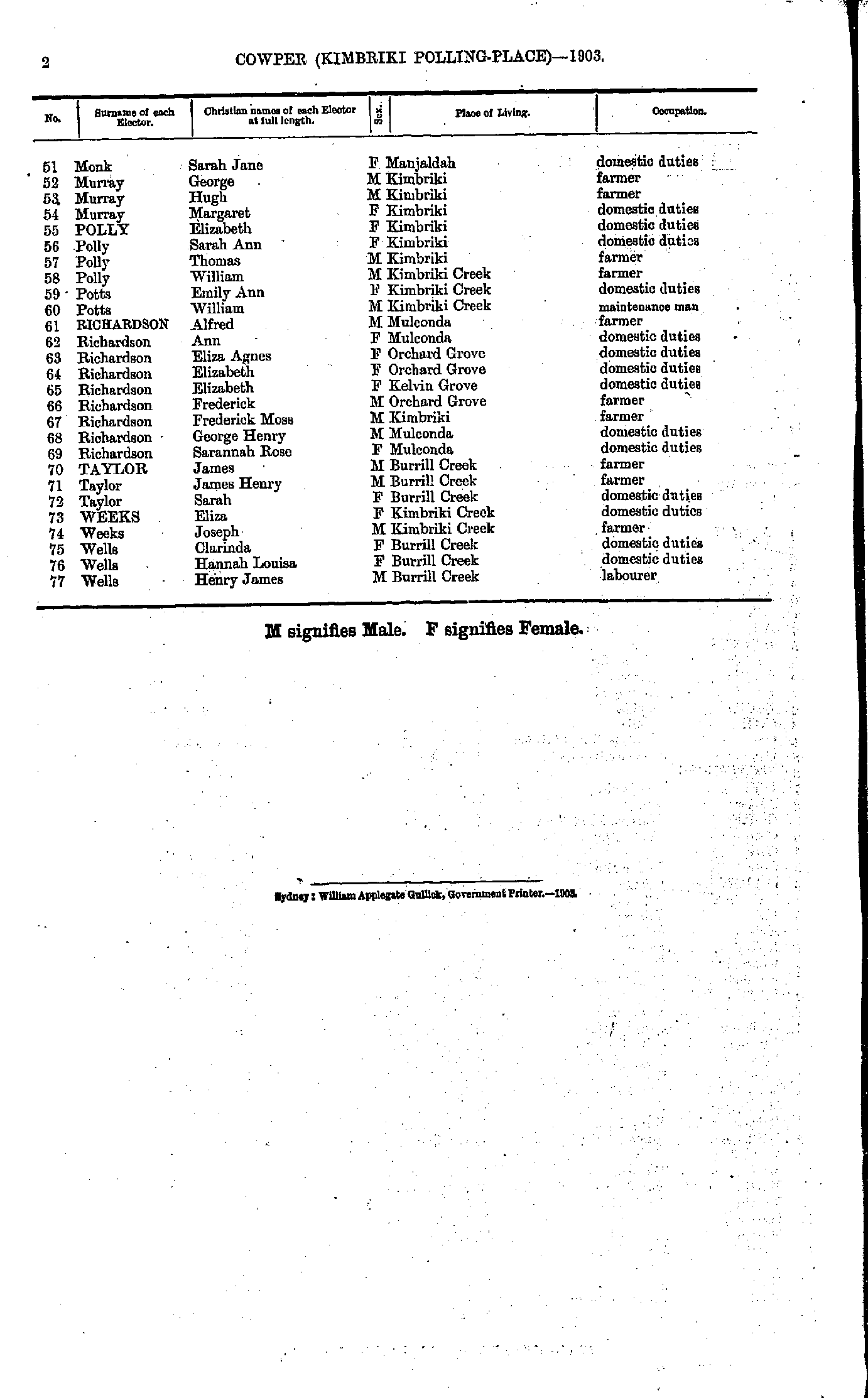
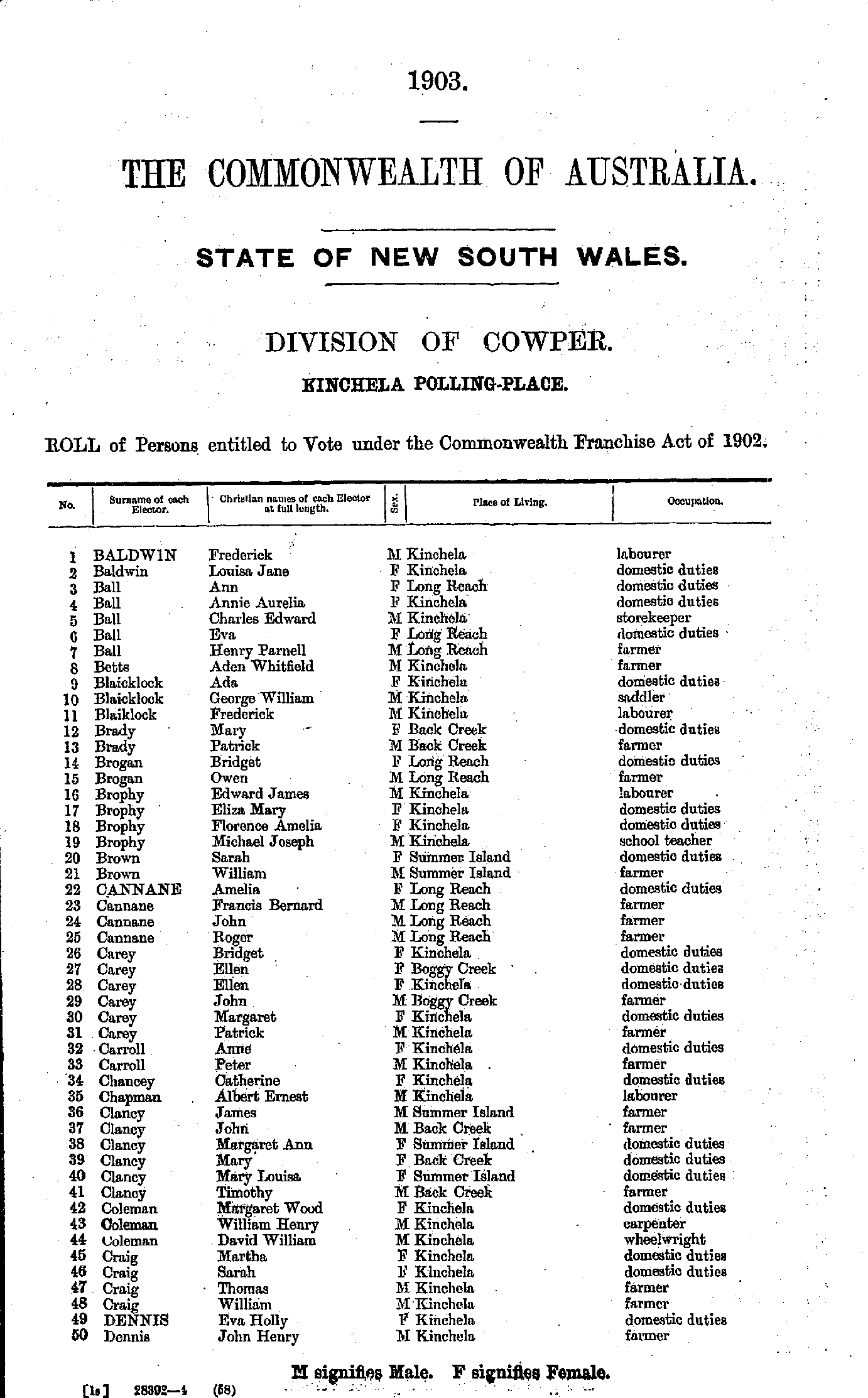
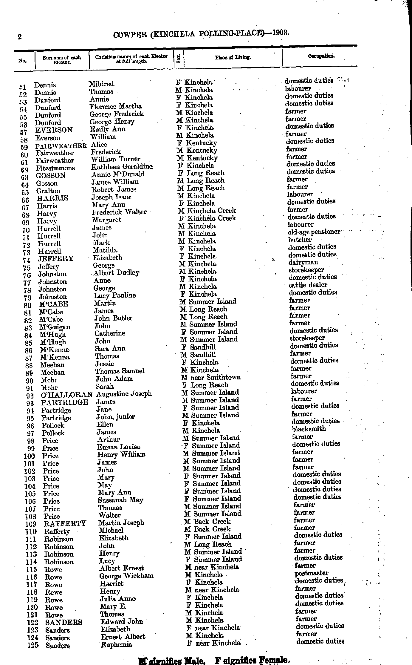
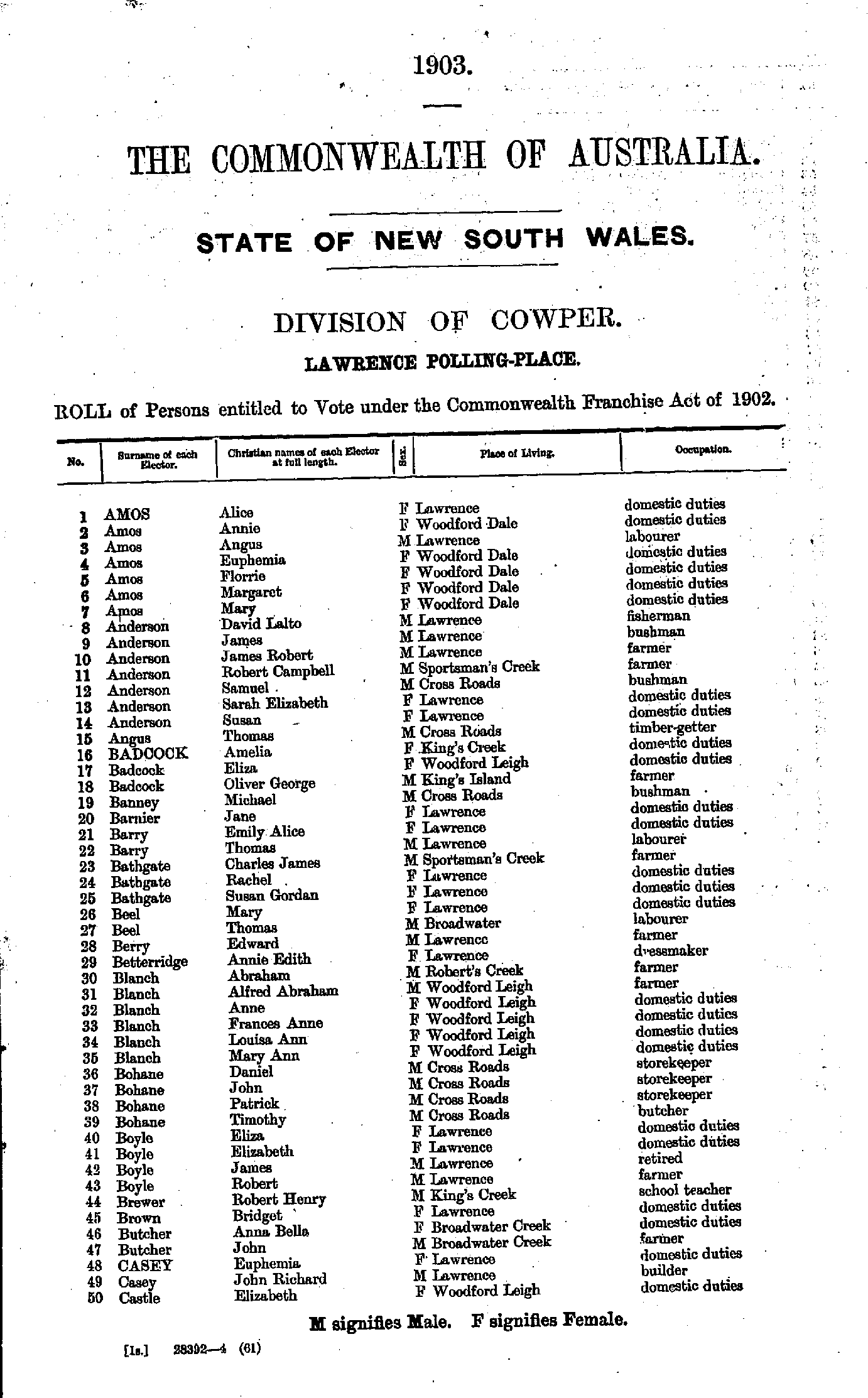
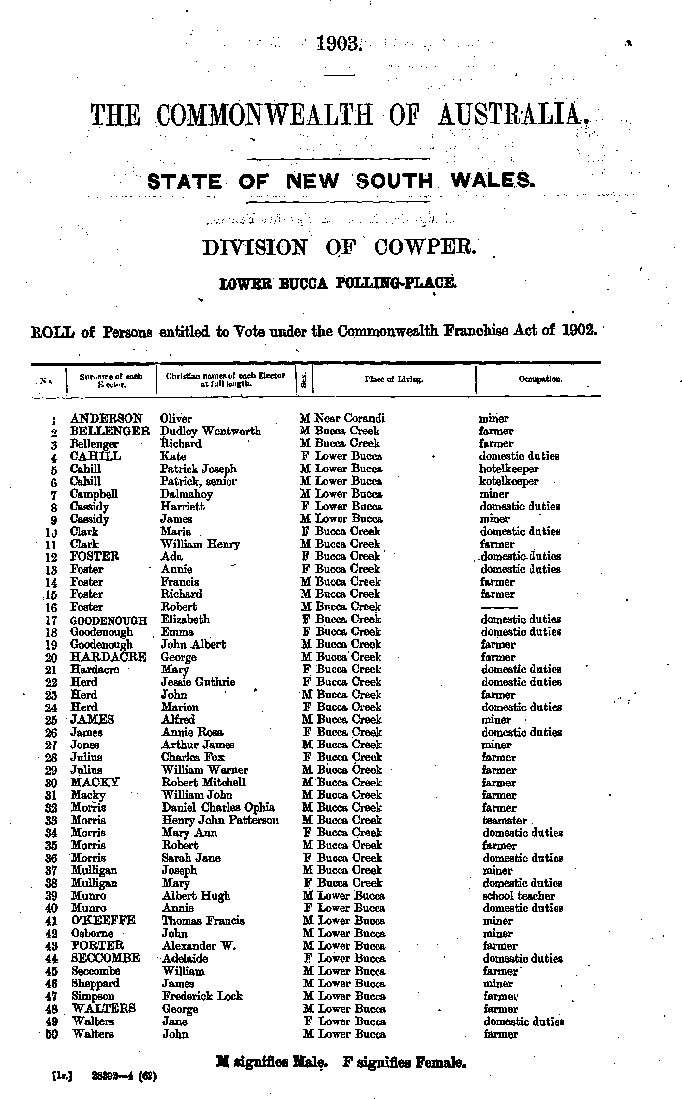
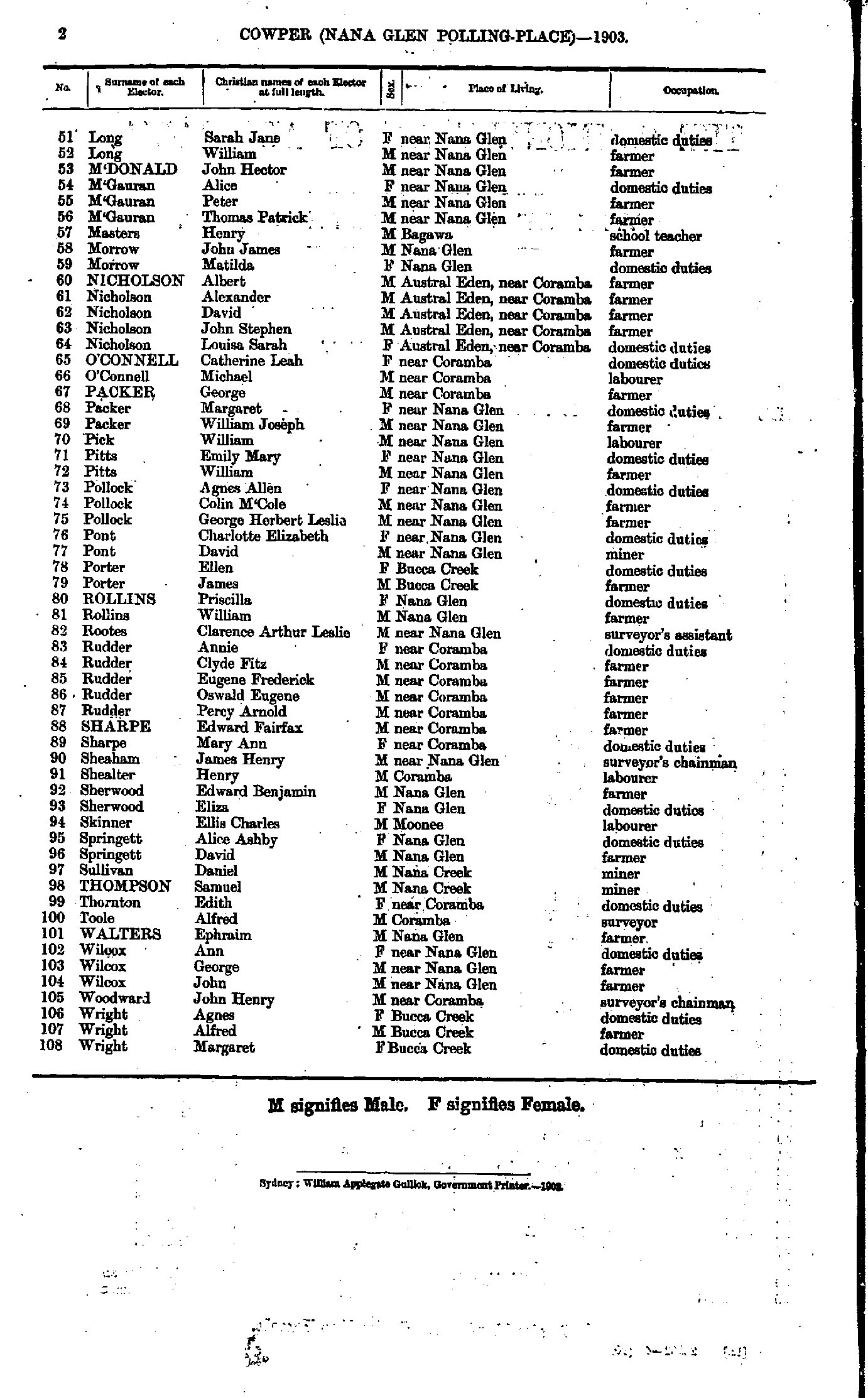
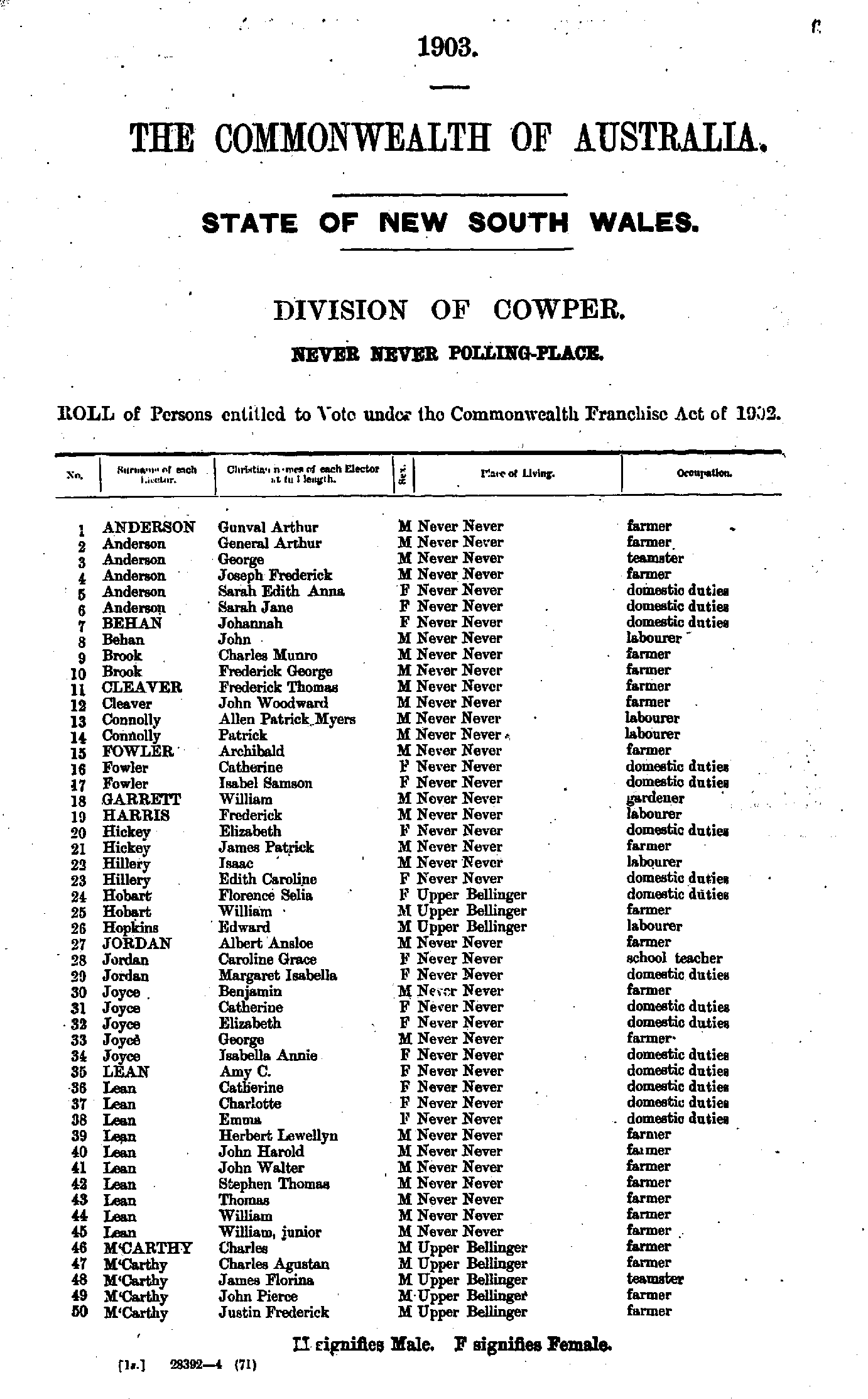
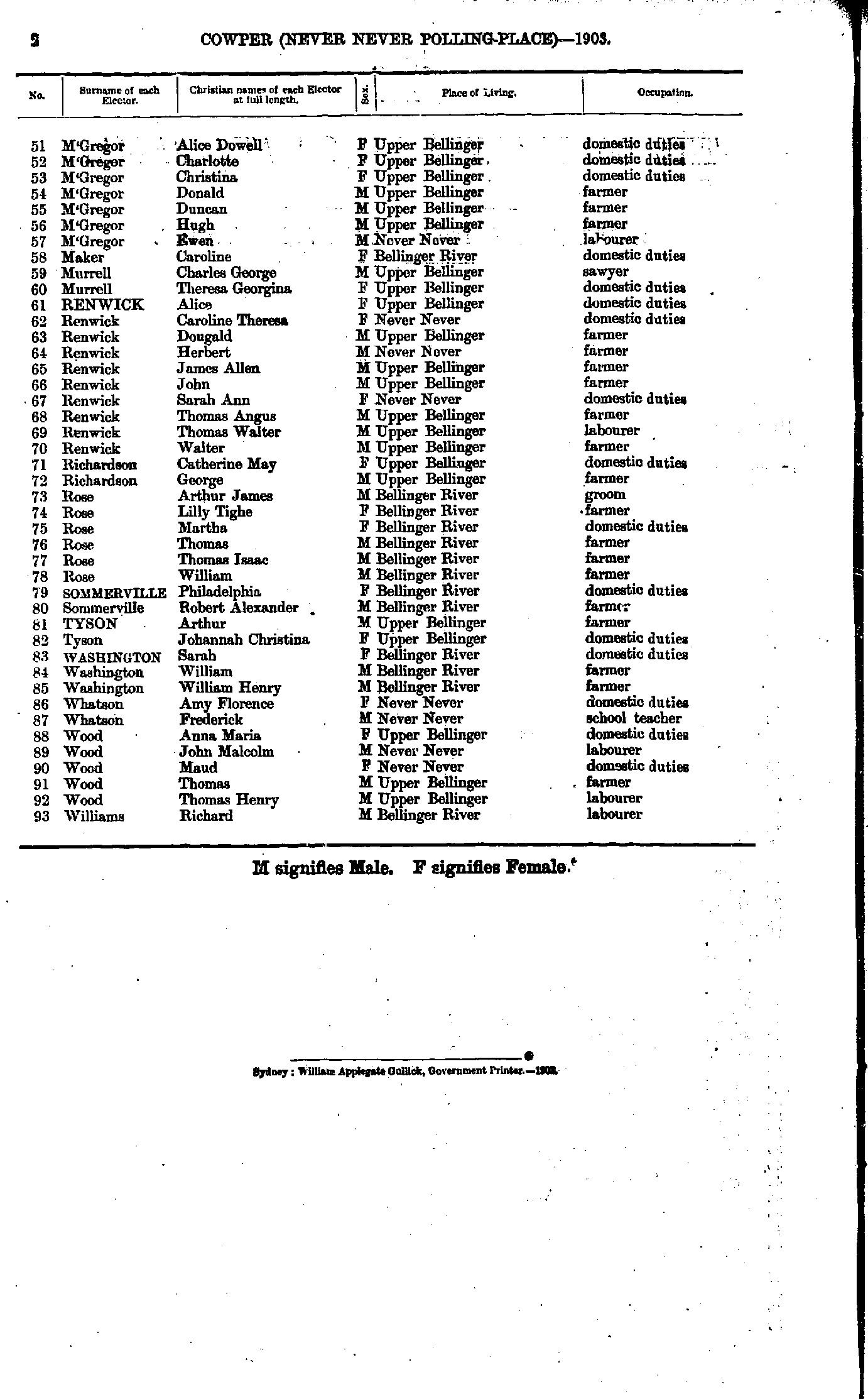
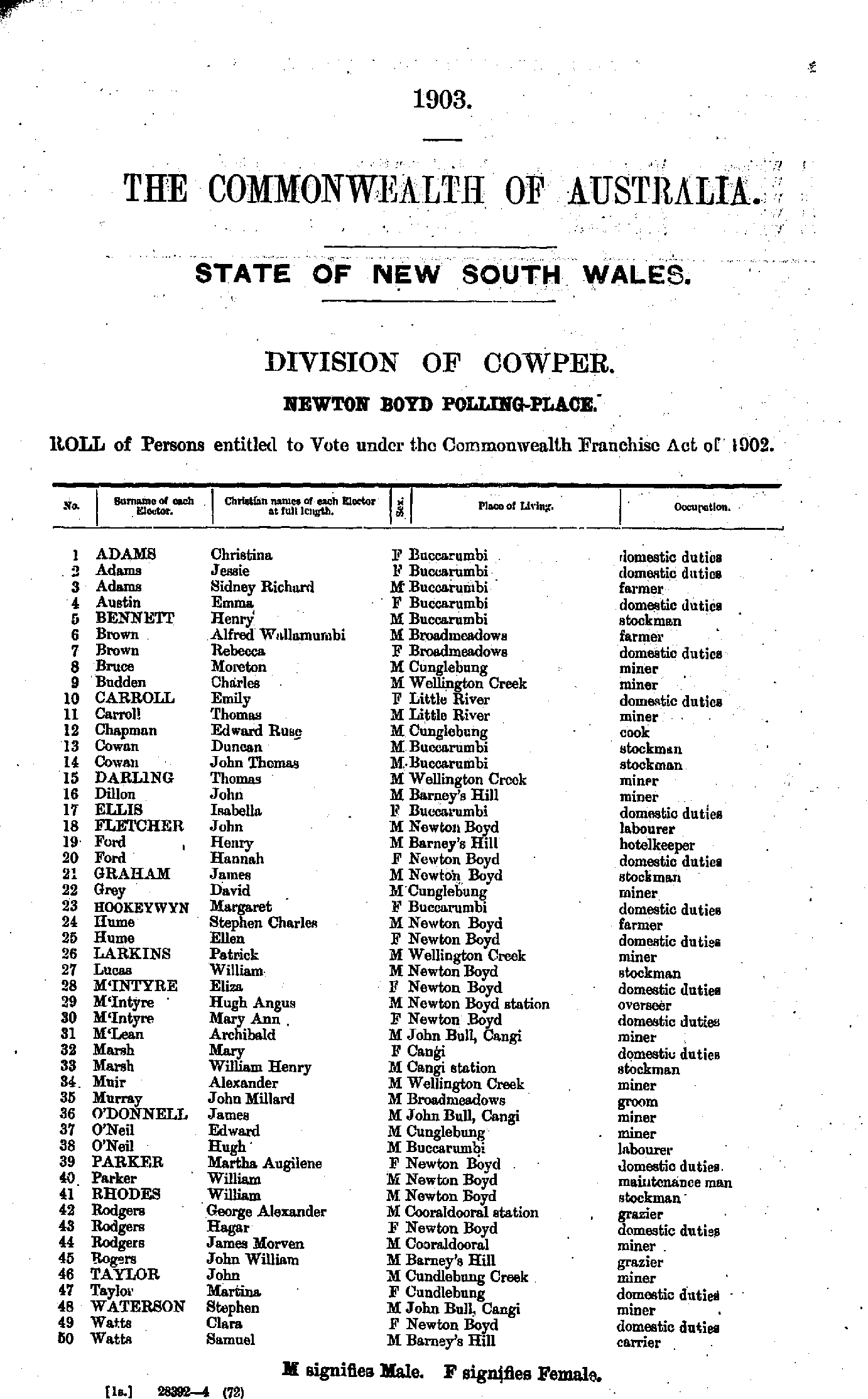
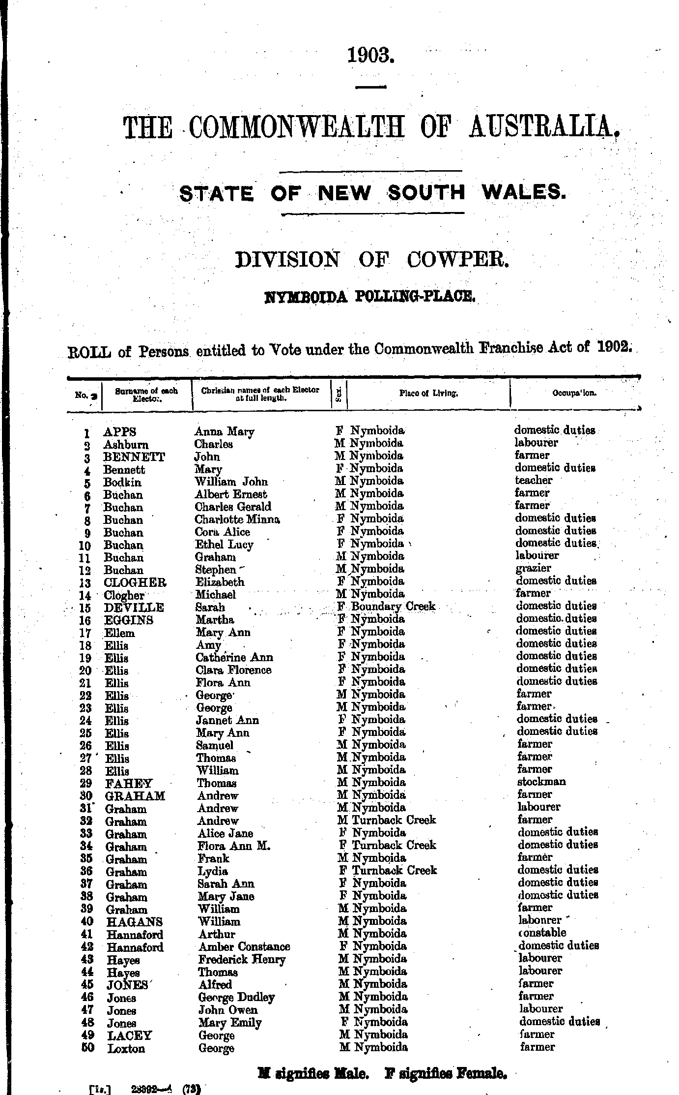
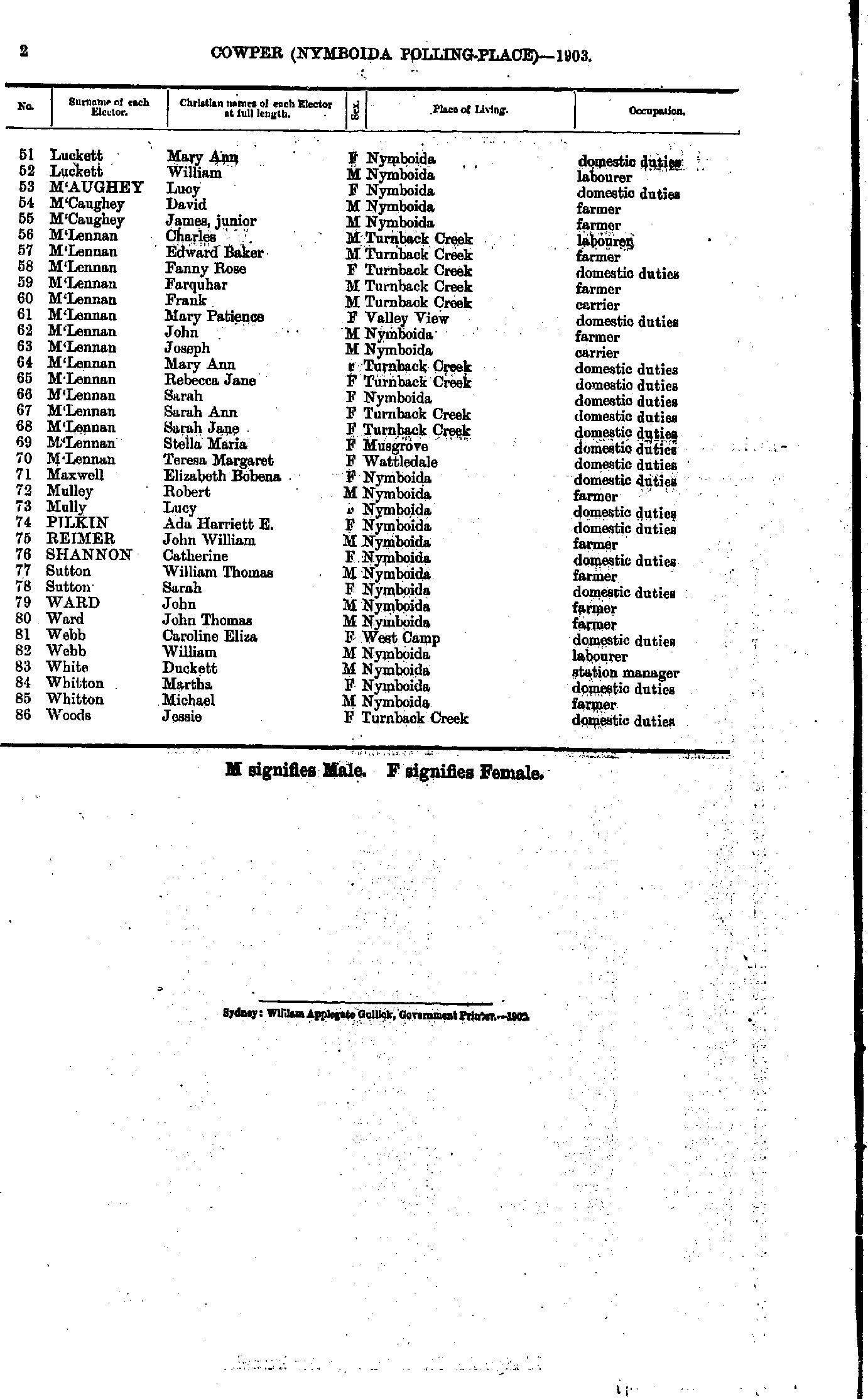
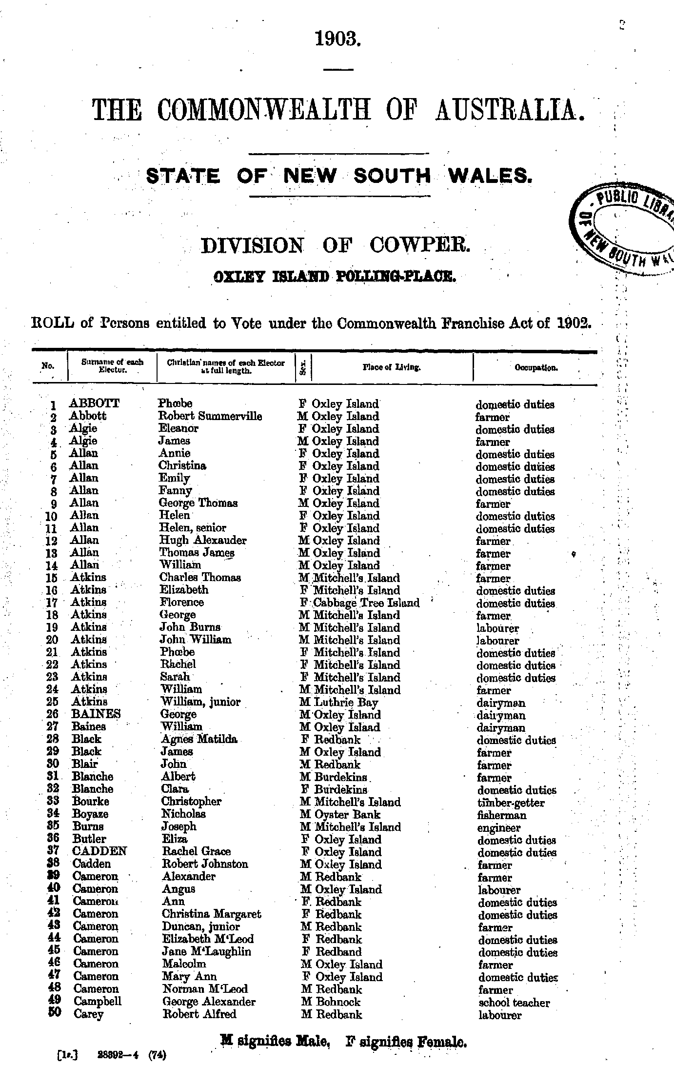
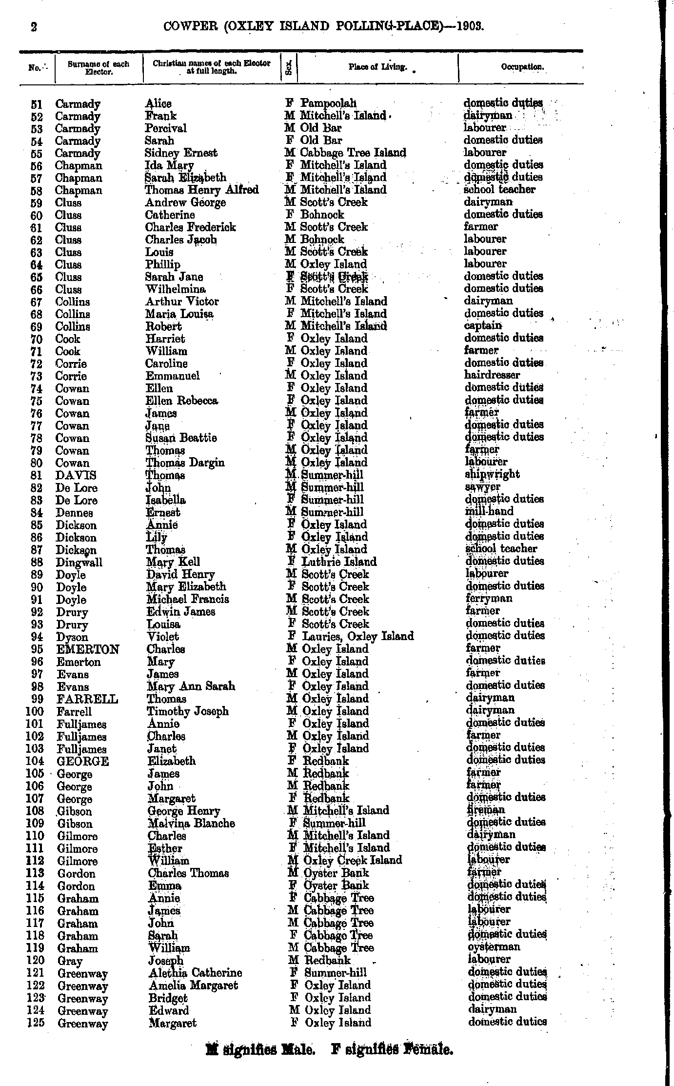
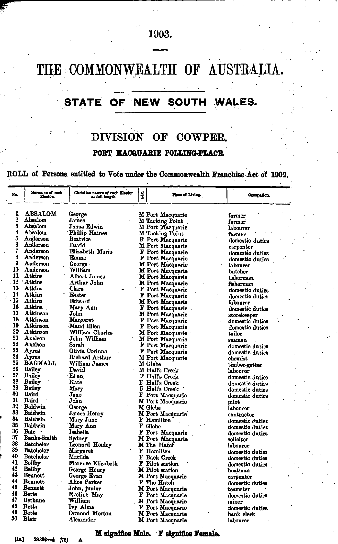
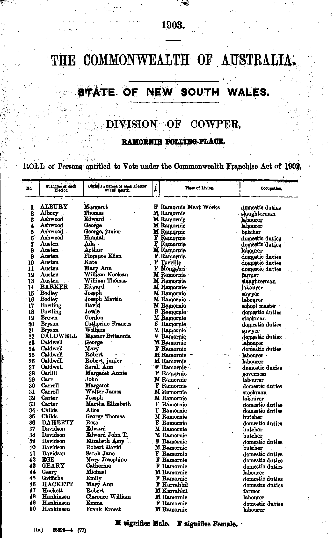
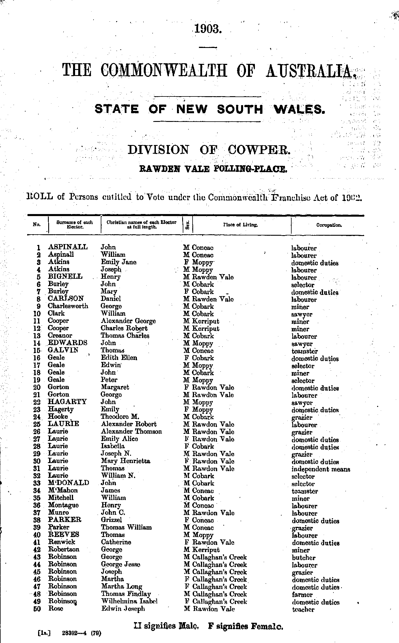
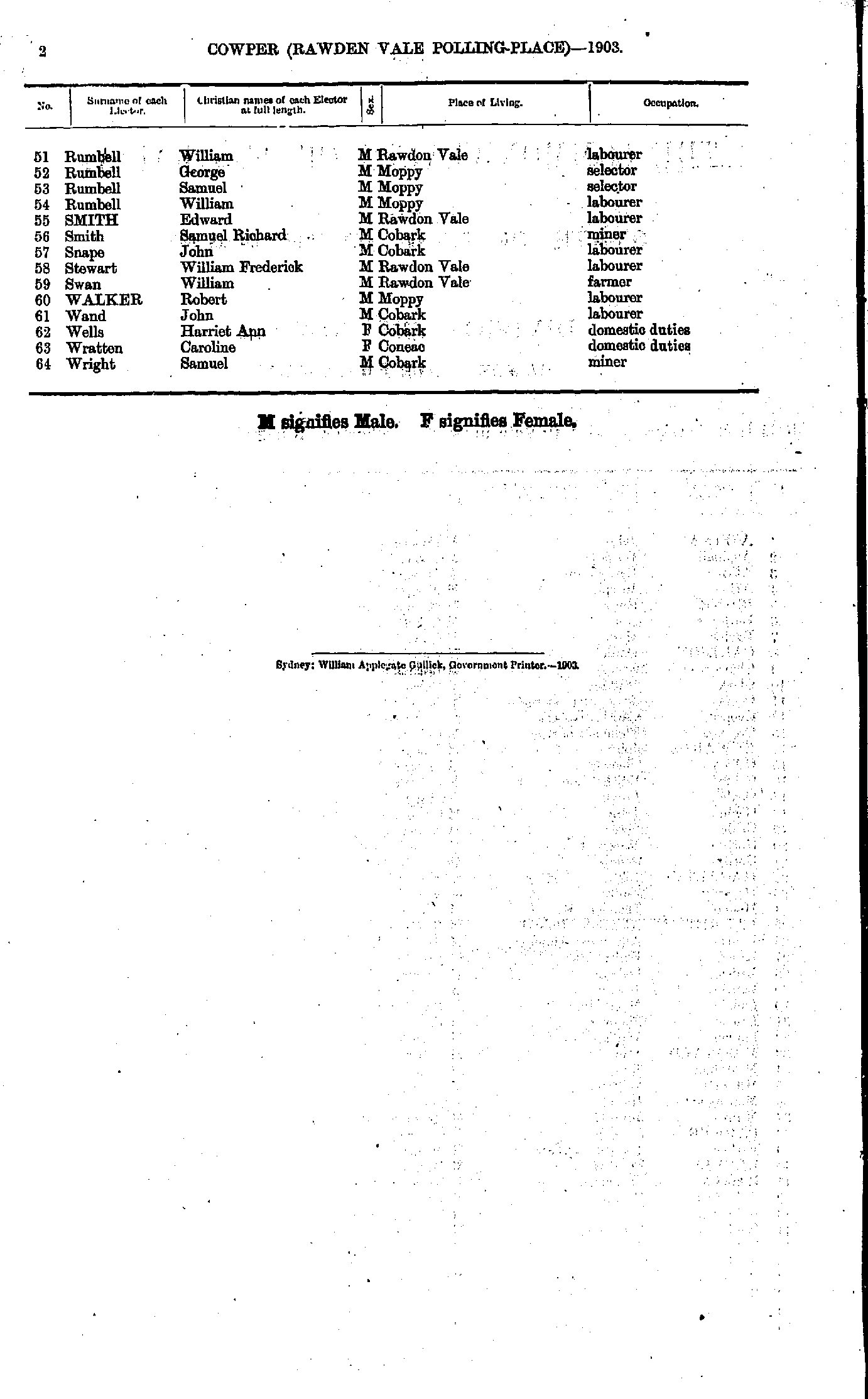
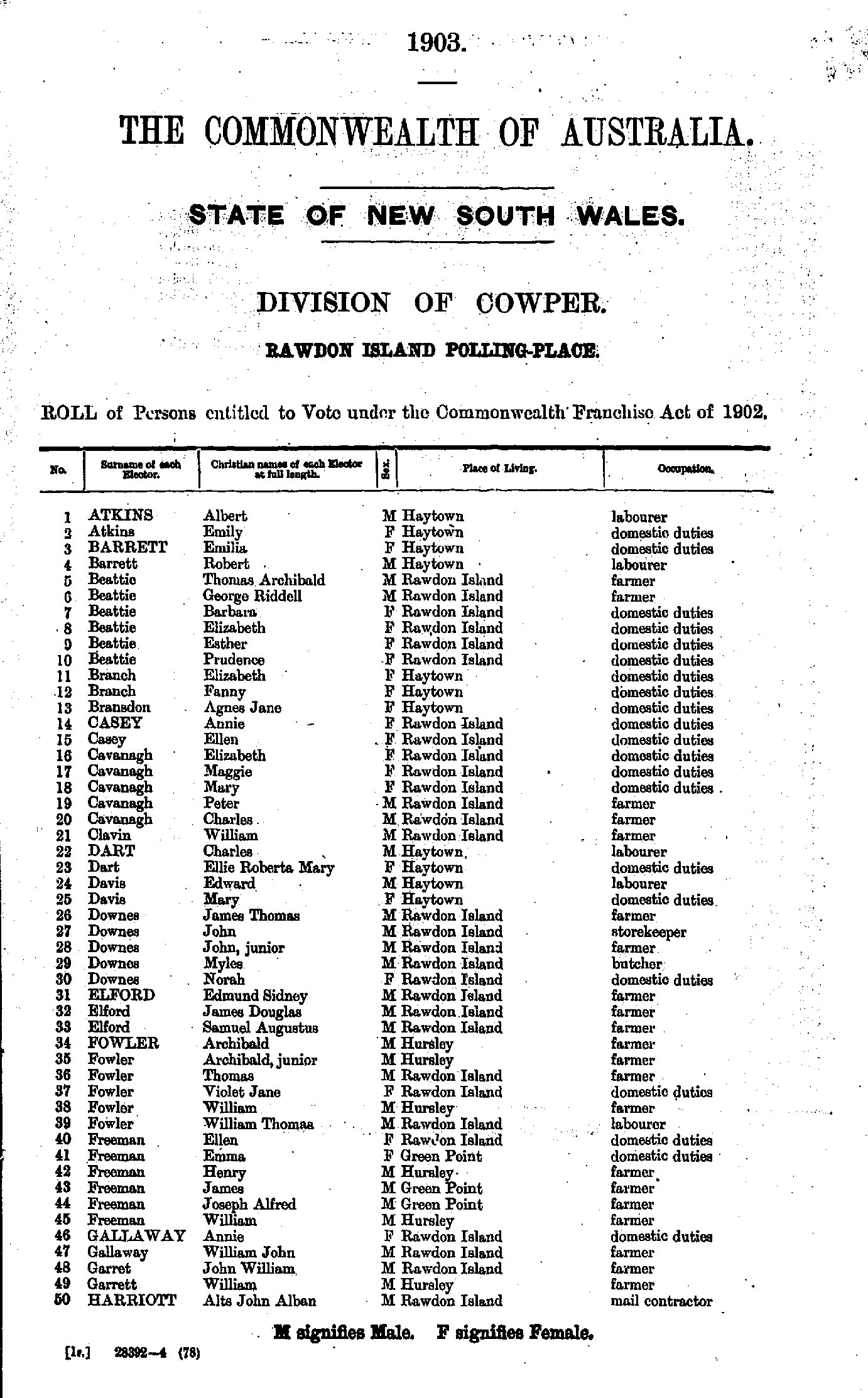
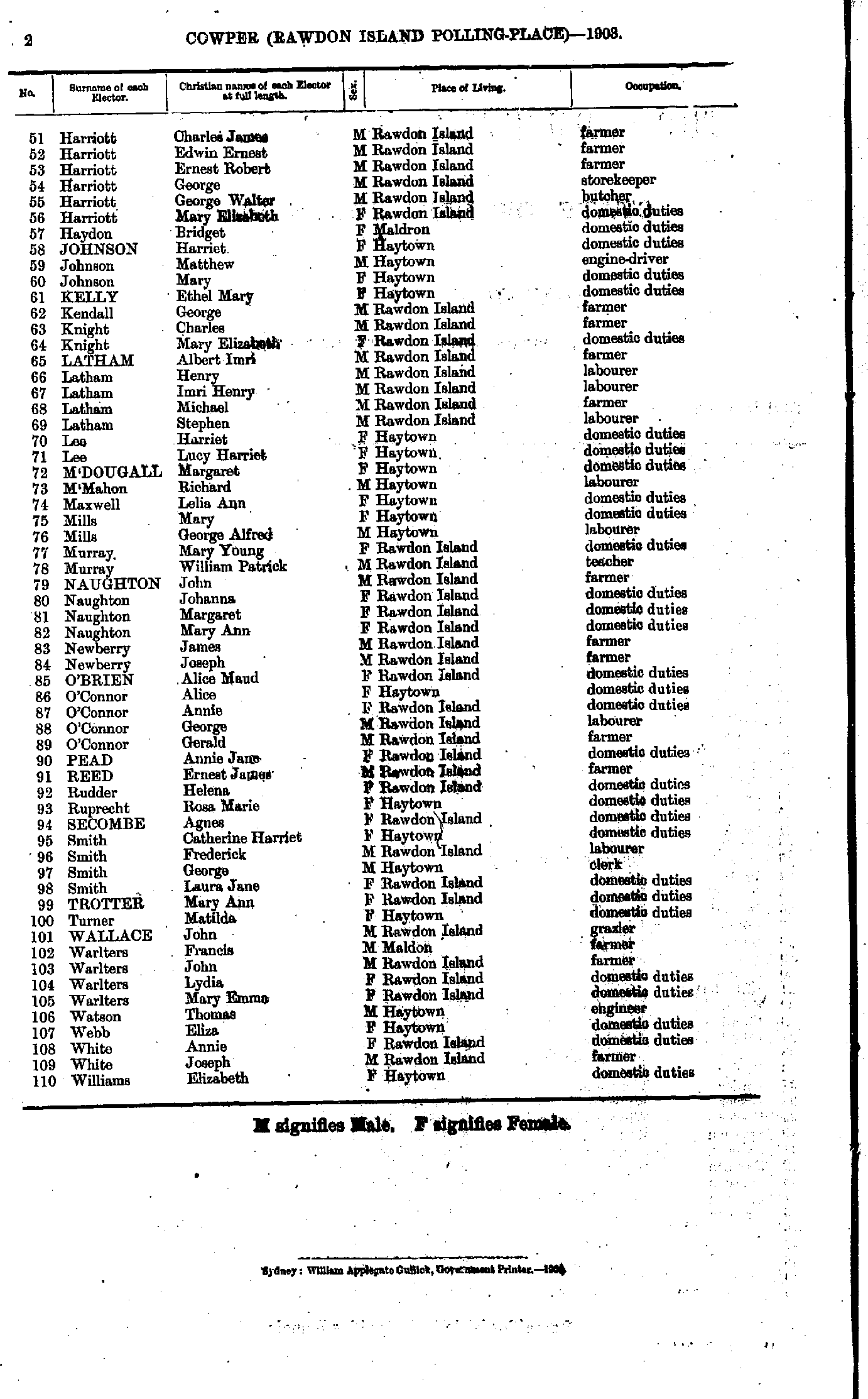
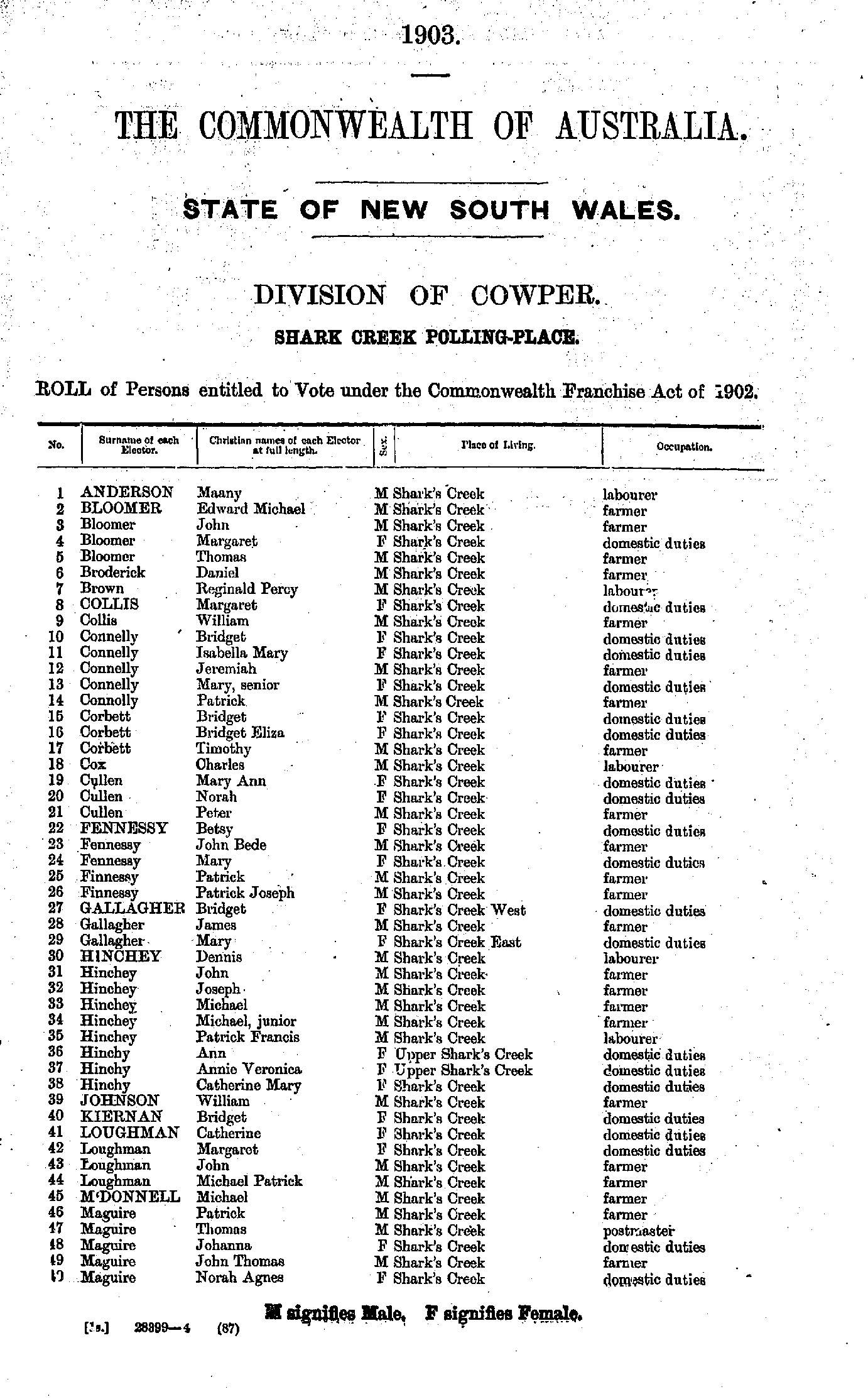
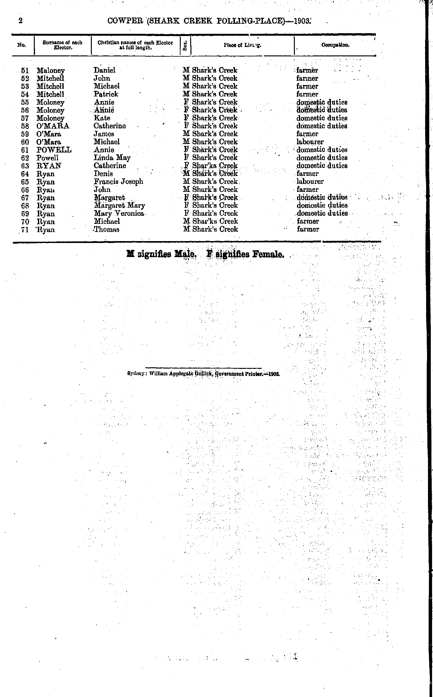
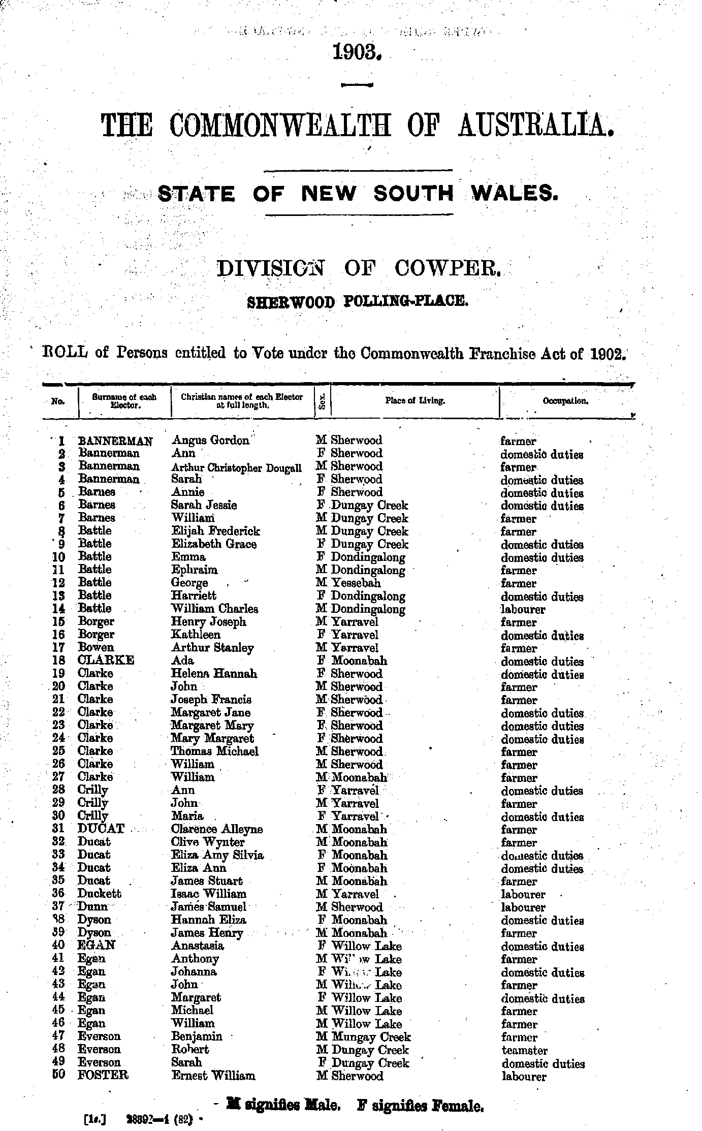
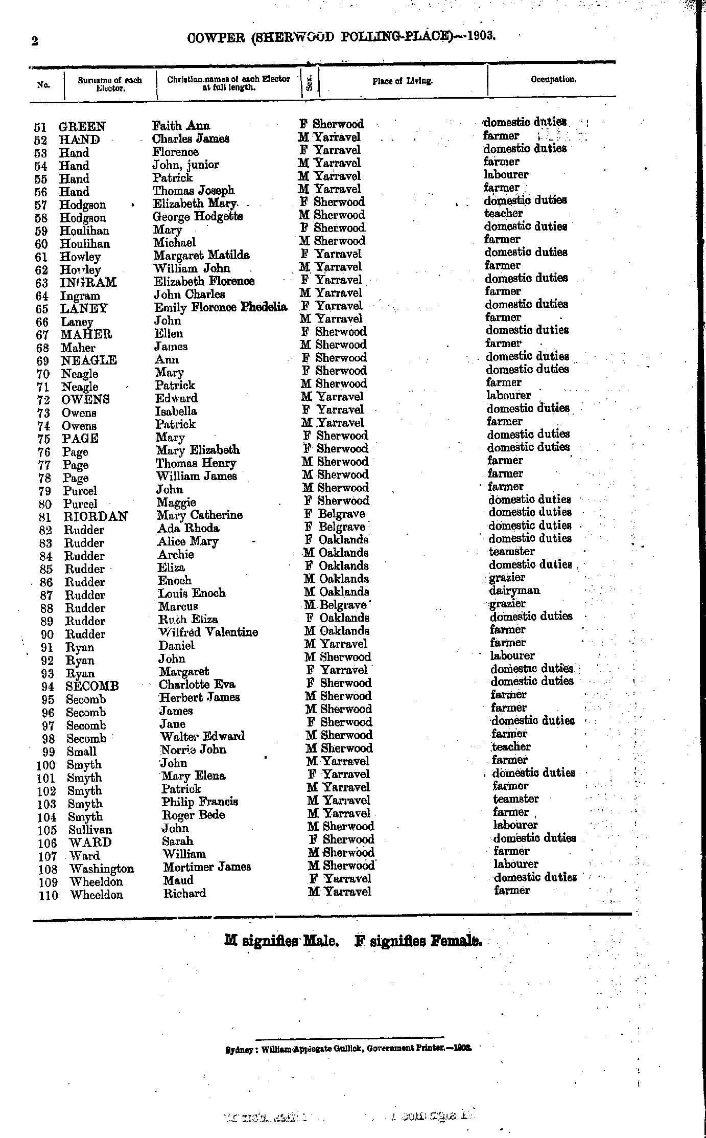
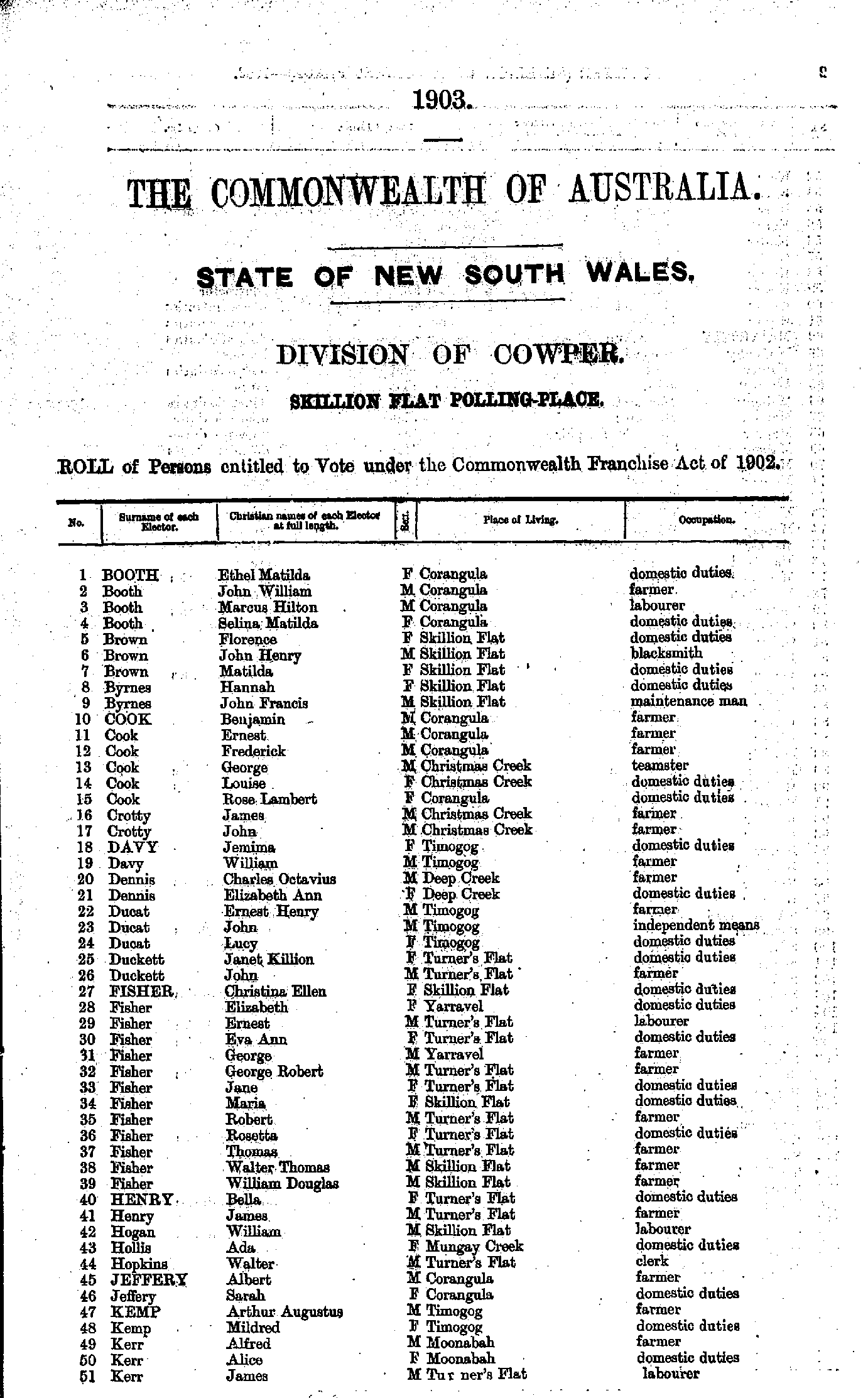
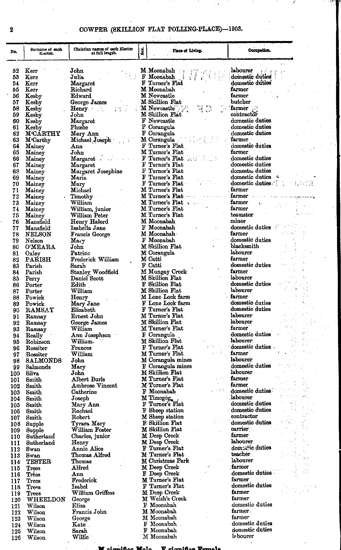
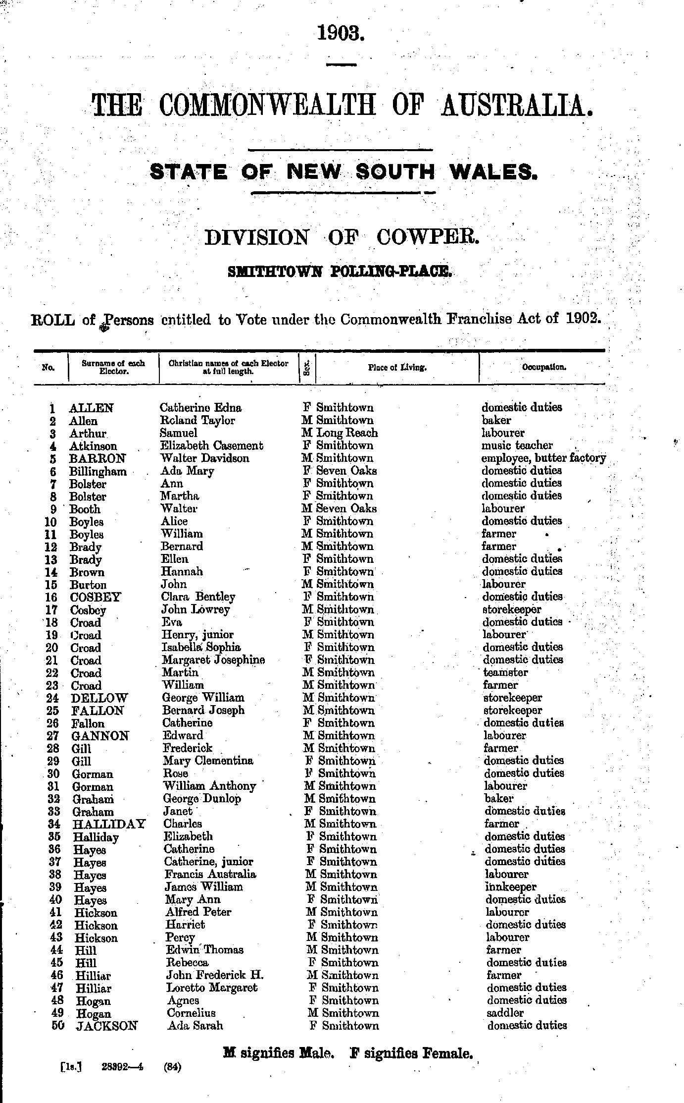
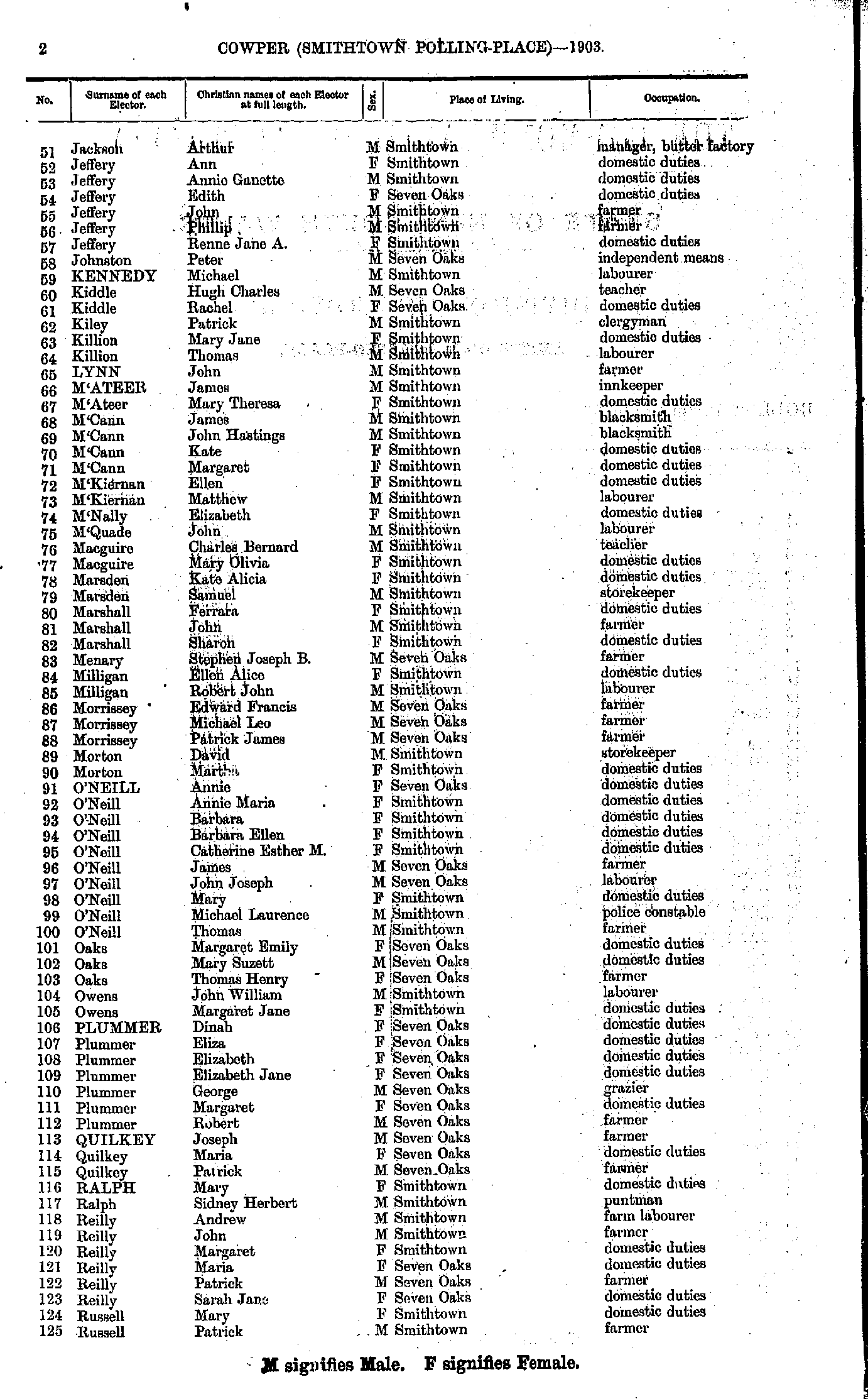
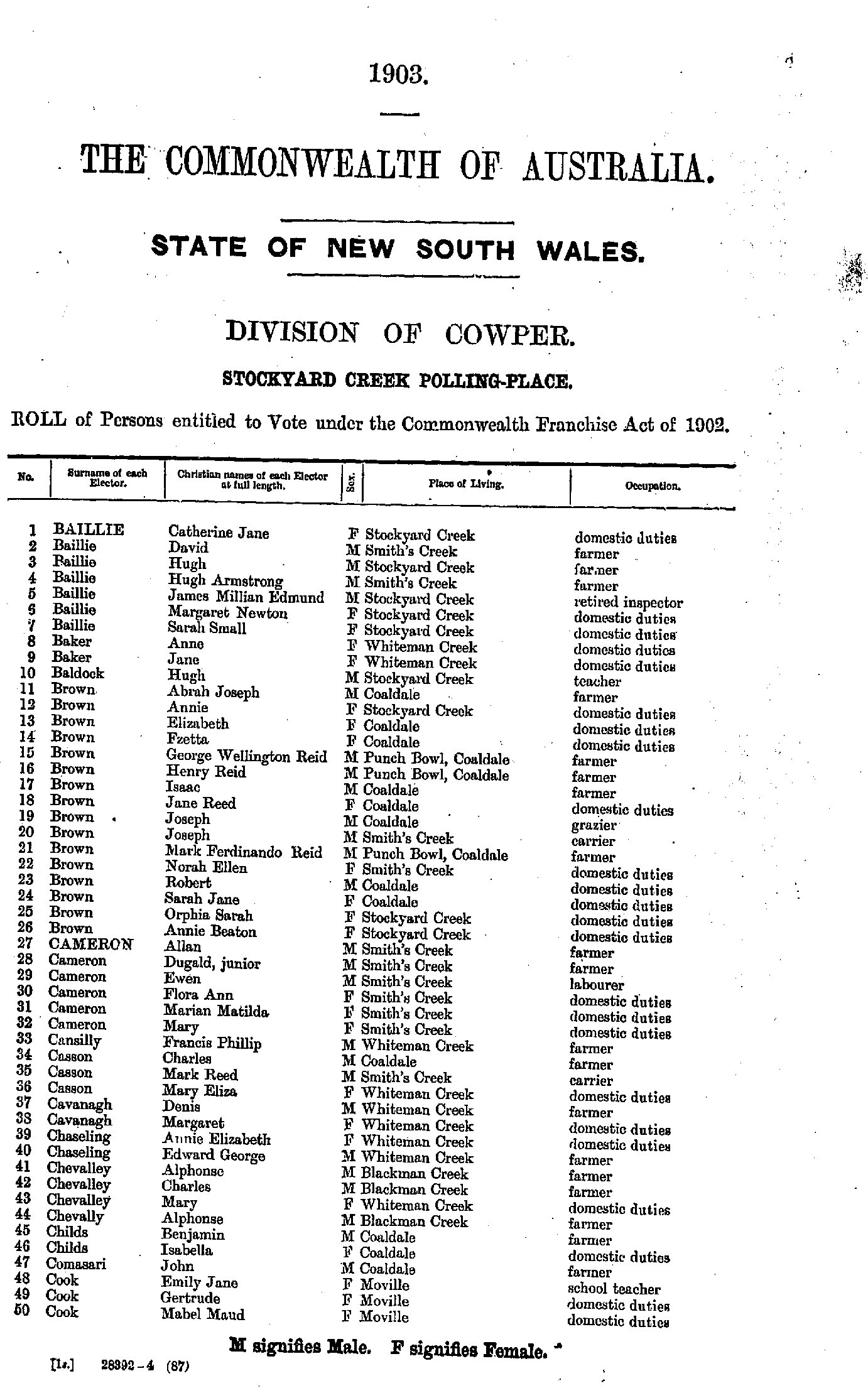
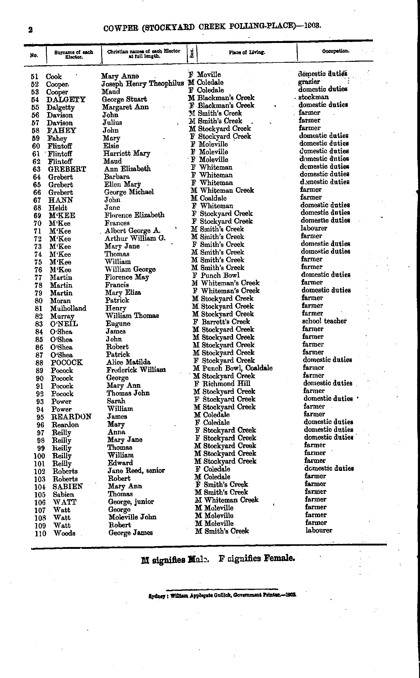
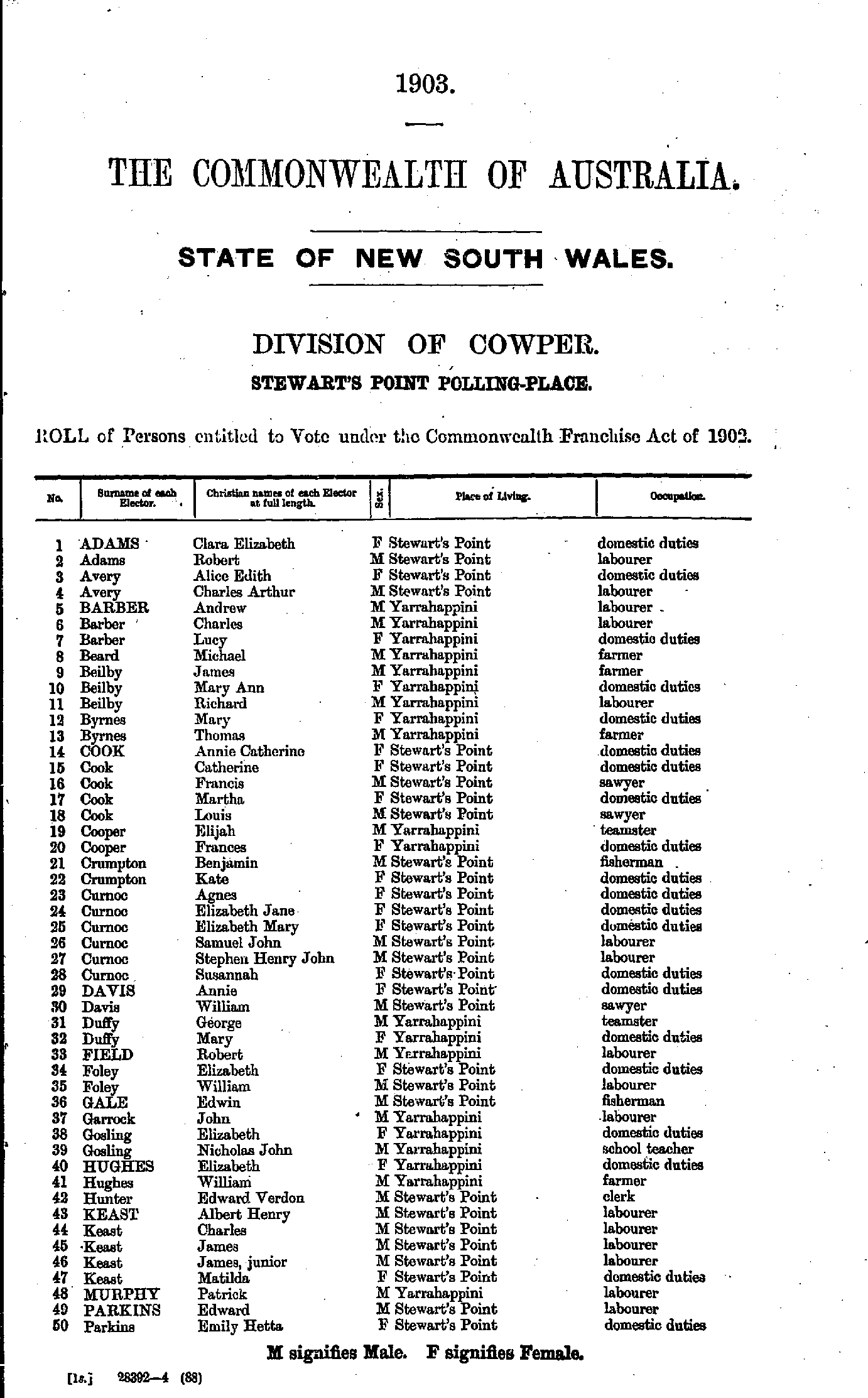
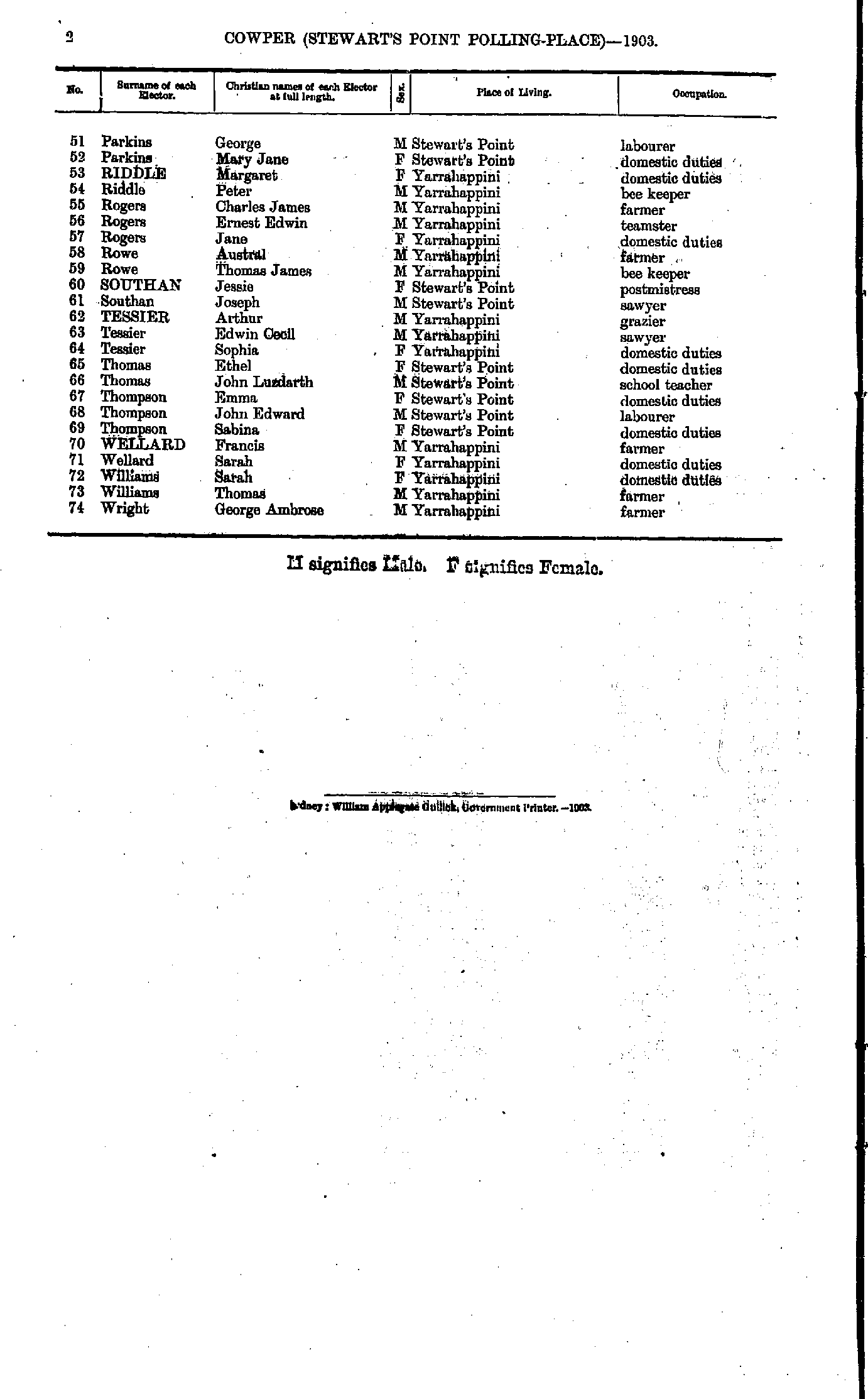
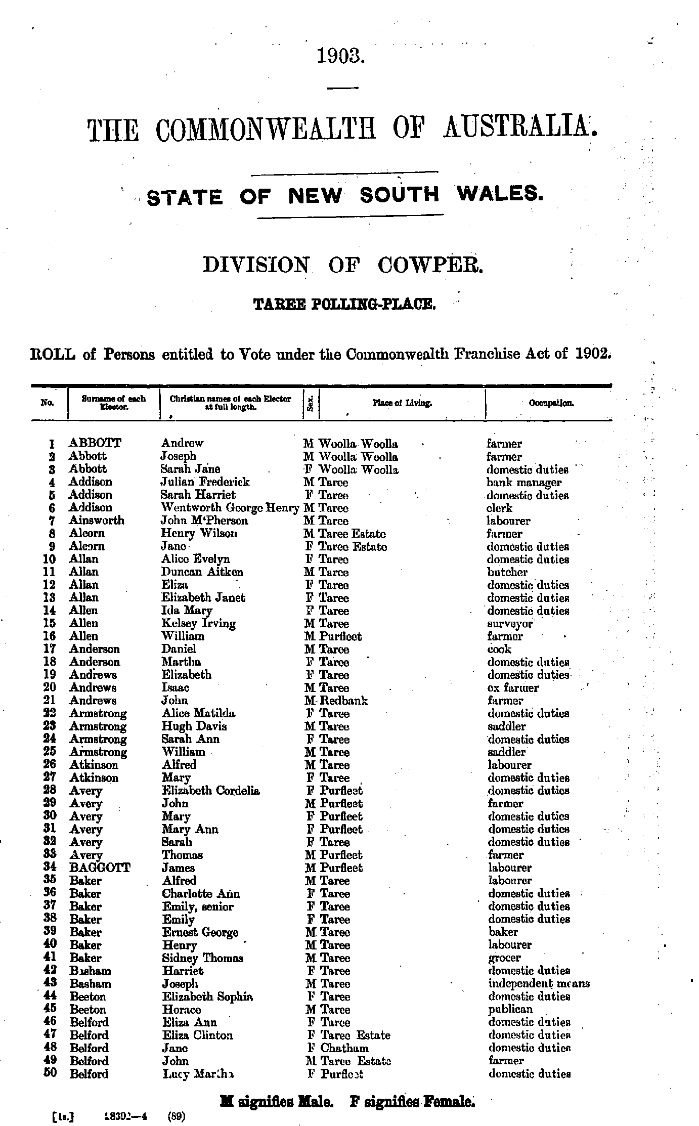
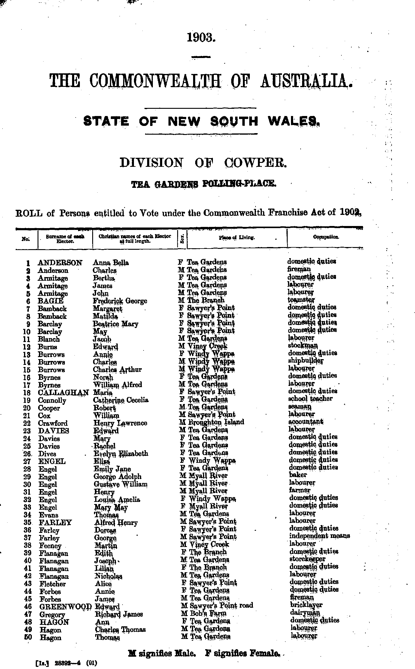
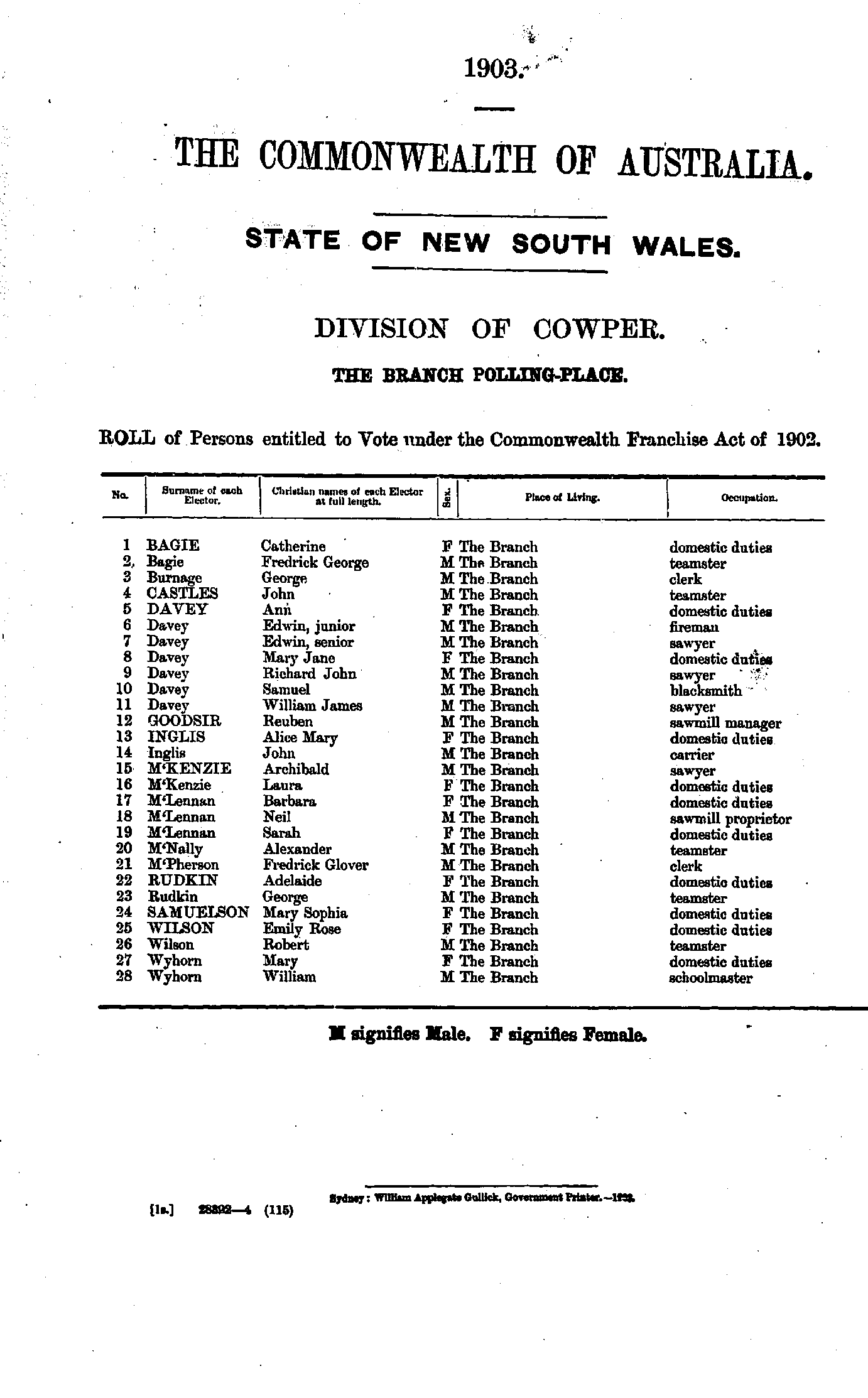
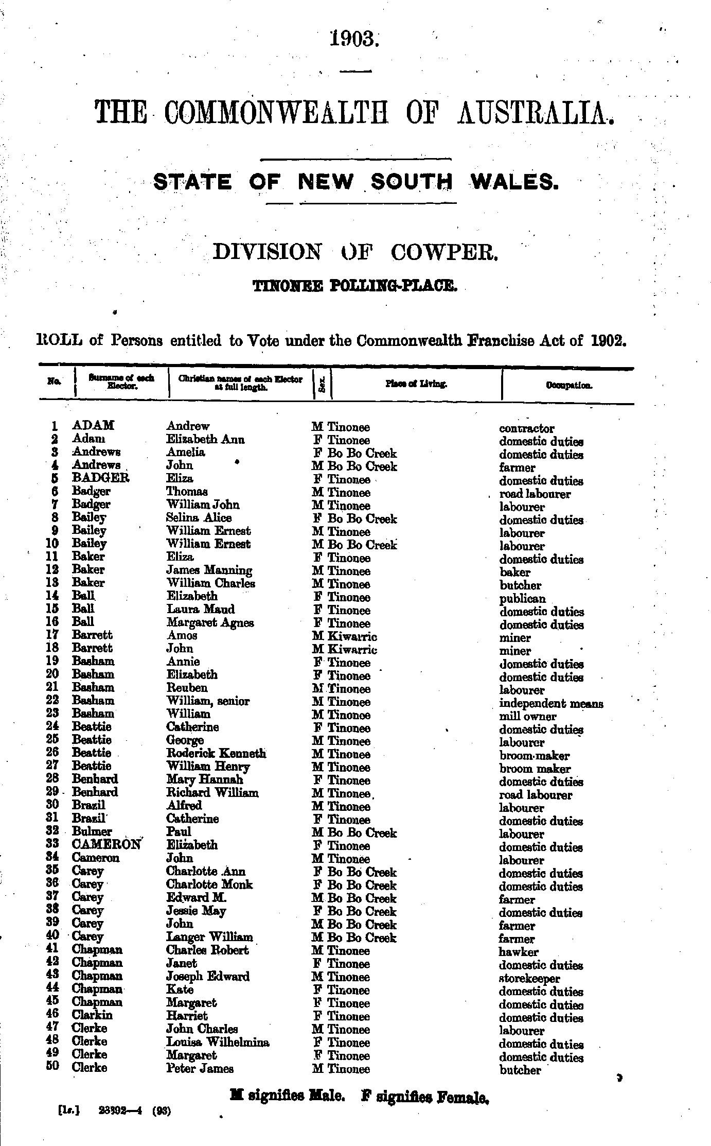
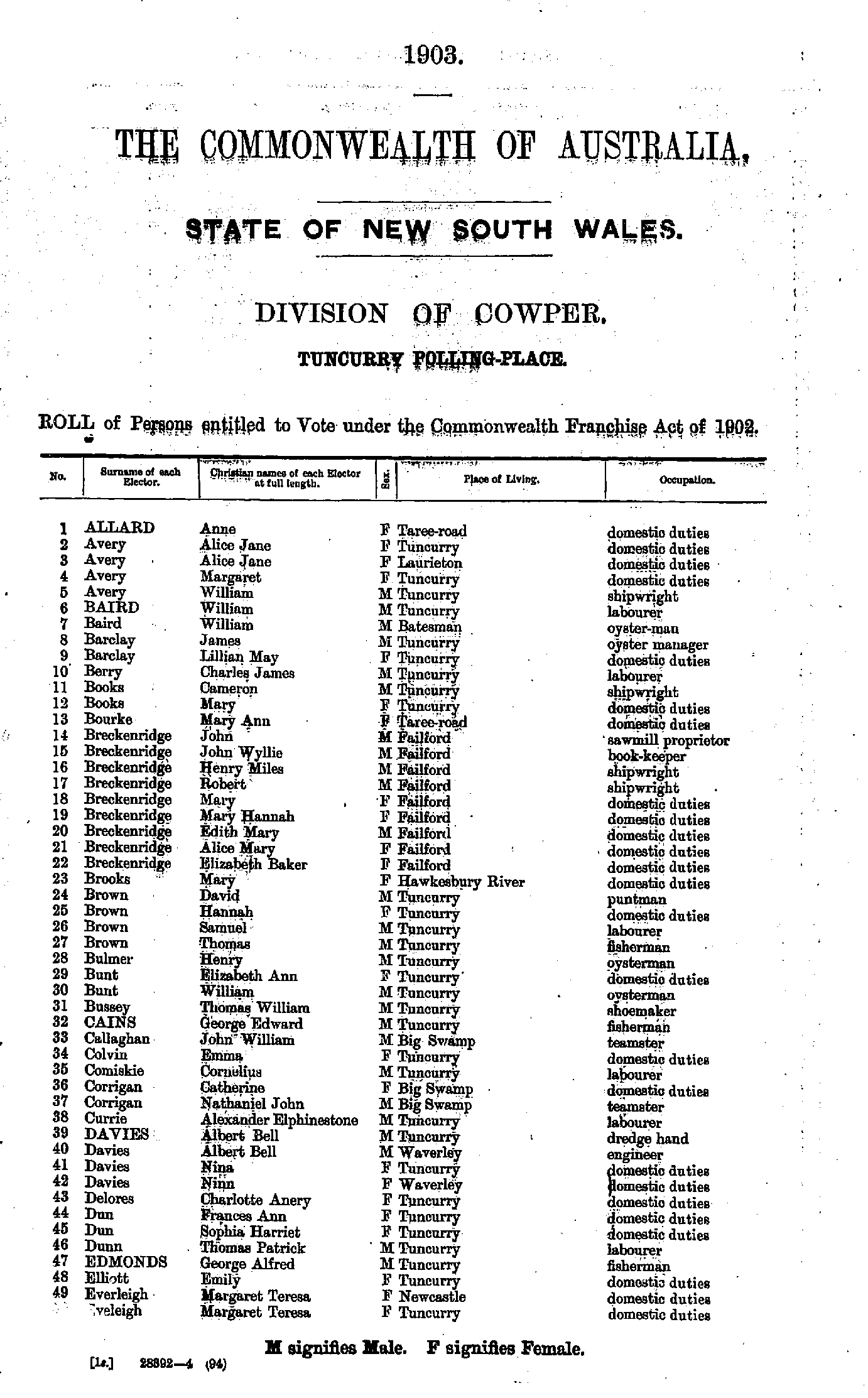
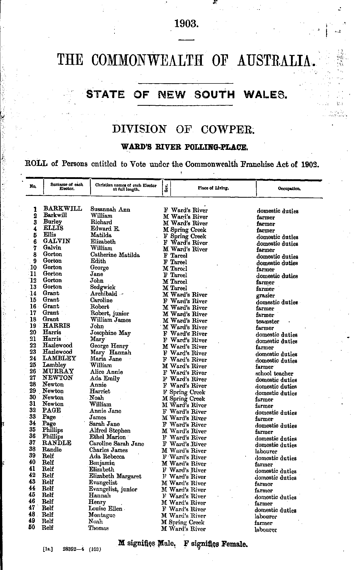
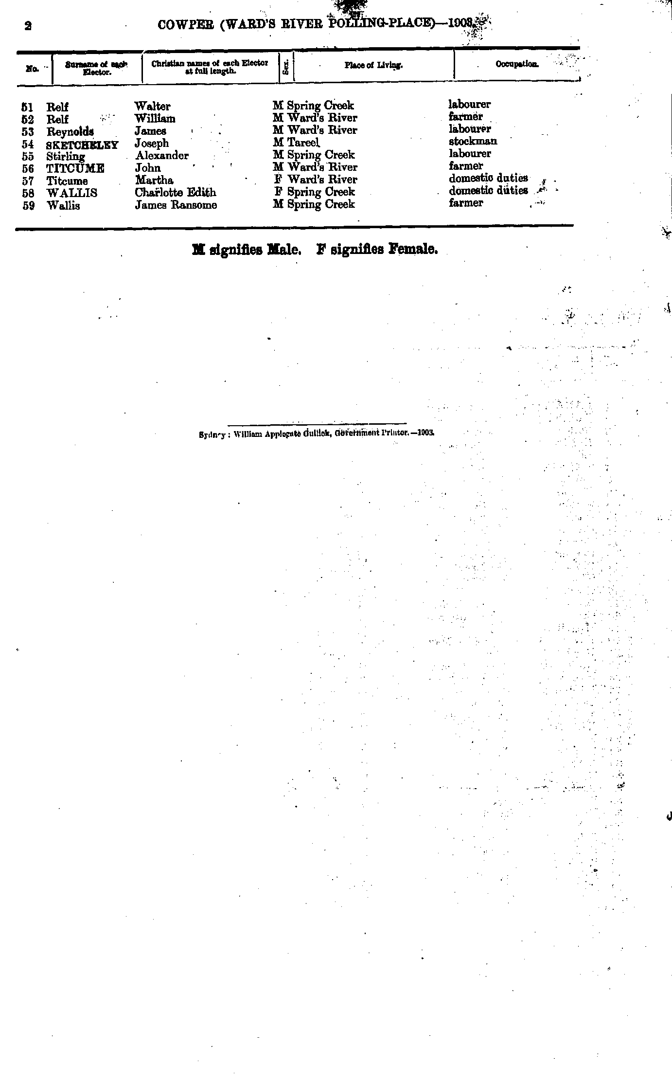
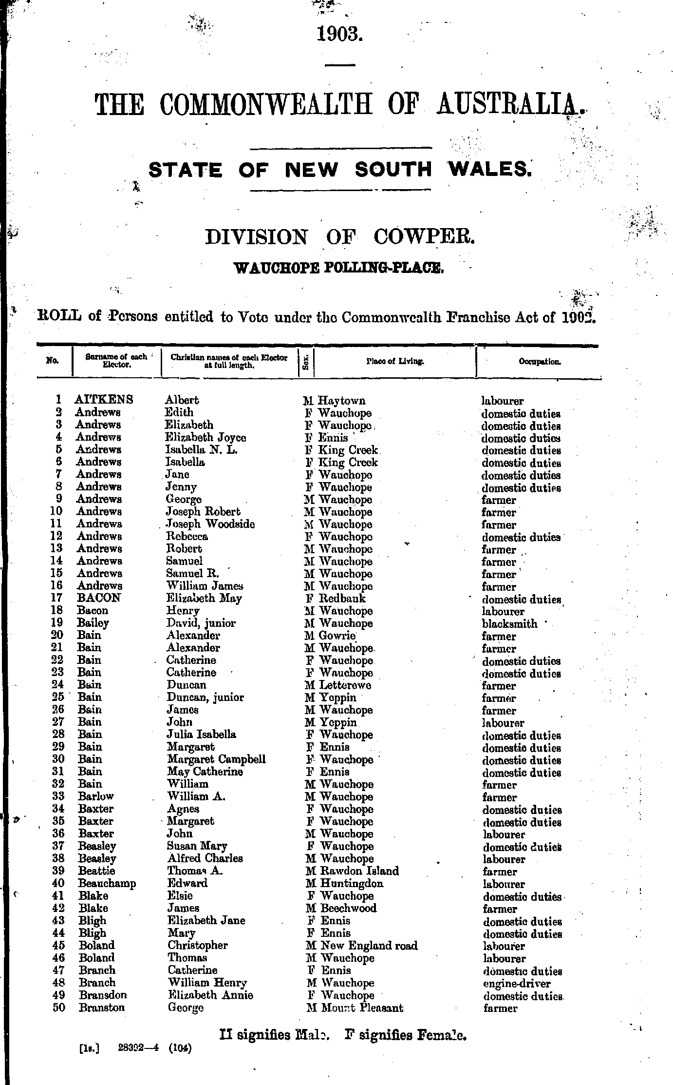
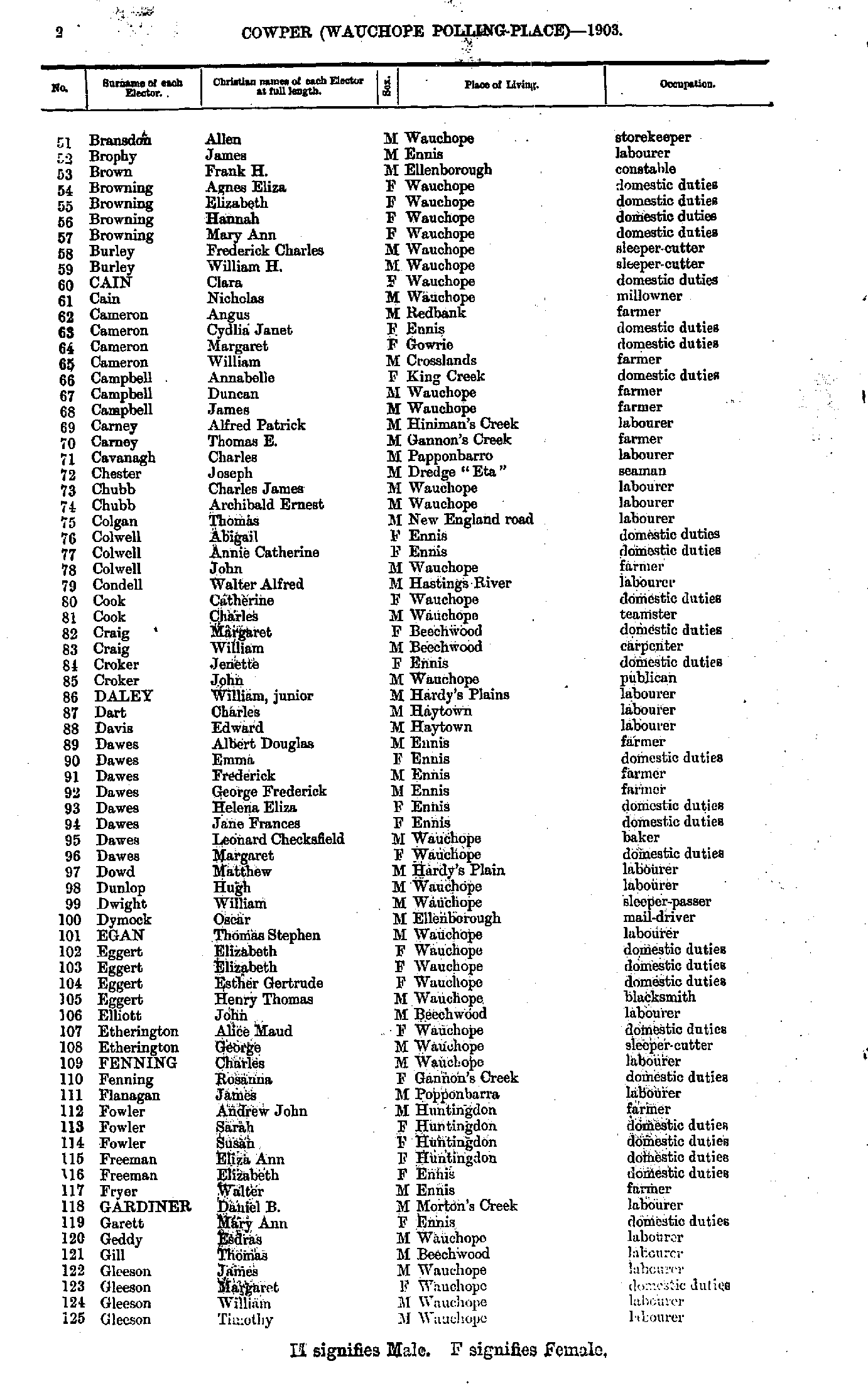
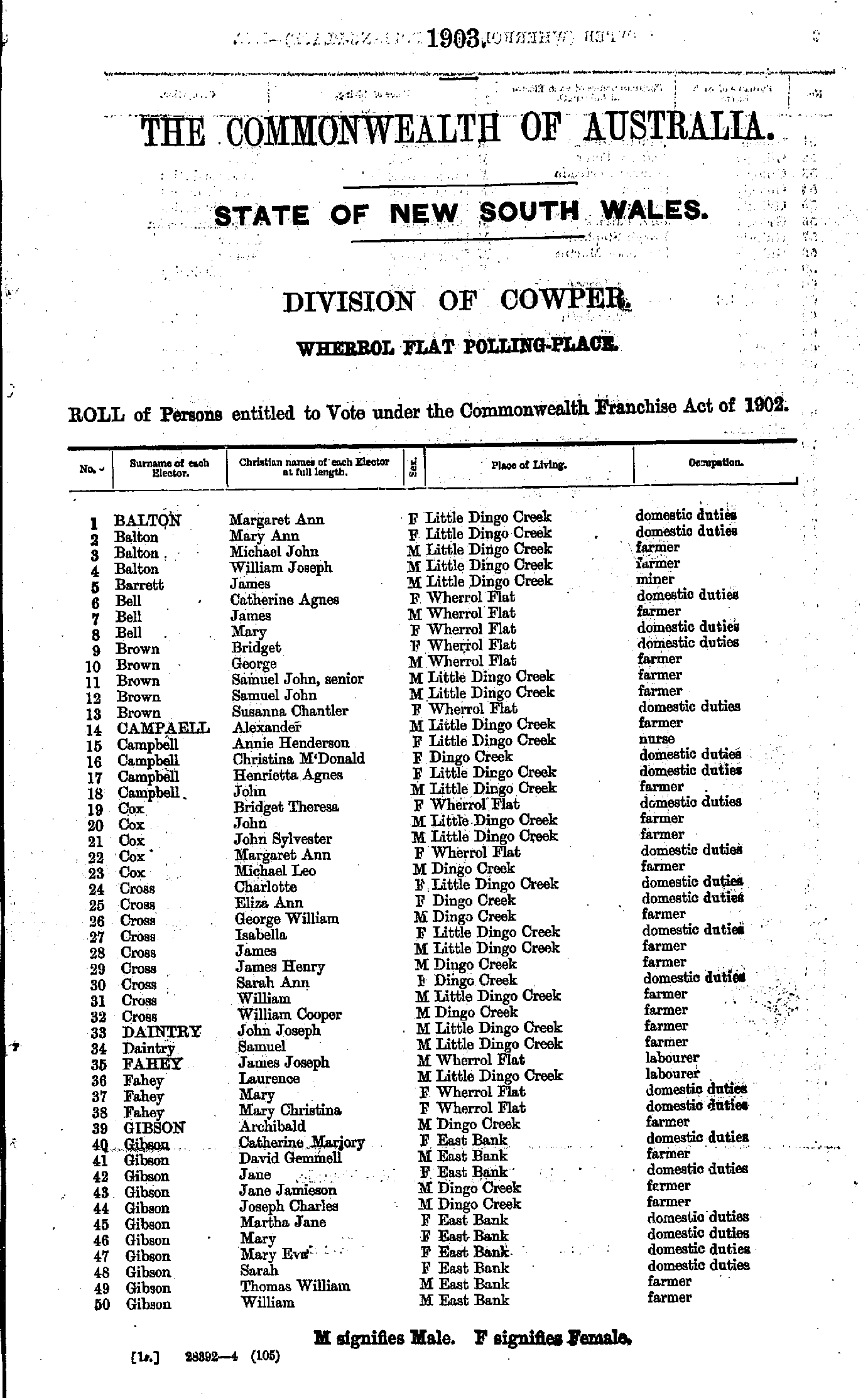
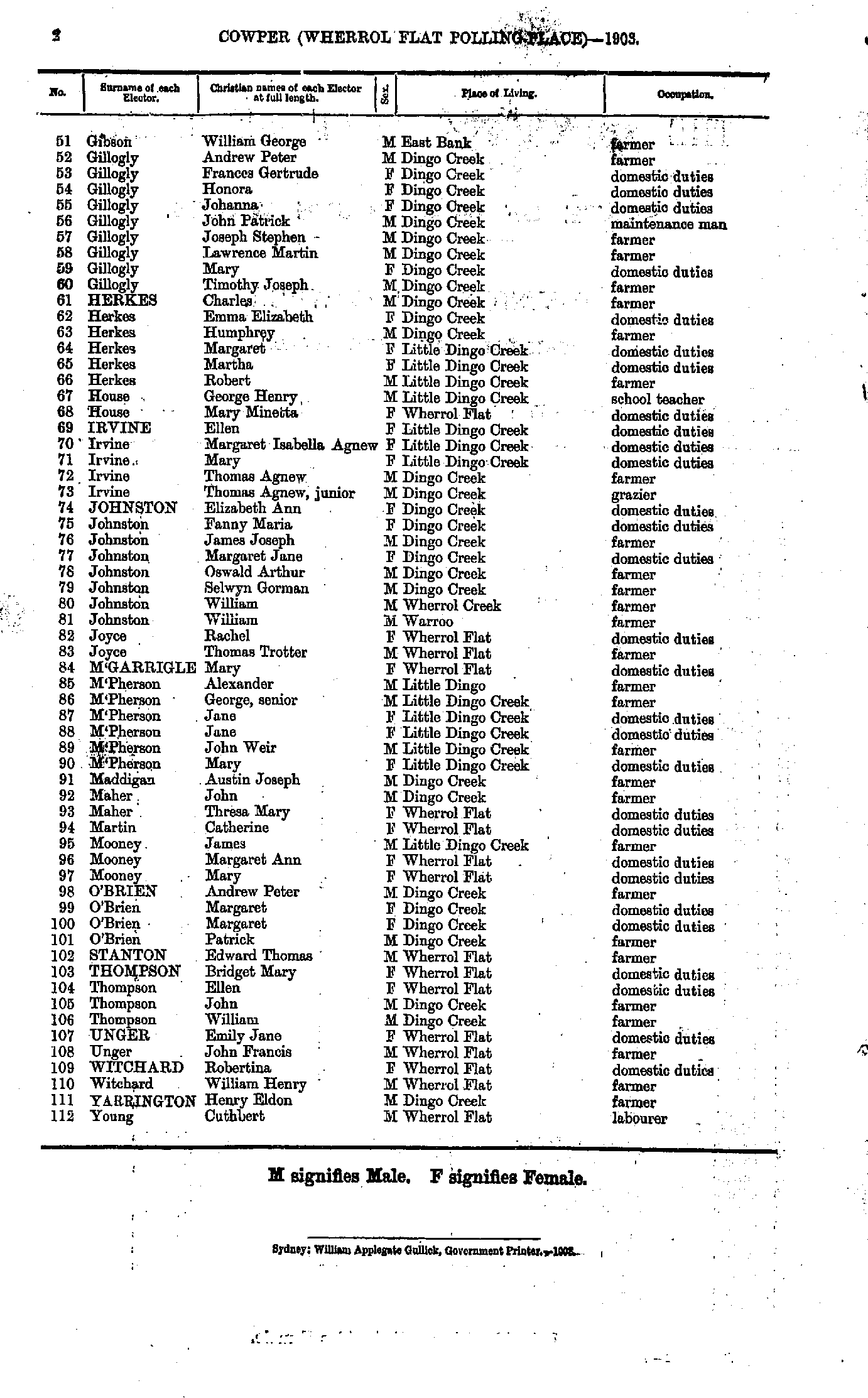
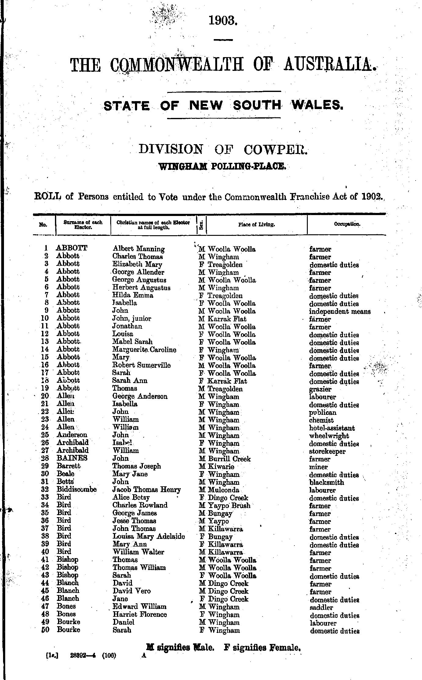
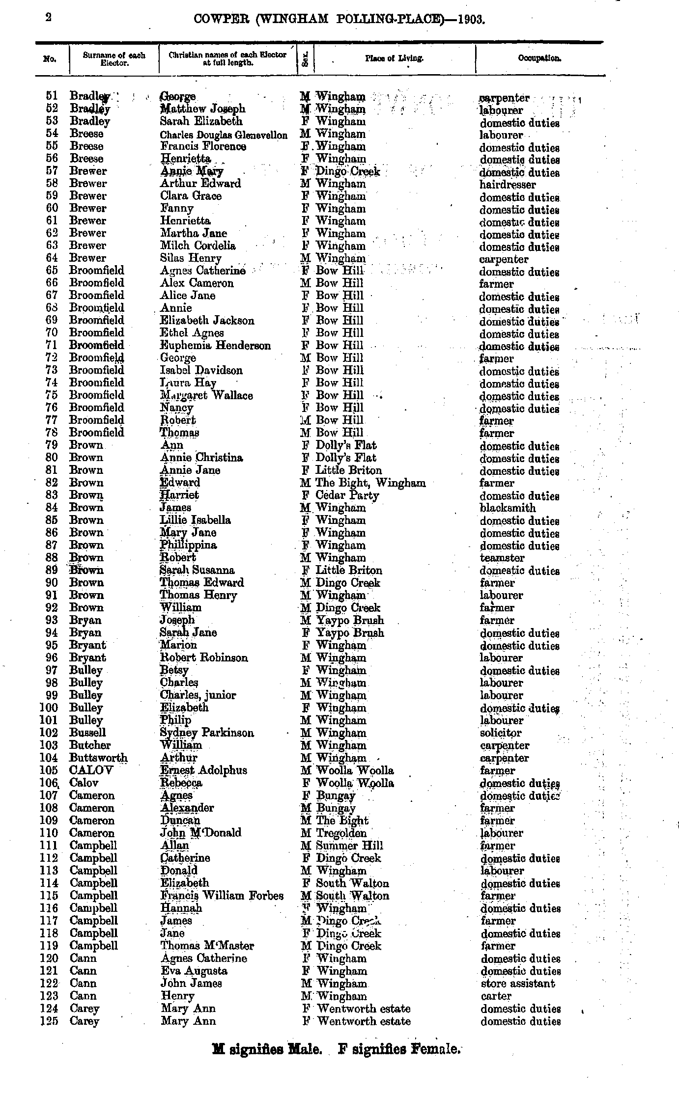
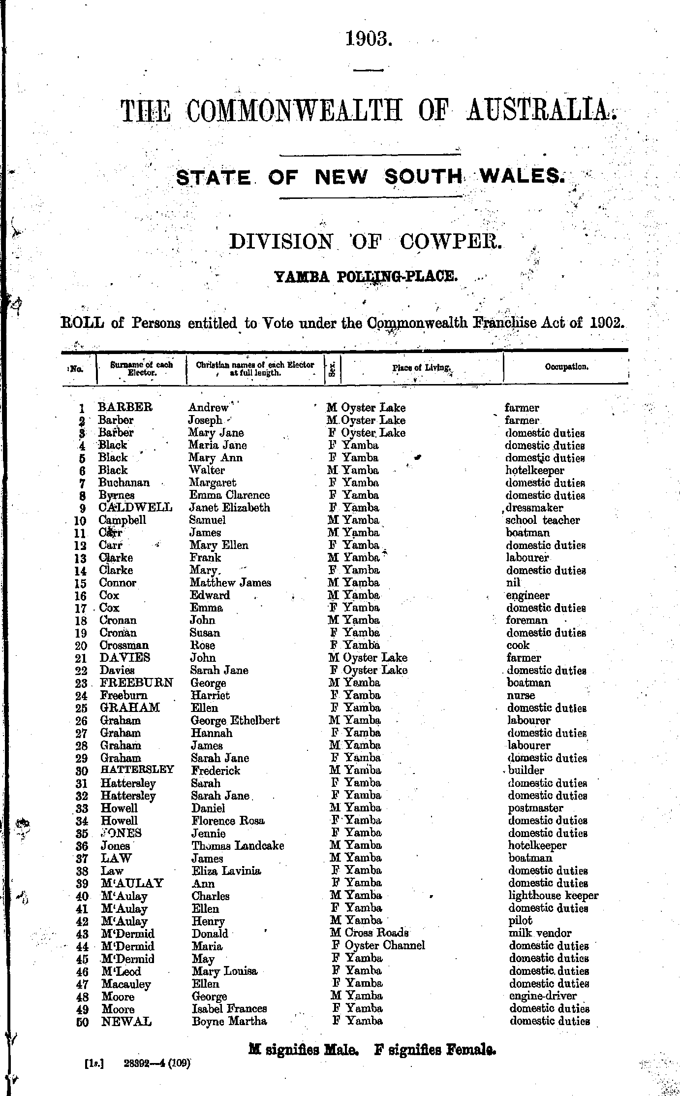
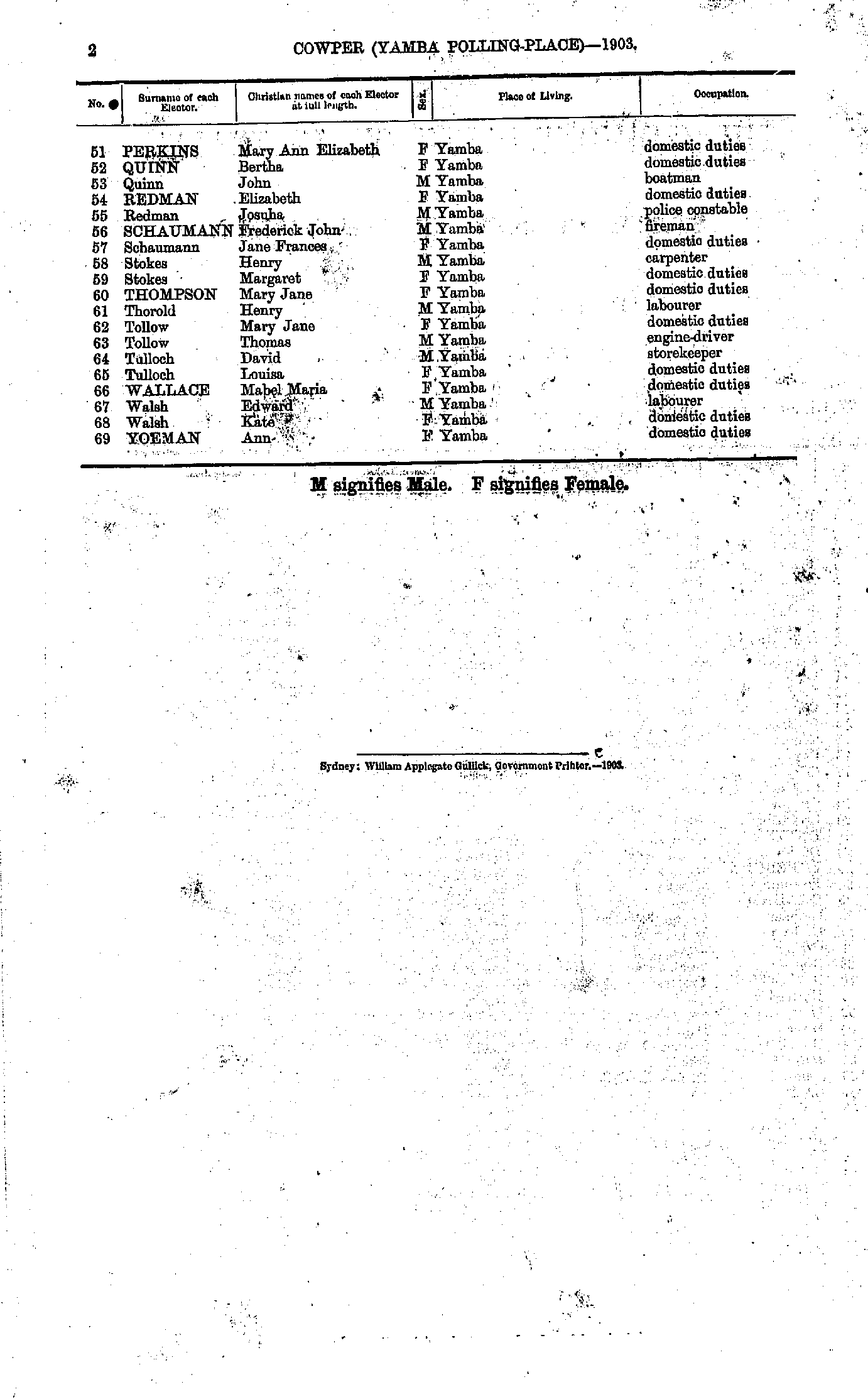
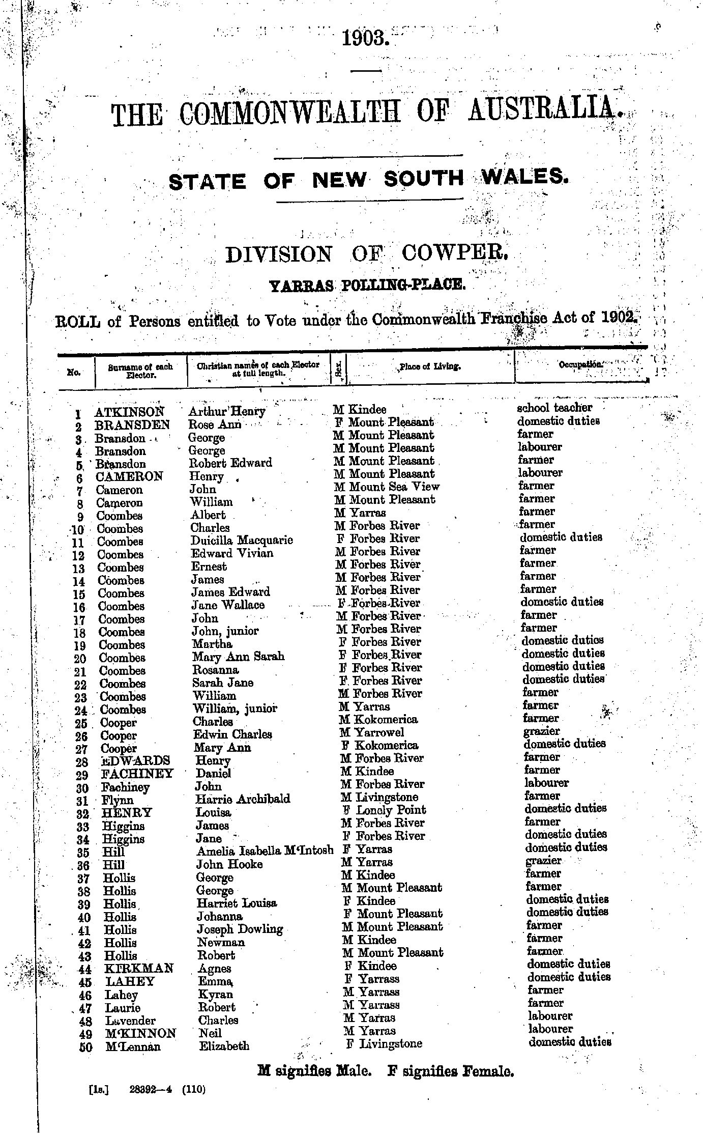
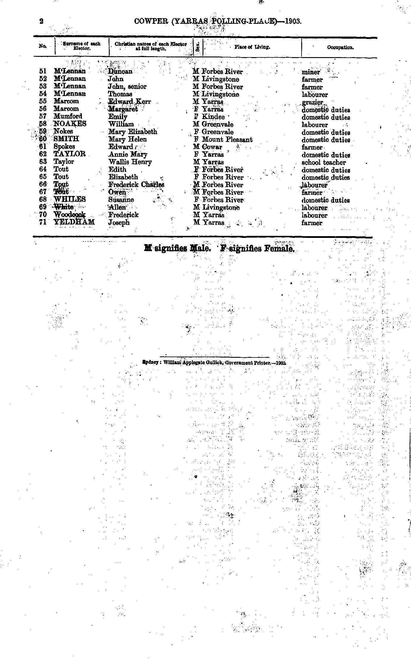
Roll of Persons entitled to Vote under the Commonwealth Franchise Act of 1902 Reproduced from microform copies of the originals in the Mitchell Library, State Library of New South Wales.
Index Copyright © Internet History Resources 2007
Electoral Maps of the Cowper Division, 1901
Polling Places:
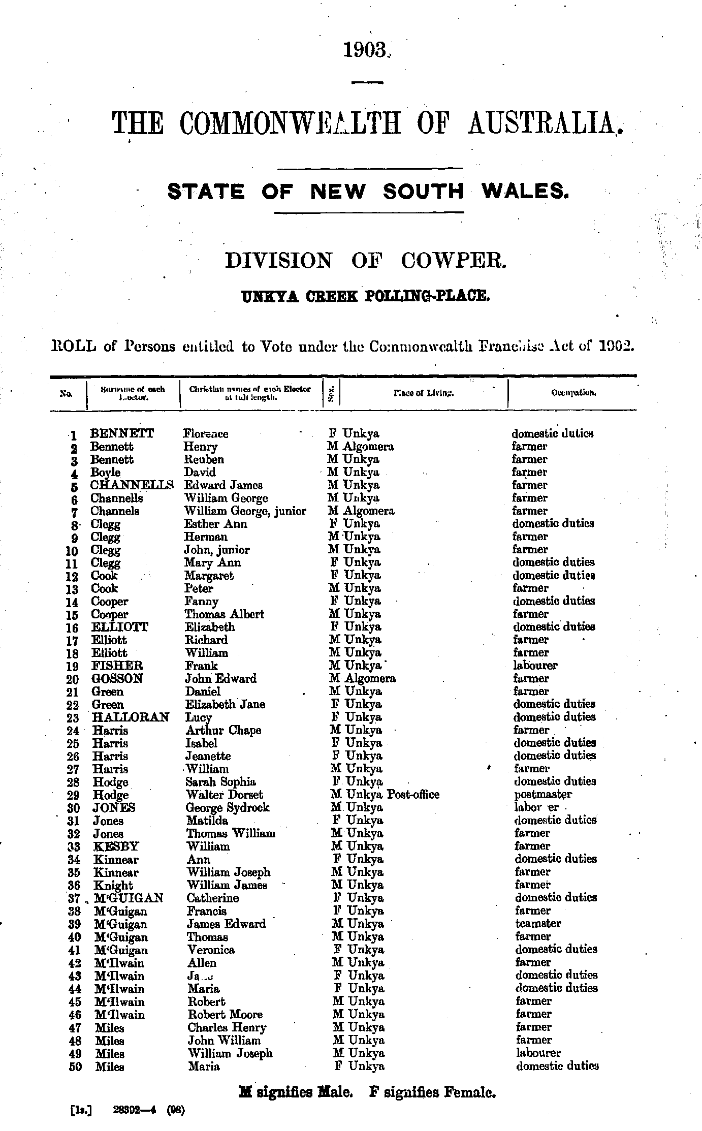
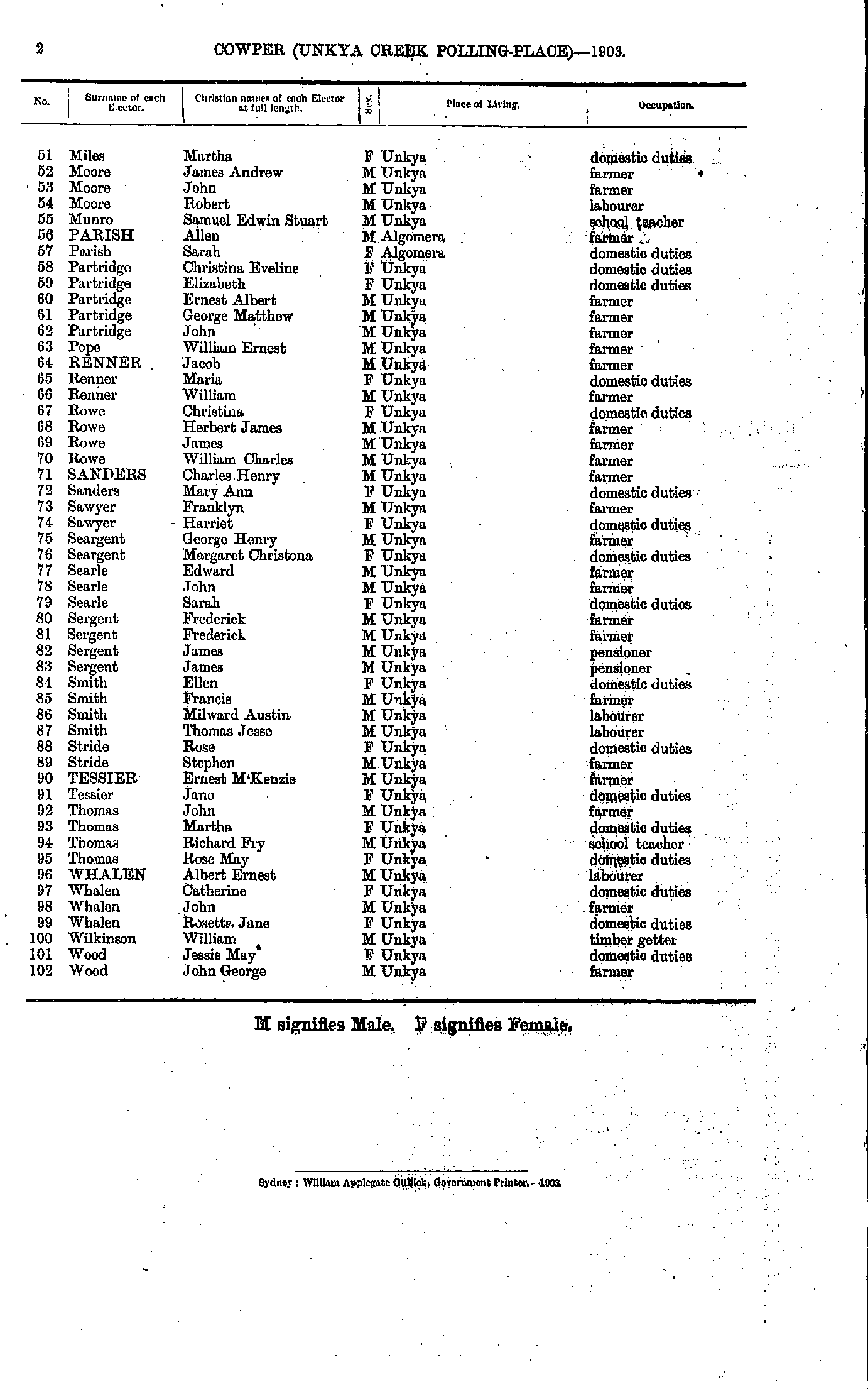
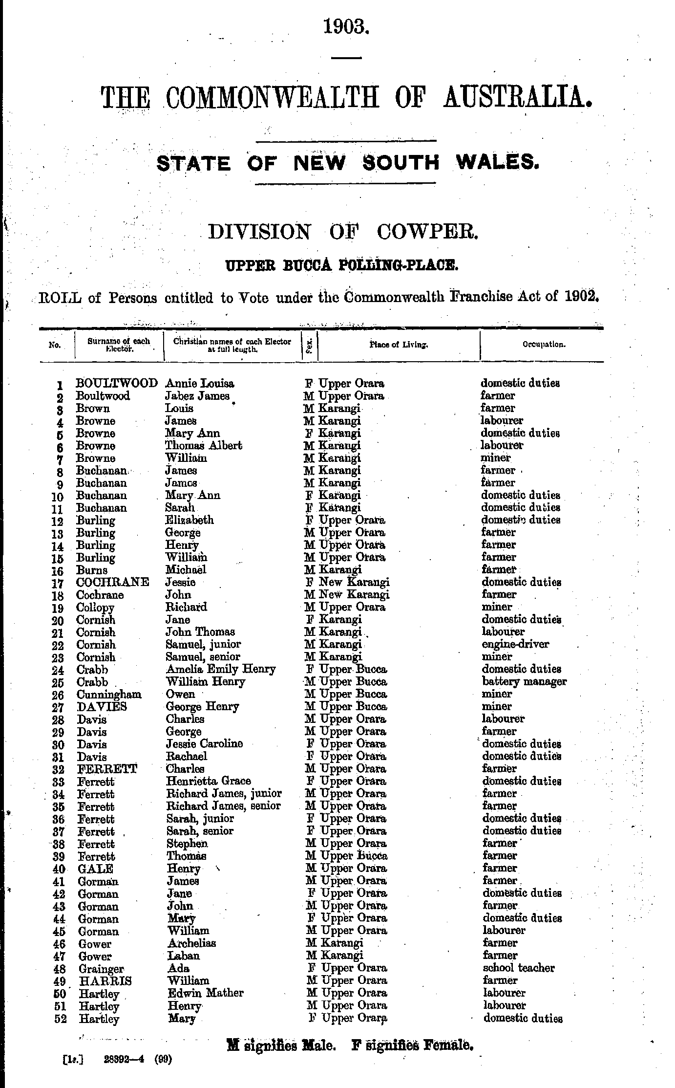
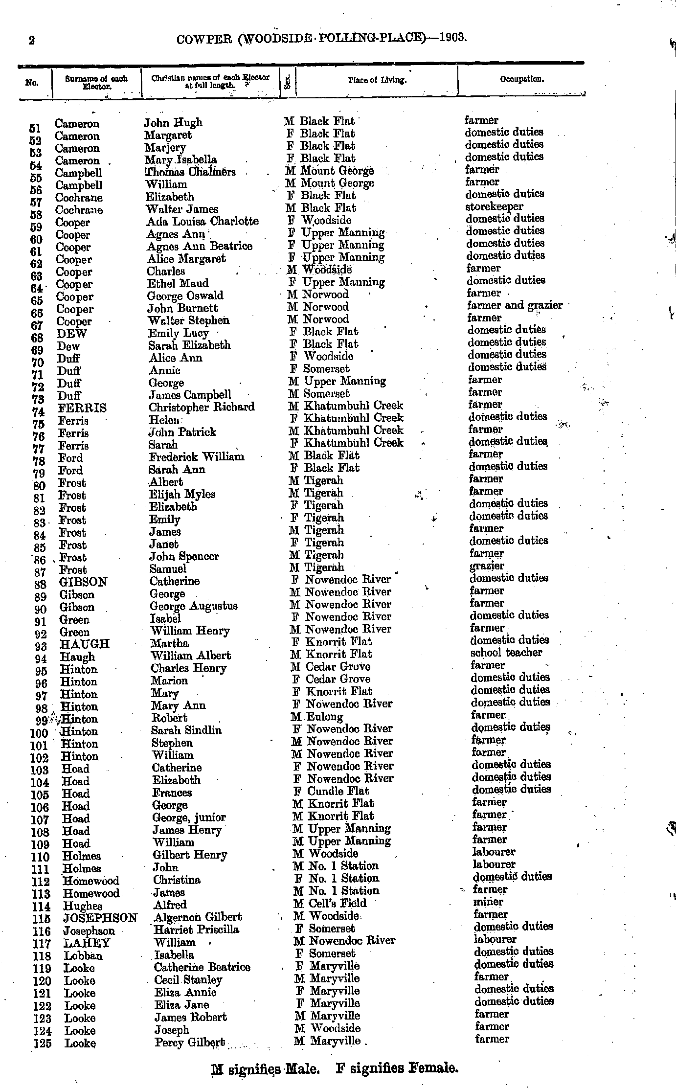
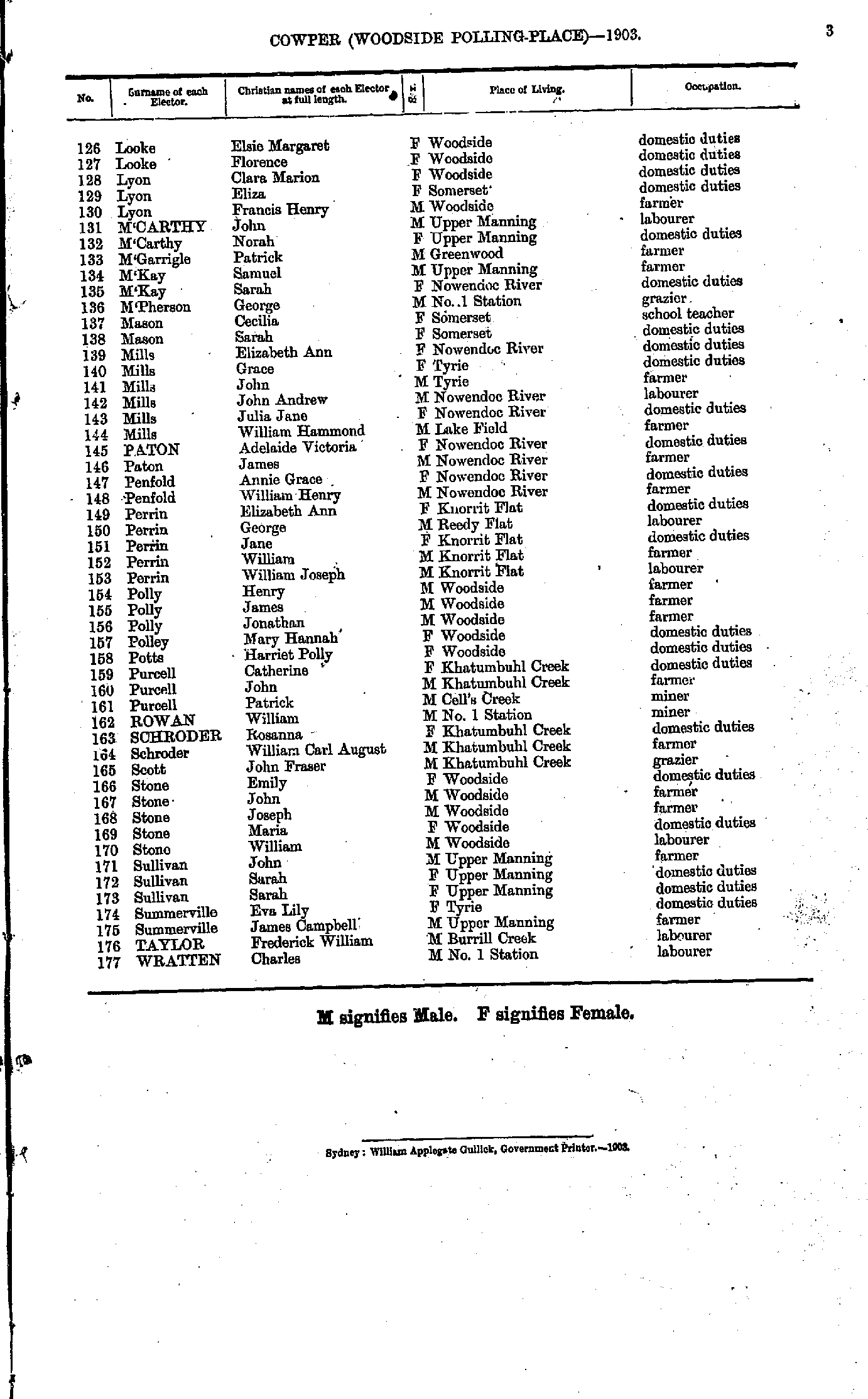
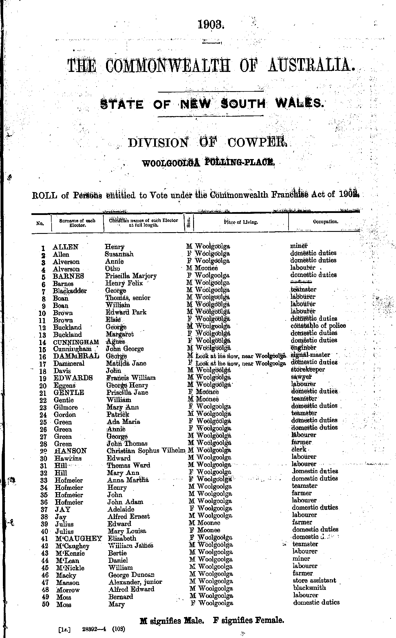
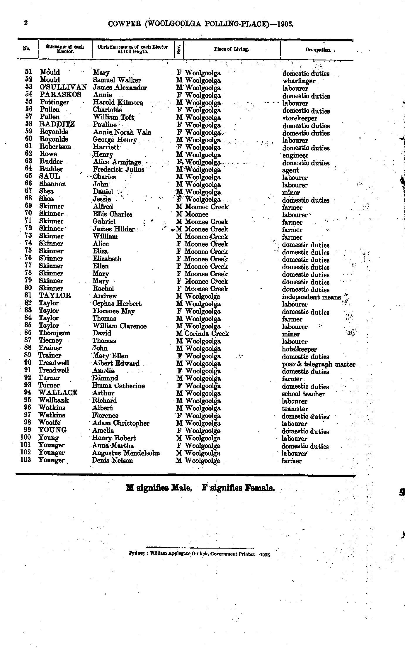
Argent's Hill | Barrington | Beechwood | Bellbrook | Bellingen | Bellinger Heads | Bowraville | Brushgrove | Bulahdelah | Bungwahl | Burragan | Cedar Party Creek | Central Orara | Chambigne | Chatsworth Island | Clarkson's Crossing | Clybucca | Coff's Harbour | Coldstream | Comara (five-day Creek) | Coolongolook | Coopernook | Copeland North | Copmanhurst | Coramba | Corindi | Coutt's Crossing | Croki | Cundletown | Curracabark | Dalmorton | Dorrigo | East Raleigh | Eatonsville | Ellenborough | Fernmount | Firefly Creek | Forster | Frederickton | Gannon's Creek | Gladstone | Glenreagh | Glenrock | Gloucester | Grafton | Greenhill | Halfway Creek | Harrington | Harwood Island | Hernani | Hickey's Creek | Holey Flat | Iluka | Jerseyville | Kangaroo Creek | Kauthi | Kempsey | Kendall | Kimbriki | Kinchela | Knorrit Flat | Kramback | Laurieton | Lawrence | Lower Bucca | Lower Wallamba | Macksville | Maclean | Marlee | Moparrabah | Murrayville | Nambucca Heads | Nana Glen | Never Never | Newton Boyd | Nymboida | Oxley Island | Palmer's Island | Port Macquarie | Ramornie | Rawden Vale | Rawdon Island | Rolland's Plains | Shark Creek | Sherwood | Skillion Flat | Smithtown | Southgate | South Grafton | Stockyard Creek | Stewart's Point | Taree | Taylor's Arm | Tea Gardens | Telegraph Point | The Branch | Tinonee | Tuncurry | Tyndale | Tyringham | Ulmarra | Unkya Creek | Upper Bucca | Upper Gloucester River | Upper Lansdowne | Upper Myall | Uralgurra | Ward's River | Wauchope | Wherrol Flat | Wingham | Woodside | Woolgoolga | Yamba | Yarras | Yugilbar (late Lionsville)
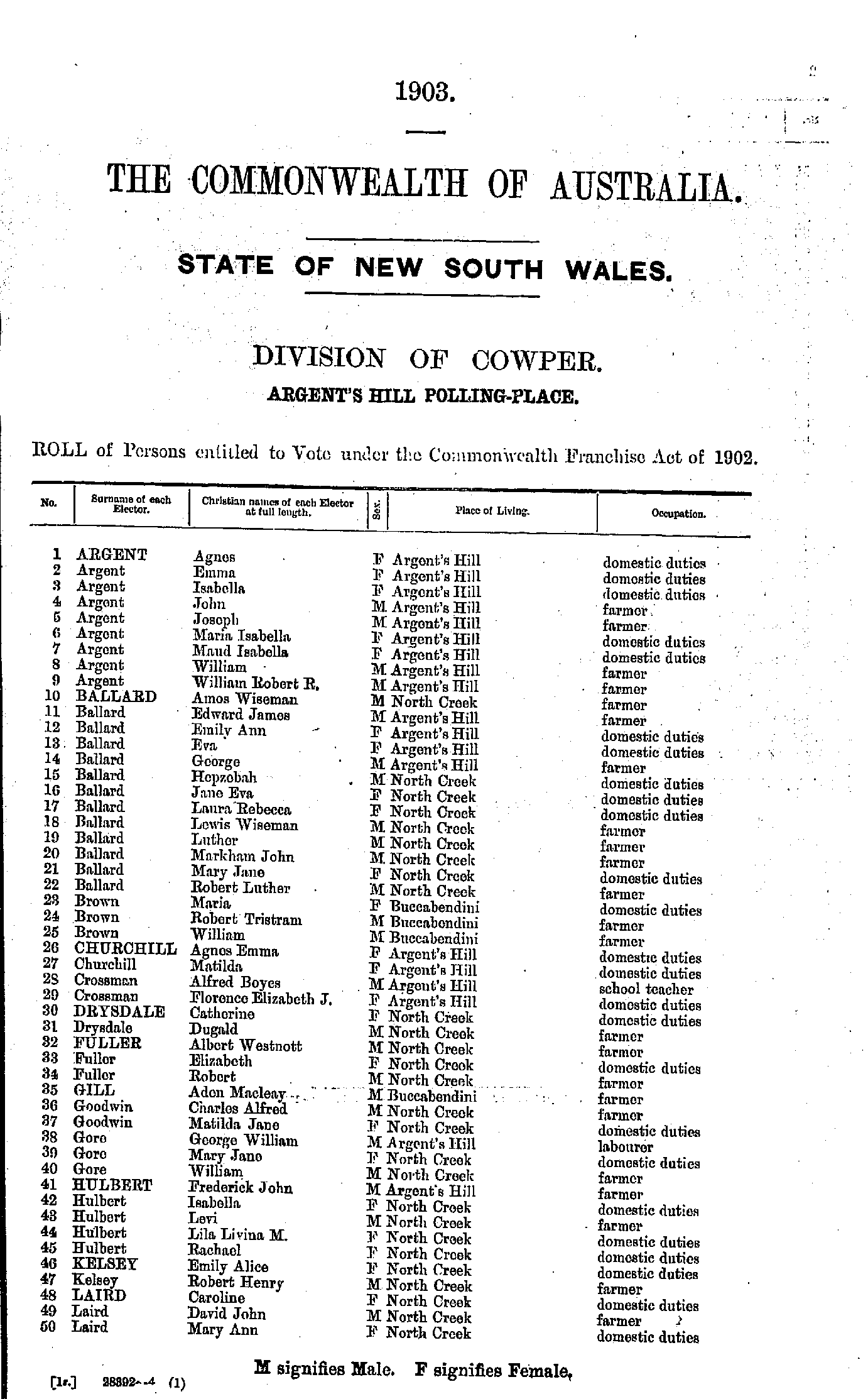
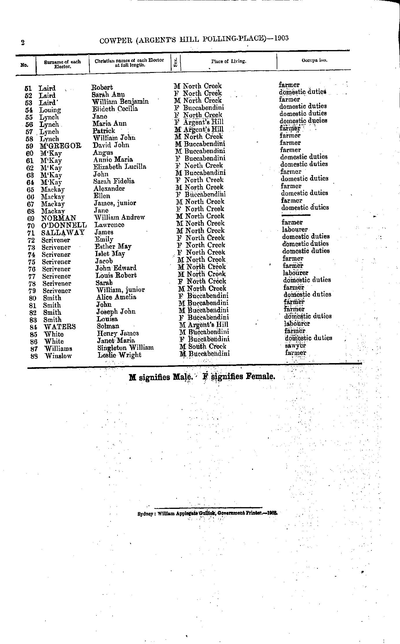
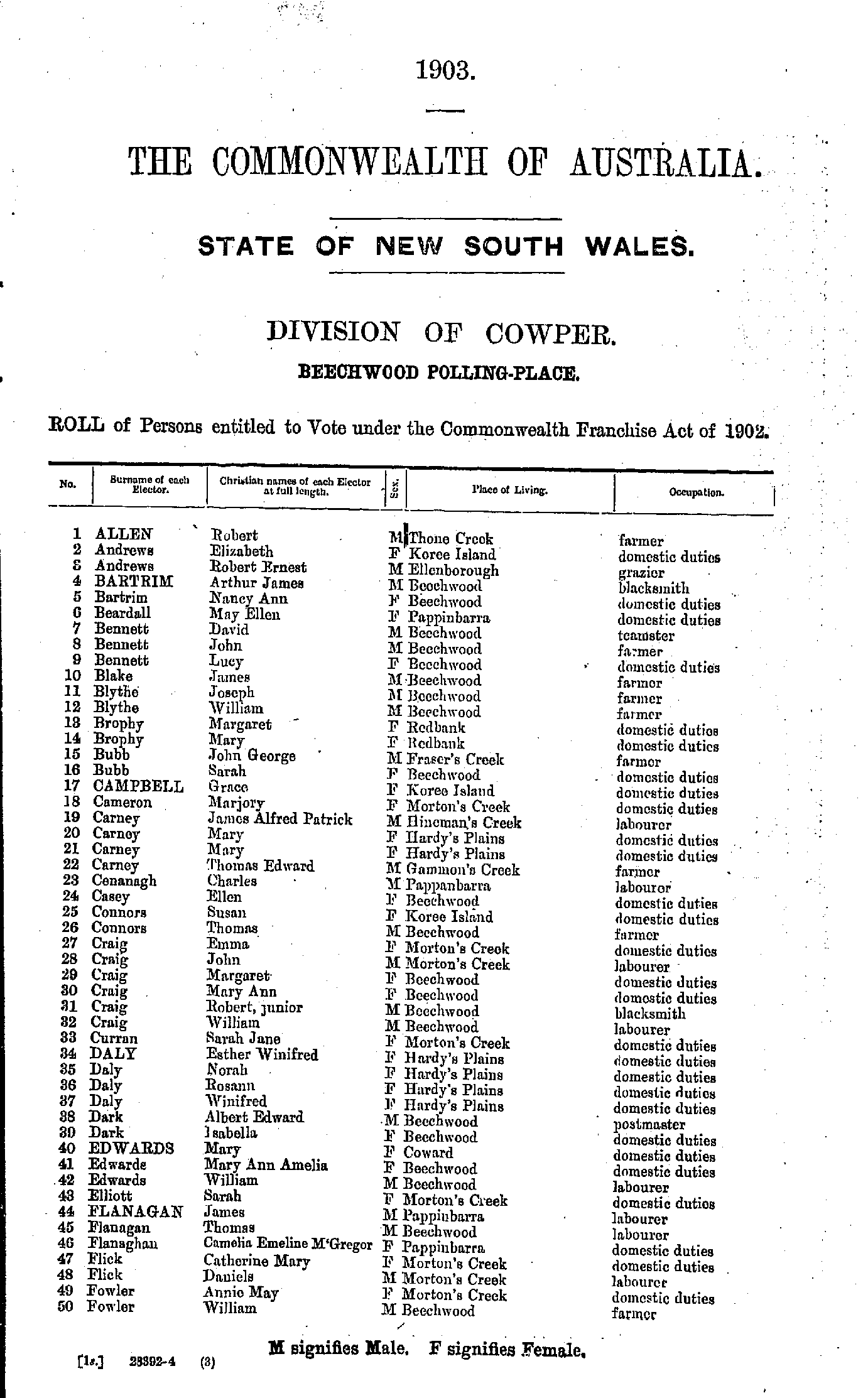
- Allen Robert - Fowler William
- Gardener Mary - Mackay Hugh
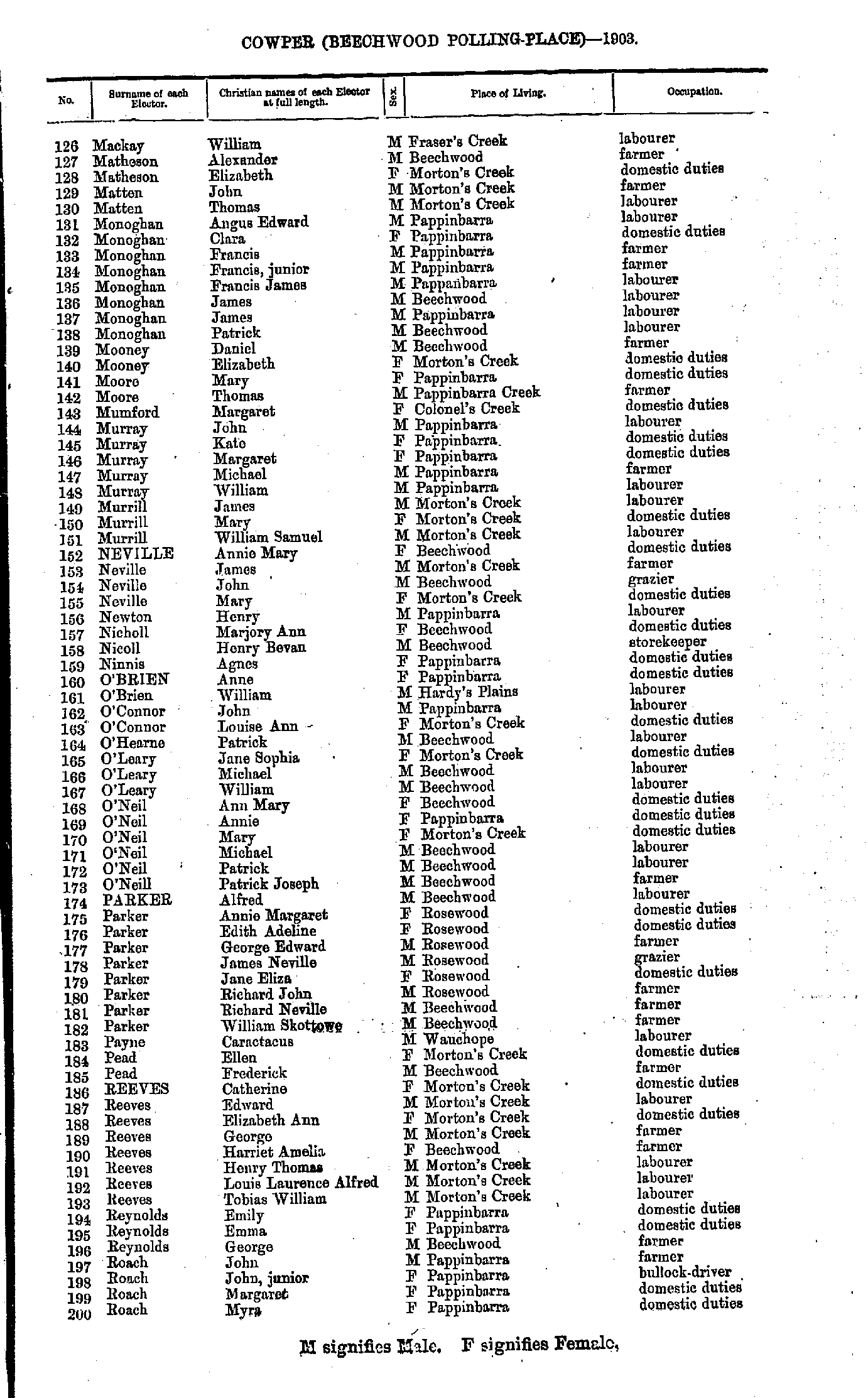
- Mackay William - Roach Myra
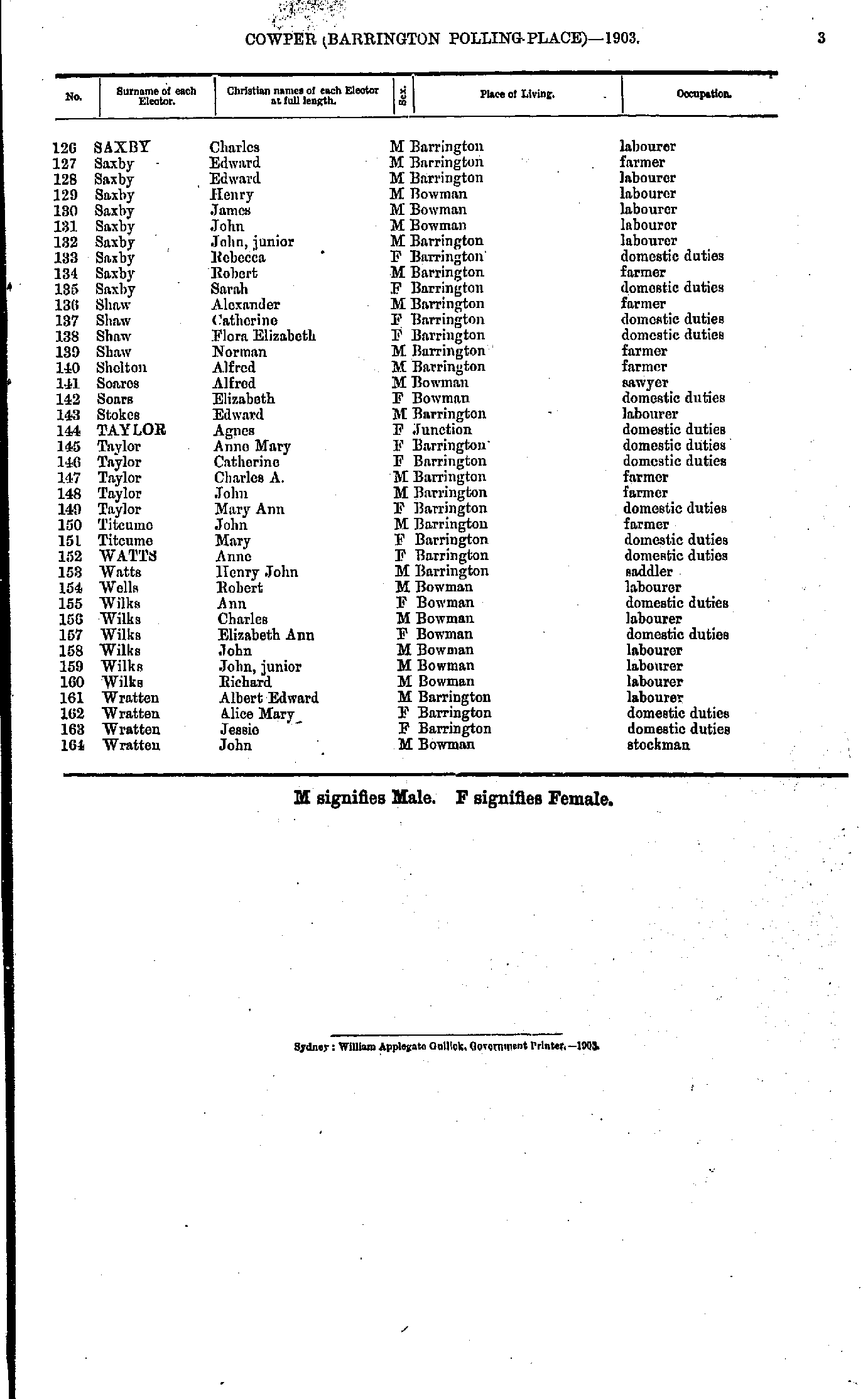
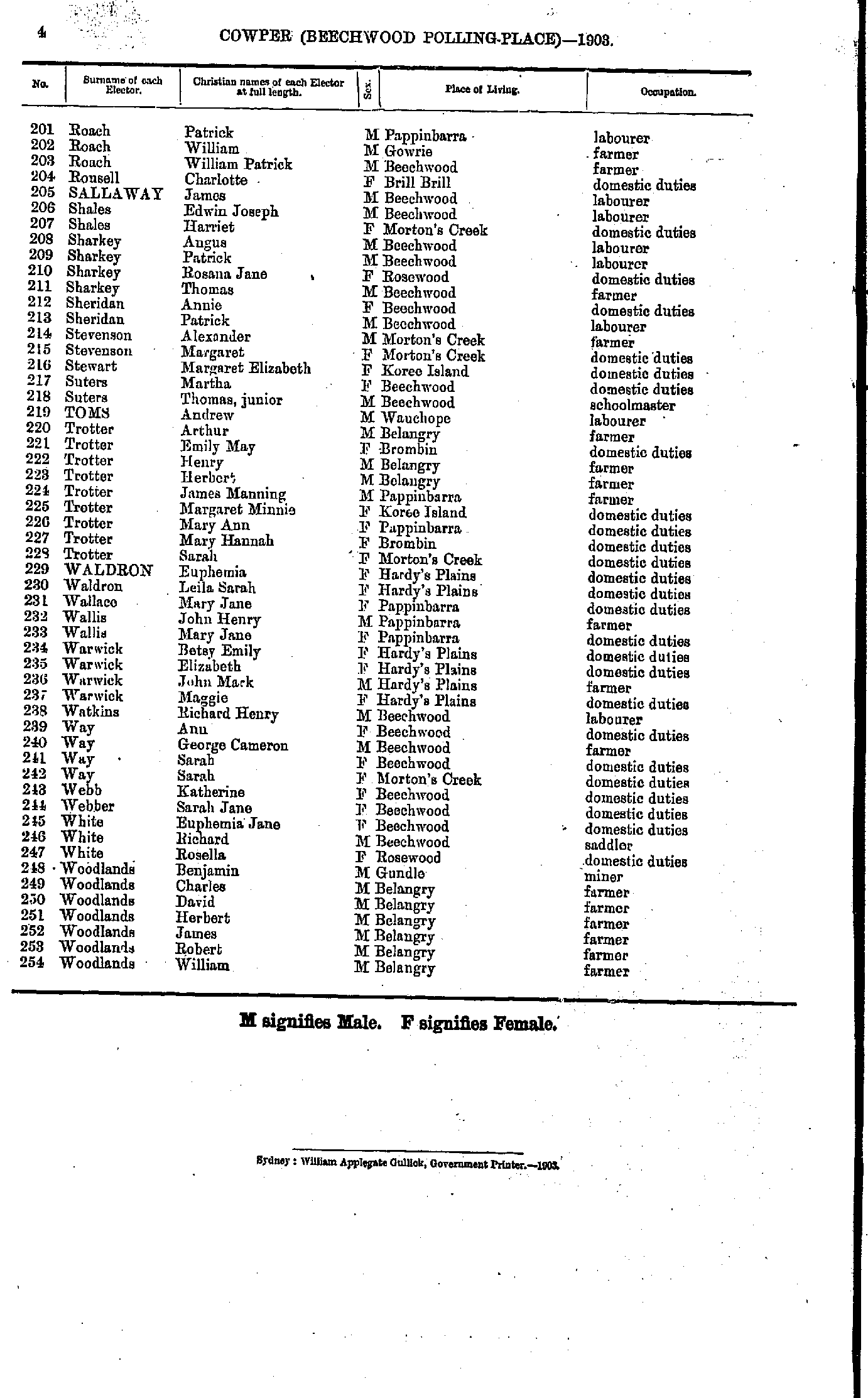
- Roach Patrick - Woodlands William
- Avery John - Ducat Charles
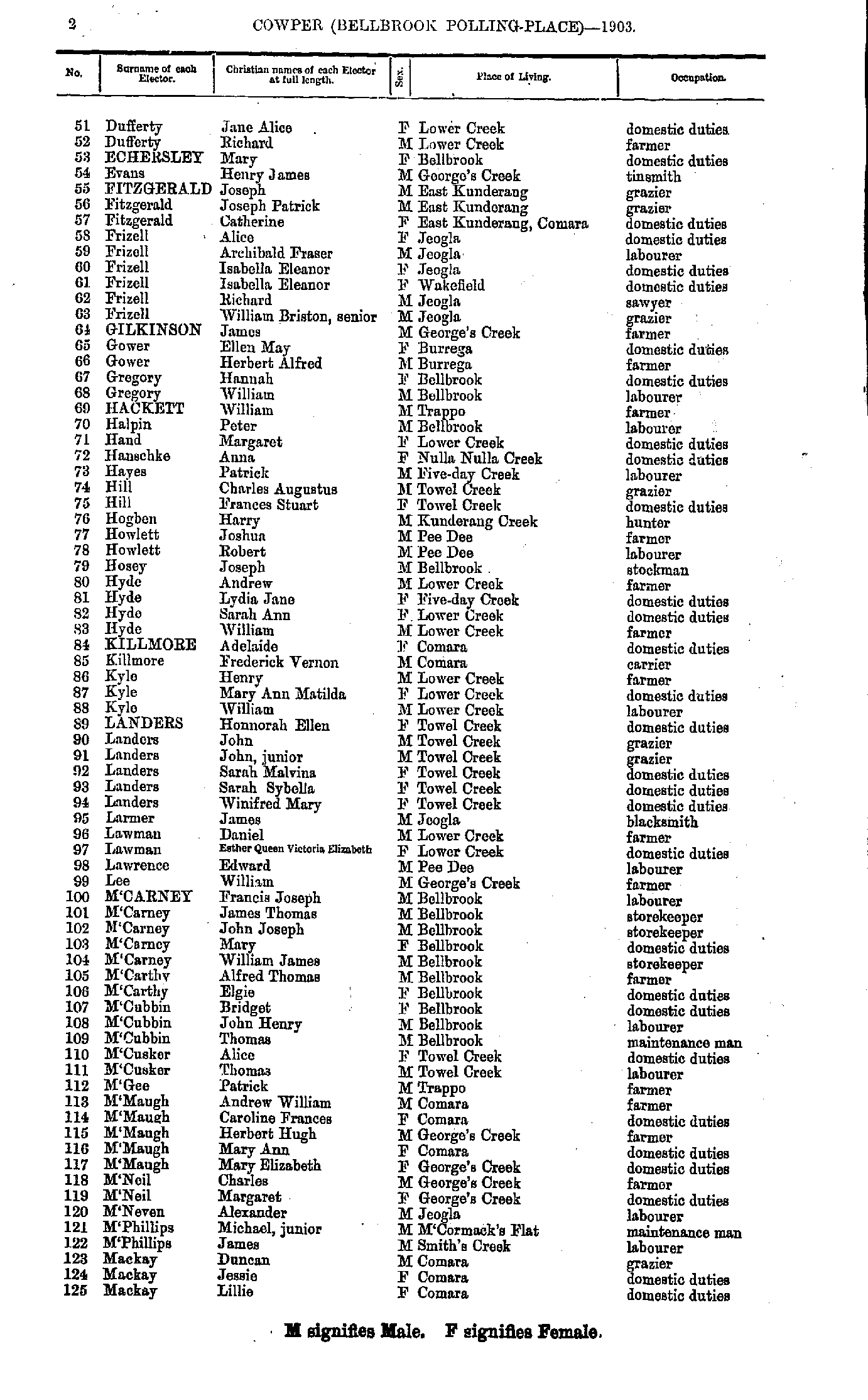
- Dufferty Jane - Mackay Lillie
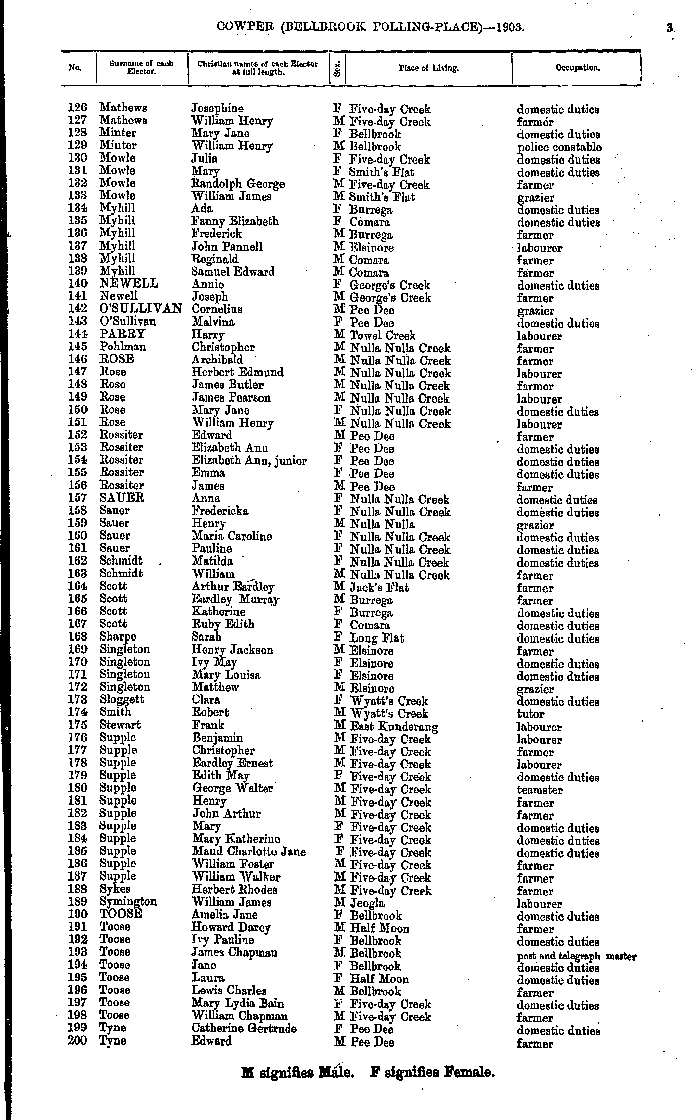
- Mathews Josephine - Tyne Edward
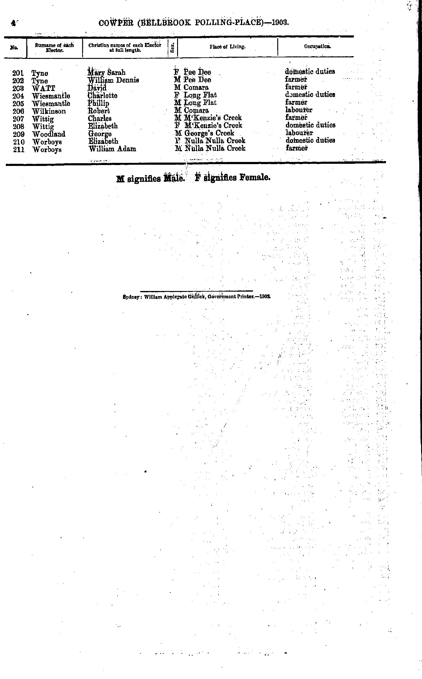
- Tyne Mary - Worboys William
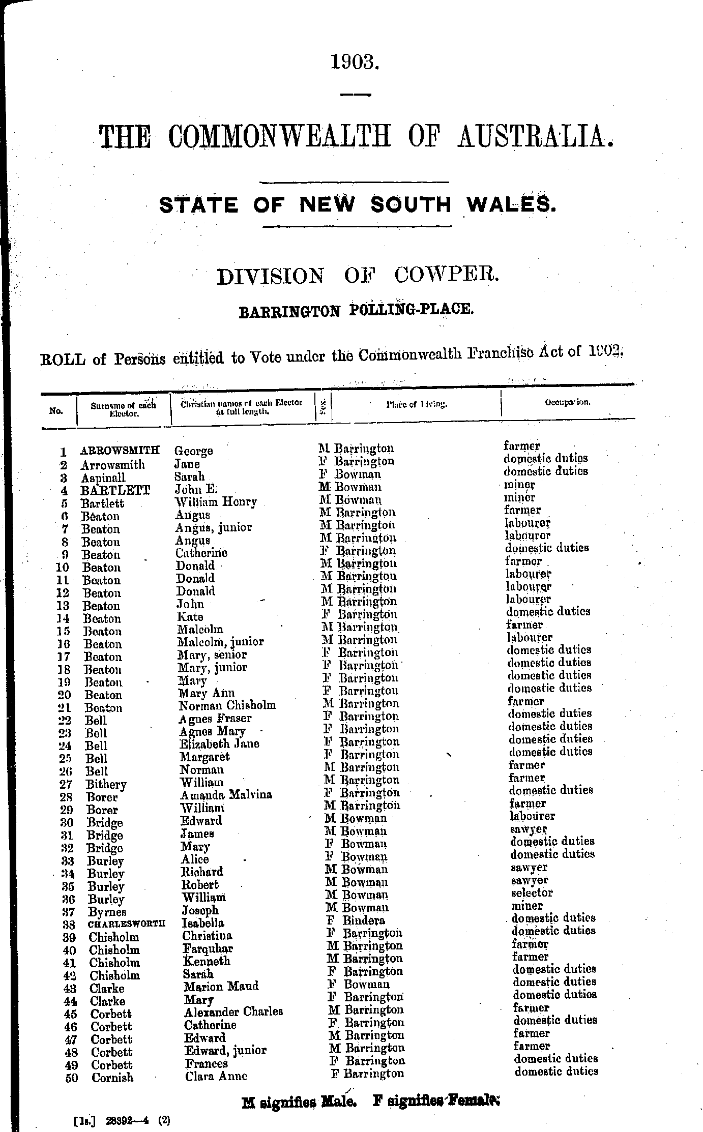
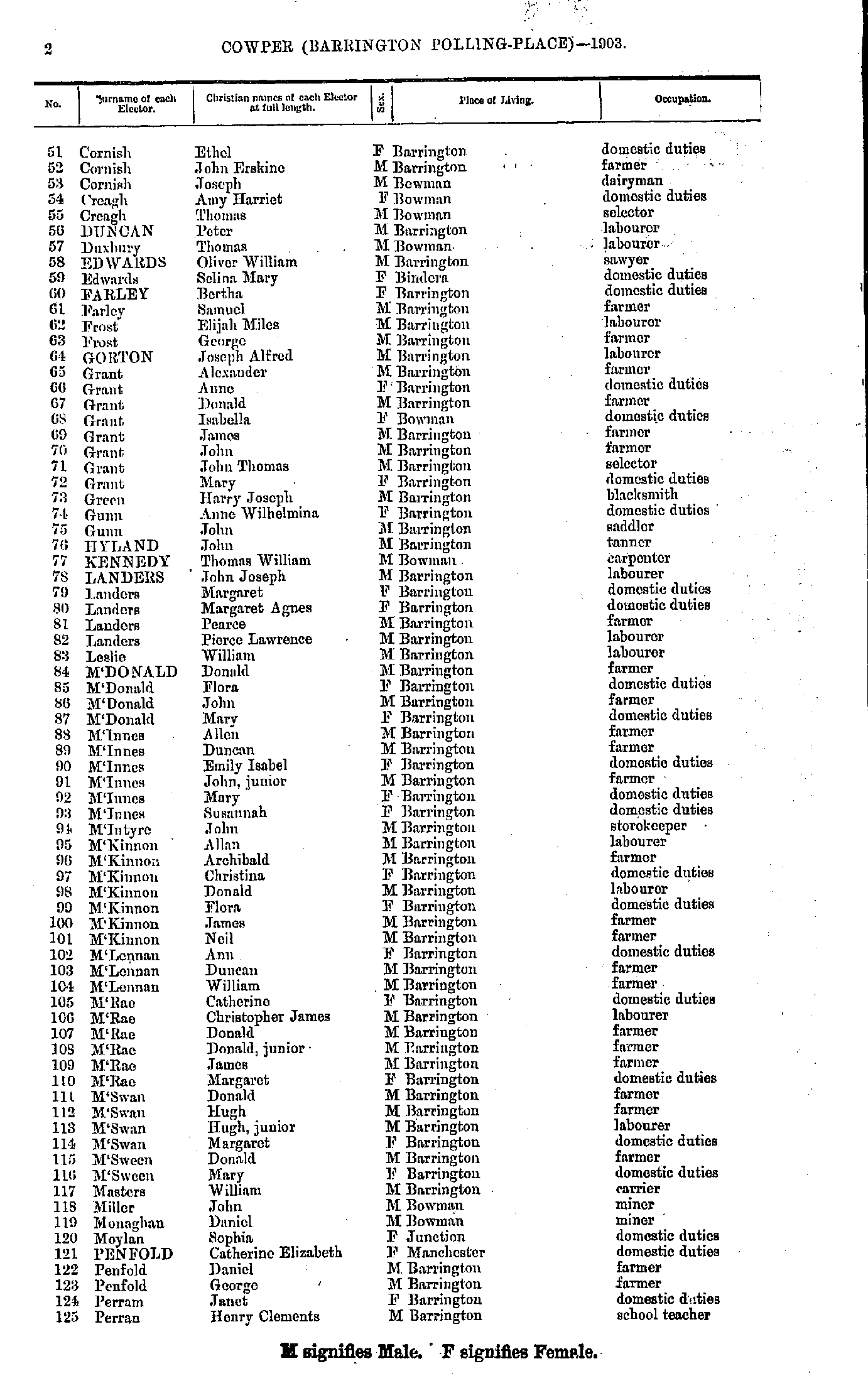
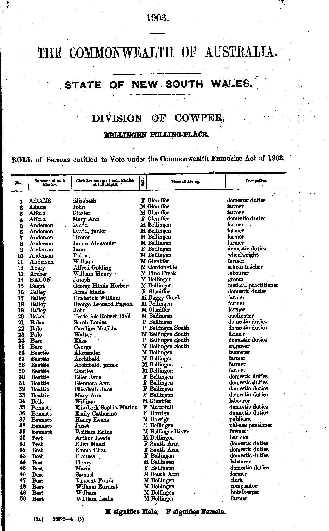
- Adams Elizabeth - Best William
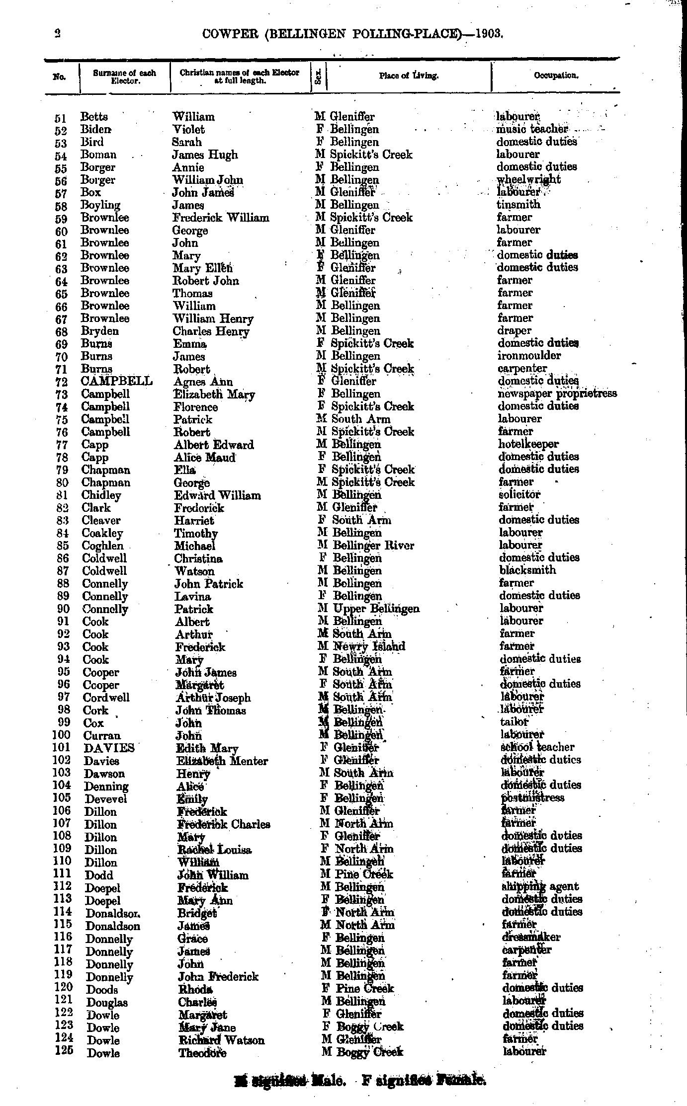
- Betts William - Dowle Theodore
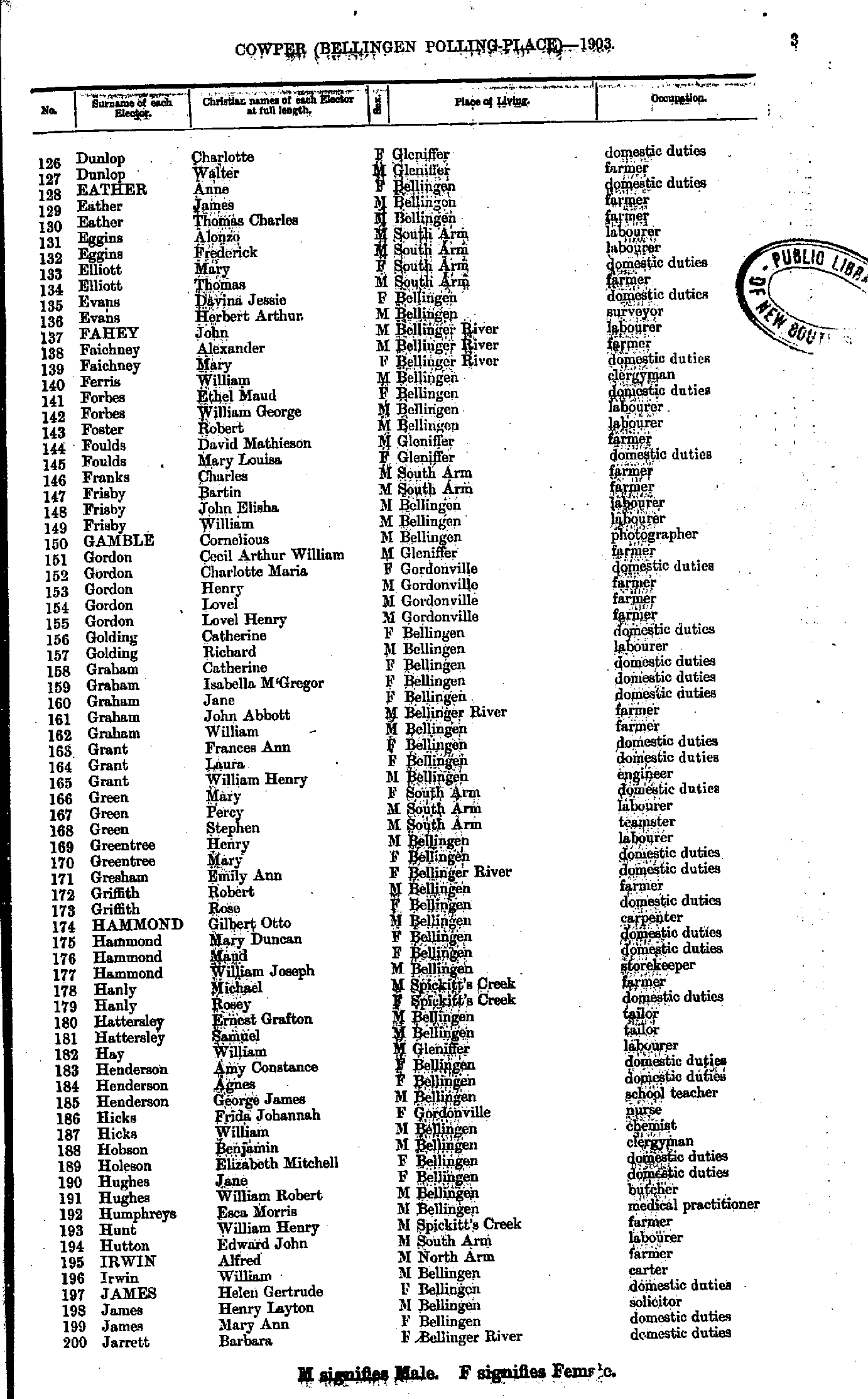
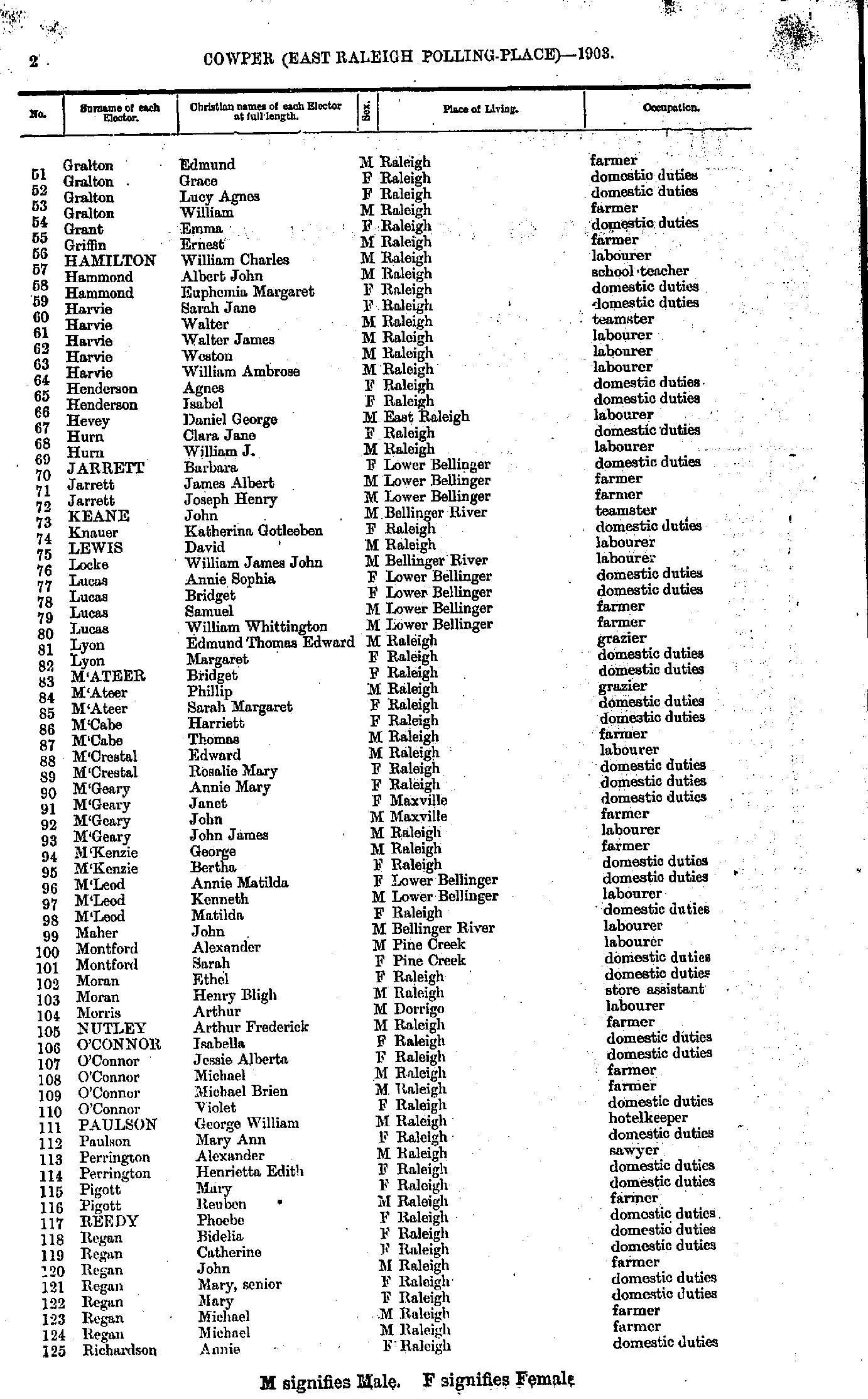
- Dunlop Charlotte - Jarrett Barbara
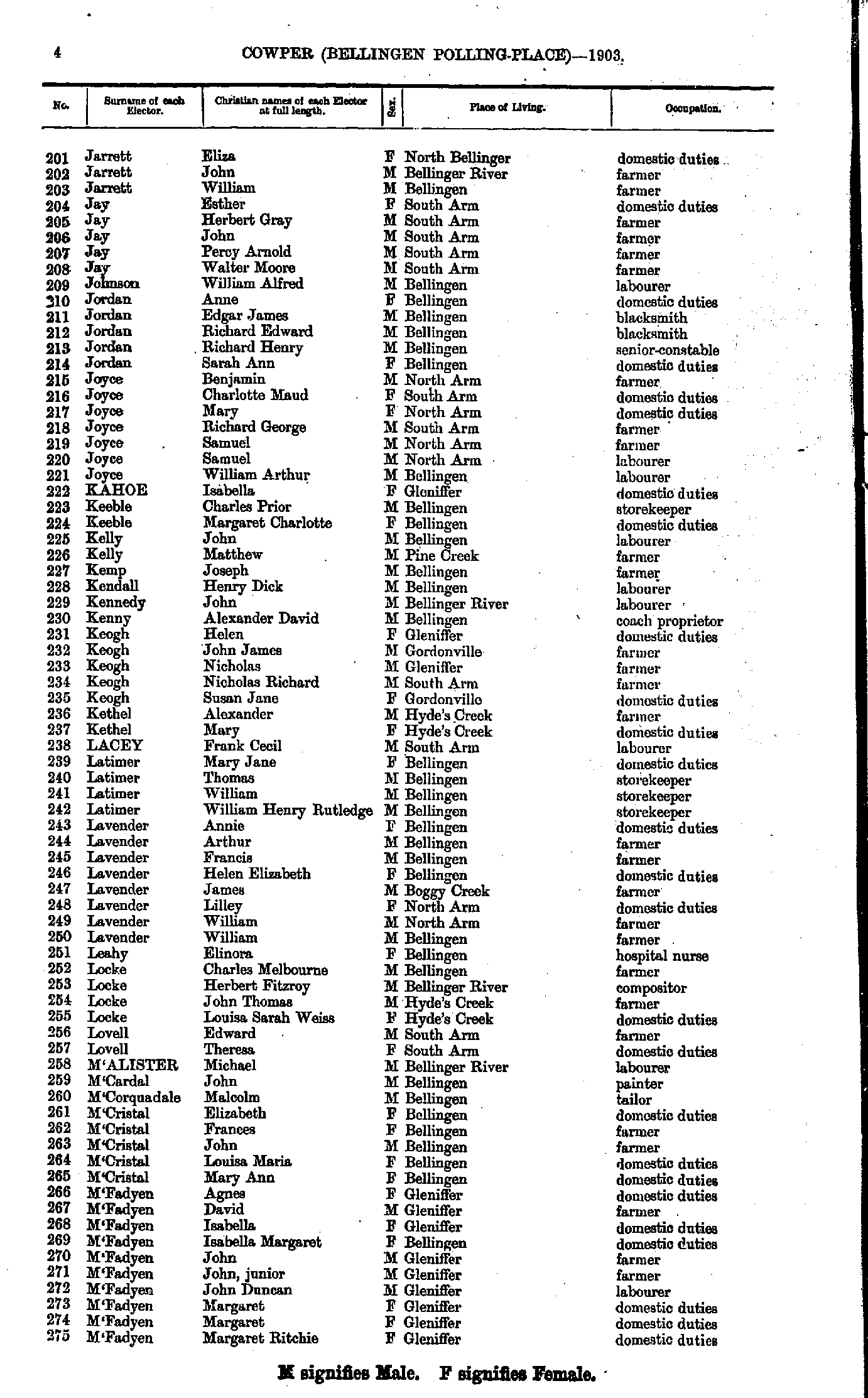
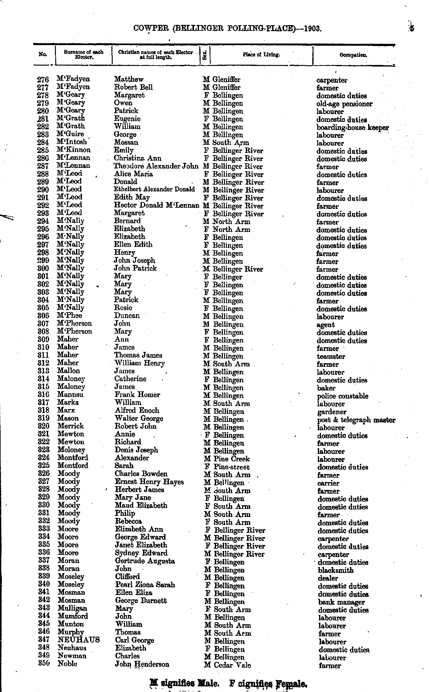
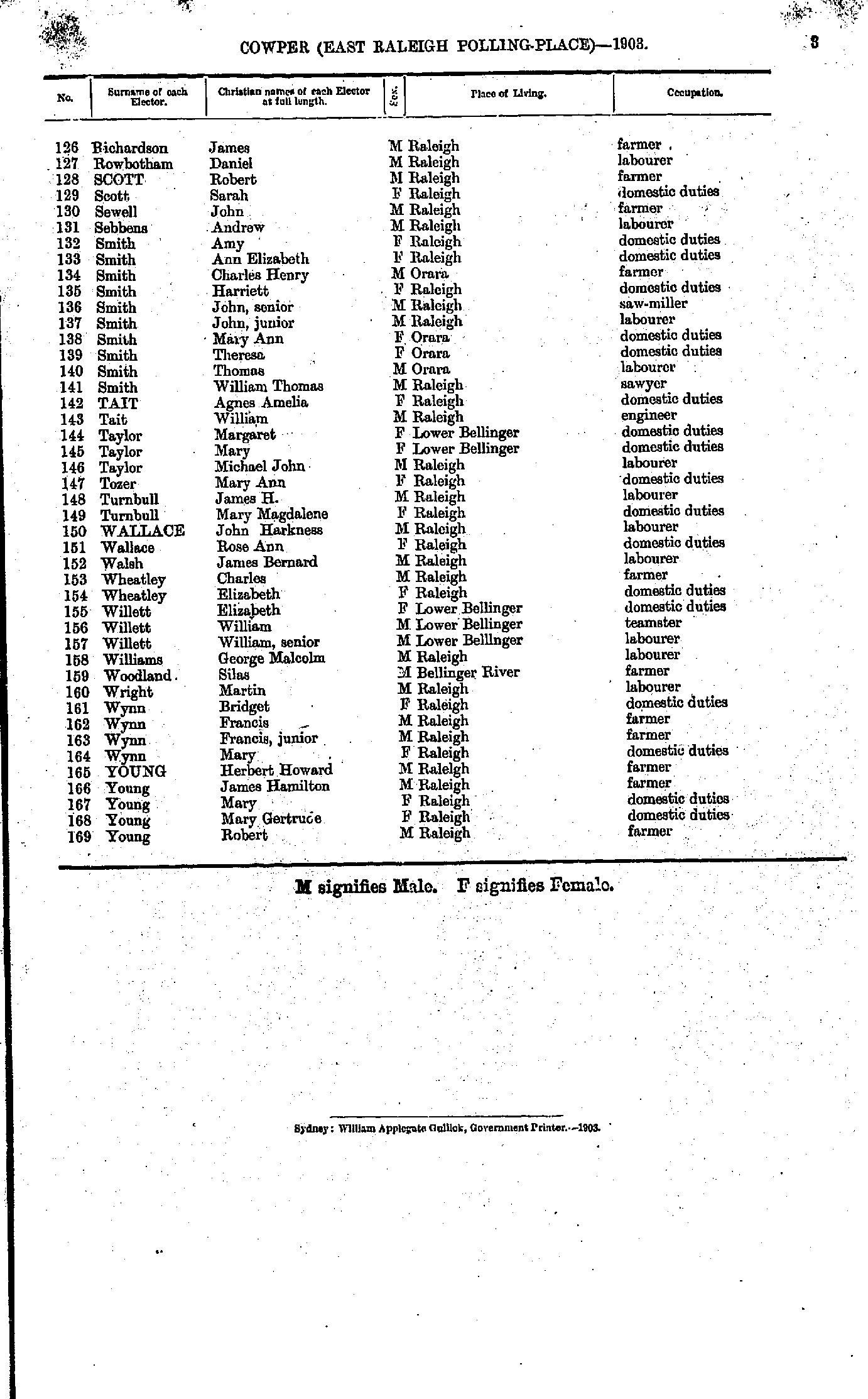
- Jarrett Eliza - M'Fadyen Margaret
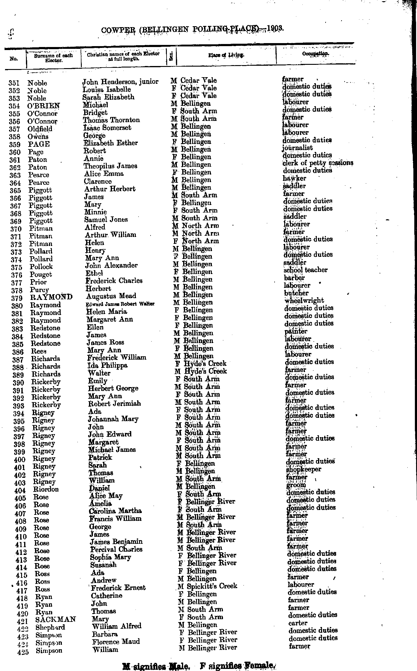
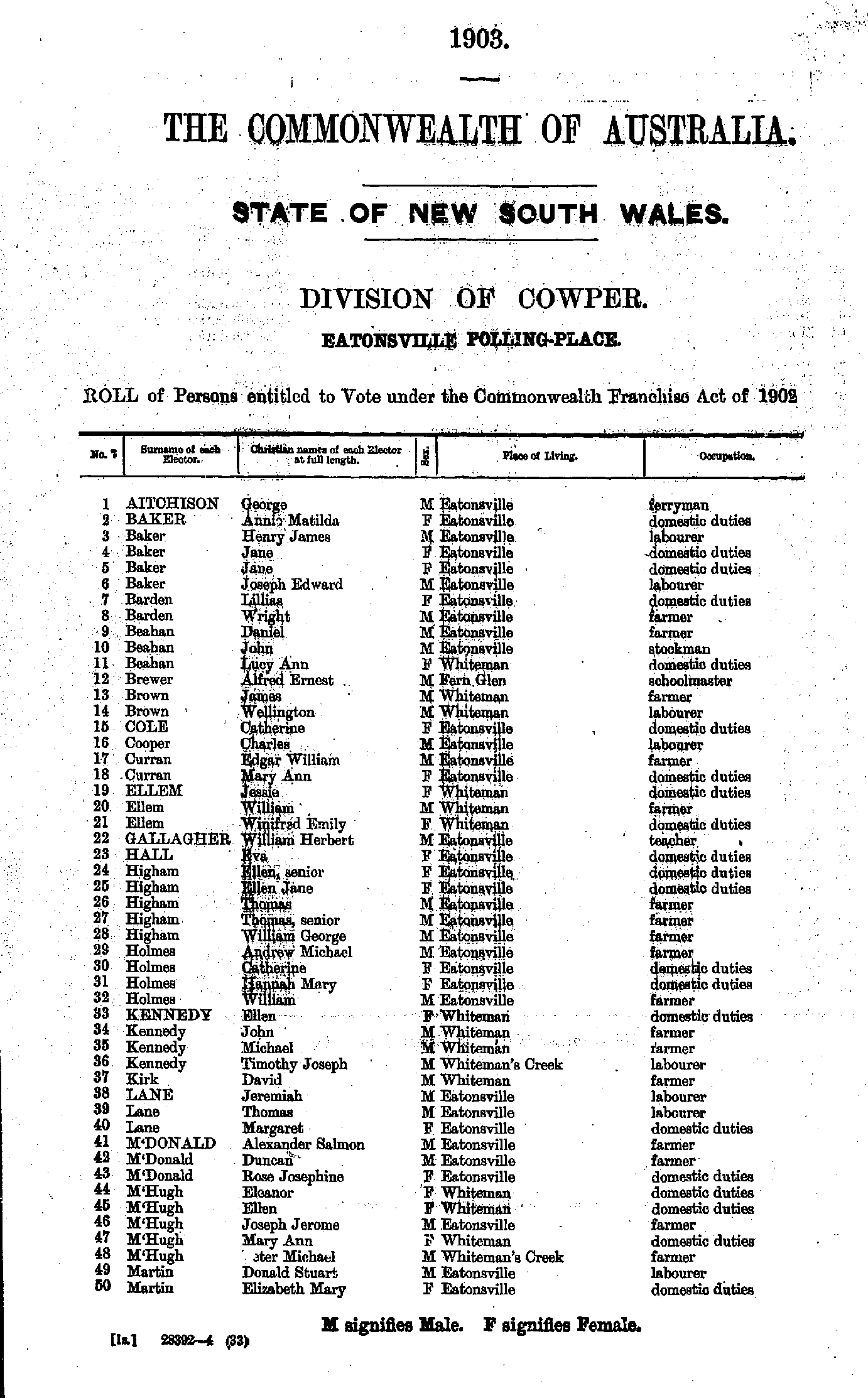
- M'Fadyen Matthew - Noble John
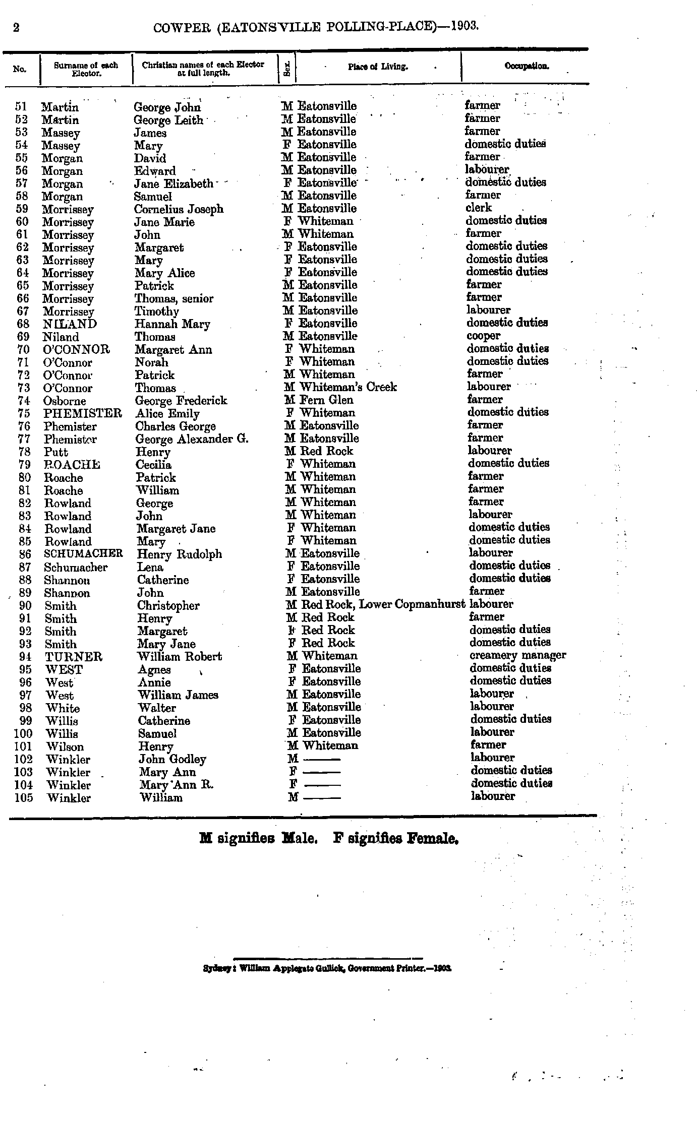
- Noble John - Simpson William
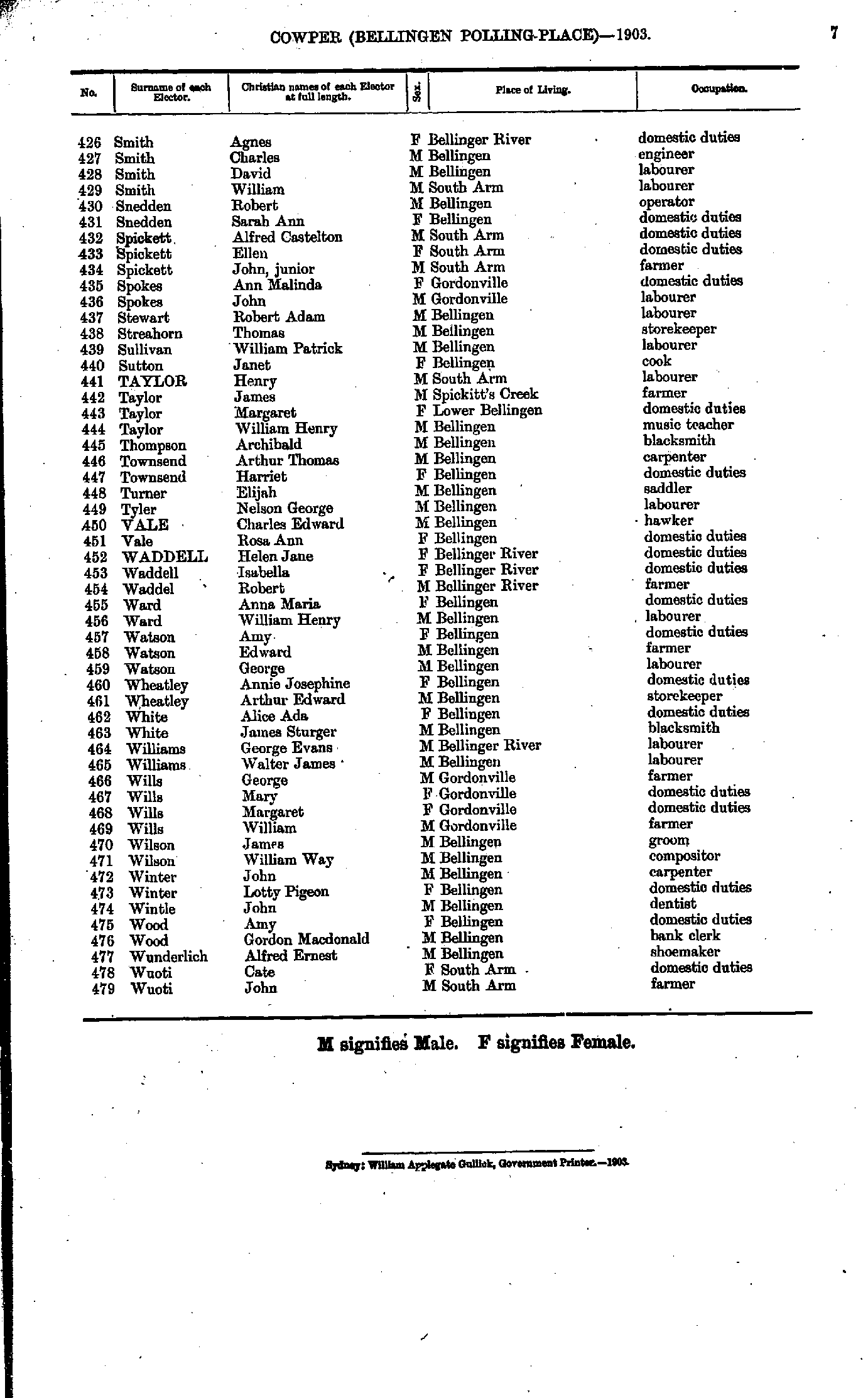
- Smith Agnes - Wuoti John
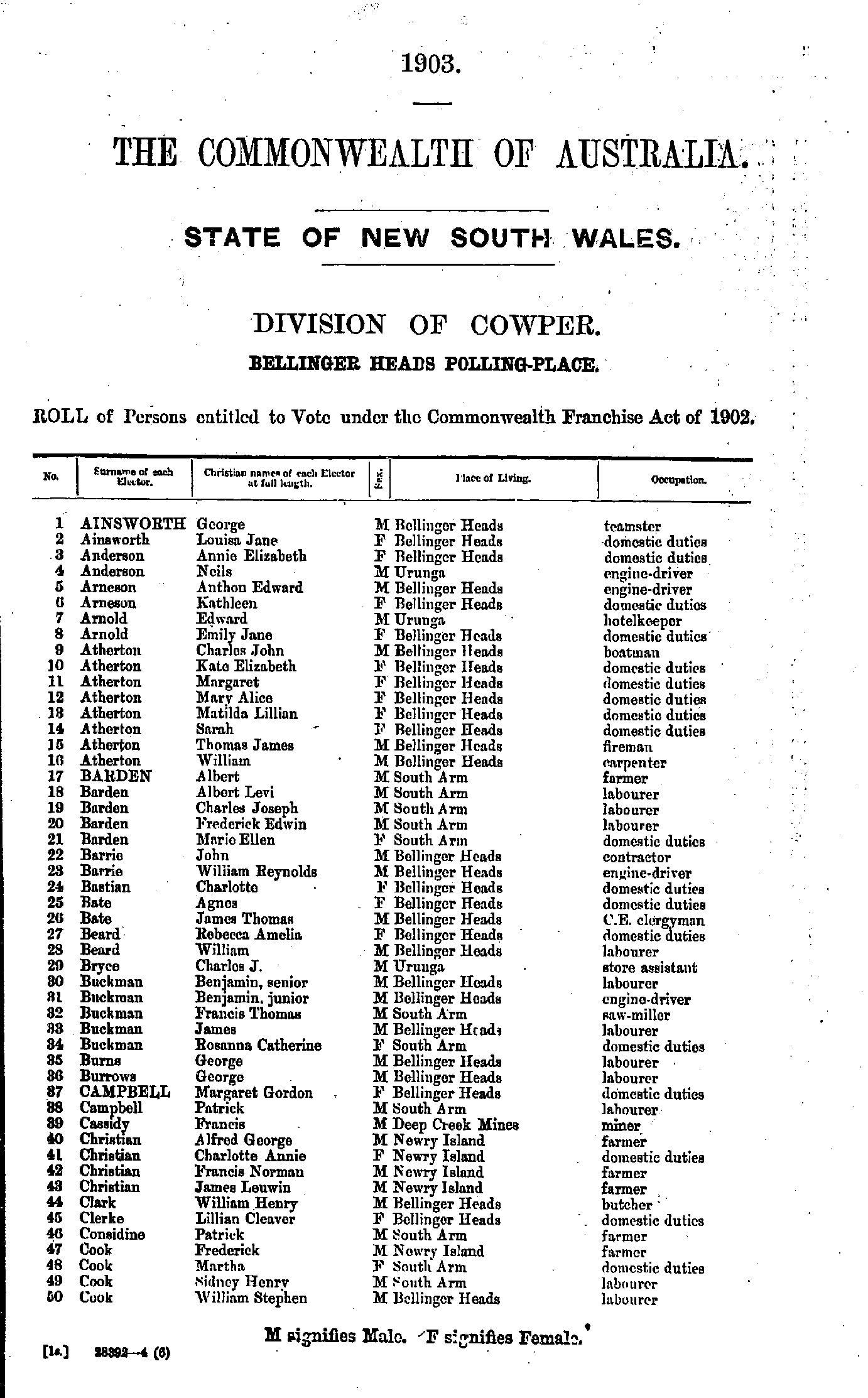
- Ainsworth George - Cook William
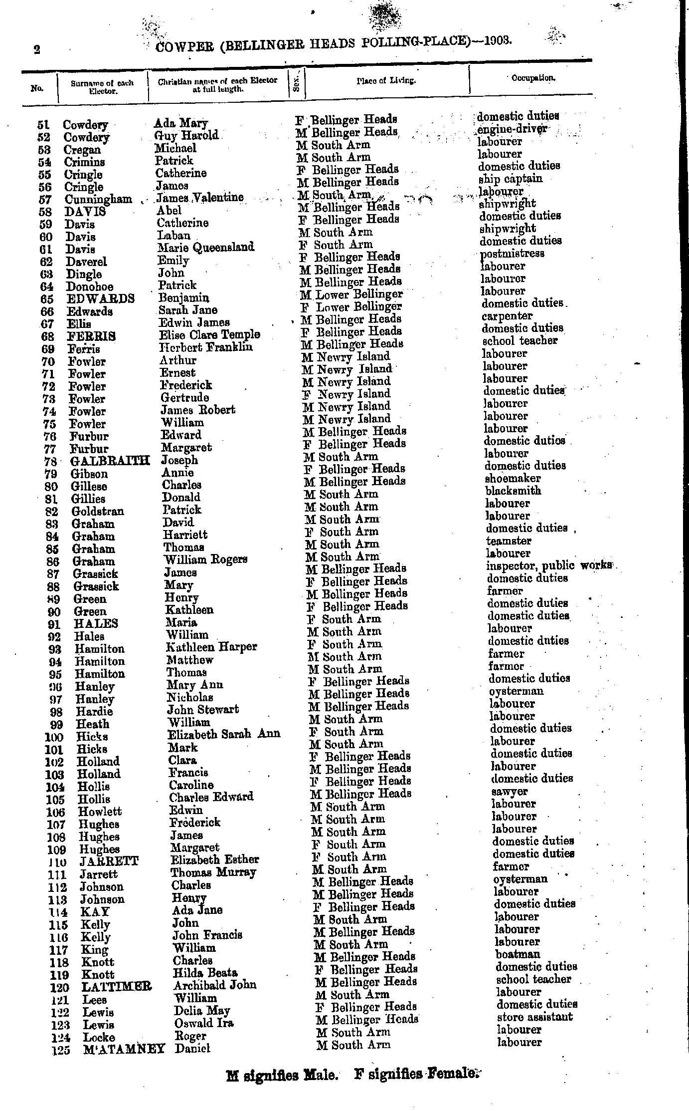
- Cowdery Ada - M'Atamney Daniel
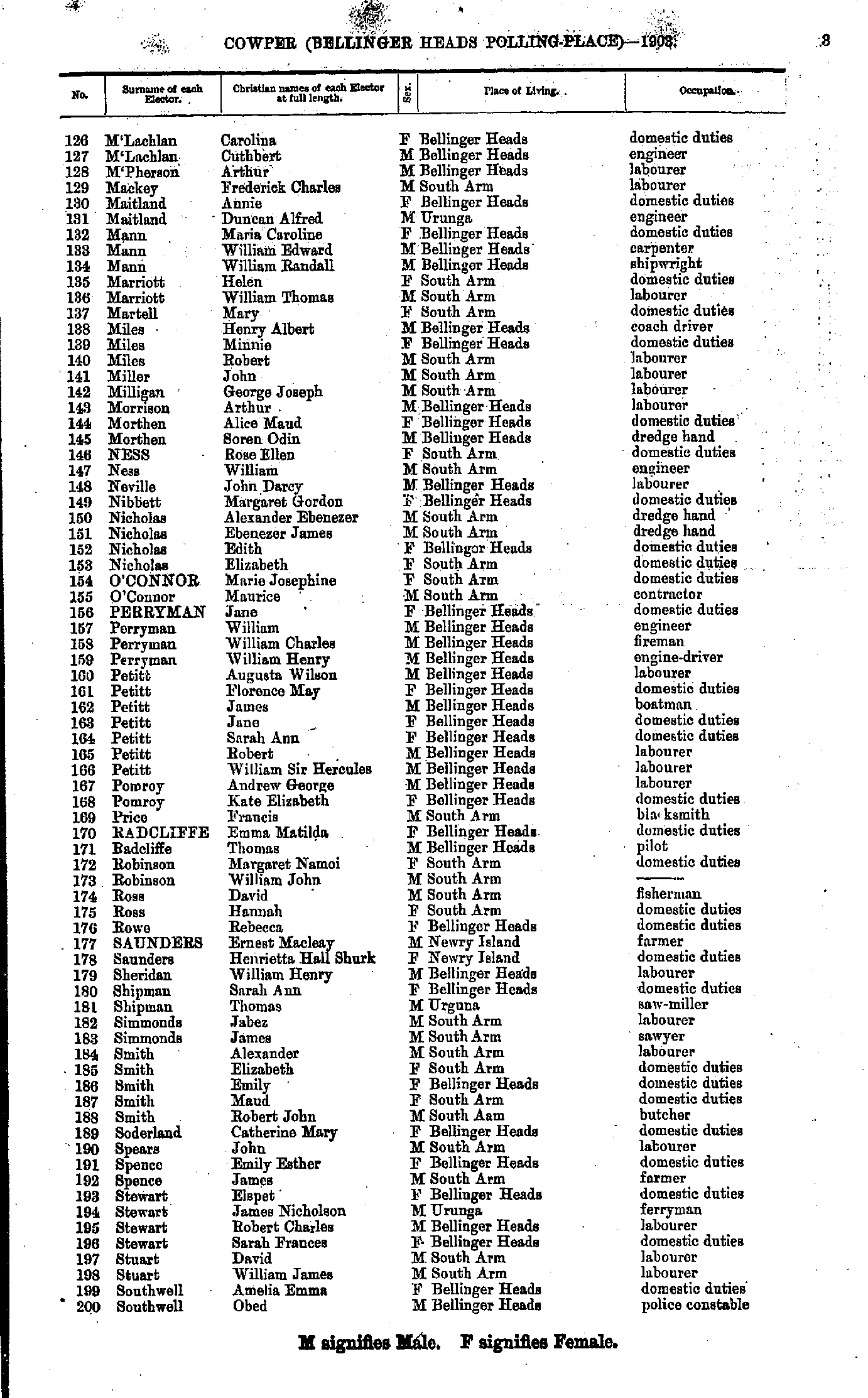
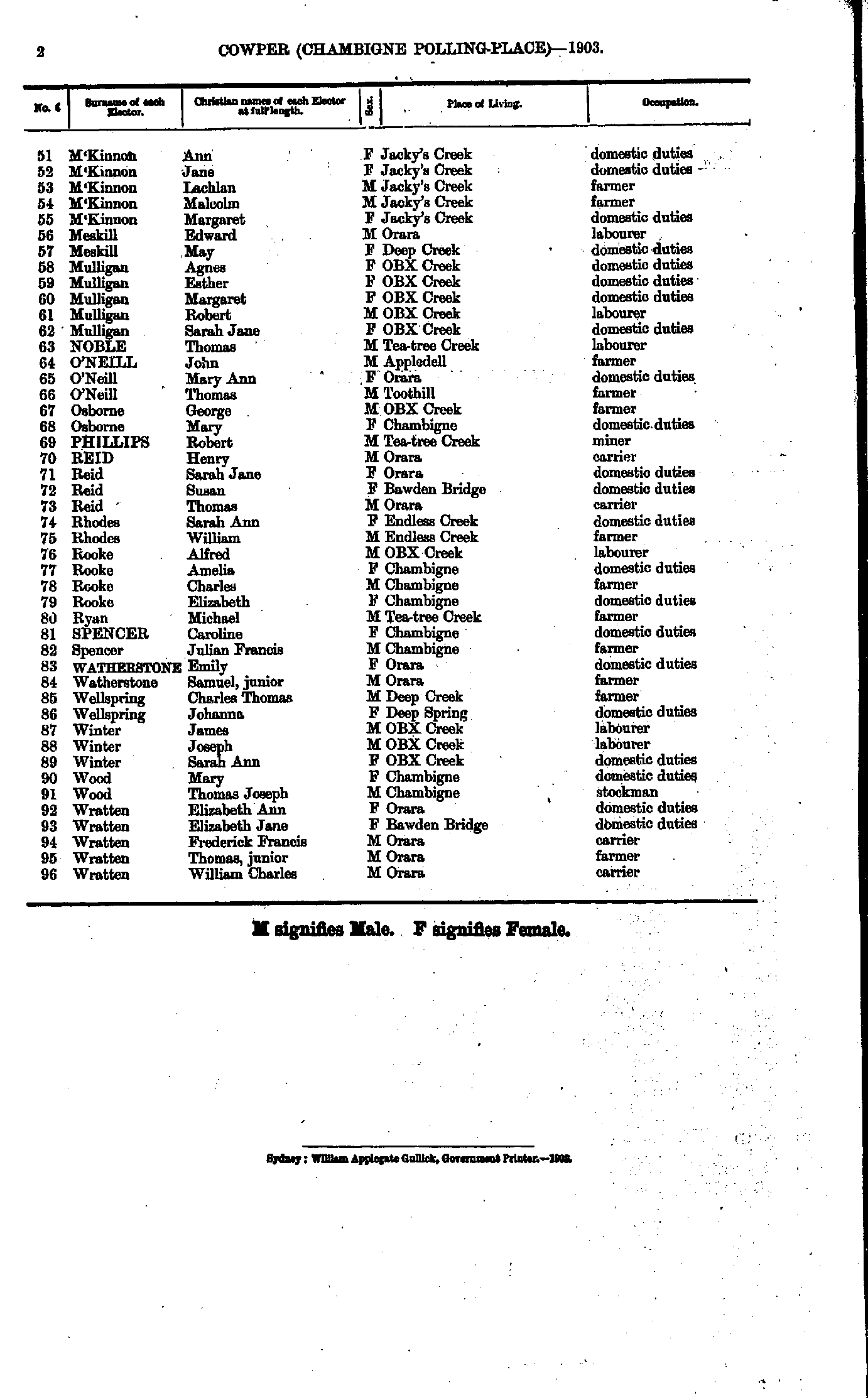
- M'Lachlan Carolina - Southwell Obed
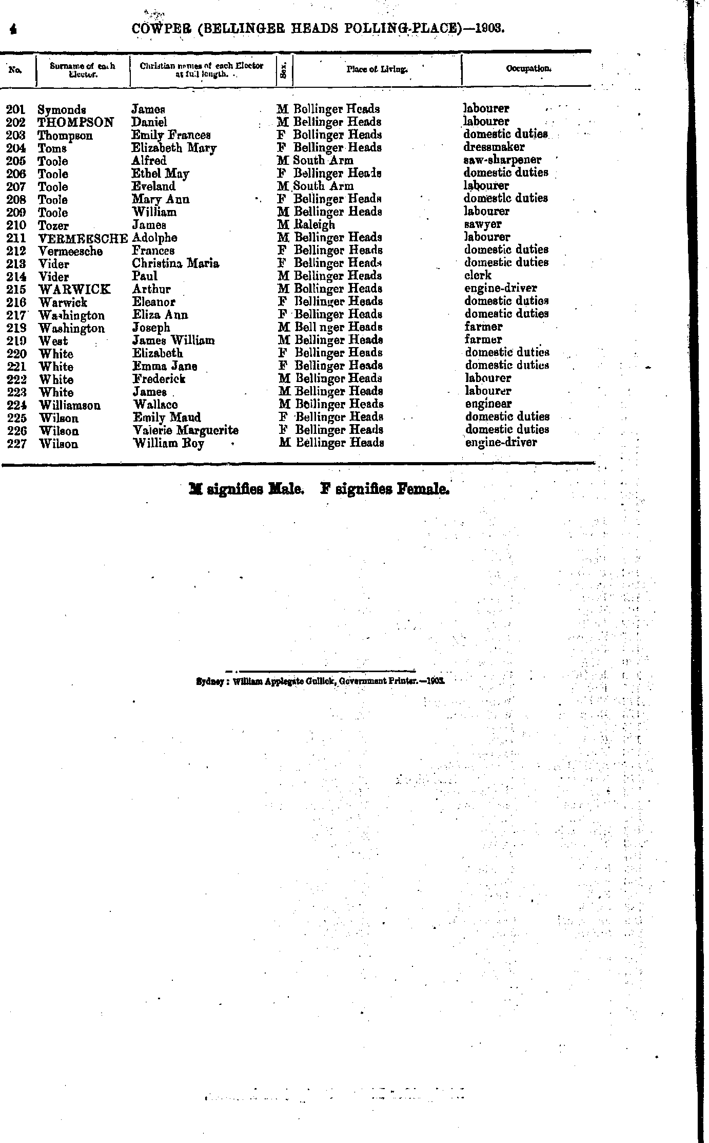
- Symonds James - Wilson William
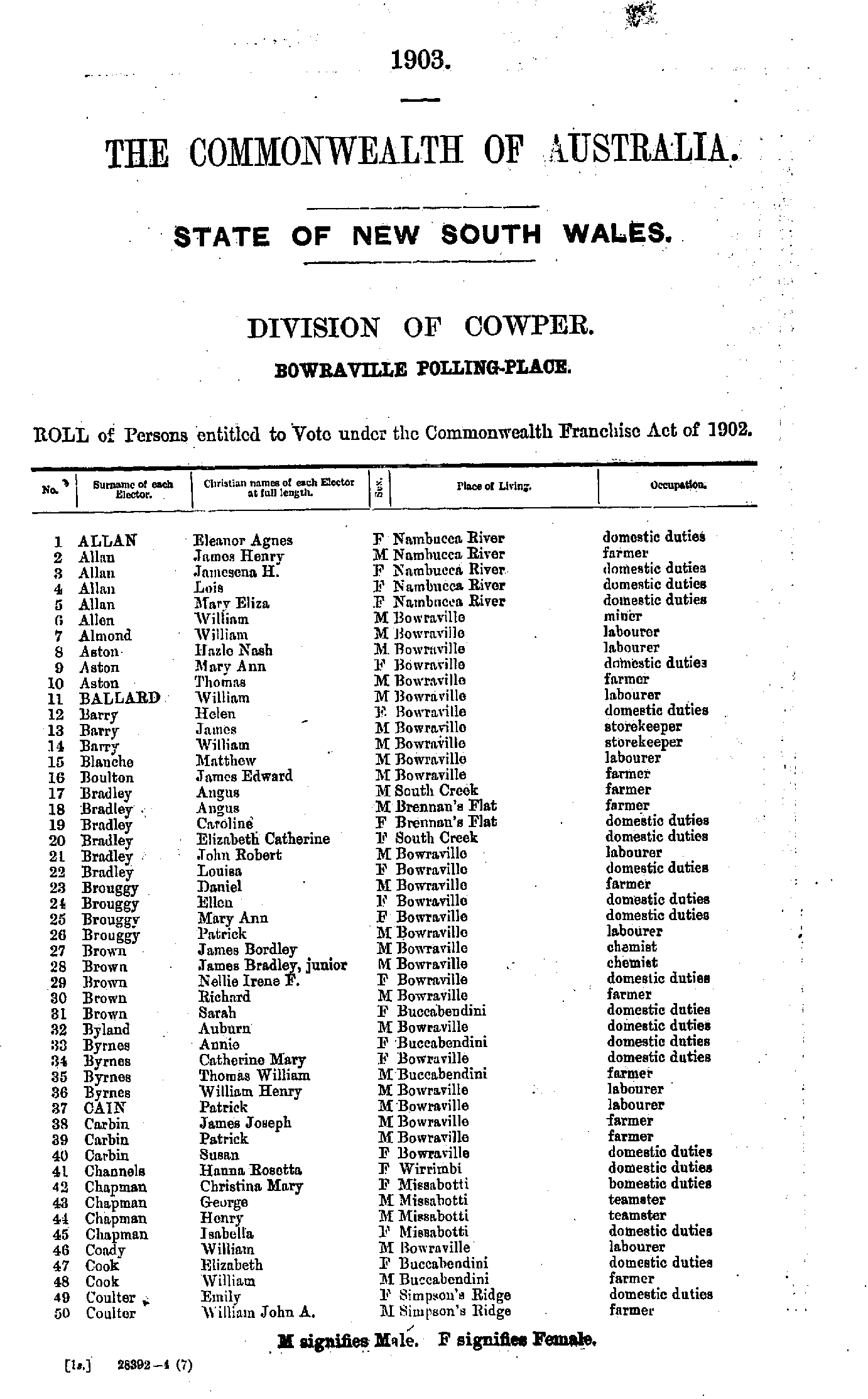
- Allan Eleanor - Coulter William
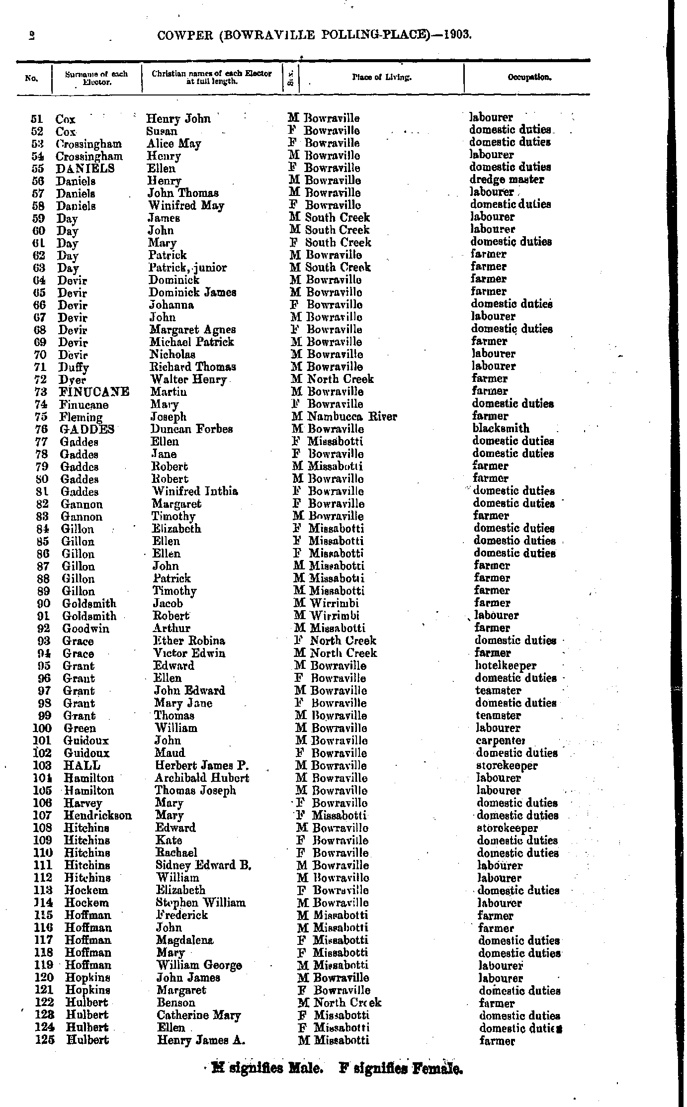
- Cox Henry - Hulbert Henry
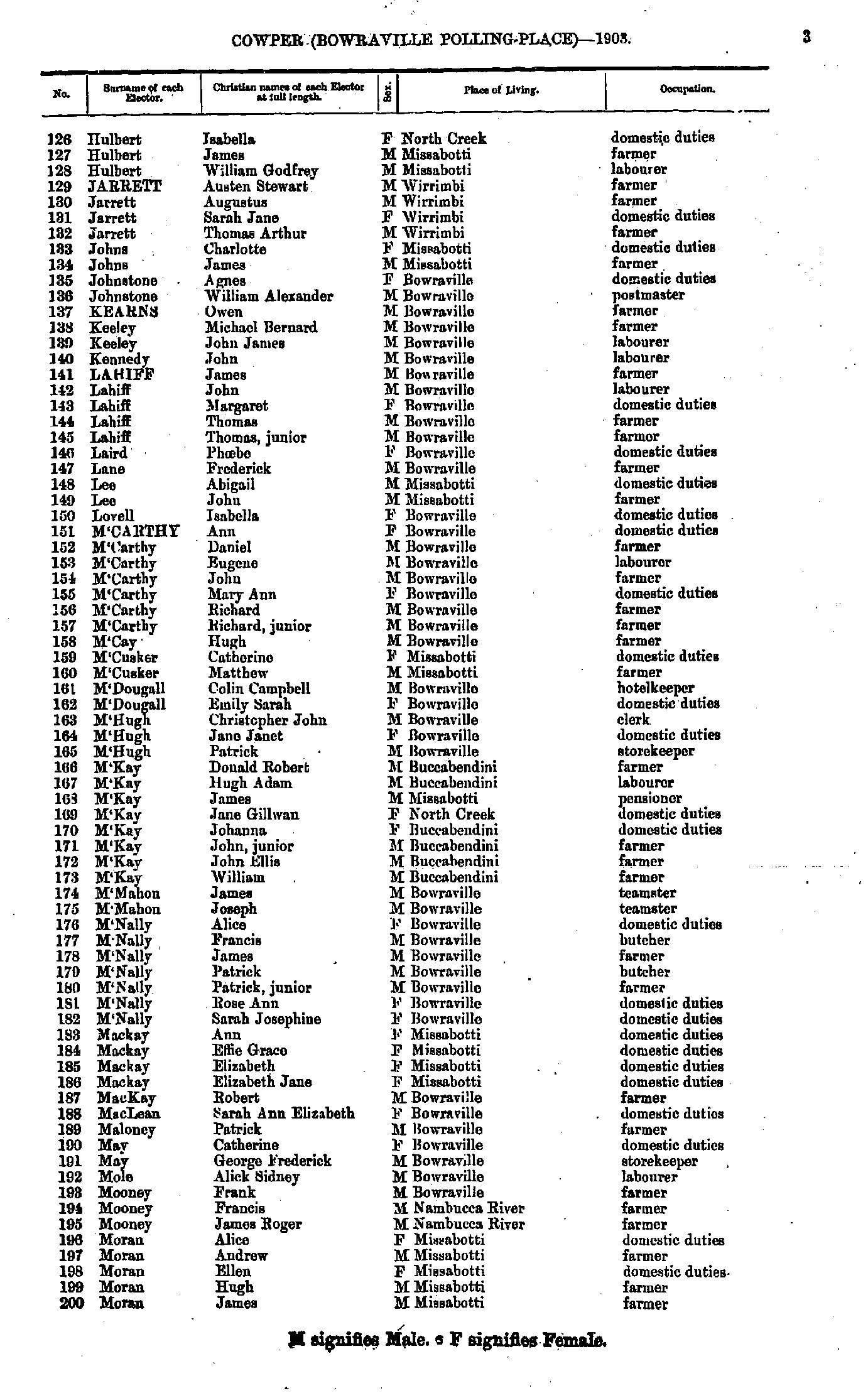
- Hulbert Isabella - Moran James
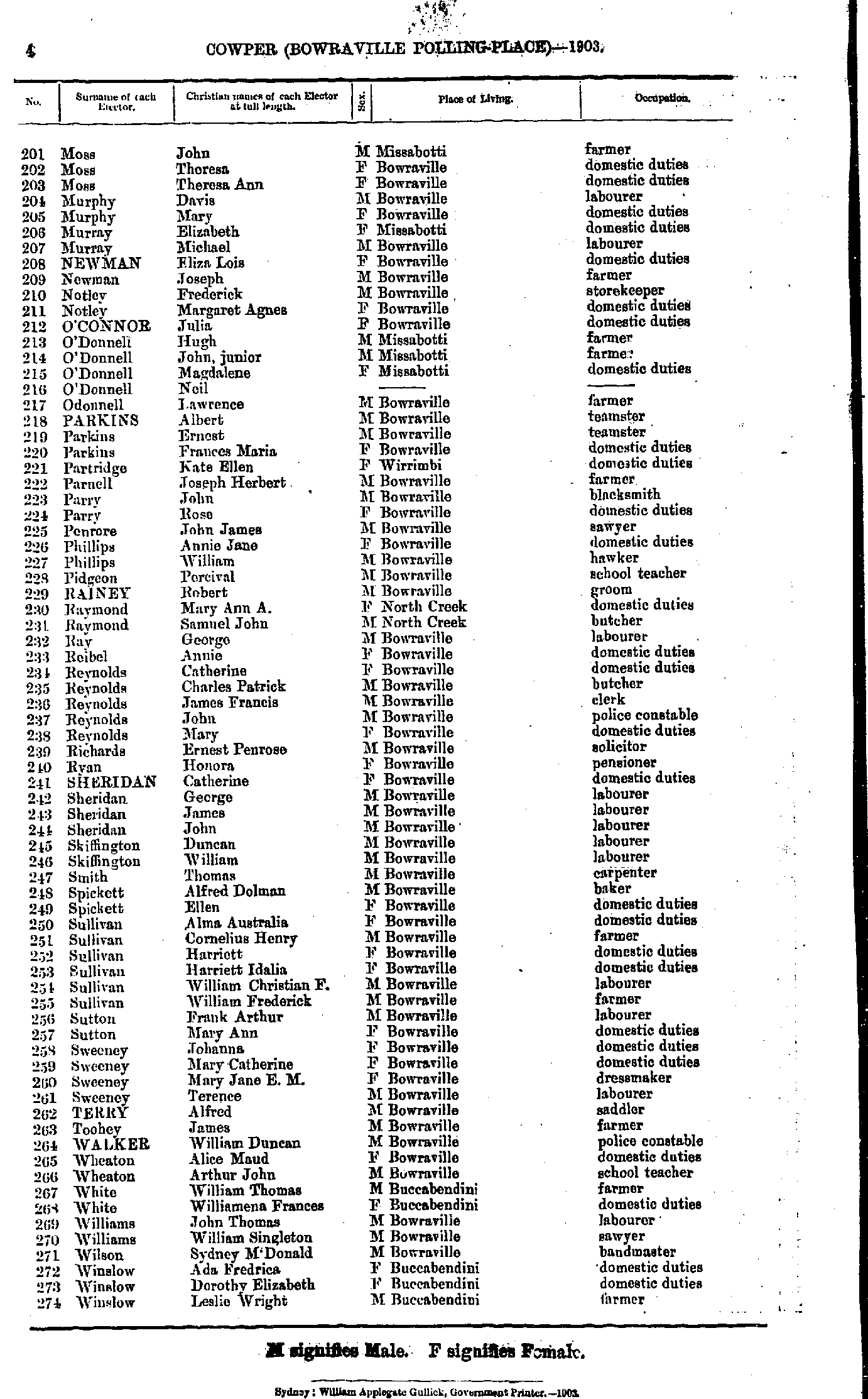
- Moss John - Winslow Leslie
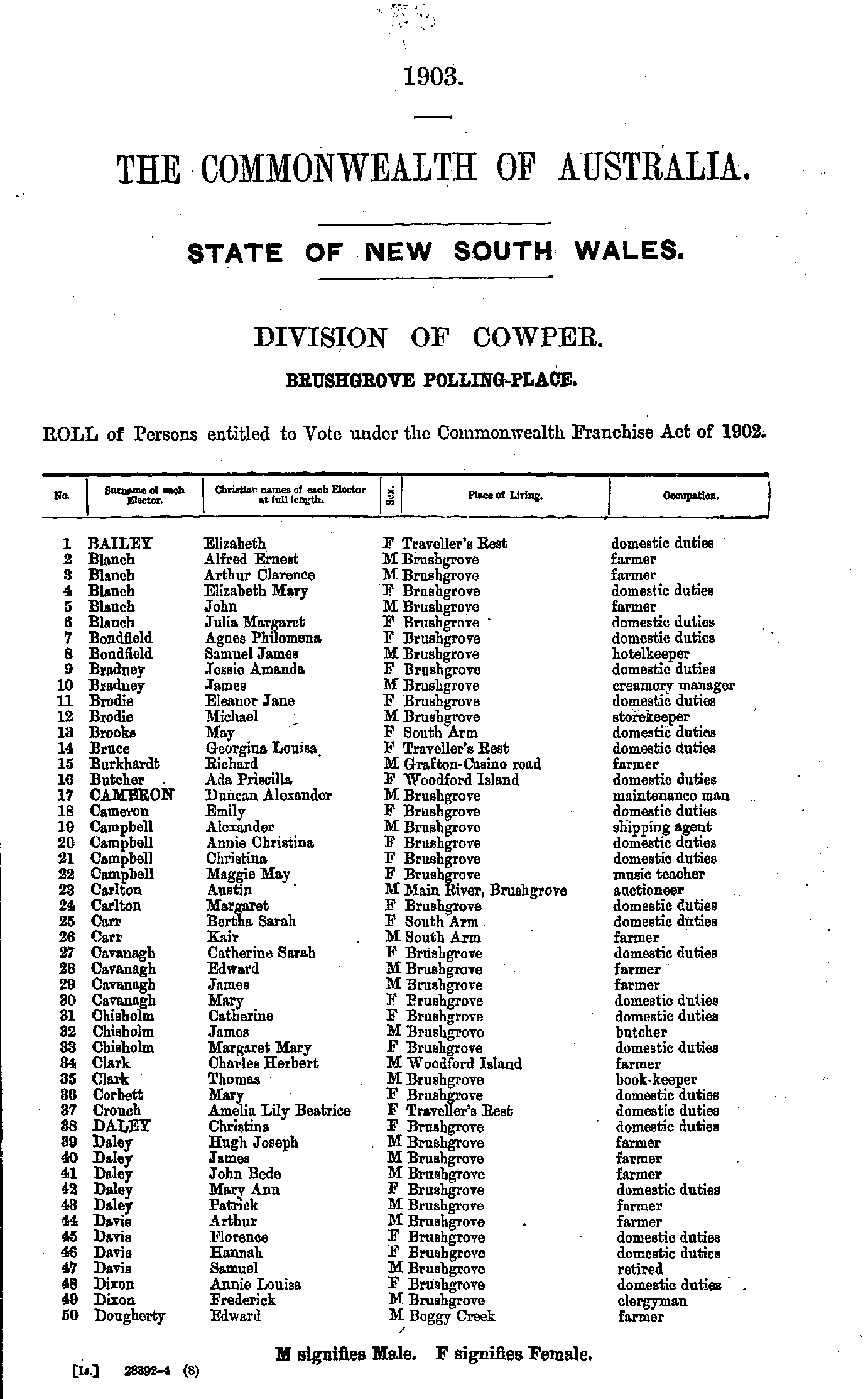
- Bailey Elizabeth - Dougherty Edward
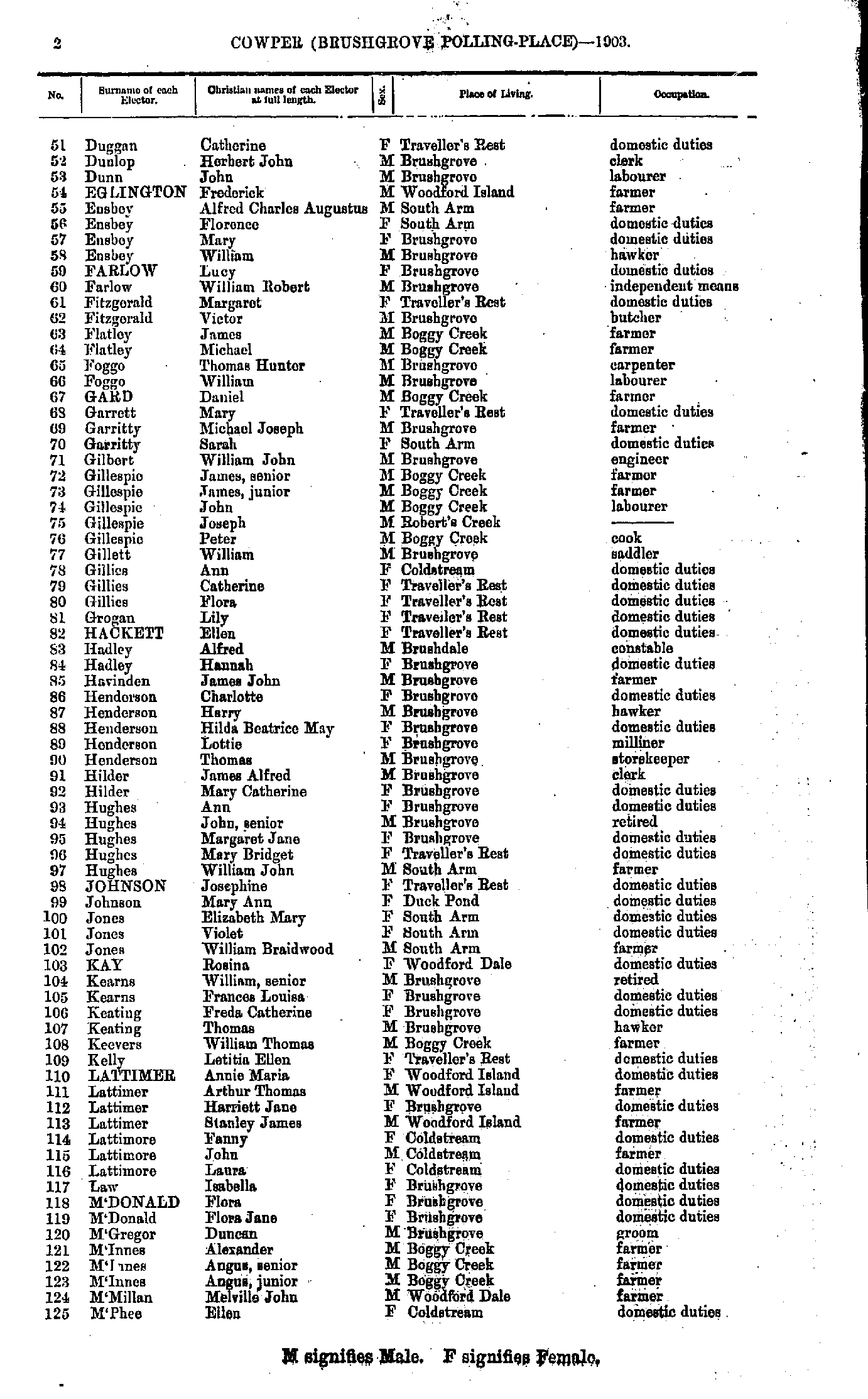
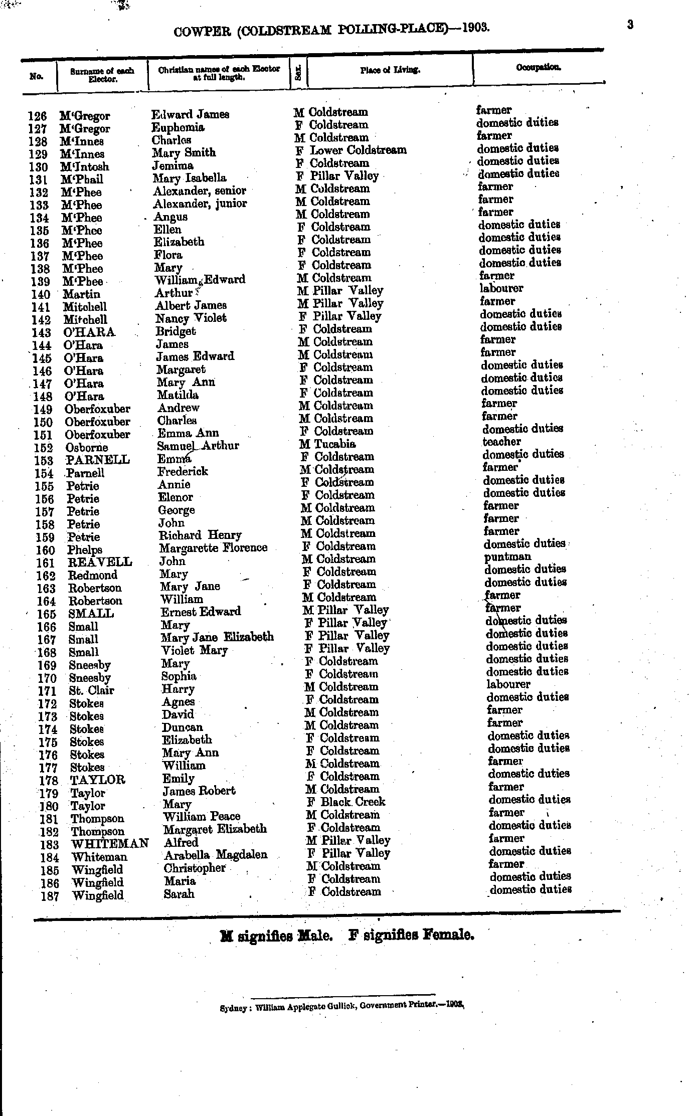
- Duggan Catherine - M'Phee Ellen
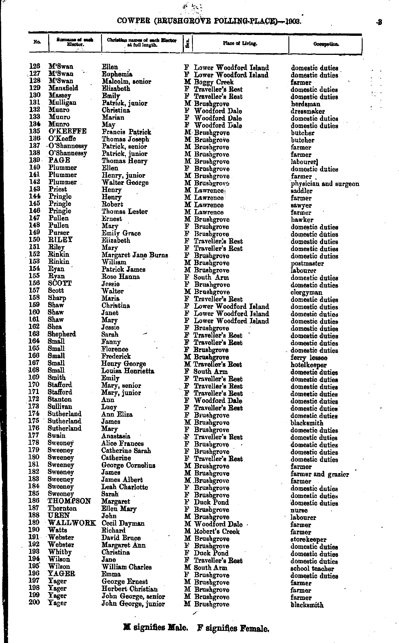
- M'Swan Ellen - Yager John
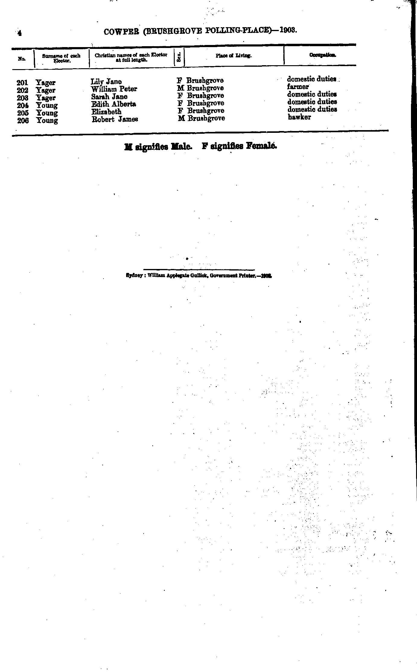
- Yager Lily - Young Robert
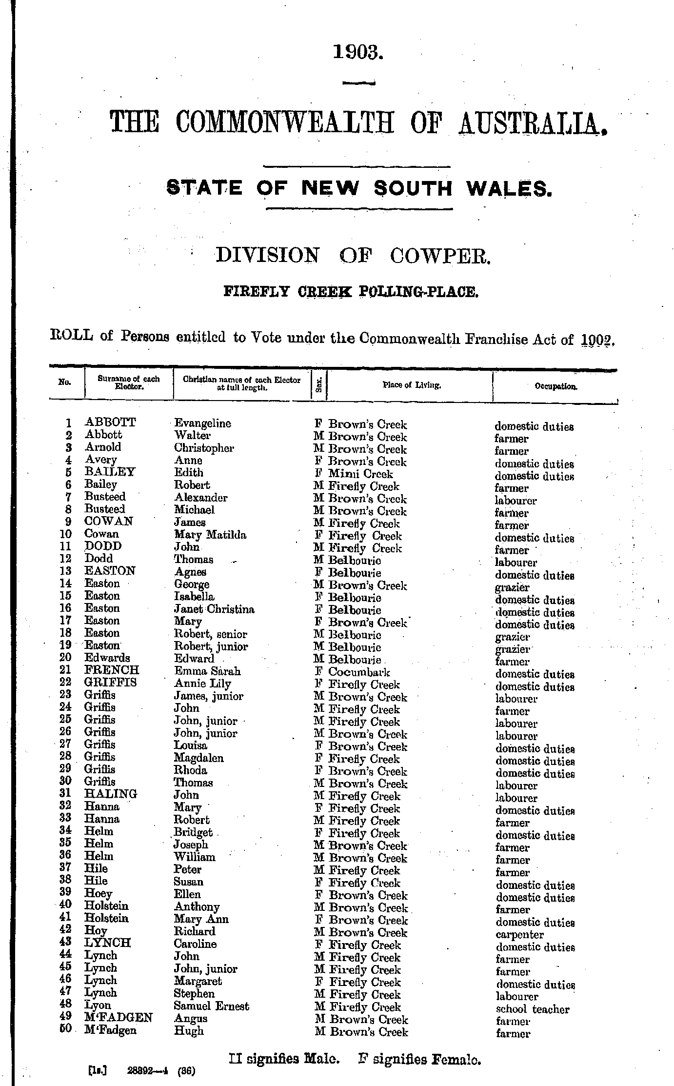
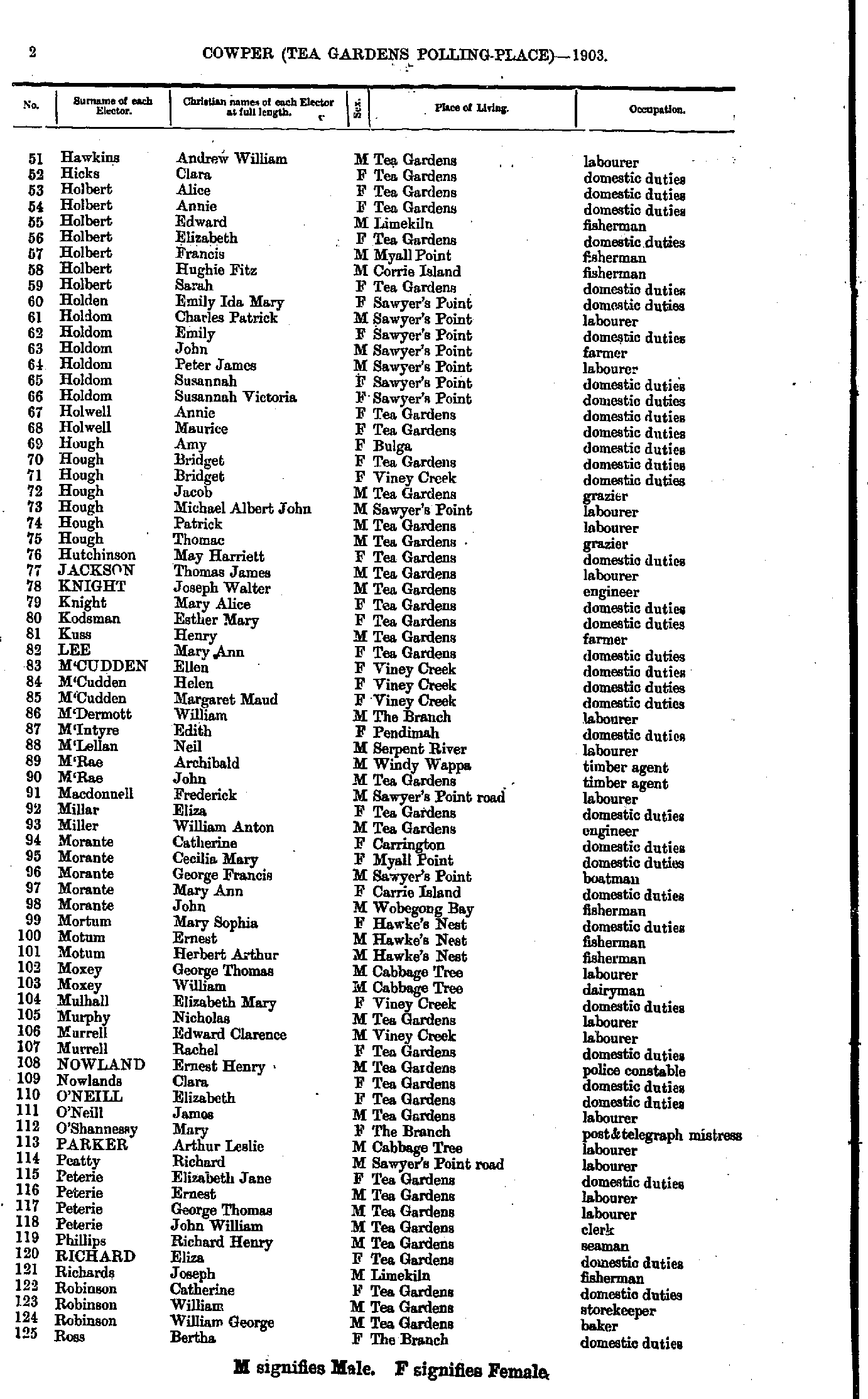
- Adams William - Butler Stephen
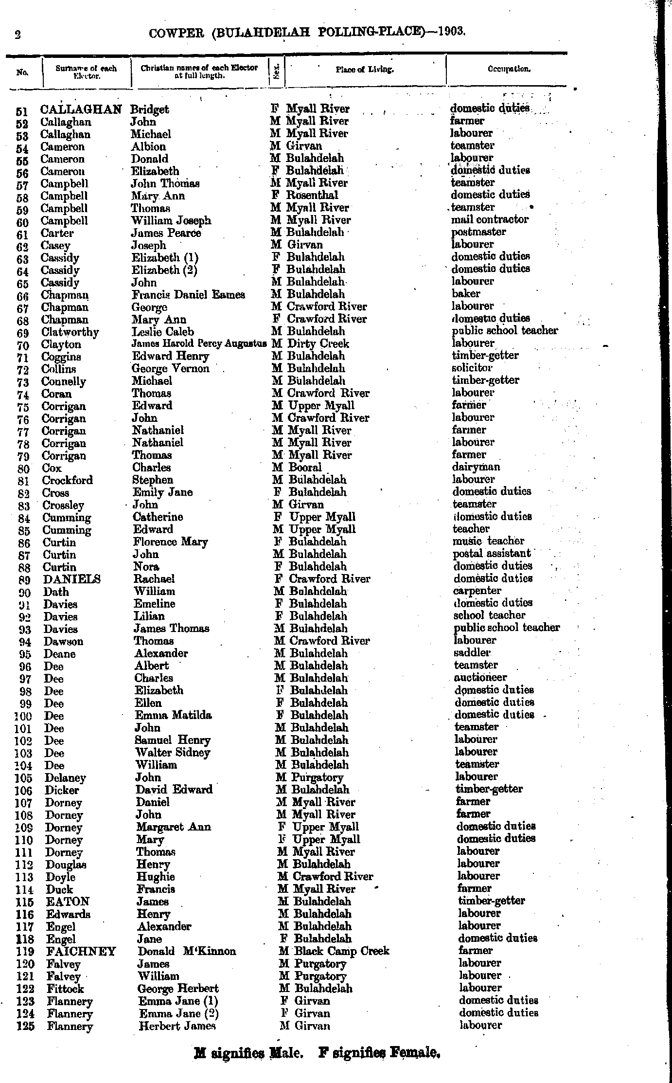
- Callaghan Bridget - Flannery Herbert
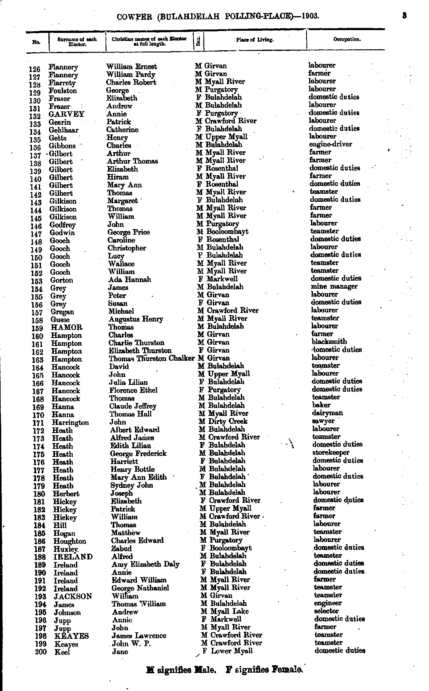
- Flannery William - Keel Jane
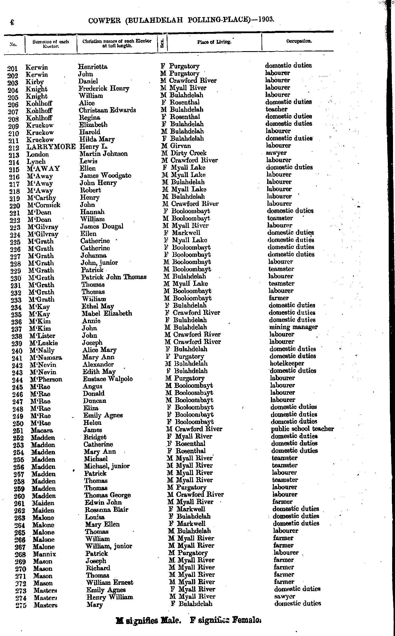
- Kerwin Henrietta - Masters Mary
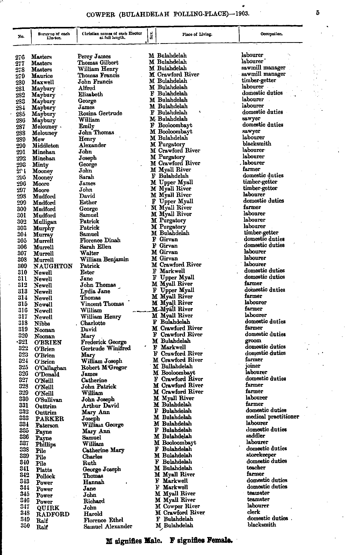
- Masters Percy - Ralf Samuel
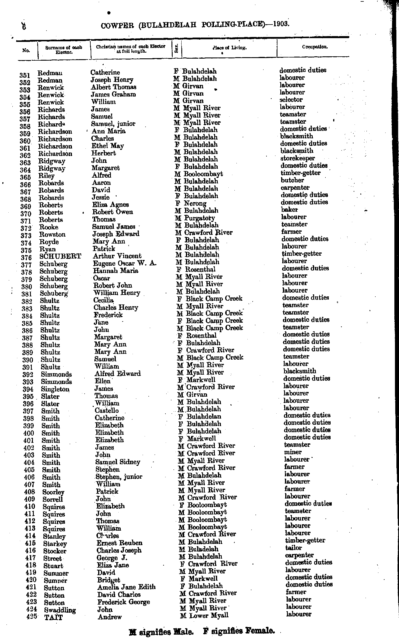
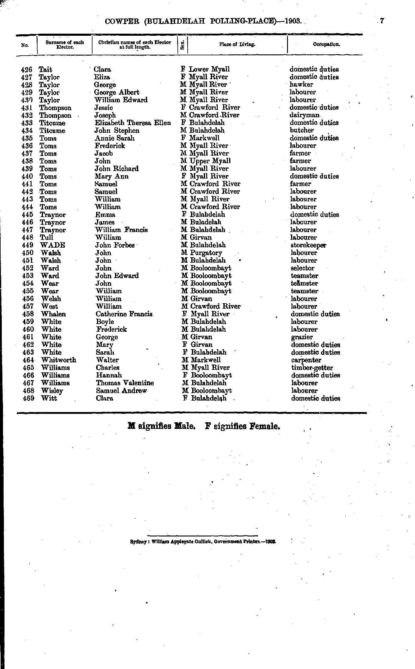
- Redman Catherine - Tait Andrew
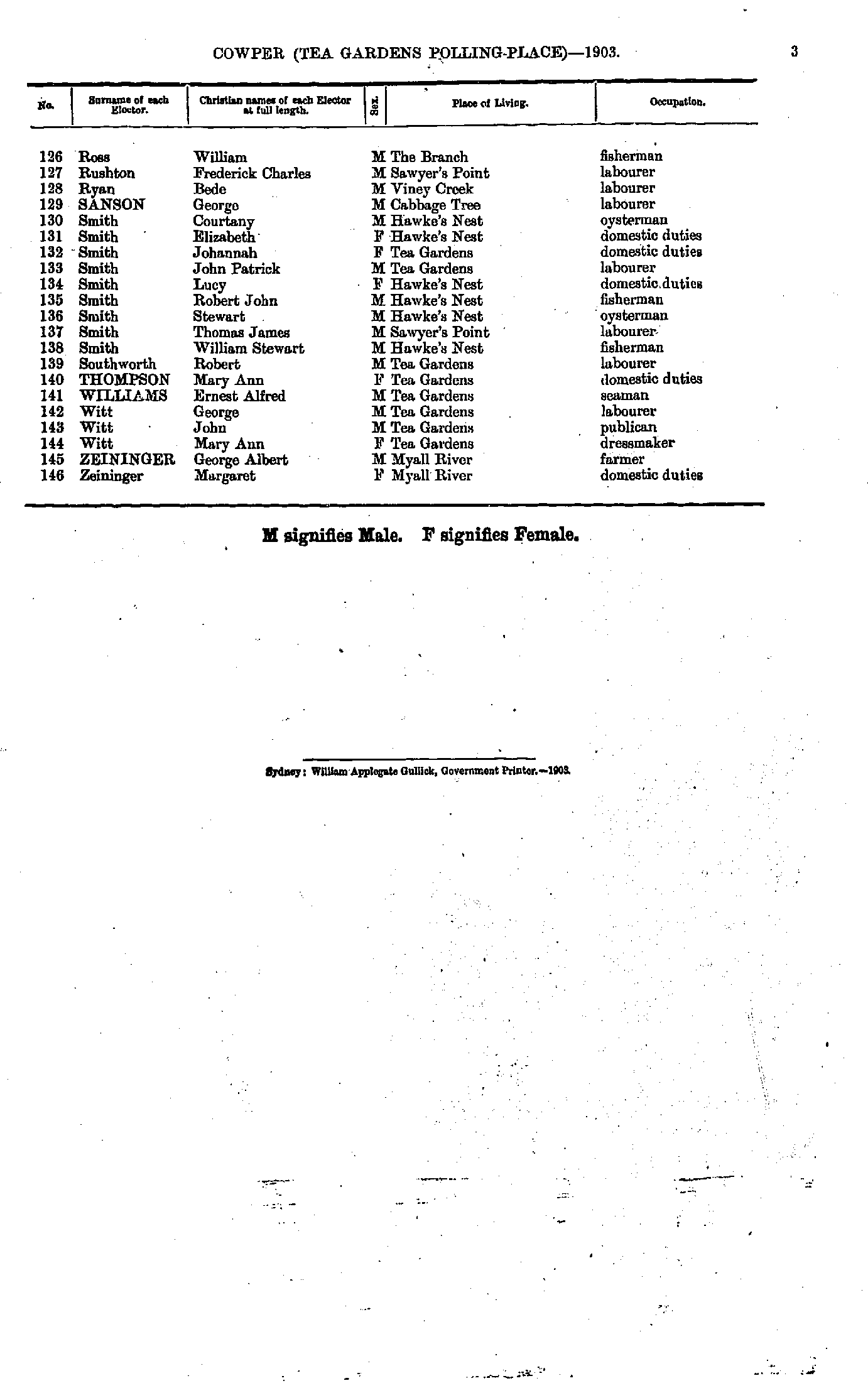
- Tait Clara - Witt Clara
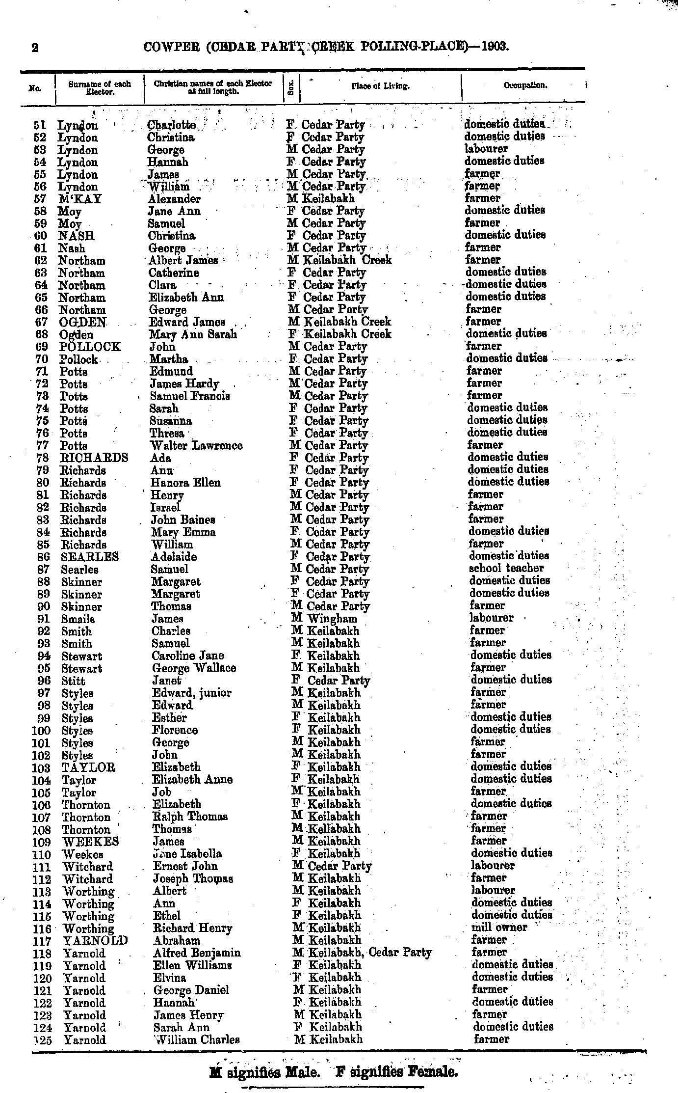
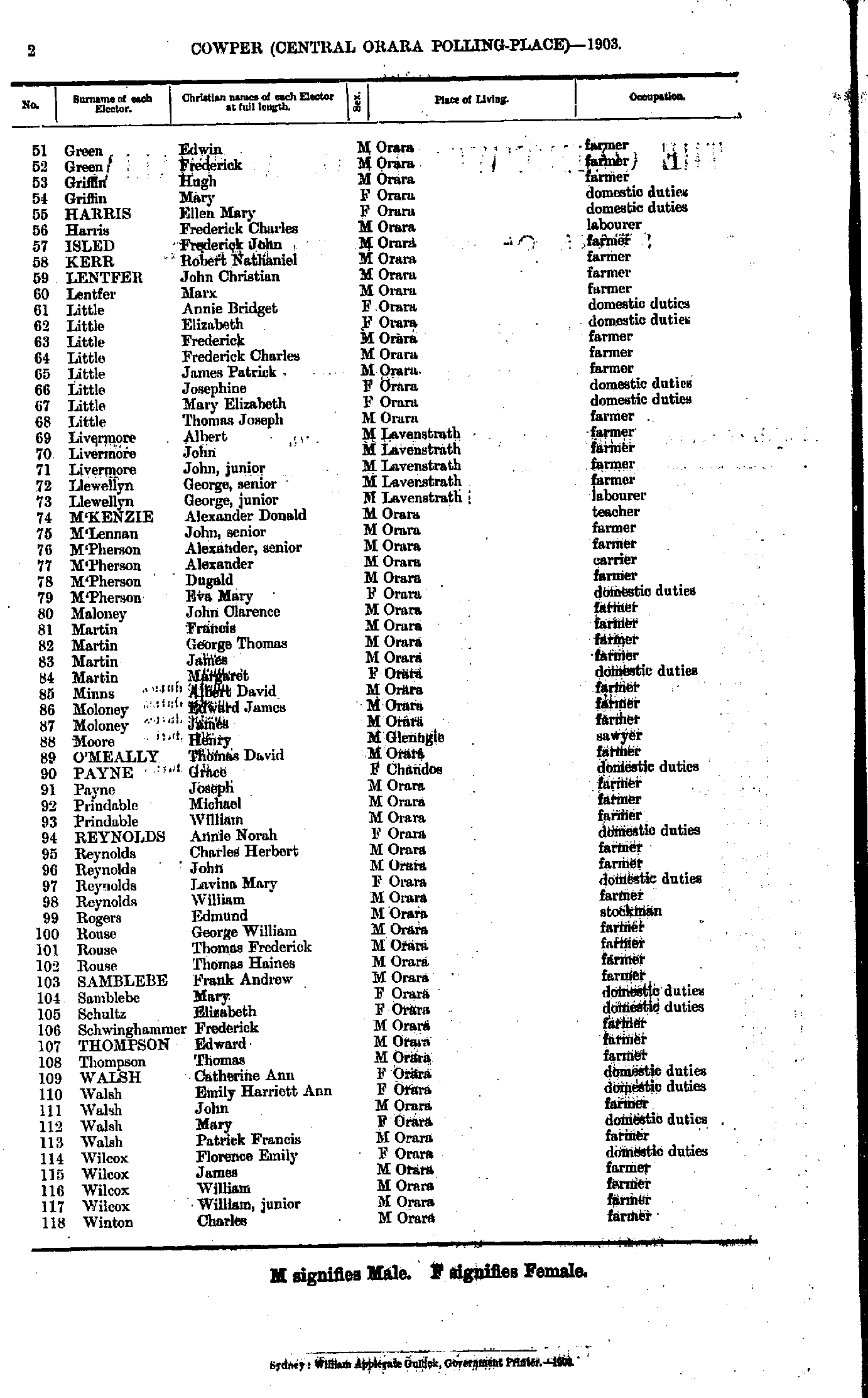
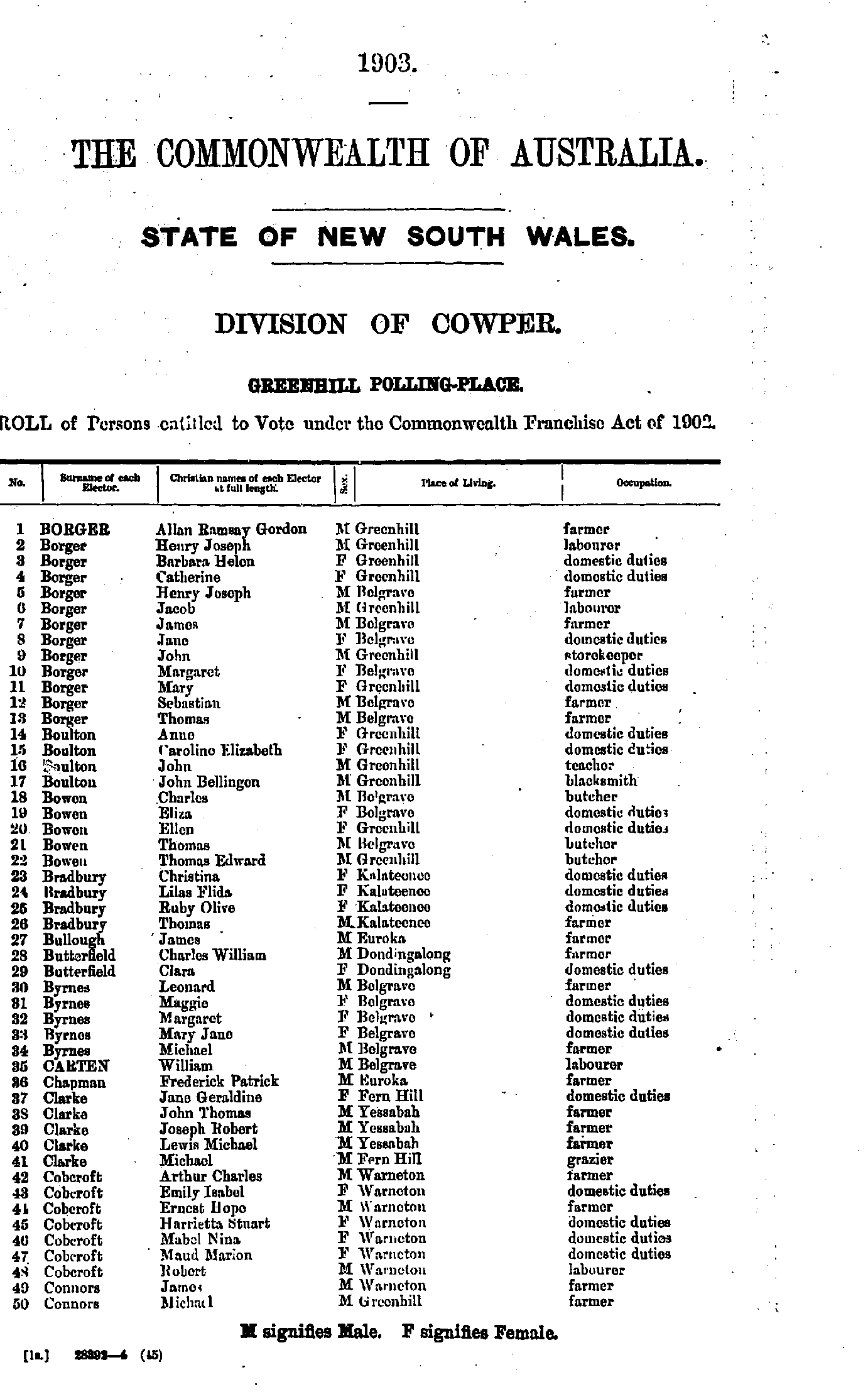
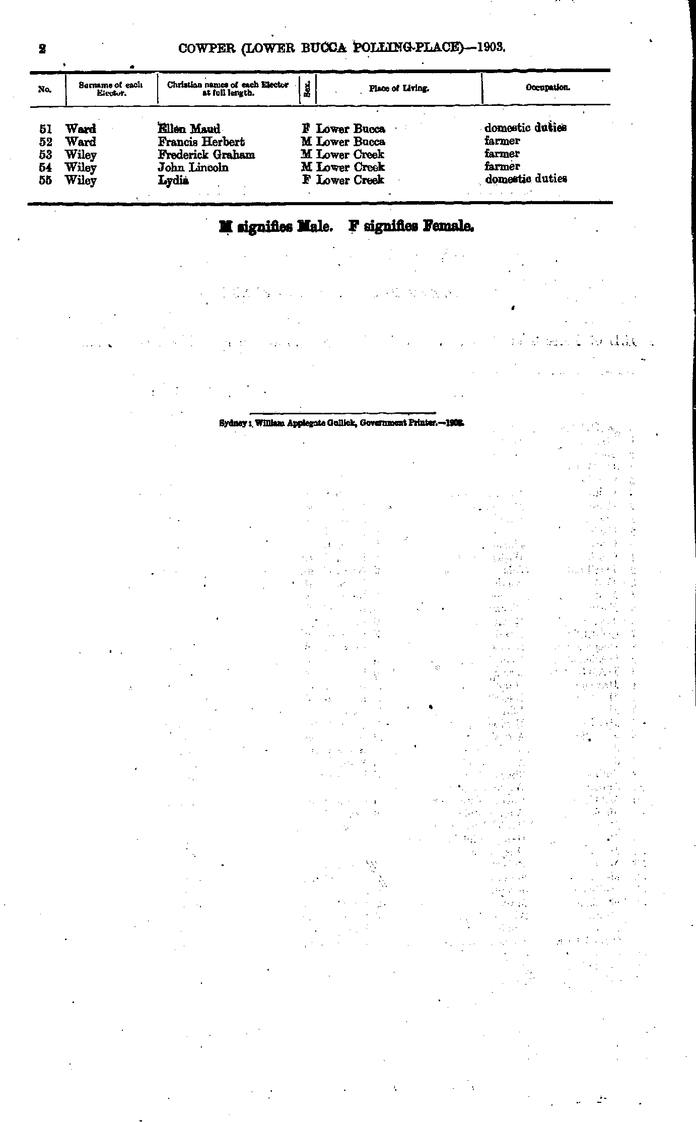
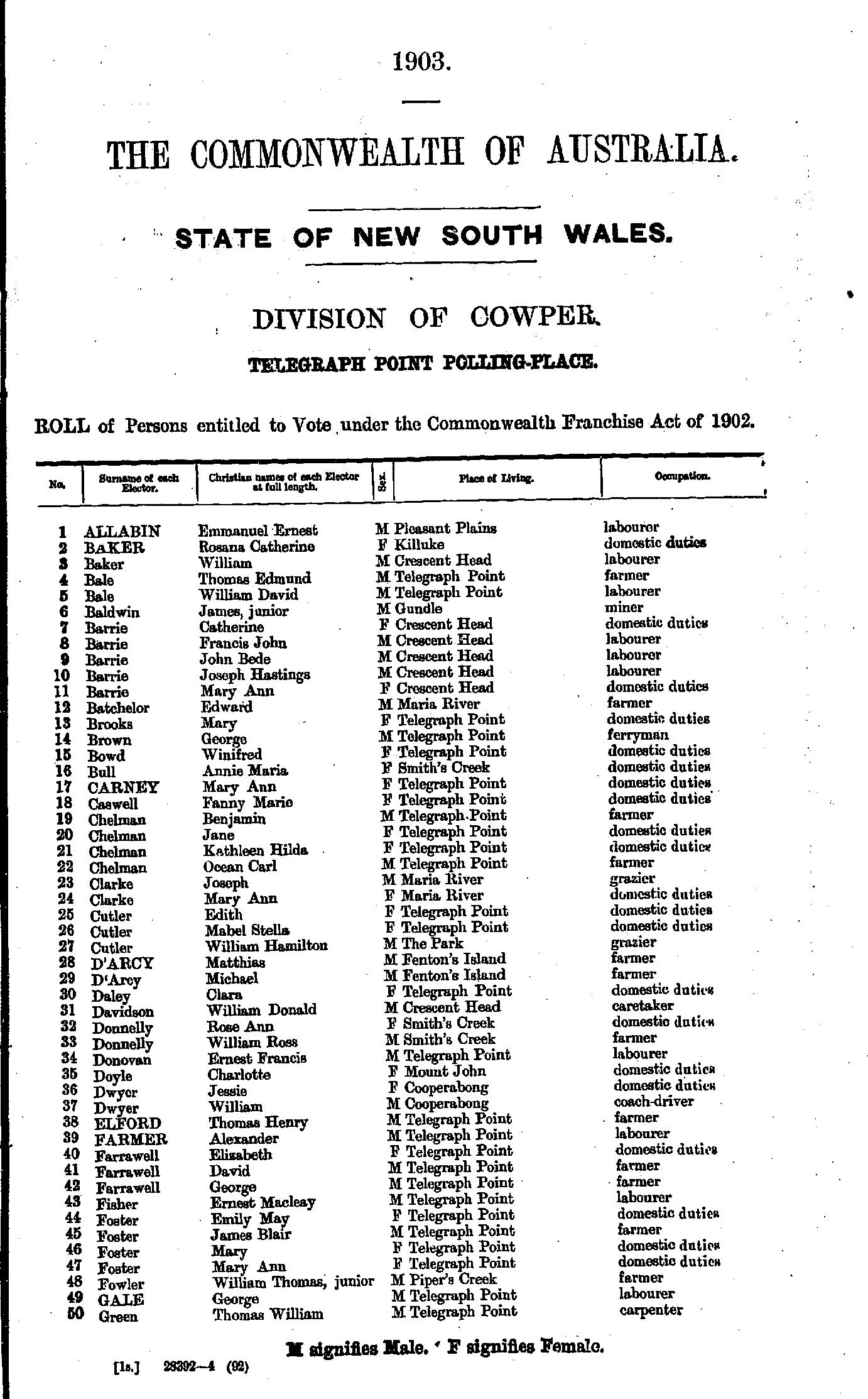
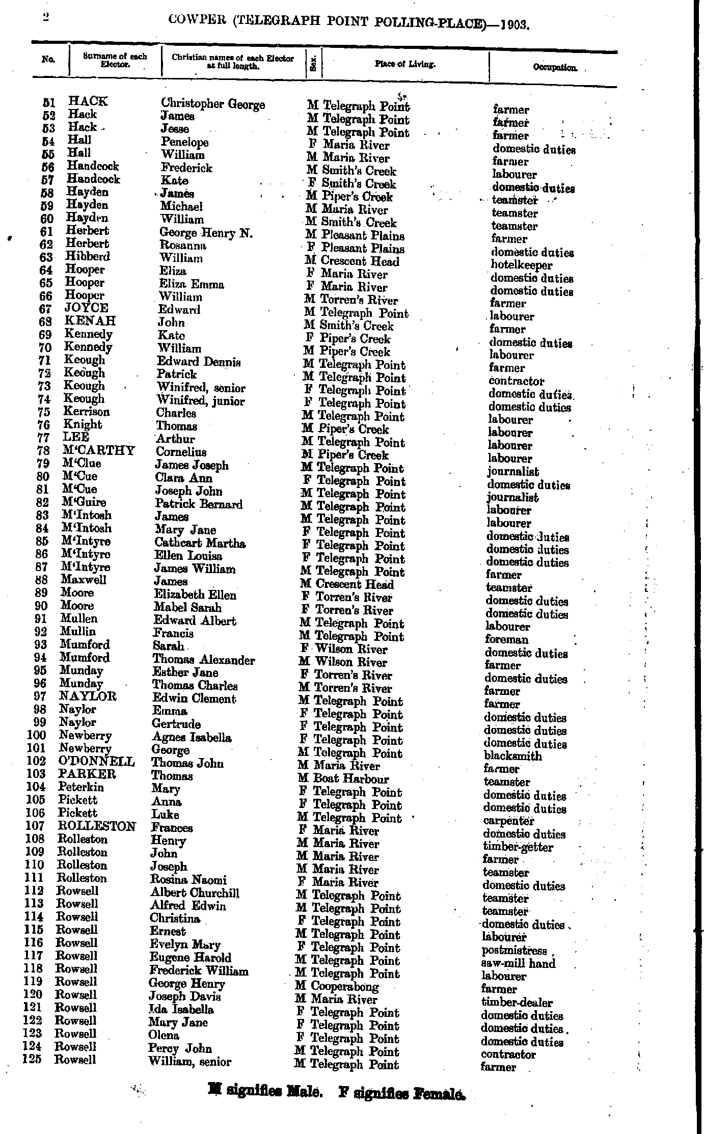
Cedar Party Creek Polling Place
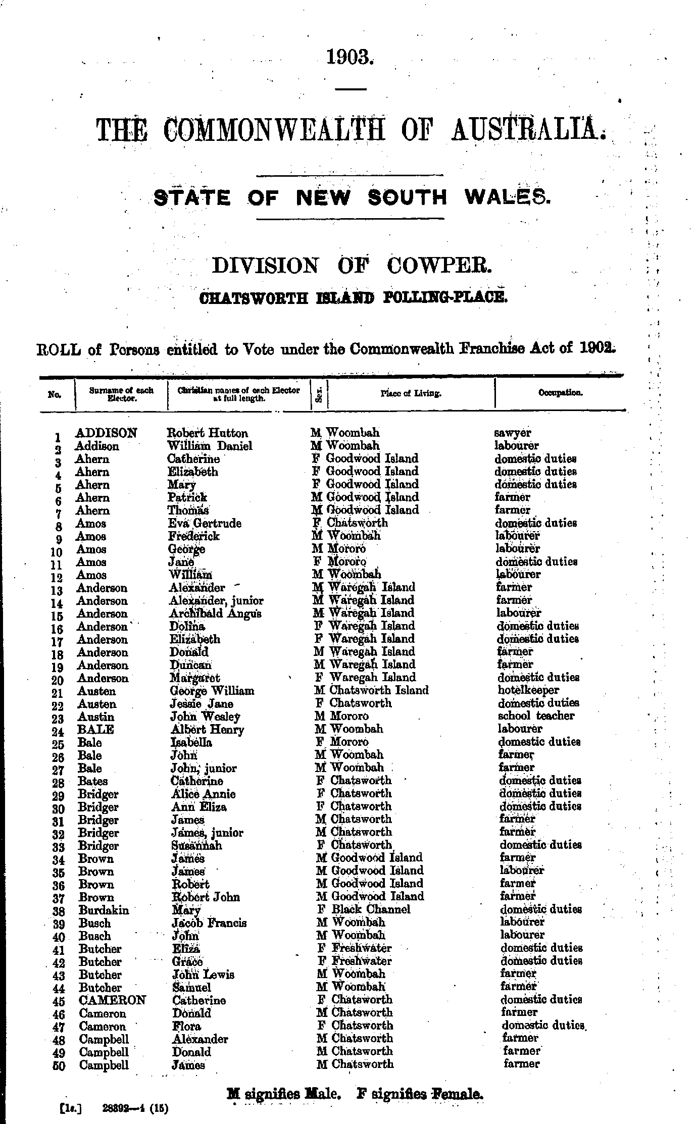
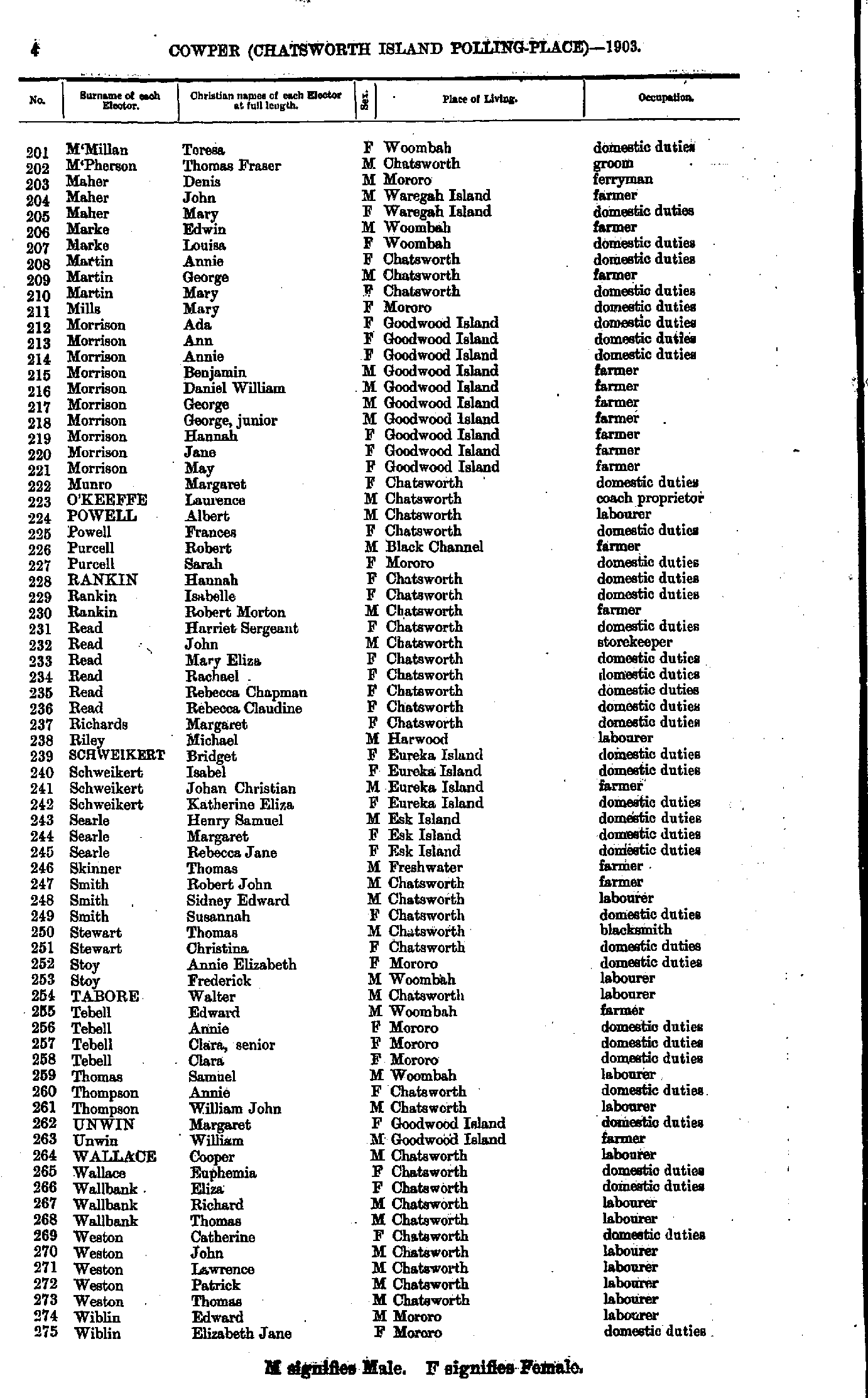
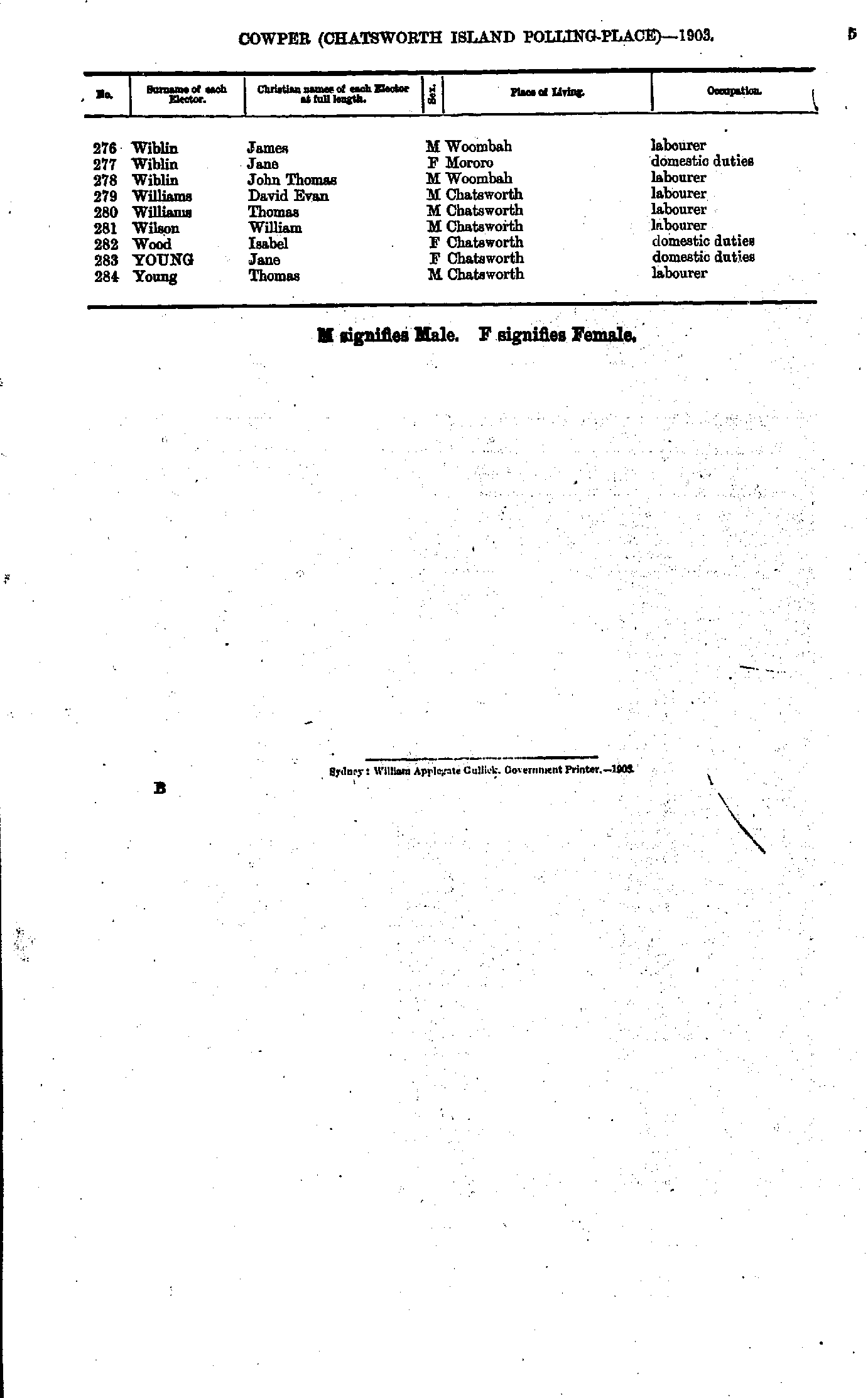
Chatsworth Island Polling Place
- Addison Robert - Campbell James
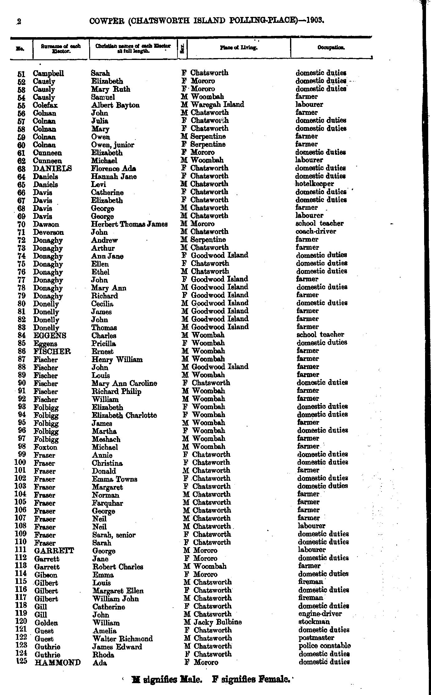
- Campbell Sarah - Hammond Ada
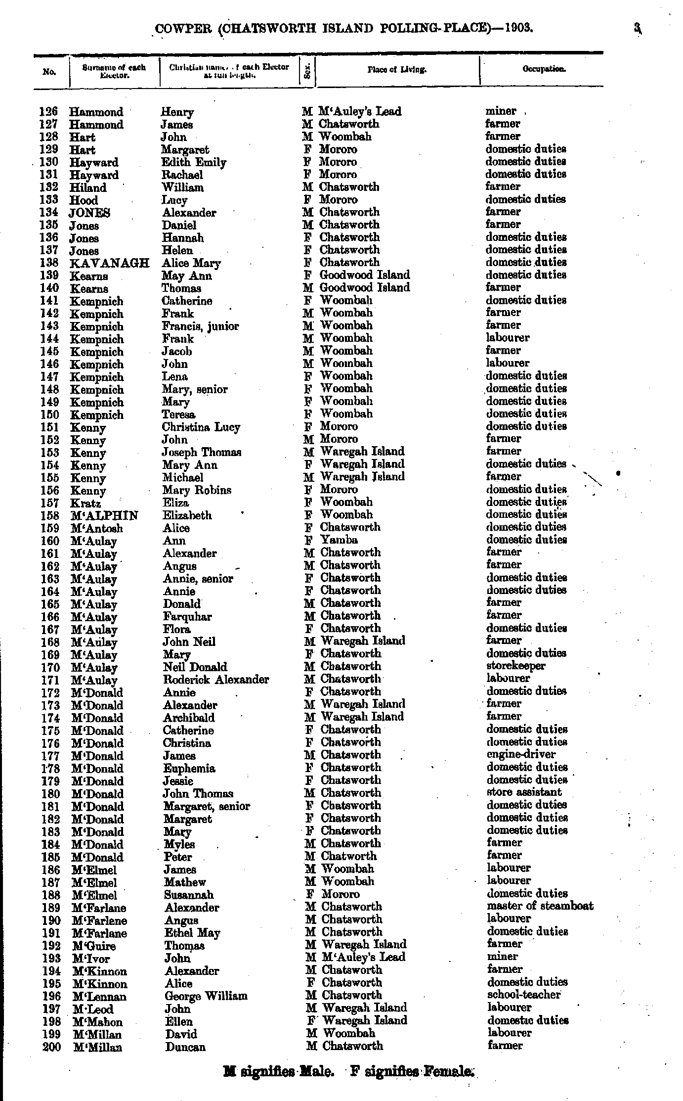
- Hammond Henry - M'Millan Duncan
- M'Millan Teresa - Wiblin Elizabeth
- Wiblin James - Young Thomas
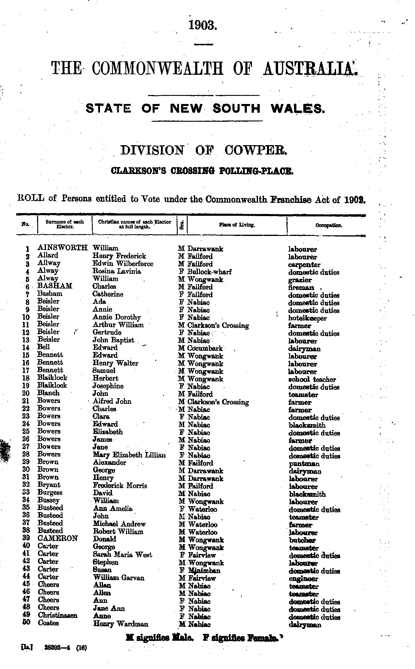
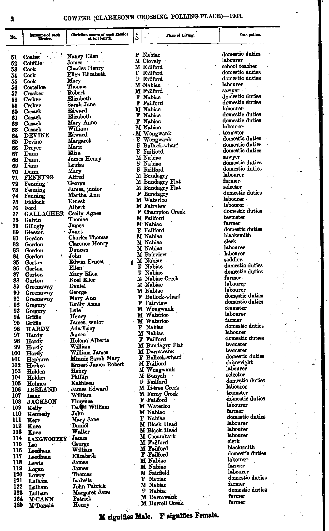
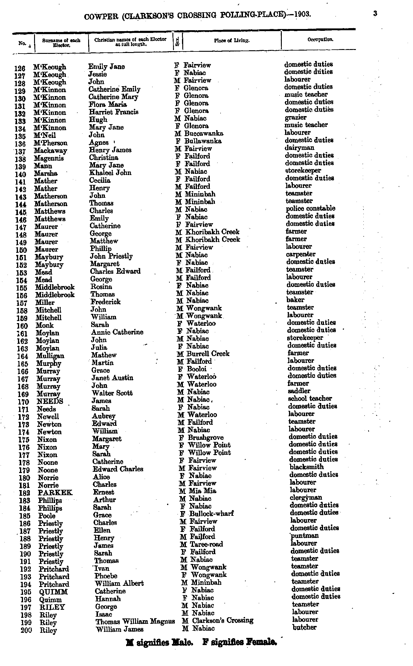
Clarkson's Crossing Polling Place
- Ainsworth William - Coates Henry
- Coates Nancy - M'Donald Henry
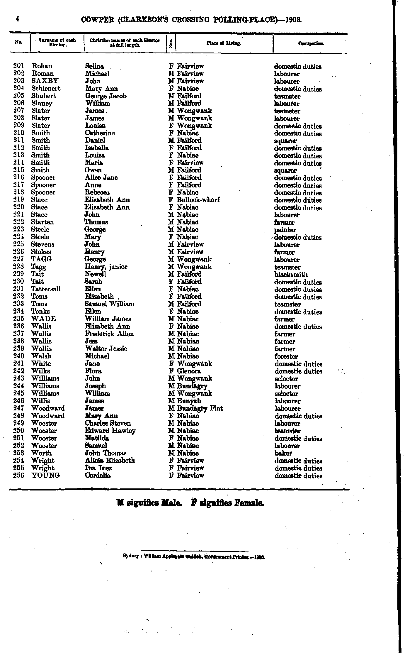
- M'Keough Emily - Riley William
- Rohan Selina - Young Cordelia
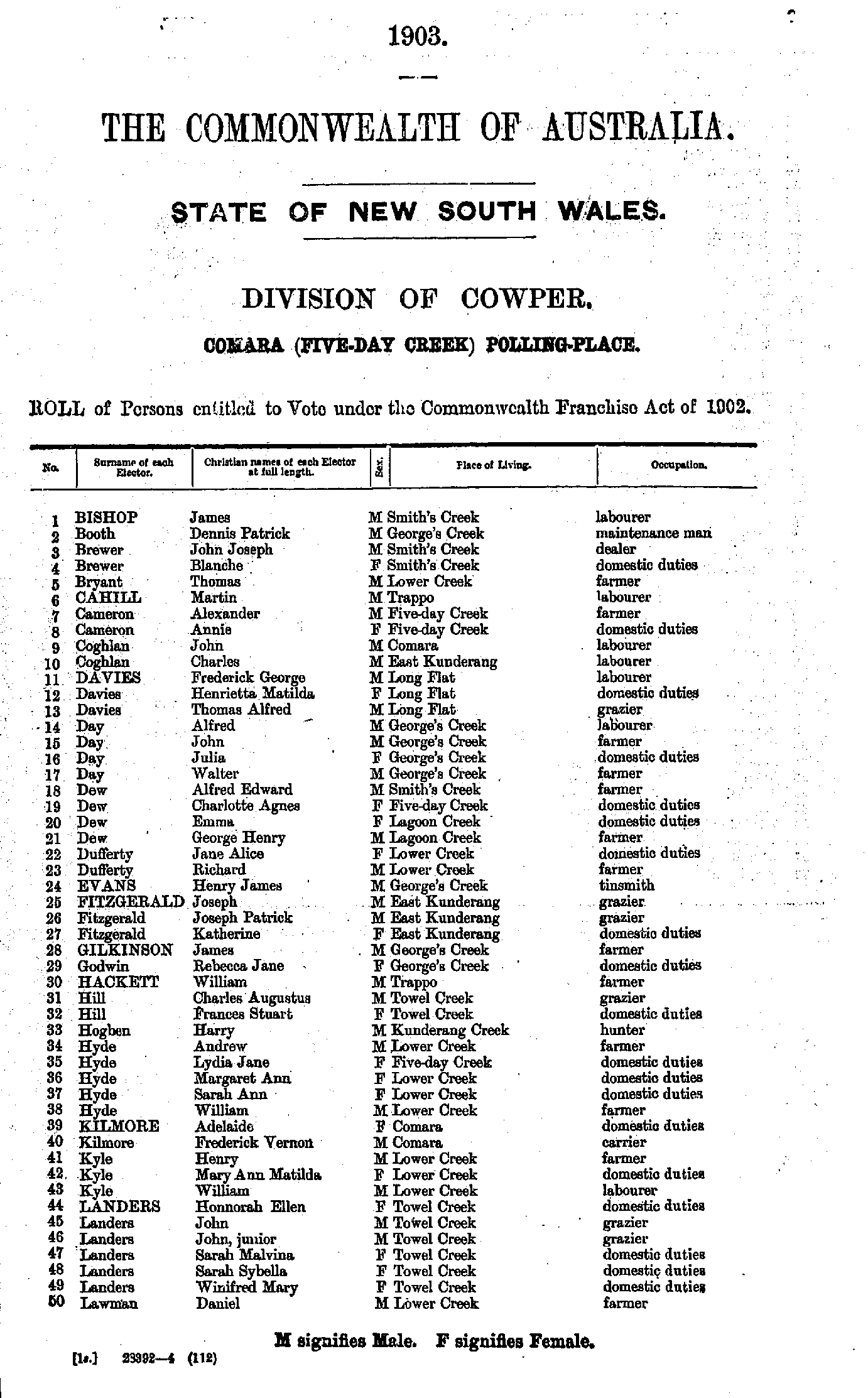
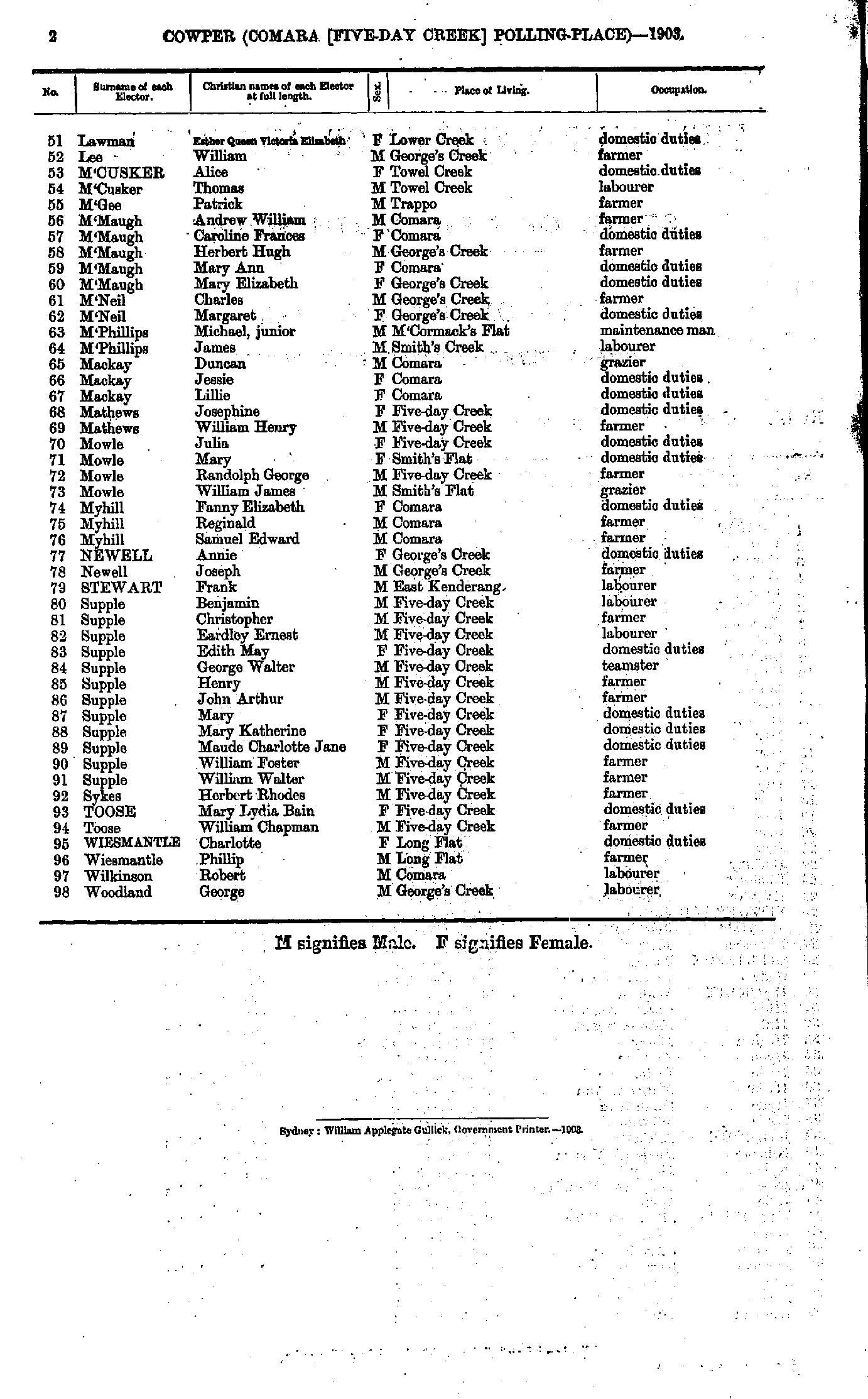
Comara (five-day Creek) Polling Place
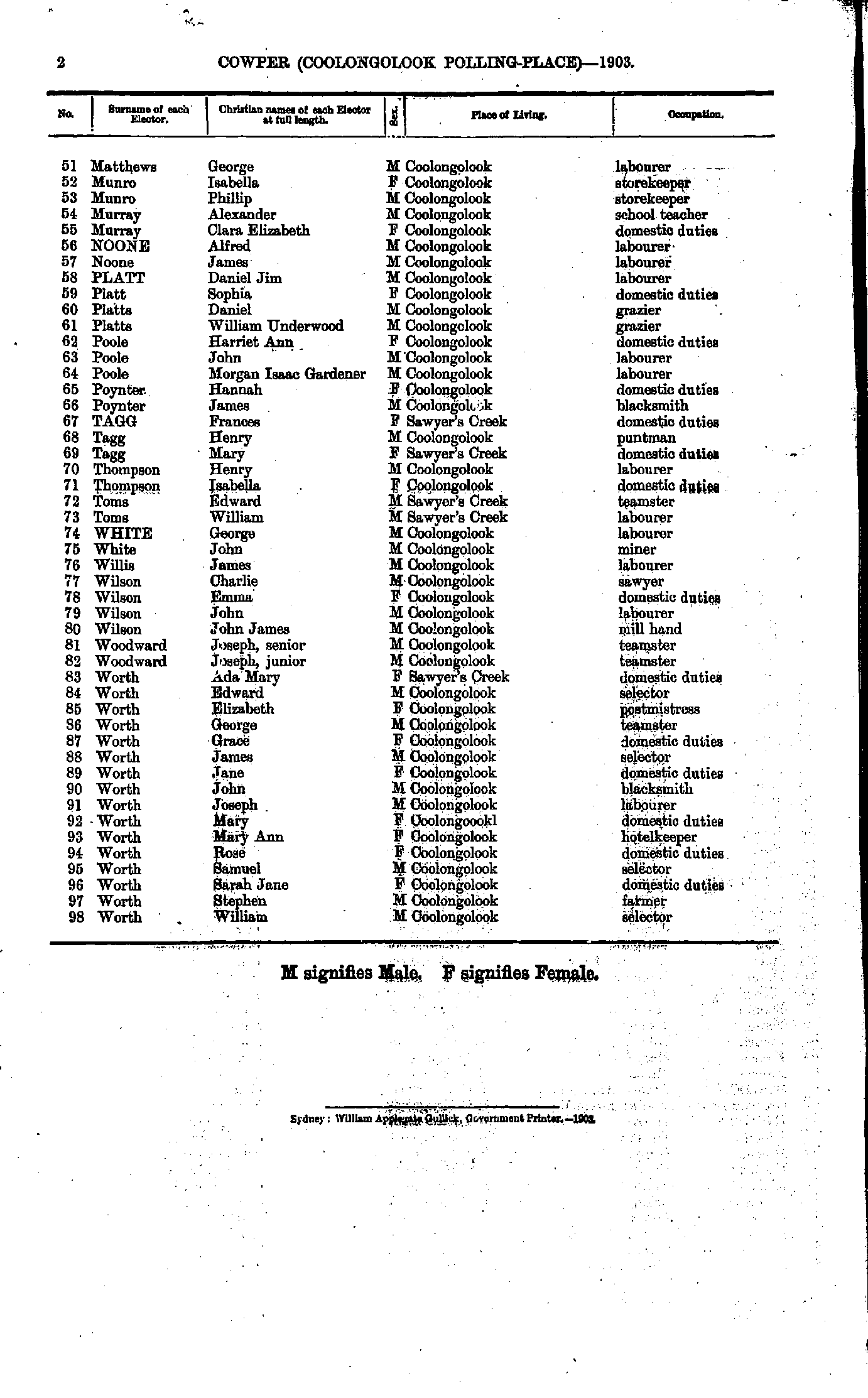
- Allan Alexander - Bulley Charles
- Bulley Charles - Everingham Albert
- Everingham Mary - Hudson Joseph
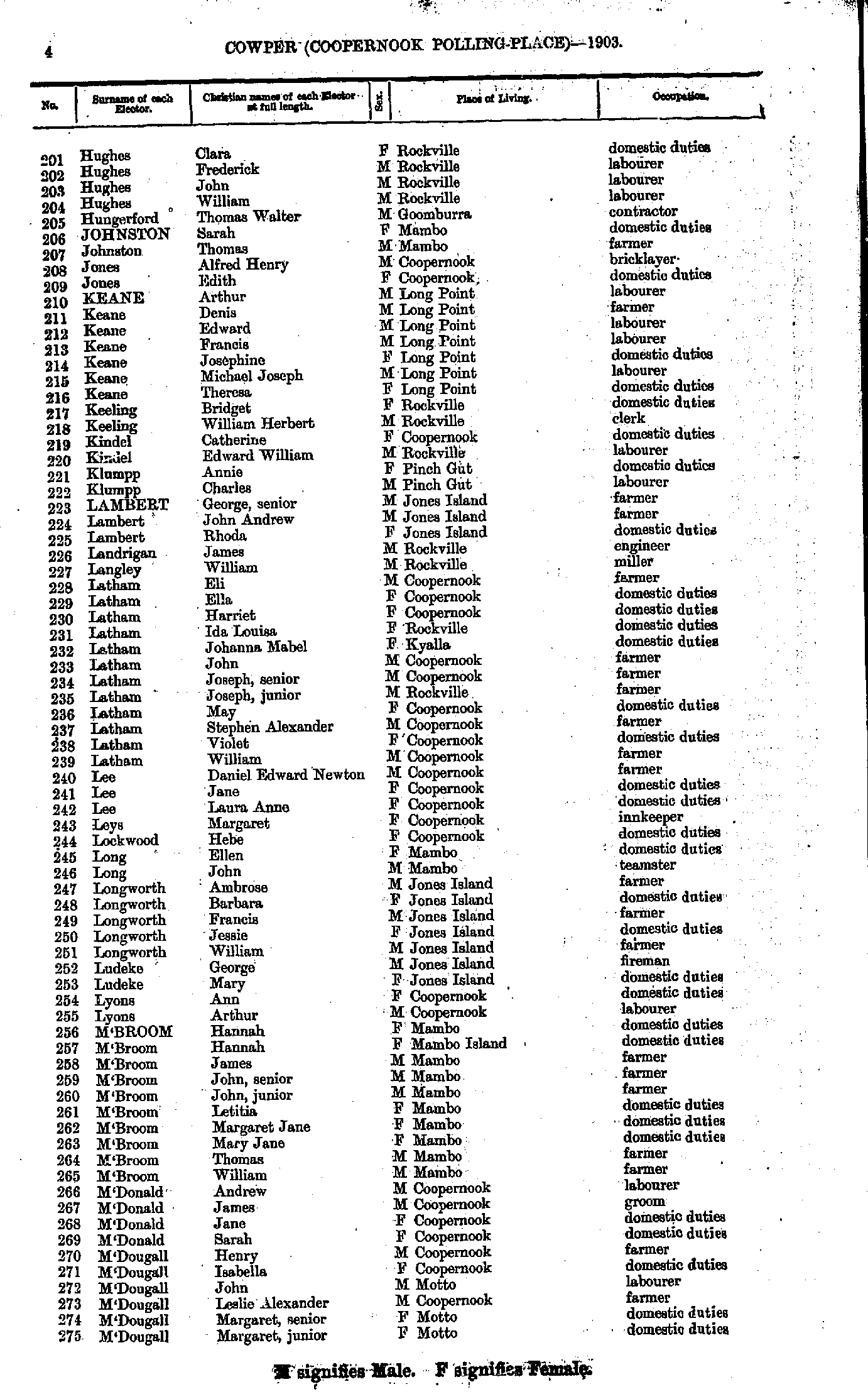
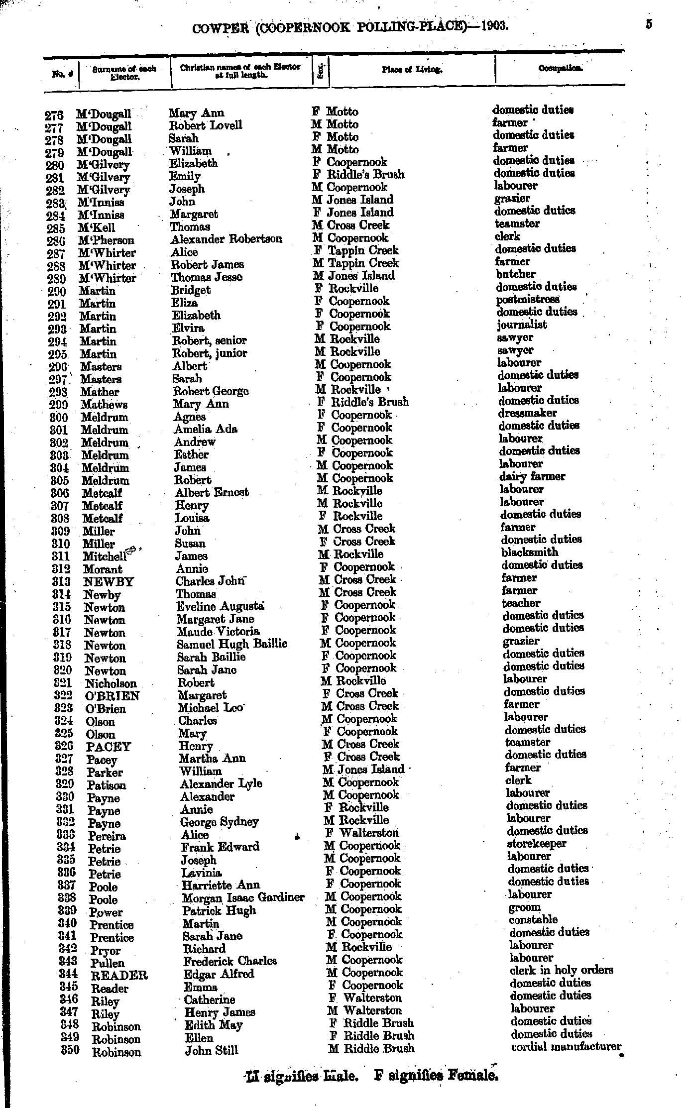
- Hughes Clara - M'Dougall Margaret
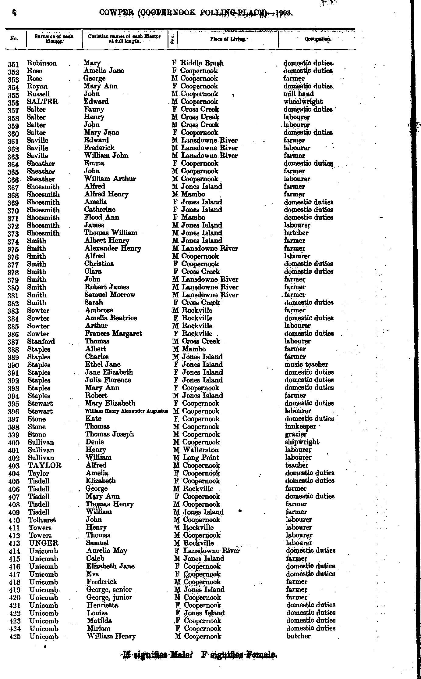
- M'Dougall Mary - Robinson John
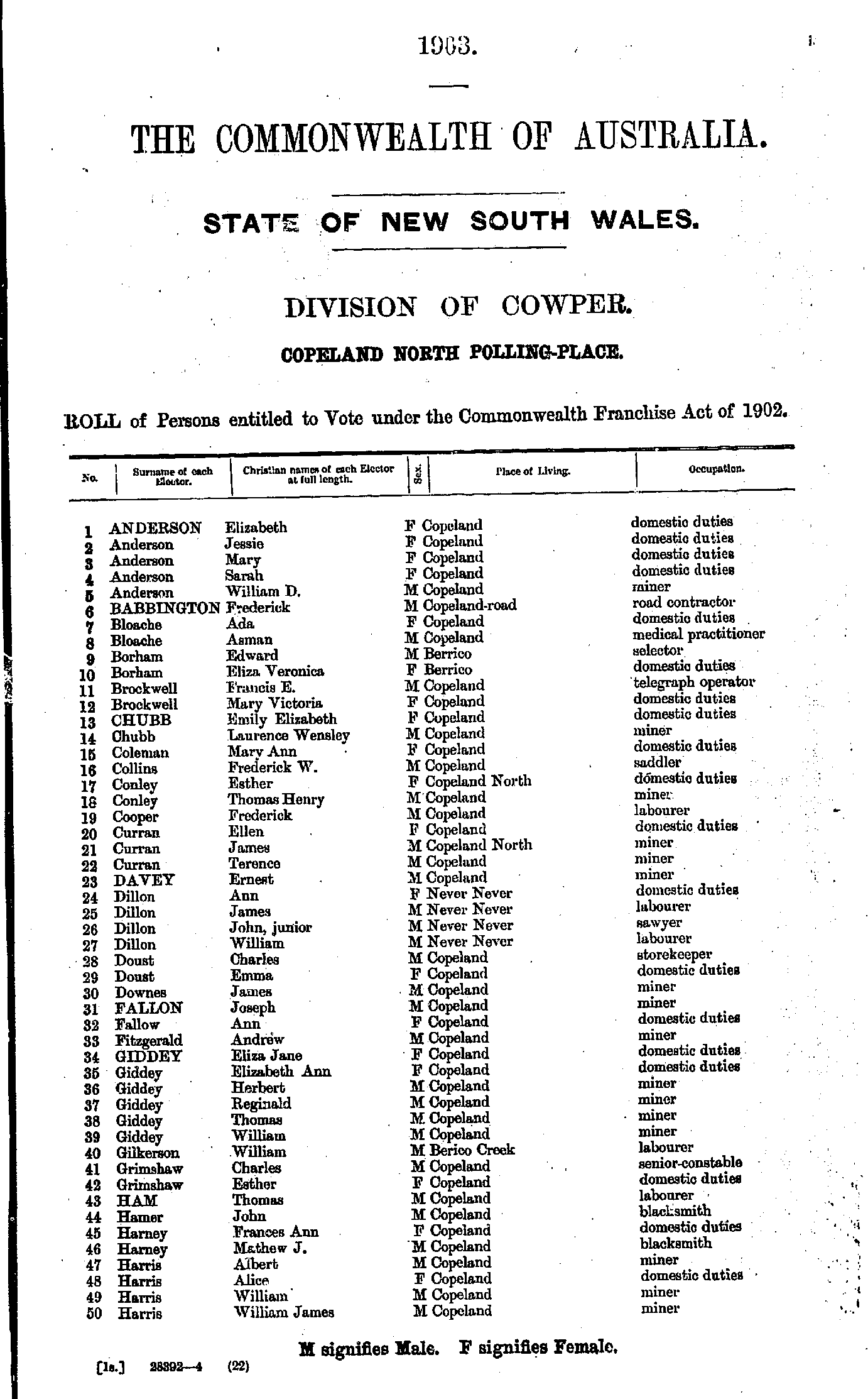
- Robinson Mary - Unicomb William
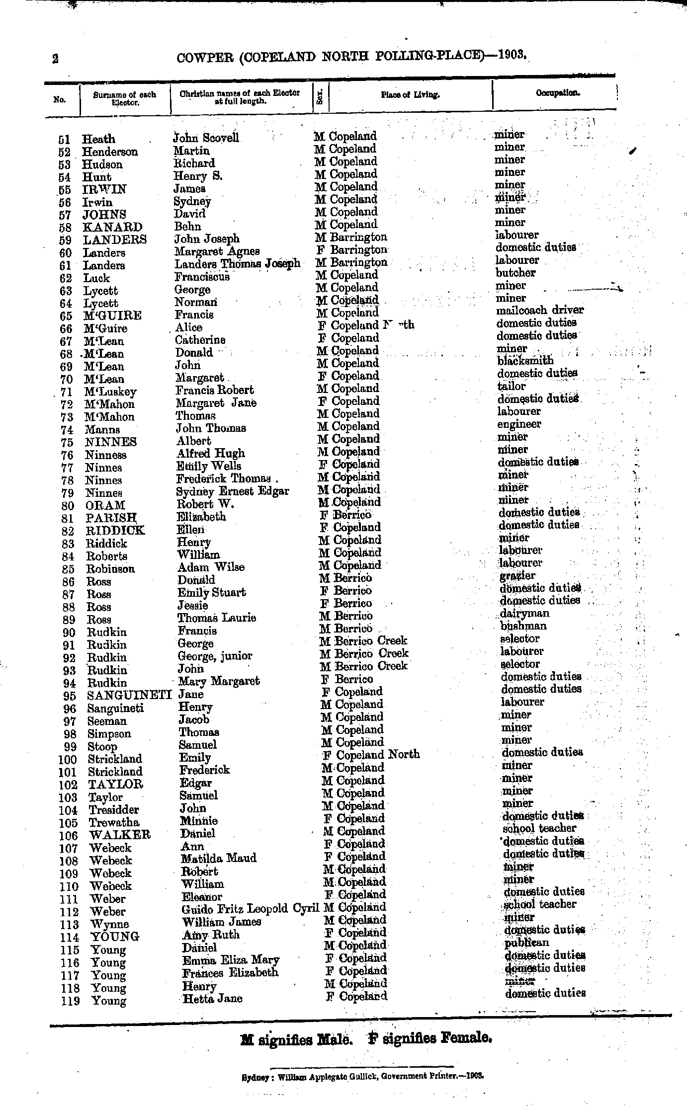
- Ussher Edward - Wooding Sarah
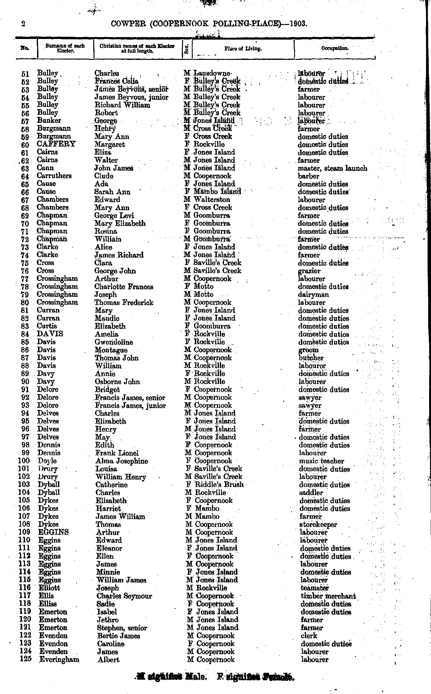
- Alderman Alfred - Corcoran John
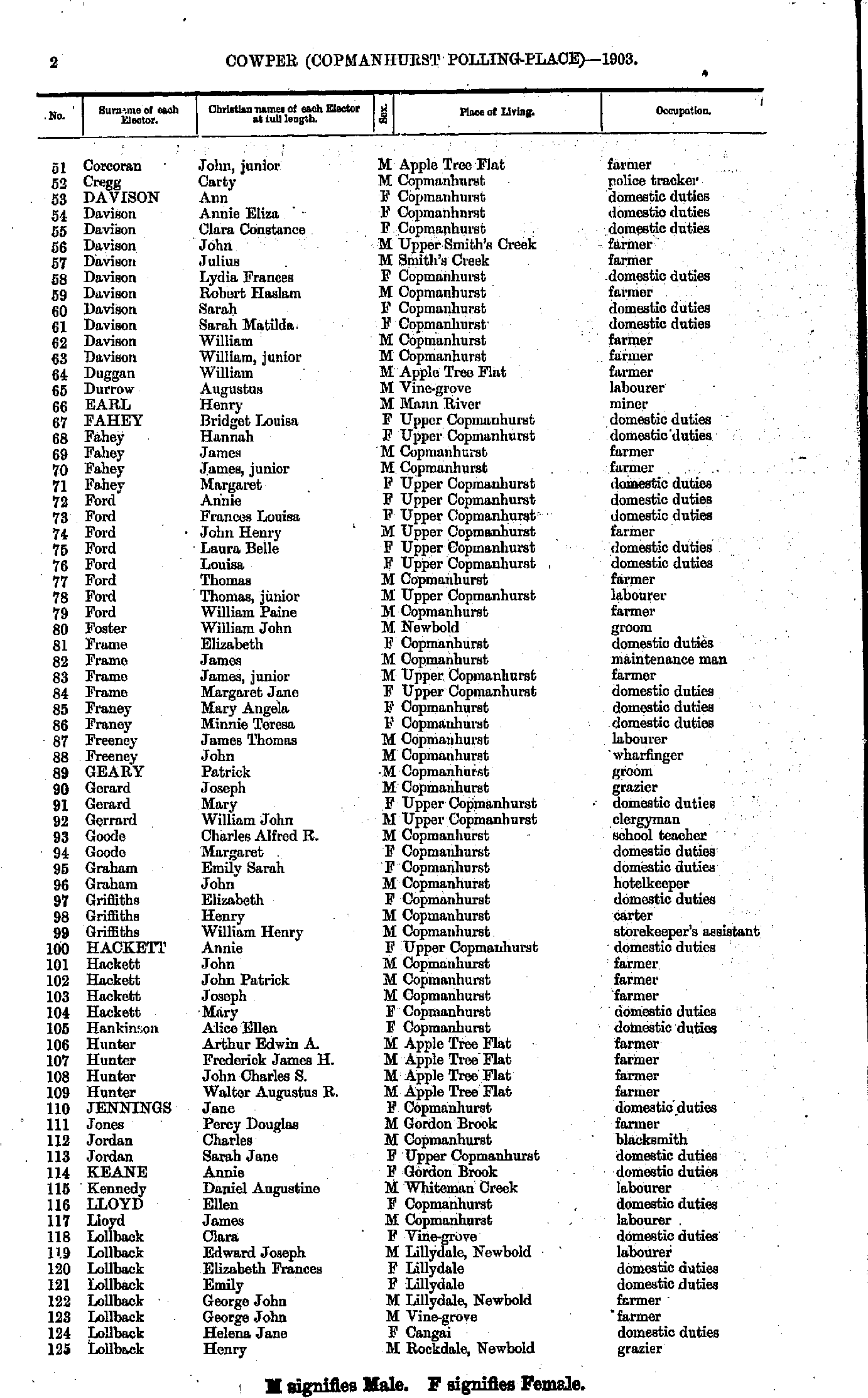
- Corcoran John - Lollback Henry
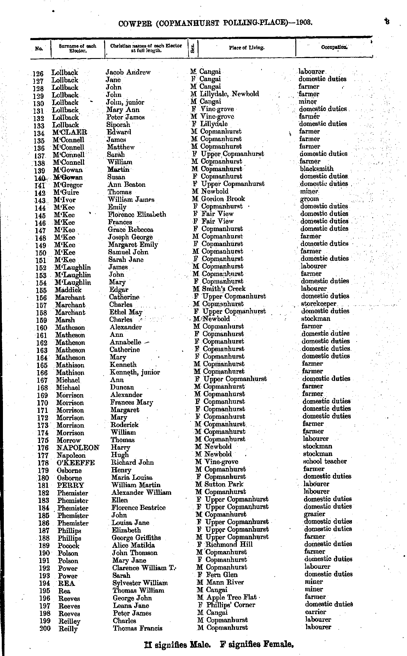
- Lollback Jacob - Reilly Thomas
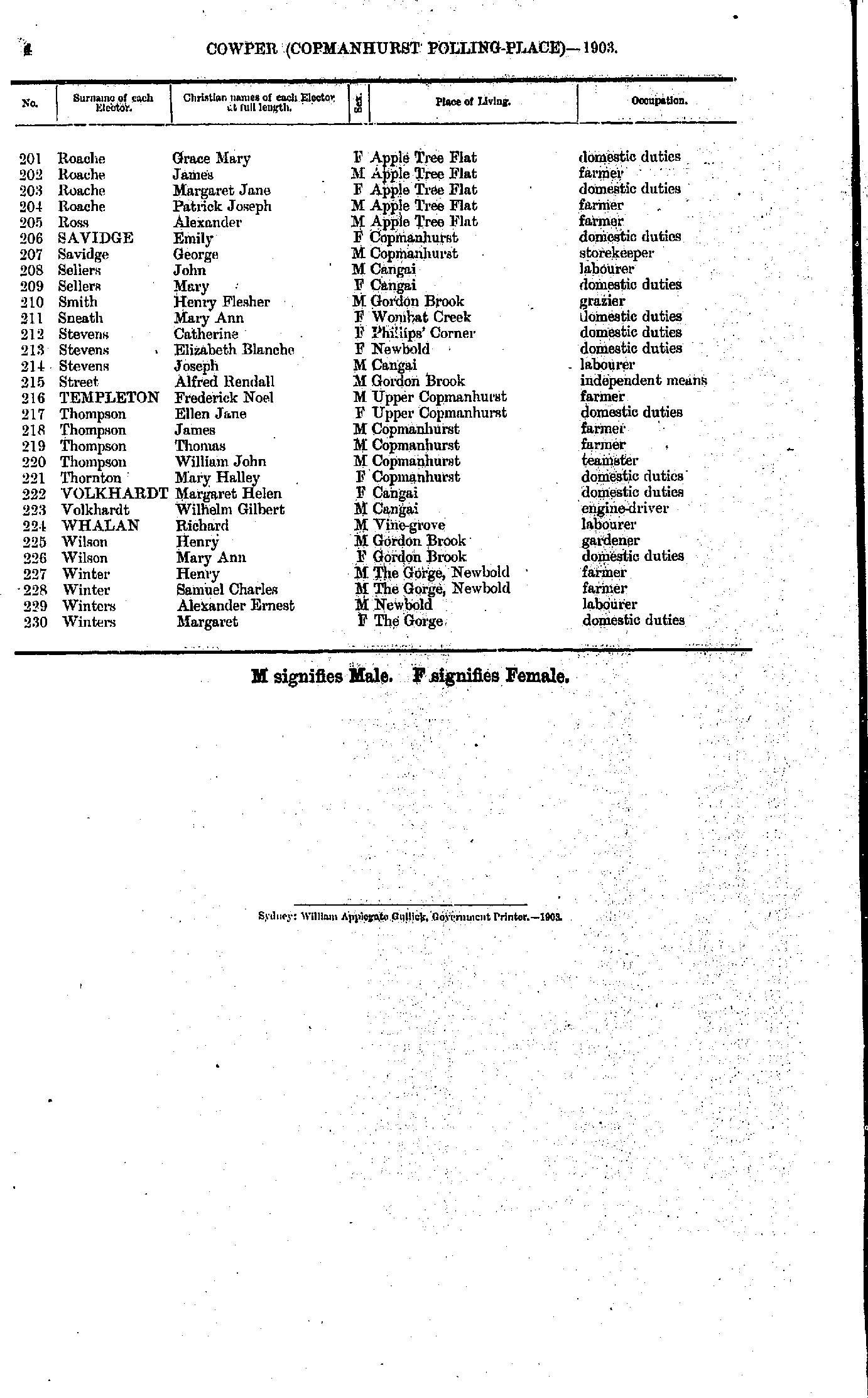
- Roache Grace - Winters Margaret
Coutt's Crossing Polling Place
- Adams John - Carle Elsie
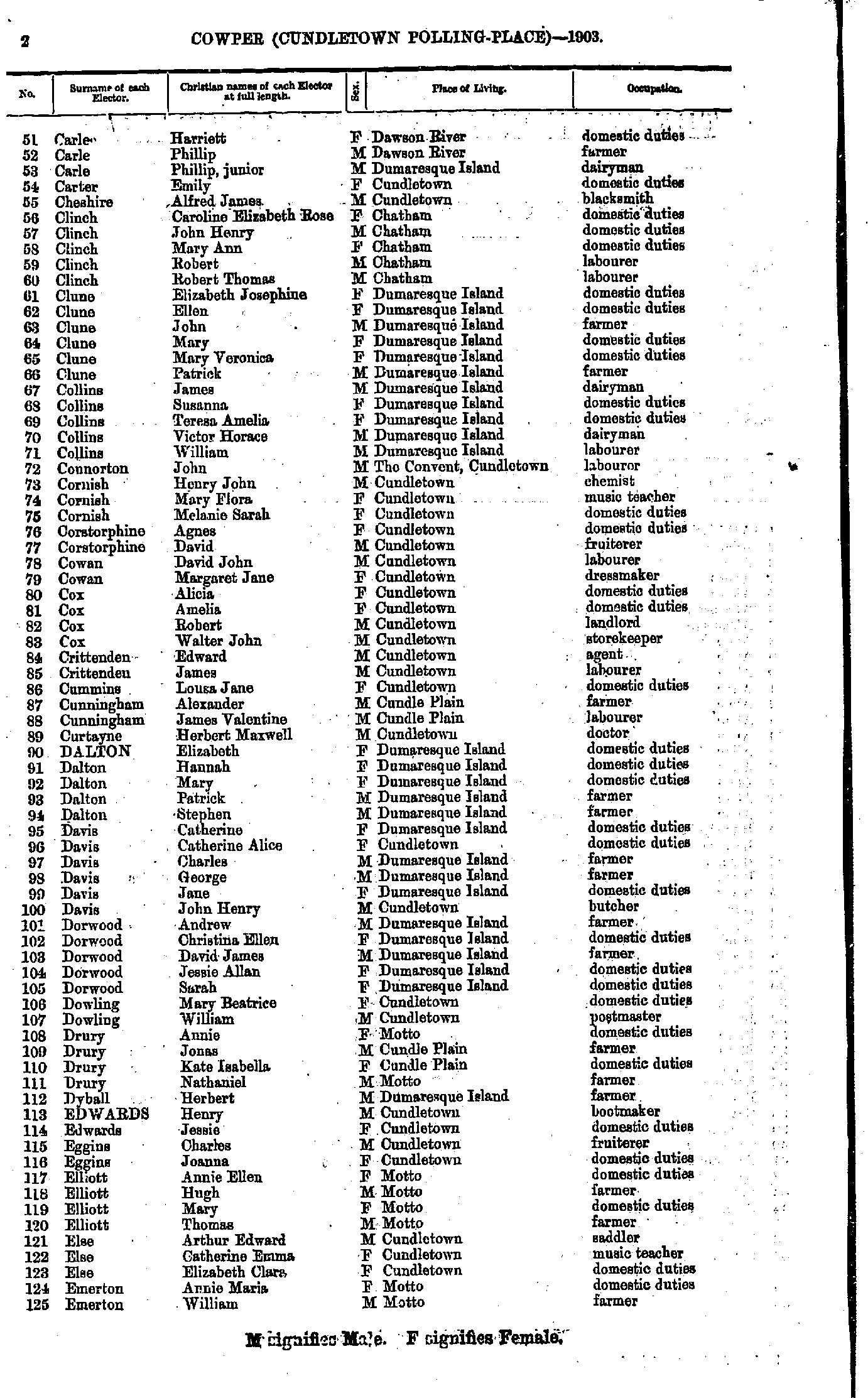
- Carle Harriett - Emerton William
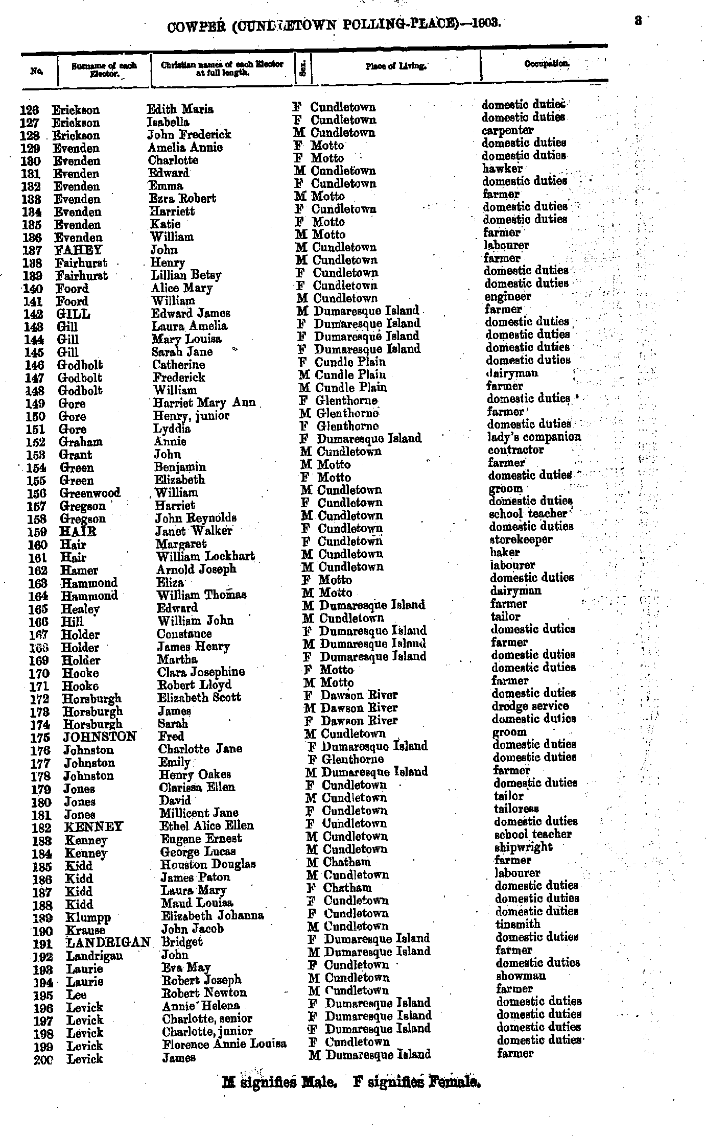
- Erickson Edith - Levick James
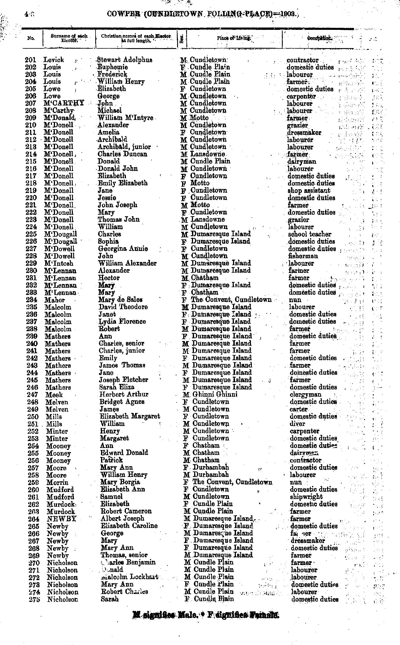
- Levick Stewart - Nicholson Sarah
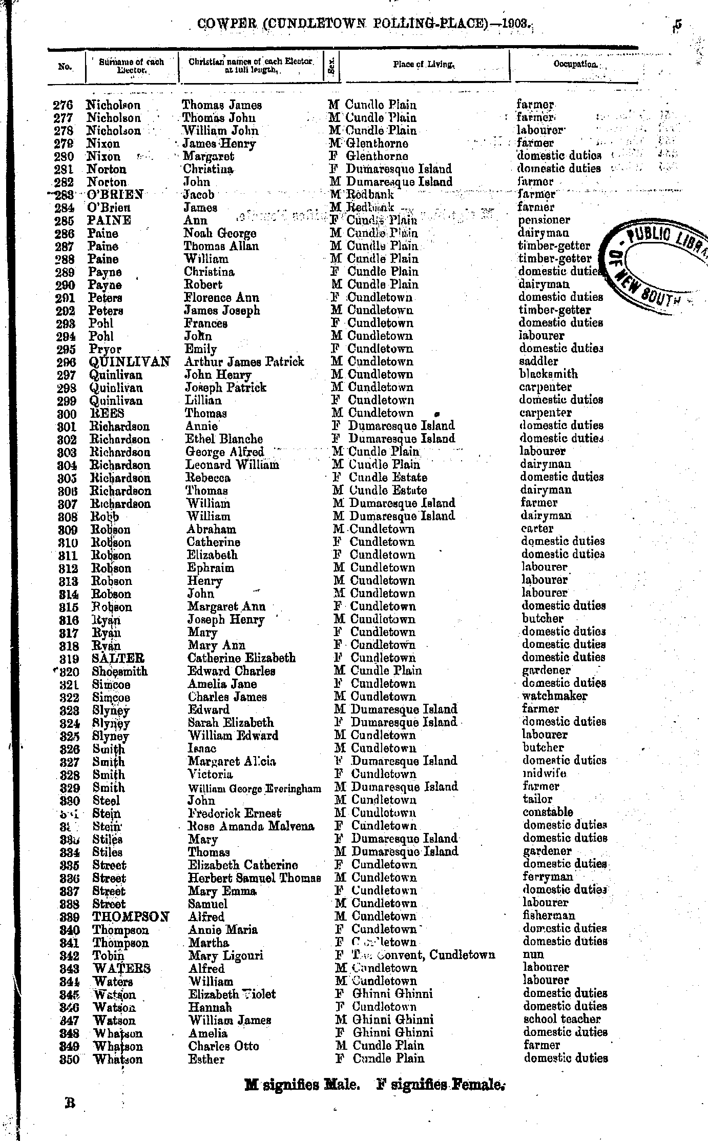
- Nicholson Thomas - Whatson Esther
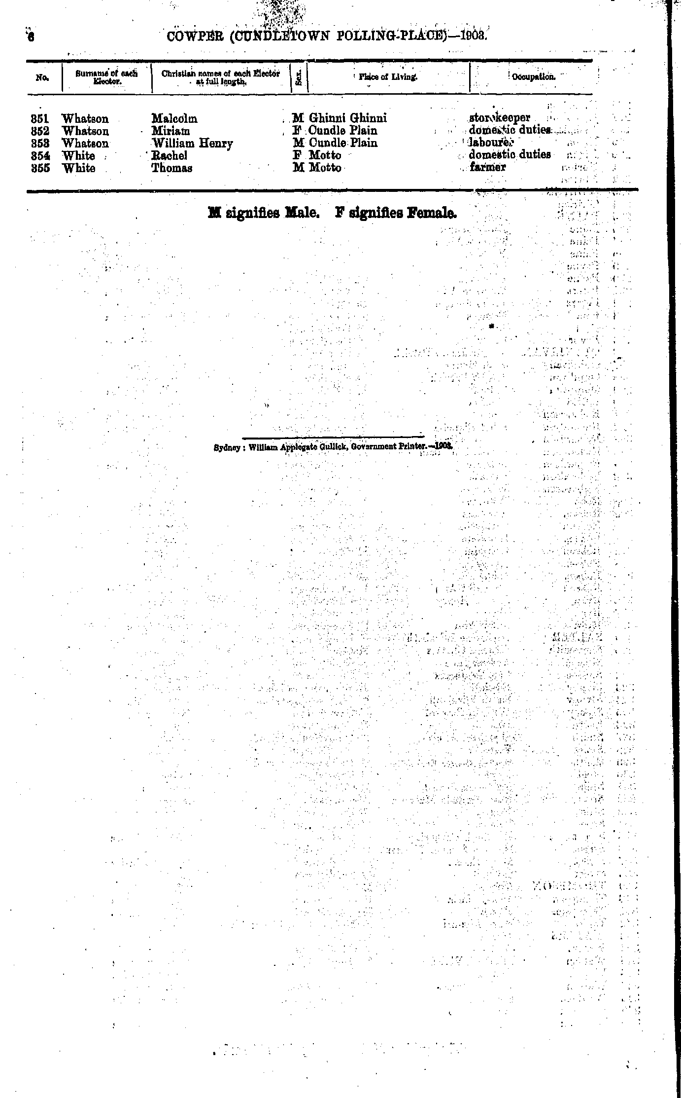
- Whatson Malcolm - White Thomas
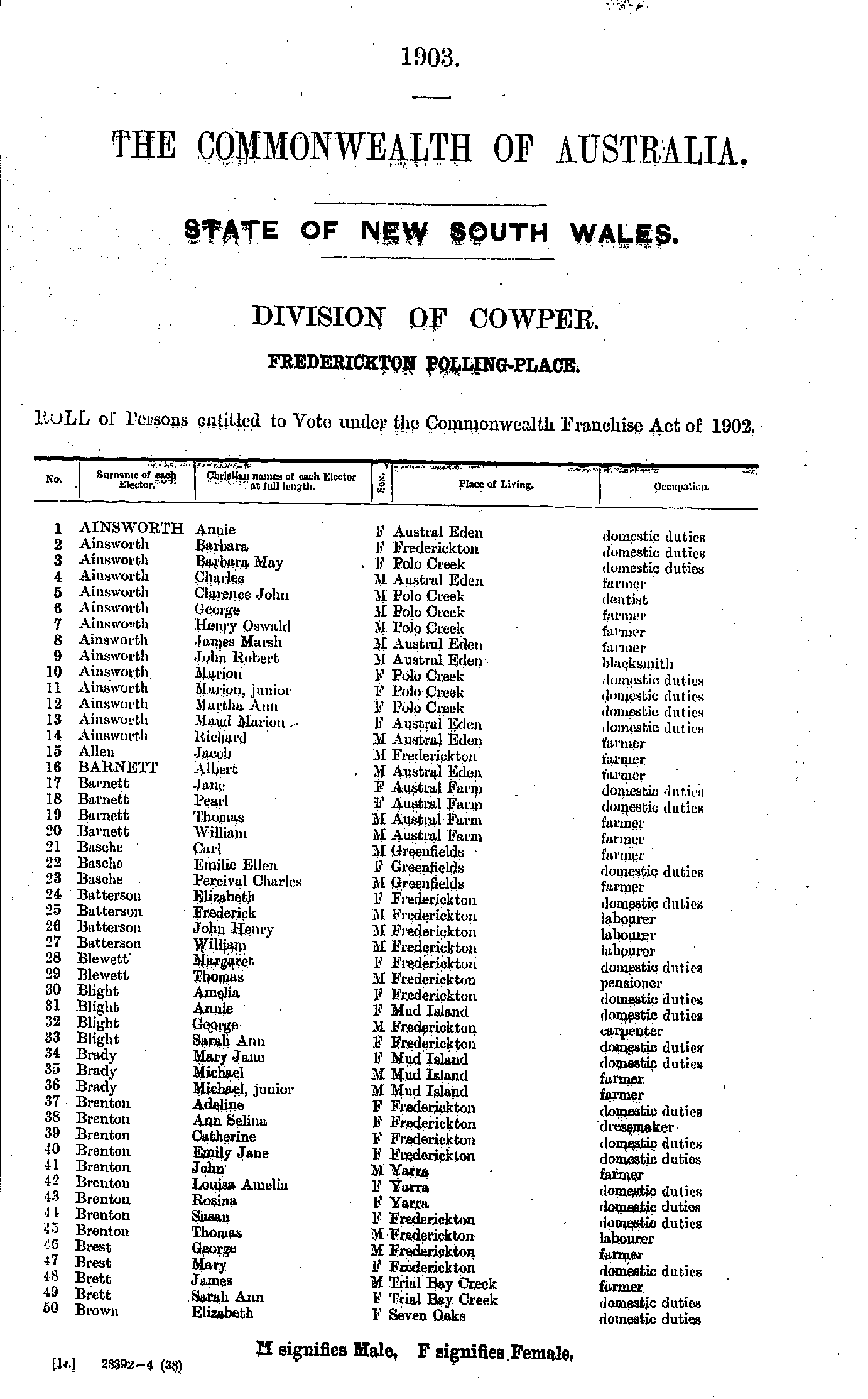
- Ainsworth Annie - Brown Elizabeth
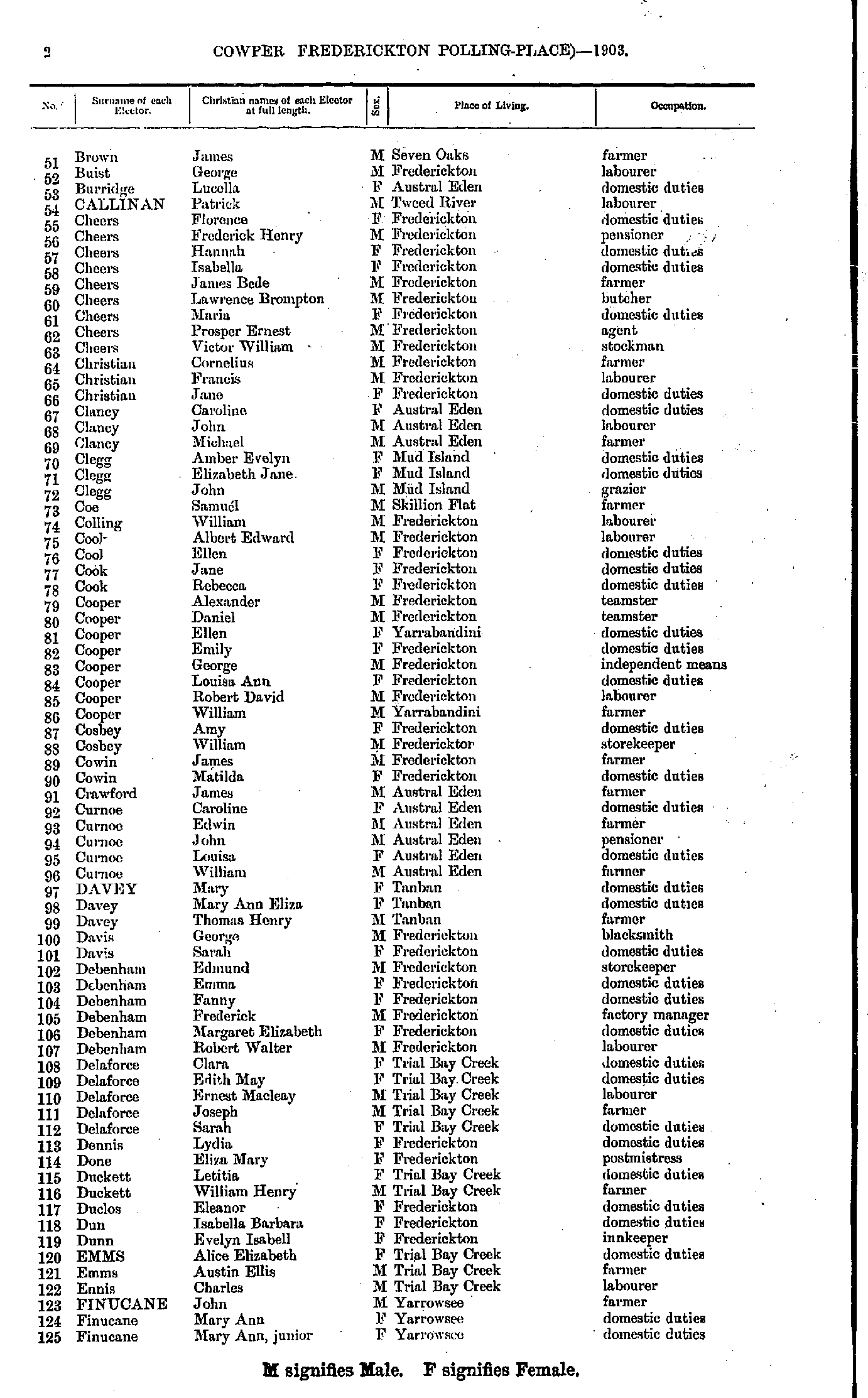
- Brown James - Finucane Mary
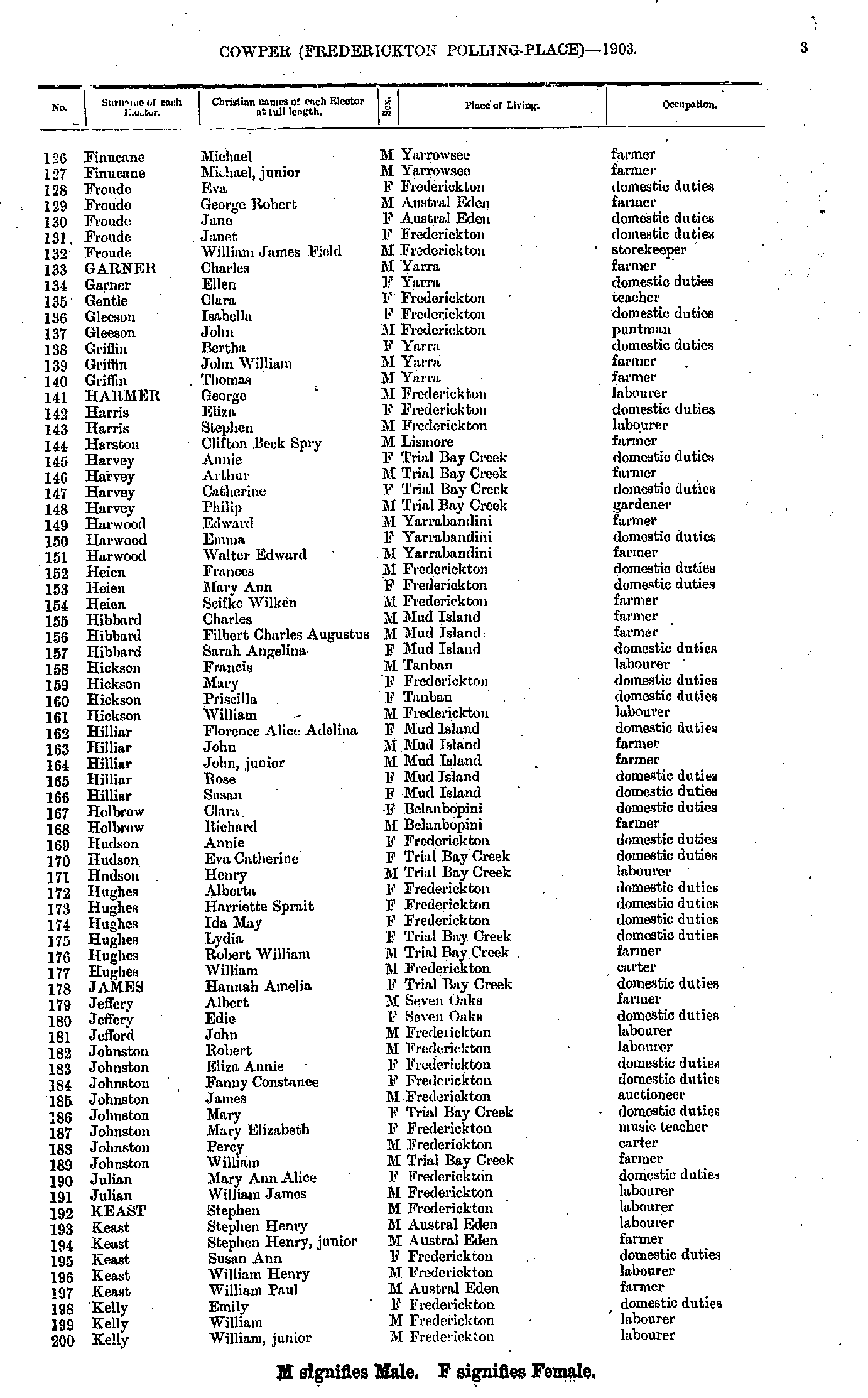
- Finucane Michael - Kelly William
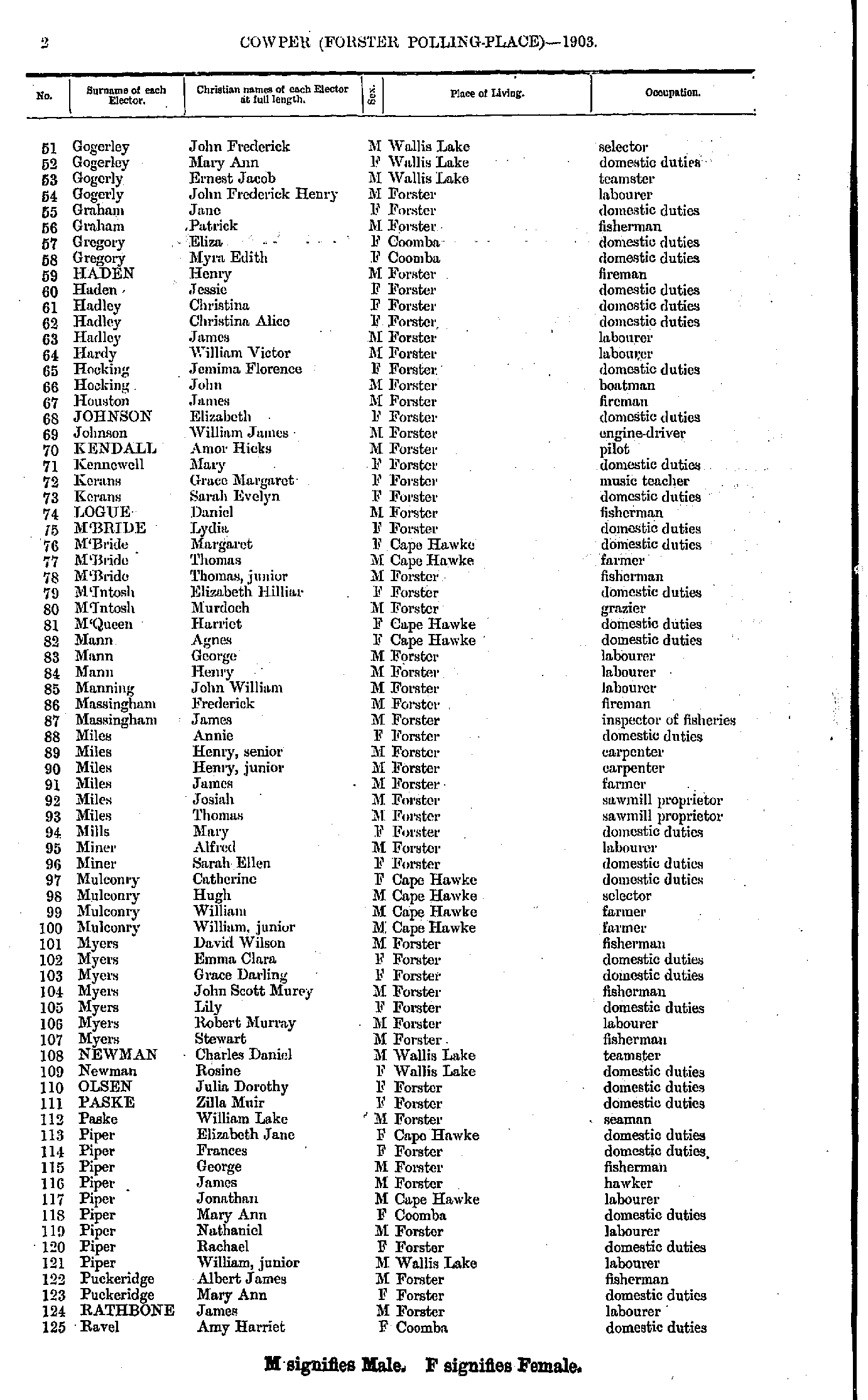
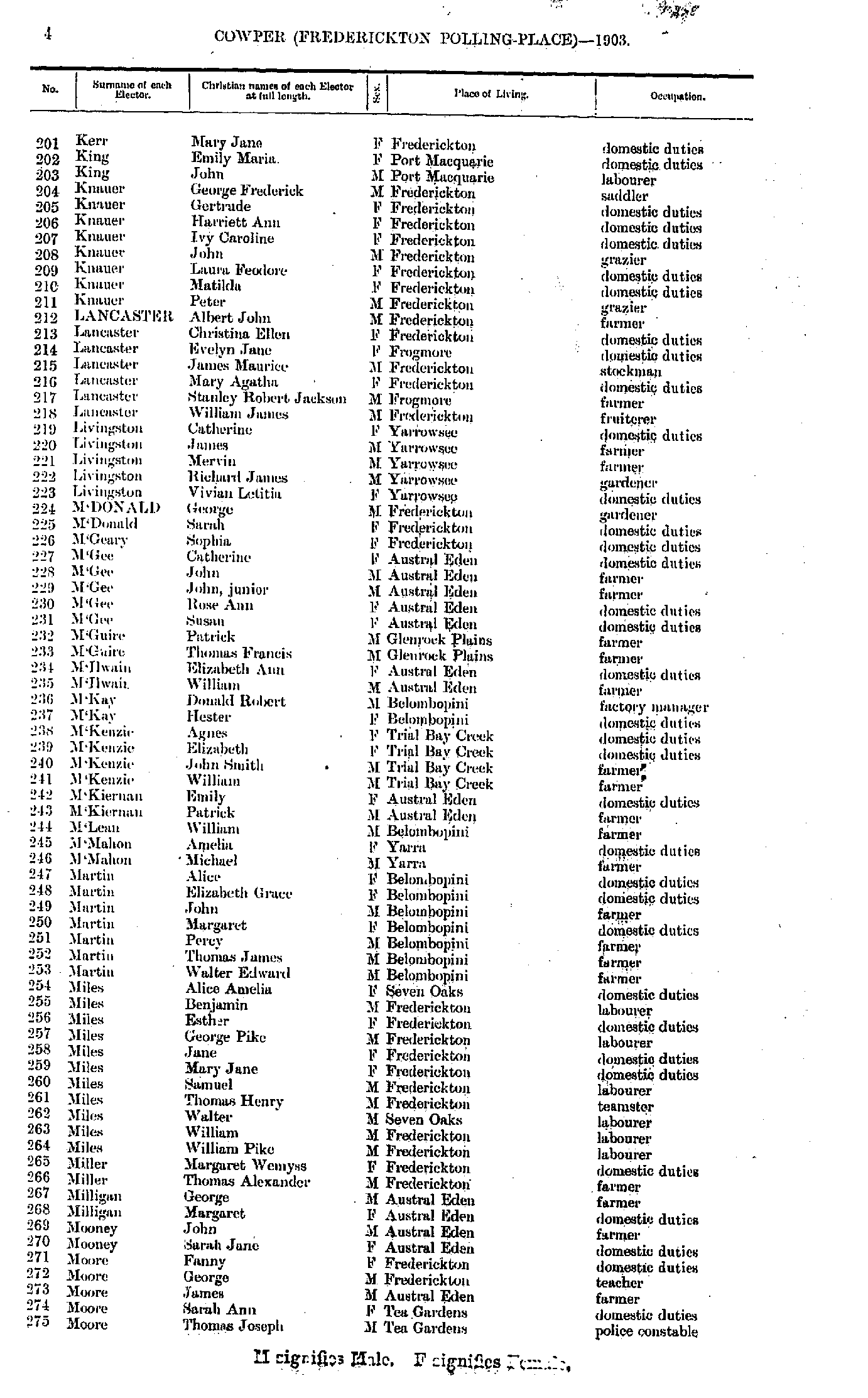
- Kerr Mary - Moore Thomas
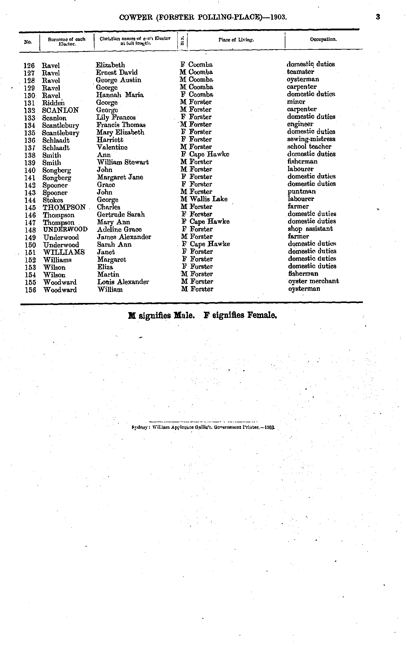
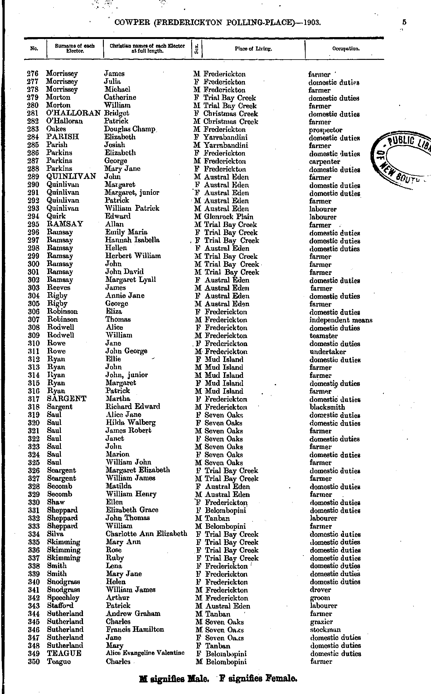
- Morrissey James - Teague Charles
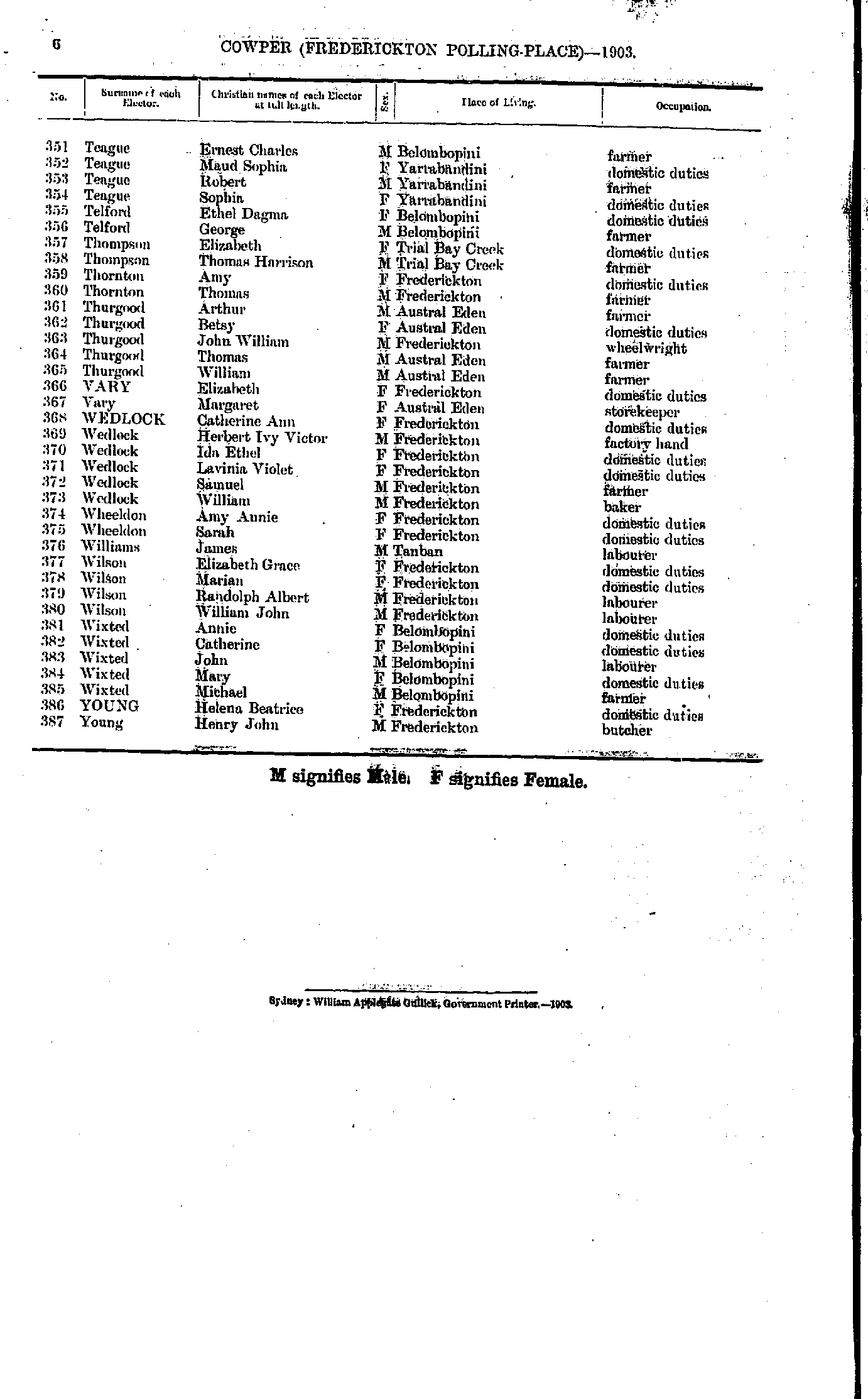
- Teague Ernest - Young Henry
- Anderson Alexander - Brown Emily
- Brown Emma - Flanagan Thomas
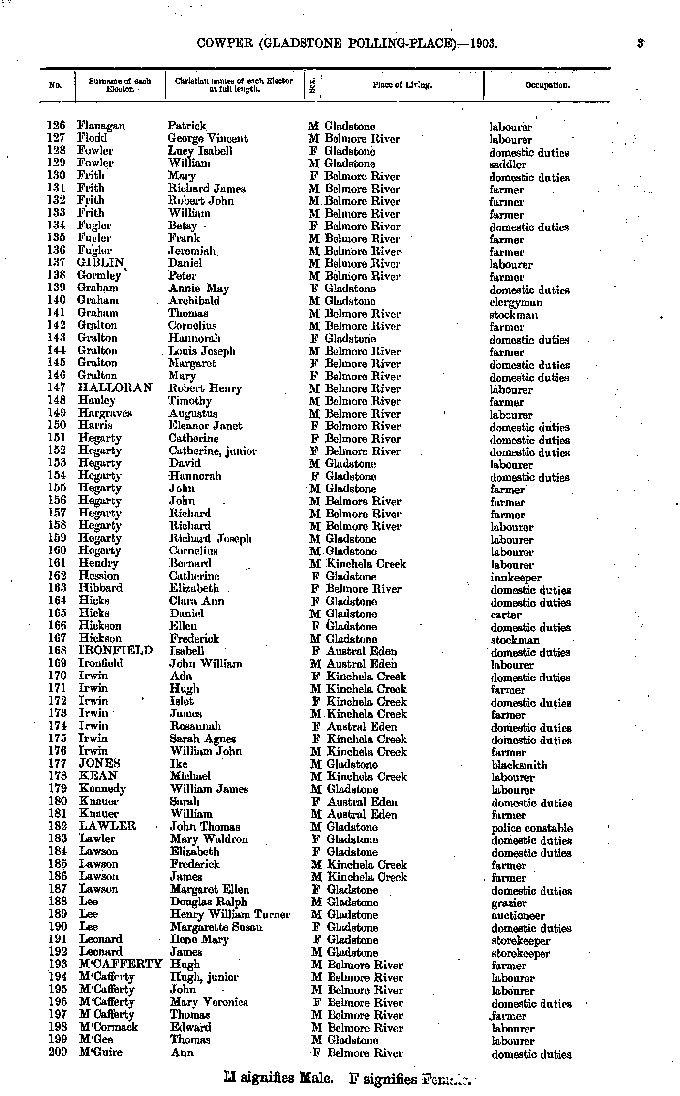
- Flanagan Patrick - M'Guire Ann
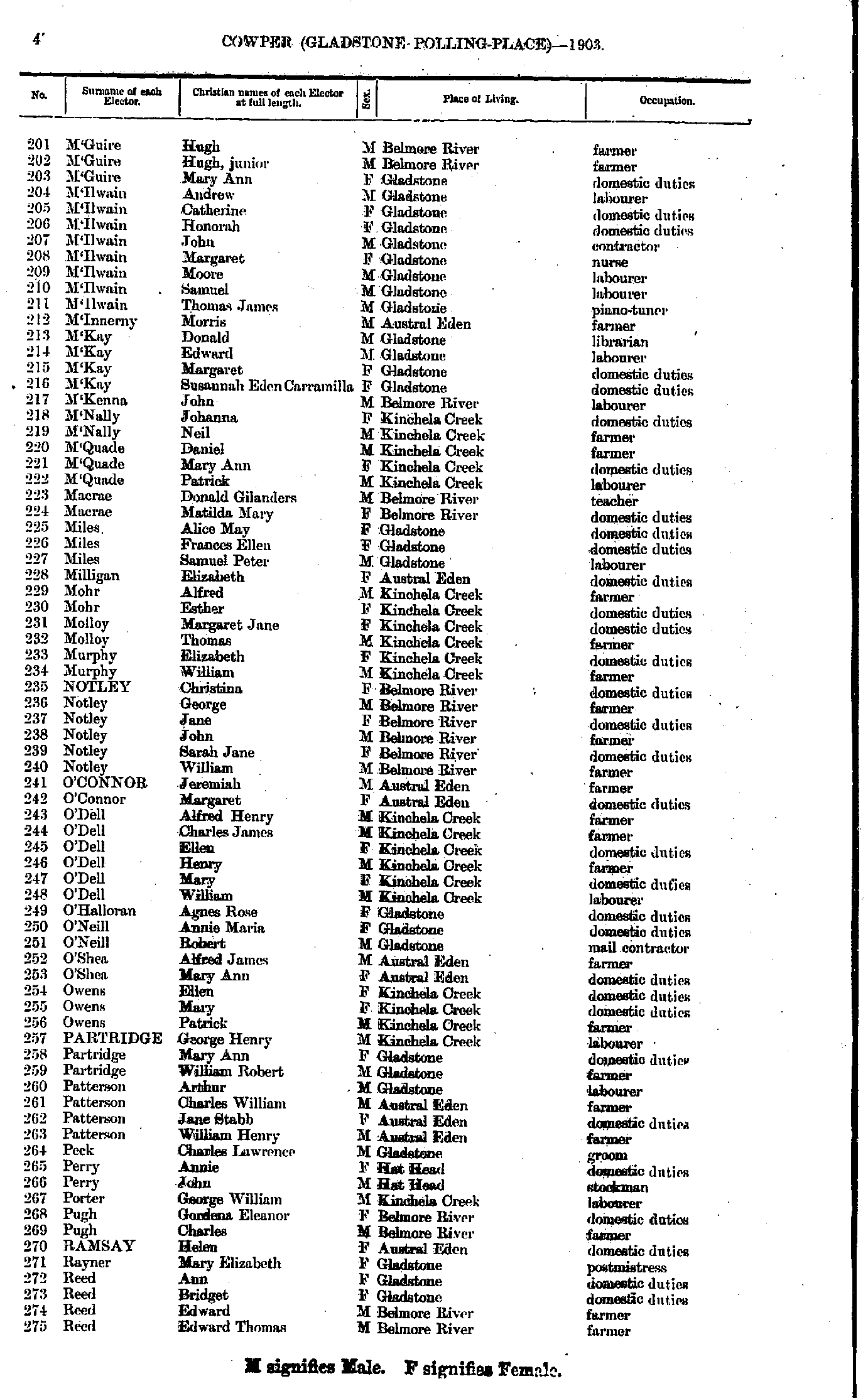
- M'Guire Hugh - Reed Edward
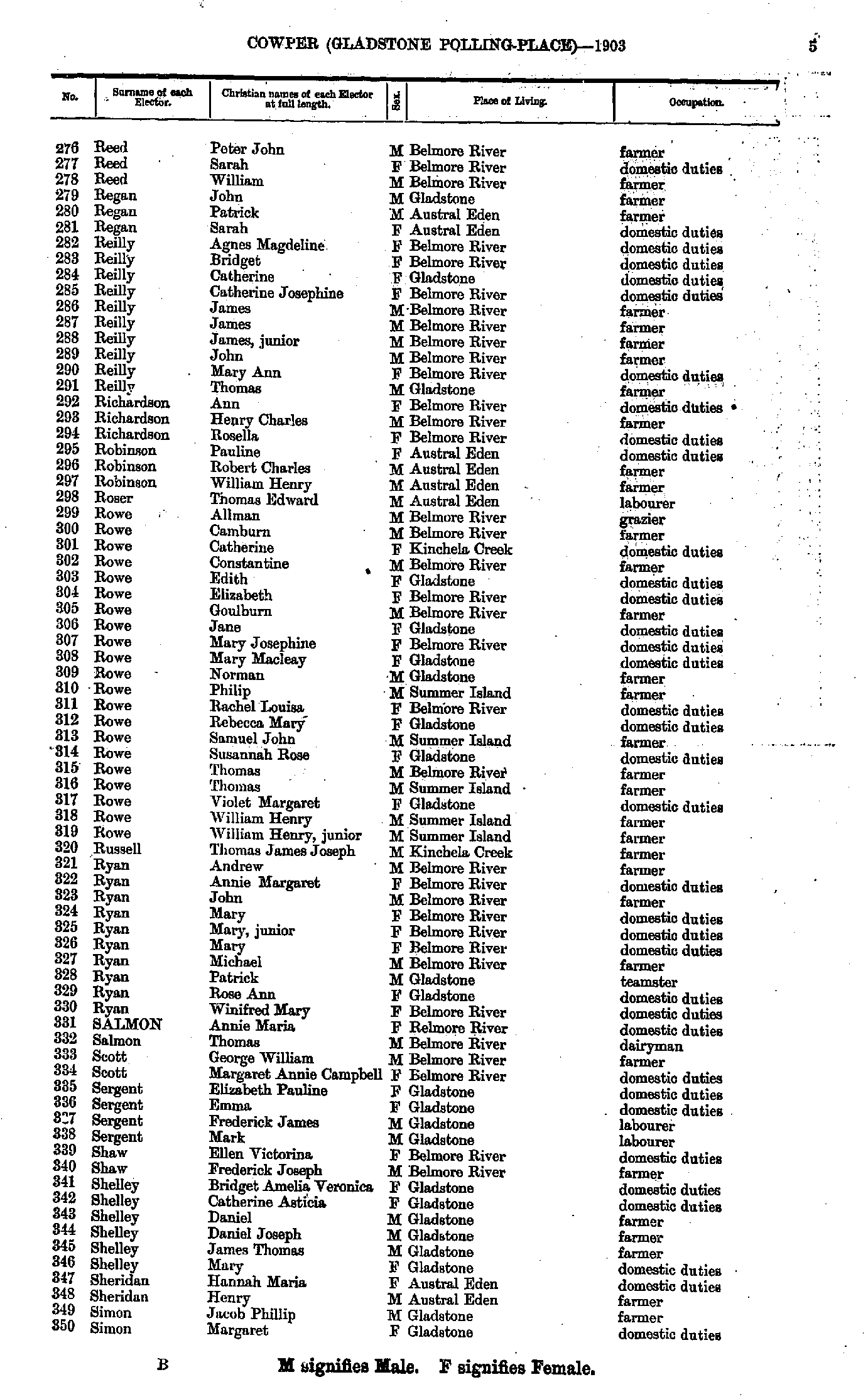
- Reed Peter - Simon Margaret
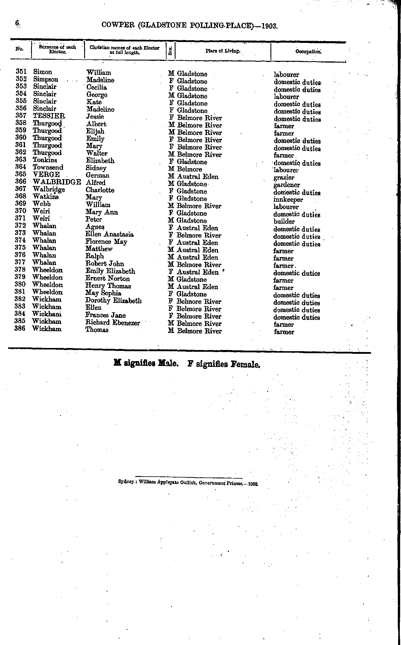
- Simon William - Wickham Thomas
- Adam Adam - Arnott John
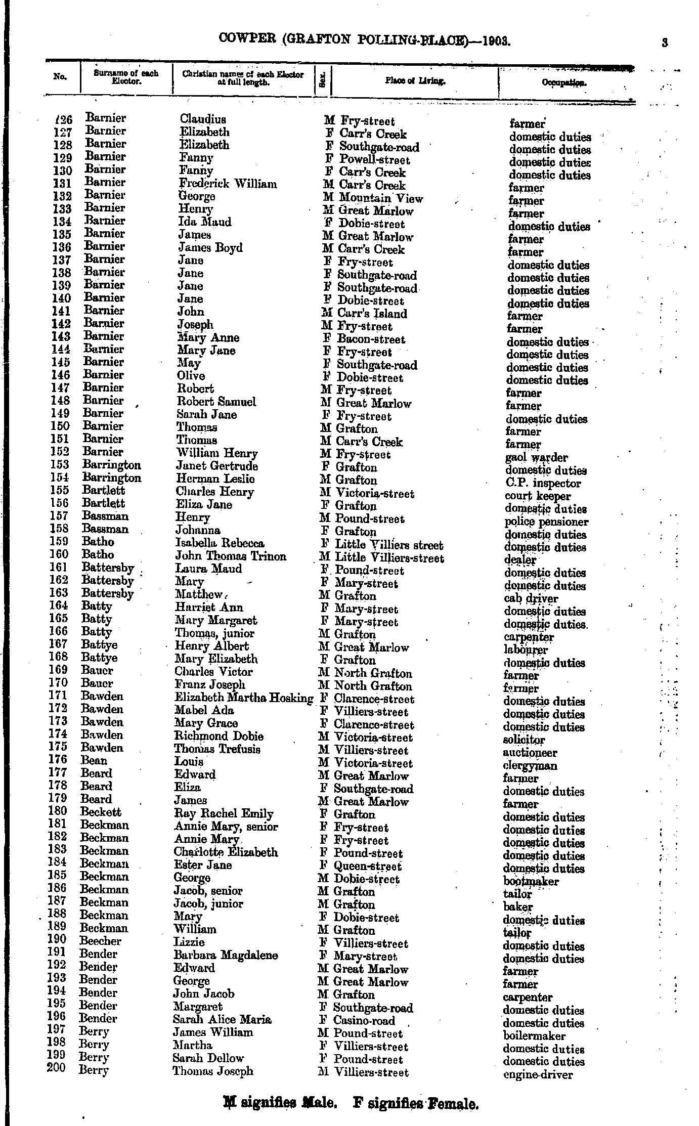
- Ash Morley - Barnier Clarence
- Barnier Claudius - Berry Thomas
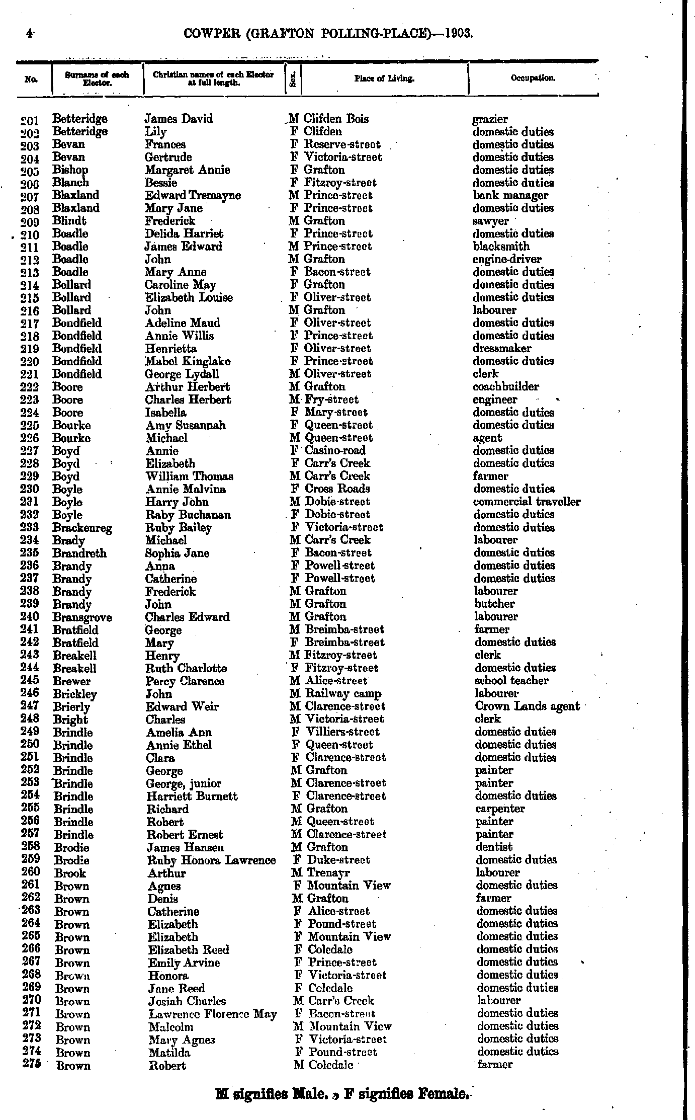
- Betteridge James - Brown Robert
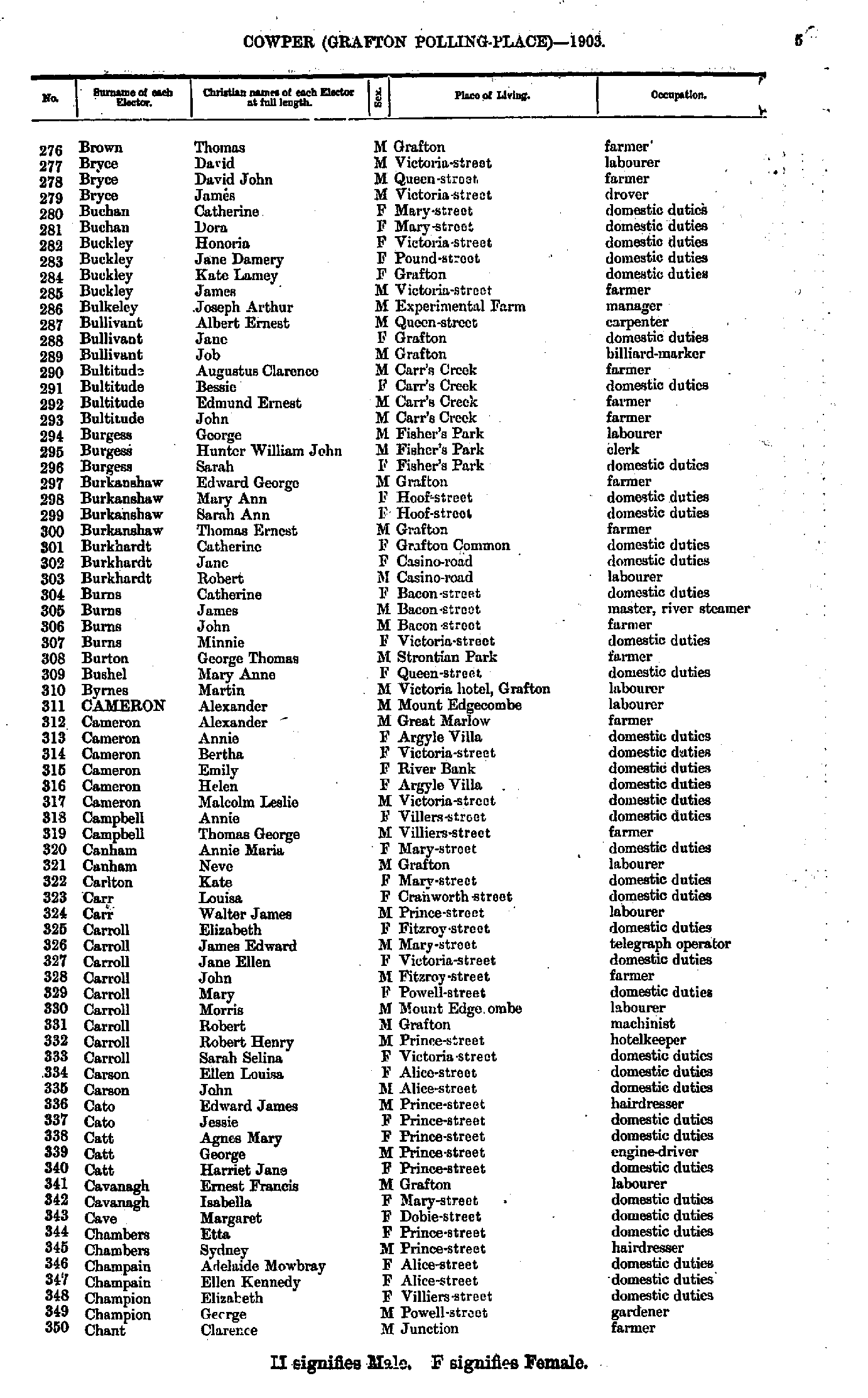
- Brown Thomas - Chant Clarence
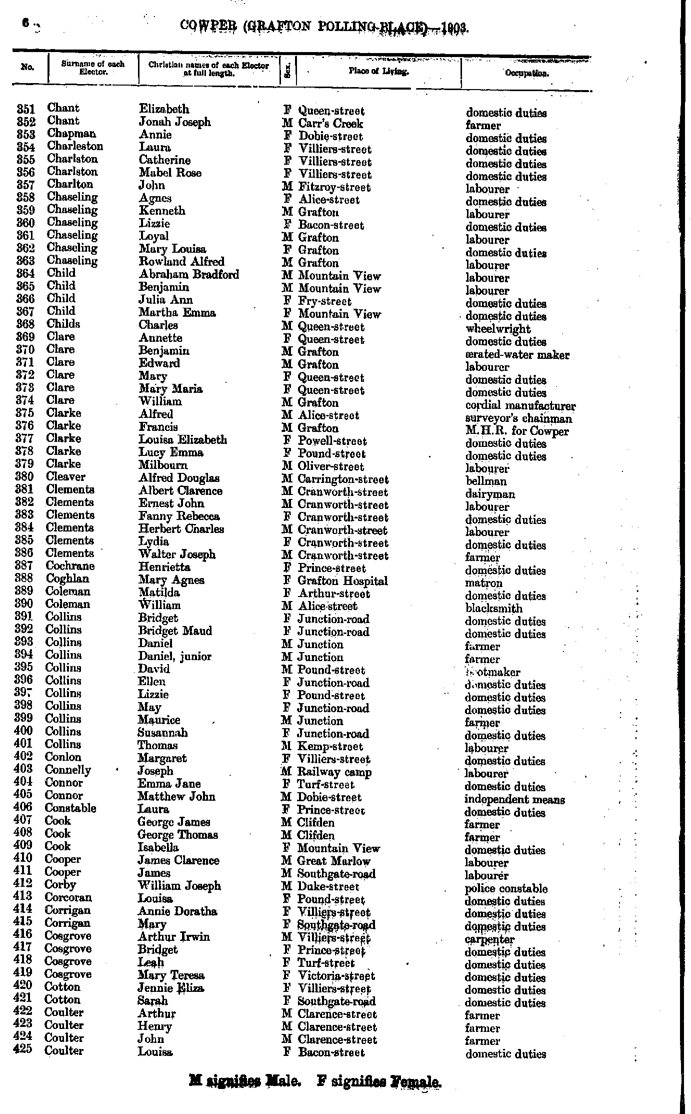
- Chant Elizabeth - Coulter Louisa
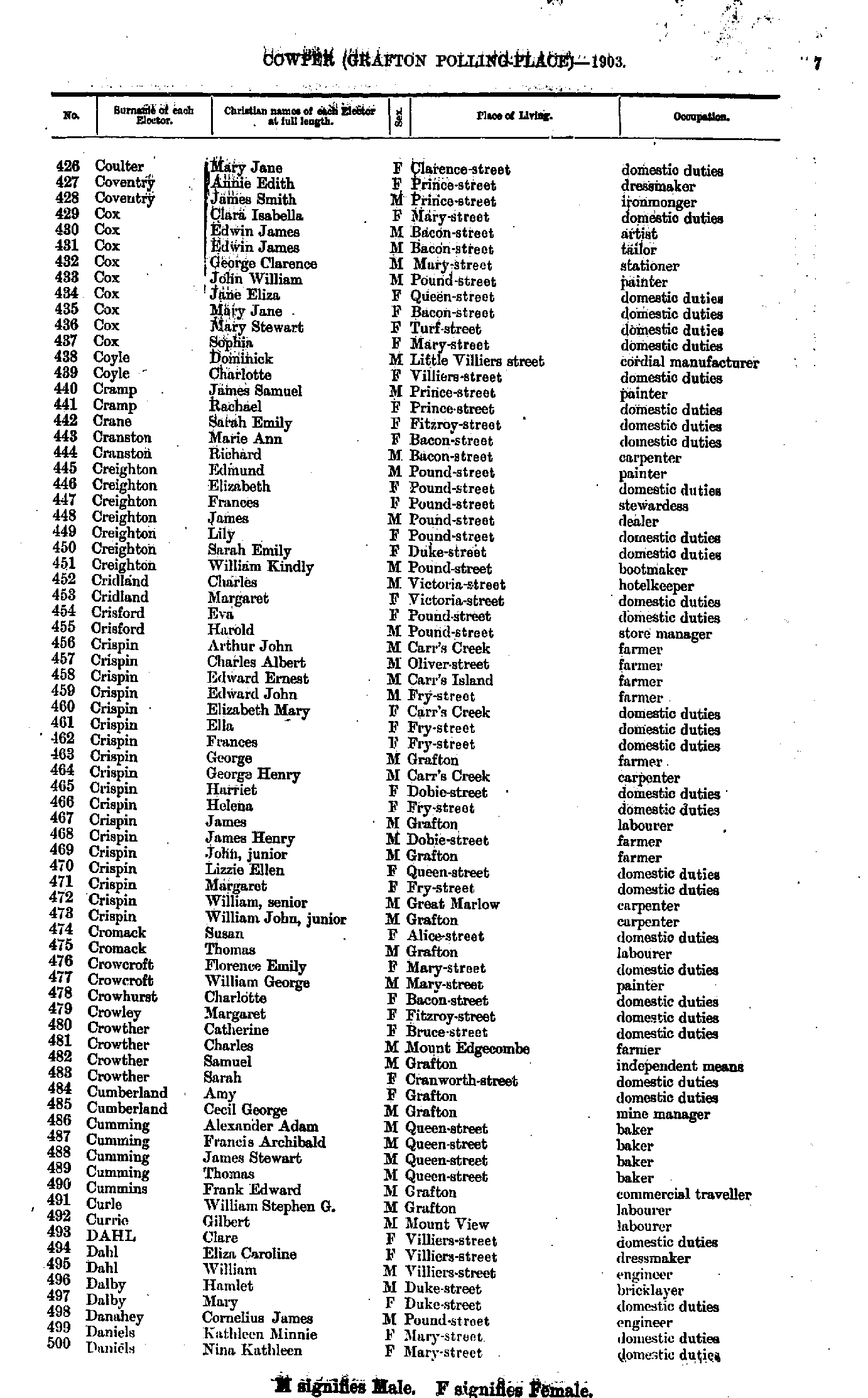
- Coulter Mary - Daniels Nina
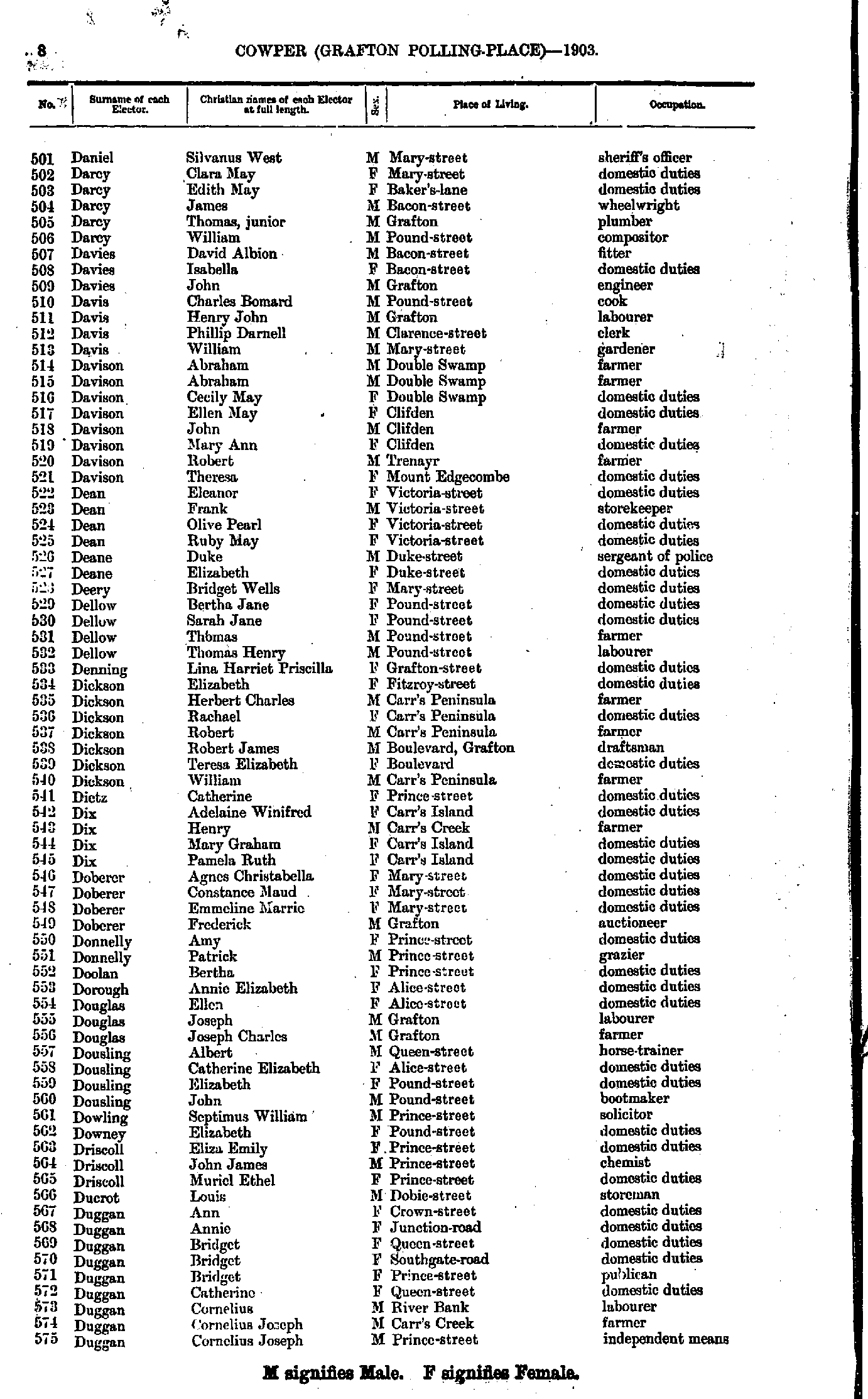
- Daniel Silvanus - Duggan Cornelius
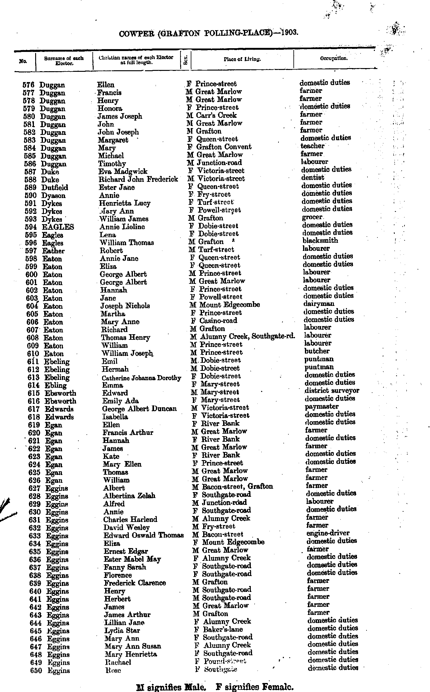
- Duggan Ellen - Eggins Rose
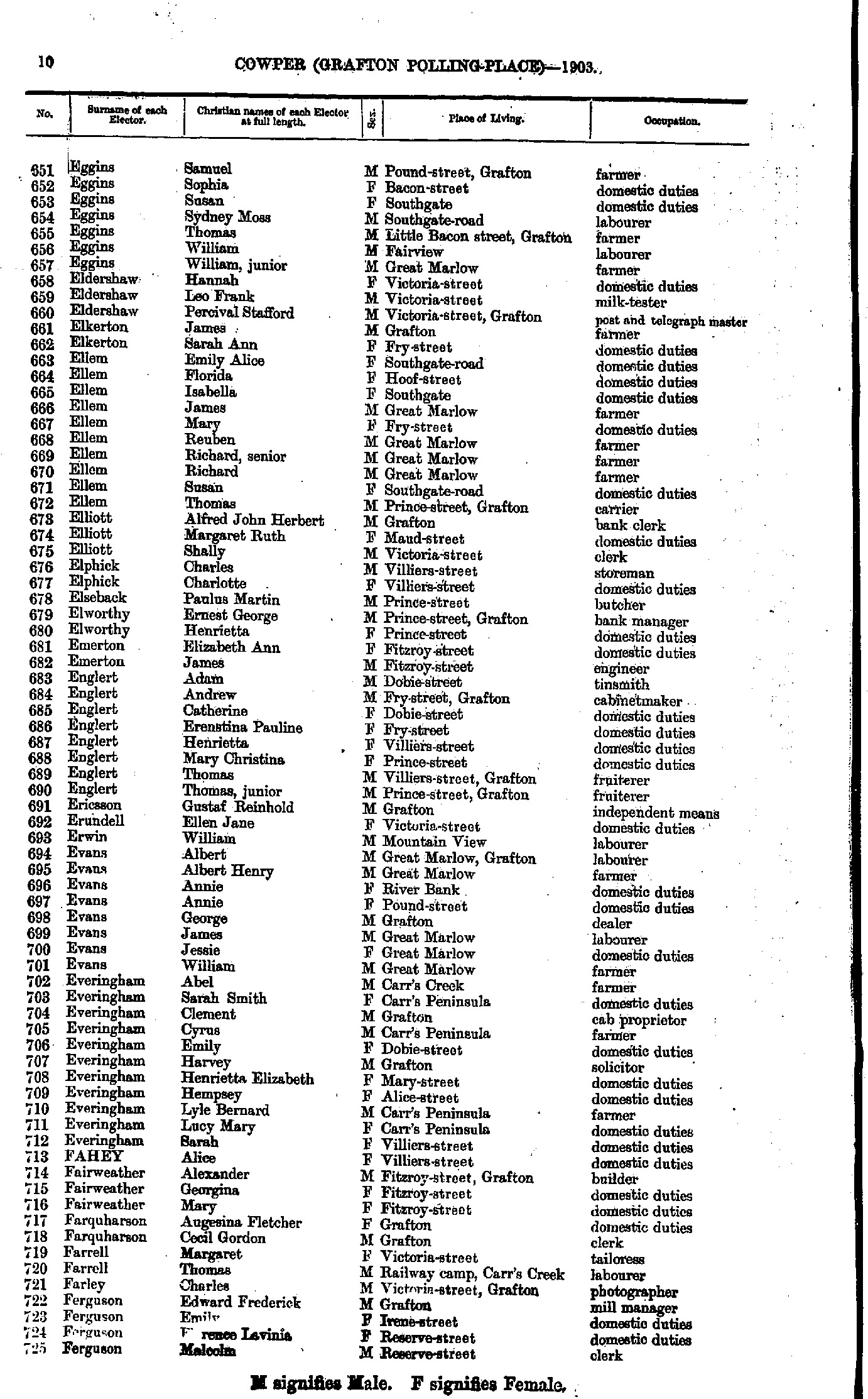
- Eggins Samuel - Ferguson Malcolm
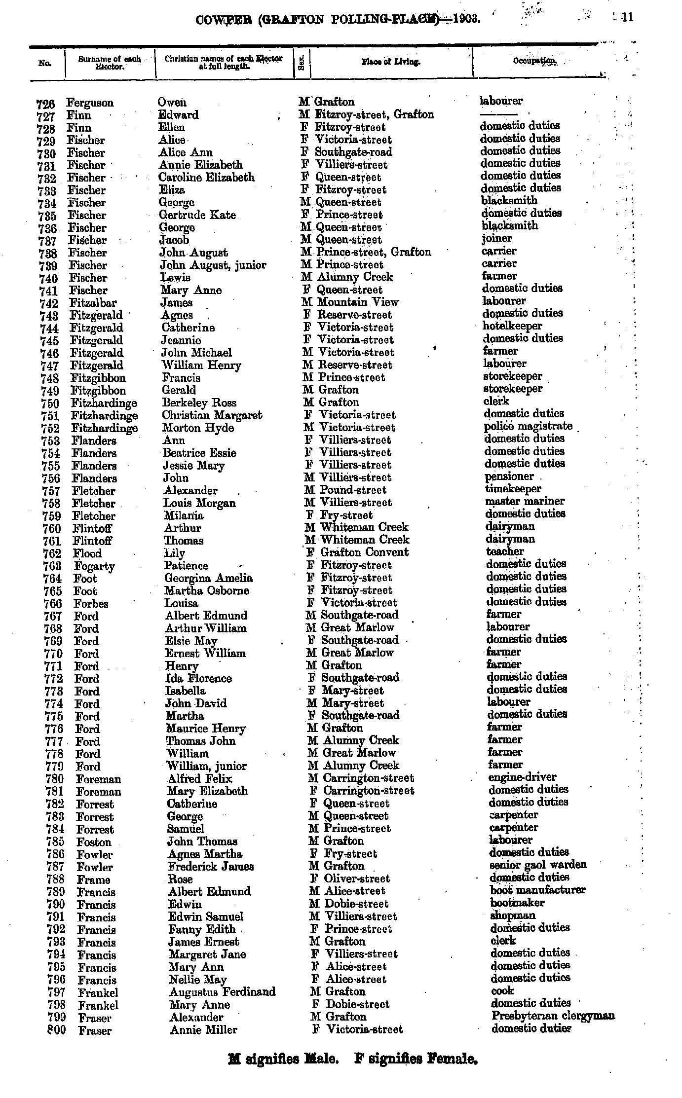
- Ferguson Owen - Fraser Annie
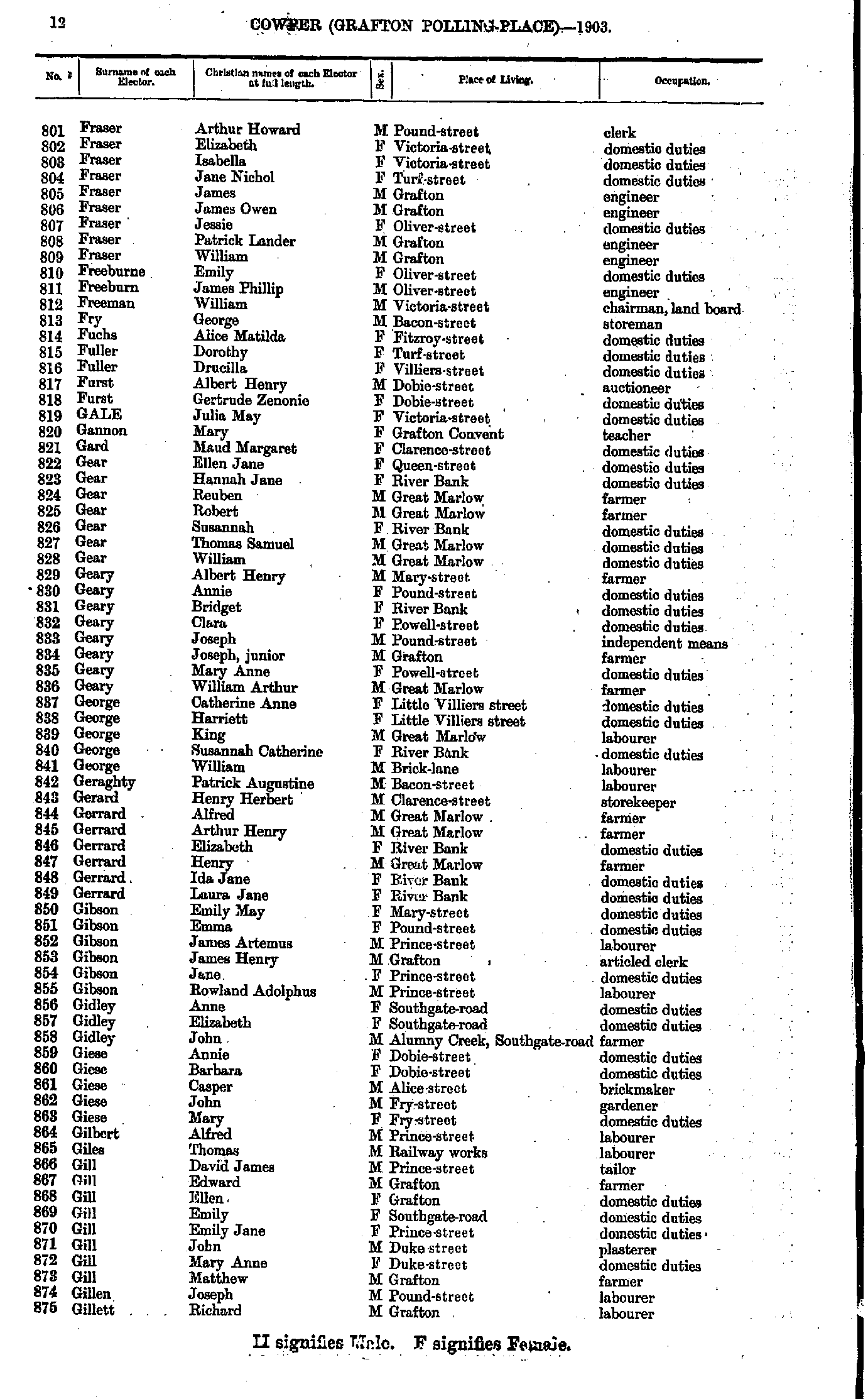
- Fraser Arthur - Gillett Richard
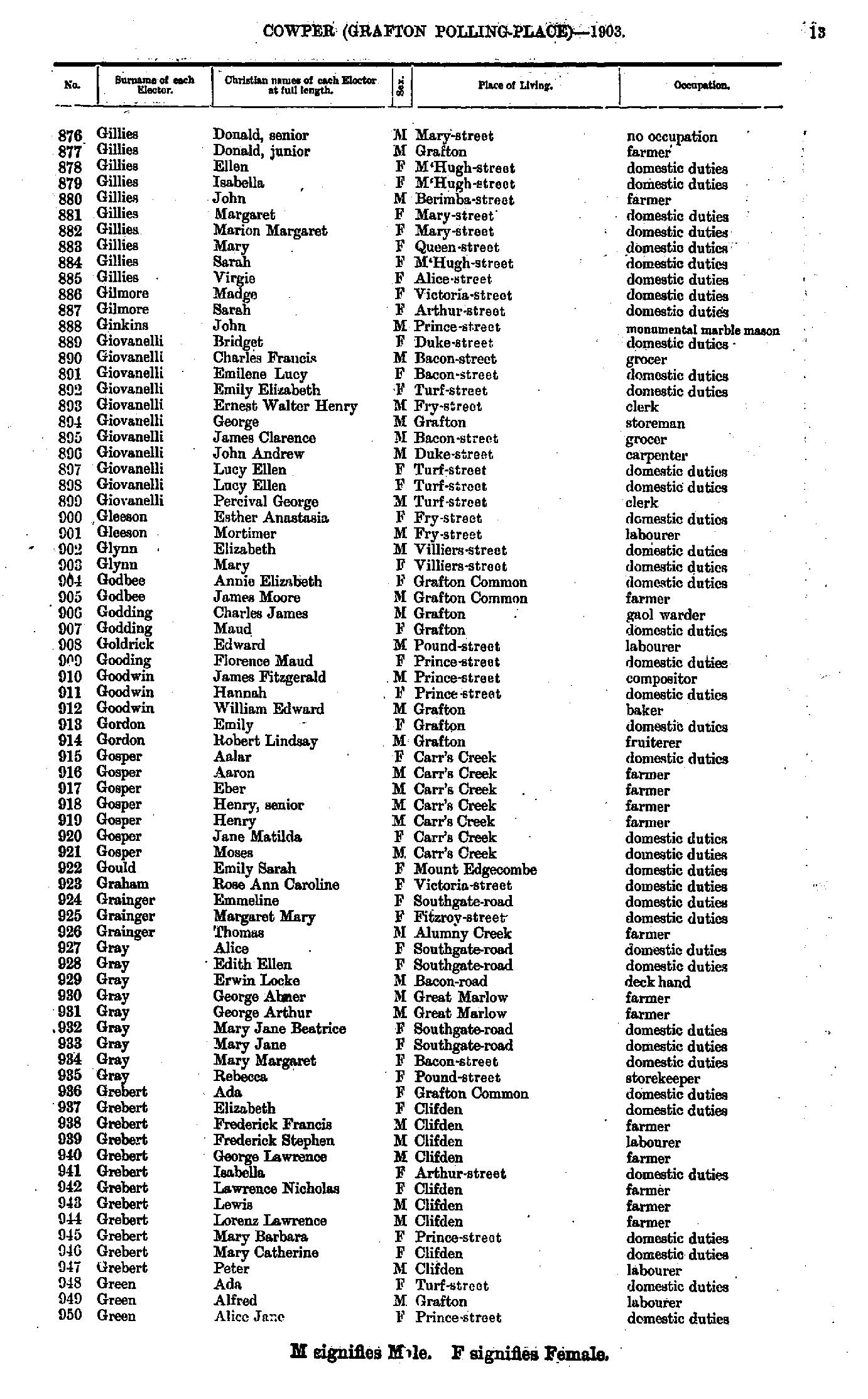
- Gillies Donald - Green Alice
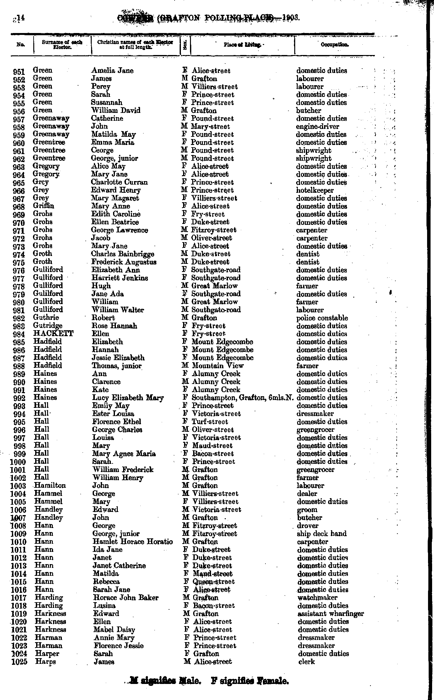
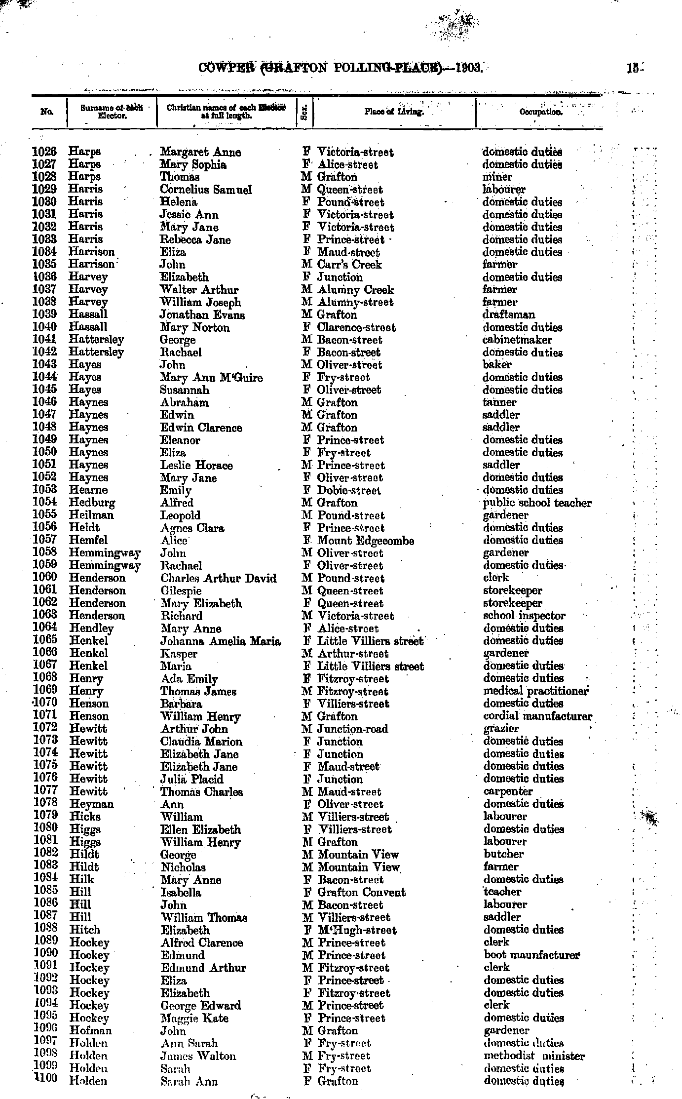
- Green Amelia - Harps James
- Harps Margaret - Holden Sarah
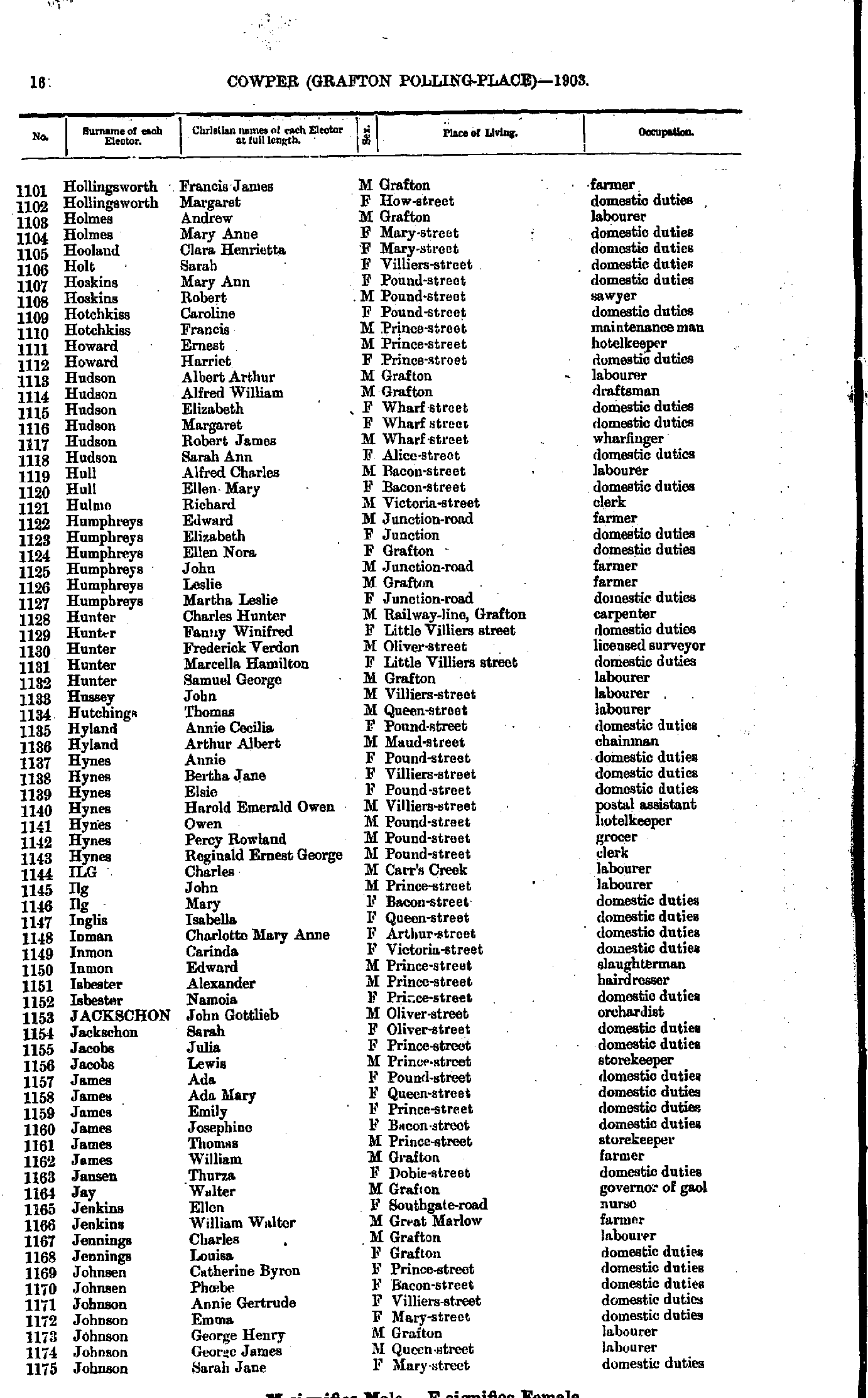
- Hollingsworth Francis - Johnson Sarah
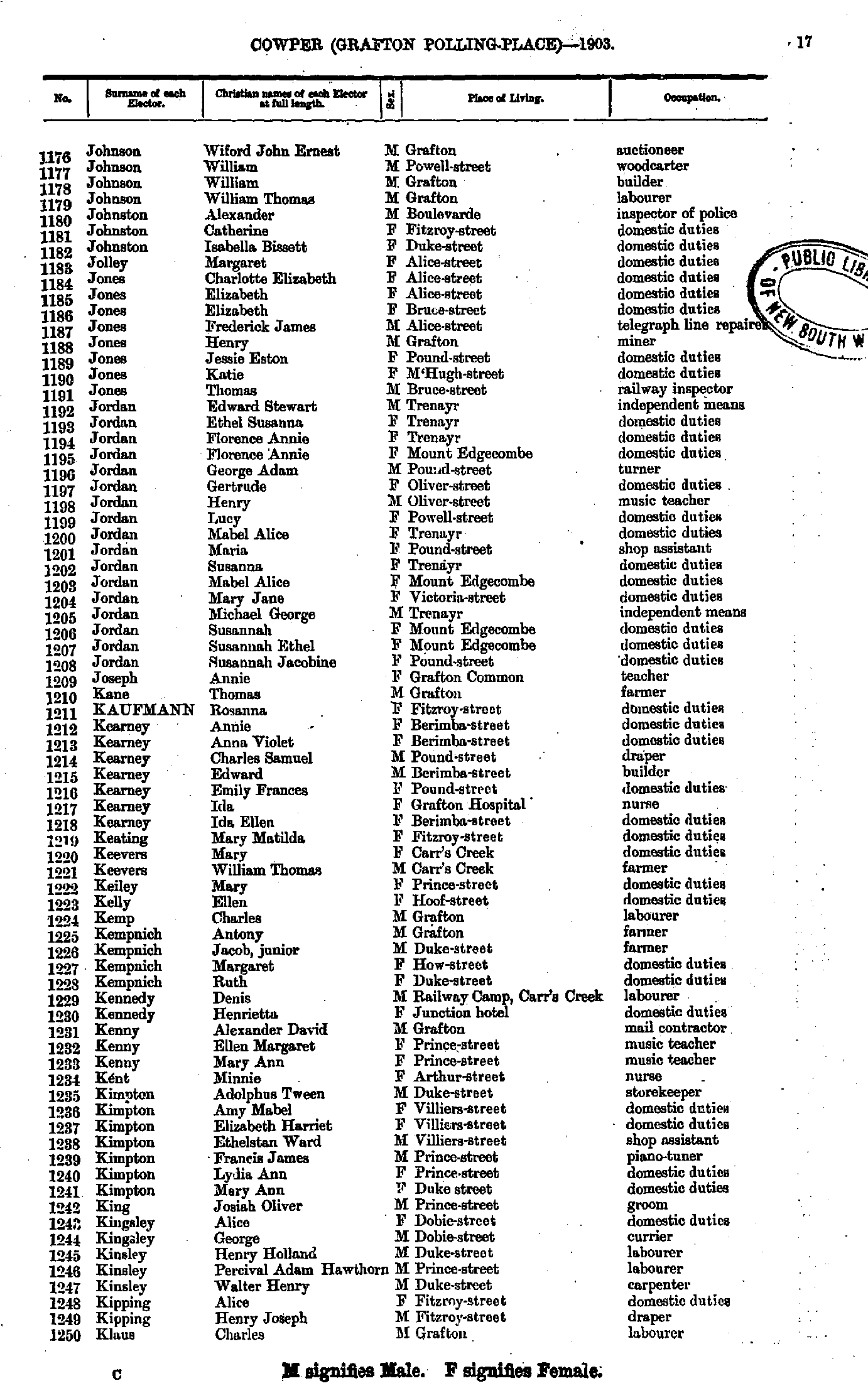
- Johnson Wiford - Klaus Charles
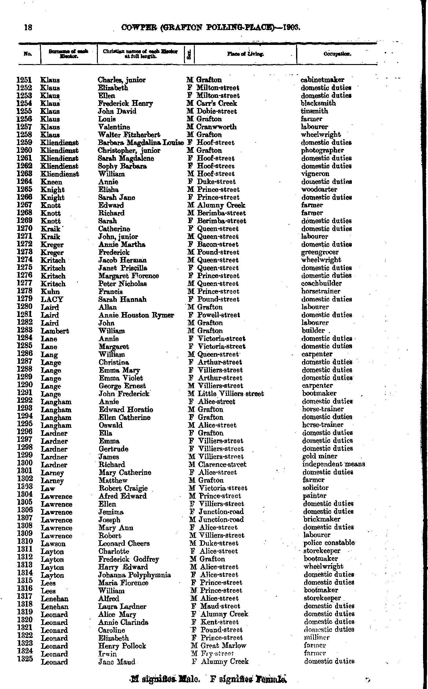
- Klaus Charles - Leonard Jane
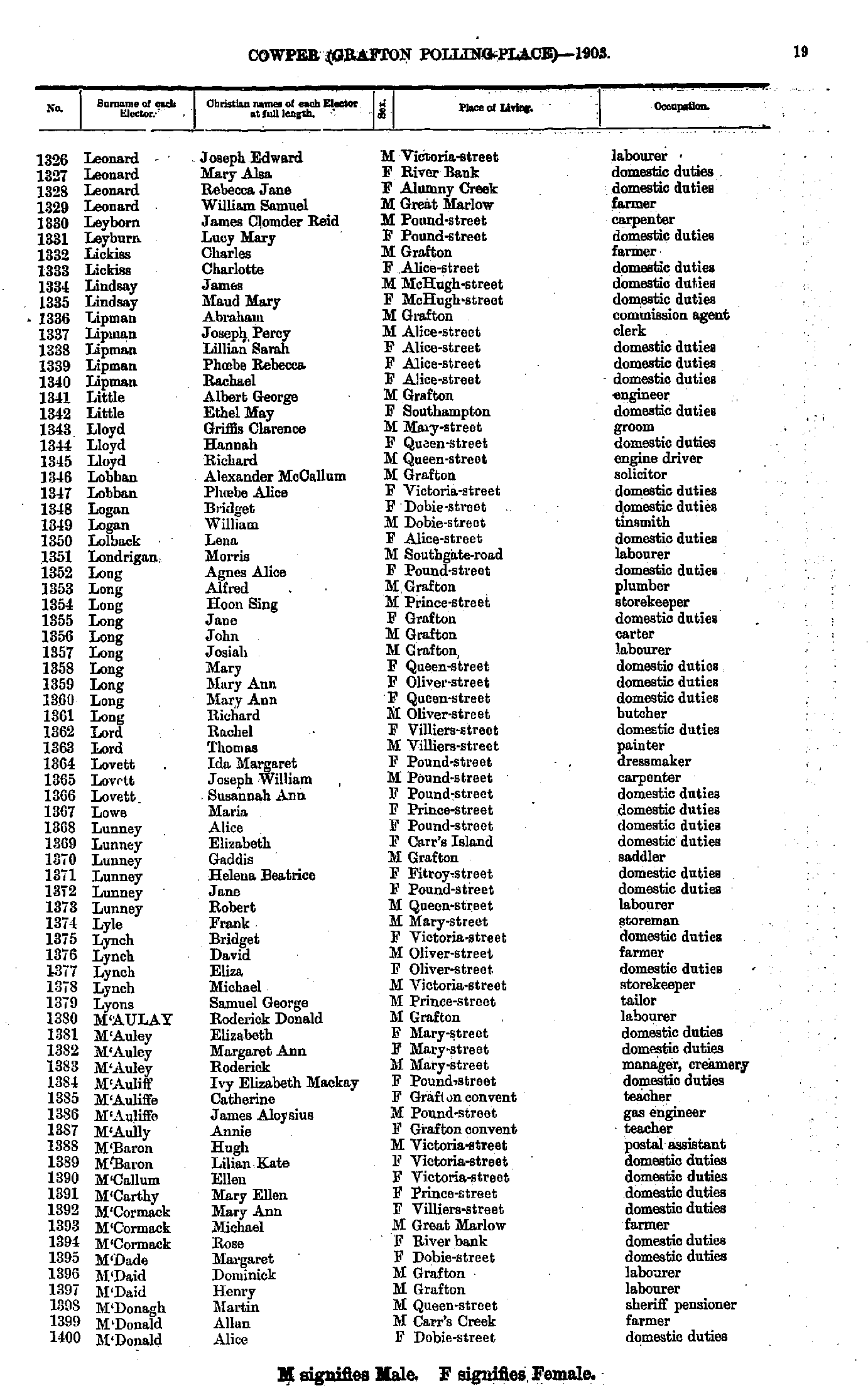
- Leonard Joseph - M'Donald Alice
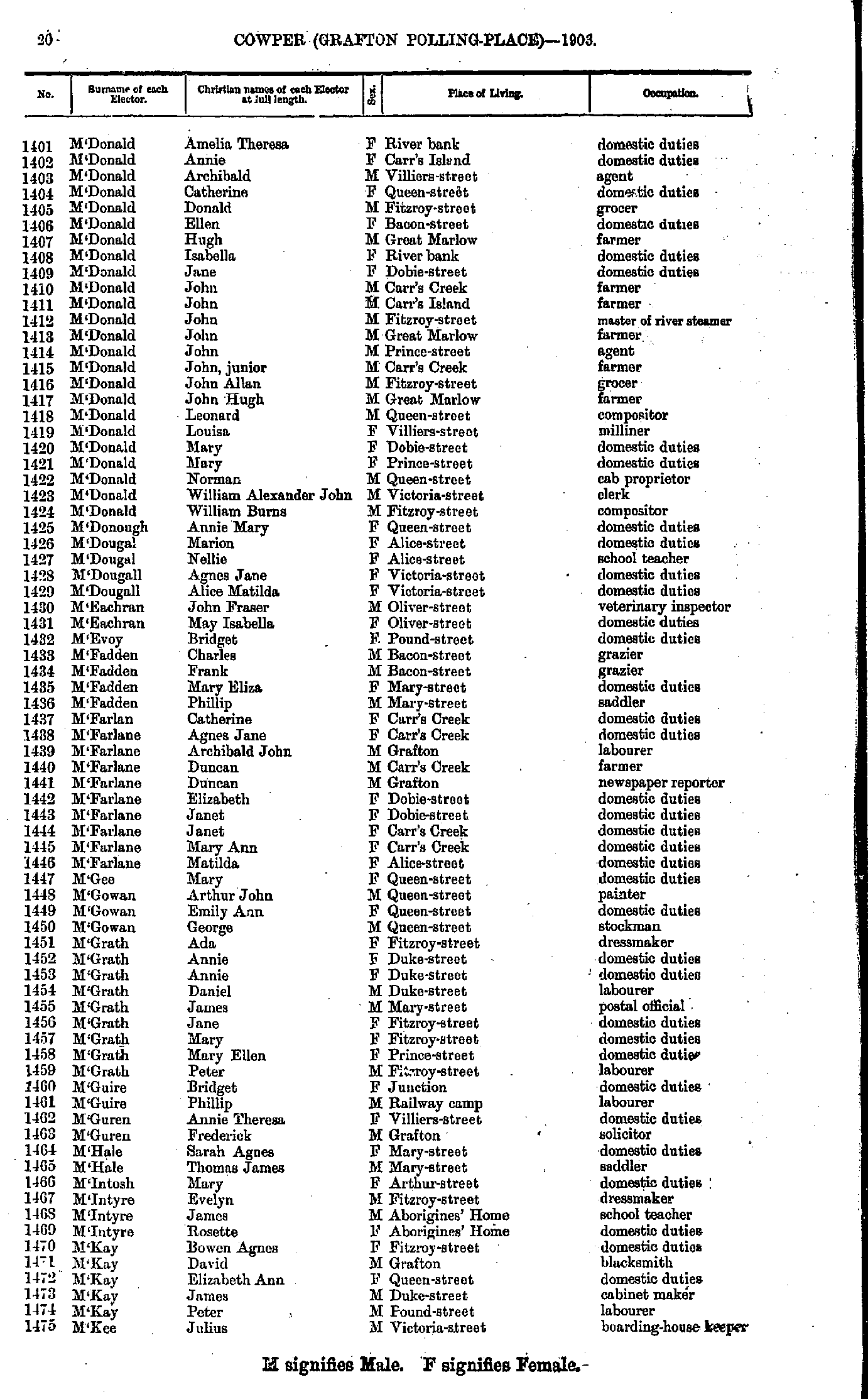
- M'Donald Amelia - M'Kee Julius
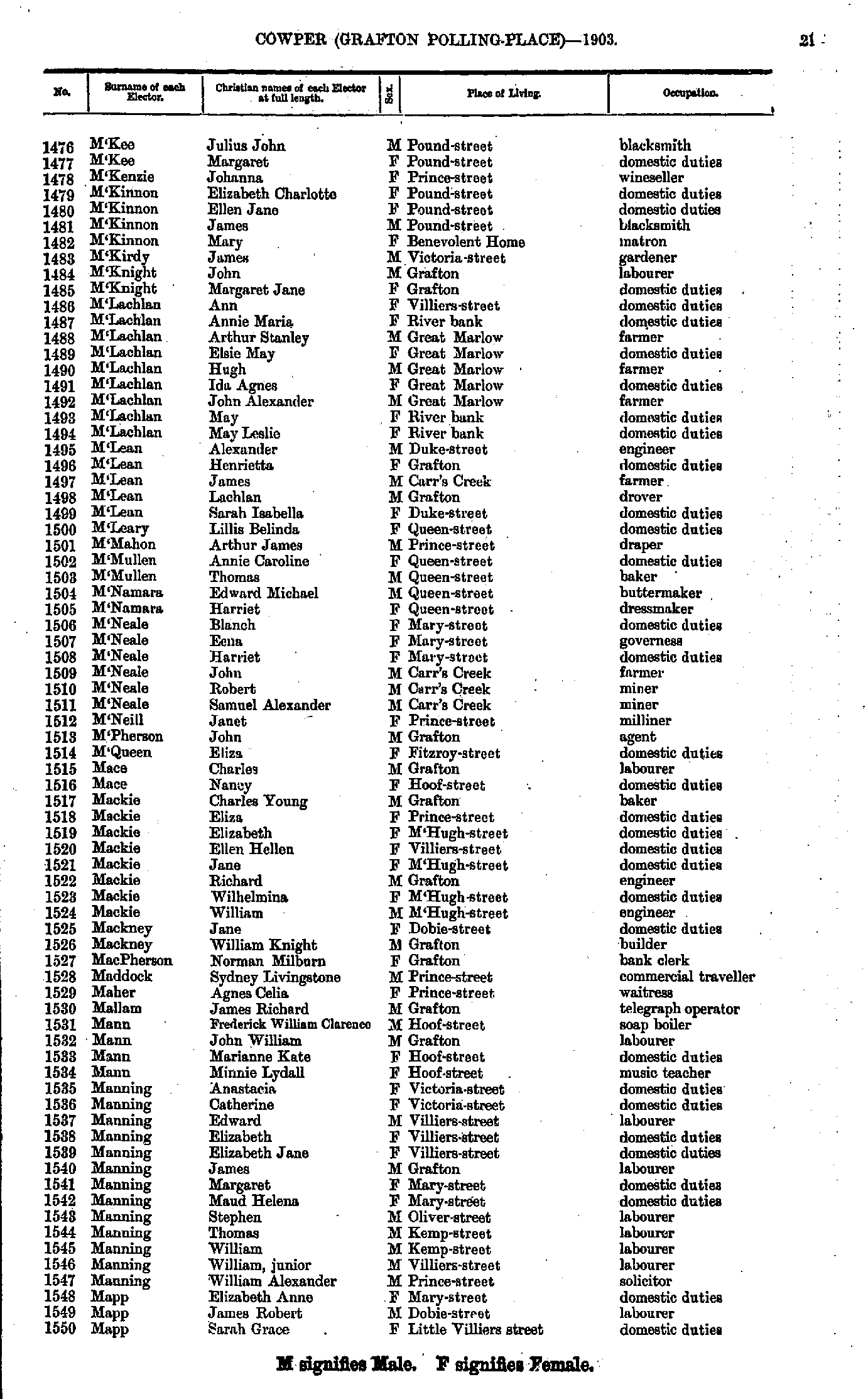
- M'Kee Julius - Mapp Sarah
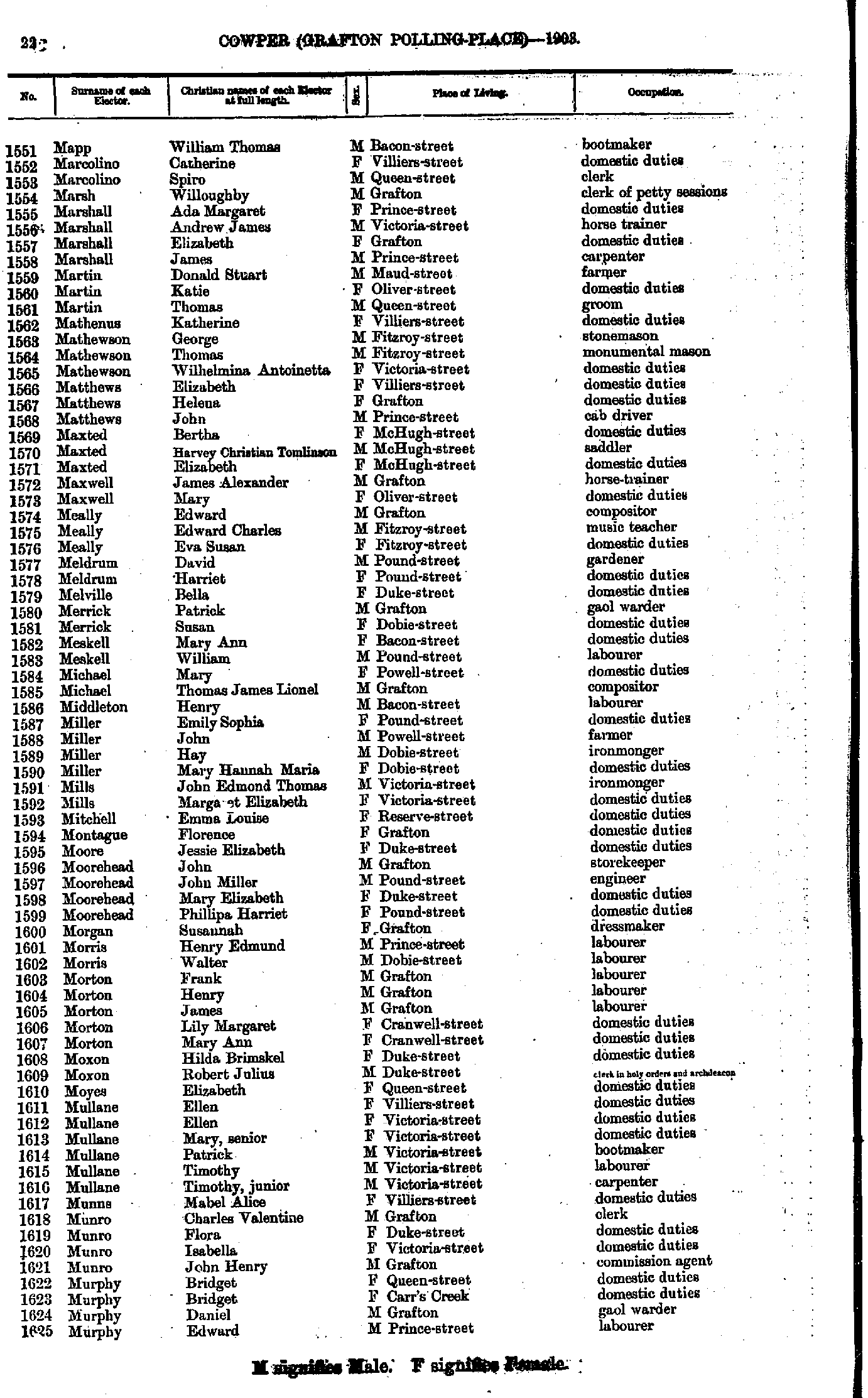
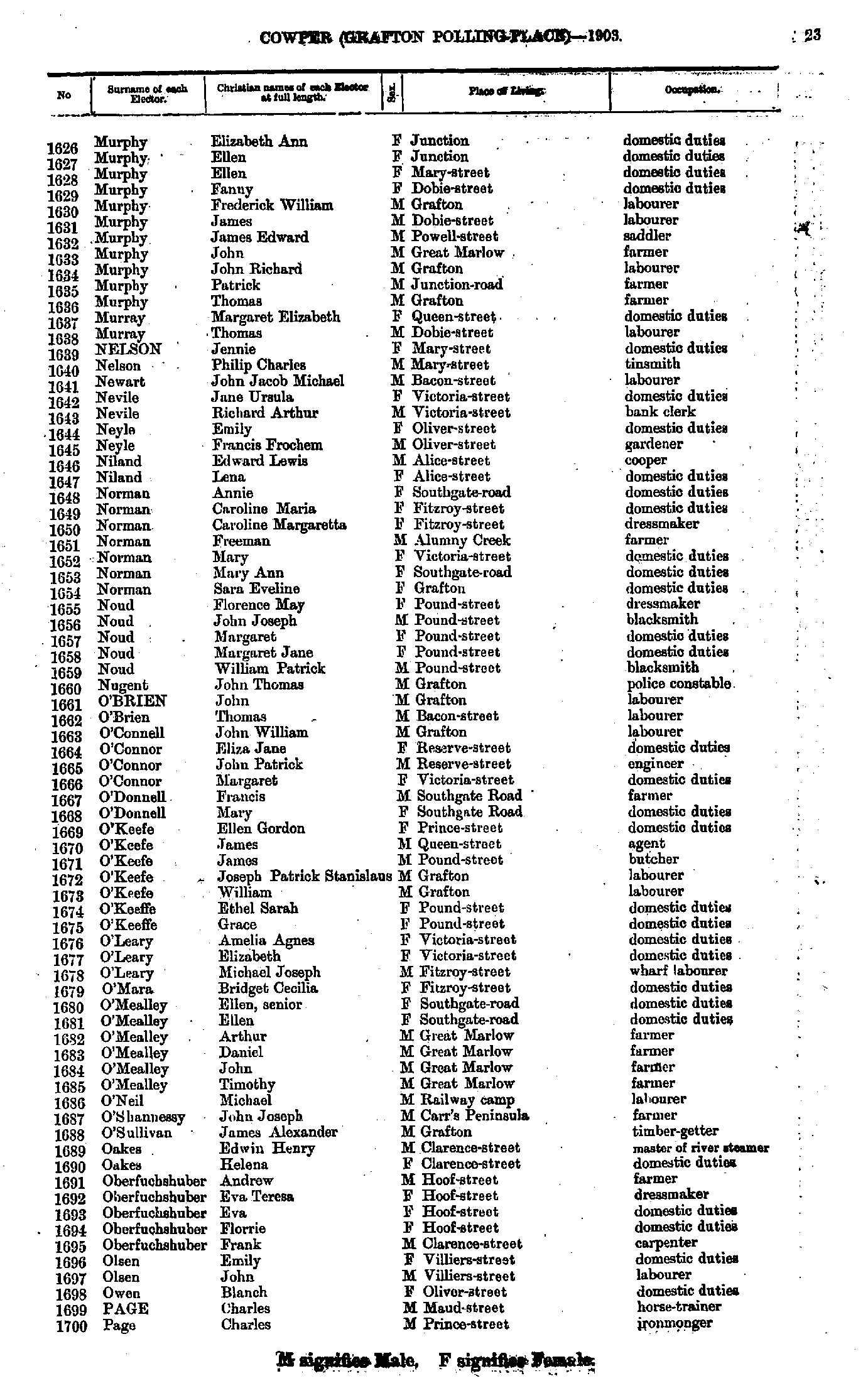
- Mapp William - Murphy Edward
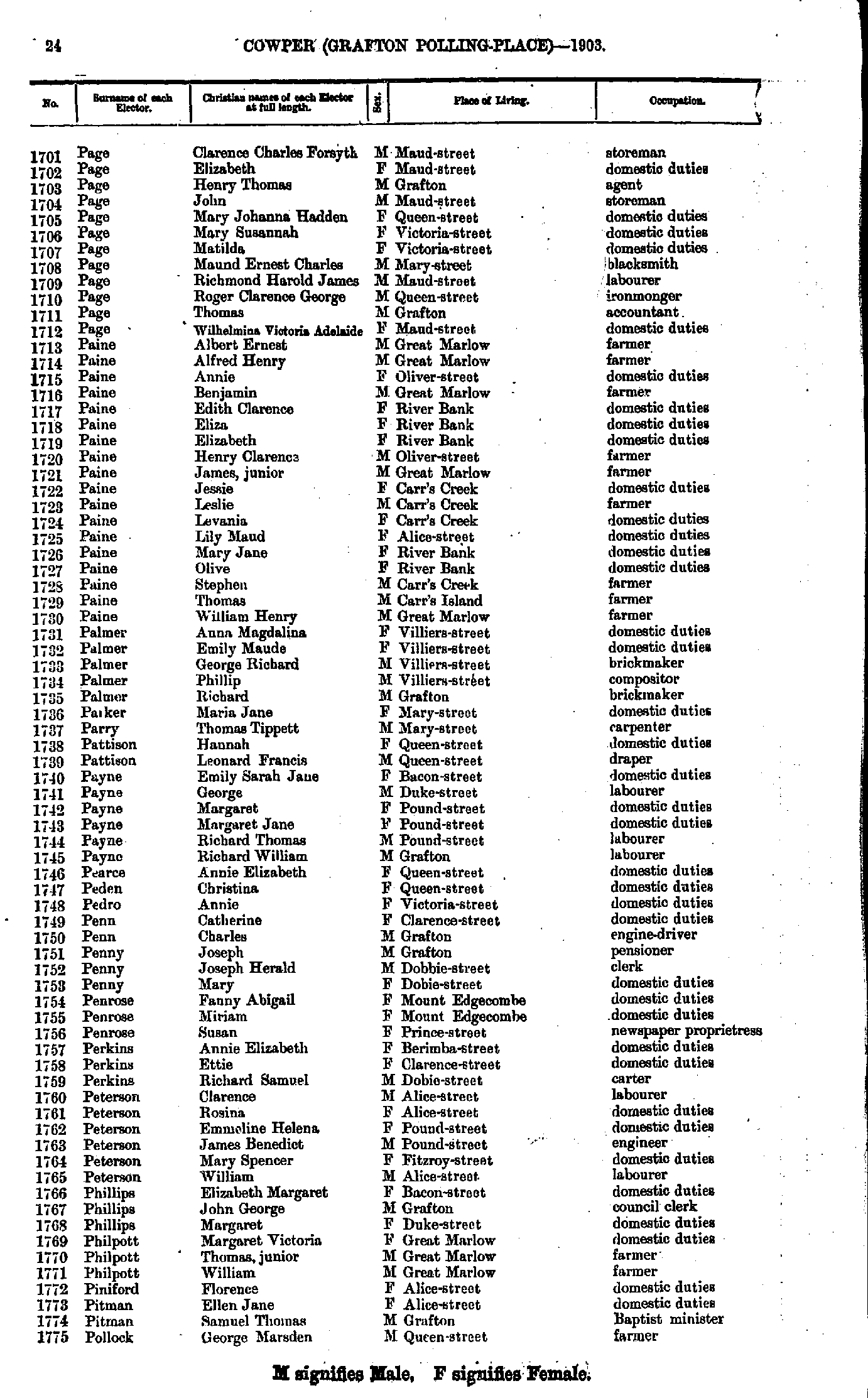
- Murphy Elizabeth - Page Charles
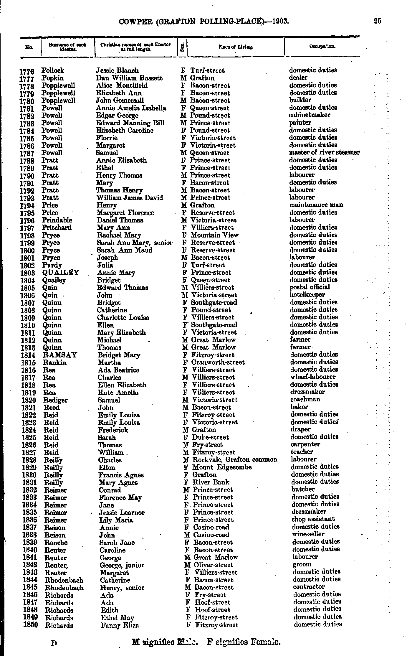
- Page Clarence - Pollock George
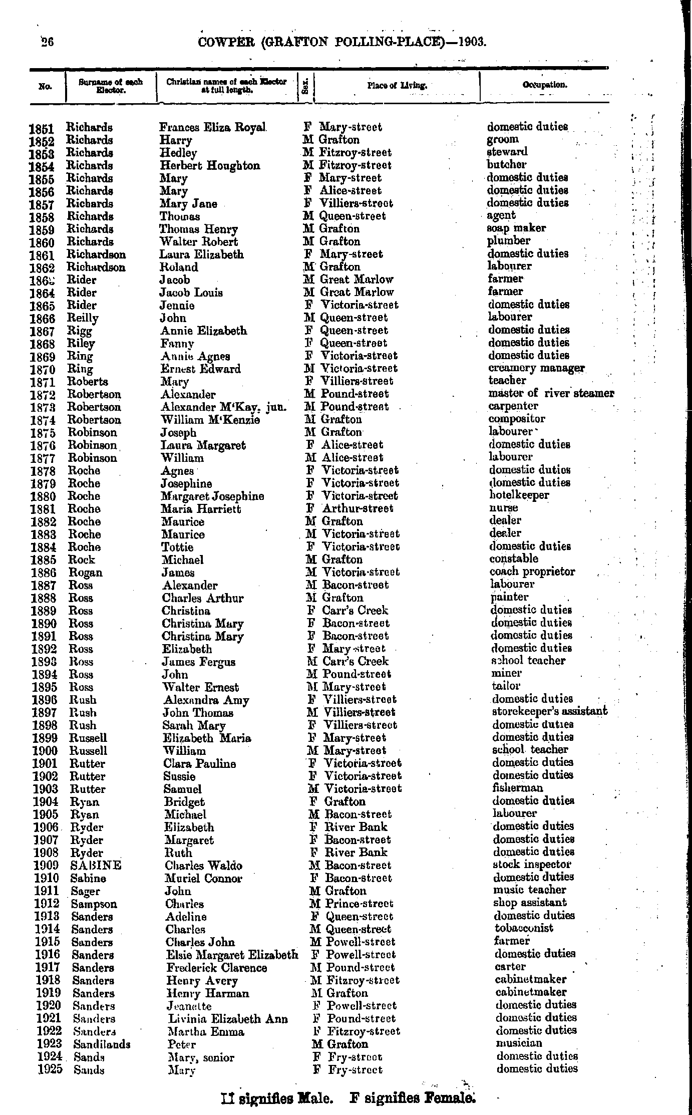
- Pollock Jessie - Richards Fanny
- Richards Frances - Sands Mary
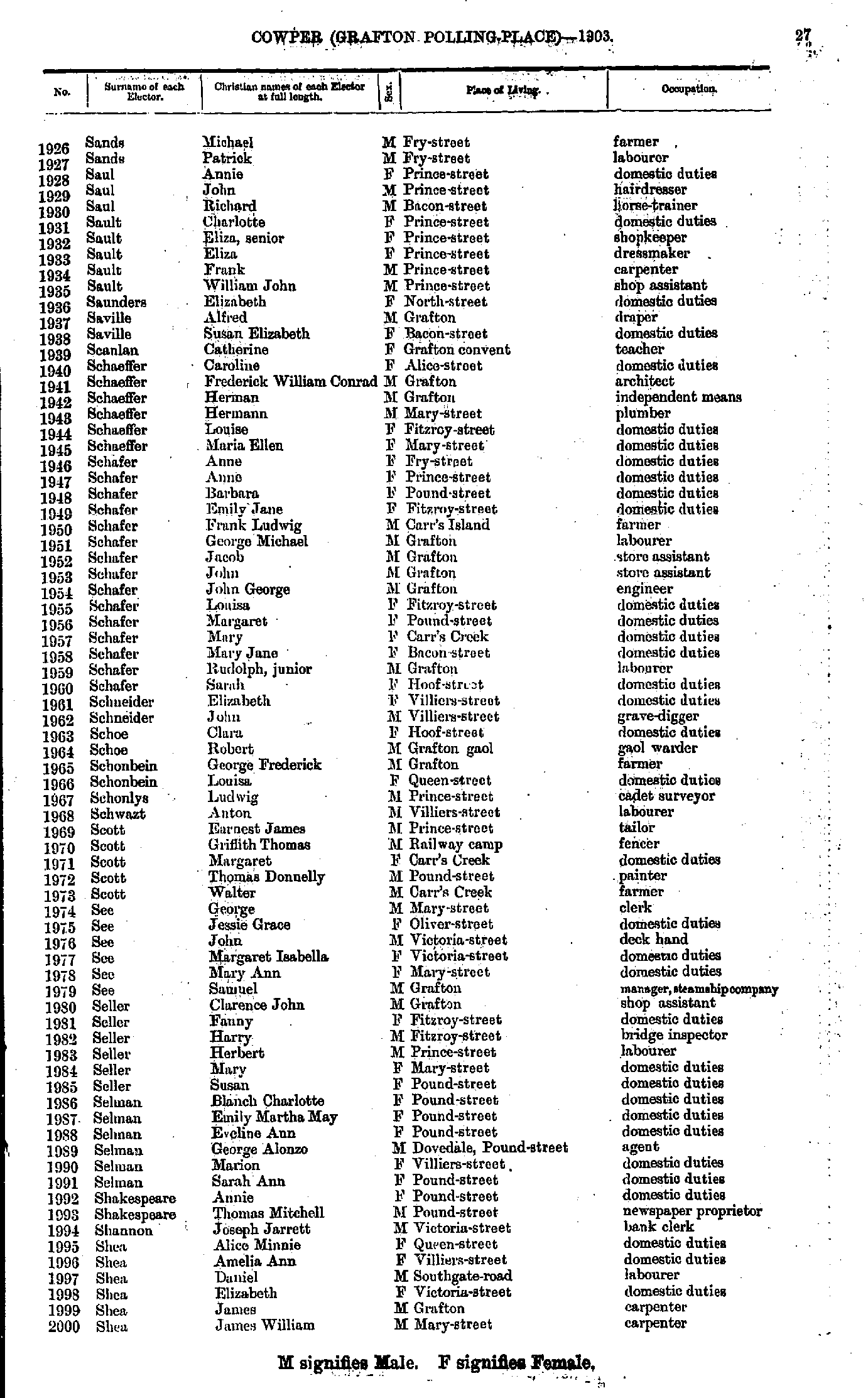
- Sands Michael - Shea James
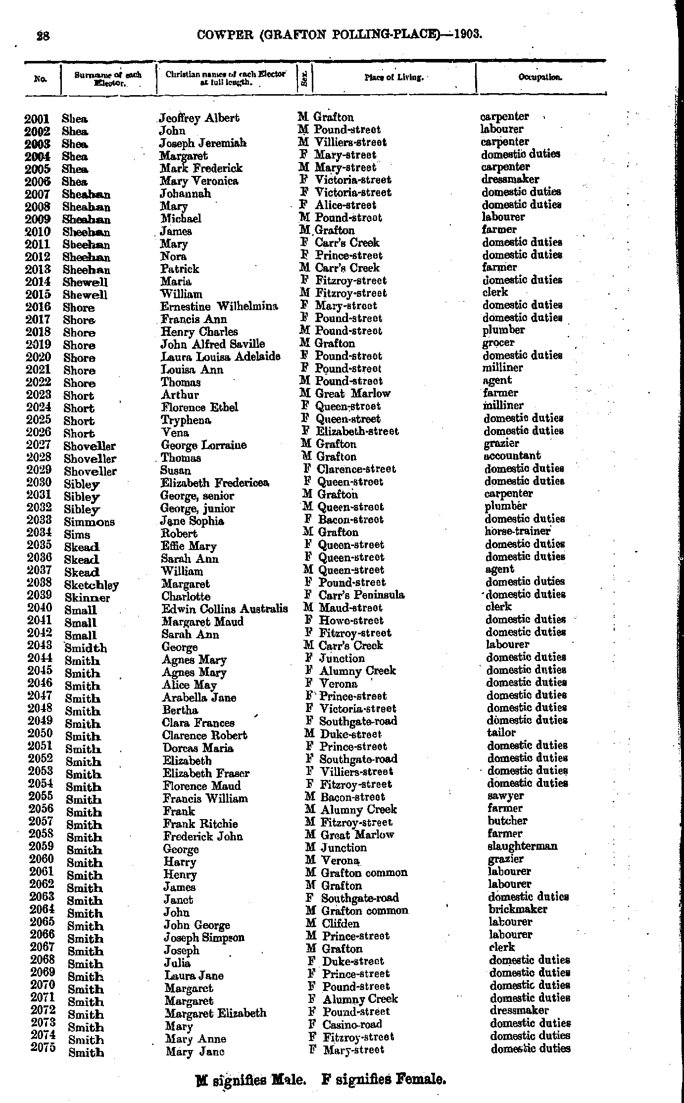
- Shea Jeoffrey - Smith Mary
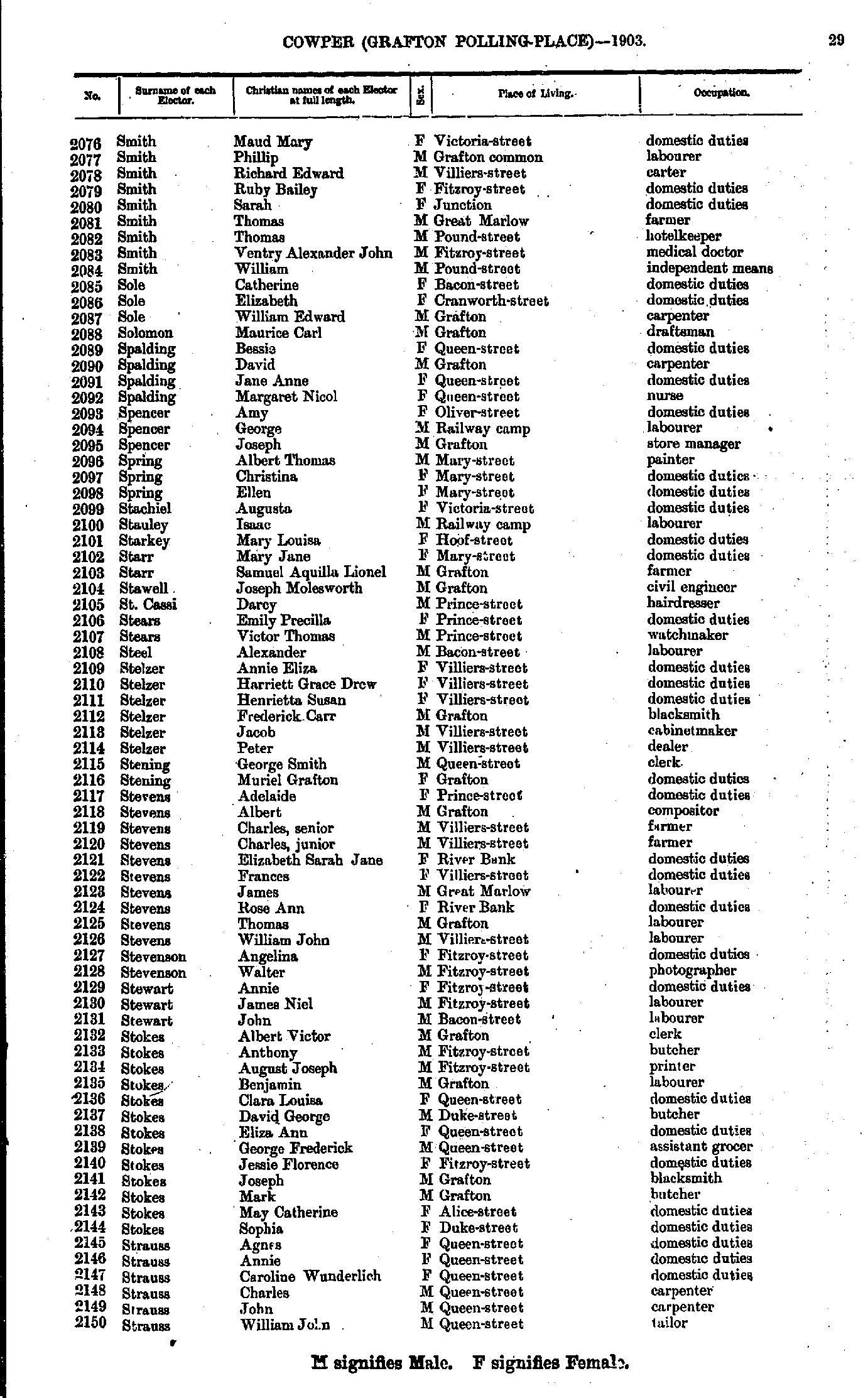
- Smith Maud - Strauss William
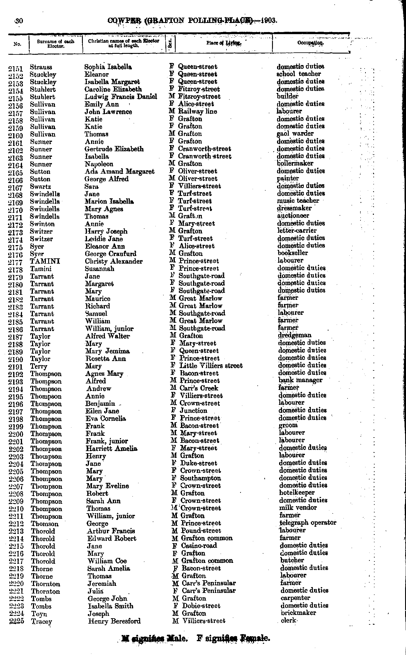
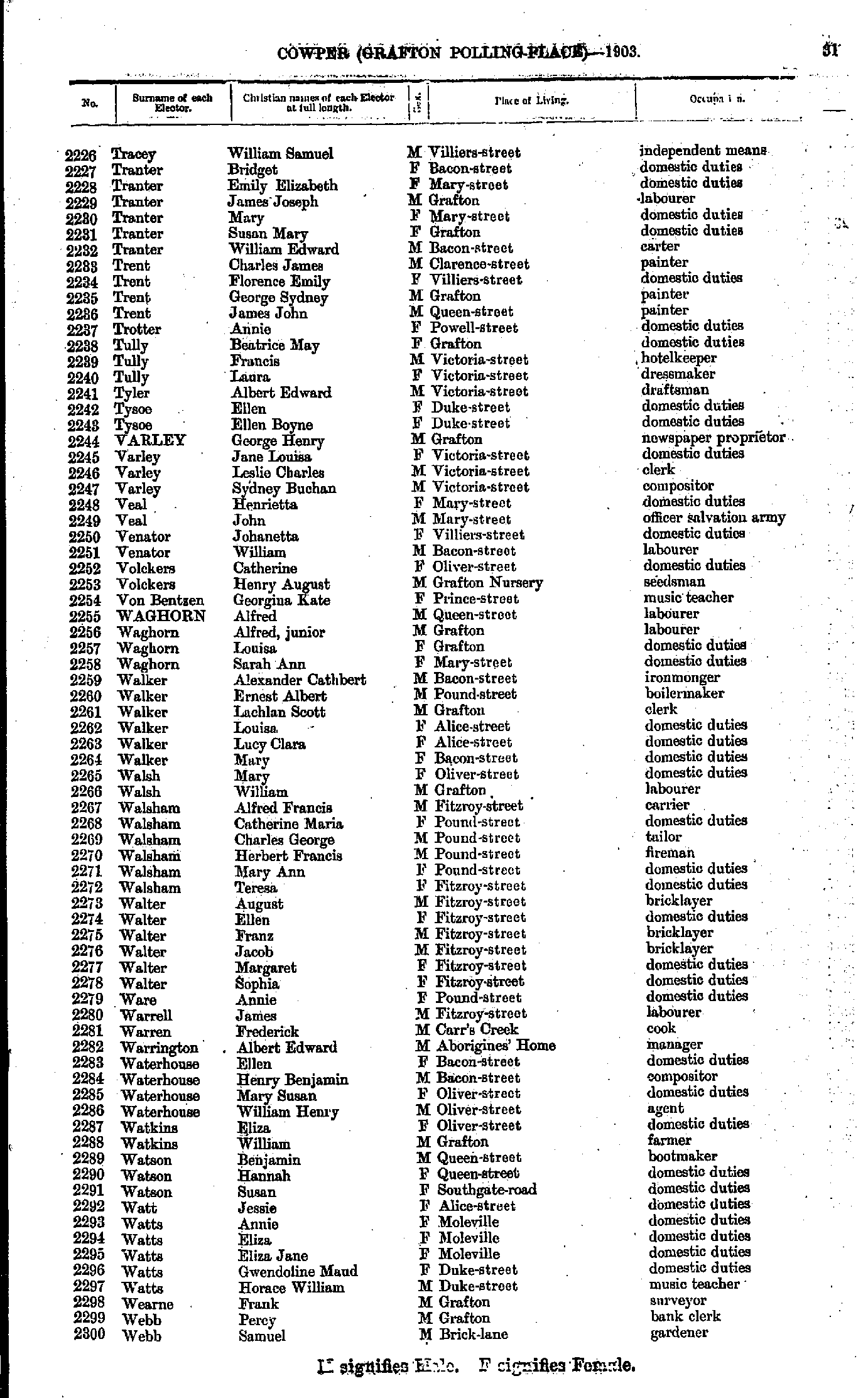
- Strauss Sophia - Tracey Henry
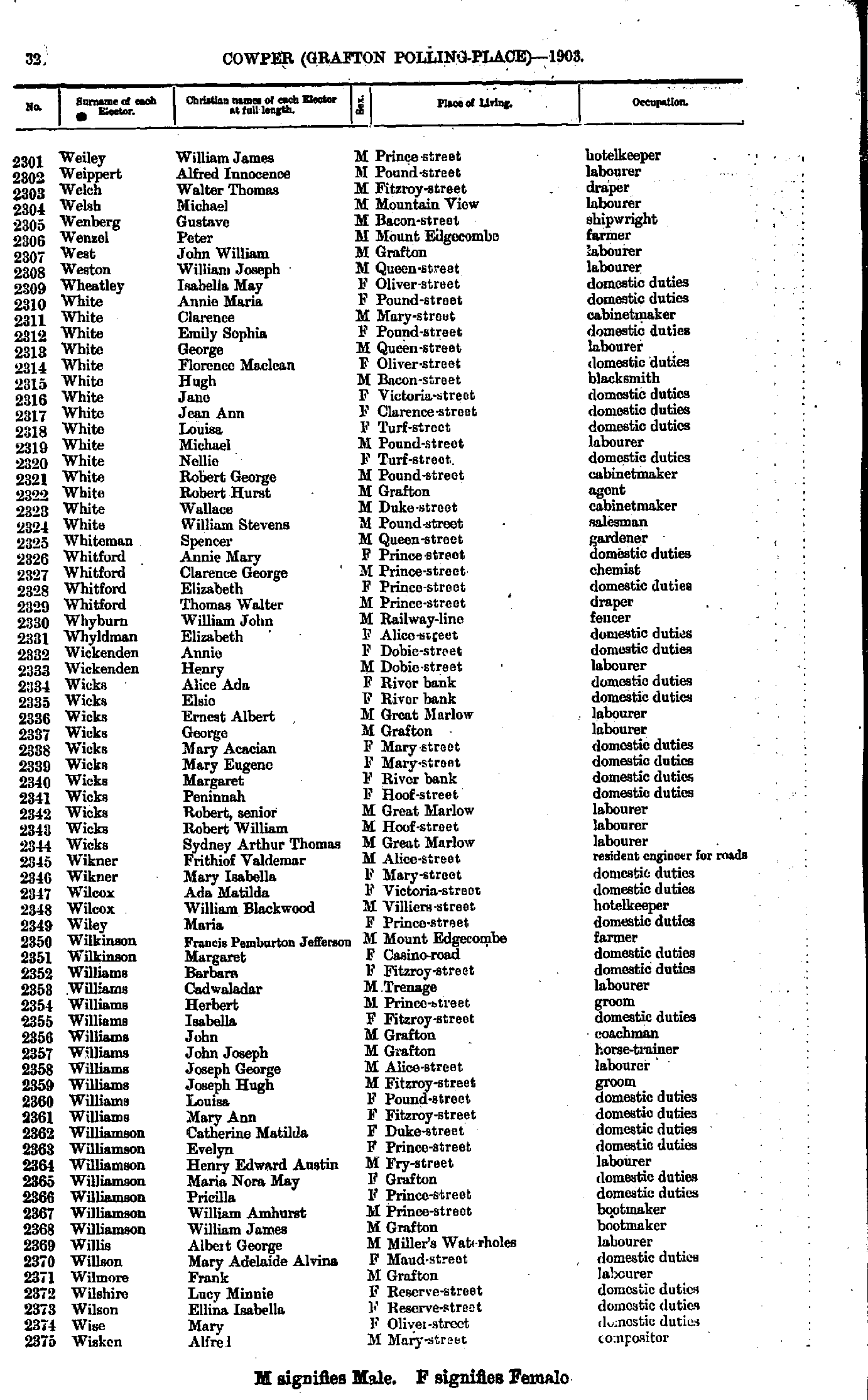
- Tracey William - Webb Samuel
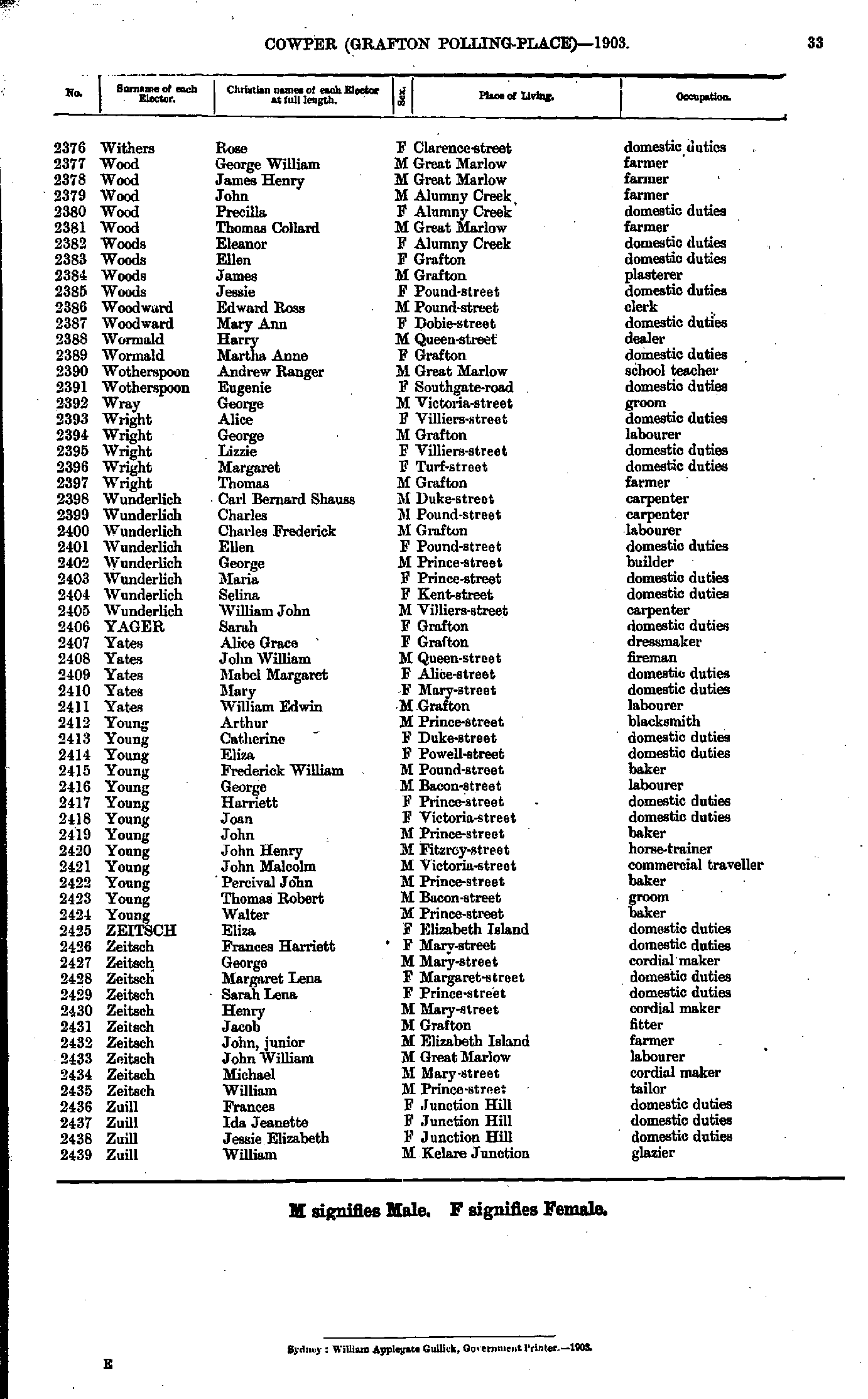
- Weiley William - Wisken Alfred
- Withers Rose - Zuill William
- Bolger Allan - Connors Michael
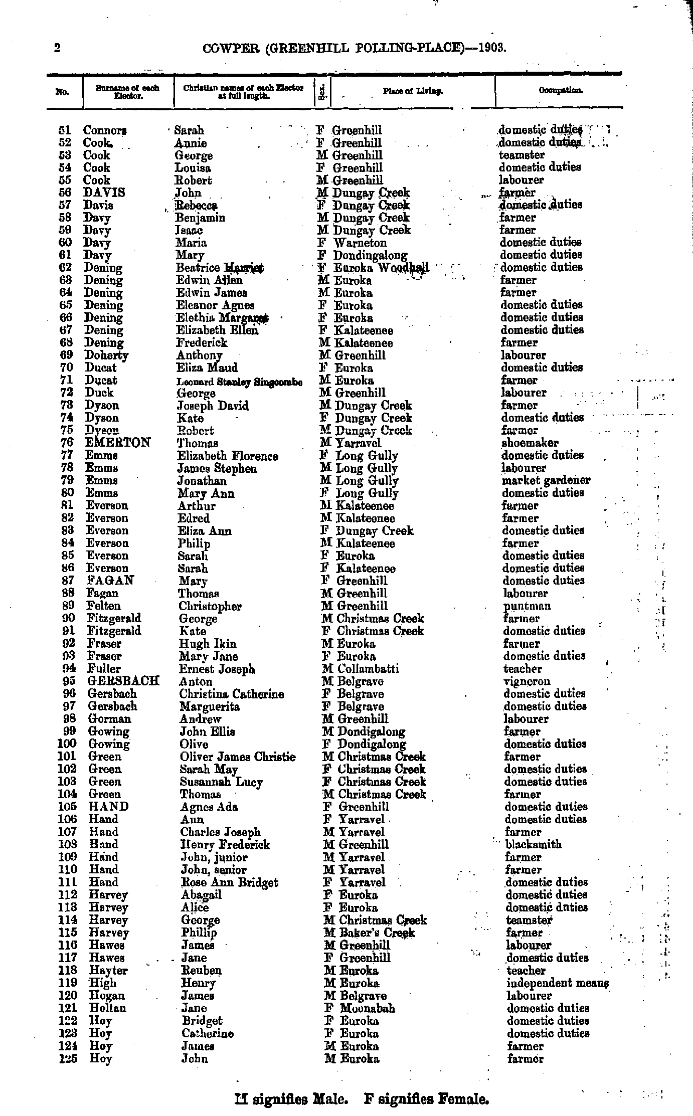
- Connors Sarah - Hoy John
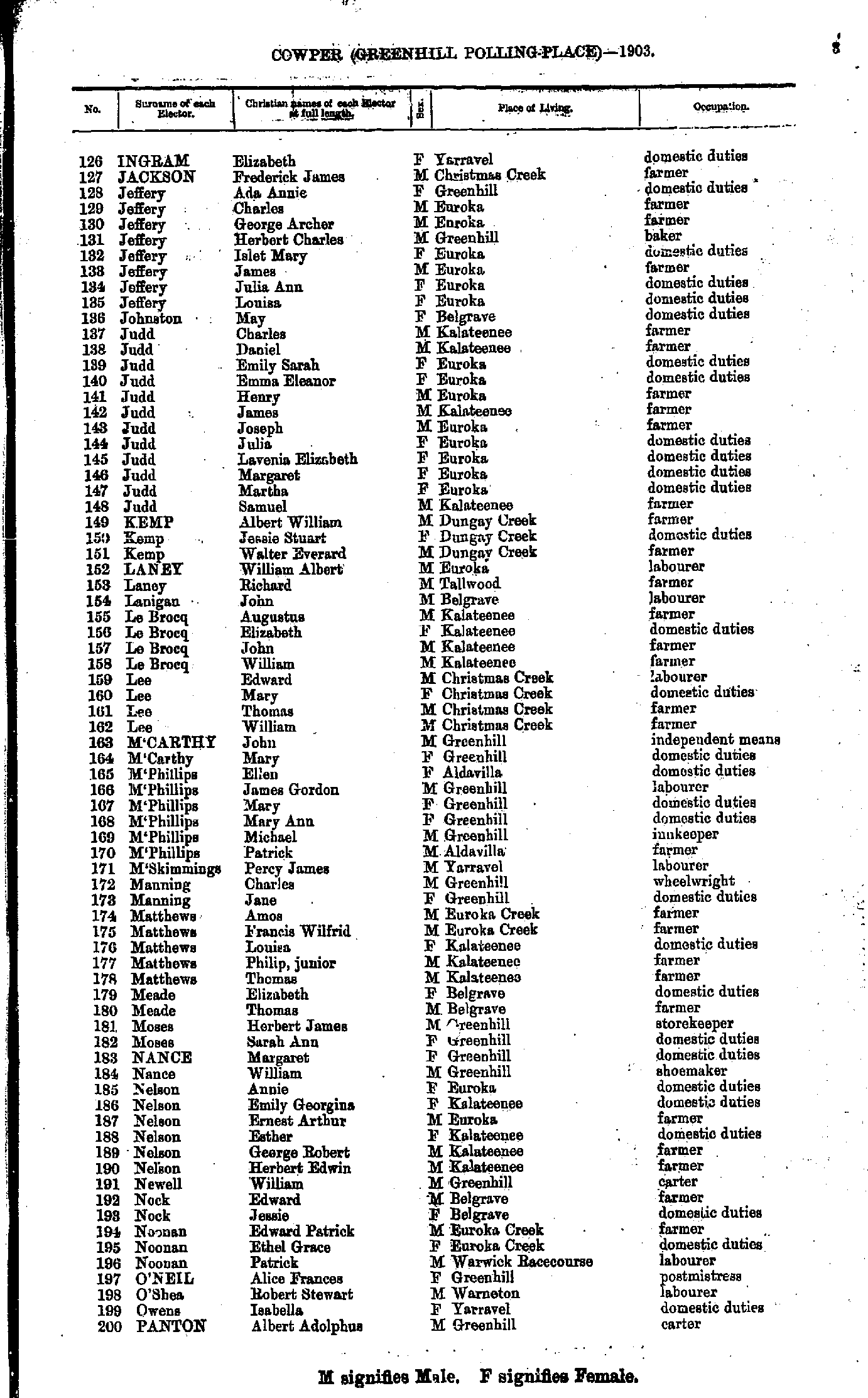
- Ingram Elizabeth - Panton Albert
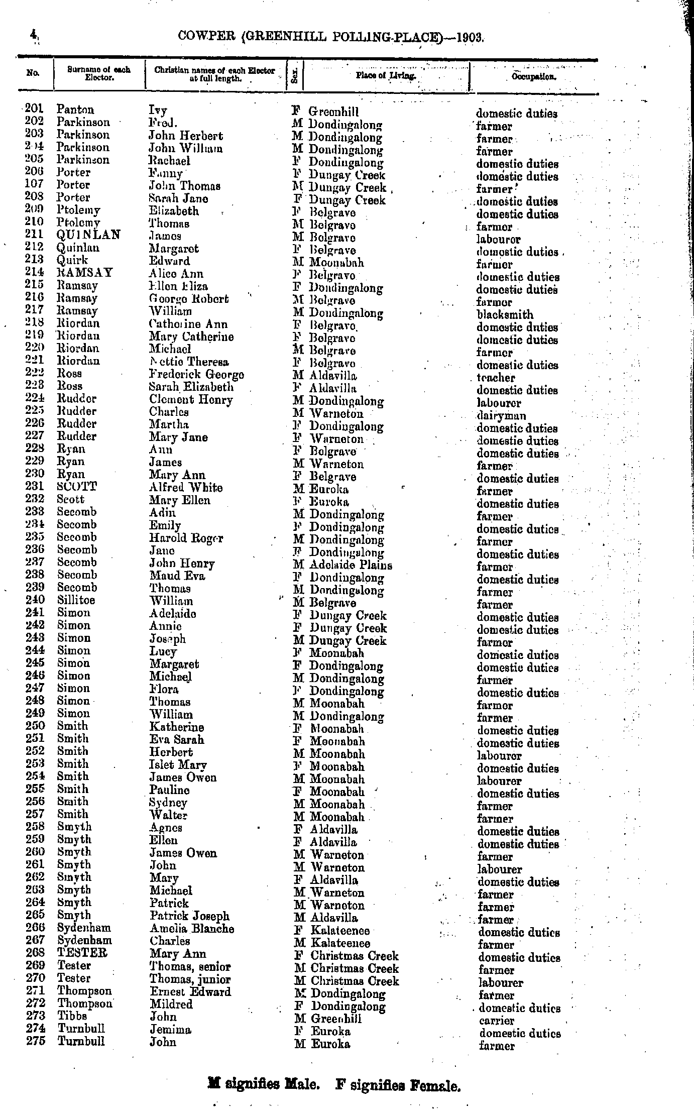
- Panton Ivy - Turnbull John
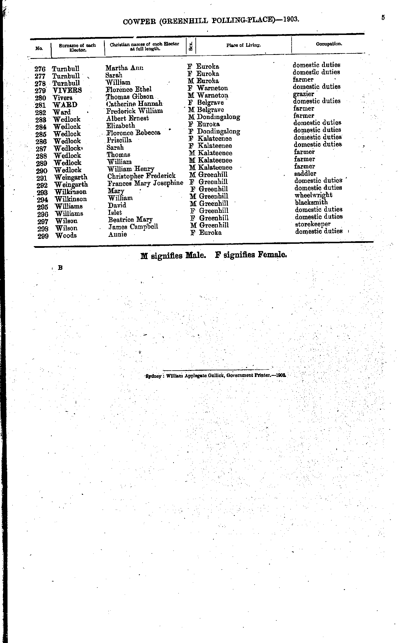
- Turnbull Martha - Woods Annie
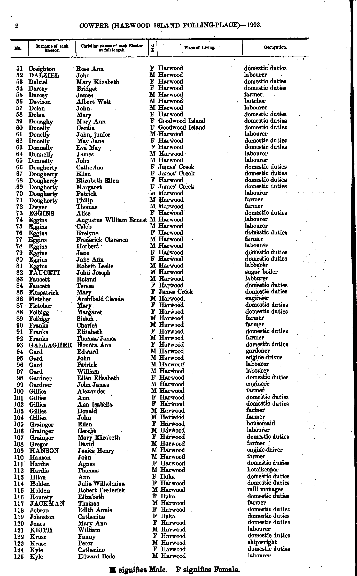
- Beckman Margaret - Creighton James
- Creighton Rose - Kyle Edward
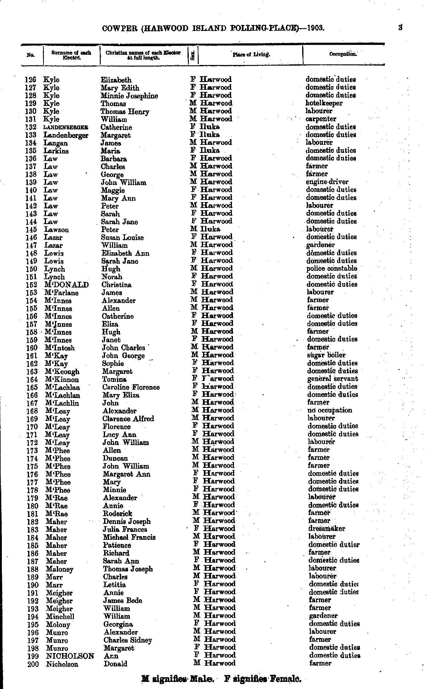
- Kyle Elizabeth - Nicholson Donald
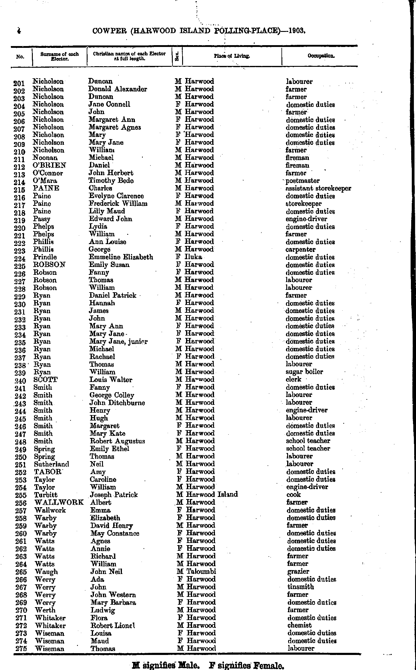
- Nicholson Duncan - Wiseman Thomas
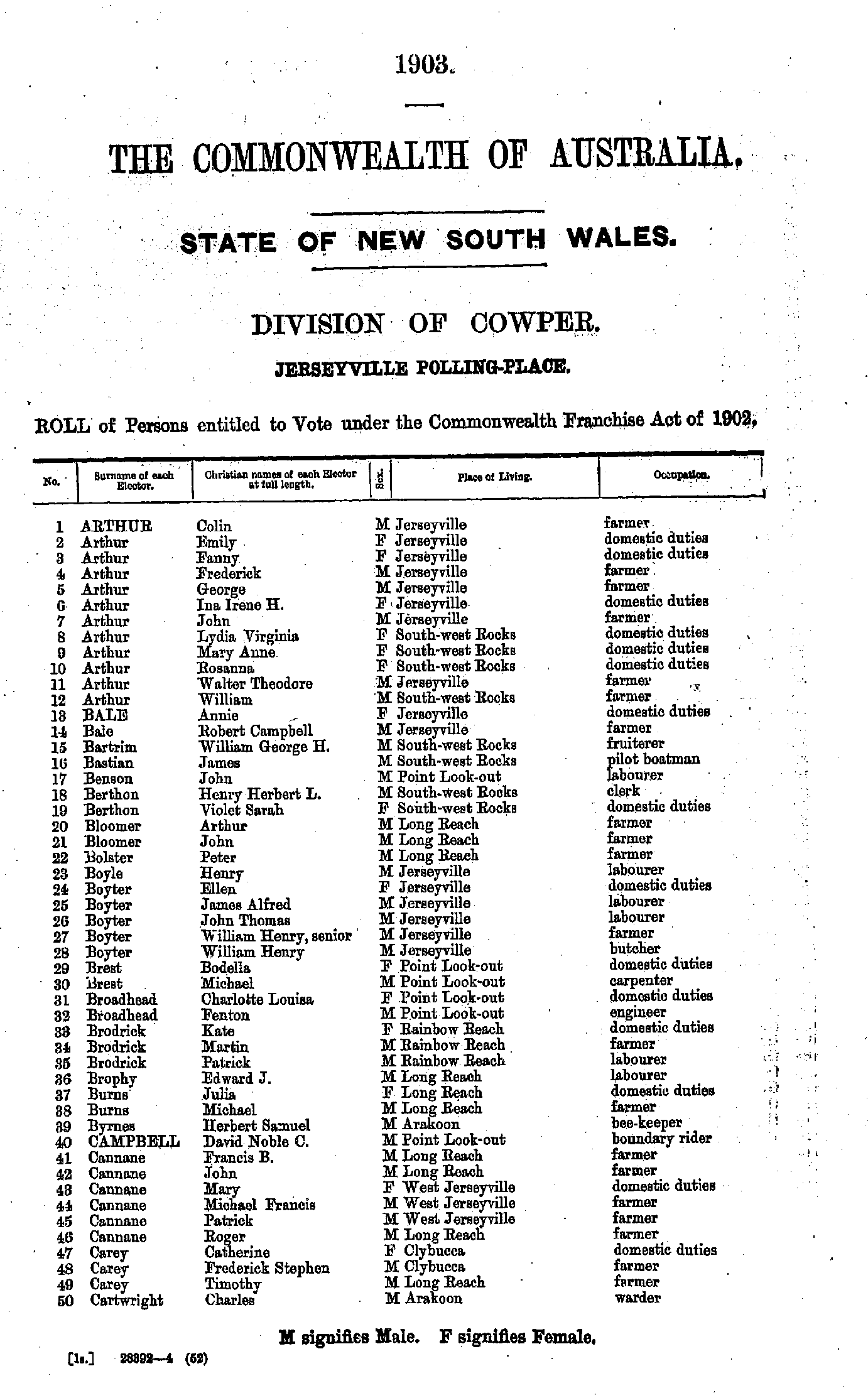
- Arthur Colin - Cartwright Charles
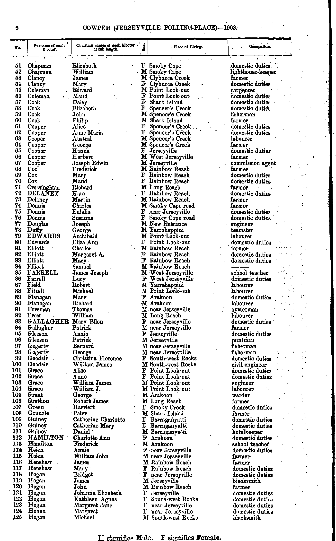
- Chapman Elizabeth - Hogan Michael
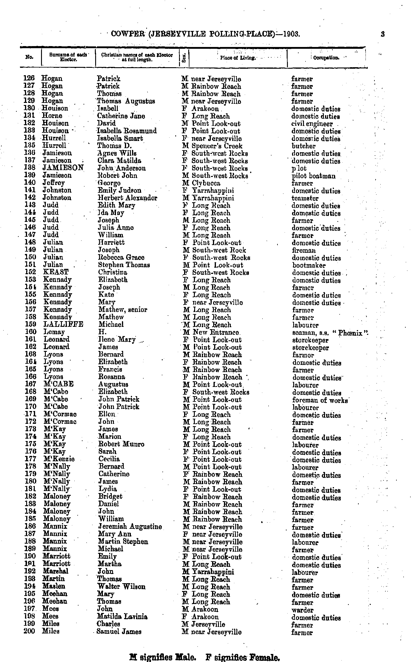
- Hogan Patrick - Miles Samuel
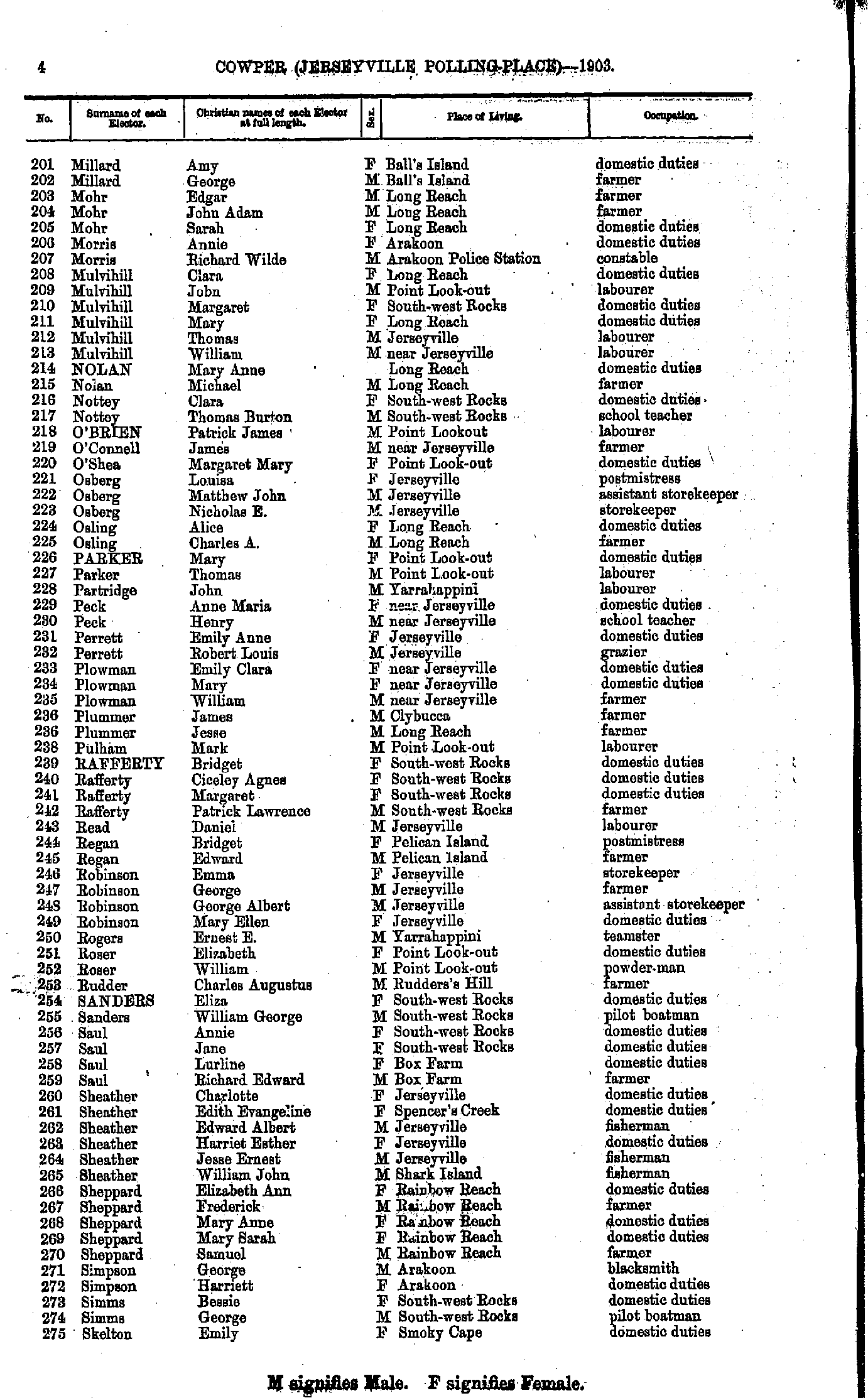
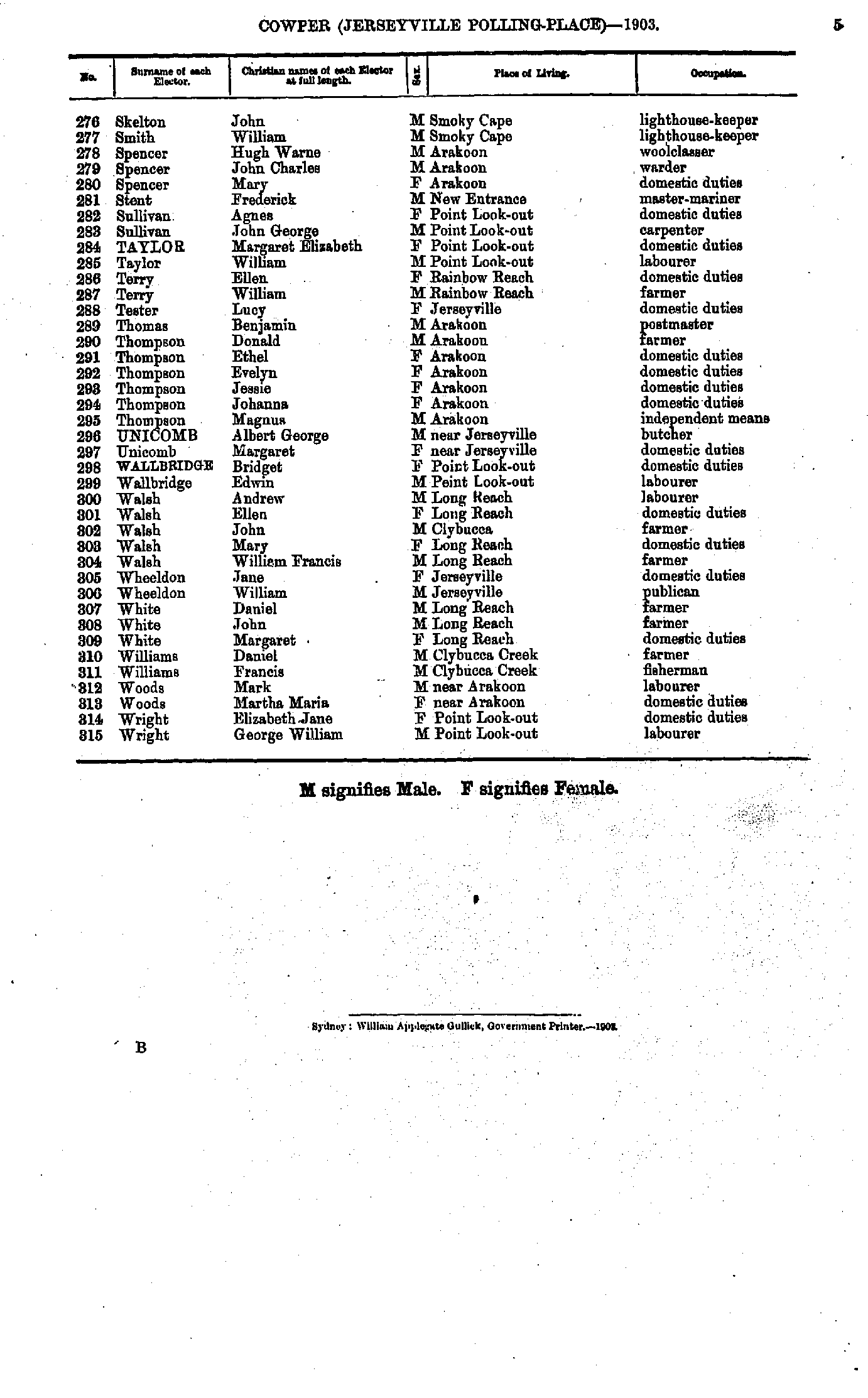
- Millard Amy - Skelton Emily
- Skelton John - Wright George
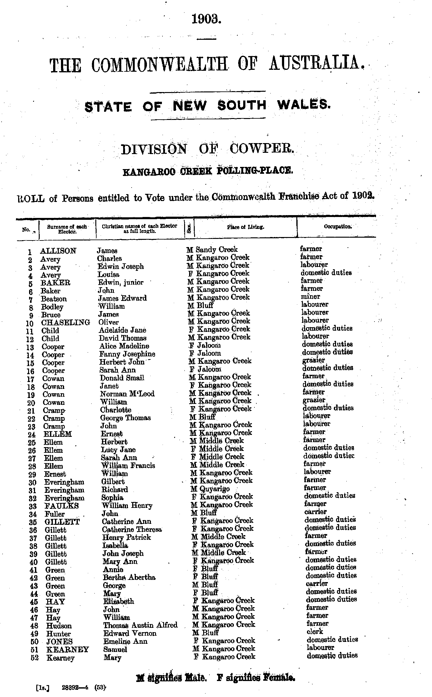
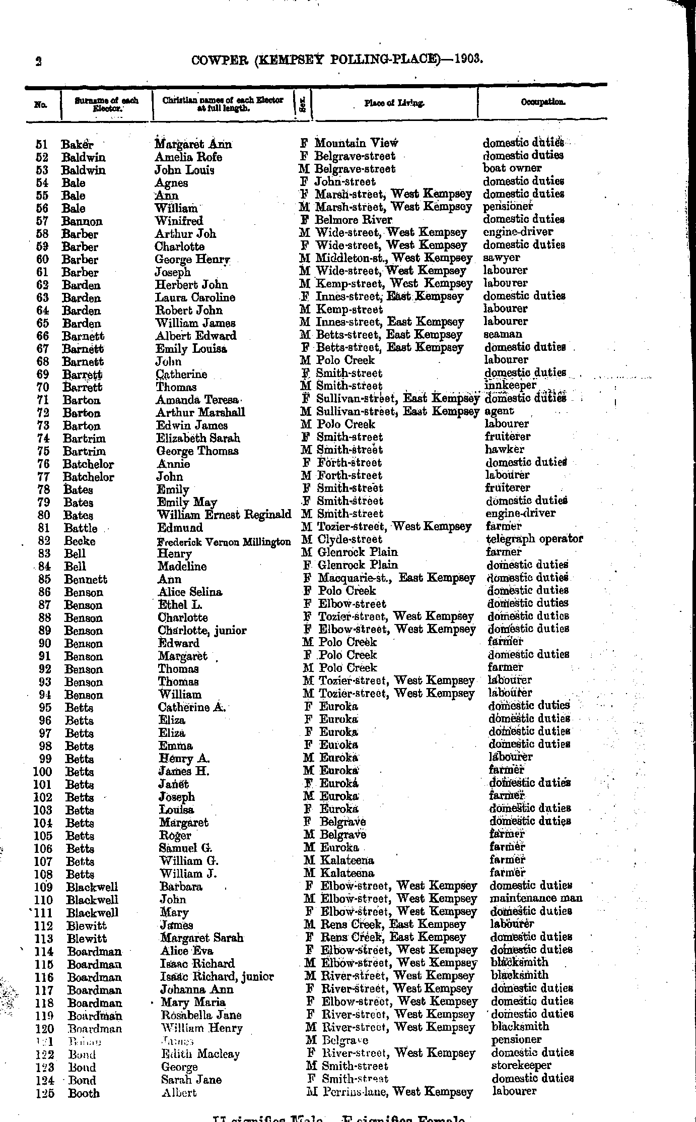
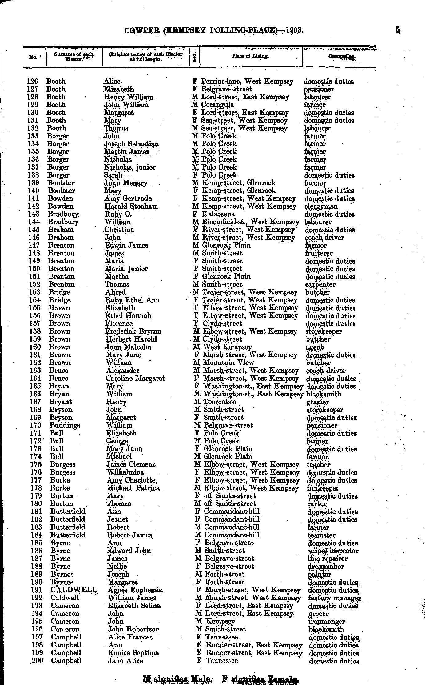
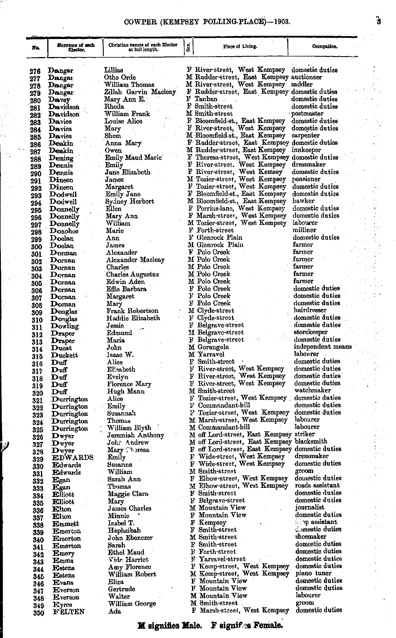
- Adams Albert - Baker James
- Baker Margaret - Booth Albert
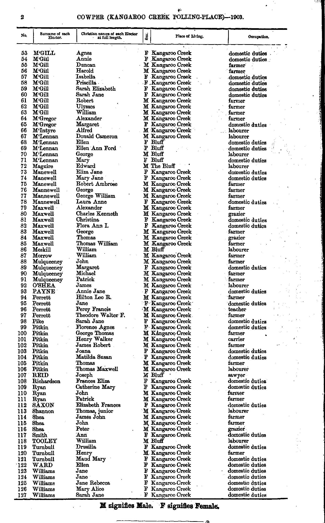
- Booth Alice - Campbell Jane
- Campbell John - Dangar Islet
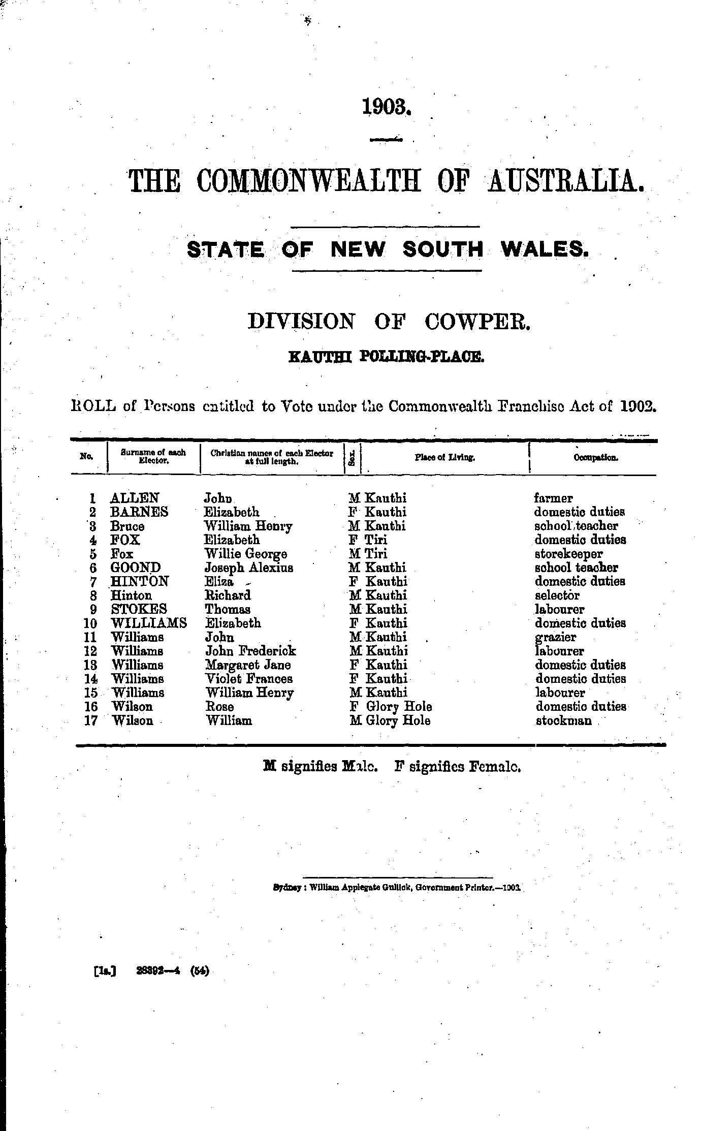
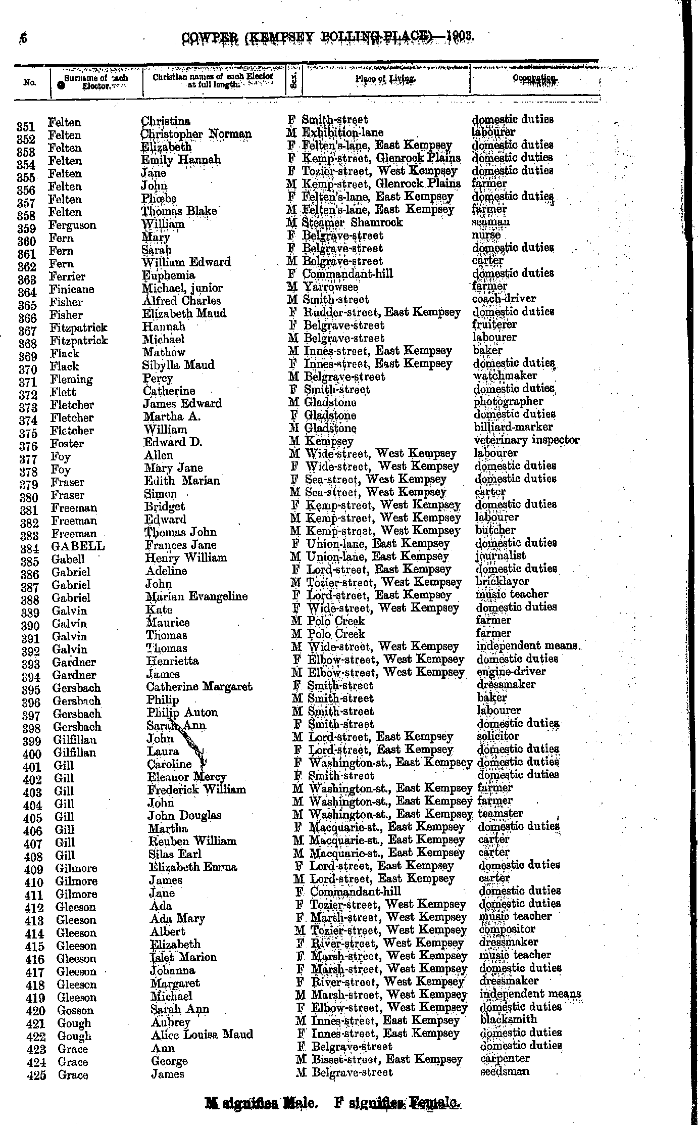
- Dangar Lillias - Felten Ada
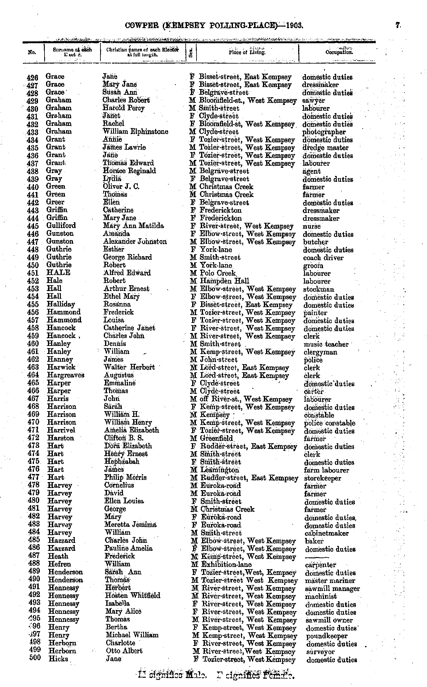
- Felten Christina - Grace James
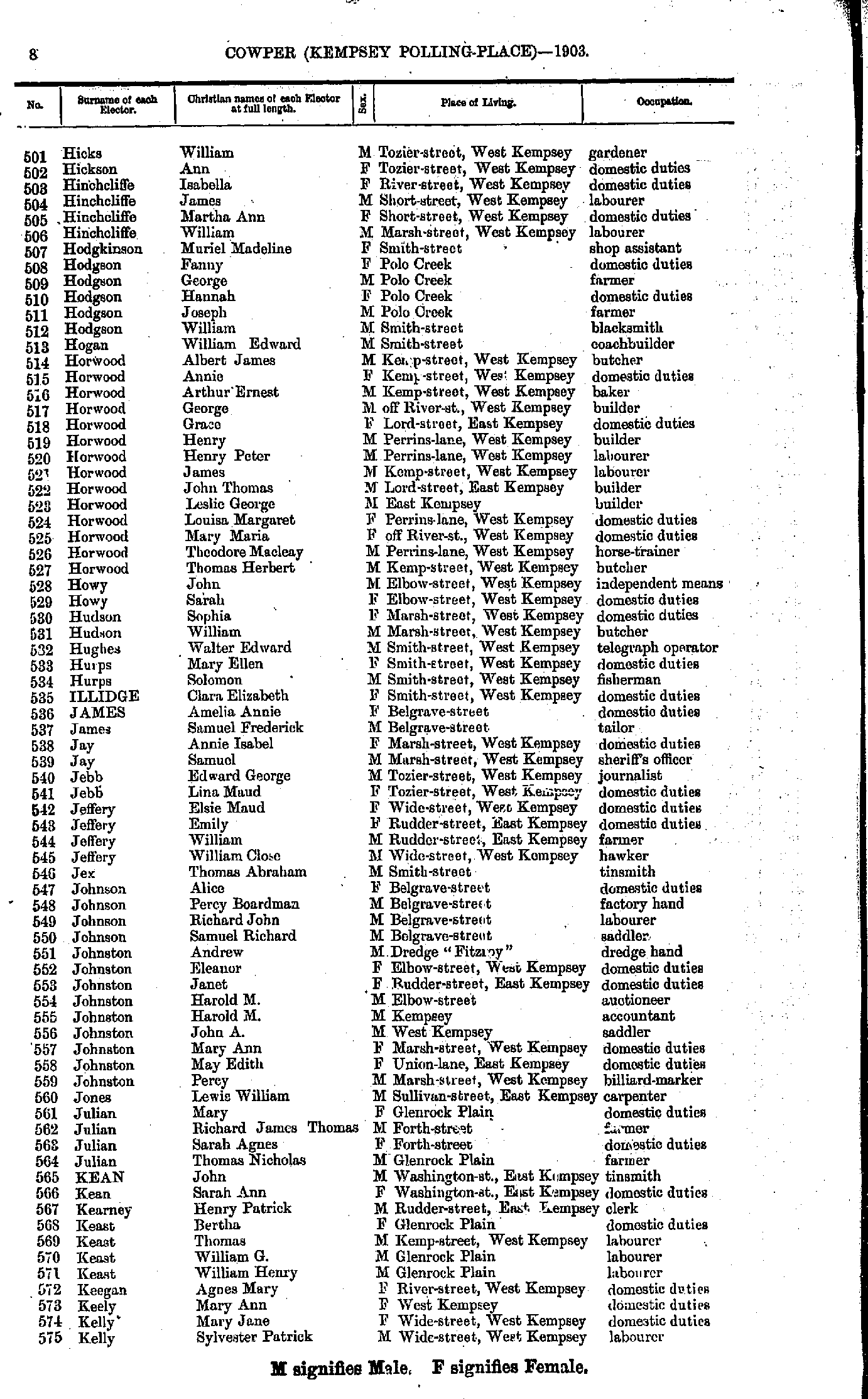
- Grace Jane - Hicks Jane
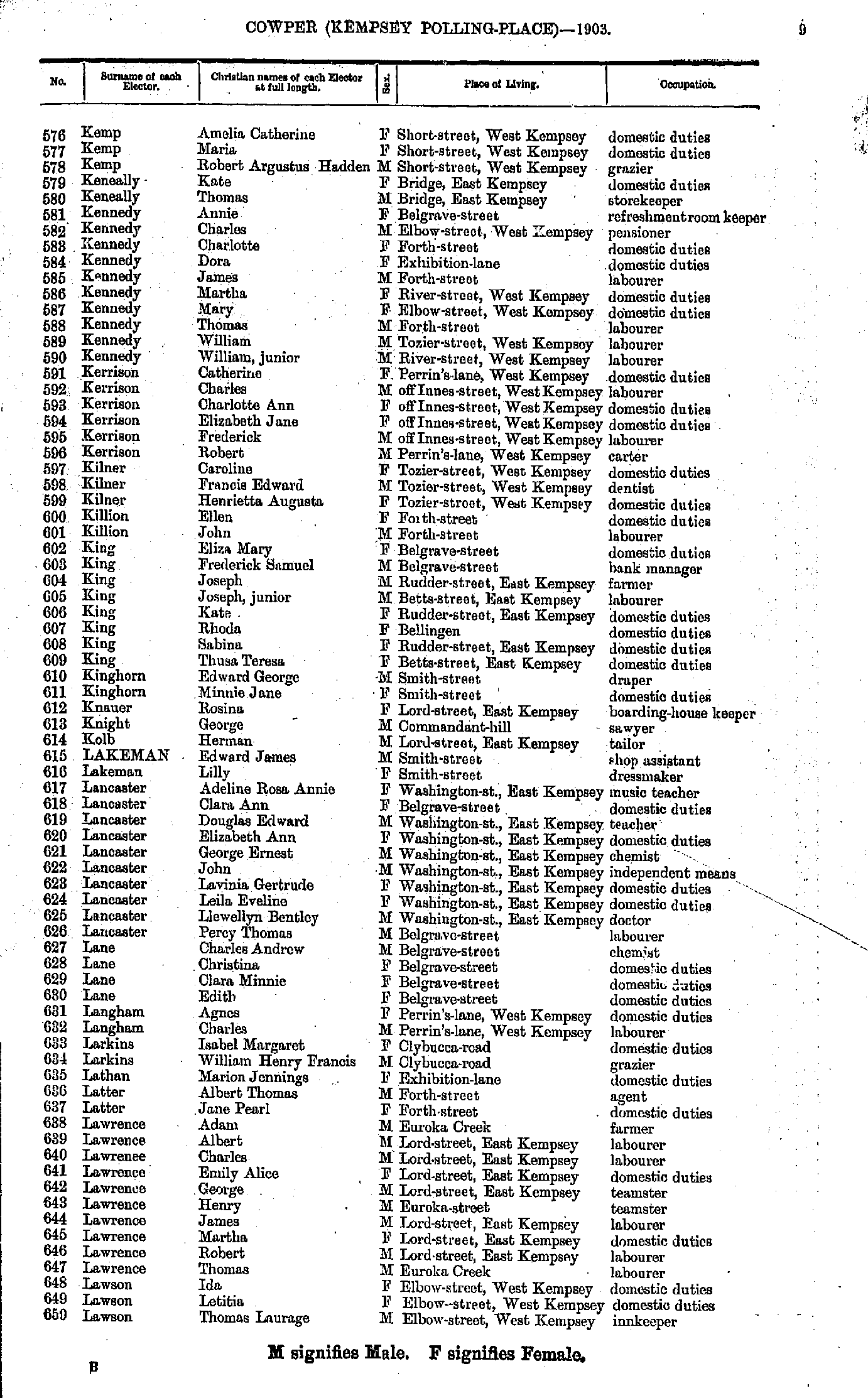
- Hicks William - Kelly Sylvester
- Kemp Amelia - Lawson Thomas
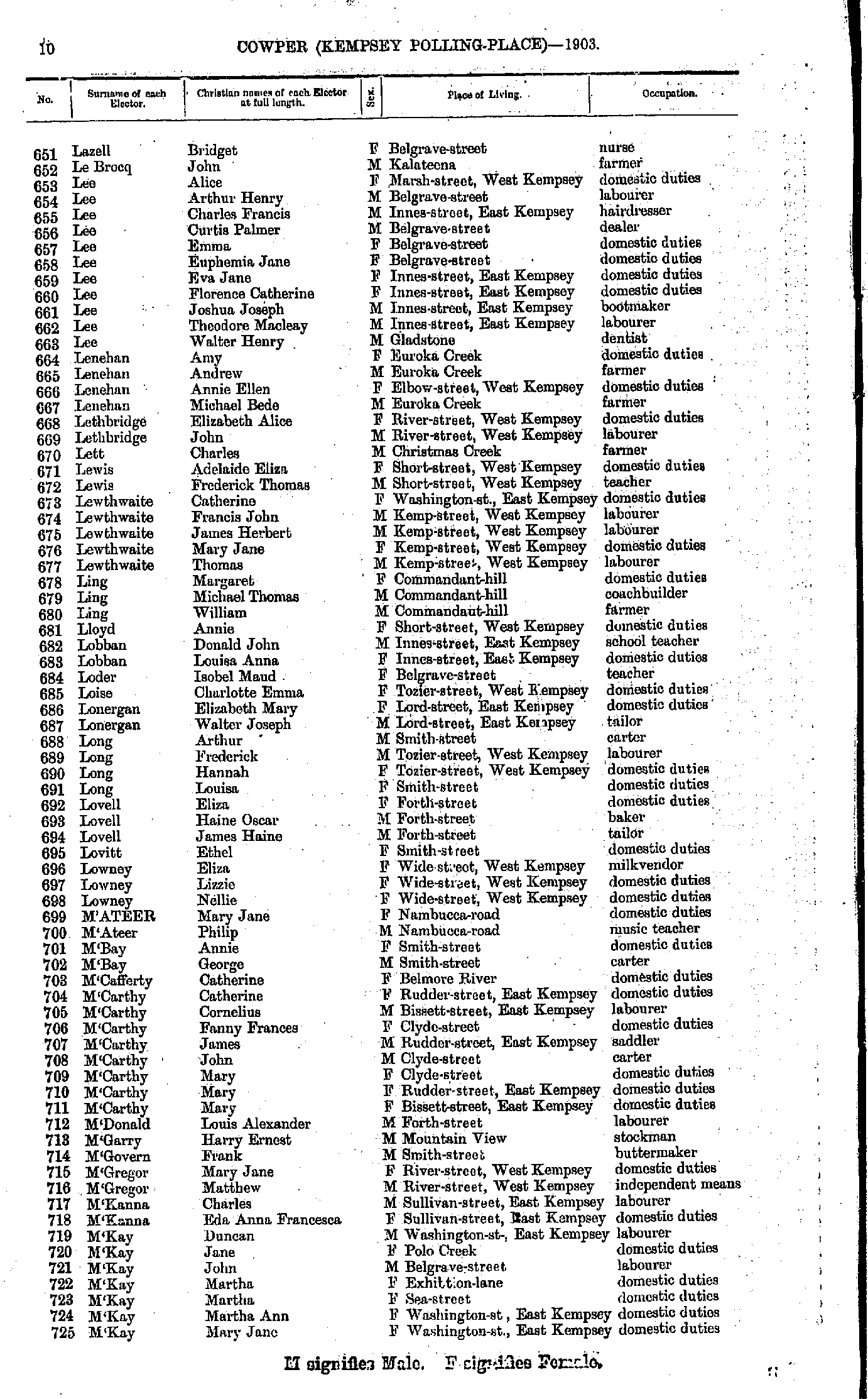
- Lazell Bridget - M'Kay Mary
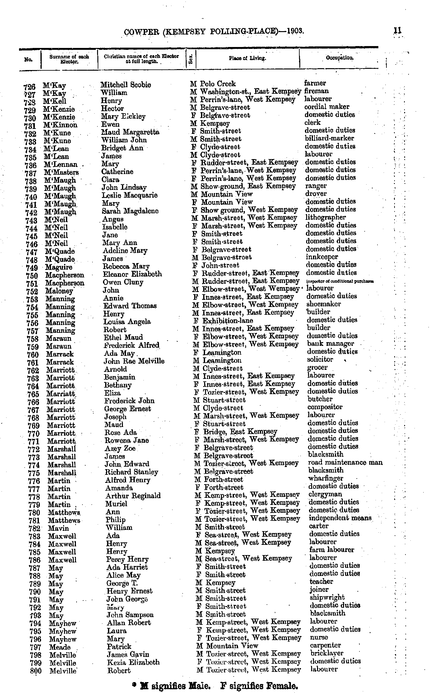
- M'Kay Mitchell - Melville Robert
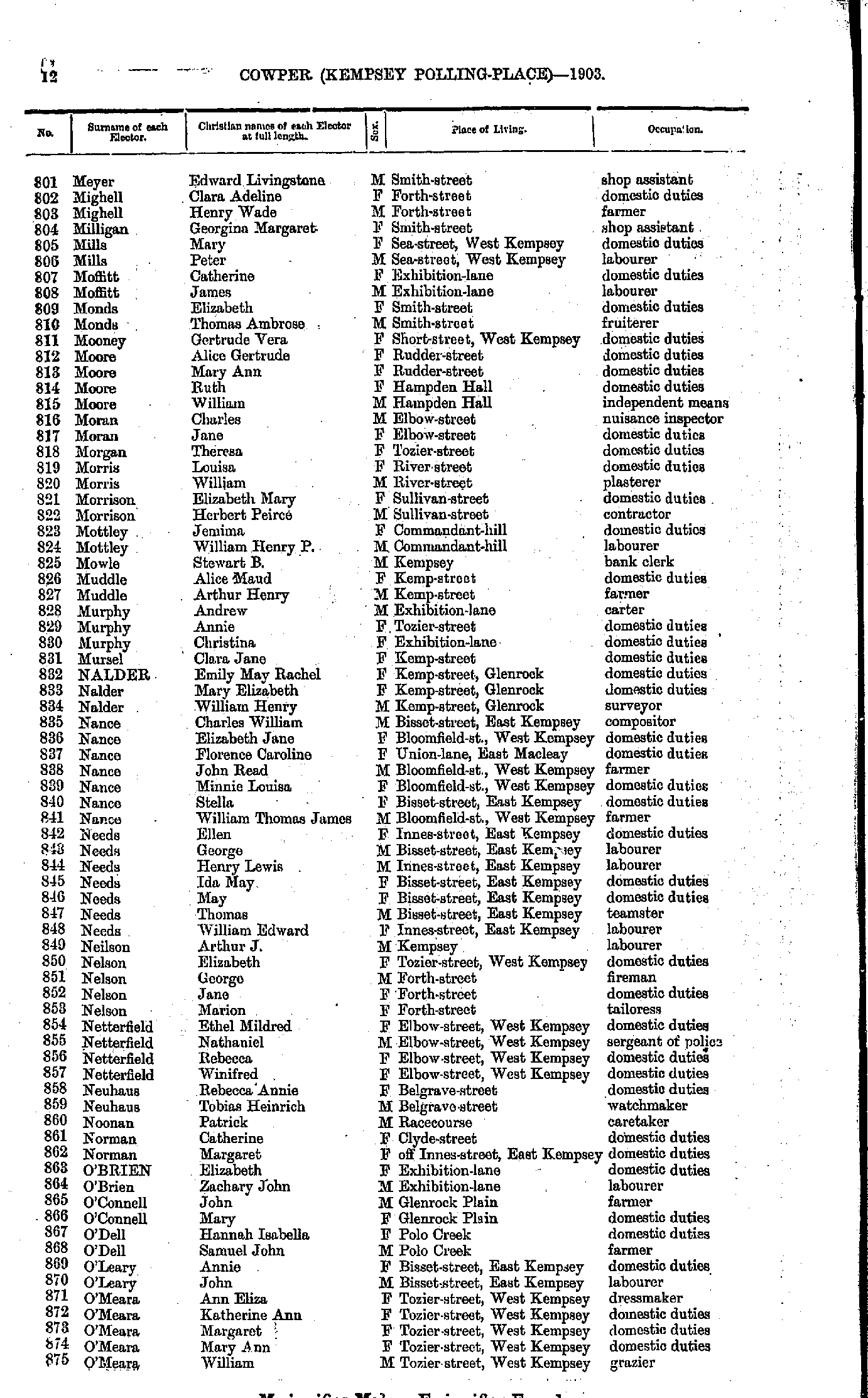
- Meyer Edward - O'Meara William
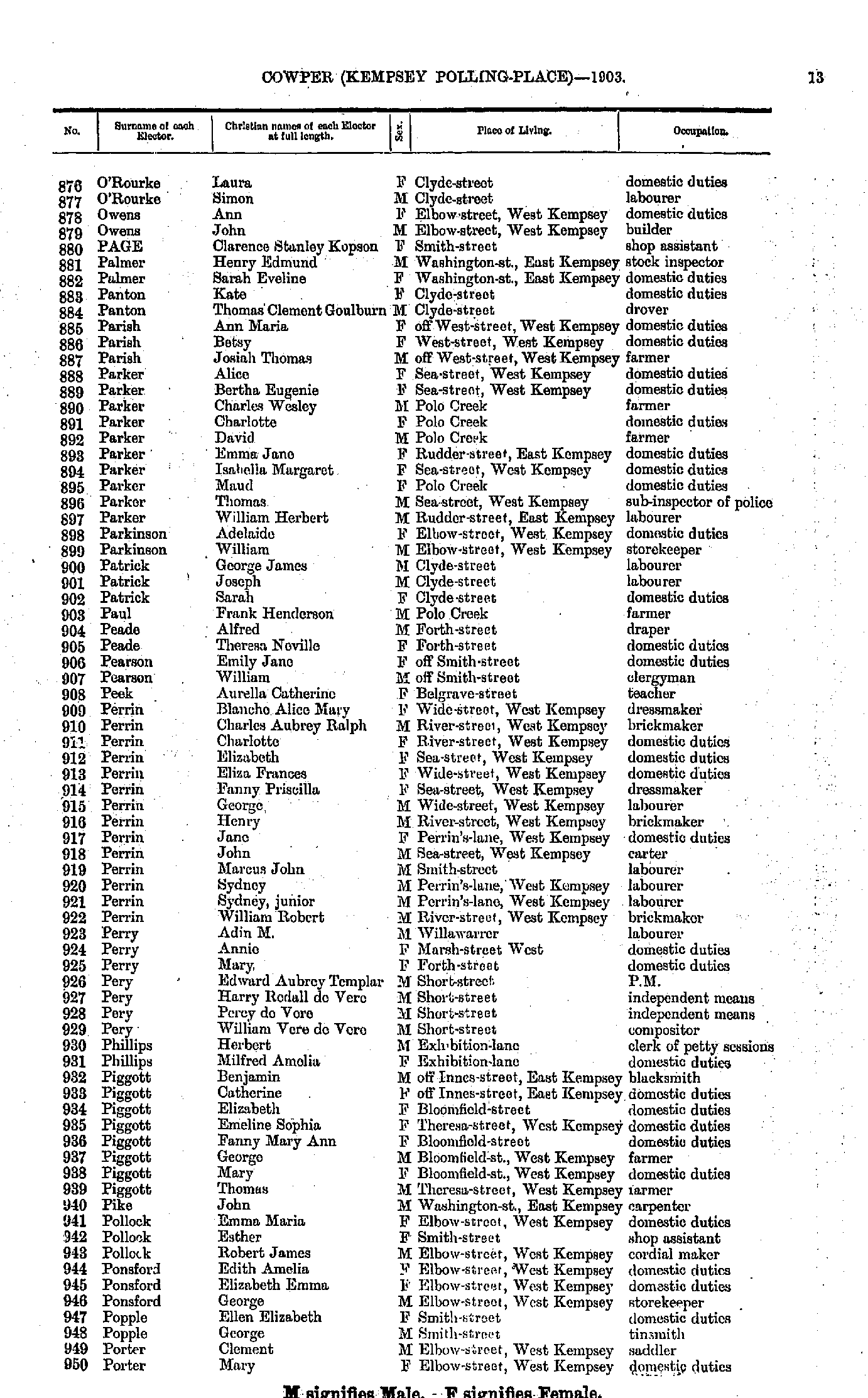
- O'Rourke Laura - Porter Mary
- Pratt Harry - Scott Andrew
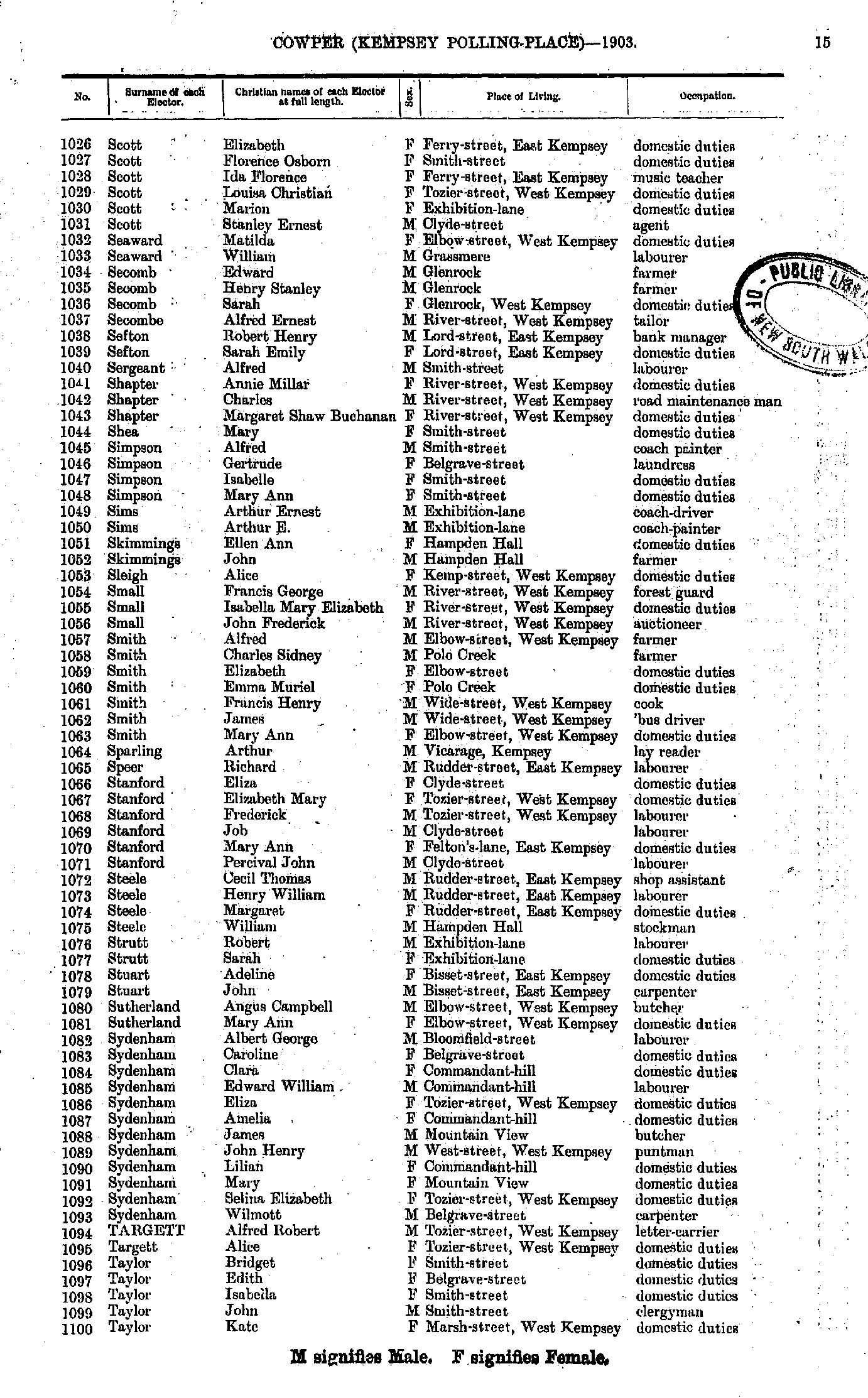
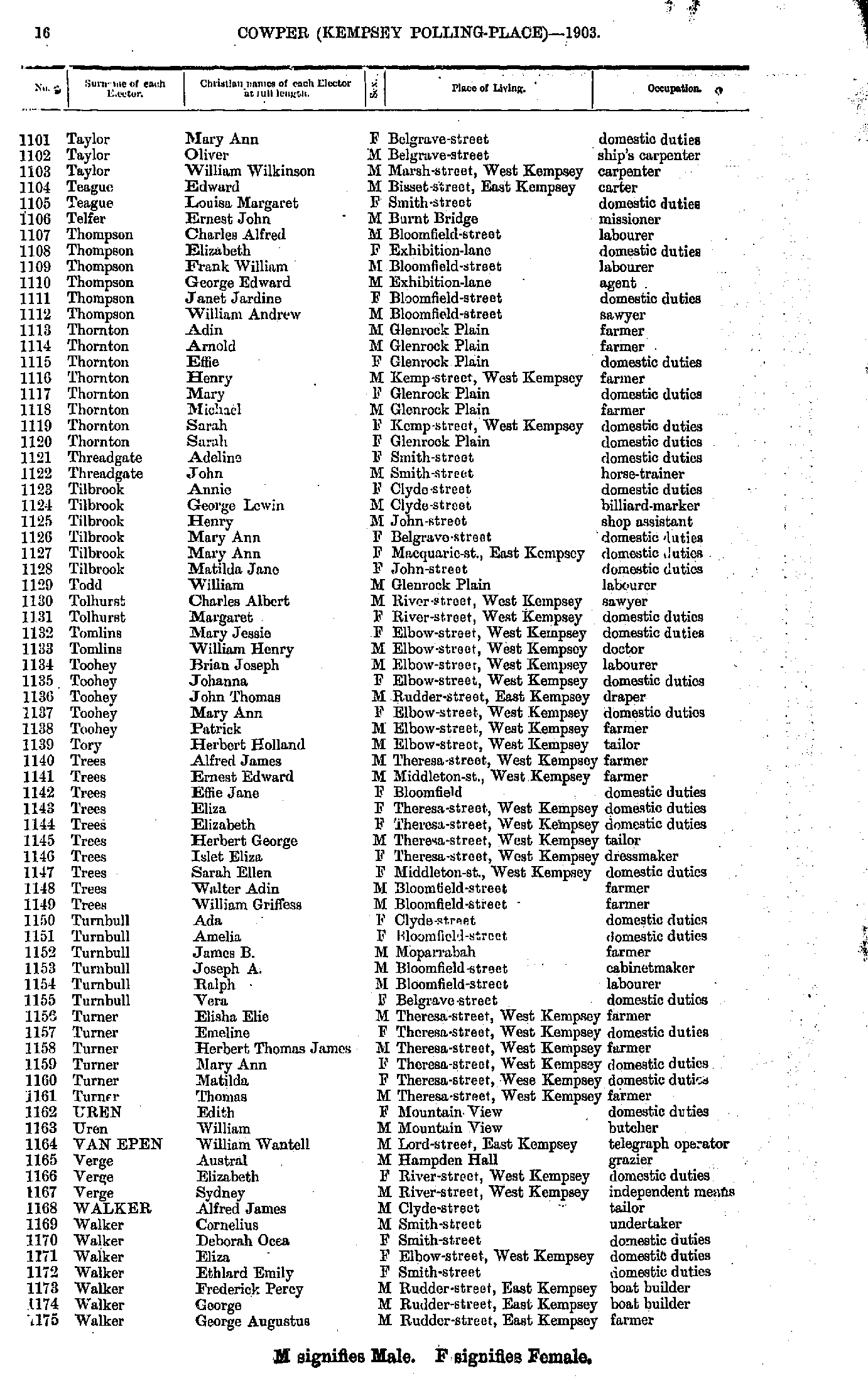
- Scott Elizabeth - Taylor Kate
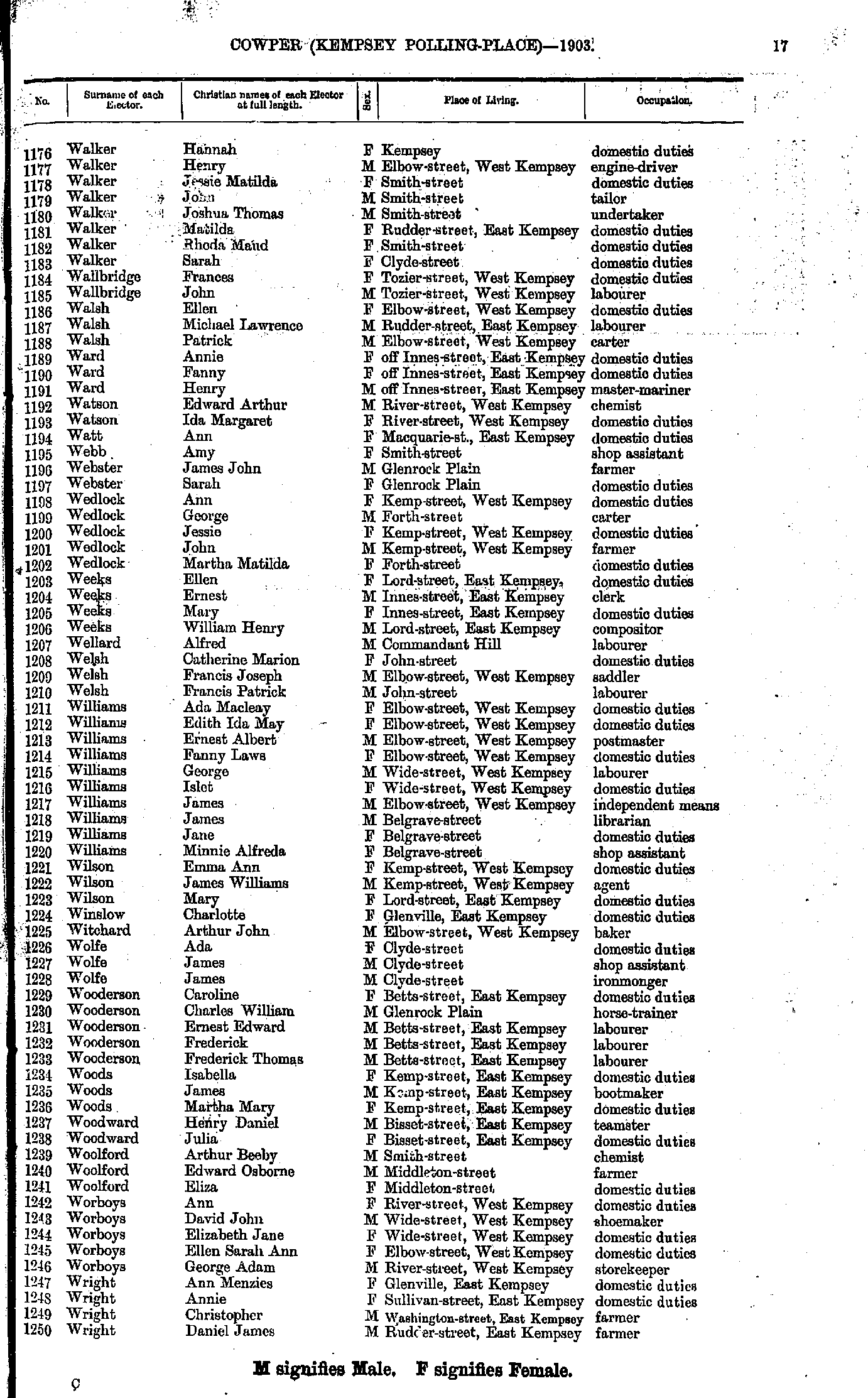
- Taylor Mary - Walker George
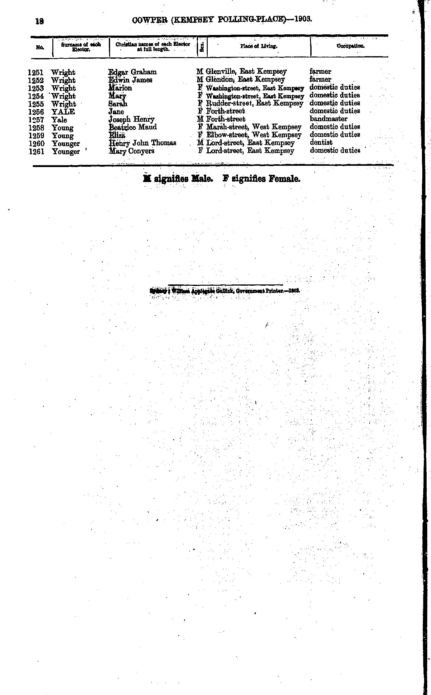
- Walker Hannah - Wright Daniel
- Wright Edgar - Younger Mary
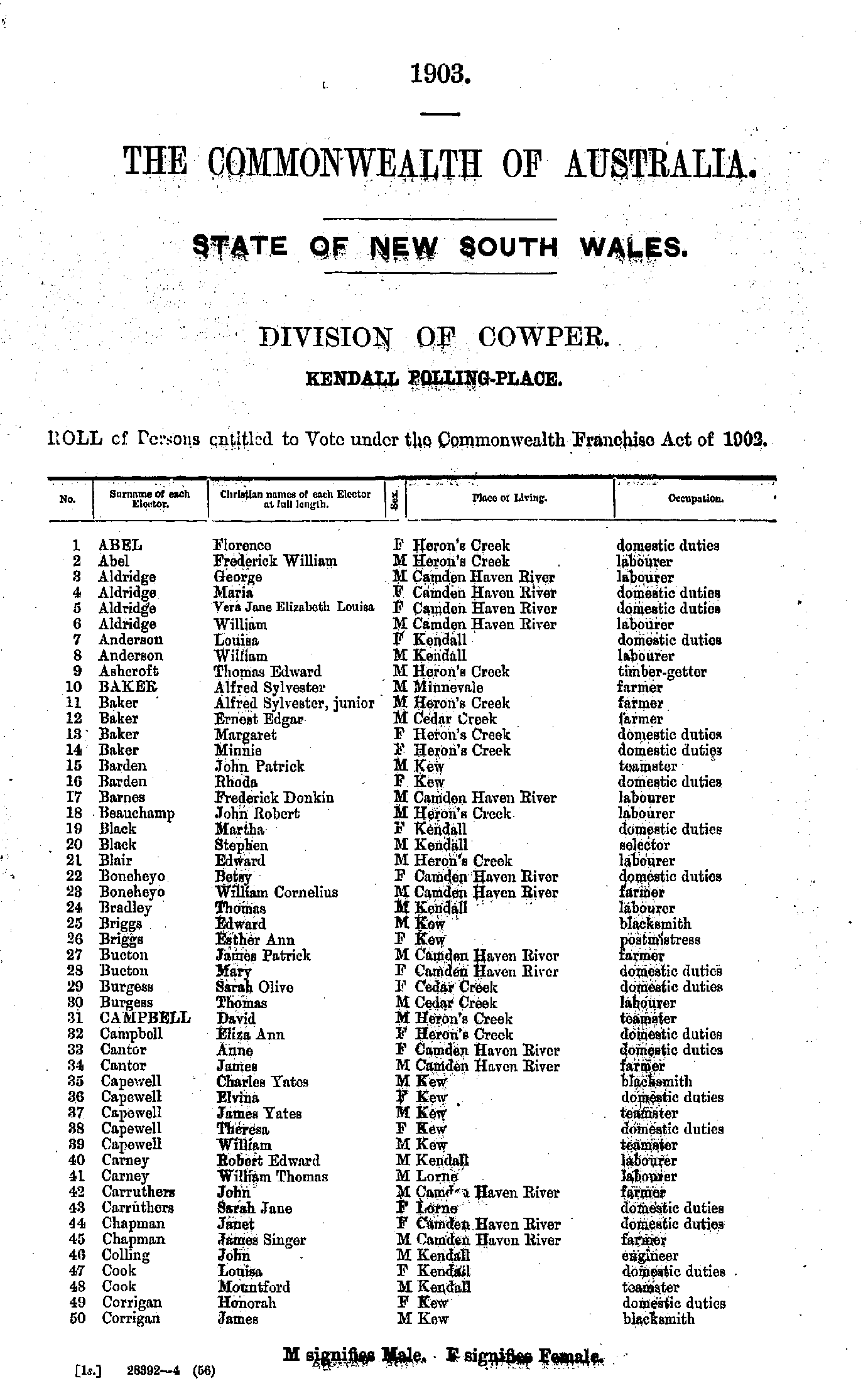
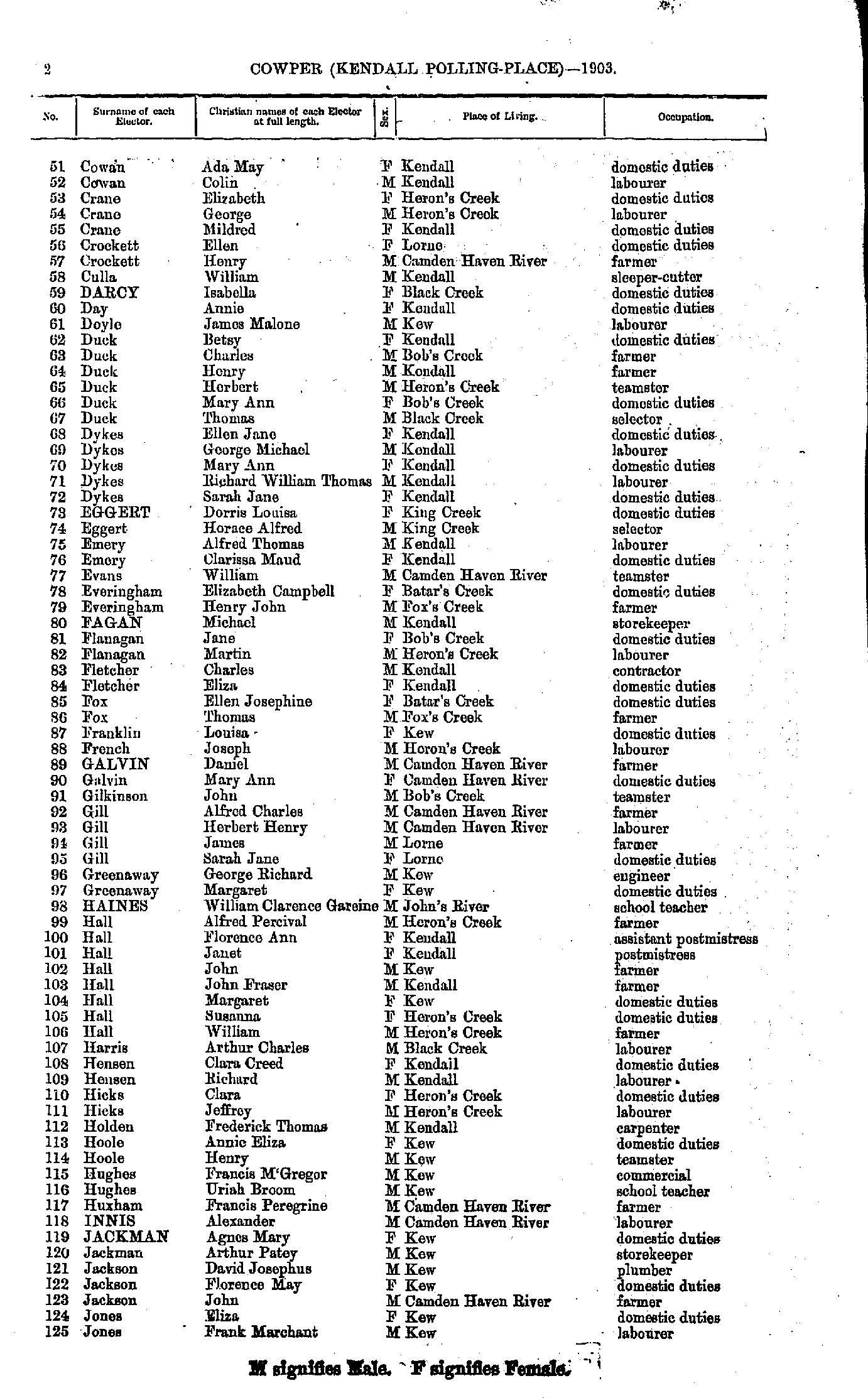
- Abel Florence - Corrigan James
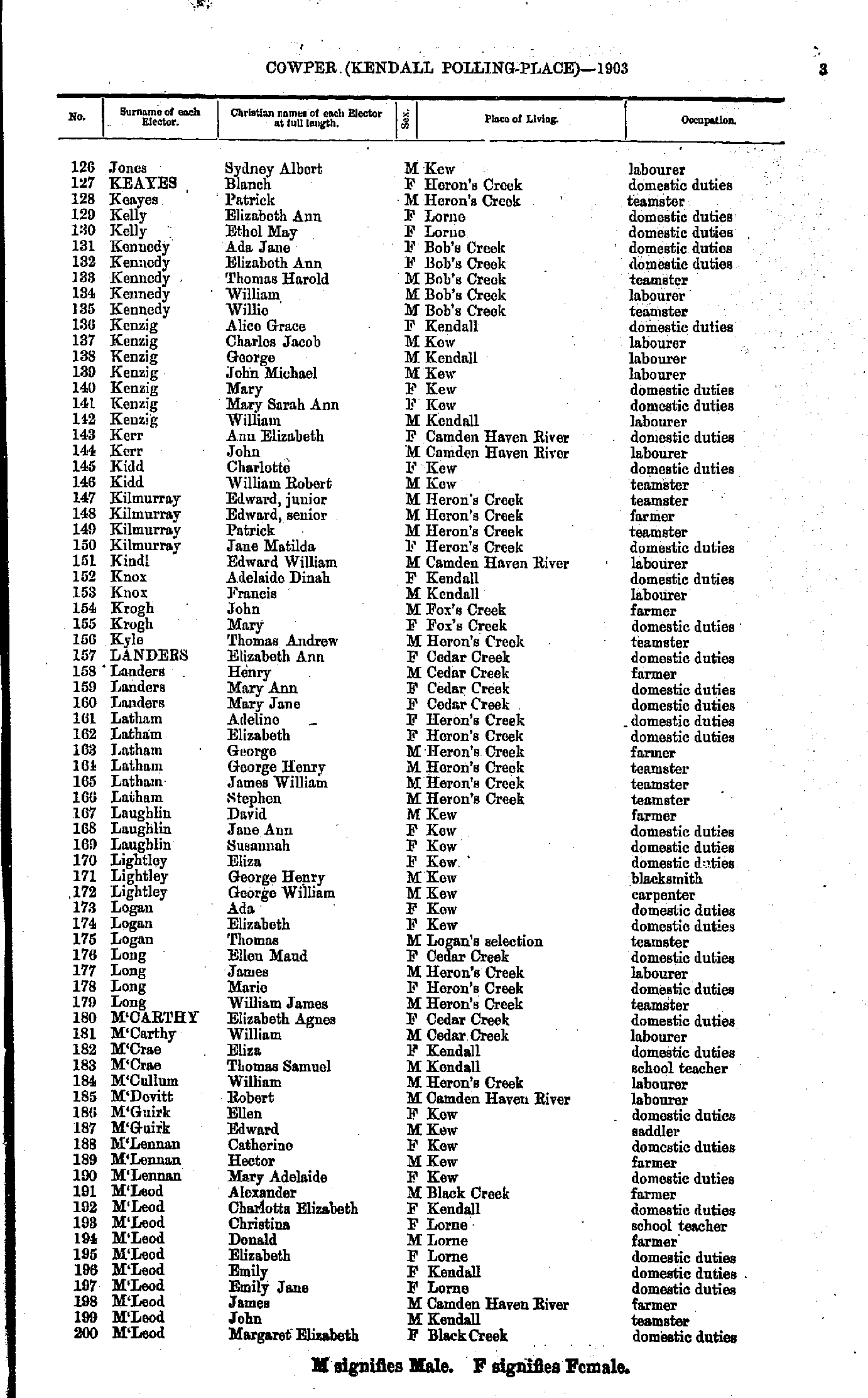
- Cowan Ada - Jones Frank
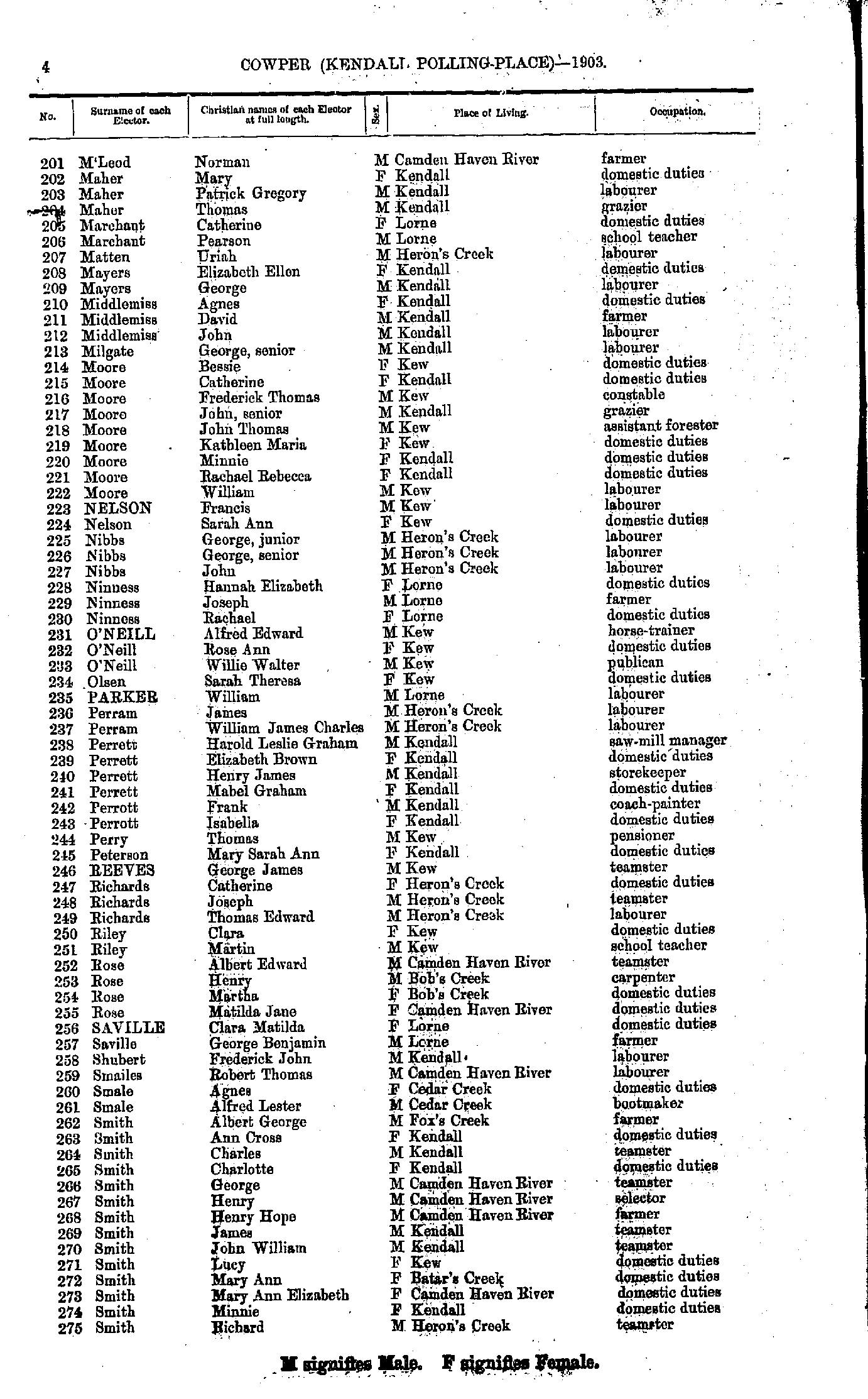
- Jones Sydney - M'Leod Margaret
- M'Leod Norman - Smith Richard
- Smith Rose - Woodhouse Thomas
- Baldwin Frederick - Dennis John
- Dennis Mildred - Sanders Euphemia
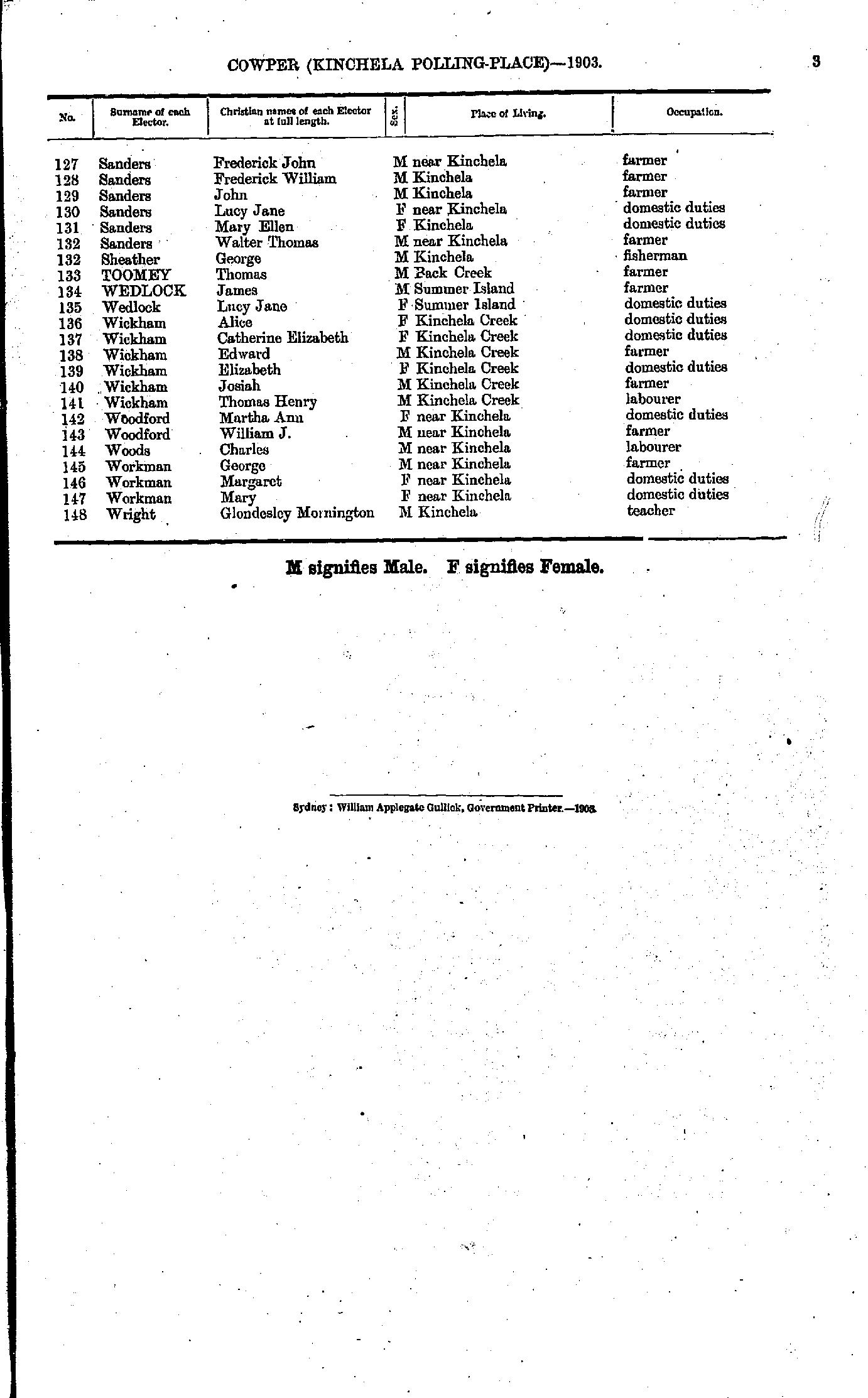
- Sanders Frederick - Wright Glondesley
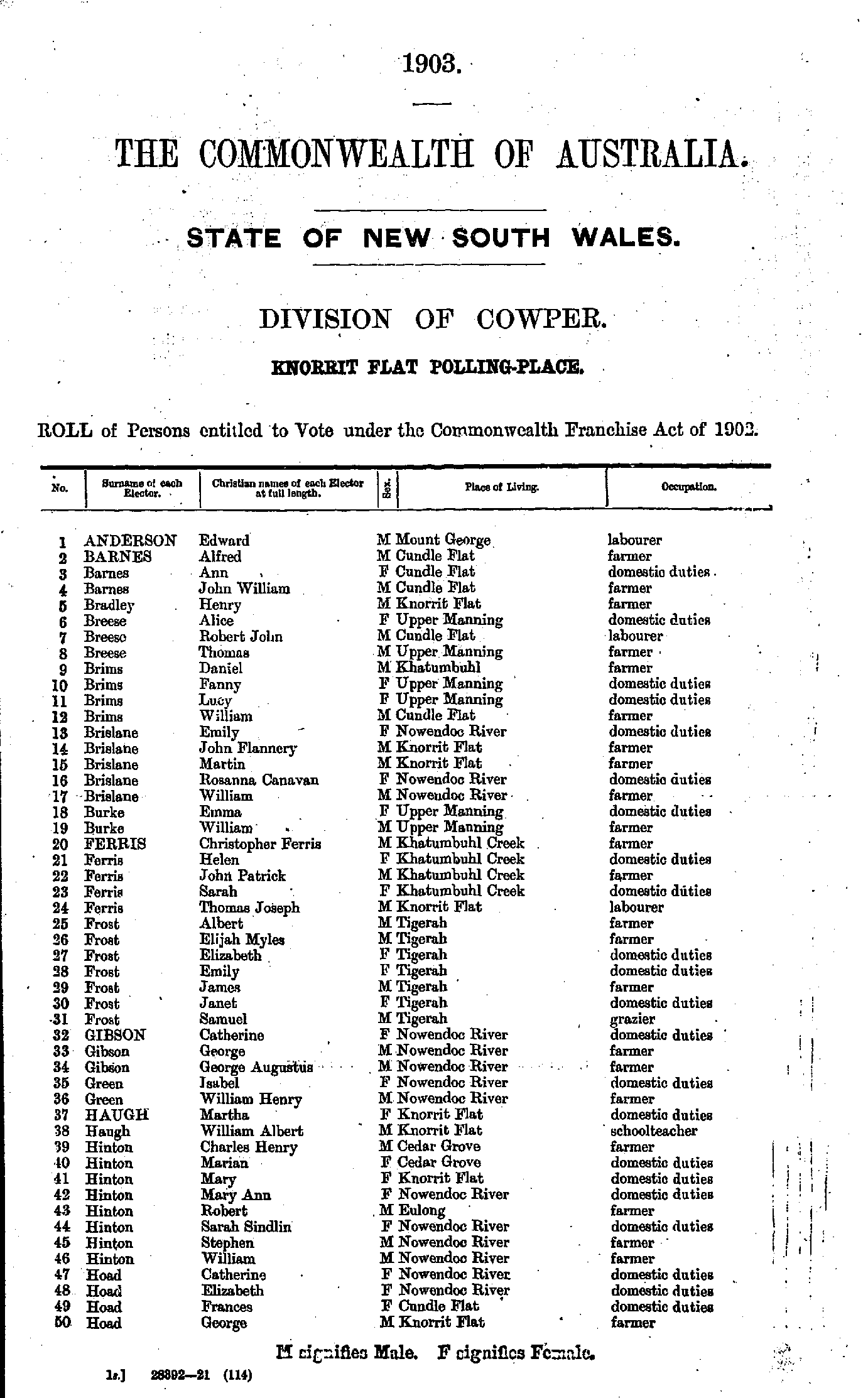
- Alder Sarah - Easton Robert
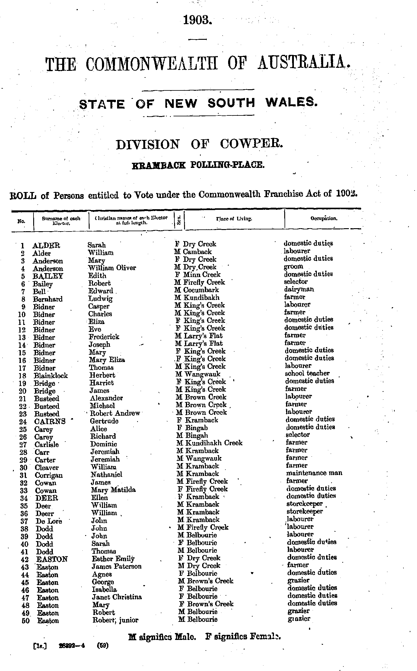
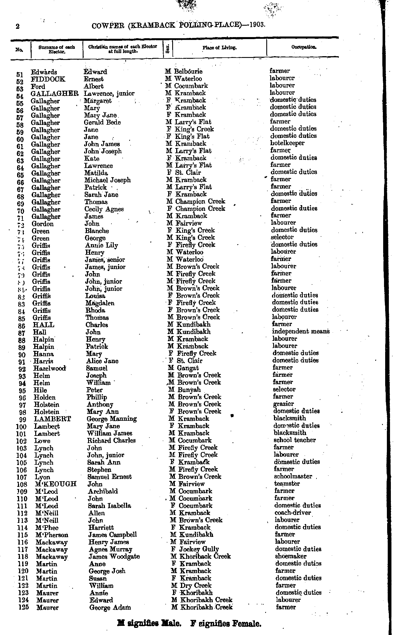
- Edwards Edward - Maurer George
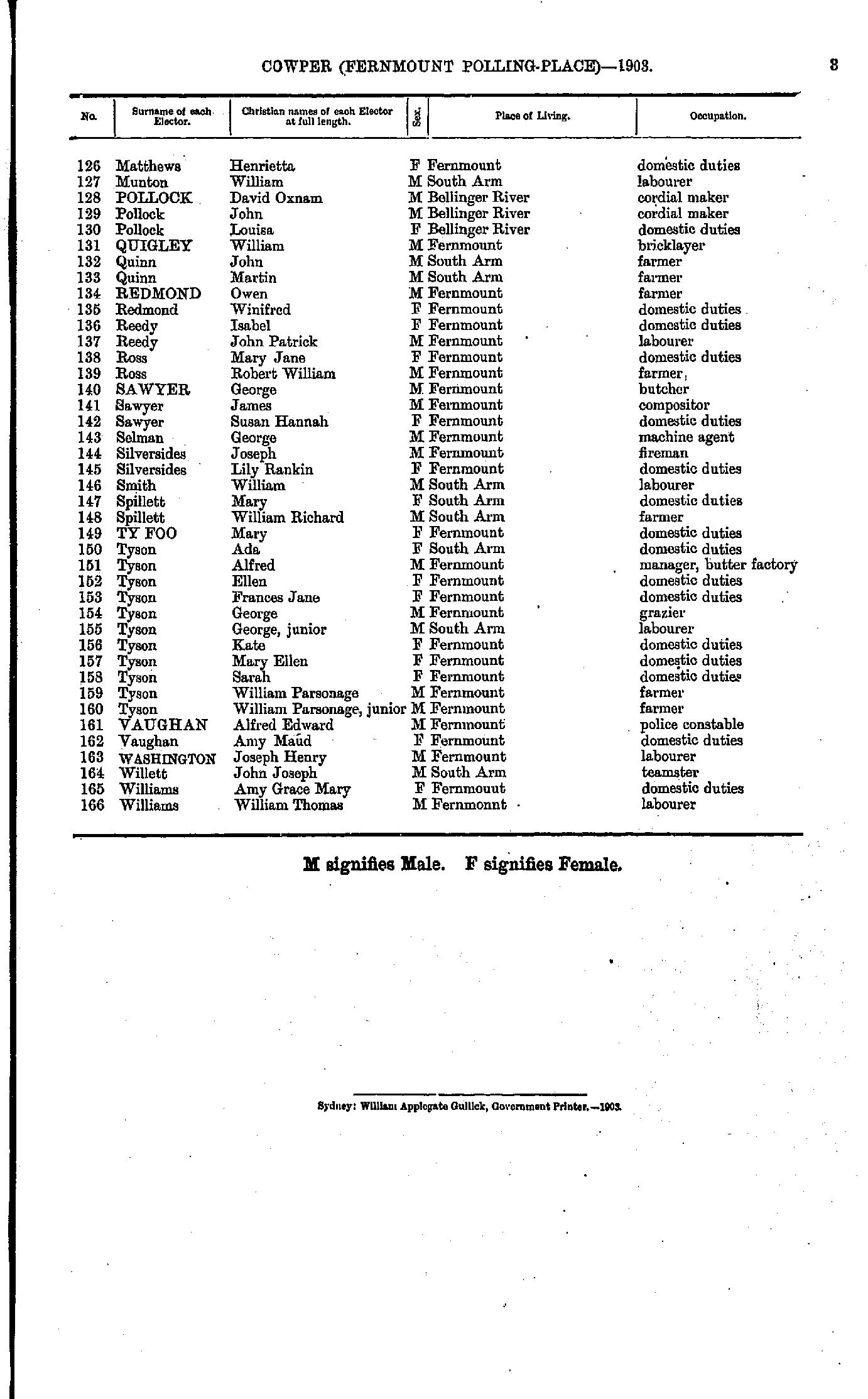
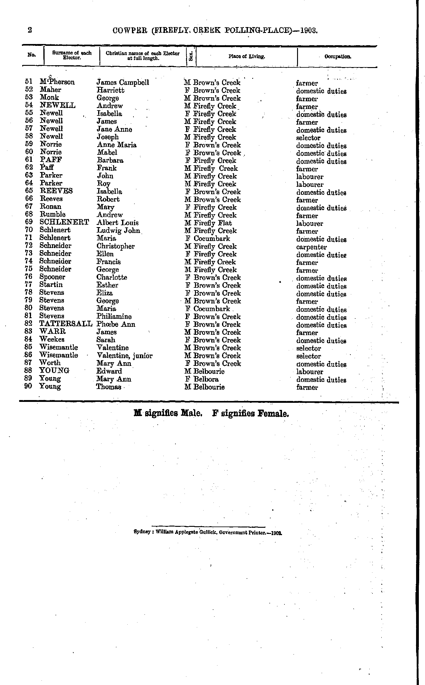
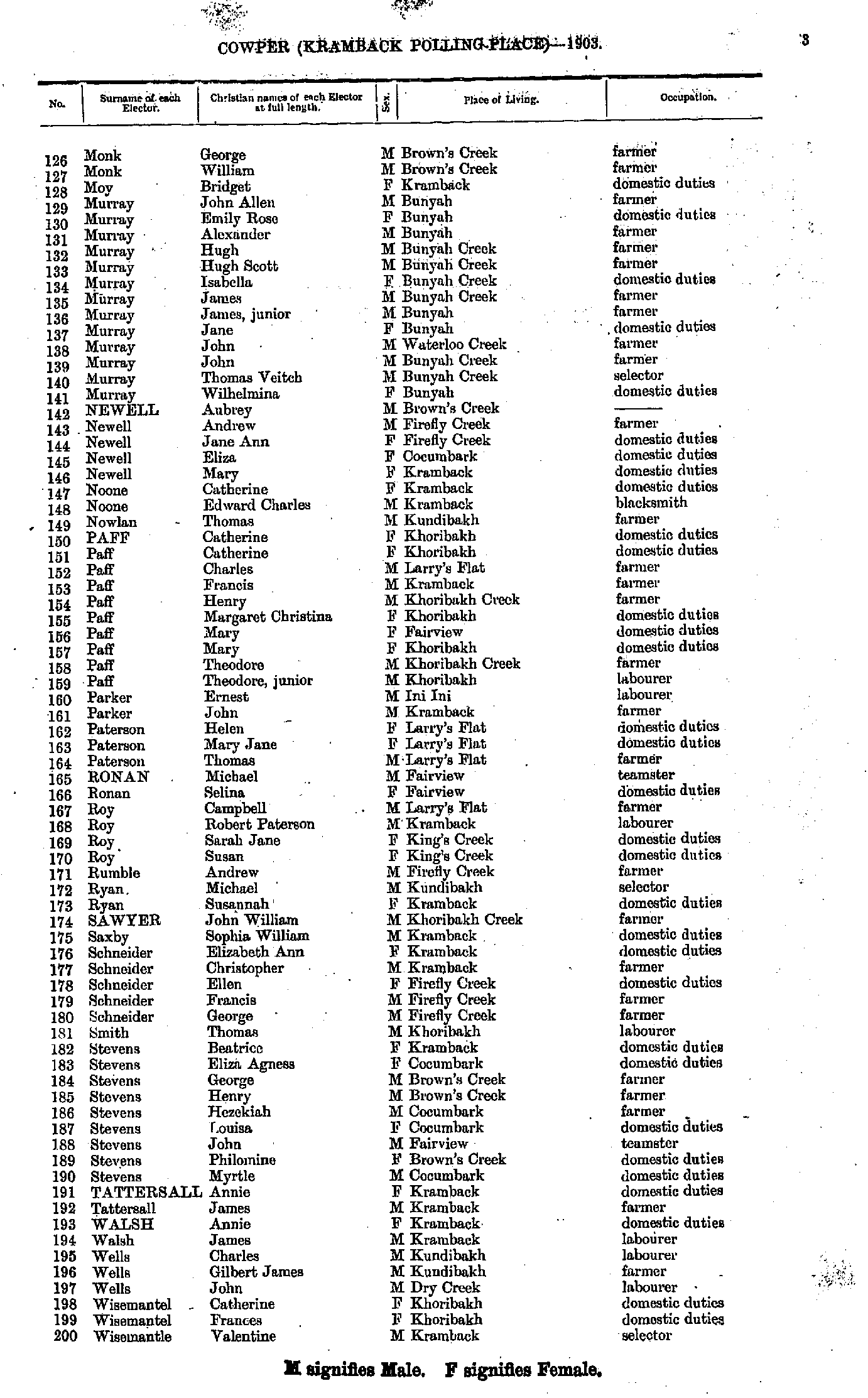
- Monk George - Wisemantle Valentine
- Wisemantle Valentine - Young Edward
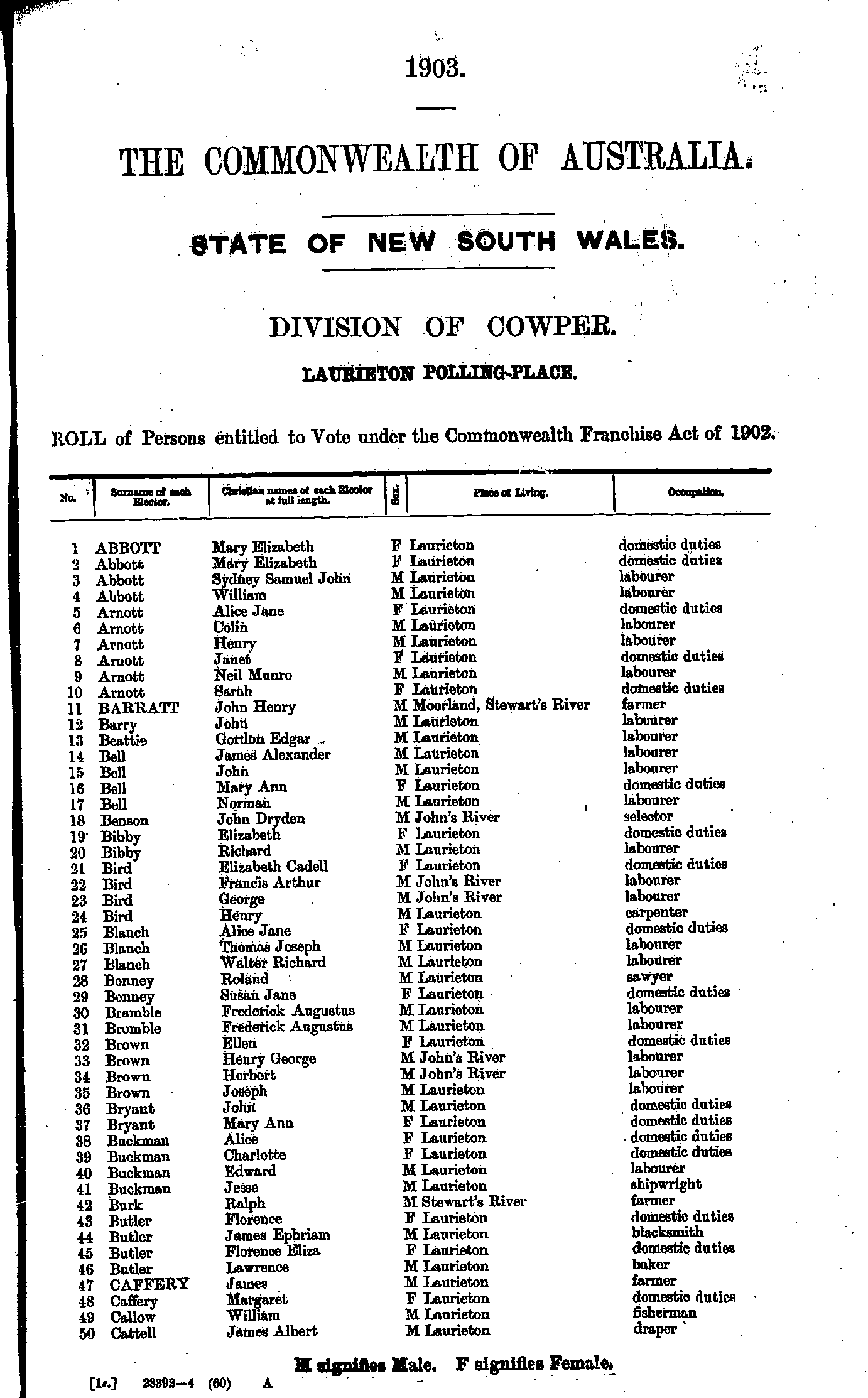
- Abbott Mary - Cattell James
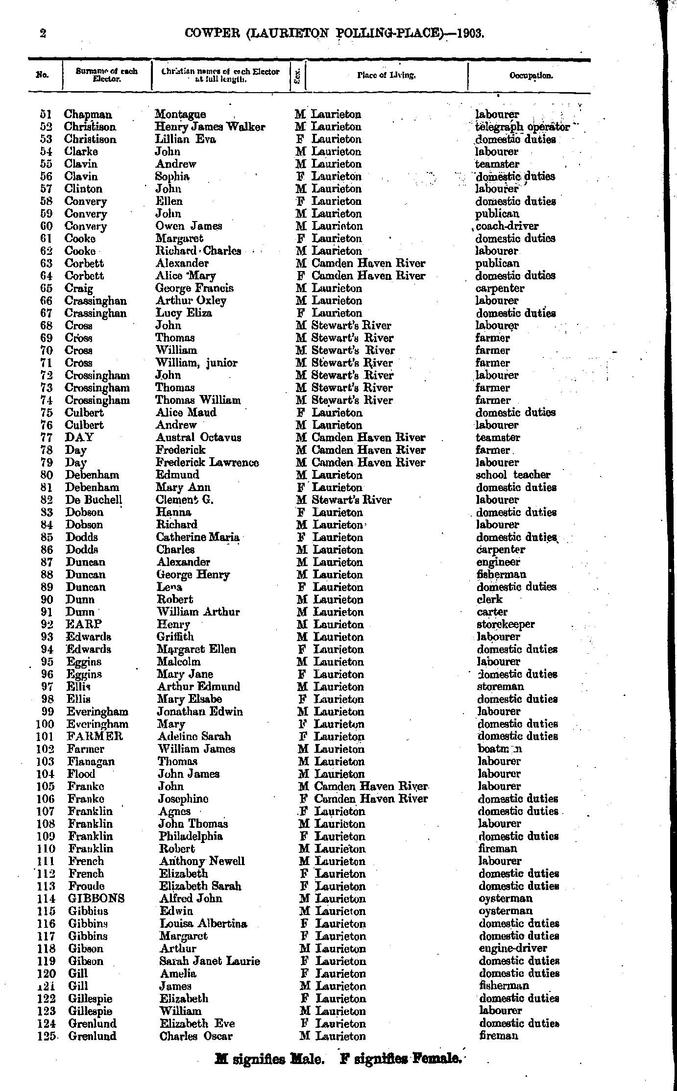
- Chapman Montague - Grenlund Charles
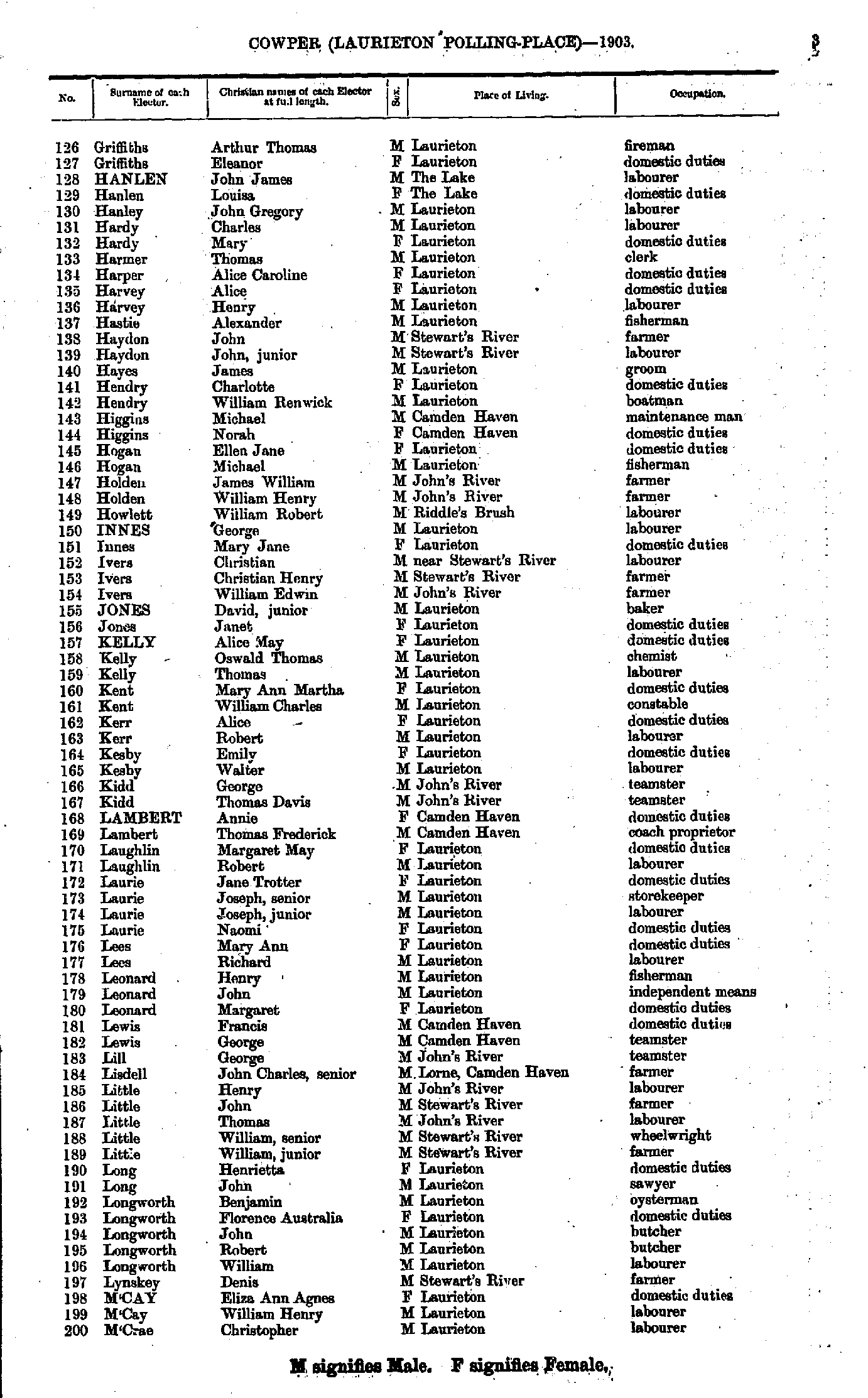
- Griffiths Arthur - M'Crae Christopher
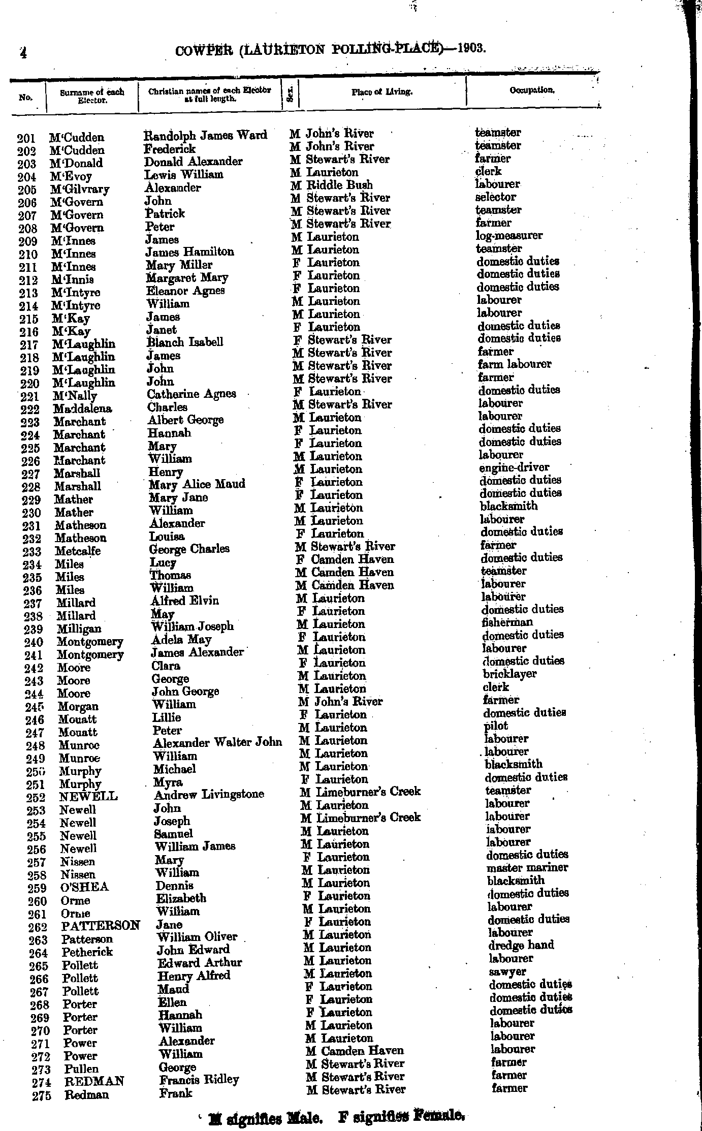
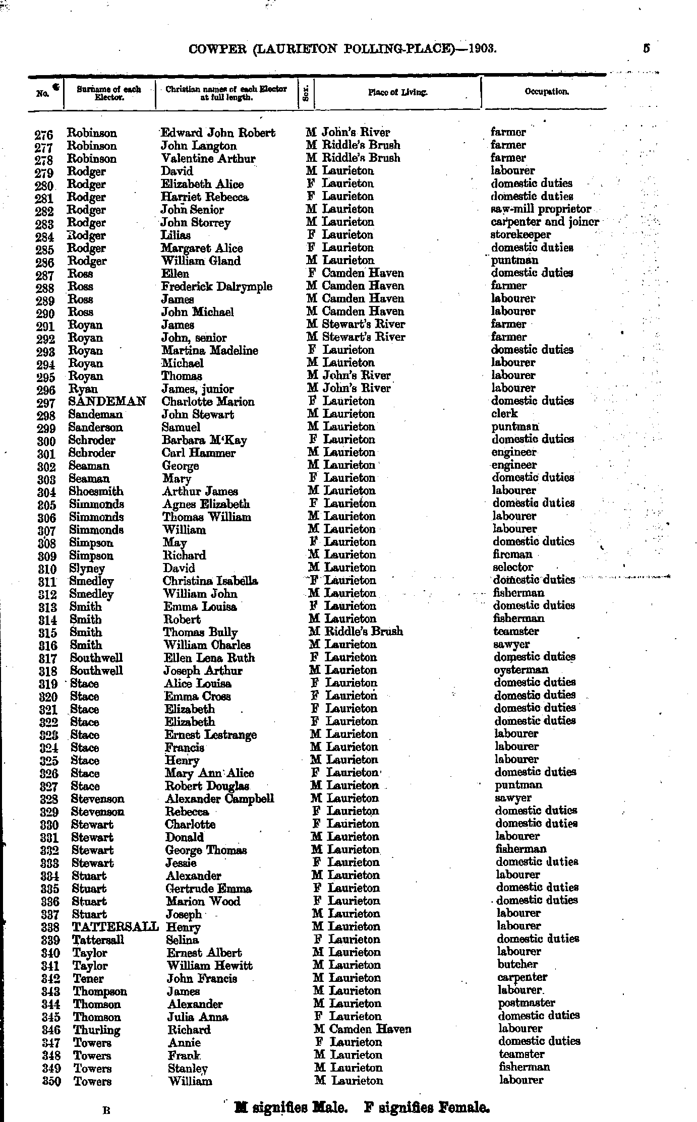
- M'Cudden Randolph - Redman Frank
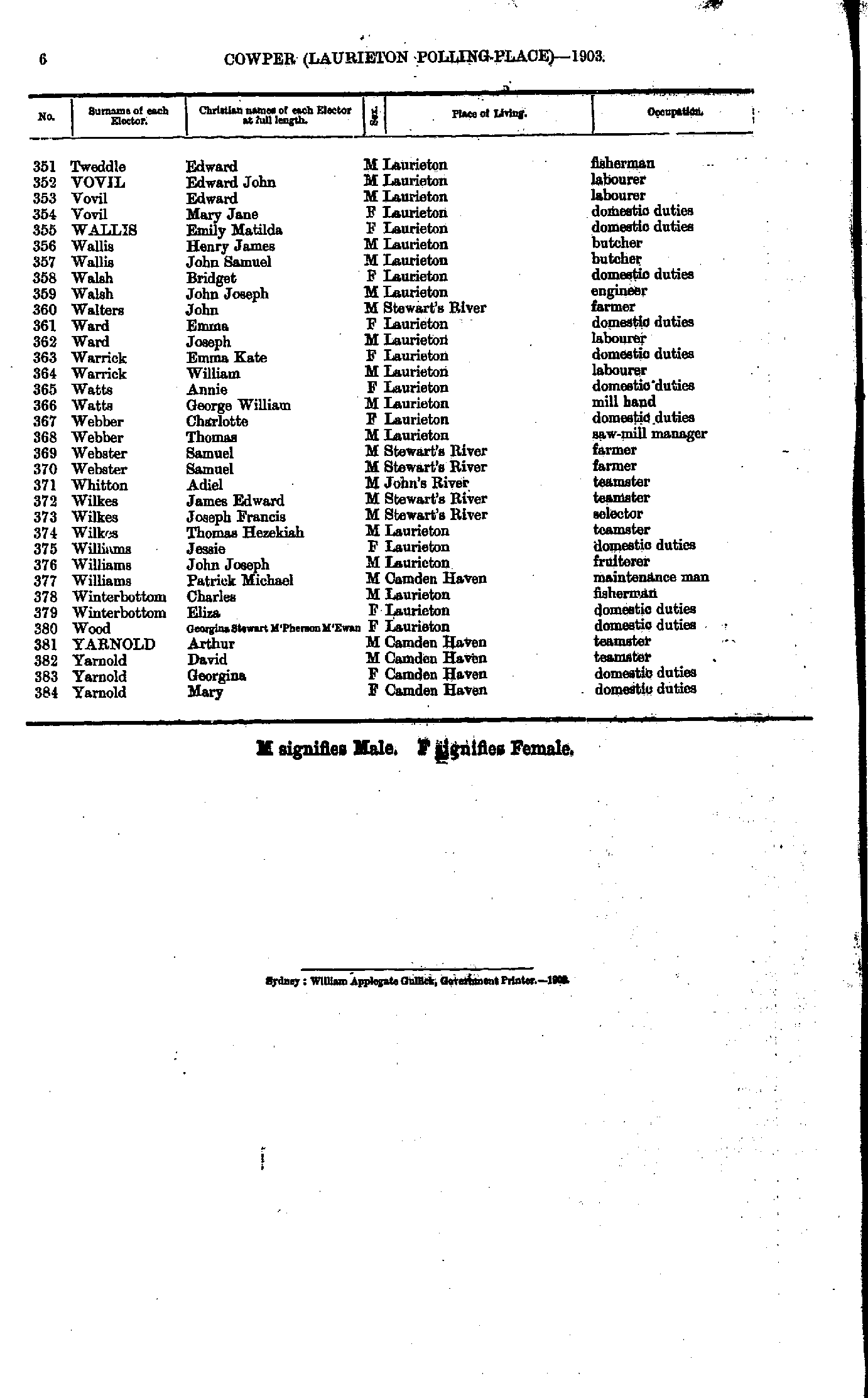
- Robinson Edward - Towers William
- Tweddle Edward - Yarnold Mary
- Amos Alice - Castle Elizabeth
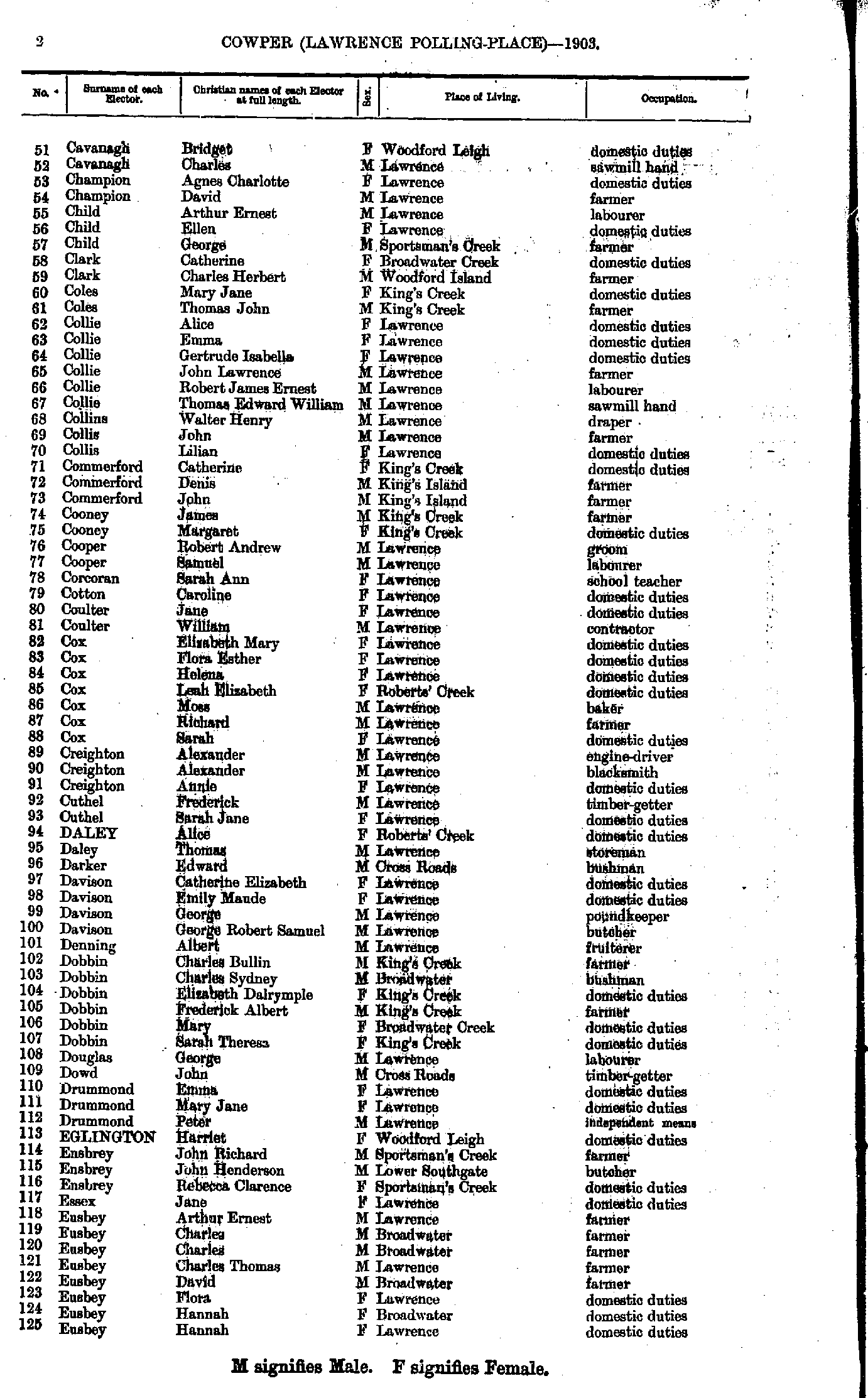
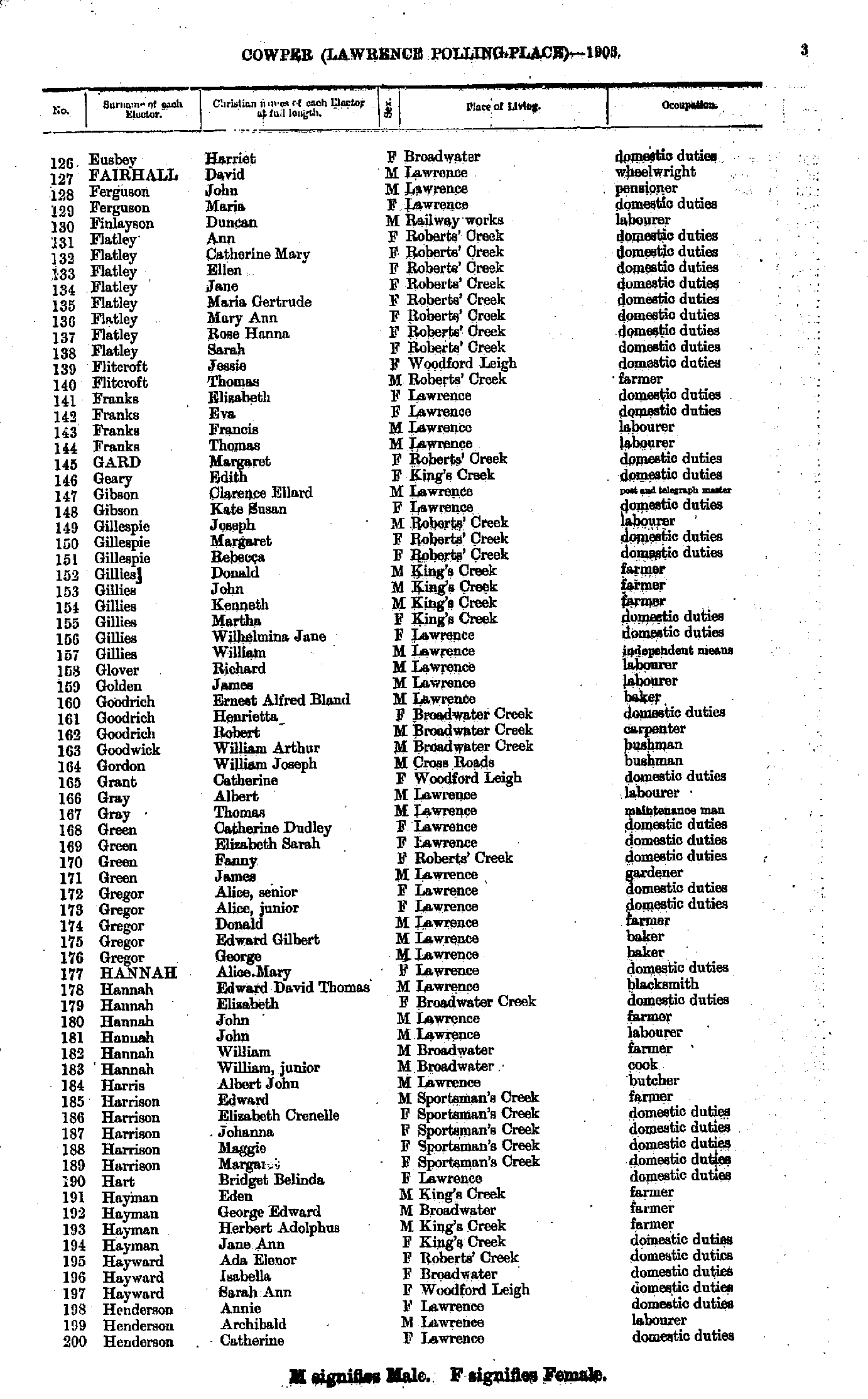
- Cavanagh Bridget - Eusbey Hannah
- Eusbey Harriet - Henderson Catherine
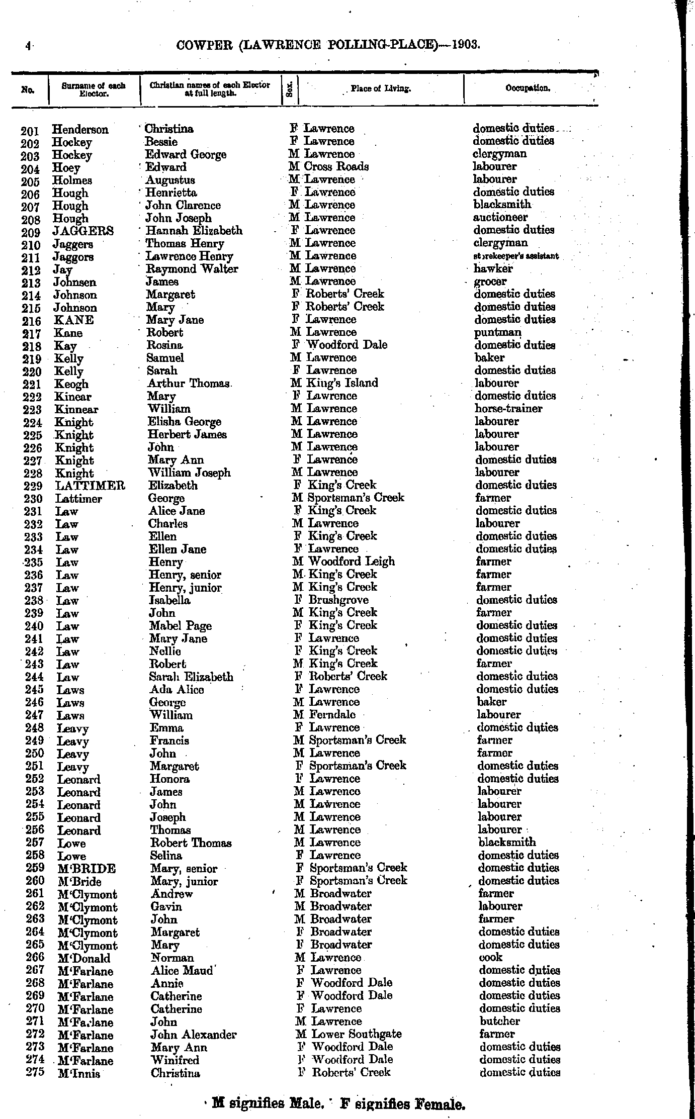
- Henderson Christina - M'Innis Christina
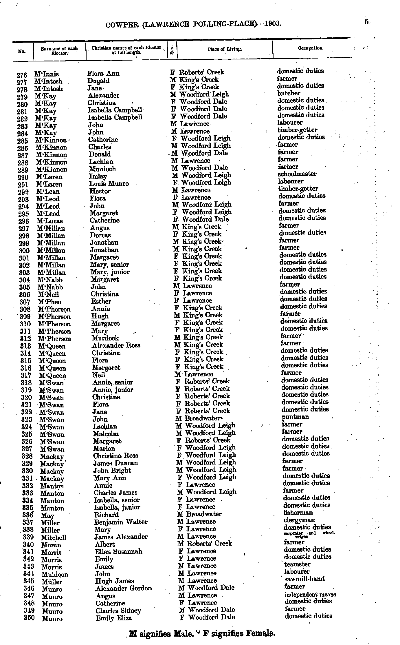
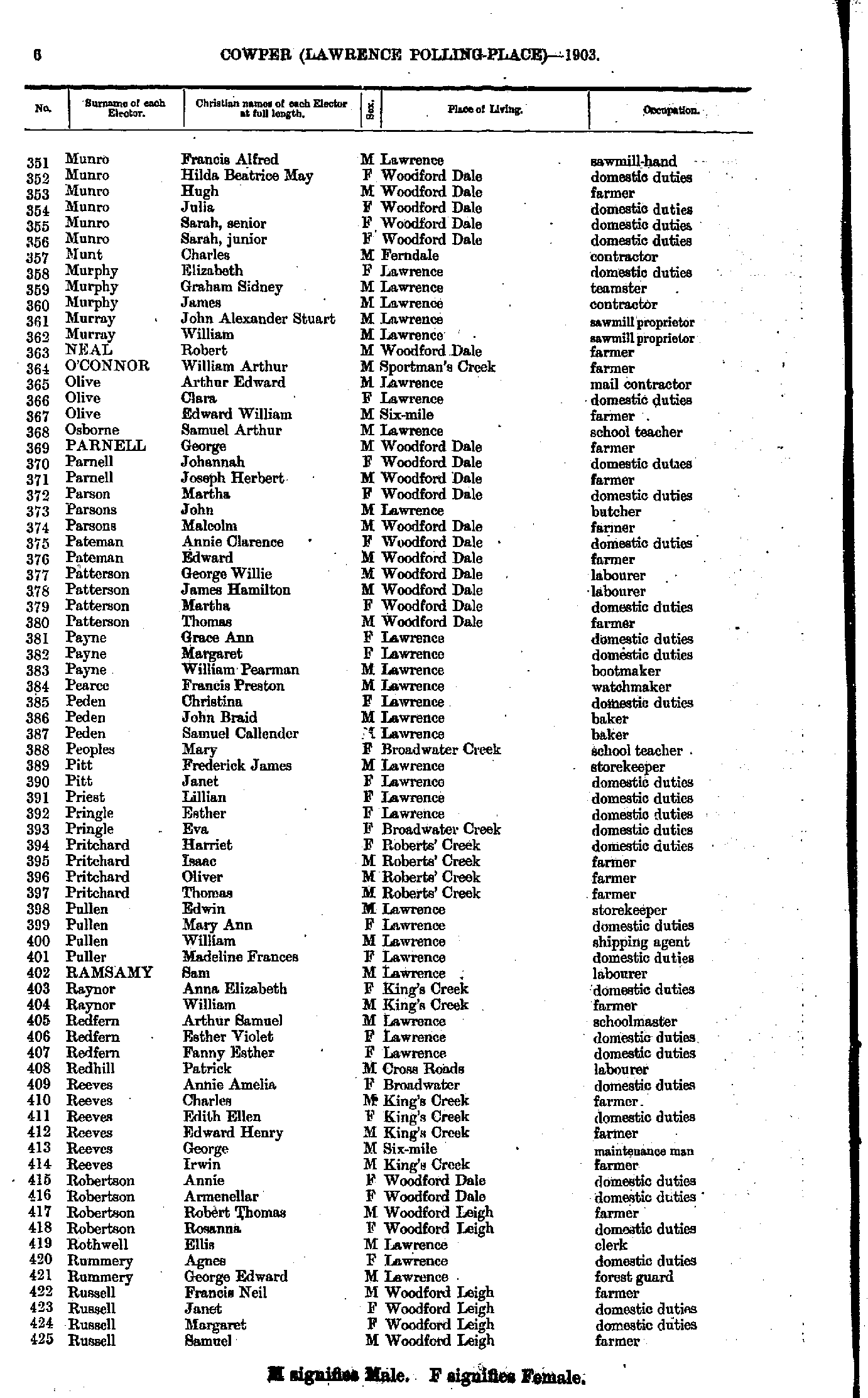
- M'Innis Flora - Munro Emily
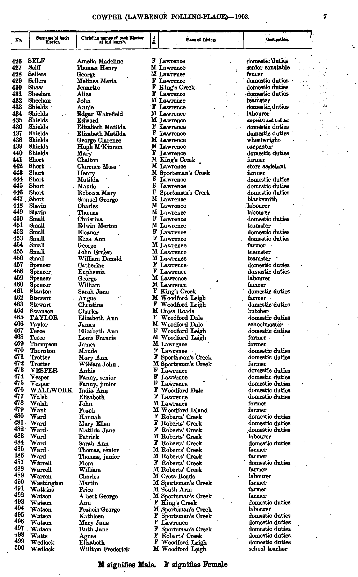
- Munro Francis - Russell Samuel
- Self Amelia - Wedlock William
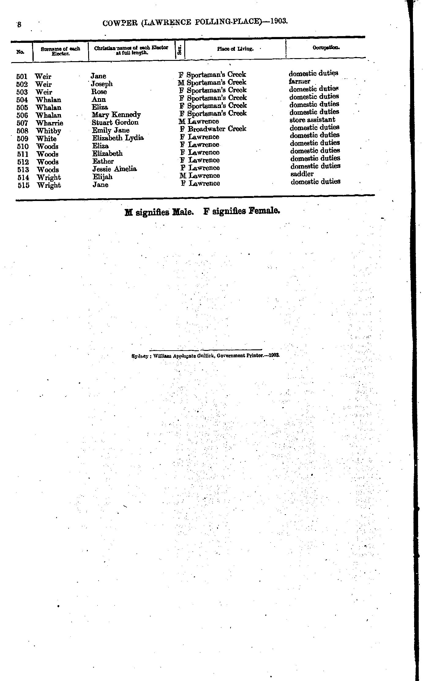
- Weir Jane - Wright Jane
- Ainsworth Alfred - Brouggy Winifred
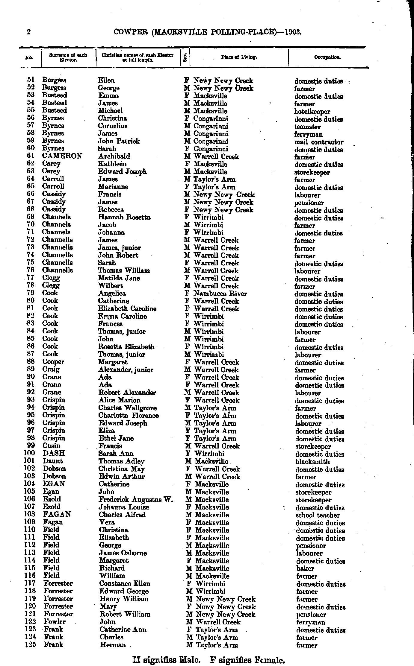
- Burgess Ellen - Frank Herman
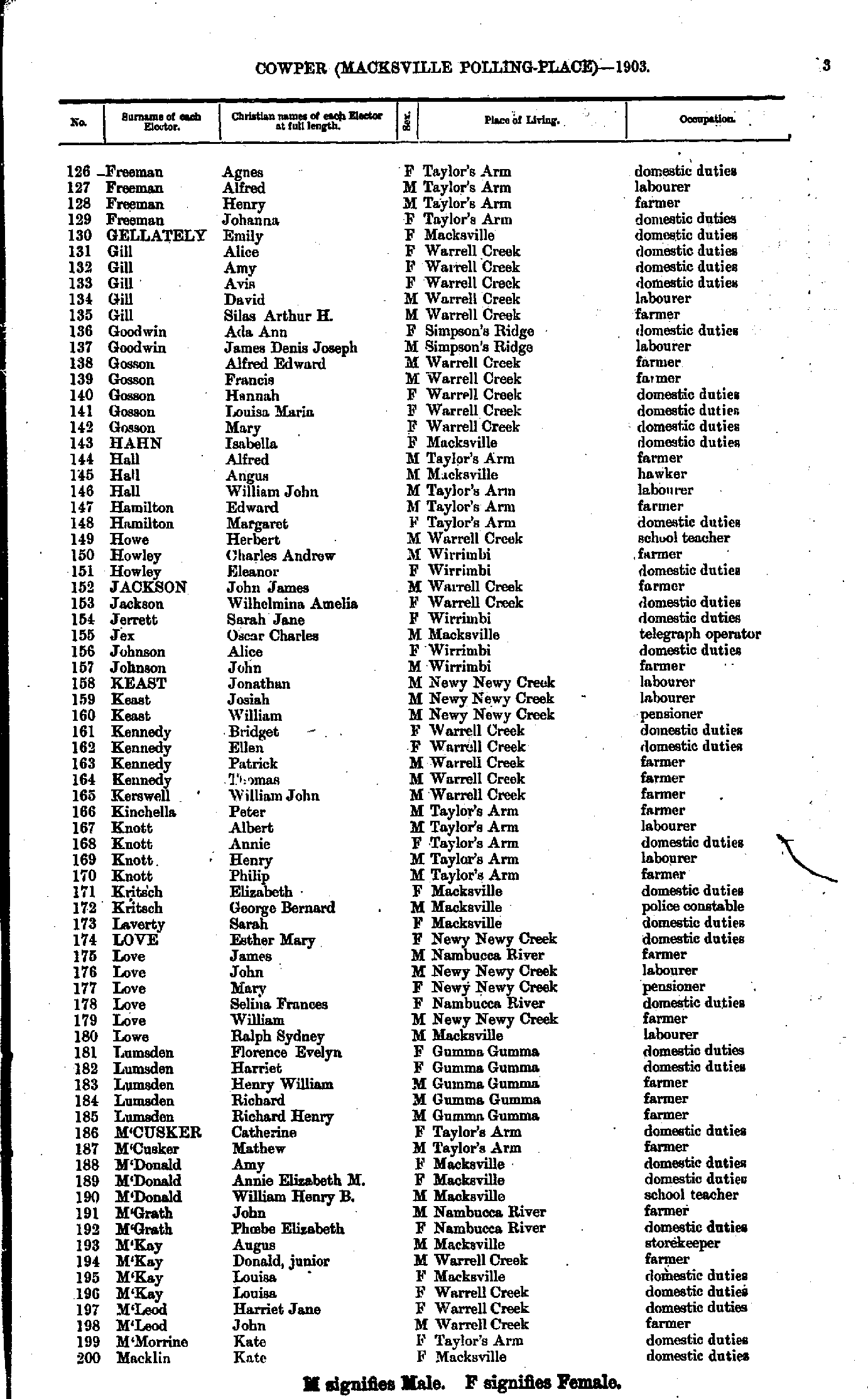
- Freeman Agnes - Macklin Kate
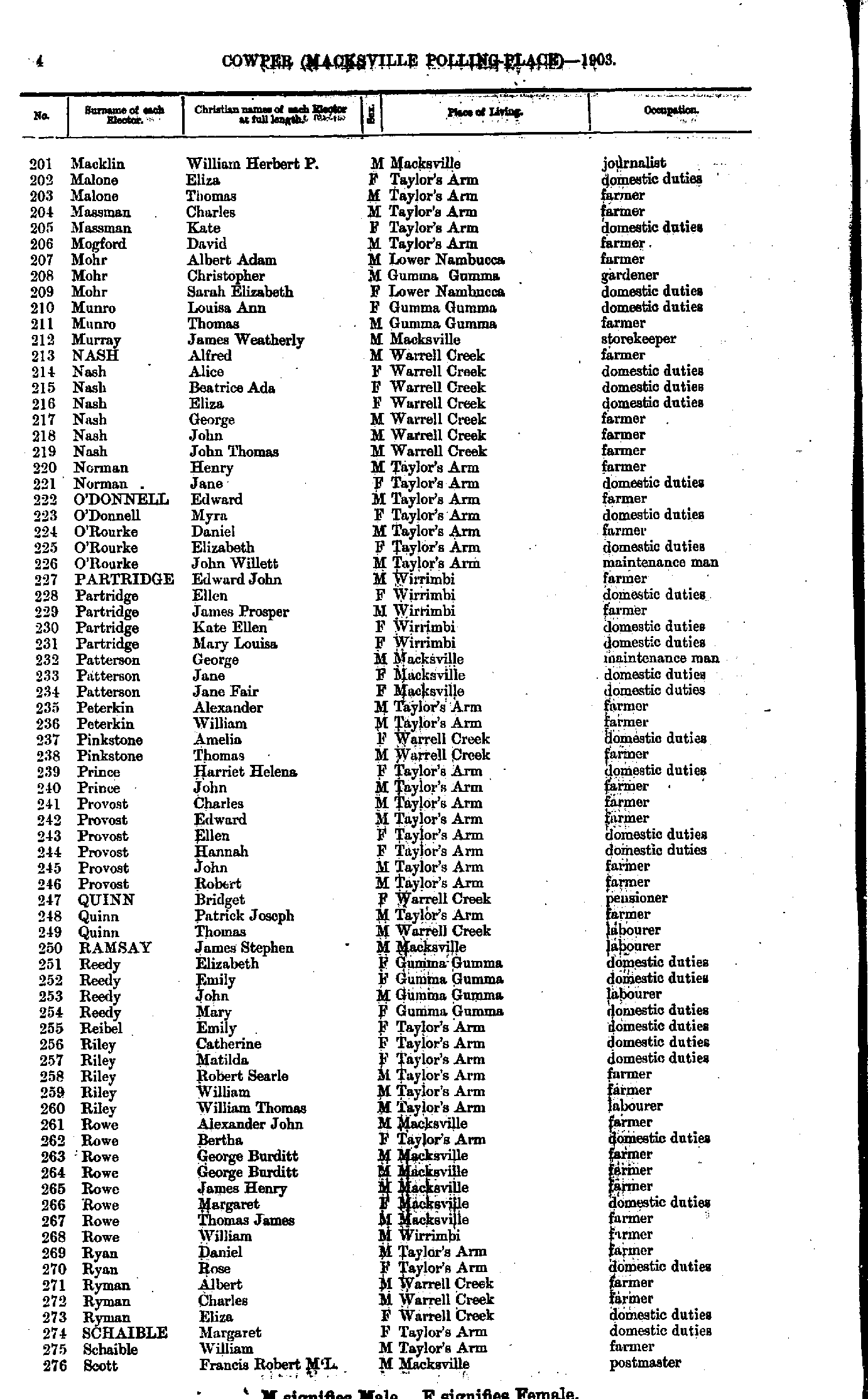
- Macklin William - Scott Francis
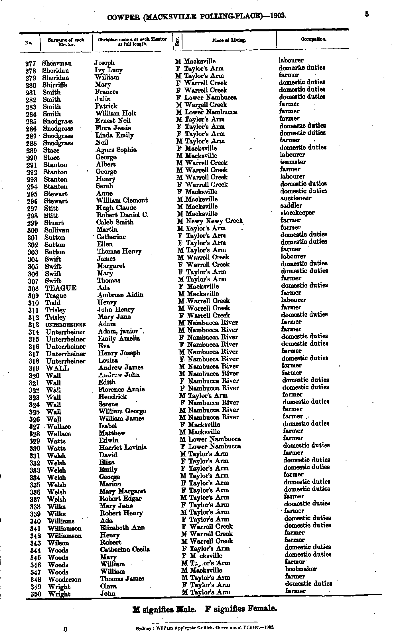
- Shearman Joseph - Wright John
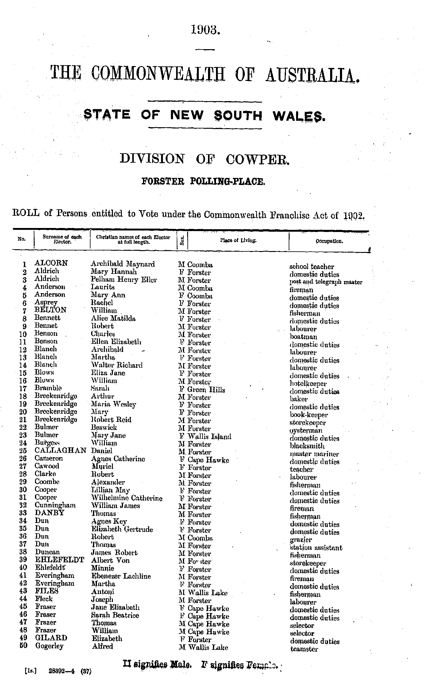
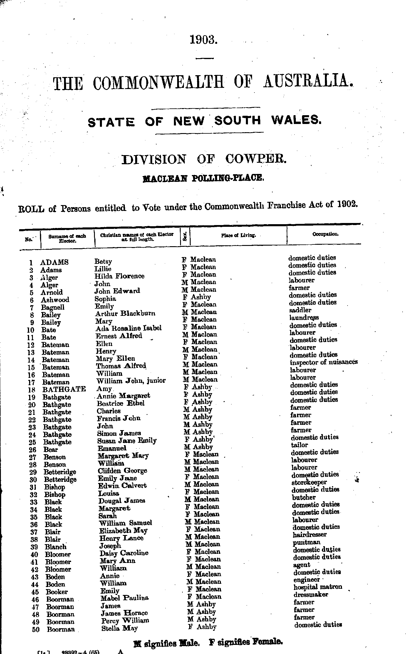
- Adams Betsy - Boorman Stella
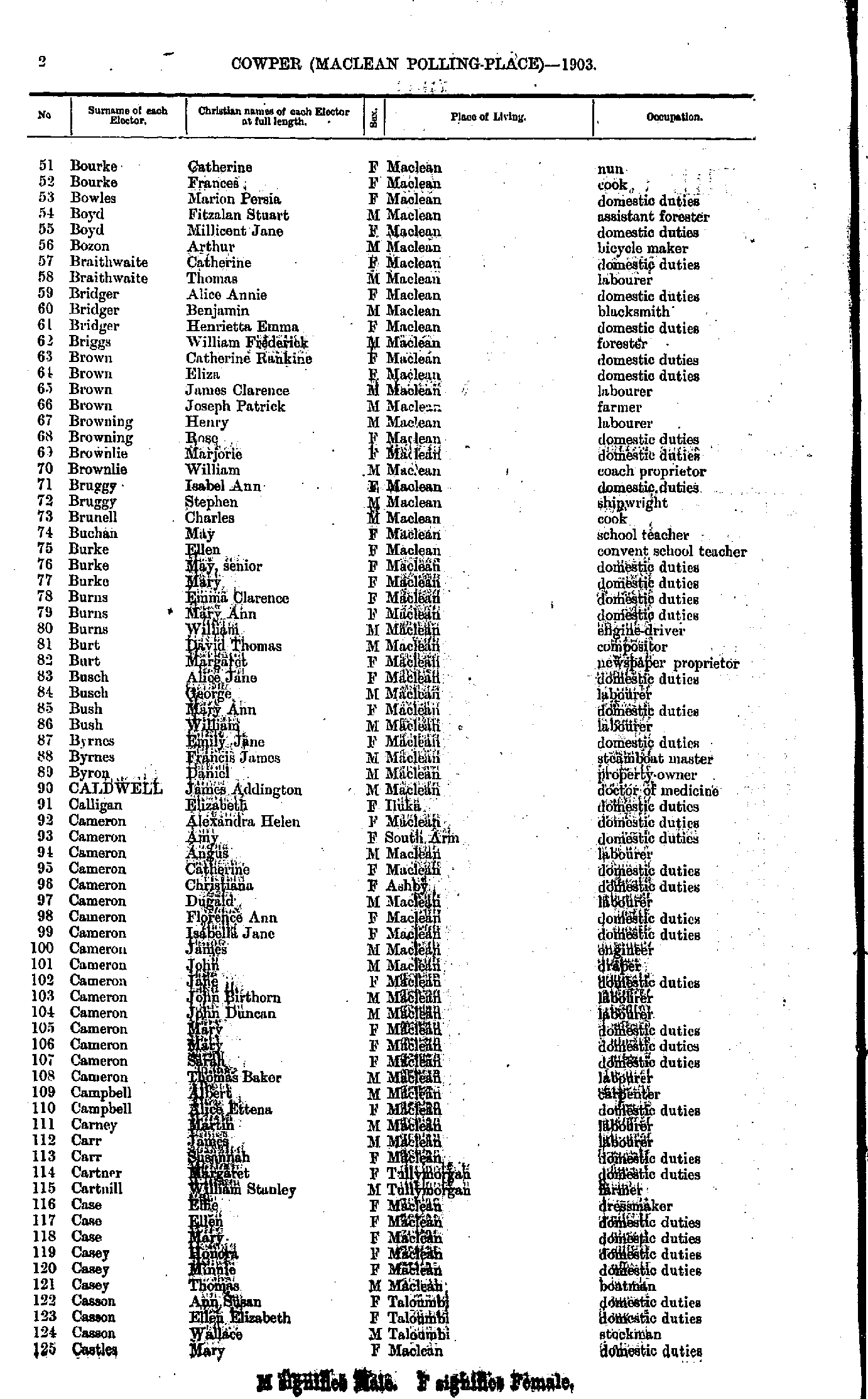
- Bourke Catherine - Castles Mary
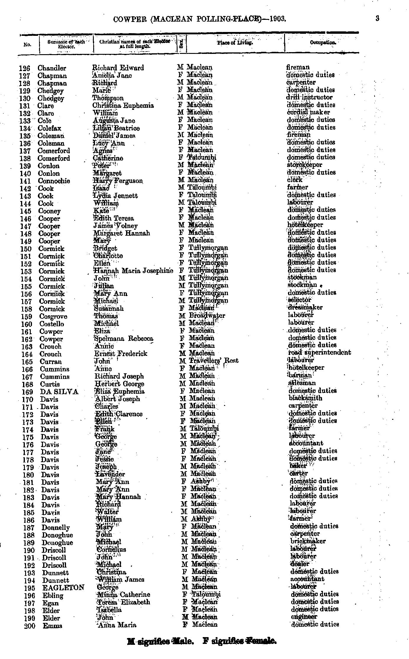
- Chandler Richard - Emms Anna
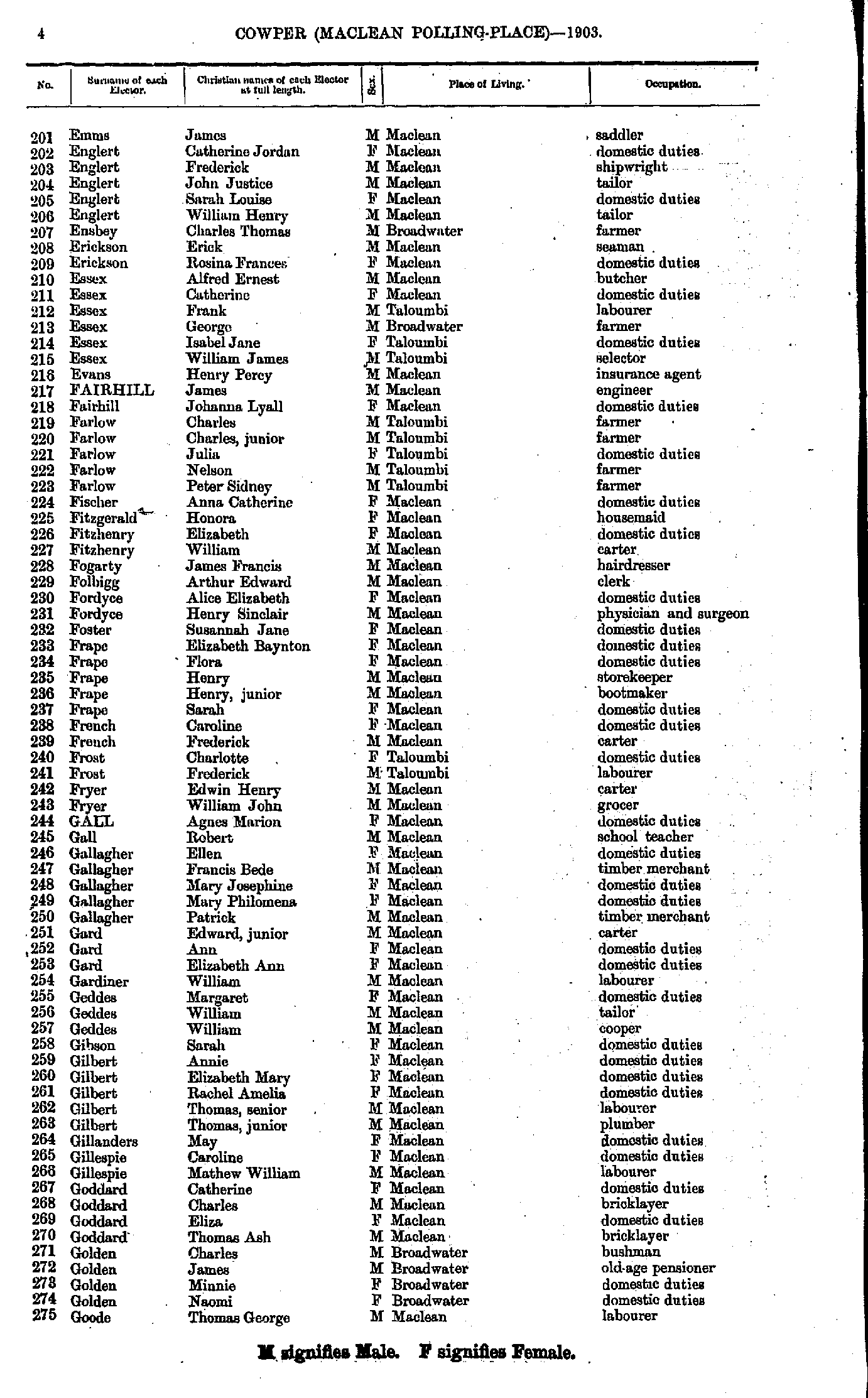
- Emms James - Goode Thomas
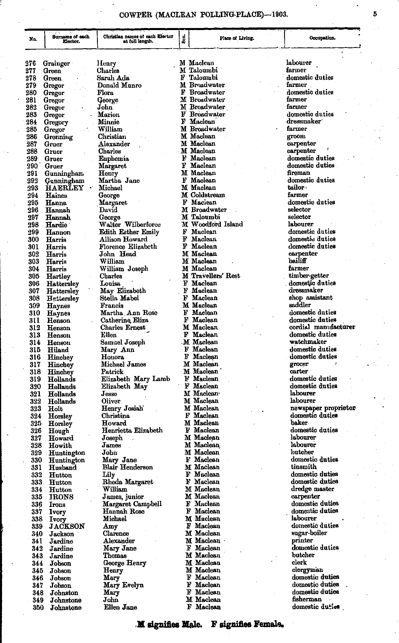
- Grainger Henry - Johnstone Ellen
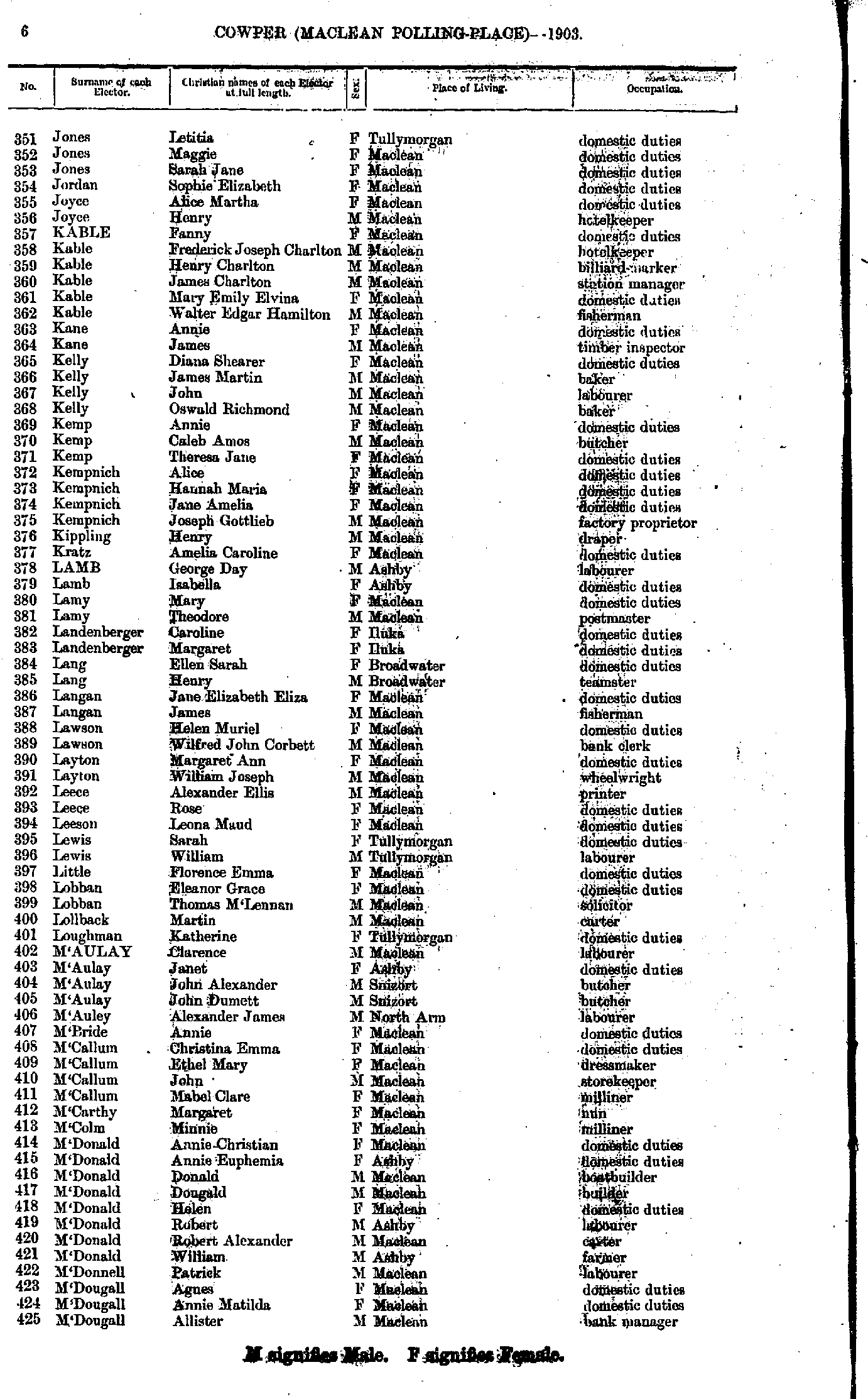
- Jones Letitia - M'Dougall Allister
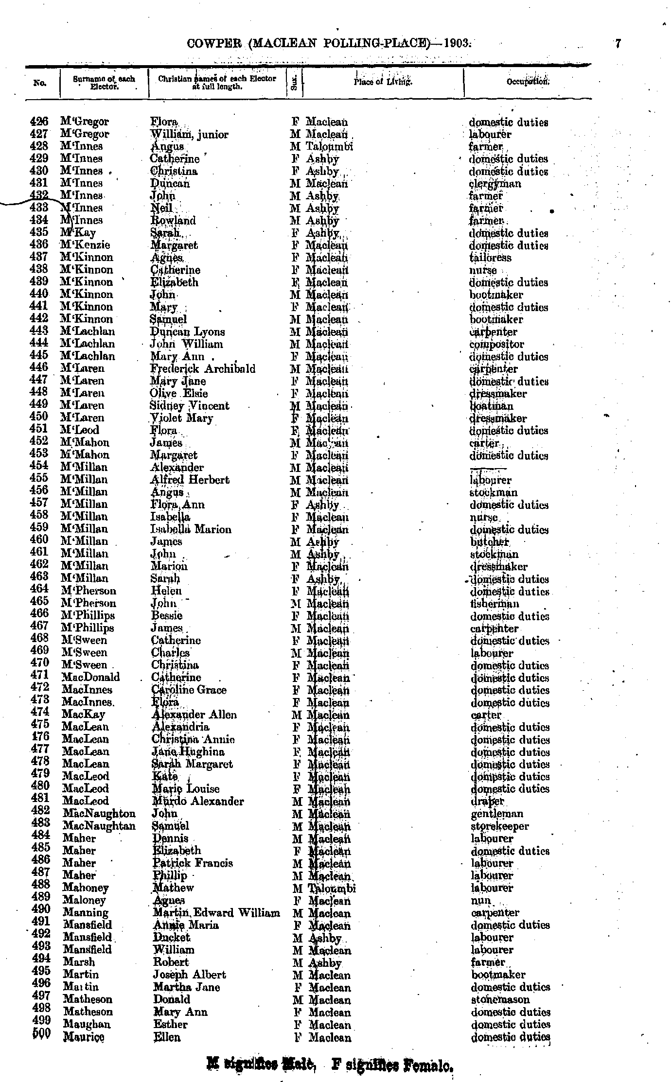
- M'Gregor Flora - Maurice Ellen
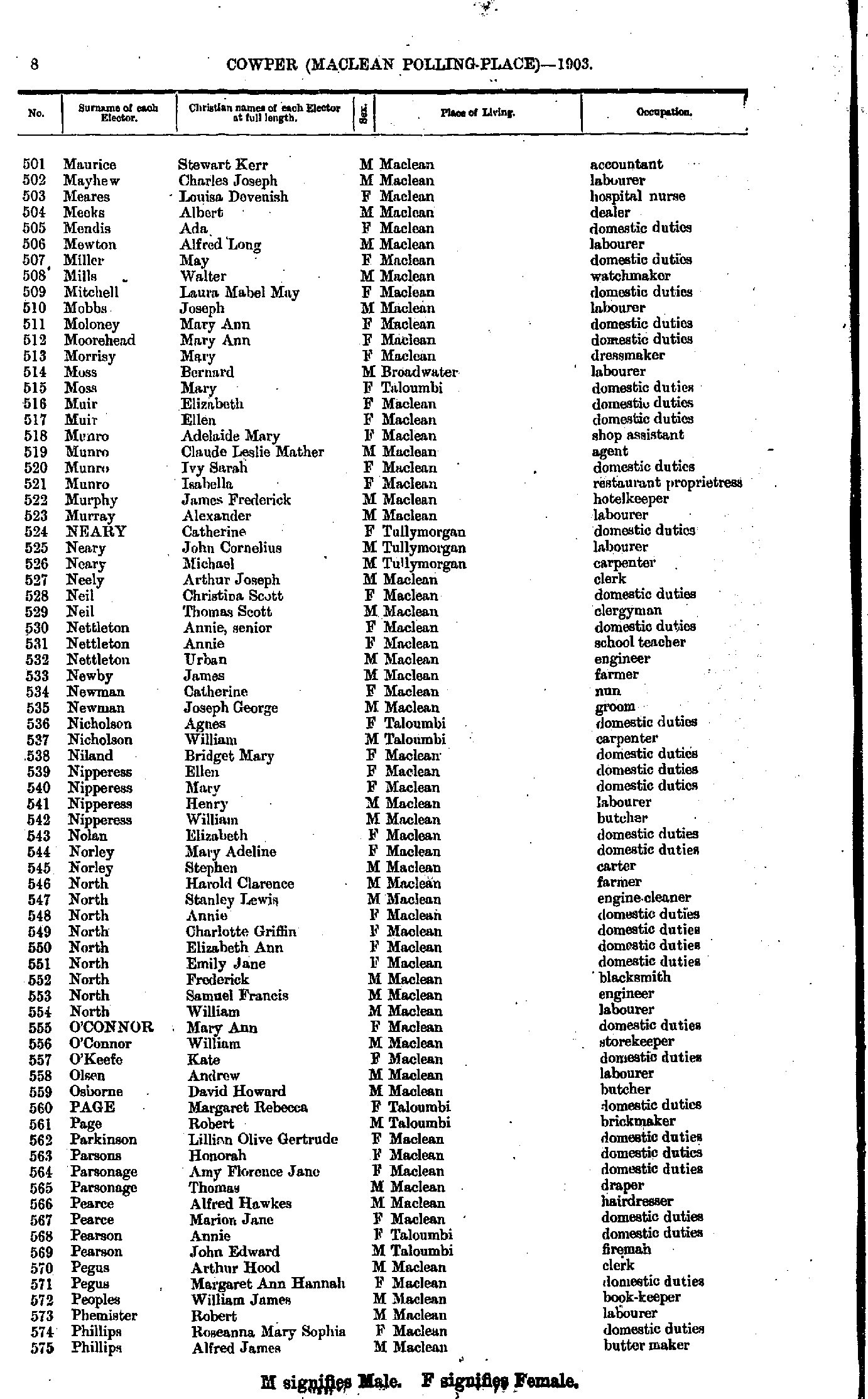
- Maurice Stewart - Phillips Alfred
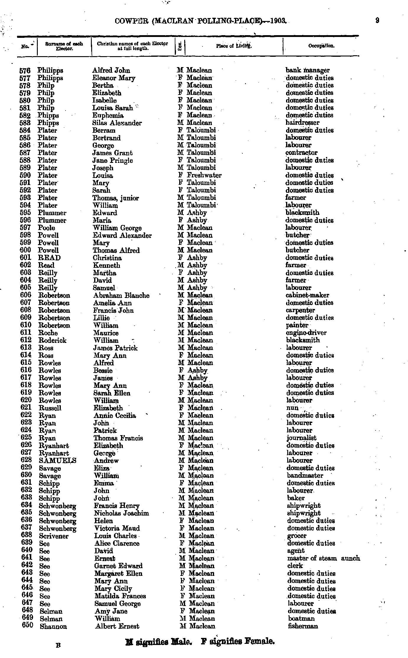
- Philipps Alfred - Shannon Albert
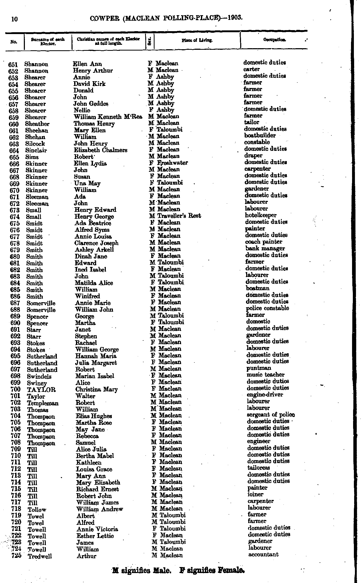
- Shannon Ellen - Tredwell Arthur
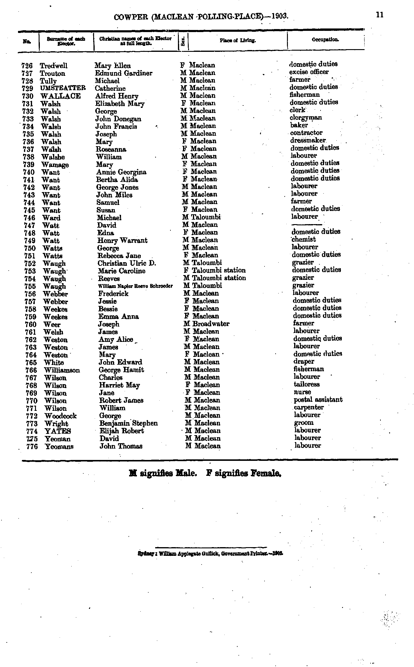
- Tredwell Mary - Yeomans John
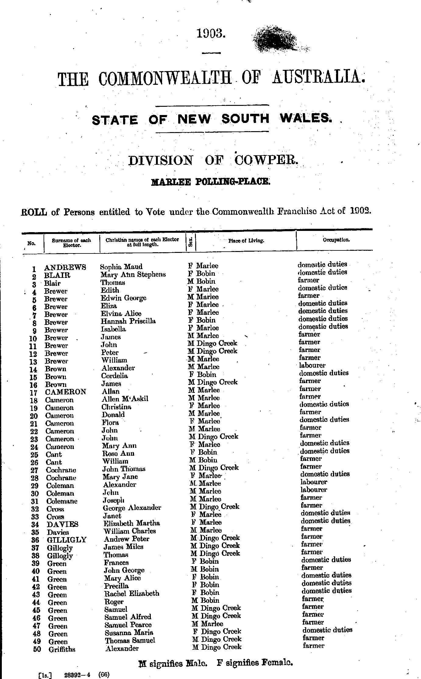
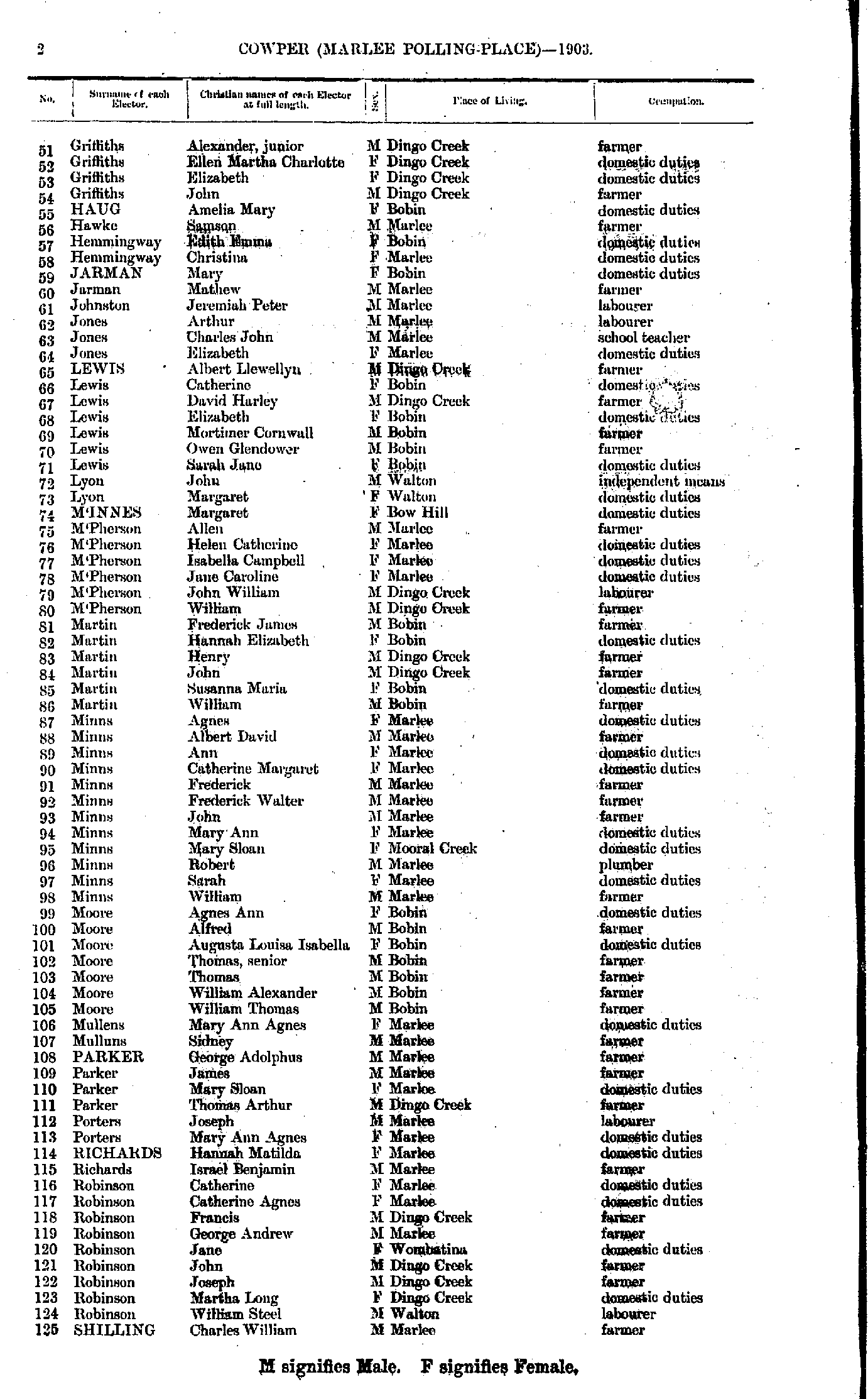
- Andrews Sophia - Griffiths Alexander
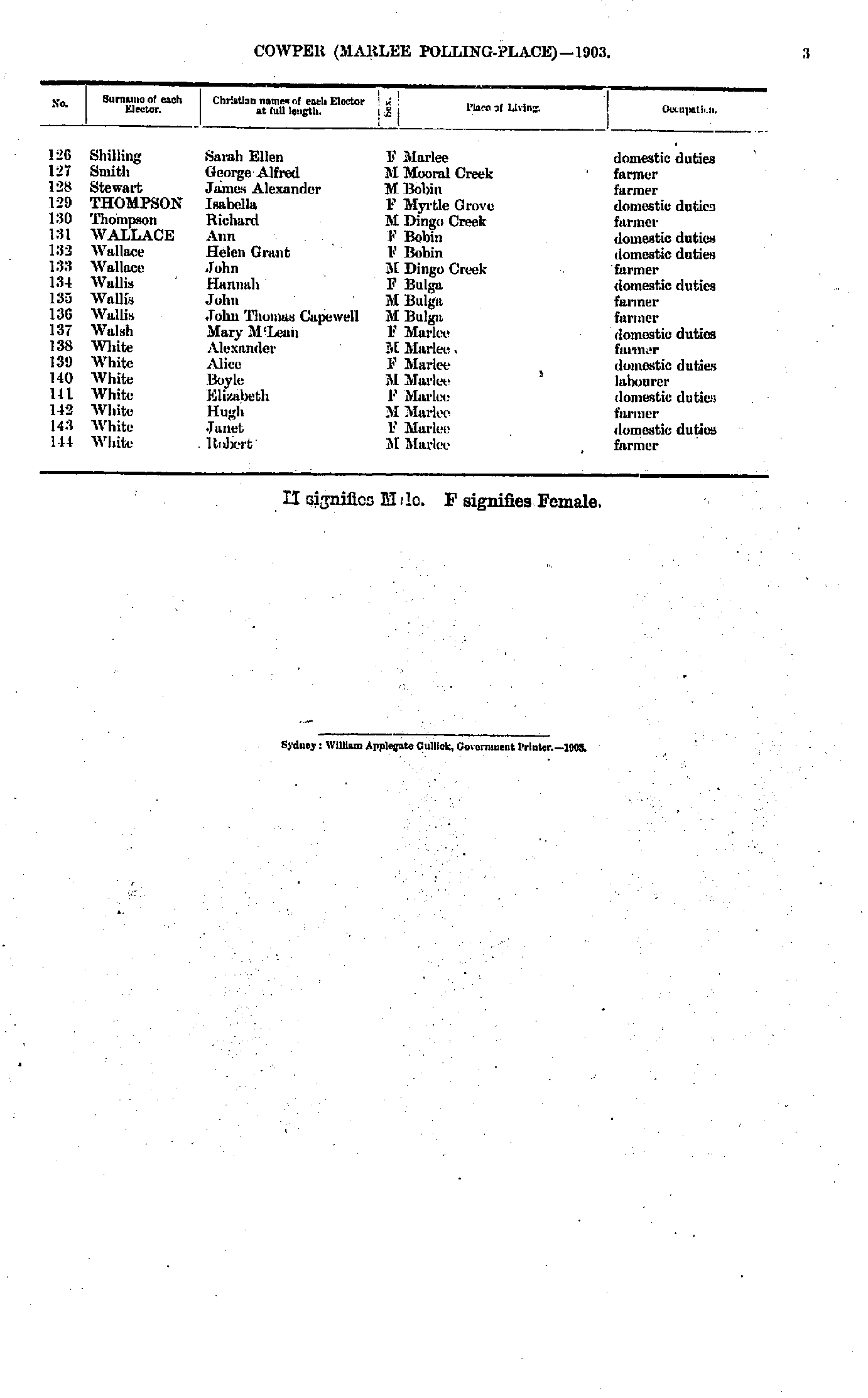
- Griffiths Alexander - Shilling Charles
- Shilling Sarah - White Robert
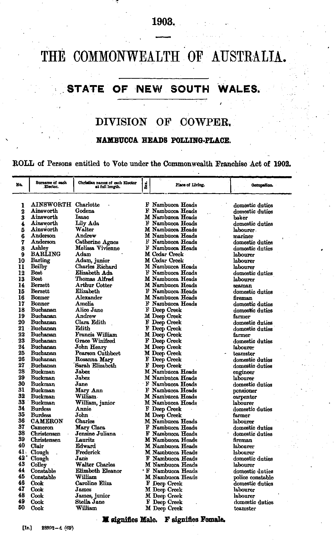
- Ainsworth Charlotte - Cook William
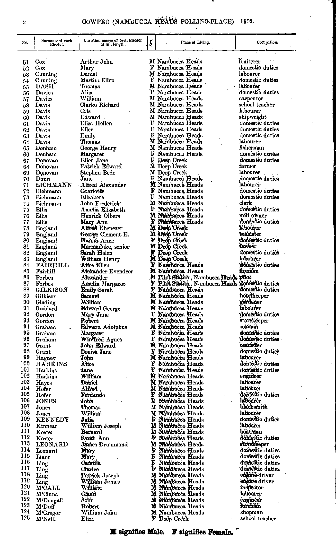
- Cox Arthur - M'Neill Eliza
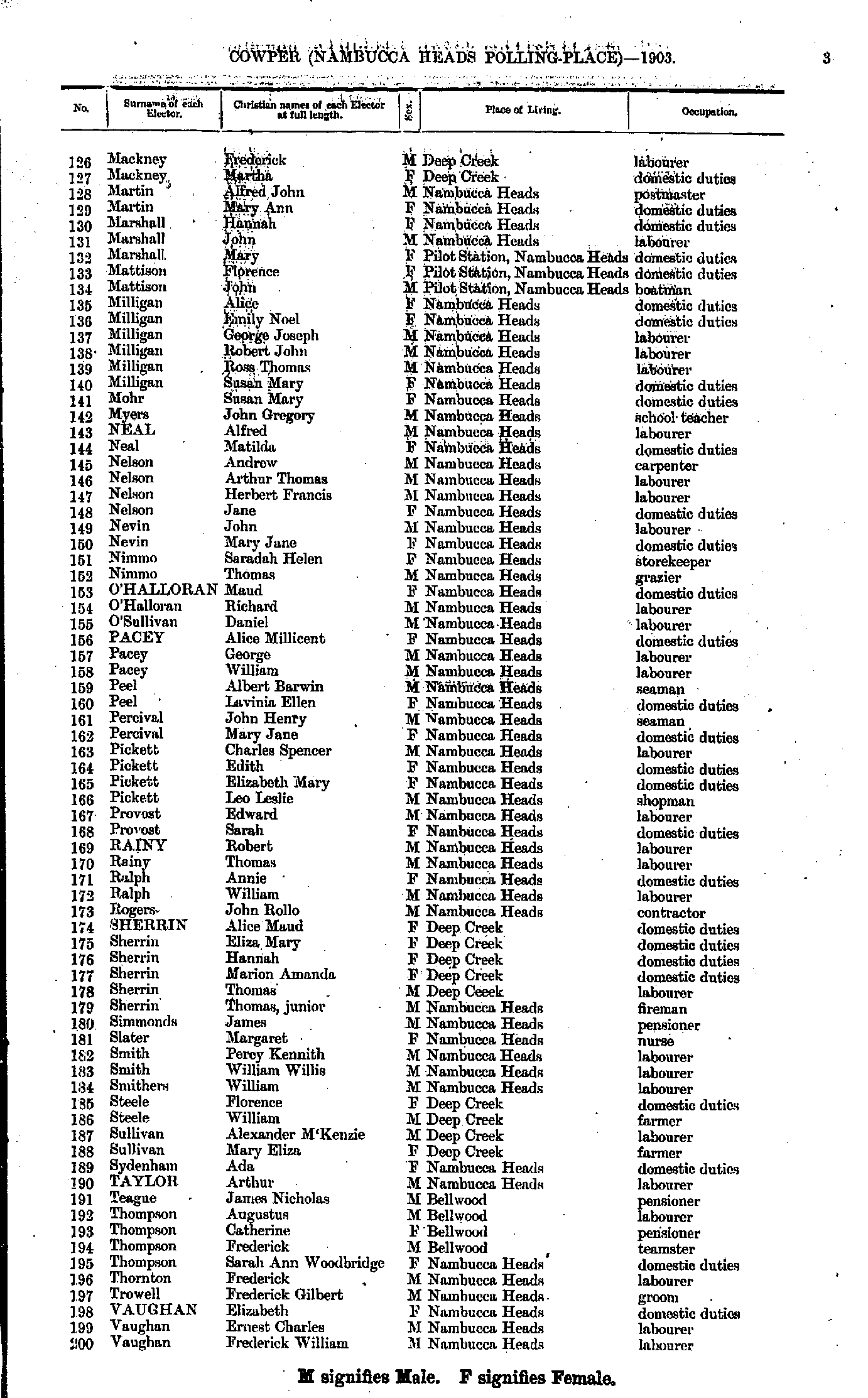
- Mackney Frederick - Vaughan Frederick
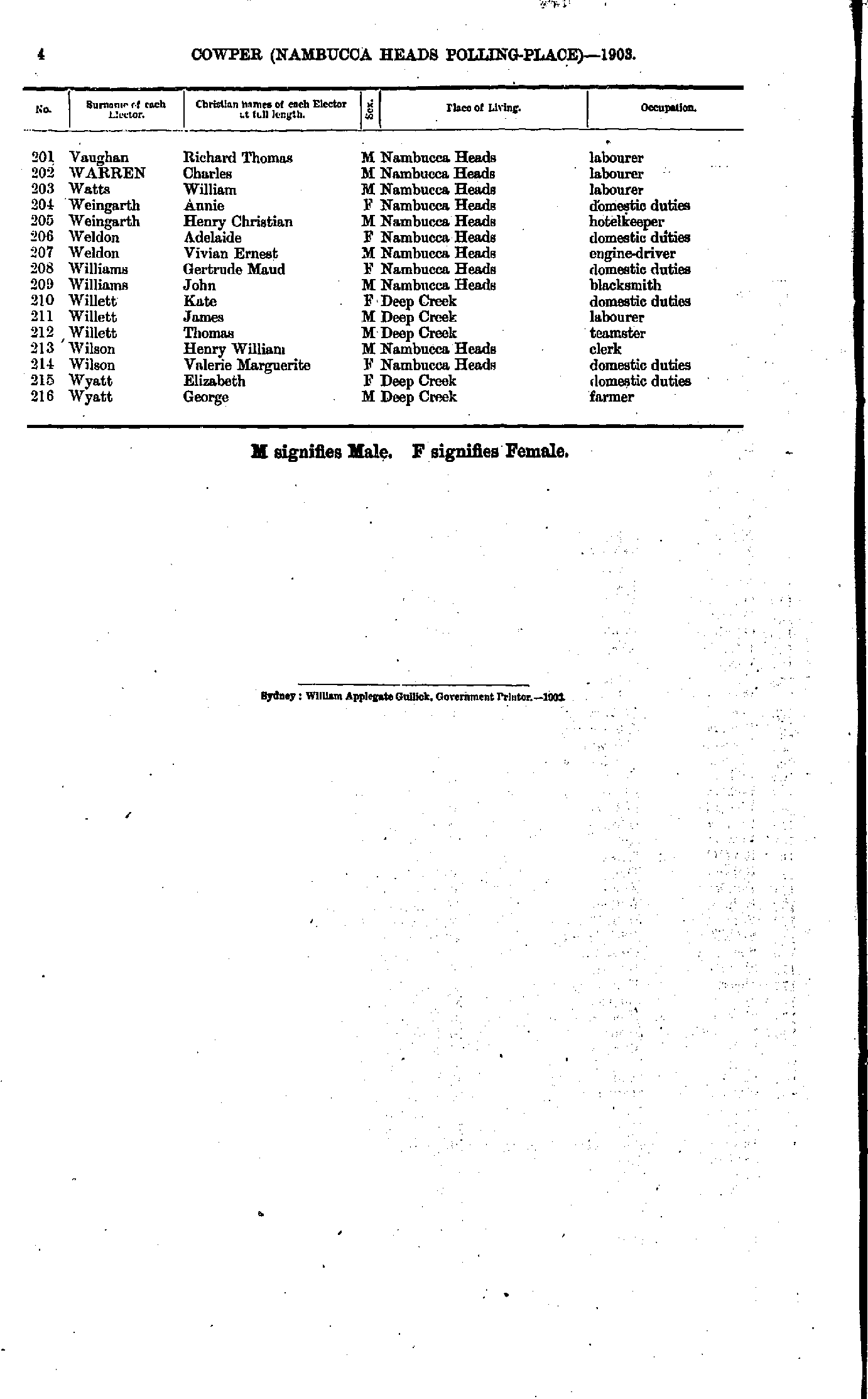
- Vaughan Richard - Wyatt George
- Abbott Phoebe - Carey Robert
- Carmady Alice - Greenway Margaret
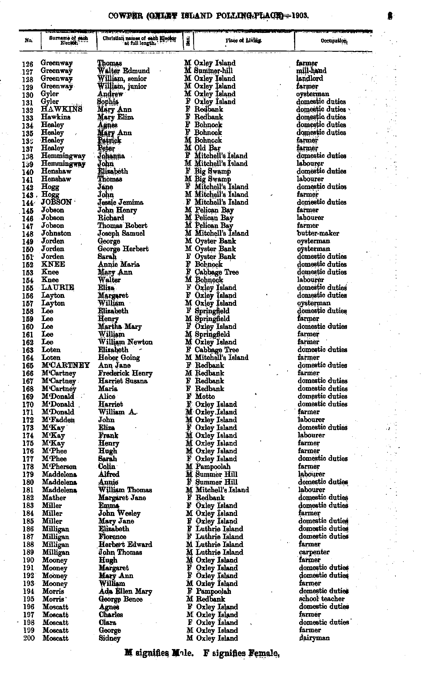
- Greenway Thomas - Moscatt Sidney
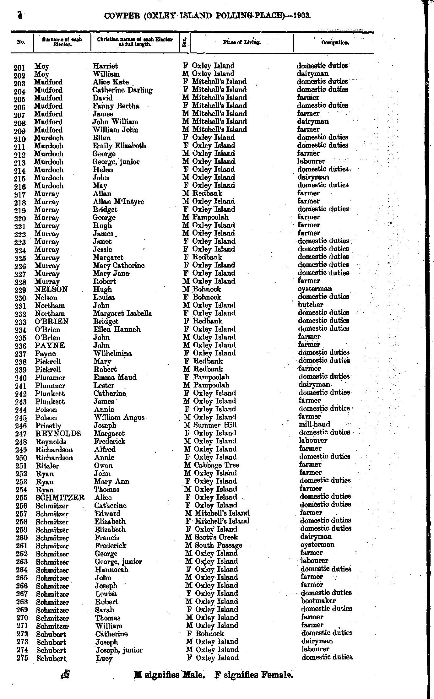
- Moy Harriet - Schubert Lucy
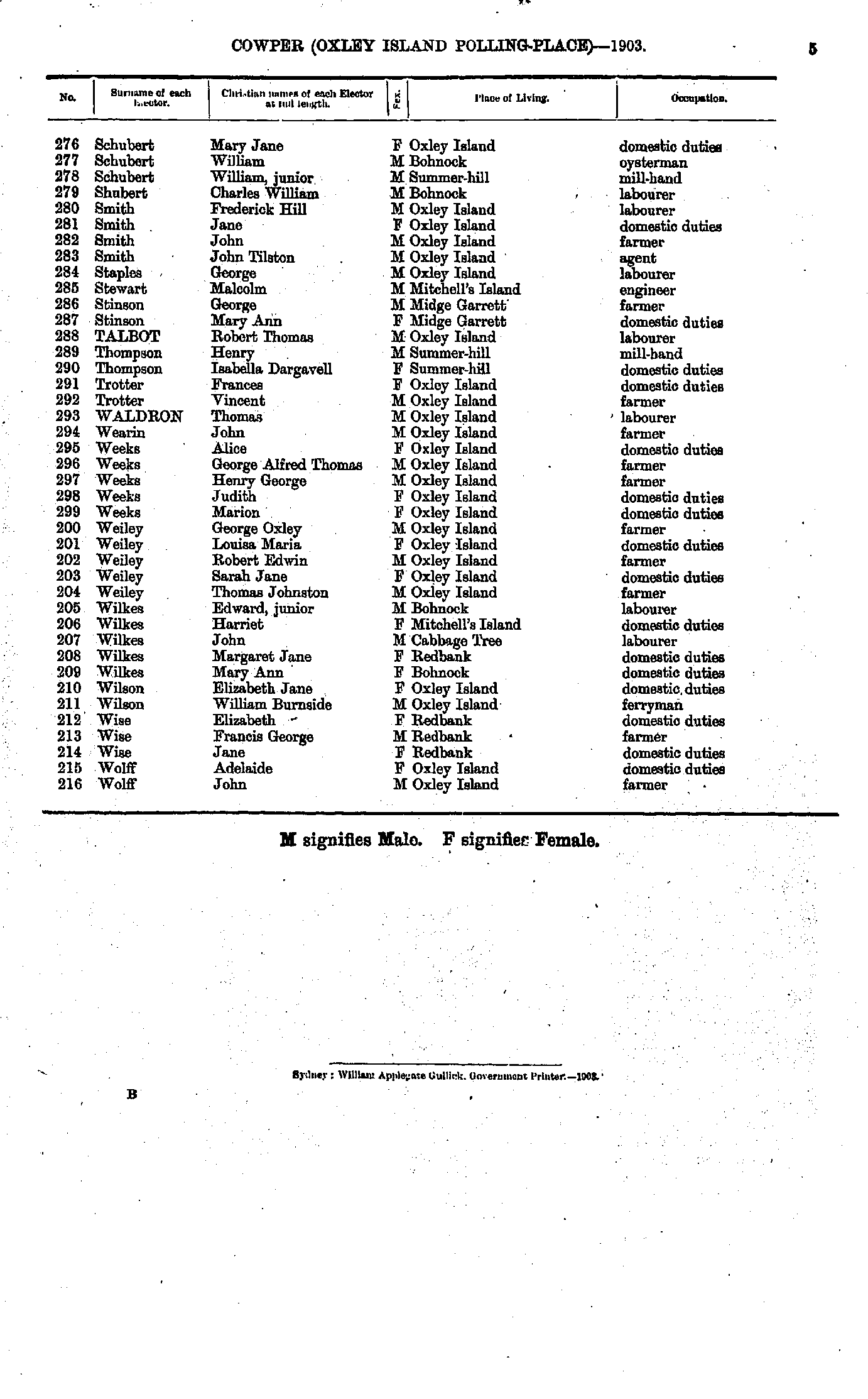
- Schubert Mary - Wolff John
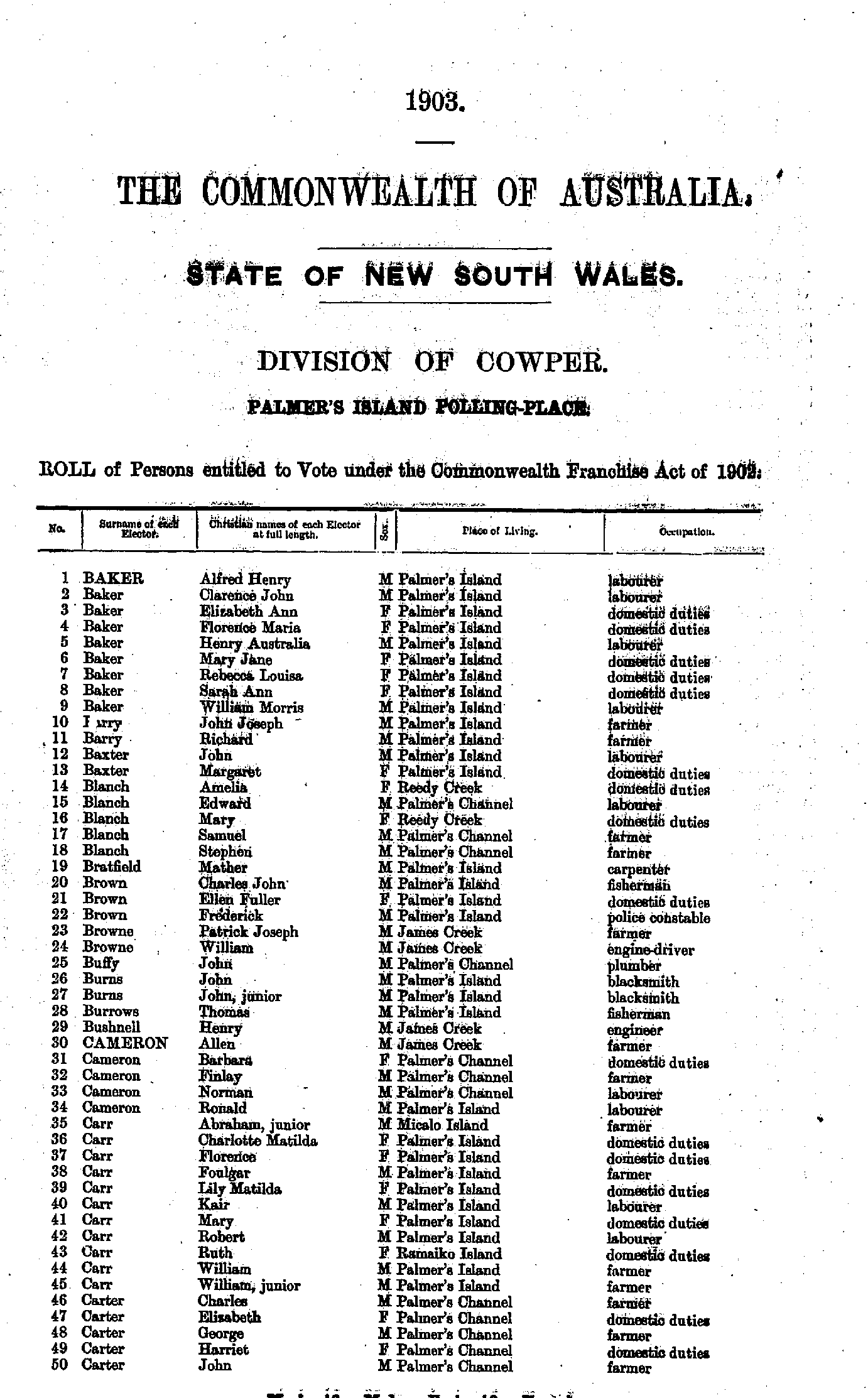
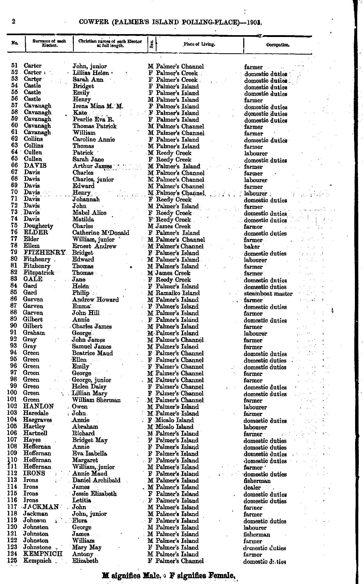
- Baker Alfred - Carter John
- Carter John - Kempnich Elizabeth
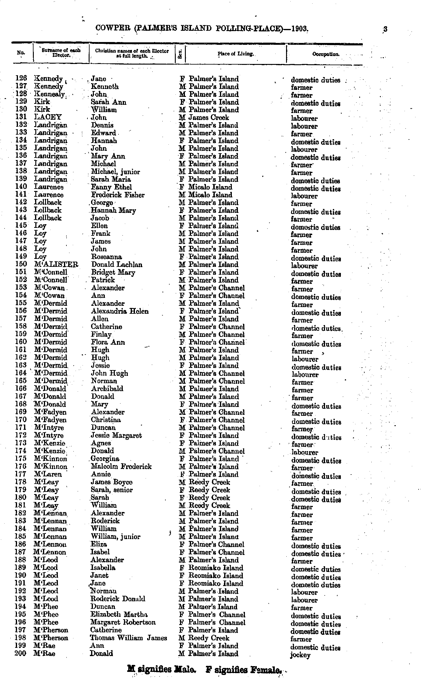
- Kennedy Jane - M'Rae Donald
- M'Swan Amy - Smith Amy
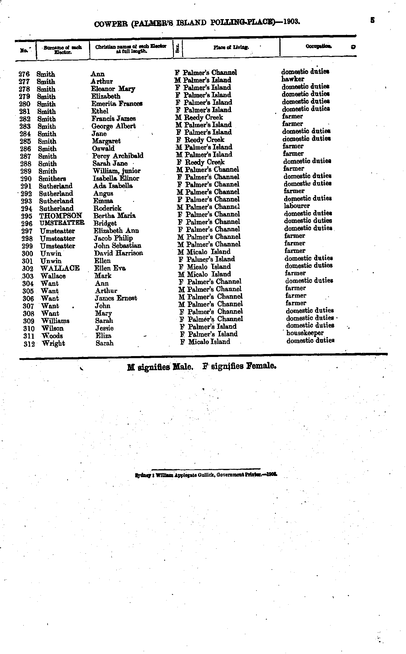
- Smith Ann - Wright Sarah
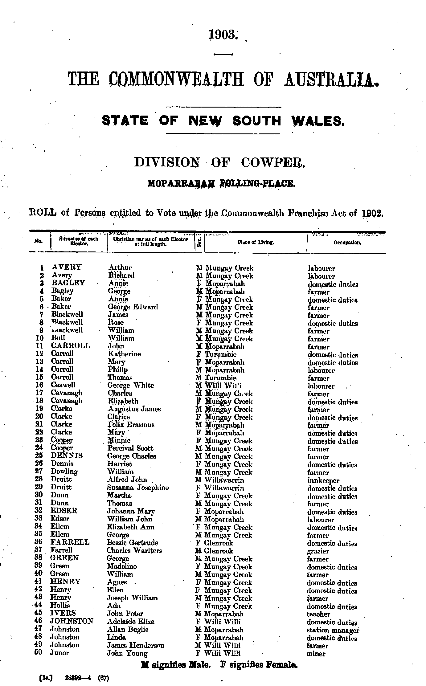
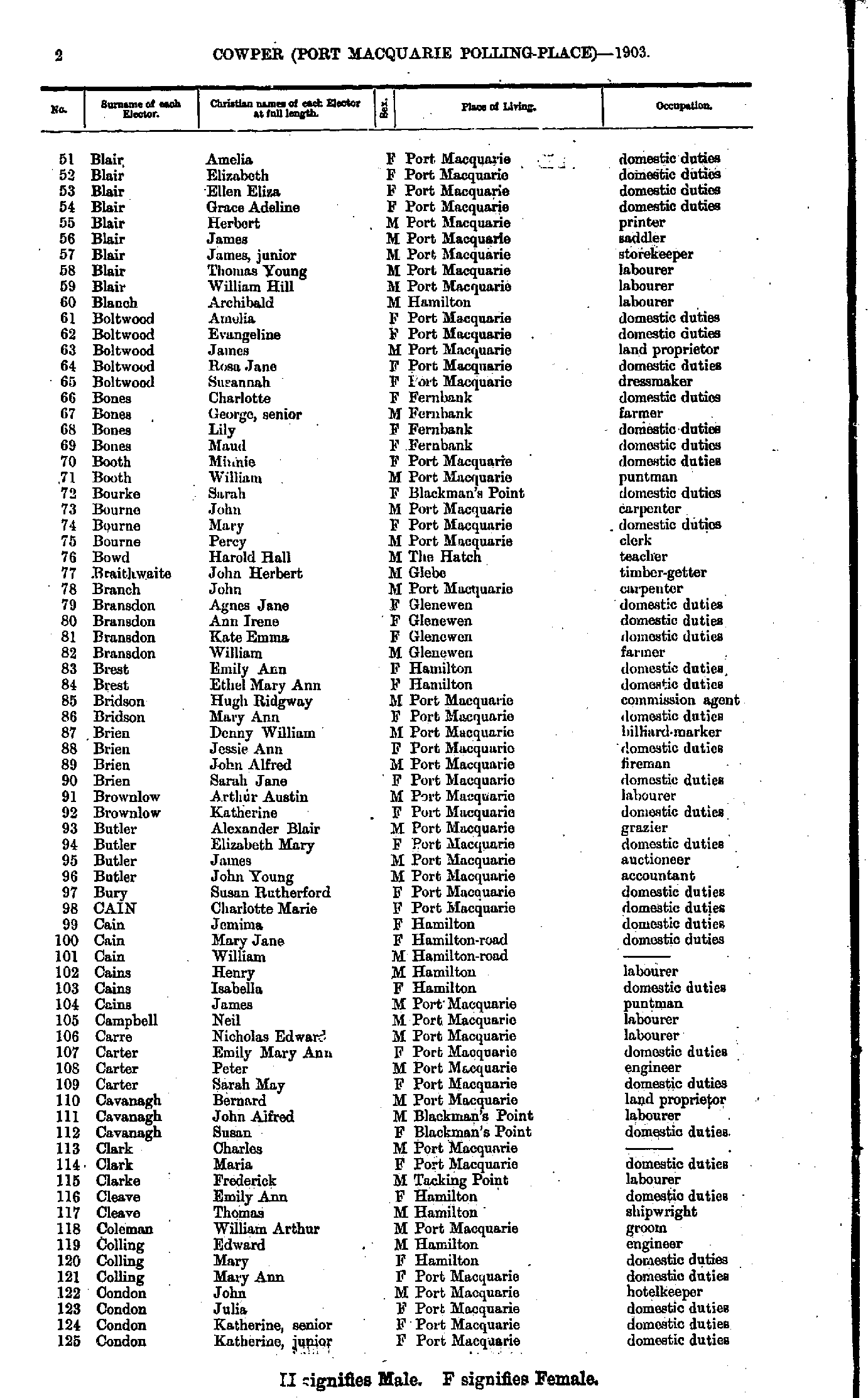
- Absalom George - Blair Alexander
- Blair Amelia - Condon Katherine
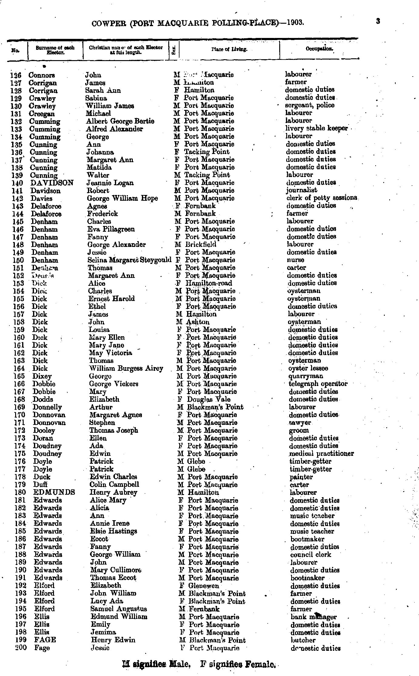
- Connors John - Fage Jessie
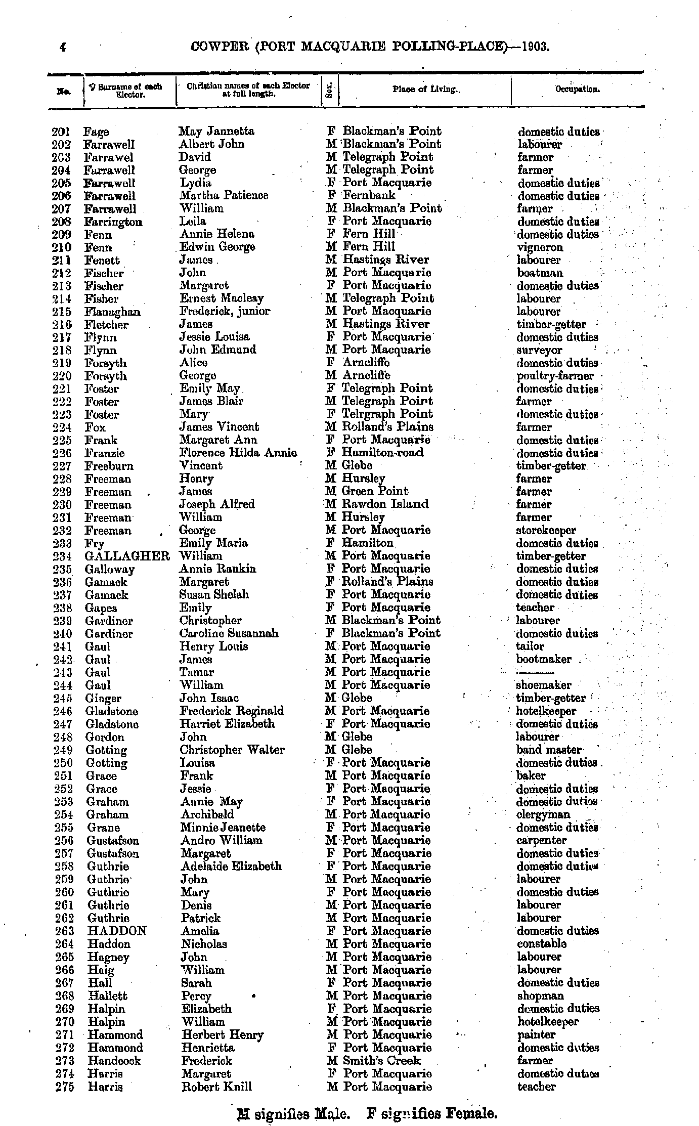
- Fage May - Harris Robert
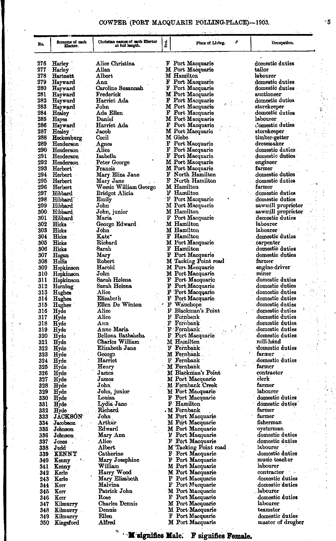
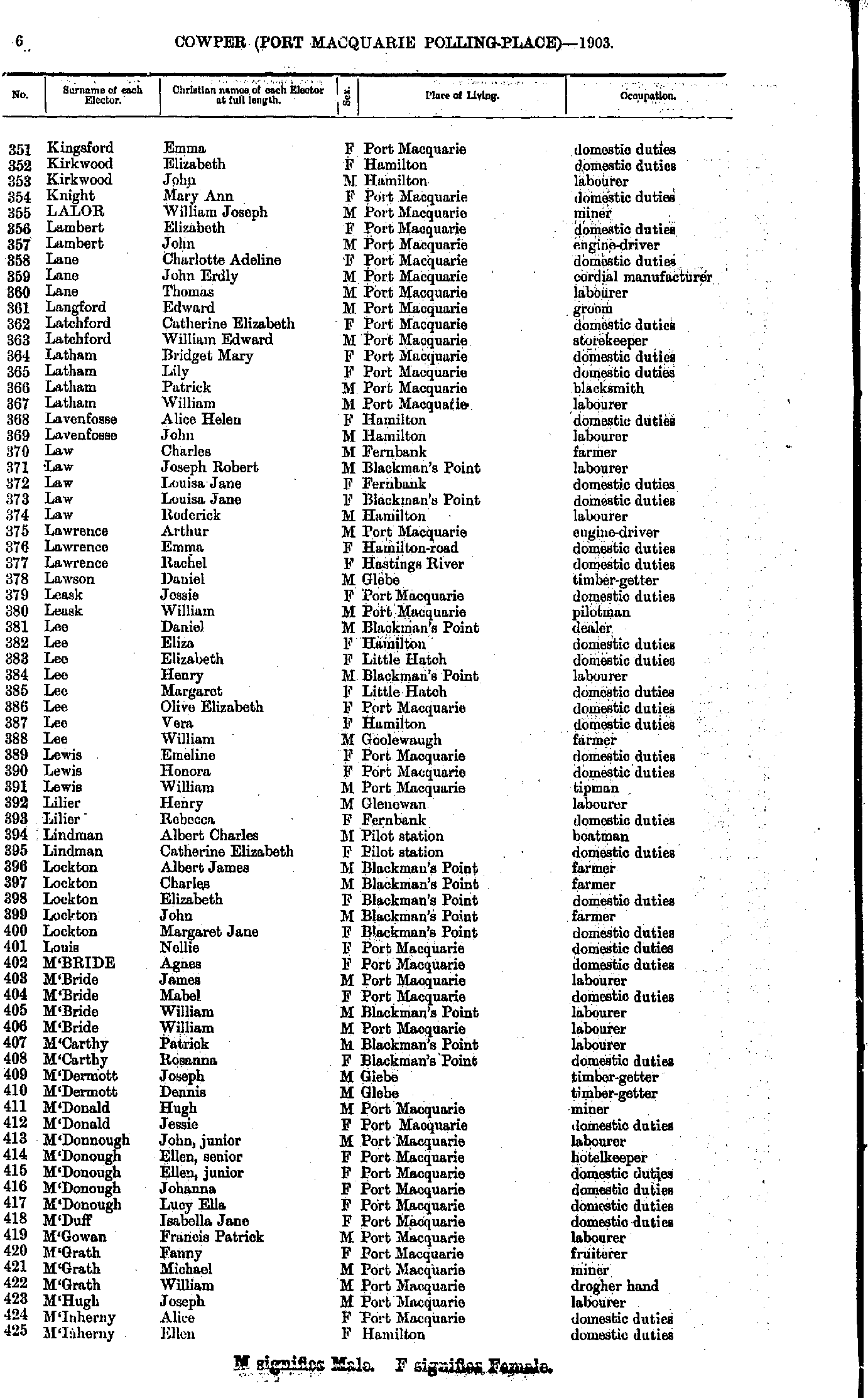
- Harley Alice - Kingsford Alfred
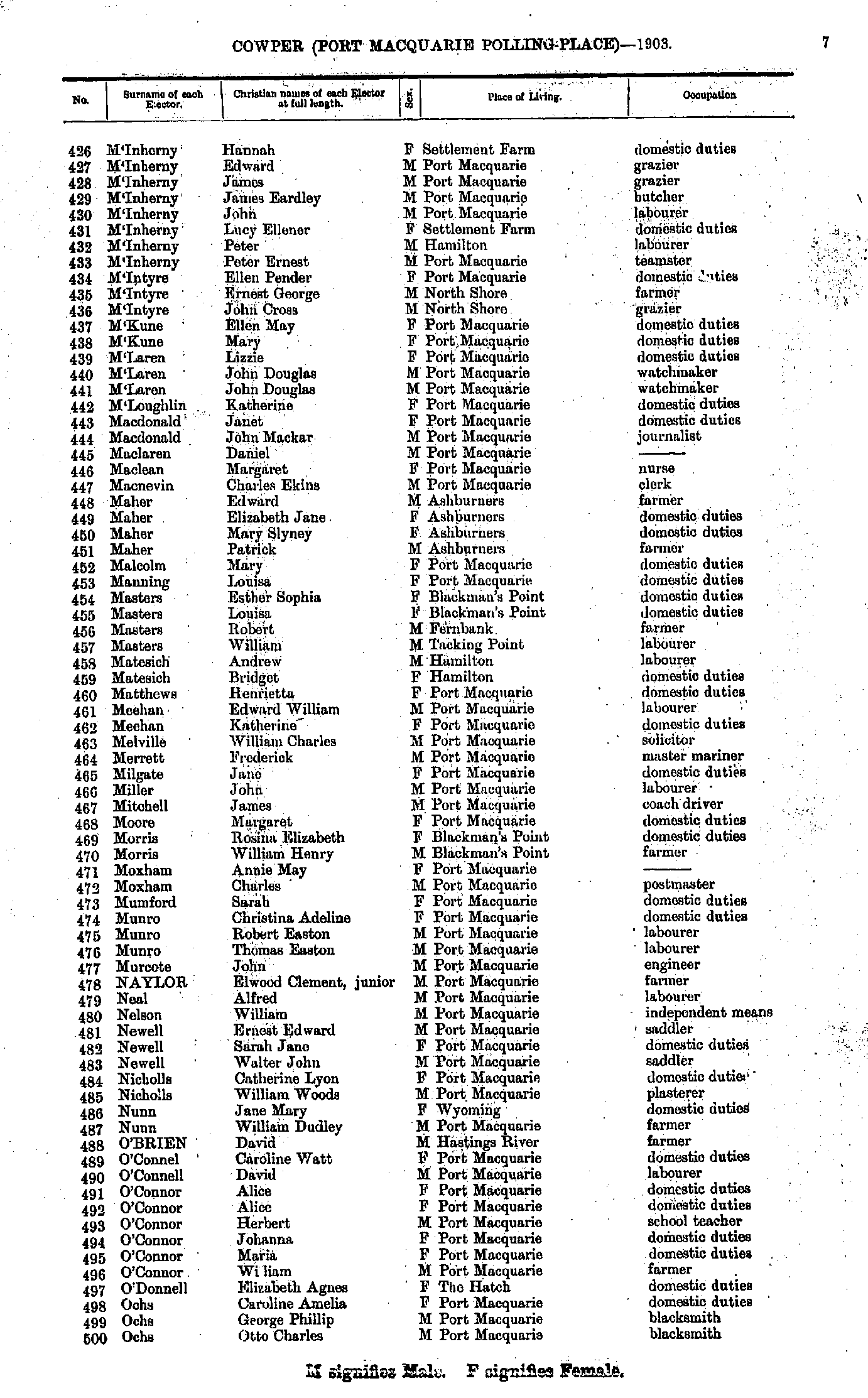
- Kingsford Emma - M'Inherny Ellen
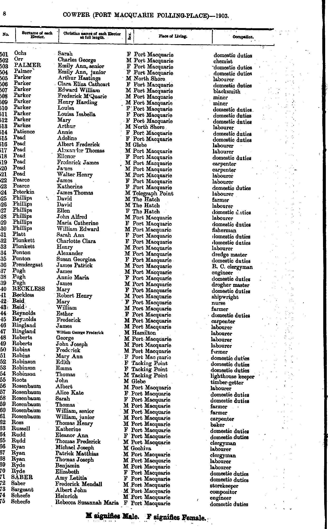
- M'Inherny Hannah - Ochs Otto
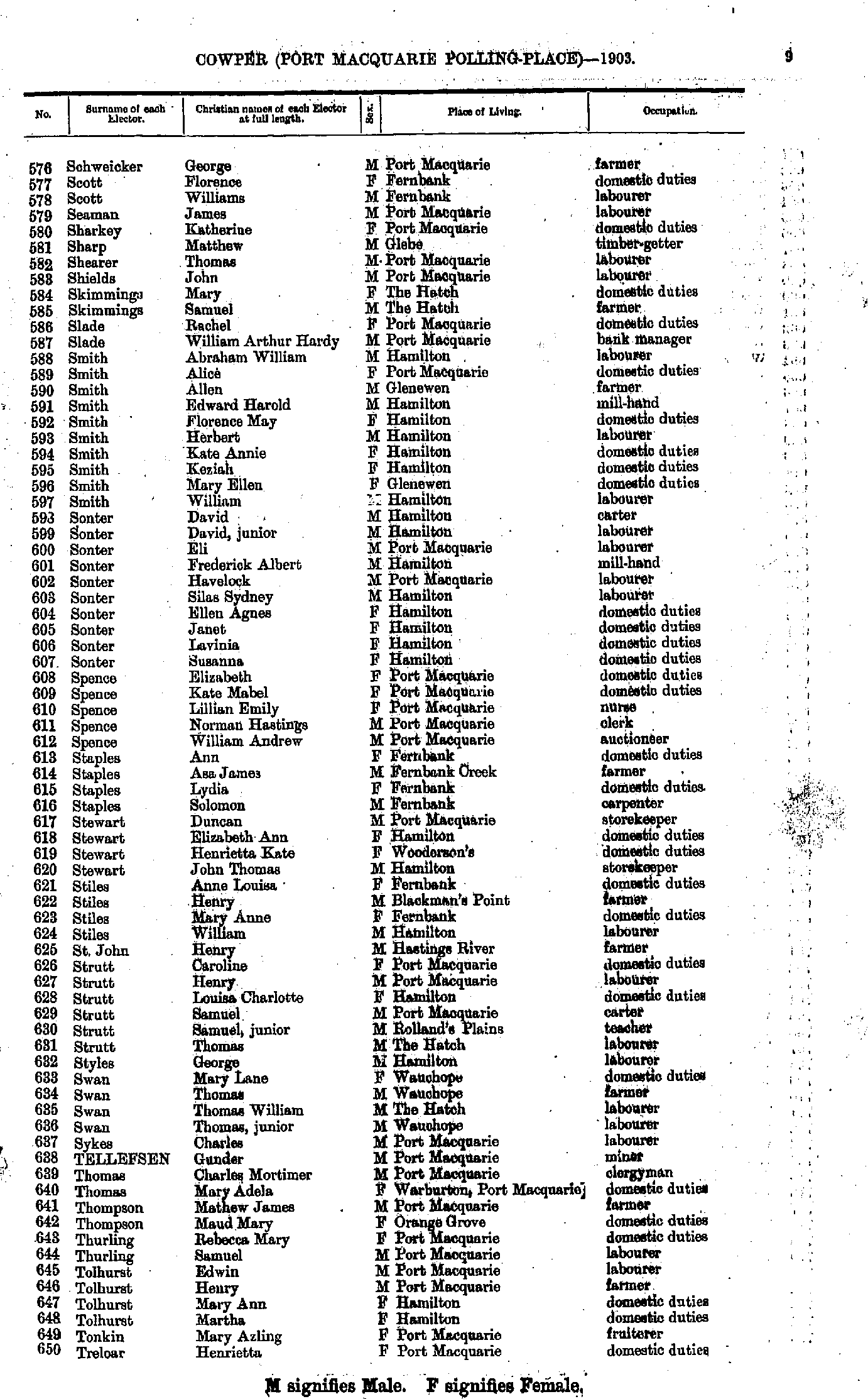
- Ochs Sarah - Scheefe Rebecca
- Schweicker George - Treloar Henrietta
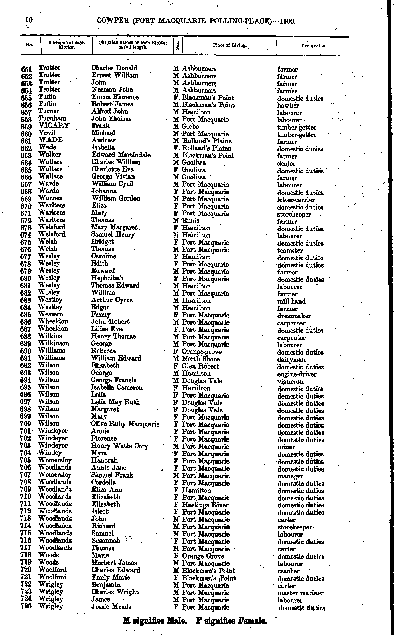
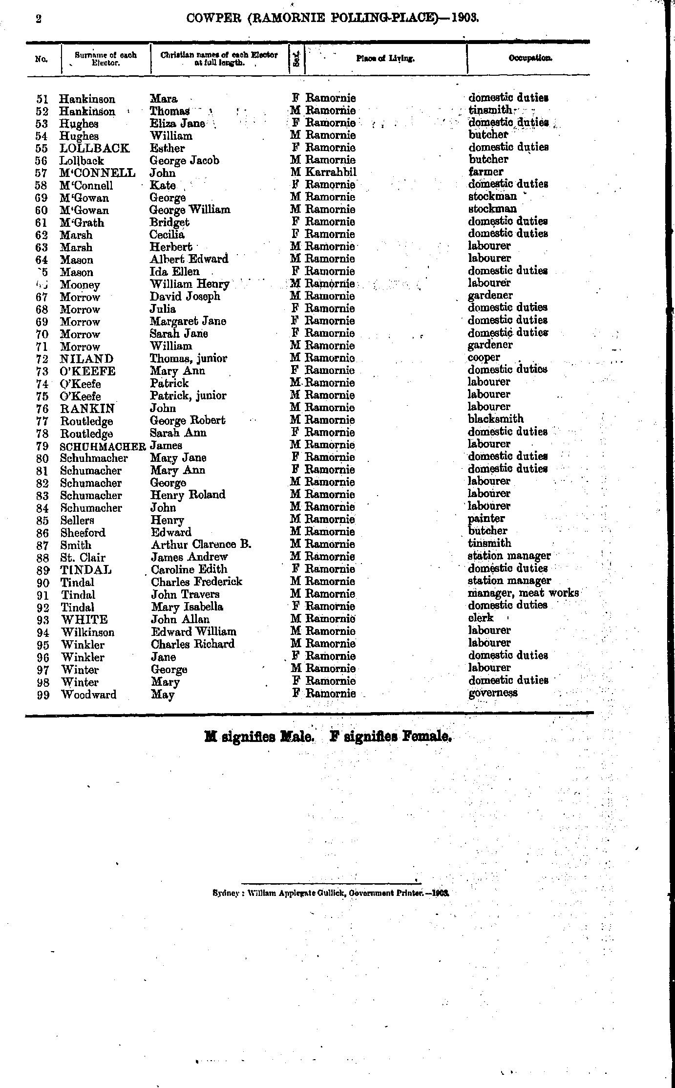
- Trotter Charles - Wrigley Jessie
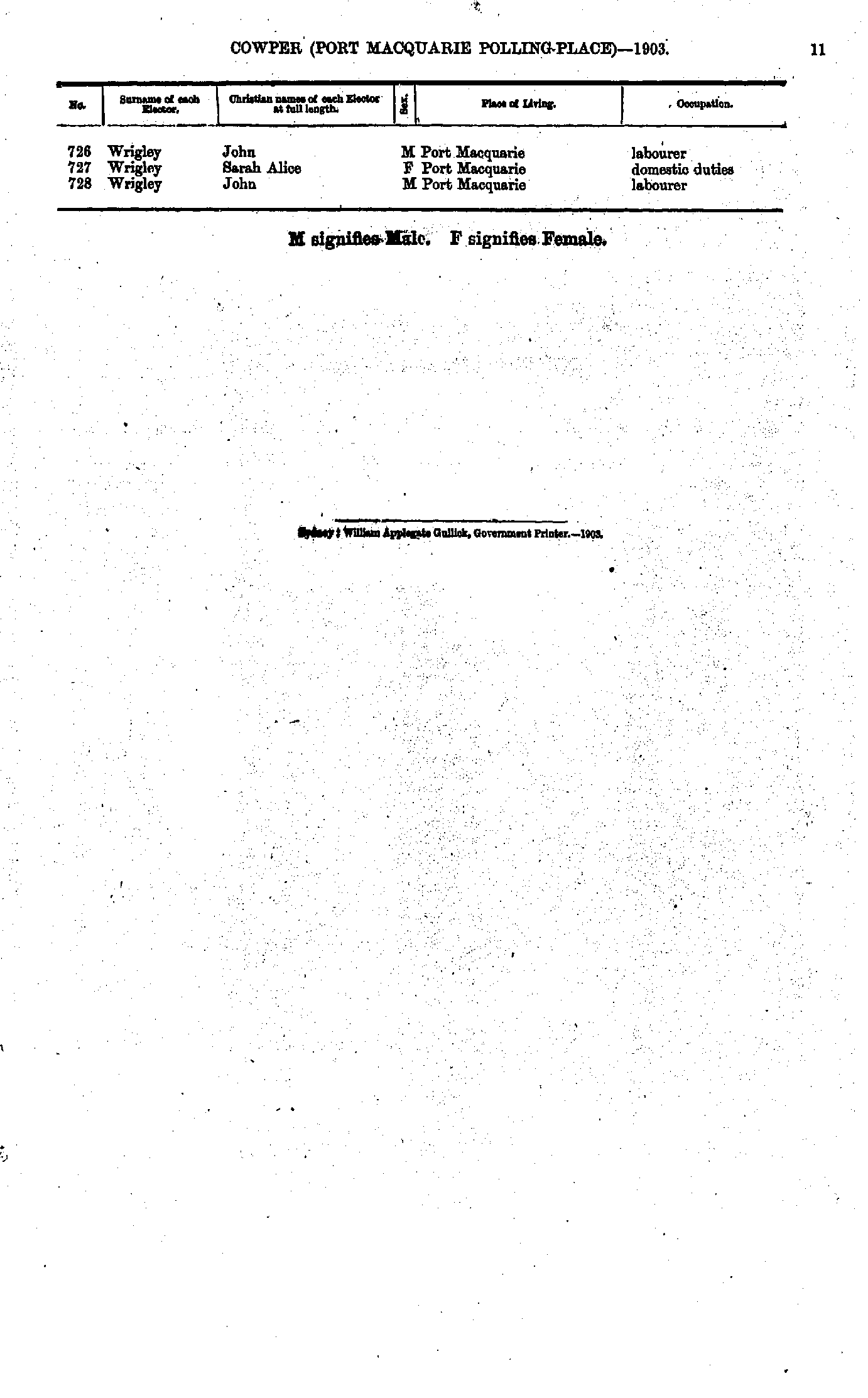
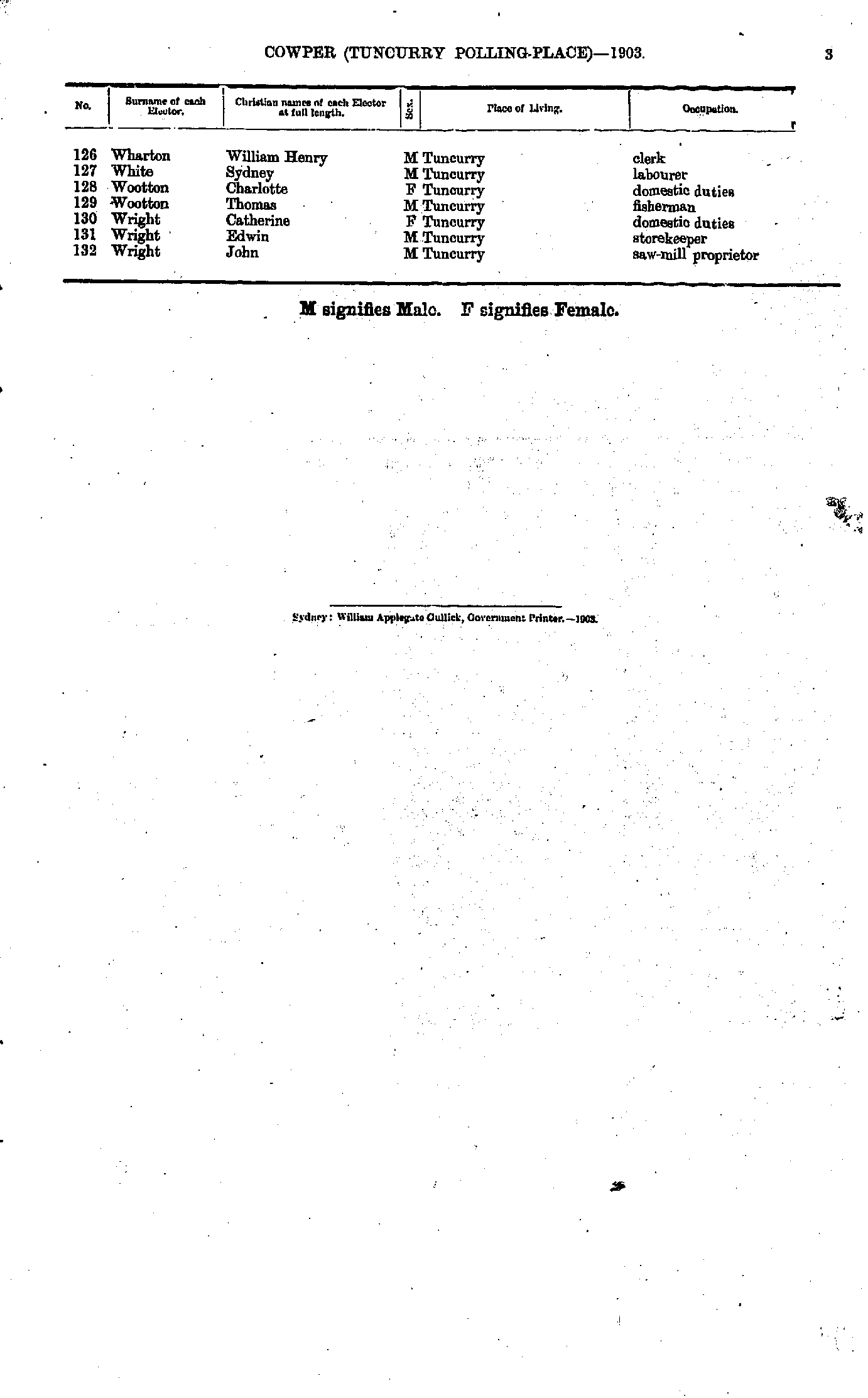
- Wrigley John - Wrigley John
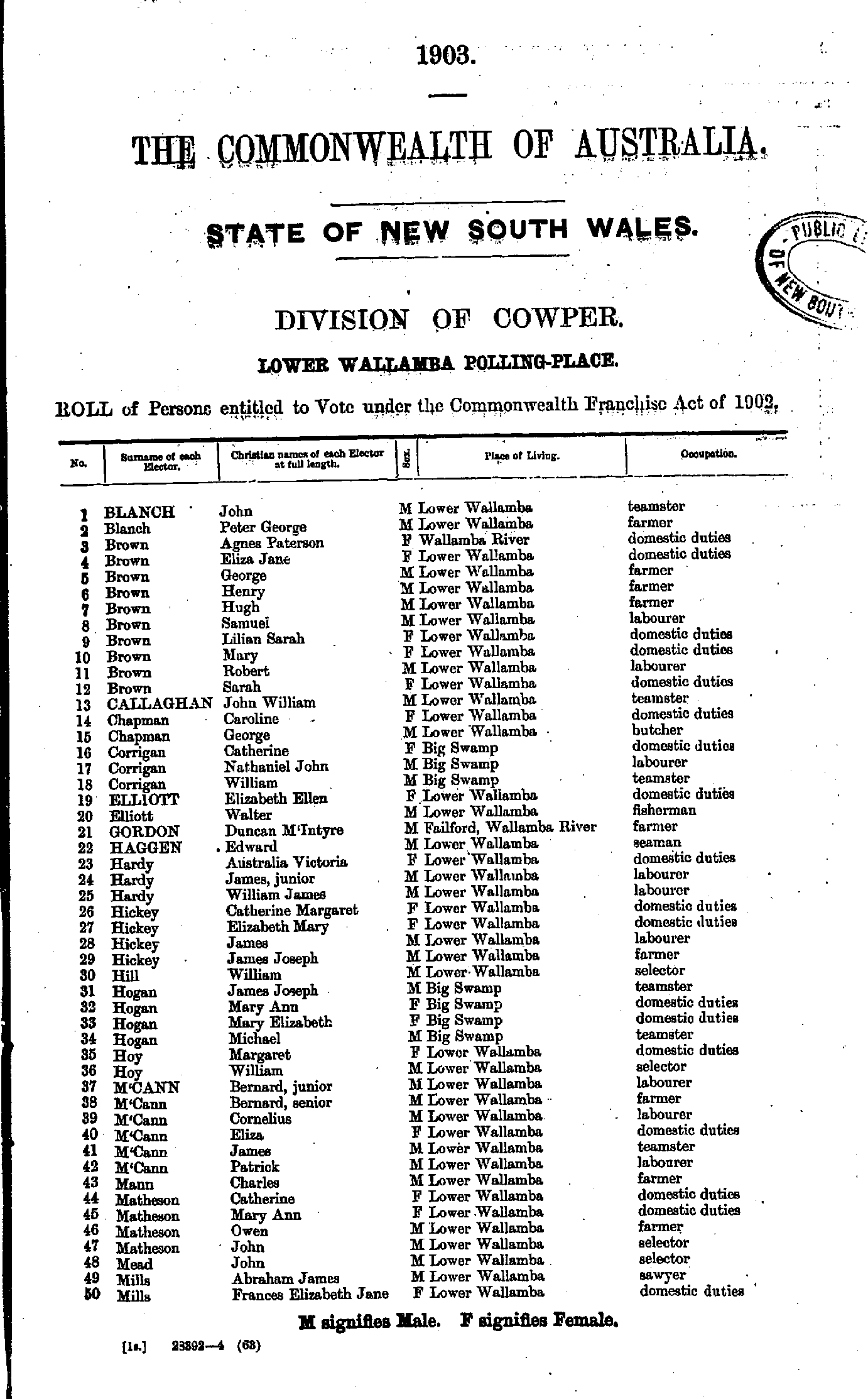
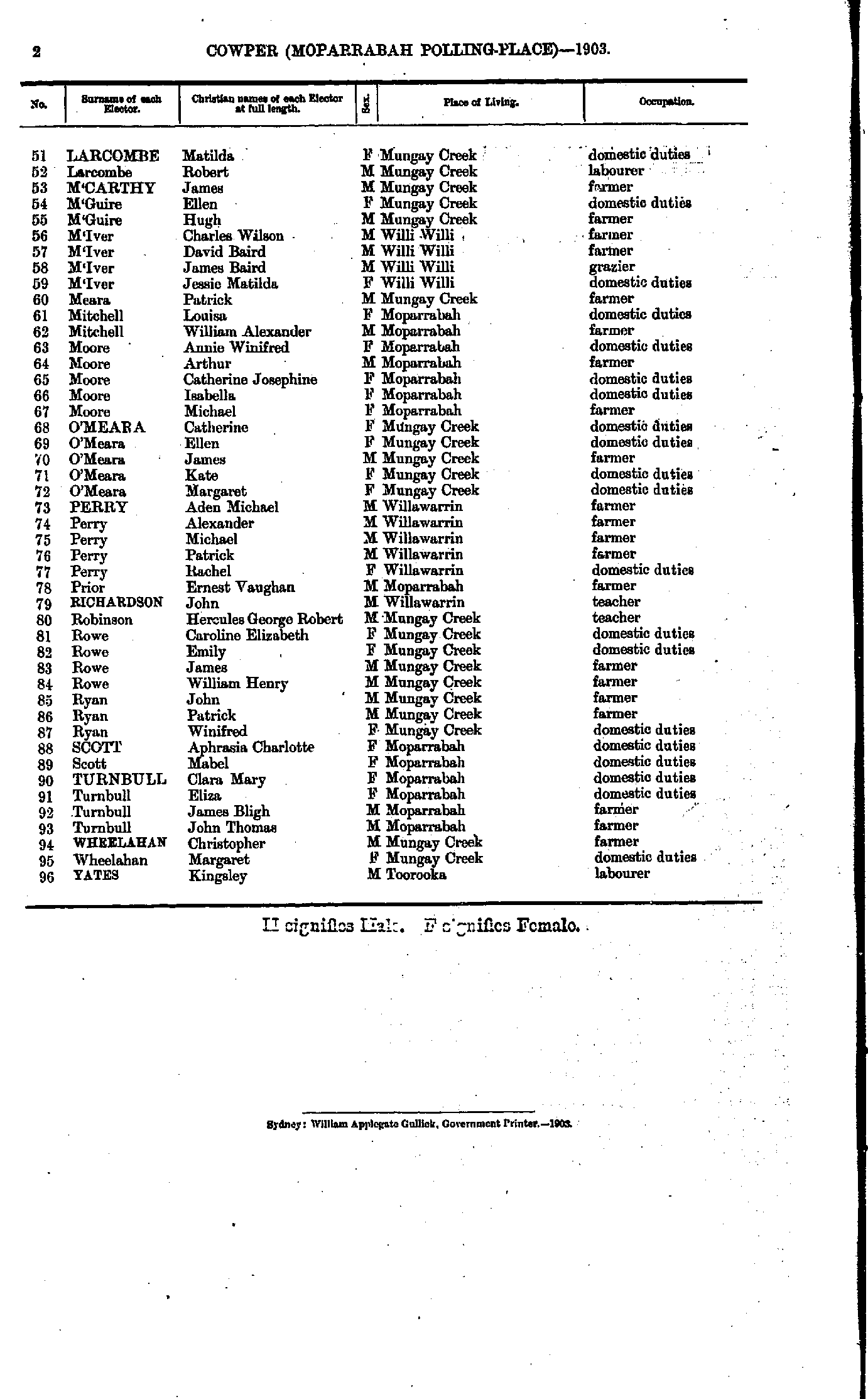
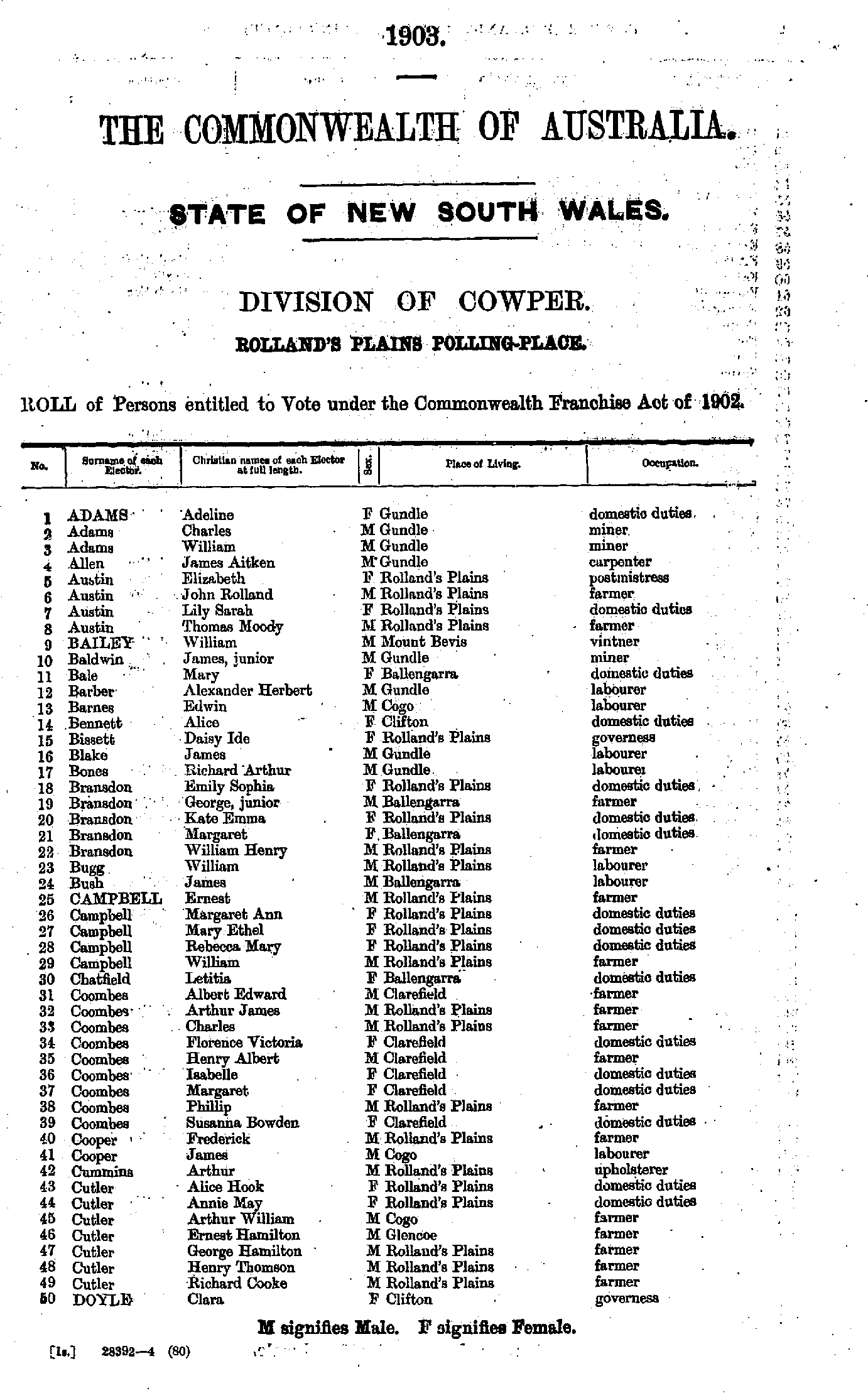
Rolland's Plains Polling Place
- Adams Adeline - Doyle Clara
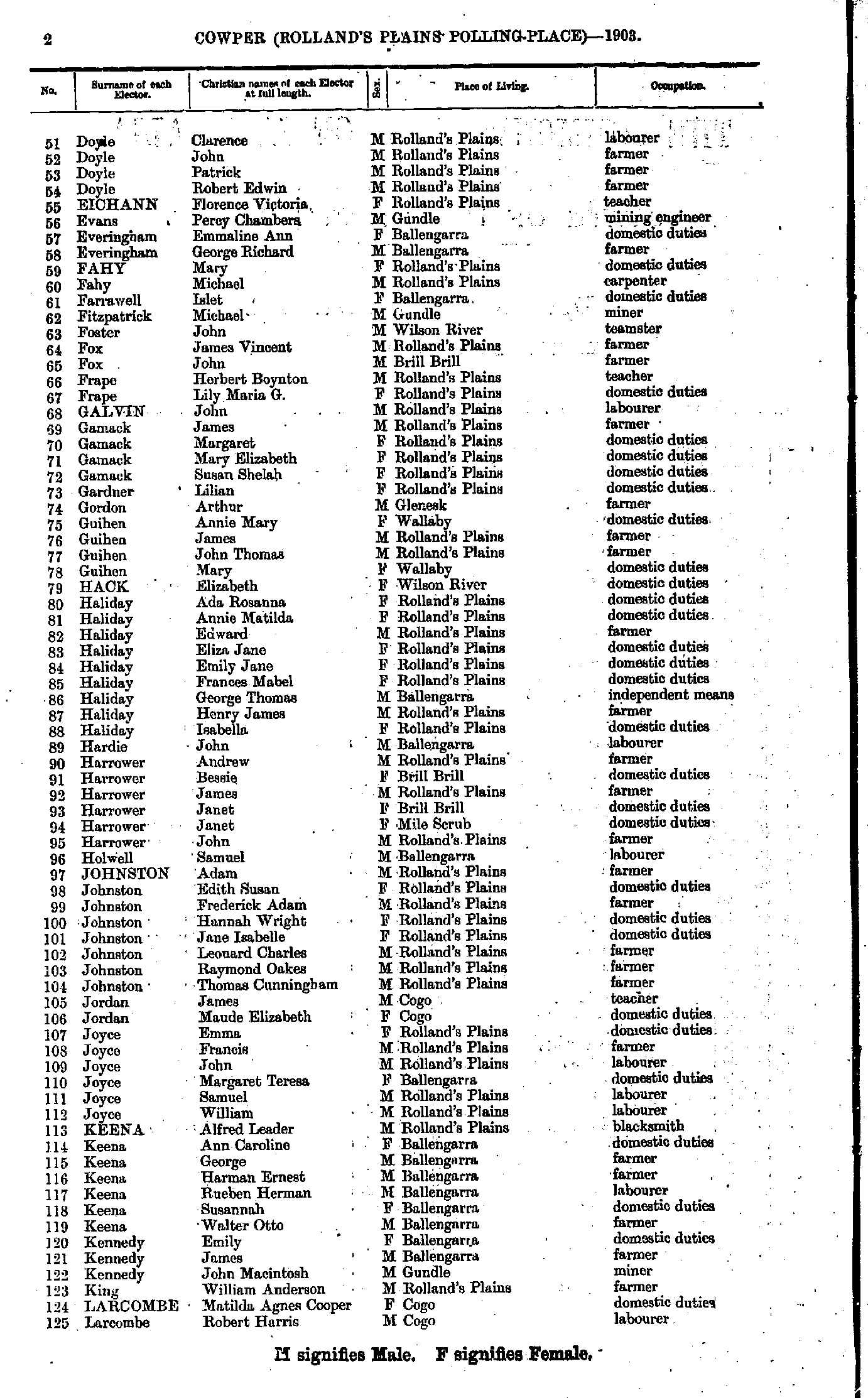
- Doyle Clarence - Larcombe Robert
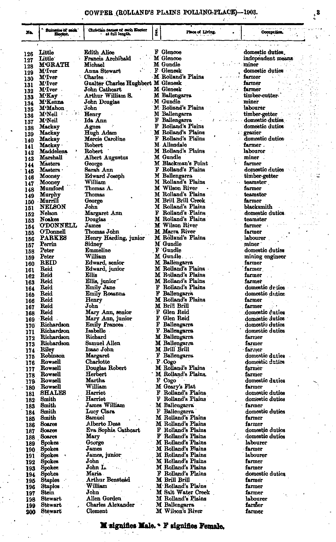
- Little Edith - Stewart Clement
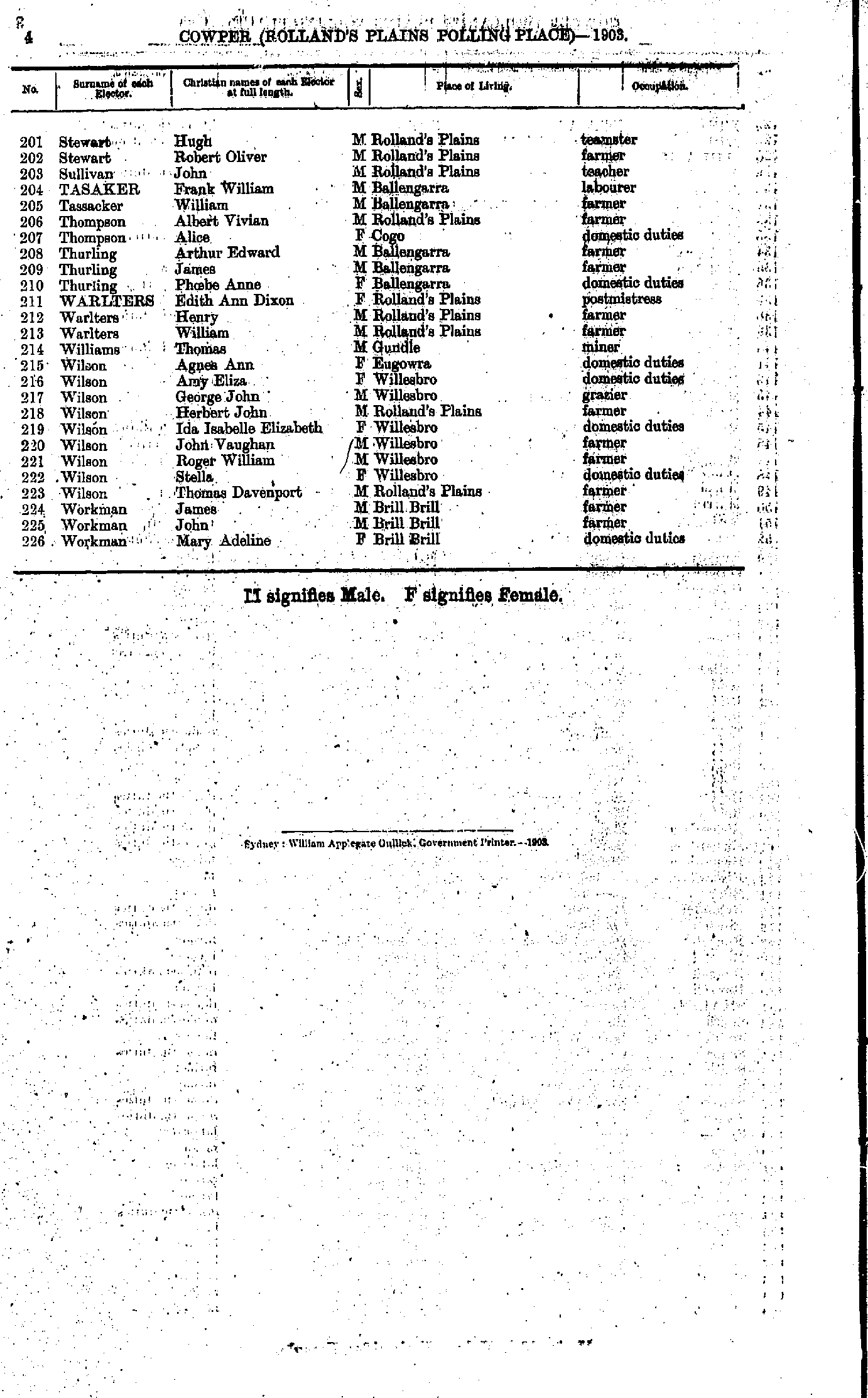
- Stewart Hugh - Workman Mary
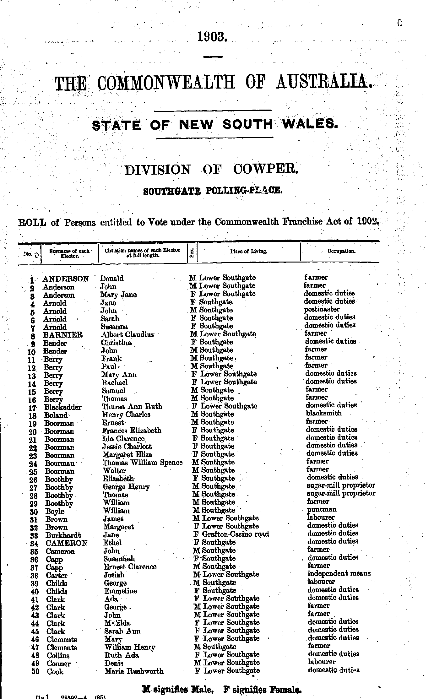
- Anderson Donald - Cook Maria
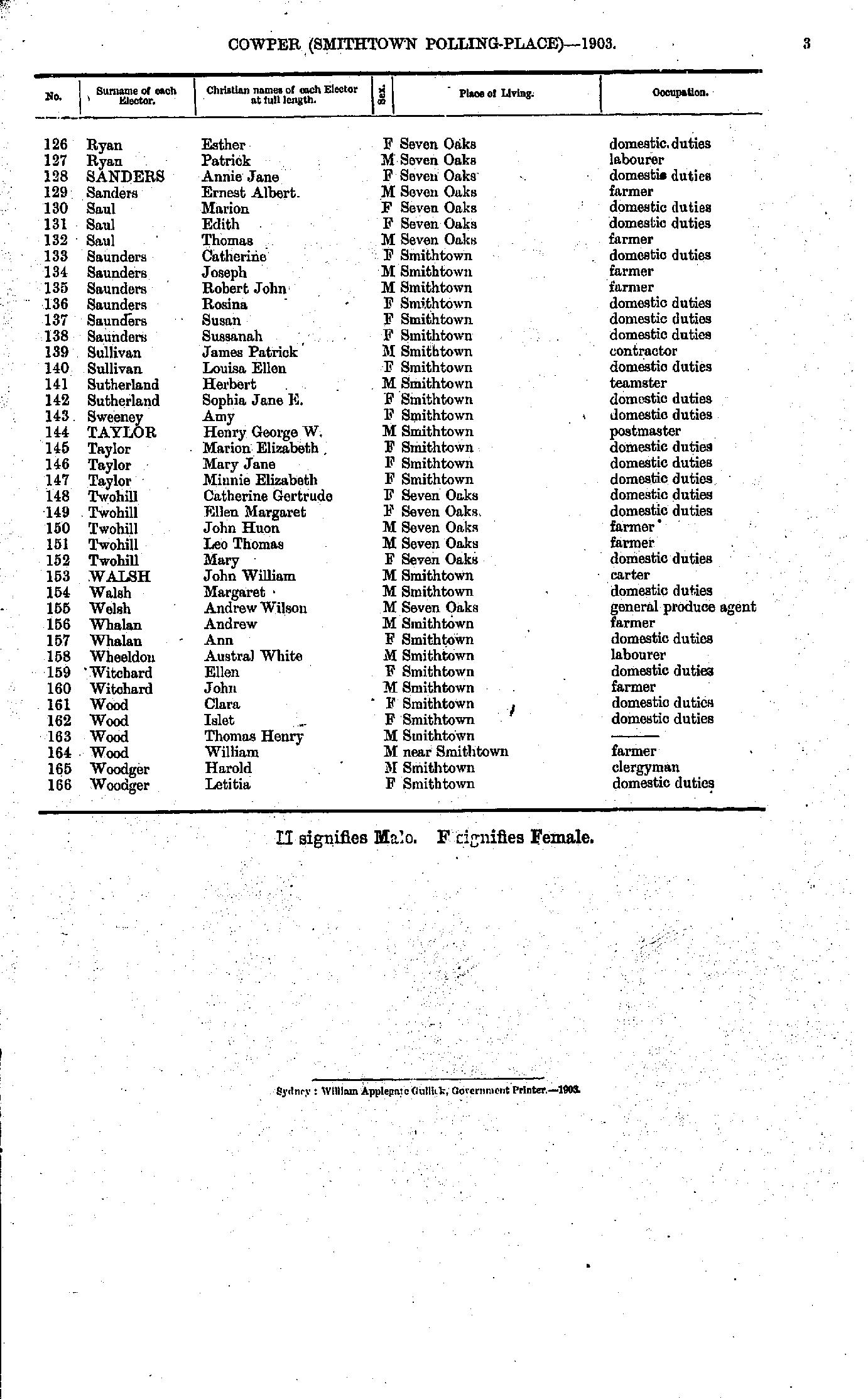
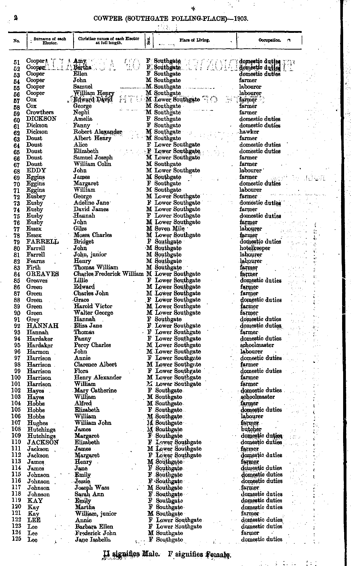
- Cooper Amy - Lee Jane
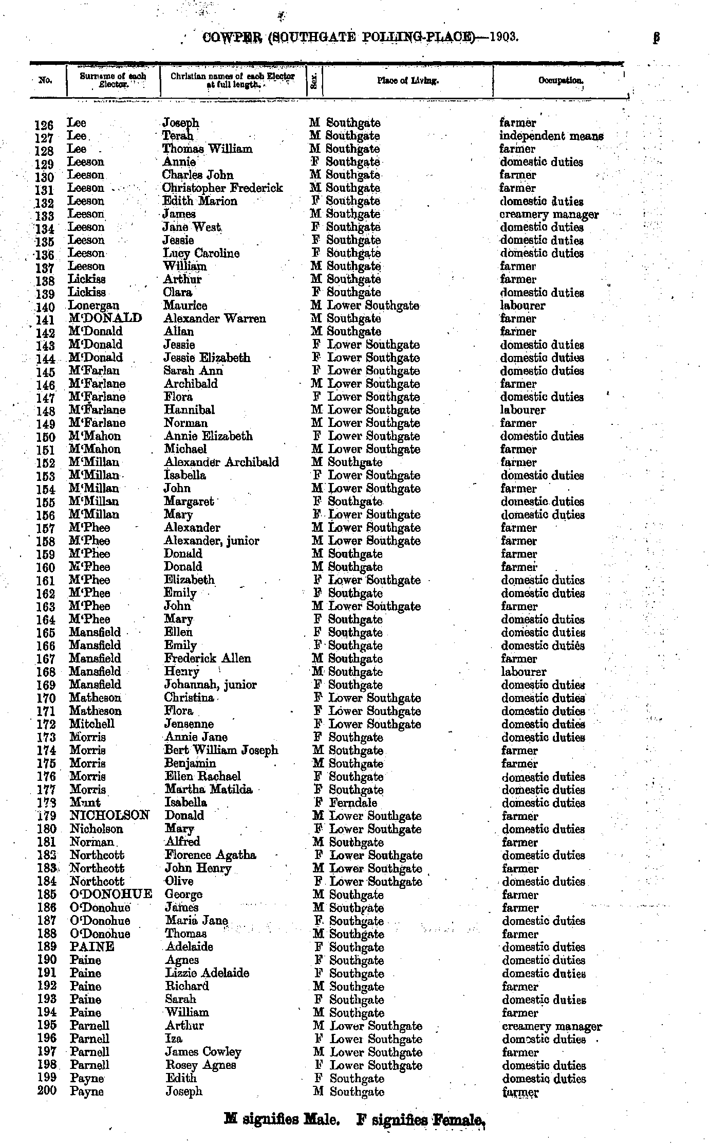
- Lee Joseph - Payne Joseph
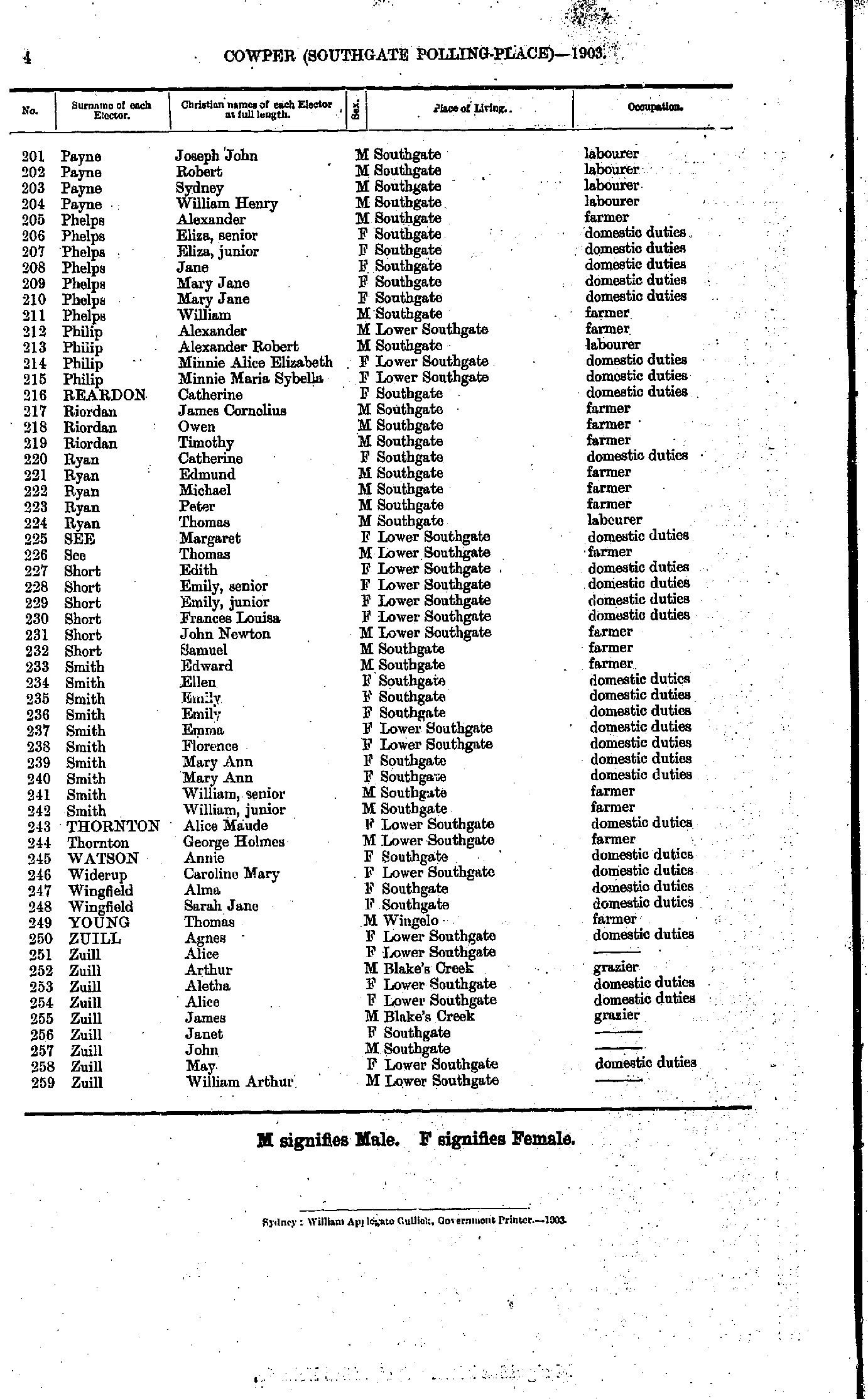
- Payne Joseph - Zuill William
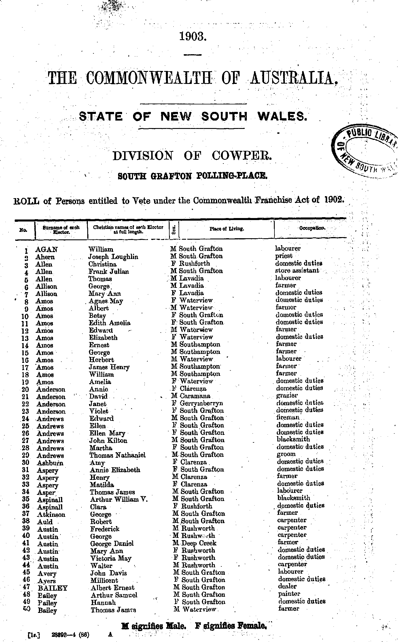
- Agan William - Bailey Thomas
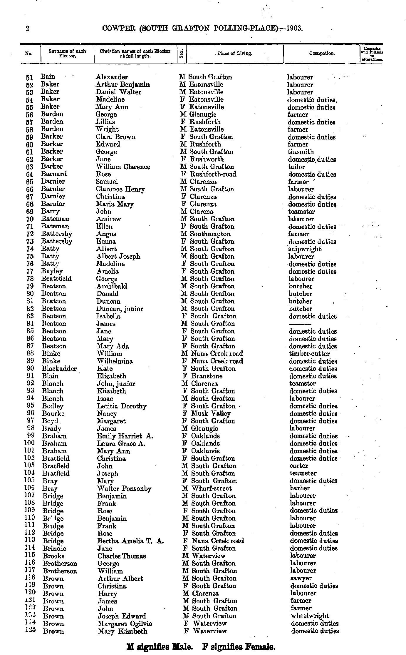
- Bain Alexander - Brown Mary
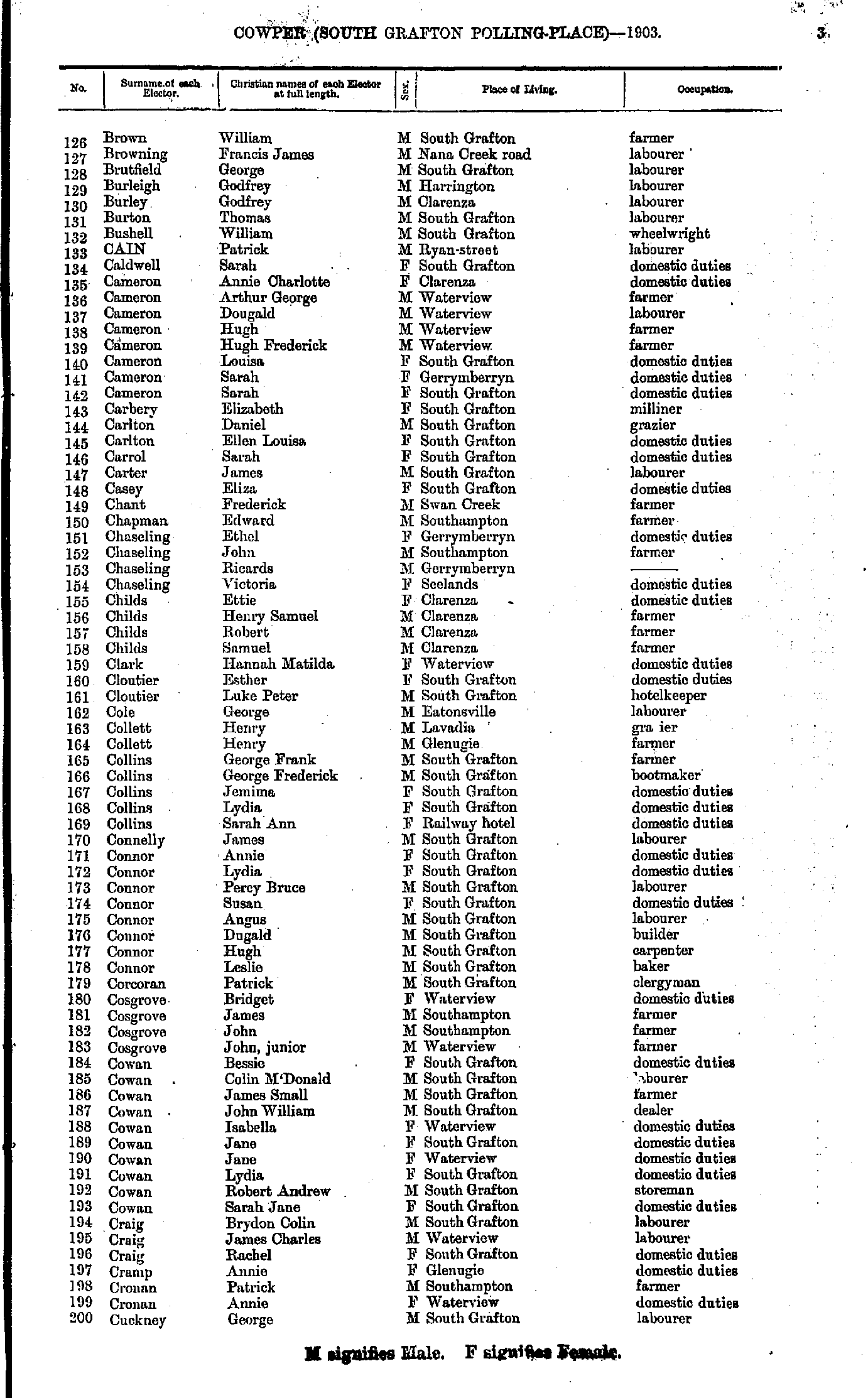
- Brown William - Cuckney George
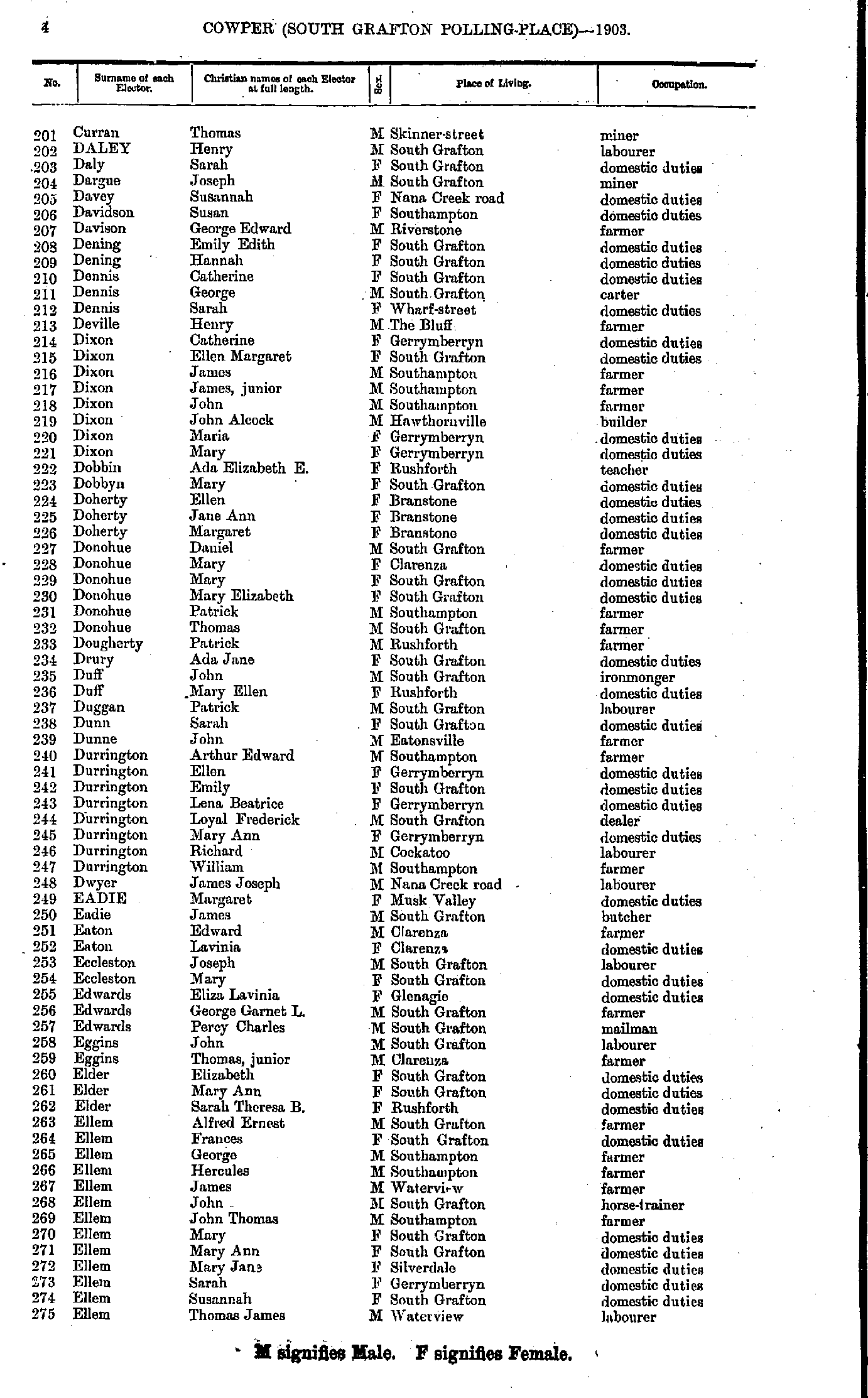
- Curran Thomas - Ellem Thomas
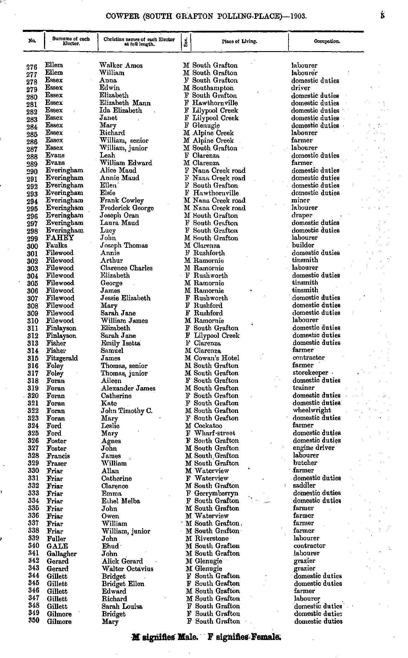
- Ellem Walker - Gilmore Mary
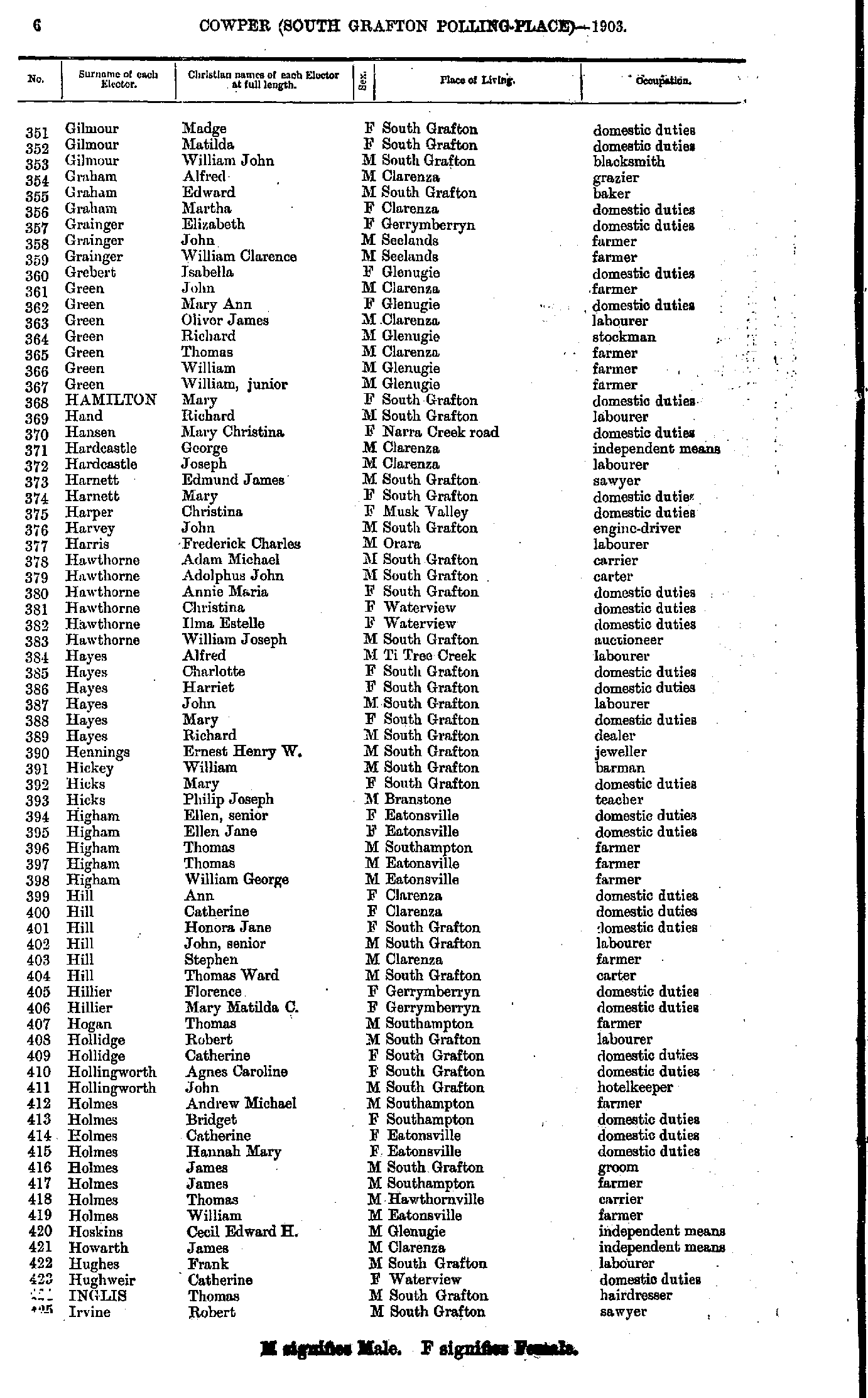
- Gilmour Madge - Irvine Robert
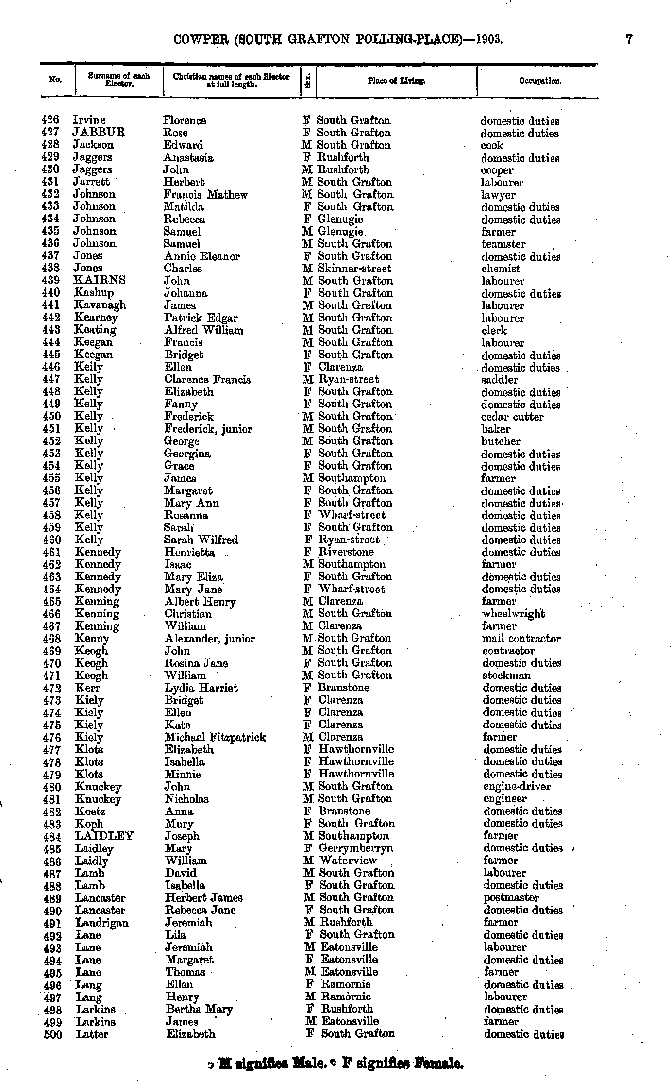
- Irvine Florence - Latter Elizabeth
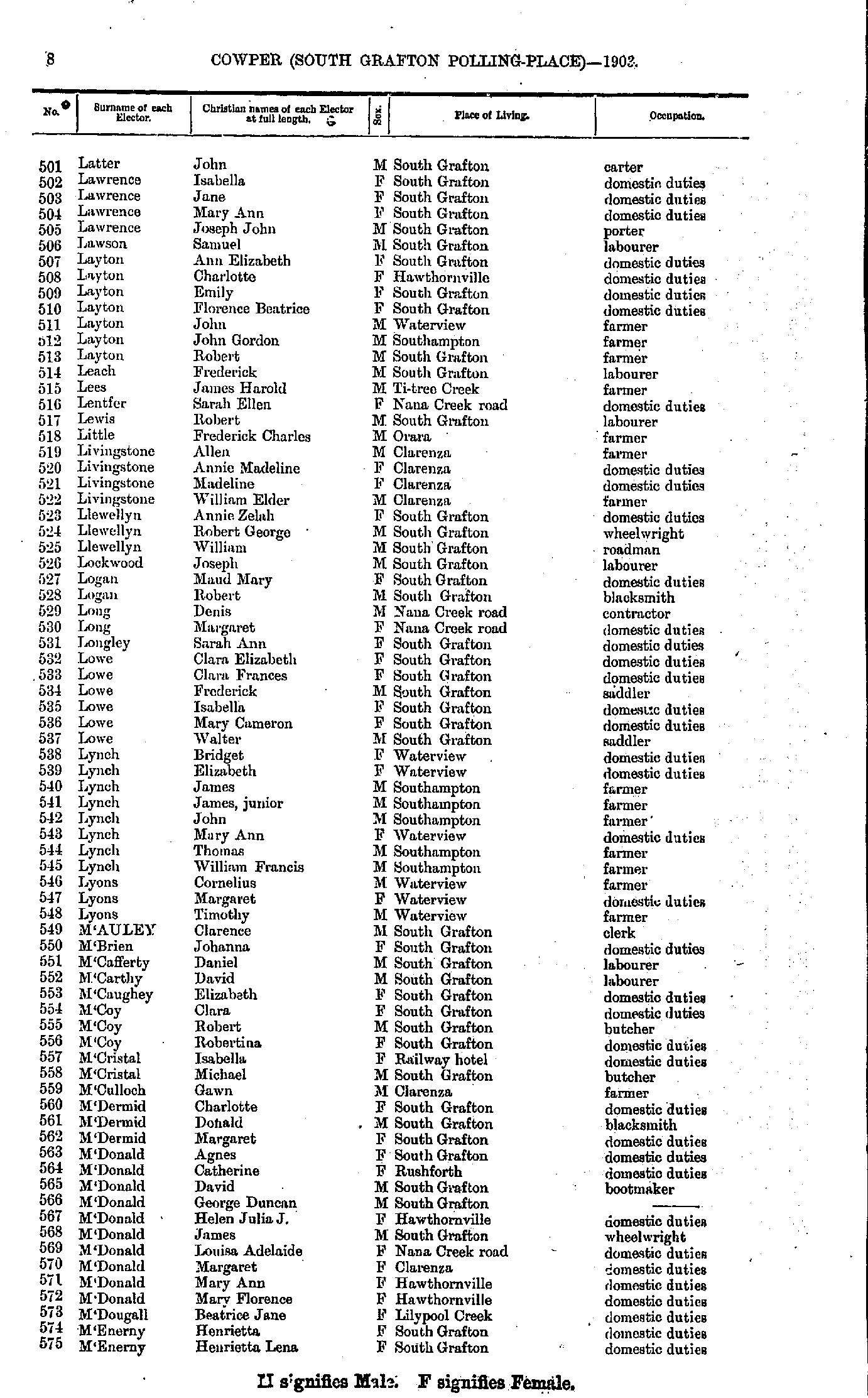
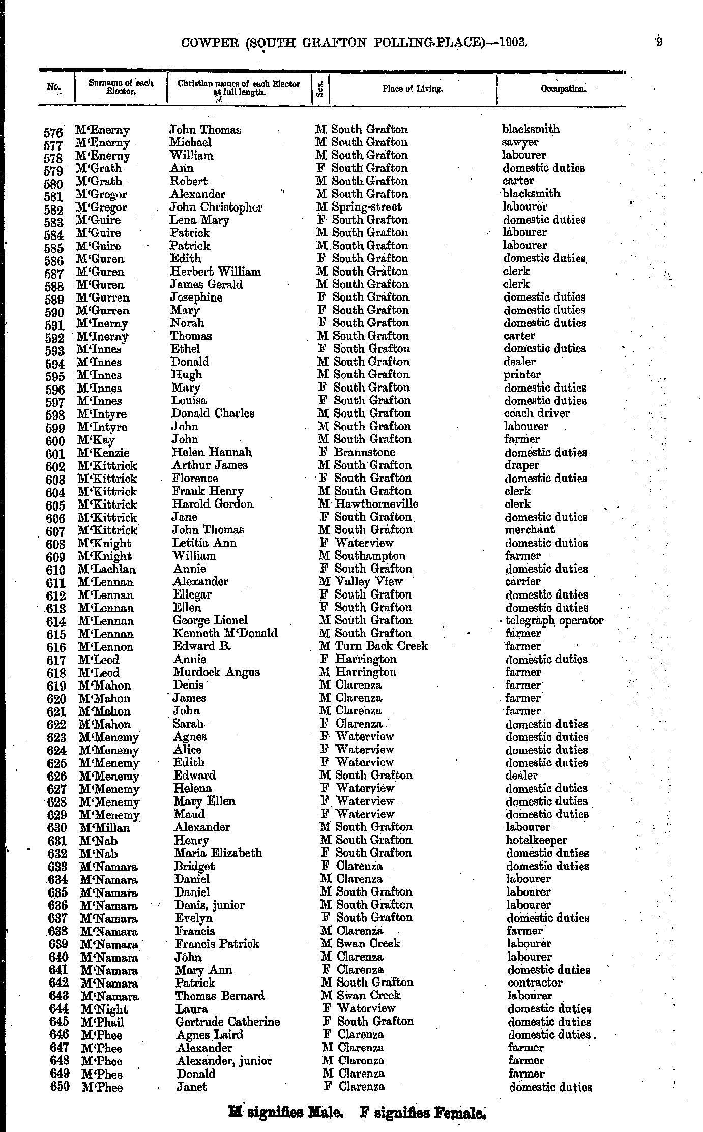
- Latter John - M'Enerny Henrietta
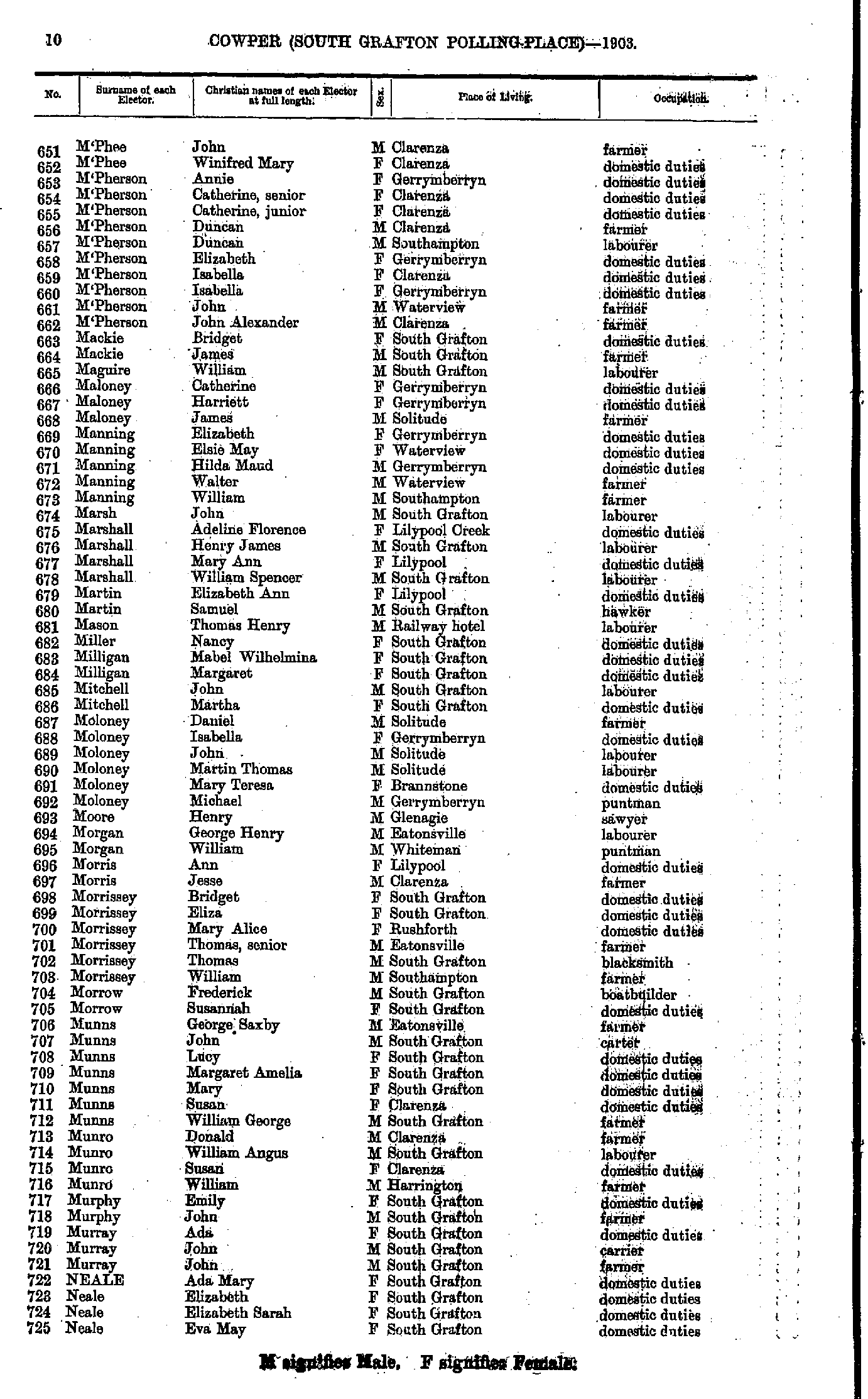
- M'Enerny John - M'Phee Janet
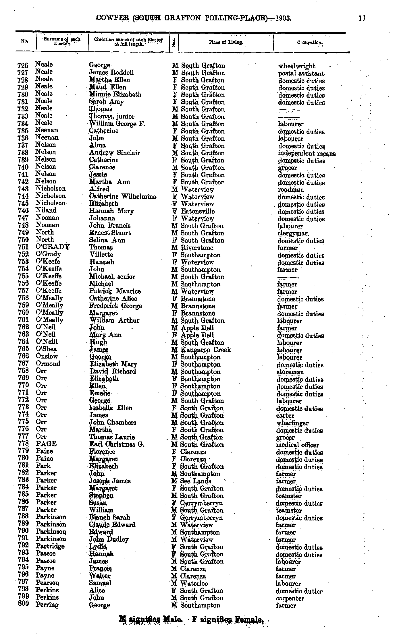
- M'Phee John - Neale Eva
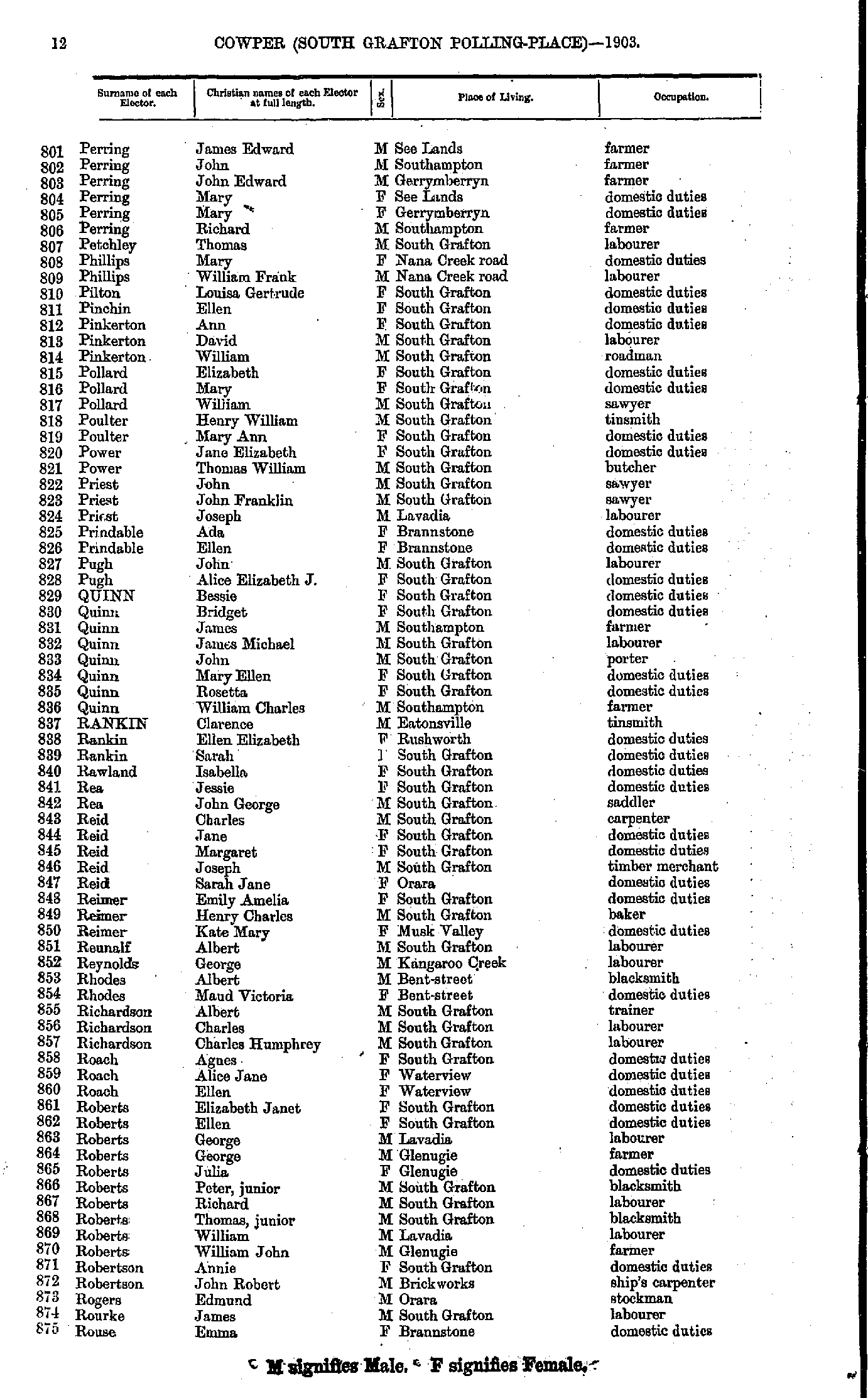
- Neale George - Perring George
- Perring James - Rouse Emma
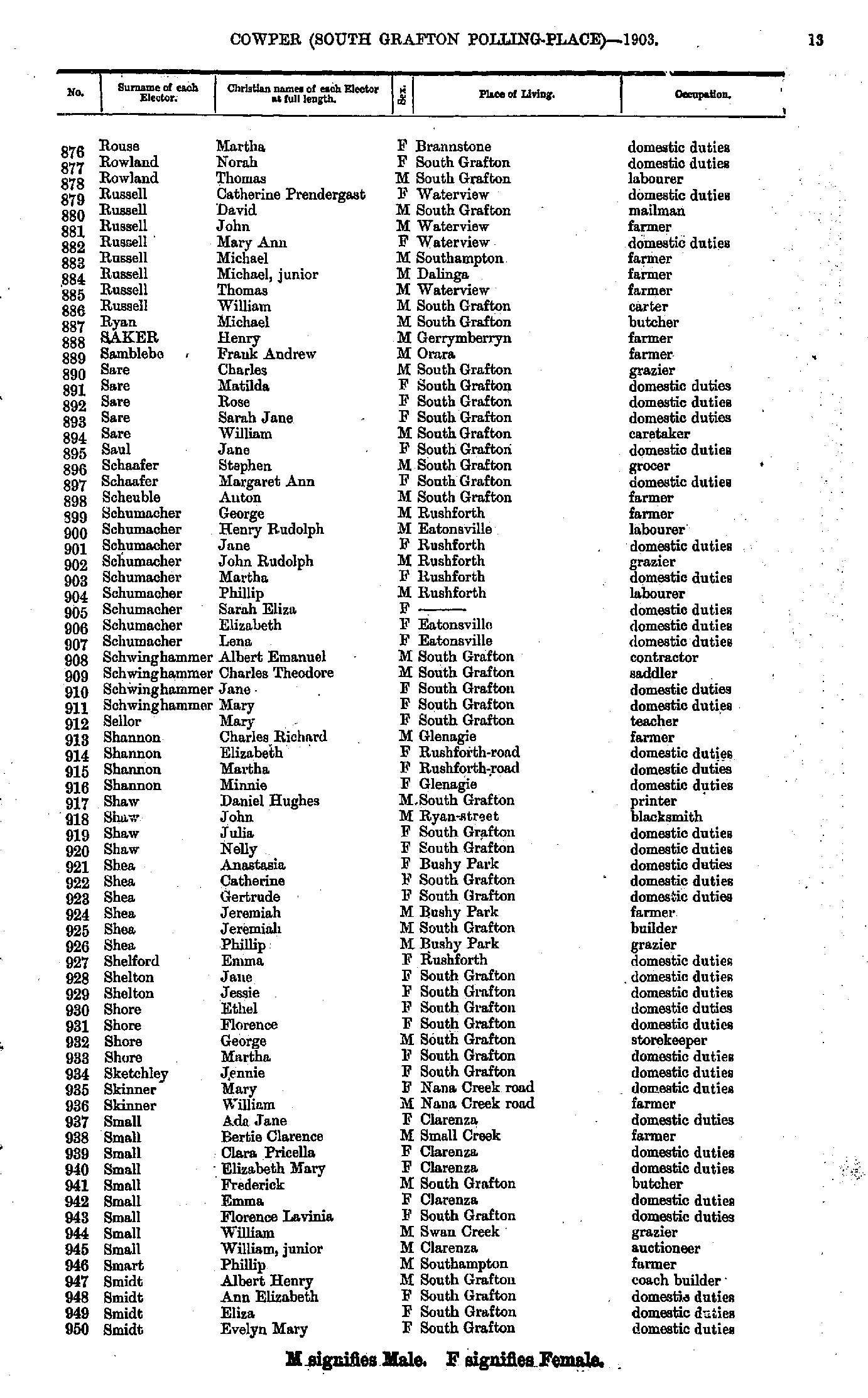
- Rouse Martha - Smidt Evelyn
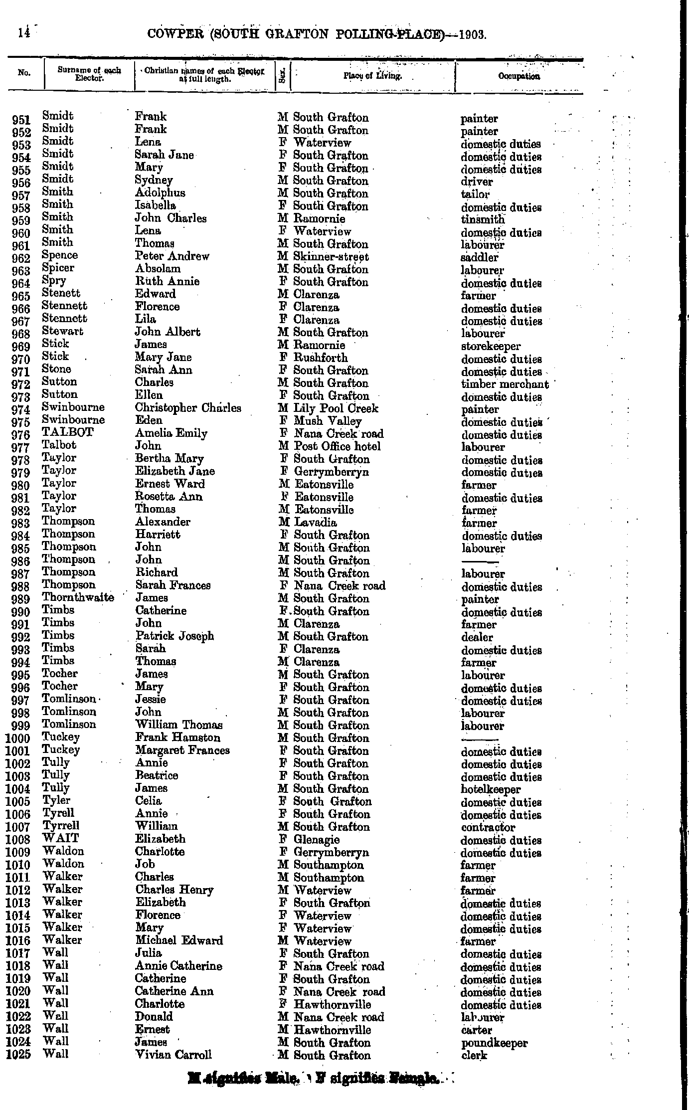
- Smidt Frank - Wall Vivian
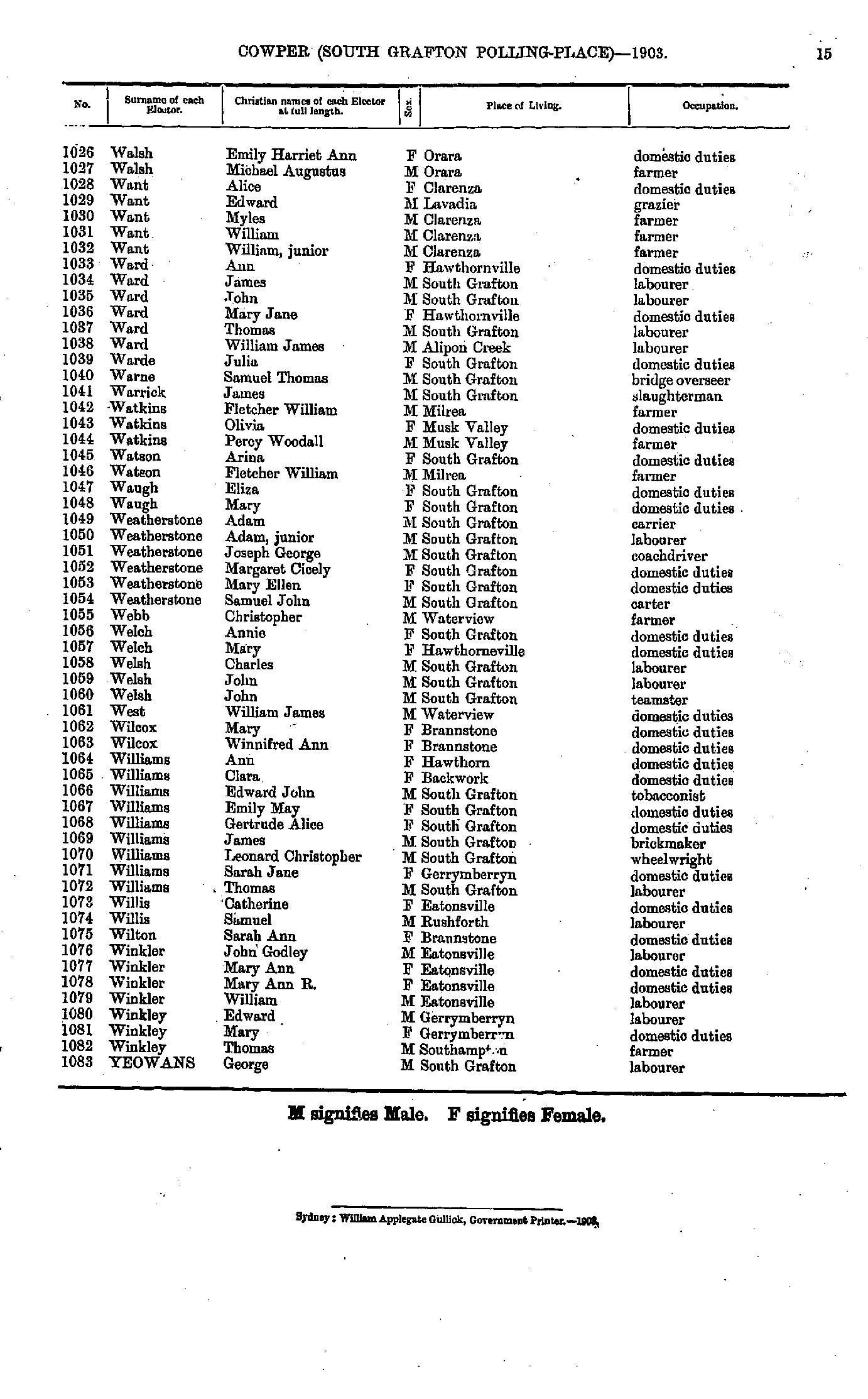
- Walsh Emily - Yeowans George
- Abbott Andrew - Belford Lucy
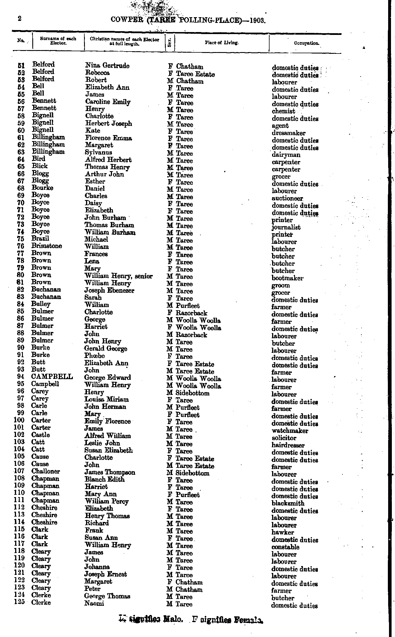
- Belford Nina - Clerke Naomi
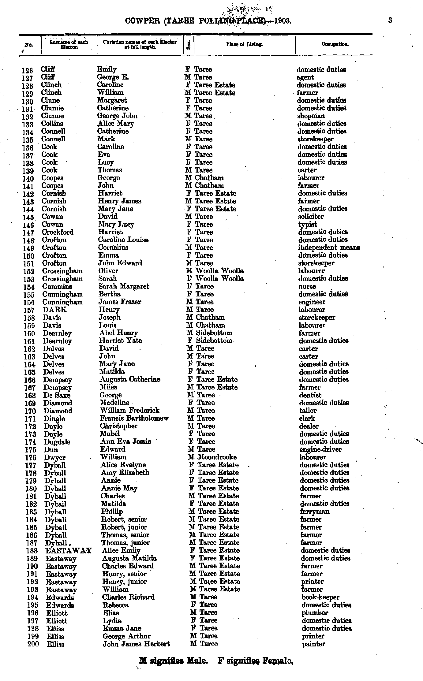
- Cliff Emily - Elliss John
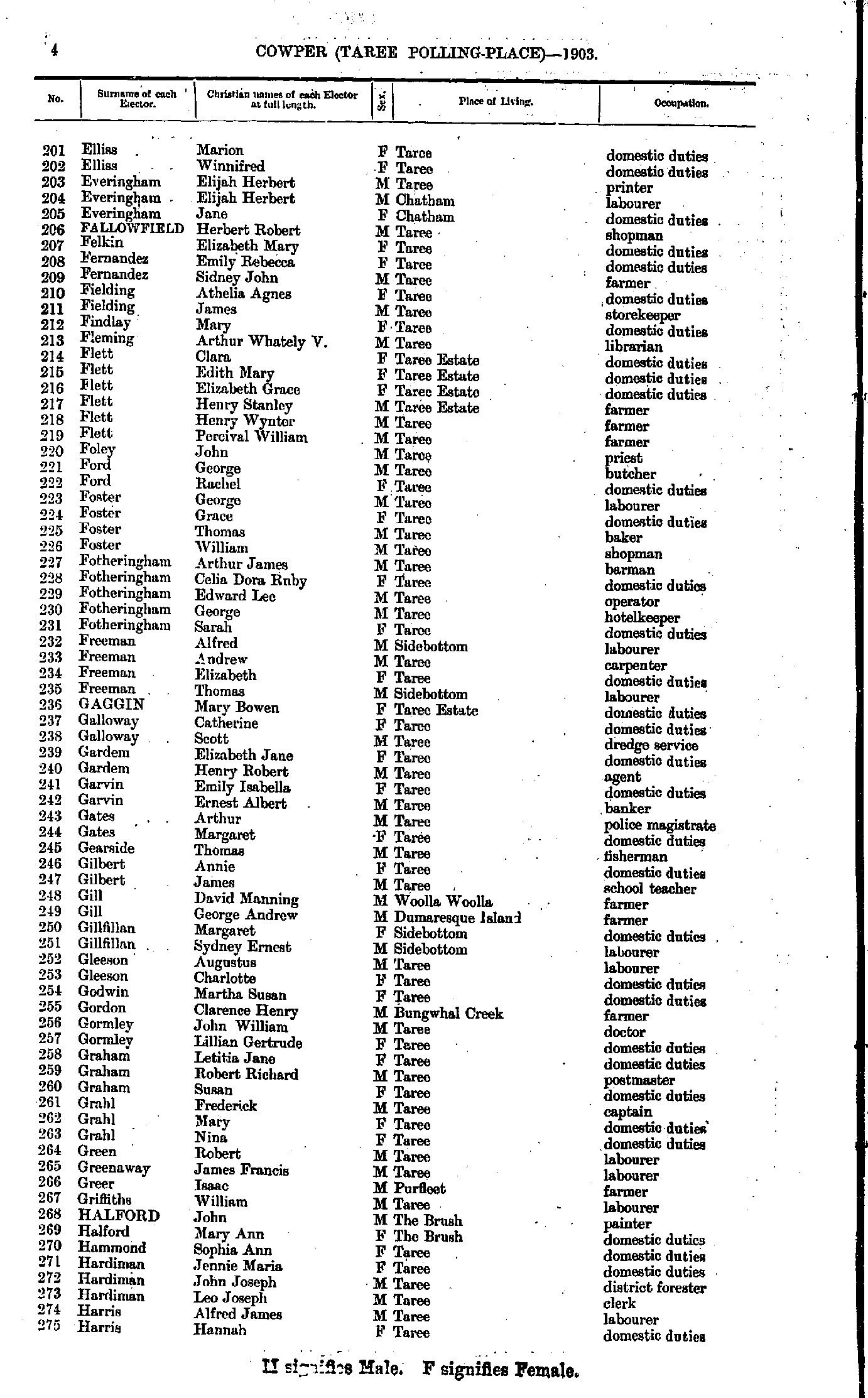
- Ellis Marion - Harris Hannah
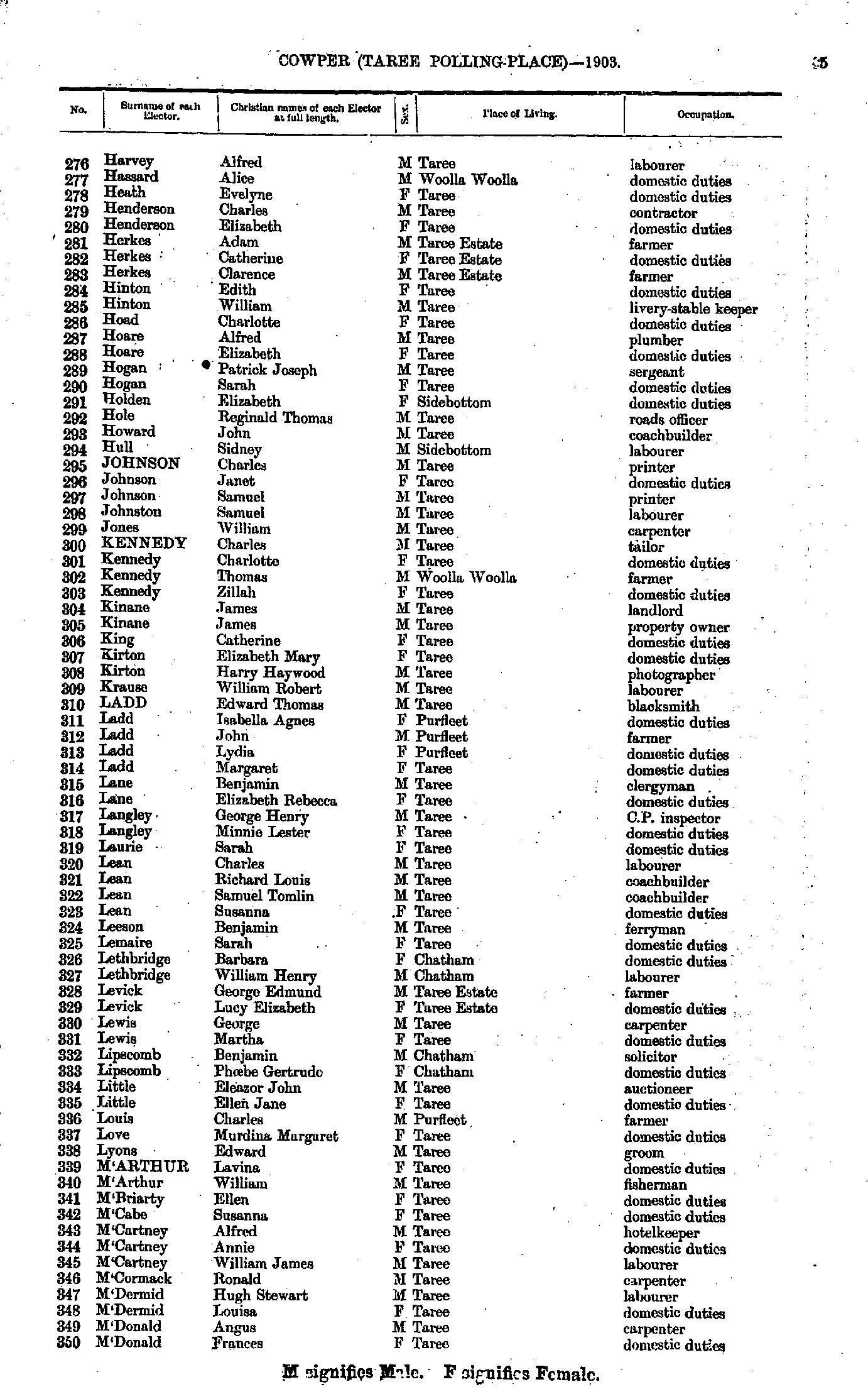
- Harvey Alfred - M'Donald Frances
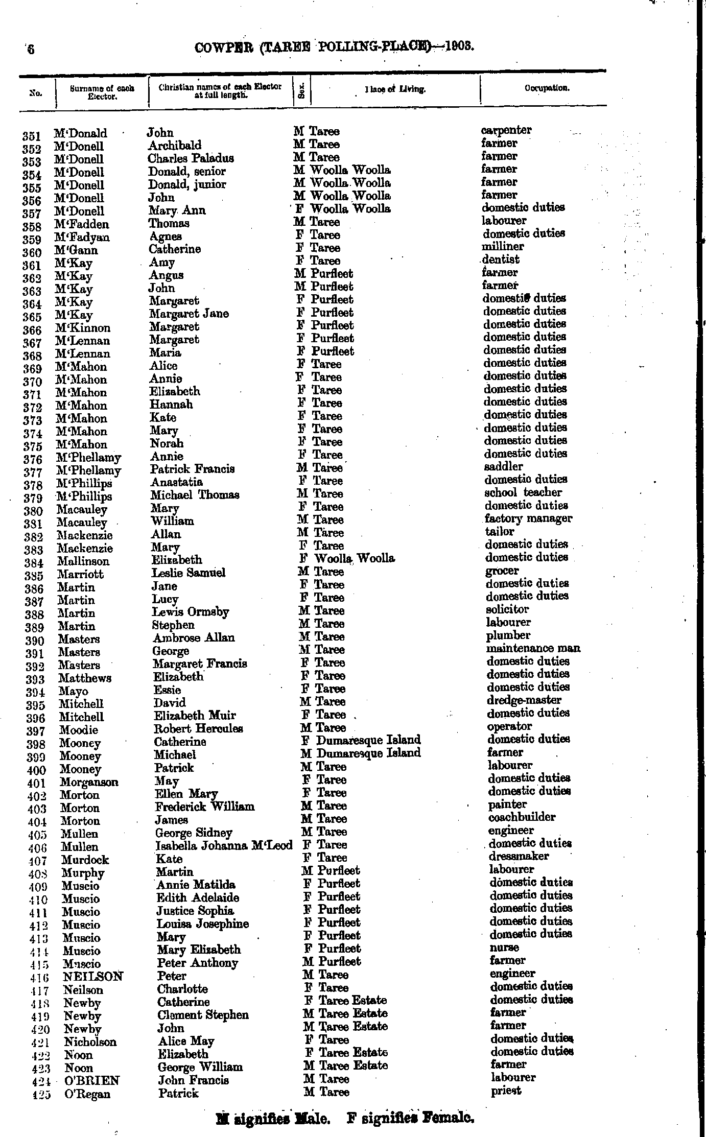
- M'Donald John - O'Regan Patrick
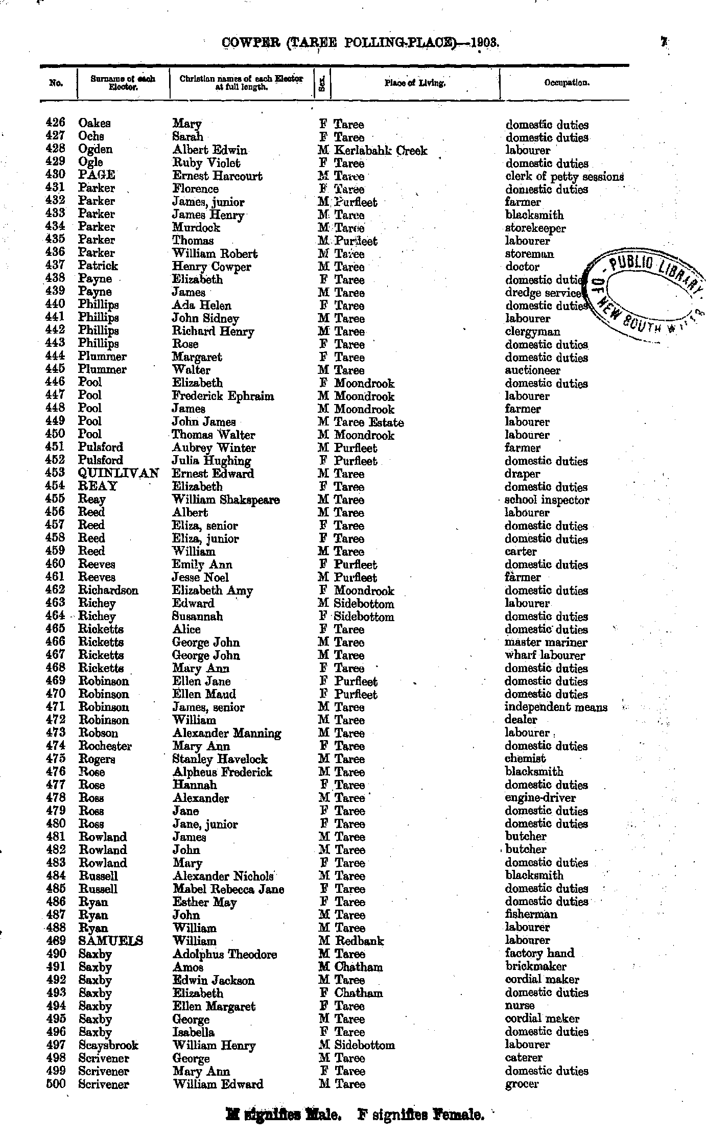
- Oakes Mary - Scrivener William
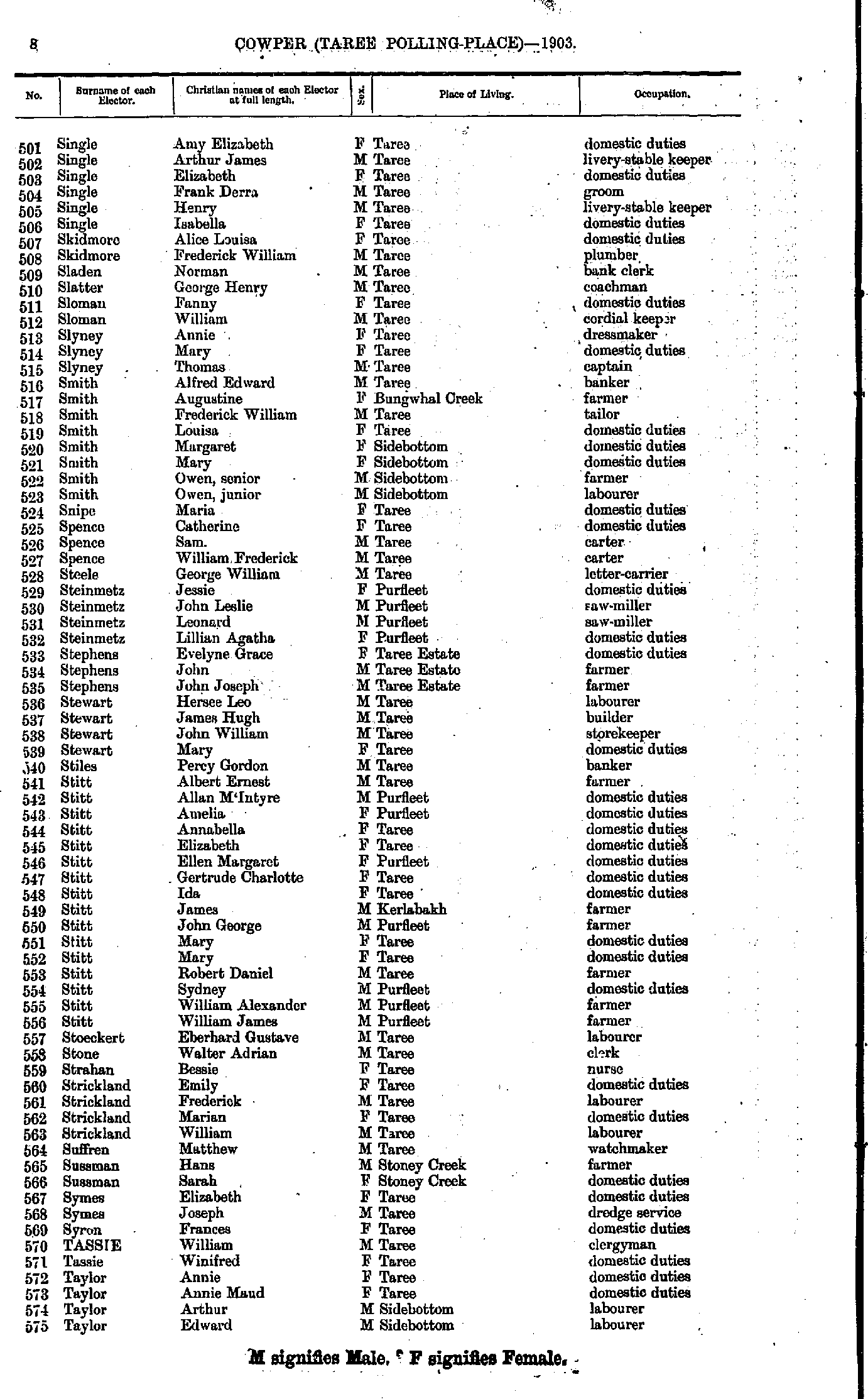
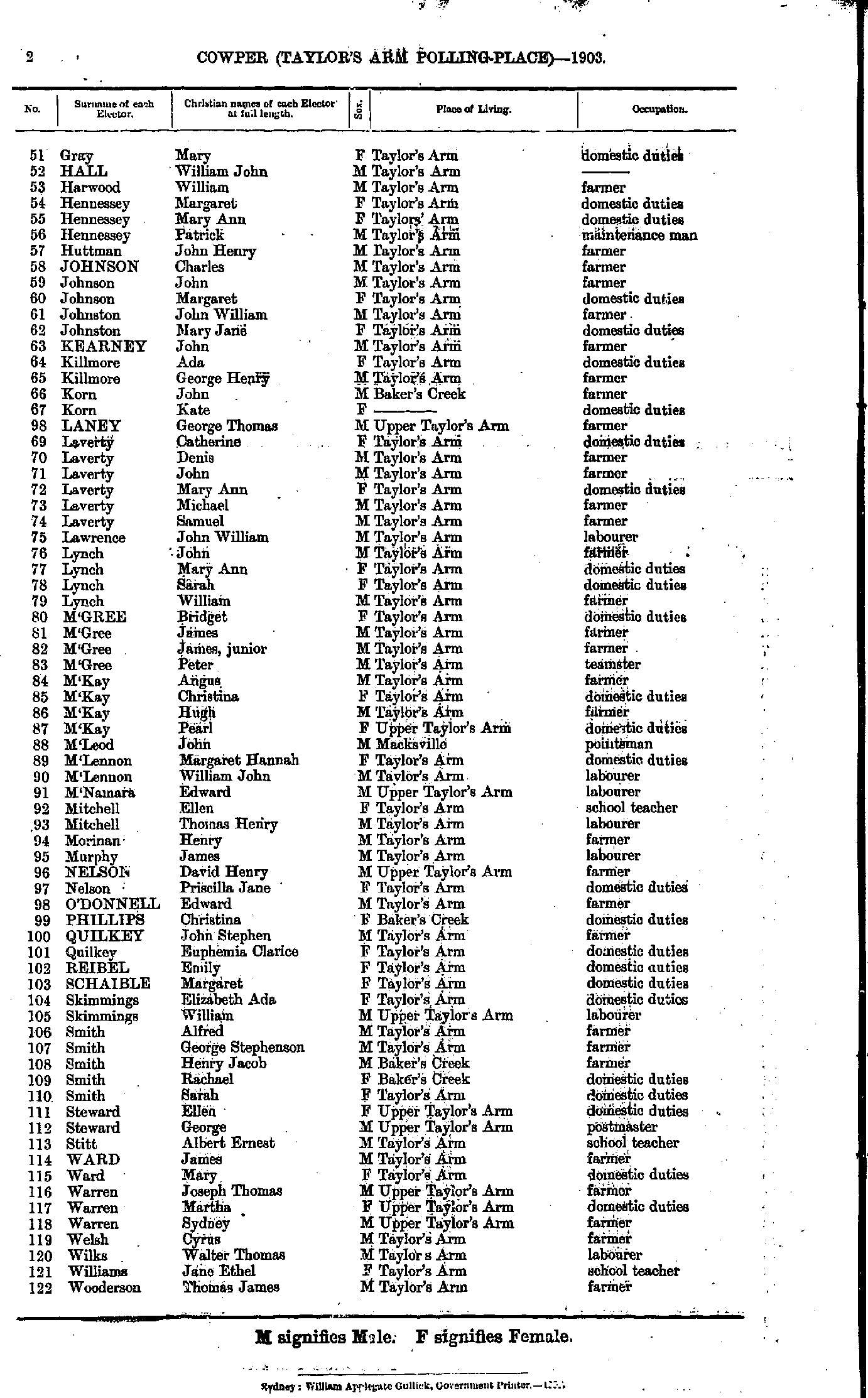
- Single Amy - Taylor Edward
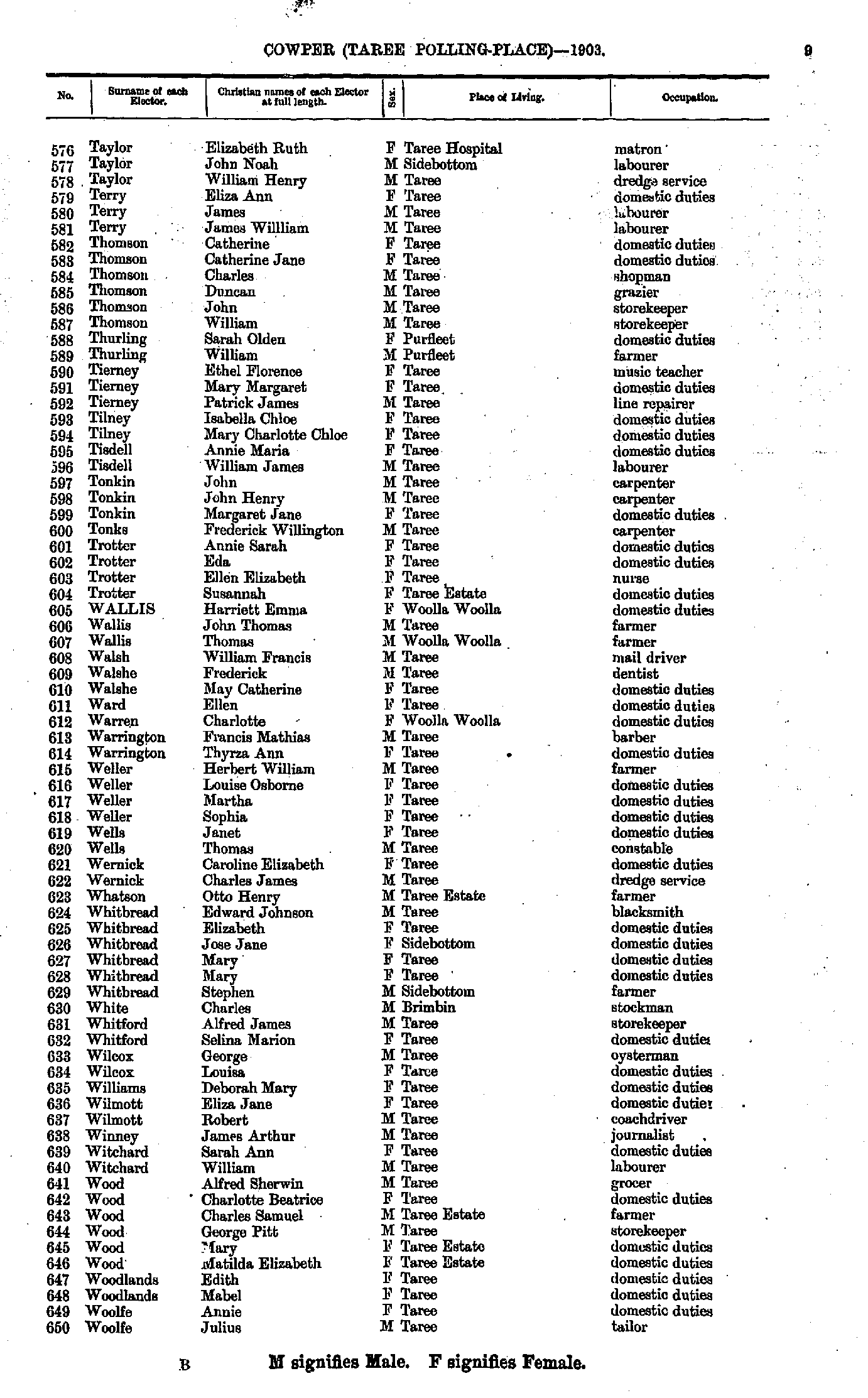
- Taylor Elizabeth - Woolfe Julius
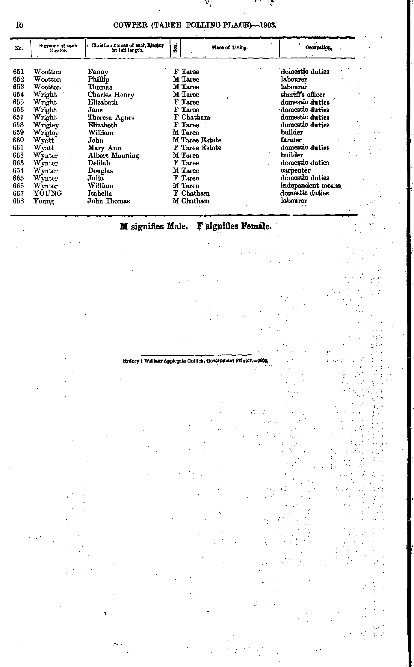
- Wootton Fanny - Young John
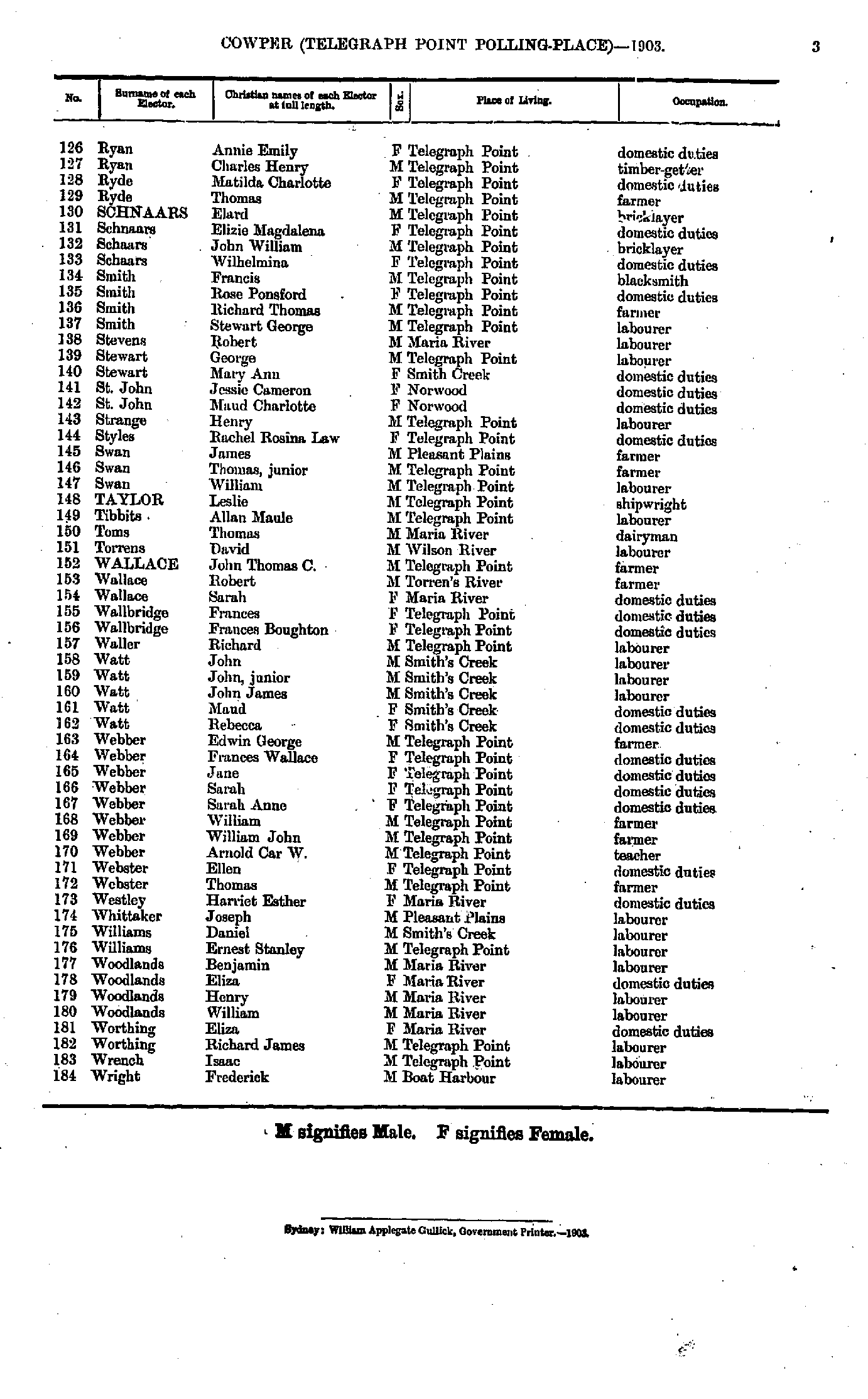
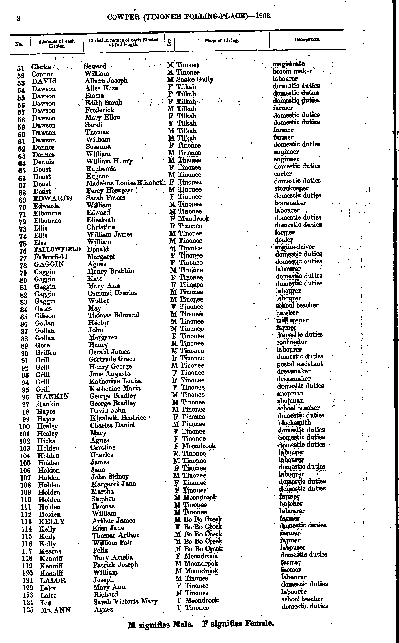
- Adam Andrew - Clerke Peter
- Clerke Seward - M'Cann Agnes
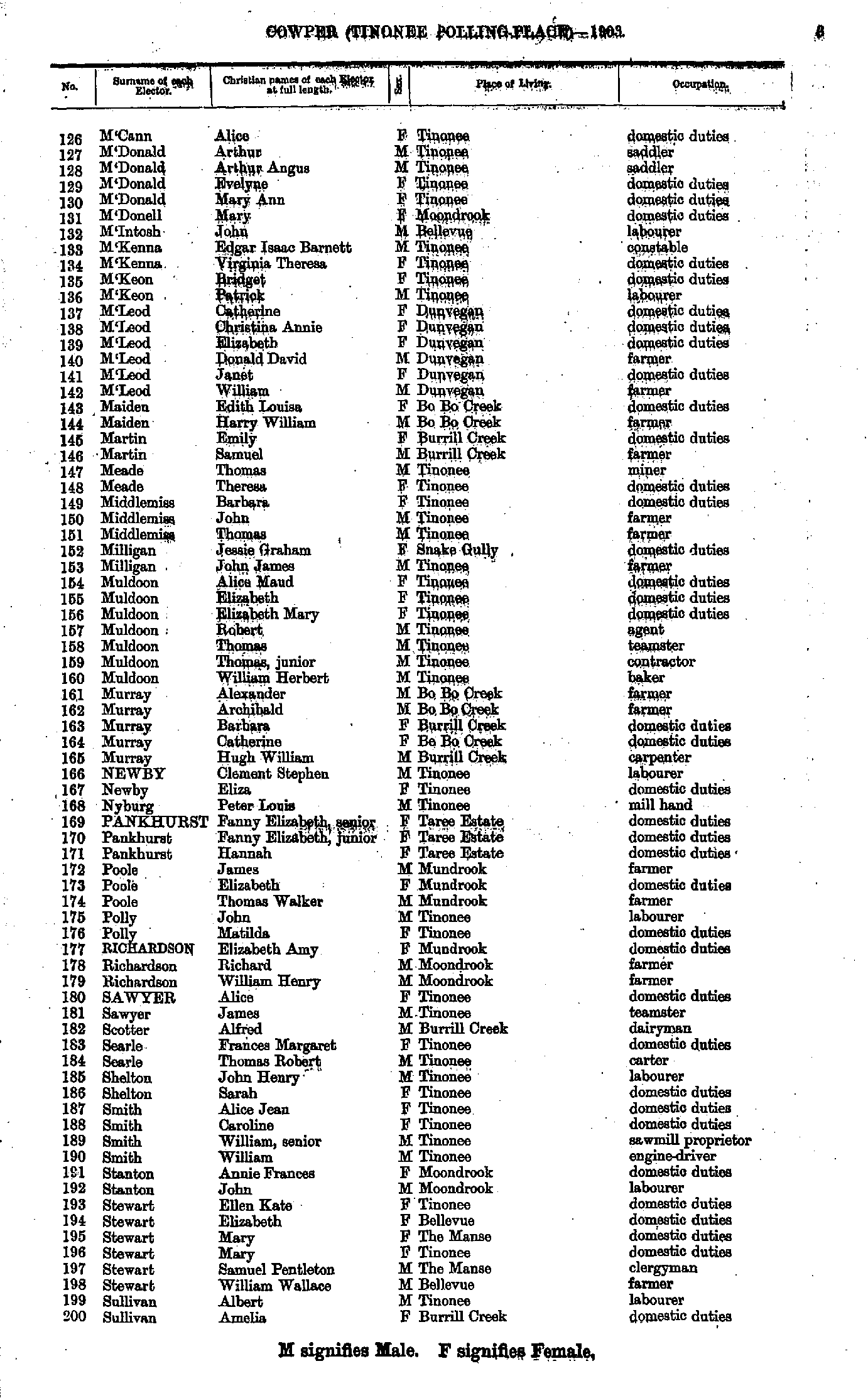
- M'Cann Alice - Sullivan Amelia
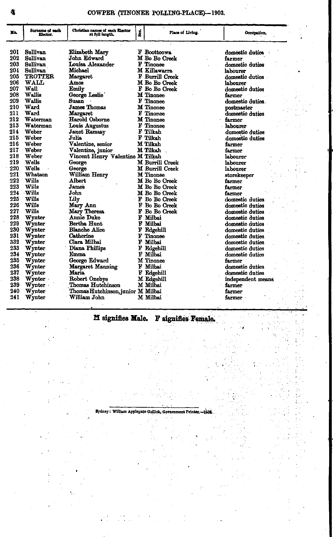
- Sullivan Elizabeth - Wynter William
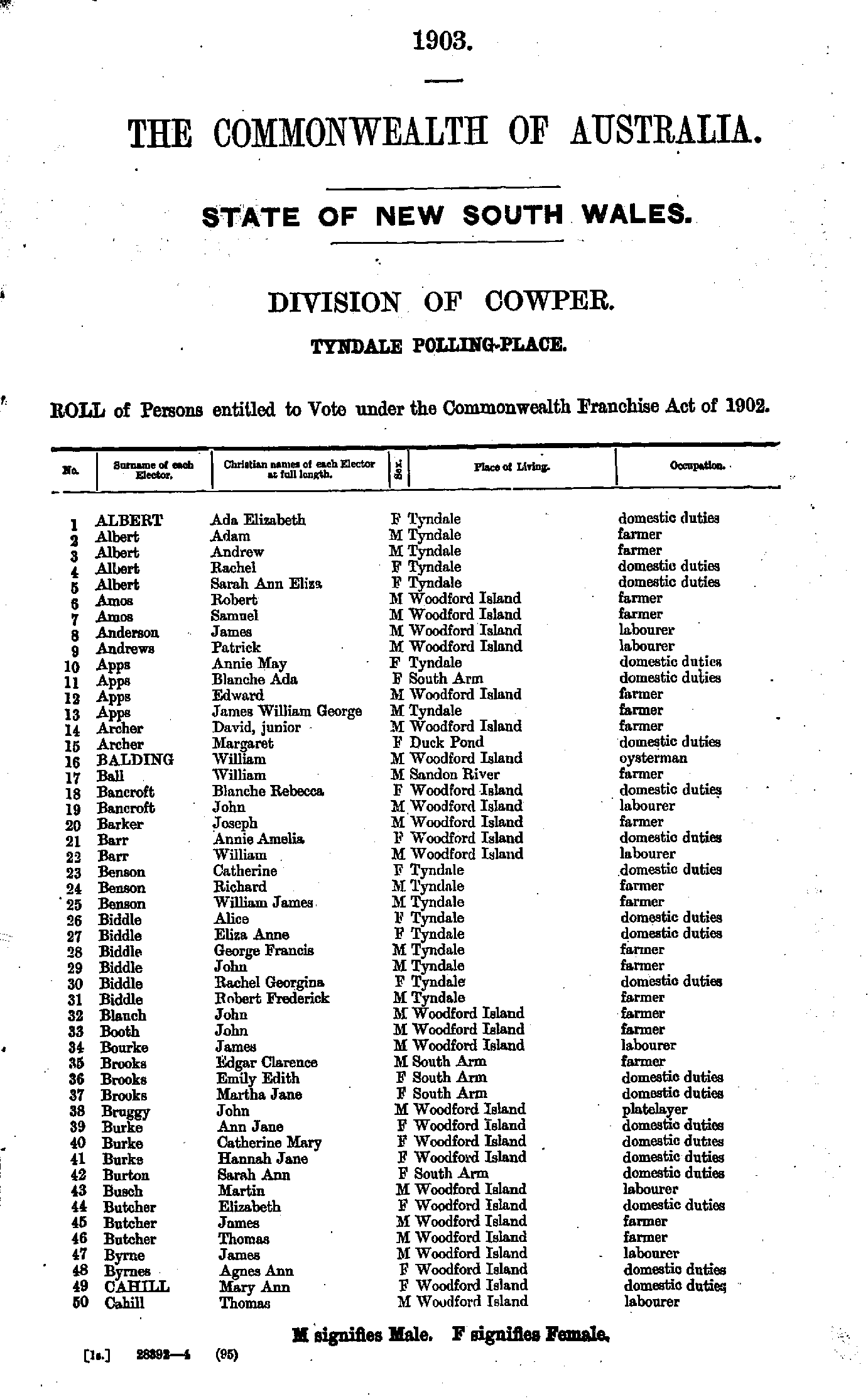
- Albert Ada - Cahill Thomas
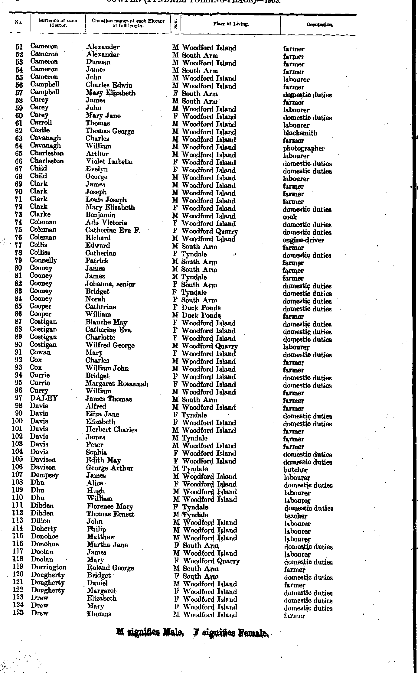
- Cameron Alexander - Drew Thomas
- Duffy Alice - Hughes James
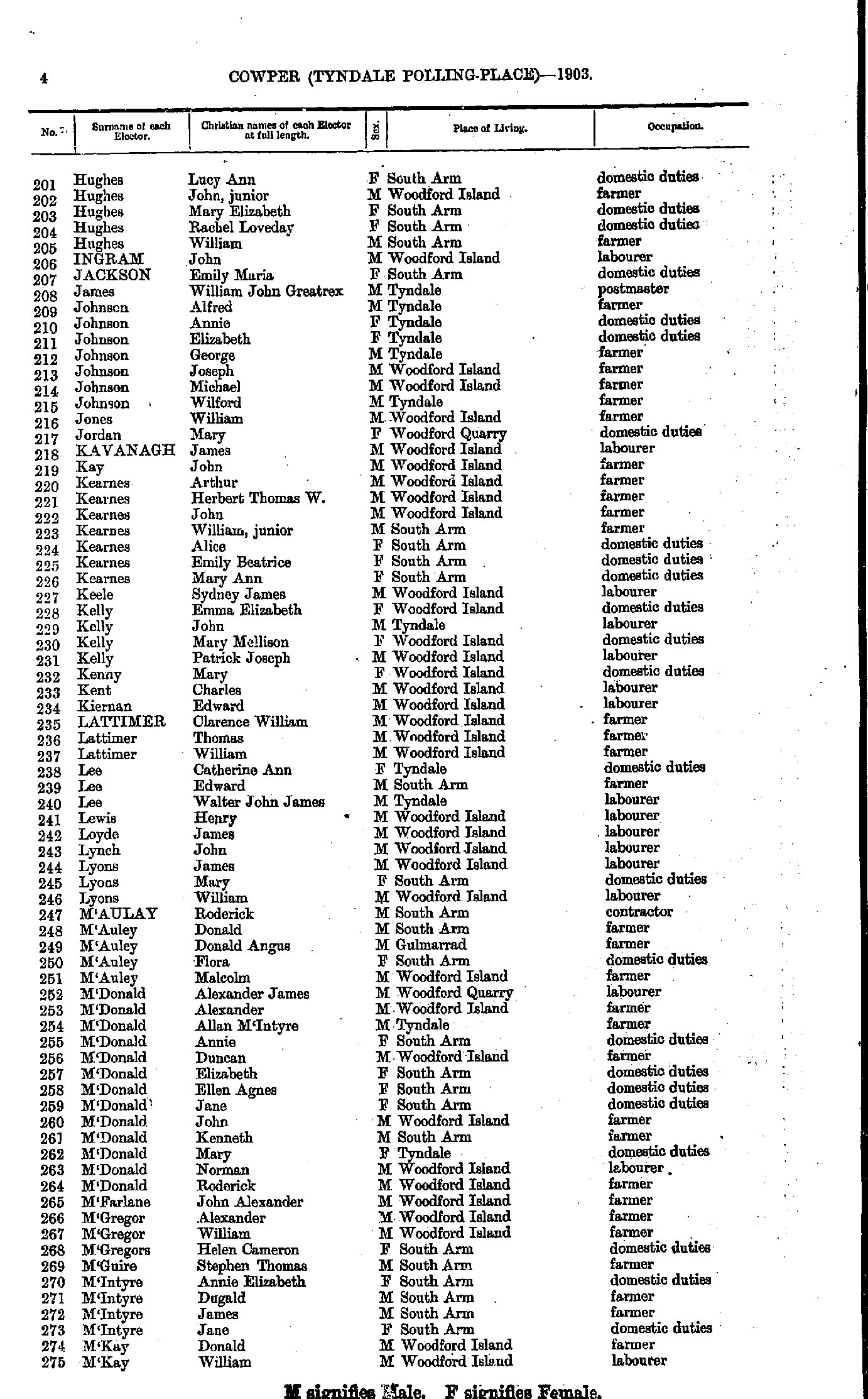
- Hughes Lucy - M'Kay William
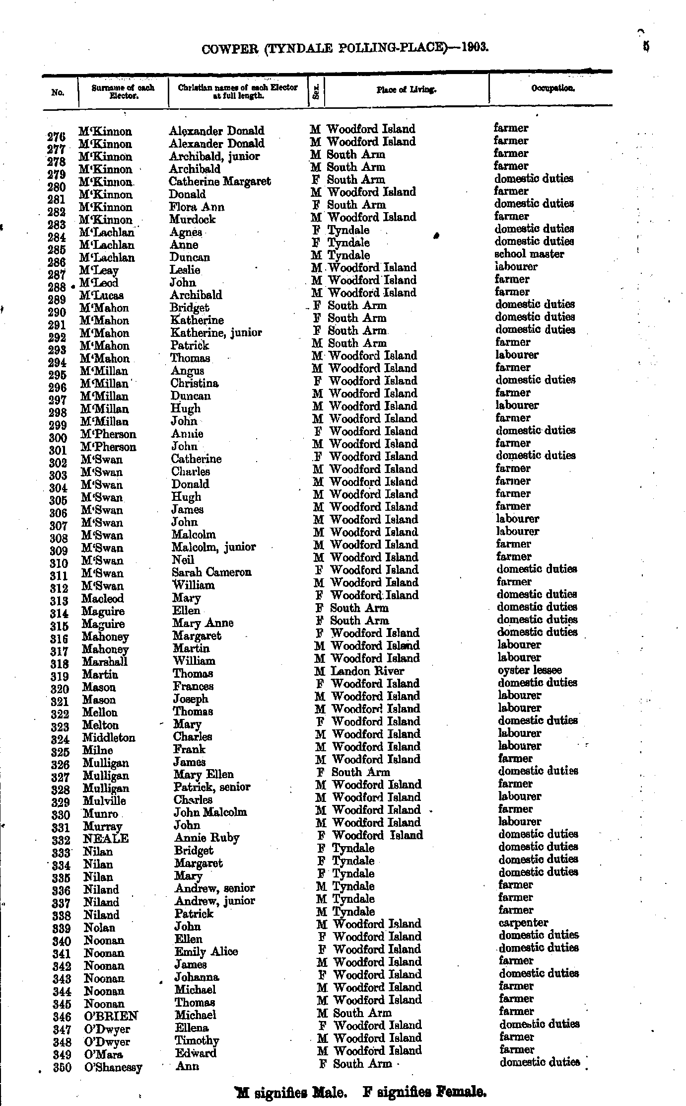
- M'Kinnon Alexander - O'Shanessy Ann
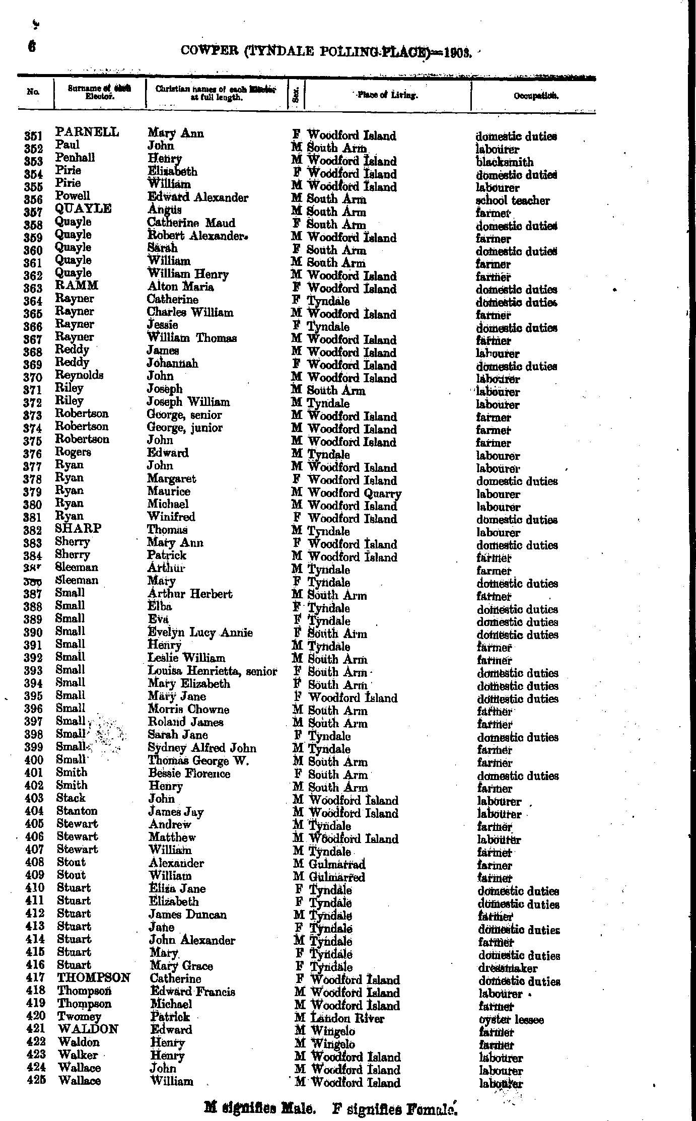
- Parnell Mary - Wallace William
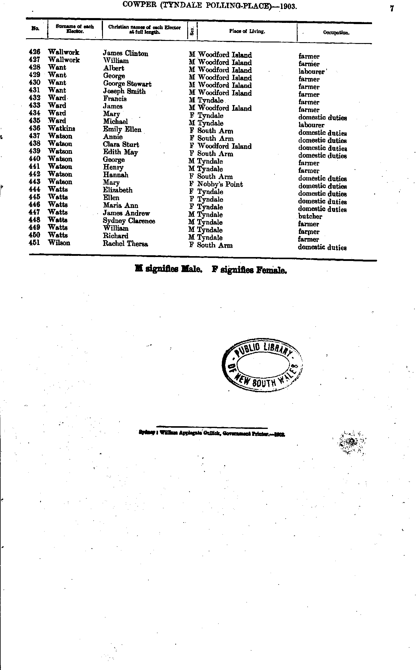
- Wallwork James - Wilson Rachel
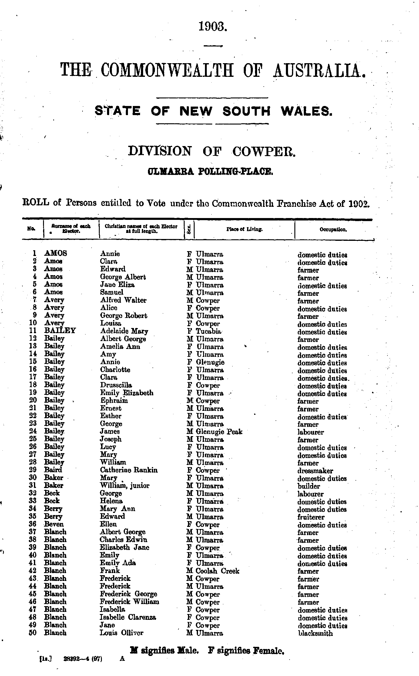
- Amos Annie - Blanch Louis
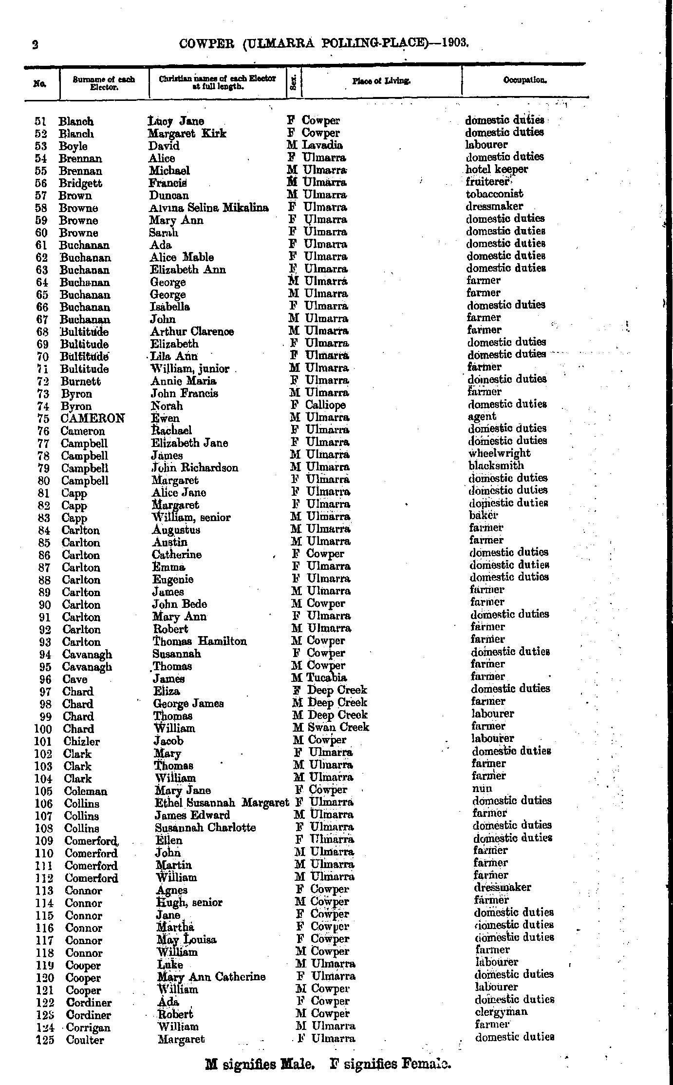
- Blanch Lucy - Coulter Margaret
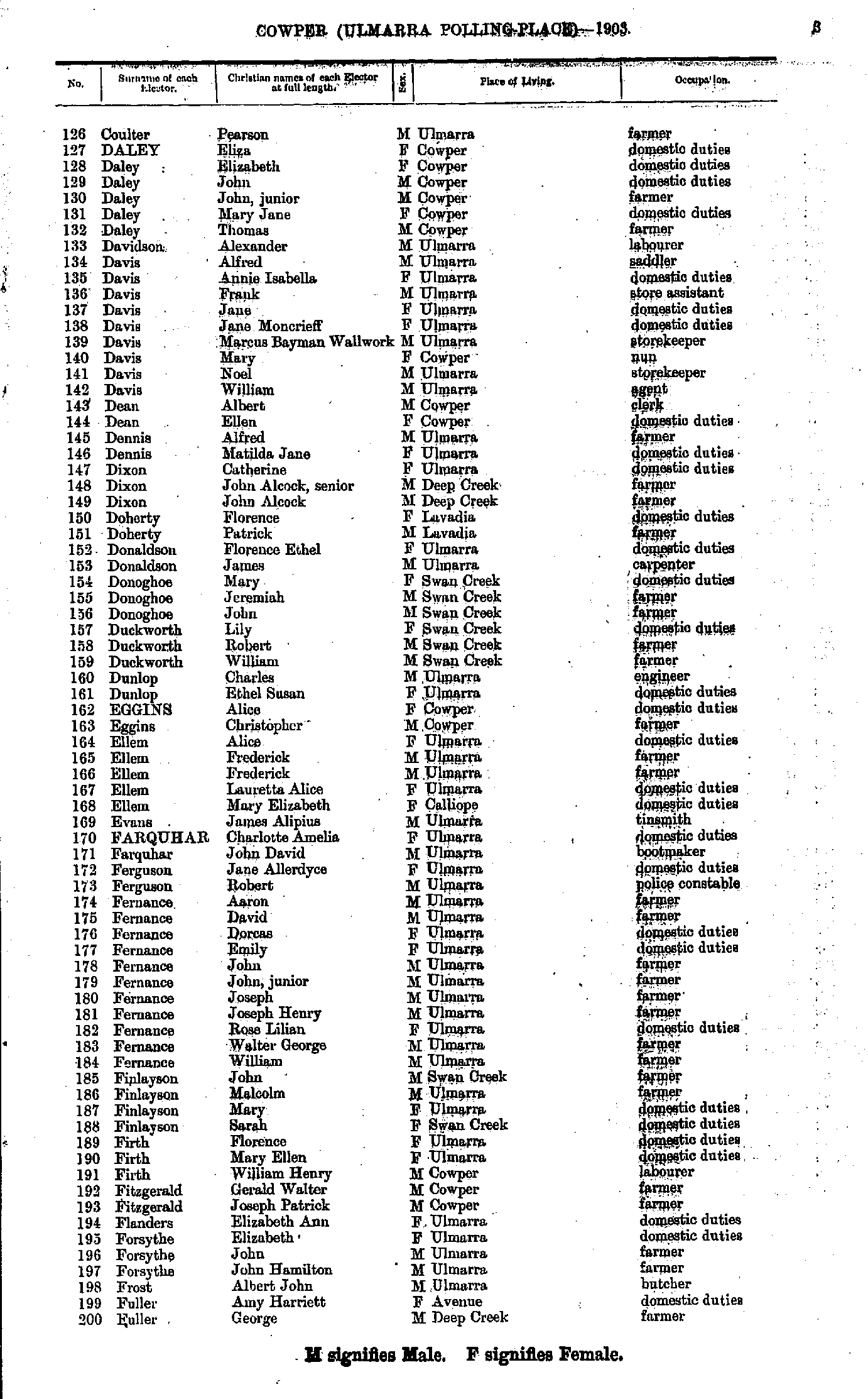
- Coulter Pearson - Fuller George
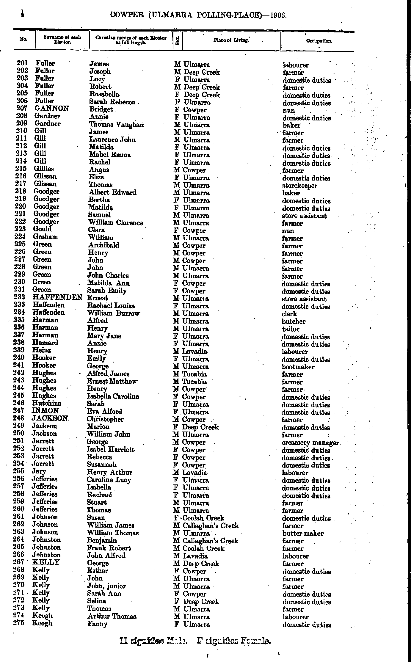
- Fuller James - Keogh Fanny
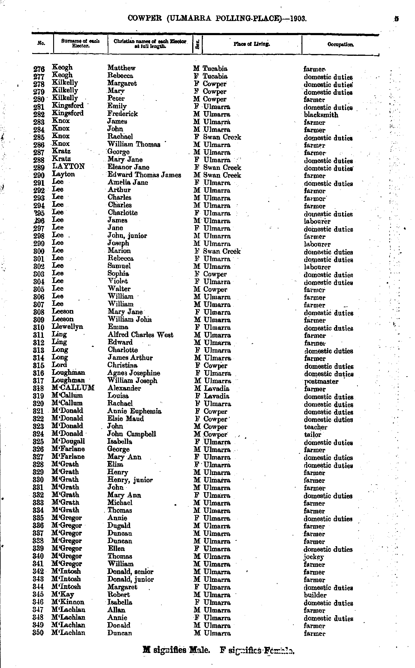
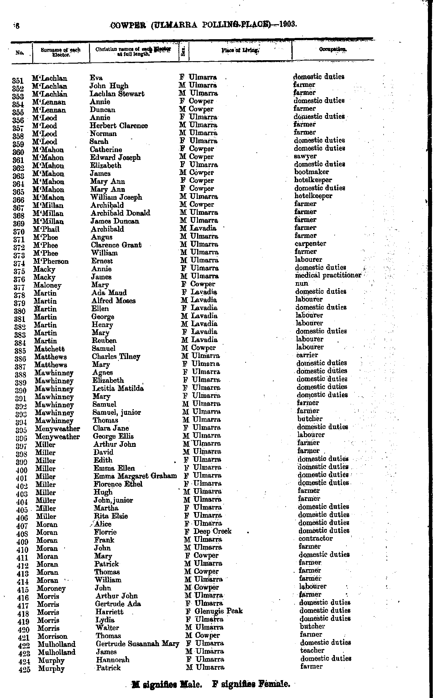
- Keogh Matthew - M'Lachlan Duncan
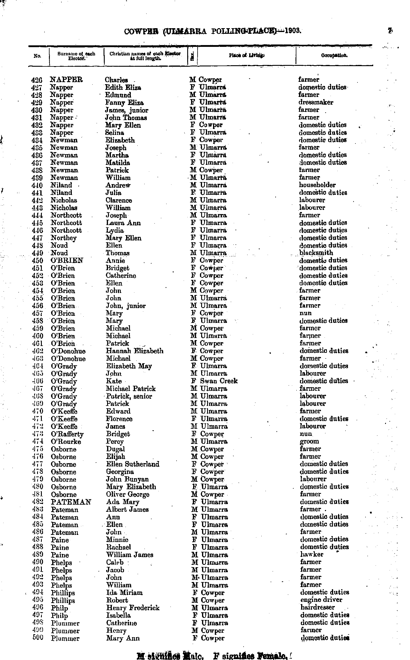
- M'Lachlan Eva - Murphy Patrick
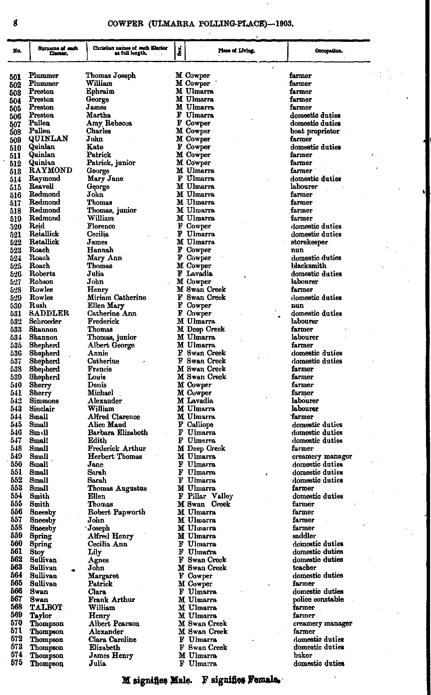
- Napper Charles - Plummer Mary
- Plummer Thomas - Thompson Julia
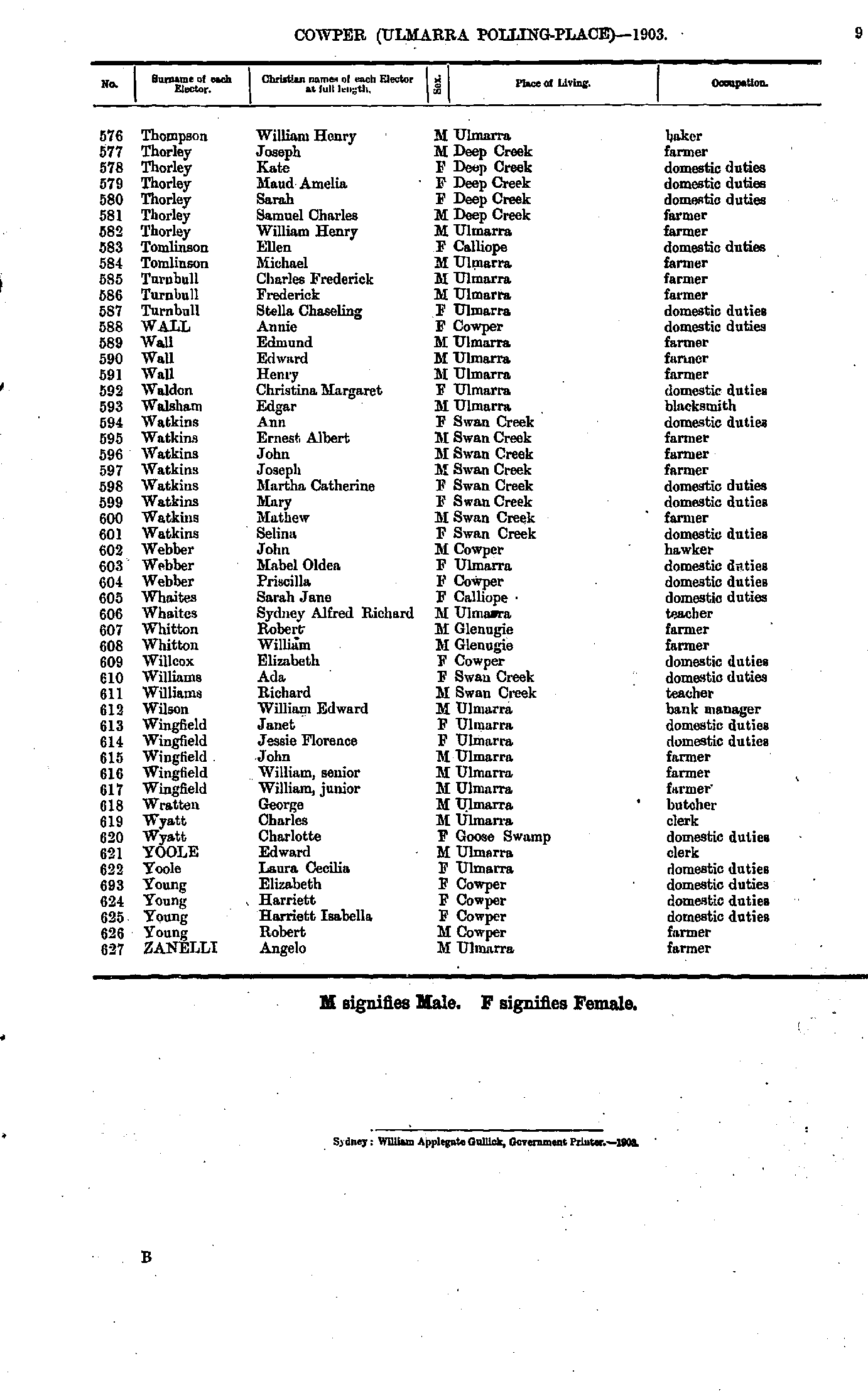
- Thompson William - Zanelli Angelo
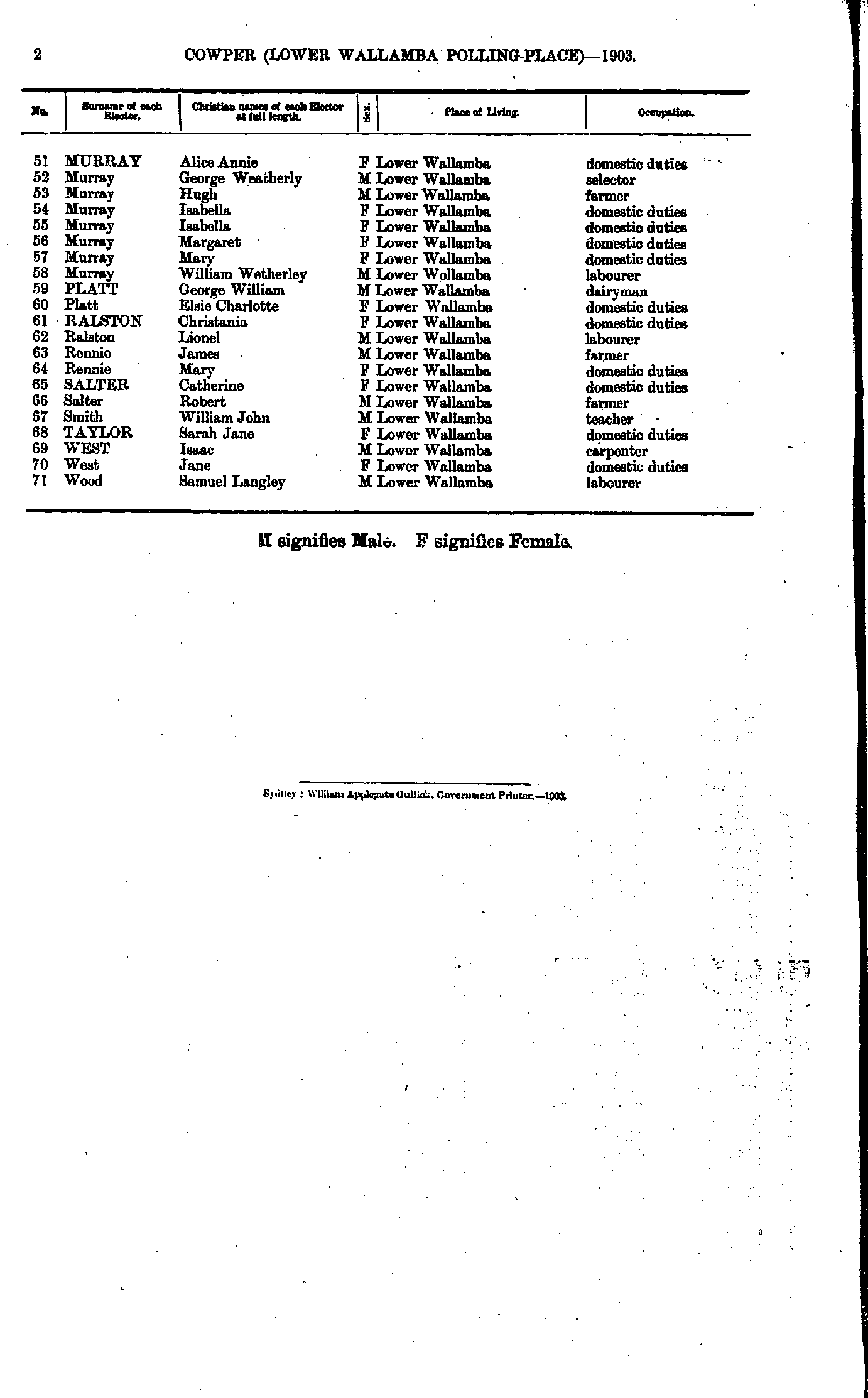
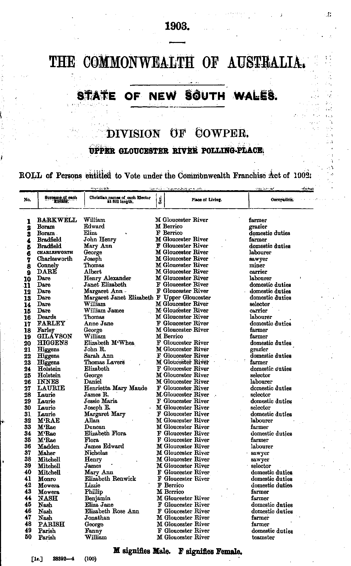
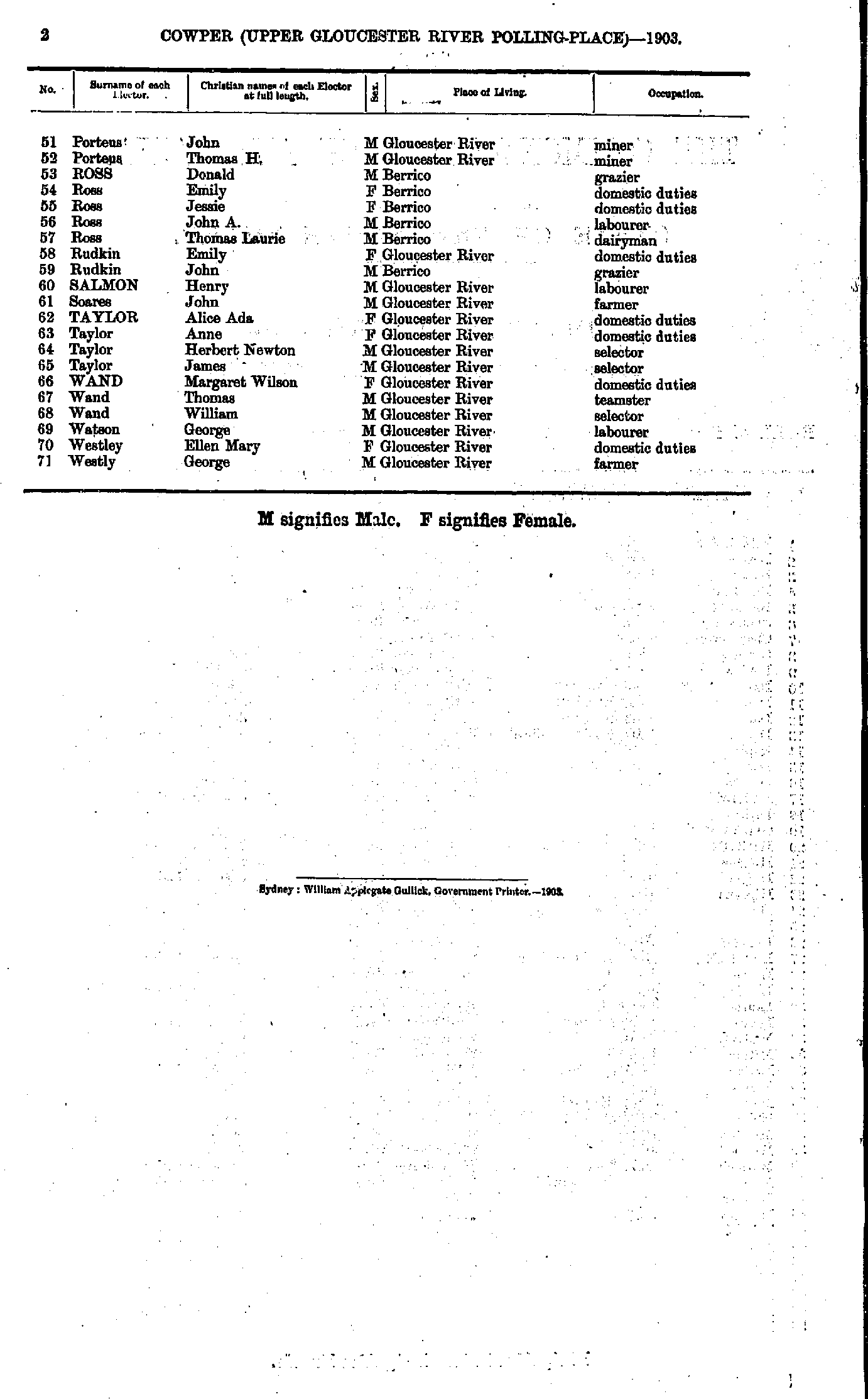
Upper Gloucester River Polling Place
- Aitkens Albert - Branston George
- Bransdon Allen - Gleeson Timothy
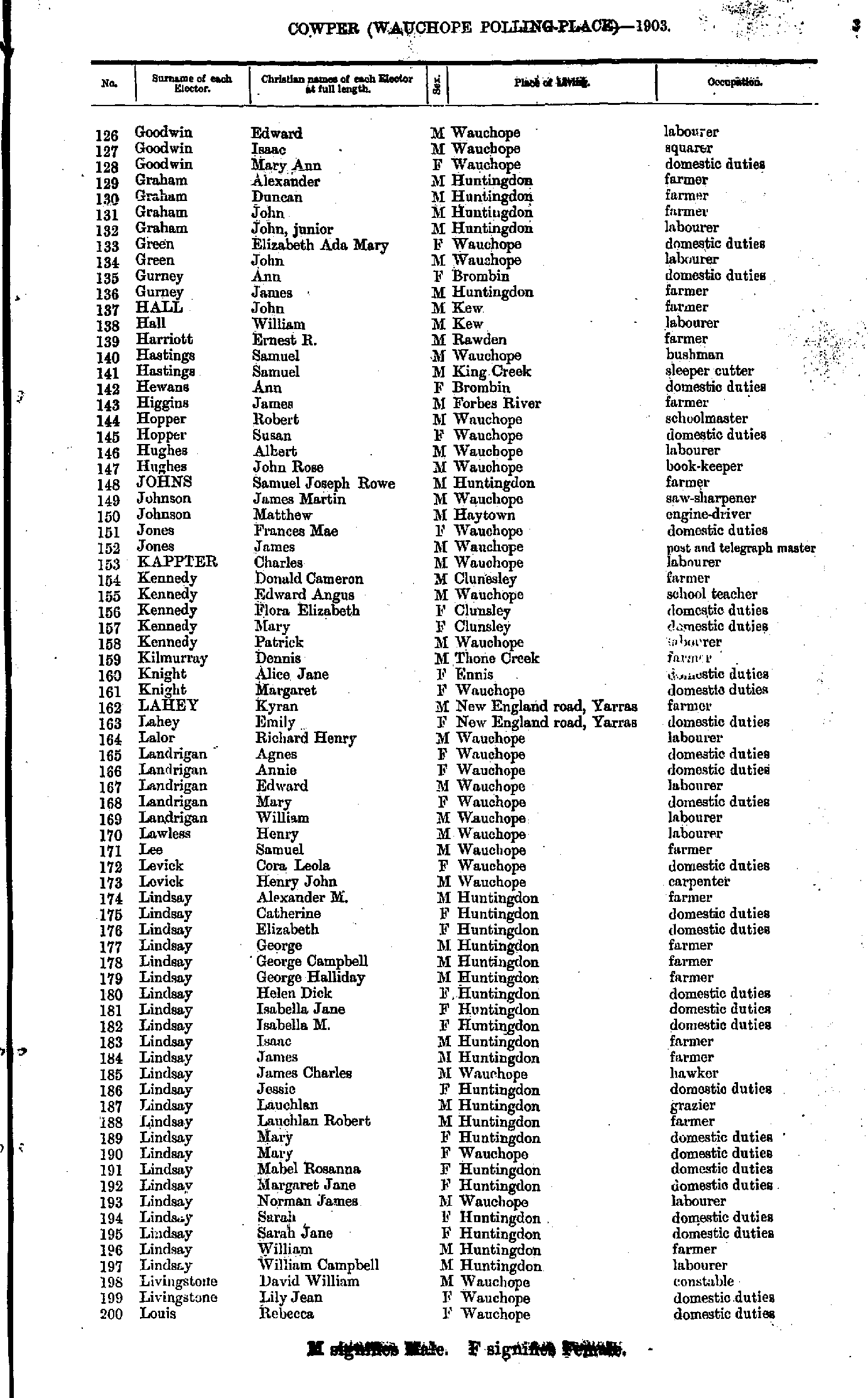
- Goodwin Edward - Louis Rebecca
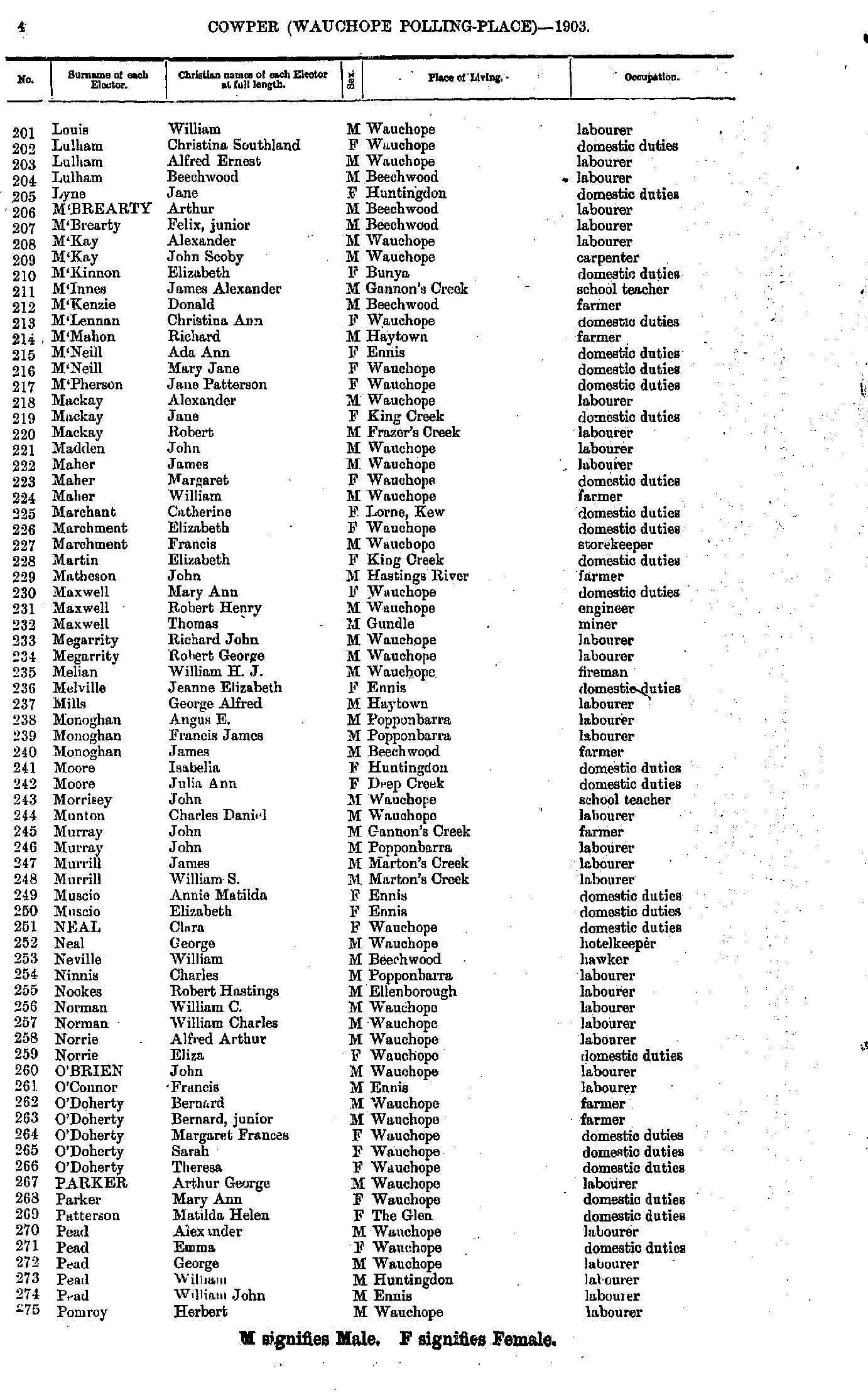
- Louis William - Pomroy Herbert
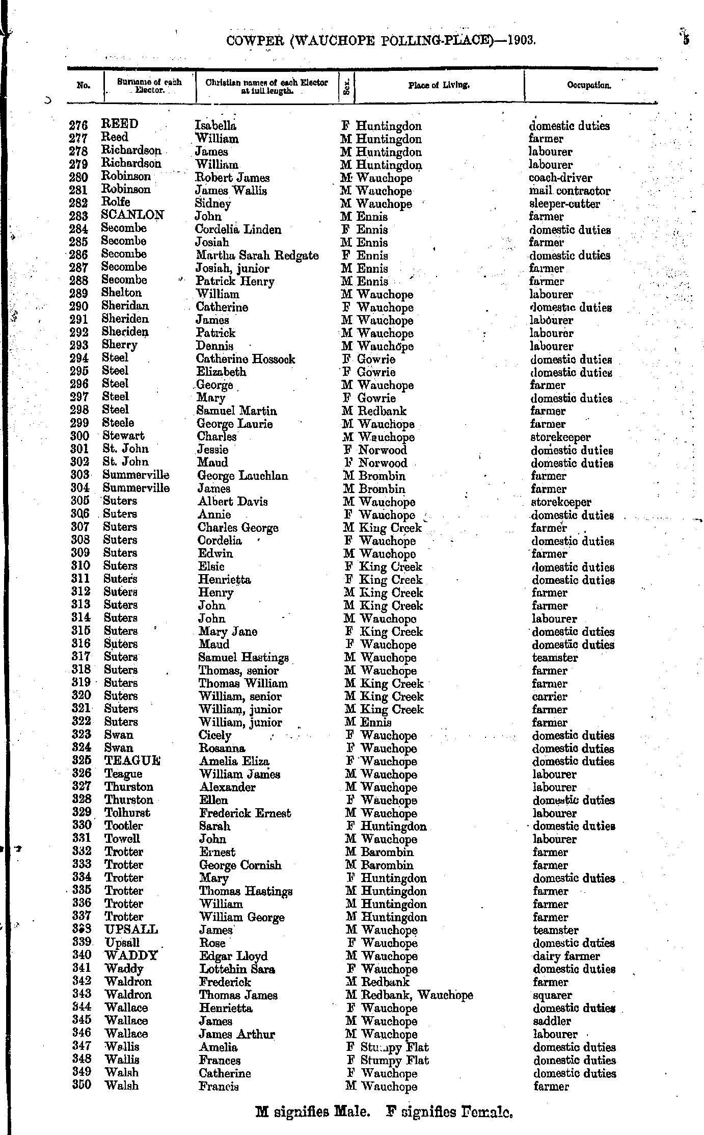
- Reed Isabella - Walsh Francis
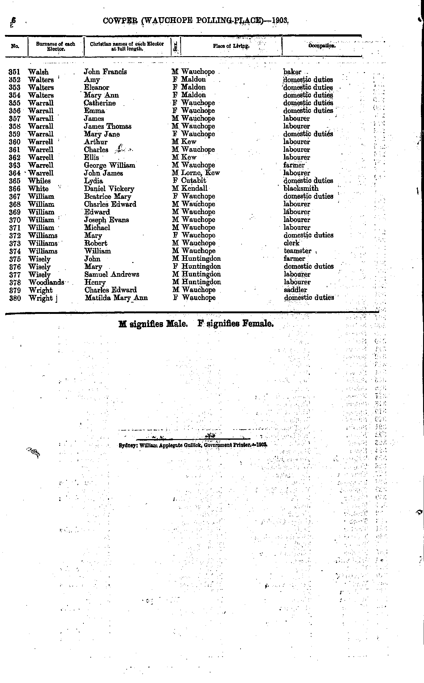
- Walsh John - Wright Matilda
- Abbott Albert - Bourke Sarah
- Bradley George - Carey Mary
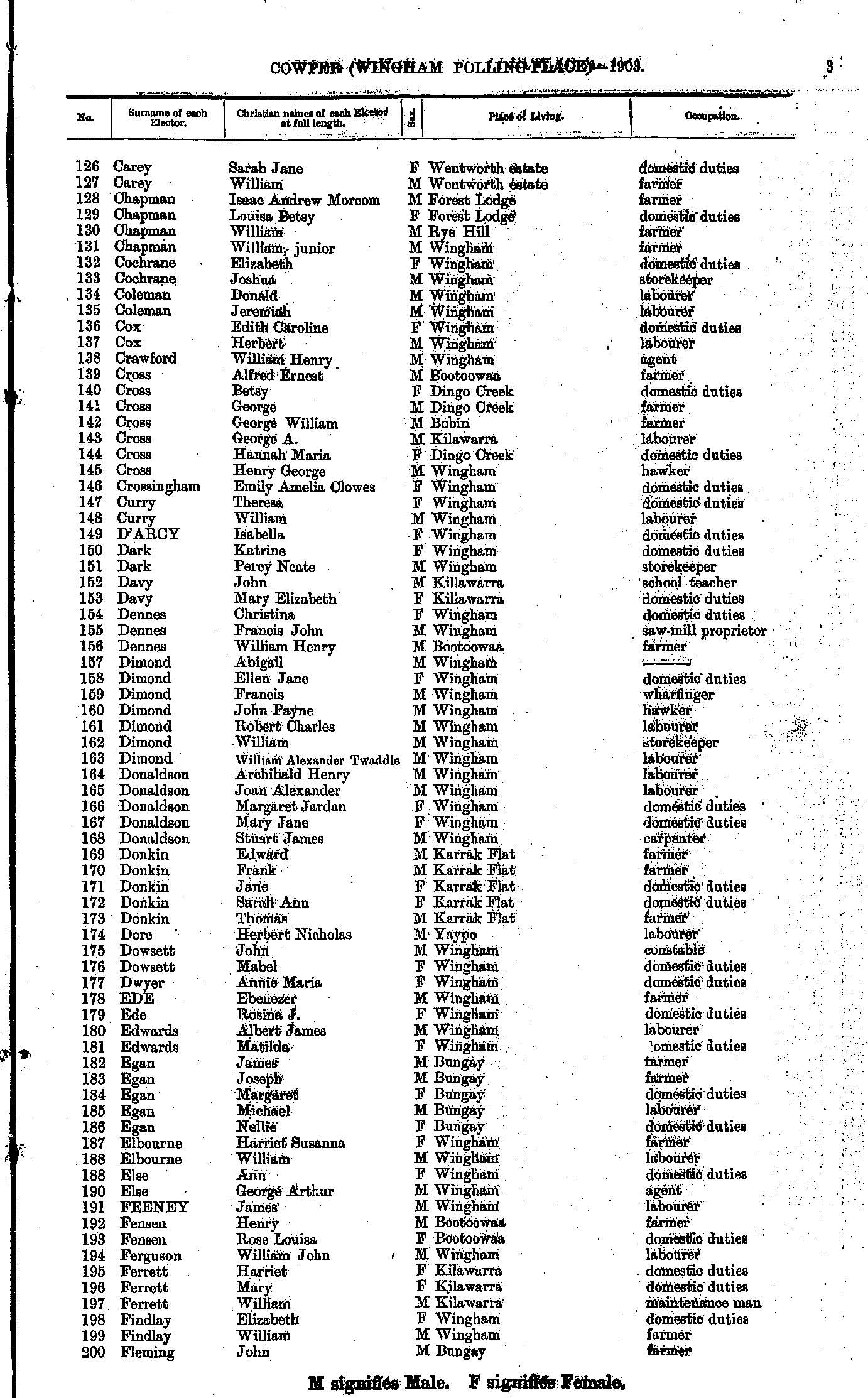
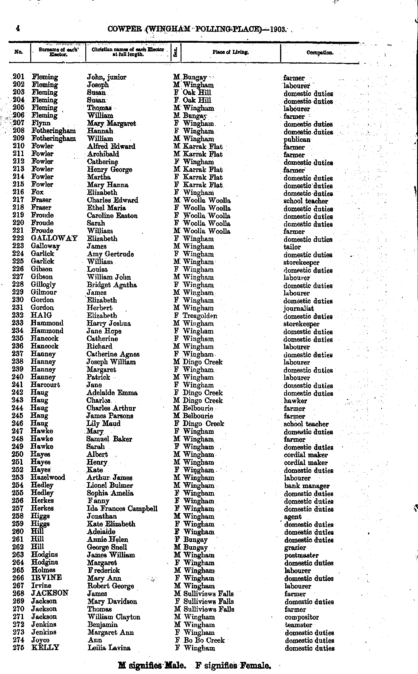
- Carey Sarah - Fleming John
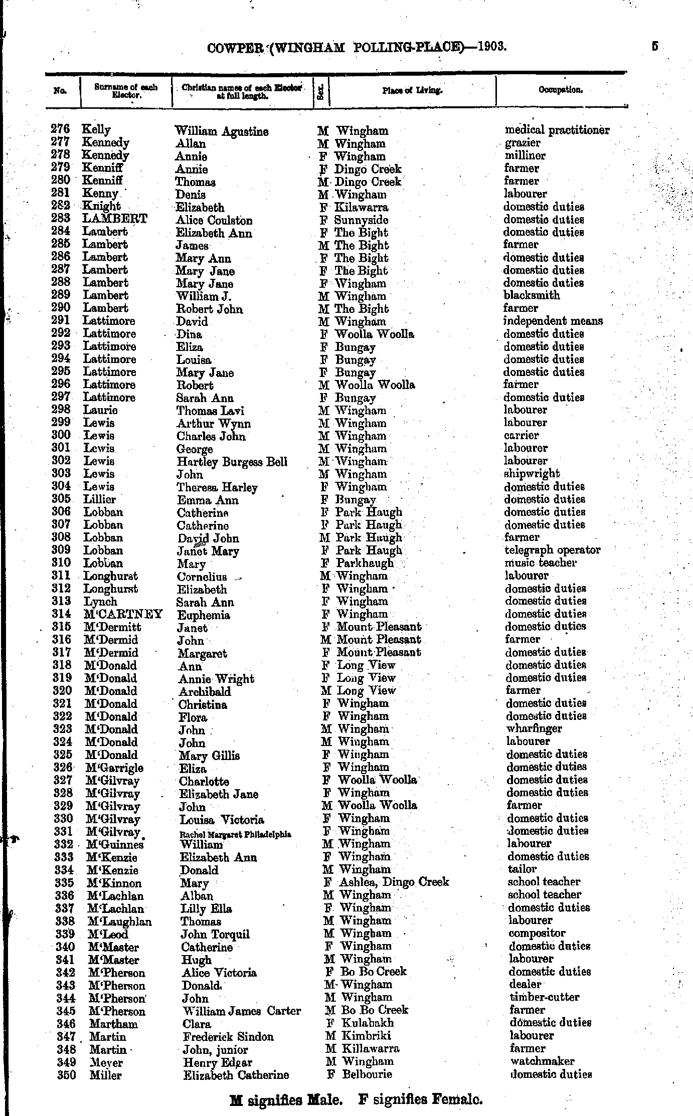
- Fleming John - Kelly Leilia
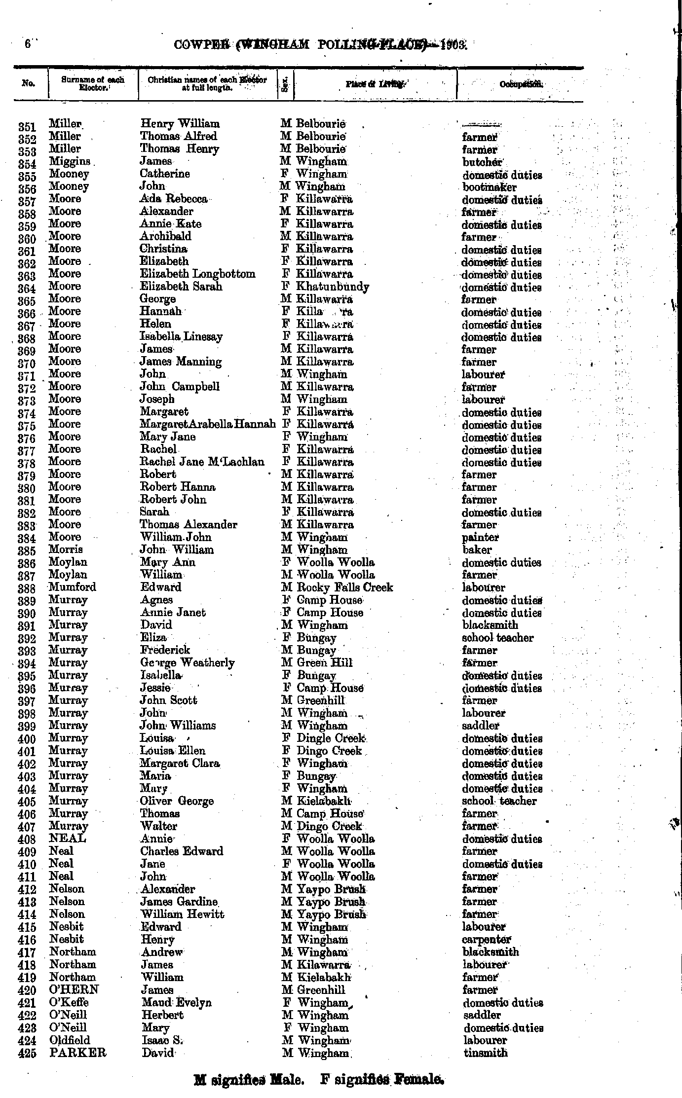
- Kelly William - Miller Elizabeth
- Miller Henry - Parker David
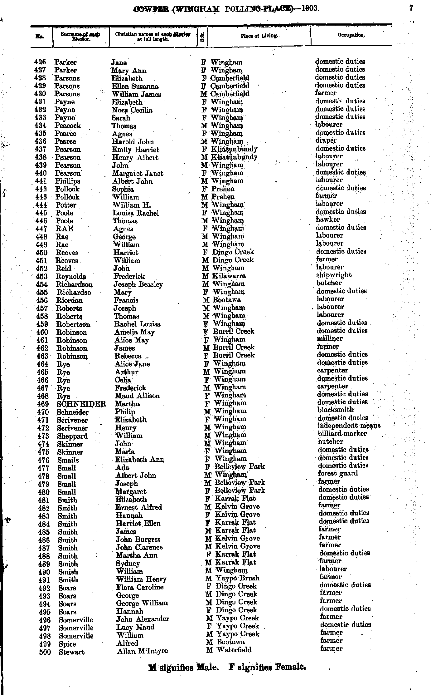
- Parker Jane - Stewart Allan
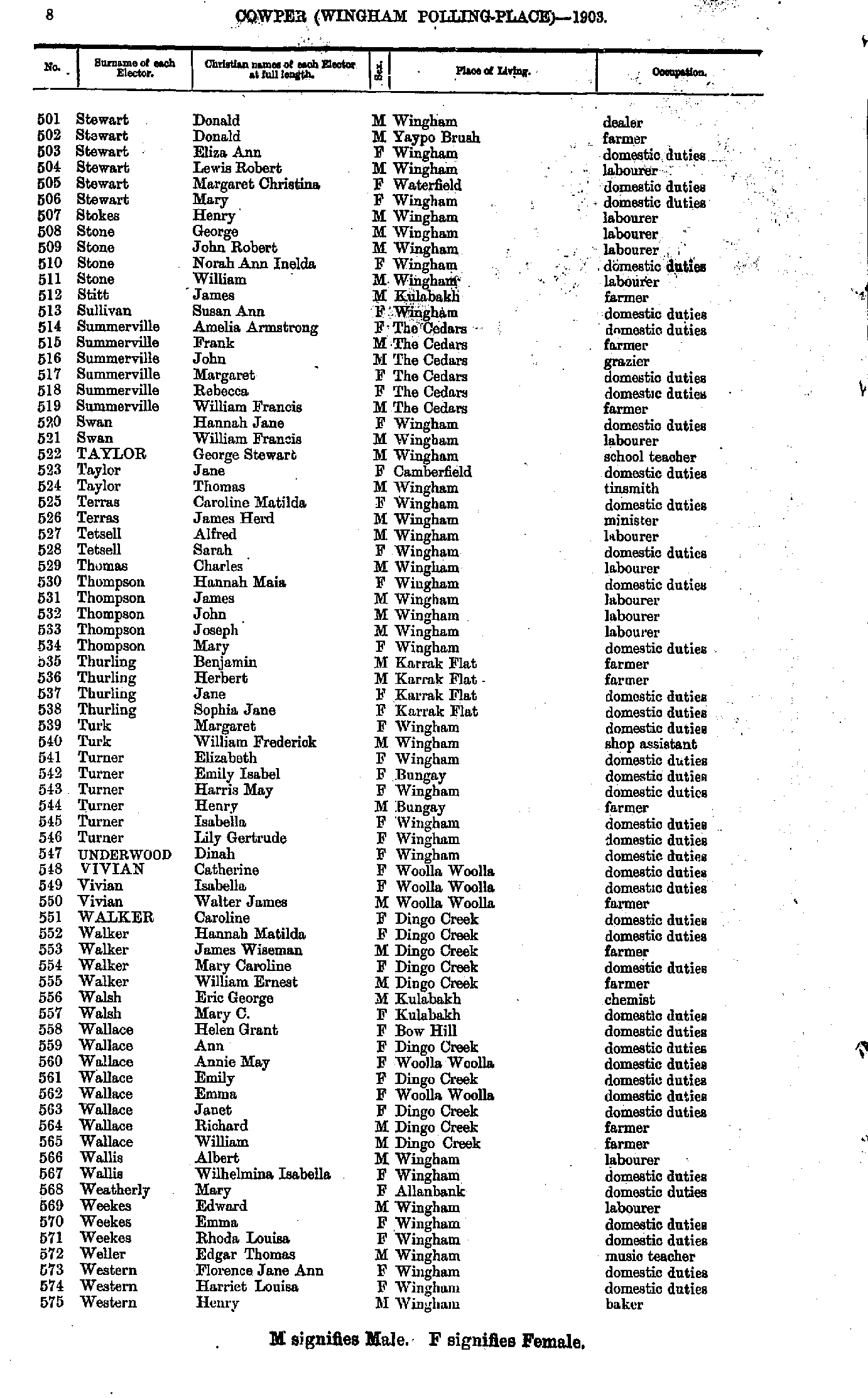
- Stewart Donald - Western Henry
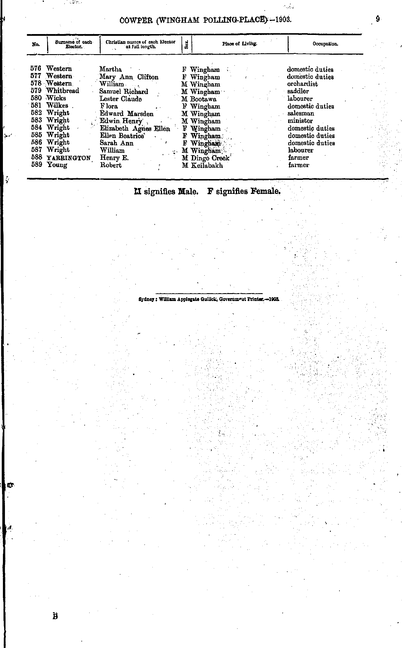
- Western Martha - Young Robert
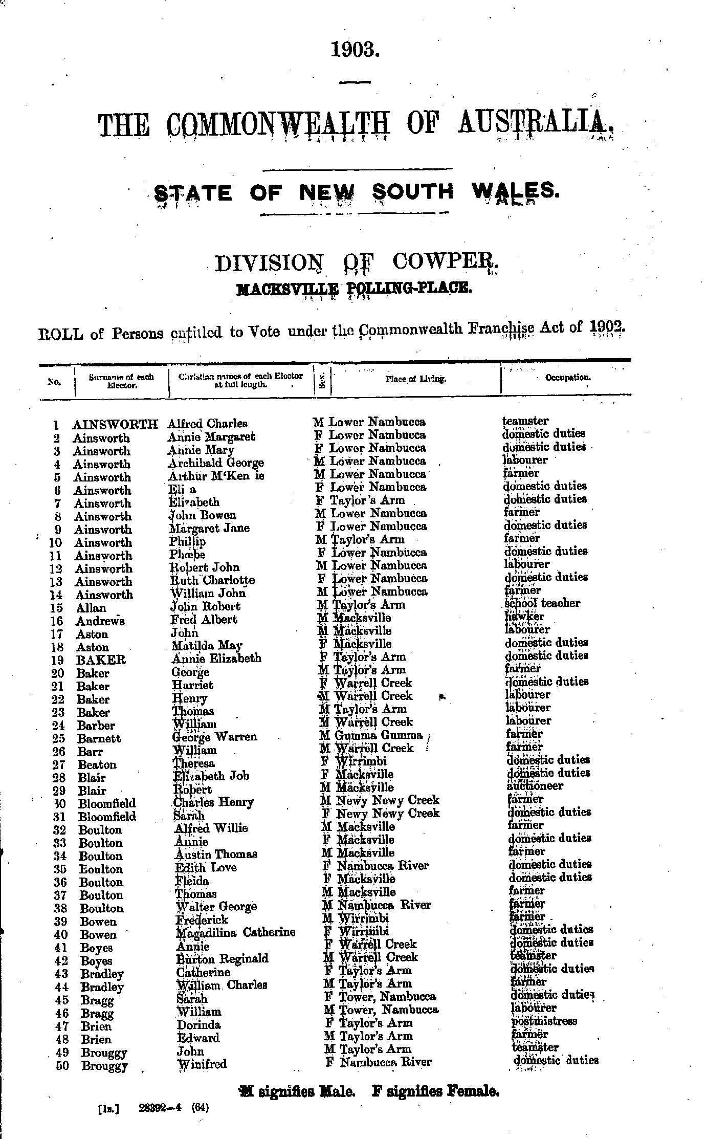
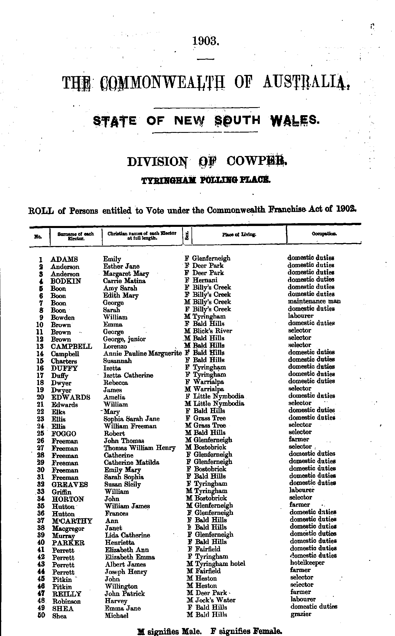
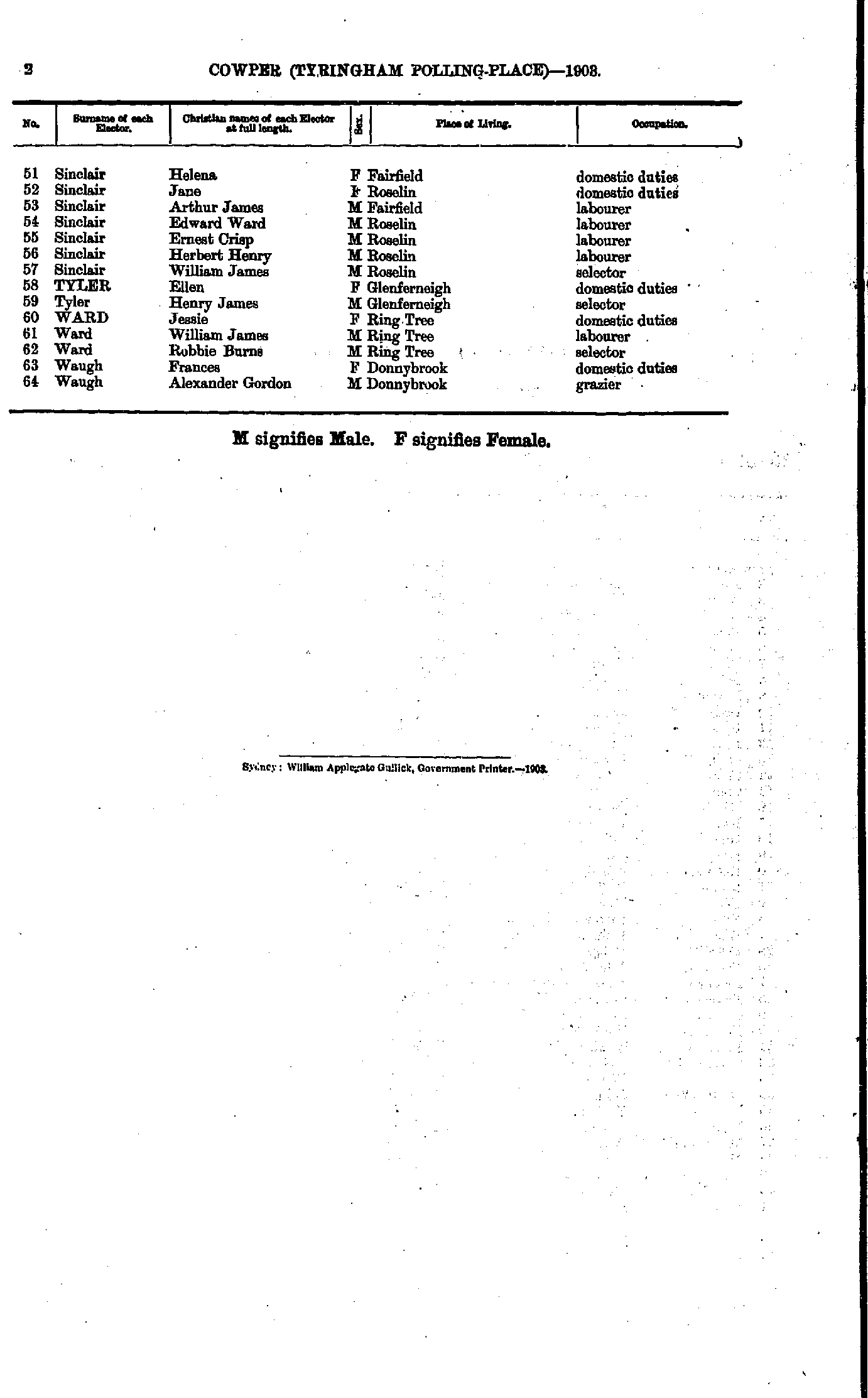
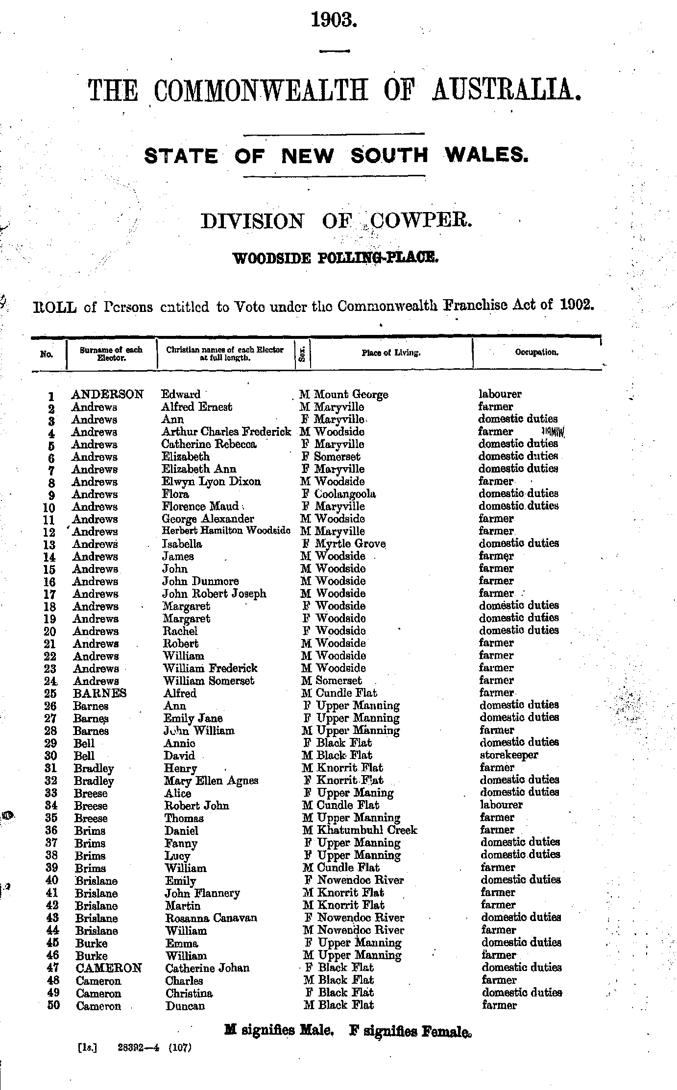
Yugilbar (late Lionsville) Polling Place
Maps of the Cowper Electoral Division
From: Federal Electoral Districts Commissioners 1901, Maps of the Federal Electoral Districts of the State of New South Wales, William Applegate Gullick, Government Printer, Sydney.
JPEG file (234KB)
Portable Document Format(PDF) file (1.18MB)If you do not have a PDF reader you can click on the button to download the free Adobe Acrobat Reader
The documents in this site are arranged into seven major indexes. You are currently in the Electoral Rolls index. Use the Back button on your browser to move within this index, or use the links below to view another index:
- Directories
- Electoral Rolls
- Land Records
- General and Miscellaneous Records
- Mining Records
- Pastoral and Agricultural Records
- Other Occupations
Copyright © Internet History Resources 2007
