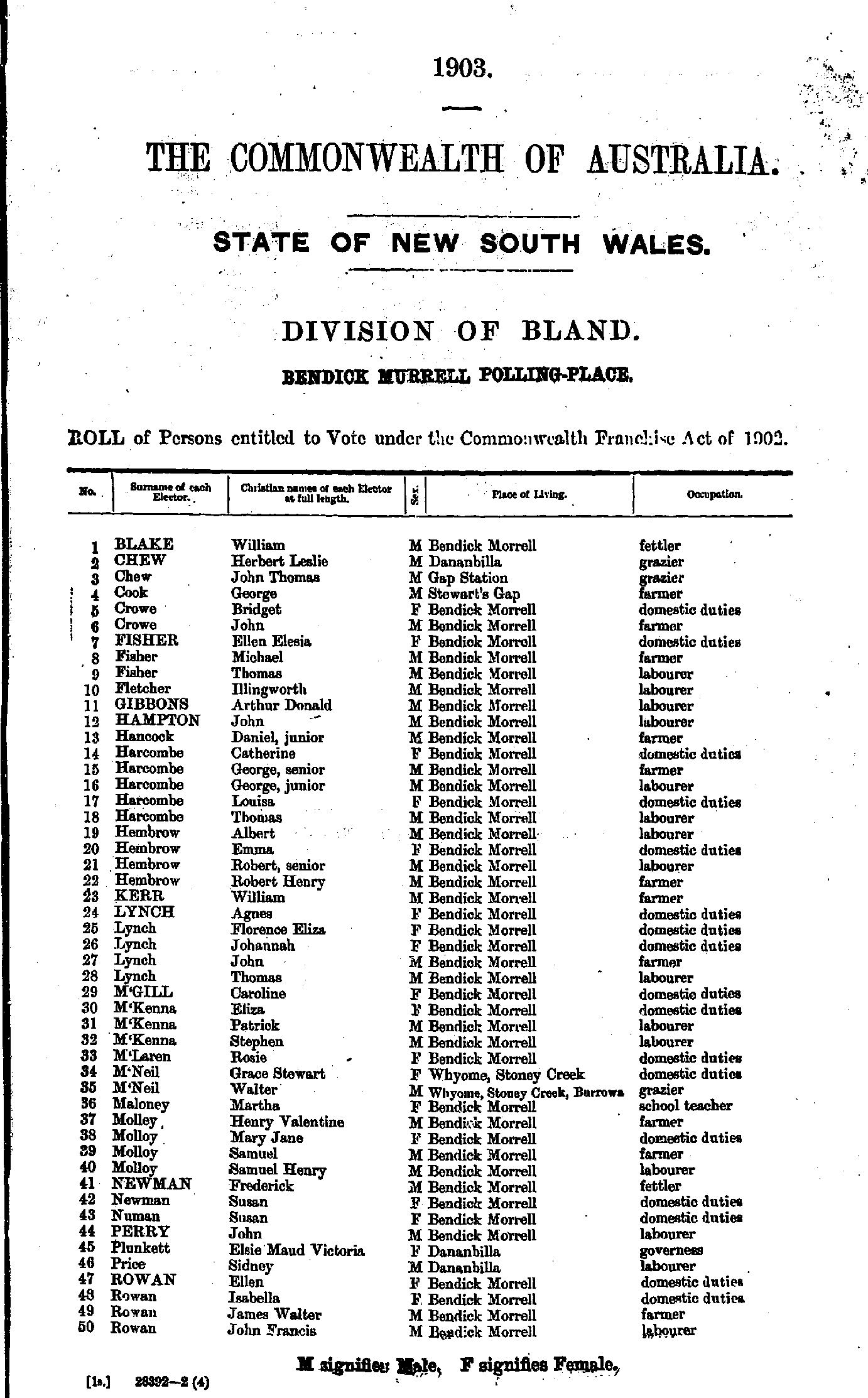
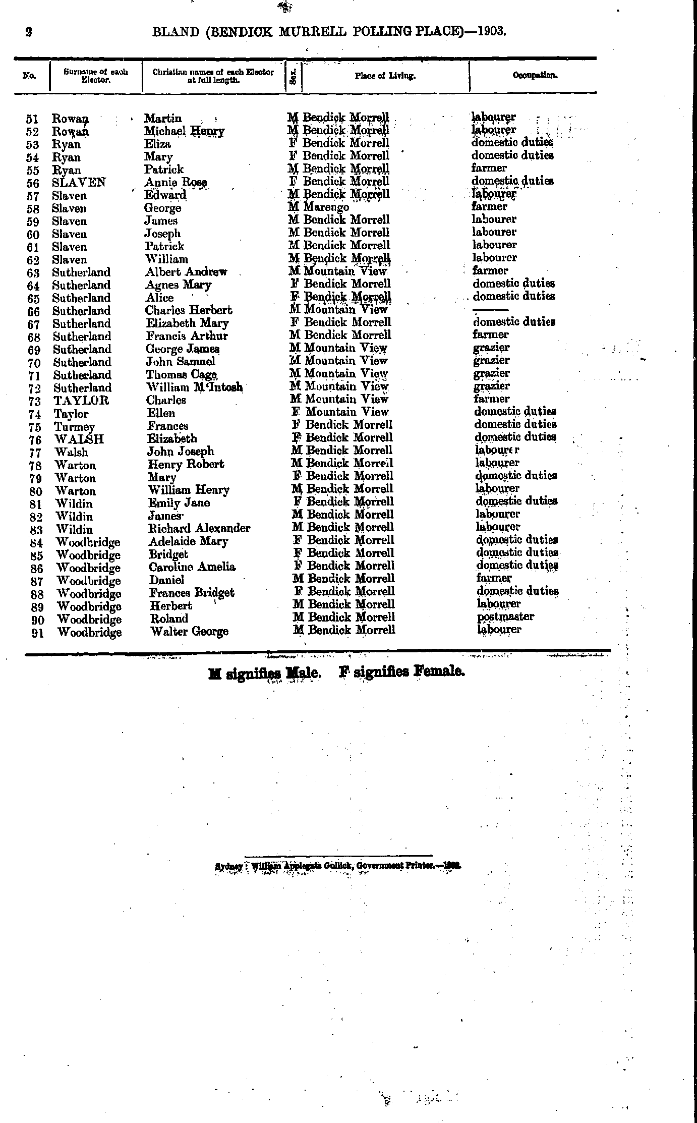
IHR NSW Family History Documents
Electoral Rolls Index
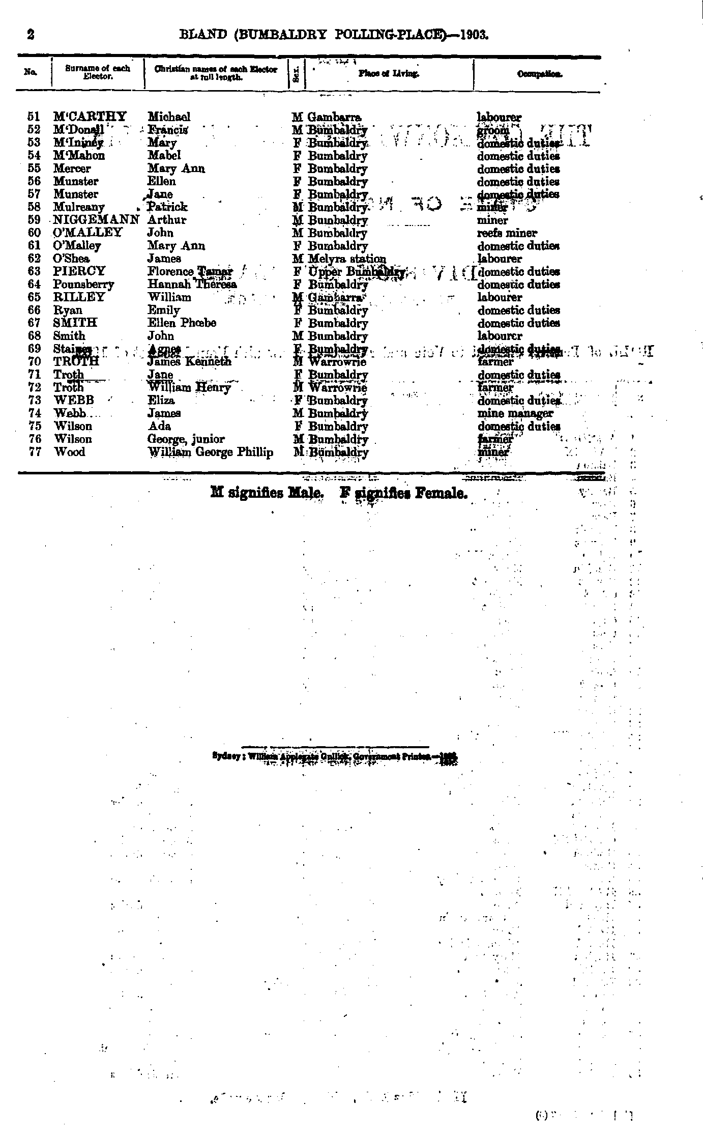
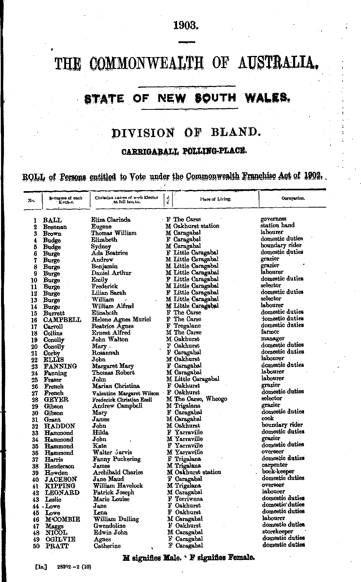
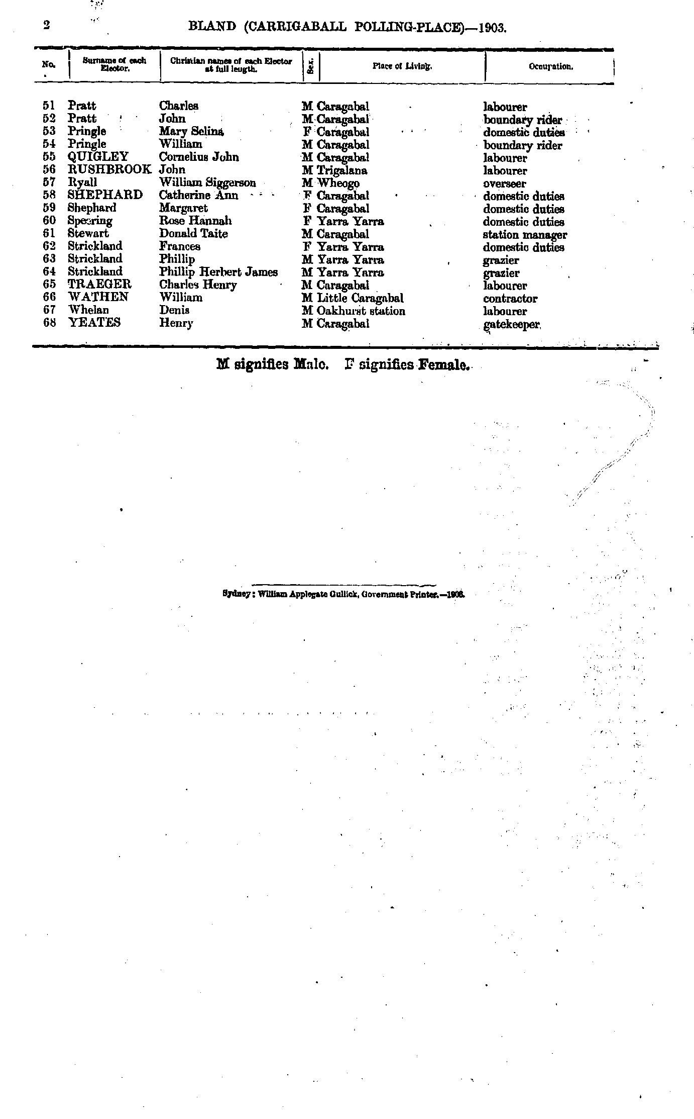
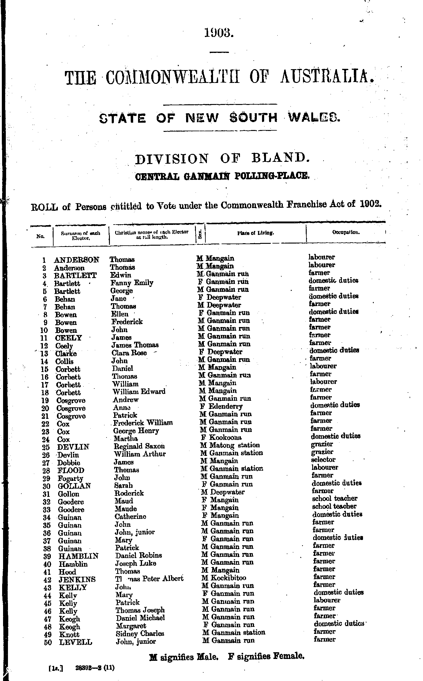
Home | Directories | Electoral | Land | General | Mining | Pastoral | OccupationsNSW Electoral Rolls 1903 - Bland Division
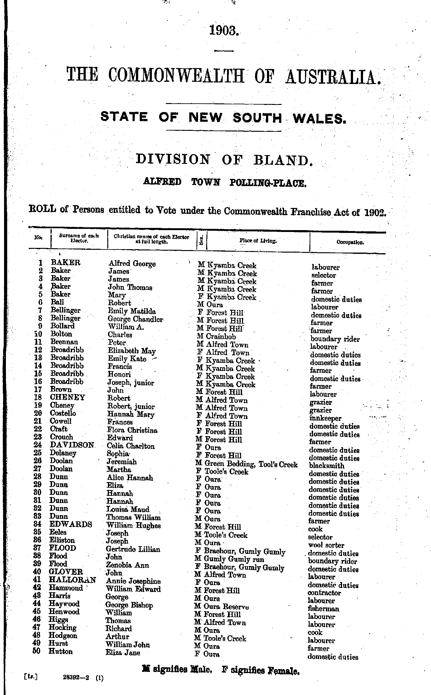
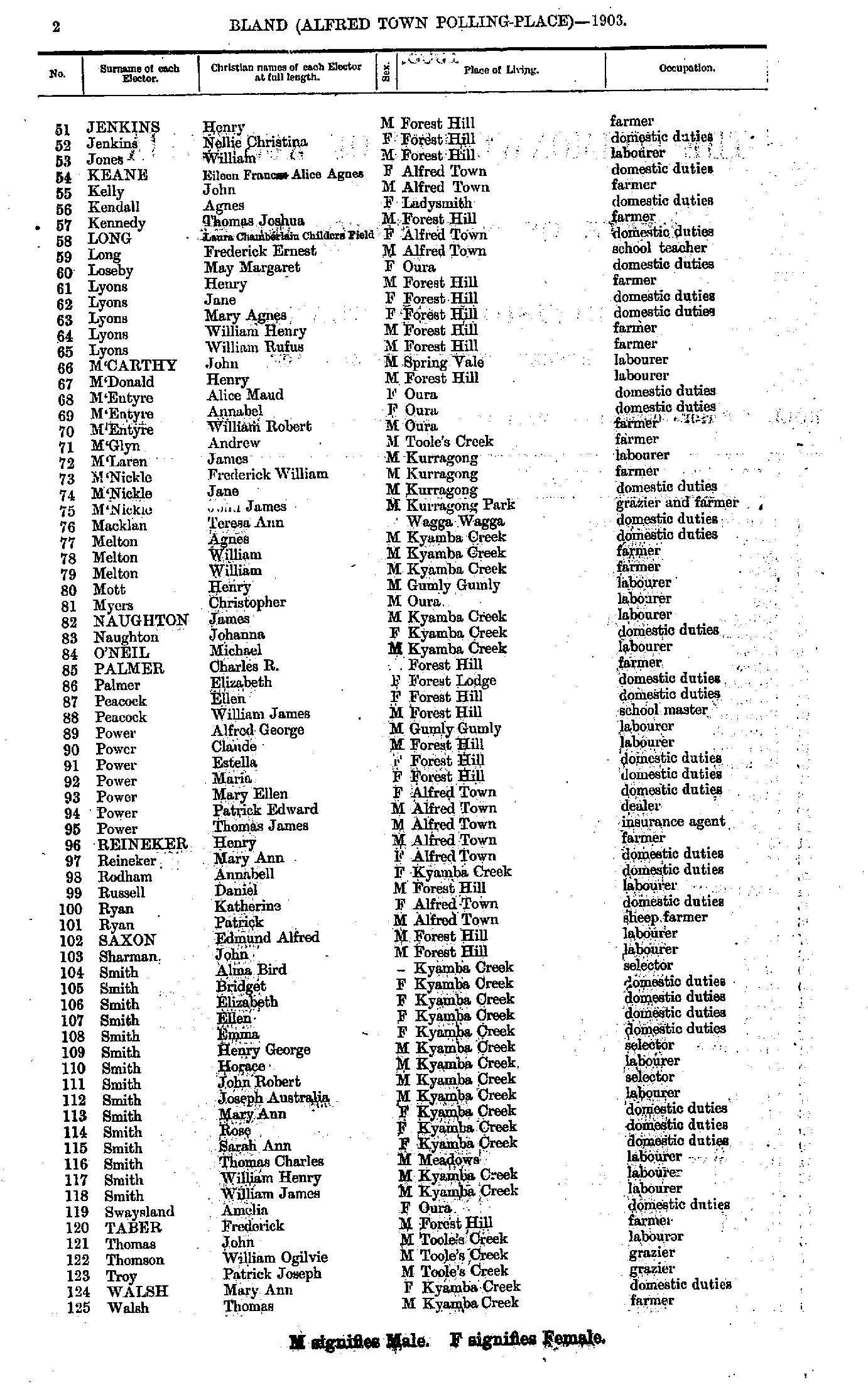
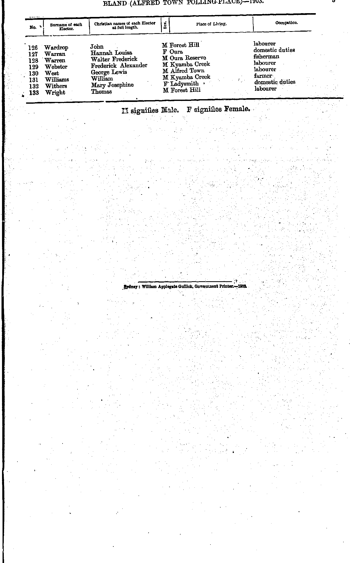
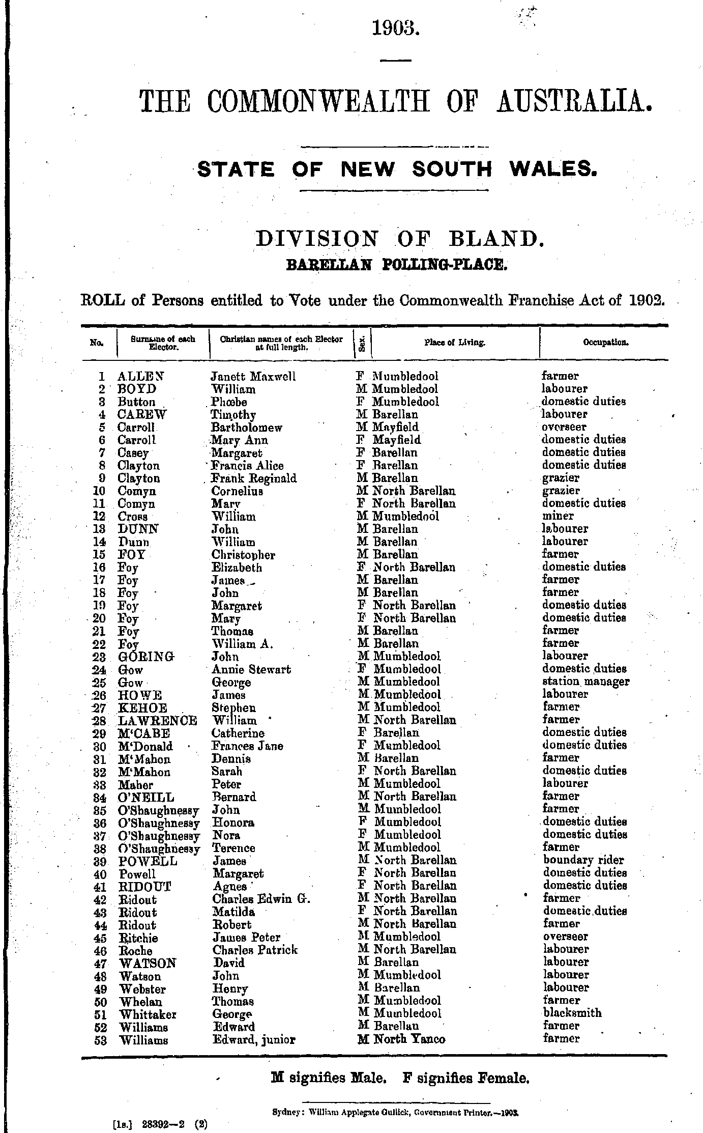
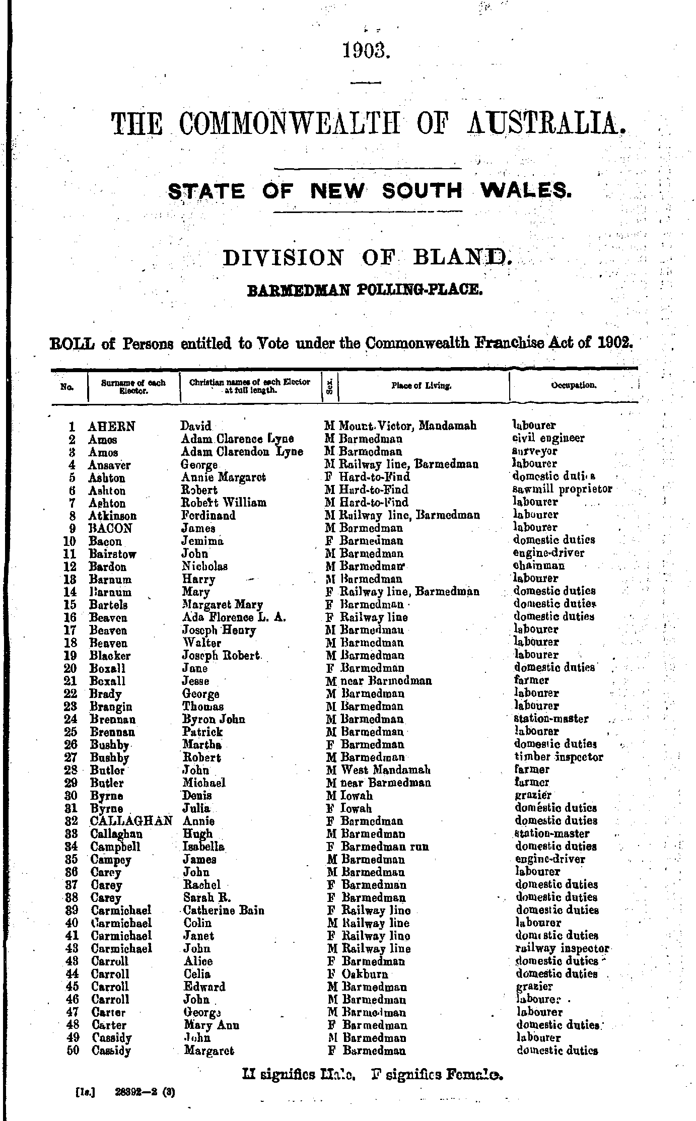
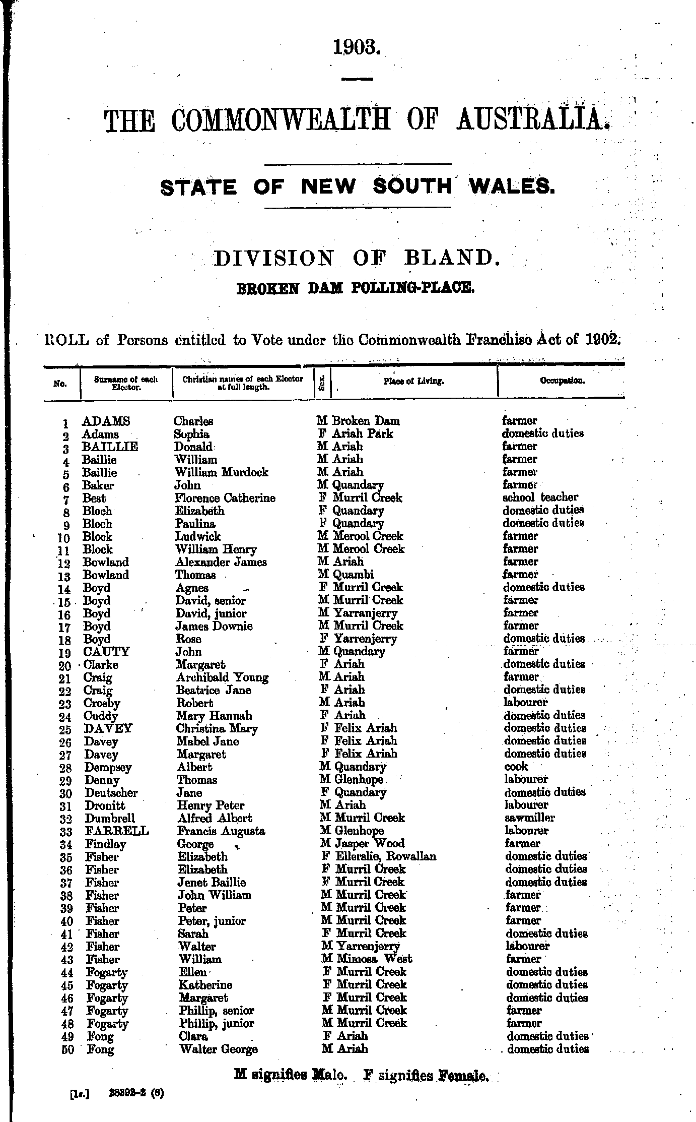
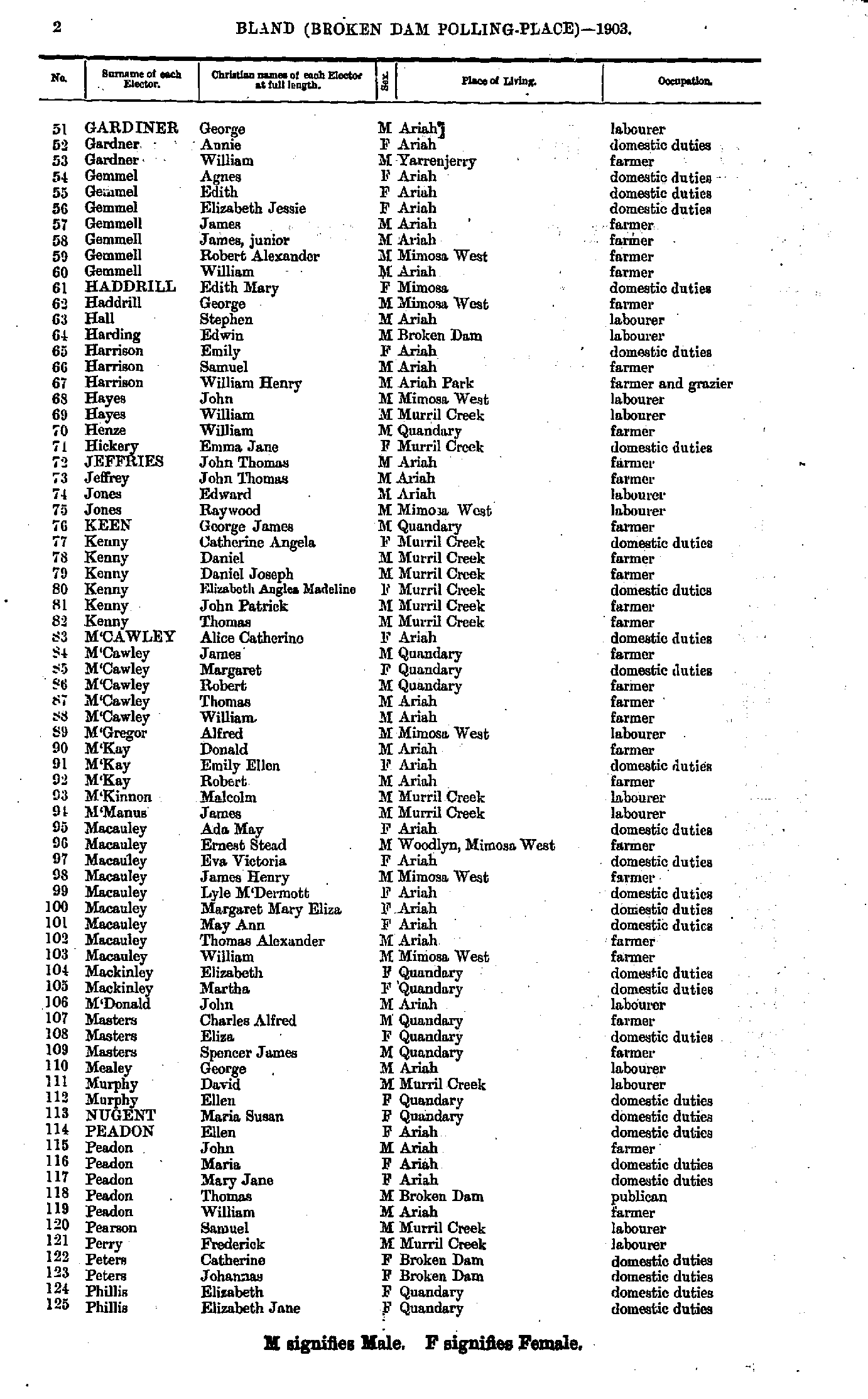
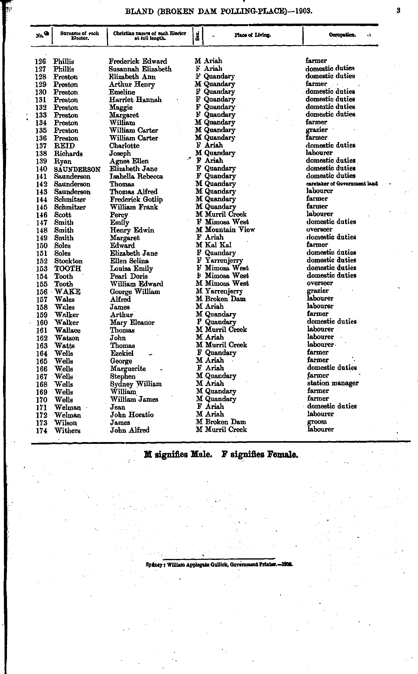
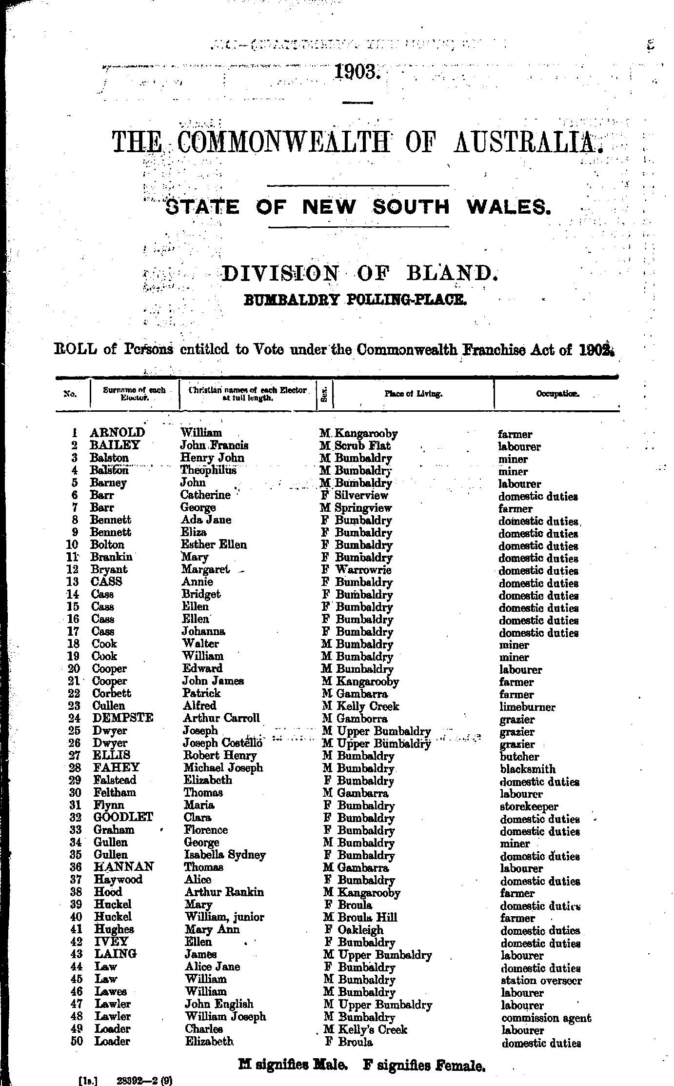
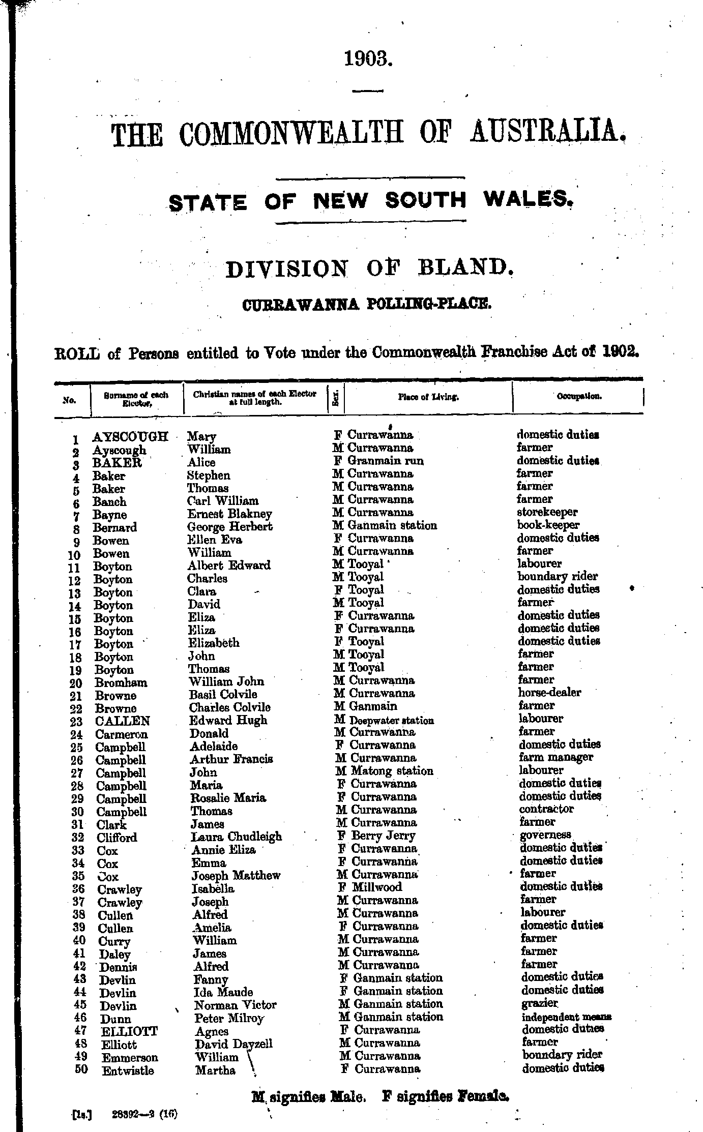
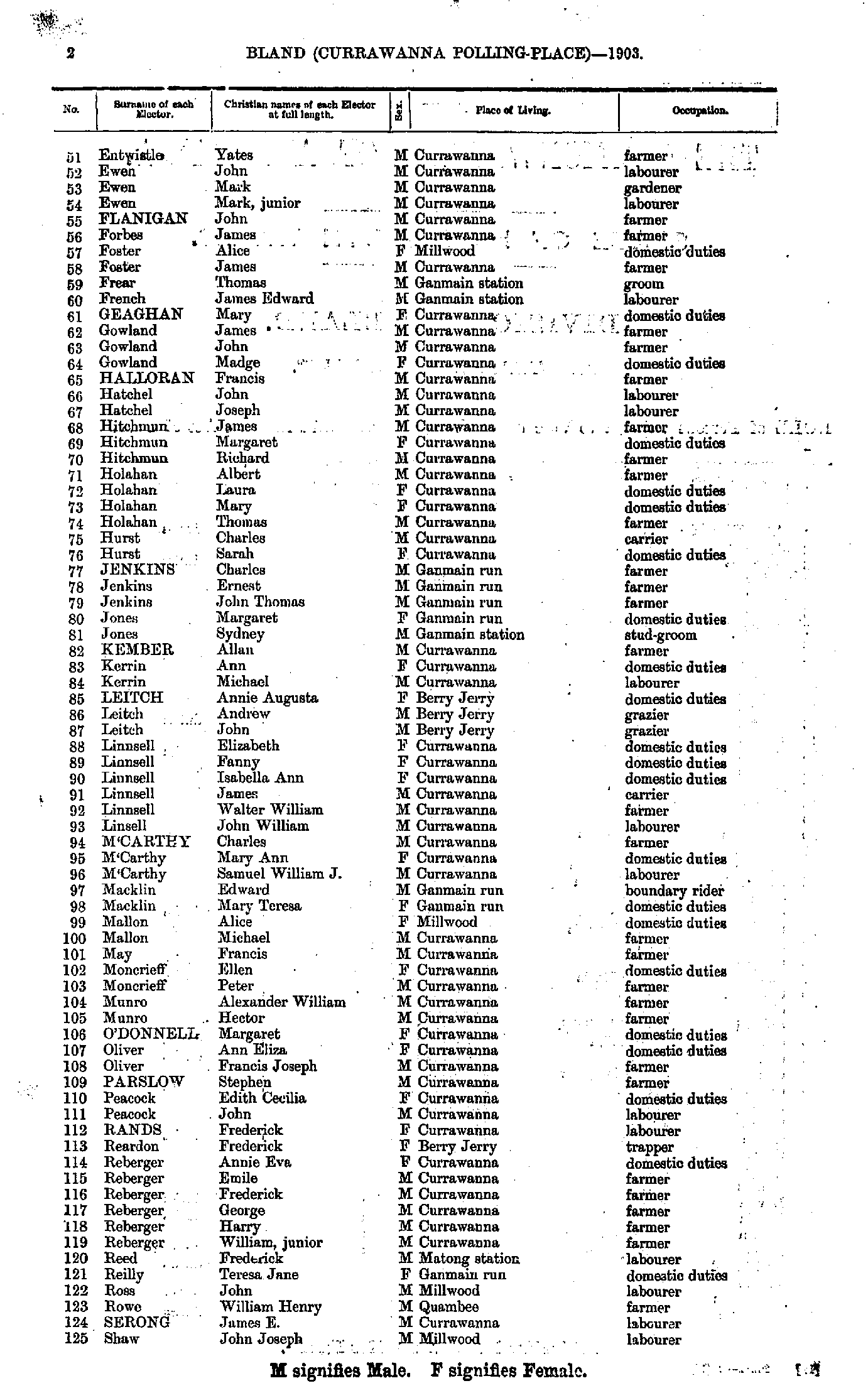
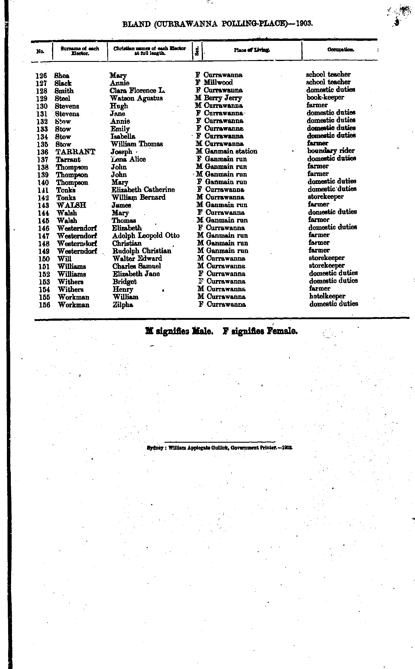
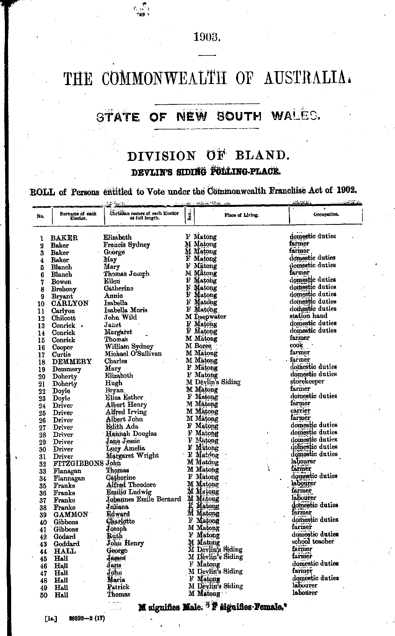
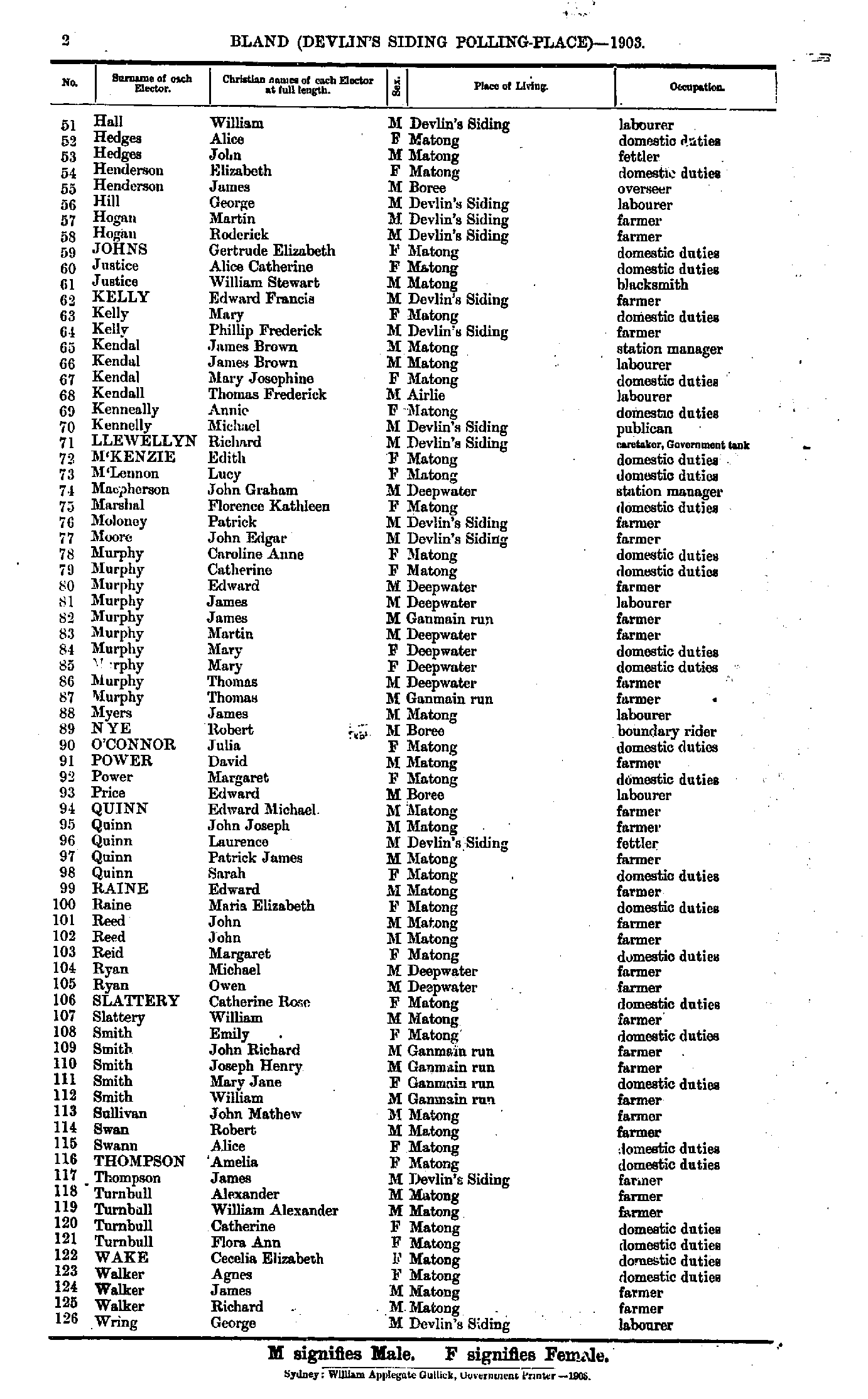
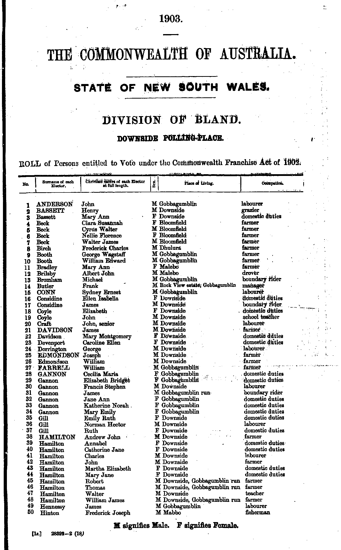
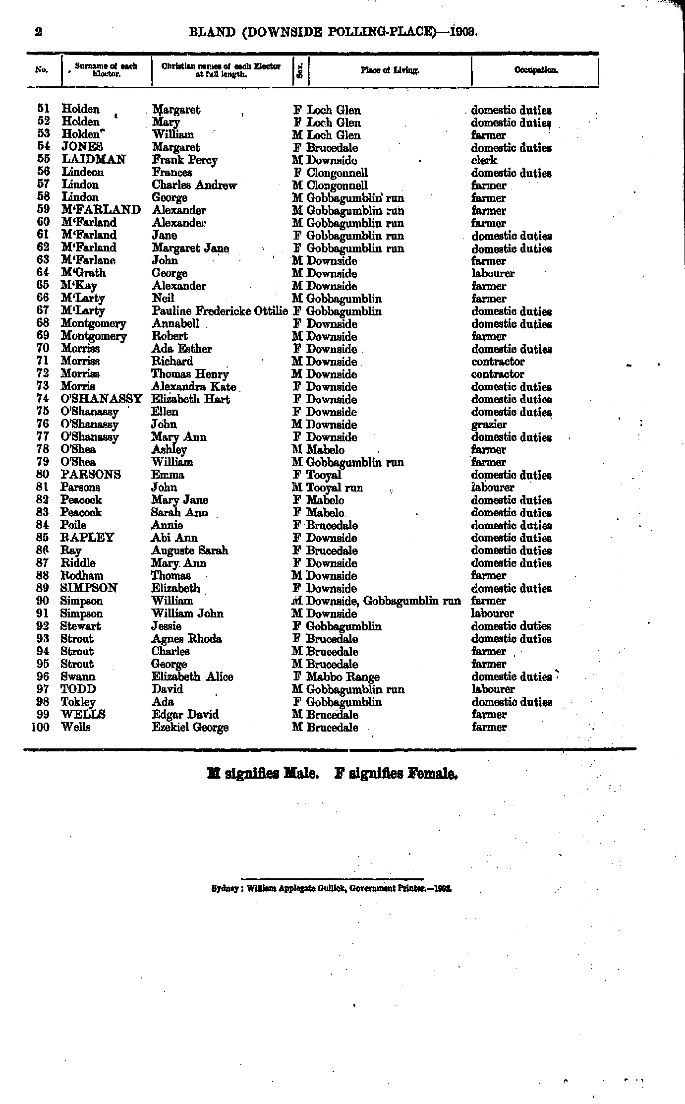
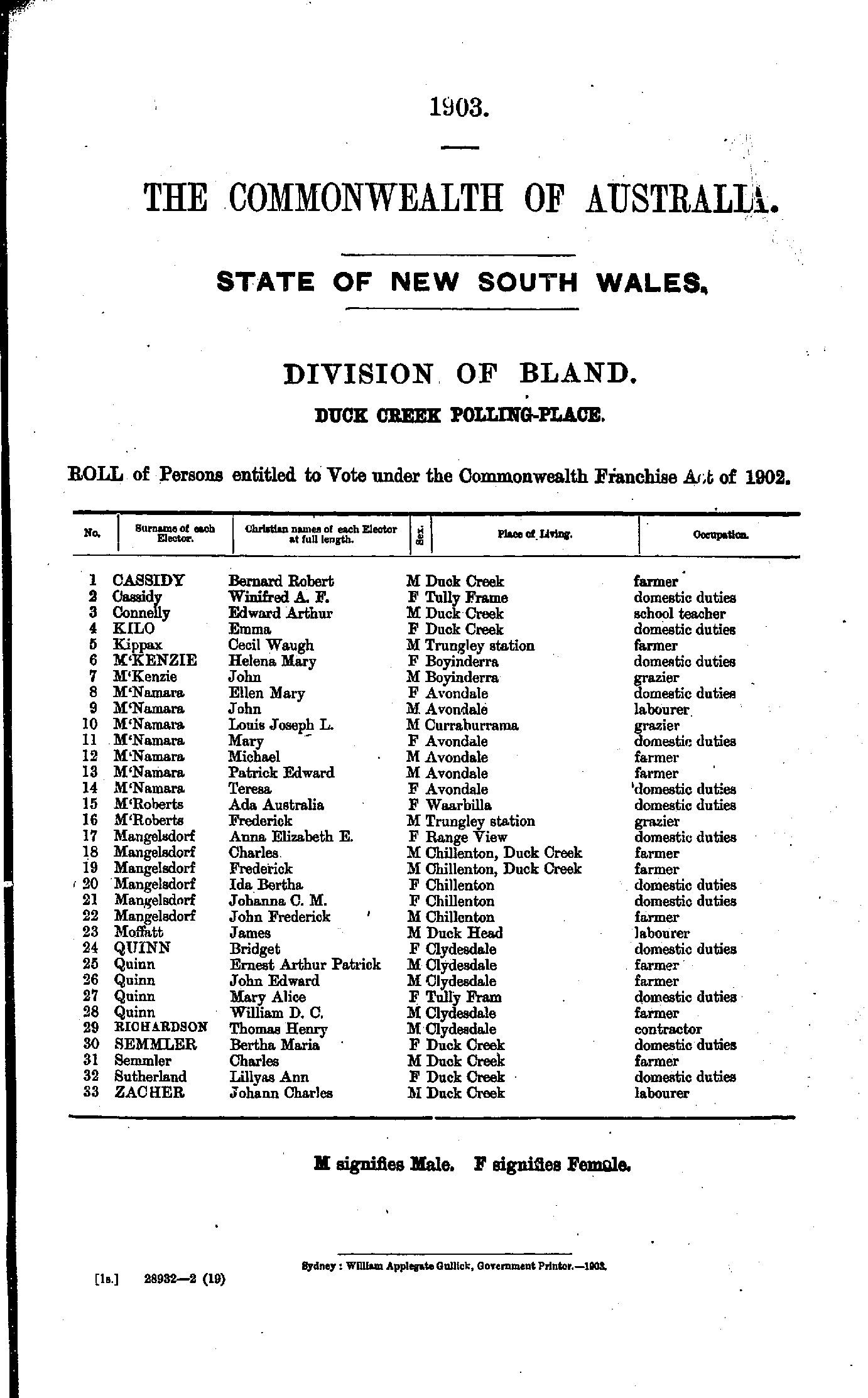
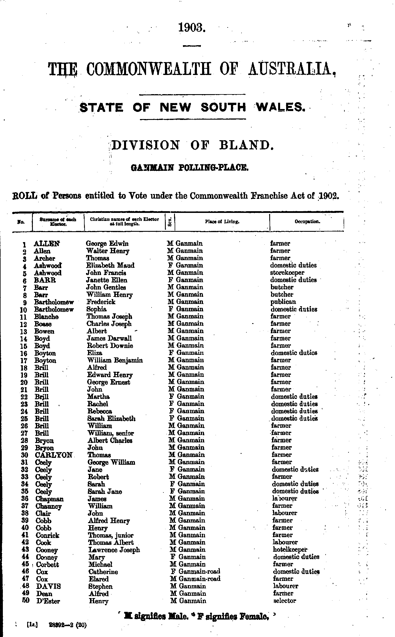
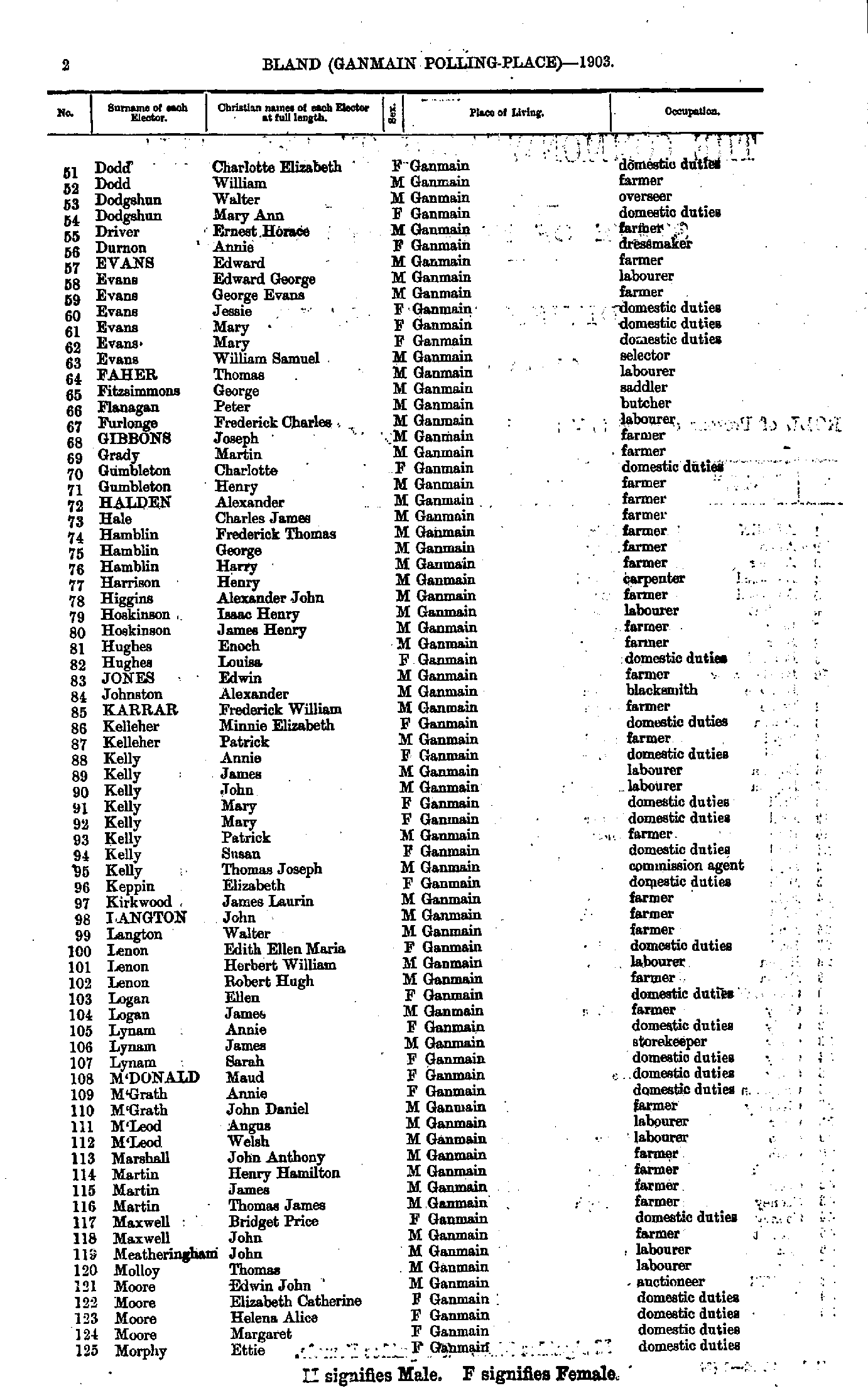
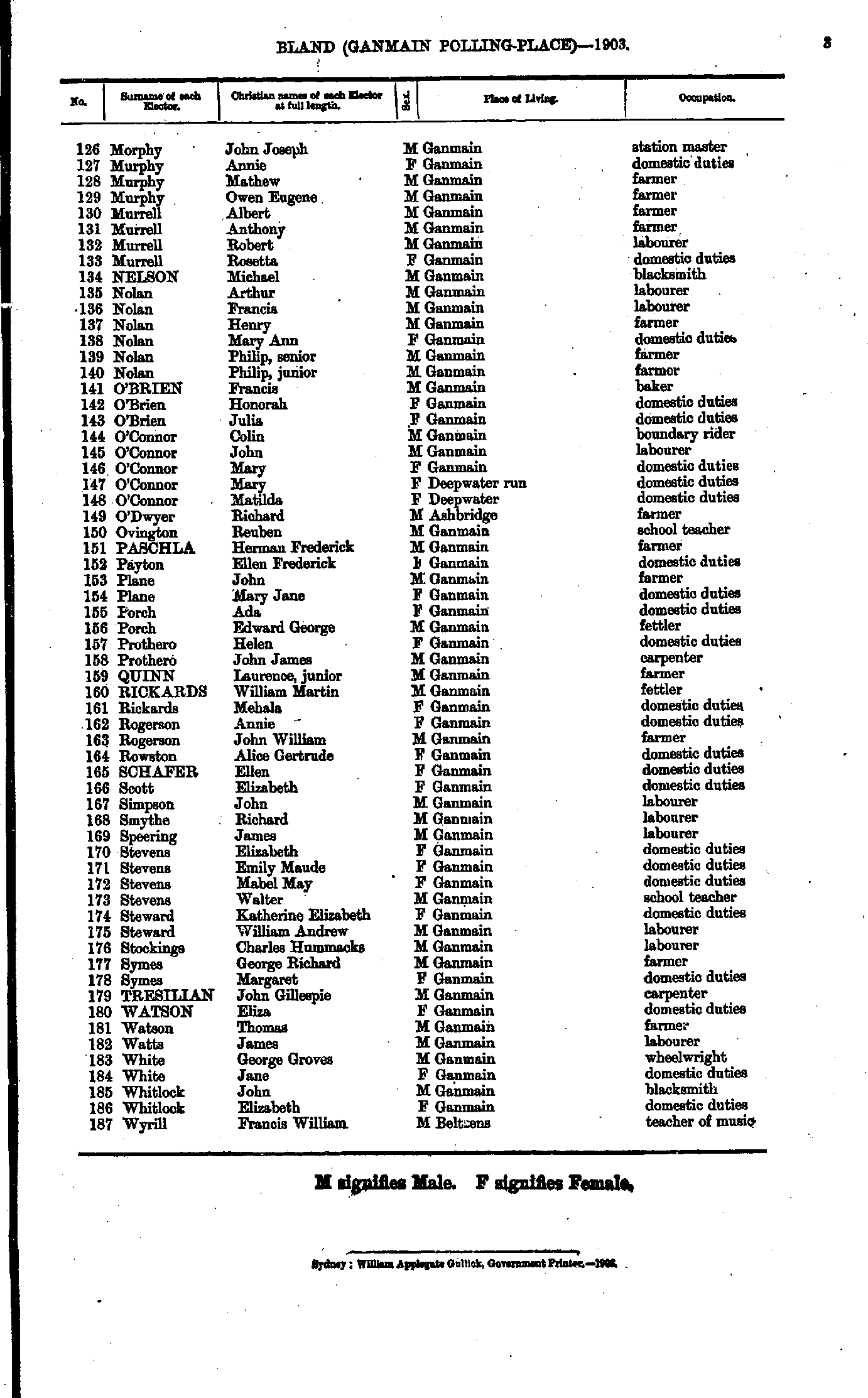
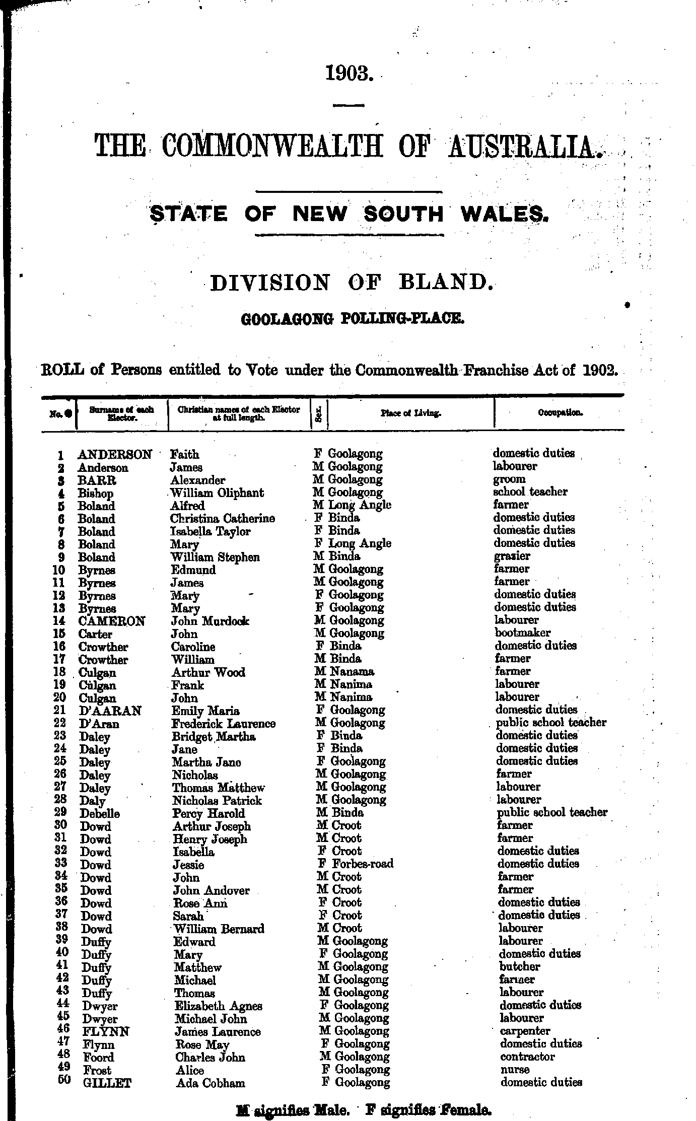
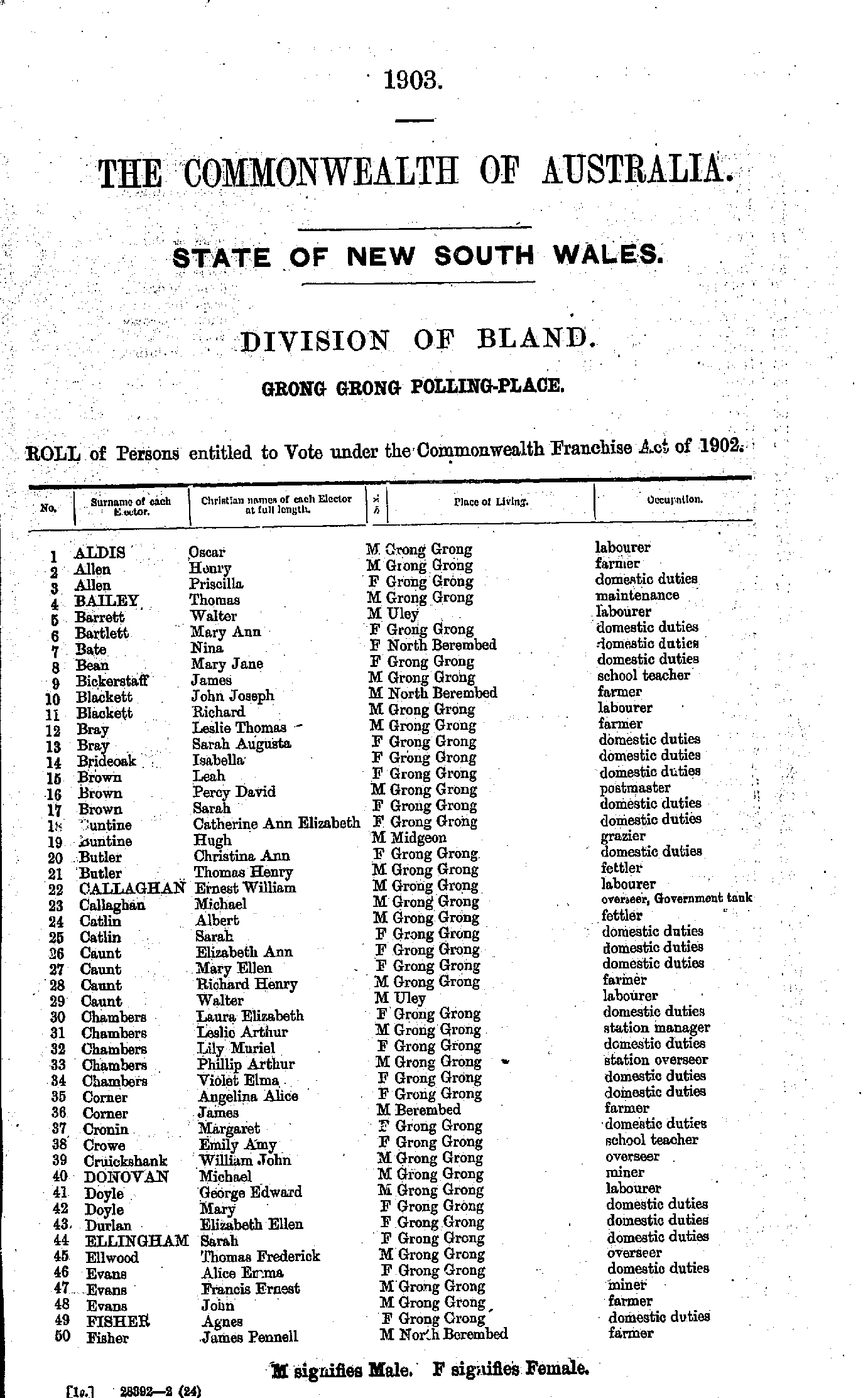
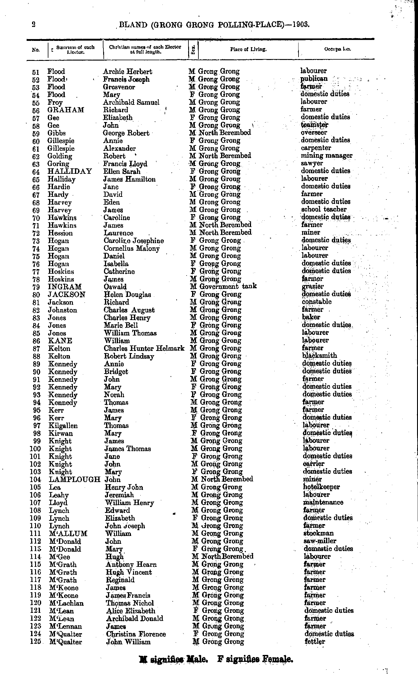
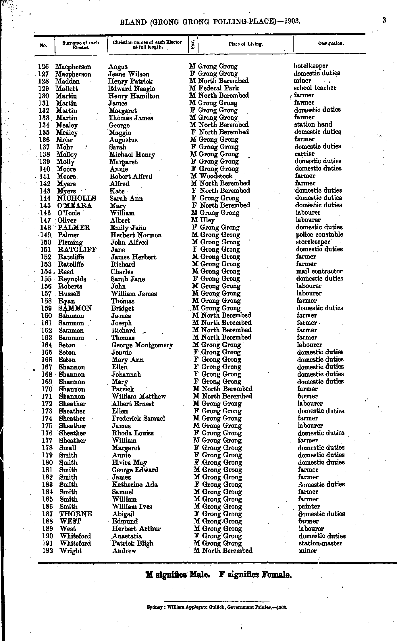
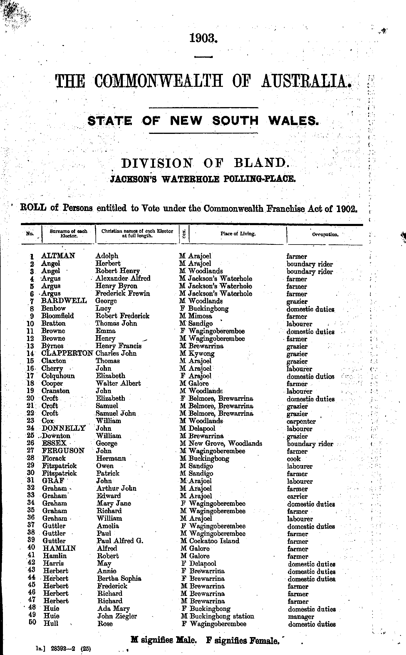
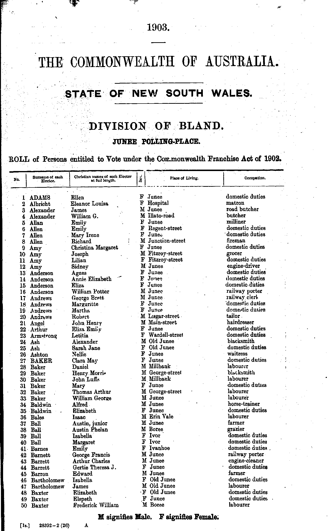
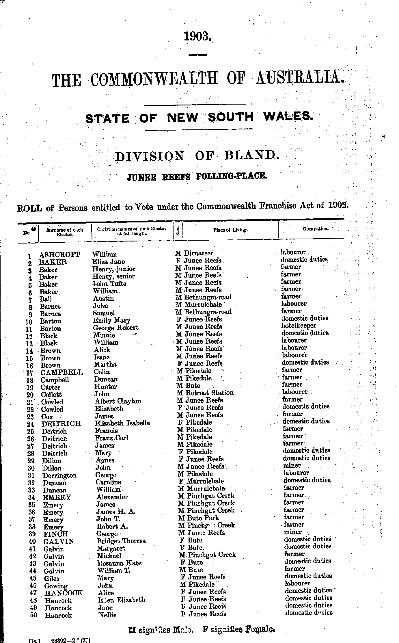
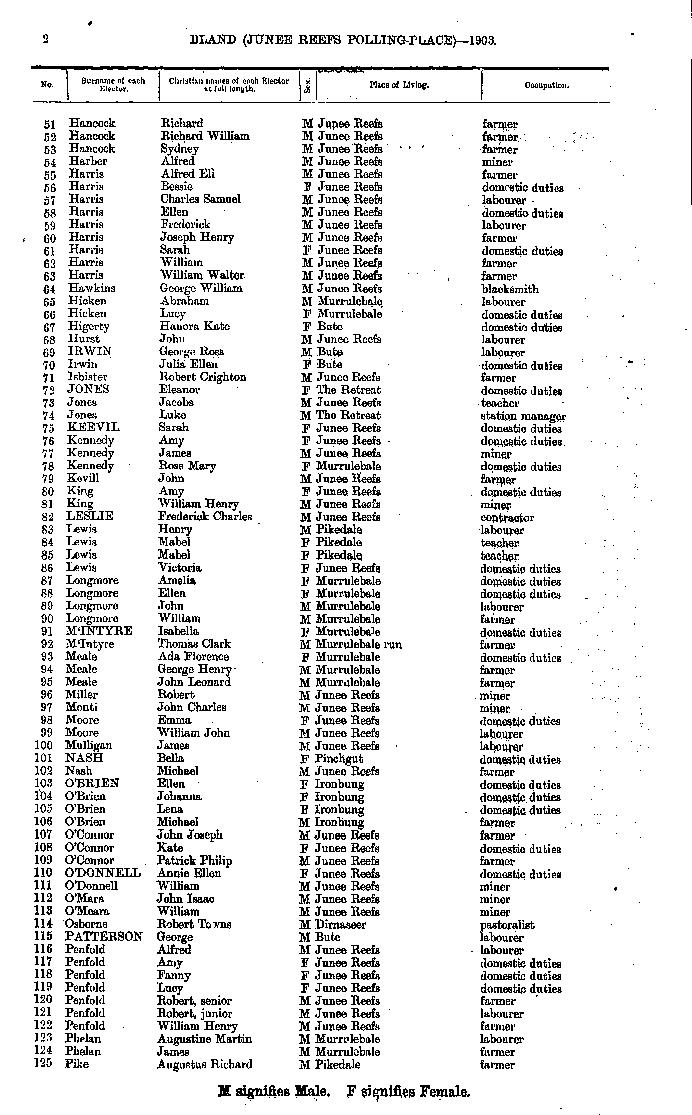
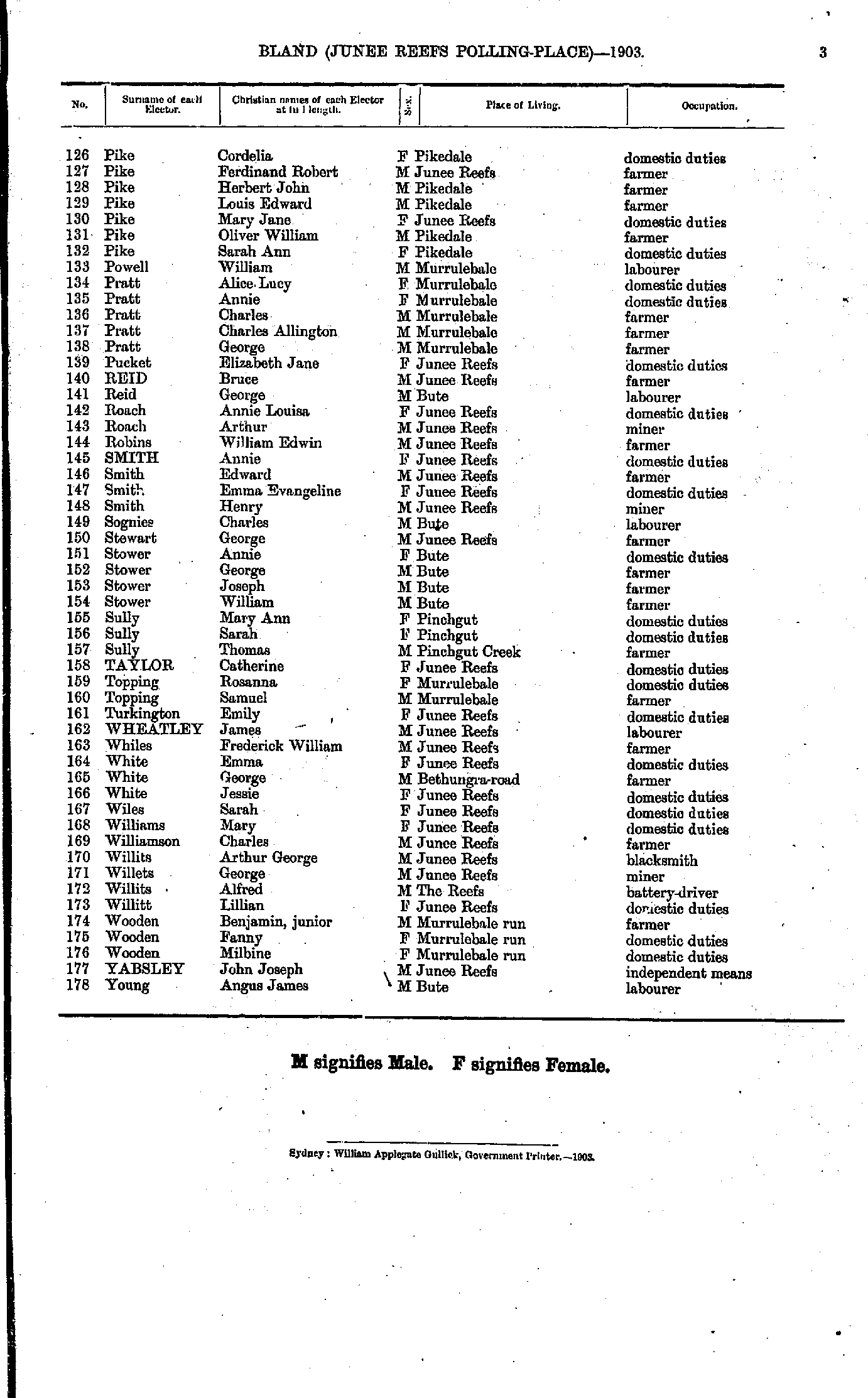
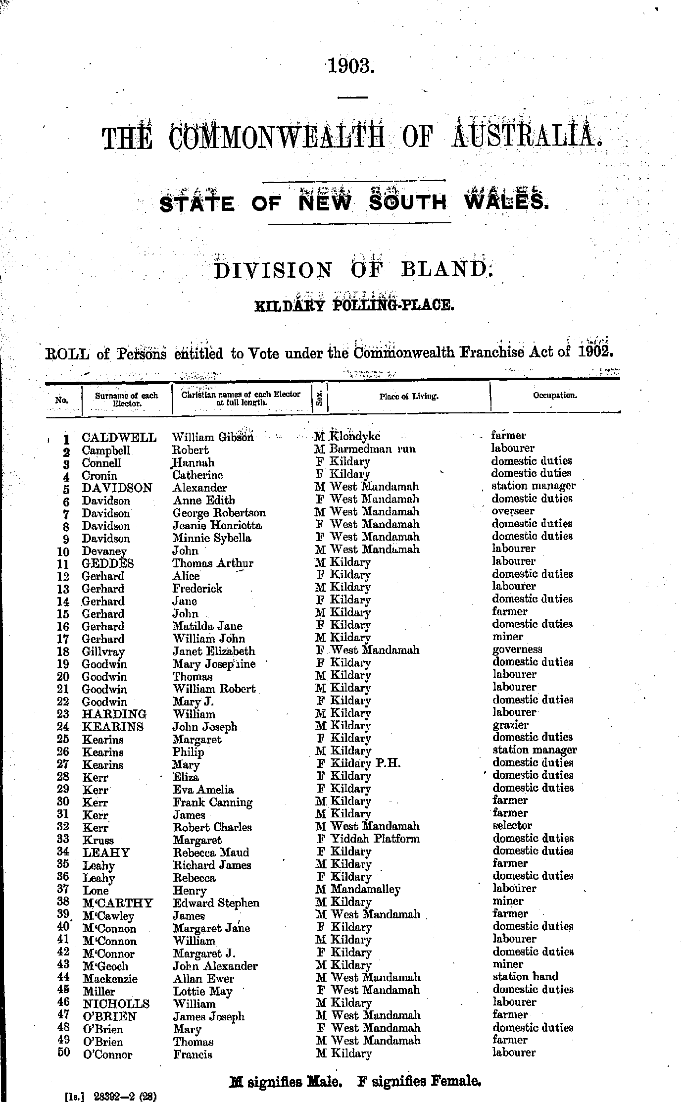
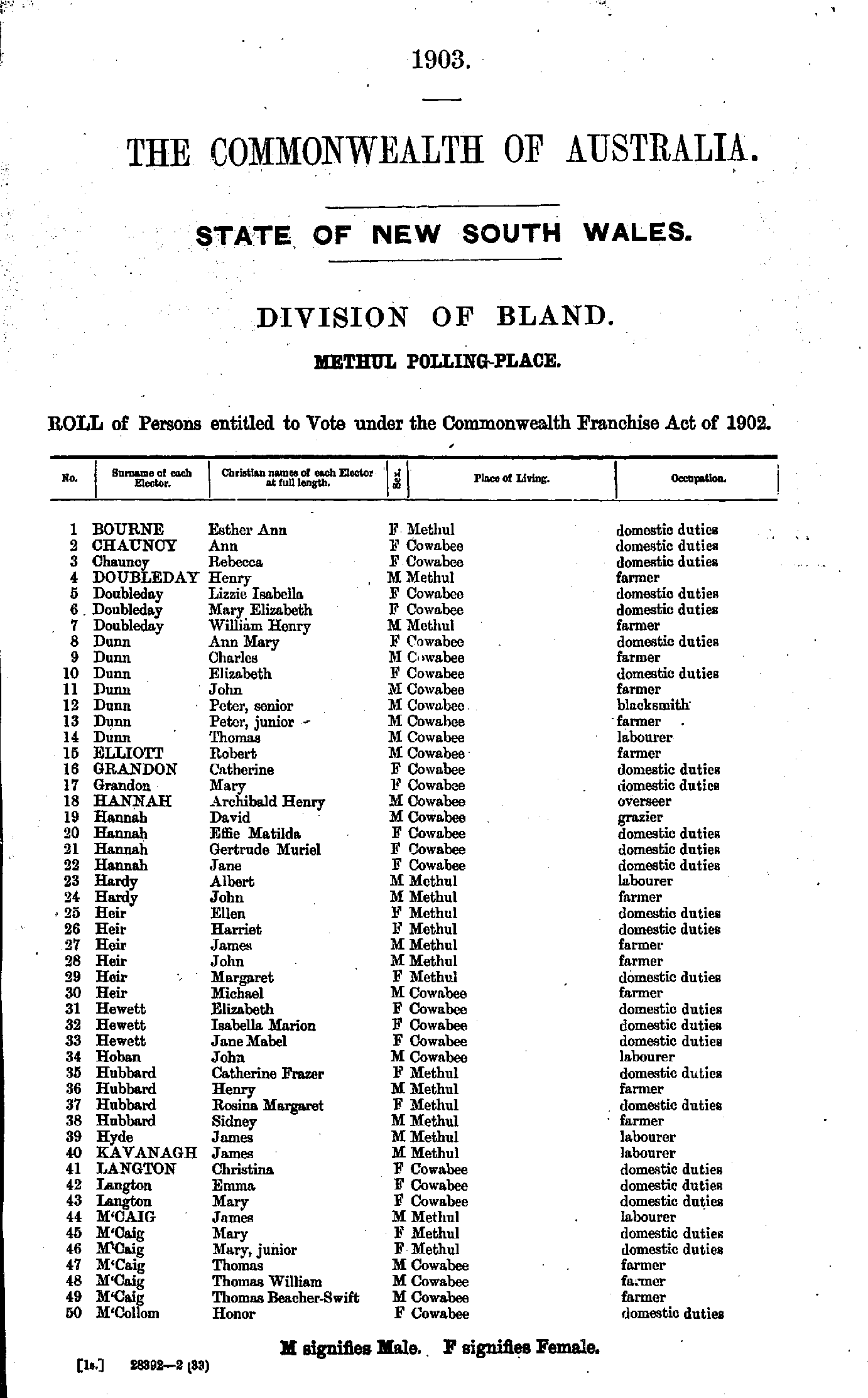
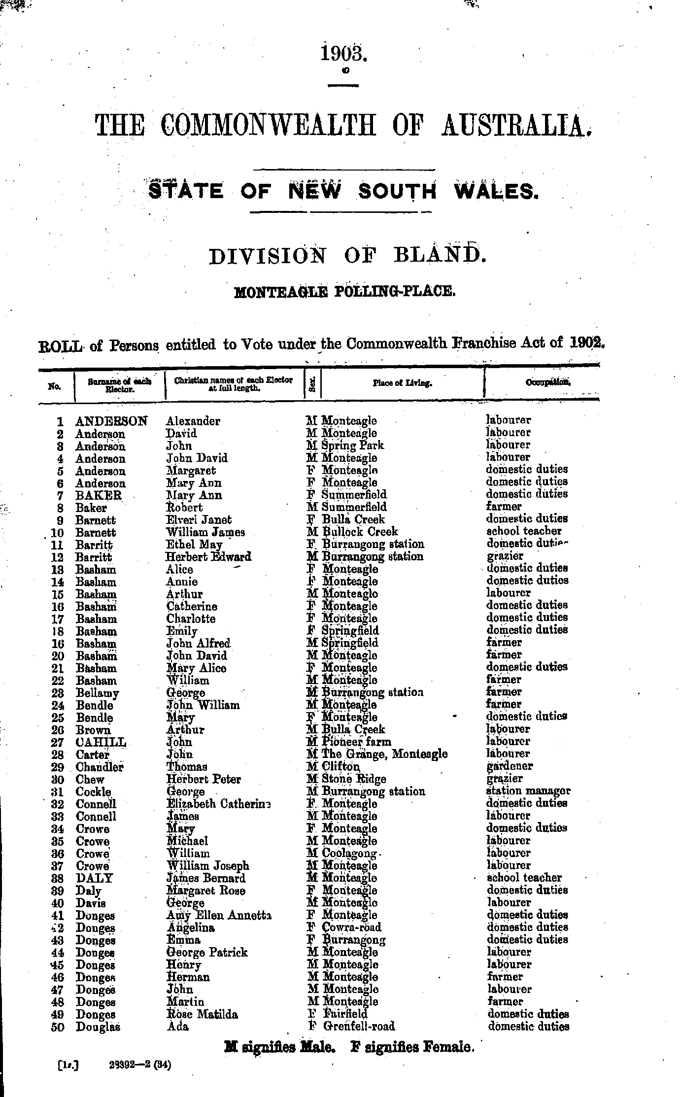
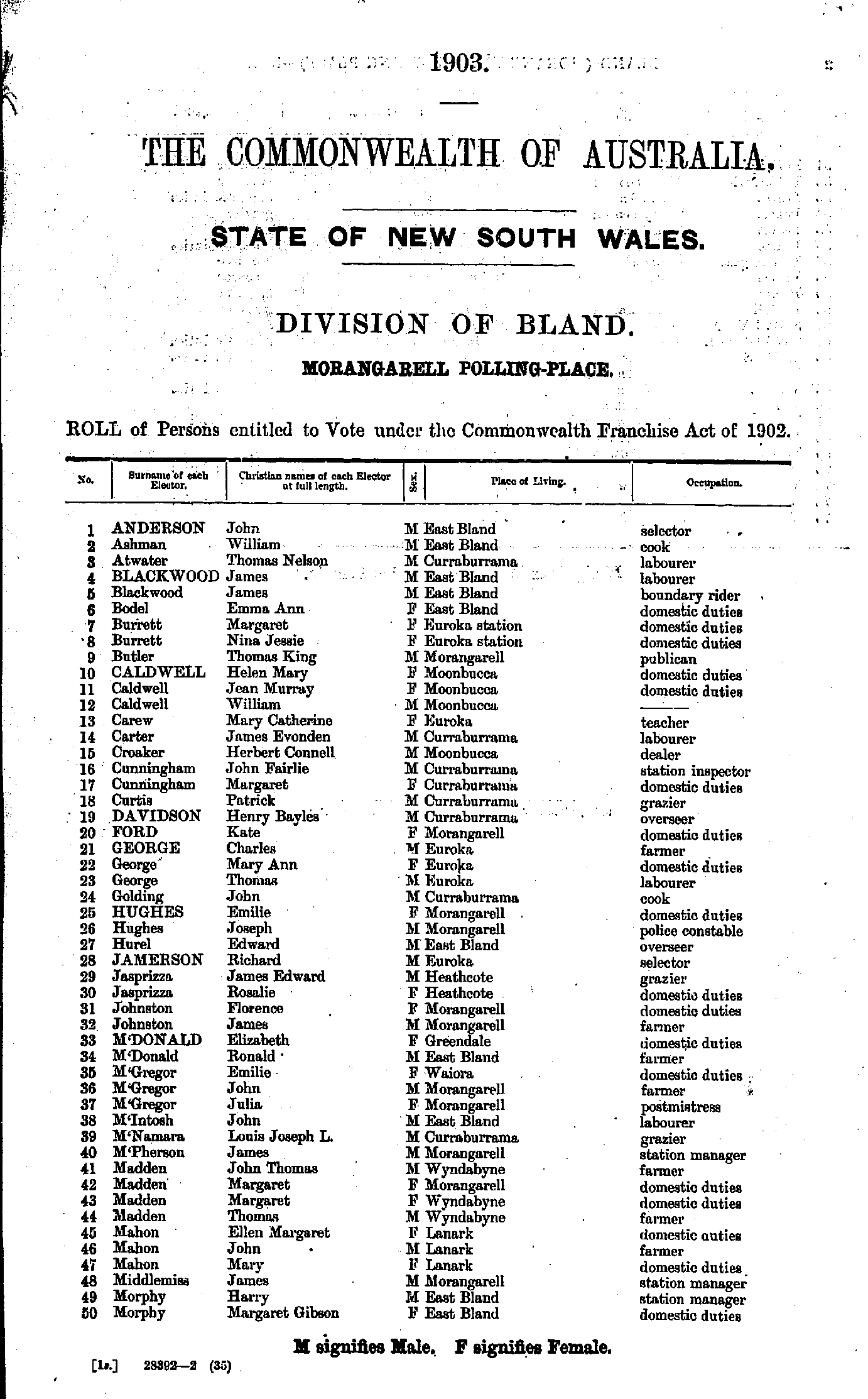
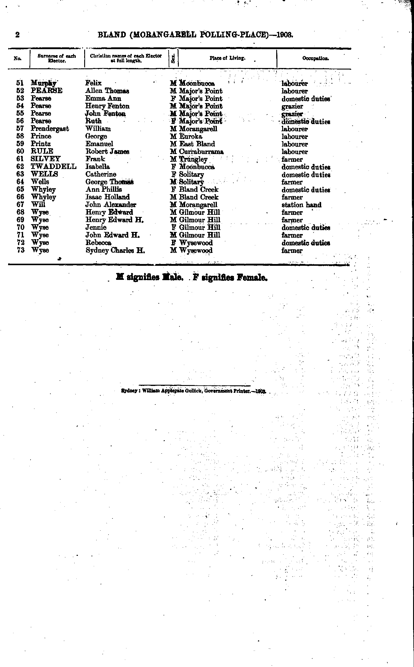
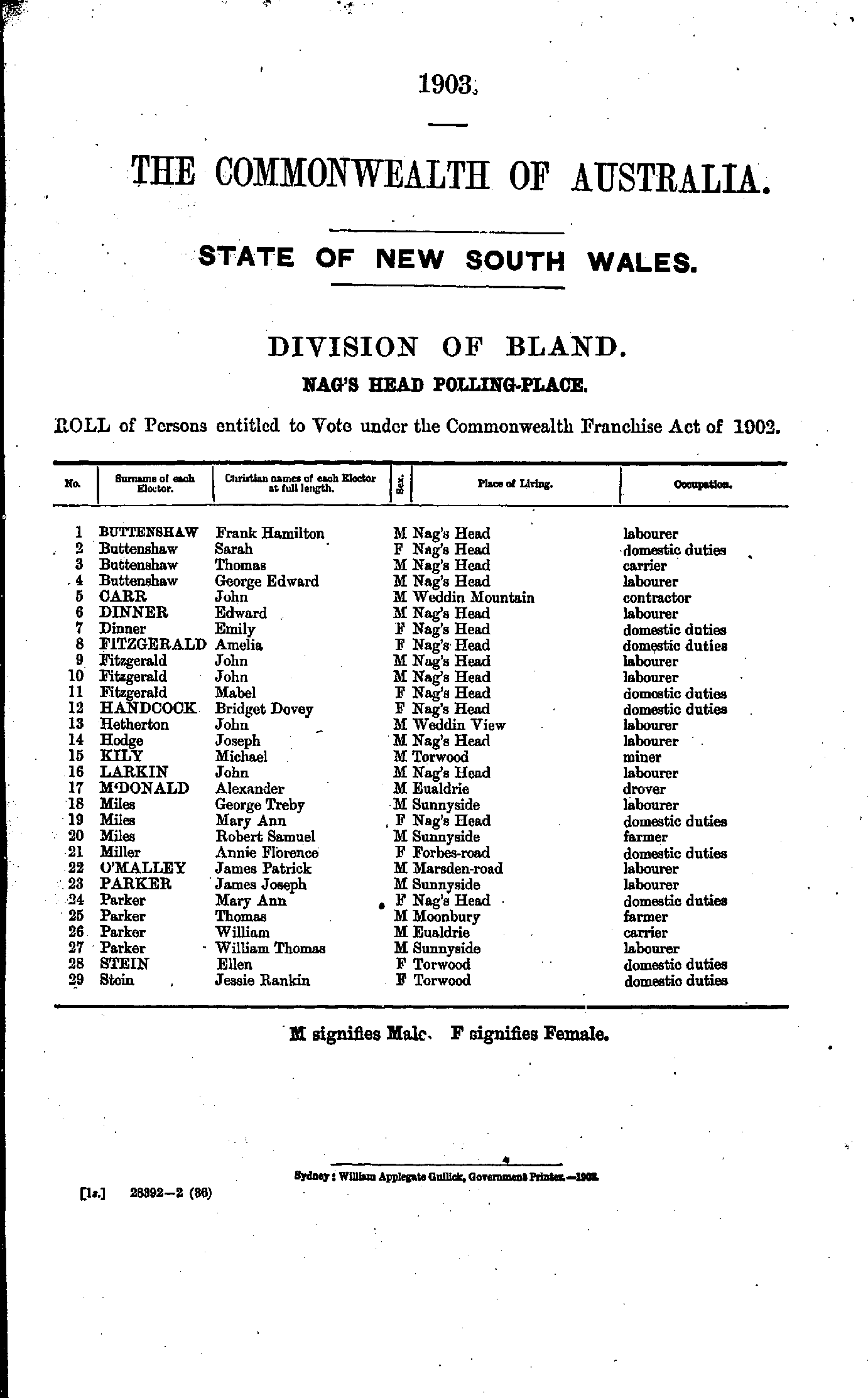
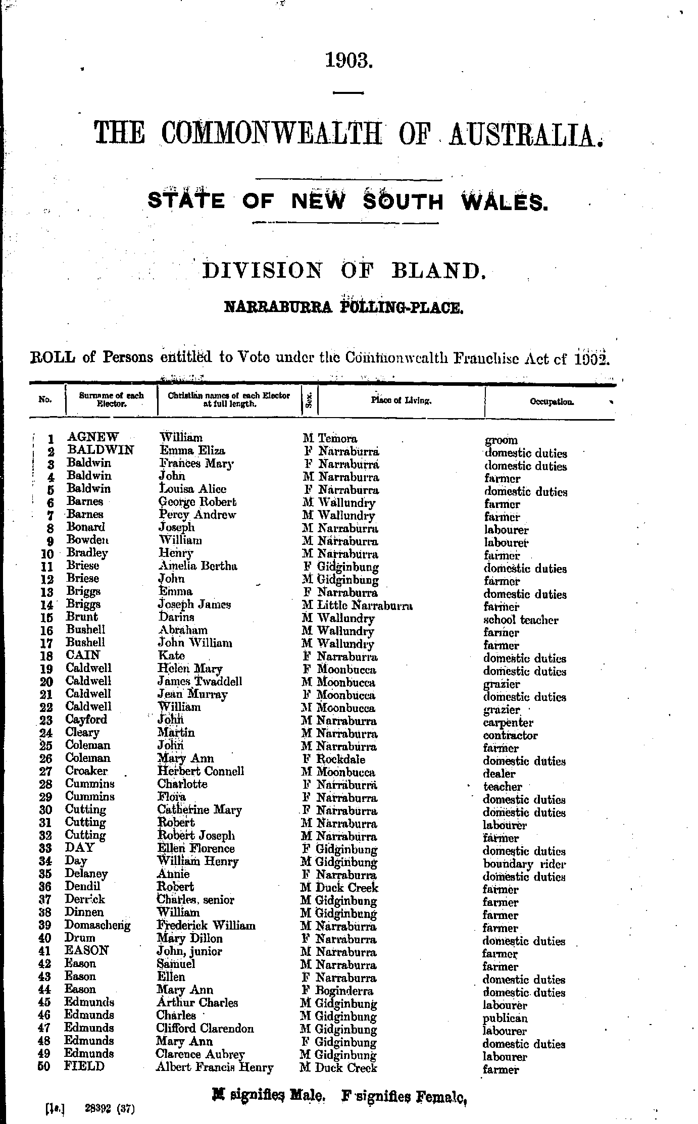
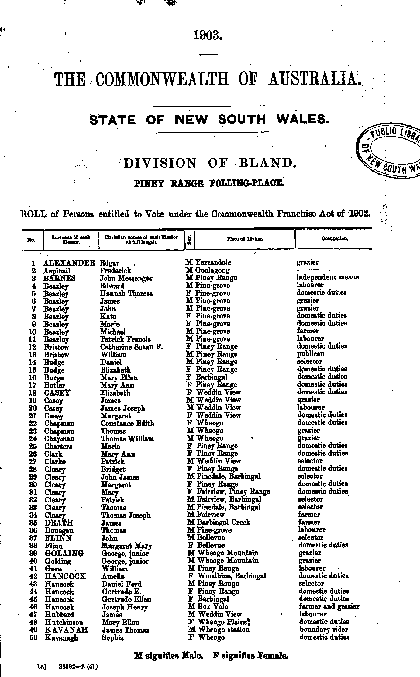
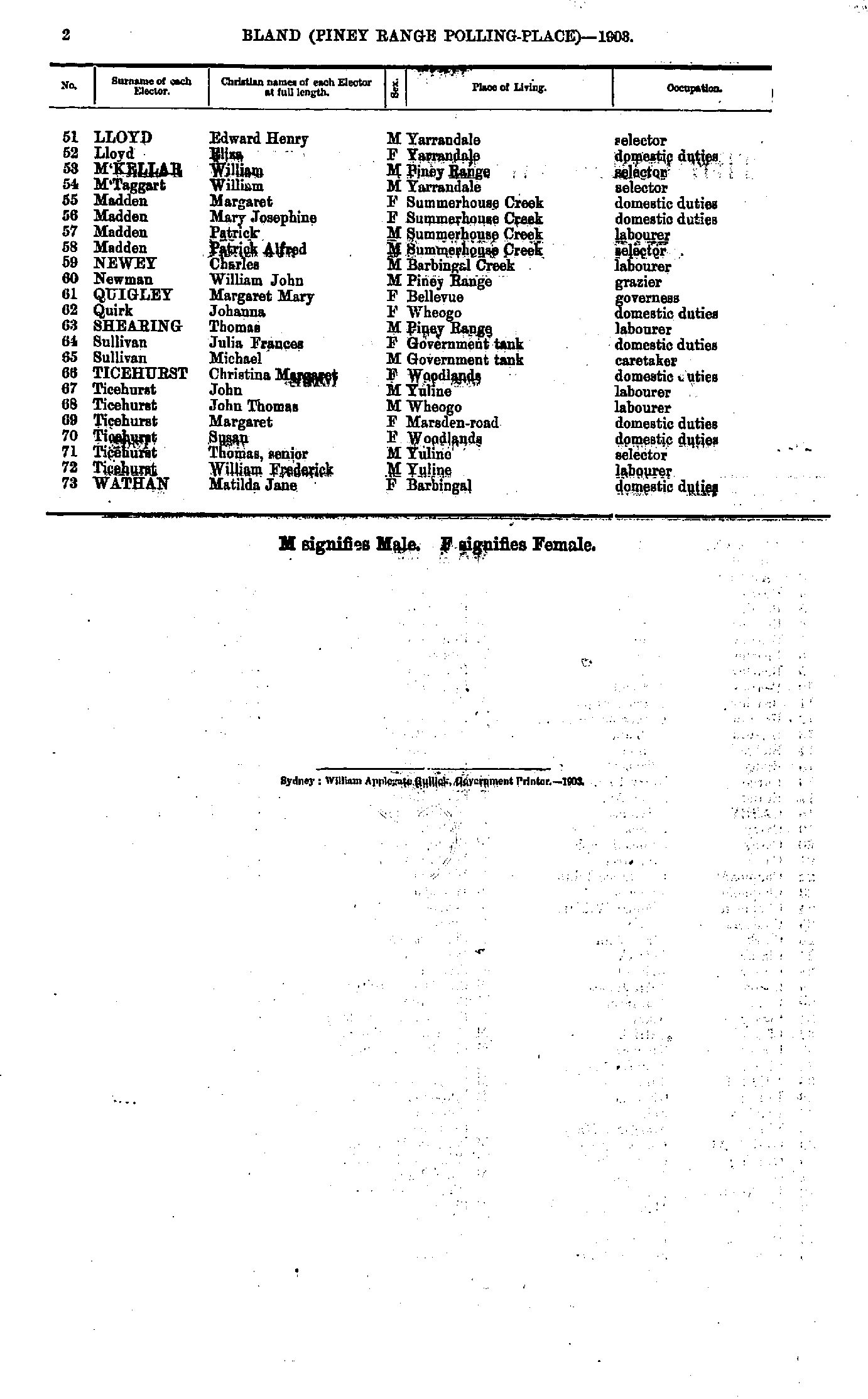
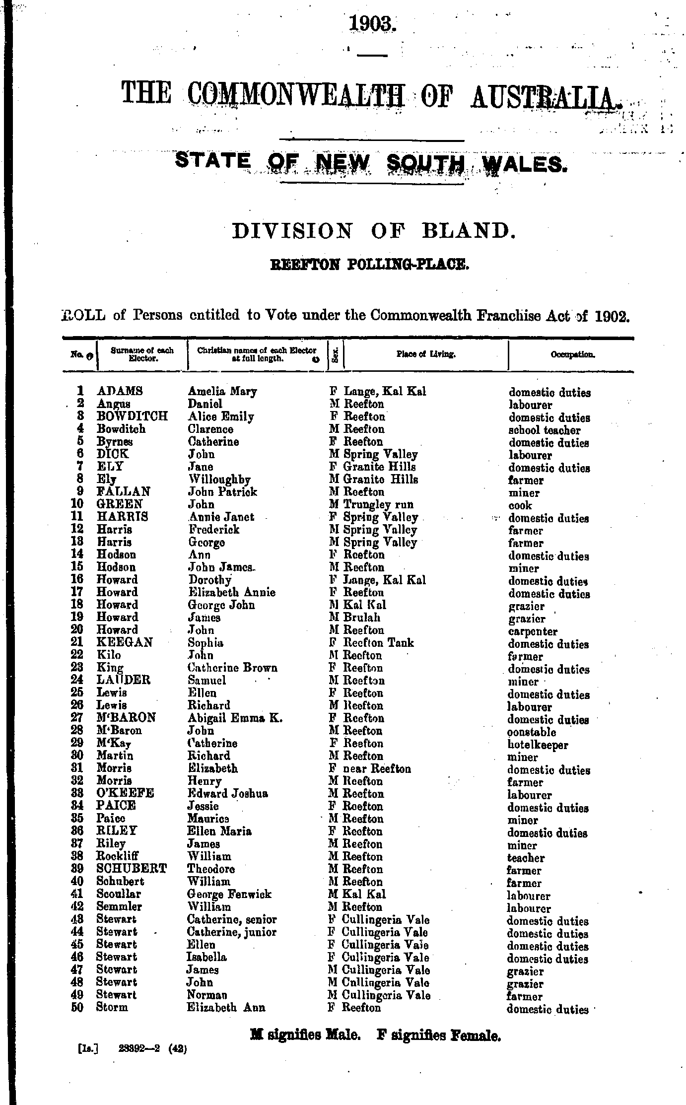
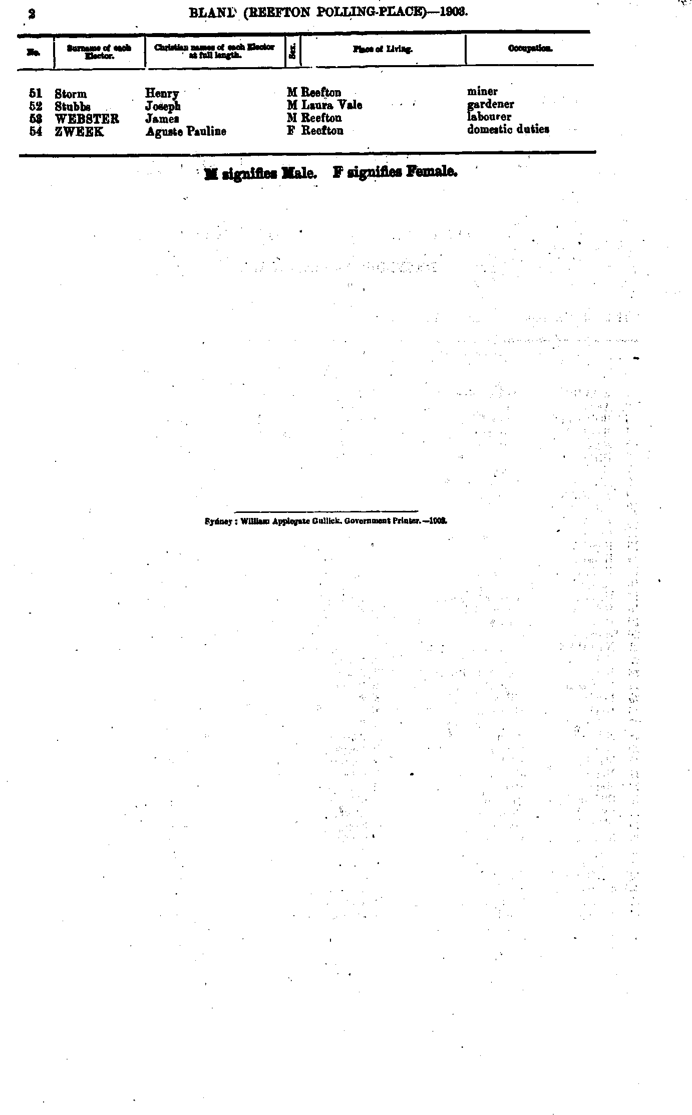
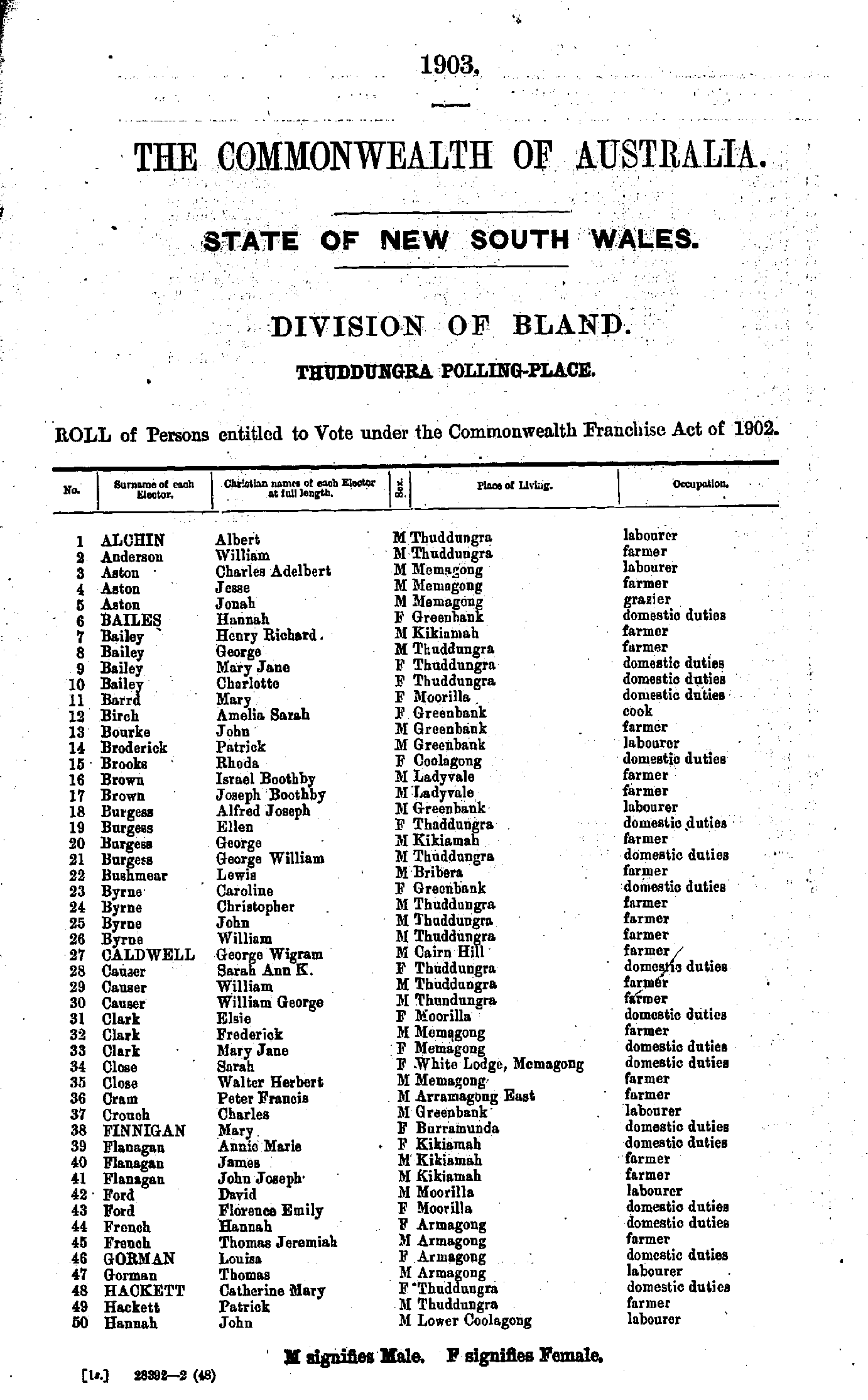
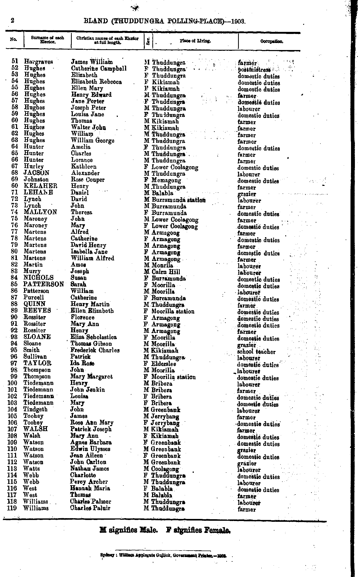
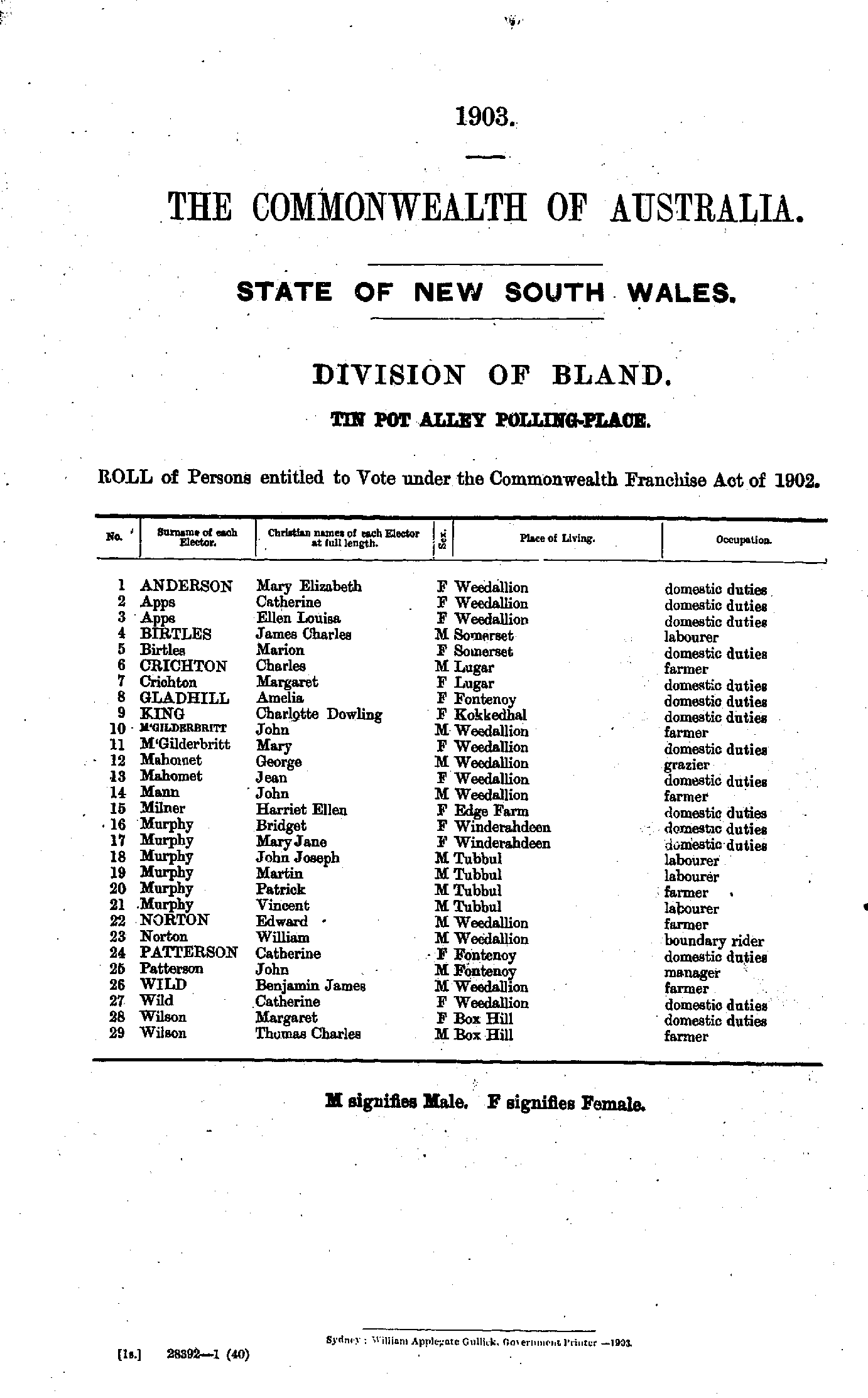
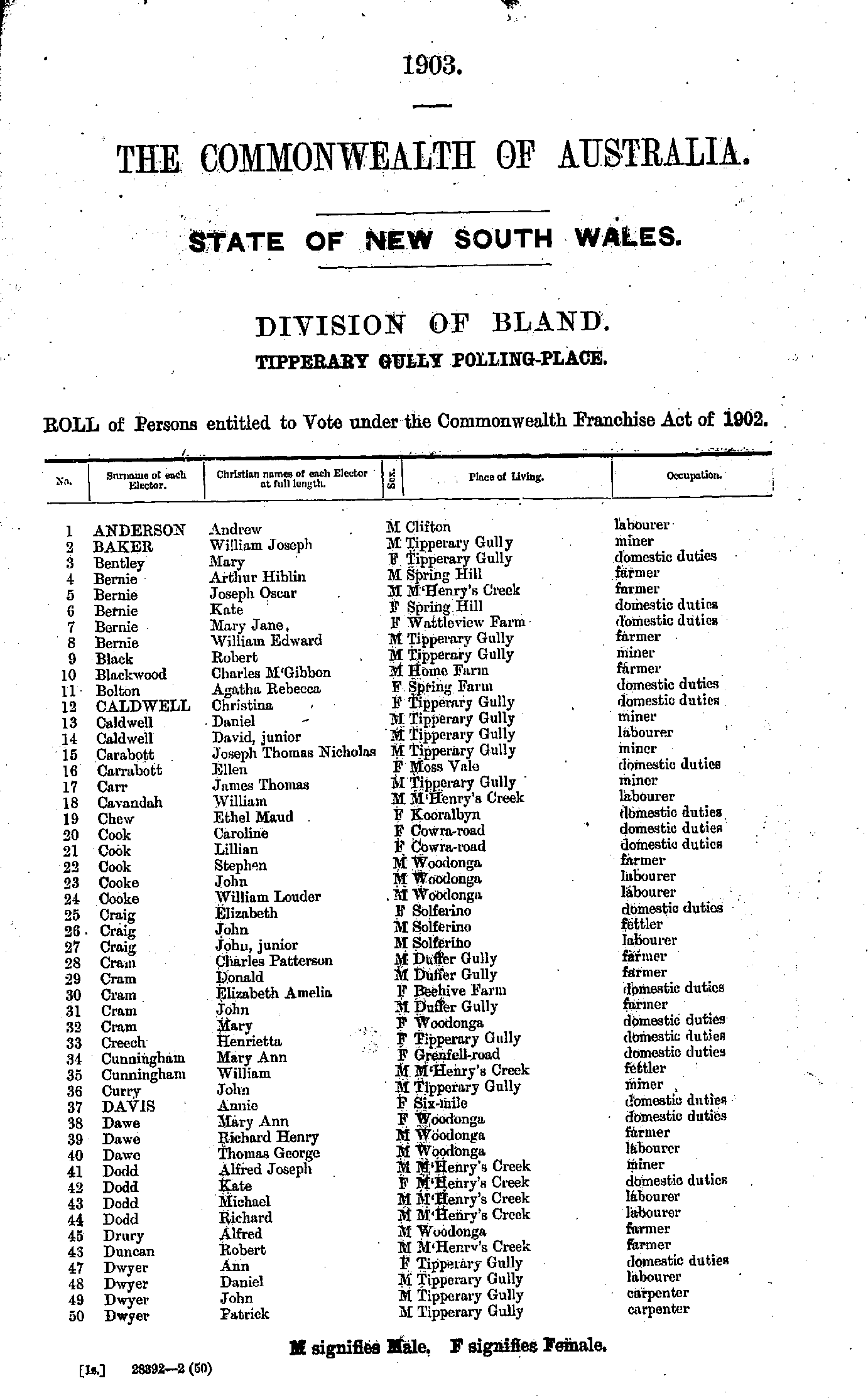
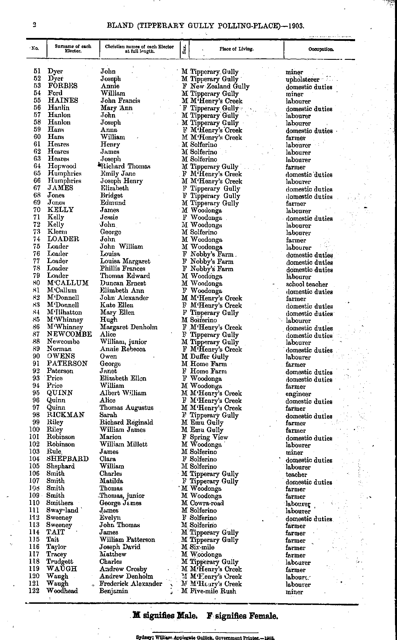
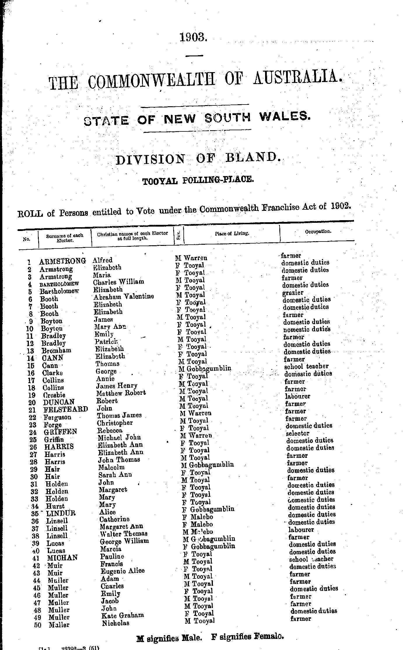
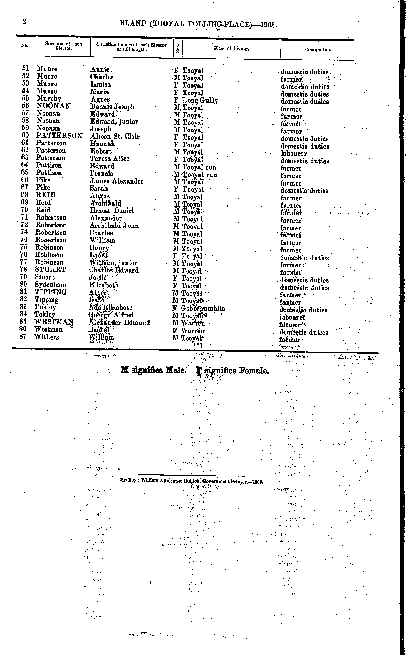
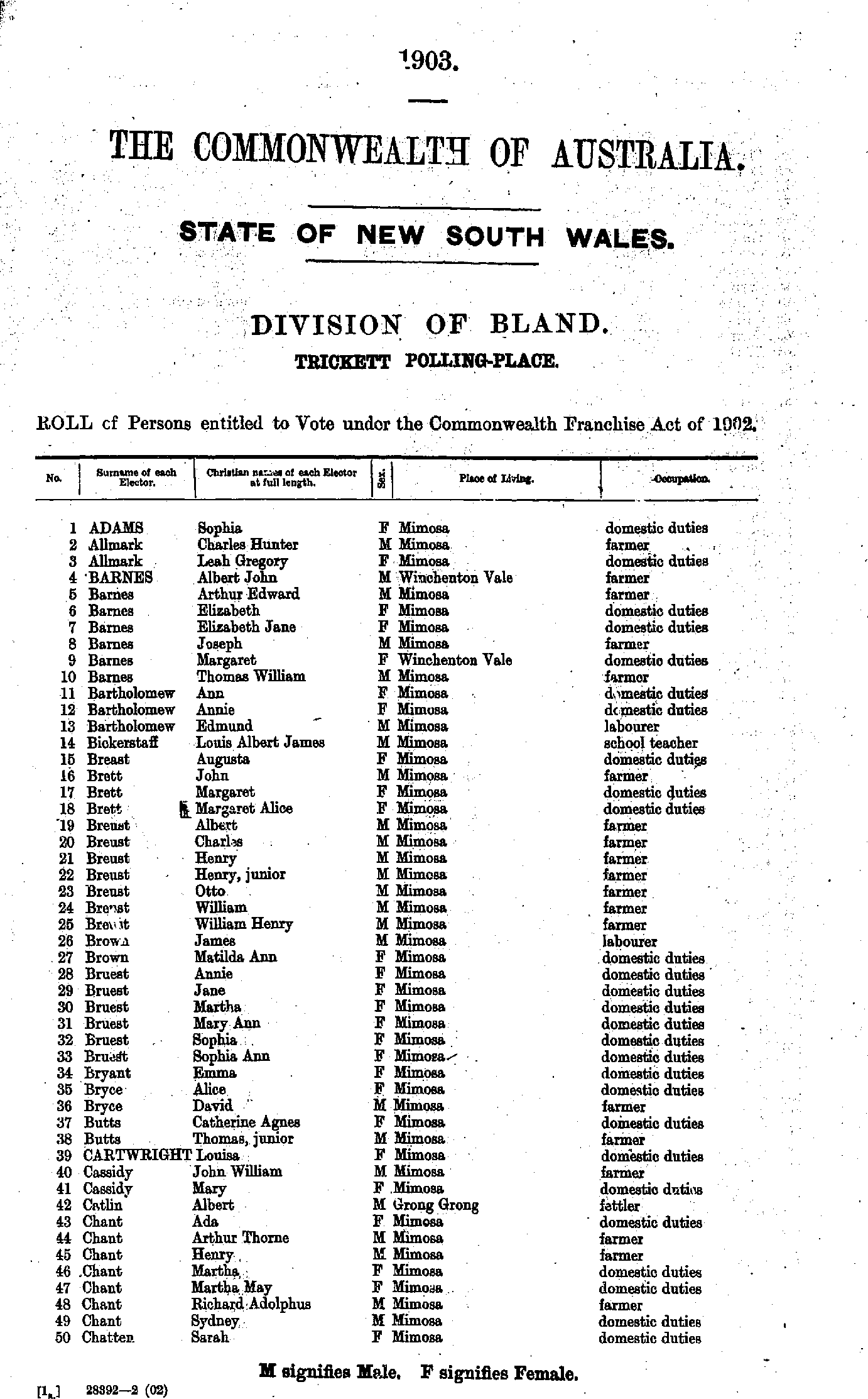
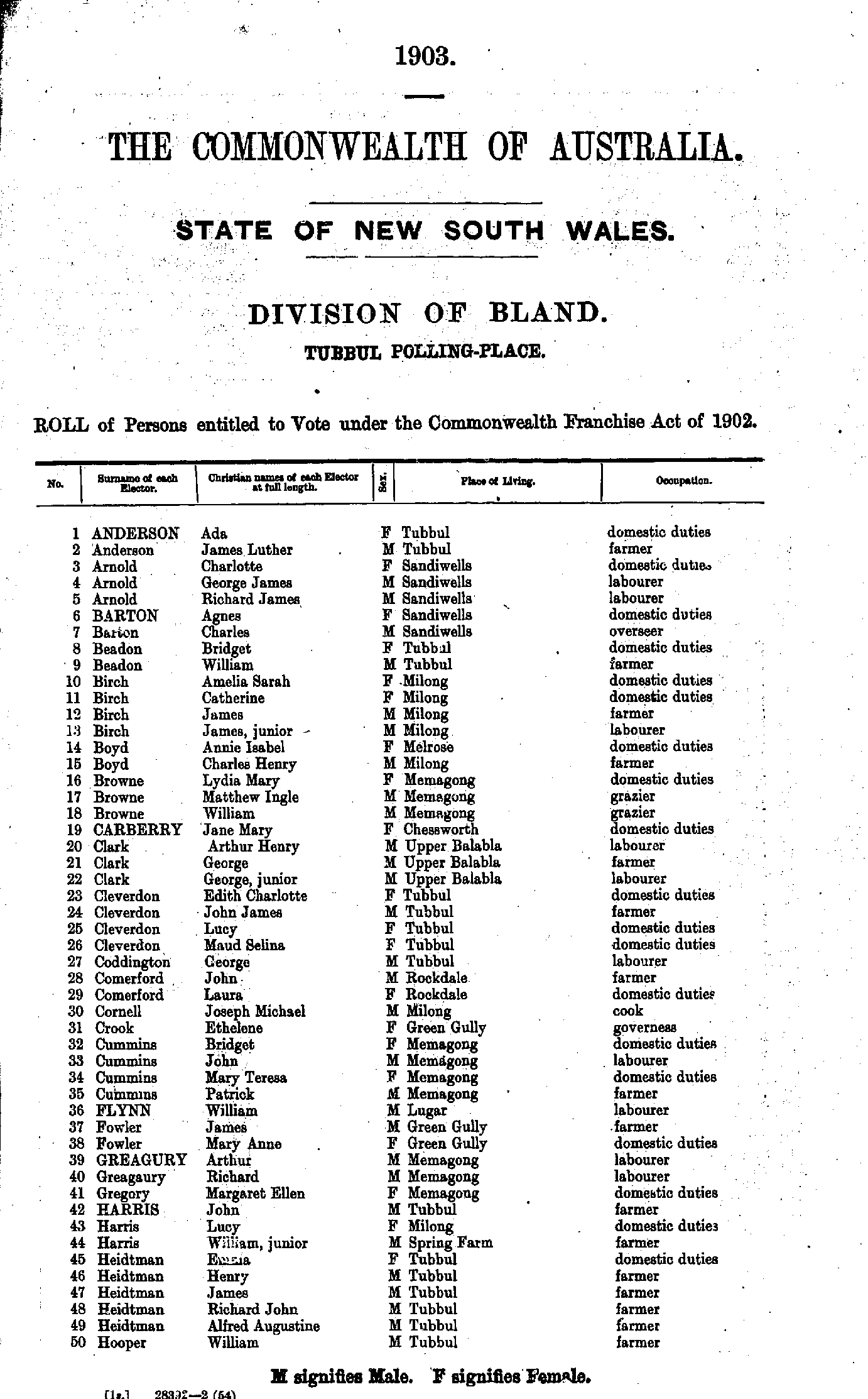
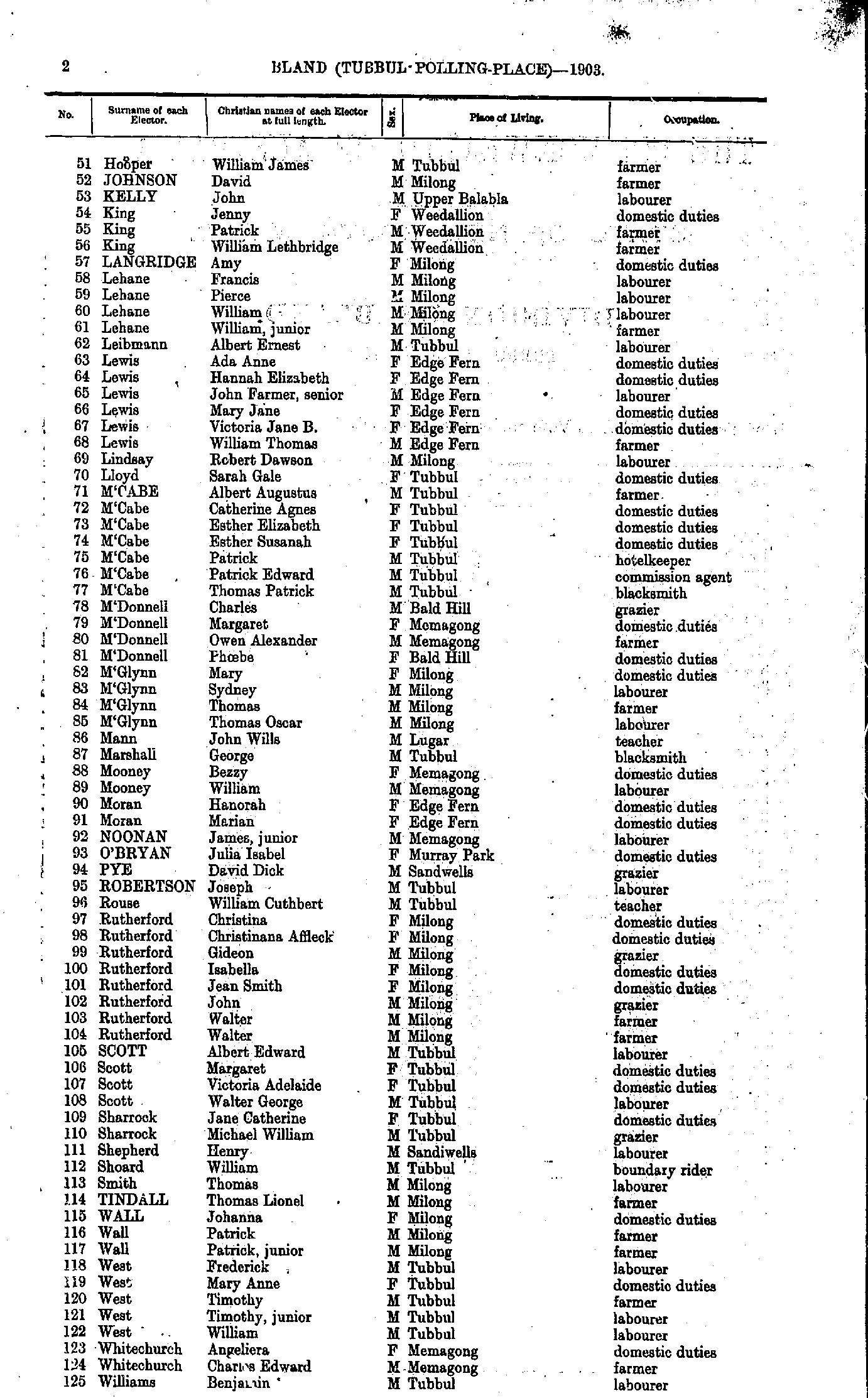
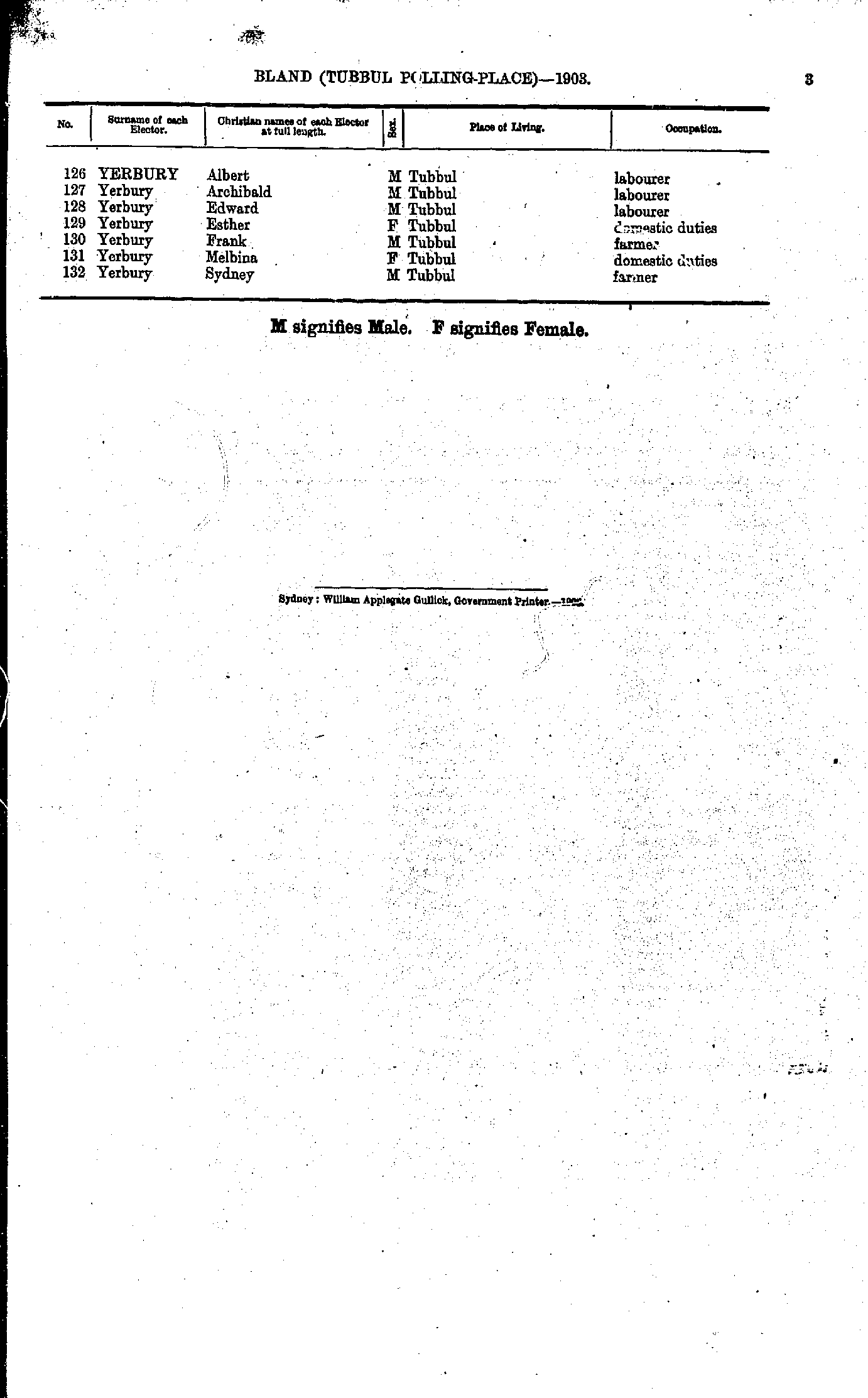
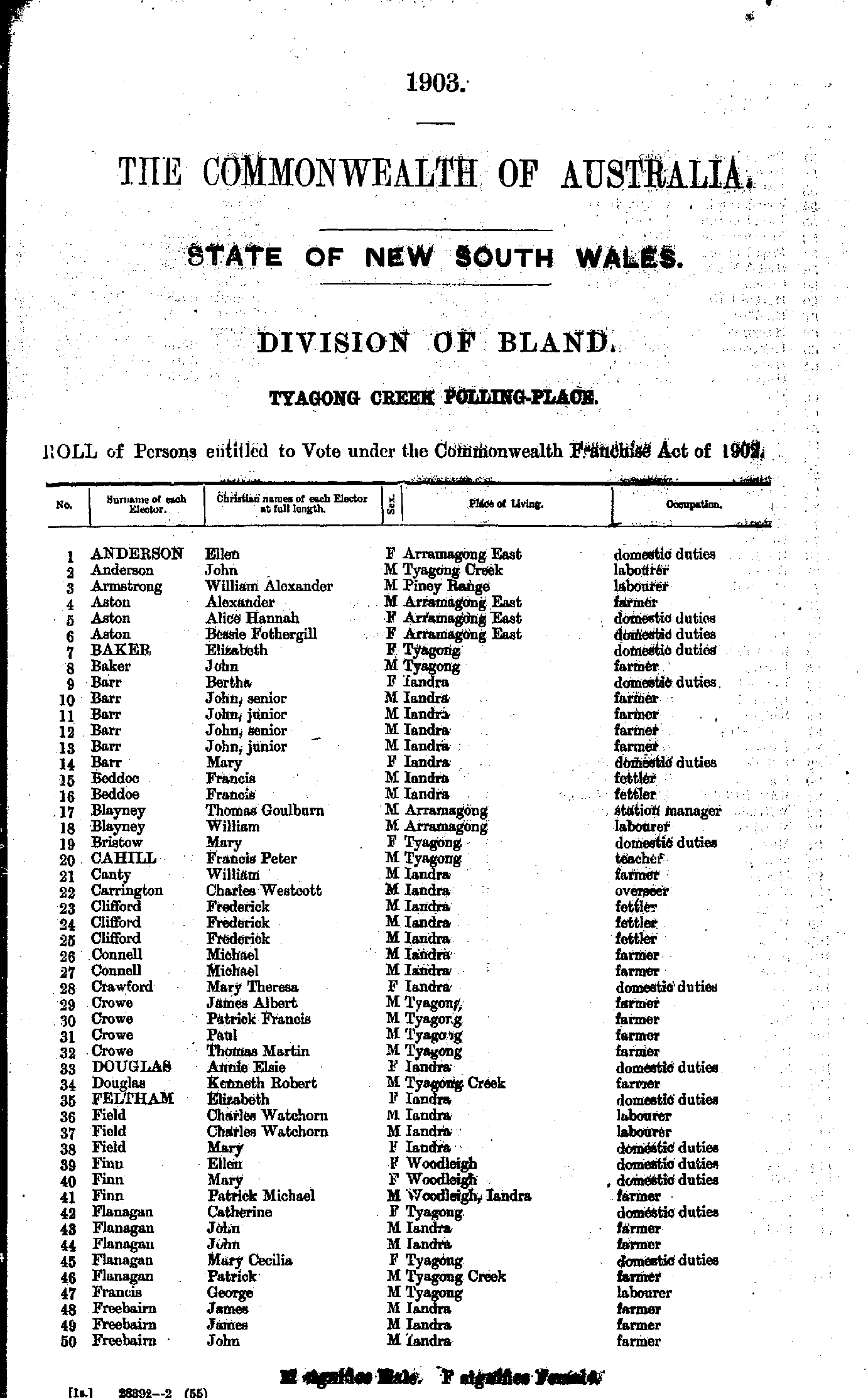
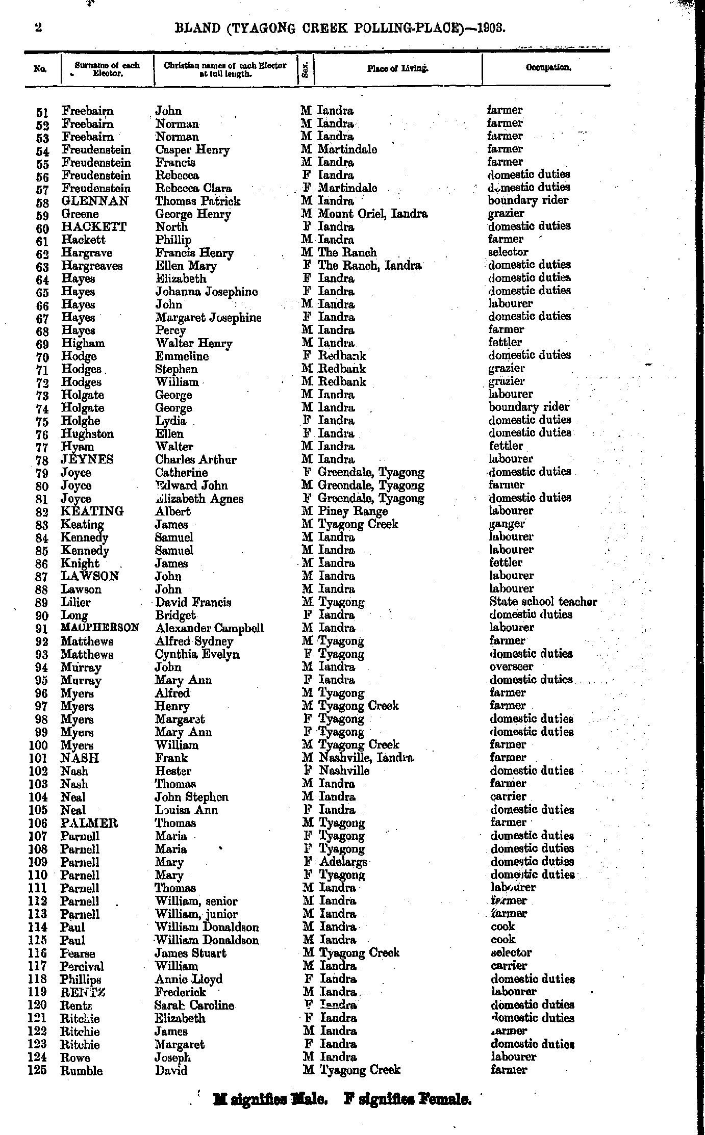
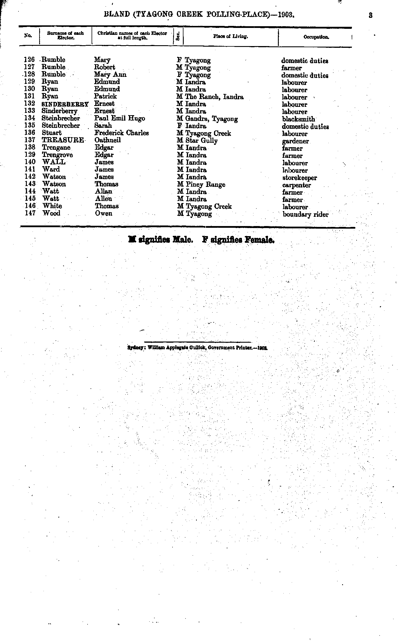
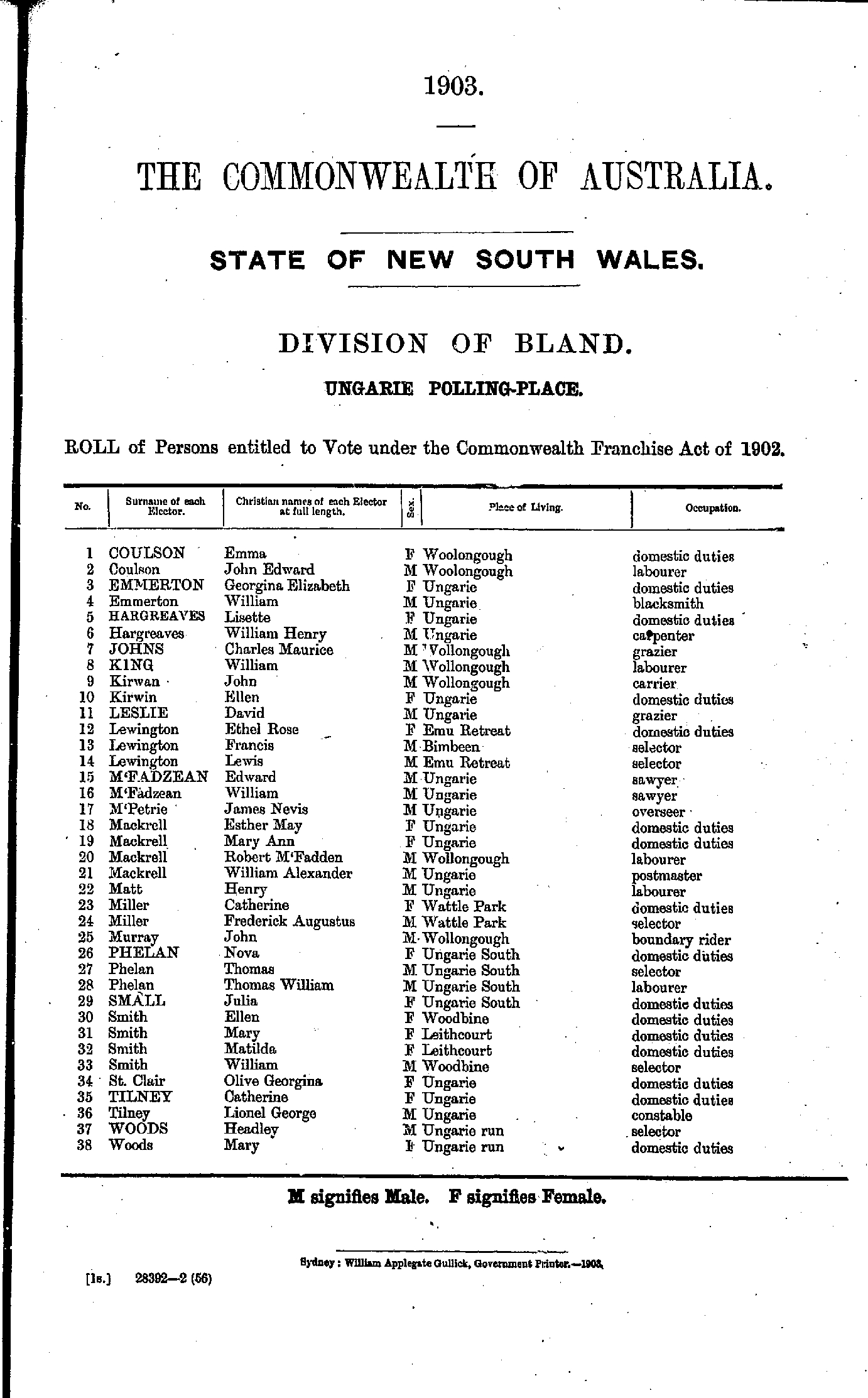
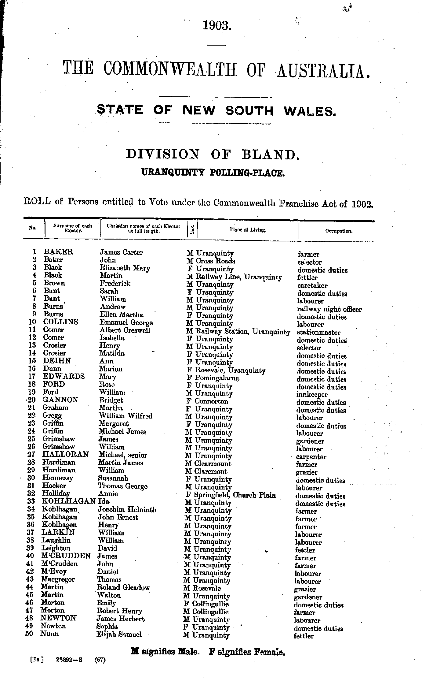
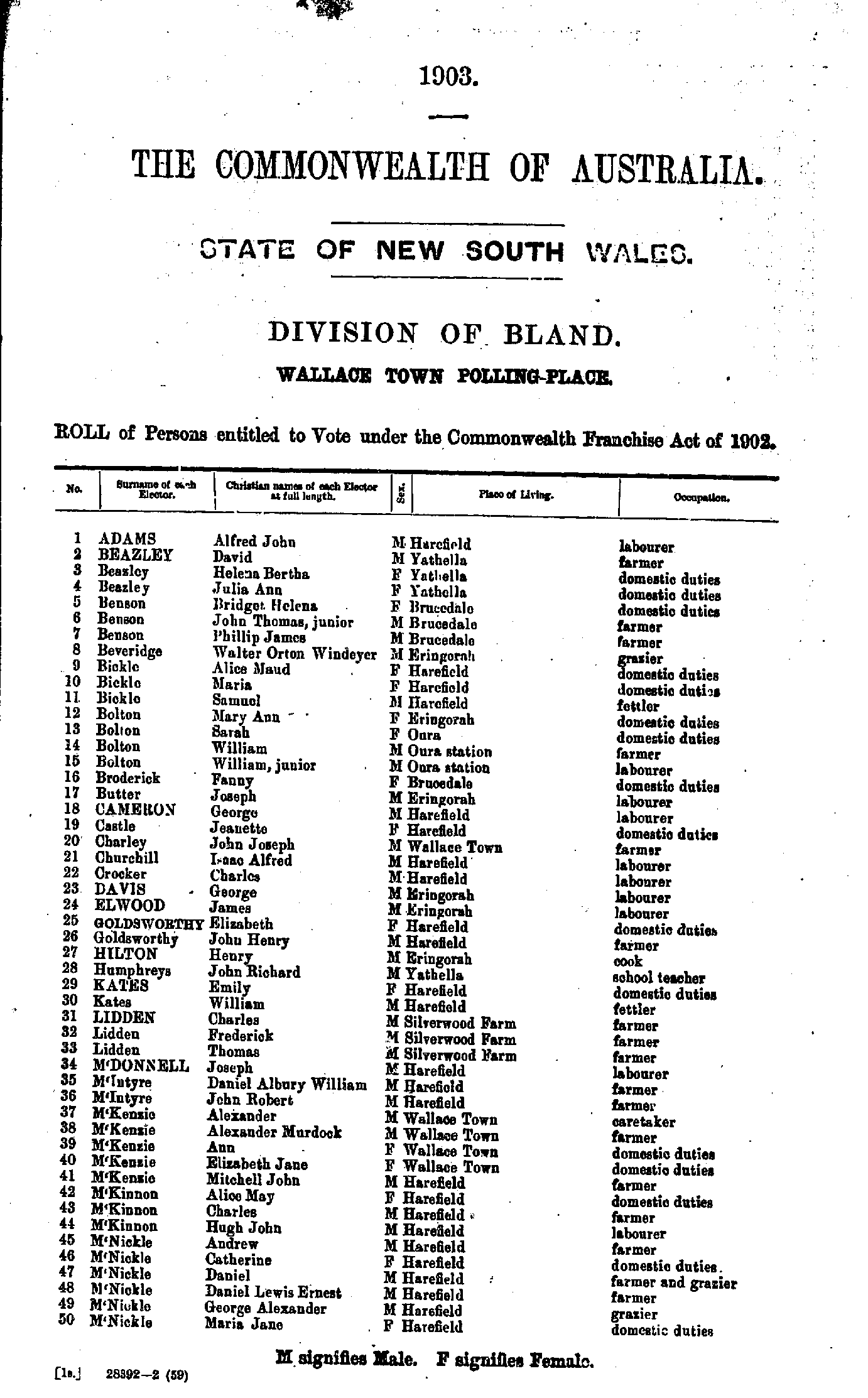
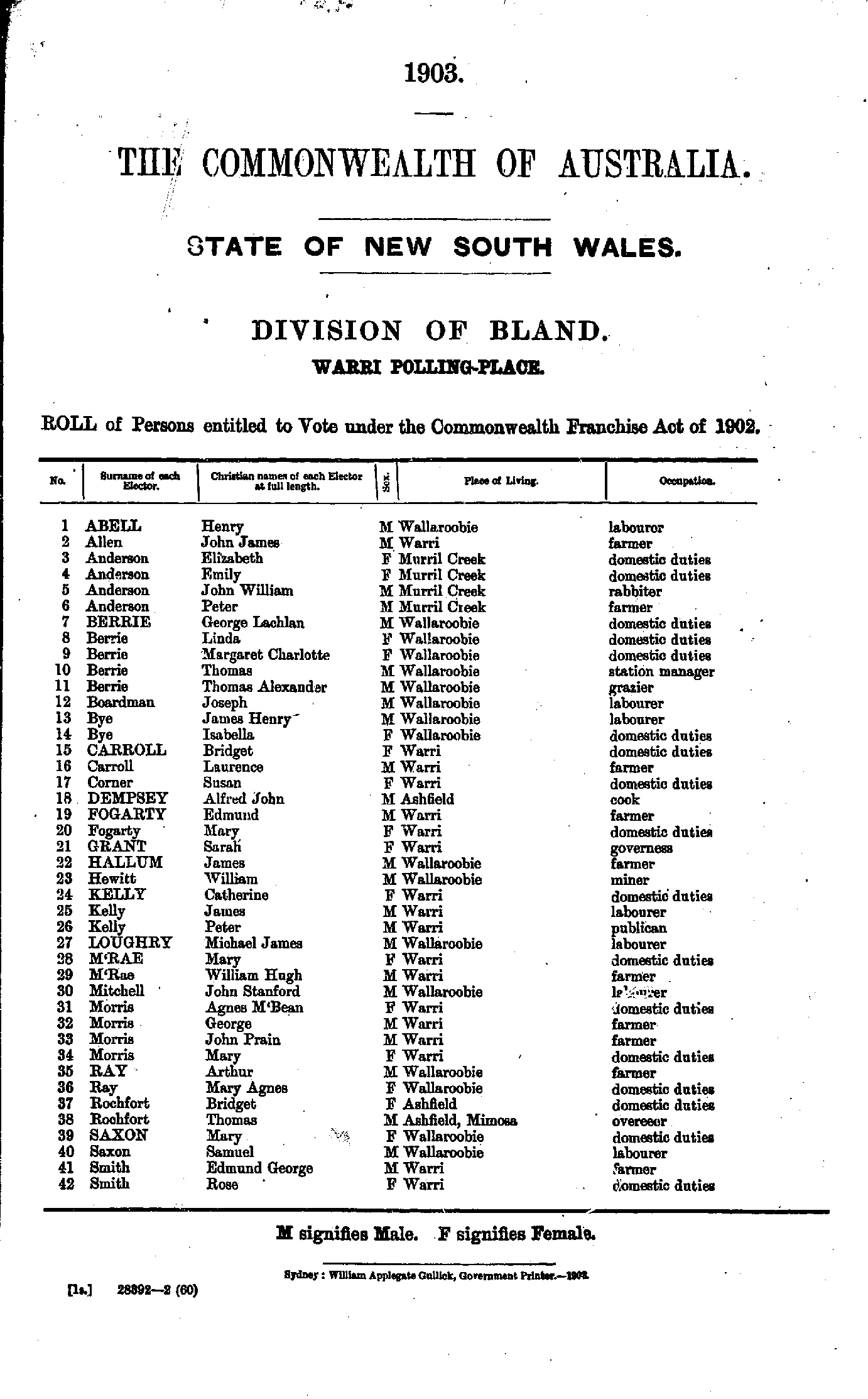
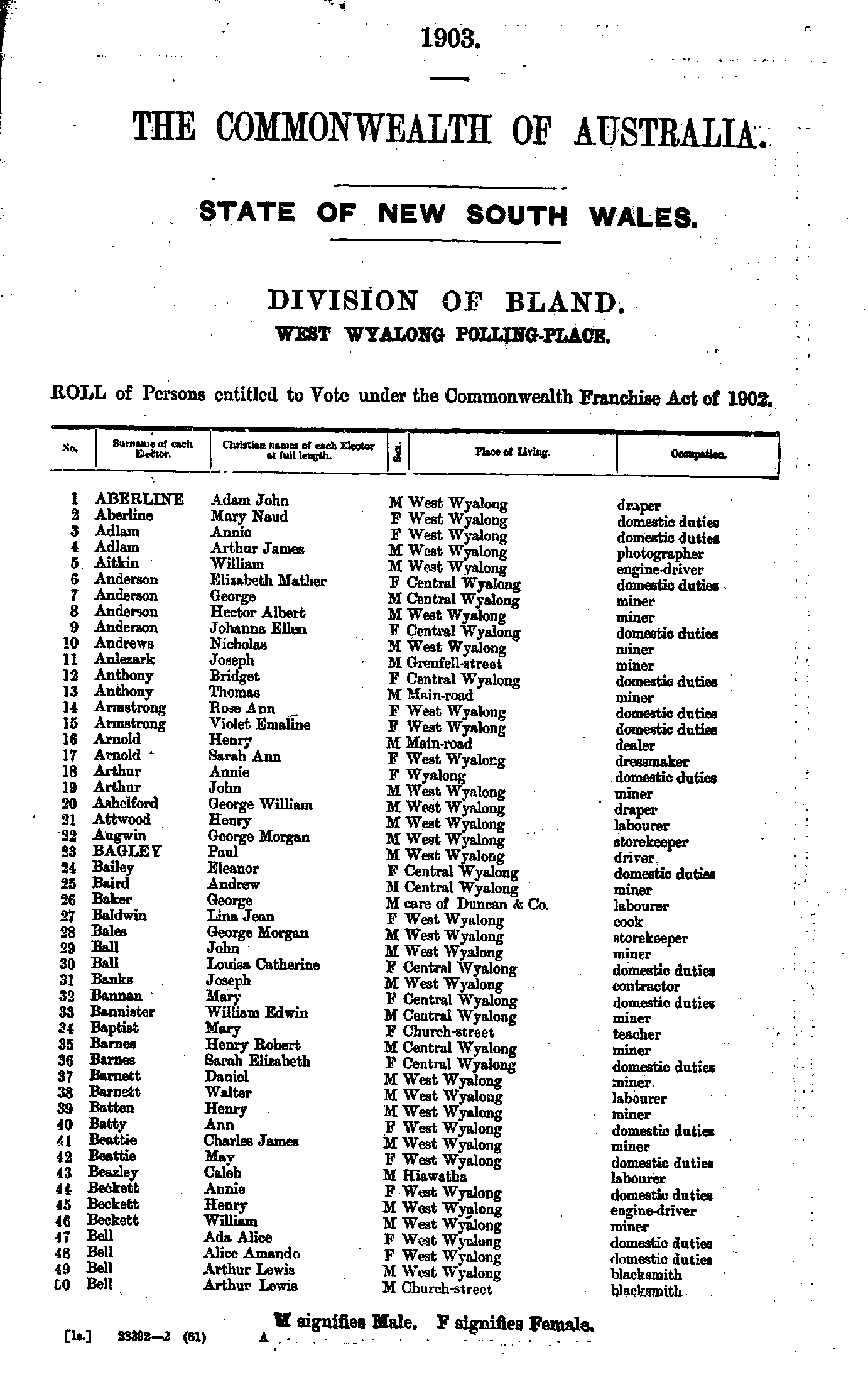
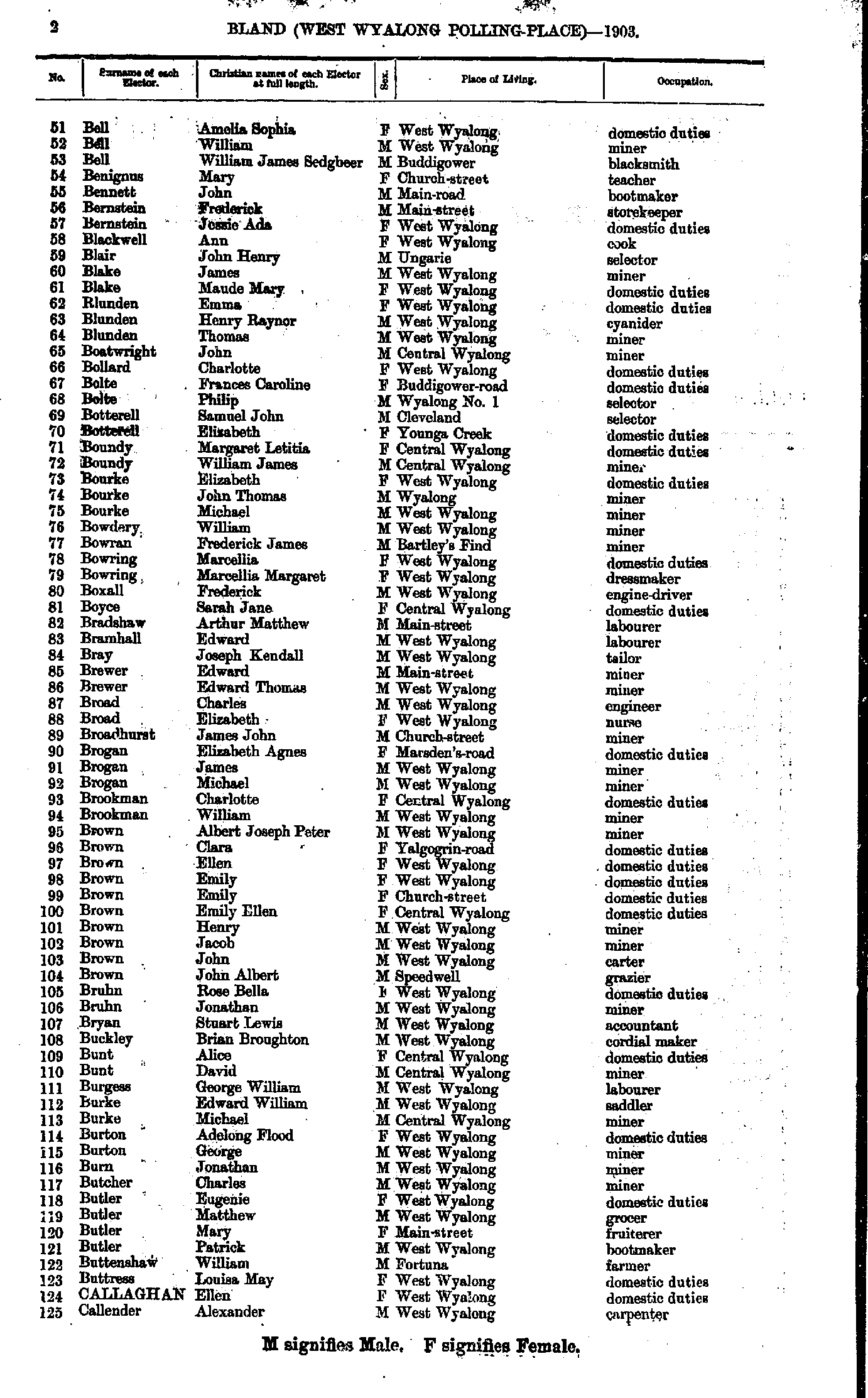
Roll of Persons entitled to Vote under the Commonwealth Franchise Act of 1902 Reproduced from microform copies of the originals in the Mitchell Library, State Library of New South Wales.
Index Copyright © Internet History Resources 2005
Electoral Maps of the Bland Division, 1901
Polling Places:
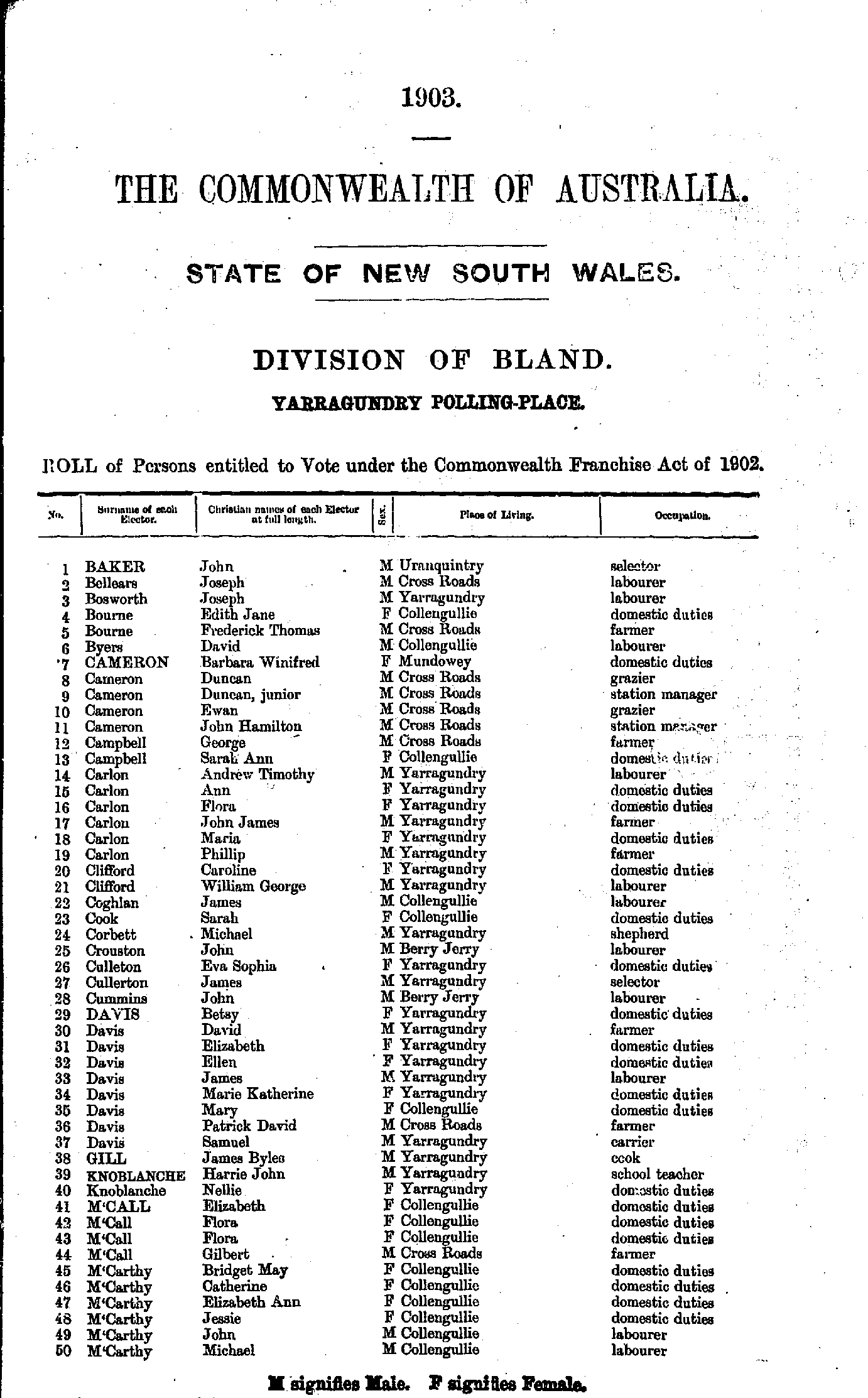
Alfred Town | Barellan | Barmedman | Bendick Murrell | Billy’s Lookout | Bimbi | Borambula | Broken Dam | Bumbaldry | Carrigaball | Central Ganmain | Colinroobie | Coolamon | Cottee | Creighton’s Creek | Currawanna | Devlin’s Siding | Downside | Duck Creek | Ganmain | Goolagong | Grenfell | Grogan | Grong Grong | Jackson’s Waterhole | Junee | Junee Reefs | Kildary | Kockibitoo | Koorawatha | Lake Albert | Marengo | Methul | Monteagle | Morangarell | Nag's Head | Narraburra | Narrandera | North Berry Jerry | North Yanco | Piney Range | Reefton | Sebastopol | South Yalgogrin | Spring Dale | Stockinbingal | Temora | Thuddungra | Tin Pot Alley | Tipperary Gully | Tooyal | Trickett | Trungley | Tubbul | Tyagong Creek | Ungarie | Uranquinty | Wagga Wagga | Wallace Town | Warri | West Wyalong | Wyalong | Yalgogrin North | Yarragundry | Young |
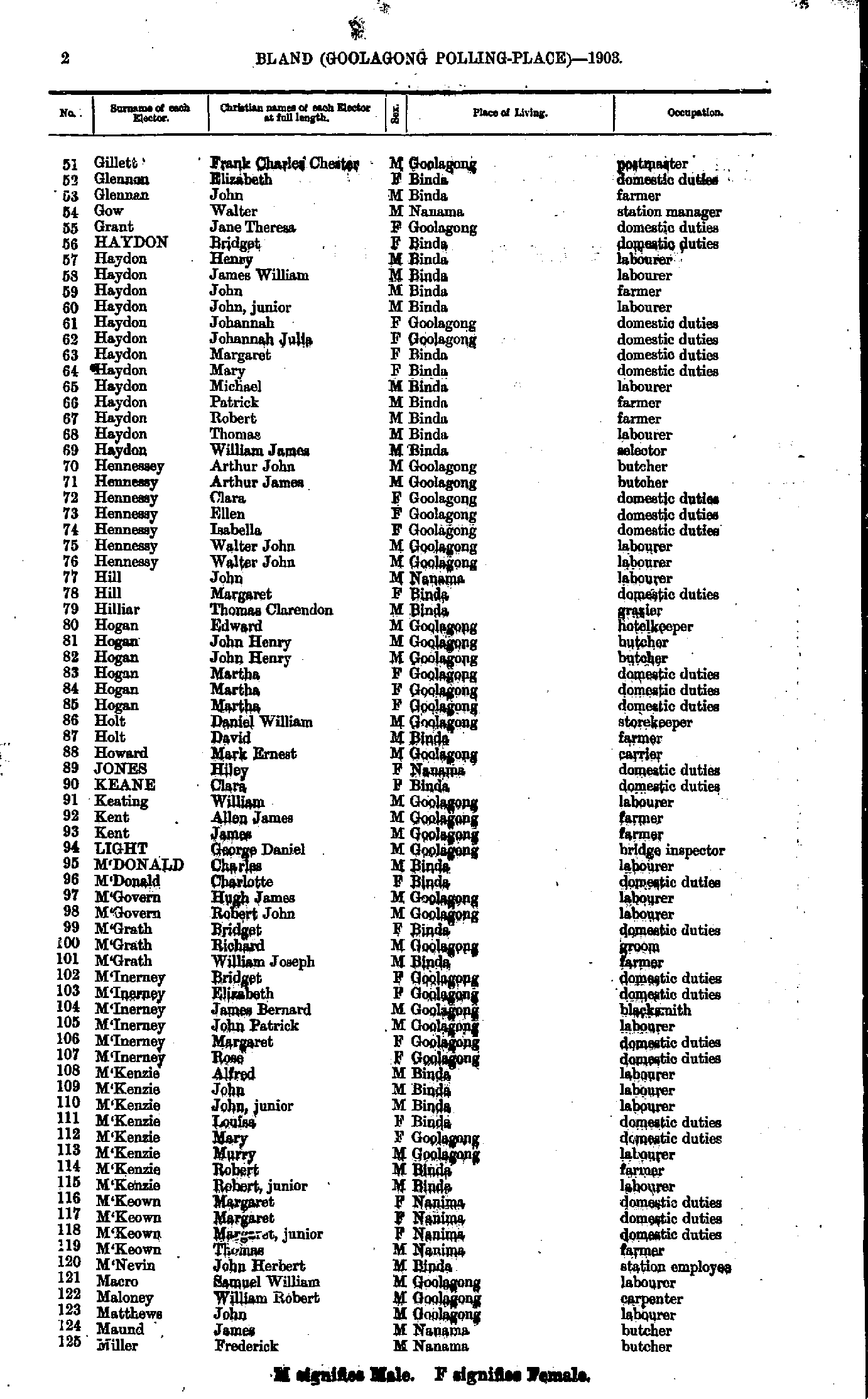
- Ahern David - Cassidy Margaret
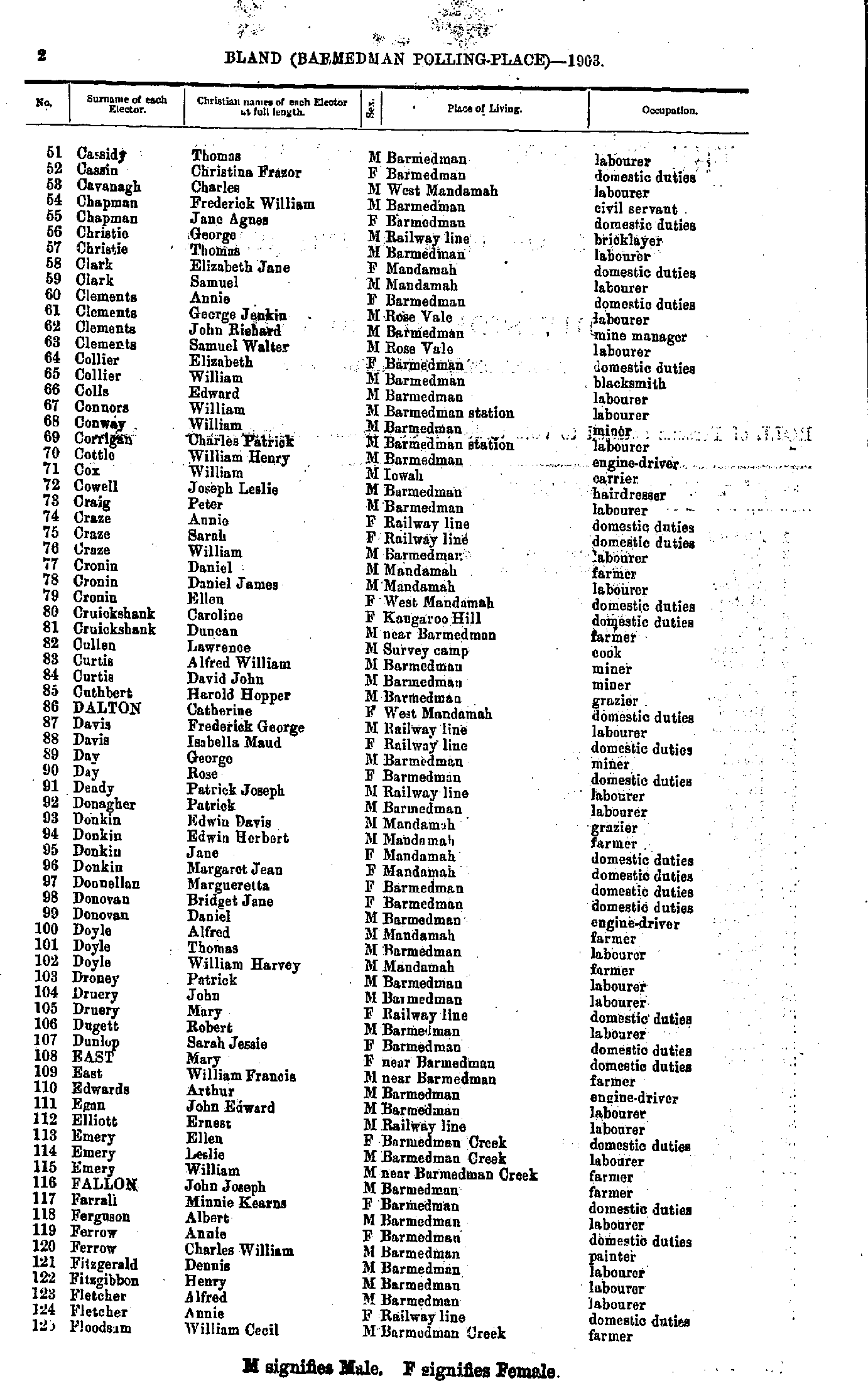
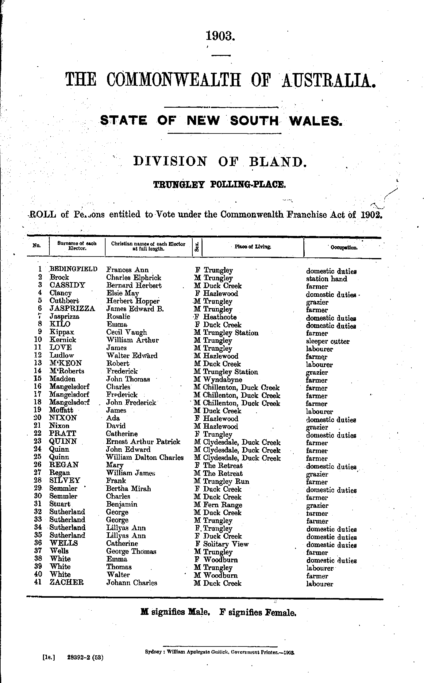
- Cassidy Thomas - Floodsam William
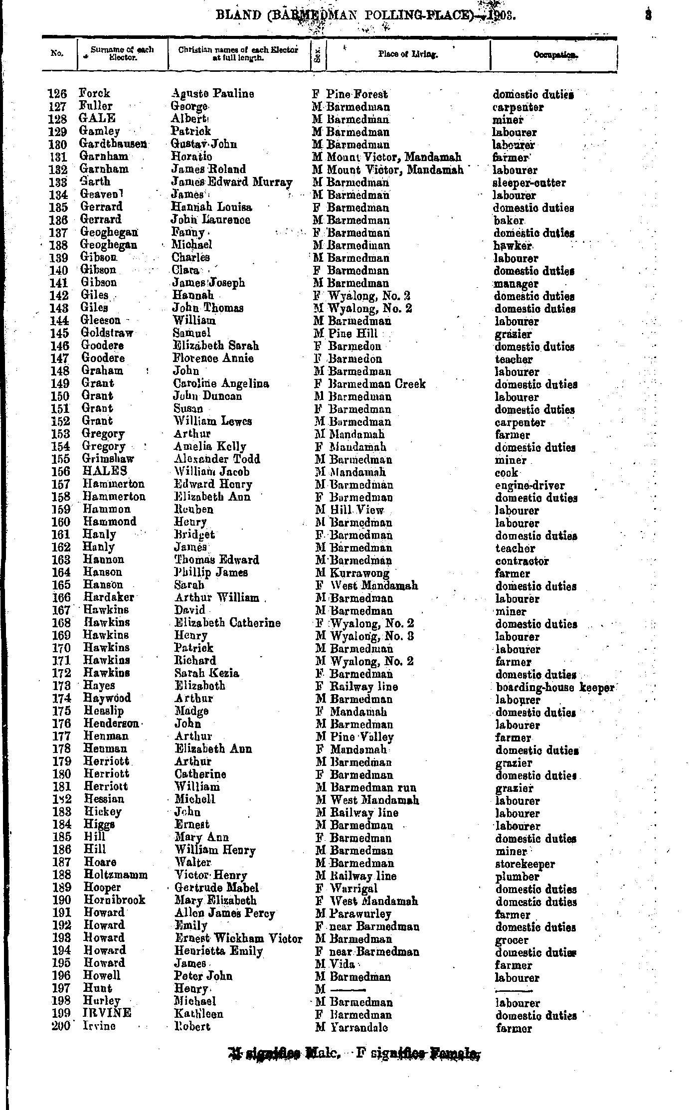
- Forck Aguste - Irvine Robert
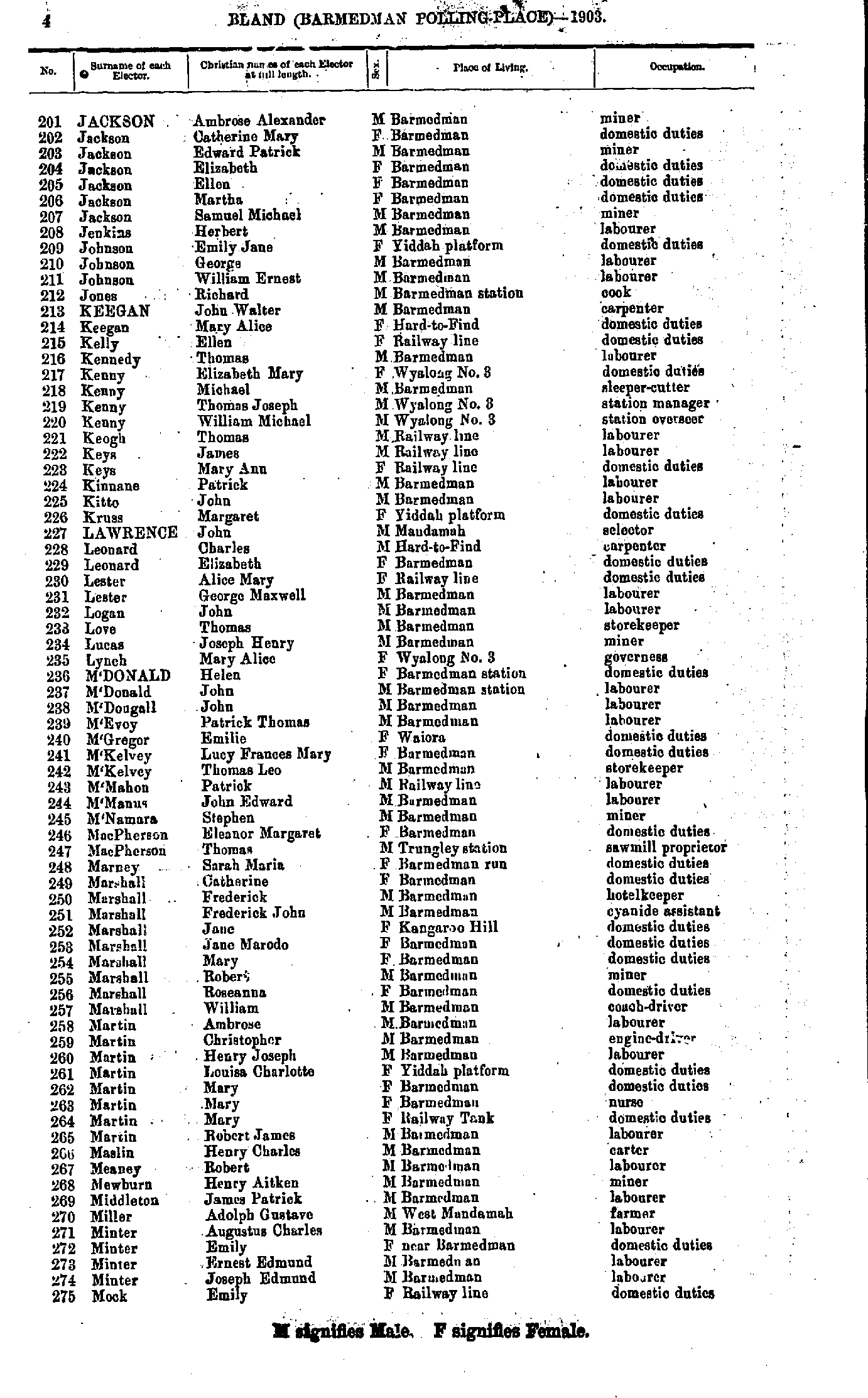
- Jackson Ambrose - Mock Emily
- Mock William - Raymont John
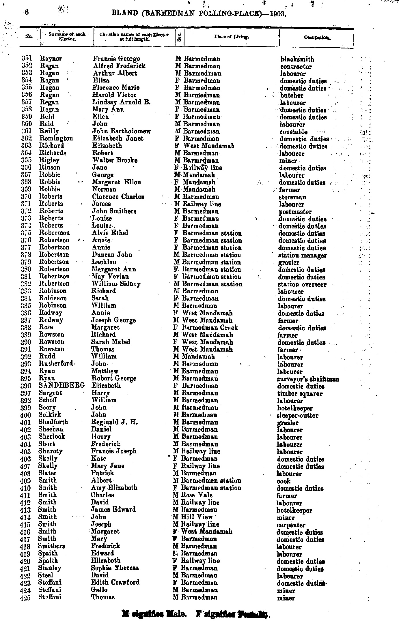
- Raynor Francis - Steffani Thomas
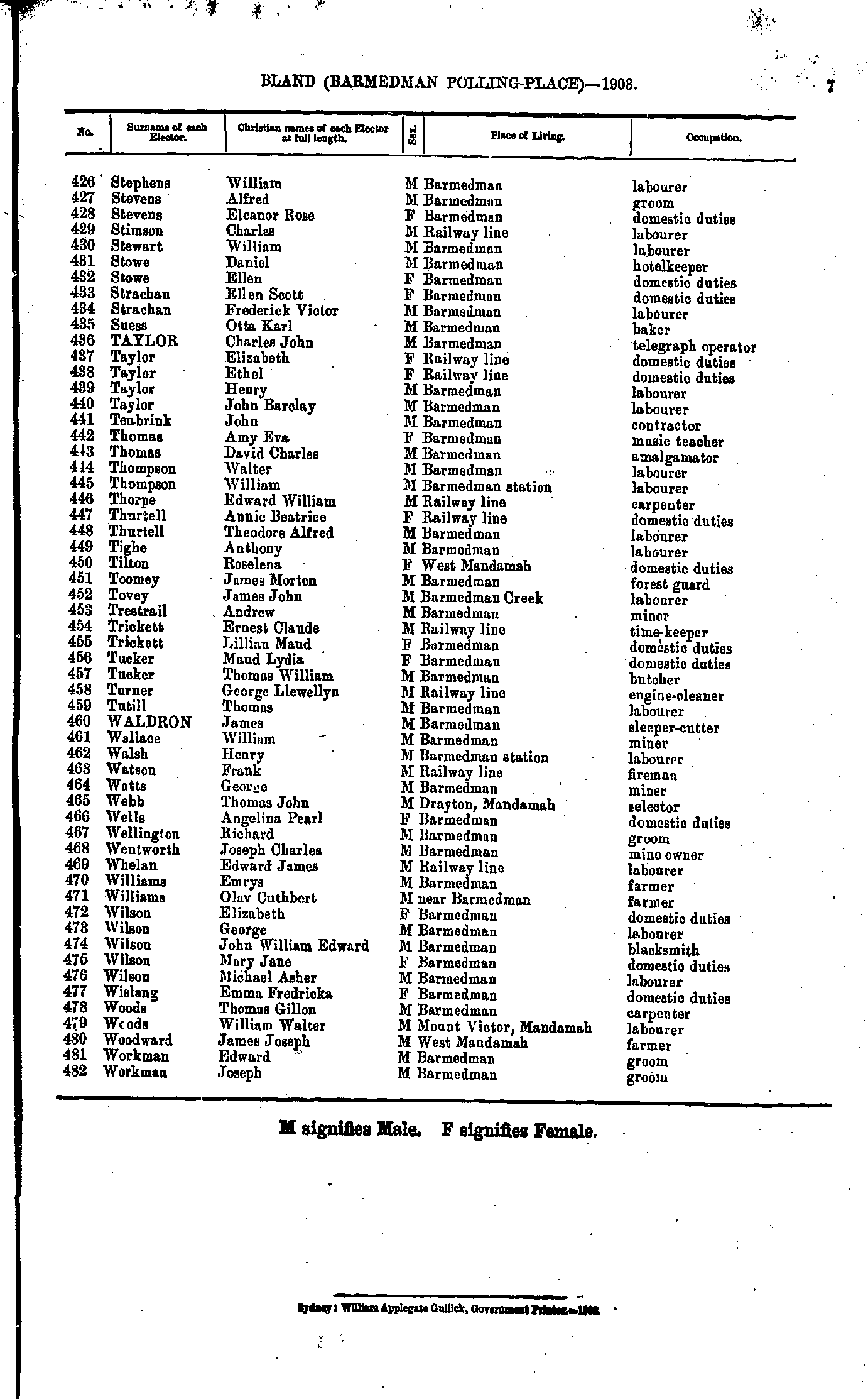
- Stephens William - Workman Joseph
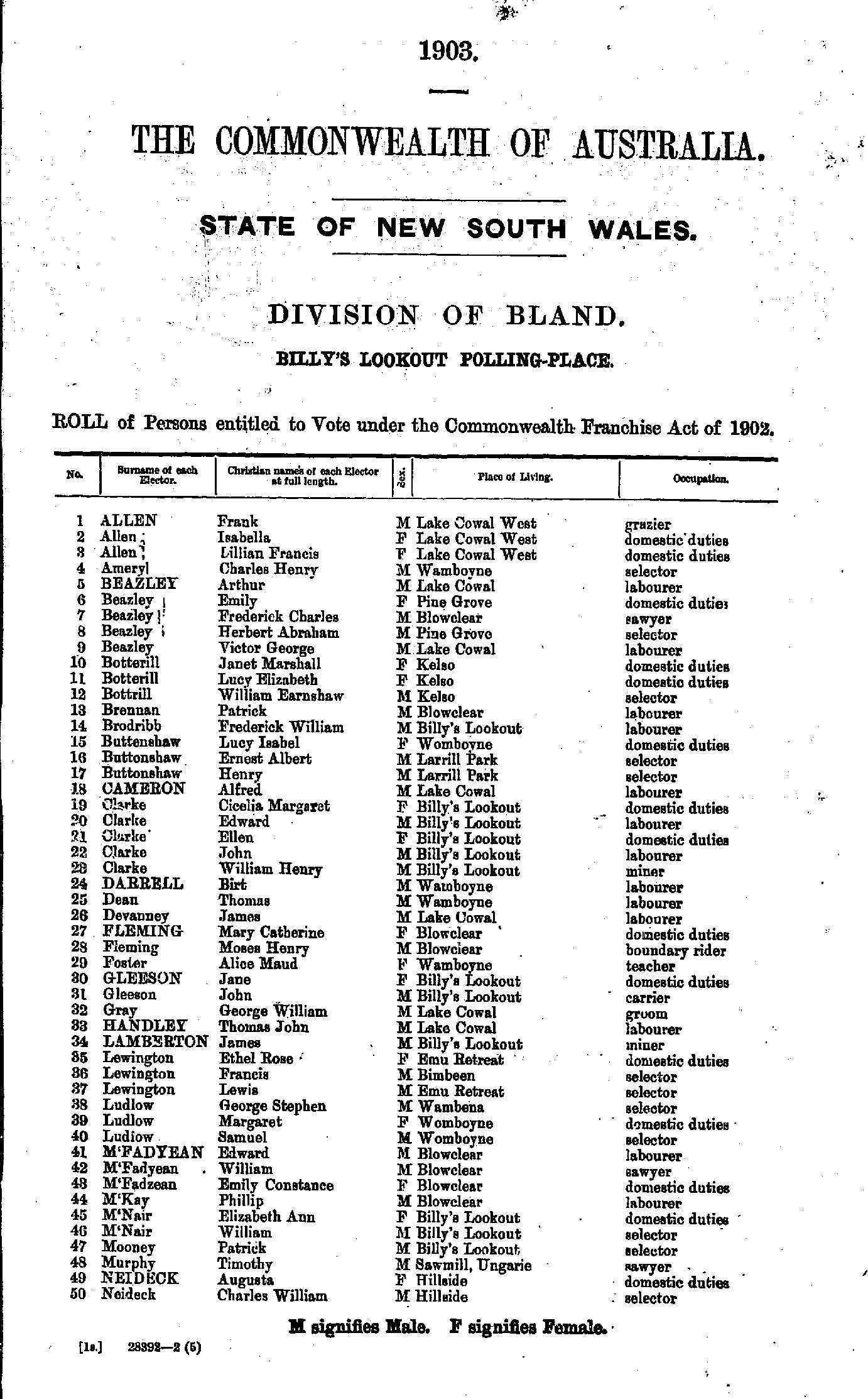
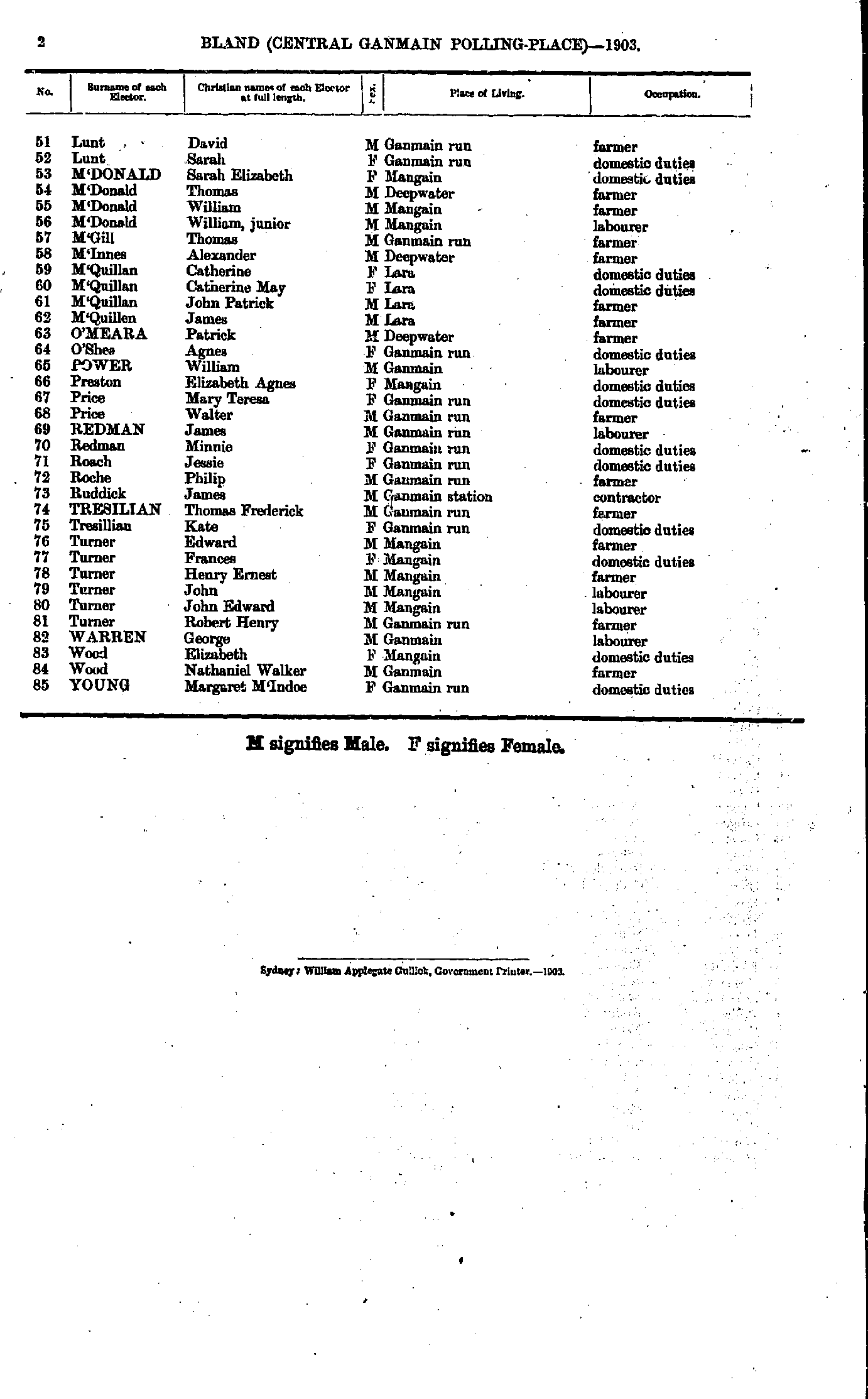
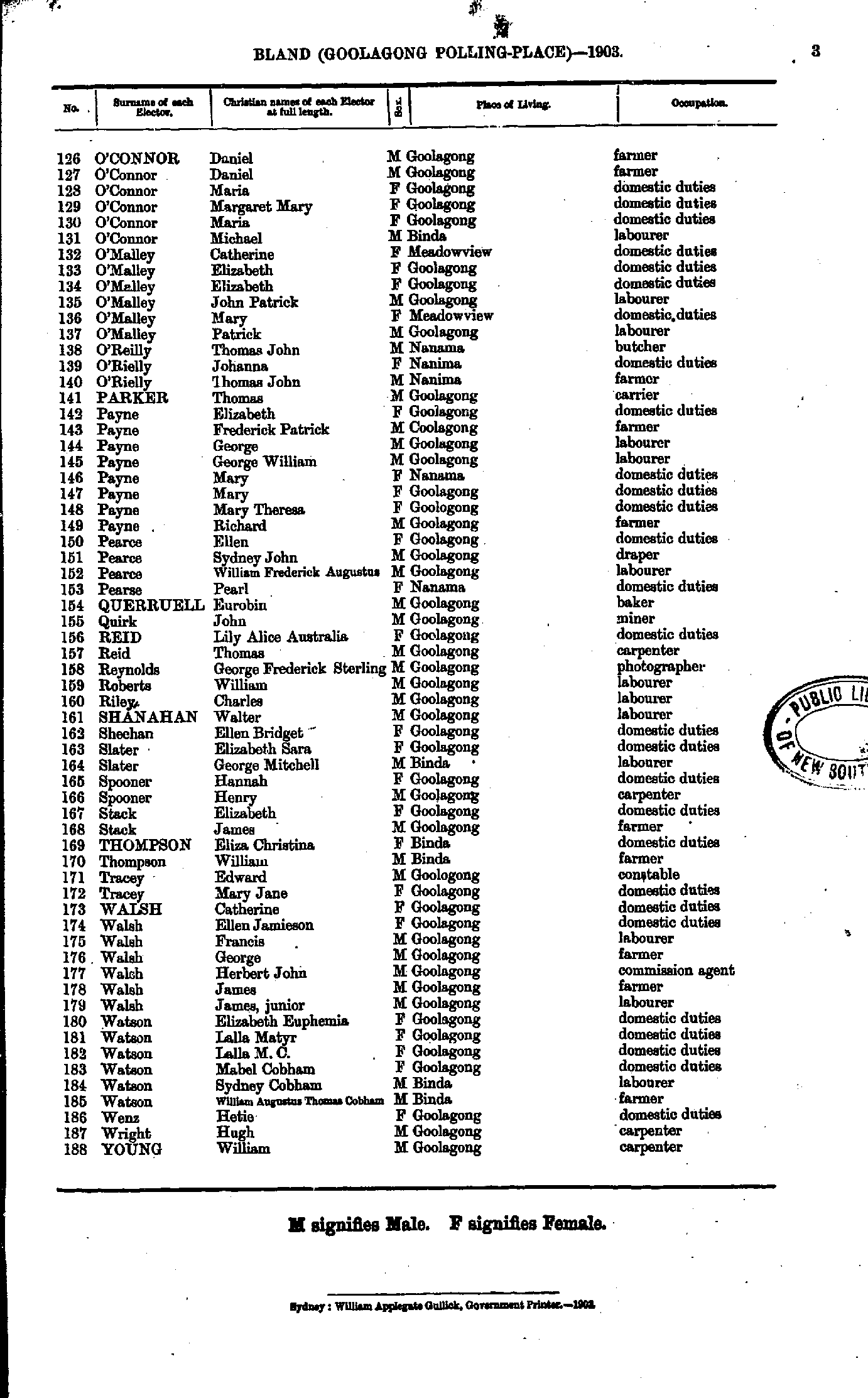
- Adams Alice - Chesher Catherine
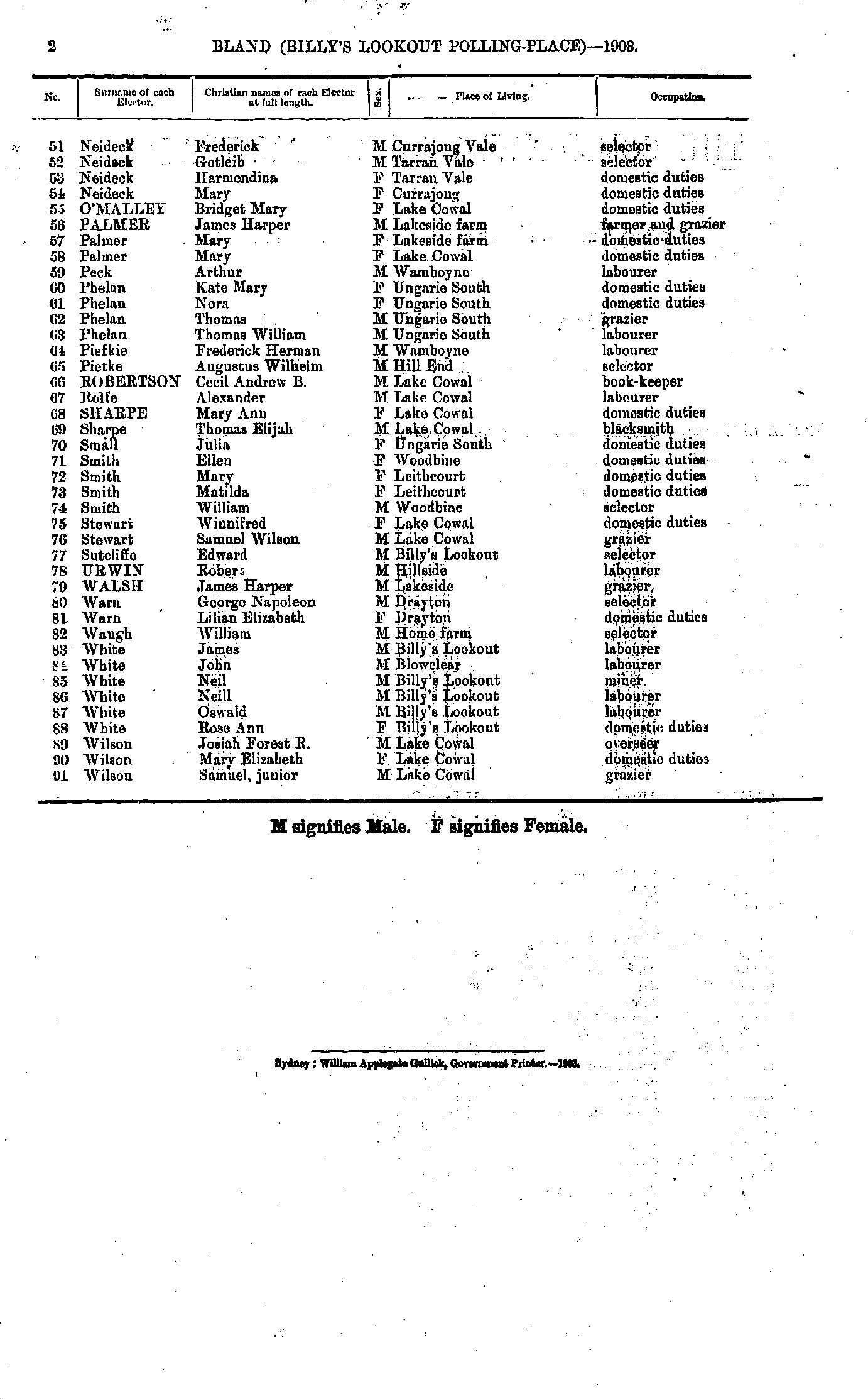
- Chesher William - M'Grath Mary
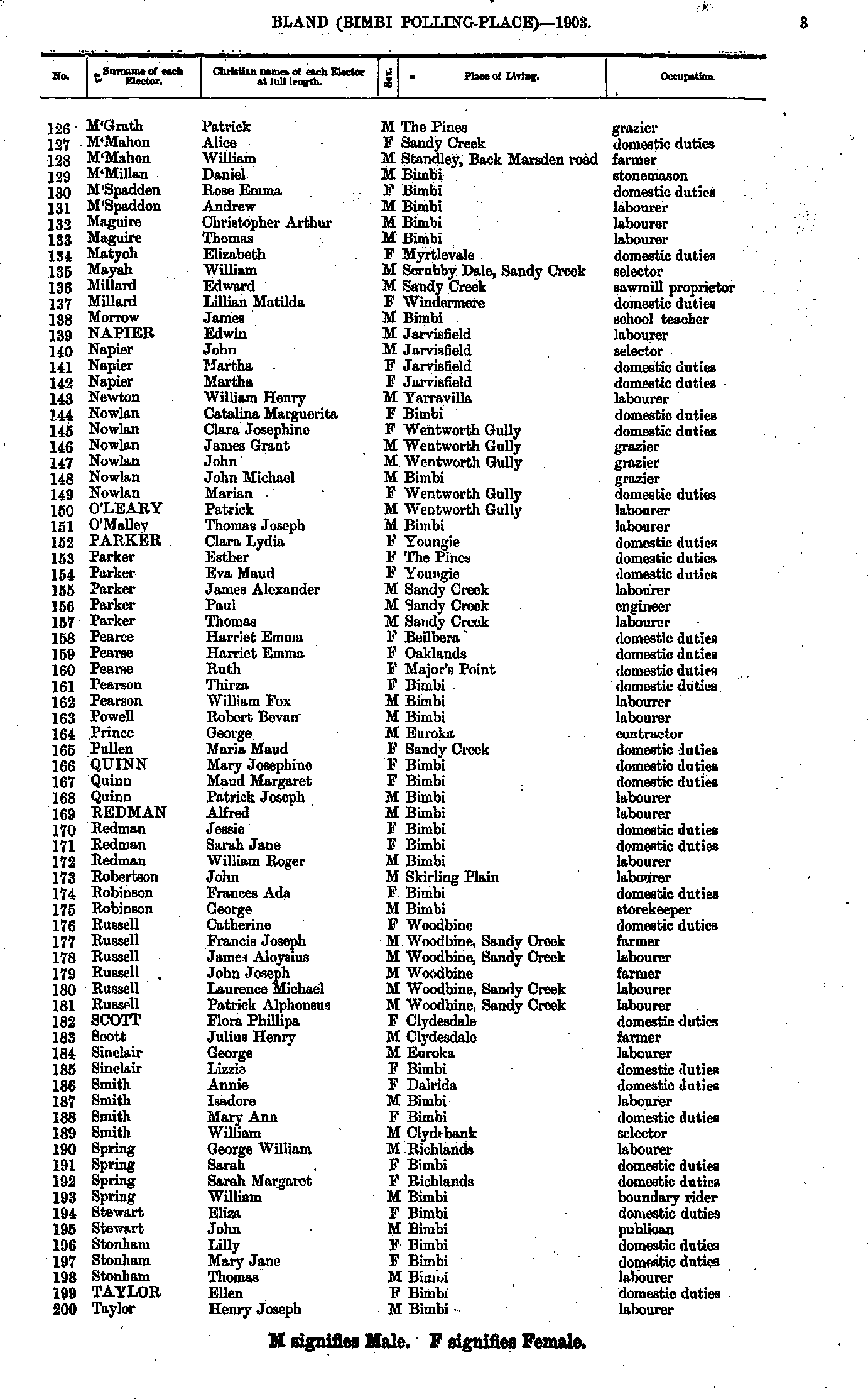
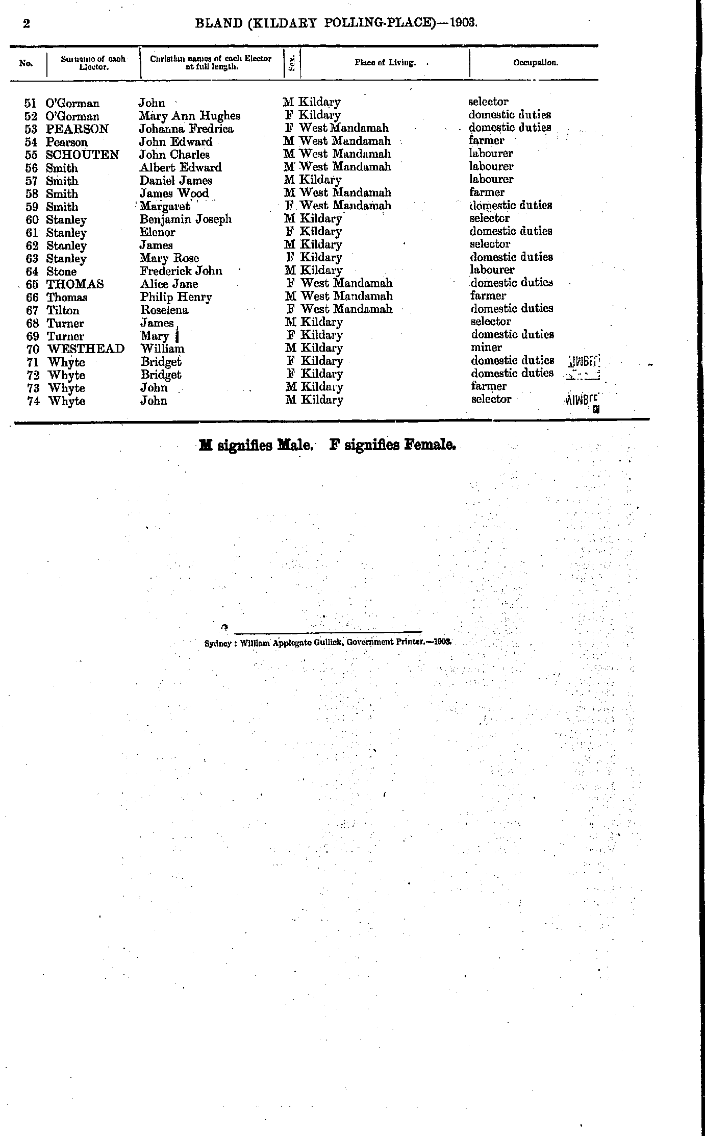
- M'Grath Patrick - Taylor Henry
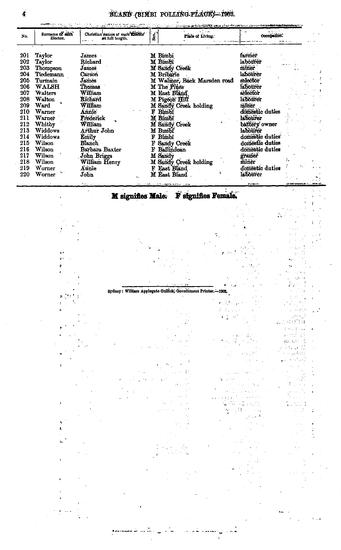
- Taylor James - Worner John
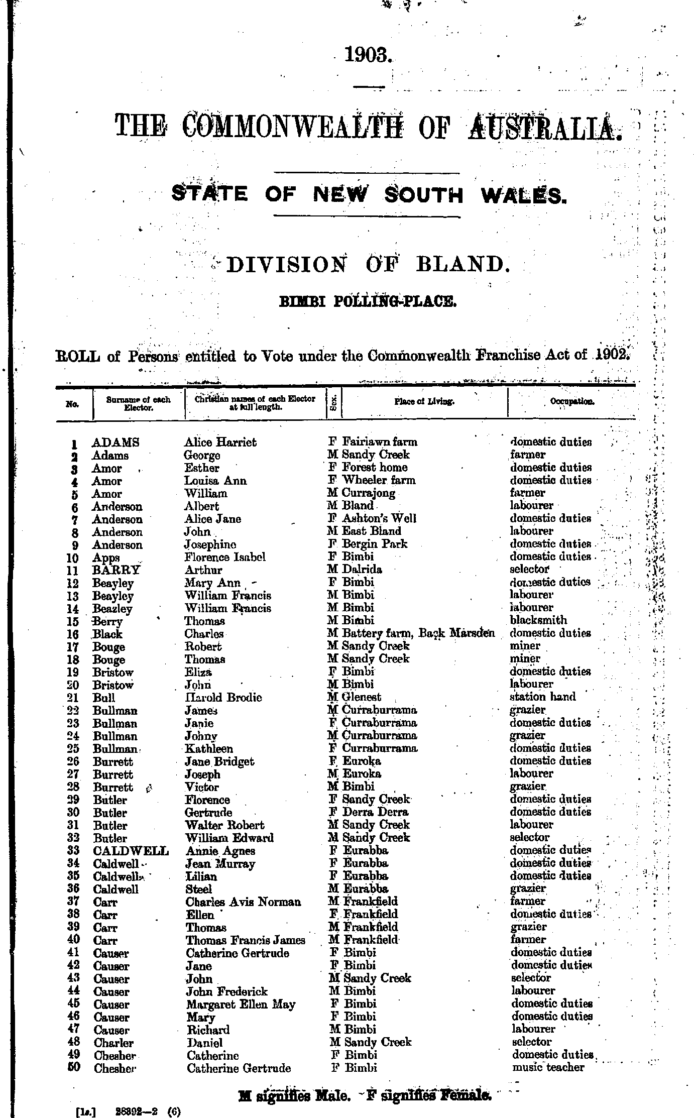
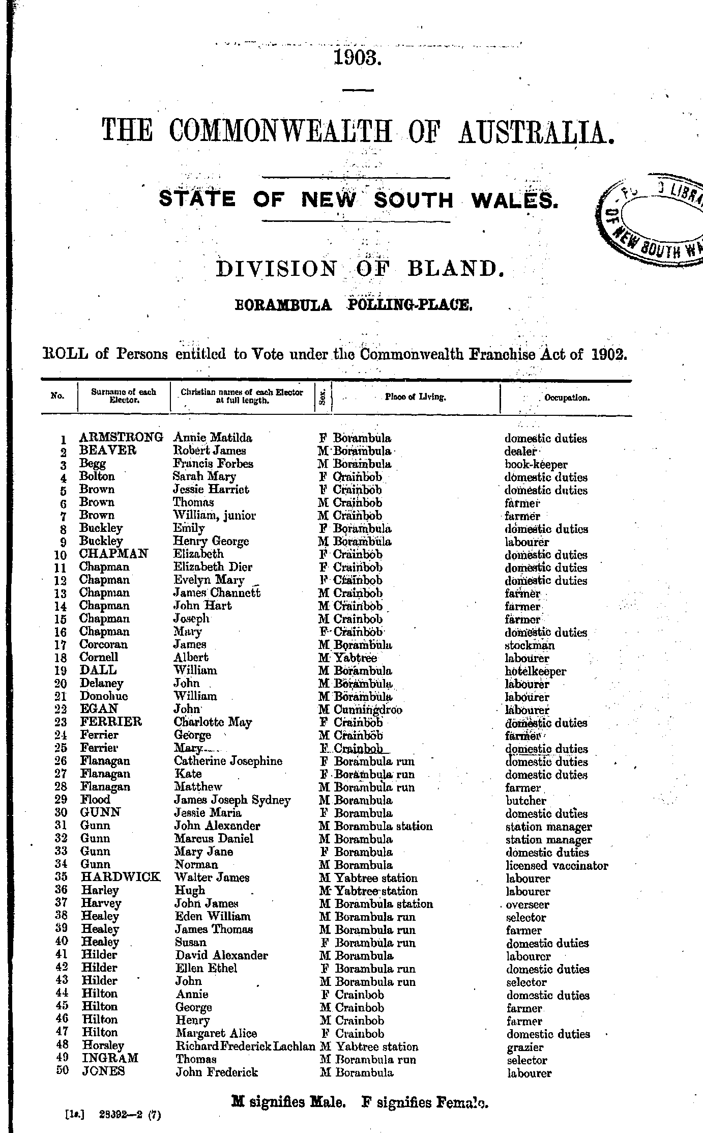
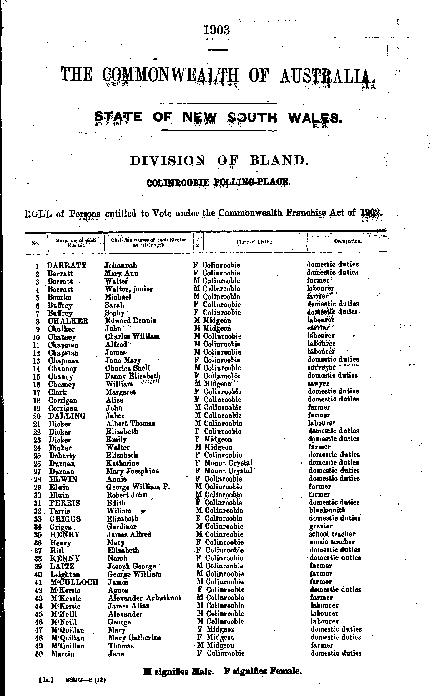
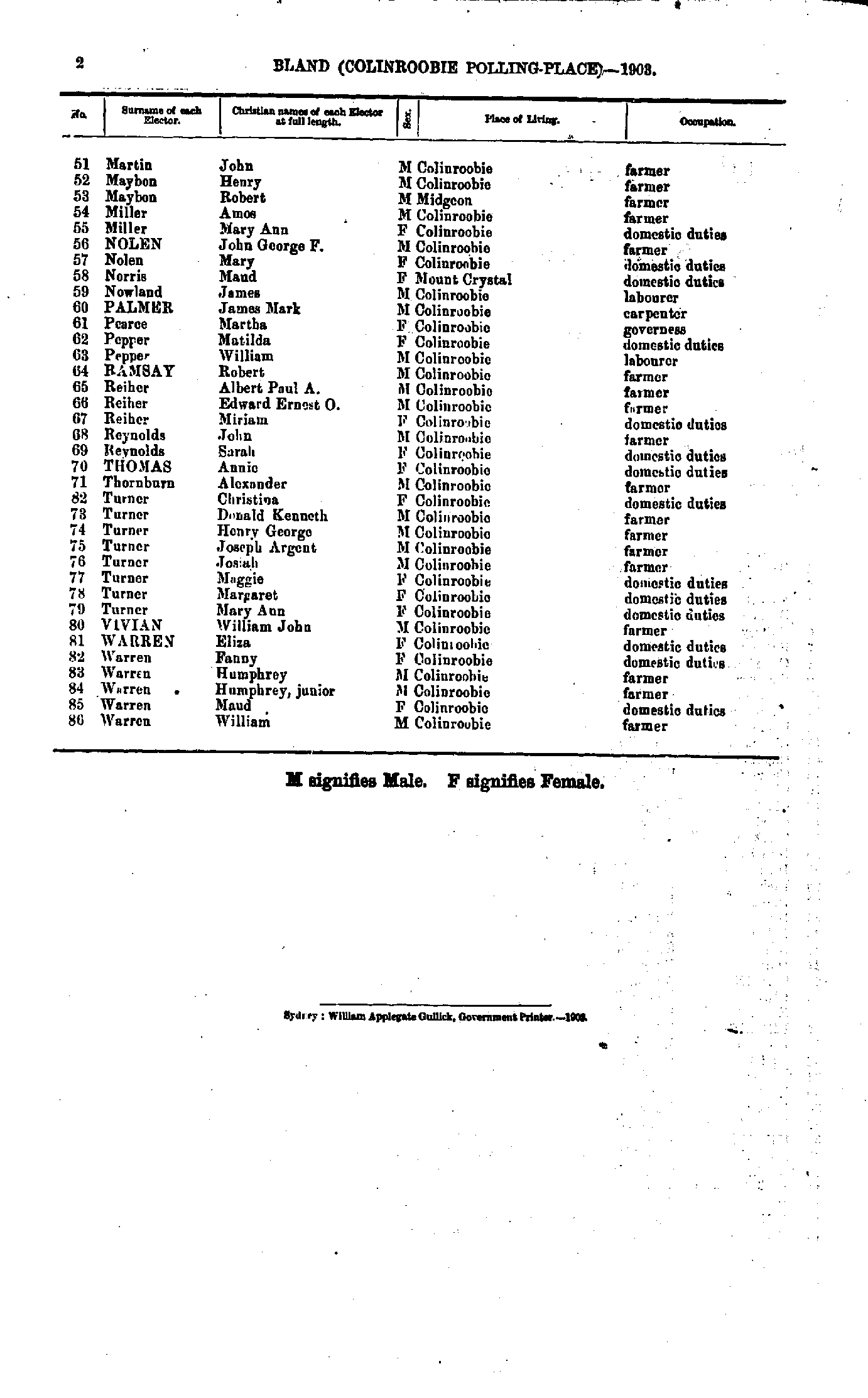
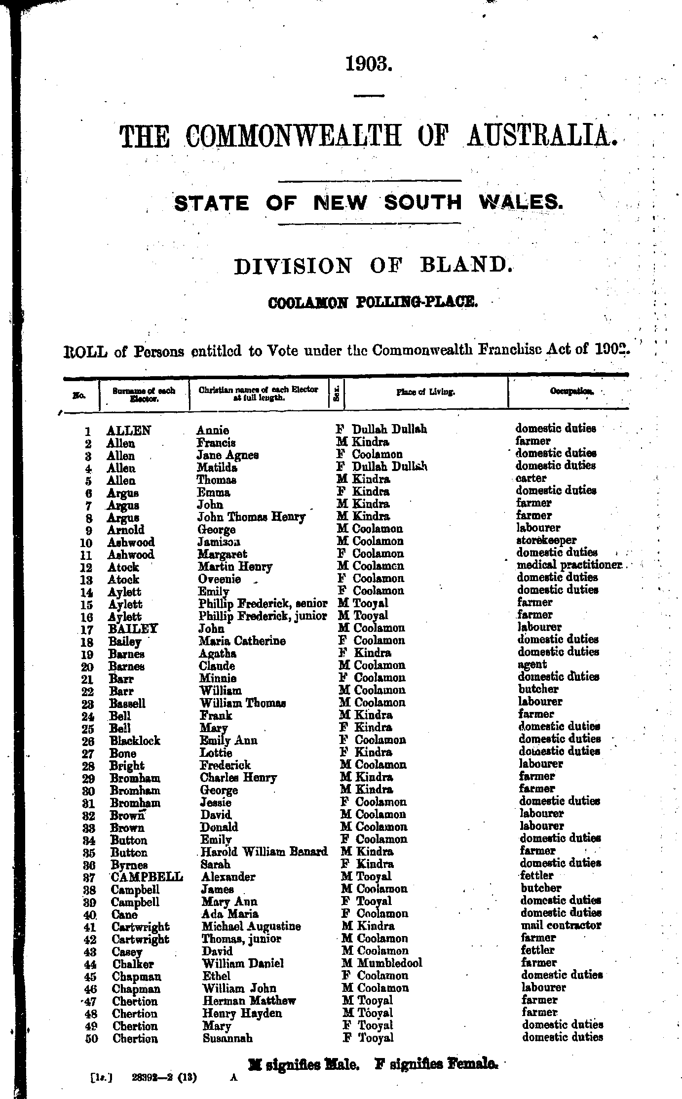
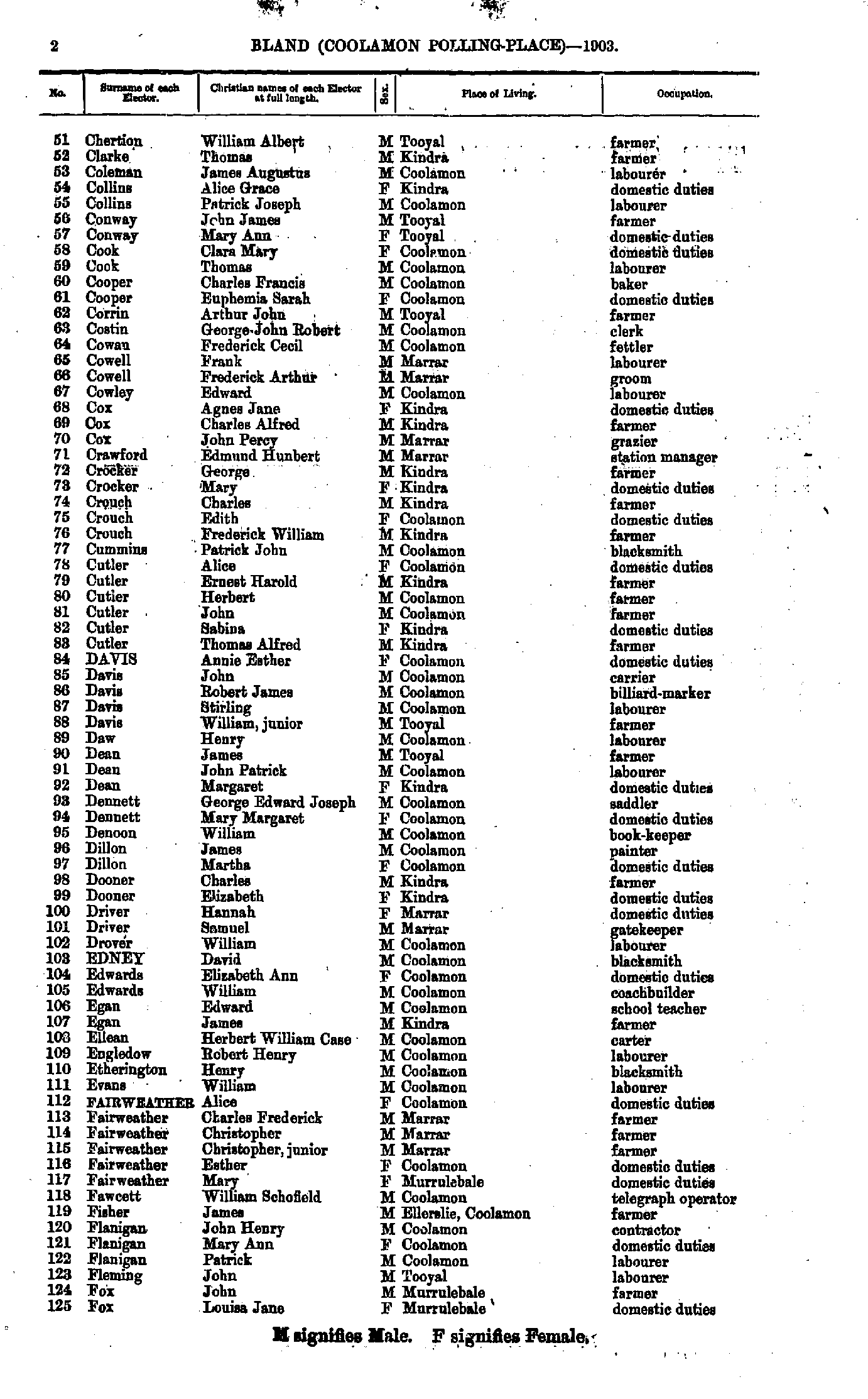
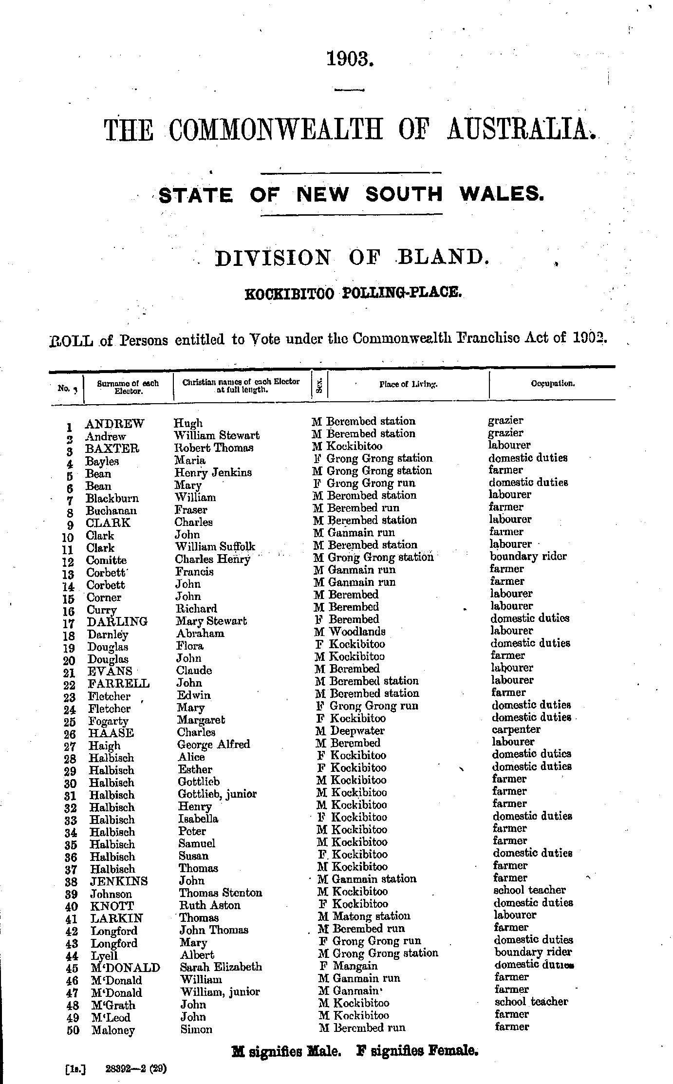
- Allen Annie - Chertion Susannah
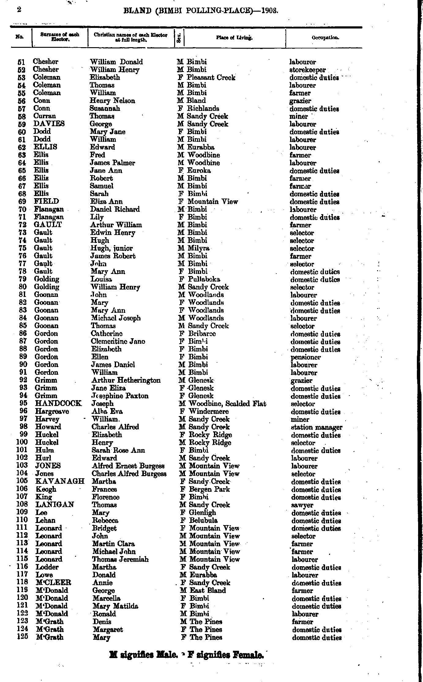
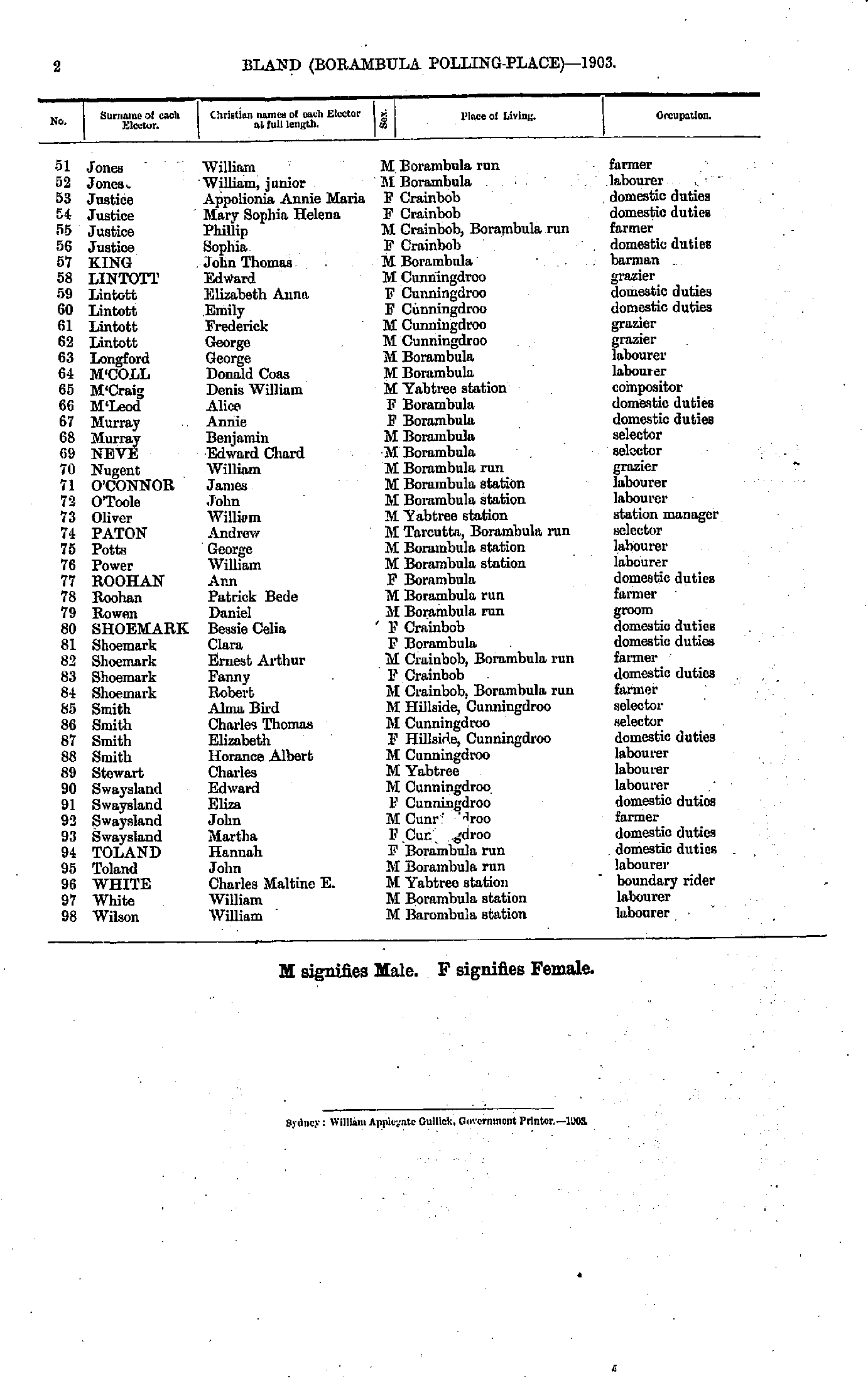
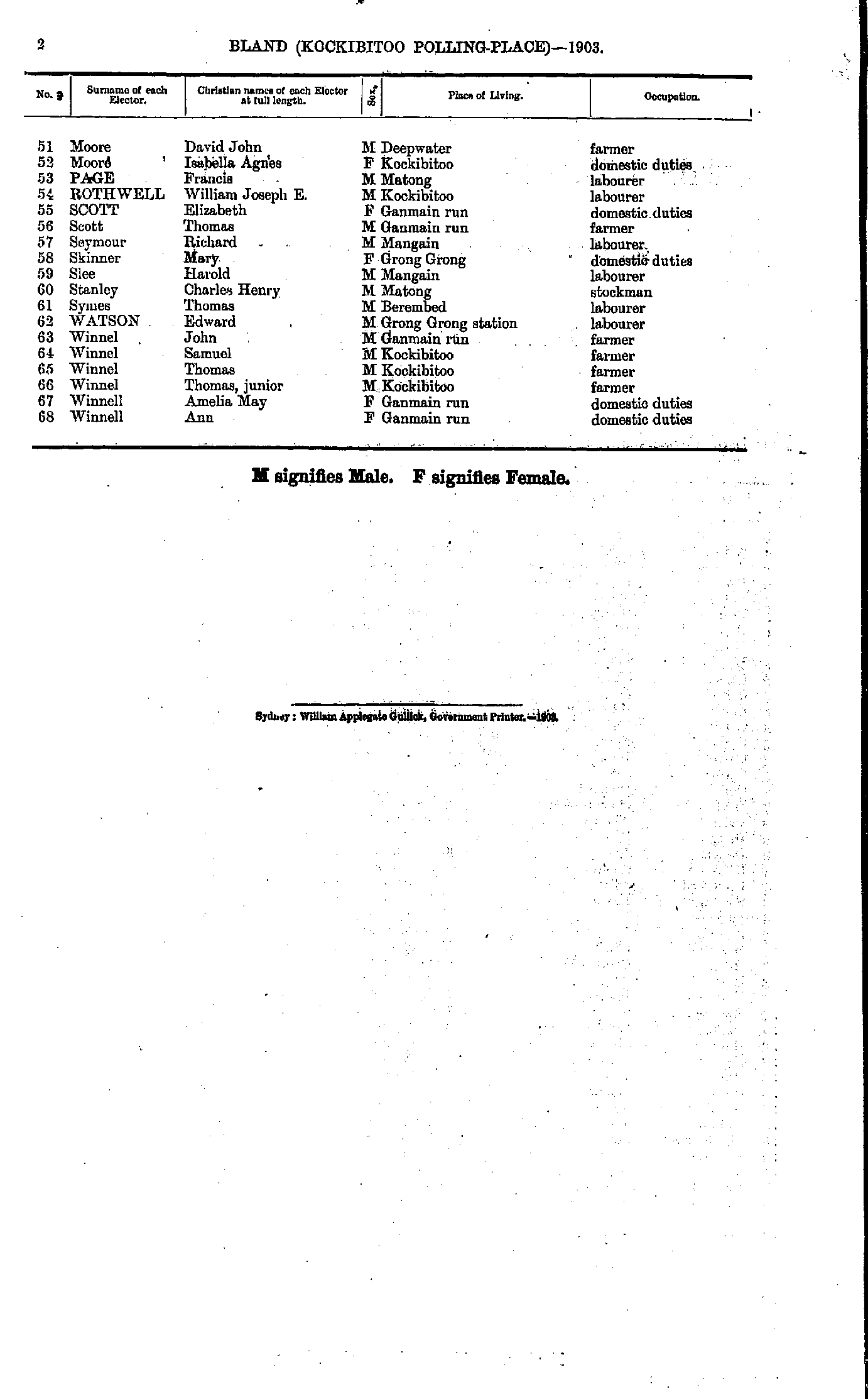
- Chertion William - Fox Louisa
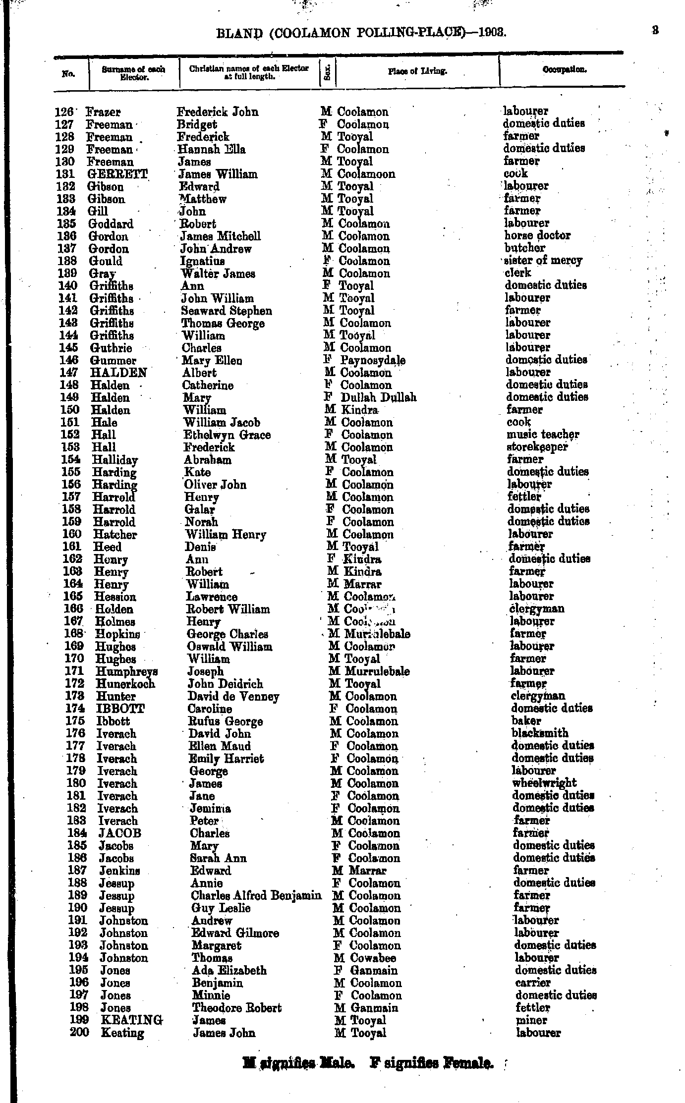
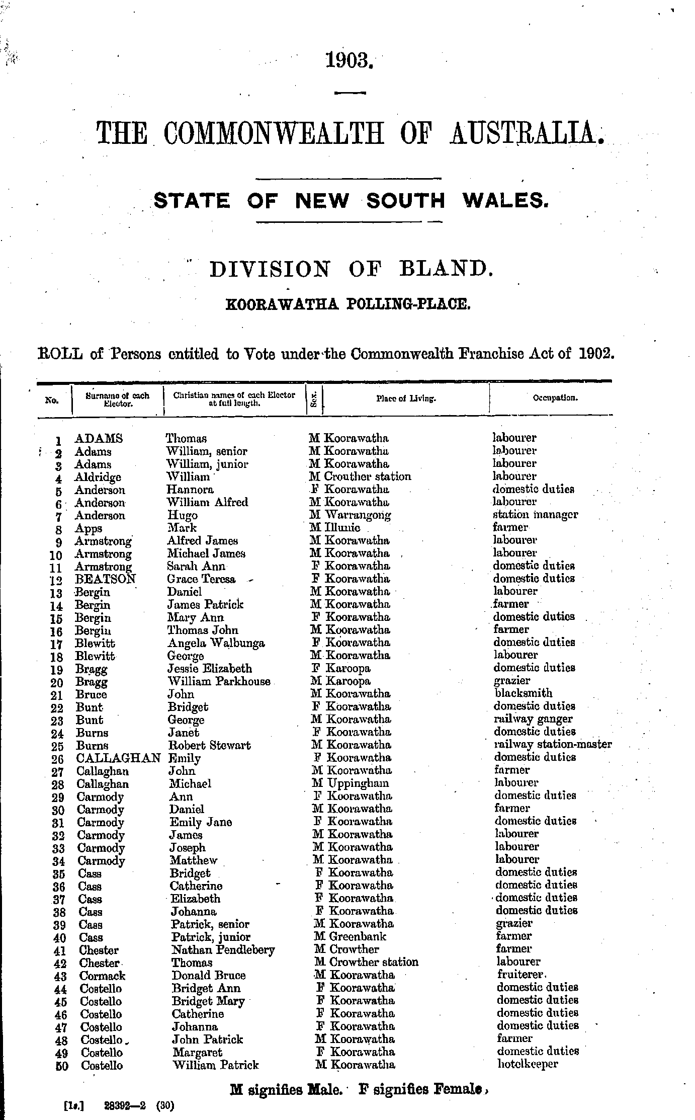
- Fraser Frederick - Keating James
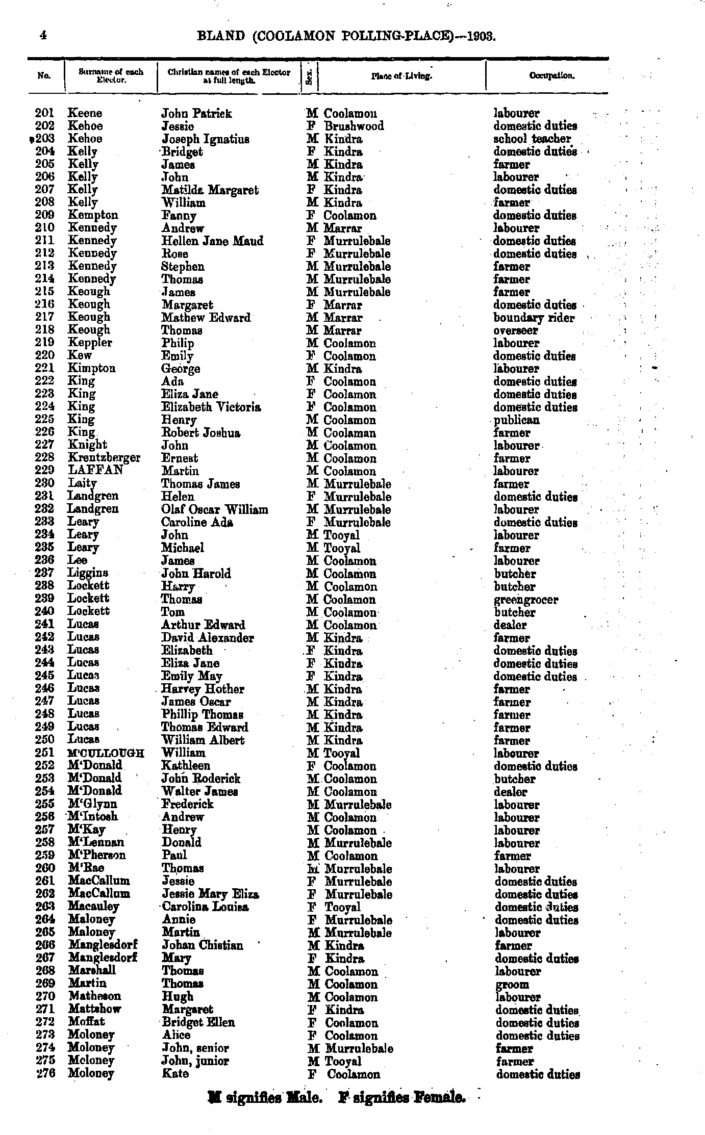
- Keene John - Moloney Kate
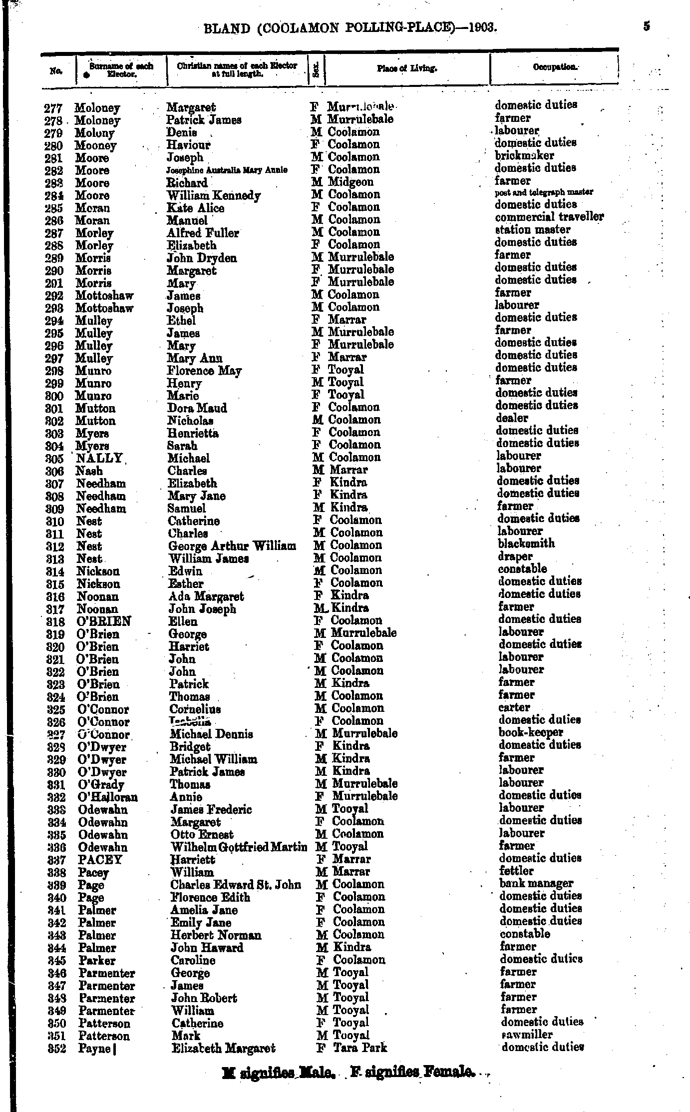
- Moloney Margaret - Payne Elizabeth
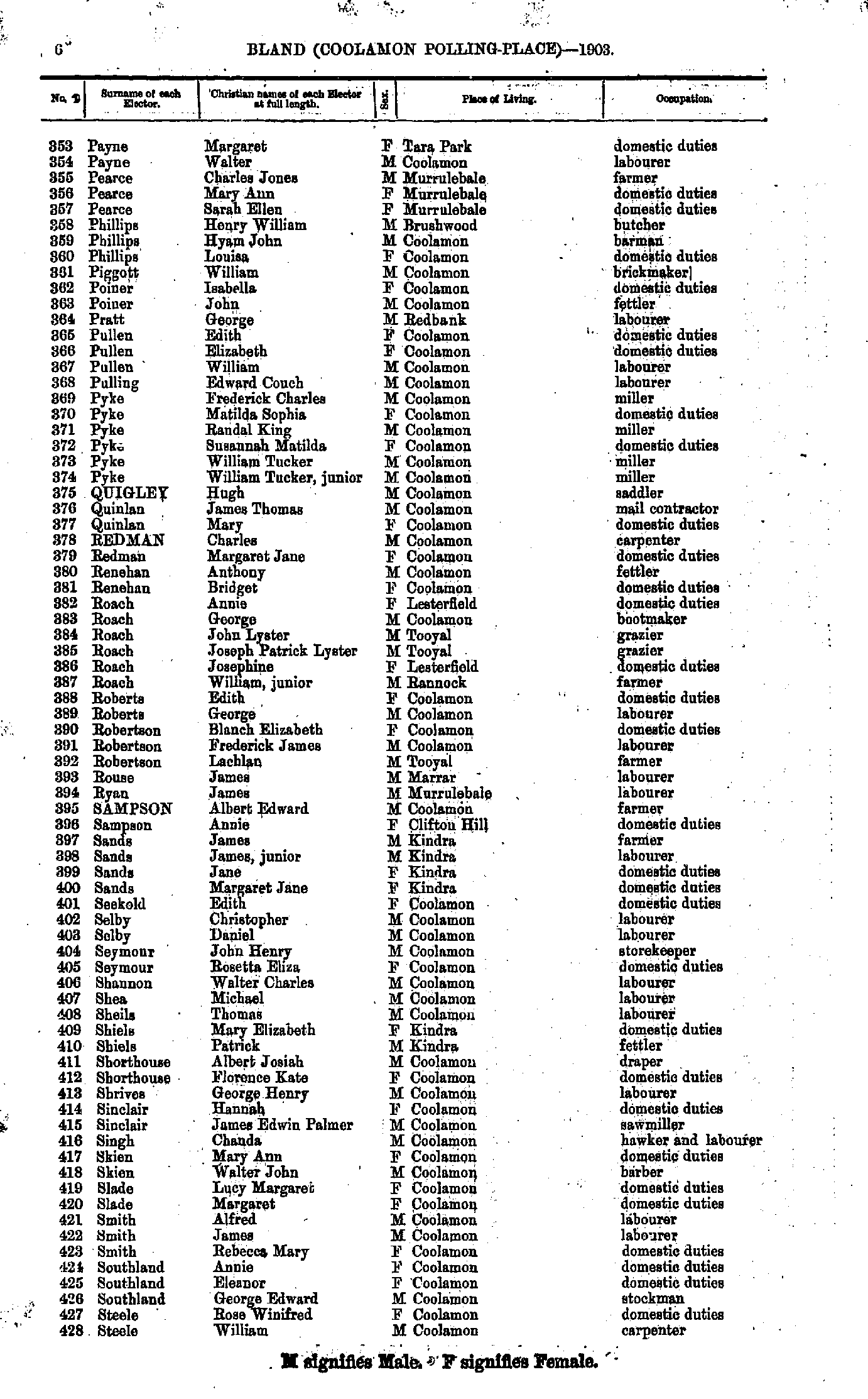
- Payne Margaret - Steele William
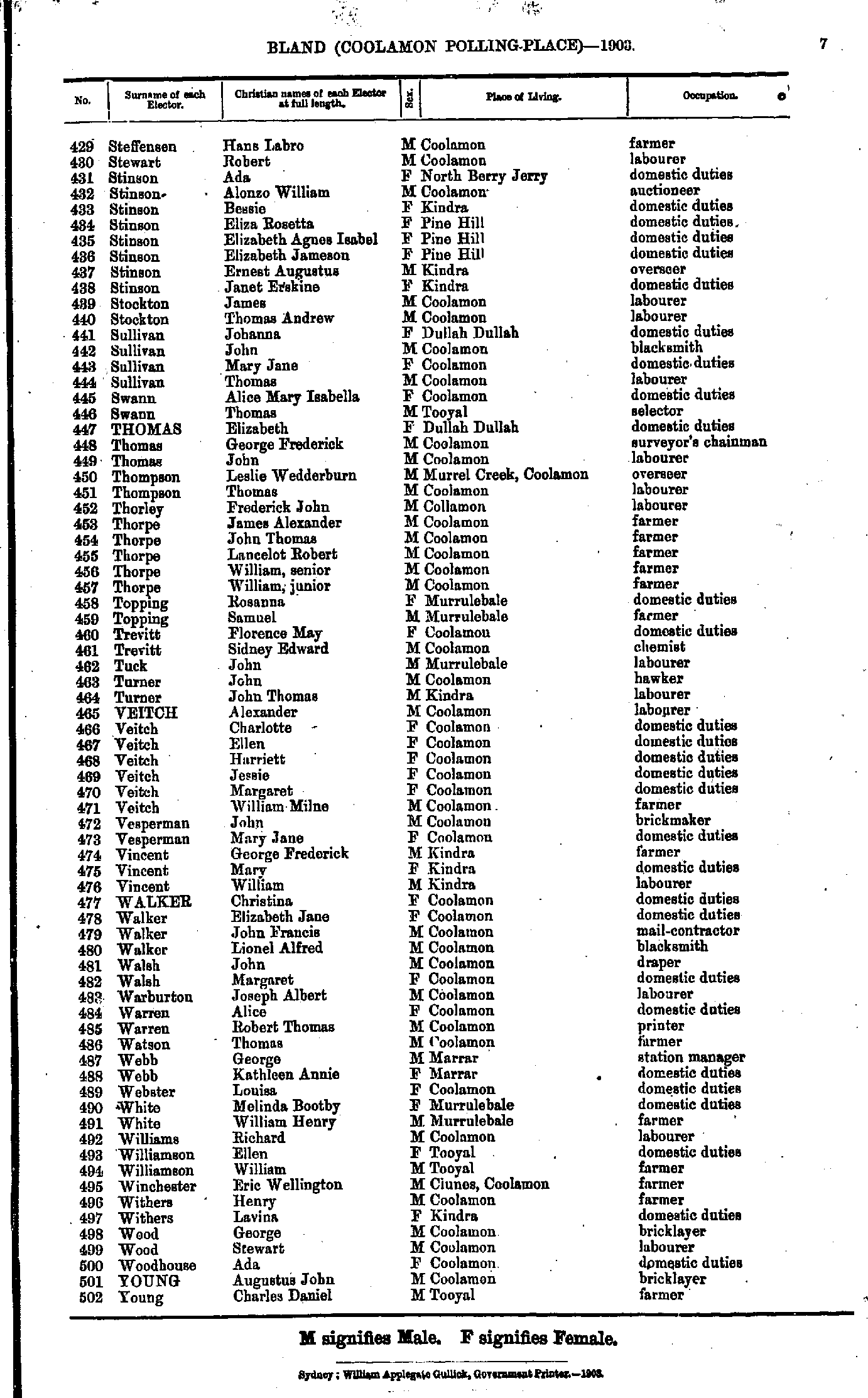
- Steffensen Hans - Young Charles
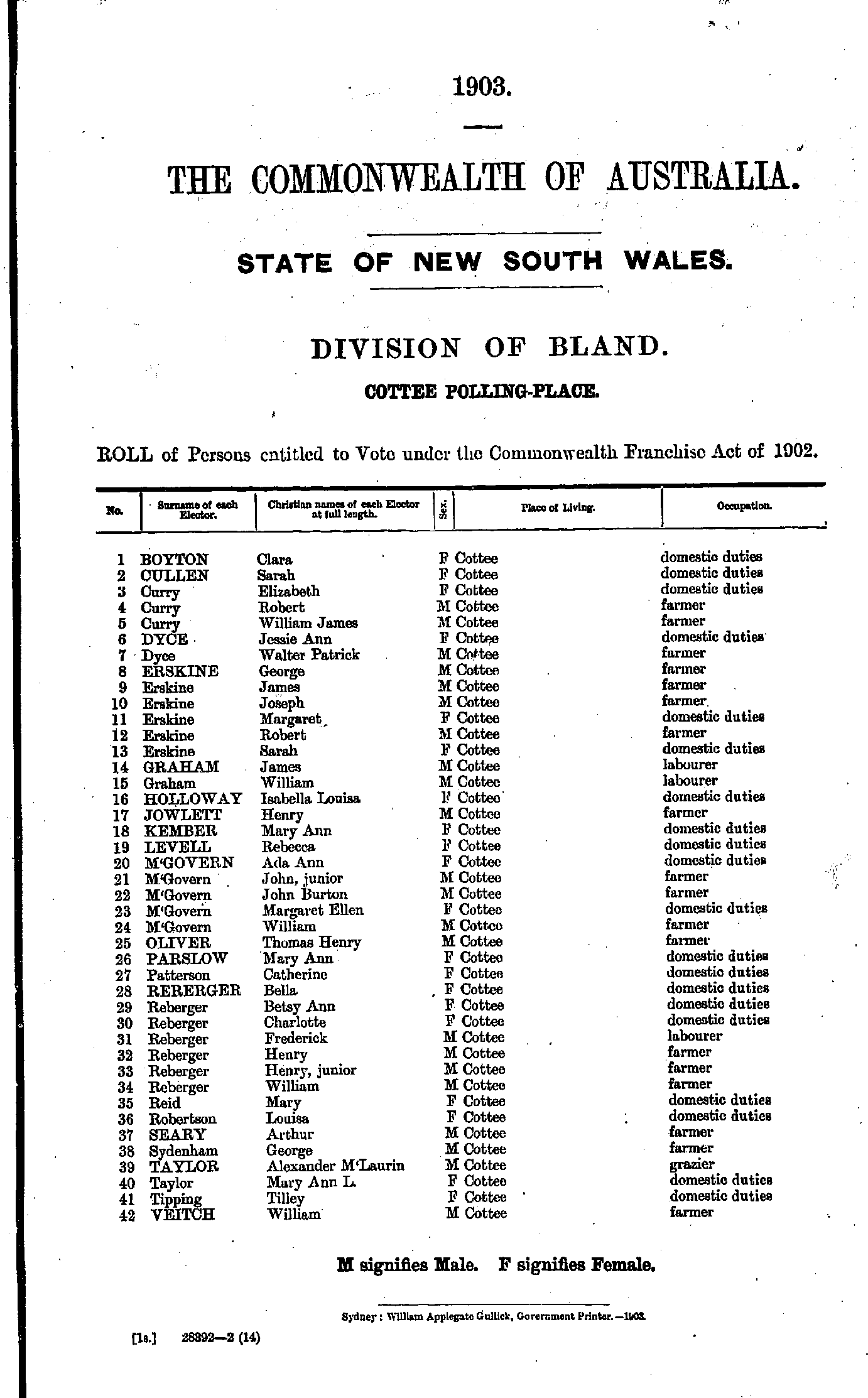
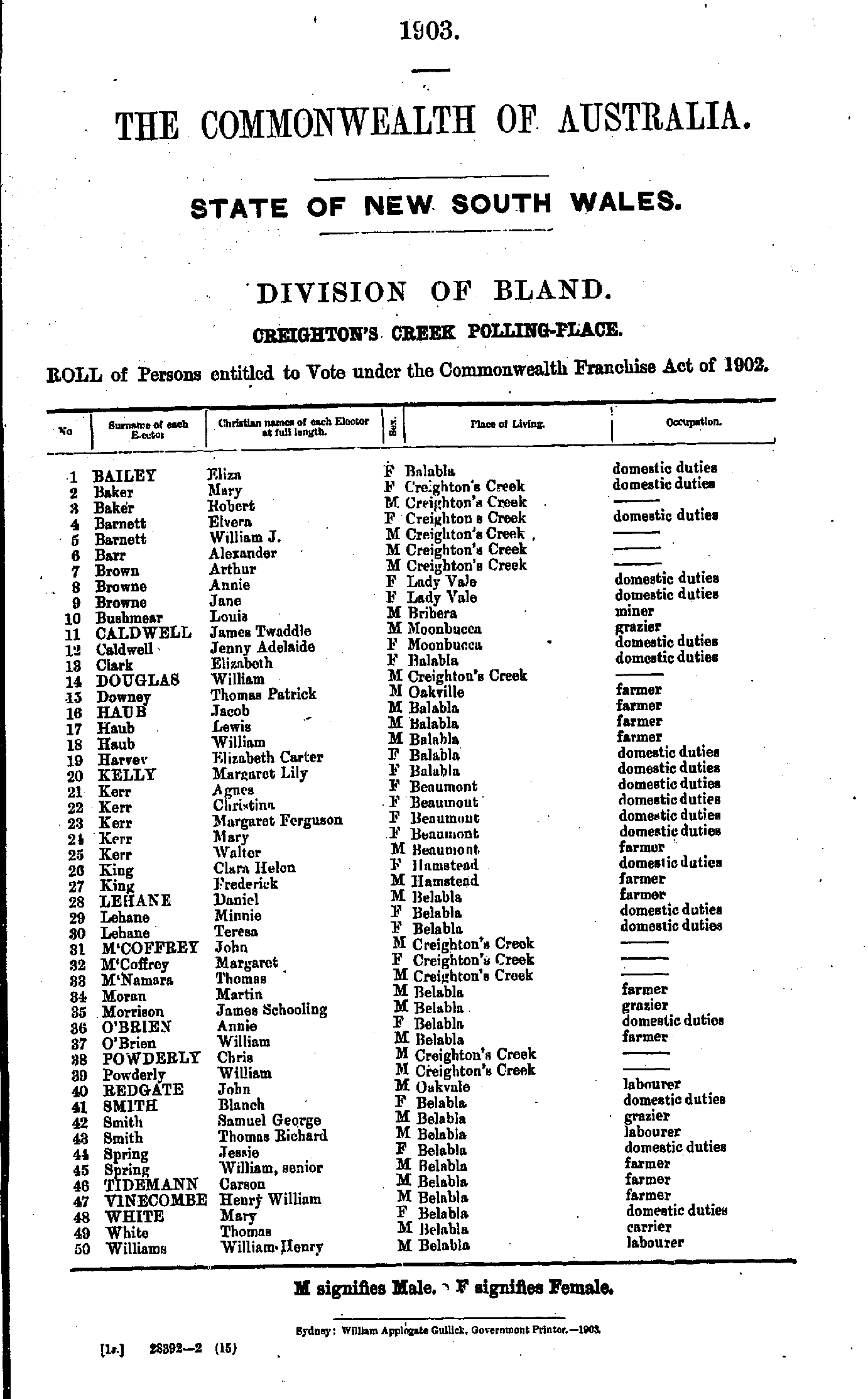
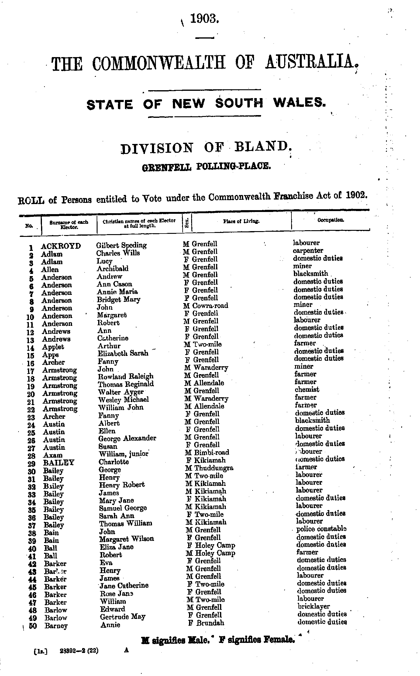
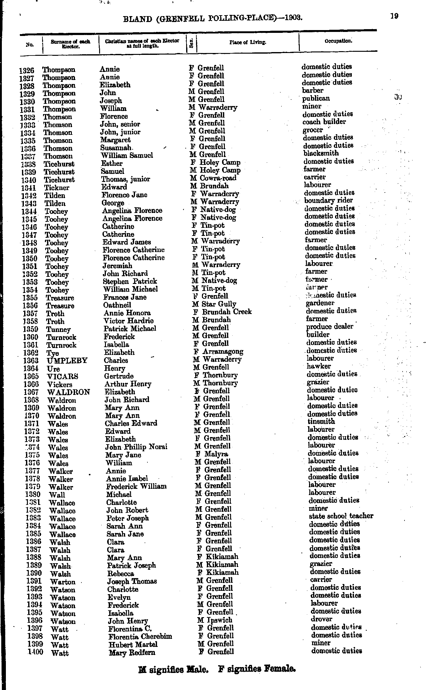
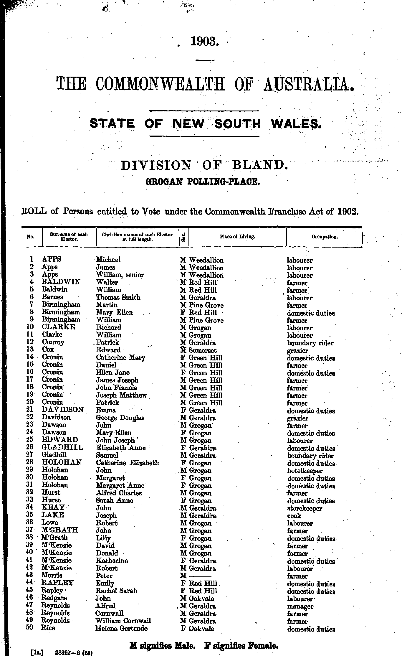
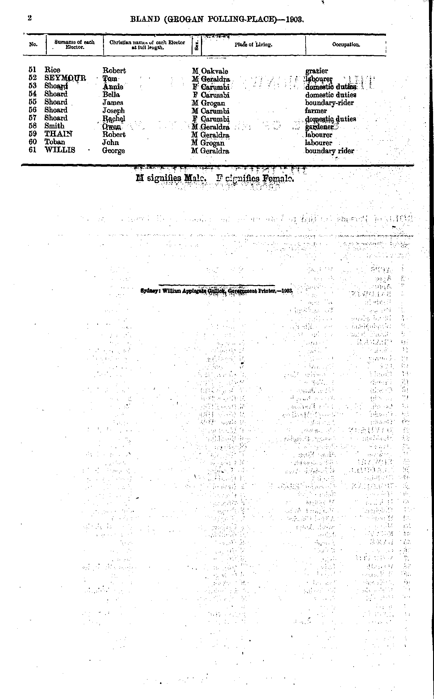
Creighton’s Creek Polling Place
- Ackroyd Gilbert - Barney Annie
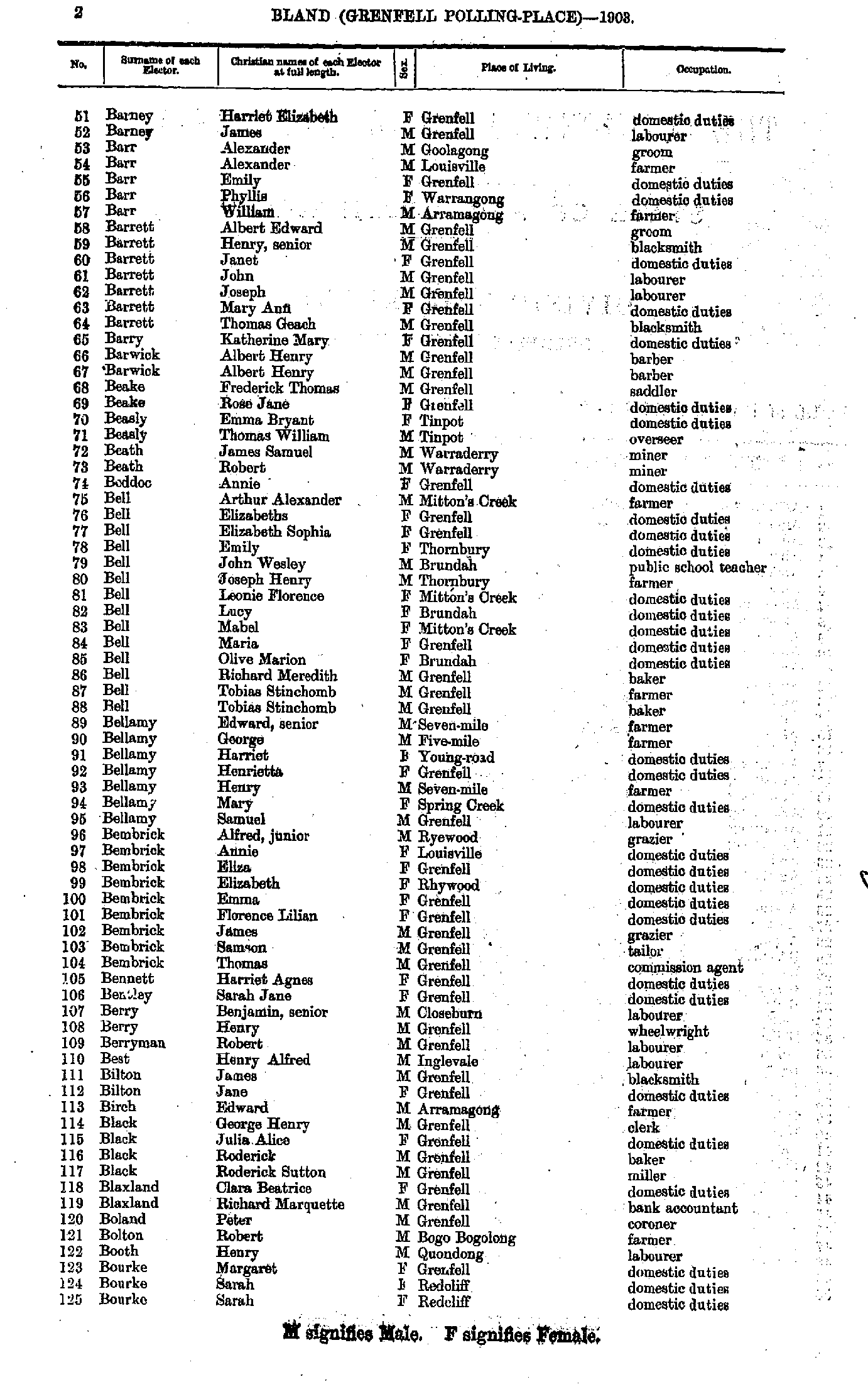
- Barney Harriet - Bourke Sarah
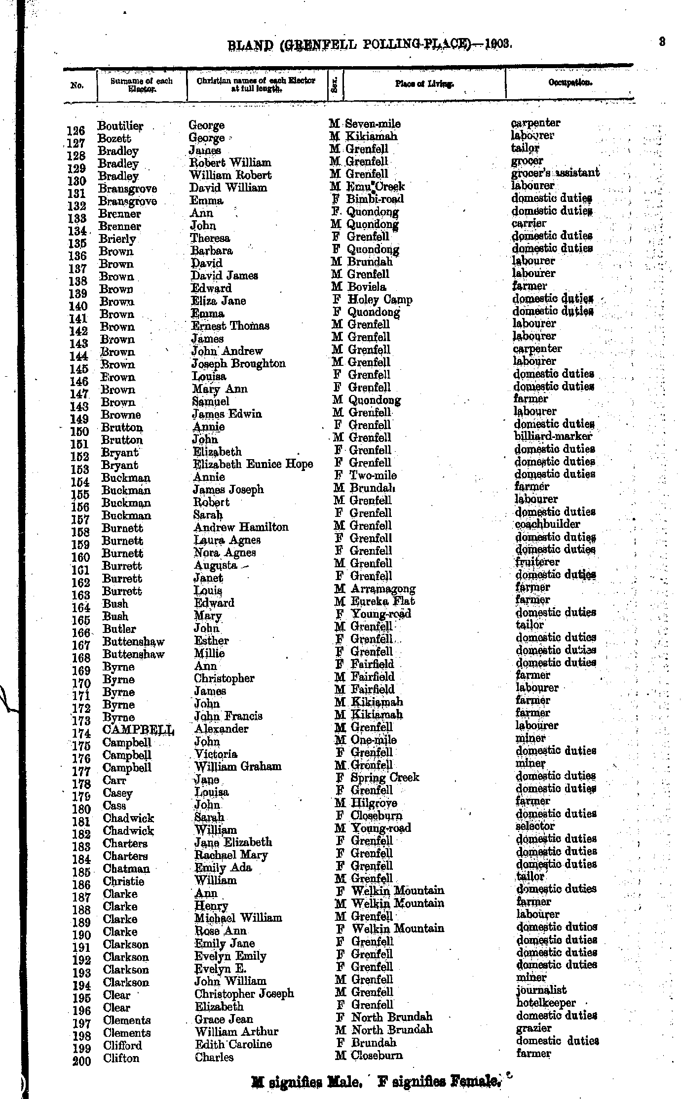
- Boutilier George - Clifton Charles
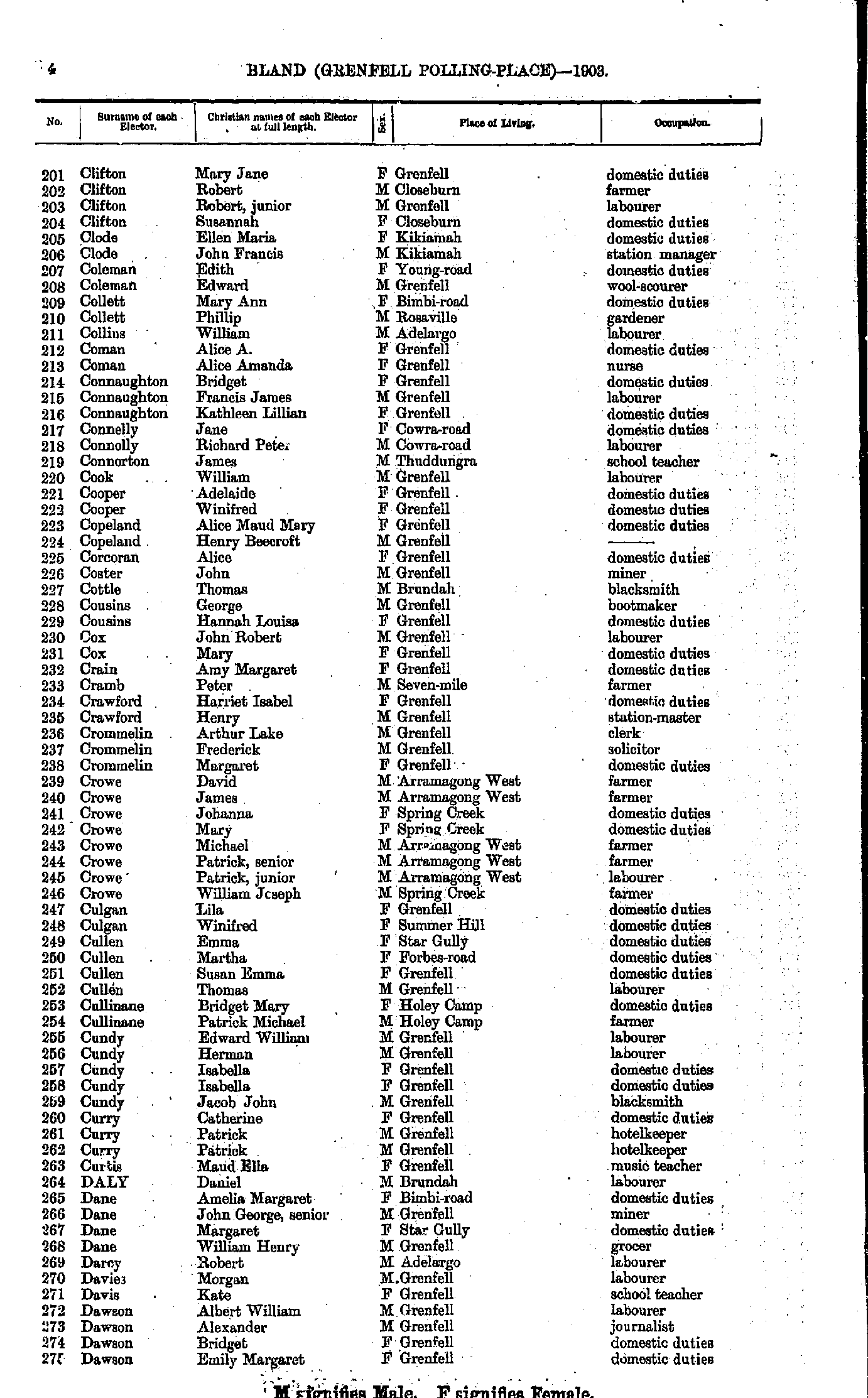
- Clifton Mary - Dawson Emily
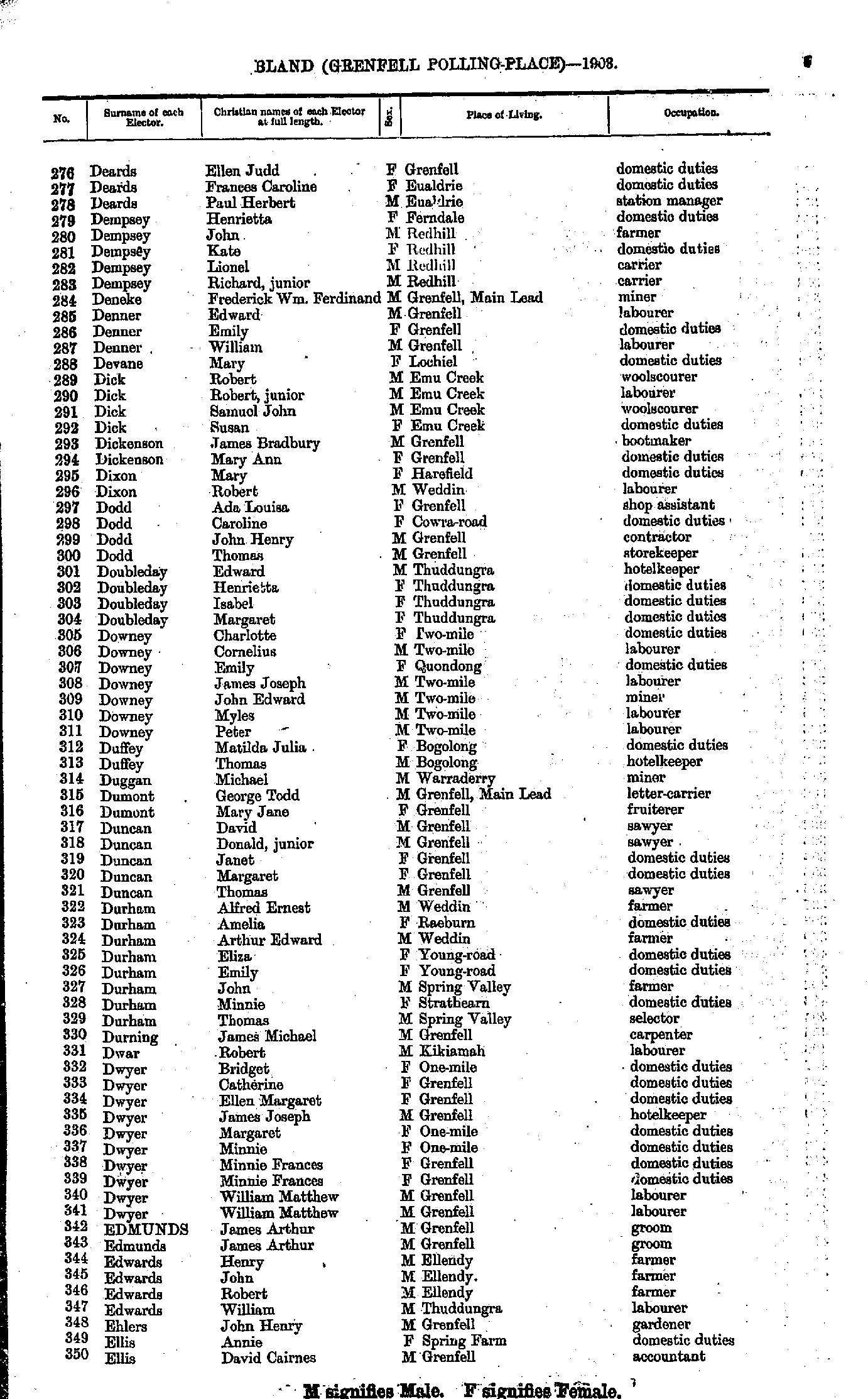
- Deards Ellen - Ellis David
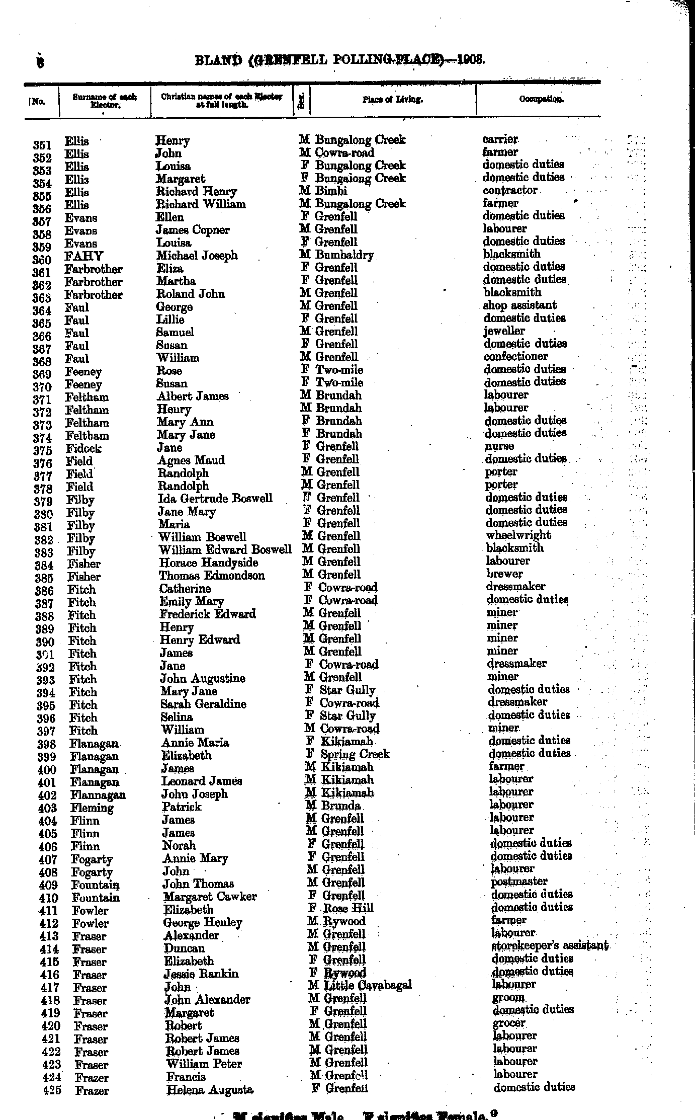
- Ellis Henry - Frazer Helena
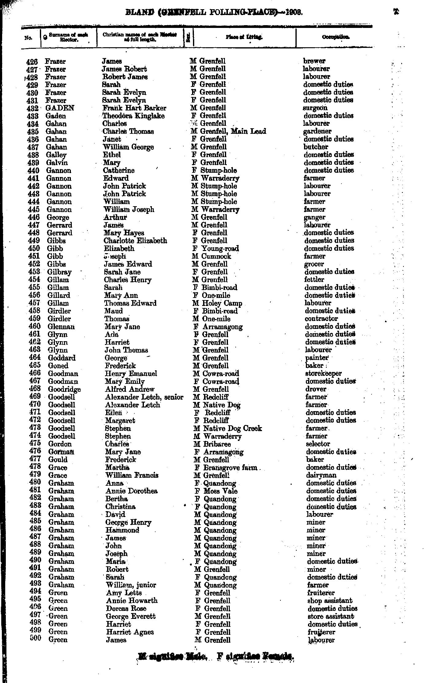
- Fraser James - Green James
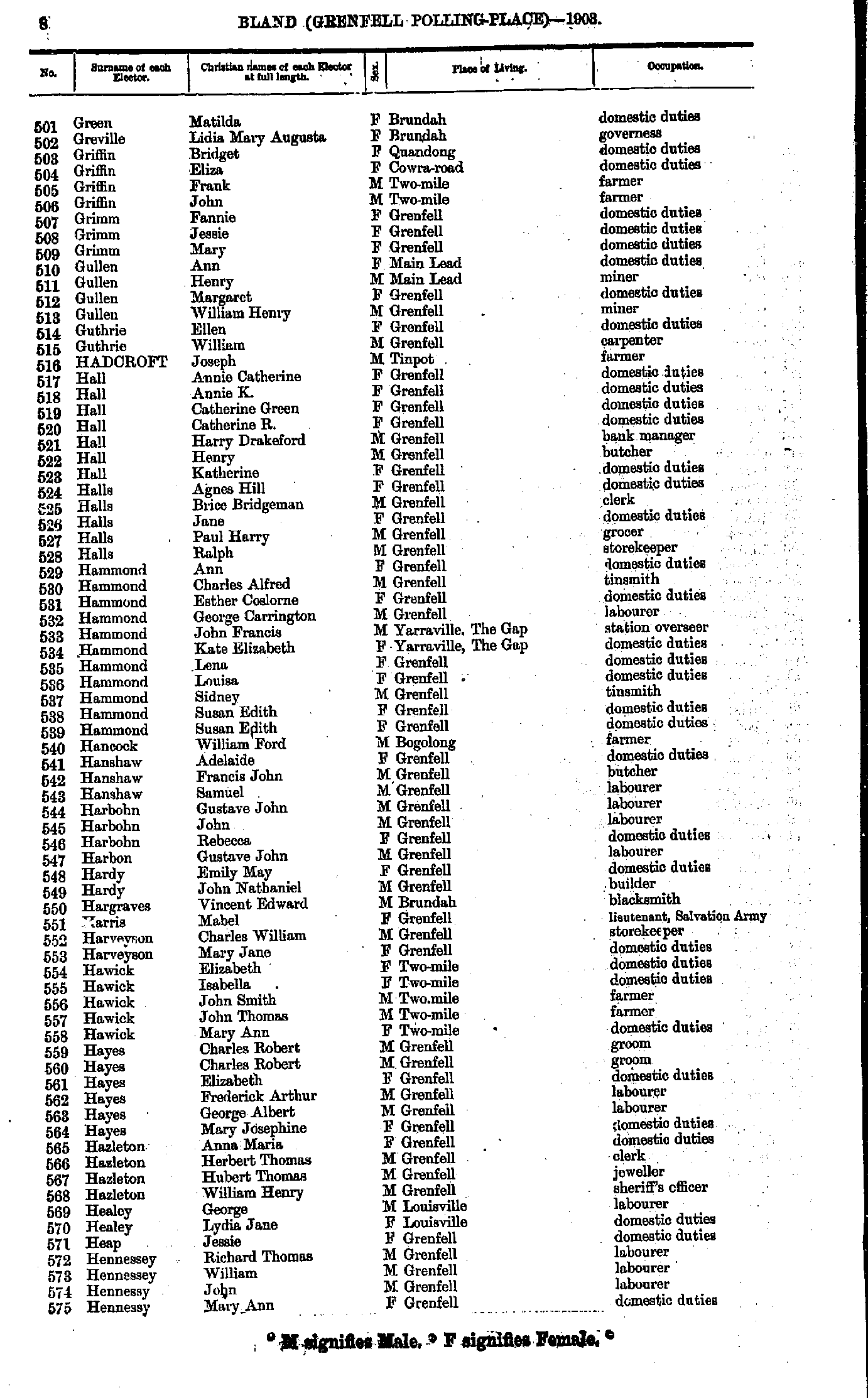
- Green Matilda - Hennessy Mary
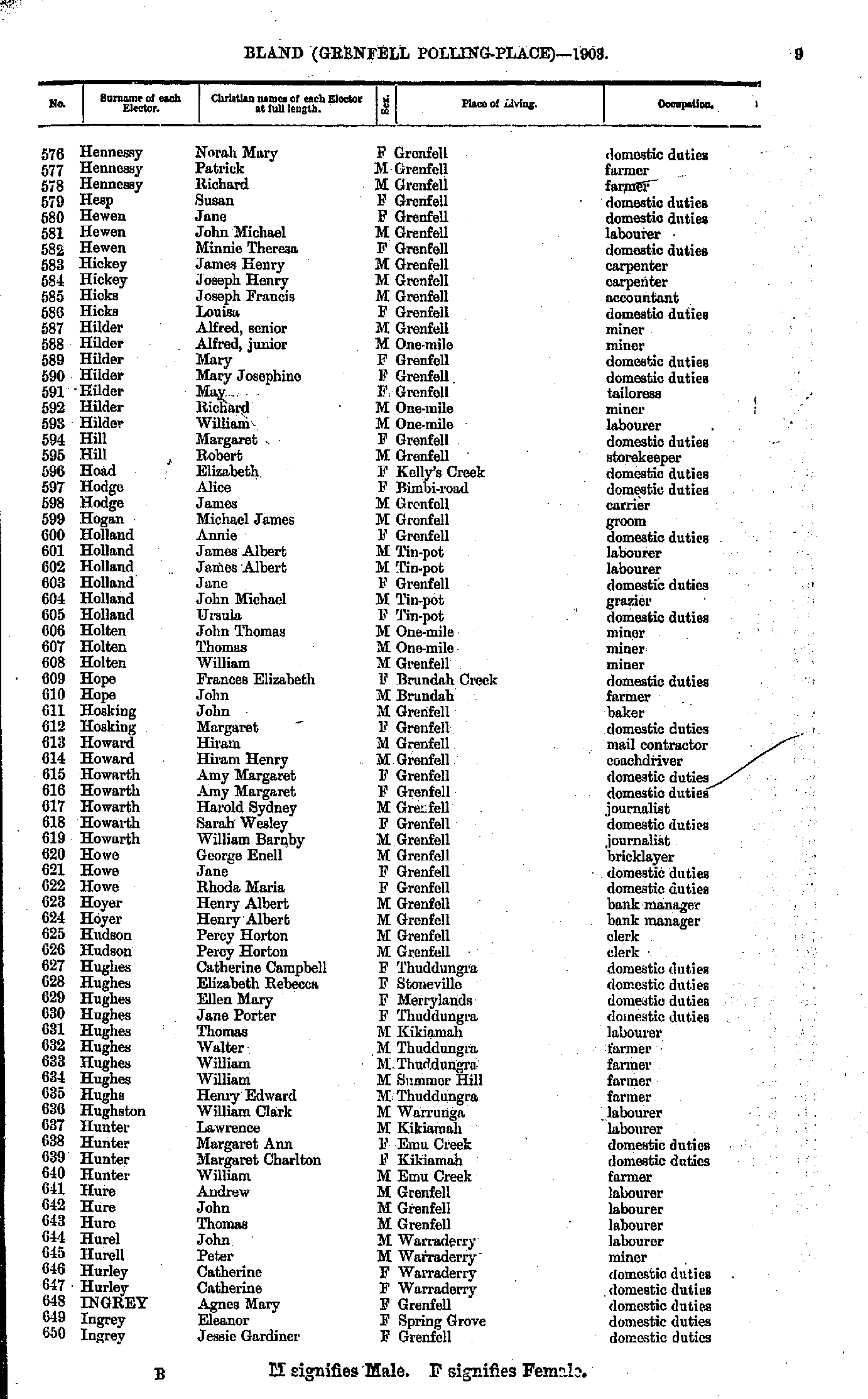
- Hennessy Norah - Ingrey Jessie
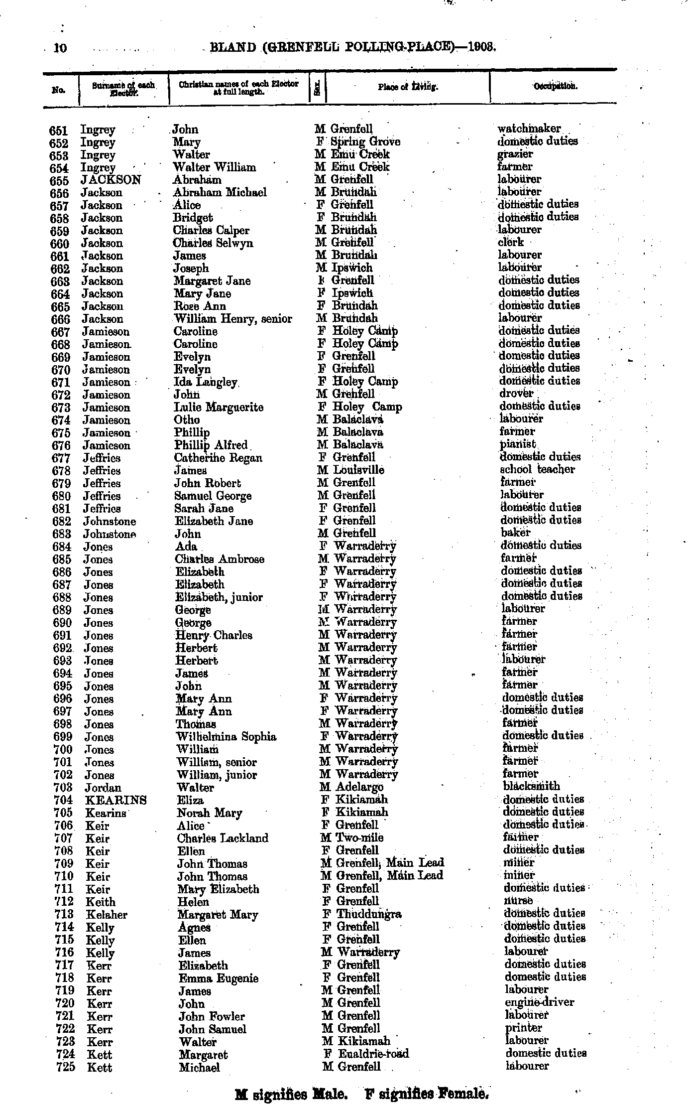
- Ingrey John - Kett Michael
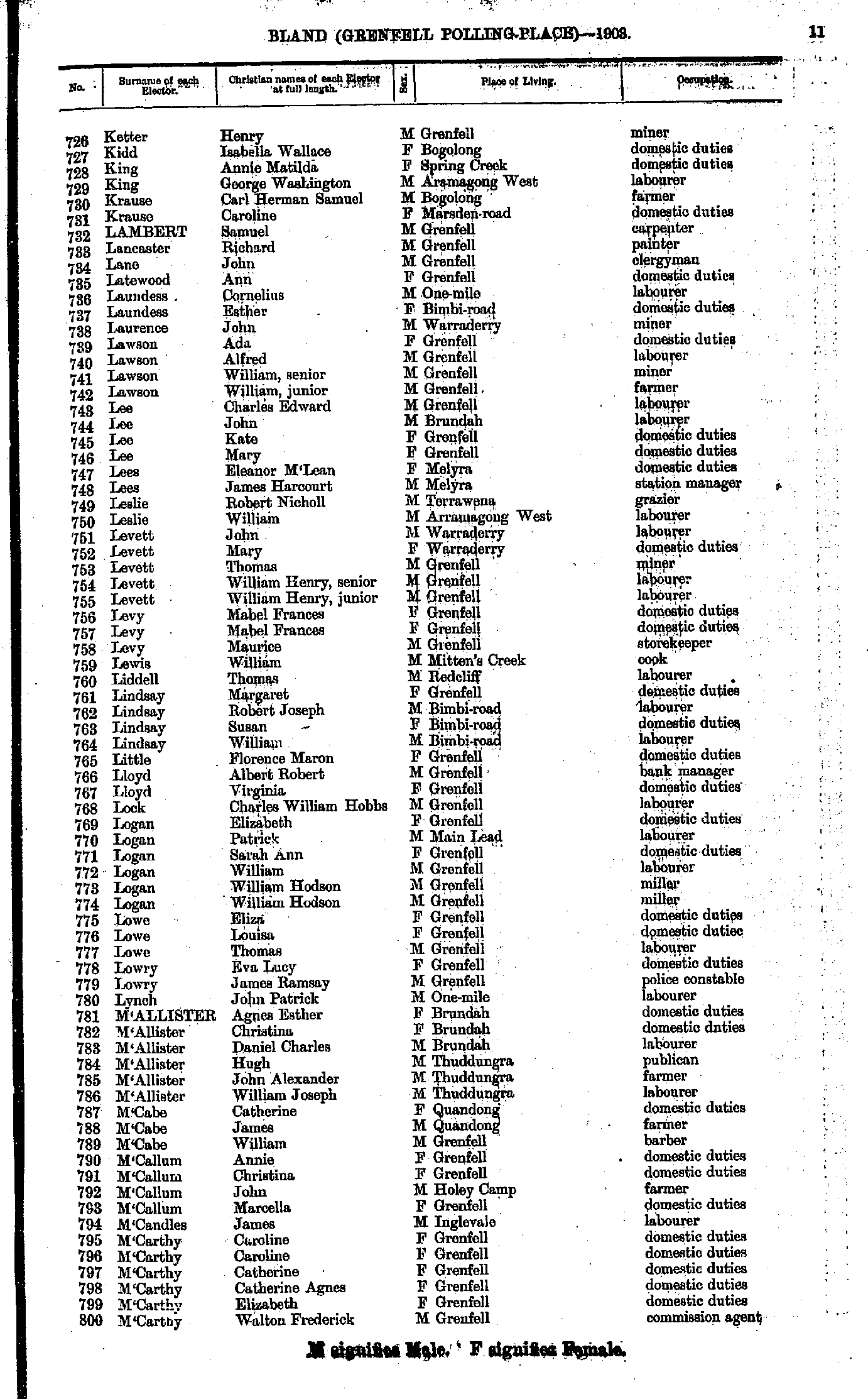
- Ketter Henry - M'Carthy Walton
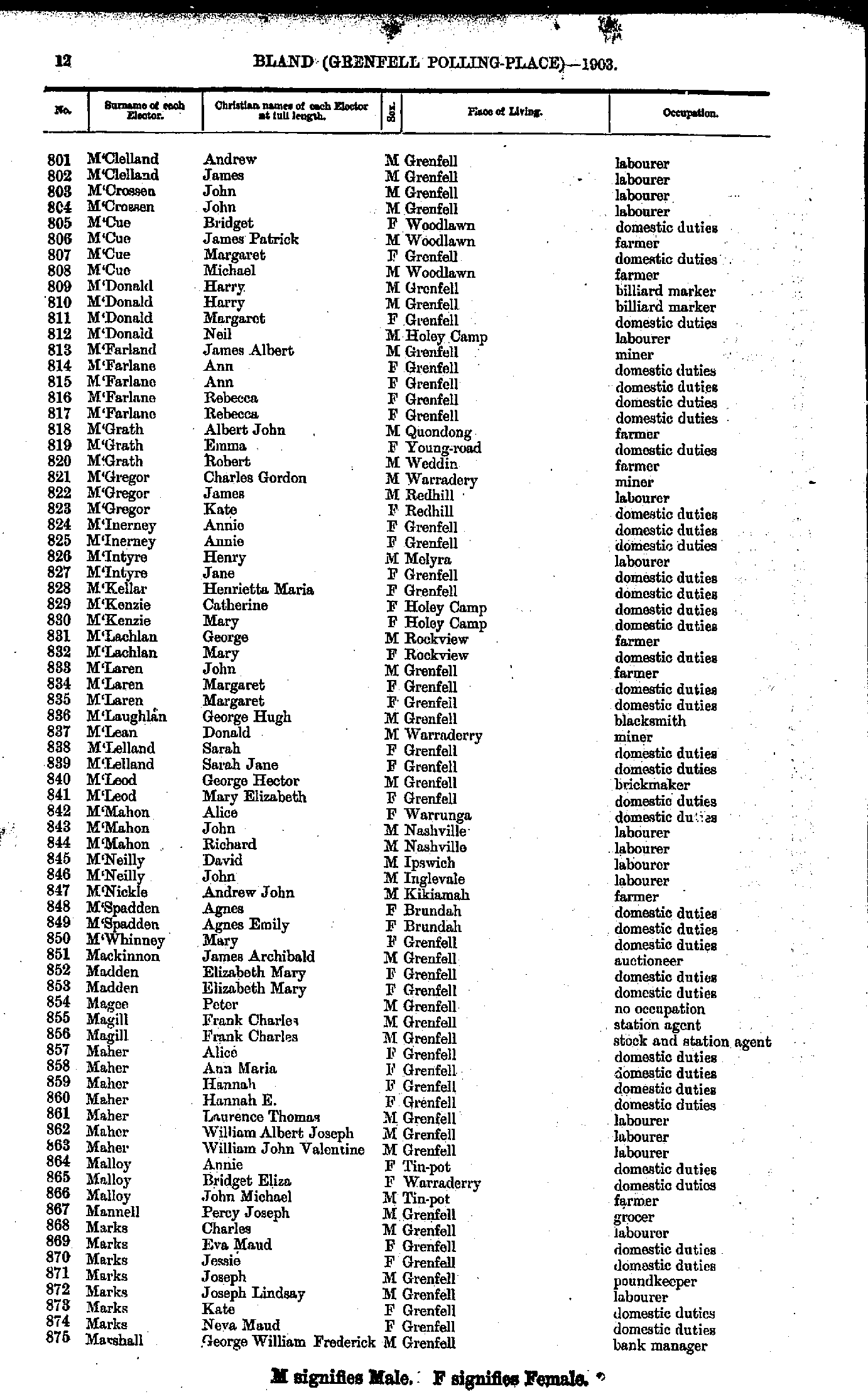
- M'Clelland Andrew - Marshall George
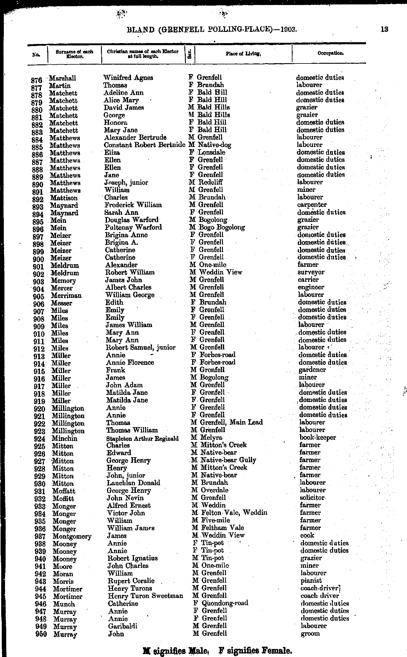
- Marshall Winifred - Murray John
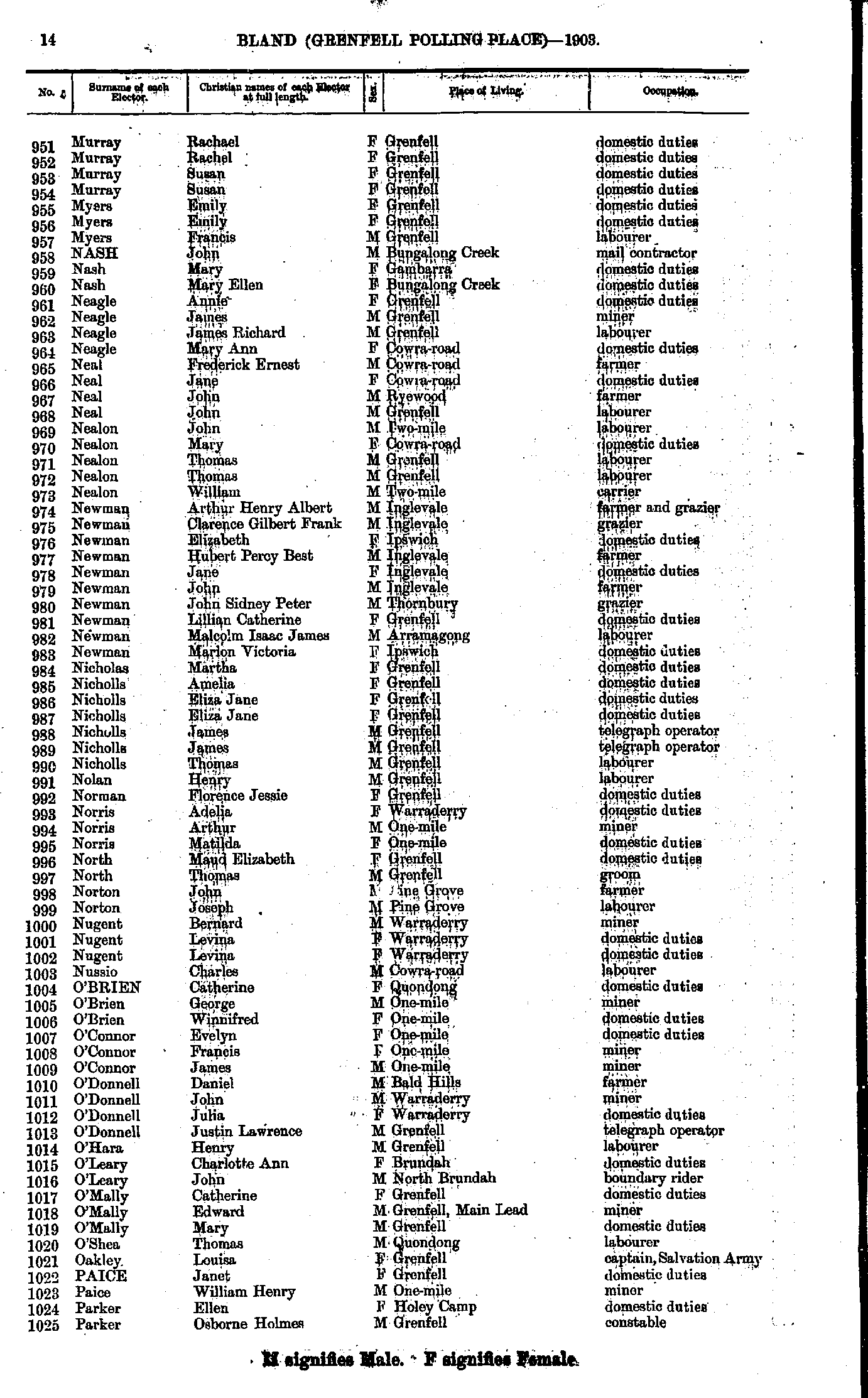
- Murray Rachael - Parker Osborne
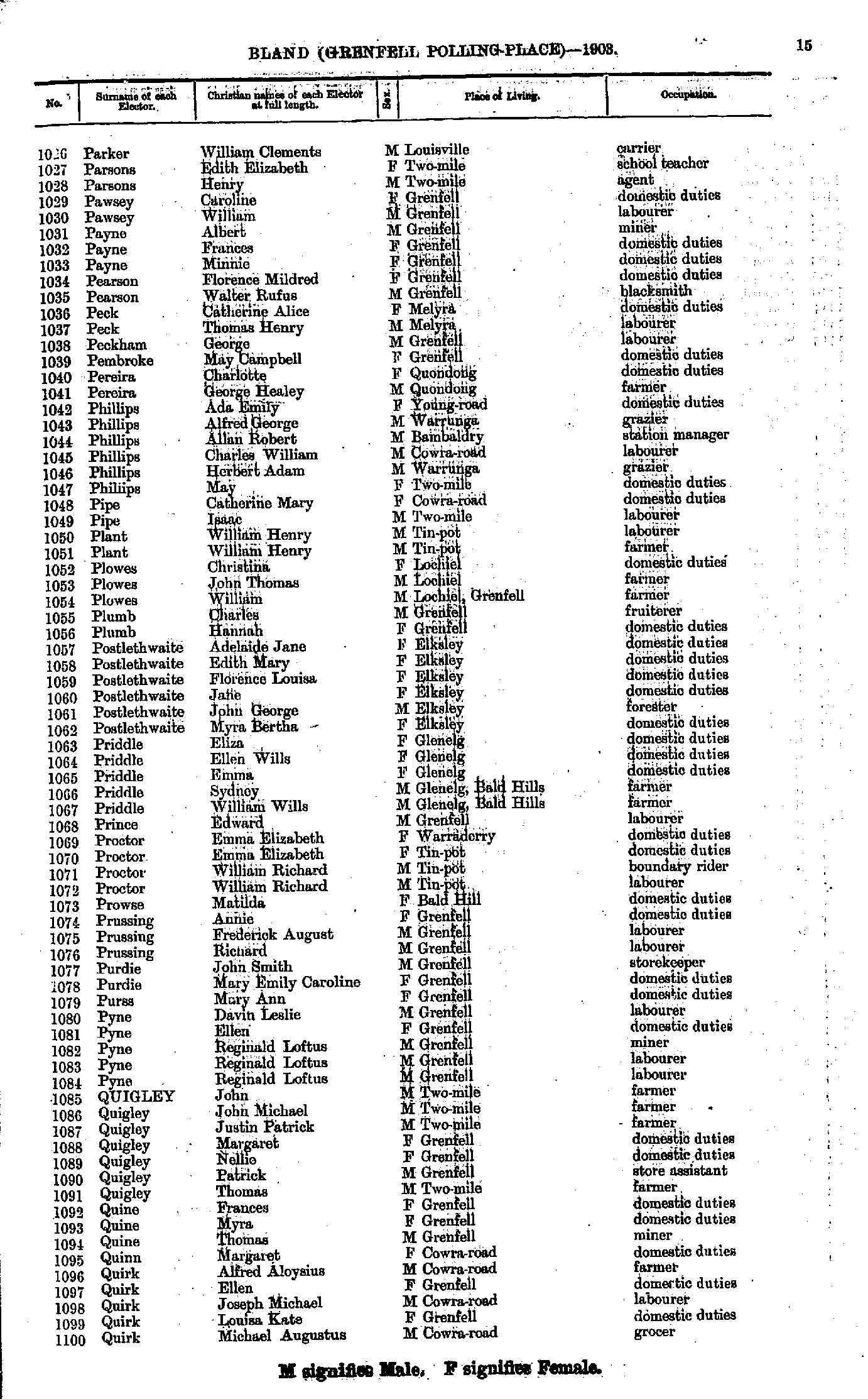
- Parker William - Quirk Michael
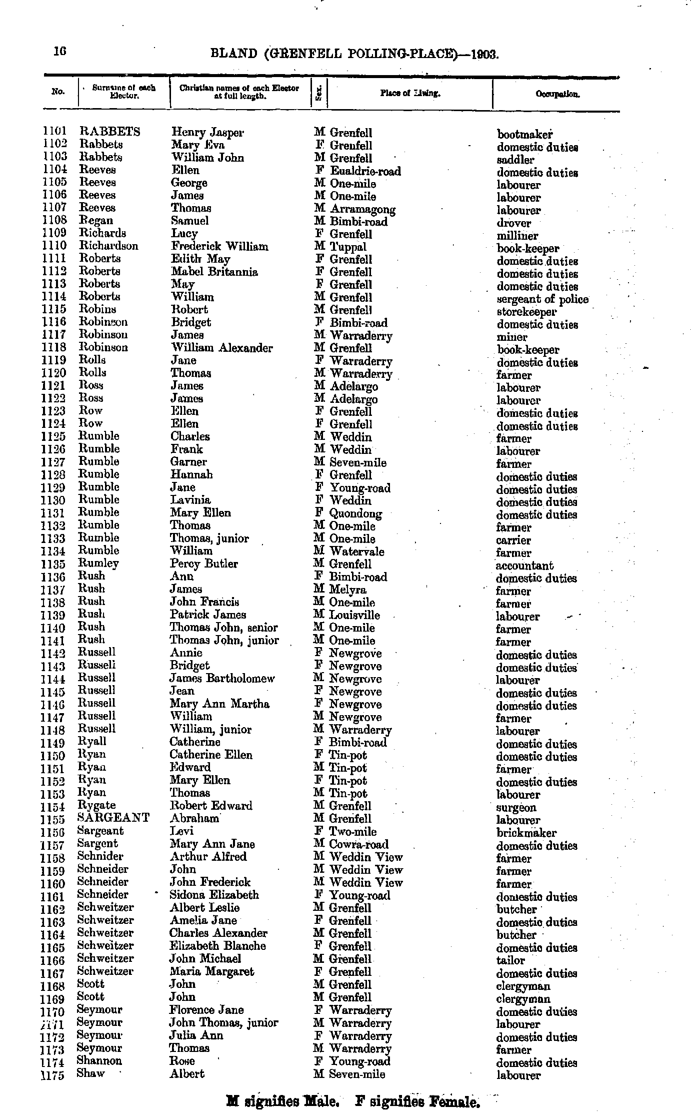
- Rabbets Henry - Shaw Albert
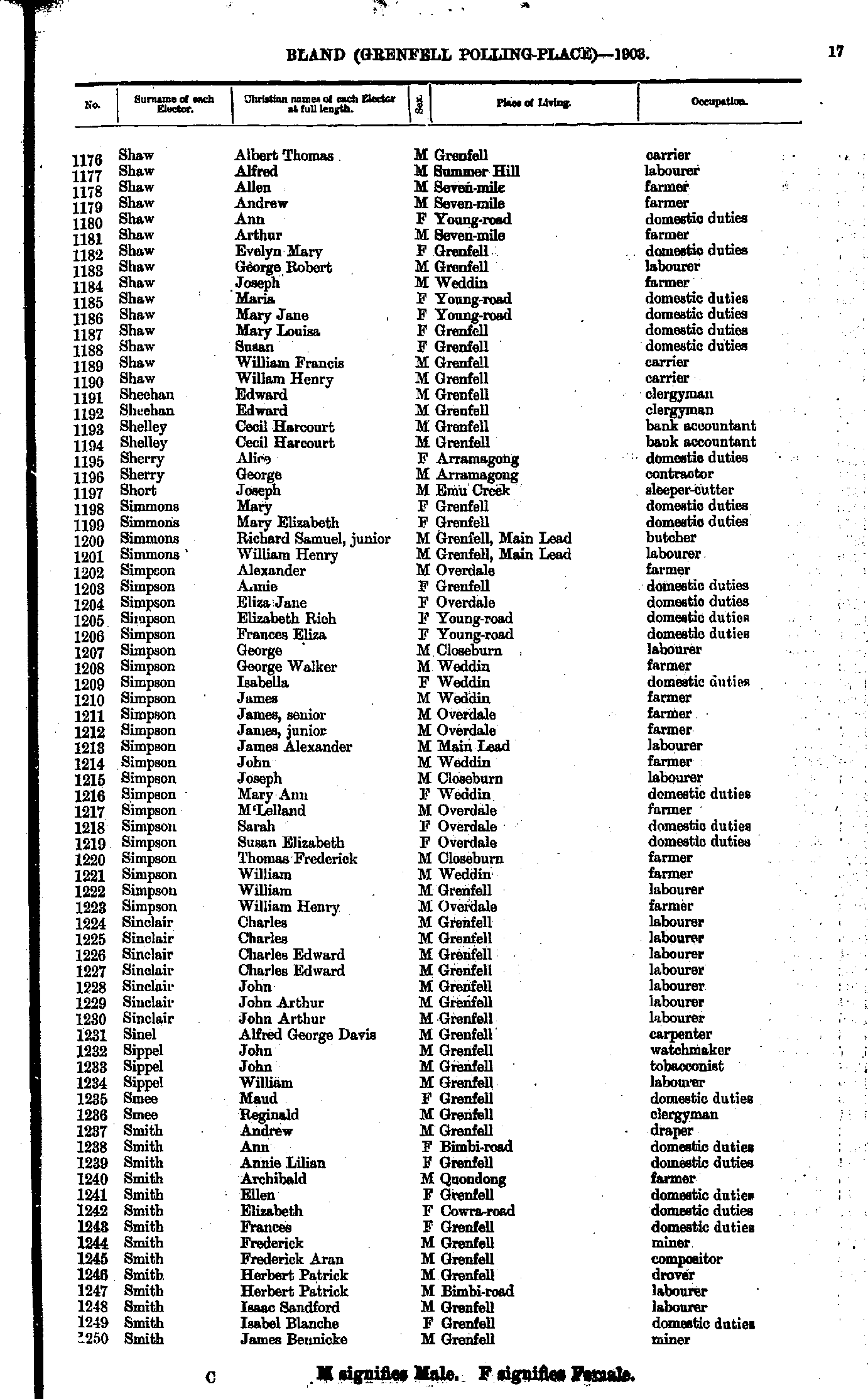
- Shaw Albert - Smith James
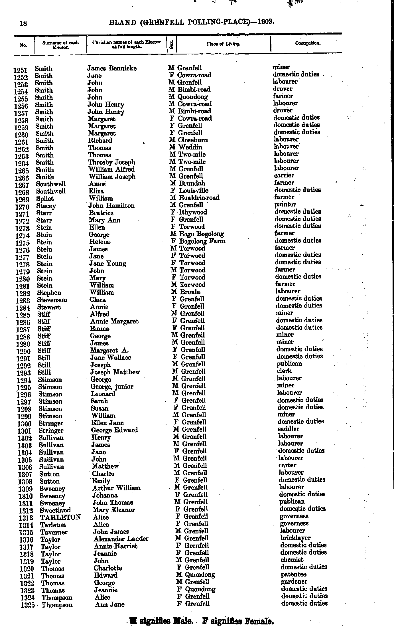
- Smith James - Thompson Ann
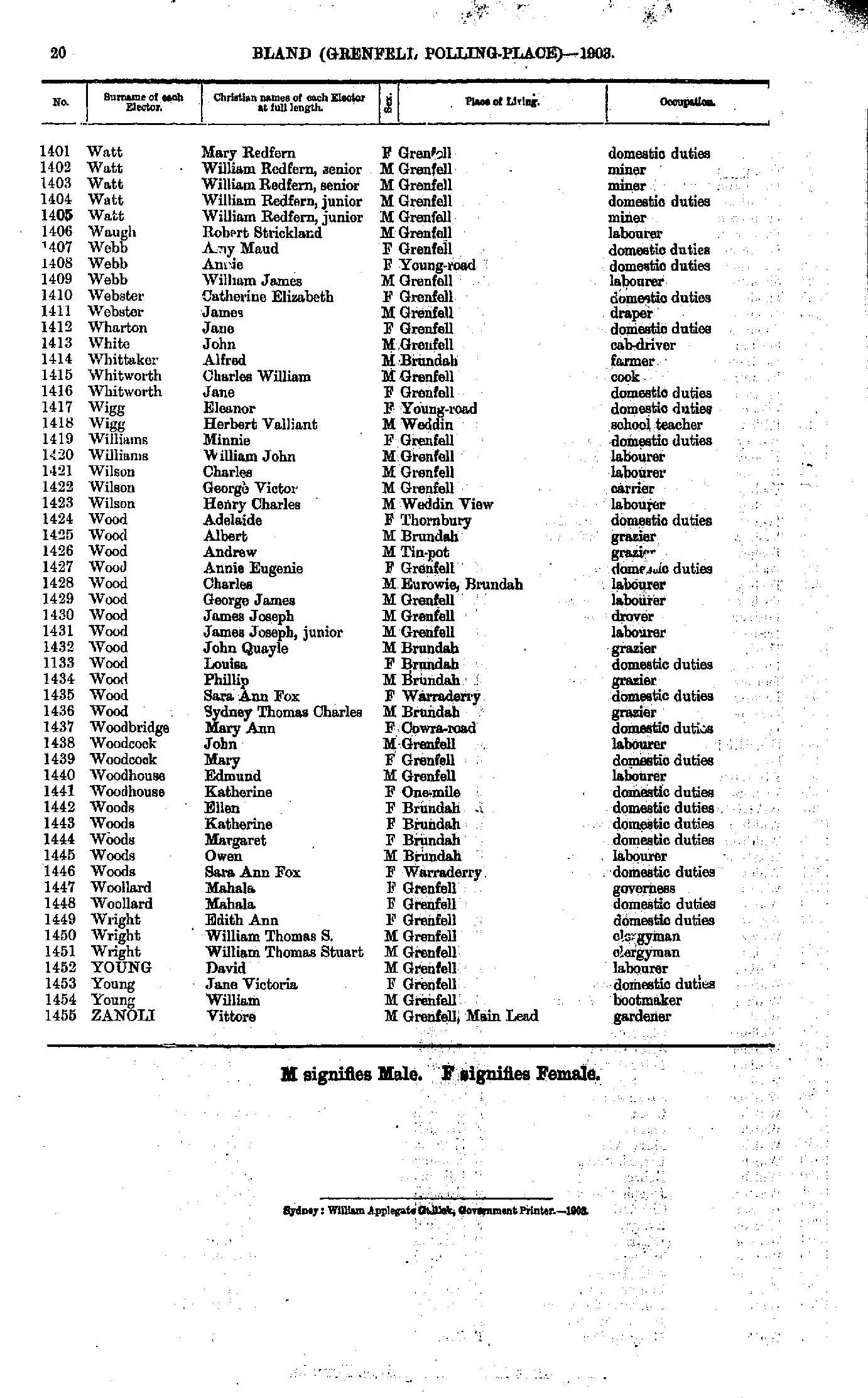
- Thompson Annie - Watt Mary
- Watt Mary - Zanoli Vittore
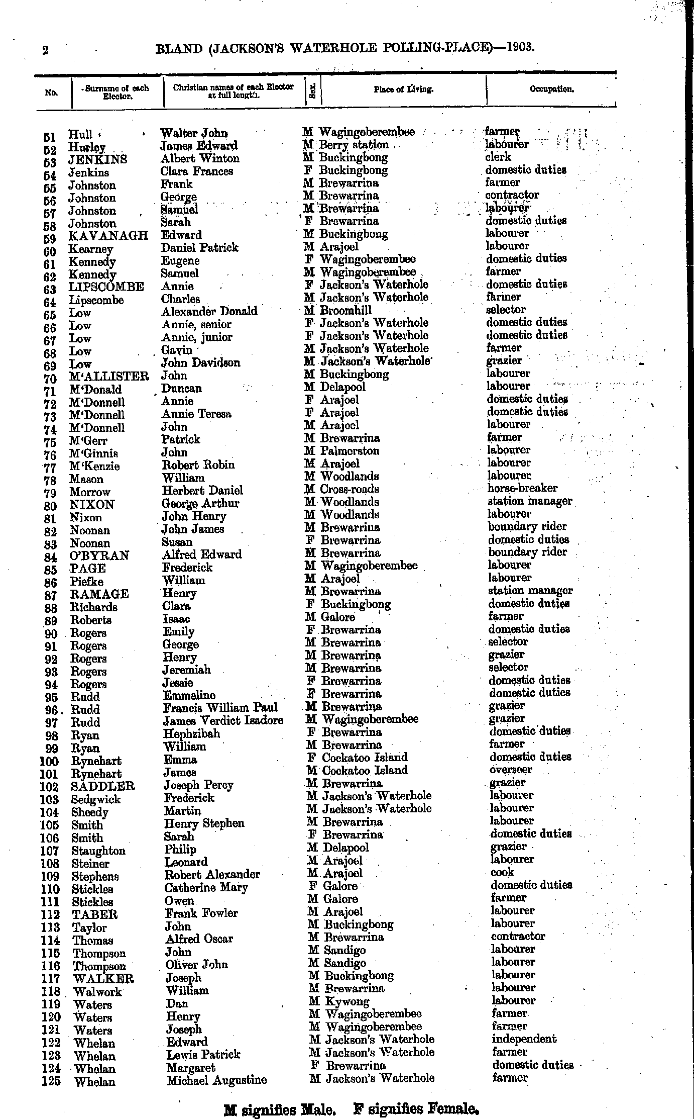
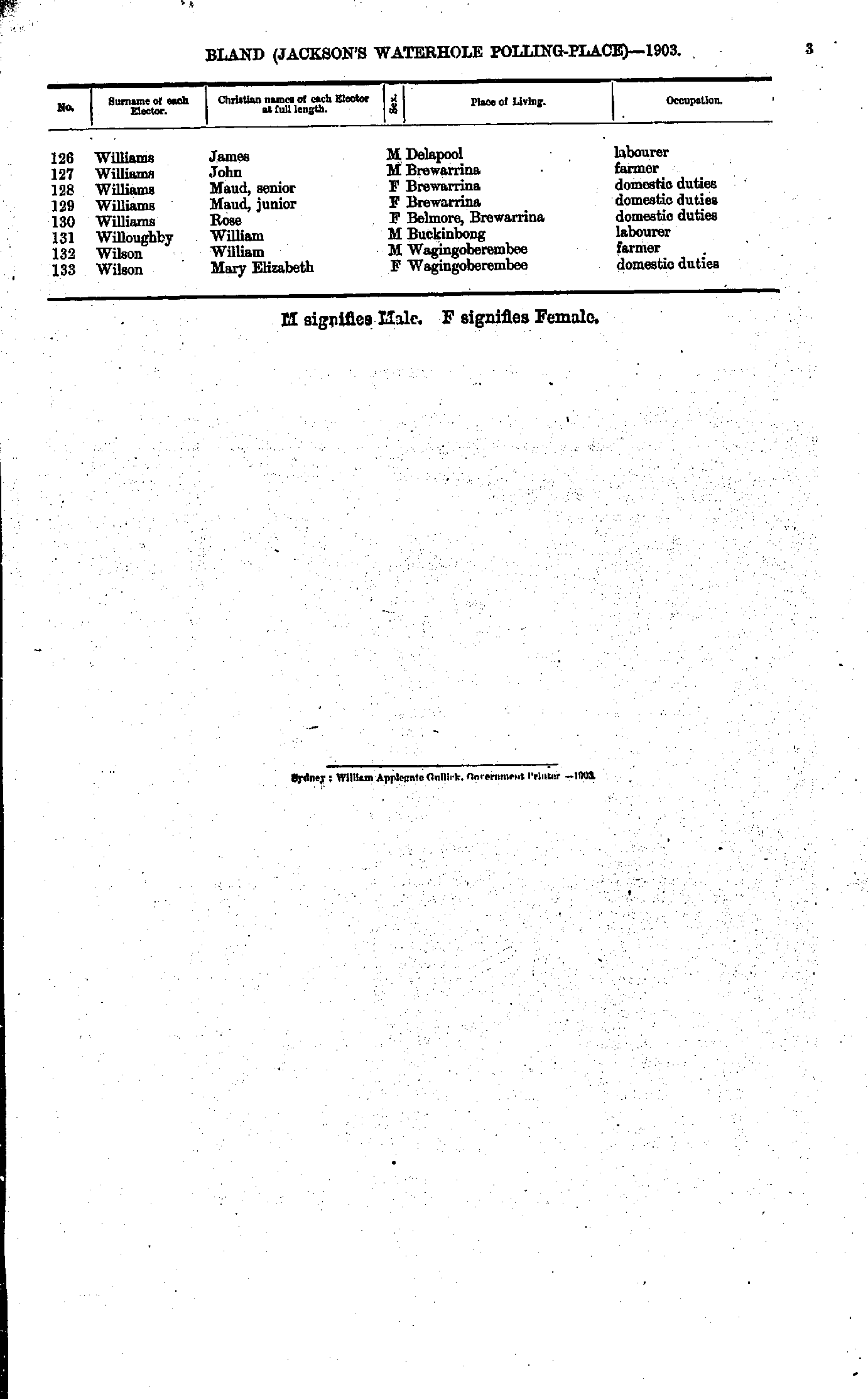
Jackson’s Waterhole Polling Place
- Adams Ellen - Baxter Frederick
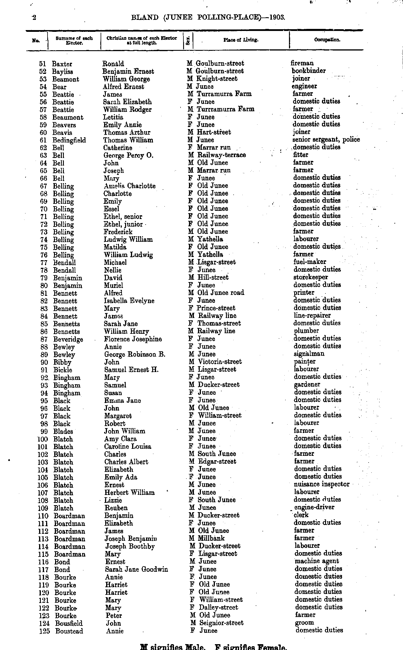
- Baxter Ronald - Boustead Annie
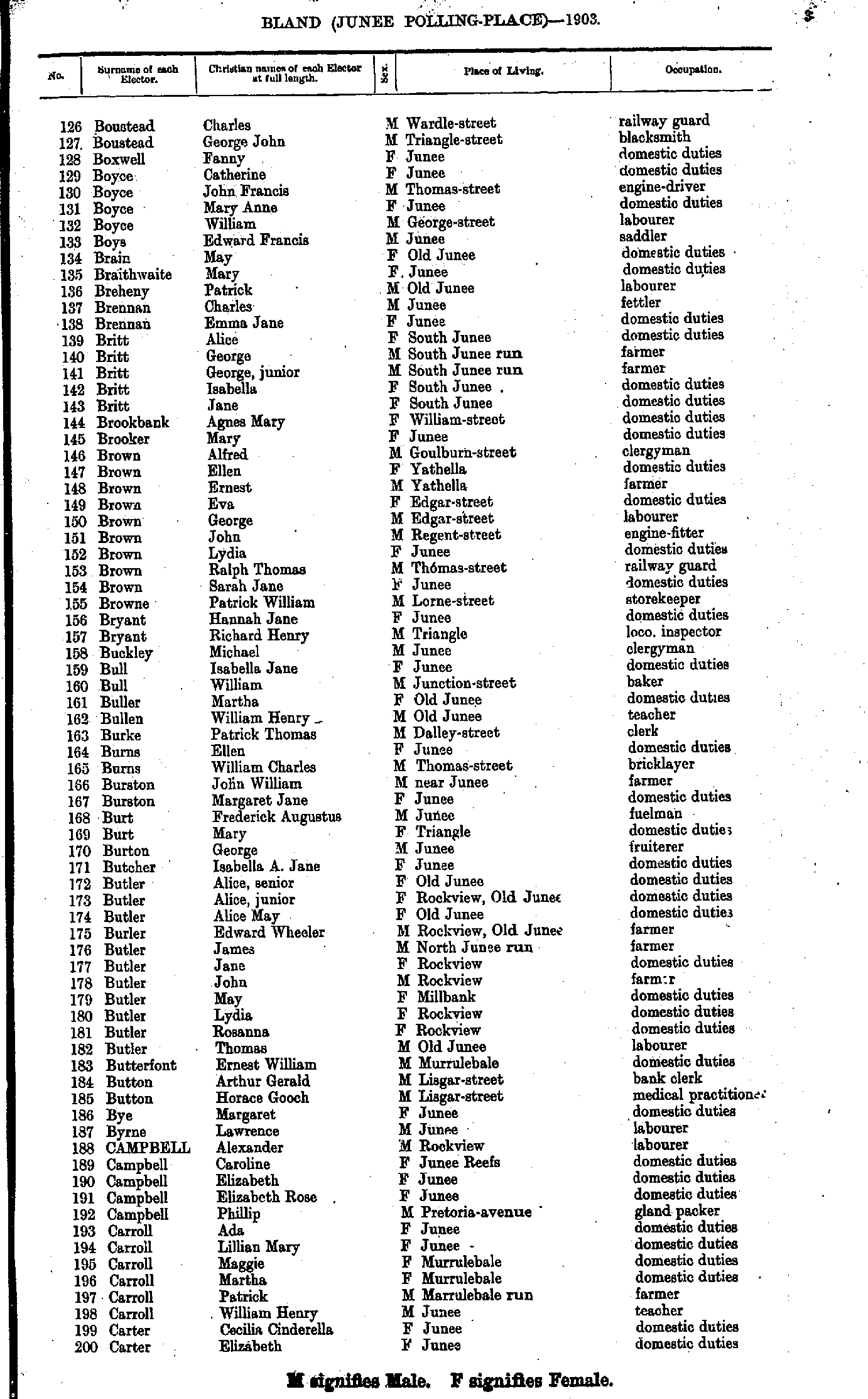
- Boustead Charles - Carter Elizabeth
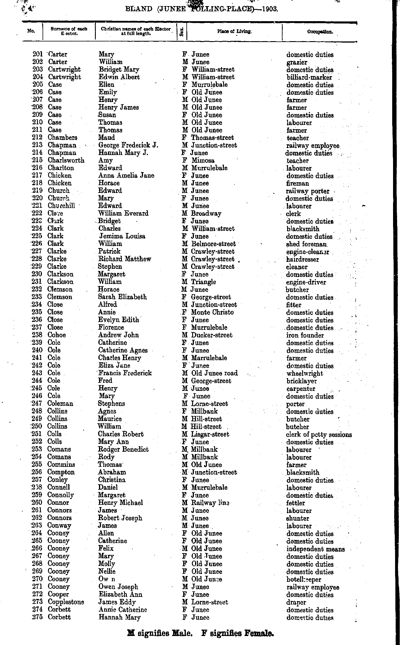
- Carter Mary - Corbett Hannah
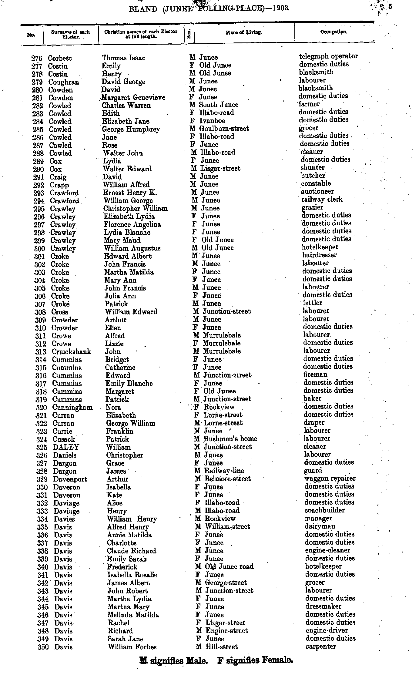
- Corbett Thomas - Davis William
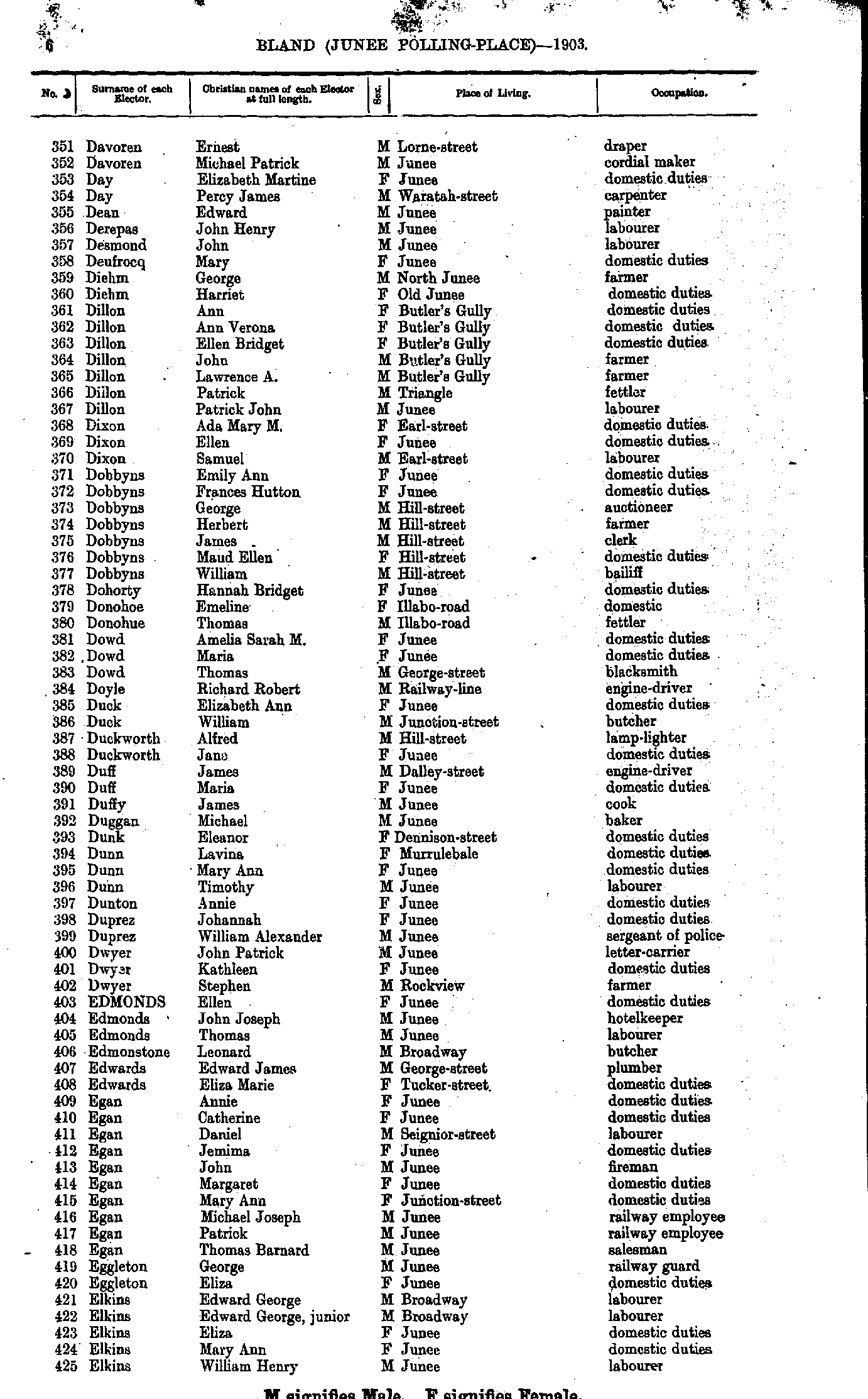
- Davoren Ernest - Elkins William
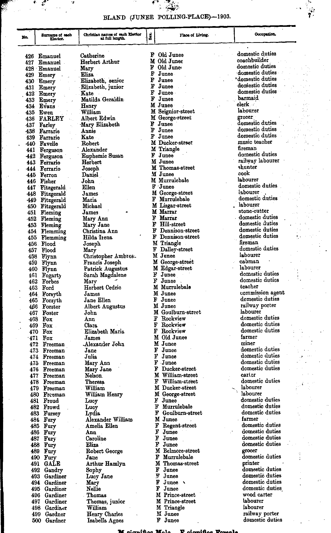
- Emanuel Catherine - Gardner Isabella
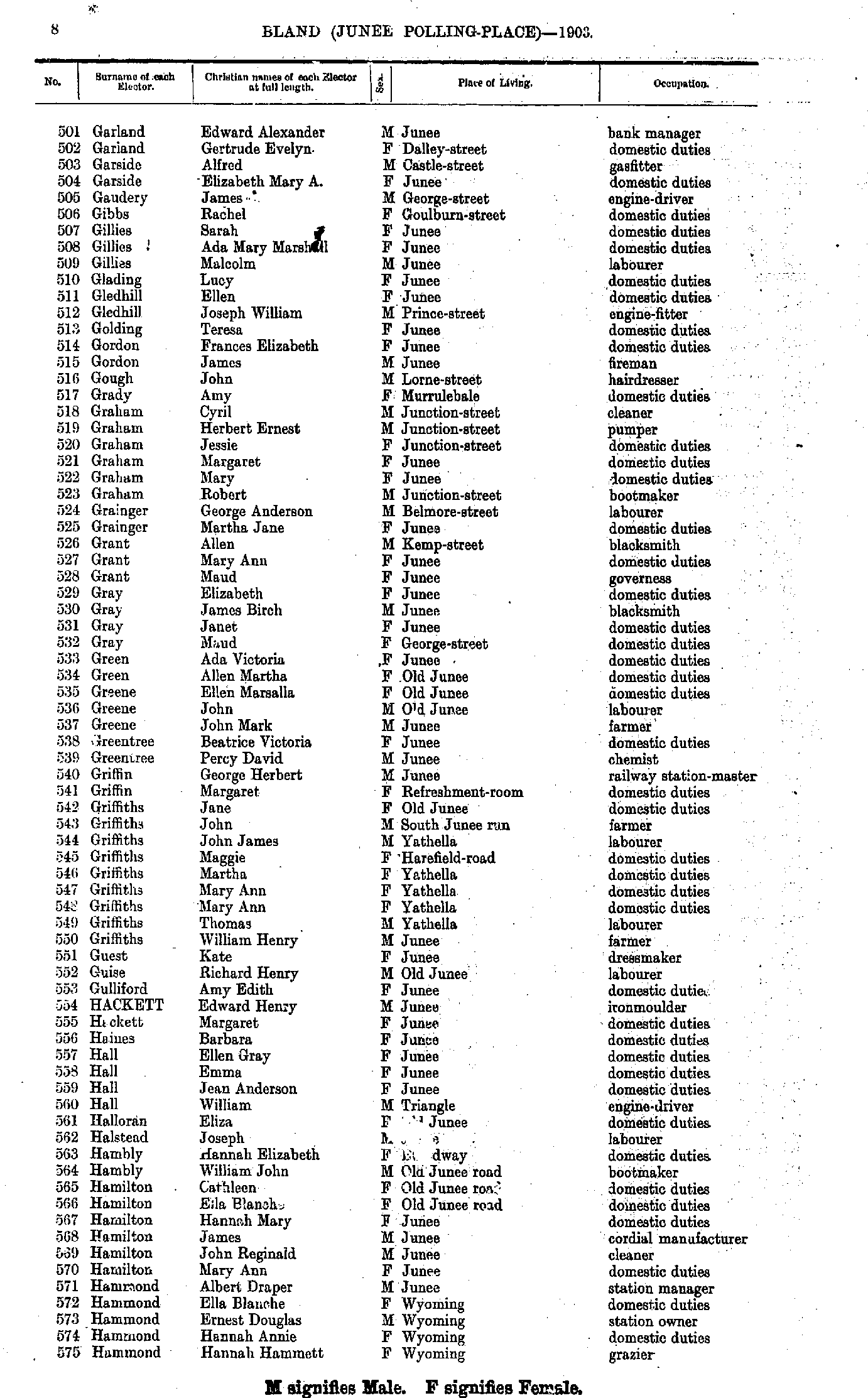
- Garland Edward - Hammond Hannah
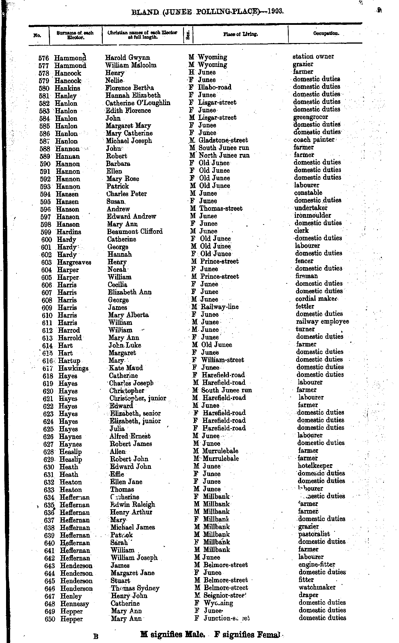
- Hammond Harold - Hepper Mary
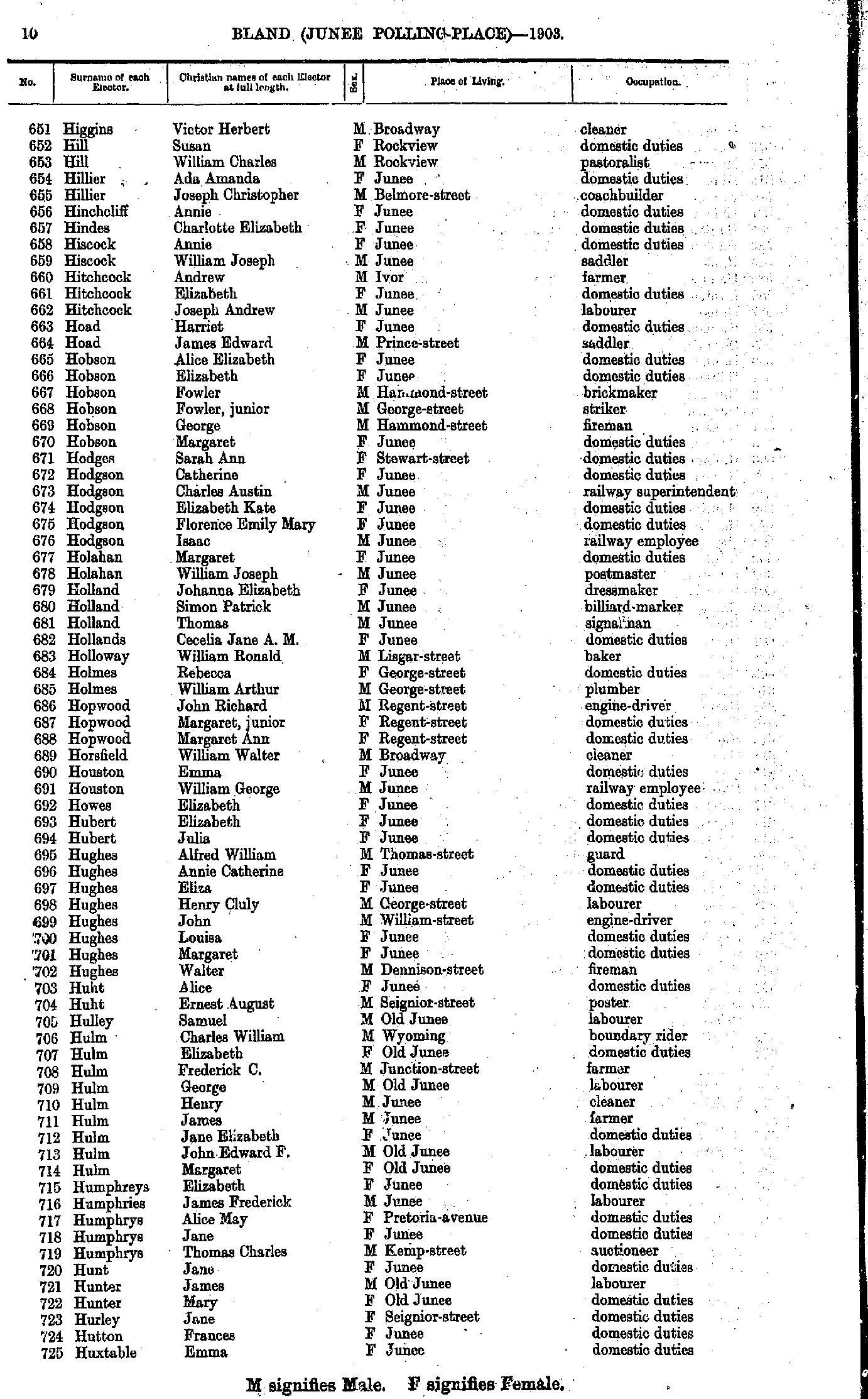
- Higgins Victor - Huxtable Emma
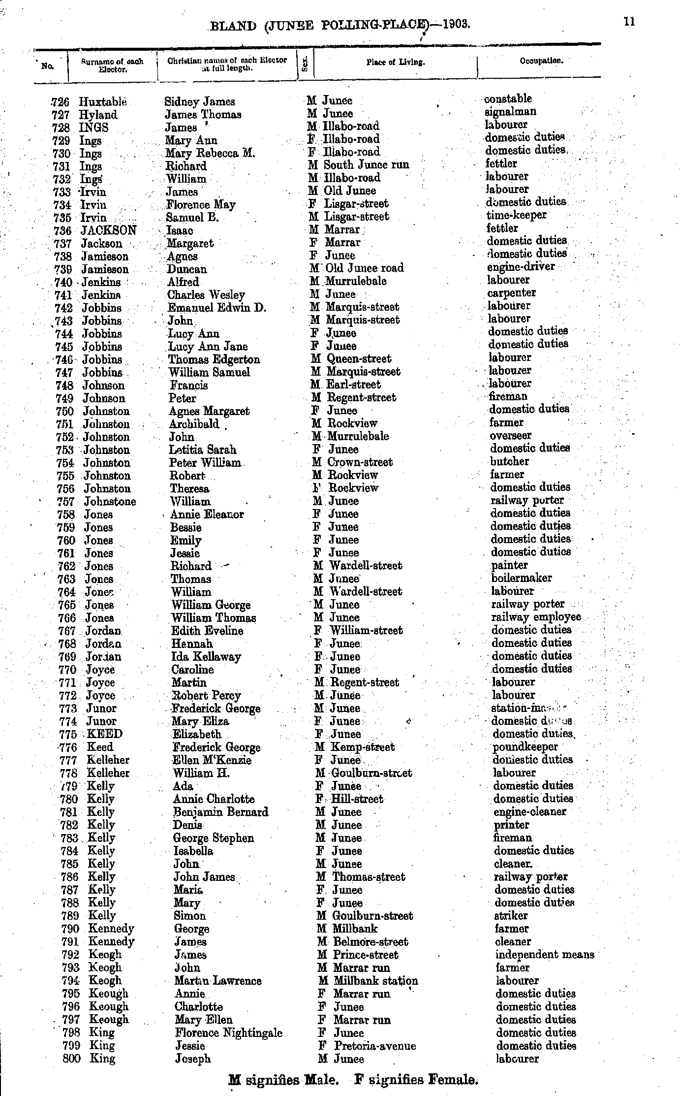
- Huxtable Sidney - King Joseph
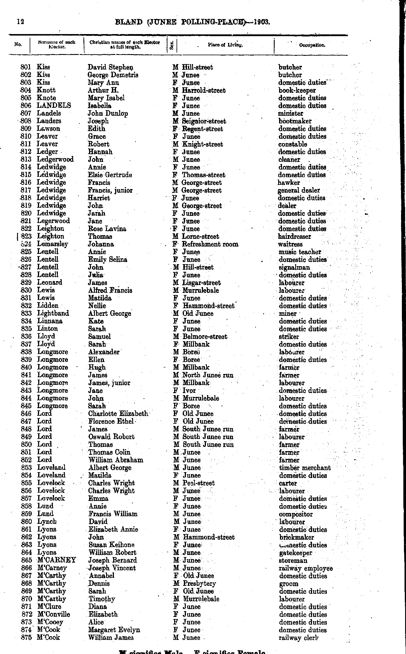
- Kiss David - M'Cook William
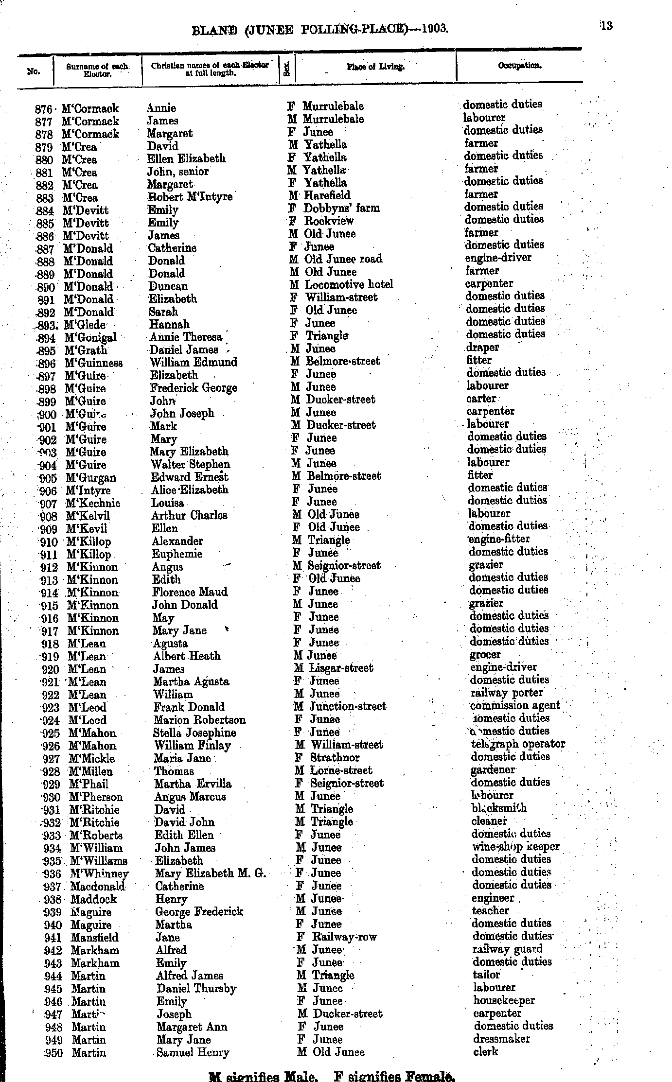
- M'Cormack Annie - Martin Samuel
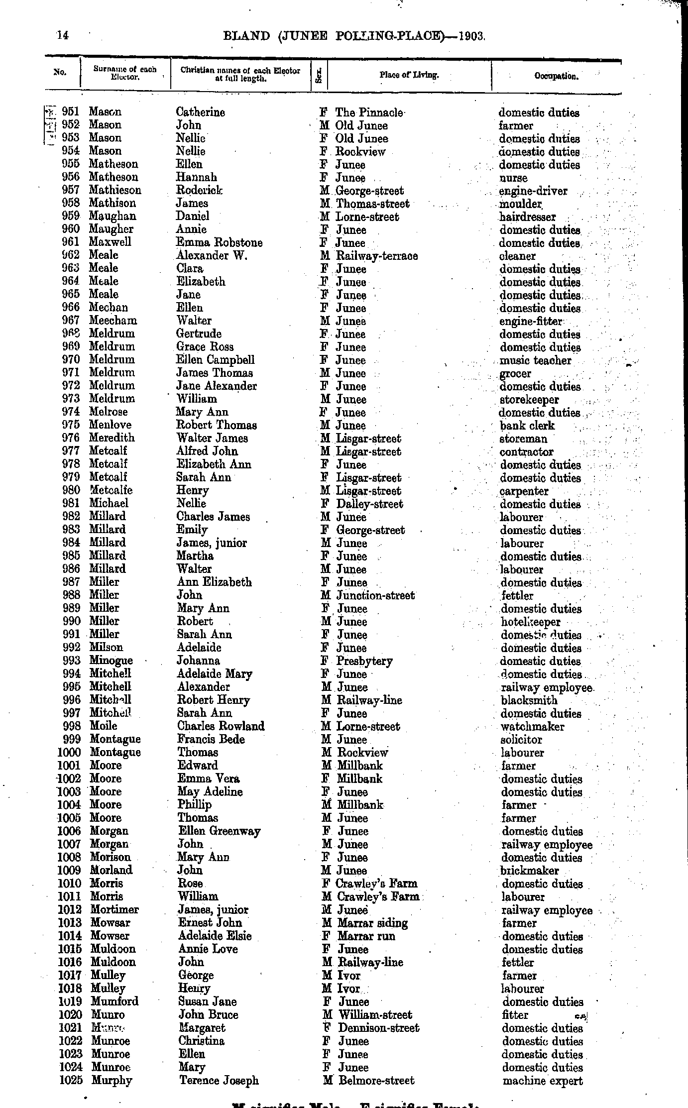
- Mason Catherine - Murphy Terence
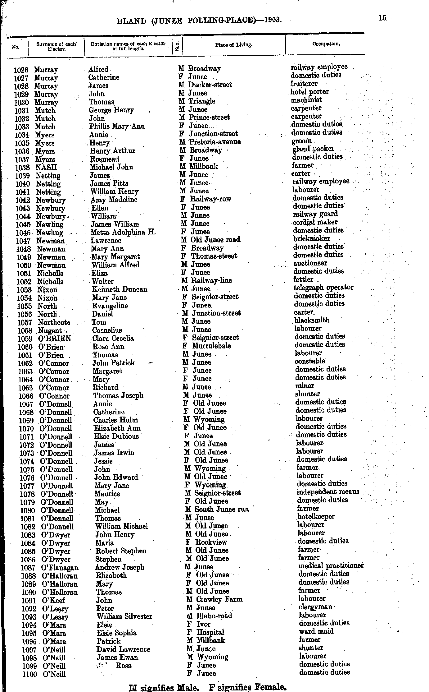
- Murray Alfred - O'Neill James
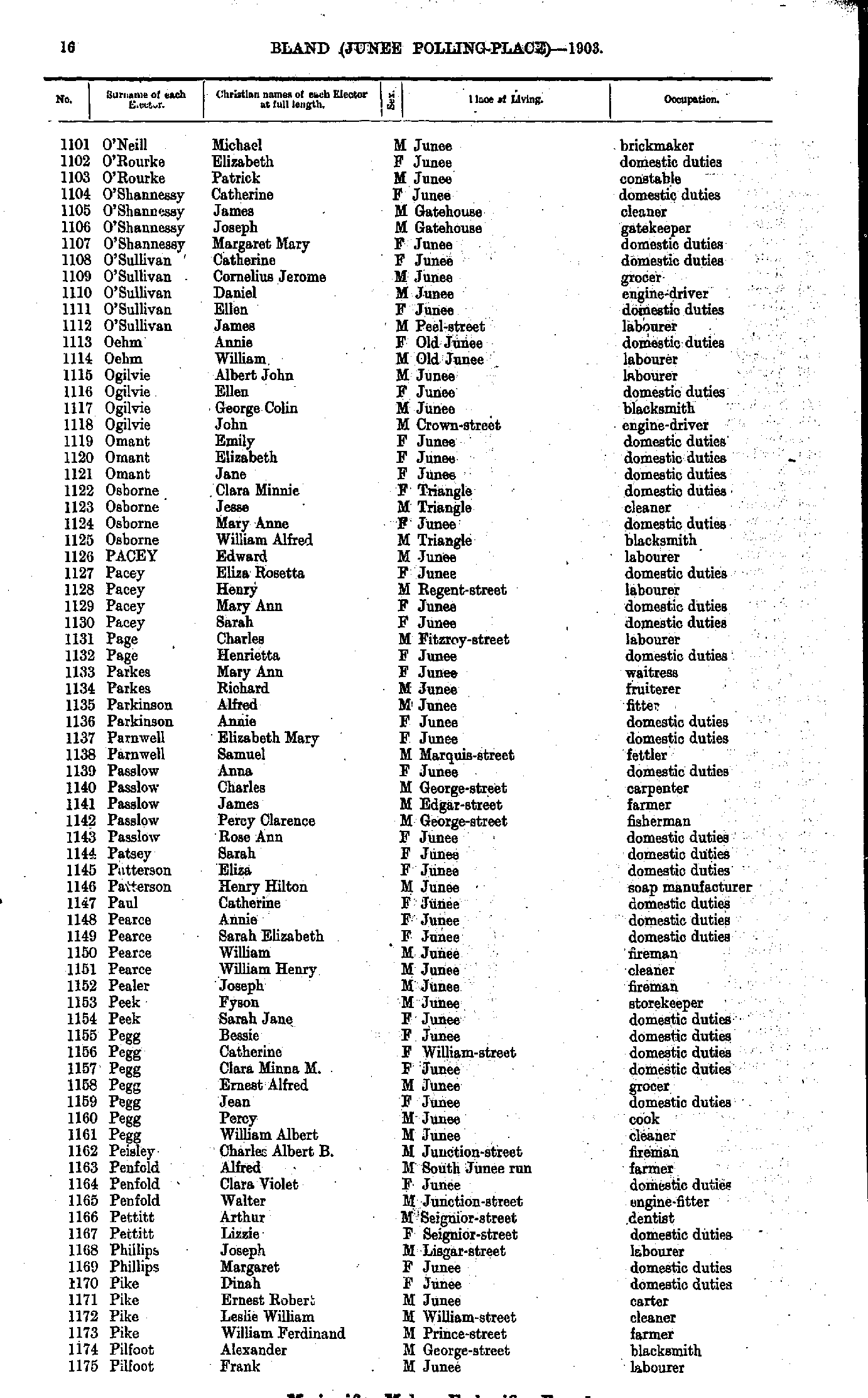
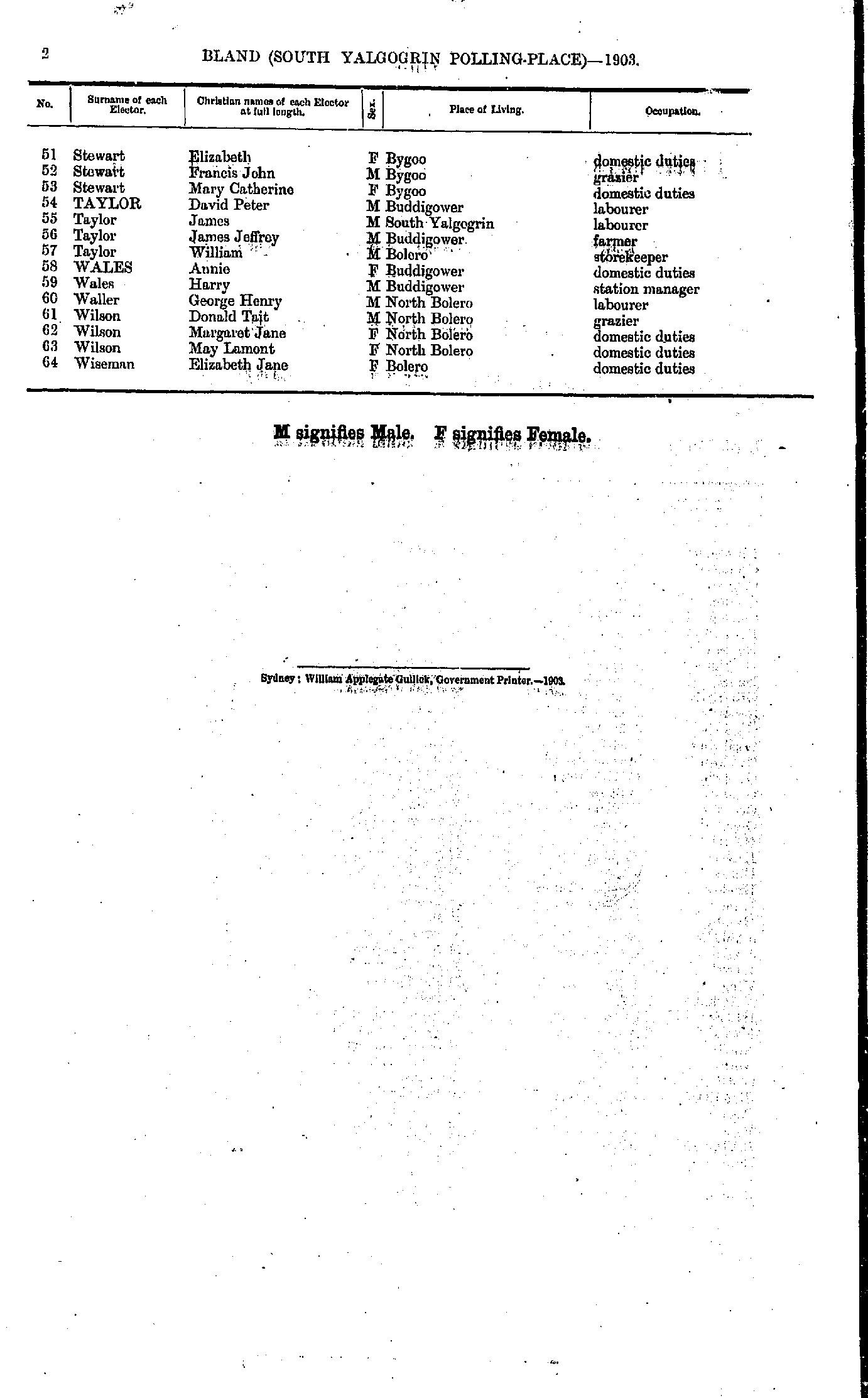
- O'Neill Michael - Pilfoot Frank
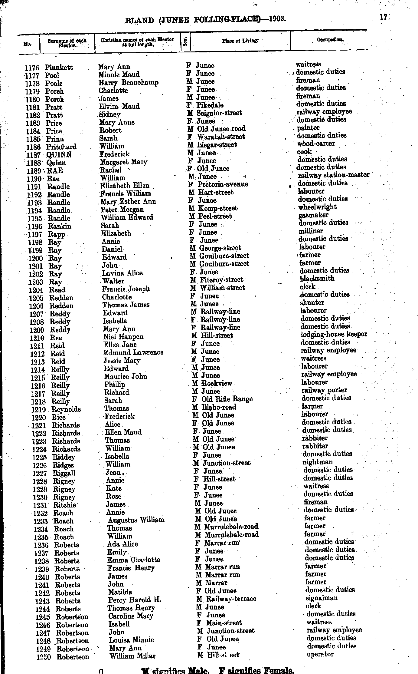
- Plunkett Mary - Robertson William
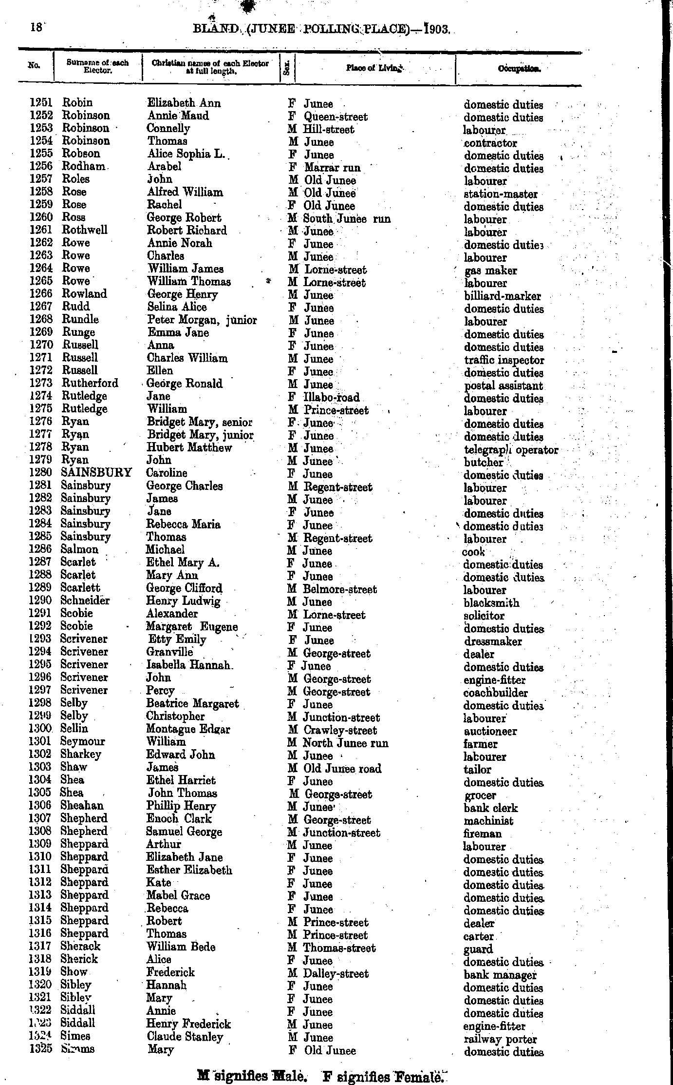
- Robin Elizabeth - Simms Mary
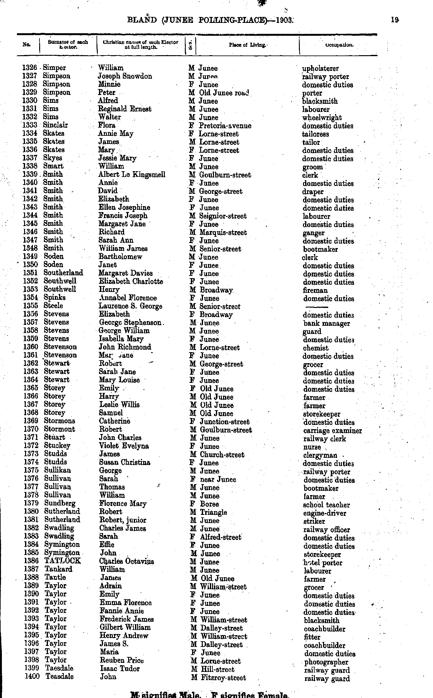
- Simper William - Teasdale John
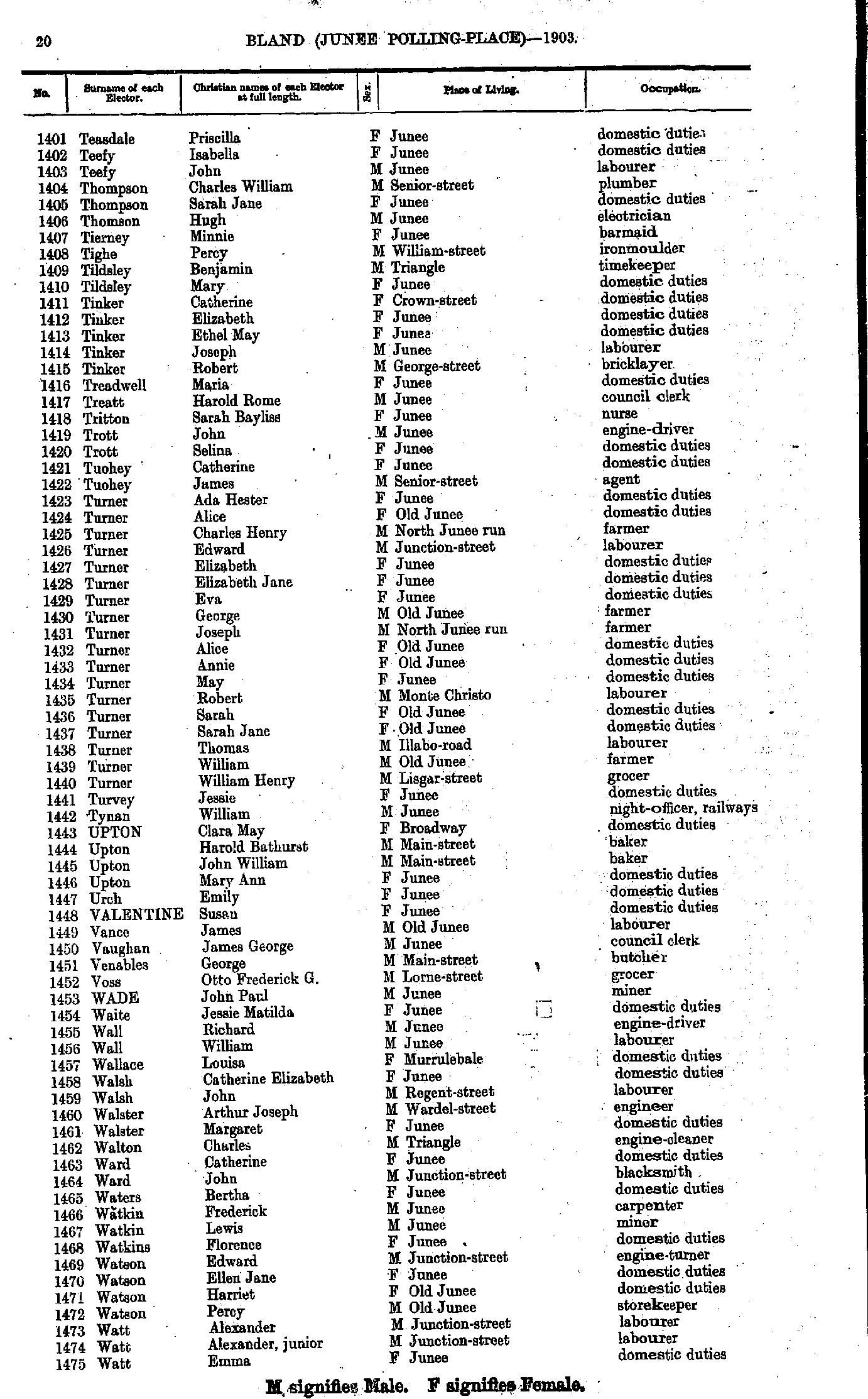
- Teasdale Priscilla - Watt Emma
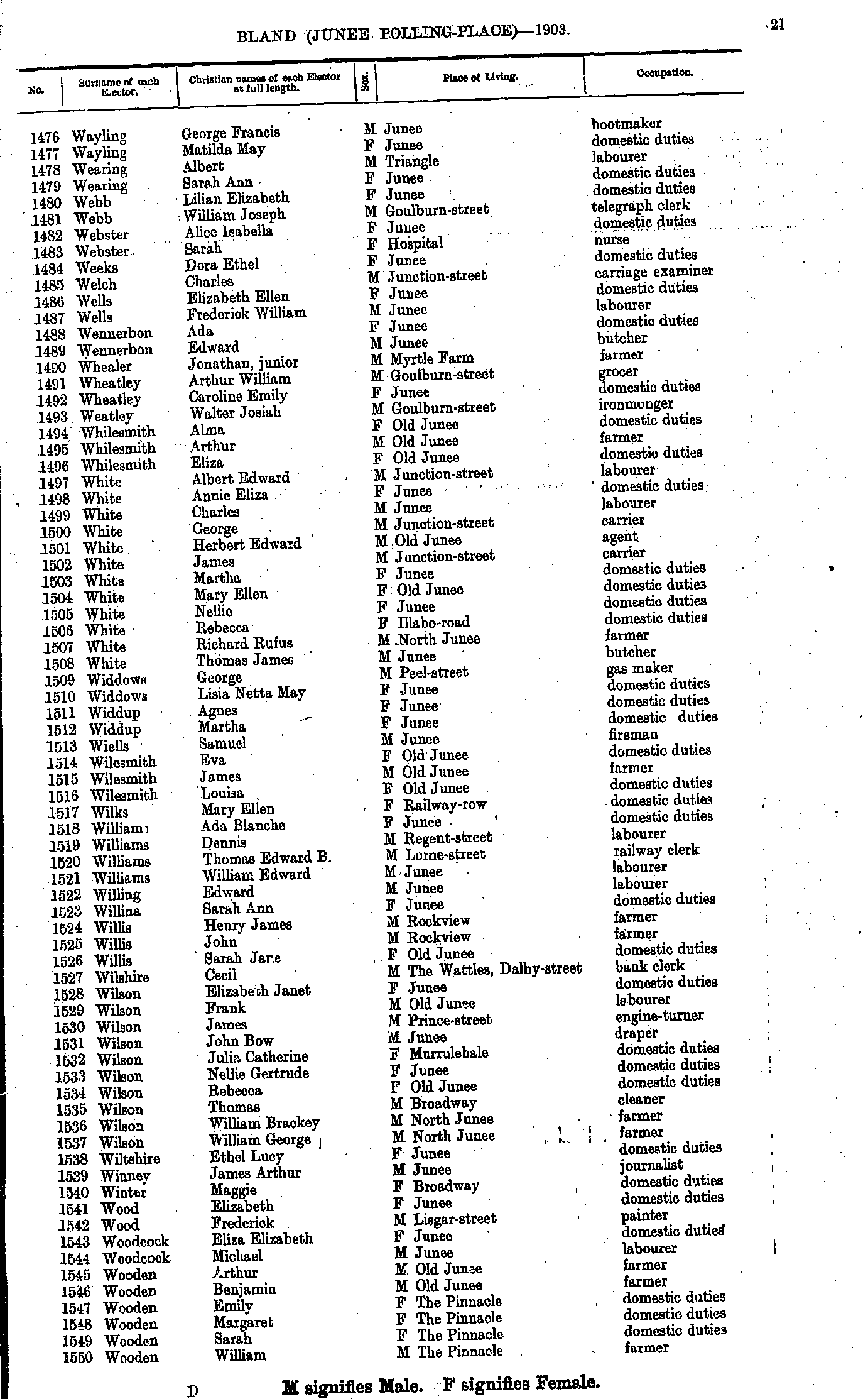
- Wayling George - Wooden William
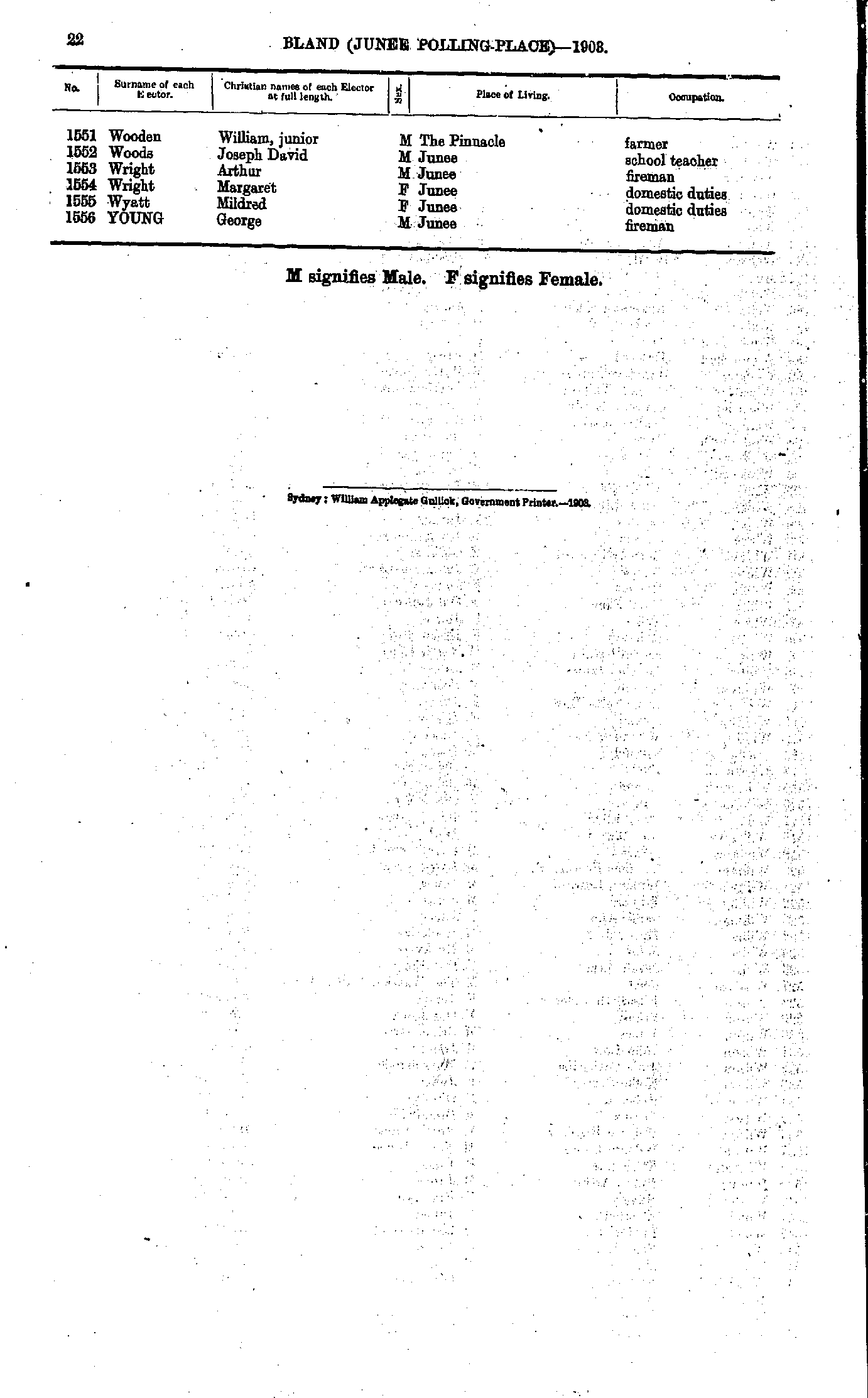
- Wooden William - Young George
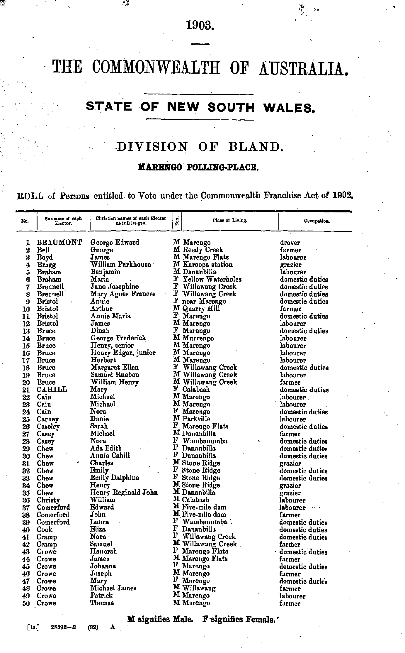
- Beaumont George - Crowe Thomas
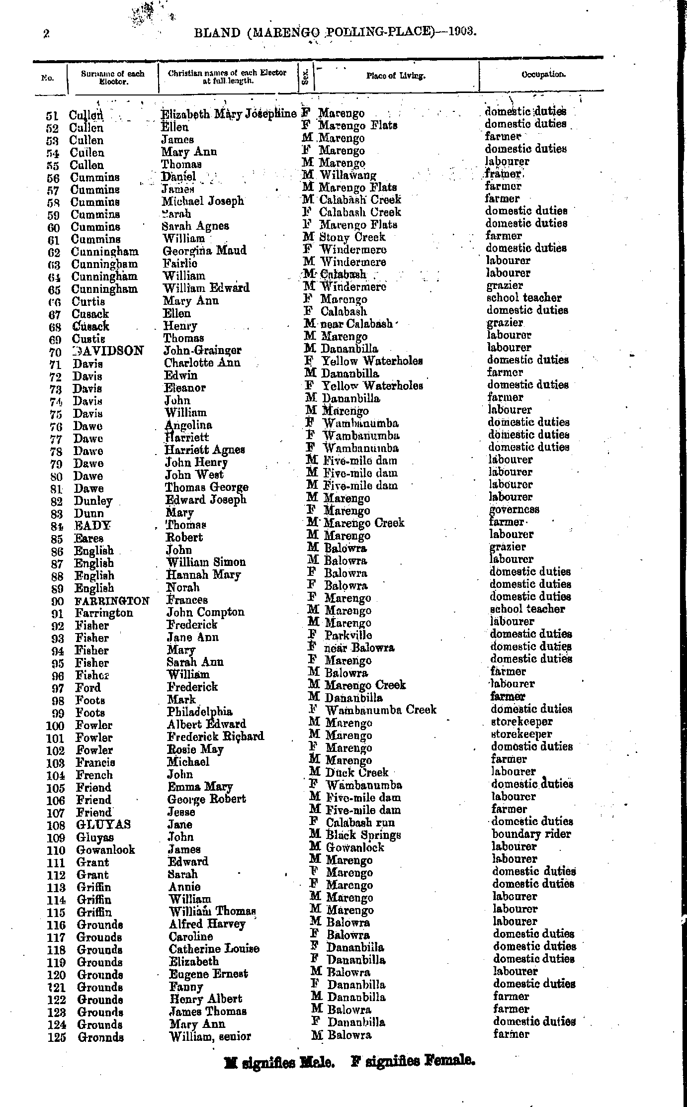
- Cullen Elizabeth - Grounds William
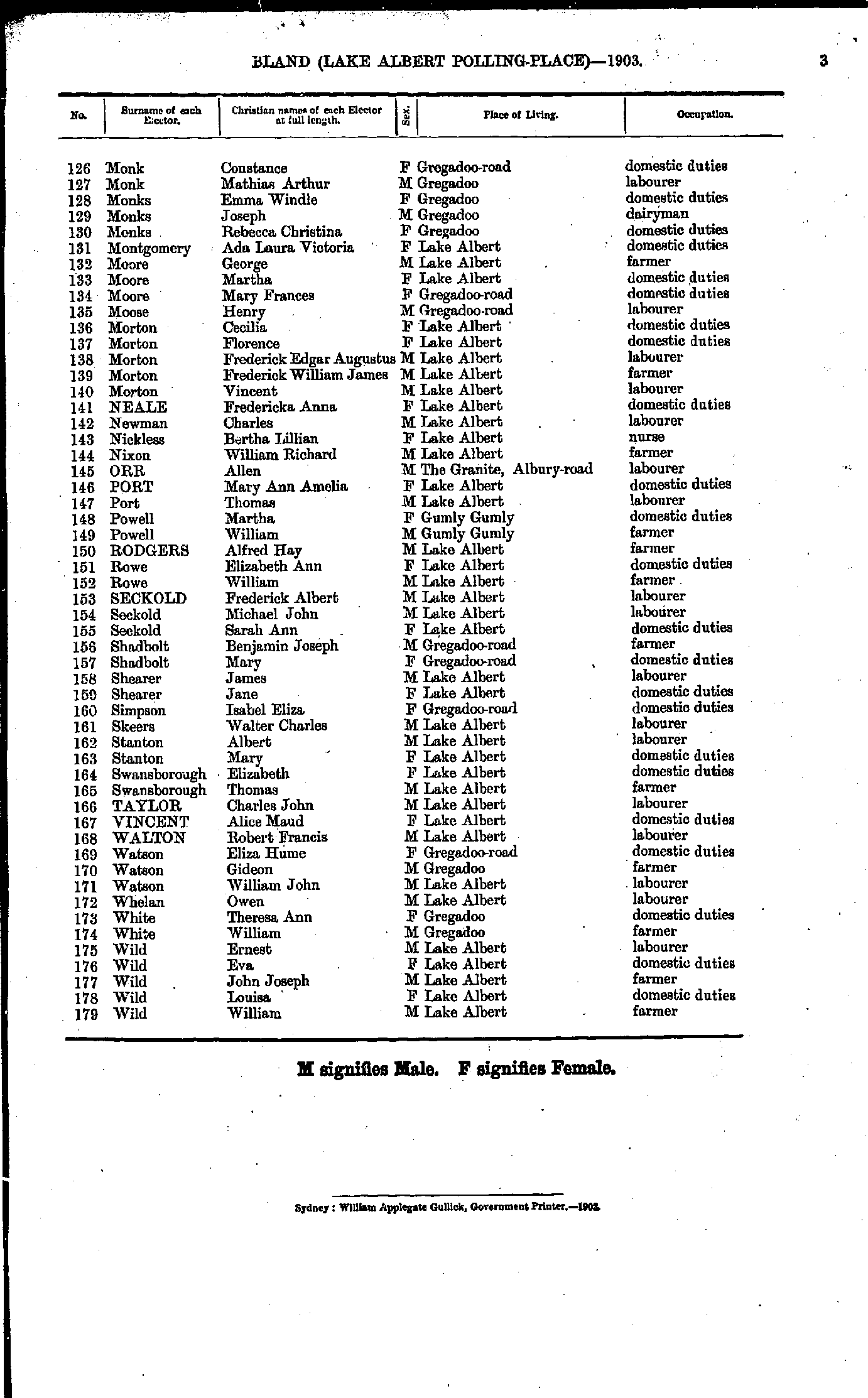
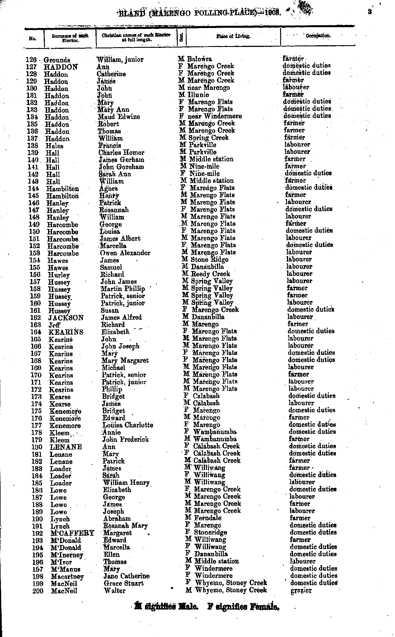
- Grounds William - MacNeil Walter
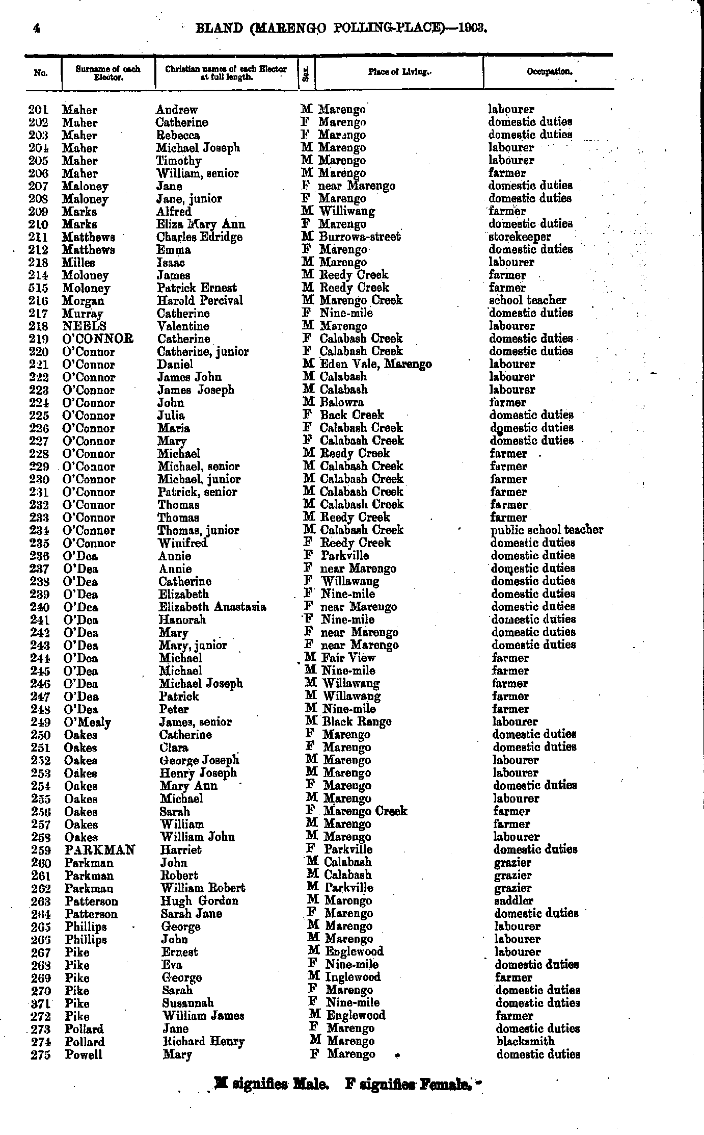
- Maher Andrew - Powell Mary
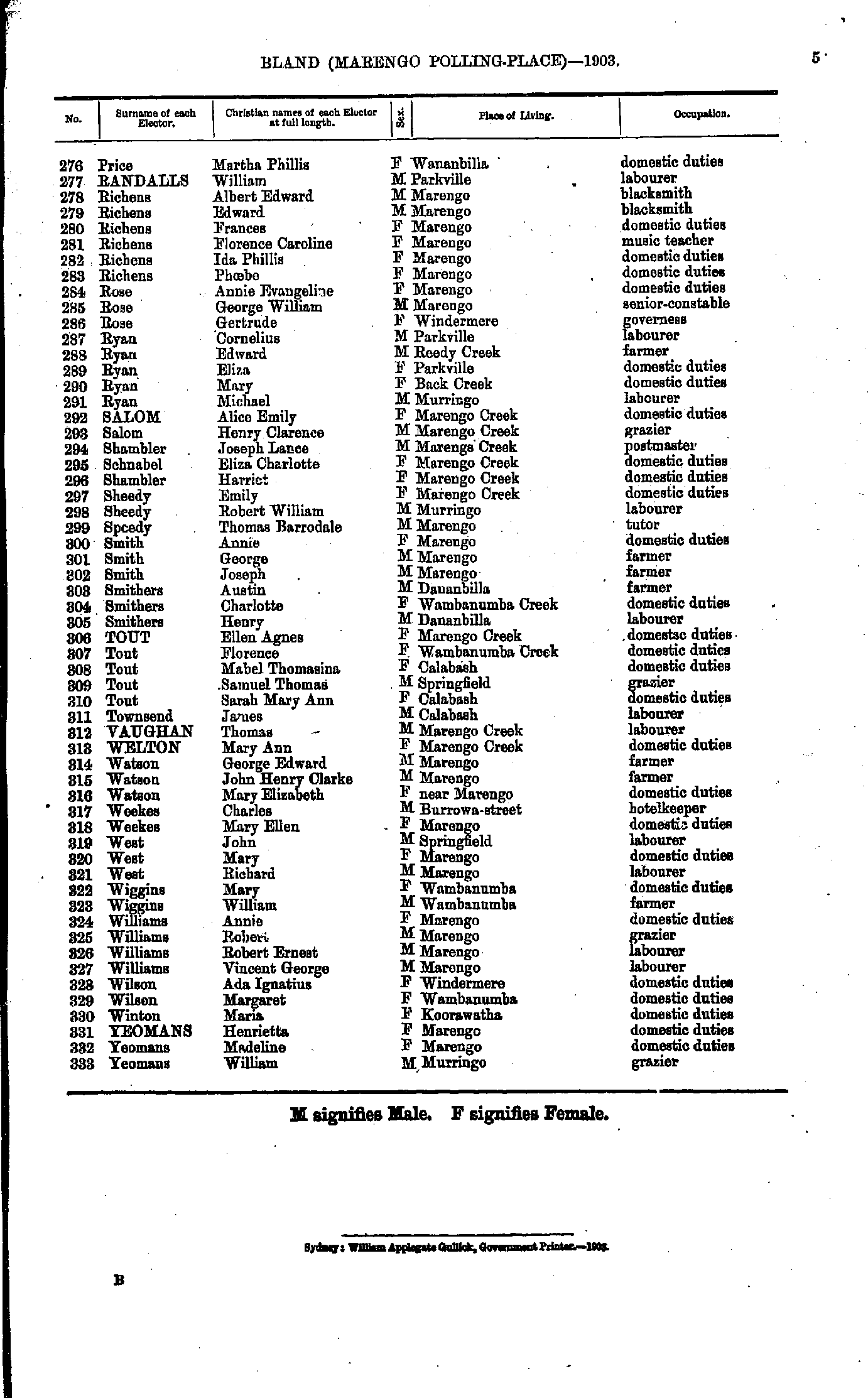
- Price Martha - Yeomans William
- Anderson Alexander - Douglas Ada
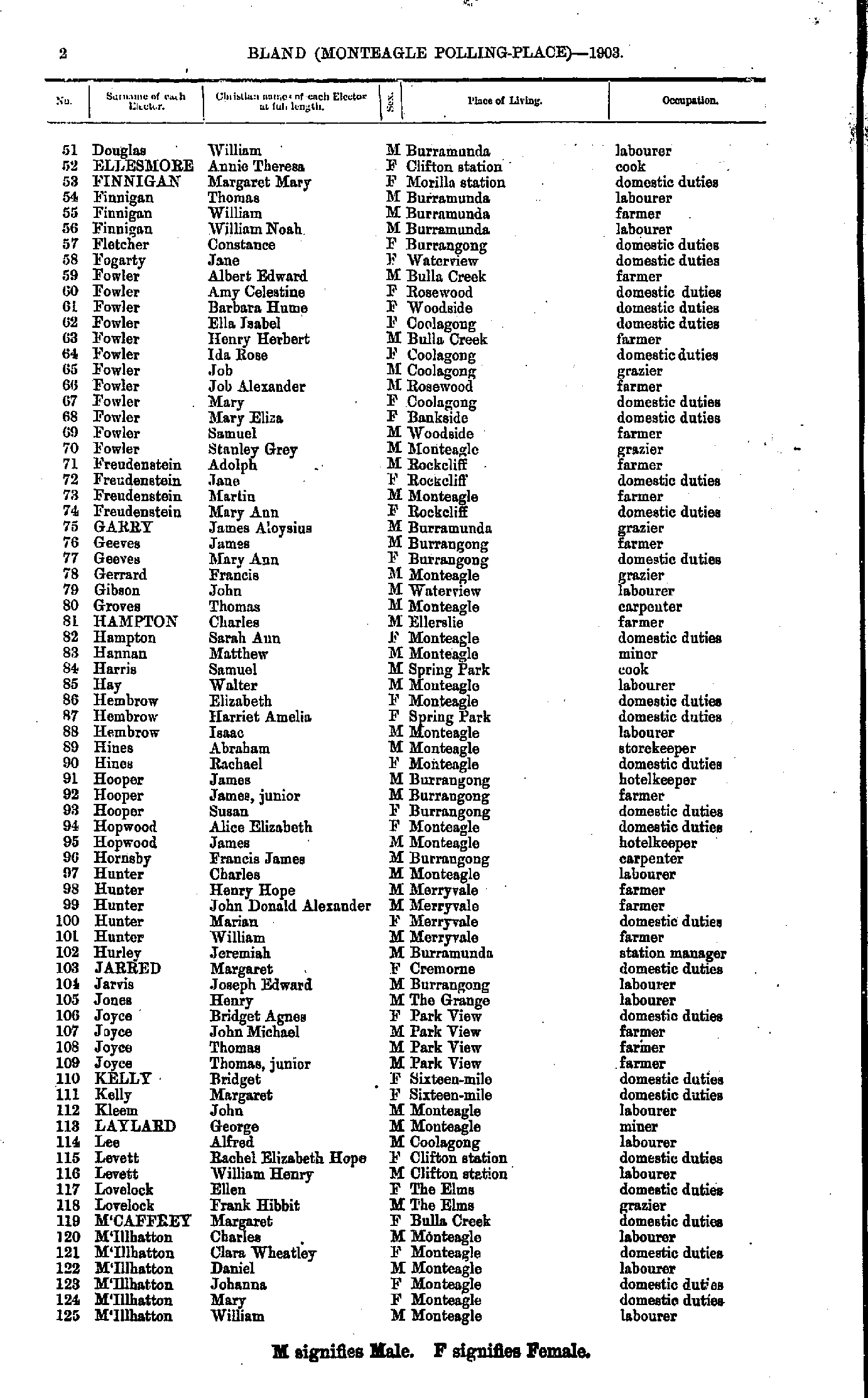
- Douglas William - M'Illhatton William
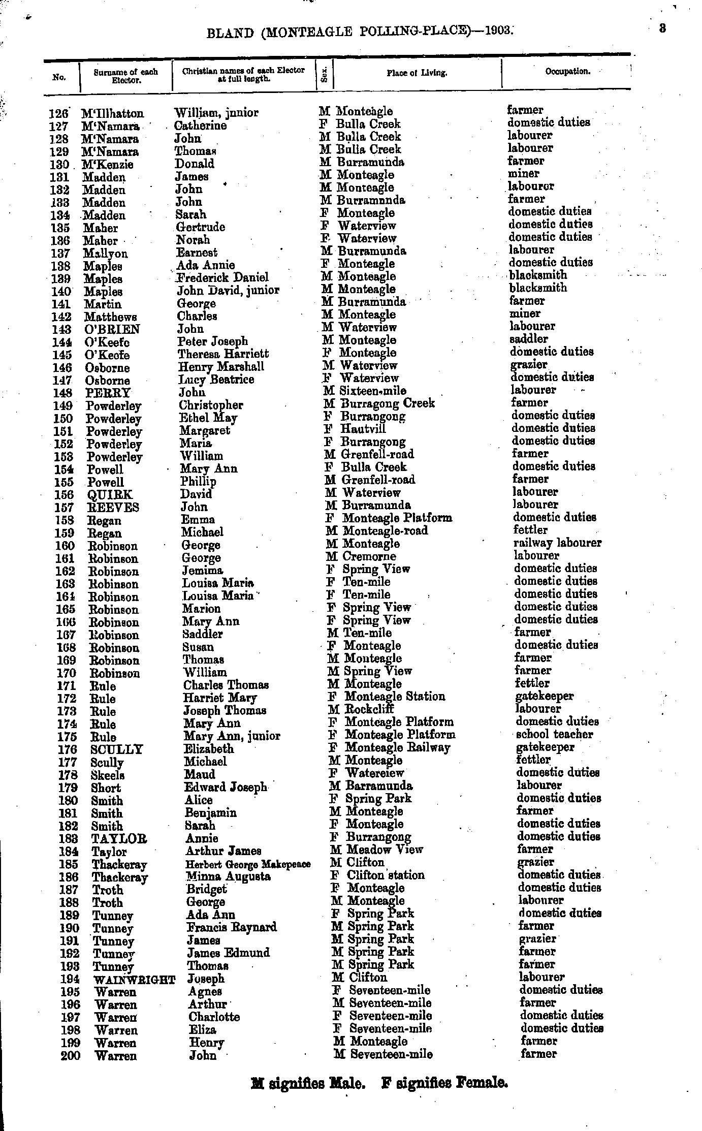
- M'Illhatton William - Warren John
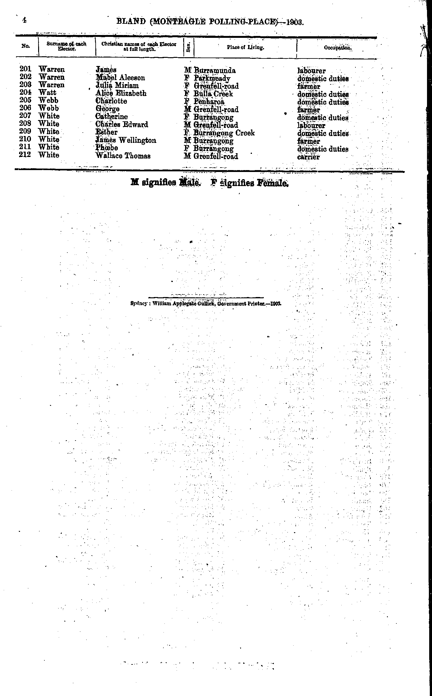
- Warren James - White Wallace
- Agnew William - Field Albert
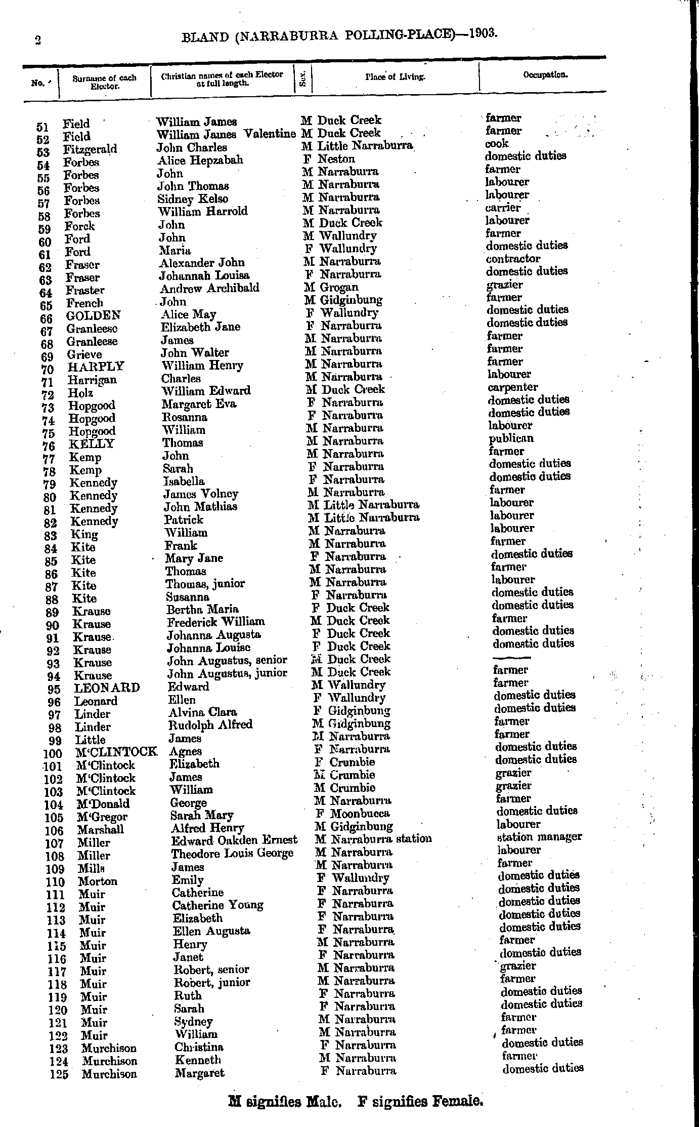
- Field William - Murchison Margaret
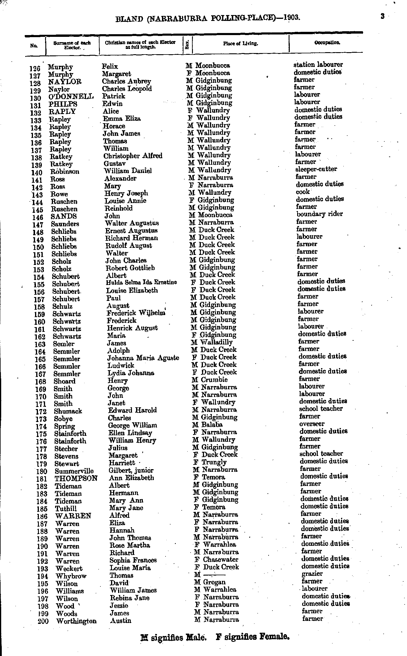
- Murphy Felix - Worthington Austin
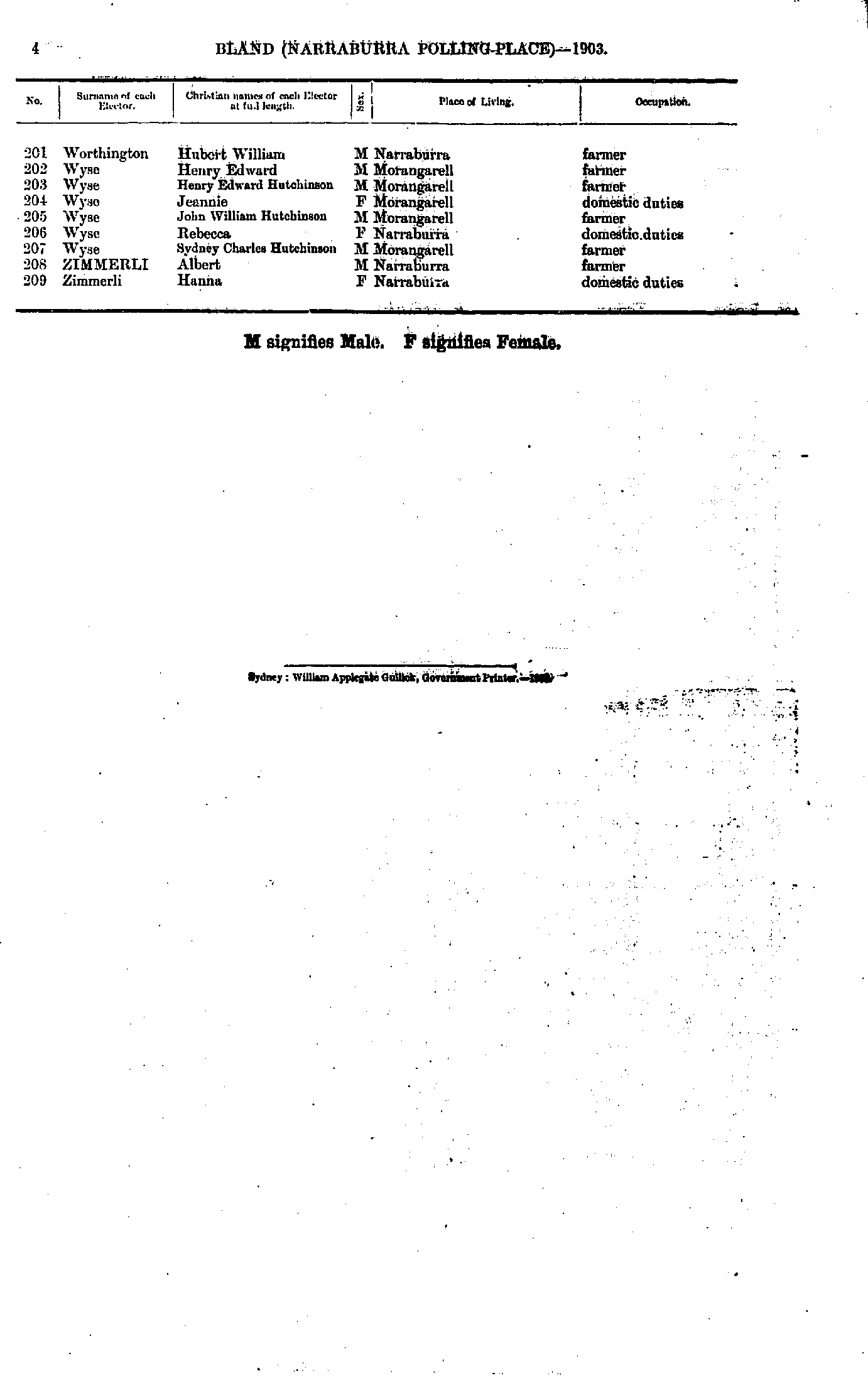
- Worthington Hubert - Zimmerli Hanna
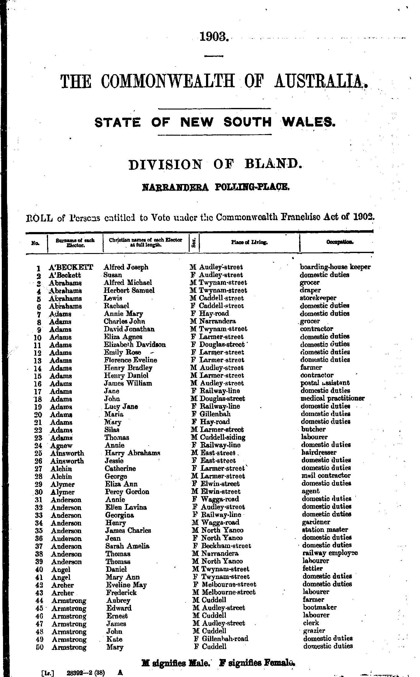
- A'Beckett Alfred - Armstrong Mary
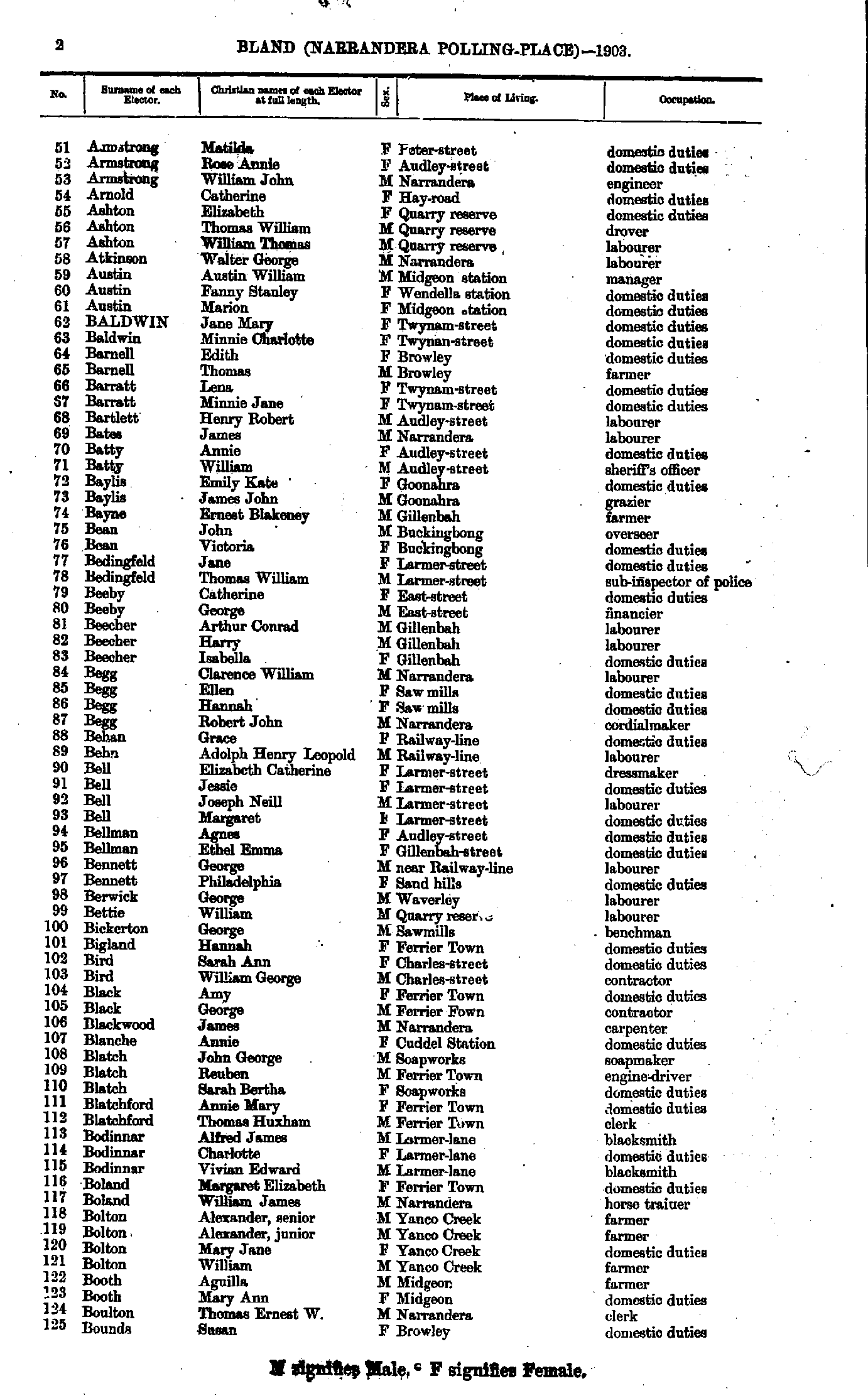
- Armstrong Matilda - Bounds Susan
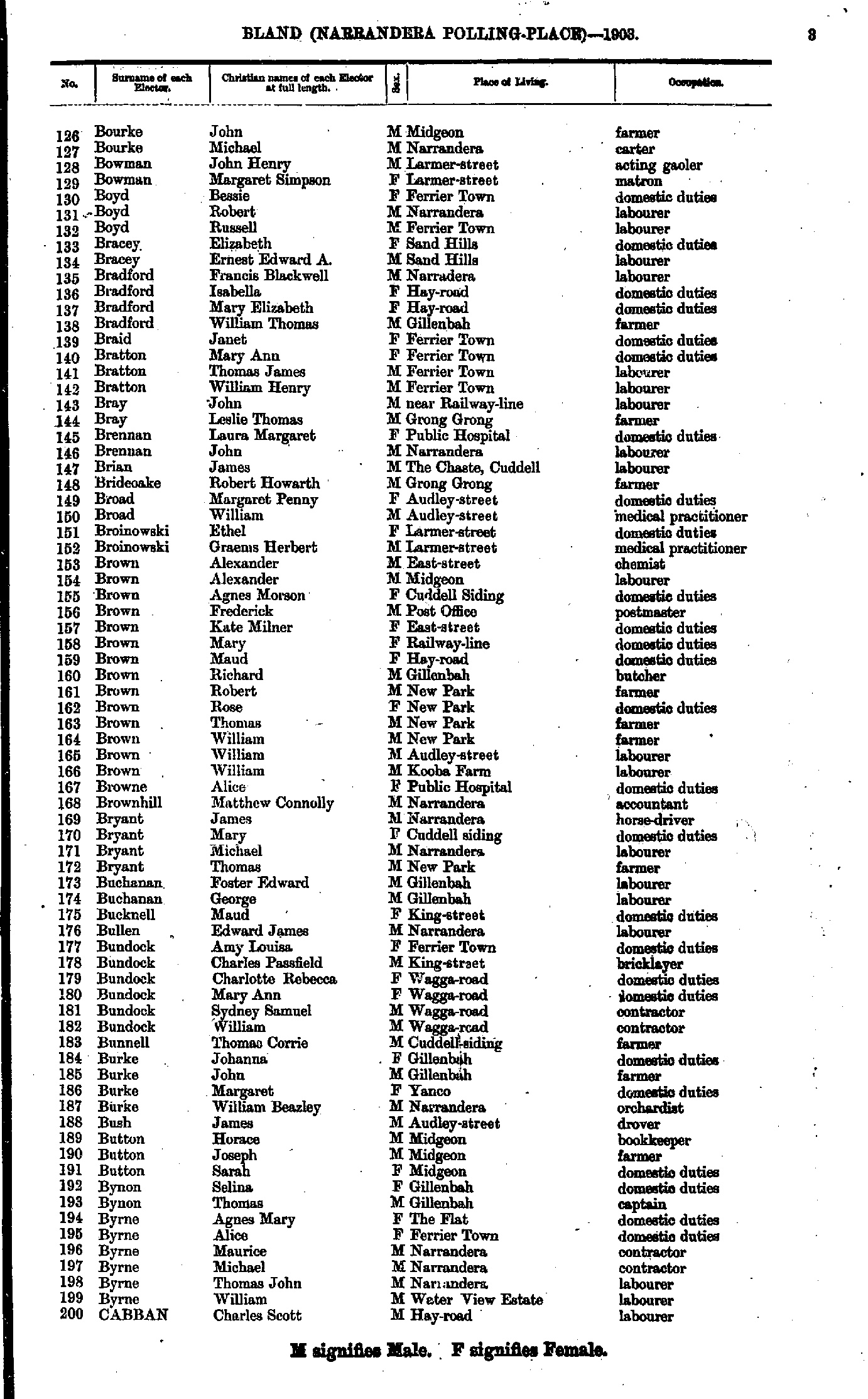
- Bourke John - Cabban Charles
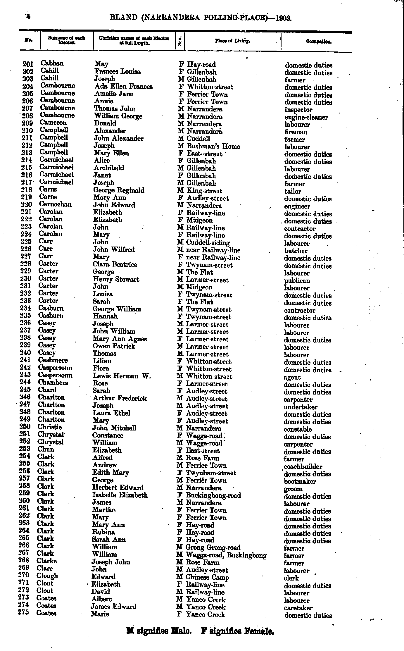
- Cabban May - Coates Marie
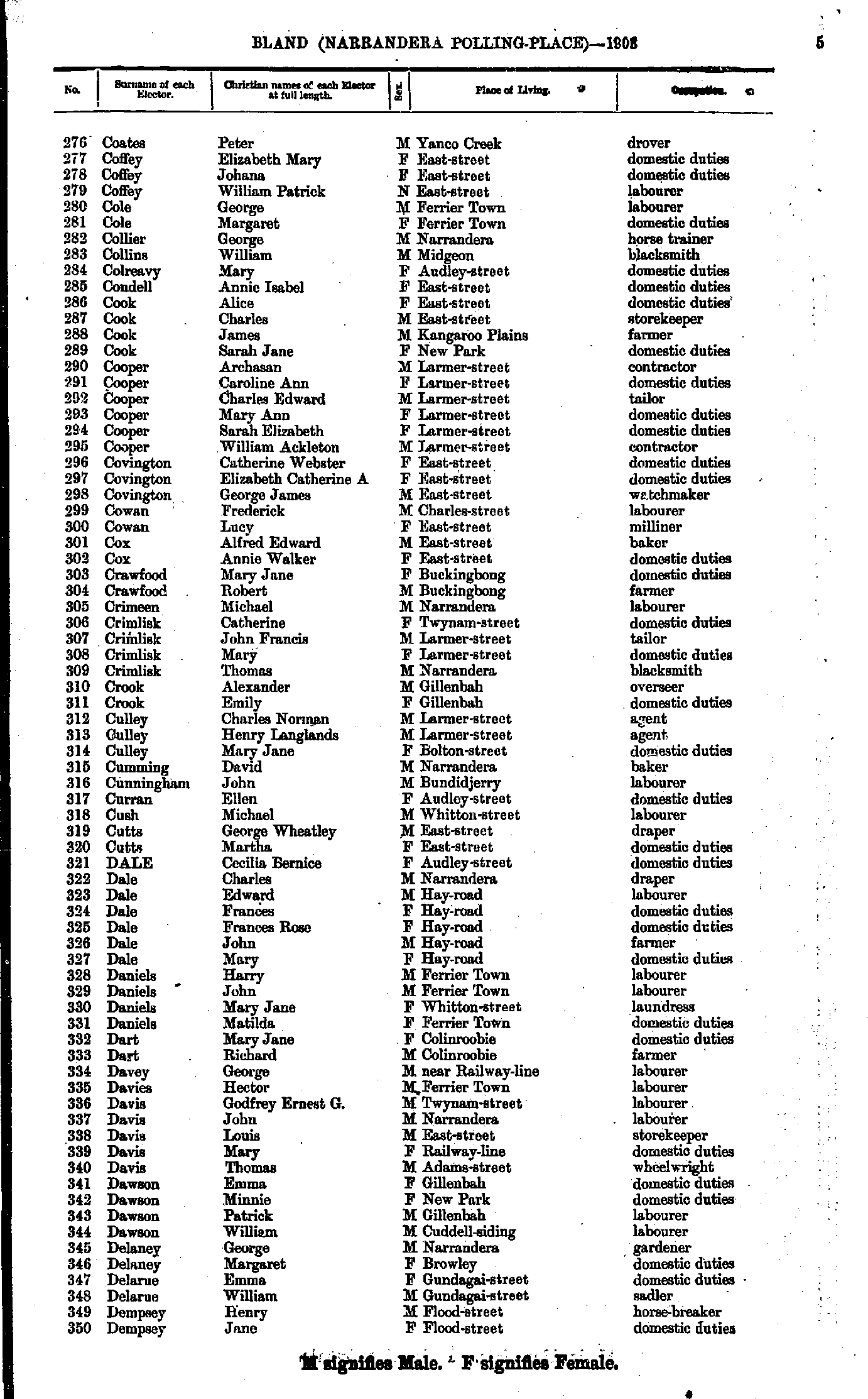
- Coates Peter - Dempsey Jane
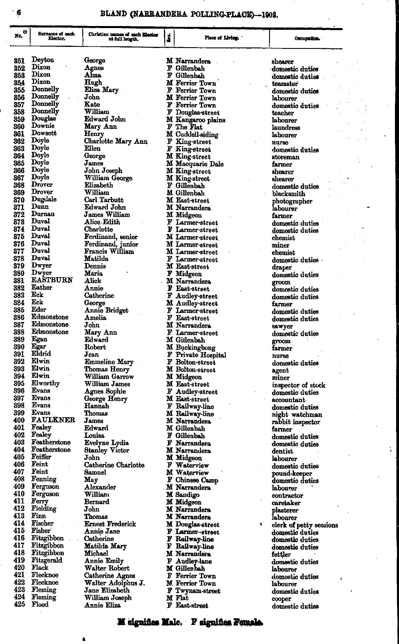
- Deyton George - Flood Annie
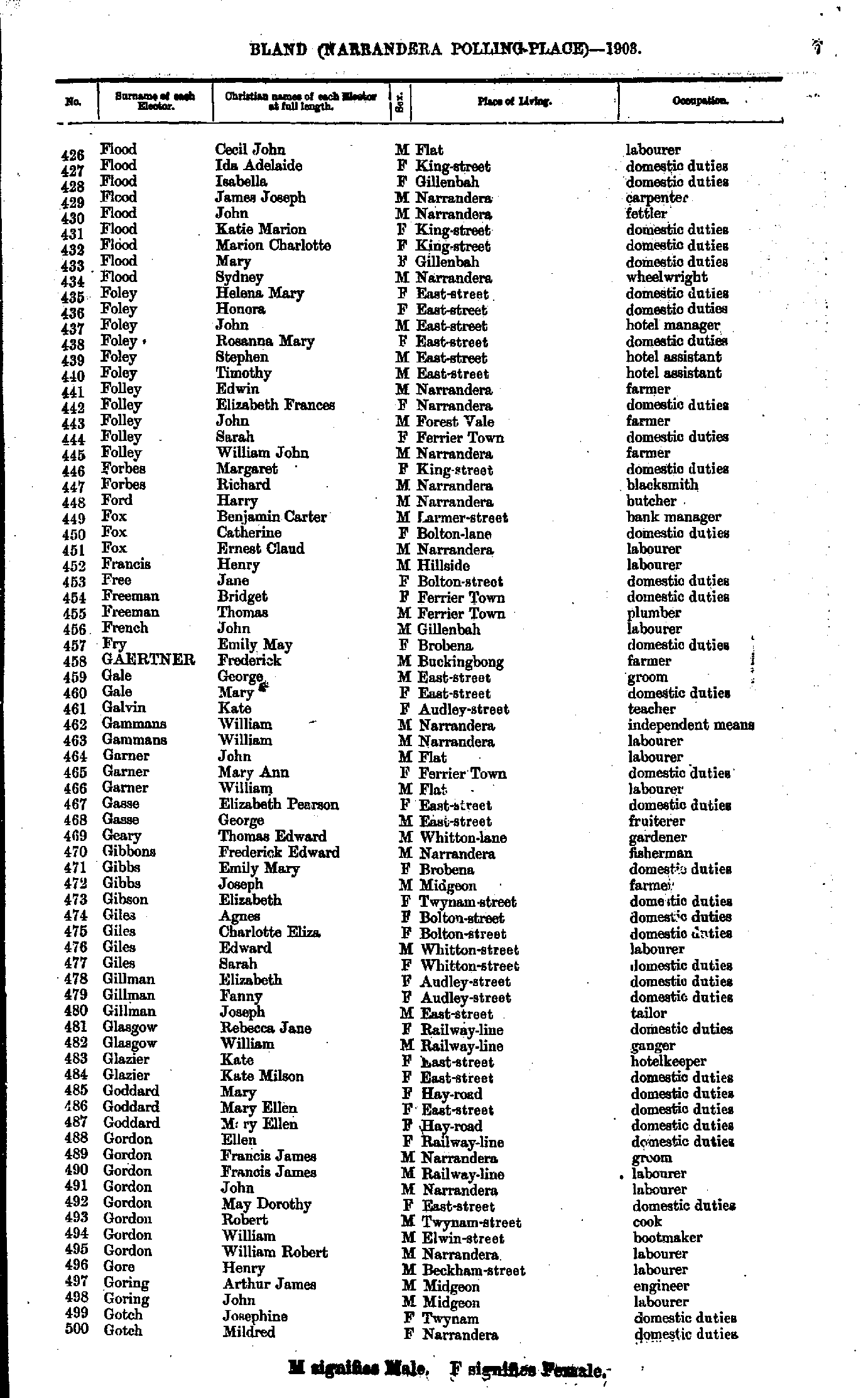
- Flood Cecil - Gotch Mildred
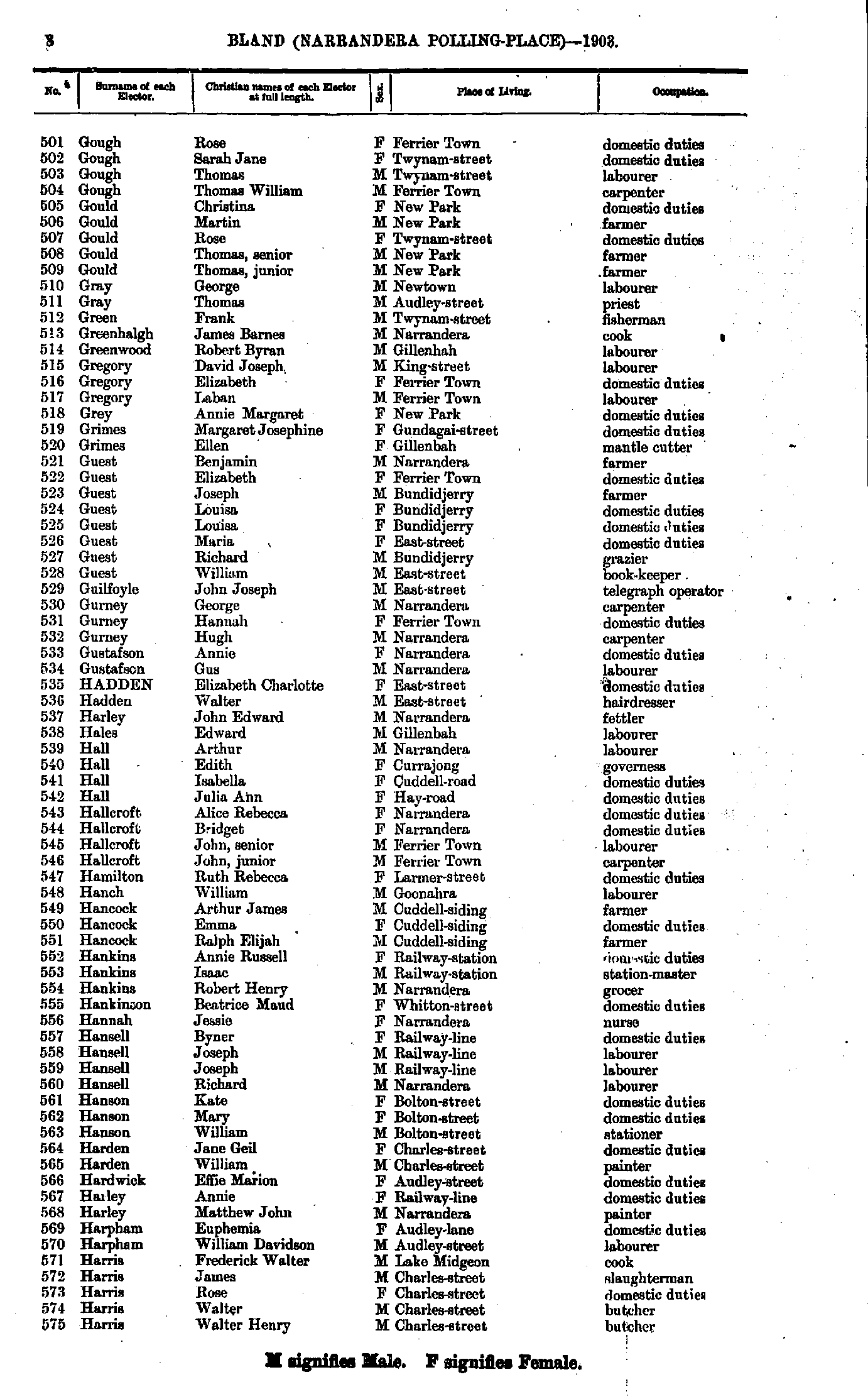
- Gough Rose - Harris Walter
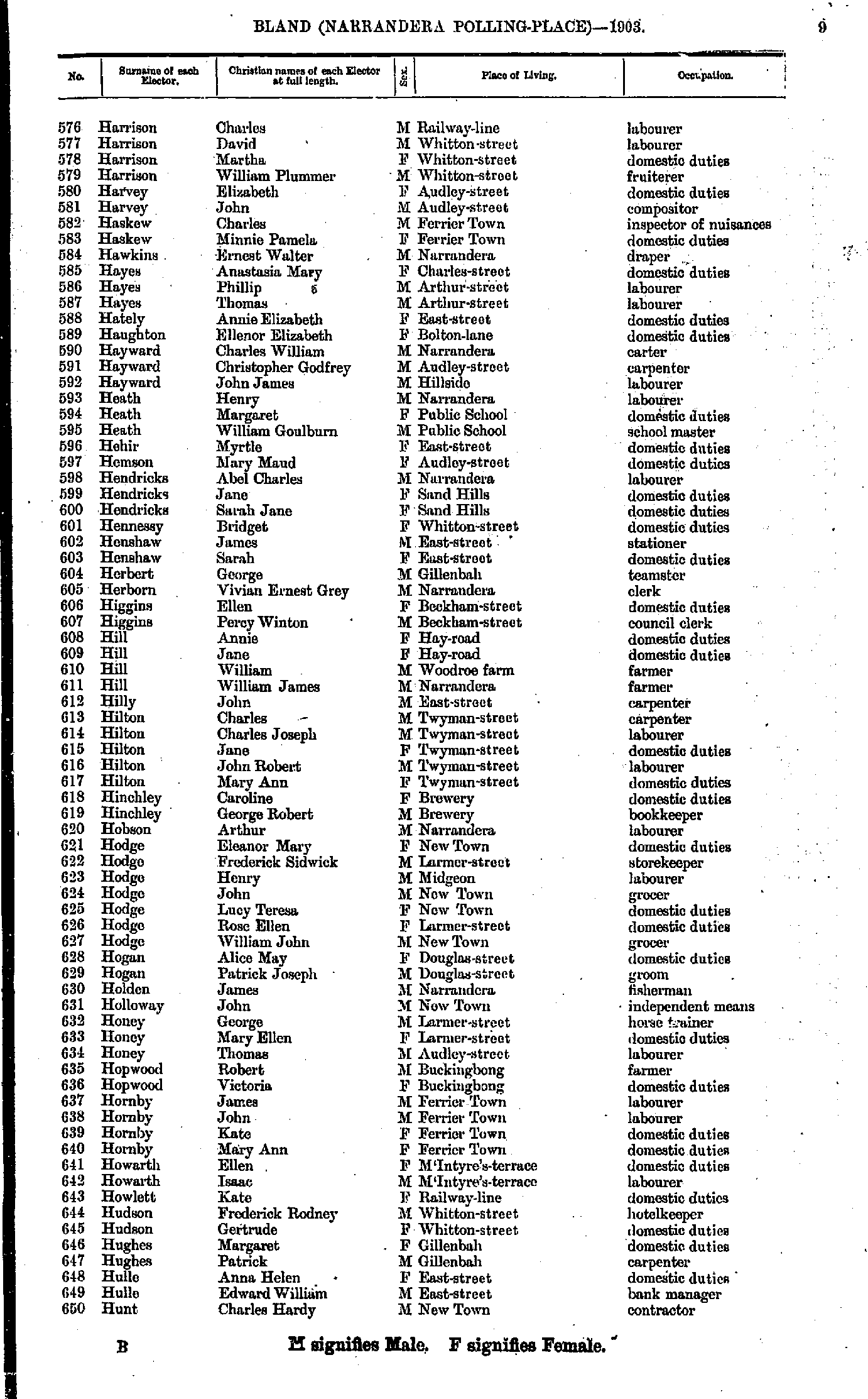
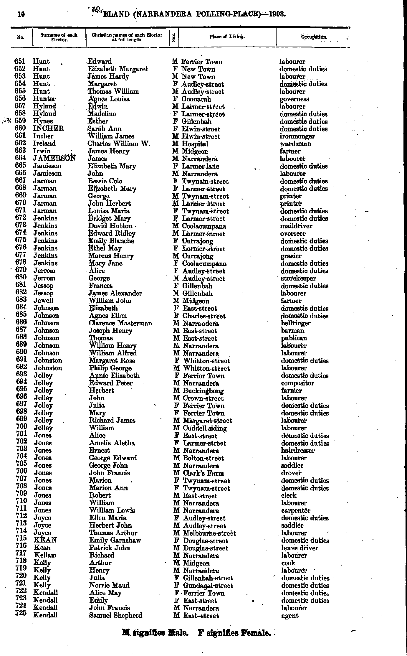
- Harrison Charles - Hunt Charles
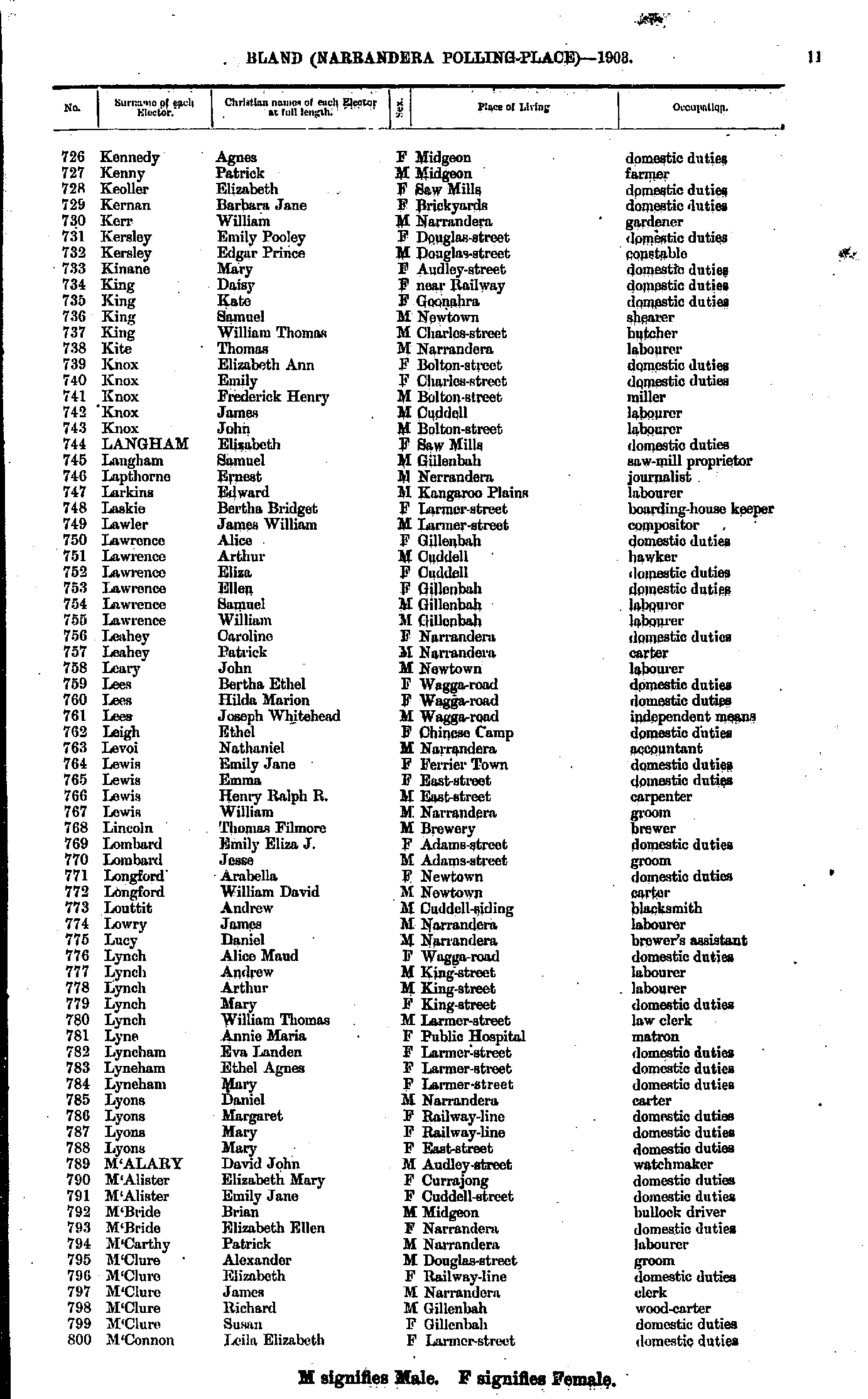
- Hunt Edward - Kendall Samuel
- Kennedy Agnes - M'Connon Leila
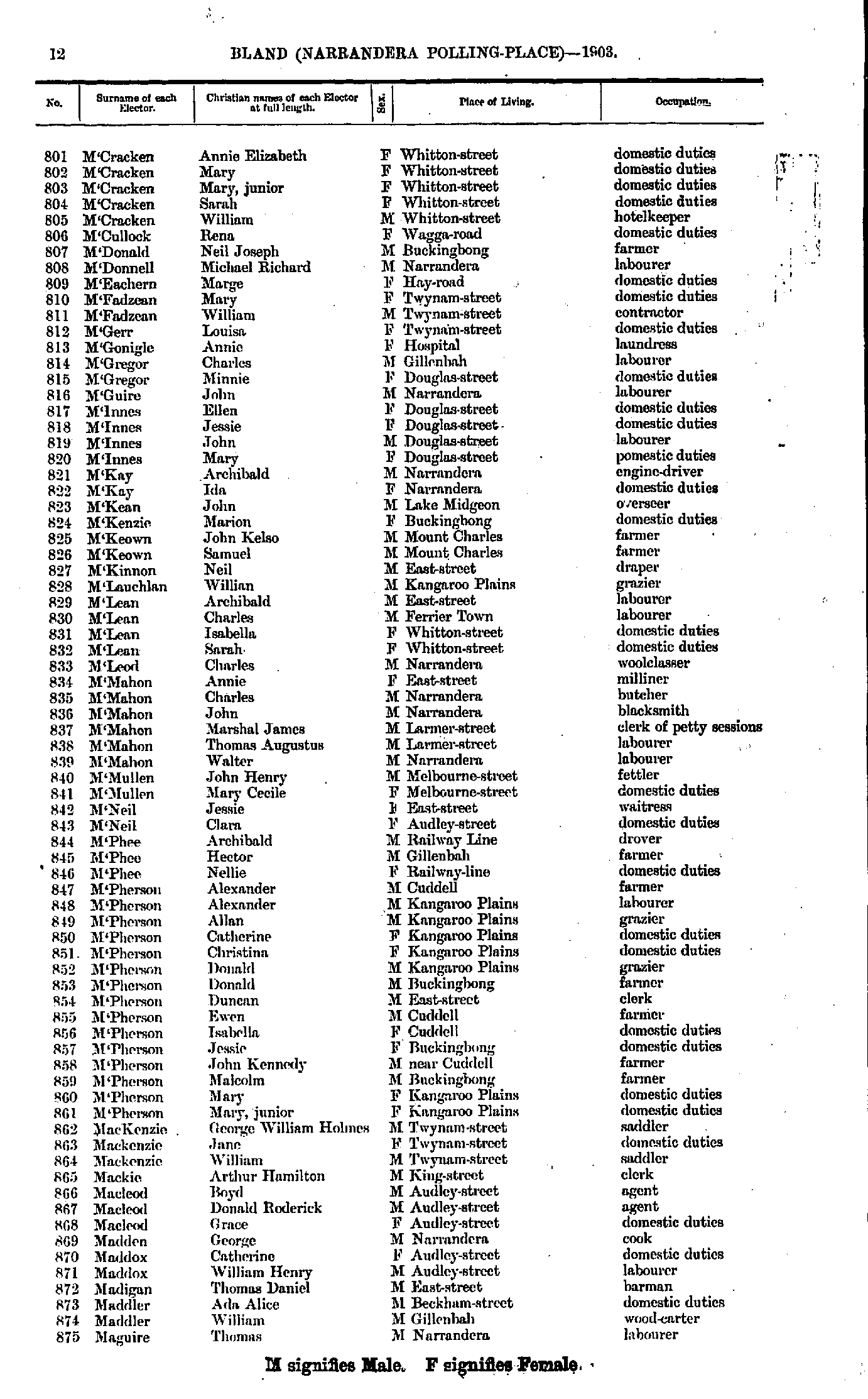
- M'Cracken Annie - Maguire Thomas
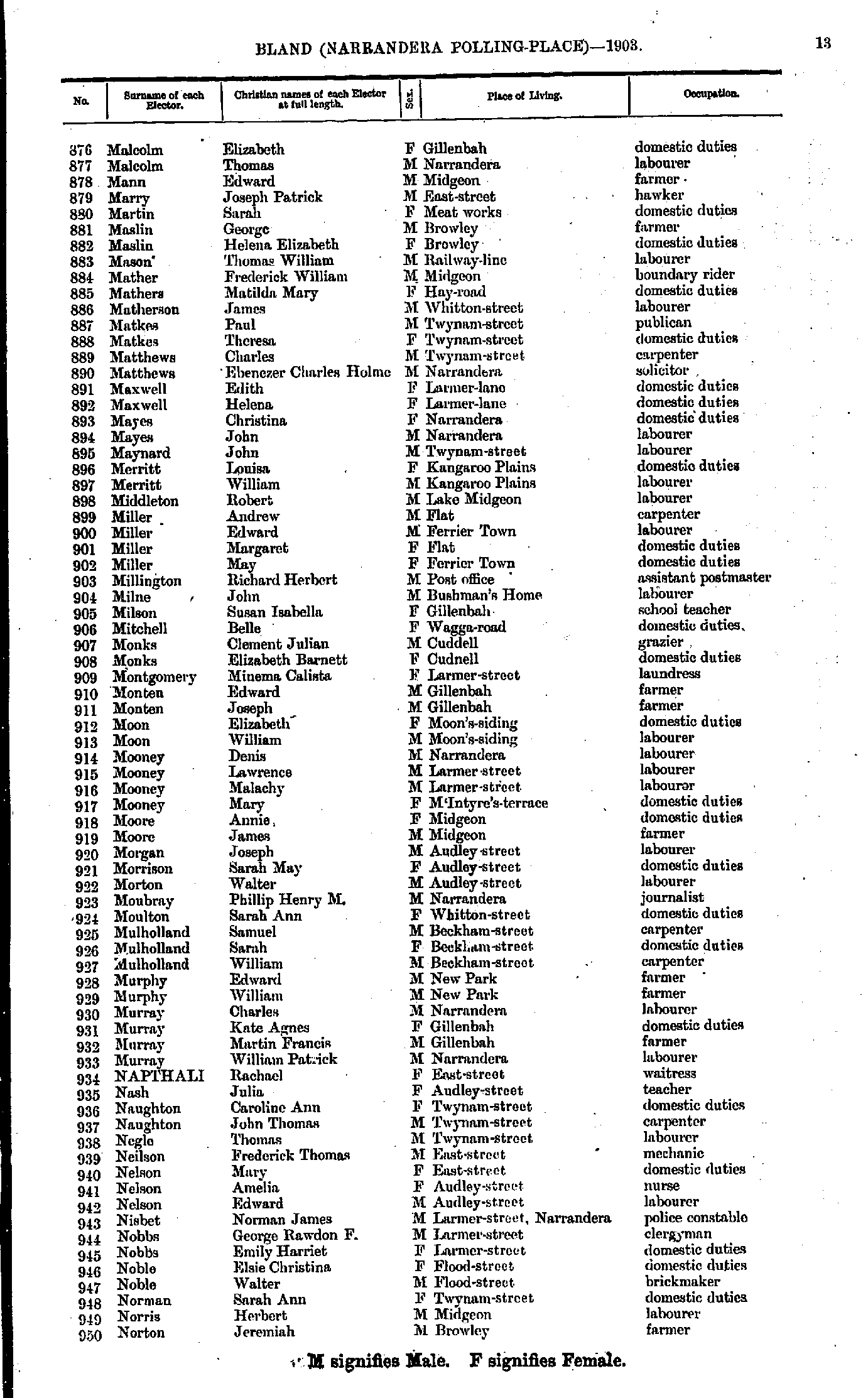
- Malcolm Elizabeth - Norton Jeremiah
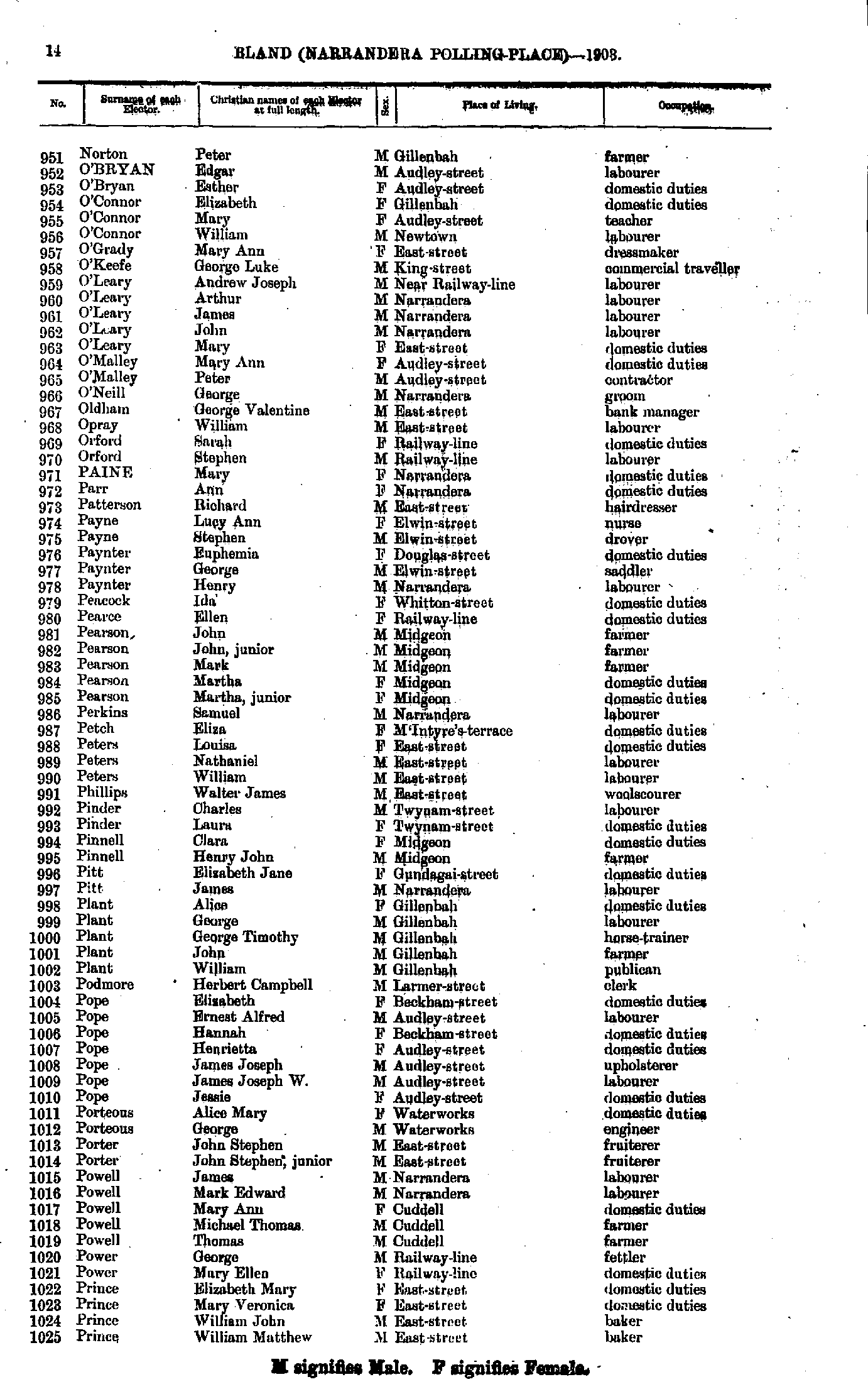
- Norton Peter - Prince William
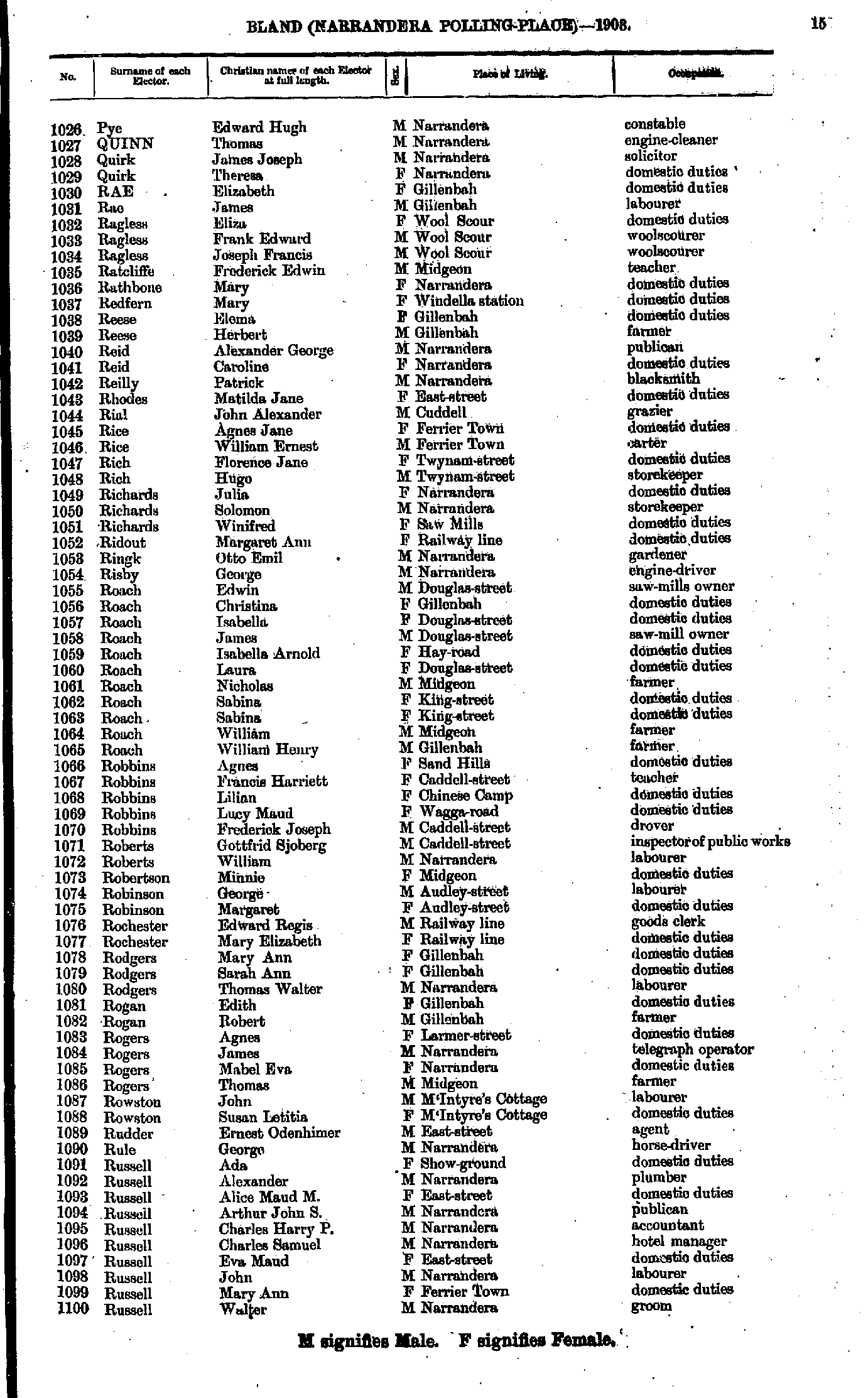
- Pye Edward - Russell Walter
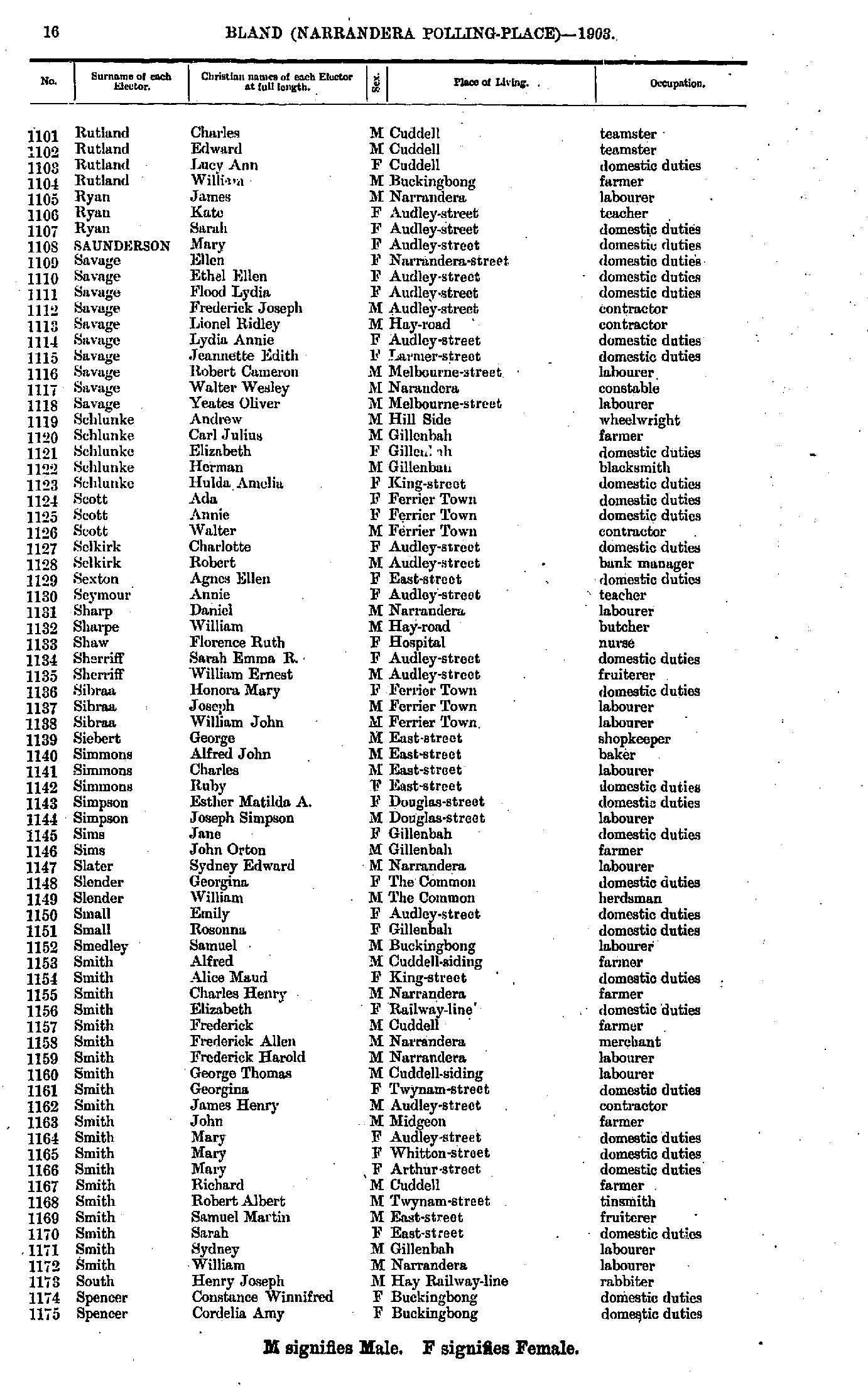
- Rutland Charles - Spencer Cordelia
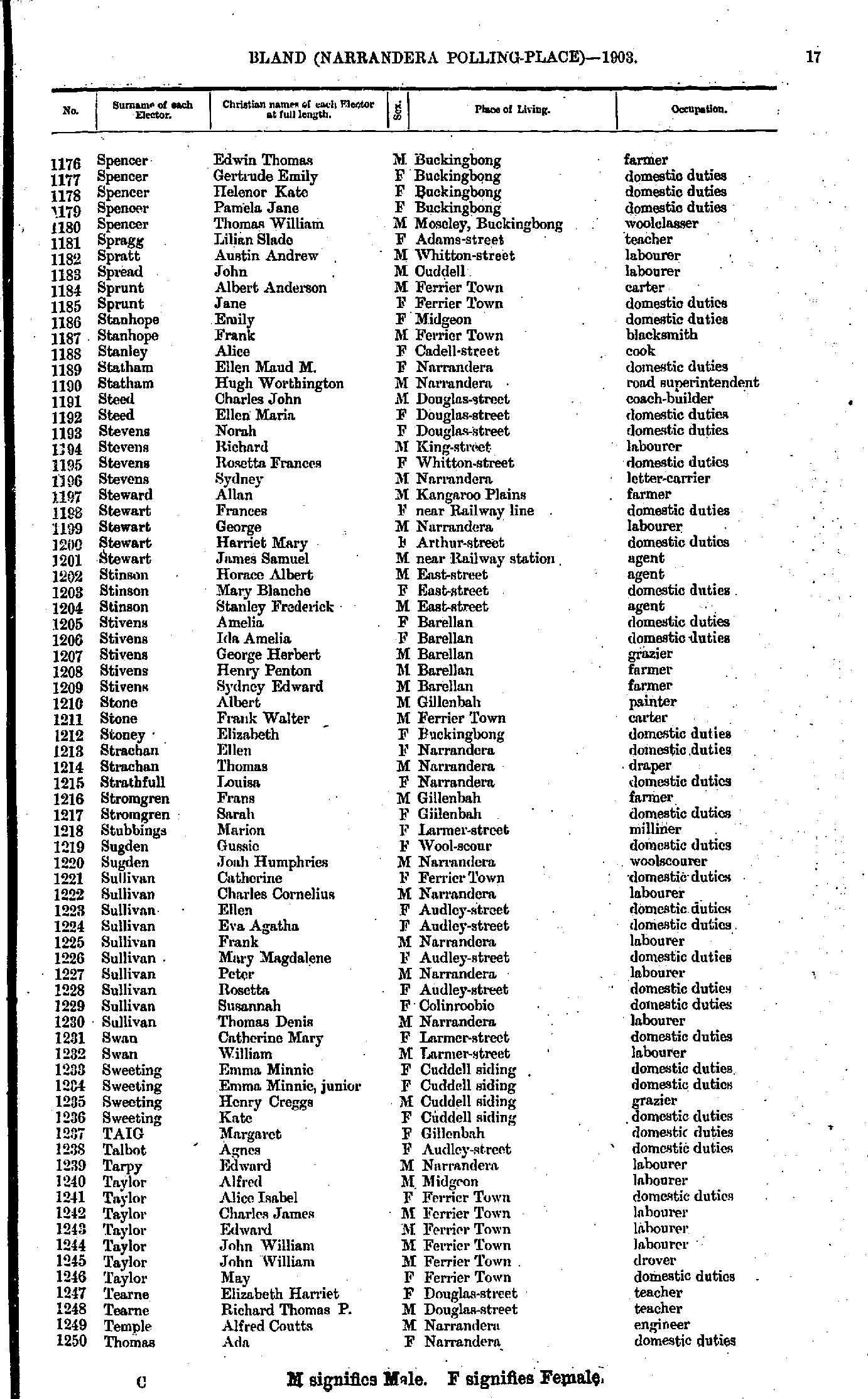
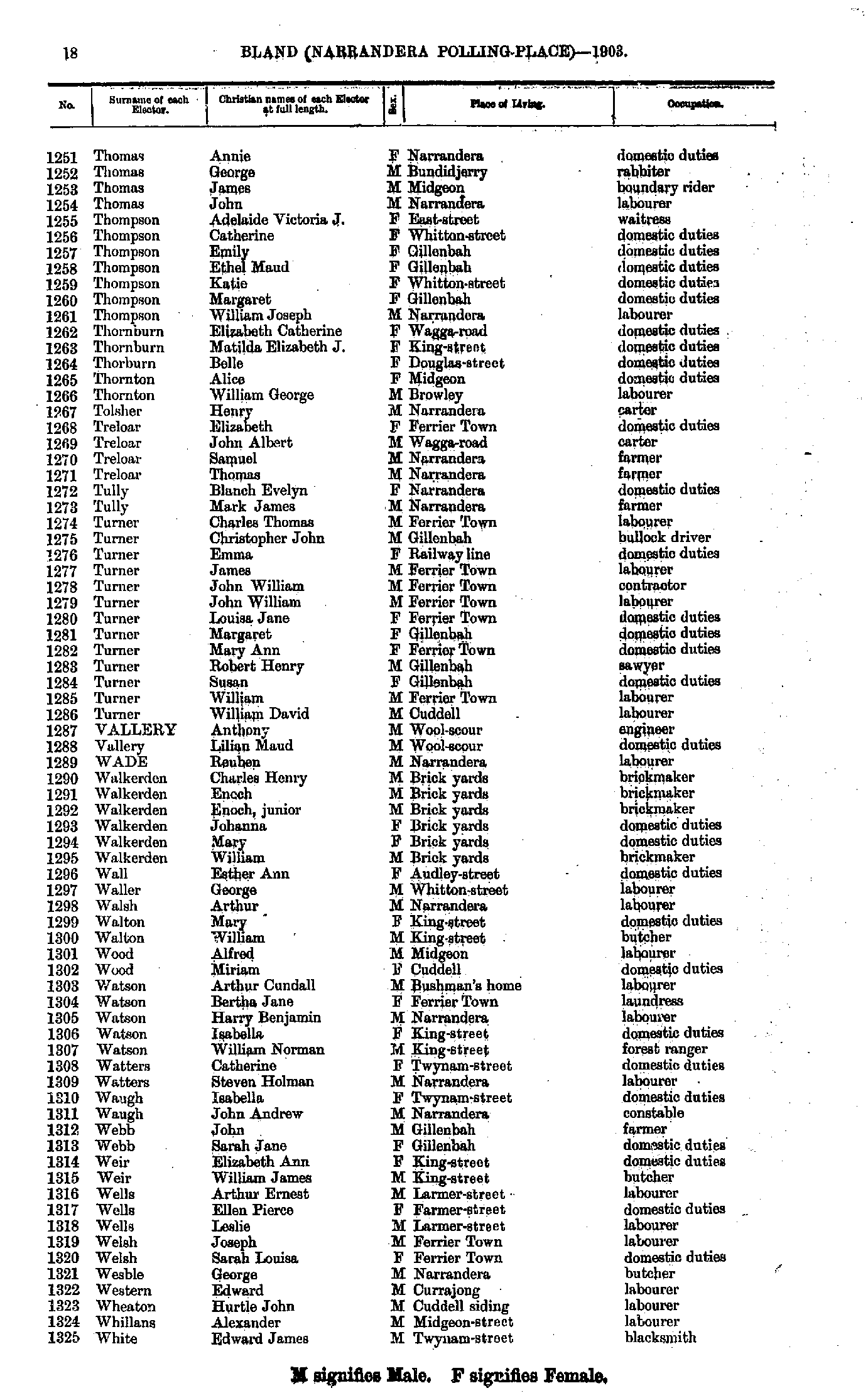
- Spencer Edwin - Thomas Ada
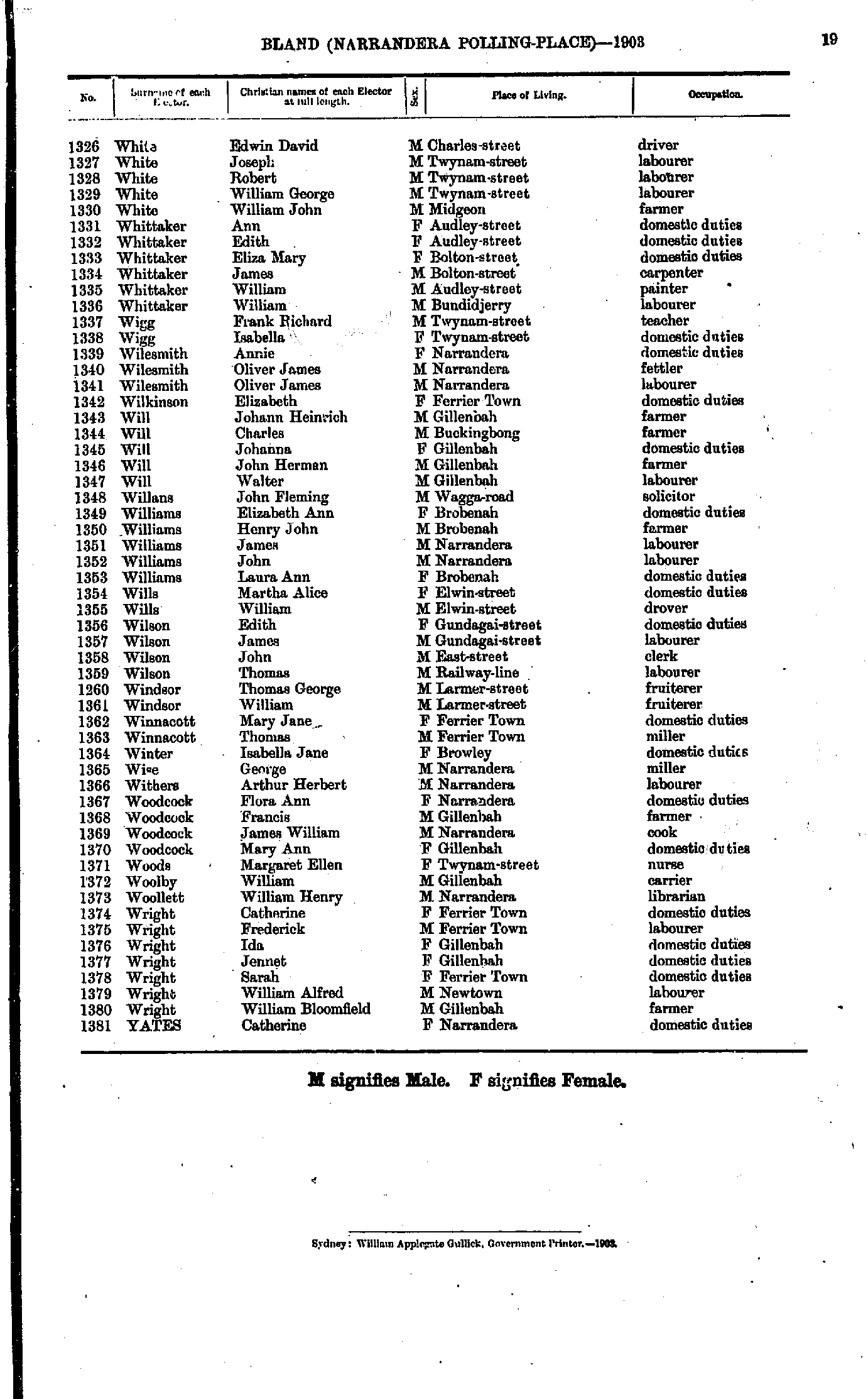
- Thomas Annie - White Edward
- White Edwin - Yates Catherine
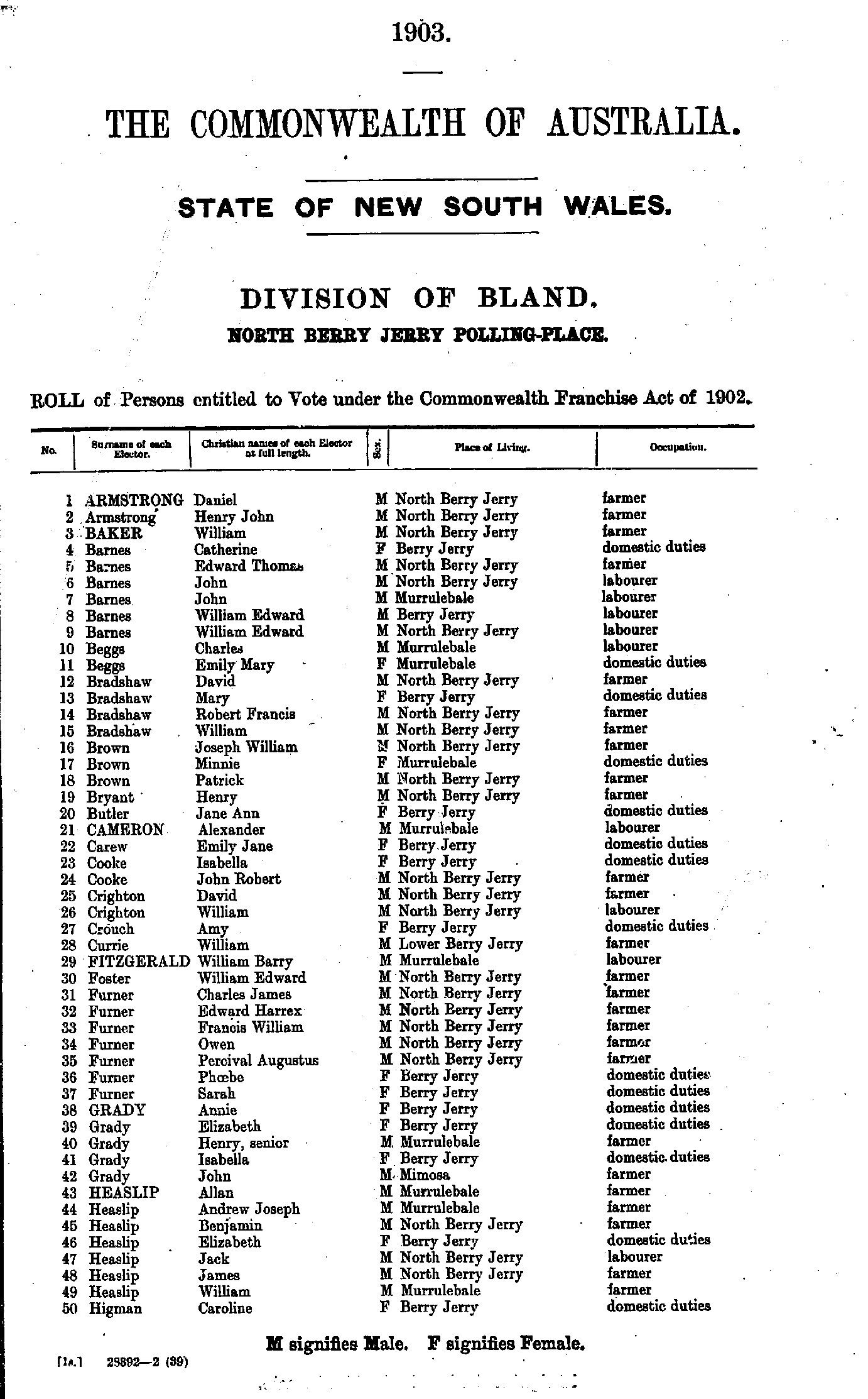
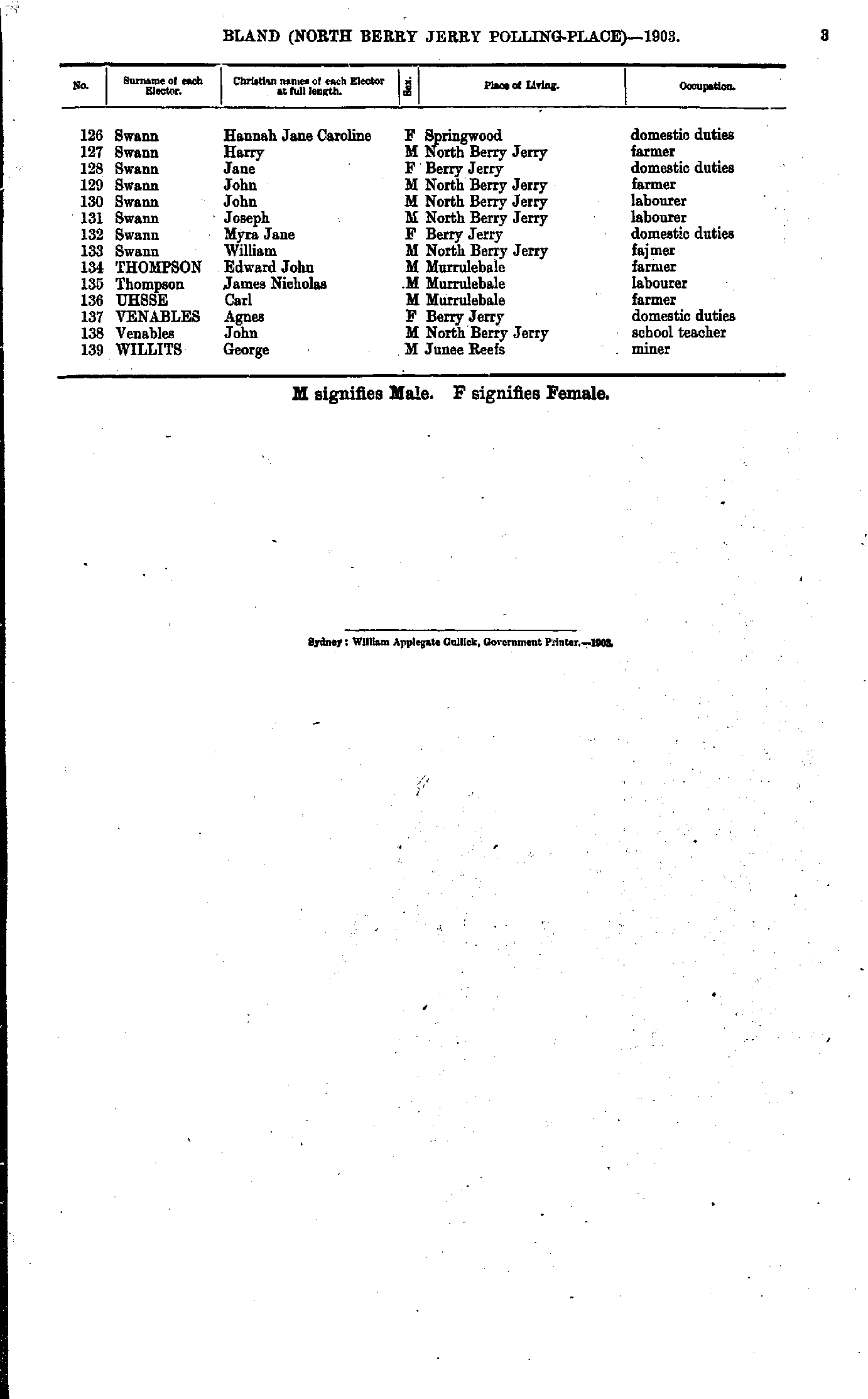
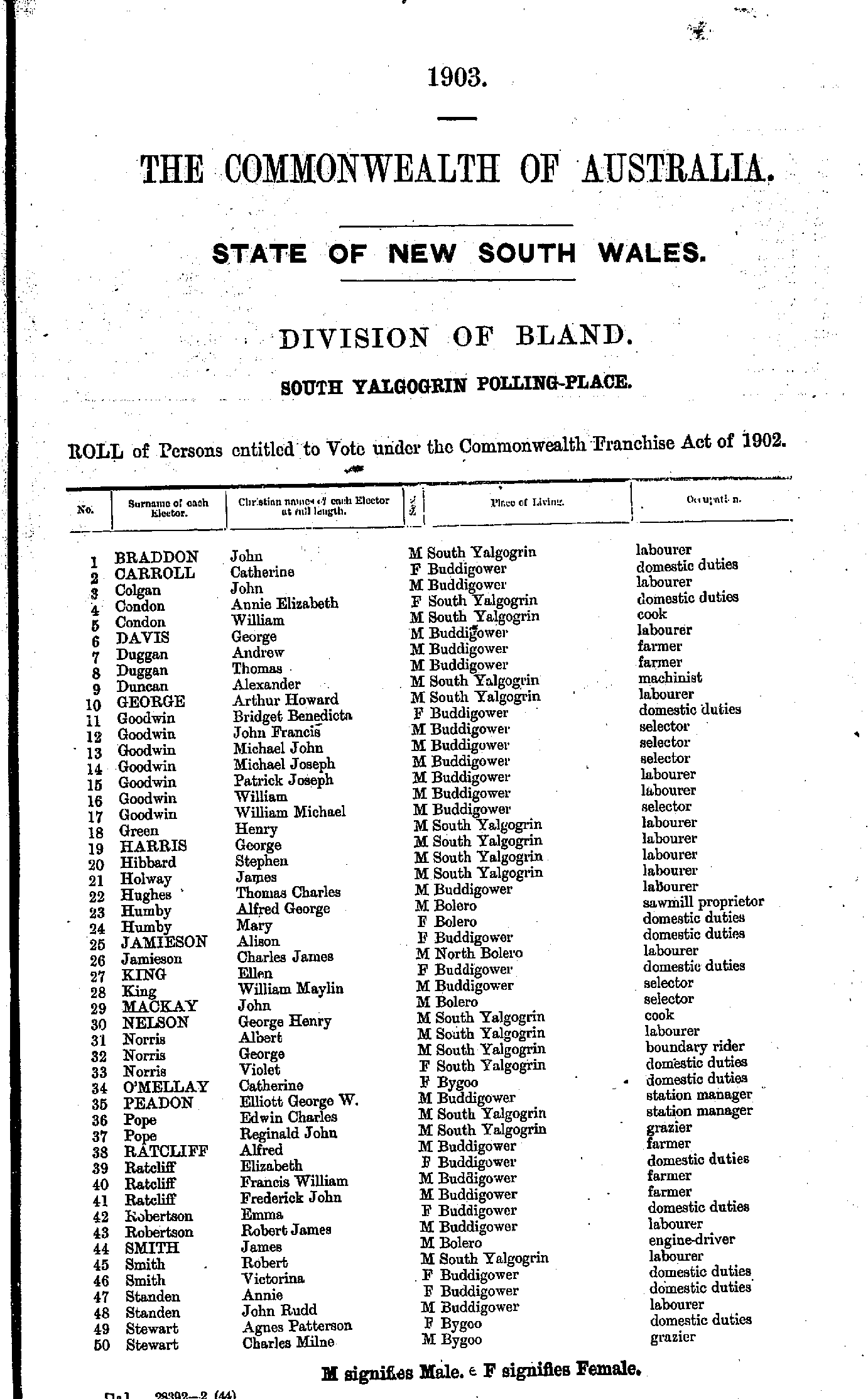
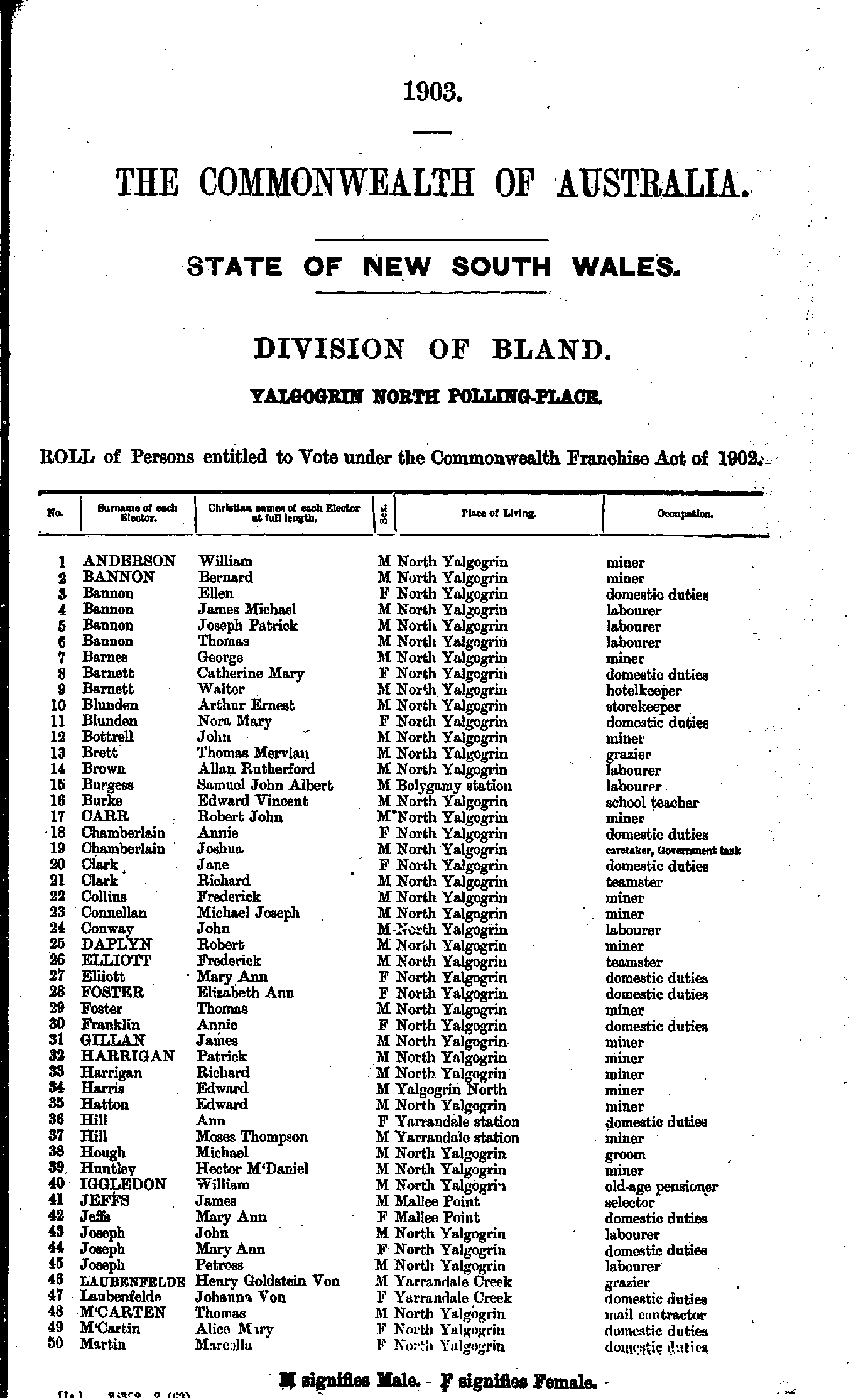
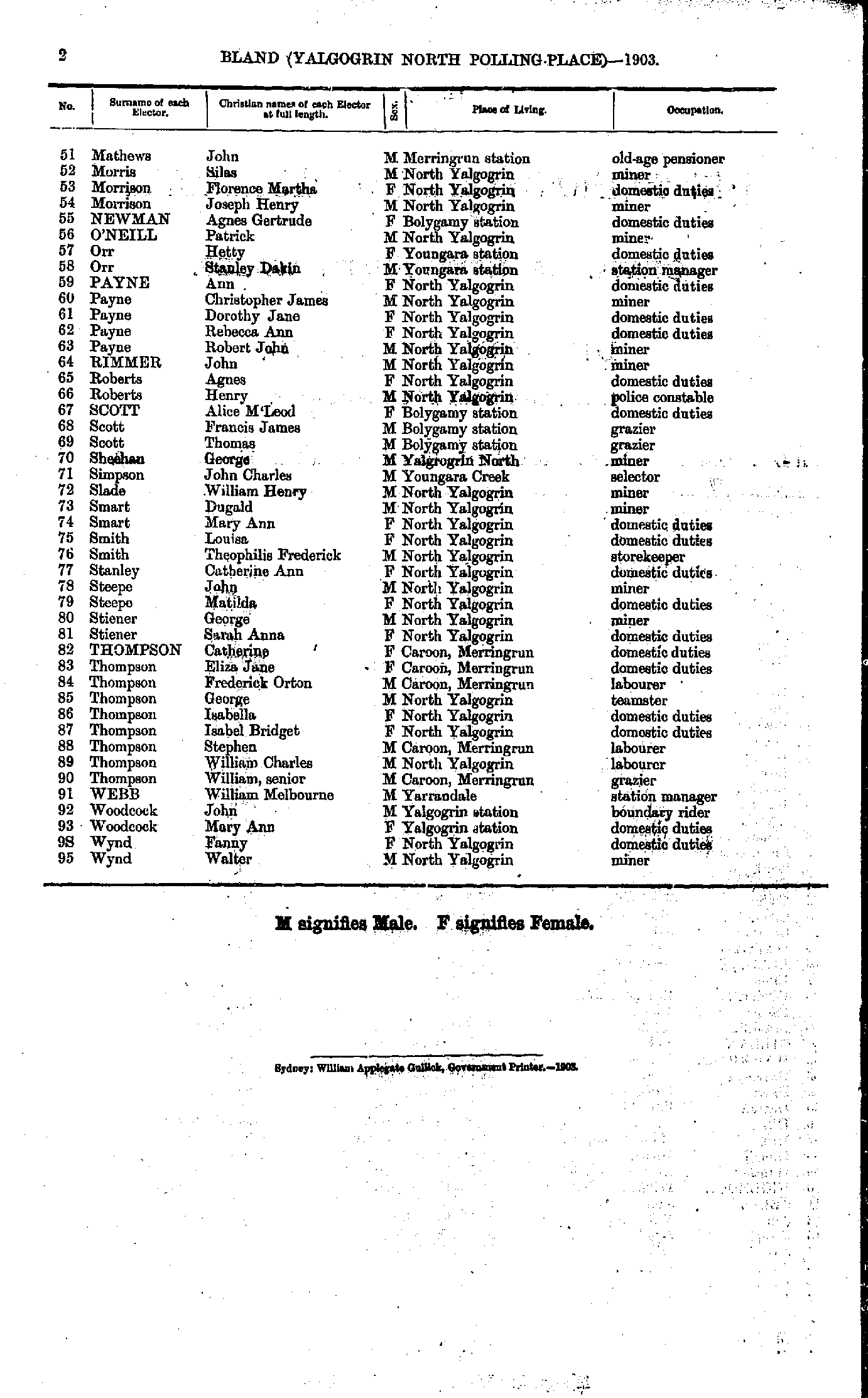
North Berry Jerry Polling Place
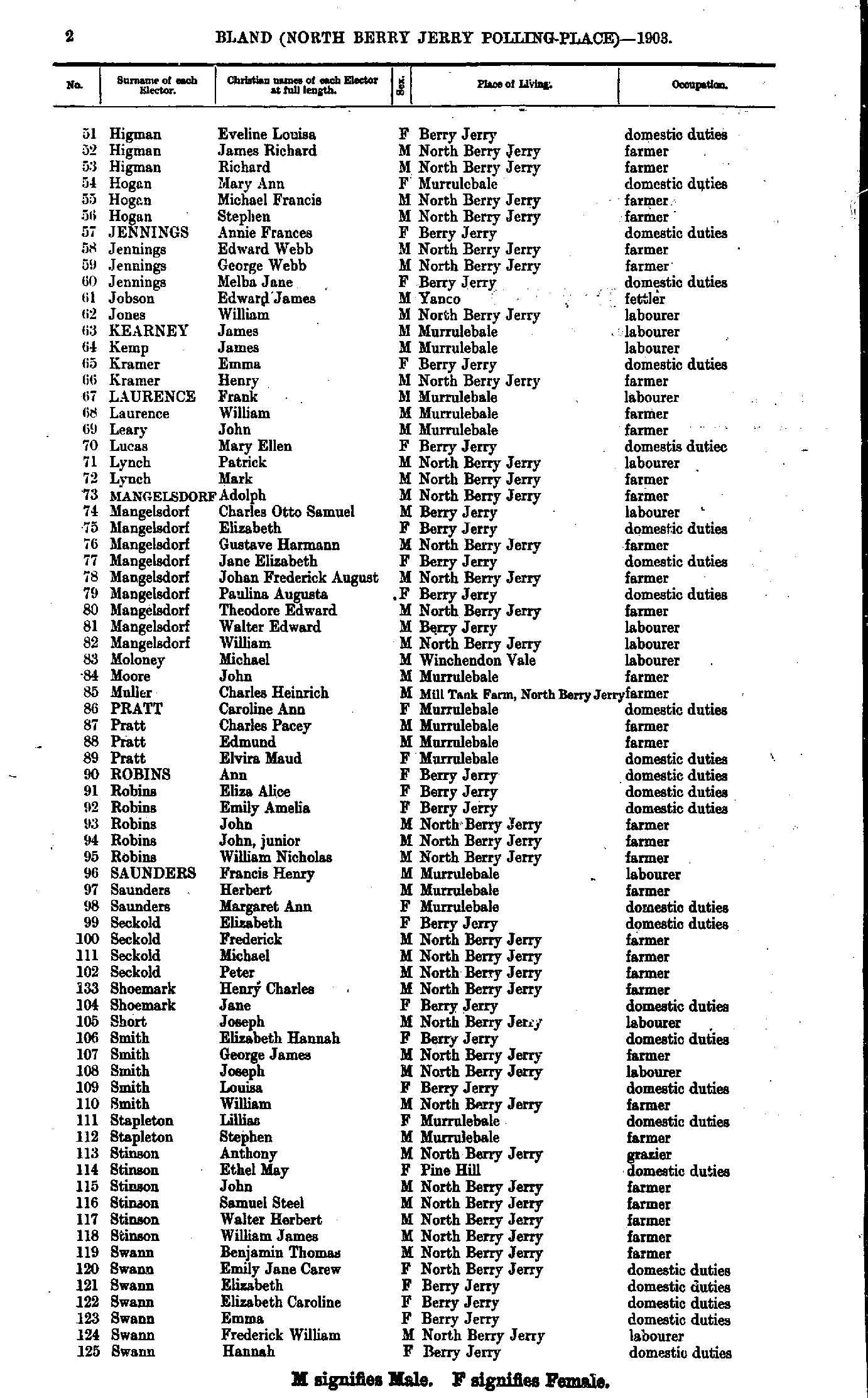
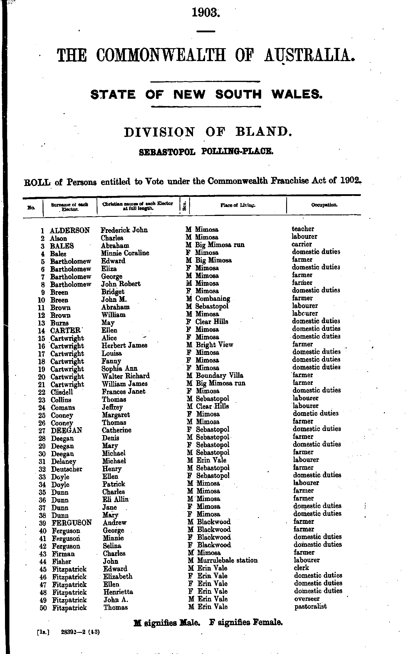
- Alderson Frederick - Fitzpatrick Thomas
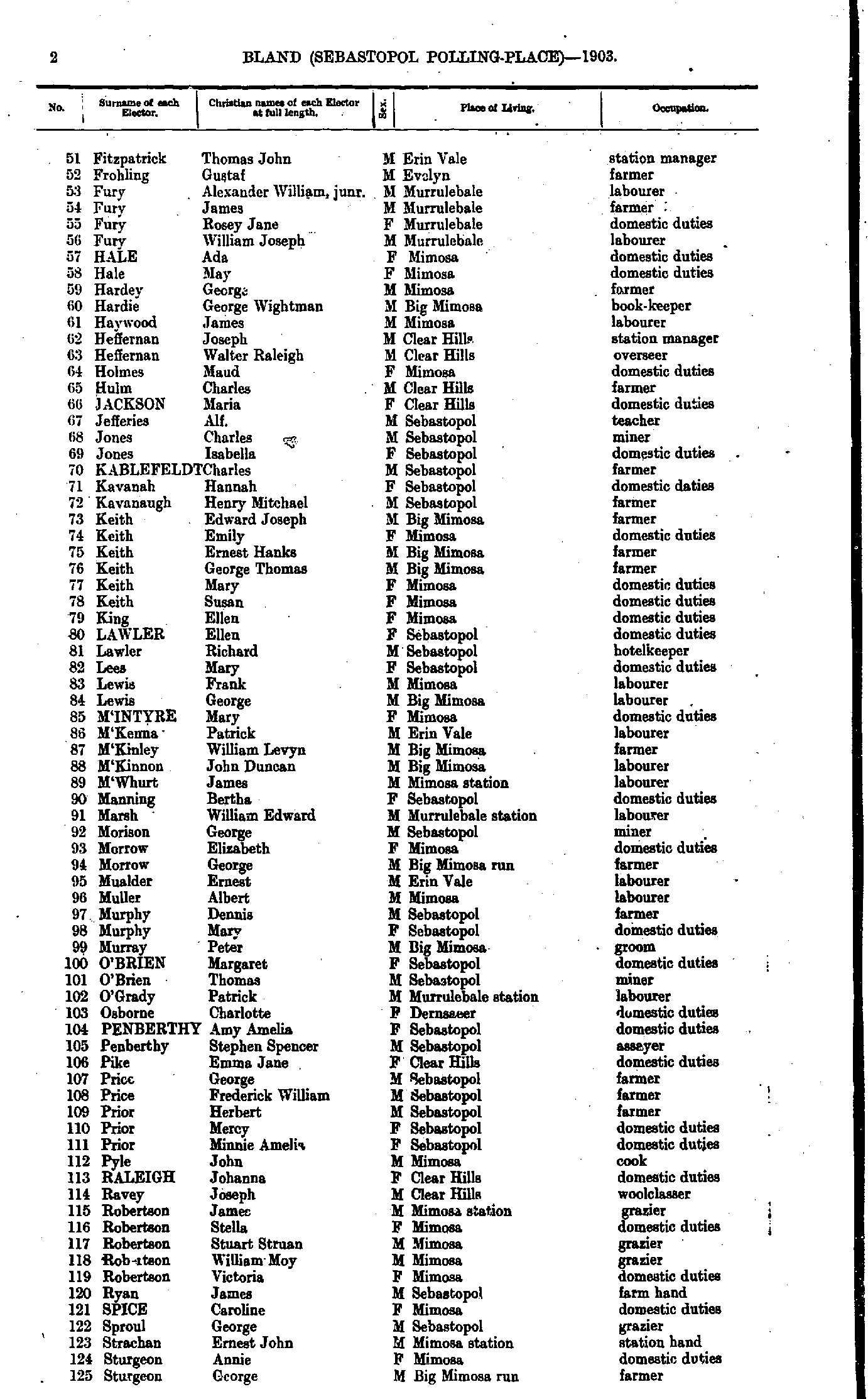
- Fitzpatrick Thomas - Sturgeon George
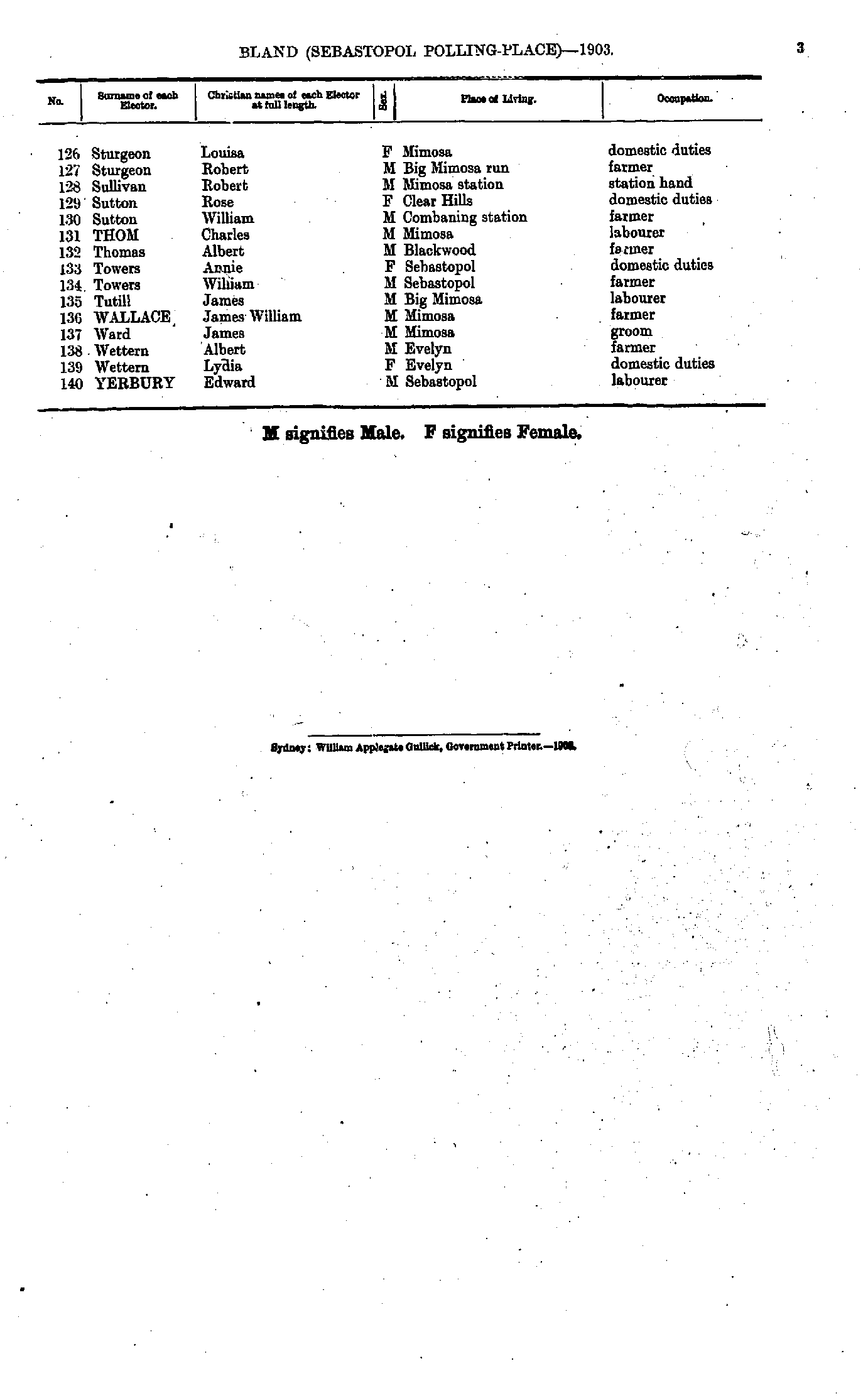
- Sturgeon Louisa - Yerbury Edward
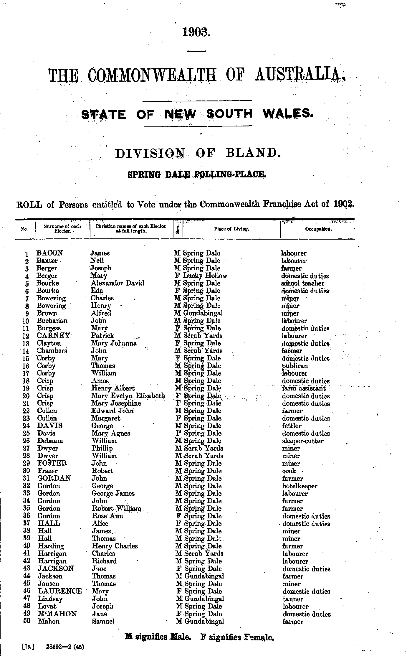
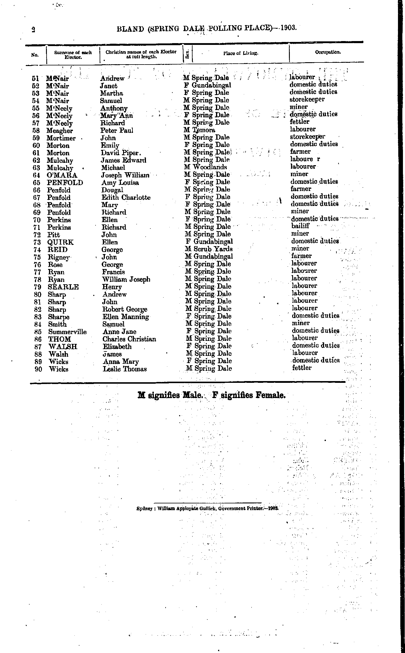
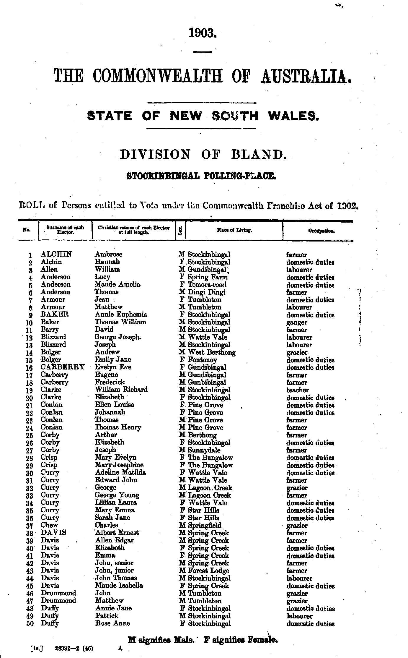
- Alchin Ambrose - Duffy Rose
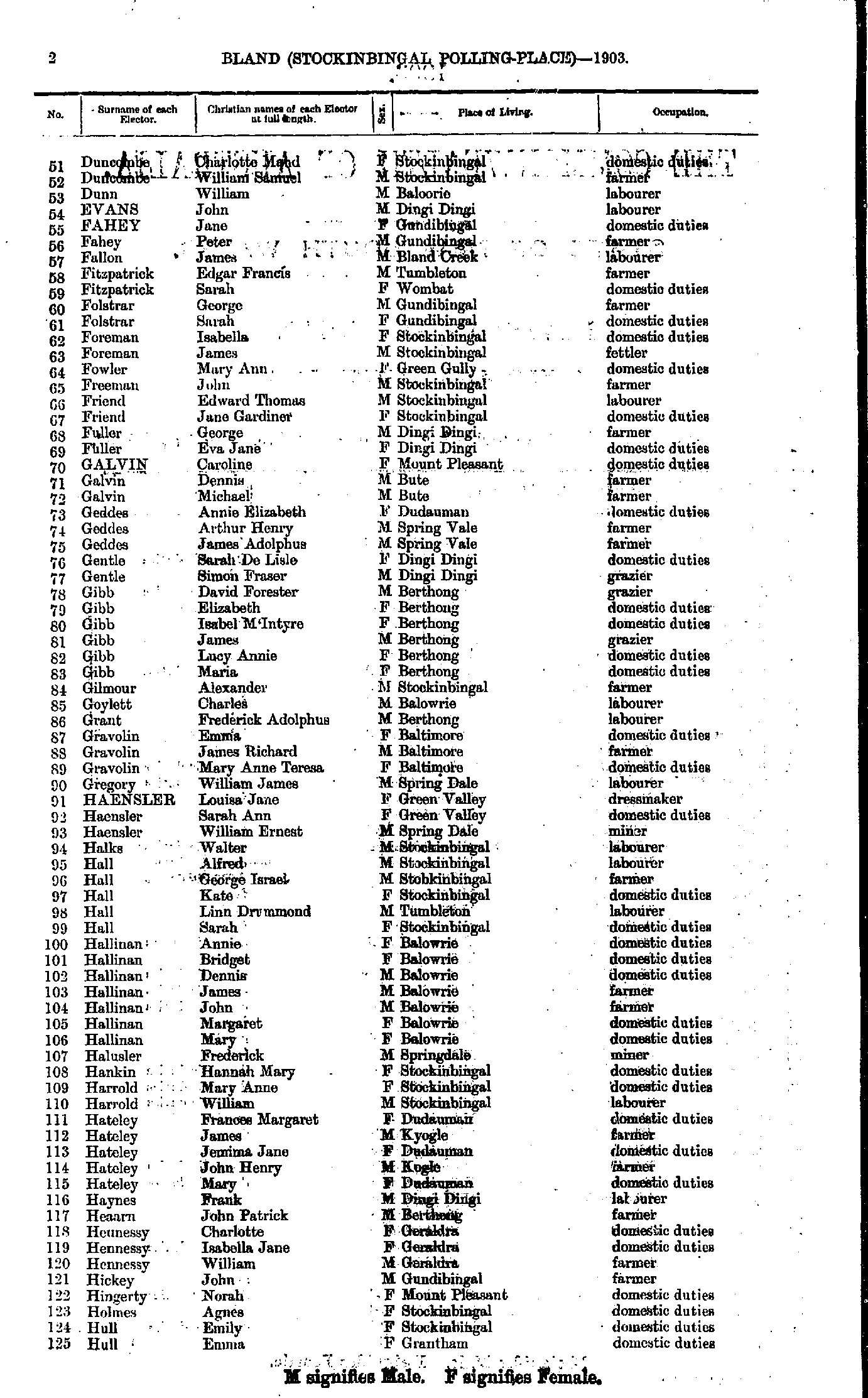
- Duncombe Charlotte - Hull Emma
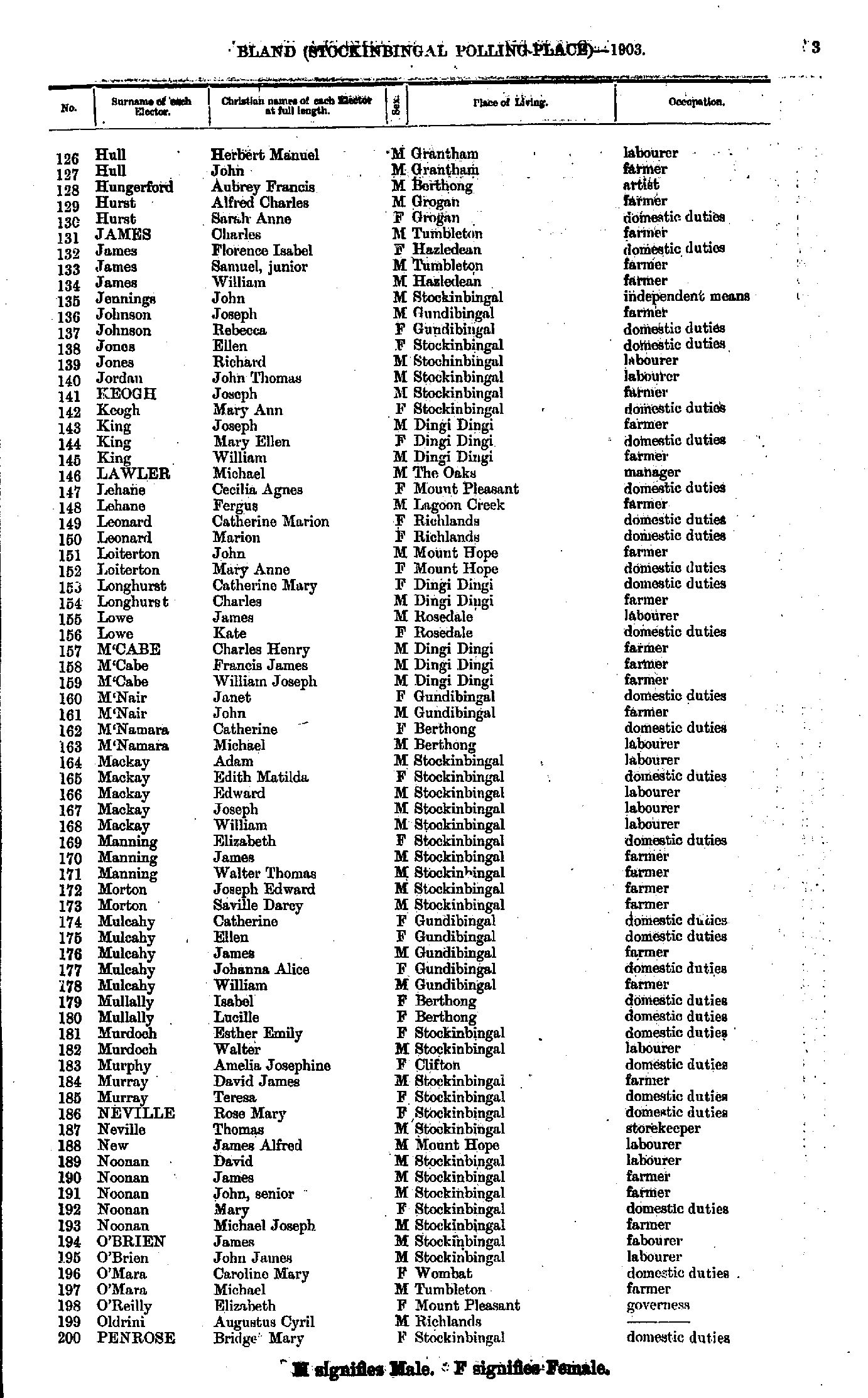
- Hull Herbert - Penrose Bridget
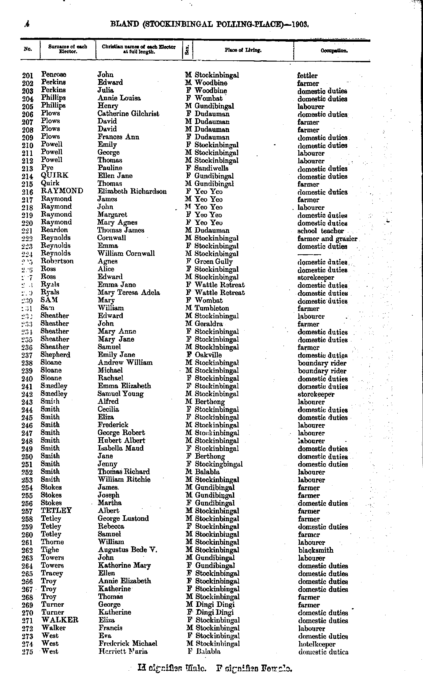
- Penrose John - West Harriett
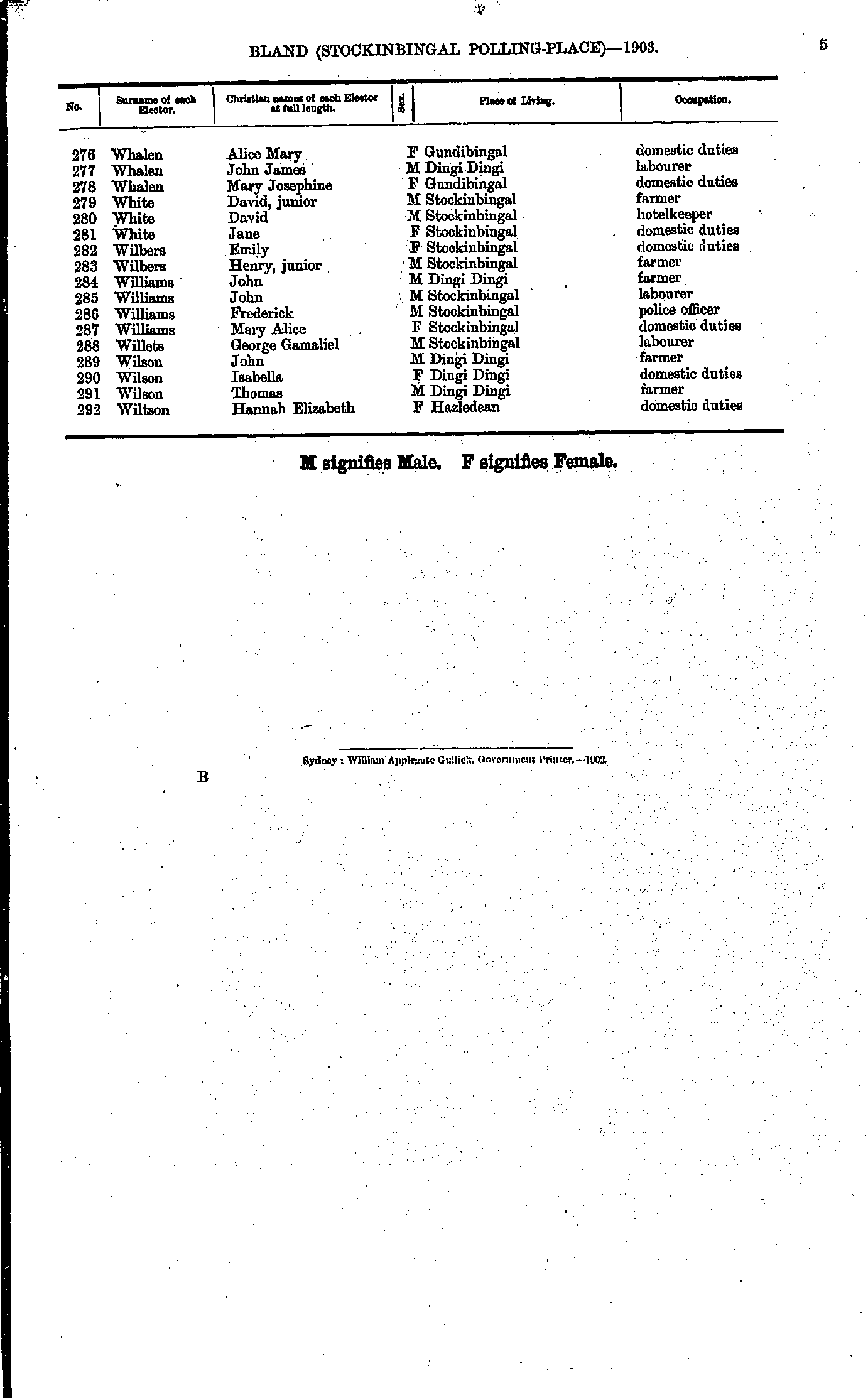
- Whalen Alice - Wiltson Hannah
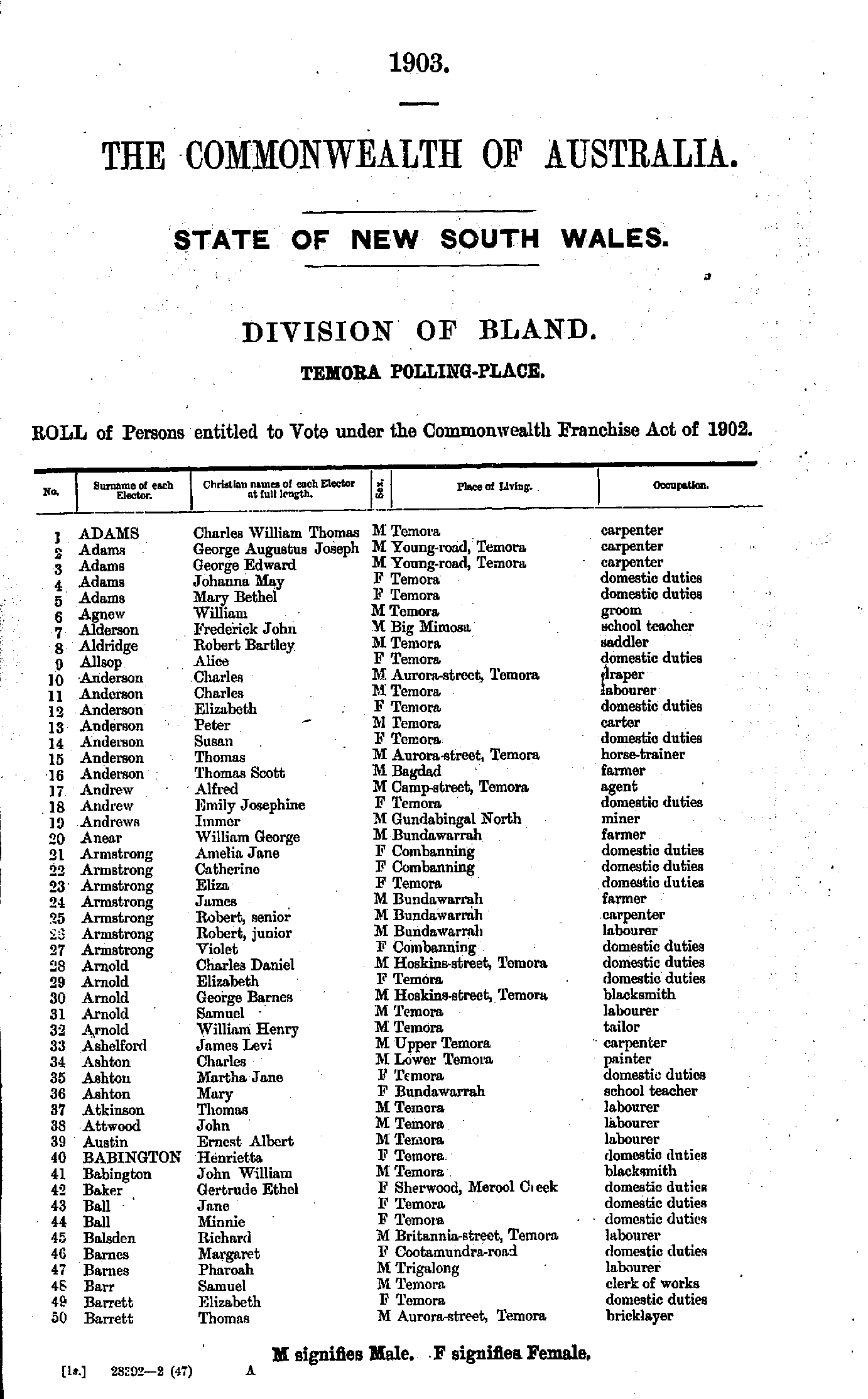
- Adams Charles - Barrett Thomas
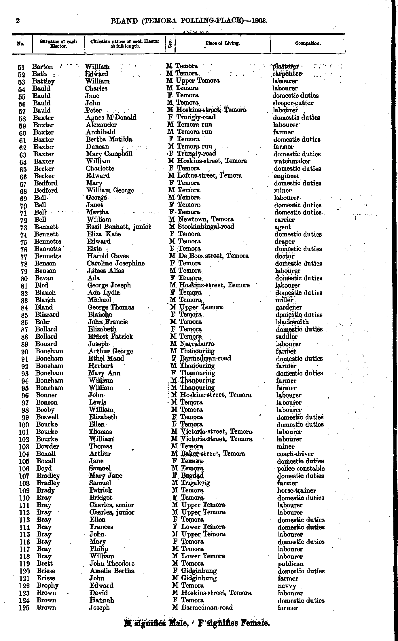
- Barton William - Brown Joseph
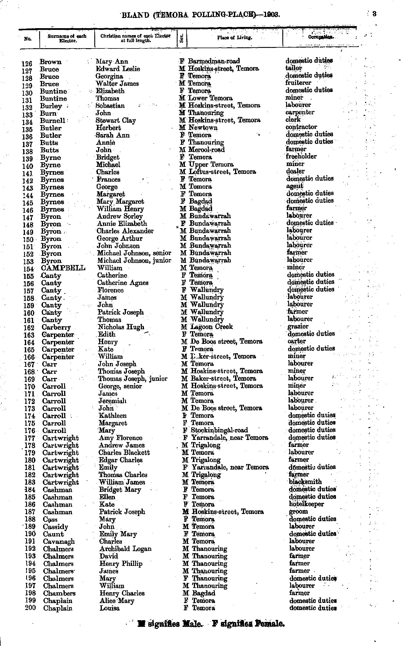
- Brown Mary - Chaplain Louisa
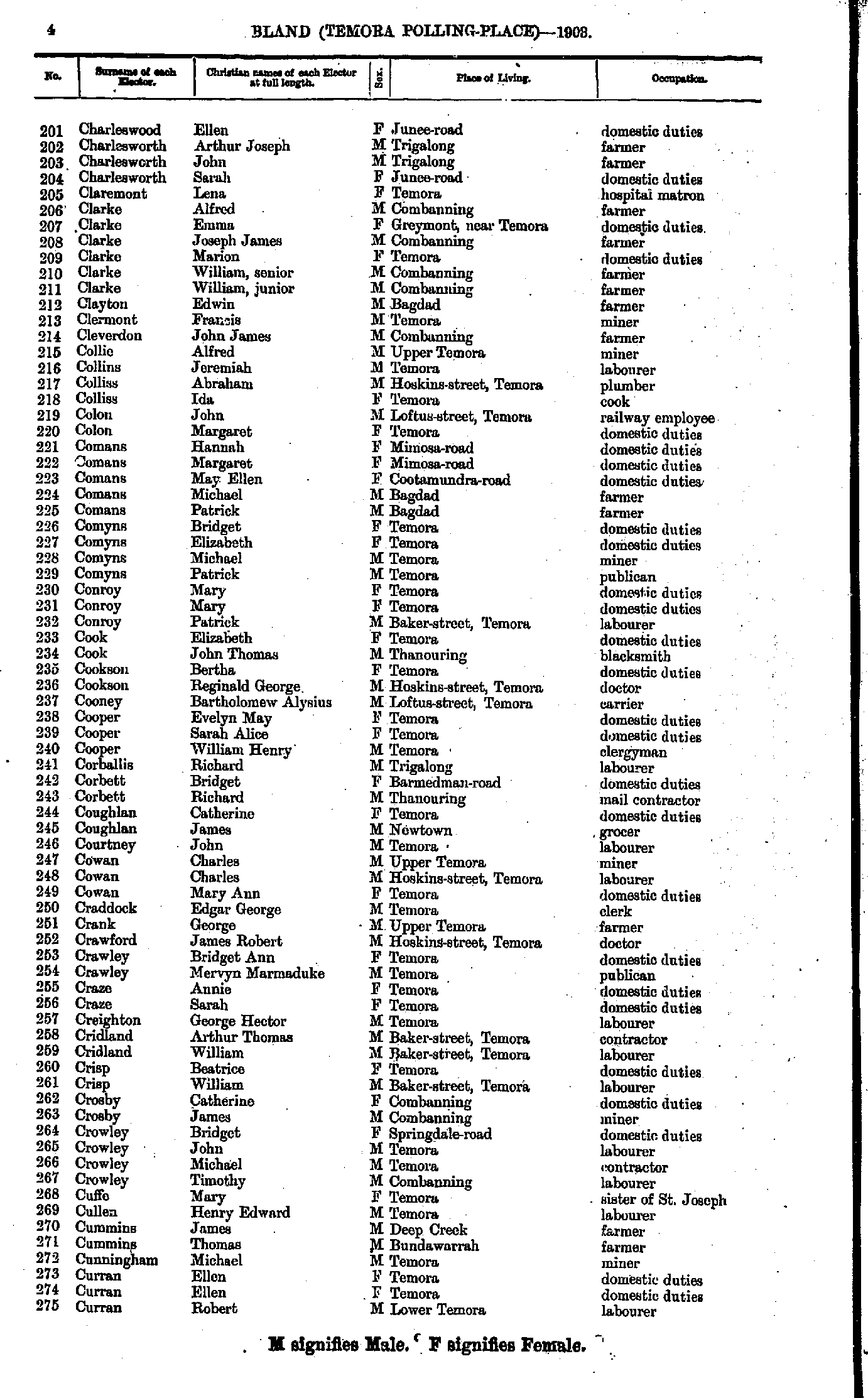
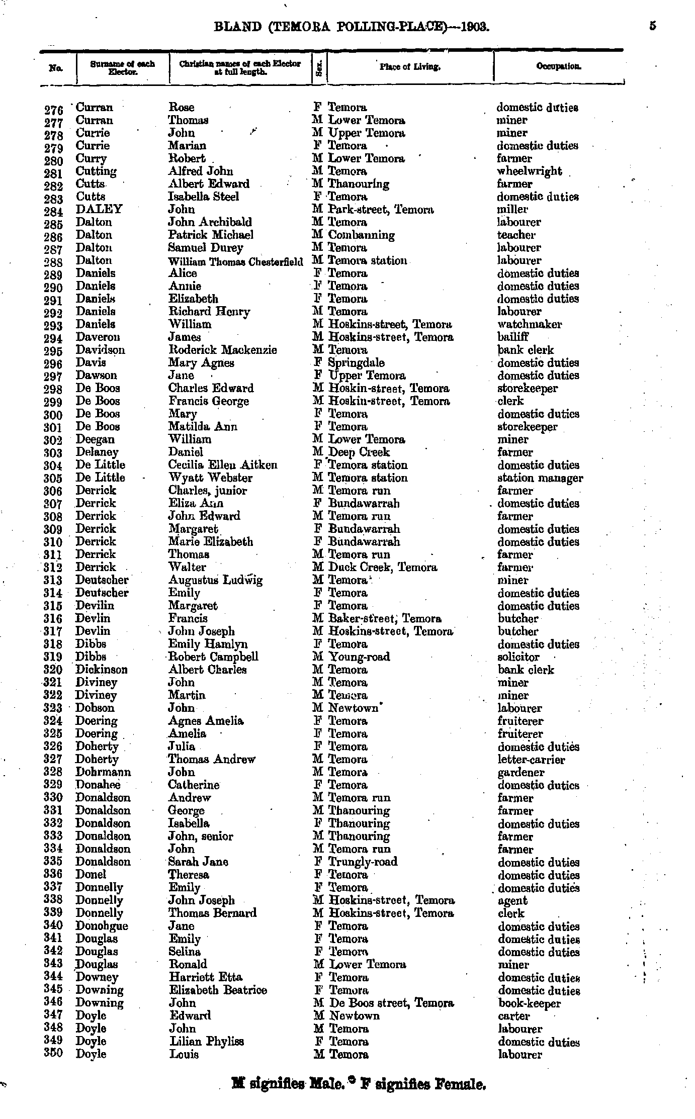
- Charleswood Ellen - Curran Robert
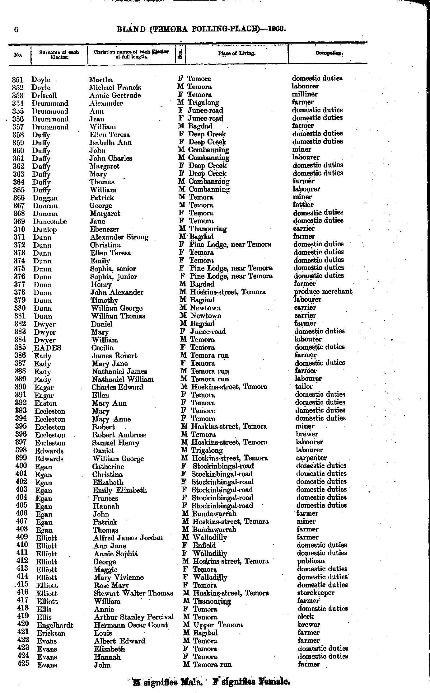
- Curran Rose - Doyle Louis
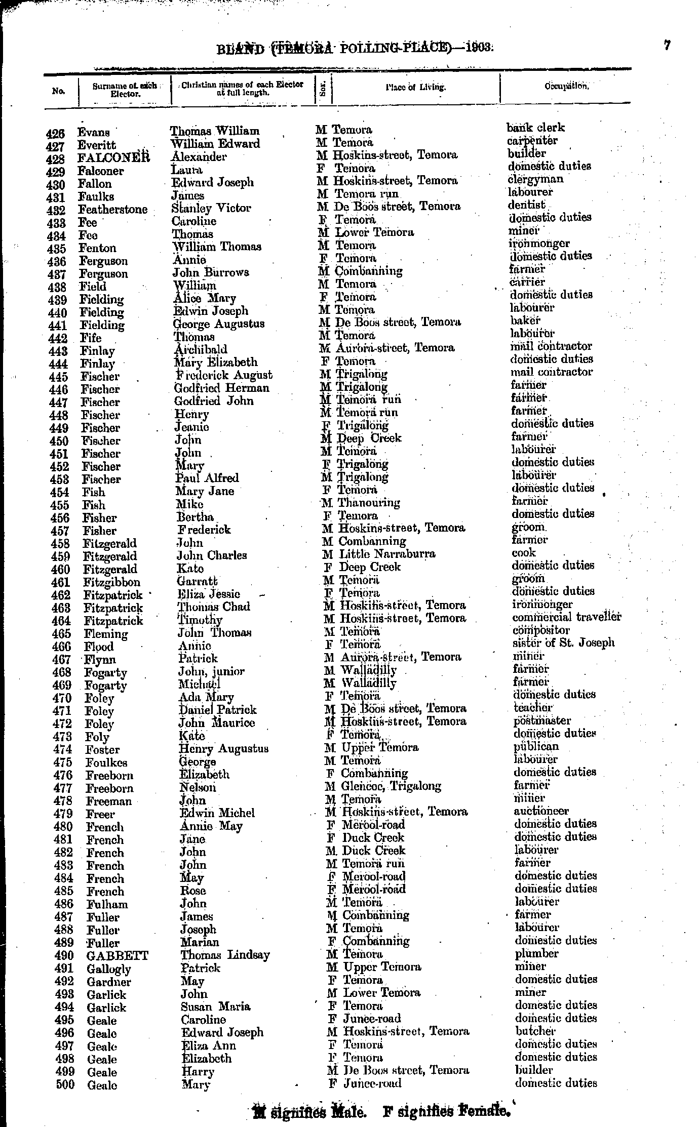
- Doyle Martha - Evans John
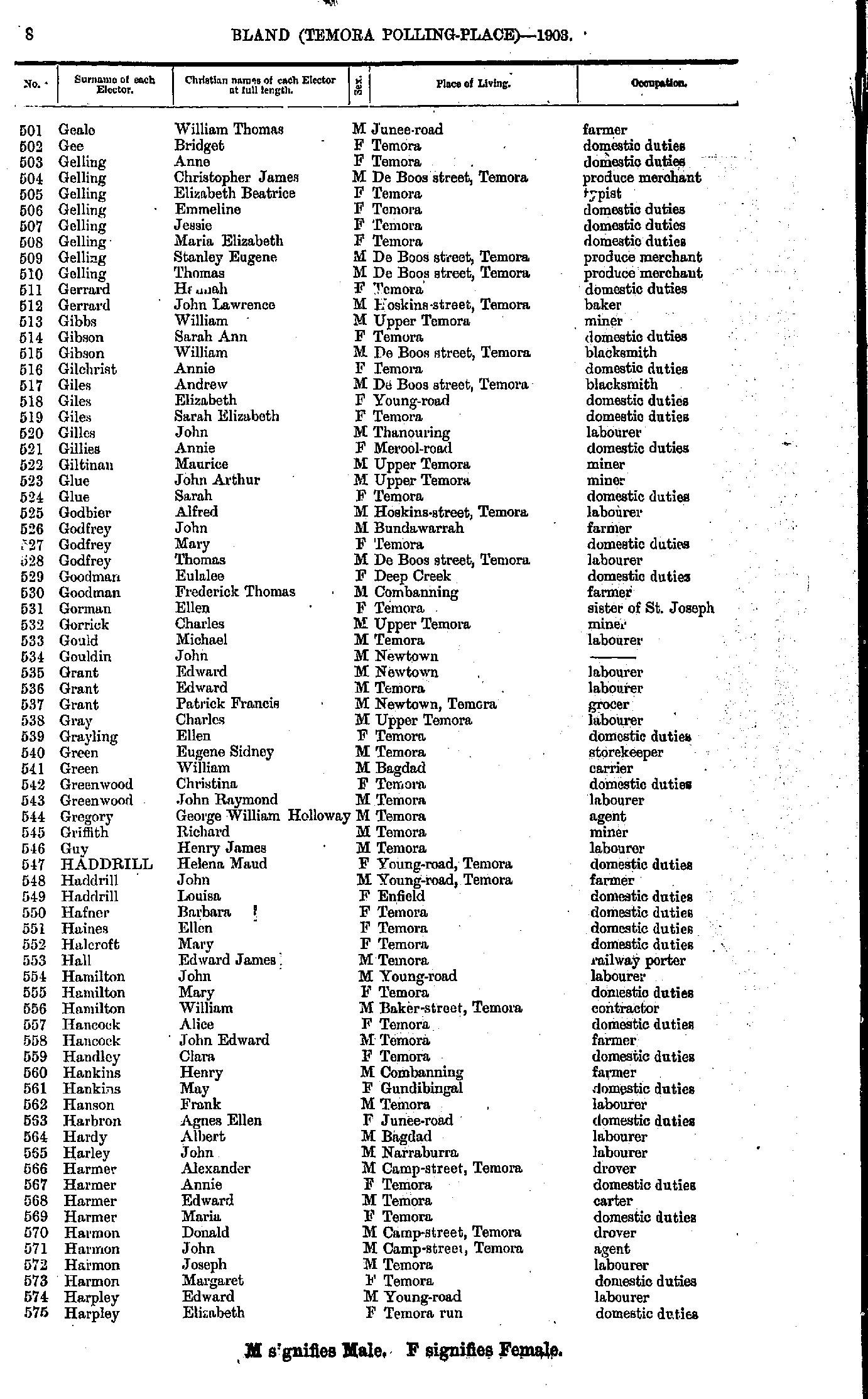
- Evans Thomas - Geale Mary
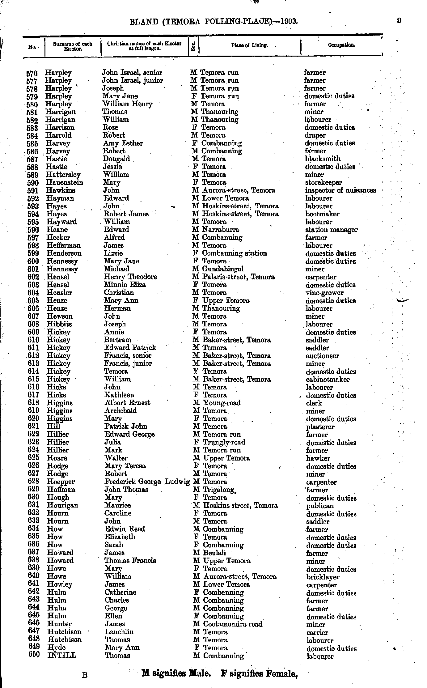
- Geale William - Harpley Elizabeth
- Harpley John - Intill Thomas
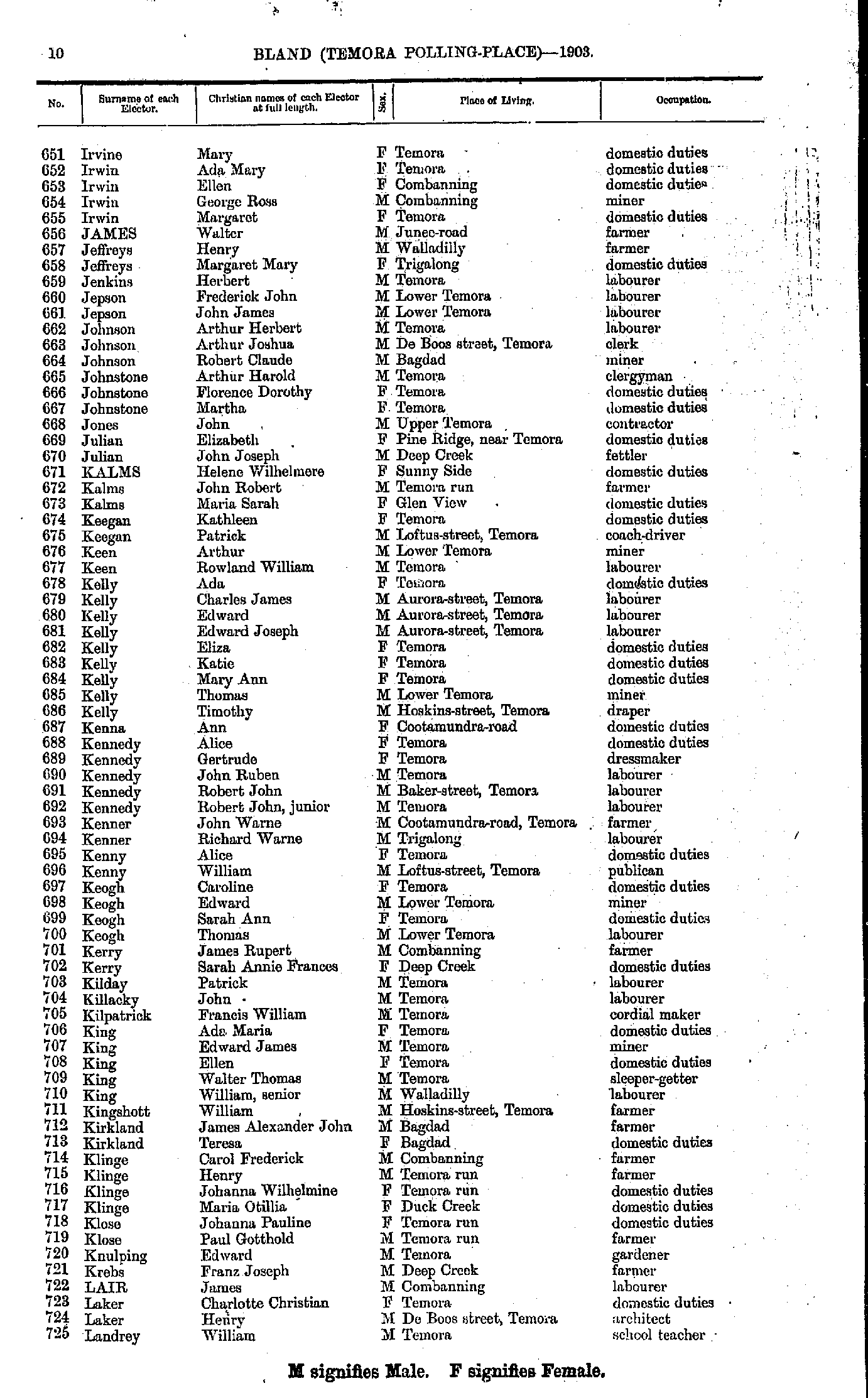
- Irvine Mary - Landrey William
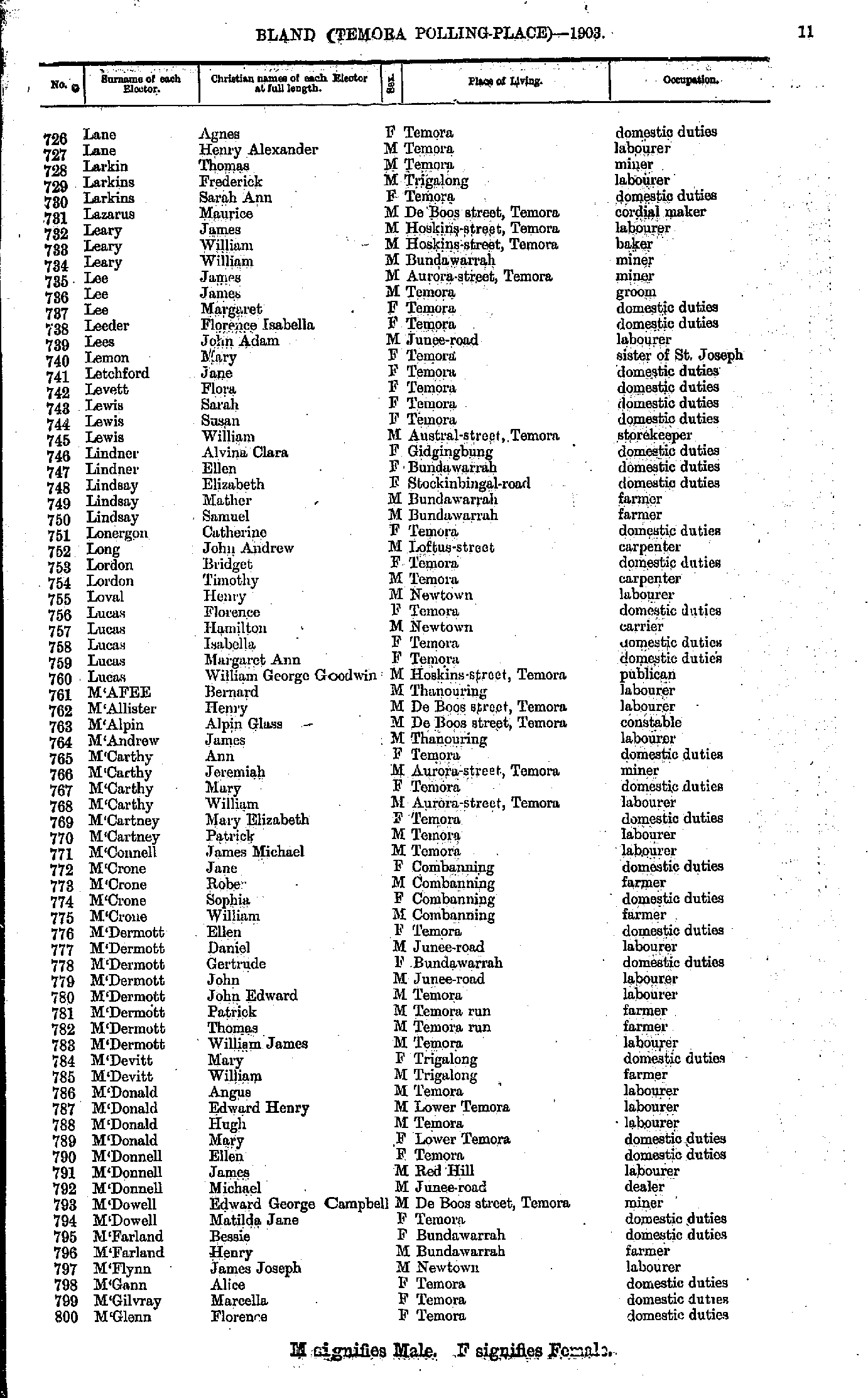
- Lane Agnes - M'Glenn Florence
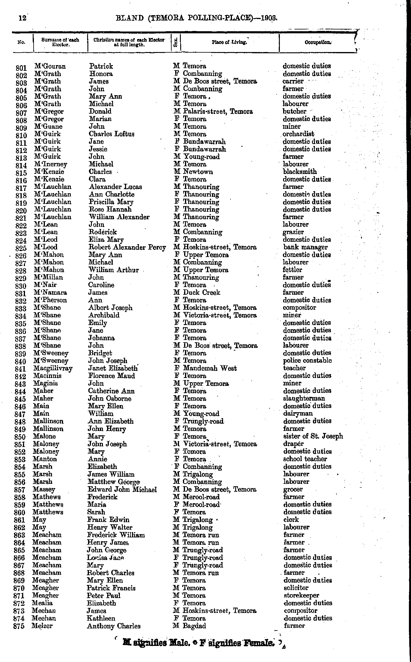
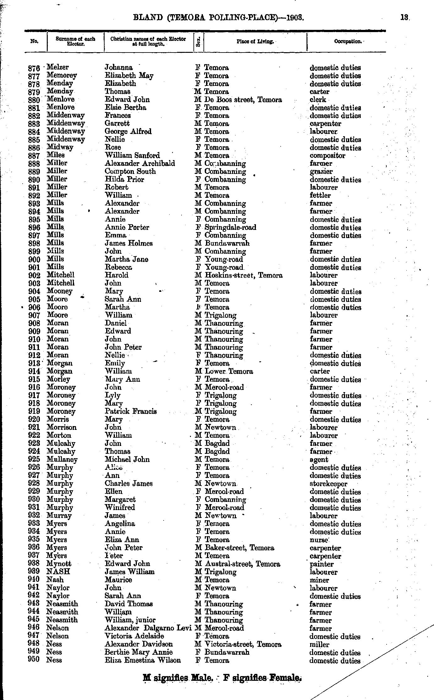
- M'Gouran Patrick - Melzer Anthony
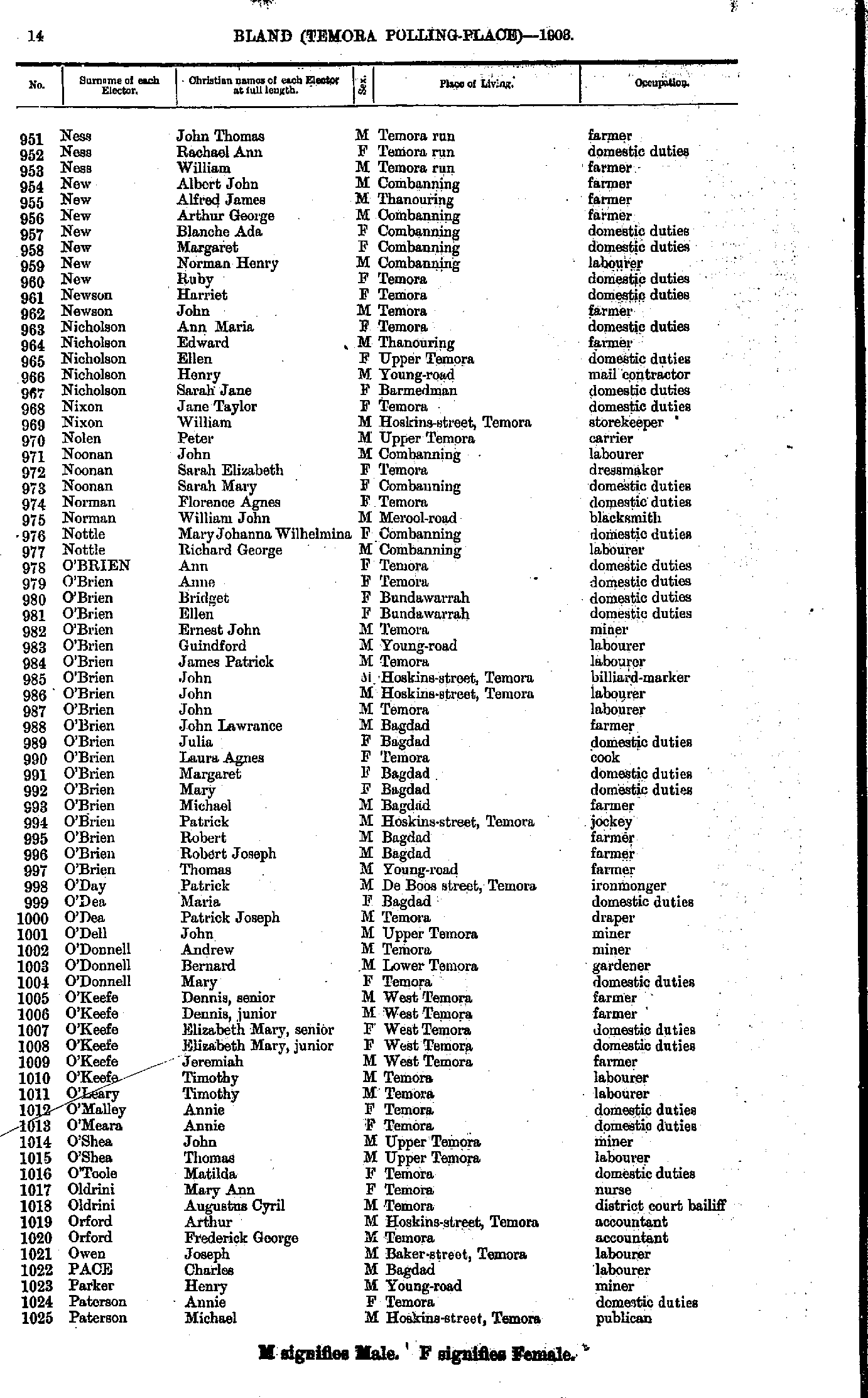
- Melzer Johanna - Ness Eliza
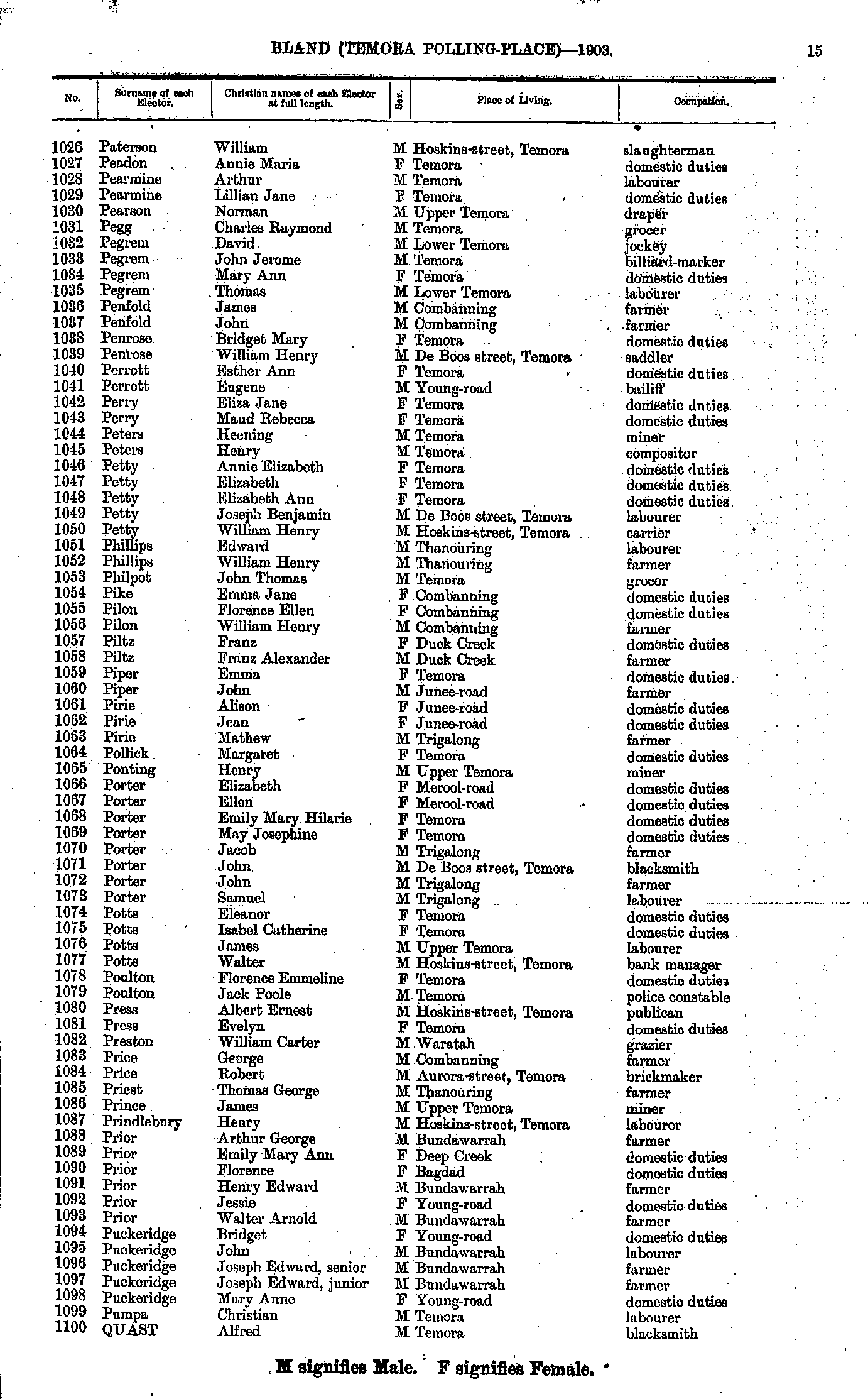
- Ness John - Paterson Michael
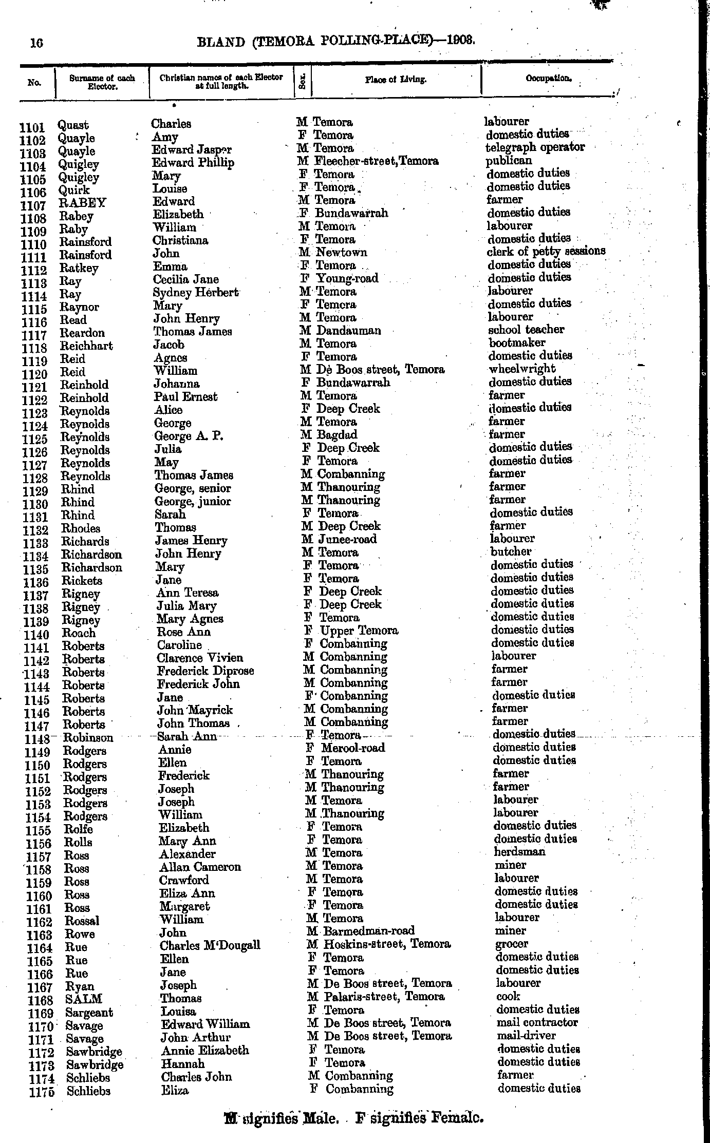
- Paterson William - Quast Alfred
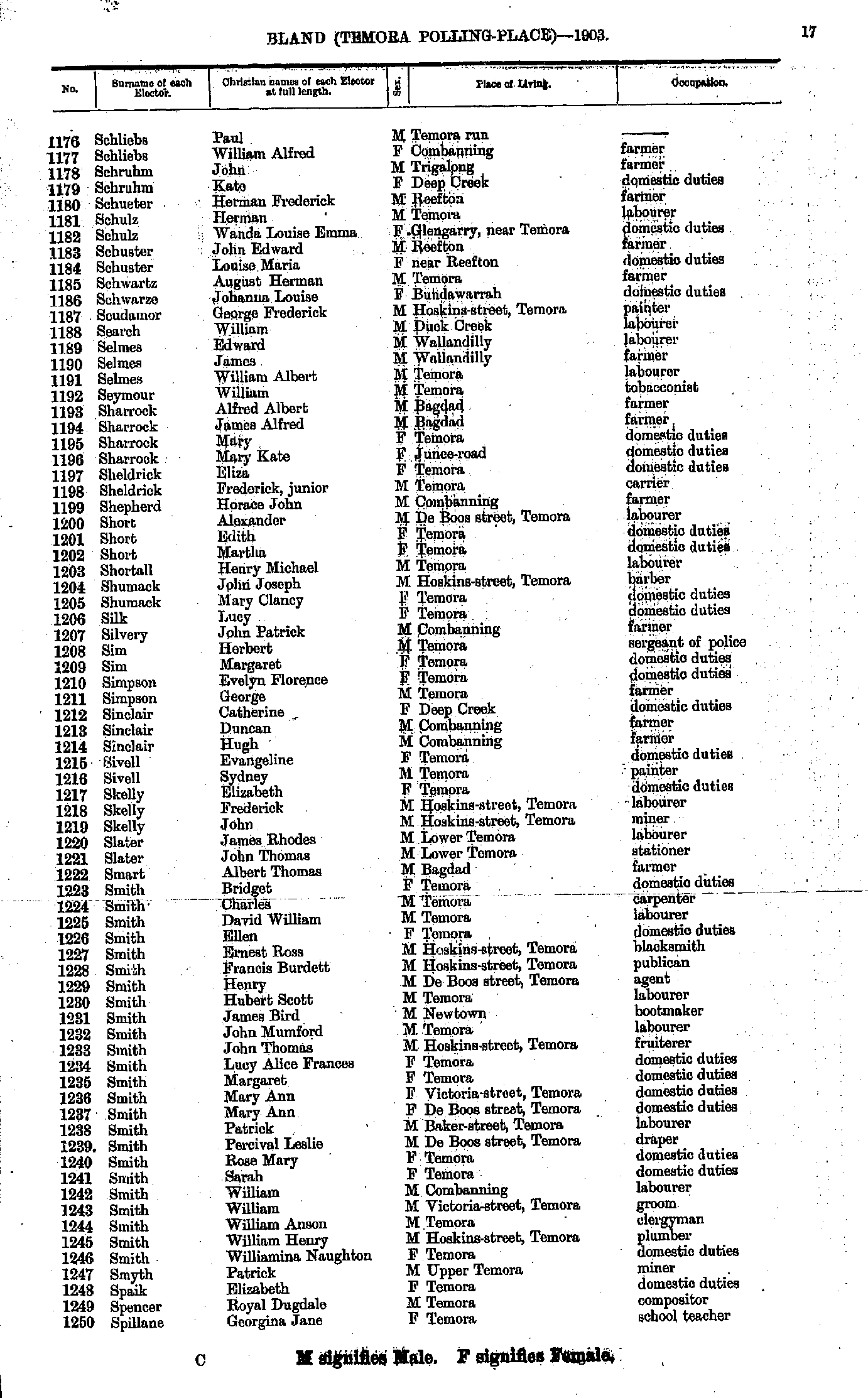
- Quast Charles - Schliebs Eliza
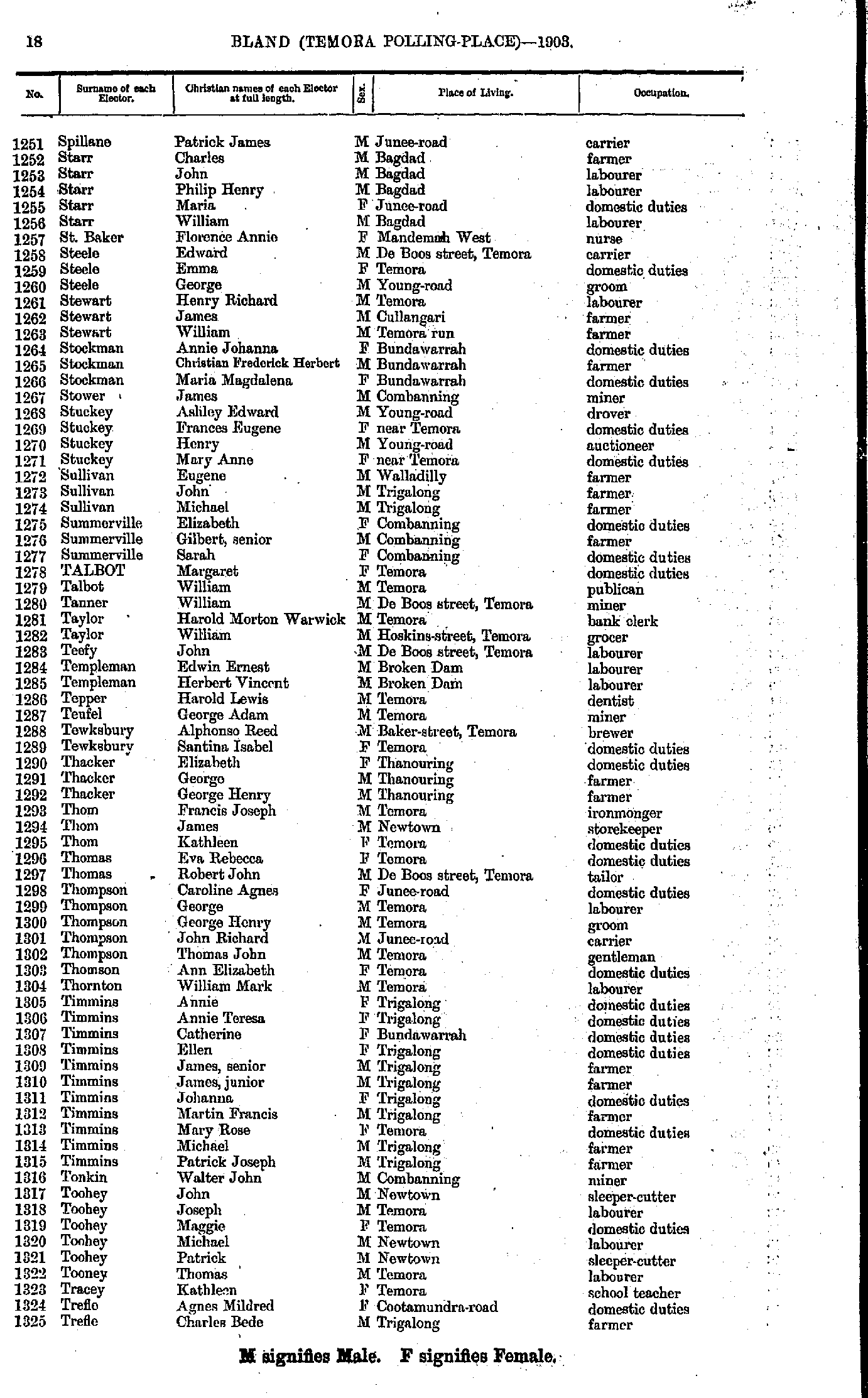
- Schliebs Paul - Spillane Georgina
- Spillane Patrick - Trefle Charles
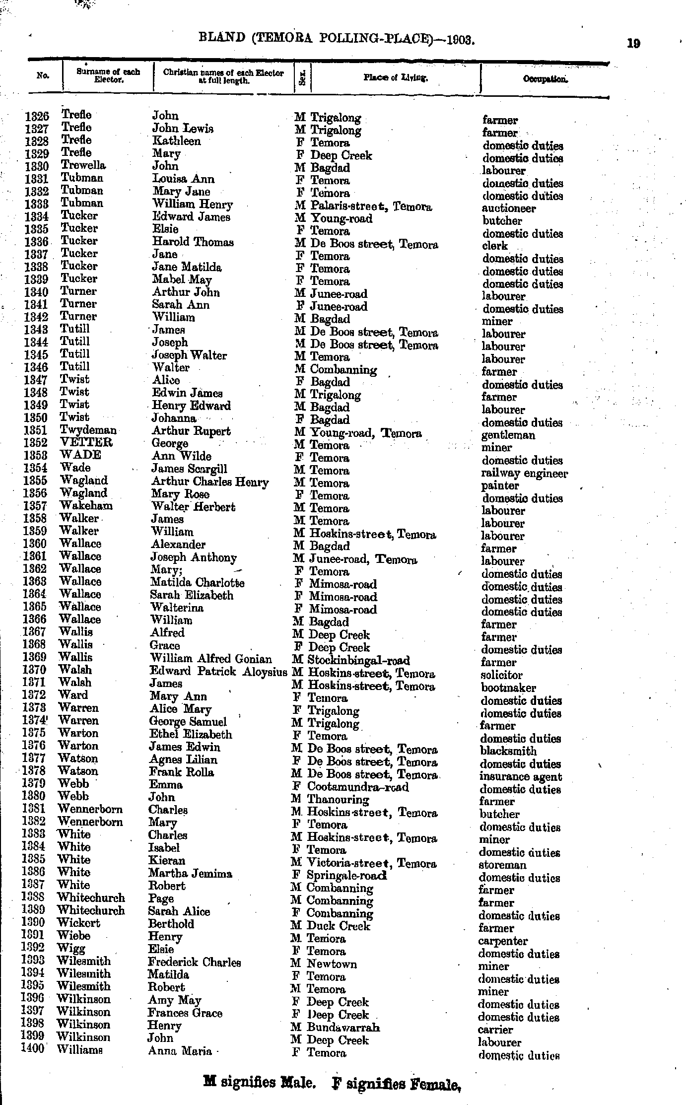
- Trefle John - Williams Anna
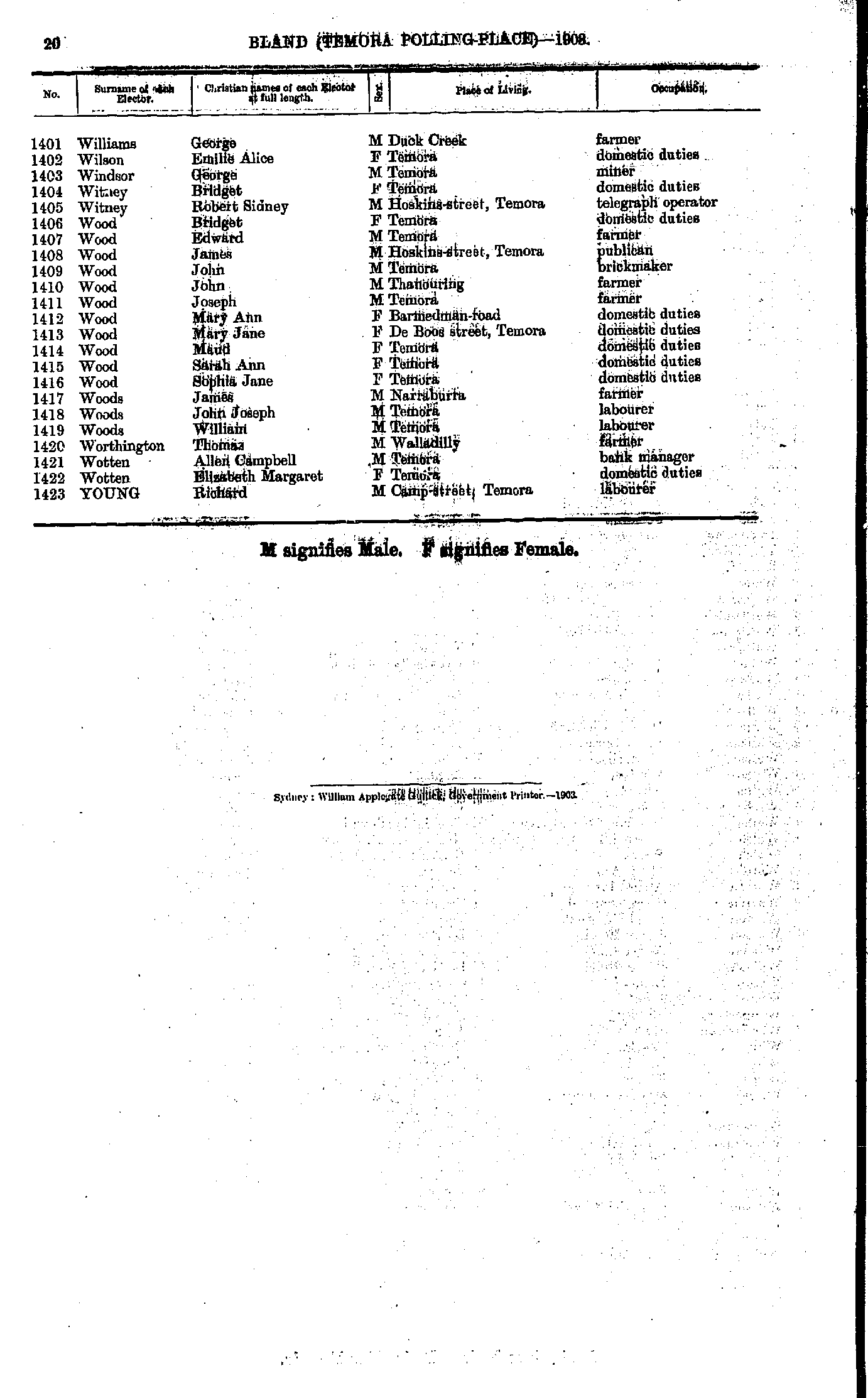
- Williams George - Young Richard
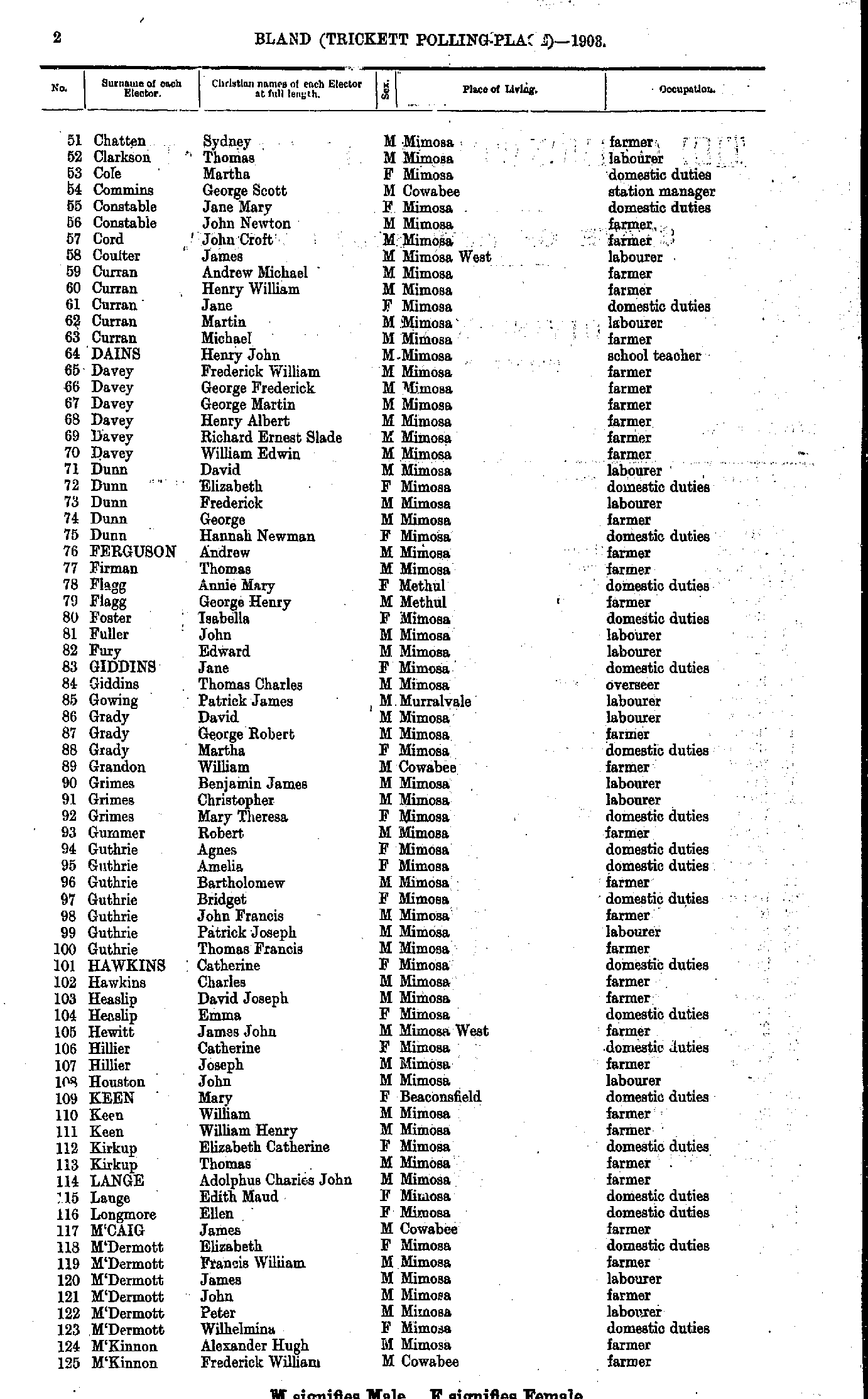
- Adams Sophia - Chatten Sarah
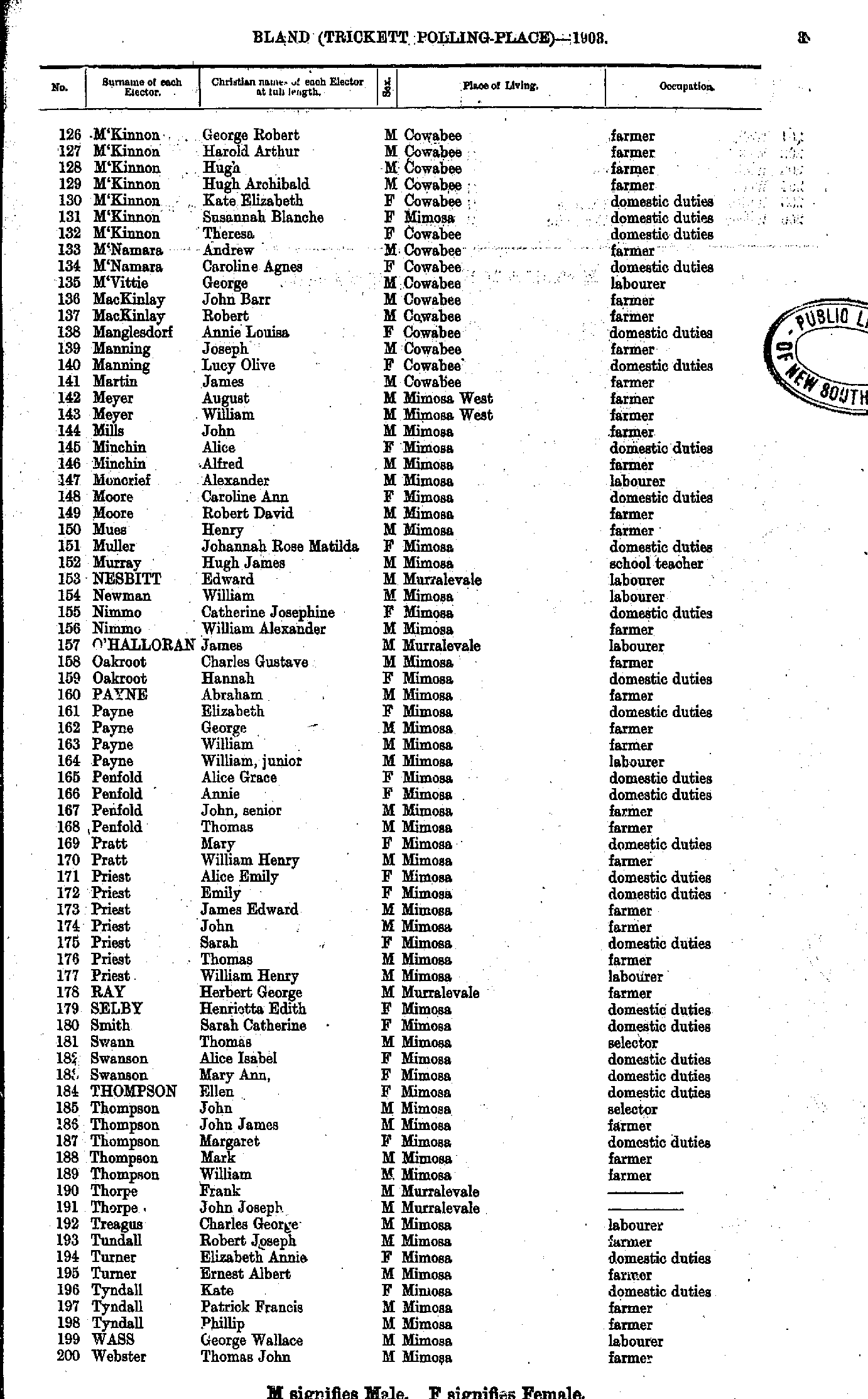
- Chatten Sydney - M'Kinnon Frederick
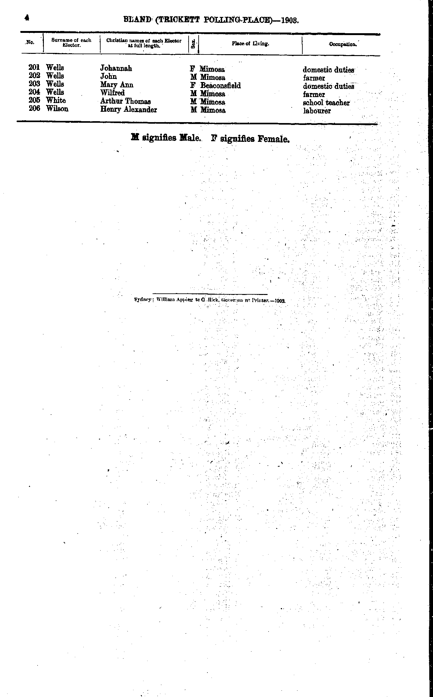
- M'Kinnon George - Webster Thomas
- Wells Johannah - Wilson Henry
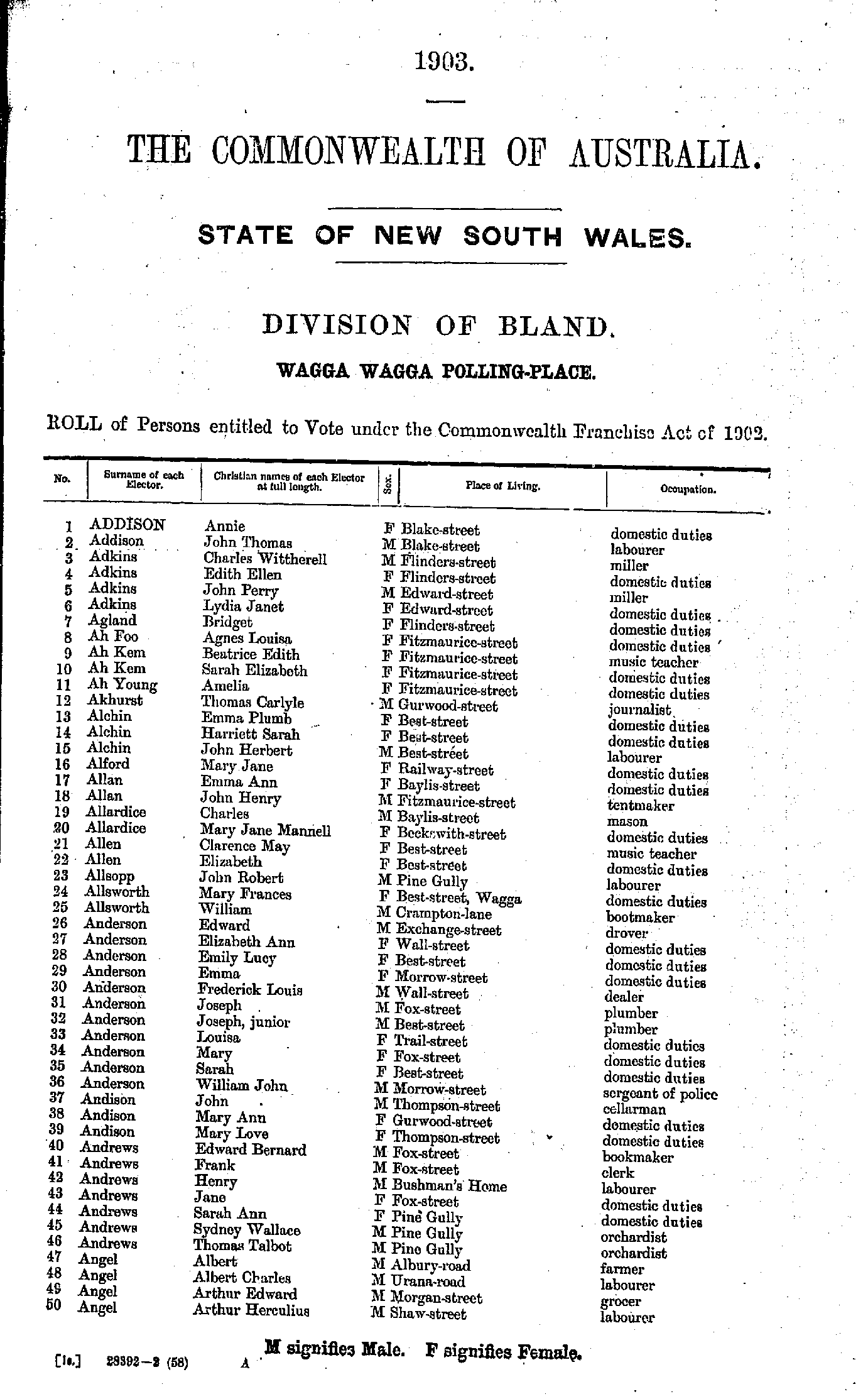
- Addison Annie - Angel Arthur
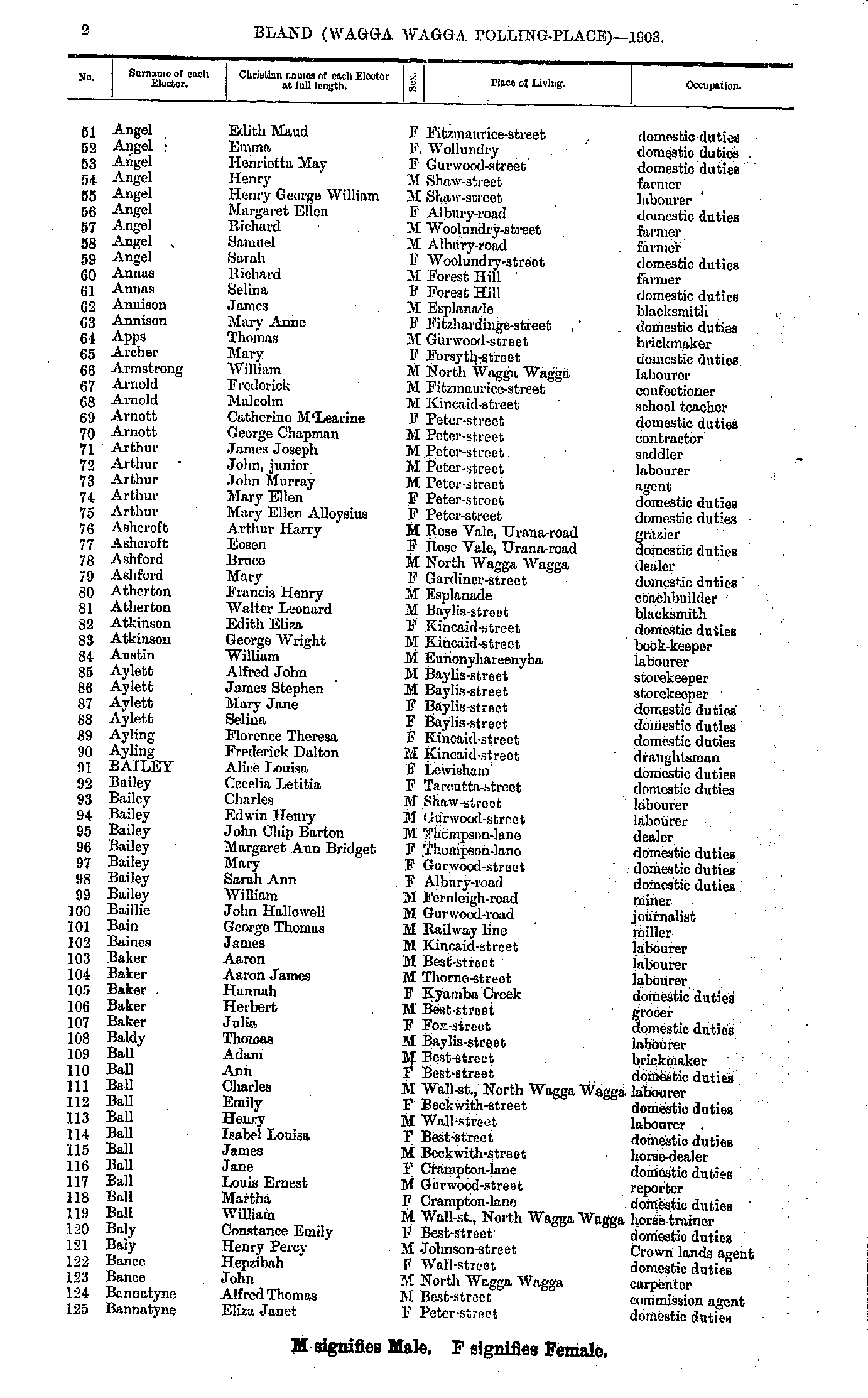
- Angel Edith - Bannatyne Eliza
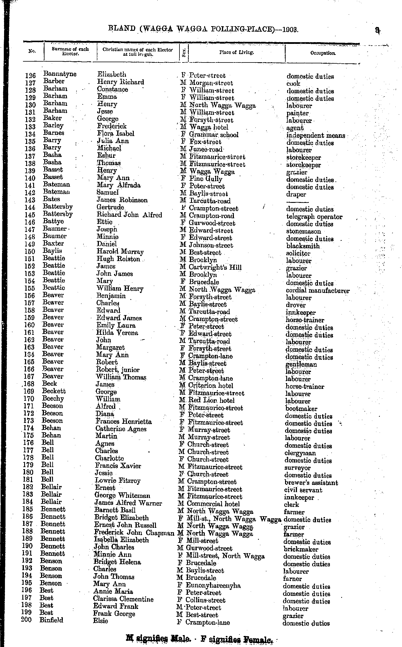
- Bannatyne Elizabeth - Binfield Elsie
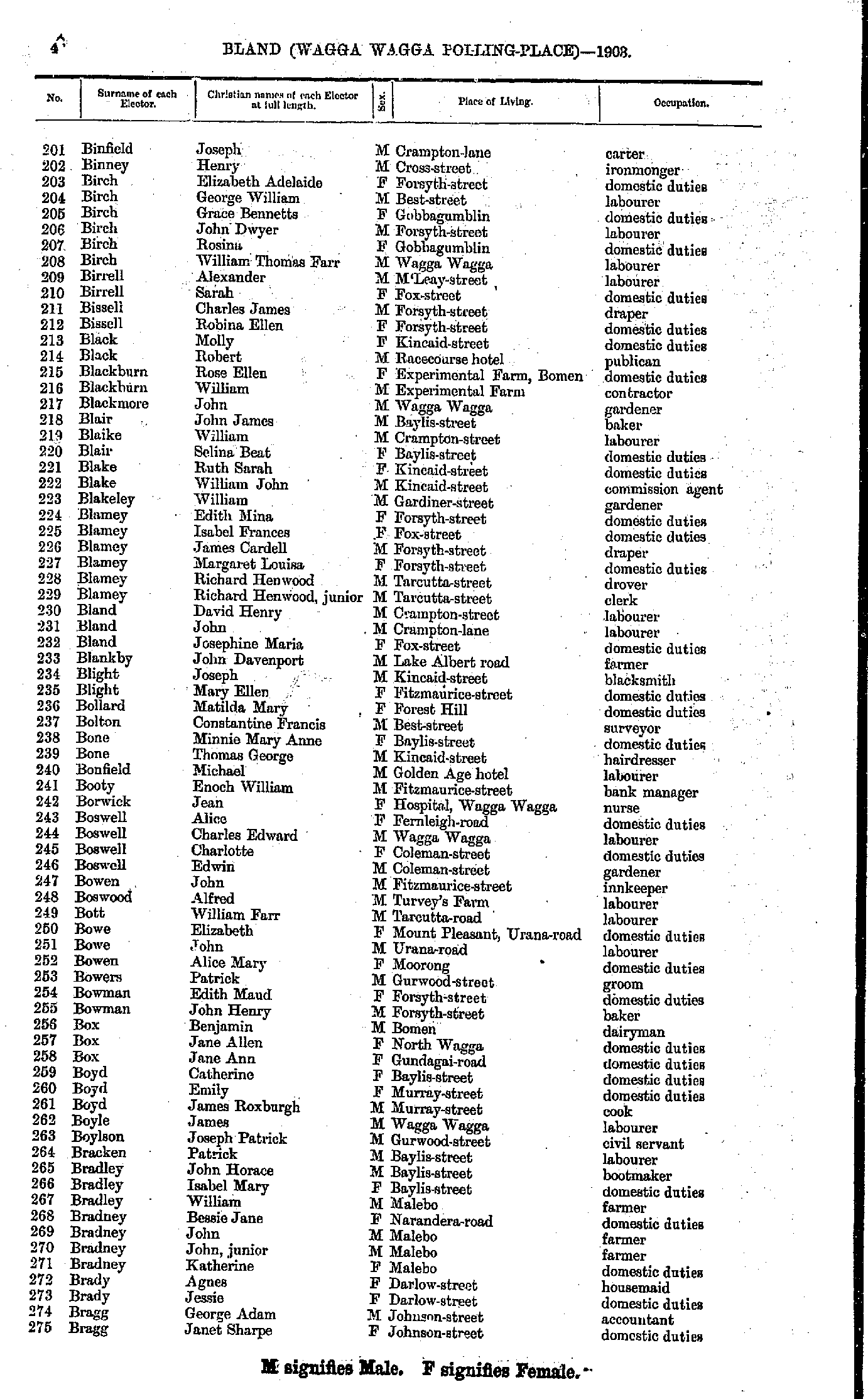
- Binfield Joseph - Bragg Janet
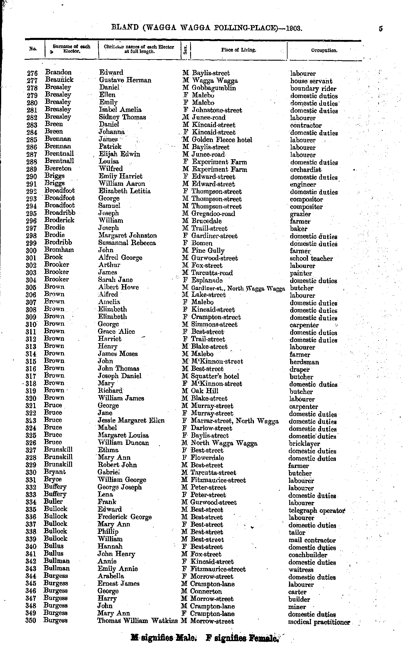
- Brandon Edward - Burgess Thomas
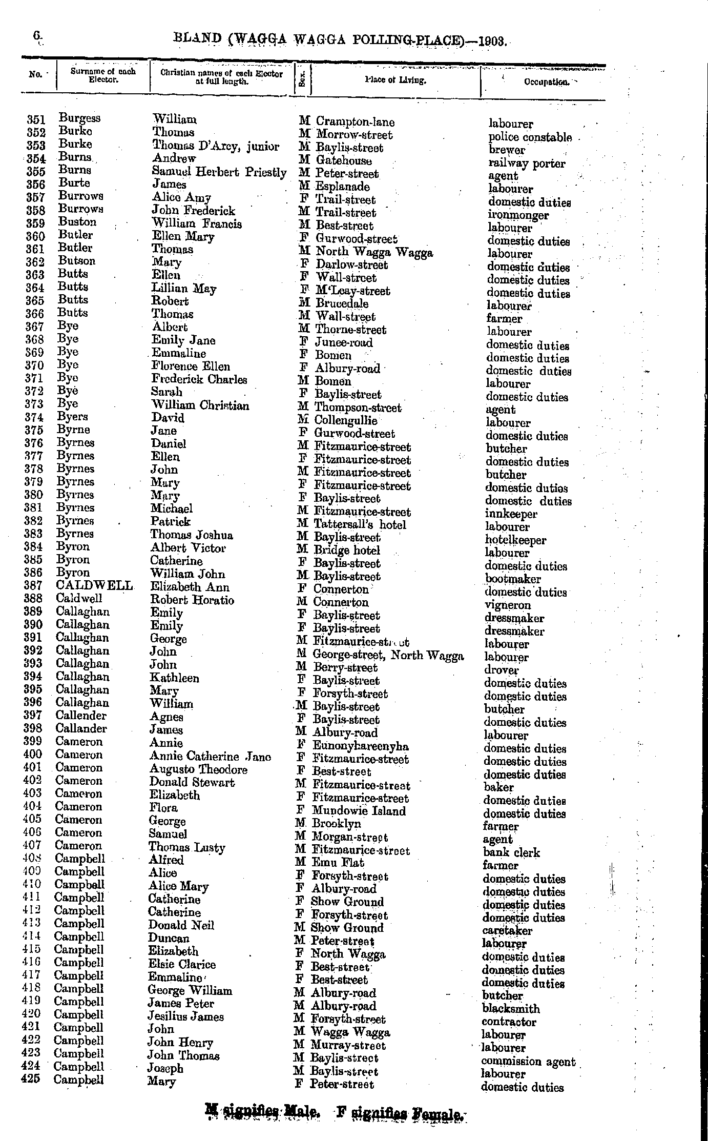
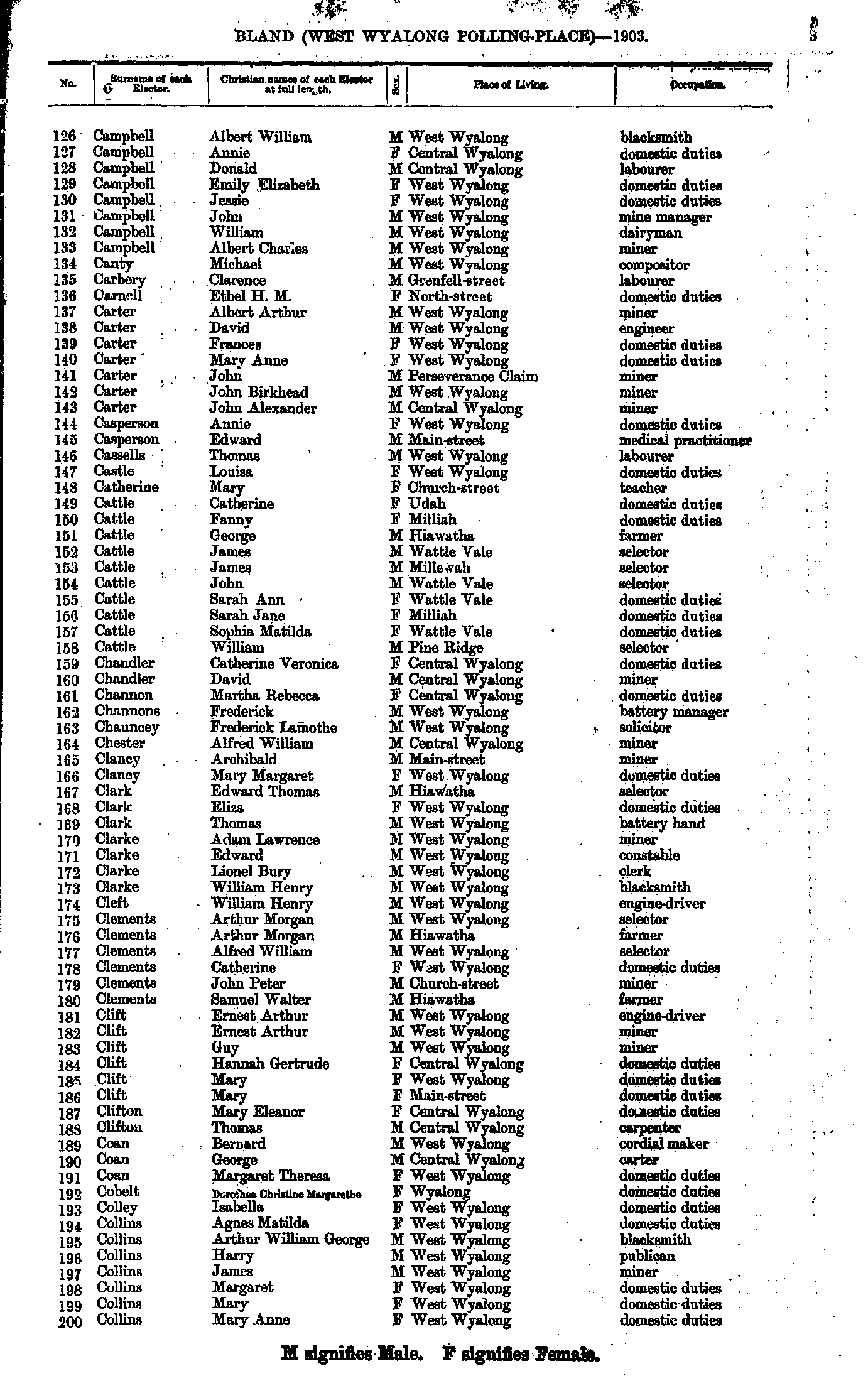
- Burgess William - Campbell Mary
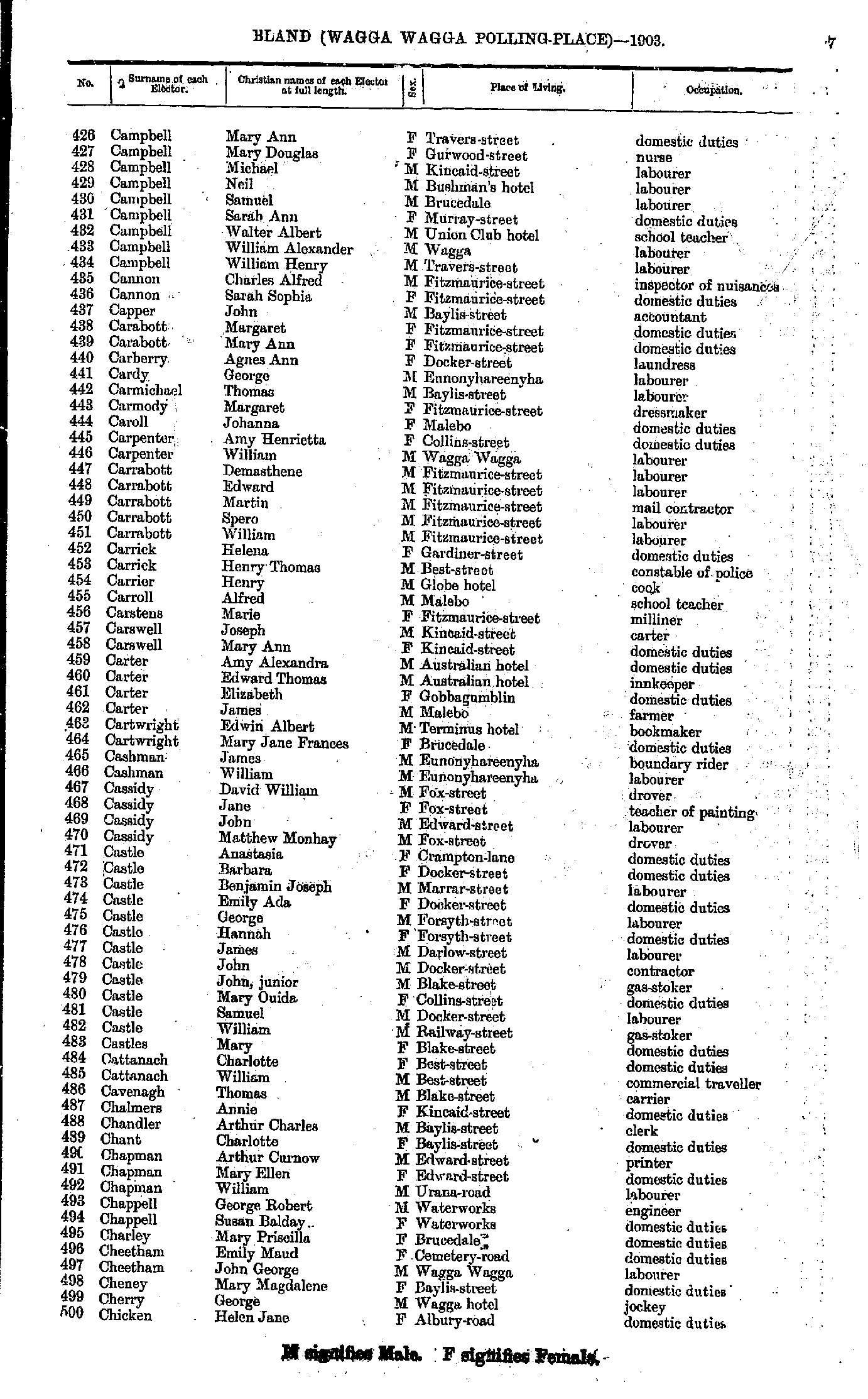
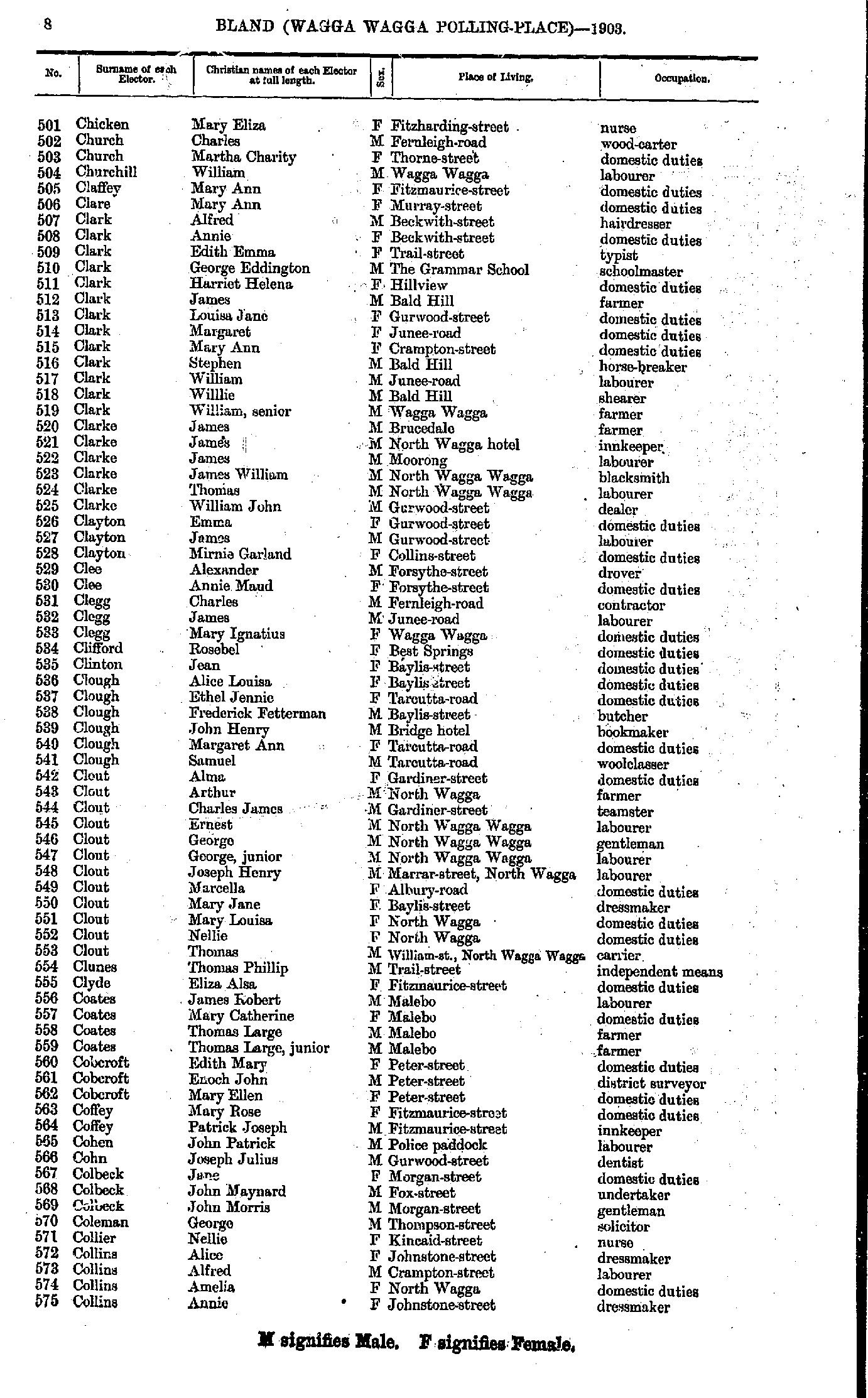
- Campbell Mary - Chicken Helen
- Chicken Mary - Collins Annie
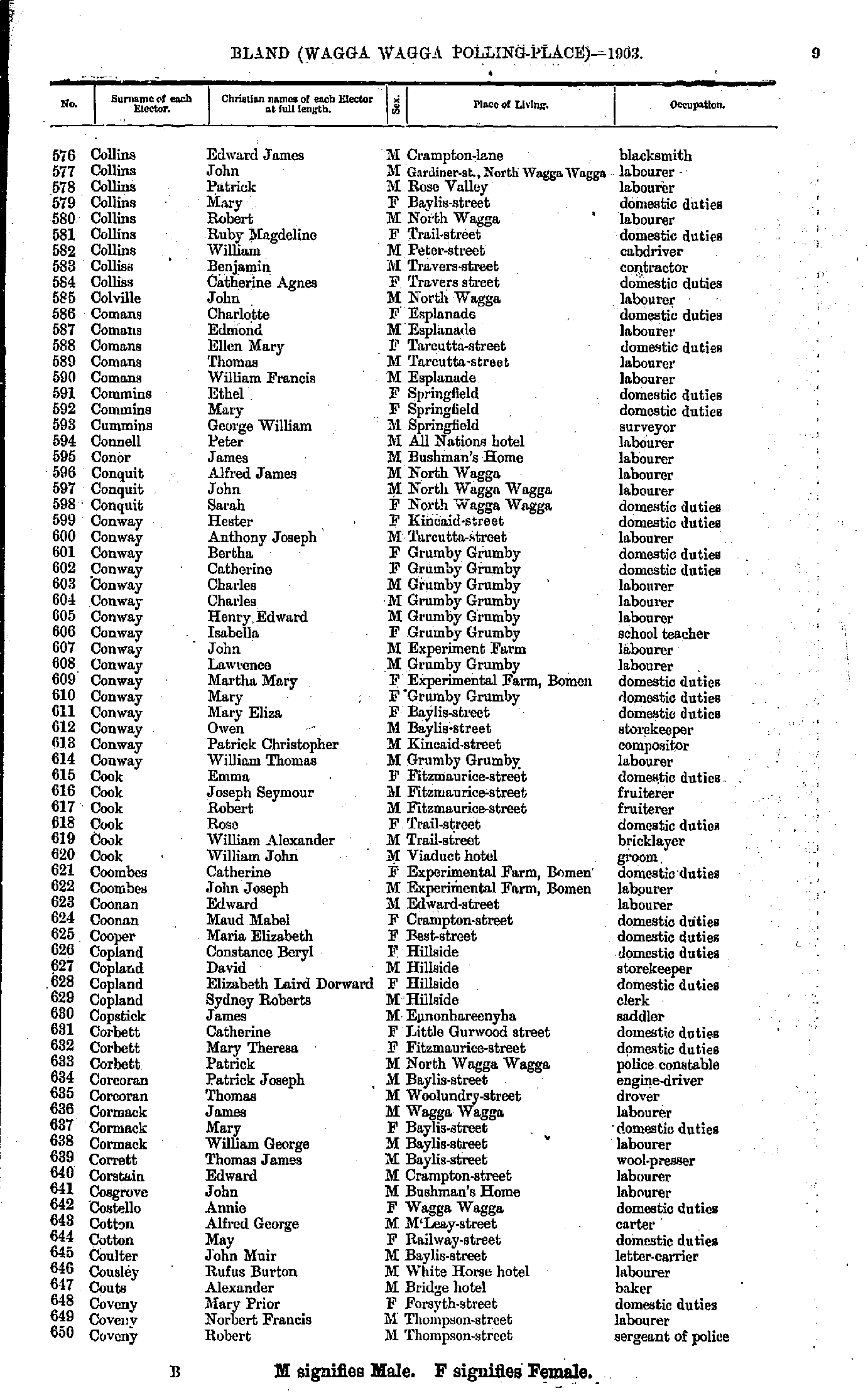
- Collins Edward - Coveny Robert
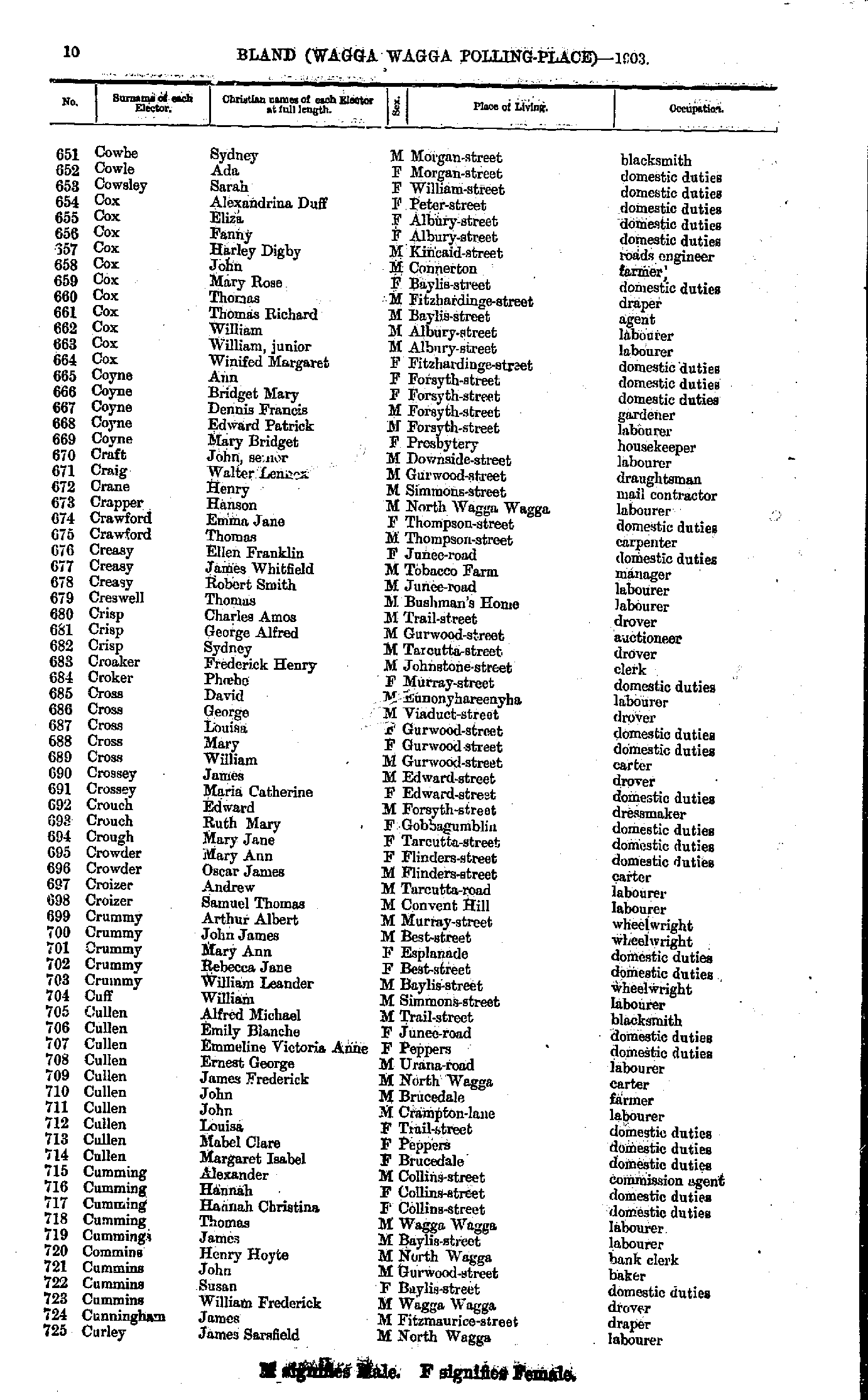
- Cowbe Sydney - Curley James
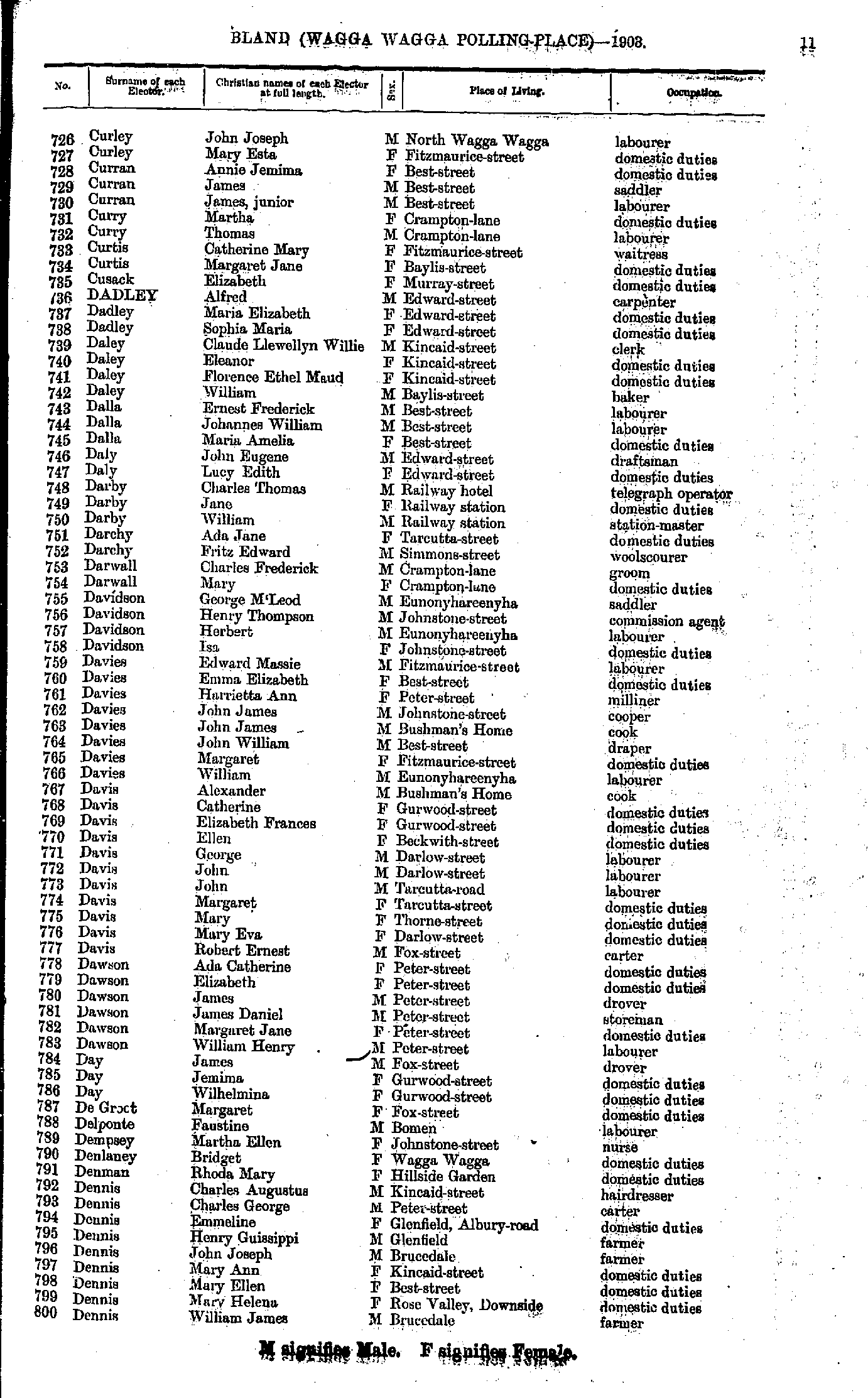
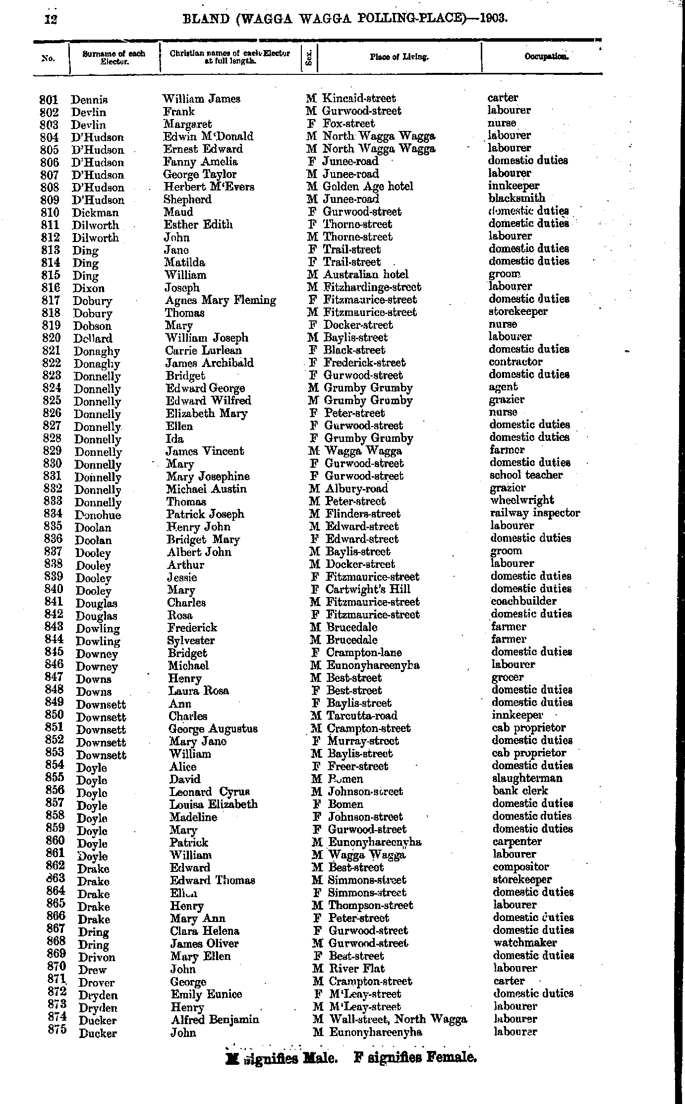
- Curley John - Dennis William
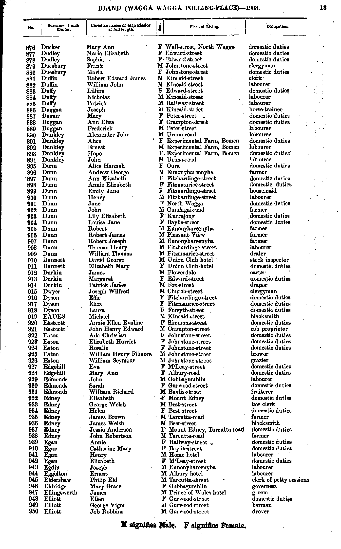
- Dennis William - Ducker John
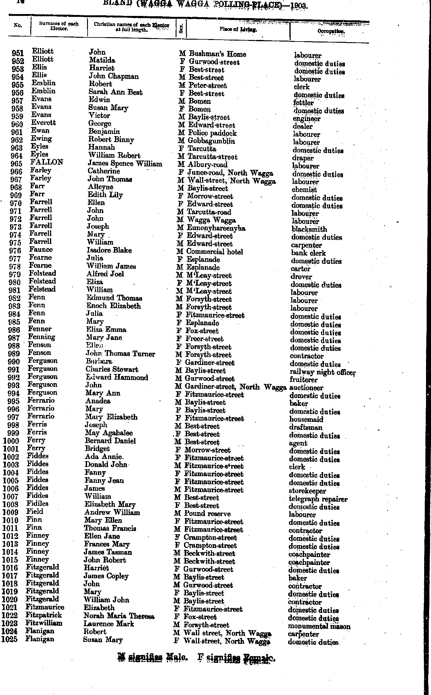
- Ducker Mary - Elliott Job
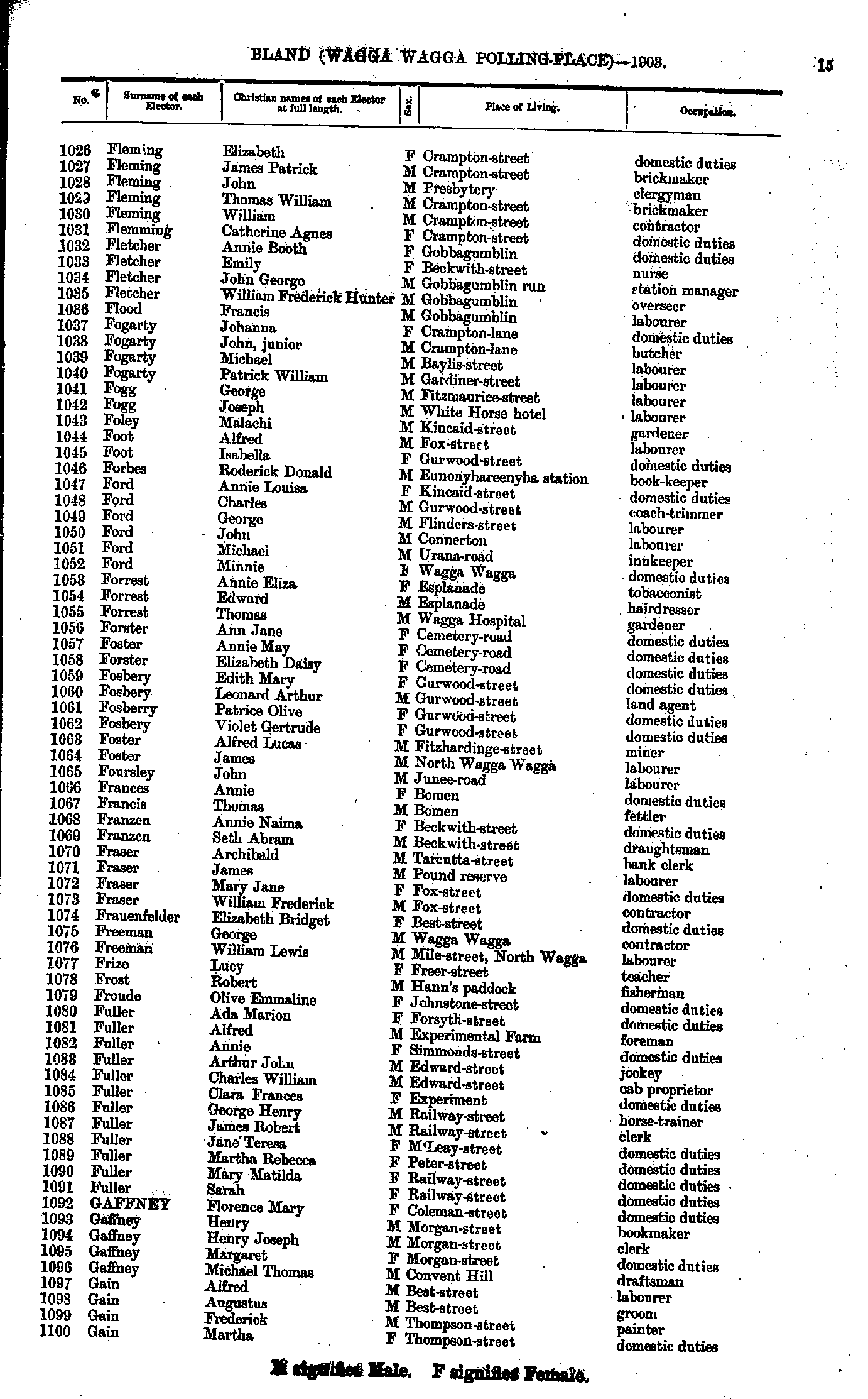
- Elliott John - Flanigan Susan
- Fleming Elizabeth - Gain Martha
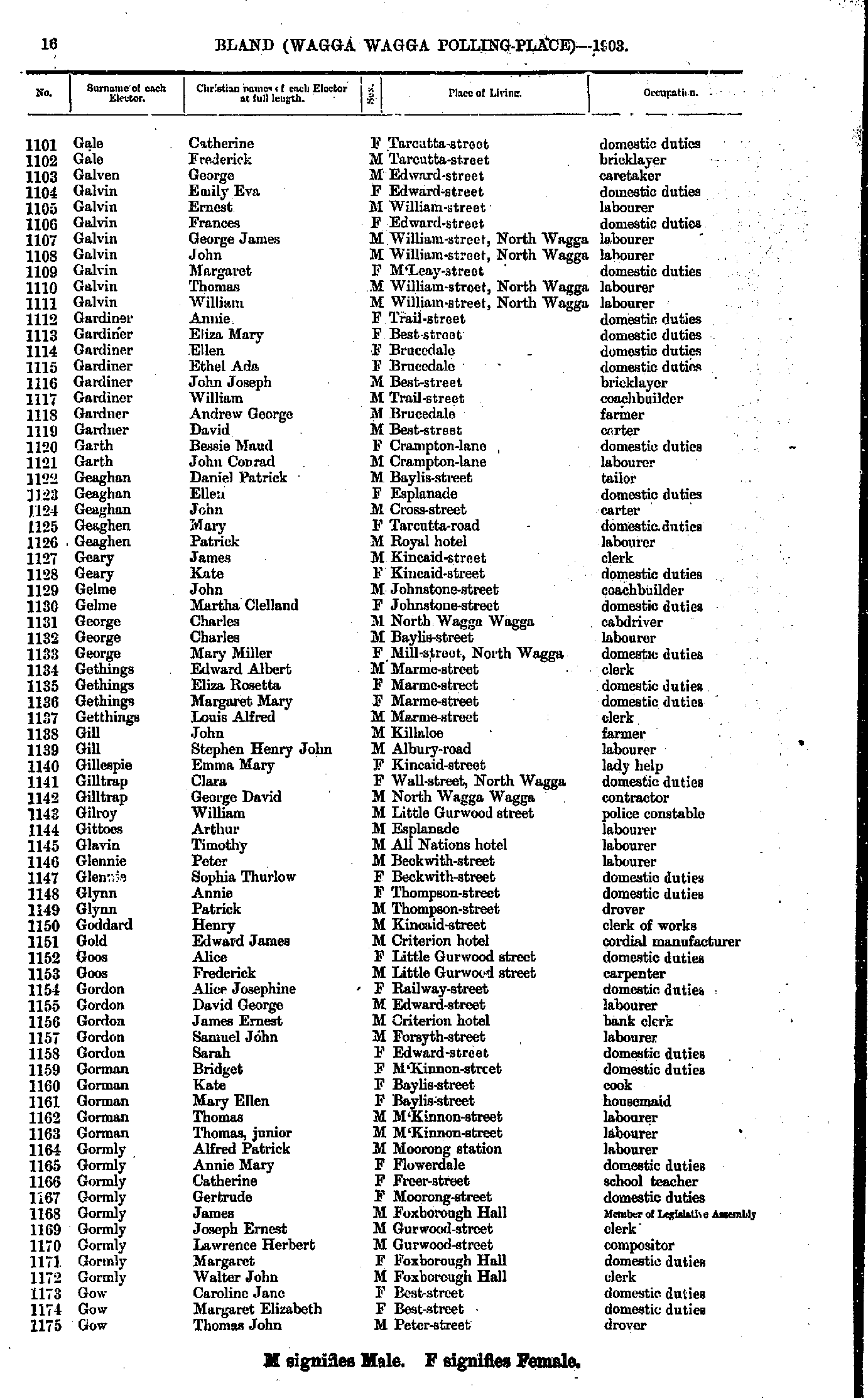
- Gale Catherine - Gow Thomas
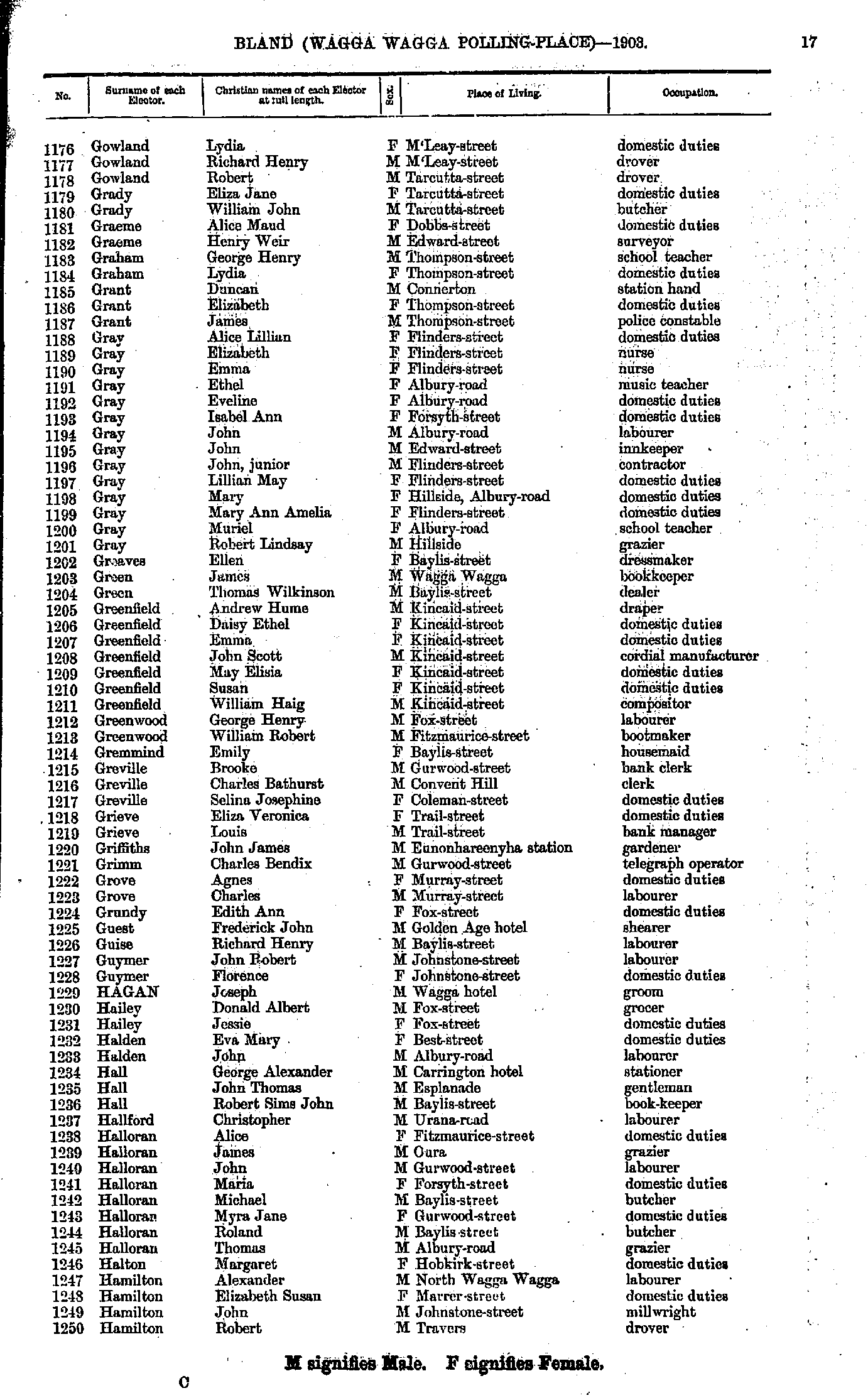
- Gowland Lydia - Hamilton Robert
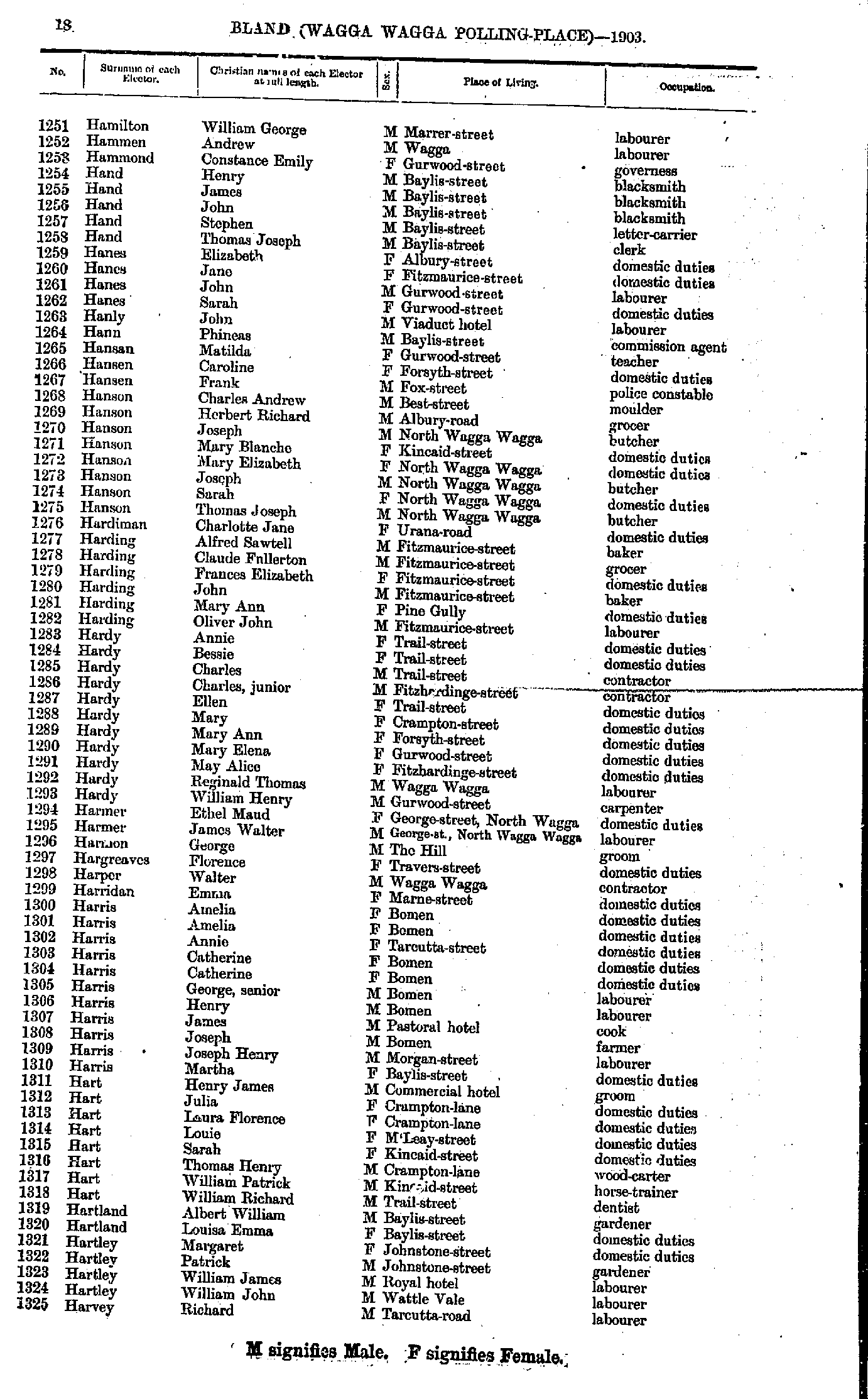
- Hamilton William - Harvey Richard
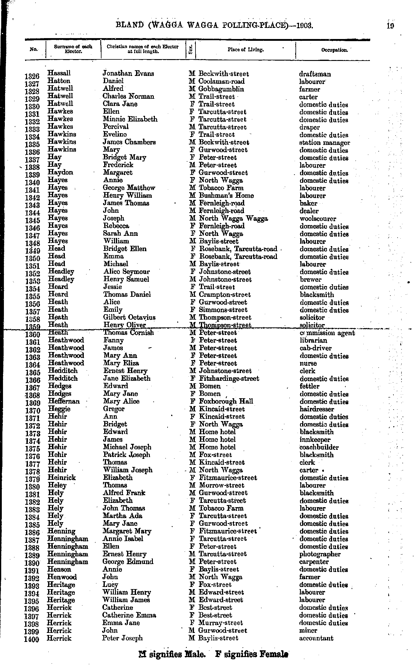
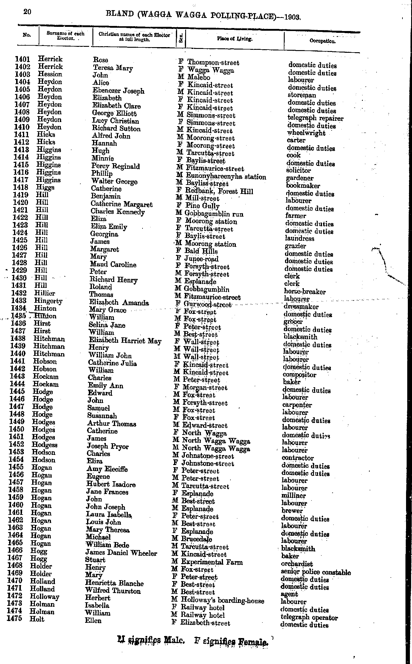
- Hassall Jonathan - Herrick Peter
- Herrick Rose - Holt Ellen
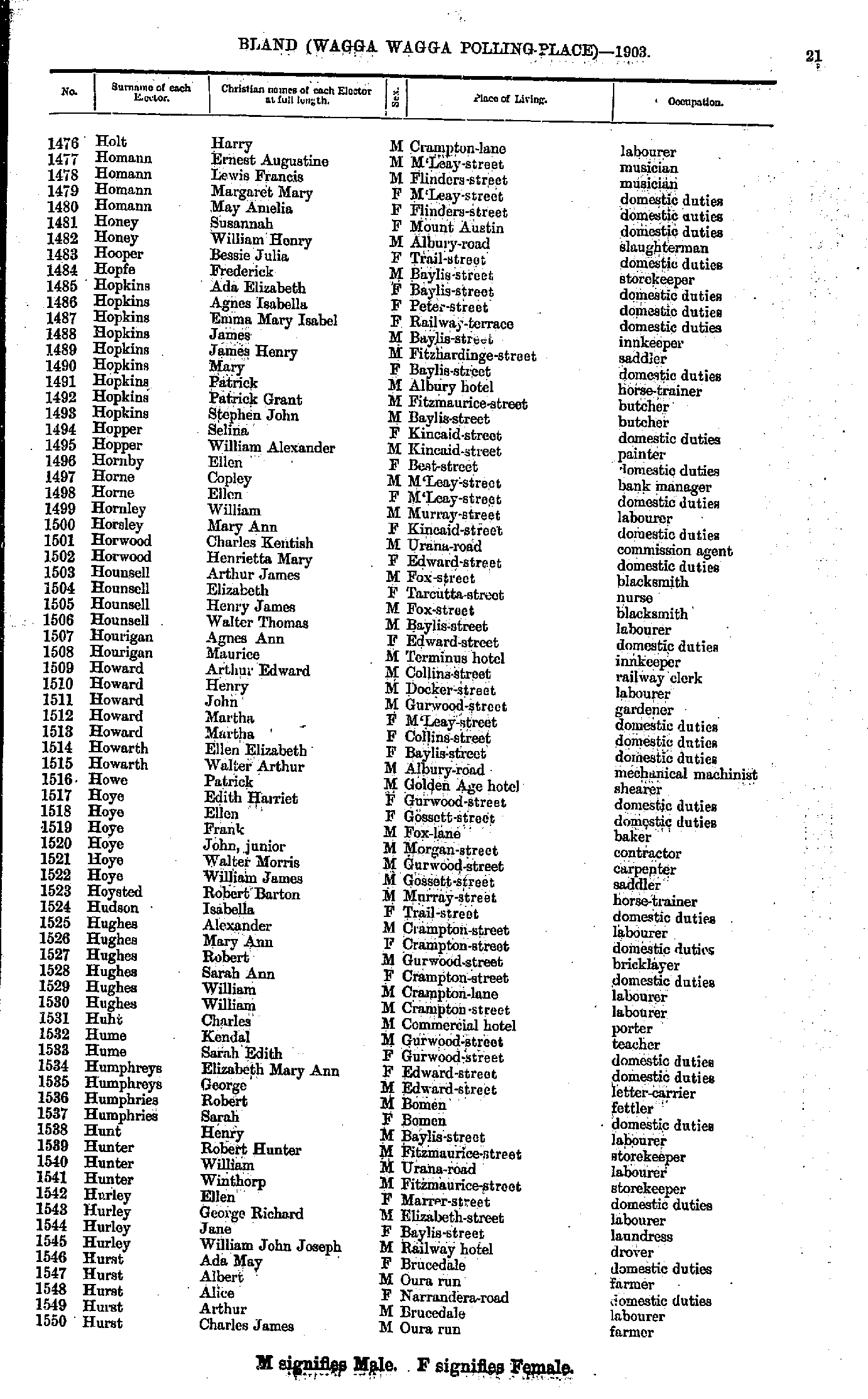
- Holt Harry - Hurst Charles
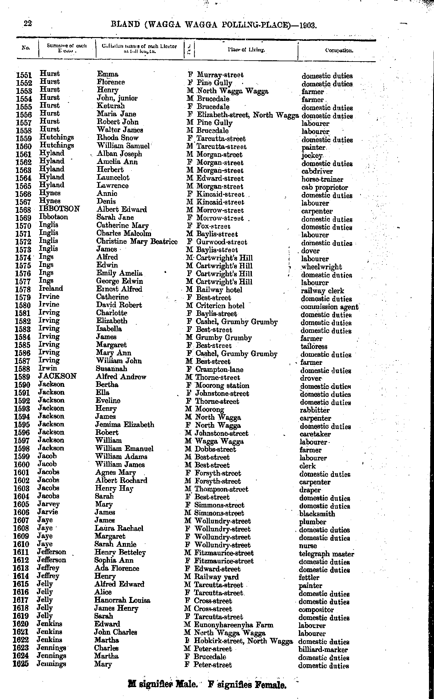
- Hurst Emma - Jennings Mary
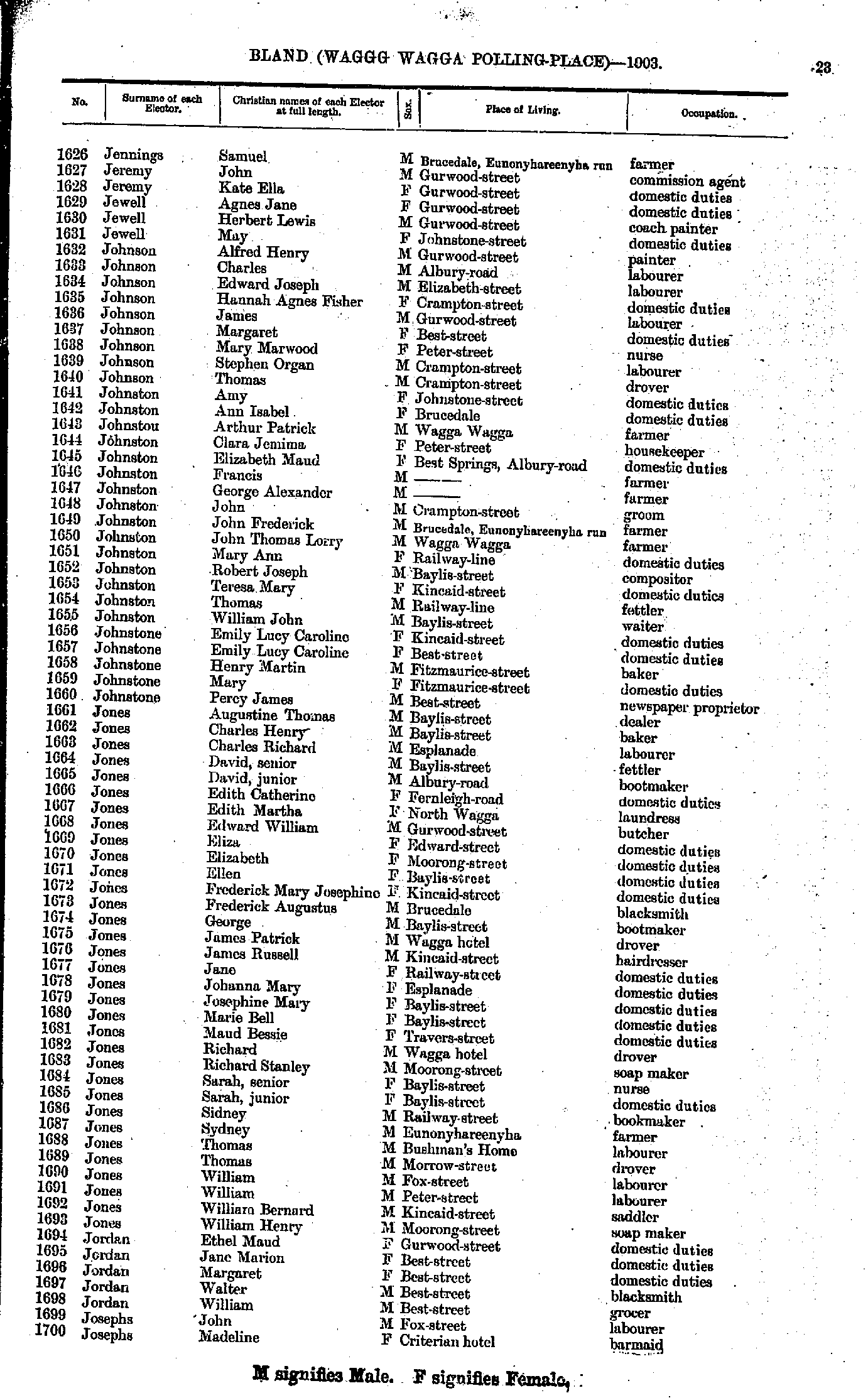
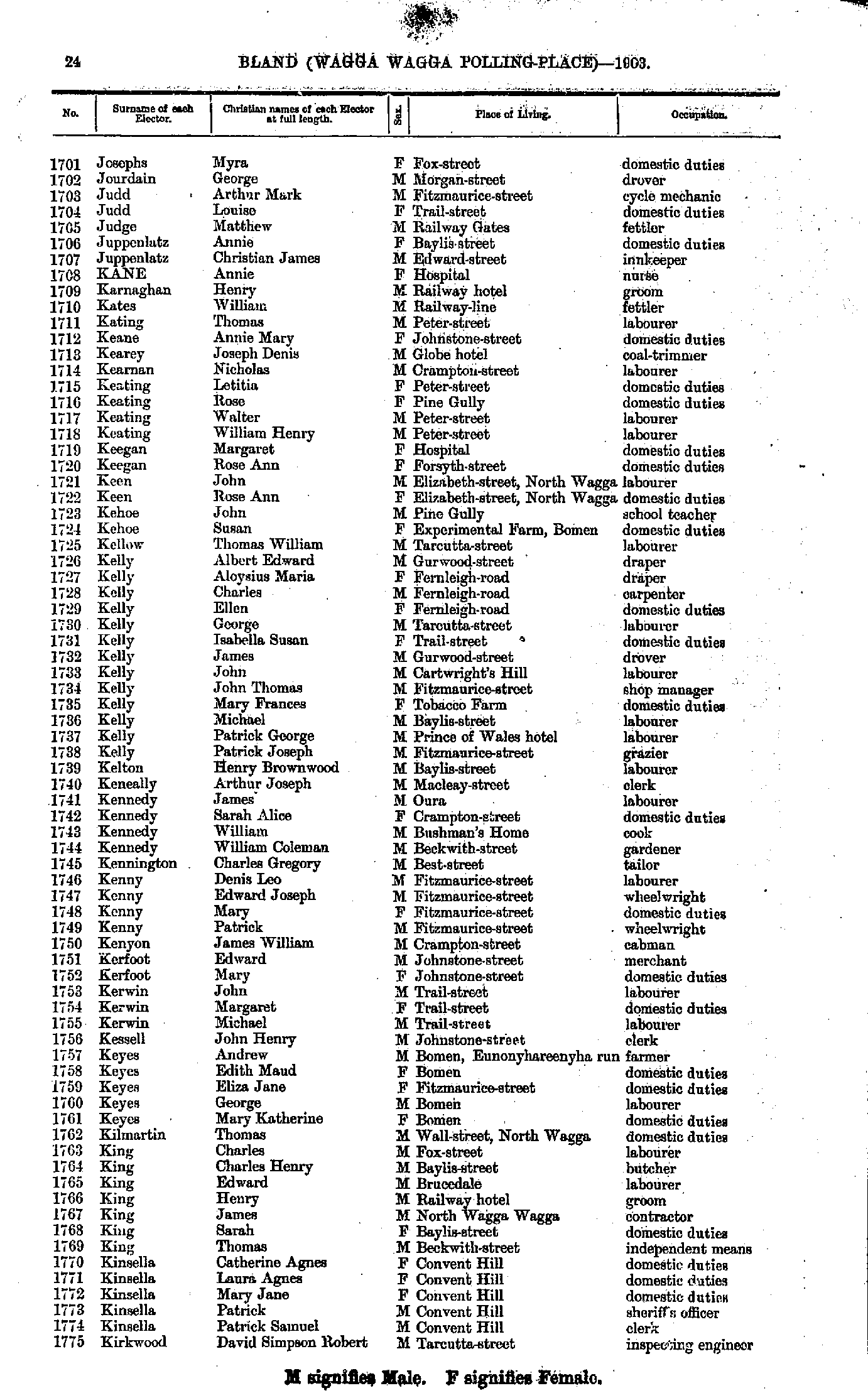
- Jennings Samuel - Josephs Madeline
- Josephs Myra - Kirkwood David
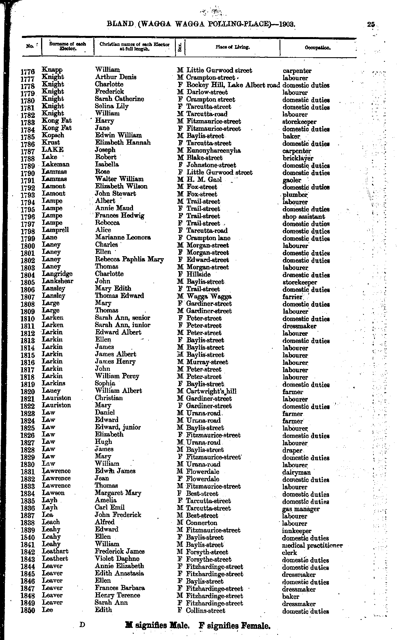
- Knapp William - Lee Edith
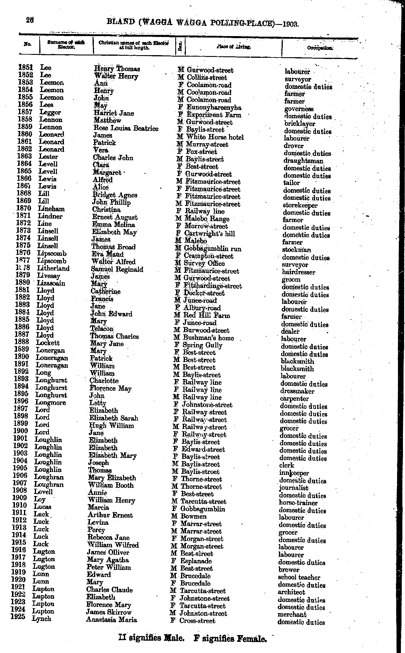
- Lee Henry - Lynch Anastasia
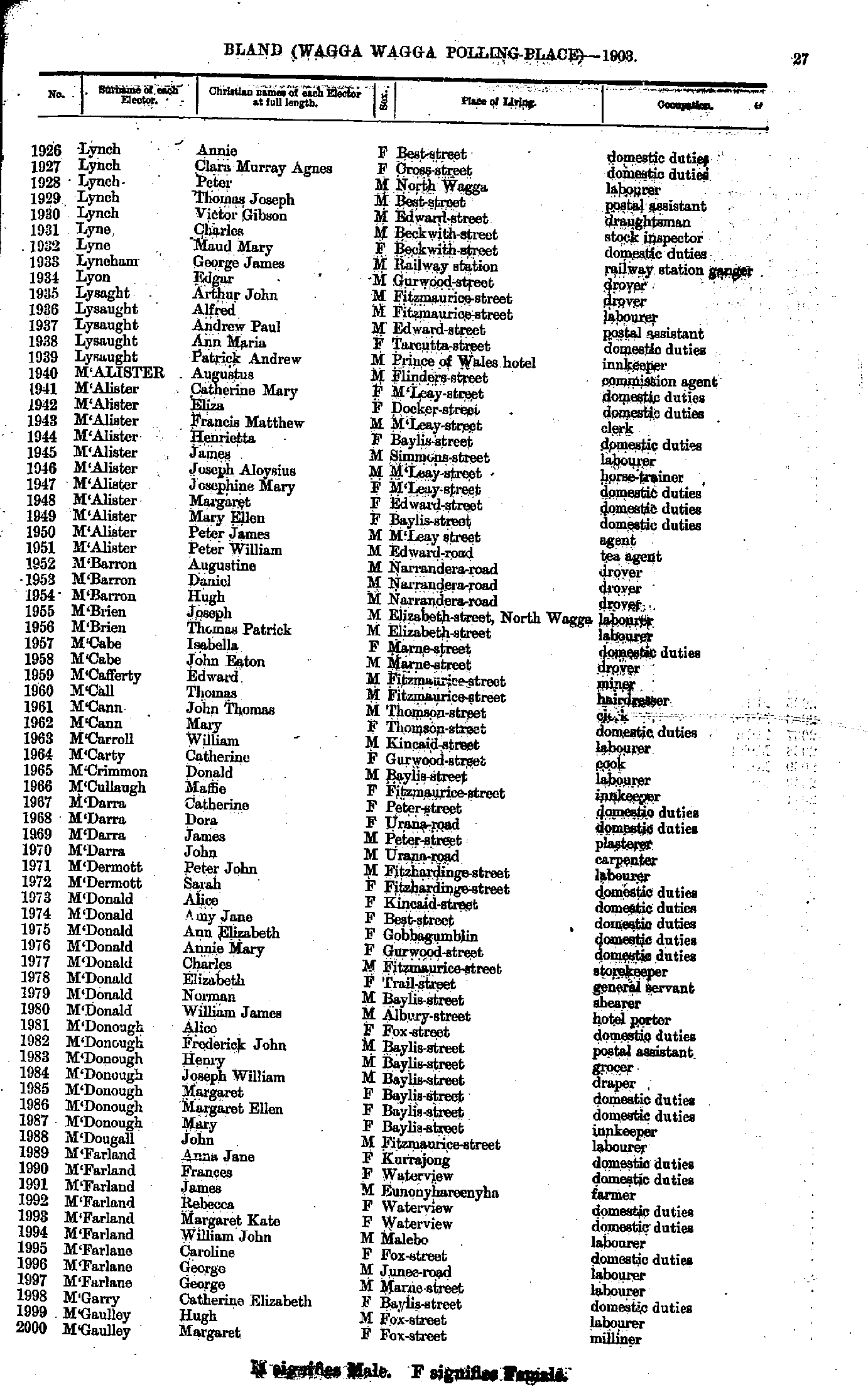
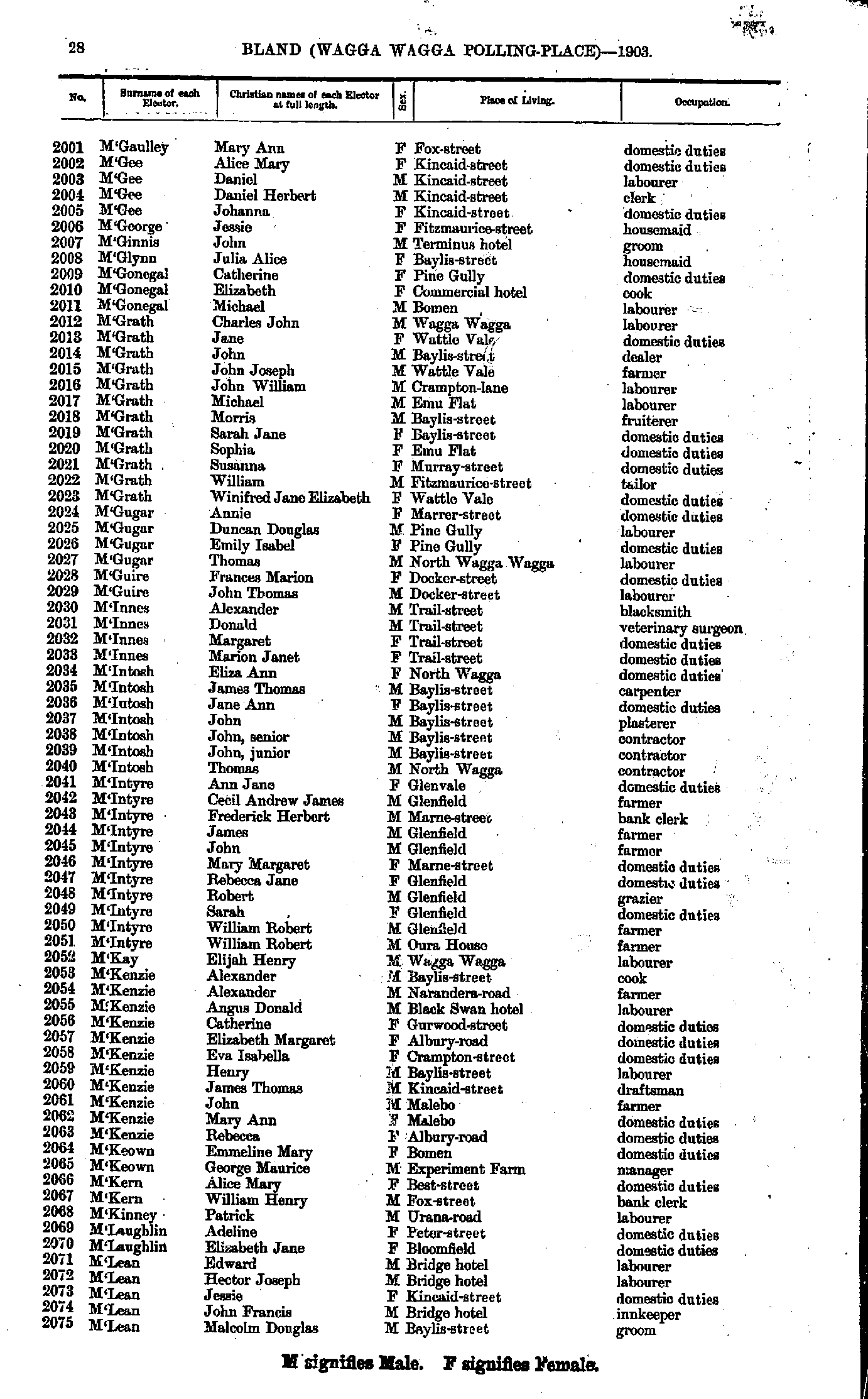
- Lynch Annie - M'Gaulley Margaret
- M'Gaulley Mary - M'Lean Malcolm
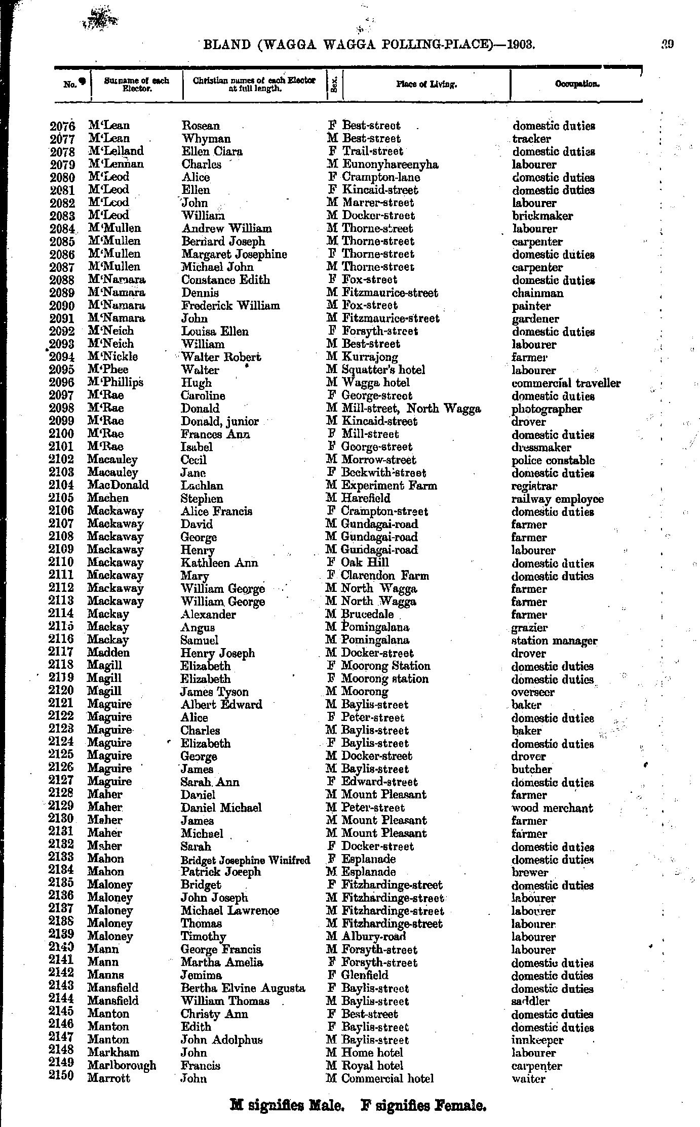
- M'Lean Rosean - Marrott John
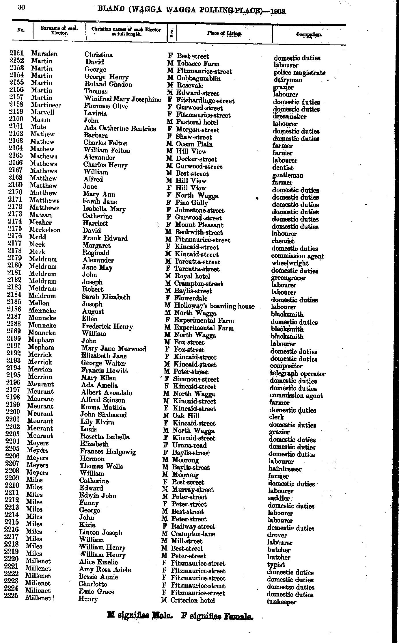
- Marsden Christina - Millenet Henry
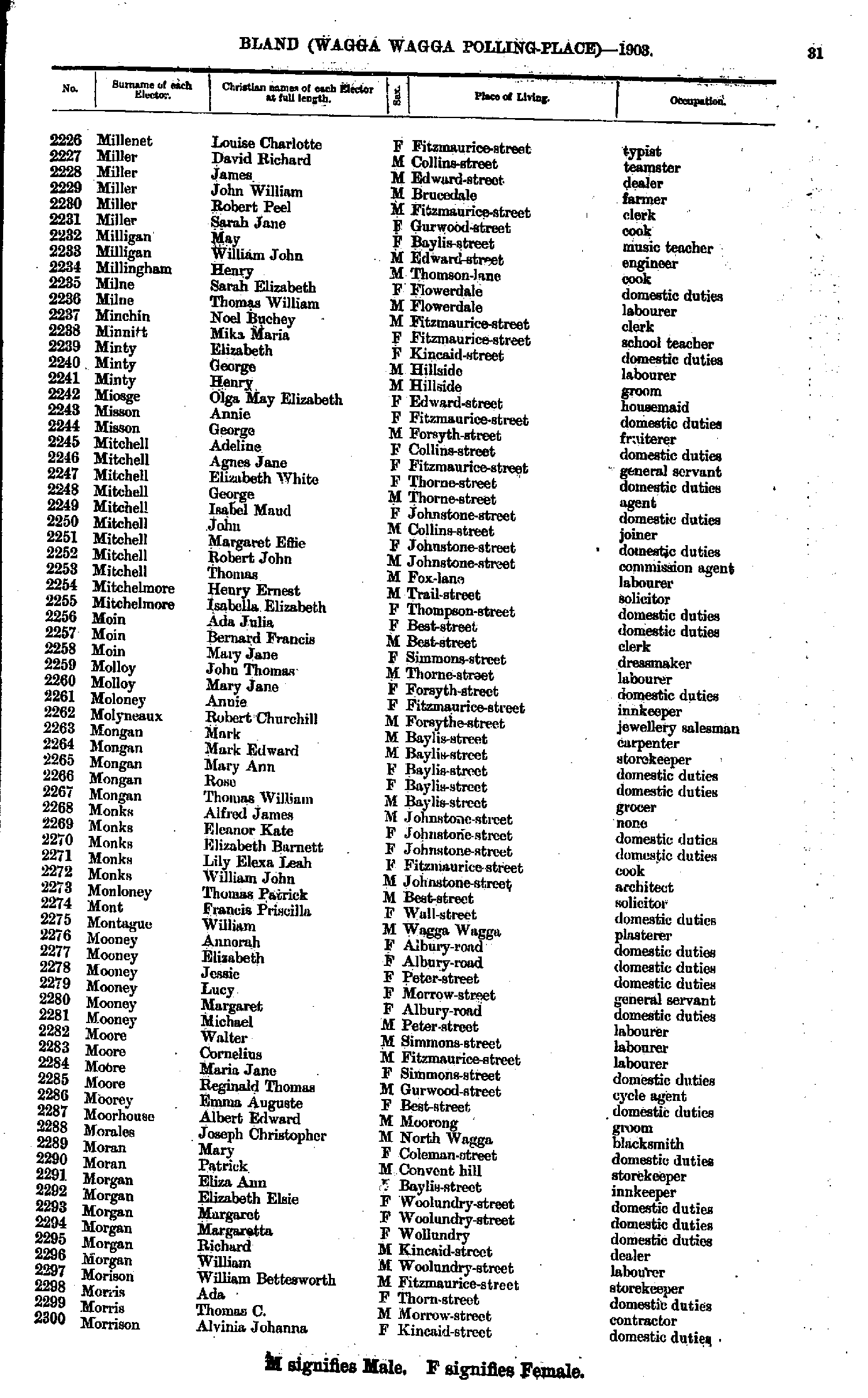
- Millenet Louise - Morrison Alvinia
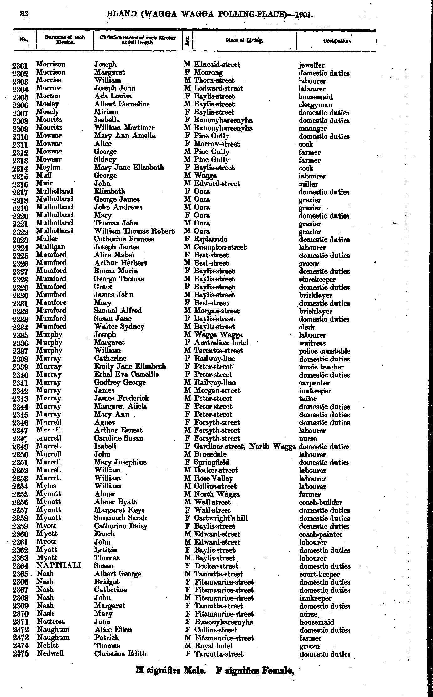
- Morrison Joseph - Nedwell Christina
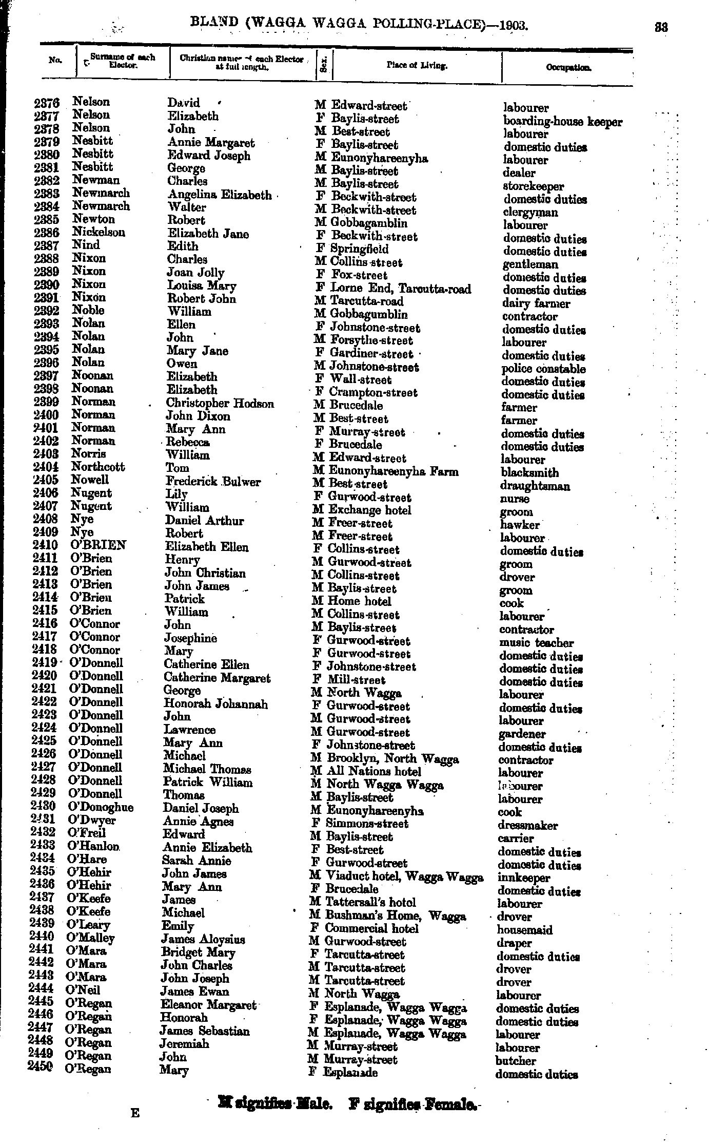
- Nelson David - O'Regan Mary
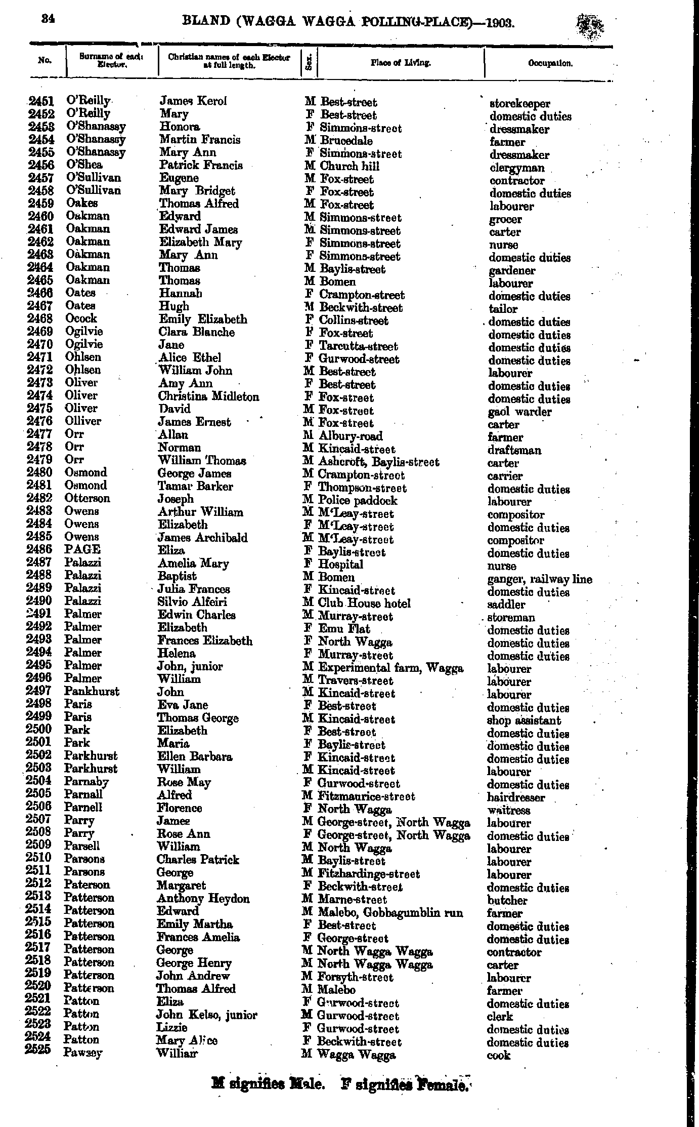
- O'Reilly James - Pawsey William
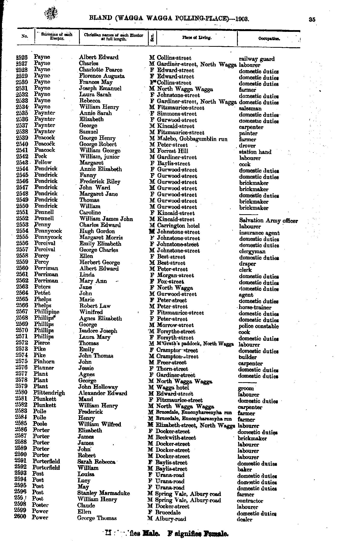
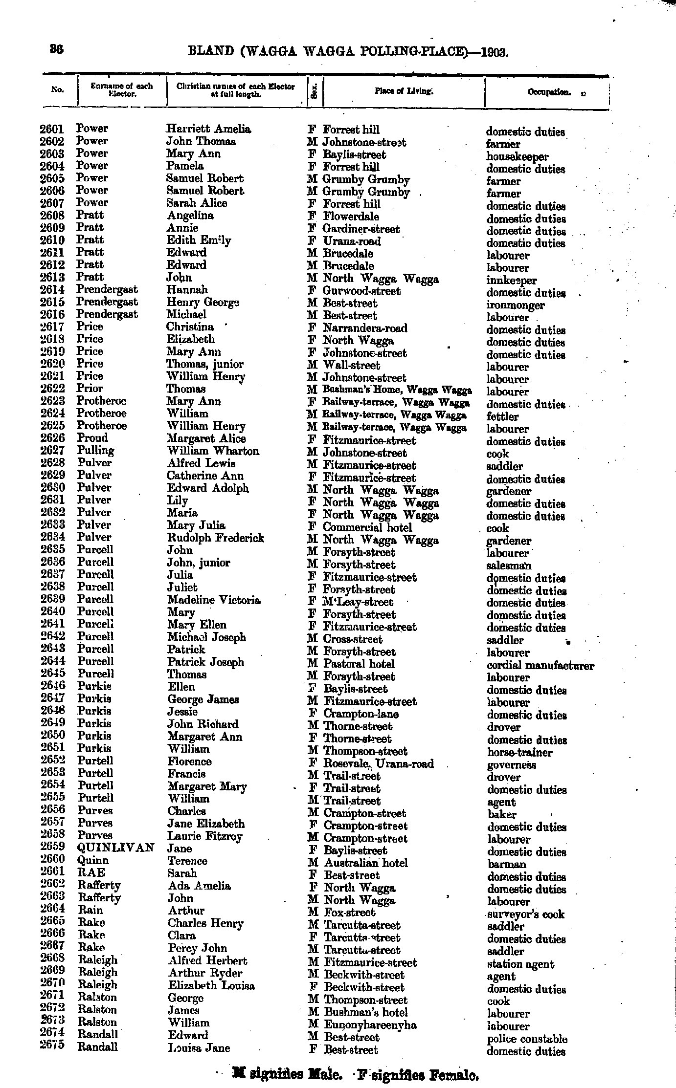
- Payne Albert - Power George
- Power Harriett - Randall Louisa
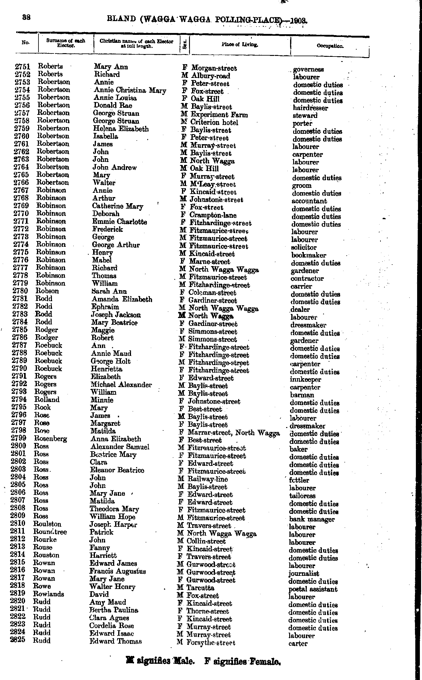
- Randell George - Roberts Mary
- Roberts Mary - Rudd Edward
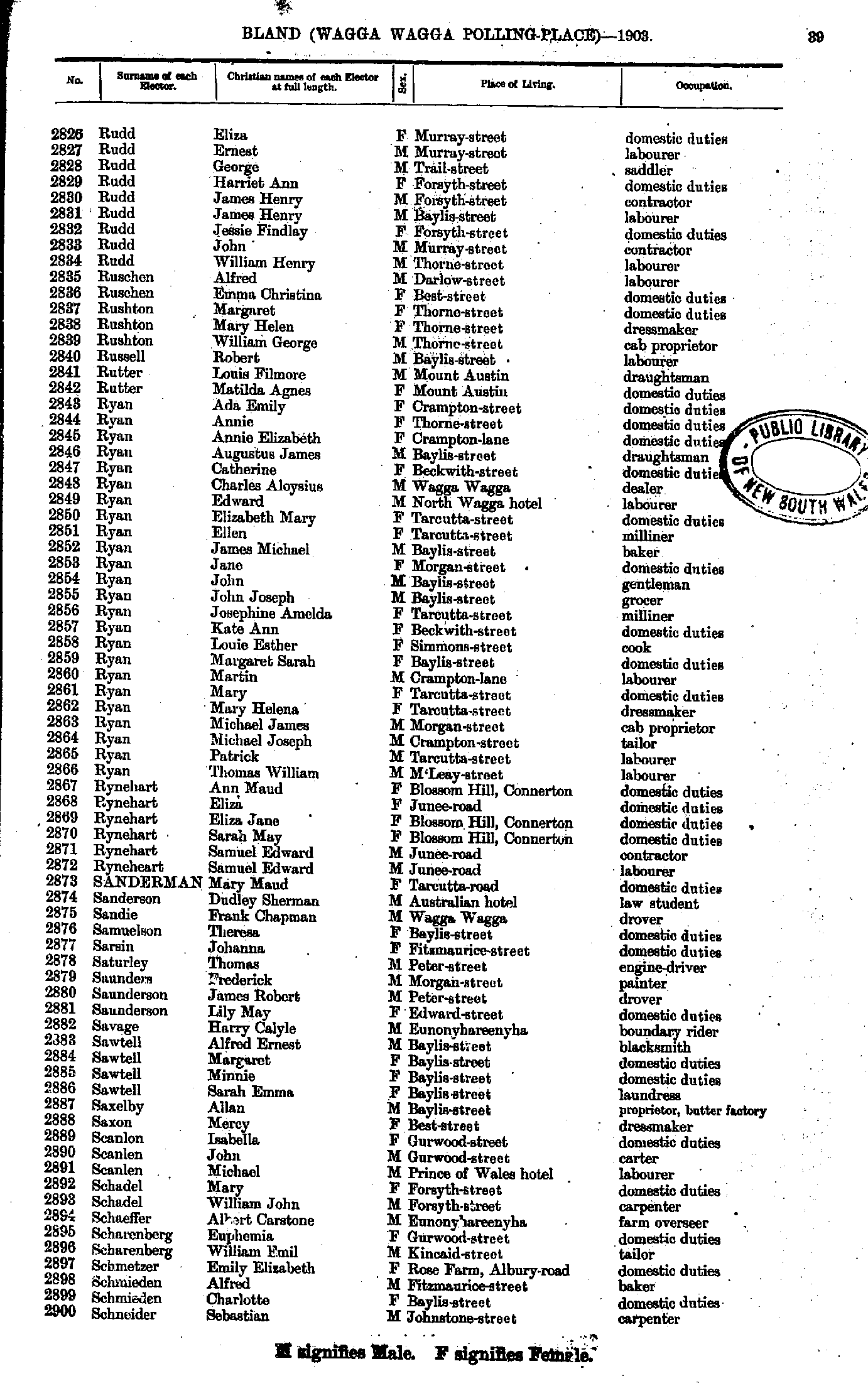
- Rudd Eliza - Schneider Sebastian
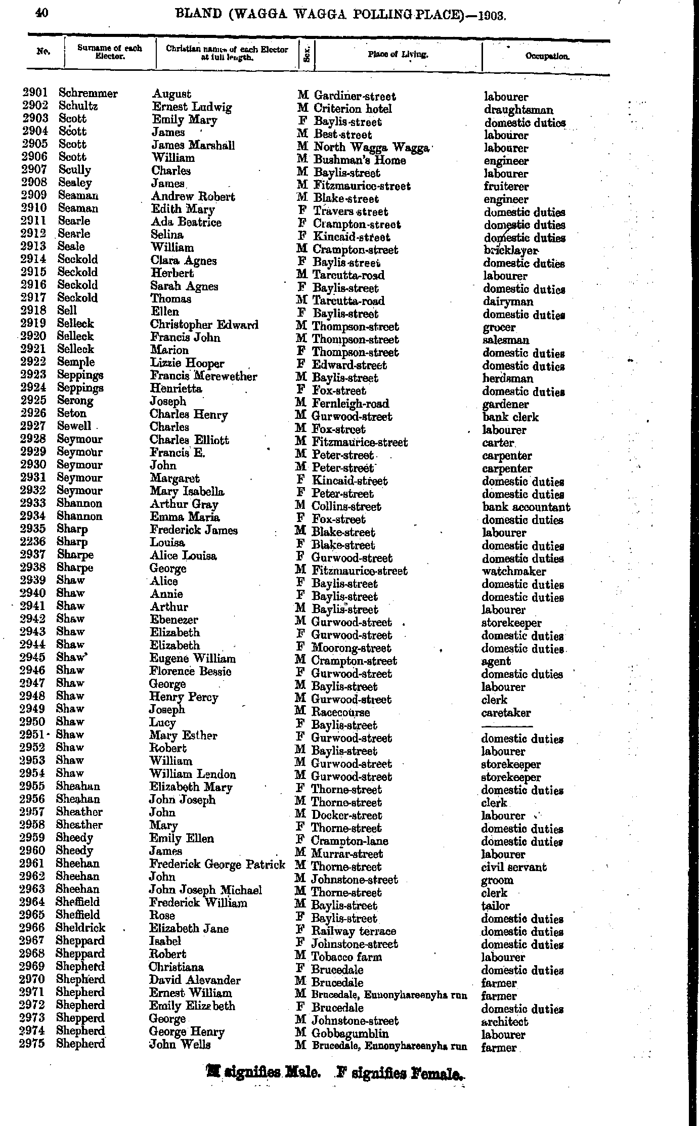
- Schremmer August - Shepherd John
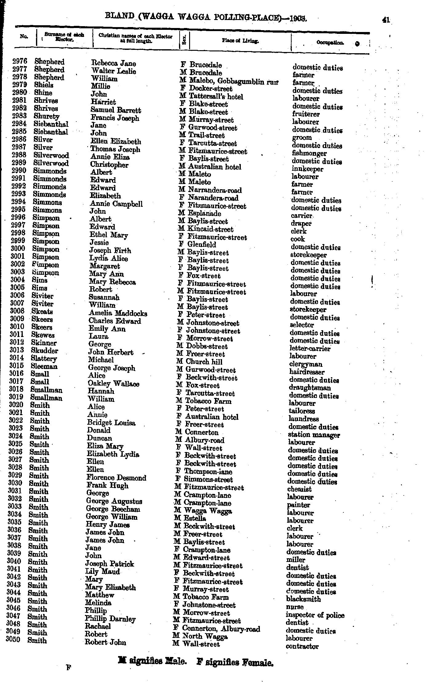
- Shepherd Rebecca - Smith Robert
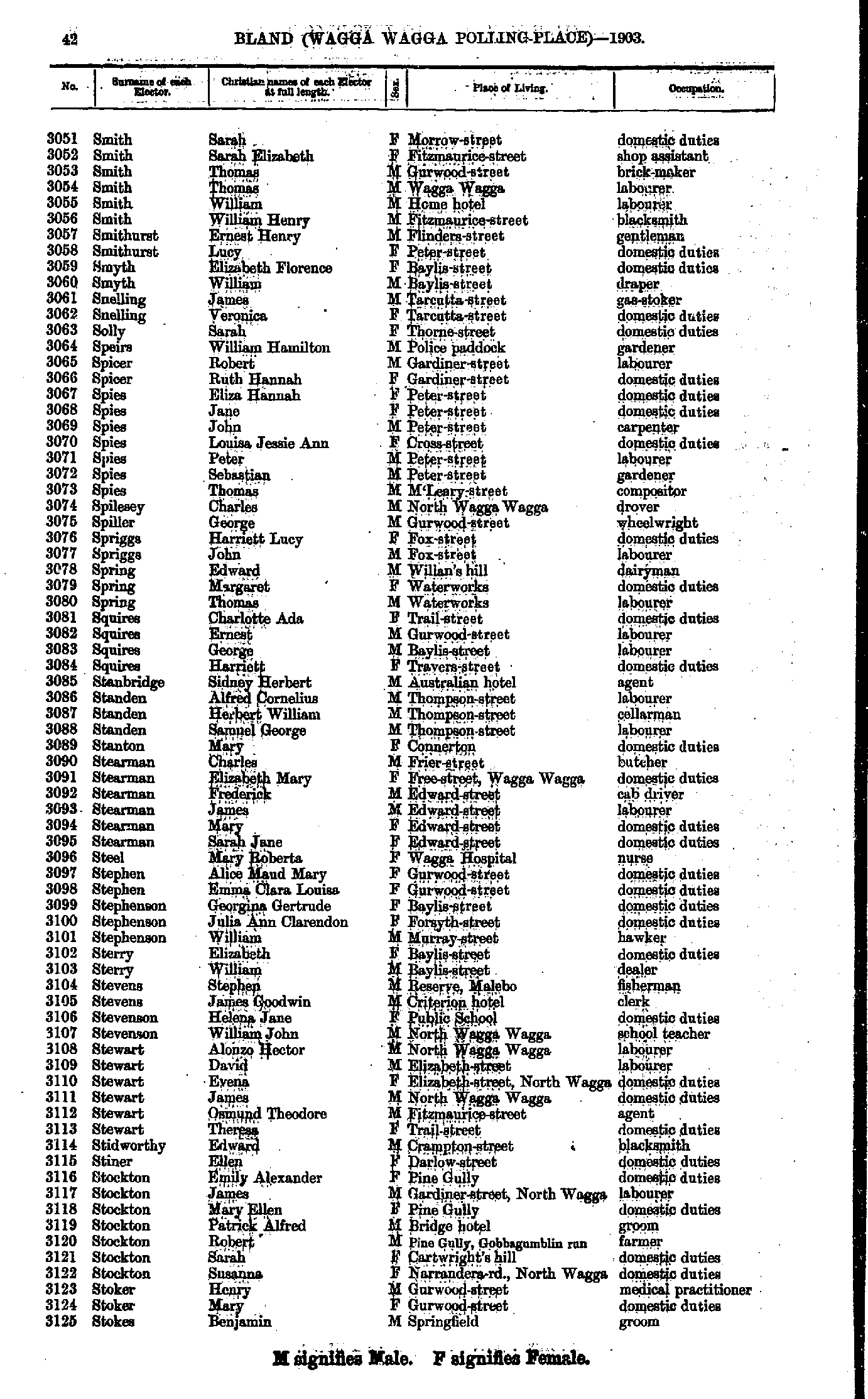
- Smith Sarah - Stokes Benjamin
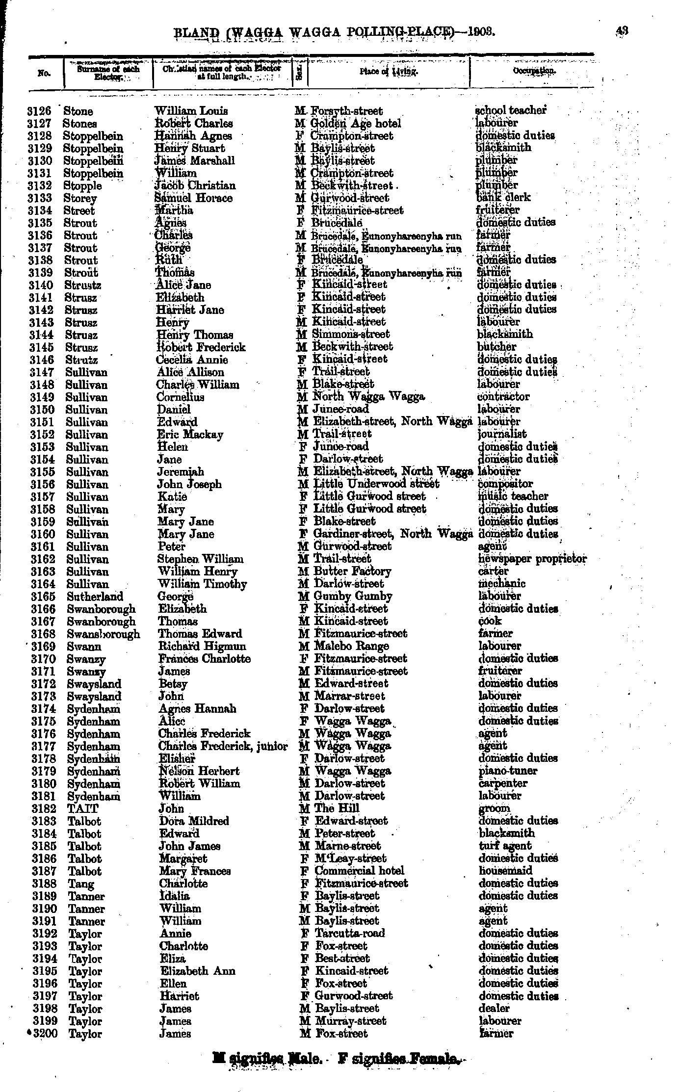
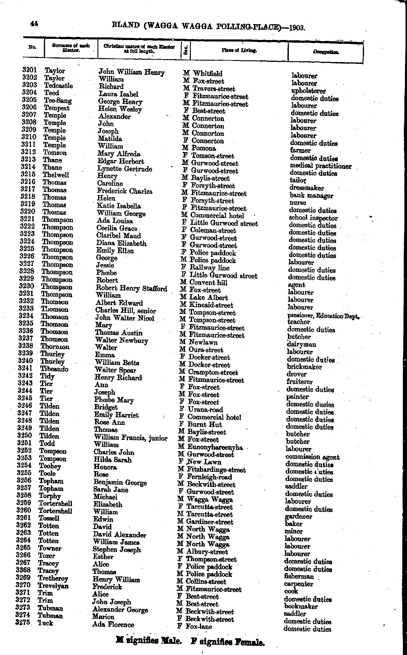
- Stone William - Taylor James
- Taylor John - Tuck Ada
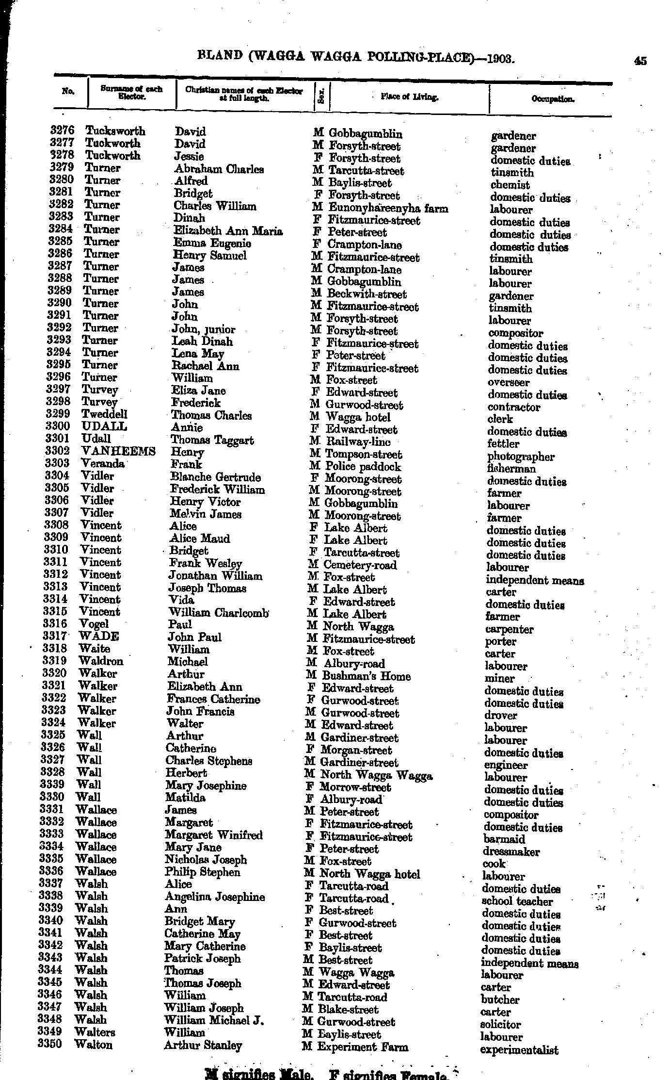
- Tucksworth David - Walton Arthur
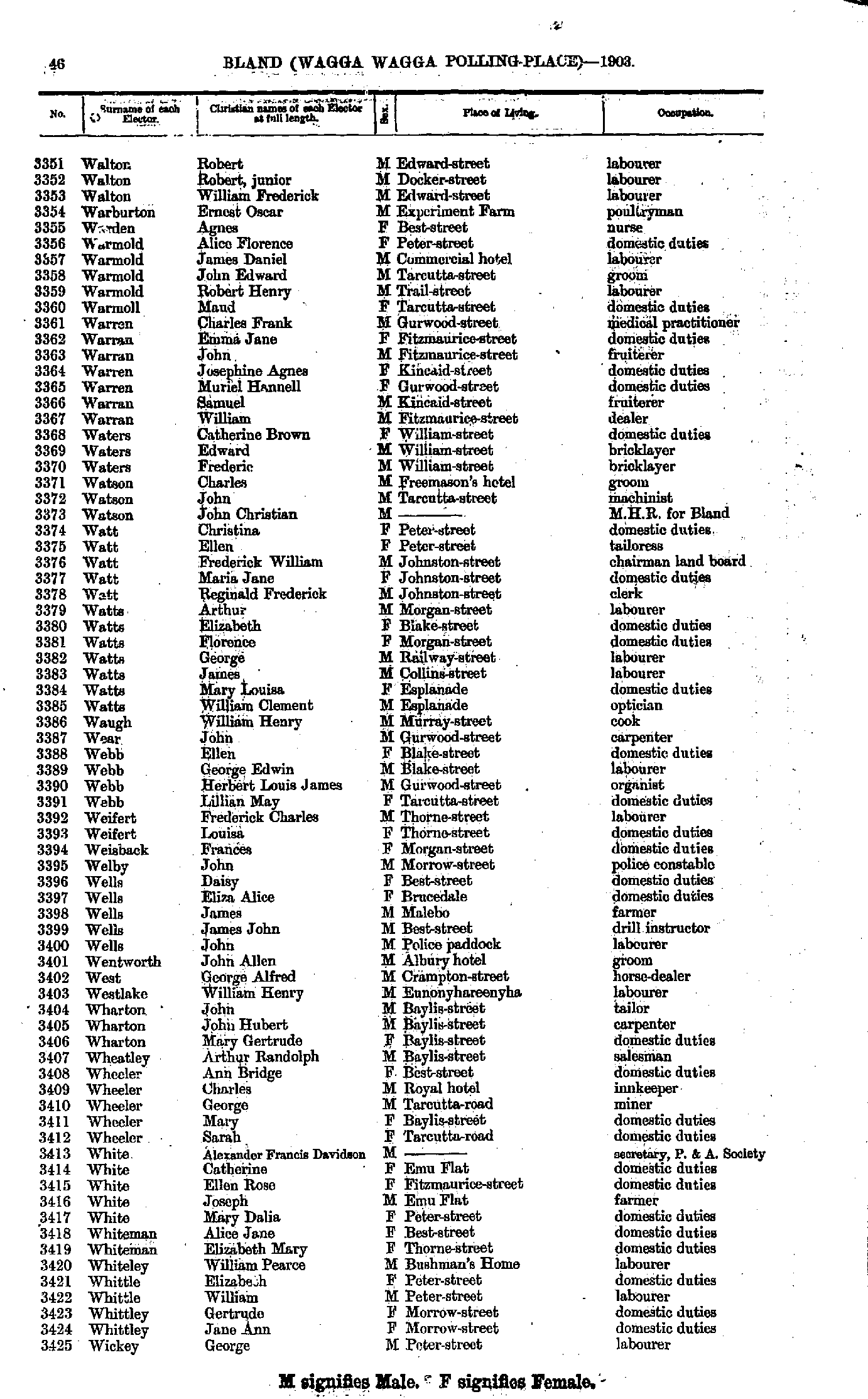
- Walton Robert - Wickey George
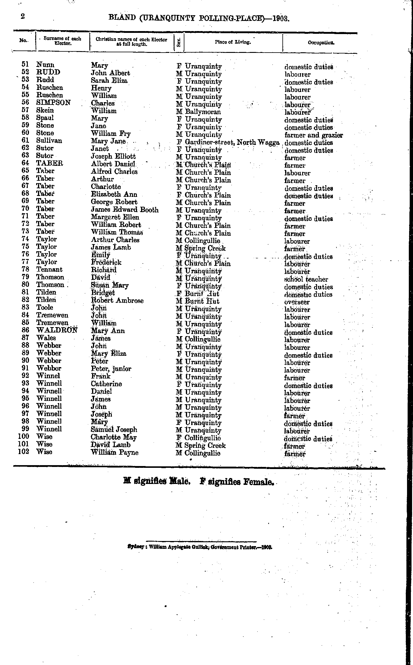
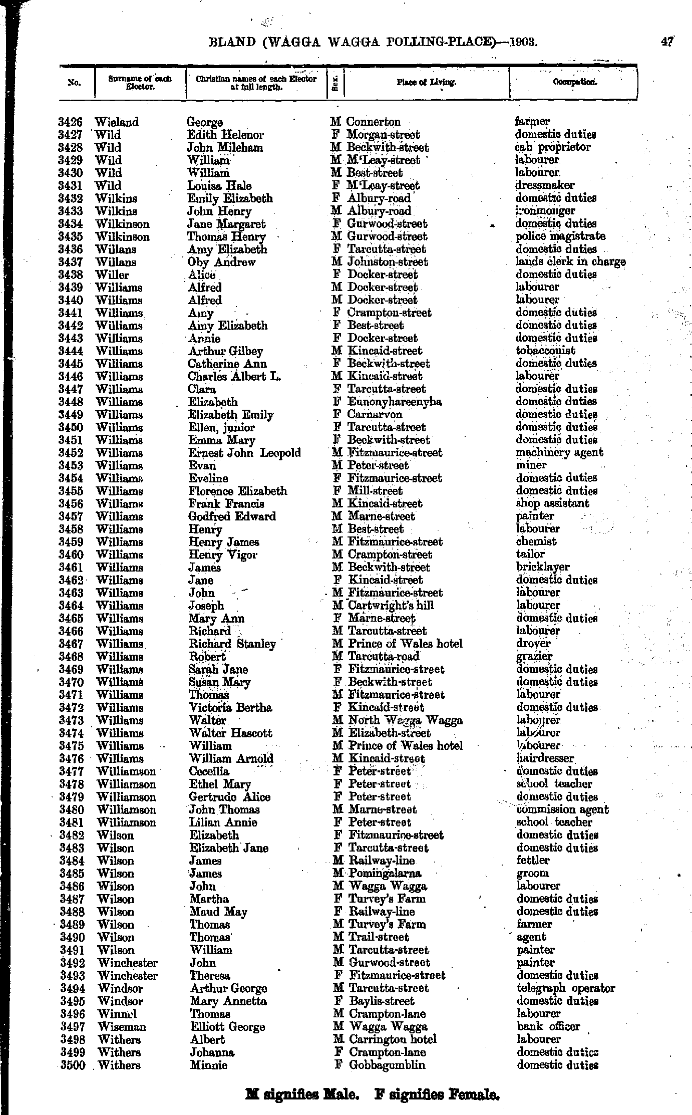
- Wieland George - Withers Minnie
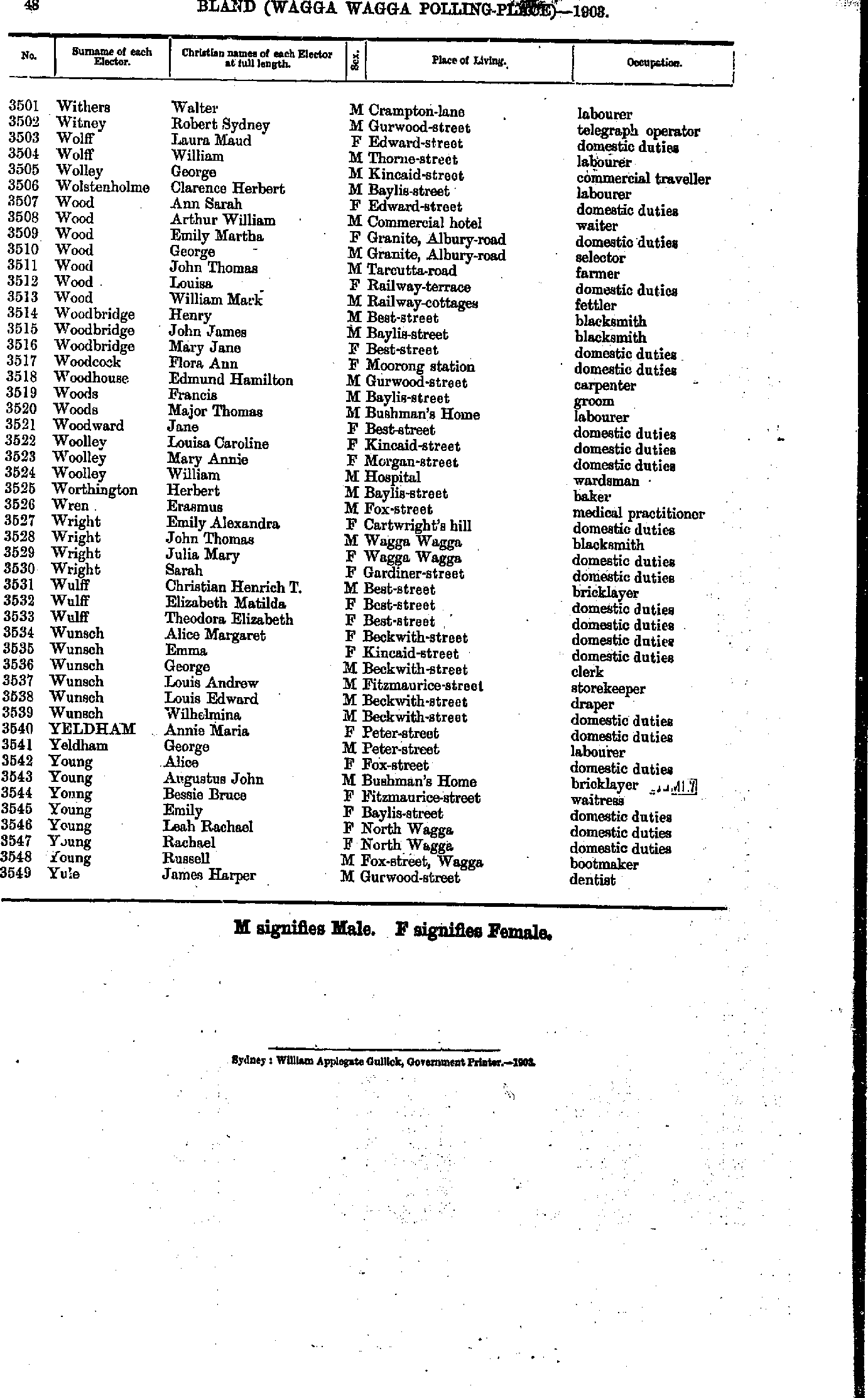
- Withers Walter - Yule James
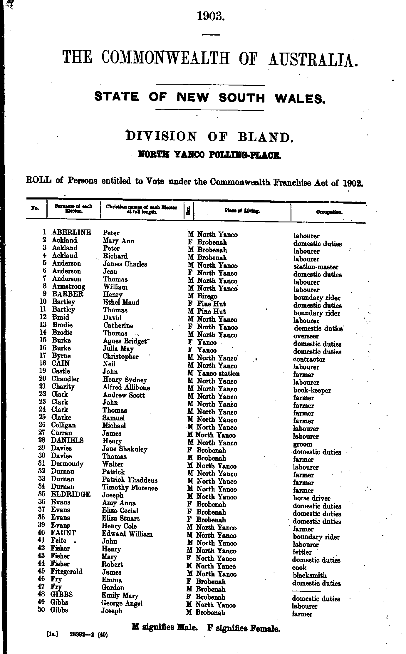
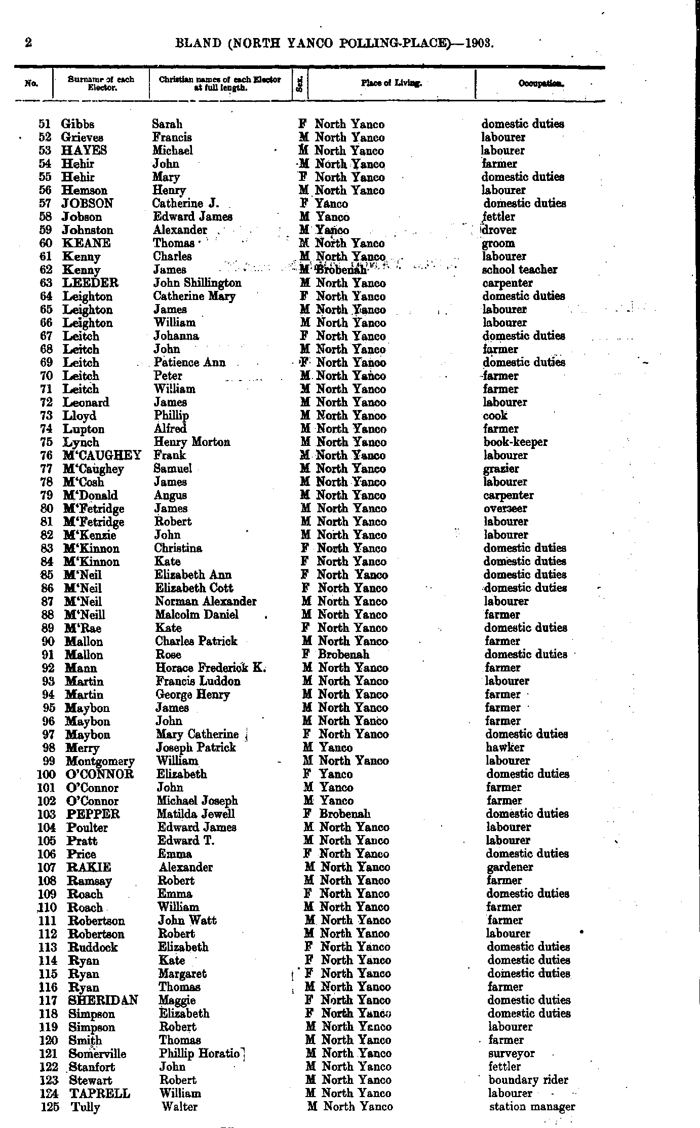
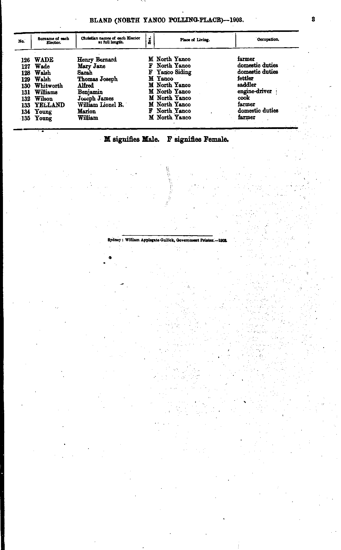
- Aberline Adam - Bell Arthur
- Bell Amelia - Callender Alexander
- Campbell Albert - Collins Mary
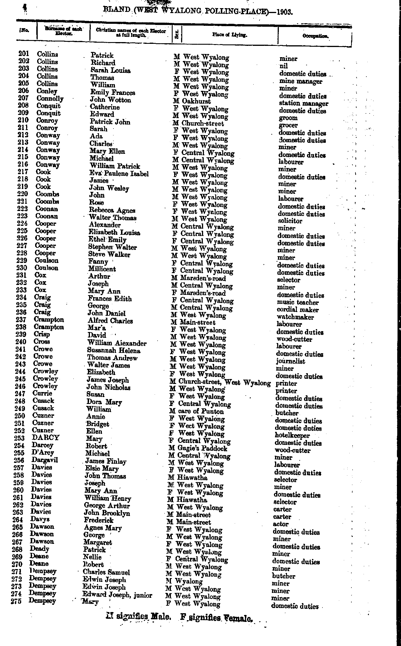
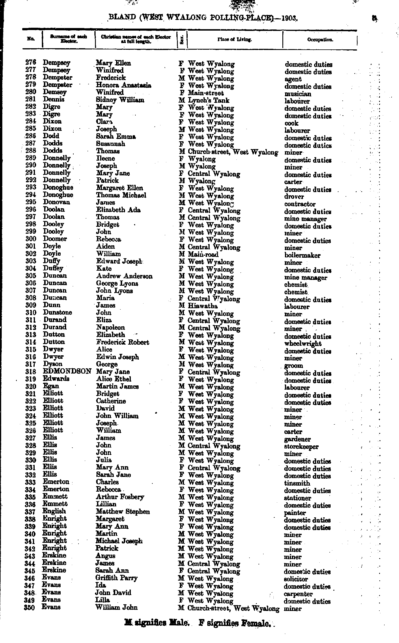
- Collins Patrick - Dempsey Mary
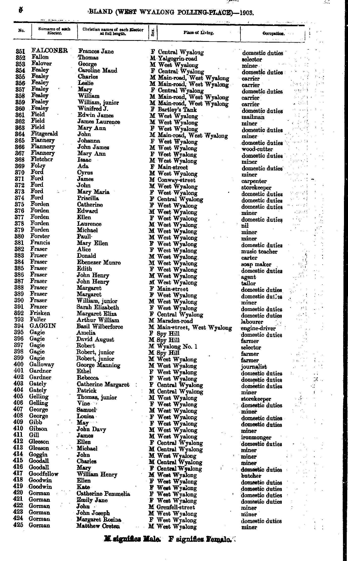
- Dempsey Mary - Evans William
- Falconer Frances - Gorman Matthew
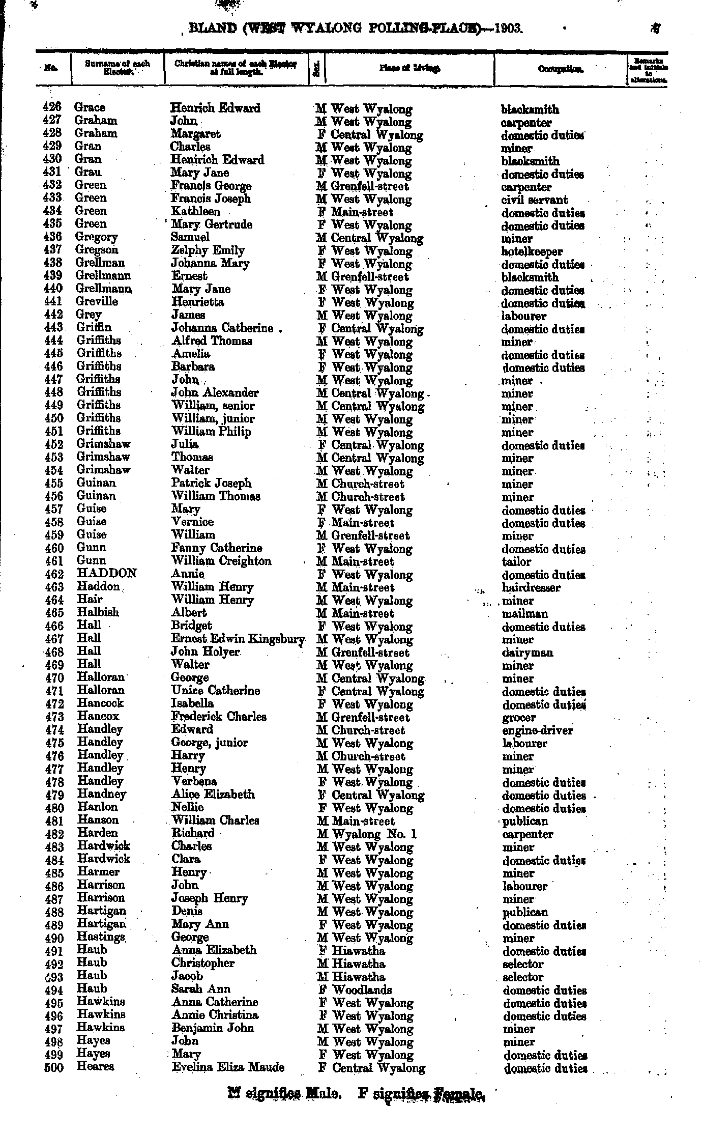
- Grace Henrich - Heares Evelina
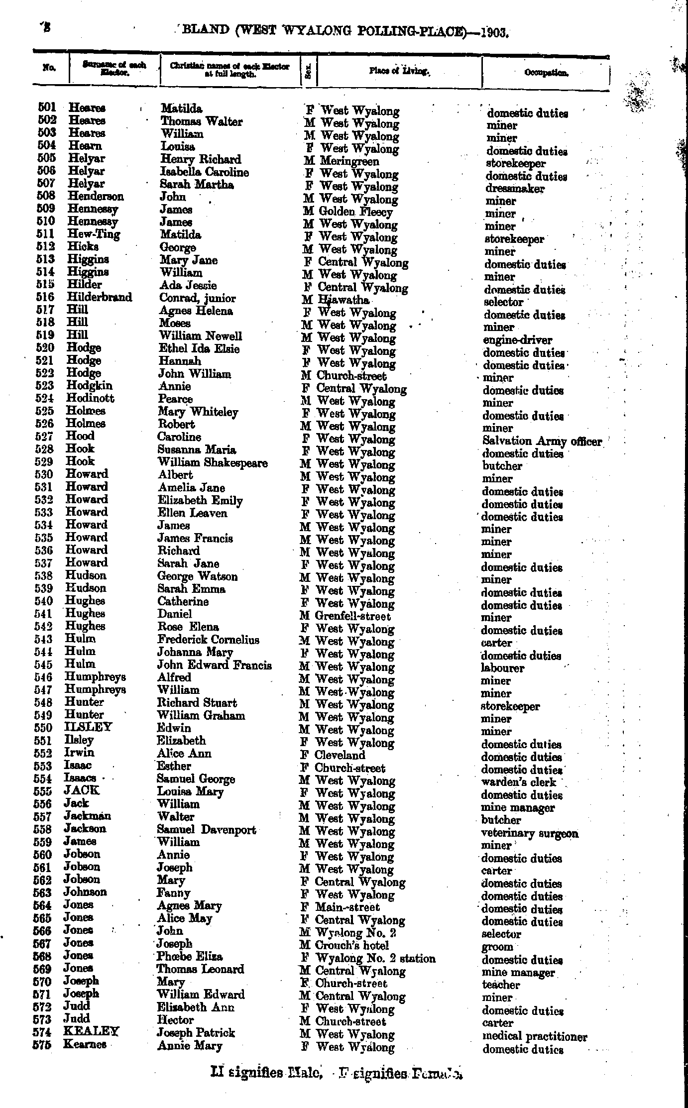
- Heares Matilda - Kearnes Annie
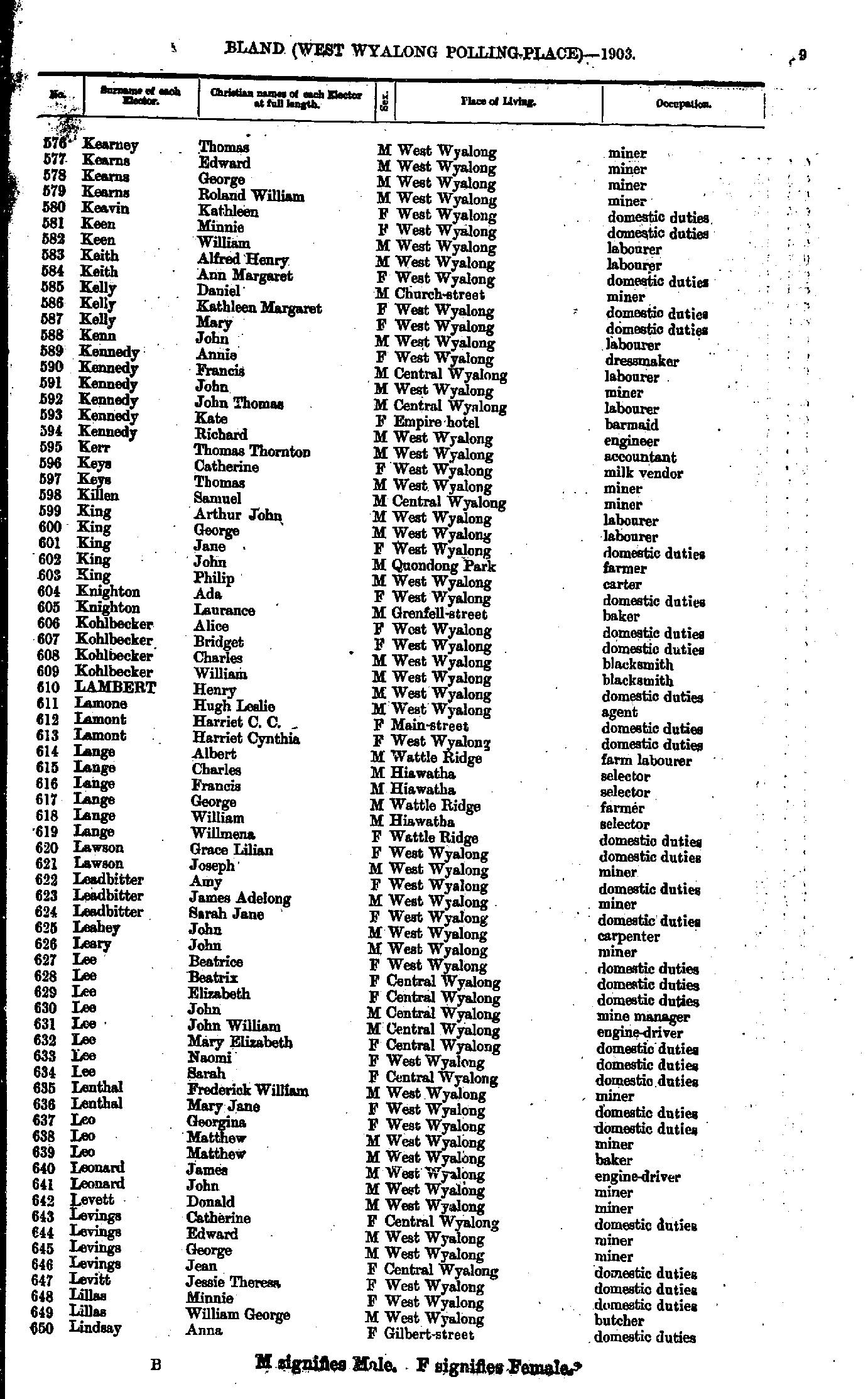
- Kearney Thomas - Lindsay Anna
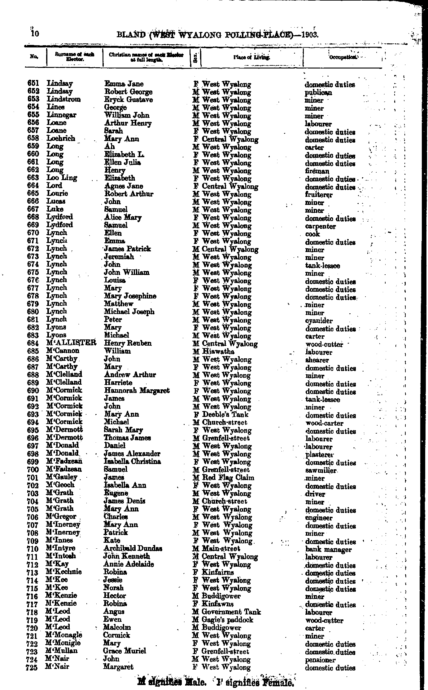
- Lindsay Emma - M'Nair Margaret
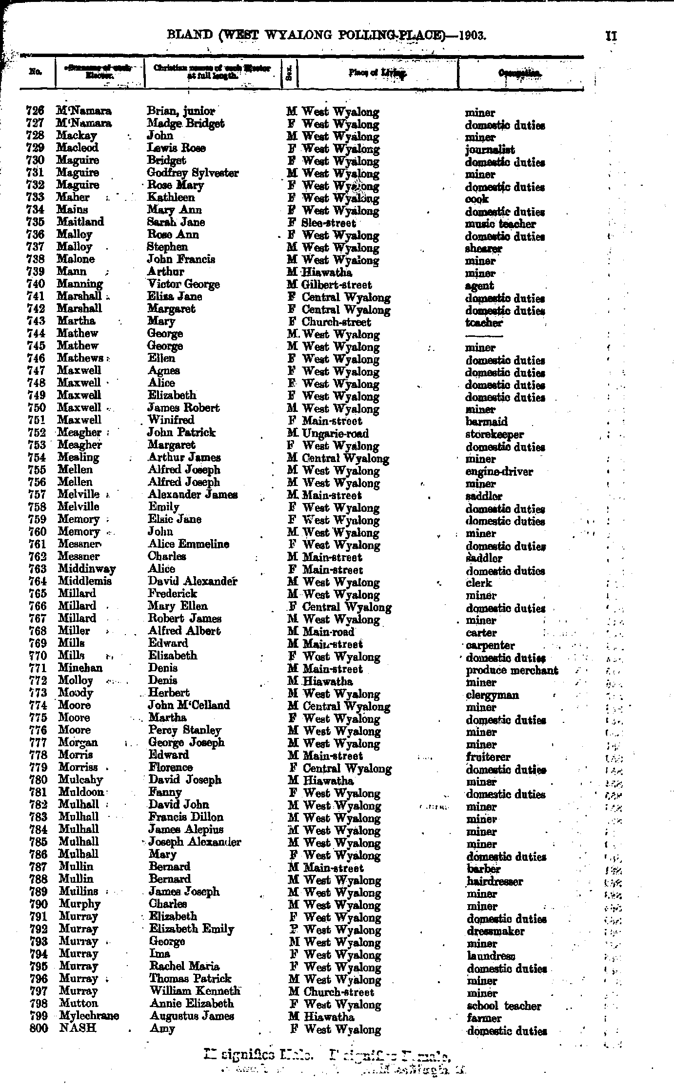
- M'Namara Brian - Nash Amy
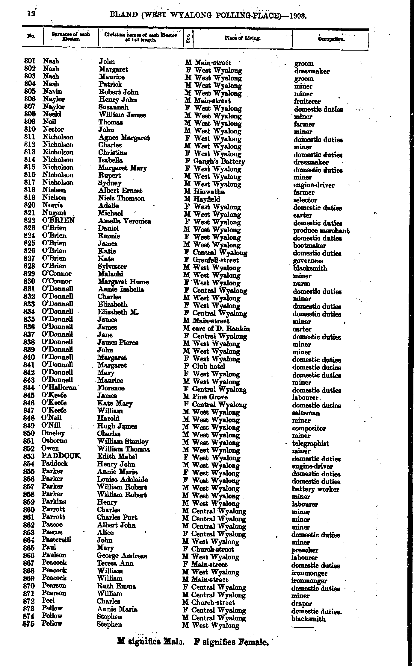
- Nash John - Pellow Stephen
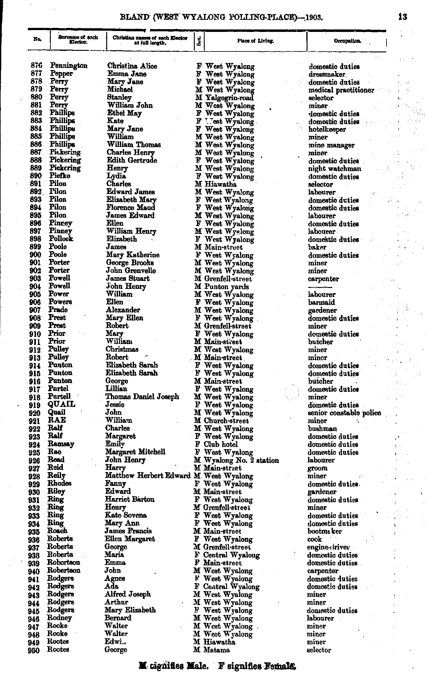
- Pennington Christina - Rootes George
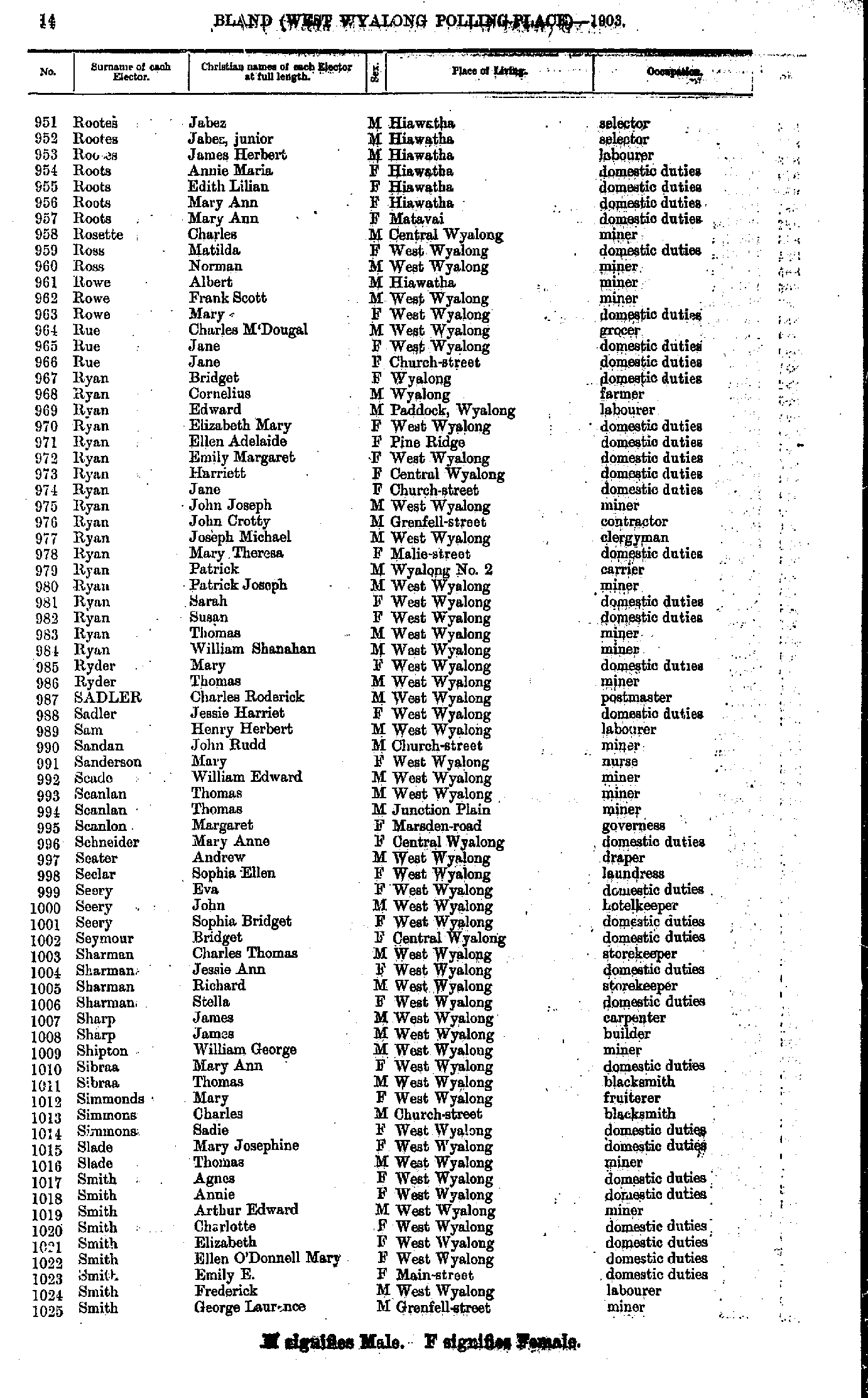
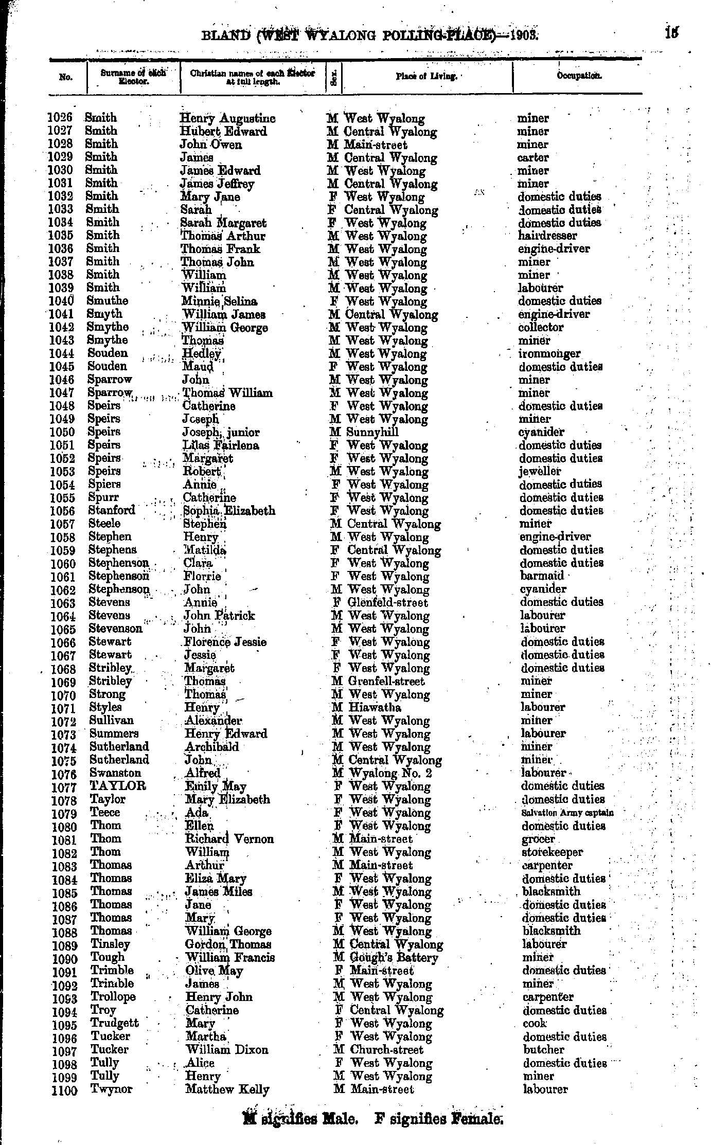
- Rootes Jabez - Smith George
- Smith Henry - Twynor Matthew
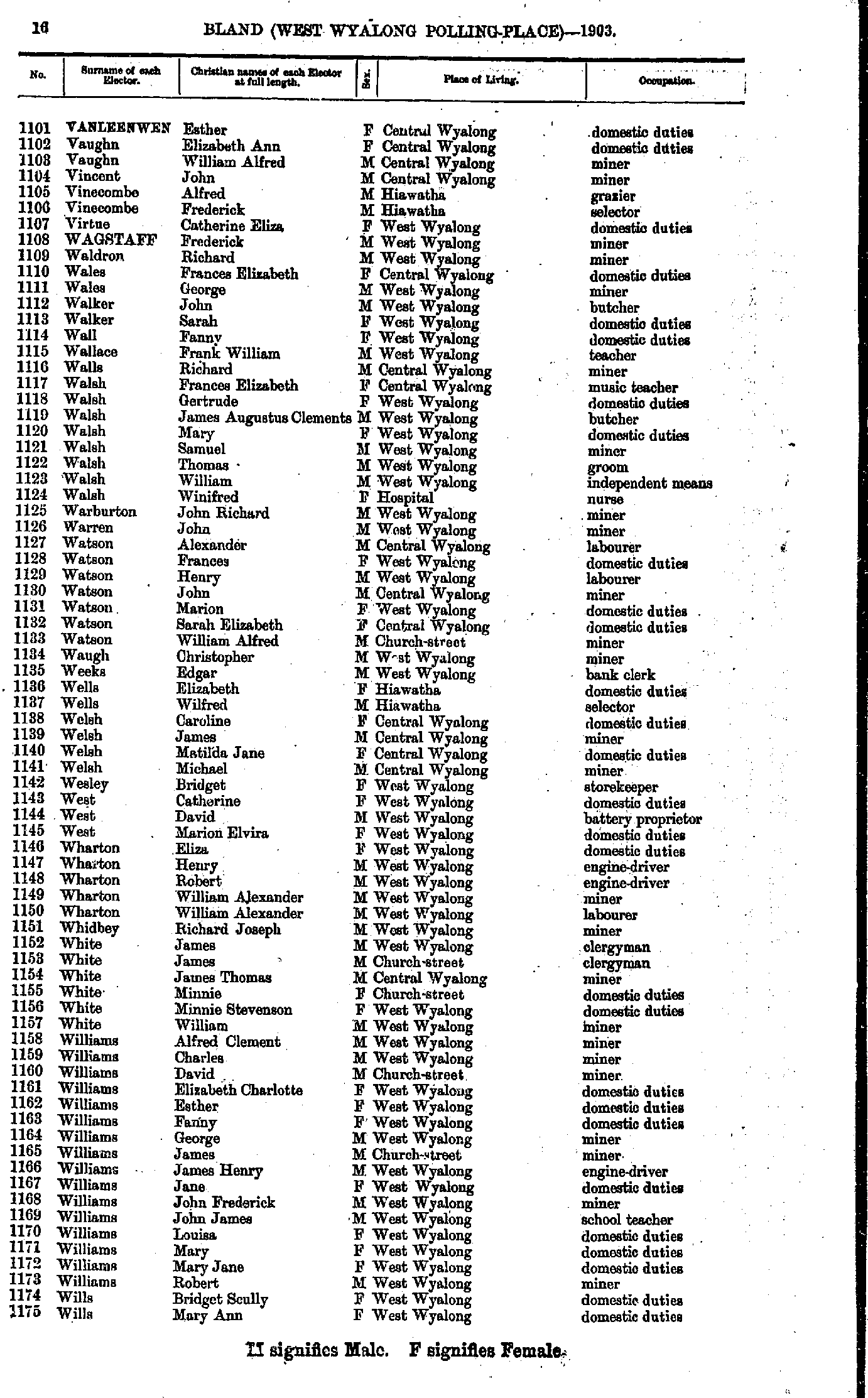
- Vanleenwen Esther - Wills Mary
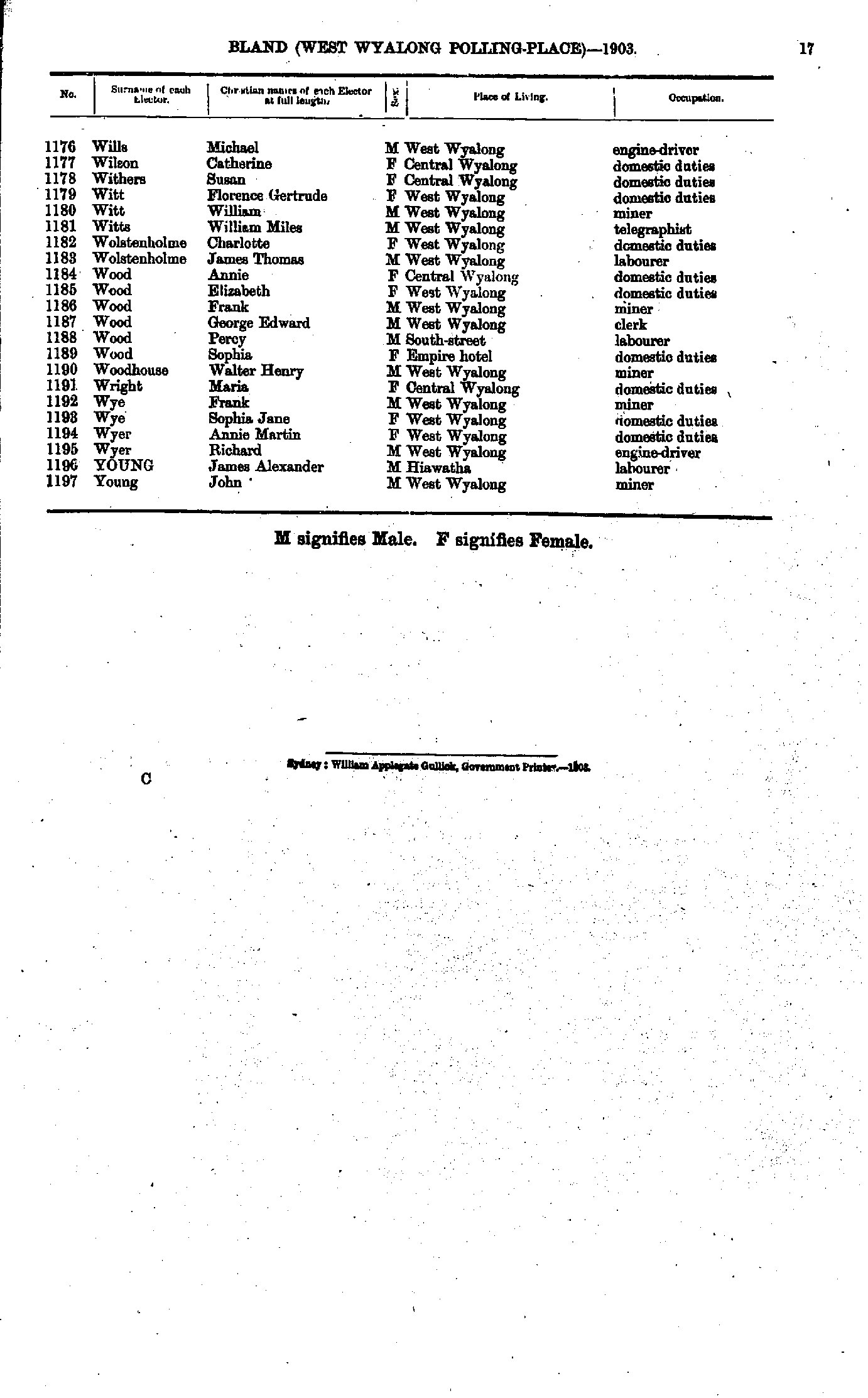
- Wills Michael - Young John
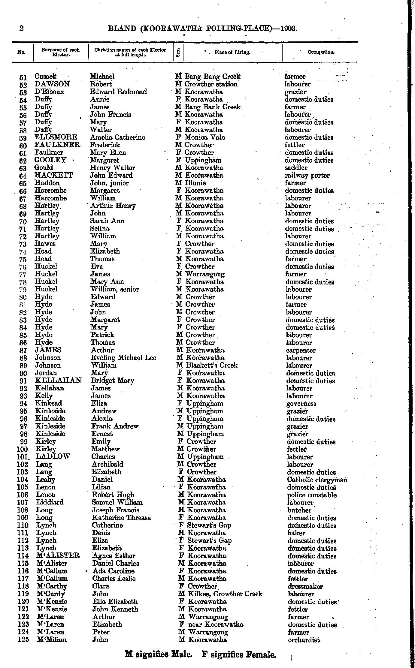
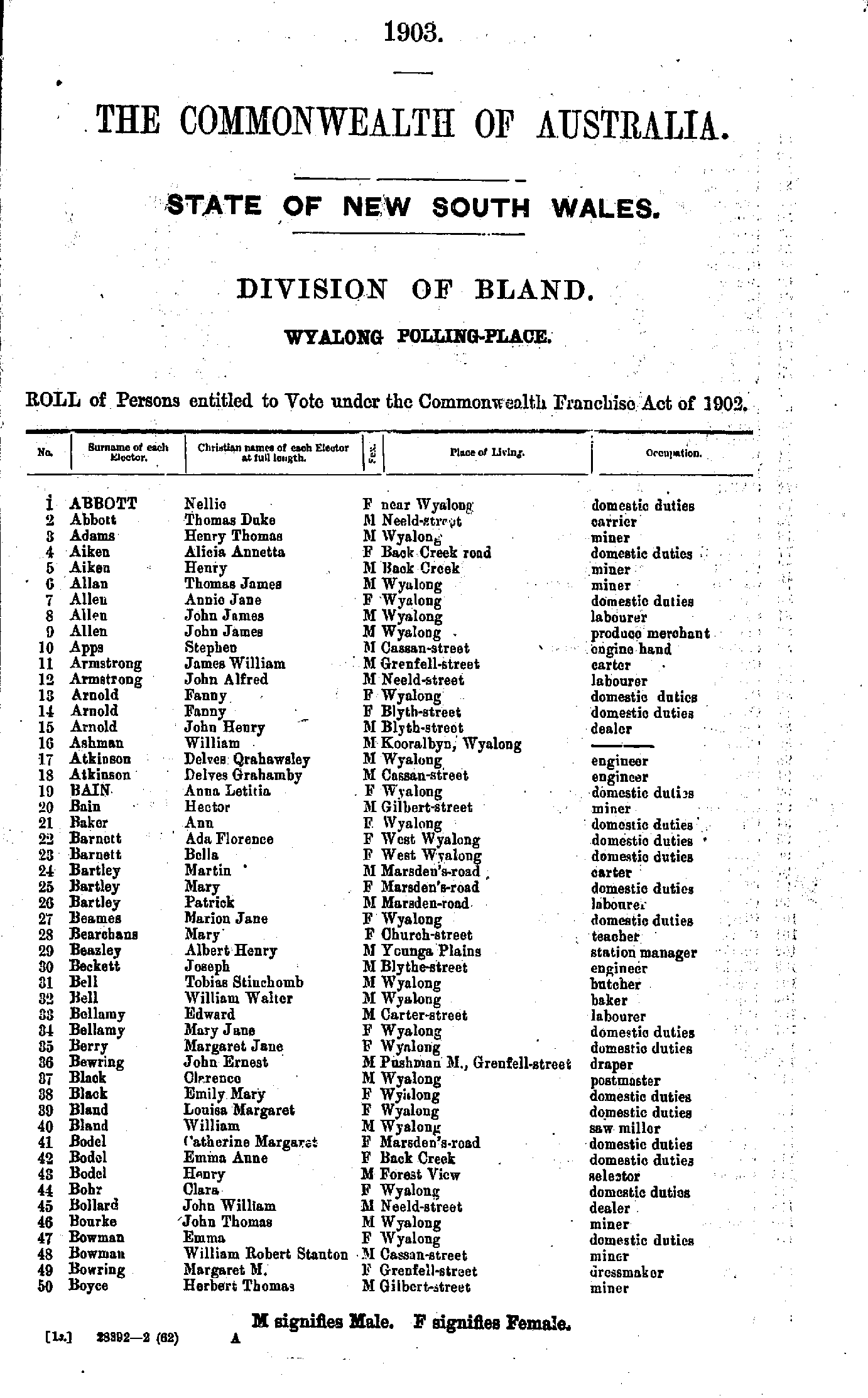
- Abbott Nellie - Boyce Herbert
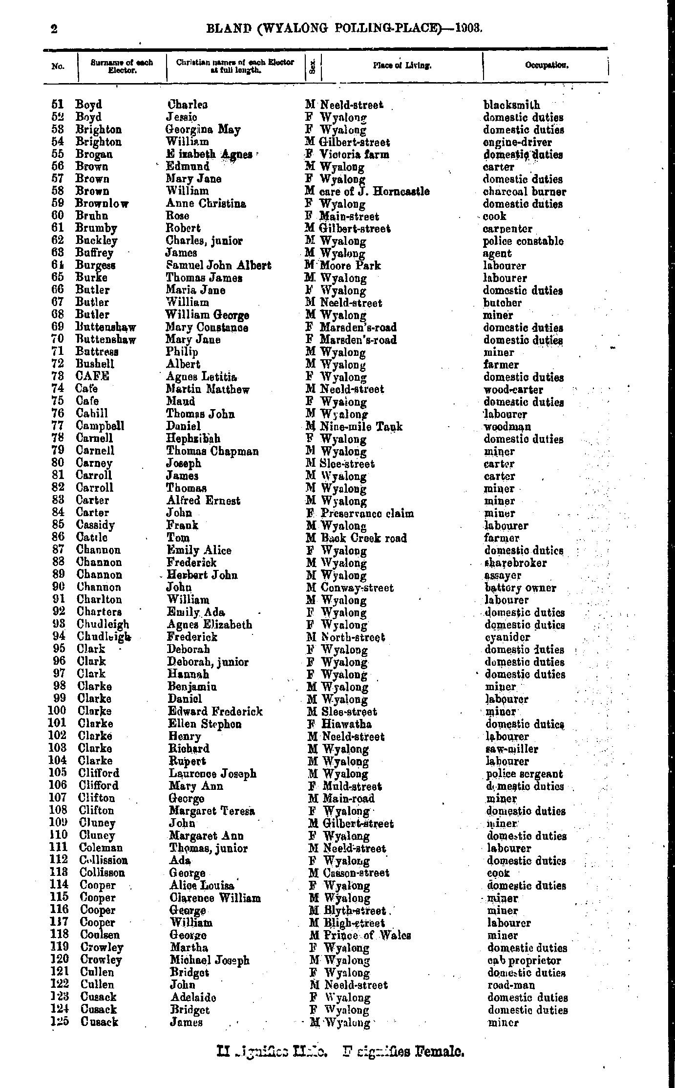
- Boyd Charles - Cusack James
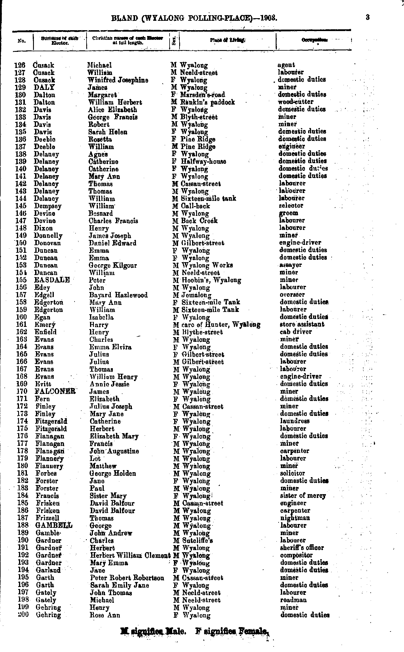
- Cusak Michael - Gehring Rose
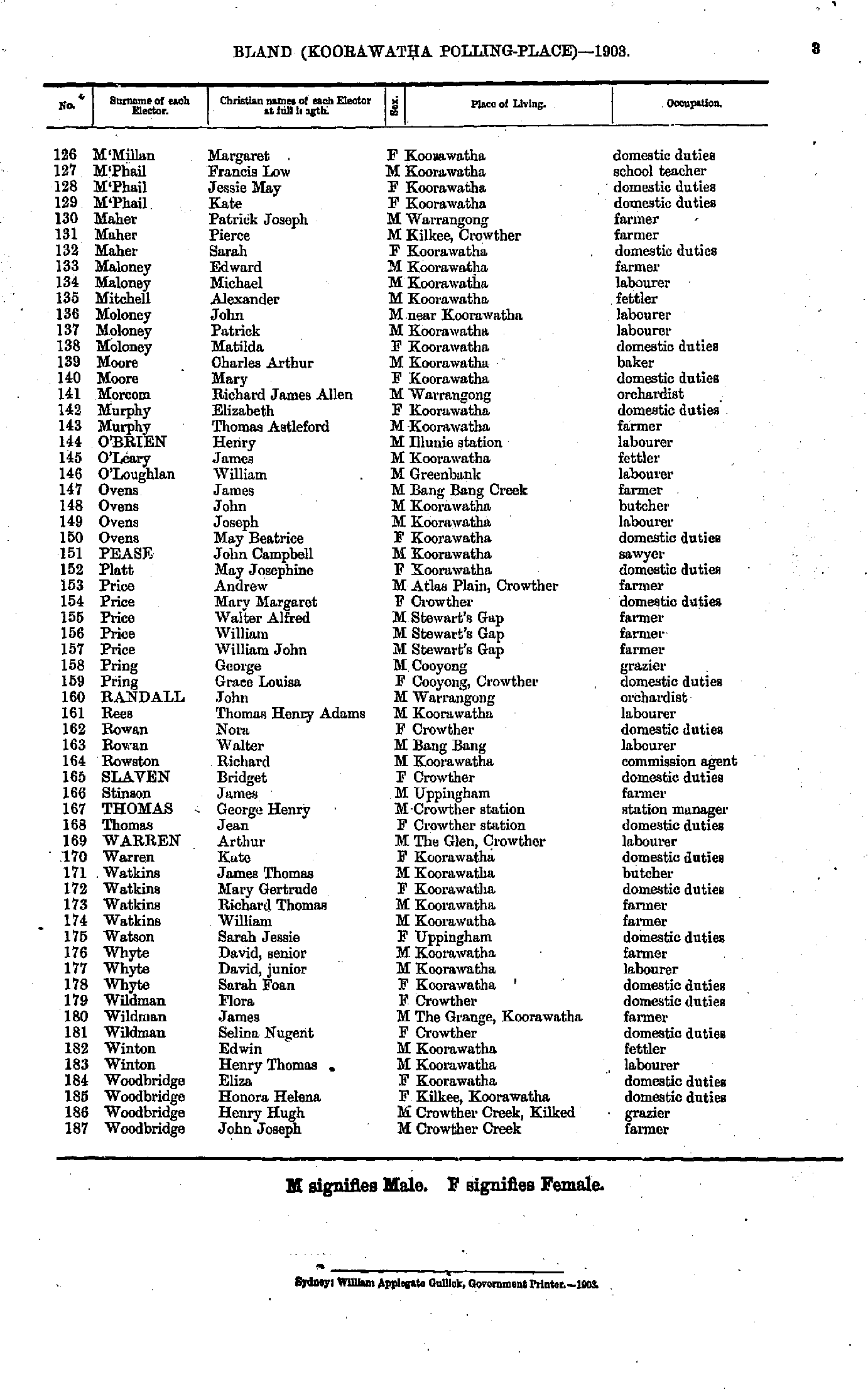
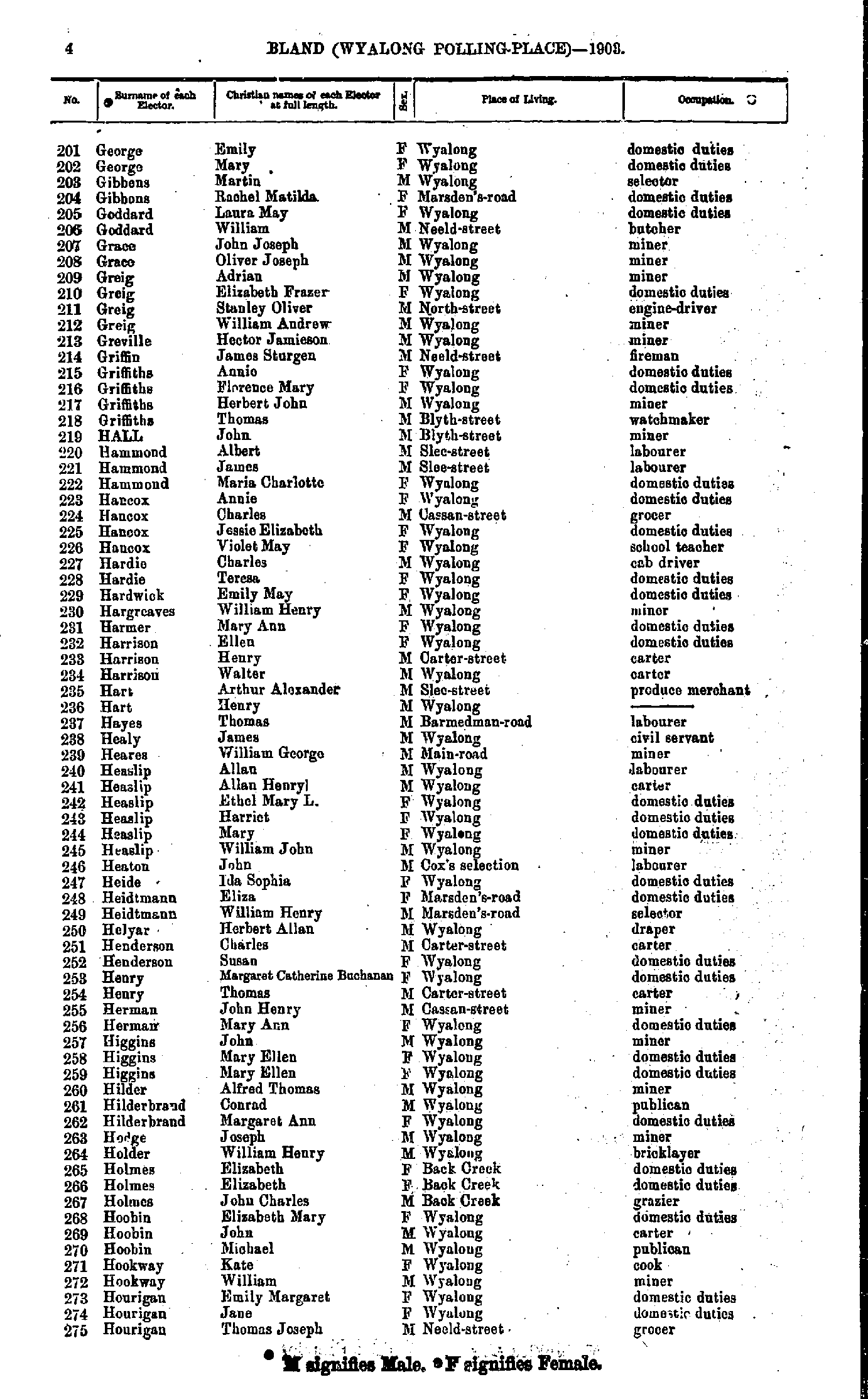
- George Emily - Hourigan Thomas
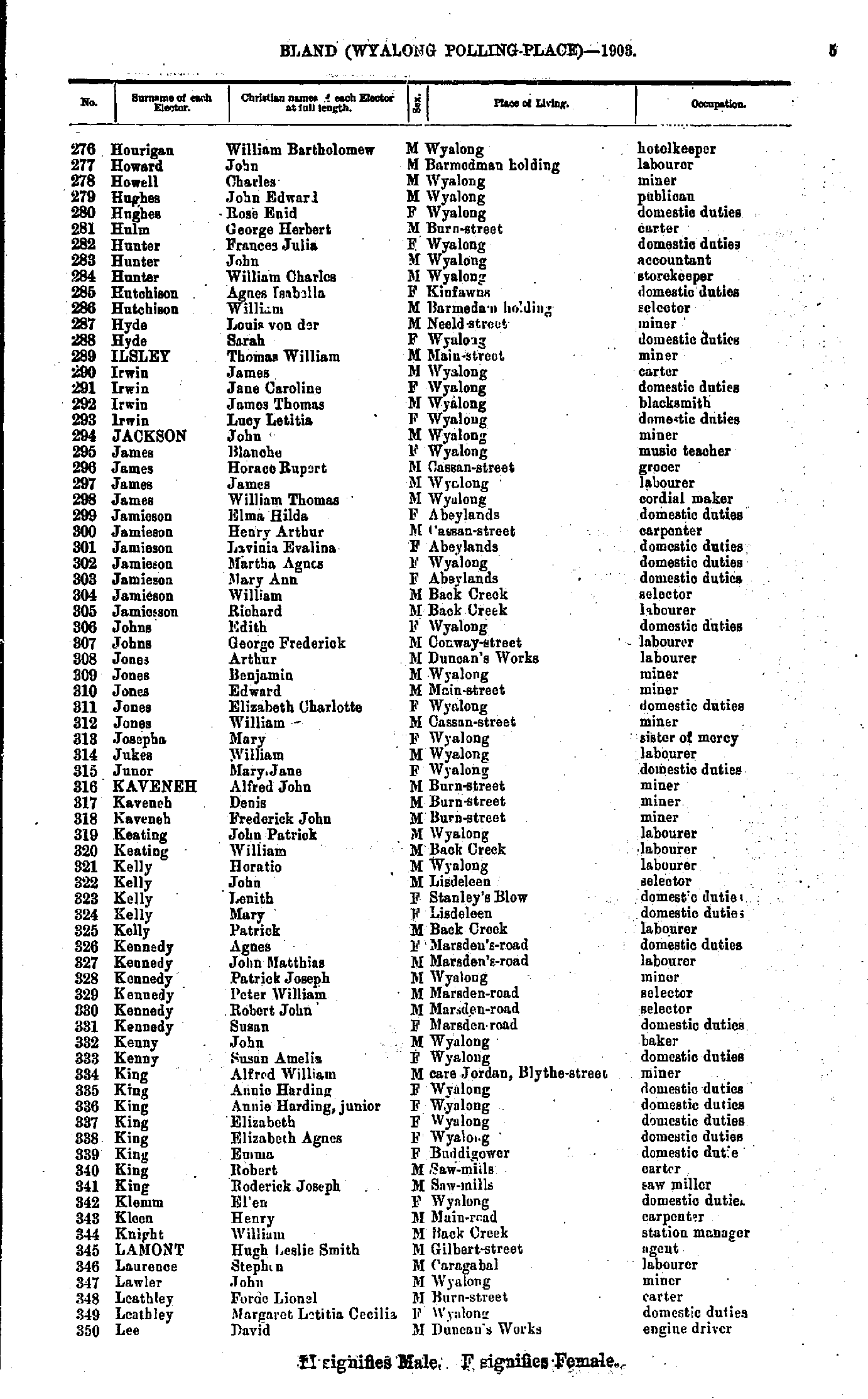
- Hourigan William - Lee David
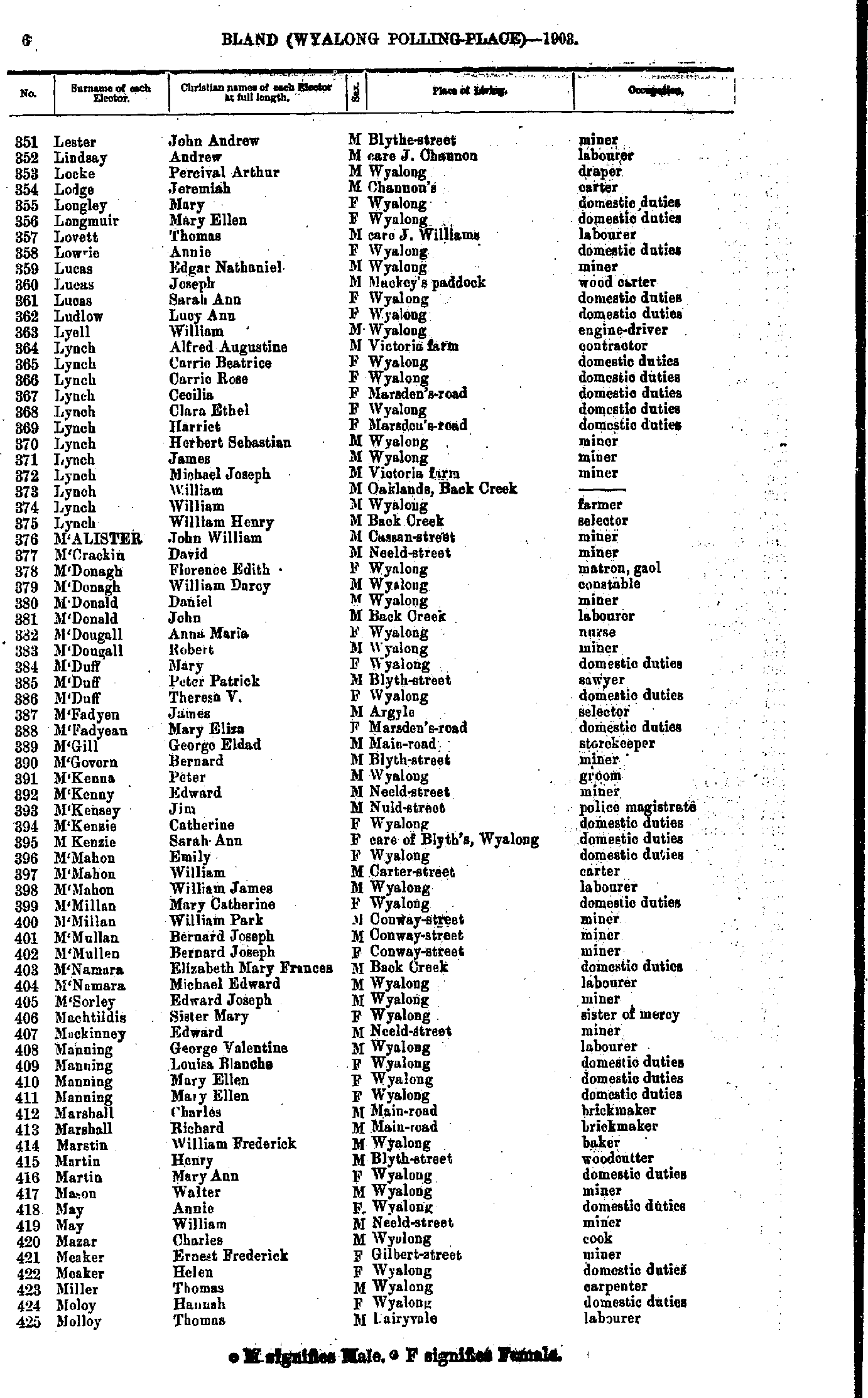
- Lester John - Molloy Thomas
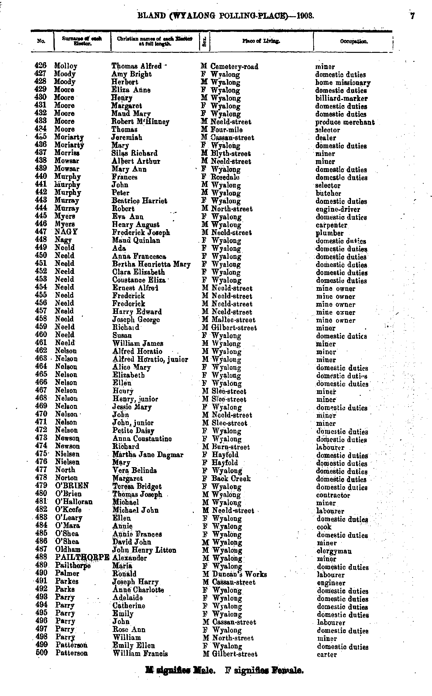
- Molloy Thomas - Patterson William
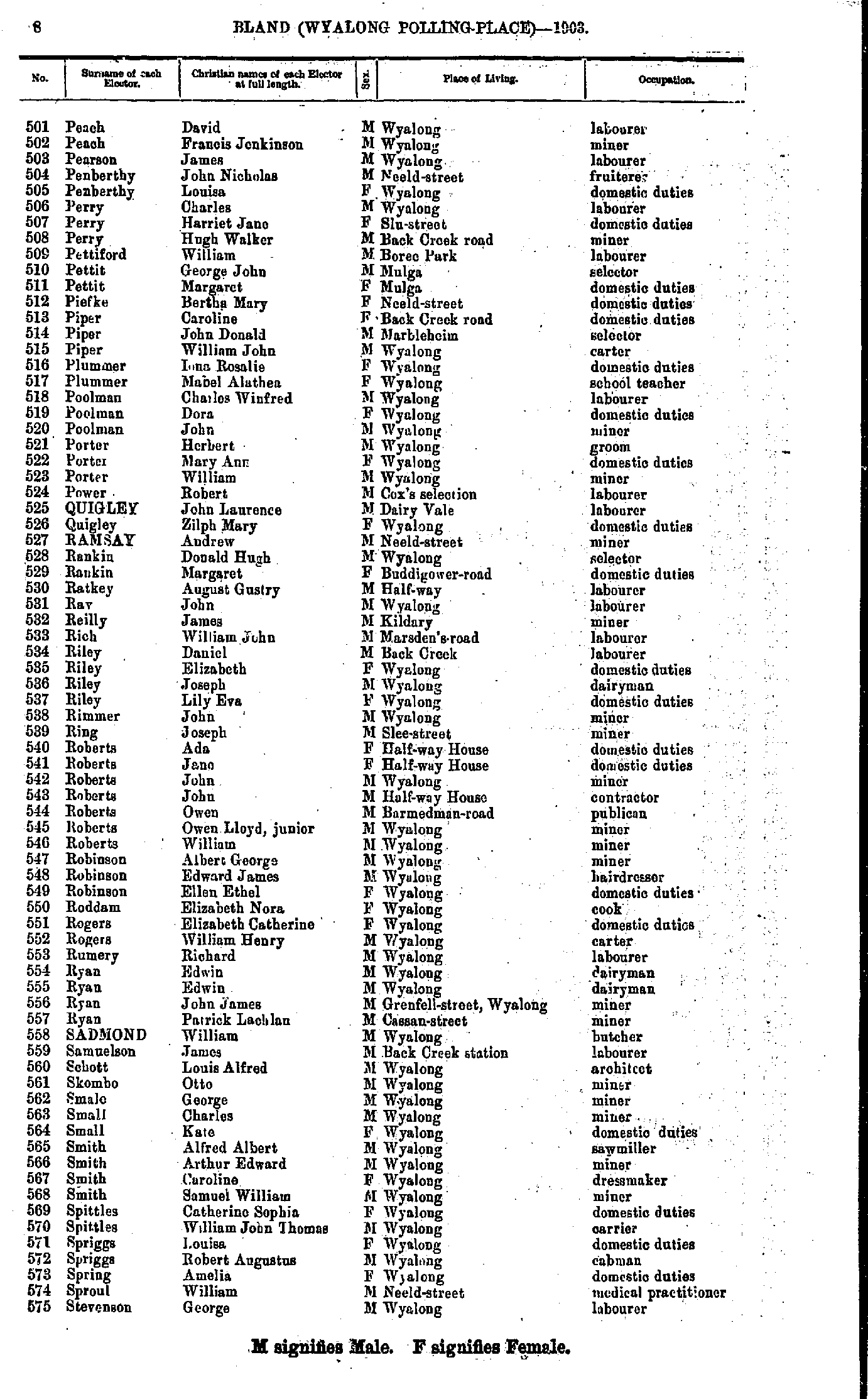
- Peach David - Stevenson George
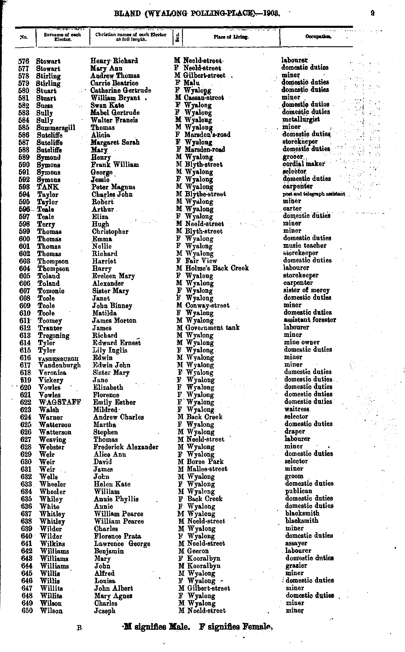
- Stewart Henry - Wilson Joseph
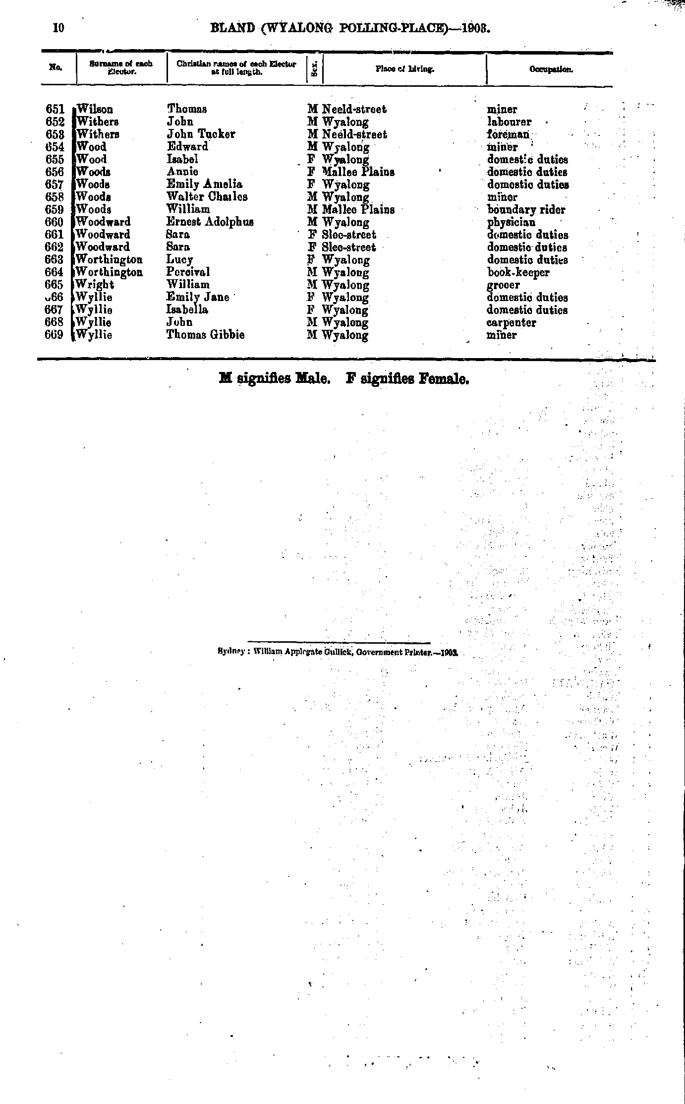
- Wilson Thomas - Wylie Thomas
Maps of the Bland Electoral Division
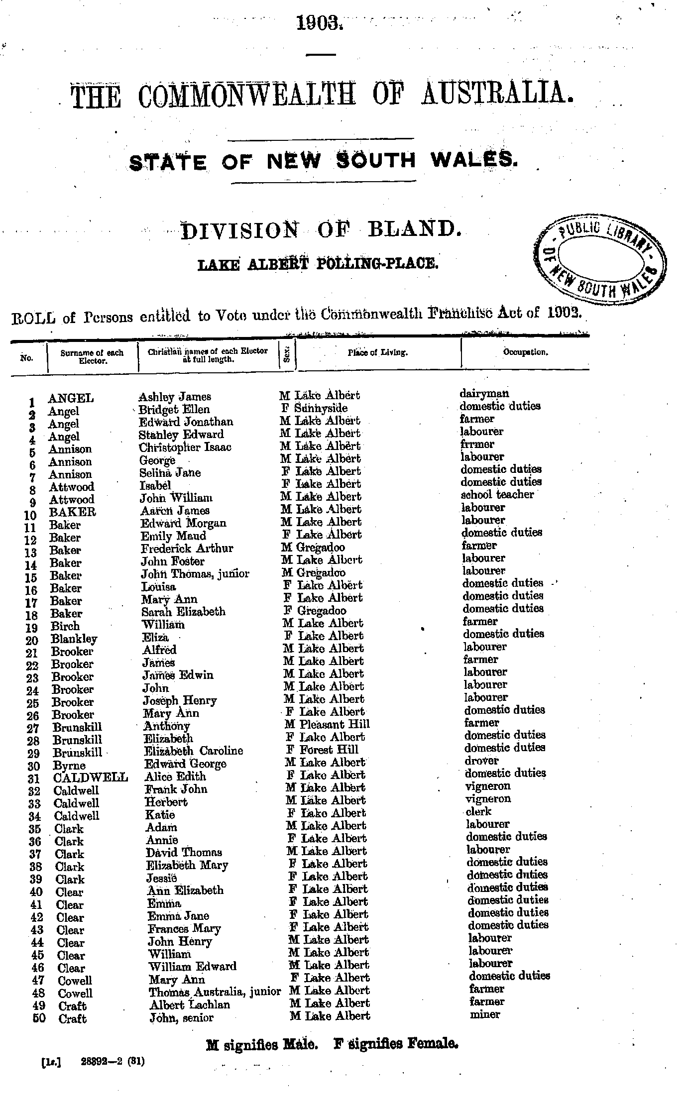
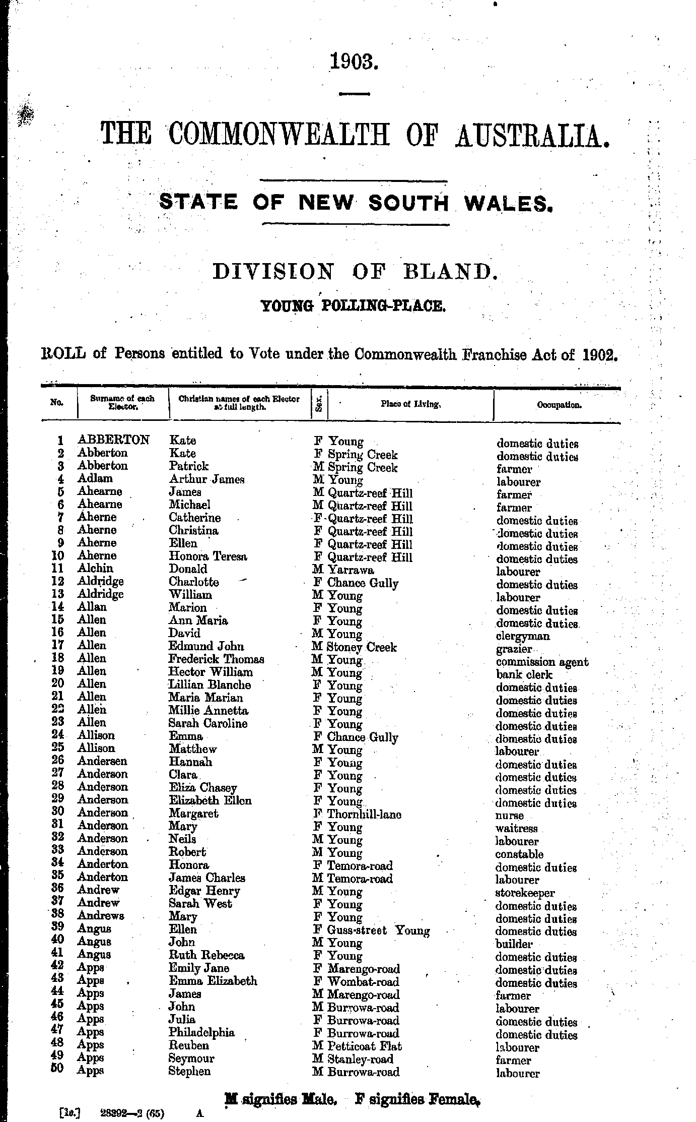
- Abberton Kate - Apps Stephen
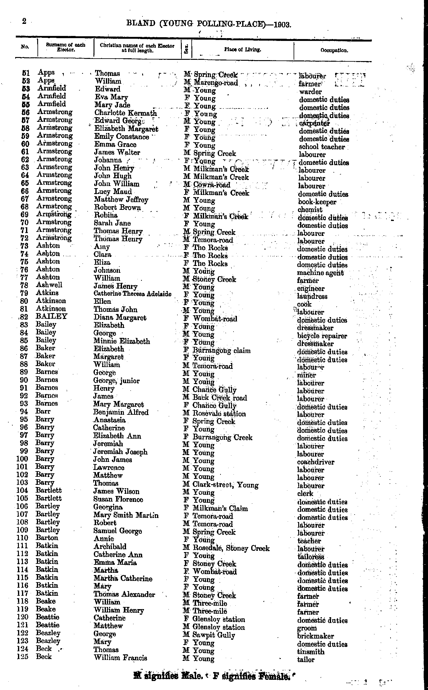
- Apps Thomas - Beck William
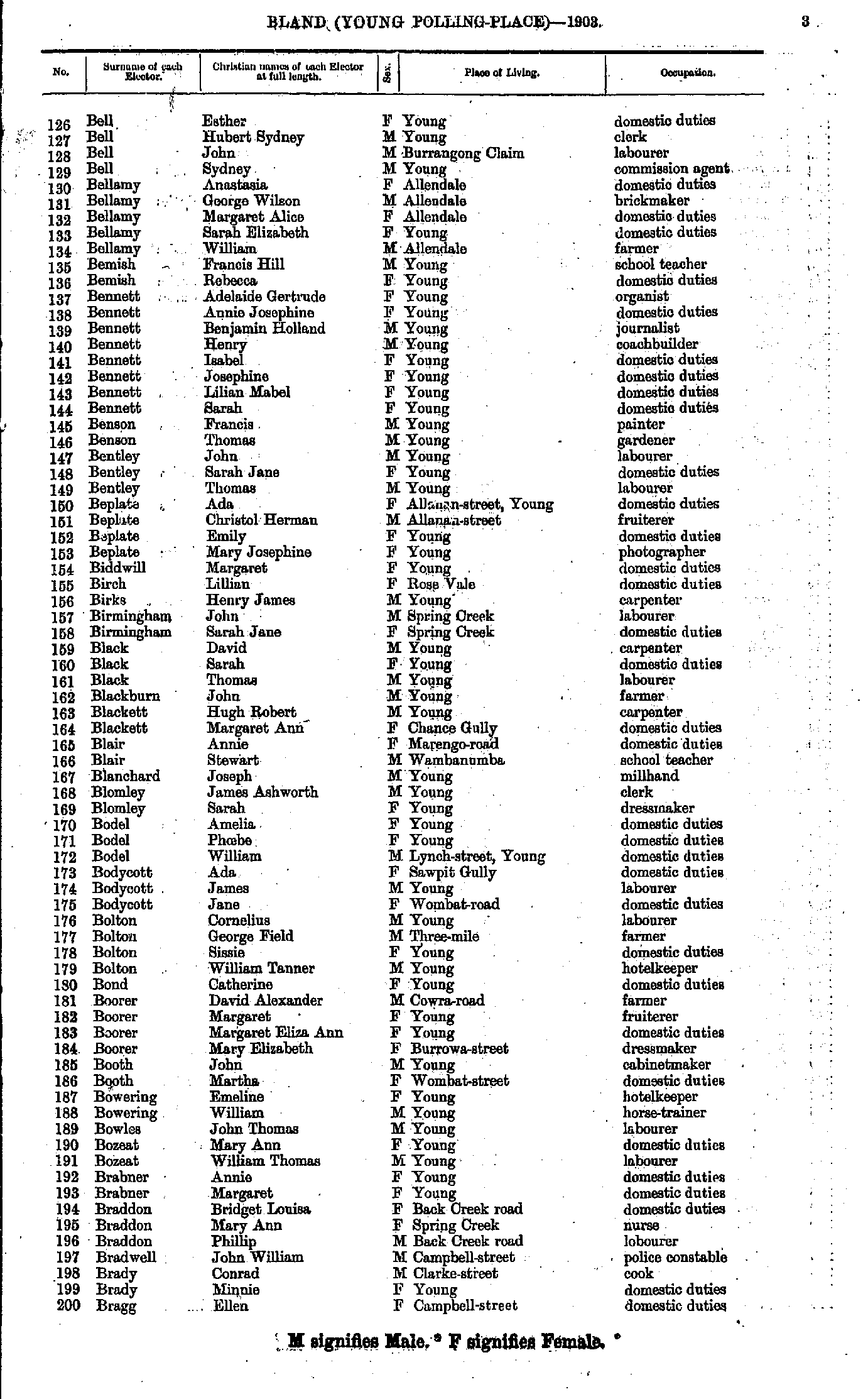
- Bell Esther - Bragg Ellen
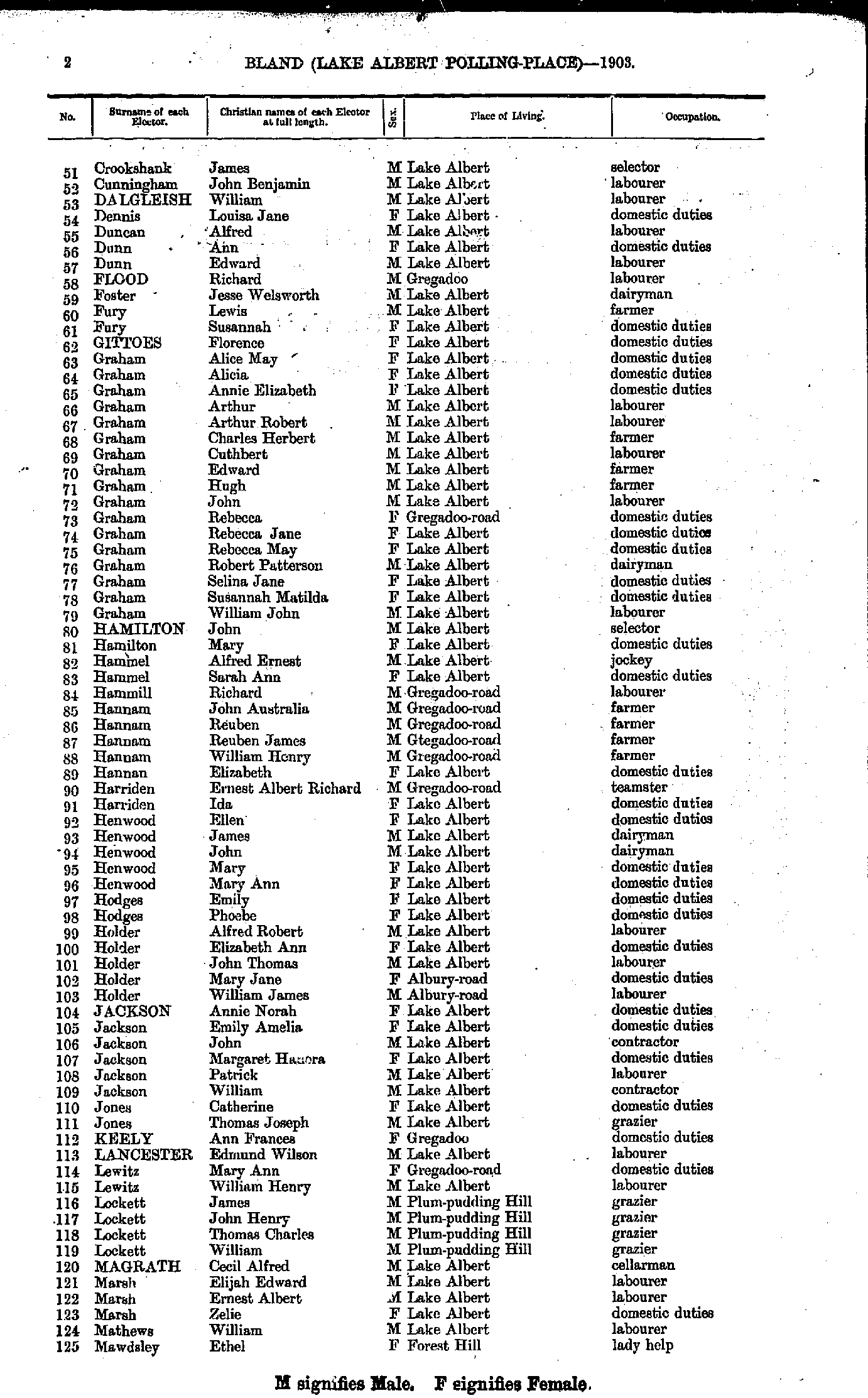
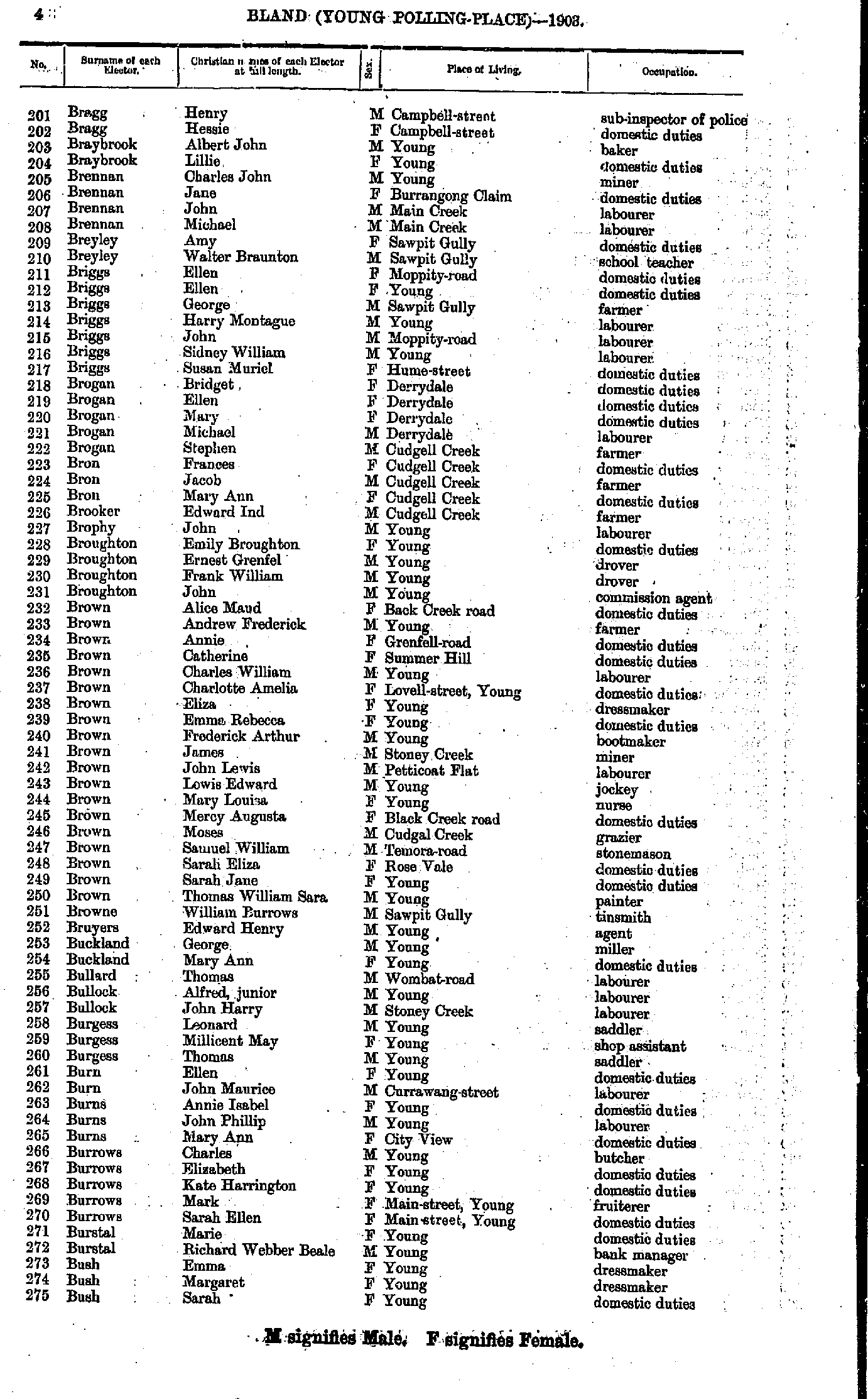
- Bragg Henry - Bush Sarah
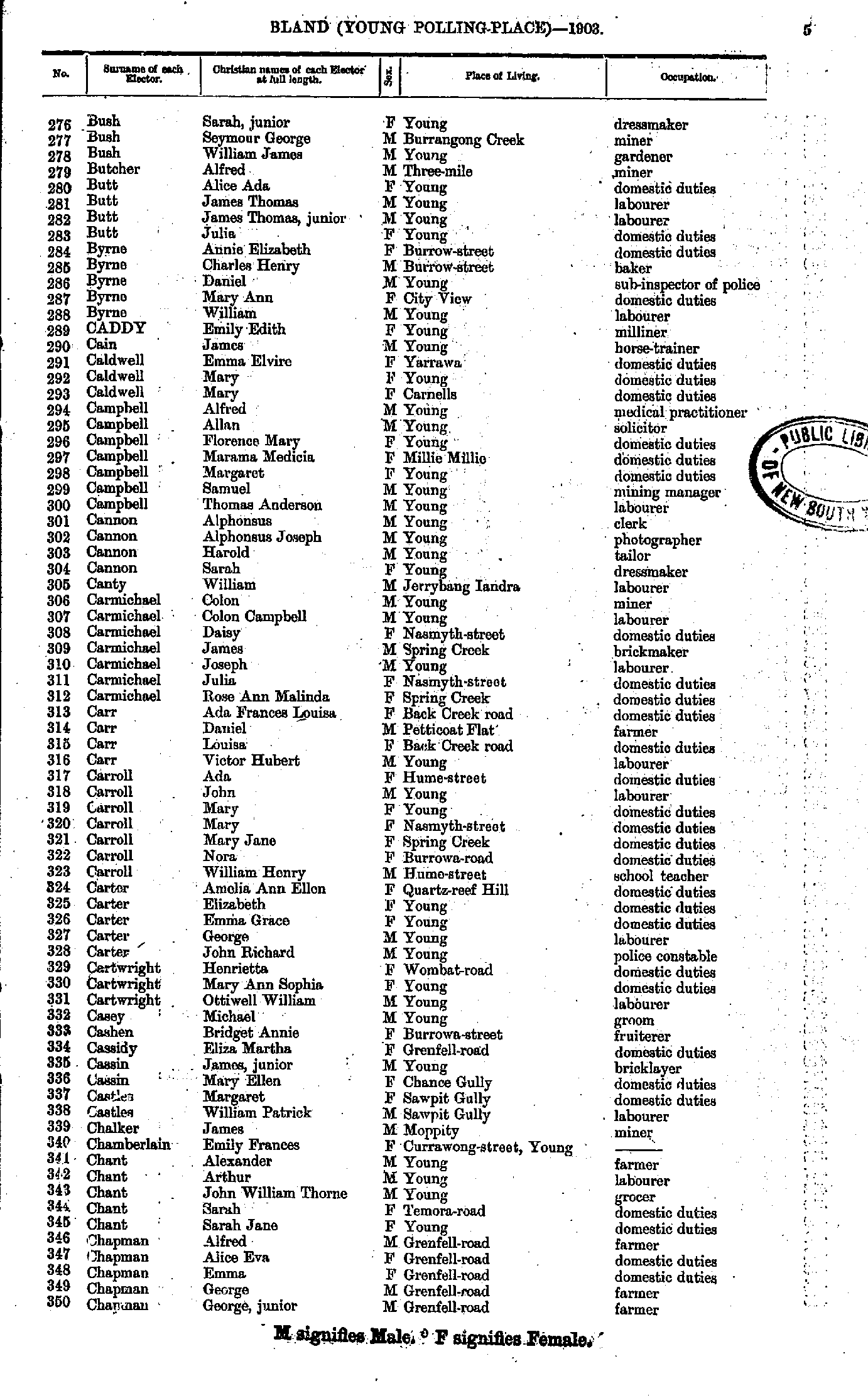
- Bush Sarah - Chapman George
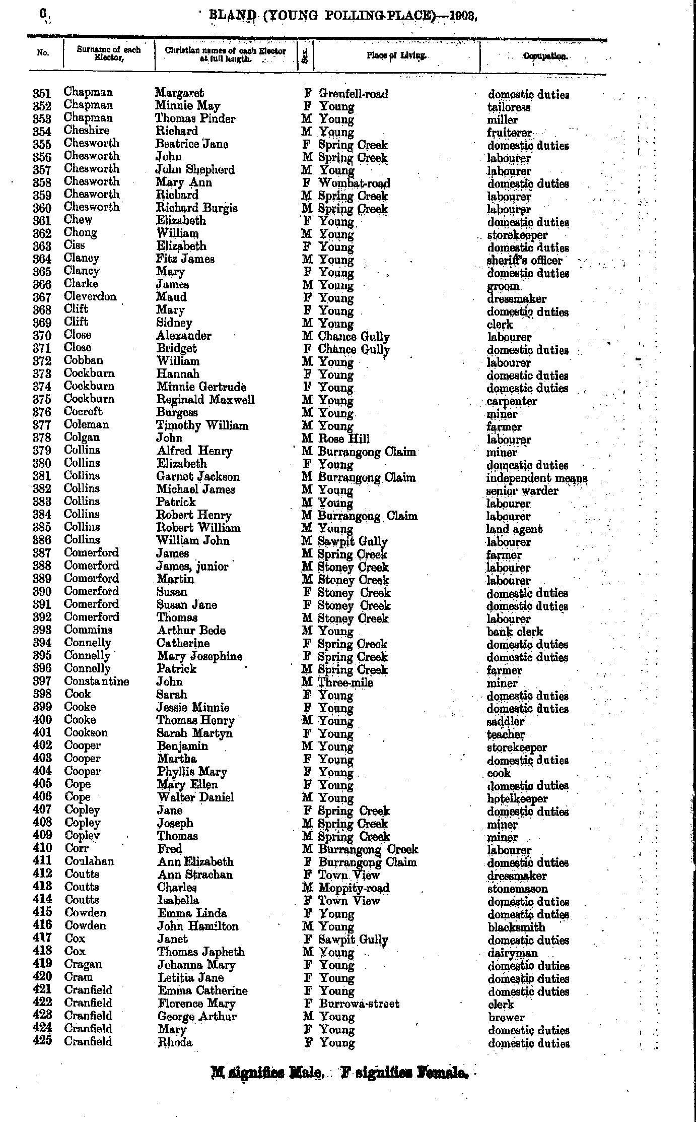
- Chapman Margaret - Cranfield Rhoda
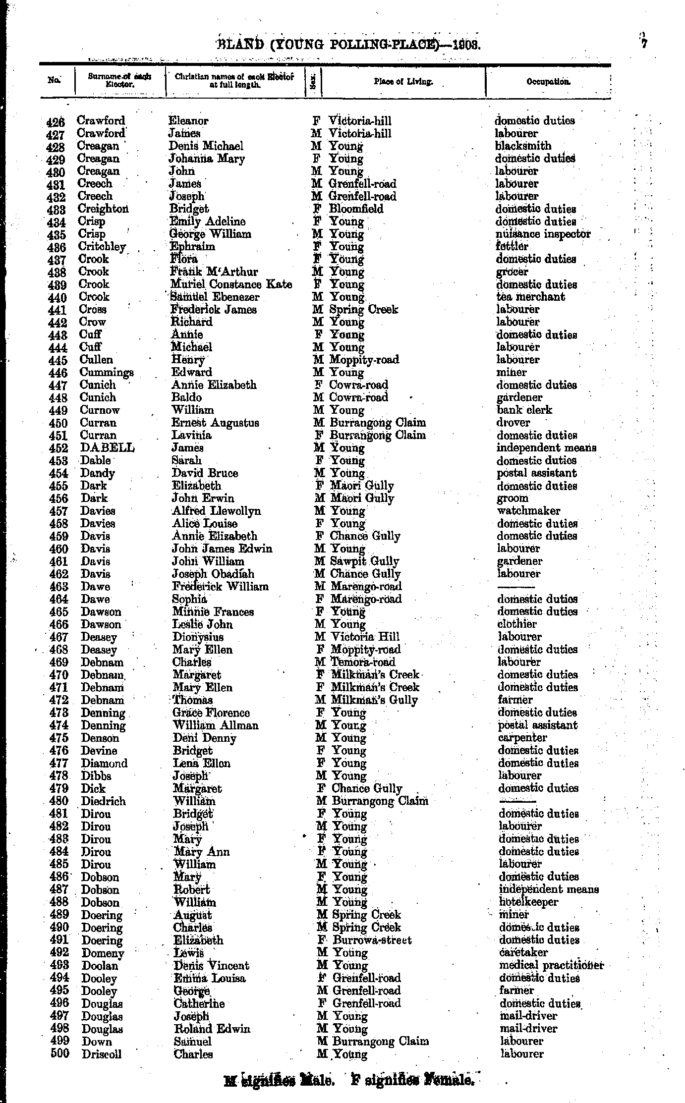
- Crawford Eleanor - Driscoll Charles
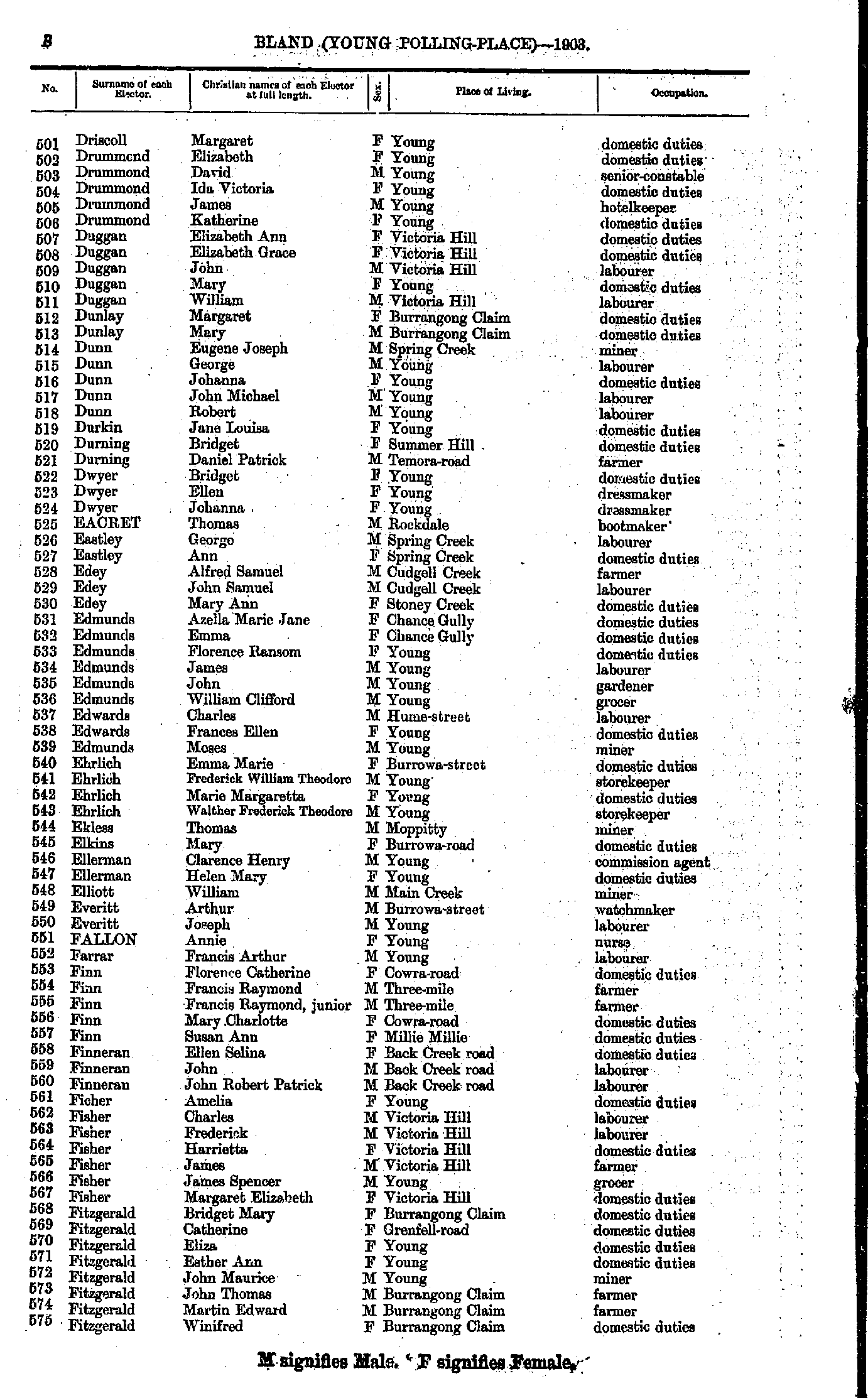
- Driscoll Margaret - Fitzgerald Winifred
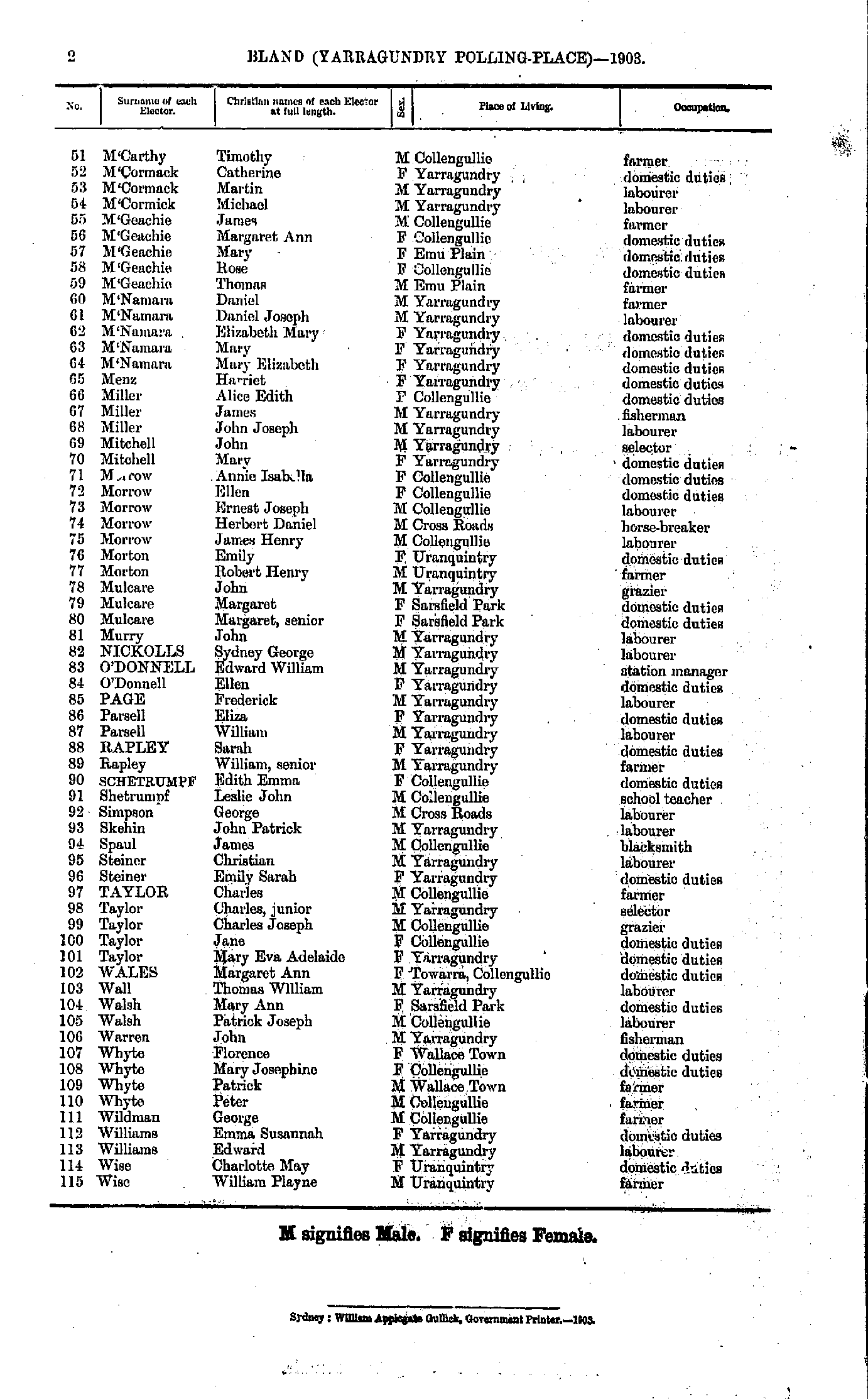
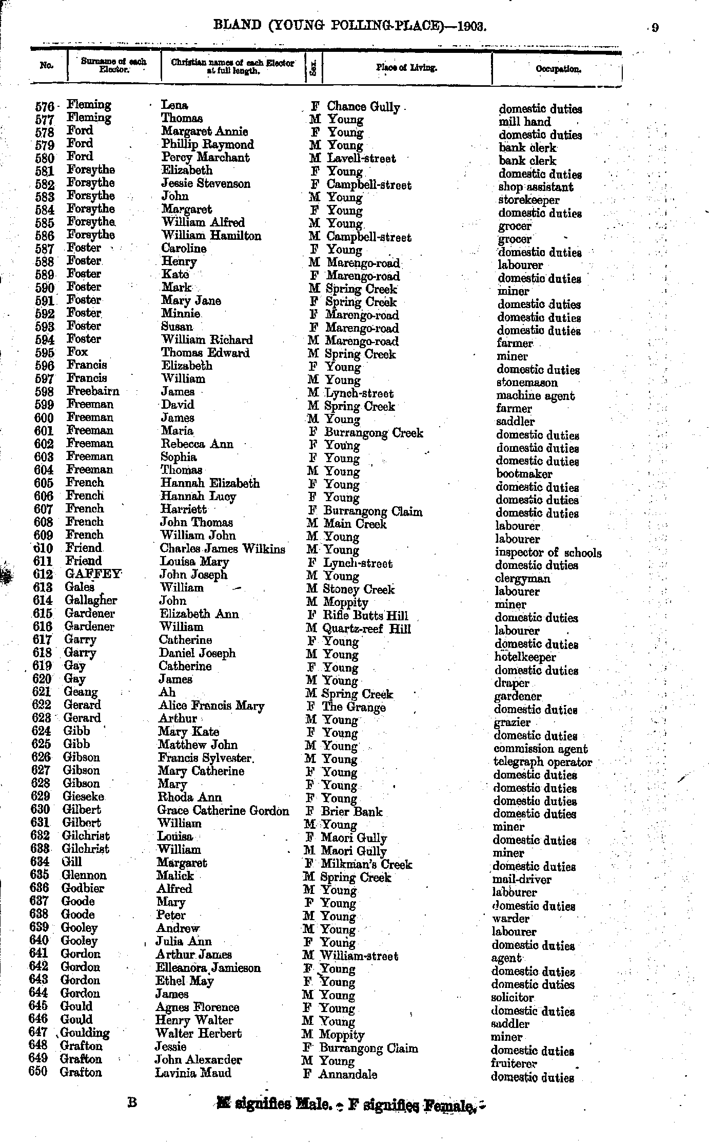
- Fleming Lena - Grafton Lavinia
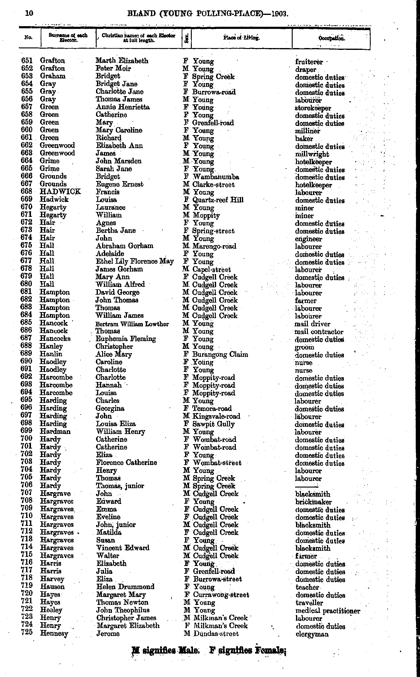
- Grafton Marth - Hennesy Jerome
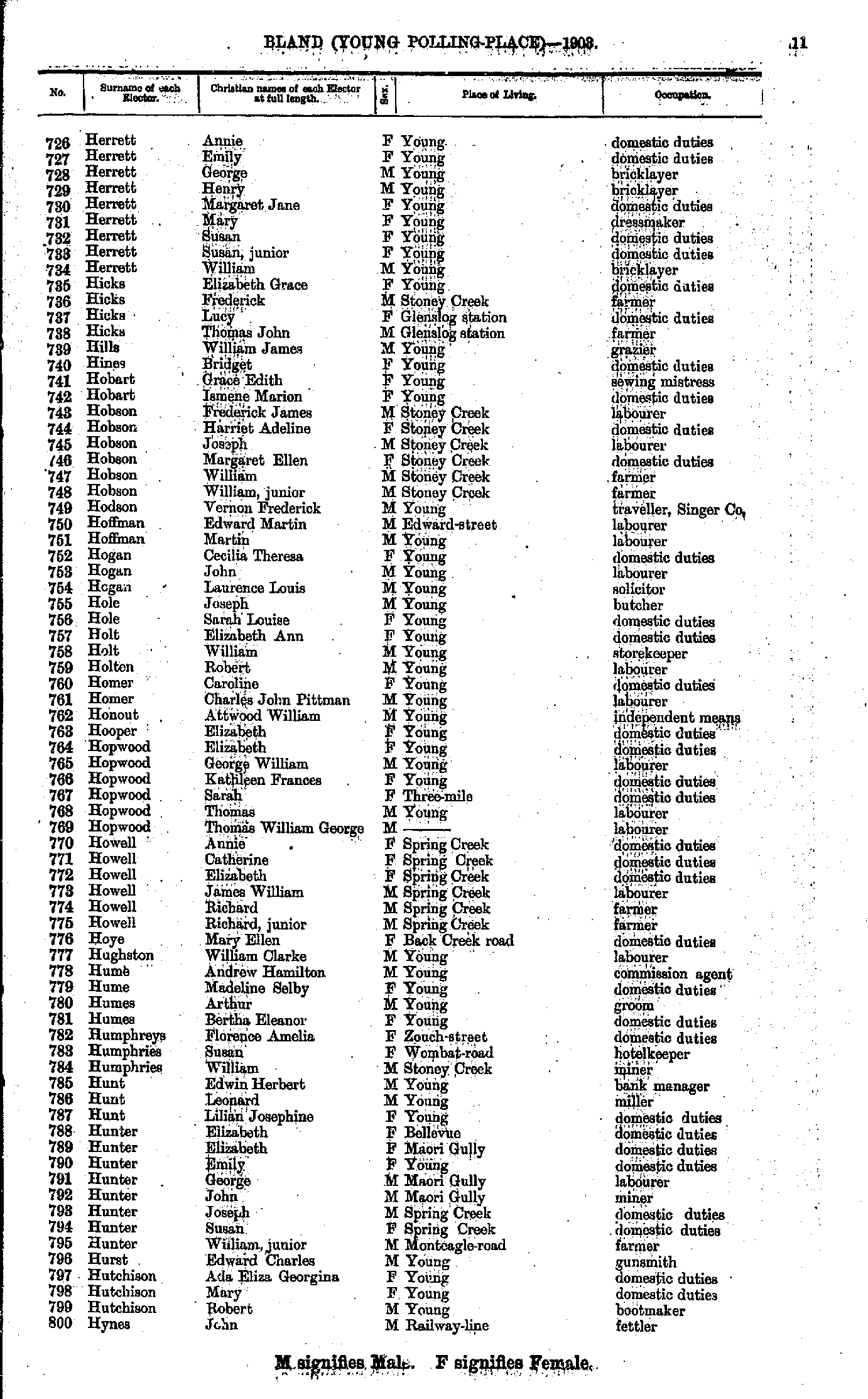
- Herrett Annie - Hynes John
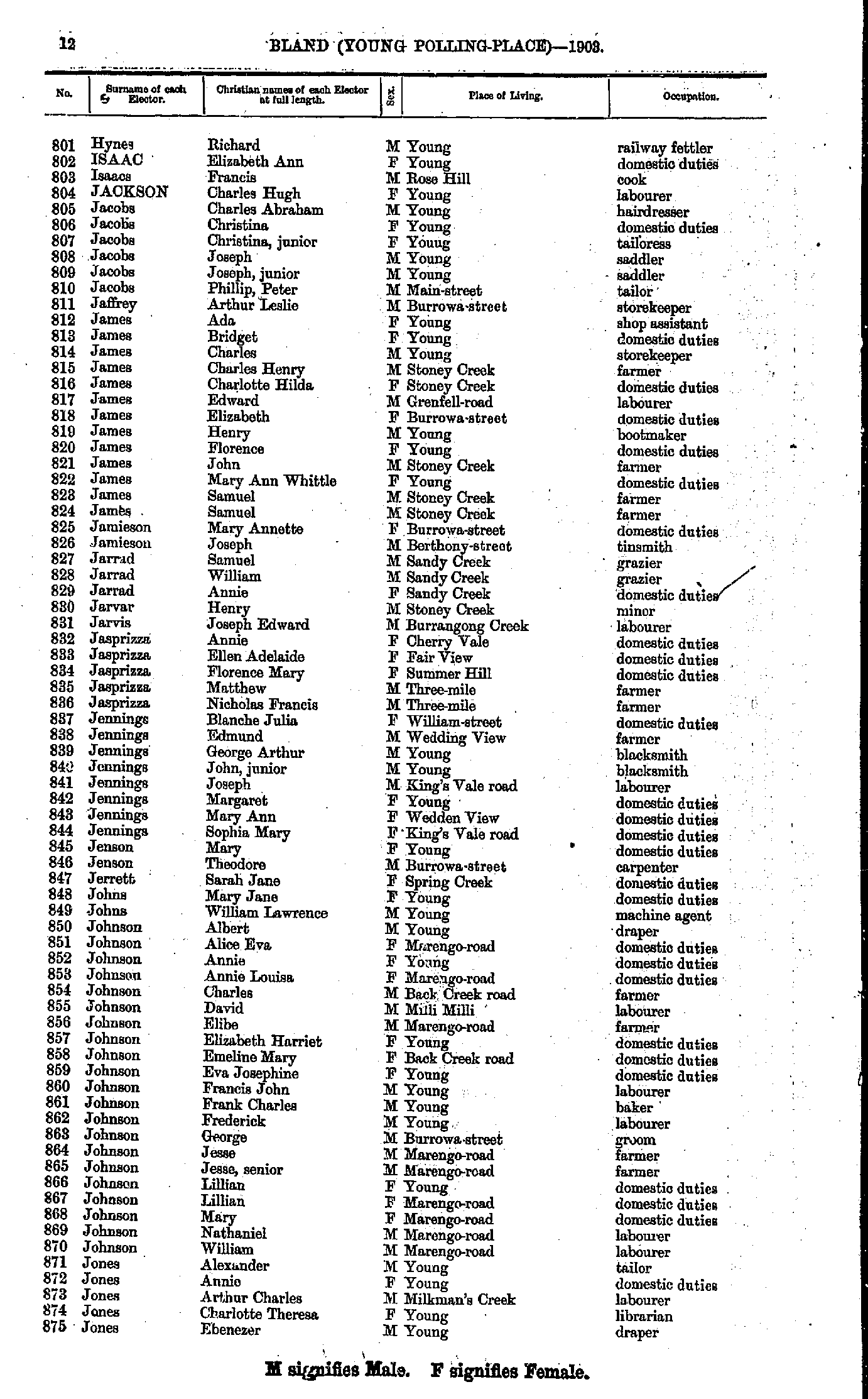
- Hynes Richard - Jones Ebenezer
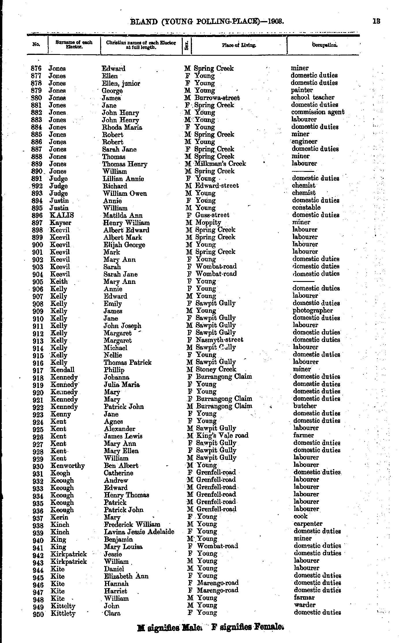
- Jones Edward - Kittlety Clara
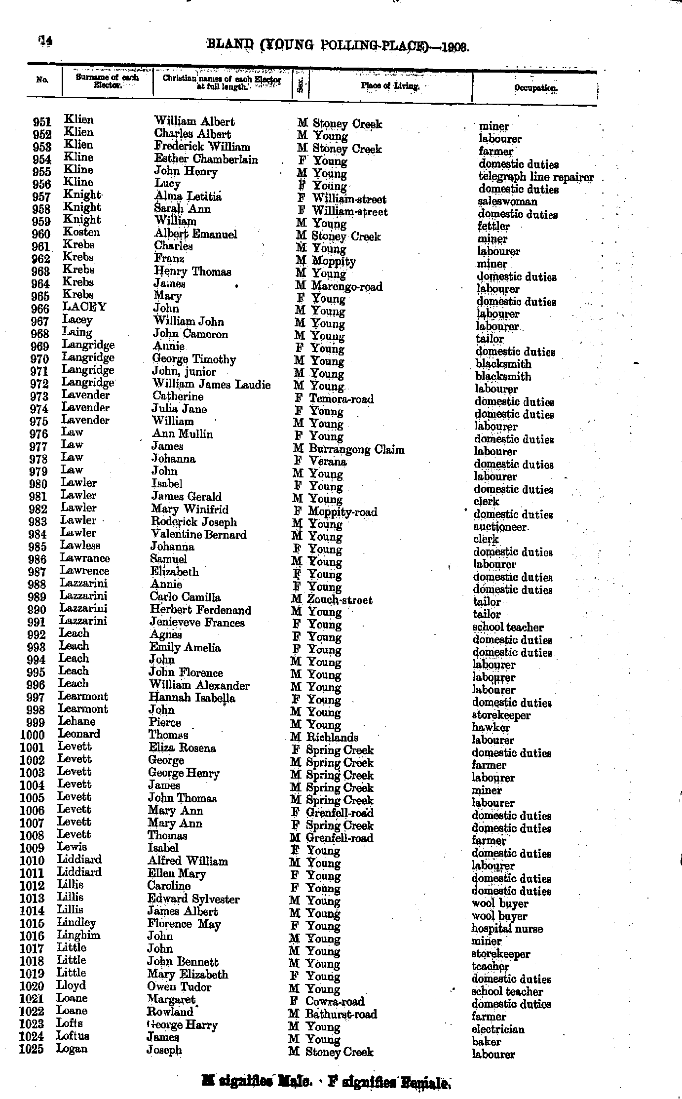
- Klien William - Logan Joseph
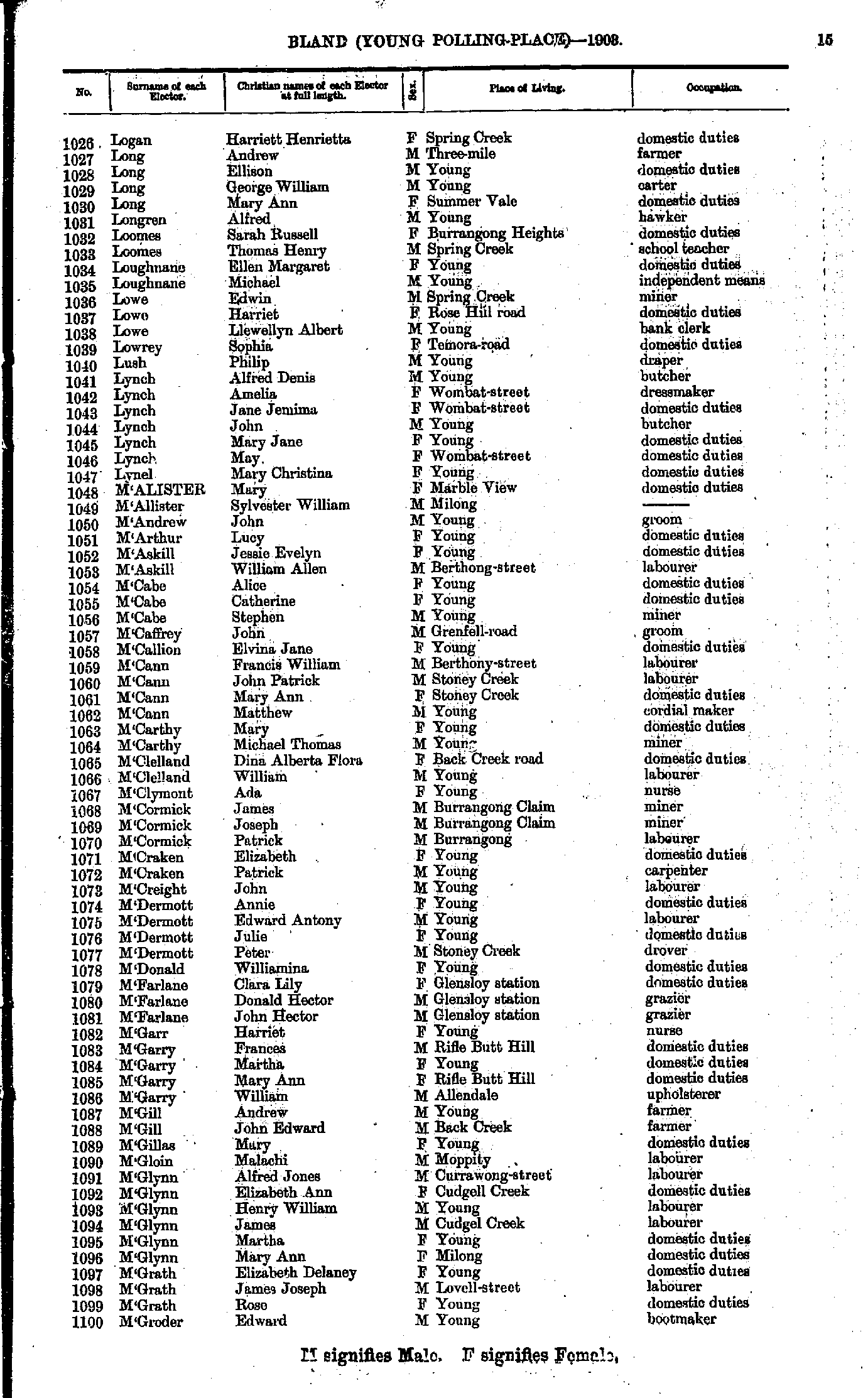
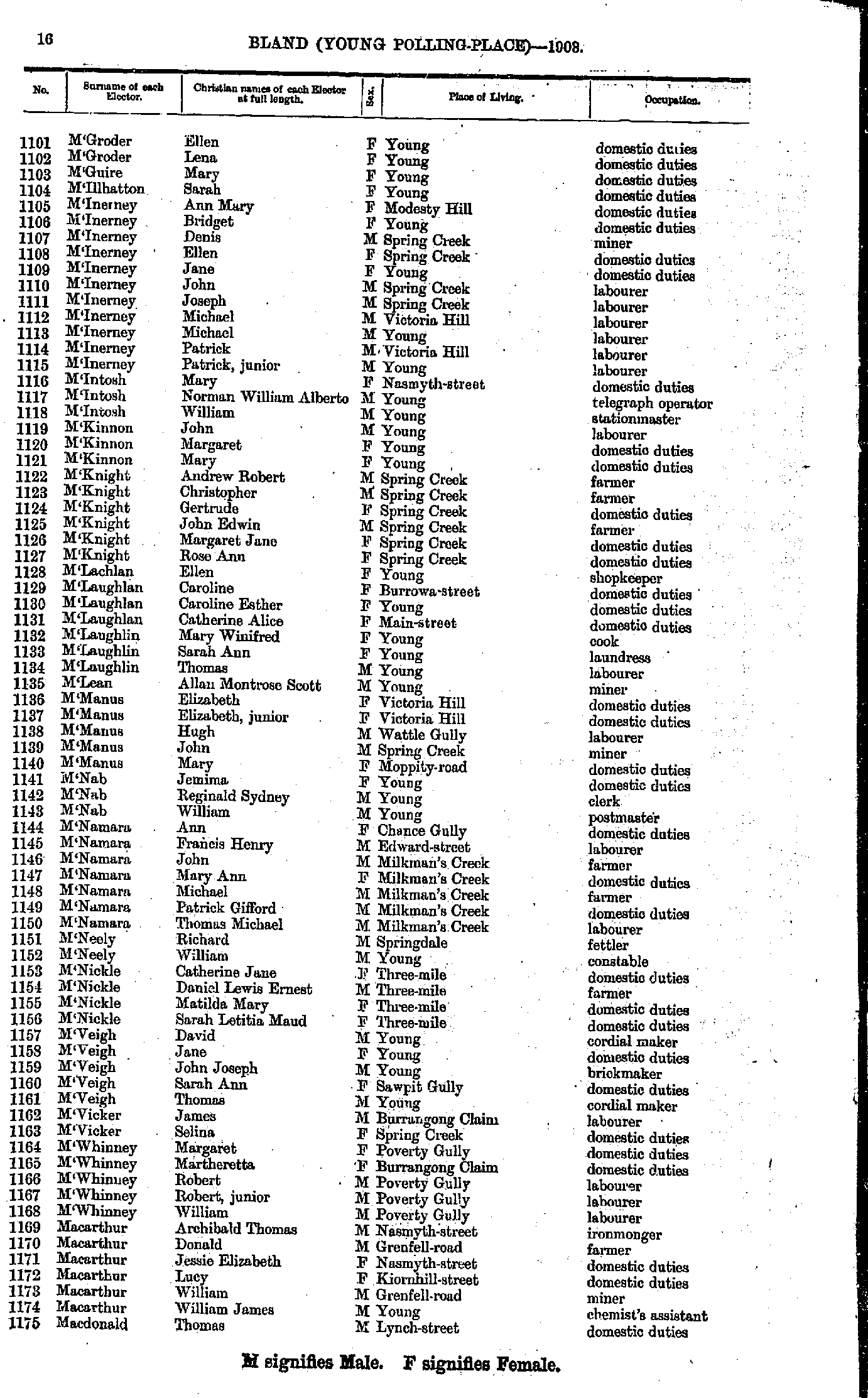
- Logan Harriett - M'Groder Edward
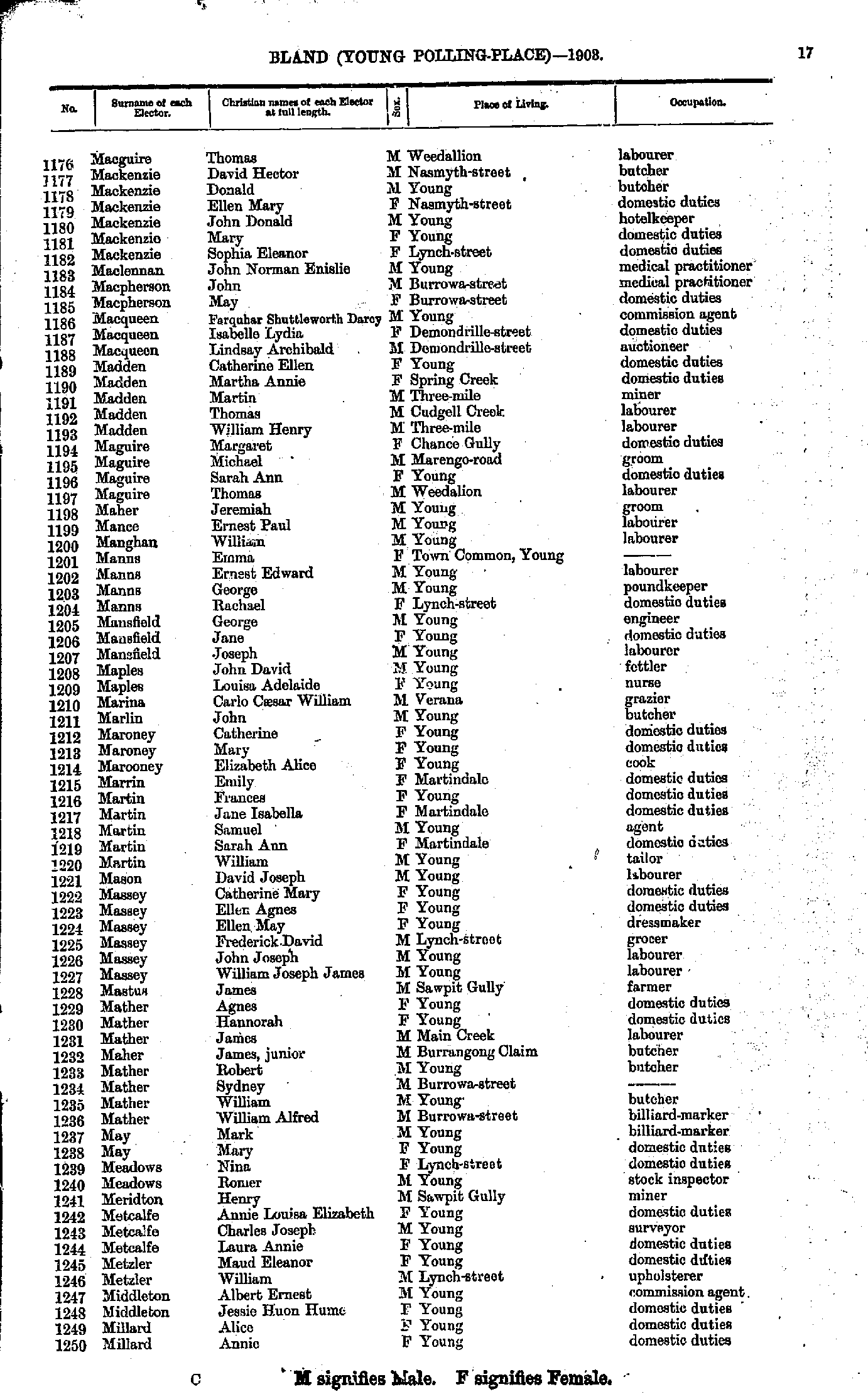
- M'Groder Ellen - Macdonald Thomas
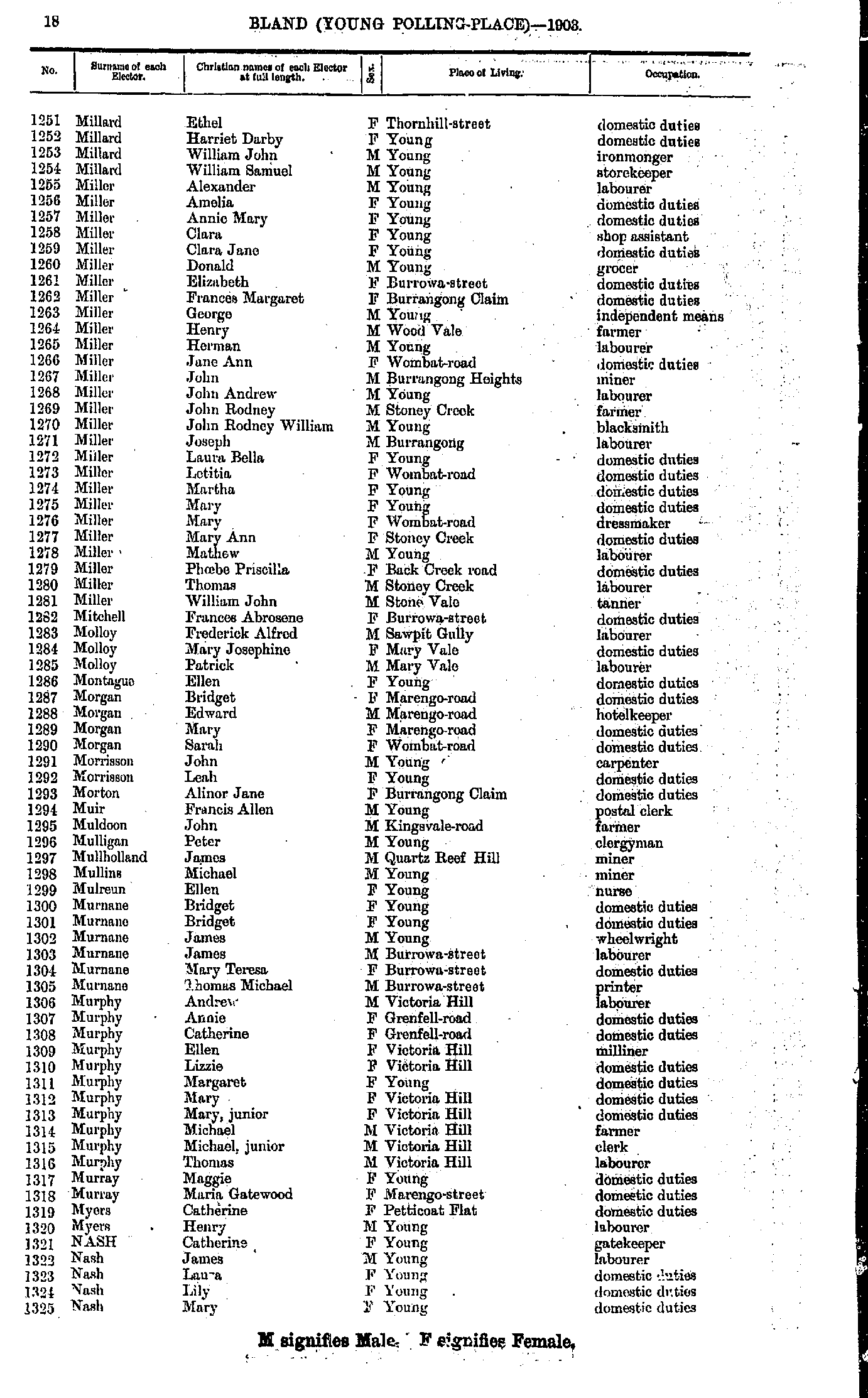
- Macguire Thomas - Millard Annie
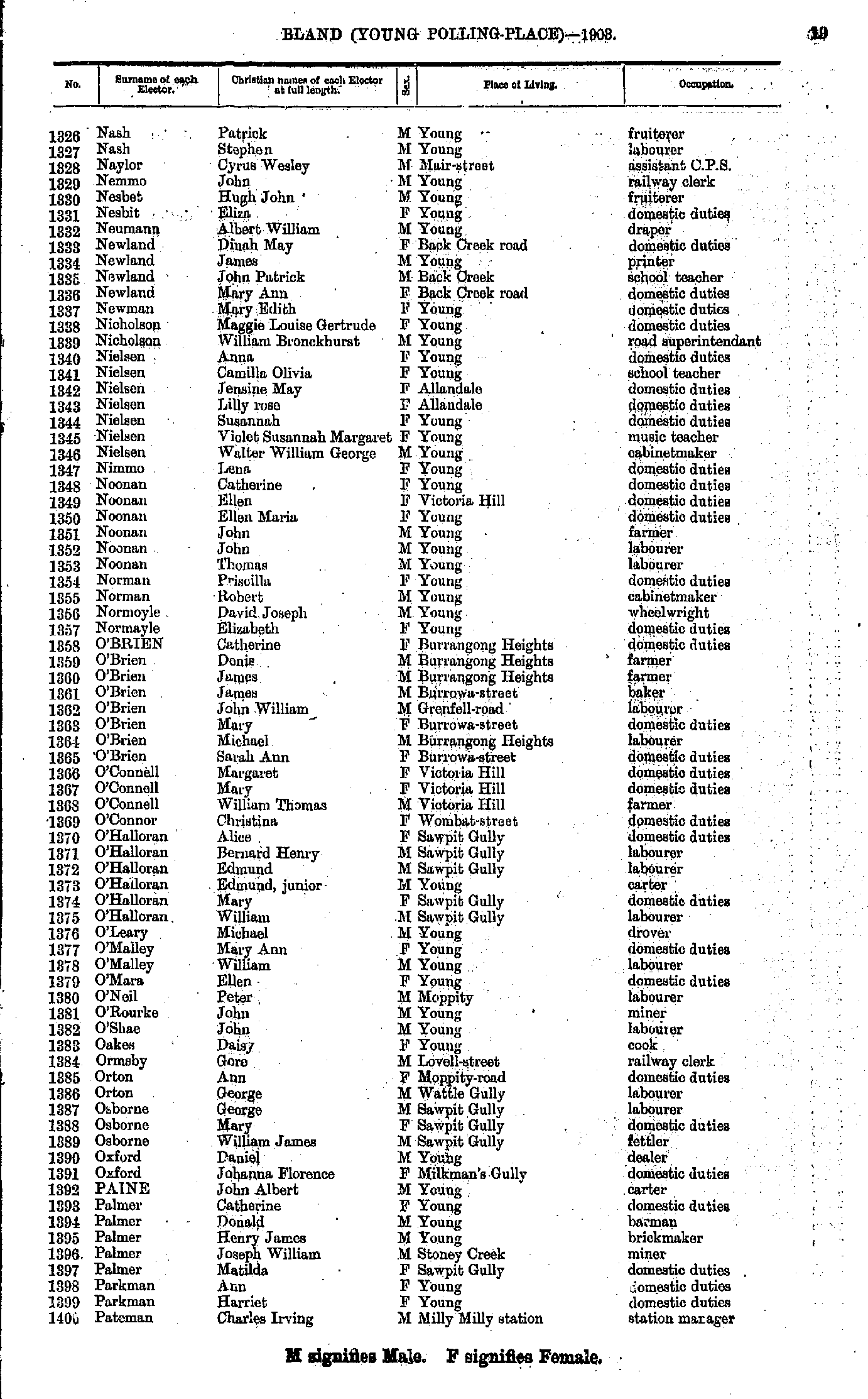
- Millard Ethel - Nash Mary
- Nash Patrick - Pateman Charles
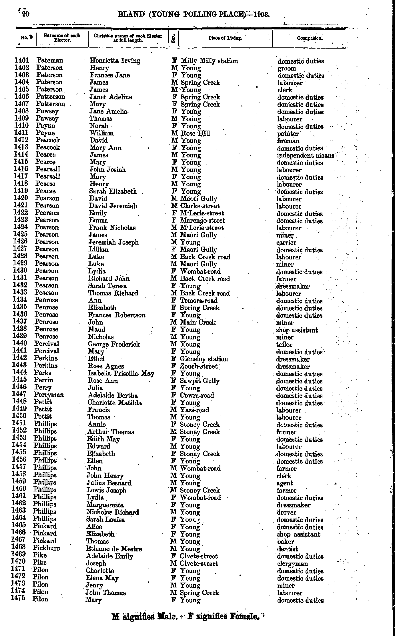
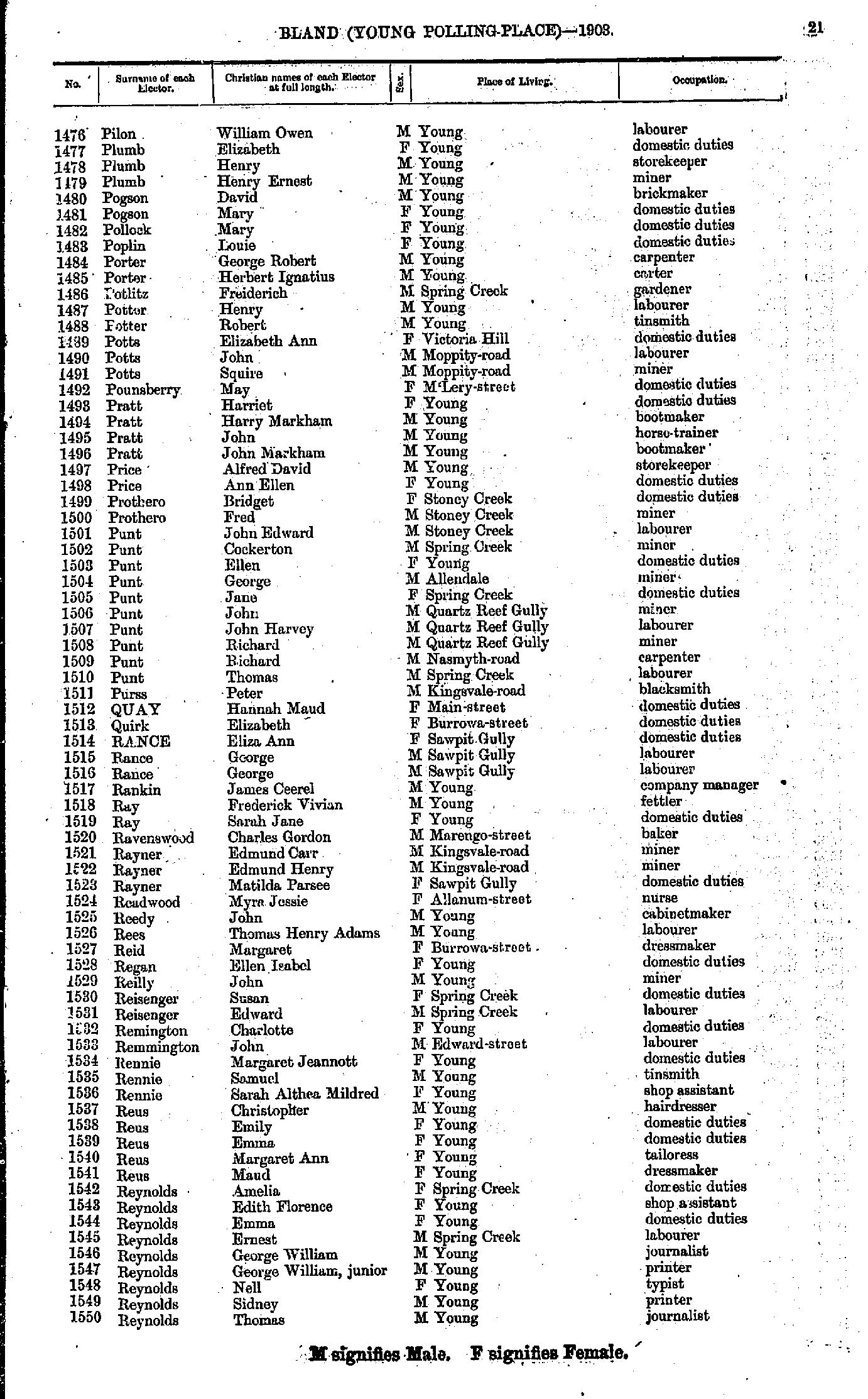
- Pateman Henrietta - Pilon Mary
- Pilon William - Reynolds Thomas
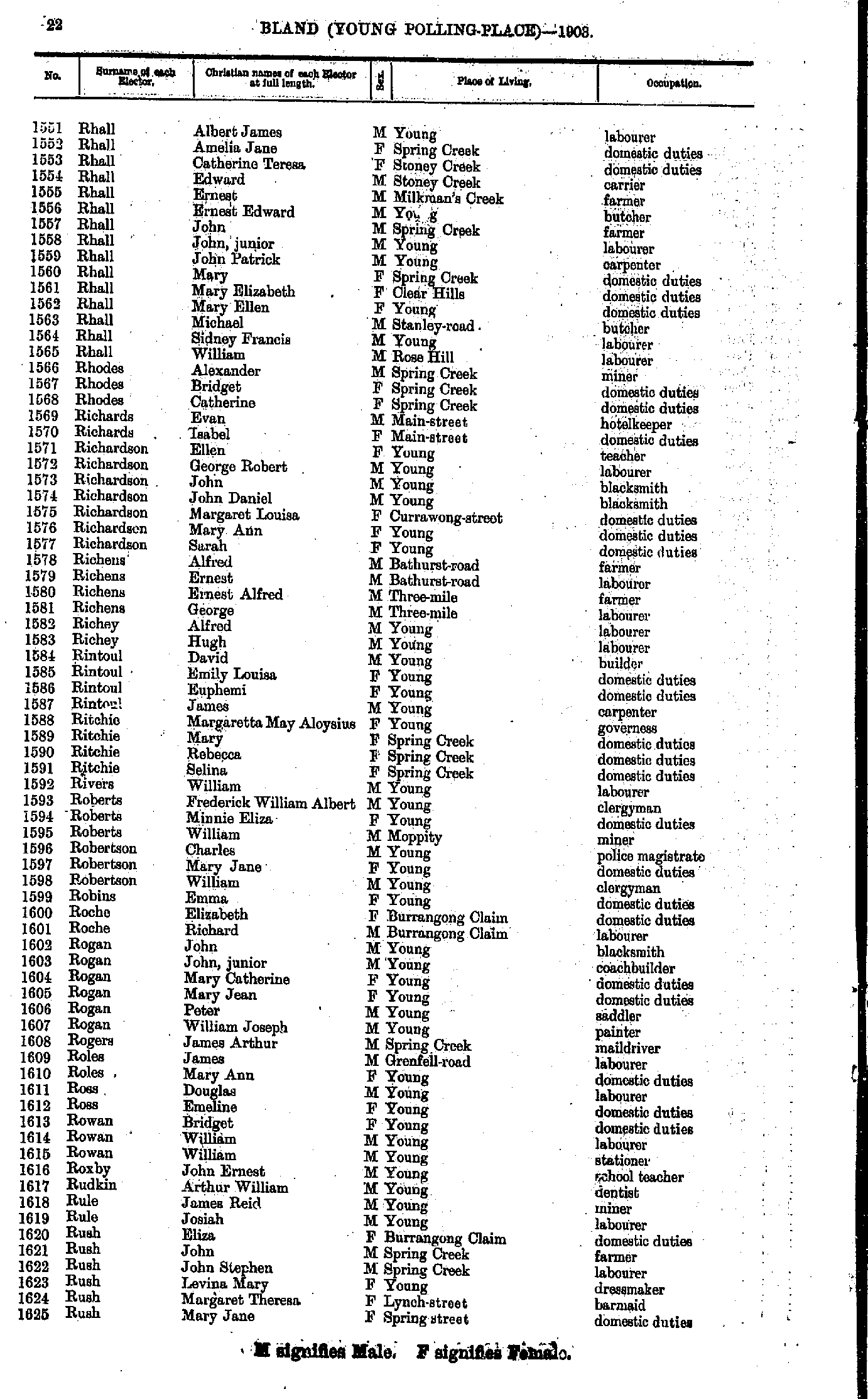
- Rhall Albert - Rush Mary
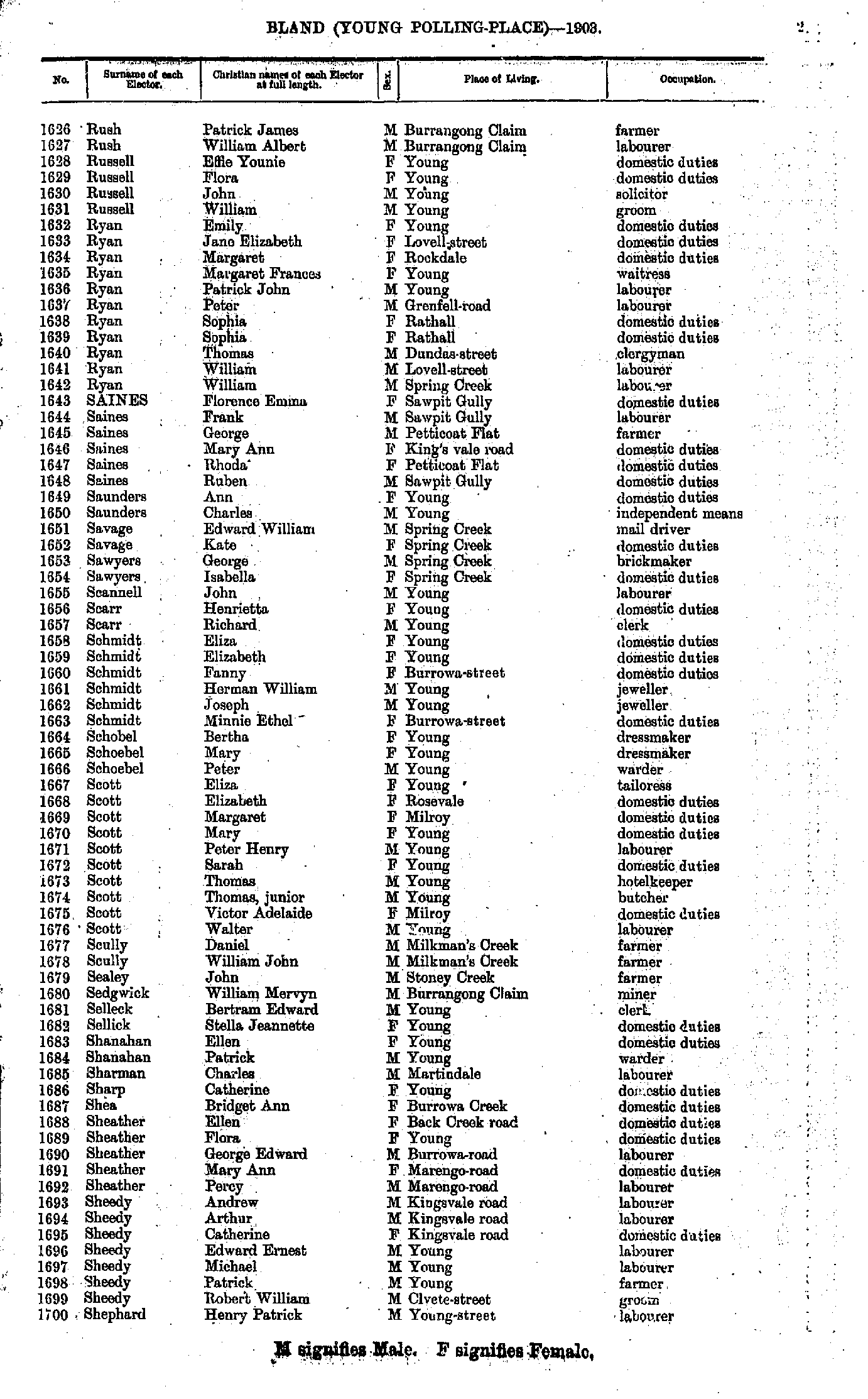
- Rush Patrick - Shephard Henry
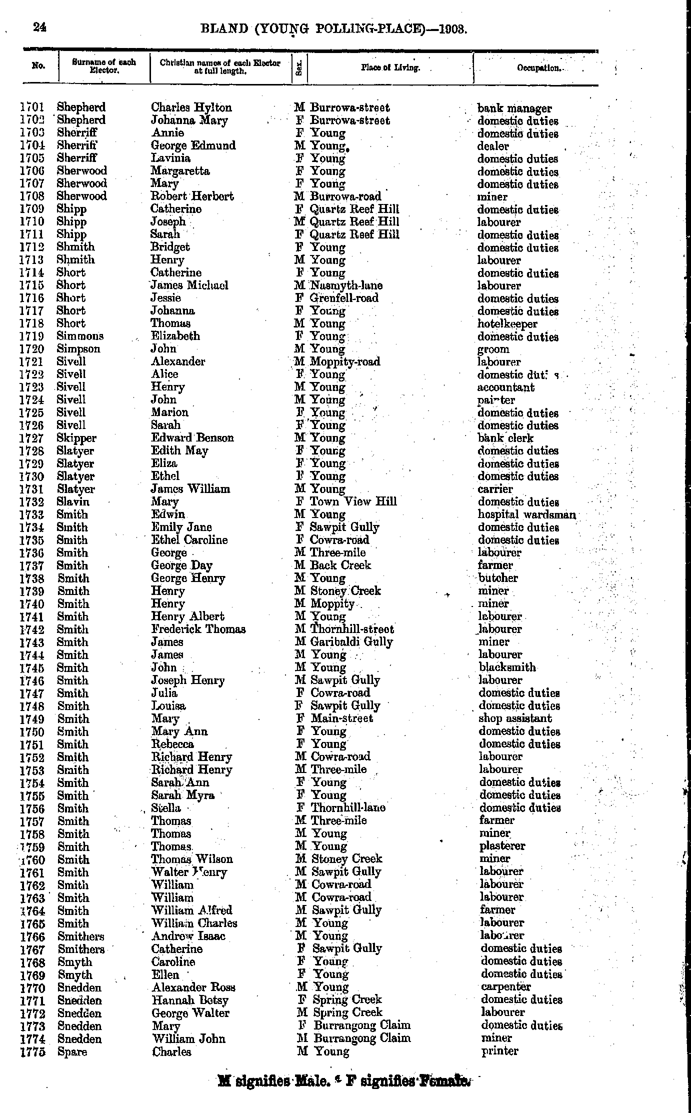
- Shepherd Charles - Spare Charles
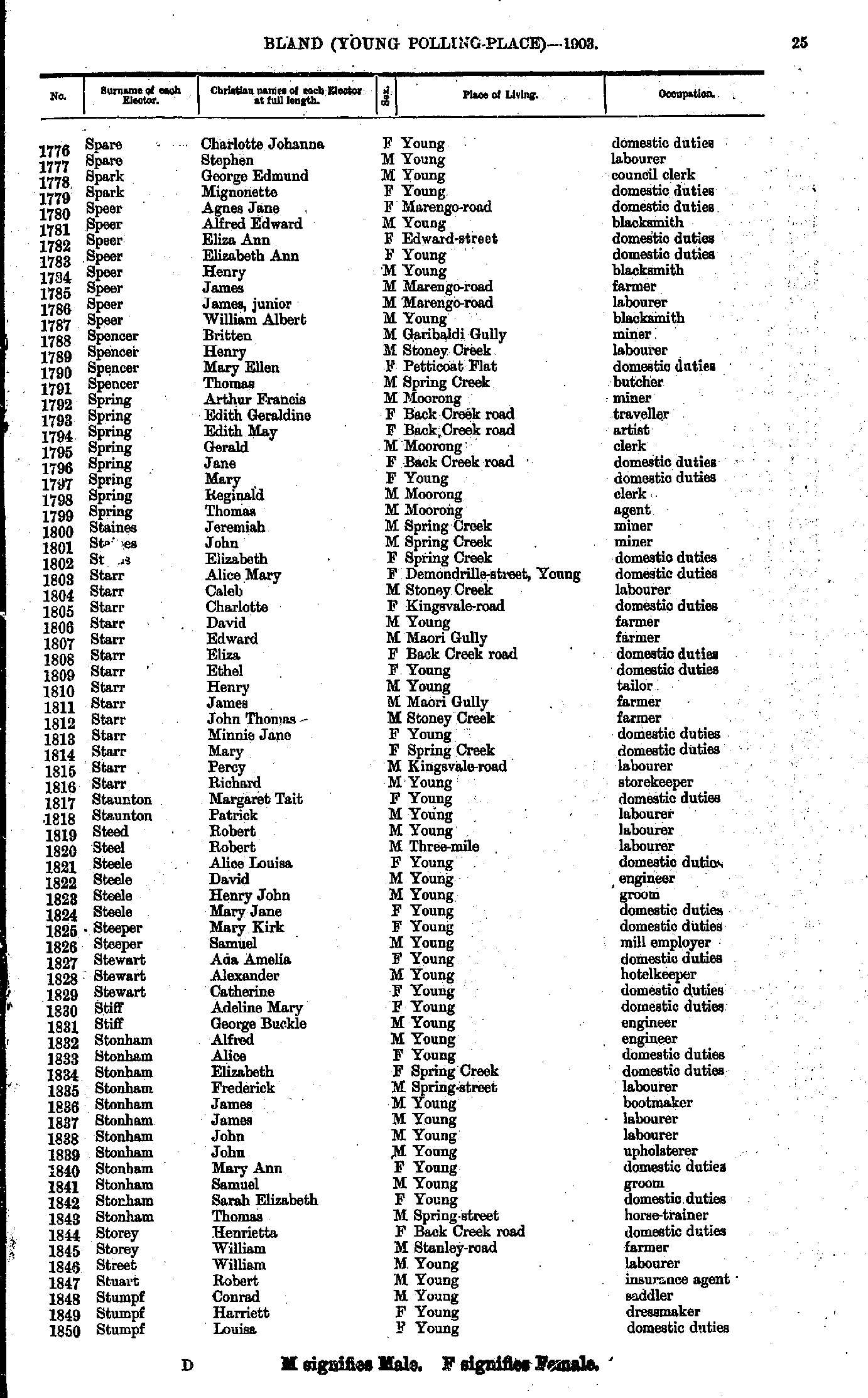
- Spare Charlotte - Stumpf Louisa
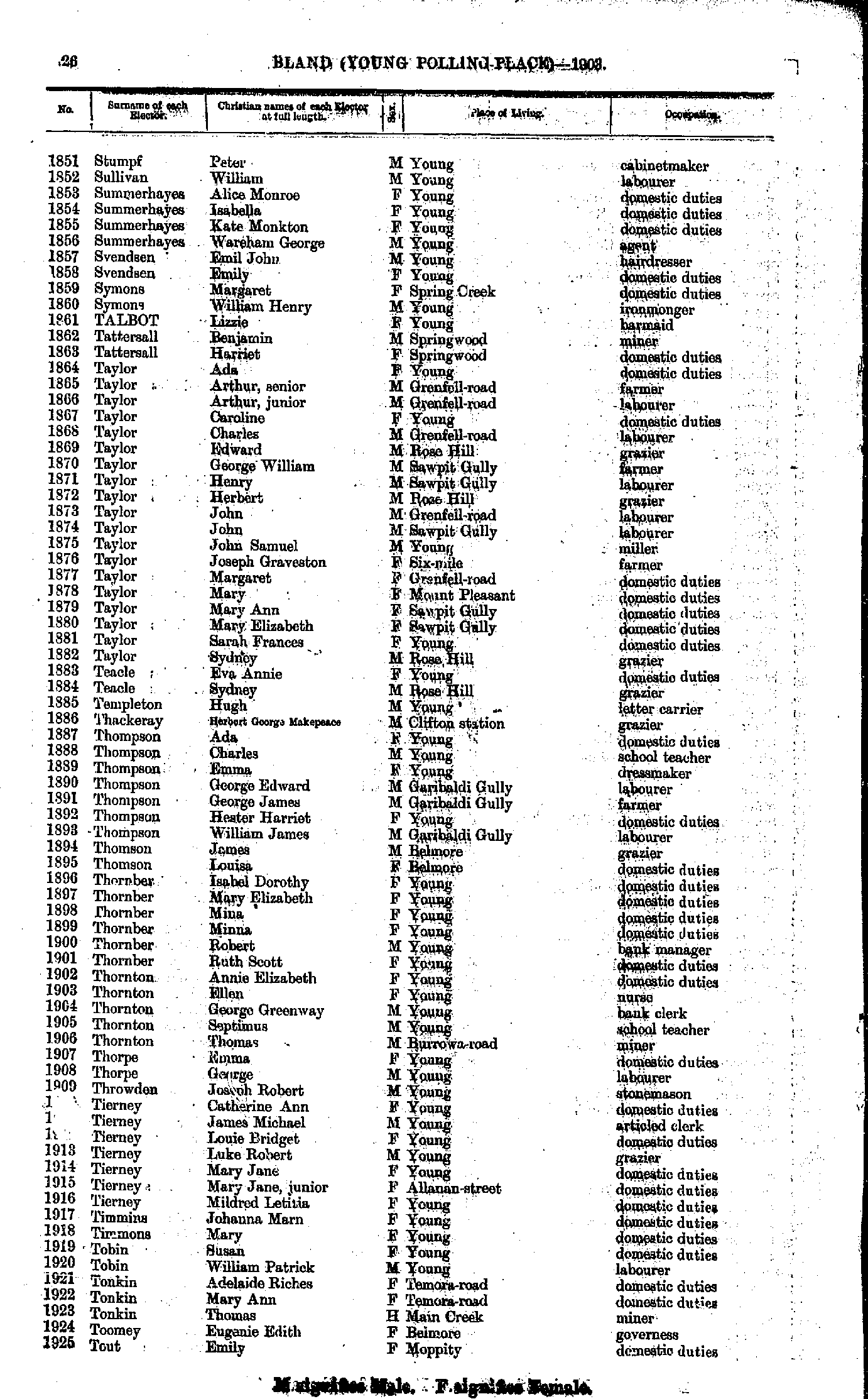
- Stumpf Peter - Tout Emily
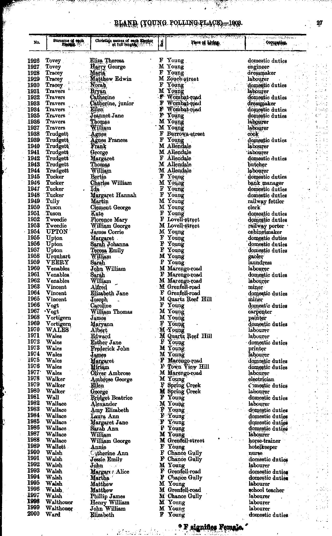
- Tovey Eliza - Ward Elizabeth
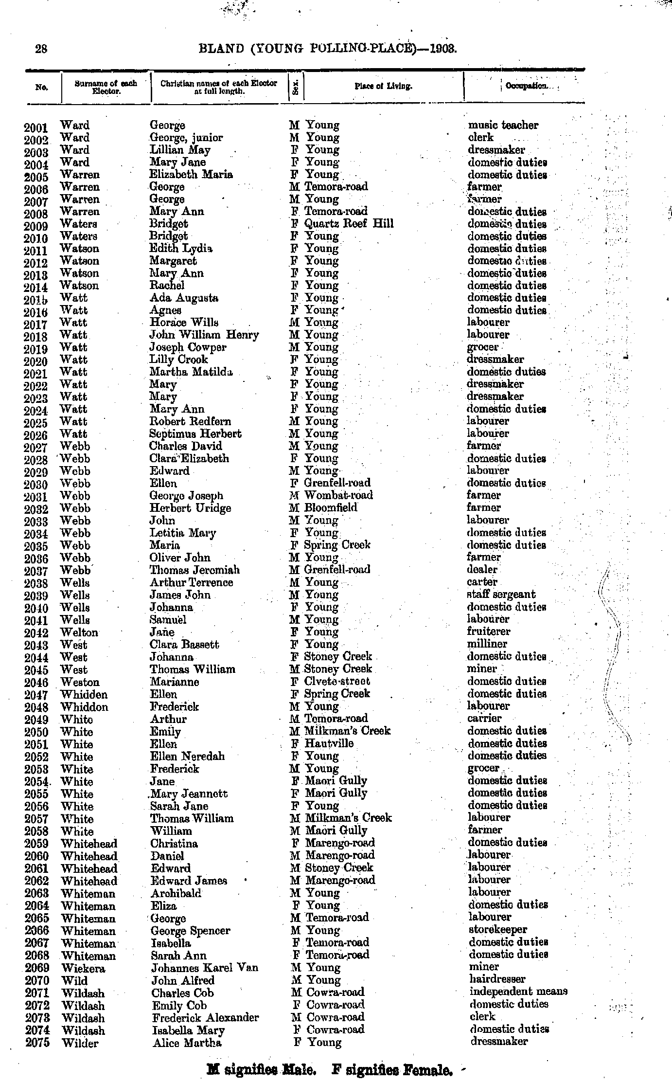
- Ward George - Wilder Alice
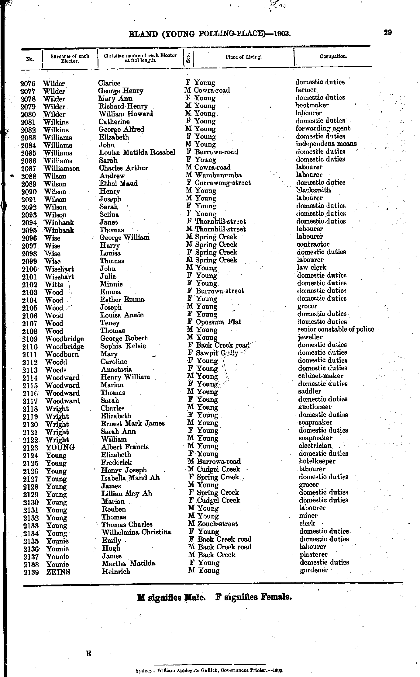
- Wilder Clarice - Zeins Heinrich
From: Federal Electoral Districts Commissioners 1901, Maps of the Federal Electoral Districts of the State of New South Wales, William Applegate Gullick, Government Printer, Sydney.
JPEG file (237KB)
Portable Document Format(PDF) file (1.34MB)If you do not have a PDF reader you can click on the button to download the free Adobe Acrobat Reader
The documents in this site are arranged into seven major indexes. You are currently in the Electoral Rolls index. Use the Back button on your browser to move within this index, or use the links below to view another index:
- Directories
- Electoral Rolls
- Land Records
- General and Miscellaneous Records
- Mining Records
- Pastoral and Agricultural Records
- Other Occupations
Copyright © Internet History Resources 2005
