IHR NSW Family History Documents
Electoral Rolls Index
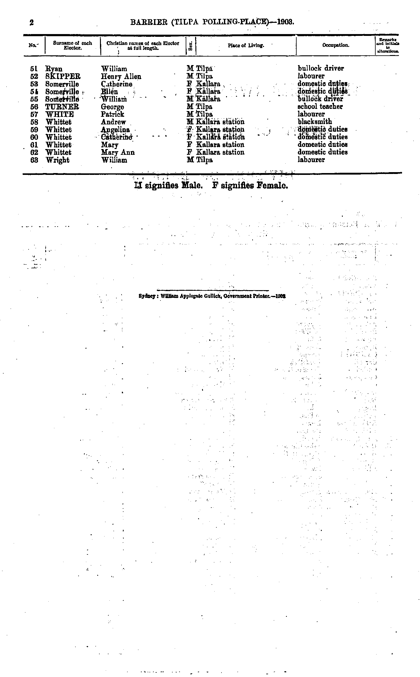
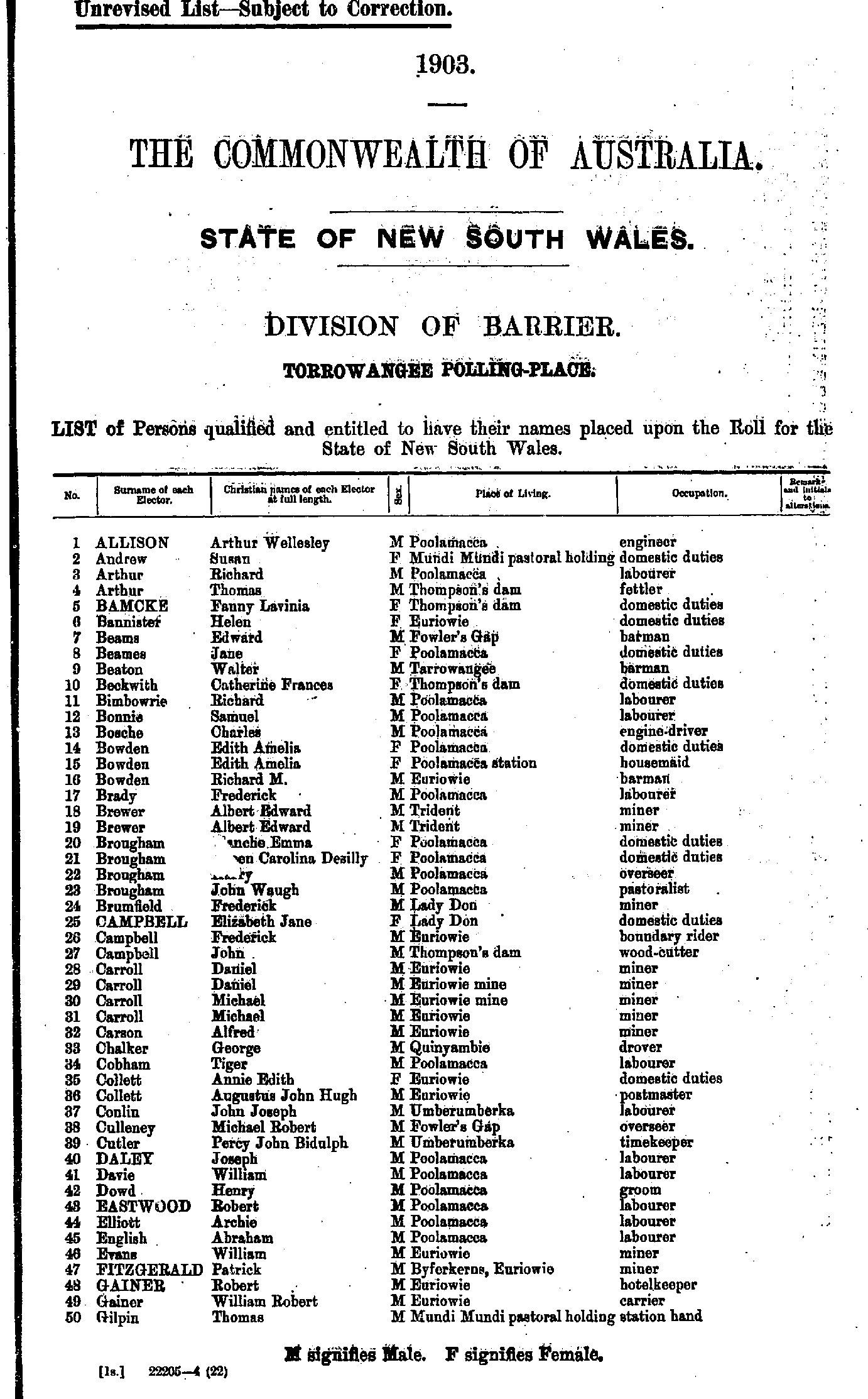
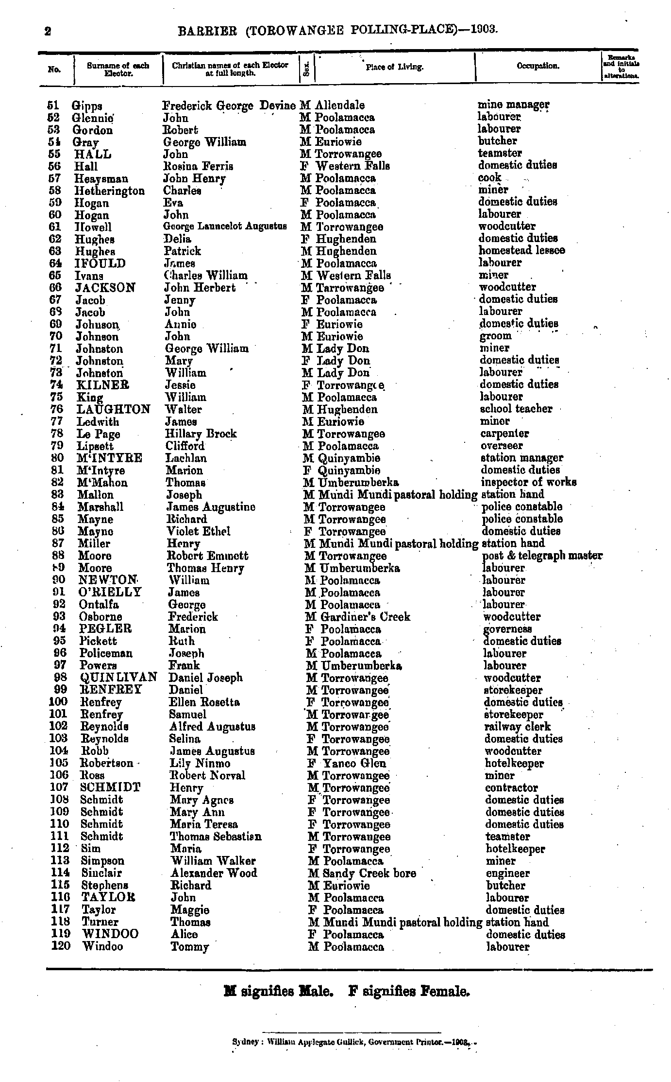
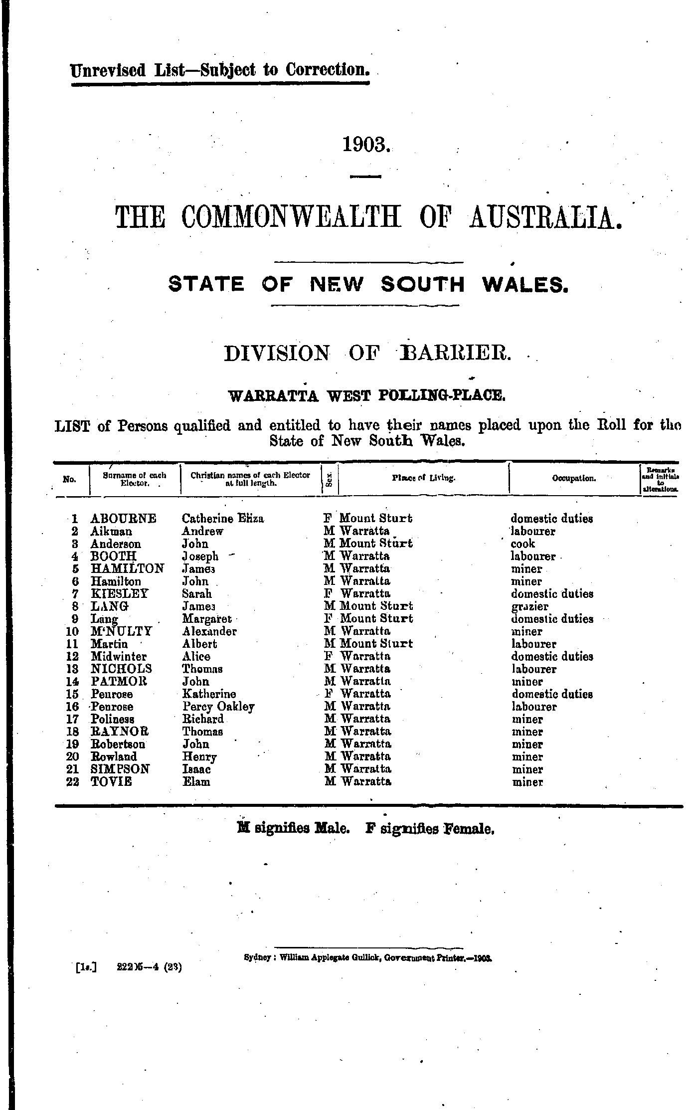
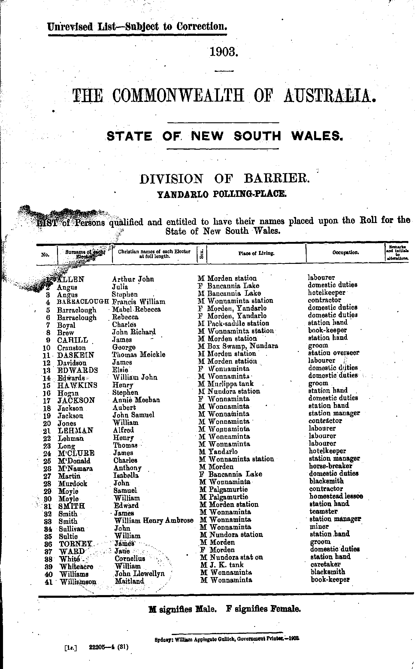
Home | Directories | Electoral | Land | General | Mining | Pastoral | OccupationsNSW Electoral Rolls 1903 - Barrier Division
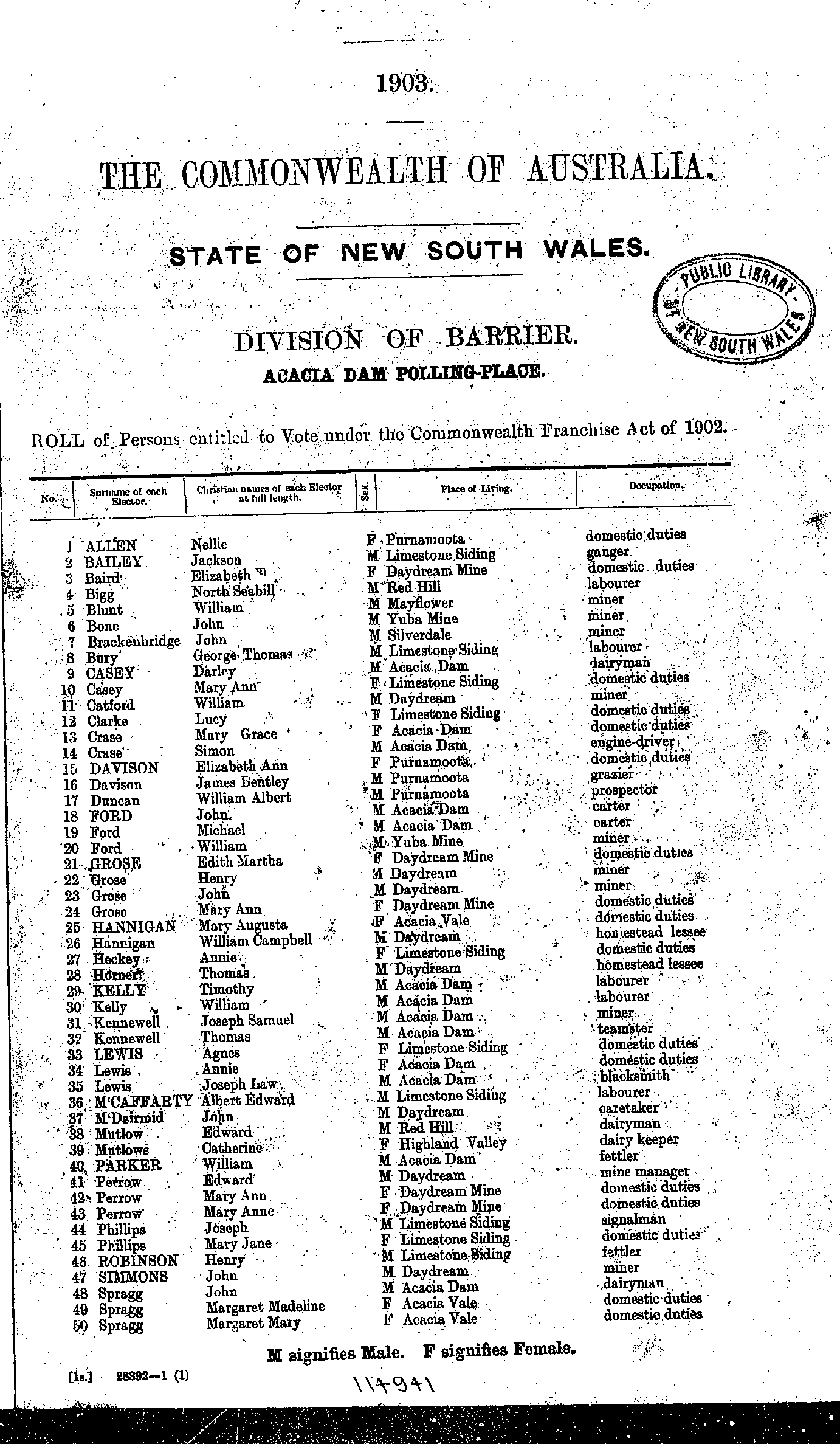
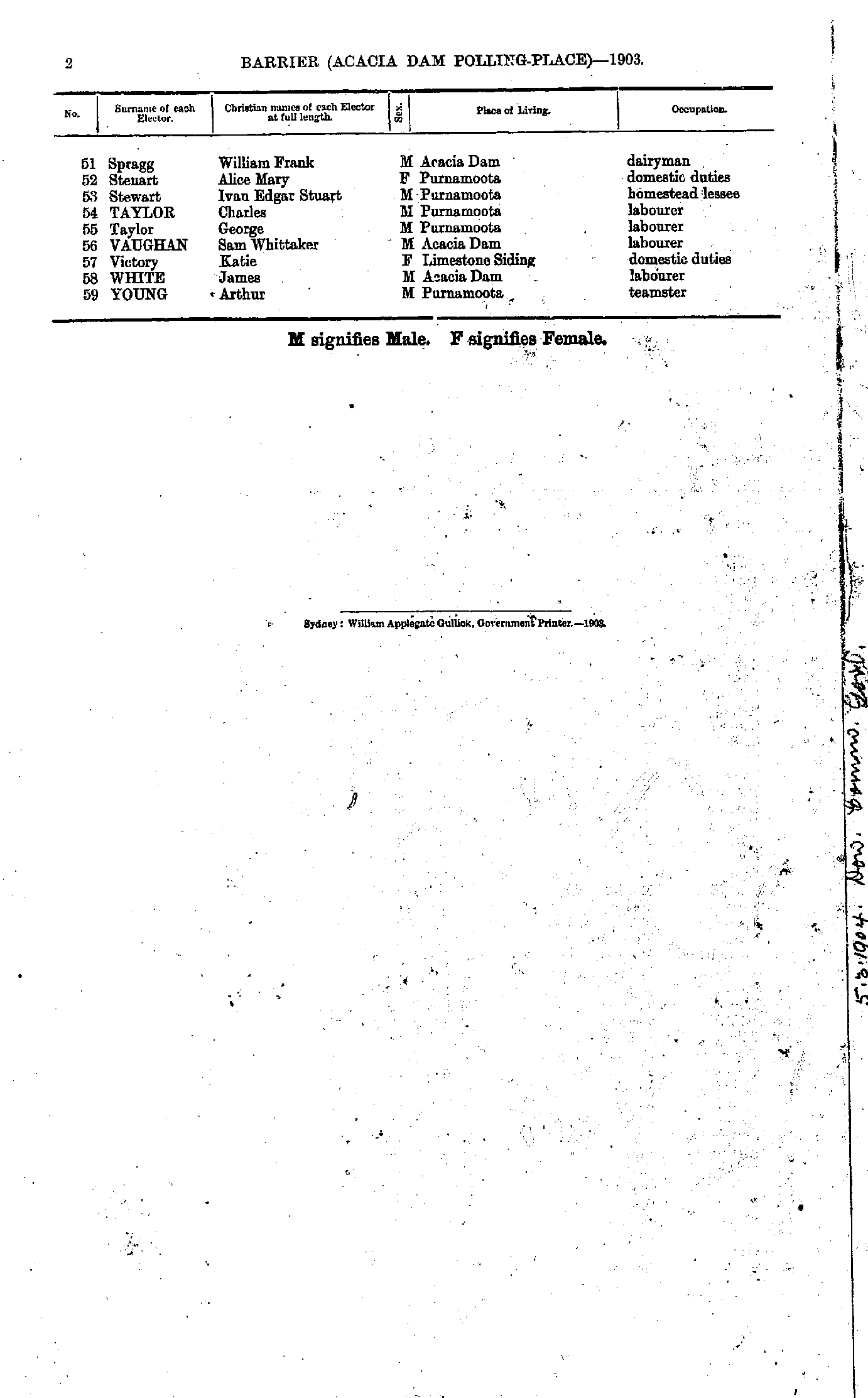
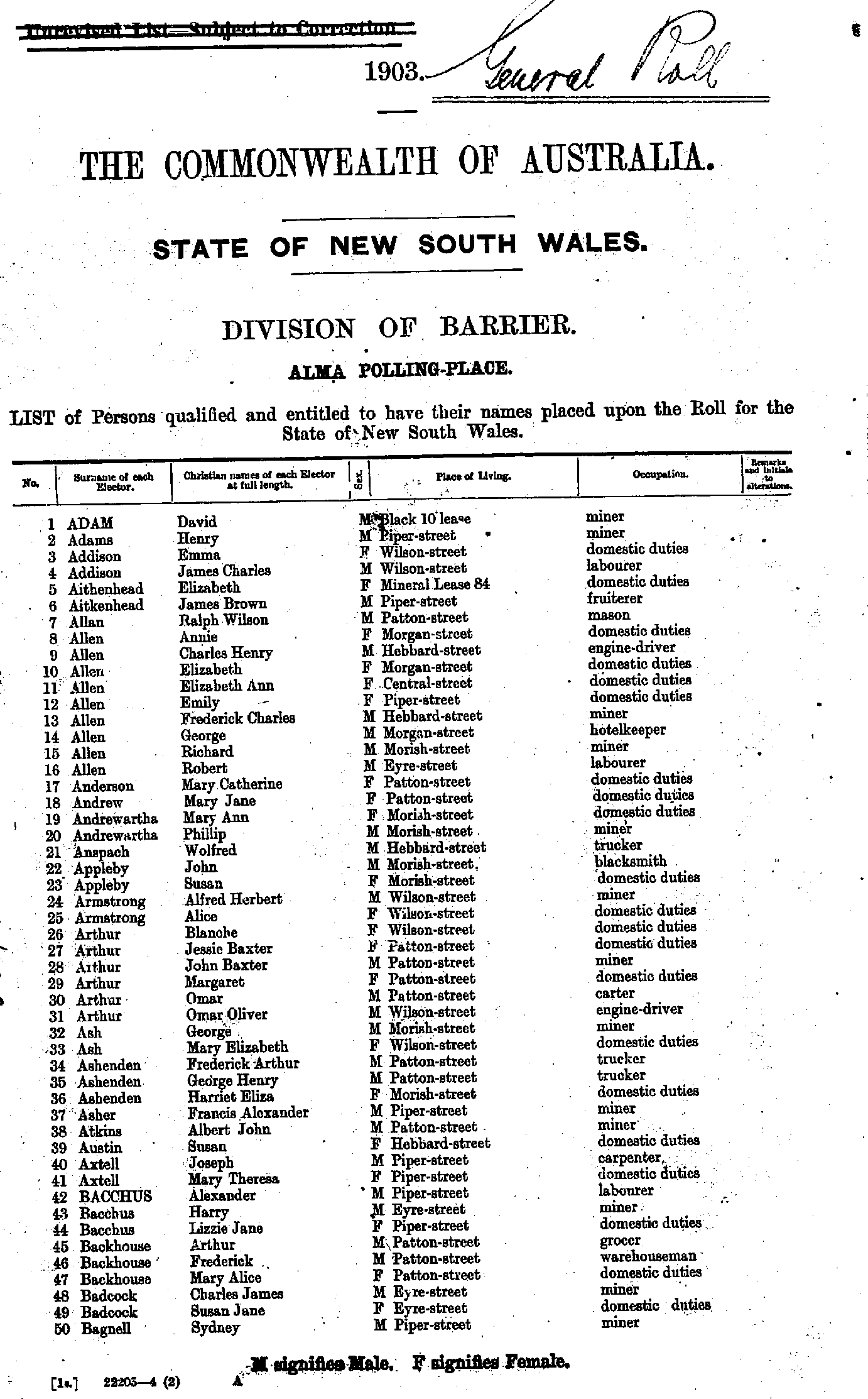
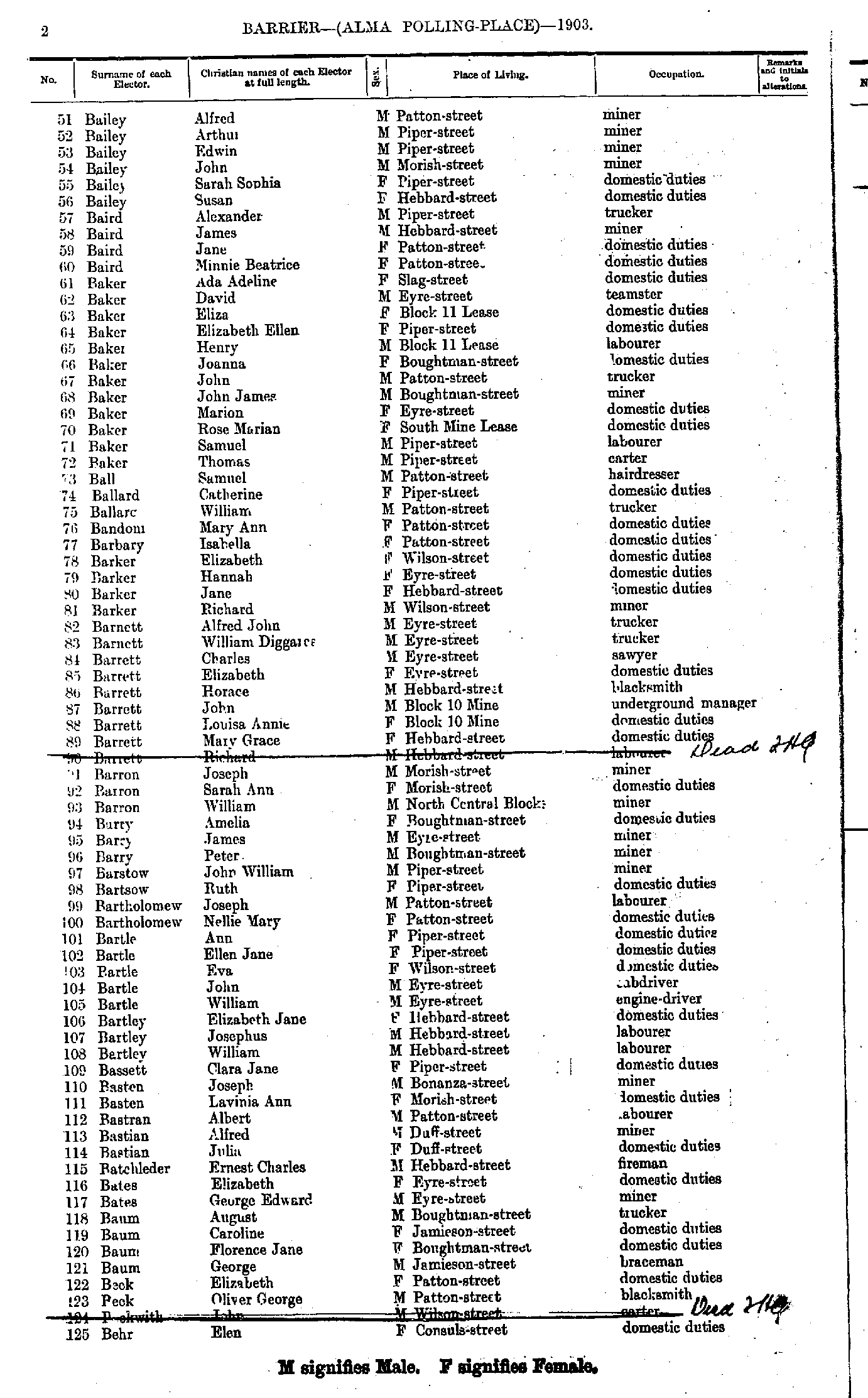
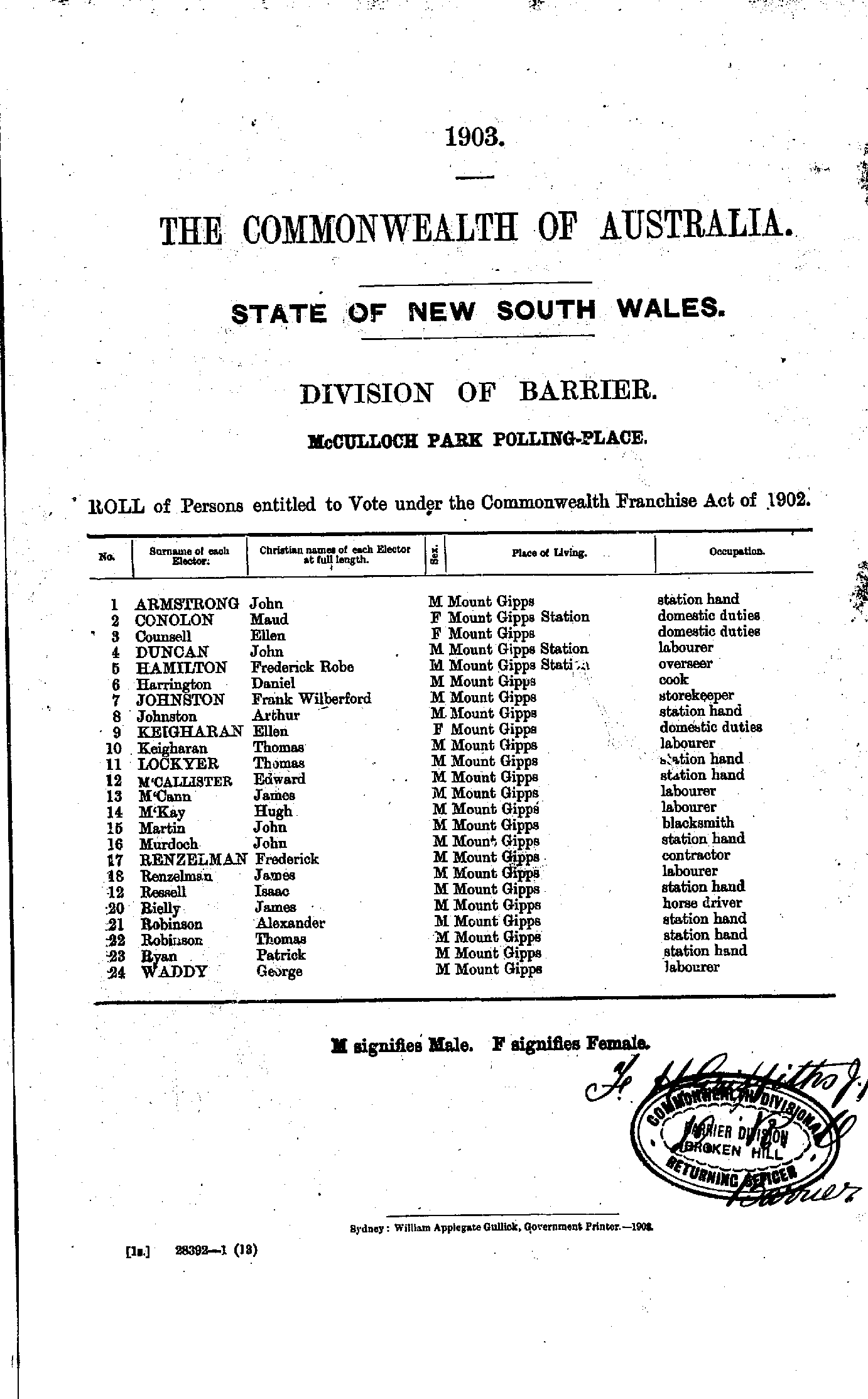
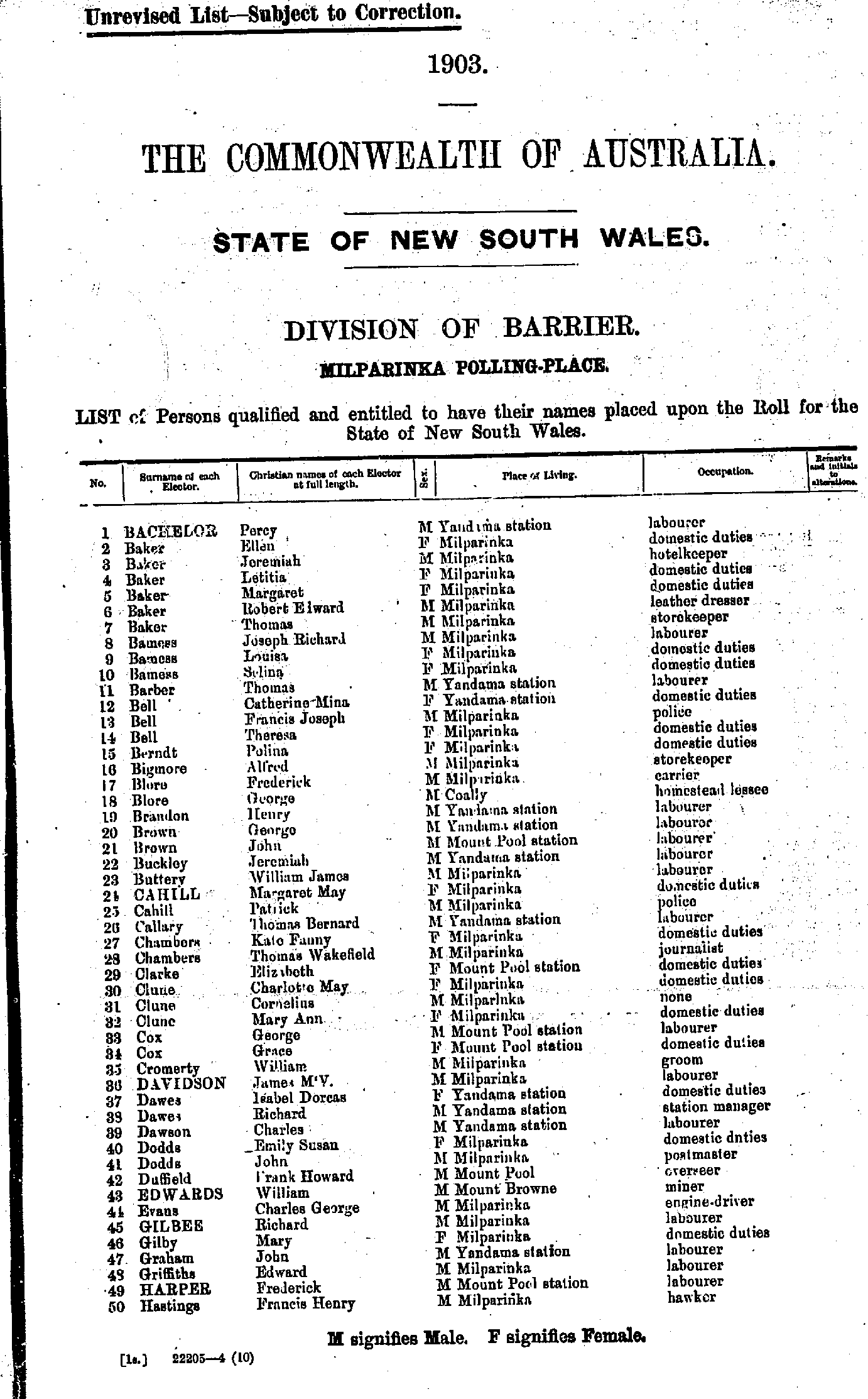
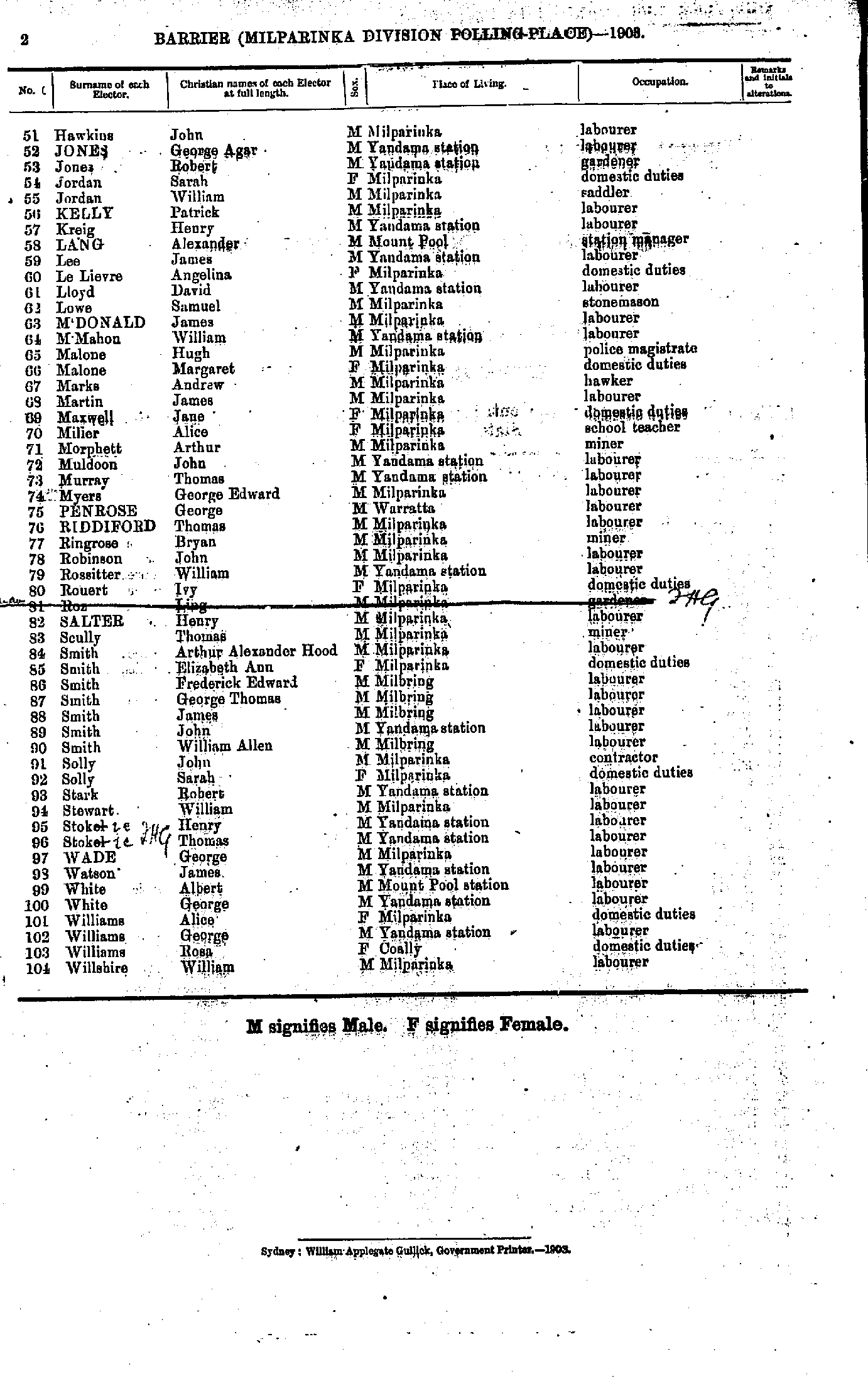
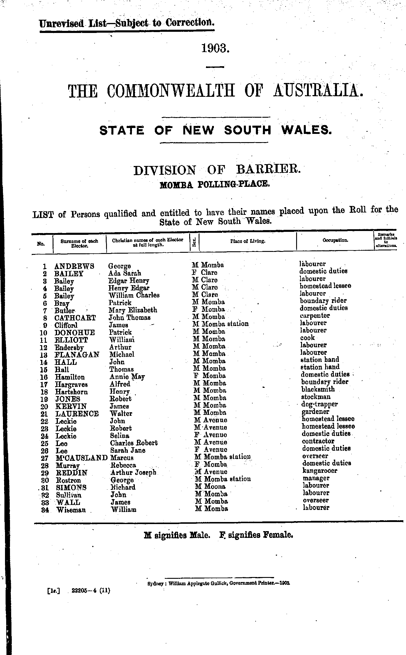
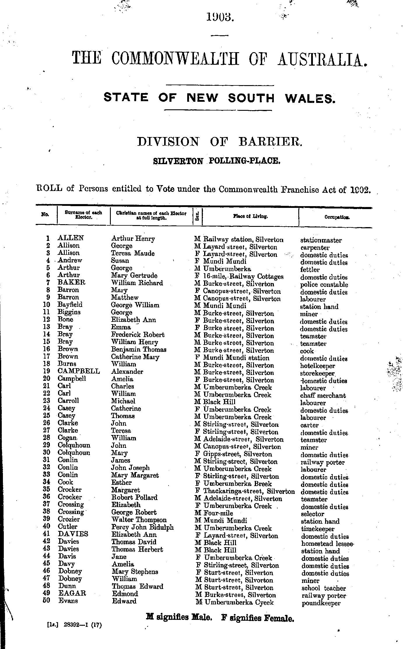
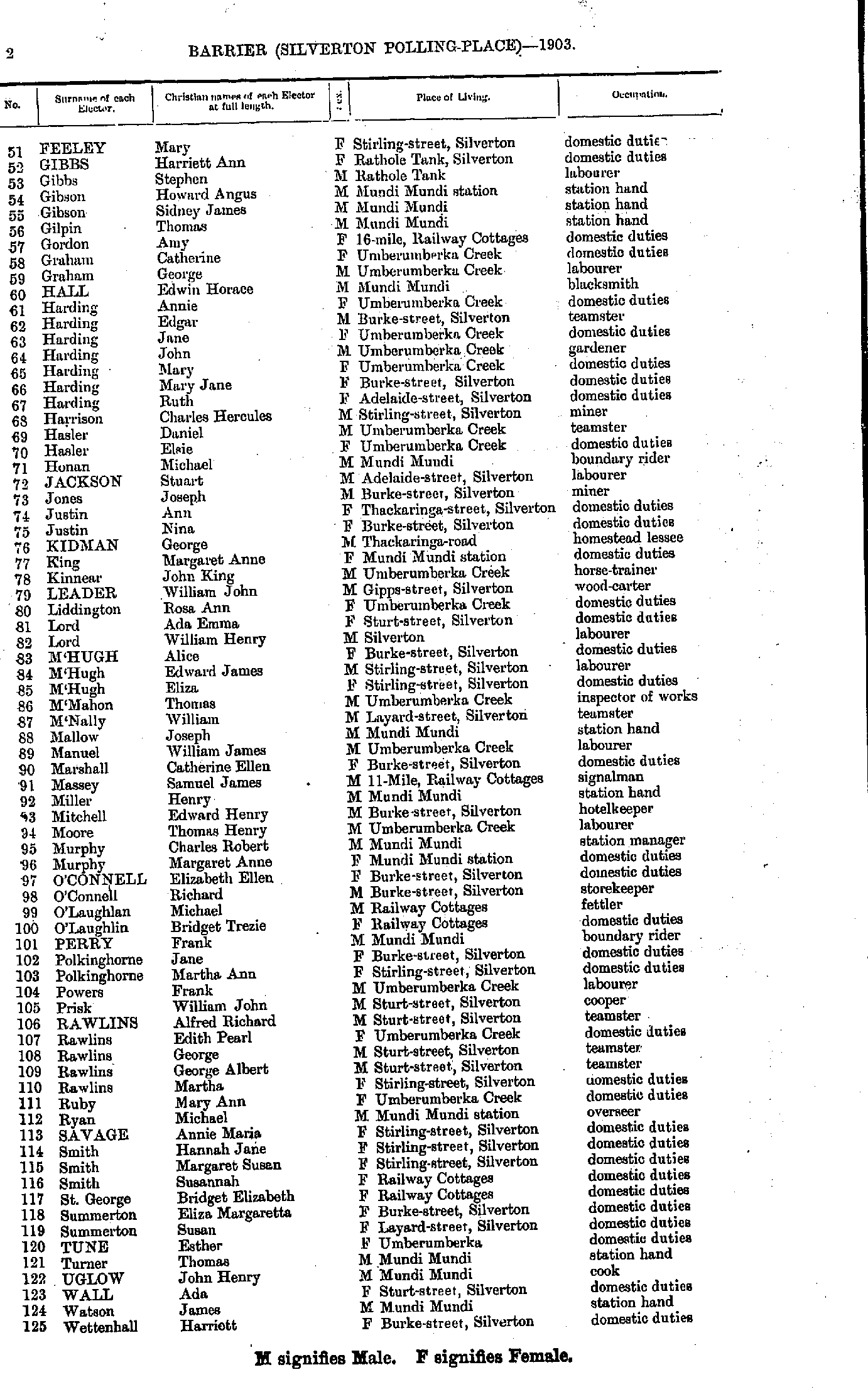
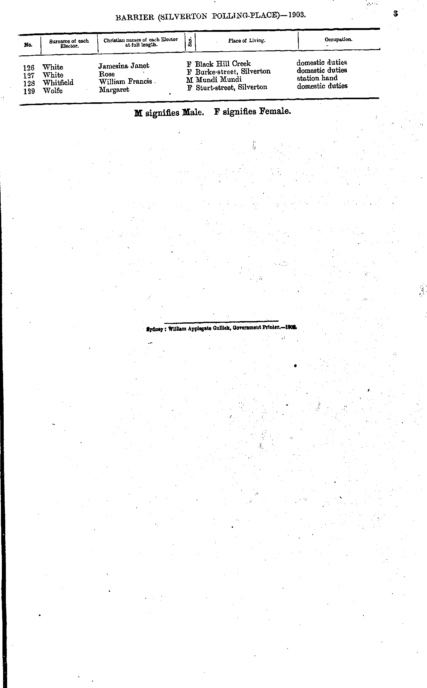
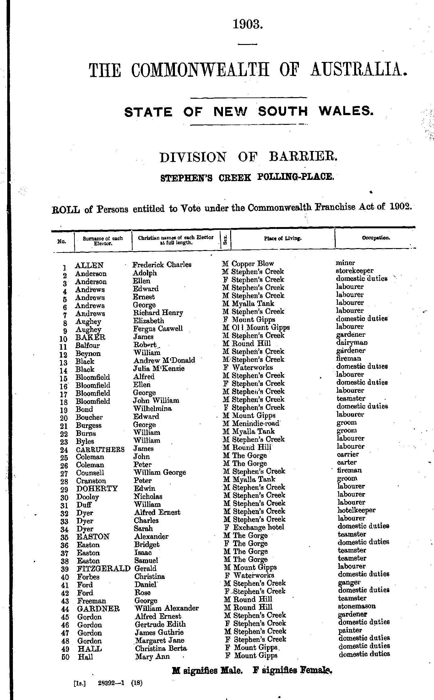
Roll of Persons entitled to Vote under the Commonwealth Franchise Act of 1902 Reproduced from microform copies of the originals in the Mitchell Library, State Library of New South Wales.
Index Copyright © Internet History Resources 2005
Electoral Maps of the Barrier Division, 1901
Polling Places:
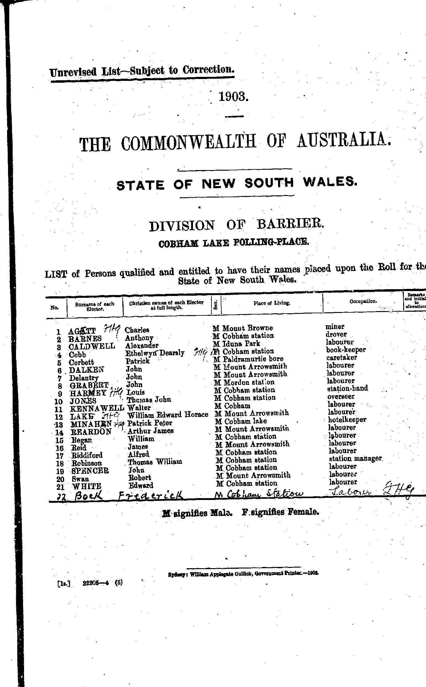
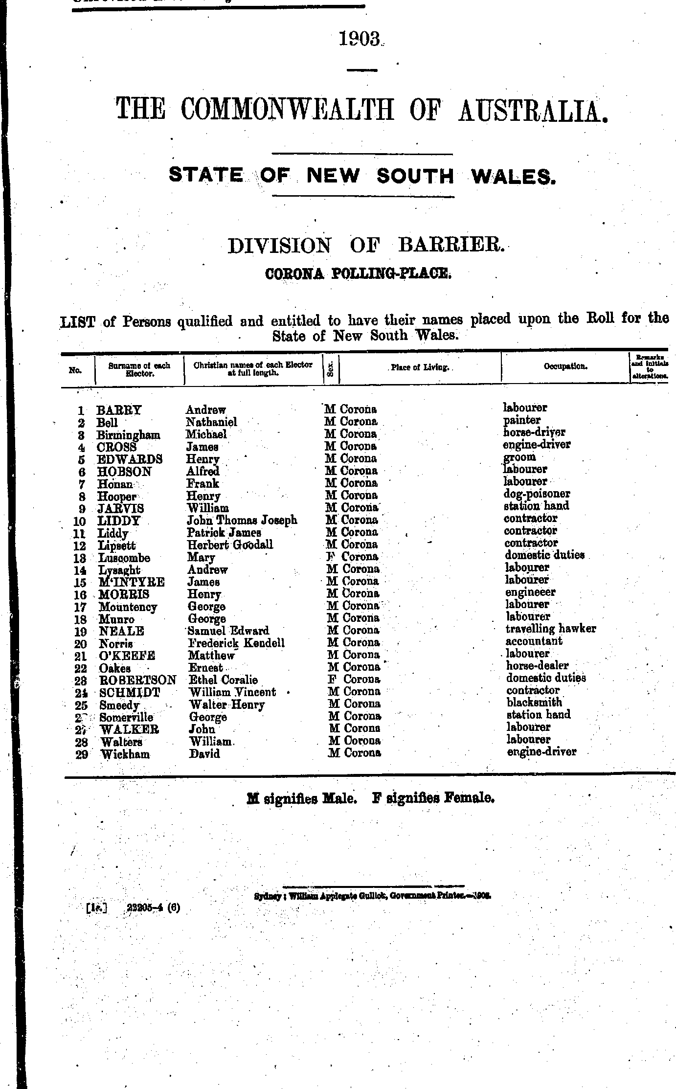
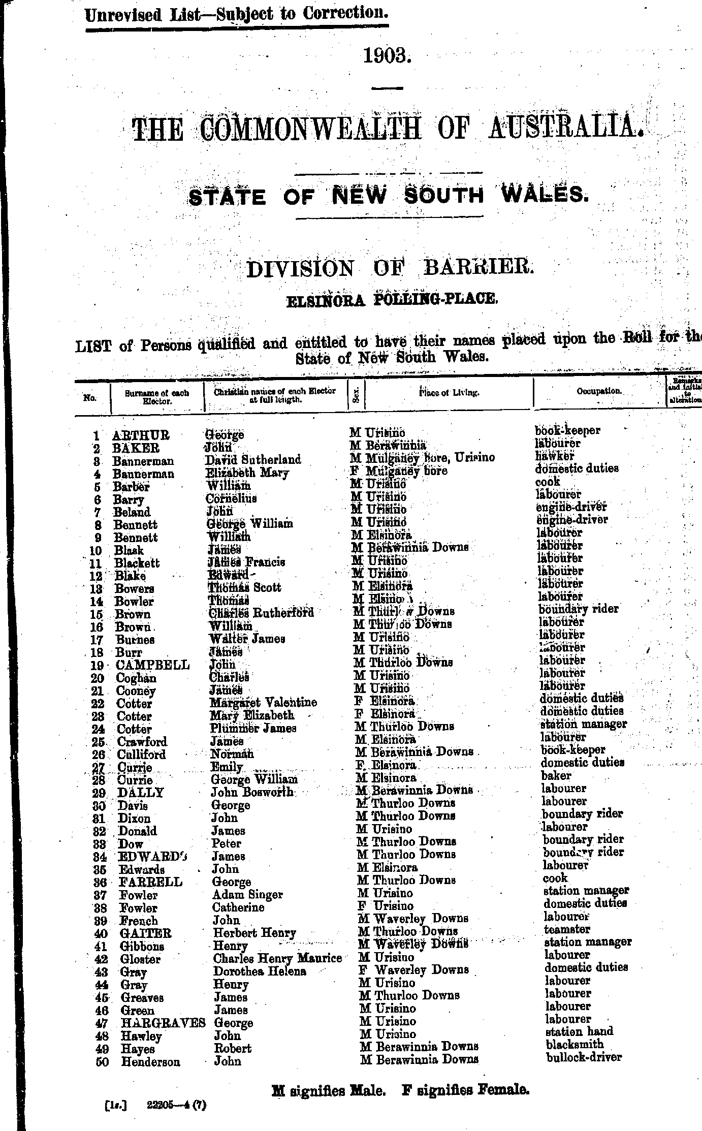
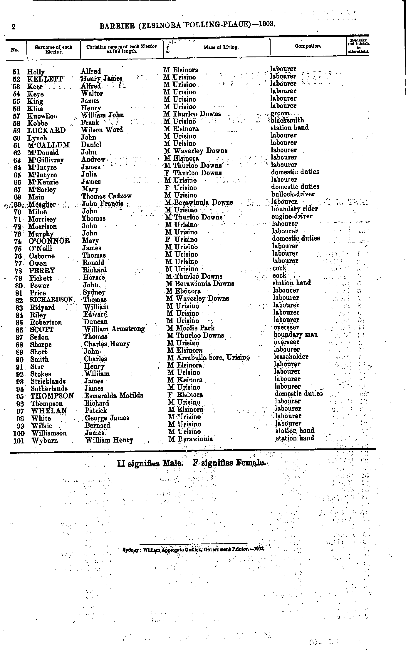
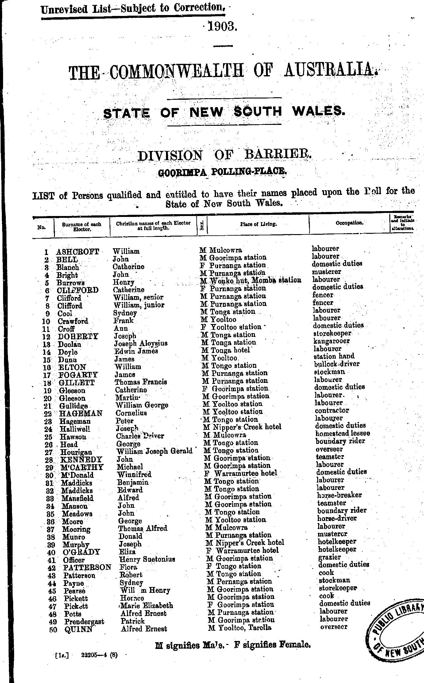
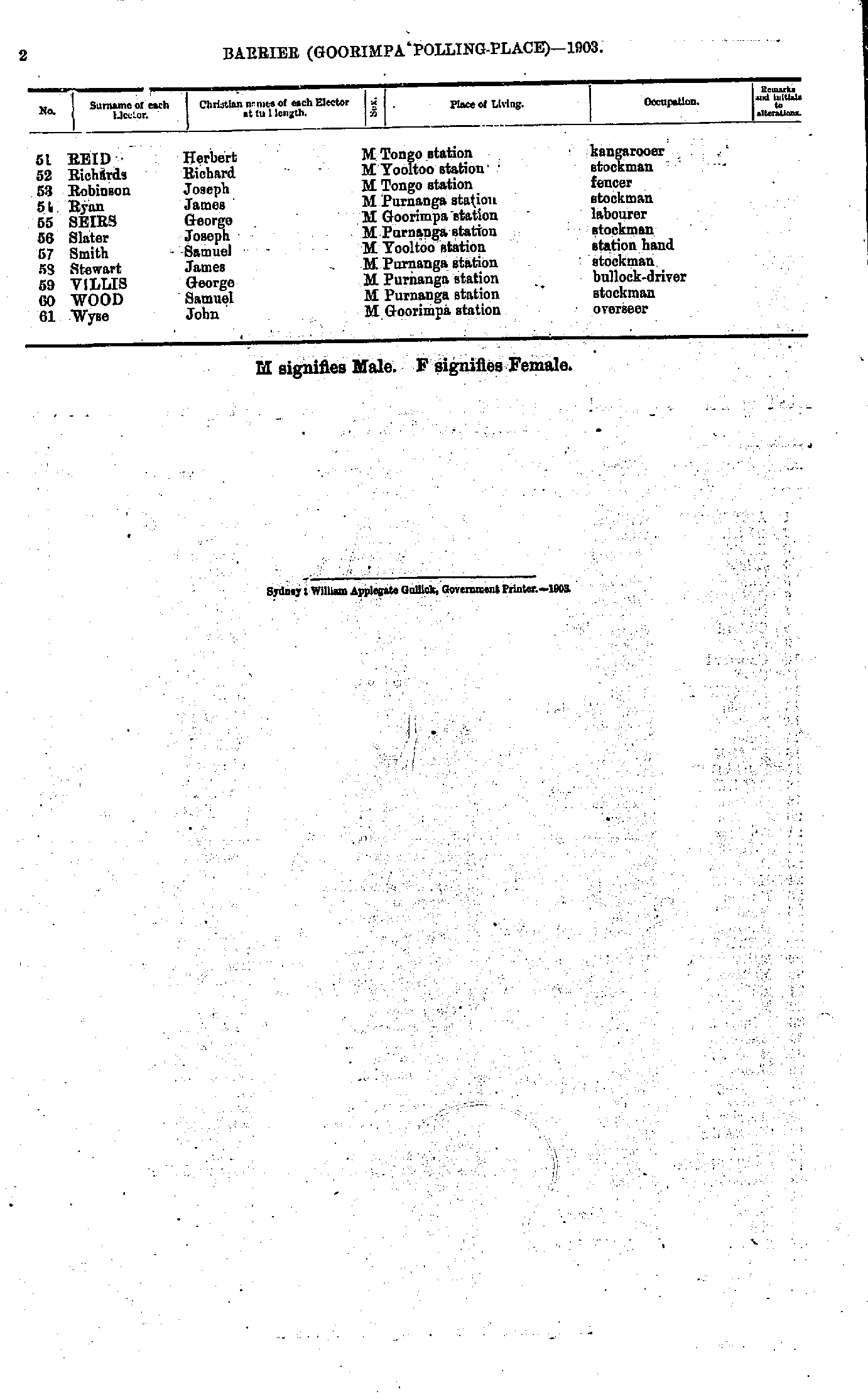
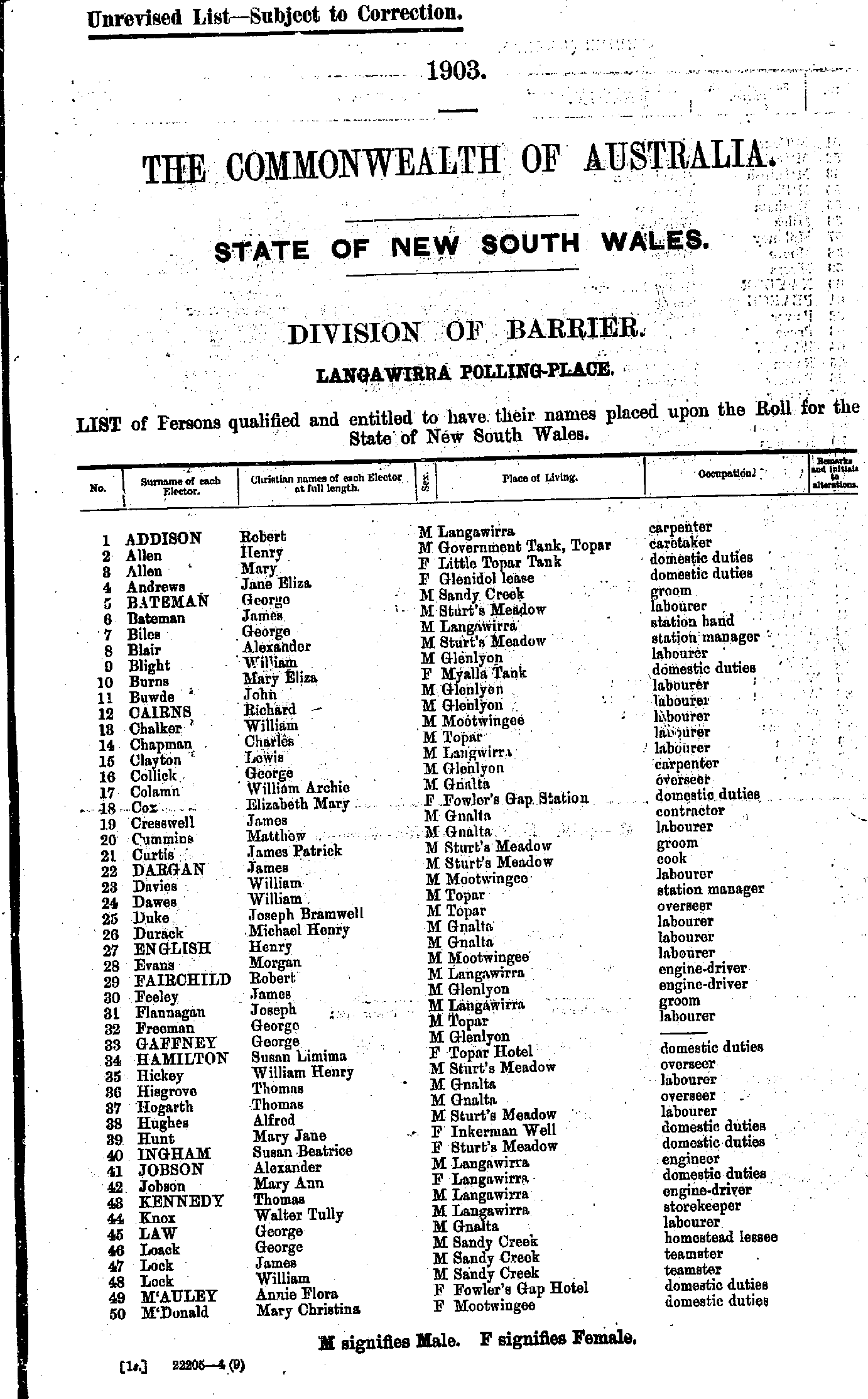
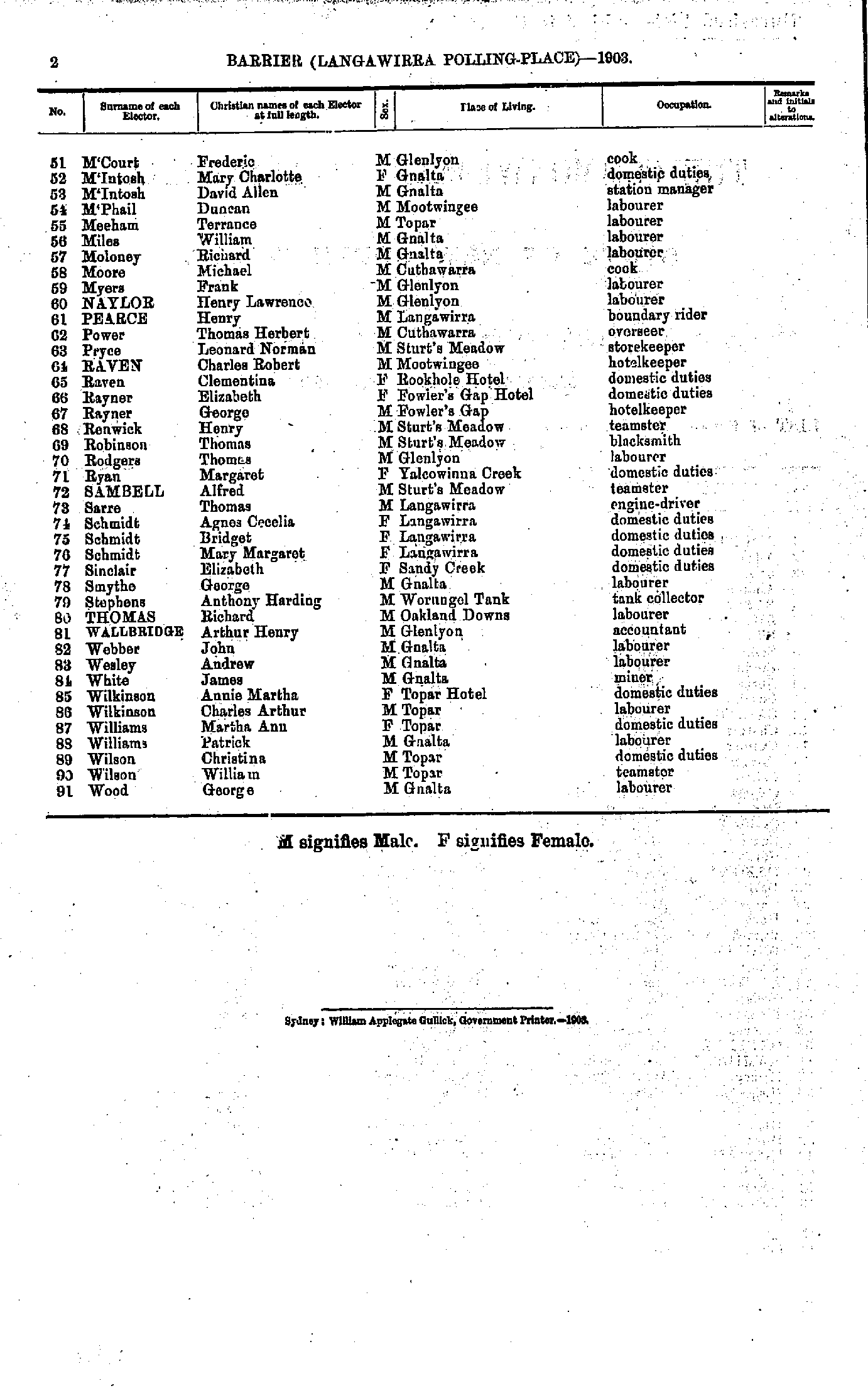
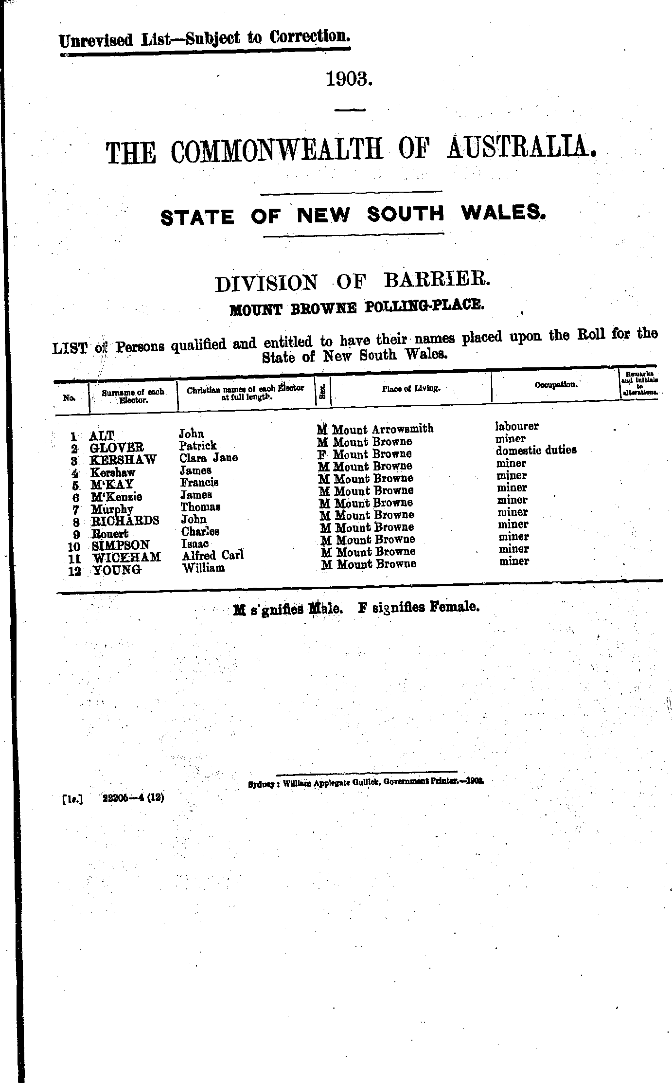
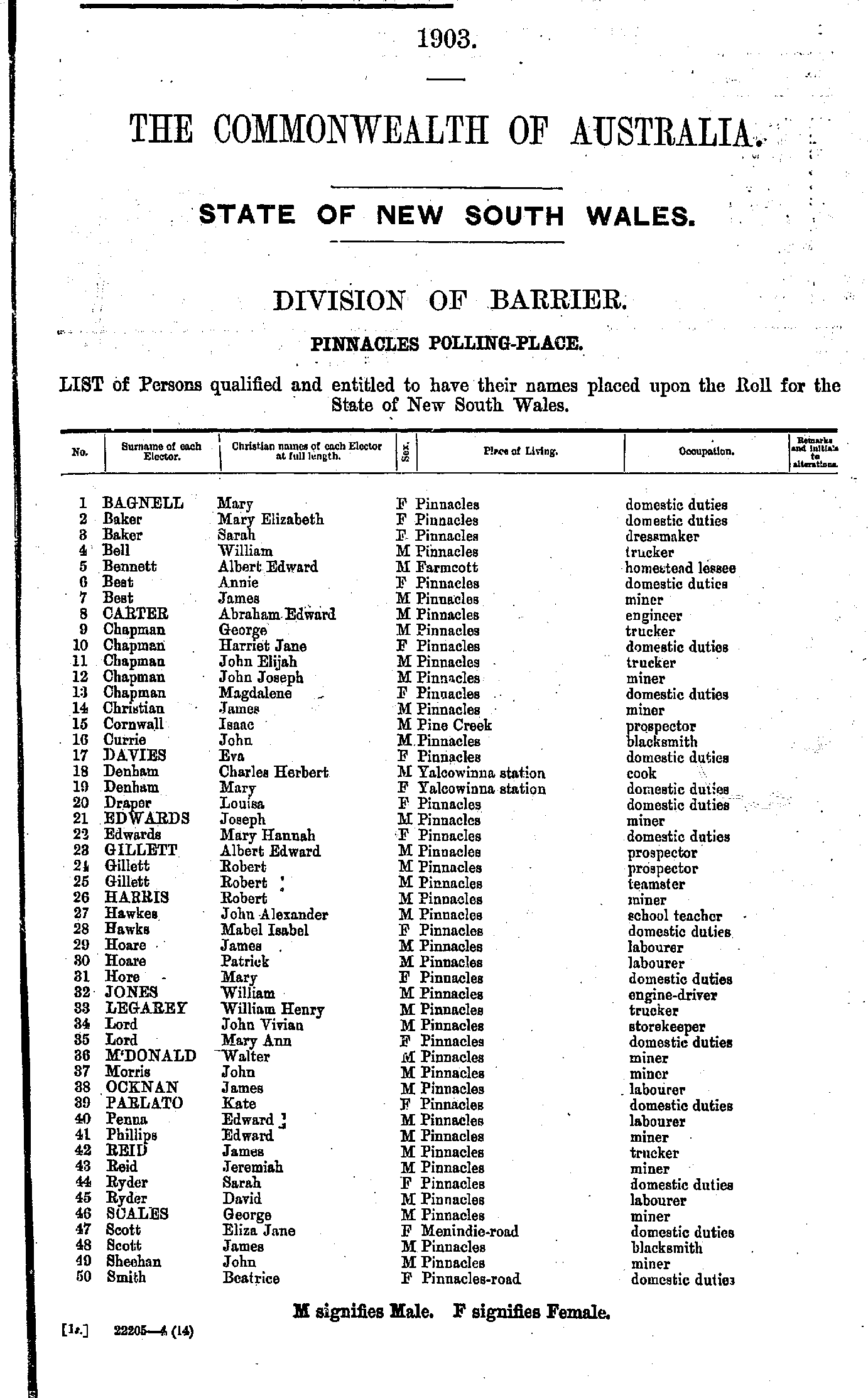
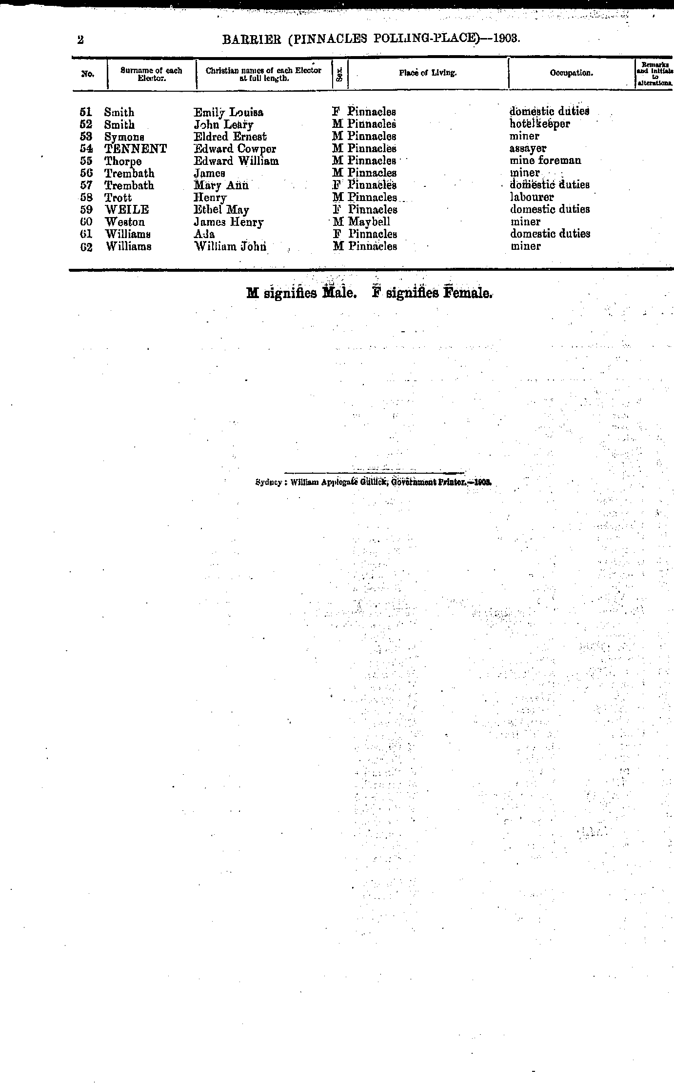
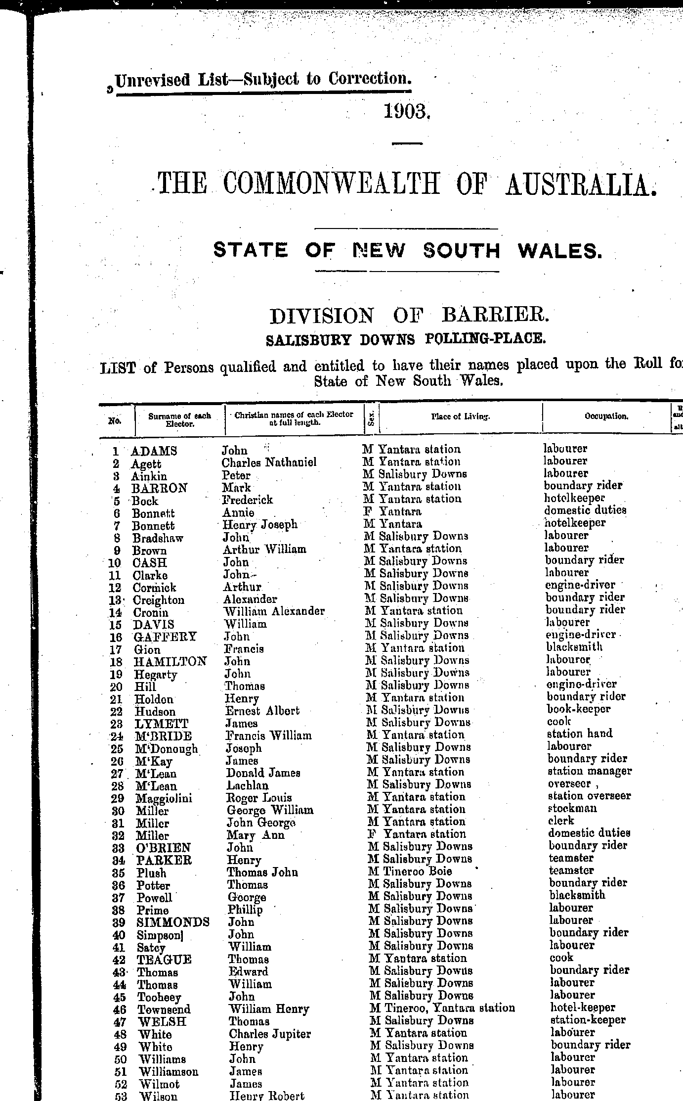
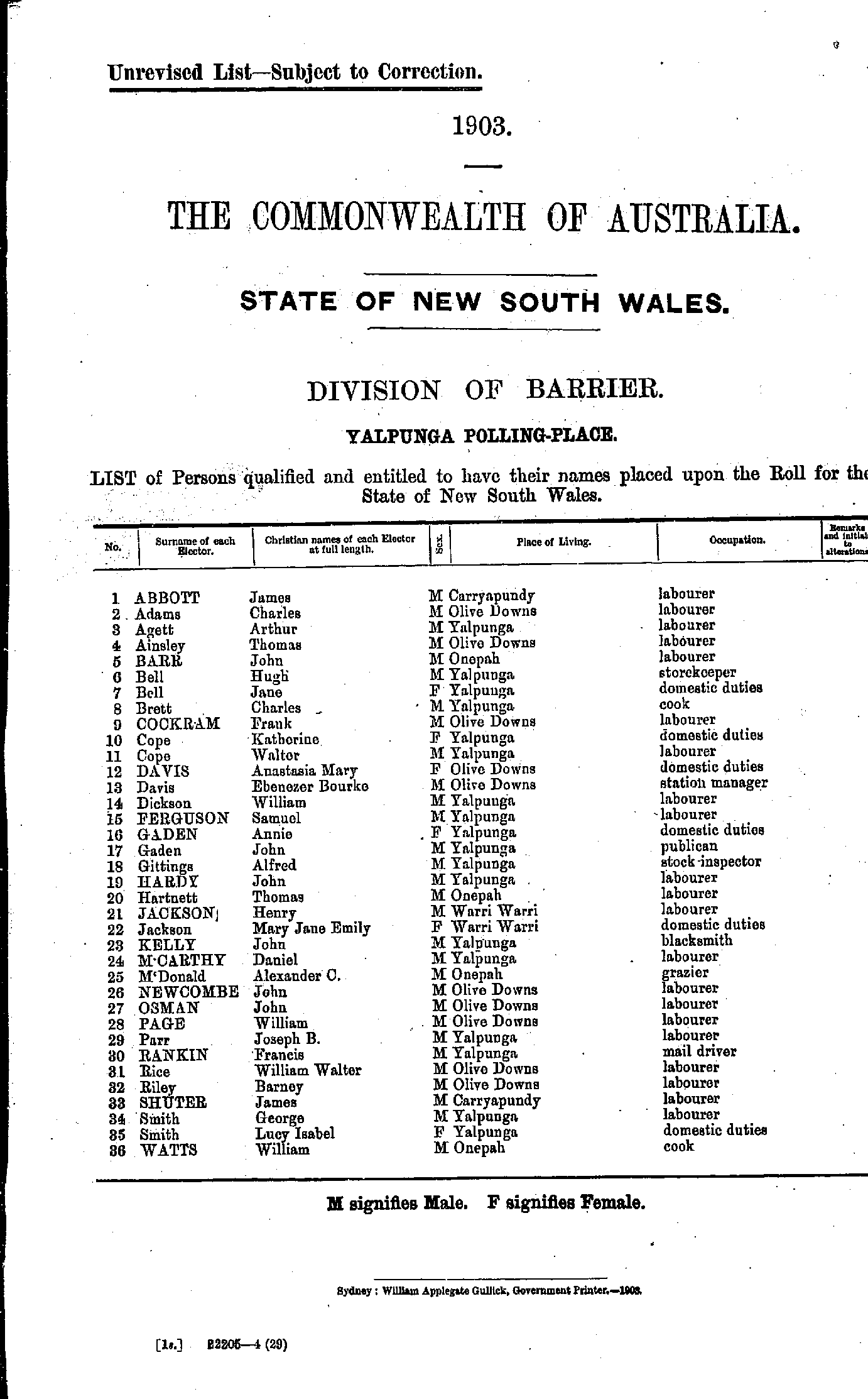
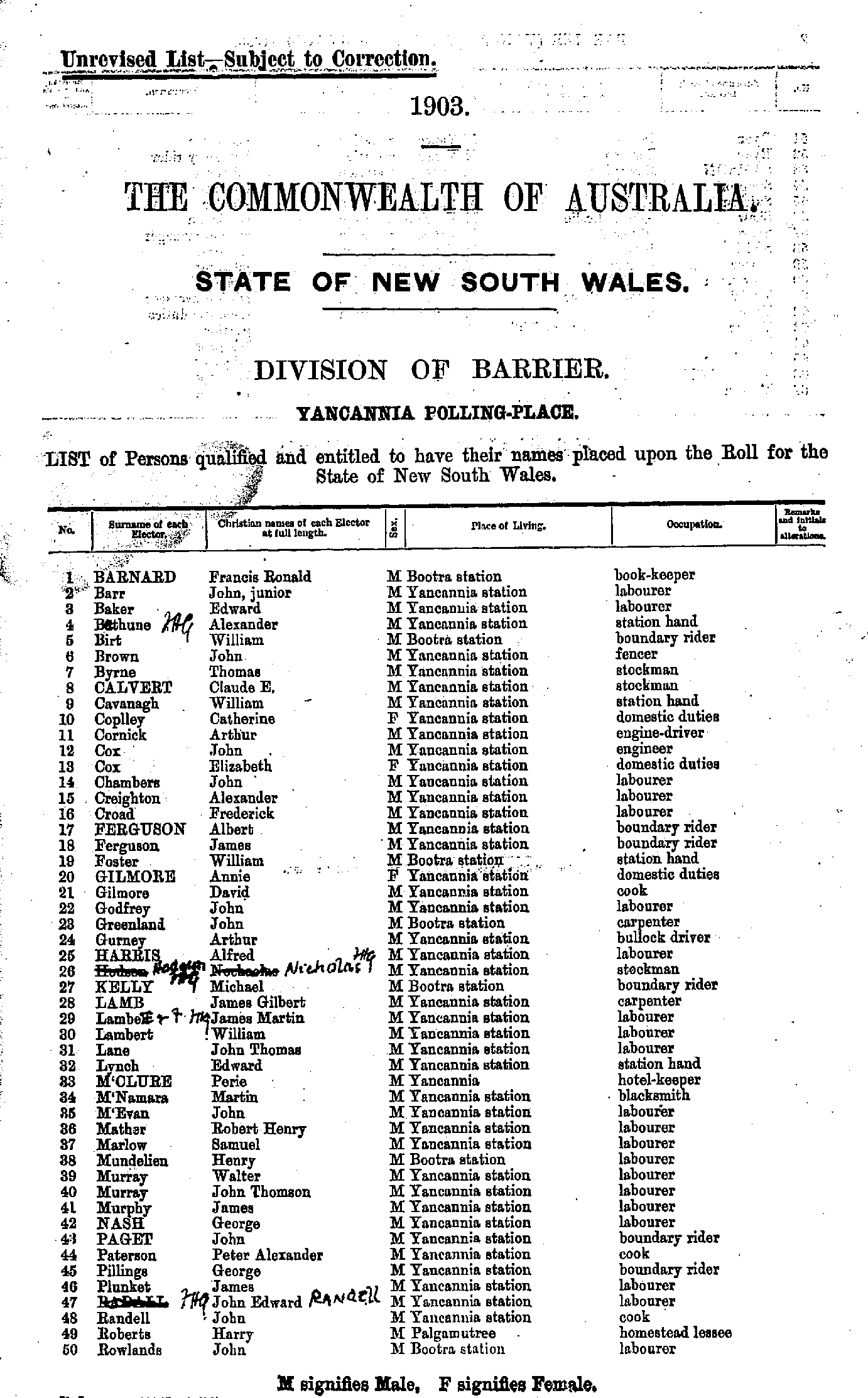
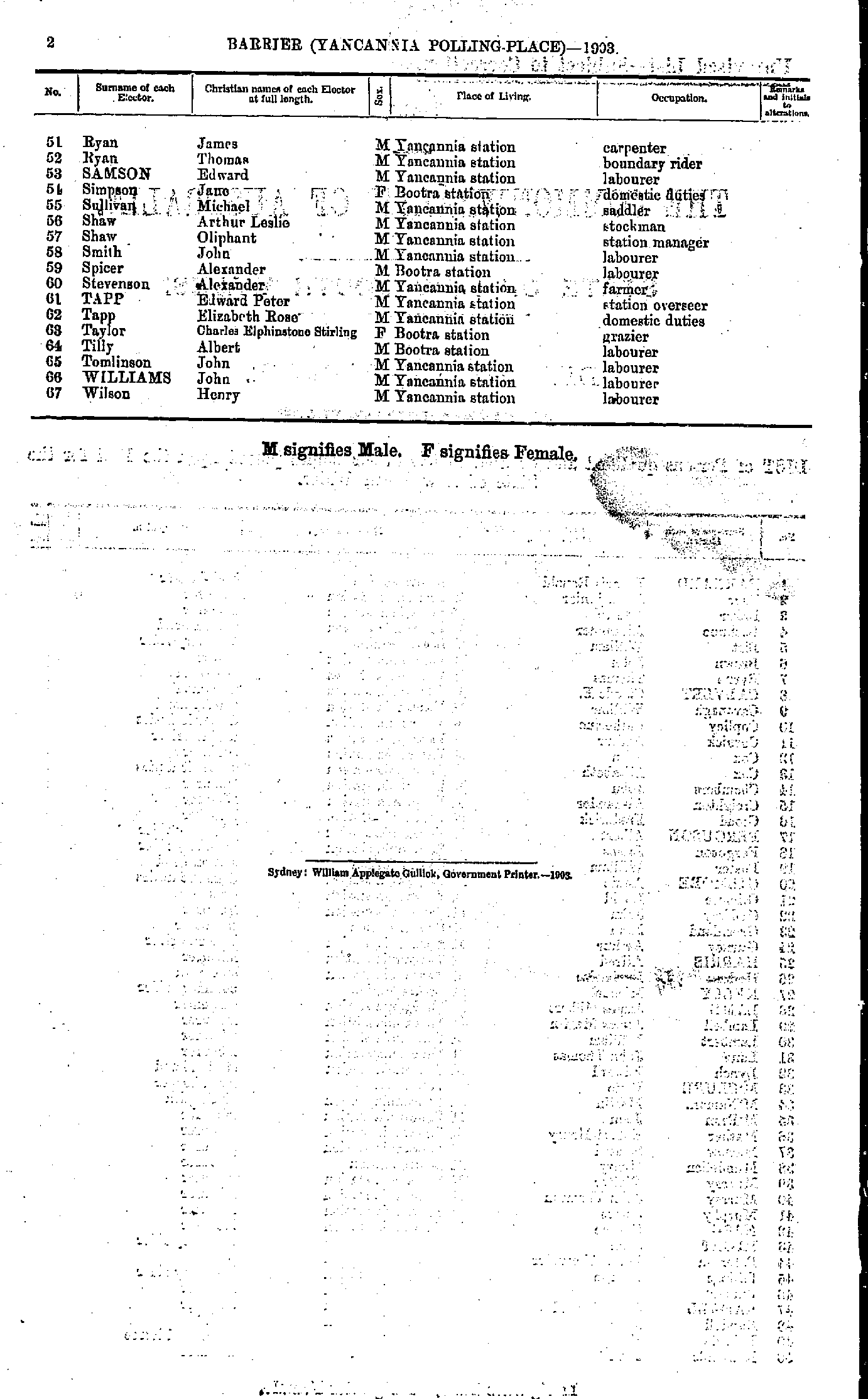
Acacia Dam | Alma | Broken Hill North | Burke | Cobham Lake | Corona | Elsinora | Goorimpa | Langawirra | McCulloch Park | Milparinka | Momba | Mount Browne | Pinnacles | Salisbury Downs | Silverton | Stephen's Creek | Thackaringa | Tibooburra | Tilpa | Torrowangee | Warratta West | Weinteriga | Wertago | White Cliffs | Wilcannia | Willyama | Yalpunga | Yancannia | Yandarlo
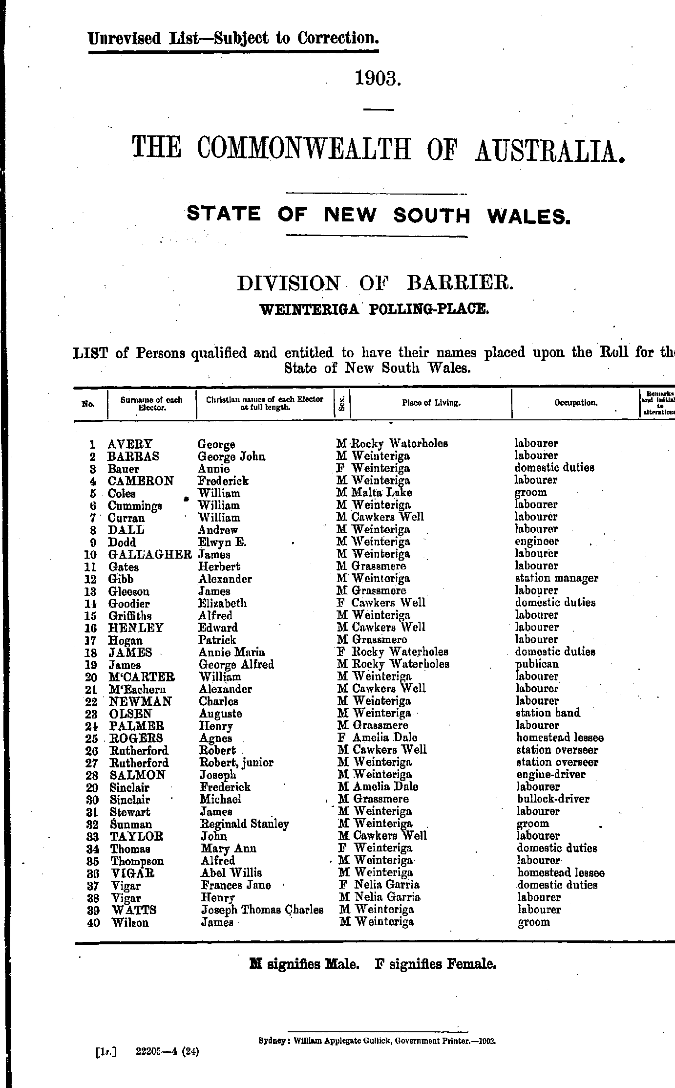
- Adam David - Bagnell Sydney
- Bailey Alfred - Behr Elen
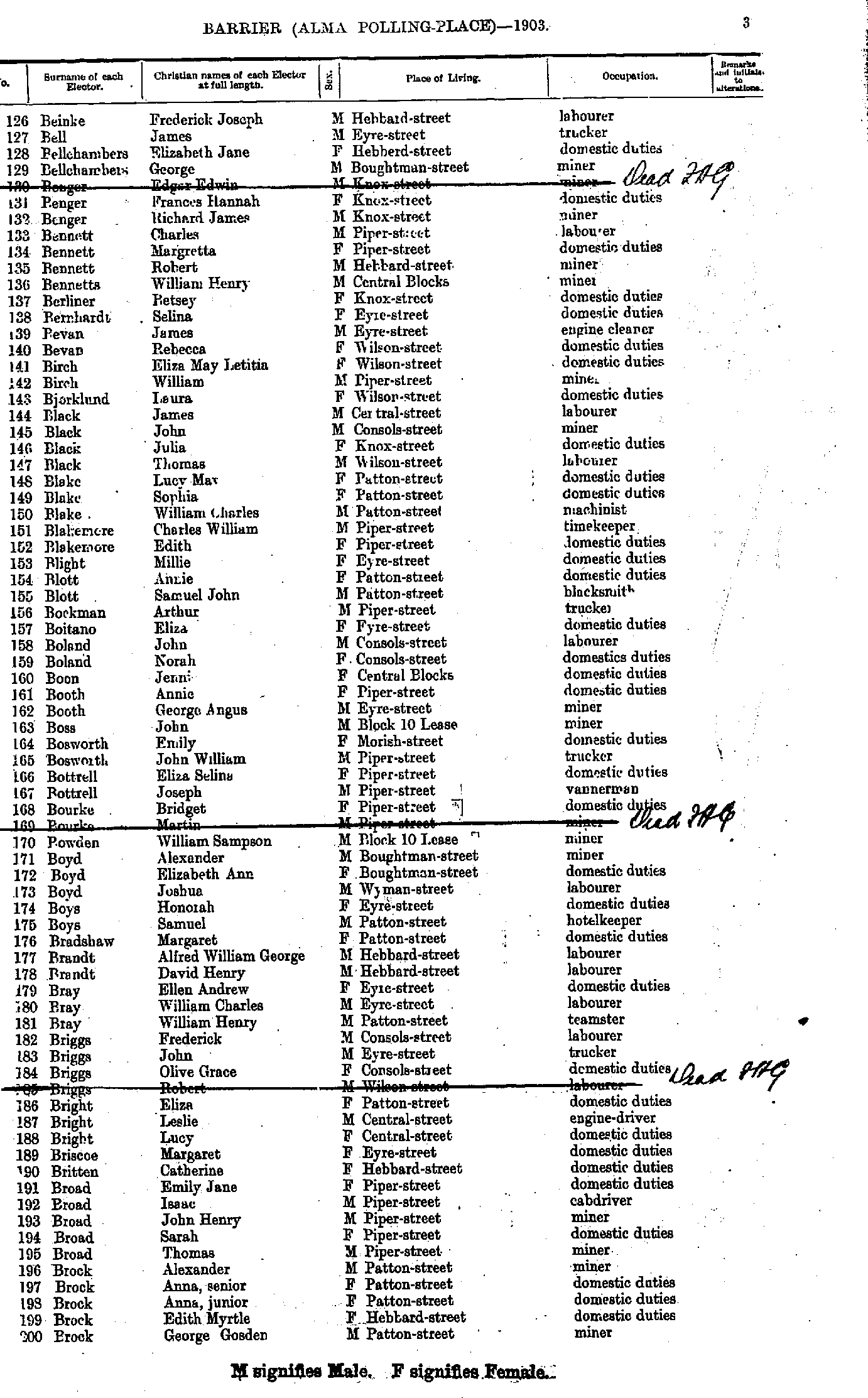
- Beinke Frederick Joseph - Brock George Gosden
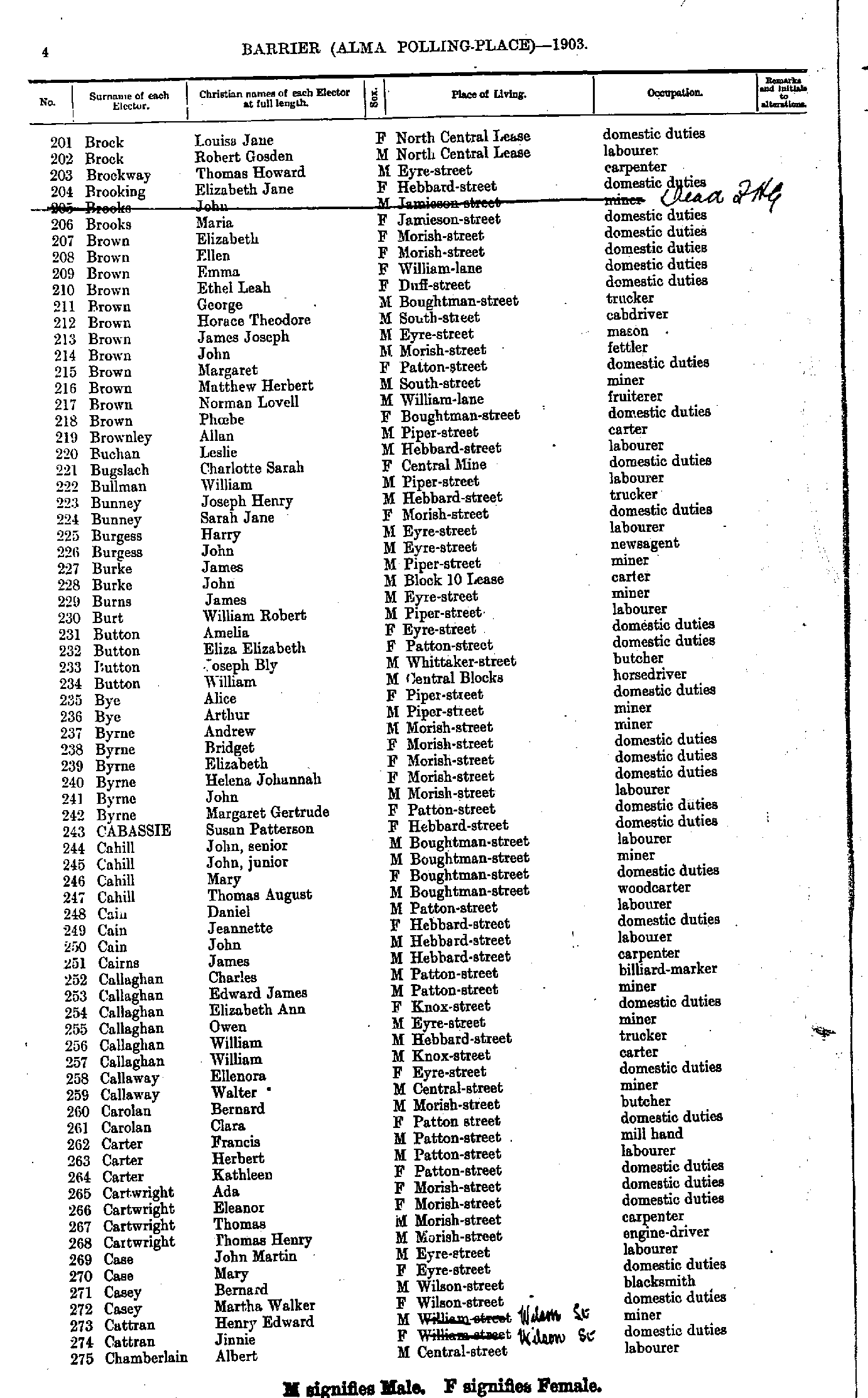
- Brock Louisa Jane - Chamberlain Albert
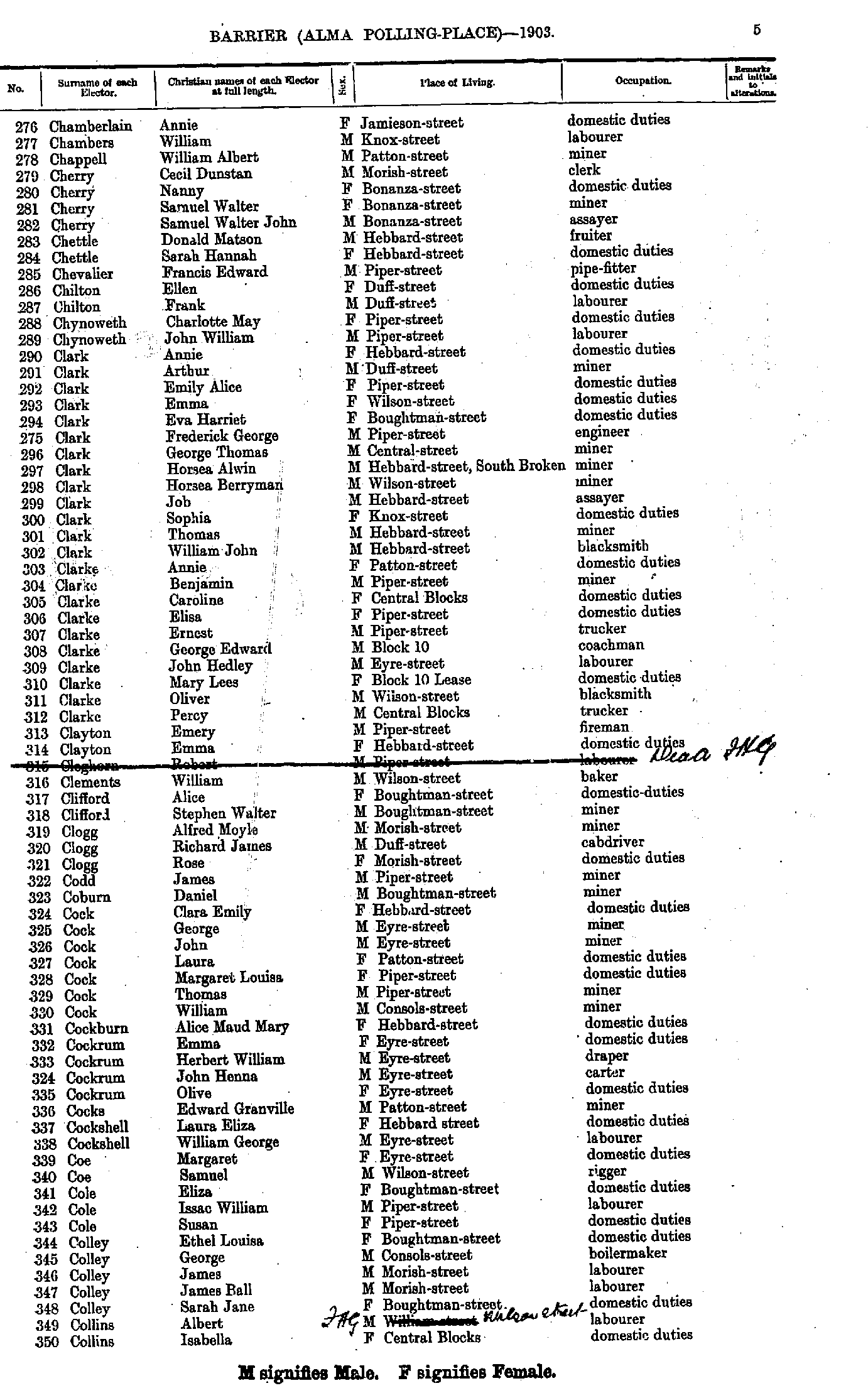
- Chamberlain Annie - Collins Isabella
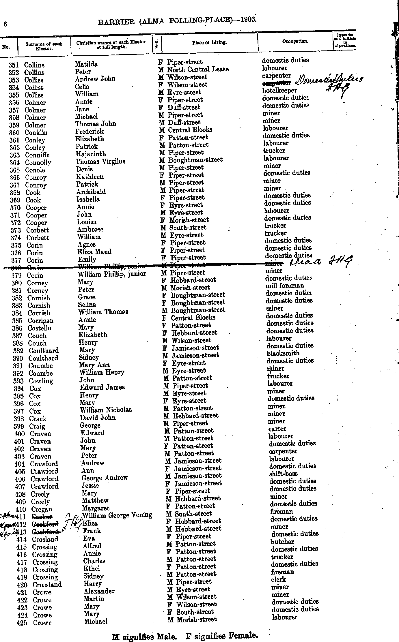
- Collins Matilda - Crowe Michael
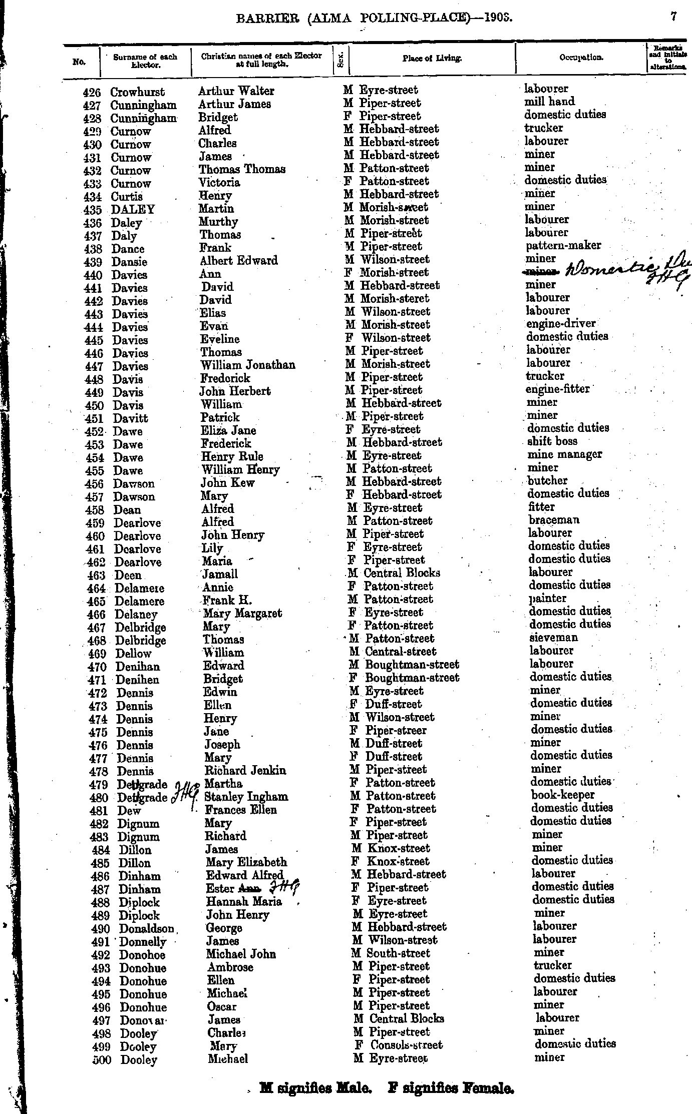
- Crowhurst Arthur Walter - Dooley Michael
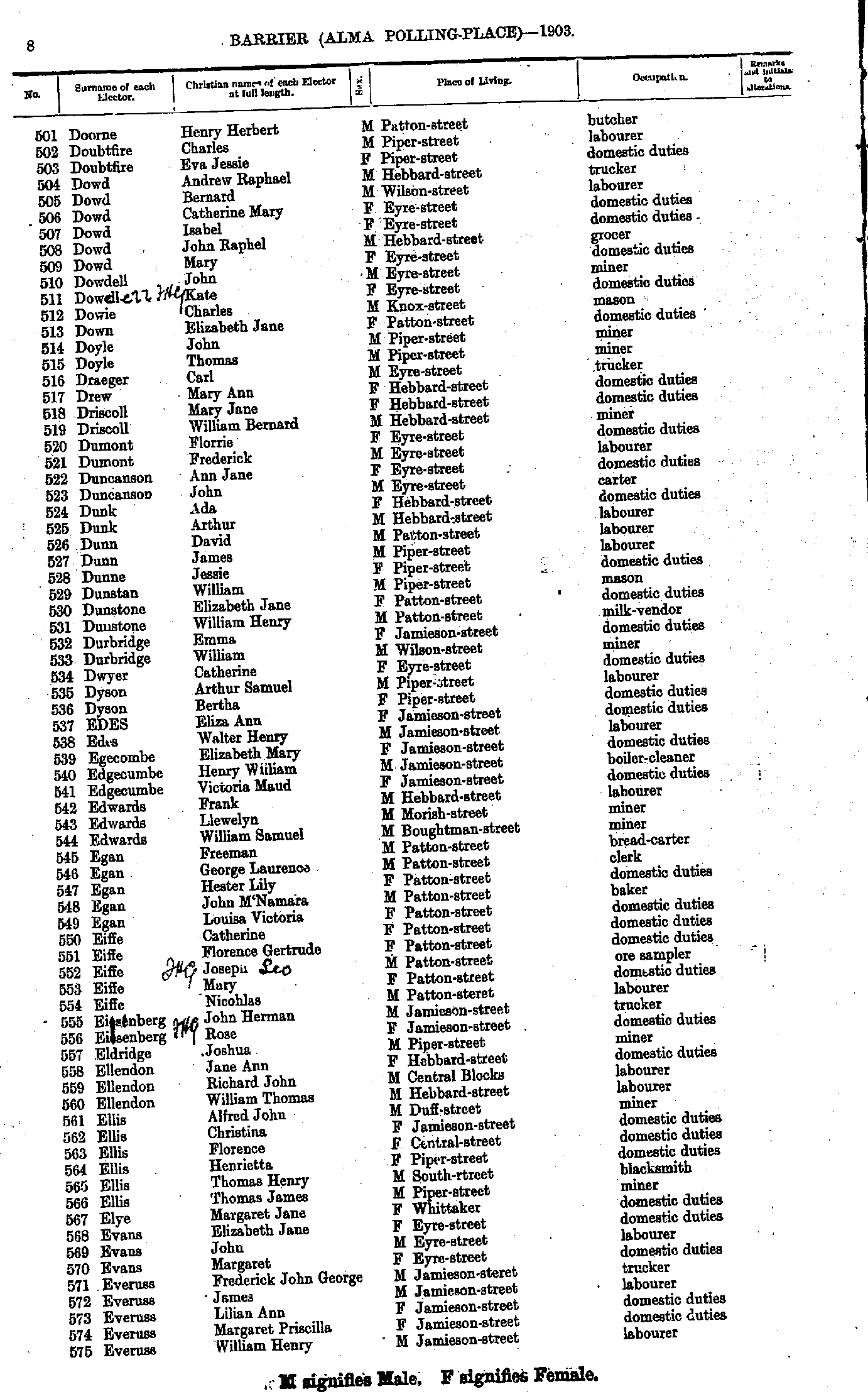
- Doorne Henry Herbert - Everuss William Henry
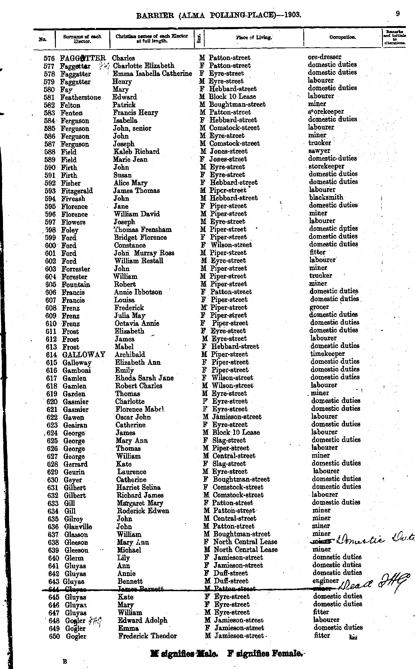
- Faggotter Charles - Gogler Frederick Theodor
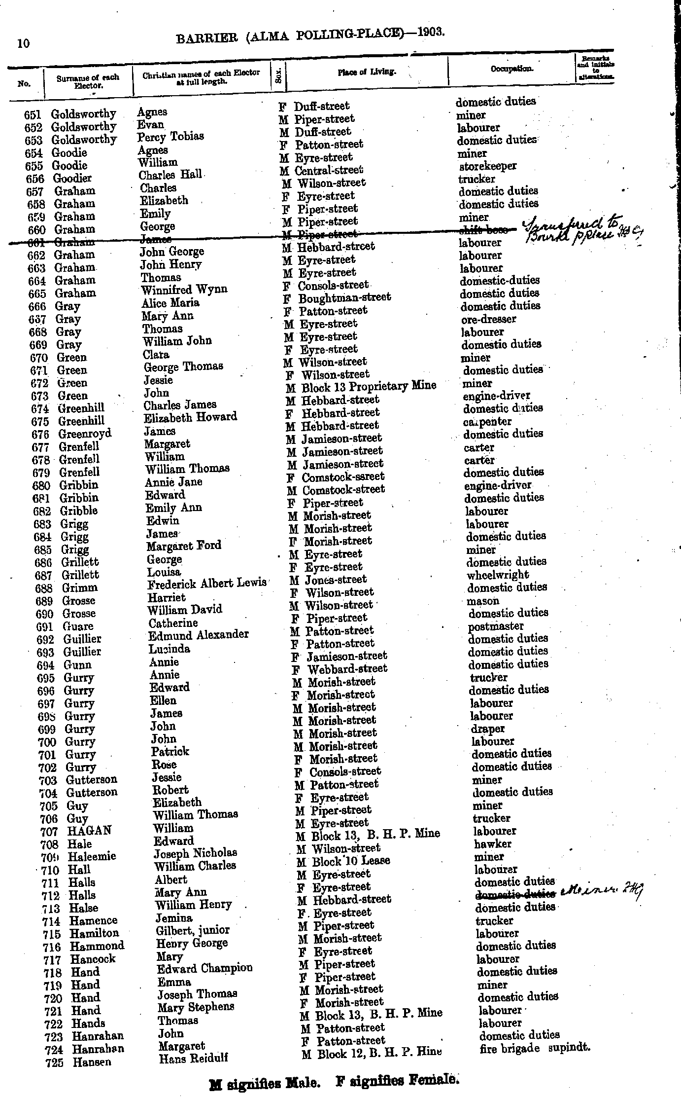
- Goldsworthy Agnes - Hansen Hans Reidulf
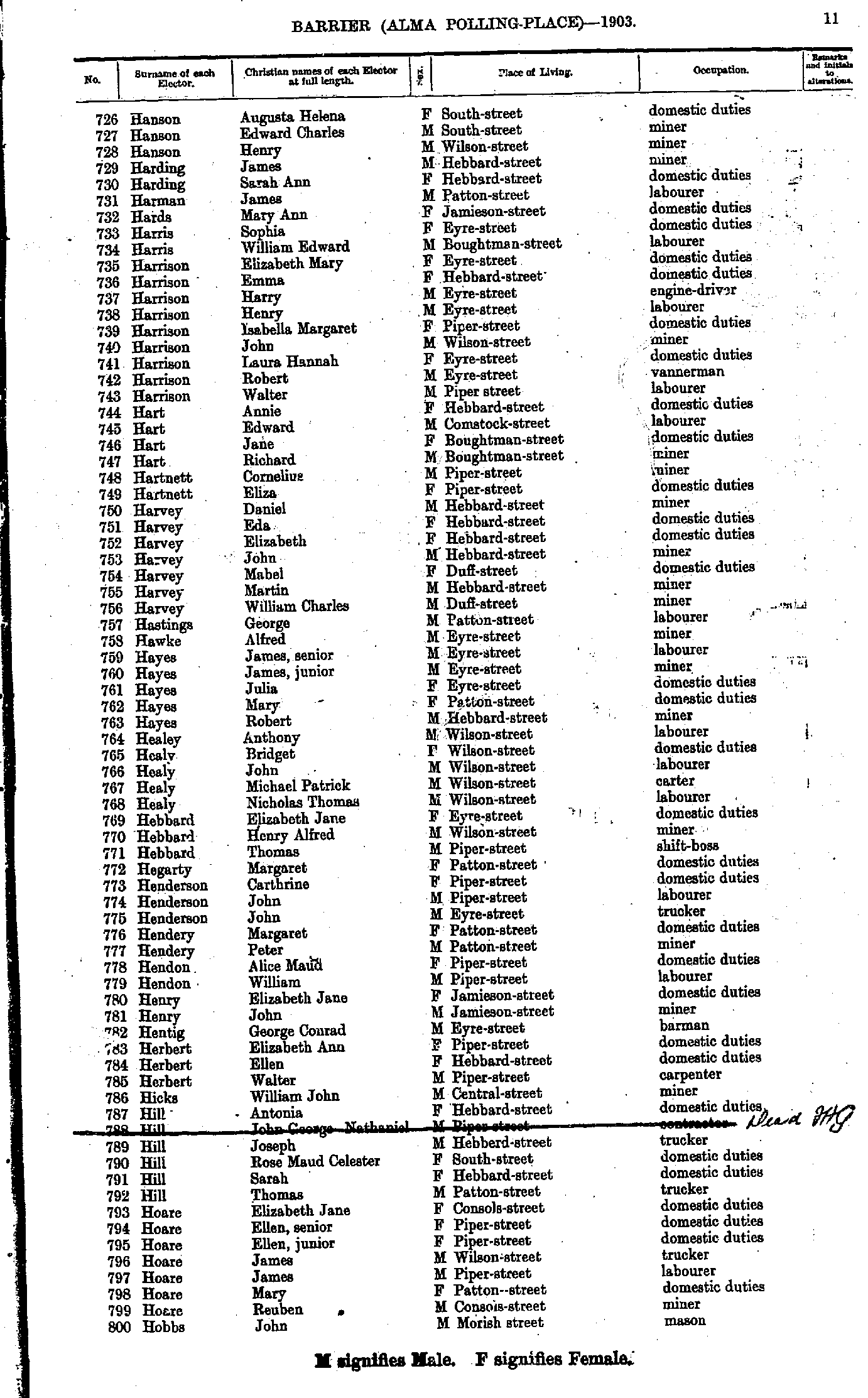
- Hanson Augusta Helena - Hobbs John
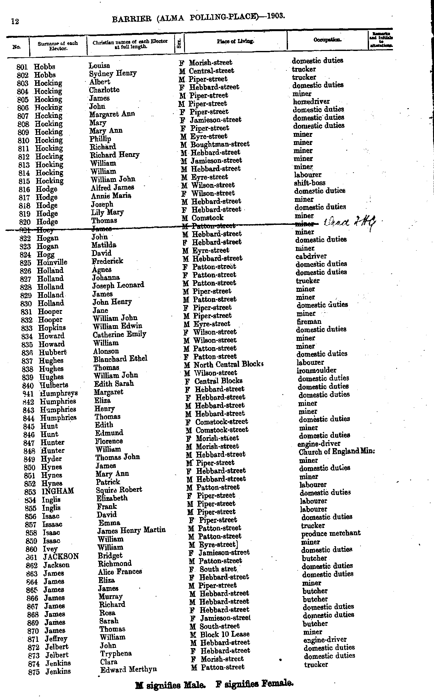
- Hobbs Louisa - Jenkins Edward Merthyn
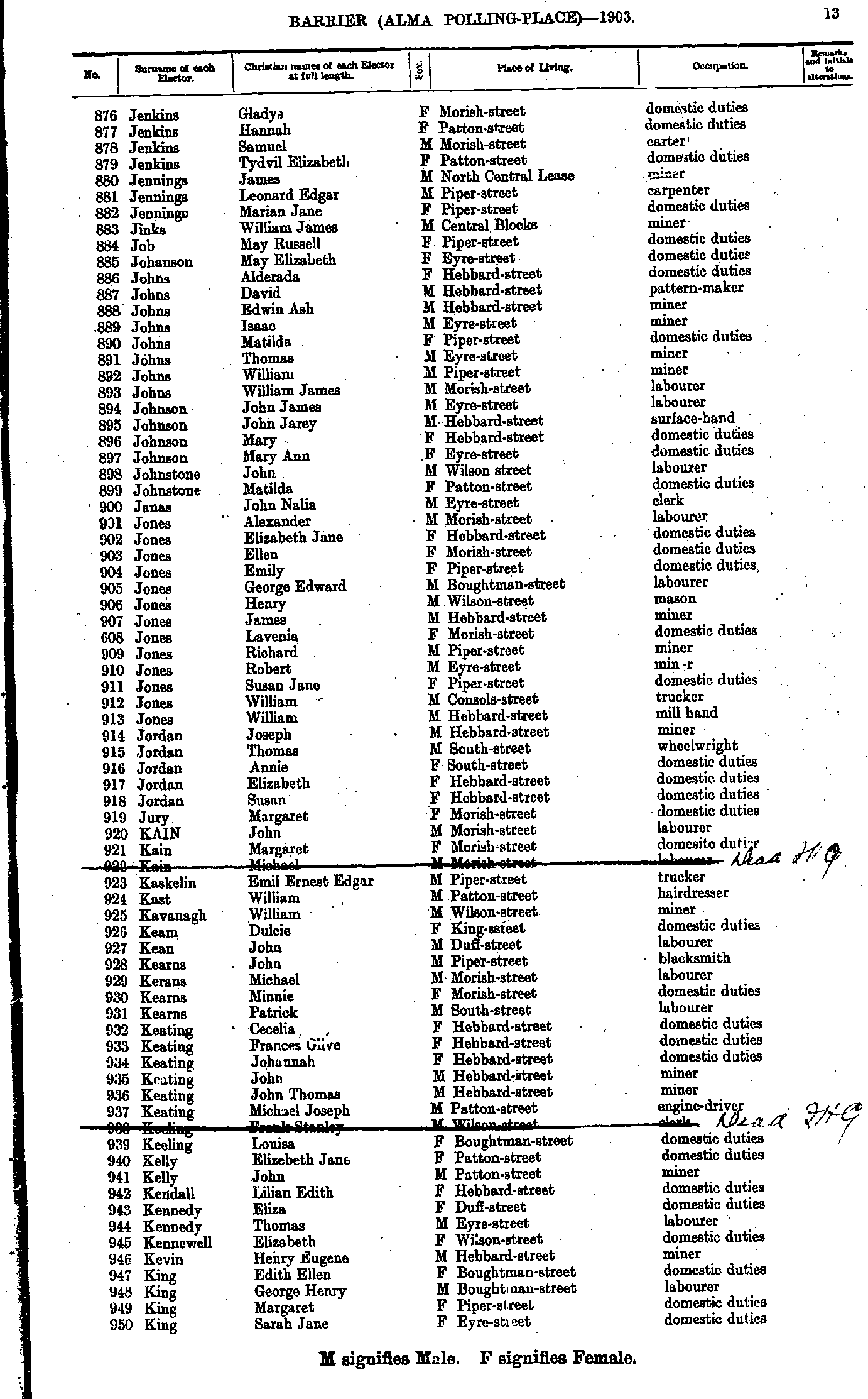
- Jenkins Gladys - King Sarah Jane
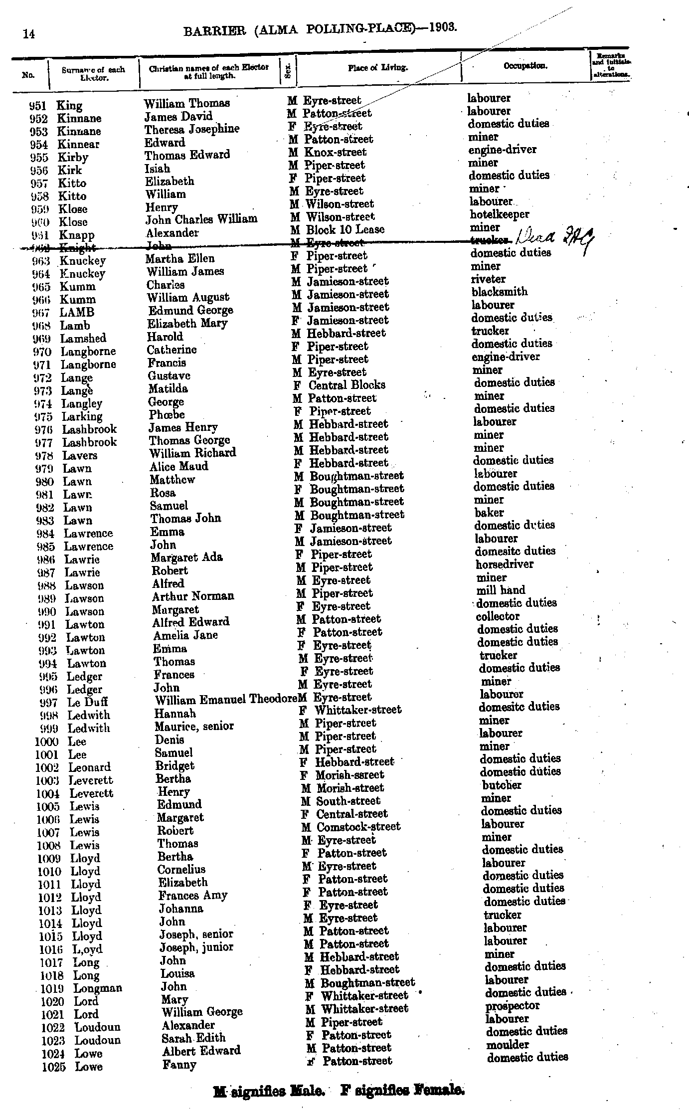
- King William Thomas - Lowe Fanny
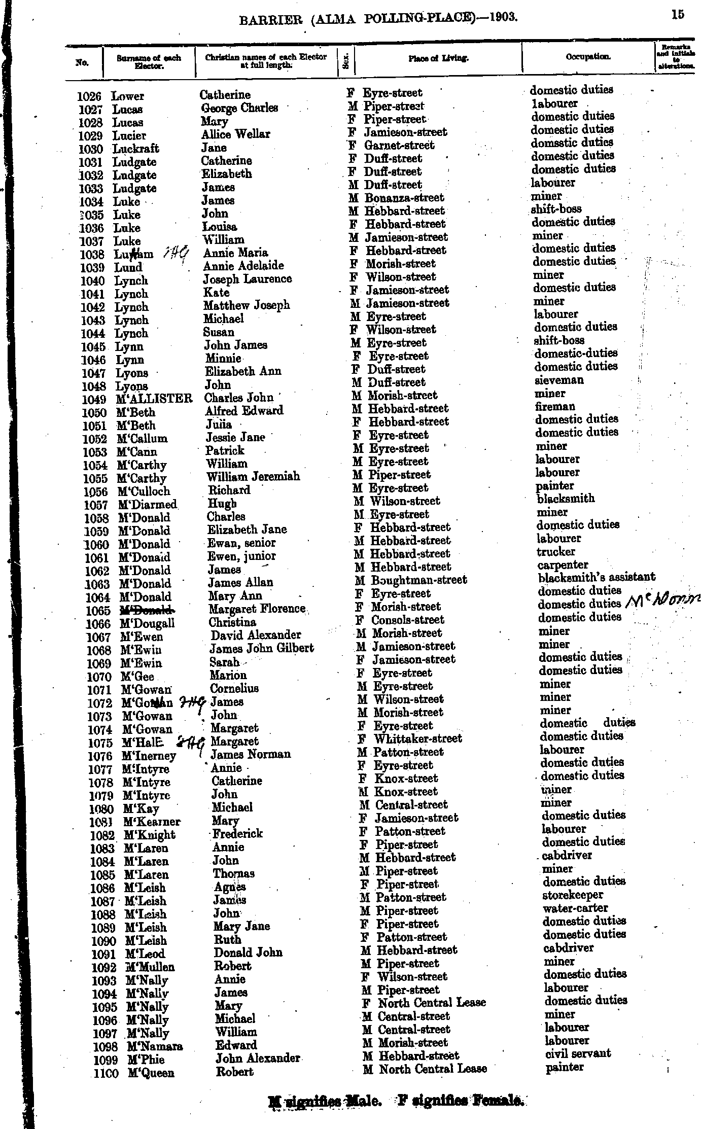
- Lower Catherine - M'Queen Robert
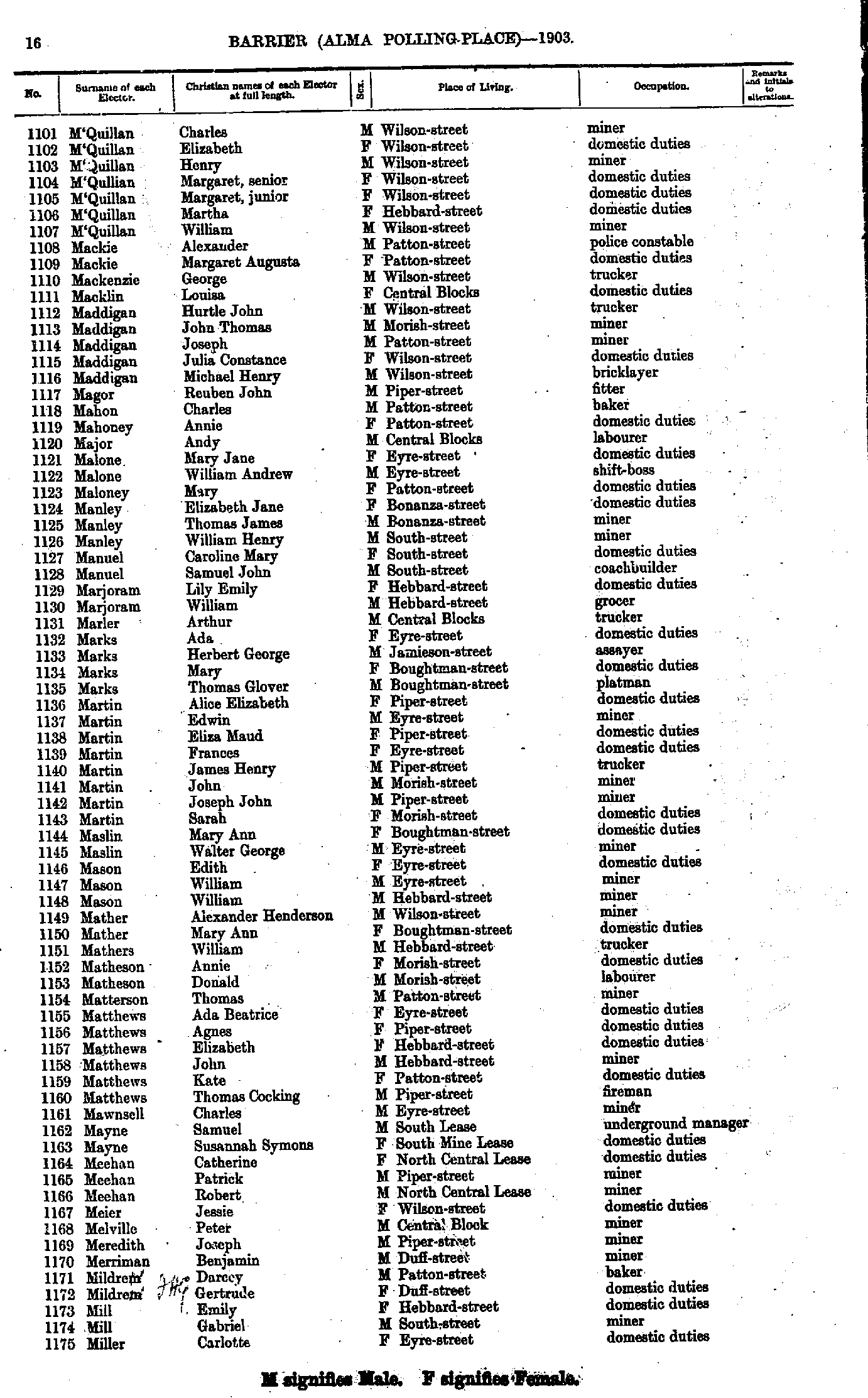
- M'Quillan Charles - Miller Carlotte
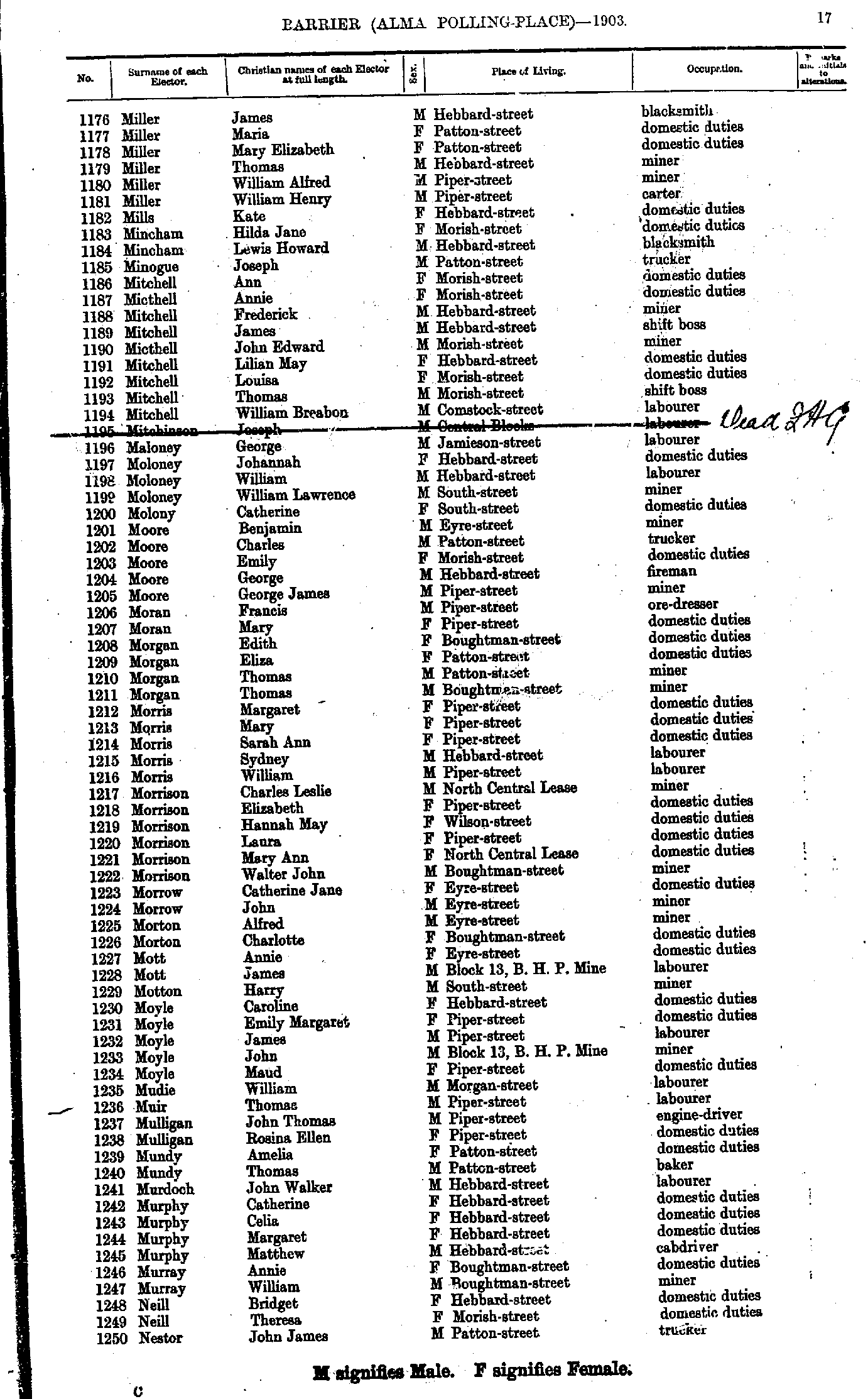
- Miller James - Nestor John James
- Nestor Michael - Parker William Charles
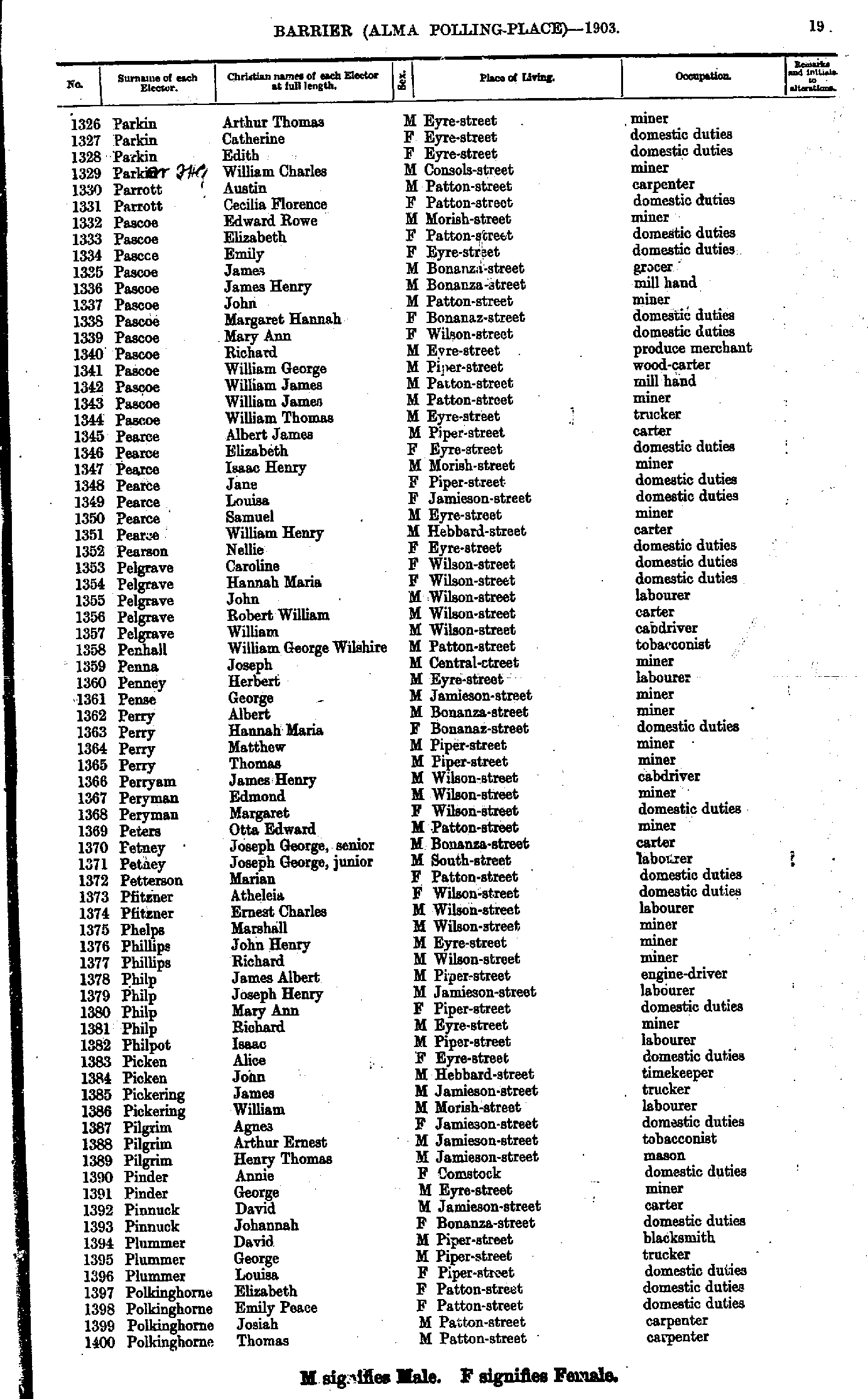
- Parkin Arthur Thomas - Polkinghorne Thomas
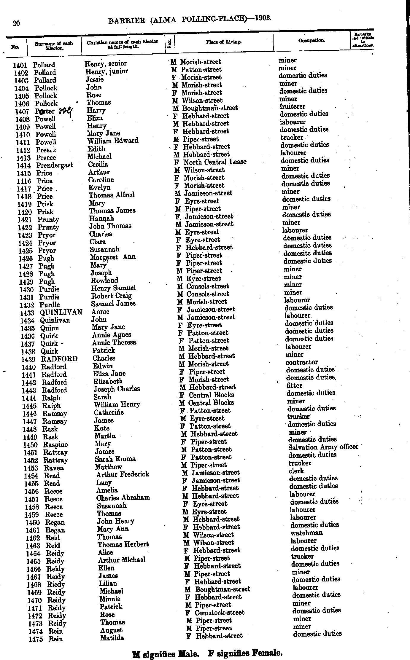
- Pollard Henry senior - Rein Matilda
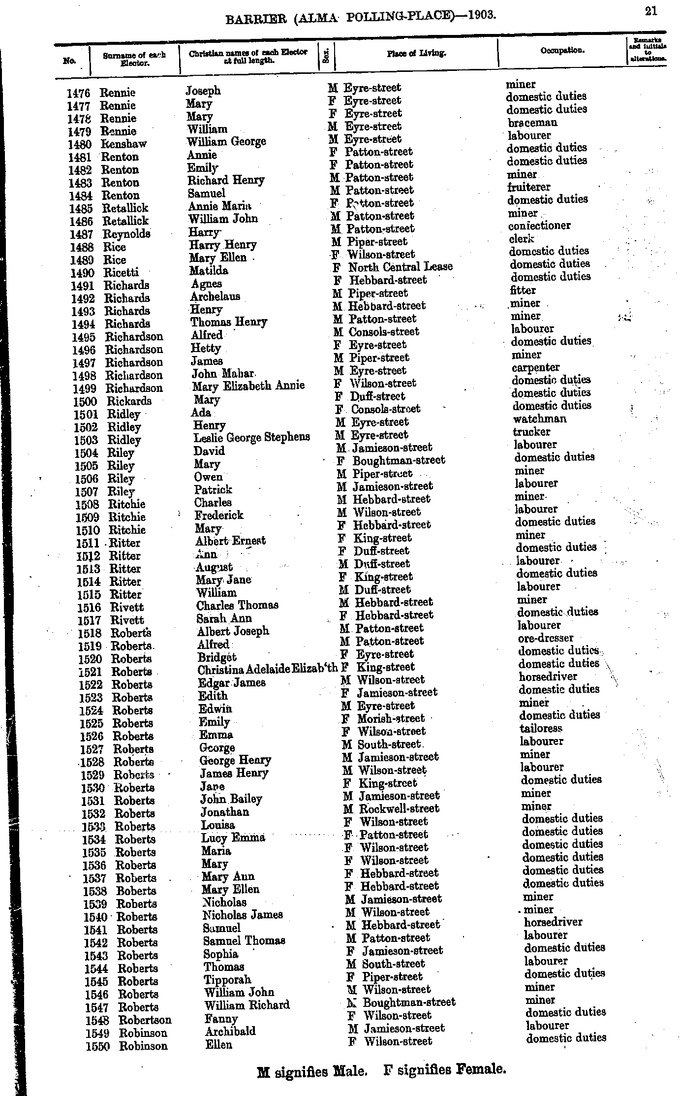
- Rennie Joseph - Robinson Ellen
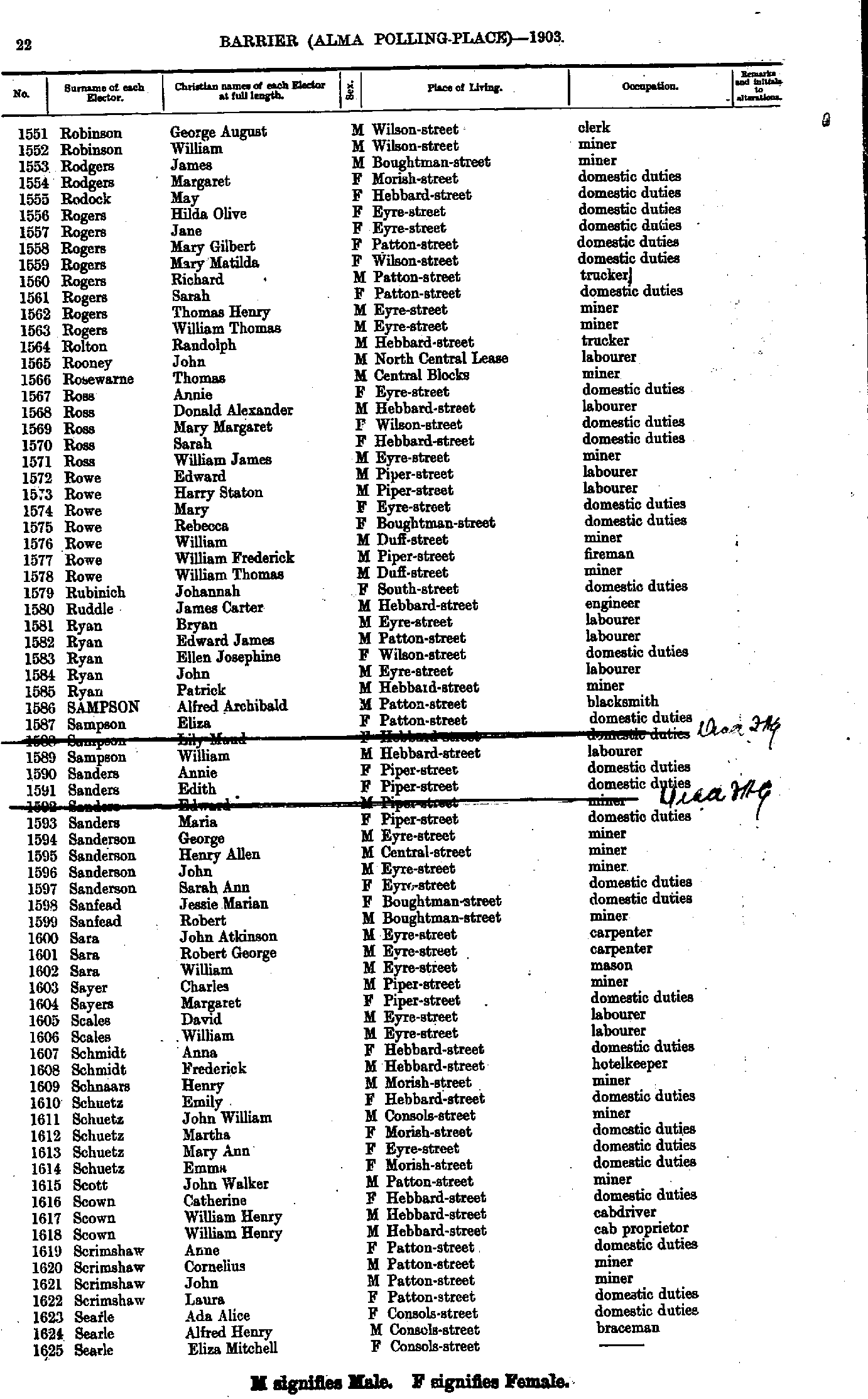
- Robinson George August - Searle Eliza Mitchell
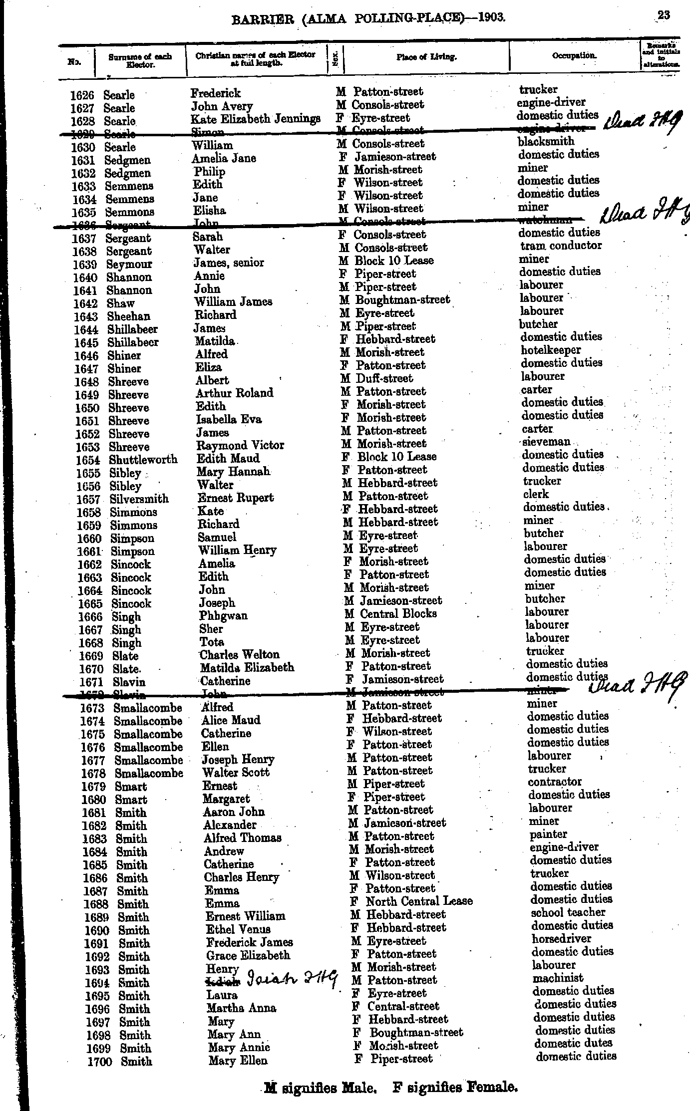
- Searle Frederick - Smith Mary Ellen
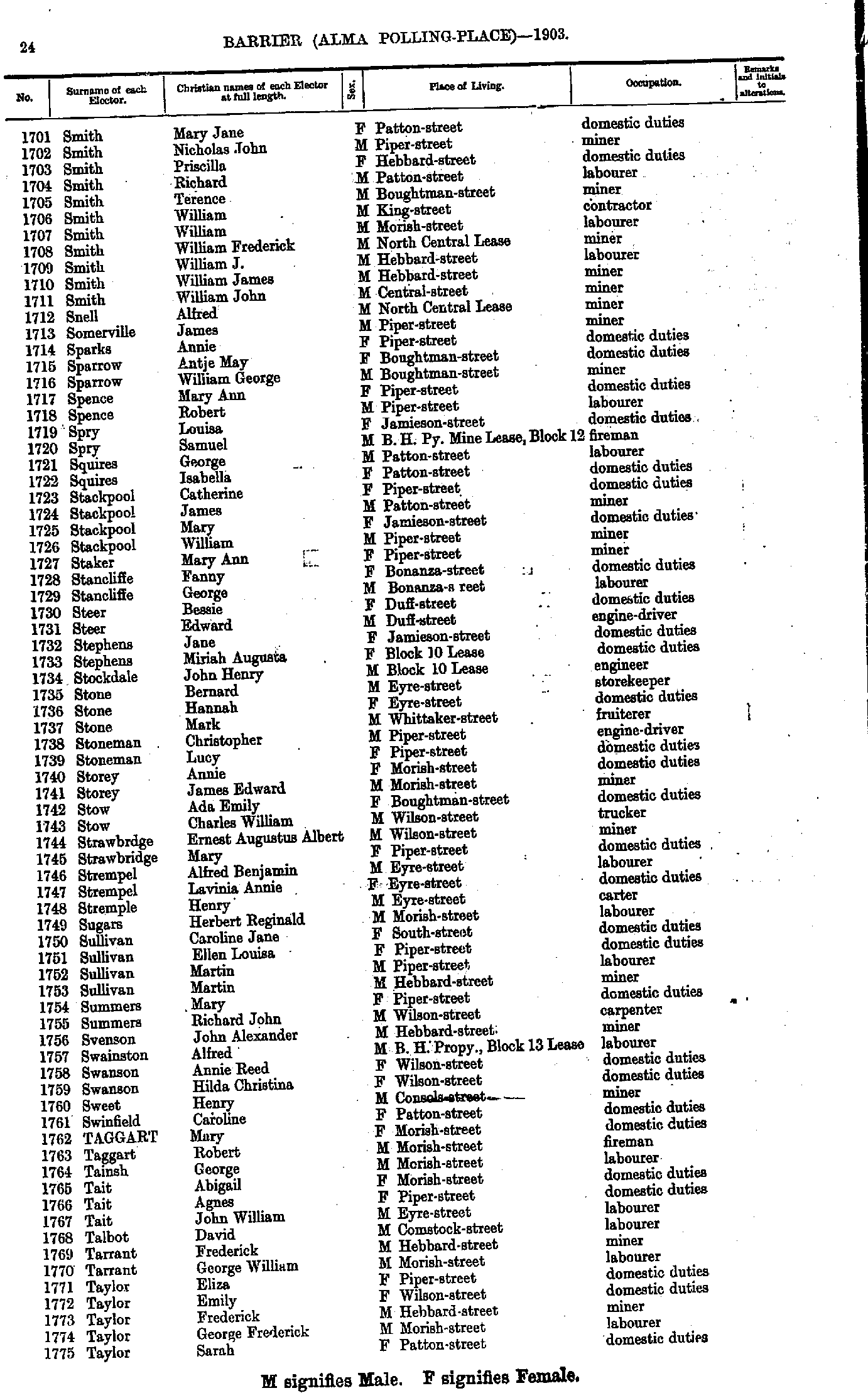
- Smith Mary Jane - Taylor Sarah
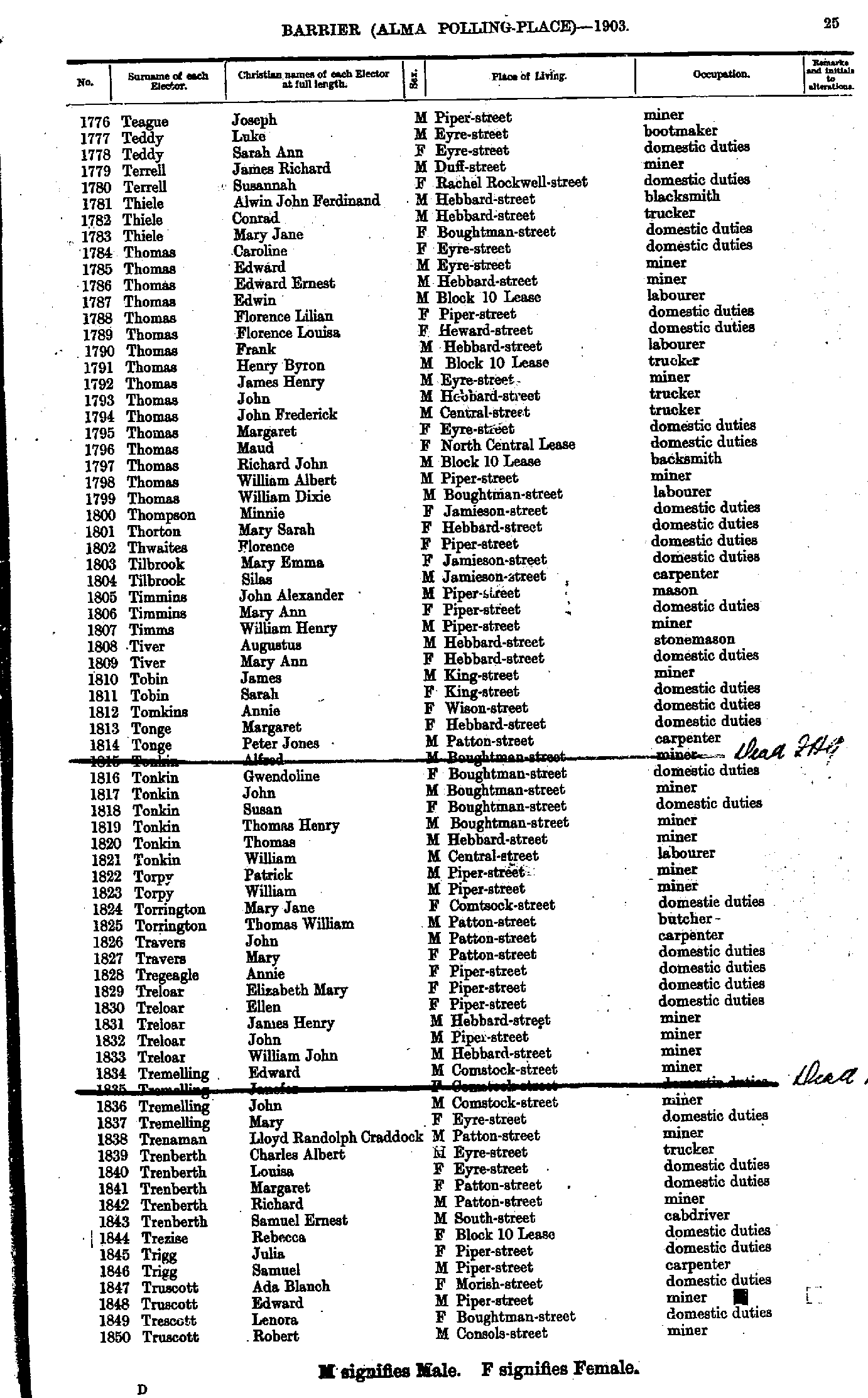
- Teague Joseph - Truscott Robert
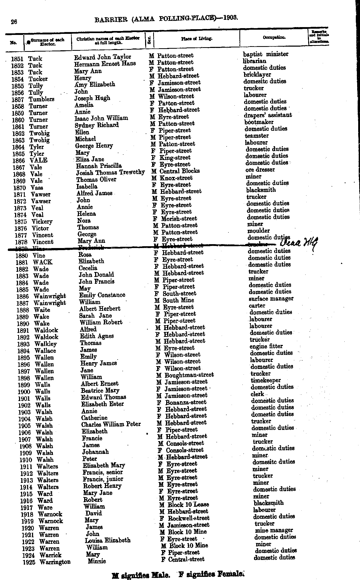
- Tuck Edward John Taylor - Warrington Minnie
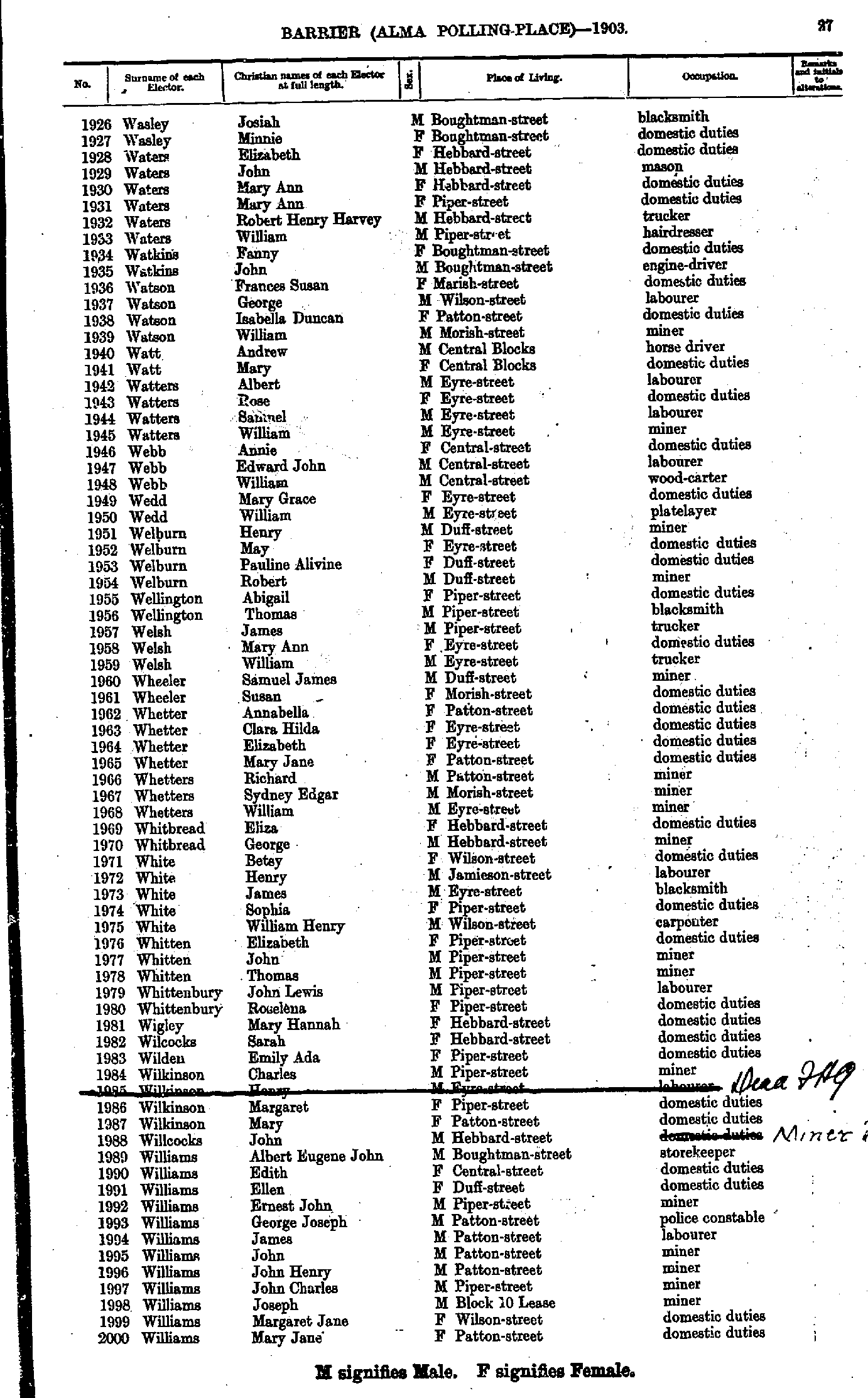
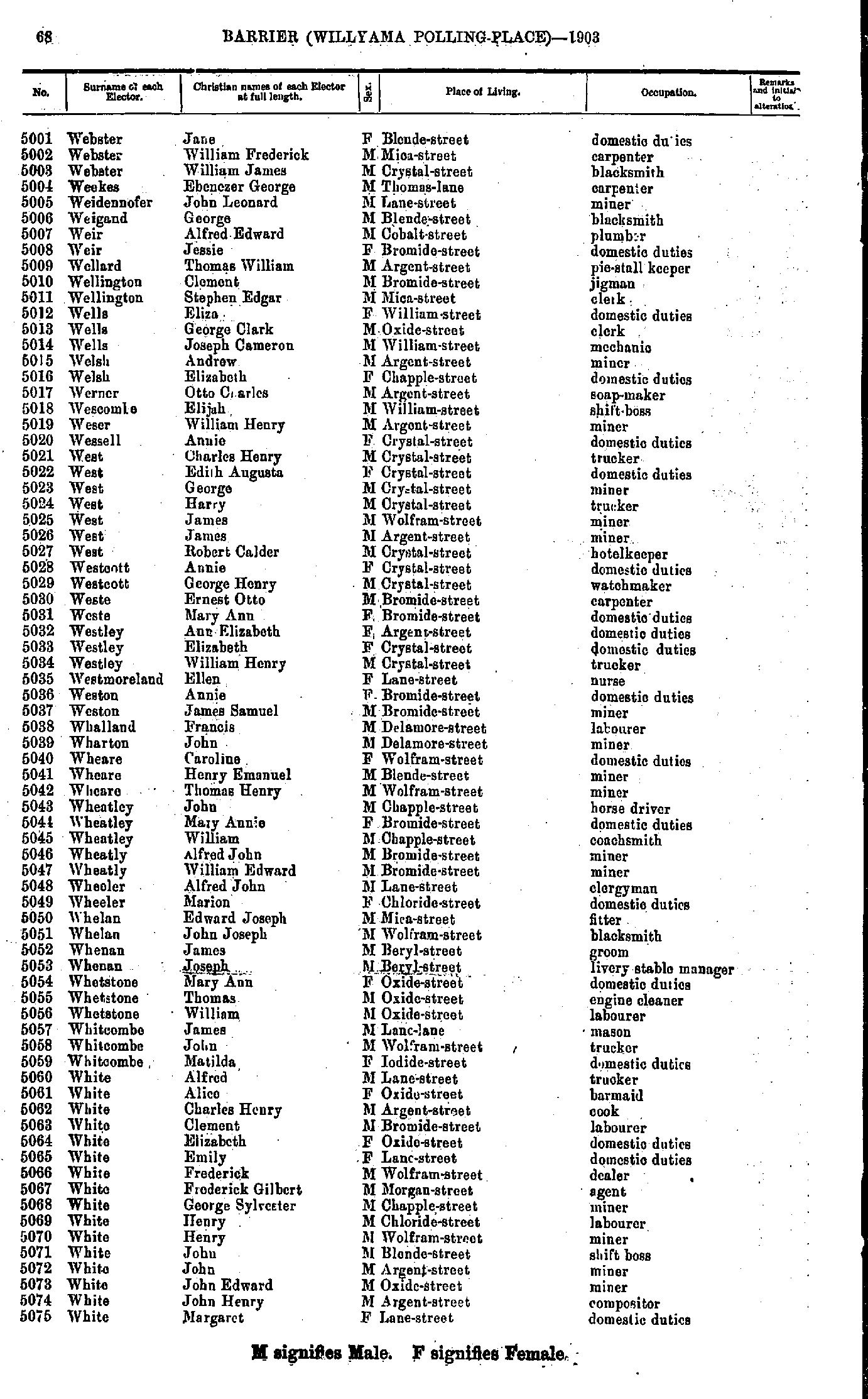
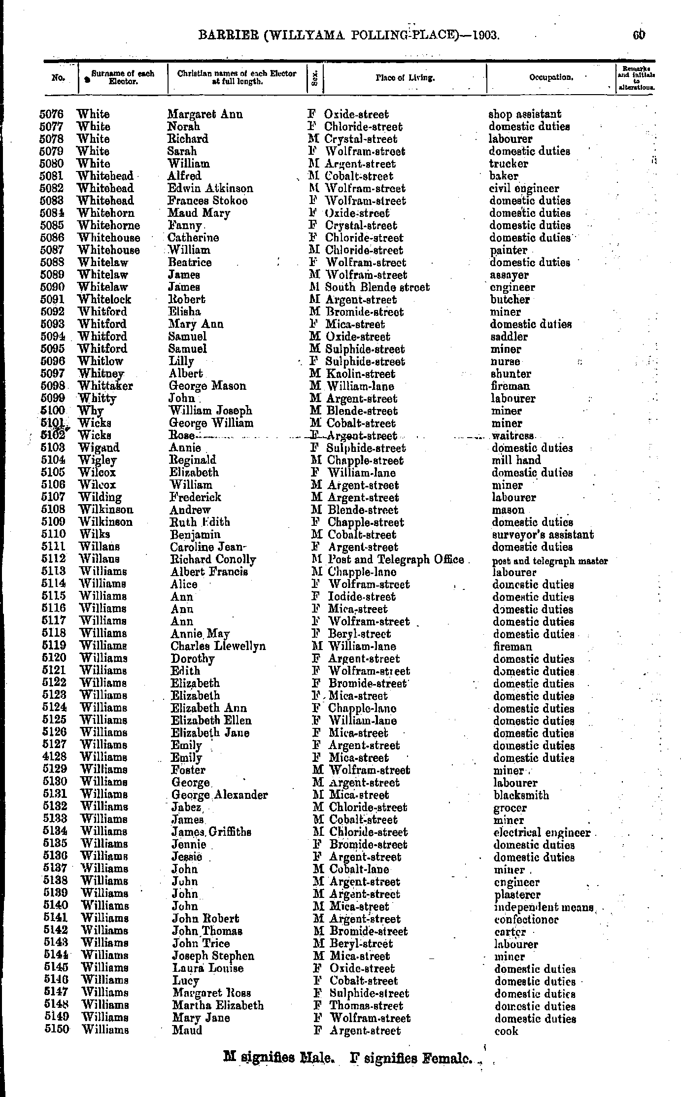
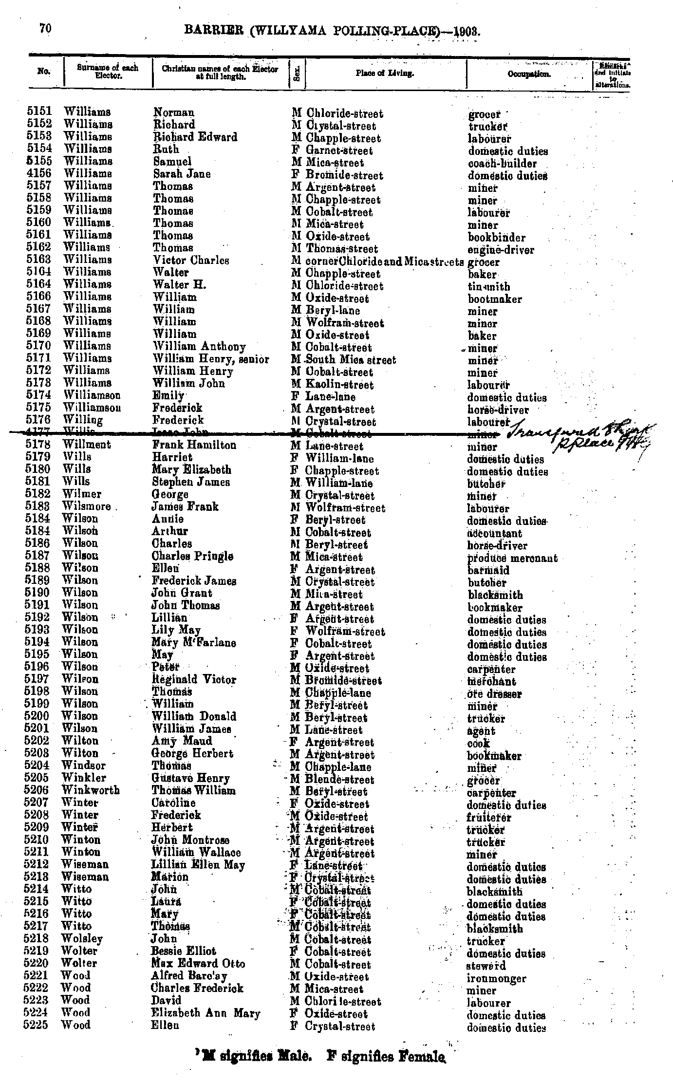
- Wasley Josiah - Williams Mary Jane
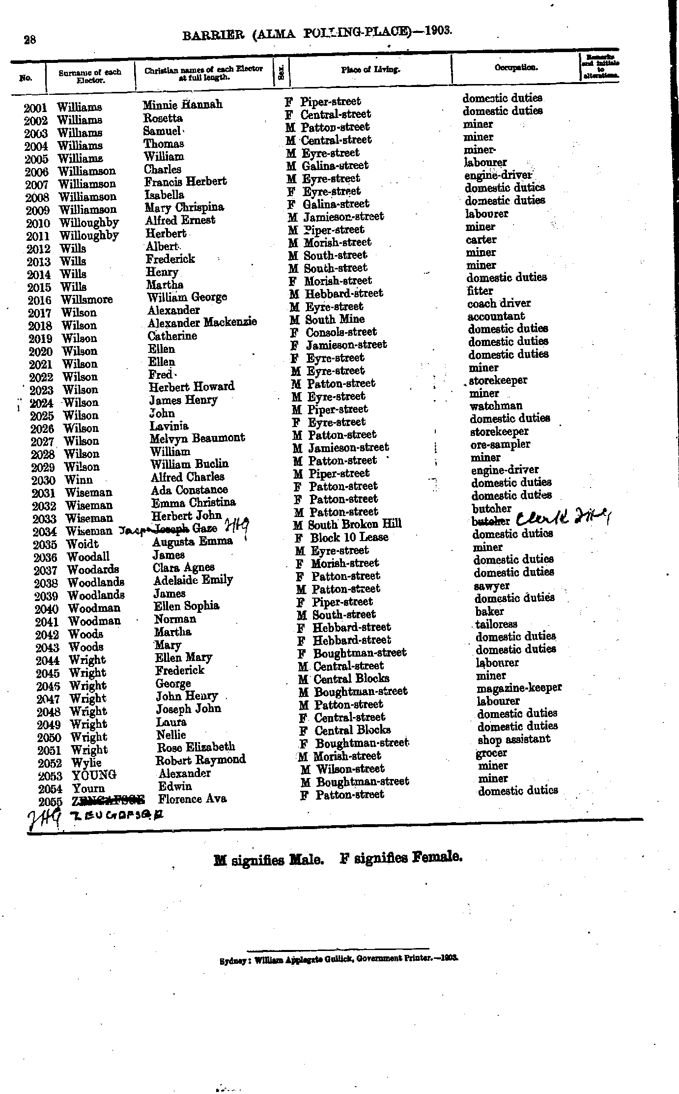
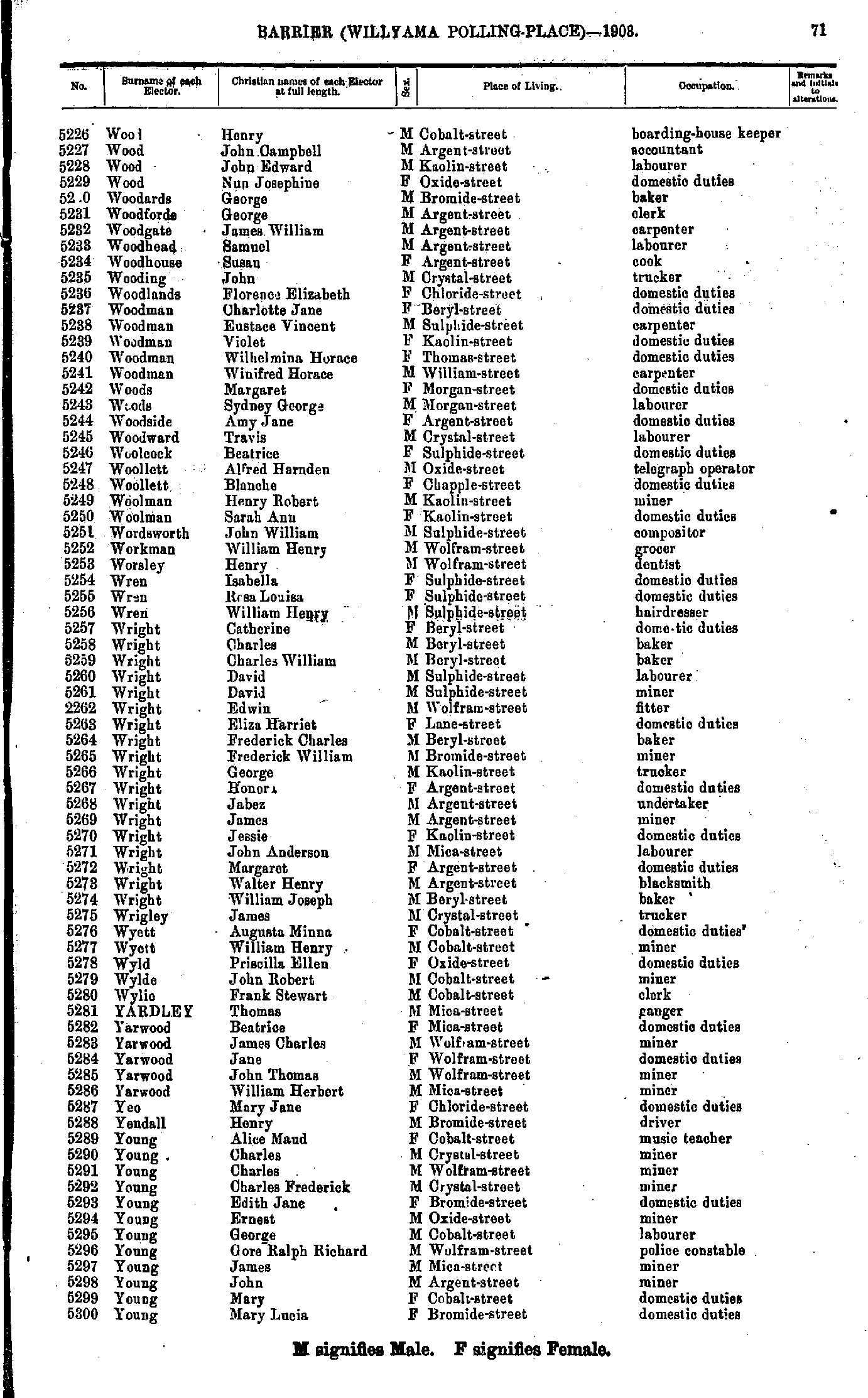
- Williams Minnie Hannah - Zeugofser Florence Ava
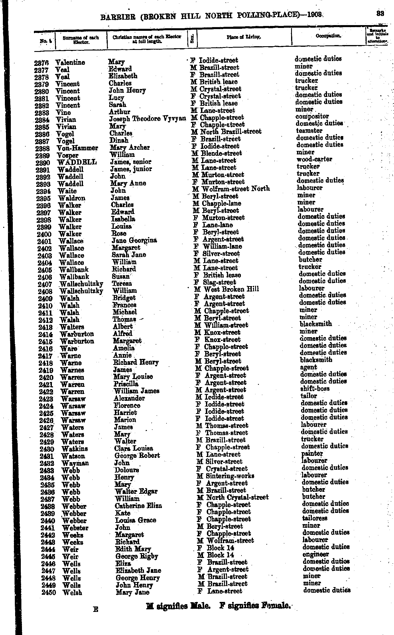
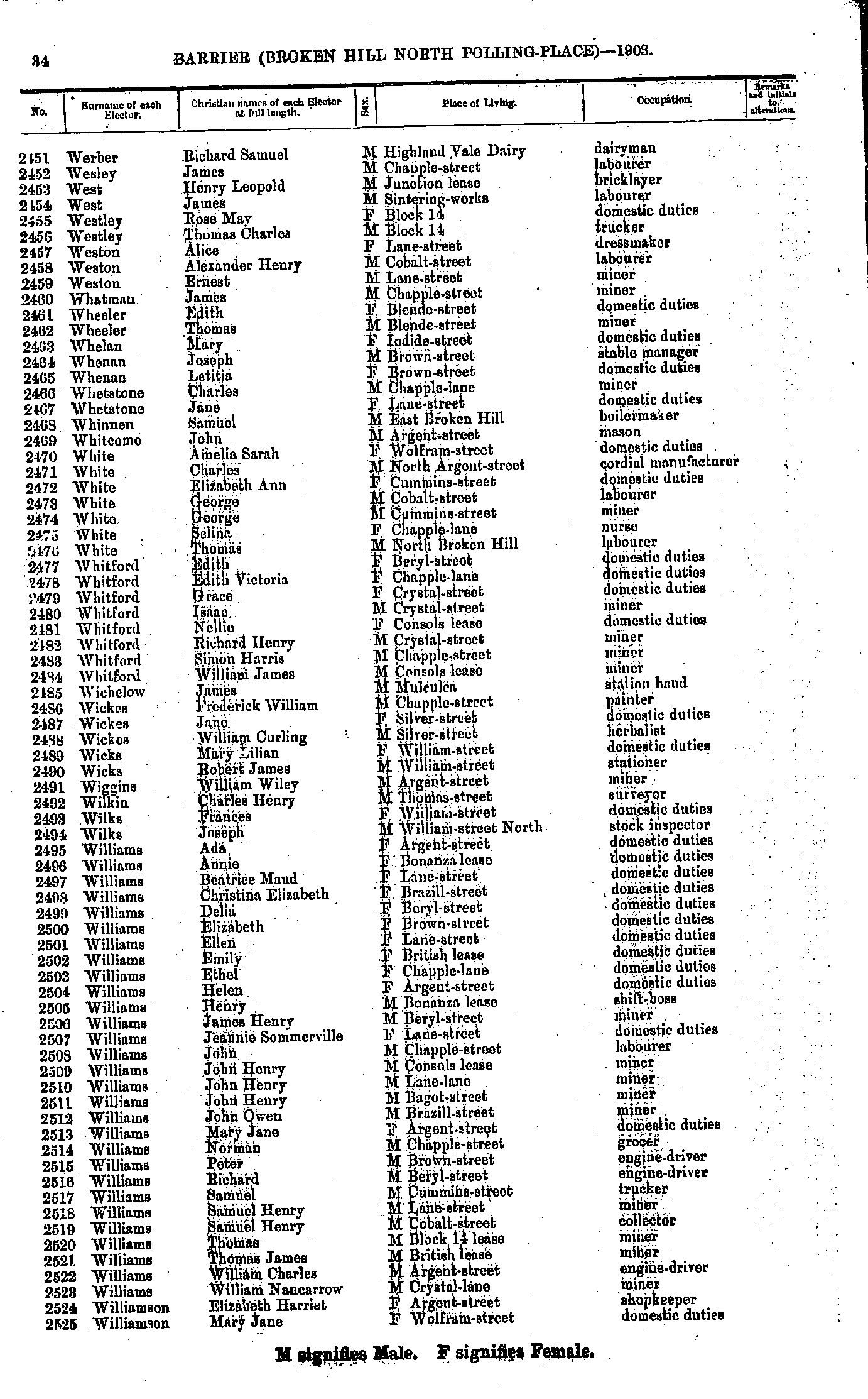
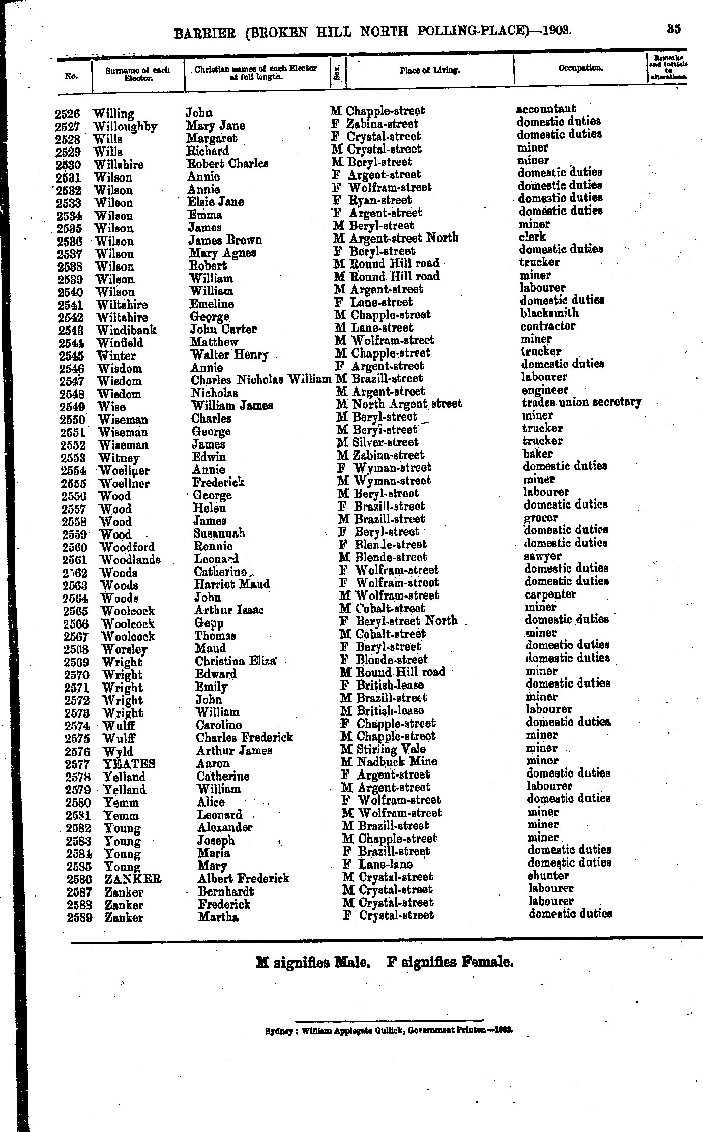
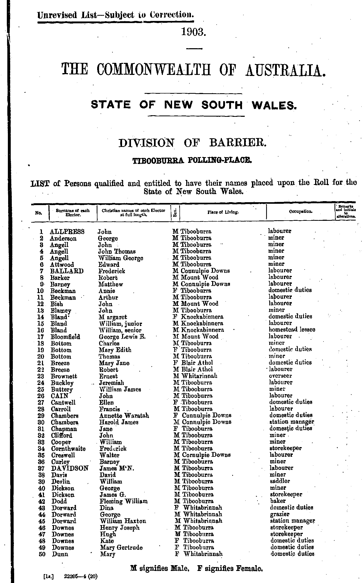
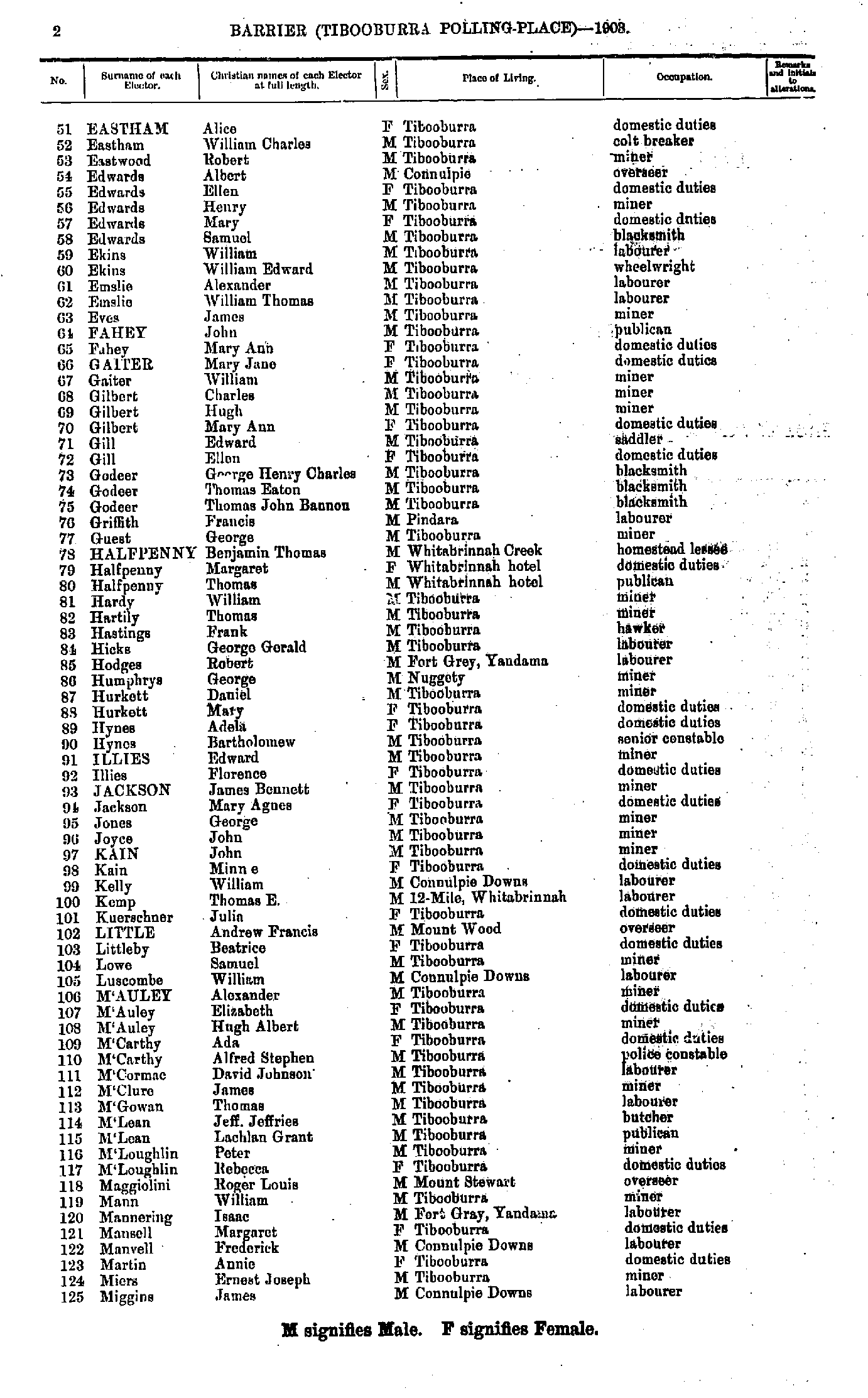
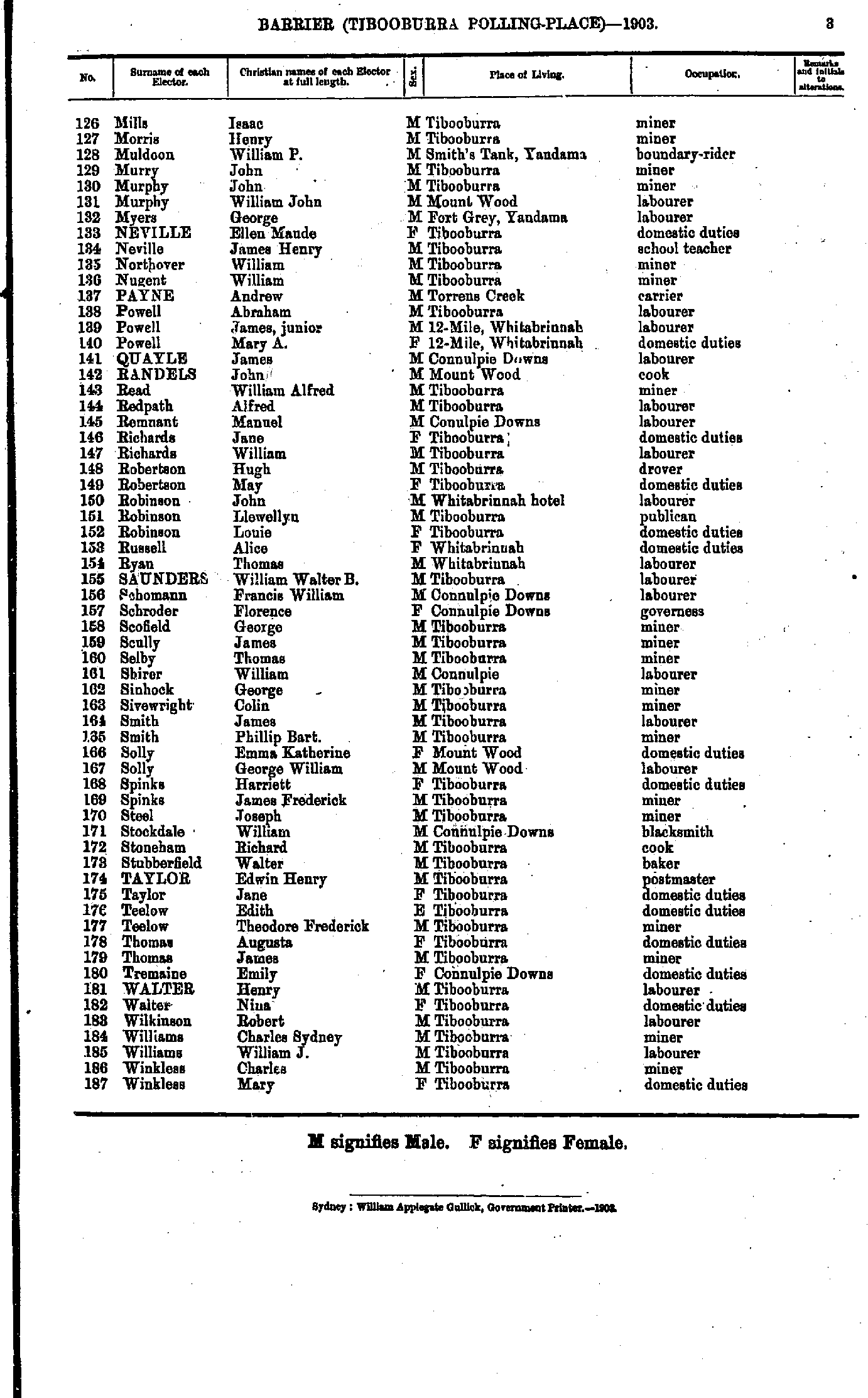
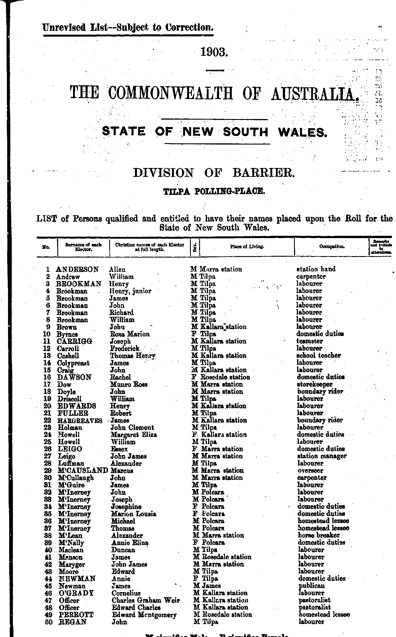
Broken Hill North Polling Place
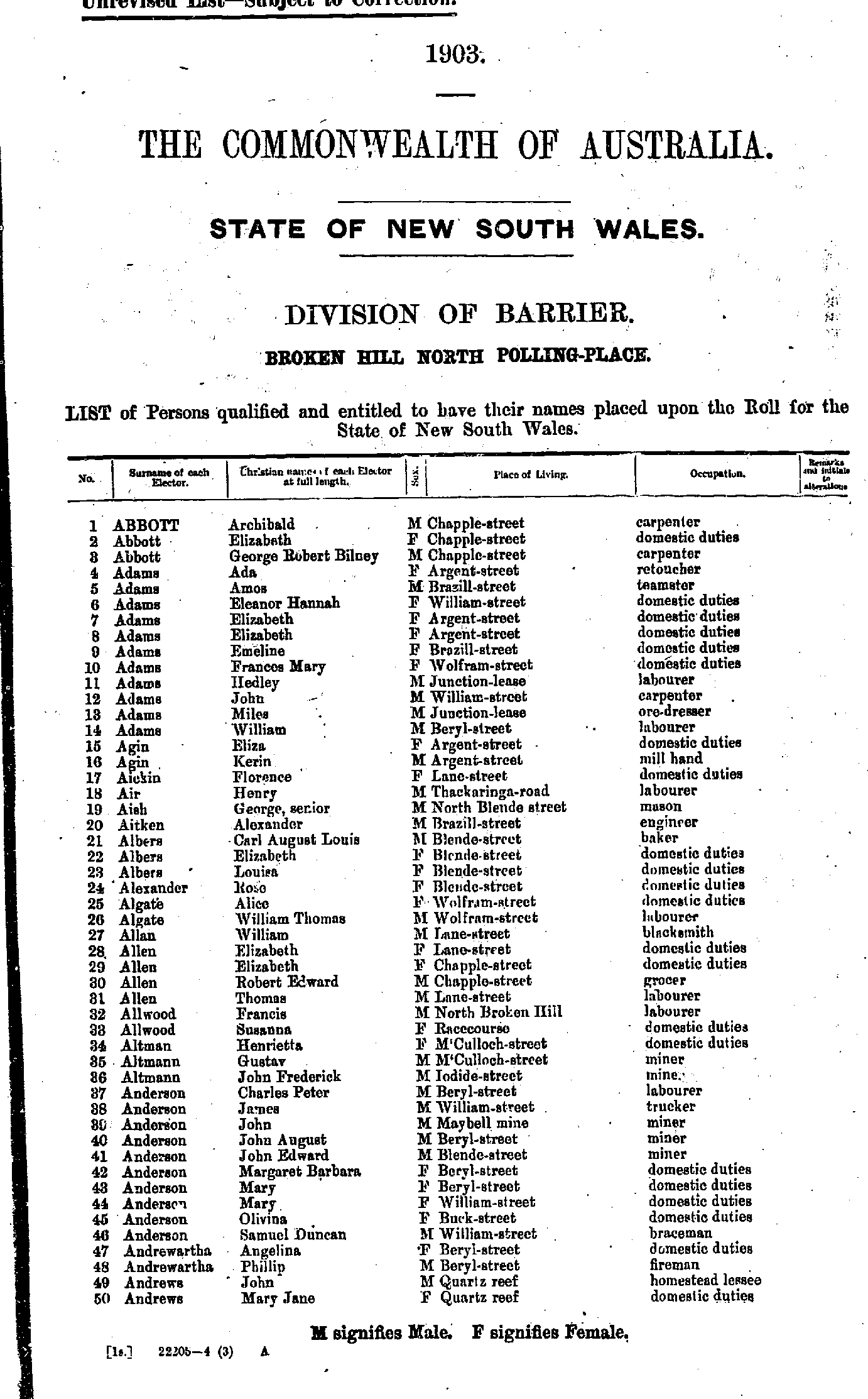
- Abbott Archibald - Andrews Mary Jane
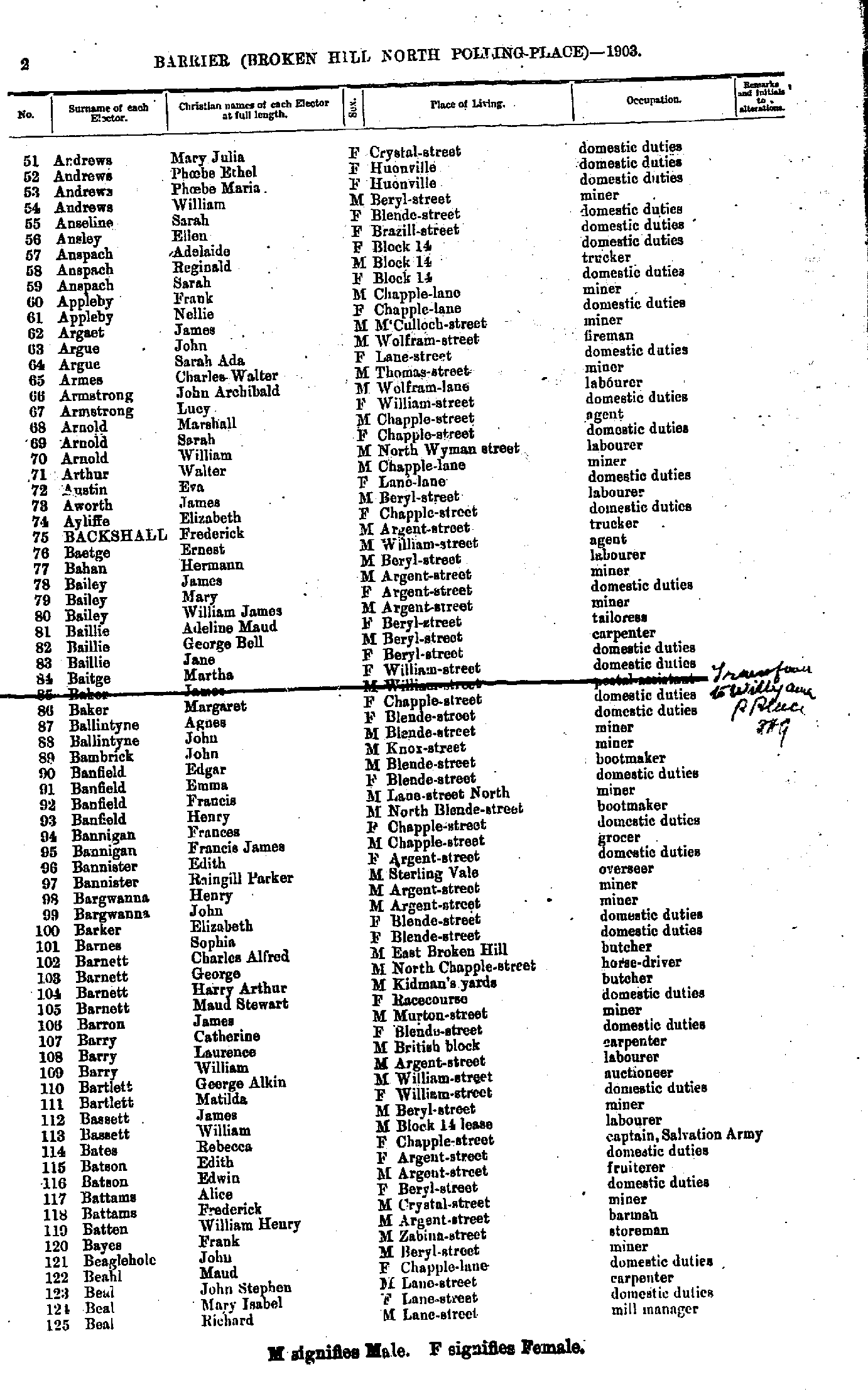
- Andrews Mary Julia - Beal Richard
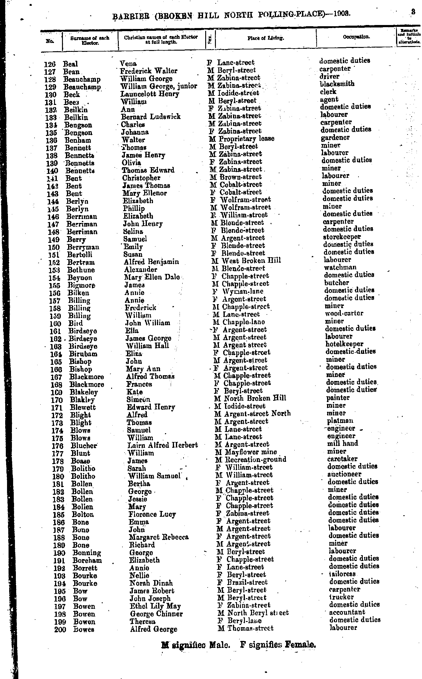
- Beal Vena - Bowes Alfred George
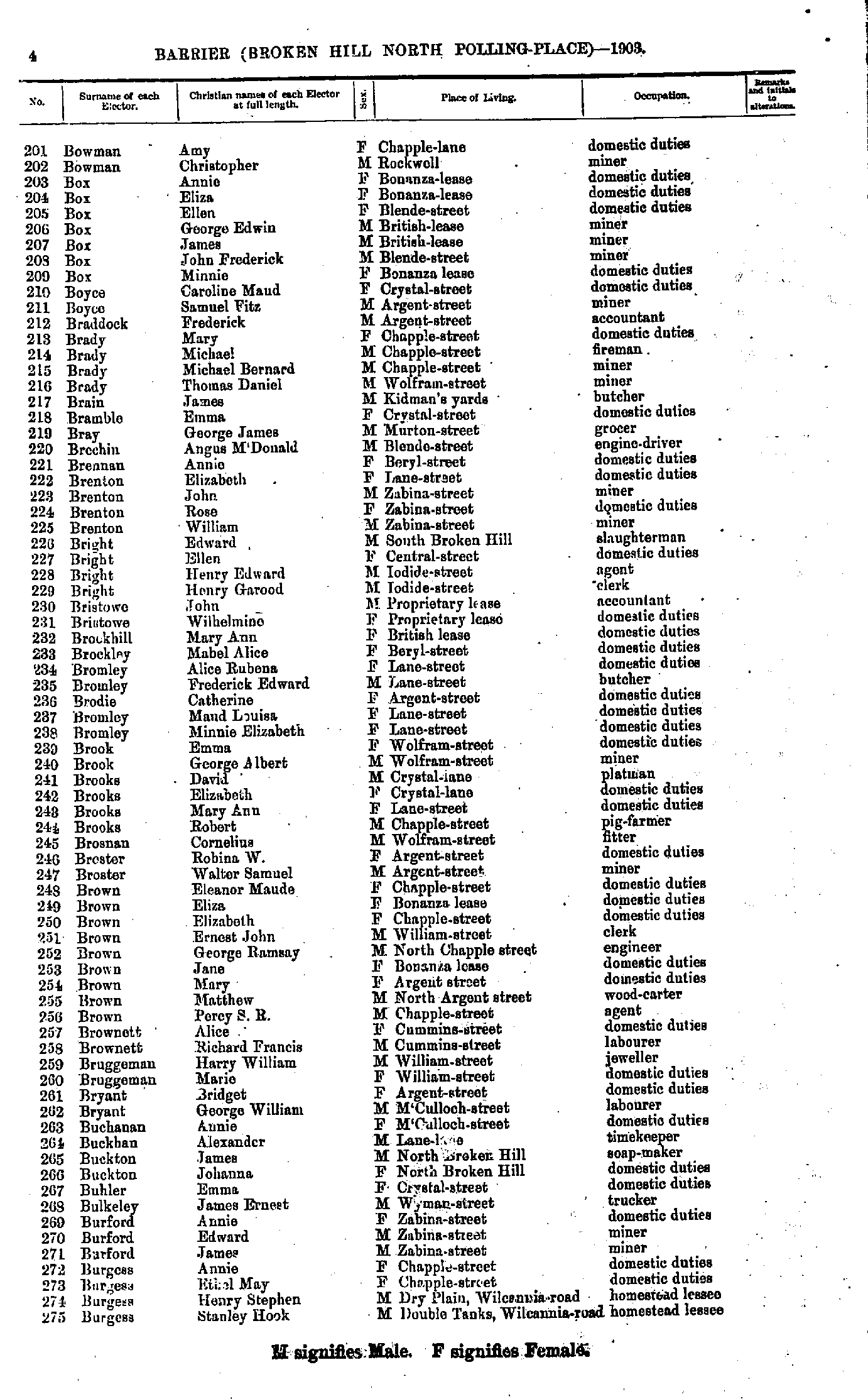
- Bowman Amy - Burgess Stanley Hook
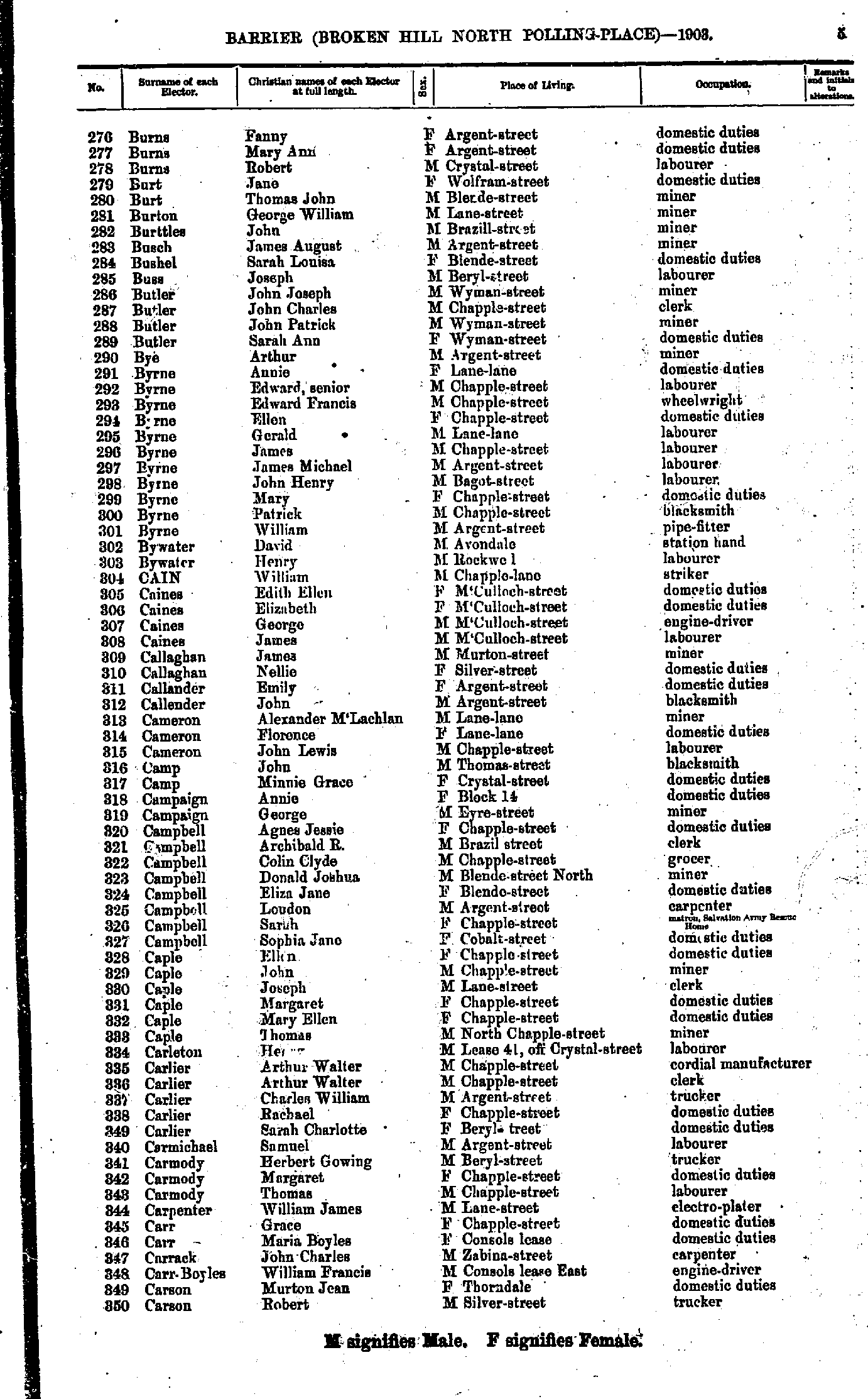
- Burns Fanny - Carson Robert
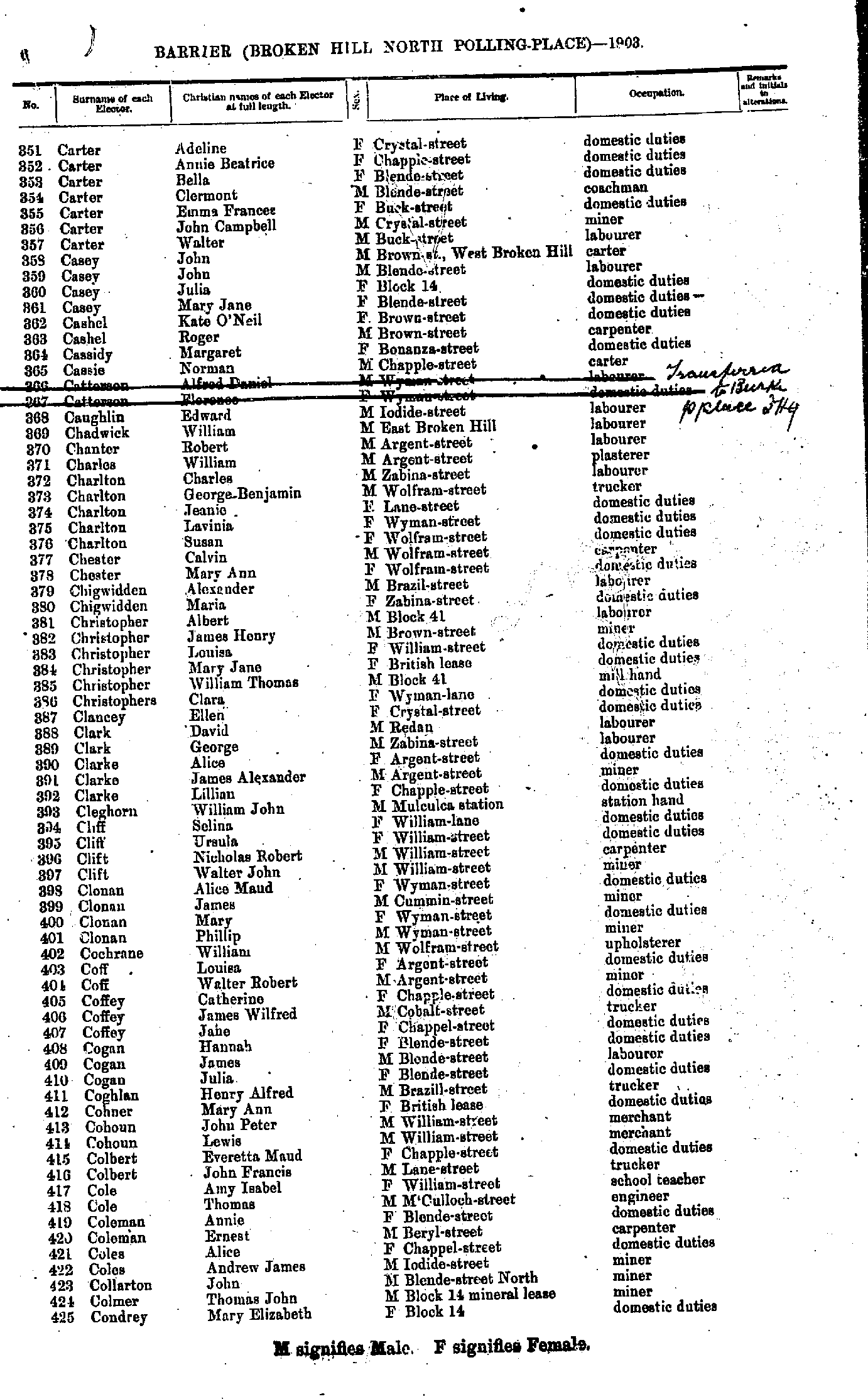
- Carter Adeline - Condrey Mary Elizabeth
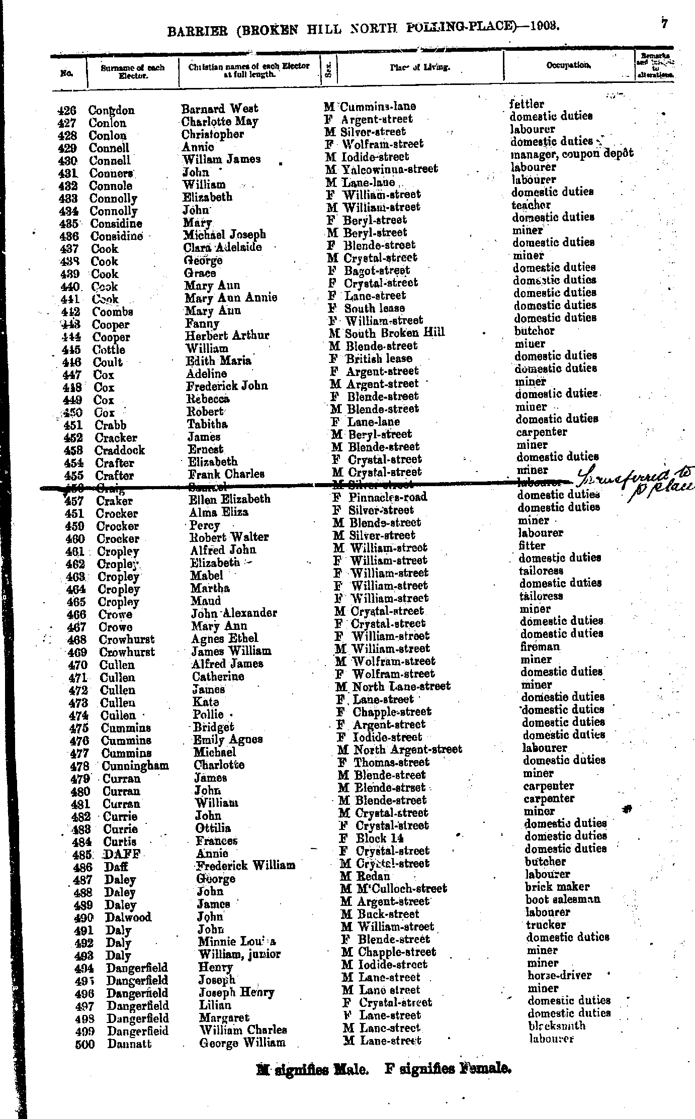
- Congdon Barnard West - Dannatt George William
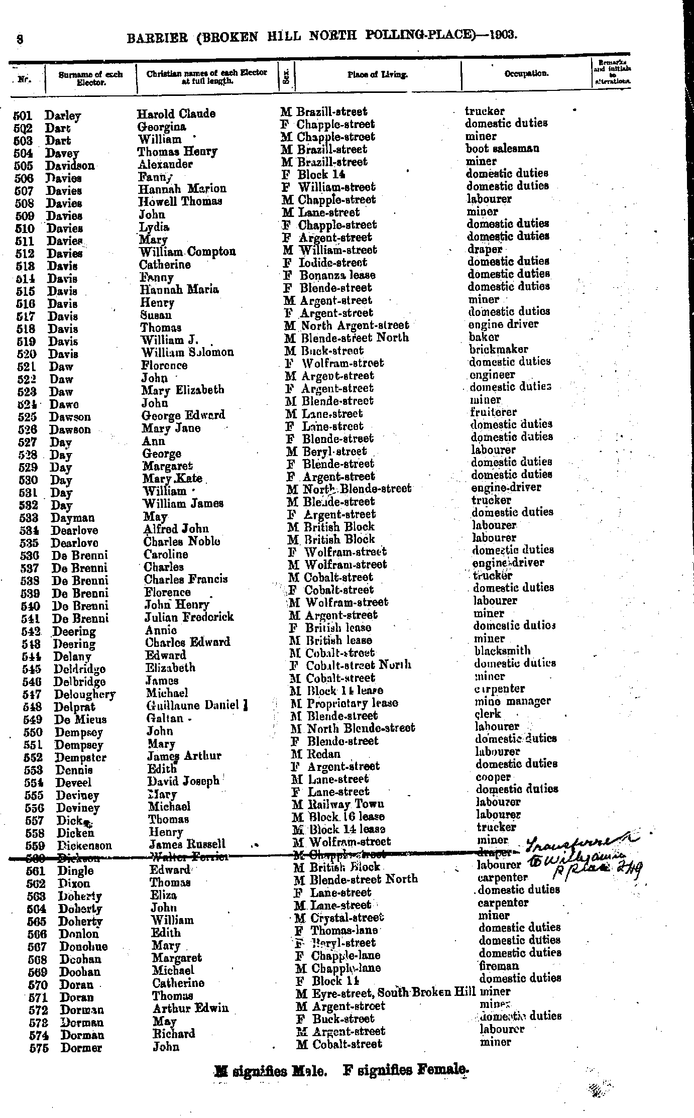
- Darley Harold Claude - Dormer John
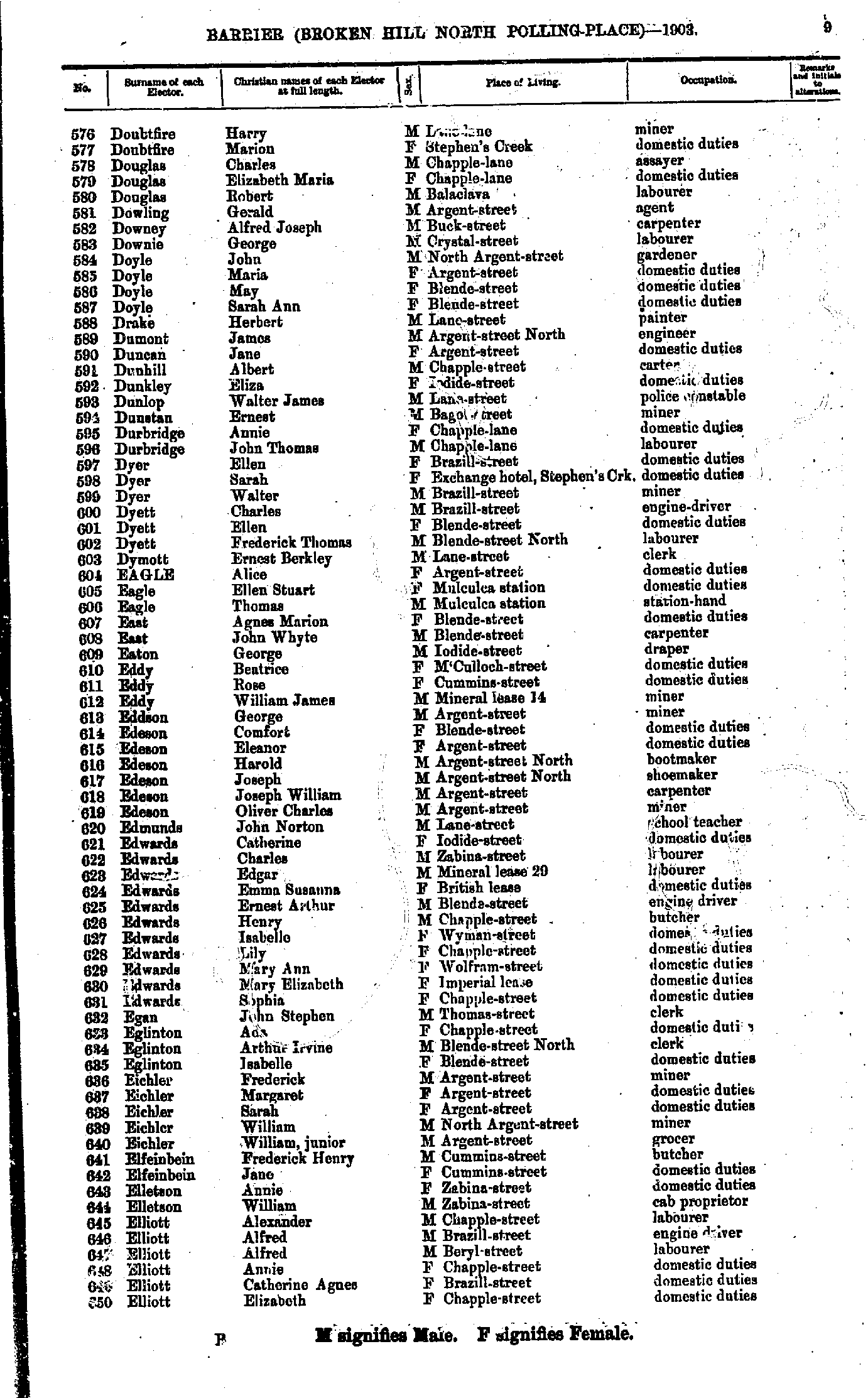
- Doubtfire Harry - Elliot Elizabeth
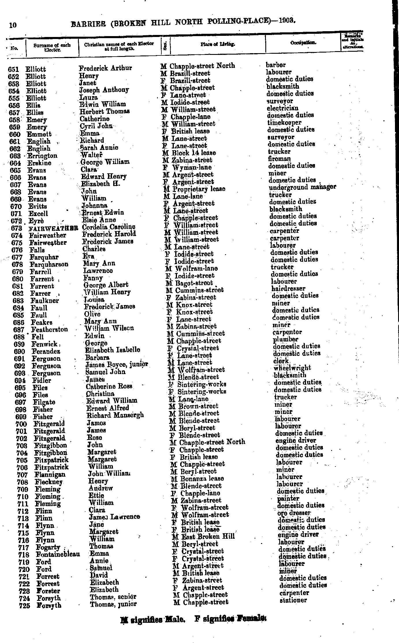
- Elliott Frederick Arthur - Forsyth Thomas junior
- Forsyth William - Goldsworthy Joseph
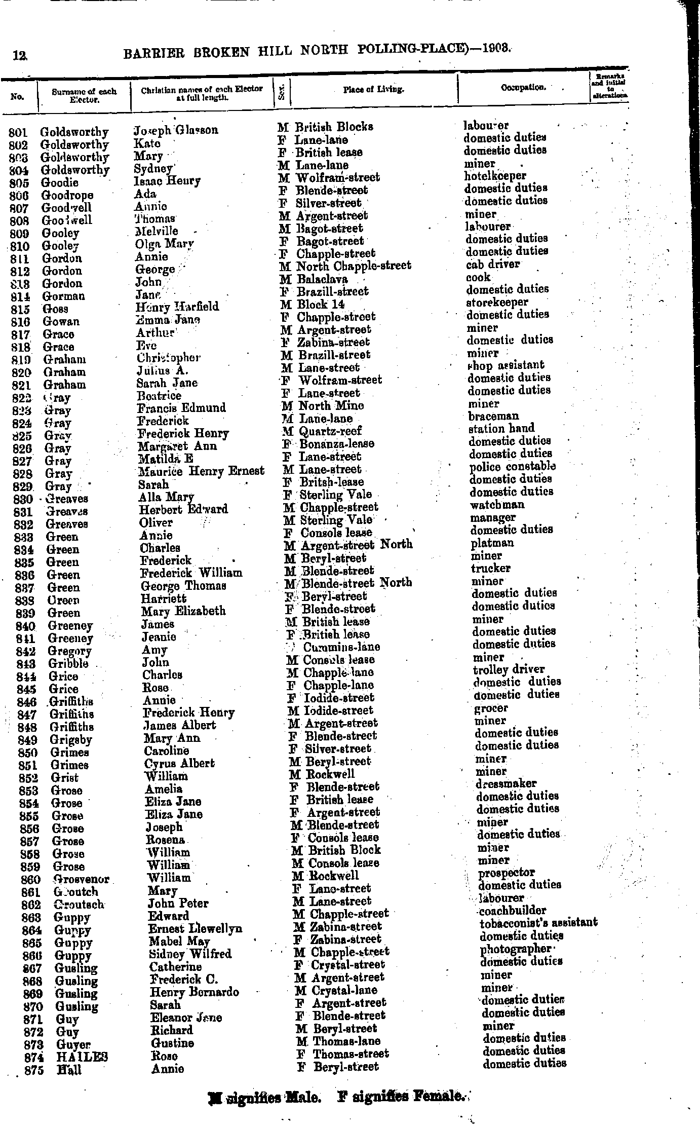
- Goldsworthy Joseph Glasson - Hall Annie
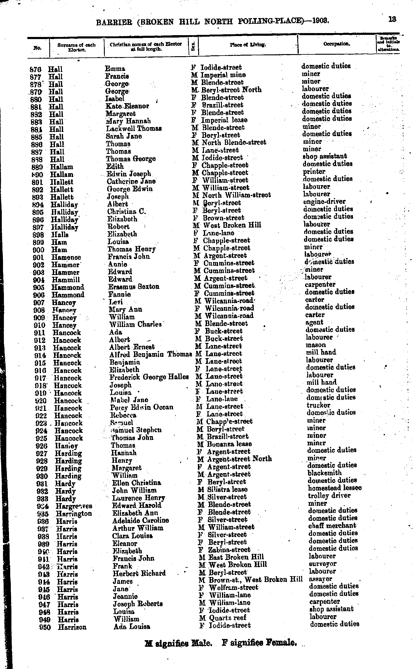
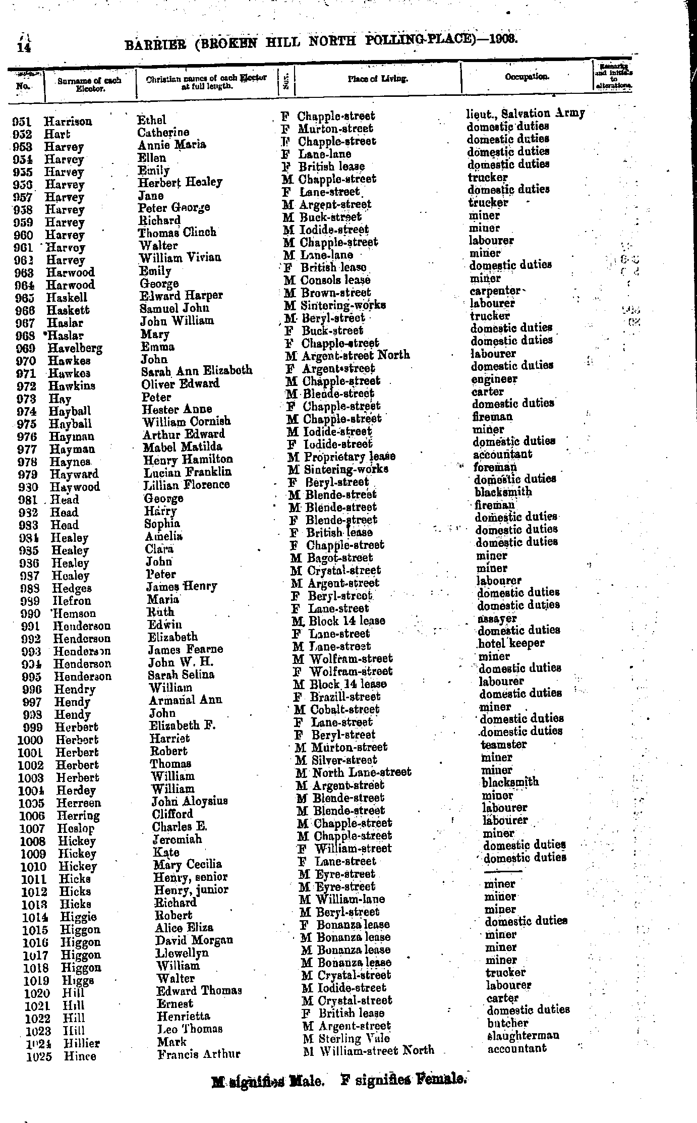
- Hall Emma - Harrison Ada Louisa
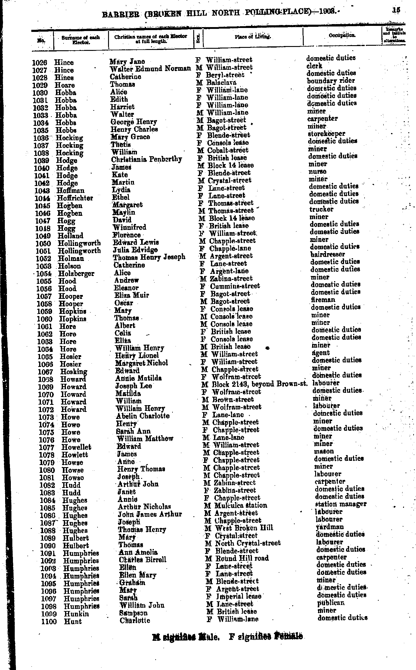
- Harrison Ethel - Hince Francis Arthur
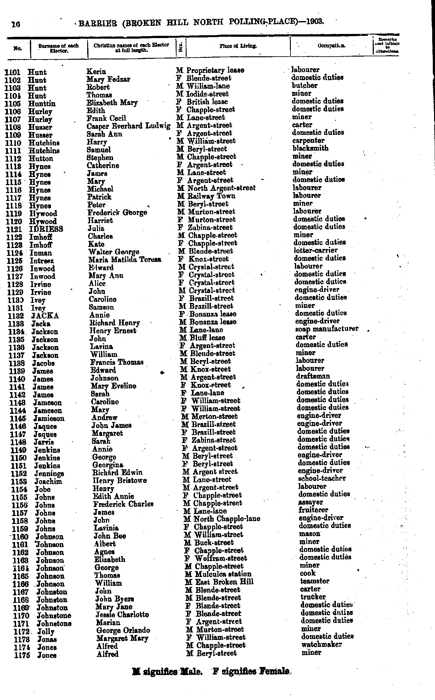
- Hince Mary Jane - Hunt Charlotte
- Hunt Kerin - Jones Alfred
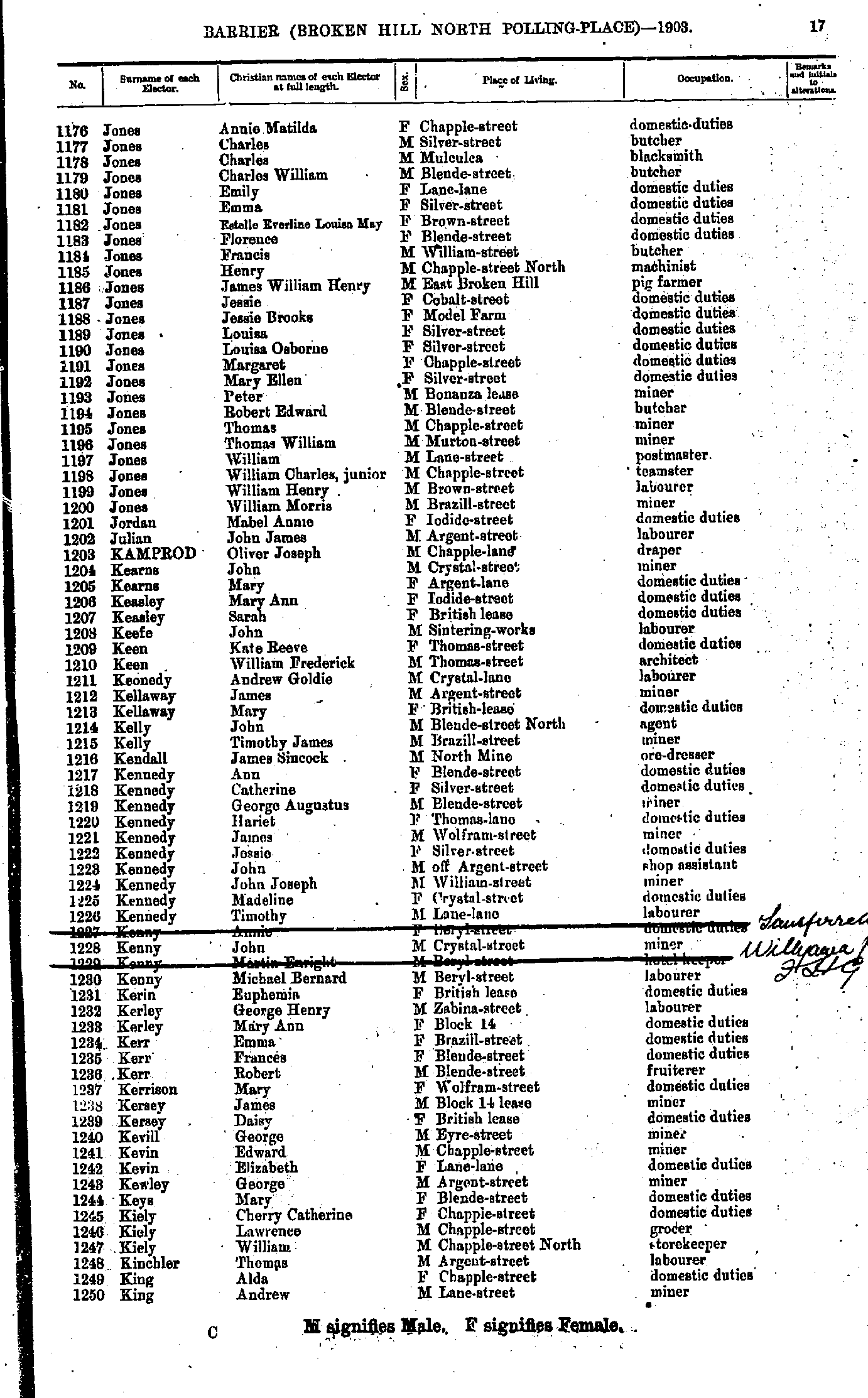
- Jones Annie Matilda - King Andrew
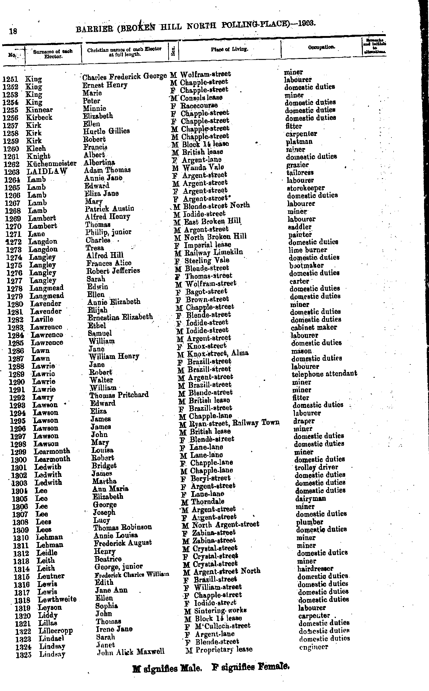
- King Charles Frederick George - Lindsay John Alick Maxwell
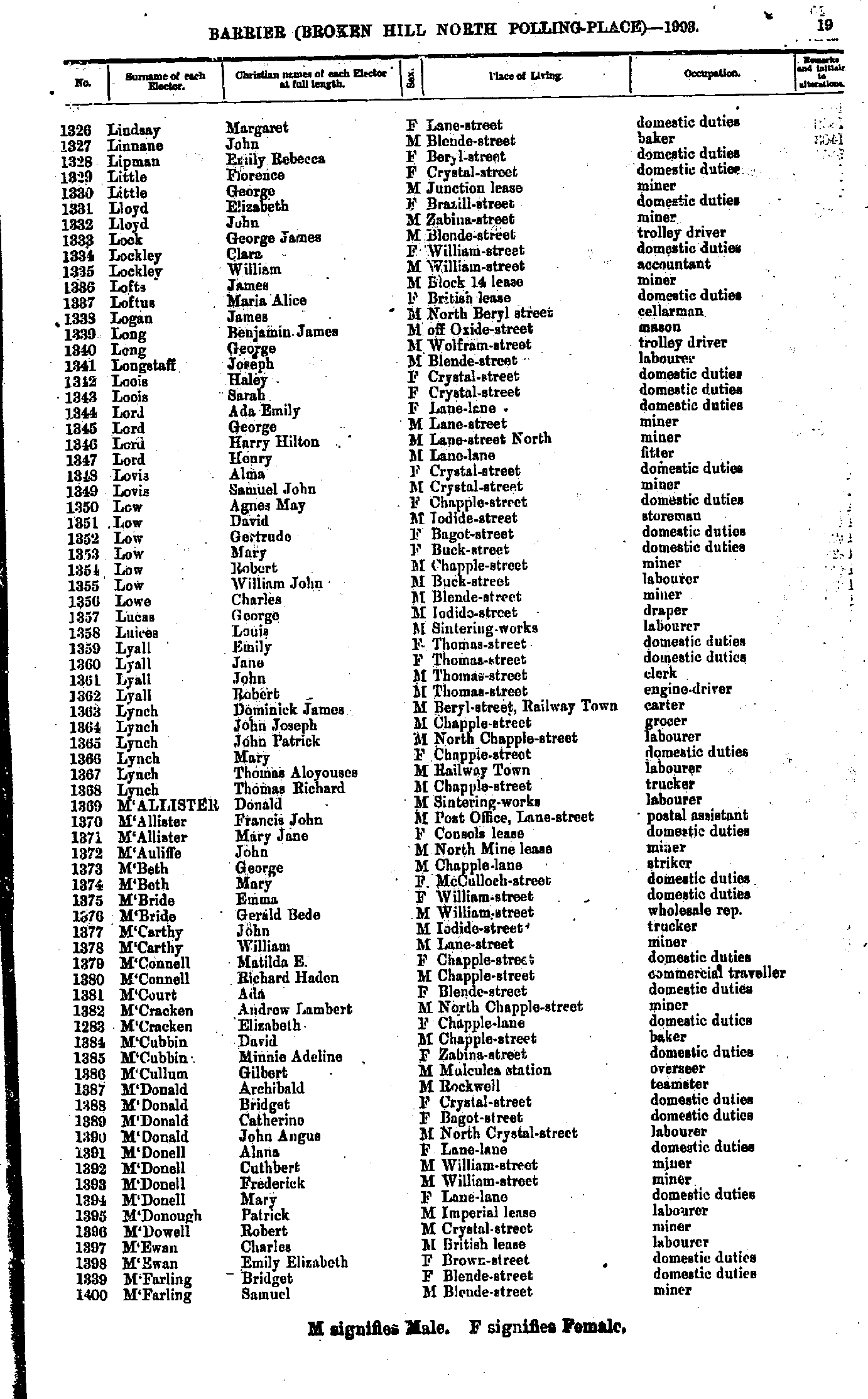
- Lindsay Margaret - M'Farling Samuel
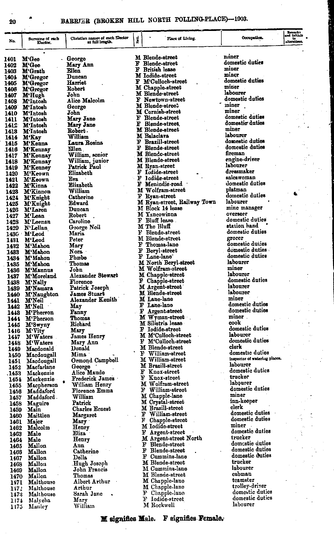
- M'Gee George - Manley William
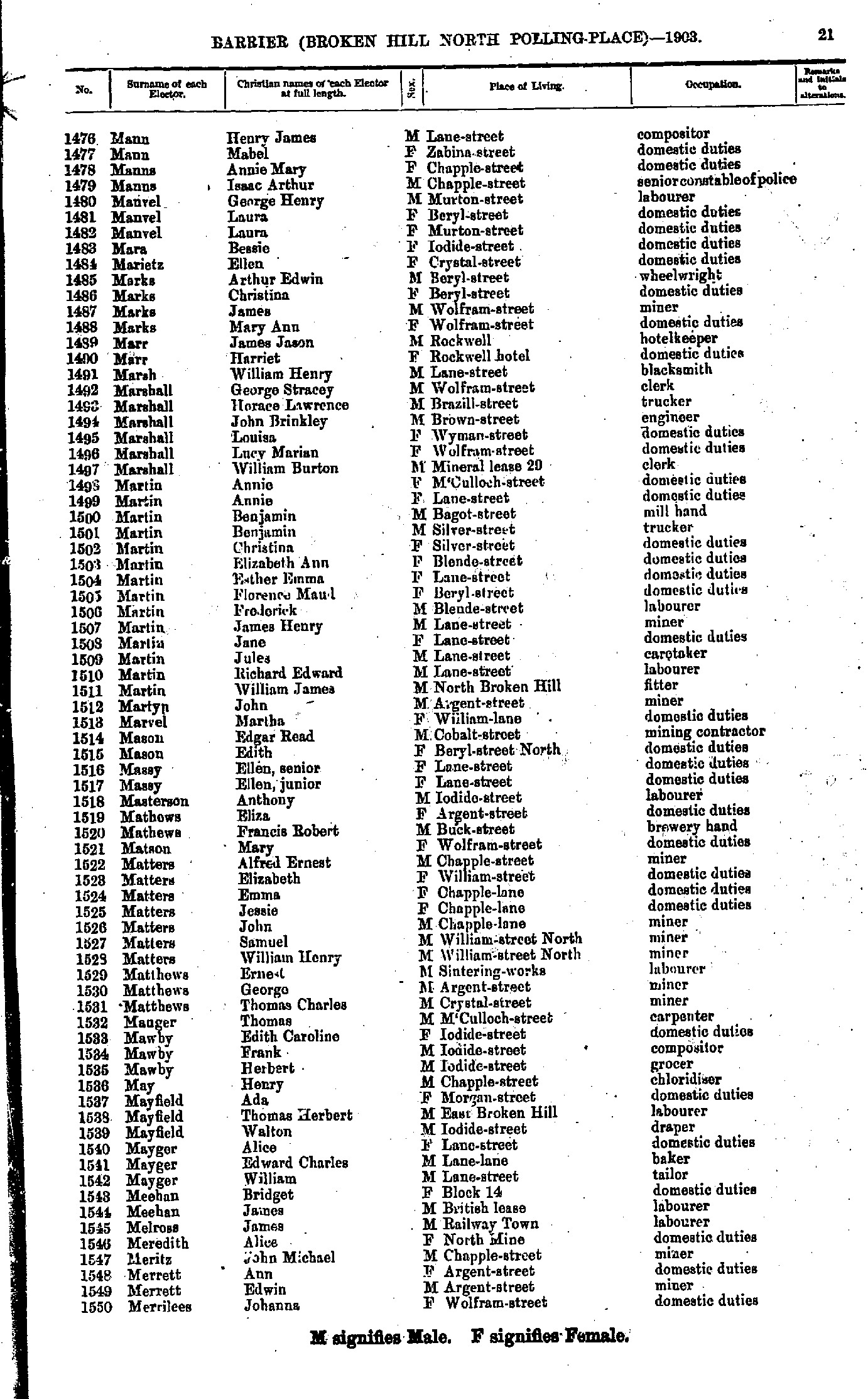
- Mann Henry James - Merrilees Johanna
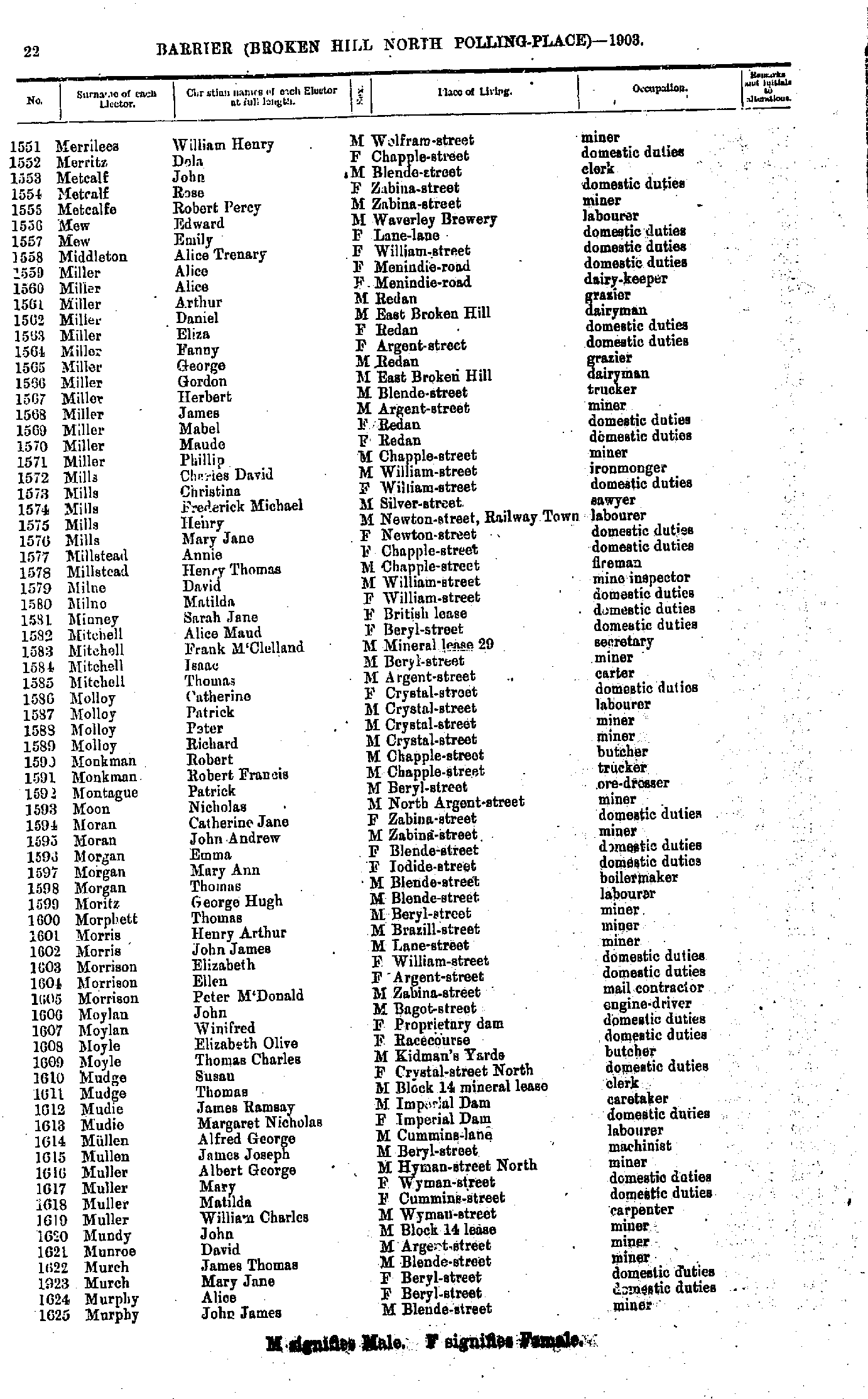
- Merrilees William Henry - Murphy John James
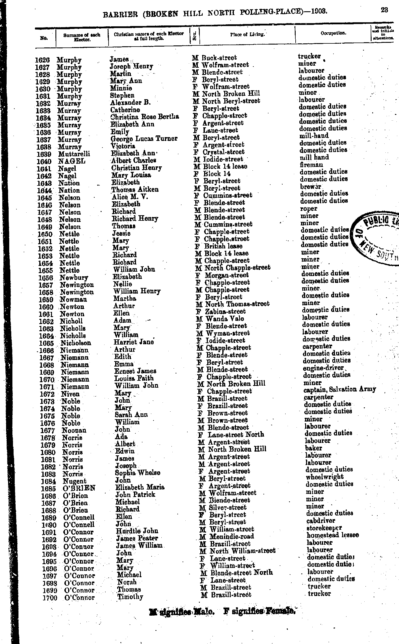
- Murphy James - O'Connor Timothy
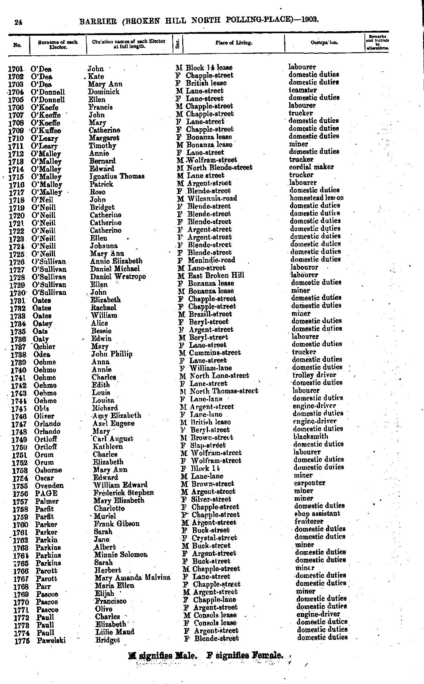
- O'Dea John - Pawelski Bridget
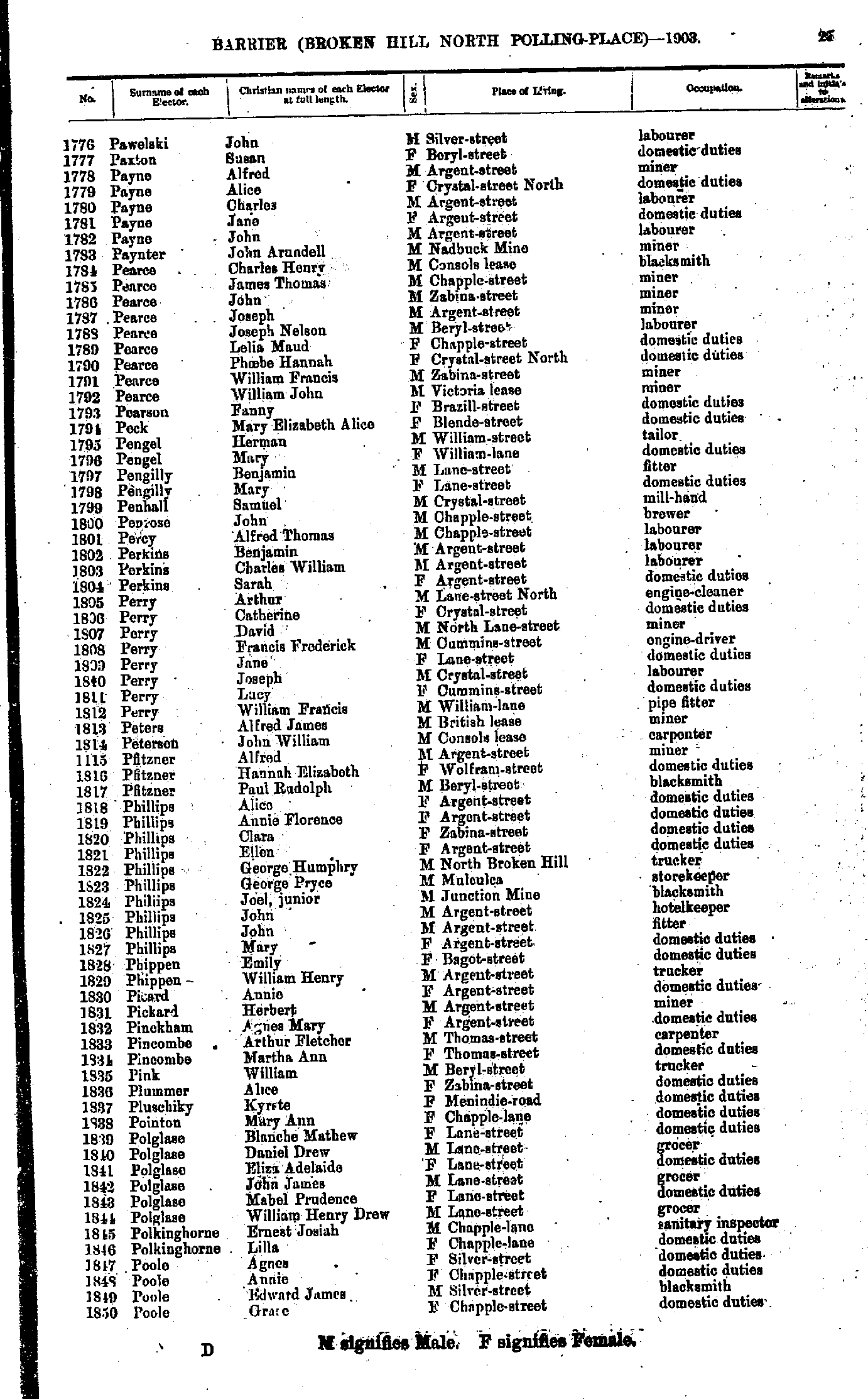
- Pawelski John - Poole Grace
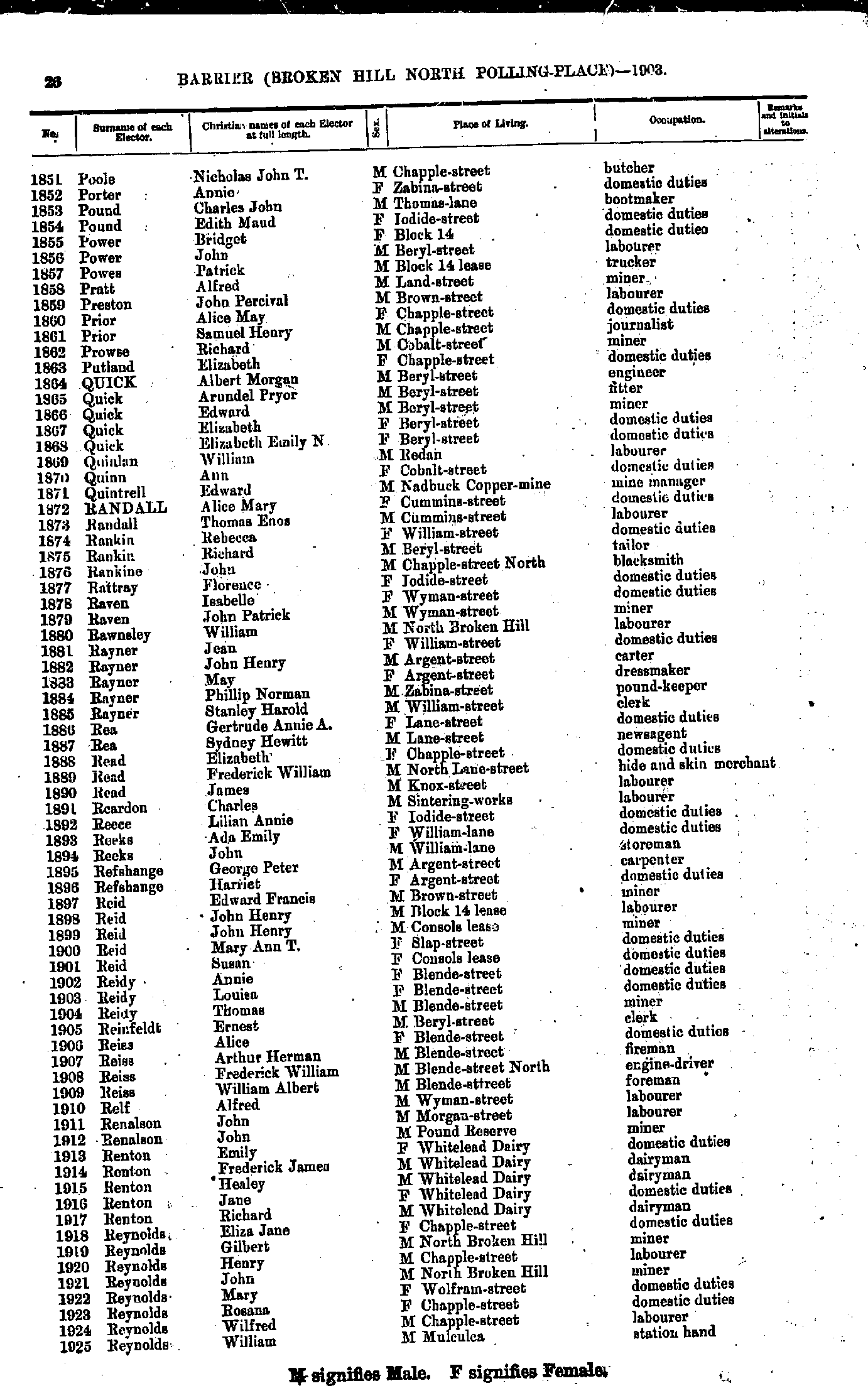
- Poole Nicholas John T - Reynolds William
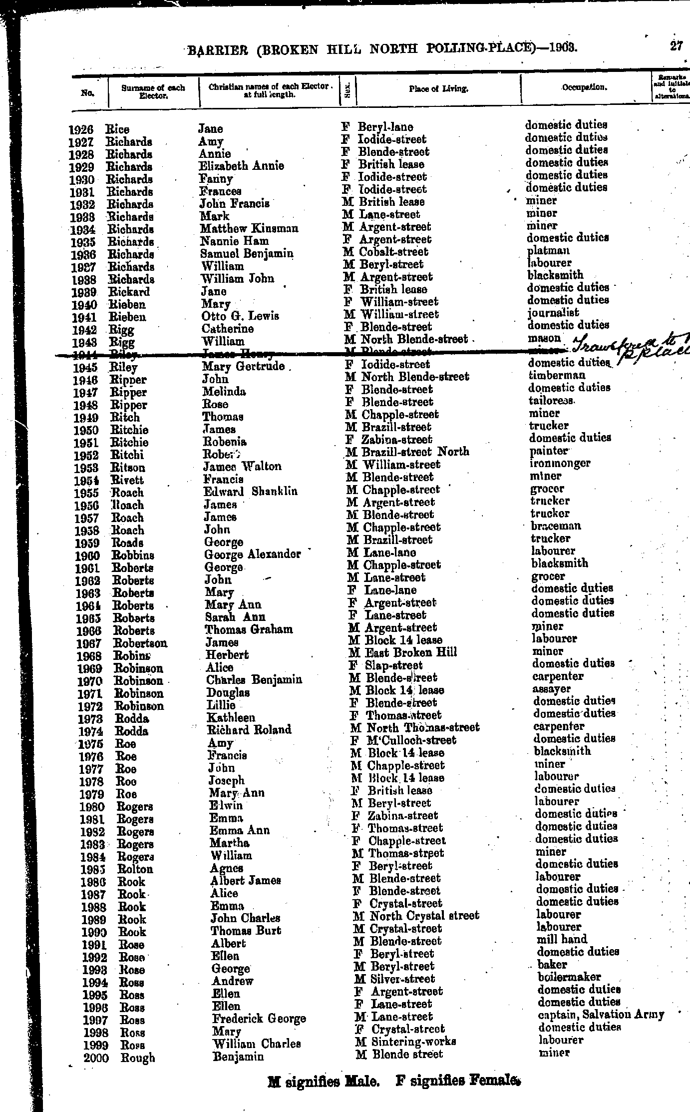
- Rice Jane - Rough Benjamin
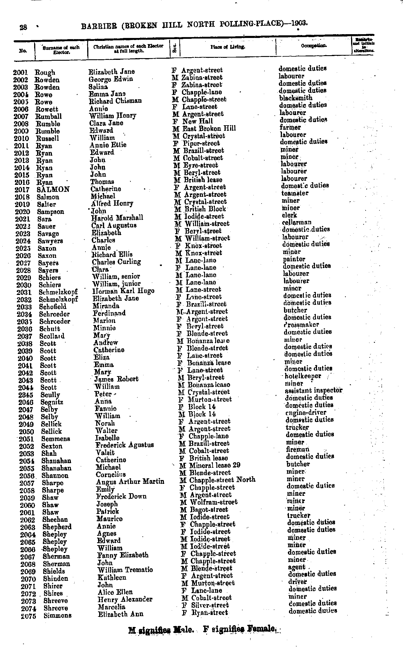
- Rough Elizabeth Jane - Simmons Elizabeth Ann
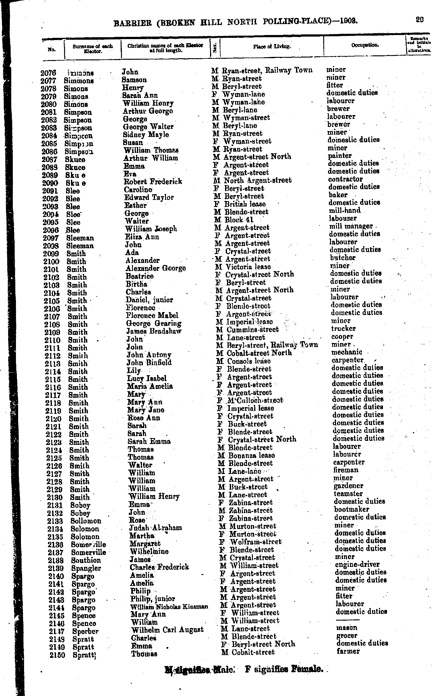
- Simmons John - Spratt Thomas
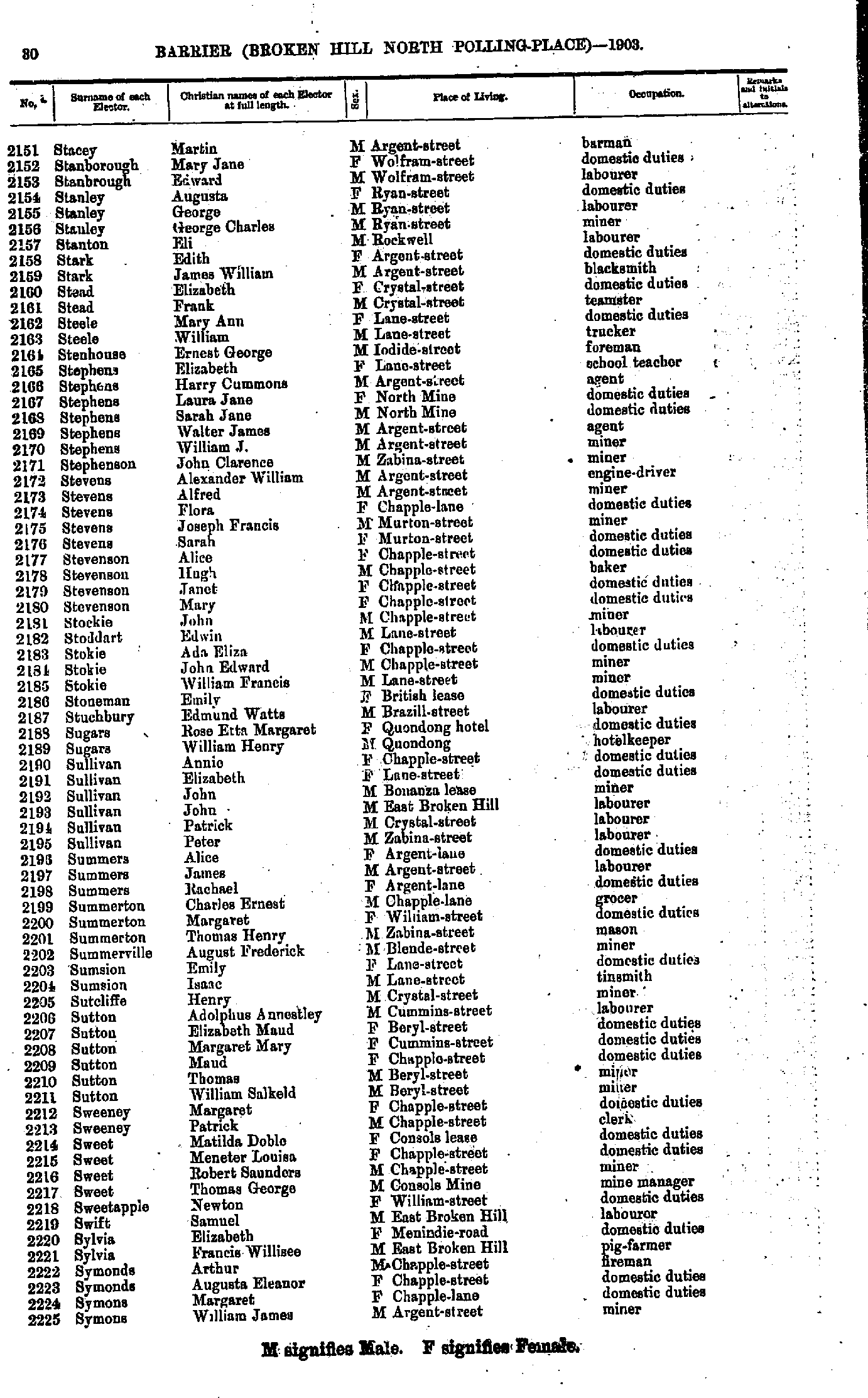
- Stacey Martin - Symons William James
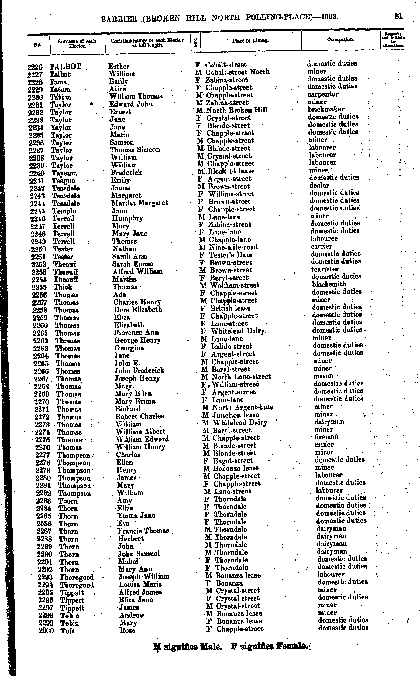
- Talbot Esther - Toft Rose
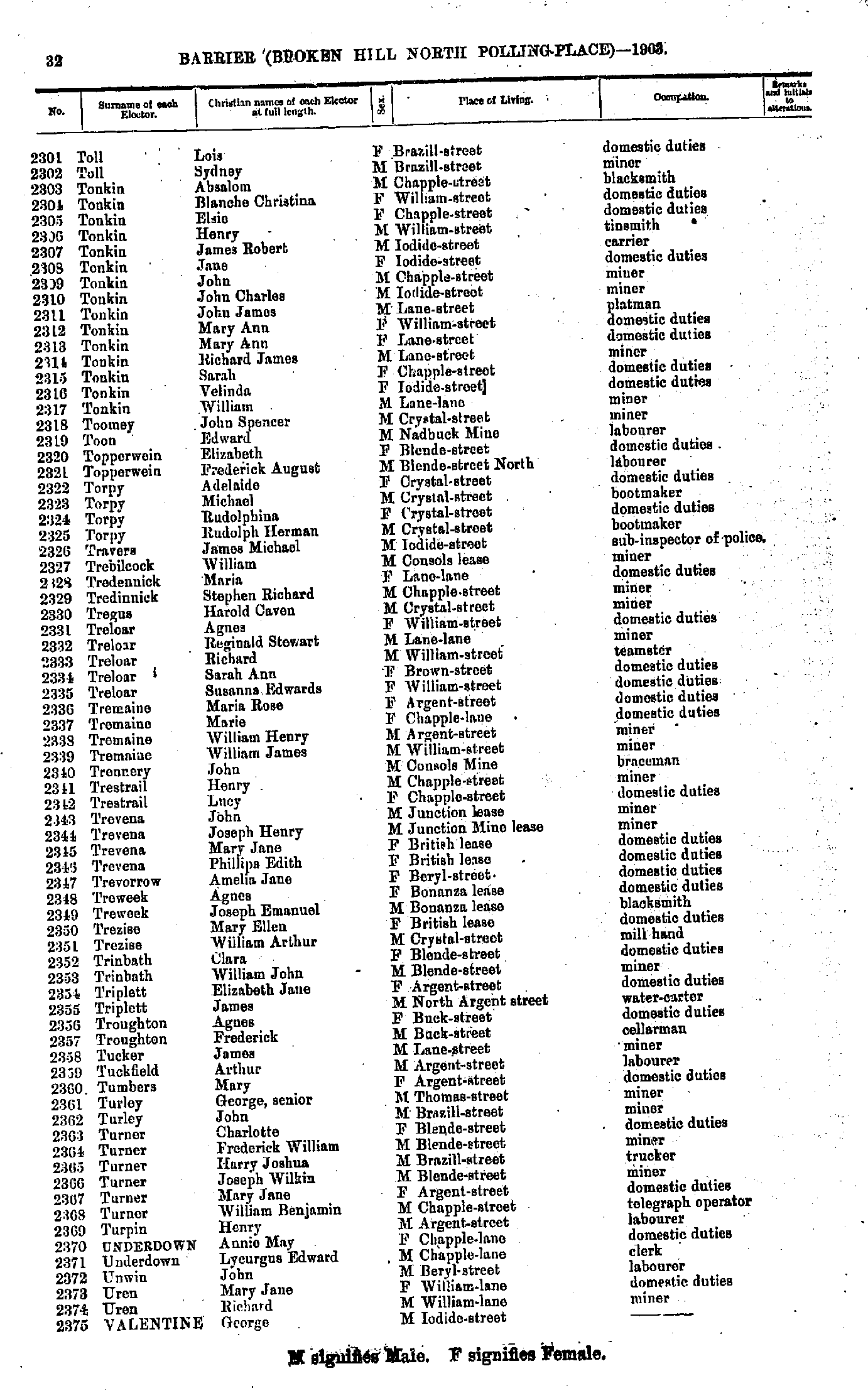
- Toll Lois - Valentine George
- Valentine Mary - Welsh Mary Jane
- Werber Richard Samuel - Williamson Mary Jane
- Willing John - Zanker Martha
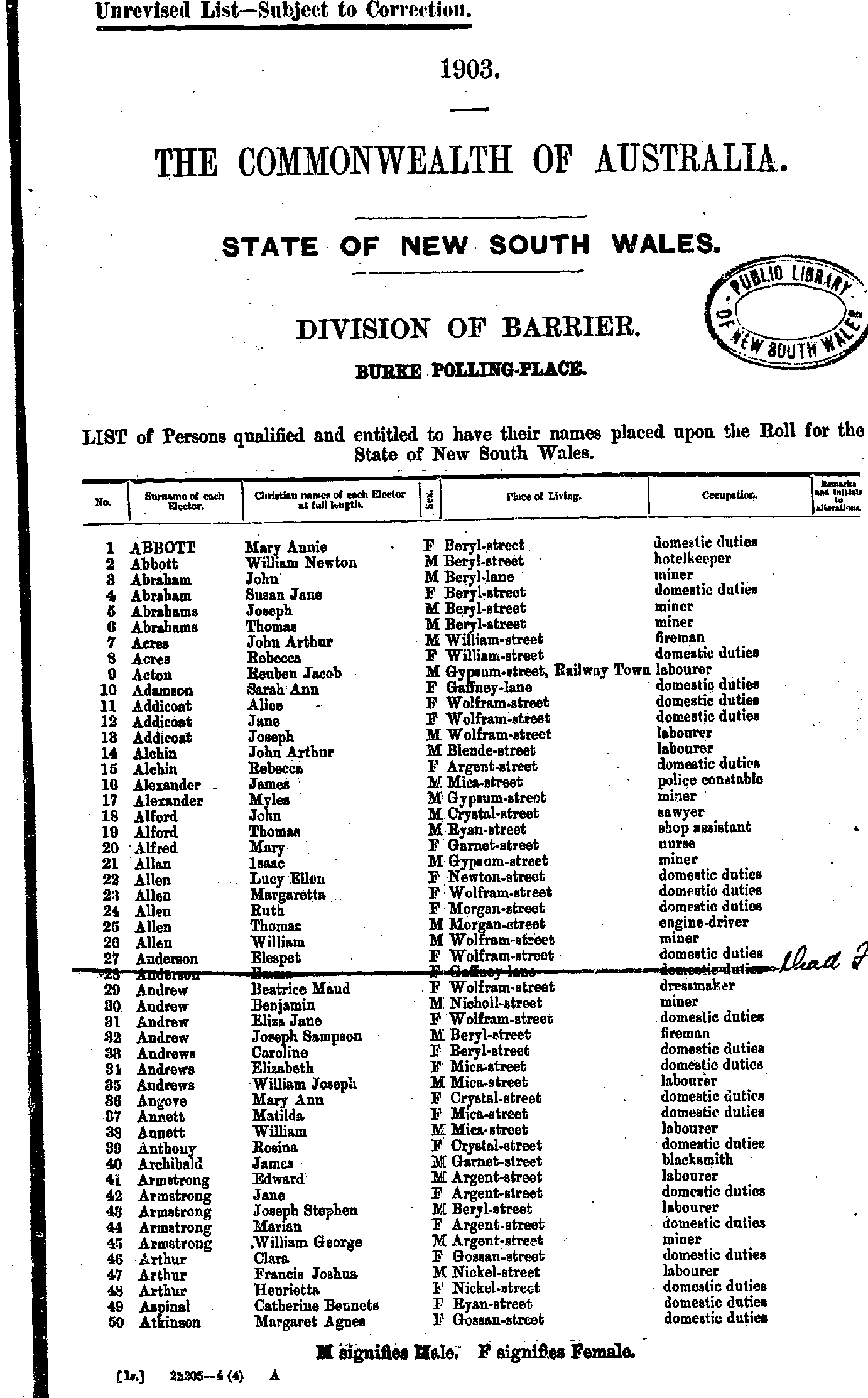
- Abbott Mary Annie - Atkinson Margaret Agnes
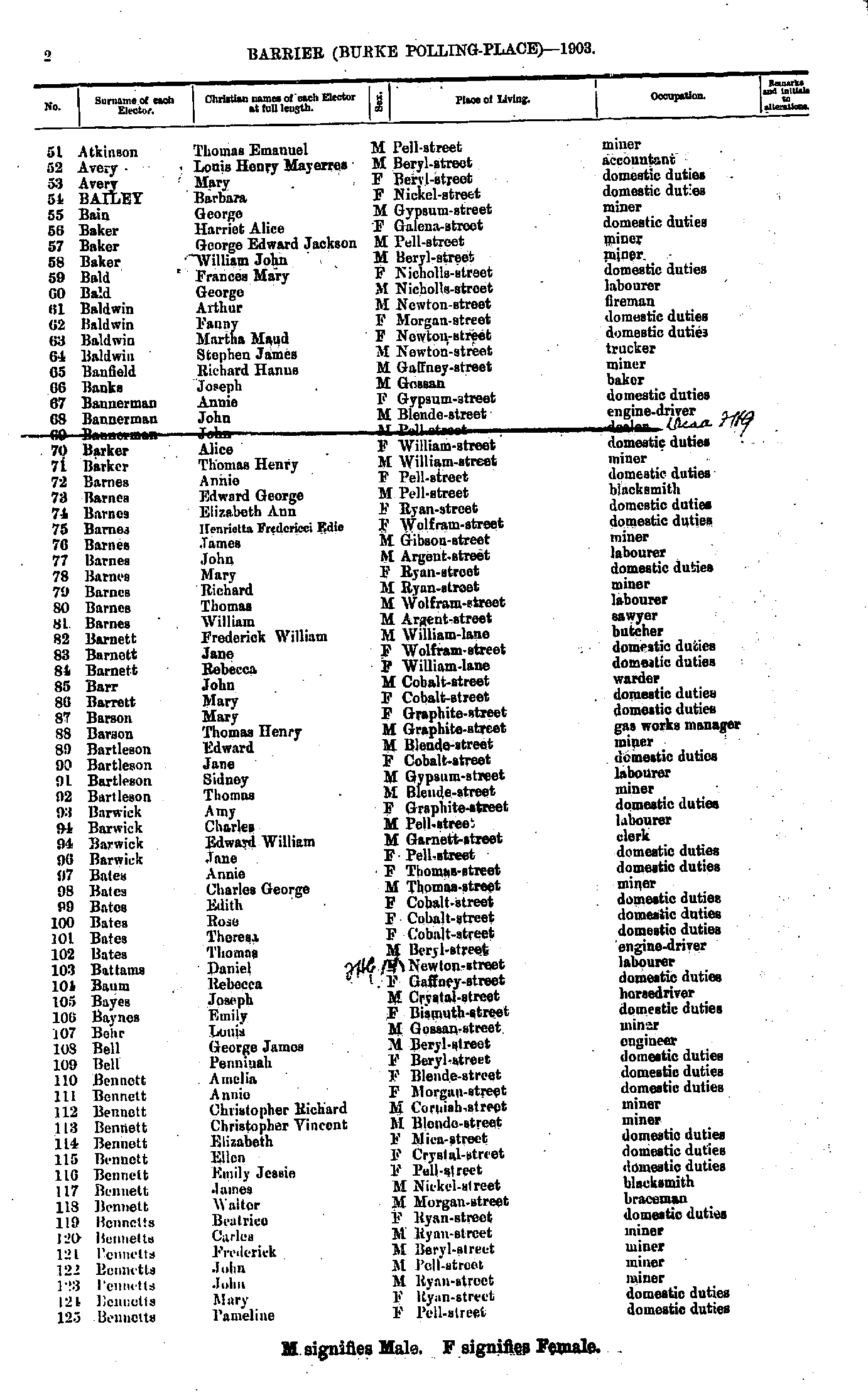
- Atkinson Thomas Emanuel - Bennetts Pameline
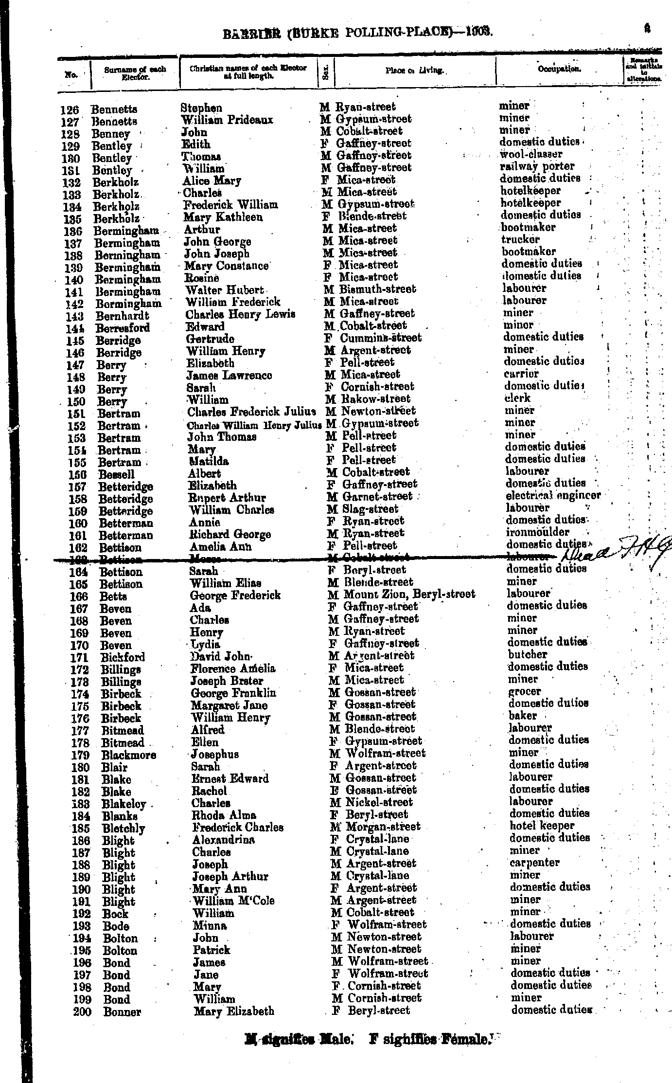
- Bennetts Stephen - Bonner Mary Elizabeth
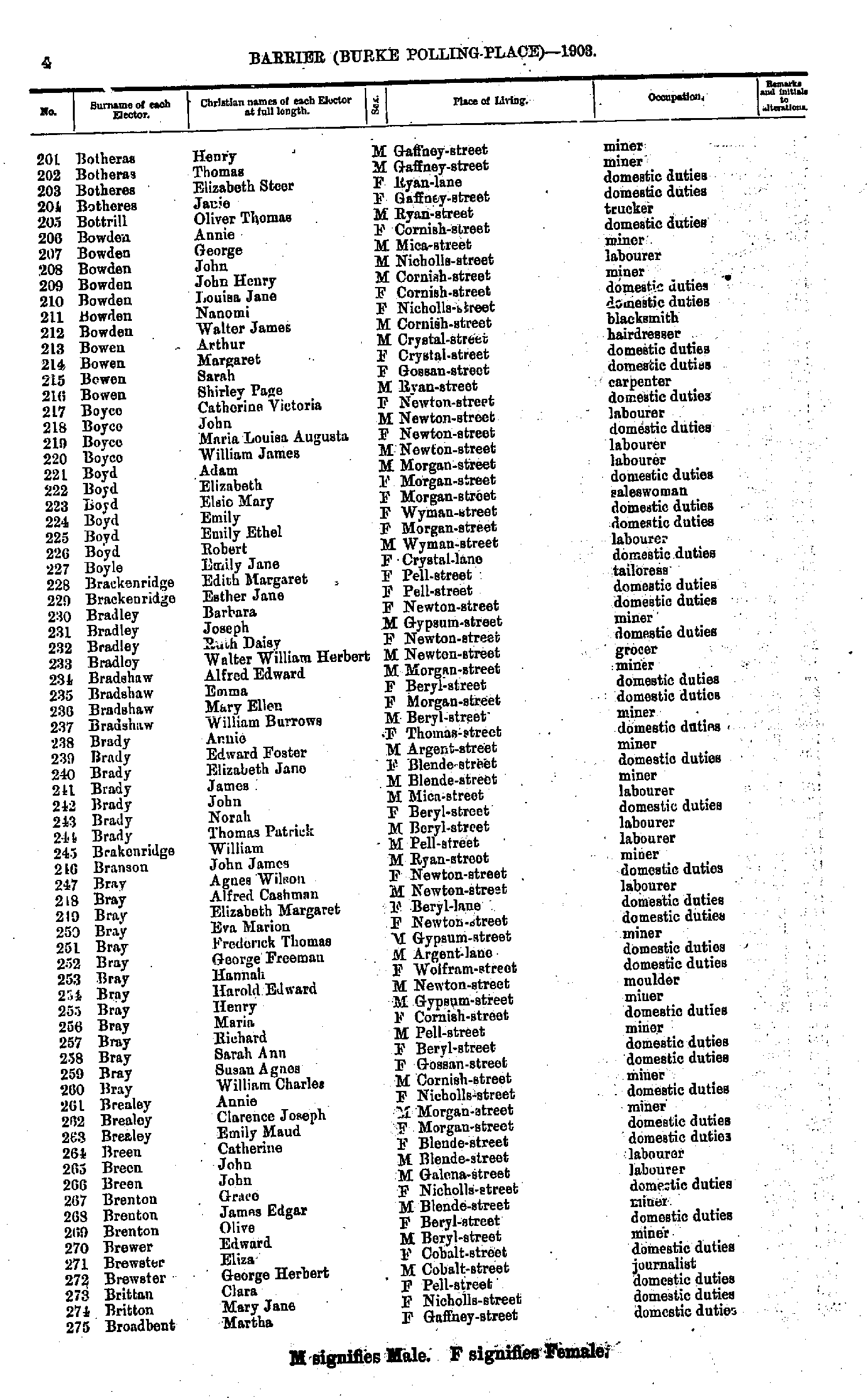
- Botheras Henry - Broadbent Martha
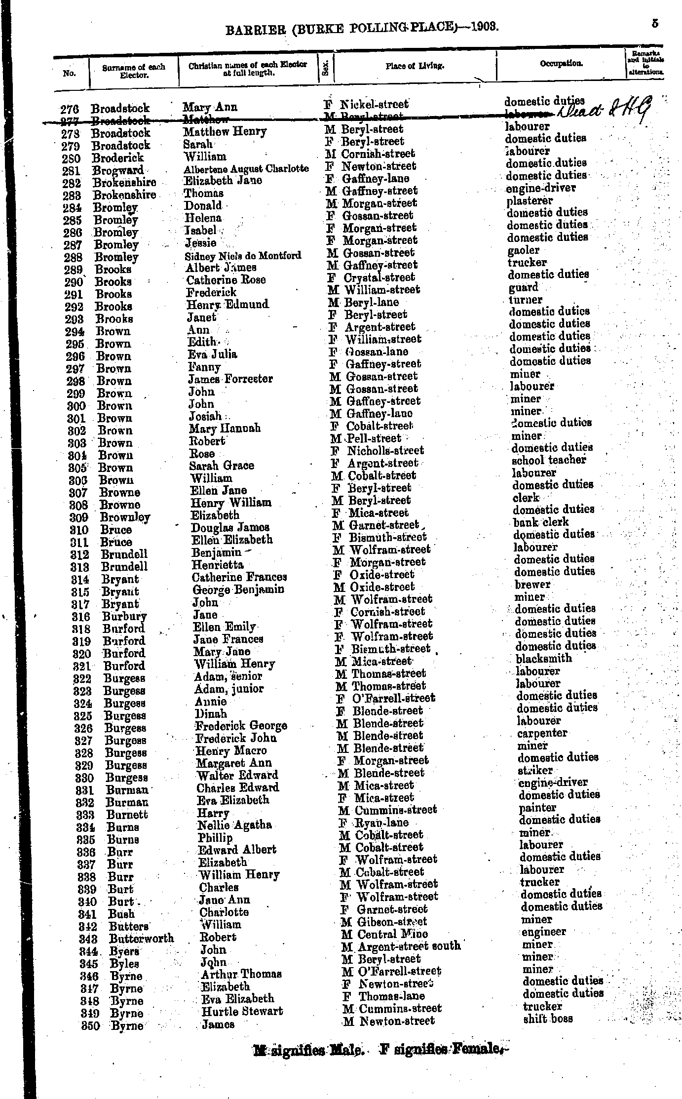
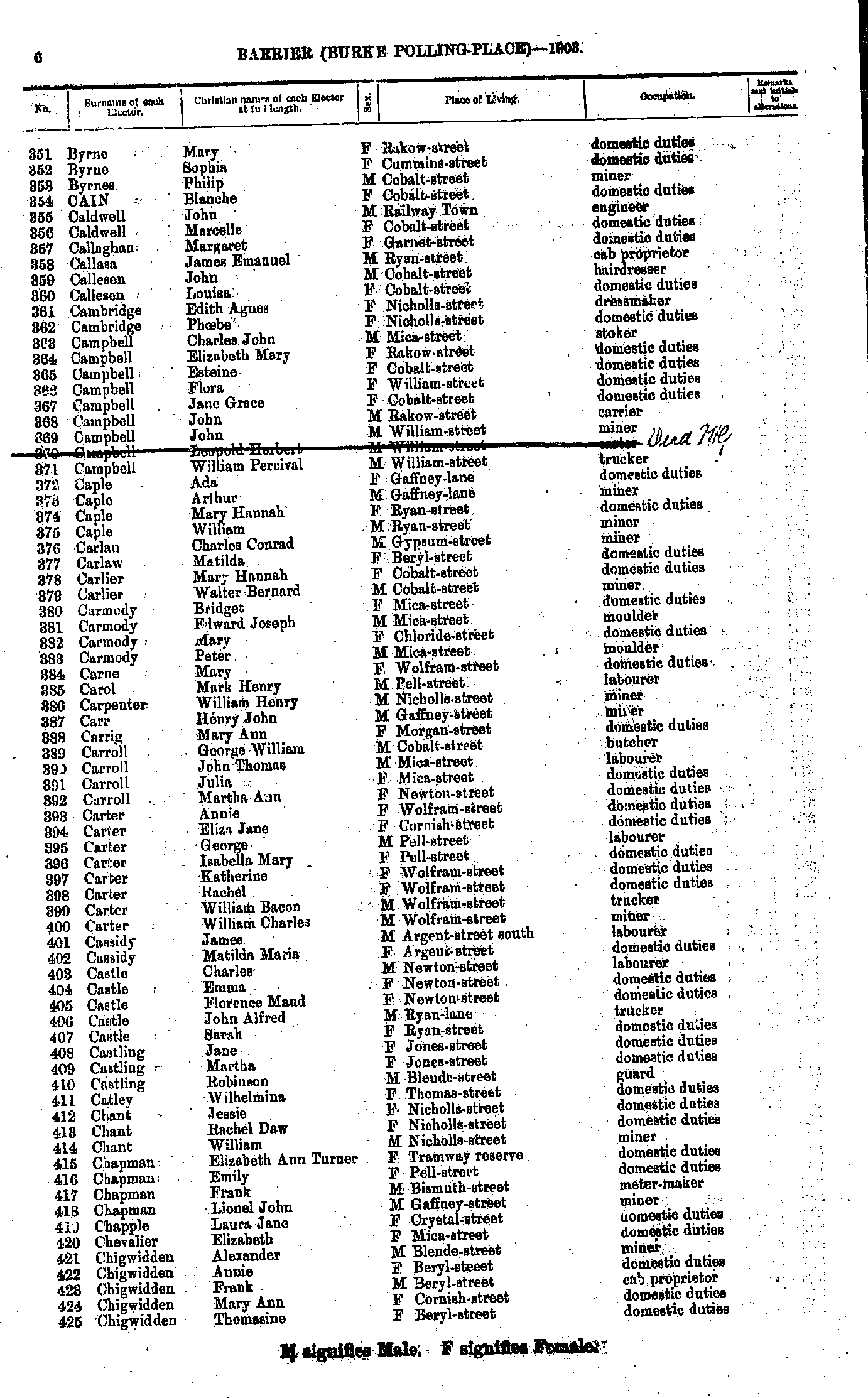
- Broadstock Mary Ann - Byrne James
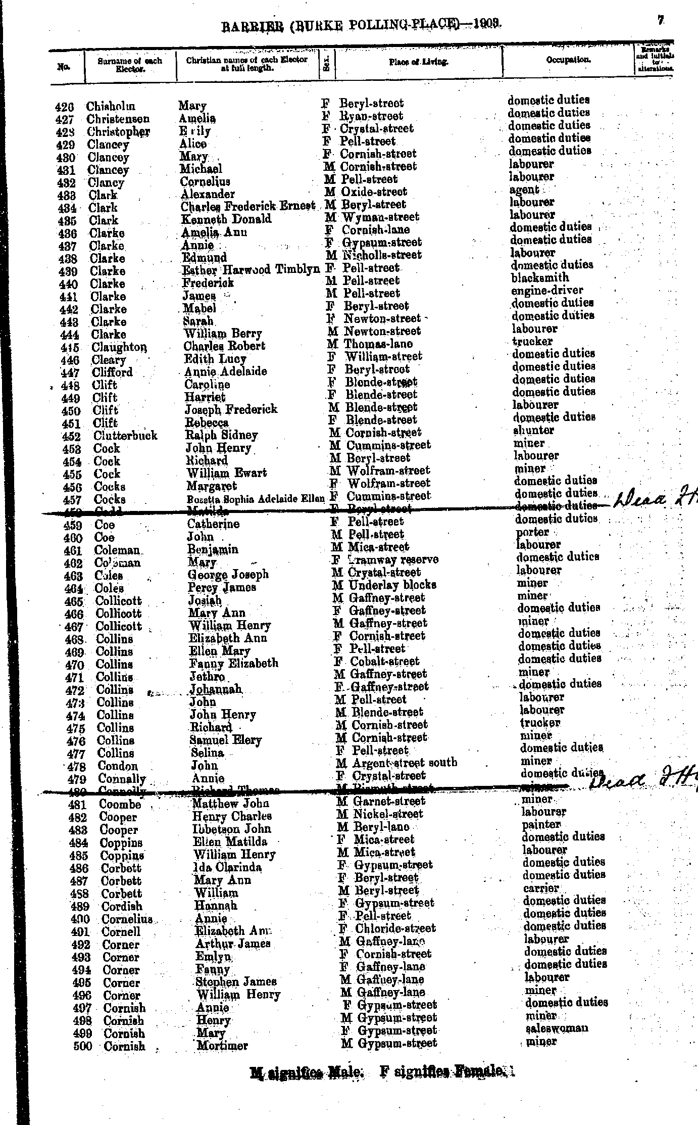
- Byrne Mary - Chigwidden Thomasine
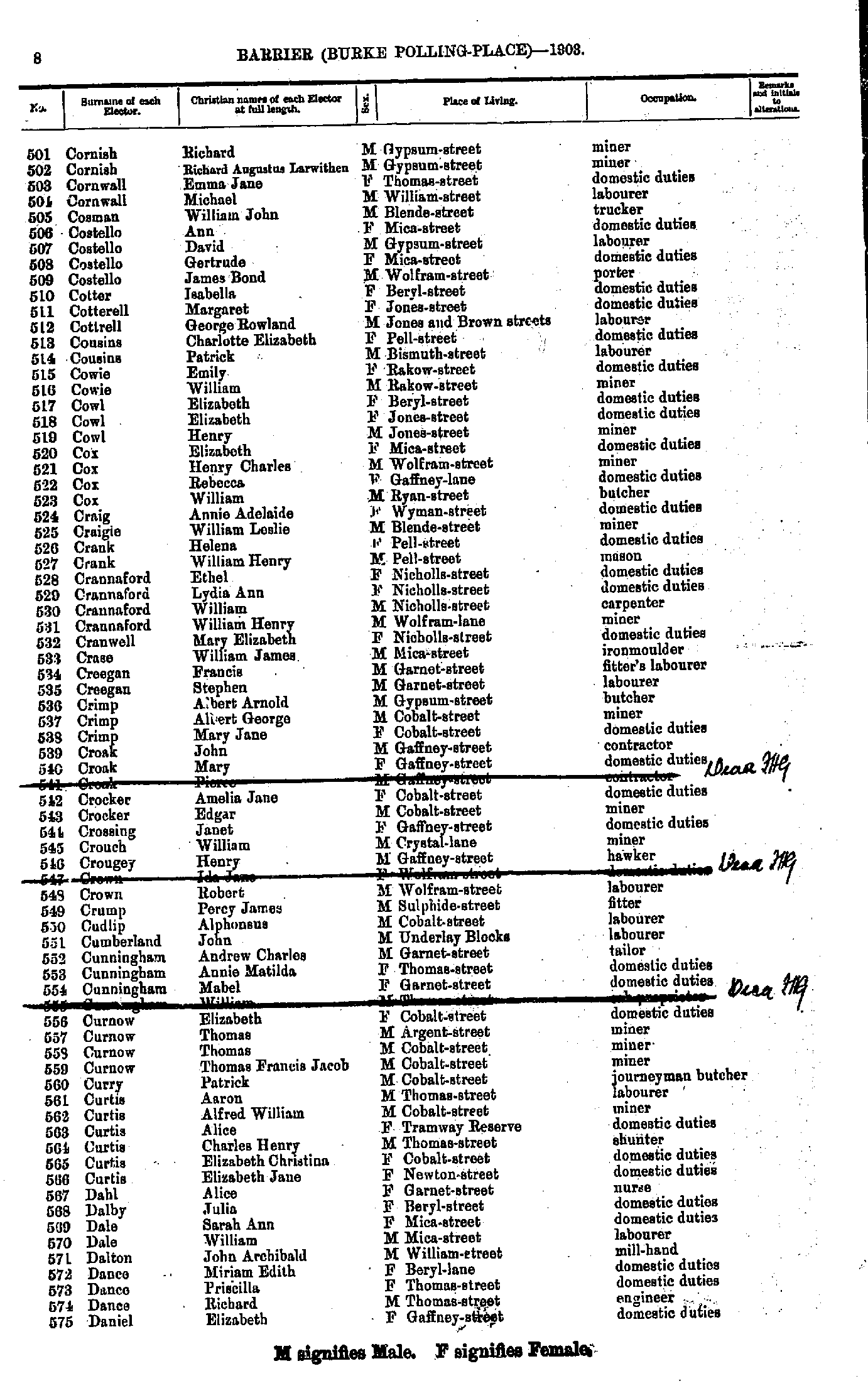
- Chisholm Mary - Cornish Mortimer
- Cornish Richard - Daniel Elizabeth
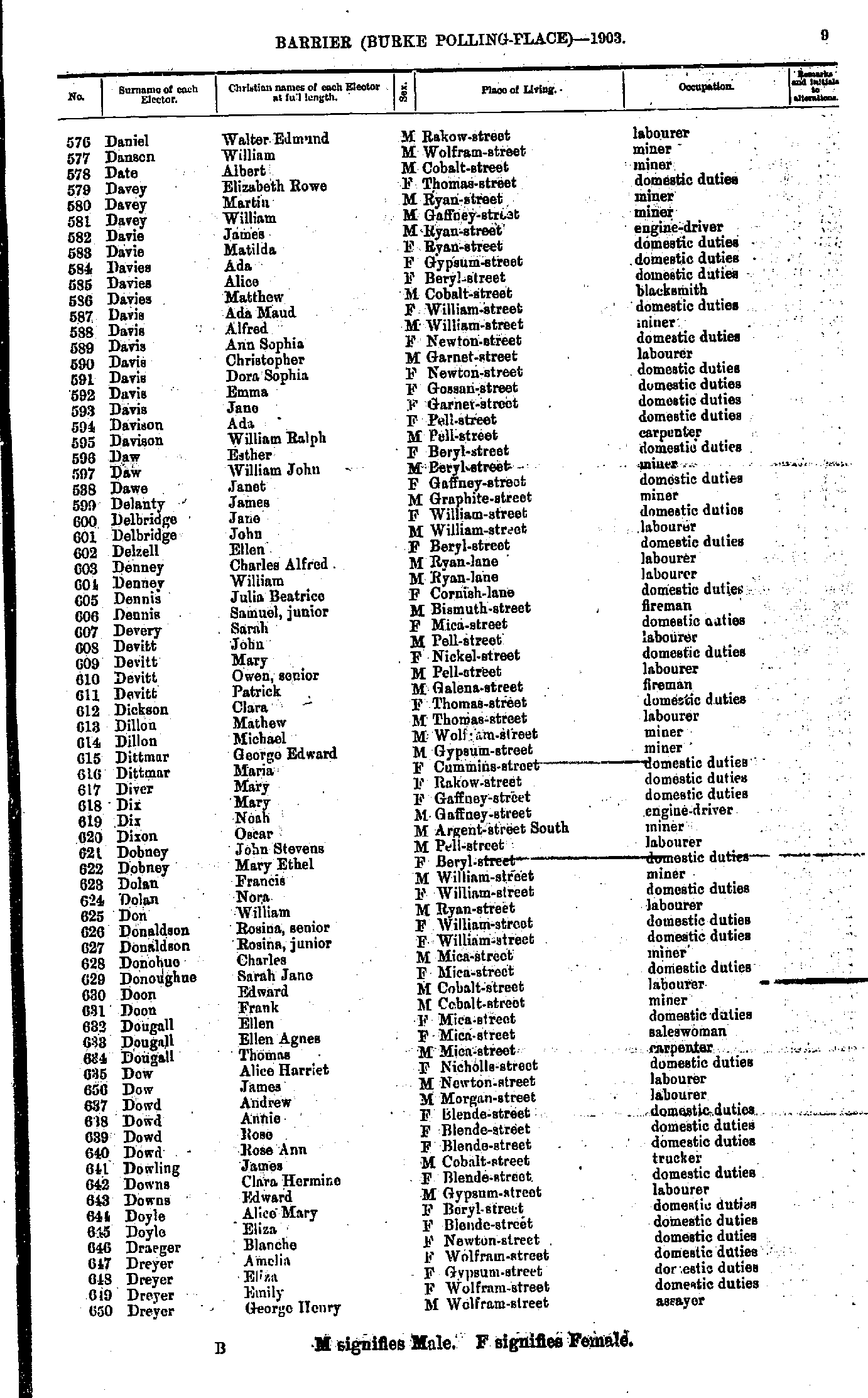
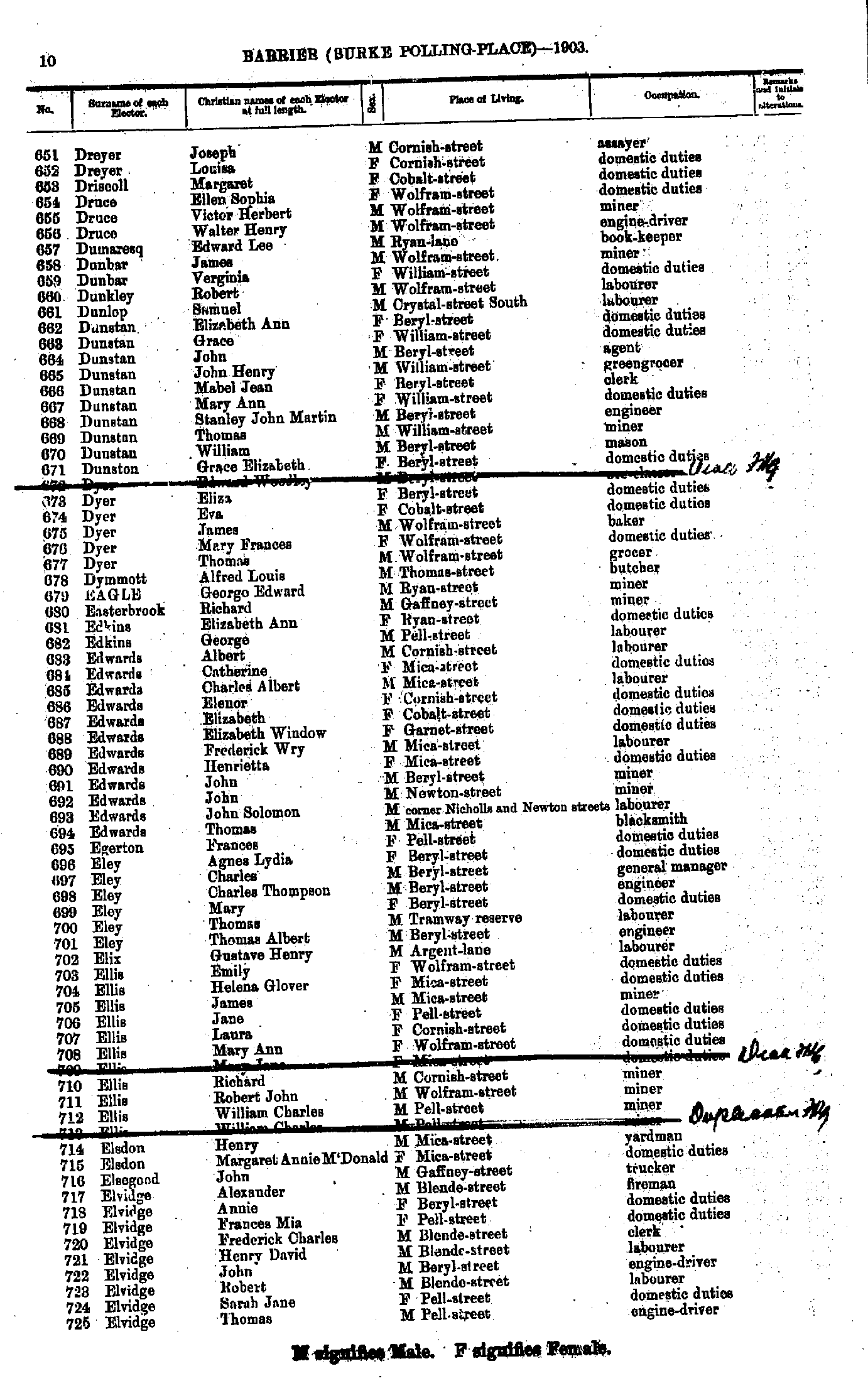
- Daniel Walter Edmund - Dreyer George Henry
- Dreyer Joseph - Elvidge Thomas
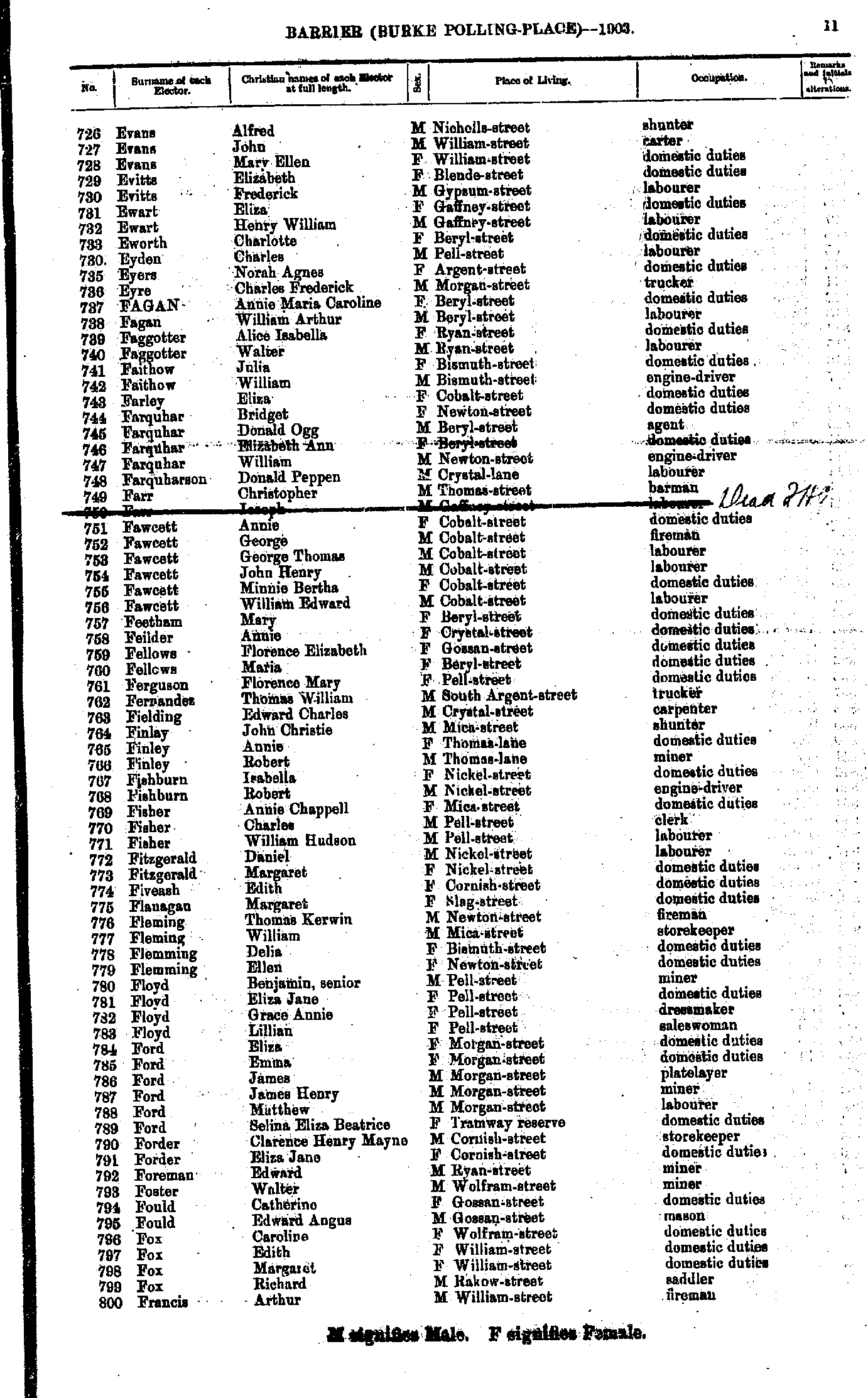
- Evans Alfred - Francis Arthur
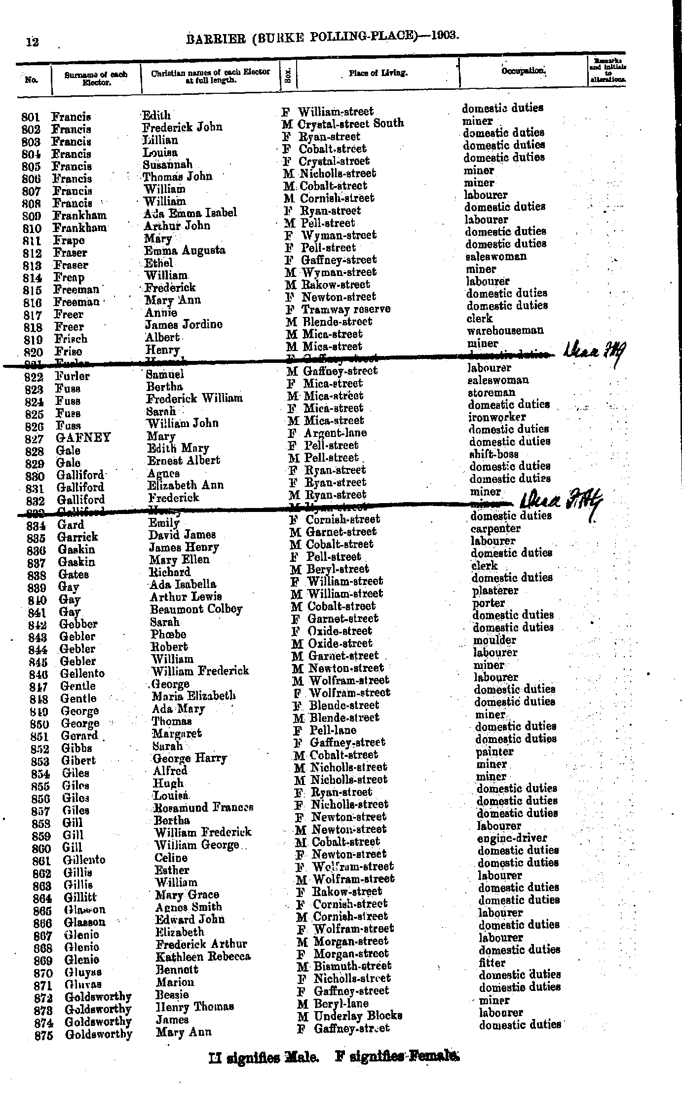
- Francis Edith - Goldsworthy Mary Ann
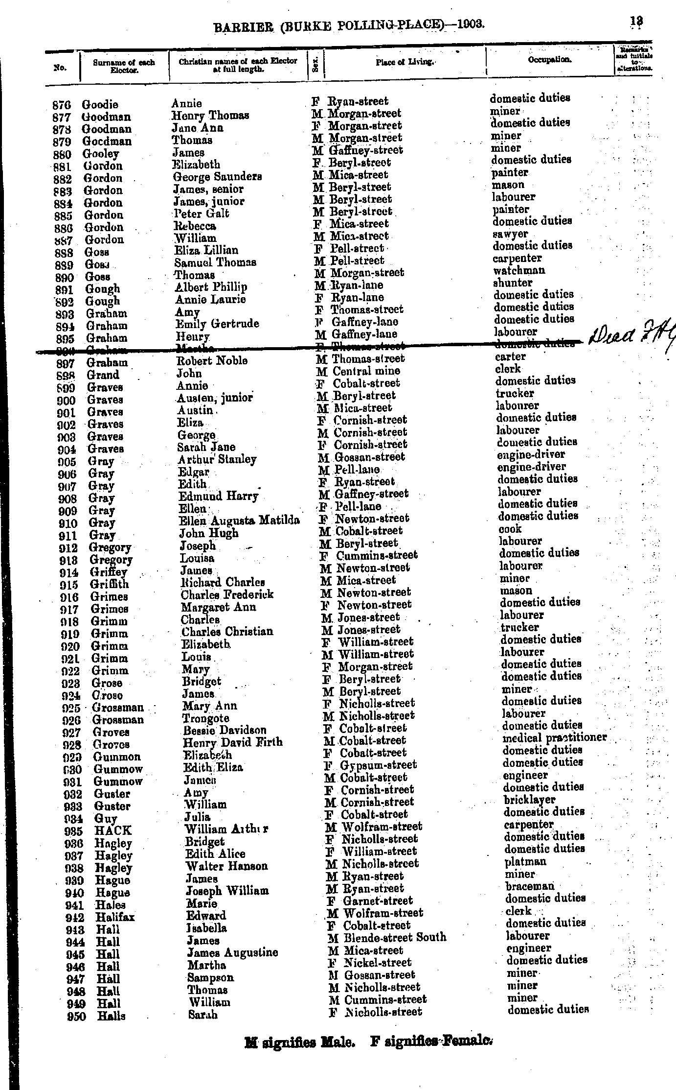
- Goodie Annie - Halls Sarah
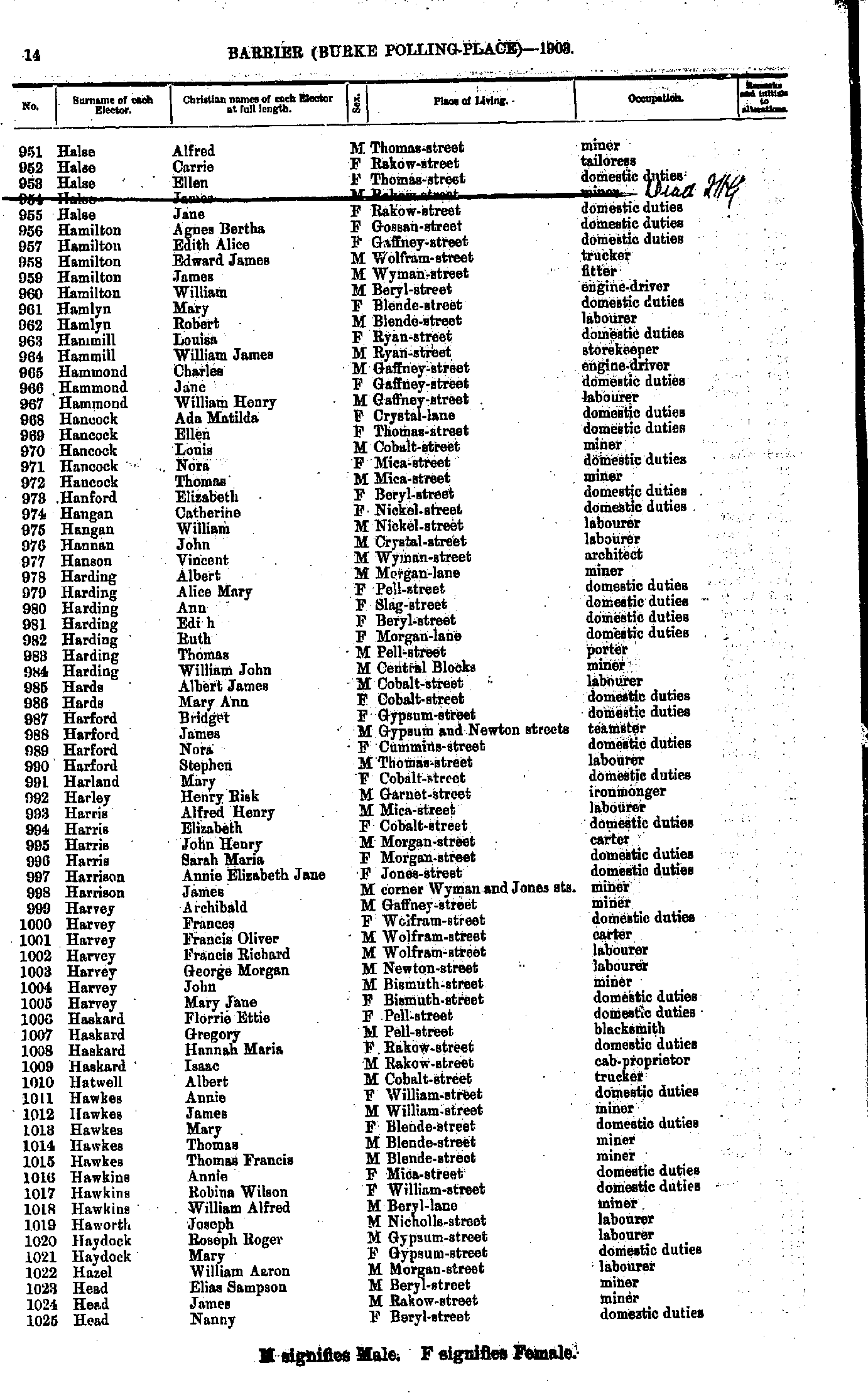
- Halse Alfred - Head Nanny
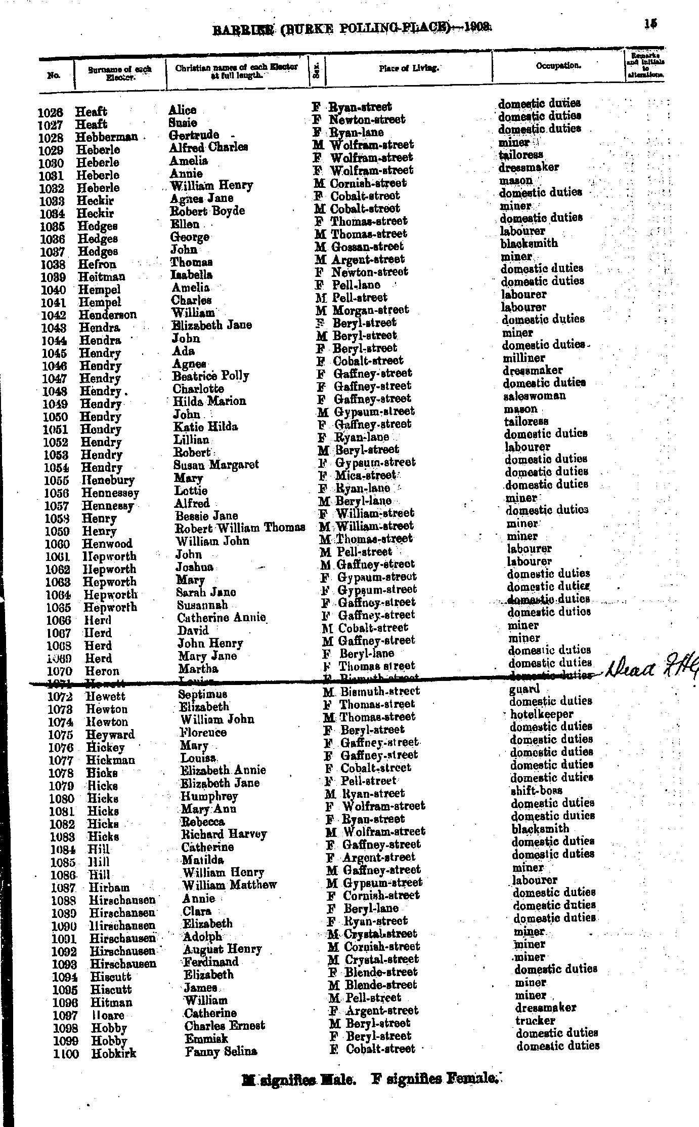
- Heaft Alice - Hobkirk Fanny Selina
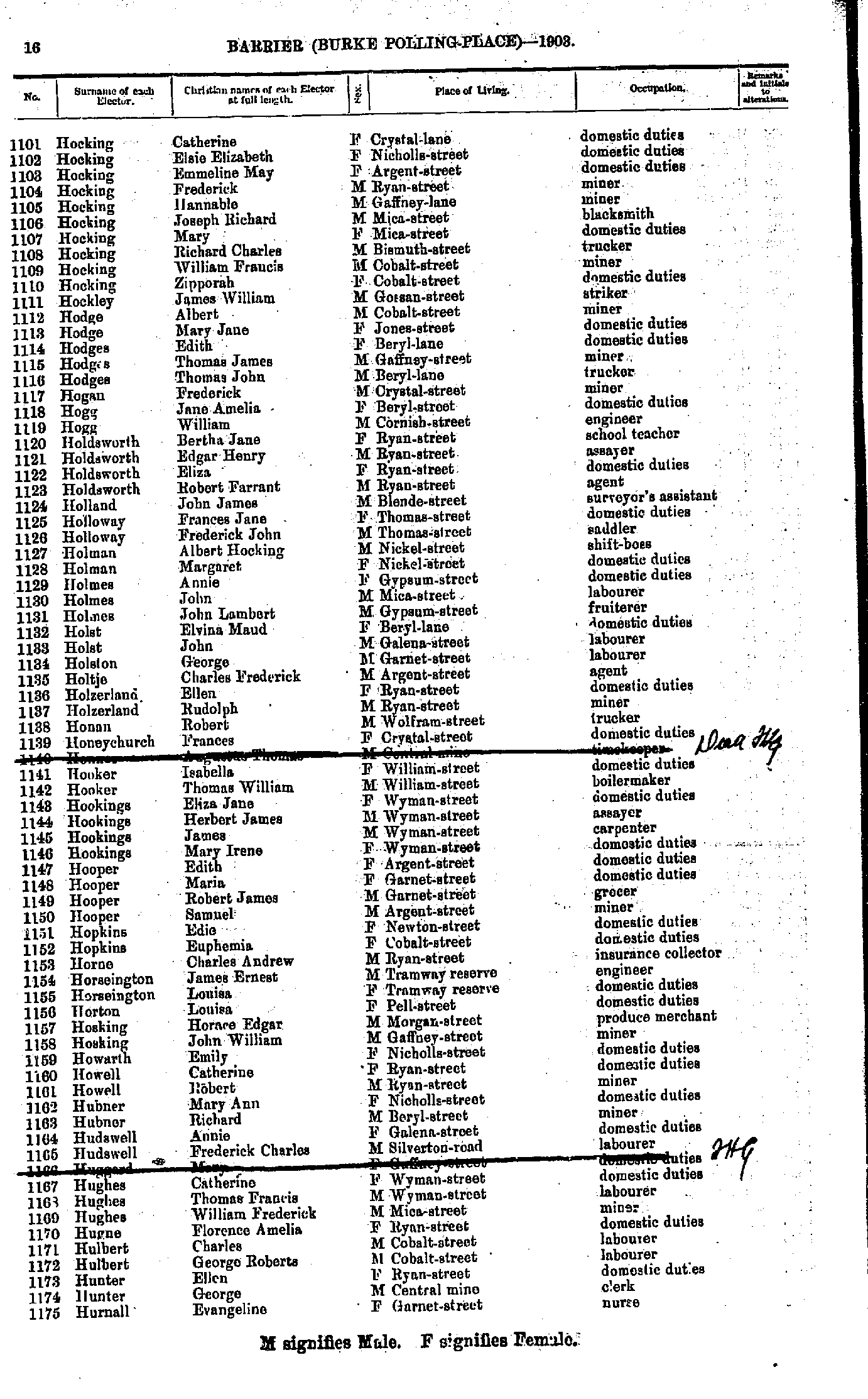
- Hocking Catherine - Hurnall Evangeline
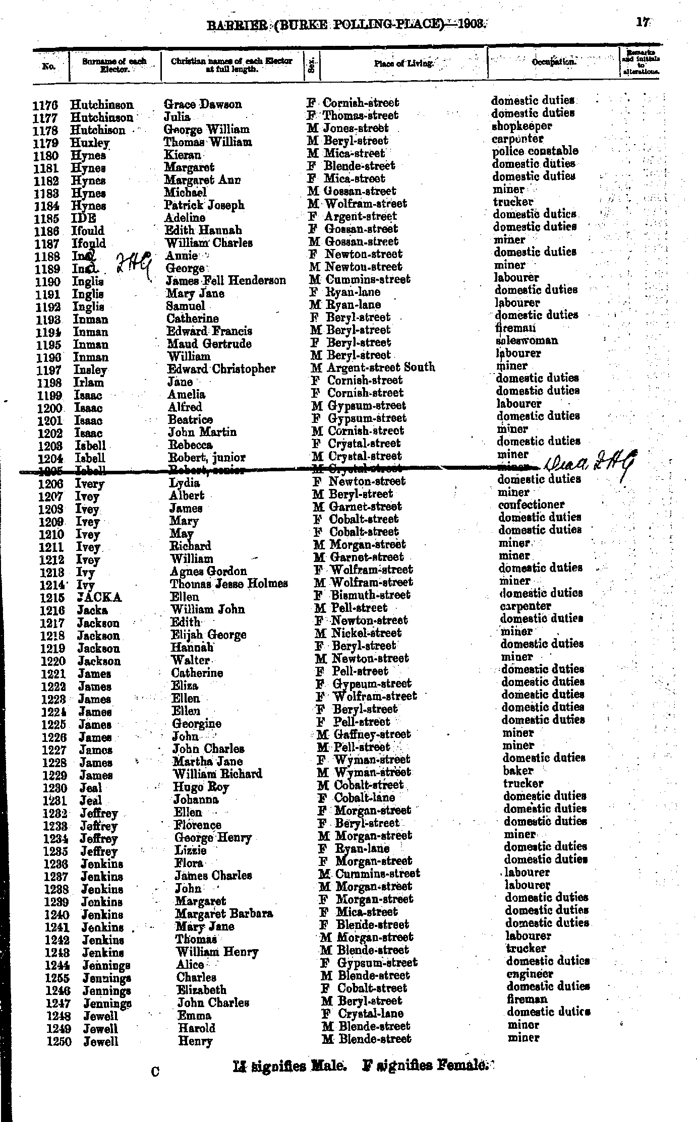
- Hutchinson Grace Dawson - Jewell Henry
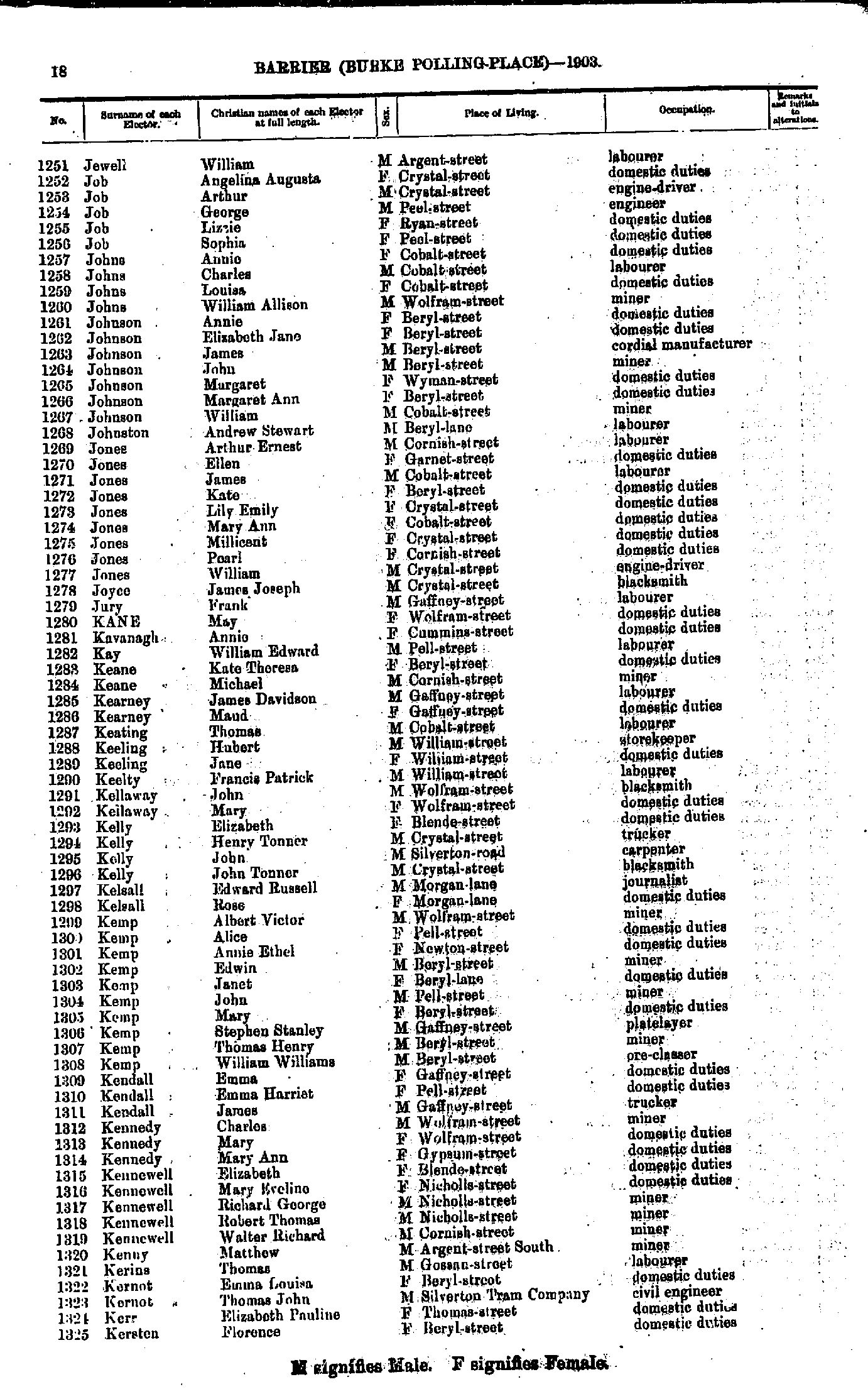
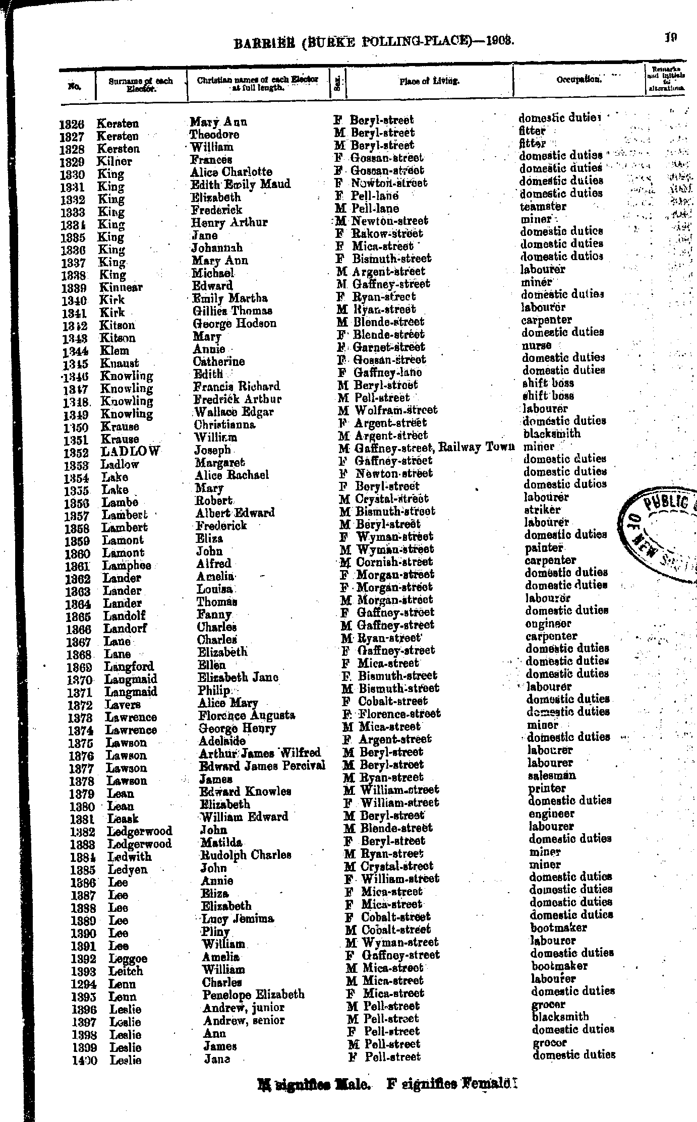
- Jewell William - Kersten Florence
- Kersten Mary Ann - Leslie Jane
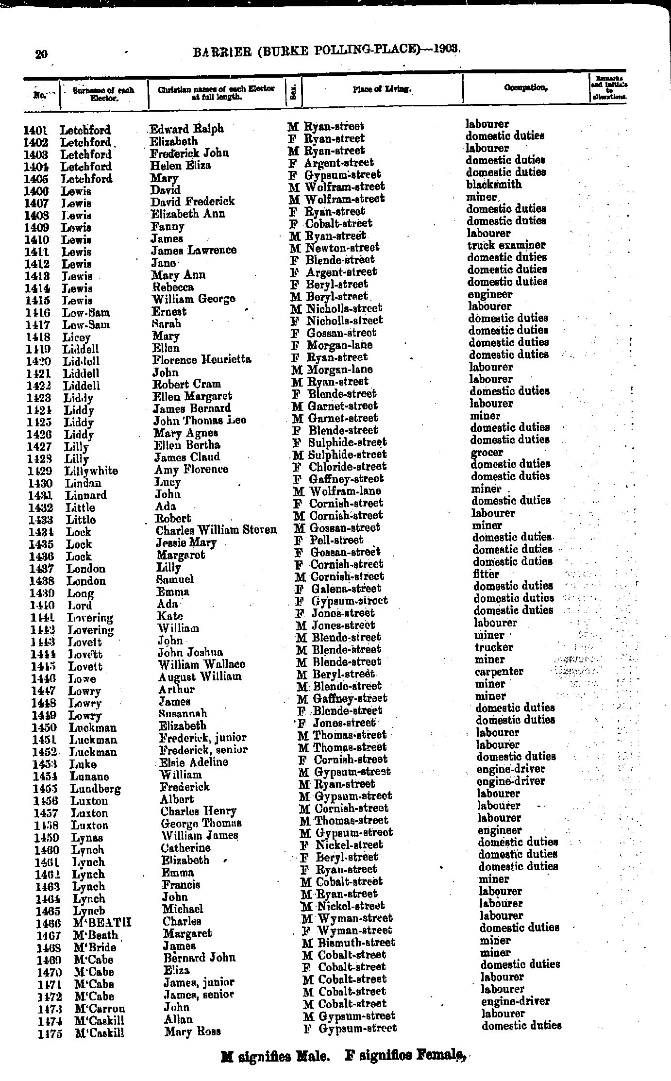
- Letchford Edward Ralph - M'Caskill Mary Ross
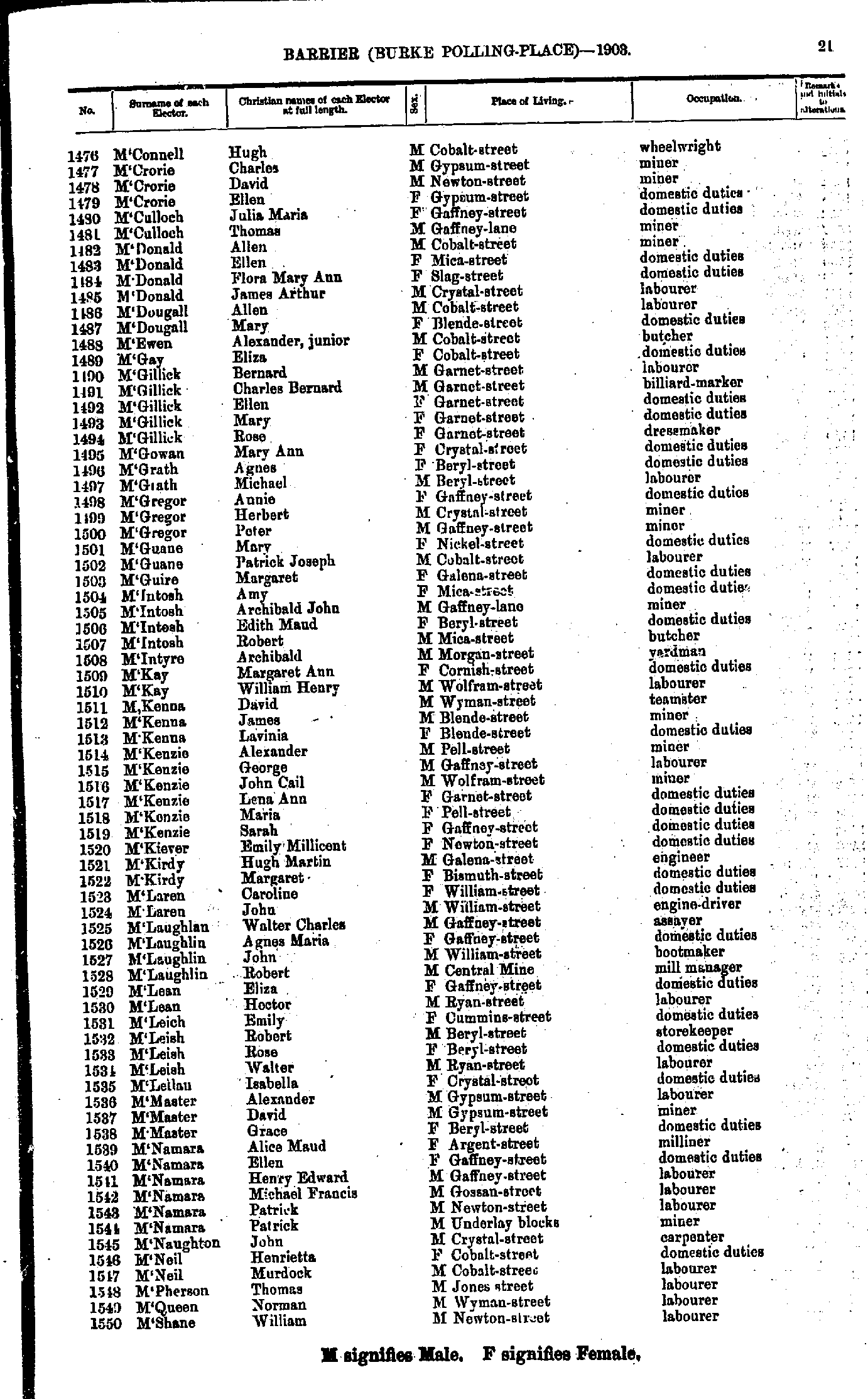
- M'Connell Hugh - M'Shane William
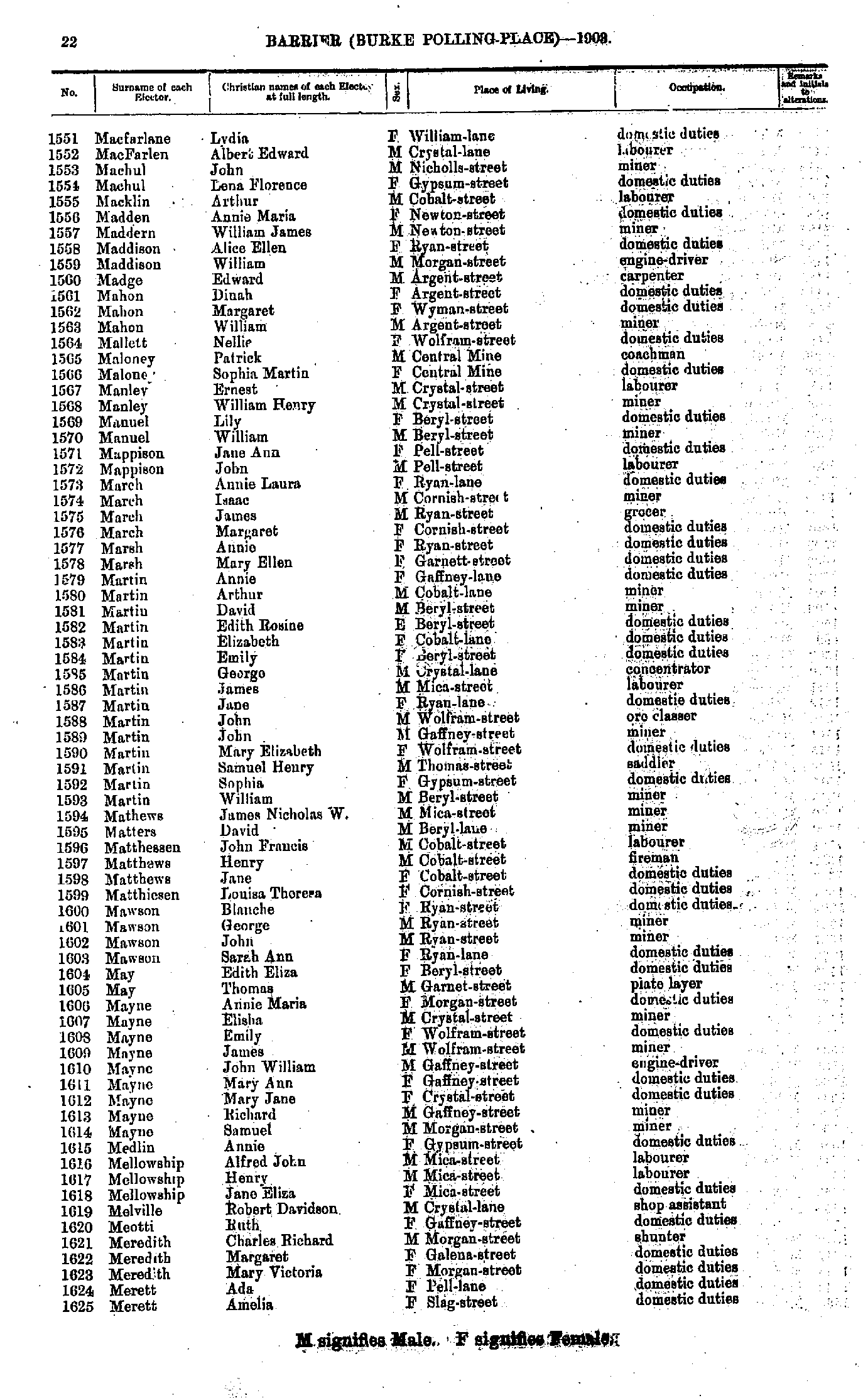
- Macfarlane Lydia - Merett Amelia
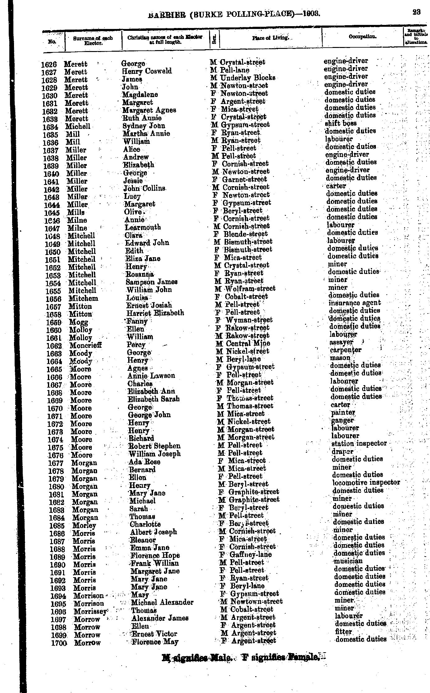
- Merett George - Morrow Florence May
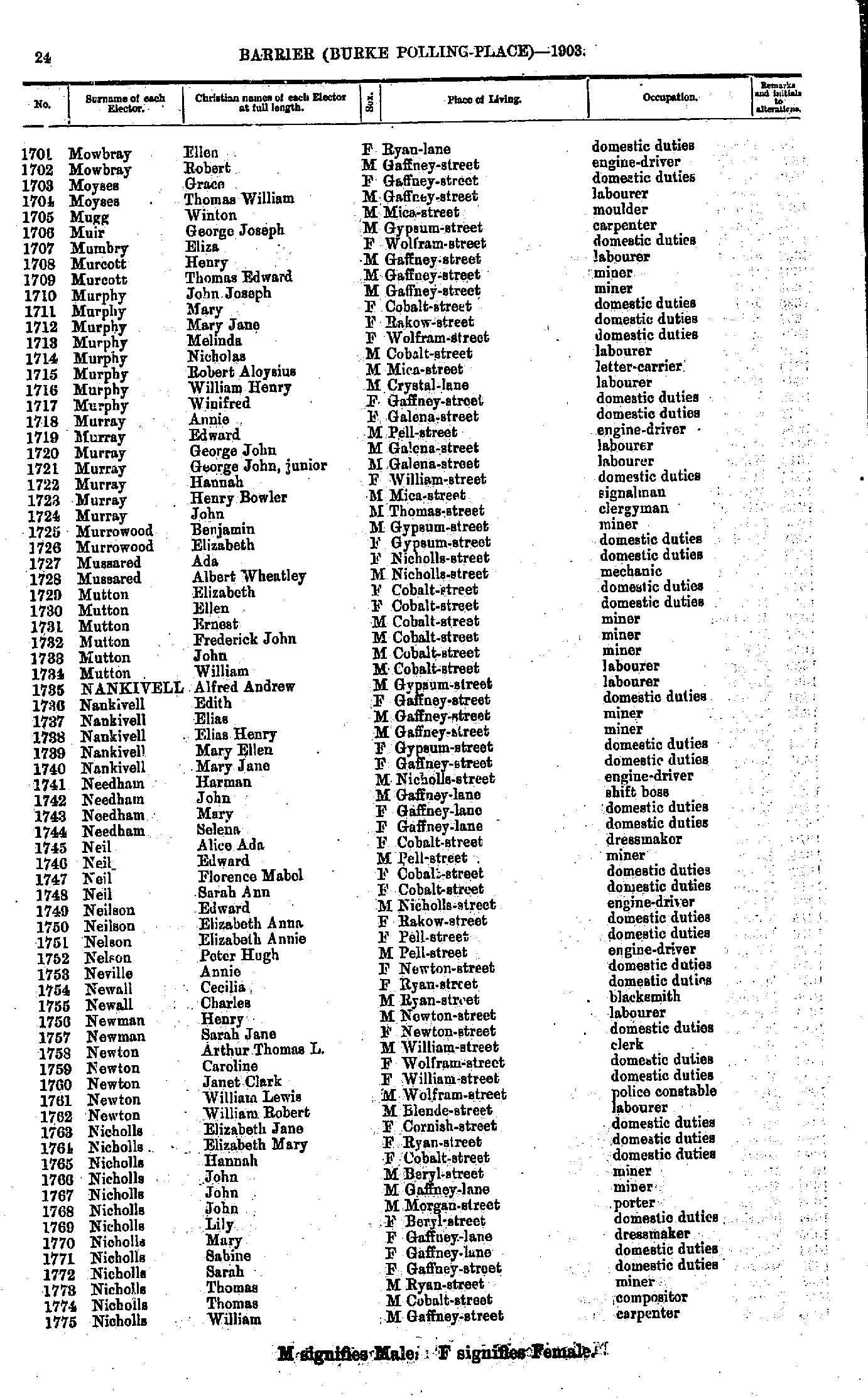
- Mowbray Ellen - Nicholls William
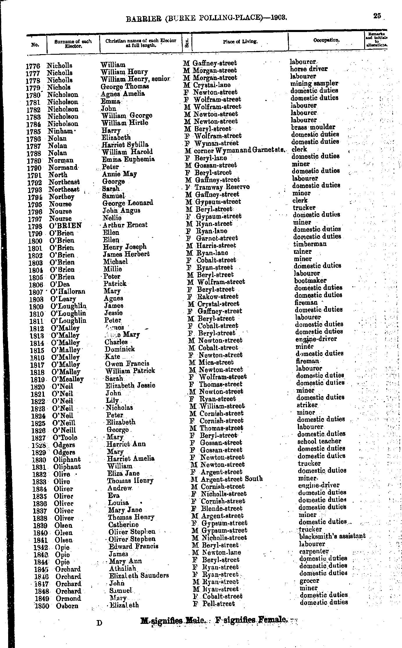
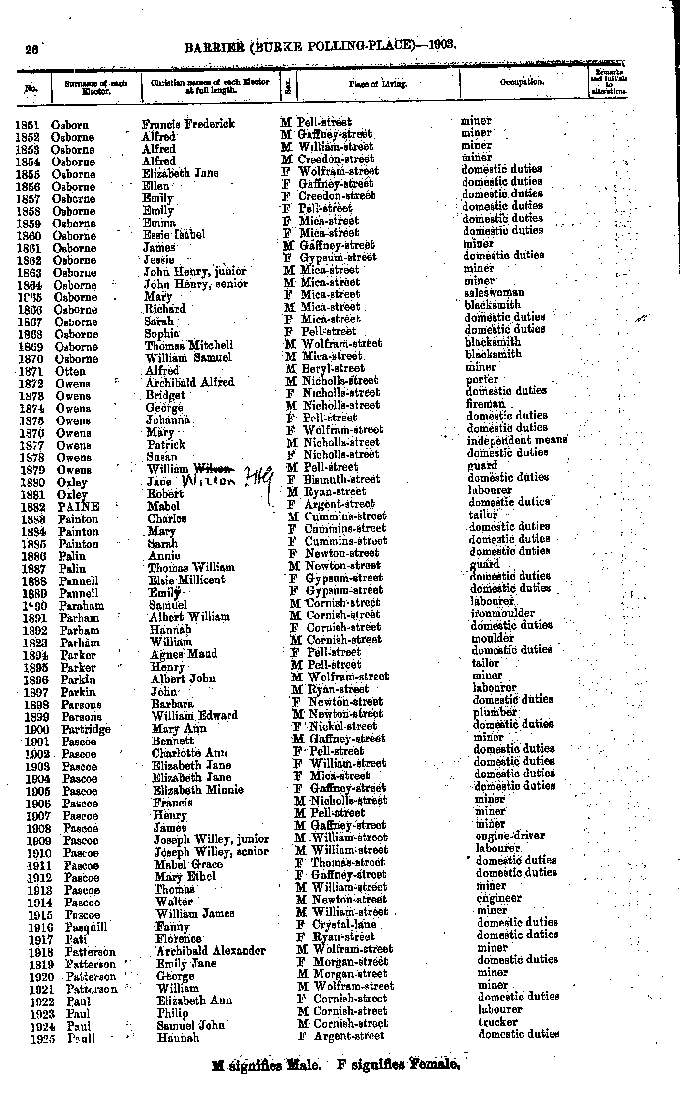
- Nicholls William - Osborn Elizabeth
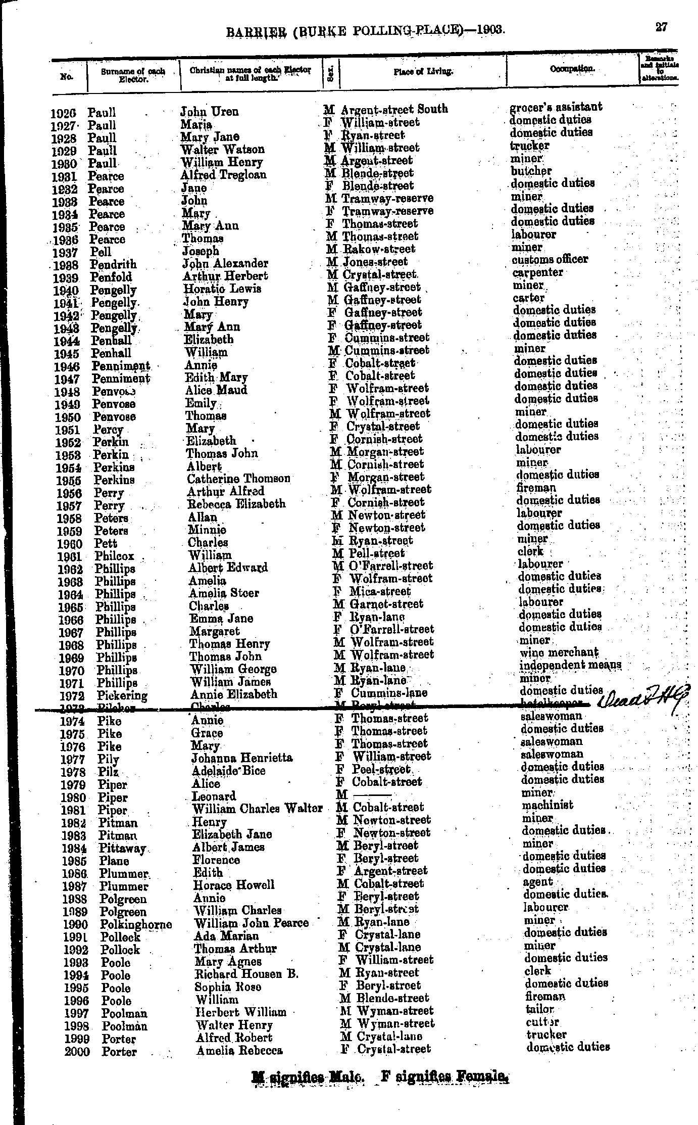
- Osborn Francis Frederick - Paull Hannah
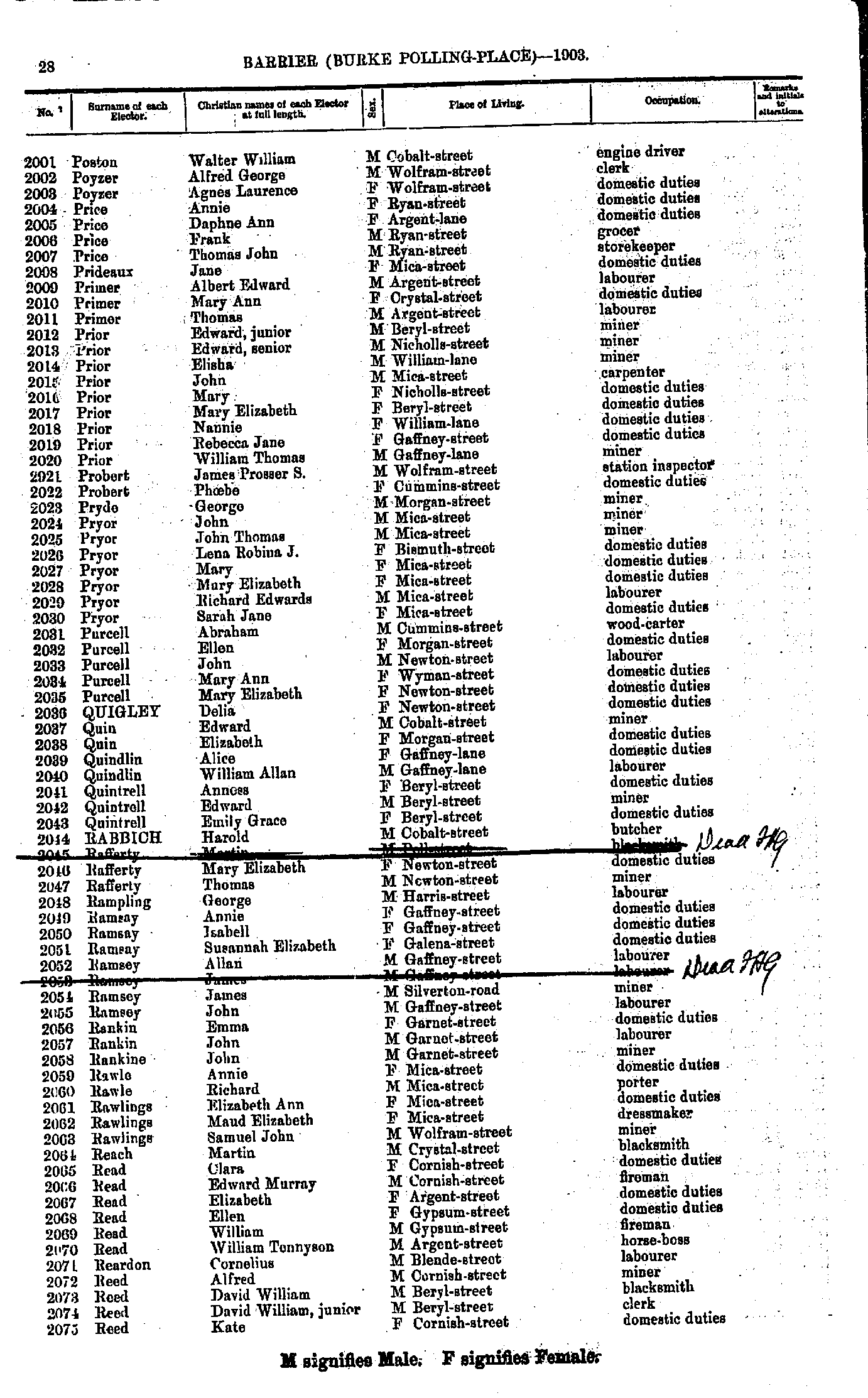
- Paull John Uren - Porter Amelia Rebecca
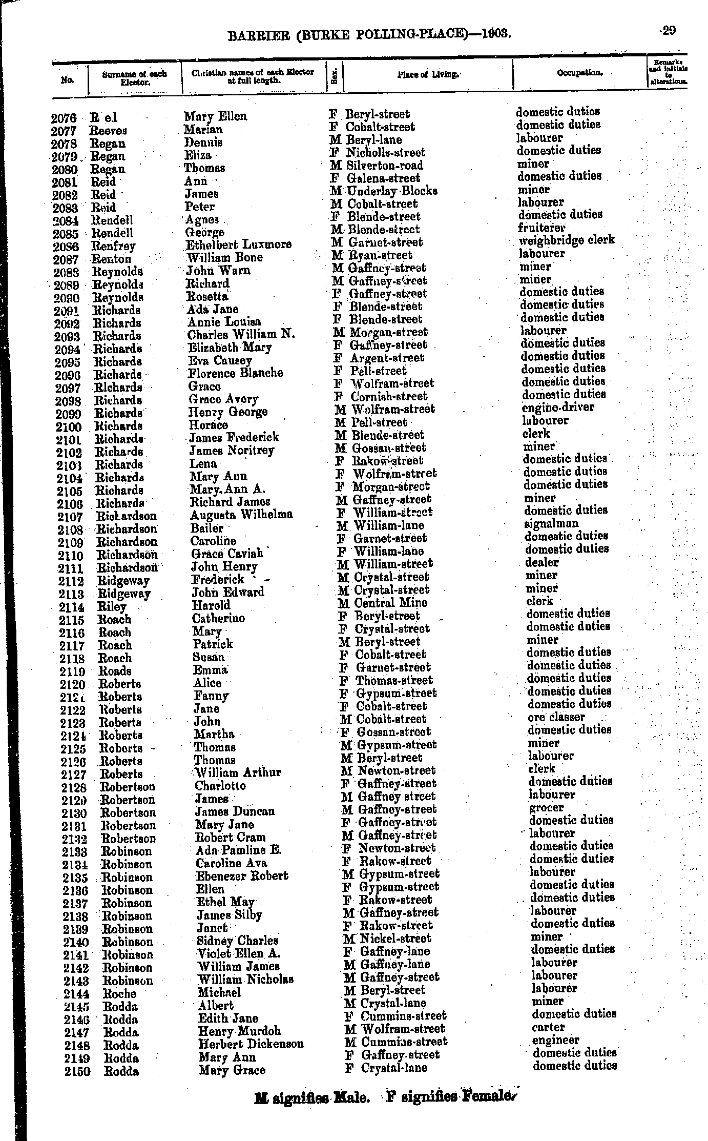
- Poston Walter William - Reed Kate
- Reed Mary Ellen - Rodda Mary Grace
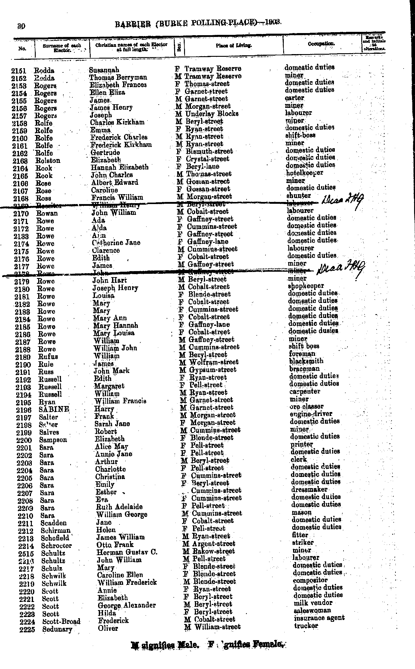
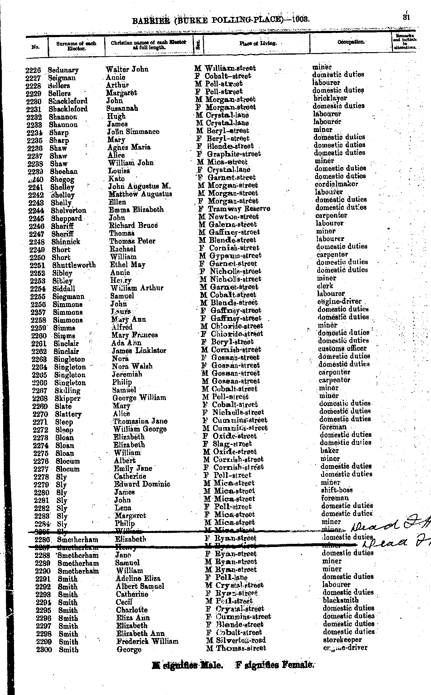
- Rodda Susannah - Sedunary Oliver
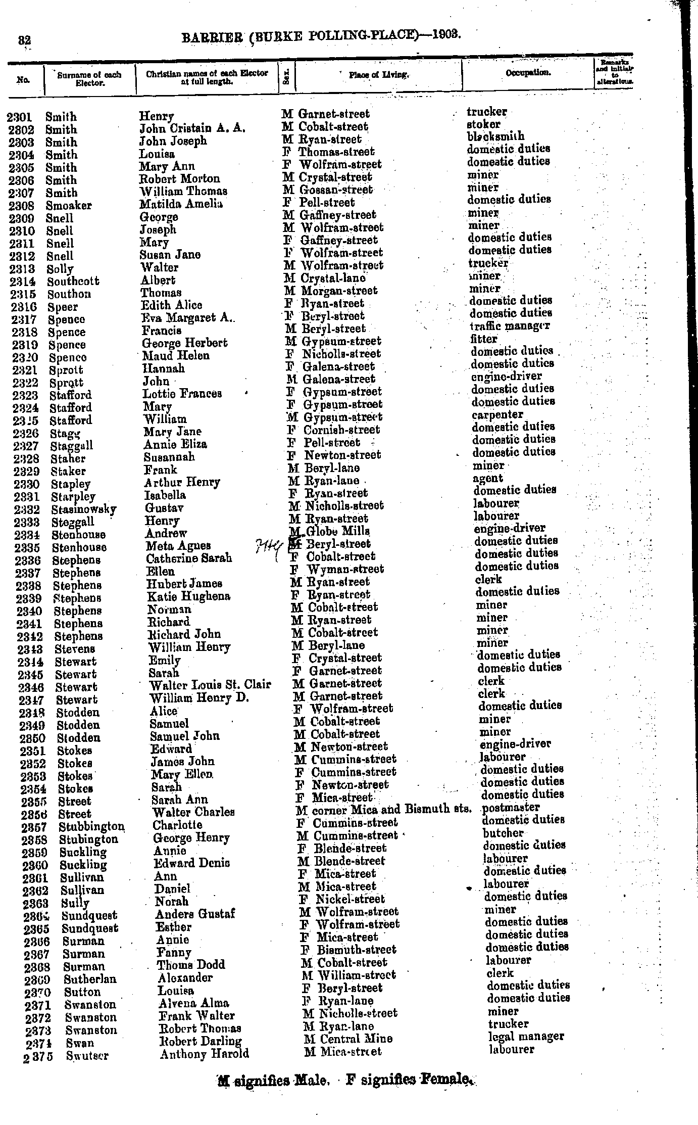
- Sedunary Walter John - Smith George
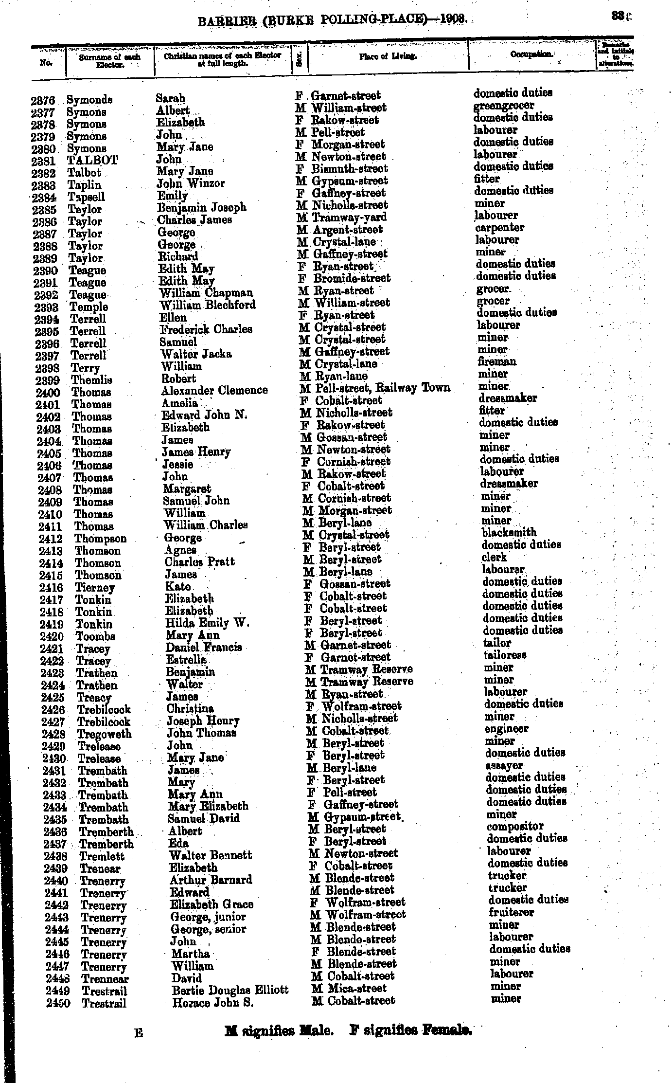
- Smith Henry - Swutser Anthony Harold
- Symonds Sarah - Trestrail Horace John S
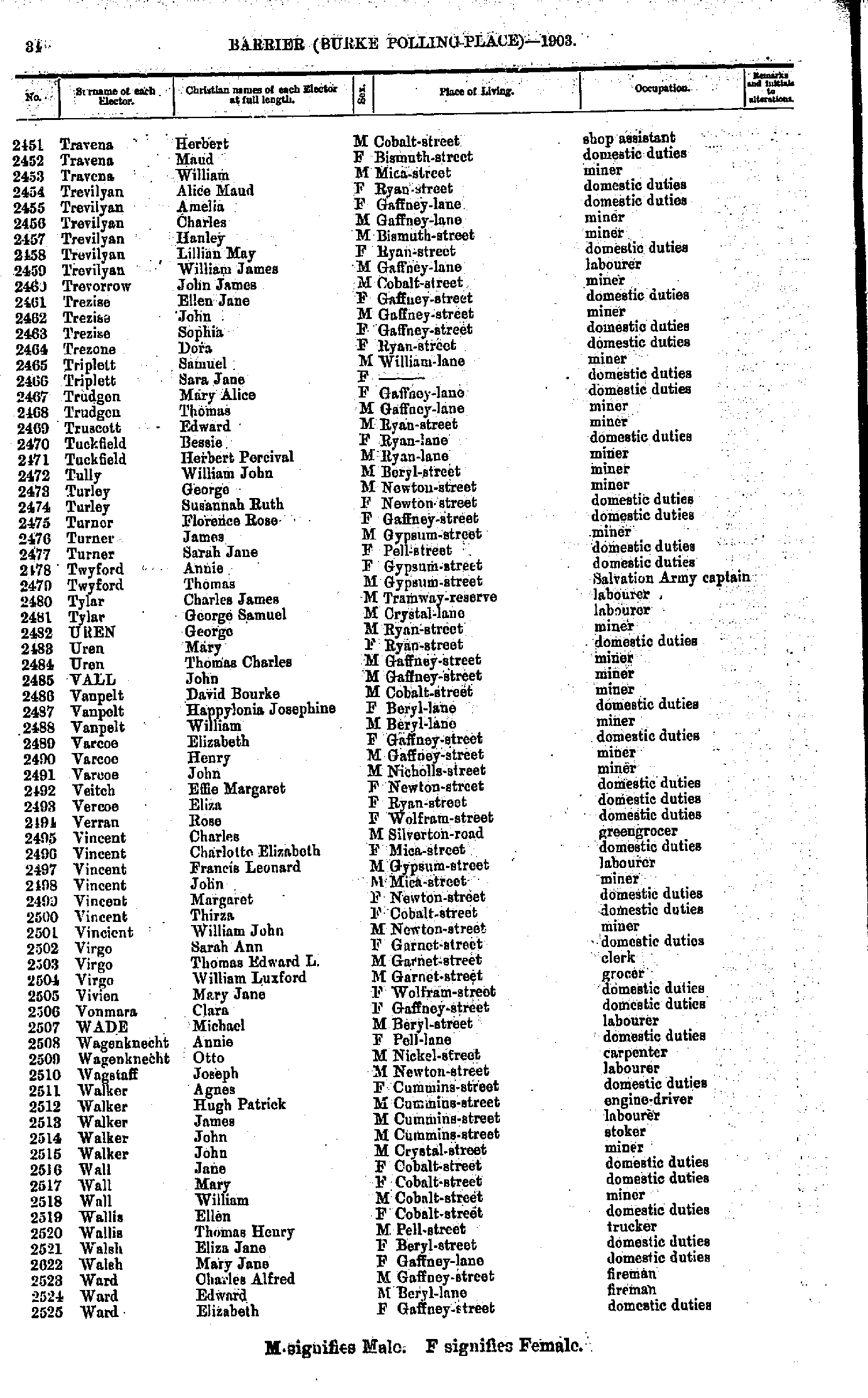
- Travena Herbert - Ward Elizabeth
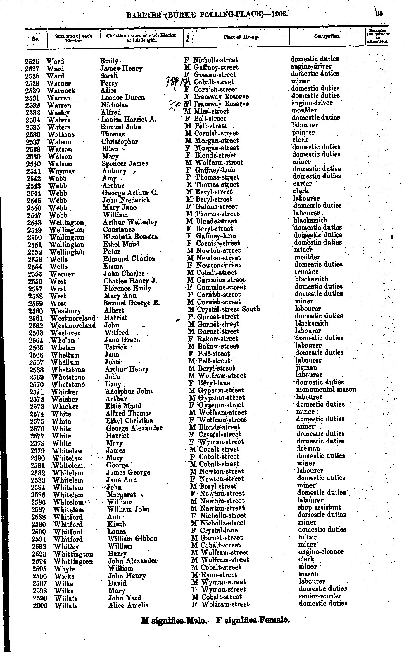
- Ward Emily - Willats Alice Amelia
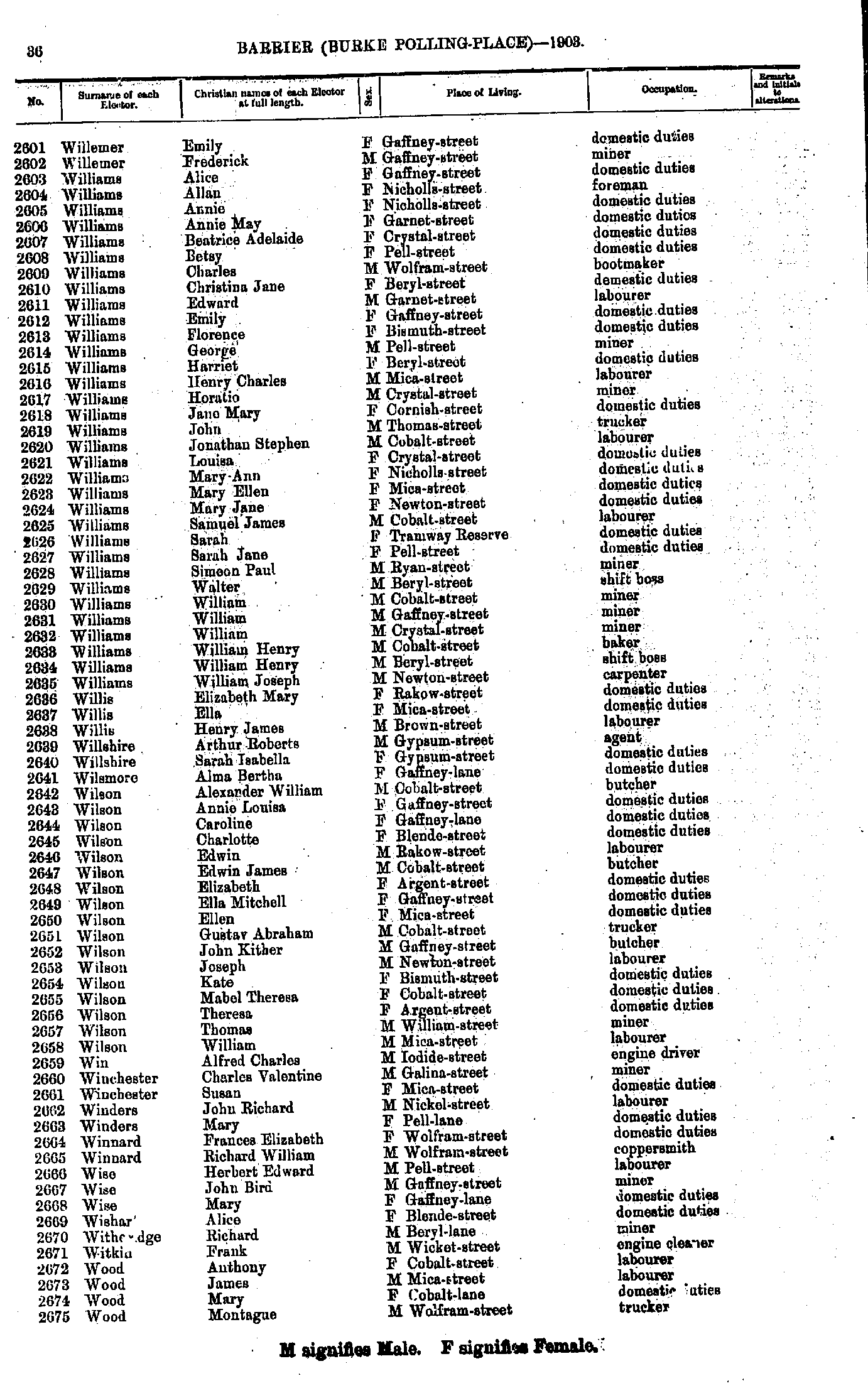
- Willemer Emily - Wood Montague
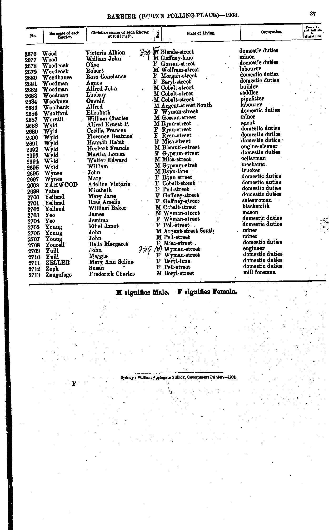
- Wood Victoria Albion - Zeugofsge Frederick Charles
- Allen Arthur Henry - Evans Edward
- Feeley Mary - Wettenhall Harriett
- White Jamesina Janet - Wolfe Margaret
- Allen Frederick Charles - Hall Mary Ann
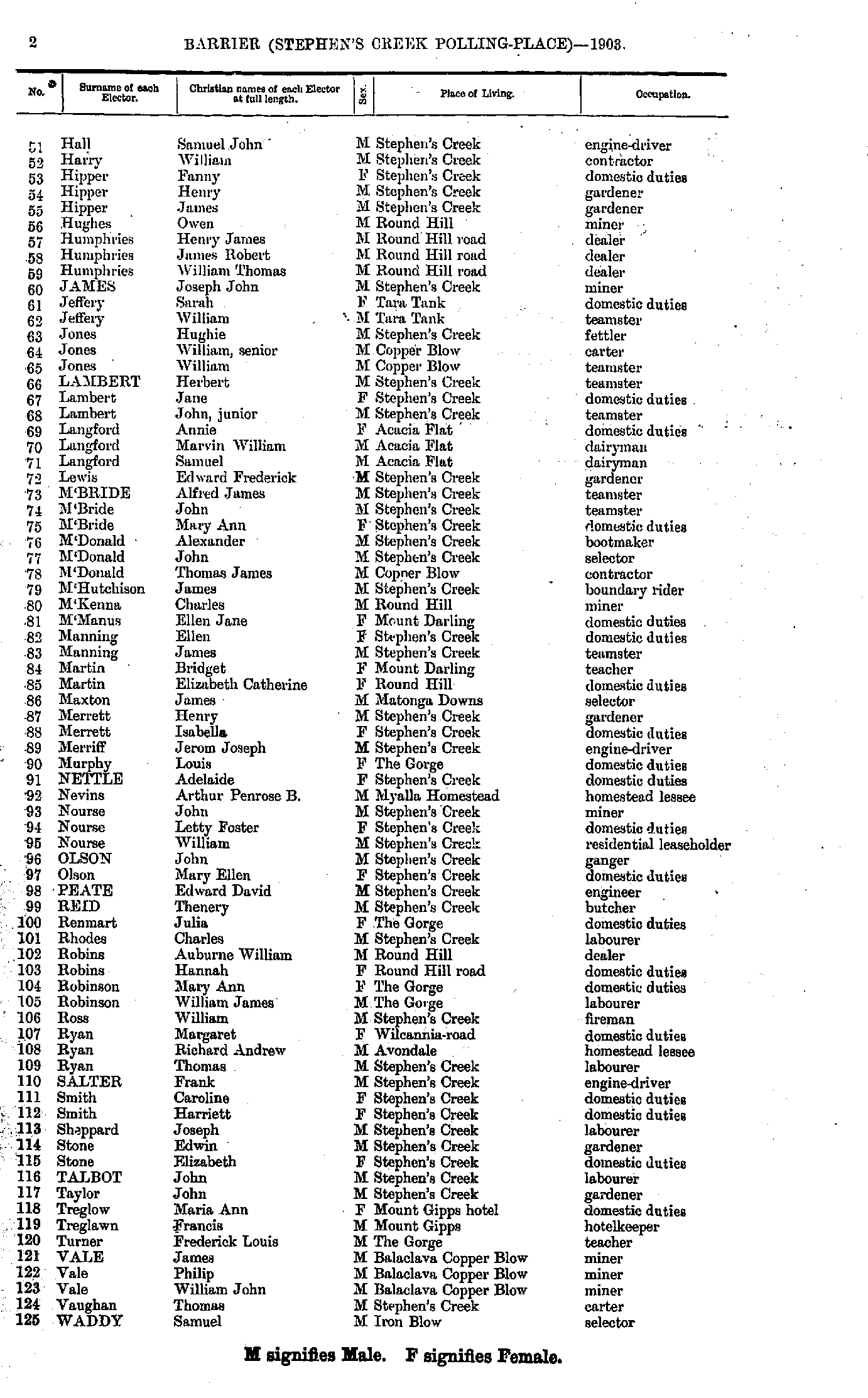
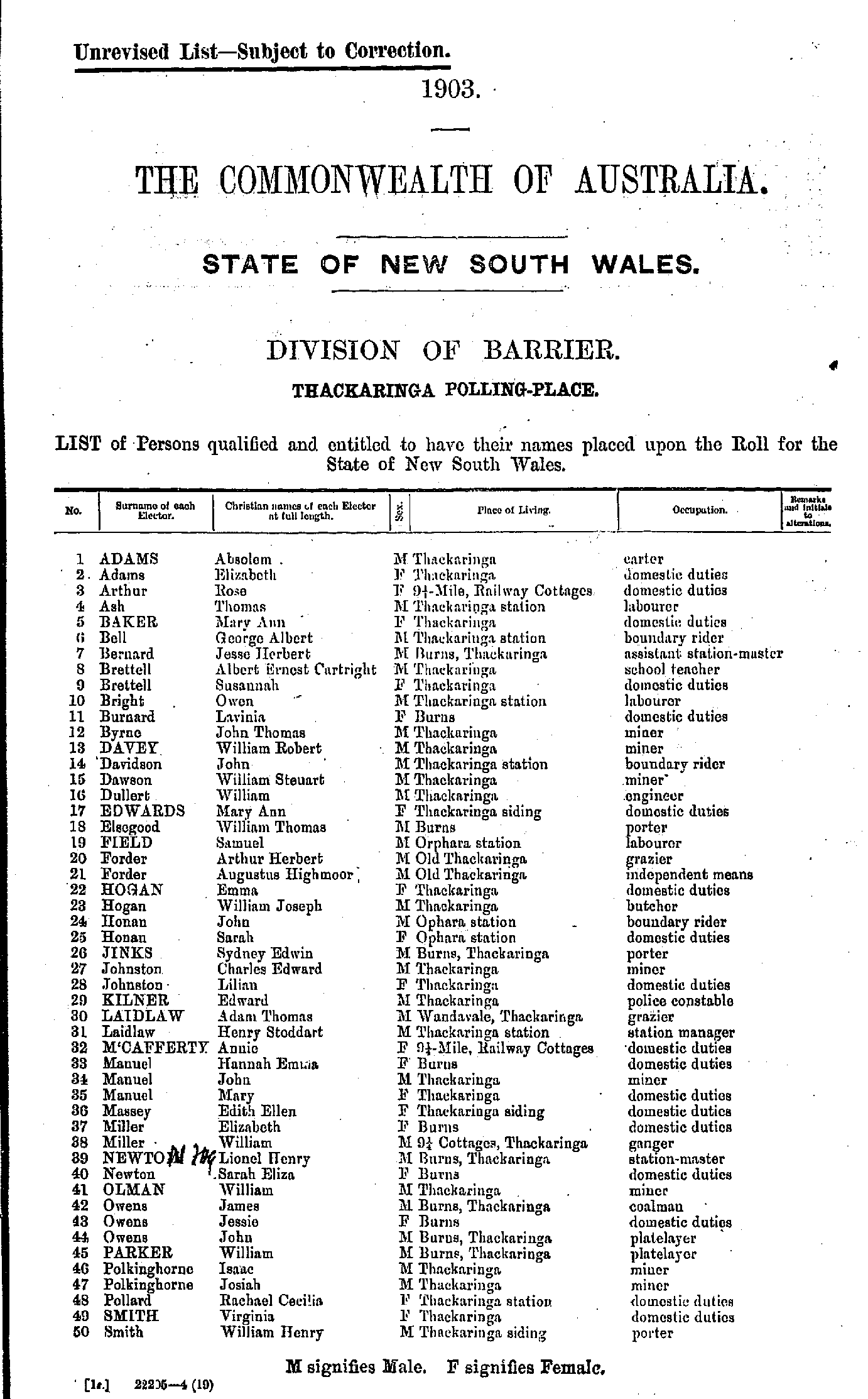
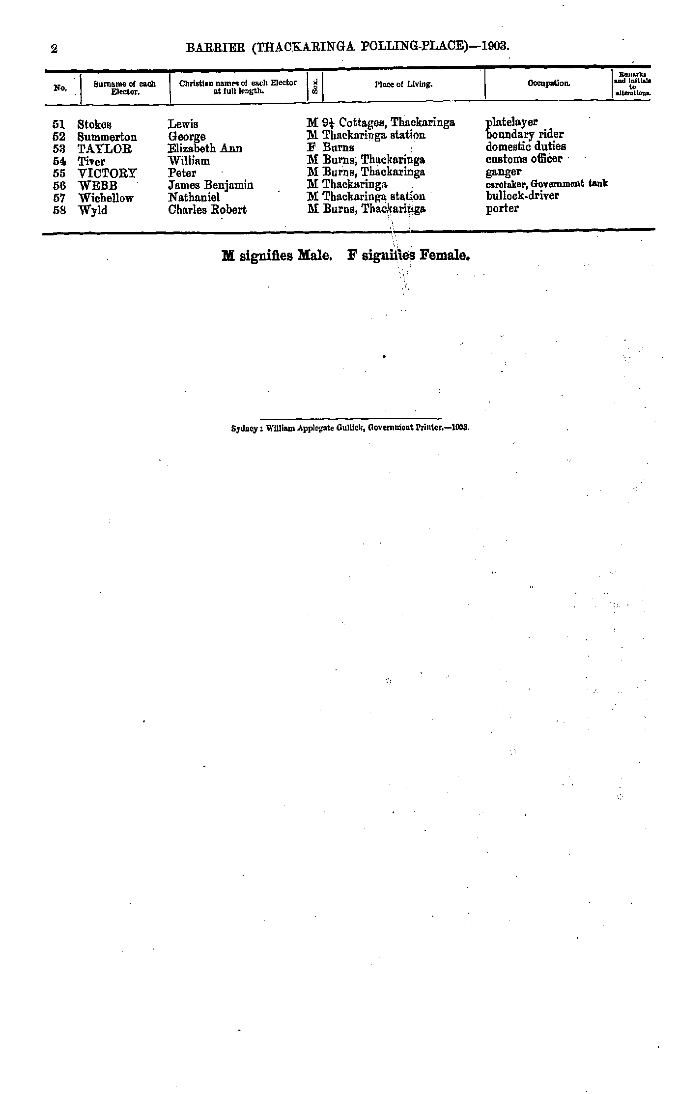
- Hall Samuel John - Waddy Samuel
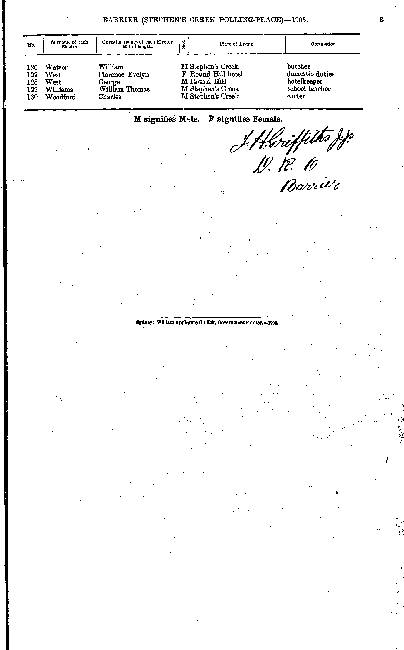
- Watson William - Woodford Charles
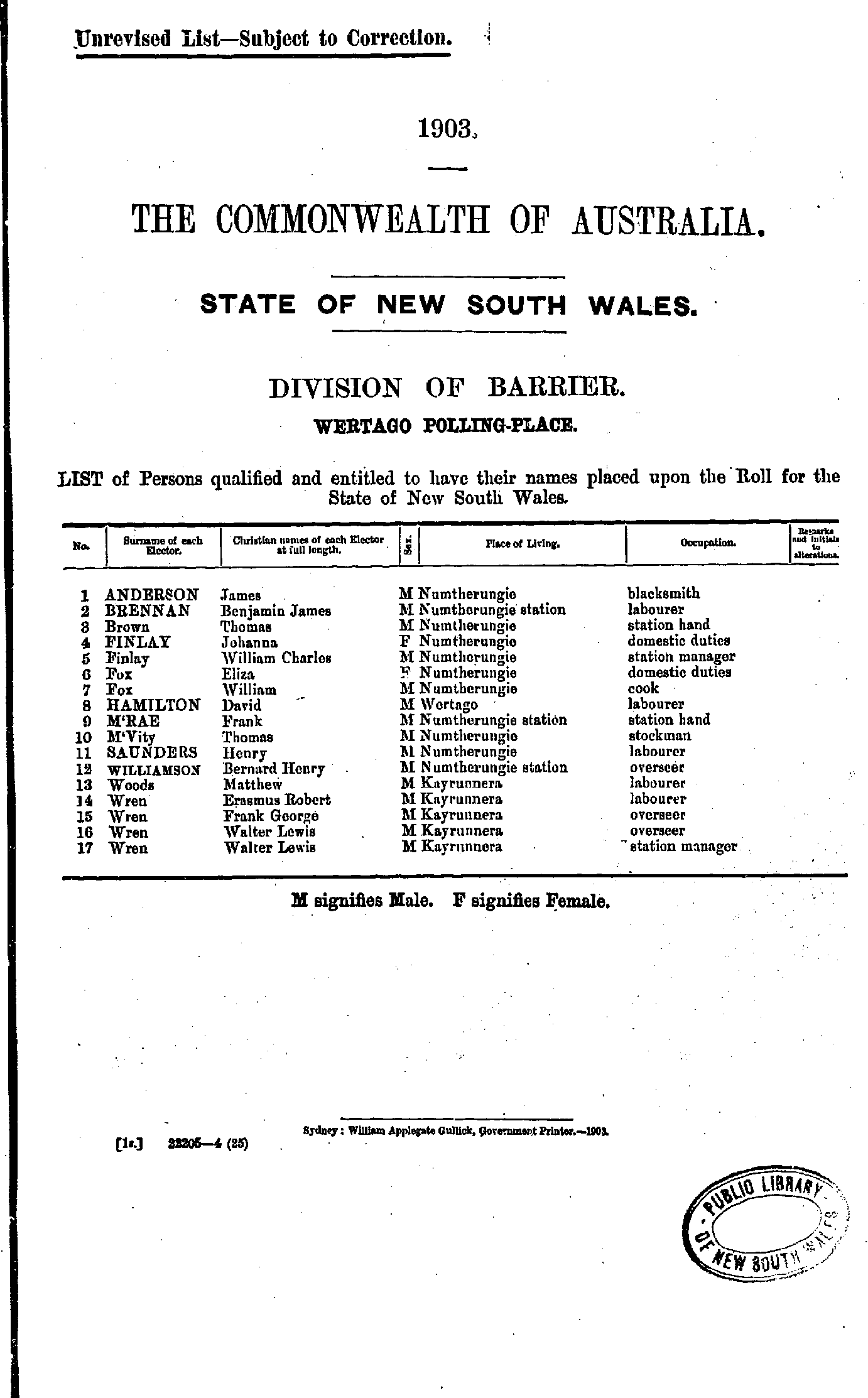
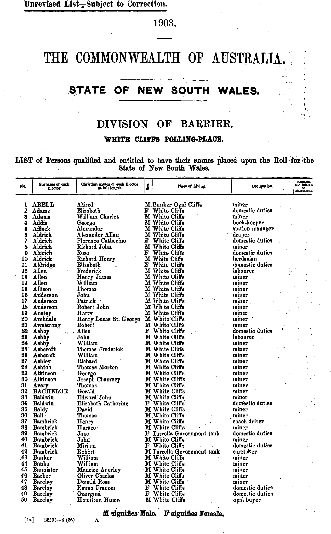
- Abell Alfred - Barclay Hamilton Hume
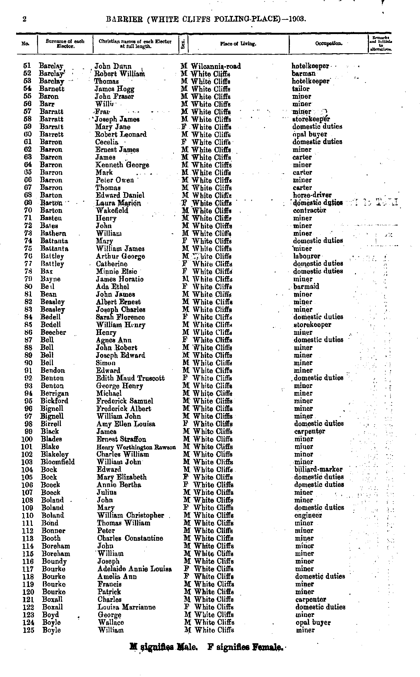
- Barclay John Dunn - Boyle William
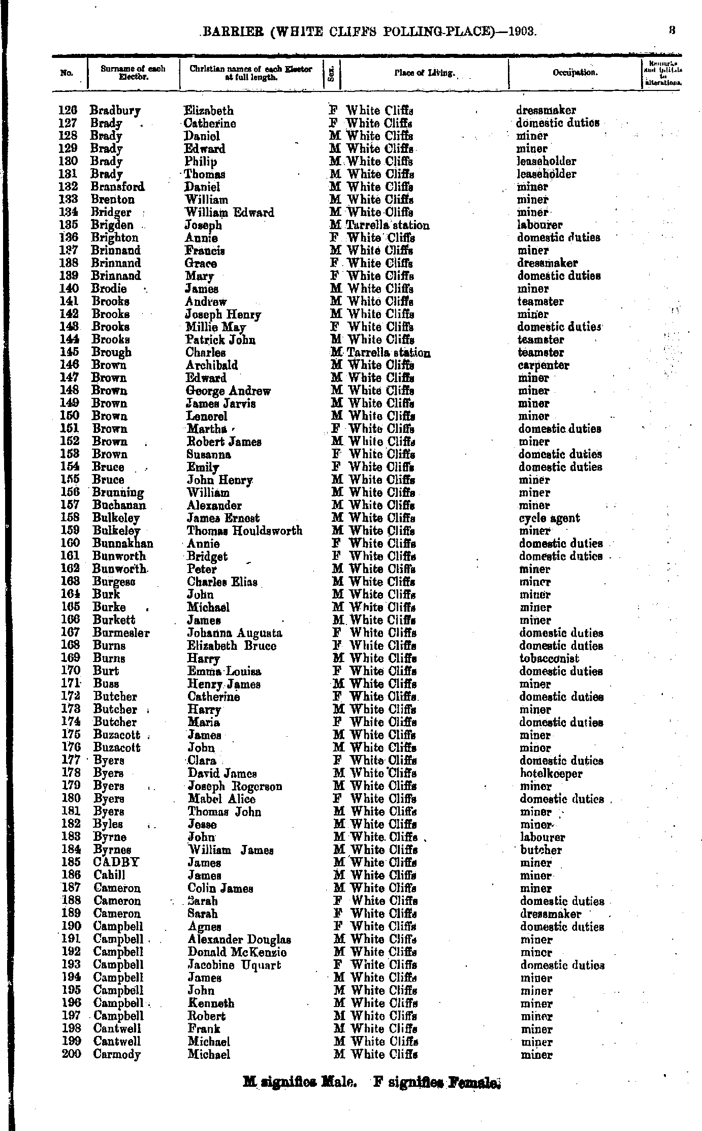
- Bradbury Elizabeth - Carmody Michael
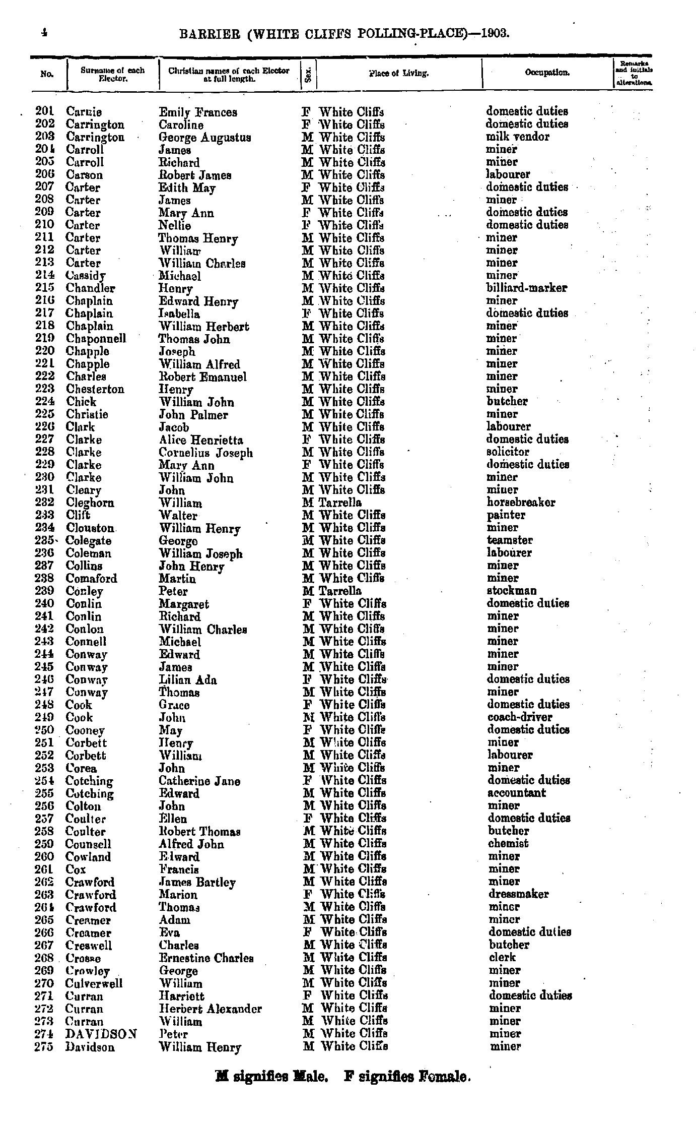
- Carnie Emily Frances - Davidson William Henry
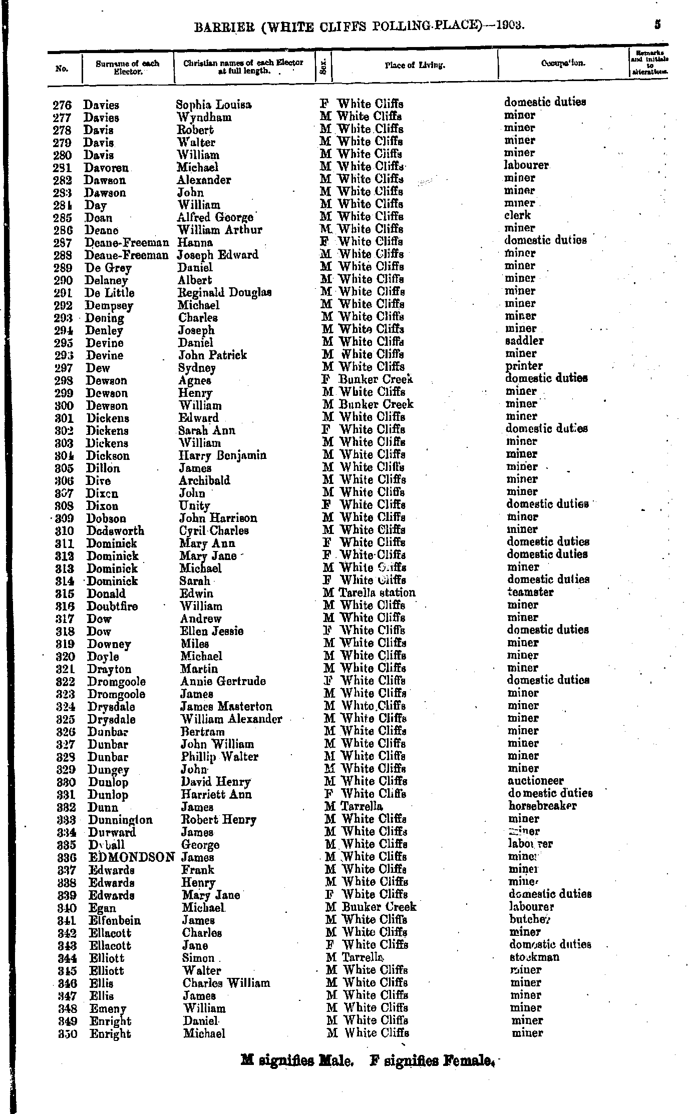
- Davies Sophia Louisa - Enright Michael
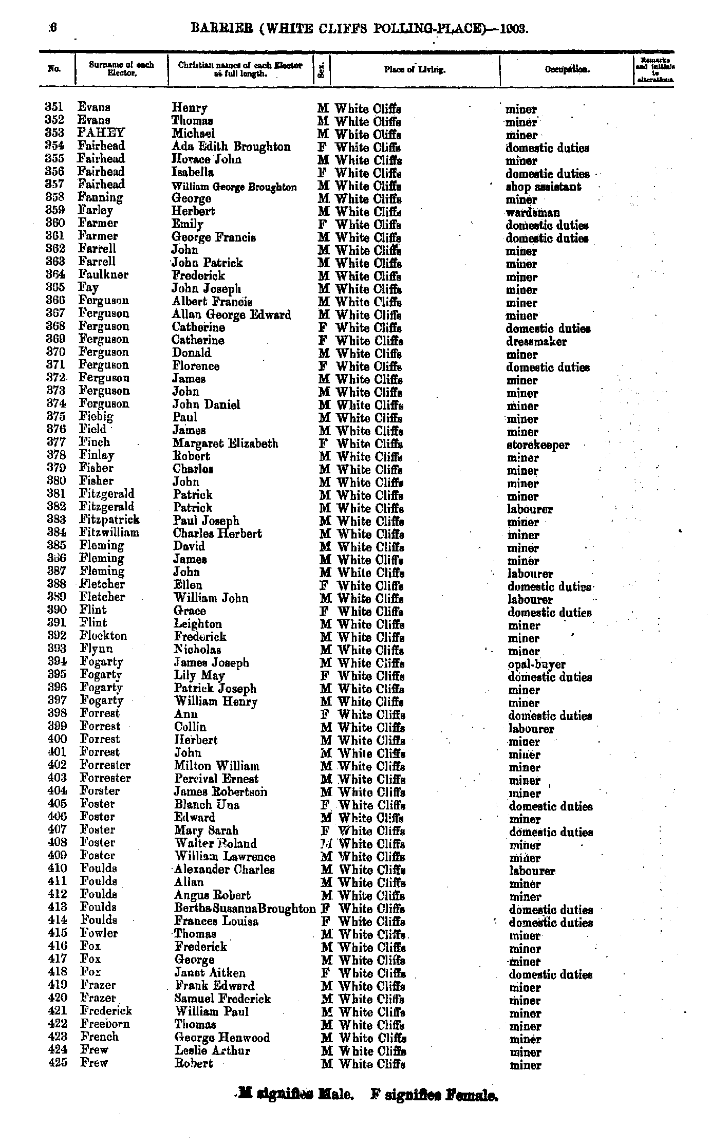
- Evans Henry - Frew Robert
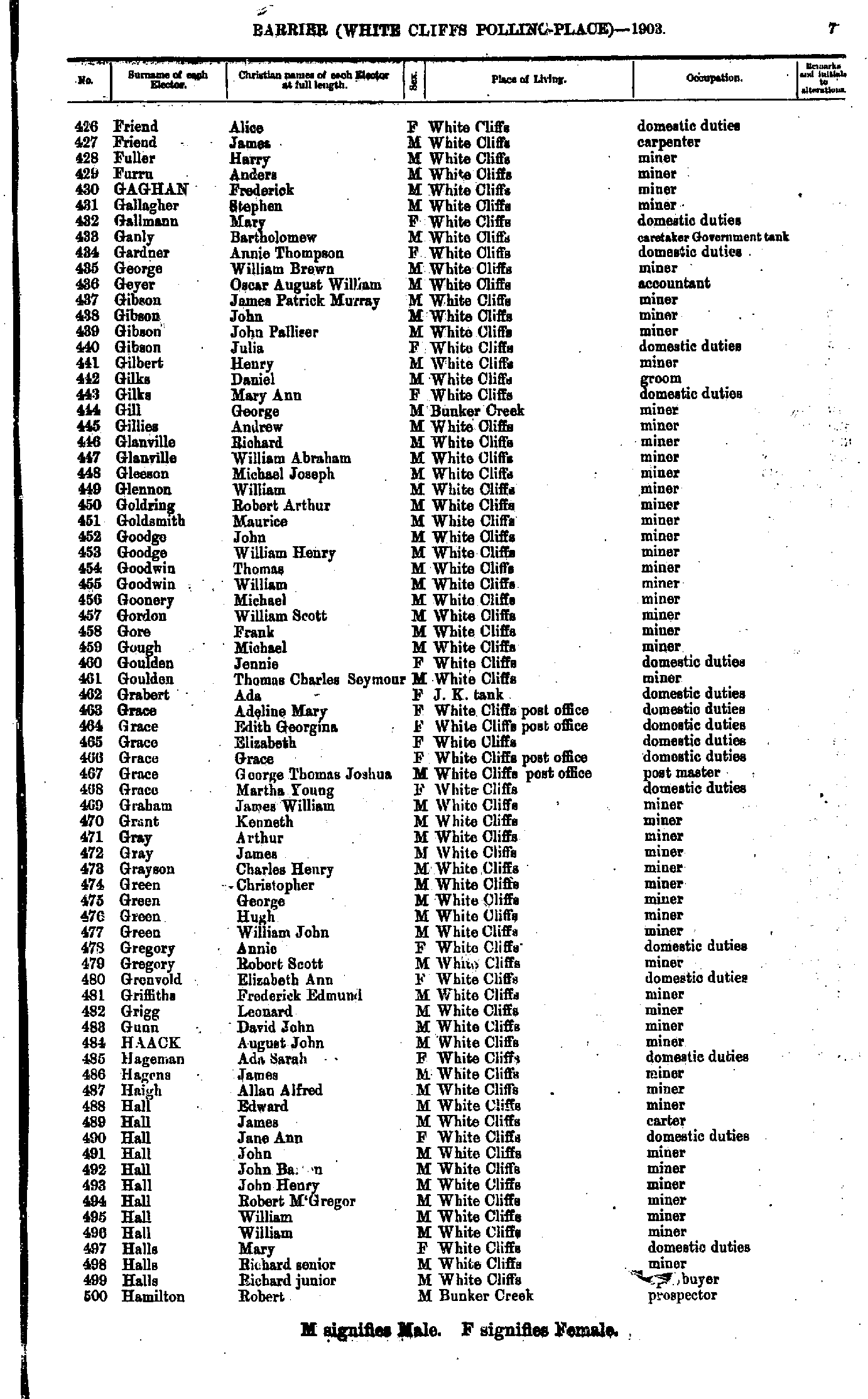
- Friend Alice - Hamilton Robert
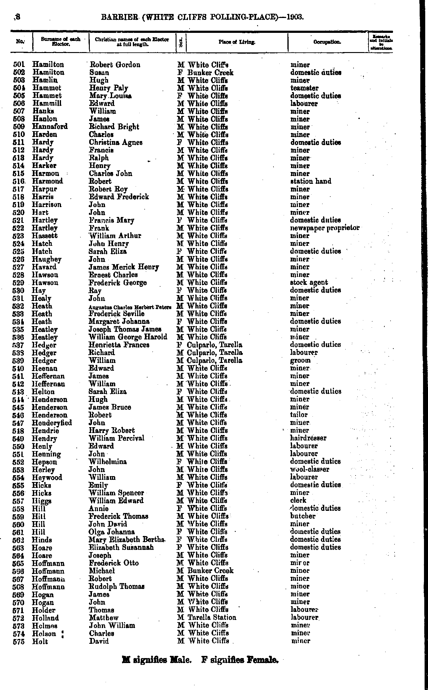
- Hamilton Robert Gordon - Holt David
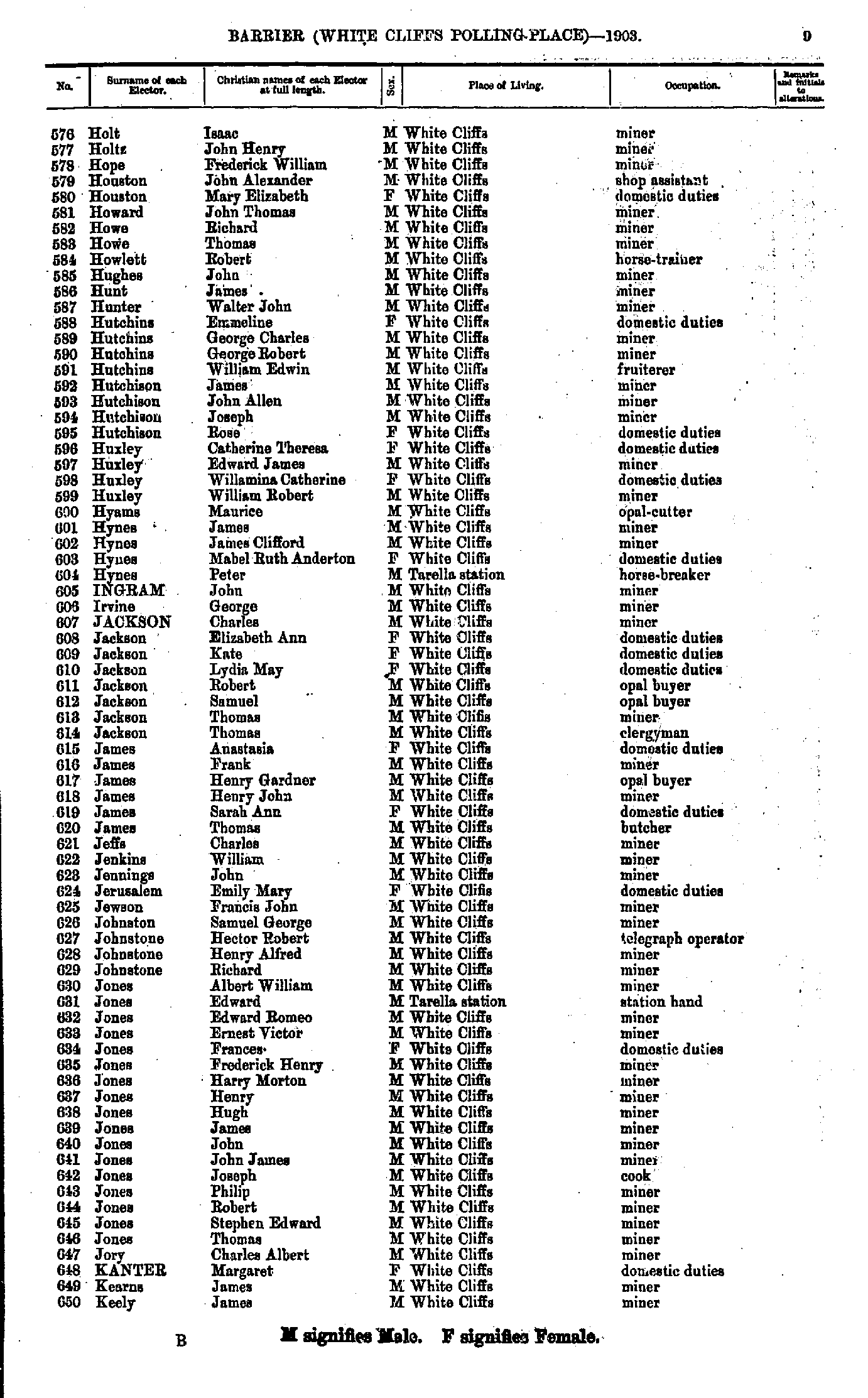
- Holt Isaac - Keely James
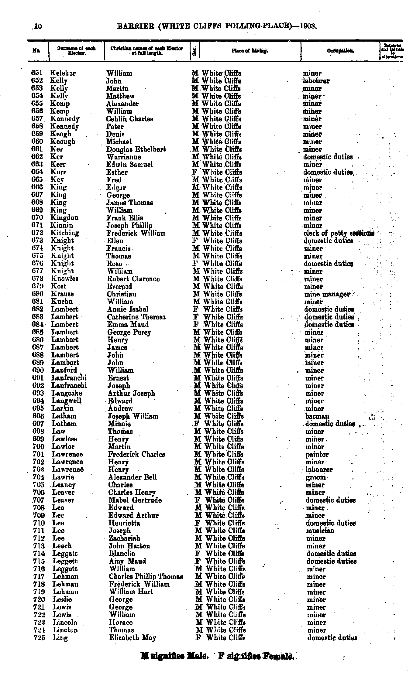
- Keleher William - Ling Elizabeth May
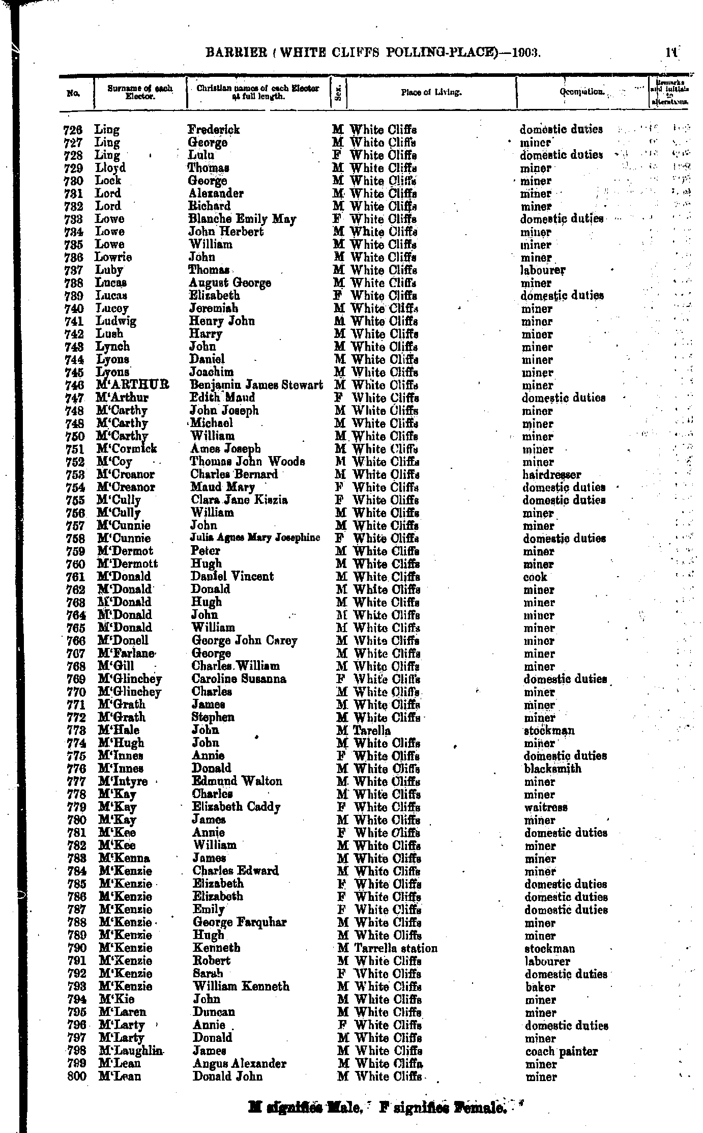
- Ling Frederick - M'Lean Donald John
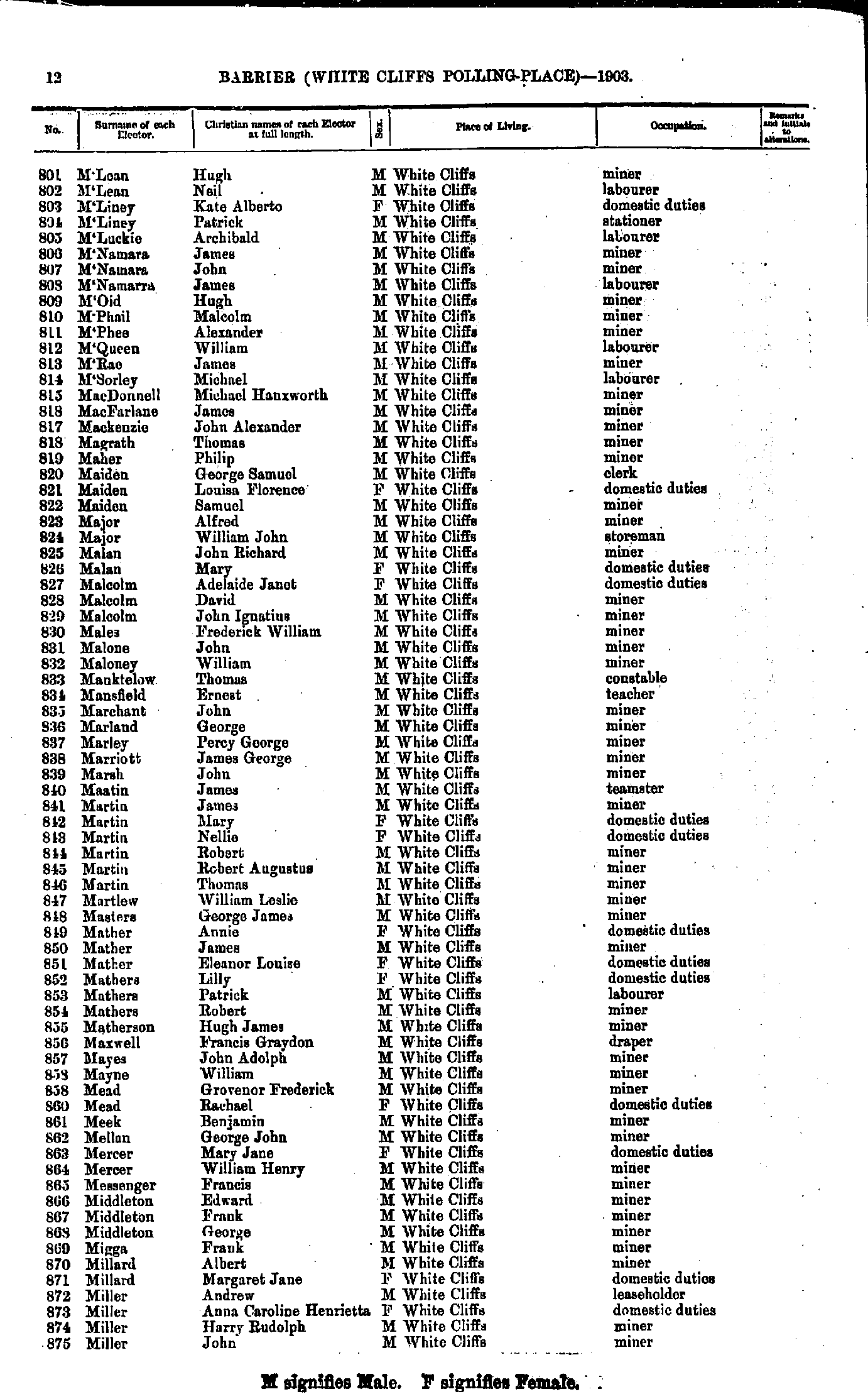
- M'Lean Hugh - Miller John
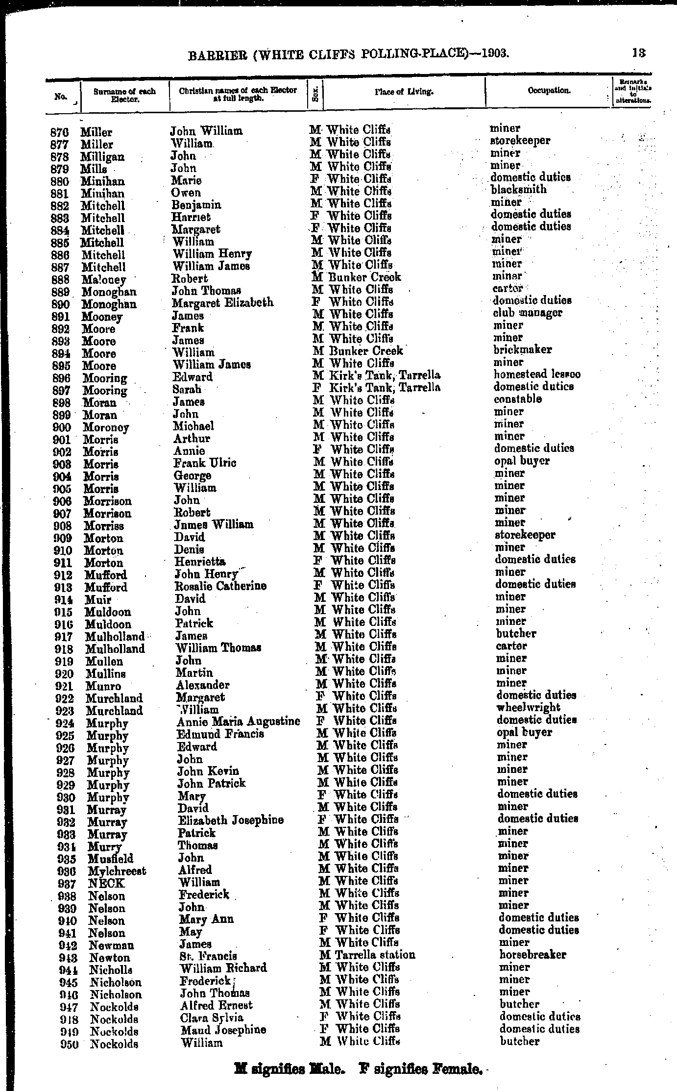
- Miller John William - Nockolds William
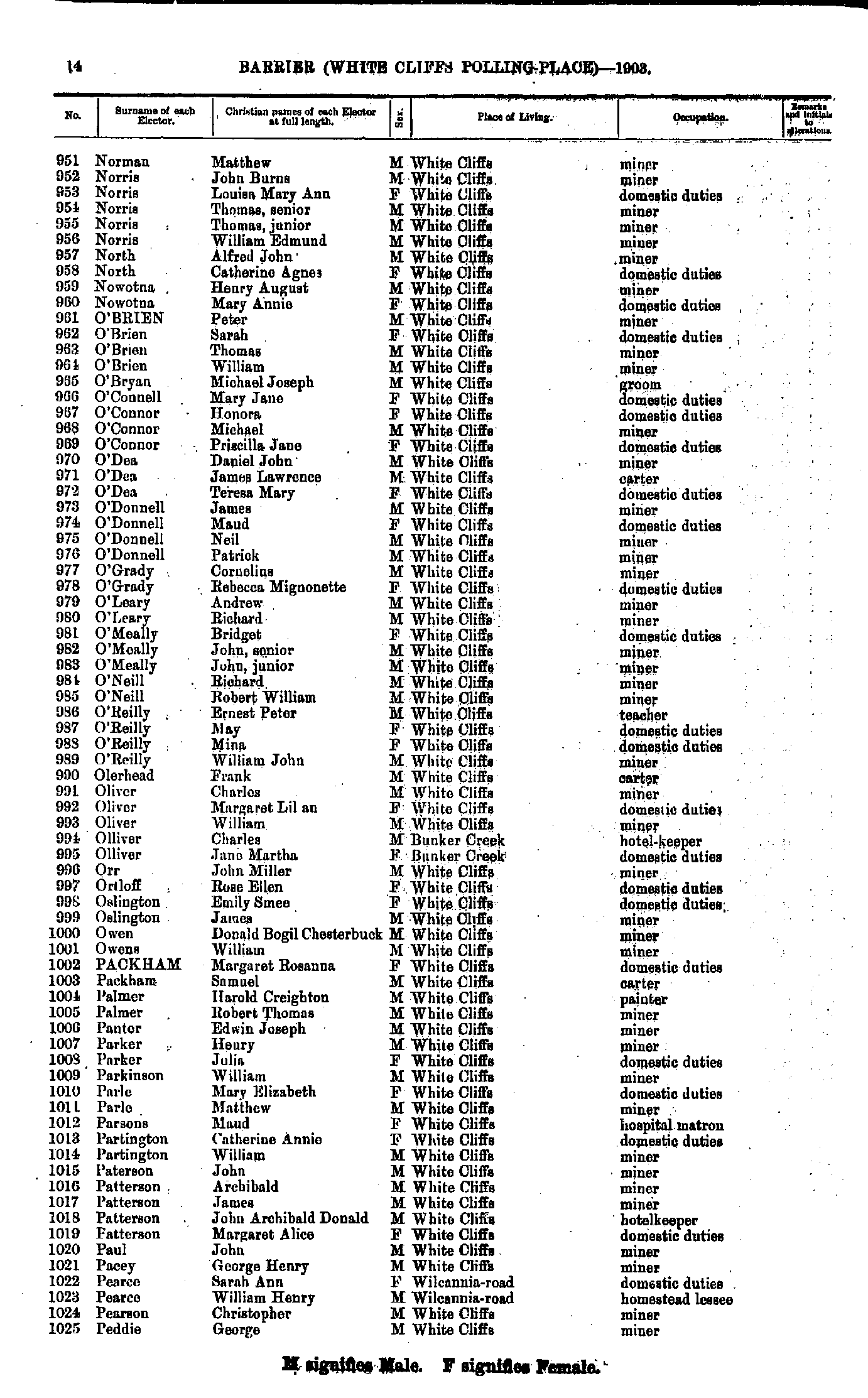
- Norman Matthew - Peddie George
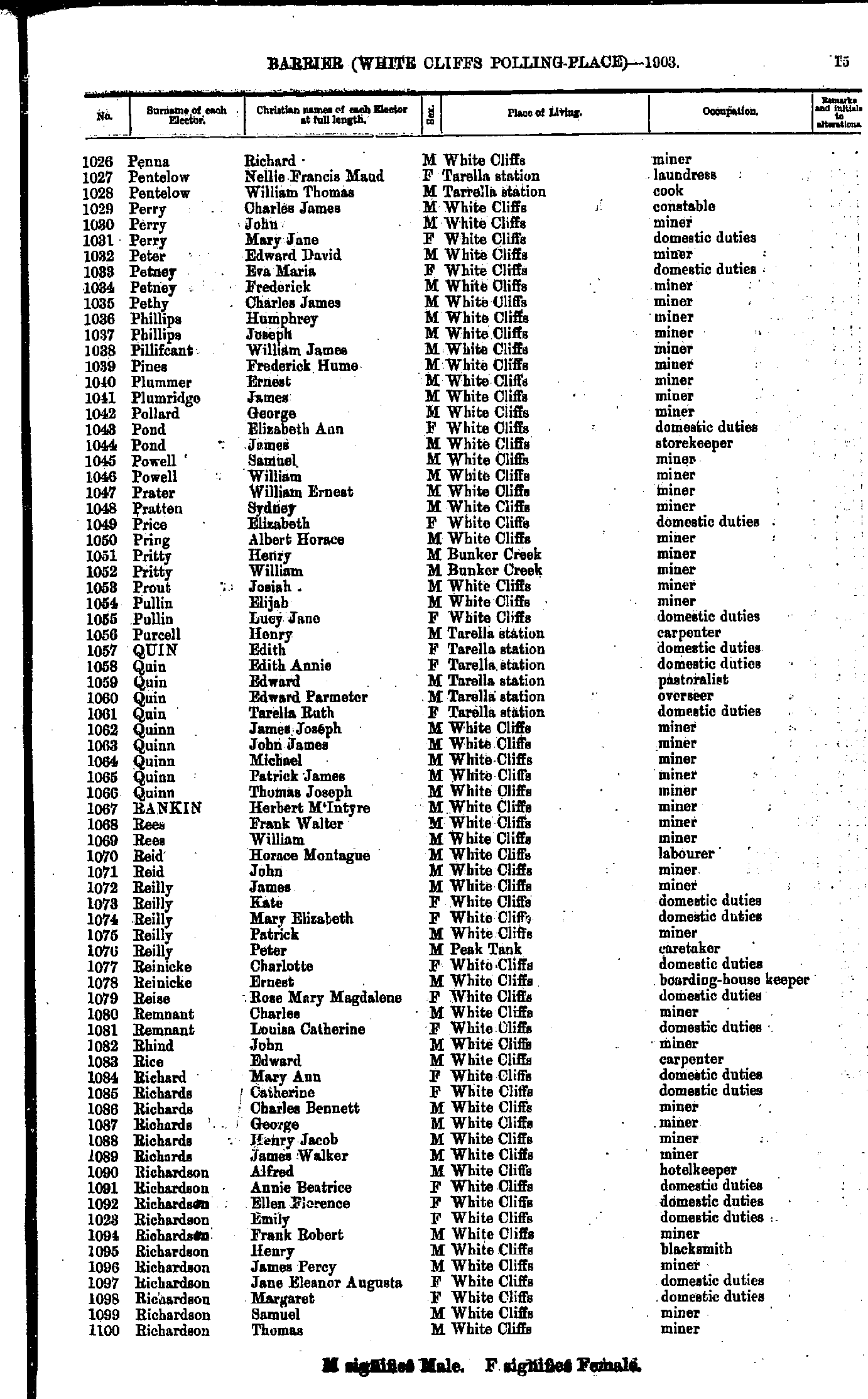
- Penna Richard - Richardson Thomas
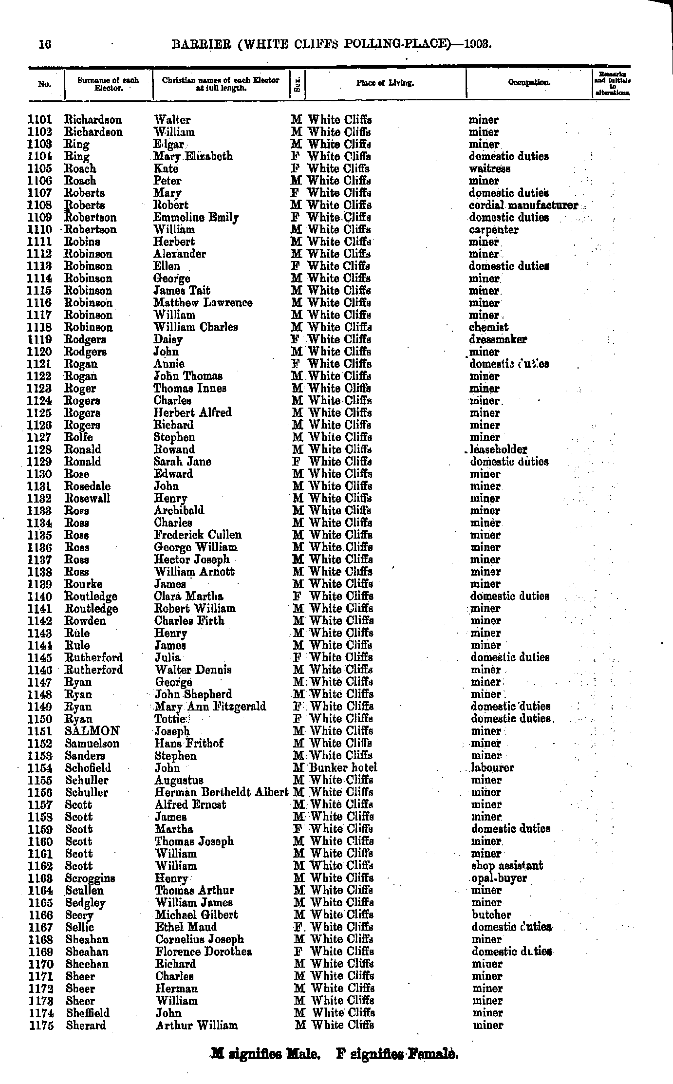
- Richardson Walter - Sherard Arthur William
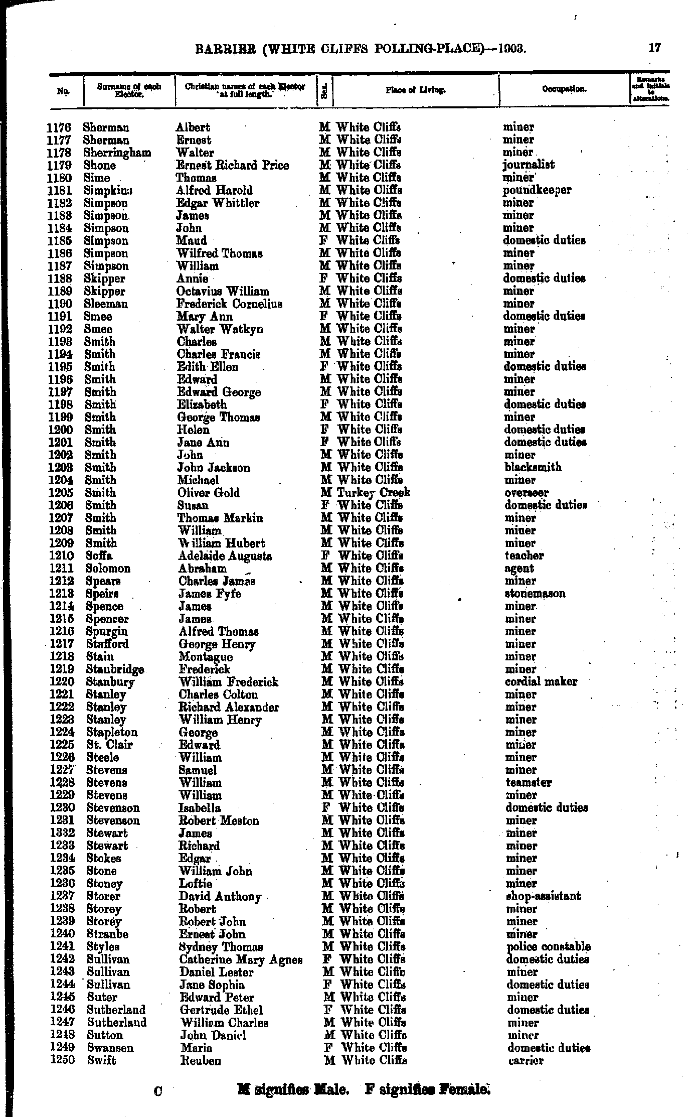
- Sherman Albert - Swift Reuben
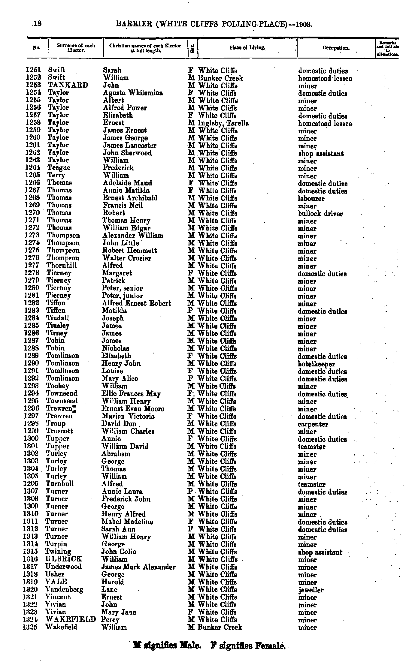
- Swift Sarah - Wakefield William
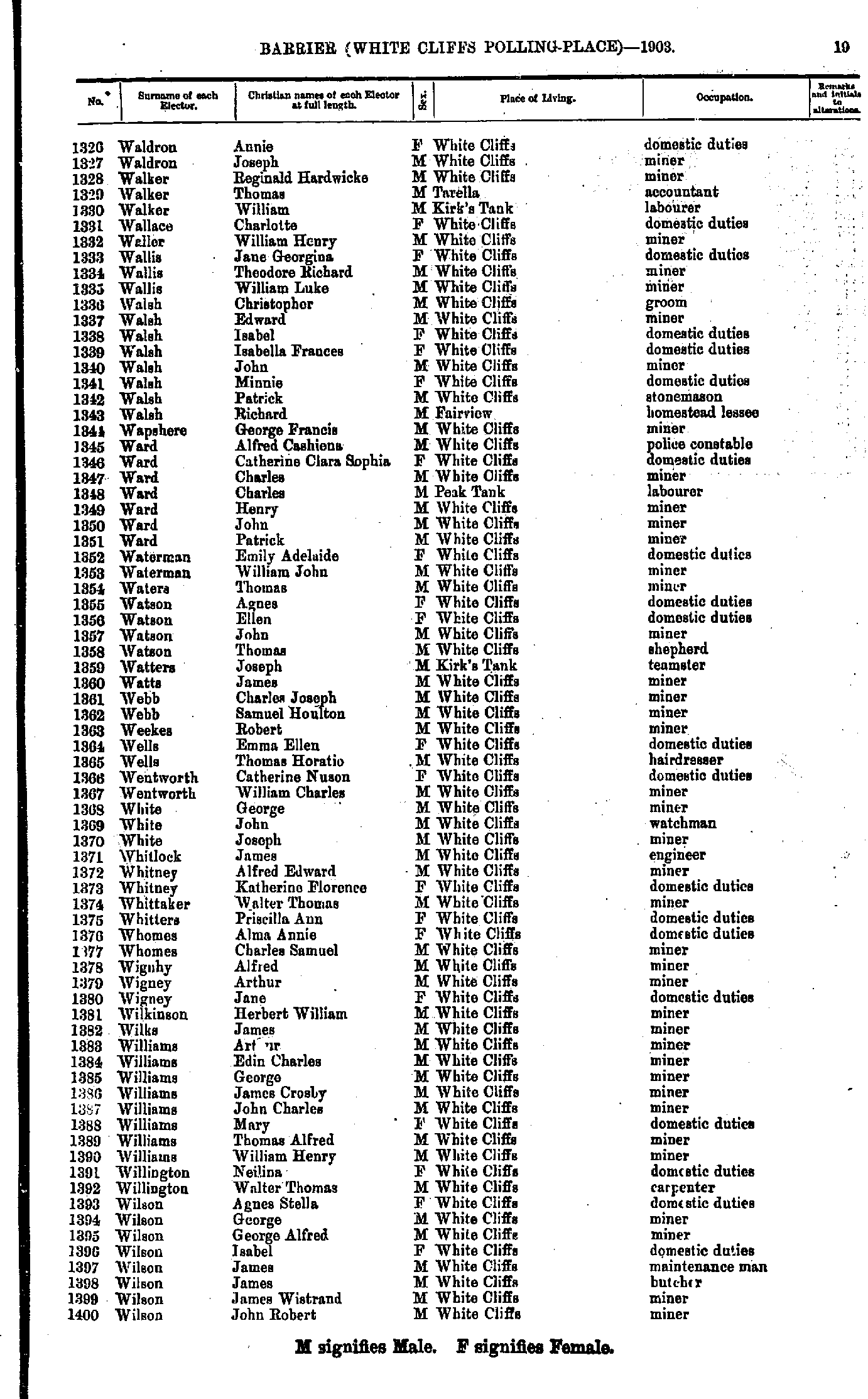
- Waldron Annie - Wilson John Robert
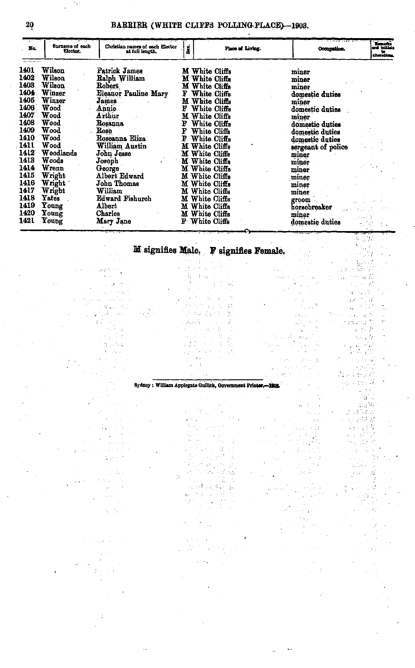
- Wilson Patrick James - Young Mary Jane
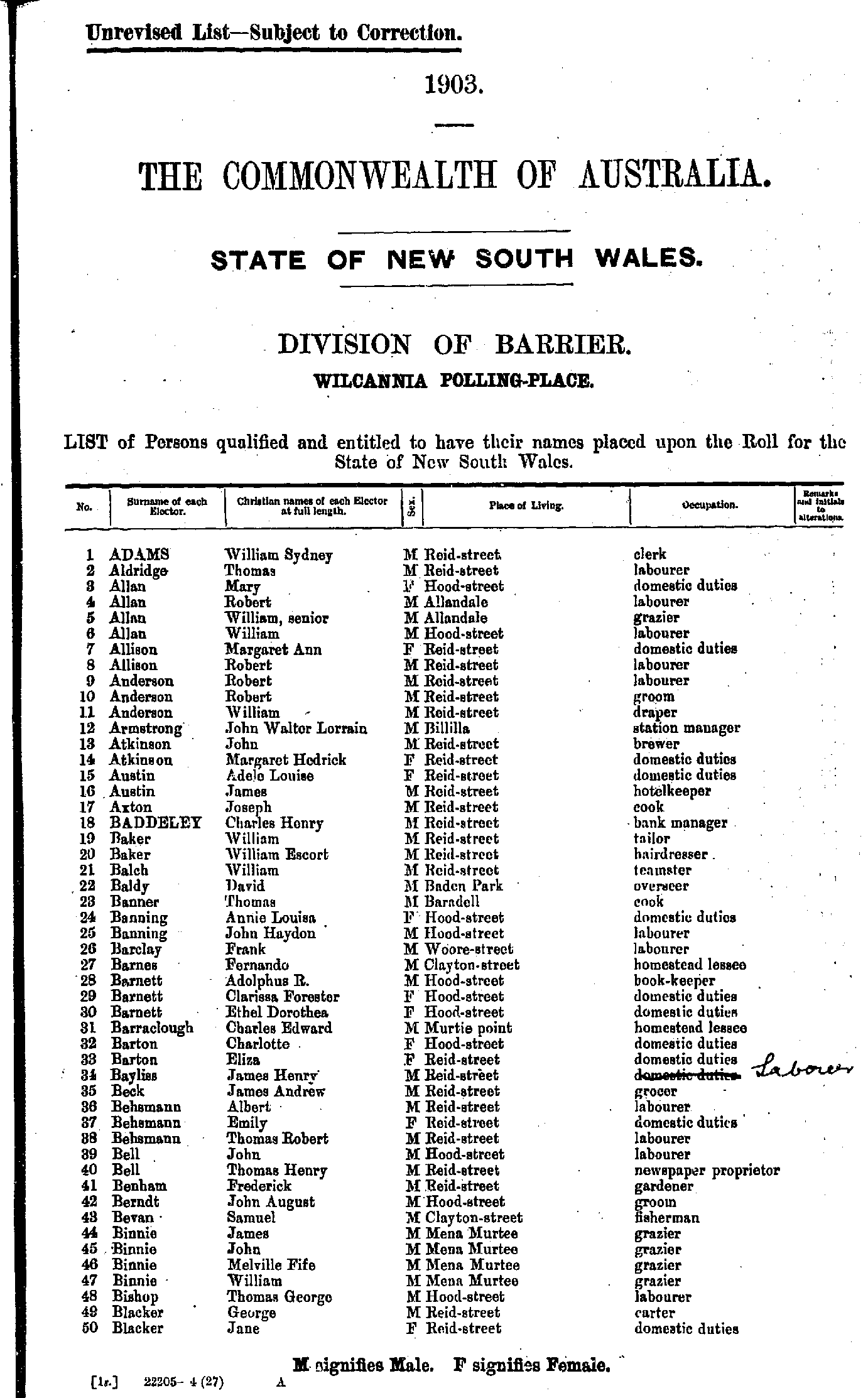
- Adams William Sydney - Blacker Jane
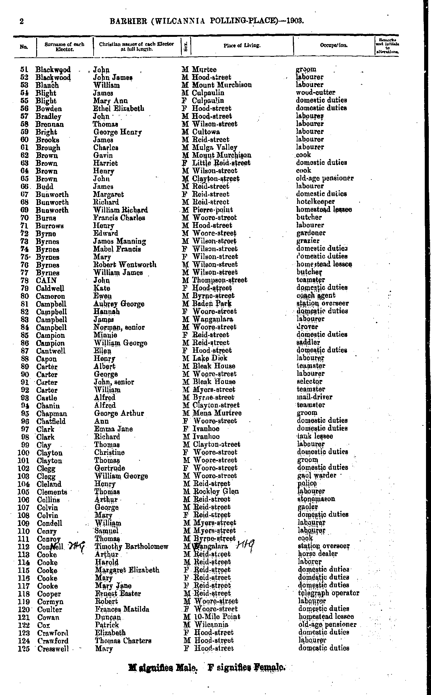
- Blackwood John - Cresswell Mary
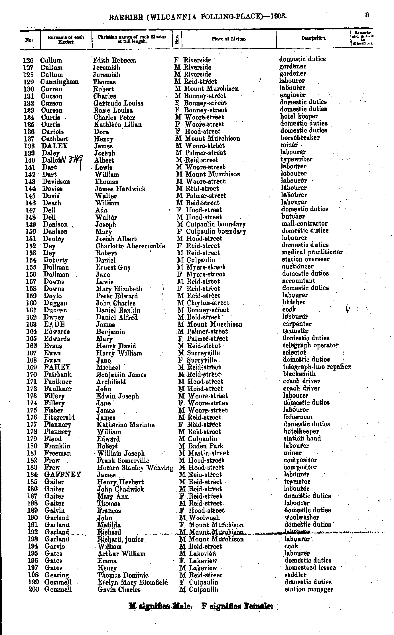
- Cullum Edith Rebecca - Gemmell Gavin Charles
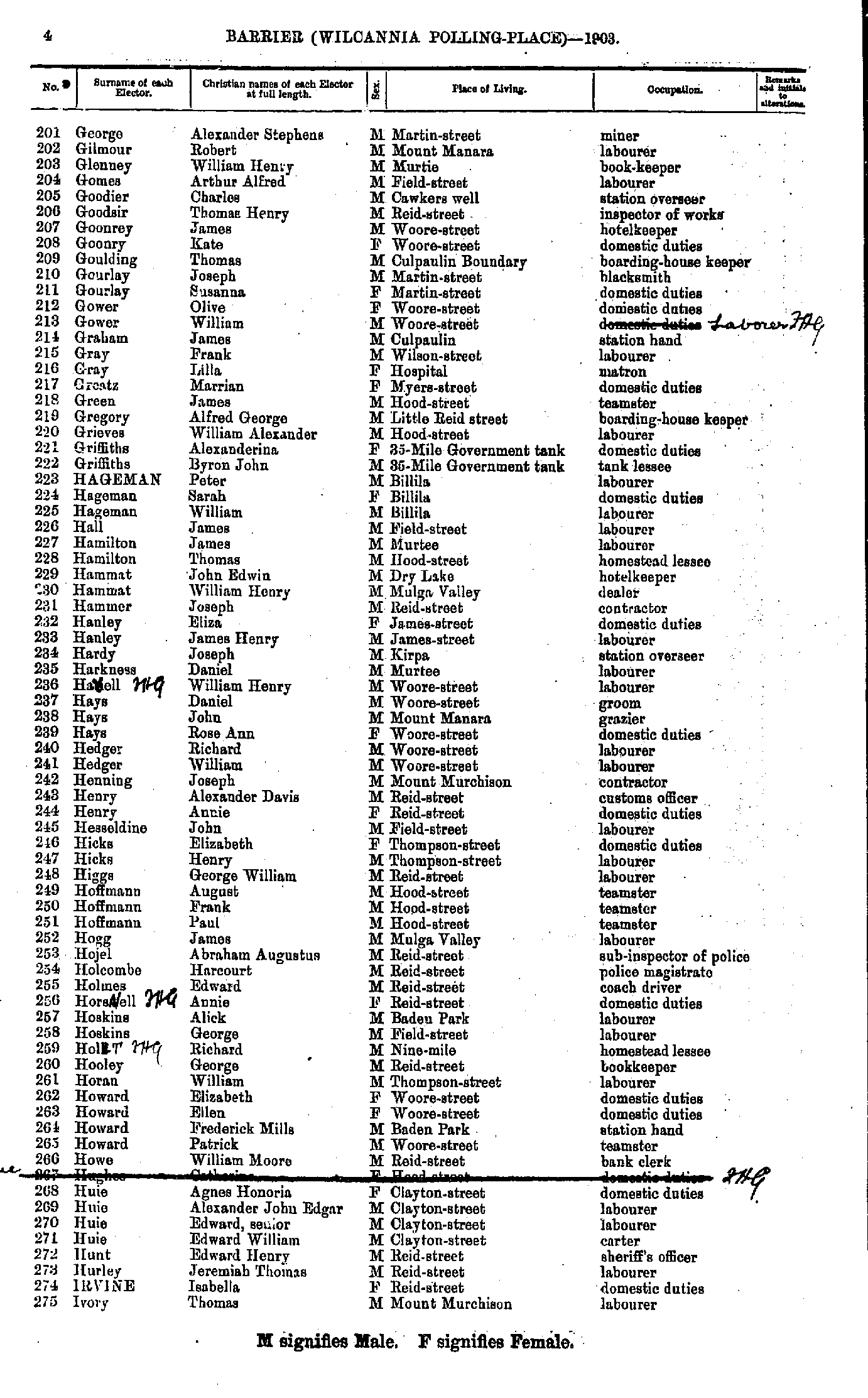
- George Alexander Stephens - Ivory Thomas
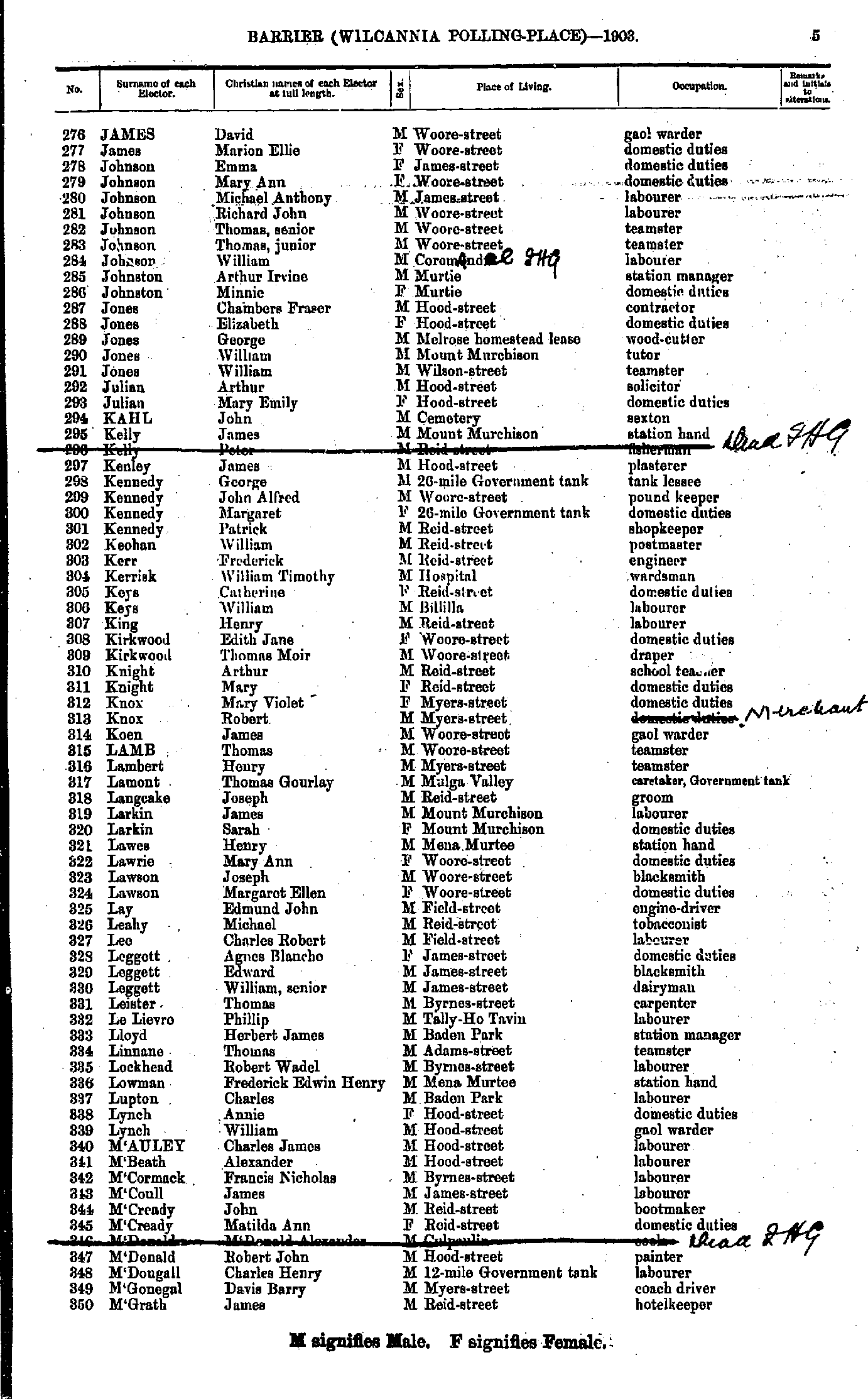
- James David - M'Grath James
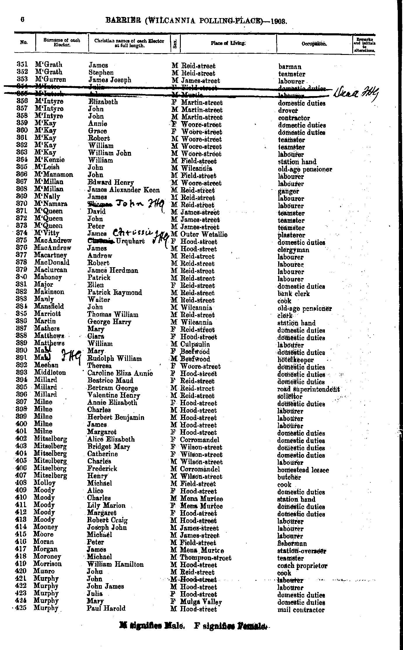
- M'Grath James - Murphy Paul Harold
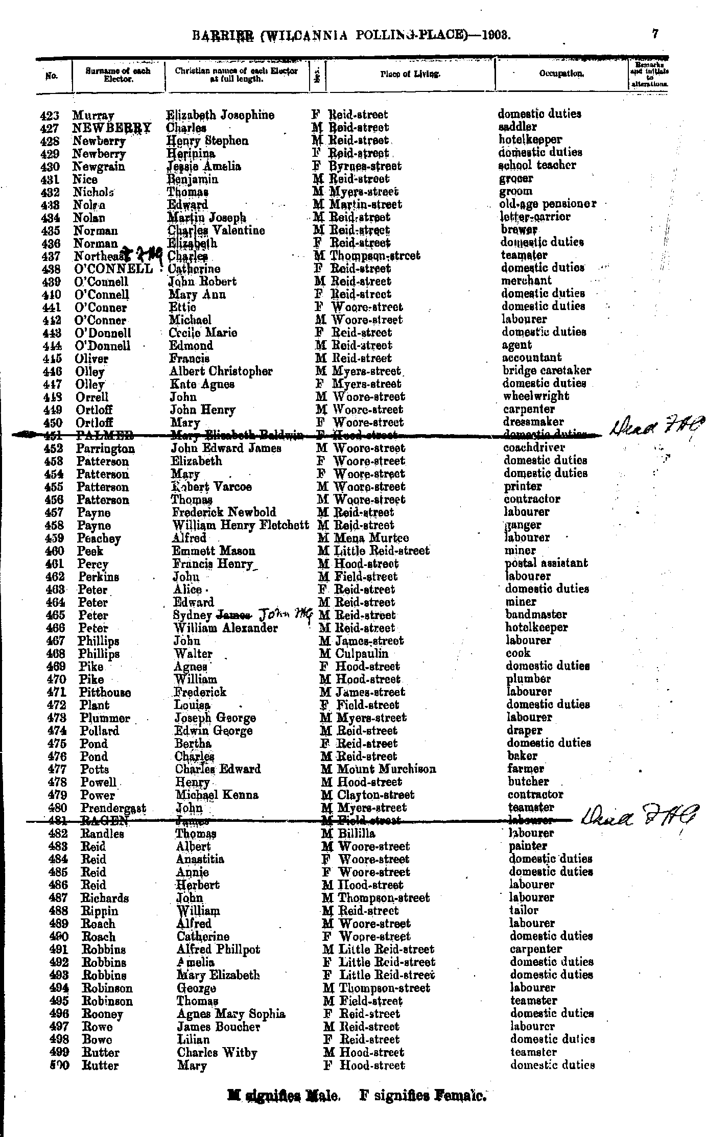
- Murray Elizabeth Josephine - Rutter Mary
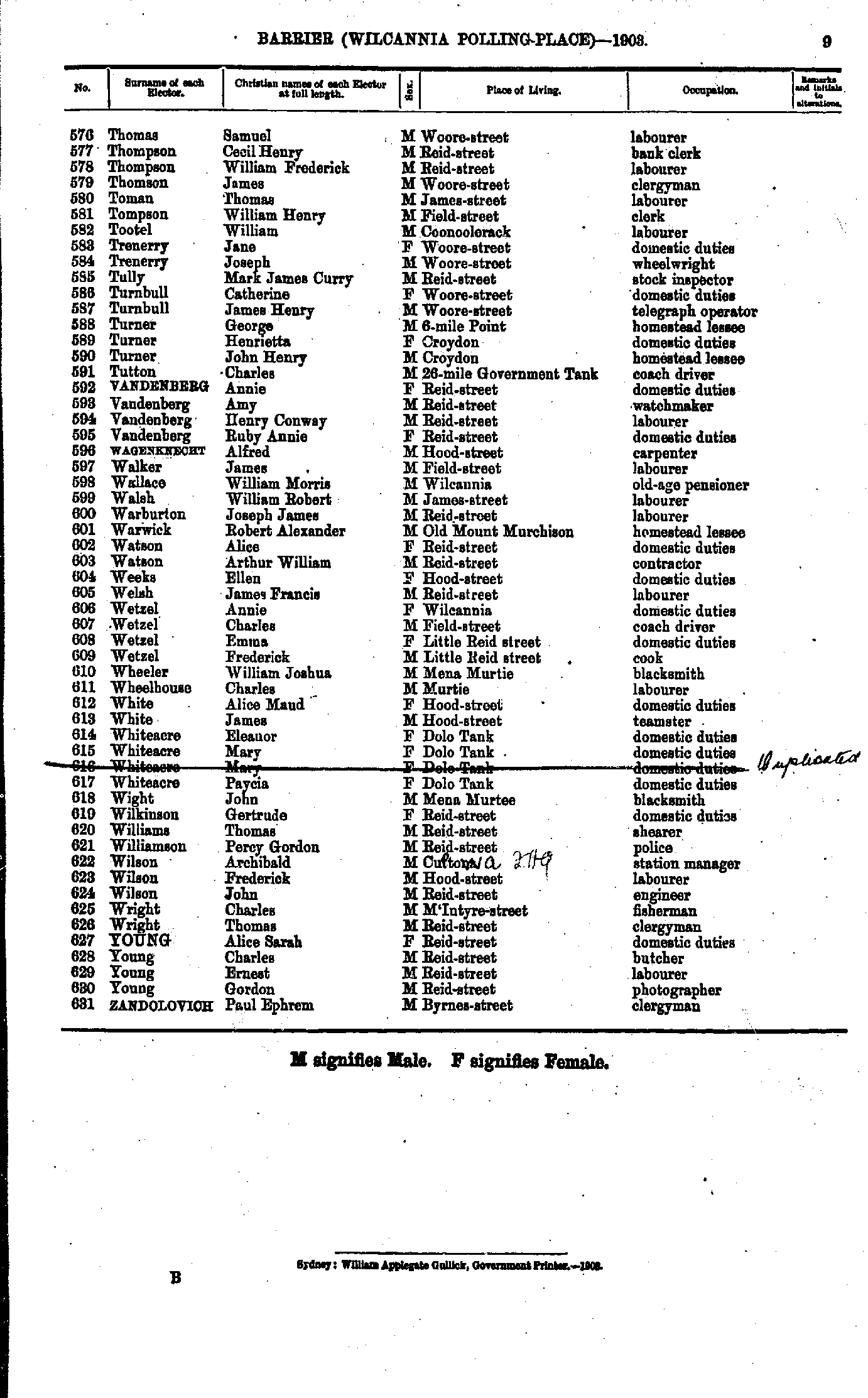
- Ryan Catherine - Thomas William
- Thomas Samuel - Zandolovich Paul Ephrem
Maps of the Barrier Electoral Division
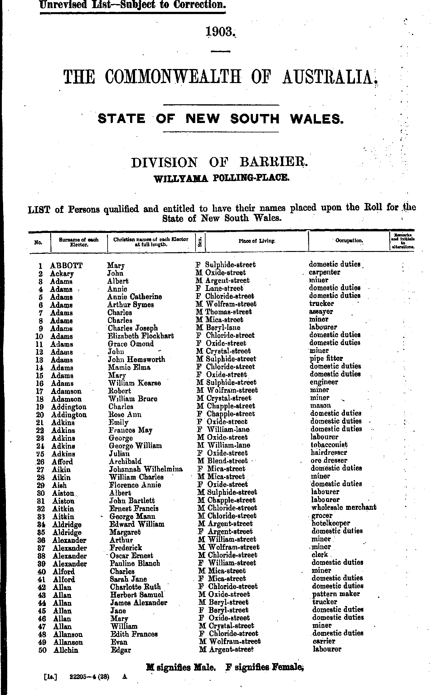
- Abbott Mary - Allchin Edgar
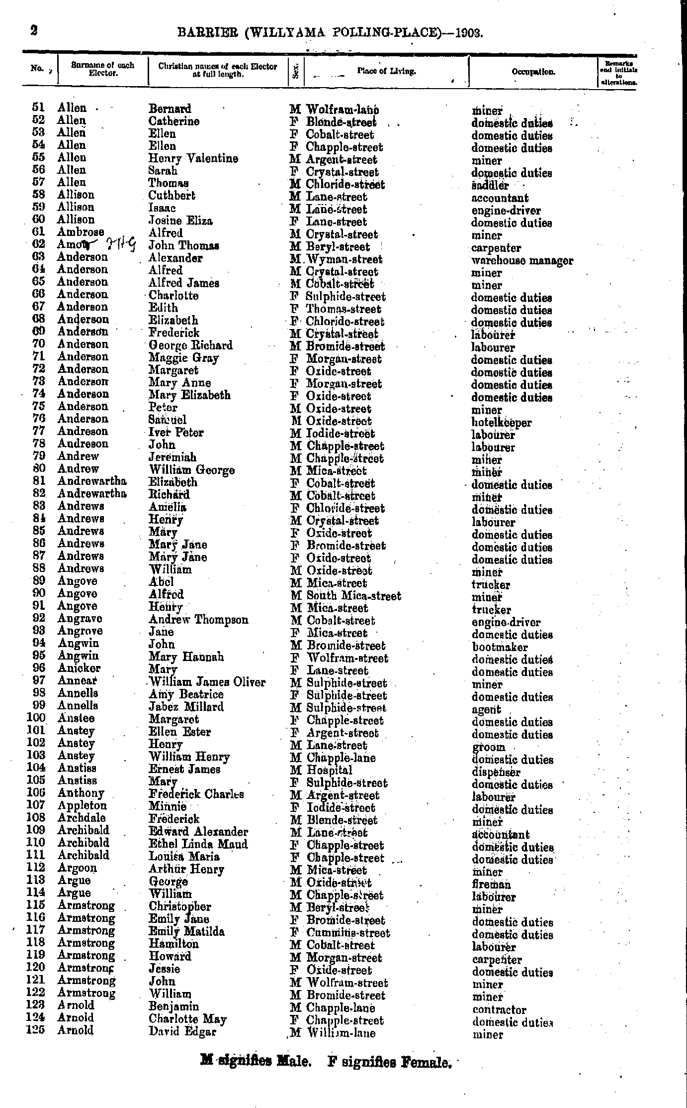
- Allen Bernard - Arnold David Edgar
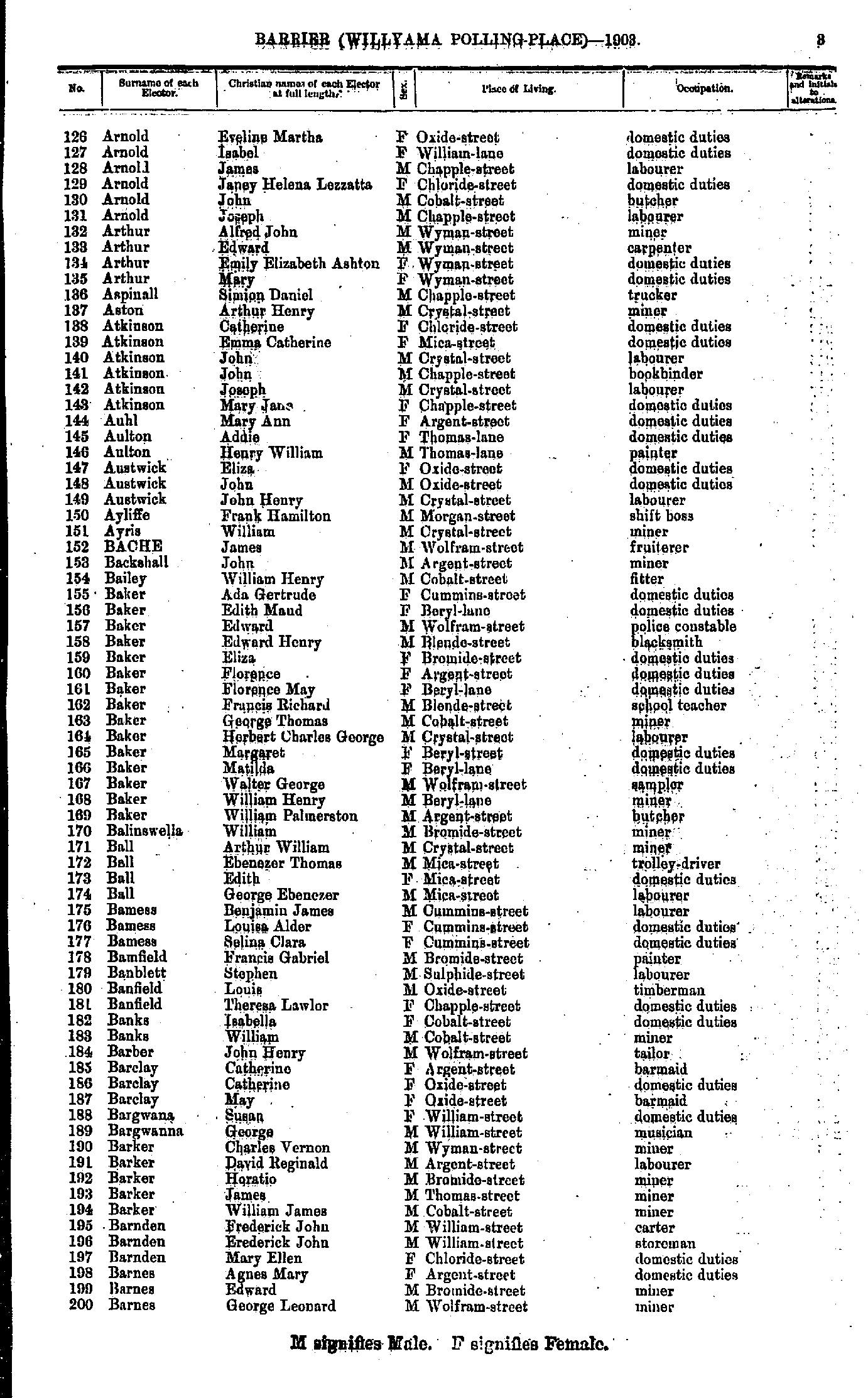
- Arnold Eveline Martha - Barnes George Leonard
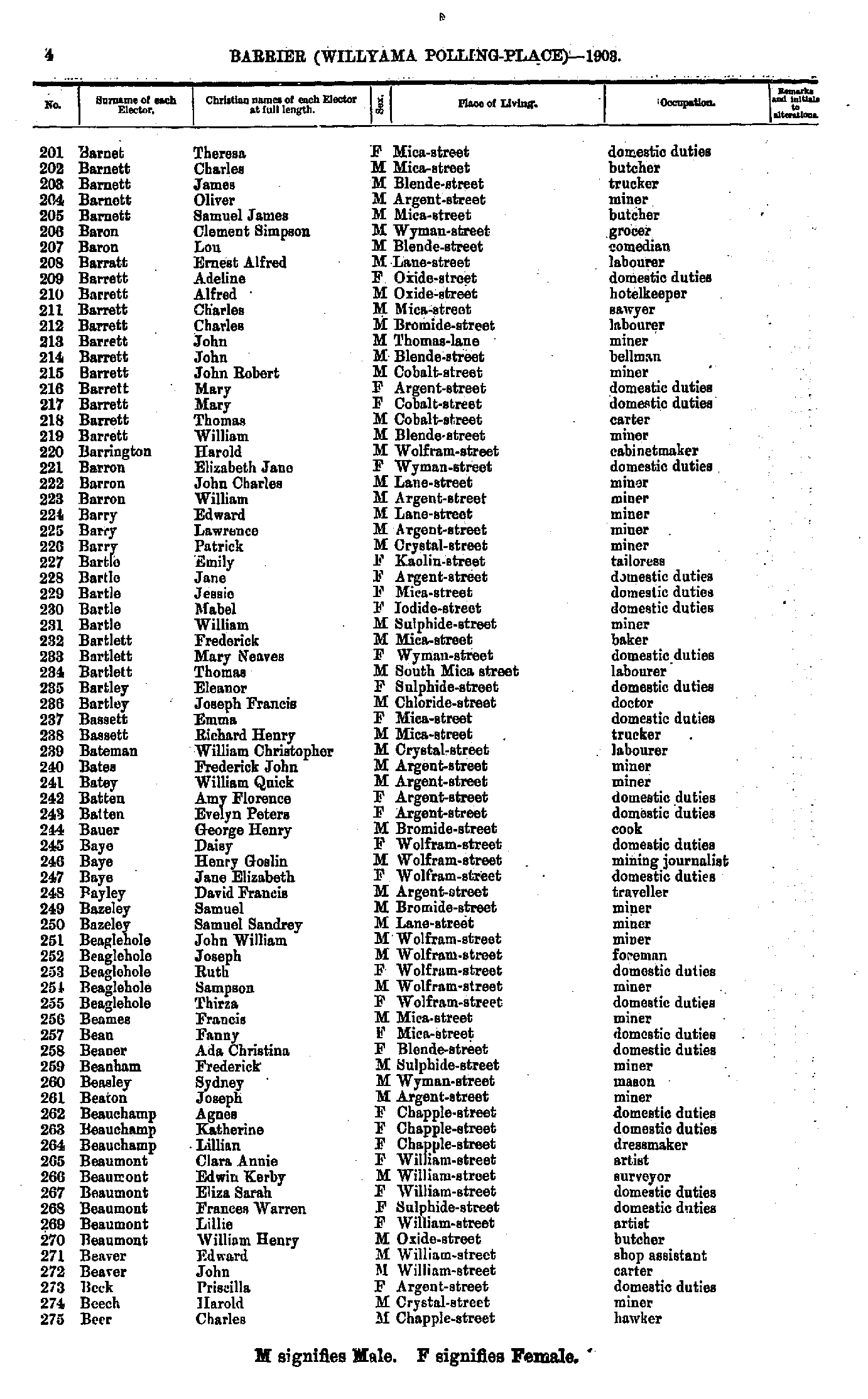
- Barnet Theresa - Beer Charles
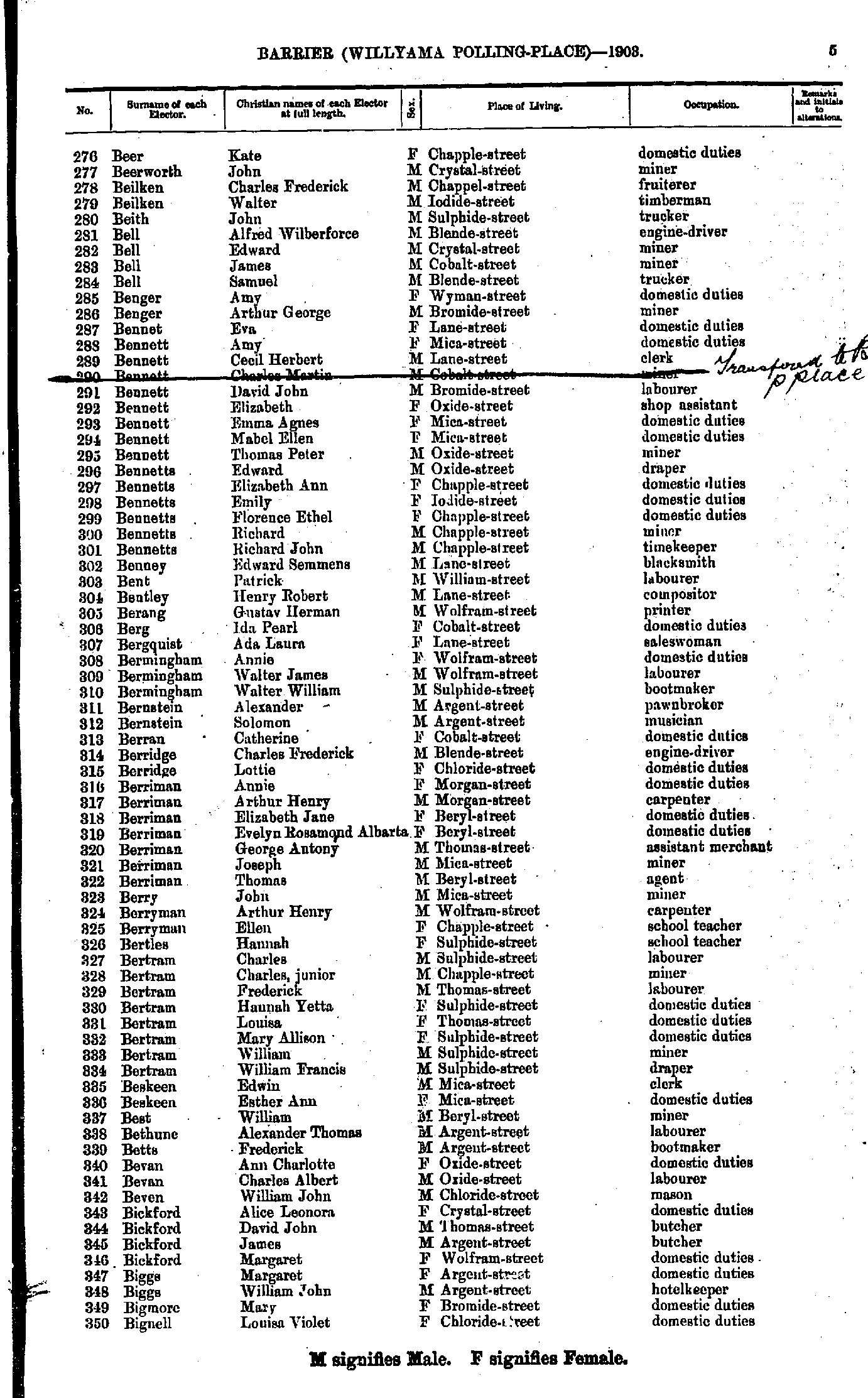
- Beer Kate - Bignell Louisa Violet
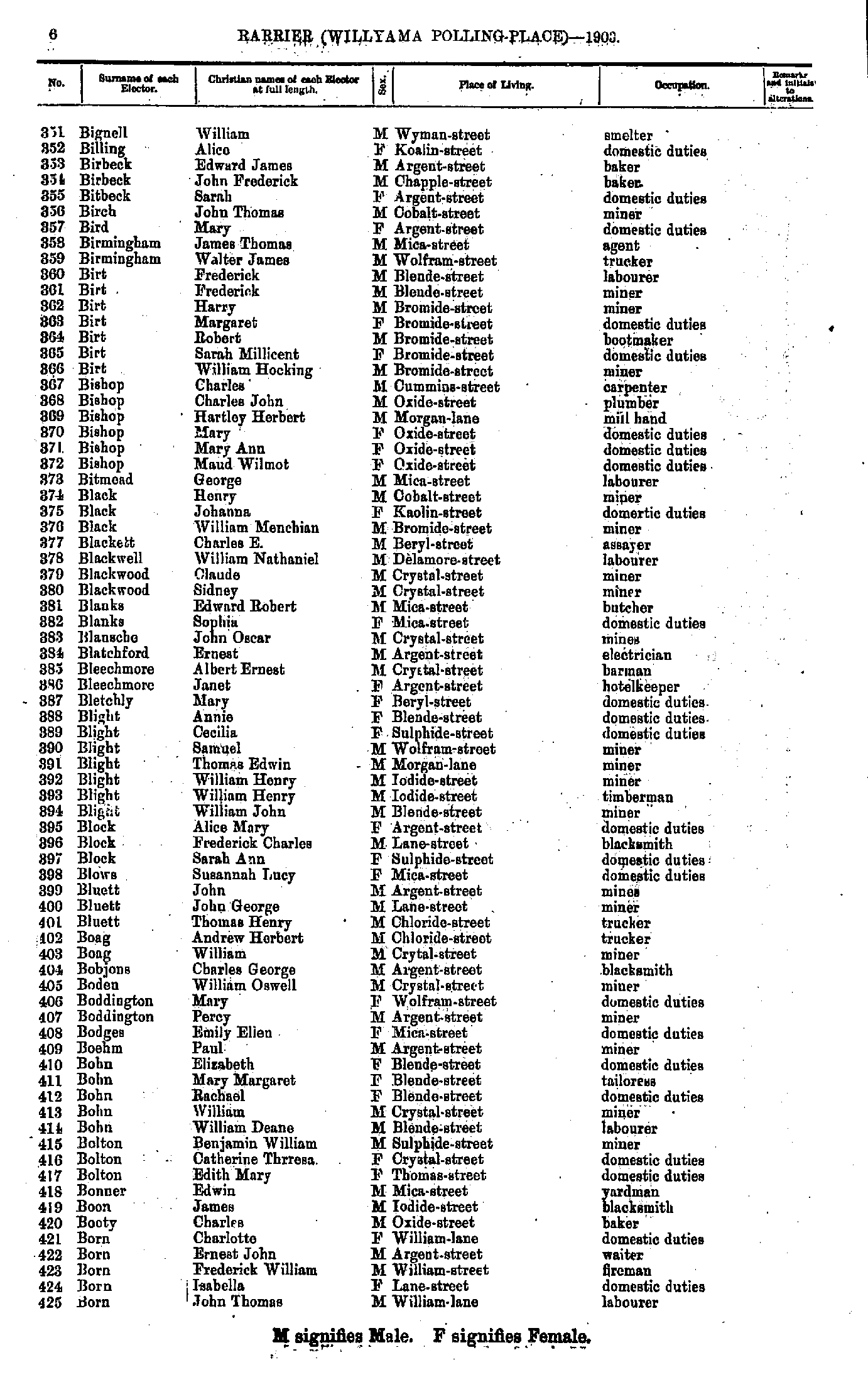
- Bignell William - Born John Thomas
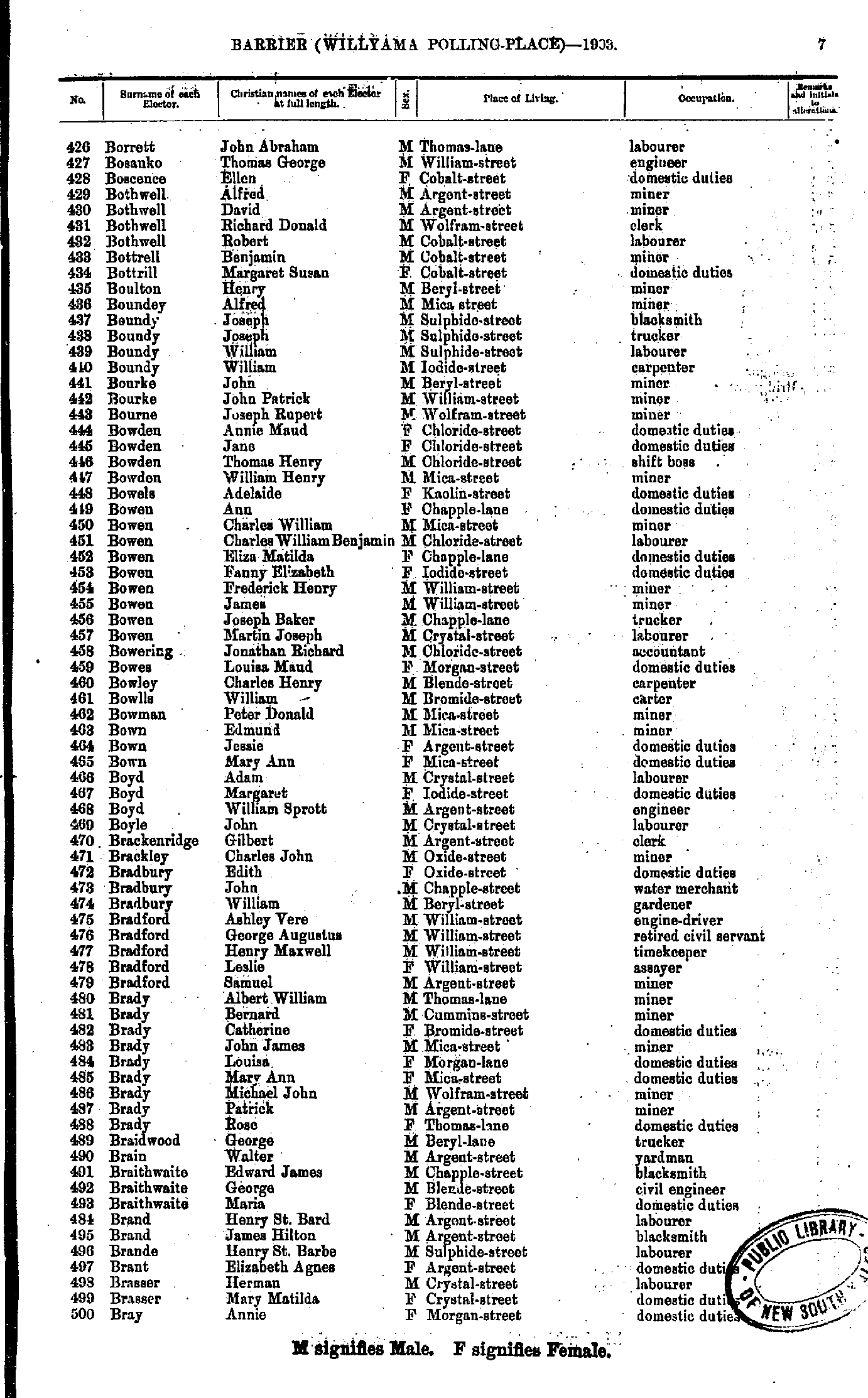
- Borrett John Abraham - Bray Annie
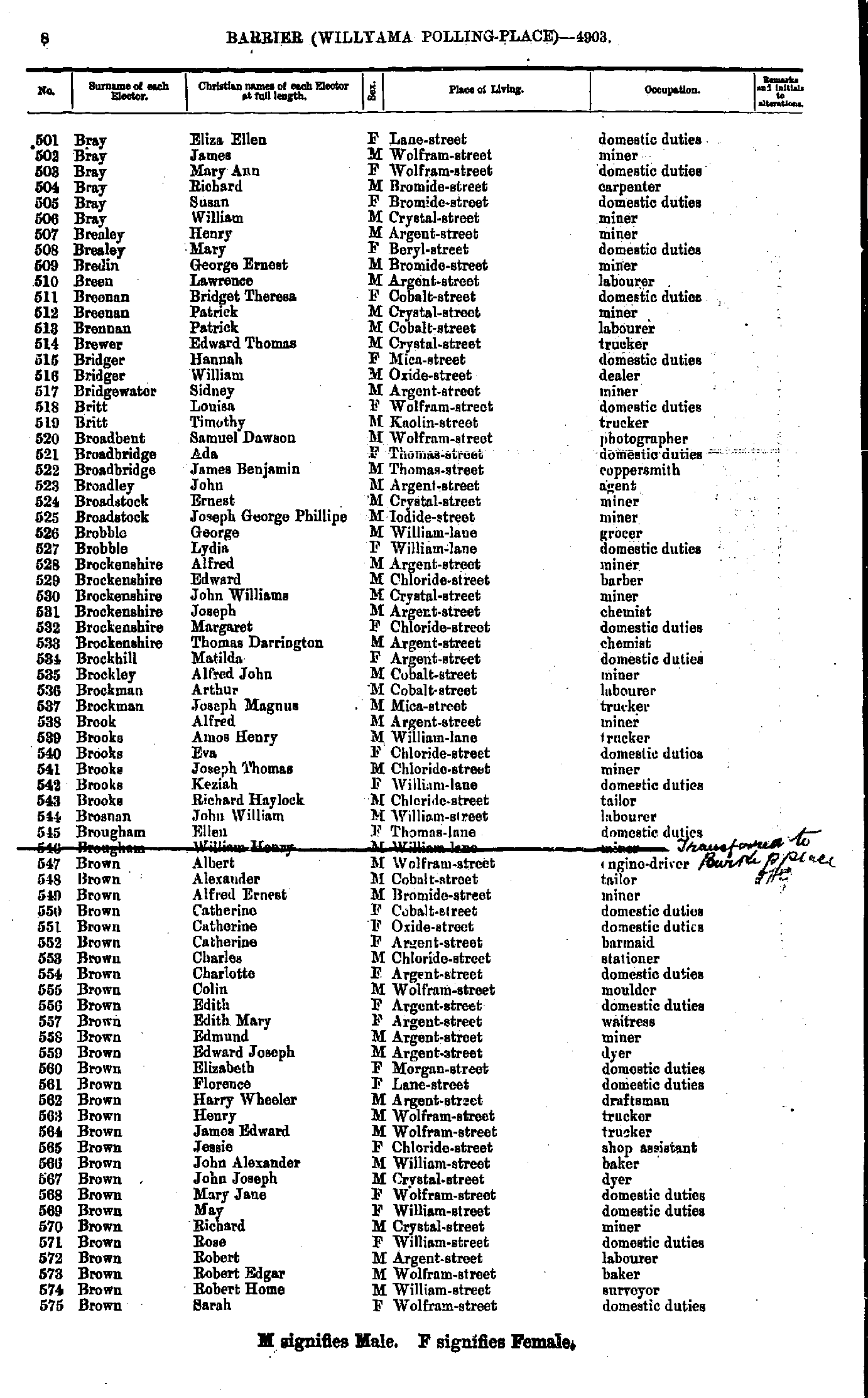
- Bray Eliza Ellen - Brown Sarah
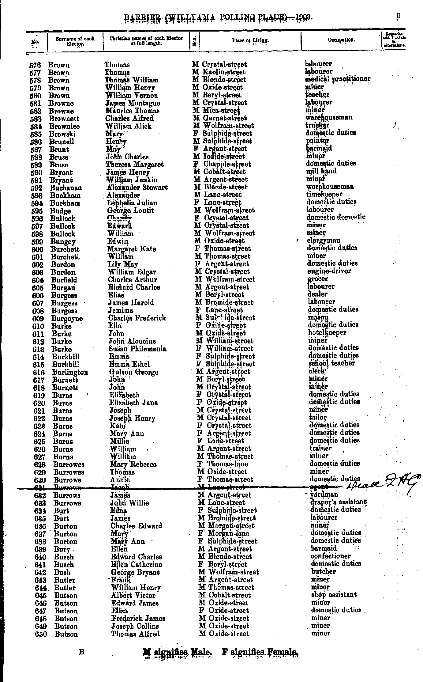
- Brown Thomas - Butson Thomas Alfred
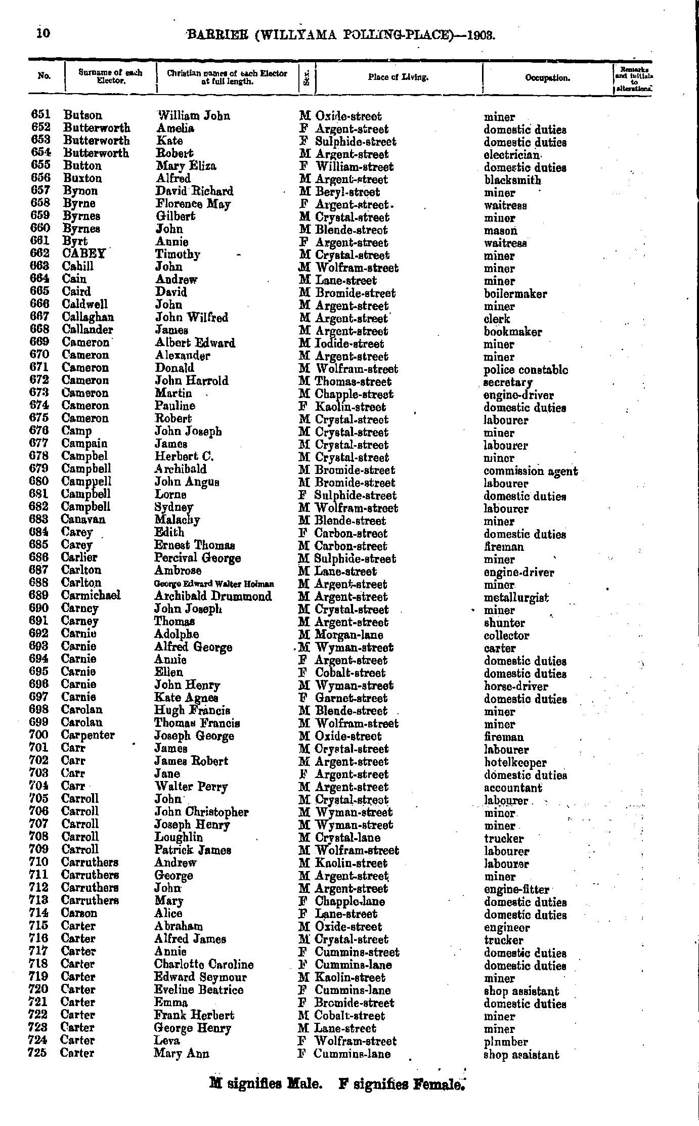
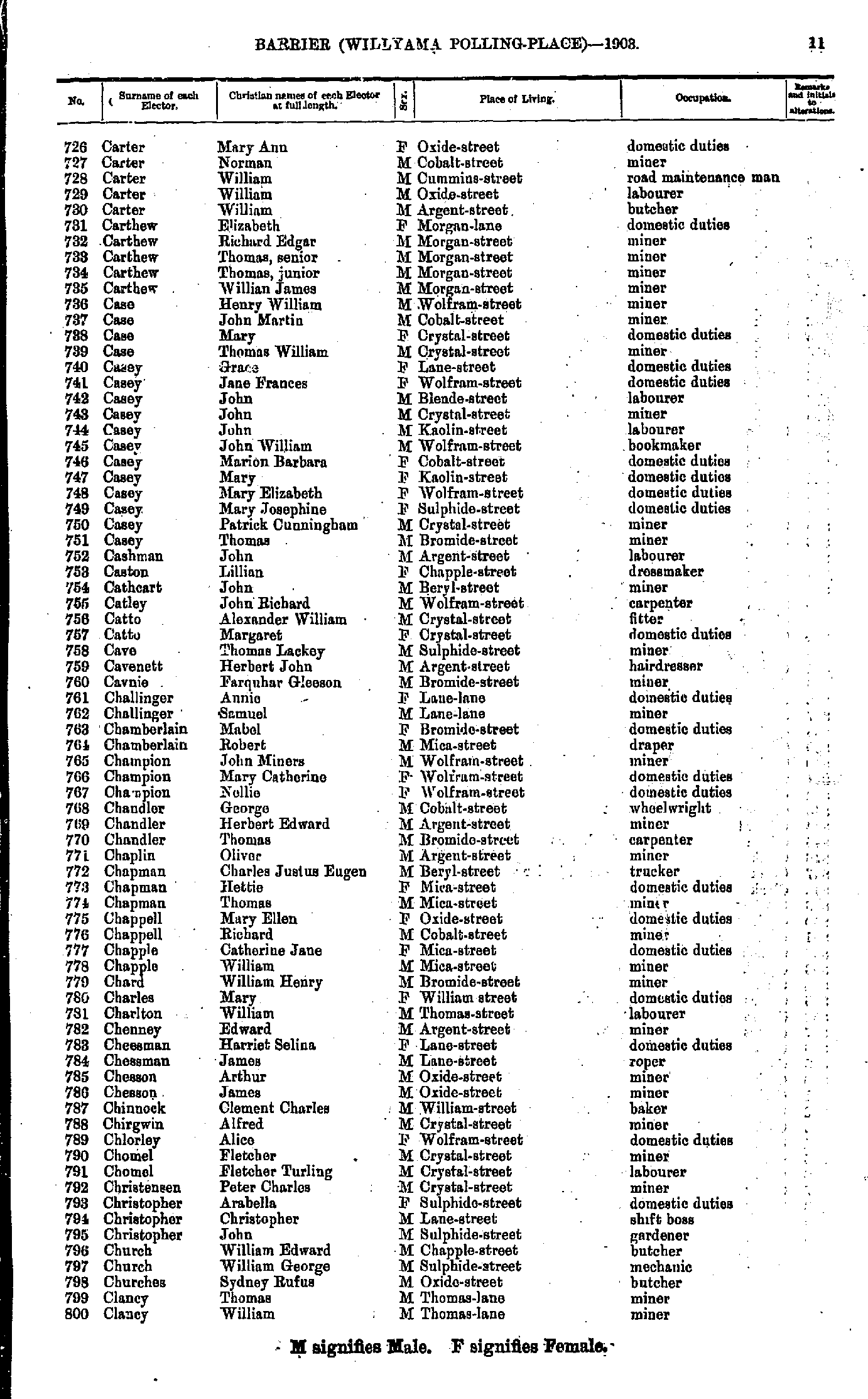
- Butson William John - Carter Mary Ann
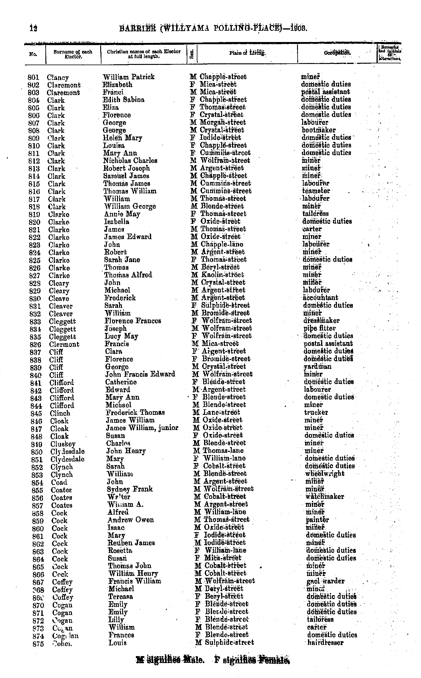
- Carter Mary Ann - Clancy William
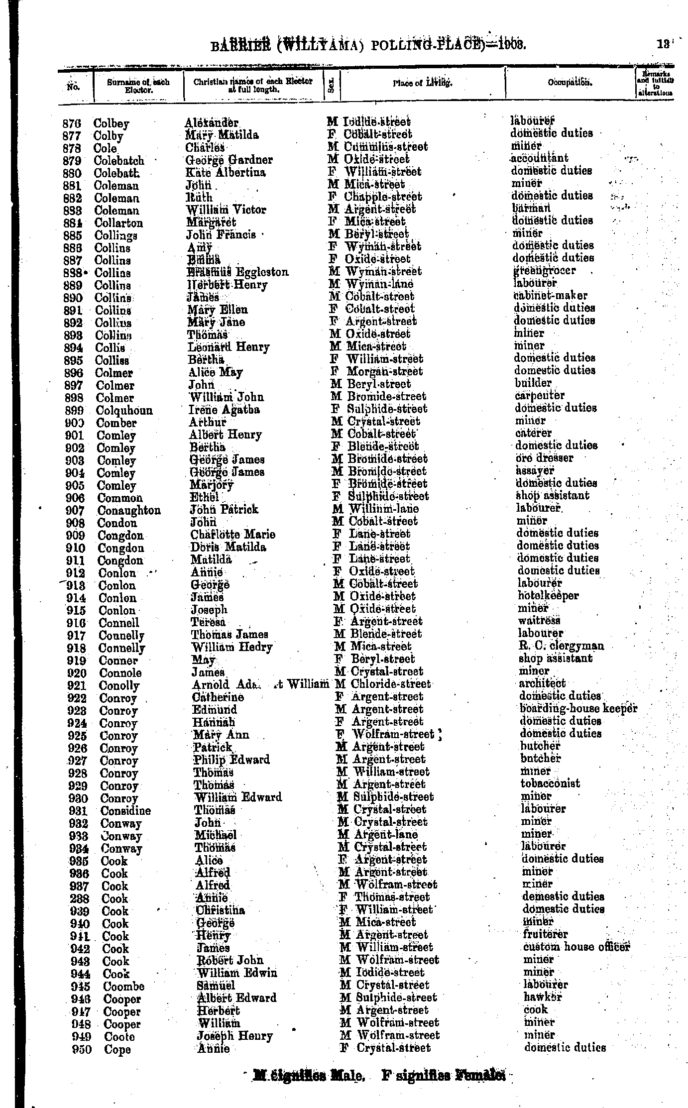
- Clancy William Patrick - Cohen Louis
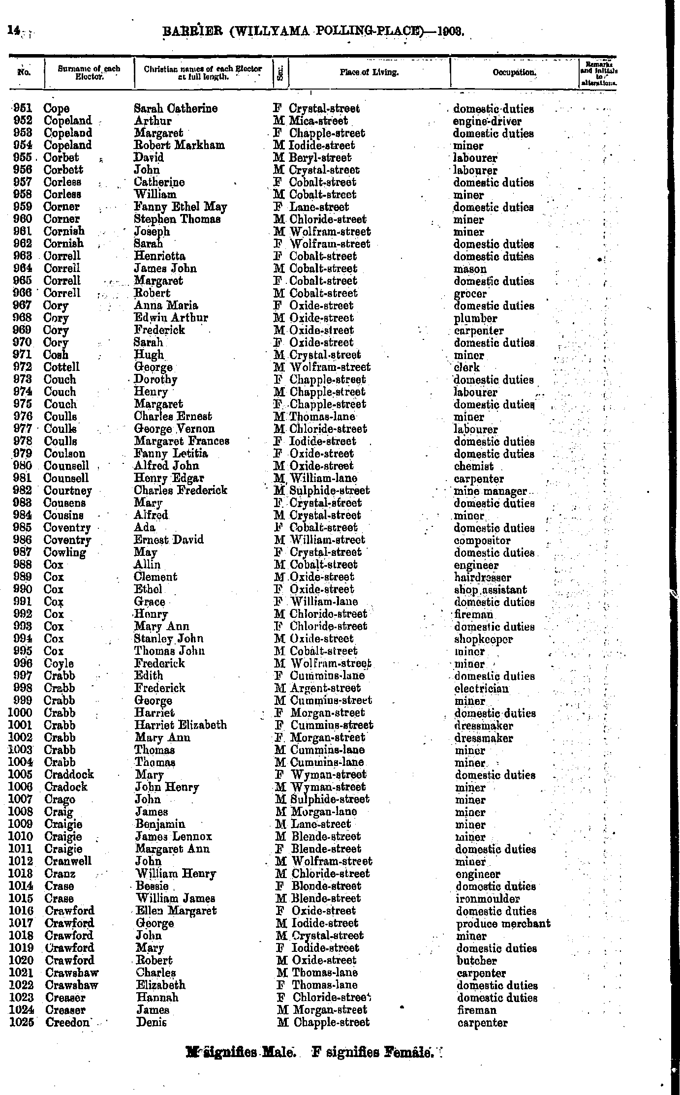
- Colbey Alexander - Cope Annie
- Cope Sarah Catherine - Creedon Denis
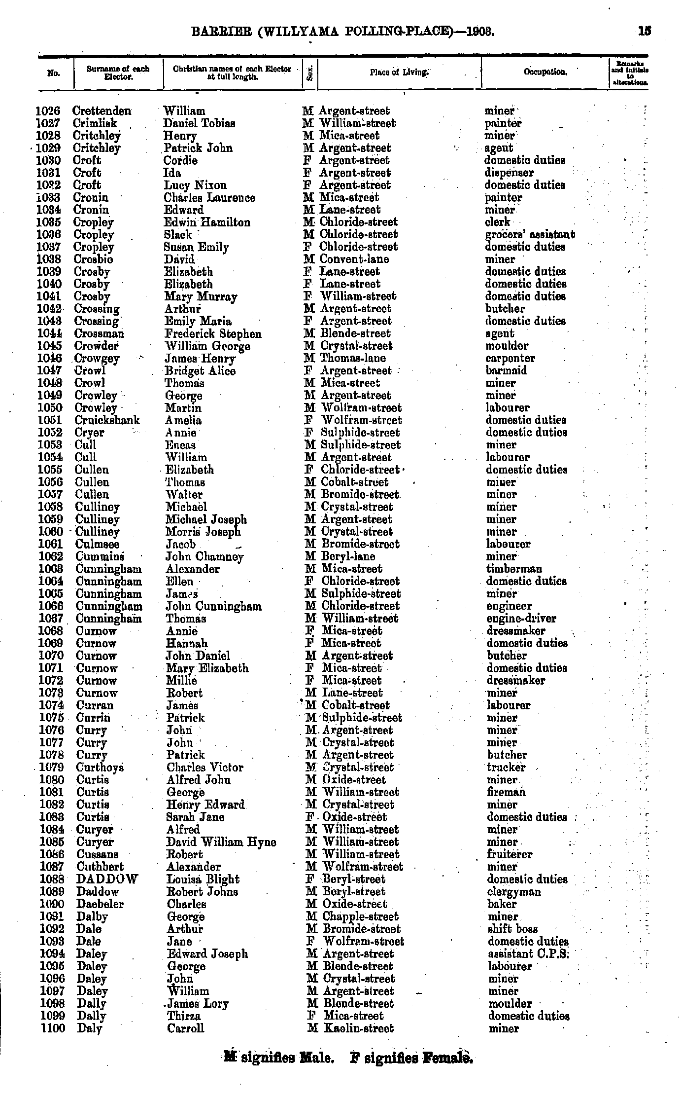
- Crettenden William - Daly Carroll
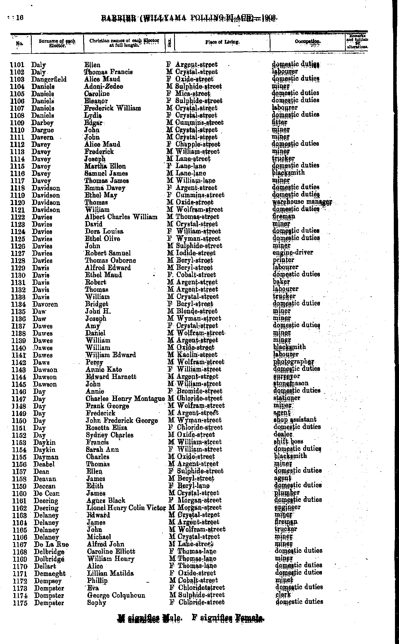
- Daly Ellen - Dempster Sophy
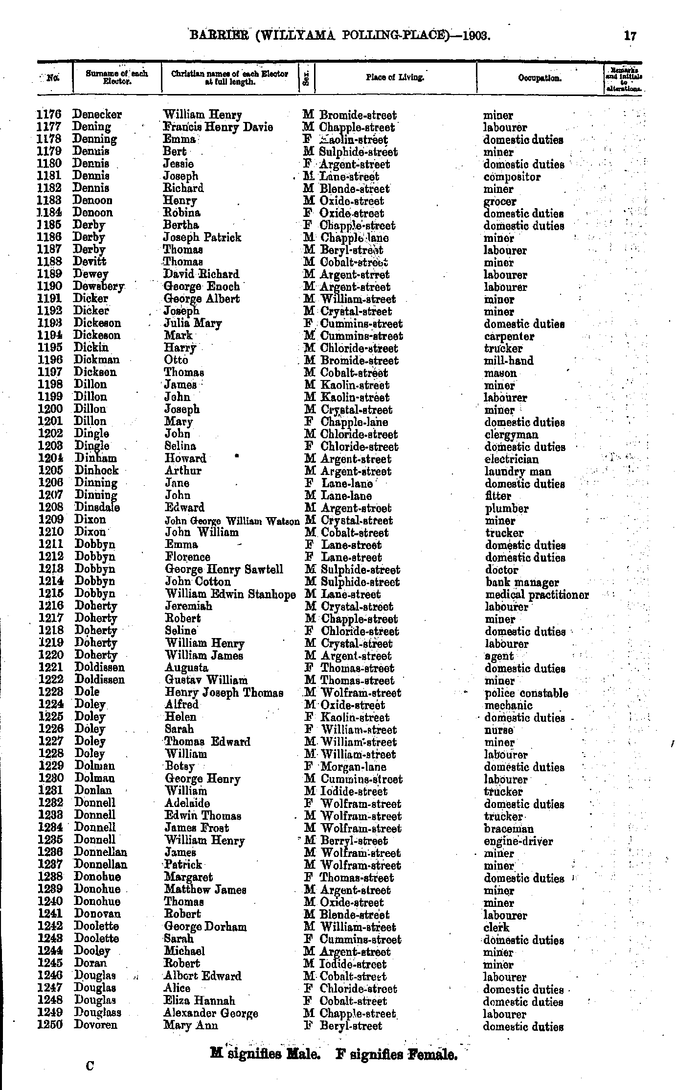
- Denecker William Henry - Dovoren Mary Ann
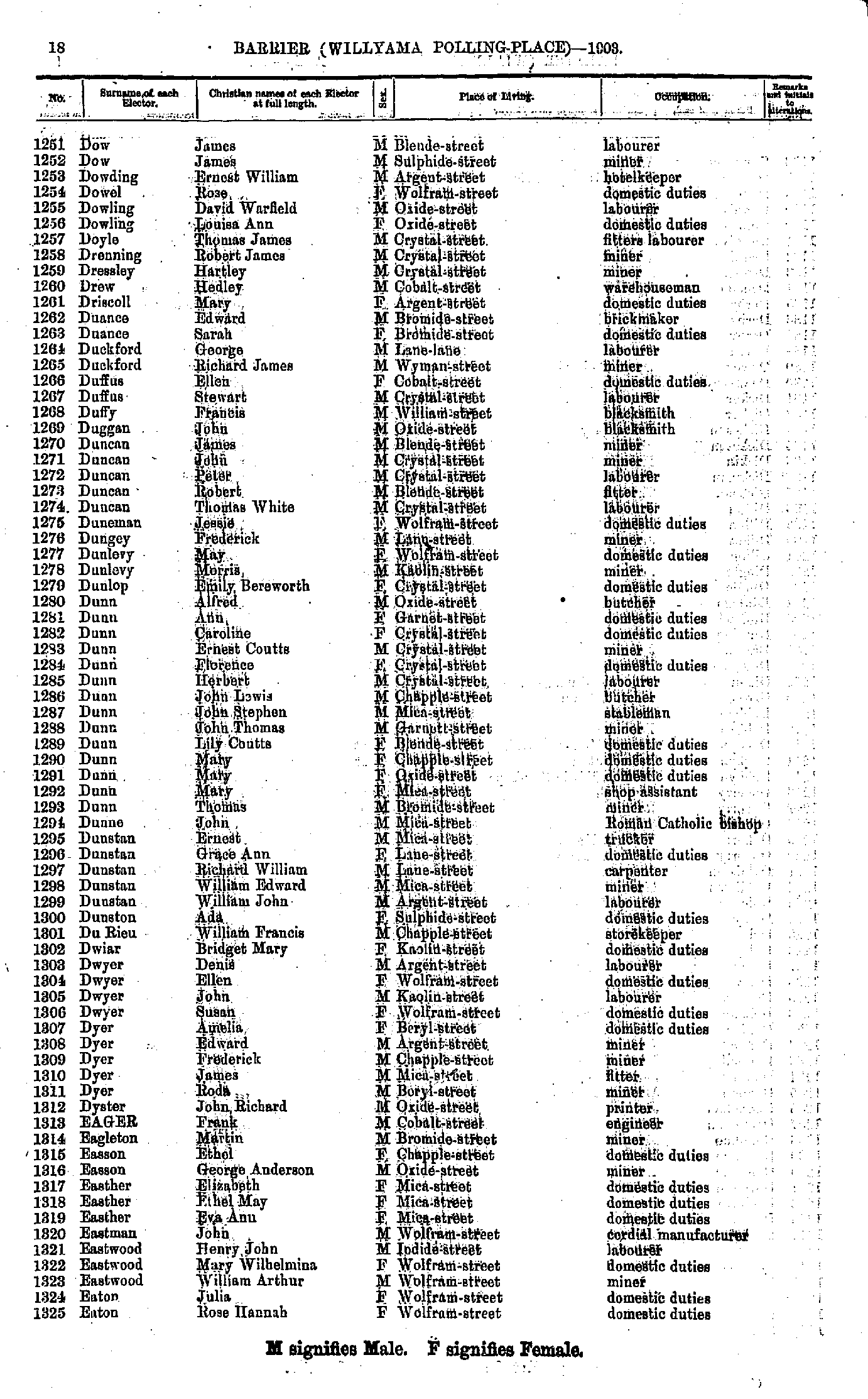
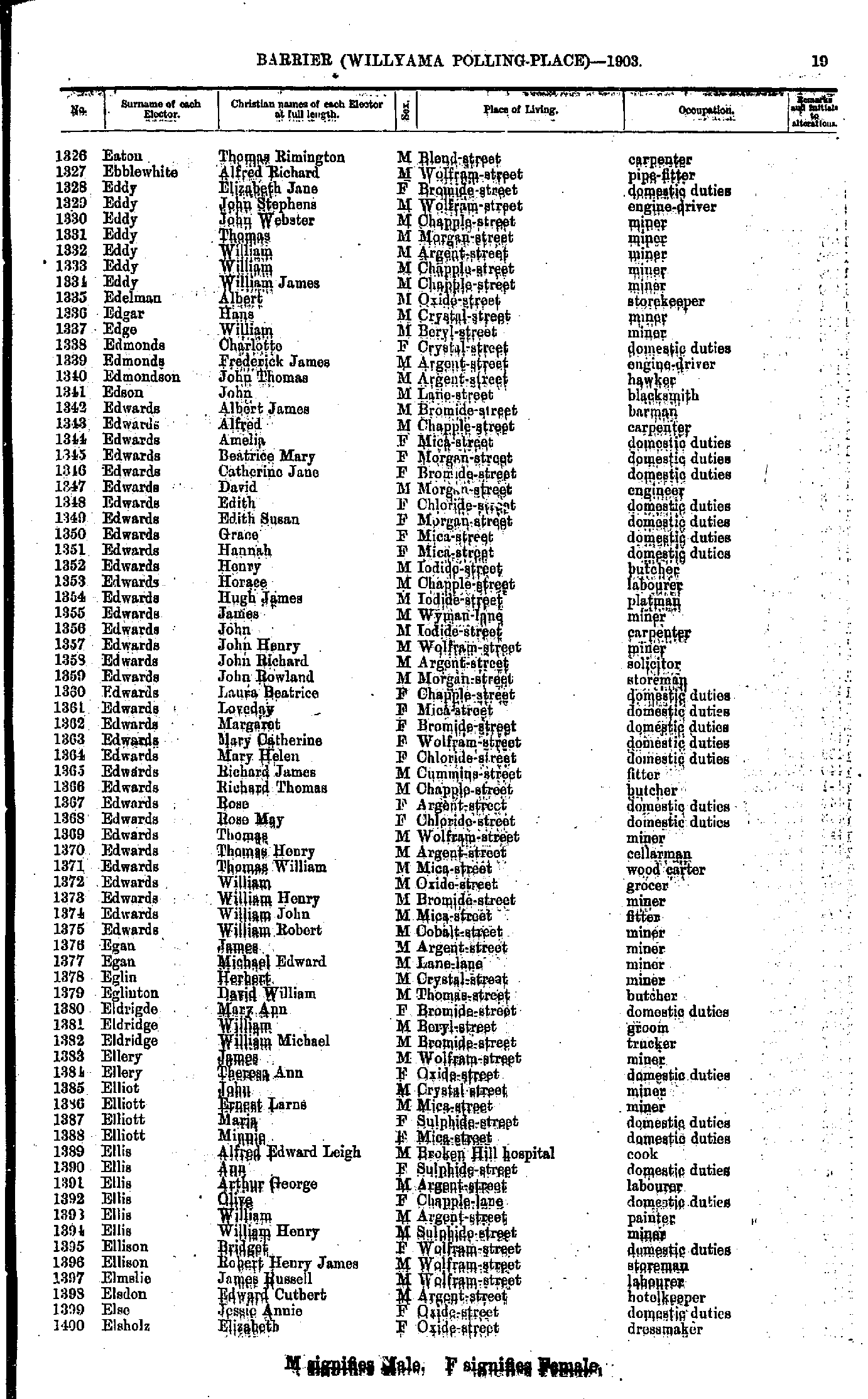
- Dow James - Eaton Rose Hannah
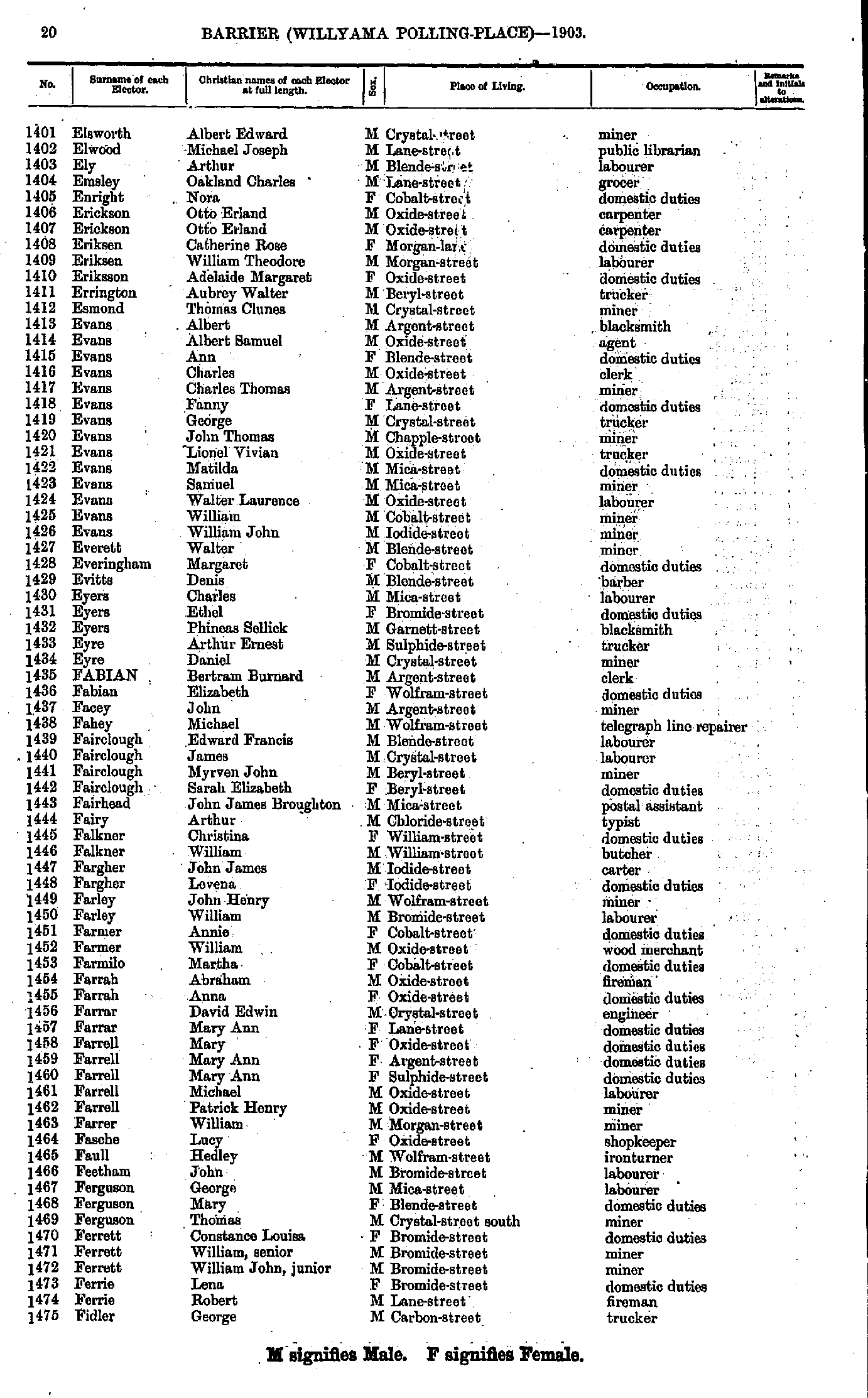
- Eaton Thomas Rimington - Elsholz Elizabeth
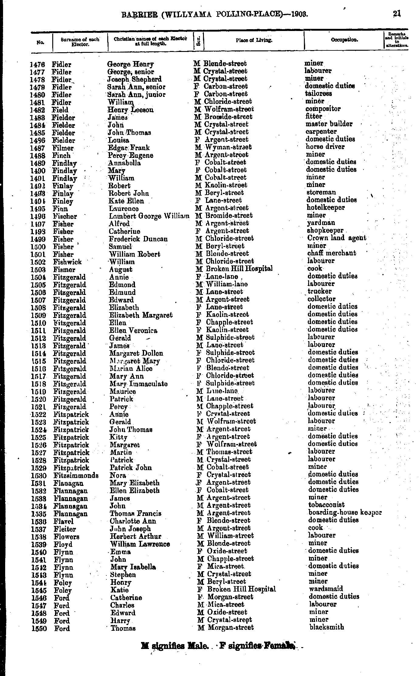
- Elsworth Albert Edward - Fidler George
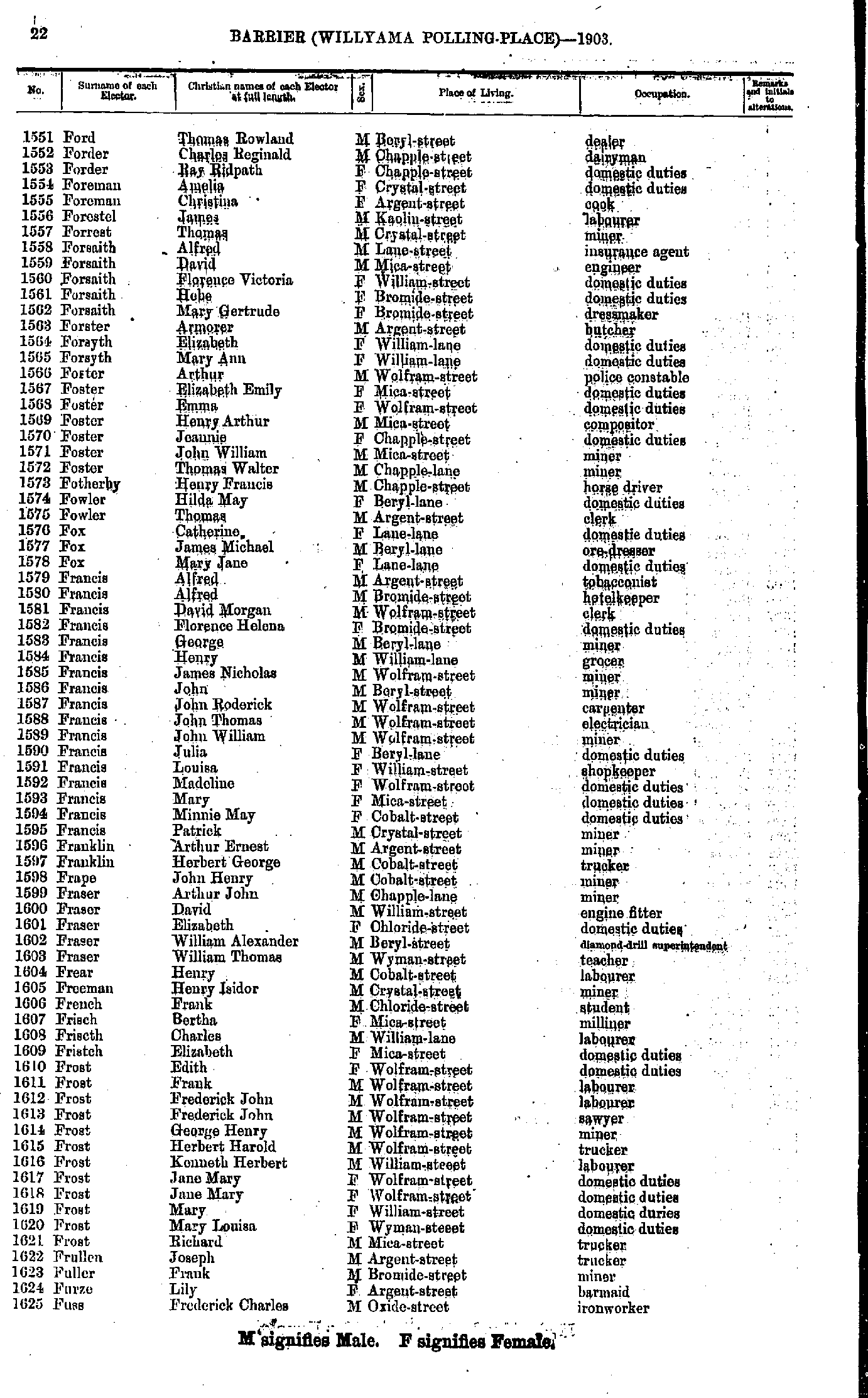
- Fidler George Henry - Ford Thomas
- Ford Thomas Rowland - Fuss Frederick Charles
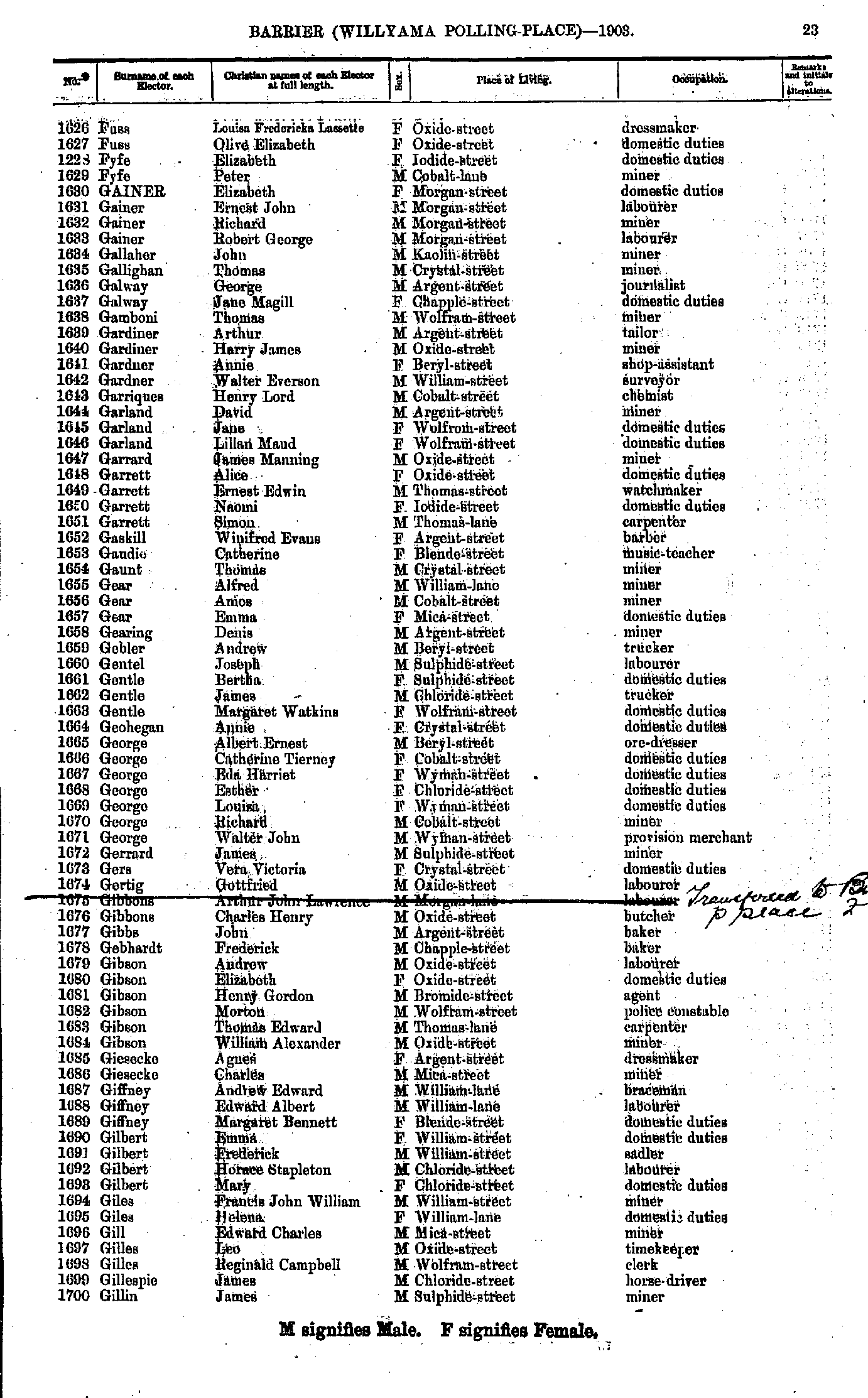
- Fuss Louisa Fredericka Lassette - Gillin James
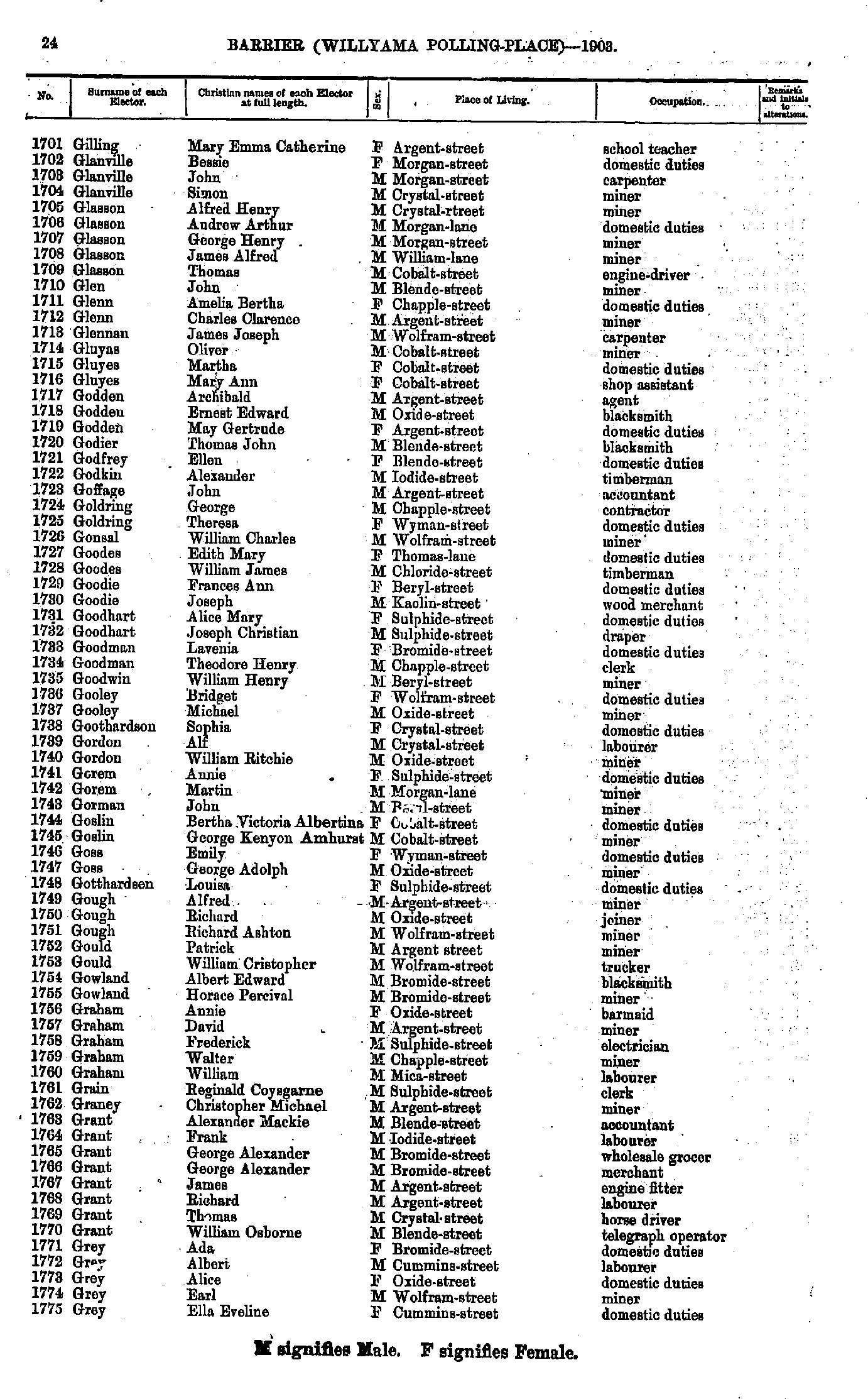
- Gilling Mary Emma Catherine - Gray Ella Eveline
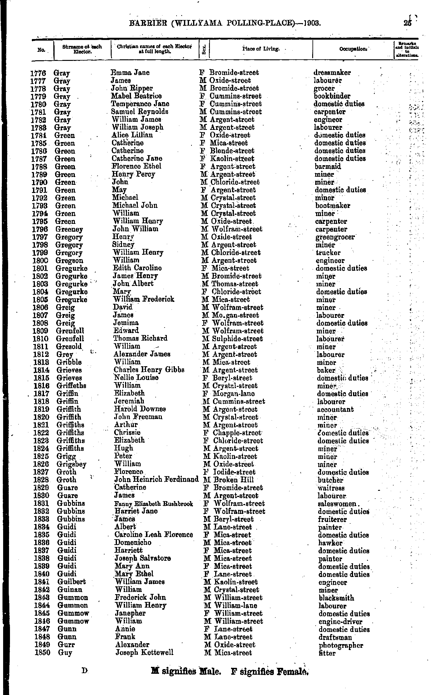
- Gray Emma Jane - Guy Joseph Kettewell
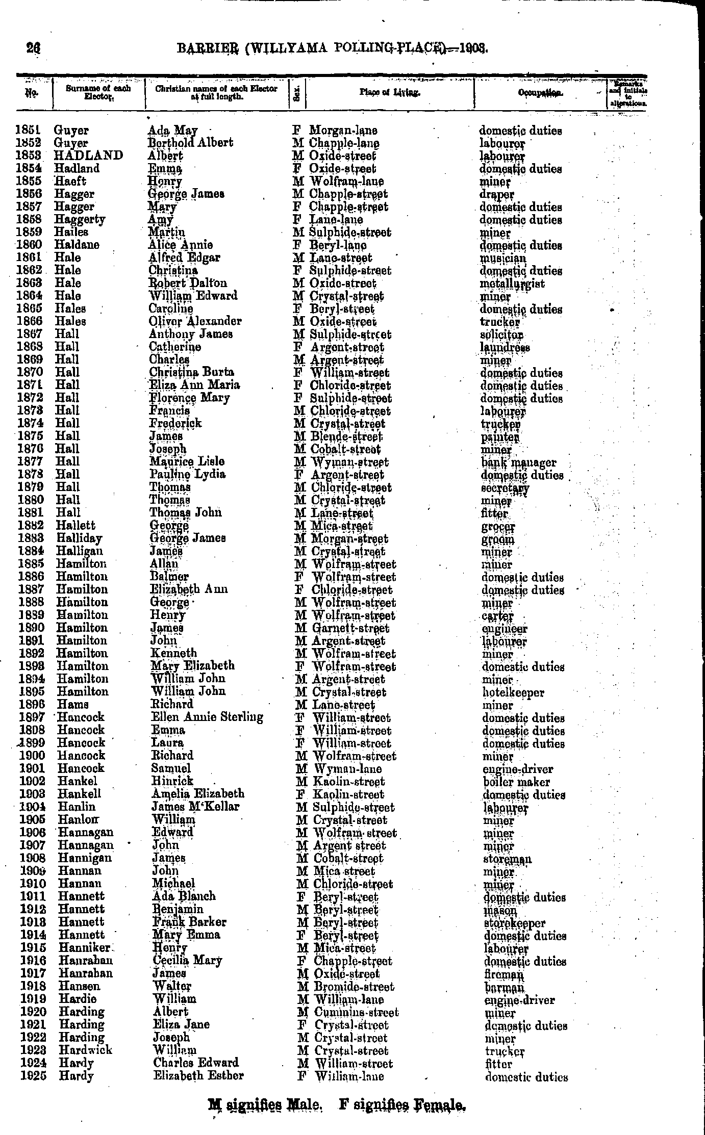
- Guyer Ada May - Hardy Elizabeth Esther
- Harford Catherine - Harvey Louisa
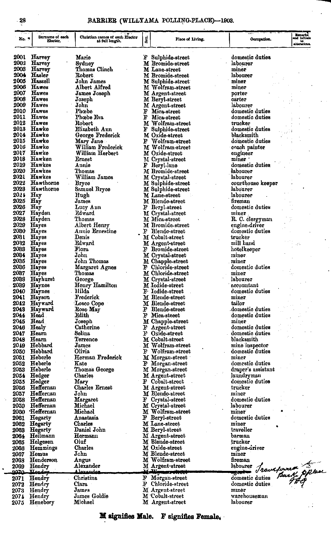
- Harvey Marie - Henebery Michael
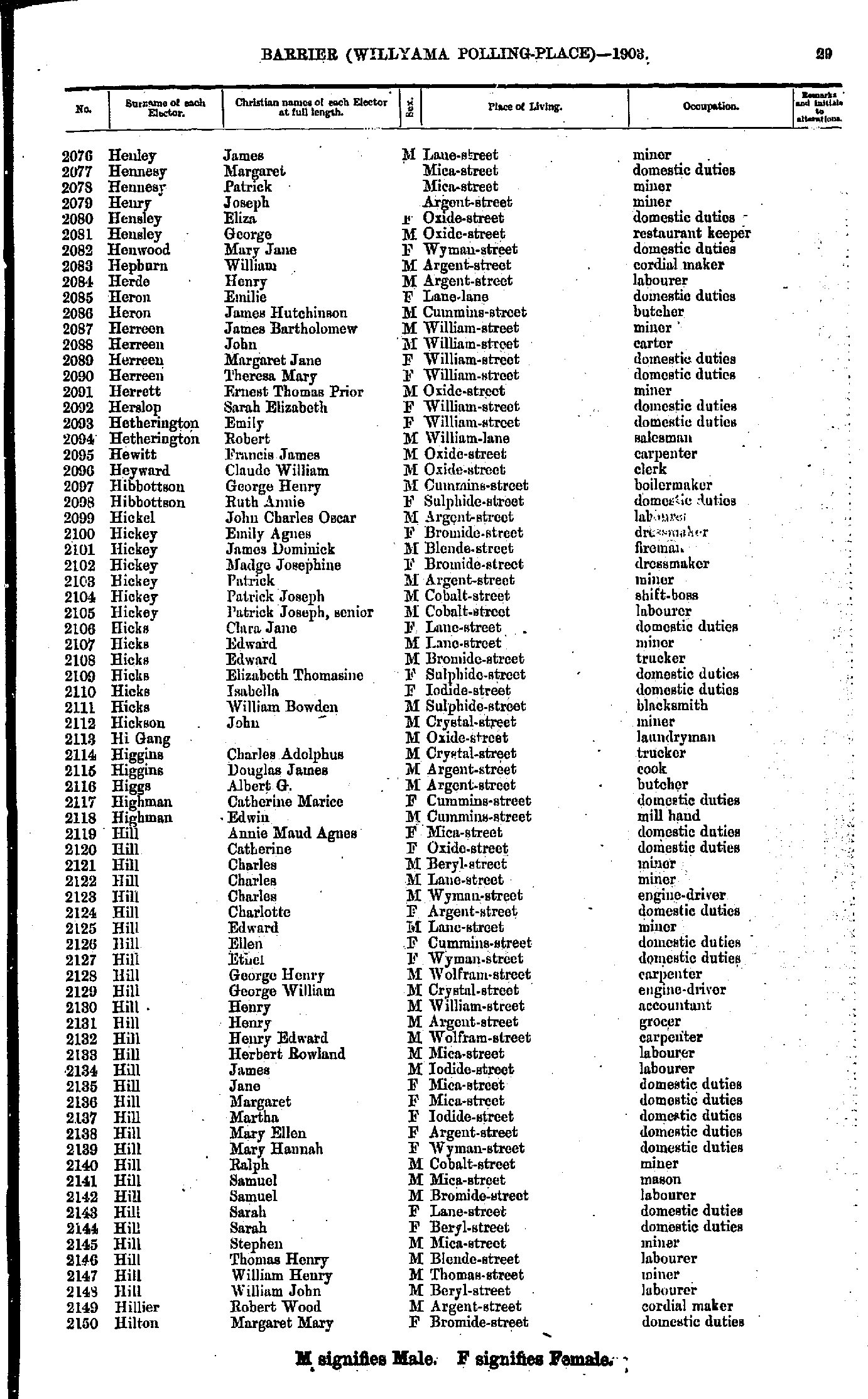
- Henley James - Hilton Margaret Mary
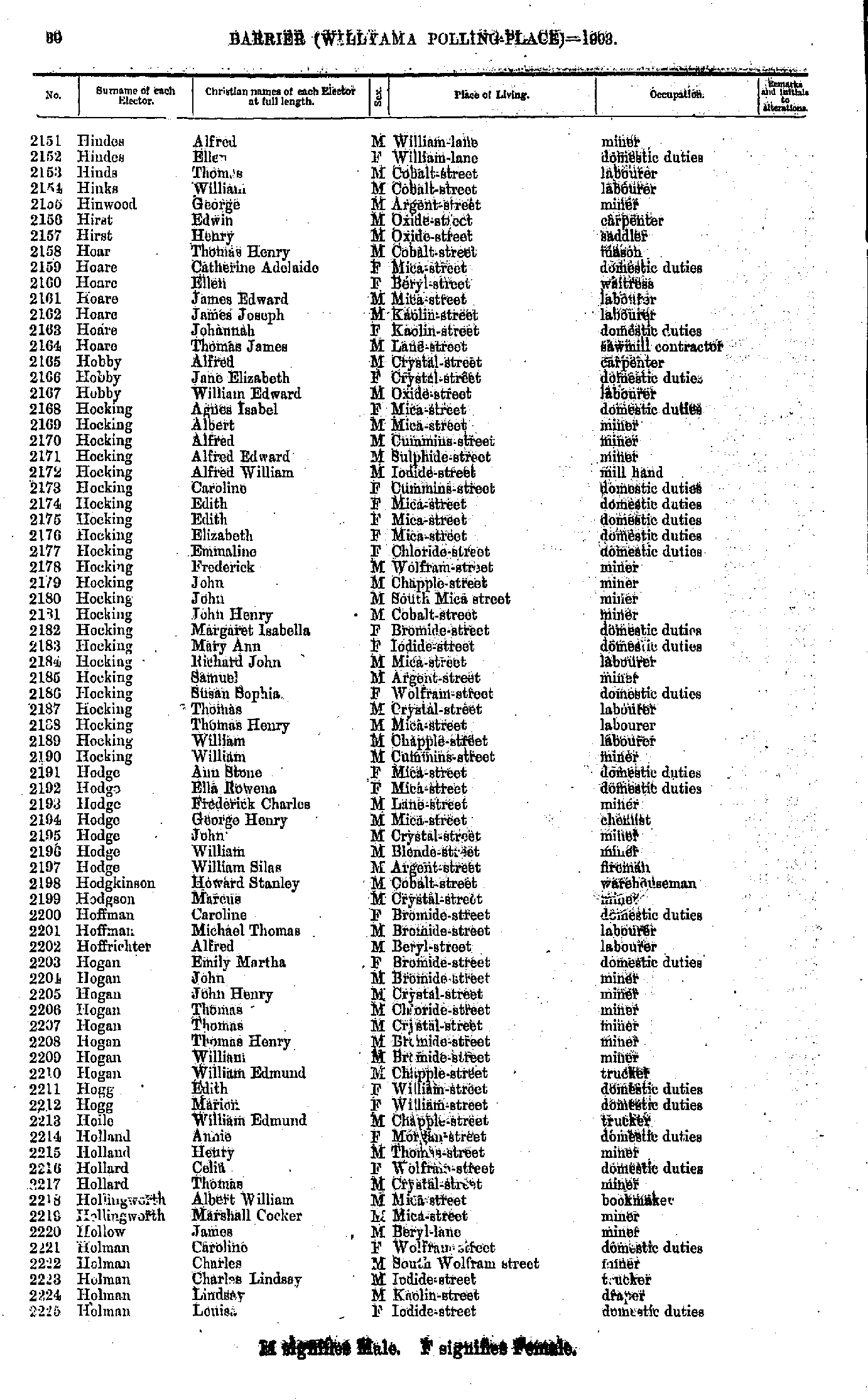
- Hindes Alfred - Holman Louisa
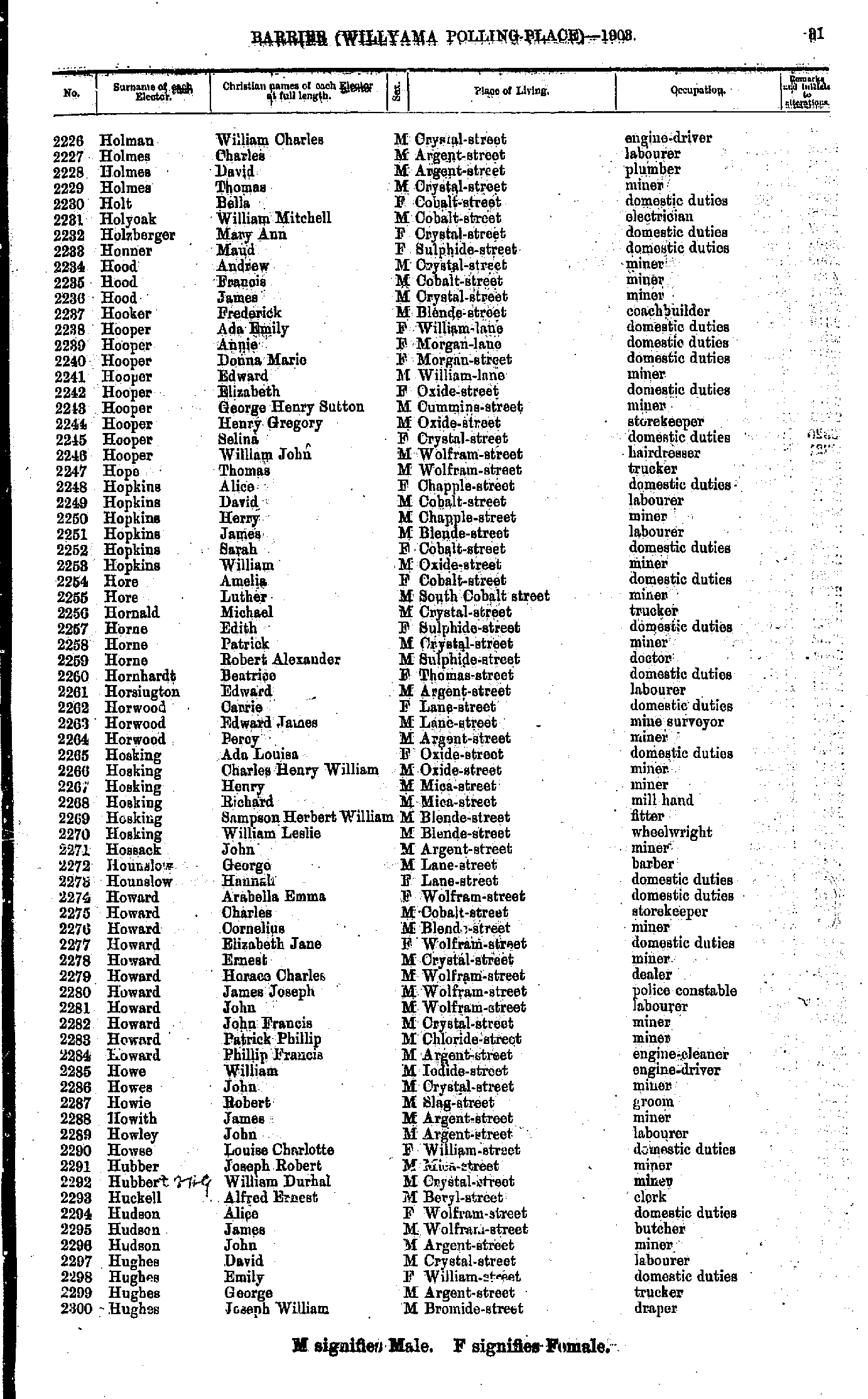
- Holman William Charles - Hughes Joseph William
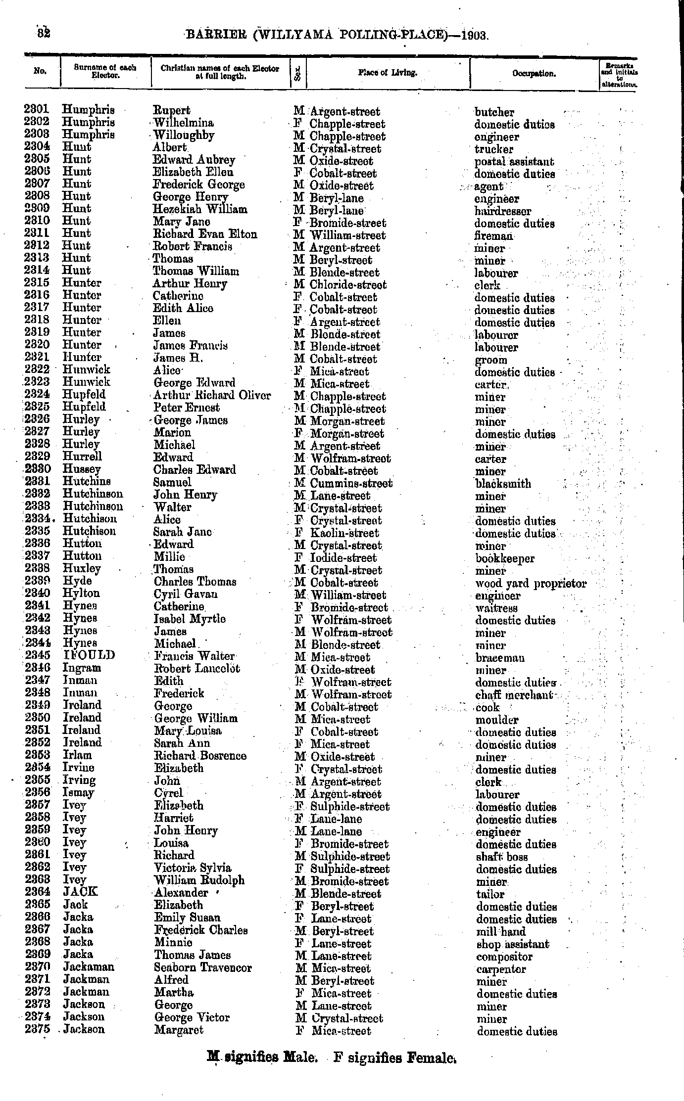
- Humphris Rupert - Jackson Margaret
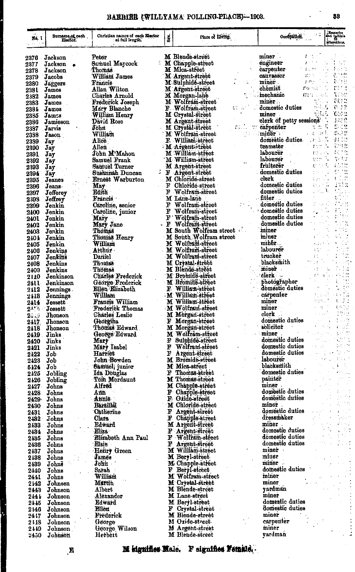
- Jackson Peter - Johnson Herbert
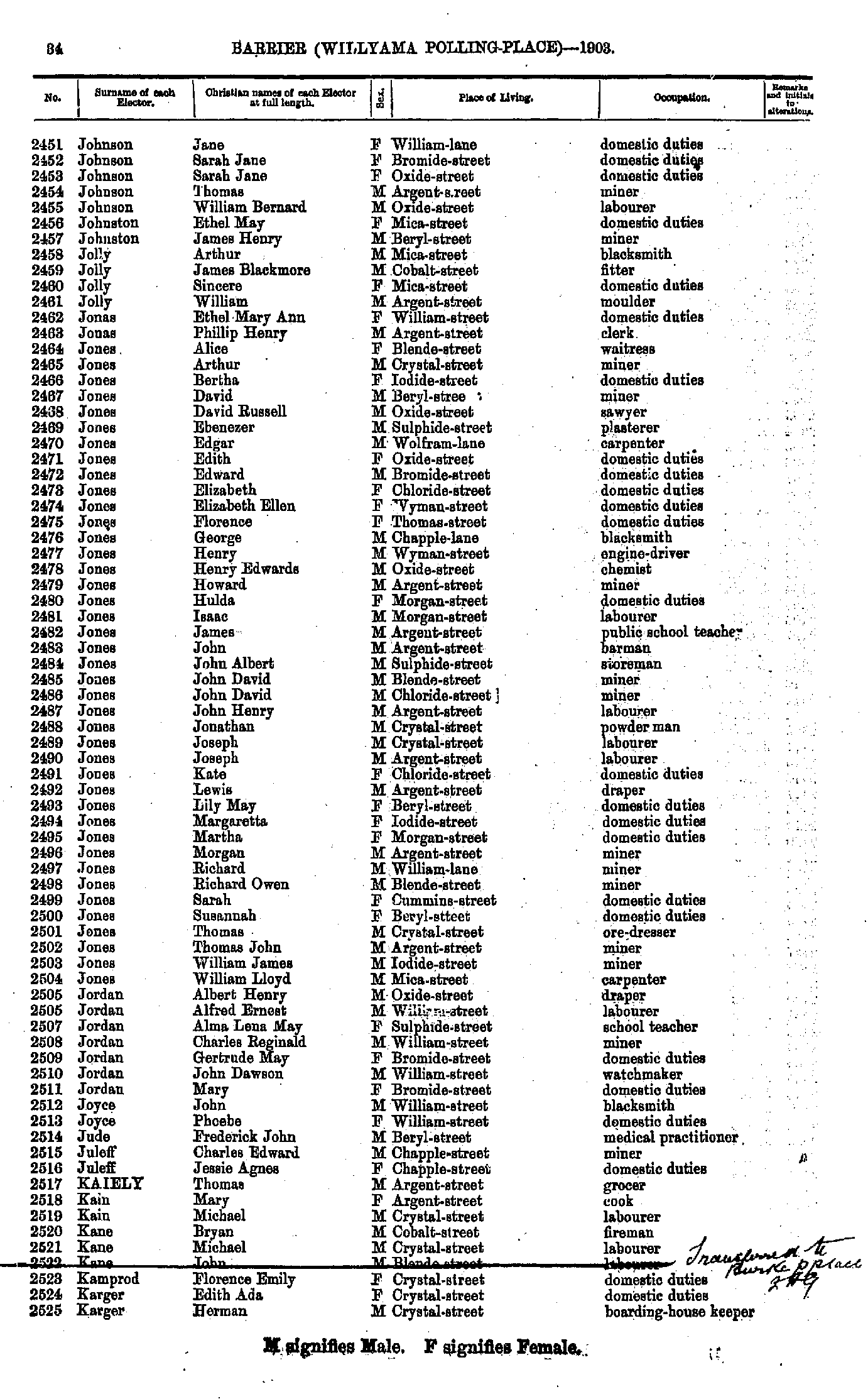
- Johnson Jane - Karger Herman
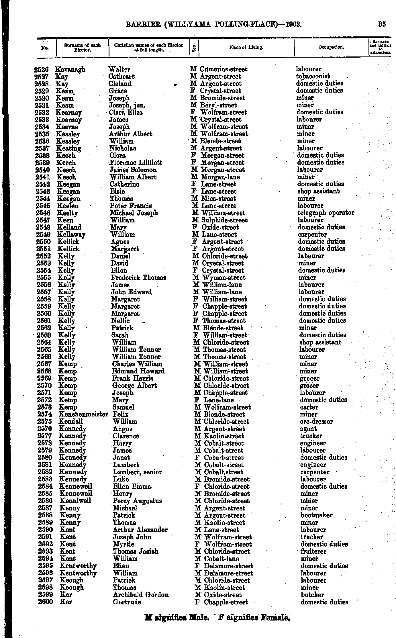
- Kavanagh Walter - Ker Gertrude
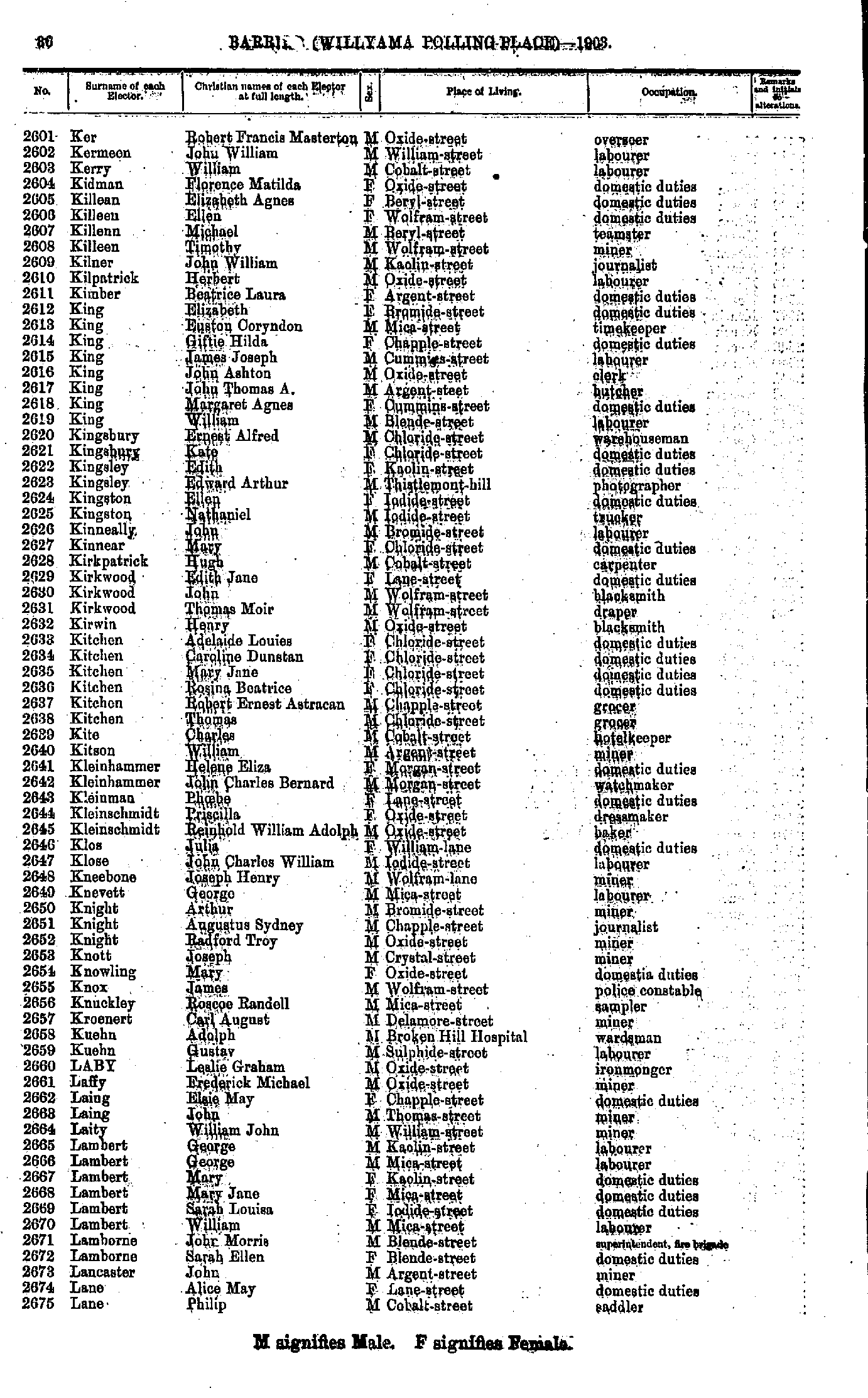
- Ker Robert Francis Masterton - Lane Philip
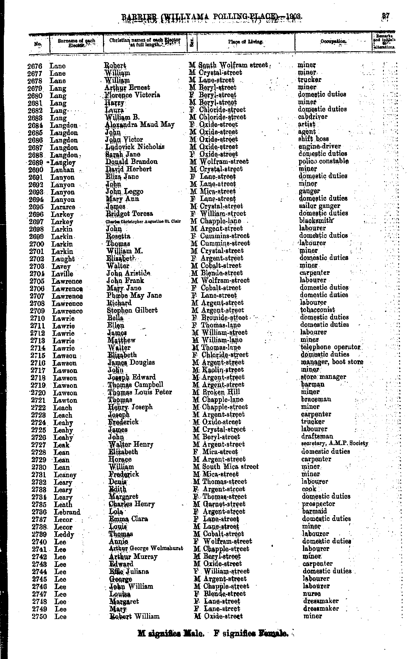
- Lane Robert - Lee Robert William
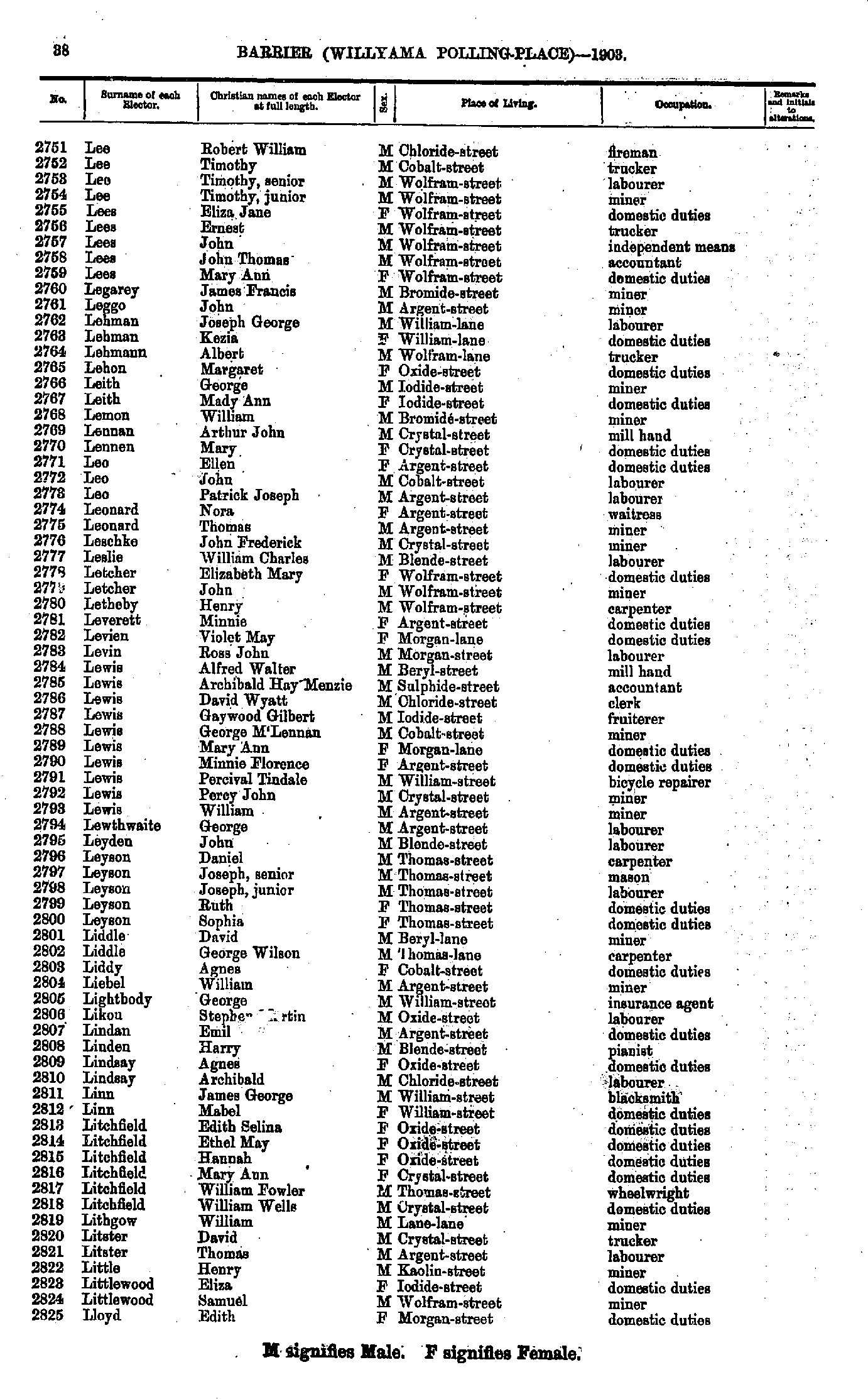
- Lee Robert William - Lloyd Elizabeth
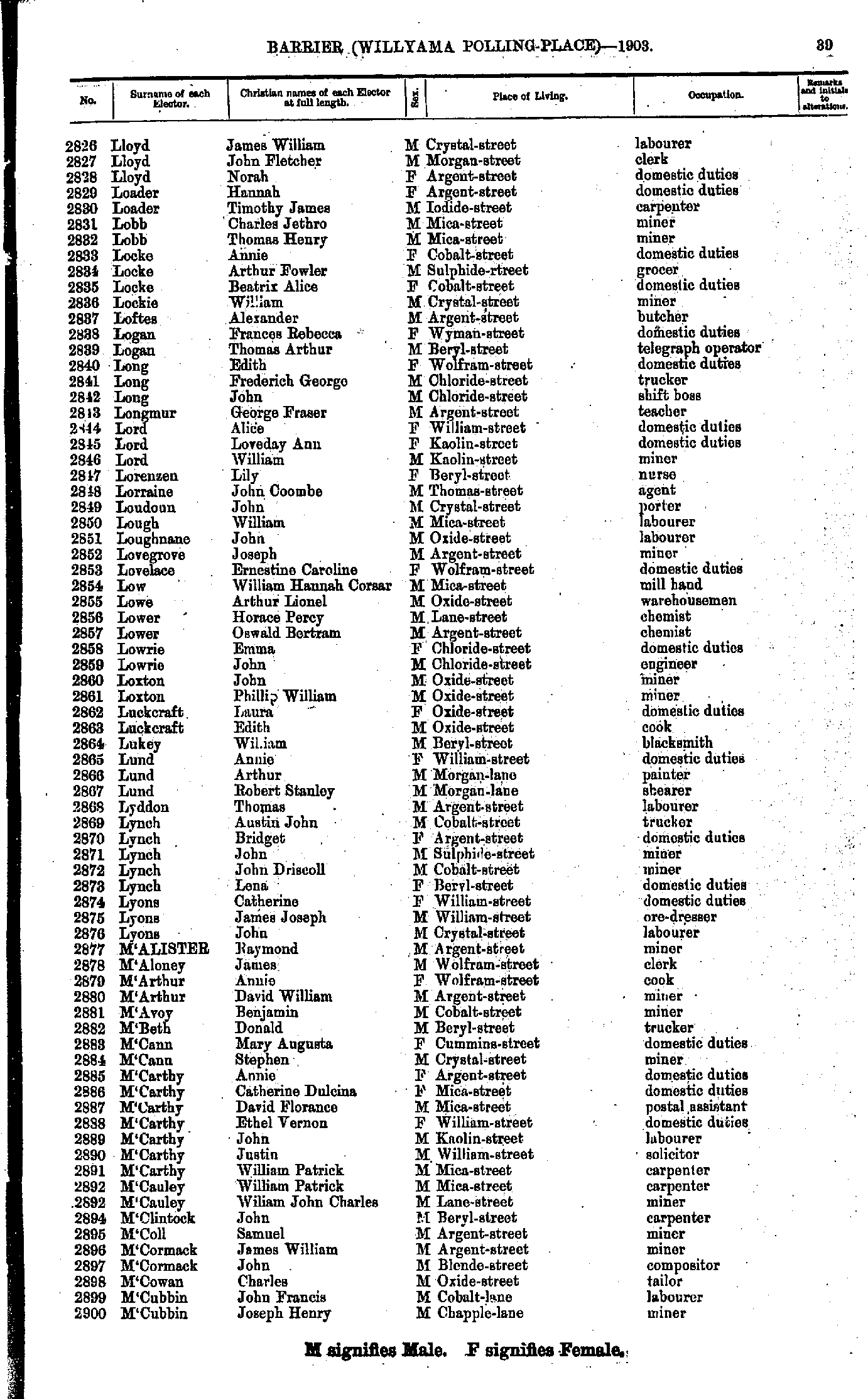
- Lloyd James William - M'Cubbin Joseph Henry
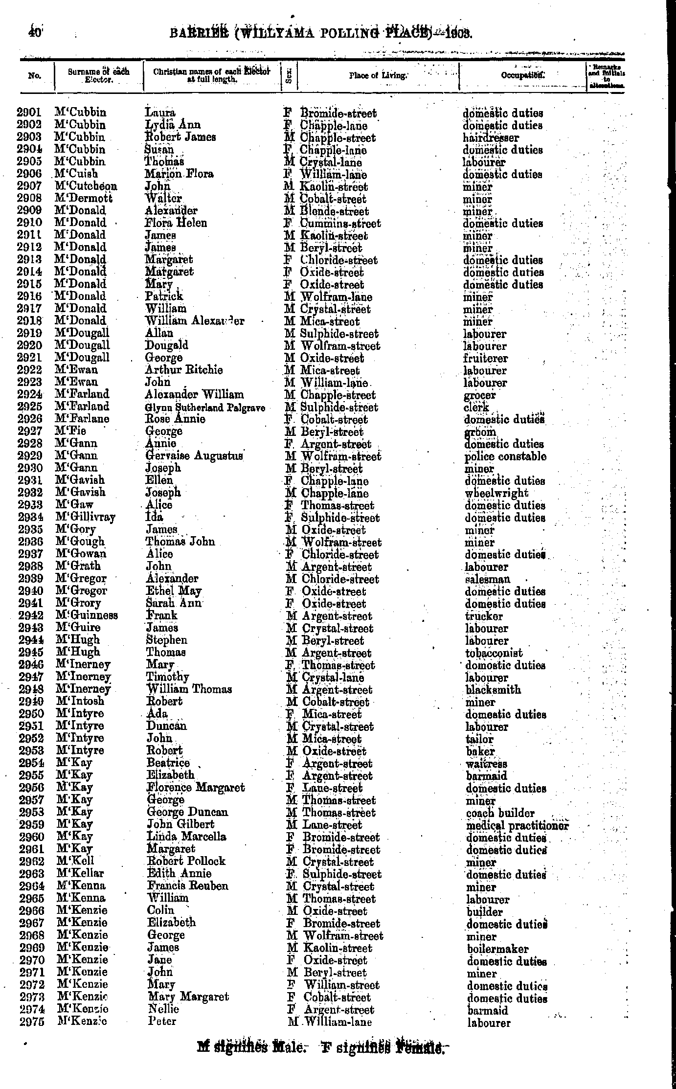
- M'Cubbin Laura - M'Kenzie Peter
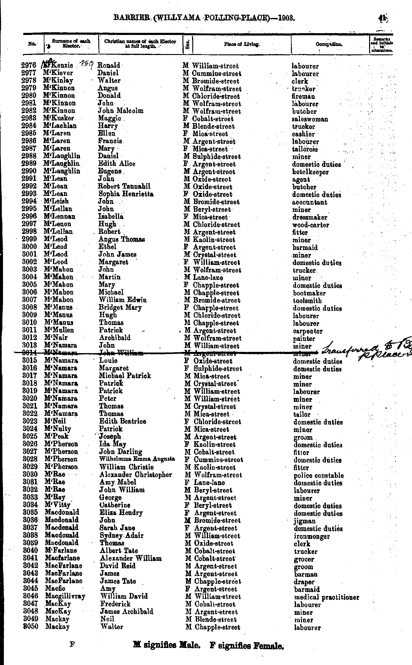
- M'Kenzie Ronald - Mackay Walter
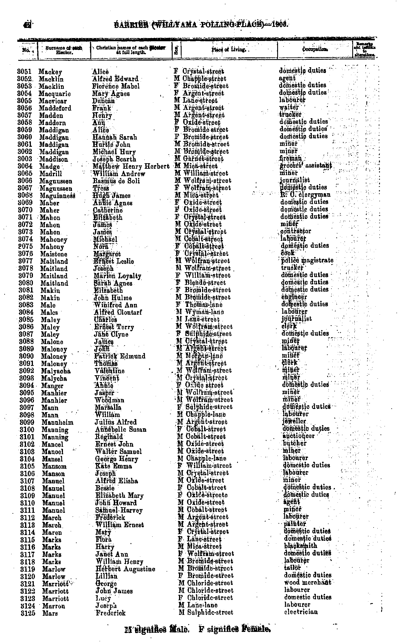
- Mackey Alice - Mars Frederick
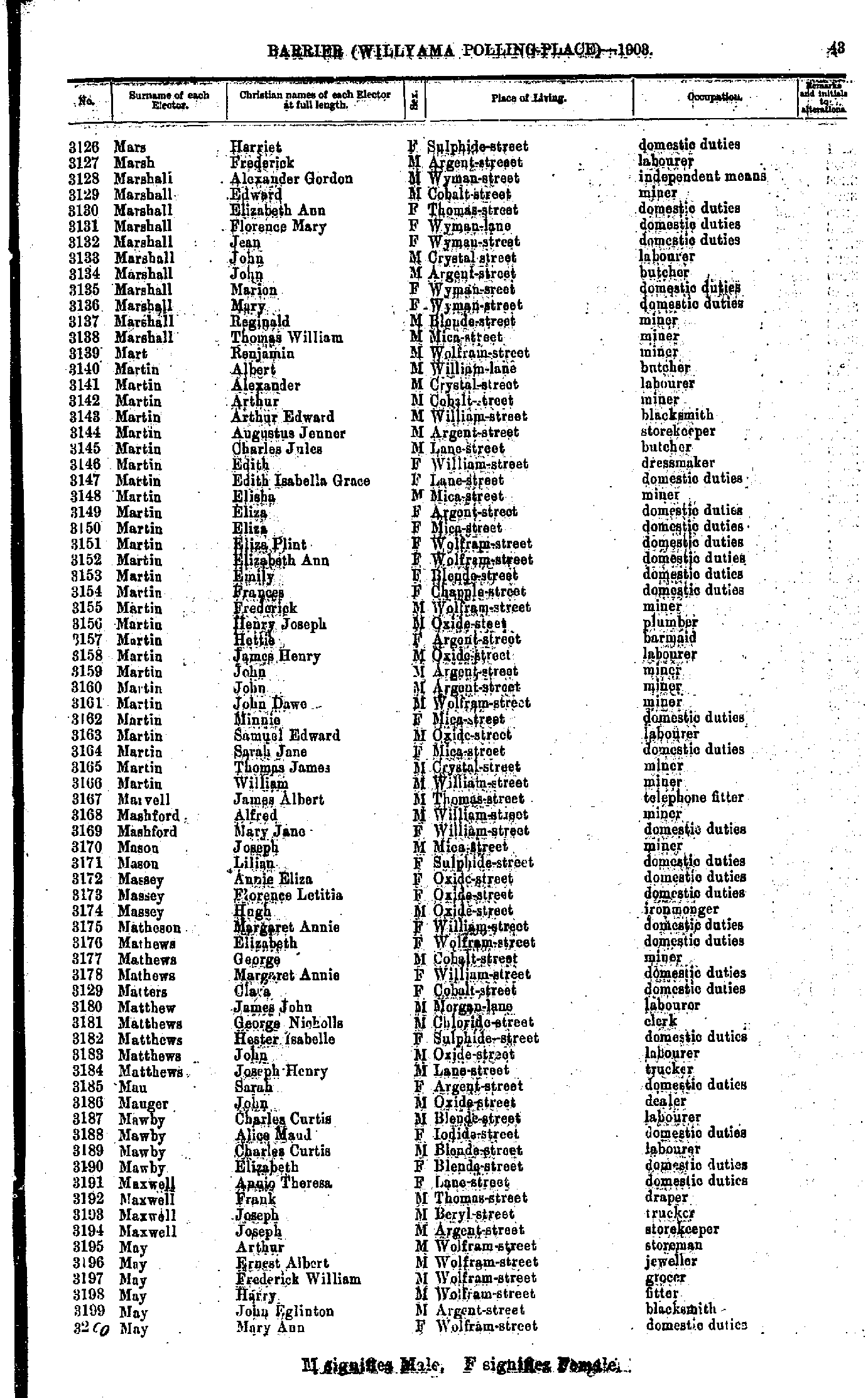
- Mars Harriet - May Mary Ann
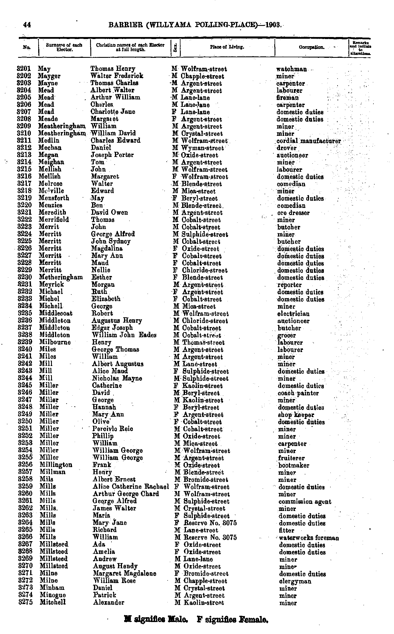
- May Thomas Henry - Mitchell Alexander
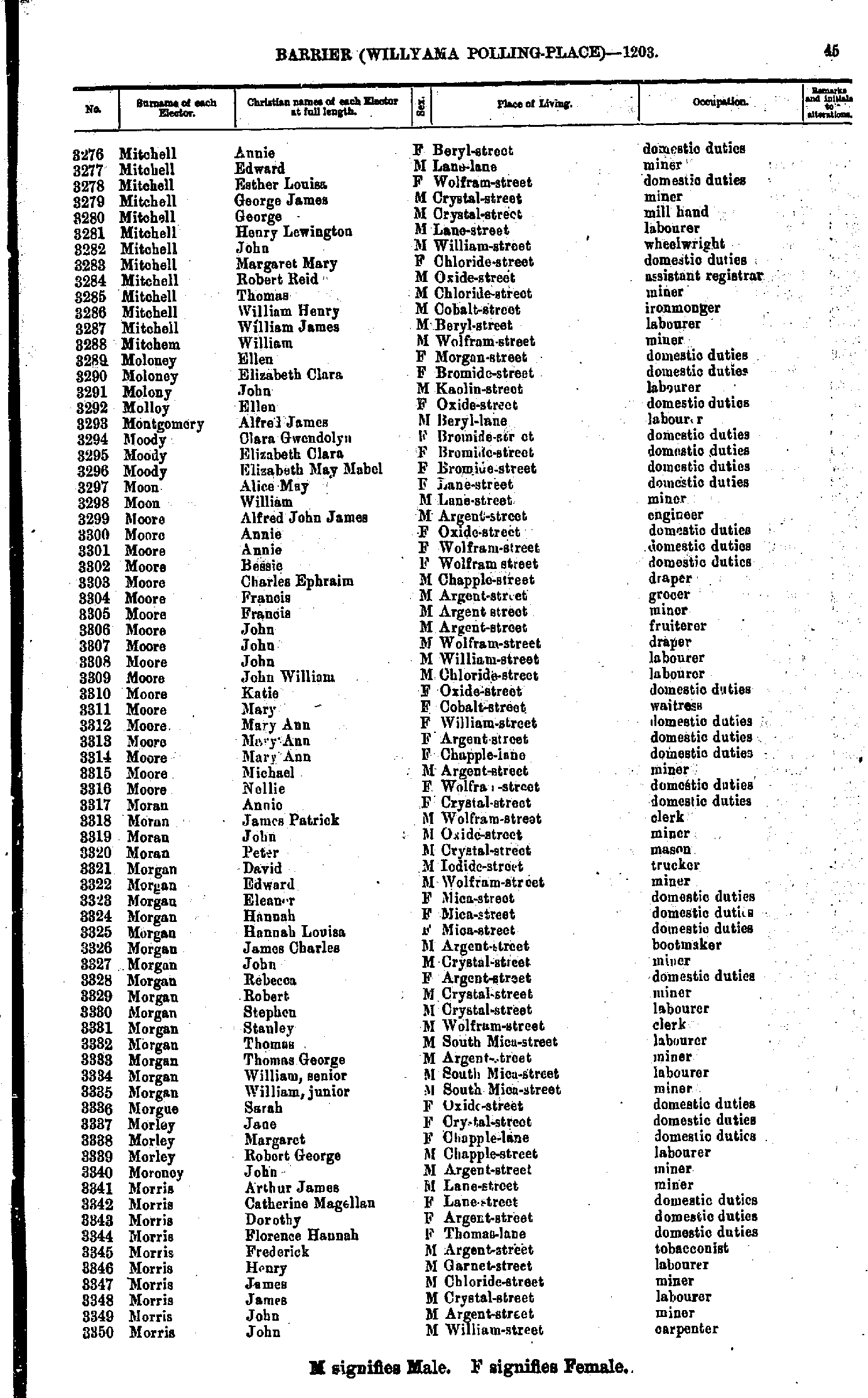
- Mitchell Annie - Morris John
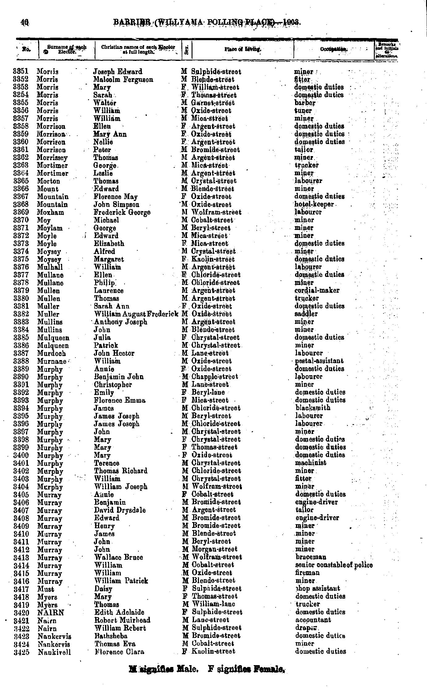
- Morris Joseph Edward - Nankivell Florence Clara
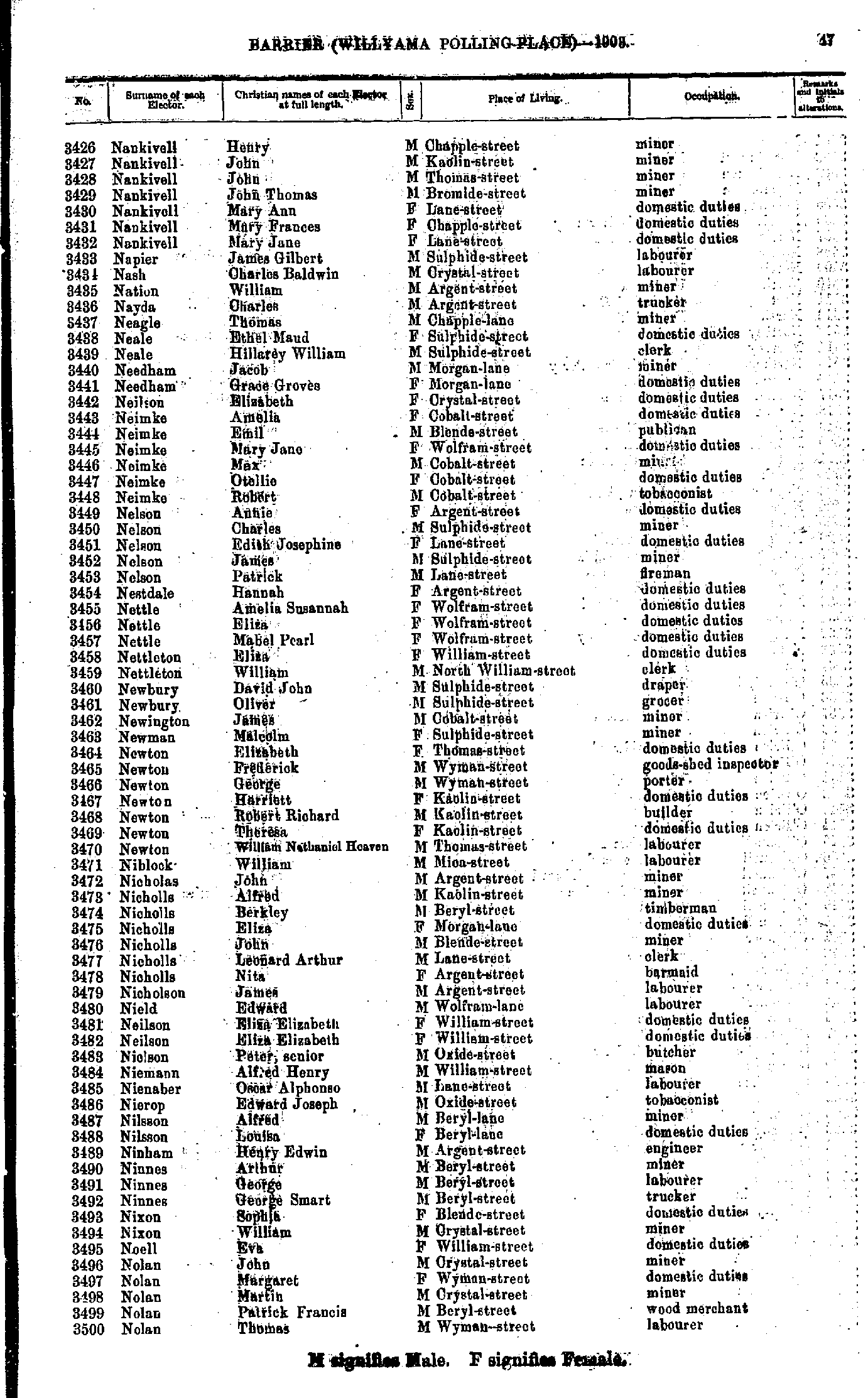
- Nankivell Henry - Nolan Thomas
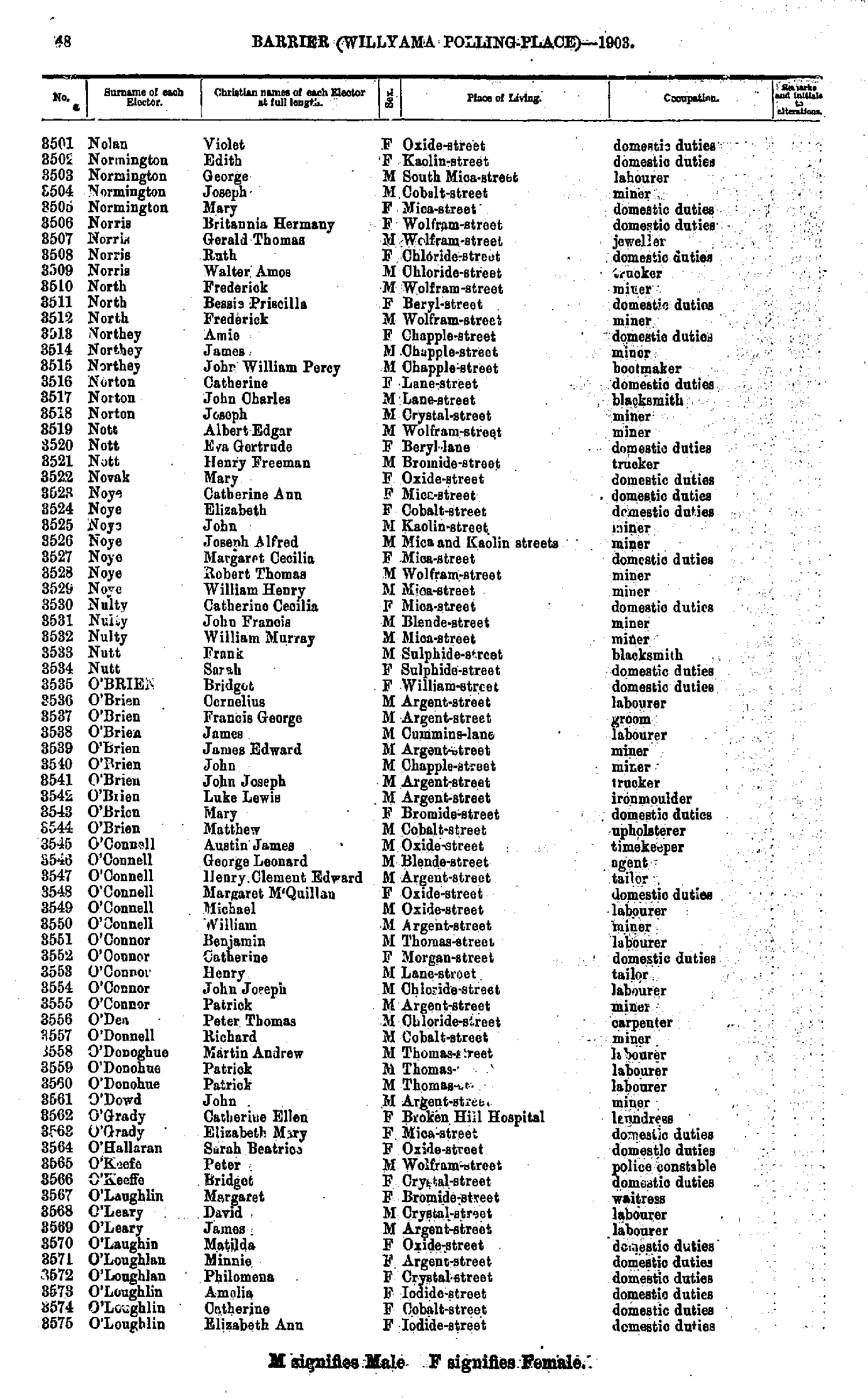
- Nolan Violet - O'Loughlin Elizabeth Ann
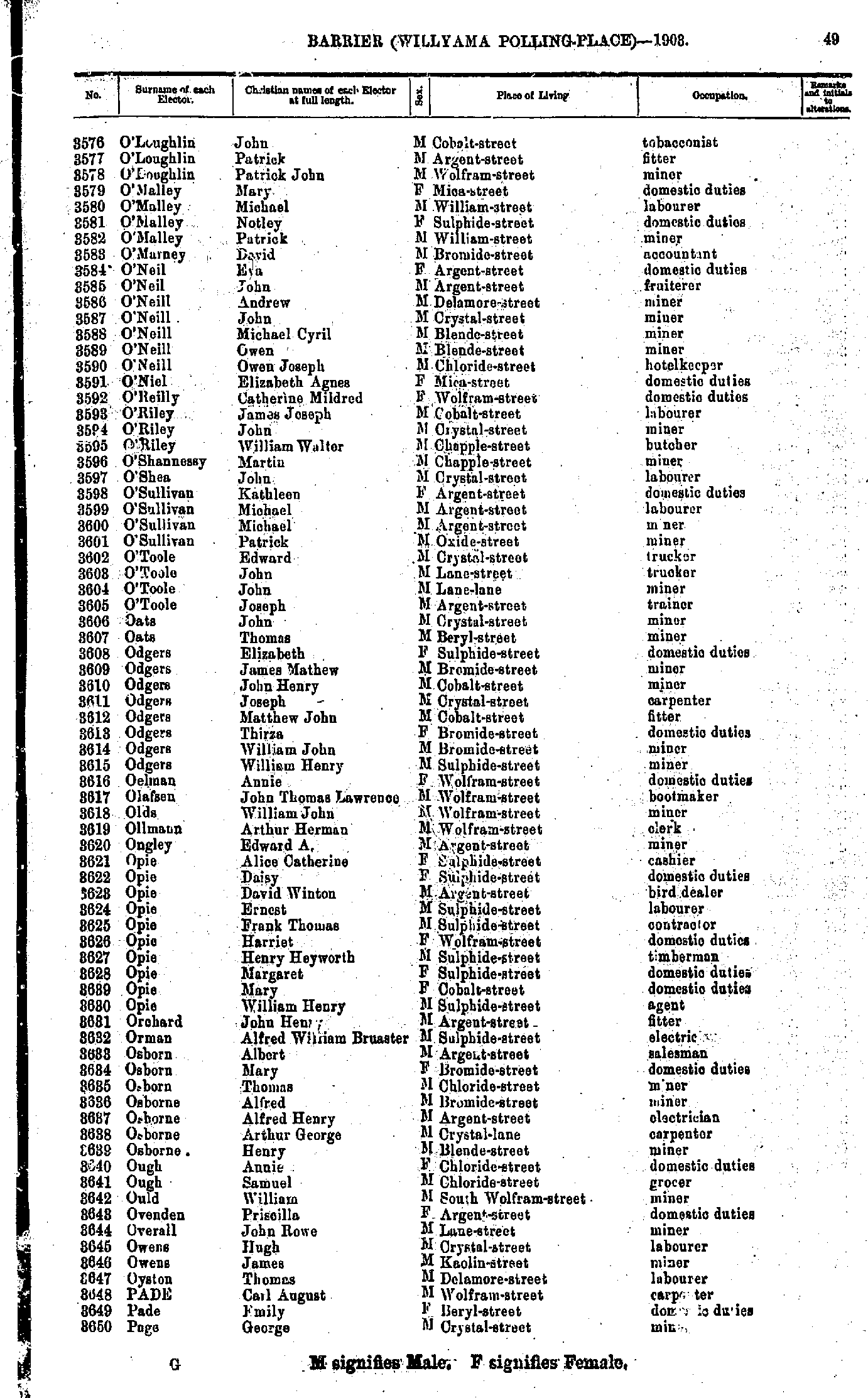
- O'Loughlin John - Page George
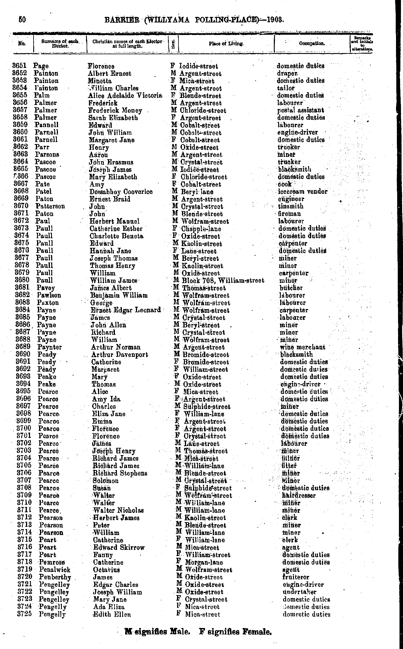
- Page Florence - Pengelly Edith Ellen
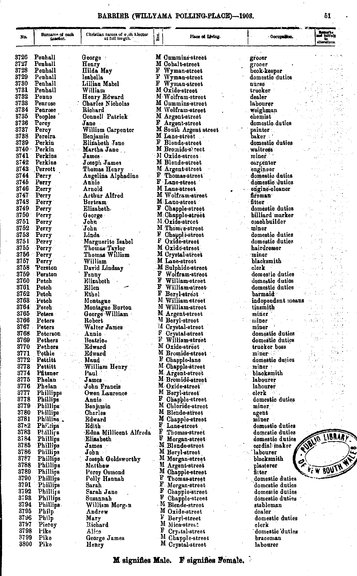
- Penhall George - Pike Henry
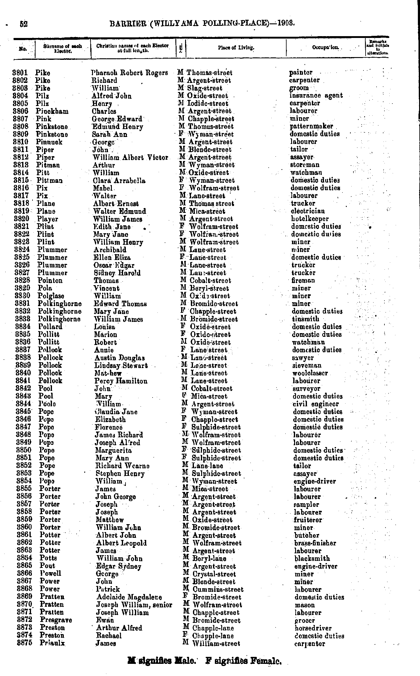
- Pike Pharaoh Robert Rogers - Priaulx James
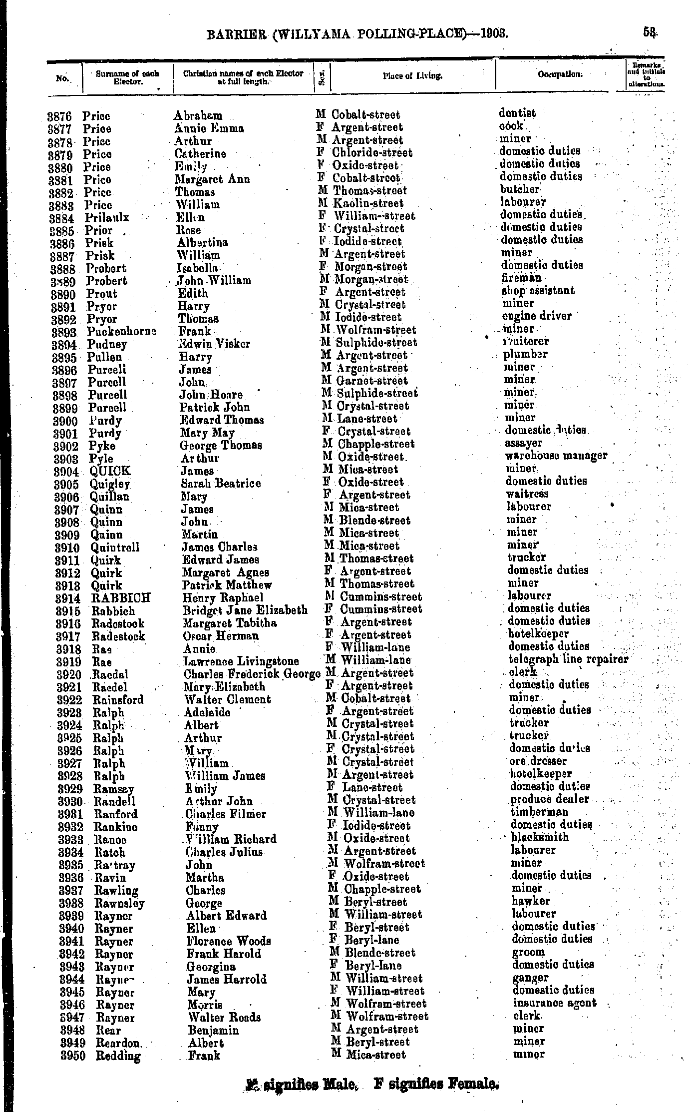
- Price Abraham - Redding Frank
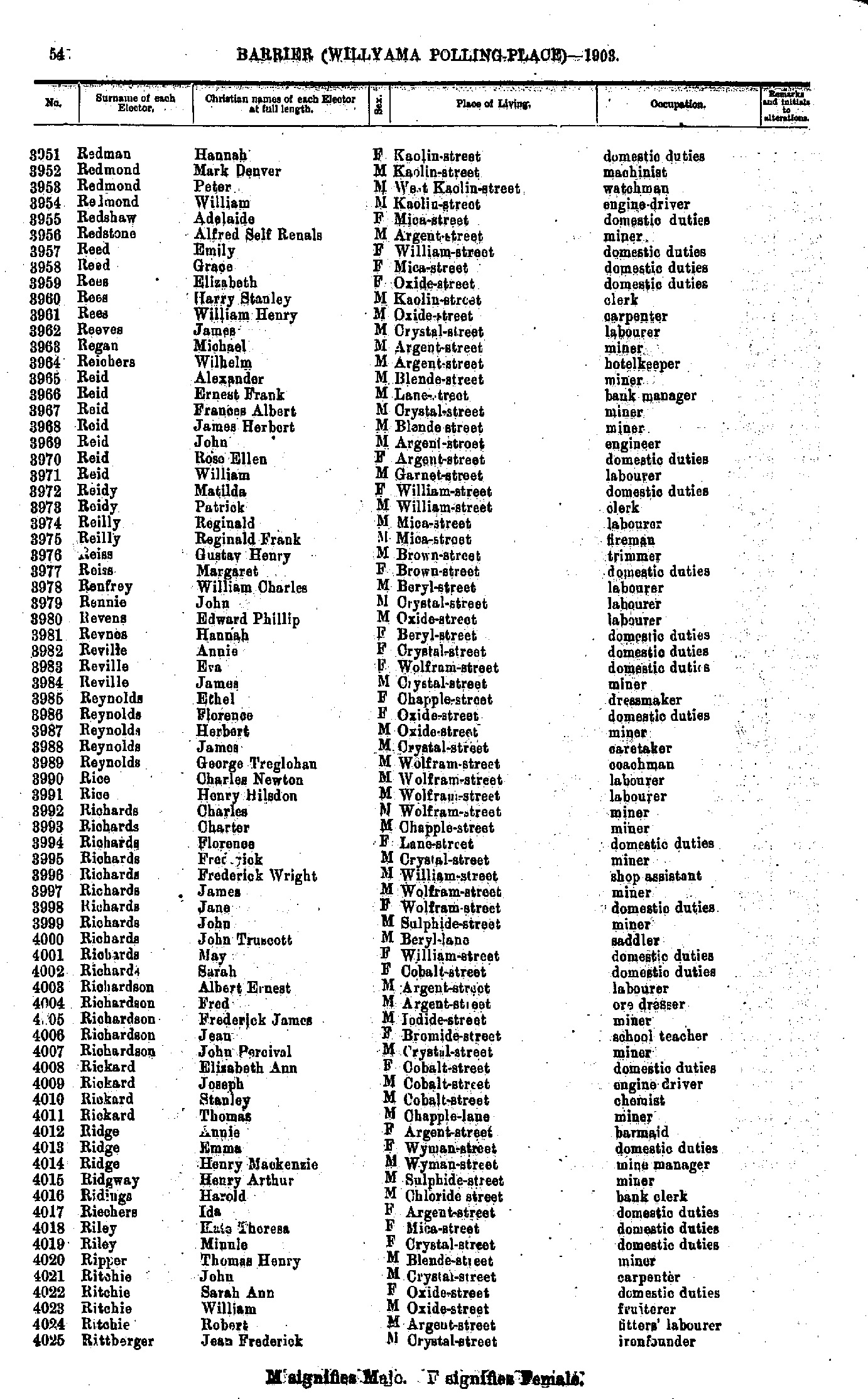
- Redman Hannah - Rittberger Jean Frederick
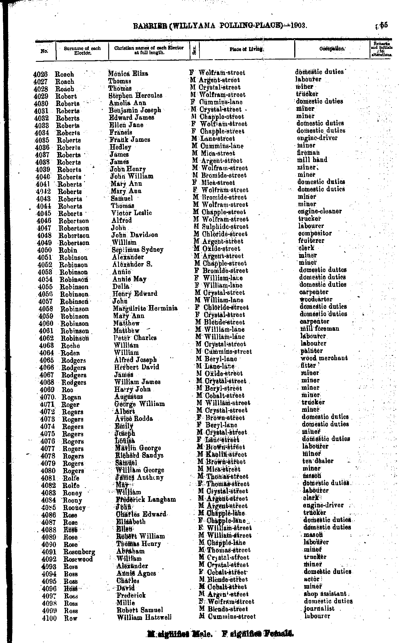
- Roach Monica Eliza - Row William Hatswell
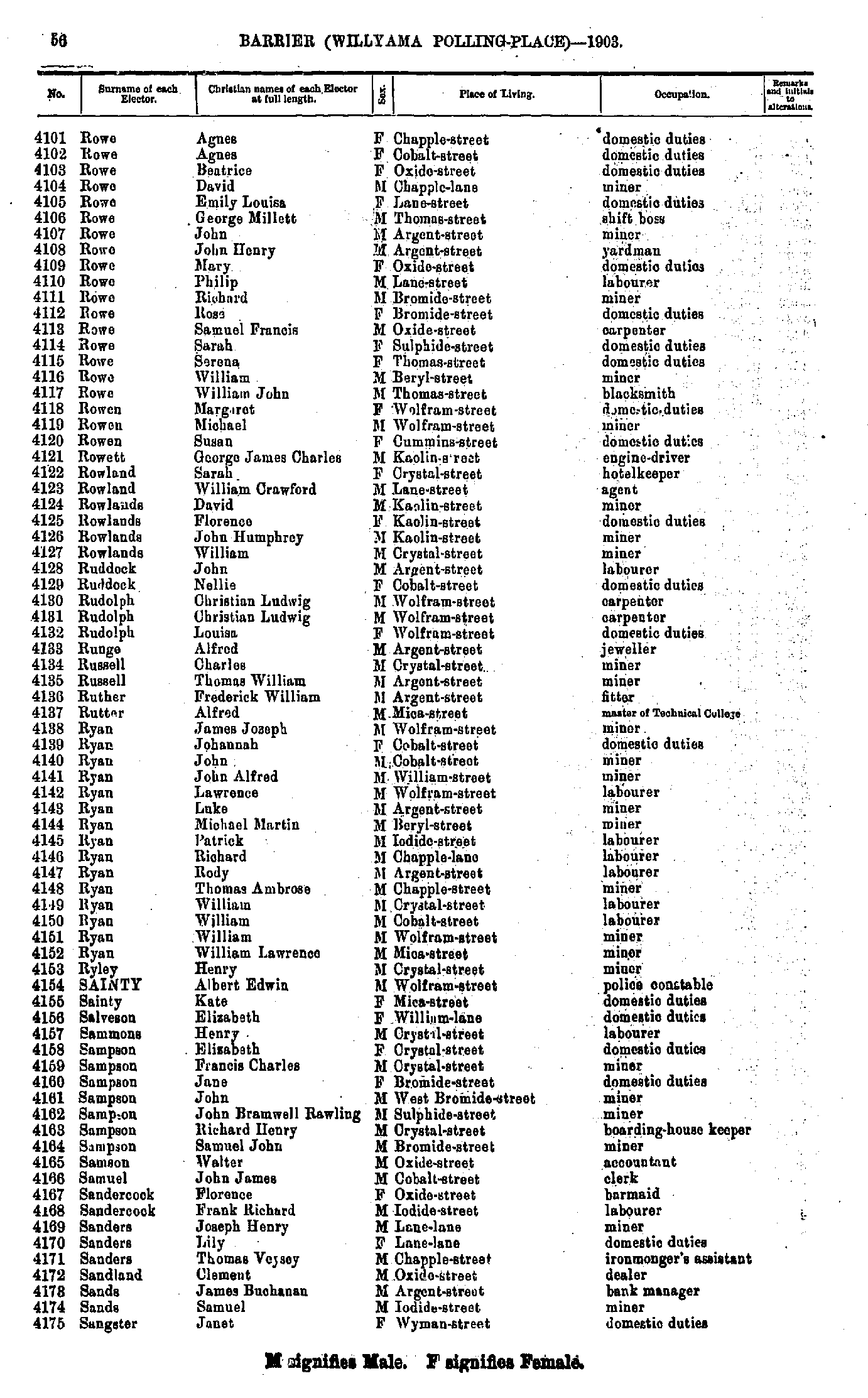
- Rowe Agnes - Sangster Janet
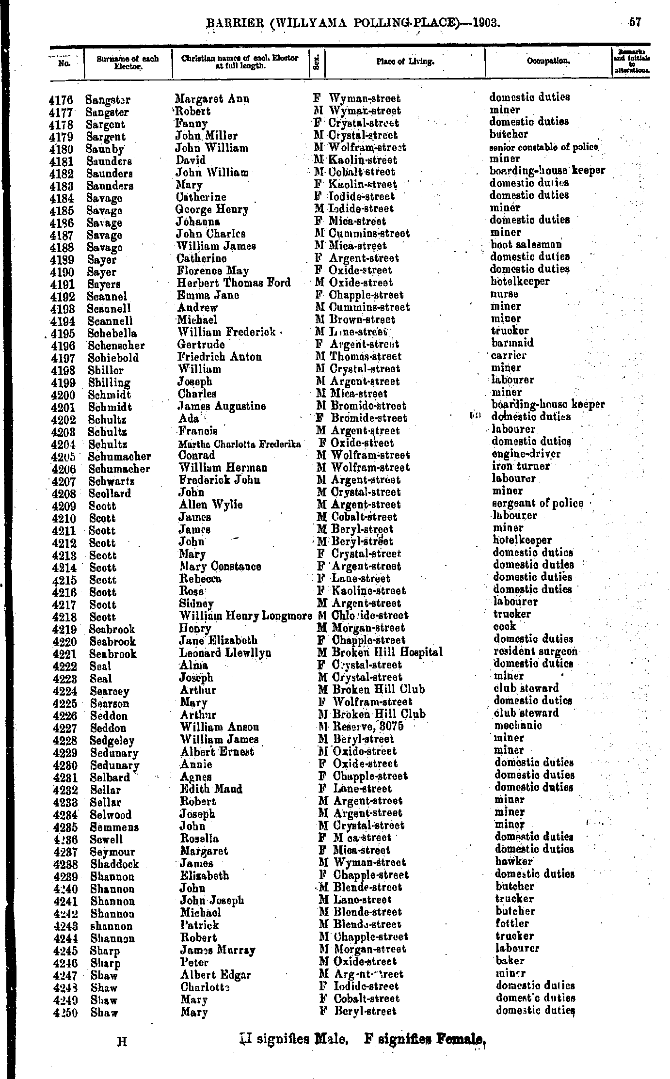
- Sangster Margaret Ann - Shaw Mary
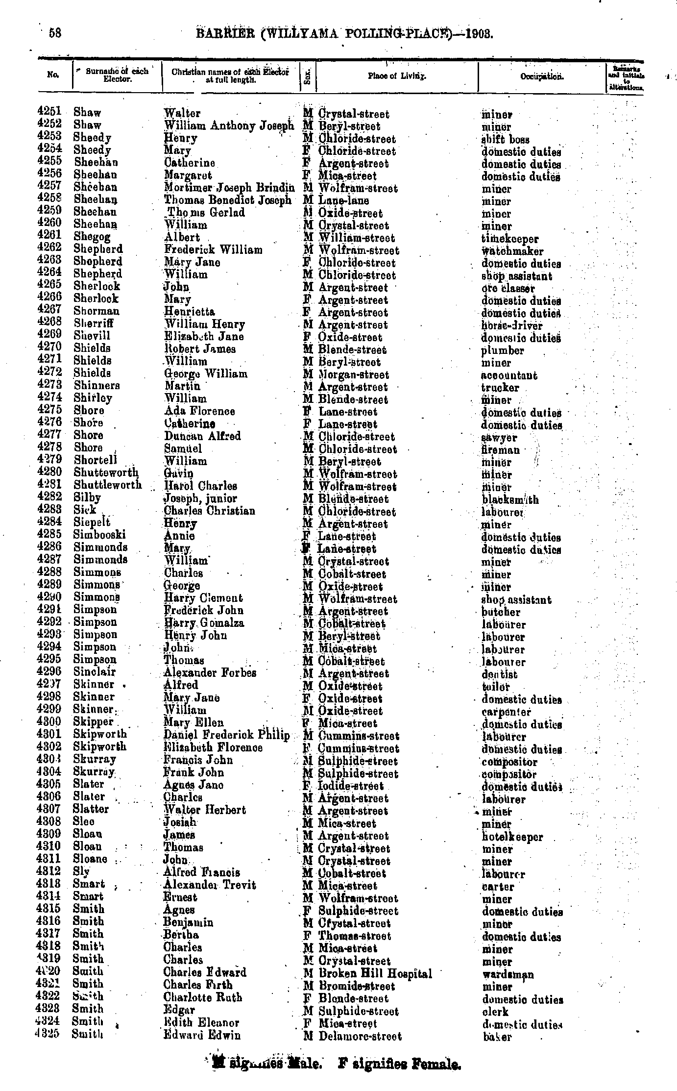
- Shaw Walter - Smith Edward Edwin
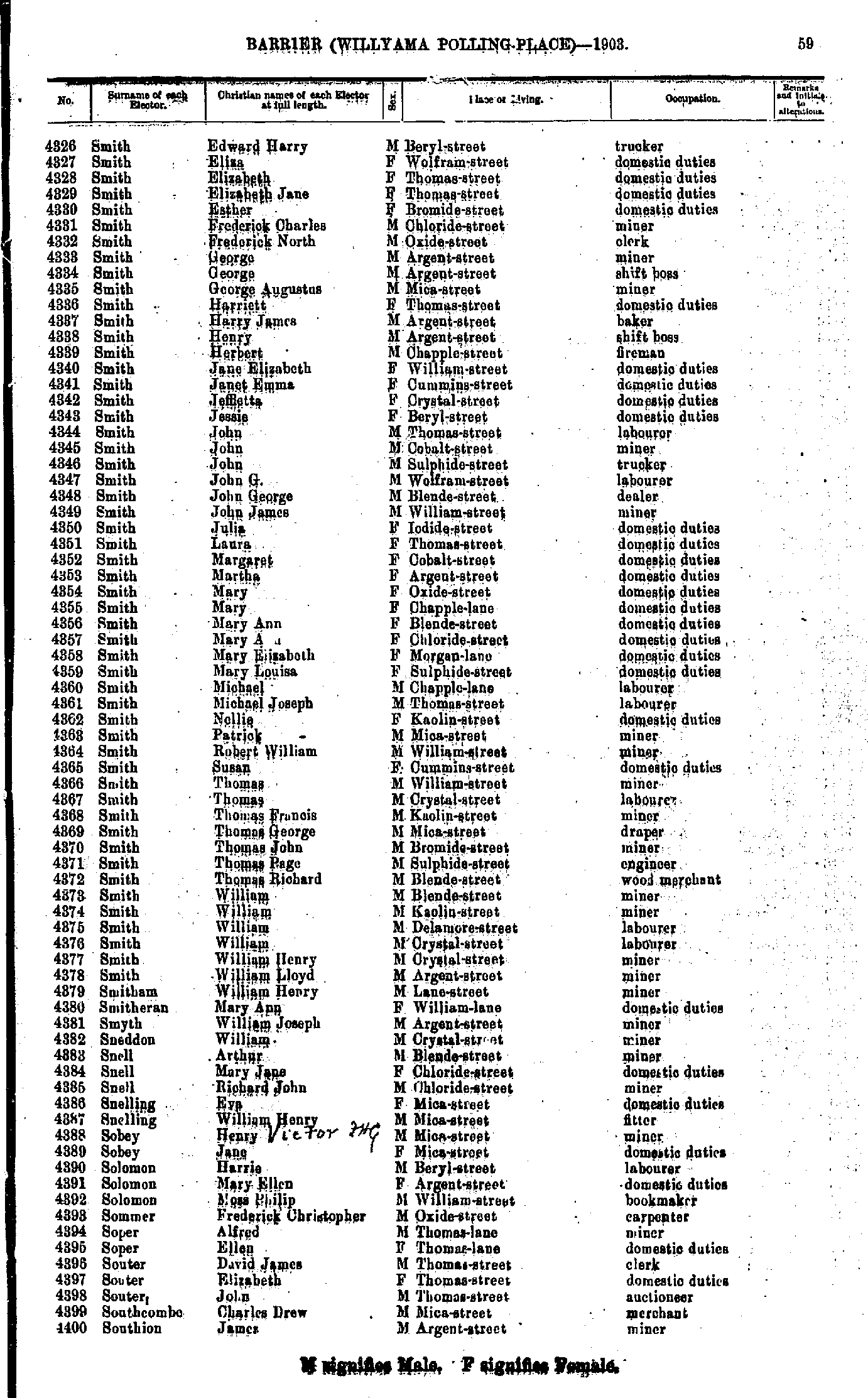
- Smith Edward Harry - Southion James
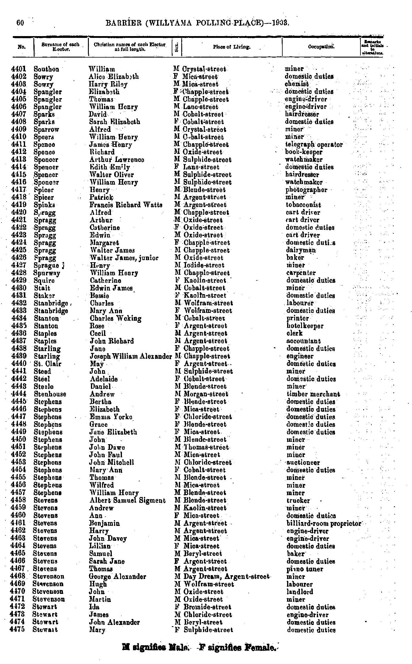
- Southon William - Stewart Mary
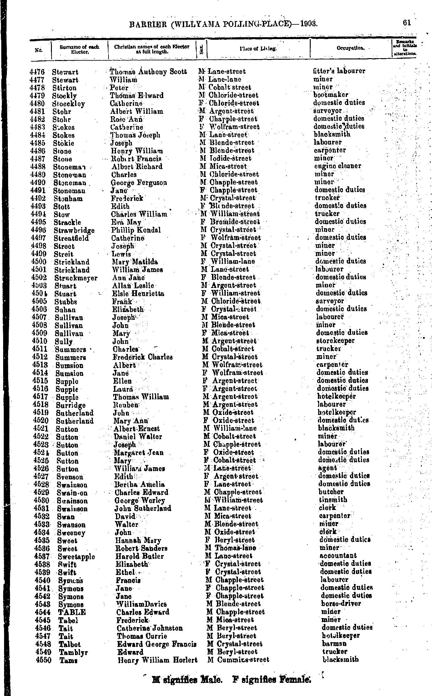
- Stewart Thomas Anthony Scott - Tams Henry William Horlert
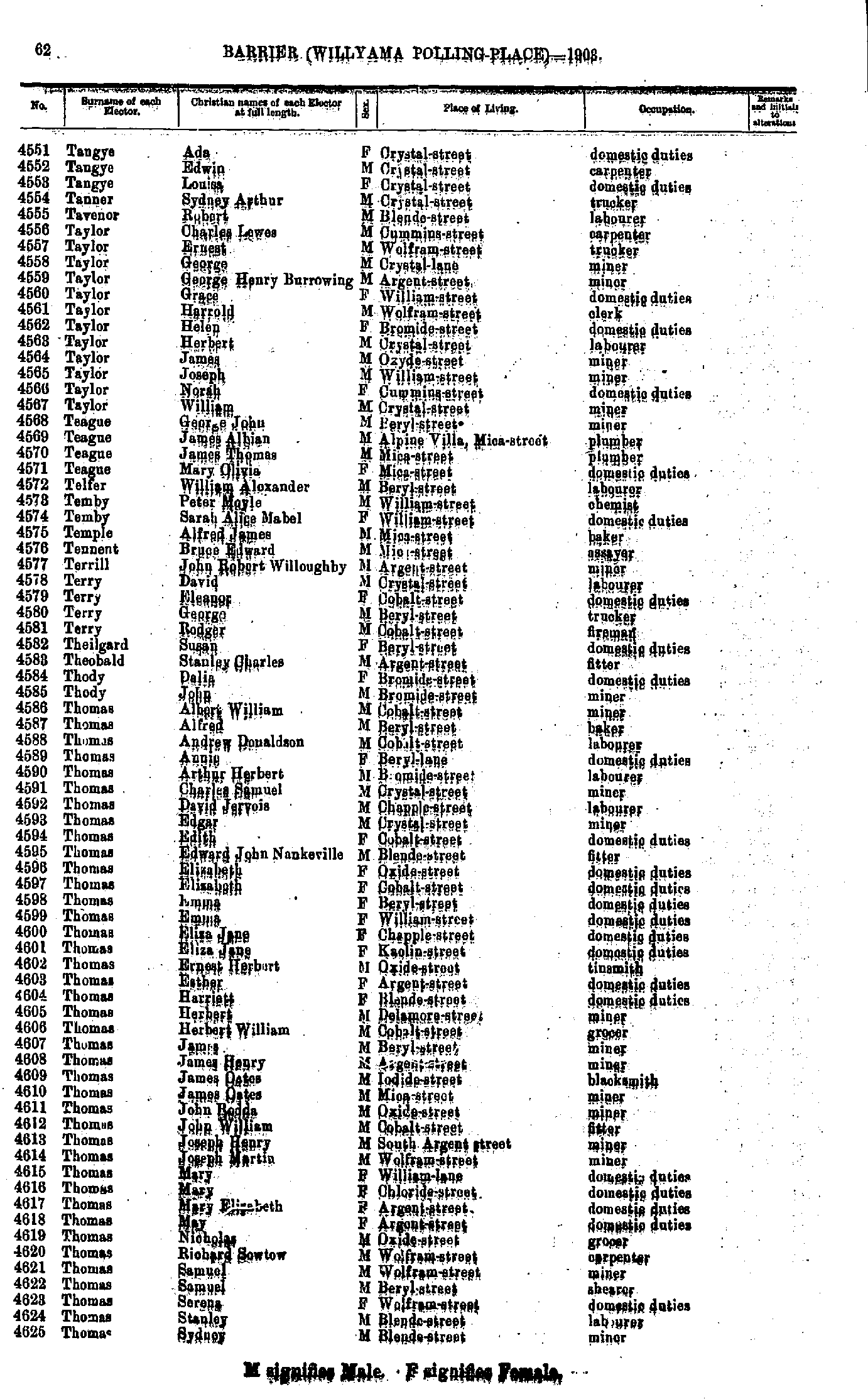
- Tangye Ada - Thomas Sydney
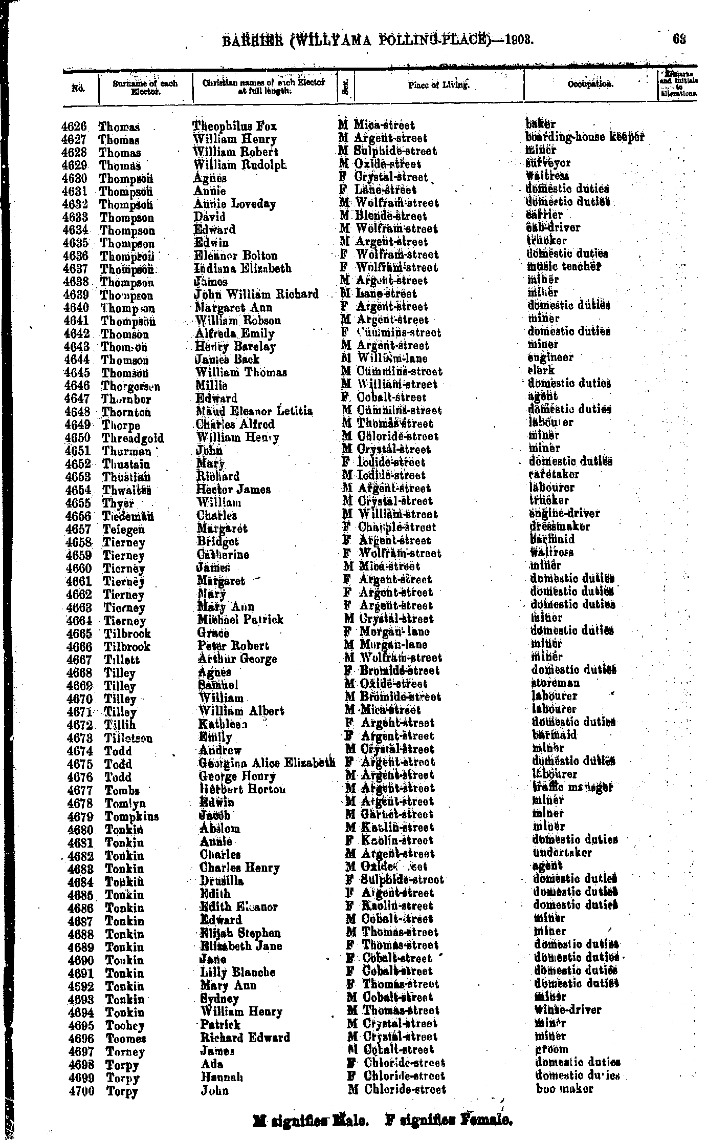
- Thomas Theophilus Fox - Torpy John
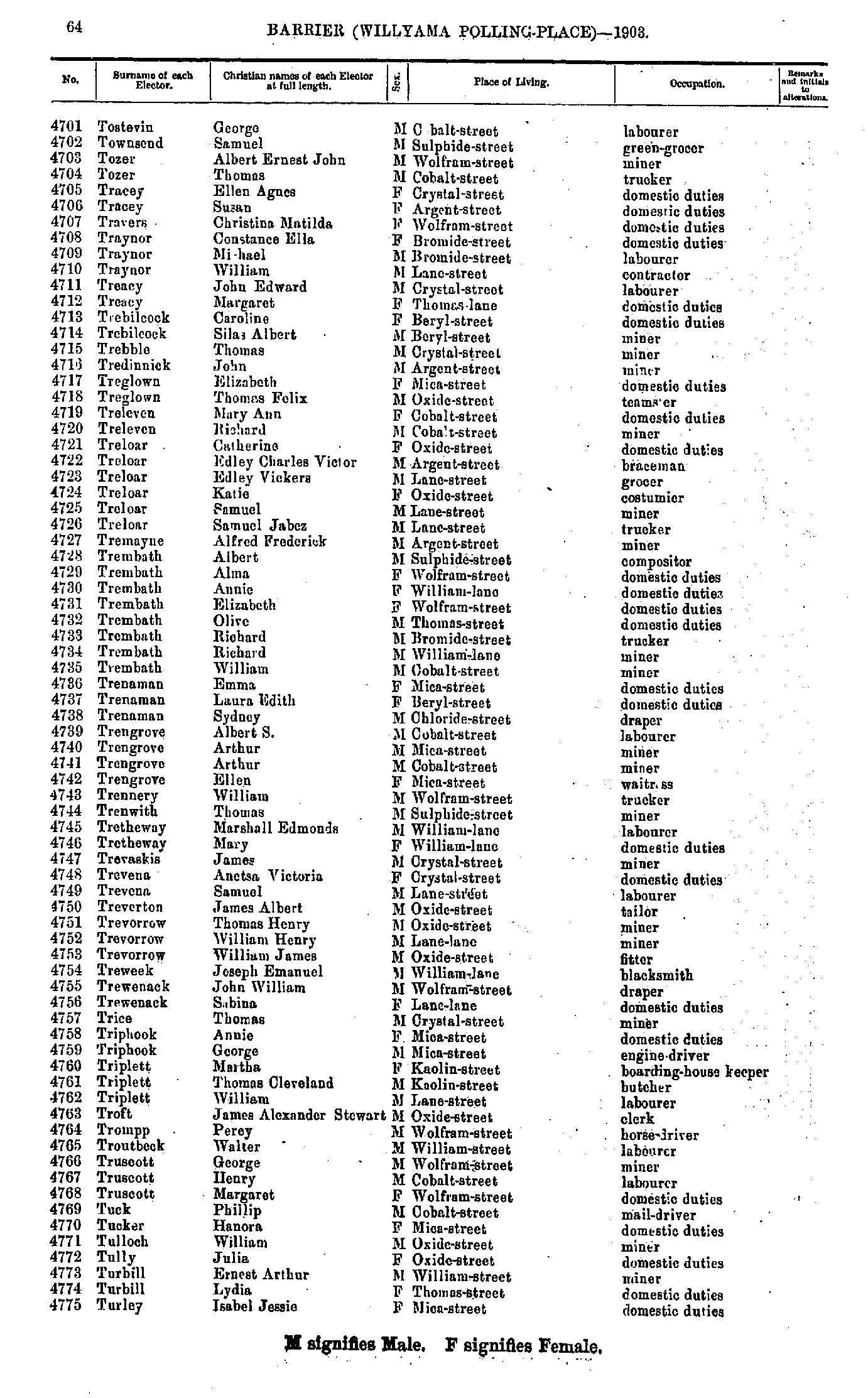
- Tostevin George - Turley Isabel Jessie
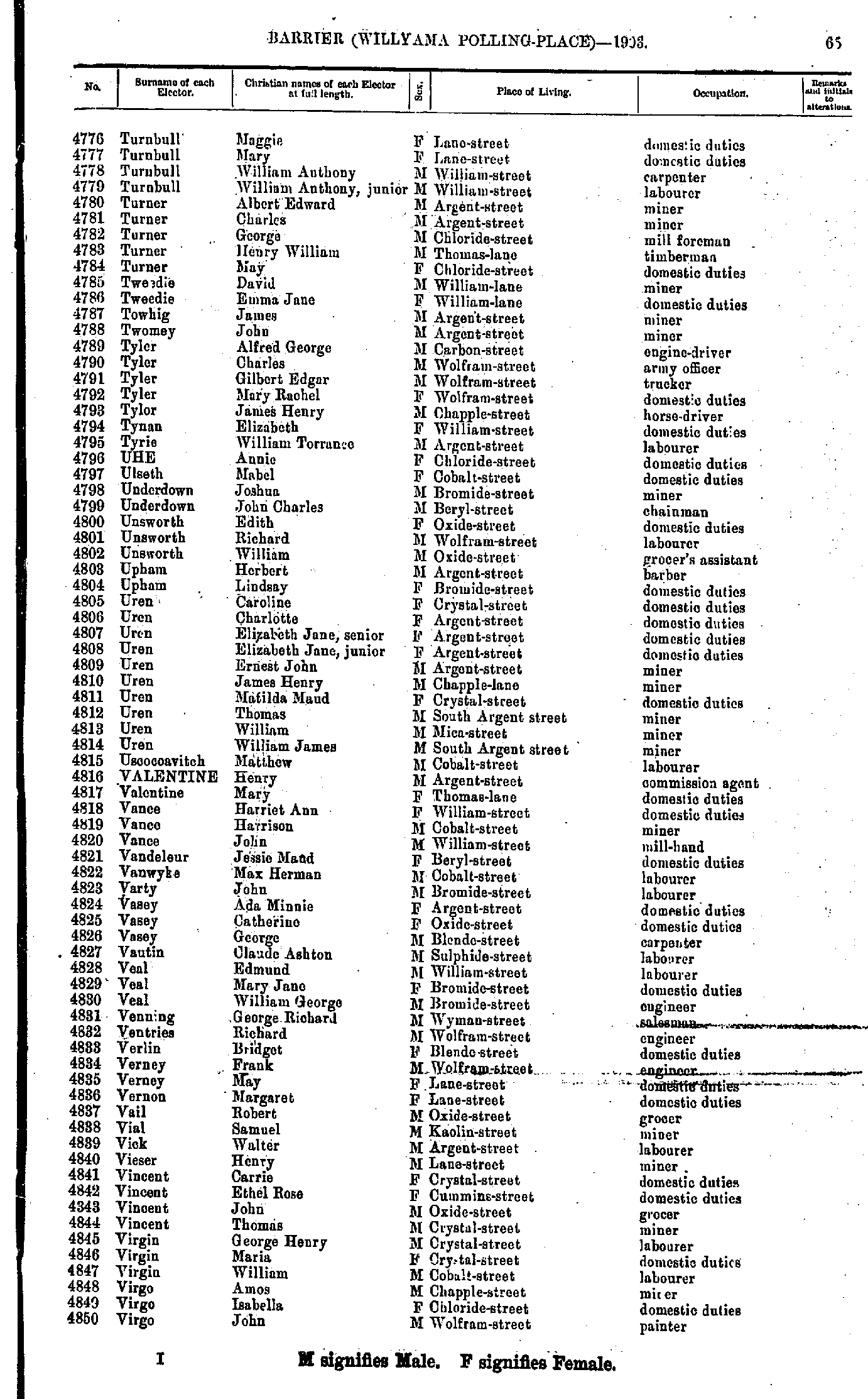
- Turnbull Maggie - Virgo John
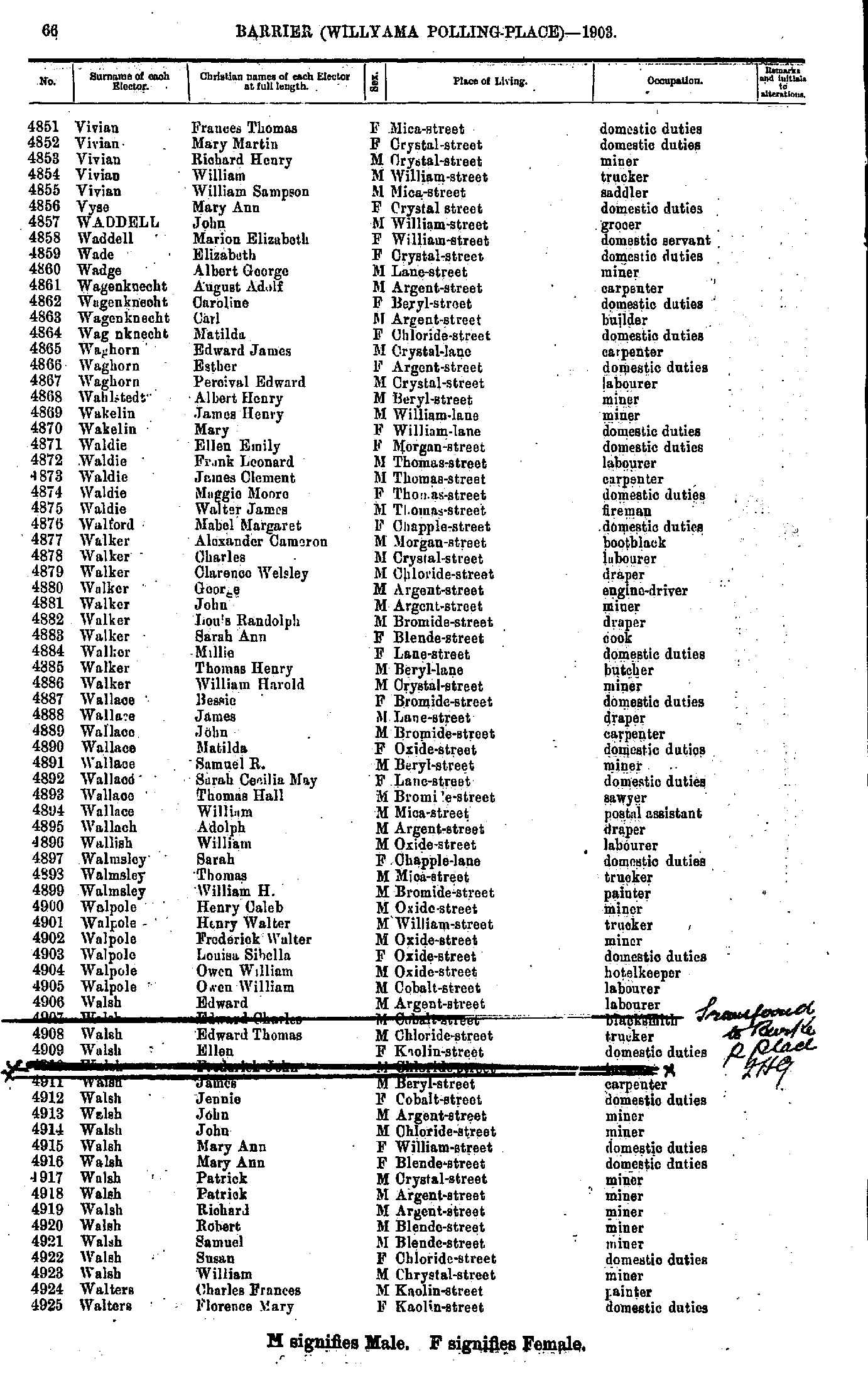
- Vivian Frances Thomas - Walters Florence Mary
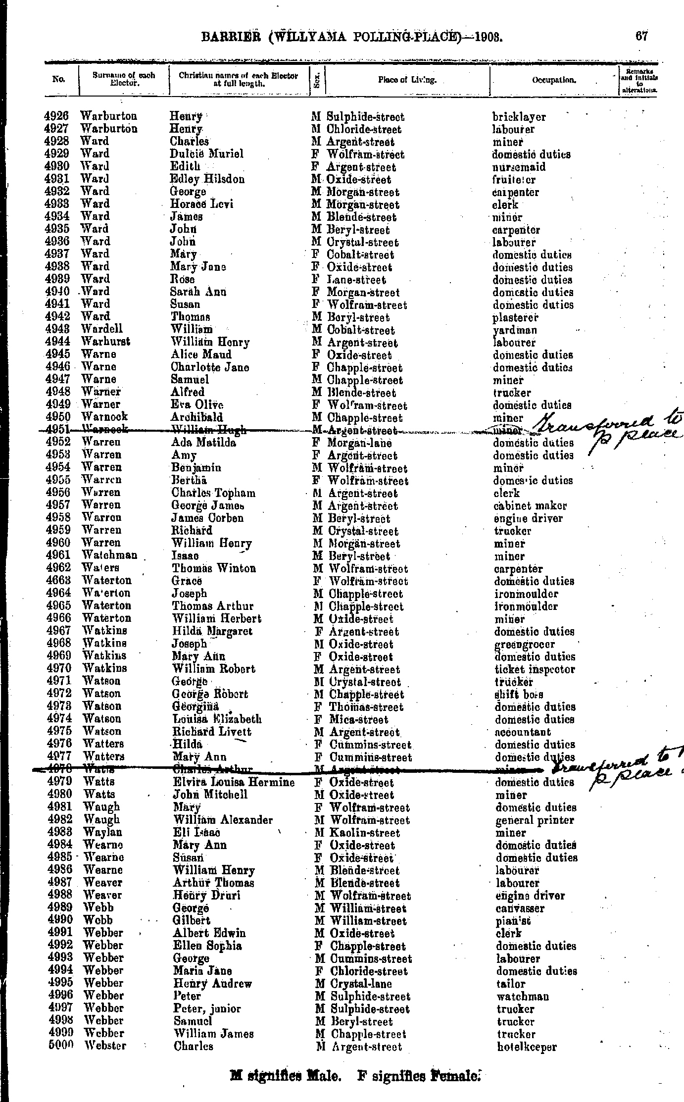
- Warburton Henry - Webster Charles
- Webster Jane - White Margaret
- White Margaret Ann - Williams Maud
- Williams Norman - Wood Ellen
- Wood Henry - Young Mary Lucia
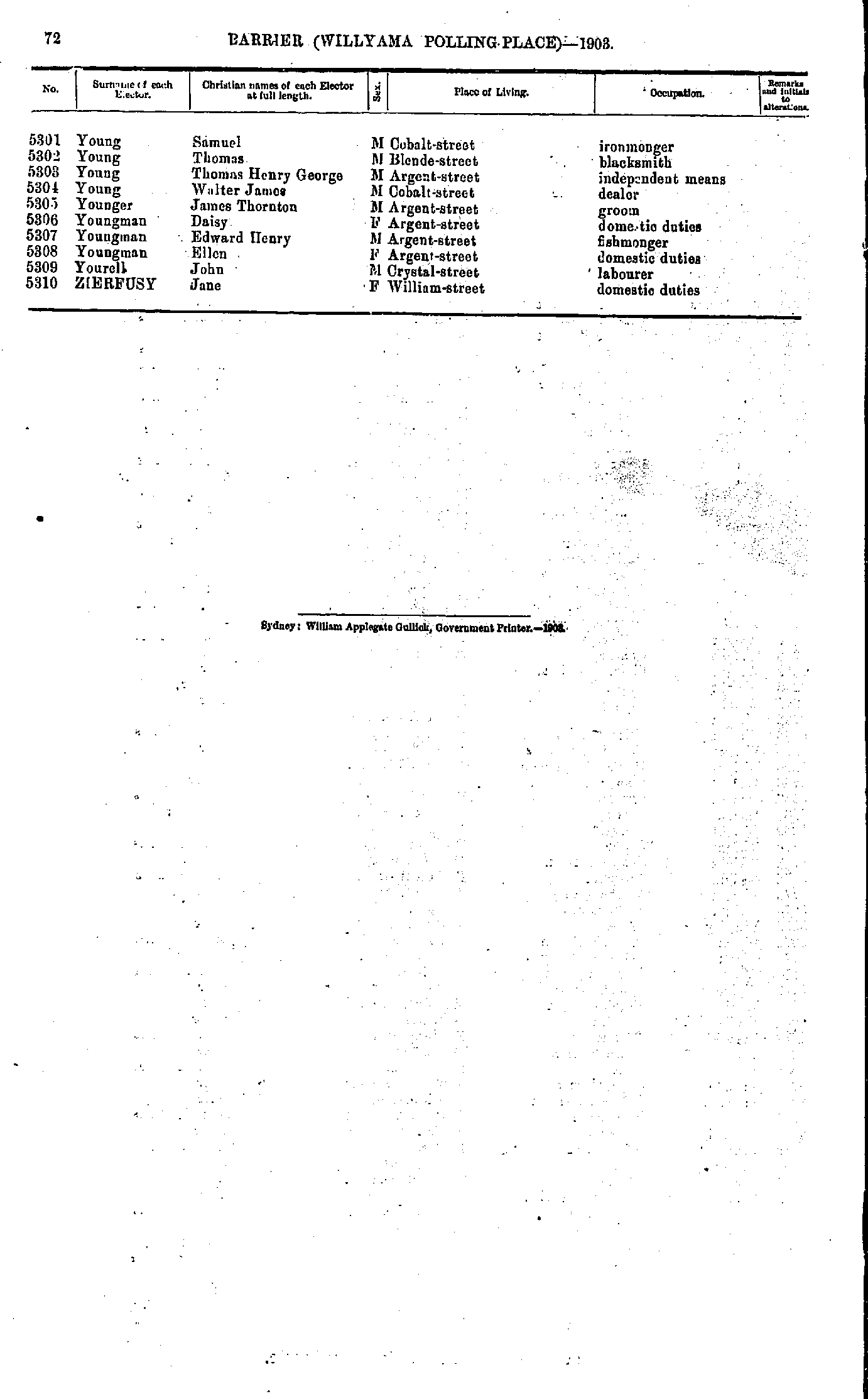
- Young Samuel - Zierfusy Jane
From: Federal Electoral Districts Commissioners 1901, Maps of the Federal Electoral Districts of the State of New South Wales, William Applegate Gullick, Government Printer, Sydney.
JPEG file (224KB)
Portable Document Format(PDF) file (1.37MB)If you do not have a PDF reader you can click on the button to download the free Adobe Acrobat Reader
The documents in this site are arranged into seven major indexes. You are currently in the Electoral Rolls index. Use the Back button on your browser to move within this index, or use the links below to view another index:
- Directories
- Electoral Rolls
- Land Records
- General and Miscellaneous Records
- Mining Records
- Pastoral and Agricultural Records
- Other Occupations
Copyright © Internet History Resources 2005
